Discussion Paper #1 - Background Report - March ... - Town of Innisfil
Discussion Paper #1 - Background Report - March ... - Town of Innisfil
Discussion Paper #1 - Background Report - March ... - Town of Innisfil

You also want an ePaper? Increase the reach of your titles
YUMPU automatically turns print PDFs into web optimized ePapers that Google loves.
TOWN OF INNISFILZONING BY-LAW UPDATE<strong>Discussion</strong> <strong>Paper</strong> No.1: <strong>Background</strong> Review<strong>March</strong> 1, 2012D14-011-057
<strong>Town</strong> <strong>of</strong> <strong>Innisfil</strong> - Zoning By-law Update<strong>Discussion</strong> <strong>Paper</strong> No. 1: <strong>Background</strong> ReviewTable <strong>of</strong> Contents1.02.03.04.05.06.0INTRODUCTION ............................................................................................................................... 11.1 STUDY PURPOSE ............................................................................................................................. 11.2 STUDY WORK PLAN AND PROCESS .................................................................................................... 1PLANNING FRAMEWORK ............................................................................................................... 32.1 PLANNING ACT ................................................................................................................................. 32.2 PROVINCIAL POLICY ......................................................................................................................... 52.2.1 Provincial Policy Statement, 2005 ............................................................................................. 52.2.2 Places to Grow – Growth Plan for the Greater Golden Horseshoe, 2006 .................................. 62.2.3 Greenbelt Plan, 2005 ................................................................................................................. 72.2.4 Lake Simcoe Protection Act, 2008 ............................................................................................. 72.2.5 Green Energy Act, 2009 ............................................................................................................ 82.2.6 Strong Communities through Affordable Housing Act, 2011 ...................................................... 92.3 COUNTY OF SIMCOE OFFICIAL PLAN .................................................................................................. 92.4 TOWN OF INNISFIL OFFICIAL PLAN AND INITIATIVES............................................................................ 102.4.1 Official Plan ............................................................................................................................. 102.4.2 Secondary Plans ...................................................................................................................... 112.4.3 Urban Design Studies .............................................................................................................. 162.4.4 Engineering Design Standards and Specifications Manual ..................................................... 182.5 EXISTING TOWN OF INNISFIL ZONING BY-LAW ................................................................................... 182.5.1 Big Bay Point Resort Development Zoning .............................................................................. 23OVERVIEW OF OFFICIAL PLAN DIRECTIONS ............................................................................ 24PRELIMINARY ISSUES AND OPTIONS ........................................................................................ 374.1 KEY DIRECTIONS ............................................................................................................................ 374.2 PRELIMINARY ISSUES AND OPTIONS ................................................................................................. 394.3 OTHER ISSUES TO BE CONSIDERED ................................................................................................. 54PUBLIC CONSULTATION SUMMARY .......................................................................................... 56NEXT STEPS .................................................................................................................................. 59<strong>Town</strong> <strong>of</strong> <strong>Innisfil</strong> - Zoning By-law Update<strong>Discussion</strong> <strong>Paper</strong> No. 1: <strong>Background</strong> ReviewPage i
List <strong>of</strong> TablesTABLE 2.2: LEFROY RECOMMENDED RESIDENTIAL STANDARDS ...................................................................... 17TABLE 3.1: OVERVIEW OF OFFICIAL PLAN DIRECTIONS IN RELATION TO EXISTING ZONING BY-LAW ......... 24TABLE 4.1: PRELIMINARY ISSUES AND OPTIONS .................................................................................................. 39AppendicesAPPENDIX A: OFFICIAL PLAN LAND USE DESIGNATIONSAPPENDIX B: INNISFIL BEACH ROAD DRAFT ZONE CATEGORIES AND PROVISIONSAPPENDIX C: SUMMARY OF EXISTING ZONE CATEGORIES AND REGULATIONSAPPENDIX D: DISPLAY BOARDS USED AT THE FIRST PUBLIC OPEN HOUSES/WORKSHOPS (FEB.13, 14 AND 16, 2012)<strong>Town</strong> <strong>of</strong> <strong>Innisfil</strong> - Zoning By-law Update<strong>Discussion</strong> <strong>Paper</strong> No. 1: <strong>Background</strong> ReviewPage ii
1.0Introduction1.1 Study PurposeThe Zoning By-law is the primary implementation tool <strong>of</strong> an Official Plan. It provides the legal means <strong>of</strong> implementingan Official Plan through detailed regulations respecting the use <strong>of</strong> land, and the form <strong>of</strong> buildings and structures. The<strong>Town</strong> <strong>of</strong> <strong>Innisfil</strong> is embarking upon a comprehensive review <strong>of</strong> its Zoning By-law, following an update <strong>of</strong> its OfficialPlan, which was adopted by the <strong>Town</strong> on July 26, 2006 and approved by the Ontario Municipal Board in May 2009,<strong>March</strong> 2010, and April 2011. Section 26(9) <strong>of</strong> the Planning Act requires that municipalities update their Zoning Bylawswithin three years from the time that a new Official Plan comes into effect, or after a comprehensive review hastaken place in accordance with Section 26.1 <strong>of</strong> the Planning Act.Since the current Zoning By-law for the <strong>Town</strong> <strong>of</strong> <strong>Innisfil</strong> was prepared in 2004, the Province has undergonenumerous changes to its planning regime, including the new Provincial Policy Statement (2005), the Growth Plan forthe Greater Golden Horseshoe (2006) including Amendment No. 1, the Greenbelt Plan (2006), the Green Energy Act(2009), and Bill 140 (the Housing Services Act, 2011). In addition, the Clean Water Act (2006) and Lake SimcoeProtection Plan (2009) have particular relevance to <strong>Innisfil</strong>. The County has since prepared a new Official Plan, whichwas adopted in November 2008, but is pending approval from the Ministry <strong>of</strong> Municipal Affairs and Housing. All <strong>of</strong>these significant policy changes and new policies necessitate a review and update <strong>of</strong> the <strong>Town</strong>’s Zoning By-law.The purpose <strong>of</strong> this study is to prepare a new Zoning By-law to conform to and implement the new <strong>Town</strong> <strong>of</strong> <strong>Innisfil</strong>Official Plan.1.2 Study Work Plan and ProcessThe Study Work Plan is comprised <strong>of</strong> three phases, which are outlined below, including the key objectives, meetingsand deliverables within each phase. The Study process will culminate in the Council adoption <strong>of</strong> the Final Zoning Bylaw,which is anticipated in <strong>March</strong> 2013. The Study process provides multiple opportunities for public consultationand engagement including public workshops and open houses. The Study process also includes a TechnicalAdvisory Committee (TAC) which is comprised <strong>of</strong> members <strong>of</strong> <strong>Town</strong> staff, the County and Conservation Authorities toprovide detailed technical input into the process, as well as a Community Advisory Committee (CAC) which consists<strong>of</strong> members <strong>of</strong> the community, which will be engaged throughout the process and provide direct input into the study.Phase One: <strong>Background</strong> Research (November 2011- <strong>March</strong> 2012)The key objectives <strong>of</strong> Phase 1 are to:Hold a meeting to confirm the work program, budget, and reporting procedures with the <strong>Town</strong>;Establish the Technical Advisory Committee (TAC) and meet with the Committee, and establish theCommunity Advisory Committee (CAC);Develop a comprehensive understanding <strong>of</strong> the <strong>Town</strong>, its current planning framework, zoning issues, andthe provincial and County policy and regulatory context <strong>of</strong> the <strong>Town</strong>;Update the current zoning By-law No. 054-05 and develop GIS base mapping;Prepare <strong>Discussion</strong> <strong>Paper</strong> No. 1 to summarize the background information, identify issues, and consult withthe TAC and CAC on <strong>Discussion</strong> <strong>Paper</strong> No. 1;Hold three workshops with the CAC and other stakeholders, as advised by the CAC/TAC; andFinalize <strong>Discussion</strong> <strong>Paper</strong> No. 1 and prepare <strong>Discussion</strong> <strong>Paper</strong> No. 2 to discuss Issues and Optionsidentified through the workshops.<strong>Town</strong> <strong>of</strong> <strong>Innisfil</strong> - Zoning By-law Update Page 1<strong>Discussion</strong> <strong>Paper</strong> No. 1: <strong>Background</strong> Review
Phase 2: Draft Comprehensive Zoning By-law (<strong>March</strong> 2012 – August 2012)The key objectives <strong>of</strong> Phase 2 are to:Discuss <strong>Discussion</strong> <strong>Paper</strong> No. 2 with the TAC and CAC and refine the document;Identify and prepare options and draft regulations for the zones and an accompanying Draft ImplementationHandbook to illustrate options and regulations for each zone;Discuss the Draft Implementation Handbook with the TAC and CAC and revise;Hold three open houses and meet with the TAC and CAC to discuss the format <strong>of</strong> the open houses and theoutcome/implications <strong>of</strong> the consultation; andFinalize <strong>Discussion</strong> <strong>Paper</strong> No. 2, prepare the first draft Comprehensive Zoning By-law, revise the DraftImplementation Handbook and prepare <strong>Discussion</strong> <strong>Paper</strong> No. 3 to summarize the public/stakeholdercomments.Phase 3: Final Comprehensive Zoning By-law (August 2012 – <strong>March</strong> 2013)The key objectives <strong>of</strong> Phase 3 are to:Finalize <strong>Discussion</strong> <strong>Paper</strong> No. 3 based on input from the TAC and Council;Prepare the Second Draft <strong>of</strong> the Zoning By-law to obtain detailed input from Council and the TAC, and meetwith Council and the TAC to discuss the 2nd Draft;Prepare the Third Draft <strong>of</strong> the Zoning By-law for the statutory open house and the public meeting;Hold the statutory public open house and public meetingPrepare <strong>Discussion</strong> <strong>Paper</strong> No. 4 to summarize the outcome <strong>of</strong> the meetings; andPrepare the final Comprehensive Zoning By-law and Council adoption.The following figure outlines the Study Work Plan and key tasks.<strong>Town</strong> <strong>of</strong> <strong>Innisfil</strong> - Zoning By-law Update Page 2<strong>Discussion</strong> <strong>Paper</strong> No. 1: <strong>Background</strong> Review
2.0Planning FrameworkLand use planning in Ontario is established through the Planning Act, R.S.O. 1990. The Planning Act grants variouspowers to municipal councils, the Province and other authorities for regulating land use planning in Ontario.The figure below provides an overview <strong>of</strong> Ontario’s land use planning policy and regulatory framework. Under thePlanning Act, the Province may issue Policy Statements to provide municipalities with direction on matters <strong>of</strong>Provincial interest. Below the PPS are Regional Official Plans, which provide municipalities with a basis for preparingtheir own municipal Official Plans. Official Plans are intended to guide municipal decision making. Following theOfficial Plan is the zoning by-law, a legal document used to implement the policies <strong>of</strong> the Official Plan by providingthe most level <strong>of</strong> detail for regulating land use planning at the local level. Zoning by-laws are consideredimplementation tools because <strong>of</strong> the level <strong>of</strong> detail they provide and also because the by-law must be in conformitywith the municipal Official Plan.Level <strong>of</strong> DetailPlanning ActProvincial Policy Statement2005, Places to GrowUpper-Tier Official PlanLower-Tier Official Planand Secondary PlansProvincialLegislationProvincial PolicyCounty <strong>of</strong> SimcoePolicy<strong>Town</strong> <strong>of</strong> <strong>Innisfil</strong>PolicyZoning By-law<strong>Town</strong> <strong>of</strong> <strong>Innisfil</strong>Implementation ToolThe following sections provide an overview <strong>of</strong> the planning framework applicable to the <strong>Town</strong> <strong>of</strong> <strong>Innisfil</strong>. For the mostpart, Provincial and County policies have been reflected in the <strong>Town</strong>’s new Official Plan, and consequently theOfficial Plan represents the key policy document relevant to the preparation <strong>of</strong> the new Zoning By-law.2.1 Planning ActSection 34 <strong>of</strong> the Planning Act grants municipal councils the power to pass Zoning By-laws to implement the policies<strong>of</strong> the Official Plan with more detailed regulations about how development should look and where it should occur.Section 34(1) <strong>of</strong> the Planning Act states that zoning by-laws may be passed by the councils <strong>of</strong> local municipalities:1. For prohibiting the use <strong>of</strong> land, for or except for such purposes as may be set out in the by-law within themunicipality or within any defined area or areas or abutting on any defined highway or part <strong>of</strong> a highway.2. For prohibiting the erecting, locating or using <strong>of</strong> buildings or structures for or except for such purposes as may beset out in the by-law within the municipality or within any defined area or areas or upon land abutting on anydefined highway or part <strong>of</strong> a highway.3. For prohibiting the erection <strong>of</strong> any class or classes <strong>of</strong> buildings or structures on land that is subject to flooding oron land with steep slopes, or that is rocky, low-lying, marshy, unstable, hazardous, subject to erosion or tonatural or artificial perils.<strong>Town</strong> <strong>of</strong> <strong>Innisfil</strong> - Zoning By-law Update Page 3<strong>Discussion</strong> <strong>Paper</strong> No. 1: <strong>Background</strong> Review
3.1. For prohibiting any use <strong>of</strong> land and the erecting, locating or using <strong>of</strong> any class or classes <strong>of</strong> buildings orstructures on land,i. that is contaminated,ii.iii.that contains a sensitive groundwater feature or a sensitive surface water feature, orthat is within an area identified as a vulnerable area in a drinking water source protection plan that has takeneffect under the Clean Water Act, 2006.3.2 For prohibiting any use <strong>of</strong> land and the erecting, locating or using <strong>of</strong> any class or classes <strong>of</strong> buildings orstructures within any defined area or areas,i. that is a significant wildlife habitat, wetland, woodland, ravine, valley or area <strong>of</strong> natural and scientific interest,ii.iii.that is a significant corridor or shoreline <strong>of</strong> a lake, river or stream, orthat is a significant natural corridor, feature or area.3.3 For prohibiting any use <strong>of</strong> land and the erecting, locating or using <strong>of</strong> any class or classes <strong>of</strong> buildings orstructures on land that is the site <strong>of</strong> a significant archaeological resource.4. For regulating the type <strong>of</strong> construction and the height, bulk, location, size, floor area, spacing, character and use<strong>of</strong> buildings or structures to be erected or located within the municipality or within any defined area or areas orupon land abutting on any defined highway or part <strong>of</strong> a highway, and the minimum frontage and depth <strong>of</strong> theparcel <strong>of</strong> land and the proportion <strong>of</strong> the area there<strong>of</strong> that any building or structure may occupy.5. For regulating the minimum elevation <strong>of</strong> doors, windows or other openings in buildings or structures or in anyclass or classes <strong>of</strong> buildings or structures to be erected or located within the municipality or within any definedarea or areas <strong>of</strong> the municipality.6. For requiring the owners or occupants <strong>of</strong> buildings or structures to be erected or used for a purpose named inthe by-law to provide and maintain loading or parking facilities on land that is not part <strong>of</strong> a highway. R.S.O. 1990,c. P.13, s. 34 (1); 1994, c. 23, s. 21 (1, 2); 1996, c. 4, s. 20 (1-3); 2006, c. 22, s. 115.”Zoning By-laws are considered to be an implementation tool for municipal Official Plans. They are a legally bindingdocument and provide a greater level <strong>of</strong> detail with respect to land use and development regulations, such aspermitted uses, building setbacks, heights, parking requirements and more. Section 26 (9) <strong>of</strong> the Planning Actrequires <strong>Town</strong> Council to update their Zoning By-law within three years <strong>of</strong> revising or preparing a new Official Plan:“No later than three years after a revision under subsection (1) or (8) comes into effect, the council <strong>of</strong> themunicipality shall amend all zoning by-laws that are in effect in the municipality to ensure that they conform withthe <strong>of</strong>ficial plan.”The Planning Act also identifies matters <strong>of</strong> Provincial interest for which municipal councils must have regard to whenusing their powers or fulfilling their responsibilities under the Planning Act. The matters, as described in Section 2 <strong>of</strong>the Planning Act, are as follows:a) the protection <strong>of</strong> ecological systems, including natural areas, features and functions;b) the protection <strong>of</strong> agricultural resources <strong>of</strong> the Province;c) the conservation and management <strong>of</strong> natural resources and the mineral resource base;d) the conservation <strong>of</strong> features <strong>of</strong> significant architectural, cultural, historical, archaeological or scientificinterest;e) the supply, efficient use and conservation <strong>of</strong> energy and water;<strong>Town</strong> <strong>of</strong> <strong>Innisfil</strong> - Zoning By-law Update Page 4<strong>Discussion</strong> <strong>Paper</strong> No. 1: <strong>Background</strong> Review
f) the adequate provision and efficient use <strong>of</strong> communication, transportation, sewage and water services andwaste management systems;g) the minimization <strong>of</strong> waste;h) the orderly development <strong>of</strong> safe and healthy communities;h.1) the accessibility for persons with disabilities to all facilities, services and matters to which this Act applies;i) the adequate provision and distribution <strong>of</strong> educational, health, social, cultural and recreational facilities;j) the adequate provision <strong>of</strong> a full range <strong>of</strong> housing;k) the adequate provision <strong>of</strong> employment opportunities;l) the protection <strong>of</strong> the financial and economic well-being <strong>of</strong> the province and its municipalities;m) the co-ordination <strong>of</strong> planning activities <strong>of</strong> public bodies;n) the resolution <strong>of</strong> planning conflicts involving public and private conflicts;o) the protection <strong>of</strong> public health and safety; andp) the appropriate location <strong>of</strong> growth and development.q) the promotion <strong>of</strong> development that is designed to be sustainable, to support public transit and to be orientedto pedestrians.The matters <strong>of</strong> Provincial interest are not listed in any particular order and are not intended to indicate that any onematter is more important than another.2.2 Provincial Policy2.2.1 Provincial Policy Statement, 2005Section 3(1) <strong>of</strong> the Planning Act authorizes issuance <strong>of</strong> policy statements on matters <strong>of</strong> municipal planning which are<strong>of</strong> provincial interest. The current Provincial Policy Statement (PPS) came into effect on <strong>March</strong> 1, 2005, and outlinesthe Province’s policy regarding matters <strong>of</strong> land use, employment, housing, public space, infrastructure, energy,resources, natural heritage, water, agriculture, cultural heritage and public health and hazards. All municipal landuse planning policy must be consistent with the policies <strong>of</strong> the PPS. Municipalities are also expected to implementthe policies <strong>of</strong> the PPS into their own land use planning framework. The Provincial Policy Statement is currentlybeing reviewed by the Province to determine if revisions are warranted.The PPS provides three overarching principles, each with a number <strong>of</strong> supporting policies. The three principles areas follows:1. Building Strong CommunitiesEfficient land use and development patterns that support livable and healthy communities, protect the naturalenvironment and public safety, and promote economic growth.2. Wise Use and Management <strong>of</strong> ResourcesIn order to maintain the long-term prosperity <strong>of</strong> the Province environmental health and social well-being dependon the protection <strong>of</strong> natural heritage, water, agriculture, mineral and cultural heritage and archaeologicalresources.<strong>Town</strong> <strong>of</strong> <strong>Innisfil</strong> - Zoning By-law Update Page 5<strong>Discussion</strong> <strong>Paper</strong> No. 1: <strong>Background</strong> Review
3. Protecting Public Health and SafetyDevelopment shall be directed away from areas <strong>of</strong> natural or human made hazards that pose the risk <strong>of</strong> publiccost, safety, and property damage.The approved portions <strong>of</strong> the new <strong>Town</strong> <strong>of</strong> <strong>Innisfil</strong> Official Plan are consistent with the Provincial Policy Statement.Section 3(5) <strong>of</strong> the Planning Act requires that Official Plans be consistent with the PPS. Section 4.5 <strong>of</strong> the PPSstates that the Official Plan is the most important vehicle for implementing the Provincial Policy Statement. The new<strong>Town</strong> <strong>of</strong> <strong>Innisfil</strong> Zoning By-law must implement the policies <strong>of</strong> the <strong>Town</strong>’s new Official Plan.2.2.2 Places to Grow – Growth Plan for the Greater Golden Horseshoe, 2006Faced with enormous growth pressures and issues such as aging infrastructure, the Province prepared the GrowthPlan for the Greater Golden Horseshoe, 2006 as a tool to help municipalities located within the Greater GoldenHorseshoe to plan for growth in a more sustainable manner and contribute to the creation <strong>of</strong> more liveable, healthycommunities. The <strong>Town</strong> <strong>of</strong> <strong>Innisfil</strong> is located within the Growth Plan Area for the Greater Golden Horseshoe, asidentified on Schedule 1 <strong>of</strong> the Growth Plan.The Growth Plan was prepared under the Places to Grow Act <strong>of</strong> 2005. Municipalities are required to conform to theGrowth Plan in accordance with Subsection 3(5) <strong>of</strong> the Planning Act. Like the Provincial Policy Statement, theGrowth Plan’s policies represent minimum standards which may be exceeded (Section 5.4.1.5). The County’s role inimplementing the Growth Plan includes growth allocations in accordance with Schedule 3 <strong>of</strong> the Growth Plan,identification <strong>of</strong> intensification targets for the <strong>Town</strong>, and in providing direction on matters that cross municipalboundaries (Section 5.4.2.2).The Plan provides Guiding Principles (Section 1.2.2) to generally guide how land is developed and resources aremanaged. Guiding principles include the development <strong>of</strong> compact, vibrant and complete communities, support forplanning and managing a competitive economy, conservation <strong>of</strong> natural resources, optimizing the use <strong>of</strong>infrastructure, recognizing the diversity <strong>of</strong> communities and promoting collaboration among all sectors and residents.Section 2 <strong>of</strong> the Growth Plan provides policies about where and how growth should occur. The Plan stronglysupports intensification and the development <strong>of</strong> complete communities, including mixed uses, transit support andhigher densities. In accordance with Section 2.2.2.1, a significant portion <strong>of</strong> new growth is to be directed throughintensification, and intensification is to be focused in intensification areas. Intensification Areas, as defined in theGrowth Plan, are defined by municipalities as the focus <strong>of</strong> intensification.The Plan supports reduced automobile dependence through the development <strong>of</strong> mixed-use, transit-supportive andpedestrian-friendly environments (d). Section (g) seeks a balance <strong>of</strong> jobs and housing to reduce the need for longdistance commuting and increasing the modal share for transit, walking and cycling. Section (h) encouragessettlements to develop as complete communities which include a mix <strong>of</strong> land uses, employment and housing typesand easy access to local stores and services.Similar to the Provincial Policy Statement, the County <strong>of</strong> Simcoe Official Plan and the <strong>Town</strong> <strong>of</strong> <strong>Innisfil</strong> Official Plan arethe primary tools for implementing the Growth Plan. The approved portions <strong>of</strong> the <strong>Town</strong> <strong>of</strong> <strong>Innisfil</strong> Official Planconform to the Growth Plan.Amendment No. 1 to Places to GrowIn January <strong>of</strong> 2012, the Ontario government approved Amendment 1 to the Growth Plan for the Greater GoldenHorseshoe. The Amendment introduces further Provincial direction to address growth and development pressures<strong>Town</strong> <strong>of</strong> <strong>Innisfil</strong> - Zoning By-law Update Page 6<strong>Discussion</strong> <strong>Paper</strong> No. 1: <strong>Background</strong> Review
for the Simcoe Sub-area, which is comprised <strong>of</strong> the County <strong>of</strong> Simcoe, Barrie and Orillia. The Amendment allocatespopulation and employment growth among the affected municipalities, and establishes a hierarchy <strong>of</strong> growth throughthe identification <strong>of</strong> Primary Settlement Areas, which includes Alcona, as well as Strategic Settlement EmploymentAreas, which includes the <strong>Innisfil</strong> Heights Strategic Settlement Employment Area. Primary Settlement Areas areintended to become vibrant and “complete” communities, through intensification, high quality urban design andtransit-supportive choices. The identification <strong>of</strong> Alcona as a Primary Settlement Area suggests that Alcona willmature to become the principal urban centre in the <strong>Town</strong>. The <strong>Innisfil</strong> Heights Strategic Settlement EmploymentArea will be the focus for employment growth in the <strong>Town</strong>; however, major retail development is not permitted. TheGrowth Plan states that the Province may provide further direction regarding the nature <strong>of</strong> permitted developmentwithin this area.Municipalities are required to undertake and adopt <strong>of</strong>ficial plan amendments that conform to the Growth Plan within 3years <strong>of</strong> the amendment coming into effect. The proposed amendment is still subject to further consultation.2.2.3 Greenbelt Plan, 2005The Greenbelt Plan was approved by the Province in February 2005, established under Section 3 <strong>of</strong> the GreenbeltAct, 2005. Also referred to as “Places Not to Grow”, the Plan essentially protects 1.8 million acres <strong>of</strong> environmentallysensitive and agricultural land in the GGH from urban development, building upon the nearly 800,000 acres <strong>of</strong> landprotected within the Niagara Escarpment Plan and the Oak Ridges Moraine Conservation Plan. The Greenbelt Planonly applies to a small portion <strong>of</strong> lands within the southeast corner <strong>of</strong> the <strong>Town</strong>, south <strong>of</strong> Gilford. The Greenbelt Plandesignates these lands as Protected Countryside (which includes lands identified as Natural Heritage System, andHolland Marsh), significantly restricting urban and rural development within this area.Aside from the Province’s 10-year review, there is no mechanism for amendments to the Plan, which generallyprohibits development outside <strong>of</strong> Settlement Areas as defined by the Plan. The legislation places additional pressureon defined urban areas to accommodate the needed additional housing projected for the GGH, which will bynecessity be achieved through infill and intensification <strong>of</strong> existing developed lands.2.2.4 Lake Simcoe Protection Act, 2008The Lake Simcoe Protection Act, 2008 establishes the legislative framework for implementing the Lake SimcoeProtection Plan. In June 2009, the Ministry <strong>of</strong> the Environment (MOE) finalized the Lake Simcoe Protection Plan(LSPP) to address water quality concerns and other threats to the watershed. The Plan includes a range <strong>of</strong> targets,indicators and numerous policies aimed at protecting and restoring the ecological health <strong>of</strong> the Lake SimcoeWatershed. The Watershed encompasses a large area <strong>of</strong> the eastern portion <strong>of</strong> the <strong>Town</strong> <strong>of</strong> <strong>Innisfil</strong>. This Plan, inconjunction with the other Provincial Plans and Acts, express the Province’s interest and direction with regard toprotecting the ecological health and environmental sustainability <strong>of</strong> the Lake Simcoe watershed.The Plan recognizes that restoring the ecological health <strong>of</strong> the Lake Simcoe watershed will be a long-termundertaking; initial strategies will evolve over time based on science and experience in implementing the plan. In thenear-term the Plan would focus on the issues most critical to the health <strong>of</strong> Lake Simcoe including: restoring the health<strong>of</strong> aquatic life; improving water quality, including reducing loadings <strong>of</strong> phosphorus to the lake; maintaining waterquantity; improving the health <strong>of</strong> the ecosystem by protecting and rehabilitating important areas, such as shorelinesand natural heritage; and addressing impacts <strong>of</strong> invasive species, climate change, and recreational activities. Asubwatershed approach will help determine priorities to focus on in different areas <strong>of</strong> the Lake Simcoe watershed,depending on environmental conditions and specific management considerations.<strong>Town</strong> <strong>of</strong> <strong>Innisfil</strong> - Zoning By-law Update Page 7<strong>Discussion</strong> <strong>Paper</strong> No. 1: <strong>Background</strong> Review
The Lake Simcoe Protection Act requires that decisions under the Planning Act or the Condominium Act, 1998 ordecisions related to a “prescribed instrument” conform with the applicable designated policies in the Plan and haveregard to the other applicable policies. Comments, submissions and advice given by a public body in relation to suchdecisions must also conform to the applicable designated policies and have regard to any other applicable policies.The Act also requires that municipalities bring their <strong>of</strong>ficial plans into conformity with the applicable “designatedpolicies” at their five-year <strong>of</strong>ficial plan review.The LSPA requires that municipalities amend their Official Plans to conform to the designated policies <strong>of</strong> the LakeSimcoe Protection Plan (LSPP), no later than the 5 year review <strong>of</strong> their Official Plan or the day specified by theMinister. At a minimum, the OP shall reflect the designated policies <strong>of</strong> the Plan and municipalities shall map theboundaries <strong>of</strong> the Lake Simcoe watershed. The existing Official Plan does not implement the policies <strong>of</strong> the LSPPand a conformity amendment will be required. Municipal Zoning By-laws are required to conform with the OfficialPlan, no later than 3 years after the OPA is approved.The LSPP requires the preparation <strong>of</strong> subwatershed evaluations to identify specific targets and recommendingactions to address such matters as phosphorus reduction, stormwater management, water budgets, impacts <strong>of</strong>invasive species, natural heritage restoration and enhancement, increasing public access, and climate changeimpacts and adaption. The subwatersheds within <strong>Innisfil</strong> include: Lovers Creek, Hewitts Creek, <strong>Innisfil</strong> Creek and asmall portion <strong>of</strong> the West Holland subwatershed.The LSPP provides policies which restricts development to areas outside <strong>of</strong> a vegetated protection zone (VPZ),which includes 30m from the Lake Simcoe shorelines within shoreline built-up areas, and 100m for areas outside <strong>of</strong>shoreline built-up areas. The minimum VPZ may be larger, subject to a natural heritage evaluation which is requiredfor lands within 120m <strong>of</strong> Lake Simcoe in a shoreline built-up area, or 240m outside <strong>of</strong> shoreline built-up areas.Shoreline built-up areas are defined to include shoreline areas outside <strong>of</strong> settlement areas, where development isconcentrated or lands which have been designated in an Official Plan and zoned for concentrated development, as <strong>of</strong>the date the LSPP came into effect. Existing uses are exempted from this requirement. Shoreline built-up areas mayonly be expanded for minor rounding out <strong>of</strong> the area in accordance with the Plan. The Plan also restricts structures,including boathouses in Lake Simcoe, other lakes or in a permanent or intermittent stream where the structure wouldimpede the natural flow <strong>of</strong> water along the shoreline or stream, if the structure is to be used as a dwelling or harmfullyalters fish habitat.A 30m wide vegetated protection zone is also required adjacent to watercourses, wetlands, significant woodlandsand other natural heritage features, outside <strong>of</strong> existing settlement areas. Existing uses are exempted from thisrequirement.The <strong>Innisfil</strong> Official Plan provides policies which “encourage” the maintenance <strong>of</strong> a 30m natural self sustainingvegetation buffer on the shoreline <strong>of</strong> Lake Simcoe and rivers and streams. The existing Official Plan policies willneed to be reviewed and updated to implement the LSPP, which will subsequently require amendments to the ZoningBy-law.2.2.5 Green Energy Act, 2009On May 14, 2009, the Government <strong>of</strong> Ontario passed the Green Energy and Green Economy Act (GEGEA). TheGEGEA enacts the Green Energy Act and amends over- 16 other Acts. The purpose <strong>of</strong> the Act is to expandOntario's production <strong>of</strong> renewable energy, encourage energy conservation and promote the creation <strong>of</strong> clean-energygreen jobs.<strong>Town</strong> <strong>of</strong> <strong>Innisfil</strong> - Zoning By-law Update Page 8<strong>Discussion</strong> <strong>Paper</strong> No. 1: <strong>Background</strong> Review
The GEGEA introduces significant changes to municipal planning powers. The GEGEA removes municipal planningpowers over the development <strong>of</strong> renewable energy generation facilities, permits municipalities to generate up to 10MW <strong>of</strong> renewable electricity, and requires municipalities to prepare and implement conservation and demandmanagement (CDM) plans.The GEGEA endeavours to streamline the approvals process for renewable energy projects by: exempting them fromenvironmental assessment requirements under the Environmental Assessment Act; consolidating approvals underthe Environmental Protection Act into a single Renewable Energy Approval (REA), and curtailing municipal powersunder the Planning Act. Most significantly, the GEGEA amended the Planning Act to exempt renewable energygeneration projects from numerous sections <strong>of</strong> the Planning Act, including those dealing with <strong>of</strong>ficial plans, zoning bylaws,demolition control areas, and development permit systems, in favour or requiring a REA from the Ministry <strong>of</strong>Environment.2.2.6 Strong Communities through Affordable Housing Act, 2011The Strong Communities through Affordable Housing Act, 2011 (Bill 140), includes new changes to improveaffordable housing provision and availability. The Act included amendments to the Planning Act which provideplanning tools to support the creation <strong>of</strong> second suites and garden suites as well as adding affordable housing as amatter <strong>of</strong> provincial interest under Section 2 <strong>of</strong> the Planning Act. The provisions related to garden suites took effecton May 4, 2011. The provisions for second suites will come into effect on January 1, 2012, and will requiremunicipalities to establish policies in their Official Plans to allow second suites in new and existing detached, semidetachedand/or rowhouse dwellings, and within accessory buildings, if the dwelling contains a single residential unit.This Act and its amendments to the Planning Act will need to be considered in the preparation <strong>of</strong> the new Zoning Bylaw.The new powers related to second suites will require policies in the Official Plan in order to implement themthrough the Zoning By-law.2.3 County <strong>of</strong> Simcoe Official PlanThe County <strong>of</strong> Simcoe has developed a new Official Plan to guide the region into the future. The new County <strong>of</strong>Simcoe Official Plan was adopted by County Council on November 25, 2008. The plan was forwarded to the Ministry<strong>of</strong> Municipal Affairs & Housing for review and approval, and has since been appealed to the Ontario Municipal Board.Furthermore, modifications to the County Official Plan may be required depending on the outcome <strong>of</strong> the GrowthPlan OPA No. 1 process.The County Official Plan establishes the overall growth management strategy for the County. The Plan generallydirects non-resource related growth and development to settlements and promotes the creation <strong>of</strong> completesettlements with diversified economic functions and a range <strong>of</strong> housing options. The Plan promotes the protectionand enhancement <strong>of</strong> the County’s natural heritage system, and the enabling and management <strong>of</strong> the County’sresource-based development particularly agriculture, forestry, aggregates, tourism and recreation.The Plan establishes population and employment growth projections for the County and the <strong>Town</strong> <strong>of</strong> <strong>Innisfil</strong> to theyear 2031 and establishes density and intensification targets to implement the Province’s Growth Plan for the GreaterGolden Horseshoe.The County Official Plan establishes overarching policies that the new <strong>Town</strong> <strong>of</strong> <strong>Innisfil</strong> Official Plan must conform toand implement, at the local municipal level.<strong>Town</strong> <strong>of</strong> <strong>Innisfil</strong> - Zoning By-law Update Page 9<strong>Discussion</strong> <strong>Paper</strong> No. 1: <strong>Background</strong> Review
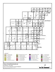
2.4 <strong>Town</strong> <strong>of</strong> <strong>Innisfil</strong> Official Plan and Initiatives2.4.1 Official PlanThe <strong>Town</strong> <strong>of</strong> <strong>Innisfil</strong> Official Plan provides a detailed policy framework to guide land use, growth and development inthe <strong>Town</strong>. The Official Plan is consistent with the Provincial Policy Statement, conforms with the Growth Plan andreflects other provincial policy and legislation such as the Green Belt Plan. Furthermore, the <strong>Town</strong>’s Official Planmust conform to and implement the upper-tier policies <strong>of</strong> the County <strong>of</strong> Simcoe Official Plan. As such, the OfficialPlan represents a key guide from which to seek direction for preparation <strong>of</strong> the new zoning by-law, and any newzoning provisions must conform to the Official Plan.The <strong>Town</strong> <strong>of</strong> <strong>Innisfil</strong> Official Plan was adopted by Council on July 26, 2006, and approved by the Ontario MunicipalBoard (in part) in May 2009, <strong>March</strong> 2010 and April 8, 2011. The Official Plan was the subject <strong>of</strong> numerous appeals tothe Ontario Municipal Board. Some <strong>of</strong> these appeals have been dealt with; however there are still a number <strong>of</strong>outstanding issues, primarily <strong>of</strong> a site specific nature. In addition, there are outstanding appeals relating to the <strong>Innisfil</strong>Heights employment lands.The new Official Plan promotes a future for <strong>Innisfil</strong> that builds on its small town and scenic rural character throughmanaged growth that will result in a complete community, providing for a greater choice for housing, increasedemployment and self-sufficiency with shopping, recreation and community services. It is noted that the existingsettlements will be intensified, while respecting the village character and identity <strong>of</strong> each settlement. The concept <strong>of</strong><strong>Innisfil</strong> as a “community <strong>of</strong> communities” is maintained in the new Official Plan, but a strong identify as one “<strong>Town</strong>” isto be promoted.The Plan provides for limited expansion <strong>of</strong> the existing settlements, while focusing on enhancing the quality <strong>of</strong> theurban environment in settlement areas and protecting rural and environmental resources. For the most part, theOfficial Plan appears to maintain the same or similar land use approaches found in the previous Official Plan andsecondary plans.A key area <strong>of</strong> change relates to the proposed intensification <strong>of</strong> the core commercial areas <strong>of</strong> Alcona and Lefroy, inthe form <strong>of</strong> multi-storey, mixed use development. Other key changes include an enhanced emphasis on protection <strong>of</strong>Lake Simcoe, requirements for source water (well head) protection, more restrictive use permissions for agriculturaland employment areas, and the introduction <strong>of</strong> transition <strong>of</strong> height requirements for high density housing abuttinglower density residential areas. These key changes will be a focus for consideration <strong>of</strong> revised zoning provisions.Section 9.2 <strong>of</strong> the Official Plan provides the authority and basic guidelines for preparing a new zoning by-law:9.2.1 The comprehensive Zoning By-law shall be amended to implement the policies <strong>of</strong> this Plan. However,each parcel <strong>of</strong> land shall not necessarily be zoned for its ultimate use but may be zoned in a nondevelopmentor future development zone until it is appropriate for the land to develop.9.2.2 The Plan also recognizes that a parcel <strong>of</strong> land, although designated for a particular use, may notnecessarily be zoned for that use due to other policies <strong>of</strong> this plan, infrastructure limitations or otherplanning matters.9.2.3 The <strong>Town</strong> may attach conditions to the approval <strong>of</strong> a zoning by-law amendment to address the mattersset out in regulation.<strong>Town</strong> <strong>of</strong> <strong>Innisfil</strong> - Zoning By-law Update Page 10<strong>Discussion</strong> <strong>Paper</strong> No. 1: <strong>Background</strong> Review
9.2.4 The <strong>Town</strong> shall require the owners <strong>of</strong> the lands to which a zoning by-law amendment application wasmade to enter into an agreement with the <strong>Town</strong> regarding the conditions set out in Section 9.2.3.The Official Plan establishes a number <strong>of</strong> land use designations intended to guide growth and manage change withinthe <strong>Town</strong>. Since the Zoning By-law must conform to the Official Plan, it is important to review the Official Plan policiesand land use designations to ensure that the future zoning and regulations align with the policies and permitted uses<strong>of</strong> each land use designation in the approved Official Plan. The various land use designations in the new OfficialPlan and a description <strong>of</strong> the permitted uses is summarized in Appendix A.Section 3.0 provides a summary <strong>of</strong> the policies in the new Official Plan that provide potential direction for the newZoning By-law, including an indication as to how these matters are addressed in the current Zoning By-law.Official Plan Amendment No. 1The <strong>Town</strong> <strong>of</strong> <strong>Innisfil</strong> adopted Official Plan Amendment No. 1 in April 2009. The Amendment was approved by theCounty <strong>of</strong> Simcoe in October, 2009. Subsequently it was appealed to the Ontario Municipal Board in November <strong>of</strong>2009. A hearing date has not yet been set.Amendment No. 1 proposes to identify lands for future urban expansion <strong>of</strong> the Alcona community and the <strong>Innisfil</strong>Heights “economic district”. However, expansion onto these lands is contingent on the satisfaction <strong>of</strong> a number <strong>of</strong>conditions, including further studies, phasing requirements and the preparation <strong>of</strong> secondary plans. Whileamendments to the zoning by-law will be required in the future to accommodate development within these urbanexpansion areas, given the uncertainty relating to the timing and nature <strong>of</strong> development within these areas,Amendment No. 1 has no bearing on the current zoning by-law review and update process.2.4.2 Secondary PlansThe Official Plan also includes more detailed policies and Secondary Plans for the communities <strong>of</strong> Alcona,Cookstown, and Lefroy.2.4.2.1 Alcona Urban SettlementThe community <strong>of</strong> Alcona has two separate policy documents that provide more detailed guidance for developmentbeyond the general policies <strong>of</strong> the Official Plan: the Alcona Central policies relate to the older urban area <strong>of</strong> Alconaand the Alcona Secondary Plan provides policies for development within the newer and expanding areas <strong>of</strong> Alcona.Following is a summary <strong>of</strong> policies that should be considered in the preparation <strong>of</strong> the new zoning by-law.Alcona Central PoliciesResidential Policies New home occupation and daycare facilities are permitted in residential areas, subject to provisions <strong>of</strong> thezoning by-law with regard to such matters as <strong>of</strong>f-street parking and maximum floor area; Group homes shall be permitted in all residential zones in the zoning by-law, subject to a minimumseparation distance <strong>of</strong> 300 metres between group homes; the by-law may also contain provisions relating tosuch matters as <strong>of</strong>f-street parking and minimum lot size; Maximum height <strong>of</strong> 4 storeys for apartment buildings in residential areas;<strong>Town</strong> <strong>of</strong> <strong>Innisfil</strong> - Zoning By-law Update Page 11<strong>Discussion</strong> <strong>Paper</strong> No. 1: <strong>Background</strong> Review
Core Commercial Area Policies<strong>Innisfil</strong> Beach Road, from Jans Boulevard to 25 Sideroad is intended to evolve as the community’s downtowncommercial area, with a broad range <strong>of</strong> permitted uses, including all forms <strong>of</strong> commercial, service, <strong>of</strong>fice,accommodation, entertainment and commercial recreational uses. Residential uses are permitted as apartments onthe floors <strong>of</strong> a commercial building above the main floor commercial use. In general, highway commercial uses andcommercial uses requiring large land areas relative to building size, such as a lumber yard or drive-in restaurant, arediscouraged. Open storage is not permitted.Following is other relevant policy direction for the Core Commercial Area: Stores and businesses shall generally front directly onto a sidewalk; Truck access routes and loading areas shall be provided at the rear <strong>of</strong> buildings, and abutting residentialareas shall be suitably screened; and Commercial and other buildings along <strong>Innisfil</strong> Beach Road shall be developed in a relatively continuousform, but limited access routes to rear loading areas may be provided.Community Services Area PoliciesThe Community Services Area is identified in the central portion <strong>of</strong> the Core Commercial Area. Permitted usesinclude institutional and government services, as well as seniors housing and other special needs housing. Officeuses, medical clinics and other similar uses, as well as parks and recreational facilities, may also be permitted.Alcona Secondary PlanResidential Policies Where new low density development abuts lands designated commercial or medium density, appropriatebuffering, screening, landscaping or berming is required to minimize conflict between the uses; and Residential medium density permits multiple dwellings, including street, block and stacked townhouses,maisonette and walk-up apartments, to a maximum height <strong>of</strong> 3 storeys.Urban Design Policies A landscaping strip <strong>of</strong> at least 3 metres wide should be provided along street frontages on arterial andcollector roads, except in the Core Commercial Area where buildings may be brought closer to the street.2.4.2.2 Cookstown Secondary PlanFollowing is a summary <strong>of</strong> policies from the Cookstown Secondary Plan that should be considered in the context <strong>of</strong>the new zoning by-law.Residential Policies Minimum yard requirements and setbacks shall be set out in the implementing Zoning-By-law to protectexisting uses and to ensure privacy for each dwelling unit; In the residential medium density designation, triplexes, double duplexes, apartment dwellings andtownhouses may be permitted; There is a requirement for a specific reference in the zoning by-law for lands designated Future Residential;the provisions speak to a prohibition on development unless servicing capacity is available; Home occupations are permitted, and shall be provided for in the zoning by-law, with appropriateregulations to ensure they are secondary to the residential uses and that they do not alter the character <strong>of</strong>the residential area;<strong>Town</strong> <strong>of</strong> <strong>Innisfil</strong> - Zoning By-law Update Page 12<strong>Discussion</strong> <strong>Paper</strong> No. 1: <strong>Background</strong> Review
Bed and breakfast uses are permitted in all areas designated Residential, subject to a zoning by-lawamendment, subject to adequate buffering, parking and servicing availability; a minimum <strong>of</strong> one additionalparking space shall be required for each rental room;Mobile homes are not permitted except in the Mobile Home Residential designation.Commercial Policies Where a commercial use is proposed adjacent to a residential use, additional setbacks and landscaping andvisual buffers may be specified in the zoning by-law; Bed and Breakfast uses are permitted, subject to a zoning by-law amendment and the same policiesapplying to such uses in residential areas; Permitted uses in the Core Commercial Area include retail uses and service operations, business andpr<strong>of</strong>essional <strong>of</strong>fices, eating establishments, clubs, public institutional uses, government <strong>of</strong>fices, places <strong>of</strong>amusement and recreation, and may also include dwelling units in conjunction with and/or accessory tocommercial uses, and hotels and motels; and No outside storage is permitted in the Core Commercial Area.Rural Area Policies Intensive animal operations are not permitted; and Existing dwellings may be zoned in a Residential category.Natural Environmental Area and Hazard Land Area Lands so designated shall be zoned in a separate classification in the zoning by-law; In the implementing zoning by-law, existing uses in areas designated Natural Environmental Area shall berecognized as legally conforming, but the expansion <strong>of</strong> such uses shall be discouraged beyond the limits asrecognized in the zoning by-law; and Building setbacks will be imposed from the margins <strong>of</strong> the Natural Environmental Area related to thesignificance <strong>of</strong> the hazard and/or the natural feature.2.4.2.3 Lefroy Secondary PlanThe Lefroy Secondary Plan applies to the western portion <strong>of</strong> the Lefroy community, comprising both existingdeveloped areas as well as future development areas. Following is a summary <strong>of</strong> policies from the Lefroy SecondaryPlan that either must be incorporated or should be considered in the context <strong>of</strong> the new zoning by-law.Residential Policies Home occupations, daycare facilities, group homes and public utilities, emergency services and municipaluses are permitted in all residential designations; accessory dwelling units are permitted in the ResidentialLow Density 1 and 2 designations; The zoning by-law shall establish a minimum lot frontage <strong>of</strong> 15 metres for single detached residential lots inthe Residential Low Density 1 designation, and 12 metres for single detached and duplex dwellings and 9metres for each semi-detached unit in the Residential Low Density 2 designation; The following minimum lot sizes apply to new lots in the Residential Low Density 1 designation adjacent toexisting lots, measured at the rear lot line where abutting the existing lots:o 21 metres for new lots abutting existing lots along Church Drive;o 18 metres for new lots abutting existing lots along Pine Avenue; The maximum building height in the Residential Low Density 2 designation is 2 storeys, which shall notinclude a basement or walk-out basement;<strong>Town</strong> <strong>of</strong> <strong>Innisfil</strong> - Zoning By-law Update Page 13<strong>Discussion</strong> <strong>Paper</strong> No. 1: <strong>Background</strong> Review
For lands fronting onto Killarney Beach Road in the Residential Low Density 2 designation, the followingadditional uses are permitted alone or in combination with existing residential uses provided the building isdesigned as a house form structure:o Bed and Breakfast establishments;o Studios;o Pr<strong>of</strong>essional <strong>of</strong>fices;o Hair salon or other similar personal service uses;The implementing zoning by-law shall identify the location <strong>of</strong> the Residential Medium Density areas;permitted residential uses shall include townhouses, duplex, triplex and other ground related multiple unithousing excluding stacked townhouses, and a limited number <strong>of</strong> small lot singles and semi-detached units;the by-law shall establish minimum lot frontages <strong>of</strong> 7 metres for townhouses and 10 metres for singledetached dwellings; the maximum height <strong>of</strong> a townhouse building shall not exceed 2.5 storeys, not includinga basement or walk-out basement.Commercial PoliciesCore Commercial Area A broad range <strong>of</strong> uses are permitted, including: mixed residential/commercial buildings and live/work uses;retail and service commercial uses; <strong>of</strong>fices; health care clinics and <strong>of</strong>fices; entertainment and eatingestablishments; nursing homes, retirement homes and long term care facilities; hotels, motels and otherforms <strong>of</strong> tourist accommodation; parkettes, libraries and other public facilities; places <strong>of</strong> worship; and otheruses considered accessory to a main use; Drive-throughs, car washes, service stations and gas bars are prohibited; Buildings and storefronts are to be located close to the street with principal entrances facing the sidewalk; No parking, driveways, lanes or aisles should be permitted between buildings and the public sidewalk; On-site parking requirements will be reduced for the corresponding on-street parking provided; Adequate landscaping and fencing shall be provided to buffer abutting residential development; The following requirements should apply to mixed residential commercial uses:o Maximum height <strong>of</strong> 4 storeys;o Use <strong>of</strong> a 45% angular plane where adjacent to Residential Low Density areas;o Building should be “brought up to the street” but should be stepped back from the front wall above3 storeys or incorporate other similar design element; Loading areas shall be provided at the rear <strong>of</strong> buildings and be screened from abutting residentialdesignations.Neighbourhood Commercial/Mixed Use A broad range <strong>of</strong> uses are permitted, including: retail and service commercial uses; grocery stores andpharmacies; health care clinics and <strong>of</strong>fices; eating establishments; hotels, motels and other forms <strong>of</strong> touristaccommodation; live/work and residential uses on the upper storeys <strong>of</strong> <strong>of</strong>fice and retail and servicecommercial uses; places <strong>of</strong> worship; parkettes; auto services including a gas bar but excluding an auto bodyshop; and a limited amount <strong>of</strong> stand-alone residential development; however, on the south side <strong>of</strong> KillarneyBeach Road, permitted residential uses are limited to live/work buildings, which may contain a range <strong>of</strong>retail, personal service and <strong>of</strong>fice uses on the ground floor; Retail and service commercial uses are restricted to a minimum floor area <strong>of</strong> 4,000 square metres and amaximum floor area <strong>of</strong> 10,000 square metres; (this would appear to represent a cumulative total <strong>of</strong> all retailand service commercial uses within the designation, which would not be reflected in the zoning by-law) Maximum building height for mixed commercial/residential uses including live/work buildings shall notexceed 3 storeys;<strong>Town</strong> <strong>of</strong> <strong>Innisfil</strong> - Zoning By-law Update Page 14<strong>Discussion</strong> <strong>Paper</strong> No. 1: <strong>Background</strong> Review
On-site parking requirements will be reduced for the corresponding on-street parking provided;Loading docks will be screened and oriented away from residential designations;Buildings should be located “up to the street” to provide a strong street presence along Killarney BeachRoad and a strong gateway presence at the Killarney Beach Road/County Road 39 intersection;For those buildings located close to the street, the principal entrances shall face the sidewalk and providedirect access to the sidewalk.Convenience Commercial Permitted uses include convenience stores, laundromats, video stores, personal service shops and autoservices including a gas bar but excluding an auto body shop; and The maximum lot size is 1 hectare.GO Station Permitted uses within this “overlay” designation include: transit terminal and associated parking lots andstructures; and limited convenience commercial uses including c<strong>of</strong>fee shops.Institutional Minimum lot size for a place <strong>of</strong> worship is 0.5 hectares.Waste Disposal Assessment Area Lands with the WDAA shall be subject to a holding symbol in the implementing zoning by-law which shallonly be lifted once studies demonstrate there will be no unmitigable public health and safety risks; the lifting<strong>of</strong> the holding symbol is contingent on execution <strong>of</strong> a development agreement which shall incorporate thestudy requirements and any necessary warning provision to future purchasers.Urban Design Policies In the Core Commercial Area:o buildings shall front onto Killarney Beach Road, have a consistent minimal and maximum setbackand a generally continuous building face;o new commercial, mixed-use development should integrate at grade street-related retail uses with<strong>of</strong>fice or residential uses on upper storeys;o locate <strong>of</strong>f-street parking at the rear, side or interior <strong>of</strong> the block; where parking is provided to theside <strong>of</strong> buildings and abutting the street, it should be screened with low walls and landscapematerials to provide a sense <strong>of</strong> enclosure along the setback line; On lands designated Residential, Core Commercial Area, Neighbourhood Commercial/Mixed Use,Convenience Commercial and Institutional, the following policies apply:o the public faces <strong>of</strong> buildings should generally align with development on neighbouring lots to definea continuous streetscape wall;o in Residential Low Density 1 and 2 areas, the design and location <strong>of</strong> driveways, parking areas andgarages shall minimize their impact on streetscapes; attached garages facing the front yard shallbe proportional and not dominate the building façade; projecting garages should be avoided andthe implementing zoning by-law shall contain provisions restricting the extent <strong>of</strong> garageprotrusions;o development at corner locations shall be sited near the street line <strong>of</strong> both frontages;o maximum <strong>of</strong> 8 units in a townhouse block; the zoning by-law shall contain standards to ensure thatlong townhouse blocks are broken up with a variation <strong>of</strong> lengths and facades so that a singlemonotonous elevation is not created;<strong>Town</strong> <strong>of</strong> <strong>Innisfil</strong> - Zoning By-law Update Page 15<strong>Discussion</strong> <strong>Paper</strong> No. 1: <strong>Background</strong> Review
omajor loading and delivery areas and garbage enclosures should be screened or confined to therear <strong>of</strong> the building.2.4.3 Urban Design Studies<strong>Innisfil</strong> Beach Road Urban Design Study and GuidelinesThe <strong>Town</strong> retained consultants to undertake the <strong>Innisfil</strong> Beach Road Urban Design Study and Guidelines, which wascompleted in May 2007. The study reviewed the prospects for transforming <strong>Innisfil</strong> Beach Road, from 20 Sideroad tothe Lake, into a mixed-use, pedestrian friendly downtown that would serve as a community focus for the community<strong>of</strong> Alcona. The study identified three distinct character areas along this 3.8 kilometre long section <strong>of</strong> <strong>Innisfil</strong> BeachRoad, and recommended a series <strong>of</strong> streetscape and built form guidelines for implementation by the public andprivate sectors. These Guidelines have been adopted by <strong>Town</strong> Council.The following guidelines for private lands are relevant for consideration in the context <strong>of</strong> the new zoning by-law: Place and orient all new buildings along the frontage <strong>of</strong> <strong>Innisfil</strong> Beach Road in order to frame, define andprovide frontage on the street; Encourage mixed-use buildings; locate residential units above commercial units to create mixed use andmixed tenure buildings; Provide ground level retail uses in buildings to create a continuous retail edge wherever possible along<strong>Innisfil</strong> Beach Road; Provide building entrances which are directly accessible and visible from the road and connected to thesidewalk where available; Locate devices such as awnings, canopies and building cantilevers/overhangs on buildings whereverappropriate to improve the level <strong>of</strong> pedestrian comfort and visual interest; For the design <strong>of</strong> corner buildings incorporate elements such as increased height; For new developments in the Central (Jans Boulevard to 25 Sideroad) and Waterfront (25 Sideroad to Lake)precincts:o encourage building heights to a standard “build-up line” <strong>of</strong> 2 storeys or equivalent for the full lengthor substantial portion <strong>of</strong> the building elevation facing <strong>Innisfil</strong> Beach Road to achieve an appropriaterelationship between building height and street width;o orient buildings along a build-to line parallel to the <strong>Innisfil</strong> Beach Road property line to ensure astrong and continuous building presence; for the build-to line, endeavour to provide a minimum <strong>of</strong>50% <strong>of</strong> the road frontage to buildings and/or structures and avoid parking between the building andthe property line along this frontage;o four storeys is the recommended “datum” height; higher buildings, such as up to 6 storeys, couldbe considered on a site-specific basis when it is demonstrated the development contains a mix <strong>of</strong>uses, displays a higher quality <strong>of</strong> architectural design and will have a beneficial effect in thecreation and support <strong>of</strong> a strong main street; In the Waterfront precinct, encourage mixed use buildings with ground floor commercial uses, or standalonecommercial buildings facing <strong>Innisfil</strong> Beach Road to support the establishment <strong>of</strong> a strong retail edge insupport <strong>of</strong> the waterfront promenade.As part <strong>of</strong> this study, draft zone categories and zone provisions were prepared to implement a mixed use zoning andzone standards for the creation <strong>of</strong> this higher intensity mixed use corridor. These draft zones and regulations areincluded in Appendix B, and will be considered by Council at a meeting in the Spring <strong>of</strong> 2012, independent <strong>of</strong> theZoning By-law Update Study. It should be noted that the Official Plan does not provide for the application <strong>of</strong> the MU-3 zone standards identified for lands along <strong>Innisfil</strong> Beach Road to the east <strong>of</strong> 25 Sideroad.<strong>Town</strong> <strong>of</strong> <strong>Innisfil</strong> - Zoning By-law Update Page 16<strong>Discussion</strong> <strong>Paper</strong> No. 1: <strong>Background</strong> Review
Lefroy Community Urban Design GuidelinesUrban design guidelines have recently been prepared for the Lefroy Secondary Plan Area, but have not as yet beenadopted by <strong>Town</strong> Council. The guidelines build upon the urban design policies in the <strong>Town</strong> <strong>of</strong> <strong>Innisfil</strong> Official Plan,including the Lefroy Secondary Plan.The report includes site planning and built form guidelines that are intended as general principles to be implementedthrough a variety <strong>of</strong> mechanisms, including zoning. In addition, specific recommendations are made for residentialbuilding setbacks, garage placement and lot widths relative to attached garages. The following table outlines thesezoning related standards.Table 2.2: Lefroy Recommended Residential StandardsSingle Detached Semi-Detached <strong>Town</strong>houseMinimum Dwelling n/a n/a 6.0m 6.0mWidthFront Yard Setback- residence- garageSide Yard Setback- interior4.5m (1)6.0m4.5m (1)6.0m4.2m (1)6.0m4.2m (1)6.0m1.2m/0.6m (2, 3,4, 12)1.2m (2, 3, 4, 12)4.2m (4, 5)1.2m (2, 3, 4, 12)4.2m (4, 5)1.5m (2, 3, 4,12)- exterior 4.2 (4, 5)4.2m (4, 5)Rear Yard Setback 7.5m (6, 7, 13) 7.5m (6, 7, 13) 7.5m (6, 7, 13) 7.5m (6, 7, 13)1.0m (8) 1.0m (8) n/a n/aMax. GarageProjection BeyondMain Front Wall <strong>of</strong>DwellingMaximum InteriorGarage WidthMaximum GarageDoor Width(9) (9) 4.3m (10)(11) (11) 4.0m 3.7mNotes:(1) Porches, balconies and bay windows may encroach up to 1.8/1.5, 1.5 and 1.0 metres, respectively; porch steps may encroachbeyond porch to within 1.0 metres <strong>of</strong> the front lot line(2) 3.0 metres where adjacent to a pedestrian link or public open space(3) 3.0 metres where rear-yard garage is accessed by a driveway(4) Porches may encroach up to 1.8/1.5 metres where adjacent to a pedestrian link or public open space(5) 6.0 metres where a garage faces the exterior side lot line(6) where a detached garage is located within the rear yard, a 7.5 metre setback shall be maintained between the garage and anyportion <strong>of</strong> the rear façade <strong>of</strong> the dwelling(7) 7.0 metres where the lot depth is less than 28 metres; 8.0 metres where the lot depth is greater than 28 metres(8) except on lots 15.0 metres and greater, where projecting garages are not permitted(9) 5.0 metres for lots between 10 and 11.5 metres in width; 5.4 metres for lots between 11.5 and 12.5 metres in width; 6.0 metres forlots between 12.5 and 14.3 metres in width; for lots greater than 14.3 metres in width, the width <strong>of</strong> the garage shall not exceed 50%<strong>of</strong> the width <strong>of</strong> the house(10) garage to be sized for one car(11) 4.6 metres for lots between 10 and 11.5 metres in width; 5.0 metres for lots between 11.5 and 12.5 metres in width; 5.5 metres forlots between 12.5 and 14.3 metres in width<strong>Town</strong> <strong>of</strong> <strong>Innisfil</strong> - Zoning By-law Update Page 17<strong>Discussion</strong> <strong>Paper</strong> No. 1: <strong>Background</strong> Review
(12) where a lot with a rear garage has a frontage <strong>of</strong> 10.4 metres or more, a minimum setback <strong>of</strong> 3.5 metres is required from one <strong>of</strong> theside lot lines(13) detached rear garages shall be setback a minimum <strong>of</strong> 0.6 metres, except where accessed by a lane, in which case the setback shallbe a minimum <strong>of</strong> 1.0 metresThe following land use and built form recommendations <strong>of</strong> relevance to zoning apply to commercial and mixed usedevelopment along the Killarney Beach Road “Main Street”/Core Commercial Area:maximum 4 storey building height;buildings higher than 3 storeys to be stepped back above the 3 rd storey;lower heights adjacent to residential low-rise areas;storefronts to be located close to street and principal entrances to face the sidewalk;no drive-through facilities, car-washes, service stations and gas bars; andloading areas at the rear <strong>of</strong> buildings and screened from abutting residential uses.The following land use and built form recommendations <strong>of</strong> relevance to zoning apply to mixed use development inthe commercial area at the intersection <strong>of</strong> Killarney Beach Road and County Road 39:retail use required at grade, with residential or live-work uses above; andminimum/maximum 2 storey building height.2.4.4 Engineering Design Standards and Specifications ManualThe <strong>Town</strong>’s Engineering Design Standards and Specifications Manual, June 2011, provides standards which reflectcurrent design and construction practices <strong>of</strong> the <strong>Town</strong>. The standards generally relate to roadways, utilities,streetlighting, and traffic signals, storm drainage and stormwater management, sanitary sewer and water supply anddistribution systems, grading and drainage, and parks and landscaping requirements. While much <strong>of</strong> the standardsrelate to detailed design and engineering works, there are matters which may be addressed in the Zoning By-law.Existing general provisions in the Zoning By-law will be reviewed for consistency with the <strong>Town</strong>’s Engineering DesignStandards and Specifications Manual. Furthermore, the <strong>Town</strong> may wish to consider incorporating additionalminimum design requirements into the Zoning By-law, where applicable.Design standards which may be addressed through the Zoning By-law may include: daylighting requirements (sighttriangles) (2.4.3); driveway and entrance design, location and widths (2.4.12); and parking design and parking spacedimensions (2.4.18.1).2.5 Existing <strong>Town</strong> <strong>of</strong> <strong>Innisfil</strong> Zoning By-lawThe <strong>Town</strong> <strong>of</strong> <strong>Innisfil</strong> Zoning By-law (054-04) was prepared in 2004. A consolidation has been prepared whichincludes by-law amendments up to and including by-law amendment 071-11, adopted by Council on August 10,2011. As previously discussed, a review and update to the exisitng Zoning By-law is required to implement thepolicies <strong>of</strong> the <strong>Town</strong>’s new Official Plan.Zoning By-law StructureThe existing Zoning By-law follows a very typical zoning by-law format and is generally structured as follows:Section 1: Interpretation/Administration – Describes how the Zoning By-law is applied, administered,establishes the zone categories, and how the zones are and schedules are to be interpreted.<strong>Town</strong> <strong>of</strong> <strong>Innisfil</strong> - Zoning By-law Update Page 18<strong>Discussion</strong> <strong>Paper</strong> No. 1: <strong>Background</strong> Review
Section 2: Definitions – Provides definitions for the terms used in the By-law.Section 3: General Provisions – Provides zoning provisions which regulate to specific uses, establishaccess, loading and parking requirements, planting and landscape strips, permitted yard encroachments,accessory building provisions, among other matters.Sections 4 through 11 outline the zone categories, permitted uses, and regulations for each zone. It shouldbe noted that some zone sections also provide general provisions specific to that zone. The permitted usesand general regulations applicable to each zone are summarized in Appendix C.Section 4: Residential Zones4.1 Residential Estate (RE) Zone4.2 Residential Rural (RR) Zone4.3 Residential Private Service (RPS) Zone4.4 Residential Serviced (R1S) Zone4.5 Residential Full Service (R1FS) Zone4.6 Residential Full Service (R2FS) Zone4.7 Residential Full Service (R3FS) Zone4.8 Residential Special Community (RSC) Zone4.9 Residential Single/Semi (RSS) Zone4.10 Residential <strong>Town</strong>house (RT) Zone4.11 Residential Multiple (RM) ZoneSection 5: Commercial Zones5.1 General Provisions5.2 Commercial General (CG) Zone5.3 Commercial Highway (CH) Zone5.4 Commercial Rural (CR) Zone5.5 Commercial Tourist (CT) Zone5.6 Commercial Business Park (CBP) Zone5.7 Commercial Core (CC) ZoneSection 6: Community Services Zone6.1 Community Services (CS) ZoneSection 7: Institutional Zone7.1 Institutional (I) ZoneSection 8: Industrial Zones8.1 General Provisions8.2 Industrial General (IG) Zone8.3 Industrial Extractive (IE) Zone8.4 Industrial Business Park (IBP) ZoneSection 9: Open Space and Environmental Protection Zones9.1 Open Space (OS) Zone9.2 Open Space Private (OSP) Zone9.3 Environmental Protection (EP) ZoneSection 10: Agricultural Zone10.1 Agricultural General (AG) Zone10.2 Agricultural Intensive (AI) Zone10.3 Agricultural Marsh (AM) ZoneSection 11: Future Development (FD) Zones<strong>Town</strong> <strong>of</strong> <strong>Innisfil</strong> - Zoning By-law Update Page 19<strong>Discussion</strong> <strong>Paper</strong> No. 1: <strong>Background</strong> Review
11.1 Future Development (FD) ZoneSection 12: Appendices – Provides illustrations to clarify the definitions through illustrations.Section 13: By-law 029-05 – Establishes a separate Resort Recreational Community Zoning By-law, withunique zones and regulations.Section 14: By-law 034-05 – Amends By-law No. 054-04 and 029-05 to rezone lands within the Big BayPoint Resort Development to implement the Resort Recreational Community Zoning By-law on the subjectlands and establish certain holding provisions subject to satisfying certain criteria.Section 15: Map SchedulesAppendix C provides an overview and comparison <strong>of</strong> the zoning requirements within each <strong>of</strong> the existing zoneclassifications, including: residential, commercial, industrial, community services/institutional, open space andenvironmental protection zones, and agricultural zones. The table summarizes the permitted uses and zoneregulations (i.e., minimum lot area, frontage, yard requirements, coverage and building height) applicable to eachzone.The existing zones and regulations will be reviewed and updated in relation to the new Official Plan designations andpolicies to ensure that the zoning implements and conforms to the new Official Plan. The following summarizes some<strong>of</strong> the issues regarding the existing zoning categories, regulations and general provisions.Zone Categories and RegulationsResidential:A number <strong>of</strong> the residential zones, such as the RPS, R1S and R1FS zones are primarily distinguished by the type <strong>of</strong>servicing available (ie., no municipal services; with municipal water and without municipal sewers, without municipalwater and without sewers). The zone regulations vary with respect to the minimum lot area and frontage required toensure sufficient area to accommodate private septic systems. Aside from these zone regulations, the balance <strong>of</strong> theregulations (i.e., permitted uses, yard requirements, coverage etc.) are very consistent among the three zones. Inthis instance, there may be opportunity to consolidate the three zones to simplify the implementation <strong>of</strong> the ZoningBy-law. Contemporary practice has been to establish a single zone and specify through the zone regulations thedifferent lot and frontage requirements depending on the type <strong>of</strong> servicing available.The Zoning By-law identifies a number <strong>of</strong> permitted accessory uses that are not actually uses, but are ratheraccessory buildings or structures (i.e., swimming pools, docks, decks etc.) for which separate regulations may beconsidered.The Zoning By-law does provide for some contemporary and urban zone standards which accommodate moreintensive forms <strong>of</strong> development with respect to minimum lot frontages. Standards within the R3FS Zone permitsingle detached dwellings with a minimum lot frontage <strong>of</strong> 9m, and the RT Zone provides for townhouses on aminimum lot frontage <strong>of</strong> 6.0m. However, there are instances where the minimum lot area requirements would resultin lots that are excessively deep, and do not accommodate more compact forms <strong>of</strong> development. The minimum lotfrontage, minimum lot areas and minimum side yards should be reviewed to ensure more compact developmentpatterns are achievable. Furthermore, it is also common practice to reduce the front yard setbacks for the residence,while maintaining greater setbacks for the garage.<strong>Town</strong> <strong>of</strong> <strong>Innisfil</strong> - Zoning By-law Update Page 20<strong>Discussion</strong> <strong>Paper</strong> No. 1: <strong>Background</strong> Review
Group homes are not permitted within any residential zone. Accessory dwelling units are permitted in all singledetached,semi-detached and townhouse dwellings. This is not consistent with the Official Plan, which does notpermit accessory dwelling units in townhouses or in any dwelling in the Shoreline Residential Area or ResidentialMedium Density designations. However, permissions for accessory dwelling units in the Official Plan and zoning bylawshould be considered in relation to the Strong Communities through Affordable Housing Act.Commercial Zones:The Commercial Core (CC) Zone is specific to the community <strong>of</strong> Cookstown, and there may be opportunity toconsolidate this zone with another commercial zone. The CC zone is similar to the uses permitted in the CG zone,however the CC zone does permit accessory dwellings over commercial uses. The draft <strong>Innisfil</strong> Beach Road mixeduse zone provisions are similar to the CC Zone and there may be opportunity to consolidate these zones within amixed use zone that is applicable to historic downtown and mixed use areas. In accordance with the directions <strong>of</strong> thenew Official Plan consideration should be given to establishing a new mixed commercial/residential zone withreduced yard requirements, coverage and increased density requirements to accommodate a broader variety <strong>of</strong>mixed uses in more compact and intensive built forms within areas identified for intensification, such as downtowncore areas.The existing commercial zones appear to accommodate a broad range <strong>of</strong> general, highway, business park rural, andtourist commercial uses that may be contemplated in the <strong>Town</strong>. However, new Official Plan policies promoting mixeduse in the downtown areas may need to be accommodated within a new mixed use zone(s).Industrial Zones:The permitted uses within the Industrial Zones will need to be reviewed to ensure conformity with the Official Plan.For instance, in the Business Park designation in the Official Plan, commercial uses are restricted to those that servethe Business Park, such as restaurants and <strong>of</strong>fice supply stores, or as incillary to a permitted industrial use, whereasthe Zoning By-law permits a broad range <strong>of</strong> commercial uses, including retail. Other issues relate to theaccommodation <strong>of</strong> outdoor storage, and restrictions pertaining to “dry” industrial uses.Agricultural Zones:The agricultural zones will be reviewed for conformity to the Official Plan agricultural designations, which furtherrestrict agricultural related uses. For instance, the AG and AI zones permit such uses as kennels and veterinaryclinics which are not permitted in the agricultural designations <strong>of</strong> the new Official Plan.General ProvisionsThe general provisions provide more detailed zone regulations for specific uses, structures and circumstances. Asplanning and land use compatibility issues are identified, additional general provisions may be warranted to providefurther zoning regulations to ensure the proper and orderly development <strong>of</strong> such uses. The following highlights someareas <strong>of</strong> the general provisions where updates may be warranted to enhance and better regulate the use, as well asareas where new general provisions may be contemplated in the Zoning By-law.Updates to general provisions may include: S. 3.12 – Home Occupations: Additional regulations may be contemplated to accommodate homeoccupations while ensuring the impacts on adjacent properties are mitigated. The existing provisionscurrently regulate the home occupation to a maximum <strong>of</strong> 25% <strong>of</strong> the dwelling unit GFA, which is a typicalzoning standard, however, these regulations must be reviewed in the context <strong>of</strong> the Official Plan (S.<strong>Town</strong> <strong>of</strong> <strong>Innisfil</strong> - Zoning By-law Update Page 21<strong>Discussion</strong> <strong>Paper</strong> No. 1: <strong>Background</strong> Review
9.20.30). Additional regulations may also include restricting the employees to just those that reside in thedwelling unit; restricting the size <strong>of</strong> the signage; and identifying both minimum and maximum parkingstandards.S. 3.13 – Yard Encroachments Permitted: Provisions for permitted yard encroachments may be reviewed.The urban design guidelines for <strong>Innisfil</strong> Beach Road and Lefroy also suggest standards for permitted yardencroachments.S. 3.18 – Minimum Distance Separation: The MDS provisions should be updated to reflect current OMAFRArequirements. In 2006, the Minimum Distance Separation I (MDS I) and Minimum Distance Separation II(MDS II) documents were replaced by one new document called the Minimum Distance Separation (MDS),effective January 1, 2007. The MDS Formulae is comprised <strong>of</strong> two separate, but related formulae: MDS Iand MDS II. MDS I is used to determine a minimum setback distance between proposed new developmentand existing livestock facilities or permanent manure storages. It is intended to protect farmers from nonfarmland uses. MDS II is used to determine a minimum setback distance between proposed new orexpanding livestock facilities and existing or approved development, lot lines, and road allowances.S. 3.23 – Off-Street Parking Provisions: The minimum parking requirements should be identified for all usespermitted in the By-law. Both minimum and maximum parking requirements may be identified for certainuses, particularly for certain uses or in areas where the <strong>Town</strong> wishes to minimize the amount <strong>of</strong> parking inorder to achieve other design/built form objectives. The Official Plan also provides policy direction forconsideration <strong>of</strong> reduced parking requirements where on-street parking is available.New general provisions may be considered to address such matters as: Accessory Retail Uses – to limit the extent <strong>of</strong> retail uses in specific zones. Agricultural Irrigation Ponds – regulations regarding setbacks from property lines, dwellings andwatercourses. Agricultural ‘Value-Added ‘ Uses – provide regulations to accommodate uses accessory to agriculture whichinclude the processing and refining <strong>of</strong> crops, produce, nuts, seeds, etc, that are produced on the site toproduce a final retail product. The regulations may provide restrictions with respect to the size and intensity<strong>of</strong> the use to ensure it is clearly accessory to the farm operation. Conversion <strong>of</strong> Seasonal Dwellings for Permanent Occupancy – the By-law may provide requirements for theconversion <strong>of</strong> seasonal dwellings (i.e., servicing/access requirements). Converted Dwellings – regulations for the conversion <strong>of</strong> a non-residential building into one or more dwellingunits. Drive-throughs and Stacking Spaces – regulations for permitting or limiting drive-throughs, provisions forintercom ordering stations, and required stacking spaces depending on the type <strong>of</strong> drive-through facility. Agricultural area provisions may be added to address such uses as greenhouses and mushroom farms (i.e.,specific performance standards, setbacks from parking/loading facilities or residential zones, number <strong>of</strong>employees, etc.) and the requirements for accommodating secondary farm dwellings (i.e., temporaryhousing for seasonal farm labourers) Group homes – provisions to permit and regulate group homes which may accommodate individuals livingas a unit under supervision. Lighting – provisions related to the use <strong>of</strong> lighting that is sensitive to surrounding land uses. Natural Hazard and Flood Protection provisions – may include provisions related to natural hazard andfloodprone areas subject to appropriate flood-pro<strong>of</strong>ing satisfactory to the Conservation Authority; andsetbacks from municipal drains and watercourses. Farm Produce Outlets (road side stands) Outdoor Storage – provisions may be provided to regulate outdoor storage, including zones in whichoutdoor storage may be permitted, screening <strong>of</strong> outdoor storage areas, and restricting outdoor storage in<strong>Town</strong> <strong>of</strong> <strong>Innisfil</strong> - Zoning By-law Update Page 22<strong>Discussion</strong> <strong>Paper</strong> No. 1: <strong>Background</strong> Review
the front yards. The Official Plan provides policy guidance with respect to the location and screening <strong>of</strong>outdoor storage.Recreational Vehicle Storage – provisions may restrict the number and location <strong>of</strong> storing recreationalvehicles on a lot.Shoreline Areas – may include provisions to address issues associated with private waterlots, <strong>of</strong>f-shorezoning, boathouses, bunkies and docks, and the form, scale, density, and accessory uses associated withwaterfront development.Mobile Refreshment Trailers – provisions may restrict the location and duration <strong>of</strong> use <strong>of</strong> such mobileoperations.Tents and other Temporary Structures – the Zoning By-law can identify restrictions such as duration <strong>of</strong> useand appropriate locations.Quonset Huts – may include provisions to restrict erection <strong>of</strong> such structures in certain zones, such as urbanresidential areas.2.5.1 Big Bay Point Resort Development ZoningBy-law No. 029-05 establishes a separate Resort Recreational Community Zoning By-law (Section 13 <strong>of</strong> the currentconsolidation), which only applies to certain areas <strong>of</strong> the <strong>Town</strong>, namely the Big Bay Point Resort Development, asidentified on Schedule A <strong>of</strong> the By-law. By-law No. 029-05 establishes specific definitions, general provisions andzones applicable only to resort recreational communities. By-law No. 034-05 (Section 14) amends By-law No. 054-04 and 029-05 to rezone lands within the Big Bay Point Resort Development to implement the zoning on the subjectlands and establish certain holding provisions subject to satisfying certain criteria.The Resort Recreational Community Zoning By-law will be reviewed in the context <strong>of</strong> the overall Zoning By-lawReview and Update to determine how these By-laws should be addressed in the new Zoning By-law. It is anticipatedthat given the site specific nature <strong>of</strong> these by-laws, the site-specific zones and regulations pertaining to the Big BayPoint Resort should be carried forward in the new Zoning By-law.<strong>Town</strong> <strong>of</strong> <strong>Innisfil</strong> - Zoning By-law Update Page 23<strong>Discussion</strong> <strong>Paper</strong> No. 1: <strong>Background</strong> Review
3.0Overview <strong>of</strong> Official Plan DirectionsThis section provides a summary <strong>of</strong> the policies in the new Official Plan that provide potential direction for the newZoning By-law, including an indication as to how these matters are addressed in the current Zoning By-law. This is auseful tool for assessing the need for adjustments to the zoning by-law to conform with the Official Plan.Table 3.1: Overview <strong>of</strong> Official Plan Directions in Relation to Existing Zoning By-lawOfficial PlanMUNICIPAL STRUCTURE Natural Heritage System is an overly designation. Natural Environmental Area is a specificdesignation.Zoning By-lawNatural Environment Areas zoned EnvironmentalProtection (EP), although some areas designatedNatural Environment Area are zoned Open Space(OS), and Open Space Private (OSP).Not treated as an overlay.Urban Settlements to be on full municipalservices; Village Settlements to be on partialservices (or potentially private communal sewagesystems also).S. 3.1.5 states that land/erection <strong>of</strong> buildings anywheremay be prohibited without municipal services. S. 3.30similarly states that land may not be used or buildingsnot permitted unless municipal services with adequatecapacity are provided.Zoning provides different zones for serviced,unserviced and partially serviced lots. In some cases,different standards are provided for “serviced” and“unserviced” lots within each zone. Larger minimum lotareas and front yards are required for unserviced orpartially serviced lots.Lake Simcoe Shorelineo Entire shoreline edge designated “NaturalEnvironmental Area” (refer to S. 2.7)o Focus is on existing dwellings and lakebasedrecreation.o Long-term intention to provide full municipalservices from Concession I to XII, includingBig Bay Point; which may restrict furtherinfilling and new lot creations until servicesare in place.o Naturalized vegetative strip along theshoreline is required for new development(S. 2.7.10)Shoreline areas are zoned a mix <strong>of</strong> zones. Main zonesinclude Residential Private Service (RPS), CommercialTourist (CT), Future Development (FD), EnvironmentalProtection (EP), Open Space Private (OSP), OpenSpace (OS), Residential Serviced (R1S), ResidentialFull Service (R1FS), and so on. Only in a few placesare the shoreline edges zoned EP.Zones relate to existing uses, permitting a broad range<strong>of</strong> uses such as single detached dwellings, commercialuses, open space uses.Long term intent to provide services is not currentlyreflected in zoning, although a Future Development(FD) zone exists, and could be applied to areasintended to be developed in the future (or a holdingsymbol may be applied to restrict furtherdevelopment). Existing uses are zoned according totheir current level <strong>of</strong> servicing.Regulations for a naturalized vegetative strip along theshoreline not reflected in Zoning By-law:o S. 3.10.8 permits boat houses in the rear yard to<strong>Town</strong> <strong>of</strong> <strong>Innisfil</strong> - Zoning By-law Update Page 24<strong>Discussion</strong> <strong>Paper</strong> No. 1: <strong>Background</strong> Review
Official PlanZoning By-lawthe water’s edge, provided it is not located closerthan 1m from the side lot line.o No other provisions for waterfront setbacks –development currently would need to comply withyard requirements.Countrysideo Permit uses relating to farming as-<strong>of</strong>-right inzoning by-law (S. 2.8.4)o Home industries, home occupations, farmgate sales, fruit and vegetable markets andother such uses shall be permittedthroughout the Countryside area (2.8.5)o New rural commercial, industrial orinstitutional uses permitted by OPA whereappropriate to rural location and are resourcebased, but not permitted in the SpecialtyCrop area, and limited where in AgriculturalArea (2.8.6)o Rural residential uses are only permitted inRural Area (not in Specialty Crop orAgricultural Areas)Countryside is primarily zoned Agriculture (AG),although some individual sites have zones related totheir existing uses (e.g., numerous CommunityServices (CS) zones, Rural Residential (RR) zones,etc.), as well as some Open Space (OS) zones.Farming uses permitted in Agriculture (AG),Agriculture Intensive (AI), Agriculture Marsh (AM),Industrial Extractive (IE).Home occupations, home industries and other usespermitted in AG.Home occupations and home industries notdifferentiated in the Zoning By-law, but are usedinterchangeably. Farm gate sales, fruit and vegetablemarkets, etc. not explicitly permitted, but may beconsidered accessory uses.Rural commercial, industrial or institutional uses notpermitted in Agriculture Zone. However, these usesare permitted in the sites which are zoned commercialor industrial, presumably based on their existing use.The Agricultural Marsh zone appears to relate to theSpecialty Crop Areas, but does not quite cover allSpecialty Crop Areas identified in the Official Plan.The Holland Marsh, as identified in the Greenbelt Plan(2005), is zoned entirely EP (refer to Map 106 in theZoning By-law).The Rural Area as defined in the Official Plan(Schedule B) is primarily zoned Agriculture (AG),which permits single detached dwellings in associationwith an agricultural lot. The Rural Residential (RR)Zone would permit residential units at a lower lot sizethan the Agricultural (AG) zone.Housingo Intensification largely limited to infill,accessory dwellings, and low-rise mixed usein core commercial area <strong>of</strong> Alcona (S. 2.10).o New secondary plans for Alcona andCookstown are to identify intensificationareas (Incorporated in Official Plan –Sections 10 and 11).o Where full municipal services are extended,Areas identified for intensification may be consideredto be zoned with higher densities, or for denser unittypes. Changes to land use designations to permithigher density development could be zonedaccordingly. The Zoning By-law does not addressdensity, except for a maximum density set for theResidential Multiple (RM) Zone. The By-law alsoaddresses maximum building heights and maximumlot coverages for most zones, but only the RM Multiple<strong>Town</strong> <strong>of</strong> <strong>Innisfil</strong> - Zoning By-law Update Page 25<strong>Discussion</strong> <strong>Paper</strong> No. 1: <strong>Background</strong> Review
ooooOfficial Plan<strong>Town</strong> to undertake an intensification studyand create policies on density, setbacks andtransition requirements.Promote, in appropriate locations, residentialstandards that promote compact form (S.2.10.9).Accessory dwelling units are permitted within(S. 2.10.10.1, 2 and S. 2.10.12):• serviced areas, in single detacheddwellings• unserviced areas, in single detacheddwellings and semis, subject to hydro-gstudy• Parking to be provided on-site; exteriorappearance to be unalteredPermit garden suites on temporary basis, inrear or side yard <strong>of</strong> single detached units; ifproperty > 4ha, possibly in front yardPromote residential units in commercialprojectsZoning By-lawzone provides for a height above three stories. TheBy-law does not provide for minimum heights orminimum lot coverages, to support achievement <strong>of</strong>minimum densities.Various standards exist for existing residential Zones,depending in part on level <strong>of</strong> servicing and unit types.Lot requirements should be reviewed against bestpractices in expressly permitting more compactdevelopment.Accessory dwelling units are permitted in all singledetached,semi-detached and townhouse dwellings,which is more permissive than the Official Plan. Note:accessory dwelling unit (secondary unit) regulations tobe reviewed in consideration <strong>of</strong> the StrongCommunities Through Affordable Housing Act.Garden Suites only permitted by way <strong>of</strong> a TemporaryUse By-law and may be subject to an agreement withthe municipality (S. 3.26).With regard to promotion <strong>of</strong> residential units incommercial projects, dwelling units over stores,<strong>of</strong>fices, banks and studios are permitted in theCommercial Core (CC) Zone. It is noted thatresidential uses are only permitted as accessory tonon-residential uses in accordance with Section 3.9,and are explicitly permitted as an accessory use in theCommercial Tourist (CT) Zone. An accessoryresidential dwelling is explicitly not permitted in theCommercial Business Park (CBP) Zone. Economic Development (S. 2.11)o Update zoning by-law to ensure current usesand new trends in industrial sector arereflected (S. 2.11.4(ii)).o Full range <strong>of</strong> industrial andcommercial parcel sizes, includingsmall lots (S. 2.11.4.iv).There are three industrial zones, which are intendedfor different purposes.o Industrial General (IG) zone broadly permitsmanufacturing, storage, research establishments,service industries/shops, truck terminal uses,storage yards, motor vehicle repair shops,industrial plazas (multiple uses in one building),communication towers, and taxi stands.o Industrial Extractive (IE) zone permits excavation,storage, crushing, or other works related to sand,gravel, ballast or similar materials, concretemanufacturing as well as agricultural, conservationand forestry uses.o Industrial Business Park (IBP) zone permits abroad range <strong>of</strong> industrial uses, includingmanufacturing, as well as commercial uses,including retail, financial institutions, andautomobile related uses.<strong>Town</strong> <strong>of</strong> <strong>Innisfil</strong> - Zoning By-law Update Page 26<strong>Discussion</strong> <strong>Paper</strong> No. 1: <strong>Background</strong> Review
Official Plan2. LAND USE POLICIESZoning By-lawIndustrial General Zone has relatively small minimumlot standards, with a minimum lot area <strong>of</strong> 1,900 squaremetres, and frontage <strong>of</strong> 30 m. The Industrial BusinessPark (IBP) zone has a minimum frontage <strong>of</strong> 45 m forinterior lots and 50 m for corner lots.These regulations, especially for the IBP zone, shouldbe reviewed against the Official Plan and other bestpractices.Natural Environmento Setbacks to be established adjacent tonatural environment areas; but determinedthrough EIS as part <strong>of</strong> secondary plan ordevelopment application process.o Minimum 30m setback from high water mark<strong>of</strong> watercourses and Lake Simcoe; butreduction may be permitted without OPAwhere no impact to fish habitat or waterqualityNatural environmental areas are generally zonedEnvironmental Protection (EP). Section 1.4.2 (b)establishes that the boundary <strong>of</strong> the EP zone isintended to reflect natural features.30m setback from high water mark is not reflected inZoning By-law.Rural and Agriculturalo Specialty Crop• Specific permitted uses (S. 3.2.1.1)• Bunkhouse as accessory use, subject toconditions (S. 3.2.1.2).• Minimum 10 ha lot size; lots < 10ha withexisting residence are recognized andmay be placed in appropriate categoryin zoning by-law.• MDS is applicable.• Home industry: may be in accessorybuilding, but must serve rural/agriculturalcommunity and accessory to residenceif on small lot and accessory to farm ifon larger lot; floor area restricted to 50%or less <strong>of</strong> ground floor area <strong>of</strong> the houseon the lot.• Wind power generation permitted asaccessory use provided it is primarily forpersonal or farm use and not solely forcommercial use (Not consistent withGreen Energy Act)o Agricultural Area• Agricultural related uses only by sitespecific zoning (S. 3.2.2.2).Specialty Cropo Specialty crop areas are primarily zoned eitherAgricultural (AG) or Agricultural Marsh (AM). TheAG zone permits farming and related uses, as wellas dwellings as an accessory use to a farm. TheAM zone is more restrictive, permitting onlyconservation areas, nurseries/market gardens andaccessory residential uses.o The range <strong>of</strong> uses currently permitted by thezoning by-law are more permissive than ispermitted by the Official Plan. The range <strong>of</strong> useswill need to be limited in the zoning, perhaps bymodifying the uses permitted in the AM zone andapplying that zone more consistently to allSpecialty Crop Areas.o Minimum lot size in AM zone is as low as 1 ha,and is typically 40 ha in AG zone (except forconservation uses which can be as low as 1 ha).The minimum lot size permitted by the OfficialPlan for Specialty Crop Areas is 10 ha, althoughthe Official Plan will permit smaller lots to berecognized by the Zoning By-law.o Section 3.18 addresses MDS, which applies toIntensive Agricultural Uses. It states that 300 mshall be provided between intensive agricultural<strong>Town</strong> <strong>of</strong> <strong>Innisfil</strong> - Zoning By-law Update Page 27<strong>Discussion</strong> <strong>Paper</strong> No. 1: <strong>Background</strong> Review
ooOfficial Plan• Minimum 40 ha farm size.• MDS applicable.• Home industry: may be in accessorybuilding; where lot 0.4 ha or less, maxfloor area is 50% ground floor area <strong>of</strong>house; where lot >0.4ha, max. floor areais 500m2 (S. 3.2.2.10).• 2nd farm dwelling permitted, onlythrough rezoning.Rural Area• Agricultural related and “other ruraluses” only permitted through sitespecific rezoning (S. 3.2.3.2).• Bunkhouse as accessory use, subject torequirements (S. 3.2.3.3)• Min. 40ha farm size.• Lot creation for retiring farmer oragricultural related uses to be as smallas possible.• Golf courses and trailer parks only byOPA and rezoning.• Home industry: may be in accessorybuilding; where lot 0.4 ha or less, maxfloor area is 50% ground floor area <strong>of</strong>house; where lot >0.4ha, max. floor areais 500m2 (S. 3.2.2.10)• Second farm dwelling permitted, byrezoning.Special Rural Area may no longer berelevant based on the new municipalboundary (S. 3.2.4.1).Zoning By-lawoperations and any residential, commercial,industrial and open space zone.o Home industry provisions will need to be providedspecifically for the zone(s) that ultimately apply toSpecialty Crop Areas. The ZBL currently treatshome occupations/home industries the same (S.3.12).o The Zoning By-law does not address greenenergy, except that solar collectors are permittedas a yard encroachment (S. 3.13.3).Agricultural Areao Primarily zoned AG, with some other zonespertaining to existing uses (such as RR, CS, etc.).o AG zone explicitly permits conservation uses,nursery, garden centers, public uses, kennels,veterinary clinics/hospitals, communicationstowers, accessory uses, which could beconsidered “agricultural related uses” as definedby the Official Plan. The Official Plan definesagriculture-related uses as farm-relatedcommercial and farm-related industrial uses thatare small scale and directly related to the farmoperation and need to be in close proximity to thefarm operation. Under this definition, some <strong>of</strong> theuses above would require a site-specific zoningamendment under the new Official Plan andshould therefore not be permitted explicitly inAgricultural zones.o Minimum lot size for farms in AG zone is 40 ha.o Home industry provisions will need to bespecifically provided for agricultural areas.Currently the home industry provisions do notmatch the provisions shown.o Second dwellings (for agricultural employees) arecurrently permitted explicitly in the AG zone as anaccessory use.Rural Areao Rural Area primarily zoned AG, with some parcelszoned in relation to their use (e.g., RR, CS, etc.).o AG zone explicitly permits conservation uses,nursery, garden centers, public uses, kennels,veterinary clinics/hospitals, communicationstowers, accessory uses, which could beconsidered agricultural related uses – agriculturalrelated uses is not defined in the ZBL. As notedabove, some <strong>of</strong> these uses would be consideredagricultural related uses in the Official Plan, andshould be subject to a site-specific amendment,<strong>Town</strong> <strong>of</strong> <strong>Innisfil</strong> - Zoning By-law Update Page 28<strong>Discussion</strong> <strong>Paper</strong> No. 1: <strong>Background</strong> Review
Official PlanooooooZoning By-lawand therefore not permitted in the Zoning By-law.Lot creation for retiring farmer or agriculturalrelated uses not addressed in AG zone (zoneregulations provided for agriculture uses,conservation uses and accessory buildingrequirements).Minimum lot size for farms in AG zone is 40 ha.A second dwelling, apartment or bunk house foragricultural employees are permitted as anaccessory use. These accessory uses arecurrently subject to the requirements <strong>of</strong> accessoryuses and accessory buildings.Golf courses and trailer parks not permitted in AGzone, so an OPA and rezoning would be required.Home industry provisions will need to bespecifically provided for agricultural areas.Currently the home industry provisions do notmatch the OP’s requirements.Second farm dwelling for farm workers is currentlypermitted as an accessory use in AG zone.Residential Areas:o Net density defined (S. 3.3)o Estate Residential Area• No new estate residential areaspermitted.o Village Residential Area• Zoning by-law should establish yardsetbacks that are reflective <strong>of</strong> thespacious nature <strong>of</strong> existing residentialareas.• Lot sizes subject to servicing andcontextual considerations.o Shoreline Residential Area• Lot sizes subject to servicing andcontextual considerations.• Where water and sewer servicesavailable, lot density should be based onexisting zoning (S. 3.3.3.3).• Naturalized buffer adjacent to LakeSimcoe required “where possible”through development applications;ideally 30 m wide buffer (S. 3.3.3.6)o Retirement Residential Area• All new development by OPA andrezoning.o Residential Low Density One• Group homes permitted, subject toZoning By-law uses maximum density as a means <strong>of</strong>regulating development (such as in the RM zone,which permits up to 52 units per hectare), but nodefinitions are provided.Estate Residential Areaso Areas designated Estate Residential are zonedprimarily a combination <strong>of</strong> Residential Estate (RE),Open Space Private (OSP) and Agricultural (AG).Village Residential Areaso Various zones are used in Village ResidentialAreas, depending on availability <strong>of</strong> services (e.g.,primarily R1S zone in Stroud and Churchill, RPSzone in Gilford, and RPS zone/ R1S zone inFennell’s Corners). Since the Villages are zonedaccording to private services, which contemplatelarger lot sizes, this OP provision is not seen as anissue.Shoreline Residential Areao Various zones are used in shoreline residentialareas, related primarily to servicing.o Fully serviced residential zones have the smallestlot requirements. Currently there are no zoningprovisions to require larger lot sizes based onother considerations such as character.o Naturalized buffer not addressed in zoning,however, some lots have an EP zone at thewater’s edge <strong>of</strong> Lake Simcoe.<strong>Town</strong> <strong>of</strong> <strong>Innisfil</strong> - Zoning By-law Update Page 29<strong>Discussion</strong> <strong>Paper</strong> No. 1: <strong>Background</strong> Review
oooOfficial Planminimum separation <strong>of</strong> 300m betweengroup homes.• By-law may also address parking, lotsizes, etc.Residential Low Density Two• Same group home requirements asRLD1.Residential Medium Density• Maximum 3 storey building height.• Permits various uses including low-riseapartments.Residential High Density• Maximum height to be set out in zoningby-law (max. density 60 to 120 units pernet hectare).• Where adjacent to low densityresidential areas, increased setbacks,intervening low-rise, and use <strong>of</strong> 45%angular plane from property line <strong>of</strong> lowdensity housing (S. 3.3.8.5).Zoning By-lawRetirement residential areao Zoned Residential Special Community (RSC)zone and other exceptions (R1FS-2H).Residential Low Density Oneo Lands designated Residential Low Density Oneare zoned according to services (i.e., R1FS), andare generally in line with the permitted uses in theOfficial Plan (detailed comparison <strong>of</strong> OPschedules and zoning by-law should becompleted).o Group homes (referred to as boarding/roominghouses) are not expressly permitted in any zone inthe by-law.o Parking is addressed according to use. Lot sizesaddressed according to each zone, and then byunit type.Residential Low Density Twoo Residential Low Density Two lands are currentlyzoned AG and EP, recognizing future growth. Anappropriate zone category is RSS.Residential Medium Densityo This designation recognizes a range <strong>of</strong> uses,including low rise apartment buildings, to amaximum <strong>of</strong> 3 storeys. However, the only zonethat permits apartment buildings is the ResidentialMultiple (RM) zone, which permits buildings up to12 m (4 storeys).Residential High Densityo Maximum height is at 12 m in the RM zonecategory, which should be reviewed to ensure itcan achieve a density <strong>of</strong> 60 – 120 units per nethectare. Otherwise, a new high density categoryor revised regulations may be required.o A maximum density <strong>of</strong> 52 units per hectare per lotis set for the RM zone. The OP contemplateshigher density development.o Several site-specific zones establish maximumdensities. A maximum density for an exception inthe RT zone (RT-2) is also 52 units per hectarewhich permits townhouses. The density for thezone RT-5(h) is set at the maximum density forthe medium density designation in the AlconaSecondary Plan.o Zoning by-law does not address angular planes toestablish height limits from lower densityresidential zones.<strong>Town</strong> <strong>of</strong> <strong>Innisfil</strong> - Zoning By-law Update Page 30<strong>Discussion</strong> <strong>Paper</strong> No. 1: <strong>Background</strong> Review
Official Plan Commercial Areas (3.4)o Core Commercial and NeighbourhoodCommercial in Urban Settlements only• Village Commercial are unserviced orpartially serviced commercial projects inVillage Settlements.• Highway Commercial in rural area andsettlements.o Core Commercial Area• Mixed use to maximum height <strong>of</strong> 7storeys (S. 3.4.1.3).• > 7 storeys only permitted by OPA orwhere provided for in secondary plan.• Minimum density <strong>of</strong> residentialcomponent <strong>of</strong> mixed use development is60uph.• Transition in heights and densitieswhere adjacent to Residential LowDensity Areas: increased setbacks, 45%angular plane.• Close to street, but stepped back above3 storeys.• Zoning by-law to address following formixed use developments: parking;minimum dwelling unit floor area; accessseparate from commercial use,adequate storage facilities; proper noiseseparation between commercial andresidential portions.• Smaller scale retail to locate at streetline, with larger stores in interior portions<strong>of</strong> site.• <strong>of</strong>f-street parking requirement will bereduced for corresponding on-streetparking provided (S.3.4.1.10)• Truck access and loading at rear <strong>of</strong>buildings and screened from residentialareas.o Neighbourhood Commercial• 3 to 6 ha site area.• Adequate parking, loading andscreening required.• Loading docks oriented away fromresidential.• Landscaping and fencing requiredwhere abutting residential.o Highway Commercial• Permits wide range <strong>of</strong> commercial uses.Zoning By-lawCore commercialo Core commercial designation in Alcona is zoned amix <strong>of</strong> zones, but primarily CG-1, which permits abroad range <strong>of</strong> commercial uses and dwellingsabove the first storey. The CG-1 zone permits asimilar range <strong>of</strong> uses as the Core Commercial(CC) zone, but provides more detail about uses(e.g., drive-in restaurants, take out restaurants,etc.). In Cookstown, Core Commercial (CC) zoneprimarily applies to the downtown.o Maximum building height <strong>of</strong> CG-1 zone is 11 m(CG zone applies). Max height in CC zone is 10.5m.o No zoning provisions address transition in heightsand densities, except for a required landscapedbuffer strip <strong>of</strong> 2.0 metres or a 2.0 metre fence.o CG-1 zone or CC zone do not specifically addressminimum density. Max lot coverage in CC zone is50%.o Current front yard setback in CG-1 zone is 13 mfrom the centerline <strong>of</strong> <strong>Innisfil</strong> Beach Road, plus therequired setback <strong>of</strong> the CG zone, which is either 6m for the front yard or 8 m for the exterior sideyard (section 5.2.4.1 b). Minimum front yardsetback in CC zone is 0 m.o Policy <strong>of</strong> smaller scale retail at street and largerstores in interior not addressed specifically.o Reduction in parking requirement for presence <strong>of</strong>on-street parking is not addressed.o Section 3.24 addresses loading requirements.Section 5.7.2 j (CC zone) prohibits parking andloading within 3 m <strong>of</strong> a residential zone.Neighbourhood Commercialo Typically zoned Commercial General.o Minimum lot area <strong>of</strong> 0.1 ha (with sanitary sewers)or 0.14 ha (without sanitary sewers), and nomaximum lot area.o Section 3.24 – Loading requirements apply. Noregulation generally protects adjacent residentialzones. Additional general provisions underCommercial uses restrict loading from the sideand front yards.Highway Commercialo Primarily zoned Commercial Highway andCommercial Business Park, but also CommercialTourist. Some located outside urban areas.o No restriction <strong>of</strong> nursery/garden centres inCommercial Business Park (CBP) zone. This zone<strong>Town</strong> <strong>of</strong> <strong>Innisfil</strong> - Zoning By-law Update Page 31<strong>Discussion</strong> <strong>Paper</strong> No. 1: <strong>Background</strong> Review
Official PlanZoning By-lawzone, depending on the use which is located in thehazard land.In the EP zone, it is noted generally that where fill linesor flood lines are mapped by the ConservationAuthority, no development shall take place withoutapproval from the Conservation Authority havingjurisdiction.Extractive Industrial Areas and AggregateResourceso Min. 122m setback from residential use forexcavation <strong>of</strong> sand and gravel.o Min 213 setback from residential use forexcavation <strong>of</strong> quarry stone or processing <strong>of</strong>sand, gravel or stone (S. 3.8.4.iv).o No excavations within 30m <strong>of</strong> rights-<strong>of</strong>-wayand 15m <strong>of</strong> property line.o Wayside pits and quarries permitted excepton any lot zoned for residential purposes,natural environment, or any lot adjacent to alot zoned for residential purposes (3.8.10).In Industrial Extractive (IE) Zone, no building,structure, plan or product stockpile is permitted within91 m <strong>of</strong> any residential zone boundaryNo excavations are permitted within 15 m <strong>of</strong> a lot lineor street lineWayside pits and quarries permitted for public roadpurposes provided lot is not zoned for residential orenvironmental purposes (does not address adjacent toresidential purposes) (Section 3.8)Institutional Areao Elementary schools permitted in allresidential designationso Smaller scale institutional and governmentservices also permitted in Core Commercialand Village Commercial.Commercial General (CG) zone permits commercialschools (defined as schools conducted for hires orgains, and does not include private academic, religiousor philanthropic schools) while, Community Services(CS) zone and Institutional (I) zone permits schools.No institutional uses are permitted in the CG-1 zone(which applies to much <strong>of</strong> Alcona’s core) or in the CCzone (in Cookstown’s core).3. ENVIRONMENTAL MANAGEMENT Wellhead Protection Areaso Zoning by-law shall contain an overlay zoneto prohibit uses outlined in S. 4.2.1 withinrespective time travel zones (S. 4.2.3).Wellhead protection zones not addressed in ZBL.Waste Disposal Assessment Areaso Lands within WDAA may be subject toholding provision in zoning by-law (S. 4.6.4).An existing landfill is addressed through an exceptionto an Institutional zone. Another WDAA is zonedAG/EP (no holding currently applied).4. URBAN DESIGN Core Commercial Areas or Downtowns (S. 5.5)o “mainstreet model”: mixed use with retail atgrade; front on the primary streetscape withentries addressing street and reducedsetbacks; generally continuous buildingMixed uses (commercial with dwellings above)permitted in CG-1 and CC zones.Front yard setbacks vary between 0 m (CC zone) and19 m to 21 m (CG-1 zone).Maximum setbacks not addressed.<strong>Town</strong> <strong>of</strong> <strong>Innisfil</strong> - Zoning By-law Update Page 34<strong>Discussion</strong> <strong>Paper</strong> No. 1: <strong>Background</strong> Review
oOfficial Planfaçade.Off-street parking at rear or interior <strong>of</strong> block.Zoning to support mixed-use, such as live-workopportunities.Zoning By-lawContinuous building facades are not specificallyaddressed, although the ZBL has required side yardsetbacks in all commercial and residential zones. Inthe CC zone, no side yard is required, which allows fora continuous building façade .In the CG-1 zone, nominimum interior side yard is required except wherestreet access to a rear yard on an interior lot is onlyavailable from the subject lot, in which case theminimum interior side yard is 4.5 m. Additionally, oneinterior side yard with a minimum width <strong>of</strong> 4.5 m isrequired every 120 m in each block.A parking lot is permitted as a principal use in the CG-1 Zone, but not in the CG or CC Zones.Live-work not addressed specifically in zoning by-law,however, accessory residential dwellings are permittedin association with some commercial uses and homeoccupations in residential zones. Mixedresidential/commercial buildings are permitted in theCC and CG-1 zones.Zoning to develop appropriate setbacks for front,side and rear yards to promote urban designpolicies, while recognizing County RoadsSetback By-law (S. 5.6.2.j)o Buildings sited near streeto Generally contiguous street wallFront, side and rear yard setbacks vary widely acrosszones, with CC zones having smallest setbacks, andlarge setbacks provided for industrial zones. By-lawdoes not provide for any maximum setbacks.With regard to street wall, the by-law provides for sideyard setbacks which vary widely across all zones. Itdoes not address consideration to create a consistentfaçade edge.In low density residential areas, avoid projectinggarages (rear yard and recessed side yardpreferred) and design attached garages to beproportional and not dominate streetscape (S.5.6.2.e).Attached garages are treated as part <strong>of</strong> the mainbuilding, which allows the garage to be projectedfurther provided it maintains the required front yard (S.3.10.3).Minimum yards are provided for both the principal use(dwellings) and the accessory uses (such as garages,but also pools, greenhouses, etc.). In RE and RRzone and all fully serviced residential zones, minimumfront setback is the same for the principal building asthe accessory building, with some exceptions incertain cases. In privately serviced residential zones,garage may encroach further than the dwelling.The total lot coverage <strong>of</strong> all detached accessorybuildings cannot exceed 10% (including detachedgarages).The Zoning By-law does not address garage widthrelative to lot size or building size. However, one zoneexception (R1FS-19[H]) requires that the width <strong>of</strong> all<strong>Town</strong> <strong>of</strong> <strong>Innisfil</strong> - Zoning By-law Update Page 35<strong>Discussion</strong> <strong>Paper</strong> No. 1: <strong>Background</strong> Review
Official PlanZoning By-lawgarage doors not exceed 50% <strong>of</strong> the house width.Zoning may provide for shared parking betweendifferent uses, reduced standards to reflecttransit and proximity <strong>of</strong> public parking (S. 5.6.2.g)Zoning requires that the parking requirements for lotsand buildings which accommodates more than oneuse is the sum <strong>of</strong> the parking requirements forindividual uses. No consideration for transit or publicparking in the development <strong>of</strong> parking standards isprovided for in the ZBL.Encroachments into front yards, such asporches, ro<strong>of</strong> overhangs and bay windows, areencouraged (S. 5.6.3.g, h)Section 3.13 lists the types <strong>of</strong> encroachments that arepermitted, and provides maximum projections for theencroachments. These permissions should bereviewed in detail against best practices in urbandesign, to ensure that the intent <strong>of</strong> the Official Planpolicies is being met.5. INFRASTRUCTURE 7m setback for permanent structures fromTransCanada Pipeline, with provision forreduction with permission from TCPL.6. TRANSPORTATION AND TRANSIT Zoning by-law to include appropriate provisionsfor setback from rail lines and suitable screening(S. 8.2.3).Not addressed in the ZBL, but one zone exception(R1FS-16(H)) provides for a 10 m setback from thepipeline.Section 3.21 addresses special setbacks from rail lines(no dwelling can be erected closer than 30 m from theproperty boundary <strong>of</strong> an existing or proposed rail line).No accompanying screening provisions are provided.<strong>Town</strong> may reduce parking requirement in CoreCommercial Area where on-street parkingprovided (S. 8.5.5).No special parking requirements are <strong>of</strong>fered for thecore areas (primarily zoned CC and CG-1).7. IMPLEMENTATION Zoning by-law shall be amended to implementpolicies <strong>of</strong> OP; however, lands not necessarilyzoned for ultimate use, but may be zoned fornon-development or future development zoneuntil appropriate for land to develop (9.2.1)ZBL has a Future Development (FD) zone whichpermits existing uses, until such time as the lands arerezoned.Definitions (9.20): some relevant to zoning bylaw,such as: agricultural related uses; bed andbreakfast; development; garden suite; grouphome; home industry; home occupation; netresidential hectare; private park; site alteration;watercourse.The definitions <strong>of</strong> the ZBL should revised to beconsistent with the Official Plan, or added to improveclarity in the ZBL. For example, agricultural-relateduses is not defined in the ZBL, while the terms homeoccupation and home industry are usedinterchangeably in the zoning by-law, but havedifferent definitions in the Official Plan.<strong>Town</strong> <strong>of</strong> <strong>Innisfil</strong> - Zoning By-law Update Page 36<strong>Discussion</strong> <strong>Paper</strong> No. 1: <strong>Background</strong> Review
4.0Preliminary Issues and OptionsBased upon our background review meetings with the TAC and CAC, discussions with <strong>Town</strong> staff and the threepublic workshops, the following outlines the key directions and preliminary issues which will need to be addressed inthe preparation <strong>of</strong> the new Zoning By-law. In addition, preliminary options are identified that may be considered bythe <strong>Town</strong> to address these issues in the new Zoning By-law. It is recognized that this is not a comprehensive list andwill be refined and expanded as the study progresses. It is intended that these preliminary issues and options willform the basis for additional consultations with the TAC, CAC and members <strong>of</strong> the public.The preliminary issues and options have been summarized into three categories:Key Directions – outlines key directions <strong>of</strong> the applicable Provincial legislation and Plans, the CountyOfficial Plan, and the new <strong>Innisfil</strong> Official Plan to be considered in the new Zoning By-law;Preliminary Issues and Options – outlines preliminary issues and potential options to address theseissues in the new Zoning By-law (Table 4.1); andOther Issues to be Considered – identifies other issues with respect to the structure and format <strong>of</strong> the newZoning By-law.4.1 Key DirectionsBased upon the review <strong>of</strong> current Provincial legislation and Plans, the County Official Plan, and the new <strong>Innisfil</strong>Official Plan, key policy directions to be considered in the new Zoning By-law, include:1) Conformity with the Official Plan - The new <strong>Innisfil</strong> Official Plan is the primary policy document to considerin implementing the new Zoning By-law. The zone categories and regulations must be consistent with andimplement the policies <strong>of</strong> the new Official Plan. The Official Plan designations provide the basis foridentifying and establishing the zone categories in the new Zoning By-law.2) Areas <strong>of</strong> Change – The Official Plan generally seeks to maintain the stability <strong>of</strong> establishedneighbourhoods and accommodate growth and development in new growth areas and throughintensification <strong>of</strong> underutilized areas. Key areas <strong>of</strong> change include the downtown and commercial coreareas <strong>of</strong> the <strong>Town</strong>’s primary settlement areas.3) Mixed Use Zones - Consideration should be given to establishing new Mixed Use zones which implementthe policy directions <strong>of</strong> the Core Commercial Area designation in the Official Plan. The Official Plan policiesidentify opportunities for more intensive and compact development which includes a mix <strong>of</strong> commercial/retailand residential uses, with heightened expectations for built form and urban design. New zoning approachesrelated to minimum and maximum setbacks, angular planes, ground-floor retail uses, build-to-lines, andcontinuous street frontages, should be considered to enhance the streetscape, contribute to the pedestrianenvironment, and ensure land use compatibility. It is anticipated that such requirements will be adopted forthe core commercial area <strong>of</strong> Alcona through an independent process.4) Shoreline Areas – The zoning for the shoreline areas should provide for appropriate development andprotection <strong>of</strong> the shorelines. Both the Lake Simcoe Protection Plan and the Official Plan direct that avegetation protection zone be implemented along the shoreline. Careful consideration is required as to howto implement this policy expectation in light <strong>of</strong> the fact that the Lake Simcoe shoreline is already developedfor the most part in a manner that is not consistent with the policy. Consideration could be given to<strong>Town</strong> <strong>of</strong> <strong>Innisfil</strong> - Zoning By-law Update Page 37<strong>Discussion</strong> <strong>Paper</strong> No. 1: <strong>Background</strong> Review
establishing a unique zone for shoreline areas (serviced and unserviced lots) to address specific shorelinedevelopment and protection issues.5) Affordable Housing – Permission for accessory residential dwellings should be considered in appropriatezones, subject to implementation <strong>of</strong> the Strong Communities Through Affiordable Housing Act, through the<strong>Town</strong>’s Official Plan.6) Protection <strong>of</strong> Natural Heritage Features – Policies <strong>of</strong> the Official Plan should be implemented through thezoning with respect to regulating hazard lands (floodplains), shoreline protection and wellhead protection.Consistent with the Official Plan, natural heritage features should be identified and zoned accordingly, andoverlay mapping <strong>of</strong> natural hazards may be considered.7) Agriculture – Existing zoning permissions are more permissive than provided for by the Official Plan, and areview and update is warranted with respect to the permitted uses and minimum lot sizes. New zonecategories or provisions should be considered to implement the Official Plan policies.8) Employment Areas – The Official Plan promotes economic development through the employmentdesignations and specifies the range <strong>of</strong> uses that should be contemplated in the Zoning By-law, includingthe regulation <strong>of</strong> ancillary retail uses and the range <strong>of</strong> accessory commercial uses.9) Commercial Areas – The commercial hierarchy and permitted uses established in the Official Plan shouldbe implemented through the Zoning By-law.10) Temporary Structures and Refreshment Trailers – Consideration needs to be given to the appropriateapproach to regulate temporary structures, such as tents and temporary garages, as well as refreshmenttrailers. Options include zoning restrictions and municipal licensing/permitting.These key issues and directions are further addressed in the following table, including an assessment <strong>of</strong> the existingzoning and potential options to address the issues in the Zoning By-law.<strong>Town</strong> <strong>of</strong> <strong>Innisfil</strong> - Zoning By-law Update Page 38<strong>Discussion</strong> <strong>Paper</strong> No. 1: <strong>Background</strong> Review
4.2 Preliminary Issues and OptionsTable 4.1 provides a more detailed summary <strong>of</strong> the key issues and options which relate to the implementation <strong>of</strong> the new Official Plan policies and how they maybe addressed in the new Zoning By-law. The table is intended to facilitate discussion and the issues and potential options will be expanded as the Study evolves.The potential options will be further identified and assessed in the <strong>Discussion</strong> <strong>Paper</strong> No. 2: Issues and Options, prepared in the final stages <strong>of</strong> Phase 1 followingfurther consultation with the TAC and CAC.Table 4.1: Preliminary Issues and OptionsIssue Relevance to Zoning Official Plan Directions Assessment <strong>of</strong> Existing Zoning OptionsImplementation <strong>of</strong> Official Plan PoliciesA) Settlement Area and Employment LandsPromotingeconomicdevelopmentPromoting compactdevelopment andefficient use <strong>of</strong> landZoning By-law mayregulate the types <strong>of</strong>industrial uses andbusinesses permitted,as well as regulate lotstandards, to permitemploymentdevelopmentZoning By-law canencourage morecompact developmentthrough reduced lotrequirements andpermission <strong>of</strong> higherOP directs the ZBL to beupdated to reflect the types<strong>of</strong> uses and standards forindustrial lots (2.11.4ii). OPencourages a full range <strong>of</strong>industrial and commercialparcel sizes, includingsmaller lots (2.11.4iv).The OP introducesrestrictions on commercialuses in certain employmentdesignations (i.e., BusinessPark, General Industrialdesignation), includingrequirements for outdoorstorage.PPS and Official Plansupport more compactdevelopment formsIndustrial Business Park zone permitsa broad range <strong>of</strong> commercial uses,which is not consistent with the OP.Industrial General Zone has relativelysmall minimum lot standards, whilethe Industrial Business Park zone hasgenerally larger minimum lot.ZBL provides various standards forresidential dwellings, depending onwhether lots are serviced and thetypes <strong>of</strong> units permitted in the zone.While certain Residential zonespermit more compact forms, throughUpdate the ZBL to conform to the OP withrespect to permitted commercial uses.Opportunity to update the range <strong>of</strong>permitted uses to be more descriptive – thecurrent range <strong>of</strong> permitted uses issomewhat generalized, but captures a verywide range <strong>of</strong> possible uses.Less restrictive lot and building standardscan be considered through a detailedreview <strong>of</strong> other municipal regulations, and inconsideration <strong>of</strong> servicing constraints.Outdoor storage regulations shouldimplement the policies <strong>of</strong> the new OfficialPlan.Opportunity to reconsider minimum lotareas, frontages, minimum yards andmaximum lot coverage to promote morecompact development forms.New approaches to zoning based on<strong>Town</strong> <strong>of</strong> <strong>Innisfil</strong> - Zoning By-law Update Page 39<strong>Discussion</strong> <strong>Paper</strong> No. 1: <strong>Background</strong> Review
Issue Relevance to Zoning Official Plan Directions Assessment <strong>of</strong> Existing Zoning Optionsdensity unit typeslow minimum lot frontages, theminimum lot area and setback shouldbe further reviewed, as in someinstances the minimum lot frontageand lot area would necessitateexcessively deep lot depths.performance based zoning, should bereviewed, which provides regulations toachieve the desired built form (minimumand maximum setback requirements,minimum building heights, regulate heightlimits through angular planes, permissionsfor mixed use zones, groundfloor animationuses). The Zoning By-law should consideropportunities to promote new urbanismdevelopment principles, which may providefor reduced building setbacks from thestreet, rear lane, reduced yardrequirements, mix <strong>of</strong> uses etc. The OfficialPlan and <strong>Town</strong> Urban Design Studies willbe reviewed in this regard to determinewhat development principles may beimplemented through the Zoning By-law.Affordable housingthrough accessorydwelling units,garden suites,accessoryresidential units inassociation withcommercial usesZoning by-law mayregulate whereaccessory units arepermitted, and thestandards that apply.The Strong CommunitiesThrough Affordable HousingAct requires permission <strong>of</strong>secondary suites in variousunit types throughpermissive OP policies.The OP permits accessorydwelling units in in singledetached and semi-detacheddwellings on lands notserviced by a municipalsanitary sewer, and withinsingle-detached dwellings inserviced areas.OP permits garden suites ona temporary basis in rear orAccessory dwellings (secondarysuites) are permitted in all graderelatedhousing.Garden suites permitted by way <strong>of</strong> aTemporary Use By-law (S. 3.26).Zoning By-law allows for dwellingsabove commercial uses in the CCzone and CG-1 zone.ZBL adequately addresses Garden Suitepolicies, but it could <strong>of</strong>fer general provisionsas a basis for the temporary use by-law(which yards they are permitted, lot size,etc.).ZBL (and OP) will need to permit secondarydwellings in (or ancillary to) single detacheddwellings, semi-detached dwellings, androwhouses in accordance with the StrongCommunities Through Affordable HousingAct. The OP and ZBL may identifyconditions for permitting second dwellings,such as parking, minimum lot size andservicing requirements.<strong>Town</strong> <strong>of</strong> <strong>Innisfil</strong> - Zoning By-law Update Page 40<strong>Discussion</strong> <strong>Paper</strong> No. 1: <strong>Background</strong> Review
Issue Relevance to Zoning Official Plan Directions Assessment <strong>of</strong> Existing Zoning Optionsside yard <strong>of</strong> units. If propertyis greater than 4 ha, theymay be permitted in frontyard. Official Plan promotesdwellings in association withcommercial uses.Permission andregulation <strong>of</strong> homeindustries andhome occupationsRegulation <strong>of</strong> grouphomesZoning By-law mayregulate homeindustries andoccupationsZoning By-law mayregulate group homesHome occupations(contained in the dwellingunit) are permitted inagricultural areas andresidential areas. Homeindustries may be carried outin an accessory building butmust serve the rural /agricultural community.Where the home industry ison a lot <strong>of</strong> 0.4 ha or less, thefloor area <strong>of</strong> the homeindustry accessory buildingshall be no greater than 50%<strong>of</strong> the ground floor area <strong>of</strong>the house on the lot. On lotslarger than 0.4 ha., themaximum floor area <strong>of</strong> thehome industry accessorybuilding shall be 500 sq. m.OP permits group homes inall residential zones, subjectto 300 m separation fromother group homes.ZBL does not differentiate homeindustries/home occupations. Homeoccupation is defined as an activityconducted entirely within a dwellingunit, as an accessory use.ZBL currently does not address grouphomes.The terms should be updated to match theOP, with the different treatment <strong>of</strong> homeoccupations and home industries, andimplement the size restrictions <strong>of</strong> the OP.ZBL should be updated to permit grouphomes in all residential zones, as indicatedin the OP.General provisions or specific zonerequirements may be added to address lotand building requirements for group homes,<strong>Town</strong> <strong>of</strong> <strong>Innisfil</strong> - Zoning By-law Update Page 41<strong>Discussion</strong> <strong>Paper</strong> No. 1: <strong>Background</strong> Review
Issue Relevance to Zoning Official Plan Directions Assessment <strong>of</strong> Existing Zoning Optionsas well as the 300 m separation.Encouraging mixeduses, higherdensities in thecommunity coresZoning By-law mayregulate uses anddensities, and help tomaintain or improvethe character <strong>of</strong>community coresCore Commercial Areadesignation applies to maincommunity cores/downtownareas. Mixed uses arepermitted to a maximum <strong>of</strong> 7storeys (higher buildingsrequire an OPA or bepermitted through aSecondary Plan). OP setsminimum density, as well asencourages a built form thatis closer to the street,reduced parking standardswhere on-street parking isavailable, and otherprovisions for encouragingwalkable, denser mixed-usecores.Zoning By-law does not adequatelyencourage the development <strong>of</strong> thecommunity cores as mixed use,higher density areas. It currentlyprovides for accessory residentialdwellings above stores in the CCzone and CG-1 zones. Maximumheight in both zones permits up to 11m (approx. 3 storeys). The RM zoneestablishes a maximum density <strong>of</strong> 52units per hectare, there are no zoneswhich would permit the achievement<strong>of</strong> the minimum density permission inthe new OP.To provide for a mix <strong>of</strong> uses in the cores,the cores can be zoned with a new mixeduse zone and/or revisions to the CC zone.Such zones may vary by community toaddress the local context and land use andbuilt form objectives. In addition, a holdingsymbol could be placed on the zoningwhich permits the broader range <strong>of</strong> uses,but only once criteria are met and thesymbol is removed. Alternatively, a FutureDevelopment zone could be applied toproperties to be redeveloped, or zonecategories could be created but not appliedto lands until redevelopment proceeds.Numerous zoning options are available toimplement the Official Plan policies forhigher densities, and a more pedestrianoriented environment. The current by-lawprovides for reduced setbacks, butconsideration can be given to regulatemaximum front yard and side yard setbacksand achieve a more desirable built form.Additional general provisions can beprovided to regulate the location <strong>of</strong>entryways, build-to-lines, and to minimizedriveways through required rear parking.To address policies regarding height anddensity, increased heights or increasedminimum/maximum densities may beconsidered in the zone(s) associated withthe Commercial Core designation, subject<strong>Town</strong> <strong>of</strong> <strong>Innisfil</strong> - Zoning By-law Update Page 42<strong>Discussion</strong> <strong>Paper</strong> No. 1: <strong>Background</strong> Review
Issue Relevance to Zoning Official Plan Directions Assessment <strong>of</strong> Existing Zoning Optionsto compatibility considerations (asdiscussed below). Bonusing is also a toolthat can be used to allow for increasedheight through the provision <strong>of</strong> communityamenities and facilities, and may helpimplement the OP’s policies.Attractive streetsCompatibility <strong>of</strong>higher density useswith low densityresidential areasZBL can regulatesetbacks andfrontages to createmore enclosedstreetscapes, andregulate thesetback/dimensions<strong>of</strong> garagesZoning By-law mayregulate compatibilitybetween tallerbuildings andadjacent lowerbuildings throughOP directs that the ZBLdevelop setbacks for yardsto achieve urban designobjectives. OP encouragesfront yard encroachments bybay windows, porches, etc.OP prefers to avoidprojecting garages. Rear andrecessed side yard garagesare preferred. Garagesshould be proportional to thebuilding.Transitions in height anddensities are requiredbetween Core CommercialAreas and adjacentResidential Low Densitydesignations.A wide variety <strong>of</strong> setbacks andfrontages are required in the zones.The ZBL permits encroachments inaccordance with Section 3.13. ZBLdoes not adequately address garagedesign policies. In most residentialzones, the minimum front yard <strong>of</strong>garages is the same as the principalbuilding, meaning that the buildingcan be designed with a projectinggarage. In the Residential PrivateService zone, the front yard setbackfor a garage is less than the principalbuilding.Zoning by-law does not employ manytools for ensuring compatibility withlow rise areas (such as 45 degreeangular plane, upper storeysetbacks/podiums), likely since tallerbuildings are currently not permittedSetbacks, side yard requirements andfrontages, build-to-lines, stepbacks,minimum and maximum building heights,and requirements for grade-related retailuses may be reviewed in consideration <strong>of</strong>the OP’s policies and other municipal bestpractices.To address design policies regardinggarages, a number <strong>of</strong> approaches may beundertaken. The number <strong>of</strong> garage doors,the width <strong>of</strong> garage doors (in relation to thelot or the dwelling) and the width <strong>of</strong>driveways may be regulated in the generalprovisions for accessory uses/buildings. Toaddress projecting garages, the setback forattached accessory structures may bereduced within each zone or generalprovisions may be added to require garagesto be setback further or the same as thefront wall <strong>of</strong> the dwelling.Depending on the option selected toaddress the issue <strong>of</strong> encouraging higherdensities, it will be important to requireconsideration for compatibility <strong>of</strong> tallerbuildings with adjacent zones.<strong>Town</strong> <strong>of</strong> <strong>Innisfil</strong> - Zoning By-law Update Page 43<strong>Discussion</strong> <strong>Paper</strong> No. 1: <strong>Background</strong> Review
Issue Relevance to Zoning Official Plan Directions Assessment <strong>of</strong> Existing Zoning Optionssetbacks, heightrestrictions, buffers,etc.explicitly. A 2m landscaped buffer isrequired for commercial zones.Implementation <strong>of</strong>OP’s commercialhierarchyRegulating storage<strong>of</strong> hazardous liquidor chemicalsThe Zoning By-lawshould implement theOP’s policies for eachtype <strong>of</strong> commercialdesignationZoning By-law mayregulate uses thatrelate to the storage<strong>of</strong> hazardous liquids,which can penetratethe ground orrepresent a safetyrisk to neighbouringresidentsThe OP providesrequirements for theapplication <strong>of</strong> a 45 degreeangular plane for theCommercial Core Area andResidential High Densitydesignations.OP provides a set <strong>of</strong>Commercial land usedesignations, related to theirintended scale and purpose.Each designation has adifferent set <strong>of</strong> permitteduses which are generallyoutlined in the OP, andprovide special policieswhich help to achieve theintended purpose <strong>of</strong> thedesignation, such as parkingrequirements, buffering fromresidential zones, etc.OP sets forth that the ZBLwill establish requirementsfor the storage <strong>of</strong> hazardousliquid or leachablechemicals.Commercial zones do not clearlymatch the OP designations, in terms<strong>of</strong> permitted uses and zoneregulations. The commercial zonesshould be reviewed to ensure that theOP’s policies for each designation arebeing met by the correspondingzones.ZBL does not currently address thisissue.Numerous zoning tools are available toaddress compatibility <strong>of</strong> higher densityareas. Buffering/landscaping is employedin the Zoning By-law but larger buffers orsetbacks may be considered for tallerbuildings. The 45 degree angular planerequirements, and stepbacks <strong>of</strong> upperstoreys may be directly implemented in theZoning.A detailed review <strong>of</strong> OP designations andcorresponding commercial zones should beundertaken, and adjustments to permitteduses made, in order to conform to andimplement the OP.This issue can be addressed in the generalprovisions through a review <strong>of</strong> bestpractices.<strong>Town</strong> <strong>of</strong> <strong>Innisfil</strong> - Zoning By-law Update Page 44<strong>Discussion</strong> <strong>Paper</strong> No. 1: <strong>Background</strong> Review
Issue Relevance to Zoning Official Plan Directions Assessment <strong>of</strong> Existing Zoning OptionsCompatibility <strong>of</strong>industrial areaswith residentialzonesOP requires a 60 m setback<strong>of</strong> industrial buildings fromresidential dwellings.ZBL requires 60 m setback fromresidential buildings in IBP zone, butthis provision is not provided in otherindustrial zonesRegulation <strong>of</strong>ancillary retail salesin association withan industrial useUse <strong>of</strong> yards andappearance <strong>of</strong>industrial propertiesPermission forinstitutional uses inZoning by-law canestablish lotrequirements/buffersthat can improvecompatibility betweenindustrial andresidential usesZoning By-law canregulate ancillaryretail uses, to helpensure thatemployment landsare being used foremploymentpurposesZoning By-law canregulate lot coverage<strong>of</strong> parking areas,buffers, location <strong>of</strong>outdoor storage,location <strong>of</strong> loading,etc., to improveappearance <strong>of</strong>industrial propertiesand compatibility withadjacent areasZoning By-law mayregulate whereOP directs that the ZBLestablish a maximumpercent <strong>of</strong> floor area thatmay be used for ancillaryretail purposes.OP provides policies toencourage improved design<strong>of</strong> industrial uses andcompatibility with residentialareas, such as buffers,maximum coverage <strong>of</strong>parking areas in the frontyard, etc. Outside storage ispermitted in Light IndustrialService areas, as anaccessory use and subject toscreening provisions.Outside storage is notpermitted in the BusinessPark designation and CoreCommercial Area.OP permits smaller scaleinstitutional and governmentZBL does not currently provide amaximum percentage that can beused for ancillary retail (calledincidental uses), but permits ancillaryretail as an accessory useZBL currently provides somerequirements regarding setbacks fromresidential areas, maximum coverage<strong>of</strong> parking in front yards, requiredbuffers, and loading is not permittedin exterior side/front yards in theCommercial Business Park zone.Outdoor storage is permitted in somezones and not permitted in others, butno general provisions for outdoorstorage are provided.Institutional uses are not currentlypermitted in mixed use zones (CCZBL should implement 60 m setback for allindustrial uses, regardless <strong>of</strong> zonecategory.The ZBL must establish a percentage <strong>of</strong>gross floor area which may accommodateancillary retail uses in association with anindustrial use.Current zoning requirements can bereviewed for appropriateness in ensuringland use compatibility. Standards should beconsidered in light <strong>of</strong> other OP policies,such as allowing for contemporary smallerscale industrial uses.Outdoor storage standards should bereviewed, with consideration for addition <strong>of</strong>general provisions to implement the OP’spolicies. General provisions may relate tomaximum lot coverage, yard restrictions,height <strong>of</strong> outdoor storage, and screening.Depending on the preferred solution foraddressing the promotion <strong>of</strong> mixed uses in<strong>Town</strong> <strong>of</strong> <strong>Innisfil</strong> - Zoning By-law Update Page 45<strong>Discussion</strong> <strong>Paper</strong> No. 1: <strong>Background</strong> Review
Issue Relevance to Zoning Official Plan Directions Assessment <strong>of</strong> Existing Zoning Optionscore areas andvillage commercialareasinstitutional uses arepermittedservices in the CoreCommercial and VillageCommercial designations.Setback fromTransCanadaPipeline StructuresScreening/setbacksfrom railwaysPermission <strong>of</strong>parking as aprincipal use(public orcommercialparking)Zoning By-law mayestablish setbacksZoning By-law mayestablishsetbacks/screeningfrom railways to limitimpacts to other usesZBL can permit aparking structure orparking lotindependent <strong>of</strong> anyother use.OP requires a 7 m setbackfrom permanentTransCanada Pipelinestructures.OP states that the ZBL willrequire appropriate setbacksfrom railways as well assuitable screeningOP promotes parking lots indowntown areas (5.5.k)and CG-1). Permitting an institutionaluse in these mixed use areas wouldrequire a variance or exception to theby-law.Only one zone exception notes thespecial setback which is to be 10 mfrom the pipeline.Section 3.21 addresses a 30 msetback for dwellings from railways,but does not address screening.ZBL does not currently permit parkingas a principal use in any zone(although it is permitted in the CG-1Zone, which applies to much <strong>of</strong> thecommercial core area <strong>of</strong> Alcona.the community cores (refer to previousissue), institutional uses should becontemplated. The maximum size <strong>of</strong>institutional uses can be specified toaddress the OP’s policy that smaller scaleinstitutional uses are permitted.A general provision may be added torequire a 7 m setback. The structures couldalso be identified on the schedules or as anAppendix to the ZBL.The ZBL may contemplate additionalprovisions for screening, based on a review<strong>of</strong> other best practices and any existingapproaches undertaken by recentdevelopments in proximity to railways.Screening may consist <strong>of</strong> fencing, and/oropen space (with a minimum height forvegetation).Public parking could be established as aprincipal permitted use, potentially as apermitted use in the Core Commercial zone(or any new mixed use zone that is createdthrough this review). General provisionscould be provided to support the urbandesign policies <strong>of</strong> the Official Plan, such asbuffer/landscaping requirements, or parkinglocation (e.g., in the rear yard). Zoningregulations for public parking should beconsiderate <strong>of</strong> the OP’s urban designpolicies and be complemented by reducedparking standards for other uses in the coreareas.<strong>Town</strong> <strong>of</strong> <strong>Innisfil</strong> - Zoning By-law Update Page 46<strong>Discussion</strong> <strong>Paper</strong> No. 1: <strong>Background</strong> Review
Issue Relevance to Zoning Official Plan Directions Assessment <strong>of</strong> Existing Zoning OptionsReduced parkingfor higher densityuses and uses inproximity <strong>of</strong> transitZoning By-law canregulate parkingrequirements for usesZBL sets parking standards accordingto use, and does not <strong>of</strong>fer exceptionsfor transit proximity. However, higherdensity residential uses have lowerparking requirements per unit.B) Rural, Agricultural and Natural Heritage/EnvironmentOP permits parking to beshared between differentuses, and that reducedstandards can be set formixed use buildings andhigher densitydevelopments.Current parking standards, which areprovided by use, may be reviewed, withconsideration for reduced standards. Areduction in parking may be permitted byzone (i.e, the CC zone or any new mixeduse zone), location, or based on proximityto certain streets or transit facilities. Generalprovisions may be added to permit sharedparking lots between buildings and uses,and to reconsider the way in which parkingrequirements are calculated where severalbuildings or uses share a parking lot.Character andlong-termsustainability <strong>of</strong> theCountryside AreaZoning By-law mayregulate the uses andcharacter <strong>of</strong> theCountryside AreaOP envisages an agriculturalcountryside, but designatesdifferent areas within theCountryside. Farming is tobe permitted as-<strong>of</strong>-right inthe zoning by-law (2.8.4), inaddition to other supportiveuses such as homeindustries, homeoccupations, farm gatesales, fruit/vegetablemarkets and other uses(2.8.5).Agricultural-related uses areonly permitted through asite-specific zoning andsubject to satisfying certaincriteria as outlined in the OP.New rural commercial,industrial or institutional usesZoning By-law is generally morepermissive than the OP. Theagricultural zones currently permitcertain uses which may beconsidered agricultural-related in thecontext <strong>of</strong> the new OP.Farm gate sales, fruit/vegetablemarkets are not explicitly permitted.The agricultural zones permit adwelling unit as an accessory usewhich may accommodate hired farmhelp.The Zoning By-law should ensurecompatibility between agricultural and urbandevelopment (implementation <strong>of</strong> MinimumDistance Separation requirements).Permitted agricultural uses should provideflexibility to accommodate a range <strong>of</strong>agricultural uses and value-addedagricultural uses to ensure the continuedviability <strong>of</strong> farming operations.Zoning By-law must be amended toconform to the Official Plan, by explicitlypermitting supportive agricultural uses(home industries, home occupations, farmgate sales, fruit/vegetable markets, etc.),and not permitting other agricultural-relateduses. Zoning should be updated to matchthe terminology in the OP.<strong>Town</strong> <strong>of</strong> <strong>Innisfil</strong> - Zoning By-law Update Page 47<strong>Discussion</strong> <strong>Paper</strong> No. 1: <strong>Background</strong> Review
Issue Relevance to Zoning Official Plan Directions Assessment <strong>of</strong> Existing Zoning Optionsrequire an OPA. Non-farm,rural residential uses arepermitted only in the RuralArea through a site-specificzoning by-law amendment.Only non-intensiveagricultural uses arepermitted in the Rural Areadesignation. Existingdwellings may be recognizedas a residential zonecategory in the ZBL.Protection <strong>of</strong>Specialty CropAreasProtection <strong>of</strong>Natural HeritageFeaturesZoning By-law mayregulate uses toadvance goals forSpecialty Crop Areas.Zoning By-law mayregulate developmentin or close to naturalheritage featuresOP provides a specific list <strong>of</strong>permitted uses, plus abunkhouse as accessoryuse. Minimum lot size is 10ha, but lots under 10 ha maybe placed in appropriatecategory in zoning by-law.Home industries arepermitted, subject torequirements.While secondary agriculturaluses are permitted, thedesignation is morerestrictive in not permittingagriculture-related uses.OP requires setbacks to beestablished from naturalenvironmental areas, asdetermined through an EIS.Minimum 30 m setbackrequired from high waterIdentified Specialty Crop Areas arezoned either AG or AM. AG is morepermissive, but has a high minimumlot area; AM is more restrictive, buthas a lot area as low as 1 ha. Homeindustries not differentiated fromhome occupations in zoning by-law.The AG and AM zones are morepermissive in permitting agriculturalrelateduses.Natural environmental areasgenerally zoned EP; zone boundaryintended to reflect natural features.Mapping <strong>of</strong> known features may notbe up to date and should beconsistent with the OP.Permitted uses in the AG zone are morebroad than the OP’s policies for SpecialtyCrop Areas (e.g., agricultural-related usesare not permitted in Specialty Crop Areas).A potential solution is a new zone categoryfor Specialty Crop Areas or a mappingoverlay indicating the Specialty Crop Areas,and supportive general provisions whichapply where the overlay is shown.The minimum lot size provisions in the AGZone are not consistent with the OP, andshould be revised.Zoning could implement these policies,potentially through a general provisionrequiring the 30 m setback, which may alsobe supported by mapping (i.e., as anoverlay, which would provide a ‘trigger’ forfurther study). Any mapping should be<strong>Town</strong> <strong>of</strong> <strong>Innisfil</strong> - Zoning By-law Update Page 48<strong>Discussion</strong> <strong>Paper</strong> No. 1: <strong>Background</strong> Review
Issue Relevance to Zoning Official Plan Directions Assessment <strong>of</strong> Existing Zoning Optionsmark <strong>of</strong> water courses and The 30 m setback from high water consistent with the OP’s environmentalLake Simcoe.mark <strong>of</strong> watercourses is notfeatures.Regulation <strong>of</strong>hazard landsZBL may regulatedevelopment <strong>of</strong>hazard lands, andinform reader <strong>of</strong>requirements <strong>of</strong> theConservationAuthorities.OP provides an overlaydesignation for hazard lands.Development in these landsrequire approval by theapplicable ConservationAuthority.addressed.ZBL does not identify hazards in zonemaps, but it is noted thatdevelopment is not permitted in theEP zone where fill lines or flood linesare mapped by the ConservationAuthorities, unless approval isreceived.The regulation <strong>of</strong> natural hazards may besupported through general provisions or anoverlay mapping to illustrate the regulatedarea or hazard lands.The existing floodplain mapping in some instances is genericfloodplain mapping (i.e., <strong>Innisfil</strong> Creek) andrequires some flexibility in determining thefloodplain limits. Since the exact limits <strong>of</strong>the floodplain and the ConservationAuthority’s regulated area is not preciselydefined through mapping, but rather definedthrough regulation, it is recommended thatthe floodplain area and extent <strong>of</strong> theregulated area be addressed through anoverlay in the Zoning By-law, andconsistent with the approach <strong>of</strong> the newOfficial Plan.Protection <strong>of</strong>wellhead areasZoning By-law mayassist in protectingwellhead areas byrestricting land useswhich negativelyimpact themOP directs the ZBL tocontain an overlay zonewhich prohibits uses outlinedin Section 4.2.1 withinrespective time travel zones(Section 4.2.3).ZBL does not currently addresswellhead protection areas.The land use permissions in the openspace zones should be reviewed todetermine what are appropriate uses withinthese zones (environmental protection vs.open space).An overlay can be used in the mapping toaddress the location <strong>of</strong> the wellhead areas,and supported by general provisions whichprohibit the uses noted in the OP.<strong>Town</strong> <strong>of</strong> <strong>Innisfil</strong> - Zoning By-law Update Page 49<strong>Discussion</strong> <strong>Paper</strong> No. 1: <strong>Background</strong> Review
Issue Relevance to Zoning Official Plan Directions Assessment <strong>of</strong> Existing Zoning OptionsRecognition <strong>of</strong>waste disposalassessment areas(WDAAs)Zoning By-law mayestablish a holdingprovision for WDAAswhile they are beingevaluated.OP states that holdingprovisions may be used forlands within influence area <strong>of</strong>a WDAA.ZBL does not provide holdingprovisions for sites identified asWDAA or within influence area <strong>of</strong> aWDAA..Sites identified as within an influence area<strong>of</strong> a WDAA may be identified by sitespecificzones (e.g., AG-#), potentially withholding (h) symbols restricting furtherdevelopment as intended in the OP orCompatibility <strong>of</strong>extractive industrialareas with otherusesC) Waterfront AreasZBL may establishsetbacks, buffers,etc., from extractiveindustrial/aggregateresource areas toimprove compatibilitywith other usesOP establishes specificsetbacks between residentialuses and excavation uses.Further, setbacks from theproperty line and rights-<strong>of</strong>wayare required forextraction activities. Waysidepits and quarries arepermitted anywhere excepton or adjacent to residentialzones.ZBL has an Industrial Extractive (IE)zone which deals with extraction <strong>of</strong>minerals, aggregate, etc. The ZBL’ssetbacks for extraction areas andwayside pits/quarries are not currentlyas restrictive as the OP’s.overlay area similar to the OP.The ZBL should be updated to conform tothe OP’s setbacks.The Zoning should also be modified toprohibit wayside pits and quarrieswithin/adjacent to residential zones.Character <strong>of</strong>shoreline, shorelineland use andservicingZoning by-law canregulate uses andbuilt form <strong>of</strong> shorelineproperties and publicareasS. 2.7 designates shorelineedge as “NaturalEnvironment Area”Focus on existing dwellingsand lake-based recreation.Naturalized vegetative striprequired for newdevelopment.Future intent to servicelands.S. 3.3.3.3 requires thatshoreline residential areashave lot areas that aresubject to servicing andShorelines are zoned a mix <strong>of</strong> zoneswith various standards, for bothserviced/unserviced lots. No generalprovisions provided for setbacks fromthe water’s edge or for the provision<strong>of</strong> natural vegetative strip or buffers.Zoning By-law permits boat housesas accessory use in the rear yard <strong>of</strong>most residential zones (3.10.8).Can incorporate a general provision <strong>of</strong> 30 mas a required minimum rear yard setbackand/or natural landscaping or bufferingrequirements from Lake Simcoe to advanceshoreline protection policies (furtherencroachments would require a ZBLA orvariance).The form, density, scale, yards and otherlot/building standards for waterfront lotsmay also be reviewed. Currently, thewaterfront lots share zoning with otherresidential areas, but consideration may begiven to creating a unique zoning category<strong>Town</strong> <strong>of</strong> <strong>Innisfil</strong> - Zoning By-law Update Page 50<strong>Discussion</strong> <strong>Paper</strong> No. 1: <strong>Background</strong> Review
Issue Relevance to Zoning Official Plan Directions Assessment <strong>of</strong> Existing Zoning Optionscontextual considerations.A 30 m naturalized bufferadjacent to Lake Simcoe isrequired where possiblethrough review <strong>of</strong>development applications.for private waterfront residential areas (withserviced and unserviced standards), torecognize that special consideration mustbe made for the appropriate development <strong>of</strong>shorelines.Site Plan control may also be consideredfor regulating shoreline development.Shoreline protection policies may also beadvanced by further restriction <strong>of</strong>boathouses, by not permitting them(requiring a ZBLA), or requiring a minimumamount <strong>of</strong> water frontage in order to permitthem, and/or identifying specific areas inwhich they can be permitted.The regulation <strong>of</strong> docks (permitted in mostzones), and bunkies (not currentlyaddressed), should be clarified in the ZBL inconsideration <strong>of</strong> the OP’s policies forshoreline character.Other municipal approaches to theregulation <strong>of</strong> shoreline structures may alsobe considered, recognizing that no othermunicipality has implemented the LakeSimcoe Protection Plan in its zoning by-law.Some municipalities in Ontario regulateboat houses, docks and other structures, asfollows:Ramara <strong>Town</strong>ship (located on theeast side <strong>of</strong> Lake Simcoe)<strong>Town</strong> <strong>of</strong> <strong>Innisfil</strong> - Zoning By-law Update Page 51<strong>Discussion</strong> <strong>Paper</strong> No. 1: <strong>Background</strong> Review
Issue Relevance to Zoning Official Plan Directions Assessment <strong>of</strong> Existing Zoning Optionsregulates docks in its Zoning Bylaw.The by-law permitsboathouses, docks and othersimilar structures on lots separatefrom the primary use, as well as onthe same lot as the primary use. Itrequires that such docks,boathouses and other structuresbe located no closer than 2.0 m tothe lot line or its projection into thewater. It limits the height <strong>of</strong>boathouses to 4.5 m from theelevation <strong>of</strong> the average highwater mark <strong>of</strong> the lot, and requiresthat the boat house not exceed30% <strong>of</strong> the width <strong>of</strong> the lot. The City <strong>of</strong> Orillia (located in thenorthern portion <strong>of</strong> Lake Simcoe)also regulates docks andboathouses. It requires that suchfacilities comply with the minimumside yard provisions. Thestructures may also not extendbeyond a projection <strong>of</strong> theminimum side yard into the water. Other municipalities regulatedocks, boathouses and similarstructures. In Tay <strong>Town</strong>ship,boathouses and other shorelinestructures are subject to a 1 mside yard setback. In Seguin<strong>Town</strong>ship, boathouses are onlypermitted on a few lakes, while 1.5<strong>Town</strong> <strong>of</strong> <strong>Innisfil</strong> - Zoning By-law Update Page 52<strong>Discussion</strong> <strong>Paper</strong> No. 1: <strong>Background</strong> Review
Issue Relevance to Zoning Official Plan Directions Assessment <strong>of</strong> Existing Zoning Optionsstorey boathouses are permittedon just large lakes. Additionally,required side yards and setbacks<strong>of</strong> boathouses are proportional tolake frontage (i.e., more frontageallows for larger boathouses). InHuntsville, a naturalized shorelinebuffer is required across 75% <strong>of</strong>the width <strong>of</strong> the lot. Boathousesare only permitted up to 100square metres and docks arelimited to a projection <strong>of</strong> 15 m intolakes and 6 m into watercourses.<strong>Town</strong> <strong>of</strong> <strong>Innisfil</strong> - Zoning By-law Update Page 53<strong>Discussion</strong> <strong>Paper</strong> No. 1: <strong>Background</strong> Review
4.3 Other Issues to be ConsideredThe following lists other general issues to be considered in the new Zoning By-law which relate to the structure,format and mapping <strong>of</strong> the new Zoning By-law, which will be addressed through the preparation <strong>of</strong> the By-law:Zoning By-law Format and Mapping: Consistency –should provide better consistency in the definitions and performance standards. Readable / User Friendly – the Zoning By-law should be easier to navigate and understand. A zoningmatrix which identifies the uses permitted within each zone could be included, as such a matrix is <strong>of</strong>teneasier to read and interpret what the permitted uses are in each zone. Consideration may be given toincorporate the General Provisions contained under the Commercial and Industrial zones into the GeneralProvisions, or to state the provisions underneath each applicable zone. Certainty – the Zoning By-law should be clear and definitive on what is permissible to provide landownerand developer certainty while providing flexibility. Consolidate Zones – there are currently eleven residential zones, not including those within the Big BayPoint development. Consolidation <strong>of</strong> zone categories where possible would provide fewer zone categoriesand easier interpretation and administration <strong>of</strong> the Zoning By-law. The lot regulations for full, partial andprivate services were generally carried forward from the previous by-laws, and there may be opportunitiesfor consolidation and greater consistency in these zone standards. Diagrams/Illustrations – illustrations should be incorporated into the Zoning By-law to assist inunderstanding by-law definitions and zone requirements. An important deliverable <strong>of</strong> this study is thepreparation <strong>of</strong> an “Implementation Handbook” which would illustrate definitions and regulations to assist inmaking the Zoning By-law more user-friendly. However, consideration should be given to including suchdiagrams and illustrations directly in the Zoning By-law for ease <strong>of</strong> reference and improved interpretation. Mapping Legibility – the zoning mapping should be easy to read, and should provide consistency in thebase mapping. Mapping should be clear and may consider use <strong>of</strong> textures as opposed to colours/shadeswhich are <strong>of</strong>ten difficult to interpret and reproduce. Currently the zone maps largely assign zone categoriesto each parcel; consideration may be given to applying the zone categories to all abutting parcels whichshare the same zoning to improve legibility <strong>of</strong> the zone mapping. Mapping Accuracy – when the zone mapping was updated in 2004 to reflect the assessment based parcelfabric, there was a significantly higher level <strong>of</strong> detail in the new base mapping. This has resulted in mappingerrors, particularly with smaller lots in the rural area, where lots are still zoned as though they were a 40hectare parcel instead <strong>of</strong> perhaps a Residential Rural zoning. Exceptions – in the current Zoning By-law the exceptions directly follow the applicable zone regulations.The exceptions could be moved to a new section, following the zone categories and zone regulations tomake the Zoning By-law more user-friendly and easier to navigate. Furthermore, the Zoning By-law Reviewshould seek to limit the number <strong>of</strong> exceptions required through the update and consolidation.Updated Definitions and General Provisions: Definitions – the current definitions are inadequate and require a high degree <strong>of</strong> interpretation. Thedefinitions should be reviewed for accuracy, completeness and to ensure they are contemporary. Somedefinitions are dated and may no longer be necessary. New definitions may be required to provideconsistency with the definitions <strong>of</strong> the new Official Plan and implement new approaches related to built formand land use compatibility (i.e., angular planes). General Provisions – the general provisions should be reviewed and updated to ensure they providesufficient regulation for specific uses (i.e, home occupations), or remove regulations for specific uses thatdon’t currently exist. Section 2.5 outlines potential areas for review and update.<strong>Town</strong> <strong>of</strong> <strong>Innisfil</strong> - Zoning By-law Update Page 54<strong>Discussion</strong> <strong>Paper</strong> No. 1: <strong>Background</strong> Review
Urban Design Studies: The new Zoning By-law should incorporate the land use, built form and zoning regulations beingrecommended through the <strong>Town</strong>’s urban design studies, as discussed in Section 2.4.2, including:o <strong>Innisfil</strong> Beach Road Urban Design Study and Guidelines – A draft zoning by-law amendmenthas been prepared to implement these Guidelines, and is expected to be considered by Council foradoption in the Spring <strong>of</strong> 2012.o Lefroy Community Urban Design Guidelines - The guidelines provide recommended standardsfor residential development which could be incorporated into the Zoning By-law.Engineering Design Standards: As discussed in Section 2.4.3, certain standards identified in the <strong>Town</strong>’s Design Standards andSpecifications Manual may be addressed in the Zoning By-law.<strong>Town</strong> <strong>of</strong> <strong>Innisfil</strong> - Zoning By-law Update Page 55<strong>Discussion</strong> <strong>Paper</strong> No. 1: <strong>Background</strong> Review
5.0Public Consultation SummaryA series <strong>of</strong> public consultation events were held during the week <strong>of</strong> February 13, 2012, as follows: On February 13, 2012 a public open house/workshop was held to discuss the study and issues related tosettlement areas and employment areas; On February 14, 2012 a public open house/workshop was held to discuss the study and issues related toagricultural areas and natural heritage features; and On February 16, 2012 a public open house/workshop was held to discuss the study and issues related tothe waterfront areas.The purpose <strong>of</strong> each <strong>of</strong> the meetings was to: introduce the study to the public; to review key issues and potentialchoices to address those issues (as identified through the preparation <strong>of</strong> this <strong>Discussion</strong> <strong>Paper</strong> and throughconsultation with <strong>Town</strong> staff); to obtain input on these issues; and to provide an opportunity for the public andstakeholders to raise other issues that may need to be addressed through this study. Each meeting focused on theissues for each <strong>of</strong> the topic areas identified above.Each meeting consisted <strong>of</strong> an open house, followed by a 30-minute presentation by staff and the consulting team,and a one-hour workshop (note that the presentation was omitted on February 15, 2012, since all participants hadattended previous open houses/workshops). During the open house, attendees had an opportunity to discuss thestudy and issues with the consulting team, and to review display boards which outlined the study purpose, the studyprocess and explained the issues that have been identified by the consulting team in consultation with <strong>Town</strong> staff.The boards also identified some questions to get participants to think about potential options and solutions. Thedisplay boards presented at these meetings are included in this <strong>Report</strong> in Appendix D.The workshop component provided an opportunity for in-depth consultation with the participants. At each workshop,one or more consulting team members facilitated a discussion <strong>of</strong> the issues for one or more groups. The discussionsfrom each workshop are summarized below. Detailed input will be considered as part <strong>of</strong> the preparation <strong>of</strong><strong>Discussion</strong> <strong>Paper</strong> No. 2.Workshop <strong>#1</strong> – Settlement Areas and Employment AreasParticipants were asked to join one <strong>of</strong> three tables. One or two team members joined each table to help facilitatediscussion, using a worksheet which outlined discussion questions related to each <strong>of</strong> the issues identified by theconsulting team. Key Issue 1 – Transformation <strong>of</strong> core areas <strong>of</strong> Alcona and Lefroy: In general, participants were notsupportive <strong>of</strong> the Official Plan’s directions to transform the core areas <strong>of</strong> Alcona and Lefroy into mixed use,higher density urban cores. Rather, participants valued the low-density character <strong>of</strong> the communities, andexpressed concern that <strong>Innisfil</strong> would be transformed into a community which is not distinguishable fromother Greater Toronto Area municipalities. Key Issue 2 – Promoting more compact development and attractive streets: Again, participants expressedtheir concern with the Official Plan directions to promote more compact communities. They generally valuelarger lots and garages, although some participants were supportive <strong>of</strong> laneways and rear garages as analternative approach. It was suggested that most residents need two-car garages for parking and storage,and that the winter climate is not supportive <strong>of</strong> overnight parking on-street. Key Issue 3 – Permission <strong>of</strong> temporary structures, such as tents, temporary garages, and refreshmenttrailers: Some participants expressed concerns about persons using temporary tents/structures aspermanent garages, which are not in keeping with the character <strong>of</strong> their community. A participant noted thatrefreshment trailers might be regulated through a municipal licensing process, as opposed to zoning, as is<strong>Town</strong> <strong>of</strong> <strong>Innisfil</strong> - Zoning By-law Update Page 56<strong>Discussion</strong> <strong>Paper</strong> No. 1: <strong>Background</strong> Review
done in other Simcoe County municipalities. It was also suggested that there should perhaps be differentrules in rural areas versus urban areas, given the reduced sensitivity in rural areas.Key Issue 4 – Permitted uses in the employment areas: Participants discussed the future servicing <strong>of</strong> theemployment areas but did not have specific comments on zoning implications.At the end <strong>of</strong> the workshop, each group reported their discussion to all participants. When asked to raise otherissues, participants generally reiterated the concerns they expressed during the small group discussions.Workshop #2 – Agricultural Areas and Natural Heritage FeaturesAt workshop 2, participants joined a single table, and were asked to comment on questions related to each <strong>of</strong> theissues identified by the consulting team: Key Issue 1 – Permitted uses in the agricultural areas: Participants had strong viewpoints about what shouldbe permitted in agricultural areas. Some participants strongly preferred that agricultural areas be used solelyfor farming uses, but some recognized the benefits <strong>of</strong> agri-tourism and home industries. It was agreed thatland use impacts <strong>of</strong> non-agricultural uses should be considered, including limitations on home industries,market stands, etc. Additionally, the group discussed bunk houses, recognizing that they are essential to theviability <strong>of</strong> farming, but there may be impacts associated with having too many bunkhouses or inadequateseparation from adjacent residences. It was noted that bunkhouses are subject to regulations by upper tiergovernment. Key Issue 2 – Protection <strong>of</strong> Specialty Crop Areas: It was noted that Specialty Crop Areas should generallynot be used for animal agriculture, and that related uses such as washing and storage should be permittedin association with a Specialty Crop Area. There was concern expressed regarding the proposal by theCounty to increase minimum lot sizes in Specialty Crop Areas to 40ha. Key Issue 3 – Protection <strong>of</strong> Natural Heritage Features: Participants generally agreed that existing farminguses should continue in light <strong>of</strong> the Lake Simcoe Protection Plan’s requirements. However, concern wasexpressed that the “existing use” status may be jeopardized through the normal farm practise <strong>of</strong> croprotation. A participant suggested that the agricultural community would like compensation for removinglands from production for natural heritage protection purposes. A participant raised the issue <strong>of</strong> restoringditches to help prevent erosion. Key Issues 4 and 5 – Wellhead protection areas and waste disposal assessment areas: Participants did notraise any specific concerns about this issue.Additionally, participants were asked to identify any other issues <strong>of</strong> concern. Participants noted there is a need toreview definitions to differentiate between value-added and value-retained uses, to ensure that only farm-relateduses are permitted in agricultural areas. A participant noted the importance <strong>of</strong> addressing abattoirs in the zoning bylaw.It was emphasized that an important strength in Ontario’s agricultural industry is its diversity, which leads toinnovation and long-term economic viability.Workshop #3 – Waterfront AreasLike Workshop 2, participants in Workshop 3 were seated at a single table and asked to comment on questionsrelated to each <strong>of</strong> the issues identified by the consulting team:Key Issue 1 – Setbacks from Lake Simcoe and watercourses: Participants generally agreed that the goal <strong>of</strong>providing natural buffers is desirable, but it will be challenging to achieve this, particularly since manyresidents want direct access to the water. Some options that were discussed included <strong>of</strong>feringcompensation, or applying zoning to require larger setbacks from the water’s edge. Participants noted that itis particularly important to consider lot depth, to ensure that the character <strong>of</strong> the shoreline can be somewhat<strong>Town</strong> <strong>of</strong> <strong>Innisfil</strong> - Zoning By-law Update Page 57<strong>Discussion</strong> <strong>Paper</strong> No. 1: <strong>Background</strong> Review
consistent, and that rules about setbacks are fair for infill development. The potential for site plan approvalin shoreline areas, as well as possible zoning approaches (e.g., for establishing appropriate front and rearyards), were discussed.Key Issue 2 – Where boathouses and shoreline structures may be permitted: Generally, the impacts <strong>of</strong>boathouses and dry-slip boathouses were discussed, from both the perspective <strong>of</strong> shoreline character andimpacts on erosion and aquatic habitat. Potential controls on boathouses, such as limiting the size <strong>of</strong> aboathouse relative to lot width, were discussed. Generally, participants did not support large boathouses orhabitable space on boathouses, recognizing the goals <strong>of</strong> providing for a more naturalized shoreline.Key Issue 3 – How to regulate docks: A representative <strong>of</strong> the Conservation Authority was present to discussthe regulatory framework in place for permitting and approving docks. Participants expressed concerns thatproperty owners can build large docks and decks that may conflict with neighbours enjoyment <strong>of</strong> property..In consideration <strong>of</strong> the regulatory framework already in place for docks, it was suggested that the <strong>Town</strong>should perhaps develop a clear Official Plan policy about docks, to help guide the Conservation Authority’sapproval process, as opposed to introducing zoning regulations that will not be flexible to account fordifferent circumstances.Key Issue 4 – How to regulate bunkies: Participants generally agreed that there are negative impactsassociated with bunkies, and they are not desirable for the purposes <strong>of</strong> developing a naturalized shorelinebuffer. It was noted that bunkies were perhaps relevant when families were larger, but this is not typicallythe case today.Again, participants were asked to identify any other issues. A participant noted that marinas should be better utilizedfor recreational purposes, and permitted to expand, to reduce the need for private property owners to develop thestructures required to gain access to the water. Additionally, participants discussed the need to open up publicaccess to waterfront areas.<strong>Town</strong> <strong>of</strong> <strong>Innisfil</strong> - Zoning By-law Update Page 58<strong>Discussion</strong> <strong>Paper</strong> No. 1: <strong>Background</strong> Review
6.0Next StepsThis <strong>Discussion</strong> <strong>Paper</strong> presents the outcome <strong>of</strong> the background review, confirms the issues to be addressed in theZoning By-law and identifies preliminary approaches to address those issues.The next step in the Zoning By-law Update Study process is the preparation <strong>of</strong> <strong>Discussion</strong> <strong>Paper</strong> No. 2 (Issues andOptions), which will recommend preferred options to address the issues, and begin to prepare more detaileddirections and regulations. This report will be prepared in <strong>March</strong> <strong>of</strong> 2012 and will be reviewed with the TAC and CACprior to being posted on the <strong>Town</strong>’s website for public review.Further consultation on the preferred options and draft regulations is anticipated to occur in the month <strong>of</strong> May, 2012,in the form <strong>of</strong> three public open houses. These open houses will present information pertaining to the followingtheme areas:Workshop No. 1 – Settlement Areas and Employment LandsWorkshop No. 2 – Rural, Agricultural and Natural Heritage/Environmental AreasWorkshop No. 3 – Waterfront Areas.Based on the input received at the open houses, <strong>Discussion</strong> <strong>Paper</strong> No.2 will be finalized and the study team willbegin preparation <strong>of</strong> the first draft <strong>of</strong> a new zoning by-law for the <strong>Town</strong> <strong>of</strong> <strong>Innisfil</strong>.<strong>Town</strong> <strong>of</strong> <strong>Innisfil</strong> - Zoning By-law Update Page 59<strong>Discussion</strong> <strong>Paper</strong> No. 1: <strong>Background</strong> Review