Evolution of land cover and land use mapping in Romania
Evolution of land cover and land use mapping in Romania
Evolution of land cover and land use mapping in Romania
SHOW LESS

Create successful ePaper yourself
Turn your PDF publications into a flip-book with our unique Google optimized e-Paper software.
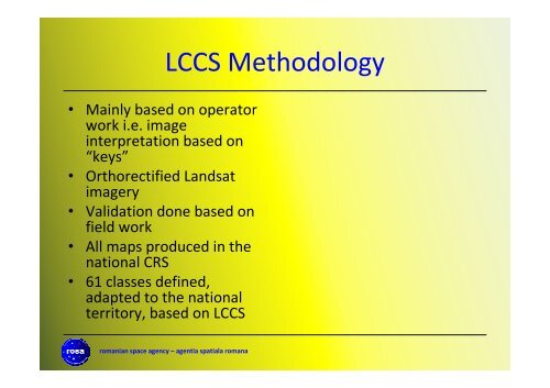
LCCS Methodology• Ma<strong>in</strong>ly based on operatorwork i.e. image<strong>in</strong>terpretation based on“keys”• Orthorectified L<strong>and</strong>satimagery• Validation done based onfield work• All maps produced <strong>in</strong> thenational CRS• 61 classes def<strong>in</strong>ed,adapted to the nationalterritory, based on LCCSromanian space agency – agentia spatiala romana