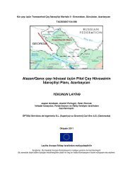
SOP Benthos
SOP Benthos
SOP Benthos

You also want an ePaper? Increase the reach of your titles
YUMPU automatically turns print PDFs into web optimized ePapers that Google loves.
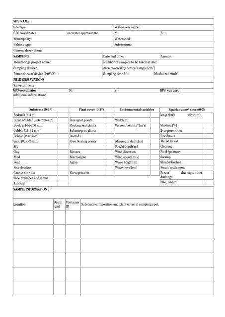
SITE NAME:Site type:Waterbody name:GPS coordinates accurate/approximate N: E:Municipality: Watershed :Habitat type:General description:Substratum:SAMPLING Date and time: Agency:Monitoring/ project name:Number of samples to be taken at site:Sampling device: Area covered by device/sample [cm 2 ]Dimensions of device (LxWxH): Sampling time [s]: Mesh size [mm]:FIELD OBSERVATIONSSurveyor name:GPS coordinates N: E: GPS was used:Additional information:Substrate (0-3*)Bedrock [> 4 m]Large boulder [256 mm-4 m]Boulder [64-256 mm]Cobble [16-64 mm]Pebble [2-16 mm]Sand [0,06-2 mm]SiltClayMudPeatFine detritusCoarse detritusTree branches and stemsArtificialPlant cover (0-3*)Emergent plantsFloating leaf plantsSubmergent plantsIsoetidsFree floating plantsMossesMacroalgaeAlgaeNo vegetationEnvironmental variablesWidth[m]Current velocity*[m/s]Maximum depth[m]Secchi depth[m]Wind directionWind speed[m/s]Wave height[m]Water level[cm]Riparian zone/ shore(0-3)length[m]: width[m]:Shading [%]Evergreen treesDeciduousMixed forestClearcutField /pastureSwampShrubs/bushesRoad /settlementForest drainage/otherdrainageElse, what?SAMPLE INFORMATION :LocationDepth[cm]ContainerIDSubstrate composition and plant cover at sampling spot.