Abstract volume - Geological Curators Group
Abstract volume - Geological Curators Group
Abstract volume - Geological Curators Group

Create successful ePaper yourself
Turn your PDF publications into a flip-book with our unique Google optimized e-Paper software.
Exploiting Geoscience Collections12-13 May 2008ProgrammeCONFERENCE -- Day 18.30 COFFEE AND REGISTRATIONCOLLECTIONS -- A NATIONAL ASSET9.00 IntroductionJeremy Giles, British <strong>Geological</strong> SurveyKey speakers9.40 How do we value geologicalcollections?Professor Richard Fortey10.20 <strong>Geological</strong> collections and planning-- what is the relevance?Dr Brian Marker OBE11.10 Economic and wider benefits of theBritish <strong>Geological</strong> Survey’s geospatialinformation data-setsDr Richard Hughes11.40 Old samples -- new questionsDr Angela Ehling12.05 Exploiting geoscience collections:from paper collections to 3D modelsJenny Walsby, Marieta Garcia-Bajo12.30 LUNCHMANAGING COLLECTIONS13.30 Managing collections forexploitationJeremy Giles13.55 <strong>Geological</strong> map and memoircollections as a source of data on thequality of the rock recordAlistair McGowan14.20 Discoveries of mineral depositsusing mineral collections in RussianmuseumsVladimir Kuzmin14.45 Falklands fossils -- famous,forgotten and filched?Dr Philip Stone15.10 The role of standards in sharinggeological collections data through theGEOCase NetworkCharles Copp15.35 COFFEE16.00 The contribution of serendipity tothe exploitation of geoscience collectionsDr Mike Howe16.25 Collections management at the<strong>Geological</strong> Survey of Canada, EarthScience Sector, Natural ResourcesCanadaJean Dougherty16.50 System of storage of geologicalcollections in RussiaLeonid Kolbantsev17.15 The problem with paperPaul Duller17.40 Discussion18.00 Evening ReceptionCONFERENCE -- Day 28.30 COFFEECOLLECTIONS TECHNOLOGY9.00 IntroductionJeremy Giles9.10 Opening up -- how to exposegeoscience information to the mashupgenerationTom Steinberg10.00 A new perspective on old data:making geological prior informationaccessible in the fieldwork environmentDr Andy Howard10.25 GNOSIS: Generalized NaturalSciences Online Spatial InformationSystemMarleen De Ceukelaire10.50 COFFEE11.20 Geoscience collections for nongeoscientists:an online teaching andreference sourceDr Hazel McGoff11.45 Collections on the web -- what is theimpact on access?Giles Miller12.10 Template: realization of aterritorially distributed database conceptKaleria Kuvshinova12.35 LUNCHCOLLECTIONS CASE STUDIES
13.30 Standards development and theU.S. National <strong>Geological</strong> Map DatabaseDavid Soller13.50 Data and services at the NEODCSteve Donegan14.10 Bags of sand and dirt -- exploitingthe British <strong>Geological</strong> Survey’senvironmental samples and databaseDr Chris Johnson14.30 Discriminating faunal assemblagesand their paleoecology based on museumcollections: the Carboniferous Hurlet andIndex limestones of Western ScotlandMark Dean14.50 Identifying ‘Golden Spikeboreholes’ for the National BoreholeInformation Capture ProjectAndy Kingdon15.10 COFFEE15.40 Improving online ordering ofrecords scansDr Keith Westhead16.00 The U.S. <strong>Geological</strong> Names Lexicon(GEOLEX)Nancy Stamm16.20 Archiving digital 3D modeledgeological data: the BGS approachHelen Glaves16.40 Wrap-up and discussion17.00 EndPOSTERSAcres of Antarctic rock: A unique resourcefor the futureHilary Blagborough and Alexander TateThe use of the Recorder 6 database ingeological collections documentationCharles CoppCollections of Academician F.N.Tschernyschew, Central Research<strong>Geological</strong> Prospecting MuseumOleg Petrov and Dr Aleksey Sokolov
Exploiting Geoscience Collections 12-13 May 2008CONTENTS<strong>Abstract</strong>s ____________________________________________________________1How do we value geological collections? _____________________________________ 1<strong>Geological</strong> collections and planning – what is the relevance? ____________________ 2Economic and wider benefits of the British <strong>Geological</strong> Survey’s geospatialinformation data-sets _____________________________________________________ 2Old samples – new questions_______________________________________________ 3Exploiting geoscience collections: from paper collections to 3D models____________ 4Managing collections for exploitation _______________________________________ 5<strong>Geological</strong> map and memoir collections as a source of data on the quality of the rockrecord _________________________________________________________________ 6Discoveries of mineral deposits using mineral collections in Russian museums _____ 7Falklands fossils – famous, forgotten and filched? _____________________________ 8The role of standards in sharing geological collections data through the GeoCASENetwork________________________________________________________________ 9The contribution of serendipity to the exploitation of geoscience collections_______ 10Collections Management at the <strong>Geological</strong> Survey of Canada, Earth Sciences Sector,Natural Resources Canada _______________________________________________ 11System of storage of geological collections in Russia __________________________ 12The problem with paper _________________________________________________ 13Opening up: how to expose geoscience information to the mashup generation _____ 13A new perspective on old data: making geological prior information accessible in thefieldwork environment___________________________________________________ 14GNOSIS: Generalized Natural Sciences Online Spatial Information System ______ 15Geoscience collections for non-geoscientists: an on-line teaching and referenceresource_______________________________________________________________ 16Collections on the web – what is the impact on access? ________________________ 17Template: realisation of a territorially distributed database concept_____________ 17Standards Development and the U.S. National Geologic Map Database __________ 18Data and services at the NEODC __________________________________________ 20Bags of sand and dirt – exploiting the British <strong>Geological</strong> Survey’s environmentalsamples and database____________________________________________________ 20Discriminating faunal assemblages and their palaeoecology based on museumcollections: the Carboniferous Hurlet and Index limestones of western Scotland___ 21Identifying ‘Golden Spike Boreholes’ for the National Borehole Information CaptureProject ________________________________________________________________ 22Improving online ordering of records scans – BGS GeoRecords ________________ 23The U.S. Geologic Names Lexicon (GEOLEX) _______________________________ 24Archiving digital 3D modelled geological data: the BGS approach ______________ 25iii
Exploiting Geoscience Collections 12-13 May 2008Posters_____________________________________________________________26Acres of Antarctic Rock: a unique resource for the future _____________________ 26The use of the Recorder 6 database in geological collections documentation_______ 26Collections of Academician F.N. Tschernyschew Central Research <strong>Geological</strong>Prospecting Museum ____________________________________________________ 27Ground Floor Plan of the <strong>Geological</strong> Society______________________________30Evening Reception ____________________________________________________31iv
Exploiting Geoscience Collections 12-13 May 2008<strong>Abstract</strong>sHow do we value geological collections?Fortey, RNatural History Museum, London SW7 5BDE-mail r.fortey@dsl.pipex.comIs it wise to dispose of museum collections? Recent recommendations fromsome bodies and spokesmen suggest that 'downsizing' collections might be adesirable thing to do - after all, collections cannot go on growing forever, andmany old specimens are not well localised, or have lost data.My long experience with the national collections suggests that the adage'never throw anything away' is still a wise precaution. The graptoliteTetragraptus bigsbyi is a well known Ordovician species from around theworld. Since the original description was by Brongniart as long ago as 1828there was good reason to suppose that the type specimen had been lost. Infact, Cooper and I were ready to propose a neotype, when a specimen longforgotten in the NHM was discovered that exactly matched Brongniart'soriginal drawing. Fortunately there were several specimens on a single slabthat made a chance resemblance extremely unlikely. Another example wasthe rediscovery - this time in a "teaching collection" in Oxford - of the type of aspecies of the trilobite Atractopyge after a neotype had already beenproposed. In both these cases the type specimens were of good quality, soone cannot make the argument that it might have been "better to start again".More recently, a visiting Czech researcher spotted in the NHM collections oneof the first-ever figured trilobites, originally by Born (1775). The point here isthat you would have to know the early literature of Bohemia well to recognisethis historically important specimen - and very few people have that expertise.Disposal implies that the disposer is a scholar with the depth of knowledge (a)to recognise what is important from old collections (b) to anticipate the wayscience may move in the future.Since the leisure to acquire that depth of scholarship is becoming rare, theprecautionary principle suggests that it is "better safe than sorry".1
Exploiting Geoscience Collections 12-13 May 2008<strong>Geological</strong> collections and planning – what is the relevance?Marker B, OBEE-mail brian@amarker.freeserve.co.ukThe planning system aims to regulate the use of land in the public interest. Itdoes this through:• national, regional and local planning policy documents; and• determination of planning applications by local planning authorities or, onappeal, through the Secretary of State for Communities and LocalGovernment.Regional Spatial Strategies and Local Development Documents are subject tosustainability appraisal, which includes strategic environmental assessment(SEA), and public consultation, and are tested through examination in publicbefore an independent inspector. Policies are also subject to regularmonitoring and review. Planning applications that may give rise to significantenvironmental effects are subject to environmental impact assessment (EIA)and many other planning applications are supported by site investigationresults. The evidence base is crucial if sustainable policies are to bedeveloped and sound decisions made. Over the past 20 years nationalguidance has highlighted, amongst other things, that material considerationsfor planning include minerals, waste management, potentially unstable land,flooding, contaminated land, and geodiversity. Therefore geological, andrelated, information is of importance in policy and decision making. But alimitation is that many planners do not have a background of geologicalknowledge and therefore rely on inputs from statutory consultees, andconsultants either directly or through documents submitted by prospectivedevelopers. Consultations include the wider public who also need aframework of sound information. All of these parties require reliable, relevant,easily accessible and affordable geological information to test thesustainability of proposals and to provide a regional context for interpretationof SEA, EIA and site investigation reports. Collections of geological dataorganised into publicly accessible databases are, therefore, central to soundspatial planning and development decisions. It is important that these arecreated and maintained in readily accessible locations, but is also essentialthat those planners who are not geologically aware should be alerted to therelevance, value and accessibility of such information.Economic and wider benefits of the British <strong>Geological</strong>Survey’s geospatial information data-setsHughes, R ABritish <strong>Geological</strong> Survey, Keyworth, Nottinghamshire NG12 5GGE-mail rah@bgs.ac.ukThe British <strong>Geological</strong> Survey (BGS) produces a range of national geospatialdatasets that provide information on the properties of the shallow geosphere.2
Exploiting Geoscience Collections 12-13 May 2008These datasets are licensed by a wide range of users for purposes rangingfrom local planning to insurance premium setting. The data are madeavailable to users through several delivery mechanisms, and the number oflicensees has increased over thirty-fold during the past seven years.‘GeoSure’ is one of the BGS’s most widely used datasets. It is a nationalshallow geohazard geospatial dataset, and is believed to be the world’s first ofits kind. GeoSure provides information on whether the geological conditions ata specific location are likely to give rise to ground instability and possiblesubsidence. GeoSure information can be delivered on a site-specific basis topublic and private customers alike, and the entire national dataset is madeavailable under licence.Natural ground subsidence costs the UK insurance industry an average of£300 M each year (Association of British Insurers), and the figure is rising. Arecent economic impact analysis of BGS’s ground stability information byPricewaterhouseCoopers (PwC) predicted that it would deliver financialsavings to the insurance industry alone of up to £270 M between now and2030. This figure does not include additional social and economic benefits tothe wider community, including the avoidance of injury and death, and loss ofpersonal finance. The full range of economic benefits delivered by thisgeospatial dataset is likely to greatly exceed PwC’s predictions.Old samples – new questionsEhling, AFederal Institute for Geosciences and Resources, Wilhelmstr. 25-30, 13593Berlin, GermanyE-mail angela.ehling@bgr.deThe Geoscience collections of the Federal Institute for Geosciences andResources (BGR) have a history of more than 130 years. The main stock(situated in Berlin) is connected with the work of the former institutions suchas the Prussian <strong>Geological</strong> Survey (PGLA) and the Central <strong>Geological</strong>Institute of the GDR (ZGI). The Prussian <strong>Geological</strong> Survey was foundedprimarily to map the Prussian territory. Thus, many samples of our collectionsoriginate from the geological mapping. Both Prussia, later Germany, and theGDR focussed on the research of native deposits. Thus, a big part of thecollections is the result of this research.The modern part of the collections, reflecting the work of the BGR since 1950,is located in the headquarters in Hannover. The samples of both parts aresituated in more than 1400 cupboards, complemented by a store of cores.These old samples were collected as evidence for special stones, minerals,deposits, fossils, stratigraphic layers, etc. Most of the discovered localities arenot accessible any more. But who needs these old samples today, apart fromsome few palaeontologists for comparing, some few mineralogists andenthusiastic people for exhibitions?3
Exploiting Geoscience Collections 12-13 May 2008For example, what about the big collection of deposit samples from the formerextensive mining? Who needs them? If there is a reopening planned – do theytake the old samples for the new exploration? Not very often. Thus, are theyonly evidence for former mining – like technical monuments?Fortunately this is not the case. The society and the scientific research are inprogress. New questions appear and some of them can be answered by thehelp of the old samples.We present three examples for the actual use of our collections:1. For the provenance analysis of copper of the famous bronze age “NebraHimmelscheibe” samples of about 50 copper deposits in Middle Europewere analysed.2. 35 cinnabarit samples from various deposits in Europe and Near East areanalysed to prove the possibility of provenance analyses of red pigmentsin colours and paintings.3. 600 laterite samples were analysed to their magnetic susceptibility.Together with archived geochemical data they give basic information forthe differentiation of land mines with low metal content from the naturallateritic underground.The first two projects are close to archaeometry respectively art history, thelast one is of very current use in connection with the removal of war waste.Both themes are not classical geology but very current.Exploiting geoscience collections: from paper collections to3D modelsGarcia-Bajo, M, and Walsby, JBritish <strong>Geological</strong> Survey, Keyworth, Nottingham NG12 5GG, UKE-mail mgarc@bgs.ac.uk and jcw@bgs.ac.ukDigitising the borehole records and geological maps held and created by BGShas enabled us to produce a model of the thickness of superficial deposits forEngland, Scotland and Wales. This model has subsequently helpedgeoscientists to review and improve interpretations of the ground, to improveour understanding of natural and mining-related ground movements and themovement of water through the geology.BGS holds around 1.2 million borehole records that have been collected andcollated from donations over many decades, and continue to be deposited atBGS. During 2001 and 2002 onshore borehole records held by BGS werescanned and then linked to the onshore borehole index, to create a securedigital archive. The borehole index is part of an Oracle database that holdsboth index-level and down-borehole geological information. At the same timethe first GB-wide digital geological map at 1:50 000 scale was created,through digitising all maps sheets.4
Exploiting Geoscience Collections 12-13 May 2008Increasingly geologists have been using surface and 3D models of thegeology to help them better understand and represent the relationshipsbetween strata. Some excellent models had been developed for specific sitesbut only very small scale hard-rock countrywide models existed; 1:1M scale. Arequirement for a model of superficial thickness deposits was identified andthe potential to use the scanned borehole records was recognised. Downboreholedata was not available for the whole country and capturing allinformation was recognised as a huge task. However databasing rockheadlevels was feasible and subsequently carried out. Rockhead was combinedwith the extents of mapped superficial deposits to create a model of itsthickness. As new borehole records and improvements to mapped geologycome in to BGS, so this model is updated and our understanding of geology in3D improved.Managing collections for exploitationGiles, J R ABritish <strong>Geological</strong> Survey, Keyworth, Nottingham NG12 5GGEmail jrag@bgs.ac.ukHumans are collectors and cataloguers. Throughout much of the history ofhuman civilisation we find scholars collecting, cataloguing and commenting ontheir collections. Geoscientists are no different from other scholars in thisregard. We know that Xenophanes (570-480 BC) observed fossil shells highabove sea level in Greece and drew conclusions from his observation. It isalso reasonable to assume that he collected a few specimens to support hisarguments.Justifying the long-term maintenance of a collection purely on the grounds ofscholarship is increasingly difficult. Many geoscience collections take upconsiderable space, whether it is digital or physical, and require a range ofskills to manage them. Many a collection manager has heard the naivecomment: “couldn’t we save a lot of money if we gave our collections tosomeone else”. Geoscience collections need to justify their societal value bycontributing to the development of products and services that create wealth,reduce risk, or improve the quality of life or the environment. BGS has beendeveloping a range of digital data products derived from information held inthe digital and analogue collections it manages. The successful exploitation ofcollections for such purposes requires that the collections are managedaccording to rigorous standards. Key elements of such a collectionsmanagement environment include:• Define a collections management strategy• Develop a collections management framework covering all aspects of thecollections• Clearly define and document what comprises an individual collection• Establish a clearly defined vocabulary to be used in the abstraction ofinformation during database entry5
Exploiting Geoscience Collections 12-13 May 2008• Create, maintain and disseminate appropriate metadata for the collectionsand datasets• Create, maintain and disseminate digital indexes to the collections• Understand and document the limitations of the information contained in thecollection• Use quality management techniques to produce standards, best practice,collections management plans, and specific procedures and workinstructions.<strong>Geological</strong> map and memoir collections as a source of dataon the quality of the rock recordMcGowan, A J, and Smith, A BNatural History Museum, Department of Palaeontology, London, SW7 5BDE-mail alandchristine@gmail.com and abs@nhm.ac.ukResearch into the effect of the amount of rock available to sample onestimates of palaeobiodiversity has rapidly expanded since 2001. Newpublications have exploited data from a range of geological sources toquantify changes in the rock record through the Phanerozoic. As numerousstudies on both marine and terrestrial taxa have now been published, wereview how geological data from maps and memoirs can be used and whatnew research possibilities are emerging with increasing availability of webbaseddata repositories and the increased ease of handling these data sets inGeographic Information Systems.Proxies used for quantifying changes in the amount of rock available tosample through time include:• Number of named sedimentary formations per geological interval.• Number of geological maps that have rocks of a given interval. A furtherrefinement is to use accompanying memoirs to determine whether or notunits are fossiliferous.• Estimates of area: By using either sampling grids or GIS tools the projectedoutcrop area can be calculated. However, as drift and bedrock maps areoften separate, then outcrop searchable for fossils may be much morelimited that the bedrock map would suggest.• Estimates of <strong>volume</strong>: As an extension of the area approach. This usuallyinvolves assumptions about sedimentation rates being constant thatoptimistic at best.• Basin-level onset and termination of sedimentation. The COSUNA data sethas been used to define diversity, origination and extinction metrics usingthe same approach for the fossil record to provide comparable rateestimates for rock availability and palaeobiodiversity.Results as to which of these proxies is the best predictor of samplingvariability have been mixed, but the view that the amount of rock available tocollect fossils should be regarded as a serious bias that must be controlled forbefore biological explanations are sought for fluctuations in diversity. Newtools, such as the BGS stratigraphic lexicon, make both calculating these6
Exploiting Geoscience Collections 12-13 May 2008proxies and integrating multi-proxies far easier than was the case even threeyears ago when our current project started. Such online data sources shouldmake corrections for rock availability a routine part of palaeobiodiversityanalyses. This research has also stressed that specialist map collections anddata repositories remain vital for geoscience research and must bemaintained as part of our scientific infrastructure.Discoveries of mineral deposits using mineral collections inRussian museumsKuzmin, V I*, Skorobogatova, N V, and Rogozhin, А АVIMS, MoscowE-mail * vladimirkuzmin@ntu-net.ruRevealing of mineral deposits is as a rule the result of planned purposefulgeological investigations. However, there are examples of discovery of largenatural concentrations of mineral resources on the basis of the study of themuseum’s geological collections. Specialists know the history of discoveringthe North-Urals bauxite deposits “Krasnay Shapochka” (Red Hat). They wererevealed in 1930 by N.A. Karzhavin while studying a collection, taken up asearly as in 1894 in the course of geological survey of these regions of theUrals. Some samples of this collection, previously knows as “poor iron ore”,proved to be bauxite of the highest grade. The exact data on the location ofthe collecting of the samples enabled the discovery of the largest Russiandeposit of alumina raw material.The skarn-scheelite deposit Churukh-Dairon in Turkestan was discoveredthanks to samples, called “copper ore”, donated to the collection of theMoscow University Museum as early as in 1910 by the merchant P.S.Nazarov. Looking through these samples, Professor N.A. Smolyaninov foundin them inclusions of scheelite. He travelled to Uzbekistan and sunk a pit atthe original location, which revealed a rich scheelite ore.An excellent example of finding ore concentrations by means of museumsamples is the case of the discovery of uranium deposits in the CaucasusMineral Waters region. In 1945 V.G. Melkov, Professor of the All-UnionInstitute of Mineral Resources, found in the samples traces of luminescenturanium-bearing hyalite whilst looking at samples of the collection, taken upby geologists on the northern slopes of the Caucasus, using an ultra-violetilluminating device. As a result of exploration works in the area ofmanifestation of uranium-bearing hyalites, the commercial uranium depositBesh-Tau was revealed.The pollucite mineralization in the rare-metal pegmatites of the Kalba range inthe Eastern Kazakhstan was discovered by A.I. Ginzburg when he wasstudying the external properties of pollucite in the samples of pegmatite fromthe Man State, USA, stored at the Mineralogical Museum of the USSRAcademy of Sciences after A.E. Fersman. In the same museum datolite wasfound in the samples of the Yuliya Svintsovaya deposit from Khakasiya.7
Exploiting Geoscience Collections 12-13 May 2008Special exploration work on this deposit revealed an interesting geneticrelated boron mineralization, which was not known here previously.The discovery by Professor A.A. Kukharenko of “pyrope path” in the diamondbearingkimberlite pipes of Yakutiya deserves special attention. Heestablished the identity of pyropes in the kimberlites of the Southern Africa,represented in the collections of the museum of Leningrad Mining Institute, to“red small grains”, found by Yakutsk geologists in pan samples duringdiamond exploration at the basin of River Vilyui which were previouslyconsidered as spinel by mistake. Using an exploration guide during pansampling of streams, the geologist L. Popugaeva located the first diamondbearingkimberlite pipe in Zarnitsa. That resulted in the discovery of manybedrock diamond deposits of Yakutiya.Museum collections, gatherings of stone material within industrial andscientific organizations, as well as at educational institutions are the mostvaluable property, the source of very important information, which is not lessimportant than other sources of geological knowledge – field diaries, reportson completed projects and publications.Falklands fossils – famous, forgotten and filched?Stone, P 1 , and Rushton, A W A 21 British <strong>Geological</strong> Survey, Murchison House, Edinburgh EH9 3LA2 The Natural History Museum, Cromwell Road, London SW7 5BDE-mail psto@bgs.ac.ukThe Falkland Islands – 52° south, 60° west – are typical of remote territoriesin that their early geological exploration was piecemeal and opportunistic. Theresulting collections are now widely dispersed but remain the basis for moderninterpretations. A re-examination of historical fossil collections from theFalklands (dominantly Devonian brachiopods of the Malvinokaffric realm) hasshow that the much-cited descriptions of some, published in the 19 th andearliest 20 th century, do not accurately reflect the full range of availablematerial. One hundred and fifty years of curation has allowed this reassessmentof the historical collections as a part of current geologicalinvestigations. Some of the surprising outcomes are summarised below.Charles Darwin first discovered fossils in the Falkland Islands during his 1833visit aboard the Beagle. Most of his renowned collection is now held by TheNatural History Museum, London (NHM), descriptions having been publishedin 1846. We have established that specimens collected by Darwin are alsopresent (hitherto unrecognised) in other late 19 th century bequests to theNHM, whilst there is an undescribed Falklands collection made in 1842 duringRoss’s Erebus & Terror expedition and preserved in obscurity ever since.A description of fossils acquired in 1876 by the Challenger expedition waspublished in 1885, but this collection is ambiguous. The collecting locationscited are implausible and we have been unable to locate the material in theNHM or elsewhere. There is also some uncertainty over the collection8
Exploiting Geoscience Collections 12-13 May 2008presented in 1903 (with descriptions published in 1906) to the ScottishNational Antarctic Expedition. These fossils now reside in the Royal Museum,Edinburgh, but their ultimate provenance is questionable since they appearedjust as specimens went missing from another collection gathered en passantin 1902 by a Swedish Antarctic Expedition. A shipwreck prolonged theSwedes’ absence during which their fossil collection, left stored in theFalklands, mysteriously diminished. The surviving Swedish material is nowheld by the Natural History Museum in Stockholm; perhaps the rest is inEdinburgh.To illustrate the amateur contribution we have Constance Allardyce, wife ofthe Governor of the Falkland Islands appointed in 1904. She sent to New Yorkan exceptionally fine assemblage of fossils, including many trilobites from anewly discovered locality. A published description of this material appeared in1913 and it has stimulated important recent research at the AmericanMuseum of Natural History, which has included modern collecting.The role of standards in sharing geological collections datathrough the GeoCASE NetworkCopp, C 1 ,and Rissoné, A 21 Environmental Information Management2Natural History Museum, LondonE-mail a.rissone@nhm.ac.ukThe GeoCASE 1 (<strong>Geological</strong> Collections Access in Europe) initiative, led bythe Berlin Natural History Museum and technically supported by BioCASE,began in April 2005 as part of the European-funded SYNTHESYS Project 2 .The aim is to make the earth science collection databases of participatingEuropean Institutions available on the Internet, extending the work done forbiological collections by the successful BioCASE project 3 .GeoCASE will provide a portal service wherein data stored in distributed,heterogeneous databases can be searched and displayed in a commonformat. This requires a network of data suppliers that can receive and respondto data requests forwarded by central portal software, interfaced to one ormore web user-interfaces. The technical elements required include database“wrappers” to mediate between individual database formats, and a standarddata transfer format and protocol that transport data to query marshallingsoftware, which displays the data in a uniform way.Creating a successful network depends on the adoption of commonstandards, including taxonomic and geographic standards and technicalstandards such as the ABCD 4 data transfer standard and the TAPIR 5 datatransfer protocol. All of the technical standards adopted by the GeoCASE1 http://projects.naturkundemuseum-berlin.de/synthesys_activity_d/2 http://www.synthesys.info/3 http://www.biocase.org/4 http://wiki.tdwg.org/ABCD/5 http://www.tdwg.org/activities/tapir/9
Exploiting Geoscience Collections 12-13 May 2008the elusive conodont animal that had been sought by palaeontologists sincethe initial description of conodont elements by Pander in 1856.Numerous similar discoveries have been made, including early tetrapods andbirds. All of these relate to material from localities that are now inaccessible,or specimens that are extremely rare, so that geoscience collections providethe only realistic access. Such collections are an important constituent of theinternational geological heritage and must be protected for future exploitation.Collections Management at the <strong>Geological</strong> Survey of Canada,Earth Sciences Sector, Natural Resources CanadaDougherty, J, and Richard, L<strong>Geological</strong> Survey of Canada, 601 Booth Street, Ottawa, OntarioE-mail JDougher@NRCan.gc.caThe <strong>Geological</strong> Survey of Canada (GSC) has begun a process of renewal ofthe way in which it handles samples and associated metadata. A decade ago,samples and information were managed and documented by seven regionaloffices, with varying levels of resources, resulting in very different systems formanaging the collections. The diverse types of collections also contributed tothe disparate levels of resources given to collections. There was no singlevoice speaking for all collections. In 2005, approval was given for a newproject which manages samples and data in a standard GSC-wide accessiblesystem. The project identified the need for common tools to address datamanagement issues as well as guidelines for the governance of thecollections.The governance tools that have been developed include: a Collections Policythat imposes life-cycle management principles for handling the samples anddata at the beginning of the life-cycle; guidelines for each stage of the lifecycle;and standard operating procedures for each collection. All of thesegovernance tools are in compliance with policies and legislations of theGovernment of Canada. The major operational tool, central to theimplementation of a national collections management strategy, is a commonnational database and system for managing sample information.This Sample Management System (SMS) integrates information derivedfrom various regionally developed tools for labs, collections inventories, fielddata capture to become a national system. The SMS facilitates the seamlesstransfer of information from the field and the labs to the archives, which arelinked online to a new data repository. The SMS has a dual function: anoperational system for tracking information about samples; and a transactionalsystem tracking movement of samples through the various steps fromacquisition through analysis to publication.Version 1 of the new Sample Management System (SMS) was launched inspring of 2007. This system ensures that valuable sample information andmetadata produced within the GSC is captured within the work flow.Furthermore, it will also ensure that all samples, sample information andanalytical results including related QA/QC are accessible and available for11
Exploiting Geoscience Collections 12-13 May 2008future use both internally and externally. With the launch of the new system,researchers will have efficient access to results, collections managers willhave the necessary tools and information to manage their collections, andproject managers will have access to timely information to efficiently managethe progress of their projects.System of storage of geological collections in RussiaKolbantsev, L RA.P. Karpinsky Russian <strong>Geological</strong> Research Institute (VSEGEI),St Petersburg, RussiaE-mail Leonid_Kolbantsev@vsegei.ruIn Russia, the rights of usage by the main part of the systematic geologicalcollections, collected during geological study of the Earth, belong to theMinistry of Natural Resources and Federal Agency of Mineral Resources. Nowthe State geological collections are kept in specialized storehouses ofscientific and industrial geological organizations all over the territory of Russia.The State and departmental museums keep and expose mainly collectionsand specimens of aesthetic, cultural, scientific or historical value. The Federalspecialized funds collect and keep thematic standard and referencecollections: the Fund of ores standards (Tula), the Fund of deep and superdeep drillings (Yaroslavl), the Fund of cores, standard and oils collections(Aprelevka, Moscow region). Systematized collections appropriate to the linesof their investigations are kept in scientific institutes in Moscow, St.Petersburg, Novosibirsk, and Saratov. Industrial organizations keep thecollections referring to the geological construction of the territories of theiractivities. The borehole cores are kept in the industrial organizationsstorehouses and also in the large centralized storehouses.In compliance with incomplete data more than 21 million specimens, slides,ore slides, powders, etc. are kept in 77 scientific and industrial geologicalorganizations and more than 3 million metres of cores are kept in 114storehouses.Since 2002 the work on creation of unified informational system of thesystematized geological collections registration and storage is conducted. Thedatabase is created at the base of MSAccess software. The information isarranged by three levels: Storehouse - Collection - Specimen. The level"storehouse" contains the following data: name, sizes, location, and contactdata. The level "collection" includes the registration information, data onlocation and geological situation of the area under question, availability ofexplanatory descriptive materials, carried out analytical researches. The level"sample" contains registration data, geographical and geological characteristicof sampling point, complete description (including mineral composition), andthe results of analytical researches. At the present time the database containsavailable information on 13 150 geological collections and 12 200 specimensfrom reference collections kept in 87 storehouses.12
Exploiting Geoscience Collections 12-13 May 2008Visualization of described above data is provided with the use of ArcGISsoftware. The informational system allows to receive on-the-fly data on thegeological collections characteristic of nomenclature sheets of a topographicalmap of 1:1 000 000 and 1:200 000 scale, their composition and content, placeof keeping and constituent specimens.The problem with paperDuller, PTribal <strong>Group</strong>, Leeds, LS14 1PQE-mail paul.duller@tribalgroup.co.ukOver the last 50 years oil exploration companies have spent millions of dollarseach year compiling and collecting geoscience information. A considerableproportion of the resulting data (and related business records) was held ashardcopy, and often stored in poorly managed and relatively unstructuredsystems. The introduction of desktop PCs in the 1980s simply compoundedthe problem of unstructured data management and did little to address thelegacy data management issues or the creation of internal 'paper mountains'.While many of these organisations have been slow to recognise the 'hidden'value of their information assets, considerable work has been undertaken overthe last decade to address these legacy issues. This paper will discuss theproblems that exist with both physical and electronic records management inthe private sector, and will use case histories to illustrate how these problemsare being tackled, and the successes that can result.Opening up: how to expose geoscience information to themashup generationSteinberg, TMySociety, London WC1H 9ADE-mail mysociety@gmail.comMore and more people are using and re-using datasets that were previouslyonly of use to scientists with supercomputers. As they do so, the way theinformation is stored and shared is becoming increasingly critical. TomSteinberg from civic programming charity mySociety will talk about commontechniques for finding the value in your data and opening it up.13
Exploiting Geoscience Collections 12-13 May 2008A new perspective on old data: making geological priorinformation accessible in the fieldwork environmentHoward, A*, Napier, B, Jordan, C, and Adlam, KBritish <strong>Geological</strong> Survey, Keyworth, Nottingham, NG12 5GG, UKE-mail * ash@bgs.ac.uk<strong>Geological</strong> field mapping involves not only the basic recording of fieldobservations, but also the interpretation of a wide range of both direct andindirect evidence of the stratigraphy, structure, properties and genesis of therocks and superficial deposits in the area being surveyed. Confidence ininterpretation is highest when the mapping geologist has access to a widerange of existing ‘prior’ information about the geology, topography,environment, land use and archaeology. With traditional, paper-basedrecords, geologists have been able to carry only a small subset of this priorinformation into the field, forcing much of the interpretation to be completedeither at the field base or in the office following completion of a fieldworkcampaign. New mobile computing technologies are now enabling geologiststo access, visualise and interrogate large, spatially-referenced datasets in thefield, enabling new interpretations to be made in direct context of priorknowledge, and avoiding inefficient repetition of earlier observations.New, workflow-based digital mapping systems are now being deployed byBGS in both UK and international geological mapping projects. The BGSVirtual Field Reconnaissance (VFR) system enables the survey area to berecreated and visualised in an immersive 3D virtual environment. This enablesproject teams to work collaboratively to test and annotate the existinggeological interpretations, ensuring that subsequent fieldwork focusesefficiently on addressing gaps in knowledge and understanding. Use of tabletPC-based field data recording allows the geologist to take this annotated priorknowledge into the field, together with a wide range of other baseline datasuch as digital terrain models, orthophotos, boreholes, geophysical data andremote sensing imagery. New field observations and interpretations arerecorded using Geographic Information System (GIS) software on the tabletPC, returned to the office for further refinement in the VFR system, and thenincorporated into new digital geological maps and 3D models.Deployment of the digital mapping systems in BGS has required design anddevelopment of new IT systems and substantial investment in digital captureand spatial referencing of existing prior information in the form of paperrecords. The growing availability of high speed wireless internet access andweb-based 3D GIS systems and search engines will continue to revolutionisegeological field work by providing geologists with access to the huge resourceof contextual knowledge on the World Wide Web. This will not only enablemore refined and reliable interpretations, but also broaden geologists’awareness of the wider environmental context and record new, scientificallycross-cutting interpretations that broaden the relevance and application ofgeological survey data.14
Exploiting Geoscience Collections 12-13 May 2008GNOSIS: Generalized Natural Sciences Online SpatialInformation SystemFernandez-Alonso, M², Meirte, D², De Coninck, E², De Ceukelaire, M¹, VanHauteghem, H³, Heylen, C 4 , and Smolders, S 4¹ Royal Belgian Institute of Natural Sciences, Vautierstraat 12 rue Vautier 12,B-1000 Brussels, Belgium² Royal Museum for Central Africa, Leuvensesteenweg 13, B-3080 Tervuren,Belgium³ Royal Meteorological Institute of Belgium, Ringlaan 3 Avenue Circulaire, B-1180 Brussels, Belgium4 G.I.M.-Geographic Information Management, Interleuvenlaan 5, B-3001Heverlee, BelgiumE-mail marleen.deceukelaire@natuurwetenshappen.beGNOSIS 9 , a collaborative project of the Belgian Federal Scientific Institutes, isan innovative example of an Open Web Services based architecture. Itsmission is to make the data collections and archives of the participatinginstitutes accessible to scientists and the general public by the use of aCommon Web Portal and GIS Web Services.GNOSIS joins three Belgian Federal Institutes, the Royal Belgian Institute ofNatural Sciences, the Royal Meteorological Institute, and the Royal Museumfor Central Africa. These scientific organisations are the custodian andmaintainer of large collections and databases in the domains of zoology,geology, mineralogy and meteorology, covering locations all over the world.GNOSIS' general objective is to give access to these scientific collections anddatabases via an integrated GIS interface, to a number of user groups: thescientific world, the professional users, and the "amateur" users.Special about GNOSIS is that GNOSIS wants to cross the traditional gapbetween these different domains by using the common denominator: thelocation or geo-reference of the different items. This allows the targeted usergroups to find feedback on natural phenomena in an interdisciplinary way.GNOSIS has the explicit aim for other organisations - data holders to join.GNOSIS is designed to make this future addition of data sets form existingand new partners as straightforward as possible.This is realised by the implementation of a decentralised and openarchitecture that is built around the emerging open standards within the “geocommunity”.Such a decentralised Web Services approach allows eachinstitute to keep control of its own data at its own premises whilst offering asingle combined catalogue web portal that users can search to discover datadelivery Web Services. After identifying an interesting dataset by browsing itsmetadata within the catalogue portal, a user can bind to the associated WebService to display the data in map form or to query the associated database.9 Project I2/AE/213 of the “Multiannual information society support programme” funded by theBelgian Federal Public Planning Service, Science Policy.15
Exploiting Geoscience Collections 12-13 May 2008The use of Open Standard-based interfaces makes the system open for otherscientific institutes to join, as it does not enforce the use of a particularsoftware product. The current GNOSIS system contains geological,mineralogical, zoological, meteorological and oceanographic datasets andallows the combined visualisation and interrogation of these.Geoscience collections for non-geoscientists: an on-lineteaching and reference resourceMcGoff, H, and Corp, JThe University of Reading, Department of Soil Science, School of Human andEnvironmental Science, PO Box 223, Reading RG6 6DWE-mail h.j.mcgoff@reading.ac.ukFunding from the Centre for Excellence in Teaching and Learning in AppliedUndergraduate Research Skills (CETL-AURS) has been awarded for therejuvenation of the University of Reading geology collections. This includesthe establishment of an on-line teaching and reference resource as well ascataloguing and curation of the specimens. Although they are currently usedin undergraduate and postgraduate teaching and by continuing educationclasses, local schools and other groups such as the Reading <strong>Geological</strong>Society, there is no space available to exhibit the collections. Specimens mustbe transported to where they are needed or made available in other ways,such as on-line. Most student and staff users of the collections are nongeologistsbut include archaeologists, geographers and biologists so in orderto maximise the use of the collections for teaching and research any on-lineinformation must take these groups into consideration. Our aim is establish atruly interactive teaching and reference resource enabling viewers to searchfor specimens using a range of criteria and also to compare specimens on thescreen. For example, it will be possible to search for minerals by name,hardness, colour, crystal group, chemistry, etc and view several specimenstogether on-screen. While users might, for example, have looked at handspecimens of white minerals such as quartz, calcite, orthoclase and gypsumthey cannot easily distinguish between these different minerals again. Thisresource will reinforce practical teaching and assist all users to gainconfidence in their identification and research skills. This project has fundinguntil May 2008 and by then the basic on-line resource will be establishedusing an SQL database linked to the University website, constructed usingActive Edition. It is hoped that the resource will continue to grow using studentand volunteer help once the funding period has ended.16
Exploiting Geoscience Collections 12-13 May 2008Collections on the web – what is the impact on access?Miller, C G*, Henderson, A S, and Jones, CNatural History Museum, Department of Palaeontology, London SW7 5BDE-mail* g.miller@nhm.ac.ukThere are currently five searchable micropalaeontological collection web sitesactive on the NHM web server implemented at different stages since 2002.These are a former oil company collection (2002), a former university teachingcollection (2002), a collection of images from a key publication ondinoflagellates (2003) and two collections level databases on conodonts(2004) and ostracods (2007).Hit statistics show how often these sites have been accessed and who it isthat accesses them. Internal records give details on how often thesecollections are accessed both by visitors to London and from requests to loanmaterial from these collections.This talk aims to answer whether placing these collections databases on theweb has made a difference to loan and visitor access to these collections.Additional methods for promoting the websites may be vital to exposing thissort of information to the relevant audiences. The relationship between webtraffic and promotional articles or messages on list servers is also discussedand recommendations made for effective web advertising of collections.Template: realisation of a territorially distributed databaseconceptKuvshinova, L A, Kuvshinova, K A, and Kupriyanova, I I*Russia, Moscow, FGUP VIMSE-mail* kuprijan@aha.ruToday in different organisations there exists a large number of geologicalcollections of various sizes and purposes that were gathered in the span ofmany years of prospecting. Part of these collections is accompanied withelectronic catalogues based on various software packages. However thisspontaneous local level systemisation of stone material in differentorganisations has produced an additional issue – the issue of access to digitaldata which turned up to be scattered between various technologicalrealisations.The authors conducted an analysis of the data infrastructure of stone material,the development rate of informational technologies and the state ofcommunication environment in places of data build-up. This allowed them todevelop a reasonable solution to the issue of creating a territorially distributeddatabase of stone material.The proposed concept of organising a territorially distributed database isbased on allocating out of the overall <strong>volume</strong> of geological data “data sources”17
Exploiting Geoscience Collections 12-13 May 2008that will contain exclusive <strong>volume</strong>s of data and on using a PC databasecontrol system with mobile architecture.The idea of a revolutionary approach to the gathering and systemisation ofdata lies in an iterative approach to the formalisation of data, conductingformalisation of separate data segments and accumulating the collected datalimitlessly using network capabilities.Gathering of data will be conducted at sites that are in the closest proximity ofthe “data sources” within the limit of the created autonomous client seatsusing standard hardware and software (on Windows 98 or higher). Herein thedata is compiled into a cluster, which elements will have data access rightseither “write” or only “read”.Currently there have been created two versions of the software: Administrator”(control block) and “KRM” meant for servicing client seats. The “Administrator”block has several functions:• creates quick references (codifiers) of various types, containing all therequired general descriptive data about stone material;• creates a cluster type model of an autonomous KRM;• exchanges data between the “Administrator” and the client.Many issues of building a database have been tested and a template ofiterative interaction between the two developed software applications withinthe limits of a cluster database has been made.These applications are quite relevant and can characterize the data approachthat with minimal budget funds will allow uniting all the already digital isolateddata in a single database of stone material. This unification based on theproposed approach has an advantage that it does not attempt to combine allthe different tables of terms in the initial digitization of data for dissimilarobjects, described by disparate classifiers.This scalable solution used for systemisation of gathered data allows theevolution of the database system (no limits for growth of data <strong>volume</strong>,functionality) while using standard software and hardware and receiving onlineoperation results.Standards Development and the U.S. National Geologic MapDatabaseSoller, D R, and Stamm, N RU.S. <strong>Geological</strong> Survey, Reston, VA, USAE-mail drsoller@usgs.gov and nstamm@usgs.gov“…the [geologic] maps are designed not so much for the specialist as for thepeople, who justly look to the official geologist for a classification,nomenclature, and system of convention so simple and expressive as to18
Exploiting Geoscience Collections 12-13 May 2008Data and services at the NEODCDonegan, S J, Jay, V L, and Pritchard, M JNERC Earth Observation Data Centre (NEODC), Chilton, Didcot OX11 0QXE-mail: S.J.Donegan@rl.ac.ukThe NERC Earth Observation Data Centre (NEODC) is the NERC designateddata centre responsible for Earth Observation data. Datasets produced andused within NERC and the wider UK EO community are archived, cataloguedand made available to registered users.NEODC’s datasets include satellite data (e.g. Envisat, (A)ATSR, LANDSAT),airborne data (including the NERC Airborne Research and Survey Facility(ARSF) archive from 1982 to present), NEXTMap Britain digital elevation dataand higher level processed satellite datasets (e.g. AVHRR NDVI andbiophysical parameters and MERIS Terrestrial Cholorophyll Index regionalLevel 3 products).A number of web services have been developed by the NEODC using ESA’sService Support Environment (SSE). The most recent of these allows users tosearch for and extract geographical subsets of ENVISAT AATSR data.Another service allows the generation of a radiance log for a specific groundlocation using the NEODC’s over 15 years of (A)ATSR data, and is aimed atthe volcanological and ground-fires community. Another useful service allowson-line processing of ARSF ATM and CASI data and enables registered usersto process ARSF Level 1b ATM and CASI data to geocorrected data in avariety of formats. The NEODC also publishes its data holdings on the NERCData Discovery service.Most NEODC datasets and services are available for any bona fide researchapplication, but some are restricted to authorised users only (e.g. NERCfunded). Further details and a searchable catalogue of data holdings areavailable via the NEODC website http://www.neodc.rl.ac.uk. We operate ahelpdesk service to respond to email enquiries and provide support once datahave been supplied: neodc@rl.ac.ukBags of sand and dirt – exploiting the British <strong>Geological</strong>Survey’s environmental samples and databaseJohnson, C C, Hobbs, S F, and MacKenzie, A CBritish <strong>Geological</strong> Survey, Keyworth, Nottingham NG12 5GGE-mail ccj@bgs.ac.ukAsk any member of the public or even the science community what samplesthey would expect to find in a geological survey organisation and they wouldundoubtedly list fossils, rocks and minerals, the traditional view of a geologicalcollection. Few would think about the tons of sediment, soil, and watersamples – environmental samples less glamorously referred to as bags ofsand and dirt. This is hardly moon or gold dust yet collectively these samplesare a valuable asset for BGS that require collating in a systematic and securemanner.20
Exploiting Geoscience Collections 12-13 May 2008The corporate BGS Geochemical Database contains some half-a-millionsamples and eight million analyte determinations. This Oracle databasecontains numerous tables describing the samples, the sites from where theywere collected, details about the laboratories that have carried out analysesand the methods used, in addition to chemical analyses. It is an under-usedenvironmental resource that contains BGS geochemical data gathered over aperiod of nearly 40 years.Bringing this collection of digital environmental data from disparate projectstogether into one database has required procedures to be developed toensure consistent coding for the description of samples. The chemical datahas to be verified as being fit for purpose through data conditioning to ensurea consistency of quality. The environmental data is increasingly being used forlegislative purposes, for example the identification of contaminated land underthe Environment Protection Act Part IIa. The data therefore has to bepresented in a way that non-scientists can understand what it shows and,equally as important, what are the quality issues and limits associated with thedata.Discriminating faunal assemblages and their palaeoecologybased on museum collections: the Carboniferous Hurlet andIndex limestones of western ScotlandDean, M T 1 , Owen, A O 2 , Bowdler-Hicks, A 2 , and Akhurst, M C 11British <strong>Geological</strong> Survey, Murchison House, Edinburgh EH9 3LA2 University of GlasgowE-mail mtd@bgs.ac.uk and Alan.Owen@ges.gla.ac.ukCarboniferous macrofossils from the Scottish Midland Valley, historicallyaccumulated and stored at BGS Edinburgh, often represent the soleremaining source of palaeontological data from the region. Explorativenumerical analyses have been undertaken on part of this collection to attemptto discriminate faunal assemblages and their palaeoenvironments and trophicstructures in the Hurlet and Index limestones of western Scotland. Theseanalyses compare favourably with published qualitative assessments of therelationship between lithofacies and shelf palaeoenvironment and thusdemonstrate that old collections can still be used in modern palaeoecologicalinvestigations.Faunas from the limestone units comprise mainly infaunal or epifaunalbrachiopods and molluscs. They were collected from 67 localities that yielded20 and 94 samples from the Hurlet and Index limestones respectively. Theraw data was presented by sample locality, subdivided by lithology, and thefossil content was described by major groups, genera and species. Limitationsof the data, e.g. differing sample size and its binary (presence/absence)nature, were at least partly overcome by consolidation and restriction ofaspects of the dataset.21
Exploiting Geoscience Collections 12-13 May 2008Geologists tend to re-use borehole records that they know, or that have beencited before. With new borehole records being added to the archives, can theybe sure that they still using the best available data?The National Borehole Information Capture (NBIC) project aims to define the‘Golden Spike Boreholes’ that will collectively describe the deep geology ofthe UK. These are the borehole records that should act as ‘tie-points’ ingeological models. They are being chosen by BGS’s District Geologists (soexploiting the expertise of these individuals), assisted by software toolsdeveloped for this project, including a tailored database interface and GISview showing borehole locations. The project utilises recent advances inBGS’s databasing capability which allows linking of multiple datasets in realtime, in particular the creation of a single primary key and its propagationacross all BGS’s borehole data holdings.Key to the project success will be the ability to match metadata derived fromone dataset to other datatypes as it may act as a quality constraint on othertypes of data for the same borehole. This will enhance the exploitation ofthese records by maximising their value. This will allow geologists to make arapid assessment of the quality of all the various datasets held for a particularborehole and so more rapidly choose those boreholes of greatest value andstratigraphic importance. Preliminary results and detailed selection criteria willbe presented.Improving online ordering of records scans – BGSGeoRecordsWesthead, KBritish <strong>Geological</strong> Survey, Murchison House, Edinburgh EH9 3LAE-mail rkw@bgs.ac.ukBGS receives 10 000 requests each year for copies of records held in theNational Geoscience Data Centre (NGDC) collections. Public, academic andcommercial users have for a number of years been able to access the indexesfor these collections online through the Geoindex on the BGS website butwhen requesting copies, have had to revert to traditional phone, email andfaxed orders. In 2007, however, following extensive user testing, BGSintroduced a new online service called GeoRecords alongside its existingonline shops (http://shop.bgs.ac.uk). GeoRecords enables users to search,using a web GIS application, the index of borehole records held in the NGDC(over 1.2 million individual borehole records) and then to order them online.Orders are then passed automatically to a digital back-office system whichBGS Enquiry Service staff use to track the orders and access the digitalrecord scans. This has resulted in a significant improvement of efficiency tothe benefit of both users and BGS alike. An innovative ‘traffic light scoring’feature in the GeoRecords back-office also enables the BGS Enquiry Servicestaff to quality check each scanned record during processing of the order. Theresults of this on-the-fly checking, of up to 40 000 individual records each23
Exploiting Geoscience Collections 12-13 May 2008The scientific reports, maps, and GNC notes in GEOLEX are of coursevaluable, but by integrating this information with geologic map databases,their utility can be further enhanced. We are combining GEOLEX content withspatial data in the NGMDB (e.g. the footprint of a map publication, or thedigital map data), to provide our users with the descriptions in their geographiccontext.Archiving digital 3D modelled geological data: the BGSapproachGlaves, H, Howcroft, J, Bell, P, and Riddick, ABritish <strong>Geological</strong> Survey, Keyworth, Nottingham NG12 5GGE-mail hmg@bgs.ac.ukThree-dimensional geological modelling packages are becoming increasinglyused as a tool for the purposes of geological interpretation and as a result it isalso becoming increasingly important to ensure that the resulting digitalmodels are appropriately archived and documented.As part of the Digital Geoscience Spatial Model (DGSM) project two systemswere developed to facilitate the archiving of 3D modelled geological data. Theaim of this being to ensure that the data is archived with appropriate metadatato secure its preservation and also to allow other modellers to makeappropriate use of these models.The <strong>Geological</strong> Large Object Store (GLOS) has been developed in order tohold modelled data in its native software format. The GLOS is a hierarchicalfile system which has a loading application built using Java which allows theuser to load a model directly into the GLOS from any local drive. The model isthen available to other users to download via a web-based application.In contrast the <strong>Geological</strong> Spatial Framework (GSF) holds individual modelledstratigraphic surfaces which have been exported from a model as softwareindependent x,y,z point data. The individual surfaces can be attributed withstratigraphical, lithological and chronostratigraphical information which canthen be downloaded from the GSF along with the point data. The GSF is heldas a series of relational database tables using ORACLE 10g. The data can bedownloaded via a web-based application which allows it to be provided to theuser in a number of formats appropriate for use in other applications. Thisdata independence facilitates interoperability with other systems and alsoensures that the data remains useable as new software becomes available inthe future.These two systems used together allow the archiving of 3D modelledgeological data in a centralised system which is accessible to users wanting tomake use of this modelled data. It facilitates the sharing of data as widely aspossible whilst ensuring it is managed centrally and used appropriately.25
Exploiting Geoscience Collections 12-13 May 2008PostersAcres of Antarctic Rock: a unique resource for the futureBlagbrough, H J, and Tate, A JBritish Antarctic Survey, CambridgeE-mail AJTATE@bas.ac.ukThe British Antarctic Survey (BAS) is the custodian of more that 42 000Antarctic fossils many of which are type specimens. In addition to these, thegeological collection includes over 95 000 rock and mineral specimensrepresenting all the main lithologies. Gathered over the last 60 years, thecollection is an invaluable taxonomic and lithographic resource for the study ofbiodiversity, environmental change and planetary evolution. Methods ofanalysis are constantly being refined and up-dated so the collection must beeffectively managed, stored and recorded if it is to continue to function as aninvestigative resource. Good curation is especially important given the highcost, in both time and money, of collecting specimens from such a remote andhostile environment.This presentation will demonstrate how environmental monitoring and anextensive database form parts of an evolving programme of dynamic curationdesigned to enhance this unique collection for scientific exploitation.The use of the Recorder 6 database in geological collectionsdocumentationCopp, CEnvironmental Information ManagementE-mail cjtc@blueyonder.co.ukRecorder 6 11 is a freely available 12 , powerful, standards-based, relationaldatabase application that was originally developed in the UK for themanagement of biodiversity field observations. The structure of Recorder 6 isbased on the UK NBN (National Biodiversity Network) Datamodel. From thestart, the NBN datamodel included earth science data and in 2002 wasextended to include the management of collections information. There arecurrently over 2000 copies of Recorder 6 and its predecessor Recorder 2000in use in the UK and use is spreading steadily in Europe.Recorder 6 was built to be extensible. The extensions to Recorder include apowerful Thesaurus Module and new record types, including palaeontology,mineralogy and stratigraphy, to add to the existing taxon and biotopeoccurrences. The biggest extension is an extensive, Collections Module,11 http://www.recordersoftware.org/12 Recorder is supported by the UK JNCC (Joint Nature Conservation Committee) and is essentiallyavailable free of charge although there is a small administration charge payable for delivery fromvarious approved suppliers.26
Exploiting Geoscience Collections 12-13 May 2008which provides for all aspects of describing, storing, conserving and managingnatural science collections.At the end of March, 2006, Luxembourg National Museum of Natural History 13became the first museum to 'go live' with the Collections Module. By the endof 2007 the Luxembourg Recorder 6 system held over 300 000 biologicalrecords and over 30 000 geological specimen records including c. 20 000palaeontological specimens and c.10 000 mineral specimens. Morespecimens are being added at a steady rate. Other museums, includingNaturalis in Holland, have adopted Recorder or are building new relatedapplications. Recorder is a networked, desktop database, but developmentsare under way to create a fully web-based version.In Recorder, specimens are managed through the Collections Browser. TheCollections Browser lets users view collection data in many ways, forinstance, organised by store, collector, specimen type, accession,identifications and much more. The browser filters data according to the user’sinterests and viewing permissions, so for instance, geologists see onlygeological specimens, and volunteers cannot see any valuations or financialdata. Each user can have set viewing preferences so that when they log in,the particular data on which they are working are loaded into the browser.Data from the main database are copied into a cache database, which can beaccessed via the web. The web cache database can be searched on theLuxembourg Museum web site and is also 'wrapped' using the freely available'PyWrapper' software to make it available to both the BioCASE and GeoCASEnetwork portals. Work is currently under way to provide a local interface that isimage driven and able to make use of alternative taxonomies and commonnames in the thesaurus so that collections data is more easily accessible tothe public and non-technical users.Collections of Academician F.N. Tschernyschew CentralResearch <strong>Geological</strong> Prospecting MuseumPetrov, O V, and Sokolov, A RA.P. Karpinsky Russian <strong>Geological</strong> Research Institute (VSEGEI),St. Petersburg, RussiaEmail Aleksey_Sokolov@vsegei.ruAcademician F.N. Tschernyschew Central Research <strong>Geological</strong> ProspectingMuseum is a subdivision of A.P. Karpinsky Russian <strong>Geological</strong> ResearchInstitute (VSEGEI) and the main museum of the Federal Agency of MineralResources of Russian Federation. The Museum was founded in 1882 andopened for visitors in 1930.From the very beginning the main principle of the Museum policy was “tocollect materials which form the basis of geological map compilation andgeological description of locality”. Thus the Museum stock became rather13 http://www.mnhn.lu/27
Exploiting Geoscience Collections 12-13 May 2008unique by its composition in comparison with other geological museums. TheMuseum collections are mainly represented by systematic sets of minerals,rocks, ores and fossils characteristic of the geological structure and mineraldeposits of different regions of Russia and adjacent states.Nowadays the Museum collection numbers about one million specimens ofrocks, ores, minerals and fossils; more than 80 000 of them are exhibited inthe exhibition halls. The exhibition area is 3 750m 2 . The Museum exhibitionsand collections are divided into three parts: Economic Minerals, RegionalGeology and Paleontology Departments.Exhibitions of the Economic Minerals Department characterize more than1 300 deposits of 70 kinds of raw materials according to the mode of theirformation and mineral composition of ores and ore-bearing rocks. Exhibitionsof the Regional Geology Department describe different regions of Russia andadjacent states (the territory of the former USSR). The specimens of rocks,fossils, economic minerals characteristic of geological construction of theseregions are represented here. Each exposition of stone material is illustratedwith various geological maps, schemes, crocks and explanatory texts.About 3 500 monographic paleontological collections containing more than350 000 originals of fossils (plants, invertebrates and vertebrates) of differentage are available for study in the Paleontology Department.Development of the Museum collection database (specimen level) has beencarried since 2000. The software in use is “KAMIS-2000”, which allowsprovide meta-databases according to the users’ queries.Museum specimens can be used by specialists for visual study and in somecases for analytic investigations.The organization and composition of the Museum expositions allows usingthem in the educational programs of schools, colleges, and universities.Besides scientific exposition, there are some notable items in the Museum.One of them is an outstanding sample of Russian stone-cutting art - themosaic map of the USSR of 1 to 1 500 000 scale (4.5 x 5.9 m) made ofornamental, semiprecious and precious stones in 1937.28
Exploiting Geoscience Collections 12-13 May 2008Burlington HouseFire Safety InformationIf you hear the AlarmAlarm Bells are situated throughout the building and will ring continuously for an evacuation.Do not stop to collect your personal belongings.Leave the building via the nearest and safest exit or the exit that you are advised to by the FireMarshall on that floor.Fire Exits from the <strong>Geological</strong> Society Conference RoomsLower Library:Exit via main reception onto Piccadilly or through the door towards side courtyardentrance and assemble outside the RAS.Lecture TheatreExit at front of theatre (left of the screen) into the Courtyard or via side door out to themain reception entrance, or via the doors that link to the Lower Library and head towards theside courtyard entrance.Close the doors when leaving a room.DO NOT SWITCH OFF THE LIGHTS.Assemble in the Courtyard in front of the Royal Academy, outside the Royal AstronomicalSociety.Please do not re-enter the building except when you are advised that it is safe to do so by theFire Brigade.First AidAll accidents should be reported to Reception and First Aid assistance will be provided ifnecessary.FacilitiesThe ladies toilets are situated in the basement at the bottom of the staircase outside the LectureTheatre.The Gents toilets are situated on the ground floor in the corridor leading to the Arthur HolmesRoom.The cloakroom is located along the corridor to the Arthur Holmes Room.29
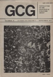
Exploiting Geoscience Collections 12-13 May 2008Ground Floor Plan of the <strong>Geological</strong> SocietyBurlington House, Piccadilly, London30
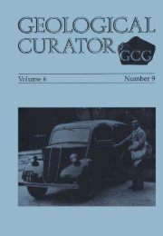
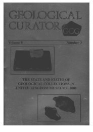
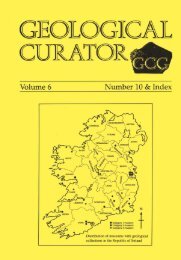
Exploiting Geoscience Collections 12-13 May 2008Evening ReceptionMonday 12 th May 2008After Exploiting Geoscience Collections ConferencePublished with kind permission of Webmaster of www.ilmot.co.ukVenue:The Captain’s Cabin Pub6.00pm onwards(in the upstairs function room)Address:4-7 Norris Street, LONDON,SW1Y 4RJ(5-minute walk from BurlingtonHouse)Location mapPICCADILLYCIRCUSBurlingtonHousePICCADILLYCaptain’sCabinRegent StHaymarket31
Exploiting Geoscience Collections 12-13 May 200832
Exploiting Geoscience CollectionsConference ProgrammeCONFERENCE -- Day 18.30 COFFEE AND REGISTRATIONCOLLECTIONS -- A NATIONAL ASSET9.00 IntroductionJeremy Giles, British <strong>Geological</strong> SurveyKey speakers9.40 How do we value geologicalcollections?Professor Richard Fortey10.20 <strong>Geological</strong> collections and planning-- what is the relevance?Dr Brian Marker OBE11.10 Economic and wider benefits of theBritish <strong>Geological</strong> Survey’s geospatialinformation data-setsDr Richard Hughes11.40 Old samples -- new questionsDr Angela Ehling12.05 Exploiting Geoscience Collections:from paper collections to 3D modelsJenny Walsby, Marieta Garcia-Bajo12.30 LUNCH16.00 The contribution of serendipity tothe exploitation of geoscience collectionsMike Howe16.25 Collections management at the<strong>Geological</strong> Survey of Canada, EarthScience Sector, Natural ResourcesCanadaJean Dougherty16.50 System of storage of geologicalcollections in RussiaLeonid Kolbantsev17.15 The problem with paperPaul Duller17.40 Discussion18.00 Evening Reception(See inside back cover for Day 2)MANAGING COLLECTIONS13.30 Managing collections forexploitationJeremy Giles13.55 <strong>Geological</strong> map and memoircollections as a source of data on thequality of the rock recordAlistair McGowan14.20 Discoveries of mineral depositsusing mineral collections in RussianmuseumsVladimir Kuzmin14.45 Falklands fossils -- famous,forgotten and filched?Philip Stone15.10 The role of standards in sharinggeological collections data through theGEOCase NetworkCharles Copp15.35 COFFEESponsors:
CONFERENCE -- Day 28.30 COFFEECOLLECTIONS TECHNOLOGY9.00 IntroductionJeremy Giles9.10 Opening up -- how to exposegeoscience information to the mashupgenerationTom Steinberg10.00 A new perspective on old data:making geological prior informationaccessible in the fieldwork environmentAndy Howard10.25 GNOSIS: Generalized NaturalSciences Online Spatial InformationSystemM F Alonso15.40 Identifying ‘Golden Spikeboreholes’ for the National BoreholeInformation Capture ProjectAndy Kingdon16.00 U.S. <strong>Geological</strong> Names Lexicon(GEOLEX)Nancy StammImproving online ordering of recordsscansKeith Westhead16.20 The role of standardsin sharing geological collections datathrough the GEOCase NetworkCharles Copp16.40 Archiving digital 3D modeledgeological data: the BGS approachHelen Glaves17.00 Wrap-up and discussion17.20 End10.50 COFFEE11.20 Geoscience collections for nongeoscientists:an online teaching andreference sourceDr Hazel McGoff11.45 Collections on the web -- what is theimpact on access?C G Miller12.10 Template: realization of aterritorially distributed database conceptL Kuvshinva12.35 LUNCHCOLLECTIONS CASE STUDIES13.30 Standards development and theU.S. National <strong>Geological</strong> Map DatabaseDavid Soller13.50 Acres of Antarctic rock: a uniqueresource for the futureHilary Blagborough14.10 Data and services at the NEODCSteve Donegan14.30 Bags of sand and dirt -- exploitingthe British <strong>Geological</strong> Survey’senvironmental samples and databaseChris Johnson14.50 Discriminating faunal assemblagesand their paleoecology based on museumcollections: the carboniferous hurlet andindex limestones of Western ScotlandMark DeanPOSTERSAcres of Antarctic rock: A unique resourcefor the futureH J Blagborough and A J TateThe use of the Recorder 6 database ingeological collections documentationCharles CoppCollections of Academician F.N.Tschernyschew Central Research<strong>Geological</strong> Prospecting MuseumOleg Petrov and Dr Aleksey Sokolov15.10 COFFEE