Master Plan Development - City of Boca Raton
Master Plan Development - City of Boca Raton
Master Plan Development - City of Boca Raton

Create successful ePaper yourself
Turn your PDF publications into a flip-book with our unique Google optimized e-Paper software.
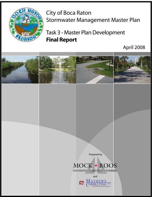
<strong>City</strong> <strong>of</strong> <strong>Boca</strong> <strong>Raton</strong>Stormwater Management <strong>Master</strong> <strong>Plan</strong>Task 3 - <strong>Master</strong> <strong>Plan</strong> <strong>Development</strong>Final ReportApril 2008Prepared by• •andM ATHEWSONSULTINGINC.CCivil and Environmental Engineers
<strong>City</strong> <strong>of</strong> <strong>Boca</strong> <strong>Raton</strong> Stormwater Management <strong>Master</strong> <strong>Plan</strong>Engineer’s Signature PageEngineer’s Signature PageI hereby state, as a Pr<strong>of</strong>essional Engineer in the State <strong>of</strong> Florida, that this report titled “<strong>City</strong> <strong>of</strong> <strong>Boca</strong> <strong>Raton</strong>Stormwater Management <strong>Master</strong> <strong>Plan</strong> Task 3 – <strong>Master</strong> <strong>Plan</strong> <strong>Development</strong>” and dated April 2008, wasprepared and assembled under my direct responsible charge.Alan D. Wertepny, P.E.Project Manager, Mock•RoosFlorida P.E. No. 32350DateMock, Roos & Associates, Inc.5720 Corporate WayWest Palm Beach, FL 33407Florida E.B. No. 48L:\boca\bocaswmp\A6016.03\rp02accm.docPage iMOCK•ROOS
<strong>City</strong> <strong>of</strong> <strong>Boca</strong> <strong>Raton</strong> Stormwater Management <strong>Master</strong> <strong>Plan</strong>Table <strong>of</strong> ContentsTable <strong>of</strong> ContentsEngineer’s Signature Page .................................................................................................................... iPart 1 – Task 3 Report.............................................................................................................................1A. Introduction ................................................................................................................................1B. Problem Areas ...........................................................................................................................1C. Field Observations....................................................................................................................1D. Conceptual Projects <strong>Development</strong>/Cost Estimates/Water Quality Impacts..............2New Floresta Stormwater Management System Improvements ..................................................5NW 36th Court Stormwater System Improvements......................................................................9Old Floresta Area Stormwater Management Improvements ......................................................13NW 5th Avenue Stormwater System Improvements ..................................................................17NE 25th Terrace Stormwater Management Improvements ........................................................23NE 6th Drive Stormwater System Improvements .......................................................................27University Heights Stormwater System Improvements...............................................................31Por La Mar Stormwater Management System Improvements....................................................35University Gardens Stormwater System Improvements .............................................................39NE 5th Avenue Stormwater Management Improvements ..........................................................43Palm Beach Farms Stormwater Management Improvements....................................................47Spanish River Road Stormwater Management System Improvements .....................................51New Pines Stormwater Community Improvement Project..........................................................55E. Meetings with Advisory Boards ..........................................................................................59F. Prioritization <strong>of</strong> Proposed Projects....................................................................................59G. Other System Improvements ...............................................................................................62Part 2 – Stormwater Management <strong>Master</strong> <strong>Plan</strong> ..............................................................................63A. S<strong>of</strong>t Projects.............................................................................................................................63B. Capital Projects .......................................................................................................................66C. Summary ...................................................................................................................................67L:\boca\bocaswmp\A6016.03\rp02accm.docPage iiMOCK•ROOS
<strong>City</strong> <strong>of</strong> <strong>Boca</strong> <strong>Raton</strong> Stormwater Management <strong>Master</strong> <strong>Plan</strong>Table <strong>of</strong> ContentsList <strong>of</strong> FiguresConceptual Project Locations MapList <strong>of</strong> TablesScoring CriteriaPrioritized List <strong>of</strong> ProjectsFinal RecommendationsList <strong>of</strong> AppendicesAppendix A – Task 1 Existing Conditions DocumentationAppendix B – Task 2 Regulatory Information SummaryL:\boca\bocaswmp\A6016.03\rp02accm.docPage iiiMOCK•ROOS
<strong>City</strong> <strong>of</strong> <strong>Boca</strong> <strong>Raton</strong> Stormwater Management <strong>Master</strong> <strong>Plan</strong>Part I – Task 3 ReportPart 1 – Task 3 ReportA. IntroductionThis Technical Memorandum Number 3 constitutes the final report and deliverable, completing theservices authorized for Mock•Roos to prepare a Stormwater Management <strong>Master</strong> <strong>Plan</strong> for the <strong>City</strong> <strong>of</strong><strong>Boca</strong> <strong>Raton</strong> (“<strong>City</strong>”).The previously completed Technical Memoranda Numbers 1 and 2 which document the Task 1 and Task2 services, are included here for completeness and reference, in Appendices A and B, respectively.Task 3 <strong>of</strong> the Scope <strong>of</strong> Services included conducting field observations <strong>of</strong> the areas identified by the <strong>City</strong>as more sigificant problem areas; identifying conceptual projects to address the problems; preparingconceptual cost estimates for construction <strong>of</strong> the conceptual projects; identifying the anticipated waterquality impacts <strong>of</strong> the proposed projects; meeting(s) with the Environmental, Finance, and MarineAdvisory Boards to review the conceptual projects; prioritizing the conceptual projects using a rankingmatrix; and preparing a Stormwater Management <strong>Master</strong> <strong>Plan</strong>.B. Problem AreasThe initial effort in identifying potential future stormwater system improvement projects was to review andmap the outstanding drainage complaints from residents <strong>of</strong> the <strong>City</strong>. To this, <strong>City</strong> staff added other knownflood-prone areas. Many <strong>of</strong> the resident complaints were evaluated in a drainage complaint studycompleted by Williams, Hatfield & Stoner (“WHS”) in 1998 and the observations documented in thatreport were considered during the review process for this effort. Neighborhoods where there were multiplecomplaints and areas identified by the <strong>City</strong> as recurrent or more widespread problem areas were identifiedas potential project areas. Fifteen project areas were initially identified. It was agreed with the <strong>City</strong> thateach area would undergo field observation to identify potential conceptual solutions to alleviate theproblem(s). Because <strong>of</strong> their isolated nature, the balance <strong>of</strong> the outstanding drainage complaints will beaddressed on a case-by-case basis, rather than as larger-scale projects that are being conceptualized here.C. Field ObservationsThe initial field observations were conducted in dry weather, which allowed the identification <strong>of</strong> obviousdrainage problems. Each <strong>of</strong> the identified problem areas was visited and documented with notes andphotographs. It was evident that many <strong>of</strong> the individual resident complaints were the result <strong>of</strong> inoperativeswale systems. The loss <strong>of</strong> swale function was observed in most cases to be the result <strong>of</strong> landscaping thathad been planted by adjacent homeowners, or simply sod, grass, and/or soil accumulation that resulted inthe swales being at a higher elevation than the adjacent driveways. These conditions cause the drives androads to flood before the elevated swales. Another common observation was <strong>of</strong> older systems consisting<strong>of</strong> dry wells, that is, inlets that have no outfall. Dry wells serve as holes for the storage <strong>of</strong> run<strong>of</strong>f until itseeps into the ground below them. Inlets with very small grates, possibly too small to accommodate theirdrainage area were also observed, as were other inlets in need <strong>of</strong> cleaning and/or maintenance. HighL:\boca\bocaswmp\A6016.03\rp02accm.docPage 1MOCK•ROOS
<strong>City</strong> <strong>of</strong> <strong>Boca</strong> <strong>Raton</strong> Stormwater Management <strong>Master</strong> <strong>Plan</strong>Part I – Task 3 Reportwater marks were observed in some locations, indicating that ponding had occurred to that observed levelduring a prior rainfall event.For the areas where swale degradation on individual lots appeared to be the primary cause <strong>of</strong> the pondingcomplaints, it was discussed and agreed with the <strong>City</strong> that no conceptual project development wasnecessary. Several <strong>of</strong> the initially identified areas were eliminated for this reason or because the problemhad already been addressed by the <strong>City</strong> or a resident.The next occurrence <strong>of</strong> field observations occurred during a rainfall event in February 2008, when the<strong>City</strong> received approximately 3”- 4” <strong>of</strong> rain. Again, the identified problem areas were visited anddocumented with notes and photographs. In all cases the rainfall confirmed the reported problem(s).While driving from one location to another, two additional problem areas were identified, documented,and after discussion with the <strong>City</strong>, were added to the list <strong>of</strong> potential project areas.D. Conceptual Projects <strong>Development</strong>/Cost Estimates/Water Quality ImpactsA team <strong>of</strong> three engineers conducted the field observations, reviewed the documentation, and discussedpossible solutions to the observed problems. This approach allowed informed discussion <strong>of</strong> viablecorrective measures that were ultimately developed into a conceptual project for each area. It was noted,due to missing information (location <strong>of</strong> other utilities, specific topographic data, pipe conditions (in somecases), soil conditions, drainage areas, etc.), that projects being proposed should be considered onlyconceptual at this time.It is anticipated that the preliminary engineering for most <strong>of</strong> these projects will include geotechnicaltesting <strong>of</strong> the soils, surveying (including other existing utility information) and proposed system analyses.This information is necessary to determine if the conceptual project is viable given specific siteconditions. It is not unusual for this additional information to result in the modification <strong>of</strong> some <strong>of</strong> theproposed conceptual improvements, in order to accommodate site conditions. In many cases, additionalinformation will allow for an improved design that may not have been considered before the confirmation<strong>of</strong> the facts. It is important that the <strong>City</strong> recognize this possibility and be open to future solutions thatmay be <strong>of</strong>fered for the problem areas. It is anticipated that during the preliminary engineering phase,calculations will be performed on the level <strong>of</strong> service provided by the existing system and the level thatwill be achieved by the proposed system. These analyses will indicate whether the proposedimprovements will achieve the level <strong>of</strong> service targeted by the <strong>City</strong> for that particular use (parking lot,local street, collector road, etc.) or whether additional improvements are needed.Based upon the conceptual nature <strong>of</strong> the proposed improvements, conceptual-level opinions <strong>of</strong>construction cost were prepared. Unit prices were based on information available for recently bid andconstructed stormwater projects and/or information gathered from contractors and their suppliers. Thisconceptual level <strong>of</strong> accuracy represents an “order <strong>of</strong> magnitude” estimate which will allow the <strong>City</strong> tobudget for completion <strong>of</strong> the design and construction.During the development <strong>of</strong> the conceptual projects, an effort was made to incorporate water qualityimprovements to each project. In general, dry retention/detention areas and exfiltration trench were theL:\boca\bocaswmp\A6016.03\rp02accm.docPage 2MOCK•ROOS
<strong>City</strong> <strong>of</strong> <strong>Boca</strong> <strong>Raton</strong> Stormwater Management <strong>Master</strong> <strong>Plan</strong>Part I – Task 3 Reportwater quality systems initially considered. In the majority <strong>of</strong> areas, no positive outfall currently exists;the run<strong>of</strong>f is intended to infiltrate the ground. This type <strong>of</strong> stormwater management system inherentlyincludes a water quality improvement mechanism by allowing run<strong>of</strong>f to be filtered by the soil beforereaching the ground water surface, or by allowing nutrients to be taken up by the vegetation. In manycases, the conceptual projects do not provide additional water quality, but they do maintain or enhance thestormwater run<strong>of</strong>f’s ability to infiltrate the ground, rather than pond in streets and drives.The conceptual project locations are shown and listed on the following figure. A description, photographs,an exhibit <strong>of</strong> the conceptual project, and the conceptual cost estimate for each conceptual projectfollow. The existing <strong>City</strong>-owned utilities shown on the exhibits were provided by the <strong>City</strong> during theTask 1 phase.The <strong>Boca</strong> Heights neighborhood has had historic flooding problems. The <strong>City</strong> Utility Department hasbeen negotiating with its water/sewer consulting engineer for a water and sewer rehabilitation project inthe <strong>Boca</strong> Heights neighborhood that will also include stormwater improvements. Although this project isentering the design phase, the <strong>City</strong> requested that it be included in the Stormwater Management <strong>Master</strong><strong>Plan</strong>. The location <strong>of</strong> the project area is shown on the following map.L:\boca\bocaswmp\A6016.03\rp02accm.docPage 3MOCK•ROOS
<strong>City</strong> <strong>of</strong> <strong>Boca</strong> <strong>Raton</strong> Stormwater Management <strong>Master</strong> <strong>Plan</strong>Part I – Task 3 ReportL:\boca\bocaswmp\A6016.03\rp02accm.docPage 4MOCK•ROOS
<strong>City</strong> <strong>of</strong> <strong>Boca</strong> <strong>Raton</strong> Stormwater Management <strong>Master</strong> <strong>Plan</strong>Part I – Task 3 ReportNew Floresta Stormwater Management System ImprovementsPotomacRoad, lookingeast (fromnear westernmostinlet)NW 27TH AVENUEPOTOMAC ROADPotomacRoad,lookingwest (fromintersectionwith NW27 th Ave.)L:\boca\bocaswmp\A6016.03\rp02accm.docPage 6MOCK•ROOS
<strong>City</strong> <strong>of</strong> <strong>Boca</strong> <strong>Raton</strong> Stormwater Management <strong>Master</strong> <strong>Plan</strong>Part I – Task 3 ReportL:\boca\bocaswmp\A6016.03\rp02accm.docPage 7MOCK•ROOS
<strong>City</strong> <strong>of</strong> <strong>Boca</strong> <strong>Raton</strong> Stormwater Management <strong>Master</strong> <strong>Plan</strong>Part I – Task 3 ReportNew Floresta Stormwater Management System ImprovementsEngineer’s Opinion <strong>of</strong> Conceptual Costs<strong>City</strong> <strong>of</strong> <strong>Boca</strong> <strong>Raton</strong> Stormwater Management <strong>Master</strong> <strong>Plan</strong>ITEM DESCRIPTION QTY UNIT UNIT PRICE TOTAL1. Mobilization 1 LS $25,000 $25,0002. Maintenance <strong>of</strong> Traffic 1 LS $10,000 $10,0003. Preconstruction Video 1 LS $1,500 $1,5004. Survey & Layout 1 LS $5,000 $5,0005. Record Drawings 1 LS $1,500 $1,5006. Clearing & Grubbing 1 LS $10,000 $10,0007. Remove Exist. Sidewalk 6200 SF $2 $12,4008. Remove Exist. Header Curb 30 LF $10 $3009. Inlet, Type C 6 EA $4,000 $24,00010. Connect to Exist. Inlet 1 EA $2,500 $2,50011. Exfiltration Trench, 18" RCP 1200 LF $120 $144,00012. Reinforced Concrete Pipe, 18" 150 LF $60 $9,00013. Concrete Sidewalk 700 SY $40 $28,00014. Header Curb 30 LF $15 $45015. Pavement Restoration (Pipe Crossings) 275 SY $35 $9,62516. Pavement Restoration (South Lane) 1500 SY $25 $37,50017. Sodding (Floritam) 1350 SY $6 $8,10018. Remove & Replace Traffic Sign 1 EA $250 $25019. Replace Pavement Markings 1 LS $200 $20020. Irrigation Restoration 1 LS $6,075 $6,075Subtotal $335,400Contingency (15%) $50,310Construction Total $385,710Engineering, Legal, & Misc. Costs (20%) $77,142Rounded Project Total $470,000Add Operable Control Structure 1 EA $30,000 $30,000Alternate Project Total $500,000Note: The above costs are based on a conceptual layout <strong>of</strong> the stormwater system for this area. As such, theyare subject to change depending on the final scope <strong>of</strong> the project that is designed and constructed as well asother factors. Estimate is in 2008 dollars.L:\boca\bocaswmp\A6016.03\rp02accm.docPage 8MOCK•ROOS
<strong>City</strong> <strong>of</strong> <strong>Boca</strong> <strong>Raton</strong> Stormwater Management <strong>Master</strong> <strong>Plan</strong>Part I – Task 3 ReportNW 36th Court Stormwater System ImprovementsReported Problem(s): The reported problems are road, yard, and driveway flooding along the southwestside <strong>of</strong> the road, particularly severe at house number 370.System Description: There is no apparent stormwater management system along NW 36 th Court betweenNW 3 rd and NW 4 th Avenues. Site observation indicates that the road cross slopes to the southwest side,and along the alignment, slopes to low point at or near house number 370. The adjacent house to thewest, has a paved swale area in the right-<strong>of</strong>-way.Conceptual Solution(s): The recommended conceptual improvement is to install inlets and exfiltrationtrench along the southwest side <strong>of</strong> the road, re-grade the grassed area on the northeast side <strong>of</strong> the road as aretention area, and connect the exfiltration trench to the retention area via a pipe under the road.Water Quality Impacts: The proposed conceptual solution is anticipated to have a positive impact onwater quality. Run<strong>of</strong>f will more readily enter the ground water system than it currently does. This resultsin less travel time over potentially contaminated ground surface.L:\boca\bocaswmp\A6016.03\rp02accm.docPage 9MOCK•ROOS
<strong>City</strong> <strong>of</strong> <strong>Boca</strong> <strong>Raton</strong> Stormwater Management <strong>Master</strong> <strong>Plan</strong>Part I – Task 3 ReportNW 36th Court Stormwater System Improvements370 NW 36TH COURTLooking south atfloodingHomeowner photo<strong>of</strong> floodingFlooding in yard at370 NW 36 TH CourtGrass area onnortheast side <strong>of</strong>NW 36 th Court(area proposed forretention area)L:\boca\bocaswmp\A6016.03\rp02accm.docPage 10MOCK•ROOS
<strong>City</strong> <strong>of</strong> <strong>Boca</strong> <strong>Raton</strong> Stormwater Management <strong>Master</strong> <strong>Plan</strong>Part I – Task 3 ReportL:\boca\bocaswmp\A6016.03\rp02accm.docPage 11MOCK•ROOS
<strong>City</strong> <strong>of</strong> <strong>Boca</strong> <strong>Raton</strong> Stormwater Management <strong>Master</strong> <strong>Plan</strong>Part I – Task 3 ReportNW 36th Court Stormwater System ImprovementsEngineer’s Opinion <strong>of</strong> Conceptual Costs<strong>City</strong> <strong>of</strong> <strong>Boca</strong> <strong>Raton</strong> Stormwater Management <strong>Master</strong> <strong>Plan</strong>ITEM DESCRIPTION QTY UNIT UNIT PRICE TOTAL1. Mobilization 1 LS $5,000 $5,0002. Maintenance <strong>of</strong> Traffic 1 LS $3,000 $3,0003. Preconstruction Video 1 LS $200 $2004. Survey & Layout 1 LS $600 $6005. Record Drawings 1 LS $200 $2006. Clearing & Grubbing 1 LS $5,000 $5,0007. Remove Exist. Sidewalk 550 SF $2 $1,1008. Inlet, Type C 3 EA $4,000 $12,0009. Exfiltration Trench, 18" RCP 135 LF $120 $16,20010. Reinforced Concrete Pipe, 18" 30 LF $60 $1,80011. Concrete Sidewalk 60 SY $40 $2,40012. Concrete Driveway 35 SY $50 $1,75013. Pavement Restoration (Pipe Crossing) 30 SY $35 $1,05014. Sodding (Floritam) 1150 SY $6 $6,90015. Irrigation Restoration 1 LS $5,175 $5,175Subtotal $62,375Contingency (15%) $9,356Construction Total $71,731Engineering, Legal, & Misc. Costs (20%) $14,346Rounded Project Total $87,000Note: The above costs are based on a conceptual layout <strong>of</strong> the stormwater system for this area. Assuch, they are subject to change depending on the final scope <strong>of</strong> the project that is designed andconstructed as well as other factors. Estimate is in 2008 dollars.L:\boca\bocaswmp\A6016.03\rp02accm.docPage 12MOCK•ROOS
<strong>City</strong> <strong>of</strong> <strong>Boca</strong> <strong>Raton</strong> Stormwater Management <strong>Master</strong> <strong>Plan</strong>Part I – Task 3 ReportOld Floresta Area Stormwater Management ImprovementsReported Problem(s): The complaints on Aurelia Street (a/k/a NW 5th Street) and Hibiscus Street havebeen many since 1994. Severe ponding was also noted at the east end <strong>of</strong> these two streets during aFebruary 2008 rainfall event.System Description: There is no drainage system in this area. It appears that the original intent was forswales to accommodate the stormwater run<strong>of</strong>f. The <strong>City</strong>’s right-<strong>of</strong>-way along these two streets hasalmost entirely been encroached upon by the adjacent homeowners with extensive amounts <strong>of</strong>landscaping.Conceptual Solution(s): It is recognized that reclamation and restoration <strong>of</strong> the intended swales alongthese two streets would significantly alter the character <strong>of</strong> the streets and neighborhood. Furthermore,Aurelia and Hibiscus Streets, as well as NW 8 th and 9 th Avenues have existing utilities beneath them thatseverely restrict the addition <strong>of</strong> any additional utility lines, such as for stormwater collection. Given theselimitations, the recommended conceptual improvement for this area is the consideration <strong>of</strong> a perviouspavement system for Aurelia and Hibiscus Streets, as well as the right-<strong>of</strong>-way along NW 8 th Avenue,between Periwinkle and Oleander Streets. Pervious pavement technology has been used successfully formany years and is gaining popularity in Florida as a stormwater management tool.Water Quality Impacts: The proposed conceptual solution is anticipated to have a positive impact onwater quality. Run<strong>of</strong>f will more readily enter the ground water system than it currently does. This resultsin less travel time over potentially contaminated ground surface.L:\boca\bocaswmp\A6016.03\rp02accm.docPage 13MOCK•ROOS
<strong>City</strong> <strong>of</strong> <strong>Boca</strong> <strong>Raton</strong> Stormwater Management <strong>Master</strong> <strong>Plan</strong>Part I – Task 3 ReportOld Floresta Area Stormwater Management ImprovementsNW 8TH AVENUEFlooding on HibiscusStreet, looking eastHalfway onHibiscus StreetAURELIA STREETHalfway onAurelia StreetFlooding atintersection <strong>of</strong> AureliaStreet and NW 8 thAvenue, looking westAsphaltNW 8 th Avenue,looking south (fromnear PeriwinkleStreet)L:\boca\bocaswmp\A6016.03\rp02accm.docPage 14MOCK•ROOS
<strong>City</strong> <strong>of</strong> <strong>Boca</strong> <strong>Raton</strong> Stormwater Management <strong>Master</strong> <strong>Plan</strong>Part I – Task 3 ReportL:\boca\bocaswmp\A6016.03\rp02accm.docPage 15MOCK•ROOS
<strong>City</strong> <strong>of</strong> <strong>Boca</strong> <strong>Raton</strong> Stormwater Management <strong>Master</strong> <strong>Plan</strong>Part I – Task 3 ReportOld Floresta Area Stormwater Management ImprovementsEngineer’s Opinion <strong>of</strong> Conceptual Costs<strong>City</strong> <strong>of</strong> <strong>Boca</strong> <strong>Raton</strong> Stormwater Management <strong>Master</strong> <strong>Plan</strong>ITEM DESCRIPTION QTY UNIT UNIT PRICE TOTAL1. Mobilization 1 LS $15,000 $15,0002. Maintenance <strong>of</strong> Traffic 1 LS $5,000 $5,0003. Preconstruction Video 1 LS $1,500 $1,5004. Survey & Layout 1 LS $5,000 $5,0005. Record Drawings 1 LS $1,500 $1,5006. Clearing & Grubbing 1 LS $15,000 $15,0007. Pervious Pavement 2950 SY $60 $177,0008. Remove & Replace Traffic Sign 4 EA $200 $8009. Replace Pavement Markings 1 LS $400 $400Subtotal $221,200Contingency (15%) $33,180Construction Total $254,380Engineering, Legal, & Misc. Costs (20%) $50,876Rounded Project Total $310,000Note: The above costs are based on a conceptual layout <strong>of</strong> the stormwater system for this area. As such, theyare subject to change depending on the final scope <strong>of</strong> the project that is designed and constructed as well asother factors. Estimate is in 2008 dollars.L:\boca\bocaswmp\A6016.03\rp02accm.docPage 16MOCK•ROOS
<strong>City</strong> <strong>of</strong> <strong>Boca</strong> <strong>Raton</strong> Stormwater Management <strong>Master</strong> <strong>Plan</strong>Part I – Task 3 ReportNW 5th Avenue Stormwater System ImprovementsReported Problem(s): Ponding occurs regularly at the corner <strong>of</strong> NW 5 th Avenue and the short connectorroad considered part <strong>of</strong> NW 4 th Court.System Description: There is an inlet on the southeast corner <strong>of</strong> this intersection. This structure has apipe connection to the west; but across the street, where a second inlet would be expected, there is anewly reconstructed driveway and small landscaped island. It is presumed that an inlet in this area hasbeen filled or covered over. The ultimate outfall, if any, is unknown.Conceptual Solution(s): The recommended conceptual project is to construct a dry retention area alongthe northwest side <strong>of</strong> NW 5 th Avenue, just north <strong>of</strong> NW 35 th Street. (The <strong>City</strong> has a 100-foot right-<strong>of</strong>-wayfor NW 5 th Avenue and currently uses only about 20 feet for the existing road.) A pair <strong>of</strong> new inlets at theproblem intersection is proposed to be connected, via a bubble-up structure, to the dry retention area.Water Quality Impacts: The proposed conceptual solution is anticipated to have a positive impact onwater quality. Run<strong>of</strong>f will more readily enter the ground water system than it currently does. This resultsin less travel time over potentially contaminated ground surface.L:\boca\bocaswmp\A6016.03\rp02accm.docPage 17MOCK•ROOS
<strong>City</strong> <strong>of</strong> <strong>Boca</strong> <strong>Raton</strong> Stormwater Management <strong>Master</strong> <strong>Plan</strong>Part I – Task 3 ReportNW 5th Avenue Stormwater System ImprovementsPonding alongNW 5 th Avenue,looking southFlooding at inletadjacent to theintersection <strong>of</strong>NW 5 th Avenueand NW 4 th CourtNW 4TH COURTEXISTING INLETNW 5TH AVENUENW 4TH COURTFlooding at theintersection <strong>of</strong>NW 5 th Avenueand NW 4 thCourt, lookingwestL:\boca\bocaswmp\A6016.03\rp02accm.docPage 18MOCK•ROOS
<strong>City</strong> <strong>of</strong> <strong>Boca</strong> <strong>Raton</strong> Stormwater Management <strong>Master</strong> <strong>Plan</strong>Part I – Task 3 ReportNW 4TH COURTGrassed areaat theintersection <strong>of</strong>NW 5thAvenue andNW 35 thStreet,looking southNW 4TH COURTGrassed areaat theintersection<strong>of</strong> NW 5 thAvenue andNW 35 thStreet,looking northL:\boca\bocaswmp\A6016.03\rp02accm.docPage 19MOCK•ROOS
<strong>City</strong> <strong>of</strong> <strong>Boca</strong> <strong>Raton</strong> Stormwater Management <strong>Master</strong> <strong>Plan</strong>Part I – Task 3 ReportL:\boca\bocaswmp\A6016.03\rp02accm.docPage 20MOCK•ROOS
<strong>City</strong> <strong>of</strong> <strong>Boca</strong> <strong>Raton</strong> Stormwater Management <strong>Master</strong> <strong>Plan</strong>Part I – Task 3 ReportNW 5th Avenue Stormwater System ImprovementsEngineer’s Opinion <strong>of</strong> Conceptual Costs<strong>City</strong> <strong>of</strong> <strong>Boca</strong> <strong>Raton</strong> Stormwater Management <strong>Master</strong> <strong>Plan</strong>ITEM DESCRIPTION QTY UNIT UNIT PRICE TOTAL1. Mobilization 1 LS $4,000 $4,0002. Maintenance <strong>of</strong> Traffic 1 LS $3,000 $3,0003. Preconstruction Video 1 LS $400 $4004. Survey & Layout 1 LS $1,600 $1,6005. Record Drawings 1 LS $400 $4006. Clearing & Grubbing 1 LS $5,000 $5,0007. Excavation 1000 CY $15 $15,0008. Inlet, Type C 3 EA $4,000 $12,0009. Reinforced Concrete Pipe, 18" 125 LF $60 $7,50010. Sodding (Floritam) 1275 SY $6 $7,65011. Irrigation Restoration 1 LS $5,738 $5,738Subtotal $62,288Contingency (15%) $9,343Construction Total $71,631Engineering, Legal, & Misc. Costs (20%) $14,326Rounded Project Total $86,000Note: The above costs are based on a conceptual layout <strong>of</strong> the stormwater system for this area.As such, they are subject to change depending on the final scope <strong>of</strong> the project that is designedand constructed as well as other factors. Estimate is in 2008 dollars.L:\boca\bocaswmp\A6016.03\rp02accm.docPage 21MOCK•ROOS
<strong>City</strong> <strong>of</strong> <strong>Boca</strong> <strong>Raton</strong> Stormwater Management <strong>Master</strong> <strong>Plan</strong>Part I – Task 3 Report(This page left intentionally blank)L:\boca\bocaswmp\A6016.03\rp02accm.docPage 22MOCK•ROOS
<strong>City</strong> <strong>of</strong> <strong>Boca</strong> <strong>Raton</strong> Stormwater Management <strong>Master</strong> <strong>Plan</strong>Part I – Task 3 ReportNE 25th Terrace Stormwater Management ImprovementsReported Problem(s): NE 25th Terrace experiences severe flooding at the east end near the intersectionwith Federal Highway. This was evident from the high water marks that extended beyond the back <strong>of</strong>sidewalk on the southwest corner <strong>of</strong> the intersection.System Description: The east end <strong>of</strong> NE 25 th Terrace (at the intersection) is the low point and water mustpond to reach either <strong>of</strong> the swales (north or south) on Federal Highway. A pair <strong>of</strong> inlets and exfiltrationtrench was installed along the south side <strong>of</strong> NE 25 th Terrace (presumably when the southwest cornerproperty was developed). It appears that this system is inadequate to handle the volume <strong>of</strong> run<strong>of</strong>f thatcollects in this location.Conceptual Solution(s): The recommended conceptual project is the installation <strong>of</strong> additional inlets andexfiltation trench along the north side <strong>of</strong> NE 25 th Terrace. It appears that the trench could extend all theway west to NE 5 th Avenue, which would provide a greater level <strong>of</strong> service than a shorter run <strong>of</strong> trench.Water Quality Impacts: The proposed conceptual solution is anticipated to have a positive impact onwater quality. Run<strong>of</strong>f will more readily enter the ground water system than it currently does. This resultsin less travel time over potentially contaminated ground surface.L:\boca\bocaswmp\A6016.03\rp02accm.docPage 23MOCK•ROOS
<strong>City</strong> <strong>of</strong> <strong>Boca</strong> <strong>Raton</strong> Stormwater Management <strong>Master</strong> <strong>Plan</strong>Part I – Task 3 ReportNE 25th Terrace Stormwater Management ImprovementsSouthwest corner atintersection <strong>of</strong> NE25 th Terrace andFederal Highway,looking westDebris indicateshigh water levelPonding along road indicatesFederal Highway stormwatersystem may not handle run<strong>of</strong>ffrom NE 25 th TerraceSouthwest corner atintersection <strong>of</strong> NE 25 thTerrace and FederalHighway, lookingnorthNE 25 th Terrace justwest <strong>of</strong> FederalHighway, lookingnortheastL:\boca\bocaswmp\A6016.03\rp02accm.docPage 24MOCK•ROOS
<strong>City</strong> <strong>of</strong> <strong>Boca</strong> <strong>Raton</strong> Stormwater Management <strong>Master</strong> <strong>Plan</strong>Part I – Task 3 ReportL:\boca\bocaswmp\A6016.03\rp02accm.docPage 25MOCK•ROOS
<strong>City</strong> <strong>of</strong> <strong>Boca</strong> <strong>Raton</strong> Stormwater Management <strong>Master</strong> <strong>Plan</strong>Part I – Task 3 ReportNE 25th Terrace Stormwater Management ImprovementsEngineer’s Opinion <strong>of</strong> Conceptual Costs<strong>City</strong> <strong>of</strong> <strong>Boca</strong> <strong>Raton</strong> Stormwater Management <strong>Master</strong> <strong>Plan</strong>ITEM DESCRIPTION QTY UNIT UNIT PRICE TOTAL1. Mobilization 1 LS $7,500 $7,5002. Maintenance <strong>of</strong> Traffic 1 LS $5,000 $5,0003. Preconstruction Video 1 LS $400 $4004. Survey & Layout 1 LS $1,500 $1,5005. Record Drawings 1 LS $400 $4006. Clearing & Grubbing 1 LS $7,500 $7,5007. Inlet, Type C 2 EA $4,000 $8,0008. Exfiltration Trench, 24" RCP 300 LF $140 $42,0009. Reinforced Concrete Pipe, 24" 10 LF $80 $80010. Asphalt Driveway 100 SY $40 $4,00011. Pavement Restoration (North Lane) 500 SY $25 $12,50012. Sodding (Floritam) 5 SY $6 $3013. Remove & Replace Traffic Sign 1 EA $250 $25014. Replace Pavement Markings 1 LS $200 $20015. Irrigation Restoration 1 LS $23 $23Subtotal $90,103Contingency (15%) $13,515Construction Total $103,618Engineering, Legal, & Misc. Costs (20%) $20,724Rounded Project Total $130,000Note: The above costs are based on a conceptual layout <strong>of</strong> the stormwater system for this area.As such, they are subject to change depending on the final scope <strong>of</strong> the project that is designedand constructed as well as other factors. Estimate is in 2008 dollars.L:\boca\bocaswmp\A6016.03\rp02accm.docPage 26MOCK•ROOS
<strong>City</strong> <strong>of</strong> <strong>Boca</strong> <strong>Raton</strong> Stormwater Management <strong>Master</strong> <strong>Plan</strong>Part I – Task 3 ReportNE 6th Drive Stormwater System ImprovementsReported Problem(s): No problems have been reported on this street; however, during a February 2008rainfall event, ponding was observed on the street between Broadview and Harbour Drives.System Description: The <strong>City</strong>’s GIS indicates that there are inlets and piping that outfall to theIntracoastal Waterway (“ICWW”) on the east side <strong>of</strong> the street; however, field observation indicates thatthe ponding at the intersections can not reach the inlets.Conceptual Solution(s): The recommended conceptual improvement is the addition <strong>of</strong> inlets at theintersections and piping and exfiltration trench that connect to the existing outfall.Water Quality Impacts: The proposed conceptual solution includes the use <strong>of</strong> exfiltration trench toprovide added water quality to the system.L:\boca\bocaswmp\A6016.03\rp02accm.docPage 27MOCK•ROOS
<strong>City</strong> <strong>of</strong> <strong>Boca</strong> <strong>Raton</strong> Stormwater Management <strong>Master</strong> <strong>Plan</strong>Part I – Task 3 ReportNE 6th Drive Stormwater System ImprovementsFlooding atintersection<strong>of</strong> BroadviewDrive and NE6 th Drive,looking westNE 6TH DRIVEBROADVIEW DRIVENE 6 th Drive,lookingsouthL:\boca\bocaswmp\A6016.03\rp02accm.docPage 28MOCK•ROOS
<strong>City</strong> <strong>of</strong> <strong>Boca</strong> <strong>Raton</strong> Stormwater Management <strong>Master</strong> <strong>Plan</strong>Part I – Task 3 ReportL:\boca\bocaswmp\A6016.03\rp02accm.docPage 29MOCK•ROOS
<strong>City</strong> <strong>of</strong> <strong>Boca</strong> <strong>Raton</strong> Stormwater Management <strong>Master</strong> <strong>Plan</strong>Part I – Task 3 ReportNE 6th Drive Stormwater System ImprovementsEngineer’s Opinion <strong>of</strong> Conceptual Costs<strong>City</strong> <strong>of</strong> <strong>Boca</strong> <strong>Raton</strong> Stormwater Management <strong>Master</strong> <strong>Plan</strong>ITEM DESCRIPTION QTY UNIT UNIT PRICE TOTAL1. Mobilization 1 LS $10,000 $10,0002. Maintenance <strong>of</strong> Traffic 1 LS $5,000 $5,0003. Preconstruction Video 1 LS $350 $3504. Survey & Layout 1 LS $1,400 $1,4005. Record Drawings 1 LS $350 $3506. Clearing & Grubbing 1 LS $7,500 $7,5007. Inlet, Type C 4 EA $4,000 $16,0008. Manhole, Type 7 1 EA $5,000 $5,0009. Exfiltration Trench, 18" RCP 250 LF $120 $30,00010. Reinforced Concrete Pipe, 18" 200 LF $60 $12,00011. Pavement Restoration (Pipe Crossings) 464 SY $35 $16,24012. Pavement Restoration (East Lane) 150 SY $25 $3,75013. Sodding (Floritam) 500 SY $6 $3,00014. Remove & Replace Traffic Sign 2 EA $250 $50015. Replace Pavement Markings 1 LS $200 $20016. Irrigation Restoration 1 LS $2,250 $2,250Subtotal $113,540Contingency (15%) $17,031Construction Total $130,571Engineering, Legal, & Misc. Costs (20%) $26,114Rounded Project Total $160,000Note: The above costs are based on a conceptual layout <strong>of</strong> the stormwater system for this area.As such, they are subject to change depending on the final scope <strong>of</strong> the project that is designedand constructed as well as other factors. Estimate is in 2008 dollars.L:\boca\bocaswmp\A6016.03\rp02accm.docPage 30MOCK•ROOS
<strong>City</strong> <strong>of</strong> <strong>Boca</strong> <strong>Raton</strong> Stormwater Management <strong>Master</strong> <strong>Plan</strong>Part I – Task 3 ReportUniversity Heights Stormwater System ImprovementsReported Problem(s): There was no reported problem in this area, however, during a February, 2008rainfall event, significant flooding was observed at the intersection <strong>of</strong> NW 5 th Lane and NW 46 th Street.System Description: There is no stormwater management system in this neighborhood. Site observationappears to indicate that the intention was for roadway run<strong>of</strong>f to drain from the pavement to the adjacentgrassed areas.Conceptual Solution(s): The recommended conceptual improvement is to add inlets, manholes, andexfiltration trench at the corner <strong>of</strong> NW 5 th Lane and NW 46 th Street to minimize roadway ponding.Water Quality Impacts: The proposed conceptual solution is anticipated to have a positive impact onwater quality. Run<strong>of</strong>f will more readily enter the ground water system than it currently does. This resultsin less travel time over potentially contaminated ground surface.L:\boca\bocaswmp\A6016.03\rp02accm.docPage 31MOCK•ROOS
<strong>City</strong> <strong>of</strong> <strong>Boca</strong> <strong>Raton</strong> Stormwater Management <strong>Master</strong> <strong>Plan</strong>Part I – Task 3 ReportUniversity Heights Stormwater System ImprovementsNW 5TH LANENW 46TH STREETFlooding at the intersection <strong>of</strong> NW 46th Street and NW 5th Lane, looking westL:\boca\bocaswmp\A6016.03\rp02accm.docPage 32MOCK•ROOS
<strong>City</strong> <strong>of</strong> <strong>Boca</strong> <strong>Raton</strong> Stormwater Management <strong>Master</strong> <strong>Plan</strong>Part I – Task 3 ReportL:\boca\bocaswmp\A6016.03\rp02accm.docPage 33MOCK•ROOS
<strong>City</strong> <strong>of</strong> <strong>Boca</strong> <strong>Raton</strong> Stormwater Management <strong>Master</strong> <strong>Plan</strong>Part I – Task 3 ReportUniversity Heights Stormwater System ImprovementsEngineer’s Opinion <strong>of</strong> Conceptual Costs<strong>City</strong> <strong>of</strong> <strong>Boca</strong> <strong>Raton</strong> Stormwater Management <strong>Master</strong> <strong>Plan</strong>ITEM DESCRIPTION QTY UNIT UNIT PRICE TOTAL1. Mobilization 1 LS $5,000 $5,0002. Maintenance <strong>of</strong> Traffic 1 LS $3,000 $3,0003. Preconstruction Video 1 LS $200 $2004. Survey & Layout 1 LS $800 $8005. Record Drawings 1 LS $200 $2006. Clearing & Grubbing 1 LS $5,000 $5,0007. Inlet, Type C 5 EA $4,000 $20,0008. Exfiltration Trench, 18" RCP 150 LF $120 $18,0009. Reinforced Concrete Pipe, 18" 75 LF $60 $4,50010. Pavement Restoration (Pipe Crossings) 100 SY $35 $3,50011. Sodding (Floritam) 200 SY $6 $1,20012. Remove & Replace Traffic Sign 1 EA $250 $25013. Replace Pavement Markings 1 LS $200 $20014. Irrigation Restoration 1 LS $900 $900Subtotal $62,750Contingency (15%) $9,413Construction Total $72,163Engineering, Legal, & Misc. Costs (20%) $14,433Rounded Project Total $87,000Note: The above costs are based on a conceptual layout <strong>of</strong> the stormwater system for this area.As such, they are subject to change depending on the final scope <strong>of</strong> the project that is designedand constructed as well as other factors. Estimate is in 2008 dollars.L:\boca\bocaswmp\A6016.03\rp02accm.docPage 34MOCK•ROOS
<strong>City</strong> <strong>of</strong> <strong>Boca</strong> <strong>Raton</strong> Stormwater Management <strong>Master</strong> <strong>Plan</strong>Part I – Task 3 ReportPor La Mar Stormwater Management System ImprovementsReported Problem(s): <strong>City</strong> staff has indicated that there is repeated flooding at the intersection <strong>of</strong> PalmAvenue and Wavecrest Way. During a rainfall event in February 2008, ponding was also observed alongWavecrest from the intersection south to the corner <strong>of</strong> the road.System Description: From field observation, it appears that this intersection was intended to drain southalong the roadway to inlets at the south end that outfall into the ICWW.Conceptual Solution(s): The recommended conceptual project for this area is to add inlets at theintersection <strong>of</strong> Palm and Wavecrest, construct exfiltration trench along Wavecrest to the south, andconnect to the outfall to the ICWW.Water Quality Impacts: The proposed conceptual solution is anticipated to have a positive impact onwater quality. Run<strong>of</strong>f will more readily enter the ground water system than it currently does. This resultsin less travel time over potentially contaminated ground surface.L:\boca\bocaswmp\A6016.03\rp02accm.docPage 35MOCK•ROOS
<strong>City</strong> <strong>of</strong> <strong>Boca</strong> <strong>Raton</strong> Stormwater Management <strong>Master</strong> <strong>Plan</strong>Part I – Task 3 ReportPor La Mar Stormwater Management System ImprovementsPALM AVENUEFlooding atintersection<strong>of</strong> SEWavecrestWay andPalm Avenue,lookingsouthwestSE WAVECREST WAYIntersection <strong>of</strong> Palm Avenue and SE Wavecrest Way, looking southPALM AVENUEL:\boca\bocaswmp\A6016.03\rp02accm.docPage 36MOCK•ROOS
<strong>City</strong> <strong>of</strong> <strong>Boca</strong> <strong>Raton</strong> Stormwater Management <strong>Master</strong> <strong>Plan</strong>Part I – Task 3 ReportL:\boca\bocaswmp\A6016.03\rp02accm.docPage 37MOCK•ROOS
<strong>City</strong> <strong>of</strong> <strong>Boca</strong> <strong>Raton</strong> Stormwater Management <strong>Master</strong> <strong>Plan</strong>Part I – Task 3 ReportPor La Mar Stormwater Management System ImprovementsEngineer’s Opinion <strong>of</strong> Conceptual Costs<strong>City</strong> <strong>of</strong> <strong>Boca</strong> <strong>Raton</strong> Stormwater Management <strong>Master</strong> <strong>Plan</strong>ITEM DESCRIPTION QTY UNIT UNIT PRICE TOTAL1. Mobilization 1 LS $10,000 $10,0002. Maintenance <strong>of</strong> Traffic 1 LS $5,000 $5,0003. Preconstruction Video 1 LS $500 $5004. Survey & Layout 1 LS $2,000 $2,0005. Record Drawings 1 LS $500 $5006. Clearing & Grubbing 1 LS $5,000 $5,0007. Inlet, Type C 6 EA $4,000 $24,0008. Manhole, Type 7 1 EA $5,000 $5,0009. Clean Existing Outfall Pipe 50 LF $30 $1,50010. Connect to Exist. Pipe 1 EA $2,500 $2,50011. Exfiltration Trench, 18" RCP 275 LF $120 $33,00012. Reinforced Concrete Pipe, 18" 275 LF $60 $16,50013. Pavement Restoration (Pipe Crossings) 125 SY $35 $4,37514. Pavement Restoration (East Lane) 400 SY $25 $10,00015. Sodding (Floritam) 300 SY $6 $1,80016. Remove & Replace Traffic Sign 2 EA $250 $50017. Replace Pavement Markings 1 LS $400 $40018. Irrigation Restoration 1 LS $1,350 $1,350Subtotal $123,925Contingency (15%) $18,589Construction Total $142,514Engineering, Legal, & Misc. Costs (20%) $28,503Rounded Project Total $180,000Note: The above costs are based on a conceptual layout <strong>of</strong> the stormwater system for this area.As such, they are subject to change depending on the final scope <strong>of</strong> the project that is designedand constructed as well as other factors. Estimate is in 2008 dollars.L:\boca\bocaswmp\A6016.03\rp02accm.docPage 38MOCK•ROOS
<strong>City</strong> <strong>of</strong> <strong>Boca</strong> <strong>Raton</strong> Stormwater Management <strong>Master</strong> <strong>Plan</strong>Part I – Task 3 ReportUniversity Gardens Stormwater System ImprovementsReported Problem(s): The problems reported in the area indicate ponding <strong>of</strong> stormwater run<strong>of</strong>f in thevicinity <strong>of</strong> the intersection <strong>of</strong> NW 46 th Street and NW 2 nd Terrace. This ponding was confirmed byobservation during rainfall in February, 2008.System Description: The existing stormwater management system in this area consists <strong>of</strong> degraded grassswale areas and isolated dry-wells with small inlet tops.Conceptual Solution(s): The recommended conceptual project is to replace the existing inlets with newones with larger tops, and connect them together via exfiltration trench under the grassed swale area in theroad right-<strong>of</strong>-way, along the west side <strong>of</strong> NW 2 nd Terrace and along the south side <strong>of</strong> NW 46 th Street.Water Quality Impacts: The proposed conceptual solution is anticipated to have a positive impact onwater quality. Run<strong>of</strong>f will more readily enter the ground water system than it currently does. This resultsin less travel time over potentially contaminated ground surface.L:\boca\bocaswmp\A6016.03\rp02accm.docPage 39MOCK•ROOS
<strong>City</strong> <strong>of</strong> <strong>Boca</strong> <strong>Raton</strong> Stormwater Management <strong>Master</strong> <strong>Plan</strong>Part I – Task 3 ReportUniversity Gardens Stormwater System Improvements284 NW 46 TH STREETFlooding infront <strong>of</strong> 284NW 46 thStreet,looking eastEXISTINGINLETNW 2ND TERRACENW 46TH STREETNW 2 ndTerrace,looking southL:\boca\bocaswmp\A6016.03\rp02accm.docPage 40MOCK•ROOS
<strong>City</strong> <strong>of</strong> <strong>Boca</strong> <strong>Raton</strong> Stormwater Management <strong>Master</strong> <strong>Plan</strong>Part I – Task 3 ReportL:\boca\bocaswmp\A6016.03\rp02accm.docPage 41MOCK•ROOS
<strong>City</strong> <strong>of</strong> <strong>Boca</strong> <strong>Raton</strong> Stormwater Management <strong>Master</strong> <strong>Plan</strong>Part I – Task 3 ReportUniversity Gardens Stormwater System ImprovementsEngineer’s Opinion <strong>of</strong> Conceptual Costs<strong>City</strong> <strong>of</strong> <strong>Boca</strong> <strong>Raton</strong> Stormwater Management <strong>Master</strong> <strong>Plan</strong>ITEM DESCRIPTION QTY UNIT UNIT PRICE TOTAL1. Mobilization 1 LS $10,000 $10,0002. Maintenance <strong>of</strong> Traffic 1 LS $5,000 $5,0003. Preconstruction Video 1 LS $500 $5004. Survey & Layout 1 LS $2,000 $2,0005. Record Drawings 1 LS $500 $5006. Clearing & Grubbing 1 LS $5,000 $5,0007. Remove Exist. Sidewalk 900 SF $2 $1,8008. Inlet, Type C 6 EA $4,000 $24,0009. Exfiltration Trench, 18" RCP 375 LF $120 $45,00010. Reinforced Concrete Pipe, 18" 150 LF $60 $9,00011. Concrete Sidewalk 170 SY $40 $6,80012. Concrete Driveway 70 SY $50 $3,50013. Pavement Restoration (Pipe Crossings) 200 SY $35 $7,00014. Sodding (Floritam) 475 SY $6 $2,85015. Remove & Replace Traffic Sign 2 EA $250 $50016. Replace Pavement Markings 1 LS $200 $20017. Irrigation Restoration 1 LS $2,138 $2,138Subtotal $125,788Contingency (15%) $18,868Construction Total $144,656Engineering, Legal, & Misc. Costs (20%) $28,931Rounded Project Total $180,000Note: The above costs are based on a conceptual layout <strong>of</strong> the stormwater system for this area.As such, they are subject to change depending on the final scope <strong>of</strong> the project that is designedand constructed as well as other factors. Estimate is in 2008 dollars.L:\boca\bocaswmp\A6016.03\rp02accm.docPage 42MOCK•ROOS
<strong>City</strong> <strong>of</strong> <strong>Boca</strong> <strong>Raton</strong> Stormwater Management <strong>Master</strong> <strong>Plan</strong>Part I – Task 3 ReportNE 5th Avenue Stormwater Management ImprovementsReported Problem(s): The intersection <strong>of</strong> NE 5th Avenue and NE 23rd Way experiences repeatedflooding.System Description: There is no stormwater management system in the area. It appears that swales wereoriginally intended to accommodate stormwater run<strong>of</strong>f. However, in many locations along NE 5 thAvenue, the swale areas have been paved, presumably to facilitate parking. It appears that theintersection is a low spot in the area.Conceptual Solution(s): The recommended conceptual project for this area is the installation <strong>of</strong> inlets andexfiltration trench. The inlets will be located at the intersection, while the exfiltration trench will beplaced in the grass areas along the north and south side <strong>of</strong> NE 23 rd Way.Water Quality Impacts: The proposed conceptual solution is anticipated to have a positive impact onwater quality. Run<strong>of</strong>f will more readily enter the ground water system than it currently does. This resultsin less travel time over potentially contaminated ground surface.L:\boca\bocaswmp\A6016.03\rp02accm.docPage 43MOCK•ROOS
<strong>City</strong> <strong>of</strong> <strong>Boca</strong> <strong>Raton</strong> Stormwater Management <strong>Master</strong> <strong>Plan</strong>Part I – Task 3 ReportNE 5th Avenue Stormwater Management ImprovementsFlooding atintersection<strong>of</strong> NE 5 thAvenue andNE 23 rd Way,looking southPAVED SWALENE 23RD WAYNE 5TH AVENE 23 rd Way,looking westL:\boca\bocaswmp\A6016.03\rp02accm.docPage 44MOCK•ROOS
<strong>City</strong> <strong>of</strong> <strong>Boca</strong> <strong>Raton</strong> Stormwater Management <strong>Master</strong> <strong>Plan</strong>Part I – Task 3 ReportL:\boca\bocaswmp\A6016.03\rp02accm.docPage 45MOCK•ROOS
<strong>City</strong> <strong>of</strong> <strong>Boca</strong> <strong>Raton</strong> Stormwater Management <strong>Master</strong> <strong>Plan</strong>Part I – Task 3 ReportNE 5th Avenue Stormwater Management ImprovementsEngineer’s Opinion <strong>of</strong> Conceptual Costs<strong>City</strong> <strong>of</strong> <strong>Boca</strong> <strong>Raton</strong> Stormwater Management <strong>Master</strong> <strong>Plan</strong>ITEM DESCRIPTION QTY UNIT UNIT PRICE TOTAL1. Mobilization 1 LS $10,000 $10,0002. Maintenance <strong>of</strong> Traffic 1 LS $5,000 $5,0003. Preconstruction Video 1 LS $200 $2004. Survey & Layout 1 LS $800 $8005. Record Drawings 1 LS $200 $2006. Clearing & Grubbing 1 LS $5,000 $5,0007. Remove Exist. Sidewalk 2000 SF $2 $4,0008. Inlet, Type C 5 EA $4,000 $20,0009. Exfiltration Trench, 18" RCP 400 LF $120 $48,00010. Reinforced Concrete Pipe, 18" 100 LF $60 $6,00011. Concrete Sidewalk 225 SY $40 $9,00012. Concrete Driveway 25 SY $50 $1,25013. Pavement Restoration (Pipe Crossings) 50 SY $35 $1,75014. Sodding (Floritam) 475 SY $6 $2,85015. Remove & Replace Traffic Sign 1 EA $250 $25016. Replace Pavement Markings 1 LS $200 $20017. Irrigation Restoration 1 LS $2,138 $2,138Subtotal $116,638Contingency (15%) $17,496Construction Total $134,133Engineering, Legal, & Misc. Costs (20%) $26,827Rounded Project Total $170,000Note: The above costs are based on a conceptual layout <strong>of</strong> the stormwater system for this area.As such, they are subject to change depending on the final scope <strong>of</strong> the project that is designedand constructed as well as other factors. Estimate is in 2008 dollars.L:\boca\bocaswmp\A6016.03\rp02accm.docPage 46MOCK•ROOS
<strong>City</strong> <strong>of</strong> <strong>Boca</strong> <strong>Raton</strong> Stormwater Management <strong>Master</strong> <strong>Plan</strong>Part I – Task 3 ReportPalm Beach Farms Stormwater Management ImprovementsReported Problem(s): Reports <strong>of</strong> street flooding in several locations have been received from residents,and <strong>City</strong> staff has confirmed recurring flooding at the intersections <strong>of</strong> Juana Road/SW 21 st Street andMontezuma Road/SW 21 st Street.System Description: There is no formal stormwater management system in this area. However,moderately well maintained and expansive swale areas along both sides <strong>of</strong> most streets appear to managethe stormwater run<strong>of</strong>f from most rainfall events. There appear to be three intersections where theroadway is low and ponding occurs before water enters the swale areas; Montezuma/SW 21 st Street,Juana/SW 19 th Street, and Juana/SW 21 st Street.Conceptual Solution(s): The recommended conceptual improvements to address the intersection floodingoccurrences are to overlay the intersections at Montezuma/SW 21 st Street and Juana/SW 19 th Street so thatpositive flow occurs into the adjacent swales. <strong>City</strong> staff felt that a positive outfall for this neighborhoodcould provide an increased level <strong>of</strong> service for the streets. Therefore, this conceptual solution includes therecommendation <strong>of</strong> an inlet and exfiltration trench system along the south side <strong>of</strong> SW 21 st Street. Thissystem will be connected via additional exfiltration trench along Juana Road, to a new outfall to theHillsborough Canal. During preliminary design, the estimated costs and calculated benefits can be usedin determining whether or not to include the positive outfall connection.Water Quality Impacts: The proposed conceptual solution includes the use <strong>of</strong> exfiltration trench toprovide added water quality to the system.L:\boca\bocaswmp\A6016.03\rp02accm.docPage 47MOCK•ROOS
<strong>City</strong> <strong>of</strong> <strong>Boca</strong> <strong>Raton</strong> Stormwater Management <strong>Master</strong> <strong>Plan</strong>Part I – Task 3 ReportPalm Beach Farms Stormwater Management ImprovementsIntersection <strong>of</strong> SW21 st Street andJuana Road,looking eastSW 21ST STREETJUANA ROADIntersection <strong>of</strong> SW21 st Street andMontezuma Road,looking westMONTEZUMA ROADSW 21ST STREETIntersection <strong>of</strong> SW21 st Lane and JuanaRoad, looking southSW 21ST LANEJUANA ROADL:\boca\bocaswmp\A6016.03\rp02accm.docPage 48MOCK•ROOS
<strong>City</strong> <strong>of</strong> <strong>Boca</strong> <strong>Raton</strong> Stormwater Management <strong>Master</strong> <strong>Plan</strong>Part I – Task 3 ReportL:\boca\bocaswmp\A6016.03\rp02accm.docPage 49MOCK•ROOS
<strong>City</strong> <strong>of</strong> <strong>Boca</strong> <strong>Raton</strong> Stormwater Management <strong>Master</strong> <strong>Plan</strong>Part I – Task 3 ReportPalm Beach Farms Stormwater Management ImprovementsEngineer’s Opinion <strong>of</strong> Conceptual Costs<strong>City</strong> <strong>of</strong> <strong>Boca</strong> <strong>Raton</strong> Stormwater Management <strong>Master</strong> <strong>Plan</strong>ITEM DESCRIPTION QTY UNIT UNIT PRICE TOTAL1. Mobilization 1 LS $25,000 $25,0002. Maintenance <strong>of</strong> Traffic 1 LS $10,000 $10,0003. Preconstruction Video 1 LS $1,700 $1,7004. Survey & Layout 1 LS $6,800 $6,8005. Record Drawings 1 LS $1,700 $1,7006. Clearing & Grubbing 1 LS $10,000 $10,0009. Inlet, Type C 7 EA $4,000 $28,00010. Manhole, Type 7 4 EA $5,000 $20,00011. Exfiltration Trench, 18" RCP 1500 LF $120 $180,00012. Reinforced Concrete Pipe, 18" 175 LF $60 $10,50013. Penetrate Existing Seawall 1 LS $5,000 $5,00014. Concrete Driveway Restoration 250 SY $50 $12,50015. Asphalt Driveway Restoration 100 SY $40 $4,00016. Pavement Restoration (Pipe Crossings) 225 SY $35 $7,87517. Pavement Overbuild (Intersections) 10 TN $200 $2,00018. Sodding (Floritam) 2300 SY $6 $13,80019. Remove & Replace Traffic Sign 4 EA $250 $1,00020. Replace Pavement Markings 1 LS $500 $50021. Irrigation Restoration 1 LS $10,350 $10,350Subtotal $350,725Contingency (15%) $52,609Construction Total $403,334Engineering, Legal, & Misc. Costs (20%) $80,667Rounded Project Total $490,000Note: The above costs are based on a conceptual layout <strong>of</strong> the stormwater system for this area.As such, they are subject to change depending on the final scope <strong>of</strong> the project that is designedand constructed as well as other factors. Estimate is in 2008 dollars.L:\boca\bocaswmp\A6016.03\rp02accm.docPage 50MOCK•ROOS
<strong>City</strong> <strong>of</strong> <strong>Boca</strong> <strong>Raton</strong> Stormwater Management <strong>Master</strong> <strong>Plan</strong>Part I – Task 3 ReportSpanish River Road Stormwater Management System ImprovementsReported Problem(s): This road has been reported numerous times over the years for ponding androadway flooding.System Description: The road is relatively flat, but does appear to be positively sloped to drain to theexisting inlets, which are piped to outfalls in the adjacent ICWW. Several “traffic calming” devices(speed humps) have been installed that prevent the flow <strong>of</strong> the stormwater run<strong>of</strong>f to the inlets. There arelow points that have presumably occurred as a result <strong>of</strong> resurfacing <strong>of</strong> the roadway.Conceptual Solution(s): The recommended conceptual improvements for this area include re-grading theroadway (by overlaying it) from Ponce de Leon Road to SE 31 st Street to achieve a center crown so thatstormwater will run<strong>of</strong>f to adjacent properties and not pond in the roadways; reconstructing the trafficcalming devices to allow run<strong>of</strong>f to flow around them; and adding inlets on the northeast and northwestcorners <strong>of</strong> Spanish River Road and Via Cabana Drive and connecting those inlets to those at the west end<strong>of</strong> Via Cabana Drive.Water Quality Impacts: Since the ponding that occurs in the roadway eventually either drains into theground or evaporates, the proposed improvements will not change water quality level for this area.L:\boca\bocaswmp\A6016.03\rp02accm.docPage 51MOCK•ROOS
<strong>City</strong> <strong>of</strong> <strong>Boca</strong> <strong>Raton</strong> Stormwater Management <strong>Master</strong> <strong>Plan</strong>Part I – Task 3 ReportSpanish River Road Stormwater Management System ImprovementsINLETSEMINOLE DRIVESpanish RiverRoad, lookingsouth. Speedbump ispreventingrun<strong>of</strong>f fromdraining toinlets.Intersection<strong>of</strong> ViaCabana andSpanish RiverRoad, lookingnorthwestSPANISH RIVER ROADVIA CABANAL:\boca\bocaswmp\A6016.03\rp02accm.docPage 52MOCK•ROOS
<strong>City</strong> <strong>of</strong> <strong>Boca</strong> <strong>Raton</strong> Stormwater Management <strong>Master</strong> <strong>Plan</strong>Part I – Task 3 ReportL:\boca\bocaswmp\A6016.03\rp02accm.docPage 53MOCK•ROOS
<strong>City</strong> <strong>of</strong> <strong>Boca</strong> <strong>Raton</strong> Stormwater Management <strong>Master</strong> <strong>Plan</strong>Part I – Task 3 ReportSpanish River Road Stormwater Management System ImprovementsEngineer’s Opinion <strong>of</strong> Conceptual Costs<strong>City</strong> <strong>of</strong> <strong>Boca</strong> <strong>Raton</strong> Stormwater Management <strong>Master</strong> <strong>Plan</strong>ITEM DESCRIPTION QTY UNIT UNIT PRICE TOTAL1. Mobilization 1 LS $25,000 $25,0002. Maintenance <strong>of</strong> Traffic 1 LS $20,000 $20,0003. Preconstruction Video 1 LS $6,000 $6,0004. Survey & Layout 1 LS $24,000 $24,0005. Record Drawings 1 LS $6,000 $6,0006. Clearing & Grubbing 1 LS $10,000 $10,0007. Remove Type D Curb 50 LF $10 $5008. Inlet, Type C 2 EA $4,000 $8,0009. Manhole, Type 7 1 EA $5,000 $5,00010. Connect to Exist. Inlet 1 EA $2,500 $2,50011. Reinforced Concrete Pipe, 18" 225 LF $60 $13,50012. Concrete Type D Curb 50 LF $15 $75013. Pavement Restoration (Pipe Crossings) 280 SY $35 $9,80014. Pavement Overbuild (2.3" Avg.) 1675 TN $120 $201,00015. Restore Paver Brick Driveway 125 SF $10 $1,25016. Reconstruct Speed Humps 8 EA $1,000 $8,00017. Sodding (Floritam) 75 SY $6 $45018. Remove & Replace Traffic Sign 1 EA $250 $25019. Replace Pavement Markings 1 LS $200 $20020. Irrigation Restoration 1 LS $338 $338Subtotal $342,538Contingency (15%) $51,381Construction Total $393,918Engineering, Legal, & Misc. Costs (20%) $78,784Rounded Project Total $480,000Note: The above costs are based on a conceptual layout <strong>of</strong> the stormwater system for this area.As such, they are subject to change depending on the final scope <strong>of</strong> the project that is designedand constructed as well as other factors. Estimate is in 2008 dollars.L:\boca\bocaswmp\A6016.03\rp02accm.docPage 54MOCK•ROOS
<strong>City</strong> <strong>of</strong> <strong>Boca</strong> <strong>Raton</strong> Stormwater Management <strong>Master</strong> <strong>Plan</strong>Part I – Task 3 ReportNew Pines Stormwater Community Improvement ProjectReported Problem(s): There was only one complaint, in 2000, <strong>of</strong> flooding in a driveway on CoventryStreet. However, because the <strong>City</strong> intends a community improvement project in the area, it is advisable totake the opportunity to ensure that adequate stormwater run<strong>of</strong>f protection is provided.System Description: The <strong>City</strong>’s community improvement project will include new sidewalks, lightingand drainage. The residential portion <strong>of</strong> the area currently has no formal stormwater system, although itappears that the original intent was for stormwater run<strong>of</strong>f to infiltrate the ground in the grassed portion <strong>of</strong>the road rights-<strong>of</strong>-way.Conceptual Solution(s): The recommended conceptual project is to restore the grassed swale systemalong each <strong>of</strong> the roadways in the area. It is further recommended that the project include a publiceducation program for the residents, advising them <strong>of</strong> the <strong>City</strong> code requiring maintenance <strong>of</strong>, andrestrictions on the use <strong>of</strong>, the swales adjacent to their properties.Water Quality Impacts: The proposed conceptual solution is anticipated to have a positive impact onwater quality. Run<strong>of</strong>f will more readily enter the ground water system than it currently does. This resultsin less travel time over potentially contaminated ground surface.L:\boca\bocaswmp\A6016.03\rp02accm.docPage 55MOCK•ROOS
<strong>City</strong> <strong>of</strong> <strong>Boca</strong> <strong>Raton</strong> Stormwater Management <strong>Master</strong> <strong>Plan</strong>Part I – Task 3 ReportNew Pines Stormwater Community Improvement ProjectForsythStreet,looking east(typical)Jeffery Street,looking west(typical)L:\boca\bocaswmp\A6016.03\rp02accm.docPage 56MOCK•ROOS
<strong>City</strong> <strong>of</strong> <strong>Boca</strong> <strong>Raton</strong> Stormwater Management <strong>Master</strong> <strong>Plan</strong>Part I – Task 3 ReportL:\boca\bocaswmp\A6016.03\rp02accm.docPage 57MOCK•ROOS
<strong>City</strong> <strong>of</strong> <strong>Boca</strong> <strong>Raton</strong> Stormwater Management <strong>Master</strong> <strong>Plan</strong>Part I – Task 3 ReportNew Pines Stormwater Community Improvement ProjectEngineer’s Opinion <strong>of</strong> Conceptual Costs<strong>City</strong> <strong>of</strong> <strong>Boca</strong> <strong>Raton</strong> Stormwater Management <strong>Master</strong> <strong>Plan</strong>ITEM DESCRIPTION QTY UNIT UNIT PRICE TOTAL1. Mobilization 1 LS $20,000 $20,0002. Maintenance <strong>of</strong> Traffic 1 LS $20,000 $20,0003. Preconstruction Video 1 LS $3,550 $3,5504. Survey & Layout 1 LS $14,200 $14,2005. Record Drawings 1 LS $3,550 $3,5506. Clearing & Grubbing 1 LS $10,000 $10,0007. Final Grading 16700 SY $3 $50,1008. Excavation 2350 CY $15 $35,2509. Sodding (Floritam) 16700 SY $6 $100,20019. Remove & Replace Traffic Sign 8 EA $250 $2,00020. Replace Pavement Markings 1 LS $1,000 $1,00021. Irrigation Restoration 1 LS $75,150 $75,15022. Relocate Mailbox 250 EA $50 $12,500Subtotal $347,500Contingency (15%) $52,125Construction Total $399,625Engineering, Legal, & Misc. Costs (20%) $79,925Rounded Project Total $480,000Note: The above costs are based on a conceptual layout <strong>of</strong> the stormwater system for this area.As such, they are subject to change depending on the final scope <strong>of</strong> the project that is designedand constructed as well as other factors. Estimate is in 2008 dollars.L:\boca\bocaswmp\A6016.03\rp02accm.docPage 58MOCK•ROOS
<strong>City</strong> <strong>of</strong> <strong>Boca</strong> <strong>Raton</strong> Stormwater Management <strong>Master</strong> <strong>Plan</strong>Part I – Task 3 ReportE. Meetings with Advisory Boards<strong>City</strong> Staff contacted the Environmental, Financial and Marine advisory boards to schedule meetings topresent the draft stormwater management master plan (including the conceptual improvement projects).The Environmental Advisory Board decided not to conduct a meeting at this time. The FinancialAdvisory Board also made the decision that at this stage, there was no need to review the plan with them.A meeting with the Marine Advisory Board was held on March 5, 2008. A presentation <strong>of</strong> the draftstormwater management master plan was made, questions were answered, and there was discussionregarding water quality improvement programs by the <strong>City</strong>.F. Prioritization <strong>of</strong> Proposed ProjectsOne <strong>of</strong> the tasks requested by the <strong>City</strong> was the prioritization <strong>of</strong> the proposed conceptual projects. In orderto accomplish this, a criteria list and associated scoring system was developed. The system wasdeveloped based on methods and systems created by other entities around the country (primarilymunicipalities) that carried out the same task <strong>of</strong> ranking planned stormwater improvement projects. Thescoring system was reviewed with <strong>City</strong> staff and modified as requested to best meet the <strong>City</strong>’s needs.The <strong>City</strong> will use the prioritized conceptual projects list in conjunction with the conceptual costestimates, and an understanding <strong>of</strong> the funding and resources available, to determine an implementationschedule for the conceptual projects.Each criterion in the list was assigned a weight from 1 to 5, based on its relative importance to the othercriteria on the list. The weight value factors into the total score that each project receives.Within each criterion, possible descriptions for existing conditions (pre-improvement) were listed andassigned a relative value from 1 to 10, based on relative significance to the other descriptions. Thecriteria and scoring values are presented in the following table:L:\boca\bocaswmp\A6016.03\rp02accm.docPage 59MOCK•ROOS
<strong>City</strong> <strong>of</strong> <strong>Boca</strong> <strong>Raton</strong> Stormwater Management <strong>Master</strong> <strong>Plan</strong>Part I – Task 3 ReportSCORING CRITERIAPublic Safety Issue (Weight = 5)High risk <strong>of</strong> serious injury/death 10Limited access for emergency services 10Moderate risk <strong>of</strong> injury/illness 6Mosquito breeding potential 2Low risk <strong>of</strong> injury/illness 0 – 2Property Damage Issue (Weight = 4)Complete structural loss 10Moderate structural damage 6 – 7Content damage 4 – 5Landscaping loss on private property 2 – 3Landscaping loss on <strong>City</strong> right-<strong>of</strong>-way 1Infrastructure Damage (Weight = 4)Major Road (minimal to extensive loss) 8 – 10Local Road (minimal to extensive loss) 6 – 7Public Parking (minimal to extensive loss) 4 – 5Private Road (minimal to extensive loss) 2 – 3Recreational area (minimal to extensive loss) 0 – 1Environmental Damage Issue (Weight = 4)(erosion, loss <strong>of</strong> habitat, etc.)Severe 10Moderate 6Minimal 2Duration (Weight = 3)Standing water remains after 72 hours 10Standing water gone within 72 hours 5Standing water gone within 24 hours 0Water Quality Issue (Weight = 3)Severe water quality degradation 10Moderate water quality degradation 7Minimal water quality degradation 4No water quality degradation 0Permit Compliance Issue (Weight = 5)High risk from non-compliance 10Moderate risk from non-compliance 8Low risk from non-compliance 6No risk from non-compliance 0Frequency (Weight = 3)Constant 10Every rain (> 5 times/year) 8Moderate rains (3-5 times/year) 5Heavy rains (1-3 times/year) 3Impact (Weight = 4)20 res. units/major employer (100+ people) 101-20 res. units/small employer (
<strong>City</strong> <strong>of</strong> <strong>Boca</strong> <strong>Raton</strong> Stormwater Management <strong>Master</strong> <strong>Plan</strong>Part I – Task 3 ReportThe existing condition for each proposed project area was then reviewed and assigned values for eachcriterion. The values and the weight factor were used to determine a score for each project area. Thefirst round <strong>of</strong> values and scoring was completed by a team <strong>of</strong> engineers at Mock•Roos. The informationwas then provided to <strong>City</strong> staff for its review and assessment. The final scoring and prioritization matrixis provided below:PRIORITIZED LIST OF PROJECTSPublic Safety IssueProperty Damage IssueInfrastructure DamageEnvironmental DamageDurationWater Quality IssuePermit ComplianceFrequencyImpactSystem Condition<strong>City</strong> ResponsibilitySCOREPRIORITYWeight 5 4 4 4 3 3 5 3 4 2 5<strong>Boca</strong> Heights* - - - - - - - - - - - - N/ANew Floresta 10 2 8 0 1 0 0 8 7 3 10 18.3 1NW 36th Court 6 3 6 0 5 0 0 8 3 10 10 17.0 2Old Floresta 10 1 6 0 5 0 0 5 1 10 10 16.5 3NW 5th Avenue 6 2 6 0 5 0 0 8 3 8 10 16.3 4NE 25th Terrace 6 1 7 0 5 0 0 8 3 8 10 16.3 5NE 6th Drive 6 1 6 0 5 0 0 8 3 8 10 15.9 6University Heights 6 2 6 0 5 0 0 8 1 10 10 15.9 6Por La Mar 6 2 6 0 5 0 0 8 1 10 10 15.9 6UniversityGardens6 2 6 0 5 0 0 8 1 8 10 15.5 9NE 5th Avenue 6 1 6 0 0 0 0 5 1 10 10 13.4 10Palm BeachFarmsSpanish RiverRoad2 1 6 0 5 0 0 5 1 10 10 12.9 112 2 6 0 0 0 0 8 1 8 10 12.4 12New Pines 2 1 6 0 0 0 0 3 0 10 10 10.6 13* Project UnderwayL:\boca\bocaswmp\A6016.03\rp02accm.docPage 61MOCK•ROOS
<strong>City</strong> <strong>of</strong> <strong>Boca</strong> <strong>Raton</strong> Stormwater Management <strong>Master</strong> <strong>Plan</strong>Part I – Task 3 ReportG. Other System ImprovementsThe drainage complaint log and discussions with the <strong>City</strong> included a number <strong>of</strong> reports <strong>of</strong> isolatedponding, driveway flooding, and cul-de-sac flooding. Many <strong>of</strong> these were evaluated in the WHS report <strong>of</strong>1998. Review <strong>of</strong> the WHS report, confirmed by field observation, indicated that in some instances,property owners have simply failed to maintain the swale that serves them, or otherwise altered the swalearea or driveway in such a manner as to cause the ponding that generated the complaint. In many cul-desacareas, redevelopment has eliminated the overland flow routes that stormwater run<strong>of</strong>f once used,thereby trapping water in the streets. It is recommended that these issues be evaluated and addressed on acase-by-case basis. In order to allow for these efforts, two additional, annually recurring, capitalimprovement programs are recommended below. These recurring projects will allow the <strong>City</strong> to plan forand address new problem areas on a continuing basis.Swale Restoration ProgramBecause the swale degradation issue is widespread in location, and because experience reveals that manyswales will continue to become non-functional as a result <strong>of</strong> homeowner activities (landscaping, lack <strong>of</strong>maintenance, etc.), an ongoing, systematic swale restoration program is proposed as a recurringimprovement project for the <strong>City</strong>. It is further recommended that this program include an annual review<strong>of</strong> outstanding drainage complaints to determine which swales will be restored in the upcoming year.This planning activity should be carried out at the start <strong>of</strong> the calendar year, in order to be included as aspecific annual improvement project in the budget for the subsequent fiscal year.Cul-de-sac Rehabilitation ProgramField observation <strong>of</strong> a number <strong>of</strong> cul-de-sacs indicated that either when they were constructed, or as aresult <strong>of</strong> repaving/resurfacing, no positive drainage exists for these areas. The optimum solution for each<strong>of</strong> these cul-de-sacs must be considered on a case-by-case basis. It is again recommended that a recurringannual budget line item be included in the stormwater utility budget. This planning activity should becarried out at the start <strong>of</strong> the calendar year, in order to be included as a specific annual improvementproject in the budget for the subsequent fiscal year.L:\boca\bocaswmp\A6016.03\rp02accm.docPage 62MOCK•ROOS
<strong>City</strong> <strong>of</strong> <strong>Boca</strong> <strong>Raton</strong> Stormwater Management <strong>Master</strong> <strong>Plan</strong>Part II – Stormwater Management <strong>Master</strong> <strong>Plan</strong>Part 2 – Stormwater Management <strong>Master</strong> <strong>Plan</strong>The objective <strong>of</strong> the tasks authorized was the development <strong>of</strong> a stormwater management master planproviding guidance to <strong>City</strong> staff and administration to plan and budget for upcoming stormwater servicesfor <strong>City</strong> residents. While Tasks 1 and 2 evaluated the <strong>City</strong>’s existing Stormwater Management inventoryand programs in comparison to state and federal requirements (resulting in recommended “s<strong>of</strong>t”improvement projects), Task 3 focused on stormwater management system improvements from a capital(“hard”) projects perspective. Both types <strong>of</strong> improvements are necessary in the effort to enhance thequality <strong>of</strong> life for the residents <strong>of</strong> the <strong>City</strong>.A. S<strong>of</strong>t ProjectsRecommendations 1-15 below were previously provided in the Task 2 Interim Report (included in itsentirety in Appendix B.) They have been restated here (in italics) with additional comments for planningpurposes.1. Add a requirement to Land <strong>Development</strong> Code, Chapter 23 <strong>Plan</strong>ning and <strong>Development</strong>,Article V, Land Clearing, Dredging and Filling and to Chapter 19 Buildings andBuilding Regulations, Division 3 Permits, that all development projects, regardless <strong>of</strong>size, are required to provide site erosion and sedimentation control measures to preventpolluted run<strong>of</strong>f from leaving the site. The cost <strong>of</strong> carrying out this recommendationshould be minimal; staff could develop the code language themselves, or request theassistance <strong>of</strong> its consultant. For the long term, staffing must be sufficient to ensure thatthe new code requirement is being met. Discussions with current <strong>City</strong> Staff haveindicated that additional staff hours may be needed to carry out the inspections necessaryto enforce the new code.2. Formalize in written format, the construction site inspection program for all constructionprojects within the <strong>City</strong> in order to comply with the MS4 NPDES permit. The minimumfrequency is not specified in the permit; however, the number <strong>of</strong> construction siteinspections should be tracked for annual reporting purposes and copies <strong>of</strong> all inspectionreports must be maintained for possible review by the DEP. This effort by the <strong>City</strong> isrequired under the MS4 NPDES permit, while the site operator’s inspections arerequired under the Generic Construction Permit NPDES program. The cost <strong>of</strong>completing this recommendation should be negligible. However, staffing must besufficient to ensure that the requirement will be met. Discussions with current <strong>City</strong> Staffhave indicated that additional staff hours may be needed to carry out the requiredinspection program.3. In the past, the Building Department performed construction site inspections for singlefamilyand duplex residential projects. These inspections, as required under the <strong>City</strong>’sMS4 NPDES permit, are no longer being done. It is recommended that a program bestaffed for the construction site inspections <strong>of</strong> these residential projects as well as for theL:\boca\bocaswmp\A6016.03\rp02accm.docPage 63MOCK•ROOS
<strong>City</strong> <strong>of</strong> <strong>Boca</strong> <strong>Raton</strong> Stormwater Management <strong>Master</strong> <strong>Plan</strong>Part II – Stormwater Management <strong>Master</strong> <strong>Plan</strong>review <strong>of</strong> construction plans and surface water management calculations at the time <strong>of</strong>permit application. These inspections must be done to meet the requirements <strong>of</strong> the<strong>City</strong>’s MS4 NPDES permit. Discussions with current <strong>City</strong> Staff have indicated thatadditional staff hours may be needed to carry out the required inspection program.4. Implement a program for the training and certification <strong>of</strong> the Building Departmentinspectors and the Code Enforcement inspectors with regards to inspection <strong>of</strong> high riskfacilities, awareness and identification <strong>of</strong> illicit connections, and the inspections and bestmanagement practices <strong>of</strong> construction site controls related to the <strong>City</strong>’s comprehensivestormwater program and the MS4 NPDES permit. The cost <strong>of</strong> developing the programwill be minimal; staff could develop a program themselves, or contract for itsdevelopment. Once developed, implementation costs should be negligible, if any.5. Develop a program in written format requiring that inspections and maintenance <strong>of</strong>private stormwater management systems be reported to the <strong>City</strong> on a regular basis,possible annually, every two years or every five years. This would require a change tothe code. Alternately, the <strong>City</strong> could undertake an inspection program <strong>of</strong> private systemson a regular interval for inspection/maintenance <strong>of</strong> exfiltration, trenches, inlets/catchbasins, lakes and dry detention area. The cost <strong>of</strong> developing the reporting programshould be minimal. It will, however, require staff time to implement on a continual basis.Discussions with current <strong>City</strong> Staff have indicated that additional staff hours may beneeded to monitor and manage the inspection reporting program.6. New or significant re-development activities - propose changes to code thatpromote/require reduction <strong>of</strong> impervious surfaces, use <strong>of</strong> swales, the incorporation <strong>of</strong> lowimpact development principles, stormwater reuse, and adherence to the principles <strong>of</strong>Florida Yard and Neighborhood Program in new landscaping. The cost to implementthis recommendation should be minimal. It will primarily require education <strong>of</strong> relevantstaff and the modification <strong>of</strong> land development code. Staff could develop the codelanguage themselves, or request the assistance <strong>of</strong> its consultant.7. Consider modifying the Level Of Service (LOS) for roadways, to be consistent with theSFWMD minimum design storm for local roads. The <strong>City</strong>’s current LOS for roadways isthat the minimum local roadway (entire paved area) be at or above the 3-year, 1-dayflood elevation. The SFWMD requires the roadway centerline be at or above the 5-year,1-day flood elevation. LOS is typically required <strong>of</strong> new and significantly redevelopedareas. It must be incorporated into the <strong>City</strong> Land <strong>Development</strong> Code to be enforced. Thecost to comply with this requirement should be nominal, but it will require some staffeducation for the review process.8. Increase public education activities for stormwater awareness, illicit dischargeidentification and reporting, grass clippings, pet waste pick-up, etc. This is arequirement <strong>of</strong> the <strong>City</strong>’s MS4 NPDES permit. As such, there have been some effortsL:\boca\bocaswmp\A6016.03\rp02accm.docPage 64MOCK•ROOS
<strong>City</strong> <strong>of</strong> <strong>Boca</strong> <strong>Raton</strong> Stormwater Management <strong>Master</strong> <strong>Plan</strong>Part II – Stormwater Management <strong>Master</strong> <strong>Plan</strong>made on educating the public on these topics in the past. The <strong>City</strong> shares the MS4NPDES Permit with all the other Palm Beach County co-permittes and is currentlyparticipating in the evaluation <strong>of</strong> whether a county-wide public education program mightbe more efficient than individual municipal efforts.9. Prohibit disposal <strong>of</strong> grass clippings/yard waste in stormwater management system,swales, and roadways. This would require a change to the code. Subsequent discussionwith staff resulted in the understanding that the existing <strong>City</strong> code’s prohibition <strong>of</strong>anything but stormwater in the MS4 (with listed exceptions) already meets thisrecommendation. No code modification is needed. However, a staff education programand a pr<strong>of</strong>essional landscaper notification program are recommended.10. Educate the public regarding the benefits <strong>of</strong> restricting the use <strong>of</strong> fertilizers containingphosphorus. Consider making use <strong>of</strong> existing public education programs and tailor themfor use specifically to the <strong>City</strong> <strong>of</strong> <strong>Boca</strong> <strong>Raton</strong>. This is also a requirement <strong>of</strong> the <strong>City</strong>’sMS4 NPDES permit. Likewise, it is being considered for inclusion in a county-wideeducation program. The cost, if any, to the <strong>City</strong> should be negligible.11. Implement a tracking mechanism for maintenance <strong>of</strong> exfiltration trench which is separatefrom the current method <strong>of</strong> tracking exfiltration trench inspections. This is recommendedfor the purposes <strong>of</strong> annual reporting and to address a comment received from the FDEPon the last Annual Report submittal. The cost <strong>of</strong> development <strong>of</strong> a tracking mechanismshould be minimal; but it will require the training <strong>of</strong> staff and additional staff time toimplement.12. Implement a tracking method within the Fire Rescue Department for hazardous materialspills responded to and for non-hazardous material spills responded to for purposes <strong>of</strong>annual reporting. Again, the development <strong>of</strong> the tracking mechanism should be minimal.It will require cooperation from the Fire Rescue Department for education <strong>of</strong> staff andimplementation.13. Implement an annual inspection <strong>of</strong> all high risk facilities within the <strong>City</strong> and confirm thatthere are no facilities with a potential to discharge to the <strong>City</strong>’s MS4 for purposes <strong>of</strong>annual reporting. The development <strong>of</strong> a program should require a small effort. Theprogram could be developed by staff or be completed by its consultant. Theimplementation <strong>of</strong> the inspection program will require staff time and training.14. Complete the replacement <strong>of</strong> the MP2 Database system and training <strong>of</strong> the appropriatepersonnel to enter and access the data. Develop a connection between this database andthe <strong>City</strong>’s stormwater GIS. This recommendation is being carried out by staff.15. Hire and assign a staff person within the Municipal Services Department, dedicated tothe coordination <strong>of</strong> the stormwater utility and the MS4 NPDES related issues, includingL:\boca\bocaswmp\A6016.03\rp02accm.docPage 65MOCK•ROOS
<strong>City</strong> <strong>of</strong> <strong>Boca</strong> <strong>Raton</strong> Stormwater Management <strong>Master</strong> <strong>Plan</strong>Part II – Stormwater Management <strong>Master</strong> <strong>Plan</strong>record keeping, database upkeep and reporting. This additional staff member should beable to cover the additional staff hours mentioned in the above recommendations.The following recommendations are also <strong>of</strong>fered:16. Consider adopting the following:Minimum levels <strong>of</strong> service are to be met or exceeded by all new and/orsignificant redevelopment projects, and strived for in all retr<strong>of</strong>it projects:<strong>Development</strong> FeatureBuildings, residential or nonresidentialStreets and RoadParkingLevel <strong>of</strong> Service100-year/3-day/zero discharge,orFEMA Flood Insurance Rate Map,orSFWMD 100-year flood elevation,whichever is more restrictive.5-year/24-hour rainfall (for full width <strong>of</strong>paved surface)3-year/24-hour rainfall (for minimumelevation)It is recommended that this change be made to the Comprehensive <strong>Plan</strong> in the nextavailable EAR cycle.17. Develop and put into practice a formalized permitting process for the review <strong>of</strong>stormwater sufficiency <strong>of</strong> all construction projects. The process should include review <strong>of</strong>the proposed water quality and water quantity improvements, as well as the provisionsthat will be used to protect <strong>of</strong>fsite property, while the project is under construction.18. Develop a stormwater section for the <strong>City</strong>’s Engineering/Design Standards Manual.B. Capital ProjectsThe capital improvement projects were presented in Part 1. It is recommended that each <strong>of</strong> the conceptualprojects be undertaken, approximately in the order in which they were prioritized. The annual swale andcul-de-sac improvement programs should be planned and budgeted each year.L:\boca\bocaswmp\A6016.03\rp02accm.docPage 66MOCK•ROOS
<strong>City</strong> <strong>of</strong> <strong>Boca</strong> <strong>Raton</strong> Stormwater Management <strong>Master</strong> <strong>Plan</strong>Part II – Stormwater Management <strong>Master</strong> <strong>Plan</strong>C. SummaryThe recommendations listed below, and detailed above, summarize the SMMP as recommended.Code change to required all projects to have PPPCode change for new/significant re-development requirements related to stormwaterCode change to make local roadway design storms the same as SFWMDFormalize construction site inspection programFormalize/document site plan review processFormalize training program for inspectors/code enforcement personnelFormalize program for certification/reporting for private surface water management systemsFormalize tracking mechanism for inspection/maintenance <strong>of</strong> exfiltration trenchFormalize tracking method for the number <strong>of</strong> Haz-Mat spills & responsesFormalize the inspection program for “high risk” facilitiesCommit to annual education program regarding stormwaterFormalize education program for staff/pr<strong>of</strong>essional landscape companiesComprehensive <strong>Plan</strong> change for minimum levels <strong>of</strong> serviceEstablish/implement stormwater permitting programDevelop Stormwater section for Engineering/Design Standards ManualAdd staff position dedicated to coordination <strong>of</strong> stormwater utilityAnnual Swale Restoration ProgramAnnual Cul-de-sac Rehabilitation ProgramStaff timeStaff timeStaff timeStaff timeStaff timeStaff timeStaff timeStaff timeStaff timeStaff timeStaff timeStaff timeStaff timeStaff timeStaff timeannualannualannualNew Floresta $500,000NW 36th Court $87,000Old Floresta $310,000NW 5th Avenue $86,000NE 25th Terrace $130,000NE 6th Drive $160,000University Heights $87,000Por La Mar $180,000University Gardens $180,000NE 5th Avenue $170,000Palm Beach Farms $490,000Spanish River Road $480,000New Pines $480,000L:\boca\bocaswmp\A6016.03\rp02accm.docPage 67MOCK•ROOS
Appendix ATask 1 – Existing Conditions Documentation
<strong>City</strong> <strong>of</strong> <strong>Boca</strong> <strong>Raton</strong>Stormwater Management <strong>Master</strong> <strong>Plan</strong>Task 1 - ExistingConditions DocumentationNovember 2007Prepared by• •andM ATHEWSONSULTINGINC.CCivil and Environmental Engineers
Engineer’s Signature PageI hereby state, as a Pr<strong>of</strong>essional Engineer in the State <strong>of</strong> Florida, that this report titled “<strong>City</strong> <strong>of</strong><strong>Boca</strong> <strong>Raton</strong> Stormwater Management <strong>Master</strong> <strong>Plan</strong> - Task I - Interim Existing ConditionsDocumentation” and dated November 2007, was prepared and assembled under my directresponsible charge.______________________Alan D. Wertepny, P.E.Project Manager,Mock•RoosFlorida P.E. No. 32350______________________DateMock, Roos & Associates, Inc.5720 Corporate WayWest Palm Beach, FL 33407Florida E.B. No. 48L/bocaswmp/a6016.01/InterimReport 11-27-07/r02Page iMOCK•ROOS
<strong>City</strong> <strong>of</strong> <strong>Boca</strong> <strong>Raton</strong> Stormwater Management <strong>Master</strong> <strong>Plan</strong>Table <strong>of</strong> ContentsTable <strong>of</strong> ContentsEngineer’s Signature Page................................................................................................. i1. Introduction ................................................................................................................ 1A. Scope <strong>of</strong> Services ............................................................................................................ 1B. Background .................................................................................................................... 12. Inventory <strong>of</strong> Stormwater System ................................................................................ 5A. SFWMD Permit Information........................................................................................ 5B. <strong>City</strong>’s Stormwater System............................................................................................. 6C. Palm Beach County & FDOT Stormwater Systems ................................................... 7D. Drainage Complaints Summary ................................................................................... 73. Drainage Basin ........................................................................................................... 9A. Basin Delineations.......................................................................................................... 9B. Major Outfalls.............................................................................................................. 104. Other Relevant Data ................................................................................................. 11A. High Risk Facilities...................................................................................................... 11B. Septic Service Areas..................................................................................................... 12C. Private Stormwater Systems....................................................................................... 12D. Light Detection and Ranging (LiDAR) Information ................................................ 125. Existing Levels <strong>of</strong> Service......................................................................................... 15A. Permitted Finished Floor Elevations and Minimum Road Protection Levels........ 15B. Water Quality Provided .............................................................................................. 166. Information Maintenance <strong>Plan</strong> Recommendations................................................ 177. Summary ................................................................................................................... 19L/bocaswmp/a6016.01/InterimReport 11-27-07/r02Page iiMOCK•ROOS
<strong>City</strong> <strong>of</strong> <strong>Boca</strong> <strong>Raton</strong> Stormwater Management <strong>Master</strong> <strong>Plan</strong>Table <strong>of</strong> ContentsList <strong>of</strong> AppendicesAppendix A – Scope <strong>of</strong> ServicesList <strong>of</strong> Figures1. Aerial Photograph2. SFWMD Permitted Area Map3. Stormwater System Map4. Drainage Complaints Map5. Watersheds Delineation Map6. Watersheds Delineation Comparison Map7. MS4 Major Outfall Map8. MS4 NPDES High Risk Facilities Map9. Septic System Service Area Map10. LiDAR Information11. Minimum Finished Floor Elevation Map12. Roadway Level <strong>of</strong> Protection Map13. Water Quality MapList <strong>of</strong> Tables1. SFWMD Permit Data Base Sample2. Drainage Complaint Log3. Major Outfall Information4. High Risk Facility InventoryL/bocaswmp/a6016.01/InterimReport 11-27-07/r02Page iiiMOCK•ROOS
<strong>City</strong> <strong>of</strong> <strong>Boca</strong> <strong>Raton</strong> Stormwater Management <strong>Master</strong> <strong>Plan</strong>Introduction1. IntroductionIn May 2007, the <strong>City</strong> <strong>of</strong> <strong>Boca</strong> <strong>Raton</strong> (“<strong>City</strong>”) contracted Mock•Roos to provide Services for thedevelopment <strong>of</strong> a Stormwater Management <strong>Master</strong> <strong>Plan</strong> (“SMMP”) for the <strong>City</strong>.This current report is the hardcopy deliverable <strong>of</strong> Task 1 – Interim Existing ConditionsDocumentation. The electronic deliverables accompany the finalized report on CD.A. Scope <strong>of</strong> ServicesAs negotiated, the development <strong>of</strong> the SMMP was broken down into three tasks. Task 1 servicesinclude the acquisition <strong>of</strong> information relevant to the stormwater management within the <strong>City</strong>.Task 2 services include a review <strong>of</strong> the policies that govern stormwater management in the <strong>City</strong>and recommendations for modifications to <strong>City</strong> codes, ordinances, and programs. Task 3 servicesinclude the identification <strong>of</strong> improvement projects, the prioritization <strong>of</strong> those projects, and anestimation <strong>of</strong> the associated costs <strong>of</strong> those projects. The Task 3 final deliverable also incorporatesthe deliverables from Task 1 and 2.A copy <strong>of</strong> the authorized Scope <strong>of</strong> Services is provided in Appendix A.The <strong>City</strong> provided the following information to assist in completing Task 1:- current <strong>City</strong> stormwater GIS shapefiles and associated databases- current <strong>City</strong> land use GIS shapefile and associated database- current <strong>City</strong> Resident Complaint Log MS Excel spreadsheet- copy <strong>of</strong> the <strong>City</strong>’s “Septic System Service” map- hard copy <strong>of</strong> the Drainage Complaint Evaluation and Improvement Prioritiesreport, 1999B. BackgroundSome basic information regarding the <strong>City</strong> and its existing stormwater management program isprovided below.GeographyThe <strong>City</strong> is just less than 30 square miles in size. It geographically extends from the AtlanticOcean on the east to approximately 3 miles west <strong>of</strong> I-95 and from the South Florida WaterManagement District (“SFWMD”) C-15 Canal on the north to the SFWMD Hillsboro Canal onthe south. It is the southern-most municipality in Palm Beach County. The Coastal Ridge runsnorth-south approximately 1.5 miles inland <strong>of</strong> the Atlantic Ocean. The Coastal Ridge is anelevated geographic feature consisting mostly <strong>of</strong> fast-draining sandy soils, and generally separatesL/bocaswmp/a6016.01/InterimReport 11-27-07/r02Page 1MOCK•ROOS
<strong>City</strong> <strong>of</strong> <strong>Boca</strong> <strong>Raton</strong> Stormwater Management <strong>Master</strong> <strong>Plan</strong>Introductiontidally influenced surface waters from the freshwater portion <strong>of</strong> the surface water managementsystem. The <strong>City</strong> includes approximately 5 linear miles <strong>of</strong> the Intracoastal Waterway (“ICWW”)and the communities to the east <strong>of</strong> the ICWW, from the Hillsboro Canal to approximatelyYamato Road. Refer to Figure 1.Stormwater ManagementStormwater is essentially rain water that does not percolate into the ground and is commonlyreferred to as run<strong>of</strong>f. In an urban environment, with extensive areas <strong>of</strong> impermeable surface,quantities <strong>of</strong> run<strong>of</strong>f can be substantial, and its management very challenging. The <strong>City</strong> owns andmaintains approximately 7,500 stormwater structures (inlets, catch basins, stormwater manholes,outfalls) as well as the pipes that connect them. The <strong>City</strong>’s system primarily serves roadways andolder areas <strong>of</strong> the <strong>City</strong> that were not constructed around localized stormwater managementsystems. The <strong>City</strong>’s stormwater network, along with other public and private stormwaternetworks within the <strong>City</strong>, collects and conveys run<strong>of</strong>f to canals and lakes. The <strong>City</strong> hasjurisdiction over approximately 280 acres <strong>of</strong> canals and lakes. In addition, the Lake WorthDrainage District (“LWDD”) E-3, E-3 ½, E-4 (although the <strong>City</strong> owns and maintains fromPalmetto Park Road to Clint Moore Road), and twelve lateral canals (spaced at one-half mileintervals), receive run<strong>of</strong>f and are inter-connected with the SFWMD’s C-15 and Hillsboro Canals.Ultimately, the ICWW and the Atlantic Ocean receive the discharged urban run<strong>of</strong>f from the <strong>City</strong>.Historically, stormwater management has focused on keeping water from flooding homes andstreets. While that is still a top priority, improvement in the quality <strong>of</strong> stormwater run<strong>of</strong>f hasincreasingly become both a legal requirement and a public issue for stormwater managers.PolicyThe <strong>City</strong> has set forth, in several documents, its intent to provide excellent stormwatermanagement as a component <strong>of</strong> enhancing the quality <strong>of</strong> life in the <strong>City</strong>. The management <strong>of</strong>stormwater is the responsibility <strong>of</strong> the <strong>City</strong>’s Stormwater Utility (which is a division <strong>of</strong> MunicipalServices). The <strong>City</strong>’s Comprehensive <strong>Plan</strong>, its Strategic <strong>Plan</strong>, and its Codes & Ordinances allmake reference to providing established levels <strong>of</strong> service for both stormwater quantity andquality.Stormwater quantity refers to the protection <strong>of</strong> buildings and roadways from persistent flooding.Stormwater quality refers to minimizing the amount <strong>of</strong> pollutants in stormwater run<strong>of</strong>f. The<strong>City</strong>’s Comprehensive <strong>Plan</strong> established levels <strong>of</strong> service for quantity are as follows:DEVELOPMENT FEATURELowest floor – residential &NonresidentialLocal StreetsParking LotsLEVEL OF SERVICE100-year, 3-day zero discharge or FEMAFlood Insurance rate maps requirements for100-year flood elevation established bySFWMD whichever is more restrictive3-year, 24-hour rainfall3-year, 24-hour rainfallL/bocaswmp/a6016.01/InterimReport 11-27-07/r02Page 2MOCK•ROOS
<strong>City</strong> <strong>of</strong> <strong>Boca</strong> <strong>Raton</strong> Stormwater Management <strong>Master</strong> <strong>Plan</strong>IntroductionFor streets with traffic volumes which classify them above the definition <strong>of</strong> “local streets”consideration shall also be made in regards to the roadway classification.For all development projects within the <strong>City</strong>’s jurisdiction, a minimum 3-year, 1-hour storm shallbe retained prior to any discharge <strong>of</strong>fsite. Beyond that, post development discharge shall notexceed pre-development discharge based on a 25-year, 3-day storm event.The LOS standards for stormwater drainage quality are as follows:DEVELOPMENT FEATURENew or Redeveloped <strong>Development</strong>LEVEL OF SERVICERetainage and/or detention requirementsDrainage Systems shall as a minimum be thefirst one-inch <strong>of</strong> run<strong>of</strong>f from the developmentproject or the total <strong>of</strong> 2.5 inches times thepercent impervious area to meet minimum waterquality criteria or shall meet the minimumrequirements <strong>of</strong> the SFWMD criteria. 1The Drainage, Coastal Management, Conservation, and Capital Improvement Elements <strong>of</strong> the<strong>City</strong>’s Comprehensive <strong>Plan</strong> each contain policies that support development guidelines formeeting the levels <strong>of</strong> service, as well as for improving the level <strong>of</strong> service in existing developedareas.MS4 NPDES PermitThe National Pollutant Discharge Elimination System (“NPDES”) is a federal program designedto eliminate stormwater pollutant discharges to receiving waters <strong>of</strong> the United States. In 1987,the U.S. Environmental Protection Agency (“EPA”) was required under Section 402 (p) <strong>of</strong> theClean Water Act (N40CFR Part 112.26) to establish final regulations governing stormwaterdischarge permit application requirements. In 1990, the Federal Register indicated that PalmBeach County (“PBC”) was to begin compliance with the program under Phase I. The affectedparties within PBC made the decision to join together to manage the requirements that would beestablished in the forthcoming permit and in 1991, a Steering Committee was formed tocoordinate and facilitate joint activities regarding the NPDES compliance program. NorthernPalm Beach County Improvement District (“NPBCID”) continues to act as lead permittee for thePBC group and the <strong>City</strong> continues to hold a seat on the Steering Committee. In 1991/92, Part Iand Part II <strong>of</strong> the permit application were submitted and in 1997, the first 5-year permit (No.FLS000018) was issued to PBC's forty Municipal Separate Storm Sewer System (“MS4”) copermittees.In 2000, the EPA delegated responsibility for the permit program to the State <strong>of</strong>Florida Department <strong>of</strong> Environmental Protection (“DEP”). In November 2002, the second term1 <strong>City</strong> <strong>of</strong> <strong>Boca</strong> <strong>Raton</strong> Comprehensive <strong>Plan</strong>, 1989.L/bocaswmp/a6016.01/InterimReport 11-27-07/r02Page 3MOCK•ROOS
<strong>City</strong> <strong>of</strong> <strong>Boca</strong> <strong>Raton</strong> Stormwater Management <strong>Master</strong> <strong>Plan</strong>Introduction5-year permit was issued. The permit is set to expire on November 10, 2007, but will continue ineffect until a new permit has been issued. Application for a new permit was made in early 2007.Associated with the MS4 NPDES permit is the requirement for a comprehensive stormwatermanagement program to control the quality <strong>of</strong> stormwater discharged from the MS4. The permitalso requires annual reporting <strong>of</strong> activities conducted for permit compliance.Through the years, some <strong>of</strong> the required programs have received less emphasis by EPA and/or theDEP. However, our experience with the DEP leads us to anticipate that all the required programswill eventually be scrutinized and co-permittees will be expected to improve their programs to themaximum extent practicable. There have been instances within the State <strong>of</strong> Florida (outside <strong>of</strong>PBC) where DEP has issued fines and penalties against permittees that failed to comply with therequirements <strong>of</strong> their permit.The <strong>City</strong> developed new codes to respond to some <strong>of</strong> the changes required under the MS4NPDES permit and established programs within <strong>City</strong> Departments to comply with otherrequirements. Task 2 <strong>of</strong> the Stormwater Management <strong>Master</strong> <strong>Plan</strong> will provide recommendationson other possible modifications to the <strong>City</strong>’s stormwater management program to improvecompliance with its MS4 NPDES permit.The State <strong>of</strong> Florida’s Total Maximum Daily Load (“TMDL”) program is a federally mandatedprogram to establish loading limits for selected pollutants for which a water body is found to beimpaired (i.e. in excess <strong>of</strong> the State’s Water Quality Standards). The State has indicated that theTMDL program will be tied to the MS4 NPDES permit requirements in future permits. Should awaterbody within the <strong>City</strong> be found to have an impairment, and a TMDL established for thatimpairment, the <strong>City</strong> would become a stakeholder in the development <strong>of</strong> a Basin ManagementAction <strong>Plan</strong> (“BMAP”). The BMAP allows all the potential pollutant contributors to play a rolein determining the plan for the reduction <strong>of</strong> the load <strong>of</strong> that pollutant to the impaired waterbody.Current and accurate information about the <strong>City</strong>’s Stormwater System and its management willbe extremely helpful to the <strong>City</strong> when participating in the BMAP process.Stormwater UtilityIn 1994, the <strong>City</strong> established a Stormwater Utility to provide funding for the operation andmaintenance <strong>of</strong> the <strong>City</strong>’s stormwater management system, for improvement projects to enhancethe level <strong>of</strong> service provided to its residents, and for the stormwater improvement programsrequired under the <strong>City</strong>’s MS4 NPDES permit. The estimated revenue associated with theStormwater Utility for fiscal year 2007-2008 is approximately $2.2 million. 2 It is anticipated thata formalized Stormwater Management <strong>Master</strong> <strong>Plan</strong> will assist the <strong>City</strong> in its effort to improve thelevel <strong>of</strong> service provided to its stormwater customers by documenting a prioritized plan <strong>of</strong> action.2 <strong>City</strong> <strong>of</strong> <strong>Boca</strong> <strong>Raton</strong> Stormwater Utility Fund Report, <strong>City</strong> Website 2007.L/bocaswmp/a6016.01/InterimReport 11-27-07/r02Page 4MOCK•ROOS
<strong>City</strong> <strong>of</strong> <strong>Boca</strong> <strong>Raton</strong> Stormwater Management <strong>Master</strong> <strong>Plan</strong>Inventory <strong>of</strong> Stormwater System2. Inventory <strong>of</strong> Stormwater SystemAs outlined in the Scope <strong>of</strong> Services, an inventory <strong>of</strong> the <strong>City</strong>’s stormwater management systemwas completed. In order to compile relevant information, several sources were researched.Below is a summary <strong>of</strong> the inventory effort.A. SFWMD Permit InformationTo begin the research on the areas within the <strong>City</strong> that are permitted by SFWMD, GIS coveragesand/or shapefiles <strong>of</strong> the Surface Water Management and Environmental Resource Permits weredownloaded from the SFWMD website (http://spatial1.sfwmd.gov/sfwmdxwebdc/dataview.asp).Figure 2 depicts the areas <strong>of</strong> the <strong>City</strong> for which SFWMD permits have been issued as <strong>of</strong> the May23, 2007 download date. Approximately forty-seven percent <strong>of</strong> the land area in the <strong>City</strong> ispermitted with SFWMD. Other areas <strong>of</strong> the <strong>City</strong> were developed prior to the permittingrequirement.Additional data fields were added to the downloaded database associated with the permitshapefile and populated with information available from SFWMD permit records.Permit file review included research at SFWMD Headquarters in West Palm Beach, as well ason-line at the SFWMD website. The permit files contain all the modification applications, inaddition to the original permit. Modifications to a permit may cover the same, overlapping, orcompletely new geographic areas as the original permit. Subsequent applications may modify thevalues in the original permit by: extending or reducing the project area; raising or lowering theminimum finished floor, minimum roadway, and control elevations; and/or creating, removing ormodifying connections, control structures, points <strong>of</strong> discharge and receiving waters. Somepermits include more than 50 modifications. Extracting accurate representative information fromthese files was time-consuming. In some cases, where information was not found, assumptionswere made, and this is noted in the “notes” field <strong>of</strong> the database.The records researched include several types <strong>of</strong> documentation in addition to the actual permits,including but not limited to:Staff ReportsPermit SummariesConstruction Completion CertificationsRecord DrawingsReviewer CommentsPermit ApplicationsDesign CalculationsDesign DrawingsCorrespondence between permittee and SFWMDNotices <strong>of</strong> NoncomplianceL/bocaswmp/a6016.01/InterimReport 11-27-07/r02Page 5MOCK•ROOS
<strong>City</strong> <strong>of</strong> <strong>Boca</strong> <strong>Raton</strong> Stormwater Management <strong>Master</strong> <strong>Plan</strong>Inventory <strong>of</strong> Stormwater SystemData used to populate the database was prioritized in the order <strong>of</strong> the list given above. In aneffort to provide the most reliable interpretation <strong>of</strong> this information, files were reviewed and datawas acquired beginning with the most recent application.Table 1 provides a sample <strong>of</strong> a portion <strong>of</strong> the database <strong>of</strong> information developed for the permitswithin the <strong>City</strong>. Due to the size <strong>of</strong> the database, access is best achieved electronically.B. <strong>City</strong>’s Stormwater SystemThe <strong>City</strong>’s stormwater system consists <strong>of</strong> a network <strong>of</strong> pipes, structures (inlets, manholes, weirs,gates. etc.), canals, and lakes. The <strong>City</strong> has identified over 6,200 linear feet <strong>of</strong> pipe that is itsresponsibility, 27 linear feet the responsibility <strong>of</strong> FDOT, 186 linear feet the responsibility <strong>of</strong>private entities, and 527,000 linear feet not attributed to an owner. The <strong>City</strong> claims over 7,000structures in its system and has identified 2,771 private structures, 886 State/County structures,and over 800 structures not attributed to an owner. While the <strong>City</strong>’s claim to ownership indicatesmaintenance <strong>of</strong> those components, the <strong>City</strong> considers the entire stormwater system within the<strong>City</strong> limits to be part <strong>of</strong> its MS4. The knowledge <strong>of</strong> which system components are and which arenot the responsibility <strong>of</strong> the <strong>City</strong> is important for work scheduling, budgeting, and responding toresident concerns. A comprehensive geographic information system (“GIS”) <strong>of</strong> the stormwatersystem within the <strong>City</strong> would be a valuable tool for staff and residents.The <strong>City</strong> has already taken the first steps toward the development <strong>of</strong> a GIS for its stormwatersystem. The <strong>City</strong> provided two GIS coverages <strong>of</strong> its stormwater system; one includes the location<strong>of</strong> the structures (catch basins, inlets, manholes, and headwalls), the other includes the linegeometry <strong>of</strong> the stormwater pipes connecting the structures. Each coverage has an associateddatabase <strong>of</strong> information. <strong>City</strong> staff used Environmental Systems Research Institute (ESRI)s<strong>of</strong>tware (ArcGIS) to create files known as shapefiles from the spatial information, and populatedthe associated databases with information about components <strong>of</strong> the existing system. The structuredatabase includes fields for the type, status, right-<strong>of</strong>-way type, owner, rim elevation, and up t<strong>of</strong>our invert elevations. The pipe database includes fields for the size, length, shape, material,owner, and up to four invert elevations. Figure 3 displays the provided stormwater systeminformation.To move this initial GIS effort to the next level, additional information to populate the databasesshould be gathered and input. Additional fields in the databases that would be useful to <strong>City</strong> staffinclude: date <strong>of</strong> installation, last inspection/maintenance date; and the source <strong>of</strong> the informationreported. Identification <strong>of</strong> the source will be important when work is being done to update thedata fields as newer/more accurate information becomes available (from completed projectsand/or surveys <strong>of</strong> existing conditions).A fully developed stormwater GIS will enable staff to better manage the stormwater programsrequired by permit and code. It is recommended that the <strong>City</strong> undertake the advancement <strong>of</strong> itsL/bocaswmp/a6016.01/InterimReport 11-27-07/r02Page 6MOCK•ROOS
<strong>City</strong> <strong>of</strong> <strong>Boca</strong> <strong>Raton</strong> Stormwater Management <strong>Master</strong> <strong>Plan</strong>Inventory <strong>of</strong> Stormwater Systemstormwater GIS as a stormwater system improvement project that could be phased over severalfiscal periods.C. Palm Beach County & FDOT Stormwater SystemsSeveral major roadways traverse the <strong>City</strong>, and associated with them are stormwater managementsystems that in some locations are connected to the <strong>City</strong>’s system. In addition, larger roadwaysystems, such as I-95, <strong>of</strong>ten incorporate drainage areas adjacent to the roadway that are outsidethe road right-<strong>of</strong>-way. In order to understand and document these systems, a records search wasconducted with PBC Engineering and Public Works Department, the Florida Department <strong>of</strong>Transportation (“FDOT”) District IV Office, and FDOT West Palm Beach Operations Center.A search <strong>of</strong> the PBC Project List (updated February 12, 2007) was conducted and copies <strong>of</strong> therecord or construction drawings <strong>of</strong> the projects within the <strong>City</strong> were requested from theReprographics Department. Current project drawings, not available from the ReprographicsDepartment, were obtained from the Roadway Production Division.A formal records request was submitted to FDOT’s District IV Office for projects located withinthe <strong>City</strong>. This resulted in electronic and hard copies <strong>of</strong> roadway improvement projects, includingthe respective drainage design. A search <strong>of</strong> the drawings on site at the Operations Center wasalso conducted to locate additional record information. Maps containing FDOT outfall locationswere obtained from the Operations Center.PBC and FDOT stormwater system components were added to the stormwater network shapefiles,based on the design and record drawings received. The components’ jurisdiction and the source <strong>of</strong>the information were added to the associated databases. This information is shown, along with the<strong>City</strong>’s information, in Figure 3.D. Drainage Complaints SummaryThe <strong>City</strong> provided a hard copy <strong>of</strong> the Drainage Complaint Evaluation and Improvement Prioritiesreport that was completed by Williams, Hatfield & Stoner, Inc. (“WHS”) in July 1999. Thisreport evaluated and ranked each <strong>of</strong> the complaints in the <strong>City</strong>’s Resident Complaint Log throughan unspecified date in 1998. The <strong>City</strong> indicated that many <strong>of</strong> these complaints are still relevant.In addition, the <strong>City</strong> provided an electronic copy <strong>of</strong> its Resident Complaint Log spreadsheet. Thisfile included complaints in addition to those evaluated in the WHS report. There are 109complaint entries in the log. WHS evaluated 48 locations; the remainder have not been evaluatedby the process used in the WHS report.Using the address and description fields for each <strong>of</strong> the complaints, a shapefile <strong>of</strong> the location andapproximate extent <strong>of</strong> each drainage complaint was developed. The Complaint Log database wasconverted to an associated database for the shapefile that was created. Figure 4 depicts theshapefile and Table 2 is the associated database that was developed. The complaint map andL/bocaswmp/a6016.01/InterimReport 11-27-07/r02Page 7MOCK•ROOS
<strong>City</strong> <strong>of</strong> <strong>Boca</strong> <strong>Raton</strong> Stormwater Management <strong>Master</strong> <strong>Plan</strong>Inventory <strong>of</strong> Stormwater Systemdatabase will be used in Task 3 to identify areas in the <strong>City</strong> where improvement projects willaddress recurring or widespread drainage problems.L/bocaswmp/a6016.01/InterimReport 11-27-07/r02Page 8MOCK•ROOS
<strong>City</strong> <strong>of</strong> <strong>Boca</strong> <strong>Raton</strong> Stormwater Management <strong>Master</strong> <strong>Plan</strong>Drainage Basin3. Drainage BasinIn general, current stormwater management policies rely heavily on a watershed or drainage basinapproach. Historically, the <strong>City</strong> has been interested in five major watersheds associated with thefollowing water bodies: The C-15 Canal, the Hillsboro Canal, the E-3 Canal, the E-4 Canal, andthe ICWW. Several drainage basin delineations have previously been made: specifically, thosedone by SFWMD and DEP. In addition, drainage basins were established when the original MS4NPDES permit application was made in the early 1990s. The watershed boundaries do notcoincide with one another. Therefore, with the information currently available, updated basindelineations have been made for the five major watersheds within the <strong>City</strong>.A. Basin DelineationsSFWMD permits, FDOT and PBC project construction drawings, the GIS coverage <strong>of</strong> the <strong>City</strong>’sstormwater system, aerial photographs, terrain elevations, and the LWDD Elevation Map were allused as sources <strong>of</strong> information to define the five major drainage basins within the <strong>City</strong>.ICWW WatershedThe ICWW is a tidally influenced water body. Any system that discharges into the ICWW or anuncontrolled tributary <strong>of</strong> it is considered part <strong>of</strong> its drainage area. While this is somewhatconsistent with the DEP drainage delineations, it varies from SFWMD and the previous NPDESdelineations. The decision behind the chosen delineation is that the Hillsboro Canal controlstructure (G-56) is west <strong>of</strong> the E-3 Canal. This means that, like the ICWW, the Canal east <strong>of</strong> thestructure and any tributary discharging into it, are tidally influenced; essentially one with ICWW.The ICWW drainage basin includes those drainage areas that discharge into any canal, or portionthere<strong>of</strong>, that is tidally influenced. Similarly, areas discharging to the C-15 downstream <strong>of</strong> itscontrol structure (S-40) are considered part <strong>of</strong> the ICWW drainage basin.E-3 WatershedThe E-3 Canal discharges to the Hillsboro Canal, however, its water level is controlled by acontrol structure (CS No.16) near the confluence with the Hillsboro Canal. The E-3 Basinincludes all the drainage areas discharging into LWDD L-43 to L-50 Canals, west <strong>of</strong> MilitaryTrail, or those that discharge directly to the E-3 Canal south <strong>of</strong> Yamato Road.E-4 WatershedThe E-4 Canal also discharges to the Hillsboro Canal downstream <strong>of</strong> the G-56 structure. Areasdraining to the portion <strong>of</strong> the E-4 Canal south <strong>of</strong> the salinity structure are in the ICWW drainagebasin. The E-4 drainage basin includes all the drainage areas that discharge into LWDD L-40 toL-46 Canals, east <strong>of</strong> Military Trail, or those that discharge directly to the E-4 between ControlStructure No. 15 (near the <strong>City</strong>’s northern limits) and the salinity control structure north <strong>of</strong> GladesRoad.L/bocaswmp/a6016.01/InterimReport 11-27-07/r02Page 9MOCK•ROOS
<strong>City</strong> <strong>of</strong> <strong>Boca</strong> <strong>Raton</strong> Stormwater Management <strong>Master</strong> <strong>Plan</strong>Drainage BasinC-15 WatershedA portion <strong>of</strong> the <strong>City</strong> is within the SFWMD C-15 Basin. The drainage areas discharging into theL-40, L-41, and L-42 Canals west <strong>of</strong> Military Trail, or that discharge directly into the C-15 Canalupstream <strong>of</strong> the S-40 structure are within the C-15 Basin.Hillsboro WatershedThe Hillsboro Watershed within the <strong>City</strong> is that area that ultimately drains to the freshwaterportion <strong>of</strong> the Hillsboro Canal (upstream <strong>of</strong> the G-56 Structure). This area is in the west centralarea <strong>of</strong> the <strong>City</strong> and discharges to the Hillsboro Canal via the LWDD E-2 Canal outside the <strong>City</strong>limits (not shown).Figure 5 provides the graphic representation <strong>of</strong> the delineated watersheds. Please note that thewatersheds extend beyond the <strong>City</strong> limits, but were only reviewed and revised within the <strong>City</strong>limits.Once the five major watersheds were delineated, a comparison was made to previous/otherdelineations (SFWMD, NPDES, and DEP). Figure 6 shows the five major basins, overlaid withthe previous basin delineations. The two areas where the SFWMD drainage basin delineationdiffers most notably are: between Military Trail and Dixie Highway, north <strong>of</strong> Yamato Road; and,west <strong>of</strong> Dixie Highway, south <strong>of</strong> Glades Road. The area most notably difference from theNPDES basin delineation is the area west <strong>of</strong> Dixie Highway, south <strong>of</strong> Glades Road. Finally, themost notable difference from the DEP delineation is the north-south boundary between theICWW and E-4 basins and the C-15 and E-3 basins.The DEP uses their basin delineations in the water quality modeling that is conducted as part <strong>of</strong>the TMDL program. Therefore, we recommend that the <strong>City</strong> provide the updated watersheddelineations for DEP’s consideration in the very near future.B. Major OutfallsA requirement <strong>of</strong> the <strong>City</strong>’s MS4 NPDES permit is the identification <strong>of</strong> major outfalls to Waters<strong>of</strong> the State and their associated drainage areas. A major outfall is defined as a discharge pipe <strong>of</strong>36" or larger, or a discharge pipe that serves a drainage area 50 acres or larger in size. The <strong>City</strong>’smajor outfalls were determined by first identifying the pipes within the <strong>City</strong>’s stormwaternetwork that are 36" or larger. Following this, drainage areas that discharge to Waters <strong>of</strong> theState were delineated. There were no drainage areas <strong>of</strong> 50 acres or larger discharging from a pipeless than 36” in size. There are 23 major outfalls within the <strong>City</strong>; shown on Figure 7. Eight <strong>of</strong>the 23 outfalls discharge stormwater from only PBC roadways; however, they have been includedbecause the <strong>City</strong>’s stormwater network information identifies the <strong>City</strong> as the owner <strong>of</strong> the outfallstructures. The identification number shown for each outfall basin in Figure 7 corresponds tothe entries in Table 3. This table provides a summary <strong>of</strong> the outfall basin information.L/bocaswmp/a6016.01/InterimReport 11-27-07/r02Page 10MOCK•ROOS
<strong>City</strong> <strong>of</strong> <strong>Boca</strong> <strong>Raton</strong> Stormwater Management <strong>Master</strong> <strong>Plan</strong>Other Relevant Data4. Other Relevant DataA. High Risk FacilitiesThe <strong>City</strong>’s MS4 NPDES permit requires that it “identify and control pollutants in stormwaterdischarges to the MS4 from any municipal landfill(s); hazardous waste treatment, storage,disposal and recovery facilities; facilities that are subject to EPCRA [Emergency <strong>Plan</strong>ning andCommunity Right-to-know Act] Title III, Section 313; and any other industrial or commercialdischarge which the permittee(s) determine is contributing, or has the potential to contribute, asubstantial pollutant loading to the MS4.” 3 The permit further requires that in addition toidentifying facilities, the <strong>City</strong> determine priority, develop a schedule for and carry outinspections.To develop the initial list <strong>of</strong> potential high risk facilities, both the EPA Envir<strong>of</strong>acts Database(http://www.epa.gov/enviro/) and the DEP Solid Waste Database(http://ca.dep.state.fl.us/imf/caFrameset.jsp?browser=IE5up) were searched to identify facilitieslocated within the <strong>City</strong> limits. The Envir<strong>of</strong>acts website allows searching <strong>of</strong> multiple informationsystems, including the Resource Conservation and Recovery Information System (RCRIS), theComprehensive Environmental Response, Compensation, and Liability Information System(“CERCLIS”) – also known as Superfund, and the Toxic Release Inventory System (“TRIS”).It has been the methodology <strong>of</strong> many PBC municipalities to prioritize the list <strong>of</strong> high riskfacilities by the information system in which they are found. The CERCLIS and TRIS listedfacilities are considered to be a higher risk, as unauthorized discharge(s) has already occurredfrom those facilities.The latitude and longitude <strong>of</strong> the facilities (rather than street address) were used to map thelocations. Figure 8 shows the locations <strong>of</strong> the identified facilities. Those facilities located withinthe <strong>City</strong> limits were then selected, and the associated database information was exported to an MSExcel spreadsheet as the High Risk Facility Inventory (See Table 4).From the information gathered, it appears that five (5) facilities located in the <strong>City</strong> are highpriority. The <strong>City</strong> should conduct additional research and inspections to determine if thesefacilities/sites are in fact high risk for the discharge <strong>of</strong> pollutants into its MS4.This information should be updated on an annual basis as fulfillment <strong>of</strong> the requirements <strong>of</strong> theMS4 NPDES permit. In addition, the inventory and map information may be helpful in locatingthe potential source <strong>of</strong> contamination in the event that an illegal discharge is detected in the <strong>City</strong>’sMS4.3 FLS0000018 MS4 NPDES PermitL/bocaswmp/a6016.01/InterimReport 11-27-07/r02Page 11MOCK•ROOS
<strong>City</strong> <strong>of</strong> <strong>Boca</strong> <strong>Raton</strong> Stormwater Management <strong>Master</strong> <strong>Plan</strong>Other Relevant DataB. Septic Service AreasThe <strong>City</strong> provided an AutoCAD file outlining areas <strong>of</strong> the <strong>City</strong> that are currently served by septicsystems. The information was converted into a shapefile and is presented in Figure 9. Less than1% <strong>of</strong> the <strong>City</strong>’s land area (±160 acres) is served by septic systems; however, the <strong>City</strong> is makingan effort to convert service <strong>of</strong> these areas to the public sewer collection system as otherunderground improvements are made.From a stormwater perspective, septic systems are <strong>of</strong>ten considered a source <strong>of</strong> pollution (fecalcoliform, nitrogen, etc.) to nearby waterways. PBC Health Department provided information forcalendar year 2006 that indicated a 0.93% incidence <strong>of</strong> septic tank failure in the County. <strong>Boca</strong>’sminimal number <strong>of</strong> septic systems, may indicate this is a minor concern for the <strong>City</strong>.C. Private Stormwater SystemsA review <strong>of</strong> the private stormwater systems within the <strong>City</strong> was done using the informationprovided in the stormwater system database, the SFWMD permits database, and the jurisdictionalroadway information. Some areas, as discussed with <strong>City</strong>, are considered semi-private whichmeans that the roadway and possibly the drainage structures are under the jurisdiction <strong>of</strong> the <strong>City</strong>,while the lake system and discharge structure are not. According to this review, approximately27% <strong>of</strong> the <strong>City</strong> is served by private stormwater systems, and approximately 4% is served bysemi-private systems.While the <strong>City</strong> has the ability to investigate, plan for, and make improvements to systems underits jurisdiction, it may have more challenges achieving improvement in private systems. The <strong>City</strong>may consider revising codes and ordinances to address future redevelopment <strong>of</strong> private areas as ameans to achieve higher levels <strong>of</strong> service and increased water quality. Future requirements byother government entities may impose requirements that the <strong>City</strong> develop codes that affect evenprivate systems discharging into Waters <strong>of</strong> the State.D. Light Detection and Ranging (LiDAR) InformationLiDAR is an optical remote sensing technology used to collect topographic data. Theinformation typically has a precision <strong>of</strong> approximately 6 inches. While not accurate enough fordesign purposes, it has proven very useful in drainage basin delineation, and computer modeling.In 2001, the International Hurricane Research Center at Florida International University wasawarded grant funding from the Federal Emergency Management Agency (“FEMA”) for aprogram entitled the Windstorm Simulation and Modeling project. As a component <strong>of</strong> this effort,LiDAR information was gathered for the southern portion <strong>of</strong> PBC, which included the entire <strong>City</strong>.In 2007, the SFWMD updated the data to correct some areas <strong>of</strong> error that were identified.L/bocaswmp/a6016.01/InterimReport 11-27-07/r02Page 12MOCK•ROOS
<strong>City</strong> <strong>of</strong> <strong>Boca</strong> <strong>Raton</strong> Stormwater Management <strong>Master</strong> <strong>Plan</strong>Other Relevant DataThe updated LiDAR information from SFWMD was acquired and translated into the ArcGridseen in Figure 10. The LiDAR data is available as a Digital Elevation Model (“DEM”), which isessentially a collection <strong>of</strong> points that each contains three-dimensional spatial information. Thepoint information is extremely dense making its use cumbersome and slow on the computer andillegible on any map printed at a useful scale. To facilitate using the data, the point data wasconverted into a grid. In this case, a 10-foot by 10-foot area represents one grid unit. Theelevation values for all points within each grid unit area are averaged and the average value isassigned to the grid unit. The resulting grid <strong>of</strong> average elevation values can be used to estimateelevations in a given area or to visualize elevation variations. The vertical datum <strong>of</strong> the originalpoint data is NAVD 1988. The elevation information was converted to the NGVD 1929 datum(by adding the approximate difference <strong>of</strong> 1.5’) in order to correspond more readily to otheravailable elevation information.L/bocaswmp/a6016.01/InterimReport 11-27-07/r02Page 13MOCK•ROOS
<strong>City</strong> <strong>of</strong> <strong>Boca</strong> <strong>Raton</strong> Stormwater Management <strong>Master</strong> <strong>Plan</strong>Other Relevant Data(This page left blank intentionally)L/bocaswmp/a6016.01/InterimReport 11-27-07/r02Page 14MOCK•ROOS
<strong>City</strong> <strong>of</strong> <strong>Boca</strong> <strong>Raton</strong> Stormwater Management <strong>Master</strong> <strong>Plan</strong>Existing Levels <strong>of</strong> Services5. Existing Levels <strong>of</strong> ServiceA. Permitted Finished Floor Elevations and Minimum Road Protection LevelsSFWMD permit files provided information on minimum finished floor elevations and minimumroad crown elevations. In the case <strong>of</strong> some permit modification applications, where no specificinformation was provided on these values, it was assumed that the values established in theoriginal permit for the area were still in effect. The minimum finished floor elevation for aproject is typically set above the calculated maximum flood stage resulting from a 100-year/3-dayrainfall event. In some cases, the minimum finished floor may be set according to FEMA floodelevations, or in relation to other nearby finished floor elevations or road crown elevations.Figure 11 displays the minimum finished floor elevations for the permitted areas within the <strong>City</strong>.The information is overlaid atop the GIS coverage <strong>of</strong> the FEMA flood zones provided by the<strong>City</strong>. It’s worth mention that FEMA is in the process <strong>of</strong> updating their flood insurance rate mapsto reflect more current information. Preliminary reviews have suggested that these changes couldhave a significant economic impact on the communities being updated (the entire <strong>City</strong>, less the C-15 drainage basin). It is recommended that the <strong>City</strong> keep informed about the progress <strong>of</strong> the mapupdates and review any preliminary documents made available.Minimum road crown elevations are designed to be at or above the peak flood elevation resultingfrom a specified design rainfall event, when established according to SFWMD regulations. Therainfall event is considered to be the “level <strong>of</strong> protection” or “level <strong>of</strong> service” for the roadway.SFWMD has increased its minimum level <strong>of</strong> protection for roadways to the 5-year/1-day event.As stated earlier, the design storm event specified to meet the <strong>City</strong>’s level <strong>of</strong> service for roadwaysis the 3-year/1-day event. The <strong>City</strong>’s LOS requirement pertains to areas <strong>of</strong> new development orsignificant re-development, where the adjustment <strong>of</strong> a minimum road elevation would not createnegative impacts within or adjacent to the project. When minimum road elevations areestablished using more intense rainfall events, the road provides a higher level <strong>of</strong> service. Majorroadways are typically designed to provide a higher level <strong>of</strong> protection than local orneighborhood roads. For example, FDOT and Palm Beach County roadways may provide levels<strong>of</strong> protection from a 10-year/1-day rainfall event. Figure 12 is a map <strong>of</strong> the design rainfall eventsfor which the minimum road elevation was provided in the SFWMD permits. Many areas withinthe <strong>City</strong> were developed prior to permitting requirements and the level <strong>of</strong> service on the roadwaysin those areas is not documented.While the specific rainfall amount for the permitted design storm was not recorded during permitfile review, it could be added to the database at a later date. Design rainfall amounts (typicallyobtained from the SFWMD Vol. IV Permit Manual) have changed over time. They are alsosubject to interpretation, as the selected value is read <strong>of</strong>f rainfall curves shown over an outline <strong>of</strong>the South Florida area. This presents a complication to directly comparing established levels <strong>of</strong>roadway protection. In addition, while rainfall volume increases with return frequency (a 100-year event has a greater rainfall volume than a 3-year event), intensity decreases with stormL/bocaswmp/a6016.01/InterimReport 11-27-07/r02Page 15MOCK•ROOS
<strong>City</strong> <strong>of</strong> <strong>Boca</strong> <strong>Raton</strong> Stormwater Management <strong>Master</strong> <strong>Plan</strong>Existing Levels <strong>of</strong> Servicesduration (a 3-day event may have lower peak one-hour intensity than a 1-day or 1-hour event).Therefore, care should be taken when comparing the level <strong>of</strong> protection provided to one roadversus another.We recommend the additional effort be made to determine if the permitted design storm events,and resulting minimum road (or parking) elevations meet the <strong>City</strong>’s minimum level <strong>of</strong> protection.We also recommend, for consistency, that the <strong>City</strong> establish a corresponding rainfall volumeassociated with this design storm event. The <strong>City</strong> should also consider increasing the minimumlevel <strong>of</strong> protection for roadways to the 5-year/1-day event for new development; this would beconsistent with current SFWMD requirements.B. Water Quality ProvidedInformation researched in the SFWMD permit files included the level <strong>of</strong> water quality providedfor each permitted project. For areas <strong>of</strong> new development, SFWMD requires that a projectprovide either 1” times the permitted area or 2.5” times the percent impervious <strong>of</strong> the permittedarea, whichever is greater. (The percent impervious for this calculation is not straightforward;SFWMD has a specific formula for percent impervious for determining required water qualityvolume.) It can safely be stated that if a project for new development received a SFWMD permit,it provides some level <strong>of</strong> water quality. In addition to the basic water quality requirement,SFWMD requires that commercial and/or industrial landuse projects include a dry pre-treatmentretention volume equal to ½” times the project area. From the review <strong>of</strong> the SFWMD permitfiles, it appears that in the <strong>City</strong>, this requirement is frequently met with the use <strong>of</strong> exfiltrationtrench.For the <strong>City</strong>’s use, it is valuable to know what level <strong>of</strong> water quality is provided by the variouspermitted areas. Figure 13 depicts the level <strong>of</strong> water quality provided as 1” over the entirepermitted area, 2.5” times the percent impervious, or that the information was unavailable. Areasthat have no designation are not permitted through SFWMD and/or did not have designated waterquality volume specified in the permit. SFWMD permits issued for areas that were developedprior to permitting regulations are not currently subject to the water quality requirement.The actual volume <strong>of</strong> water quality provided is harder to extract from the permit files. AlthoughSFWMD Staff Reports have a location for reporting this value, it is <strong>of</strong>ten filled in with the samevalue as the required water quality volume; any additional water quality volume provided by theproject goes undocumented. However, additional information about water quality for permittedareas is available in the database associated with the SFWMD permit shapefile. This includesfields for the required volume and the type <strong>of</strong> water quality provided (wet detention, exfiltrationtrench, etc.).L/bocaswmp/a6016.01/InterimReport 11-27-07/r02Page 16MOCK•ROOS
<strong>City</strong> <strong>of</strong> <strong>Boca</strong> <strong>Raton</strong> Stormwater Management <strong>Master</strong> <strong>Plan</strong>Information Maintenance <strong>Plan</strong> Recommendations6. Information Maintenance <strong>Plan</strong> RecommendationsEach database <strong>of</strong> information that has been acquired or developed under this task has value to the<strong>City</strong> in managing their stormwater system. It is therefore recommended that the <strong>City</strong> budget forannual upkeep <strong>of</strong> this information. It will be necessary to assign responsibility for the updates tospecific staff positions. The <strong>City</strong> should document the responsibilities in the job descriptions forthose positions, so that the updates continue, regardless <strong>of</strong> the individual filling the position.SFWMD Permit InformationThe updating <strong>of</strong> the SFWMD permit information may be carried out in several ways. A periodicsearch <strong>of</strong> the SFWMD on-line permit information could generate a list <strong>of</strong> permits issued for theTownships and Ranges within <strong>Boca</strong>, for a specified range <strong>of</strong> dates. This permit informationcould then be researched to extract the database information desired. Alternatively, the <strong>City</strong>could require the submittal <strong>of</strong> a copy <strong>of</strong> the SFWMD permit and Staff Report for any projectrequired to obtain one.Stormwater System GISAs construction projects within the <strong>City</strong> are completed (by the <strong>City</strong>, State, County, or privateentities), the <strong>City</strong> should establish the requirement that a copy <strong>of</strong> the record information besubmitted to the <strong>City</strong>. The record information can be used to supplement and/or update theinformation that exists in the current stormwater GIS. Furthermore, the <strong>City</strong> could undertake aproject to review archived record drawing information to supplement the database information inthe existing stormwater GIS.Fields could be added to the database for scheduled and completed maintenance activities. A userinterface could be developed so that work orders could be generated from the database. Thissystem could also be used to generate a summary <strong>of</strong> the activities that have been conductedduring a specified period <strong>of</strong> time, and could be used for annual NPDES reporting.Citizen ComplaintsA user interface could be developed so that the staff position responsible for receiving the citizencomplaints could enter the information into the database associated with a shapefile representingthe area <strong>of</strong> the complaint. The fields <strong>of</strong> information could be configured so that a work orderreport could be generated for use by staff conducting the initial investigation. After the initialinvestigation, the work order could be returned and the results entered into the database. Again, areport could be generated if a subsequent work order were required to address a specificmaintenance or repair issue. With appropriate planning <strong>of</strong> the database fields, this GIS could beused to generate the citizen complaint information required by the <strong>City</strong>’s NPDES annual report.Drainage BasinsIn conjunction with the 1 st year reporting for each 5-year MS4 NPDES permit term, an update <strong>of</strong>the <strong>City</strong>’s major outfalls is required. In conjunction with this a review <strong>of</strong> the <strong>City</strong>’s drainageL/bocaswmp/a6016.01/InterimReport 11-27-07/r02Page 17MOCK•ROOS
<strong>City</strong> <strong>of</strong> <strong>Boca</strong> <strong>Raton</strong> Stormwater Management <strong>Master</strong> <strong>Plan</strong>Information Maintenance <strong>Plan</strong> Recommendationsbasins should occur. Interim changes should be made if information becomes available to the<strong>City</strong>; but in all cases, a comprehensive review should be conducted once every five years.MS4 High Risk FacilitiesAs required by the MS4 NDPES permit, the high risk facility inventory must be updatedannually. At a minimum, annual searches <strong>of</strong> the EPA’s Envir<strong>of</strong>acts database and the DEP’s SolidWaste database should be conducted. Additional refinement <strong>of</strong> the list may be completed bystaff, using documented guidelines for the determination <strong>of</strong> what constitutes a high risk facility.We recommend documenting these guidelines, as the MS4 NPDES permit is not specific enoughto ensure consistency over the years. In addition, the documentation serves as a record that the<strong>City</strong> has a protocol for completing the high risk facility requirement <strong>of</strong> the MS4 NPDES permit.Areas Served by Septic Systems<strong>City</strong> staff should annually review the map <strong>of</strong> areas served by septic systems, and update the mapas needed. Updates can occur as improvement projects are completed, however, an annualreview is the recommended minimum.Private Stormwater Systems<strong>City</strong> staff should annually review the map <strong>of</strong> private stormwater systems and research relevantfiles and/or council meeting minutes to determine if any systems previously designated as privatehave been taken over by the <strong>City</strong> for operation and maintenance. The <strong>City</strong> reserves the right totake over operational responsibilities if it determines that a private system is not being maintainedproperly. This may become a more significant issue when and if a BMAP is developed andadopted (under the TMDL program), that requires the <strong>City</strong> to improve discharges from areasserved by private systems.L/bocaswmp/a6016.01/InterimReport 11-27-07/r02Page 18MOCK•ROOS
<strong>City</strong> <strong>of</strong> <strong>Boca</strong> <strong>Raton</strong> Stormwater Management <strong>Master</strong> <strong>Plan</strong>Summary7. SummaryThe assembly <strong>of</strong> information about the existing condition <strong>of</strong> the <strong>City</strong>’s stormwater managementsystem is the first step in developing an improvement program. This has been completed with theTask 1 services. In Task 2, a review <strong>of</strong> the regulatory framework supporting the stormwaterprogram will provide additional necessary information for suggested modifications. Task 1 and 2together provide the foundation upon which the Stormwater Management <strong>Master</strong> <strong>Plan</strong> will bebuilt.L/bocaswmp/a6016.01/InterimReport 11-27-07/r02Page 19MOCK•ROOS
APPENDIX ASCOPE OF SERVICES
Work Order No. 001<strong>City</strong> <strong>of</strong> <strong>Boca</strong> <strong>Raton</strong>andMock•RoosConsulting Services Work OrderforSTORMWATER MANAGEMENT MASTER PLANThis Work Order, when executed, shall be incorporated in and become a part <strong>of</strong> theAgreement for pr<strong>of</strong>essional services between the <strong>City</strong> <strong>of</strong> <strong>Boca</strong> <strong>Raton</strong> (CITY), Florida andMock•Roos (CONSULTANT), dated _______________________, hereafter referred to asthe “Agreement.”PURPOSE: The purpose <strong>of</strong> this Work Order is to develop a Stormwater Management<strong>Master</strong> <strong>Plan</strong> (SMMP) for the CITY. The SMMP will identify, on a city-wide basis,conceptual improvements needed in the CITY’s stormwater system, and programs necessaryto meet the requirements <strong>of</strong> the CITY’s municipal separate storm sewer system (MS4)National Pollutant Discharge Elimination System (NPDES) permit. The NPDES is a Federalprogram developed by the Environmental Protection Agency (EPA) for compliance with theClean Water Act. In October 2000, EPA authorized the Florida Department <strong>of</strong>Environmental Protection (FDEP) to administer the NPDES Program in the State <strong>of</strong> Florida.The <strong>City</strong>’s MS4 NPDES permit regulates point source discharges <strong>of</strong> stormwater into surfacewaters <strong>of</strong> the State <strong>of</strong> Florida by requiring the <strong>City</strong> to implement a comprehensiveStormwater Management Program that includes prevention measures, treatment or removaltechniques, stormwater monitoring, public education, regulation and enforcement.SCOPE OF SERVICESTASK 1 – EXISTING CONDITIONS DOCUMENTATIONTask 1.A – Inventory Stormwater SystemTask 1.A.1 The CONSULTANT will review South Florida Water Management District(SFWMD) permit records and create a Geographic Information System (GIS) representingthe permitted projects within the CITY with a database containing the following information:Name <strong>of</strong> ProjectDrainage AreaStorage AreaControl ElevationMinimum Road ElevationLevel <strong>of</strong> Protection for RoadsMinimum Building Pad ElevationLevel <strong>of</strong> Protection for BuildingsL/bocaswmp/a6016.01/InterimReport 11-27-07/r02Page 1MOCK•ROOS
Impervious AreaWater Quality Volume RequiredWater Quality Volume ProvidedAdditional Best Management Practices (swales, aeration, other)Discharge structure descriptionThe GIS will be developed using the basemap provided by the CITY. The vertical data willbe the National Geodetic Vertical Datum (NGVD 1929) and the horizontal coordinate systemwill be NAD-83 Florida State <strong>Plan</strong>e, East Zone.Task 1.A.2 The CONSULTANT will prepare an exhibit showing areas served by theCITY’s stormwater collection system. The CITY will provide its GIS files <strong>of</strong> availablestormwater collection facilities within the CITY.Task 1.A.3 The CONSULTANT will request in writing paving and drainage plans (recorddrawings and/or design drawings) from Palm Beach County and Florida Department <strong>of</strong>Transportation (FDOT) for roadway projects within the CITY. These stormwater facilities, ifobtained, will be added to the CITY’s stormwater GIS.Task 1.A.4 The CONSULTANT will prepare an exhibit showing the location <strong>of</strong>unresolved citizen stormwater system complaints. The CITY will provide to theCONSULTANT a copy <strong>of</strong> the complaints for this purpose.Task 1.A.5 The CONSULTANT will coordinate with the CITY on the stormwater systemneeds identified by the CITY and prepare an exhibit showing the areas in need <strong>of</strong>improvement.Task 1.B – Identify Drainage BasinsTask 1.B.1 The CONSULTANT will verify the delineation <strong>of</strong> the following five drainagebasins: El Rio Canal; the Intracoastal Waterway; the C-15 Canal, the Hillsboro Canal, andthe E-3 Canal. The CONSULTANT will use the base map and jurisdictional boundaryprovided by the CITY, as well as the following items:• SFWMD Permits• Lake Worth Drainage District (LWDD) Studies for the Hillsboro and C-15 Basins• Palm Beach County (PBC) LIght Detection And Ranging (LIDAR) Data• PBC 2005 Aerial PhotographyTask 1.B.2 The CONSULTANT will compare the drainage basins to SFWMD subbasins,PBC NPDES Drainage Areas, and FDEP Total Maximum Daily Load (TMDL)Watersheds.L/bocaswmp/a6016.01/InterimReport 11-27-07/r02Page 2MOCK•ROOS
Task 1.B.3areas.The CONSULTANT will determine the CITY’s MS4 major outfall drainageTask 1.C – Compile Other Relevant DataTask 1.C.1 The CONSULTANT will map high risk facilities as defined by the CITY’sNPDES permit and confirmed by the CITY. High risk facilities will be cursorily evaluatedand summarized.Task 1.C.2 The CONSULTANT will map the areas currently served by septic systemsand evaluate their potential to impact the CITY’s MS4. The CONSULTANT will contactPBC Health Department for available information on the septic tank failure rate within PBCand the CITY.Task 1.C.3 The CONSULTANT will map stormwater management areas currently servedby private stormwater systems based on information provided by the CITY and SFWMDpermit information.Task 1.D – Summarize Existing Levels <strong>of</strong> Service (“LOS”)Task 1.D.1 The CONSULTANT will identify the design storm level <strong>of</strong> protection forroadways and the minimum finished floor elevation for buildings as indicated by SFWMDpermits. Areas <strong>of</strong> the CITY not covered by a SFWMD permit will not reflect a LOS unlessthe CITY provides additional information or requests that an analysis be conducted asadditional services.Task 1.D.2 The CONSULTANT will identify the rainfall quantity associated with thewater quality volume as indicated by SFWMD permits. Areas <strong>of</strong> the CITY not covered by aSFWMD permit will not reflect a LOS unless the CITY provides additional information orrequests that an analysis be conducted as additional services.Task 1.E – Existing Information UpkeepTask 1.E.1 The CONSULTANT will develop, with the CITY’s assistance, a written planfor maintaining the integrity <strong>of</strong> the existing conditions information assembled by theCONSULTANT.Task 1.F – MeetingsTask 1.F.1 The CONSULTANT will meet with the CITY monthly (up to 2 hours eachmeeting) to discuss progress and the current status <strong>of</strong> the Task.L/bocaswmp/a6016.01/InterimReport 11-27-07/r02Page 3MOCK•ROOS
Task 1 Deliverables – The CONSULTANT will prepare an interim report summarizing theexisting conditions <strong>of</strong> the CITY’s stormwater system. The report will include the followingexhibits:• SFWMD permit map within the CITY• CITY’s stormwater system map (including FDOT & PBC systems)• Identified problem areas (from citizen complaints & CITY information)• LIDAR map• Land Use map• Drainage Basin map (overlayed with SFWMD sub-basins, NPDES basin areas, and/orFDEP TMDL watersheds)• MS4 major outfall drainage areas map• High risk facilities location map• Septic system service map• Existing water quantity levels <strong>of</strong> service• Existing water quality levels <strong>of</strong> service• Private system stormwater management areasA draft <strong>of</strong> the interim report (four copies) will be provided to the CITY. TheCONSULTANT will meet with CITY (one meeting up to two hours in duration) to receiveand discuss comments. All comments will be incorporated into a final interim report onexisting conditions. Four hard copies and one electronic (PDF) file on CD will be provided.The CONSULTANT will also provide to the CITY any GIS shapefile and associateddatabase that is created as a result <strong>of</strong> Task 1 services.TASK 2 – REGULATORY INFORMATION SUMMARYTask 2.A – Summarize Current Stormwater PolicyTask 2.A.1 The CONSULTANT will evaluate the following policies/regulations andsummarize the requirements, goals, and policies which are currently used to evaluate theperformance (water quantity and water quality) <strong>of</strong> new stormwater management systems:• CITY’s Comprehensive <strong>Plan</strong> Drainage Sub-Element• CITY’s Land <strong>Development</strong> Code• SFWMD regulatory requirements• LWDD requirements including LOS provided by LWDD canals• PBC MS4 NPDES permitTask 2.A.2 The CONSULTANT will summarize any issues that could result fromapplying these additional/revised development standards to existing infrastructure.L/bocaswmp/a6016.01/InterimReport 11-27-07/r02Page 4MOCK•ROOS
Task 2.B – Summarize MS4 NPDES Permit RequirementsTask 2.B.1 The CONSULTANT will summarize the CITY’s current MS4 NPDESprogram. This will include meetings with the CITY (two meetings, each up to two hours induration) and reviewing existing logs and documentation.Task 2.B.2 The CONSULTANT will review with the CITY the 4 th Year Second PermitTerm Annual Report to FDEP.Task 2.B.3 The CONSULTANT will summarize the water quality monitoring effortscurrently being completed to fulfill MS4 NPDES requirements. The draft annual reportwhich includes the monitoring efforts, is anticipated to be available in early 2007.Task 2.B.4 The CONSULTANT will identify elements <strong>of</strong> the CITY’s MS4 NPDESprogram that could be improved upon.Task 2.B.5 The CONSULTANT will determine if there is a need to amend CITY code toallow for inspection and code enforcement activities on private stormwater systems whichmay not be meeting water quality requirements.Task 2.C – Summarize Impaired Waters Information or TMDLTask 2.C.1 The CONSULTANT will summarize the current information available onFDEP’s program for the establishment <strong>of</strong> TMDL limits for the Intracoastal Waterway and E-4 Canal. The summary will include FDEP’s Watershed Body Identification number, watersegment name, water quality parameters <strong>of</strong> concern, the concentration causing impairment,projected year for TMDL development, and potential sources <strong>of</strong> contaminants.Task 2.D – Discuss Proposed Levels <strong>of</strong> ServiceTask 2.D.1 The CONSULTANT will meet with the CITY to discuss current regulationsand minimum LOS that the CITY may wish to establish.Task 2.E – MeetingsTask 2.E.1 The CONSULTANT will meet with the CITY monthly (up to 2 hours eachmeeting) to discuss progress and the current status <strong>of</strong> the Task.L/bocaswmp/a6016.01/InterimReport 11-27-07/r02Page 5MOCK•ROOS
Task 2 Deliverable – The CONSULTANT will prepare an interim report summarizingTasks 2.A through 2.D. A draft <strong>of</strong> the interim report (four copies) will be provided to theCITY. The CONSULTANT will meet with CITY (one meeting up to two hours in duration)to receive and discuss comments. All comments will be incorporated into a final interimreport on policies and identified needs. Four hard copies and one electronic (PDF) file onCD will be provided.TASK 3 – SMMP DEVELOPMENTTask 3.A – Identify Improvement ProjectsTask 3.A.1 The CONSULTANT will conduct a field observation <strong>of</strong> the problem areasidentified by the CITY.Task 3.A.2. The CONSULTANT will identify conceptual improvement projects andprograms for problem areas or regulatory needs. The CONSULTANT will meet with theCITY (two meetings, each up to two hours in duration) to discuss the proposed projects.Because the proposed projects will not be analyzed, they will be conceptual in nature. If theCITY requests, analysis <strong>of</strong> the proposed improvements can be performed as additionalservices.Task 3.A.3 The CONSULTANT will prepare conceptual cost estimates for identifiedprojects and programs.Task 3.A.4 The CONSULTANT will identify anticipated water quality impacts <strong>of</strong>conceptual improvements projects.Task 3.A.5 The CONSULTANT will meet (two meetings with each, up to two hours permeeting) with key members <strong>of</strong> the Finance Advisory Board, the Marine Advisory Board, andthe Environmental Advisory Board to obtain their input on the proposed projects.Task 3.B – Establish Prioritized Project ListTask 3.B.1 The CONSULTANT will prepare a ranking matrix to prioritize the conceptualimprovement projects.Task 3.B.2 The CONSULTANT will meet with the CITY (two meetings, each up to twohours in duration) to review and discuss the ranking matrix and modify the list <strong>of</strong> prioritizedprojects as needed.Task 3.C – MeetingsTask 3.C.1 The CONSULTANT will meet with the CITY monthly (up to 2 hours eachmeeting) to discuss progress and the current status <strong>of</strong> the Task.L/bocaswmp/a6016.01/InterimReport 11-27-07/r02Page 6MOCK•ROOS
Task 3 Deliverables – The CONSULTANT will prepare and submit a draft SMMP. TheSMMP will include the information provided in the Task 1 and Task 2 interim reports as wellas a discussion on the proposed improvement projects, and the prioritized improvementproject list, including costs. A draft <strong>of</strong> the SMMP (four copies) will be provided to theCITY. The CONSULTANT will meet with CITY (one meeting up to two hours in duration)to receive and discuss comments. All comments will be incorporated into the final SMMP.Four hard copies and one electronic (PDF) file on CD will be provided.CITY ResponsibilitiesThe CITY will provide, at a minimum, prior to Notice to Proceed, the following information:• Current stormwater GIS shapefile(s) and associated databases• Current land use GIS shapefile(s) and associated databases• Most recent, adopted, Comprehensive <strong>Plan</strong> Drainage/Aquifer Recharge Elementand any other Comp <strong>Plan</strong> elements relevant to development <strong>of</strong> the SMMP• All Land <strong>Development</strong> Regulations referencing stormwater• Contact information for Financial, Environmental, and Marine Advisory Board members• NPDES documentation records (summary) for October 1, 2005 through September 30,2006• Copy <strong>of</strong> the latest Resident Complaint Log• Copy <strong>of</strong> the <strong>City</strong>’s “Septic System Service” map• Previously Developed Drainage Ranking MatrixL/bocaswmp/a6016.01/InterimReport 11-27-07/r02Page 7MOCK•ROOS
P.A. No.: A6016.01g:\boca\bocaswmp\aerial.mxdSeptember 2007Figure 1
E-3 CanalICWWE-4 CanalMILITARY TRLJOG RDg:\boca\bocaswmp\permits.mxd.83-00048-S50-02713-SC-15 Canal50-04061-P50-02559-S50-01421-S50-00603-S50-04153-P50-01072-S50-00790-S50-00602-S50-04100-P50-01162-S50-07286-P50-06259-P50-06677-P83-00190-S50-07596-S50-01648-S50-03509-S50-06537-P50-01970-S50-01478-S50-02987-SL-40 Canal50-01651-S50-07812-P50-01040-S50-00529-S50-01331-S 50-01531-S50-01003-SCLINT MOORE RD50-00484-S50-01041-S-1050-01041-S-1150-00705-S§¨¦ I-9550-00884-S50-01417-S82-00191-SL-41 Canal50-00529-S-1285-00093-S85-00110-SCONGRESS AVE50-0070550-01041-S50-01041-S-0250-06487-P50-02547-S50-00802-S50-00705-S-14L-42 Canal50-02022-S50-01123-S50-01078-S50-00755-S50-00607-S82-00160-S50-01394-S50-00705-S-0250-01024-S50-03844-PYAMATO RD87-00051-S78-00052-S50-03931-P85-00045-S 50-03590-P50-01074-S 50-03270-S50-01669-S50-03499-S50-01079-S50-00502-S50-00510-S50-01292-S50-01820-S50-07329-P50-00756-SL-43 Canal50-04602-PSPANISH RIVER BLVD50-04612-P50-01163-S50-00786-S50-00660-S50-04743-P50-01924-S50-00522-S50-01034-S50-03359-S50-02001-S50-04746-P50-00628-S85-00111-S50-03710-P79-00032-S50-01855-SL-44 Canal50-01718-S50-01365-SST ANDREWS BLVD50-03706-P50-03418-S50-03629-P50-02590-S78-00004-S85-00086-SL-45 Canal50-03506-S50-03674-P50-01429-S50-06990-P50-03689-P 50-0370650-03477-S50-01276-S80-00158-S50-07246-P85-00121-S50-00524-S50-01519-SGLADES RD §¨¦ I-9550-03115-S50-06220-P50-01454-S50-01567-S82-00184-S50-05939-PE-3 1/2 Canal50-05192-P50-00633-S50-00098-S50-00445-S50-01049-S50-01405-S 13-01670-P50-00645-S85-00125-S50-02003-S83-00011-S50-01258-S50-03128-S50-04701-P50-04843-P50-03838-P84-00140-S50-00875-S82-00265-S50-00213-S 50-00658-S50-00823-S50-00647-S 50-00785-S50-04513-PL-46 Canal50-03511-S50-00570-S50-05245-P50-06969-P 50-05983-P 50-00874-S50-00723-S50-00486-S 50-07502-P50-00608-S50-02582-S50-01545-S50-03965-P50-00769-S50-00323-S50-00702-S50-06481-P50-00404-S79-00122-S50-01384-S50-01348-S 50-06176-P50-06810-P50-07561-P50-02836-S88-00061-S88-00045-SL-47 Canal85-00143-S50-03067-SDIXIE HWYFEDERAL HWY83-00113-S50-03754-P50-00699-S50-01577-SN OCEAN BLVDATLANTIC OCEAN50-07489-P50-00661-S50-02217-S50-01219-S87-00099-S50-03033-S50-02252-SPALMETTO PARK RD50-02151-SL-48 Canal85-00155-S50-05634-P50-06645-P50-05145-P50-01521-S50-02216-S50-03346-S50-02832-S50-01319-S86-00117-S50-03770-P50-03094-SL-49 Canal50-07453-P50-02396-S82-00177-S50-02025-S50-02173-S86-00116-SCAMINO REAL50-01901-S50-01026-S50-01608-SL-50 Canal50-00077-S 79-00115-S50-01909-S50-05315-P50-01102-S81-00074-S50-01320-S50-01576-S50-04333-PHillsboro CanalLegendSFWMD Permitted AreasWaterRoads<strong>City</strong> Limits0 0.51 2MilesP.A. No.: A6016.01<strong>City</strong> <strong>of</strong> <strong>Boca</strong> <strong>Raton</strong> Stormwater Management <strong>Master</strong> <strong>Plan</strong>SFWMD Permitted Areas MapSeptember 2007Figure 2
ICWWg:\boca\bocaswmp\drng network.mxd.L-40 CanalCLINT MOORE RD§¨¦I-95C-15 CanalCONGRESS AVEL-41 CanalJOG RDL-42 CanalYAMATO RDL-43 CanalE-3 1/2 CanalSPANISH RIVER BLVDL-44 CanalST ANDREWS BLVDL-45 CanalGLADES RDMILITARY TRLE-4 CanalDIXIE HWYFEDERAL HWYN OCEAN BLVDATLANTIC OCEANL-46 Canal§¨¦I-95L-47 CanalE-3 CanalLegendStormwater Structures<strong>City</strong>ParkPrivateState/CountyUnidentifiedStormwater Pipes<strong>City</strong>FDOTPrivateUnidentifiedRoadsAIRPORT AUTHORITYCITYCOUNTYPRIVATESTATEHydrologic Feature, by jurisdictionBOCAFLFAULWDDSFWMDUSACEPrivatePBC PAPA Parcels<strong>City</strong> LimitsHillsboro CanalPALMETTO PARK RDL-48 CanalL-49 CanalL-50 Canal0 0.51 2MilesCAMINO REALP.A. No.: A6016.01<strong>City</strong> <strong>of</strong> <strong>Boca</strong> <strong>Raton</strong> Stormwater Management <strong>Master</strong> <strong>Plan</strong>Stormwater System MapSeptember 2007Figure 3
ICWWg:\boca\bocaswmp\complaints.mxd.Kensington Bay Creek TheLandingAvalonPointeHamiltonPlaceTheEnclaveMayfairBriarcliffWoodfieldVictoria CambridgeIsles Park RegentsSquareCarltonEstatesCoventryDevon PrincetonPlace EstatesL-42 CanalClubsideSt. JamesParkStratfordGreenFoxLandingEstanciaSt. JamesClubSeasonsWoodfieldHunt ClubPraderaGrandOaksHarbourGreen<strong>Boca</strong>TierraL-40 CanalColonyThe Banyans PointBayTimber PointeOak Run Tanglewood MillVintage PlaceL-41 CanalNassauBayVintageEstatesLaurelPointeGlenOaksTheCloisterBrokenSoundLesJardinsTimbercreekTownCenterMallBermudaRunCarriageHomeL-43 Canal<strong>Boca</strong>Mill Pond NorthLakes<strong>Boca</strong>PinesJOG RDVistaVerde<strong>Boca</strong>MaderaL-44 CanalTheWoodlandsNewFlorestaGlades LandingSantaBarbaraLos PaseosVia VerdeST ANDREWS BLVDTonwColonyTimbercreekNorthWillow FairwayGreens BendWhsiperTracePatchReefParkDeer ParkEstatesCountry L-45 CanalClubEstatesTheSt. Andrews Vinings II MajorcaEstates SouthSt. AndrewsL'AmbianceTheProvence Grande ViningsTown WimbledonPlace VillasClubVillasE-3 CanalCedarCay<strong>Boca</strong> <strong>Raton</strong>Bath &TennisClubFairwayLandingThePreserveLynnUniversityGLADES RDFairfieldMILITARY TRLParadisePalmsSugarSandPark<strong>Boca</strong>TerraceCLINT MOORE RDYAMATO RDT-RexBlue LakeCorp Ctr.I-95South CongressIndustrial CenterPalm.ParkWestArvidaPark <strong>of</strong>CommerceSabalPinelandsParkNorthCountryClubVillagePinelandsL-47 CanalLakeFlorestaParkAirport&FAUL-48 CanalPalmettoParkTerraceL-49 <strong>Boca</strong> Canal<strong>Raton</strong>SquareE-3 1/2 CanalL-46 CanalLandsEndTunisonPalmsFlorestaPALMETTO PARK RDCONGRESS AVERoyalOakHillsCaminoGardensSunsetCedarRidgeRidgeCauldwellHeightsSpanishVillage<strong>Boca</strong><strong>Raton</strong>Heights<strong>Boca</strong>VistaUniversityHeightsHiddenLakeI-95Windwood<strong>Boca</strong>LakeEstates<strong>Boca</strong>TeccaUniversityGardensKnobHill<strong>Boca</strong> <strong>Raton</strong>HillsSPANISH Spanish RIVER BLVDRiverWoodsConferenceLakeEstatesE-4 Canal<strong>Boca</strong><strong>Raton</strong>HillsC-15 CanalDIXIE HWYHiddenValley<strong>Boca</strong>PreserveBanyanParkVillaRicaChathamHillsWinfieldPark<strong>Boca</strong>Villas<strong>Boca</strong><strong>Raton</strong>ResortFEDERAL HWY<strong>Boca</strong>WoodsOkeyEstatesMorningside<strong>Boca</strong>QuayCaribbeanKeys<strong>Boca</strong>MarinaTheSanctuaryLakeRogersIsleHarbourEast<strong>Boca</strong> BayColony<strong>Boca</strong>HarborBelMarra<strong>Boca</strong>KeysBlueInletGoldenHarborSun &Surf<strong>Boca</strong><strong>Raton</strong>RivieraPorLa MarCAMINO REALTropicIsleSeaRanchClubSpanishRiverParkN OCEAN BLVDSan Remo<strong>Boca</strong>Yacht& CCATLANTIC OCEANBramleaDeerhurstRoyalOakLand.MarinaDel MarHillsboro CanalL-50 CanalCarriageHillCaminoLakes<strong>Boca</strong>IslandsEstoville<strong>Boca</strong>EastEst.RoyalPalmYacht& CCSpanishRiverLegendDrainage ComplaintsEvaluation Category - Status as <strong>of</strong> Sept.2007Corrected/No flooding obs. - Not ResolvedCorrected/No flooding obs. - Not Resolved, BIG PROBLEMNot Evaluated - Not ResolvedLocalized Problem - Not ResolvedNon-localized Problem - Not ResolvedPublic Safety Hazard - Not ResolvedPublic Safety Hazard - Not Resolved, BIG PROBLEMWaterRoads<strong>City</strong> Limits0 0.51 2MilesP.A. No.: A6016.01<strong>City</strong> <strong>of</strong> <strong>Boca</strong> <strong>Raton</strong> Stormwater Management <strong>Master</strong> <strong>Plan</strong>Drainage Complaints MapSeptember 2007Figure 4
P.A. No.: A6016.01g:\boca\bocaswmp\watersheds.mxdNovember 2007Figure 5
P.A. No.: A6016.01g:\boca\bocaswmp\outfalls.mxdSeptember 2007Figure 7
CAMINO REALICWWJOG RDg:\boca\bocaswmp\hi_risk_facils.mxd.L-40 CanalCLINT MOORE RDC-15 CanalAMERICAN BOARTS CRUSHINGCOMPANY INCORPORATEDBOUNDLESS MANUFACTURING SERIVES FLORIDAL-41 CanalCUSTOM MARBLE INCCONGRESS AVE§¨¦I-95L-42 CanalYAMATO RDL-43 CanalIBM BOCA ROTONE-3 1/2 CanalSPANISH RIVER BLVDL-44 CanalMILITARY TRLDIXIE HWYFEDERAL HWYN OCEAN BLVDST ANDREWS BLVDL-45 CanalGLADES RD§¨¦I-95GORY ROOF TILE (a/k/a Monierlifetile LLC)L-46 CanalE-4 CanalATLANTIC OCEANL-47 CanalPALMETTO PARK RDL-48 CanalE-3 CanalL-49 CanalL-50 CanalHillsboro CanalLegendEPA Envir<strong>of</strong>acts Query 2006-07CERCLIS, RCRAINFORCRAINFOTRISTRIS, RCRAINFODEP Waste Facilities Search 2007<strong>City</strong> Limits 0 0.51 2MilesP.A. No.: A6016.01<strong>City</strong> <strong>of</strong> <strong>Boca</strong> <strong>Raton</strong> Stormwater Management <strong>Master</strong> <strong>Plan</strong>MS4 NPDES High Risk Facilities MapSeptember 2007Figure 8
P.A. No.: A6016.01g:\boca\bocaswmp\septic sys areas.mxdSeptember 2007Figure 9
P.A. No.: A6016.01g:\boca\bocaswmp\LiDAR.mxdOctober 2007Figure 10
g:\boca\bocaswmp\fin_floor.mxd.20.517.519.51920.523.520.518.2520 20Base Flood Elevations (from FEMA FIRM)AE: 7' - 8' along ICWW;none given along E-4 Canal;11' north <strong>of</strong> Clint Moore Rd.AH: 9' most areasVE: 9' - 11'21.519.3 22 20.0517.51921.516162015141717.92018.7517.516.617.516161814.111612.851581613.5141413.5141414.5 1514.514 141414.114.214.1 14.114.1 14.114.214 1414.31414 14141414 14 14 1414 1414 1414 13 1316 131517151312.51413.512.512.21315.51716.3315.517.513.51414.518.2417.413.5 13.5 11.813.512.7414.3 13.6 11.7713.51217.516.514.3 14.413.517.513.55 17.517 14.3 13.51914.3 13.616.513.31 13.518.514.317 171918.51813.514.616.5141512.517.5 18 18 13.5 1214.8 11.5824 13.8517.5 1912171614.71217.61717 14.714.5171116.2517.213.8517.21517.2131317.688.7718.413.92141517.5 013.5 8.515.517.5 9.9513.11918.5 9.9517.213.510.213.513.713.712.511.5127.523121315.31213.718.5 16.918.51915.518.41818.51614.617.515189.314.51910.5127.526LegendSFWMD Permit Areas, with Min. Finished Floor Elev.FEMA Flood ZonesAE-100-YEAR FLOODPLAIN-DETAILED METHODSAH-100-YEAR SHALLOW FLOODING-CONSTANT WATER SURFACE ELEVATION-PONDING-1-3FTAO-100-YEAR SHALLOW FLOODING-SHEET FLOW SLOPING TERRAIN-1-3FTVE-100-YEAR COASTAL FLOODPLAIN-STORM WAVE HAZARDS-DETAILED METHODSX-AREAS PROTECTED FROM 100-YEAR FLOOD BY LEVEESX500-AREAS PROTECTED FROM 500-YEAR FLOOD BY LEVEESWaterRoads<strong>City</strong> Limits0 0.51 2MilesP.A. No.: A6016.01<strong>City</strong> <strong>of</strong> <strong>Boca</strong> <strong>Raton</strong> Stormwater Management <strong>Master</strong> <strong>Plan</strong>Minimum Finished Floor Elevation MapNovember 2007Figure 11
g:\boca\bocaswmp\road_level.mxd.3Y/1H10Y/1D5Y10Y/1D10Y/1D3Y/1D25Y/5D 3Y/1D3Y/1D5Y/1D 5Y/1D5Y/1D 5Y/1D5Y/1D 5Y/1D5Y/1D 5Y/1D3Y/1H3Y/1D 10Y/1D 100Y/5D 5Y/1H3Y/1D5Y/1H3Y/1D3Y 3Y 3Y/1D15Y/5D100Y/5D 100Y/5D 3Y/1D3Y/1D100Y/5D 100Y/5D3Ypre-ex 3Y 3Y3Y/1D3Y3Y 3Y3Y/1H3Y3Y/1D5Y/1H5Y/1D3Y/1D5Y/1D3Y/1D10Y/1D 5Y/1D5Y/1D3Y/1D10Y/1D3Y/1D10Y/1D10Y/1D3Y/1D10Y/1D3Y3Y/1D3Y/1D3Y/1D25Y5Y/1D5Y/1D10Y/1D5Y/1D5Y/1D5Y/1D10Y/1D10Y/1D3Y/1Dpre-ex10Y/1D 5Y/1D10Y/1D 10Y/1D10Y/1D10Y/1D3Y/1H3Y/1H3Y/1H10Y/1D3Y/1D3Y/1D3Y/1D3Y/1D3YLegend3Y/1D3Y/5D3Y/1DSFWMD Permit InformationROAD LOS3-Year3-Year/1-Hour3-Year/1-Day3-Year/5-Day5-Year5-Year/1-Hour5-Year/1-Day10-Year/1-Day10-Year/3-Day10-Year/5-Day15-Year/5-Day25-Year25-Year/3-Day25-Year/5-Day100-Year/5-DayPre-existing to PermitUnavailableWaterRoads<strong>City</strong> Limits5Y3Y3Y25Y/5D3Y/1D3Y/1H5Y/1D5Y/1D3Y/1D 10Y/1D10Y/5D 3Y3Y/1D3Y 3Y/1D3Y/1D3Y/1D25Y/3D3Y/1D 3Y/1D3Y/1D 3Y/1D3Y/1D10Y/5D 10Y/5D5Y/1D10Y/5D 10Y/5D 3Y/1D 5Y/1D10Y/5D3Y/1D3Y/1D3Y/1D3Y/1D10Y/1D10Y/1D10Y/1D3Y10Y/1D3Y/1D3Y/1H3Y/1D3Y/1H3Y/1D 3Y/1D5Y/1H3Y/1D3Y/1D10Y/1D3Y/1D 3Y/1D 3Y/1D3Y/1D3Y/1D3Y/1D 3Y/1D5Y/1D5Y/1D3Y/1D 3Y/1D3Y/1D 3Y/1D3Y25Y/3D 3Y/1H25Y/3D0 0.51 2Miles5Y/1D5Y/1D10Y/1D5Y/1D5Y/1D10Y/1D5Y/1H10Y/1D10Y/3D 5Y/1H3Y/1D10Y/1D3Y/1H3Y/1D10Y/1D5Y/1D3Y/1D3Y/1Dpre-ex 10Y/1D10Y/1D10Y/1D10Y/1D3Y/1D10Y/1D3Y10Y/1D5Y/1DP.A. No.: A6016.01<strong>City</strong> <strong>of</strong> <strong>Boca</strong> <strong>Raton</strong> Stormwater Management <strong>Master</strong> <strong>Plan</strong>Roadway Level <strong>of</strong> Protection MapNovember 2007Figure 12
g:\boca\bocaswmp\wq_volume.mxd.LegendWater Quality ProvidedUnknown1" over permitted site2.5" x % imperviousLanduseCommercial, Business, Institutional, Industrial, Utility, TransportationMixed UseRecreational, Open SpaceResidentialWaterRoads<strong>City</strong> Limits0 0.51 2MilesP.A. No.: A6016.01<strong>City</strong> <strong>of</strong> <strong>Boca</strong> <strong>Raton</strong> Stormwater Management <strong>Master</strong> <strong>Plan</strong>Water Quality MapNovember 2007Figure 13
Table 1SFWMD Permit Data(Selected Export from ArcGIS Database)PERMITYEAR PROJECT NAMEACRESBYPERMITACRESSERVEDPERMIT NO. APPL NO.50-04701-P 000320-8 YAMATO ROAD OUTFALL 0.00 0.00 0.50 0.00 0.00 0.00 0.00 0.0050-04743-P 000801-19 GRANDVIEW PREPARATORY SCHOOL 7.52 7.52 7.53 0.00 4.67 0.00 0.00 0.0050-04746-P 970121-8 JONES PLAT PARCEL A 6.25 6.25 6.12 0.00 0.00 0.00 0.00 0.0050-04843-P 001108-17 YAMATO CROSSING 4.06 4.06 4.03 100Y/3D 18.5 3Y/1H 16.50 3.25 0.00 2.5" x % imperv. 0.00 0.0050-05145-P 010612-9 BOCA RATON ELEMENTARY SCHOOL 3.90 3.90 3.83 0.00 2.18 0.00 2.5" x % imperv. 0.00 0.4550-05192-P 010814-2 FAU SUPPORT FACILITY 9.70 9.70 9.79 100Y/3D 12.2 3Y/1D 10.30 3.90 0.00 0.81 0.8150-05245-P 011015-9 2001 BOCA RATON HIGH SCHOOL 36.15 36.15 36.58 100Y/3D 14 3Y/1D 11.00 18.30 2.23 0.00 0.0050-05245-P 060125-21 2006 BOCA RATON HIGH SCHOOL 36.15 36.15 36.58 100Y/3D 14 3Y/1D 0.00 18.00 0.00 1.95 1.9750-05315-P 040414-4 2004 ROYAL PALM YACHT AND COUNTRY CLUB 135.40 135.40 137.89 100Y/3D 15.5 10Y/1D 10.65 13.77 7.62 1" over site 11.28 0.0050-05634-P 020806-7 2002 WASHINGTON MUTUAL 3.09 3.09 3.07 14 12.00 2.62 0.00 0.00 0.0050-05634-P-02 060331-18 2006 200 EAST PALMETTO PARK 1.79 1.79 2.34 13.92 12.17 0.00 0.00 2.5" x % imperv. 0.00 0.0050-05983-P 030508-12 2003 PEARL CITY DRAINAGE IMPROVEMENTS 13.00 13.00 6.33 0.00 0.00 0.00 0.00 0.0050-06176-P 030711-13 2003 FAIRFIELD GARDENS 8.53 8.53 8.72 15 5Y/1D 12.50 3.80 0.68 0.00 0.0050-06176-P 051007-12 2005 FAIRFIELD GARDENS 8.53 8.53 8.72 15 5Y/1D 13.00 4.00 0.00 0.00 0.0050-06259-P 030714-11 2004 TROPIC GARDEN LUXURY TOWNHOMES 5.00 5.00 3.56 0.00 0.00 0.00 0.00 0.0050-06481-P 040402-16 2004 SR 808 BRIDGE OVER THE EL RIO CANAL 1.00 1.00 0.67 n/a 0.00 0.00 0.00 0.00 0.0050-06487-P 040220-3 2004 TRIESTE AT BOCA RATON 12.49 12.49 12.47 see note 9.3 0.00 7.19 0.00 2.5" x % imperv. 1.10 1.1050-06537-P 040218-7 2004 TUSCANY VILLAGE 3.95 3.95 3.98 100Y/3D 18.5 10Y/1D 15.50 2.49 0.00 2.5" x % imperv. 0.41 0.0050-06645-P 040714-7 2004 EDEN LUXURY APARTMENTS 8.35 8.35 8.21 15 0.00 6.21 0.00 1.08 1.0850-06677-P 040614-5 2004 HIDDEN VALLEY TOWNHOMES (AKA ROYAL POINCIANA) 8.59 8.59 9.28 0.00 0.00 0.00 0.00 0.0050-06810-P 040517-18 2005 BOCA MIDDLE SCHOOL MODERNIZATION 20.01 20.01 19.97 100Y/3D 14.5 10Y/1D 12.50 9.27 1.94 1" over site 1.67 1.6750-06969-P 040826-1 2005 AREA 2 DRAINAGE IMPROVEMENTS 7.83 21.82 21.99 pre-ex 0.00 6.26 0.00 3.82 3.8250-06990-P 050322-1 2005 U.S EPPERSON UNDERWRITING COMPANY 6.02 15.00 14.99 100Y/3D 17.5 5Y/1D 14.69 9.16 1.47 2.5" x % imperv. 1.31 1.3150-07246-P 051021-3 2006 ADDISON PARK 4.67 4.67 4.66 100Y/3D 13.55 5Y/1D 11.75 2.08 0.28 2.5" x % imperv. 0.40 0.0050-07286-P 060117-11 2006 CALDWELL THEATRE 2.72 2.72 2.36 18 0.00 1.15 0.00 2.5" x % imperv. 0.00 0.0050-07329-P 050920-18 RAVELLA TOWNHOMES 5.93 5.93 6.01 100Y/3D 16.6 3Y/1D 14.60 3.16 0.00 1" over site 0.49 0.4950-07453-P 060412-10 2006 FIRST PRESBYTERIAN CHURCH OF BOCA RATON 4.84 4.84 4.88 100Y/3D 13.1 see note 8.00 2.35 0.00 2.5" x % imperv. 0.64 0.6450-07489-P 060222-11 LIBRARY COMMONS 9.73 9.73 9.00 100Y/3D 13.85 10Y/1D 12.16 6.25 0.00 2.5" x % imperv. 0.98 0.9850-07502-P 060216-13 1800 NORTH MILITARY TRAIL PHASE 1 11.86 11.86 11.68 100Y/3D 18 3Y/1D 17.00 4.80 0.00 2.5" x % imperv. 1.18 1.1850-07812-P 060314-5 CVS PHARMACY - CLINT MOORE ROAD 3.47 3.47 3.48 100Y/3D 20 3Y/1D 18.50 2.59 0.00 2.5" x % imperv. 0.51 0.5178-00004-S X000005916 DEER PARK ESTATES 5.00 0.00 4.97 0.00 2.00 0.00 0.00 0.0081-00074-S X000006656 BRAMALEA PUD 36.43 0.00 40.25 16 14.00 21.00 2.00 3.00 0.00ACRESPOLYGONBLDGLOSMINIMUMBLDG. EL.SHOWNROADLOSMINROADEL.IMPERV.AREASTORAGE AREA WQ LOSWQ VOLREQ'DWQ VOLPROV.E:\boca\bocaswmp\Task 1\Permit database export_2007-09-24A6016.01August 2007Table 1 Page 1 <strong>of</strong> 2
Table 1SFWMD Permit Data(Selected Export from ArcGIS Database)PERMIT NO.50-04701-P50-04743-P50-04746-P50-04843-P50-05145-P50-05192-P50-05245-P50-05245-P50-05315-P50-05634-P50-05634-P-0250-05983-P50-06176-P50-06176-P50-06259-P50-06481-P50-06487-P50-06537-P50-06645-P50-06677-P50-06810-P50-06969-P50-06990-P50-07246-P50-07286-P50-07329-P50-07453-P50-07489-P50-07502-P50-07812-P78-00004-S81-00074-SBMP DISCHARGE STRUCTURECONTROLEL. PERPERMIT0.00CONTROLEL. PERSTRUCT. NOTESExfiltration Trench, swales into HIllsboro Canal 0.00 NEED BETTER PLAN - Two zones: min FF 18.00/15.10; min parking 16.00/12.80Exfiltration Trench 0.00 plan shows bldgs w/ FF <strong>of</strong> 16.5, 17.0, 17.5, 18.0649 LF Ex Trnch 3' weir @ 17' into <strong>City</strong> system 8.50Exfiltration Trench 0.00 NEED APPLICATION FOR FF & MIN PARKING1.18 ac Dry Retention 5.007.00 no info on-line4 dry retention ponds (2) FDOT H Inlets w/ top el. @ 9.75' each w/ 36" RCP into L-46 Canal 9.75 compliance letter mod7.62 wet retention and dry ret. no disch up to 25y/3d; 6' Wide Sharp Crested Weir El. 11.06 (crest) to ICWW 2.50 4 basins4.00 original permit (no info on-line)Exfiltration Trench into <strong>City</strong> system 4.00 plans in permit do not match what exists on aerial photo 2005; min bldg from plan in perm0.00 no info available on-line8.00 no info available on-line6"x6" tri or @ 8 to L-47 8.00 letter mod agrees w/ original permit0.00 no info available on-line0.00 no info available on-line780 LF Exfiltration Trench 8' weir @ 5.95' to ICWW 2.00 5.95 min FF read <strong>of</strong>f <strong>of</strong> plan in permit appl.507 LF Ex Trnch + swales no discharge 7.00Exf. 4.50 no info on-lineon-site retention 0.00 no info on-linedry detention 7.95' weir @ 14' + 6"x6" tri ori. @ 10' + 310 LF 48" RCP into LWDD L-47 Canal 3.00 10Ex trnch into <strong>City</strong> system, then to E-4 Canal 4.50 development preceded permitted improvements; post meets pre discharge; 4.5 surround CEdry ret. (1.31 ac.) Ph 1: 5' weir @ 15.7' + 6"x6" tri.ori. @ 9.3' into LWDD L-45 canal 9.30 Phase I is 6.02 acres;912 LF Exfiltration + dry retention (0.28 ac) no discharge for 25-year/3-day event 4.50exfil. trench no discharge for 25-year/3-day event; ICWW drainage basin 8.50 min FF read <strong>of</strong>f plans in permit appl.dry detention & exfiltration (1) 6" x 6" tri. Ori. @ 6.0 to LWDD L-43 Canal 6.00Ex trnch 1.5'x1.5' tri or @ 5.5' to E-4 4.00 5.5 min parking extracted from calculations which indiates parking elevations between 8.0 and 12.90.swales & exfil. trench 5" x 5" tri. ori. @ 5.5' into <strong>City</strong> stormwater system 4.50 5.5Dry det, exf. 4' weir @ 16.38 + 6"x6" tri. ori. @ 9' to LWDD L-46 canal 9.00Exfil trench 6" x 6" tri.ori. @ 16.0' into LWDD L-40 Canal 16.0015" Outfall 0.00Existing Lake 20 Deg. V-Notch Bleeder W EL. 12.5 Inv. EL. 10. 0.89' Weir @ 13.5 10.00E:\boca\bocaswmp\Task 1\Permit database export_2007-09-24A6016.01August 2007Table 1 Page 2 <strong>of</strong> 2
ComplaintIDSite Address Subdivis Date Received ComplaintDateInspectedPrelimimnary Recommendation01 8133 TEXAS TRL Hidden Valley 9/10/1994 standing water in swale & drive 9/23/1994 ask golf course to regrade or pipe to lake 9/5/1998 1.85" ponding at drive; gone w/i 24 hours02 7598 FAIRWAY TRL Hidden Valley 9/19/1994standing water in rear yard & golfcourse04 100 MOHIGAN CIR Hidden Valley 10/11/1994 street flooding during rain 10/12/199405 5999 N FEDERAL HWY 10/12/1994 standing water in intersection 10/12/1994DatesEvaluated9/23/1994 possibly install small yard drain 11/5/1998 10.4"request crew to excavate swale, backfill withclean fill, & sodadvise that run<strong>of</strong>f is from p-lot, landloardshould excavate swaleTable 2Drainage Complaint Log(Selected Export from ArcGIS Database)Rainfall Descript Evaluation Recommendation Evaluation Category Status Sourceentire golf course flooded; ponding behind house after 24hrs9/17/1998 10.4" driveway ponding; remains after 24 hours9/5/1998 1.85"private lot drains to drive at street; some ponding > 24hrs06 3998 NW 5TH AVE <strong>Boca</strong> Hills 10/27/1994 ponding at driveway & street edge 10/27/1994 2/16/1999 0.02" ponding at driveway; gone w/i 24 hoursImprovements proposed within HiddenValleyDrainage Improvements Project.Improvements proposed within HiddenValleyDrainage Improvements Project.Improvements proposed within HiddenValleyDrainage Improvements Project.Corrected/No flooding obs. resolved? Complaint Log & 1998 Eval.Corrected/No flooding obs. resolved? Complaint Log & 1998 Eval.Corrected/No flooding obs. resolved? Complaint Log & 1998 Eval.None. localized problem Complaint Log & 1998 Eval.Install french drain east side <strong>of</strong> road & regradeswale.localized problem Complaint Log & 1998 Eval.07 1798 GONZALO RD Palm Beach Farms 12/7/1994 flooding in swale 12/7/1994 no action. functioning as designed. 11/5/1998 10.4" no ponding observed None. Corrected/No flooding obs. resolved? Complaint Log & 1998 Eval.08 851 APPLEBY ST 12/7/1994 flooding in front yard during rain 9/17/1998 3.75" driveway flooding; remains after 24 hours Install french drain in swale, regrade swale. localized problem Complaint Log & 1998 Eval.12/8/1994,Improvements proposed within HiddenValley10 171 S COUNTRY CLUB BLV Hidden Valleystanding water in drive 12/9/1994 9/17/1998 3.75" ponding in drive; gone w/i 24 hoursCorrected/No flooding obs. resolved? Complaint Log & 1998 Eval.8/31/1994Drainage Improvements Project.Regrade swale in Fed. Hwy & replace drive from12 6200 N FEDERAL HWY Delray Manors water in front <strong>of</strong> property 9/5/1998 1.85" ponding at drive; gone w/i 24 hourslocalized problem Complaint Log & 1998 Eval.e.o.p. to sidewalk.Install french drain along east side <strong>of</strong> road & regrade13 1100 NW 12TH ST Pine Lands 1/20/1994 sod dying in swale 1/23/1995 no action. problem appears to be pest issue. 11/4/1998 10.4" driveway flooding; little remains > 24 hourslocalized problem Complaint Log & 1998 Eval.swale.Install french drain east & west <strong>of</strong> property & regrade14 2653 NW 46TH ST Colonade 1/30/1995 standing water in swale install small yard inlet at low point 9/15/1998 3.55" no ponding initially; some exists in sidewalk after 24 hrslocalized problem Complaint Log & 1998 Eval.swale.Install french drain east & west <strong>of</strong> drive & regrade15 4620 NW 28TH WAY Colonade 6/16/1995 water in front yard swale install small yard inlet at low point 9/15/1998 3.55" swale ponding; remains > 24 hourslocalized problem Complaint Log & 1998 Eval.swale.Regrade swale from property drive west <strong>of</strong> next drive17 2031 S CONFERENCE DR Paradise Palms water collects at end <strong>of</strong> ? 11/4/1998 10.4" driveway ponding; minor remains > 24 hrslocalized problem Complaint Log & 1998 Eval.& existing inlet.Install french drain along east edge & connect o exist18 879 BERKELEY ST Bel Mara 2/17/1995 flooding in cul-de-sac 11/5/1998 10.4" edge <strong>of</strong> road ponding; dry w/i 24 hourslocalized problem Complaint Log & 1998 Eval.drain @ 879 & regrade swales.Install inlet & pipe along Oak Circle & connect toextensive intersection, swale, drive ponding; ponding20 NW 43rd St/ Oak Circle <strong>Boca</strong> <strong>Raton</strong> Hills flooding at intersection 2/5/1995 install french drains 9/17/1998 3.75"existing inlets at Spanish River Blvd., regrade swales public safety hazard Complaint Log & 1998 Eval.remainsboth side <strong>of</strong> Oak Circle.Regrade swale along SW side from NW 4th Ave to23 225 NW 4TH DIAGONAL Spanish Village 8/4/1995 street flooding 11/4/1998 10.4" street poinding SW side; mostly gone w/i 24 hourspublic safety hazard Complaint Log & 1998 Eval.NW 2nd Ave.Improvements proposed within HiddenValley25 94 MOHIGAN CIR Hidden Valley 8/28/1995 street & swale flooding 8/29/1995 wait for study 9/17/1998 3.75" driveway ponding; remains after 24 hoursCorrected/No flooding obs. resolved? Complaint Log & 1998 Eval.Drainage Improvements Project.26 3600 NW 23RD TER Millpond 10/10/1995 ponding in drive no action. Complaint Log27 3270 NW 29TH AVE <strong>Boca</strong> Madera 10/13/1995 flooding in swale Ask for MS assistance 9/15/1998 3.55" minor ponding; remains after 24 hrs. Install french drain south <strong>of</strong> drive & regrade swale. localized problem Complaint Log & 1998 Eval.29 5 Sun & Surf 4/16/1996 broken drainage pipe line pipe 11/5/1998 n/a complaint about condition <strong>of</strong> culvert to ICWW None. Corrected/No flooding obs. resolved? Complaint Log & 1998 Eval.eastbound and median cut flooded; ponding after 24 Regrade swales, install french drains, sawcut some30 NE 20th Street <strong>Boca</strong> Sole 5/1/1996 street flooding 5/1/1996 correct 9/5/1998 1.85"public safety hazard Complaint Log & 1998 Eval.hourscurb.Vacuum inlets & pipe on NW 16th & Madrid Way;32 139 NW 16th St. 5/16/1996 street flooding swale project 9/5/1998 1.85" road edge/parking flooding; remains after 24 hours repave NW 16th from BR Blvd to NW 1st Ct., install public safety hazard Complaint Log & 1998 Eval.2 inlets sth side 16th connect w/ f.d. to exist on nth.34 858 SW 17TH ST Palm Beach Farms 6/27/1996 street flooding major drainage project 2/1/1999 0.44" no ponding observed None. Corrected/No flooding obs. resolved? Complaint Log & 1998 Eval.low point at intersection floods; ponding remains > 2435 1401 SW 19th Street River Forest 6/28/1996 street flooding no action. 9/11/2002 0.44"Overlay existing intersection. localized problem Complaint Log & 1998 Eval.hours36 6451 NW 32ND WAY Seasons 7/16/1996 standing water in gutter n/a call engineer <strong>of</strong> record. standing water in gutter Complaint Log37 1421 SW 18th St. water west side <strong>of</strong> house 11/5/1998 10.4" no ponding observed None. Corrected/No flooding obs. resolved? Complaint Log & 1998 Eval.Inspect system to determine obstruction to flow &38 2705 NW 29TH DR New Floresta ponding in front <strong>of</strong> house 9/5/1998 10.4" Extreme flooding (b.o.w. to b.o.w.); gone w/i 24 hourspublic safety hazard Complaint Log & 1998 Eval.clean as necessary.39 GLADES RD/10th Ave 8/27/1996 standing water at intersection 8/27/1996 9/17/1998 intersection reconstructed since complaint None. Corrected/No flooding obs. resolved? Complaint Log & 1998 Eval.Regrade swales between drives from I-95 to NW40 1328 NW 7TH ST Country Club 10/1/1996 ponding in drive 10/1/1996 no action required. drive lower than street 11/4/1998 10.4" driveway ponding; remains after 24 hrsnon-localized problem Complaint Log & 1998 Eval.12th Ave.41 361 NW 35TH PL 12/9/1996 ponding in drive regrade swale. 11/5/1998 10.4" no ponding observed None. Corrected/No flooding obs. resolved? Complaint Log & 1998 Eval.Install f.d. in yard between inlet & drive both sides <strong>of</strong>42 857 HAVANA DR Carribean Keys 3/14/1997 inlet clogged at drive check for debris 9/5/1998 1.85" ponding in drive; gone w/i 24 hourslocalized problem Complaint Log & 1998 Eval.rd, regrade swales, lower grate <strong>of</strong> ex. inlet.43 1081 HOLLAND DR Rogers Circle 3/14/1997 flooding in parking lot n/a contact landlord 11/4/1998 no ponding observed None. Corrected/No flooding obs. resolved? Complaint Log & 1998 Eval.46 3098 NW 27TH AVE <strong>Boca</strong> Madera 4/14/1997 ponding in swale 4/18/1997 excavate swale, backfill with sand. 9/15/1998 3.55" ponding in swale; remains after 24 hrs. None. Corrected/No flooding obs. resolved? Complaint Log & 1998 Eval.Mill &resurface Spanish River Rd. from Camino Real47 2579 SPANISH RIVER RD Estates 4/16/1997 ponding in drive 4/18/1997 drive below edge <strong>of</strong> pavement. 11/4/1998 10.4" street, drive ponding;minor remains after 24 hrsnon-localized problem Complaint Log & 1998 Eval.to SE 31st St.drive lower than road; owner shouldInstall french drain north & south <strong>of</strong> drive & regrade48 1030 CYPRESS WAY Camino Gardens 4/17/1997 ponding in drive 4/18/19979/17/1998 3.75" ponding in drive; remains > 24 hrs.localized problem Complaint Log & 1998 Eval.reconstruct driveswale.50 2299 Bethel Paridise Palms 5/15/1997 ponding in drive caused by Military Trail widening project. 11/4/1998 10.4" driveway flooding from Military Tr.; remains > 24 hrs Install inlet at curb return & direct to Military Tr. localized problem Complaint Log & 1998 Eval.51 969 NW 8TH ST Pine Lands 6/13/1997 ponding in drive 6/13/1997 owner should rebuild drive or lower swale 11/4/1998 10.4" no ponding observed None. Corrected/No flooding obs. resolved? Complaint Log & 1998 Eval.regrade swale (owner insists water or sewerInstall french drain in front <strong>of</strong> 3 properties & regrade52 3332 NW 26TH AVE <strong>Boca</strong> Madera 6/16/1997 ponding in drive 7/16/19979/15/1998 3.55" driveway flooding; remains > 24 hourslocalized problem Complaint Log & 1998 Eval.leak; brad to invest.)swale.Install french drain between drives, regrade swales53 899 NAFA DR 5/14/1997 ponding in cul-de-sac 5/15/1997 install french drain or connect to inlet to west. 9/5/1998 1.85" ponding east end cul-de-sac; gone w/i 24 hrslocalized problem Complaint Log & 1998 Eval.entire street.Install french drain between drives, regrade swales56 841 Butternut Ter. Camino Gardens 7/29/1997 flooding in drive 11/4/1998 10.4" driveway ponding; minor remains >24 hrs.localized problem Complaint Log & 1998 Eval.entire street.57 21 SE 5TH ST 8/5/1997 alley flooding alley flooding Complaint Log & 1998 Eval.regrade swale. install inlet or rebuild cul-desac.59 2408 NW 40TH CIR Millpond 1/8/1998 flooding in drive 1/7/1998Complaint Log60 732 NW 7TH DR Tunasin Palm 1/15/1998 street flooding restore swale Complaint Log61 3616 NW 24TH AVE Millpond 3/9/1998 flooding in front yard restore swale Complaint Log62 974 SW 11TH CT 3/23/1998 flooding in drive restore swale, Complaint Log3/24/1998 except trees are present. E:\boca\bocaswmp\Task 1\Citizen Complaints\Complaint List_08-22-2007A6016.01August 2007Table 2 Page 1 <strong>of</strong> 2
Table 2Drainage Complaint Log(Selected Export from ArcGIS Database)ComplaintDateDatesSite Address Subdivis Date Received ComplaintPrelimimnary RecommendationRainfall Descript Evaluation Recommendation Evaluation Category Status SourceIDInspectedEvaluated64 2002 N CONFERENCE DR Paradise Palms 5/12/1998 street flooding restore swale Complaint Log65 801 Apple Tree Lane Camino Gardens 8/11/1998 Cul-de-sac flooding Cul-de-sac flooding Complaint Log66 JC Mitchell Elementary School 9/25/1998 parking lot flooding call school to clean system parking lot flooding Complaint Log67 701 MARBLE WAY Sun & Surf 10/2/1998 flooding in drive & street Complaint Log68 4960 NW 4TH AVE <strong>Boca</strong> <strong>Raton</strong> Hills 11/3/1998 flooding 11/4/1999 no problems noted. 2/1/1999 0.44" minor ponding; gone w/i 24 hours None. Corrected/No flooding obs. resolved? Complaint Log & 1998 Eval.69 298 NE 2ND ST 11/4/1998 street flooding Complaint Log70 103 SW 3rd Avenue 11/4/1998 street flooding street flooding Complaint Log71 3725 NW 5TH AVE 11/4/1998 flooding in back Complaint Log<strong>Boca</strong> <strong>Raton</strong> Hills yard & basement 11/5/1998 have Spanish River Land clean system 72 2326 NW 3RD AVE 11/4/1998 flooding in back yard 11/5/1998 no action. Complaint Log73 3757 NW 5TH AVE <strong>Boca</strong> <strong>Raton</strong> Hills 11/4/1998 flooding in back yard & basement 11/5/1998 have Spanish River Land clean system Complaint Log74 405 NW 72ND ST Hidden Lake 11/4/1998 street flooding 11/5/1998 part <strong>of</strong> Hidden Valley Complaint Log75 601 NW 10TH CT Lake Floresta 11/4/1998 erosion in backyard at lake Complaint Log76 Potomac Road street flooding east <strong>of</strong> Jog Road Complaint Logstreet flooding east <strong>of</strong> Jog Road rebuild cul-de-sac or install inlet & french77 891 NE 78TH ST 11/12/1998 flooding in cul-de-sac 12/4/1998Complaint Logdrain78 SW 2nd Ave/<strong>Boca</strong> <strong>Raton</strong> Elem. School 11/16/1998 street flooding no action. street flooding Complaint Log79 2375 NW 38TH ST Millpond 11/23/1998 flooding in drive & street swale program Complaint Log80 844 FORSYTH ST 2/18/1999 flooding in drive swale program Complaint Log2/11/1999 backyard flooding & SW 2nd Ave/3rdbackyard flooding & SW 2nd Ave/3rd St. intersection81 311 SW 2nd Street 3/24/1999drainage projectComplaint LogSt. intersection floodingfloodingbackyard flooding & SW 2nd Ave/3rdbackyard flooding & SW 2nd Ave/3rd St. intersection81 SW 2nd Ave/SW 3rd Street 3/24/1999drainage projectComplaint LogSt. intersection floodingflooding82 470 NW 8TH ST 6/1/1999 flooding in drive & street Complaint Log83 2900 NW 26TH AVE New Floresta 6/1/1999 flooding in drive & street swale program Complaint Log87 840 ENFIELD ST 12/3/1999 sink hole in side yard Complaint Log88 365 COVENTRY ST 3/17/2000 driveway Complaint Log89 841 NE 69TH ST <strong>Boca</strong> Harbor 4/11/2000 flooding in cul-de-sac Complaint Log90 1298 SW 5TH ST <strong>Boca</strong> <strong>Raton</strong> Square 9/15/2000 flooding in drive 9/28/2000 rebuild drive or swale. Complaint Log91 245 NW 4TH DIAGONAL Spanish Village 10/3/2000 flooding in drive Complaint Log93 3509 NW 26TH AVE <strong>Boca</strong> Madera 12/4/2000 flooding in drive n/a Complaint Log94 370 NW 36TH CT <strong>Boca</strong> <strong>Raton</strong> Hills 4/11/2001 street flooding Complaint Log95 2599 NE 2nd Avenue <strong>Boca</strong> <strong>Raton</strong> Hills 7/6/2001 street flooding Complaint Logstreet flooding 97 2369 E MAYA PALM DR Royal Palm Country Club 8/2/2001 street flooding Complaint Log98 360 APACHE LN Hidden Valley 8/6/2001 street flooding Complaint Log99 570 PHILLIPS DR Golden Harbor street flooding Complaint Log100 2274 NW 39TH DR Millpond 10/2/2001 flooding in drive & swale Complaint Log101 284 NW 46TH ST University Gardens 10/5/2001 street flooding Complaint Log102 879 DOVER ST Belmara 10/24/2001 street flooding Complaint Log103 4761 NW 28TH WAY Colonade @ Glen Oak street flooding Complaint Log104 1200 SW 21st Street Palm Beach Farms 6/19/2003 street flooding street flooding Complaint Log105 335 Sandalwood Lane 1/6/2004 driveway flooding driveway flooding Complaint Log106 3055 Windsor Place Woodifeld CC 1/6/2004 rear yard flooding rear yard flooding Complaint Log108 701 NE Broadview Drive Harbor East 8/2/2004 street flooding street flooding Complaint Log110 3100 NE 5th Avenue driveway flooding driveway flooding Complaint Log111 737 NE 74th Street <strong>Boca</strong> Bay Colony 2/23/2005 street flooding street flooding Complaint Log112 1132 SW 21st Lane Palm Beach Farms 6/9/2005 street flooding street flooding Complaint Log113 4635 NW 2nd Terrace 6/8/2005 back yard/house flooding back yard/house flooding Complaint Log114 1 Tam O Shanter Lane University Park 6/10/2005 street flooding street flooding Complaint Log115 700 SW 18th Street Camino Lakes 9/18/2006 driveway flooding no action. driveway flooding Complaint Log116 199 Oregon Lane Hidden Valley 9/18/2006 swale flooding swale flooding Complaint Log117 566 SW 15th Road Estivalle 11/1/2006 cul-de-sac flooding 11/1/2006 inlet & pipe. cul-de-sac flooding Complaint Log10/6/1994,standing water in intersetction, floodingprovide drainage outfall to canal. frenchwidespread neighborhood flooding, ponding remains after03, 49, 84 801 & 874 Aurelia St. Old Floresta4/17/1997,10/6/1994Complaint Log 11/4/1998 10.4"Drainage study for entire neighborhood. public safety hazard & 1998 Eval.in swale, & at int. w/ Polomadrains.24 hours7/1/1999intersection & halfway in yard 3 times a09, 86 2331 NE 5TH AVE Winfield Park 12/8/1994intersection & halfway in yard Complaint Logyear, flooding in street & driveInstall inlets & french drain along north & south side09b ? NE 25th Terr/Federal Hwy 9/5/1998 1.85" intersection floods; ponding remains after 24 hourspublic safety hazard Complaint Log & 1998 Eval.<strong>of</strong> NE 25th Terrace & regrade swales.1/1/2004,107, 109 911 NW 6th Terrace Campus Heightsstreet flooding, driveway flooding street flooding, driveway flooding Complaint Log9/29/200412/9/1994,11, 22 490 NW 53rd St/5300 NW 5th Aveflooding at intersection 7/31/1995 vacuum; may be blockage in line. 9/17/1998 3.75" no ponding observed None. Corrected/No flooding obs. resolved? Complaint Log & 1998 Eval.7/27/19952/2/1995, street flooding intersection Pine HurstInstall 2 inlets east side <strong>of</strong> Pinehurst @ inters. &16, 19 6 & 9 POLO CIR University Park2/5/1995 swale to existing inlet to south 9/15/1998 3.55" ponding across street; remains after 24 hoursnon-localized problem Complaint Log & 1998 Eval.2/28/1995 & Polo Circlepipe east to E-3 Canal w/ contr.strt.21, 33, 44, 1130/1131/1800/1900 Spanish River3/15/1995,Mill &resurface Spanish River Rd. from Camino RealEstatesintersection floods, street flooding 11/4/1998 10.4" some street flooding; remains after 24 hoursnon-localized problem Complaint Log & 1998 Eval.96 Rd.6/21/1996,to SE 31st St.Install inlet south <strong>of</strong> existing inlet & pipe across st.;24, 54 800 & 830 NE 73rd St <strong>Boca</strong> Harbor 8/24/1995, street flooding, street flooding 8/24/1995 install inlet & connect to inlet across street 9/5/1998 1.85" substantial ponding entire street; gone w/i 24 hoursnon-localized problem Complaint Log & 1998 Eval.Mill & resurface entire length <strong>of</strong> 73rd St.11/14/1995,street flooding, street flooding, floodingwidespread neighborhood flooding, ponding remains after28, 31, 92 HIBISCUS ST Old Floresta5/3/1996,5/3/1996 entire subdivision, need drng study for subdiv. 11/4/1998 10.4"Drainage study for entire neighborhood. public safety hazard Complaint Log & 1998 Eval.in garage24 hours10/4/20007/7/1994,7/7/1995, install inlet & pipe; no flooding after rain on45, 55 760 & 770 MARINE DR <strong>Boca</strong> Harbor, Harbor Eastflooding at cul-de-sac, street flooding9/5/1998 1.85" edge <strong>of</strong> road ponding; most ponding gone w/i 24 hours Install inlet & pipe west to existing inlet. localized problem Complaint Log & 1998 Eval.7/16/19977/16/1997 2nd inspection.12/4/1997,not58, 85 3048 NW 25TH WAY Strathmoreflooding in drive, flooding in driveComplaint Log10/12/1999evaluated3399 NW 23RD TER 11/5/1998 10.4" ponding in driveway; remains > 24 hours Regrade swale. localized problem 1998 Complaint EvaluationnotHarbour DriveTony Puerta, 2007evaluatednotNE 5th Ave/NE 23rd WayTony Puerta, 2007evaluatednotSouth Ocean BlvdTony Puerta, 2007evaluatednotSW 18th StreetTony Puerta, 2007evaluatedE:\boca\bocaswmp\Task 1\Citizen Complaints\Complaint List_08-22-2007A6016.01August 2007Table 2 Page 2 <strong>of</strong> 2
Table 3Major Outfall InformationMajorOutfall No.Drainage Area(ac.) Pipe SizeReceiving WaterBody Watershed01 27.46 60" E-4 Canal ICWW02 132.59 (3) 36" C-15 Canal C-1503 247.79 48" ICWW ICWW04 130.13 66" ICWW ICWW05 8.48 48" L-48 Canal ICWW06 115.01 66" ICWW ICWW07 232.09 72" E-4 Canl ICWW08 138.33 60" E-4 Canal ICWW09 53.13 54" L-48 Canal ICWW10 114.20 60" ICWW ICWW11 59.90 42" L-50 Canal ICWW12 48.14 36" E-3 Canal E-313 40.32 60" L-42 Canal E-314 6.55 7'X3' CBC L-42 Canal E-315 244.36 60" ICWW ICWW16 12.23 48" L-45 Canal E-317 6.29 36" L-43 Canal E-318 9.51 42" L-43 Canal E-319 11.43 48" L-41 Canal C-1520 2.26 36" L-42 Canal C-1521 5.24 36" L-47 Canal E-322 37.29 36" E-3 1/2 Canal ICWW23 40.02 60" L-47 Canal ICWWMajor Outfall Table.xlsA6016.01September 2007Table 3 Page 1 <strong>of</strong> 1
Table 4Potential High Risk Facility InventorySYSTEM PRIMARY NAME LOCATION ADDRESS CITY NAME LATITUDE LONGITUDERCRAINFO 60 MINUTES PHOTO DEV CTR EAST 2621 N FEDERAL HWY (A) BOCA RATON 26.37 -80.07RCRAINFO ADVANCED CHEMICAL SENSORS 4901 N DIXIE HWY BOCA RATON 26.39 -80.08RCRAINFO ALLIED AUTO BODY 2141 N W 1ST PLACE BOCA RATON 26.36 -80.08TRIS, RCRAINFO AMERICAN BOARTS CRUSHING COMPANY INCORPORATED6650 PARK OF COMMERCE BOULEVARD BOCA RATON 26.39 -80.1RCRAINFO AMERICAN GATE & RAILING FABRICATORS 4453 N W OAK CIRCLE BOCA RATON 26.38 -80.08RCRAINFO AMOCO SERVICE STATION #1746 1655 N FEDERAL HWY BOCA RATON 26.36 -80.07RCRAINFO ASTRALTECH AMERICAS INC 5400 BROKEN SOUND PKWY BOCA RATON 26.4 -80.11RCRAINFO BATTERY EXCHANGE 850 NORTH WEST 1ST AVENUE BOCA RATON 26.35 -80.08RCRAINFO BLUMS OF BOCA 3595 N DIXIE HWY BOCA RATON 26.38 -80.08RCRAINFO BOCA 1 HOUR CLEANERS 805 N FEDERAL HWY BOCA RATON 26.35 -80.08RCRAINFO BOCA ADVANCE ENTERPRISES INCORPORATED 7400 NORTH FEDERAL HIGHWAY UNIT A1 BOCA RATON 26.41 -80.07RCRAINFO BOCA CLASSIC CLEANERS 507 NW 20TH ST BOCA RATON 26.37 -80.09RCRAINFO BOCA CUSTOM PHOTO 6357 N FEDERAL HWY BOCA RATON 26.4 -80.07RCRAINFO BOCA FLEET SERVICES INC 2645 NW 1ST AVE BOCA RATON 26.37 -80.08RCRAINFO BOCA RATON CITY OF 2500 NW 1ST AVE BOCA RATON 26.37 -80.08RCRAINFO BOCA SIGNS INC 1140 HOLLAND DRIVE #8 BOCA RATON 26.4 -80.11RCRAINFO BOCA'S PREMIER DRY CLEANERS INC 21073 POWERLINE ROAD BOCA RATON 26.36 -80.15TRIS BOUNDLESS MANUFACTURING SERIVES FLORIDA 1377 CLINT MOORE ROAD BOCA RATON 26.41 -80.1RCRAINFO BP OIL CO #02410 5440 GLADES RD BOCA RATON 26.36 -80.13RCRAINFO CANDY APPLE CUSTOM 2550 BOCA RATON BLVD BOCA RATON 26.37 -80.08RCRAINFO CENTRAL LAUNDRY SERVICE 1943 NORTH FEDERAL HIGHWAY BOCA RATON 26.36 -80.07RCRAINFO CENTURA PAINT MFG INC 4300 NORTHWEST 1ST AVENUE BOCA RATON 26.38 -80.08RCRAINFO CHAMPAGNE AUTOMOTIVE RPR 4201 OAK CIRCLE BOCA RATON 26.38 -80.08RCRAINFO CISCO KID TACKLE 2630 NW 1ST AVE BOCA RATON 26.37 -80.08RCRAINFO COILTRONICS INC 6000 PARK OF COMMERCE BLVD BOCA RATON 26.39 -80.1RCRAINFO COUNTRY CLUB CLEANERS 21322 ST ANDREWS BLVD BOCA RATON 26.36 -80.13RCRAINFO CRC PRESS 2000 CORPORATE BLVD NW BOCA RATON 26.37 -80.12TRIS, RCRAINFO CUSTOM MARBLE INC 1160 S ROGERS CIRCLE #A BOCA RATON 26.4 -80.11RCRAINFO DEM CLEANERS 3511 NORTH FEDERAL HIGHWAY BOCA RATON 26.38 -80.07RCRAINFO DIESEL MECHANICS COOP INCORPORATED 2604 NW 2ND AVENUE BOCA RATON 26.37 -80.08RCRAINFO DON GAGNON PAINTING & WATERPROOFING 1501 NW 1ST CT BOCA RATON 26.36 -80.08RCRAINFO DRY CLEAN USA 7491 NORTH FEDERAL HIGHWAY BOCA RATON 26.41 -80.07RCRAINFO ECKERD EXPRESS PHOTO 7568/0125 1966 NE 5TH AVE BOCA RATON 26.36 -80.07RCRAINFO ECKERD EXPRESS PHOTO 7569/2809 21160 ST ANDREWS BLVD BOCA RATON 26.36 -80.13RCRAINFO ECONO COLLISION & REFINISHING 170 NW 16TH ST BOCA RATON 26.36 -80.08RCRAINFO ENVIRO PHOTO 7400 N FEDERAL HWY BAY 4C BOCA RATON 26.41 -80.07RCRAINFO EXXON 44062 5101 N FEDERAL HWY BOCA RATON 26.39 -80.07RCRAINFO FEDERAL EXPRESS CORP 5900 PARK OF COMMERCE BLVD BOCA RATON 26.39 -80.1RCRAINFO FIFTH AVENUE CLEANERS 1942 NORTHEAST 5TH AVENUE BOCA RATON 26.36 -80.07RCRAINFO FINE LINE OF BOCA INC 4040 NW 1ST AVE BOCA RATON 26.38 -80.08RCRAINFO FINE PRINTING IMPRESSIONS INC 125 NW 13TH ST BOCA RATON 26.36 -80.08RCRAINFO FLORIDA ATLANTIC UNIVERSITY 777 GLADES ROAD BOCA RATON 26.37 -80.09RCRAINFO FOTO APEL INC 2151 N FEDERAL HWY BOCA RATON 26.36 -80.07E:\boca\bocaswmp\Task 1\High Risk Inventory 2006-2007.xlsA6016.01March 2007Table 4 Page 1 <strong>of</strong> 3
Table 4Potential High Risk Facility InventorySYSTEM PRIMARY NAME LOCATION ADDRESS CITY NAME LATITUDE LONGITUDERCRAINFO FPL BOCA RATON SERVICE CENTER 21400 POWERLINE RD BOCA RATON 26.35 -80.15RCRAINFO FULLMOON CLEANERS 7885 N FEDERAL HWY BOCA RATON 26.42 -80.07RCRAINFO GAYLINS INTERIOR SERVICES 1117 NW 1ST COURT BOCA RATON 26.36 -80.08RCRAINFO GEM AUTOMOTIVE DESIGN INC 1050 NW 1ST AVE (A) BOCA RATON 26.35 -80.08RCRAINFO GLADES IMAGING INC 3350 NW BOCA RATON BLVD BOCA RATON 26.38 -80.08RCRAINFO GLOBE COMMUNICATIONS CORP 5401 N W BROKEN SOUND BLVD BOCA RATON 26.4 -80.11TRIS, RCRAINFO GORY ROOF TILE (a/k/a Monierlifetile LLC) 135 NW 20TH STREET BOCA RATON 26.36 -80.08RCRAINFO GRAPHIC PRINTING CORP 4089 S ROGERS CIRCLE #2 BOCA RATON 26.4 -80.1RCRAINFO HP FURNITURE REFINISHING INC 5301 N DIXIE HWY BOCA RATON 26.39 -80.08RCRAINFO HUNTER'S MOBIL INC. 1990 NORTH DIXIE HIGHWAY BOCA RATON 26.36 -80.08TRIS IBM BOCA ROTON 1000 NW 51ST ST. BOCA RATON 26.39 -80.11RCRAINFO IMI OF BOCA RATON 610 GLADES RD BOCA RATON 26.36 -80.09RCRAINFO INTERIOR WOODCRAFT 2880 NW 2ND AVE BOCA RATON 26.37 -80.08RCRAINFO ITW MIMA INC 1081 HOLLAND DR BOCA RATON 26.4 -80.1RCRAINFO JD'S AUTO REPAIRS 160 NW 24TH STREET BOCA RATON 26.37 -80.08RCRAINFO JKG PRINTING & GRAPHICS INC 1000 CLINT MOORE RD BOCA RATON 26.4 -80.1RCRAINFO JOHN M HOOMANY INC 1000 NW 1ST AVE BOCA RATON 26.35 -80.08RCRAINFO KALMUS MUSIC PUBLICATIONS 6403 W ROGERS CIRCLE BOCA RATON 26.4 -80.11RCRAINFO LEVITZ FURNITURE CORP 6111 BROKEN SOUND PKWY NW BOCA RATON 26.4 -80.11RCRAINFO MAURY ENTERPRISES INC 1625 NW 1ST CT BOCA RATON 26.36 -80.08RCRAINFO METRIC AUTOWORKS LTD 127 NW 11ST BOCA RATON 26.36 -80.08RCRAINFO MINIMATIC 1225 BROKEN SOUND PKWY NW (C) BOCA RATON 26.4 -80.11RCRAINFO MOBIL OIL CORP SS# AP9 1001 N FEDERAL HWY BOCA RATON 26.35 -80.08RCRAINFO MULTI IMAGE GROUP 1080 HOLLAND DR BOCA RATON 26.4 -80.1RCRAINFO MURRAY VAN & STORAGE INC 900 NW 1ST AVENUE BOCA RATON 26.35 -80.08RCRAINFO NATIONAL COUNCIL ON COMP INSURANCE 750 PARK OF COMMERCE DRIVE BOCA RATON 26.39 -80.1RCRAINFO NEW DIMENSIONS CO 128 NW 20TH ST #50 BOCA RATON 26.36 -80.08RCRAINFO NORES PRECISION INC 1050 NW 1 AVE BOCA RATON 26.35 -80.08RCRAINFO NORTH AMERICAN ACQUISTION CORP 21212 ST ANDREWS BLVD BOCA RATON 26.36 -80.13RCRAINFO NORTH AMERICAN BIOLOGICALS INCORPORATED 5800 PARK OF COMMERCE BOULEVARD BOCA RATON 26.39 -80.09RCRAINFO OMNI COMMUNITY SCHOOL 5775 JOG ROAD BOCA RATON 26.4 -80.14RCRAINFO ONE HOUR MARTINIZING 4133 N FEDERAL HWY BOCA RATON 26.38 -80.07RCRAINFO OWSL OSMOSIS WASTE SYSTEMS INC 1515 N FEDERAL HWY #300-42 BOCA RATON 26.36 -80.08RCRAINFO PALM BEACH CO MITCHELL ELEM 2401 N W 3RD AVENUE BOCA RATON 26.37 -80.09RCRAINFO PALM BEACH CO SPANISH RIVER HIGH 5100 JOG ROAD BOCA RATON 26.4 -80.14RCRAINFO PARIS AUTO REPAIR 1801 NW 1ST CT BOCA RATON 26.36 -80.08RCRAINFO PEARL POLISHING PAINT & BODY INC 1050 NW 1ST AVE BOCA RATON 26.35 -80.08RCRAINFO PHOTO ZOOM INC 21328 ST ANDREWS BLVD BOCA RATON 26.36 -80.13RCRAINFO PHOTOGENIUS 7491 NORTH FEDERAL HIGHWAY C8 BOCA RATON 26.41 -80.07RCRAINFO PRECISION CASTINGS INC 3800 NW 2ND AVE BOCA RATON 26.38 -80.08RCRAINFO PRODUCT INGREDIENT TECHNOLOGY 1160 CLINT MOORE RD BOCA RATON 26.4 -80.1RCRAINFO RODIME INC US MFG DIV 901 BROKEN SOUND PARKWAY BOCA RATON 26.39 -80.1RCRAINFO ROLANDO MESTRE 4800 NW 2ND AVE BOCA RATON 26.39 -80.08E:\boca\bocaswmp\Task 1\High Risk Inventory 2006-2007.xlsA6016.01March 2007Table 4 Page 2 <strong>of</strong> 3
Table 4Potential High Risk Facility InventorySYSTEM PRIMARY NAME LOCATION ADDRESS CITY NAME LATITUDE LONGITUDERCRAINFO ROSS PRODUCTS INC 145 NW 20TH ST BOCA RATON 26.36 -80.08RCRAINFO ROYAL CLEANERS 2621 NORTH FEDERAL HIGHWAY BOCA RATON 26.37 -80.07RCRAINFO ROYAL PALM POLO SPORTS CLUB INC 6300 CLINT MOORE RD BOCA RATON 26.4 -80.13RCRAINFO SANITARY ENVIRONMENTAL MANAGEMENT 4260 NW 1ST AVE #46 BOCA RATON 26.38 -80.08RCRAINFO SENORMATIC ELECTRONICS CORP 6600 CONGRESS AVE BOCA RATON 26.41 -80.1RCRAINFO SETHCO INC 6760 E ROGERS CIRCLE BOCA RATON 26.4 -80.1RCRAINFO SFHCA IMAGING CENTER 2900 N MILITARY TR #120 BOCA RATON 26.37 -80.12RCRAINFO SHELL OIL CO 198 NW 20TH ST BOCA RATON 26.36 -80.08RCRAINFO SHERWIN WILLIAMS CO 455 SPANISH RIVER BLVD BOCA RATON 26.38 -80.09RCRAINFO SIEMENS INFORMATION SYSTEMS INCORPORATED 5500 BROKEN SOUND BOULEVARD BOCA RATON 26.4 -80.11RCRAINFO SIRS INC 1100 HOLLARD DR BOCA RATON 26.4 -80.11RCRAINFO SOUND PLUS WOOD INC 2556 NW 2ND AVE BOCA RATON 26.37 -80.08RCRAINFO SOUTHEAST WOODCRAFTERS INC 1800 NW 1ST CT BOCA RATON 26.36 -80.08RCRAINFO SPANISH RIVER CHEVRON 4055 N. FEDERAL HIGHWAY BOCA RATON 26.38 -80.07RCRAINFO ST ANDREWS ESTATE NORTH 6152 N VERDE TR BOCA RATON 26.36 -80.13RCRAINFO STP CORPORATION 5300 BROKEN SOUND BOULEVARD NORTHWBOCA RATON 26.4 -80.11RCRAINFO SUNSHINE AUTO BODY INC 2700 NW 1ST AVE BOCA RATON 26.37 -80.08RCRAINFO SUPREME AUTO BODY 1781 NW 1ST CT BOCA RATON 26.36 -80.08RCRAINFO TEXACO #240210238 5899 N FED HWY BOCA RATON 26.4 -80.07RCRAINFO TOMS AUTOMOTIVE 5471 N DIXIE HWY BOCA RATON 26.39 -80.07RCRAINFO TRIAD SERVICES S INC 801 BROKEN SOUND PKWY N W BOCA RATON 26.39 -80.1RCRAINFO US BIOSYSTEMS INC 3231 NW 7TH STREET BOCA RATON 26.38 -80.09RCRAINFO VERDE ELEMENTARY SCHOOL 6590 VERDE TRAIL BOCA RATON 26.36 -80.15RCRAINFO VERTISYS INC 6251B PARK OF COMMERCE BLVD NW BOCA RATON 26.39 -80.1RCRAINFO VIEWSONICS INC 6454 E ROGERS CIRCLE BOCA RATON 26.4 -80.1RCRAINFO VILLAGE SQUARE CLEANERS 21228 ST ANDREWS BLVD BOCA RATON 26.36 -80.13RCRAINFO WALGREENS #1411 21290 ST ANDREWS BOCA RATON 26.37 -80.13RCRAINFO WALGREENS #2664 3003 YAMATO RD BOCA RATON 26.39 -80.13RCRAINFO WASTE PROTECTION ASSOCIATES INC 130 NW SPANISH RIVER BLVD BOCA RATON 26.38 -80.08RCRAINFO WHIRLPOOL FACTORY SERVICE 7602 NW 6TH AVE BOCA RATON 26.41 -80.09RCRAINFO ZIMMER CORP 5801 CONGRESS AVENUE BOCA RATON 26.4 -80.1DEP 67779 ROYAL PALMS POLO SLUDGE DISP (HES) SOLID WASTE - INACTIVE BOCA RATON 26.41 -80.12DEP 94293 BOCA RATON ARMY AIRFIELD DUMP(COUNTY DATA) SOLID WASTE - CLOSED NO MONITORING BOCA RATON 26.37 -80.09DEP 94294 BOCA RATON, NW 35TH ST DUMP(COUNTY DATA) SOLID WASTE - CLOSED NO MONITORING BOCA RATON 26.38 -80.09DEP 94295 BOCA AIRPORT DUMP(COUNTY DATA) SOLID WASTE - CLOSED NO MONITORING BOCA RATON 26.39 -80.11E:\boca\bocaswmp\Task 1\High Risk Inventory 2006-2007.xlsA6016.01March 2007Table 4 Page 3 <strong>of</strong> 3
<strong>City</strong> <strong>of</strong> <strong>Boca</strong> <strong>Raton</strong>Stormwater Management <strong>Master</strong> <strong>Plan</strong>Task 1 - Interim ExistingConditions DocumentationPrepared by• •andM ATHEWSONSULTINGINC.CCivil and Environmental Engineers
Appendix BTask 2 – Regulatory Information Summary
<strong>City</strong> <strong>of</strong> <strong>Boca</strong> <strong>Raton</strong>Stormwater Management <strong>Master</strong> <strong>Plan</strong>Task 2 - Regulatory Information SummaryDecember 2007Prepared by• •andM ATHEWSONSULTINGINC.CCivil and Environmental Engineers
<strong>City</strong> <strong>of</strong> <strong>Boca</strong> <strong>Raton</strong> Regulatory Information SummaryEngineer’s Signature PageI hereby state, as a Pr<strong>of</strong>essional Engineer in the State <strong>of</strong> Florida, that Sections 1, 2, and 4 <strong>of</strong> this reporttitled “Regulatory Information Summary” and dated January 2008, was prepared and assembled under mydirect responsible charge.______________________M. Rebecca Travis, P.E.PrincipalMathews Consulting, Inc.Florida P.E. No. 40988______________________DateMathews Consulting, Inc.1475 Centrepark Boulevard, Suite 250West Palm Beach, FL 33401Florida E.B. No. 0007929(Reproductions are not valid unless signed, datedand embossed with an Engineer’s Seal)L:\boca\bocaswmp\A6016.02\Final Task 2 Report - 1-07-08\r01acjh.docPage iMOCK•ROOS
<strong>City</strong> <strong>of</strong> <strong>Boca</strong> <strong>Raton</strong> Regulatory Information SummaryEngineer’s Signature PageI hereby state, as a Pr<strong>of</strong>essional Engineer in the State <strong>of</strong> Florida, that Section 3 <strong>of</strong> this report titled“Regulatory Information Summary” and dated January 2008, was prepared and assembled under mydirect responsible charge._______________________Alan D. Wertepny, P.E.Florida P.E. No. 32350_______________________DateMock, Roos & Associates, Inc.5720 Corporate WayWest Palm Beach, FL 33407Florida E.B. No. 48(Reproductions are not valid unless signed, datedand embossed with an Engineer’s Seal)L:\boca\bocaswmp\A6016.02\Final Task 2 Report - 1-07-08\r01acjh.docPage iiMOCK•ROOS
<strong>City</strong> <strong>of</strong> <strong>Boca</strong> <strong>Raton</strong> Regulatory Information SummaryTable <strong>of</strong> ContentsTable <strong>of</strong> ContentsEngineer’s Signature Page............................................................................................................. i1. Current Stormwater Policy ................................................................................................. 1A. Level <strong>of</strong> Service Standards .........................................................................................................1B. Enforcement.................................................................................................................................2C. Private stormwater system regulations and monitoring..........................................................2D. <strong>Development</strong> Review and Approval...........................................................................................3E. Surface Water Management Permitting Requirements ..........................................................4F. Issues related to applying development standards to existing infrastructure........................52. MS4 NPDES Permit Program............................................................................................ 73. Total Maximum Daily Load Allocation Program............................................................ 194. Areas for Program Improvement ..................................................................................... 25L:\boca\bocaswmp\A6016.02\Final Task 2 Report - 1-07-08\r01acjh.docPage iiiMOCK•ROOS iii
<strong>City</strong> <strong>of</strong> <strong>Boca</strong> <strong>Raton</strong> Regulatory Information SummaryTable <strong>of</strong> ContentsList <strong>of</strong> Figures1. Palm Beach County MS4 Watershed Boundaries and Water Quality Monitoring Stations2. Group 3 Verified Impaired WatersList <strong>of</strong> Tables1. NPDES MS4 Water Quality Monitoring Station Information2. Monitoring Parameters3. State <strong>of</strong> Florida Numerical Surface Water Quality Standards4. Group 3 Verified Impaired Waters in the Palm Beach Coast / Lake Worth Lagoon BasinL:\boca\bocaswmp\A6016.02\Final Task 2 Report - 1-07-08\r01acjh.docPage ivMOCK•ROOS iv
<strong>City</strong> <strong>of</strong> <strong>Boca</strong> <strong>Raton</strong> Regulatory Information SummaryCurrent Stormwater Policy1. Current Stormwater PolicyThe requirements specific to development and stormwater management issues are codified in the <strong>City</strong>’smunicipal code primarily under Volume II, Land <strong>Development</strong> Code, Chapter 19 Buildings and BuildingRegulations, Chapter 23 <strong>Plan</strong>ning and <strong>Development</strong>, Chapter 25 Streets and Sidewalks, Chapter 26Subdivision Regulations and under the <strong>City</strong>’s 1989 Comprehensive <strong>Plan</strong>, 1996 Evaluation and AppraisalReport (“EAR”) -Based Amendment Goals, Objectives, and Policies dated February 25, 2005, with textupdates through 2/28/06, Ordinance No. 4927. These sections are referenced in this report, as applicable.Chapter 17 Utilities <strong>of</strong> the <strong>City</strong>’s code, establishes the Stormwater Management Utility (SMU). Thischapter identifies the type <strong>of</strong> projects, which may be funded by the SMU Enterprise Fund account,regulates stormwater discharges from industrial sites, prohibits illicit discharges and outlines thenotification requirements for spills. The enforcement actions and inspection and monitoring rights arealso outlined.A. Level <strong>of</strong> Service StandardsThe <strong>City</strong>’s 1989 Comprehensive <strong>Plan</strong> 1996 EAR-Based Amendment Goals, Objectives, and Policies,updated through February 28, 2006, includes the required level <strong>of</strong> service requirements for drainagesystems and flood protection.The Level <strong>of</strong> Service (“LOS”) standards for stormwater drainage quantity are as follows:DEVELOPMENT FEATURELowest floor – residential &NonresidentialLocal StreetsParking LotsLEVEL OF SERVICE100-year, 3-day zero discharge or FEMAFlood Insurance rate maps requirements for100-year flood elevation established by SFWMDwhichever is more restrictive3-year, 24-hour rainfall3-year, 24-hour rainfallFor streets with traffic volumes which classify them above the definition <strong>of</strong> “local streets” considerationshall also be made in regards to the roadway classification.For all development projects within the <strong>City</strong>’s jurisdiction, a minimum 3-year, 1-hour storm shall beretained prior to any discharge <strong>of</strong>fsite. Beyond that, post development discharge shall not exceed predevelopmentdischarge based on a 25-year, 3-day storm event.L:\boca\bocaswmp\A6016.02\Final Task 2 Report - 1-07-08\r01acjh.docPage 1MOCK•ROOS
<strong>City</strong> <strong>of</strong> <strong>Boca</strong> <strong>Raton</strong> Regulatory Information SummaryCurrent Stormwater PolicyThe LOS standards for stormwater drainage quality are as follows:DEVELOPMENT FEATURENew or Redeveloped <strong>Development</strong>LEVEL OF SERVICERetainage and/or detention requirementsDrainage Systems shall as a minimum be the first oneinch<strong>of</strong> run<strong>of</strong>f from the development project or the total<strong>of</strong> 2.5 inches times the percent impervious area to meetminimum water quality criteria or shall meet theminimum requirements <strong>of</strong> the SFWMD criteria.B. EnforcementThe code includes the requirement that proposed developments meet the adopted LOS standards and alsomeet the minimum concurrency management measures. (Sec. 23-37) It is the responsibility <strong>of</strong> the ownerand permit holder to comply with and complete the work in accordance with the provisions <strong>of</strong> the codesand ordinances applicable to the permit (Sec. 19-97) (Sec. 19-127) (Sec. 23-58).Typically, the enforcement <strong>of</strong> the permit conditions is through the Building Department’s CodeEnforcement Division, via withholding the Certification <strong>of</strong> Occupancy (except in the case <strong>of</strong> single familyresidences) until the building <strong>of</strong>ficial receives approval and concurrence from the <strong>City</strong>’s civil engineerthat the permit conditions have been met (Sec. 19-147) (Sec. 23-141 (5)). In the event that land is clearedwithout a permit, the project will be deemed to be in violation and the permit will be denied until finaldisposition <strong>of</strong> the issue. If the applicant is found guilty <strong>of</strong> work without a permit, permission forcontinued land clearing <strong>of</strong> the site will be denied and future permits within the <strong>City</strong> will be denied for aperiod <strong>of</strong> one year. (Sec. 23-283).Chapter 17 Utilities outlines the enforcement rights as they relate to addressing illicit connections to the<strong>City</strong>’s MS4. This enforcement is typically via verbal or written notification requiring the immediateremoval <strong>of</strong> the connection but may also result in enforcement by violation notice or fine issued by CodeEnforcement personnel.C. Private stormwater system regulations and monitoringThe existing municipal code has a number <strong>of</strong> references to requirements for upkeep <strong>of</strong> privately ownedstormwater systems. The private landowner has full responsibility for the maintenance and upkeep <strong>of</strong> itsdrainage system including swales and lakes (Sec. 23-141, Sec. 23-301(2)(d) and Sec. 25-252). In order toprovide water quality treatment, the code requires that littoral zones be established within private waterbodies and a management plan be developed (Sec. 23-301(2)(f)). So that the <strong>City</strong> may monitor thecondition the code allows for the <strong>City</strong> to access private lakes. If a lake is found to be out <strong>of</strong> complianceL:\boca\bocaswmp\A6016.02\Final Task 2 Report - 1-07-08\r01acjh.docPage 2MOCK•ROOS
<strong>City</strong> <strong>of</strong> <strong>Boca</strong> <strong>Raton</strong> Regulatory Information SummaryCurrent Stormwater Policywith its management plan, the <strong>City</strong> may either require the property owners’ association to address theproblem at their own expense, or the <strong>City</strong> may address the problem and assess the costs back to theproperty owners (Sec. 23-301(2)(e)).The 1996 EAR-Based Amendment to the 1989 Comprehensive <strong>Plan</strong> added the requirement to theDrainage Sub-element (Policy DRAIN 5.2.1) that property owners or property owner associations <strong>of</strong> newor existing stormwater retention ponds provide the <strong>City</strong> with lake maintenance agreements which allowthe <strong>City</strong> to perform all maintenance functions should the property owners fail to adequately maintain thedrainage facilities.Although the <strong>City</strong> has the right by code to access the private property and to compel the privatecommunities to maintain their systems, there currently is no pro-active measures in place to bring the<strong>City</strong>’s attention to any problems, which may arise. Therefore it is recommended that the <strong>City</strong> draft a codemodification to require private property owners and property owner associations to provide a status andcondition report <strong>of</strong> their stormwater management system, including inlets, pipes, lakes, detention areas,swales etc. on a specified cycle, perhaps every five years, to the <strong>City</strong>. Alternately, the <strong>City</strong> couldimplement an inspection program where <strong>City</strong> staff would perform the inspections and provide a report tothe private property owner requiring them to address any problems found.D. <strong>Development</strong> Review and ApprovalThe first step <strong>of</strong> review and approval for proposed development projects is to go through the Site <strong>Plan</strong>Approval process by application to the <strong>City</strong>’s <strong>Development</strong> Services Department and the <strong>Plan</strong>ning andZoning Board. Part <strong>of</strong> <strong>Development</strong> Services’ mission statement is to help maintain the <strong>City</strong>’s quality <strong>of</strong>life by securing compliance with the <strong>City</strong> codes and regulations, protecting the natural environment, andmanaging programs to support these objectives.If the type <strong>of</strong> proposed development is a subdivision or a comprehensive plan amendment submittal, apreliminary grading and drainage plan is required. The adopted LOS standards are outlined for six types<strong>of</strong> public facilities: water, sewer, drainage, solid waste, parks and roadways. Concurrency with thecomprehensive plan is tested for all six types <strong>of</strong> public facilities before the project is granted adevelopment order approval. A representative from each applicable <strong>City</strong> department, reviews the Site<strong>Plan</strong> Approval application.Once the Site <strong>Plan</strong> Approval is granted, the applicant must submit for Public Works Review Staff(“PWRS”) approval. This application requires the submittal <strong>of</strong> technical drawings and calculations plus acopy <strong>of</strong> all permits required by outside agencies such as the South Florida Water Management District(“SFWMD”), the Lake Worth Drainage District (“LWDD”), the Florida Department <strong>of</strong> Transportation(“FDOT”), and others as applicable. A copy <strong>of</strong> all permits must be provided to the <strong>City</strong> before issuance<strong>of</strong> the PWRS approval.L:\boca\bocaswmp\A6016.02\Final Task 2 Report - 1-07-08\r01acjh.docPage 3MOCK•ROOS
<strong>City</strong> <strong>of</strong> <strong>Boca</strong> <strong>Raton</strong> Regulatory Information SummaryCurrent Stormwater PolicyIn addition to the Site <strong>Plan</strong> Approval and the PWRS approval, the applicant must submit to the <strong>City</strong> for aBuilding Permit. A Building Permit is required when constructing, resurfacing, replacing asphalt orconcrete driveways, parking areas or sidewalks (Sec.19-91) or when constructing multiple buildings (Sec.19-93). Land clearing, filling, dredging work, etc., (including constructing water bodies or removing soil(Sec. 23-301)) require a permit from the environmental inspection division (Sec. 23-281). Single-familyprojects are required to obtain a Building Permit but are not required to go through the PWRS reviewprocess. A Building Permit application must include a site plan, a drainage plan signed and sealed by aregistered engineer, specifications and supporting data (Sec. 19-94).The developer is required to show compliance with the permit conditions during construction <strong>of</strong> theproject. Inspections are conducted by the <strong>City</strong> to ensure this compliance. Prior to receipt <strong>of</strong> the finalCertificate <strong>of</strong> Occupancy, the Engineer <strong>of</strong> Record is required to provide the certification <strong>of</strong> constructioncompletion, which states that the project was constructed in substantial conformance with the approvedplans and specifications. The permittee must also provide to the <strong>City</strong>, a copy <strong>of</strong> the close out documentsfor all other permits obtained for the project.E. Surface Water Management Permitting Requirements<strong>Development</strong> projects with greater than two acres <strong>of</strong> impervious area or projects to be constructed overwetlands or water bodies, are required to file a Joint Application for Environmental Resource Permit.This program is administered by the SFWMD in conjunction with the Florida Department <strong>of</strong>Environmental Protection (“FDEP”) and the U.S. Army Corps <strong>of</strong> Engineers. The project’s surface watermanagement system must be designed so as to not adversely impact the water quality <strong>of</strong> the receivingwater and must not create flooding either on-site or <strong>of</strong>f-site as a result <strong>of</strong> the project development. Thewater quality treatment volume requirement is the greater <strong>of</strong> 1-inch over the site or 2.5 inches times thepercent <strong>of</strong> proposed impervious area. The treatment is typically provided in a detention area or withinexfiltration trench.The maximum surface water discharge rate from the site depends on which SFWMD drainage basin theproject is located within. Projects within the <strong>City</strong> are limited by the maximum discharge rates for eitherthe C-15 Basin for areas generally north <strong>of</strong> Yamato Road and west <strong>of</strong> Dixie Highway, or by the dischargerate for the Hillsboro Basin for the area south <strong>of</strong> Yamato Road and west <strong>of</strong> Dixie Highway. Theremainder <strong>of</strong> the <strong>City</strong> is within the drainage basin <strong>of</strong> the Intracoastal Waterway, which does not have anumeric discharge limitation; however, the post-development discharge rate is typically limited to the predevelopmentdischarge rate. If the project proposes to discharge into a LWDD canal, a permit from theLWDD is also required. The LWDD maintains its canals at various water levels, typically based uponproviding a 10 year, 1-day level <strong>of</strong> service in the canals. This requirement, along with the estimatedrainfall for the area and the required level <strong>of</strong> service, determine the design requirements for proposed sitesurface water management systems.L:\boca\bocaswmp\A6016.02\Final Task 2 Report - 1-07-08\r01acjh.docPage 4MOCK•ROOS
<strong>City</strong> <strong>of</strong> <strong>Boca</strong> <strong>Raton</strong> Regulatory Information SummaryCurrent Stormwater PolicyIn areas where a <strong>City</strong>-approved positive drainage system exists, projects for new single-family or duplexresidences are required to submit a grading plan prepared by a registered engineer or architect, indicatingthe final direction <strong>of</strong> rainfall run<strong>of</strong>f. In areas where no <strong>City</strong>-approved positive drainage system exists,new multi-family residential, commercial and industrial projects must retain all run<strong>of</strong>f from the first oneinch<strong>of</strong> rainfall. Single-family or duplex residential projects must also retain the first one-inch <strong>of</strong> run<strong>of</strong>fbut either on-site or within adjacent public road right-<strong>of</strong>-way swales (Land <strong>Development</strong> Code, ArticleIII, Division 3 Drainage, Sec 23-141(3)).For projects one acre and larger, the applicant must complete and submit to the Florida Department <strong>of</strong>Environmental Protection a Notice <strong>of</strong> Intent (“NOI”) to conduct activities under the Generic Permit forStormwater Discharge from large and Small Construction Activities (“CGP”). For projects five acres andlarger, a Pollution Prevention <strong>Plan</strong> is also required, which must be signed and sealed by a registeredengineer and may be shown on the civil construction drawings at the time <strong>of</strong> PWRS submittal. In lieu <strong>of</strong>providing a Pollution Prevention <strong>Plan</strong> for projects between 1 and 5 acres, the applicant must complete theshort-form checklist on the <strong>City</strong>’s website.F. Issues related to applying development standards to existing infrastructureAlthough it is desirable to apply the latest development standards to existing infrastructure, particularlythe LOS Standards, it may be impossible to implement the required modifications to the existing systemdue to the lack <strong>of</strong> physical space for the improvements and/or lack <strong>of</strong> funding. It is also in all likelihood,legally impossible to compel a private owner <strong>of</strong> a surface water management system to comply. Aprogram <strong>of</strong> identifying facilities which do not meet the standards and a schedule <strong>of</strong> systematic upgradesto <strong>City</strong>-owned facilities could be implemented as part <strong>of</strong> the stormwater utility.L:\boca\bocaswmp\A6016.02\Final Task 2 Report - 1-07-08\r01acjh.docPage 5MOCK•ROOS
<strong>City</strong> <strong>of</strong> <strong>Boca</strong> <strong>Raton</strong> Regulatory Information SummaryCurrent Stormwater Policy(This page left blank intentionally)L:\boca\bocaswmp\A6016.02\Final Task 2 Report - 1-07-08\r01acjh.docPage 6MOCK•ROOS
<strong>City</strong> <strong>of</strong> <strong>Boca</strong> <strong>Raton</strong> Regulatory Information SummaryMS4 NPDES Permit Program2. MS4 NPDES Permit ProgramSystem Inventory and InspectionsThe <strong>City</strong> has a comprehensive system inventory <strong>of</strong> their structural controls (ponds, pump stations, swales,exfiltration trench and inlets) as well as their operations and maintenance efforts and other MS4 elements.The <strong>City</strong> has an inventory <strong>of</strong> all outfall pipes and control structures and the major outfalls and controlstructures are inspected annually. Required maintenance is scheduled and performed via issuance <strong>of</strong> aWork Order generated by the <strong>City</strong>’s Maintenance MP2 Database System. The Work Order is completedby the field crew performing the work and the documented work results are input into the databasesystem. There is currently a staff vacancy for the information system technician who was responsible fordata entry into the <strong>City</strong>’s current database system; consequently, there is a backlog which slows theaccess to the information. The <strong>City</strong> has budgeted for the purchase <strong>of</strong> a new work order database system inthe 2007/2008 budget. The new system will require a learning and transition period, but implementationshould result in improved data entry and reporting access.Flood Control ProjectsDrainage or flood control projects are identified in a number <strong>of</strong> ways. The <strong>City</strong> maintains a drainagecomplaint matrix which is based upon calls received from the community. Staff performs a fieldinspection <strong>of</strong> each complaint following a rain event and assigns a rating to quantify the level <strong>of</strong> impact tothe community. If the problem is relatively small with regard to impacts and funding, <strong>City</strong> crews willaddress the problem. If the project is larger in scope or funding, the project may be included in the <strong>City</strong>’sCapital Improvement Program. Drainage improvement projects may also be planned in conjunction withother utility work scheduled for an area; for example, swale improvements for a neighborhood where theroadway is being reconstructed. Another way that projects are identified is when staff and field crewsdiscover a problem during an inspection. Improvement projects are typically funded by the StormwaterUtility Enterprise Fund or budgeted in the Capital Improvements Program if the program requires a largeramount <strong>of</strong> funding.Training and CertificationsThe <strong>City</strong> has been pro-active in training its personnel on the following topics: awareness <strong>of</strong> illicitconnections, proper application <strong>of</strong> pesticides, herbicides and fertilizers, hazardous spill response,construction site inspections, and erosion and sedimentation control Best Management Practices(“BMPs”).L:\boca\bocaswmp\A6016.02\Final Task 2 Report - 1-07-08\r01acjh.docPage 7MOCK•ROOS
<strong>City</strong> <strong>of</strong> <strong>Boca</strong> <strong>Raton</strong> Regulatory Information SummaryMS4 NPDES Permit ProgramPublic Education ProgramsThe <strong>City</strong> participates in the stenciling <strong>of</strong> drainage inlets to note that they are “discharging to surfacewaters”, trash and beach clean-up events, and provides public education material and information via the<strong>City</strong>’s website. The website also has a link to the Palm Beach County MS4 NPDES website (www.pbconpdes.org)which <strong>of</strong>fers further downloads related to the proper maintenance <strong>of</strong> surface waters. The <strong>City</strong>also distributes brochures regarding swale maintenance.Illicit Connections<strong>City</strong> field crews have been trained to look for illicit discharges and/or connections to the drainage system.During the work being carried out under an assigned Work Order, the crew will make a notation on theWork Order form in the appropriate space for “Illicit Connection Found?: ___ Yes ___ No”. The illegalconnection will be plugged or removed. A report is made to the <strong>City</strong>’s Stormwater Manager for trackingpurposes. If the illicit connection problem cannot be resolved in the field by plugging or removal, theStormwater Manager and/or Code Enforcement will get involved in determining the appropriate action toidentify the source and remove the connection.High Risk Facilities Inspection and MonitoringThe <strong>City</strong> identifies the High Risk Facilities within their MS4 on an annual basis using the EPAEnvir<strong>of</strong>acts Data Warehouse. The <strong>City</strong> inspected the sites during the first permit term and determinedthat none <strong>of</strong> the High Risk Facilities were connected to the <strong>City</strong>’s MS4 system. Subsequently, these siteshave not been inspected. The <strong>City</strong> is under permit obligation to perform an annual inspection <strong>of</strong> theidentified sites in order to confirm that there have not been any connections or discharges made to itsMS4.Construction Site Inspections:Upon issuance <strong>of</strong> the building permit for construction, <strong>Development</strong> Services notifies the PWRS that apre-construction meeting is required. At the pre-construction meeting, the scope <strong>of</strong> the project isdiscussed and the responsibility for required inspections and reporting related to construction siteactivities is assigned. The owner and contractor are notified <strong>of</strong> the requirements under the NPDES permitprogram including filing the Florida Department <strong>of</strong> Environmental Protection Notice <strong>of</strong> Intent to UseGeneric Permit for Stormwater Discharge from Large and Small Construction Activities (NOI) underRule 62-621.304(4) F.A.C., the Notice <strong>of</strong> Termination (NOT) and the responsibility to adhere to theL:\boca\bocaswmp\A6016.02\Final Task 2 Report - 1-07-08\r01acjh.docPage 8MOCK•ROOS
<strong>City</strong> <strong>of</strong> <strong>Boca</strong> <strong>Raton</strong> Regulatory Information SummaryMS4 NPDES Permit ProgramPollution Prevention <strong>Plan</strong> submitted during the PWRS application process and for the need to completeand submit to the <strong>City</strong>, the inspection reports as required <strong>of</strong> the construction site operator.For <strong>City</strong> construction projects, the <strong>City</strong>’s inspectors are certified for construction site inspections and theytypically complete the inspections on a daily basis. The inspector’s reports are maintained on file. The<strong>City</strong>’s current policy on private development projects is for the contractor to maintain the logs and reportfiles for the site inspection program and to turn the information over to the <strong>City</strong> prior to receipt <strong>of</strong> theCertificate <strong>of</strong> Occupancy. If the contractor cannot provide the inspection reports, the <strong>City</strong> requires thedeveloper/owner to televise and vacuum the drainage structures and pipes prior to final acceptance.Water Quality Monitoring ProgramThe water quality monitoring program was instituted by the Palm Beach County MS4 NPDES copermitteespursuant to permit requirements. The intent <strong>of</strong> this program is to (1) support assessment <strong>of</strong> theeffectiveness <strong>of</strong> individual municipal Surface Water Management Programs, (2) assist the FDEP inanalyzing water quality impairments for the development and adoption <strong>of</strong> Total Maximum Daily Loads(“TMDLs”) for waters verified as impaired, (3) support the programs being developed and implementedwithin the Comprehensive Everglades Restoration <strong>Plan</strong> (“CERP”), and (4) develop a cooperative programbetween FDEP, SFWMD, Palm Beach County Environmental Resources Management (“ERM”), and thepermitted municipalities. Palm Beach County MS4s provide financial assistance to ERM to conductambient water quality monitoring activities.The monitoring information can be used in conjunction with other methods <strong>of</strong> observation to characterizeissues <strong>of</strong> concern related to water quality, but surface water quality conditions in Palm Beach County areaffected by factors beyond MS4 discharges. Previous hydraulic modifications, agricultural activities andgroundwater interaction may influence the composition or physical parameters <strong>of</strong> a water sample, butroutine monitoring is an indispensable tool for tracking and evaluating the effects <strong>of</strong> activities whichinfluence water quality. The monitoring program provides numerical scientific data for evaluating,documenting and communicating conditions believed to affect watershed health and lends additionalsupport to both the ongoing TMDL development program and the CERP assessments.The Palm Beach County MS4 NPDES permit monitoring program now includes 44 core ambient waterquality monitoring sites which were selected after coordination among SFWMD, ERM, the LoxahatcheeRiver District (“LRD”) formerly known as ENCON (Environmental Control District), and the other PalmBeach County co-permittees.Table 1 provides the watershed, site designation, responsible agency, and the northing and eastingcoordinates <strong>of</strong> each <strong>of</strong> the 44 sites. Note that site designations are unique within the individual agencies,L:\boca\bocaswmp\A6016.02\Final Task 2 Report - 1-07-08\r01acjh.docPage 9MOCK•ROOS
<strong>City</strong> <strong>of</strong> <strong>Boca</strong> <strong>Raton</strong> Regulatory Information SummaryMS4 NPDES Permit Programbut may be duplicated across agencies. Data for these sites are assigned a unique agency code and stationidentification in the State’s database.Figure 1 depicts the site locations and shows the boundaries <strong>of</strong> the associated watersheds. Sitesmonitored by ERM are shown as circles, and those monitored by the LRD are shown as squares. Hollowsymbols signify marine or tidal sites and solid symbols designate freshwater sites. The only monitoringconducted within the <strong>City</strong> for the MS4 NPDES program is along the C-15 canal. There is currently nomonitoring for the Hillsboro Canal or its tributaries.Since the initiation <strong>of</strong> the MS4 NPDES monitoring program in 1998, procedural modifications haveresulted in the discontinuation <strong>of</strong> sampling at certain sites in close proximity to others. This change wasmade to prevent bias in the dataset caused by the inclusion <strong>of</strong> repetitive or very similar values whichcould compromise the representative distribution <strong>of</strong> the results. These changes appear in Table 1 as twovalues in the site designation column separated by a slash, with the first <strong>of</strong> the two values being the active(current) designation. This allows for easy reference when comparing data values within a watershed tothose contained in previous reports.In the last year, FDEP discontinued monitoring <strong>of</strong> eight marine sites located within the Lake WorthLagoon/Intracoastal watershed. ERM assumed responsibility for sample collection and analysis <strong>of</strong> six <strong>of</strong>those sites (marked with an asterisk in the agency column <strong>of</strong> Table 1). In addition, twelve new freshwatersites along the Chain <strong>of</strong> Lakes and E-4 Canal (marked with an asterisk in the site designation column inTable 1) have been added to the program.The LRD monitors four marine sites and one freshwater site. ERM now monitors ten marine sites, andtwenty-three freshwater sites. ERM is also contracted by SFWMD to perform the sample collections forthe upstream (freshwater) side <strong>of</strong> six SFWMD control structures which discharge freshwater to theIntracoastal.For the 39 sites monitored by ERM, water samples are collected and water quality physical parametersare measured in-situ by ERM staff using a multi-parameter water quality monitoring instrument. Watersamples are collected, preserved and stored according to the FDEP Standard Operating Procedures.Quality assurance/quality control measures include pre-cleaned equipment blanks, field cleanedequipment blanks, field spikes, and the collection <strong>of</strong> duplicate samples.Analyses <strong>of</strong> freshwater samples (excluding metals) for all ERM sites are conducted by SFWMD at theirlaboratory facilities. Samples from these sites are analyzed for metals by an independent laboratory undercontract with ERM. Analyses <strong>of</strong> marine samples for all ERM sites is by contract with a specializedL:\boca\bocaswmp\A6016.02\Final Task 2 Report - 1-07-08\r01acjh.docPage 10MOCK•ROOS
<strong>City</strong> <strong>of</strong> <strong>Boca</strong> <strong>Raton</strong> Regulatory Information SummaryMS4 NPDES Permit Programlaboratory having the technical knowledge and experience needed to eliminate anomalies created by highsodium and chloride concentrations in salt water (matrix interference).The frequency <strong>of</strong> monitoring for the marine sites is monthly and for the freshwater sites is bi-monthly.Sampling at the ERM marine sites for metals analysis is performed quarterly.The water quality parameters being monitored by ERM are listed in Table 2. Monitoring by the LRDdoes not include testing for metals or total hardness. Table 3 provides a list <strong>of</strong> the parameters and theFlorida Surface Water Quality Standards (“WQ Standards”) as promulgated in Florida AdministrativeCode (F.A.C.) 62-302.The water quality sampling program in Palm Beach County is a cooperative effort designed to incorporatedesirable elements <strong>of</strong> existing monitoring programs being administered by various agencies throughoutthe County. Attempts to coordinate sampling frequencies, parameters, and methodologies are ongoing,but not all sampling programs produce results that are compatible for a combined analysis.L:\boca\bocaswmp\A6016.02\Final Task 2 Report - 1-07-08\r01acjh.docPage 11MOCK•ROOS
<strong>City</strong> <strong>of</strong> <strong>Boca</strong> <strong>Raton</strong> Regulatory Information SummaryMS4 NPDES Permit ProgramTable 1NPDES MS4 Water Quality Monitoring Station InformationSurface WaterMarineWatershed Classification Site Designation Agency Freshwater Northing EastingIII (Fresh) 69 LRD Freshwater 947071.77 924822.40LoxC-15 III (Fresh)C-16 III (Fresh)C-17 III (Fresh)C-18 IC-51 III (Fresh)LWL-C30 LRD Marine 946223.78 954573.37III (Marine) 51 LRD Marine 954939.97 948224.5562/60 LRD Marine 961625.76 961625.76II 72/71 LRD Marine 949558.67 942243.82III (Marine)63* PBC Freshwater 780408.32 955816.1964* PBC Freshwater 784471.80 958205.4831C PBC Freshwater 760879.83 943443.0231E PBC Freshwater 760549.91 916736.89C15S40/31B SFWMD Freshwater 760236.00 959269.7922 PBC Freshwater 828280.34 957602.6824 PBC Freshwater 820399.97 957270.7065* PBC Freshwater 817642.36 957294.0666* PBC Freshwater 825364.28 958879.5667* PBC Freshwater 826028.11 956338.8168* PBC Freshwater 829815.10 959241.3727A PBC Freshwater 802545.25 942880.0427B PBC Freshwater 802276.58 916052.08C16S41/28 SFWMD Freshwater 802739.87 964316.2812A PBC Freshwater 882520.57 953672.56C17S44/12 SFWMD Freshwater 903830.19 955552.7015 PBC Freshwater 901986.07 931378.3116 PBC Freshwater 923477.26 902076.42C18G92/G92 SFWMD Freshwater 937389.78 924697.78C18S46/7 SFWMD Freshwater 946198.14 935782.1752* PBC Freshwater 852487.66 959528.8657* PBC Freshwater 857791.27 959379.7261* PBC Freshwater 836624.16 958301.4162* PBC Freshwater 844522.12 959176.5569* PBC Freshwater 843444.90 958801.4870* PBC Freshwater 854633.78 959084.7337B PBC Freshwater 853637.29 916592.8438B PBC Freshwater 854963.27 867962.99C51S155/20 SFWMD Freshwater 841132.85 964349.43New 2 PBC* Marine 819086.28 968516.0918B PBC* Marine 830580.53 967926.6418D PBC Marine 835593.23 967942.1918C PBC Marine 839740.15 969747.0318A PBC* Marine 852345.43 967405.24New 1 PBC* Marine 897777.72 967926.64LWL-NIII (Marine)13 PBC Marine 900706.79 964049.5811 PBC Marine 908969.28 962655.7110 PBC* Marine 913398.12 964095.22LWL-S III (Marine) 28A PBC* Marine 798402.11 965585.04L:\boca\bocaswmp\A6016.02\Final Task 2 Report - 1-07-08\r01acjh.docPage 12MOCK•ROOS
<strong>City</strong> <strong>of</strong> <strong>Boca</strong> <strong>Raton</strong> Regulatory Information SummaryMS4 NPDES Permit ProgramL:\boca\bocaswmp\A6016.02\Final Task 2 Report - 1-07-08\r01acjh.docPage 13MOCK•ROOS
<strong>City</strong> <strong>of</strong> <strong>Boca</strong> <strong>Raton</strong> Regulatory Information SummaryMS4 NPDES Permit ProgramParameterTable 2Monitoring ParametersAlkalinity*ArsenicCadmiumChlorophyll-a (corrected)CopperDissolved OxygenFecal ColiformLeadNitrogen, AmmoniaNitrogen, Nitrate-NitriteNitrogen, Total KjeldahlpHPhosphorus, OrthophosphatePhosphorus, TotalSalinity†Specific ConductivityTemperatureTotal Hardness (as CaCO3)*Total Suspended Solids*TurbidityZinc** Freshwater Sites Only† Marine Sites OnlyL:\boca\bocaswmp\A6016.02\Final Task 2 Report - 1-07-08\r01acjh.docPage 14MOCK•ROOS
<strong>City</strong> <strong>of</strong> <strong>Boca</strong> <strong>Raton</strong> Regulatory Information SummaryMS4 NPDES Permit ProgramTable 3State <strong>of</strong> FloridaNumerical Surface Water Quality StandardsParameter Units Class I Class II Class III - Freshwater Class IIIMarine -(Tidal)PH 6.5 to 8.5 6.5 to 8.5 6.5 to 8.5 6.5 to 8.5DissolvedOxygenmg/L 5.0 5.05.05.0TurbidityNTU ≤ 29 above background ≤ 29 abovebackground≤ 29 above background≤ 29 abovebackgroundChlorophyll-a(corrected)mg/cuM * - Annual means < 20 * - Annualmeans < 11 * - Annual means < 20* - Annualmeans < 11FecalColiform#/100mL 800 800800800Arsenic mg/L ≤ 0.05 ≤0.05Cadmium mg/L ≤ [e(0.7852[lnH]-3.49)]10 -3 ≤ 0.0093 ≤ [e(0.7852[lnH]-3.49)]10 -3 ≤ 0.0093Copper mg/L ≤ [e(0.8545[lnH]-1.465)]10 -3 ≤ 0.0029 ≤ [e(0.8545[lnH]-1.465)]10 -3 ≤ 0.0029Lead mg/L ≤ [e(1.273[lnH]-4.705)]10 -3 ≤ 0.0056 ≤ [e(1.273[lnH]-4.705)]10 -3 ≤ 0.0056Zinc mg/L ≤ [e(0.8473[lnH]+0.7614)]10 -3 ≤ 0.086 ≤ [e(0.8473[lnH]+0.7614)]10 -3 ≤ 0.086Notes:(1) InH means the natural logarithm <strong>of</strong> total hardness expressed as milligrams/L <strong>of</strong> CaCO3. For metals criteriainvolving equations with hardness, the hardness shall be set at 25 mg/L if actual hardness is < 25 mg/L and set at400 mg/L if actual hardness is > 400 mg/L. (2) This criterion is protective <strong>of</strong> human health not <strong>of</strong> aquatic life. (3)For application <strong>of</strong> dissolved metals criteria see 62-302.500(2)(d), F. A. C.* Florida Impaired Surface Waters Rule Interpretation <strong>of</strong> NarrativeNutrient Criteria.L:\boca\bocaswmp\A6016.02\Final Task 2 Report - 1-07-08\r01acjh.docPage 15MOCK•ROOS
<strong>City</strong> <strong>of</strong> <strong>Boca</strong> <strong>Raton</strong> Regulatory Information SummaryMS4 NPDES Permit ProgramAs described in Rule 62-303, F.A.C., water quality sample values in exceedence <strong>of</strong> the applicable WQStandards are the primary tool for the assessment <strong>of</strong> water body impairments.Values exceeding the WQ Standard for pH are those less than 6.5 or greater than 8.5. Exceedence <strong>of</strong> theStandard for dissolved oxygen occurs at all values below 5.0 mg/L. Turbidity exceedences occur at allvalues above 29.0 nephelometric turbidity units (“NTU”). Background turbidity is conservativelyassumed to be zero. The WQ Standard exceedence limits for fecal coliform and arsenic are 800 cfu/100mL and 0.05 mg/L, respectively. This WQ Standard for arsenic applies only to Class I and Class IIIfreshwater systems. There is no WQ Standard for arsenic in marine systems.For Class I and Class III freshwater, exceedence limits for heavy metals (cadmium, copper, lead, andzinc) are based on a logarithmic function <strong>of</strong> the total hardness. In cases where a total hardness was notmeasured or was below the limits <strong>of</strong> detection, an exceedence limit was not calculated. For marinewaters, the limits for heavy metals are constant and do not depend on the total hardness. Cadmium,copper, lead, and zinc exceed the surface WQ Standards at values above 0.0093 mg/L, 0.0029 mg/L,0.0056 mg/L, and 0.086 mg/L respectively in marine waters.Exceedence limits for chlorophyll-a (corrected for pheophytin) are determined by the annual mean <strong>of</strong> thesamples taken at a given site, per the Impaired Waters Rule. In freshwater systems, the required annualmean is exceeded if the average <strong>of</strong> all sample values is greater than 20 mg/m 3 . In marine systems,exceedences occur when the average value <strong>of</strong> all sampling events is greater than 11.0 mg/m 3 . In lieu <strong>of</strong>numeric limits for nutrients, chlorophyll-a measurements are used as an indicator <strong>of</strong> elevated nitrogen anphosphorous levels.Copper limits are related to total hardness in freshwater systems but are constant in marine systems.Limits for copper in freshwater systems typically vary within the range <strong>of</strong> 0.015 to 0.025 mg/L, an order<strong>of</strong> magnitude greater than that allowed by the 0.0029 mg/L limit applied to marine systems. Copperlevels which may remain relatively constant from west to east in the freshwater watersheds will result in agreater occurrence <strong>of</strong> exceedences in the marine watershed due to the freshwater inflows to the marinewatersheds and discrepancy in the value <strong>of</strong> the limits on which the determination <strong>of</strong> impairment is based.Review <strong>of</strong> the water quality monitoring results from previous years has revealed that the highestoccurrence <strong>of</strong> exceedences appears for the following five parameters:Dissolved Oxygen (w/ temperature)Total NitrogenTotal PhosphorusChlorophyll-a (corrected for pheophytin)CopperL:\boca\bocaswmp\A6016.02\Final Task 2 Report - 1-07-08\r01acjh.docPage 16MOCK•ROOS
<strong>City</strong> <strong>of</strong> <strong>Boca</strong> <strong>Raton</strong> Regulatory Information SummaryMS4 NPDES Permit ProgramDissolved oxygen is affected by factors such as macrobiotic life, photosynthetic activity <strong>of</strong> aquaticvegetation, metabolic functions <strong>of</strong> microscopic species such as coliform bacteria, the availability <strong>of</strong>sunlight (and therefore turbidity), and the mixing <strong>of</strong> separate water bodies having different indigenousoxygen levels, such as ground water. Ground water has very low to no measurable dissolved oxygen, solow oxygen values by themselves do not signify high levels <strong>of</strong> oxygen removal. Changes in the valuesfor this parameter must be evaluated with consideration given to the nutrient composition and activitylevel <strong>of</strong> the inhabiting vegetative and microscopic species.There are currently no specific numerical standards for nitrogenous or phosphoric nutrients other than thesurrogate values obtained for chlorophyll-a; however, the State has adopted target levels for phosphorusin Lake Okeechobee (.040 mg/L) and the Everglades (0.01 mg/L). Additionally, scrutiny <strong>of</strong> the totalnitrogen and total phosphorus levels is necessary to supplement information provided by chlorophyll-aand dissolved oxygen data and to assess the relationship <strong>of</strong> this data with aquatic vegetation, if any.Previous data shows that, in general, dissolved oxygen levels increase from west to east and nutrientconcentration (nitrogen and phosphorus) decrease from west to east. It is anticipated that water qualitymeasurements in waters accepting discharges from the <strong>City</strong>’s MS4 will exhibit trends similar to thosenoted in all <strong>of</strong> the currently monitored eastern watersheds and LWDD canals.L:\boca\bocaswmp\A6016.02\Final Task 2 Report - 1-07-08\r01acjh.docPage 17MOCK•ROOS
<strong>City</strong> <strong>of</strong> <strong>Boca</strong> <strong>Raton</strong> Regulatory Information SummaryMS4 NPDES Permit Program(This page left blank intentionally)L:\boca\bocaswmp\A6016.02\Final Task 2 Report - 1-07-08\r01acjh.docPage 18MOCK•ROOS
<strong>City</strong> <strong>of</strong> <strong>Boca</strong> <strong>Raton</strong> Regulatory Information SummaryTotal Maximum Daily Load Allocation Program3. Total Maximum Daily Load Allocation ProgramSection 303(d) <strong>of</strong> the Federal Clean Water Act and the Florida Watershed Restoration Act require thattotal maximum daily loads (“TMDLs”) be established for all waters that are not meeting their designateduses and, consequently, are defined as “impaired waters.” A TMDL is the maximum daily amount <strong>of</strong> agiven pollutant that a water body can absorb without exceeding the WQ Standard for that pollutant.TMDLs are developed, allocated, and implemented through a watershed management approach thatseparates the State <strong>of</strong> Florida’s fifty-two major hydrological basins in five groups. Each group undergoesa five phase cycle on a rotating schedule:Phase 1: Preliminary evaluation <strong>of</strong> water quality.Phase 2: Strategic monitoring and assessment to verify water qualityimpairments.Phase 3: <strong>Development</strong> and adoption <strong>of</strong> TMDLs for waters verified as impaired.Phase 4: <strong>Development</strong> <strong>of</strong> a Basin Management Action <strong>Plan</strong> (“BMAP”) toachieve the TMDL.Phase 5: Implementation <strong>of</strong> the BMAP and monitoring results.The methodology for identification and assessment <strong>of</strong> impaired waters is established by Rule 62-303,F.A.C., which distinguishes between waters placed on the <strong>Plan</strong>ning List for further verification or theVerified List for development <strong>of</strong> TMDLs. Identification <strong>of</strong> impaired waters for inclusion on these lists iscontingent upon the data collection and subsequent modeling analyses conducted by FDEP. Evaluationsare divided into the following categories based on the surface water classification:oooooooEvaluation <strong>of</strong> Aquatic Life Use SupportExceedences <strong>of</strong> Aquatic Life-Based Water Quality CriteriaBiological AssessmentInterpretation <strong>of</strong> Narrative Nutrient Criteria• Nutrients in Streams• Nutrients in Lakes• Nutrients in Estuaries and Open Coastal WatersPrimary Contact and Recreation Use SupportFish and Shellfish Consumption Use SupportDrinking Water Use Support and Protection <strong>of</strong> Human HealthL:\boca\bocaswmp\A6016.02\Final Task 2 Report - 1-07-08\r01acjh.docPage 19MOCK•ROOS
<strong>City</strong> <strong>of</strong> <strong>Boca</strong> <strong>Raton</strong> Regulatory Information SummaryTotal Maximum Daily Load Allocation ProgramThe Rule defines procedures and requirements for the determination <strong>of</strong> impairment or non-impairmentunder each <strong>of</strong> these categories, as well as specifics regarding data integrity, data set composition, andminimum exceedence thresholds for inclusion in either list. See the previous discussion on Water QualityMonitoring for more information about data collection efforts related to Palm Beach County’s MS4NPDES co-permittees.Current Status <strong>of</strong> Palm Beach County BasinsWater bodies in Palm Beach County are contained within Groups 1-3.The Lake Okeechobee Basin is in Group 1, currently in Phase 4 with an adopted TMDL for phosphorus.A draft TMDL has been posted for the Oklawaha River Basin in this Group.Group 2 is in the third phase <strong>of</strong> the basin group rotation cycle and a Verified List <strong>of</strong> Impaired Waters hasbeen developed. FDEP has posted final TMDLs for Group 2 waters in the Tampa Bay Basin and some <strong>of</strong>its major tributaries in the Alafia, Manatee River, and Hillsborough River Basins, as well as one finalTMDL for the Apalachicola Basin. Draft TMDL documents for Group 2 waters have been posted for theUpper, Middle and Lower St. Johns River Basins. The St. Lucie/Loxahatchee Basin extending into thenorthern portion <strong>of</strong> Palm Beach County is in Group 2. No TMDLs have been adopted for the St. Lucie/Loxahatchee Basin.Waters in proximity to <strong>Boca</strong> <strong>Raton</strong> are included in the Palm Beach Coast/ Lake Worth Lagoon Basin inGroup 3. Waters included on the Verified List <strong>of</strong> Impaired Waters (per GIS coverage provided on theFDEP website dated May 17, 2007 and downloaded on August 1, 2007) for the Lake Worth Lagoon/PalmBeach Coast Watershed are shown in Table 4. The parameters <strong>of</strong> concern (impairments) for Group 3waters in Palm Beach County are primarily copper and dissolved oxygen linked to excessive nutrients.Group 3 is also currently in Phase 3. Final TMDL documents for the waters connecting to the <strong>Boca</strong><strong>Raton</strong> municipal stormwater system, i.e. the E-4 and E-3 Canals, as well as for the Intracoastal waterway,are projected for 2010. Final TMDL documents have only been posted for Group 3 waters in the SarasotaBay/Peace River/Myakka River Basin to date, but draft documents are available for waters in theCaloosahatchee River Basin, the Choctawhatchee-St. Andrew Basin, the Sarasota Bay Basin, and theUpper Peace River Basin.Draft TMDL documents have also been posted for Group 4 waters in the Nassau/St. Mary's Basin and theSoutheast Coast/Biscayne Bay Basin.L:\boca\bocaswmp\A6016.02\Final Task 2 Report - 1-07-08\r01acjh.docPage 20MOCK•ROOS
<strong>City</strong> <strong>of</strong> <strong>Boca</strong> <strong>Raton</strong> Regulatory Information SummaryTotal Maximum Daily Load Allocation ProgramWBIDTable 4Group 3 Verified Impaired Waters in the Palm Beach Coast / Lake Worth Lagoon Basin<strong>Plan</strong>ningUnit Waterbody Parameters PriorityProjected Yearfor TMDL<strong>Development</strong>Concentration3226F Intracoastal ICCW AB POMPANO COPPER MEDIUM 2010 > 3.7 mg/L3226F2 Intracoastal LAKE WORTH LAGOON SOUTH SEG COPPER MEDIUM 2010 > 3.7 mg/L8096B Intracoastal HILLSBORO INLET PARK NUTRIENTS MEDIUM 2010 Median TN3233 L-8 L-8 DISSOLVED HIGH 20053262D C-15 E-3 CANAL DISSOLVED MEDIUM 2010 < 5.0 mg/L3245 C-51 C-51 DISSOLVED MEDIUM 2010 < 5.0 mg/LHillsboro3264D Canal E-4 CANAL NUTRIENTS MEDIUM 2010 Median TN3242A C-17 PB STATIONS/D CANALS DISSOLVED MEDIUM 2010 < 5.0 mg/L3245B C-51 LAKE CLARKE DISSOLVED MEDIUM 2010 < 5.0 mg/L3262A C-15 LAKE IDA NUTRIENTS MEDIUM 2010 Median TNA map <strong>of</strong> Palm Beach County showing the MS4 NPDES watershed delineations and the boundaries <strong>of</strong> theGroup 3 Impaired Waters from the Verified List (per GIS coverage provided on the FDEP website datedMay 17, 2007 and downloaded on August 1, 2007) is provided as Figure 2.Assessments <strong>of</strong> incoming water quality data to verify or dismiss findings <strong>of</strong> impairment are ongoing forGroup 3 waters. The Verified List is periodically revised to reflect changes to the status <strong>of</strong> water bodiesbased on new modeling analyses as FDEP continues to evaluate additional information. As more <strong>of</strong> theseassessments will occur prior to the 2010 TMDL development, this list <strong>of</strong> impaired waters is subject to change.Additional InformationRule 62-303, F.A.C also outlines procedures for removal <strong>of</strong> a waterbody from the <strong>Plan</strong>ning or VerifiedLists, and requirements for any scientific evidence used to do so. These requirements vary among thecategories <strong>of</strong> assessment listed above, and are not necessarily the same for removal <strong>of</strong> a segment fromeither the <strong>Plan</strong>ning or Verified List. Some <strong>of</strong> the major reasons given for delisting (or not verifying) awaterbody segment are:ooooooInsufficient dataImproperly sampled, analyzed, or reported data valuesChanges in FDEP’s program or procedure which, following a reassessment, lead tothe conclusion that the waterbody is not impairedSubsequent statistical assessments <strong>of</strong> data demonstrating that the minimumexceedence threshold for listing is no longer being metSignificant scientific evidence that the designated use is being metConstruction or installation <strong>of</strong> BMPs or other pollution reduction technologies provides areasonable assurance that the designated use will be met or that the minimum exceedencethreshold for listing will not be met, as accepted by FDEPL:\boca\bocaswmp\A6016.02\Final Task 2 Report - 1-07-08\r01acjh.docPage 21MOCK•ROOS
<strong>City</strong> <strong>of</strong> <strong>Boca</strong> <strong>Raton</strong> Regulatory Information SummaryTotal Maximum Daily Load Allocation ProgramL:\boca\bocaswmp\A6016.02\Final Task 2 Report - 1-07-08\r01acjh.docPage 22MOCK•ROOS
<strong>City</strong> <strong>of</strong> <strong>Boca</strong> <strong>Raton</strong> Regulatory Information SummaryTotal Maximum Daily Load Allocation ProgramThe Boynton Canal was included as an impaired water in the 1998 303(d) list for Dissolved Oxygen,Coliforms, Nutrients and Biochemical Oxygen Demand, but subsequent FDEP review <strong>of</strong> fisheries datacollected and reported by the Florida Fish and Wildlife Commission (FWC) was found sufficient todemonstrate that aquatic life use support was being met. This determination has lead to the delisting <strong>of</strong>the Boynton Canal. Coordination with the FWC and other existing agencies may prove beneficial due tothe field experience, techniques, and reporting history <strong>of</strong> these agencies.Although previous studies have been accepted by FDEP as evidence <strong>of</strong> non-impairment, FWC proceduresdo not necessarily coincide with the Rule established standard operating procedures for data acquisition.FDEP is therefore not obligated to accept the findings <strong>of</strong> reports <strong>of</strong> this type as justification for delistingbut has demonstrated a willingness to do so. The Rule allows FDEP the discretion to make individualdeterminations depending on the reason for listing, but conducting these studies would provide necessaryscientific indications <strong>of</strong> waterbody health.Along with experience, facilities, techniques, and specialized equipment for sampling, state or otheragencies performing these kinds <strong>of</strong> environmental evaluations may have an established impartiality whichlends credibility to their conclusions. Cooperative partnerships with these agencies for the performance<strong>of</strong> additional studies may become useful for the delisting <strong>of</strong> water bodies where possible, and are far lessexpensive than contracting with private firms. The LWDD, FWC, <strong>City</strong> <strong>of</strong> Delray Beach, and the <strong>City</strong> <strong>of</strong>Boynton Beach are potential partners with the <strong>City</strong> for cooperative efforts <strong>of</strong> this nature.L:\boca\bocaswmp\A6016.02\Final Task 2 Report - 1-07-08\r01acjh.docPage 23MOCK•ROOS
<strong>City</strong> <strong>of</strong> <strong>Boca</strong> <strong>Raton</strong> Regulatory Information SummaryTotal Maximum Daily Load Allocation Program(This page left blank intentionally)L:\boca\bocaswmp\A6016.02\Final Task 2 Report - 1-07-08\r01acjh.docPage 24MOCK•ROOS
<strong>City</strong> <strong>of</strong> <strong>Boca</strong> <strong>Raton</strong> Regulatory Information SummaryAreas for Current Program Improvement4. Areas for Program ImprovementA review <strong>of</strong> the <strong>City</strong>’s comprehensive stormwater program resulted in the following comments andrecommendations:1. Add a requirement to Land <strong>Development</strong> Code, Chapter 23 <strong>Plan</strong>ning and <strong>Development</strong>,Article V, Land Clearing, Dredging and Filling and to Chapter 19 Buildings and BuildingRegulations, Division 3 Permits, that all development projects, regardless <strong>of</strong> size, are requiredto provide site erosion and sedimentation control measures to prevent polluted run<strong>of</strong>f fromleaving the site.2. Formalize in written format, the construction site inspection program for all constructionprojects within the <strong>City</strong> in order to comply with the MS4 NPDES permit. The minimumfrequency is not specified in the permit; however, the number <strong>of</strong> construction site inspectionsshould be tracked for annual reporting purposes and copies <strong>of</strong> all inspection reports must bemaintained for possible review by the DEP. This effort by the <strong>City</strong> is required under the MS4NPDES permit, while the site operator’s inspections are required under the GCP NPDESprogram.3. In the past, the Building Department performed construction site inspections for single-familyand duplex residential projects. These inspections, as required under the <strong>City</strong>’s MS4 NPDESpermit, are no longer being done. It is recommended that a program be staffed for theconstruction site inspections <strong>of</strong> these residential projects as well as for the review <strong>of</strong>construction plans and surface water management calculations at the time <strong>of</strong> permitapplication.4. Implement a program for the training and certification <strong>of</strong> the Building Department inspectorsand the Code Enforcement inspectors with regards to inspection <strong>of</strong> high risk facilities,awareness and identification <strong>of</strong> illicit connections, and the inspections and best managementpractices <strong>of</strong> construction site controls related to the <strong>City</strong>’s comprehensive stormwaterprogram and the MS4 NPDES permit.5. Develop a program in written format requiring that inspections and maintenance <strong>of</strong> privatestormwater management systems be reported to the <strong>City</strong> on a regular basis, possible annually,every two years or every five years. This would require a change to the code. Alternately,the <strong>City</strong> could undertake an inspection program <strong>of</strong> private systems on a regular interval forinspection/maintenance <strong>of</strong> exfiltration, trenches, inlets/catch basins, lakes and dry detentionarea.L:\boca\bocaswmp\A6016.02\Final Task 2 Report - 1-07-08\r01acjh.docPage 25MOCK•ROOS
<strong>City</strong> <strong>of</strong> <strong>Boca</strong> <strong>Raton</strong> Regulatory Information SummaryAreas for Current Program Improvement6. New or significant re-development activities - propose changes to code that promote/requirereduction <strong>of</strong> impervious surfaces, use <strong>of</strong> swales, the incorporation <strong>of</strong> low impact developmentprinciples, stormwater reuse, and adherence to the principles <strong>of</strong> Florida Yard andNeighborhood Program in new landscaping.7. Consider modifying the LOS for roadways, to be consistent with SFWMD. The <strong>City</strong>’scurrent LOS for roadways is that the minimum local roadway be at or above the 3-year, 1-dayflood elevation. The SFWMD requires the roadway centerline be at or above the 5-year, 1-day flood elevation.8. Increase public education activities for stormwater awareness, illicit discharge identificationand reporting, grass clippings, pet waste pick-up, etc.9. Prohibit disposal <strong>of</strong> grass clippings/yard waste in stormwater management system, swales,and roadways. This would require a change to the code.10. Educate the public regarding the benefits <strong>of</strong> restricting the use <strong>of</strong> fertilizers containingphosphorus. Consider making use <strong>of</strong> existing public education programs and tailor them foruse specifically to the <strong>City</strong> <strong>of</strong> <strong>Boca</strong> <strong>Raton</strong>.11. Implement a tracking mechanism for maintenance <strong>of</strong> exfiltration trench which is separatefrom the current method <strong>of</strong> tracking exfiltration trench inspections. This is recommended forthe purposes <strong>of</strong> annual reporting and to address a comment received from the FDEP on thelast Annual Report submittal.12. Implement a tracking method within the Fire Rescue Department for hazardous materialspills responded to and for non-hazardous material spills responded to for purposes <strong>of</strong> annualreporting.13. Implement an annual inspection <strong>of</strong> all high risk facilities within the <strong>City</strong> and confirm thatthere are no facilities with a potential to discharge to the <strong>City</strong>’s MS4 for purposes <strong>of</strong> annualreporting.14. Complete the replacement <strong>of</strong> the MP2 Database system and training <strong>of</strong> the appropriatepersonnel to enter and access the data. Develop a connection between this database and the<strong>City</strong>’s stormwater GIS.15. Hire and assign a staff person within the Municipal Services Department, dedicated to thecoordination <strong>of</strong> the stormwater utility and the MS4 NPDES related issues, including recordkeeping, database upkeep and reporting.L:\boca\bocaswmp\A6016.02\Final Task 2 Report - 1-07-08\r01acjh.docPage 26MOCK•ROOS
<strong>City</strong> <strong>of</strong> <strong>Boca</strong> <strong>Raton</strong>Stormwater Management <strong>Master</strong> <strong>Plan</strong>Task 2 - Regulatory InformationSummaryPrepared by• •andM ATHEWSONSULTINGINC.CCivil and Environmental Engineers
<strong>City</strong> <strong>of</strong> <strong>Boca</strong> <strong>Raton</strong>Stormwater Management <strong>Master</strong> <strong>Plan</strong>Task 3 - <strong>Master</strong> <strong>Plan</strong> <strong>Development</strong>Final ReportPrepared by• •andM ATHEWSONSULTINGINC.CCivil and Environmental Engineers