GPS Spider - Manfra
GPS Spider - Manfra
GPS Spider - Manfra

Create successful ePaper yourself
Turn your PDF publications into a flip-book with our unique Google optimized e-Paper software.
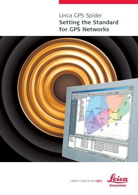
Leica <strong>GPS</strong> <strong>Spider</strong><br />
Setting the Standard<br />
for <strong>GPS</strong> Networks
<strong>GPS</strong> <strong>Spider</strong> Reference Station Software<br />
Modular and Scalable –<br />
For Single Stations and Networks<br />
<strong>GPS</strong> <strong>Spider</strong> is an integrated suite of software for centrally<br />
controlling and operating single reference stations or<br />
networks of stations. <strong>GPS</strong> <strong>Spider</strong> is modular and scalable<br />
with new advanced solutions for long-range high-accuracy<br />
Network RTK (<strong>Spider</strong>NET), centralized data distribution,<br />
data access management and also support the charging of<br />
data and services. Become a professional service provider<br />
using the best solutions for your needs thanks to <strong>GPS</strong> <strong>Spider</strong>.<br />
For multiple applications<br />
<strong>GPS</strong> <strong>Spider</strong> provides data<br />
and services for all types of<br />
applications:<br />
Geodetic control<br />
Surveying<br />
Engineering<br />
Construction<br />
Deformation Monitoring<br />
GIS & Mapping<br />
Mining<br />
Positioning<br />
Machine control<br />
Navigation<br />
Hydrographic survey<br />
Aerial survey<br />
Event<br />
Management<br />
Internet FTP<br />
NTRIP<br />
RINEX<br />
Output<br />
Quality<br />
Control<br />
For all receivers<br />
Master Auxilliary<br />
corrections<br />
<strong>Spider</strong>NET<br />
Network Computation<br />
<strong>GPS</strong><br />
<strong>Spider</strong><br />
RTK/D<strong>GPS</strong><br />
Output<br />
Nearest Station<br />
Best cell<br />
Automatic<br />
Position<br />
data-download<br />
Computation RTK User<br />
Management<br />
Serial / Modem<br />
Access Server<br />
Leica System 1200 and System<br />
500 <strong>GPS</strong> receivers are the ideal<br />
partners for <strong>GPS</strong> <strong>Spider</strong> and<br />
integrate perfectly with the<br />
software. Other receivers are<br />
also supported.<br />
Build up as you like<br />
For single stations<br />
and networks<br />
With <strong>GPS</strong> <strong>Spider</strong> you only invest<br />
in what is necessary for your<br />
current needs. As requirements<br />
change and new services are<br />
demanded, it is easy to add extra<br />
capabilities or extend your network<br />
when additional areas have to be<br />
covered. You can build up easily at<br />
any speed.<br />
All <strong>GPS</strong> <strong>Spider</strong> modules interact<br />
seamlessly with each other.<br />
Standard license for full<br />
receiver control and status<br />
monitoring of single and<br />
multiple stations.<br />
File Products service module for<br />
automatic RAW, RINEX, Compact<br />
RINEX data management, data<br />
compression, quality control<br />
and FTP distribution for<br />
standard CORS applications.<br />
RTK/D<strong>GPS</strong> data distribution to<br />
support applications needing<br />
real-time positioning.<br />
Event Email and messaging,<br />
to keep you informed any<br />
time anywhere.<br />
Coordinate computations to<br />
monitor structures and analyze<br />
movements.<br />
<strong>GPS</strong> <strong>Spider</strong>NET for continuous<br />
real-time network analysis and<br />
error modeling to provide<br />
Leica MAX standard RTCM V3.0<br />
Master Auxiliary network<br />
corrections for long-range<br />
high-accuracy RTK.<br />
Advanced RTK distribution<br />
methods for efficient and quick<br />
real-time data access.<br />
RTK User Management enables<br />
you to protect data access,<br />
charge for your services and<br />
generate income.<br />
With <strong>GPS</strong> <strong>Spider</strong> you’re completely<br />
flexible in your system design –<br />
<strong>GPS</strong> <strong>Spider</strong> has everything<br />
necessary for <strong>GPS</strong> reference<br />
stations and networks.<br />
Your benefits<br />
Control over wide areas<br />
Homogeneous high accuracy<br />
Support of all user groups<br />
Increases efficiency and<br />
productivity<br />
Reduces costs<br />
Generates revenue and return<br />
on investment
<strong>GPS</strong> <strong>Spider</strong>NET –<br />
Master Auxiliary Network corrections<br />
Network RTK – To RTCM Standards<br />
Using an array of permanently installed reference stations over a region or entire state removes the need to<br />
establish local control in the work area and set up temporary field reference receivers. Using <strong>GPS</strong> <strong>Spider</strong>NET<br />
for real-time network analysis and error modeling provides even consistent high accuracy and improved<br />
RTK performance over the entire network region, with even larger distances between your reference stations.<br />
Network corrections can be provided as based on the newest standard RTCM V3.0 Master Auxiliary Network<br />
correction messages, which are fully integrated in Leica MAX technology.<br />
Smart performance and MAX productivity<br />
Raw data are streamed continuously from the<br />
receivers into <strong>Spider</strong>NET. This newly designed and<br />
developed processing kernel applies the latest in zerodifference<br />
processing algorithms and the legendary<br />
Leica SmartCheck technology to deliver outstanding<br />
reliability and performance.<br />
<strong>Spider</strong>NET analyzes the measurements from all available<br />
stations within the network. Distance dependent<br />
errors are then modeled to provide the Leica MAX –<br />
Master Auxiliary corrections to compensate for them.<br />
The entire process runs continuously and automatically,<br />
and ensures accurate, consistent and fast RTK<br />
measurements for highest productivity in the field.<br />
MAX Performance<br />
for Network providers<br />
fast and accurate network processing<br />
cooperative with central or distributed installation<br />
reliable and robust processing thanks to<br />
Leica SmartCheck<br />
universal RTK product services for single sites<br />
and network solutions<br />
flexible multiple communication channels<br />
for RTK rovers<br />
accurate and efficient at longer distances<br />
reliable with consistent accuracy<br />
faster initialization times<br />
MAX Benefits<br />
Network RTK versus<br />
Conventional RTK<br />
Network RTK allows the use of<br />
correction information from an<br />
array of stations covering a<br />
large area, whereas conventional<br />
corrections from a single site are<br />
valid up to a limited distance<br />
from a reference station. Network<br />
RTK solutions provide many<br />
advantages over single site RTK:<br />
Increased coverage<br />
Improved availability<br />
Best reliability<br />
Faster rover initializations<br />
Consistent high accuracy<br />
Higher productivity<br />
for Network providers<br />
economical with reduced investment<br />
as fewer reference stations needed<br />
comfortable with centralized network control<br />
reliable with data processing redundancy<br />
secure with protected access to<br />
<strong>GPS</strong> data streams and services<br />
scalable to expand geographic coverage<br />
modular to add extra product services<br />
versatile serving multiple applications<br />
global serving an unlimited number of users<br />
cost-effective with support for revenue generation<br />
for RTK rovers<br />
economical no mobile field reference required,<br />
need to only to invest in rover receiver<br />
quicker start up time, thus reduced cost<br />
reliable always-on service
Leica technology<br />
at the MAX<br />
Together with <strong>GPS</strong> <strong>Spider</strong>NET<br />
continuous network processing<br />
and Leica MAX Master Auxiliary<br />
corrections, you achieve increased<br />
RTK performance and reliability<br />
when covering large areas with<br />
a minimum number of reference<br />
stations - it’s the ideal “Win-Win”<br />
situation!<br />
Using Leica SmartStation,<br />
your Total Station can even<br />
benefit from the latest in<br />
Network RTK technology.<br />
<strong>Spider</strong>NET – Network RTK services MAX and i-MAX<br />
MA Raw data and Master Auxiliary corrections transmitted to rovers.<br />
MA<br />
MAX provides full network<br />
master-auxiliary corrections derived<br />
from <strong>GPS</strong> <strong>Spider</strong>NET advanced<br />
processing algorithm in full<br />
conformance with the new<br />
RTCM V3.0 Standard for<br />
Network RTK correction messages.<br />
MA<br />
Compatible rovers can optimally use full<br />
network correction data or decide to use only<br />
the Master station raw data.<br />
Full flexibility for rovers to achieve<br />
optimum performance.<br />
MAXimum network information<br />
over minimum bandwidth.<br />
MAXimum transmission flexibility<br />
using ISDN/PSTN phone or Internet broadcast.<br />
Ideal for broadcast media –<br />
one-way transmission, e.g. using radio modem.<br />
Can serve an unlimited number of rovers.<br />
i<br />
NMEA<br />
-MA<br />
MA<br />
i-<br />
Improved RTK –<br />
Moving with the Standard<br />
Individualized RTK correction data transmitted to the rover.<br />
For i-MAX, the rover provides its<br />
approximate position from which<br />
<strong>Spider</strong>NET identifies the nearest<br />
available reference station.<br />
The Master Auxiliary network<br />
corrections determined for the<br />
network are then applied to provide<br />
individually network corrected RTK<br />
data to the rover. From these<br />
corrections, the rover is then able<br />
to compute higher accuracy RTK<br />
coordinates than with conventional<br />
non-network corrections.<br />
Whichever method is used,<br />
whatever application you have,<br />
longer range, consistent accuracy,<br />
higher reliability and faster RTK<br />
initialization times will increase<br />
your productivity. Using Leica MAX<br />
or i-MAX corrections provides<br />
superior performance over all other<br />
existing known methodsforNetwork<br />
RTK. With Leica MAX users are<br />
at all times in full compliance with the<br />
only industry approved RTCM V3.0<br />
Network RTK Message format –<br />
a Standard jointly driven<br />
by Leica Geosystems - the class<br />
leader in <strong>GPS</strong> Surveying.<br />
Each rover receives its own i-MAX correction<br />
data stream, individualized for its position.<br />
Standard RTK formats, such as RTCM 2.3/3.0 or<br />
Leica proprietary, can be used to transmit network<br />
corrected observation data for the nearest site.<br />
Rovers can benefit from network corrections<br />
without the need to understand RTCM V3.0<br />
Master Auxiliary corrections format.<br />
i-MAX is ideal for supporting legacy <strong>GPS</strong> receivers.<br />
Requires two-way communication using<br />
ISDN / PSTN phones or Internet.
<strong>GPS</strong> Services<br />
for all applications<br />
Innovative real-time services<br />
Accurate, fast and efficient<br />
With <strong>GPS</strong> <strong>Spider</strong>, it’s easy to use the method or combination of methods that will best satisfy your operational needs.<br />
RTK and GIS rovers, construction machines, hydrographic survey vessels and others will be able to operate accurately<br />
and efficiently at even longer ranges.<br />
Real-time services<br />
From <strong>GPS</strong> <strong>Spider</strong> or from the receivers<br />
Single station RTK and<br />
D<strong>GPS</strong> data can be output<br />
directly from the receivers<br />
or computed using <strong>GPS</strong><br />
<strong>Spider</strong> and output from<br />
the control center.<br />
<strong>Spider</strong>NET can provide<br />
Network RTK corrections<br />
as Leica MAX and i-MAX streams, which can be<br />
distributed securely through the RTK Proxy server.<br />
The real-time data can be provided easily and efficiently<br />
via various communication equipments, such as radios,<br />
phones, access server or the Internet.<br />
All formats<br />
<strong>GPS</strong> <strong>Spider</strong> and the connected receivers will output<br />
RTK and D<strong>GPS</strong> data in several formats. All standard<br />
RTCM formats (V2.1/V2.2/V2.3/ V3.0) are fully<br />
supported as well as the most common proprietary<br />
formats (Leica, CMR, CMR+).<br />
NTRIP Services<br />
<strong>GPS</strong> <strong>Spider</strong> supports full NTRIP services. The NTRIP<br />
Caster can provide RTK data through a single TCP/IP<br />
port to which access can be restricted using NTRIP<br />
authentication. Field users running NTRIP clients<br />
can easily select their preferred data source.<br />
Reference station data streams can be sent to other<br />
NTRIP Casters as well as being received from them.<br />
Automated RTK services<br />
Automatic station selection<br />
For a rover sending its<br />
position, <strong>GPS</strong> <strong>Spider</strong> can<br />
determine which is the<br />
nearest reference station<br />
and transmit the conventional<br />
RTK data for this<br />
particular station.<br />
This ensures that as the<br />
rover travels through the network, <strong>GPS</strong> <strong>Spider</strong> can<br />
always provide the rover with data from its nearest<br />
reference station.<br />
Automatic cell selection<br />
Networks benefiting from<br />
the <strong>Spider</strong>NET network<br />
processing may have a<br />
high number of stations<br />
covering a very large area.<br />
If a rover sends its<br />
position, <strong>Spider</strong>NET can<br />
automatically create a best<br />
suitable Master Auxiliary cell based on this position.<br />
Additionally a regular recheck process ensures the<br />
most optimal cell configuration as the rover moves<br />
within the network.<br />
User Management services<br />
Return on investment<br />
<strong>GPS</strong> <strong>Spider</strong> helps you to<br />
work towards returning a<br />
profit with your system<br />
by supplying the relevant<br />
information needed for<br />
billing users for the services<br />
they have received.<br />
Organizations that operate<br />
reference stations and networks can typically recoup<br />
a considerable part of their initial investment and cover<br />
their on-going running costs.<br />
Authentication and Authorization<br />
It’s easy to configure the registration of new users so<br />
that they must enter passwords in order to access<br />
the data on FTP servers. <strong>GPS</strong> <strong>Spider</strong> can be organized<br />
so that field rovers have to register their telephone<br />
number, IP address or password as part of their<br />
authentication procedure. Once this is done, they can<br />
then be authorized for access to general or specific<br />
RTK/D<strong>GPS</strong> data services.<br />
Auditing & Accounting<br />
With access restricted specifically to registered users,<br />
system operators have full control over the usage of<br />
the network and its stations. Online status is provided<br />
for every user accessing the real-time data services.<br />
Comprehensive report logs detail the type of services,<br />
connection times and durations for which rovers have<br />
obtained data meaning that users can be charged for<br />
the data and services they receive from <strong>GPS</strong> <strong>Spider</strong>.<br />
Positioning services<br />
Real-time positioning<br />
Using continuously streamed raw data, the <strong>GPS</strong> <strong>Spider</strong><br />
Positioning module computes the baselines of a<br />
network automatically and continuously in real-time.<br />
This real-time processing is ideal for solving short and<br />
medium baselines between stations and monitoring<br />
rapid changes of reference station positions. The<br />
integration of Leica’s legendary RTK algorithm and<br />
continuous SmartCheck processing guarantee the<br />
required accuracy, reliability and integrity.<br />
Post-processed positions<br />
Post-processing is appropriate for longer baselines<br />
between reference stations and detecting slower<br />
longterm station movements. Leica Geo Office software<br />
can be configured to fully and automatically process<br />
baselines using the data files regularly produced by<br />
<strong>GPS</strong> <strong>Spider</strong>.<br />
File based services<br />
Automatic data download<br />
<strong>GPS</strong> <strong>Spider</strong> downloads<br />
the raw data files logged<br />
in the receivers at the<br />
intervals and times configured<br />
by you. Continuously<br />
streamed raw data can be<br />
archived by <strong>GPS</strong> <strong>Spider</strong><br />
instead of, or in addition<br />
to, downloaded files that were internally logged.<br />
Everything runs smoothly and automatically according<br />
to your specifications.<br />
Quality Control<br />
Validation of raw data for quality and completeness<br />
data can be performed automatically.<br />
Production of RINEX files<br />
<strong>GPS</strong> <strong>Spider</strong> converts the raw data to RINEX or compact<br />
RINEX with different observation types, rates and<br />
duration for each station according to your needs.<br />
Files can be compressed and the command line feature<br />
allows further automatic user-defined processing on<br />
the files.<br />
Distribution via FTP server<br />
RINEX and raw data files can be pushed automatically<br />
to an FTP server affording the <strong>GPS</strong> user community<br />
easy access to this data via the Internet.<br />
All data readily available<br />
With <strong>GPS</strong> <strong>Spider</strong> you can be sure that all the data<br />
are available, complete and on time for everybody<br />
depending on them.<br />
Monitoring the Earth’s crust<br />
Utilize <strong>GPS</strong> <strong>Spider</strong> Positioning for monitoring tectonic<br />
plates, fault lines, earthquake zones, volcanoes and<br />
other natural structures. Depending on the expected<br />
size of movement and interstation distances, either<br />
real-time or post processing approaches can be used.<br />
Monitoring man-made structures<br />
Safety regulations require that dams, bridges,<br />
towers, buildings, oilrigs and other large safety-critical<br />
structures have to be constantly inspected and<br />
monitored. Real-time processing detects movements<br />
and vibrations as they occur assisting safety engineers<br />
to provide warning messages in a timely manner.<br />
Stability of reference stations<br />
Organizations operating networks need to be<br />
confident that the antennas are completely static<br />
and do not move. <strong>GPS</strong> <strong>Spider</strong> provides the data to<br />
automatically compute the antenna positions at regular<br />
intervals providing checks on the fiducial integrity of an<br />
operating network.
Powerful, versatile,<br />
totally reliable and secure<br />
Automatic, Reliable, Secure<br />
<strong>GPS</strong> <strong>Spider</strong> servers run as services on Microsoft ®<br />
Windows TM operating systems. Once started,<br />
<strong>GPS</strong> <strong>Spider</strong> automatically runs stations and networks,<br />
continuously supplying the full range of <strong>GPS</strong> data, RTK<br />
and D<strong>GPS</strong> services that are needed today for surveying,<br />
engineering, construction, monitoring and other <strong>GPS</strong><br />
applications.<br />
<strong>GPS</strong> <strong>Spider</strong>’s distributed server architecture allows for<br />
centralized as well as highly distributed installations,<br />
with maximum connection reliability.<br />
A separate <strong>GPS</strong> <strong>Spider</strong> proxy server can be used for RTK-<br />
/D<strong>GPS</strong> data distribution to provide maximum security.<br />
System Management<br />
On-site and remote<br />
<strong>GPS</strong> <strong>Spider</strong> stations and networks are extremely<br />
powerful yet very easy to set up and use. The intuitive<br />
graphical user interface has the tools and functions for<br />
easy control of receivers, station management and<br />
administration of the entire network.<br />
As the user interface can be installed on remote<br />
computers as well as on the central server, supervisors<br />
can work at distant locations, and even at home,<br />
as well as at the main control center. It’s easy to<br />
arrange a friendly duty schedule that suits everybody<br />
perfectly.<br />
Administrators and viewers<br />
System supervisors have administrator rights – they can<br />
control the software and the receivers, start and stop<br />
the various operations, control network processing and<br />
RTK/D<strong>GPS</strong> services or audit rover user access.<br />
Supervisors can log off and close down their interface<br />
without stopping the server as the <strong>GPS</strong> <strong>Spider</strong> servers<br />
continue automatically. Viewer rights can be allocated<br />
to selected parties so they can inspect system operation<br />
and status or check receiver status. Viewers however<br />
cannot control or modify the system.<br />
Access restriction routines and password protection<br />
provide the required system security.<br />
All communication methods supported<br />
Reliable communication is vital for <strong>GPS</strong> reference<br />
stations and networks. Communication between the<br />
receivers and the server running <strong>GPS</strong> <strong>Spider</strong> will usually<br />
be by TCP/IP, phone modems or even direct serial link.<br />
Transmission of RTK/D<strong>GPS</strong> data can be via Internet,<br />
phone modems or radios, or a combination of all three!<br />
System supervisors at remote locations connect<br />
to <strong>GPS</strong> <strong>Spider</strong> using the Internet, Intranet or RAS<br />
(Remote Access Service).<br />
Use the communication methods that are most<br />
efficient, costeffective in suiting your particular<br />
applications and requirements – you are free to<br />
choose with <strong>GPS</strong> <strong>Spider</strong>.<br />
■ TCP/IP / NTRIP<br />
■ Access Server / Phone modems<br />
■ Radio modems<br />
<strong>GPS</strong> <strong>Spider</strong> –<br />
Takes you to the MAX<br />
Versatile, powerful, reliable<br />
Modular and fully scalable<br />
Reliable and secure<br />
For all requirements and applications<br />
For single and multiple stations<br />
For small and large networks<br />
For Post-Processed and RTK Networks<br />
For all types of <strong>GPS</strong> receivers<br />
For all communication methods<br />
Easy to install and use<br />
Extend and enhance as your needs change<br />
and increase<br />
Facilitates charging for data and services<br />
Helps get a return on your investment
The Bluetooth ® word mark<br />
and logos are owned by<br />
Bluetooth SIG, Inc. and any<br />
use of such marks by<br />
Leica Geosystems AG is under<br />
license. Other trademarks<br />
and trade names are those<br />
of their respective owners.<br />
Distance meter (IR),<br />
ATR and PowerSearch:<br />
Laser class 1 in accordance<br />
with IEC 60825-1 resp. EN 60825-1<br />
Guide light (EGL):<br />
LED class 1 in accordance<br />
with IEC 60825-1 resp. EN 60825-1<br />
Laser plummet:<br />
Laser class 2 in accordance<br />
with IEC 60825-1 resp. EN 60825-1<br />
Distance meter<br />
(PinPoint R100 / R300):<br />
Laser class 3R in accordance<br />
with IEC 60825-1 resp. EN 60825-1<br />
Leica Geosystems AG<br />
Heerbrugg, Switzerland<br />
www.leica-geosystems.com<br />
Lorem ipsum<br />
dolor sit.<br />
Adipisicing elit,<br />
sed do eiusmod<br />
tempor incididunt<br />
ut labore et.<br />
Whether providing corrections from just a single reference station,<br />
or an extensive range of services from a nationwide RTK network –<br />
innovative reference station solutions from Leica Geosystems offer<br />
tailor-made yet scalable systems, designed for minimum operator<br />
interaction whilst providing maximum user benefit. In full compliance<br />
with international standards, Leica's proven and reliable solutions are<br />
based on the latest technology.<br />
Precision, value, and service from Leica Geosystems.<br />
When it has to be right.<br />
Illustrations, descriptions and technical specifications are not binding and may change.<br />
Printed in Switzerland – Copyright Leica Geosystems AG, Heerbrugg, Switzerland, 2005.<br />
745970en – I.05 – RDV<br />
Leica Reference<br />
Stations<br />
Equipment listo<br />
Leica GRX1200<br />
Product brochureo<br />
Leica <strong>GPS</strong>1200 Series<br />
High performance<br />
<strong>GPS</strong> System<br />
Leica <strong>GPS</strong>1200<br />
Product brochure<br />
Leica SmartStation<br />
Total Station<br />
with integrated <strong>GPS</strong><br />
Leica<br />
SmartStation<br />
Product brochure