Landscape Character Supplementary Planning Document ...
Landscape Character Supplementary Planning Document ...
Landscape Character Supplementary Planning Document ...

You also want an ePaper? Increase the reach of your titles
YUMPU automatically turns print PDFs into web optimized ePapers that Google loves.
This document is one of a number that make up the Local Development Framework forthe Bradford District. If you need the contents of this document to be interpreted ortranslated into one of the community languages or you require it in Braille, Large Print oron tape, please contact the Local Development Framework Group on (01274) 434050,(01274) 434544 or (01274) 434606.
Il Tempo January, 2003deputy can brief or he/she can give me the update I will brief at the meeting. I think that thesepolicies are important to ensure that everyone is keep informed on upcoming events and theplanning behind them.I thank you for your time and again for the honor of being your seneschal. This is by far thebest job in the Kingdom.Miles de Locwode--------------------------------------------------------------------------------Upcoming Events:Yule Revel-To While Away a Winters DayBarony of StorvikJanuary 4th, 2003As the days darken and the howling winter winds blow across our lands there comes a dayfor us to gather together in warmth of friendship and merriment. We invite you to join us as welight the candle of learning against the growing darkness, and fuel the fire of friendship to keepour hearts warm through the dark night.During the day we will "wile away the winter's day", and as such will be holding informalclasses and gatherings for many different arts and crafts around the great hall. Among theA&S activities we expect to have represented are Calligraphy & Illumination, Embroidery,hands-on Cooking classes, Leather Working, Heraldry, Bardic Arts, Spinning, and Weaving.Please visit the Storvik website (http://storvik.atlantia.sca.org) for more details in the dayscloser to the event.Il Tempo January, 2003Feast and lunch: Lunch will be simple fare of meat, fruit, bread and cheese. The eveningmeal is being planned by our Head Cook, Lady Hrosvitha. Please direct all dietary concerns toher at kmartinsen@dc-opera.org.Cost: On board $14.00 non-members, $11.00 with proof of membership. Off board $7.00non-members, $4.00 with proof of membership. Children 6-12 are half-price; under six yearsare guests of the Barony.Send reservations to Mistress Anne of Carthew, 13456 Cobra Court, Oak Hill, VA 20171,(703) 437-6271 (no calls after 9:00pm), acarthew@cox.net. There are only 100 seats for feat,so reserve soon. Cut off date for on board reservations is February…Directions:From the Capital Beltway: Take I-66 West towards Vienna/Front Royal. Follow approximately6.6 miles. Exit onto LEE JACKSON MEMORIAL HWY/US-50, West, towards FairOaks/Winchester. After about 2.5 miles, pass under the Fairfax County Parkway (Route 7100),and be in the left lane to turn left at the next light onto Middle Ridge Drive. IMMEDIATELY turnleft onto the Route 50 service road. This road curves right, becoming Kings Way. The churchis on the left.From points west or southern Fairfax County: Take your best route to the intersection of I-66and Route 7100, Fairfax County Parkway. Take the Parkway NORTH. (DON'T exit at 50: Youwon't be able to get across the traffic to where you need to be.) After crossing Route 50, turnleft at the light onto Rugby Road. Go straight through the intersection of Rugby and Route 50,and IMMEDIATELY turn left onto the Route 50 service road. This road curves right, becomingKings Way. The church is on the left.Following a dinner break (dinner not provided but there are many local off-site diningestablishments to fit any budget), we will re-open the site for our traditional Yule Revel.The evening will be filled with Deserts, Dancing, and perhaps we'll even have a visit fromFather Christmas himself.A&S Competitions: Toys & Kids Stuff: Gentles are asked to enter items that medievalchildren used or played with. Please be aware that judges are likely to "test" the entries, andtherefore fragile/delicate entries are not encouraged. Our young judges will award one to threepoints in the following categories: a) Is it pretty/nice, b) is it fun, and c) would you want one.Judges will also award an extra point to their favorite entry. The entry sheets will have a line forwhat the object is, who used it, and when it was used. You are welcome to provide additionaldocumentation for curious adults, but it is not necessary. If you are entering a game or similaritem, please provide instructions for play. Anyone under the age of 14 is asked to help us judgethe competition. Anyone wishing to judge need only ask at troll, and they will be pointed towardsa competition organizer. Judges need to bring a literate parent or guardian to help fill out thejudging sheets. Judges may need to test out the entries to make sure they work, but parentsare still expected to be responsible for their children.Cooking: For our bakers and sweets makers we will be holding competitions in the followingcategories: Best Period Desert, Best Non Period Desert, and Best Subtlety.Cost: Adult, Member: $7.00 Children (10 and under): $3.0029
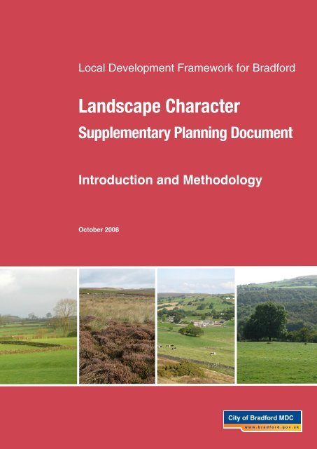
City of Bradford Metropolitan District CouncilLocal Development Framework For BradfordFOREWORDThis <strong>Supplementary</strong> <strong>Planning</strong> <strong>Document</strong> (SPD) formalises the existing <strong>Landscape</strong> <strong>Character</strong>Assessment documents, which were initially produced by the City of Bradford MetropolitanDistrict Council in 2000 to inform policies within the Replacement Unitary Development Plan(RUDP) adopted in October 2005.The <strong>Landscape</strong> <strong>Character</strong> SPD provides an existing statement of the landscape of the BradfordDistrict along with its distinctive attributes and features, which are desirable to preserve andenhance. There are 10 landscape character areas within the Bradford District. Each <strong>Landscape</strong><strong>Character</strong> Assessment details the condition of the landscape and the sensitivity of the landscapeto change, along with providing a set of policy guidelines for development. These documentsform the basis of this <strong>Supplementary</strong> <strong>Planning</strong> <strong>Document</strong>.Bradford Council will expect developers who wish to submit a planning application for adevelopment within a landscape character area, to take account of this SPD.To achieve maximum benefit for all its users, this SPD contains two additional components,which comprise of a non-technical User Guide and <strong>Landscape</strong> <strong>Character</strong> Design Guidance.Each of these components are intended to help the user within the planning process andultimately achieve good, sympathetic design proposals which both protect and enhance thecharacter and appearance of the District’s natural landscapes.The User Guide can be found overleaf; and the Design Guidance can be found in Appendix 4of this document and within each subsequent volume.<strong>Landscape</strong> <strong>Character</strong> <strong>Supplementary</strong> <strong>Planning</strong> <strong>Document</strong>October 2008
<strong>Landscape</strong> <strong>Character</strong> SPD - USER GUIDEThe <strong>Landscape</strong> <strong>Character</strong> <strong>Supplementary</strong> <strong>Planning</strong> <strong>Document</strong> (SPD) supplements policies NE3and NE3A of the Replacement Unitary Development Plan. Whilst this is not a statutory document,it is a material consideration and will be assessed against any proposal.The objectives of the SPD are to protect and enhance the character, appearance and features which are importantto the landscape and encourage an integrated approach to development which includes consideration for landscapeissues. It also provides advice for developers in the submission of planning applications, and also helps in thedetermination of these applications.The SPD comprises of 11 documents, these are:Introduction and MethodologyVolume 1: AiredaleVolume 2: EsholtVolume 3: Pennine UplandVolume 4: Rombalds RidgeVolume 5: South BradfordVolume 6: Thornton & QueensburyVolume 7: Tong ValleyVolume 8: WharfedaleVolume 9: WilsdenVolume 10: Worth and North Beck ValleysThe Introduction and Methodology document provides the context for the SPD and outlines the purpose, background,planning policy context, and the landscapes of the Bradford District. Each <strong>Landscape</strong> <strong>Character</strong> Area Volume(1-10) set out the <strong>Landscape</strong> <strong>Character</strong> Assessment for each <strong>Landscape</strong> <strong>Character</strong> Area (Eg Tong, Esholt).<strong>Landscape</strong> <strong>Character</strong> Assessment<strong>Landscape</strong> <strong>Character</strong> Area<strong>Landscape</strong> <strong>Character</strong> TypeEach Volume is a written and visual assessment of the <strong>Landscape</strong> <strong>Character</strong>Area which describes, analyses and evaluates the landscape.A geographic area with a consistent character and identity.An smaller area within a <strong>Landscape</strong> <strong>Character</strong> Area which characterisesa particular type of landscape (e.g: Floodplain, wooded valleys etc)HOW TO USE THE SPD:1 Identify if the site is in a <strong>Landscape</strong> <strong>Character</strong> Area (from Appendix 4: Introduction andMethodology), if so which one?2 Select the relevant Volume and read sections 1 to 5 to get an understanding of the characteristicsof the area.3 Identify the <strong>Landscape</strong> <strong>Character</strong> Type(s) to which the site falls within (from the enclosed Map) andrefer to the relevant section within the volume.4 Take account of the Policy Guidelines at the end of the <strong>Landscape</strong> <strong>Character</strong> Type(s) section.5 Ensure that any proposal has taken into account the criterions set out within the Design Guidance(within the Appendix of each document) and can demonstrate these within the proposal.For further information or advice on submitting proposals, please contact the<strong>Landscape</strong> Design Unit on (01274) 433542 or email john.hogg@bradford.gov.uk
City of Bradford Metropolitan District CouncilLocal Development Framework For BradfordCONTENTSPAGE1.0 Introduction 12.0 Purpose & Status 23.0 Background & Context 34.0 <strong>Planning</strong> Policy Context 55.0 Existing framework of landscape classification, designation and policy 86.0 General <strong>Landscape</strong> <strong>Character</strong> of Bradford 177.0 Evolution of the Natural <strong>Landscape</strong> 208.0 Cultural History of Bradford District 329.0 The <strong>Landscape</strong> <strong>Character</strong> Types of Bradford 4010.0 Approach and Methodology 6211.0 The <strong>Landscape</strong> <strong>Character</strong> Areas of Bradford 69* N.B: Each <strong>Landscape</strong> <strong>Character</strong> Assessment is a separate accompanying document set out involumes.• Volume 1: Airedale• Volume 2: Esholt• Volume 3: Pennine Upland• Volume 4: Rombalds Ridge• Volume 5: South Bradford• Volume 6: Thornton / Queensbury• Volume 7: Tong Valley• Volume 8: Wharfedale• Volume 9: Wilsden• Volume 10: Worth & North Beck Valley<strong>Landscape</strong> <strong>Character</strong> <strong>Supplementary</strong> <strong>Planning</strong> <strong>Document</strong>October 2008
City of Bradford Metropolitan District CouncilLocal Development Framework For BradfordLIST OF FIGURESPAGEFigure 1: Ecology Map 15Figure 2: Cultural Heritage Map 16Figure 3: Settlement Map 21Figure 4: Landcover Map 22Figure 5: Landform Map 23Figure 6: Geology Map 24Figure 7: Countryside Commission <strong>Character</strong> Areas Map 63Figure 8: English Nature Natural Area Profiles Map 66Figure 9: <strong>Landscape</strong> Strategy Matrix 70Figure 10: <strong>Character</strong> Areas Map 72Figure 11: Relationship between <strong>Character</strong> Areas and Local <strong>Landscape</strong> Types 75<strong>Landscape</strong> <strong>Character</strong> <strong>Supplementary</strong> <strong>Planning</strong> <strong>Document</strong>October 2008
City of Bradford Metropolitan District CouncilLocal Development Framework For Bradford1.0 INTRODUCTION1.1 This <strong>Supplementary</strong> <strong>Planning</strong> <strong>Document</strong> (SPD) sets out the approach that will be takenby the City of Bradford Metropolitan District Council with regard to the implementation ofPolicies NE3 and NE3A of the Replacement Unitary Development Plan for the BradfordDistrict. The document will provide guidance for developers in terms of the Council’sapproach to landscape conservation, enhancement and management.1.2 The Countryside Agency (2002) stated that ‘<strong>Landscape</strong> <strong>Character</strong> Assessment is a toolwhich can make a significant contribution to ‘environmental protection’ and ‘prudent use’as a cornerstone for sustainable development.’ 11.3 <strong>Supplementary</strong> <strong>Planning</strong> <strong>Document</strong>s are not part of the statutory development plan, butprovide supplementary guidance to policies and proposals contained in DevelopmentPlan <strong>Document</strong>s (DPDs), or in this case, the Replacement Unitary Development Plan(RUDP).1.4 This <strong>Supplementary</strong> <strong>Planning</strong> <strong>Document</strong> forms part of the Local DevelopmentFramework (LDF) for the Bradford District and expands Policies NE3 and NE3A of theReplacement Unitary Development Plan, which was adopted in October 2005. Whendetermining planning applications, the Council will treat this document as a materialconsideration, therefore developers must ensure that they have read and understood theissues raised in this document before submitting a planning application.1.5 There are six strategic objectives of this SPD. They are to:a. Protect and enhance the character, appearance and features important to thelandscape.b. Recommend appropriate landscape management and land use planning strategies,and to suggest guidelines to assist in achieving those strategies.c. Encourage an integrated approach to development which includes comprehensiveconsideration of landscape issues.d. Determine the most appropriate management strategy in terms of conservation,restoration and reconstruction.e. Provide a basis for determining the landscapes capacity and sensitivity toaccommodate particular types of change.f. Help developers in their submission of planning applications and the formalisation ofdevelopment proposals.1 Countryside Agency & Scottish Natural Heritage (2002 landscape <strong>Character</strong> assessment. Guidance forEngland and Scotland.<strong>Landscape</strong> <strong>Character</strong> <strong>Supplementary</strong> <strong>Planning</strong> <strong>Document</strong>October 2008 Page 1
City of Bradford Metropolitan District CouncilLocal Development Framework For Bradford2.0 PURPOSE & STATUS2.1 The purpose of this <strong>Supplementary</strong> <strong>Planning</strong> <strong>Document</strong> is to identify the distinctlandscape types within the Bradford District by describing their key characteristics andnatural, historical and cultural features. The document provides a structured evaluationof each landscape type which includes a landscape strategy along with policy guidelinesfor conserving and enhancing the character of an area.2.2 The document will provide a framework for the formulation and assessment of planningapplications and other landscape conservation and management strategies within theseareas.2.3 The SPD has been prepared in accordance with <strong>Planning</strong> Policy Statement 12: LocalDevelopment Frameworks (PPS 12) published in 2004. Although not part of thestatutory development plan, PPS 12 states that <strong>Supplementary</strong> <strong>Planning</strong> <strong>Document</strong>sshould relate to a policy or policies within the local plan. Thus the <strong>Landscape</strong> <strong>Character</strong>SPD will supplement policies NE3 and NE3A of the Replacement Unitary DevelopmentPlan (rUDP) for the Bradford District, and as such will be taken into account as materialconsideration when determining planning applications. These policies can be found inSection 4.0 of this document.2.4 In time, the Local Development Framework (LDF) will replace the replacement UnitaryDevelopment Plan. This document provides an elaboration of the rUDP and forthcomingLDF policies which concern landscape character.2.5 When assessing planning applications in, adjacent to, or having an impact on thecharacter of the landscape, proposals should be reviewed against the relevantlandscape character areas statements. Sites near the boundary of a <strong>Landscape</strong><strong>Character</strong> Area should take into account the implications of the proposal on any adjacentcharacter area.2.6 Bradford Council will expect developers who wish to submit a planning application for adevelopment within a landscape character area, to take into account of this SPD.Appendix 4 of this document provides ‘Design Guidance’ for developers and sets out anumber of requirements that should be fulfilled or taken into account when applying forplanning submission. A list of useful contacts is also provided within this appendix.<strong>Landscape</strong> <strong>Character</strong> <strong>Supplementary</strong> <strong>Planning</strong> <strong>Document</strong>October 2008 Page 2
City of Bradford Metropolitan District CouncilLocal Development Framework For Bradford3.0 BACKGROUND & CONTEXT3.1 “<strong>Landscape</strong> is about the relationship between people and place. It provides the settingfor our day-to-day lives. The term does not mean just special or designated landscapesand it does not only apply to the countryside. <strong>Landscape</strong> can mean a small patch ofurban wasteland as much as a mountain range, and an urban park as much as anexpanse of lowland plain. It results from the way that different components of ourenvironment – both natural (the influences of geology, soils, climate flora and fauna) andcultural (the historical and current impact of land use, settlement, enclosure and otherhuman interventions) – interact together and are perceived by us.” 23.2 The identification and classification of areas of the countryside for their ‘landscape value’has long been a part of the planning system, dating back to the creation of Areas ofOutstanding Natural Beauty (AONB) from the mid 1940’s. By the 1970’s emphasis wasplaced upon ‘landscape evaluation’ and the concept of value within land-use planning,this compared the value of one landscape with another. Between the mid 1980’s to themid 1990’s the focus shifted towards the assessment of the landscape, recognising therole for both objectivity and subjectivity.3.3 The process of landscape characterisation and assessment was spearheaded inEngland by the work of the Countryside Agency, and a map was produced whichsubdivided England into character areas. The Bradford District lies within three of thesearea:36 South Pennines37 Yorkshire Southern Pennine Fringe38 Nottinghamshire, Derbyshire and Yorkshire Coalfield3.4 Since the publication of the <strong>Character</strong> Map of England, further guidance has beenissued; firstly the publication of the Rural White Paper in 2000 which established the keyissues in respect of landscape character and included proposals to conserve andenhance the rural landscape on the whole and the diversity and abundance of wildlife.This was followed by the Countryside Agency’s publication ‘<strong>Landscape</strong> <strong>Character</strong>Assessment – Guidance for England and Scotland’ in 2002, which set out the contextand specific guidance on how to carry out landscape assessments.2 Countryside Agency & Scottish Natural Heritage (2002 landscape <strong>Character</strong> assessment. Guidance forEngland and Scotland.<strong>Landscape</strong> <strong>Character</strong> <strong>Supplementary</strong> <strong>Planning</strong> <strong>Document</strong>October 2008 Page 3
City of Bradford Metropolitan District CouncilLocal Development Framework For BradfordBradford District <strong>Landscape</strong> <strong>Character</strong> Assessment3.5 In January 1998 the <strong>Landscape</strong> Design Unit was commissioned by Transportation and<strong>Planning</strong> to carryout a <strong>Landscape</strong> <strong>Character</strong> Assessment of the Bradford District as partof the Unitary Development Plan review.Objectives of the <strong>Landscape</strong> <strong>Character</strong> Assessment3.6 The overall objectives as defined in the original brief are:-a. To record, describe and analyse the landscape character of the District;b. To recommend appropriate landscape management and land use planningstrategies and to suggest guidelines to assist in achieving those strategies;c. To provide a basis for the formulation of plans, policies, and proposals for thelandscape of the District;d. To guide <strong>Planning</strong> Officers in their work in the determination of planning applications;e. To guide all Council Departments, developers and members of the public in theirallocation of resources and decision making in relation to management of theexisting landscape and landscape change.Scope3.7 In line with the Countryside Commission’s <strong>Character</strong> Programme the study is:-• Comprehensive: covering the whole of the Bradford District apart from the urbancores and major urban settlements.• Consistent: using methods and approaches that are compatible with neighbouringAuthority’s landscape assessments and Countryside Commission data.• Descriptive: identifying the key characteristics of the Bradford landscape• Analytical: seeking to understand how the landscape has evolved into its presentstate.• Contextual: providing a landscape framework for policy making.3.8 Outputsa) A map. Each <strong>Landscape</strong> Assessment is underpinned by a <strong>Landscape</strong><strong>Character</strong> Area Map, which defines areas of landscape with an identifiableindividual character.c) <strong>Landscape</strong> descriptions. Each defined <strong>Character</strong> Area is supported by anillustrated description and analysis of its landscape character.d) <strong>Landscape</strong> strategies. A series of strategy recommendations for the fabric ofthe landscape and for development taking place within the landscape ispresented within each assessment.<strong>Landscape</strong> <strong>Character</strong> <strong>Supplementary</strong> <strong>Planning</strong> <strong>Document</strong>October 2008 Page 4
City of Bradford Metropolitan District CouncilLocal Development Framework For Bradford4.0 PLANNING POLICY CONTEXT4.1 Bradford Council has endorsed the Countryside Agency’s definition of landscape, whichacknowledges that as well as the visual appearance of the landscape, there are a varietyof other elements which affect the way in which it has been formed, evolved andcontinues to be experienced and valued within society. This is geology, topography,archaeology, historic and cultural influences and associations.4.2 In respect of the landscape, the Council’s overall objective is to conserve and enhancethe character, diversity, uniqueness and amenity of the landscape areas for its own sakeand to improve degraded areas. This approach represents a move away from locallandscape designations, to a character-based approach to landscape policy in line withnational and regional planning policy guidance.National <strong>Planning</strong> Policy Context4.3 National planning policy is contained within <strong>Planning</strong> Policy Guidance (PPG), or since2004, in <strong>Planning</strong> Policy Statements (PPS’s).4.4 <strong>Planning</strong> Policy Statement 1: Delivering Sustainable Development endorses theprotection and enhancement of the natural and historic environment along with thequality and character of the countryside. It states that local authorities should seek topromote and/or reinforce local distinctiveness through clear polices and SPD’s.4.5 The key objectives of <strong>Planning</strong> Policy Statement 7: Sustainable Development in RuralAreas is to raise the quality of life and the environment in rural areas; to promote moresustainable patterns of development; to promote the development of the English Regionsby improving their economic performance so that all are able to reach their full potential;to promote sustainable, diverse and adaptable agricultural sectors. The Governmentencourages Local <strong>Planning</strong> Authorities to utilise <strong>Landscape</strong> <strong>Character</strong> Assessments toprovide sufficient protection for these locally, highly valued areas.Regional <strong>Planning</strong> Policy Context4.6 Regional <strong>Planning</strong> Policy is provided within the Regional Spatial Strategy (RSS) for theYorkshire and Humber region. A core approach of this strategy (YH1) aims to ‘Protectand enhance the region’s environmental resources including areas of international andnational importance’. Policy ENV 8 seeks to safeguard and enhance the biodiversity andgeological heritage of the region to ensure that the ‘natural environment functions as anintegrated network of habitats’. Policy ENV 10 (<strong>Landscape</strong>) seeks to protect andenhance landscapes that contribute to the distinctive character of the region.<strong>Landscape</strong> <strong>Character</strong> <strong>Supplementary</strong> <strong>Planning</strong> <strong>Document</strong>October 2008 Page 5
City of Bradford Metropolitan District CouncilLocal Development Framework For BradfordReplacement Unitary Development Plan4.7 Policies NE3 and NE3A of the Replacement Unitary Development Plan for the BradfordDistrict set out the Council’s approach to the protection and enhancement of the<strong>Landscape</strong> <strong>Character</strong> Areas:POLICY NE3 STATES:WITHIN THE LANDSCAPE CHARCTER AREAS, AS INDICATED BELOW ANDSHOWN ON THE PROPOSALS MAP, DEVELOPMENT WILL BE PERMITTED IF ITDOES NOT ADVERSLEY AFFECT THE PARTICULAR CHARACTER OF THELANDSCAPE:• AIREDALE• ESHOLT• PENNINE UPLAND• ROMBALD RIDGE• SOUTH BRADFORD• THORNTON & QUEENSBURY• TONG VALLEY• WHARFEDALE• WILSDEN• WORTH AND NORTH BECK VALLEYPOLICY NE3A STATES:WITHIN THE LANDSCAPE CHARACTER AREAS IDENTIFIED IN POLICY NE3DEVELOPMENT LIKELY TO AFFECT THE APPEARANCE OF THE LANDSCAPE WILLBE ASSESSED HAVING REGARD TO THE EXTENT TO WHICH IT WOULD:• CAUSE UNACCEPTABLE VISUAL INTRUSION:• INTRODUCE OR REMOVE INCONGRUOUS LANDSCAPE ELEMENTS:• CAUSE THE DISTRUBUANCE OR LOSS OF OR HELP TO MAINTAIN:(1) LANDSCAPE ELEMENS THAT CONTRIBUTE TO LOCAL DISTINCTIVENESS;(2) HISTORIC ELEMENTS WHICH CONTRIBUTE SIGNIFICANTLY TOLANDSCAPE PATTERNS AND LANDFORM;(3) SEMI-NATURAL VEGETATION WHICH IS CHRACTERISTIC OF THATLANDCAPE TYPE;(4) THE VISUAL CONDITION OF THE LANDSCAPE ELEMENTS.<strong>Landscape</strong> <strong>Character</strong> <strong>Supplementary</strong> <strong>Planning</strong> <strong>Document</strong>October 2008 Page 6
City of Bradford Metropolitan District CouncilLocal Development Framework For BradfordLocal Development Framework4.8 As part of the preparation of the emerging Local Development Framework for Bradford,the Council must provide a robust evidence base for which to base it long-term proposalsfor the District. A number of pieces of work have been or are currently being producedeither internally or externally, which will form part of the evidence base. Thesedocuments cover a range of topical issues from housing, employment to flood risk andgypsy and travellers accommodation. Further details of these documents can be foundon the Council’s website or by contacting the Local Development Framework group.Sustainability Appraisal4.9 Under the <strong>Planning</strong> and Compulsory Purchase Act 2004, all <strong>Supplementary</strong> <strong>Planning</strong><strong>Document</strong>s must be subject to a Sustainability Appraisal to ensure that theimplementation of guidance in the SPD will not have an adverse effect on theenvironment and will identify to what extent the social, economic and environmentalprinciples of sustainable development are achieved.4.10 The Sustainability Appraisal incorporates guidance from the European Commission(Directive 2001/42/EC) which requires formal Strategic Environmental Assessment(SEA) of certain plans and programmes which are likely to have significant effects on theenvironment.4.11 A Sustainability Appraisal Report has been produced to support this SPD.<strong>Landscape</strong> <strong>Character</strong> <strong>Supplementary</strong> <strong>Planning</strong> <strong>Document</strong>October 2008 Page 7
City of Bradford Metropolitan District CouncilLocal Development Framework For Bradford5.0 EXISTING FRAMEWORK OF LANDSCAPE CLASSIFICATION, DESIGNATION ANDPOLICY5.1 The City of Bradford Metropolitan District Council has an existing framework ofdesignations and policy relating to the environment all of which has an influence on thelandscape in its entirety. Designations and policies have a hierarchy from Internationalto National, Regional, District wide and local.5.2 The district has a similar covering of policies and designations for nature conservation,geology, and the built heritage/archaeological sites all of which contribute to the qualityof the landscape.5.3 At the district wide level, the City of Bradford Metropolitan District Council’s ReplacementUnitary Development Plan (RUDP), which was adopted in October 2005, is the currentbasis on which planning applications are determined. The relevant policies in the RUDPinclude UDP2 and UDP3, which aim to restrain development in the countryside, butwhere development does occur, to ensure it maintains or enhances the character of thewider environment and heritage assets, environmental resources and biodiversity.5.4 <strong>Landscape</strong> Designations5.4.1 There are no international or European landscape designations within Bradford. Areasof England and Wales whose landscape and natural beauty are considered to be ofnational importance are designated as either National Parks or Areas of OutstandingNatural Beauty (AONB). Bradford district does not contain either of these designations.5.4.2 Although not statutory designations, the joint publication between the CountrysideCommission and English Nature, the <strong>Character</strong> Map of England sub-divides the districtinto three main character areas; the South Pennines, the Yorkshire Southern PennineFringe and the Nottinghamshire, Derbyshire and Yorkshire Coalfield. These aredescribed in Section 6.0. These characteristics provide an important strategic frameworkfor issues affecting the natural and cultural landscape.5.5 Green Belt5.5.1 The Green Belt has been defined in accordance with the government guidance on greenbelts. This was first set down in Circular 42/55 and was been carried forward intoCircular 14/84 and <strong>Planning</strong> Policy Guidance Note 2 (PPG2) Revised January 1995.PPG2 sets down five main purposes for the Green Belt:• To check the unrestricted sprawl of large built up areas• To safeguard the surrounding countryside from further encroachment<strong>Landscape</strong> <strong>Character</strong> <strong>Supplementary</strong> <strong>Planning</strong> <strong>Document</strong>October 2008 Page 8
City of Bradford Metropolitan District CouncilLocal Development Framework For Bradford• To prevent neighbouring towns form merging into one another• To preserve the special character of historic towns• To assist in urban regeneration5.5.2 The adopted Replacement Unitary Development Plan (rUDP) identifies extensive areasof Green Belt across the District in accordance with Government guidance, with only tworural areas at the western and northwestern extremities of the District being excluded.The detailed boundaries are shown on the adopted rUDP proposals maps.5.5.3 The following RUDP policies should also be referred to in relation to the Green Belt:GB1; GB2; GB3; GB4 and GB5.5.6 <strong>Landscape</strong> <strong>Character</strong> Areas5.6.1 Within the District’s Green Belt and other rural areas there were areas of high qualitylandscape which the UDP plan that defined and protected areas as Special <strong>Landscape</strong>Areas (SLA’s).5.6.2 Special <strong>Landscape</strong> Areas have been replaced in the RUDP by the <strong>Landscape</strong> <strong>Character</strong>Areas approach, which relate to the wider landscape and not just those areas deemedspecial.5.6.3 The concept of the Special <strong>Landscape</strong> Areas and <strong>Landscape</strong> <strong>Character</strong> Areas aredistinct from that of the Green Belt. Within the Green Belt emphasis is placed on theprinciple of development. Special <strong>Landscape</strong> Areas placed emphasis on the visualaspect of development on the character of the landscape and its vernacular architecture.5.6.4 The following RUDP policies should also be referred to: NE3 and NE3A. Both thesepolicies aim to control development so that development does not adversely affect thelocal landscape, especially relating to development, which will enhance localdistinctiveness and the intrinsic qualities of the countryside.5.7 Urban Greenspace5.7.1 Within the built up areas there exists a range of open spaces of significant amenity andrecreational value. The urban green spaces have a variety of functions and uses andare of various sizes. The major urban green spaces provide a green framework for theregeneration of the urbanised parts of the District and are large enough to bring thecharacter of the countryside into the town.5.7.2 The following RUDP policies should also be referred to: OS1; OS7 and OS8.<strong>Landscape</strong> <strong>Character</strong> <strong>Supplementary</strong> <strong>Planning</strong> <strong>Document</strong>October 2008 Page 9
City of Bradford Metropolitan District CouncilLocal Development Framework For Bradford5.8 BIODIVERSITY DESIGNATIONS5.8.1 The District possesses a great diversity of areas of nature conservation, which areimportant for their scientific value and as an educational resource. These includemoorland, woodland and wetland habitats and significant geological features. The maindesignated sites are shown on Figure 1 - Ecology Map.Special Protection Areas (SPA)5.8.2 Areas designated by the UK Government under the European (EU) Directive for WildBirds (known as Wild Bird Directive) 79/409. These are areas of internationalimportance for the assemblage of a variety of rare and declining breeding birdpopulations. This designation has been given to the South Pennine Moors. Within thisarea, the upland moors around Haworth and Rombalds are within the Bradford District.Special Areas of Conservation (SAC)5.8.3 These are strictly protected areas that are designated under the EC Habitats Directivefor habitat types and species identified within Annexes I and II of the Directive. Thelisted habitat types and species are those considered to be most in need of conservationat a European level (excluding birds). These are of international importance. Thisdesignated has been given to the South Pennine Moors. Within this area the uplandmoors around Haworth and Rombalds are within the Bradford District.Sites of Special Scientific Interest (SSSI)5.8.4 Designated by English Nature under Section 28 of the Wildlife and Countryside Act 1981(amended 1985) as land of national importance by reason of any of its flora, fauna,geological of physiographical features. Numerous sits are identified in the BiodiversityTables of the ten landscape character areas and receive protection within the rUDPpolicy.Site of Ecological or Geological Importance (SEGI)5.8.5 Formally Sites of Scientific Interest (SSSIs), these are sites designated by localauthorities as areas of regional (i.e. West Yorkshire) importance for nature conservation.These are non statutory but are mapped and referred to in the adopted rUDP andprotected under Policies NE7, NE8 and NE9 of the Replacement UDP.Regionally Important Geological Sites (RIGS)5.8.6 Designated by county-based local interest groups under the direction of English Nature.These have the same status as SEGIs.<strong>Landscape</strong> <strong>Character</strong> <strong>Supplementary</strong> <strong>Planning</strong> <strong>Document</strong>October 2008 Page 10
City of Bradford Metropolitan District CouncilLocal Development Framework For BradfordLocal Nature Reserves (LNR)8.5.7 These are statutory designations made by principal local authorities under Section 21 ofthe National Parks and Access to the Countryside Act 1949. Such sites are for bothpeople and wildlife; and are places with wildlife or geological features that are of specialinterest locally. Bradford’s first Local Nature Reserve was designated on 28 th June 2008,this site is located within the South Bradford <strong>Character</strong> Area.Third Tier Sites5.8.8 The local authority designates these as areas of local importance for natureconservation, for their community/access value as much as any scientific or biologicalinterest. It is a non-statutory designation but is referred to in the adopted rUDP andmapped as an appendix to the supplementary planning guidance on nature conservation(Nature Conservation Strategy).THE BUILT HERITAGE5.9 The District possesses a rich architectural and archaeological heritage, which is highlyvalued for its contribution to the environment as a whole. The District’s industrialheritage of mills and associated commercial development from the late 18 th and 19 thCenturies is particularly important and reflects the area’s dominance in the textile trade.World Heritage Site – Saltaire5.10 UNESCO inscribed Saltaire as a World Heritage Site on 16 th December 2001. It is oneof 27 in the United Kingdom. World Heritage Sites are inscribed because of theiroutstanding universal value. The universal value of Saltaire is firstly based on animportant interchange of human values in architecture, technology and the earlyconcepts of Town <strong>Planning</strong>. Secondly, Saltaire is an outstanding example of anarchitectural and technological ensemble that illustrates a significant stage in humanhistory. Saltaire is a remarkable complete and well-preserved industrial villageconstructed in the second half of the 19th century. Today, its textile mills, public buildingsand workers' housing continue to operate as a living and working community. It is theduty of the international community as a whole, to co-operate in its protection. Saltairehas a Management Plan is in place to direct this function.A Buffer Zone extends around Saltaire World Heritage Site and its wider ‘zone of visualinfluence’ that incorporates distant views to and from the site. It includes a substantialamount of land including Shipley Town Centre, the largely residential areas to the north,including Green Belt up onto Baildon Moor. The Buffer Zone covers parts of three<strong>Landscape</strong> <strong>Character</strong> Areas, namely Airedale, Rombalds Ridge and Wilsden.<strong>Landscape</strong> <strong>Character</strong> <strong>Supplementary</strong> <strong>Planning</strong> <strong>Document</strong>October 2008 Page 11
City of Bradford Metropolitan District CouncilLocal Development Framework For BradfordBuildings of Architectural and Historical Interest - Listed Buildings5.11 Within the District there are now around 5800 buildings listed by the Secretary of Stateas being of architectural of historic interest. These make a vital contribution to theheritage of the District. They are protected from demolition by planning legislation andnational planning policy as set out in PPG15, which encourages efforts to be made toensure their retention sometimes by seeking and accepting alternative uses.Conservation Areas5.12 Fifty-seven Conservation Areas have been designated within the Bradford District. (NB.The number is likely to increase over time). The purpose of designation is to conserveand enhance the special architectural or historic character of the historic areas and theirsurroundings. Certain additional planning controls apply in Conservation Areas.Additionally there is a presumption against demolition of buildings. The felling or loppingof trees also requires approval.5.13 The Government requires that each Conservation Area should have an up-to-dateassessment, which is reviewed within a five-year period. The Design and ConservationTeam within <strong>Planning</strong> Service have produced comprehensive Conservation AreaAssessments for each Conservation Area within the District. These documents detail theareas historic development, topography and setting, traditional buildings materials,architectural and historic qualities, open spaces, natural elements, permeability andstreetscape. The assessments also provide guidance of how to maintain and enhancethe areas unique qualities. The team are currently in the process of reviewing theirConservation Area Assessments to meet the requirements of the Governments BestValue Performance Indicators (BVPI’s). Where appropriate, relevant assessmentsshould be referred to and taken into consideration as part of the decision making processfor any landscape or development proposal.Battlefield Site5.14 The non-statutory Battlefield Register complied by English Heritage has the status of amaterial consideration in determining planning applications. The most significant historicevent that took place within the District was the Battle of Adwalton Moor, in Tong, on 30 thJune 1643. It is considered to be one of the most important battles of the Civil War andis only one of 7 Registered Battlefield within the Region. The remaining topography ofthe site, in particular the hedgerows running across the fields rising up to the hillside towhich Royalists initially fell back, are still clearly evident and likely to have been featuresof the 1643 scene.<strong>Landscape</strong> <strong>Character</strong> <strong>Supplementary</strong> <strong>Planning</strong> <strong>Document</strong>October 2008 Page 12
City of Bradford Metropolitan District CouncilLocal Development Framework For BradfordHistoric Parks and Gardens5.15 In England the official listing of gardens began with the National Heritage Act 1983 whichbrought English Heritage into existence and which amended the Historic Buildings andAncient Monuments Act 1953 so as to enable the new authority to compile a nonstatutory register of gardens and other land which appears to be of special historicalsignificance. There are 12 sites within the District that are included in the Register ofParks and Gardens of Special Historic Interest in England.5.16 The District also contains four recognised Local Historic Parks and Gardens. Thesesites are of local interest, (not included on the national register) which display evidenceof designated landscapes that are of local interest and any proposals, which affect thesite or setting, should demonstrate a clear understanding of the original design andlayout.Archaeology5.17 Archaeological remains are a non-renewable resource, often very fragile and vulnerableto damage and destruction. Bradford possesses a rich archaeological heritage,particularly in the north of the District. It is important that this heritage is adequatelyprotected.The replacement UDP aims to protect three categories of archaeological areas, identifiedby the West Yorkshire Archaeology Advisory Services (WYAAS), which are registered inthe County Sites and Monuments Record. These are:Class IScheduled Ancient Monuments and their settings. These are nationallyrecognised.Class IIAreas of Special Archaeological Value, where evidence exists toindicate the presence or probability or remains of archaeological value.Class IIIAreas of Archaeological Value, where evidence exists to indicate thepresence of probability of remains of archaeological value.5.18 The following replacement UDP policies should also be referred to: BH18 and BH19.The Conservation Areas and Scheduled Ancient Monuments are shown on Figure 2:Cultural Heritage Map.<strong>Landscape</strong> <strong>Character</strong> <strong>Supplementary</strong> <strong>Planning</strong> <strong>Document</strong>October 2008 Page 13
City of Bradford Metropolitan District CouncilLocal Development Framework For BradfordOther Frameworks5.19 The Standing Conference of South Pennine Authorities (SCOSPA) published a regionalbased <strong>Landscape</strong> Assessment, <strong>Landscape</strong> Guidelines and Countryside DesignSummary for the South Pennines, which include the majority of Bradford’s non-urbanareas.In addition, SCOSPA has also prepared an Integrated Management Strategy andConservation Action Plan for the South Pennine Moors SPA (see BiodiversityDesignations), which emphasises the conservation importance of the moorlandlandscape.The Forest of Bradford Initiative and the Woodland Strategy (1992) aim to undertakestrategic measures to increase general tree cover with the District and guide appropriateareas for action.Wider Policy Context5.20 <strong>Planning</strong> Policy Statement 1: Delivering Sustainable Development seeks to protect andenhance the quality, character and amenity value of the countryside and urban areas asa whole. Protection should be given to those areas that have been recognised for theirlandscape value. <strong>Planning</strong> Policy Statement 7: Sustainable Development in Rural Areasencourages local authorities to maintain or extend local landscape designations toprotect areas from unsustainable development and to also enhance local distinctivenessof the areas and preserve the intrinsic qualities of the countryside.The Regional Spatial Strategy (RSS) for the Yorkshire and the Humber region (adoptedMay 2008) provides the Regional <strong>Planning</strong> Policy context. This Plan will be used asmaterial consideration within the <strong>Planning</strong> process. The Plan maintains the need forLocal Authorities to recognise and protect the distinctive landscape character of theregion. Policies LCR1 (C, 1, 5) and ENV 10 within the Plan should be referred too.<strong>Landscape</strong> <strong>Character</strong> <strong>Supplementary</strong> <strong>Planning</strong> <strong>Document</strong>October 2008 Page 14
Figure 1ECOLOGYKeySpecial Protection Areas / Special Areas of ConservationSites of Special Scientific ImportanceSites of Ecological / Geological ImportanceSemi-natural broadleave woodland & major broadleaves plantationBlanket bogKnown grassland of biological diversityWetlands0 1 2 3 4 5 Kilometers
Figure 2CULTURAL HERITAGE!( !(!(!(!(!( !(!(")!(!(!(!(")!( !( !(!(!(!( !( !(!(!(!(!( !( !( !(!(!(!( !( !( !( !(!(!( !(!(!( !(!( !( !(!(!(!(!(!( !(!(!( !(!(!(!(!( !( !(!( !(!(!(!(!(!( !(!(!(!(!(!(!(!(!(!(!(!(!(!(!(!(!(!(!( !(!(!(!( !(!(!(!(!( !(!( !(!(!(!(!( !(!(!(!( !(")")!(!(!(!(")!(!( !(!( !(!(!(!(!( !( !( !(!(!(!( !(!( !(!(!(!(")!(!(!(!(")")")")")")KeyConservation areas!( Scheduled Monuments 195 scheduled items total - mostly within the line") Historic Parks & GardensHistoric Battlefield Site - Adwalton MoorWorld Heritage Site - SaltaireWorld Heritage Site buffer zone0 1 2 3 4 5Kilometers
City of Bradford Metropolitan District CouncilLocal Development Framework For Bradford6.0 GENERAL LANDSCAPE CHARACTER OF BRADFORDNatural <strong>Character</strong> Areas6.1 The landscape of the Bradford District has been broadly influenced by its physicalcharacteristics such as geology, soils and climate (especially glaciation) and subsequentmodification by man in terms of land use.6.2 The Joint Countryside Commission/English Nature ‘<strong>Character</strong> Map of England’subdivides the District into three main character areas:36 South Pennines37 Yorkshire Southern Pennine Fringe38 Nottinghamshire, Derbyshire and Yorkshire Coalfield6.3 A small area in the north of the District lies within the YORKSHIRE DALES <strong>Character</strong>Area 21, but has limited influence on the landscape character of the Bradford District.Southern Pennines6.4 This area lies between the Peak District National Park and the Yorkshire Dales NationalPark. A sweeping landscape of upland moor and pasture, over 7 million people livewithin 1 hours drive of the South Pennines and the demands for transport, mineralextraction, power transmission and generation, urban encroachment, recreation sportand tourism have shaped the character accordingly. The heavily populated valleyscontrast with the marginal economic viability of the uplands where the dual economy ofpart-time farming subsidised by other occupations prevails. Sheep grazing and smalldairy/beef herds are the main agricultural occupations; stonewalls and small fields reflectthe fluctuating moorland/grassland fringe. The moorland plateau gives extensive viewsover the lower lying towns, which reduces the sense of isolation. Whilst the quarries andvertical elements such as wind turbines, transmitter masts and pylons are oftenprominent and detract from landscape quality, there are also a strong industrial heritageof buildings and other remnants of the wool and cotton industries.Yorkshire Southern Pennine Fringe6.5 This character area represents the transition of the Pennine Uplands to the lowerundulating landscape of the Nottinghamshire, Derbyshire and Yorkshire Coalfield,characterised by gritstone industrial settlements in the valleys surrounded by pastoralagriculture in the foothills. The gritstone buildings and stone walls of the pastures give avisual unity to the landscape. Mills, factories and towns associated with the maintransport routes lie in the valley bottoms. Tall mill chimneys and terraces are packed intothe valley bottoms and rise up the hillside. Pylons and masts are prominent on the<strong>Landscape</strong> <strong>Character</strong> <strong>Supplementary</strong> <strong>Planning</strong> <strong>Document</strong>October 2008 Page 17
City of Bradford Metropolitan District CouncilLocal Development Framework For Bradfordskylines. The industrial archaeology gives the area a strong historical character andvisual identity.Nottinghamshire Derbyshire and Yorkshire Coalfield6.6 This is a large area of densely settled countryside embracing major industrial towns. Ithas a low lying, rolling landform with escarpments and broad valley resulting fromsloping alternate bands of wet shales and dry sandstones. This area is dominated byextensive urban influences and rapid expansion of industry, settlement and transportnetworks. Likewise the rural areas suffer from urban fringe influences and the resultinglandscape is downgraded – the soils are relatively poor and the graded pastures arebounded by a mixture of walls, occasional hedgerows and post and wire fencing.‘Horticulture’ is a popular activity among the complex mosaic of land uses, ribbondevelopment and transport route dominated landscape. Broad-leaved woodlands, oftenlarge and fragmented, are relatively common.6.7 The Countryside Commission’s character areas have been determined at a national leveland are therefore broad-brush descriptions of large areas of countryside. Theboundaries between theses are not distinct and often occur gradually over severalkilometres.Section 9.0 of this report however, defines the character of Bradford in more detail at alocal scale by subdividing the district into 10 <strong>Character</strong> Areas on the basis of their overallcharacteristics and the recurring pattern of landscape elements contained within them.These <strong>Landscape</strong> <strong>Character</strong> Areas are defined on a geographical basis and namedaccording to local terminology for ease of identification and recognition by a wide rangeof people.6.8 The area covered excludes the urban core of Bradford City Centre, Shipley, Keighleyand Ilkley. It also excludes all ‘inset’ areas defined as ‘urban’ or ‘village’ in the rUDP. Itis intended that these areas will be the subjects of settlement studies at some futuredate.6.9 It is important to recognise that the Bradford Metropolitan District Council boundaryconstitutes an artificial boundary in landscape terms. In many cases landscapecharacter areas and landscape types would extend into adjoining local authorities, agood example being the Pennine Upland.<strong>Landscape</strong> <strong>Character</strong> <strong>Supplementary</strong> <strong>Planning</strong> <strong>Document</strong>October 2008 Page 18
City of Bradford Metropolitan District CouncilLocal Development Framework For BradfordIt is also necessary to take account of <strong>Landscape</strong> Assessment, Strategy and Guidelinesthat have been carried out by the adjoining Districts of Leeds, Calderdale, Kirklees,Pendle, Craven and Harrogate, where they adjoin the Bradford District boundary.Significant development proposals close to the boundary are likely to have an effect oninter-visibility into adjoining Districts, which will require consultation.There are also small enclaves of landscape on the eastern boundary within the urbancore e.g. around Fagley and Greengates which have a greater affinity with the landscapetypes identified in Leeds City Council’s <strong>Landscape</strong> Assessment.<strong>Landscape</strong> <strong>Character</strong> <strong>Supplementary</strong> <strong>Planning</strong> <strong>Document</strong>October 2008 Page 19
City of Bradford Metropolitan District CouncilLocal Development Framework For Bradford7.0 EVOLUTION OF THE NATURAL LANDSCAPE7.1 INTRODUCTION7.1.1 The landscape of Bradford is the product of the interaction of both physical and humaninfluences. This chapter describes the main physical influences including topography,geology, soils, climate and biodiversity.7.1.2 The City of Bradford Metropolitan District comprises about 370 km 2 . Only about onethird of the District is built up but this area contains about 86% of the population. SeeFigure 3 – Settlement Map. The main population areas of Bradford, Keighley, Shipley,Bingley and Ilkley are separated by areas of agricultural land, isolated villages, areas ofundeveloped moorland, woodland and parkland. See Figure 4 - Landcover Map.7.1.3 The District is characterised by dramatic contrasts from the fringes of the SouthPennines in the west to the Wharfe Valley in the east.7.2 LANDFORM7.2.1 The District comprises a series of escarpments of plateaux with elevations up to 455mO.D., and a general decrease in the height of plateau in the east. The escarpments aredissected by the Rivers Aire and Wharfe and a number of smaller rivers, includingBradford Beck and the River Worth. The valley sides are commonly very steep, incontrast to the flat nature of the valley bottoms. The main urban areas and transportroutes occur within the valley floor of the district. Within these urbanised areas thetopography has often been altered artificially, with large areas of made ground, disturbedground and excavation.7.2.2 Geographically, the area is considered to be part of the upland Pennine peneplaingenerally slopes eastward complicated by valley incisions, and a series of step likefeatures marking breaks in slope.7.2.3 Rivers tend to flow eastwards following the actual slope of the land along major faultlines. See Figure 5 - Landform Map.<strong>Landscape</strong> <strong>Character</strong> <strong>Supplementary</strong> <strong>Planning</strong> <strong>Document</strong>October 2008 Page 20
Figure 3SETTLEMENTKeyPopulation Centres0 1 2 3 4 5 Kilometers
Figure 4LANDCOVERKeyUrbanMoorlandWoodlandPasturelandParklandOther0 1 2 3 4 5 Kilometers
Figure 5LANDFORMKeyHeight above sea level in metres0 - 100m100 - 200m200 - 300m300 - 400mover 400m 0 1 2 3 4 5 Kilometers
Figure 6GEOLOGYKeyCoal MeasureMillstone Grit0 1 2 3 4 5 Kilometers
City of Bradford Metropolitan District CouncilLocal Development Framework For Bradford7.3 GEOLOGY7.3.1 The bedrock is composed entirely of rocks deposited during the Upper Carboniferousperiod, about 315 to 310 million years ago.7.3.2 The south east of the District, including the main Bradford conurbation and the outlier ofBaildon Moor is underlain by Coal Measures. The District is located at the northernmargin of the exposed Yorkshire Coalfield.7.3.3 The coal measures are underlain by the Millstone Grit, which outcrops over most of thenorth and west of the District and has been used extensively for building stone.Formation of the Millstone Grits:7.3.4 During the Upper Carboniferous period northern England lay within a large subsidingbasin. Extensive delta system were fed with sediments eroded from the surroundingland surfaces to the north and this material was deposited in layers to eventually formmassive blocks of Millstone Grit. Frequent changes in sea level affected the nature ofthe sediments with coarse grits and sand deposited near the river mouths forming hardgritstones. At other times fine silts and sands accumulated at shallow deltas formingsofter shales as bands within the gritstone. There is consequently great variation in thegritstone geology. Many of the sandstones are coarse-grained grits and now formprominent escarpments or edges, for example, Addingham High Moor.7.3.5 The dominance of the Millstone Grit is not only limited to the underlying geology. Its usehas shaped the whole of the landscape we see today. The rock has been mined forcenturies and has provided the material for the network of7.3.6 Dry stone walls enclosing the pasture land and for the distinctive architecture of villages,towns and cities in the district. See Figure 9 - Geology Map.Formation of the Coal Measures:7.3.7 The deltas gradually silted up during the Carboniferous period and areas of swamp andwoodland developed, although these were periodically flooded by the still fluctuating sealevels. This patter of growth and destruction led to the formation of layers of coalembedded in between shales and grits.7.3.8 The Coal Measures present in the District consist of about 590m thickness of embeddedmudstone, siltstone and sandstone with subordinate coal, seatearth and ironstonedeposited about 310 million years ago. Erosion subsequently removed much of the coal<strong>Landscape</strong> <strong>Character</strong> <strong>Supplementary</strong> <strong>Planning</strong> <strong>Document</strong>October 2008 Page 25
City of Bradford Metropolitan District CouncilLocal Development Framework For Bradfordmeasurers from higher areas to the north and west of the District leaving a distinctivedivide between the Millstone Grits and the Coal Measures.7.3.9 The Coal Measures have been extensively exploited notably during the 19 th Century, notonly for coal, but also for fireclay, brickclay and ironstone.7.3.10 Although mining of these resources in Bradford was not at the same scale as the furthersouth in the coalfield, it has had great effect in shaping the landscape, notably intriggering adjacent industrial growth.Creation of the Pennine Mountain Ridge7.3.11 The period of deposition of material to form the Millstone Grits and Coal Measurers wascompleted some 280 million years ago and was followed by folding of the earth’s crust.The asymmetric anticline created the upstanding mountain ridge, which, althoughconsiderably eroded, still dominates the District today.Glacial Activity7.3.12 The present day topography is largely the result of glacial activity some two and a halfmillion years ago which modified and moulded the landscape.7.3.13 The District has probably been affected by three separate glacial periods, and at itsmaximum advance the ice sheet reached a line from Keighley Moor to Low Moor, andwould have covered both valleys and upland areas. Dramatic fluctuations in temperaturecaused the valley glaciers to advance and retreat several times during the last Ice Agealone. The valleys of the modern rivers Wharfe and Aire broadly coincide with burieddrift filled channels locally in excess of 50m deep.7.3.14 As the ice retreated during the interglacial period and finally at the close of the ice agethe erosive power of the glacial meltwater had a dramatic effect on the landscape. Apartfrom forming the deep U shaped valleys of the Wharfe and Aire, meltwaters breached icedams and created deep gorges termed glacial overflow channels. These are present inmany upland areas of Bradford and on valley sides. Typically these features have an E-W to SE-NW trend parallel to the ice front with steep sides and flat bottoms. Examplescan be seen at Newsholme Dean and around Cottingley Beck.7.3.15 As the ice trapped the river flow, terraces were cut, the most noticeable being the threeseparate river terraces of the Wharfe. Landslips are also evident in the final landform oftoday, the majority of which are a product of the end of the glacial period some 10,000years ago. Many landslips formed as a result of downslope movements in saturated,deeply weathered, partially frozen materials on the glacially over-steepened slopes.<strong>Landscape</strong> <strong>Character</strong> <strong>Supplementary</strong> <strong>Planning</strong> <strong>Document</strong>October 2008 Page 26
City of Bradford Metropolitan District CouncilLocal Development Framework For BradfordProbably the most famous example, known as a topple rock fall is the Cow and CalfRocks, whilst shallow rational slides can been see all along the Aire and Wharfe Valleysides.Drift Geology7.3.16 About 60% of the District is covered by drift (natural superficial) deposits, most of whichare a product of glacial and post glacial activity. Boulder clay is the main glacial depositin the District forming an extensive featureless spread, generally less than 5m inthickness. The exceptions are the Aire and Wharfe valley bottoms where thicknessexceeding 50m are know to exist. Various alluvial deposits of sand and gravel areevident throughout the District, for example at Keighley in the Aire Valley where depositsare up to 17m thick. Silty sand pebbles and gravels can also been seen exposed on theriverbank of the Wharfe and have previously been exploited creating the Ben Rhyddinggravel pits, now a Site of Ecological or Geological Interest (SEGI).Formation of Peat7.3.17 Both lowland and upland peat are present in the District. Lowland peat forms isolatedpatches within poorly drained enclosed hollows such as Binlgey South Bog and glacialmeltwater channels such as Pitty Beck. Upland peat forms extensive thin layers on theupland areas in the west of the District such as Keighley and Oxenhope Moors. Thedeposits are mainly less than 1 m in thickness and have accumulated in response to acidsoils, low temperatures, poor aeration due to water logging and low evaporation ratessuppressing the decomposition of dead plant material.7.4 SOILS7.4.1 Soils which form the final layer on the landform reflect the interaction of solid and driftgeology, altitude, climate and past human land use. Generally local soils are poor andnaturally acid, due to the high silica content of the parent material, lack of neutralisingminerals such as lime, and due to the high rainfall. The often relatively low temperaturesin the District result in slow rates of soil formation, whereas the high rainfall leaches outsoluble minerals such as calcium from the soil.7.4.2 Thin soil tends to develop on steep slopes due to the progressive downslope creep ofsoils as they develop.7.4.3 Although areas of higher quality soils that could support arable farming are to be found inthe Wharfe Valley, they are not extensive enough to be economically viable.<strong>Landscape</strong> <strong>Character</strong> <strong>Supplementary</strong> <strong>Planning</strong> <strong>Document</strong>October 2008 Page 27
City of Bradford Metropolitan District CouncilLocal Development Framework For Bradford7.4.4 As a result most rural land is either permanent grass for pasture, or rough pasture ormoorland.7.5 CLIMATE7.5.1 With a difference of 300m between the highest western part of the District and the lowareas of the city centre, relief plays a major part in influencing local climate, affectingrainfall, the temperature and the number of hours of sunshine. Bradford has an annualrainfall of 34.15 inches, an annual mean temperature of 8.8 C with 1242 hours of brightsunshine. These figures indicate a much less favourable climate especially foragriculture, than that to the east of the county in, for example, the Vale of York.7.5.2 The Pennines act as a climatic barrier, so that Bradford lies in the rain shadow of theupland mass and therefore benefits a lesser extent from the warming effects of theprevailing westerly winds. With a growing season defined as months over 6.1 C,Bradford has a growing season of about seven months in the lower lying areas andabout six months over 275m.7.5.3 The poor soils combined with this harsh climate restricted Bradford to small-scale,isolated agricultural settlements prior to the industrialisation of the 19 th Century.7.6 BIODIVERSITY7.6.1 “…the diversity within habitats and ecosystems, the diversity of species and theinteraction between species and their habitat…” 37.6.2 The biodiversity of the Bradford District is not only varied but also contains good qualityhabitats and an interesting range of wildlife, including many internationally, nationally andregionally notable species of flora and funa.7.6.3 Of particular note are the internationally important South Pennine Moors, a SpecialProtection Area of nearly 21,000 hectares (of which 4489 hectares are located with in theBradford District). This area is significant for the variety and rarity of its bird life,including the merlin and golden plover, which is supported by the diverse and extensiveupland plant communities. The South Pennine Moors are also a Special Area ofConservation designated for the variety of the upland habitat mosaic.7.6.4 The main habitats through the Bradford District can be categorised as:-3 Source = UK Bio Diversity Action Plan: 1994<strong>Landscape</strong> <strong>Character</strong> <strong>Supplementary</strong> <strong>Planning</strong> <strong>Document</strong>October 2008 Page 28
City of Bradford Metropolitan District CouncilLocal Development Framework For BradfordMoorland7.6.5 The large areas of peat covered moorland give rise to a rich mosaic of habitats, includingblanket bog, heather moors, wet heaths and ‘in-bye’ 4 land. These areas are remoteand less likely to suffer from development pressure but they are fragile ecosystems andcan easily be affected by pollution or changes in management brought about bydeclining agricultural activity.Woodland7.6.6 Only 4.6% of the Bradford District is covered by woodland, compared with the nationalaverage of 10%, although a large area is exposed moorland and upland, which wouldlimit the growth of trees. Many of the woodlands are recently planted (within the last 150years) but there are numerous examples of steep sided valleys and cloughs whosebase-poor and acid soils support the remnants of ancient woodland, characterised bythe oak/birch woodlands of South Pennines, many of which have an ecologically diverseground flora.Grasslands7.6.7 Much of Bradford’s landscape is covered by grassland surrounded by the traditionalgritstone walls. They are a mixture of improved, semi-improved and natural grasslandsdepending on the character of the underlying soils, the topography and managementinfluences. Acidic grassland communities tend to be found on the exposed uplandsand are generally species poor by nature. Although these are often classed aspermanent pasture, many have been limed and fertilised to improve their grazingcapacity; consequently, they have a greener, visually improved appearance but areecologically poorer than the diverse meadows. The lower lying pastures in the valleystend to be neutral short-growing grassland communities which have been improvedand can be managed as short-term leys; some of these have a greater species diversityand were possibly former hay meadows. These have more interest for natureconservation and are increasingly rare. Surprisingly, Bradford has a larger proportionthan Kirklees or Calderdale 5 . Wet grasslands are increasingly rare in Bradford Districtand are often under pressure for land improvement and drainage schemes. However,they can contain a great variety of plant communities suited to damp conditions.4 Enclosed moorland of wet rush pasture which is also important as feeing and breeding areas for uplandbirds.5 Bradford Grassland Survey 1996<strong>Landscape</strong> <strong>Character</strong> <strong>Supplementary</strong> <strong>Planning</strong> <strong>Document</strong>October 2008 Page 29
City of Bradford Metropolitan District CouncilLocal Development Framework For BradfordWetlands7.6.8 The characteristic landform of the Bradford District has been carved as a result of the IceAge, with glacial overflow channels and cloughs (steep sided tributary valleys) formingthe frameworks for the water collection from the uplands. Many of these overflowchannels now form valuable wetlands. Numerous reservoirs also collect water from theuplands which are not only an important water catchments area but these water bodiesand the surrounding wetlands also provide important wintering and breeding habitats forthe wide variety of wildfowl and waders. Small streams, springs and wet flushes slowfrom the uplands into the Rivers Worth, Aire and Wharfe. The Leeds and LiverpoolCanal also acts as a valuable wildlife corridor across the District and a network ofneglected mill ponds – a legacy of Bradford’s industrial heritage – have been recolonisedby amphibians. In addition there are a few fragments of lowland raised mire,which are ecologically valuable but fragile and threatened habitats.Wildlife7.6.9 Bradford District contains a wide variety of wildlife, according to the range of habitats. Inparticular, have healthy populations of deer and badger. The deer numbers areincreasing and are generally migrating from the north towards Calderdale in the southwest and also east along the Leeds and Liverpool Canal 6 , badgers are also wellpresented throughout the District and successfully protected against persecution. Arange of bird species can be found in all habitats throughout, especially on themoorlands, as stated above. Bats are found in roosting sites such as trees, buildings(old and new), old parkland and bridges, especially over rivers. Amphibians and reptiles,however, are limited to the common species; great crested newts are unknown in theBradford area. West Yorkshire was the northern limit for some butterflies and insects,however with global warming some species have increased their range northwards andthe loss of diverse grasslands generally will have a long-term effect on thesepopulations, with subsequent consequences throughout the ecosystem as a whole.6 Bradford Deer Survey 1996<strong>Landscape</strong> <strong>Character</strong> <strong>Supplementary</strong> <strong>Planning</strong> <strong>Document</strong>October 2008 Page 30
City of Bradford Metropolitan District CouncilLocal Development Framework For Bradford7.6.10 Biodiversity AssetsDesignation No Area/DetailsSpecial Protection Area(SPA)SPA 1 No 4489 ha – SouthPennine MoorsSpecial Area ofConservation (SAC)SAC 1 No 4489 ha – SouthPennine MoorsSites of Special ScientificInterest (SSSI)SSSI 4 No South PennineMoors, BingleySouth Bog, TrenchMeadows. YeadonBrick WorksSites of Ecological/ SEGIGeological Interest(SEGI)Ecological 21No340ha –Leeds/LiverpoolCanal and RiverWharfeGeological 16NoThird Tier SitesOver100NoYet to be verified<strong>Landscape</strong> <strong>Character</strong> <strong>Supplementary</strong> <strong>Planning</strong> <strong>Document</strong>October 2008 Page 31
City of Bradford Metropolitan District CouncilLocal Development Framework For Bradford8.0 THE CULTURAL HISTORY OF BRADFORD DISTRICTIntroduction8.1 In the earliest years human settlement of the area was slow, sporadic and unexceptional.There was a period when the district had an importance of global significance as thebirthplace of modern industrial development. The landscape of the area has beeninfluenced by man to the extent that little can be classified as truly ‘natural’ whilst most ofthe twentieth century built development has long since parted company with ’tradition’.Early Settlers 0-3000BC8.2 The earliest inhabitants were Mesolithic hunters arriving before 300 BC. The landscapeat the time consisted of dense birch and pine forest covering the highlands with marshyswamps in the valleys. It was inhospitable, with limited opportunities for colonisation.Consequently the hunter-gathers lived a semi nomadic life, living off the land and havinglittle impact on it. They kept mainly to what are today the moorland areas, away from thedangerous and uncomfortable wetlands.Neolithic Period 3000-1700BC8.3 The first real settlers were Neolithic farmers who arrived around 3000 BC. By this timethe woodlands had begun to include species such as oak and alder. Remains from thisperiod suggest that the farmers would clear the ground of woodland by burning. Cropscould then be grown until the soil was exhausted, the area would then be grazed,preventing natural regeneration and keeping the ground open. The process would beginagain, resulting in more and more open areas amongst the woodland. Climatic changesmeant that during the harsher winter months the farmers would be forced down from thehigher uplands gradually bringing their influence further down the valley sides. Toolsand implements would be wood, bone, stone and flint.Bronze/Iron Age 1700-500BC8.4 Around 1750 BC there was a major technological breakthrough. Man discovered how tomake tools from metal, in particular axes. With a bronze (or later an iron) axe, treescould be felled with ease compared with the flint axes of the past. This led to substantialforest clearance of the upland areas. The thin soils of these upland areas were exposedto heavy rainfall and washed down from the highlands, removing the nutrients necessaryfor regeneration of the woodlands and creating the open moorlands that we consider a‘natural’ feature of the landscape today.As Bronze Age settlements became more established tracks between them were wornalong the terraces below the exposed moor tops. River crossings began to appearwhere necessary, although the swampy valleys still remain largely unpopulated.<strong>Landscape</strong> <strong>Character</strong> <strong>Supplementary</strong> <strong>Planning</strong> <strong>Document</strong>October 2008 Page 32
City of Bradford Metropolitan District CouncilLocal Development Framework For BradfordCelts, Romans and Saxons 500BC-1066AD8.5 By the time the Celts arrived in 500 BC the highland areas had been rendered treeless,infertile and inhospitable wastelands. Consequently the Celts lived further down thehillsides, continuing the practice of clearing and farming.Although the Romans took control of the area soon after their invasion their influence onthe landscape of the district was minimal and their occupation was limited to militaryoutposts at strategic positions, notably the Ilkley river crossing.Norman Invasion 1066AD8.6 Following their invasion the Normans gradually colonised the country bringing with thema more sophisticated society organised on a large scale. William (the Conqueror)rewarded his followers with very large holdings of land. These ‘manors’ included greatareas of the remaining woodlands known as ‘forests’ for hunting (or poaching) and muchof the areas cleared on the hillsides know as ‘vaccaries’ for beef production.Medieval Times8.7 During the centuries that followed a much more communal society developed.Ordinary people wanting to farm had no option but to take and enclose the moorlandwastelands. Marginal conditions forced them to work together to cultivate the soil.Stones and rocks were often gathered up and thrown to the edge of the area to becultivated, establishing their use to demarcate field boundaries.Mills were needed to grind flour. Often these would be built by the lord of the manornear a river crossing which allowed easy access from both sides of the valley and theuse of the water as a power source.The overall effect was that people became much more dependent upon each other.Communities began to establish at focal points, initiating a patter of hamlets, villages andmarket towns.Forced on by the need for lime to farm the acidic soils of the region and salt to preservemeat the transport and communication network expanded in line with this developmentand pack horse trails were established through the region connecting it to Ireland in thewest and Europe to the east.<strong>Landscape</strong> <strong>Character</strong> <strong>Supplementary</strong> <strong>Planning</strong> <strong>Document</strong>October 2008 Page 33
City of Bradford Metropolitan District CouncilLocal Development Framework For BradfordDual Economy8.8 Rural life could be very hard, seasonal and unpredictable. Larger farmsteads wouldoften be divided up between descendants making smaller less viable units or they wouldbe inherited by the eldest son, leaving his siblings without an independent livelihood.The former tendency has left a legacy in the district, of a patchwork of small farmingunits each with its own modest dwelling.There was then, a need for some alternative occupation to farming in the area. The landand climate was not ideal for the farming of beef or cereals. Sheep however wereeminently more suited to the conditions.The underlying geology of layers of shale and gritstone topped with the mass ofmoorland peat meant that there was an abundance of clean soft water emanating fromthe ground, at all levels, throughout the year.The combination of these elements was perfect for the production of woollen textiles. Asthe medieval period progressed the dual economies of agriculture and textile productionflourished.Landowners became wealthy and even humble people leasing, buying or simplyoccupying unclaimed land prospered.The demand for land (for sheep grazing as well as subsistence farming) increased andsmallholdings further down the slopes (particularly south facing eg. Aire Valley) wereestablished creating further new areas of improved pasture.Common land became scarce and overgrazed as the trend for enclosing land spread,The lowland countryside took on the patter of scattered dwellings surrounded by pasture,overlaid with a network of walls, tracks and paths amongst the greatly reduced oakwoodlands.Textile Industries and the Industrial Revolution8.9 The textile industry flourished to the extent that by the end of the fourteenth century itformed the backbone of the local economy.As the demand for cloth grew both in quantity and quality much effort was put intoimproving efficiency of production. Technological innovations such as the SpinningJenny, the Mule and Arkwright’s Loom meant that the industrial expansion occurred onan unprecedented scale and great fortunes were made.<strong>Landscape</strong> <strong>Character</strong> <strong>Supplementary</strong> <strong>Planning</strong> <strong>Document</strong>October 2008 Page 34
City of Bradford Metropolitan District CouncilLocal Development Framework For BradfordSpinning and weaving was initially still carried out at home but as more complicatedfinishing techniques were required new buildings were built for the first time specificallyfor industrial purposes.Waterpower was used extensively, the fast running streams from the moors providingideal sources. Reservoirs still a major features of the upland landscape today began toappear in the hillsides to regulate water for the mills.As time when on larger buildings were needed to house the new machinery andworkforce. These would often be located in the valley bottoms where advantage couldbe taken of good communications and the larger watercourses both in the techniquesthemselves, and as a source of power and for transport.Stone quarries appeared, scarring the landscape as they fed the textile industry’sappetite for materials for buildings and walls to enclose the land needed for rearing moresheep. Stone, both grit stone for buildings and ‘York stone’ setts for flags and pavingcontinued to be the almost sole materials used in rural locations right through to the earlydecades of the twentieth century.Bustling lowland towns quickly developed with separate communities from the scatteredhamlets of the uplands and what had begun as a cottage subsidiary industry was well onits way to becoming mechanised industry of international proportions.Steam Power8.10 Following the invention of the steam engines in the early 19 th Century steam began totake over from water a power source. Coal mining and coal transport becameincreasingly essential as the mills consumed huge quantities of the black stuff. In anattempt to control pollution tall chimneys were built which are still a notable feature in thelandscape today.Bigger mills were needed to house new and more machinery and by the end of the 19 thCentury they were enormous imposing buildings, which became the focal points for largecommunities of urban workers living in the towns, which grew around them.In the mean time, as the demand for wool to supply the mills and produce to feed thetown workers increased, the agricultural community also flourished. The pressure forexpansion was great and with the Parliamentary Enclosure Acts of the 18 th Centurymuch land along the moorland fringes was enclosed. The total area of land used foragricultural peaked at the time. Miles of dry stone walls were used to demarcate fieldboundaries, which are an essential element in the rural landscape of the district today.<strong>Landscape</strong> <strong>Character</strong> <strong>Supplementary</strong> <strong>Planning</strong> <strong>Document</strong>October 2008 Page 35
City of Bradford Metropolitan District CouncilLocal Development Framework For BradfordTransport8.11 Communication and transportation expanded hand in hand with the textile trade. Initiallyturnpike roads were established with toll houses and coaching inns. As engineeringtechniques developed first canals were cut through and railways laid along the valleys,turning them into crucial transport corridors. Aqueducts, viaducts, tunnels and bridgesbecame important and in some cases monumental features in the landscape. Later asdemand exceeded local supply raw and building materials, foodstuffs and fuel werebrought in and cloth carried out, to destinations all over the world.The increase in efficiency of the transport industries (both locally and internationally)combined with changes in fashion led to a turnaround in the fortunes of the agriculturalcommunity. Cotton and linen became both more popular and more readily available andwere gradually used more and more in place of wool. This meant a decrease need forsheep which in turn lead to the abandonment of much of the area of marginal land andpreviously grazed. In the upland regions today it is common to see neglected fields,ruined walls and derelict buildings, the legacy of ‘King Cotton’.By the beginning of the 20 th Century the textile industry was at its peak. The district (ifnot the workers) prospered and it has been said that there were more millionaires inBradford per square mile than anywhere in the world!Twentieth Century8.12 The bubble had to burst and towards the beginning of the twentieth century the textileindustry began to falter. As the British Empire declined and the industries of othercountries began producing their own cloth overseas trade fell off. Man-made fabricswere invented and became increasingly popular, eating further into the market for thearea’s textiles. The general slump in both the world and national economies of the1920s and 30s exacerbated the situation and business after business closed. Declineand dereliction became commonplace and the textile industry collapsed.As the textile industry declined the transport networks suffered. In particular the canalcompanies, which had already lost much of their freight to the railways, began to close.The railways themselves were not as badly affected as they had an alternative customer,not available to the canals, the as passenger. Despite this, commercial freight on therailway became less and less and many lines closed.The new champion of the transport industry was the internal combustion engine. Fromthe 1950 onwards road building in the country in general was considered to be of primary<strong>Landscape</strong> <strong>Character</strong> <strong>Supplementary</strong> <strong>Planning</strong> <strong>Document</strong>October 2008 Page 36
City of Bradford Metropolitan District CouncilLocal Development Framework For Bradfordimportance. Great effort was put into developing the road network in the district oftenbringing noise, disturbance and pollution to previously quiet locations.As the road network was extended and expanded, public road transport was improvedand car ownership increased. This meant people no longer had to live within walkingdistance of their workplace. It was regarded as the ideal to move out of the inner cityand much of the populace moved out to occupy the once rural hillsides once again eitherin the new council estates or swelling the hamlets and villages with suburban styledevelopment.Much of this building and development of the latter part of the twentieth century has beencarried out using modern techniques and materials (tarmac and concrete), which arecheap, easy to use and efficient. Generally they are not indigenous to the area andneither are the national standardised approaches to construction of buildings and roads.This has meant a loss of local distinctiveness and character.Electricity supply infrastructure has had a particular impact on the landscape of theregion with pylons marching across the countryside like giant aliens.In recent years there has been an increase in tourism and recreation in the landscape,which is having a discernible impact on the landscape in terms of changing land use(e.g. Golf courses), new infrastructure requirements (e.g. countryside car parking) andthe pressures of over use and erosion.FORCES FOR CHANGE8.13 There are a number of direct and indirect forces that could have an impact on the naturallandscape in the future. It is important that this <strong>Landscape</strong> <strong>Character</strong> SPDacknowledges and recognises these forces and the potential impacts that these mayincur on the <strong>Landscape</strong> <strong>Character</strong> Areas of the Bradford District. A number of theseforces have been identified and are discussed below:-Climate Change and Mitigation Measures to Address Climate Change8.14 Climate change is one of the greatest challenges to face our planet. What is uniqueabout climate change is that it needs action at global, national, local and individual levelsto attempt to offset these changes. Changes within the climate have led to increasedtemperatures and wetter winters; additionally sea levels have risen and extreme weatherevents such as flooding and drought are occurring more frequently.<strong>Landscape</strong> <strong>Character</strong> <strong>Supplementary</strong> <strong>Planning</strong> <strong>Document</strong>October 2008 Page 37
City of Bradford Metropolitan District CouncilLocal Development Framework For Bradford8.15 Within landscape character the component attributes of the landscape are shaped tovarying degrees by climatic conditions. The climate influences both natural (for examplevegetation, land use patterns and associations of species and habitats) and cultural (forinstance the siting and style of settlement) landscapes attributes. The most effective andfundamental means of managing the interactions between climate change andlandscape change is at a higher level through managing and reducing the carbon dioxideemissions that contribute to climate change. Bradford Council has aimed to address thisissue through its corporate Climate Change agenda. Mitigating measures in the form ofrenewable energy sources will also contribute towards landscape change, as describedbelow.Flood Management8.16 As a result of a changing climate, many areas are experiencing flooding on anunprecedented scale. Within the Bradford District a proportion of the landscape is withinthe floodplain of the rivers Aire and Wharfe and already experience flooding, particularlywithin the winter months. It is recognised that flooding has a direct impact upon thelandscape character areas and this could also change a number of elements within. It isimportant that mitigation measures are considered and put into place to manage thisnatural occurrence to protect the natural landscape and people who live in these affectedareas. An updated Strategic Flood Risk Assessment (SFRA) will be undertaken by theCouncil to provide background evidence for the Core Strategy.Renewable Energy Initiatives8.17 The Government are committed to renewable energy initiatives with a target of 15% ofthe UK energy to come from renewable sources by 2020, to help offset CO2 emissionsand the depletion and high cost of fossil fuels. There are a number of renewable energysources, including wind power, solar energy and biomass production to fuel powerstations. Within the Bradford District, wind powered turbines are likely to have thegreatest effect as over half the districts land mass has wind speeds suitable for windturbines. The District currently contains a small number of individual wind turbines, andthe largest wind farm is just over the District boundary at Ovendon Moor in Calderdale,which consists of 23 No. 49m high turbines. This can be seen from many areas withinthe district. There is however potentially immense pressure on the districts landscapesto accommodate more turbines in the future with the trend being for taller structures inexcess of 100m. Whilst this pressure is recognised, it is essential that any proposal befully assessed in terms of its visual impact to ensure that it would not be at detriment tothe landscape and its setting.<strong>Landscape</strong> <strong>Character</strong> <strong>Supplementary</strong> <strong>Planning</strong> <strong>Document</strong>October 2008 Page 38
City of Bradford Metropolitan District CouncilLocal Development Framework For BradfordHousing Expansion and associated Infrastructure8.18 Bradford District has a growing population; based on ONS population projections this isanticipated to grow by 109,700 to 594,300 by 2029. In addition to this growth, theRegional Spatial Strategy for the Yorkshire and Humber region has set a minimumrequirement for the Bradford District to accommodate approximately 50,000 new homesby 2026. At present Bradford Council and its partners are currently in the process ofplanning for this future growth in terms of providing homes, jobs, healthcare, education,shops and open spaces to cater for the needs of the current and growing population.This will be achieved through the Core Strategy document and in more detail within theAllocations Development Plan <strong>Document</strong> (PDP), which forms part of the emerging LocalDevelopment Framework for Bradford.8.19 This level of future growth will, to a greater or less extent, have an impact on the naturallandscapes of the District. Further work will need to be undertaken to analyse thesensitivity and capacity of the landscape as a whole in order to accommodate all types offuture development. It will be the role of this SPD to fulfil its six strategic objectives inorder to ensure that any development(s) do not have an adverse impact on the characterof the landscape or its setting.<strong>Landscape</strong> <strong>Character</strong> <strong>Supplementary</strong> <strong>Planning</strong> <strong>Document</strong>October 2008 Page 39
City of Bradford Metropolitan District CouncilLocal Development Framework For Bradford9.0 THE LANDSCAPE TYPES OF BRADFORD9.1 INTRODUCTIONUnderstanding the <strong>Landscape</strong>9.1.1 This study seeks to understand the landscape as a basis for formulating strategies toguide and manage human activities within the landscape. Though every place in thelandscape has its own distinct and unique identity, there are patterns within thelandscape at every scale, which emerge on close analysis.<strong>Landscape</strong> Types9.1.2 Patterns within the Bradford District have been identified on two levels, as referred to inthe methodology. At one level, the district can be broken down into ten specific, distinct,and unique landscape character areas that are all very different from each other, e.g.Airedale, Wharfedale, and Tong Valley, etc. At another, more detailed, level, there areareas of land very similar to each other that recur throughout the District, (and in theorythroughout the country), for example moorlands, wooded valleys, and settlements.These are the generic landscape types.For example, the landscapes of Keighley Moor, Rombalds Moor, and Baildon Moor arevery similar. Similar conditions exist in each landscape, and they have been subjectedto similar influences resulting in the moorland landscapes we see today. Thesemoorland landscapes are different from pasture, and woodland landscapes for example,because of their particular area-wide characteristics and their particular patterns oflandscape features. These differences can be described objectively so that if a personfrom outside the study team read the description of moorland and was then asked tolocate other occurrences of moorland it would be reasonable to expect them to concludethat Oxenhope Moor, for example, was also moorland.The identification and definition of Bradford’s ten landscape types was carried outthrough the completion of field study forms and photographic records on site; and theirsubsequent analysis through discussion and debate within the study team. Theanalytical process of classifying the landscape in this way enables a very thoroughunderstanding of the structure of the landscape to be reached.The Issues9.1.3 Some landscape types have been easier to identify than others. The Gritstone Moorlandis a particularly characteristic landscape with fairly distinct boundaries. Likewise thewooded valleys, wooded inclines, settlements, and floodplain pastures are relatively<strong>Landscape</strong> <strong>Character</strong> <strong>Supplementary</strong> <strong>Planning</strong> <strong>Document</strong>October 2008 Page 40
City of Bradford Metropolitan District CouncilLocal Development Framework For Bradfordeasy to identify in the landscape because the boundaries correspond to sudden, sharp,changes in topography or landcover.However, the rest of the landscape often has very gradual, subtle, changes in landscapecharacter, for example the pasture landscapes. These landscapes do vary dramatically,for example the pastures above Steeton are very different to those in the Tong Valley,which are very different to those between Denholme and Thornton. But the boundariesbetween these areas of very different character are often difficult to map because thereis not strong visible boundary on the ground. This is an inherent quality of somelandscapes and should inform the way that the inevitably exact lines on maps areinterpreted and used in the future.Summary Table of Distinguishing <strong>Landscape</strong> Elements9.1.4 Table 1 was drawn up in order to provide a summary of the most easily perceivablelandscape characteristics and elements that distinguish the ten different landscape typesfrom each other. This has provided an easy reference point in the field to help with theclassification of units of landscape; and has also enabled the landscape types to beconfirmed, or refined where necessary, in term so the significance or presence of clearlyvisible elements in the landscape. This table forms (page 43) part of the documented,and reproducible basis for the following strategic parts of the report. Hopefully this tablewill enable people to understand the methodology of this study and see how the resultshave been obtained.It should be understood that the purpose of this table is to show how one landscape typecan be distinguished from another, and not comprehensively describe each landscapetype. Consequently the list of landscape elements down the left hand side is not acomprehensive list of all the landscape elements present in every landscape type, norare the elements weighted in importance in any way. The elements listed have beenchosen simply because they are those that most easily enable a person to distinguishbetween the ten landscape types.<strong>Landscape</strong> <strong>Character</strong> <strong>Supplementary</strong> <strong>Planning</strong> <strong>Document</strong>October 2008 Page 41
City of Bradford Metropolitan District CouncilLocal Development Framework For BradfordDescription of the <strong>Landscape</strong> Types9.1.5 Section 9 of this Report provides a detailed description of each of the <strong>Landscape</strong><strong>Character</strong> Areas. The following pages provide a brief description of each Bradford’s tenlandscape types. Each sheet has the same broad outline:A. Summary sentence – includes the area-wide characteristics.B. Distribution – the distribution in the Bradford District.C. <strong>Landscape</strong> elements – patters of landscape elements that help definethe landscape type, expanding on the information in the SummaryTable.D. Further informationE. Photograph – shows a typical view of the landscape type.<strong>Landscape</strong> <strong>Character</strong> <strong>Supplementary</strong> <strong>Planning</strong> <strong>Document</strong>October 2008 Page 42
City of Bradford Metropolitan District CouncilLocal Development Framework For BradfordTABLE 1:LANDSCAPE TYPES IN THE BRADFORD DISTRICTGritstoneMoorlandUplandPastureMixedUplandPastureWoodedValleysWoodedInclineEnclosedpastureParklandFloodplainpastureIndustrialCorridorSettlement<strong>Character</strong>isticsdifferentiating 6.2 6.3 6.4 6.5 6.6 6.7 6.8 6.9 6.10 6.11betweenlandscapetypesPHYSICAL FEATURESAltitude HIGH HIGH LOW LOWLandform INCISED SLOPES SLOPES FLATContext BELOW MOOR WATER ESTATE NEAR RIVEREnclosure OPEN OPEN OPEN ENCLOSED ENCLOSED ENCLOSED ENCLOSEDFIELDSFields● ● ○ ◐ ● ●Field pattern● ◐ ○ ◐ ●Walls● ◐ ○ ○ ◐ ◐Hedges○ ○ ◐ ○Fences○ ○ ○TREE COVERWoodlandBlocks ● ● ◐ ○Tree Clumps◐ ○ ○ ◐ ● ◐ ○Isolated Trees◐ ○ ○ ○ ● ○BUILDINGSFarmsteads○ ○ ○ ○Building Groups○○Detachedresidential ○ ◐Settlement●IndustrialOTHER ELEMENTSQuarriesRecreationTelegraph PolesPylonsINFRASTRUCTUREMajor RoadsRoadsLanesTracksCar movementCar parksTraffic signsStreet lightsKerbsStreet furniture○○○ ○ ○ ○○ ○ ○ ○○ ○ ○ ○○ ○ ○ ◐ ●○○ ○ ○ ○ ○<strong>Landscape</strong> <strong>Character</strong> <strong>Supplementary</strong> <strong>Planning</strong> <strong>Document</strong>October 2008 Page 43○○ ○ ○ ◐ ◐○ ○ ◐○ ○ ◐○ ○ ○● Dominant features ◐ Significant features ○ Features that may be presentThe dominance or otherwise of certain elements in each landscape type is representative of the typical state of thatlandscape type but may not exactly match the state of every occurrence of the type.●●○○◐○○
City of Bradford Metropolitan District CouncilLocal Development Framework For Bradford9.2 GRITSTONE MOORLANDSummary9.2.1 The moorland landscape is typified by its wild open character; its uninterrupted views; itsapparent, if not actual, naturalness; and by its extent and uniformity; as well as itssubtlety of colour and texture.Distribution9.2.2 The underlying geology of the Millstone grit has created high level plateaux through thenorth and west of the District. (Baildon Moor is different in that it rests on the coalmeasures geology). The landform is flat to gently rolling, with dramatic features ofexposed gritstone in the form of crag outcrops and prominent groups of large bounders.<strong>Landscape</strong> Elements9.2.3 This landscape type is unique in the Bradford District because of the very limited rangeof landscape elements that are present, and in particular because of the lack of subdivisioninto fields or other units of land. It is the vegetation of these moorland areas thatgives them so much of their character; with varying proportions of heather, moorlandgrasses, bilberry, and bracken. The contrast in colour between the dark heather, greengrasslands, and bright green flashes of bilberry is particularly characteristic. There arealso striking seasonal changes, notably the carpet of purple when the heather flowers;<strong>Landscape</strong> <strong>Character</strong> <strong>Supplementary</strong> <strong>Planning</strong> <strong>Document</strong>October 2008 Page 44
City of Bradford Metropolitan District CouncilLocal Development Framework For Bradfordthe changing shades of the green grasslands, and the coppery brown shades of thedying bracken.All the moorlands in the District exhibit the above characteristics to varying degrees, andit is often the degree of mans intervention which differentiates between the areas ofmoorland.Further Information9.2.4 A significant, and very visible feature of the moors is the stone quarrying that has goneon over the past centuries to provide the building stone for nearby towns and cities, andthat still continues today. Agricultural practices such as sheep grazing, plantationwoodlands, and the burning of heather to support grouse shooting continue to have amajor influence on the texture of the landscape. More recently wind turbines andtelecommunication towers, along with an increasing demand for a range of recreationalactivities have created new impacts on the character of the landscape.<strong>Landscape</strong> <strong>Character</strong> <strong>Supplementary</strong> <strong>Planning</strong> <strong>Document</strong>October 2008 Page 45
City of Bradford Metropolitan District CouncilLocal Development Framework For Bradford9.3 UPLAND PASTURESummary9.3.1 A smooth, open treeless, landscape, dominated by bold linear patters of drystone walls.Distribution9.3.2 Upland pasture occurs on flat to gently rolling, high ground; either just below thegritstone moorland as in Airedale and the Worth and North Beck Valley, or covering therolling tops of ridges of land between the valleys, for example Steeton Moor, andAddingham Moor.<strong>Landscape</strong> Elements9.3.3 Upland pasture has a very simple, pure, farmed character, with very few other elementsadding to the fields, walls, farmsteads, and tracks. Some farmsteads have tree groupsassociated with them, and there can be a few isolated trees present. Quarries, craggyoutcrops, wooded cloughs, and lanes occasionally occur, but in general the landscapeelements are very consistent, and very limited.There are no other buildings apart from those necessary to support the farming of theland; and the land area is almost exclusively given over to farming. In this sense, thereis a clear, quite intense, relationship between man and the landscape. It is a relationshipthat has been maintained over many centuries, and is evidently a balanced and very<strong>Landscape</strong> <strong>Character</strong> <strong>Supplementary</strong> <strong>Planning</strong> <strong>Document</strong>October 2008 Page 46
City of Bradford Metropolitan District CouncilLocal Development Framework For Bradfordsustainable relationship, which is becoming increasingly, valued as traditional ‘unspoilt’landscape.Further Information9.3.4 Being on high ground, it is an exposed landscape, subject to adverse weatherconditions. It has a strong sense of remoteness partly because of its location on highground near the moors; partly because of the lack of any urbanising elements; and partlybecause of the very specific, rural lifestyle in evidence, which is so different from that ofthe majority of the population.<strong>Landscape</strong> <strong>Character</strong> <strong>Supplementary</strong> <strong>Planning</strong> <strong>Document</strong>October 2008 Page 47
City of Bradford Metropolitan District CouncilLocal Development Framework For Bradford9.4 MIXED UPLAND PASTURESummary9.4.1 An open landscape with rectangular pasture fields enclosed by drystone walls, andhaving some trees. Contains a wide variety of other landscape elements, giving thelandscape a much more mixed character than the upland pasture, with more humaninfluences.Distribution9.4.2 This is the predominant landscape type on the uplands south of Airedale and west ofBradford.<strong>Landscape</strong> Elements9.4.3 Mixed Upland Pasture essentially has the same structure as Upland Pasture, withroughly the same ratios of drystone walls, fields, and farmsteads. However, mixedupland pasture contains various other elements resulting from the more diverse range ofhuman activities taking place here. Though the landscape, by land area at least, is stilldominated by upland pasture for sheep grazing, it is not exclusively dedicated to farming.This means the pattern of drystone wall field boundaries is far less dominant, and farless striking, than exists in the upland pasture.There is a wider range of buildings present including stone terraces, detached houses,public houses, churches, hamlets, and small villages. There are roads, lanes, trafficsigns, cars, telegraphs poles, and pylons. Perhaps most noticeable there are trees inthe mixed upland pasture. The tree cover is not as dominant as in the Enclosed Pasture,<strong>Landscape</strong> <strong>Character</strong> <strong>Supplementary</strong> <strong>Planning</strong> <strong>Document</strong>October 2008 Page 48
City of Bradford Metropolitan District CouncilLocal Development Framework For Bradfordbut there are isolated trees and tree clumps present giving the landscape a rougher,more textured feel than the smooth, simple upland pastures.Further Information9.4.4 In the Worth and North Beck Valley area in particular the landscape can change verygradually from mixed upland pastures on the valley sides to upland pastures at the headof the valley or on the ridged land between valleys. There are a lot of cases where theboundary line between the two landscape types is very difficult to define on the ground,even though the area of land either side can be seen to be different in character.The specific range of landscape elements that are present in any particular area ofmixed upland pasture very much depends on its character area. For example inThornton/Queensbury networks of pylons and substations are significant elements in thelandscape; whereas in Airedale they do not exist to the same extent, and the humaninfluences in the mixed upland pasture are on a smaller scale.<strong>Landscape</strong> <strong>Character</strong> <strong>Supplementary</strong> <strong>Planning</strong> <strong>Document</strong>October 2008 Page 49
City of Bradford Metropolitan District CouncilLocal Development Framework For Bradford9.5 WOODED VALLEYSummary9.5.1 These are narrow, linear, incised, wooded valleys cut into the landscape by thebranching patters of streams. This results in a very enclosed environment where thetopography has strictly governed the landcover to produce a very strong and distinctivefeature in the wider landscape.Distribution9.5.2 Wooded valleys are fairly evenly distributed throughout the Bradford district with onlymost prominent in the Worth and North Beck Valleys and Wilsden character areas wherethey form a very dominant part of the essential character.<strong>Landscape</strong> Elements9.5.3 Wooded valleys generally contain a very limited range of landscape elements. Woodedis the dominant element in all of them with some fields and walls present in most cases,and generally no housing present. Isolated trees and tree clumps often occur as well asthe woodland, and the stream has often been dammed in some way to form reservoirs orweirs.<strong>Landscape</strong> <strong>Character</strong> <strong>Supplementary</strong> <strong>Planning</strong> <strong>Document</strong>October 2008 Page 50
City of Bradford Metropolitan District CouncilLocal Development Framework For BradfordFurther Information9.5.4 The wooded valleys are all very different in their particular character, having beenvariously affected by water management structures, transport corridors, or recreationalfacilities. Chellow Dene contains a golf course, Harden Beck contains a viaduct, and theWorth Valley has sewage works within it. Most of the large structures within the valleysdate from the nineteenth century, and twentieth century use of the valleys has beenrestricted to recreation, water management and some farming.<strong>Landscape</strong> <strong>Character</strong> <strong>Supplementary</strong> <strong>Planning</strong> <strong>Document</strong>October 2008 Page 51
City of Bradford Metropolitan District CouncilLocal Development Framework For Bradford9.6 WOODED INCLINESummary and Distribution9.6.1 Visually prominent blocks of mainly native broad-leaved woodland stretching along thesloping sides of Bradford’s open valleys.<strong>Landscape</strong> Elements9.6.2 The large-scale patchwork patterns of rough, dark green woodlands, with smoother,grass green fields, overlaid on the subtle topographical variations of the slopes are avery bold and attractive sight.9.6.3 The woodland canopy forms the dominant landscape element, but it does contain withinit small pockets of fields and occasionally golf courses, which can occupy up to 25% ofthe land area. There are virtually no public highways in the wooded incline and only theoccasional farmstead, though pylons and telegraph poles are often evident.Other Information9.6.4 Woodland is perceived as a very ‘natural’ landscape because it is the landcover thatwould have existed before man arrived here, and the landcover that results when manceases to work the land. It can provide a very concentrated experience of the natural<strong>Landscape</strong> <strong>Character</strong> <strong>Supplementary</strong> <strong>Planning</strong> <strong>Document</strong>October 2008 Page 52
City of Bradford Metropolitan District CouncilLocal Development Framework For Bradfordworld in that it can be valuable habitat for a wide variety of wild plants, birds, animals andthe enclosure of the trees hides views of other land more influenced by man.Prior to the industrial revolution the indigenous woodland of the area would haveconsisted of pine and birch wood on the high moors; ash, oak, and elm on the lowervalley sides; with alder carr and willow in the marshy valley bottoms. Some of Bradford’swoods do have a connection to this natural or ‘ancient’ woodland e.g. Shipley Glen,Middleton Woods, and Buck Wood and have a very rich diversity of wildlife.Much of the woodland that exists in the District today is mixed broadleaved woodlandplanted in the last century, or coniferous plantation woodland. A lot of it has becomeover mature and in recent years efforts have been made to encourage traditionalmanagement techniques and the phased planting of indigenous species. Most of thewoodlands are council owned which means long-term strategies and managementregimes can be more easily implemented.<strong>Landscape</strong> <strong>Character</strong> <strong>Supplementary</strong> <strong>Planning</strong> <strong>Document</strong>October 2008 Page 53
City of Bradford Metropolitan District CouncilLocal Development Framework For Bradford9.7 ENCLOSED PASTURESummary and Distribution9.7.1 Enclosed pasture has a strong sense of enclosure brought about by the framework ofsmall woods and tree groups that cross the pasture farmland. It is generally found onlower lying concave slopes of Bradford’s open valleys.<strong>Landscape</strong> Elements9.7.2 Fields are the dominant element within this landscape, woodland blocks trees clumps,isolated trees, walls (or hedges in the Tong, Esholt, and Silsden area), field pattern anddetached residences all featuring as significant elements. Field sizes vary, and fields areoften irregularly shaped, with boundaries generally running along the contours.Traditional stone farmsteads and other dwellings regularly punctuate the landscape;together with the varying styles of modern detached houses, bungalows, and barnconversions which have been gradually introduced over the past decades. Occasionallarge new farm buildings and structures have arisen from the amalgamation of farmholdings.<strong>Landscape</strong> <strong>Character</strong> <strong>Supplementary</strong> <strong>Planning</strong> <strong>Document</strong>October 2008 Page 54
City of Bradford Metropolitan District CouncilLocal Development Framework For BradfordFurther Information9.7.3 The modern development often detracts from the character of the landscape becausethe scale, architecture, and materials are not sympathetic to the traditional architectureand lead to a weakening of the landscape character. However, all these buildingsappear relatively well hidden as you travel along the small number of lanes and roadwithin the enclosed pasture, because the tree cover effectively limits views of thelandscape to small parcels of fields at a time.<strong>Landscape</strong> <strong>Character</strong> <strong>Supplementary</strong> <strong>Planning</strong> <strong>Document</strong>October 2008 Page 55
City of Bradford Metropolitan District CouncilLocal Development Framework For Bradford9.8 PARKLANDSummary9.8.1 Broad open grassland dominated landscape which lacks small scale field enclosure andcontains woodland and mature fields trees.Distribution9.8.2 Parkland is often associated with existing or former large country house estates; thelargest example with the district is the Bingley St Ives estate near Bingley. Some golfcourse landscapes have been classified as parkland – notably where they have retainedthe open landscape and mature trees cover a significant area.<strong>Landscape</strong> Elements9.8.3 Open grassland in the form of pasture or recreation dominate this landscape type,distinguished from the other pasture landscapes by the lack of small scale fieldenclosure.Woodland, small tree groups and mature individual parkland trees are a landscapeelement, which features strongly. There is a broad range of mixed deciduous andconiferous trees, many of which are ornamental in nature.<strong>Landscape</strong> <strong>Character</strong> <strong>Supplementary</strong> <strong>Planning</strong> <strong>Document</strong>October 2008 Page 56
City of Bradford Metropolitan District CouncilLocal Development Framework For BradfordFurther Information9.8.4 Parkland is generally an enclosed landscape due mainly to extensive tree cover.Settlement is limited in many cases the original country house remains although modifiedfor alternative uses such as golf club houses or company headquarters.<strong>Landscape</strong> <strong>Character</strong> <strong>Supplementary</strong> <strong>Planning</strong> <strong>Document</strong>October 2008 Page 57
City of Bradford Metropolitan District CouncilLocal Development Framework For Bradford9.9 FLOODPLAIN PASTURESummary9.9.1 A very distinct, flat, open landscape with relatively large, rectilinear fields enclosed byhedges, occupying the low-lying floodplains of Bradford’s open valleys.Distribution9.9.2 This landscape type is very distinctly defined by the particular physical characteristics ofthe floodplain. It’s flat topography, its fertile alluvia soils and in particular the fact that theland is often flooded by the river, mean that there are virtually no buildings in thefloodplain, though it is common to find sewage works as a significant landscape element.<strong>Landscape</strong> Elements9.9.3 Major transport links running through the valleys have traditionally been located on theedge of the floodplain because of the dangers of flooding. Roads canals and railwaysare all found here, sometimes bisecting the older pasture fields on raised banks abovethe washland flood level. The movement from trains, canal boats and vehicles is asignificant feature of this landscape.The fields and pattern of fields are the dominant element in the landscape, with hedges(or walls on the lower slopes at the edge) being significant. There are a few tree clumps,<strong>Landscape</strong> <strong>Character</strong> <strong>Supplementary</strong> <strong>Planning</strong> <strong>Document</strong>October 2008 Page 58
City of Bradford Metropolitan District CouncilLocal Development Framework For Bradfordusually associated with stream and beck tributaries crossing the floodplain to join theriver, and belts of trees associated with the river corridor itself, as well as some isolatedtrees.Further Information9.9.4 Part of the attractiveness of the floodplain pasture is being able to see the waydevelopment and land use is clearly related to the natural environment. There are alsohistoric landscape features such as old pollarded trees. But this traditional, relativelysmall scale and balanced rural character is under increasing pressure from larger scaleinfrastructure, industry and housing developments which threaten to weaken therelationship between development and the natural environment.<strong>Landscape</strong> <strong>Character</strong> <strong>Supplementary</strong> <strong>Planning</strong> <strong>Document</strong>October 2008 Page 59
City of Bradford Metropolitan District CouncilLocal Development Framework For Bradford9.10 INDUSTRIAL CORRIDORSummary9.10.1 An enclosed, low lying landscape dominated by industrial development and the corridorsof transport infrastructure necessary to support it.Distribution9.10.2 There are five occurrences of this landscape type throughout the district and they fall intoone of the following three sub-sections of the industrial corridor classification.Urban Industrial Heritage9.10.3 Bradford’s urban core and the settlement of Baildon are separated by a strip of veryconcentrated industrial development running along the bottom of the river valley andparallel to the canal, railway and roads. The landscape clearly displays the evidence ofsuccessive industrial enterprises and technologies over the past centuries through thebuildings, chimneys, and transport infrastructures that are present today. It still containsmany working factories, but the core of older industrial structures now forms a basis forrecreation and tourism developments, which build on Bradford’s unique industrialheritage.<strong>Landscape</strong> <strong>Character</strong> <strong>Supplementary</strong> <strong>Planning</strong> <strong>Document</strong>October 2008 Page 60
City of Bradford Metropolitan District CouncilLocal Development Framework For BradfordAire Valley Industry9.10.4 Pockets of relatively modern industrial buildings, and ancillary infrastructure in thefloodplain of the River Aire, close to the settlements of Keighley and Bingley.Motorway Based Industry9.10.5 This area of industrial corridor is in the South Bradford character area adjacent to theurban core. Unlike the other areas of industry throughout the district, the industry in thisarea has no historical or current link with the traditional transport corridors of canals andrailways; and has no need to be located beside a river. Many of the modern, large,rectangular, and colourful industrial, (including ‘factory outlet’ retail units) buildings arelocated alongside the M606 motorway.This industry and the motorway that serves it influence and dominate the rest of thedegraded pasture landscape to such a great extent that it has been included in theindustrial corridor landscape type. This surrounding land is an urban fringe landscapewith a mix of fields, pylons, tips, golf courses, roads, lanes, tree clumps, hedges, andfarms. The whole area has a discordant and fragmented character.<strong>Landscape</strong> <strong>Character</strong> <strong>Supplementary</strong> <strong>Planning</strong> <strong>Document</strong>October 2008 Page 61
City of Bradford Metropolitan District CouncilLocal Development Framework For Bradford9.11 SETTLEMENTSummary9.11.1 It is a very enclosed landscape, which exists where there is an area of land dominatedby large numbers of mainly residential buildings, such that views within it are restrictedprimarily to sequences of short views contained by building groups.Distribution9.11.2 Within the Bradford District settlements are absent from the high moorland areas; beingconcentrated mainly on the lower slopes of Airedale, Wharfedale and the Worth Valley.In the Wilsden area small villages nestle into the upper tributary valleys of Harden Beck,compared to Thornton and Queensbury, which sit perched on ridgelines.<strong>Landscape</strong> Elements9.11.3 Settlements contain a complex mix of buildings, which are generally arranged alongroads, and so have the effect of dividing the area into a particular patter of predominantlylinear spaces. There are further, very intricate, sub-divisions of space into areas, whichare understood to be the public domain, to those, which are perceived as strictly privateareas. This is partly sensed through a complex, subconscious and subtle mix of signalswithin the detail of the physical landscape; and it is particularly crucial in settlements,where a lot of people are living and working in a relatively small space.<strong>Landscape</strong> <strong>Character</strong> <strong>Supplementary</strong> <strong>Planning</strong> <strong>Document</strong>October 2008 Page 62
City of Bradford Metropolitan District CouncilLocal Development Framework For BradfordThe majority of the land is covered with hard, built, and designed features. Roads, trafficsigns, pavements with kerbs, shop signs, street lights, car movement and people all formsignificant elements in the landscape. There are relatively small areas of vegetated landrestricted mostly to private gardens hidden from view. However trees and green openspaces are often very significant elements in settlements where they do occur; andgenerally enhance the character of the area by balancing and contrasting with the builtform. Tree cover can be particularly important in linking the settlement harmoniouslywith the surrounding countryside and creating settlement edges that relate well to theadjacent landscape.Further Information9.11.4 Most settlements have grown and developed over many centuries, providing for themany diverse and changing needs of the villagers. In this respect they often have awealth of interesting buildings, spaces, and features which create a fascinating, ifsometimes confusing, dynamic, physical tapestry of human existence in that particulargeographical place.<strong>Landscape</strong> <strong>Character</strong> <strong>Supplementary</strong> <strong>Planning</strong> <strong>Document</strong>October 2008 Page 63
City of Bradford Metropolitan District CouncilLocal Development Framework For Bradford10.0 APPROACH & METHODOLOGYGeneral Approach10.1 The general approach used for the landscape assessment draws upon the guidance ofthe Countryside Commission’s <strong>Landscape</strong> Assessment Guidance (CCP423), whichacknowledges the validity of both objective and subjective criteria in the evaluationprocess.10.2 The approach recommends the objective recording of a range of natural and culturalfeatures which influence landscape character followed by a more subjective analysis onthe way these features interrelate to form landscapes of different characters and quality.10.3 This general approach was refined by reference to further Countryside Commissionadvisory publications, and other landscape evaluation studies which used theCountryside Commission approach.Methodology10.4 The methodology we adopted follows a progression through a number of stages:-• Stage 1 - Desk Study• Stage 2 - Field Work• Stage 3 – Description / Analysis• Stage 4 – Strategy / GuidelinesStage 1: Desk Study10.5 The first task was to determine the scale of the study and the level of detail appropriatefor a District wide study. To help with this task, a review of existing literature was carriedout aimed at identifying best practice from previous studies, in particular those referredto, or guided by, the Countryside Commission. Appendix 1 lists the main sources ofreference.10.6 The Countryside Commission’s “The <strong>Character</strong> of England” provided the baselineinformation for the broad determination of landscape character. The countryside<strong>Character</strong> Programme has divided England into 181 defined areas of landscape, eachwith a cohesive, individual and identifiable character. The following defined areas oflandscape character fall within the Bradford Metropolitan District. See Figure 7.• Southern Pennines• Nottinghamshire, Derbyshire and Yorkshire Coalfield• Yorkshire Southern Pennine Fringe• Yorkshire Dales (small area only)<strong>Landscape</strong> <strong>Character</strong> <strong>Supplementary</strong> <strong>Planning</strong> <strong>Document</strong>October 2008 Page 64
Figure 7COUNTRYSIDE COMMISSIONCHARACTER AREASKeySouthern PenninesYorkshire Southern Pennine FringeNottinghamshire, Derbyshire and Yorkshire CoalfieldYorkshire Dales0 1 2 3 4 5 Kilometers
City of Bradford Metropolitan District CouncilLocal Development Framework For Bradford10.7 These largely correspond with English Nature’s Natural Area Profiles, which include thefollowing defined areas. See Figure 8 – English Nature Natural Area Profiles• The Southern Pennines• The Coal Measures• The Yorkshire DalesSection 6.0 describes these national character areas in more detail.10.8 Background information in both written and mapped form was gathered from numerousother sources to produce a map-based analysis of both the natural and culturaldimensions of the District. A particularly useful tool at this stage was the aerialphotograph survey of the district.10.9 Following this information gathering exercise the following maps were produced on a50,000 base plan, and guided the initial desk study.Natural Dimension: (Section 7.0 provides a written commentary on these maps).- Countryside Commission <strong>Character</strong> Areas- English Nature Natural Area Profiles- Geology- Landform- Ecology- Slope StabilityCultural Dimension: (Section 8.0 provides a written commentary on these maps).- Cultural Heritage- <strong>Planning</strong> Framework- Field Enclosure- Settlements10.10 Once this research had been completed the resultant maps and written information wereanalysed. From this analysis broad differences in landscape character were identified(largely based on geology, topography and landcover) and the District divided into draft<strong>Landscape</strong> <strong>Character</strong> Areas.Whilst these draft <strong>Character</strong> Areas were felt to have a clear overall identity it was alsoacknowledged that they contained within them at a more detailed level a number of<strong>Landscape</strong> <strong>Character</strong> <strong>Supplementary</strong> <strong>Planning</strong> <strong>Document</strong>October 2008 Page 66
City of Bradford Metropolitan District CouncilLocal Development Framework For Bradfordidentifiable areas of land that were very similar to each other, such as moorland orwooded valleys, that occur throughout the District. These areas are referred to aslandscape types.A draft of <strong>Landscape</strong> Types was also produced prior to commencing fieldwork.<strong>Landscape</strong> <strong>Character</strong> <strong>Supplementary</strong> <strong>Planning</strong> <strong>Document</strong>October 2008 Page 67
Figure 8ENGLISH NATURENATURAL AREA PROFILESKeySouthern PenninesCoal MeasuresYorkshire Dales 0 1 2 3 4 5 Kilometers
City of Bradford Metropolitan District CouncilLocal Development Framework For BradfordStage 2: Field Work10.11 The purpose of the field work was to refine the boundaries of the <strong>Character</strong> Areas and torecord in more detail the <strong>Landscape</strong> Types within these areas. In order to remainstructured and systematic in the field a standardised survey form was used. This wasrefined from the Countryside Commission’s forms.Whilst allowing for objective recording of the character and elements of the landscape,the form also allowed for the recording of emotional and subjective responses tolandscape character (see appendix 2 for sample form).10.12 Prior to the fieldwork commencing in earnest, a familiarisation tour of the district wasundertaken to trail the survey forms; to confirm that the list of different landscape typeswas appropriate; and to agree key locations for the field survey.10.13 The field survey team comprised six people, working in rotating pairs to give as balanceda view as possible. The draft Wharfedale <strong>Character</strong> Area was chosen to refine and coordinatesurvey methods and to ensure unity of <strong>Landscape</strong> Type identification.10.14 In addition to the recording of information on the standard forms, the fieldwork alsoincluded mapping of landscape types and compiling a photographic record. Regularfeedback meetings were held to analyse information and ensure continuity. Aerialphotographs and the desktop plans were used for accuracy to identify areas notaccessible from ground locations. Over 100 survey forms were completed in locationsthroughout the district leading to detailed mapping at 1:25000 scales.Stage 3: Description/Analysis10.15 The results of the desk study and fieldwork were compared and analysed and thefollowing outputs were determined.• Ten generic <strong>Landscape</strong> Types were determined within the District. These aredescribed in section 9.0 of this study.• Ten <strong>Landscape</strong> <strong>Character</strong> Areas were also finalised. These are described andanalysed in section 11.0 of this study.• A more detailed analysis was also produced for each Local <strong>Landscape</strong> Type withinthe <strong>Character</strong> Areas. This information is also documented in Section 11.0 of thisreport.<strong>Landscape</strong> <strong>Character</strong> <strong>Supplementary</strong> <strong>Planning</strong> <strong>Document</strong>October 2008 Page 69
City of Bradford Metropolitan District CouncilLocal Development Framework For BradfordStage 4: Strategy and Guidelines10.16 In addition to assessing the landscape, it was also necessary to provide a basis for theformulation of landscape policies. The methodology adopted involved consideration ofpertinent factors and sensitivity indicators. This led to the identification of landscapestrategies for each Local <strong>Landscape</strong> Type. These strategies in turn informed theconclusions on strategy for the <strong>Landscape</strong> <strong>Character</strong> Areas.10.17 The four main strategies identified were:-• Conserve: where landscape character is strong, in good condition and has features,which distinguish the area from other areas.• Restore: where the underlying character is still reasonable strong but the overallstructure and individual elements and features are in decline.• Enhance: where the underlying character is weak with no clear defining structure,and where positive action is needed to create an improved landscape structure.• Create: where there is opportunity for a radical change to the existing landscape.A matrix was used to refine and focus the strategy based on Condition and <strong>Character</strong>.See Figure 9 below.The information on <strong>Character</strong> Area Strategy and Local <strong>Landscape</strong> Type Strategy is alsodocumented in section 11.0 of this study.Figure 9: <strong>Landscape</strong> Strategy MatrixGoodSTRENGTHENStrengthen andConserveCONSERVEConditionDecliningStrengthen andEnhanceConserve andEnhanceConserve andRestorePoorCREATIONRestore andEnhanceRESTOREWeak Moderate Strong<strong>Character</strong><strong>Landscape</strong> <strong>Character</strong> <strong>Supplementary</strong> <strong>Planning</strong> <strong>Document</strong>October 2008 Page 70
City of Bradford Metropolitan District CouncilLocal Development Framework For Bradford11.0 THE LANDSCAPE CHARACTER AREAS OF BRADFORDIntroduction11.1 Each <strong>Character</strong> Area is essentially defined by its distinct and sometimes uniquecharacteristics. Some of these characteristics are objective – for example geology,topography and land cover:-Some are subjective, but still perceptible – for example sense of enclosure, scale andtexture. <strong>Character</strong> Areas have been named on a geographical basis using localterminology for east of identification and recognition by a wide range of people.The ten <strong>Character</strong> Areas as outlined in Section 6.0 area as follows:-1. Airedale2. Esholt3. Pennine Upland4. Rombalds Ridge5. South Bradford6. Thornton/Queensbury7. Tong Valley8. Wharfedale9. Wilsden10. Worth and North Beck ValleysSee Figure 10 - <strong>Character</strong> Areas Map11.2 Of the ten areas, two correspond to the major broad, deep, glacial river valleys of theAIRE and WHARFE, running parallel to each other approximately NW-SE, separated bya third character area of higher land in between forming the ROMBALD’S RIDGE andconnecting Baildon Moor to Ilkley Moor and beyond towards Grassington and theYorkshire Dales. The settled and industrialised wooded valleys contrast with the openempty windswept moorland and sparsely settled farmland of the Rombald’s Ridge.Airedale is extensively develop yet retains a strong though fragmented green characterwith its wooded slopes and remnants of pastoral agriculture on the valley sides. Thesettlements in Wharfedale have well defined edges with substantial woodlands and treecover giving the valley a more enclosed and ‘lush’ character.<strong>Landscape</strong> <strong>Character</strong> <strong>Supplementary</strong> <strong>Planning</strong> <strong>Document</strong>October 2008 Page 71
Figure 10CHARACTER AREASWharfedaleRombalds RidgeAiredalePennineUplandWorth & NorthBeck ValleyEsholtWilsdenPennine UplandThornton & QueensburyBRADFORDURBAN CORETong ValleySouthBradford0 1 2 3 4 5 Kilometers
City of Bradford Metropolitan District CouncilLocal Development Framework For BradfordThree smaller character areas lie immediately next to Bradford’s urban core. Theseareas are ESHOLT, TONG VALLEY and SOUTH BRADFORD. They all show morecommon links to the Coal Measurers character area in the complexity of their elementsand more urbanised influences, with low lying, rolling landform and fragmented woodlandcover.The four remaining character areas are all pasture dominated landscapes with typicalstone wall boundaries overlooked by bleak windswept moorland on higher exposed land,affording long views and intersected by small intimate wooded valleys or cloughs. THEWORTH and NORTH BECK VALLEYS character area has a stepped profile with valleybottoms crowded with settlement and a patchwork of pastures on the upper slopes. It issurrounded to the NW and SW by the PENNINE UPLAND character area of highunenclosed moorland, isolated farmsteads, a treeless landscape with high natureconservation value where resources exploitation such as mineral extraction wind andwater power generation and recreation have left their mark on the landscape. TheWILSDEN and THORNTON/QUEENSBURY character areas, although similar in thatthey contain small/medium villages within a farmed landscape sloping to the east, aredominated by urban/sub-urban influences. Differences in landform, altitude and layouthowever do occur to make them distinct. The Wilsden character area is moredomesticated, with improved enclosed pastures, smaller villages and more woodlandcover.11.3 As explained in the methodology section, each <strong>Character</strong> Area contains a number oflandscape types as described in section 6 of the study. When these are described andassessed within the context of a <strong>Character</strong> Area they are referred to as Local <strong>Landscape</strong>Types.Layout of Each <strong>Character</strong> Area Chapter11.4 Each chapter is divided into two parts. The first part deals with the overall <strong>Character</strong>Area and has the following standard format.i. Description of the overall qualities and components of the <strong>Character</strong> Area.ii. Analysis – of sensitivity to change; important features, and detractors within the<strong>Character</strong> Area.iii. General Conclusions – based upon the above analysis, and also drawing uponthe relevant policy guidelines from each of the Local <strong>Landscape</strong> Types.<strong>Landscape</strong> <strong>Character</strong> <strong>Supplementary</strong> <strong>Planning</strong> <strong>Document</strong>October 2008 Page 73
City of Bradford Metropolitan District CouncilLocal Development Framework For Bradford11.5 The second part deals with the local landscape types and falls into two sections:A. <strong>Landscape</strong> Strategyi. Descriptionii. Analysis – of strength of character and conditioniii. Policy Guidelines – for the conservation or improvement of the Local<strong>Landscape</strong> Type.B. Potential for Developmenti. Description of traditional settlement patternii. Sensitivity Analysis – based on strength of character, historic continuity,visually prominence and enclosure.iii. Policy Guidelines – on the potential of the Local <strong>Landscape</strong> Type toaccommodate future built development or infrastructure works.11.6 Figure 11 – shows the relationship between these two levels of information.<strong>Landscape</strong> <strong>Character</strong> <strong>Supplementary</strong> <strong>Planning</strong> <strong>Document</strong>October 2008 Page 74
City of Bradford Metropolitan District CouncilLocal Development Framework For BradfordFigure 11Relationship between <strong>Character</strong> Areas and Local <strong>Landscape</strong> TypesCHARACTER AREASDESCRIPTIONANDANALYSISLOCALLANDSCAPETYPESDESCRIPTIONANDANALYSISPOLICYGUIDELINESGENERALCONSULSIONS<strong>Landscape</strong> <strong>Character</strong> <strong>Supplementary</strong> <strong>Planning</strong> <strong>Document</strong>October 2008 Page 75
City of Bradford Metropolitan District CouncilLocal Development Framework For BradfordAPPENDIX 1: MAIN REFERENCE SOURCESBradford Metropolitan District Council 1998Unitary Development PlanCity of Bradford Metropolitan District Council<strong>Supplementary</strong> <strong>Planning</strong> Guidance on NatureConservationCity of Bradford Metropolitan District CouncilWoodlands StrategyCountryside Commission Village Design CCP 501Countryside Commission 1993 Design in the Countryside CCP 418Countryside Commission 1998 <strong>Planning</strong> for Countryside Quality CCP 529Countryside Commission 1991 The Nidderdale <strong>Landscape</strong> CCP 330Countryside Commission<strong>Character</strong> of England MapCountryside Commission 1996 Countryside Design Summaries CCP 502Countryside Commission 1993 <strong>Landscape</strong> Assessment Guidance CCP 423Countryside Commission 1991 The North Pennines <strong>Landscape</strong> CCP 318Countryside Commission 1994 The Cannock Chase <strong>Landscape</strong> CCP 469SCOSPA 1999<strong>Landscape</strong> <strong>Character</strong> Assessment andGuidelinesSCOSPA 1989The Fabric of the HillsChris Blandford Associates(Final Draft 18/11/96)Countryside <strong>Character</strong> Programme. Joint<strong>Character</strong> Area DescriptionWoolerton Truscott 1993<strong>Landscape</strong> Appraisal of Harrogate DistrictInstitute of Geological Sciences 1968British Regional Geology – The Pennines andAdjacent Areas<strong>Landscape</strong> <strong>Character</strong> <strong>Supplementary</strong> <strong>Planning</strong> <strong>Document</strong>October 2008 Page 76
City of Bradford Metropolitan District CouncilLocal Development Framework For BradfordEnglish Nature Natural Area Profiles 1997The Coal MeasuresPennine Dales FringeYorkshire DalesSouthern Pennines<strong>Landscape</strong> Institute/Institute of EnvironmentalAssessmentGuidelines of <strong>Landscape</strong> and Visual ImpactAssessmentDOE.PPG7 (revised February 1997)The Countryside – Environmental Quality andEconomic and Social DevelopmentDETR 1998<strong>Planning</strong> for Sustainable DevelopmentOrdnance Survey MapsBradford (West Yorkshire)Pathfinder 682SE 03/131:25000HalifaxPathfinder 691SE 02/121:25000Keighley and Ilkley SE 04/141:25000Lower Wharfedale & Washburn ValleyExplorer 271:25000South PenninesOutdoor Leisure 211:25000<strong>Landscape</strong> <strong>Character</strong> <strong>Supplementary</strong> <strong>Planning</strong> <strong>Document</strong>October 2008 Page 77
City of Bradford Metropolitan District CouncilLocal Development Framework For BradfordAPPENDIX 2: FIELD SURVEY FORMFIELD SURVEY FORMTo assess a landscape you are in or at (circle which one)Location:Date:Viewpoint:Direction of viewAnnotated Sketch:Brief description or any notes/comments:<strong>Landscape</strong> <strong>Character</strong> <strong>Supplementary</strong> <strong>Planning</strong> <strong>Document</strong>October 2008 Page 78
City of Bradford Metropolitan District CouncilLocal Development Framework For BradfordAPPENDIX 2: FIELD SURVEY FORM (Cont’d...)LANDSCAPE ELEMENTS OBJECTIVE CHECK LIST:Circle the dominant element(s) in the landscape or add.Enclosure:Landform:Plateau Ridgeline Flat Street Vertical Incline ValleyRiver Plain Shelf Slope Rolling Undulating PlainBuildings / Structures:Farm Church Ruins New HousesManor HouseBuildCastle Masts Pylons Towers Lighting Columns TentsCaravans Bridge Sewage Works Industrial Commercial RetailEnclosure:Walls Fences Hedges BanksTrees / VegetationWoodland Plantation Shelterbelt Tree Clumps Isolated TreesHedge RowsAncient WoodlandWater:Sea River Waterfall Rapids Pond Lake CanalTransport:Motorway Trunk Road A Road B Road Track Bridleway FootpathCycleway Railway Flight pathLandcoverPasture Arable Car Park Quarry Wasteland Parkland Moorland<strong>Landscape</strong> Condition:Wild Managed Degraded Spoilt Poor Not Bad GoodExcellentRecreational:Walking Horse Riding Cycling Sailing Historical Golf CourseFauna:Cows Sheep Goats Chickens Horses LlamasNoise:Birdsong Traffic AircraftHistorical and CulturalHamlets Commons Bracken Stone Walls Rough Grass IrregularFieldsMixed Hedges Heathland Ridge and Furrow CanalsNarrow Lanes Hedge Banks Historic Sites ParklandHedgerow Trees Archaeological remains Ancient WoodlandEcological sitesScrub<strong>Landscape</strong> <strong>Character</strong> <strong>Supplementary</strong> <strong>Planning</strong> <strong>Document</strong>October 2008 Page 79
City of Bradford Metropolitan District CouncilLocal Development Framework For BradfordAPPENDIX 2: FIELD SURVEY FORM (Cont’d…)Subjective Check List:Scale: Small Medium Large VastEnclosure: Very enclosed Enclosed Open Very OpenInterest: Complex Varied SimpleMovement: Dead Calm Busy FranticColour: Monochrome Some Colour Colourful GarishRarity: Ordinary Rare UniqueEmotiveness: Boring Bland Interesting Invigorating ThreateningPleasure: Very unpleasant Unpleasant Pleasant Very pleasant<strong>Landscape</strong> <strong>Character</strong> <strong>Supplementary</strong> <strong>Planning</strong> <strong>Document</strong>October 2008 Page 80
City of Bradford Metropolitan District CouncilLocal Development Framework For BradfordAPPENDIX 2: FIELD SURVEY FORM (Cont’d…)<strong>Landscape</strong> Condition:Most Appropriate Management StrategyConservation:Restoration:Reconstruction:STRATEGY OPTIONSKEY:Enhancement PotentialHighModerateGoodSTRENGTHENStrengthen andConserveCONSERVELowConditionDecliningStrengthen andEnhanceConserve andEnhanceConserve andRestorePoorCREATIONRestore andEnhanceRESTOREWeak Moderate Strong<strong>Character</strong><strong>Landscape</strong> <strong>Character</strong> <strong>Supplementary</strong> <strong>Planning</strong> <strong>Document</strong>October 2008 Page 81
City of Bradford Metropolitan District CouncilLocal Development Framework For BradfordAPPENDIX 3GLOSSARY OF TERMS USEDAnalysisThe process of breaking the landscape down, usually in descriptiveterms, into its components parts in order to understand how it ismade up.ApproachThe step-wise process by which a landscape assessment isundertaken.AssessmentAn umbrella term used to encompass all the many different ways oflooking at, describing analysing and evaluating landscape.BiodiversityThe diversity of species and the interaction of species and theirhabitat.CarrA marshy copse.<strong>Character</strong>A distinct pattern or combination of elements that occursconsistently in a particular landscape.<strong>Character</strong> areaA geographic area with a consistent character and identity.<strong>Character</strong>isticAn element that contributes to local distinctiveness (e.g. narrowwinding lanes; ancient hedgerows on banks; vernacular buildingstyles).ClassificationA process of sorting the landscape looks like. This is usuallycarried out in a systematic manner but may also include personalreaction to the landscape.ElementA component part of the landscape (e.g. roads, hedges, woods).EvaluationThe process of weighting up and attaching a value to landscape byreference to specified criteria.FeatureA prominent, eye-catching element (e.g. wooded hilltop; churchspire).In-Bye LandEnclosed land below the open fell, often surrounding farmbuildings.<strong>Landscape</strong> <strong>Character</strong> <strong>Supplementary</strong> <strong>Planning</strong> <strong>Document</strong>October 2008 Page 82
City of Bradford Metropolitan District CouncilLocal Development Framework For BradfordLand coverCombinations of slope and elevation that produce the shape andform of the land surface.<strong>Landscape</strong>, meaning ofThe term <strong>Landscape</strong> refers primarily to the visual appearance ofthe land, including its shape, form and colours. It also reflects theway in which these various components combine to create specificpatters and pictures that are distinctive to particular localities.However, the landscape is not a purely visual phenomenon,because its character relies closely on its physiograpy and itshistory. Hence, in addition to the scenic or visual dimension of thelandscape, there are a whole range of other dimensions, includinggeology, topography, soils, ecology, archaeology, landscapehistory, land use, architecture, and cultural associations. All ofthese factors have influenced the formation of the landscape, andcontinue to affect the way in which it is experienced and valued.MethodThe specific approach and techniques used for a given landscapeassessment.ObjectiveObjects or things actually existing, in the landscape and not thethoughts or feelings of the viewer.PeneplainFlat plateau of land caused by geological erosion.PerceptionThe psychology of seeing and attaching value and meaning tolandscape.PreferenceThe liking by people of one particular landscape over another.SeatearthFossil soil horizons associated with coal seams.SubjectiveReactions to the landscape, which include the thoughts andfeelings of the viewer.SustainableDevelopmentManaging the countryside in ways that meet current needs withoutcompromising the ability of generations to meet theirs.TechniqueSpecific tool for landscape assessment (e.g. land cover analysis)<strong>Landscape</strong> <strong>Character</strong> <strong>Supplementary</strong> <strong>Planning</strong> <strong>Document</strong>October 2008 Page 83
City of Bradford Metropolitan District CouncilLocal Development Framework For BradfordUrban fringeThe area of open countryside immediately adjoining settlements ofdevelopment.Visual envelopeThe extent of visibility to or from a specific area or feature.<strong>Landscape</strong> <strong>Character</strong> <strong>Supplementary</strong> <strong>Planning</strong> <strong>Document</strong>October 2008 Page 84
City of Bradford Metropolitan District CouncilLocal Development Framework For BradfordAPPENDIX 4:LANDSCAPE CHARACTERSUPPLEMENTARY PLANNING DOCUMENTLANDSCAPE CHARACTER DESIGN GUIDANCEOCTOBER 2008APPENDIX 4<strong>Landscape</strong> <strong>Character</strong> <strong>Supplementary</strong> <strong>Planning</strong> <strong>Document</strong>October 2008 Page 85
City of Bradford Metropolitan District CouncilLocal Development Framework For BradfordCONTENTSPAGE1.0 INTRODUCTION 87The Aim of the Design GuidanceThe <strong>Landscape</strong> ContextThe Role of Developers in the <strong>Landscape</strong> Process2.0 PRELIMINARY WORK 89Site Survey and AppraisalOutline <strong>Landscape</strong> Plan3.0 LANDSCAPE DESIGN 91<strong>Landscape</strong> Design Principles<strong>Landscape</strong> Design Details4.0 LANDSCAPE MANAGEMENT & MAINTENANCE 94Maintenance ConsiderationsMaintenance ResponsibilitiesManagement Plans5.0 FURTHER ADVICE 96Council ContactsOther Useful Council ContactsOther Council ContactsAPPENDIX 4<strong>Landscape</strong> <strong>Character</strong> <strong>Supplementary</strong> <strong>Planning</strong> <strong>Document</strong>October 2008 Page 86
City of Bradford Metropolitan District CouncilLocal Development Framework For Bradford1.0 INTRODUCTION1.1 The Aim of the Design GuidanceWhilst the <strong>Landscape</strong> <strong>Character</strong> <strong>Supplementary</strong> <strong>Planning</strong> <strong>Document</strong> aims to preserveand enhance the character of defined areas in Volumes 1 to 10 that accompany thisdocument, it is important to note that appropriate development may occur within theseareas. The adoption of a systematic approach to development as outlined in thisguidance will help encourage good design and integration of development into thelandscape, thereby maintaining and enhancing its character and value for the benefit offuture generations.These guidance notes set out the approach that will be taken by Bradford Council withregard to the implementation of Policies NE3 and NE3A of the adopted ReplacementUnitary Development Plan for the Bradford District. These notes are intended asguidance for developers; they do not replace any other planning obligations that mayrelate to a site. Where an Environmental Assessment is required, for example, thecontents of this guidance will form part of the scoping exercise.1.2 The <strong>Landscape</strong> Context<strong>Landscape</strong> results from the way that different components of our environment - bothnatural (the influences of geology, soils, climate, flora and fauna) and cultural (thehistorical and current impact of land use, settlement, enclosure and other humaninterventions) – interact together and are perceived by us.All landscapes, whether in urban or rural locations, have interest, meaning and value tothose who live and work within them or visit them. They have locally distinctive characterthat sets them apart from the rest. <strong>Landscape</strong>s also have, to varying degrees, value forwildlife and the diversity of vegetation which is a significant factor in determining thatvalue. This SPD provides a comprehensive overview of all aspects of the landscape thatcharacterises each of the 10 <strong>Landscape</strong> <strong>Character</strong> Areas and should be referred to aspart of this process.The Council recognises that the inherent characteristics of a landscape are vital factors ingiving it local distinctiveness, and that in order to maintain this distinctiveness thesecharacteristics must be retained and enhanced wherever possible.APPENDIX 4<strong>Landscape</strong> <strong>Character</strong> <strong>Supplementary</strong> <strong>Planning</strong> <strong>Document</strong>October 2008 Page 87
City of Bradford Metropolitan District CouncilLocal Development Framework For Bradford1.3 The Role of Developers in the <strong>Landscape</strong> ProcessIn order to achieve successful integration of development into the landscape andrestoration, retention and enhancement of local landscape character the Council expectsdevelopers to follow a systematic approach as outlined on the following pages. Theobjective is to ensure that the aims of development are consistent with the principles ofsustainability, landscape enhancement and nature conservation. Proper consideration oflandscape issues should not be seen as a financial burden but as a positive benefit interms of its value to a development.The size of a proposed development and/or the relative sensitivity of the site will dictatethe extent of details expected to be provided. The Council will seek to advise developersof its expectations within the early stages, through pre-application advice anddiscussions. Notwithstanding this, the principles contained within these guidance notesshould still be relevant to anyone involved in the development process whether on a largeor small scale, and will be applicable to all development.There are three main sections to this guidance note which must be taken intoconsideration as part of any proposal. These are:• Preliminary Work• Design Principals• <strong>Landscape</strong> Management and MaintenanceAPPENDIX 4<strong>Landscape</strong> <strong>Character</strong> <strong>Supplementary</strong> <strong>Planning</strong> <strong>Document</strong>October 2008 Page 88
City of Bradford Metropolitan District CouncilLocal Development Framework For Bradford2.0 PRELIMINARY WORK2.1 Site Survey and AppraisalAt the stage of pre-application discussion, applying for outline or full planning permission,or when undertaking a feasibility study on which the Council’s views are sought, theapplicant or developer will be expected to carry out and submit an accurate site surveyand comprehensive site appraisal to include:ContextLevels/contoursLandformExisting featuresVisual QualitiesDesignationsA description and analysis of the surrounding areas, including hard andsoft landscapes, buildings etc. and an indication of important links andinter-relationships, described in the character assessments.A diagram illustrating the levels and contours of the site.A statement of the slopes, orientation of the site etc.A statement of existing trees, hedgerows, other significant areas ofvegetation, water, ditches, boundary treatments, significant structures,areas of hard surfaces etc.- A statement and/or photographs to illustrate the views in/out of the site,quality of view/s, general character, local distinctiveness, any dominantfeatures etc.- A zone of visual influence may be required for prominent developmentproposals in the landscapeAn identification and assessment of any local designations which areapplicable to the site, to include:• Special Protection Area (SPA)• Special Areas of Conservation (SAC)• Sites of Special Scientific Interest (SSSI)• Site of Ecological and Geological Importance (SEGI)• Regionally Important Geological Sites (RIGS)• Local Nature Reserves (LNR)• Bradford Wildlife Area (BWA)• Sites of Nature Conservation Importance• Tree Preservation Orders (TPO’s)• Saltaire World Heritage Site (and buffer zone)• Listed Buildings• Conservation Areas• Scheduled Ancient Monuments• Historic Parks and GardensAPPENDIX 4<strong>Landscape</strong> <strong>Character</strong> <strong>Supplementary</strong> <strong>Planning</strong> <strong>Document</strong>October 2008 Page 89
City of Bradford Metropolitan District CouncilLocal Development Framework For BradfordSetting• Archaeological sites• Battlefield Sites• Registered Cemeteries• Rights of Way- A statement of the impact on the setting of any designations as listedabove.2.2 Outline <strong>Landscape</strong> Plan2.2.1 The site survey and appraisal leads to the next element of the feasibility or applicationstage when the developer will be expected to draw up and submit an outline landscapeplan for the development site, to form the basis of a detailed scheme to be submitted at alater stage. This is to ensure that landscape matters are being considered at the outsetas an integral part of the development.2.2.2 The outline plan should contain general information on the landscape approach to thesite, including:-GeneralInformation&<strong>Landscape</strong>Approach1) How the proposal will not adversely affect local character anddistinctiveness of the <strong>Landscape</strong> <strong>Character</strong> Area.2) The treatment of site boundaries3) The retention of existing landscape features4) Intended access points and circulation routes5) The main ‘structural’ planting and significant areas of hard landscaping tobe incorporated within the development6) Details of any existing trees or other landscape features which it isproposed to remove or retain including protection measures.2.2.3 Conditions which are imposed on the subsequent granting of planning permission will berelated to the outline landscape plan which is submitted. However, it is expected that thisplan should not over-constrain the submission of subsequent details, but rather establishthe broad principles of the landscape design approach.APPENDIX 4<strong>Landscape</strong> <strong>Character</strong> <strong>Supplementary</strong> <strong>Planning</strong> <strong>Document</strong>October 2008 Page 90
City of Bradford Metropolitan District CouncilLocal Development Framework For Bradford3.0 LANDSCAPE DESIGN3.1 <strong>Landscape</strong> Design Principles3.1 Before development commences on site, the developer will be required to submit, andhave approved by the Council, a detailed landscape design for the site. This should bebased on the survey and appraisal and be consistent with the overall context described inthe Outline <strong>Landscape</strong> Plan, unless convincing arguments can be put to the contrary.3.2 The detailed layout should address the following issues:<strong>Landscape</strong>DesignPrincipals1) The layout and design should be appropriate to the area and establish abuilt environment of quality and variety, which integrates retaining localdistinctiveness of the built form within the landscape.2) Consideration should be given to the use and form of space whenplanning the site3) The layout should maintain and enhance the diversity and character ofthe established vegetation on the site and utilises it where appropriate forshelter and passive enjoyment and habitat creation. Reference should bemade to the Postcode Plant Database:http://www.nhm.ac.uk/nature-online/life/plants-fungi/postcode-plants/4) Where appropriate the layout should provide an integrated, attractive andsafe environment for pedestrians, cyclists and those with disabilities5) Consideration should be given to ‘designing out crime’ – e.g. by notcreating screening which could conceal anti-social or criminal activity, or byusing thorny ‘deterrent’ shrubs to prevent access onto the site.6) Where appropriate (i.e. mainly for housing developments) there may be arequirement to provide recreational open space within the layout andconsideration should be given to integrating any such provision into thedevelopment7) Consideration should be given to the maintenance of hard and softlandscaping in the future8) The surface water drainage system should minimise run-off and utilisenatural and sustainable drainage systems where appropriate. The use ofinnovative green technology such as green roofs needs to be considered.APPENDIX 4<strong>Landscape</strong> <strong>Character</strong> <strong>Supplementary</strong> <strong>Planning</strong> <strong>Document</strong>October 2008 Page 91
City of Bradford Metropolitan District CouncilLocal Development Framework For Bradford3.2 <strong>Landscape</strong> Design Details3.2.1 The detailed landscape design should include:1) Botanical names, including genus, species and varieties of all proposed trees,<strong>Landscape</strong> shrubs and herbaceous plantsPlanting 2) Planting sizes of all proposed plantsPlan 3) The proposed positions and spacing of plants4) The species mix percentages for grass seeds5) Accurately plotted positions of trees, shrubs, other vegetation and features to beretained and precise details of their means of protection during the constructionperiod6) The position of existing trees and other significant landscape features which isproposed to remove7) All maps and plans should have on them a north point and appropriate scaling8) Weed control measures including maintaining areas prior to planting, herbicidetreatment, mulch specification and depth.9) Topsoil specification, depths for all the above, grade of topsoil in accordancewith the current B.S 3882 and proposed additives / ameliorants.10) Slope stabilisation methods11) Management plans including objectives and aftercare maintenance proposals12) Tree retention and felling plan; all to be cross referenced to a tree conditionTreatment survey in accordance with the current B.S. 5837of Existing 13) Protective fencing during construction (type and positioning)Trees 14) Tree surgery proposals, cross referenced to trees on a plan and any treesurvey details15) Paint or wood stain colours should be included for all appropriate materialsHard 16) Surfacing materials and kerbs / edge restraints, with existing and proposed<strong>Landscape</strong> levelsPlan 17) Boundary treatment, including walls and fences, retailing walls, internal plotfences18) Utility routes, including draining, depth, special measures and any easements19) Special constructions, e.g. tree pit surrounds, planters, steps, ramps, retainingstructures, public art20) Lighting and Street furniture, including protection against vehicle impact, e.g.bollards, tree guards, temporary / permanent fencing, low walls etc.21) Location and design of refuse and sub-station storage screens and enclosures.APPENDIX 4<strong>Landscape</strong> <strong>Character</strong> <strong>Supplementary</strong> <strong>Planning</strong> <strong>Document</strong>October 2008 Page 92
City of Bradford Metropolitan District CouncilLocal Development Framework For Bradford3.2.2 The detailed landscape design should take account of:<strong>Landscape</strong>DesignDetails1) The use of species, materials and street furniture which reflect localcharacter2) The use of recycled materials and materials from sustainable sources3) The incorporation of existing plants and other features4) The use of plants to create screening and microclimatic conditionsthrough shade, shelter etc5) The use of plants and public art to create local focal points6) A selection of plant species to provide year-round interest7) A selection of plants to encourage wildlife where appropriate8) The suitability of plants for the location (e.g. their ultimate size and habit,tolerance of soil conditions and shade, root spread, long-term ease ofmanagement etc9) A specification and depth of topsoil for different types of planting10) The use of larger tree stock to resist vandalism11) Future maintenance needs of, and access to, hard and soft landscapedareas for e.g. litter clearance12) Landform, and the treatment and use of sloping ground, taking accountof the needs of people with impaired mobility13) Drainage and the need to conserve drain water14) Means of defining boundaries15) The creation of an overall character and unifying landscape structure forthe development16) The integration of the development into the surrounding landscape (e.g.the transition from residential to agricultural use).APPENDIX 4<strong>Landscape</strong> <strong>Character</strong> <strong>Supplementary</strong> <strong>Planning</strong> <strong>Document</strong>October 2008 Page 93
City of Bradford Metropolitan District CouncilLocal Development Framework For Bradford4.0 LANDSCAPE MANAGEMENT AND MAINTENANCE4.1 Maintenance ConsiderationsThe success of any landscape scheme will, to a significant extent, be determined by thestandard of maintenance undertaken following implementation of the scheme.Consideration must therefore be given to how the works are to be maintained in thefuture to ensure that the original design is effectively turned into an attractive landscape.For hard landscaped areas, the maintenance programme should incorporate actions tokeep all materials and street furniture in a good, safe and attractive condition.Consideration should be given to keeping areas free of litter and other debris. Methodsof keeping paving free from chewing gum and walls free from graffiti should also beconsidered.For soft landscaped areas, consideration should be given to watering in the early stageswhere necessary. Excessive weed growth can inhibit the development of young plantsand measures must be considered whereby weeds are suppressed by the use ofmulching techniques. These can include the use of mulch mats around individual plants,textile membranes over planting beds or shredded bark or other suitable loose material toa depth of at least 50mm. The use of chemical herbicides should be kept to a minimumto ensure that accidental damage to plants does not occur through inappropriateapplication.4.2 Maintenance ResponsibilitiesAll landscape schemes will require an on-going commitment to management. <strong>Planning</strong>conditions may impose a limited period of maintenance or replacement of failed plants toensure initial establishment is in place from the start.Responsibility for future maintenance should be clarified at the earliest opportunity, withparties aware of their maintenance obligations. Where public areas are created,consideration should be given to how these will be maintained in the future. If theCouncil is to be asked to take ownership of such areas for future management, thisshould be made clear within the early stage in the development process and transfer ofland will only be agreed in accordance with current Council policies. This may involveagreements under the Town and Country <strong>Planning</strong> Act and the payment of a commutedsum by the developer.APPENDIX 4<strong>Landscape</strong> <strong>Character</strong> <strong>Supplementary</strong> <strong>Planning</strong> <strong>Document</strong>October 2008 Page 94
City of Bradford Metropolitan District CouncilLocal Development Framework For BradfordThe recycling of green waste is encouraged on site (and off site) to encourage the use ofcomposting or composting of green waste off site, rather than it being mixed with generalwaste.4.3 Management PlansFor larger schemes it may be appropriate, or may be required as part of a condition ofplanning approval, that a management plan be prepared. Such a plan will contain detailsof how maintenance is to be carried out, who will be responsible for carrying it out andhow frequently it will need to be carried out. A management plan is particularly relevantwhere the responsibility for maintenance will rest with a different party after works havebeen completed, and it is essential that the management plan is understood by therecipient prior to responsibility being handed over.APPENDIX 4<strong>Landscape</strong> <strong>Character</strong> <strong>Supplementary</strong> <strong>Planning</strong> <strong>Document</strong>October 2008 Page 95
City of Bradford Metropolitan District CouncilLocal Development Framework For Bradford5.0 FURTHER ADVICE & CONTACTS5.1 If you require further advice, information or clarity regarding any aspect of this documentor the requirements as part of a planning application relating to the landscape, pleasedirect your contact to the <strong>Landscape</strong> Design Unit who will be able to assist you.5.2 COUNCIL CONTACTS:<strong>Landscape</strong> Design UnitThe <strong>Landscape</strong> Design Unit have a wide range of specialist skills and experience of thefollowing areas of professional practice: landscape and environmental design;environmental master planning; landscape planning; project management;communications.<strong>Landscape</strong> Officer<strong>Landscape</strong> Design Unit8 th Floor Jacobs Well Telephone: (01274) 433542Manchester Road Fax: (01274) 734516Bradford BD1 5RWEmail: john.hogg@bradford.gov.uk5.3 OTHER USEFUL COUNCIL CONTACTS:Local Development FrameworkThe Local Development Framework (LDF) Group produced the Replacement UnitaryDevelopment Plan (2005) and is currently in the process of producing the family ofdocuments which will form the Bradford District Local Development Framework (LDF).Telephone: (01274) 432499Fax: (01274) 433767email: ldf.consultation@bradford.gov.ukDevelopment ServicesDevelopment Services processes planning applications and provides advice on planningmatters. The Bradford District is divided into a number of area teams for developmentservice purposes.All of the different planning teams can be contacted by telephoning the followingswitchboard number: (01274) 434605, or by emailing any enquires to the addressesgiven below.APPENDIX 4<strong>Landscape</strong> <strong>Character</strong> <strong>Supplementary</strong> <strong>Planning</strong> <strong>Document</strong>October 2008 Page 96
City of Bradford Metropolitan District CouncilLocal Development Framework For Bradford• Bradford West: includes Heaton, Manningham, Thornton, Clayton, Queensbury,Great Horton and Buttershaw.e-mail: planning.enquires@bradford.gov.uk• Bradford City Centree-mail: planning.enquires@bradford.gov.uk• Bradford East: includes Thackley, Idle, Greengates, Eccleshill, Fagley, Bowling,Odsal, Low Moor and Wyke.e-mail: planning.enquires@bradford.gov.uk• Shipley: includes Shipley, Bingley, Baildon, Idle, Thackley, Wrose, Harden,Denholme, Cullingworth and Wilsden.e-mail: planning.Shipley@bradford.gov.uk• Keighley: includes the Worth Valley, Keighley, Riddlesden, Silsden and Steeton.e-mail: planning.Keighley@bradford.gov.uk• Ilkley: includes Ilkley, Addingham, Burley-in-Wharfedale and Menston.e-mail: planning.ilkley@bradford.gov.ukDesign and ConservationThe Design and Conservation Team advises on matters relating to urban design, listedbuildings and conservation areas. To view a Conservation Area Assessment or find outif a building is listed, visit: www.bradford.gov.uk/Conservation for more information.Telephone: (01274) 433952e-mail: conservation@bradford.gov.ukBuilding ControlBuilding Control can provide you with all you want to know about buildings, buildingwork, safe environments and how to organise public events safely. The Building ControlService has two offices in the District:Bradford Tel: (01274) 433807Keighley Tel: (01535) 618010Countryside and Rights of WayTel: (01274) 432666e-mail: rightsofway@bradford.gov.ukWaste and Minerals <strong>Planning</strong> and TreesMinerals - Tel: (01274) 433770email: minerals.planning@bradford.gov.ukTrees - Tel: (01274) 434297 e-mail: trees@bradford.gov.ukAPPENDIX 4<strong>Landscape</strong> <strong>Character</strong> <strong>Supplementary</strong> <strong>Planning</strong> <strong>Document</strong>October 2008 Page 97
City of Bradford Metropolitan District CouncilLocal Development Framework For Bradford5.4 OTHER USEFUL CONTACTSArboricultural Association (Directory of Consultants & Contractors)The Arboricultural Association seeks to advance the science of arboriculture for thepublic benefit.Ampfield House Tel: 01794 368717Romsey Fax: 01794 368978HampshireWeb: www.trees.org.ukS051 9PAEmail: admin@trees.org.ukBritish Association of <strong>Landscape</strong> Industries (BALI)The British Association of <strong>Landscape</strong> Industries is the UK’s representative tradeassociation for firms undertaking landscaping, both interior and exterior, a wide range ofassociated suppliers to the industry. With a landscape contracting membership of over700, BALI is continually raising standards throughout an industry that is all too oftentarred with a ‘cowboy’ reputation.<strong>Landscape</strong> House Tel: 0870 770 4971Stoneleigh Park Fax: 0870 770 4972WarwickshireWeb: www.bali.co.ukCV8 2LGEmail: contact@bali.org.uk<strong>Landscape</strong> Institute – (Directory of <strong>Landscape</strong> Architects)The <strong>Landscape</strong> Institute is the Royal Chartered body for landscape architects in the UK.There are over 5,000 members who work across a range of organisations such as localauthorities, government agencies and private practice. They are involved in a broadrange of tasks including masterplanning, environmental assessment, public consultationand design.33 Great Portland Street Tel: 020 7299 4500London Fax: 020 7299 4501W1W 8QGWeb: http://www.landscapeinstitute.org/Email: mail@landscapeinstitute.orgAPPENDIX 4<strong>Landscape</strong> <strong>Character</strong> <strong>Supplementary</strong> <strong>Planning</strong> <strong>Document</strong>October 2008 Page 98
City of Bradford Metropolitan District CouncilLocal Development Framework For BradfordNatural History MuseumThe Natural History Museum promotes the discovery, understanding, enjoyment andresponsible use of the natural world. The website provides a useful link to a PlantPostcode Database which generates lists of native plants and wildlife for any specifiedpostal district in the UK. Visit this tool by using the following web link:http://www.nhm.ac.uk/nature-online/life/plants-fungi/postcode-plants/West Yorkshire Archaeology Advisory Service (WYAAS)At the heart of the Advisory Service's work is the West Yorkshire Historic EnvironmentRecord. This Record is the basis for a wide range of Information on West Yorkshire'sHeritage, developed by the Service's specialist staff for a variety of audiences, as well asbeing the basis for its Education Services. It is also the foundation for the <strong>Planning</strong> andDevelopment Advice provided by the Service, the framework for which is set out in theService's Policies and Strategies. The Advisory Service actively encourages voluntarysectorengagement, and provides Useful Contacts for those wishing to begin exploringWest Yorkshire's past.West Yorkshire Historic Environment Record Tel: 01924 306797Registry of Deeds Fax: 01924 306810Newstead RoadWeb: www.arch.wyjs.org.ukWakefield WF1 2DEEmail: wyher@wyjs.org.ukAPPENDIX 4<strong>Landscape</strong> <strong>Character</strong> <strong>Supplementary</strong> <strong>Planning</strong> <strong>Document</strong>October 2008 Page 99
Produced by theCity of Bradford MetropolitanDistrict CouncilLocal DevelopmentFramework GroupOctober 2008City of Bradford MDCCity of Bradford MDC