Ryde, St John's Conservation Area - Isle of Wight Council
Ryde, St John's Conservation Area - Isle of Wight Council
Ryde, St John's Conservation Area - Isle of Wight Council

You also want an ePaper? Increase the reach of your titles
YUMPU automatically turns print PDFs into web optimized ePapers that Google loves.
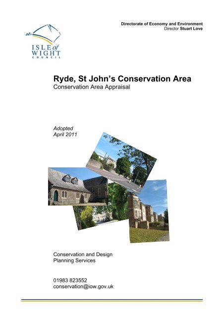
Directorate <strong>of</strong> Economy and EnvironmentDirector <strong>St</strong>uart Love<strong>Ryde</strong>, <strong>St</strong> John’s <strong>Conservation</strong> <strong>Area</strong><strong>Conservation</strong> <strong>Area</strong> AppraisalAdoptedApril 2011[Insert images here]<strong>Conservation</strong> and DesignPlanning Services01983 823552conservation@iow.gov.uk
Contents<strong>Conservation</strong> <strong>Area</strong> boundary mapIntroduction 1RYDE, ST JOHN’S CONSERVATION AREALocation, context and setting 1Historic development <strong>of</strong> <strong>Ryde</strong>, <strong>St</strong> John’s 2Archaeological potential 3SPATIAL ANALYSISCharacter areas 3Key views and vistas 3Character area and key views map 5Aerial photograph 6CHARACTER ANALYSIS1. Appley and <strong>St</strong> John’s 72. The Church <strong>of</strong> <strong>St</strong> John the Baptist 133. <strong>St</strong> John’s Park 17CONDITION ANALYSISProblems, pressures and the capacity for change 22Potential for enhancements 22General guidance 24Bibliography and references 27Appendix A– Boundary description 28
<strong>Ryde</strong>, <strong>St</strong> John’s <strong>Conservation</strong> <strong>Area</strong> Appraisal 11 Introduction1.1 The <strong>Isle</strong> <strong>of</strong> <strong>Wight</strong> <strong>Council</strong> recognisesthat a quality built environment is an essentialelement in creating distinctive, enjoyable andsuccessful places in which to live and work.Our EcoIsland Sustainable Community<strong>St</strong>rategy and Island Plan Core <strong>St</strong>rategyrecognise that our historic environment assetsattract investment and tourism, can provide afocus for successful regeneration and arehighly valued by local communities.1.2 As part <strong>of</strong> a rolling programme <strong>of</strong>conservation area designation and review, the<strong>Council</strong> designates parts <strong>of</strong> <strong>Ryde</strong>, <strong>St</strong> John’s asa <strong>Conservation</strong> <strong>Area</strong>. Local PlanningAuthorities have a duty under The Planning(Listed Buildings and <strong>Conservation</strong> <strong>Area</strong>s) Act1990 to designate as conservation areas anyareas considered to be <strong>of</strong> special architecturalor historic interest, the character orappearance <strong>of</strong> which it is desirable to conserveor enhance.1.3 The legislation also makes provision forschemes to enhance the area. Therefore, theinclusion <strong>of</strong> areas <strong>of</strong> potential allows forschemes to be put forward that will improvethe area, in keeping with its own individualcharacter, and to a high standard. Furtherpolicy guidance and information for land andproperty owners can be found on page 23 <strong>of</strong>this document.1.4 Designation does not mean thatdevelopment cannot take place within theconservation area or within its setting.Designation means that special considerationwill be given to applications within theconservation area to ensure that anydemolition is fully justified and that schemes(which are acceptable on all other planninggrounds) are <strong>of</strong> a suitable design, are highquality and appropriate to the specialcharacter. This additional level <strong>of</strong> considerationallows the <strong>Council</strong> to insist upon the bestpossible standards <strong>of</strong> design within aconservation area, and equally to refusedevelopment proposals on the grounds <strong>of</strong> poordesign or quality.2 <strong>Ryde</strong>, <strong>St</strong> John’s <strong>Conservation</strong><strong>Area</strong>2.1 The <strong>Ryde</strong> <strong>St</strong> John’s <strong>Conservation</strong> <strong>Area</strong>was first designated in December 1988. It fallswithin the parish <strong>of</strong> <strong>Ryde</strong> and is located to theeast <strong>of</strong> <strong>Ryde</strong>. <strong>Ryde</strong> <strong>Conservation</strong> <strong>Area</strong> (towhich it is, in part, attached) was firstdesignated in December 1969.2.2 This appraisal has been producedusing information contained within HistoricEnvironment Records (HER), the HistoricLandscape Characterisation (HLC), theHistoric Environment Action Plan (HEAP), andthe <strong>Isle</strong> <strong>of</strong> <strong>Wight</strong> Records Office. Informationhas also been obtained from the <strong>Isle</strong> <strong>of</strong> <strong>Wight</strong>Garden Trust (IWGT), <strong>Ryde</strong> Social HeritageGroup and the Historic <strong>Ryde</strong> Society.2.3 The special interest <strong>of</strong> the <strong>Ryde</strong>, <strong>St</strong>John’s <strong>Conservation</strong> <strong>Area</strong> can be summarisedas follows: it incorporates a large part <strong>of</strong> thearea’s 19 th century architecture, mainly grandvillas, Italianate in style, situated withingenerously sized gardens. Although <strong>St</strong> John’sis formerly part <strong>of</strong> <strong>St</strong> Helen’s, it is closely linkedto the outward suburban expansion <strong>of</strong> <strong>Ryde</strong>.The conservation area also includes historiclandscaping associated with <strong>St</strong> John’s House,the Abbey <strong>of</strong> <strong>St</strong> Cecilia and the mid-VictorianChurch <strong>of</strong> <strong>St</strong> John the Baptist.3 Location, context and setting3.1 <strong>Ryde</strong>, <strong>St</strong> John’s is located on theeastern outskirts <strong>of</strong> <strong>Ryde</strong> making it, essentially,a residential suburb (there are no industries orretail outlets). The area is linked to othersettlements by the A3055. Newport, the <strong>Isle</strong> <strong>of</strong><strong>Wight</strong>’s administrative centre, is 10 km (6miles) to the west; Seaview is a short distanceto the east. Directly to the south is enclosedpastureland. The wider area is hilly, linked tothe coast by roads that drop down to thecoastal plain. From some aspects there areclear views across <strong>Ryde</strong>.3.2 The geology <strong>of</strong> the area is comprised <strong>of</strong>Bembridge Limestones and Bembridge clays.Soils are mainly heavy, easily waterloggedclay, with lighter soils over gravel deposits.The area is heavily wooded, mostly secondarywoodland (with trees that have regeneratednaturally on previously unwooded sites), ratherthan ancient woodland. The main church in thearea is the parish Church <strong>of</strong> <strong>St</strong> John theBaptist.
<strong>Ryde</strong>, <strong>St</strong> John’s <strong>Conservation</strong> <strong>Area</strong> Appraisal 2Fig.1—Unpublished OS Map 1793© Crown copyright. .All rights reserved. 100019229—2009<strong>St</strong> John’sParkChurch<strong>St</strong> John’s HouseApley HouseFig. 2—OS Map, 1st Survey, 1862 (pub. 1864)4 Historic development <strong>of</strong> <strong>Ryde</strong>, <strong>St</strong>John’s4.1 The recorded history <strong>of</strong> the area datesback to the beginning <strong>of</strong> the 13 th century andhas its origins in the medieval Preston Manor.The name Appley (meaning a clearing whereapple trees grow) is believed to derive from a13th century farm (the name appears as Apleyon the unpublished Ordnance Survey (OS)Map <strong>of</strong> 1793, Fig. 1). In the mid 14 th centurythe land was owned by Thomas Vavascour (orpossibly Vavasour). On his death in 1360 theland was divided between his 3 daughters one<strong>of</strong> whom married John Turberville, a namecorrupted in later centuries into Troublefield.The 1793 OS Map also shows the area whereMonkton Mead Brook emerges as a cleardivision separating Appley from <strong>Ryde</strong>. Inmedieval times this area was even wider: theaddition <strong>of</strong> a sluice gate in the 18 th centurycreated a lagoon behind the beach andmarshland along the course <strong>of</strong> the brook.Thus, although <strong>St</strong> John’s is now considered tobe a suburb <strong>of</strong> <strong>Ryde</strong> (which developed fromthe late 18 th century onwards), it waspreviously part <strong>of</strong> <strong>St</strong> Helens.4.2 The 1793 OS map shows Apley House,a house which in the early 18 th century was thehome <strong>of</strong> David Boyes a notorious smuggler.Today the site is occupied by <strong>St</strong> Cecilia’sAbbey. <strong>St</strong> John’s, a house built in 1769 byLieutenant-Colonel William Amherst (1732-1781), also appears on the 1793 OS Map. Thehouse was named after <strong>St</strong> John’s inNewfoundland following the battle to reclaim itfrom the French in 1762, a battle in whichAmherst was Commander-in-Chief. The housewas bought by Edward Simeon in the 1790sand he extended the estate, buying up much <strong>of</strong>
<strong>Ryde</strong>, <strong>St</strong> John’s <strong>Conservation</strong> <strong>Area</strong> Appraisal 3the surrounding land. The original house andpart <strong>of</strong> the original estate now form BishopLovett Middle School. By comparing thehistoric maps it can be seen that, although thebuildings have been added to, the boundaries<strong>of</strong> these two historic estates are more or lessunchanged.4.3 The 1860s map (Fig. 2, page 2) showsthe Church <strong>of</strong> <strong>St</strong> John the Baptist (built in1843, formed into an ecclesiastical parish in1844) and the residential development <strong>of</strong> <strong>St</strong>John’s Park (built in the 1850s): both were builton land that was formerly part <strong>of</strong> the extended<strong>St</strong> John’s estate. With regard to <strong>St</strong> John’sPark, the map on page 4 (the 1908 OS Mapsuperimposed over a present-day map, Fig. 3),shows that, in the intervening years, eventhough some <strong>of</strong> these houses have beenreplaced or added to, the outline <strong>of</strong> thedevelopment, with its inner parkland, is alsoessentially unchanged.5 Archaeological potential5.1 Evidence in the area shows continuity<strong>of</strong> settlement from the Neolithic periodonwards. Archaeological finds listed on thehistoric environment record (HER) include ahoard <strong>of</strong> 12 Bronze Age palstaves (a type <strong>of</strong>axe) found at <strong>St</strong> Johns Park, sherds <strong>of</strong> Romanor Iron Age pottery and evidence <strong>of</strong> a possibleRoman cemetery in the vicinity. Anexamination <strong>of</strong> the unpublished OS Map <strong>of</strong>1793 (Fig. 1, page 2) shows a dispersedsettlement pattern but little evidence <strong>of</strong> amedieval field system: rather the field patternappears to derive from 16 th to 18 th centuryenclosure. Further information on the area canbe obtained from the historic landscapecharacterisation (HLC) maps and descriptions.5.2 This document does not identify all theknown heritage assets within the conservationarea, therefore any omission <strong>of</strong> any building,feature or space should not be taken to implythat it is <strong>of</strong> no interest.SPATIAL ANALYSIS6 Character areas6.1 The <strong>Ryde</strong>, <strong>St</strong> John’s <strong>Conservation</strong> <strong>Area</strong>covers an area that contains previousdesigned landscapes and planned settlement.The road layout, the building density, thearchitectural details and the presence <strong>of</strong> openspaces are all characteristics derived from thearea’s historic development: this, in part, hasbeen determined by the topography andgeography <strong>of</strong> the area but the majordetermining factor is previous land ownershipand usage.6.2 Based on this spatial analysis it is alsopossible to discern 3 distinct character areaswithin the conservation area (Fig. 4, page 5).There is clear delineation (almost east fromwest) along the A3055 (East Hill Road): thisseparates <strong>St</strong> John’s Park and the Church <strong>of</strong> <strong>St</strong>John the Baptist from the historic estates <strong>of</strong>Appley House (<strong>St</strong> Cecilia’s) and <strong>St</strong> John’sHouse (Bishop Lovett Middle School). Thisspatial division is visually apparent in the aerialphotograph on page 6 (Fig. 5).<strong>Area</strong> 1: Appley and <strong>St</strong> John’s<strong>Area</strong> 2: The Church <strong>of</strong> <strong>St</strong> John the Baptist<strong>Area</strong> 3: <strong>St</strong> John’s Park6.3 In coastal areas, the boundaries mayfollow the line <strong>of</strong> the mean low watermark, extending to include the whole <strong>of</strong> anypier, any part <strong>of</strong> which is within the mean lowwater mark which is the extent <strong>of</strong> thejurisdiction <strong>of</strong> the <strong>Council</strong> and so is used forconsistency.7 Key views and vistas7.1 Views into and out <strong>of</strong> the conservationarea are mostly obscured by trees. However,these trees make a significant visual impactand separate it from the more urbanised feel <strong>of</strong><strong>Ryde</strong>: this is most noticeable on the drive fromthe Esplanade up onto East Hill Road or whenviewed from along the coast.7.2 Other important views are towards thechurch, from Appley Road, East Hill Road andAlexandra Road. Views across <strong>Ryde</strong> from thechurch are mainly obscured but may bepossible from certain vantage points. Thereare a number <strong>of</strong> important views in and out <strong>of</strong>the <strong>St</strong> John’s Park character area: the viewdown East Hill Road, from Appley Road, withthe belt <strong>of</strong> trees on the east and the regularstepping down <strong>of</strong> the villas on the west; theviews out from West Hill Road across <strong>Ryde</strong>and to the Solent.CHARACTER ANALYSISThe analysis <strong>of</strong> the character <strong>of</strong> theseindividual areas is examined in depth in thefollowing chapters.
<strong>Ryde</strong>, <strong>St</strong> John’s <strong>Conservation</strong> <strong>Area</strong> Appraisal 4© Crown copyright. All rights reserved. 100019229—2009Fig. 3—OS Map 3rd Edition, 1907, published 1908, superimposed over present day map
<strong>Ryde</strong>, <strong>St</strong> John’s <strong>Conservation</strong> <strong>Area</strong> Appraisal 5
<strong>Ryde</strong>, <strong>St</strong> John’s <strong>Conservation</strong> <strong>Area</strong> Appraisal 6Fig. 5—Aerial photograph, 2005
<strong>Ryde</strong>, <strong>St</strong> John’s <strong>Conservation</strong> <strong>Area</strong> Appraisal 7Character <strong>Area</strong> 1:Appley and <strong>St</strong> John’sSummary <strong>of</strong> special interestThis is a pleasant, quiet area, diverse in use, the original settlement pattern <strong>of</strong> which is clearlydisplayed in its boundaries. There is a mix <strong>of</strong> 19 th and 20 th century architecture; elegant 19 thcentury villas, some <strong>of</strong> it Italianate in style, sit beside 20 th suburban housing. Remnants <strong>of</strong> 18 thand 19 th century parkland have a significant visual impact and some areas, semi-contained andsemi-concealed by trees, feel shadowy, secluded and enclosed although overall the area isspacious and green reflecting its suburban nature.
<strong>Ryde</strong>, <strong>St</strong> John’s <strong>Conservation</strong> <strong>Area</strong> Appraisal 88 Appley and <strong>St</strong> John’sFig. 6—<strong>St</strong> Cecilia’s8.1 The Appley and <strong>St</strong> John’s Character<strong>Area</strong> is centred on the historic estates <strong>of</strong>Appley House (also written as Apley) and <strong>St</strong>John’s House. These houses are amongst theearliest in the area and retain, in part, theiroriginal landscape setting. The area is boundby Appley Road to the south and East HillRoad to the west.9 Historic development9.1 Although the recorded history <strong>of</strong> thisarea dates from the medieval period, AppleyHouse and <strong>St</strong> John’s House can be dated tono earlier than the 18 th century. Appley Houseis the older <strong>of</strong> the two and is said to date fromthe 1720s, built for the smuggler David Boyes(or Boyce) who traded in illicit goods betweenFrance and England. In the 19 th century it wasthe home <strong>of</strong> the engineer and manufacturer <strong>of</strong>steam engines Nathaniel Clayton (1811-1890)who was also a keen yachtsman and member<strong>of</strong> the Royal Yacht Squadron. At some pointthe grounds were remodelled by the gardendesigner Edward Milner (1819-1884) whoseredesign included a large walled garden,vineries and a peach house.9.2 From 1879 Appley House was used asa private school (the <strong>Isle</strong> <strong>of</strong> <strong>Wight</strong> College)before being taken over in 1906 byBenedictine Nuns who relocated fromNorthwood House. The remains <strong>of</strong> the originalhouse are incorporated within the Abbey(including vaulted cellars, possibly used byBoyes for the storage <strong>of</strong> wines and spirits).The Abbey (1906-7) was designed by EdwardGoldie: it has a tower topped by a woodenFig. 7—<strong>St</strong> John’s Houselouvred belfry under a pyramid ro<strong>of</strong> (Fig. 6).The Abbey grounds contains open parkland tothe south <strong>of</strong> the house, trees and a gardenarea (see aerial photograph, Fig. 5, page 6).9.3 To the south <strong>of</strong> the Abbey is <strong>St</strong> John’sHouse, built by William Amherst (1732-1781)in c.1769. The house was bought by EdwardSimeon in 1796 and the following year heemployed Humphrey Repton to landscape thegrounds down to the seashore. Little remains<strong>of</strong> this landscaping, the lodges and shore-sidebuildings have all been demolished but thehouse, constructed in local stone, survives tothis day. It is now occupied by Bishop LovettMiddle School (Fig. 7) which took over thehouse in 1947. It is a listed building (Grade II)and is mentioned in Lloyd & Pevsner (2006) forits architectural merit.9.4 At one point the <strong>St</strong> John’s estatecovered quite a wide area: the Simeonspurchased more and more land in the earlypart <strong>of</strong> the 19 th century only to gradually leaseor sell it <strong>of</strong>f again in the latter part <strong>of</strong> thecentury. The estate extended from MonktonBrook to the west, Westridge Cross to thesouth and <strong>St</strong> Clare’s to the east, enclosing thehouse and grounds <strong>of</strong> the Appley estate. Theaerial photograph (Fig. 5, page 6) shows theextent <strong>of</strong> development that has taken place tothe north <strong>of</strong> the house on part <strong>of</strong> the original <strong>St</strong>John’s estate. Some <strong>of</strong> these buildings datefrom the mid 19 th century but they are notassociated with the development <strong>of</strong> <strong>St</strong> John’sPark. It is not known if they were built ondemand or by speculative builders but, aselsewhere, they were built to a highspecification and were to be occupied by
<strong>Ryde</strong>, <strong>St</strong> John’s <strong>Conservation</strong> <strong>Area</strong> Appraisal 9Fig. 8—Wilmington Housewealthy and noteworthy people, most likely assecond (or even third and fourth) homes. Orthey may have been rented or borrowed for thesummer season. <strong>Ryde</strong> was extremelyfashionable during the 19 th century: from the1850s the names <strong>of</strong> all noteworthy arrivals tothe Island and descriptions <strong>of</strong> balls and soireeswere published in the local paper (the <strong>Isle</strong> <strong>of</strong><strong>Wight</strong> Observer) under the heading the‘Fashionable List’.9.5 According to Kelly’s Directory <strong>of</strong> 1891,the Right Honourable Lord Rollo was residingat Wilmington House (Fig. 8), Lieutenant-General Sir Campbell Ross resided at LothianHouse and Colonel Clement Carey occupiedMelmoth Lodge. The postcard from 1905 (Fig.9) shows a number houses in front <strong>of</strong> theboating lake and these are shown circled onthe map (Fig. 10): Melmoth Lodge is the oneon the far left <strong>of</strong> the postcard, nearest to thelake. From the superimposed map it can beseen that, over the years, the grounds <strong>of</strong> theseproperties have been divided with infilldevelopment, characteristically 20 th centurysuburban housing. A new primary school hasalso been built within the grounds <strong>of</strong> the middleschool.9.6 <strong>St</strong> John’s Lodge on Appley Road alsobelonged to the <strong>St</strong> John’s estate. It was built inc1871, the date when the estate was sold toJohn Peter Gassiot (1797-1877), abusinessman and amateur scientist (he wasassociated with public demonstrations <strong>of</strong>electricity). At this time there were only 20acres <strong>of</strong> land remaining and the entrance tothe estate was relocated from the bottom <strong>of</strong> <strong>St</strong>John’s Hill where there were originally twoFig. 9—Postcard, 1905 (Bartie’s Postcards)Melmoth LodgeWilmington House© Crown copyright. All rights reserved. 100019229—2009Fig. 10—OS 1908 Map, superimposedpicturesque lodges designed by HumphreyRepton. Gassiot had another wing added tothe main house and the remaining estate relandscapedby W.B Page <strong>of</strong> Southampton (a7-sided folly still exists on the edge <strong>of</strong> thegrounds).9.7 <strong>St</strong> John’s Lodge, the replacementlodge, stands adjacent to Appley TowersLodge, one <strong>of</strong> the remaining lodges <strong>of</strong> theformer Appley Towers. This house(demolished in the 1950s) was also built onland previously owned by the Simeons. It wasone <strong>of</strong> the grander houses on the Islanddesigned by the <strong>Ryde</strong> architect ThomasHellyer for George Young, a <strong>Ryde</strong>entrepreneur associated with the <strong>Ryde</strong> PierCompany and the creation <strong>of</strong> the railway. In1870 Appley Towers was owned by Sir WilliamHutt and he had the small tower on the coast
<strong>Ryde</strong>, <strong>St</strong> John’s <strong>Conservation</strong> <strong>Area</strong> Appraisal 10Fig. 11—Appley Coach House and Cottagebuilt (confusingly, called Appley Tower). Theremaining lodge (listed, Grade II) is neo-Jacobean in style, in brick with shaped gables.The nicely proportioned Middle Lodge is alsoincluded in the conservation area: this mayalso have belonged to Appley Towers butthere is no direct evidence that this is the case.9.8 Also included in the character area arethe Old <strong>St</strong>ables, Appley Coach Hosuse andAppley Cottage on Appley Road (Fig. 11)opposite Appley Upper Lodge. Thesedistinctive buildings also relate to the AppleyTowers estate.10 Qualities, materials and localdetails10.1 The style <strong>of</strong> architecture makes astrong contribution to the character <strong>of</strong> the areaas a large number <strong>of</strong> the mid-late 19 th centuryhouses built to the north <strong>of</strong> <strong>St</strong> John’s Houseare still in situ (see map, Fig. 10, page 9).Some <strong>of</strong> the large houses were built in theItalianate style popular at the time due to theinfluence <strong>of</strong> Osborne House: Appley RiseHouse even has its own ’Osborne tower’ (Fig.12). The ‘Osborne tower’, also known as a‘belvedere’ tower (meaning, literally ’fair view’)was an architectural feature considered to bean essential element <strong>of</strong> the style.10.2 Most <strong>of</strong> the 19 th century houses are twoor three storey in height, have slate ro<strong>of</strong>s andare built from a mix <strong>of</strong> local stone and buffcolouredbricks (stone construction with brickdressings or brick construction with stonedressings) or built completely in buff-colouredbricks. Buff coloured bricks are common toFig. 12—Appley Rise Housecertain areas <strong>of</strong> <strong>Ryde</strong> and reflect the statusthat they had compared to red brick (at thebeginning <strong>of</strong> the 19 th century bricks in generalwere considered to be an inferior buildingmaterial). The OS Map <strong>of</strong> the 1860s (Fig. 2,page 2) shows a brickyard adjacent to AppleyHouse: this was gone by the time <strong>of</strong> the OSMap <strong>of</strong> 1897 but it is unlikely that the brickswere used in this area because <strong>of</strong> the natureand quality <strong>of</strong> the clay. <strong>St</strong> Cecilia’s Abbey(1906-7) was also built in buff-coloured brickand its louvred tower and extensive slate ro<strong>of</strong>fits neatly with the surrounding architecture(Fig. 6, page 8).10.3 Mid 19 th century windows are timber,mostly sliding sash with small glazing panes:many houses retain these. There are also fineexamples <strong>of</strong> more unusual windows, typical <strong>of</strong>the Italianate style (such as the archedwindows in Appley Rise House, Fig. 12).10.4 There are a number <strong>of</strong> 20 th centuryproperties within this part <strong>of</strong> the conservationarea, mostly single or two storeys in heightdating from the mid to late 20 th century. Withregard to more recent developments, nobuilding can be described as a model schemebut some are more sympathetic to the scale,height and building materials <strong>of</strong> theirsurroundings than others.10.5 There are 2 listed buildings within thischaracter area, both Grade II: <strong>St</strong> John’s Houseand Appley Towers Lodge. <strong>St</strong> Cecilia’s Abbeyand its grounds are on the Local List <strong>of</strong>Building, <strong>St</strong>ructures, Parks and Gardens <strong>of</strong>Architectural and Historic Importance (the‘Local List’). Other buildings <strong>of</strong> interest in the
<strong>Ryde</strong>, <strong>St</strong> John’s <strong>Conservation</strong> <strong>Area</strong> Appraisal 11Fig. 13—Trees & boundary walls, Appley Risearea are Wilmington House (Fig. 8, page 9),Appley Rise House (Fig.12, page 10) and <strong>St</strong>John’s Lodge.10.6 Mature trees contribute significantly tothe Appley and <strong>St</strong> John’s Character <strong>Area</strong> (Fig.11) and make the area feel less urbanisedthan other parts <strong>of</strong> <strong>Ryde</strong>. Equally, theopenness created by large gardens and thespaces between properties (despite the 20 thcentury infill development) also contributes tothis less urbanised feel.10.7 Boundary walls contribute to thecharacter <strong>of</strong> the area, particularly the stoneboundary walls along Appley Rise (Fig. 13)and the red brick boundary wall <strong>of</strong> the Abbeyto the north, running parallel to the coast (Fig.14) (although this wall was described as an‘atrocity’ by the local paper when it was firstbuilt in 1907). Also <strong>of</strong> interest is the formerentrance <strong>of</strong> the Abbey on Appley Rise whichconsists <strong>of</strong> a pair <strong>of</strong> vermiculated gate piers(Fig. 15).10.8 Abbey Lane, for the most part, waspreviously excluded from the conservationarea) but is now included (there are a number<strong>of</strong> 20 th century properties built in the grounds<strong>of</strong> the mid 19 th century houses). This unusualunmade road is a highly visible feature andappears much as it must have done for over acentury, flanked by characteristic stoneboundary walls which give only glimpses intothe gardens <strong>of</strong> the houses nearby.Fig. 14—Northern boundary, <strong>St</strong> Cecilia’s Abbey11 Public realm11.1 The character <strong>of</strong> the street scene isgreatly enhanced by historic street furnitureand historic surfaces and this is <strong>of</strong>tenoverlooked during development work and theinstallation <strong>of</strong> underground services. For themost part the surfaces are tarmac, <strong>of</strong>tenpatchwork, but there are original limestonekerbs and gulleys which should be retained.11.2 Along the upper part <strong>of</strong> Appley Risethere are sections <strong>of</strong> grass verge rather thantarmac pavement. This, along with theshingled surface <strong>of</strong> Abbey Lane, makes thearea feel less urbanised.12 Green spaces and biodiversityvalue12.1 The Appley and <strong>St</strong> John’s Character<strong>Area</strong> contains a large area <strong>of</strong> open space,retained from its original use as landscapedgardens. The areas use as a school and anAbbey means that the open space has beenretained. In other regards, individual gardenscontribute to the feeling <strong>of</strong> openness. Fromsome aspects the presence <strong>of</strong> this openness isobscured by trees but these trees also make apositive contribution to the character <strong>of</strong> thearea in the form <strong>of</strong> covered walkways andsemi-concealed views (Fig. 13).12.2 Some <strong>of</strong> the oak trees in the area maybe several hundred years old, remnants <strong>of</strong> the18th century parkland. There are alsoexamples <strong>of</strong> exotic trees, the largest recordedexamples on the Island. The wooded character<strong>of</strong> the area also allows red squirrels to flourish.
<strong>Ryde</strong>, <strong>St</strong> John’s <strong>Conservation</strong> <strong>Area</strong> Appraisal 12Fig. 15—Former entrance to the Abbey13 Key views and vistas13.1 As mentioned above, views into andout <strong>of</strong> the area are mostly obscured by trees,which when seen from the coast and from EastHill Road make the area appear secluded andseparate it from the more urbanised feel <strong>of</strong><strong>Ryde</strong>: this is most noticeable on the drive fromthe Esplanade up onto East Hill Road or whenviewed from along the coast.
<strong>Ryde</strong>, <strong>St</strong> John’s <strong>Conservation</strong> <strong>Area</strong> Appraisal 13Character <strong>Area</strong> 2: The Church <strong>of</strong> <strong>St</strong> John the BaptistSummary <strong>of</strong> special interestThis is primarily a peaceful residential area which radiates southwards from the church, achurch which sits prominently and comfortably at the junction <strong>of</strong> several roads. At times the areais awash with the chatter <strong>of</strong> children travelling to and from school, a pleasant contrast to thebackground murmur <strong>of</strong> constant traffic. 19 th century villas sit beside 20 th suburban housing,essentially linear ribbon development, situated within generously proportioned gardens.
<strong>Ryde</strong>, <strong>St</strong> John’s <strong>Conservation</strong> <strong>Area</strong> Appraisal 14Fig. 16—Church <strong>of</strong> <strong>St</strong> John the Baptist14 The Church <strong>of</strong> <strong>St</strong> John theBaptist14.1 The Church <strong>of</strong> <strong>St</strong> John the Baptist islocated at the top <strong>of</strong> a hill, at the junction <strong>of</strong>East Hill Road, Appley Road and High ParkRoad, opposite Bishop Lovett Middle School(Fig. 16). The Church <strong>of</strong> <strong>St</strong> John the BaptistCharacter <strong>Area</strong> includes the church and theresidential buildings immediately to the south,the east and the west.15 Historic development15.1 The area south <strong>of</strong> Appley Road isassociated with Troublefield Farm andTroublefield Copse, the origins <strong>of</strong> which derivefrom the medieval Preston Manor. The farm,with its semi-regular fields, is depicted on the1793 map (Fig. 1, page 2): it is identified againon the OS Map <strong>of</strong> 1864 (Fig. 2, page 2),adjacent to <strong>St</strong> John’s Farm, but thendisappears from the maps. On the OS Map <strong>of</strong>1908 (Fig. 3, page 4) <strong>St</strong> John’s Farm nowappears as Appley Home Farm whichsuggests that the farm was incorporated intothe <strong>St</strong> John’s estate and then re-sold, possiblya reflection <strong>of</strong> the changing fortunes <strong>of</strong> theSimeon family. The church was also built onland owned by the Simeons although in thiscase the land was specifically donated.Appropriately, the new church wasconsecrated in the name <strong>of</strong> <strong>St</strong> John theBaptist.15.2 As previously mentioned, this area <strong>of</strong><strong>Ryde</strong> used to be part <strong>of</strong> the parish <strong>of</strong> <strong>St</strong> Helensand the church, built in 1843 and created anecclesiastical parish in 1844, continued to bepart <strong>of</strong> the Chapelry <strong>of</strong> <strong>St</strong> Helens until 1979.Fig. 17—West elevationThe original church, designed by <strong>Ryde</strong>architect Thomas Hellyer, was smaller than thepresent church, aisle-less and cruciform builtfor the parishioners from the small village <strong>of</strong>Oakfield to the south east. With new residentialdevelopments at Elmfield and <strong>St</strong> Johns Parkthe church had to be extended. Theseadditions, completed by 1870, were also byHellyer, and included side aisles, vestry andgallery (complete with turreted stairway andclock, Fig. 17). Further alterations were carriedout in 1953 to specifications by ecclesiasticalarchitect Sir Charles Nicholson. The OldParsonage on Appley Road was the home <strong>of</strong>the first incumbent <strong>of</strong> the newly extendedchurch but the first vicarage was on High ParkRoad, adjacent to the church. The presentvicarage is on Victoria Crescent.15.3 The 1793 (Fig. 1, page 2) shows a roadcutting across the area. Comparing this mapwith later maps it appears that this road haschanged little in the intervening years,although it only became East Hill Road in 1848when it was <strong>of</strong>ficially laid out from the churchto the <strong>St</strong>rand. The <strong>St</strong>rand, at that time was theeastern boundary <strong>of</strong> <strong>Ryde</strong> and the location <strong>of</strong> aboundary stone, still in situ, is clearly markedon the 1908 OS Map). A toll gate waspositioned at the church end <strong>of</strong> East Hill Road,collecting money from those travelling into<strong>Ryde</strong>.15.4 The 1860s OS Map shows nothing inthe area except the church and the farm: the1908 superimposed map (Fig. 18, page 15)shows how the area has developed. Ofparticular interest is the line <strong>of</strong> uniform villas(one since lost to redevelopment) extending
<strong>Ryde</strong>, <strong>St</strong> John’s <strong>Conservation</strong> <strong>Area</strong> Appraisal 15Fig. 19—Edwardian house, High Park RoadFig. 20—Marlborough Roadfrom two storey neo-classical villas to modestpre-second world war bungalows.16.2 The Church <strong>of</strong> <strong>St</strong> John the Baptist islisted, Grade II. The other listed buildings inthe area are <strong>St</strong> John’s Farm Lodge and <strong>St</strong>John’s Cottage, now known as 14 & 16Marlborough Road, listed Grade II (Fig. 20).Parts <strong>of</strong> these buildings are believed to datefrom the late 16 th or early 17 th centuries,presumably when the buildings belonged toTroublefield Farm.© Crown copyright. All rights reserved. 100019229—2009Fig. 18—OS Map 1908 superimposedsouth along High Park Road: it is not clear ifthese villas were part <strong>of</strong> a planned lineardevelopment which was later curtailed. All thebuildings on this map are still in situ exceptone <strong>of</strong> the villas (the one farthest south) onHigh Park Road. On the opposite side <strong>of</strong> theroad is an unusual Edwardian house (Fig. 19),atypical for the area.16 Qualities, materials and localdetails16.1 The Church <strong>of</strong> <strong>St</strong> John the BaptistCharacter <strong>Area</strong> includes the houses on AppleyRoad, High Park Road and Alexander Road,an eclectic but representative mix <strong>of</strong> housesbuilt between the latter part <strong>of</strong> the 19 th and theearly part <strong>of</strong> the 20 th centuries. As there issuch a mix <strong>of</strong> houses, the materials range fromgrey and buff coloured stone to yellow and redcoloured bricks, from low pitch hipped greyslates ro<strong>of</strong>s to high pitch red clay tiled ro<strong>of</strong>s,16.3 Unlisted buildings <strong>of</strong> interest are theseries <strong>of</strong> uniform villas on the east side <strong>of</strong> HighPark Road, an Edwardian property on the westside <strong>of</strong> High Park Road (Fig. 18), 9-11Alexander Road (once High Park Hall College)and No 1 Alexander Road (Fig. 21, page 16).Also included are the converted stable andcoach house along and the Oakfield Primaryschool along Alexandra Road.16.4 There are also a number <strong>of</strong> boundarywalls that enhance the character <strong>of</strong> the area: inparticular, the stone walls surrounding thechurch and fronting properties along parts <strong>of</strong>Appley Road, Marlborough Road andAlexander Road; the brick walls and piersalong the west side <strong>of</strong> High Park Road; andthe rendered, neo-classical balustraded wallon the east side <strong>of</strong> High Park Road (Fig. 22,page 16).17 Public realm17.1 The character <strong>of</strong> the street scene isgreatly enhanced by historic street furnitureand historic surfaces and this is <strong>of</strong>ten
<strong>Ryde</strong>, <strong>St</strong> John’s <strong>Conservation</strong> <strong>Area</strong> Appraisal 16Fig. 21—1 Alexandra Roadoverlooked during development work and theinstallation <strong>of</strong> underground services. Again, aswith other areas, most surfaces are tarmac,<strong>of</strong>ten patchwork, there are also originallimestone kerbs and gulleys which should beretained.Fig. 22—High Park Road18 Green spaces and biodiversityvalue18.1 The Church <strong>of</strong> <strong>St</strong> John the BaptistCharacter <strong>Area</strong> contains a number <strong>of</strong> maturetrees, mainly in the grounds <strong>of</strong> the church andin the area south <strong>of</strong> the church in the gardens<strong>of</strong> the properties on High Park Road andMarlborough Road. The high number <strong>of</strong> treescontributes to the overall wooded nature <strong>of</strong> the<strong>Ryde</strong>, <strong>St</strong> John’s <strong>Conservation</strong> <strong>Area</strong>.19 Key views and vistas19.1 The most important views in thischaracter are towards the church, from AppleyRoad, East Hill Road and Alexandra Road.Views across <strong>Ryde</strong> from the church are mainlyobscured by infill development but may bepossible from certain vantage points.
<strong>Ryde</strong>, <strong>St</strong> John’s <strong>Conservation</strong> <strong>Area</strong> Appraisal 17Character <strong>Area</strong> 3: <strong>St</strong> John’s ParkSummary <strong>of</strong> special interestClimbing gently from the seafront, <strong>St</strong> John’s Park is a fine example <strong>of</strong> 19 th century residentialplanning on a grand scale: these 19 th century residences retain many <strong>of</strong> the characteristicdecorative features <strong>of</strong> Italianate architecture, the richness <strong>of</strong> which matches the area’s elevatedposition dominating views across <strong>Ryde</strong>, a dominance assisted by the thickly wooded parkland atits core. The woodland and gardens contribute significantly to the spaciousness <strong>of</strong> the area.Towards the north-west is a distinctive row <strong>of</strong> Victorian and Edwardian houses which retainmany original features.
<strong>Ryde</strong>, <strong>St</strong> John’s <strong>Conservation</strong> <strong>Area</strong> Appraisal 18Fig. 23—View along West Hill Road20 <strong>St</strong> John’s Park Character <strong>Area</strong>20.1 The <strong>St</strong> John’s Park Character <strong>Area</strong> islocated on the western side <strong>of</strong> theconservation area and is centred on the mid-19 th century irregular tear-drop development <strong>of</strong><strong>St</strong> John’s Park. It is an area <strong>of</strong> gentlyundulating woodland surrounded by residentialdwellings located on East Hill and West HillRoads (Fig. 23). Also included is the lateVictorian terrace located at the bottom <strong>of</strong> WestHill Road.21 Historic development21.1 This area <strong>of</strong> land appears on the 1793map (Fig. 1, page 2) as a series <strong>of</strong> semiregularsmall fields and not as ancientwoodland as its current layout may suggest. Inthe early 19 th century the land was acquired bythe Simeons and became part <strong>of</strong> the <strong>St</strong> John’sestate. Parts <strong>of</strong> this estate were being leasedin the 1830s and the area began to bedeveloped in the 1850s. Development wasfacilitated by the laying out <strong>of</strong> East Hill Roadand the pressing need for <strong>Ryde</strong>’s outwardexpansion, a demand for building landprobably elevating local land prices.21.2 The design for <strong>St</strong> John’s Park was byThomas Hellyer, although none <strong>of</strong> the housesare known to be directly by him. The choice <strong>of</strong>the irregular tear-drop shape may have beendetermined by geography rather than aestheticdesign and the overall concept (substantialvillas on substantial plots) may have beeninspired by a similar scheme at East Cowes.Surviving draft leases show that the position <strong>of</strong>the houses and the terms to be observed byeach tenant were strictly controlled byFig. 24—Leavington HouseSimeon’s Surveyors. To preserve theseclusion <strong>of</strong> the park itself, houses were keptat least 80 ft (24 m) from the inner boundary.Since there was no single developer the style<strong>of</strong> the houses varied but all had to be at least£600 in value when built – most were actuallymore than this. One <strong>of</strong> the builders believed tobe involved was John Harbour <strong>of</strong> <strong>Ryde</strong> whohad a brickyard at Binstead (as mentionedpreviously, although the 1860s OS Map, Fig.2,page 3, shows a brickyard adjacent to AppleyHouse it is unlikely that the bricks were used inthis area). Again, as elsewhere, the houseswere built in a mainly Italianate style, thepervading style <strong>of</strong> the period through theinfluence <strong>of</strong> Osborne House (and, again, aselsewhere, Osborne towers appear in variousforms).21.3 <strong>St</strong> John’s Park was described in the<strong>Isle</strong> <strong>of</strong> <strong>Wight</strong> Observer <strong>of</strong> 17 th January 1957 asa “great addition to the environs <strong>of</strong> <strong>Ryde</strong>…Evergreens and flowering shrubs are thrivingmost luxuriously. Several sites are taken onbuilding leases and villas are in the course <strong>of</strong>being erected.” (HRS) An interesting footnoteis that the hoard <strong>of</strong> 12 palstaves (a Bronze Ageaxe) mentioned on page 3 were discovered in1858 when digging the foundations forLeavington House (Fig. 24): these weredonated by Sir John Simeon to the <strong>Isle</strong> <strong>of</strong><strong>Wight</strong> Philosophical Society.21.4 By 1868 most sites around the parkhad been filled and this fashionable newsuburb was virtually complete. There weregaps in the development, most notably at thenorthern area <strong>of</strong> West Hill Road: it is not quiteclear why this is the case but it may have been
<strong>Ryde</strong>, <strong>St</strong> John’s <strong>Conservation</strong> <strong>Area</strong> Appraisal 20Fig. 27—No. 60 West Hill Roadtend to be shallow pitched, mainly naturalslate: where tiles are used the pitch is steeper.22.3 In terms <strong>of</strong> decorative details, <strong>of</strong>particular importance are the window and doordressings, the extensive use <strong>of</strong> quoins, dentilmouldings, balustrading (both stone and iron),and the use <strong>of</strong> polychromatic brickwork on theconjunction with porches and projections. Theconcentration <strong>of</strong> these features in oneparticular area is found nowhere else on theIsland.22.4 Many <strong>of</strong> the buildings have originaltimber sash windows with original glass still insitu, some have original ironwork at thebalconies in tact. Many <strong>of</strong> the originalboundary walls and gates are still present,complete with original landscaping to largefront and back gardens (Fig. 26).22.5 The <strong>St</strong> John’s Park Character <strong>Area</strong>also includes development to the north-westside <strong>of</strong> West Hill Road, a series <strong>of</strong> pleasingdetached and semi-detached two storeyproperties. They are modest accommodationin comparison with the elaborate villas to thesouth east. The area on the 1860s OS Mapappears vacant but by 1908 the area iscomplete. They are constructed in a mix <strong>of</strong> redand buff brick (some rendered) under lowpitched slate ro<strong>of</strong>s typical <strong>of</strong> the lateVictorian/Edwardian period. They have twostorey bays, some canted, with occasionaldecorative details (contrasting brick bandingand quoins, terracotta keystones, ro<strong>of</strong> finials,etc). In some instances, there are originaltimber sash windows with original glazingretained.Fig. 28—New Lodge22.6 In some parts, unsympathetic infilldevelopment has occurred over the years(particularly in the central and northern areas)but, for the most part, the open aspect and thesurvival <strong>of</strong> the architecture means that thecharacter has been retained.22.7 There are no listed buildings within the<strong>St</strong> John’s Park Character <strong>Area</strong> but there aremany notable buildings. As mentioned above,the style <strong>of</strong> the area is Italianate but eachbuilding is virtually unique, and some <strong>of</strong> theseare <strong>of</strong> significant architectural interest to bementioned in Pevsner: Argosy, its neighbourVista Marina, Victoria (or Victorian) Lodge andNew Lodge, described as the best house in thegroup (Fig. 28).22.8 The parkland <strong>of</strong> <strong>St</strong> John’s Park is onthe Local List <strong>of</strong> Buildings, <strong>St</strong>ructures, Parksand Gardens <strong>of</strong> Architectural and HistoricImportance (listed June 2008) because <strong>of</strong> thecontribution it makes to the character <strong>of</strong> thearea.22.9 Boundary walls make a significantcontribution to the character <strong>of</strong> the area. Ofparticular interest are the old walls and gatepiers <strong>of</strong> the inner parkland (Fig. 24, page 18)constructed in the 1860s. At the northern end,the prominent modernist blocks <strong>of</strong> CollingwoodCourt are surrounded by a colonnaded gardenwall which is also part <strong>of</strong> this original boundary.22.10 The stone boundary wall at thejunction <strong>of</strong> Rink Road (named after the rollerskating rink) is also <strong>of</strong> interest, not leastbecause it contains an original stone cartouche(Fig. 29, page 21): it is not clear what the origin
<strong>Ryde</strong>, <strong>St</strong> John’s <strong>Conservation</strong> <strong>Area</strong> Appraisal 21Fig. 29—<strong>St</strong>one wall and stone cartoucheor the meaning <strong>of</strong> this is (the wall may havebeen the boundary <strong>of</strong> a garden owned by one<strong>of</strong> the properties on West Hill Road).23 Public realm23.1 The character <strong>of</strong> the street scene isgreatly enhanced by historic street furnitureand historic surfaces and this is <strong>of</strong>tenoverlooked during development work and theinstallation <strong>of</strong> underground services. Again, aswith other areas, most surfaces are tarmac butthere are original limestone kerbs and gulleyswhich should be retained.24 Green spaces and biodiversityvalue24.1 The large gardens contribute to thegreen appearance and the feeling <strong>of</strong> opennessbut, undoubtedly, the major contribution comesfrom the inner parkland. Although the parklandis overgrown and is now predominantlywooded this open space has anoverwhelmingly positive impact on the area.Originally landscaped parkland the area is nowdominated by self-seeded trees. Within thegrounds <strong>of</strong> the villas themselves a more formaltree planting has taken place (including exoticspecimens) although this is being eroded bythe need to provide car parking space for subdividedvillas.Fig. 30—High Park Road25 Key views and vistas25.1 There are a number <strong>of</strong> important viewsin and out <strong>of</strong> the <strong>St</strong> John’s character area.These include views down East Hill Road withthe belt <strong>of</strong> trees on the east side (in thegrounds <strong>of</strong> Bishop Lovett School) and theregular stepping down <strong>of</strong> the villas on the westside and views out from West Hill Road across<strong>Ryde</strong> (Fig. 30) and to the Solent.25.2 From outside the area, the buildingsand inner parkland <strong>of</strong> <strong>St</strong> John’s Park are highlyvisible from various aspects <strong>of</strong> <strong>Ryde</strong> and fromthe Solent.24.2 Equally important is the wooded areato the east <strong>of</strong> East Hill Road, part <strong>of</strong> thegrounds <strong>of</strong> Bishop Lovett Middle School.
<strong>Ryde</strong>, <strong>St</strong> John’s <strong>Conservation</strong> <strong>Area</strong> Appraisal 22CONDITION ANALYSISThe preceding chapters have defined thecharacter <strong>of</strong> the <strong>Ryde</strong>, <strong>St</strong> John’s <strong>Conservation</strong><strong>Area</strong> and listed a host <strong>of</strong> positive elements thatare essential for its continued existence as anarea <strong>of</strong> special interest. However there are anumber <strong>of</strong> factors that are recognised to havea cumulative negative affect.Problems, pressures and the capacityfor changeP1 Poor quality public realm. Althoughthere are examples <strong>of</strong> limestone kerbs andgulleys which add to the character andappearance <strong>of</strong> the area, this is interspersedwith concrete kerbs. Equally, poor roadsurfaces and ill matched materials have anegative impact. In other areas where there isno paving (for example, along parts <strong>of</strong> AppleyRise and Abbey Lane) this should be retainedto prevent the urbanisation <strong>of</strong> the area.P2 Parking. The creation <strong>of</strong> hardstandingsfor vehicles within gardens can result in theloss <strong>of</strong> green space and historic boundarytreatments. It can also lead to the loss <strong>of</strong>habitats and biodiversity. In particular parkingcontained within the forecourts <strong>of</strong> the largermulti-occupancy properties impacts visually onthe character <strong>of</strong> the area. In other areas,particularly on Appley Rise and Ampthill Road,on road parking adds to congestion,particularly during school time, close to theprimary school.P3 Through traffic. Traffic on East HillRoad is fairly constant (it is the A3055, one <strong>of</strong>the main through roads for traffic across theIsland). During school time congestionincreases in the area, close to Bishop LovettSchool and on Ampthill Road, close to theprimary school.P4 Development and redevelopment.Pressure for development and redevelopmentmay result in applications for inappropriate infilldwellings and inappropriate extensions tobuildings <strong>of</strong> local interest which fail to respectthe size, scale and materials <strong>of</strong> the originalbuildings. Such applications will not besupported. In particular, the <strong>St</strong> John’s ParkCharacter <strong>Area</strong> has suffered from the intrusion<strong>of</strong> unsympathetic development. (The northernpart <strong>of</strong> <strong>St</strong> John’s Park was originally excludedfrom the conservation area for this reason. It isnow included to recognise that even negativeor neutral areas have potential forenhancement and to protect the originalboundary walls <strong>of</strong> the parkland.P5 Replacement window and doors. Theloss <strong>of</strong> traditional windows and doors is gainingmomentum. Care should be taken to retainexisting windows and doors and wherereplacements are required considerationshould be given to the type, design and pr<strong>of</strong>ile<strong>of</strong> any replacements.P6 Inappropriate boundary treatments.These can alter the character and appearance<strong>of</strong> an area. For example, around the Abbeygrounds there is pre-fabricated concrete,barbed wire and corrugated iron (Fig 14, page11).P7 Increased clutter from multi-occupancyresidence. For example, dustbins, letter boxes,utility provision, car parking spaces, etc are<strong>of</strong>ten insensitively sited. Equally, overheadcables, satellite dishes and television aerialscan have a negative impact.P8 Trees. Trees are important across theconservation area and should be maintained.Some <strong>of</strong> the oak trees in the area may beseveral hundred years old, remnants <strong>of</strong> 18thcentury parkland. There are also examples <strong>of</strong>exotic trees, the largest recorded examples onthe Island. The wooded character <strong>of</strong> the areaalso allows red squirrels to flourish.P9 Environmental. Given the location <strong>of</strong>the area there are numerous environmentalpressures from climate change includingerosion and flooding, either tidal or fromMonkton Mead Brook. See ShorelineManagement Plan (SMP2) for a fullassessment.Potential for enhancementsE1 A key opportunity for improvements willbe the <strong>Council</strong>’s Highways PFI projectinvolving renewal and like for like replacementacross the Island from 2013 and to includeroad surfacing, street furniture, road signs andlighting. This is an opportunity to safeguardthe local distinctiveness through improving thepoor aesthetics <strong>of</strong> the public realm, inparticular the cluttered streetscape andmismatched surface finishes in the historiccore. Poorly sighted, mismatched or decrepitsigns, bins, road markings and bollards shouldbe removed. The general approach to all
<strong>Ryde</strong>, <strong>St</strong> John’s <strong>Conservation</strong> <strong>Area</strong> Appraisal 23highways works throughout the conservationarea will follow the less-is-more principle andan audit <strong>of</strong> the public realm should beundertaken to inform decision making. Detailedguidance is contained in the <strong>Council</strong>’sGuidance for Works on Highways and thePublic Realm document. Existing limestonekerbs and historic surface finishes will beretained and carefully repaired. Where costsavings permit, natural or traditional materialswill be sought, stretches <strong>of</strong> historic material relaidand specific local designs replicated inorder to sustain important local character.E2 Outside <strong>of</strong> the PFI project, the <strong>Council</strong>will work in partnership to secure sensitivepublic realm enhancement schemes in theconservation area. We will work with the Town<strong>Council</strong> to identify public realm improvementprojects which will sustain the historic interestand local distinctiveness <strong>of</strong> the conservationarea.E3 The <strong>Council</strong> will continually seekimprovements to both vehicle and pedestrianmovements whilst respecting the character <strong>of</strong>the area.E4 Within the designated conservationarea boundaries, the <strong>Council</strong> will apply stricterpolicies and tighter controls on all types <strong>of</strong>development, paying particular attention to theneed to sustain and enhance the character <strong>of</strong>the conservation area in line with PPS5 and toconsider its setting and its seascape (PolicyDM13). Where new designs are proposed inthe conservation area or its setting, the LPAwill seek to encourage ingenuity and quality indesign, appropriate to its particular historiccontext. The need to sustain variouscharacteristics such as the historic plan form,views, traditional materials and relationshipsbetween buildings will be key considerations indetermining applications within the designatedarea. Proposals which lack quality materials orapplications which are poorly detailed will notbe supported. Key information on the externalfinishes, pr<strong>of</strong>iles and fenestration detailing willbe sought as part <strong>of</strong> the application in orderthat the effect <strong>of</strong> a proposal on the character <strong>of</strong>the conservation area can be determined.control certain types <strong>of</strong> development andprevent the loss <strong>of</strong> original material. Whereloss is acceptable steps should be taken tocontrol the type, design and pr<strong>of</strong>ile <strong>of</strong> certainfeatures (for example, replacement windows).E6 Where appropriate the LPA will workwith owners and the Town <strong>Council</strong> to improvethe local environment and take action toaddress disamenity, unlawful development,inappropriate land uses and to secureinvestment in and sensitive management <strong>of</strong>vacant land or buildings in the area.E7 <strong>St</strong>ricter control on multi-occupancy,including the possible use <strong>of</strong> Article 4Directions. Consideration should be given todesign solutions for the siting <strong>of</strong> shared utilities(to avoid clutter) and landscapingE8 The <strong>Council</strong> will monitor applicationswhich affect the amenity value <strong>of</strong> trees(measuring over 750mm radius at 1.5m aboveground level) in the designated area. It willcontinue to promote good tree management toensure that trees are retained and the specialarboreal characters <strong>of</strong> the three areas aresustained.E9 The <strong>Council</strong> will continue to work withrelevant bodies and organisations on theenvironmental issues regarding the Harbourand the coastal defences in line with the<strong>Council</strong>’s commitment to the SMP2E5 In line with English Heritage guidanceon sustaining and enhancing the character <strong>of</strong> aconservation area, residential dwellings will besubject to an Article 4 Direction to removecertain permitted development rights. This will
<strong>Ryde</strong>, <strong>St</strong> John’s <strong>Conservation</strong> <strong>Area</strong> Appraisal 24GENERAL GUIDANCEIn recognition <strong>of</strong> the fact that the historicenvironment makes a very real contribution toour quality <strong>of</strong> life and the quality <strong>of</strong> our places,the Government <strong>St</strong>atement on the HistoricEnvironment for England, (DCMS, 2010)established this vision :That the value <strong>of</strong> the historic environment isrecognised by all who have the power to shapeit; that Government gives it proper recognitionand that it is managed intelligently and in away that fully realises its contribution to theeconomic, social and cultural life <strong>of</strong> the nation.The historic environment should be seen as avital contributor to improving the quality <strong>of</strong>place, and quality <strong>of</strong> life, for all. By supplying afocus for civic activity and <strong>of</strong>feringopportunities for learning and recreation thehistoric environment can also be thefoundation for more engaged and activecommunities. At its most basic, in providingdistinctive local features and a tangible link tothe past, the historic environment is <strong>of</strong>tencentral to local identity in both urban and ruralareas. Conserving the historic environmentresource for future generations also accordswith the principles <strong>of</strong> sustainable development.These wider objectives for the historicenvironment are reflected in Planning Policy<strong>St</strong>atement 1: Delivering SustainableDevelopment, (ODPM 2005) which says that,… planning should facilitate and promotesustainable and inclusive patterns <strong>of</strong> urbanand rural development by [amongst otherthings] protecting and enhancing the naturaland historic environment, the quality andcharacter <strong>of</strong> countryside, and existingcommunities. The <strong>Council</strong> appreciate that ourhistoric built environment is an essentialelement in creating distinctive, enjoyable andsuccessful places in which to live and work.Our Eco Island vision and LocalDevelopment Framework Core <strong>St</strong>rategyrecognizes that our natural and builtenvironment attracts investment and tourism,provides a focus for successful regenerationand is highly valued by Island communities.Managing changeIt is acknowledged that change is inevitable.While it is right to provide protection andsupport for our past, this must be managedintelligently, with an appropriate balance <strong>of</strong>priorities and an understanding <strong>of</strong> what couldbe gained or lost. “In shaping places,Government at all levels must give priority tocreating high quality environments for thosewho use them, developing and implementingpolicies which seek to retain localdistinctiveness and give due weight to theobligation to protect, enhance and promote thehistoric environment.” (The Government<strong>St</strong>atement on the Historic Environment forEngland, (DCMS, 2010))Recent revisions to national planning policyguidance are informed by the known publicbenefits provided by the historic environment.Planning Policy <strong>St</strong>atement 5 (Planning forthe Historic Environment, CLG, 2010) wasintroduced in March 2010 to replace PPG15and PPG16. The PPS does not changeexisting legal framework for the designation <strong>of</strong>scheduled monuments, listed buildings,conservation areas etc and existing law setsout the basis on which the various consents orlicences may be required.The new PPS employs the term heritage assetin relation to conservation areas, listedbuildings, locally listed features, historiclandscapes, all sites on the HistoricEnvironment Record (HER) including oldbuildings and archaeology, whetherdesignated or not. PPS5 states that “once lost,heritage assets cannot be replaced and theirloss has a cultural, environmental, economicand social impact. Significance can be harmedor lost through alteration or destruction <strong>of</strong> theheritage asset or development within itssetting.”This approach governs how change ismanaged in a <strong>Conservation</strong> <strong>Area</strong>. Large scalechange requires “clear and convincingjustification” (HE9) for loss <strong>of</strong> significanceaffecting any designated asset, particularlywith regards proposals incorporatingsubstantial harm to a building or feature <strong>of</strong>significance within a <strong>Conservation</strong> <strong>Area</strong>. Thisjustification needs to consider the variouspublic benefits as outlined above and includemarketing and other reasonable endeavours tosecure the continued conservation <strong>of</strong> aheritage asset. PPS5 Policy HE7 defines theprocess <strong>of</strong> place-shaping as one where thedesirability <strong>of</strong> enhancing or better revealing thesignificance <strong>of</strong> the conservation area is a keyconsideration, including, where appropriate,through sensitive development <strong>of</strong> elementswhich do not contribute to the significance <strong>of</strong>the designated area. In these circumstances,
<strong>Ryde</strong>, <strong>St</strong> John’s <strong>Conservation</strong> <strong>Area</strong> Appraisal 25LPA’s are encouraged to support design whichis appropriate for its context and which makesa positive contribution to the appearance,character, quality and local distinctiveness <strong>of</strong>the historic environment and makes a positivecontribution to economic vitality andsustainable communities. This additional level<strong>of</strong> consideration allows members and <strong>of</strong>ficers<strong>of</strong> the <strong>Council</strong> to insist upon the best possiblestandards <strong>of</strong> design for new developmentswithin a conservation area or affecting itssetting. Small scale changes are considered inPolicy HE4 which specifically requires localauthorities to consider whether the exercise <strong>of</strong>permitted development rights would underminethe aims for the historic environment, therebysupporting the use <strong>of</strong> Article 4 Directions inconservation areas.For all proposals in a conservation area oraffecting its setting, Policy HE6 now requiresthat an authority only validate applicationswhich provide sufficient information regardinga) the significance <strong>of</strong> any heritage asset and b)the proposed impact to it/them. Further detailon what information to provide is available atour website www.iwight.com/conservation orplease call 01983 823552 in <strong>of</strong>fice hours.Applicants are also advised to contact theArchaeology Service atarchaeology@iow.gov.uk or phone 01983823810 for access to the council’s HistoricEnvironment Record (HER).WindowsThe <strong>Council</strong> will always encourage the repairand refurbishment <strong>of</strong> original windows in<strong>Conservation</strong> <strong>Area</strong>s. The fabric <strong>of</strong> an originalwindow i.e. timber, historic glass and fixturesand fittings are an important part <strong>of</strong> the historicinterest <strong>of</strong> the window which itself forms anintegral part <strong>of</strong> both the character and theappearance <strong>of</strong> a property.It is also important to note that the <strong>Council</strong>’scommitment to EcoIsland priorities includesmeasures to support sustainability andtherefore the re-use <strong>of</strong> traditional buildings andthe harnessing <strong>of</strong> their embodied energy iseminently sustainable. For the same reasons,it is also preferable to retain historic windowsas opposed to installing new, industriallymanufactured windows <strong>of</strong> plastic materialssuch as UPVC. As such, the local planningauthority supports the preservation <strong>of</strong> originaltimber or metal windows in buildings <strong>of</strong>historical or architectural value. When originaltimber or metal windows are beyond repair andthis has been fully justified by the submission<strong>of</strong> a detailed specialist report, the preferencewill be for the like for like replacement <strong>of</strong> thedecayed windows, incorporating the retainedglazing and fixtures and fittings, wherepossible.Replacement with alternative windows, interms <strong>of</strong> design or materials, will generally onlybe considered when the existing windows are<strong>of</strong> an inappropriate design, e.g. notcontemporary with the architectural style <strong>of</strong> thebuilding. Sensitive upgrading can beundertaken to improve the thermalperformance <strong>of</strong> a historic building, mostcommonly this is through sash refurbishment,hidden draughtpro<strong>of</strong>ing, upgrading l<strong>of</strong>tinsulation and installing secondary glazing.Further ways to achieve a reduction in energyloss can be found in English Heritage’sadvisory note Energy <strong>Conservation</strong> inTraditional Buildings (2008).Improvements to later or modern replacementwindows will be sought where the units arepoorly detailed, <strong>of</strong> inappropriate material andfail to enhance the character and qualities <strong>of</strong>the conservation area.Changes requiring planning permissionAt the time <strong>of</strong> writing, ordinary unlisteddwellings do not require planning permissionfor the changing <strong>of</strong> windows. However, if aproperty contains flats or incorporates acommercial element, planning permission islikely to be required.When a conservation area is designated,alterations to Permitted Development Rightscome into effect whether an Article 4 Directionis designated or not. Detailed advice shouldbe obtained from the <strong>Council</strong>’s planning <strong>of</strong>ficeor via the Planning Portal website. Generaladvice regarding the most common issueswithin a conservation area is as follows.Please note this advice is correct at the time <strong>of</strong>writing.Extensions and alterations to dwellingsAt the time <strong>of</strong> writing, the determination as towhether an extension requires planningpermission is primarily determined by virtue <strong>of</strong>the location, ground coverage and dimensions<strong>of</strong> the alteration. The materials employed onany alteration or extension should be <strong>of</strong> similar
<strong>Ryde</strong>, <strong>St</strong> John’s <strong>Conservation</strong> <strong>Area</strong> Appraisal 26appearance to the existing. Any ro<strong>of</strong> extensionor addition which would materially alter theshape <strong>of</strong> the ro<strong>of</strong> (including dormers on anyelevation) will require planning permission.Cladding any part <strong>of</strong> the exterior <strong>of</strong> a dwellinghouse within a conservation area (e.g. inartificial stone, timber <strong>of</strong> tiles) requiresplanning permission.Garages and outbuildingsAt the time <strong>of</strong> writing, planning permission isusually required for garages and outbuldings,particularly if they would be situated on landforward <strong>of</strong> or between the side elevation <strong>of</strong> adwelling and boundary <strong>of</strong> the curtilage <strong>of</strong> thedwellinghouse.Satellite dishesAt the time <strong>of</strong> writing, a satellite dish is notpermitted on a chimney, wall or ro<strong>of</strong> slopewhich faces onto and is visible from a highwayor on a building which exceeds 15 metres inheight.Solar panels and micro generationAt the time <strong>of</strong> writing, the erection <strong>of</strong> solarpanels on a non listed building is permittedwhere the installation, so far as is practicable,is sited to minimise the effect on the externalappearance <strong>of</strong> the building and the amenity <strong>of</strong>the area.However, the historically diverse nature <strong>of</strong>settlement within a conservation area makes itdifficult to define specific areas <strong>of</strong>archaeological potential. The likelihood <strong>of</strong> theoccurrence <strong>of</strong> archaeological material isrelated specifically to previous land usage.Archaeological remains <strong>of</strong> any period could befound within a conservation area and thereforeproposals to carry out works which includeground disturbance may require anarchaeological evaluation or assessment. Theresults <strong>of</strong> a preliminary archaeologicalevaluation may indicate that the impact <strong>of</strong> theproposed development on archaeologicalremains is inappropriate or needs to bemodified.Demolition <strong>of</strong> structuresAt the time <strong>of</strong> writing, conservation areaconsent must be obtained for any proposal tototally demolish a building with a cubic contentgreater than 115 cubic metres or a structuresuch as a wall if it is higher than 1 metreadjacent a highway and 2 metres elsewhere.Where total loss <strong>of</strong> (or substantial harm to) thesignificance <strong>of</strong> a heritage asset is proposed, acase should be made on the grounds that theproposal is necessary to deliver substantialpublic benefits and that for example, noalternative location or design will achieve thisappropriately.Up to date advice relating to other types <strong>of</strong>proposals can be obtained from the <strong>Council</strong>’splanning <strong>of</strong>fice or via the Planning Portalwebsite.Design <strong>of</strong> new developmentPPS5 policies HE7, HE9 and HE10 requireattention to the extent to which designcontributes positively to the character,distinctiveness and significance <strong>of</strong> the historicenvironment. Irrespective <strong>of</strong> architectural style,a building will fit into its context if it observesthe conventions <strong>of</strong> scale, height, building line,alignment, and materials that have been usedpreviously in the conservation area. Furtherguidance can be found in Building in Context(CABE) and New Development in Historic<strong>Area</strong>s (English Heritage).ArchaeologyMost settlements contain archaeologicalevidence which helps to explain their originsand the way <strong>of</strong> life <strong>of</strong> former inhabitants.
<strong>Ryde</strong>, <strong>St</strong> John’s <strong>Conservation</strong> <strong>Area</strong> Appraisal 27Bibliography and referencesBartie’s Postcards website, www.bartiesworld.co.ukBasford, H. V. (1980) The Vectis Report: a survey <strong>of</strong> <strong>Isle</strong> <strong>of</strong> <strong>Wight</strong> Archaeology. IOW <strong>Council</strong>,Newport:Basford, H. V Historic Parks and Gardens <strong>of</strong> the <strong>Isle</strong> <strong>of</strong> <strong>Wight</strong><strong>Conservation</strong> <strong>St</strong>udio, (2005) <strong>Ryde</strong> Inner Core, Townscape Heritage Initiative. <strong>Ryde</strong> DevelopmentTrustBrannon George (1849). Picture <strong>of</strong> the <strong>Isle</strong> <strong>of</strong> <strong>Wight</strong>, Project GutenbergCommunities and Local Government. (2010). Planning for the Historic Environment (PPS5)Communities and Local Government, English Heritage & Department <strong>of</strong> Culture, Media & Sport(2010). Planning for the Historic Environment (PPS5), Historic Environment Practice GuideEnglish Heritage (2006). Guidance on <strong>Conservation</strong> <strong>Area</strong> AppraisalsEnglish Heritage (2006). Guidance on the Management <strong>of</strong> <strong>Conservation</strong> <strong>Area</strong> AppraisalsHistoric <strong>Ryde</strong> Society (HRS) website, historicrydesociety.com<strong>Isle</strong> <strong>of</strong> <strong>Wight</strong> <strong>Council</strong>. Historic Landscape Characterisation Data Base<strong>Isle</strong> <strong>of</strong> <strong>Wight</strong> <strong>Council</strong> (2004). <strong>Ryde</strong> Public Realm <strong>St</strong>rategy<strong>Isle</strong> <strong>of</strong> <strong>Wight</strong> <strong>Council</strong>. Historic Environment Record<strong>Isle</strong> <strong>of</strong> <strong>Wight</strong> <strong>Council</strong> (2009). Town Centres Health Check <strong>St</strong>udyKelly’s Directories (1886, 1891, 1904)Kökeritz, H. (1940). The Place Names <strong>of</strong> the <strong>Isle</strong> <strong>of</strong> <strong>Wight</strong> (Nomina Germanica 9), Appleberg,UppsalaLloyd, D. W & Pevsner, N (2006). The Buildings <strong>of</strong> England: <strong>Isle</strong> <strong>of</strong> <strong>Wight</strong>, Yale University Press,New Haven & LondonMynors, C. (2006). Listed Buildings, <strong>Conservation</strong> <strong>Area</strong>s and Monuments (4th Ed.), Sweet &MaxwellOffice for National <strong>St</strong>atistics, 2001 Census dataPlanning (Listed Buildings and <strong>Conservation</strong> <strong>Area</strong>s) Act 1990<strong>Ryde</strong> Heritage Society (including <strong>Ryde</strong> Cemetery) WebsiteWhitehurst, D & Murray-Smith, J (2003). A Character Assessment <strong>of</strong> <strong>Ryde</strong>, IOW <strong>Council</strong> & <strong>Ryde</strong>Development TrustMaps—Ordnance Survey:1st Survey 1862, published 18642nd Edition 1896, published 18973rd Edition 1907, published 19084th Edition 1939, published 1939AcknowledgmentsThanks to Richard Smout (County Archivist), Roy Brinton (<strong>Ryde</strong> historian) and Vicky Basford (<strong>Isle</strong><strong>of</strong> <strong>Wight</strong> Gardens Trust.
<strong>Ryde</strong>, <strong>St</strong> John’s <strong>Conservation</strong> <strong>Area</strong> Appraisal 28Appendix A—Boundary description <strong>St</strong>art at the junction <strong>of</strong> the <strong>St</strong>rand, Appley Rise, East Hill Road and West Hill Road. Turn west and follow the boundary between no.1 West Hill Road and <strong>St</strong>one Cottage andSalsette Court on the <strong>St</strong>rand. Turn south and follow the rear boundaries <strong>of</strong> nos. 1 to 67 (odd) West Hill Road. Turn east and continue along the boundary between nos. 67 and 69 West Hill Road. Turn south and continue along West Hill Road to meet the junction <strong>of</strong> West Hill Road andAlexander Road. Turn south west on to Alexandra Road, until no. 40 Alexandra Road. Turn north east and cross Alexandra Road and continue along Great Preston Road(including Gassiot Green). Continue to no. 21 Great Preston Road and turn north across Great Preston Road. Continue north along the eastern boundary <strong>of</strong> Oakfield Primary School. Turn north west and continue along the northern boundary <strong>of</strong> Oakfield Primary School. Turn north east and continue along the rear boundaries <strong>of</strong> nos. 21, 19, 17 and 15Alexandra Road. Turn south east and follow the boundary lines between nos. 6 and 7 Sadlers Close. Turn east and follow the southern boundary <strong>of</strong> nos. 7 and 8 Sadlers Close. Turn south and continue along the boundary between no. 9 Sadlers Close and nos. 14, 16& 18 High Park Road. Turn east and continue along Sadlers Close to meet High Park Road. Turn north and continue along High Park Road to no. 9 High Park Road. Turn east and follow the boundary between no. 9 High Park Road and Highfield Court, HighPark Road. Turn north and follow the rear (eastern) boundary <strong>of</strong> no. 9 High Park Road to meet thesouthern boundary <strong>of</strong> no. 7 High Park Road. Turn east and continue along the boundary <strong>of</strong> no. 7 High Park Road and nos. 14 and 16Marlborough Road. Turn north and continue along Marlborough Road to meet the junction <strong>of</strong> MarlboroughRoad and Appley Road. Turn east and continue along Appley Road, past Irwin Lodge House. Turn south and continue along the boundary between Irwin Lodge House and the Old<strong>St</strong>ables. Turn east and continue along the rear boundary <strong>of</strong> the Old <strong>St</strong>ables, Appley Coach Houseand Appley Cottage. Turn north and continue along the boundary <strong>of</strong> Appley Cottage to Appley Road. Cross Appley Road and turn west along Appley Road to Appley Upper Lodge. Turn north and cross Appley Road and continue north along the eastern boundary <strong>of</strong>Appley Upper Lodge. Turn west and continue along the northern boundary <strong>of</strong> Appley Upper Lodge to meetAppley Lane. Turn north and continue along Appley Lane to the junction <strong>of</strong> path ways south west <strong>of</strong>Middle Lodge. Turn east and continue along the southern boundary <strong>of</strong> Middle Lodge. Turn north and continue along the eastern boundary <strong>of</strong> Middle Lodge. Continue north and rejoin Appley Lane, continue along Appley Lane to the junction <strong>of</strong>Appley Lane and North Walk. Turn north west and continue along North Walk to junction <strong>of</strong> North Walk and Canoe LakeRoad. Turn west and continue along Canoe Lake Road (south <strong>of</strong> Canoe Lake) to the traffic islandat the junction <strong>of</strong> Canoe Lake Road, the Esplanade and Appley Rise. Turn south and continue to start point <strong>of</strong> the junction <strong>of</strong> the <strong>St</strong>rand, Appley Rise, East HillRoad and West Hill Road.