A Survey of 15 Scottish Lowland Raised Bogs in Summer 2012
A Survey of 15 Scottish Lowland Raised Bogs in Summer 2012
A Survey of 15 Scottish Lowland Raised Bogs in Summer 2012

You also want an ePaper? Increase the reach of your titles
YUMPU automatically turns print PDFs into web optimized ePapers that Google loves.
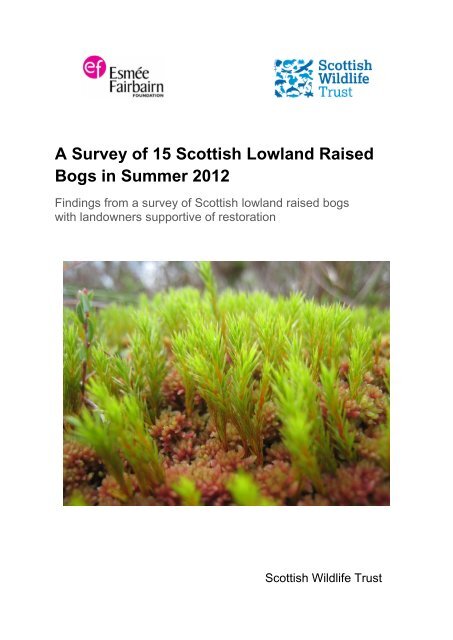
This report should be cited as:Matthews, P. (<strong>2012</strong>) A <strong>Survey</strong> <strong>of</strong> <strong>15</strong> <strong>Scottish</strong> <strong>Lowland</strong> <strong>Raised</strong> <strong>Bogs</strong>: F<strong>in</strong>d<strong>in</strong>gs from a survey<strong>of</strong> lowland raised bogs with landowners supportive <strong>of</strong> restoration. <strong>Scottish</strong> Wildlife Trust,Ed<strong>in</strong>burgh.November <strong>2012</strong>Acknowledgements:Eric Coull, Jonathan Hughes and Ian MacKenzie <strong>of</strong> the <strong>Scottish</strong> Wildlife Trust for their helpand support <strong>in</strong> the preparation <strong>of</strong> this report.Cover photograph: Sphagnum capillifolium and Polytrichum commune at White Moss,<strong>Scottish</strong> Borders.
A <strong>Survey</strong> <strong>of</strong> <strong>15</strong> <strong>Lowland</strong> <strong>Raised</strong> <strong>Bogs</strong> - <strong>Summer</strong> <strong>2012</strong>10. The restoration potential <strong>of</strong> each site is assessed. Of the <strong>15</strong> sites surveyed, 12 siteshave a high potential for restoration and the rema<strong>in</strong><strong>in</strong>g 3 sites have a low to mediumpotential for restoration.11. The capital cost <strong>of</strong> restor<strong>in</strong>g the <strong>15</strong> sites is estimated to be £326,000 and the annualmanagement cost is estimated to be £20,200. On a unit area basis the capital costsare £1,160/ha and the annual costs £72/ha. Compared to the orig<strong>in</strong>al study, the unitarea capital costs are just under 10% lower and the annual costs are significantlyhigher - an <strong>in</strong>crease <strong>of</strong> over 75%. The calculated costs are <strong>in</strong>dicative only and thediscrepancy <strong>in</strong> the capital costs is likely to be with<strong>in</strong> the marg<strong>in</strong> <strong>of</strong> error whilst thedifference <strong>in</strong> annual costs is likely to be a result <strong>of</strong> differences <strong>in</strong> the average site sizefor each study.ii
A <strong>Survey</strong> <strong>of</strong> <strong>15</strong> <strong>Lowland</strong> <strong>Raised</strong> <strong>Bogs</strong> - <strong>Summer</strong> <strong>2012</strong>ContentsExecutive summaryi1 Introduction 51.1 Background and Aims ................................................................................................... 51.2 Sites overview ............................................................................................................... 52 Methodology 72.1 Site selection ................................................................................................................ 72.2 <strong>Survey</strong> method .............................................................................................................. 72.3 Changes to the orig<strong>in</strong>al method .................................................................................... 73 Site details 93.1 Beckhall Moss ............................................................................................................... 93.2 Commonhead Moss .................................................................................................... 103.3 Corthie Moss............................................................................................................... 123.4 Grangeneuk Moss ...................................................................................................... 143.5 Harestone Moss .......................................................................................................... <strong>15</strong>3.6 Kennox Moss .............................................................................................................. 163.7 Langlands Moss .......................................................................................................... 183.8 Moss <strong>of</strong> Rothiemay ..................................................................................................... 193.9 Muiryfield Farm Moss .................................................................................................. 213.10 Portmoak Moss ......................................................................................................... 223.11 Redhall Moss ............................................................................................................ 243.12 Riccarton Moss ......................................................................................................... 263.13 Skeibhil Moss ............................................................................................................ 283.14 Toxside Moss North .................................................................................................. 293.<strong>15</strong> Woodhead Cr<strong>of</strong>t Moss .............................................................................................. 304 <strong>Survey</strong> results 324.1 Peatland resource ....................................................................................................... 324.1.1 <strong>Survey</strong> results ........................................................................................................ 324.1.2 Analysis <strong>of</strong> results .................................................................................................. 324.2 Ground conditions ....................................................................................................... 324.2.1 Methodological issues ........................................................................................... 334.2.2 <strong>Survey</strong> results ........................................................................................................ 334.2.4 Analysis <strong>of</strong> results .................................................................................................. 334.3 Open mire vegetation .................................................................................................. 344.3.1 Methodological Issues ........................................................................................... 343
A <strong>Survey</strong> <strong>of</strong> <strong>15</strong> <strong>Lowland</strong> <strong>Raised</strong> <strong>Bogs</strong> - <strong>Summer</strong> <strong>2012</strong>4.3.2 <strong>Survey</strong> results ........................................................................................................ 344.3.4 Analysis <strong>of</strong> results .................................................................................................. 344.4 Damage ...................................................................................................................... 354.4.1 Trees and scrub ..................................................................................................... 354.4.2 Artificial dra<strong>in</strong>age ................................................................................................... 364.4.3 Micro-erosion, bare peat, burn<strong>in</strong>g and animal impacts ........................................... 385 Peat Depth 395.1 Methodological issues ................................................................................................. 395.2 Results........................................................................................................................ 395.3 Analysis <strong>of</strong> results ....................................................................................................... 396 Site condition assessment 416.1 Methodological issues ................................................................................................. 416.2 Assessment results ..................................................................................................... 426.3 Analysis <strong>of</strong> results ....................................................................................................... 427 Site restoration 447.1 Attitudes to restoration by landowners ........................................................................ 447.2 Restoration potential 447.3 Site restoration costs .................................................................................................. 467.3.1 Approach to estimat<strong>in</strong>g restoration costs ............................................................... 467.3.2 Restoration cost calculations ................................................................................. 467.2.3 Analysis <strong>of</strong> estimated costs .................................................................................... 498 Conclusion 509 References 5210 Appendices 53Appendix I – Site area and other selected area data by site ............................................. 53Appendix II – Capital restoration costs by site ................................................................... 54Appendix III – Annual management restoration costs by site ............................................ 544
A <strong>Survey</strong> <strong>of</strong> <strong>15</strong> <strong>Lowland</strong> <strong>Raised</strong> <strong>Bogs</strong> - <strong>Summer</strong> <strong>2012</strong>1 Introduction1.1 Background and AimsThe <strong>Scottish</strong> Wildlife Trust’s raised bog project has <strong>in</strong>volved the survey <strong>of</strong> 77 <strong>Scottish</strong>lowland raised bogs between 2010 and <strong>2012</strong> us<strong>in</strong>g a methodology orig<strong>in</strong>ally developed <strong>in</strong>the mid-1990s by the <strong>Scottish</strong> Wildlife Trust's Peat Bog Team (Parkyn and Stoneman 1996).There were 62 sites surveyed dur<strong>in</strong>g 2010 and 2011 and 58 <strong>of</strong> these were used as the basis<strong>of</strong> a study to assess the current state <strong>of</strong> Scotland's lowland raised bogs and to assesschange s<strong>in</strong>ce the mid-1990s (Matthews et al <strong>2012</strong>). The current report details the study <strong>of</strong> afurther <strong>15</strong> lowland raised bog sites surveyed dur<strong>in</strong>g summer <strong>2012</strong>.The aim <strong>of</strong> the current study was to identify and determ<strong>in</strong>e the state <strong>of</strong> <strong>15</strong> sites that aresuitable for restoration and calculate the costs associated with return<strong>in</strong>g them to favourablecondition. Furthermore, the <strong>in</strong>formation generated by this study adds to the understand<strong>in</strong>g <strong>of</strong>the current state <strong>of</strong> the <strong>Scottish</strong> lowland raised bog resource. These additional sites wereselected on the basis that they had landowners supportive <strong>of</strong> restoration and that they hadno statutory nature conservation protection.1.2 Sites overviewThe selected lowland raised bog sites were chosen to broadly reflect the distribution <strong>of</strong>lowland raised bogs <strong>in</strong> Scotland. The sites are shown <strong>in</strong> Table 1 below.Table 1. Sites surveyed dur<strong>in</strong>g summer <strong>2012</strong> by council area.SiteBeckhall MossCommonhead MossCorthie MossGrangeneuk MossHarestone MossKennox MossLanglands MossMoss <strong>of</strong> RothiemayMuiryfield MossPortmoak MossRedhall MossRiccarton MossSkiebhill MossToxside MossWoodhead Cr<strong>of</strong>t MossLocationDumfries and GallowayCity <strong>of</strong> GlasgowAberdeenshireFalkirkAberdeenshireEast AyrshireSouth LanarkshireMorayAberdeenshirePerth and K<strong>in</strong>rossDumfries and GallowayEast AyrshireAberdeenshireMidlothianAberdeenshireThe sites cover a geographical area from Dumfries and Galloway <strong>in</strong> the south toAberdeenshire <strong>in</strong> the north and they are located <strong>in</strong> n<strong>in</strong>e different council areas.5
A <strong>Survey</strong> <strong>of</strong> <strong>15</strong> <strong>Lowland</strong> <strong>Raised</strong> <strong>Bogs</strong> - <strong>Summer</strong> <strong>2012</strong>Whilst none <strong>of</strong> the surveyed sites have a statutory nature conservation designation,Commonhead Moss and Langlands Moss are Local Nature Reserves and Portmoak Moss isowned by the Woodland Trust.The total survey area covered by the <strong>15</strong> sites is 282 hectares (2.8 km 2 ), based onboundaries determ<strong>in</strong>ed from aerial photographs and ground-truthed <strong>in</strong> the field. The averagesite area is 19 hectares with the smallest site measur<strong>in</strong>g 4.2 hectares and the largest 51.6hectares.The lowland raised bog <strong>in</strong>ventory gives a total <strong>Scottish</strong> figure <strong>of</strong> 807 sites cover<strong>in</strong>g 27,892hectares, with an average site area <strong>of</strong> 34.6 hectares. The area covered by all <strong>Scottish</strong>lowland raised bogs, exclud<strong>in</strong>g archaic sites, is 23,861 hectares. The current study siteshave a smaller average site area size than the average for all <strong>Scottish</strong> sites. This is <strong>in</strong>contrast to the 62 sites surveyed dur<strong>in</strong>g 2010/11 which have an average site area <strong>of</strong> 70hectares, which is larger than the average for all <strong>Scottish</strong> sites.The current survey <strong>of</strong> <strong>15</strong> sites represents 1.2% <strong>of</strong> the total <strong>Scottish</strong> lowland raised bogresource by area exclud<strong>in</strong>g archaic sites. The comb<strong>in</strong>ed total <strong>of</strong> 77 sites surveyed as part <strong>of</strong>the SWT's Peatland Project represents about 18% <strong>of</strong> the total area <strong>of</strong> <strong>Scottish</strong> lowland raisedbogs.A full list <strong>of</strong> sites by area is found <strong>in</strong> Appendix I.6
A <strong>Survey</strong> <strong>of</strong> <strong>15</strong> <strong>Lowland</strong> <strong>Raised</strong> <strong>Bogs</strong> - <strong>Summer</strong> <strong>2012</strong>2 Methodology2.1 Site selectionA number <strong>of</strong> criteria were used to select sites for the current survey. Initially potential siteswere identified from SNH's <strong>in</strong>ventory or lowland raised bogs from the three ma<strong>in</strong> areas withthe highest density <strong>of</strong> raised bogs <strong>in</strong>clud<strong>in</strong>g Aberdeenshire (extend<strong>in</strong>g <strong>in</strong>to Moray), Dumfriesand Galloway and the central belt. There is no requirement for the current survey to assesschange compared to the orig<strong>in</strong>al SWT surveys undertaken <strong>in</strong> the mid-1990s and thereforesite selection was not constra<strong>in</strong>ed by the quality or completeness <strong>of</strong> the orig<strong>in</strong>al survey data(or whether the site had been surveyed at all). A subsequent screen<strong>in</strong>g stage <strong>in</strong>volvedvisit<strong>in</strong>g the sites to determ<strong>in</strong>e ownership and gauge the landowner's attitude to siterestoration. Sites were discarded where ownership could not be easily determ<strong>in</strong>ed, if the sitehad a complicated multi-owner structure or if the owner(s) were not fully or broadlysupportive <strong>of</strong> site restoration. Furthermore, site selection was also restricted to privatelyowned sites that do not benefit from statutory nature conservation protection.A short-fall <strong>of</strong> sites rema<strong>in</strong>ed after the screen<strong>in</strong>g stage and 1:25,000 scale OS maps andonl<strong>in</strong>e aerial photographs, cover<strong>in</strong>g the ma<strong>in</strong> three site areas, were searched for lowlandraised bogs that were not present on the <strong>in</strong>ventory. Identified sites were screened as aboveand entered onto SWTs database <strong>of</strong> sites.2.2 <strong>Survey</strong> methodThe survey method has two ma<strong>in</strong> components – the aerial photograph <strong>in</strong>terpretation (API)methodology and the field survey methodology.In broad terms the API methodology uses aerial photographs to determ<strong>in</strong>e site compartmentboundaries based on changes <strong>in</strong> vegetation type. Aerial photographs are also used toclassify each site compartment us<strong>in</strong>g various criteria such as vegetation type and presenceor absence <strong>of</strong> various types <strong>of</strong> damage. For example each compartment is assessed for thepresence or absence <strong>of</strong> woodland, and sub-classified to the level <strong>of</strong> woodland type andwhether the canopy is open or closed. The f<strong>in</strong>al stage <strong>in</strong>volves field validation <strong>of</strong> both thechosen boundaries and the classification criteria, and both are amended where necessary.The dist<strong>in</strong>ct field survey methodology was undertaken at the same time as the field validation<strong>of</strong> the API-generated compartments and provided whole site and po<strong>in</strong>t location based data.Whole site data <strong>in</strong>clude, for example, an assessment <strong>of</strong> burn<strong>in</strong>g and graz<strong>in</strong>g damage, andpo<strong>in</strong>t location based data <strong>in</strong>clude, for example, vegetation quadrats and peat depthmeasurements. Field data was collected us<strong>in</strong>g a paper field form and was transferred at alater date to a database.2.3 Changes to the orig<strong>in</strong>al methodThe orig<strong>in</strong>al methodology was largely repeated <strong>in</strong> order to provide consistency with thesurveys undertaken by SWT <strong>in</strong> the mid-1990s (Parkyn and Stoneman 1996). The ma<strong>in</strong>addition to the current survey was the measurement <strong>of</strong> peat depth at each site. The currentsurveys also used the latest digital mapp<strong>in</strong>g and hand-held GPS technology which was notwidely available dur<strong>in</strong>g the mid-1990s.7
A <strong>Survey</strong> <strong>of</strong> <strong>15</strong> <strong>Lowland</strong> <strong>Raised</strong> <strong>Bogs</strong> - <strong>Summer</strong> <strong>2012</strong>Dur<strong>in</strong>g the mid-1990s surveys, pairs <strong>of</strong> unprocessed black and white photographs wereviewed us<strong>in</strong>g a stereoscope and site compartment boundaries were drawn by hand ontotransparent acetate sheets before be<strong>in</strong>g transferred to field maps. In the field, the surveyor’sgeographical location, and the location <strong>of</strong> site compartment boundaries, had to be estimatedby reference to physical features that were illustrated on base Ordnance <strong>Survey</strong> (OS) maps.In contrast, for the 2010/11 surveys, geo-rectified colour aerial photographs were imported<strong>in</strong>to ArcGIS mapp<strong>in</strong>g s<strong>of</strong>tware, and site compartment boundaries were digitised and laid overdigital base OS maps. Site compartment criteria were then assessed and the resultsrecorded <strong>in</strong> a l<strong>in</strong>ked attribute table. The site compartments and base maps were viewed <strong>in</strong>the field on a hand-held GPS device that <strong>in</strong>dicates position to an accuracy <strong>of</strong> with<strong>in</strong> a fewmetres. The location <strong>of</strong> po<strong>in</strong>t data such as vegetation quadrats can also be recorded with thesame level <strong>of</strong> accuracy. In order to allow a comparison to be made between the currentsurvey and the orig<strong>in</strong>al mid-1990s survey, the orig<strong>in</strong>al paper maps were digitised and theassessment data entered <strong>in</strong>to l<strong>in</strong>ked attribute tables.Specific methodological issues and clarifications are addressed as necessary <strong>in</strong> ‘Section 4<strong>Survey</strong> results’. Copies <strong>of</strong> the aerial photograph <strong>in</strong>terpretation and field surveymethodologies are available from the <strong>Scottish</strong> Wildlife Trust.8
A <strong>Survey</strong> <strong>of</strong> <strong>15</strong> <strong>Lowland</strong> <strong>Raised</strong> <strong>Bogs</strong> - <strong>Summer</strong> <strong>2012</strong>burn<strong>in</strong>g and graz<strong>in</strong>g impacts. Out <strong>of</strong> a maximum score <strong>of</strong> <strong>15</strong>, Beckhall Moss scored 7 plac<strong>in</strong>git 10th <strong>in</strong> the rank<strong>in</strong>g <strong>of</strong> the <strong>15</strong> sites surveyed. Includ<strong>in</strong>g the 58 sites surveyed earlier, the siteis ranked <strong>in</strong> the third quartile <strong>of</strong> 73 sites assessed for conditionThis is a fairly small site that is no longer a function<strong>in</strong>g raised bog and the conditionassessment exaggerates its condition as a raised bog (it achieves high scores for be<strong>in</strong>gopen mire vegetation and for hav<strong>in</strong>g a low density <strong>of</strong> dra<strong>in</strong>s despite little raised bogvegetation be<strong>in</strong>g present). The site does, nevertheless, have value as a wet fen habitat.The site has a low potential for restoration as a raised bog because <strong>of</strong> its modified natureand small size. Re-wett<strong>in</strong>g and ma<strong>in</strong>ta<strong>in</strong><strong>in</strong>g high water levels across the site may eventuallylead to the re-establishment <strong>of</strong> bog vegetation, but this would be over a long timescale.3.1.5 Further commentsThe owner <strong>of</strong> the site, Mr. Coates, periodically grazes cattle on the site dur<strong>in</strong>g the driersummer months. This is likely to benefit the site by <strong>in</strong>hibit<strong>in</strong>g scrub regeneration.The owner is broadly supportive <strong>of</strong> site restoration, subject to the details <strong>of</strong> f<strong>in</strong>ancial support<strong>of</strong>fered by any proposed environmental scheme.3.2 Commonhead Moss3.2.1 Site summaryCommonhead Moss is situated 2km to the west <strong>of</strong> Coatbridge adjacent to the M73 motorwayand covers an area <strong>of</strong> about 34 hectares.It is a modified site that appears to be completely cutover (secondary mire) as a result <strong>of</strong>past commercial peat extraction. There is a large central area <strong>of</strong> open mire, compartment 8,which has a high density <strong>of</strong> parallel dra<strong>in</strong>s runn<strong>in</strong>g east-west that are <strong>in</strong>fill<strong>in</strong>g with vegetationor have been dammed. The ground conditions across the open mire vegetation are wetoverall. The centre <strong>of</strong> the open area has the highest water table and there is fair to goodquality raised mire vegetation on the raised strips between the dra<strong>in</strong>s. Where the water tableis lower, the raised strips are drier and they support degraded vegetation. There are alsolocal areas <strong>of</strong> rush fen vegetation <strong>in</strong>dicat<strong>in</strong>g mildly m<strong>in</strong>erotrophic conditions, possibly as theresult <strong>of</strong> ground water <strong>in</strong>fluence. Natural mature birch woodland almost entirely surroundsthe area <strong>of</strong> open mire and ground conditions are typically dry underneath the canopy. Thewoodland is on deep peat which aga<strong>in</strong> appears to have been cutover. An <strong>in</strong>terest<strong>in</strong>g featureis a raised strip <strong>of</strong> peat colonised by mature birch woodland, compartment 11 that runs eastwestacross the centre-south <strong>of</strong> the open mire. This was probably an access route fortransport<strong>in</strong>g cut peat <strong>of</strong>f the site, and narrow gauge rails can still be seen at the eastern end<strong>of</strong> this strip.Peat depth was measured at two locations <strong>in</strong> the central area <strong>of</strong> the site with m<strong>in</strong>imumdepths <strong>of</strong> 6.5m and 5.0m recorded. These figures are based on the maximum depth thatcould be measured and the bottom <strong>of</strong> the pr<strong>of</strong>ile was not reached (the maximum sampledepth that can be achieved depends on peat bulk density).3.2.2 Vegetation10
A <strong>Survey</strong> <strong>of</strong> <strong>15</strong> <strong>Lowland</strong> <strong>Raised</strong> <strong>Bogs</strong> - <strong>Summer</strong> <strong>2012</strong>The ma<strong>in</strong> central area <strong>of</strong> open mire has a complex pattern<strong>in</strong>g <strong>of</strong> wet and dry groundconditions caused by the high density <strong>of</strong> dra<strong>in</strong>s and the presence <strong>of</strong> dams. The majority <strong>of</strong>the vegetation falls under the M18 raised bog vegetation category although the quality <strong>of</strong> thevegetation varies depend<strong>in</strong>g on the ground conditions.In areas where the water table is high, particularly <strong>in</strong> the central areas <strong>of</strong> compartment 8 andlocally where dams are sited, there has been regeneration <strong>of</strong> fair to good quality M18vegetation which is characteristic <strong>of</strong> the M18a Sphagnum magellanicum – Andromedapolifolia sub-community. The sub-shrub layer is fairly open and Calluna vulgaris sharesdom<strong>in</strong>ance with Eriophorum vag<strong>in</strong>atum whilst Drosera rotundifolia and Erica tetralix arelocally frequent, Andromeda polifolia rare, and the ground layer has a good cover <strong>of</strong>Sphagnum species. The most common species recorded are Sphagnum palustre,Sphagnum fallax and Sphagnum papillosum (the first two <strong>in</strong>dicative <strong>of</strong> slightly raised nutrientlevels) whilst Sphagnum capillifolium is locally frequent. Sphagnum magellanicum,characteristic <strong>of</strong> good quality M18 is occasional. In the wetter areas the dra<strong>in</strong>s occasionallyopen out and there are lawns <strong>of</strong> Sphagnum cuspidatum, Sphagnum palustre and Sphagnumpapillosum.The most degraded raised bog vegetation is found on the peripheral areas <strong>of</strong> compartment8, on the ridges between dra<strong>in</strong>s, where the water table is relatively low. Here there isoverwhelm<strong>in</strong>g dom<strong>in</strong>ance by Calluna vulgaris with only scattered Eriophorum vag<strong>in</strong>atum andEriophorum angustifolium and locally frequent Polytrichum commune mak<strong>in</strong>g up the groundlayer. In the driest areas the vegetation grades towards dry heath and birch regeneration isdensest.Locally along the dra<strong>in</strong> l<strong>in</strong>es there are areas <strong>of</strong> the fen species Carex rostrata, Juncuseffusus and Potentilla palustris. This <strong>in</strong>dicates some <strong>in</strong>fluence from m<strong>in</strong>erotrophic groundwater and is a common feature <strong>of</strong> sites that have been cutover.The birch woodland found ma<strong>in</strong>ly around the edge <strong>of</strong> the site is on deep peat with, overall,dry ground conditions. The ground flora is variously dom<strong>in</strong>ated by Dryopteris dilatata, andbryophyte species, or can be rather bare <strong>of</strong> vegetation. This woodland type is not adequatelydescribed by the national vegetation classification (NVC) but is probably closest to the W11Quercus petraea – Betula pubescens woodland (or arguably degraded W4 Betulapubescens – Mol<strong>in</strong>ia caerulea woodland). There are also areas <strong>of</strong> birch woodland over aground flora dom<strong>in</strong>ated by Sphagnum species, particularly compartment 6 and the east end<strong>of</strong> compartment 7. This is closest to W4c woodland, the Sphagnum sub-community.Other vegetation types found on the site <strong>in</strong>clude areas <strong>of</strong> M23b Juncus effusus rush fen andM25a Mol<strong>in</strong>ia caerulea mire at the south-western and western edge <strong>of</strong> the site respectively.3.2.3 DamageThe ma<strong>in</strong> damage to the site is the historic peat extraction that appears to have affected thewhole site. This is evidenced by the dense network <strong>of</strong> wide dra<strong>in</strong>s that would have beenused to prevent water-logg<strong>in</strong>g <strong>of</strong> the peat surface while peat removal was tak<strong>in</strong>g place. Alsothere is no obvious dome shape to the site and little evidence <strong>of</strong> a slop<strong>in</strong>g rand at the edge<strong>of</strong> the bog.11
A <strong>Survey</strong> <strong>of</strong> <strong>15</strong> <strong>Lowland</strong> <strong>Raised</strong> <strong>Bogs</strong> - <strong>Summer</strong> <strong>2012</strong>Birch woodland has developed on the marg<strong>in</strong>s <strong>of</strong> the site cover<strong>in</strong>g about 50% <strong>of</strong> the totalarea and, although this can be a natural element <strong>of</strong> a raised bog marg<strong>in</strong>, it extends ontoareas <strong>of</strong> the central mire expanse. Woodland can damage raised bog vegetation by furtherdry<strong>in</strong>g the ground through evapotranspiration and by shad<strong>in</strong>g the typical raised bog plantspecies.F<strong>in</strong>ally there is some localised burn<strong>in</strong>g damage at the western side <strong>of</strong> compartment 8evidenced by charred Calluna vulgaris stems. This was adjacent to a track giv<strong>in</strong>g publicaccess and may be the result <strong>of</strong> vandalism.Despite the past damage, raised bog vegetation has recolonised the cutover surfaces acrossthe central areas <strong>of</strong> the site and rewett<strong>in</strong>g <strong>of</strong> the bog, and birch scrub clearance, isencourag<strong>in</strong>g the regeneration <strong>of</strong> good quality M18 raised bog vegetation across the site.3.2.4 AssessmentThe condition <strong>of</strong> Commonhead Moss is assessed based on a scor<strong>in</strong>g methodologydescribed <strong>in</strong> Section 6 ‘Site condition assessment’ below. The five criteria used <strong>in</strong> theassessment are positive <strong>in</strong>dicator species, ground conditions, artificial dra<strong>in</strong>age, closedcanopy woodland and burn<strong>in</strong>g and graz<strong>in</strong>g impacts. Out <strong>of</strong> a maximum score <strong>of</strong> <strong>15</strong>,Commonhead Moss scored 9 plac<strong>in</strong>g it 9th <strong>in</strong> the rank<strong>in</strong>g <strong>of</strong> the <strong>15</strong> sites surveyed. Includ<strong>in</strong>gthe 58 sites surveyed earlier, the site is ranked <strong>in</strong> the second quartile <strong>of</strong> 73 sites assessedfor condition.The fairly high score achieved, despite the past damage to the site, is <strong>in</strong> part a result <strong>of</strong> therestoration work that has taken place at Commonhead Moss to rewet the site and to ma<strong>in</strong>ta<strong>in</strong>the central area as open mire. In summary, the score achieved is based on the site’s overallwet condition, the high proportion <strong>of</strong> open mire habitat, the presence <strong>of</strong> species such asDrosera rotundifolia and Sphagnum magellanicum that <strong>in</strong>dicate good quality vegetation andthe classification <strong>of</strong> the artificial dra<strong>in</strong>s as either dammed or <strong>in</strong>fill<strong>in</strong>g.The site is currently undergo<strong>in</strong>g a programme <strong>of</strong> site restoration coord<strong>in</strong>ated by the owner <strong>of</strong>the site Glasgow City Council.3.2.5 Further commentsThe distribution <strong>of</strong> dams is rather patchy across the site. The <strong>in</strong>stallation <strong>of</strong> more dams,particularly at the drier marg<strong>in</strong>s <strong>of</strong> the open mire expanse, would help to further rewet the siteand promote the development <strong>of</strong> good quality raised mire vegetation.3.3 Corthie Moss3.3.1 Site summaryCorthie Moss is a fairly large site <strong>of</strong> about 62 hectares situated 4km west <strong>of</strong> New Pitsligo <strong>in</strong>Aberdeenshire. It is an elongated raised bog that sits <strong>in</strong> a shallow valley and has a primary(uncut) central area with a fairly wide outer lower area <strong>of</strong> mire and lagg fen. The site showsevidence <strong>of</strong> historic domestic cutt<strong>in</strong>g at the northern and southern ends, and along thewestern side <strong>of</strong> the central area. The central area has rather dry degraded raised bog12
A <strong>Survey</strong> <strong>of</strong> <strong>15</strong> <strong>Lowland</strong> <strong>Raised</strong> <strong>Bogs</strong> - <strong>Summer</strong> <strong>2012</strong>vegetation, with a low cover <strong>of</strong> Sphagnum species, and the outer area <strong>of</strong> mire has a mosaic<strong>of</strong> degraded bog and fen vegetation.The site has a low density <strong>of</strong> wide and deep <strong>in</strong>ternal dra<strong>in</strong>s which are <strong>in</strong>fill<strong>in</strong>g with vegetationand there are scour<strong>in</strong>g dra<strong>in</strong>s around most <strong>of</strong> the perimeter. There are no signs <strong>of</strong> burn<strong>in</strong>gdamage or significant impacts from graz<strong>in</strong>g. There are scattered stunted rowan and birchacross the mire expanse however there is little regeneration.Peat depth was measured to be 2.3m <strong>in</strong> the centre <strong>of</strong> the site where uncut and 2.2m at arepresentative cut-over location at the southern end.3.3.2 VegetationThere is rather dry degraded M18 raised bog vegetation across the centre <strong>of</strong> the site whichhas an open sub-shrub canopy and is co-dom<strong>in</strong>ated by Calluna vulgaris and Eriophorumvag<strong>in</strong>atum. Sphagnum species are only scattered and mostly there are pleurocarpousmosses <strong>in</strong> the ground layer <strong>in</strong>dicat<strong>in</strong>g rather dry ground conditions. The grass speciesDeschampsia flexuosa is constant across this area and is another <strong>in</strong>dicator <strong>of</strong> dry degradedraised bog habitat. Occasional wetter areas have scattered Sphagnum capillifolium andlocally frequent Erica tetralix. The cut-over areas have slightly better raised bog vegetationbut rema<strong>in</strong> dry overall. There are scattered stunted birch and rowan across the central areaand little regeneration - with some evidence that tree seedl<strong>in</strong>gs are be<strong>in</strong>g grazed andsuppressed by deer.The outer area <strong>of</strong> mire forms a wide band around the marg<strong>in</strong> <strong>of</strong> the site and is a step downfrom the ma<strong>in</strong> central area. The ma<strong>in</strong> vegetation type is M20 Eriophorum vag<strong>in</strong>atum mirewith lesser areas <strong>of</strong> M23b Juncus effusus fen. M20 is a degraded raised bog habitat and is<strong>of</strong>ten a result <strong>of</strong> past burn<strong>in</strong>g or over-graz<strong>in</strong>g, although no evidence <strong>of</strong> these impacts waspresent at the time <strong>of</strong> survey. There are occasional stands <strong>of</strong> Salix aurita <strong>in</strong> some locationswith<strong>in</strong> the secondary mire. Occasional areas <strong>of</strong> natural lagg fen are present at the edge <strong>of</strong>the site, although mostly there is a perimeter dra<strong>in</strong>age ditch which has allowed agriculturalreclamation beyond.3.3.3 DamageWhilst there is only a low density <strong>of</strong> dra<strong>in</strong>s across the mire expanse, those present are wideand deep and appear to be hav<strong>in</strong>g a significant dry<strong>in</strong>g affect on the bog surface. Thehydrology <strong>of</strong> the site may also have been affected by the historic peat cutt<strong>in</strong>g that hasoccurred at the site marg<strong>in</strong>. There are also scour<strong>in</strong>g dra<strong>in</strong>s around most <strong>of</strong> the site perimeterwhich will be hav<strong>in</strong>g a dry<strong>in</strong>g affect on the marg<strong>in</strong>s <strong>of</strong> the site.3.3.4 AssessmentThe condition <strong>of</strong> Corthie Moss is assessed based on a scor<strong>in</strong>g methodology described <strong>in</strong>Section 6 ‘Site condition assessment’. The five criteria used <strong>in</strong> the assessment are positive<strong>in</strong>dicator species, ground conditions, artificial dra<strong>in</strong>age, closed canopy woodland and burn<strong>in</strong>gand graz<strong>in</strong>g impacts. Out <strong>of</strong> a maximum score <strong>of</strong> <strong>15</strong>, Corthie Moss scored 12 plac<strong>in</strong>g it 5th <strong>in</strong>the rank<strong>in</strong>g <strong>of</strong> the <strong>15</strong> sites surveyed. Includ<strong>in</strong>g the 58 sites surveyed earlier, the site isranked <strong>in</strong> the first quartile <strong>of</strong> 73 sites assessed for condition.13
A <strong>Survey</strong> <strong>of</strong> <strong>15</strong> <strong>Lowland</strong> <strong>Raised</strong> <strong>Bogs</strong> - <strong>Summer</strong> <strong>2012</strong>Corthie Moss has a high potential for restoration and would benefit from the <strong>in</strong>stallation <strong>of</strong>dams <strong>in</strong> order to rewet the bog surface.3.3.5 Further commentsThe owner is broadly supportive <strong>of</strong> site restoration, subject to the details <strong>of</strong> f<strong>in</strong>ancial support<strong>of</strong>fered by any proposed environmental scheme.3.4 Grangeneuk Moss3.4.1 Site summaryGrangeneuk Moss is situated 9km south-west <strong>of</strong> Falkirk and covers an area <strong>of</strong> about 18hectares. The site has good quality raised bog vegetation, it is largely primary (uncut) andthere are no dra<strong>in</strong>s across the ma<strong>in</strong> mire expanse. The site is elongated, sits <strong>in</strong> a shallowvalley and has a natural slop<strong>in</strong>g rand at its marg<strong>in</strong>. There is also a narrow natural lagg fen atthe edge <strong>of</strong> the mire which is conta<strong>in</strong>ed by ris<strong>in</strong>g land beyond. Where a perimeter dra<strong>in</strong> ispresent, this is on the outer side <strong>of</strong> the lagg fen. There is little significant damage to the sitebeyond limited areas <strong>of</strong> historic domestic peat cutt<strong>in</strong>g at the edge <strong>of</strong> the site and somemoderate graz<strong>in</strong>g and trampl<strong>in</strong>g impacts at the eastern end. There is some <strong>in</strong>dication <strong>of</strong> pastgraz<strong>in</strong>g pressure on the ma<strong>in</strong> body <strong>of</strong> the site, but at the time <strong>of</strong> survey there was noevidence <strong>of</strong> recent graz<strong>in</strong>g impacts. Overall the site has been little modified and is <strong>in</strong> goodcondition.Peat depth was measured to be 7m+ <strong>in</strong> the centre <strong>of</strong> the site and 1.9m at a cutover locationat the marg<strong>in</strong>.3.4.2 VegetationThe vegetation <strong>of</strong> the ma<strong>in</strong> mire expanse is good quality M18 raised mire vegetation with anopen sub-shrub layer and a good cover <strong>of</strong> Sphagnum species. The ground layer typically hasabundant Sphagnum papillosum, frequent Sphagnum capillifolium, Sphagnum magellanicumand locally abundant Sphagnum tenellum. The field layer has constant and frequentVacc<strong>in</strong>ium oxycoccus, Drosera rotundifolia and locally frequent Narthecium ossifragum.There is also, rather unusually, scattered Dactylorhiza maculata across the mire expanseand particularly <strong>in</strong> the lagg fen areas.The marg<strong>in</strong>al areas <strong>of</strong> the mire are a mosaic <strong>of</strong> M18, M20 Eriophorum vag<strong>in</strong>atum mire, M6cJuncus effusus flush ad M23b Juncus effusus rush pasture. These lagg fen areas aregenerally very wet and support a good cover <strong>of</strong> Sphagnum palustre and Sphagnum fallax.The cut-over compartment 12 is particularly wet and there are pools dom<strong>in</strong>ated bySphagnum cuspidatum with Drosera rotundifolia and frequent Erica tetralix.3.4.3 DamageGrangeneuk Moss is one <strong>of</strong> the least modified sites surveyed as part <strong>of</strong> this project. Areas <strong>of</strong>historic domestic peat cutt<strong>in</strong>g are limited to local areas at the north-eastern and eastern edge<strong>of</strong> the site and a s<strong>in</strong>gle short <strong>in</strong>ternal dra<strong>in</strong> is found with<strong>in</strong> this cutover area. There is ascour<strong>in</strong>g perimeter dra<strong>in</strong> runn<strong>in</strong>g along the north site <strong>of</strong> the site, however this is situated onthe outer edge <strong>of</strong> the lagg fen and is probably hav<strong>in</strong>g only a limited effect on site hydrology.The east end <strong>of</strong> the site is fenced <strong>of</strong>f (it is probably under different ownership) and is open tograz<strong>in</strong>g from the adjacent pasture. The raised bog and lagg fen <strong>in</strong> this area is moderately14
A <strong>Survey</strong> <strong>of</strong> <strong>15</strong> <strong>Lowland</strong> <strong>Raised</strong> <strong>Bogs</strong> - <strong>Summer</strong> <strong>2012</strong>grazed and trampled and there is some bare peat. However the raised bog vegetation stillrema<strong>in</strong>s <strong>in</strong> fair condition. A old march fence-l<strong>in</strong>e (<strong>in</strong> disrepair) runs east-west across the ma<strong>in</strong>mire expanse and the southern area shows some signs <strong>of</strong> historic graz<strong>in</strong>g damage. Therewas no evidence <strong>of</strong> recent graz<strong>in</strong>g at the time <strong>of</strong> survey.3.4.4 AssessmentThe condition <strong>of</strong> Grangeneuk Moss is assessed based on a scor<strong>in</strong>g methodology described<strong>in</strong> Section 6 ‘Site condition assessment’. The five criteria used <strong>in</strong> the assessment are positive<strong>in</strong>dicator species, ground conditions, artificial dra<strong>in</strong>age, closed canopy woodland and burn<strong>in</strong>gand graz<strong>in</strong>g impacts. Out <strong>of</strong> a maximum score <strong>of</strong> <strong>15</strong>, Grangeneuk Moss score 14 plac<strong>in</strong>g itequal 1st <strong>in</strong> the rank<strong>in</strong>g <strong>of</strong> the <strong>15</strong> sites surveyed. Includ<strong>in</strong>g the 58 sites surveyed earlier, thesite is ranked <strong>in</strong> the first quartile <strong>of</strong> 73 sites assessed for condition.This is a good quality site overall with only limited area <strong>of</strong> past cutt<strong>in</strong>g and little <strong>in</strong>ternalartificial dra<strong>in</strong>age. The quality <strong>of</strong> the raised bog vegetation is good and there is a high cover<strong>of</strong> Sphagnum species characteristic <strong>of</strong> good quality M18 raised mire vegetation. The easternend <strong>of</strong> the site shows moderate graz<strong>in</strong>g and trampl<strong>in</strong>g damage and the condition <strong>of</strong> this areacould be improved by reduc<strong>in</strong>g graz<strong>in</strong>g <strong>in</strong>tensity. The site overall may benefit from periodicgraz<strong>in</strong>g to <strong>in</strong>hibit any potential regeneration <strong>of</strong> scrub, although none was present at the time<strong>of</strong> the survey.The site has a high potential for restoration, although there are only limited restoration worksthat could be carried out at the site.3.4.5 Further commentsThe owner is broadly supportive <strong>of</strong> site restoration, subject to the details <strong>of</strong> f<strong>in</strong>ancial support<strong>of</strong>fered by any proposed environmental scheme.3.5 Harestone Moss3.5.1 Site summaryHarestone Moss is a small site <strong>of</strong> about 7 hectares which is located 10km north <strong>of</strong> Aberdeen.The area <strong>of</strong> raised bog is with<strong>in</strong> a more extensive valley mire and it is difficult to determ<strong>in</strong>e itsexact boundary <strong>of</strong> the peatland area. The raised bog has been cut-over <strong>in</strong> the past and isnow a mosaic <strong>of</strong> degraded raised mire vegetation and mesotrophic fen with some areas <strong>of</strong>willow carr and gorse scrub. The ground conditions are very wet and some areas have avery good cover <strong>of</strong> Sphagnum species although they are ma<strong>in</strong>ly species <strong>in</strong>dicative <strong>of</strong> raisednutrient conditions. There is also a raised metalled road that bisects the northern section <strong>of</strong>the site. The peat depth was measured to be 1.9m <strong>in</strong> the central area <strong>of</strong> the raised bog.3.5.2 VegetationThere is a complex mosaic <strong>of</strong> degraded M18 and M20 raised bog and mesotrophic fen. Thedegraded raised bog is typically dom<strong>in</strong>ated by Eriophorum vag<strong>in</strong>atum over Sphagnumpalustre and Sphagnum fallax with scattered Deschampsia flexuosa and herbs such asPotentilla erecta. These areas grade <strong>in</strong> M23b Juncus effusus mire and M9 Carex rostrataswamp with abundant Potentilla palustris where there is a more mesotrophic <strong>in</strong>fluence. Atthe southern area <strong>of</strong> the raised bog there is also willow carr that has a fen and swamp<strong>15</strong>
A <strong>Survey</strong> <strong>of</strong> <strong>15</strong> <strong>Lowland</strong> <strong>Raised</strong> <strong>Bogs</strong> - <strong>Summer</strong> <strong>2012</strong>ground flora. A metalled road cuts through the north side <strong>of</strong> the site east-west and is a raisedstrip <strong>of</strong> m<strong>in</strong>eral ground which extends to the south side <strong>of</strong> the road and supports gorse scrub.3.5.3 DamageThe raised bog is probably entirely cut-over although there is little concrete evidence <strong>of</strong> thison the ground. Nevertheless the vegetation is very modified and <strong>in</strong>fluenced by mesotrophicgroundwater which is <strong>of</strong>ten an <strong>in</strong>dication <strong>of</strong> deep peat cutt<strong>in</strong>g. The other ma<strong>in</strong> damage to thesite is from the raised strip <strong>of</strong> m<strong>in</strong>eral ground that carries the road across the raised bog andassociated dra<strong>in</strong>s that run by its side. There are also a few s<strong>in</strong>gle <strong>in</strong>fill<strong>in</strong>g dra<strong>in</strong>s with<strong>in</strong> thearea <strong>of</strong> raised mire.3.5.4 AssessmentThe condition <strong>of</strong> Harestone Moss is assessed based on a scor<strong>in</strong>g methodology described <strong>in</strong>Section 6 ‘Site condition assessment’. The five criteria used <strong>in</strong> the assessment are positive<strong>in</strong>dicator species, ground conditions, artificial dra<strong>in</strong>age, closed canopy woodland and burn<strong>in</strong>gand graz<strong>in</strong>g impacts. Out <strong>of</strong> a maximum score <strong>of</strong> <strong>15</strong>, the site scored 10 plac<strong>in</strong>g it equal 8th <strong>in</strong>the rank<strong>in</strong>g <strong>of</strong> the <strong>15</strong> sites surveyed. Includ<strong>in</strong>g the 58 sites surveyed earlier, the site isranked <strong>in</strong> the second quartile <strong>of</strong> 73 sites assessed for condition.The score probably exaggerates the condition <strong>of</strong> the site which is small and modified andtherefore has a low to medium potential for restoration. If restoration were to take place itwould <strong>in</strong>volve removal <strong>of</strong> scrub and trees where these encroach on areas <strong>of</strong> deep peat anddamm<strong>in</strong>g <strong>of</strong> dra<strong>in</strong>s that are present across the mire expanse.3.5.5 Further commentsThe owner is broadly supportive <strong>of</strong> site restoration, subject to the details <strong>of</strong> f<strong>in</strong>ancial support<strong>of</strong>fered by any proposed environmental scheme.3.6 Kennox Moss3.6.1 Site summaryKennox Moss is a small site <strong>of</strong> about 19 hectares which is located 5km west <strong>of</strong> Stewarton <strong>in</strong>East Ayrshire. The site is ma<strong>in</strong>ly wooded with a comb<strong>in</strong>ation <strong>of</strong> plantation Scots p<strong>in</strong>e andbirch, with a central open area <strong>of</strong> scattered mature and regenerat<strong>in</strong>g trees. The open areahas fair quality raised bog vegetation although the density <strong>of</strong> scrub and trees is probably<strong>in</strong>creas<strong>in</strong>g and this may lead to further dry<strong>in</strong>g <strong>of</strong> the bog surface. The majority <strong>of</strong> the site isprimary (uncut) with some limited area <strong>of</strong> secondary (cutover) mire at the northern andsouth-western edges. With<strong>in</strong> the wooded area there are occasional dra<strong>in</strong>s that are becom<strong>in</strong>g<strong>in</strong>filled with vegetation whilst the central open area has none. Most <strong>of</strong> the perimeter <strong>of</strong> thesite has scour<strong>in</strong>g dra<strong>in</strong>s although <strong>in</strong> some areas these are becom<strong>in</strong>g blocked withvegetation.3.6.2 VegetationThe central area has fair quality M18 raised mire vegetation that is dom<strong>in</strong>ated by Callunavulgaris with subord<strong>in</strong>ate Eriophorum vag<strong>in</strong>atum and scattered Sphagnum capillifolium andSphagnum fallax <strong>in</strong> the field layer. Where the ground conditions are drier, particularly at theedge <strong>of</strong> this area, there is an <strong>in</strong>crease <strong>in</strong> the cover <strong>of</strong> Cladonia impexa and there are16
A <strong>Survey</strong> <strong>of</strong> <strong>15</strong> <strong>Lowland</strong> <strong>Raised</strong> <strong>Bogs</strong> - <strong>Summer</strong> <strong>2012</strong>occasional degraded hummocks with Polytrichum strictum and poor quality Sphagnumcapillifolium. This suggests a trend <strong>of</strong> dry<strong>in</strong>g conditions which may relate to the <strong>in</strong>crease <strong>in</strong>woodland cover. The best quality vegetation is found <strong>in</strong> the central area where the sub-shrublayer is more open and there are local areas <strong>of</strong> the T1 where Sphagnum species dom<strong>in</strong>atethe ground layer and Sphagnum magellanicum is occasional. The central area has scatteredmature and regenerat<strong>in</strong>g Scots p<strong>in</strong>e and birch which is dense enough <strong>in</strong> some areas to beclassified as open woodland.The woodland is a mixture <strong>of</strong> natural birch woodland and Scots p<strong>in</strong>e plantation. The ma<strong>in</strong>area <strong>of</strong> p<strong>in</strong>e is found across the west <strong>of</strong> the site and has an understorey <strong>of</strong> birch. The groundconditions are a mosaic <strong>of</strong> dry and wet areas; the ground flora <strong>of</strong> the dry areas is typicallydom<strong>in</strong>ated by Dryopteris dilatata and the wetter areas are characterised by scatteredtussocks <strong>of</strong> Eriophorum vag<strong>in</strong>atum and lawns <strong>of</strong> Sphagnum palustre. The dry birch woodlandis closest to the W11 NVC community and the wetter areas are a reasonable fit to W4c.3.6.3 DamageThe site has a high cover <strong>of</strong> closed-canopy Scots p<strong>in</strong>e and birch woodland, as well asscattered scrub and trees across the central area <strong>of</strong> open mire. The presence <strong>of</strong> trees on thesite will lead to a dry<strong>in</strong>g <strong>of</strong> the bog surface through evapo-transpiration and the loss <strong>of</strong> typicalbog vegetation through shad<strong>in</strong>g. With<strong>in</strong> the wooded area there is a low density <strong>of</strong> <strong>in</strong>fill<strong>in</strong>gdra<strong>in</strong>s, and these will exacerbate the dry<strong>in</strong>g <strong>of</strong> the bog surface locally. The scour<strong>in</strong>gperimeter dra<strong>in</strong>s will also cause a significant lower<strong>in</strong>g <strong>of</strong> the water table at the marg<strong>in</strong>s <strong>of</strong> thesite. There was no graz<strong>in</strong>g on the site at the time <strong>of</strong> the survey, although some m<strong>in</strong>orpoach<strong>in</strong>g damage <strong>in</strong> the central area <strong>in</strong>dicates that graz<strong>in</strong>g has occurred <strong>in</strong> the past. Peatcutt<strong>in</strong>g has only taken place at limited areas at the marg<strong>in</strong> <strong>of</strong> the bog.3.6.4 AssessmentThe condition <strong>of</strong> Kennox Moss is assessed based on a scor<strong>in</strong>g methodology described <strong>in</strong>Section 6 ‘Site condition assessment’. The five criteria used <strong>in</strong> the assessment are positive<strong>in</strong>dicator species, ground conditions, artificial dra<strong>in</strong>age, closed canopy woodland and burn<strong>in</strong>gand graz<strong>in</strong>g impacts. Out <strong>of</strong> a maximum score <strong>of</strong> <strong>15</strong>, Kennox Moss scored 10 plac<strong>in</strong>g it equal8th <strong>in</strong> the rank<strong>in</strong>g <strong>of</strong> the <strong>15</strong> sites surveyed. Includ<strong>in</strong>g the 58 sites surveyed earlier, the site isranked <strong>in</strong> the second quartile <strong>of</strong> 73 sites assessed for condition.Kennox Moss is a largely uncut site that has few surface dra<strong>in</strong>s and, where woodland isabsent, fair quality raised mire vegetation. The ma<strong>in</strong> feature reduc<strong>in</strong>g its nature conservationvalue as a raised bog is the presence <strong>of</strong> Scots p<strong>in</strong>e plantation and birch woodland. The sitewould therefore be very suitable for restoration which could be achieved by remov<strong>in</strong>g treesfrom the ma<strong>in</strong> mire expanse. The site may also benefit from periodic graz<strong>in</strong>g <strong>in</strong> order to<strong>in</strong>hibit scrub and woodland regeneration <strong>in</strong> the central area.Kennox Moss has a high potential for restoration.3.6.5 Further commentsThe owner <strong>of</strong> the site, Mr R Noble, would consider restoration works on the site if suitableenvironmental grants were available.Pheasants are reared with<strong>in</strong> woodland on the site.17
A <strong>Survey</strong> <strong>of</strong> <strong>15</strong> <strong>Lowland</strong> <strong>Raised</strong> <strong>Bogs</strong> - <strong>Summer</strong> <strong>2012</strong>3.7 Langlands Moss3.7.1 Site summaryLanglands Moss is situated just beyond the southern outskirts <strong>of</strong> East Kilbride <strong>in</strong> SouthLanarkshire and covers an area <strong>of</strong> about 36 hectares. The site is largely primary mire (uncut)with only local areas <strong>of</strong> old domestic cutt<strong>in</strong>g at the site’s northern marg<strong>in</strong>. Orig<strong>in</strong>ally a coniferplantation occupied the western two-thirds <strong>of</strong> the site and this was removed as part <strong>of</strong>restoration works <strong>in</strong> the late 1990s.It is a largely <strong>in</strong>tact raised mire that has only limited historic domestic cutt<strong>in</strong>g at the north-eastcorner, display<strong>in</strong>g a natural rand elsewhere. Scour<strong>in</strong>g dra<strong>in</strong>s are found at the edge <strong>of</strong> thedome and a few s<strong>in</strong>gle irregular dra<strong>in</strong>s are found at the east end <strong>of</strong> the site. There is fairlygood quality raised mire vegetation across the mire dome with an undulat<strong>in</strong>g topography thatgives a mosaic <strong>of</strong> wet and dry ground conditions. The site is open to the surround<strong>in</strong>g sheepgrazedpasture, however the graz<strong>in</strong>g pressure on the mire is not significant. Peat depth wasmeasured to be 6m+ <strong>in</strong> the centre <strong>of</strong> the dome and 0.95m at the western marg<strong>in</strong> beyond themire rand.3.7.2 VegetationThere is degraded primary M18 raised mire at the western end <strong>of</strong> the open mire where aconifer plantation has been removed and regeneration <strong>of</strong> raised mire vegetation has takenplace. There are ridges and furrows with the best quality vegetation <strong>in</strong> the furrows and ratherdry raised mire vegetation on the furrows. In places there is also some degree <strong>of</strong> hummockand hollow formations that have probably developed post plantation fell<strong>in</strong>g.Across the central and eastern area <strong>of</strong> the site, which has always been open mire, there isfair quality M18 raised mire with some hummock – hollow development. Typically there is anopen canopy <strong>of</strong> Calluna vulgaris co-dom<strong>in</strong>ant with Eriophorum vag<strong>in</strong>atum and scatteredSphagnum capillifolium <strong>in</strong> the ground layer. There are some very local areas <strong>of</strong> T1 withSphagnum papillosum and Sphagnum magellanicum.A couple <strong>of</strong> lower areas compared to the surround<strong>in</strong>g primary mire, where domestic cutt<strong>in</strong>ghas probably occurred <strong>in</strong> the past, are found at the northern edge <strong>of</strong> the site. The vegetationis ma<strong>in</strong>ly fair quality M18 raised mire with some areas <strong>of</strong> Juncus effusus show<strong>in</strong>g amesotrophic <strong>in</strong>fluence.3.7.3 DamageThe ma<strong>in</strong> historic damage to the site was the establishment <strong>of</strong> a conifer plantation across thewestern area <strong>of</strong> the mire expanse. The trees were removed about <strong>15</strong> years ago and raisedmire vegetation has s<strong>in</strong>ce become re-established across this area. However the ridge andfurrow topography, created dur<strong>in</strong>g the plant<strong>in</strong>g process, rema<strong>in</strong>s and there are also dra<strong>in</strong>ageditches that run across this area.3.7.4 AssessmentThe condition <strong>of</strong> Langlands Moss is assessed based on a scor<strong>in</strong>g methodology described <strong>in</strong>Section 6 ‘Site condition assessment’. The five criteria used <strong>in</strong> the assessment are positive<strong>in</strong>dicator species, ground conditions, artificial dra<strong>in</strong>age, closed canopy woodland and burn<strong>in</strong>g18
A <strong>Survey</strong> <strong>of</strong> <strong>15</strong> <strong>Lowland</strong> <strong>Raised</strong> <strong>Bogs</strong> - <strong>Summer</strong> <strong>2012</strong>and graz<strong>in</strong>g impacts. Out <strong>of</strong> a maximum score <strong>of</strong> <strong>15</strong>, the site scored 14 plac<strong>in</strong>g it equal 1st <strong>in</strong>the rank<strong>in</strong>g <strong>of</strong> the <strong>15</strong> sites surveyed. Includ<strong>in</strong>g the 58 sites surveyed earlier, the site isranked <strong>in</strong> the first quartile <strong>of</strong> 73 sites assessed for condition.Langlands Moss demonstrates that successful regeneration can be achieved after theremoval <strong>of</strong> a mature conifer plantation. Overall the site has fair quality raised bog vegetationand further re-wett<strong>in</strong>g <strong>of</strong> the bog surface should be encouraged to improve the quality <strong>of</strong> thevegetation. This could be achieved by <strong>in</strong>stall<strong>in</strong>g more dams on <strong>in</strong>ternal dra<strong>in</strong>s as appropriate,and/or by damm<strong>in</strong>g or re-align<strong>in</strong>g perimeter dra<strong>in</strong>age ditches.3.7.5 Further <strong>in</strong>formationThe site is managed by South Lanarkshire Council and the Friends <strong>of</strong> Langlands Moss who<strong>in</strong>tend to cont<strong>in</strong>ue the restoration works at Langlands Moss should suitable funds becomeavailable.3.8 Moss <strong>of</strong> Rothiemay3.8.1 Site summaryMoss <strong>of</strong> Rothiemay is a small to medium-sized site <strong>of</strong> about 29 hectares situated 12km west<strong>of</strong> Keith <strong>in</strong> Aberdeenshire. The northern third <strong>of</strong> the site is largely primary (uncut) open mirewith fair quality raised vegetation and a few dra<strong>in</strong>age ditches. There is scattered Scots p<strong>in</strong>eand birch across this area and closed canopy woodland at the marg<strong>in</strong>. There is someevidence <strong>of</strong> historic domestic cutt<strong>in</strong>g at the western side. The southern section <strong>of</strong> the site iswooded and there is a step down <strong>of</strong> 1m-2m from the primary area to the north <strong>in</strong>dicat<strong>in</strong>g thatthis area has been cutover on a commercial or semi-commercial basis. This area is ma<strong>in</strong>lysemi-natural birch woodland with areas <strong>of</strong> Scots p<strong>in</strong>e plantation <strong>in</strong>ter-mixed with birch on thewestern side. The ground conditions are ma<strong>in</strong>ly dry although there are some wetter areasdom<strong>in</strong>ated by Sphagnum species <strong>in</strong> the ground layer. Peat depth was measured to be 5.3m<strong>in</strong> the centre <strong>of</strong> the uncut area and 4.1m <strong>in</strong> a representative cutover area.3.8.2 VegetationThe open mire area has fair quality M18 raised mire vegetation that is co-dom<strong>in</strong>ated byCalluna vulgaris and Eriophorum vag<strong>in</strong>atum with frequent Erica tetralix. There is a fairly goodcover <strong>of</strong> Sphagnum capillifolium and Sphagnum fallax <strong>in</strong> the ground layer, the latter<strong>in</strong>dicat<strong>in</strong>g a degree <strong>of</strong> nutrient enrichment. Vacc<strong>in</strong>ium myrtillus is scattered across the openmire, although other preferential raised bog species are largely absent. Local wetter areas,particularly <strong>in</strong> compartment 7 where historic domestic cutt<strong>in</strong>g has taken place, have a lawn <strong>of</strong>Sphagnum papillosum and an <strong>in</strong>crease <strong>in</strong> Eriophorum angustifolium. There are scatteredScots p<strong>in</strong>e and birch across the open mire and the presence <strong>of</strong> frequent seedl<strong>in</strong>gs suggeststhat the tree cover is likely to become denser. W4 closed canopy woodland is found at themarg<strong>in</strong>s <strong>of</strong> this area with the exception <strong>of</strong> the northern boundary where there is only a th<strong>in</strong>l<strong>in</strong>e <strong>of</strong> trees adjacent to the road.The cutover southern area <strong>of</strong> the site has ma<strong>in</strong>ly semi-natural mature birch woodland withpredom<strong>in</strong>ately dry ground conditions and a ground flora dom<strong>in</strong>ated by Dryopteris dilatata orgrass species. However there are also wetter areas, particularly to the south, that haveCarex nigra or Juncus effusus over lawns <strong>of</strong> Sphagnum palustre. In the centre <strong>of</strong> the site19
A <strong>Survey</strong> <strong>of</strong> <strong>15</strong> <strong>Lowland</strong> <strong>Raised</strong> <strong>Bogs</strong> - <strong>Summer</strong> <strong>2012</strong>there is an open area with willow and Sphagnum palustre that may have been open water <strong>in</strong>the past. At the south-east corner <strong>of</strong> the site the land falls away and is probably m<strong>in</strong>eralground that supports M23b Juncus effusus fen and MG9 wet grassland. There are areas <strong>of</strong>Scots p<strong>in</strong>e with birch <strong>in</strong>ter-mixed <strong>in</strong> the west.3.8.3 DamageThe southern two-thirds <strong>of</strong> Moss <strong>of</strong> Rothiemay has been severely cutover, as evidenced by a1m-2m high peat face that runs east-west across the site. Semi-natural birch woodland willhave developed on this area post-cutt<strong>in</strong>g, <strong>in</strong> addition to the areas <strong>of</strong> plantation Scots p<strong>in</strong>e,caus<strong>in</strong>g the mire surface to dry through evapotranspiration. The woodland canopy will alsohave shaded out any typical bog vegetation that regenerated on the cut surface. The openmire area to the north has scattered mature and regenerat<strong>in</strong>g Scots p<strong>in</strong>e and birch and it islikely that the density <strong>of</strong> trees and scrub will <strong>in</strong>crease. F<strong>in</strong>ally there are scour<strong>in</strong>g dra<strong>in</strong>saround the majority <strong>of</strong> the site perimeter that will be contribute to surface dry<strong>in</strong>g around themarg<strong>in</strong>s <strong>of</strong> the site.3.8.4 AssessmentThe condition <strong>of</strong> Moss <strong>of</strong> Rothiemay is assessed based on a scor<strong>in</strong>g methodology described<strong>in</strong> Section 6 ‘Site condition assessment’. The five criteria used <strong>in</strong> the assessment are positive<strong>in</strong>dicator species, ground conditions, artificial dra<strong>in</strong>age, closed canopy woodland and burn<strong>in</strong>gand graz<strong>in</strong>g impacts. Out <strong>of</strong> a maximum score <strong>of</strong> <strong>15</strong>, the site scored 6 plac<strong>in</strong>g it 13th <strong>in</strong> therank<strong>in</strong>g <strong>of</strong> the <strong>15</strong> sites surveyed. Includ<strong>in</strong>g the 58 sites surveyed earlier, the site is rankedbetween the third and fourth quartiles <strong>of</strong> 73 sites assessed for condition.The site scores poorly because <strong>of</strong> the overall dry conditions, the high proportion <strong>of</strong> the sitethat is wooded and the presence <strong>of</strong> dra<strong>in</strong>age ditches throughout the wooded areas. Howeverthe open mire to the north <strong>of</strong> the site is uncut and is fair to good quality raised bog habitat.Moss <strong>of</strong> Rothiemay is suitable for restoration and the focus <strong>of</strong> restoration works should be onthis area and could <strong>in</strong>clude removal and control <strong>of</strong> the scattered regenerat<strong>in</strong>g trees andscrub and the block<strong>in</strong>g <strong>of</strong> dra<strong>in</strong>s at the marg<strong>in</strong> <strong>of</strong> this area. These measures would help to rewetthe mire surface encourag<strong>in</strong>g the regeneration <strong>of</strong> better quality raised bog vegetationand the <strong>in</strong>creased cover <strong>of</strong> Sphagnum moss species. The cutover and wooded area to thesouth could also be restored through the removal <strong>of</strong> trees and block<strong>in</strong>g <strong>of</strong> dra<strong>in</strong>s.The site has a high potential for restoration.3.8.5 Further commentsThe current owners are develop<strong>in</strong>g self-cater<strong>in</strong>g accommodation to the north <strong>of</strong> the site andplan to use Moss <strong>of</strong> Rothiemay as an area for amenity. They are broadly supportive <strong>of</strong>carry<strong>in</strong>g out restoration measures, subject to these be<strong>in</strong>g compatible with their plans for thesite.20
A <strong>Survey</strong> <strong>of</strong> <strong>15</strong> <strong>Lowland</strong> <strong>Raised</strong> <strong>Bogs</strong> - <strong>Summer</strong> <strong>2012</strong>3.9 Muiryfield Farm Moss3.9.1 Site summaryMuiryfield Farm Moss is a small site <strong>of</strong> 5.4 hectares which is situated 9km west <strong>of</strong> Turriff <strong>in</strong>Aberdeenshire. The site is completely secondary (cut-over) and largely covered with sem<strong>in</strong>aturalbirch woodland. The ma<strong>in</strong> area <strong>of</strong> mature birch has dry ground conditions <strong>in</strong> thecentre-north and wetter ground conditions to the south-west. There is an area <strong>of</strong> open birchwoodland <strong>in</strong> the north-west <strong>of</strong> the site which has the best quality wet degraded raised bogvegetation. There are also lesser areas <strong>of</strong> dry degraded raised bog and fen vegetation.There are few <strong>in</strong>ternal artificial dra<strong>in</strong>s across the site however there are scour<strong>in</strong>g dra<strong>in</strong>saround the majority <strong>of</strong> the perimeter. The site is constra<strong>in</strong>ed by a metalled road to the northand west, and there may be archaic peat to the west <strong>of</strong> the road. Peat depth was measuredto be 2.2m <strong>in</strong> the centre <strong>of</strong> the site and 2.4m at a representative cut-over location.3.9.2 VegetationThe majority <strong>of</strong> the site supports W11 closed-canopy mature birch woodland, with scatteredScots p<strong>in</strong>e, which has ma<strong>in</strong>ly dry ground conditions dom<strong>in</strong>ated by grass species. To thesouth and west the canopy becomes more open with both newly regenerated birch and oldstunted trees which support a rich lichen flora on the branches. The ground conditions arewet with abundant Eriophorum vag<strong>in</strong>atum, Sphagnum palustre and Sphagnum fallax. Anarea to the north-west has open woodland over a mosaic <strong>of</strong> degraded M18 raised mire andM20 Eriophorum vag<strong>in</strong>atum mire. The ground conditions are very wet with Sphagnum fallaxand Polytrichum commune between tussocks <strong>of</strong> Eriophorum vag<strong>in</strong>atum. Calluna vulgaris andSphagnum capillifolium are locally frequent. The trees are generally very mature stuntedbirch and regeneration is be<strong>in</strong>g suppressed by deer graz<strong>in</strong>g. With<strong>in</strong> the site there are alsosmaller areas <strong>of</strong> dry degraded M18 raised bog vegetation, M6c Juncus effusus mire, M6dJuncus acutiflorus mire and improved grassland over archaic peat.3.9.3 DamageThe site has been completely cut-over which is evidenced by different cut levels seen with<strong>in</strong>the area <strong>of</strong> birch woodland. The owner also cites anecdotal evidence from locals that peatwas domestically cut at the site 50+ years ago. The other ma<strong>in</strong> damage to the site is thebirch woodland that has developed on the site post-cutt<strong>in</strong>g. Tree cover dries the bog surfacethrough evapo-transpiration and leads to the loss <strong>of</strong> bog vegetation through shad<strong>in</strong>g. Thereare also scour<strong>in</strong>g perimeter dra<strong>in</strong>s around most <strong>of</strong> the site perimeter, although there are few<strong>in</strong>ternal site ditches.3.9.4 AssessmentThe condition <strong>of</strong> Muiryfield Farm Moss is assessed based on a scor<strong>in</strong>g methodologydescribed <strong>in</strong> Section 6 ‘Site condition assessment’. The five criteria used <strong>in</strong> the assessmentare positive <strong>in</strong>dicator species, ground conditions, artificial dra<strong>in</strong>age, closed canopy woodlandand burn<strong>in</strong>g and graz<strong>in</strong>g impacts. Out <strong>of</strong> a maximum score <strong>of</strong> <strong>15</strong>, the scored 5 plac<strong>in</strong>g it 14th<strong>in</strong> the rank<strong>in</strong>g <strong>of</strong> the <strong>15</strong> sites surveyed. Includ<strong>in</strong>g the 58 sites surveyed earlier, the site isranked <strong>in</strong> the fourth quartile <strong>of</strong> 73 sites assessed for condition.Muiryfield Farm Moss is a very modified small site that is largely wooded with semi-naturalbirch woodland. Nevertheless the ground conditions rema<strong>in</strong> wet over the southern and21
A <strong>Survey</strong> <strong>of</strong> <strong>15</strong> <strong>Lowland</strong> <strong>Raised</strong> <strong>Bogs</strong> - <strong>Summer</strong> <strong>2012</strong>western areas probably because there are few <strong>in</strong>ternal dra<strong>in</strong>age ditches. There is therefore agood potential for site restoration which would <strong>in</strong>volve remov<strong>in</strong>g trees from the site to allowthe regeneration <strong>of</strong> the natural raised bog vegetation.The site has a high potential for restoration.3.9.5 Further <strong>in</strong>formationThe owner is broadly supportive <strong>of</strong> site restoration, subject to the details <strong>of</strong> f<strong>in</strong>ancial support<strong>of</strong>fered by any proposed environmental scheme.3.10 Portmoak Moss3.10.1 Site summaryPortmoak Moss is situated immediately to the west <strong>of</strong> Scotlandwell <strong>in</strong> Perth and K<strong>in</strong>rosscover<strong>in</strong>g an area <strong>of</strong> 34 hectares. The site is managed by the Woodland Trust and a localcommunity group.The central area <strong>of</strong> the site is largely primary (uncut) raised mire whilst the periphery hasbeen cutover creat<strong>in</strong>g an unusually high 2m-3m cut face. The raised bog was orig<strong>in</strong>allyentirely covered with mature conifer plantation however <strong>in</strong> 2004 and 2005 trees wereremoved from the central area <strong>of</strong> the site (from the primary area) and dams <strong>in</strong>stalled <strong>in</strong>dra<strong>in</strong>age ditches as part <strong>of</strong> a project to restore the raised bog.The central open area has recover<strong>in</strong>g raised bog vegetation, and there are significant areas<strong>of</strong> colonisation by Sphagnum moss species and other raised bog vegetation <strong>in</strong> vegetat<strong>in</strong>gdra<strong>in</strong>s and other local areas. This demonstrates that the removal <strong>of</strong> trees and <strong>in</strong>stallation <strong>of</strong>dams has raised the water level and rewetted localised areas <strong>of</strong> the site. Nevertheless, theground conditions rema<strong>in</strong> rather dry overall and the most common vegetation type isgrassland dom<strong>in</strong>ated by wavy hair-grass Deschampsia flexuosa. Regeneration <strong>of</strong> birch andconifers occurs across the open area and this is be<strong>in</strong>g controlled by a programme <strong>of</strong> scrubremoval. Whilst the process <strong>of</strong> recovery is an on-go<strong>in</strong>g process, the level <strong>of</strong> vegetationrecovery observed is impressive <strong>in</strong> view <strong>of</strong> the relatively short time s<strong>in</strong>ce tree removal tookplace. Recommendations for future management are made below.The peat depth was measured to be at least 5m at the centre <strong>of</strong> the site (this is a m<strong>in</strong>imumdepth because the bottom <strong>of</strong> the pr<strong>of</strong>ile was not reached) and 1.7m at a representative cutoverarea on the south side <strong>of</strong> the site.3.10.2 VegetationIn terms <strong>of</strong> the national vegetation classification the central open area <strong>of</strong> the site,compartments 5 and 8, is classed as a mosaic <strong>of</strong> recover<strong>in</strong>g M18 Erica tetralix – Sphagnumpapillosum raised mire vegetation and U2 Deschampsia flexuosa grassland. The wavy hairgrassDeschampsia flexuosa grassland is the most common vegetation type and is found onthe areas with the driest ground conditions. Site restoration measures across the open areahas caused local rewett<strong>in</strong>g and the recover<strong>in</strong>g raised mire vegetation is characterised byareas <strong>of</strong> Sphagnum moss species.22
A <strong>Survey</strong> <strong>of</strong> <strong>15</strong> <strong>Lowland</strong> <strong>Raised</strong> <strong>Bogs</strong> - <strong>Summer</strong> <strong>2012</strong>The central area <strong>of</strong> the open area (compartment 8) has the highest water table and the bestarea <strong>of</strong> recover<strong>in</strong>g raised bog vegetation. Typically the recover<strong>in</strong>g raised mire is dom<strong>in</strong>atedby scattered heather Calluna vulgaris over a ground layer <strong>of</strong> Sphagnum palustre andSphagnum fallax, which are species <strong>in</strong>dicat<strong>in</strong>g slightly raised nutrient levels. There are also afew areas <strong>of</strong> the Sphagnum papillosum and Sphagnum magellanicum which are speciesmore typical <strong>of</strong> good quality raised mire vegetation and it is encourag<strong>in</strong>g that these speciesare present at an early stage <strong>in</strong> restoration. Other vascular plant species typical <strong>of</strong> raisedbogs such as cross-leaved heath Erica tetralix and horsetail cotton-grass Eriophorumvag<strong>in</strong>atum show a very scattered distribution and will take longer to colonise the site than theSphagnum moss.Away from the central area <strong>of</strong> the site the ground conditions become drier and the areasdom<strong>in</strong>ated by Sphagnum moss species become more local. Rather encourag<strong>in</strong>gly though,whilst the recover<strong>in</strong>g raised bog vegetation is found along vegetat<strong>in</strong>g dra<strong>in</strong> l<strong>in</strong>es and <strong>in</strong>depressions as expected, Sphagnum moss species are also colonis<strong>in</strong>g the higher areas <strong>of</strong>ground. The likely explanation is that the ability <strong>of</strong> these species to hold water is caus<strong>in</strong>g alocalised surface rewett<strong>in</strong>g and contribut<strong>in</strong>g to the on-go<strong>in</strong>g process <strong>of</strong> recovery. Localisedareas <strong>of</strong> regeneration are found throughout the central open area (compartments 5 and 8).The vegetation under the canopy <strong>of</strong> the rema<strong>in</strong><strong>in</strong>g areas <strong>of</strong> conifer plantation and birchwoodland is rather patchy, dom<strong>in</strong>ated <strong>in</strong> areas by grass species and broad buckler fernDryopteris dilatata, reflect<strong>in</strong>g the dry ground conditions found across these areas.3.10.3 Historical site damageThe ma<strong>in</strong> historical damage to the site was caused by peat extraction and the establishment<strong>of</strong> a conifer plantation. The hydrology <strong>of</strong> the site has also been detrimentally affected by thepresence <strong>of</strong> a deep scour<strong>in</strong>g perimeter dra<strong>in</strong> and <strong>in</strong>ternal dra<strong>in</strong>s, some <strong>of</strong> which are now<strong>in</strong>fill<strong>in</strong>g with vegetation.The damage from peat extraction <strong>in</strong>volved the removal <strong>of</strong> a large volume <strong>of</strong> peat from theedge <strong>of</strong> the site and these operations have left a vertical peat face up to 3m <strong>in</strong> height thatencircles the central area <strong>of</strong> primary mire. The height <strong>of</strong> the peat face and the area <strong>in</strong>volvedsuggests that this was not solely the result <strong>of</strong> cutt<strong>in</strong>g for local domestic use. It is more likelythat peat was removed for commercial purposes or as an attempt to reclaim land foragriculture use (as occurred at Flanders Moss <strong>in</strong> Stirl<strong>in</strong>g). The result is a central island <strong>of</strong>peat (the primary uncut surface) that is higher than the outer cutover area, and this will havea detrimental effect on site hydrology. In particular the areas <strong>of</strong> primary mire closest to thepeat face will suffer from a draw-down effect lower<strong>in</strong>g the water table and caus<strong>in</strong>g dry groundconditions. Unfortunately the damage associated with peat removal is the most difficult torepair although re-contour<strong>in</strong>g the vertical peat face, if practical, could ameliorate its effect onsite hydrology.Another factor effect<strong>in</strong>g site hydrology is the presence <strong>of</strong> dra<strong>in</strong>age ditches. There is a verydeep scour<strong>in</strong>g dra<strong>in</strong> around the perimeter <strong>of</strong> the site which prevents water-logg<strong>in</strong>g <strong>of</strong>adjacent agricultural land whilst also lower<strong>in</strong>g the water table <strong>of</strong> the adjacent areas <strong>of</strong> theraised bog. Internal dra<strong>in</strong>s will also have the same effect, although the dra<strong>in</strong>s across thecentral open area have been dammed and are beg<strong>in</strong>n<strong>in</strong>g to <strong>in</strong>fill with vegetation.23
A <strong>Survey</strong> <strong>of</strong> <strong>15</strong> <strong>Lowland</strong> <strong>Raised</strong> <strong>Bogs</strong> - <strong>Summer</strong> <strong>2012</strong>The other major damage arises from the mature conifer plantation present on the edges <strong>of</strong>the site, and the legacy <strong>of</strong> degraded raised bog across areas where the plantation wasremoved. Woodland affects raised bog vegetation by dry<strong>in</strong>g the bog surface as a result <strong>of</strong>evapotranspiration and by shad<strong>in</strong>g the raised bog ground flora. The areas <strong>of</strong> the site underwoodland have very dry ground conditions and either a very sparse woodland ground flora orone dom<strong>in</strong>ated by broad buckler fern Dryopteris dilatata. Typical raised bog vegetation wasalso almost entirely lost from the central area prior to the implementation <strong>of</strong> restorationmeasures.3.10.4 AssessmentThe condition <strong>of</strong> Portmoak Moss is assessed based on a scor<strong>in</strong>g methodology described <strong>in</strong>Section 6 ‘Site condition assessment’. The five criteria used <strong>in</strong> the assessment are positive<strong>in</strong>dicator species, ground conditions, artificial dra<strong>in</strong>age, closed canopy woodland and burn<strong>in</strong>gand graz<strong>in</strong>g impacts. Out <strong>of</strong> a maximum score <strong>of</strong> <strong>15</strong>, the site scores 4 plac<strong>in</strong>g it last <strong>in</strong> therank<strong>in</strong>g <strong>of</strong> the <strong>15</strong> sites surveyed. Includ<strong>in</strong>g the 58 sites surveyed earlier, the site is ranked <strong>in</strong>the fourth quartile <strong>of</strong> 73 sites assessed for condition.Scor<strong>in</strong>g Portmoak Moss for site condition does not reflect the true value <strong>of</strong> the site becausethe scor<strong>in</strong>g methodology does not take <strong>in</strong>to account the potential <strong>of</strong> on-go<strong>in</strong>g recovery.3.10.5 Management recommendationsThe Woodland Trust will shortly undertake a site management review and underconsideration is whether to ma<strong>in</strong>ta<strong>in</strong> the scrub clearance effort across the entire open area orto retrench and ma<strong>in</strong>ta<strong>in</strong> only a smaller core area as free <strong>of</strong> trees. Whilst the best qualityrecover<strong>in</strong>g bog vegetation is found <strong>in</strong> the central area <strong>of</strong> compartment 8, there are areas <strong>of</strong>Sphagnum-rich recover<strong>in</strong>g vegetation throughout the open area despite the short time s<strong>in</strong>cefell<strong>in</strong>g. Therefore there are few areas that could be sacrificed without compromis<strong>in</strong>g thequality <strong>of</strong> the recover<strong>in</strong>g mire and it is recommended that the open mire is ma<strong>in</strong>ta<strong>in</strong>ed <strong>in</strong> itsentirety if at all possible. In practice there a few small areas at the edge <strong>of</strong> the central openarea that already have semi-mature regenerat<strong>in</strong>g birch that could be left and these <strong>in</strong>cludecompartments 4 and 7, and areas to the south and west <strong>of</strong> compartment 5. The alternativeoption <strong>of</strong> allow<strong>in</strong>g compartment 5 to regenerate as birch woodland, whilst reta<strong>in</strong><strong>in</strong>gcompartment 8 as open habitat, would be a less desirable solution.A further recommendation is to <strong>in</strong>stall additional plastic pil<strong>in</strong>g dams across the central openarea <strong>in</strong> order to raise the water table and promote further rewett<strong>in</strong>g <strong>of</strong> the raised bog surface.Currently the distribution <strong>of</strong> dams is rather patchy and a higher concentration <strong>of</strong> dams on the<strong>in</strong>ner side <strong>of</strong> the peat face would help to lessen the draw-down effect <strong>of</strong> this man-madefeature. A survey <strong>of</strong> the current dam positions <strong>in</strong> relation to network <strong>of</strong> ditches isrecommended to aid placement <strong>of</strong> new dams. Further rewett<strong>in</strong>g <strong>of</strong> the mire would enhancethe rate <strong>of</strong> recovery and may have the added benefit <strong>of</strong> <strong>in</strong>hibit<strong>in</strong>g tree and scrubregeneration.3.11 Redhall Moss3.11.1 Site summary24
A <strong>Survey</strong> <strong>of</strong> <strong>15</strong> <strong>Lowland</strong> <strong>Raised</strong> <strong>Bogs</strong> - <strong>Summer</strong> <strong>2012</strong>Redhall Moss is a fairly small site <strong>of</strong> about 11.5 hectares situated 17km NE <strong>of</strong> Dumfries <strong>in</strong>Dumfries and Galloway. This is a very modified site that has been fairly extensively cut-overand about a quarter <strong>of</strong> the area is covered with mature conifer plantation. The east and southsides <strong>of</strong> the raised bog have only a th<strong>in</strong> layer <strong>of</strong> peat and are dom<strong>in</strong>ated by rush-dom<strong>in</strong>atedmarshy grassland and Mol<strong>in</strong>ia caerulea mire rather than raised bog vegetation. In the centre<strong>of</strong> the site there is a relatively small core area <strong>of</strong> very good quality primary (uncut) raised boghabitat. Despite suffer<strong>in</strong>g from moderate trampl<strong>in</strong>g damage and evidence <strong>of</strong> historic burn<strong>in</strong>ga good range <strong>of</strong> raised bog vegetation <strong>in</strong>dicator species are present. The peat depth wasmeasured to be 4.4m at the highest po<strong>in</strong>t <strong>of</strong> the site and 0.9m at a representative cut-overarea.3.11.2 VegetationThe most common vegetation type is M25 Mol<strong>in</strong>ia caerulea mire that is found across theeastern third <strong>of</strong> the site where deeply cut-over, extend<strong>in</strong>g onto the central area <strong>in</strong> mosaicwith M18 raised bog. Overall ground conditions are wet and Sphagnum palustre andSphagnum fallax are locally abundant, with occasional Sphagnum capillifolium hummockswhere the vegetation grades towards M18 raised mire. To the south there is also an area <strong>of</strong>M23b Juncus effusus rush pasture.There is a step up to the primary central area, the outer marg<strong>in</strong>s <strong>of</strong> which support a mosaic<strong>of</strong> degraded M18 raised mire, M25 Mol<strong>in</strong>ia caerulea mire and dense stands <strong>of</strong> Myrica gale.Notable species present <strong>in</strong>clude Andromeda polifolia, Drosera rotundifolia, Vacc<strong>in</strong>iumoxycoccus and Sphagnum magellanicum. The central core area has the best area <strong>of</strong> primarydegraded M18 raised mire although there is evidence <strong>of</strong> historic burn<strong>in</strong>g and moderatepoach<strong>in</strong>g damage (occasional bare ground). Notable species <strong>in</strong>clude Rhynchospora alba,Andromeda polifolia, Drosera rotundifolia, Vacc<strong>in</strong>ium oxycoccus and Sphagnummagellanicum. Overall Erica tetralix, Eriophorum vag<strong>in</strong>atum, Calluna vulgaris and Sphagnumcapillifolium provide the bulk <strong>of</strong> the cover. Ground conditions are wet and there are no dra<strong>in</strong>sacross this area.To the north and cutt<strong>in</strong>g across the central area is a mature spruce plantation on deep peat.This area appears to be primary and the conifers have been planted us<strong>in</strong>g a ridge and furrowtechnique.3.11.3 DamageThe site has suffered from fairly extensive peat cutt<strong>in</strong>g <strong>in</strong> the past although the central areais primary, and the north-west area under the spruce plantation may also be uncut. The cutoverareas have a low to medium density <strong>of</strong> ditches which are <strong>in</strong>fill<strong>in</strong>g with vegetation andthe primary central area has no dra<strong>in</strong>age ditches. The north-west side <strong>of</strong> the site is coveredwith a mature spruce plantation and this has caused the surface <strong>of</strong> the mire to dry and hasshaded out the typical raised bog vegetation. F<strong>in</strong>ally the central area shows signs <strong>of</strong>moderate poach<strong>in</strong>g damage, past burn<strong>in</strong>g events and may be under threat from <strong>in</strong>vasion byscrub.3.11.4 AssessmentThe condition <strong>of</strong> Redhall Moss is assessed based on a scor<strong>in</strong>g methodology described <strong>in</strong>Section 6 ‘Site condition assessment’. The five criteria used <strong>in</strong> the assessment are positive25
A <strong>Survey</strong> <strong>of</strong> <strong>15</strong> <strong>Lowland</strong> <strong>Raised</strong> <strong>Bogs</strong> - <strong>Summer</strong> <strong>2012</strong><strong>in</strong>dicator species, ground conditions, artificial dra<strong>in</strong>age, closed canopy woodland and burn<strong>in</strong>gand graz<strong>in</strong>g impacts. Out <strong>of</strong> a maximum score <strong>of</strong> <strong>15</strong>, Redhall Moss scored 13 plac<strong>in</strong>g it 5th <strong>in</strong>the rank<strong>in</strong>g <strong>of</strong> the <strong>15</strong> sites surveyed. Includ<strong>in</strong>g the 58 sites surveyed earlier, the site isranked <strong>in</strong> the first quartile <strong>of</strong> 73 sites assessed for condition.Redhall Moss is suitable for restoration. It has suffered from significant modification but has acentral uncut area that supports a full suite <strong>of</strong> M18 raised bog <strong>in</strong>dicator species. Suitablerestoration measures would <strong>in</strong>clude control <strong>of</strong> the <strong>in</strong>vad<strong>in</strong>g scrub from the central area,block<strong>in</strong>g <strong>of</strong> dra<strong>in</strong>age ditches across the outer areas <strong>of</strong> the site and removal <strong>of</strong> the spruceplantation.The site has a high potential for restoration.3.11.5 Further <strong>in</strong>formationThe owner is broadly supportive <strong>of</strong> site restoration, subject to the details <strong>of</strong> f<strong>in</strong>ancial support<strong>of</strong>fered by any proposed environmental scheme.3.12 Riccarton Moss3.12.1 Site summaryRiccarton Moss is a small site <strong>of</strong> about 8 hectares situated immediately to the south-east <strong>of</strong>Kilmarnock <strong>in</strong> East Ayrshire. The site has been completely cut-over and the vegetation isma<strong>in</strong>ly Mol<strong>in</strong>ia caerulea mire with only limited areas <strong>of</strong> raised bog vegetation rema<strong>in</strong><strong>in</strong>g.Nevertheless the site has very wet ground conditions and a good and uniform cover <strong>of</strong>Sphagnum species, although ma<strong>in</strong>ly species that <strong>in</strong>dicate some degree <strong>of</strong> nutrientenrichment. There is a low cover <strong>of</strong> Calluna vulgaris which may be a result <strong>of</strong> past graz<strong>in</strong>gand burn<strong>in</strong>g regimes although there was no sign <strong>of</strong> these impacts at the time <strong>of</strong> survey. Themarg<strong>in</strong>s <strong>of</strong> the site are drier, particularly along the east side where there is a scour<strong>in</strong>g dra<strong>in</strong>,and the cover <strong>of</strong> Sphagnum species is reduced. With<strong>in</strong> the site there is a medium density <strong>of</strong>dra<strong>in</strong>s although these are fairly narrow and <strong>in</strong>fill<strong>in</strong>g with vegetation. The peat depth wasmeasured to be 3.6m and 3.8m at two central site locations.3.12.2 VegetationThe wet ground conditions encountered on the site were partly the result <strong>of</strong> prevail<strong>in</strong>g wetweather conditions, although the high cover <strong>of</strong> Sphagnum species shows that the site isgenerally wet. The ma<strong>in</strong> vegetation across the site is <strong>in</strong>termediate between M20 and M25and is dom<strong>in</strong>ated by Mol<strong>in</strong>ia caerulea and Eriophorum vag<strong>in</strong>atum <strong>in</strong> the field layer and bySphagnum fallax and Sphagnum papillosum <strong>in</strong> the ground layer. True M18 raised mire islocal to the raised strips <strong>of</strong> peat and to the eastern side. Sphagnum species typical <strong>of</strong> raisedmire such as Sphagnum capillifolium and Sphagnum magellanicum are locally abundant andare form<strong>in</strong>g <strong>in</strong>to hummocks <strong>in</strong> some areas. There is also scattered Drosera rotundifoliaacross the site which is a M18 preferential species.At the marg<strong>in</strong>s <strong>of</strong> the site the ground conditions become drier and the cover <strong>of</strong> Sphagnumspecies becomes lower. Along the eastern side there is vegetation more typical <strong>of</strong> dry<strong>in</strong>graised mires <strong>in</strong>clud<strong>in</strong>g degraded M18 co-dom<strong>in</strong>ated by Calluna vulgaris and Eriophorumvag<strong>in</strong>atum with either Sphagnum capillifolium or pleurocarpous mosses <strong>in</strong> the ground layer.26
A <strong>Survey</strong> <strong>of</strong> <strong>15</strong> <strong>Lowland</strong> <strong>Raised</strong> <strong>Bogs</strong> - <strong>Summer</strong> <strong>2012</strong>Elsewhere at the marg<strong>in</strong>s M25 dom<strong>in</strong>ates aga<strong>in</strong> with a lower cover <strong>of</strong> Sphagnum speciesand more herb species <strong>in</strong>clud<strong>in</strong>g Succisa pratensis and Potentilla erecta. Other plantcommunities present <strong>in</strong>clude an area <strong>of</strong> M23b Juncus effusus lagg fen at the north and westedge <strong>of</strong> the site and W23 gorse Ulex europaeus scrub along the eastern scour<strong>in</strong>g dra<strong>in</strong>.3.12.3 DamageThis is a wet site which has a good cover <strong>of</strong> Sphagnum moss species <strong>in</strong>dicat<strong>in</strong>g that there isa permanently high water table. A perimeter dra<strong>in</strong>age ditch is only present along the east <strong>of</strong>the site and there are narrow <strong>in</strong>ternal dra<strong>in</strong>s across the mire expanse, however these havebecome <strong>in</strong>filled with vegetation and are ill-def<strong>in</strong>ed. The low cover <strong>of</strong> Calluna vulgarissuggests the vegetation has been modified as the result <strong>of</strong> past treatments such as graz<strong>in</strong>gand burn<strong>in</strong>g.3.12.4 AssessmentThe condition <strong>of</strong> Riccarton Moss is assessed based on a scor<strong>in</strong>g methodology described <strong>in</strong>Section 6 ‘Site condition assessment’. The five criteria used <strong>in</strong> the assessment are positive<strong>in</strong>dicator species, ground conditions, artificial dra<strong>in</strong>age, closed canopy woodland and burn<strong>in</strong>gand graz<strong>in</strong>g impacts. Out <strong>of</strong> a maximum score <strong>of</strong> <strong>15</strong>, the site scored 14 plac<strong>in</strong>g it equal 1st <strong>in</strong>the rank<strong>in</strong>g <strong>of</strong> the <strong>15</strong> sites surveyed. Includ<strong>in</strong>g the 58 sites surveyed earlier, the site isranked <strong>in</strong> the first quartile <strong>of</strong> 73 sites assessed for condition.Riccarton Moss is a site with a high cover <strong>of</strong> Sphagnum species and modified raised bogvegetation which is suitable for restoration. The ma<strong>in</strong> measure would be to dam the ma<strong>in</strong><strong>in</strong>ternal dra<strong>in</strong>age ditches <strong>in</strong> order to further rewet the bog surface. The re-alignment <strong>of</strong> theeastern perimeter ditch away from the site would also improve site hydrology. The currentregime <strong>of</strong> periodic graz<strong>in</strong>g dur<strong>in</strong>g the summer months when the site is at its driest, isappropriate and will suppress any regeneration <strong>of</strong> scrub or birch that could occur. More<strong>in</strong>tensive graz<strong>in</strong>g regimes, or burn<strong>in</strong>g management, should be avoided.The site has a high potential for resoration.27
A <strong>Survey</strong> <strong>of</strong> <strong>15</strong> <strong>Lowland</strong> <strong>Raised</strong> <strong>Bogs</strong> - <strong>Summer</strong> <strong>2012</strong>3.12.5 Further <strong>in</strong>formationThe owner is broadly supportive <strong>of</strong> site restoration, subject to the details <strong>of</strong> f<strong>in</strong>ancial support<strong>of</strong>fered by any proposed environmental scheme.3.13 Skeibhil Moss3.13.1 Site summarySkeibhill Moss is a very small site <strong>of</strong> about 5 hectares that is very modified and onlyfragments <strong>of</strong> raised bog vegetation rema<strong>in</strong>. The raised mire was probably centred on thesouthern area <strong>of</strong> the site and the northern end is mesotrophic mire and may have been part<strong>of</strong> the orig<strong>in</strong>al lagg fen. The raised bog was cutover <strong>in</strong> the past, and the triangular shape <strong>of</strong>the site <strong>in</strong>dicates that significant areas have been reclaimed as agricultural land. Therema<strong>in</strong><strong>in</strong>g peat layer is patchy and was measured to be 0.6m and 0.2m at two locations atthe south end <strong>of</strong> the site.3.13.2 VegetationThe site is characterised by grassland and mire communities. At the southern end there isdry U2 Deschampsia flexuosa acid grassland and M6c Juncus effusus flush, over thedeepest area <strong>of</strong> peat, with abundant Sphagnum palustre <strong>in</strong> the ground layer. To the norththere is a mosaic <strong>of</strong> MG9 Deschampsia cespitosa grassland and M23 Juncus effususmarshy grassland. There are also smaller areas <strong>of</strong> dry heath, over a th<strong>in</strong> layer <strong>of</strong> peat, aswell as scrub and scattered rowan and birch.3.13.3 DamageHistoric peat cutt<strong>in</strong>g has caused the loss <strong>of</strong> the majority <strong>of</strong> the raised bog vegetation andrema<strong>in</strong><strong>in</strong>g peat cover is patchy. There is also some evidence that the raised bog extendedover a greater area orig<strong>in</strong>ally and that land was reclaimed for agricultural use. There are alsoscour<strong>in</strong>g dra<strong>in</strong>s at the site perimeter.3.13.4 AssessmentThe condition <strong>of</strong> Skiebhill Moss is assessed based on a scor<strong>in</strong>g methodology described <strong>in</strong>Section 6 ‘Site condition assessment’. The five criteria used <strong>in</strong> the assessment are positive<strong>in</strong>dicator species, ground conditions, artificial dra<strong>in</strong>age, closed canopy woodland and burn<strong>in</strong>gand graz<strong>in</strong>g impacts. Out <strong>of</strong> a maximum score <strong>of</strong> <strong>15</strong>, the site scored 7 plac<strong>in</strong>g it equal 11th <strong>in</strong>the rank<strong>in</strong>g <strong>of</strong> the <strong>15</strong> sites surveyed. Includ<strong>in</strong>g the 58 sites surveyed earlier, the site isranked <strong>in</strong> the third quartile <strong>of</strong> 73 sites assessed for condition.Skeibhill Moss has been cutover and reduced <strong>in</strong> size, and is no longer a function<strong>in</strong>g raisedbog. The small size <strong>of</strong> the site and the patchy cover <strong>of</strong> peat that rema<strong>in</strong>s means that it is alow priority for restoration. The condition score exaggerates the site’s quality as a lowlandraised bog.The site has a low potential for restoration.28
A <strong>Survey</strong> <strong>of</strong> <strong>15</strong> <strong>Lowland</strong> <strong>Raised</strong> <strong>Bogs</strong> - <strong>Summer</strong> <strong>2012</strong>3.14 Toxside Moss North3.14.1 Site summaryToxside Moss North is a fairly large site cover<strong>in</strong>g 41 hectares located 7km south-east <strong>of</strong>Penicuik <strong>in</strong> Midlothian. There is a shallow dome with a natural gently slop<strong>in</strong>g rand at theedge <strong>of</strong> the ma<strong>in</strong> mire expanse and a lower area <strong>of</strong> raised mire and lagg fen at the sitemarg<strong>in</strong>. Overall there is fair to good quality raised bog vegetation with a good cover <strong>of</strong>Sphagnum moss species and wet ground conditions. There is a moderate to high density <strong>of</strong><strong>in</strong>ternal dra<strong>in</strong>s across the site although these are <strong>in</strong>fill<strong>in</strong>g with vegetation and are ill-def<strong>in</strong>edon the ground. There is also a major canalised burn at the eastern side <strong>of</strong> the site although itis on the outer edge <strong>of</strong> the lagg fen area and so its <strong>in</strong>fluence on the mire expanse is probablylimited. There are two small areas <strong>of</strong> old domestic peat cutt<strong>in</strong>g at the north end <strong>of</strong> the siteand there may have been some peat cutt<strong>in</strong>g activity across the lower areas <strong>of</strong> raised mire atthe marg<strong>in</strong>s <strong>of</strong> the site. The depth <strong>of</strong> peat was measured to be 5.9m <strong>in</strong> the centre <strong>of</strong> the siteand 5.8m at one <strong>of</strong> the cutover areas <strong>in</strong> the north.3.14.2 VegetationAcross the undulat<strong>in</strong>g topography <strong>of</strong> the ma<strong>in</strong> mire expanse the fair to good quality M18raised mire vegetation has an open sub-shrub layer and a good cover <strong>of</strong> Sphagnum species.The characteristic vegetation is dom<strong>in</strong>ated by Calluna vulgaris and Eriophorum vag<strong>in</strong>atumwith frequent Sphagnum capillifolium and Erica tetralix. There are also local areas where theground layer is dom<strong>in</strong>ated by Sphagnum papillosum with occasional Sphagnum tenellumand Sphagnum magellanicum. Drier raised areas support Cladonia impexa and pleurocarpusmosses <strong>in</strong> the ground layer.There is a step-down from the ma<strong>in</strong> mire expanse to an area <strong>of</strong> degraded raised mire andlagg fen at the marg<strong>in</strong> <strong>of</strong> the site. These areas are dom<strong>in</strong>ated by M25 Mol<strong>in</strong>ia caerulea mire,which grades <strong>in</strong>to M18 raised bog vegetation <strong>in</strong> places, or M20 Eriophorum vag<strong>in</strong>atum mire.There are also areas <strong>of</strong> M23b Juncus effusus lagg fen at the edge <strong>of</strong> the site.3.14.3 DamageThere is a medium to high density <strong>of</strong> artificial dra<strong>in</strong>s across the ma<strong>in</strong> mire expanse runn<strong>in</strong>gparallel <strong>in</strong> an east – west direction. These are ill-def<strong>in</strong>ed and <strong>in</strong>fill<strong>in</strong>g with vegetation so their<strong>in</strong>fluence may be reduc<strong>in</strong>g, but they will nevertheless by hav<strong>in</strong>g a dry<strong>in</strong>g effect on the miresurface. There is also a major canalised burn at the eastern side <strong>of</strong> the site although it is onthe outer edge <strong>of</strong> the lagg fen area and so its <strong>in</strong>fluence on the mire expanse may also belimited.There are two local areas <strong>of</strong> old domestic peat cutt<strong>in</strong>g at the north <strong>of</strong> the site, and somecutt<strong>in</strong>g may have taken place across some <strong>of</strong> the lower marg<strong>in</strong>al areas <strong>of</strong> raised bog.3.14.4 AssessmentThe condition <strong>of</strong> Toxside Moss North is assessed based on a scor<strong>in</strong>g methodology described<strong>in</strong> Section 6 ‘Site condition assessment’. The five criteria used <strong>in</strong> the assessment are positive<strong>in</strong>dicator species, ground conditions, artificial dra<strong>in</strong>age, closed canopy woodland and burn<strong>in</strong>gand graz<strong>in</strong>g impacts. Out <strong>of</strong> a maximum score <strong>of</strong> <strong>15</strong>, the site scored 14 plac<strong>in</strong>g it equal 1st <strong>in</strong>29
A <strong>Survey</strong> <strong>of</strong> <strong>15</strong> <strong>Lowland</strong> <strong>Raised</strong> <strong>Bogs</strong> - <strong>Summer</strong> <strong>2012</strong>the rank<strong>in</strong>g <strong>of</strong> the <strong>15</strong> sites surveyed. Includ<strong>in</strong>g the 58 sites surveyed earlier, the site isranked <strong>in</strong> the first quartile <strong>of</strong> 73 sites assessed for condition.This is a good lowland raised bog site that is uncut over the ma<strong>in</strong> central area but has amoderate to high density <strong>of</strong> <strong>in</strong>ternal artificial dra<strong>in</strong>s across the mire expanse. This would besuitable site for restoration and the ma<strong>in</strong> works would <strong>in</strong>volve damm<strong>in</strong>g the dra<strong>in</strong>age ditches<strong>in</strong> order to re-wet the mire surface and encourage the development <strong>of</strong> better quality raisedmire vegetation.The site has a high potential for restoration.3.<strong>15</strong> Woodhead Cr<strong>of</strong>t Moss3.<strong>15</strong>.1 Site summaryWoodhead Cr<strong>of</strong>t Moss is a small site cover<strong>in</strong>g about <strong>15</strong> hectares located 2km south <strong>of</strong> NewAberdour <strong>in</strong> Aberdeenshire. It is a site that has been extensively cutover as evidenced by apattern <strong>of</strong> different peat levels and raised baulks. The raised bog habitat is rather dry anddegraded overall and has been affected by dra<strong>in</strong><strong>in</strong>g and burn<strong>in</strong>g. There is also mesotrophicfen vegetation <strong>in</strong> the south and at the northern and eastern areas where deep cutt<strong>in</strong>g haslead to higher nutrient groundwater <strong>in</strong>fluenc<strong>in</strong>g the vegetation. The raised areas have thedriest ground conditions with the vegetation grad<strong>in</strong>g towards dry heath, whilst the moredeeply cut areas <strong>in</strong> the centre are wetter and have local areas <strong>of</strong> better quality raised bogvegetation.There is a medium density <strong>of</strong> <strong>in</strong>fill<strong>in</strong>g dra<strong>in</strong>s across the mire expanse and a scour<strong>in</strong>g ditchpresent around the perimeter <strong>of</strong> the site. There are also local areas <strong>of</strong> dense scrub on drierareas at the bog marg<strong>in</strong> and along <strong>in</strong>ternal dra<strong>in</strong> l<strong>in</strong>es. The peat depth was measured to be3.3m <strong>in</strong> the centre <strong>of</strong> the site and 3.8m at a representative cut-over location.3.<strong>15</strong>.2 VegetationThe centre-east <strong>of</strong> the site has dry degraded M18 raised mire vegetation which grades <strong>in</strong>todry heath In places. Overall there is only scattered Eriophorum vag<strong>in</strong>atum and Erica tetralixand the cover <strong>of</strong> Calluna vulgaris has been severely reduced as a result <strong>of</strong> a recent burn(however there is good regeneration). There are localised wetter areas have Sphagnumcapillifolium, Narthecium ossifragum and Empetrum nigrum but little Sphagnum speciesoverall. The other common vegetation type is M20 Eriophorum vag<strong>in</strong>atum mire and <strong>in</strong> thesouth-western and northern areas it is found <strong>in</strong> mosaic with M23b Juncus effusus fen. M20 isconsidered a degraded form <strong>of</strong> M18 raised bog vegetation and can occur as a result <strong>of</strong>burn<strong>in</strong>g or over-graz<strong>in</strong>g. The other vegetation type present is W23 gorse Ulex europaeusscrub. This is found on drier ground for example at the southern edge <strong>of</strong> the site and alongthe l<strong>in</strong>e <strong>of</strong> <strong>in</strong>ternal dra<strong>in</strong>s.30
A <strong>Survey</strong> <strong>of</strong> <strong>15</strong> <strong>Lowland</strong> <strong>Raised</strong> <strong>Bogs</strong> - <strong>Summer</strong> <strong>2012</strong>3.<strong>15</strong>.3 DamageThe site is extensively cut-over and it appears that no primary (uncut) surface rema<strong>in</strong>s. Thepresence <strong>of</strong> a scour<strong>in</strong>g perimeter ditch and <strong>in</strong>ternal dra<strong>in</strong>s, despite <strong>in</strong>fill<strong>in</strong>g with vegetation,have caused the bog surface to dry out and the water table to be lowered. F<strong>in</strong>ally there isevidence <strong>of</strong> recent burn events which has lead to some further degradation <strong>of</strong> the bogvegetation.3.<strong>15</strong>.4 AssessmentThe condition <strong>of</strong> Woodhead Cr<strong>of</strong>t Moss is assessed based on a scor<strong>in</strong>g methodologydescribed <strong>in</strong> Section 6 ‘Site condition assessment’. The five criteria used <strong>in</strong> the assessmentare positive <strong>in</strong>dicator species, ground conditions, artificial dra<strong>in</strong>age, closed canopy woodlandand burn<strong>in</strong>g and graz<strong>in</strong>g impacts. Out <strong>of</strong> a maximum score <strong>of</strong> <strong>15</strong>, the site scored 11 plac<strong>in</strong>g itequal 7th <strong>in</strong> the rank<strong>in</strong>g <strong>of</strong> the <strong>15</strong> sites surveyed. Includ<strong>in</strong>g the 58 sites surveyed earlier, thesite is ranked <strong>in</strong> the second quartile <strong>of</strong> 73 sites assessed for condition.The site is suitable for restoration which would <strong>in</strong>volve rewett<strong>in</strong>g the bog surface through thedamm<strong>in</strong>g <strong>of</strong> <strong>in</strong>ternal dra<strong>in</strong>s. The site would also benefit from the removal <strong>of</strong> scrub from thecentral areas <strong>of</strong> the site and controll<strong>in</strong>g its regeneration.The site has a high potential for restoration.31
A <strong>Survey</strong> <strong>of</strong> <strong>15</strong> <strong>Lowland</strong> <strong>Raised</strong> <strong>Bogs</strong> - <strong>Summer</strong> <strong>2012</strong>4 <strong>Survey</strong> results4.1 Peatland resource4.1.1 <strong>Survey</strong> resultsThe total survey area is 282 hectares <strong>of</strong> which less than 0.1% is archaic peat and almost100% is 'restorable peatland area' 1 . The restorable peatland area <strong>in</strong>cludes near natural anddegraded open mire, mire with woodland cover and commercially worked bare peat. This isthe area <strong>of</strong> lowland raised bog that has the potential to be restored to a favourable condition.The restorable peatland area covers 282 hectares, <strong>of</strong> which 50% is uncut primary mire and50% is cutover secondary mire (Figure 2). All <strong>of</strong> secondary mire was historically cutover andhas become re-vegetated.140 ha49.7%142 ha50.3%Primary mireSecondary mireFigure 2. Restorable peatland area categorised by primary and secondary mire.4.1.2 Analysis <strong>of</strong> resultsThe very small mapped area <strong>of</strong> archaic peat may be an under-estimate because <strong>of</strong> thedifficulty <strong>in</strong> identify<strong>in</strong>g archaic peat <strong>in</strong> the field. Determ<strong>in</strong><strong>in</strong>g the extent <strong>of</strong> archaic peat wasproblematical where vegetation, such as a grassland sward, provided unbroken cover overthe soil or peat substrate. Furthermore, areas <strong>of</strong> developed land, hous<strong>in</strong>g and privategardens, which were not accessed, were assumed not to be archaic peat and were not<strong>in</strong>cluded with<strong>in</strong> the site boundary.Compared to the sites surveyed dur<strong>in</strong>g 2010 and 2011, the current survey area has a higherproportion <strong>of</strong> primary mire (50% compared to 38%). This may be because smaller sites areless likely to be cut-over on a commercial basis - larger sites would be more attractivebecause <strong>of</strong> the economies <strong>of</strong> scale <strong>in</strong>volved.4.2 Ground conditions1 Peatland is mapped where peat depth is greater than 30cm.32
A <strong>Survey</strong> <strong>of</strong> <strong>15</strong> <strong>Lowland</strong> <strong>Raised</strong> <strong>Bogs</strong> - <strong>Summer</strong> <strong>2012</strong>4.2.1 Methodological issuesThe methodology does not provide a clear def<strong>in</strong>ition <strong>of</strong> ‘wet’ and ‘dry’ ground conditions;however dur<strong>in</strong>g the 1994/5 survey a vegetation proxy was used (pers. comm. JonathanHughes, <strong>Scottish</strong> Wildlife Trust). A compartment was classified as ‘wet’ where Sphagnumspecies were constant (at a low cover or otherwise) and the microtope type T2 or wetter (i.e.T1, A1 etc) provided at least 20% <strong>of</strong> ground cover. For compartments where mesotrophicconditions prevailed, a compartment was def<strong>in</strong>ed as ‘wet’ where fen and swamp specieswere dom<strong>in</strong>ant, regardless <strong>of</strong> the ground cover <strong>of</strong> Sphagnum or other bryophytes.4.2.2 <strong>Survey</strong> resultsGround conditions, classified as wet or dry, were mapped and recorded at a sitecompartment level for all <strong>15</strong> sites.169 ha60%113 ha40%DryWetFigure 3. Peatland area (hectares) by ground condition category.The results <strong>in</strong> Figure 3 show that 60% <strong>of</strong> the peatland area is classified as wet and 40% isdry.4.2.4 Analysis <strong>of</strong> resultsThe assessment <strong>of</strong> ground condition uses the presence <strong>of</strong> Sphagnum cover to determ<strong>in</strong>e thedist<strong>in</strong>ction between the wet and dry categories. In practice this means that vegetation classedas dry <strong>in</strong>cludes very degraded M18 raised mire that has little if any Sphagnum species cover,dry heath, the drier Mol<strong>in</strong>ia caerulea grasslands and much <strong>of</strong> the closed woodland and scrubcover.Vegetation classed as wet largely comprises the better quality areas <strong>of</strong> M18 raised mire <strong>in</strong>addition to smaller areas <strong>of</strong> fen, swamp and wet woodland. The areas classified as wet<strong>in</strong>clude areas dom<strong>in</strong>ated by Sphagnum species, where peat accretion is likely to beoccurr<strong>in</strong>g, but also more degraded raised bog vegetation. At many sites which have bothprimary and secondary mire, it tends to be the lower cutover areas that are the wettest andmost Sphagnum-rich, whilst the higher uncut areas are drier with more degraded vegetation.33
A <strong>Survey</strong> <strong>of</strong> <strong>15</strong> <strong>Lowland</strong> <strong>Raised</strong> <strong>Bogs</strong> - <strong>Summer</strong> <strong>2012</strong>Compared to the sites surveyed dur<strong>in</strong>g 2010 and 2011, the current sites have a higherproportion <strong>of</strong> ground classified as wet (60% aga<strong>in</strong>st 33% by area orig<strong>in</strong>ally). This may bepartly related to the higher proportion <strong>of</strong> primary mire where the orig<strong>in</strong>al hydrological systemis less damaged. There may also have been some degree <strong>of</strong> selection bias through choos<strong>in</strong>gsites for the current study that had open mire vegetation (as opposed to sites covered withwoodland) and which were not completely degraded.4.3 Open mire vegetation4.3.1 Methodological IssuesOpen mire vegetation was recorded <strong>in</strong> a variety <strong>of</strong> ways <strong>in</strong>clud<strong>in</strong>g site species lists,vegetation quadrats, and dom<strong>in</strong>ant ground layer vegetation type at the site compartmentlevel. The latter category gives the most systematic and complete data set and this can beaggregated by area at a whole site level. The ground layer vegetation type was classed as‘Sphagnum-dom<strong>in</strong>ated’, ‘bryophyte-dom<strong>in</strong>ated’ (i.e. not <strong>in</strong>clud<strong>in</strong>g Sphagnum species), bareground or as two categories co-dom<strong>in</strong>ant. A record was also made <strong>of</strong> compartments thatwere dom<strong>in</strong>ated by herbs (<strong>in</strong>dicat<strong>in</strong>g fen conditions).4.3.2 <strong>Survey</strong> resultsThe results for open mire vegetation type by area are <strong>in</strong> Figure 4 below.83 ha29%125 ha45%Bryophyte / Sphagnum codom<strong>in</strong>atedsphagnum-dom<strong>in</strong>atedBryophyte-dom<strong>in</strong>ated(non-Sphagnum)1 ha0%35 ha13%37 ha13%Bryophyte / bare groundco-dom<strong>in</strong>atedOtherFigure 4. Open mire vegetation category by area for all sites.Vegetation categories were only recorded for open mire areas (<strong>in</strong>clud<strong>in</strong>g under open scruband woodland) but for the sake <strong>of</strong> completeness Figure 4 also <strong>in</strong>cludes areas <strong>of</strong> closedcanopy woodland, scrub and herb dom<strong>in</strong>ated areas (comb<strong>in</strong>ed <strong>in</strong> the category 'other').The ground layer vegetation types with the highest cover are 'Bryophyte / Sphagnum codom<strong>in</strong>ated'which covers 45% <strong>of</strong> the surveyed area, 'Bryophyte-dom<strong>in</strong>ated (non-Sphagnum)'which covers 13% and 'Sphagnum-dom<strong>in</strong>ated' which also covers 13%.4.3.4 Analysis <strong>of</strong> results34
A <strong>Survey</strong> <strong>of</strong> <strong>15</strong> <strong>Lowland</strong> <strong>Raised</strong> <strong>Bogs</strong> - <strong>Summer</strong> <strong>2012</strong>The analysis <strong>of</strong> open mire vegetation types shows that the majority <strong>of</strong> the survey area (58%)has some Sphagnum component <strong>in</strong> the ground layer (it is either 'Bryophyte / Sphagnum codom<strong>in</strong>ated'or 'Sphagnum-dom<strong>in</strong>ated') which is also the area that is categorised as wetunder the ground conditions category (exclud<strong>in</strong>g areas <strong>of</strong> wet fen).The results show that 13% <strong>of</strong> the survey area has a ground layer dom<strong>in</strong>ated by Sphagnumspecies and these are the areas that have the greatest potential for peat accumulation andcarbon sequestration (L<strong>in</strong>dsay 2010).Compared to the sites surveyed dur<strong>in</strong>g 2010/11 there is a significant <strong>in</strong>crease <strong>in</strong> the areathat has some Sphagnum component <strong>in</strong> the ground layer <strong>in</strong> the current survey (27%<strong>in</strong>creas<strong>in</strong>g to 58%) which is also reflected <strong>in</strong> the <strong>in</strong>crease <strong>in</strong> the area <strong>of</strong> primary mire and wetground conditions. It is notable, though, that this <strong>in</strong>crease is largely <strong>in</strong> the area <strong>of</strong> 'Bryophyte/ Sphagnum co-dom<strong>in</strong>ated' ground whilst the area <strong>of</strong> 'Sphagnum-dom<strong>in</strong>ated' ground only<strong>in</strong>creases from 11% to 13%. This demonstrates that, whilst the sites surveyed dur<strong>in</strong>g <strong>2012</strong>appear to be <strong>in</strong> better condition overall compared to those surveyed dur<strong>in</strong>g 2010/11, therelative area <strong>of</strong> potential peat accumulation is very similar.4.4 Damage4.4.1 Trees and scrub4.4.1.1 Methodological issuesWoodland and scrub are categorised by tree type (broadleaved, conifer or mixed) and bycanopy type (open or closed). The identification and mapp<strong>in</strong>g <strong>of</strong> woodland and scrubfeatures by aerial photograph <strong>in</strong>terpretation is normally straightforward, however groundtruth<strong>in</strong>gis important to determ<strong>in</strong>e whether areas <strong>of</strong> woodland have been felled or whetherrecent scrub or tree regeneration has occurred.Trees and scrub are def<strong>in</strong>ed as open canopy where space can be seen around most<strong>in</strong>dividual trees or shrubs on an aerial photograph or <strong>in</strong> the field. Trees can be up to 24mapart on average with<strong>in</strong> this category, whilst trees or shrubs that are more widely spaced areclassed as scattered trees on open mire.4.4.1.2 <strong>Survey</strong> resultsFigure 5 shows area <strong>of</strong> scrub and woodland across the restorable peatland area for all sites(282 hectares <strong>in</strong> total). Closed and open canopy woodland covers 29% and 1% <strong>of</strong> the surveyarea respectively, and closed and open canopy scrub both cover 1% <strong>of</strong> the survey area.Overall 32% <strong>of</strong> the survey area supports woodland and scrub, and the rema<strong>in</strong><strong>in</strong>g 68% <strong>of</strong> thearea is open mire.35
A <strong>Survey</strong> <strong>of</strong> <strong>15</strong> <strong>Lowland</strong> <strong>Raised</strong> <strong>Bogs</strong> - <strong>Summer</strong> <strong>2012</strong>56 ha20%Closed canopybroadleavesClosed canopy conifers191 ha68%24 ha9%4 ha1%3 ha1%4 ha1%Open canopy broadleavesClosed scrubOpen scrubOtherFigure 5. Restorable peatland area categorised by open and closed woodlandand scrub types.4.4.1.4 Analysis <strong>of</strong> resultsThe results show that about a third <strong>of</strong> the survey area supports open and closed canopywoodland and scrub. Trees and scrub impact the condition <strong>of</strong> a raised bog by caus<strong>in</strong>g thesurface <strong>of</strong> the bog to dry and loss <strong>of</strong> bog vegetation through shad<strong>in</strong>g. Consequently, treesand scrub are one <strong>of</strong> the major negative impacts across the survey area.Compared to the sites surveyed dur<strong>in</strong>g 2010 and 2011 there is a lower cover <strong>of</strong> woodlandand scrub (32% <strong>of</strong> the current survey area compared to 45% for the sites previouslysurveyed). The lower area <strong>of</strong> scrub and woodland may have been partly a result <strong>of</strong> selectionbias. Sites for the current survey were chosen where they had a significant area <strong>of</strong> openvegetation rather than be<strong>in</strong>g completely wooded.4.4.2 Artificial dra<strong>in</strong>age4.4.2.1 Methodological issuesAt a compartment level, where present, dra<strong>in</strong>s are categorised as narrow, moderate, wide orirregular-spaced. Narrow-spaced dra<strong>in</strong>s have parallel spac<strong>in</strong>g between 5m and 10m (orequivalent density if not parallel), moderate-spaced dra<strong>in</strong>s are 10m to 50m apart, and widespaceddra<strong>in</strong>s are 50m to 100m apart. Irregular-spaced dra<strong>in</strong>s have a similar density to widespaceddra<strong>in</strong>s but are more fragmented and irregular. A site perimeter dra<strong>in</strong> that isconcurrent with the border <strong>of</strong> a compartment polygon is not captured by that compartment toallow a dist<strong>in</strong>ction to be made between dra<strong>in</strong>s that are present across the peatland expanseand those at the perimeter.4.4.2.2 <strong>Survey</strong> resultsData on artificial dra<strong>in</strong>s and ditches were mapped and recorded on a site compartment level<strong>in</strong> addition to their status be<strong>in</strong>g recorded on a whole site basis.36
A <strong>Survey</strong> <strong>of</strong> <strong>15</strong> <strong>Lowland</strong> <strong>Raised</strong> <strong>Bogs</strong> - <strong>Summer</strong> <strong>2012</strong>8 ha3%44 ha16%26 ha9%111 ha39%Wide-spaced dra<strong>in</strong>sMedium-spaced dra<strong>in</strong>sNarrow-spaced dra<strong>in</strong>sIrregular-spaced dra<strong>in</strong>sDra<strong>in</strong>s absent92 ha33%Figure 6. <strong>Survey</strong> area categorised by dra<strong>in</strong>age density.The results <strong>of</strong> artificial dra<strong>in</strong>age type by area across all <strong>15</strong> sites are shown <strong>in</strong> Figure 6.The results show that 84% <strong>of</strong> the survey area is affected by artificial dra<strong>in</strong>age and that widespacedand medium-spaced dra<strong>in</strong>s are the ma<strong>in</strong> dra<strong>in</strong> types recorded.Analysis <strong>of</strong> dra<strong>in</strong>age on a site by site basis shows that the majority <strong>of</strong> sites have '<strong>in</strong>fill<strong>in</strong>g only'dra<strong>in</strong>s across the mire expanse (67% <strong>of</strong> sites) and 'scour<strong>in</strong>g dra<strong>in</strong>s' around the site perimeter(73% <strong>of</strong> sites). The rema<strong>in</strong><strong>in</strong>g sites have either '<strong>in</strong>fill<strong>in</strong>g dra<strong>in</strong>s and dams' or '<strong>in</strong>fill<strong>in</strong>g dra<strong>in</strong>sand scour<strong>in</strong>g dra<strong>in</strong>s' across the mire expanse and '<strong>in</strong>fill<strong>in</strong>g dra<strong>in</strong>s and scour<strong>in</strong>g dra<strong>in</strong>s' or'<strong>in</strong>fill<strong>in</strong>g only dra<strong>in</strong>s' at the perimeter.4.4.2.4 Analysis <strong>of</strong> resultsAnalysis <strong>of</strong> dra<strong>in</strong>age data shows that all surveyed sites are affected both by dra<strong>in</strong>s acrossthe mire expanse and by perimeter dra<strong>in</strong>age ditches. Furthermore, only 16% <strong>of</strong> the surveyarea is free from dra<strong>in</strong>s.The high proportion <strong>of</strong> sites with <strong>in</strong>ternal <strong>in</strong>fill<strong>in</strong>g dra<strong>in</strong>s <strong>in</strong>dicates that these dra<strong>in</strong>s are notbe<strong>in</strong>g ma<strong>in</strong>ta<strong>in</strong>ed <strong>in</strong> contrast to perimeter ditches which are generally scour<strong>in</strong>g. These resultsare broadly <strong>in</strong> l<strong>in</strong>e with the f<strong>in</strong>d<strong>in</strong>gs from the sites surveyed dur<strong>in</strong>g 2010/11.37
A <strong>Survey</strong> <strong>of</strong> <strong>15</strong> <strong>Lowland</strong> <strong>Raised</strong> <strong>Bogs</strong> - <strong>Summer</strong> <strong>2012</strong>4.4.3 Micro-erosion, bare peat, burn<strong>in</strong>g and animal impacts4.4.3.1 Methodological issuesMicro-erosion is recorded at a site compartment level and it is def<strong>in</strong>ed <strong>in</strong> the field surveymethodology as small scale <strong>in</strong>terconnect<strong>in</strong>g channels on a primary mire surface where thenatural Sphagnum cover is becom<strong>in</strong>g ‘micro-broken’ (<strong>Scottish</strong> Wildlife Trust 2010). Thisdef<strong>in</strong>ition was extended to <strong>in</strong>clude f<strong>in</strong>e-scale erosion caused by animal poach<strong>in</strong>g or otherfactors across the peatland.Damage from burn<strong>in</strong>g was recorded at a whole site basis and was categorised as either‘recent’ or ‘historic’. The historic category was used for sites where the burn event appearedto have taken place more than two years ago as evidenced by charr<strong>in</strong>g <strong>of</strong> tree trunks, fenceposts and the largest heather stems. Recent burn<strong>in</strong>g is likely to be seen as charr<strong>in</strong>g <strong>of</strong> f<strong>in</strong>ervegetation, the ground layer and / or the peat surface.Damage from animals, both livestock and wild animals, was also recorded at a whole sitelevel <strong>in</strong>clud<strong>in</strong>g graz<strong>in</strong>g, trampl<strong>in</strong>g and dung<strong>in</strong>g enrichment. Each type <strong>of</strong> damage wascategorised as either ‘<strong>in</strong>significant’, ‘moderate’ or ‘heavy’ and only one category wasassigned to each site (i.e. the worst damage category present was assigned).4.4.3.2 <strong>Survey</strong> resultsMicro-erosion affects only 1.3% <strong>of</strong> the restorable peatland area. In two out <strong>of</strong> the three sitesthat have local areas <strong>of</strong> micro-erosion, it appears to be the result <strong>of</strong> livestock poach<strong>in</strong>g.No large-scale commercial, semi-commercial or domestic peat cutt<strong>in</strong>g was occurr<strong>in</strong>g, or hadrecently occurred, at the sites surveyed. Consequently there were no recorded significantareas <strong>of</strong> bare peat (as opposed to local micro-eroded areas <strong>of</strong> bare peat).Damage caused by animal graz<strong>in</strong>g, trampl<strong>in</strong>g and dung<strong>in</strong>g enrichment, as well as evidence<strong>of</strong> recent and historical burn<strong>in</strong>g, was also recorded on a whole site basis. Recent and historicburn<strong>in</strong>g was recorded at 4 sites (27% <strong>of</strong> the total) and localised heavy livestock graz<strong>in</strong>g wasrecorded at a s<strong>in</strong>gle site.4.4.3.4 Analysis <strong>of</strong> resultsMicro-erosion was rare across the survey area and there were no significant areas <strong>of</strong> barepeat result<strong>in</strong>g from peat cutt<strong>in</strong>g or extraction operations. Furthermore, there were nosignificant impacts recorded from animal graz<strong>in</strong>g, trampl<strong>in</strong>g and dung<strong>in</strong>g enrichment. Incontrast burn<strong>in</strong>g was recorded at 4 sites (27%) <strong>in</strong>dicat<strong>in</strong>g that its use as a managementtechnique and/or burn<strong>in</strong>g occurr<strong>in</strong>g as a result <strong>of</strong> vandalism is fairly widespread.The results from the current study are broadly <strong>in</strong> l<strong>in</strong>e with the f<strong>in</strong>d<strong>in</strong>gs from the surveyscarried out dur<strong>in</strong>g 2010 and 2011.38
A <strong>Survey</strong> <strong>of</strong> <strong>15</strong> <strong>Lowland</strong> <strong>Raised</strong> <strong>Bogs</strong> - <strong>Summer</strong> <strong>2012</strong>5 Peat Depth5.1 Methodological issuesPeat depth sampl<strong>in</strong>g was undertaken us<strong>in</strong>g a set <strong>of</strong> ten steel rods measur<strong>in</strong>g 1m <strong>in</strong> lengthand 10mm <strong>in</strong> diameter that were jo<strong>in</strong>ed by means <strong>of</strong> a threaded connector (provid<strong>in</strong>g amaximum sampl<strong>in</strong>g depth <strong>of</strong> 10m). The lead<strong>in</strong>g end <strong>of</strong> the first rod was designed with apo<strong>in</strong>ted tip and a threaded handle could be attached to the trail<strong>in</strong>g end <strong>of</strong> the f<strong>in</strong>al rod.In practice there was a limit to the depth that could be measured by a s<strong>in</strong>gle operator us<strong>in</strong>gthis equipment <strong>in</strong> the field and this related to the bulk density <strong>of</strong> the peat be<strong>in</strong>g sampled. Themaximum sampl<strong>in</strong>g depth for typical wet areas <strong>of</strong> primary and secondary mire was between5m and 7m whilst the maximum depth for areas <strong>of</strong> dry and compacted peat could besignificantly less (one dense area <strong>of</strong> archaic peat could only be measured to a depth <strong>of</strong> 1m).Secondary mire on which well established woodland had been self-sown or planted couldalso provide a higher level <strong>of</strong> resistance and could restrict depth measurements to 3m or 4m.The m<strong>in</strong>imum requirement for each site was one depth measurement on primary mire (at thehighest po<strong>in</strong>t <strong>of</strong> the dome <strong>in</strong> the centre <strong>of</strong> the site), one depth measurement on secondarymire (at a representative cut-over area) and one depth measurement near to the edge <strong>of</strong> thepeatland expanse. In practice, if a site comprised only primary or secondary mire, or ifsecondary mire were only present at the edge <strong>of</strong> the mire, two samples fulfilled thisrequirement, but additional measurements were usually taken.5.2 ResultsPeat depth samples were taken from all <strong>15</strong> sites and the recorded depth ranged from 0.2mto 7.0m. The average primary mire (uncut) depth is 4.5m and the average secondary mire(cut-over) depth is 3.2m. The figures for the average depth <strong>of</strong> primary and secondary mireare <strong>in</strong> fact under-estimates <strong>of</strong> the true value because at two sites <strong>in</strong> each case themeasurements are a m<strong>in</strong>imum figure only (i.e. the resistance <strong>of</strong> the peat was too great toallow the depth probe to reach the bottom <strong>of</strong> the pr<strong>of</strong>ile).The results show that seven sites (47%) have a depth <strong>of</strong> 5m or greater based on themaximum depth <strong>of</strong> peat recorded, irrespective <strong>of</strong> whether the maximum was measured onprimary or secondary mire.5.3 Analysis <strong>of</strong> resultsA comparison with the sites surveyed dur<strong>in</strong>g 2010/11 shows that the average peat depth forprimary mire is similar (4.5m compared to 4.7m from the earlier study) and somewhat greaterfor secondary mire (3.2m compared to 2.2m from the earlier study). Tak<strong>in</strong>g <strong>in</strong>to account thatthe average site size by area <strong>of</strong> the orig<strong>in</strong>al sites is more than three times that <strong>of</strong> the currentsites, this <strong>in</strong>dicates that there is no positive correlation between site area and peat depth.The greater average peat depth <strong>of</strong> secondary mire recorded <strong>in</strong> the current study may be theresult <strong>of</strong> greater commercial exploitation and deeper cutt<strong>in</strong>g <strong>of</strong> larger secondary sites. Incontrast the smaller secondary sites surveyed dur<strong>in</strong>g the current study are more likely to becut-over domestically at a shallower depth on average.39
A <strong>Survey</strong> <strong>of</strong> <strong>15</strong> <strong>Lowland</strong> <strong>Raised</strong> <strong>Bogs</strong> - <strong>Summer</strong> <strong>2012</strong>40
A <strong>Survey</strong> <strong>of</strong> <strong>15</strong> <strong>Lowland</strong> <strong>Raised</strong> <strong>Bogs</strong> - <strong>Summer</strong> <strong>2012</strong>6 Site condition assessment6.1 Methodological issuesSites surveyed dur<strong>in</strong>g <strong>2012</strong> are assessed <strong>in</strong> terms <strong>of</strong> their quality or condition as lowlandraised bogs and are ranked accord<strong>in</strong>gly. Whilst the assessment uses data recorded dur<strong>in</strong>gthe survey, the choice <strong>of</strong> criteria and the scor<strong>in</strong>g system used is necessarily subjective.Nevertheless the assessment aims to give high scores to factors that <strong>in</strong>dicate favourablecondition and low scores to factors that <strong>in</strong>dicate a degraded or damaged condition <strong>in</strong> order togive a relative site quality score for all sites surveyed based on the restorable peatland area.The five criteria used <strong>in</strong> the assessment are positive <strong>in</strong>dicator species, ground conditions,artificial dra<strong>in</strong>age, closed canopy woodland and burn<strong>in</strong>g and graz<strong>in</strong>g impacts.The positive <strong>in</strong>dicator species scor<strong>in</strong>g protocol is the same as that used to assess open mirevegetation (see Section 4.3 ‘Open mire vegetation’). An assessment <strong>of</strong> positive <strong>in</strong>dicatorspecies is arguably the most important <strong>in</strong>dicator <strong>of</strong> site quality and is given double weight<strong>in</strong>gcompared to other criteria.Ground conditions scores are based on the area <strong>of</strong> the site classified as wet. If less than30% <strong>of</strong> the restorable peatland area is wet the site scores 0, if the wet area is 30% to 59%the score is 1 and if the wet area is greater than 60% the score is 2. For a def<strong>in</strong>ition <strong>of</strong> theground condition ‘wet’ and ‘dry’ classifications see ‘3.3.1 Methodological issues’.Artificial dra<strong>in</strong>age scores are based on the presence or absence <strong>of</strong> dra<strong>in</strong> type with<strong>in</strong> thepeatland expanse on a whole site basis. Sites that have scour<strong>in</strong>g dra<strong>in</strong>s only score 0, thosethat have <strong>in</strong>fill<strong>in</strong>g and scor<strong>in</strong>g dra<strong>in</strong>s score 1, those that have <strong>in</strong>fill<strong>in</strong>g dra<strong>in</strong>s only score 2 andthose that have no dra<strong>in</strong>s or dammed dra<strong>in</strong>s score 3. For more <strong>in</strong>formation on the whole sitedra<strong>in</strong>age classification see ‘3.4.2.1 Methodological issues’.Closed canopy woodland scores are based on the area <strong>of</strong> each site classified asbroadleaved, conifer or mixed closed canopy woodland. If greater than 60% <strong>of</strong> the peatlandarea is occupied by closed canopy woodland the site scores 0, if the area is 30% to 59% thesite scores 1 and if the area is less than 30% the site scores 2. For more <strong>in</strong>formation <strong>of</strong> theclassification <strong>of</strong> closed canopy woodland see ‘3.4.1.1 Methodological issues’.Burn<strong>in</strong>g and graz<strong>in</strong>g impact scores were based on the presence or absence <strong>of</strong> burn<strong>in</strong>g andgraz<strong>in</strong>g damage on a whole site basis across the restorable peatland area. Graz<strong>in</strong>g damageis def<strong>in</strong>ed as heavy animal graz<strong>in</strong>g, trampl<strong>in</strong>g or enrichment impacts and burn<strong>in</strong>g damage isdef<strong>in</strong>ed as either current or historical burn<strong>in</strong>g (as recorded dur<strong>in</strong>g the survey). Sites that haveboth graz<strong>in</strong>g and burn<strong>in</strong>g damage score 0, those with either burn<strong>in</strong>g or graz<strong>in</strong>g damagescore 1 and those sites with no burn<strong>in</strong>g or graz<strong>in</strong>g damage score 2.41
IndicatorspeciesGroundconditionsDra<strong>in</strong>ageClosed canopywoodlandBurn<strong>in</strong>g andgraz<strong>in</strong>gConditionscoreA <strong>Survey</strong> <strong>of</strong> <strong>15</strong> <strong>Lowland</strong> <strong>Raised</strong> <strong>Bogs</strong> - <strong>Summer</strong> <strong>2012</strong>6.2 Assessment resultsThe condition assessment scores on a site by site basis are shown <strong>in</strong> Table 2. The sites areordered by decreas<strong>in</strong>g total assessment score (best quality sites first).Table 2. Condition assessment scores by site broken down by assessment criteria.Site nameGrangeneuk Moss 6 2 2 2 2 14Langlands Moss 6 2 2 2 2 14Riccarton Moss 6 2 2 2 2 14Toxside Moss 6 2 2 2 2 14Redhall Moss 6 2 2 1 2 13Corthie Moss 4 2 2 2 2 12Woodhead Cr<strong>of</strong>t Moss 4 2 2 1 2 11Harestone Moss 2 2 2 2 2 10Kennox Moss 6 0 0 2 2 10Commonhead Moss 4 2 1 1 2 9Beckhall Moss 0 2 2 1 2 7Skiebhill Moss 0 2 2 2 1 7Moss <strong>of</strong> Rothiemay 2 0 0 2 2 6Muiryfield Moss 0 1 1 2 1 5Portmoak Moss 0 0 0 2 2 46.3 Analysis <strong>of</strong> resultsThe site assessment scor<strong>in</strong>g protocol provides a snapshot <strong>of</strong> site quality at the time <strong>of</strong> surveyand provides a relative rank<strong>in</strong>g score as well as the basis for compar<strong>in</strong>g site condition withan assessment undertaken at another time (where the same survey methodology has beenused).A subjective analysis <strong>of</strong> the condition assessment scor<strong>in</strong>g scheme <strong>in</strong>dicates that it gives areasonable rank<strong>in</strong>g <strong>of</strong> sites <strong>in</strong> terms <strong>of</strong> their ecological quality. In particular it appears to besuccessful <strong>in</strong> identify<strong>in</strong>g the five or six best quality sites although the scores attributed tomore degraded sites may be more arbitrary. For example Beckhall Moss and Skiebhill Mossare fairly small sites that have been highly cutover and have only fragments <strong>of</strong> raised bogvegetation rema<strong>in</strong><strong>in</strong>g, but ga<strong>in</strong> po<strong>in</strong>ts for be<strong>in</strong>g wet, hav<strong>in</strong>g low graz<strong>in</strong>g impacts and forhav<strong>in</strong>g a low woodland cover.The condition assessment scores also fail to highlight sites that are <strong>in</strong> the process <strong>of</strong>recovery such as Portmoak Moss and Commonhead Moss. Both sites have recently had the42
A <strong>Survey</strong> <strong>of</strong> <strong>15</strong> <strong>Lowland</strong> <strong>Raised</strong> <strong>Bogs</strong> - <strong>Summer</strong> <strong>2012</strong>benefit <strong>of</strong> restoration works <strong>in</strong>clud<strong>in</strong>g the <strong>in</strong>stallation <strong>of</strong> dams and, <strong>in</strong> the case <strong>of</strong> PortmoakMoss, the removal <strong>of</strong> conifer plantation. In both cases there has been considerable success<strong>in</strong> the rewett<strong>in</strong>g to the mire surface and it is likely that the quality <strong>of</strong> the raised mirevegetation will improve over time. However, future potential or an improv<strong>in</strong>g trend <strong>in</strong>condition is not captured by the scor<strong>in</strong>g system.43
A <strong>Survey</strong> <strong>of</strong> <strong>15</strong> <strong>Lowland</strong> <strong>Raised</strong> <strong>Bogs</strong> - <strong>Summer</strong> <strong>2012</strong>7 Site restoration7.1 Attitudes to restoration by landownersAs part <strong>of</strong> the selection process for the <strong>15</strong> sites surveyed dur<strong>in</strong>g <strong>2012</strong>, landowners werequestioned about their attitude to potential grant-aided site restoration. Only those sites thathad landowners that were broadly or fully supportive <strong>of</strong> restoration were <strong>in</strong>cluded <strong>in</strong> thesurvey.In general publicly owned sites (local councils and Forestry Enterprise etc), commerciallyoperated sites, designated SSSIs, sites with unknown ownership and sites that had alreadybeen restored were not considered for <strong>in</strong>clusion. However three sites that have been partiallyrestored were <strong>in</strong>cluded <strong>in</strong> order to support future management and restoration work. Thesewere Commonhead Moss owned by Glasgow City Council, Langlands Moss owned by NorthLanarkshire Council and Portmoak Moss owned by the Woodland Trust.7.2 Site restoration potentialAn assessment <strong>of</strong> the potential for each site to be restored is made for each site. The criteriaused to make the assessment are:attitude <strong>of</strong> owner to restorationownership complexity (multiple or unknown owners reduce restoration potential)extent <strong>of</strong> deep peatsite size (small sites have a reduced restoration potential)constra<strong>in</strong>ts on restoration (the presence <strong>of</strong> hous<strong>in</strong>g, transport <strong>in</strong>frastructure etc closeto, or across, a site reduces the restoration potential)site condition (a site dom<strong>in</strong>ated by fen or other mesotrophic vegetation has a reducedrestoration potential)damage from historic peat extraction (a cutover site has a reduced restorationpotential)any other site specific factor that may have a bear<strong>in</strong>g on undertak<strong>in</strong>g restorationworks (e.g. site access, prohibitive costs)The assessment categorises sites as hav<strong>in</strong>g a low, medium or high potential for restorationand the results are shown on a site by site basis <strong>in</strong> Table 3 below.44
A <strong>Survey</strong> <strong>of</strong> <strong>15</strong> <strong>Lowland</strong> <strong>Raised</strong> <strong>Bogs</strong> - <strong>Summer</strong> <strong>2012</strong>Table 3. Restoration potential on a site by site basisSiteBeckhall MossCommonheadMossCorthie MossGrangeneukMossHarestoneMossRestorationpotentialLowNotes Ownership Capital cost(£)Small site, ma<strong>in</strong>ly fenhabitatPrivate -supportive <strong>of</strong>restoration9090 963High Restoration on-go<strong>in</strong>g Local authority 71680 1877HighHighLow / MedScope for ditchblock<strong>in</strong>gGood quality site butlimited scope forrestoration worksSmall site that is partfen habitatKennox Moss High Scope for tree removalLanglandsMossMoss <strong>of</strong>RothiemayMuiryfieldMossPortmoakMossRedhall MossRiccartonMossSkiebhill MossToxside MossWoodheadCr<strong>of</strong>t MossPrivate -supportive <strong>of</strong>restorationPrivate -supportive <strong>of</strong>restorationPrivate -supportive <strong>of</strong>restorationPrivate -supportive <strong>of</strong>restoration13897 2616110 13248058 81038585 1340High Restoration on-go<strong>in</strong>g Local authority 20981 1284HighHighHighHighHighLowHighHighScope for tree removaland ditch block<strong>in</strong>gScope for tree removaland ditch block<strong>in</strong>gRestoration on-go<strong>in</strong>gScope for scrub andtree removalScope for ditchblock<strong>in</strong>gSmall, degraded site(not a function<strong>in</strong>graised bog)Scope for ditchblock<strong>in</strong>gScope for scrubremoval and ditchblock<strong>in</strong>gPrivate -supportive <strong>of</strong>restorationPrivate -supportive <strong>of</strong>restorationWoodlandTrustPrivate -supportive <strong>of</strong>restorationPrivate -supportive <strong>of</strong>restorationPrivate -supportive <strong>of</strong>restorationPrivate estate -supportive <strong>of</strong>restorationPrivate -supportive <strong>of</strong>restoration50026 16187997 78067832 2<strong>15</strong>313629 10624141 9<strong>15</strong>975 76712433 <strong>15</strong>946579 1113Annual cost(£)Of the sites surveyed, 12 have a high potential for restoration and 3 have a low or mediumpotential for restoration. For more <strong>in</strong>formation see Section 3 'Site details'.45
A <strong>Survey</strong> <strong>of</strong> <strong>15</strong> <strong>Lowland</strong> <strong>Raised</strong> <strong>Bogs</strong> - <strong>Summer</strong> <strong>2012</strong>7.3 Site restoration costs7.3.1 Approach to estimat<strong>in</strong>g restoration costsThe restoration <strong>of</strong> a lowland raised bog site <strong>in</strong>volves revers<strong>in</strong>g past damage and return<strong>in</strong>gthe habitat to a favourable condition. The ma<strong>in</strong> forms <strong>of</strong> damage affect<strong>in</strong>g raised bogs arepast and present peat cutt<strong>in</strong>g, the presence <strong>of</strong> scrub and woodland, and artificial dra<strong>in</strong>age.Whilst removed peat cannot be put back <strong>in</strong> the short-term, restoration efforts can focus onthe removal <strong>of</strong> scrub and woodland, and rais<strong>in</strong>g the water table by damm<strong>in</strong>g dra<strong>in</strong>ageditches. There may also be ongo<strong>in</strong>g management practices that cause damage, such aspoach<strong>in</strong>g damage from livestock and management <strong>of</strong> the bog vegetation by burn<strong>in</strong>g, and itmay be possible to address these issues by enter<strong>in</strong>g <strong>in</strong>to landowner managementagreements.The actual costs <strong>in</strong>volved <strong>in</strong> restor<strong>in</strong>g a site are likely to be fairly complex and based on amanagement prescription specific to each site. Nevertheless a reasonable estimate <strong>of</strong> costscan, arguably, be made based on past restoration project costs and on grants available forthe restoration <strong>of</strong> raised bogs or similar habitats. This is the approach used to calculate thecosts <strong>of</strong> restoration for the sites surveyed dur<strong>in</strong>g <strong>2012</strong> and the survey results are used as thebasis for these calculations.Restoration cost <strong>in</strong>formation from grants is taken from the South Scotland Bog Scheme(SSBS) which is specific to raised bogs (SNH 2006) and the Scotland Rural DevelopmentProgramme (SRDP) which <strong>in</strong>cludes items that apply to both raised and blanket bogs (SNH2011). Cost <strong>in</strong>formation is also available for recent and current blanket bog restoration workbe<strong>in</strong>g undertaken by the RSPB at Fors<strong>in</strong>ard <strong>in</strong> Sutherland, Scotland (Norrie Russell pers.comm.). Other blanket bog restoration projects be<strong>in</strong>g overseen by SNH and otherconservation bodies have been collated by the IUCN (Clifton Ba<strong>in</strong> pers. comm.). Therestoration costs from a project at Lake Vyrnwy <strong>in</strong> Powys, Wales, undertaken between 2009and 2011, are also used <strong>in</strong> the current calculations.A number <strong>of</strong> broad assumptions are made when calculat<strong>in</strong>g site restoration costs. Forexample, it is assumed that the example costs relat<strong>in</strong>g to blanket bog projects can be appliedto raised bog sites, and that the size <strong>of</strong> the site has no bear<strong>in</strong>g on cost (many <strong>of</strong> the raisedbog sites are relatively small <strong>in</strong> size and may not benefit from economies <strong>of</strong> scale).Furthermore, although past project costs are necessarily historic, it is assumed that <strong>in</strong>flationhas no bear<strong>in</strong>g on current or future costs.The estimate <strong>of</strong> capital and annual management costs covers the restorable peatland areaand excludes areas <strong>of</strong> archaic peat and non-peat. It is assumed that agriculturally improvedor urbanised archaic peat cannot be restored.All other specific assumptions are outl<strong>in</strong>ed <strong>in</strong> Section 6.2.2 ‘Restoration cost calculations’.7.3.2 Restoration cost calculationsThe capital costs considered <strong>in</strong> the calculations are scrub removal and control, woodlandremoval and control, and the <strong>in</strong>stallation <strong>of</strong> dams to block dra<strong>in</strong>age ditches. The 2010/11survey generated data on scrub, woodland and dra<strong>in</strong>age density category types by area forthe entire peatland area and these data are used as the basis for estimat<strong>in</strong>g restorationcosts.46
A <strong>Survey</strong> <strong>of</strong> <strong>15</strong> <strong>Lowland</strong> <strong>Raised</strong> <strong>Bogs</strong> - <strong>Summer</strong> <strong>2012</strong>Estimates <strong>of</strong> the capital restoration costs for the sites surveyed dur<strong>in</strong>g 2010/11 aresummarised <strong>in</strong> Table 4. A breakdown <strong>of</strong> costs on a site by site basis is provided <strong>in</strong>Appendices II and III.Table 4. Estimate <strong>of</strong> capital costs <strong>of</strong> restoration for all <strong>2012</strong> survey sites.Capital expenditure category (<strong>15</strong> survey sites) Cost (£)Scrub clearance 7,027Tree clearance 175,061Dam <strong>in</strong>stallation 143,925Total 326,012Cost per hectare 1,<strong>15</strong>8The estimates <strong>of</strong> restoration capital costs are based on the follow<strong>in</strong>g assumptions:1. Open scrub is equivalent to ‘light scrub’ under the SSBS and SRDP. The clearanceand treatment cost per hectare is an average <strong>of</strong> the SSBS and SRDP figures(£525/ha).2. Closed scrub is equivalent to ‘<strong>in</strong>termediate scrub’ under the SSBS and SRDP. Theclearance and treatment cost per hectare is an average <strong>of</strong> the SSBS and SRDP figures(£900/ha).3. Removal <strong>of</strong> cut material is only required for closed scrub, cut open scrub is left on site(£1,050/ha).4. The cost per hectare <strong>of</strong> clear<strong>in</strong>g closed canopy conifers is an average <strong>of</strong> Fors<strong>in</strong>ard andLake Vyrnwy figures (£2,050/ha). The cost <strong>of</strong> control <strong>of</strong> regeneration up to five yearspost-fell<strong>in</strong>g is based on Fors<strong>in</strong>ard figures (£380/ha <strong>in</strong> total).5. The clearance <strong>of</strong> open conifer woodland is equivalent to ‘fell<strong>in</strong>g to waste <strong>of</strong> young/lowyield<strong>in</strong>g conifers’ from the Lake Vyrnwy project and ‘shear to waste <strong>of</strong> small to mediumlodgepole p<strong>in</strong>e/sitka spruce trees’ from the Fors<strong>in</strong>ard project. The clearance cost perhectare value used is an average <strong>of</strong> the figures from these two projects (£744/ha).6. The <strong>in</strong>come generated from the timber produced by closed conifer plantation clearanceassumes a timber yield <strong>of</strong> 120-140 tonnes per hectare and <strong>in</strong>come <strong>of</strong> £1,000-£2,400per hectare (based on the Fors<strong>in</strong>ard project). The lower value from the <strong>in</strong>come range isused (£1,000/ha).7. The cost <strong>of</strong> clearance and control <strong>of</strong> regeneration <strong>of</strong> closed canopy and open canopybroadleaved and mixed woodland is equivalent to the costs associated with theclearance <strong>of</strong> closed and open canopy conifer plantations (no past project or grantaidedcosts specific to clear<strong>in</strong>g broadleaved or mixed woodland from peatland sites areavailable).8. The <strong>in</strong>come generated from the timber produced by closed canopy broadleaved andmixed woodland clearance is zero.9. Narrow-spaced dra<strong>in</strong>s are 7.5m apart on average (or equivalent density if not parallel),moderate-spaced dra<strong>in</strong>s are 30m apart on average, and wide-space dra<strong>in</strong>s are 75mapart on average.10. The recorded dra<strong>in</strong> density category is equivalent to the actual dra<strong>in</strong> density (N.B. theactual dra<strong>in</strong> length was not measured either <strong>in</strong> the field or from aerial photographs).47
A <strong>Survey</strong> <strong>of</strong> <strong>15</strong> <strong>Lowland</strong> <strong>Raised</strong> <strong>Bogs</strong> - <strong>Summer</strong> <strong>2012</strong>11. Installed dams are ‘medium’ plastic pil<strong>in</strong>g and (1m wide x 1m deep) as def<strong>in</strong>ed by theSSBP and SDRP. The cost <strong>of</strong> <strong>in</strong>stall<strong>in</strong>g each dam is the average <strong>of</strong> the SSBP andSDRP figures (£90).12. The gradient is equivalent to a 1m drop every 200m and a dam is <strong>in</strong>stalled at every0.25m drop (therefore every 50m).13. Conifer plantation has wide-spaced dra<strong>in</strong>s by default for the purposes <strong>of</strong> cost<strong>in</strong>g dam<strong>in</strong>stallation post-fell<strong>in</strong>g. The 2010/11 survey generally classed the furrows created bythe ridge and furrow plant<strong>in</strong>g technique to be dra<strong>in</strong>s and therefore categorised thedra<strong>in</strong>s as narrow-spaced. However, it is assumed that only the major dra<strong>in</strong>agechannels are dammed <strong>in</strong> practice (for example this was the case at Longbridge Muir).14. Sites that have dams <strong>in</strong>stalled are excluded from the dam <strong>in</strong>stallation cost calculations.The pr<strong>in</strong>ciple capital costs that are excluded from these calculations are those associatedwith site livestock graz<strong>in</strong>g (to <strong>in</strong>hibit scrub and tree regeneration), the realignment <strong>of</strong>perimeter dra<strong>in</strong>s, the provision <strong>of</strong> buffer land and the commission<strong>in</strong>g <strong>of</strong> a management plan.These costs are site-specific and the <strong>in</strong>formation recorded dur<strong>in</strong>g the survey is not suitablefor estimat<strong>in</strong>g the requirement for these capital costs.Annual management costs are also estimated and presented <strong>in</strong> Table 5.Table 5. Annual management costs for all <strong>2012</strong> survey sites.Annual expenditure (<strong>15</strong> sites)Cost (£/yr)Graz<strong>in</strong>g 11,2<strong>15</strong>Monitor<strong>in</strong>g and ma<strong>in</strong>tenance <strong>of</strong> dams 6,750Scrub control monitor<strong>in</strong>g 2,250Total 20,2<strong>15</strong>Total (per hectare) 72The estimate <strong>of</strong> annual management costs is based on the follow<strong>in</strong>g assumptions:1. Graz<strong>in</strong>g is required to <strong>in</strong>hibit regeneration <strong>of</strong> scrub and trees across all areas <strong>of</strong>primary and secondary mire (<strong>in</strong>clud<strong>in</strong>g recently felled areas).2. Annual graz<strong>in</strong>g management costs are equivalent to those detailed <strong>in</strong> the SSBP(£40/yr/ha for the first 50 hectares, £10/yr/ha thereafter with a maximum cost <strong>of</strong> £3,000per site).3. The costs associated with the monitor<strong>in</strong>g and ma<strong>in</strong>tenance <strong>of</strong> dams are equivalent tothose detailed <strong>in</strong> the SSBP (a flat £450 per site).4. Scrub control and monitor<strong>in</strong>g costs are equivalent to those detailed <strong>in</strong> the SSBP (a flat£<strong>15</strong>0 per site)N.B. The annual management costs taken from the SSBP for ‘monitor<strong>in</strong>g and ma<strong>in</strong>tenance<strong>of</strong> dams’ and for ‘scrub control and monitor<strong>in</strong>g’ are not related to site size and are likely tosignificantly under-estimate the costs for larger sites.The ma<strong>in</strong> annual management costs excluded from these calculations are generalmanagement costs and treatment <strong>of</strong> <strong>in</strong>vasive species such as Rhododendron48
A <strong>Survey</strong> <strong>of</strong> <strong>15</strong> <strong>Lowland</strong> <strong>Raised</strong> <strong>Bogs</strong> - <strong>Summer</strong> <strong>2012</strong>7.2.3 Analysis <strong>of</strong> estimated costsThe calculation <strong>of</strong> the survey area and whole Scotland restoration costs are based on a largenumber <strong>of</strong> assumptions and there will therefore be a large potential marg<strong>in</strong> <strong>of</strong> error implicit <strong>in</strong>the stated values.In comparison to the sites surveyed dur<strong>in</strong>g 2010 and 2011, there is some difference <strong>in</strong> theestimated restoration costs on a 'per area' basis. The current study estimates average capitalcosts to be £1,<strong>15</strong>8/ha/yr (Table 3) aga<strong>in</strong>st £1,281/ha/yr from the earlier study (Matthews et al<strong>2012</strong>) which is a 9.6% decrease. This difference is likely to be expla<strong>in</strong>ed by the lowerproportion <strong>of</strong> woodland and scrub recorded on the current survey sites that would require,proportionately, a higher cost <strong>of</strong> removal. However, bear<strong>in</strong>g <strong>in</strong> m<strong>in</strong>d the lower sample size <strong>of</strong>the current survey compared to the orig<strong>in</strong>al study (<strong>15</strong> sites aga<strong>in</strong>st 58 sites) and theuncerta<strong>in</strong>ty <strong>in</strong> some <strong>of</strong> the underly<strong>in</strong>g cost assumptions, the difference <strong>in</strong> the figures is likelyto be with<strong>in</strong> the marg<strong>in</strong> <strong>of</strong> error.There is a larger difference <strong>in</strong> the 'per area' annual costs which are estimated to be £72 perhectare for the current survey (Table 4) aga<strong>in</strong>st £40 per hectare for the sites surveyed dur<strong>in</strong>g2010/11. The difference <strong>in</strong> this case can be largely accounted for by the lower average sitesize <strong>in</strong> the current study compared to the earlier study (19 hectares aga<strong>in</strong>st 70 hectares).The costs for 'monitor<strong>in</strong>g and ma<strong>in</strong>tenance <strong>of</strong> dams' and 'scrub control monitor<strong>in</strong>g' are on a'per site' basis and so will lead to a lower 'per unit area' cost for the orig<strong>in</strong>al sample <strong>of</strong> sites(that have a higher average site size by area) and a higher 'per unit area' cost for the currentstudy sites (that have a lower average site size by area).49
A <strong>Survey</strong> <strong>of</strong> <strong>15</strong> <strong>Lowland</strong> <strong>Raised</strong> <strong>Bogs</strong> - <strong>Summer</strong> <strong>2012</strong>8 ConclusionThe current study aims to identify <strong>15</strong> additional lowland raised bog sites that have potentialfor restoration through the selection <strong>of</strong> sites with landowners who are sympathetic torestoration. In practice three <strong>of</strong> the sites were partially restored and these were <strong>in</strong>cluded <strong>in</strong>the study <strong>in</strong> order to provide with advice on further restoration measures and <strong>in</strong>formation oncurrent condition <strong>of</strong> the sites. Furthermore, after completion <strong>of</strong> the surveys it became clearthat a further two <strong>of</strong> the surveyed sites have only a limited potential for restoration ow<strong>in</strong>g totheir degraded nature and small size (Skiebhill Moss and Beckhall Moss).The study also aims to add to the understand<strong>in</strong>g <strong>of</strong> the current state <strong>of</strong> Scotland's lowlandraised bog resource by <strong>in</strong>creas<strong>in</strong>g the sample size <strong>of</strong> those sites surveyed. The average sizeby area <strong>of</strong> the <strong>15</strong> surveyed sites is significantly lower than the average <strong>of</strong> all <strong>Scottish</strong> lowlandraised bog sites and this helps to counter-balance the higher than average size <strong>of</strong> the sitesselected for the orig<strong>in</strong>al survey. In broad terms the ma<strong>in</strong> overall f<strong>in</strong>d<strong>in</strong>g from the orig<strong>in</strong>alsurvey, that <strong>Scottish</strong> lowland raised bogs are overall highly modified and degraded, isre<strong>in</strong>forced by the results <strong>of</strong> the current study.Notwithstand<strong>in</strong>g this general conclusion, and tak<strong>in</strong>g <strong>in</strong>to account the small sample size <strong>of</strong>sites surveyed for the current study, there is some evidence that smaller sites are <strong>in</strong> slightlybetter condition than larger sites. For example, based on the current survey, there was ahigher proportion <strong>of</strong> the survey area with primary mire and better quality vegetation, and alower proportion <strong>of</strong> the survey area colonised by scrub and woodland. Furthermore, the peatdepth data suggests that secondary areas are less deeply cut-over, on average, comparedto the larger sites <strong>of</strong> the orig<strong>in</strong>al survey.The results from the current study also raise the question as to whether the peat depth andrestoration cost calculations, extrapolated for the whole <strong>Scottish</strong> lowland raised bogresource, are still valid. With regards to restoration costs, the 'per unit area' capital costs arewith<strong>in</strong> 10% <strong>of</strong> the figure calculated for the sites surveyed dur<strong>in</strong>g 2010 and 2011 and this islikely to be with<strong>in</strong> the marg<strong>in</strong> <strong>of</strong> error <strong>of</strong> the orig<strong>in</strong>al calculations. In contrast, the calculated'per unit area' annual costs are significantly higher than for the orig<strong>in</strong>al study, but this islargely expla<strong>in</strong>ed by the costs be<strong>in</strong>g <strong>in</strong>versely correlated to site size. The use <strong>of</strong> the figuresfrom the orig<strong>in</strong>al study to provide an extrapolation for the costs <strong>of</strong> restoration <strong>of</strong> all <strong>Scottish</strong>sites probably gave rise to an under-estimate <strong>of</strong> actual annual costs because the sites wereon average larger than the average size for all <strong>Scottish</strong> sites (however this fact was noted <strong>in</strong>the orig<strong>in</strong>al study).The measurement <strong>of</strong> peat depth at the sites <strong>in</strong> the current study <strong>in</strong>dicates that there is littlechange <strong>in</strong> average primary mire peat depth for smaller sites, and that there may be an<strong>in</strong>crease <strong>in</strong> the average depth <strong>of</strong> secondary peat. The f<strong>in</strong>d<strong>in</strong>g for primary mire is rathercounter-<strong>in</strong>tuitive because it could be assumed that the bas<strong>in</strong> underly<strong>in</strong>g a large raised bogwould be deeper, and the dome <strong>of</strong> peat above higher, than for a smaller raised bog. Theother f<strong>in</strong>d<strong>in</strong>g <strong>in</strong>dicates that average secondary mire peat depth is higher for smaller sites,which may be a result <strong>of</strong> smaller sites be<strong>in</strong>g less likely to be deeply cut-over on a commercialbasis. In conclusion, the earlier study may have under-estimated the peat depth <strong>of</strong>secondary mire and therefore, through extrapolation, under-estimated the carbon stored <strong>in</strong>all <strong>Scottish</strong> lowland raised bogs by a fairly small extent.50
A <strong>Survey</strong> <strong>of</strong> <strong>15</strong> <strong>Lowland</strong> <strong>Raised</strong> <strong>Bogs</strong> - <strong>Summer</strong> <strong>2012</strong>51
A <strong>Survey</strong> <strong>of</strong> <strong>15</strong> <strong>Lowland</strong> <strong>Raised</strong> <strong>Bogs</strong> - <strong>Summer</strong> <strong>2012</strong>9 ReferencesBrooks, S and Stoneman, R 1997. Conserv<strong>in</strong>g <strong>Bogs</strong>: the Management Handbook. TheStationery Office, Ed<strong>in</strong>burgh.L<strong>in</strong>dsay, R.A & Immirzi, C.P. 1996. An <strong>in</strong>ventory <strong>of</strong> lowland raised bogs <strong>in</strong> Great Brita<strong>in</strong>.<strong>Scottish</strong> Natural Heritage Research, <strong>Survey</strong> and Monitor<strong>in</strong>g Report No 78.L<strong>in</strong>dsay, R. 2010. Peatbogs and Carbon: A Critical Synthesis. Environmental ResearchGroup, University <strong>of</strong> East London.Matthews, P, Hughes, J and Dowse, G. (<strong>2012</strong>) The state <strong>of</strong> Scotland’s raised bogs <strong>in</strong> <strong>2012</strong>:<strong>in</strong>terim f<strong>in</strong>d<strong>in</strong>gs from a survey <strong>of</strong> 58 <strong>Scottish</strong> raised bogs and analysis <strong>of</strong> change s<strong>in</strong>ce1994/95. <strong>Scottish</strong> Wildlife Trust, Ed<strong>in</strong>burgh.Parkyn, L & Stoneman, R.E. (1996) The <strong>Scottish</strong> <strong>Raised</strong> Bog Land Cover <strong>Survey</strong>. In: Parkyn,L.,Stoneman, R.E., & Ingram, H.A.P. (eds.) Conserv<strong>in</strong>g Peatlands – The Proceed<strong>in</strong>gs <strong>of</strong>the Peatlands Convention 1995.CAB International, Wall<strong>in</strong>gford.SNH 2006. Natural Care: the South Scotland Bog Scheme. <strong>Scottish</strong> Natural Heritage,Inverness.SNH 2011. Agri-environment Standard Payment Rates for Capital Items. Web site (accessedDecember 2011):http://scotland.gov.uk/Topics/farm<strong>in</strong>grural/SRDP/RuralPriorities/Options/CreateRestoreWetland/AgrienviroCapitalItems52
A <strong>Survey</strong> <strong>of</strong> <strong>15</strong> <strong>Lowland</strong> <strong>Raised</strong> <strong>Bogs</strong> - <strong>Summer</strong> <strong>2012</strong>10 AppendicesAppendix I – Site area and other selected area data by siteSite nameLA locationSitearea(ha)Closedcanopywoodland(ha)Wetgroundconditions(ha)Primarymire peatdepth (m)Beckhall Moss Dumfries and Galloway 9.1 0.0 7.8 n/aCommonhead Moss City <strong>of</strong> Glasgow 31.9 13.8 17.7 n/aCorthie Moss Aberdeenshire 51.6 0.0 38.0 230Grangeneuk Moss Falkirk 18.1 0.0 17.4 700Harestone Moss Aberdeenshire 5.2 0.0 4.0 n/aKennox Moss East Ayrshire 18.5 14.9 12.4 230Langlands Moss South Lanarkshire 17.1 1.1 16.0 505Moss <strong>of</strong> Rothiemay Moray 25.5 20.2 5.2 530Muiryfield Moss Aberdeenshire 4.5 2.7 1.7 n/aPortmoak Moss Perth & K<strong>in</strong>ross 38.8 25.6 0.0 500Redhall Moss Dumfries and Galloway 11.5 2.5 7.0 440Riccarton Moss East Ayrshire 7.9 0.0 6.5 n/aSkiebhill Moss Aberdeenshire 4.2 0.0 0.5 n/aToxside Moss Midlothian 24.9 0.0 24.9 590Woodhead Cr<strong>of</strong>tAberdeenshire 12.8 0.0 9.7 330TotalMossMoss181.6 80.8 168.8 n/a53
A <strong>Survey</strong> <strong>of</strong> <strong>15</strong> <strong>Lowland</strong> <strong>Raised</strong> <strong>Bogs</strong> - <strong>Summer</strong> <strong>2012</strong>Appendix II – Capital restoration costs by siteSiteScrub costs(£)Woodlandcosts (£)Dam costs(£)Total (£)Beckhall Moss 0 0 9090 9090Commonhead Moss 0 34888 36792 71680Corthie Moss 0 0 13897 13897Grangeneuk Moss 0 0 110 110Harestone Moss 1667 0 6391 8058Kennox Moss 0 35320 3265 38585Langlands Moss 0 2680 18301 20981Moss <strong>of</strong> Rothiemay 0 45298 4729 50026Muiryfield Moss 0 7088 909 7997Portmoak Moss 599 45189 22044 67832Redhall Moss 403 4598 8629 13629Riccarton Moss 0 0 4141 4141Skiebhill Moss 178 0 796 975Toxside Moss 0 0 12433 12433Woodhead Cr<strong>of</strong>t Moss 4179 0 2399 6579Total 7027 175061 143925 326012Appendix III – Annual management restoration costs by siteSiteGraz<strong>in</strong>gcost (£/yr)Monitor<strong>in</strong>g andma<strong>in</strong>tenance <strong>of</strong>dams (£/yr)Scrub controlmonitor<strong>in</strong>g(£/yr)Total (£/yr)Beckhall Moss 363 450 <strong>15</strong>0 963Commonhead Moss 1277 450 <strong>15</strong>0 1877Corthie Moss 2016 450 <strong>15</strong>0 2616Grangeneuk Moss 724 450 <strong>15</strong>0 1324Harestone Moss 210 450 <strong>15</strong>0 810Kennox Moss 740 450 <strong>15</strong>0 1340Langlands Moss 684 450 <strong>15</strong>0 1284Moss <strong>of</strong> Rothiemay 1018 450 <strong>15</strong>0 1618Muiryfield Moss 180 450 <strong>15</strong>0 780Portmoak Moss <strong>15</strong>53 450 <strong>15</strong>0 2<strong>15</strong>3Redhall Moss 462 450 <strong>15</strong>0 1062Riccarton Moss 3<strong>15</strong> 450 <strong>15</strong>0 9<strong>15</strong>Skiebhill Moss 167 450 <strong>15</strong>0 767Toxside Moss 994 450 <strong>15</strong>0 <strong>15</strong>94Woodhead Cr<strong>of</strong>t Moss 513 450 <strong>15</strong>0 1113Total 112<strong>15</strong> 6750 2250 202<strong>15</strong>54