River Boyne Water Quality Management Plan - EPA
River Boyne Water Quality Management Plan - EPA
River Boyne Water Quality Management Plan - EPA

Create successful ePaper yourself
Turn your PDF publications into a flip-book with our unique Google optimized e-Paper software.
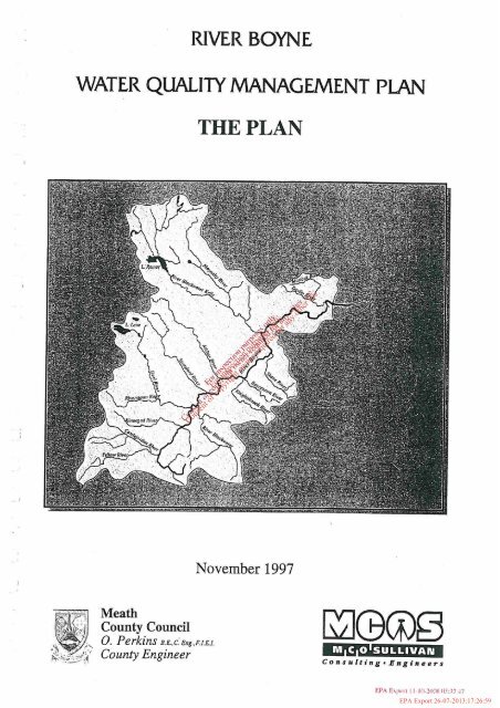
RIVER BOYNEWATER QUALITY MANAGEMENT PLANTHE PLANFor inspection purposes only.Consent of copyright owner required for any other use.November 1997MeathCounty Council0. Perkins D.E..c;&z~..EI.E.I.County Engineer~pConsulting .Engineers<strong>EPA</strong> Export 26-07-2013:17:26:59
<strong>River</strong> <strong>Boyne</strong> Wstcr <strong>Quality</strong> Managcmcni <strong>Plan</strong><strong>River</strong> <strong>Boyne</strong> <strong>Water</strong> <strong>Quality</strong> <strong>Management</strong> <strong>Plan</strong>Table of ContentsChapter 11.1IntroductionBackground<strong>River</strong> 80.vne Catclrment - OvervieivIVarer Qualih, Managemenr <strong>Plan</strong> - Objectives<strong>Plan</strong> Development MetlrodologyChapter 22.12.22.32.42.5<strong>Boyne</strong> Catchment - <strong>Water</strong> Resources<strong>River</strong> <strong>Boyne</strong> and it's TribrrtariesCatchment ClraracteristicsiVorer Resoztrces - Hydrometric DataRain/allLakesChapter 33. I3.23.33.43.j3.73.93.93.10Chapter 44. 14.24.34.44.54.64.74.84.94.10410.14.10.24.11<strong>River</strong> <strong>Boyne</strong> Catchment - LanduseIntrodzrctionilgricaltrrreI~rdrlsttyPear El-tractioirForestrytfvdraelecrric Schen~esLandjills<strong>River</strong> hlai~rte~~a~~ce/Dredgin~.4reas of Scientrjic 111Y- +'&<strong>Boyne</strong> Catchwnt - <strong>River</strong> <strong>Management</strong> IssuesWc:Uses and Pres.s@sDrinking U'aler .4bstracrionsBathing and RecrearianFisheriesGeneral Amenity1Yoste Disclrarges&isring Mzinicipal DischargesIndrwtrial DisclrargesStorm Sewer OverJo~vs and Other IssuesLegislotion and Regrrlatior~sLegislationInregrared Pollr~tion ControlSrrmmapFor inspection purposes only.Consent of copyright owner required for any other use.Chapter 5 Current <strong>Water</strong> <strong>Quality</strong>5. 1 Introdrstion5.2 Biological J?rrali~ .Assessnrent5.2. I Biological .~ssessnred a/Bayne <strong>River</strong> Systenr5.3 Plrysico-Chemicnl.4ssessnre1rr<strong>EPA</strong> Export 26-07-2013:17:26:59
<strong>River</strong> Boync Warcr Qualiry <strong>Management</strong> <strong>Plan</strong>5.3, I <strong>River</strong> Bo!,ne $rslem - Dissolved 0.xygcn5.3.2 Bio-cl~emical O.xygen Demand /BODj)5.3.3 ivirrile and.4mmonio5.4 Trophic Slalrrs and AssociaIedPl~osplto~e Slondards i,~ Bo~ne <strong>River</strong>System5.j <strong>River</strong> ll'aler Qrrality Data5.6 Lake Warer <strong>Quality</strong> in 111e Bqvne Colclrmen~Chapter 6 <strong>Boyne</strong> Catchment - <strong>Water</strong> <strong>Quality</strong> <strong>Management</strong> <strong>Plan</strong>6.1 ln~rodrrc~ior~ and Objecrives6.2 IValer Q~rolity ,bfanagement Policies6.3 IValer Qlrality Sfandards6.4 01her Sources of lVosre Dischorge6.5 hloniloring Pro~ranlmes6.6 /mpIementariortFor inspection purposes only.Consent of copyright owner required for any other use.<strong>EPA</strong> Export 26-07-2013:17:26:59
List of TablesTnble 2. IBo.vrre Catchment Tonw7 7 Boye Catclinrent Tribzrturies2.3 Hydrornetric Gauging Starions with Aatorrratic Records24 Hy&ar~retric Garrging Stations >vitl~ StaffGazrges2. j <strong>Boyne</strong> Catchrrrerit <strong>Water</strong> Resozrrces (0. P. !K Garrging Sites)2.6 Boyrre Catchment Lakes2.7 <strong>Boyne</strong> Catchment - Lokes and their <strong>Water</strong> Reso~rrcesTable 3.1 Popzrlalion Doto by Co~rnfy3.2 Raised Bogs in Bo.vne Carc/iment3.3 Effects ofAffarestation on <strong>Water</strong> Qzrali~3.4 List ofLaridfill Sites (Active)3.3 List ojLaridfil1 Sites (Clasedj3.6 Areas ojScientifc /riterestTable 4. I <strong>Water</strong> .4bstractiorl Sorrrces irz ih,&$&nr catchrrle171b\o4.2 Bathing <strong>Water</strong> hlicrobialo~a~~tond~rds,* .&4.3 Bathirzg Areas - rl.~icro@~~~ccd Assessrrrers6+'a*u1.1 Solrrron Ariglirrg ~,$&$PS4.5 Oficial ~e~or$,@:ches ofSalnron taken by Tmp-o~vr~ers 1980- 1989"*4.6 Oficial ~ e ~ Catches ~ & d of Salmon takeri by Drafr-rieners 1980- 19894.7 ~jicial~orred Catches of SalrnordSea Trorrt taken bv Anglers 1980-1989Ll.8 Coarse Fisheries iri the <strong>Boyne</strong> Catchnienr - Crrrrent UsageFor inspection purposes only.Consent of copyright owner required for any other use.1.9 hlunicipal Wmte <strong>Water</strong> Eflzrerit Discharges1. I0 Major Irrdzrstrial Wasre Efl~rents - 5o)lne CatchmentTable 5. l The Biotic 1nde.x <strong>Water</strong> Qzralify Schenze of the Enviro~m~enral Research Utiir5.2 EP.4 Biological Qlrali~ Rrrrings - <strong>River</strong> Boyrie3 <strong>Boyne</strong> hlalrr Channel - Pl7jirico-cheniical Data ('Mean & Range)3.4 Boyrle to Nnvarr Weir - Pliosphate Loadfiom Selvage Treotrnerit <strong>Plan</strong>tsTable 6.1 Interim Statsloy Storidards for <strong>River</strong>s6.2 lnterim Statrrtory Sta11durds/or Clear <strong>Water</strong> Lokes6.3 Interim Srutstory Staridards/or oilier Lakes<strong>EPA</strong> Export 26-07-2013:17:26:59
List of FiguresFigure No. 1Figure No. 2<strong>River</strong> Boytze Carchnlenf and <strong>River</strong> SyslernAlgal and Macrophyre Ab fmdance Porn N mn toBroadboyrzeList of MapsMap No. 3Map No. 4Map No. 5Map No. 6Map No. 7MapNo. SMap No. 9Map No. 10Map No. I IHydrometric Gauging SlaliotisIsolz.vets of Rc~infaflForestryPeatlanclsLandfillsDischarges &+.v+0 3.- .Abstroct~~q;q9
Technical DataAppendir No. IHydrometric RecordsAppendir No. 2Biological Samplbtg DaloAppettlrlir No. 3Physico-Chentical Sonzpliiig DataAppenrlir No. 4Lake <strong>Water</strong> Qtraliy DaraAppendir No. 5Wastewater Treormeni Pla~its - <strong>Water</strong> Qzralip DataAppertdir No. 6Indtisfrial Eflzient <strong>Water</strong> Qlraliy DataAppen(1ir No. 7Appenrlir No. 8ApperrclLr No. 9Raw <strong>Water</strong> Abstraction Sources~s<strong>Water</strong> Qztuliry Data1989 Aquafic Plarit SList oflnd~For inspection purposes only.Consent of copyright owner required for any other use.<strong>EPA</strong> Export 26-07-2013:17:26:59
ACKNOWLEDGEMENTS-Re assistance of the following during the preparation ofthis report is gratefully acknowledged:-(/! The individual staffmenzbers of:(I)(ii)(iii)(vi)(v)(vi)Meath County CouncilKildare County CouncilLouth County CouncilCavan County CouncilOffaly County CouncilWestmeath County Council(2) The individztal staflmembers oj(I) Environmental Protection Agency (<strong>EPA</strong>)ArdcavanWexford(ii)The Environmental Protection Agency (<strong>EPA</strong>)Environmental Services SectionPottery RoadCo. Dublin.(ii) The Environmental Protection A.:& (<strong>EPA</strong>)<strong>Water</strong> Resources Section,<strong>Water</strong>loo Road,Dublin 14.(3) The bidivid~~al sraffnzec): of.(i) The ~ngineed~d. -..-h,Office of,$@c Works,17-19p$&~atch Street,DublinA(ii).+ -TWEngineering Section,&ice of Public Works,Trim.For inspection purposes only.Consent of copyright owner required for any other use.(4) Mr. Donal Synnon, Natiotzal Botanic Gardens.(5) The individual staff members of Bordrza Mona.(6) The individual staff members of the Foreshy Divisiorial Ofjice.M~tllitigar~(7) The individual Staff members of:(i) The Central Fisheries Board.(ii) The Easter17 Regio~ial Fisheries Board(8) The individual staff members of the Indztstrial Developnie~it Autliorip.(9) The individual staff members of Teagasc(10) The individual staff members of The MeteorologicolSen~ice.<strong>EPA</strong> Export 26-07-2013:17:26:59
1.0 IntroductionFor inspection purposes only.Consent of copyright owner required for any other use.<strong>EPA</strong> Export 26-07-2013:17:26:59
Kivrr UO~IIC <strong>Water</strong> QualiQ hlanagcnrnl <strong>Plan</strong>1. Introduction1.1 Backgrorrnd<strong>River</strong> <strong>Boyne</strong> <strong>Water</strong> <strong>Quality</strong> <strong>Management</strong> <strong>Plan</strong>Systematic management of water resources is necessary to ensure the required balance betweendevelopment pressures and the safeguarding of the natural and built environment for futuregenerations.The Local Government (<strong>Water</strong> Pollution) Acts, 1977 - 90 and subsequent regulations provide for thecontrol of water pollution by means of a licensing system for all trade effluent and domestic effluentsover 5m3 in 24 hours and allows for the development of <strong>Water</strong> <strong>Quality</strong> <strong>Management</strong> <strong>Plan</strong>s on a rivercatchment basis.Under Section 15 of the 1977 Act, provision is made for the preparation of <strong>Water</strong> <strong>Quality</strong><strong>Management</strong> <strong>Plan</strong>s to provide an essential tool to assist policy makers in the management of waterbodies. The plan takes account of present and potential future beneficial uses and sets water qualityobjectives to meet and sustain these demands. Key elements ofthe plan include:-r An underslartding of the river system and it 'S water reso~trc&68 The present %vater qualiIy stat~isr Existing land use and azanagernent iss<strong>Water</strong> quality objec~ives and' ,T)and criteriaFziIzire warer qziality managerner~~saies and their hltegrarion into a cohere111 ooerallplair,+ CThe publication by the Minister fokd~nvironment of the document 'Managing Ireland's <strong>River</strong>s andLakes - "A Catchment Based Strategy Against Eutrophication" in May, 1997 sets out national policyfor improvement in water quality in Ireland's <strong>River</strong>s and Lakes. It sets out interim standards for<strong>River</strong>s and Lakes to be achieved at the latest by the year 2007.For inspection purposes only.Consent of copyright owner required for any other use.The following principles underpin current National and E.U. Policy:-. Concept of sustoinable development ; S~rstainable developnzent is developn~el~r tha! nreets theneeds of !he present without compromising the ability offiiture generarions to rneer their ownneeds.Principle of precnutiortnry ncriort ; The redzrctioi? of risks to the environnlertt by takingavoiding action bejare any problem arises.<strong>EPA</strong> Export 26-07-2013:17:26:59
<strong>River</strong> <strong>Boyne</strong> Walrr <strong>Quality</strong> ~lnnagcmml <strong>Plan</strong>Integration of environmenlnl cocisidernfions ; envisages a holistic environmental appraisalof issues to prodtrce integrated environi~rental nranage~~~ent practices for posiliveenvironmental benefif"Polluter Pays" Principle ; requires that the cost of preventing and repairing environmentaldamage should be borne by the polluter.The protection of the quality of water isa vital part of this process, having regard to the conflictingpressures of increased water demand on the one hand and the need to dispose of greater quantities ofwaste on the other.Historically, Ireland was spared the large scale pollution which was associated with the industrialrevolution in Britain and elsewhere. However, since the 19601s, considerable environmental pressureson water resources have been experienced associated with:-* Poptrlation growth and, in particular, increased iirba~~isation in Irish societyAccelerated b~dustrial growth with consequences for water consu~iiptio~i and eff~entdischargeIncreased agrict~ltural production and changed far111; ernods with pollution arising j+omfarnryord waste discharges associated with irite&~ bandry, silage effluent dischargesand organic rrm-oflfioni land due to increose&&$adilig .~ offnrniyard slurries and artijcial.,* 50.Econon~ic grontth and increased nrn$e&y : resulting in increased consunptior~ of waterresources in both do~nestic anr ,&l conr~~iercial use and the consequent increase illeffluent discharge'.$>. P"These forces have resulted in diminiqd water quality associated with localised point discharges andgeneral diffuse inputs. To offset thge pressures, a systematic approach is required to water resourcesmanagement and conservation.1.2 <strong>River</strong> <strong>Boyne</strong> Cnfchment - OverviewFor inspection purposes only.Consent of copyright owner required for any other use.The catchment of the <strong>River</strong> <strong>Boyne</strong> extends to some 2694km2 in total (Ordnance Survey of Ireland -<strong>River</strong>s and their Catchment Basins - 1958). The catchment is shown inFig. 1 and comprises the bulkof Co. Meath, the southern part of Co. Louth (Mattock Catchment), an area in the south-east of Co.Cavan (Lough Ramor catchment), the eastern area of Co. Westmeath (<strong>River</strong> Deel catchment), an areain the north-west of Co. Kildare where the <strong>River</strong> <strong>Boyne</strong> has its source and a small area of Co. Offalyincluding Edenderry, Rhode and the Yellow <strong>River</strong> catchment.The principal towns in the catchment are Trim, Navan and Kells in Co. Meath, Virginia andBailieboro in Co. Cavan, Kinnegad in Co. Westmeath, Edenderry in Co. Offaly and Drogheda inLouth at the head of the <strong>Boyne</strong> estuary. The main channel is some 1 l3km long from its source nearNewbury Hall in Co. Kildare to its outlet to the Irish Sea at Mornington, east of Drogheda. Theelevation of the source is approximately 140m O.D., giving the average main channel gradient as1.24111 per kilometre.<strong>EPA</strong> Export 26-07-2013:17:26:59
<strong>River</strong> Boynr <strong>Water</strong> <strong>Quality</strong> <strong>Management</strong> <strong>Plan</strong>The catchment of the <strong>River</strong> <strong>Boyne</strong>, therefore, is relatively flat and primarily pasture. <strong>Water</strong> qualitytrends indicate a diminished standard over the last 20-25 years based on <strong>EPA</strong> biological sampling(formerly an Foras Forbortha) - ERU.The river network to which the plan relates is illustrated in Fig. 1 and comprises the main<strong>Boyne</strong>channel and the significant tributaries which are covered by the E.P.A. monitoring programme. Itrefers to the freshwater river system upstream of the tidal estuary at Drogheda (Obelisk Bridge).From its source in Co. Kildare, the main channel flows westwards towards Edenderry in Co. Offalyand then in a north-westerly direction towards Rahan, where it enters Co. Meath. It flows in a northeastdirection towards Trim, intercepting the Longwood Blackwater, the Yellow <strong>River</strong>, the Kinnegad<strong>River</strong>, the <strong>River</strong> Deel, Stonyford and Athboy tributaries.For inspection purposes only.Consent of copyright owner required for any other use.<strong>EPA</strong> Export 26-07-2013:17:26:59
For inspection purposes only.Consent of copyright owner required for any other use.<strong>EPA</strong> Export 26-07-2013:17:26:59
<strong>River</strong> <strong>Boyne</strong> <strong>Water</strong> <strong>Quality</strong> Mnnagrmrnl <strong>Plan</strong>Continuing north-east to Navan, the river is joined by a major tributary, theKells Blackwater, beforecontinuing in a generally easterly direction to Slane and Drogheda. The Kells Blackwater is thelargest tributary of the <strong>River</strong> <strong>Boyne</strong> rising in Co. Cavan north of Bailieboro and flowing south toVirginia and Lough Ramor and then in a south-easterly direction via Kells to join the main riverdownstream of Navan. In the context of a <strong>Water</strong> <strong>Quality</strong> <strong>Management</strong> <strong>Plan</strong> for the <strong>River</strong><strong>Boyne</strong>, thefollowing aspects of the <strong>River</strong> and it's catchment require consideration:-* The Ofice of Public Works (OPW) carried out an arterial drainage scheme on the <strong>River</strong><strong>Boyne</strong> behveen the lale 1960 $ and the early 1980's and conti~ilre to provide maintenanceupkeep of the channelThe main clia~inel of [he <strong>River</strong> <strong>Boyne</strong> is a designated salmonid water under the EuropeanCommwiities (Q~iality of Salmonid <strong>Water</strong>s) Regulatio~is. 1988 (S..[ 29311988)The <strong>River</strong> <strong>Boyne</strong> is ail important source of potable water requiring compliance with theEuropean Con~munities (Qualip of Surfoce Wa~er Intended for the Absfraction of Drinking<strong>Water</strong>) Regulations. 1989 (3.1 No.294/1989)1.3 Wnler Qrrnlily Mnnngement Plnn - ObjectivesThe main objectives of the <strong>Water</strong> <strong>Quality</strong> <strong>Management</strong> <strong>Plan</strong> for the,$oyne +'Catchment are:-C\To protect water qualify for abstraction as aprim#~5&nejcial . use.: *-
oThe beneficial water uses (existing andfuture) to be protected within the catchment wereidentijiedThe desired river water qziality considered necessaiy to slpport these variozis beneficial useswas definedAssessments of the capaciv of the river to receive efjluent discharges within the desiredquality ranges were determined (assimilative capacity). This capacity is a nteaslrre of theubility of the river to absorb waste withozit breaching the <strong>Water</strong> Qtrality Standardsappropriate to the specified usesEstimates of existing waste loads were compiled, with projections of firlure generated loadsConsideration of proposals for the treatnient of existing andfiiture waste discharges weremade and canpared with the estimates of assimilative capacityThose sectiolis of rivers and lakes presently overloaded by waste discharges were identified.<strong>Water</strong> qualify trends in these sections were also exanlined and corisiderution was given tohow these areas might be rectifiedIn relation to firtzire develop~nei~t, criteria for laying d@n future effluent quality standardsCLwere developed\% ., > *?Inevitably, this process restilts in prioritie.wastewater treatrnentfacilitiesThe plnli includes recommendations folover a reasonable timetable.. .L ,Q\m .&iital investmetrt in both public and privatebe implemented to achieve the stated objectivesFor inspection purposes only.Consent of copyright owner required for any other use.<strong>EPA</strong> Export 26-07-2013:17:26:59
2.0 <strong>Boyne</strong> Catchment - <strong>Water</strong> ResourcesFor inspection purposes only.Consent of copyright owner required for any other use.<strong>EPA</strong> Export 26-07-2013:17:26:59
<strong>River</strong> Boync Waler Qunlity Unnagrmml <strong>Plan</strong>2. <strong>Boyne</strong> Calclrment - <strong>Water</strong> Resources2.1 <strong>River</strong> <strong>Boyne</strong> and It's TributariesChapter 1 briefly described the <strong>Boyne</strong> river system and it's relationship to the administrativeboundaries as shown in Fig. 1. Approximately 54% of the catchment is in Co. Meath, 18% in Co.Westmeath, 12% in Co. Cavan, 8% in Co. Kildare, 5% in Co. Offaly and 3% in Co. Louth.The catchment is relatively flat, containing no mountains with a watershed the summits of which aretypically 2.50111 O.D. to 340m O.D., the highest levels being in the north and north-east. The bulk ofthe catchment is under 75m O.D.The two largest towns in the catchment are Drogheda on the <strong>Boyne</strong> estuary including the port andNavan, which is by far the largest inland town in the catchment and is the administrative capital ofCo. Meath. Table 2.1 is a list of the 15 largest urban centres in the catchment.TABLE 2.1 - BOYNE CATCHMENT TOWNSFor inspection purposes only.Consent of copyright owner required for any other use.The sub-catchments of the main tributaries of the <strong>River</strong> <strong>Boyne</strong> system are summarised in Table 2.2.The most significant tributary is the Kells Blackwater, which is equivalent to over one quarter of thetotal catchment including the area of Co. Cavan and a significant area of north Co. Meath. Othersignificant sub-catchments are the Deel draining the bulk of the catchment in Co. Westmeath, theYellow <strong>River</strong> in Co. Offaly and the Longwood Blackwater draining part of Co. Kildare.Associating the towns with the tributaries, the larger towns are on the main channel of the<strong>Boyne</strong> andon the Kells Blackwater (Kells, Bailieboro and Virginia).<strong>EPA</strong> Export 26-07-2013:17:26:59
<strong>River</strong> Boynr \Vater <strong>Quality</strong> Managrment <strong>Plan</strong>TABLE 2.2 - BOYNE CATCHMENT TRIBUTARIESThe catchment area of the <strong>River</strong> B~yne,-~..,ists of peatland in the upper regions changing to highlyproducti\.e agricultural land in theP&ddle and lower reaches. The bedrock consists mainly of.carbonif2rous limestone of varyingbges with lower carboniferous limestones in the south and west ofthe catchment gradually varying to middle and upper carboniferous limestones in the north and east ofthe catchment. Areas of upper avonion shales and sandstones are located in the north-east of thecatchment. while areas ofsilurian rocks are present in the north of the catchment. A small area of oldred sandstone is present in the west of the catchment.For inspection purposes only.Consent of copyright owner required for any other use.<strong>EPA</strong> Export 26-07-2013:17:26:59
<strong>River</strong> Boynr Walcr Quali* <strong>Management</strong> <strong>Plan</strong>2.3 W&r Resources - Hydronielric DatnThe island of Ireland is divided into 40 hydrometric areas for the purposes of collecting hydrometric(<strong>River</strong> Flow) data. For this purpose, the <strong>River</strong> <strong>Boyne</strong> catchment is designated as hydrometric area 07.<strong>River</strong> flow is recorded at locations throughout the catchment by the following agencies:.OBce of Public Works (OP W)Environmental Protection Agency (<strong>EPA</strong>)E!ecbiciry Supply Board (ESB)Local Authorities<strong>River</strong> flow data is essential for water resource management, flood flow management and pollutioncontrol. Historical flow data over a significant period of record can be used to estimate the followingparameters of river flow:-n>'Floodflows of vario~is rel~rrn periods (likelihood of occur~:$iice)S-,$. -3-Low flows expressed as niiriiniwn LIT wea~herfl@+~@~~), ~isually defined OS the flow belowwhich the river ,110tild not be expecred 10 faq~?%&e than once in 50 years. More ~is~ially, the.\ .S'95 percentile flow is uset1 when se?tingpol@>.@ sta~~dards and assessing co~npliarse. This is.\clejned as the flow at the locatiori in th&-r,@r which is exceeded 95% of the timee Average dai!vflowprovides a nzwswe oj' the tolal rurt-oflffr.or~i the catch~neatt~hich car1 becross-referenced with rai~&N ,@> catchnre~rt characteristics in estirnari,rg lotal waterresourcesFor inspection purposes only.Consent of copyright owner required for any other use.The most accurate method of measuring channel flow is by constructing a specific control structure(weir, sluice, etc.). However, in practice, flow is estimated from measurement of water level (waterdepth) at a site which is converted to flow by reference to a suitable rating curve. The rating curve isdetermined from an appropriate number of actual measurements of river flow for a range of flowdepths at the site. A good gauging station will have a consistent relationship between flow and waterdepth.Hydrometric gauging station sites in the <strong>River</strong> <strong>Boyne</strong> catchment are indicated in Map No.1 andcomprise two types of station. Automatic recorder stations provide a continuous record of waterlevel from which a continuous profile of river flow can be derived. Staff gauge stations, however, aremanually read intermittently and are generally used for spot checks on low flows and flood flows.<strong>River</strong> flows presented in this Report are based on OPW records and <strong>EPA</strong> records for the LocalAuthority sites. It would be a requirement for systematic water resource management that the numberof sites be significantly increased with automatic recorder facilities, particularly where significantwater abstractions or water discharges require to be assessed.<strong>EPA</strong> Export 26-07-2013:17:26:59
Rivrr Bognr Walrr <strong>Quality</strong> Alanngrmrnl <strong>Plan</strong>Tables 2.3 and 2.4 summarise the available hydrometric gauging records within the <strong>Boyne</strong>catchment. These records have significant limitations in terms of :-The coverage of the catch~tzentThe period of recordThe extent of records which are processed m~d available for useA data management system is required by means of which the hydrometric data would be regularlyupdated from the source agencies. Ultimately, this should be in digital fonn suitable for transferbetween the agency and local authority and regular update of the available record. Procedures in thedata management system for calculation of 95 percentile low flow and DWF automatically wouldupdate these key parameters as the dataset is extended.The dry weather flow (DWF) is taken as the minimum flow which might be expected to occur once in50 years. This critical parameter is necessary for consideration of the safe yield for water supplyabstraction and also in considering threshold levels for toxic and dangerous substances. The 95percentile flow is generally used in considering critical pollution thresholds and compliance withwater quelity standards. 95 percentile and DWF flows are presented inTables 2.3 and 2.1, based oncurrently available data.The <strong>Boyne</strong> arterial drainage scheme results in accelerateQ,rg 'from the catchment with reducedflood stornpe. Therefore, the current run-off regime ;Q v*"-L' bented by post drainage data only.For inspection purposes only.Consent of copyright owner required for any other use.<strong>EPA</strong> Export 26-07-2013:17:26:59
For inspection purposes only.Consent of copyright owner required for any other use.<strong>EPA</strong> Export 26-07-2013:17:26:59
<strong>River</strong> Boync \\'alrr <strong>Quality</strong> hlnnrgemrnl <strong>Plan</strong>TABLE 2.4 : HYDROMETRIC GAUGING STATIONS WITH STAFF GAUGESFor inspection purposes only.Consent of copyright owner required for any other use.<strong>EPA</strong> Export 26-07-2013:17:26:59
Hivrr Boyor Wnlcr <strong>Quality</strong> Xlanagrnmt <strong>Plan</strong>Daily rainfall data is available for various locations throughout the catchment. This information ispublished for 30 year periods and at l0 year intervals by the Meteorological Service. Records for theperiod 195 1-1980 are tabulated in Appendix I and Isohyets of rainfall for the catchment are presentedin Map No.2.Rainfall in the <strong>Boyne</strong> catchment varies from approximately 830mm in the central area of thecatchment (Trim, Navan and Drogheda) to approximately 1,100mm per annum in theBailieboro areaof Cavan.In carrying out a water resource balance assessment, allowance must be made for uptake of rainfall inevaporaticn and transpiration. Estimates of evapotranspiration are also provided by theMeteorological Service and vary according to weather conditions including sunlight. Typical valuesof evapotmnspiration loss for the catchment would be in the order of 400-450mm per annum.Typical water resource balance calculations in the <strong>River</strong> <strong>Boyne</strong> catchment are summarised in Table2.5 based on data from the document "A Statistical Analysis of <strong>River</strong> Flows" produced by the <strong>Water</strong>Resources Section, Environmental Research Unit (now the <strong>EPA</strong>), for the Eastern <strong>Water</strong> ResourceRegion.TABLE 2.5 - BOYNE CATCHMENT WATER RESOURCES (0.&'tr,. GAUGING SITES),5,For inspection purposes only.Consent of copyright owner required for any other use.This table demonstrates a consistent net yield from the<strong>Boyne</strong> catchment in the order of 1611s per km2as average daily flow. Higher figures are indicated for the smaller Moynalty and Skane catchments aswould be expected, due to shorter times of concentration.These figures give an overall estimate of the average water resources available in the catchment.However, from a water use and water quality point of view, the low flow data (95 percentile andDWF) are more significant.<strong>EPA</strong> Export 26-07-2013:17:26:59
2.5 LakesLakes within a river system require particular attention in the context of water resourcesmanagement. By virtue of the storage which they provide, they have greater potential to meet waterabstraction requirements. At the same time, the long average residence time results in a complex ecosystemwhich is sensitive to environmental pressures such as organic pollution and nutrientenrichment (phosphates and nitrates).Table 2.6 is a list of lakes within the <strong>Boyne</strong> catchment. Table 2.7 summarises the lakes for whichdetailed information is available on contributing catchment area, lake surface area, stored volume,mean and maximum depth and water residence time. These parameters provide a basis for assessingthe lakes from the point of view of potential abstraction yield and likely impact of organic or nutrientloadings.The table indicates the more significant lakes as follows:-e Lough Ramor in Co. CavanLough Lene in Co. WestmeathLough Bane in Co. Westmearh (34%) and Co. Mealh (67%)>+,.\.Ngcli-esgeel Loughs in Co. CavanSkragh Lo~rgA in Co. CavanCustle Lake in Co. Cava17Drun~kee~y Lake in Co. CavonLisgrea Loke in Co. Cavani~*.*For inspection purposes only.Consent of copyright owner required for any other use.The lakes provide a valuable angling resource, particularly for Co. Cavan with significant economicgain in the local areas. The majority of the lakes provide good course angling, with the foregoinglakes being the more notable. Significant lakes from a water abstraction point of view are.LoughLene, Skeagh Lough, Nadreegeel Lough, Lough Acurry, Drumkeery Lough and Cuilcagh Lough.<strong>Water</strong> quality data in lakes shows that, while generally satisfactory, the majority show evidence ofnutrient enrichment, leading to varying degrees of eutrophication. This involves excessive growth ofplants and planktonic algae. It causes fluctuation in dissolved oxygen (D.O.), pH and turbidity (waterclarity) and can render the water less suitable for abstraction, fish life and other beneficial uses.<strong>EPA</strong> Export 26-07-2013:17:27:00
nlrrl ouym rrxtrr yuaooty Inaanugrmcnr rlanTABLE 2.6 - BOYNE CATCHMENT LAKESFor inspection purposes only.Consent of copyright owner required for any other use.<strong>EPA</strong> Export 26-07-2013:17:27:00
llivur ooync baler Uu.~~ty iilrnngtttlrnl VbnTABLE 2.7 - BOYNE CATCHMENT - LAKES AND THEIR WATER RESOURCESFor inspection purposes only.Consent of copyright owner required for any other use.<strong>EPA</strong> Export 26-07-2013:17:27:00
3.0 <strong>River</strong> <strong>Boyne</strong> Catchment - LanduseFor inspection purposes only.Consent of copyright owner required for any other use.<strong>EPA</strong> Export 26-07-2013:17:27:00
<strong>River</strong> Boync <strong>Water</strong> <strong>Quality</strong> hlanagrmcnt <strong>Plan</strong>4.5 General AmeniwThe <strong>Boyne</strong> <strong>River</strong> and it's tributaries are of major amenity value to the people resident in thecatchment and to visitors. Maintenance of this amenity requires a clean river with satisfactory waterquality and a general absence of litter and other debris.Compliance with the required standards for the key beneficial uses of the <strong>Boyne</strong> <strong>River</strong> Systemoutlined above will ensure a satisfactory water quality generally. Compliance with the requirementsfor water abstraction for potable use, bathing and recreation and development of salmonid fisherieswill require effective control of discharges from wastewater treatment plants, industry and agriculture.In addition, consideration may be required to the following:-* Storm Sewer Overflows ; overflows fronl combined sewer systems will require fo meetrninimlmr standards based on guidelines provided by the Department of the Environnlent, hthe context ofthe Urban Wastewater Treatment Directive (91/271/EEC). In particular, slrchoverflows shorrld have discreetly located a~rtfalls with effective control of decritus to preventan aesthetic r~uisance at the sitePlrospl~afe Levels ; phospl7ate levels in rivers nnd more partic~rlarly in lakes give rise toenrichment which causes excessive plant and algal q.&th. This process is known aseuirophication4.6 Waste Disclrarges*&All liquid waste from domestic and ind~st~ja~~development must ultimately be disposed of to-c. .,receiving waters. This section of the F' $WI?WS the major discharges to theBoylle <strong>River</strong> System,the nature and general design parametc &sting treatment facilities and probable pollution loadsat the discharge point..\"The impact of these discharges isFii
<strong>River</strong> <strong>Boyne</strong> <strong>Water</strong> <strong>Quality</strong> Managemm1 <strong>Plan</strong>The impact of waste discharge on river water quality is a function of the waste volume andcharacteristics and the flow in the river (dilution). A further factor is the recovery rate of the riverassociated with the nature of the flow, extent of re-aeration, etc.The minimum standards for compliance with current regulations appropriate to rivers supportingabstraction for potable water use, bathing and water contact recreational activity and designated as asalmonid fishery are identified in this section. These standards have obvious implications for theamount of organic waste which can be accommodated in a river at any section, sometimes referred toas the assimilative capacity. Notwithstanding the over-riding requirement to minimise wastedischarges, the approach does permit an objective evaluation of whether a particular effluent can beaccommodated or whether a higher standard of treatment is essential. In this regard, the followingapproach-can be adopted:-Bioclremicnl Oqgen Demand (BOD 5) ; given the require~i~en~ for a rnaxinlurn level of 5mgnas 02 at 95% low jlow, there niwt be reasonable assurance that this lin~it will not bebreached. The EEC Directive 017 salnionid waters (78/659/EEC) sets a guideline value of the3mg/l as 02, Therefore, this value niight be regarded as an objective value in a salnioitidriver where possiblee Plrospknfes nrg/l P ; the Sal~no~tidli~nits for phosphates. In thecase of lakes, it p~oviaks a relationship for deterqfi,za$>li of like!y crifical loading expressedns nrg P per m2 of lake surface per year depe$& oil the ri:ea11 deprh of lhe lake rn7d thetheoreliczl retention time, expressed in other ca.ves, it states that the litnit valzre of0.2mg/l expressed as PO4 lnry be regar@&'indicative in order to reduce ezrtrophication.Q .Xii jigroc of doirble this value is su@f,&for cypri~iid waters. For sal~~ionid waters, fheequivalent vnlue e.rpressed as ntg/lG+@:p% approxittiate!~ 0.07 tng/l4.7 Existing Municipal Discliarge&Qc@-\a-E'Directive does not \&';.~For inspection purposes only.Consent of copyright owner required for any other use.Table 4.9 is a schedule of existing municipal wastewater treatment plants in the catchment,indicating the existing treatment process type, capacity, existing loading and typical effluent loadcharacteristics in terms of BOD5 (kgld) and orthophosphate as mgll P.Effluent quality dara is listed in Appendix 5 and it also includes key operating parameters of someplai~ts, including MLSS (aeration tank suspended solids) and SVI (sludge volume index). It isapparent that upgrading of existing plants is required in the major towns of Navan and Trim togetherwith smaller plants at Rhode, Moynalty and at Collon, where the results of effluent sampling appearto be unsatisfactory. In general, a minimum standard of 20mgll of BODj and 30mgllofS.S. is takenas standard for municipal discharges to inland waters.The effluent data for municipal wastewater treatment plants in Appendix 5 shows the following:-* Atlzboy S.T. K; this plant discharging to the Athboy <strong>River</strong>, is within capacity and occasional poorefluent results appear to be associated i18ith excessive sliidge acc~rmulation indicated by highiCfUS and elevated SVI values<strong>EPA</strong> Export 26-07-2013:17:27:00
Rivtr Boynr Waler <strong>Quality</strong> Mnnagcmcnt <strong>Plan</strong>Bollivor S.T. W. ; discharging to Stonyford <strong>River</strong>, plant riomirial!v within capaciry with occasionalunsotisfacto~y results evidenced by high suspended solids in the effluenl, elevated BOD and highS. KI. indicating reduced settleabilifyCrossakiel S.T.W.; discliarging to Athboy <strong>River</strong>, plant within capacify and with satisfacloryeffluent apart from high occasional suspended solidsDonore S.T. W.; discharging to the <strong>River</strong> <strong>Boyne</strong>, plant ivithin capacify, with high qrrolify effluentDunderty S.T. W.; discharging to Clady <strong>River</strong>, works nominally within copaciry but results showinconsistent eflzrerit, corresponding with excessive MLSS. Occasional high effluenf BOD andsuspended solih levels occurDunshau~lrlin S. T. W.; discharging to Skane <strong>River</strong>. E~istingplant proposedr upgradingKells S. T. W. ; high quoli~ efirent discharging to Blackwafer <strong>River</strong>, indicatedfor pla~il operatingsalisfflctoriiy, well within capaciryKilmessan S.T.W.; discharging to Skane <strong>River</strong>, shows generally satisfotoly efluent withoccasional exceedence of 20 : 30 standard for BOD and sttspended solids respectively,X?". -*aLloyd S. T. W.; to Kells Blachvaier, has satisfactoiy pyitfrotn available data(,9.+ ,\QLongwood S.T.W.; to Lor~gwood ~lackwat~~~,@erates ivell ivithin copacify, is reasonablys.?li~%ctory, with occasional!^ high sttspend$?@?ids+Q' ,a
<strong>River</strong> Boync Wnlrr Qualip Managcmrnl <strong>Plan</strong>It is accepted that water quality in the vicinity of an outfall may not comply with the general standardfor the river stretch (mixing zone). However, outfalls should be located with care to ensure that acutetoxicity will not arise and that the mixing zones will not act as barriers to prevent the passage ofmigratory fish. In addition, the following criteria should apply at outfal1s:-Effective screening and detritus c0nh0l must be in place to ensure the abseizce of visual oraeslheric nuisancefrom sewage derived debris.The discharge should be free of scum, ail andfloating debrisThe discharge shalcld befree of sccbstances which produce odour, colotir, taste or turbidilyThe discharge sl~o~tld not give rise to objectionable growth of nzcisance plarrts. seivagefungus oranimal species associated with selvageMore detailed operational data on the existing wastewater treatment plants, their current status andavailable effluent sampling data are contained in Appendix 5. In general, the smaller activated sludgeplants perform moderately satisfactorily with occasional solids carryover due to the difficulty ofcontrolling a stable sludge level. This can result fromoverload, flushing outsludge solids, or irregular desludging.For inspection purposes only.Consent of copyright owner required for any other use.<strong>EPA</strong> Export 26-07-2013:17:27:00
Rircr <strong>Boyne</strong> Wntcr <strong>Quality</strong> hlrnagcmtnt PIP"TABLE 4.9 - MUNICIPAL WASTE WATER EFFLUENTS DISCHARGES (Ref. To Map No.6)For inspection purposes only.Consent of copyright owner required for any other use.<strong>EPA</strong> Export 26-07-2013:17:27:00
TABLE 4.9 - MUNICIPAL WASTE WATER EFFLUENTS DISCHARGES (Ref. To hlao No.6)For inspection purposes only.Consent of copyright owner required for any other use.<strong>EPA</strong> Export 26-07-2013:17:27:00
<strong>River</strong> Baync Walrr Quvlily hl~nrgrmcn~ PI.,,(cxte~ided,'........................................ .................................... aeration) ..................................?,-.-. .............,. %".&G,aeration) P"+, /......................................... ..................................................................................... i"l.5 "v33v47 ............... ..T,-.........Kells S.T.W. Kells Blackwater 5000 .................... -...............................................................3000..FiQ*(extendedant capacity is adequateaeration) .L..................... 15...................................................................................." .............................................................................. .'I .................................................................................................................................................... .........Lloyd S.T.W..ci: "Kells Blackwater 350 1001 ?,. n/aSurplus plant capacity(extendedraeration).........................................................................................................................................................................................3 1 Moynalty _.(_.....................................................................................................................................................................................................Moynalty <strong>River</strong> ----- 200 6 nla Poor effluent qualityS.T.W. (SepticTank)For inspection purposes only.Consent of copyright owner required for any other use.<strong>EPA</strong> Export 26-07-2013:17:27:00
<strong>River</strong> Boync Walcr Qualily Manugemenl <strong>Plan</strong>TABLE 4.9 - MUNICIPAL WASTE WATER EFFLUENTS DISCHARGES (ReC. To Map No.6)For inspection purposes only.Consent of copyright owner required for any other use.<strong>EPA</strong> Export 26-07-2013:17:27:00
<strong>River</strong> Boynt Walrr <strong>Quality</strong> Mansgrmmt <strong>Plan</strong>There are a significant number of industrial discharges to the <strong>Boyne</strong> <strong>River</strong> system, many of themrelatively small trade wastes or institutional discharges.The larger industrial discharges licensed in the catchment are summarised in Table 4.10. TheseLicences are subject to periodic review and the Licence conditions include requirements formonitoring of compliance.In the case of Irish Cement and Tara Mines, the main issues relate to inorganic parameters such assuspended solids and in the case of the mines discharge, heavy metals.The Bailieboro Co-op discharge to the Lear <strong>River</strong> follows tertiary treatment on grass plots designed toachieve a very high standard of effluent including a limit of ImgI P. This is necessary to protect thedownstream lakes from eutrophication.The ESB Power Station at Rhode has a significant discharge to the Yellow <strong>River</strong> which has low baseflows. This discharge requires review.TABLE 4.10 - MAJOR INDUSTRIAL WASTE EFFLUENTS - BOYNE CATCHMENTOther......................................................................Licencee ReceivingLicence or Estimated ,pu.........................................................................<strong>Water</strong>& ,&Flow BOD 5 rng/k+*
<strong>River</strong> Boynr Walcr Qualih. Manngrmrnl <strong>Plan</strong>Appendix 6 contains results of sampling and analysis of effluent at Bailieboro Foods, Virginia MilkProducts and Wellman International, all in Co. Cavan. Recent results show:-* Bailieboro Foods ; results are generally reasonable, with some failures and one notable verypoor ef/luent (11/4/95). The cooling waste efjlzrent gualiw is generally low in organic andnutrient load.Virginia Milk Products ; efjluent analysis indicates cl very high quality discharge with loworganic loadvWellman International ; he data shows a reosonable egzrent, with sonze inconsistency andoccasional elevated BOD and suspended solids co~~centrations4.9 Storm Sewer Overflows and Otlrer IssuesApart frcm treatment plant effluents, consideration is required to be given to storm sewer overflowsfrofir combined systems. Most urban developments in excess of 25 years old are drained on acombined system with both storm and foul discharges collected in a common sewer network. In suchsystems, it has been the practice to provide overflows to relieve fhe hydraalic loading in times ofrainfall. This practice can give rise to significant pollution in a "&ber of respects:-Bacteriolog~cal impact, related ro the vo&&z@%f.\discharge-~*\\~\1"-UX c/11111no1ria discharges 11,liich cat $se to co~icentrcrtio~u ivhich result it? toxic cocclitionsforfish lfe.C\-3%.* ~Hyclrogen Sulphide concen@tions can be discharged at the outset of a stornz, when settledorgunic Inarter is re-suspd;tded in sewers. R?is is extremely toxic in receiving waters and isd~@ctrlt to detect, being oxidised very quick!vFor inspection purposes only.Consent of copyright owner required for any other use.~Vurrient loads are carried over in the discharge spill in both soluble and parriculate formwhich may contribzrte to enrichtnent ofbed sedimentsSediment deposits confainiirg high organic loading can be discharged at overflows restrlringin detrintental environmental and aesthetic inlpactWhere i~~dusnial wastes are present in the sewer, metals and other foxins can be discharged<strong>EPA</strong> Export 26-07-2013:17:27:00
<strong>River</strong> Boync <strong>Water</strong> <strong>Quality</strong> Managrmcnt <strong>Plan</strong>Criteria for combined sewer overflows have been evolved by the Department of the Environmentwhich are regarded as complying with the Urban Wastewater Treatment Directive. These criteriainclude the following:-* A minimum overflow seming below which overflows will not occur. This is normallyexpressed as a multiple of the dry weatherflow (DWF) ond is typically in the order of 6-7.Where high strength indzrstriol eflzrents are discharged to the sewer system, the settingswould require to be adjusted accordinglyThe type of storm overflow structure should be such as to ensure eflcient hydraulic controland solids separation. Guidelines for such structures are contained in the WRC Guideline3(UK), ref: ER 304 EThe locations of overflow discharge points should be discreetly located and should haveeflective control offloating debris to avoid aesthetic nuisanceA dilution standardshould be applied which will ensure a maximzrm BOD lir~iif in the river of2Omg/l and ideally IOmg/l. The use of storage and recycli~tg can be used to control spillfrequency and this is particularly appropriate for bathing ~ecreotionol use waters (4, 8 or16 times per year)Consideration should be given topreventing 03 1 spills during 'yrst flush " conditions.This is usually achieved by ensuring that ov&d .... .. ill izof occur withinq\ ,-"the time ofco17centration of the sewer n~&@. During the early period of the storm, sewagestrengths can increase considerably q$@iment and slbne is re-suspended into the flow.Afrerwards, the cortcentrations teIid;l'-&all considernblyC.' ,i:.a\.LSignifcant overflows in the cat!&& should be nronitored tuing alrtotnaric recordingequipment to nieasure spill&$uency and duration and with provision for automaticc'-sampli~igFor inspection purposes only.Consent of copyright owner required for any other use.The foregoing criteria are applied to overflows from combined or partially combined sewer systemsand to similar overflows from pumping stations and at the inlet to treatment plants. Separate stormdrainage systems can also be contaminated to a significant extent due to organic material washed intothe sewers and mis-connections, particularly from dishwasher and washing machine discharges.These issues require policing to ensure that they are satisfactory.Storm drainage systems for petrol stations and other areas where oil spillages are likely, shouldalways be fitted with oil traps. In sensitive receiving waters, provision of oil and grit traps might alsobe considered on the outlets from road drainage systems, etc.<strong>EPA</strong> Export 26-07-2013:17:27:00
<strong>River</strong> <strong>Boyne</strong> <strong>Water</strong> <strong>Quality</strong> Mnnsgrrnrnl <strong>Plan</strong>4.10 Legislation and Regulatiorts4.10.1 LegislationThe control of water pollution is principally governed by the Local Government (<strong>Water</strong> Pollution)Act 1977 and the Local Government (<strong>Water</strong> Pollution) (Amendment) Act 1990 together with theassociated Local Government (<strong>Water</strong> Pollution) Regulations 1978 to 1996. In essence, it is astatutory offence under the <strong>Water</strong> Pollution Act to "cause or permit any pollutant matter to enterwaters". One of the main provisions of the Act is to provide for a licensing system to control thedischarge of trade or sewage effluent to a watercourse or sewer.The Act requires that any undertaking which is going to discharge trade effluent or sewage to awatercourse must apply for a licence. Such licences are issued subject to conditions laid down by theLocal Authority. Effluent monitoring to be carried out by the licencee is normally a licencerequirement and the results must be made available for inspection at any time by the Local AuthorityFailure to comply with the terms of a licence is a statutory offence, and while in theory ally personmay prosecute the culprit, in practice due to the difiiculties in obtaining proof, only the LocalAuthority or the Fishery Boards have taken prosecutions.The Local Authority is given a general power to take any actie#it deems necessary to preventpollution or remove polluting matter from waters and the pol@:r is liable to repay the full cost ofthese measures to the Local Authority. The Act also the Local Authority to serve noticerequiring specific action to be taken to prevent p @matter from entering waters and for theS'recovery of the costs of such action.The Amendment Act of 1990 essentially str+pens the provisions of the 1977 Act and the waterpollution control provisions of the ~ish@$$'(~onsolidation) Act, 1959. The fines have beensubstantially increased under the 1990 ~$.b@hereb~ the maximum fine on summary conviction hasincreased from E250 to £!,000 and orl&Gnviction on indictment from £5,000 to £25,000. Theseincreases apply to offences under b$'the <strong>Water</strong> Pollution and the Fisheries Acts. The Principal(1977) Act provides in Section 17 i%"r review of licences for discharge to sewer at intervals of not lessthan three years.For inspection purposes only.Consent of copyright owner required for any other use.In addition to the provisions in Irish Law, there are a number of directives and regulations emanatingfrom the European Union concerning water quality. Regulations are binding in their entirety andimmediately applicable in all members states. Directives on the other hand leave the form andmethods of achievement to the discretion of the national authorities and are binding on the memberstates to which they are addressed.<strong>EPA</strong> Export 26-07-2013:17:27:00
<strong>River</strong> Bovnc <strong>Water</strong> Ouslilv Manaermmt <strong>Plan</strong>The directives relevant to the <strong>Boyne</strong> are listed below:-* The Directive concerning the <strong>Quality</strong> Required of Surface <strong>Water</strong> Intendedfor the Abstractioriof Drinking <strong>Water</strong> in member states (75/440/EEC) arid Irish Governmenr Regulations (S.1No.294 of1989)The Directive concerning the Methods of Measureme111 and Frequency of Sampling andAnalysis of Surface <strong>Water</strong> Inrended for the Abstraction of Drinking <strong>Water</strong> in member states(79/869/EEC), Regulations also included in (S.I. No.294 of1989)The Directive oti the <strong>Quality</strong> ofFreshwaters Needing Protection in order to Support Fish Life(78/659/EEC) and associated Reg~~la~ioris (S.1 No. 293 of 1988)The Directive concerning Urban Waste <strong>Water</strong> Treatment (91/271/EEC) and theEnvironmental Protection Agency Act, 1992 (Urbon Woste <strong>Water</strong> Treatment) Regulations(S.I. No. 419 of 1994)The Directive on the Protection of <strong>Water</strong>s Against Pollutioti Coaised by Nitrates fromAgrintltural Sources (91/676/EEC)-1.10.2 IntegrntedPollulion ControlA recent deve!opn~enr in pollution control in lrelan.r&Tg ntroduction of a new licence called theIntegrated Pollution Control or IPC Licence. '&k&c#cence is administered by the EnvironmentalProtection Agency which was established by tl$$&ironmental Protection Agency Act of 1992. Thelicznsing function of the Agency cornmen&& the 16th May, 1994 and is being expanded on aphased basis to cover scheduled industry&@iries.
A comprehensive monitoring programme will be required as part of the IPC procedure, with samplingand analyses of the following parameters demanded by a typical licence.Emissions to AtmosphereAtmospheric Eniissions - Abatement/Treatniettt ControlMonitoring of Abilospheric ConditionsE#7uen1 Treatnielit Cotlh.o/hIonitoring of Emissions to <strong>Water</strong>sToxic and Darrgerous Waste Disposal - off-siteOther WastesAnalyiris of wcrstes for clisposal off-site by landfillSurface waler nionitoritrg 011-siteGrmndwater ttioriitoring on-siteReporting.*It will also be a condition of the lic~iethat incidents are reported by phone or fax to the Agency'sHeadquarters in Wexford as soo$ as practicable after the occurrence. Action must be taken tominimise the effect on the environment and minimise any waste generated.4.11 SummaryFor inspection purposes only.Consent of copyright owner required for any other use.This section has examined beneficial uses of the <strong>River</strong> <strong>Boyne</strong> system which require certain minimumstandards of water quality for their existence. At the same time, it has considered the pressures on theriver system, primarily wastewater discharges, which tend to cause water quality deterioration. In themanagement of the river system, minimum standards must be applied which can reliably ensure thatall of the beneficial uses can be sustained at present and into the future.A legislative framework exists to support environmental management by setting minimum standardsfor compliance and the use of licensing to control emissions. The standards relate to the nature andbeneficial uses of waters but also include uniform emission standards for waste discharges.<strong>EPA</strong> Export 26-07-2013:17:27:00
TAULE -1.1 IUOYNE WATER QUALITY - NATIONAL AND E.U. STANDARDS<strong>River</strong> Boync <strong>Water</strong> <strong>Quality</strong> Manrgcrncnl Phn- Faecal ColiformsFor inspection purposes only.Consent of copyright owner required for any other use..... "I.Omg/l in D.O.E. Guidelines0.7 as P, 0, - Raw <strong>Water</strong> (G)* Hardness 250 - 350 may<strong>EPA</strong> Export 26-07-2013:17:27:00
5.0 Current <strong>Water</strong> <strong>Quality</strong>. .For inspection purposes only.Consent of copyright owner required for any other use.<strong>EPA</strong> Export 26-07-2013:17:27:00
<strong>River</strong> Bovnc Wnlrr Oualihl Manrecmcnt <strong>Plan</strong>5. Current <strong>Water</strong> <strong>Quality</strong>5. J Introduction<strong>Water</strong> quality in the <strong>River</strong> <strong>Boyne</strong> catchment has been assessed as follows:-* Biological monitoring; biological assessment expressed as a biotic index which combinesdiversity on the basis of certain taxonomic groups, with the pollution indication of individualspecies or groups, into a single index or score. The water resources branch of the <strong>EPA</strong>formerly ERlJ has developed a biotic index suitable for the procedures used in theevaluation of Irish <strong>Water</strong> Bodies. The basis of the index is summarised in Table 5.1. Itprovides a relatioitship behveen water qualip and typical rr@e fauna rangingfrom Q1 (bad)to Q5 (good). These ratings cart be further interpreted to four basic classifications of"~i~~poNuted", "slight pollution" "moderate pollulion " and "serious pollzition " at times.Physico-cliemical assessment ; physical and chemical paranteters which can determine thecharacteristics of the water column based on laboratory analysis. These parameters can bereferenced to specified standards such as those previozrs!~ summarised in E. U Directives andassociated Natioi~al Regulatio~ts (dissolved oxygen. BOD. suspended solids, phosphates.nilrates, ammonia, etc.).,.cMicro6iulogical nssessment ; generully zrsed t3~s.g te pzrblic health issues associatedwith water qzialip. Typical microbiological p&f"'/ers ore fora1 coliforms, faecal colifor~ns.faecal streptocacci, salmonella and enter&;&lses. These parameters are particularly+' .U:significurit in the context of the bathii~g~w~hyat~d dri~tkirig water standards (see 4.9).,+ ,G.ab -c"*X \VTruphic status ; based oil assessr$I?it+pf plant and algal production associated with ntrtrientloads. This is an important parb&er in the cantex/ of lakes and slow moving rivers where-Cnutrient enrichriient can result &I very serious water qualify impacts such as severe algalblooms with associated sev&' changes in oxygen concen@ation, water qualip and tasteproblems due to subseqzier&igal decay5.2 Biological <strong>Quality</strong> AssessmentFor inspection purposes only.Consent of copyright owner required for any other use.The <strong>EPA</strong> carry out regular biological assessment of Irish rivers which provide a basis for determiningcurrent water quality status and trends over time. Biological assessment has important advantagesover chemical-data in the following respects:-Biological organisms integrate pollution effects over time, whereas chemical data representsa once oflrepresentation of conditions in the water column at a test locationBiological communities integrate the effects of azrltiple stresses and clemonstrate ctrmulativeimpactsBiological conimunities can serve as early warning by detecting iitternlittent poNzrtion andsubtle changes, missed by occasional chemical szirveys (e.g. the ir~ipact of storm sewerover$'ows)<strong>EPA</strong> Export 26-07-2013:17:27:00
Rivcr Boynr \Vater <strong>Quality</strong> Managrmrnl <strong>Plan</strong>Well documented changes occur in the biota of rivers and streams in response to pollution. The useof indicator species, i.e., those which by their presence and abundance are indicative of the prevailingenvironmental conditions, is well established. Macro-invertebrates (visible with the naked eye) tendto be the most commonly used taxa, classified as sensitive, less sensitive, relatively tolerant, tolerantor most tolerant forms.TABLE 5.1 THE BIOTIC INDEX WATER QUALITY SCHEME OF THE 'ENVIRONMENTALRESEARCH UNIT (aftor MC Carrigle et Al. 1992).The Faunal GroupingCroup A - Sensitive FormsCroup C - Relatively Tolerant FormsGroup D - Tolerant FormsPleeoptera (excl. Leuctra sp.Nemouridae), Heptageniidae,Siphlonuridae Cased TrichoptetaCroup B - Less Sensitive FormsTricladida, Ancylidae. Neritidae,Astacidae, Gammanu sp., Boelisrhodoni, Caenidae, Limnephilidae,Glossosmatidac, Uncascd TrichopterqColcoptera, Cocnagriidae, Sialidae,Tipulidae, Simuliidae, Hemiptera (excl.Apl~elocheiru sp.) HydracatinaLeuctta sp.. Nemouridae.Cl~ironom~rs sp.. TubificidaeBaetidae (excl. Boeris rhodoni),Leplophlebiidae, Ephernerellidae.Ephemeridae, Cased Trichoptere(excl. Limnephilidae,Hydroplilidae, Glossosmatidae),Odonata (excl. Coenagriidae)Aphelocheirus sp..Rbeoronylorsr~ sp. ;.$:RELATIONSHIP BETWEEN WATER QuAL;n**ND.+c8'~Hirudineq Mullusca (excl. Ancylidac,Neritidae)Asell~rs sp.Chironomidac (excl. Cl~ironomusp..Rheotonytars~rsp.)Group E - Most Tolerant Forms-THE TYPICAL RIFFLE FAUNAQuuntiq Qv A .,i'Y B C D E..............................................................................................Eroding Sites" .................................... W ..........................................................Good Q5 SH+ ++t -H........................................ - .....................................+/- +/-"........................... .........................................................Fair H ii+t i++...%.............................................................................................................................................++ ....................................+l-"~oubtfu~ Q3 +I- ++++ ++b i+........................................................................................................... - ................................ .........................Poor Q2 +l- ii+t .HC.................................................................. ................................... "..........................................................................................................................Bad Q1 +l-...................................+++k.........." .........................................................................................".......................................................................................................................................Depositing Sites........................................................................................Good Q5 +l- CH-C +++ i+.............................................................................................................+l-" .........................................................Fair Q4 H +CH i+.............................. +/-"........................................~oubtfu~ Q3...........................................................................................+I- ++ t++......................... m_.__..............................Poor Q2 +I- ++t...............................t-H"For inspection purposes only.Consent of copyright owner required for any other use.Bad Q l SH+++++Abundant, +H Common, U Prnenl, +/-Sparse or Absenl, -AbsentBiotic Index or @Value Community Diversity <strong>Water</strong> <strong>Quality</strong> ConditionQ5 High Good SatisfactoryQ4 ............. SlightlyW Reduced Fair SatisfactoryQ3 Significantly Reduced Doubtful UnsatisfactoryQ2 LOW Poor UnsatisfactoryQ1 Very Low Bad Unsatisfactory............................................................................... ............................. ............................................................................................. ............................................................................................................................................................................................................................................................................................................................................................................ .....................................................................VG'<strong>EPA</strong> Export 26-07-2013:17:27:00
<strong>River</strong> Boync Warcr<strong>Quality</strong> hlanagamenl <strong>Plan</strong>This is funher classified in 4 general pollution classes as follows:-Biotic Index<strong>Quality</strong> StatusClassification..........................................Q5,Q4-SjQ4...... 43-4"..............."Q3,QZ-3Q2, Qla.QI".....".............................................................................................Unpolluted <strong>Water</strong>Class A..................................................................................................................................................................Slightly Polluted <strong>Water</strong>Class B.........................................................Moderately Pollutcd <strong>Water</strong>Seriously Polluted <strong>Water</strong>Biotic indices, therefore, are used to determine water quality status as regards organic pollution. Theyare not designed to detect toxic pollution and should therefore be combined with physico-chemicalassessment of the water column and bed sediments. Since most of the pollution occurring in Irishrivers is organic, the use of a biotic index provides a useful method of interpreting the significance ofthe invertebrate communities in terms of water quality.The <strong>EPA</strong> survey method involves complete assessment of the site in the field, including ascribing aQ-Value. Preference is given to riffled sites with turbulent flow conditions and hand-net sampling iscarried out according to IS0 standard 7828-1985 (McGarrigle et.al. 1991). This involves kicksampling for 2-5 minutes with a similar period spent picking animals from stones to ensure that thosewith sufficient holdfast mechanisms are included in the sample.The sample is transferred to a tray and a field inventory of the ia%rtebrates is made on site. Thegeneral conditions such as botton substratum, velocity, clarity, &fsence or absence of sewage fungus,macrophytes or algae are also recorded. The data is the~&d&ensed into a 5 point biotic index of Q-value, which is interpreted as follows:-Class A waters are considered unpolluted and cqoq garded as satisfactory. <strong>Water</strong> classified as Band C are likely to have an adverse effect o+$&rtctal uses to a lesser or greater extent. Class Dwaters are ser.iously polluted and may be ina$'@le of sustaining aquatic life.'q~'.-+i.C\5.2.1 Biological Assessment of Boyn@iver System.* .For inspection purposes only.Consent of copyright owner required for any other use." "Class C--Class DThe site locations where biologicatFhonttoring of the <strong>River</strong><strong>Boyne</strong> is carried out in the catchment areshown in Map No.9 and the data is summarised in Table 5.2a for stations on the main river channel.Fig. 5A and 5B are extracted from the ERU Reports (1991 and 1995) entitled "Ireland - <strong>River</strong><strong>Quality</strong>". In this map, blue signifies unpolluted (Class A), green signifies slightly polluted (Class B),brown signifies moderately polluted (Class C) and red signifies seriously polluted (Class D). Table5.2 gives historical data for the <strong>Boyne</strong> <strong>River</strong> and more recent 1994 data.An overview of the <strong>Boyne</strong> catchment for 1994 data (Tables 5.2) indicates the following:-* The main <strong>River</strong> <strong>Boyne</strong> channel is relatively unpollzitedfromSlane to Drogheda and upstreamof the Stonestown <strong>River</strong> tributary. The Kells Blackwater is of similar qualily in its lowerreaches, as is the Stonyford <strong>River</strong> and Lough Lene<strong>River</strong>s indicated as slightlypolluted include the <strong>Boyne</strong> channel upstream of Sla~ze to zrpshearnof Trim, the Moynalty <strong>River</strong>, /he Athboy and Deel <strong>River</strong>s, the Yellow <strong>River</strong> and thedownstreani sectio~i of the <strong>River</strong> Blackwnler (Longwood)<strong>EPA</strong> Export 26-07-2013:17:27:00
For inspection purposes only.Consent of copyright owner required for any other use.<strong>EPA</strong> Export 26-07-2013:17:27:00
For inspection purposes only.Consent of copyright owner required for any other use.<strong>EPA</strong> Export 26-07-2013:17:27:00
Rivrr Boynr Walcr Qualiiy <strong>Management</strong> <strong>Plan</strong>Moderately polluted sections of the <strong>Boyne</strong> systenl include the upper sections of the Moynalyand Kells Blackwater zpstreanl ojLough Ramor and at the lake outlet, the Skane <strong>River</strong>, theupper sections of the Longwood Blackwater, and on the <strong>River</strong>stown <strong>River</strong> upstreatn ofKinnegad and in the vicinity ofEdendertySeriously polhrted c1assi;fications apply to a short stretch of theKells (Blackwater) zpstreatnof Castle Lake, BailieboroughThis data indicates extensive sections of slightly polluted river with local sections moderately pollutedand with occasional black spots. The least satisfactory sections are the upper reaches of theKellsBlackwater and Moynalty <strong>River</strong>s in Co. Cavan and the smaller tributaly rivers in the south-east of thecatchment.Reference to the Q ratings for the <strong>River</strong> <strong>Boyne</strong>, in Table 5.2, indicates that there has been a slightgeneral decline in water quality in recent years (1971-1994). This decline reflects increased nutrientenrichment, primarily phosphates arising from municipal sewage and agricultural run-off.Table 5.2 refers to the main <strong>River</strong> <strong>Boyne</strong> channel only. Similar Tables of biological rating arepresented in Appendix 2 for the various tributary rivers. A general overview of the biological data inthe Appendix indicates as follows:- ++<strong>River</strong> <strong>Boyne</strong> - main clrannel ; showed deterior&dring the 19705 porticularly in theupper channel but has significantly imnprove&;(i) is now classwed generally as slightlypolluted. Some deterioratiott between 1986 @?4&94 may reflect iltcreosed eutrophicationq . ~b.,.$ .'-G'<strong>River</strong> Atlrboy ; the Athbo-v <strong>River</strong> dat&%&'Eates slighr[vpolI~~ted tetzditig towards nzoder~telypolluted. This appears to be qSs$$'ted with sewage discharge at Atltboy orid general.\Ipollution\S'-+CLongwood Blackwoter ; t@3~uriver also qualifies as slightly pollrrted. There hos been areductiott in the extent ofseriouspoll~ttio~t in the upper reaches in recentyears.Cdlejordan <strong>River</strong> ; Data indicates moderately polluted river showing disimprovetnentcompared with previous samplings. A new SW at Rochfortbridge recently commissionedshould improve water qualityChdy <strong>River</strong> ; this small river shows seriously to nloderately polluted water qzralivconsistently through the 1980 'S associated with sewage discharge<strong>River</strong>DeeI; water quality hi the <strong>River</strong> Deel is slightlypoll~rted with little change over timeKinnegad <strong>River</strong> ; the Kinnegad <strong>River</strong> is shown as slightly polluted, though significantlyimproved between the 1970's mid 1990 's. Itnprovetne~~t in sewage treatntent at Kitznegad isreflected in recent itnproven~eltt.,vFor inspection purposes only.Consent of copyright owner required for any other use.<strong>EPA</strong> Export 26-07-2013:17:27:00
<strong>River</strong> Boynr Wnlrr <strong>Quality</strong> Managcmmt <strong>Plan</strong>Kniglrtsbrook <strong>River</strong> ; the Kttightsbrook <strong>River</strong> is indicated as rnoderately polluted tounpolluted downstream near the <strong>River</strong> <strong>Boyne</strong> confluence. This is associated with bothmunicipal arid agi-iclrl~ural run-ofii The river shows signijicant it~tprovement from earliersamplings<strong>River</strong> Sknne ; the <strong>River</strong> Skane is indicated as nioderate!~ polluted. This is associated withsewage discharges bzrt has shown a striking reduction in pollution recently.Stonyford <strong>River</strong> ; the Sto~tyford <strong>River</strong> is indicated as relatively unpolluted with little chungein biological inlprovenient over tinieTrommnn Stream ; a single set of data on the Tromman Stream in 1985 showed it to bemoderatelypoll~tted to unpollrrtedYellow <strong>River</strong> ; available data on the Yellow <strong>River</strong> to 1985 indicated zntpollrrted with marginalimprovenient over timeFor inspection purposes only.Consent of copyright owner required for any other use.<strong>EPA</strong> Export 26-07-2013:17:27:00
Rivcr Boynr Wslcr Qualily <strong>Management</strong> <strong>Plan</strong>TABLE 5.2 : EI'A UlOLOClCAL QUALITY RATINGS - RIVER UOYNEFor inspection purposes only.Consent of copyright owner required for any other use.<strong>EPA</strong> Export 26-07-2013:17:27:00
<strong>River</strong> Blnckwnter (KeNs) ; /his river is shown as gross1.v polluted in it's upper reaches,improisirig to slightly polluted/moderately polluted in the niiddle reaches and relativelyunpollirted in it's lower reaches. Overall, rhe middle and lower reaches of the river haveslightly disinproved over time up to 1994<strong>River</strong> Devlin ; data on this river shows it to be slightly polluted and soniewhatdisimprovedfrom (he mid-1980'sDrunlkeery Lough Stream ; this is indicated as nioderatelypoll~rted improved since 1990Lislen <strong>River</strong> ; indicated as unpolluted with no change recentlyMattock <strong>River</strong> ; the Mattock <strong>River</strong> is indicated as slightly polluted to un-pollzrted over it'slength, which is an improvement over the years0 Moynal@ <strong>River</strong> ; this river is generally slightly polluted with a local black spot on the ChapelLake branchThis biological data on the <strong>River</strong> <strong>Boyne</strong> system provides an overview of the water qualityenvironment. It indicates a reasonably satisfactory situation over;~@'in the catchment, with a numberof remaining black spots and with indications of an increase i&he extent of slightly to moderatelypolluted river. This is almost certainly associated ..,:"@$utrophication arising from nutrientenrichment.,.., >-Biological rating is an essential part of water ~$&l& assessment, providing a reliable indicator ofgeneral quality and change over time. It is p&~@farly useful in assessing the culnulative impact ofgeneral pollvtion or occasional discharges *'&'may not be identified in periodic water sampling. A\ :c
Rivcr Boync \Vater <strong>Quality</strong> Managrmmt <strong>Plan</strong>5.3 Pl~ysico-cl~emical AssessmentRegular sampling is carried out in the <strong>Boyne</strong> <strong>River</strong> System for a range of physico-chemicalparameters by the local authorities in association with <strong>EPA</strong>. Appendix 3 of the Technical Datacontains summary Tables of water quality data for catchment rivers. The sampling locations on eachriver are tabulated, together with the <strong>EPA</strong> reference number, where relevant.This sampling programme provides a water quality database from which the following can beestablished:The parameter values in the water column which can be used to monitorpollution levelsbased on guidelittle values, for example, the limits in the relevant E. (I. directives andassociared National Regi~[ations.Trends can be evaluated over time and by river reach.Physico-chemical data is particzrlarly useful to trace pollirtion incidents to ozr~alIs andprimary sources.The eflects of discharge loads can be assessed, relative to baseline valtces and guidelinelimits, by sampling zrpstrea~n mtd downstream of dischar@?This ongoing monitoring progranme requires the im&&&ation of an environmental databasemanagement system which would allow for data $&&', analysis, trending and reporting. Thedevelopment of a <strong>Water</strong> Services G.I.S., ~urrent~~~~rwa~by the Local Government Computer\ G.Services Board, will provide for ~nanagement.,@$~b~ronmental data: allowing spatial rzference andvisual displays including thematic mapping.The following parameters are monitored&$Biochemical OxygenDissolved Oxygen.S..W \-$6' :c:\"**'routine basis:-A*For inspection purposes only.Consent of copyright owner required for any other use.PhosphateSuspended SolidsConductivityColour<strong>EPA</strong> Export 26-07-2013:17:27:00
<strong>River</strong> <strong>Boyne</strong> <strong>Water</strong> <strong>Quality</strong> Managmml <strong>Plan</strong>mFaecal Colijorn~sChloridemChen~ical Oxygen Denland (COD)Bioclremical Oxygen DenlandBOD is a measure of the biological activity of the water. When organic matter is discharged to ariver, it serves as a food source for the bacteria present and is broken down to simple compounds suchas carbon dioxide and water. The amount of oxygen required in this breakdown is known as theoxygen demand. The five day BOD test, (BODg) which is the standard analytical procedure, is theamount of dissolved oxygen taken up by bacteria in degrading oxidisable matter in the sample,measured after five days incubation in the dark at 20 deg.C. The resulting drop in dissolved oxygenis the BOD of the sample. BOD is expressed in mgll of 02 and the standard forsalmonid waters isless than or equal to 5mgil Oz. There is no health significance to BOD but it is a very importantparameter as it gives an indication of the amount of organic matter in the waterbody.Dissolved OqgmAn unpolluted water will be saturated with oxygen and in cent ratio^^ of 9.2mgll represents 100%saturation at 20 deg.C. Oxygen solubility has an iR,w7sr ... ltionship with temperature and therefore
<strong>River</strong> Boync Walrr Qualify blanagrmmt <strong>Plan</strong>Phosphates, expressed as mg/l P, are particularly important in terms of eutrophication. Excessivelevels cause serious eutrophication, particularly in lakes, though rivers with poor flow regime are alsoaffected. This is associated with algal blooms and diurnal variation in oxygen levels due tophotosynthesis in daytime and respiration at night. Phosphates are abundant in organic wastes fromwastewater and agricultural run-off.A value in the order of 0.2 mgn as PO4, equivalent to 0.0652 mg/l as P., is indicated in thesalmonidDirective as a general guide to prevent eutrophication. However, its impact is dependent on a range offactors, specific to each waterbody. All waterbodies have a threshold limit having regard to waterturnover and values above the threshold can lead to high algal growth and plant crop, particularly infavourable weather conditions. The surface water standard for abstractions has a limit of 0.7 mgll asP2O5, equivalent to 00.3mg/l as P (S.I. 294).Suspended SolidsSuspended solids measured as mg/l, are solids suspended in the water column which may settleslowly or remain in suspension. These solids may consist of algae, sewage solids or other particulatematerials, either inert or organic. The presence of suspended solids.interferes with aquatic plant lifedue to reduced light penetration, damaging fish life and causivgbuild up of material on the beds.The standard for salmonid waters is less than or equal to ~5m$~solids.*QThe co~lductivity of a waterbody is a measure @t+,....y to cany electric current and varies with theG ITnumber and type of ions contained in the @$body. It is of no health significance, but provides auseful indication of the magnitude of dis@ &l solids present and also a useful indication of hardnessand alkalinity. It is usually determined .id? 71 e field with a portable meter and units of measurementare pslcm at 2S0 or 20" as there is sodvariation on the temperature used. There is no standard forSalmonid waters.c+ YFor inspection purposes only.Consent of copyright owner required for any other use.The pH of a solution indicates whether it is acidic or basic and by definition is the negative logarithmof the hydrogen ion concentration. It is expressed on a scale from 0-14 with 7 being neutral, above 7alkaline and below 7 acidic. The normal range forfreshwaters is 6.5-8.0. The standard for Salmonidwaters is between 6 and 9. It can be measured conveniently in the field using a portable meter. Thereis no direct health significance but it is very important environmental parameter as it affects thebehaviour of other substances. Extremes of pH can cause fish morality and corrosion of metalfixtures, pipes etc. Short-term fluctuations in pH are usually associated with severe eutrophication.TemperatureTemperature is a very important parameter principally due to its relationship with other constituents,most notably dissolved oxygen. The normal temperature ranges in Irish freshwaters are from freezingpoint in winter to occasional summermaxima in the order of 25°C. Elevated temperatures may haveadverse effects on aquatic life and the standards for Salmonid waters are outlined in Table 5.1. Theunit of measurement is deg.C and measurement is usually carried out on site.<strong>EPA</strong> Export 26-07-2013:17:27:01
<strong>River</strong> Boync Walrr Qunliiy nlanagrmrnl <strong>Plan</strong>Ammonia is produced in natural waters due to the breakdown of urea and other nitrogen containingcompounds. It may be present in different forms depending on the pH and free or un-ionisedammonia is NHj while ionised ammonia is NH4+. High ammonia concentrations indicate sewage orindustrial contamination. High ammonia loads may arise from sewage overflows in storm conditions.The ammonia tolerances for fishery waters are narrow with mandatory limits in the SalmonidRegulations of lmg/l total ammonia (NHq) and 0.02mg/l un-ionised ammonia (NH3). The ratio ofboth is pH dependent and can therefore be altered by algal activity, for example.ColourNatural colour results from organic debris such as peat, leaves, needles and branches in various stagesof decomposition. <strong>Water</strong>s can appear highly coloured due to suspended matter and this is known asapparent colour to distinguish it from true colour due to vegetable or organic extracts. Thesematerials will give the water a yellow-brown appearance which is primarily a problem for watersextracted for drinking. The units of measurement are (mg/l Hazen) and there is no standard forsalmonid waters.Turbidity is caused by 3 wide variety of suspended mat ria r example clay particles, sewagesolids, silt and sand washings. Turbidity in waters inte&&%ith the natural passage of light and thevisual depth is restricred. The units of measuremen(&$ depending on the method ot'rnalysis used-. .G\ .+and this causes difficulty in setting standards.i no salmonid standards.C.O.D.iChemical oxygen demand or COD is the, en required for complete oxidation of organic matter tocarbon dioxide and water regardless o$~'e biological assimilability of the substances. Consequently,COD values may be significantlyLM\er than BOD values particularly if large amounts of resistantorganic matter is present. It can be determined in a relatively short time compared to the BOD whichtakes 5 days and an approximate B0D:COD ratio can often be established. Typically for certainwastes, the CODIBOD ratio is about 1.54: 1 and therefore can be indicative of the BOD of a sample.There is no standard for salmonid waters, as the test is not sensitive enough for waters of low oxygendemand. It is a more useful parameter in terms of the polluting strength of a waste.For inspection purposes only.Consent of copyright owner required for any other use.<strong>EPA</strong> Export 26-07-2013:17:27:01
<strong>River</strong> <strong>Boyne</strong> Walcr <strong>Quality</strong> <strong>Management</strong> <strong>Plan</strong>Faecal ColiformsEscherichia coli is a coliform bacteria found in the intestine of both humans and animals. Itspresence indicates waste of faecal origin and the possibility that pathogenic or disease causingbacteria may be present. There are health risks associated with their presence in waterbodies andconsequently strict standards are in force regarding drinking waters and waters used for water contactsports such as swimming. They are a useful indication of sewage contamination and their presence inhigh numbers would infer recent sewage contamination. Coliform organisms die off over time andthe rate of die-off is much greater in saltwater than in freshwaters. There is no standard for salmonidwaters. Standards for designated bathing waters and for surface waters used for abstraction are givenin Table 4.1 1. Coliforms are usually measured as faecal coliforms or total colifoms. Faecalcoliforms are of faecal origin, whereas total coliforms are all coliform bacteria present, includingthose from soil and other sources.Chlorides occur naturally in all waters and the concentrations vary widely depending on the proximityto seawater. In freshwaters, natural sources include soil and rock formations. Sewage contains largeamounts of chlorine and high chlorine levels may indicate sewage contamination. Natural levels forfreshwaters are in the order of 15-35 mgll Cl. There are no stqdards for salmonid waters ands:andards for drinking water are concerned with taste rather than,@%city. Standards for total residualchlorine in fish waters, however, are tight, equivalent to 0.~03@$l Cl.Hydrogen S~Iphides.& ,$Hydrogen Sulphide is developed in sewage obic conditions, for example in pipe bedsediment5 or pipe wall slimes in foul/comb~.i$3ewers. It can be flushed out at storm overflows atthe onset of storm conditions and is hiwgtaYi:@xic to aquatic life. However, it is difficult to detect,being very quickly oxidised..Q\.*Pltysico-Cltemical Parameter ~ an~p'~A-ol- *.For inspection purposes only.Consent of copyright owner required for any other use.Tables 5.3 summarise the recent water quality history of the <strong>River</strong> <strong>Boyne</strong> main channel, and its'tributaries giving maximum, minimum and mean values. These summary tables illustrate the waterquality ranges in the <strong>Boyne</strong> <strong>River</strong> system.<strong>EPA</strong> Export 26-07-2013:17:27:01
<strong>River</strong> <strong>Boyne</strong> Watcr Quslily Msnagrment <strong>Plan</strong>5.3.1 <strong>River</strong> <strong>Boyne</strong> System - Dissolved OxygenDissolved oxygen (D.O.) has been identified as a key parameter, particularly in the context of fishlife. Specifically, the Salmonid regulations require 50% of values to be in excess of 9mgIl 02. TheE.U. directive for salmonid waters sets guideline values of 100% of samples greater then 7mg/l 02.Minimum D.O. levels in the presence of heavy algal or plant growth will tend to occur in earlymornings.The general pattern of D.O. levels and range of values is generally as follows:-<strong>River</strong> <strong>Boyne</strong> upstream of Yellow <strong>River</strong>; this section of the main <strong>Boyne</strong> chanrjel has sluggishflow and heavy plant growth, including duckweed mats (Lanza minor). Dissolved oxygensurveys since 1990 at low flows showed extremely low night time D.0, levels. well below thesalmoniddirective li~~tits. Levels of less than 20% saturation were recorded in August, 1990.7hese levels could result in fish kills. Recent data since 1994 shows a range from 6.4 -I4.2nig/l at Bollyboggan. Data upstream in Co. Kildure (Clonkeen Bridge and Eder~derryBridgeJslow .rirjiilar tendencies to low D. 0. levels on occusionsFor inspection purposes only.Consent of copyright owner required for any other use.<strong>EPA</strong> Export 26-07-2013:17:27:01
<strong>River</strong> Baynr Walcr <strong>Quality</strong> klrnagrment <strong>Plan</strong>TABLE S.3A : BOYNE MAIN CHANNEL - PHYSlCO - CHEMICAL DATA (MEAN AND RANGE)StationClonkeen BridgeDOnrg/l5.89(0.7-7.8)BODnlg/f3.1 79(1.7-6.0)PH7.79(7.6-8.2)NO,nrg/lNO,nrg/l9.08(7.5-12.8)NH,mgll0.093(0.03-0.14)PO,nrg/l0.167(0.105-0.384)Edenderry Bridge5.89(X 0-7.0)2.93(2.4-3.5)7.76(7.6.8.0)6.71(1.5-9.40.118(0.03-11 18)0.21 8(0.125-0.41)Ballyhoggan9.634(6.4-14.8)2.216(0.6-5.3)7.863(7.0-8.5)0.077(0.016-0.198)9.608(0.44-25.7)0.1 75(0.01-0.57)0.214(0.0045-0.6)Stony fordlnchahoreDerrinadalyNewtownBectiveBellinterKilcarne10.101(2.6-14.9)9.970(1.9-14.8)10.432(5.3-15.1)10.868(5.3-16)10.951(6.1-16.1)10.760(6.8-15.2)10.879(7.1-15.3)3.425(o.cr.or)1 .g82(0.6-4.6)1.963(0.3-4.3)2.072(0.3-5.92.1 69(0.2-4.8)2.129(0.2-5.6)2.043(0.3-6.0)7.899(7.1-8.45)c, 7.986?1C@1-9.3)c, .8.60+?,;.17. 1-8.6fi5&, @C..8.049 "02'%(7.1-8.6)8.083(7.1-8.6)7.986(7.05-8.5)8.039(7-8.6)0.085(0.009-0.33)0.069(0.009-0.363)0.063(n.nn9-a33)0.060"~3~0.00642)to, P,.'"@!935(0.6&+613)-4,.0.06bq(0.0C;-0.3)'fie,,For inspection purposes only.Consent of copyright owner required for any other use.0.063(0.0113-0.13e10.721(0.3-2s)10.372(0.88-22.5)10.31 4(0.88-23.q10.233(0. $4-21.9)10.459(0.88-23.7)10.544(0.38-24.1)10.792(0.83-25)0.1 47(nong-as~)0.1 20(0.003-0.37)0.119(n.o~co.ai,0.114(0.007-0.68)0.1 05(0.01.~709)0.103(0. 002-0.4)0.1030.005-a#0.329(0,004-6.s4)0.283(0.015-3.389)0.347(0.006-6.27)0.298(0.002-5.05)0.282(Il.ON5-242)0.298(0.005-2.8)0.251(0.01-1.77)New Bridge11.160(7.2-15.9)2.196(0,~-5. 7)8.075(6.9-8. i)0.069(O.iI36)10.667(0.66-24.3)0.115(0.01-0.41)0.1 81(0.006-0.6)1;:.-Broad <strong>Boyne</strong>SlaneOld Bridge2 3~g/~~0~11e/r~p0rrs/6959mL11.316(7.1-15.8)11 536(7.9-159)11.462(8-15.6)2.426(0.1-63)2.3220.3-5.6)2.325(0.2-5.8)8.091(6.7-8.5)8.139(6.8-8.6)8.149(6.8-8.66)730.073(0.001-0.3)0.069(0.003-01.28)0.065(0.006-0.36)11 ,012(0.69-243)11.189(0.3-24.4)11.489(0.44-25.2)0.108(0.019-0.4)0.094(0.001-0.27)0.086(0.004-0.38)0.230(0.005-1.17)0.270(0.005-2.2)0.257(0.007-1.85)<strong>EPA</strong> Export 26-07-2013:17:27:01
~~p ~-~~~-<strong>River</strong> Boync Wvlcr Qurlily hlanagerncnt PlnnTABLE 5.38 : RIVER BLACKWATER (KELLS) - PHYSICO - CHEMICAL DATA (MEAN AND R.4NGE)StationBloomsbury BridgeCarnarossDonaghpatrick BridgeLiscartonMabes Bridge0' Daly's Bridge~oiboy BridgeSedenrathDOmg/l10.850(7.1-15.6)1 1.354(6.4-1 6.2)1 1.076(6.4-15.5)11.226(7.1-1 7.2)11.853.(7.7-1 6.3)10.867(5.7-16.0)11.442(7.8-1 5.9)10.774(6.1-15.8)BODmg/l2.817(0.5-9.0)3.403(1.1-12.5)2.989(0.8-9.4)2.85 1 C(0.4- 1 O.@tIca3.195 '(0.7- 12. l)3.583(0.5-1 0.5)3.01 1(0.8-9.6)3.008(0.6-9.8)PH NO2 NO3I mg/l mg/l7.9540.0708.867(7.3-8.4)7.834(7.0-8.55)7.965(7.4-8.4)7.974(7.5-8.4)8.048%,ip$>lC>, 0,.m'"'2i,"j-8.7)(6. gq$hCC8.025~+i."n cc+,.,(7.3-8.9)7.949(7.2-8.47)/.(0.01-0.36)0.045(0.01-0.20)0.079(0.01-0.5)0.053(0.009-0.16)0.041-(0.0040.29)0.044(0.009-0.2)0.071(0.016-0.36)0.050G (Q/ -0.132)For inspection purposes only.Consent of copyright owner required for any other use.(2.6-20.09)6.267(0.88-21.24)8.9882(l. 76-20.85)9.1 64(2.31-22.1)7.208(1.77-18.4)5.145(0.442-20.94)9.402(1.76-21.67)8.026(1.77-27.25)NH4mg/l0.109(0.003-0.3)0.102(0.01-0.37)0.1 16(0.001-0.64)0.107(0.003-0.34)--~0.095-(0.004-0.5)0.092(0.002-0.26)0.101(0.005-0.3)0.103(0.009-0.3)P04mg/l0.360(0.01-1.5)0.230(0.01-0.35)0.340(0.05-1.03)0.339(0.05-1.4)p0.268(0.005-1.7)0.388(0.03-2.9) -0.339(0.01-2.4)0.335(0.01-0.98)<strong>EPA</strong> Export 26-07-2013:17:27:01
TABLE 5.3C : ATHBOY RIVER - PHYSICO - CHEMICAL DATA (MEAN AND RANGE)StationDOBODPHNO2NO3NH4P04AthboyMitchelstownClonlessonKilnagrosMartinstownMilltownTremblestowntt~g//10.200(7. l -I 4.0)10.07 1(3.9-14.2)10.514(7.1-14.3)9.362(4.1-13.9)11.038(8.1-14.9)10.662(7.6-14.5)9.486(3.8-13.5)11lg/11.683(0.8-2.7)1.800(0.9-3.6)1.794(0.4-3.3)2.078'6?l
<strong>River</strong> Buyne Walcr Quvlily Man:~grmcnl Flan-TABLE 5.3D : RIVER BLACKWATER (KELLS) - PHYSICO - CHEIitICAL DI\'I'A (MEAN AND RANGE)StationBloomsbury BridgeCarnarossDonaghpatrick BridgeLiscartonMabes Bridge0' Daly's BridgePolboy BridgeSedenrathDOmg//10.850(7.1-15.6)11.354(6.4-16.2)1 1.076(6.4-15.5)1 1.226(7.1-17.2)11.853(7.7-16.3)10.867(5.7-16.0)1 1.442(7.8- 15.9)10.774(6.1-15.8)BODmg/l2.817(0.5-9.0)3.403(1.1-12.5)2.989(0.8-9.4)2.851~;(0.4-10. 0P$,3.195(0.7-12.1)3.583(0.5- 10.5)3.01 1(0.8-9.5)3.008(0.8-9.8)-7.954(7.3-8.4)7.834(7.0-8.5j)7.967(7.4-8.4)7.974(7.5-8.4)p,*% .8.048'%. .+/@. 7)7'+?h,,(6.8-ki@bI,8.025(7.339)7.949(7.2-8.47)0mg/l0.072(0.01-0.36)0.045(0.01-0.20)0.079(0.01-0.5)0.053(0.009-0.16)0.041(0.004-0.29)0.044(0.009-0.2)0.071'.+ (0.016-0.36)0%c>.0.050(0.6~~0.132)For inspection purposes only.Consent of copyright owner required for any other use.NO3ms/l8.867(2.6-20.09)6.267(0.88-21.24)8.9882(1.76-20.85)9.164(2.21-22.1)7.208(1.77-18.4)5.143(0.442-20.94)9.402(1.76-21.67)8.026(1.77-27.25)NH4mg/l0.109(0.003-0.3)0.102(0.01-0.37)0.116(0.001-0.64)0.107(0.003-0.34)0.095(0.004-0.5)0.092(0.002-0.26)0.101(U. 005-0.3)0.103(U. 009-0.3)P04mg/l0.360(0.01-1.5)0.230(0.01-0.55)0.340(0.05-1.03)~ -0.339(0.05-l.$)0.268(0.005-1.7)0.388(0.03-2.9)0.339(0. U1 -2.4)0.335(0.01-0.98)<strong>EPA</strong> Export 26-07-2013:17:27:01
<strong>River</strong> <strong>Boyne</strong> Wslrr Qoalily Uanugcmcnl <strong>Plan</strong>TABLE 5.3E : BLACKWATER SOUTH - PWSICO - CHEMICAL D.4TA (MEAN AND RANGE)StationDOBODPHNO2NO3NH4P04BlackwaterTrimCastlerickardJohnstownRacketstownmg/l9.469(6.9-13.7)10.342(7.2-13.6)10.292(7.7-13.5)9.885(6.4-13.5)10.885(7.9-13.5)mg/l1.938(1.0-3.0)2.046(1.0-4.0)1.992(l. 0-4.0)1.892Ch*,.(l. 0-4.0) %/C2.223(l. 0-5.0)7.848(7.4-8.2)7.950(7.5-8.8)7.926(7.5-8.3)7.892(7.4-8.3)r$,"fl,- 7.900J*. 9,*@+8.3)-'G -,P";.'++.mg/l0.081(0.01-0.15)0.074(0.01-0.12)0.068(0.01-0.12)0.076(0.01-0.12)0.066(0.01-0.12)TABLE 5.3F : BOYCETOWN RIVER - PHYSICO - CHEMICAL DATA (MEA~~@) RANGE).+2*Station DO BOD PH ': NO2mg/l mg/l ;pg/lBoycetown 10.333 2.347 7.886 @.Q76(7.9-12.4) (1.0-5.0) (7.5-8. l) ('0.01-0.15)Derrypatrick 10.520 2.293 7.779 0.067(8.4-12.5) (0.7-6.3) (7.0-8.1) (0.02-0.16)Milltown 11.340 2.1 80 7.935 0.080(9.1-12.8) (0. 9.-4. 4) (7.5-8.2) (0.02-0.20)i? Scurlogstown 11.587 2.320 7.943 0.064(8.0-13.1) (0.5-3.9) (7.2-8.2) (0.02-0.18)For inspection purposes only.Consent of copyright owner required for any other use.fv.s/l10.620(1.76-26.5)10.6329(2.2-2 7.0)11.319(2.65-2 7.2)10.786(0.44-25.9)11.095(2.21-26.4)NO3mg/l10.938(2.0-27.85)10.033(1.0-24.12)10.7091(2.0-27.21)11.248(1.0-26.95)mg/l0.1 11(0.01-0.36)0.103(0.01-0.36)0.083(0.01-0.26)0.132(0.03-0.36)0.085(0.01-0.26)NH4mg/l0.172(0.01-0.83)0.135(0.01-0.61)0.172(0.01-0.91)0.122(0.01-0.31)mg/l0.208(0.05-0.58)0.159 .(0.05-0.57)0.204(0.03-0.78)0.243(0.02-0.88)0.156(0.03-0.5)P04mg/l0.236(0.036-1.01)0.229(0.04-1.09)0.171(0.01-1.03)0.123(0.016-0.43)<strong>EPA</strong> Export 26-07-2013:17:27:01
odn-m~6vg . S ~ "c+ ?oe02Sma?yr,0 2 Lh2*P:02C Q ~asm$02 LW $m*y$0 2 L.a,? -pm; m+ m?ygyS -Soe 0s 0;30m--?%0s02h?S0,:-.-2m>0;m?0:':Eoem?0;-,0 2-mm;- S202a , 0rO @vm+0'05L-.W ?agOf0 2..me zeWm20"-CC(?2O?mm2O?-emm-;*fb:07,Em$F&".;:O?-EWE*h..;;W-;0'-ri0 2C-cm,C Q ~--Xrrem+a.+*?CE'm 3 w 3 m m 2 -3 m 3 m sa? a=j m$ m meFor inspection purposes only.Consent of copyright owner required for any other use.6!2 or: 04 ? A 7 2 .&L h=: a,' m? m* mm m*00mw 2TV,$ 4m em=.NZ%+NSmyQ!-m 3Wm-N-o..,yem~W +7.cNEm 3N.+NEr n W ~ ?Q).+' 2'*y044sw 3N+d: 2NcwsN?(?..N Sm-.m:mec.- 0YCmE6<strong>EPA</strong> E\l?(rn I l-10-?lllM:lli.,%7.17<strong>EPA</strong> Export 26-07-2013:17:27:01
TABLE 5.3G : CASTLEJORDAN RIVER - PHYSICO - CHEMICAL DATA (MEAN AND RANGE)StationDOBODPHNO2NO3NH4P043BaltinoranCastlejordanKildanganmg/l9.417(7.0-12.4)10.754(7.9-1 3.9)10.229(7.8-12.7)mg/l2.714(l. 4-6.0)2.459(l. 2- 4.2)2.559(1.5-4.3)TABLE 5.3H : CLADY RlVER - PHYSICO - CHEMICAL DATA'MEANBalbrighSpollensCookesDundcrryStationTullaghanstownDOmg//10.246(4.1-14.5)1 1.980(7.0-15.4)9.975(7.4-13.2)9.275(3.5-13.8)9.308(2.3-1 4.3)BODI c,41mg/l3.154(0.6-9.0)2.800(0.9-3.9)3.438(1.1-10.0)2.692(0.5-4.2)6.4 15(0.5-46.0)?r X.Cb 0,./, /,7.948(7.5-8.5)8.053(7.6-8.6)8.001(7.6-8.6)AND RANGE)..'$$ey-l,, 'o7.765(7.2-6.3)7.943(7.0-9.8)1; /,.mg/l0.148(0.07-0.42)0.113(0.04-0.41)0.1 22(0.013-0.39)NO2+.fi+. mg//7.90:*+,~'?, 0.089(7.4-8.2) 5'5'/(0.02-0.21)7.876 '5 0.1 040~(7.2-8.3) (&;01-0.33)/r;7.813O>lOO(7.5-8.1) (0.037-0.18)For inspection purposes only.Consent of copyright owner required for any other use.0.100(0.02-0.22)0.110. (0.04-0.29)mg/l8.222(2.6-1 6.4)8.565(1.76-18.4)8.0330(1.76-19.1)NO3mg//12.335(2.54-29.7)13.876(2.62-29.8)8.8500(1.0-13.4)12.212(3.0-2 7.3)13.012(5.2-28.1)mg/l0.435(0.072-1.9)0.292(0.01-1.94)0.344(0.019-1.87)NH4mg/l0.463(0.01-2.7)0.242(0.03-0.94)0.320(0.01-1.5)0.353(0.05-2.1)0.457(0.03-3.1)mg/l0.136(0.04-0.5)0.097(0.04-0.34)0.106(0.07-0.26)P04mg/l0.612(0.11 -2.1)0.509(0.14-0.9)0.462(0.15-0.83)0.478(0.2-1.25)0.765(0.02-3.2)<strong>EPA</strong> Export 26-07-2013:17:27:01
TABLE 5.31 : RIVER DEEL - PHYSICO - CHEMICAL DATA (MEAN AND RANGE)7TrimClondaleelnanStationDOmg/l10.200(8.3-12.2)9.800(7.5-13.3)9.676(7.2-13.0)BODmg/l1.888(0.4-3.5)1.918(0.6-3.4)1.865(0.6-4.0)" $,TABLE 5.33 : DEvLINqs RIVER - PHYsIco - CHEMICAL D*~(MEAN AND RANGE)SallygardensGrangeDevlinsStationMonk-NewtownDOmg/l10.729(7.6-142)10.63 8(8.0-14.1)10.563(6.9-14.2)12.000(10.1-14.2)BODnCb,, ,..pi-lNO37.996(7.5-8.2)7.922(7.3-8.2)7.934(7.1-8.2)~L,+ c,mg/l2.780(1.7-5.0)6.800(I. 4-6.8)2.386(0.2-4.3)2.875(1.4-6.3)9 0 ".+>mg/l0.068(0.01-0.27)0.072(0.01-0.28)0.065(0.02-0.28)NO2mg/l0.157(0.02-0.47)7.767?6.,:"6,.(7.0-8.3) ".?5!7.845 ' 0.212Qv(7.0-8.2) (a.03-0. r/. 58)For inspection purposes only.Consent of copyright owner required for any other use.7.804(6.9-8.2)K1 12(0.03-0.2 7)7.81 10.101(6.9-8.5) 1 (0.01-0.28)mg/l7.071(1.32-16.3)6.979(l. 76-15.43)7.2953(1.7-16.9)NO3mg/l14.115(2.4-31.09)14.81 1(0.43-30.01)10.9988(0.17-26.95)9.528(0.22-26.87)NH4mg/l0.101(0.01-0.28)0.236(0.03-1.88)0.138(0.05-0.34)NH4mg/10.242(0.05-0.67)0.167(0.05-0.31)0.116(0.03-0.38)0.109(0.03-0.39)P04mg/l0.778(0.02-5.07)0.782(0.08-5.76)0.989(0.07- 7.26)P04mg/l1.032(0.49-1.78)0.769(0.36-1.56)0.658(0.44-0.98)0.722(0.33-1.6)<strong>EPA</strong> Export 26-07-2013:17:27:01
<strong>River</strong> Bovnc Walcr Ouslihl ~ V~R~AEC~C"~<strong>Plan</strong>TABLE 5.3K : KINNEGAD RIVER - PHYSICO - CHEMICAL DATA (MEAN AND RANGE)StationDOBODPHNO2NO3NH4P04Ballivormg/l9.895(6.7-14.2)mg/l2.125(0.6-4.2)7.91 8(7.3-8.5)mg//0.089(0.01 -0.2)mg/l7.503(0.44-16.4)mg//0.21 1(0.03-0.75)mg//0.467(0.02--1.9)Clonard10.28 1(6.9-13.4)2.465(0.8-6.3)7.966(7.6-8.6)0.076(0.01-0.23)7.9 19(0.88-1 7.20)0.1 29(0.01-0.68)0.135(0.04-0.36)Kilwarden9.495(3.9-14.4)2.375(1.0-6.7)7.915(7.6-9.6)0.136(0.01-1.3)For inspection purposes only.Consent of copyright owner required for any other use.7.2585(0.44-1 7.6)0.174(0.02-0.75)0.366(0.07-2.5)<strong>EPA</strong> Export 26-07-2013:17:27:01
<strong>River</strong> aoynr <strong>Water</strong> <strong>Quality</strong> winnagcmcnt <strong>Plan</strong>TABLE 5.3L : KNIGHTSBROOK - PHYSICO - CHEMICAL DATA (MEAN AND RANGE)StationDOBODPHNO2NO3NH4P04BallinrigLaracorSummerstownCloneymeathCurleysDanganTrimMoynalveymg/l10.917(8.1-13.5)10.596(7.6-12.4)11.063(7.3-13.8)10.452(5.7-13.5)10.240(6.1-12.1)10.529(6.3-13.0)1 1.096(8.4-13.4)10.100(5.2-12.9)ms/l2.1 09(0.8-3.7)1.970(0.6-5.0)1.970(0.4-3.7)1.914C;8.138(7.8-8.5)8.1 17(7.7-6.6)8.1 17(7.8-8.5)8.1 57m.W0.078(0.01-0.24)0.055(0.01-0.12)0.055(0.01-0. l I)0.066(0.2-3.9) (7.8-8.,y(0.01-0.25)2.264 .8 0650.056.*'(0.6-5.8)(0.01-0.12)-/$?~~8.3) *', c,.2.35 1g!$!?%,.0.1 05(0.6- 7.7) (7.8-8.3J?2,c, (0.01-0.55)I. .2.0228.123 '
TABLE 5.3M : MATTOCK RIVER - PHYSICO - CHEMICAL DATA (MEAN AND RANGE)StationBoydsKellystownMattockNew BridgeDOmg/l11.246(7.5-14.5)11.683(8.7-14.6)12.546(I 0. 8-15.3)11.270(8.7-14.8)BODPHmg/l2.5 177.673(0.7-6.7) (7.2-8.4)2.1717.673(0. 8-4. 0) (7.0-8.6)2.4507.758(0. 2-6. U) (2.7-8.7)2.208c:,7.638?lc1(0.3-5.7) OF~I (2.3-8.5)NO2mg/10.107(0. 03-0.4)0.066(0. 02-0.2)0.089(0.02-0.19)0.090(0.03-0.29)For inspection purposes only.Consent of copyright owner required for any other use.NO3mg/!9.662(0.34-28.03)12.123(0.39-32.03)13.7803(0.38-30.83)16.259(0.3-32.12)NH4mg/!0.212(0. 04-1.02)0.102(0.02-0.33)0.101(0.01-0.19)0.136P04mg/1 -0.713(0.17-1.6)0.533(0.1-1.3)0.477(0.06-1.15)0.459(0.02-0.5) (0. 04-1.26)<strong>EPA</strong> Export 26-07-2013:17:27:01
Rivcr Roynr <strong>Water</strong> Qunlily hlanagrnucnt <strong>Plan</strong>TABLE 5.3N : MOYNALTY RIVER - PHYSICO - CHEMICAL DATA (MEAN AND RANGE)StationDOBODPHNO2NO3NH4P04BloomsburyCarlanstownSharcomanMahonstownFyanstownMoynaliyRathboumesRosehillmg/l10.033(6.3-14.0)11.168(6.4-15.0)1 1.346(5.4-15. l)9.950(4.4-15.3)10.036(5.2-14.2)10.727(4.9-15.4)8.696(1.0-14.8)9.874(5.8-15.0)mdli mg/lmq/lmg/l2.3927.7880.08711.7290.094(0.8-5.9)2.392(l. 0-6.5)2.776(I. 0-5.5)(7.0-8.-?)7.832(6.6-8.6)7.710(6.6-8.3)I(0. 02-0.18)0.091(0.01-0.-16)0.069(0.02-0.23)(2.2-25.24)11.437(3.W24.15)9.9654(2.6-23.77)(0.01-0.2)0.076(0.002-0.2)0.09 1(0.01-0.28)2.35Oc>, 7.666+,
<strong>River</strong> Boynr Wvlcr Quslily Managrmml <strong>Plan</strong>TABLE 5.30 : SKANE RIVER - PHYSICO - CHEMICAL DATA (MEAN AND RANGE)StationAmbroseBlacklodgeDowdstownDrumreeDunshaughlinKilmessan<strong>River</strong>stownDOBODmg/l mg/l I I12.559(8.9-16.2)9.441(3.6-13.0)12.065(9.4-14.2)8.435(4.7-12.6)9.365(6.4-13.9)11.306(9.2-13.3)11.576(9.3-14.2)3.247(0.6-8.8)3.253(0.6-8.3)3.353(0.48.7)4.212';'l@(2.0-9.8) +/c10.100(1.4-10.1)2.788(0.3-6.8)3.741(0.9-12.2)PH8.249(7.8-8.6)7.958(6.9-8.4)8.205(7.7-8.6)7.946(7.6-8.3)'b "?.. 7 740'2.,..'+, '*&%9.2)r. Jr.g%$%%,(7.8-8..8.216(7.8-8.6)', '+X,. .PNO2l mg/l 1 mg/l I mg/l,0.094(0.03-0.21)0.156(0.040.47)0.091(0.02-0.18)0.237(0.05-0.64)0.079(0.01-0.2)0.089(0.03-0.2)0.105(0.02-0.23)r,For inspection purposes only.Consent of copyright owner required for any other use.NO3NH412.761 0.094(0.04-43.7) (0.01-0.42)11.3650.288(1.25-22.7) (0.04-0.82)12.38880.104(3.5-26.23) (0.01-0.36)1 1.3541.049(3.87-23.77) (0.06-5.48)5.9500.479(0.8-11.3) (0.01-3.9)11.0750.094(5.2-23.69) (0.01-0.32)10.3230.105(0.04-2429) (0.02-0.32)P04mg/l0.638(0.05-1.8)1.474(0.3-4.0)0.505(0.06-1.1)3.949(0.5-18.2)1.017(0.14-5.7)0.708(0.05-1.3)0.785(0.24-1.6)<strong>EPA</strong> Export 26-07-2013:17:27:01
<strong>River</strong> Uoyne Wntrr Qvalily blsnugrnml <strong>Plan</strong>TABLE 5.3P : STONYFORD RIVER - PHYSICO - CHEMICAL DATA (MEAN AND RANGE)CloghabrockEarls BridgeRathkennaShoncoStonyfordStationDOmg/l9.581(2.3-12.7)10.171(4.2-12.7)9.567(1.5-12.8)9.867(2.6-12.7)9.152(2.4-13.4)BODmg/l2.195(0.7-5.7)2.514(0.4-6.3)2.024(0.5-3.5)2.195C;(0.9-3. 7)0'cbIA2.262(0.6-3.8)PH-7.966(7.6-8.4)7.973(7.6-8.4)7.997(7.7-6.3)7.559(7.6-8.3),7365,&d+8.2)'4. '34.. 4,c;,. 9.TABLE 5.34 : TROMMAN RIVER - PHYSICO - CHEMICAL DATA (MEAN'.& " ' YGE)0.'h'!>?Station DO BOD PHmg/l mg/l mg// mg/l mg/lBoards Mill 10.575 1.950 8.048 6072 9.230 0.059 0.185(8.5-13.5) (I. 0-4.0) (7.4-8.4) (0.01-0.151 (2.2-17.4) (0.01-0.18) (0.03-0.93)Killballyporter 10.633 2.017 7.986 0.058 8.974 0.1 66 0.207(8.3-14.3) (1.0-4.0) (7.5-6.5j (0-0.1 I) (2.0-15.5) (0.02-0.52) (0.02-0.96)Castletown 10.117 2.058 7.959 0.076 8.995 1 0.118 0.230(7.8-12.7) (1.0-4. U) (7.3-5.3) (0.01-0.15) (2.0-18.9) (0.02-0.52) (0.04-0.94)! Tromman 10.600 2.267 7.994 0.073 9.1 84 0.138 0.242(8.3-13.4) (l. 0-4.0) (7.2-8.5) (0.01-0.15) (I. 0-18.0) (0.03-0.61) (0.03-0.93)NO2mg/l0.069(0.01-0.29)0.064(0.02-0.28)0.066(0.01-0.29)0.069(0.02-0.3)0.072(0.01-0.29)For inspection purposes only.Consent of copyright owner required for any other use.NO3mg//6.1 19(0.44-13.45)6.468(0.88-14.44)6.2829(0.88-13.8)6.370(0.88-15.52)6.244(0.44-15.25)NH4mg/l0.151(0.03-0.61)0.168(0.01-0.68)0.123(0.02-0.34)0.159(0.01-0.46)0.132(0.04-0.27)P04mg/l1.014(0.01-7.69)0.846(0.05-4.17)1.039(0.03- 7.57)0.972(0.06-8.38)1.016(0.06-9.46)<strong>EPA</strong> Export 26-07-2013:17:27:01
<strong>River</strong> <strong>Boyne</strong> Walcr Qvalily nlvnagrrnrnt <strong>Plan</strong>TABLE 5.3R : YELLOW RIVER SOUTH - PHYSICO - CHEMICAL DATA (MEAN AND RANGE)StationDOBODPHNO2NO3NH4P04ClongallSheepmg/l11.114(7.9-1 4. l)10.87 1(6.4-13.5)mg/l2.61 5(1.2-4.2)2.862(1.1-7.4)8 . 0 6 7(7.7-8.6)8.078(7.7-8.7)mg/l0.123(0.02-0.52)0.144(0.02-0.84)mg/l8.816(1.32-18.5)8.601(1.32-18.5)mg/l0.282(0.01-1.37)0.205(0.02-0.59)mg/l0.1 18(0.02-0.28)0.132(0.05-0.36)TABLE 5.3s : YELLOW RIVER - PHYSICO - CHEMICAL DATA (MEAN AND RANGE)l P.MilestownStationKells BlackwaterMoqrtownYellow <strong>River</strong>DOmg/l1 1.242(9.413.0)12.550(10.2-14.1)10.917(9.2-12.8)10.033(6.3-12 I)BODmg//2.325(0.6-4.9)2.558(0.7- 4.6)2.225(0.8-3.6)2.483(l. 0-4. l)'o+,& PH% 5..*.*,.l%.'3t,%3 /( 7 . 7 . (0.03-6.3)8.073 "G;. '!l 0.605'+,'v/(7.7-8.3) 9,: (0.03-5.9)7.912(7.7-8.3)7.899(7.6-8.2)NO2mg/l0.640"'v 0.659%
<strong>River</strong> Boynr Wnar Qunlily Managemrnr <strong>Plan</strong><strong>Boyne</strong> clmnnel from Yellow <strong>River</strong> to Trim; downstream of the Yellow <strong>River</strong>. D.O. levels inthe <strong>Boyne</strong> chan17el appear to be relatively satisfactoiy<strong>River</strong> <strong>Boyne</strong> between Trim and Navan; this section of river was surveyed in the surrtmer of1989 at low flow. Variations from 65% - 144% satzrration D.?. were recorded atNewtownbridge; 48% - 158% saturation upstrearn of the conflue17ce with the Knightsbrook<strong>River</strong> and 62% 7 144% satzrration at Bective bridge. More recently in November, 1993, avalue of 16.1 nig/l showed significant supersaturation at Bective. ~Macrophyte and algalgrowth is extensive in these areas, particzrlarly between the ozrflall from Trim wastewater[reurnlent worh andBective bridge. Under critical low flow conditions in summer time, thissection of river wrrs shown to be marginal for compliance, with a risk of unsatisfactoryconditions. This requires litnitation of nutrient input and organic load to this section. In thedownstream section approaching Navan, dissolved oxygen levels were sotisfactoiy, exceeding60% saturation at all stages. Any nutrient load arising in the riverSkane does not appear tobe influencir~g conditions in the <strong>River</strong> <strong>Boyne</strong><strong>River</strong> <strong>Boyne</strong> downstream of Navnn; D.O. levels nieaszrred downstreant of Navan showedvalues of 44% saturation at Broadboyne bridge on the 22nd Jirly, 1989 and 54% saturatiori011 the 18th July, at the same site, both recorded in the early niorning. Therefore, this area. . 4:was shown to be marginal for contpliance under cr~tc$al conditions. Extensive surveys;iroived that dissoh~ed oxygen levels less than 61nq/I $$were present in the stretch of rivertetweni Nwan town cnd Bmadboytze Bridge (~p$iiiiately 6.4kt1t) for o sign@cn~it periodof tinie. More recent data indi;ates a nior~y< ernte range from 7.1-i5.8 mg/l 02, The&cr of Nuvac weir would tend to bri@.&.O. levels dowristrean7 of the weir towardssaturrrtion level, providing snfe D.O. l&?)orfis~t in this area. Downsh.eum to Droghedo,&b S'D. 0. levels in the river oppear to be@~$ralIy satisfactory\ :&'o BlccAwater (Longwoo(/) <strong>River</strong>; w t surveys in May, 1989 recorded o D.0. ojc5.4~ag/l 02 hithe viciriiry of Blockwater ~i-&e and Johnstown Bridge zrrider eorly nior~ting conditions.This showls this river to be&;arginal for compliance with salmonid standards. Recent datashows a generally sotisjactoiy range of valuesFor inspection purposes only.Consent of copyright owner required for any other use.Kitinegad <strong>River</strong>; a niini~num D.O. value of 4.lntgfl02 was recorded in this river downstreamof Kinriegad in 1989. Associated growths of macrophytes and algae were noted in the areaconsistent with this low result. Recent critical values recorded were 4.4 mg/l in August, 1990,5.4 mgfl in August, 1991 and 3.9 mg/l in May 1995Atlrboy <strong>River</strong>, sinrilar results were recorded on the Athboy <strong>River</strong> in the region ofAthboy witha minimum value of 4.0nig/l02 in an area of extensive niacrophyte and algal growth. Recenrdata showed a range from 7 - I4 rng/l.Skane <strong>River</strong>; a minimuni value of 4.5nig/l 02 was recorded irr rhe ajernoon of 29th May,I990 017 this river, indicating depressed dissolved oxygen values, associated with organicloading. Recent data shows occasio~ialow values at Drumree (6.0, 5.9, 4.7, 4.2, 5.1 mg/l).These levels are irnsatisfactoiy<strong>EPA</strong> Export 26-07-2013:17:27:01
<strong>River</strong> <strong>Boyne</strong> Wntcr Qualify hlmnagcmml <strong>Plan</strong>CIndy <strong>River</strong>; a D.O. concentration of 3mg/l 02 was recorded in the earlv morrii~ig of 22ndJuly, 1989 upstream of the Clady conj'uence with the <strong>River</strong> <strong>Boyne</strong>. This is a veryzrnsatisfactory level. Recent data shows o~igoing critical values, 3.5 mng/l 02 in July. 1995and 4.6 mg/l in Septeniber, 1994<strong>River</strong> Devlin; median dissolved oxygen levels measured in this river exceed the minitnumrequirenients at all stations. However, low individual values have been recorded with arange of 31% to 145% saturationStonyford <strong>River</strong>; Minimum D.O. values on the Stonyford <strong>River</strong> are 2.3 mng/l (Nov.1993) atClogherbrook, 4.2 mgll at Earls Bridge, 1.5 mg/l at Rathkenna, 2.6 rng/l at Shanco Bridgeand 2.4 mg/l at Stononyfrd Bridge all on the same date, with gerieral evidence of organicpollution. Otherwise, the D.O. data is reasonably satisfactoryMnttock <strong>River</strong>; dissolved oxygen levels at nionitoring sites on this river exceeded 6tng/I 02.However, a supersaturation value of 154% saturation was recorded in Jzrly, 1991, indicatingthe effects of substantialphotos~hesis. Recent data has been generally satisfactaryMoynalty <strong>River</strong>; values in the Mo.vnalry <strong>River</strong> for early morning conditions in July, 1990showed a range of 39% to 68% satzrration. Spot value@f approxirnately 10% saturationhave been recorded locaNy in this river system. Receap'data in Appendix 3 show niinimumvalues of 6.3 ing/l at Bloo~nsbury Bridge, 4.4 tn@i,+&~ahonstown, 5.4 tngl ot SharconianHoiise and very low values (1,2.9,3.2,3..8 mg!@'p Rathbozrrnes Bridge. These rrsrrlls show\occasional severe deficiency cotnpared ~ritIx~'h8;Zninimum staridardr~Vndreegeel Stream (Pnrk <strong>River</strong>); seep have iridicated a range of voh~es Ji.olll 40% to-\. 0190% satz~ratio~~ 011 this river, i~idishl& of occasiarial severeproblei~is';t.;"5.<strong>River</strong> Blackwnter (Kells); ~~rry&~resztlts on this river in 1990 and 1991 generally showed arange front 60% to 95% S$$'b~ian, which is salisfactory. However, values iess than 6mg/l02 have been recorded bc a number of stations, particularly upstreatn in the catchment.Recent data shows the majority of results to be satisfactotyfor the downstream section but therange of data includes occasional exmine val~tes from less #ban 6 to 16 mg/l 02, Upstrea~~i,in Co. Cavan, water quality is poor with severe organic pollution indicated by high BOD,anirnonia andphosphate levels and low D.O. levelsFor inspection purposes only.Consent of copyright owner required for any other use.<strong>EPA</strong> Export 26-07-2013:17:27:01
<strong>River</strong> Boync <strong>Water</strong> Qualiiy Managemm1 <strong>Plan</strong>The foregoing dissolved oxygen profile in the <strong>River</strong> <strong>Boyne</strong> system shows general compliance, withsome critically low readings in sections of the river system for critical conditions (low river flows,high summer temperatures and growth conditions). Data for the Yellow, Castlejordan, Deel andKnightsbrook rivers, shows satisfactory D.O. levels with rare values below 7 mgll. The critical areaslisted above are consistent with those river sections with inferior biological status, as outlined insection 5.2. The key issues adversely affecting D.O. levels are;Limiting organic loadingControl of nutrierits to lir~iitplant and algal growth, partictrlarly in slowjlowing rivers.5.3.2 Bioclremical Oxygen Demand (BODg)Biochemicnl oxygen demand (BOD5) is the accepted measure of biodegradable organic matterpresent in the water, with a limiting value of 5mgll 02 required in thesalmonid <strong>Water</strong>s Regulations(S1 293, 1988). Any values over 4 mgll 02 are borderline and indicate significant waste loads in theriver.In the upper <strong>Boyne</strong> catchment, values in excess of this limit have been noted as follows:<strong>River</strong> <strong>Boyne</strong> Upstreanr; Cliannel near Ederiderw i~idicafe~%ccosional high values (-1-3 mg/l),R3. $,.* Upper <strong>Boyne</strong> Tributaries; Locally on the rivers &h,Deel, Kinnegad, Kriightsbrook, Skone07 ,XL ' . .arid Yello11. -07: .c&\ ++.h..'<strong>River</strong> <strong>Boyne</strong> Downsfreant; ~ccasion~$~& t~nlues ore recorded at Bective, npproaching 51 . Values afj.6 riig/l are reph&$l at Bellinfer on successive dws in Jnntra~y, 1993.Occosio~ial high valtres ore re@f&i?downstreani at Broadboyne arid Slane, presuniab!~related to the Nuvan Wastelc~nter0&scharge (> 5 nig/l02)A-L.<strong>River</strong> Blackwater (~ells);&; linrir valzres have been found fo be exceeded in the regionupstream of Lotrgh Ramor, with a number of exceedences don~nstreani of the lake oictlet.Occasionally exceedence of the li~iiit value (5 nig/l O2/ is indicated in Appendix 3 atBloomsbuy Bridge, Carnaross, Doriagh Patrick Bridge, Liscarton arid Mabes Bridge<strong>River</strong> Devlin; the li111it value of 51ng/l was exceeded in the zipper region of Sally gardens midaf Grange Crossroads (June 1995): otherwise the values in this river appear reasonable<strong>River</strong> Clady ; a number of high values have been recorded at T~rllaghansfown (1993/1994)<strong>River</strong> Mattock; reasonable vollres have been recorded apartfrom one exceedence at Boyd'sbridge (Mcy 1991) and New Bridge (May 1994)Moynalw <strong>River</strong>; Significant exceedence of the limit values hove been identified on this river,indicating excessive organic poll~rtion in the tipper reaches where values ore high withoccasianol breaches of the liniit-0'For inspection purposes only.Consent of copyright owner required for any other use.<strong>EPA</strong> Export 26-07-2013:17:27:01
<strong>River</strong> Boync Waler <strong>Quality</strong> Msnagrrnmt <strong>Plan</strong>Nndreegeel Streant; median values in this river were 1.5 - S.Otng/l, with exceedences oflhelimit value at Billis bridge (Station 0200) andsouth west of Lisgrea crossroads (0400).Skane <strong>River</strong>; i~ery high values ojBOD have been recorded at nlost stations, wilh occasionalsign$carir e.rceedet~ce ofthe limitYellow <strong>River</strong>; the ntedian values in rhe Yellow <strong>River</strong> are in the range of 2.0-3.0, with 011values recorded below the limit, though occasionally reaching 4 mg/l.BOD levels indicate the need for improved wastewater treatment practices at Navan, Edenderry andin the upper reaches of the Kells, Blackwater and Moynalty rivers. Local problems are also identifiedat specific sites on a number of tributary rivers.5.3.3 Nitrate and AmmoniaNitrate levels measured in the river <strong>Boyne</strong> system have all been well below the limit value for surfacewaters for abstraction of 5Orng/l NO3 Nevertheless, nitrates are generally abundant to support plantand algal growth when combined with elevated levels of phosphates.The salmonid regulations specify a standard limit value of 0.05 ~ g/l NO2 for nitrite for 90% ofsamples over a 12 month period. Survey data for the river Bo ,$&system shows values generally inexcess of this limit value. The typical range is 0.05-0.15 mqb L 02for the main <strong>Boyne</strong> channel andtributaries. The E.R.U. document 'Parameters of water,@i&y - Interpretation and Standards' by P.J.Flanagan (October, 1992) suggests that values g@~'than O.Olmg/l - N may indicate sewagepollution. In any event, excessive levels can be tq-k'\@%s indicative of organic pollution, either from,X. "agriculture or sewage discharge.,a' ,G\.b -4',>\ L'The ammonia limit value of lmg/l NH+J?$~'S\ n the past been exceeded in the upper reaches of the<strong>River</strong> <strong>Boyne</strong> near Edenderry, on the ind dad <strong>River</strong> and the river Skane in the upper catchment. In\bthe lower catchment the values hav~+$.een exceeded occasionally in the river Blackwater (Kells)upstream of Castlelake, on the M.@gh branch of the Moynalty <strong>River</strong> and at Billis bridge on theNadreegeel stream. Median value$ exceed the limit value at station 0170, north ofBailieboro. Theseexcessive values can be taken as indicative of organic pollution from sewage or slurry. Recent data inAppendix 3 shows very few exceedences of the limit value. Depending on pH, levels of non-ionisedAmmonia associated with these exceedences can be toxic to fish. The limit value for this form ofAmmonia is 0.02 mg/l NH3 and this value is not exceeded in the data in Appendix 3.For inspection purposes only.Consent of copyright owner required for any other use.<strong>EPA</strong> Export 26-07-2013:17:27:01
<strong>River</strong> Boynr <strong>Water</strong> <strong>Quality</strong> Msnagrmmt <strong>Plan</strong>5.4 Troplric Status ond Associnted Pltosplrate Standards in <strong>Boyne</strong> <strong>River</strong> SystemPhosphates (PO4), generally expressed as mg/l P, occur widely in nature and are significantconstituents of detergents, particularly those for domestic use, as well as being widely used as anagricultural fertiliser. Run-off and sewage discharges are therefore important contributors ofphosphates to surface waters.The significance of phosphorous is principally in regard to eutrophication (over-enrichment) of lakesand, to a lesser extent, rivers. In combination with nitrate, phosphate in such water bodies promotesthe growth of algae and other plants leading to blooms, littoral slimes, etc. Daytime photosynthesisand night-time respiration give rise to excessive dissolved oxygen levels in daytime (supersaturation)and depleted levels at night-time, tcgether with other changes such as increased pH.Phosphates can be present in solution, in colloidal suspension or adsorbed onto particulate matter.The element exists in bound and unbound forms which are difficult to separate totally. The termorthophosphate is a widely used measure of bioavailability of this important nutrient.In lake waters, concentrations above 0.01 mgll P are considered likely to promote excessive algalgrowth. Extensive research is available on the determination of appropriate limits for particular lakeconditions. For surface water abstractions, for Class A2 waters,& limit of 0.3 mg/l P is adopted.There are no limits in the Salmonid Regulations, but a fig$ of 0.2 mgll, expressed as PO4,equivalent to 0.0652 mg/l as P, is stated as indicative in,wdpLto reduce 5utrophica:ion. A tigure ofO.lmg/l P has been suggested by the U,$. <strong>EPA</strong> (~~~'(976)-U' \ for total phospl~orous in rivers andstreams.Phosphorous occurs in both 'available' a,@I$$navailable' forms. Vie 'ava.ilsble' fcnn ofphosphorous, as dissolved inorganic phoq$$$e (orthophosphate), is predominantly taken up byplants and algae for growth. ~hosphatek?~$ sewage effluent and farmyard waste are generally inLmthe available form.&.*Background catchment phosphatgfioad varies considerably, depending on the catchment soilclassification, as indicated on the following Table.Classification of Soils by Phosphate LevelsFor inspection purposes only.Consent of copyright owner required for any other use.Soil TypeCharacteristicTotal Phosphorus Exportmg P/m2-yrOligotrophic SoilsMesotrophic SoilsPolytrophic Soils............... -..........................................................................................................................................Low Nutrient LossesQ0............................................................................ Medium Nutrient Losses ............................................Large Nuhient Losses20 - 50".>50The catchment to Navan Weir (1610km2) was analysed to assess the phosphate export load from the<strong>Boyne</strong> catchment. Available data indicated the median total phosphate concentration as 0.065mg/l P.The median concentration of ortho-P was calculated as 0.040 mgll P, representing 62% of the total - Pload. This data results in the following phosphate balance at Navan weir.<strong>EPA</strong> Export 26-07-2013:17:27:01
<strong>River</strong> <strong>Boyne</strong> <strong>Water</strong> Qualiv h.Iansgemmt <strong>Plan</strong>Phosphate Balance at Navan WeirTable 5.4Long term average river flow................................... _.__....................................................................................Median total - P concentration- 0.065 mgll..... .............................................................................. .-..............................................................................................................................................Estimated export load - P- 51,738 kglyear.....................................................................................................................................................................................................Catchment area to Navan Weir- 1,610 km'.................................................................................................. " ................................._...... .- ........Export load of catchment - total P................................................................ "Median ratio ortho - Pltotal - PMedian ortho - P concentrationOltho - Phosphate at 62% oftotal P- 25.24 m'ls- 32 mglm2 year........"........................................... "................................................................- 62%..............................................................................".......................................- 40 mgll.........................................................................................................................- 32,078 kglyearThe Total Phosphate export load from the <strong>Boyne</strong> at 32mg/m2&ear falls into the category ofMesotrophic soil. The most obvious source of phosphate, in &eadily available forn~, is from thevarious sewage treatment plants in the catchment. Typ&& the phosphate load is estimated at ?grams-P per capita per day. The secondary treatme&&li result in some reduction in this load,pnrticulate phosphates in particulate form removed.&-&dge. Nevertheless, treated effluent, withoutspecific chemical or biological treatment for : removal, is likely to have concentrations inthe order of 6- 1 Omgll P.An estimate of the phosphate load from~ypewater treatment to the<strong>Boyne</strong> Catchment upstream ofNavan Weir is contained in Table 5.4, e&ressed as orthophosphate. If this load is reflected fully atI-Javan Weir, it would be approxim@?y 30% of the orthophosphate load from the catchment as awhole, leaving 70% being contrib&& through general run-off.For inspection purposes only.Consent of copyright owner required for any other use.<strong>EPA</strong> Export 26-07-2013:17:27:01
Rivcr Boync Walcr <strong>Quality</strong> Monagemmt <strong>Plan</strong>TABLE 5.5PLANTSBOYNE TO NAVAN WEIR - PHOSPHATE LOAD FROM SEWAGE TREATMENTLisdoran Conference Centreo\This approach neglects the uptake of &bsphate in vigorous plant and algal growth on sections ofriver channel, downstream of waste,&er in-flows. This pattern had already been identified whenconsidering the biotic status, disaved oxygen levels and the BOD levels in the river system.Examples include the <strong>River</strong> <strong>Boyne</strong> downstream of Edenderry and downstream of Trim, the Kinnegadriver downstream of Kinnegad, etc.For inspection purposes only.Consent of copyright owner required for any other use.The phosphate levels recorded in the river system (Appendix 3) show wide variations at each site.High concentrations at low flow conditions in summer weather are most likely to result in excessivealgal and plant growth. Small sluggish rivers are partic.ularly vulnerable. <strong>River</strong>s showing very highaverage values are the Clady, Deel, Delvin, Kinnegad, Knightsbrook, Mattock, Moynalty, Athboy andlocally on the Kells/Blackwater and main <strong>Boyne</strong> channel itself.A survey of plant and algal growth was carried out in the stretch of river from Navan Weir (Station1700) to Broadboyne Bridge (2000), approximately Skm downstream, during the summer of 1989.During this period, river flows were low, estimated at less than 95%ile flow. <strong>Water</strong> temperature, lowriver flow and sunlight penetration provided optimum growth conditions.The results of the field survey are depicted in Fig. 2. Algal growth varied from approximately 0% to80% and macrophyte growth varied from approximately 3% to 87%.<strong>EPA</strong> Export 26-07-2013:17:27:01
<strong>River</strong> Boynr Wnlrr <strong>Quality</strong> Managcrnmt <strong>Plan</strong><strong>Plan</strong>t life is poor immediately downstream of Navan due to limited light penetration arising fromwater depth and relatively high turbidity. This is associated with the <strong>River</strong> Blackwater (Kells) inflow,containing significant phytoplankton and the high turbidity effluent from the wastewatertreatment works.For inspection purposes only.Consent of copyright owner required for any other use.<strong>EPA</strong> Export 26-07-2013:17:27:01
<strong>River</strong> <strong>Boyne</strong> : Navan to BroadboyneMacrophyte and Algal Abundance July 198990 , IFor inspection purposes only.Consent of copyright owner required for any other use.Distance (m)Fig. 2 Algal and Macrophyte Abundance fiom Navan to Broadboyne (July '89)<strong>EPA</strong> Export 26-07-2013:17:27:01
<strong>River</strong> Boynr <strong>Water</strong> Qualiry hlnnagrmrnl <strong>Plan</strong>Compared with the upstream section of the <strong>Boyne</strong> between Navan and Trim, the macrophyte andalgal densities differ substantially. The density downstream of Navan is lower and speciescomposition is also different. The main types identified as important in this stretch areSchaenaplectus and Patonageton species with moss, algae, Sperganium Erectun and N~pher alsobeing of minor importance.The differences over sections of the river illustrate the significance of water depth, colour andvelocity in addition to nutrient levels as critical factors in determining the ecological characteristicsfrom site to site.Moss is present over the bottom of the river in the section considered. These aquatic mosses, such asFontinalis, require free C02 for photosynthesis rather than bicarbonate ions. They are thereforenormally confined to reasonably turbulent fast-flowing water with plentiful C02 present. In thissection of the <strong>Boyne</strong>, the flow is relatively slow and lacking in turbulence. However, the weirs alongthis stretch of river clearly provide sufficient atmospheric interchange to cater for the C02requirement.5.5 <strong>River</strong> <strong>Water</strong> Qrmlity DnfaThe foregoing sections describe in general terms the characteristics of the <strong>Boyne</strong> river system basedon available water quality data. This data is contained in tabular fowqn Appendix 3.These tables summarise the range and mean for all of the p&si&-chemical parameters defined in the-. .'9foregoing section. In addition, graphs have been deve~o~e&~& the Appendix to indicate variations and.\trends over time. The data can be used to identify @*&le sources of pollution and its nature byconsidering the different parameters together. he$'@% sbmetimes be grouped to develop a <strong>Water</strong>.c. >@pnaerttThe lakes in the catchment are extre&lybecause: c$Le\$,s"important element5 of the river system of the <strong>Boyne</strong>They support signiJcanr beneficial rues, most notably water szpply abstrocfioti, boating andbathing.The larger lakes are importantfisheriesThey are niore sensitive eco systems than rivers dzrr to their longer retention time andpotential accumulation ojpollution inputsThey provide major natural amenityFor inspection purposes only.Consent of copyright owner required for any other use.They can function to improve water qiiality downstream and can also be used to regrrlatedownstreaniflowThe lakes in the catchment are listed in Table 2.6 and are discussed generally in Chapter 2. Thephysical parameters of the significant lakes are summarised in Table 2.7.<strong>EPA</strong> Export 26-07-2013:17:27:01
Rivcr Boync <strong>Water</strong> <strong>Quality</strong> Uanagemml <strong>Plan</strong>Additional water quality information is contained in Appendix 4 based on water quality sampling ofsome lakes and the "<strong>Water</strong> <strong>Quality</strong> <strong>Management</strong> <strong>Plan</strong> for Co. Cavan". Briefly, the results arediscussed as follows:Lough Acrrrry; this is a relatively s~nallake used for abstraction with a soft acidic waterwhich is moderately coloured. 111 general, water quality is satisfactory throughout the lake.On the feeder streams, intermitterit organic pollution is indicated with associated elevatedlevels ofphosphateBailieboro Lake; this is a small soft water lake of moderate alkalinity. This has thecharacteristics of a eutrophic lake with moderately high phosphate levels arid significantalgal bioniass. Its principal use is as a fisheryDCastle Lake; this relatively small lake is moderately so$ with moderate alkali~tity. Waferquality is unsatisfactory with elevated orthophosphate, total phosphate and antmoniaconcentrations, indicative of significant enrichment of the lake. In surveys, s~rvace D.0.levels were low and biomass production was exceptionally high with blue-green algae beingthe niost prominent. The main feeder streatii is the <strong>River</strong> Blachvater which has nioderatelei~cls of organic pollution and high nutrient concentratio~isdaverage 0.433mg/l of total -P).Tlie ozrtlet <strong>River</strong> Blackwater shows a unoderate lever of&artic poN~rtion and high mrtrient*enrichment. .~istoiicul data indicates e,xtrenie vgria@~i . .. in dissolved oxygen and BOD onoccasion+
<strong>River</strong> Boync Walrr <strong>Quality</strong> Mansgcmmt <strong>Plan</strong>Nadreegeel Louglr East; this is a small sofr water lake with moderate colour and poortransparency. The lake shows distinct signs of artifcial enrichment in the north-west corner,in partic~~lar. Pliosphorzrs and chlorophyll concentrations are markedly higher in this area,than at other locations in the lake, with DO super-sattrration observed. The lake is clmsifedas eutropic m~d this is associated with the feeder streams, one of which in particular hasconsistently high phosphorus arid ammonia concentratio~is. fie biological quality rating ojthe stream is occasioiially as low as 1-2, indicative of lieavilypolluted watersLouglr Ramor; this is a large and important lake with szrrface area of 7.h2 and estimatedlake volume of 26~m3. It supports signijcant industrial abstraction. If is a moderately softlake, with high colo~rr and low water transparency. Variation in the pH value indicatesphotosynthetic activity due to algae. Total phosphorus concentrations in the lake are high.though recorded values for other nutrients are moderate. S~~rface DO levels were found to besuper-saturated, with sign$cant decline through the deeper layers accompanied by elevatedlevels ofphosphorus, ammonia and silica. Vety largephytoplankion populations have beenniemzrred in the lake which is characterised as hjpereutropic. Examination indicatessignifcant orga~iic pollution in a number of incoming streams which also exhibit poorbiological qzcality. Data in Appendix 4 shows high BOD and chlorophy11 "a" levels during1991. 61 general, water quality of the feeder streams ~vas fo& to have deterioratedsince the+-nricl-1970'sSkeaglr Lorrglt (Upper); this is a relatively smalX.*~@'Id~rately so* water lake, with sigiijcaritcolour and !o+v water transparency. DO lev@~&riedfr.oni near saturation at the surjace to .significantly depleted in the lower layer%q9,& data iil Appendix 4 show values of 5.4 and6.6 nig/l Q with ortho-phosphate leve.&b&he range 0.01-0.07 nig/l. Algal pop~rlatiorrs areconsistent with a etrbophic lake. ~a!@+$~~endix 4 shows occasional high ortho-phosphate,BOD, ammonia and chlorophfl ~@~:$5els. Sampling of the feeder stream shows evidence ofoccasional organic pollutior~ andAdh.ient enrichment. The ouflow throughDrzmikeety bkeis consistent with the f~regoin~~~owi~ig high total phosphorus and chlorophyll levelsFor inspection purposes only.Consent of copyright owner required for any other use.The foregoing brief summary of lake water quality, primarily within the<strong>Boyne</strong> Catchment of CountyCavan shows generally that these lakes are enriched, with water quality problems typical of nutrientenriched waters and resulting eutrophication. These problems include de-oxygenation at lower levels,fluctuations in pH and high turbidity (lack oftransparency).These conditions are attributable to both direct and diffuse inflows. For example, waste inflows toLough Ramor, the major lake in the catchment, are associated with Virginia Wastewater TreatmentWorks, Virginia Milk Products and diffuse inflows attributed to run-off and leaching from thelandspreading of organic wastes.In recent years, improvements have been carried out at Virginia Wastewater Treatment Works and theVirginia Milk Products, with the addition of an upgraded treatment plant to reduce the phosphorusinput. Recent sampling indicates improved water quality as a result.<strong>EPA</strong> Export 26-07-2013:17:27:01
6.0 <strong>Boyne</strong> Catchment - <strong>Water</strong> <strong>Quality</strong><strong>Management</strong> ~16%For inspection purposes only.Consent of copyright owner required for any other use.<strong>EPA</strong> Export 26-07-2013:17:27:01
<strong>River</strong> <strong>Boyne</strong> Wafer Qunlity Manngrmmt <strong>Plan</strong>6. <strong>Boyne</strong> Catchment - <strong>Water</strong> <strong>Quality</strong> <strong>Management</strong> <strong>Plan</strong>6.1 Introducrion and ObjectivesThe overall objectives of a <strong>Water</strong> <strong>Quality</strong> <strong>Management</strong> <strong>Plan</strong> for the<strong>Boyne</strong> catchment can be stated asfollows:-* To protect water quality for abstraction as aprimaty beneficial useTo protect and conserve water quality in the <strong>Boyne</strong> river system to protect fish IfeTo conserve the natural habitats within the river system as far as possible and to conservevisual amenityTo maintain and develop the amenity potential of the <strong>River</strong> <strong>Boyne</strong> and it's tributaries forrecreation including water-based recreational useTo provide for the disposal of efluents from exisling and future clevelopment within therequired water qzralityparanietersThe management strategy applies to the main channel of the Riy..%oyne and it's tributary rivers andlakes ?.F identified in Fig. 1. This is the network of freshw+$er&annels+ ..+and lakes covered by the <strong>EPA</strong><strong>Water</strong> <strong>Quality</strong> Monitoring P:ogran~me, upstream of thewe estuary (Obelisk Bridge)-5.*.\.&b+\> +'All esisting and future waste discharges within th$ta@ment are deemed :o come within the scope ofthe plan. This plan recognises the strategy do,%?iRE\ent 'Managing Ireland's <strong>River</strong>s and Lakes - ACatchment - Rased Strategy Against ~uho~&&n",. .L. published by the Minister for the Environmenton 2211d May, 1997.6.2 <strong>Water</strong> <strong>Quality</strong> <strong>Management</strong> P&.-.-.. m*L:-In order to satisfy the foregoing objectives, the following primary management policies are proposedto be adopted:-1. An integrated approach to be adopted by the six Local Authorities responsible for the <strong>River</strong><strong>Boyne</strong> catchment (Meath County Council, Kildare County Council, Offaly County Council,Westmeath County Council, Cavan County Council and Louth County Council) with aSteering Group established to implement the catchment management policies in the plan2. The minimum river water quality objectives shall be as defined inTable 6.1, defining targetquality (Q) ratings3. The minimum lake water quality objectives shall be as defined in Tables 6.2 and 6.3 asappropriate. All lakes, other than those in the Kells Blackwater catchment are designated asclear water lakes4. Wastewater treatment to be a minimum of secondary treatment for all significant wastedischarges with site specific consideration of the need for higher standards of effluent,nutrient control or the impact of combined sewer overflows to be evaluated, having regard to*>L."'For inspection purposes only.Consent of copyright owner required for any other use.<strong>EPA</strong> Export 26-07-2013:17:27:01
<strong>River</strong> Boynr Wnlrr <strong>Quality</strong> Manrgcmrnl <strong>Plan</strong>the nature of the effluent load, low river flow (95 percentile), background water quality andcompliance with the stated water quality objectives5. In view of the tendency to eutrophication in many of the lakes and certain river reaches on the<strong>Boyne</strong> system, specific nutrient budgets to be established, particularly in terms of phosphates,based on individual studies, having regard to residence time, critical phosphorusconcentrations, mean water depth and current trophic status. Interim standards for phosphatesfor phosphates in rivers and lakes to be in accordance with Tables 6.1 and 6.3. Policies tobe developed to limit overall nutrient load from all sources (agriculture,. domestic andindustrial effluent discharges and natural background loads)6. Policies to limit adverse impact of peat silt on river water quality to be implemented inconnection with existing and new peat extractions7. An integrated monitoring programme to be implemented for the catchment, directed by theSteering Committee, to include flow monitoring, biological, physico-chemical and trophicstatus determination at satisfactory frequencies having regard to beneficial uses and pressures8. A G.I.S. based data management system to be implemented for handling, updating andreporting on water quality and catchment data relevant to the plan area. It should havefacilities for interpretation and trending of data to assist catrgment management.6.3 <strong>Water</strong> Qurrlity-Standards. .,,-byEnvironmental quality standards to be adopted in.$R$"plan are based on water quality criterianecessary to protect the beneficial uxs. Tl~ere aF3&&ssed in tenns of allowable concentrations ofspecific chemicals in water which protect aqu&~Vife or human health. The criteria are based oncurrent available information on the effects ~p'&utants.ico'-.yThe standards will require to be reviewed$% year intervals to account for any new information andnew Directives and Standards. A prap';sed E.U. Directive on the ecological quality of water isanticipated in the next few years tKgplace the existing legislation. It will concern the adoption ofmeasures in each member state for the control of pollution of surface waters from point sources,sources of diffuse pollution and other factors affecting surface water quality. It is anticipated that thisDirective will cover the following:-For inspection purposes only.Consent of copyright owner required for any other use.* All surface waters, notjzlst those designated in respect ofparticular activitiesA wide range oj toxic or harmful chemical substances will be covered instead of selectiveindicative substances<strong>Water</strong> quality will be monitored and classified in terms of biological as well as physicochemicalparametersStandardised monitoring and classificatiot~ would be introduced for cotnparability across thecommzrniryInventories of discharges and of drprse sozlrces ofpollutiot~ will be reqzrired<strong>EPA</strong> Export 26-07-2013:17:27:02
<strong>River</strong> <strong>Boyne</strong> Wakr <strong>Quality</strong> Mnnngment <strong>Plan</strong>Measures contained in programmes for protection of the ecological quality of water will have regardto best environmental practices and best available technology not entailing excessive cost(BATNEEC), implemented according to the "pollutor pays" principal. This approach differs from thehistorical method of determining an assimilative capacity which involved estimation of the maximumamount of waste which could be discharged to a river system before the particular water qualitystandard would be exceeded.Nevertheless, the approach to be adopted in the plan is to set appropriate standards in terms of a rangeof relevant parameters defined in the various Directives and Regulations. The minimum standardsrequired for eMuent discharges can then be determined on the basis of existing background levels ofa pollutant and the available dilutions (based on 95 percentile low flow and the appropriate standard).Specific standards are specified hereunder in respect of five key water quality parameters for waterswhich-zre to comply with salmonid standards:-Dissolved Oxygen (D.O.)0 S day Biochemical Oxygen Demand (BODj)oOxidised Nitrogen&rho Phosphate/Total Phosphate'The five parameters give a measure of the or organic biodegradable waste which arc thepredominant type of waste generated an.$A&%harged + :W in the catchment. Standards for otherparmeters shall be those set out in E.U. %&&tives and National Regulations sumn~arised in Chapter4 and Tablc 4.11, as updated from time t&me..*-cThe standards for the five key parard~%rs are specified in percentile limits as follows:-Dissolved Oxygen (D.O.)99.9percentile limit : equal to or greater than 4 alg/l0295percentile limit : equal to or greater ihan 6 mgh'02SUpercentile limit : equal to or greater than 9 mng/l02Where dissolved oxygen levelsfall below 6 tng/l02 investigations will be instihrted todetermine the causeFive day Biochemical Oqgen Demand (BODg)For inspection purposes only.Consent of copyright owner required for any other use.95percentile limit : equal to or less than -5 n~g/ljopercentile limit : equal to or less than 3 mg/l<strong>EPA</strong> Export 26-07-2013:17:27:02
<strong>River</strong> Boync <strong>Water</strong> <strong>Quality</strong> Mln~gelncnt <strong>Plan</strong>Ammonia95percentile limit : equal to or less than 1.0 mg/l N (Totoo95percentile limit : equal 10 or less than 0.02 nzg/l N (m-ionised)50 percentile li~nit : equal to or less than 0.2 nig/l N (Total)Total Oxidised Nitrogen (Nitrate + Nitrite)99.9percentile liniit : equal to or less than I1 nzg/l N95percentile limit : equal. to or less than 5 mg/l Njopercentile limit : equal to or less than 3 nzg/l NOrthophosphate/TotaI PhosphorusThe phosphate standards are set out in Tables 6.1 to 6.3.6'+:It should be noted that the Urban Wastewater Treatment ~irect$&'(91/271) makes specific provisionfor nutrient removal from wastes discharged to waters wfiic&%re eutrophic or are liable to becomeeutrophic. Accordingly, phosphate removal should be &$led for significant effluent discharges (atleast those from WWT plants with design capacity&@i@~~).Mixing ZonesThe standards specified above are appli&&%utside the mixing zone, i.e., the area adjacent to adischarge where initial dilution occurs adwhere receiving waters may not meet in full the qualitycriteria applicable to the receiving W& as a whole. In the mixing zone, where organic wastes areconcerned, the main objective will&; to prevent nuisance and to ensure the passage of fish. Thepermitted extent of the mixing zone will depend on site specific characteristics, such as the strengthof the mixing forces (such as river flow), the exchange rate and the size of receiving water body andwhether other mixing zones are involved.For inspection purposes only.Consent of copyright owner required for any other use.For all discharges, the following criteria should apply to the mixing zone area:.There shozdd be no accumulation ofobjectionable depositsThe waters should be free ofscun~, oil and otherjloating debrisDischarges should norproduce objectio~~able odour, colour, taste or excessive turbidityThe conditions at the ozi@N should not produce objectionable growth of nuisance plants suchas sewage fungus<strong>EPA</strong> Export 26-07-2013:17:27:02
Rivrr Boyar Walrr Qualily Managrrnmr <strong>Plan</strong>Critical Flows and DischargesIn general, the specified water quality standards will be taken to apply only at flows equal to orgreater than the 95 percentile flow. In the case of dissolved oxygen (D.O.), the 99.9 percentile limitof 4 mgll 02 for salmonid waters will apply at all flows including the dry weather flow. Similar flowconditions will apply to the 99.9 percentile limit for oxidised nitrogen of 11 mgll N. Standards fortoxic substances such as heavy metals apply for all flows including the dry weather flow.In calculnting the impact of a waste discharge, the objective should be not to exceed a BOD limit of 4mgll, in order to allow a margin for cany-over from other discharges. An effluent discharge shouldnot result in a BOD increment of more than 2 mg/l02 in the receiving water.6.4 Other Sources of Waste DischargeThe plan must have regard to the existing and potential pollution from waste discbarges other thandomestic or industrial effluent. Such discharges can derive from :-mAgricc~Iture ; including animal manures and silage liqzror cnd fertiliser run-offDomestic Septic Tanks ; organic and nutrient discharges caq prise from unsatisfactory septiclanh and small package systems associated with inadPc.&ate design, poor maintenancc.u~isotisfactory percolation arecs and bypassing direct to$atercourses\3. ,$09.iPeat SiItdion ;[here is evidence of pearsilt&~?n the upper section of [he main channel.7 .\iand it S hlporfant tributaries. This caqbie rise to increased coloirr nrrd possib!yeutrophicatiorz arisi~gjko~io,,l the huniic c&&&'xes associated with pear silt+& 0. S'.-,.\' ..\'Forestry ; areas zoned for affore6;&t+% should have nio17itori1ig of ivater quality ptlrarneterstto aysoss the possible effects on yder quality, particularly where lakes and rivers ore usedfor abstractionFor inspection purposes only.Consent of copyright owner required for any other use.LarrJfrII Sites ; firture public arid private IandfiN sites will be required to conform with strictsiting and leachate control criteria to prevent migration of pollution to the watercourses.Monitoring of existing sites is required to assess possible groundwater and surface waterimpacts and to determine whether control measures ore necessaryPetrol and Diesel Storage ; overground tanks containing diesel fuel, heating oil or othersiniilar products, other than doniestic installations, should be bunded to contain the liquids incase of spillage. AN discharges from filling stations should be firred with petrol interceptorsto prevent contamination of water courses.Surveys should be carried out to identify and map sources of waste from agriculture. Field surveyshave indicated unsatisfactory effluent storage facilities and lack of control of soiled water from openyard systems. Comprehensive farm surveys are required to establish catchment farm records to beintegrated to the G.I.S. system, together with records of monitoring and pollution incidents. Thissystem should provide the basis for undertaking measures, where necessary, to protect water quality<strong>EPA</strong> E\m~ll ,, ..~-2ll~lX~l~ .-,<strong>EPA</strong> Export 26-07-2013:17:27:02
<strong>River</strong> Boync <strong>Water</strong> <strong>Quality</strong> hlrnsgrmcnl <strong>Plan</strong>Similarly, records of septic tank systems should be developed, together with details of their function(domestic house, public house, commercial premises). By incorporating these records into the G.I.S.Data <strong>Management</strong> System, statistics could be maintained on monitoring results and pollutionincidents associated with such systems.Pollution incidents can also arise from road accidents which result in spillages to water courses.Records of these events should also be maintained. Accident black spots might be identified withparticular reference to water supply abstractions which would be vulnerable to such incidents.Additional studies are recommended to quantify the effects of non-point sources of pollution from thefollowing sources:-* Roadwq run-offBaseline survey ofpersistent organic malter in aquatic organismsSheep dipping and discharge of spent sheep dipDischarges from combined sewer overflows6.5 Monitoring ProgrammesA standardisedPermanentreviewed aridsignijcant water supplycatchment to include the following:-for river flow nionitoririg should berequired, particular!^ bz the vicinip ofdischarges, to be automatic recordirig stationsPhysico-chemical ~armelers~~~iocations of sanrplir7g sites to be reviewed and appropriatefrequency of sampling detemyied for the keyphysico-chemical parameters should be carriedout to include BOD, dissolved oxygen, pH, temperature, suspended solick, phosphate.nitrates, ammonia, nitrite and faecal colijormsFor inspection purposes only.Consent of copyright owner required for any other use.Biological (invertebrate) ; monitoring should be carried ot~l at all <strong>EPA</strong> reference sites atleast once per yearA Data <strong>Management</strong> System should be established to store all of the catchment data with facilities forediting and reporting. This should be a G.I.S. system capable of spatial reference. This can beimplemented based on the National <strong>Water</strong> Services G.I.S., currently being developed by the LocalGovernment Computer Services Board. The system should provide for digital data exchange betweenthe six authorities involved in the catchment and with the <strong>EPA</strong> National Database, and be compatiblewith the National and E.U. Environmental Information Systems.In this regard, it should be noted that the plan is based on the currently available information, some ofit relying on a limited dataset. The acquisition of additional data from a comprehensive programmeof monitoring would reduce the element of uncertainty in decision making.<strong>EPA</strong> Export 26-07-2013:17:27:02
Rivcr Boynr Walrr <strong>Quality</strong> hlanngrmmt <strong>Plan</strong>Issues which require to be resolved in relation to the Data <strong>Management</strong> System include :-A nominated G.I.S. Manager to co-ordinate andmanage the <strong>Boyne</strong> Catchn~ent DatabaseArrangements for routine collection of datafiom the 6 di@rent Authorities and return of thedata in G.I.S. format to each user authoripT3e developnrent of appropriate report formats to sunzmarise water quality data, trends andpollution eventsMaintenance of key catchn~ent i~lformatio~z including records of licensed indust~y, ~nzu~~icipalwmtewater discharges, abstractions, landuse changes and other catchment informationHaving been adopted by the relevant Local Authorities, specific measures are required for it'simplementation. This will involve a commitment of resources in respect of the following:-* Establishment of the Data Managenzent System with a nominated G.I.S. Manager and-.procedures for data capture and reporting-i*PU..Provision of the necessary resources to innplenzer flVater <strong>Quality</strong> Moni~oring Programnzrrequired by the <strong>Plan</strong>SpccGc technical resozirces to carrybvckgrozind organics, elc.)~pecialisl sz~rveys flar~nyards, septic tanks,The plan requires a commitntent to mini% effluent standards from wastewater treatment plantsthroughout the catchment. This will r&ire improved operational practices to ensure compliancewith the standards. It may also redie upgrading of treatment facilities as part of the sanitaryc"'services, capital programme.For inspection purposes only.Consent of copyright owner required for any other use.Establishn~ent of a Data <strong>Management</strong> System will involve an initial set-up cost on the part of theindividual authorities in terms of computer equipment, software and development of the database.This would utilise the National <strong>Water</strong> Services G.I.S. currently being developed by the LocalGovernment Computer Services Board.<strong>EPA</strong> Export 26-07-2013:17:27:02
<strong>River</strong> Boynr <strong>Water</strong> Quslily blsnsgcmmt <strong>Plan</strong>TABLE 6.1 - INTERIM STATUTORY STANDARDS FOR RIVERSExisting Biological QualltyRating (Q)5))4-5 ) unpolluted)4)3-4 slightly polluted3) moderately polluted2-3 )c 2 seriously pollutedMRP annual median (mgPII)20070.0150.0200.0300.0300.0500.0700.070Corresponding Min.Target Q Rating54-5443-433TABLE 6.2 - INTERIM STATUTORY STANDARDS FOR CLEAR WATER LAKESExisting Trophic StatusTarget Trophic Status.2007,2*Ultra-Oiigotrophic )Ultra-Oligotr~phi~.,..S'Oligotrophic ) satisfactory Oligotrophic m-L ,* ,;_Y:=3Mesotrophic 1Mesotrophi#@9,. .aOligotro@k=$'" ,Q$&' .*,+\ LEutrophic )@bc\&phicQ. ?+) unsatisfactory .Hypertrophic ) . htrophic.a*:For inspection purposes only.Consent of copyright owner required for any other use.Total P annual average(ug PI!)2007
ZILCLO-IZD 'ON m4mzQln-Irn MydA--./----P-fr. -.-z.-U-6-U-FcW-rrWFor inspection purposes only.Consent of copyright owner required for any other use.SZLO c%-sh3aniw3n JUmomv- . ?. -.--~. D N W NhU 3NAOB-+.:. ,.~*7*--.?~.~~.?*.wvNlm ILNIX)3IKWmbC,moo<strong>EPA</strong> Export 26-07-2013:17:27:02
For inspection purposes only.Consent of copyright owner required for any other use.<strong>EPA</strong> Export 26-07-2013:17:27:02
For inspection purposes only.Consent of copyright owner required for any other use.<strong>EPA</strong> Export 26-07-2013:17:27:02
For inspection purposes only.Consent of copyright owner required for any other use.<strong>EPA</strong> Export 26-07-2013:17:27:02
For inspection purposes only.Consent of copyright owner required for any other use.<strong>EPA</strong> Export 26-07-2013:17:27:02
For inspection purposes only.Consent of copyright owner required for any other use.<strong>EPA</strong> Export 26-07-2013:17:27:02
For inspection purposes only.Consent of copyright owner required for any other use.z , , , <strong>EPA</strong> E\noci I ~ -IO~?IIIIS:~I~ 1747<strong>EPA</strong> Export 26-07-2013:17:27:02