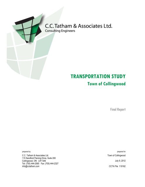
TRANSPORTATION STUDY
TRANSPORTATION STUDY - Town of Collingwood
TRANSPORTATION STUDY - Town of Collingwood
- No tags were found...

Create successful ePaper yourself
Turn your PDF publications into a flip-book with our unique Google optimized e-Paper software.
<strong>TRANSPORTATION</strong> <strong>STUDY</strong><br />
Town of Collingwood<br />
Final Report<br />
prepared by:<br />
C.C. Tatham & Associates Ltd.<br />
115 Sandford Fleming Drive, Suite 200<br />
Collingwood, ON L9Y 5A6<br />
Tel: (705) 444-2565 Fax: (705) 444-2327<br />
info@cctatham.com<br />
prepared for<br />
Town of Collingwood<br />
July 9, 2012<br />
CCTA File 110162
Table of Contents<br />
1 Introduction 1<br />
1.1 Purpose 1<br />
1.2 Background Studies 1<br />
1.3 Objectives 2<br />
2 Existing Conditions 3<br />
2.1 Population & Employment 3<br />
2.2 Land Use & Development 3<br />
2.3 Road Network 3<br />
2.4 Traffic Volumes 5<br />
2.5 Existing Traffic Operations 5<br />
3 Future Background Conditions 10<br />
3.1 Population & Employment 10<br />
3.2 Road Network 10<br />
3.3 Background Development 11<br />
3.4 Background Traffic Volumes 13<br />
4 Future Background Operations 17<br />
4.1 2020 Background Traffic Operations 17<br />
4.2 2030 Background Traffic Operations 22<br />
4.3 Roundabout Alternative 30<br />
5 CCP & RCD Development 34
5.1 Development Lands 34<br />
5.2 Trip Generation 35<br />
5.3 Trip Distribution & Assignment 42<br />
6 Transportation Impacts 45<br />
6.1 2020 Total Traffic Operations 45<br />
6.2 2030 Total Traffic Operations 50<br />
6.3 Diversion Scenario 60<br />
6.4 Roundabout Alternative 61<br />
7 Other Major Intersections & Arterials 66<br />
7.1 Road Network 66<br />
7.2 Intersection Operations 67<br />
7.3 Arterials & Collectors 80<br />
8 Implementation 84<br />
8.1 Schedule of Works 84<br />
8.2 Future Study & Review 87
Appendices<br />
Appendix A: 2010 Traffic Counts<br />
Appendix B: 2010 Operations<br />
Appendix C: 2012 Development Activity Map<br />
Appendix D: 2020 Background Operations<br />
Appendix E: 2030 Background Operations<br />
Appendix F: 2020 Total Operations<br />
Appendix G: 2030 Total Operations<br />
Appendix H: Other Major Intersections - Operations<br />
Appendix I: Traffic Signal Warrants<br />
Appendix J: Diversion Scenario Analyses<br />
Appendix K: Roundabout Analyses
List of Tables<br />
Table 1: Town of Collingwood Population & Employment 3<br />
Table 2: Intersection Operations (signalized) - 2010 6<br />
Table 3: Intersection Operations (unsignalized) - 2010 7<br />
Table 4: Road Section Operations - 2010 PM Peak Hour 9<br />
Table 5: Future Background Development 12<br />
Table 6: Trip Generation Estimates by Development 15<br />
Table 7: Trip Generation Estimates by Land Use 16<br />
Table 8: Intersection Operations (signalized) - 2020 Background 18<br />
Table 9: Intersection Operations (unsignalized) - 2020 Background 19<br />
Table 10: Intersection Operations (signalized) - 2020 Background + improvements 19<br />
Table 11: Road Section Operations - 2020 Background PM Peak Hour 21<br />
Table 12: Intersection Operations (signalized) - 2030 Background 23<br />
Table 13: Intersection Operations (unsignalized) - 2030 Background 24<br />
Table 14: Intersection Operations (signalized) - 2030 Background + improvements 25<br />
Table 15: High Street & First Street Operations (with NB + SB exclusive rights) 26<br />
Table 16: Intersection Operations (unsignalized) - 2030 Background + improvements 28<br />
Table 17: Road Section Operations - 2030 Background PM Peak Hour 29<br />
Table 18: Roundabout vs. Signals - Mountain Road & Tenth Line 31<br />
Table 19: Roundabout vs. Conventional - Sixth Street & Tenth Line 32<br />
Table 20: Trip Generation Rates - industrial 37<br />
Table 21: Trip Generation Rates - residential 37<br />
Table 22: Trip Estimates - industrial park (Parcels A, B & C) 37
Table 23: Trip Estimates - single family detached (Parcel D) 38<br />
Table 24: Trip Estimates - Complete Community Plan (new trips) 38<br />
Table 25: Trip Generation Rates - Regional Commercial District 39<br />
Table 26: Trip Estimates - all land uses (gross trips) 40<br />
Table 27: Pass-by Trip Rates 40<br />
Table 28: Pass-by Trips vs. New Trips 41<br />
Table 29: Trip Estimates - Regional Commercial District (new trips) 41<br />
Table 30: CCP and RCD Total New Trip Estimates 42<br />
Table 31: Intersection Operations (signalized) - 2020 Total 46<br />
Table 32: Intersection Operations (unsignalized) - 2020 Total 47<br />
Table 33: Intersection Operations (signalized) - 2020 Total + improvements 47<br />
Table 34: High Street & First Street Operations (with NB + SB exclusive rights) 49<br />
Table 35: Road Section Operations - 2020 Total PM Peak Hour 51<br />
Table 36: Intersection Operations (signalized) - 2030 Total 52<br />
Table 37: Intersection Operations (signalized) - 2030 Total + improvements 54<br />
Table 38: Road Section Operations - 2030 Total PM Peak Hour 58<br />
Table 39: Diversion Scenario Details - 2030 Total Volumes (PM Peak) 60<br />
Table 40: Intersection Operations - Diversion Scenario 62<br />
Table 41: Roundabout vs. Signals - Mountain Road & Tenth Line 63<br />
Table 42: Mountain Road & Tenth Line - 2-lane Roundabout 64<br />
Table 43: Roundabout vs. Signals - Sixth Street & Tenth Line 65<br />
Table 44: Intersection Operations - 2020 Background (other major intersections) 68<br />
Table 45: Intersection Operations - 2030 Background (other major intersections) 69
Table 46: Intersection Operations - 2020 Total (other major intersections) 71<br />
Table 47: Intersection Operations - 2030 Total (other major intersections) 72<br />
Table 48: Intersection Operations - 2030 Total + improvements 74<br />
Table 49: Intersection Operations - Diversion Scenario (other major intersections) 77<br />
Table 50: Road Capacities - Diversion Scenario 78<br />
Table 51: Roundabout - Poplar Sideroad & Raglan Street 78<br />
Table 52: Roundabout vs. Signals - Poplar Sideroad & Sixth Line 79<br />
Table 53: Short Term Recommendations 84<br />
Table 54: Medium Term Recommendations 85<br />
Table 55: Long Term Recommendations 86<br />
List of Figures<br />
Figure 1: Complete Community Plan and Regional Commercial District 89<br />
Figure 2: Existing Land Use Designations 90<br />
Figure 3: Existing Road Network 91<br />
Figure 4: Key Intersections & Traffic Count Locations 92<br />
Figure 5: Key Intersections - Configurations 93<br />
Figure 6: 2010 Summer Traffic Volumes 97<br />
Figure 7: 2010 Level of Service - Existing Conditions 98<br />
Figure 8: Town of Collingwood Development Activity Map 99<br />
Figure 9: 2020 Background Development Traffic Volumes 100<br />
Figure 10: 2030 Background Development Traffic Volumes 101<br />
Figure 11: 2020 Future Background Traffic Volumes 102<br />
Figure 12: 2030 Future Background Traffic Volumes 103
Figure 13: 2020 Level of Service - Background Conditions 104<br />
Figure 14: 2030 Level of Service - Background Conditions 105<br />
Figure 15: CCP and RCD Development Lands 106<br />
Figure 16: Transportation Tomorrow Survey Zones 107<br />
Figure 17: CCP and RCD Development Traffic - 2020 108<br />
Figure 18: CCP and RCD Development Traffic - 2030 109<br />
Figure 19: 2020 Total Traffic Volumes 110<br />
Figure 20: 2030 Total Traffic Volumes 111<br />
Figure 21: 2020 Level of Service - Total Conditions 112<br />
Figure 22: 2030 Level of Service - Total Conditions 113<br />
Figure 23: Diverted Volumes 114<br />
Figure 24: Diversion Scenario - Intersection Volumes 115<br />
Figure 25: Environmental Protection - Natural Heritage 116
1 Introduction<br />
1.1 Purpose<br />
The Town of Collingwood is anticipating unprecedented growth over the next twenty years in the area<br />
defined by the Complete Community Plan (CCP) and Regional Commercial District (RCD), as<br />
illustrated in Figure 1. In response to this, the Town retained C.C. Tatham & Associates to conduct a<br />
transportation study that will identify road improvement needs in the area over the next twenty years.<br />
The purpose of the study is to review the existing road system network and operations, and outline<br />
existing, medium and long-term recommendations including improvements to the road network and<br />
identification of potential new arterial routes to ensure future travel demands can be adequately<br />
accommodated. The Transportation Study will support Official Plan Amendment 10 in providing a<br />
comprehensive approach to traffic management in the area and will identify a road improvement and<br />
implementation plan to direct the development of the area road network over the next 20 years.<br />
While it is acknowledged that several modes of travel are available within the Town (ie. transit, walk,<br />
cycling, etc.), the primary focus is on addressing vehicular travel by road and the infrastructure<br />
necessary to accommodate such. The detailed assessment of needs as they relate to pedestrian and<br />
cyclist networks, and public transit, is not otherwise within the scope of this study.<br />
1.2 Background Studies<br />
The following studies have been reviewed and consulted as background information in the preparation<br />
of the Town of Collingwood Transportation Study:<br />
• Georgian Triangle Area Transportation Paper Phase 2 Report, R.J. Burnside and Associates Ltd.,<br />
January 2008.<br />
• Georgian Triangle Area Transportation Study, Ainley and Associates Ltd. and Dillon Consulting<br />
Ltd., 2001.<br />
• County of Simcoe Transportation Master Plan, Earth Tech Canada Inc., July 2008.<br />
• Town of Blue Mountains Comprehensive Transportation Study, AECOM and C.C. Tatham &<br />
Associates Ltd., October 2009.<br />
• Highway 26 Transportation Study Summer O-D Survey Results, Paradigm Transportation Solutions<br />
Ltd., June 2010.<br />
• The Town of Collingwood Official Plan, January 2009.<br />
• Numerous development traffic impact studies mostly dated from 2000 to 2009.<br />
• Town of Collingwood Development Activity dated March 2009 (showing 68 developments).<br />
Transportation Study<br />
Town of Collingwood<br />
Page 1<br />
July 9, 2012
1.3 Objectives<br />
The objectives of the Transportation Study are as follows:<br />
• provide an assessment of existing conditions with respect to traffic operations;<br />
• considering anticipated growth rates and development growth, identify the future background<br />
conditions for the 10-year and 20-year horizon periods (2020 and 2030);<br />
• identify road improvements required to support future background demands within the Town in a<br />
safe and efficient manner;<br />
• considering anticipated development within the CCP and RCD, coupled with the future background<br />
conditions, identify the future total traffic conditions for the years 2020 and 2030;<br />
• identify road improvements further required to support future total demands within the Town in a<br />
safe and efficient manner; and<br />
• provide a road improvement strategy and implementation plan for the area road network through to<br />
2030.<br />
Transportation Study<br />
Town of Collingwood<br />
Page 2<br />
July 9, 2012
2 Existing Conditions<br />
This chapter presents a summary of existing conditions within the Town of Collingwood, as they relate<br />
to population, land use, and transportation infrastructure and services.<br />
2.1 Population & Employment<br />
Population and employment statistics (employed labour force, which reflects those residents of<br />
Collingwood who are employed) as per the 1996, 2001, 2006 and 2011 Statistics Canada Census are<br />
provided in Table 1. As noted, over the most current census period (2006 to 2011), the population<br />
increased 9.9%, which translates to an annual growth of 1.9%. It is noted that the 2011 employment<br />
figures were not available at the time of printing.<br />
Table 1: Town of Collingwood Population & Employment<br />
Census Year<br />
Population<br />
Employed Labour Force<br />
Persons % increase Persons % increase<br />
2011 19,241 9.9% - -<br />
2006 17,503 9.1% 8,140 8.2%<br />
2001 16,039 2.8% 7,520 14.4%<br />
1996 15,596 - 6,575 -<br />
2.2 Land Use & Development<br />
The existing land use designations within the Town are denoted in Figure 2, as per Schedule A of the<br />
Town of Collingwood Official Plan.<br />
2.3 Road Network<br />
2.3.1 Road Sections<br />
Figure 3 illustrates the Town road system and designations as per Schedule D of the Official Plan.<br />
The Town is served by a road network consisting of Highway 26, Simcoe Road 32 (Sixth Street), and<br />
Simcoe Road 124 (Hurontario Street). Highway 26 is primarily oriented east-west and follows the<br />
shoreline of Georgian Bay along the east and north limits of the Town. Highway 26 is connected<br />
through the Town by Pretty River Parkway, Huron Street, First Street, and Balsam Street links.<br />
Simcoe Road 32 is oriented east-west and forms Sixth Street at the west limits of Town, whereas<br />
Transportation Study<br />
Town of Collingwood<br />
Page 3<br />
July 9, 2012
Simcoe Road 124 is oriented north-south and forms Hurontario Street between First Street and Poplar<br />
Sideroad. Grey Road 34/Osler Bluff Road is also identified on Schedule D of the Official Plan but it is<br />
not otherwise considered by this study. Within Town, the road system is primarily grid based.<br />
Major roads within Town, which are designated as arterial or collector roads, are as follows:<br />
• Arterial Roads<br />
• Cranberry Trail<br />
• First Street<br />
• High Street<br />
• Highway 26<br />
• Collector Roads<br />
• Cameron Street<br />
• Collins Street<br />
• Fourth Street<br />
• Harbour Street<br />
• Oak Street<br />
• Ontario Street<br />
2.3.2 Key Intersections<br />
• Hume Street<br />
• Huron Street<br />
• Hurontario Street<br />
• Mountain Road<br />
• Peel Street<br />
• Pine Street<br />
• Raglan Street<br />
• St. Marie Street<br />
• Sanford Fleming<br />
Drive<br />
• Poplar Sideroad<br />
• Pretty River Parkway<br />
• Sixth Street (west of<br />
High Street)<br />
• Sixth Line<br />
• Sixth Street (between<br />
High Street &<br />
Hurontario Street)<br />
• Tenth Line<br />
• Third Street<br />
Key intersections were identified by the Town in consideration of existing and future traffic volumes<br />
(reflective of future development - both background and that related to the CCP and RCD), intersection<br />
location, configuration and control, and identified operational issues.<br />
The following 16 intersections were identified (signalized intersections are denoted with an ‘S’,<br />
whereas unsignalized intersections are denoted with a ‘U’:<br />
1. Highway 26 & Harbour/Balsam Streets (S)<br />
2. Canadian Tire Access & Balsam Street (S)<br />
3. Old Mountain Road & Balsam Street (S)<br />
4. First Street & High Street (S)<br />
5. High Street & Home Depot Access (S)<br />
6. High Street & Third Street (U)<br />
7. High Street & Sixth Street (S)<br />
11. Tenth Line & Poplar Sideroad (U)<br />
12. Poplar Sideroad & Raglan Street (U)<br />
13. Poplar Sideroad & Sixth Line (U)<br />
14. Hurontario Street & Hume Street (S)<br />
15. Hume Street & Pretty River Parkway (S)<br />
16. First Street & Hurontario Street (S)<br />
8. Mountain Road & Cambridge Street (S)<br />
9. Tenth Line & Mountain Road (U)<br />
10. Tenth Line & Sixth Street (U)<br />
Transportation Study<br />
Town of Collingwood<br />
Page 4<br />
July 9, 2012
The locations of the 16 intersections are illustrated in Figure 4 whereas their configuration and control<br />
measures are illustrated in Figure 5. Of the 16 intersections, 10 have been identified by the Town for<br />
analysis under existing, future background and future total conditions (those being intersections 1<br />
through 10). The remaining six (intersections 11 through 16) will be analyzed separately under future<br />
total conditions only.<br />
2.4 Traffic Volumes<br />
Traffic volumes at the key intersections were determined from intersection traffic counts completed in<br />
July and August 2010 during the AM and PM peak hours. Given the time of year, the observed<br />
volumes are considered reflective of peak summer conditions. Additional details with respect to the<br />
traffic counts undertaken are provided in Appendix A.<br />
The resulting 2010 weekday AM and PM peak hour traffic volumes are illustrated in Figure 6.<br />
2.5 Existing Traffic Operations<br />
2.5.1 Intersection Operations<br />
The assessment of existing conditions provides the baseline from which the future traffic volumes and<br />
operations (both with and without CCP and RCD development) can be assessed. The capacity, and<br />
hence operations, of a road system is effectively dictated by its intersections. As such, the analysis of<br />
existing conditions focused on the operations of the ten key intersections previously noted. The<br />
analysis is based on the 2010 traffic volumes, the existing intersection configurations and control, and<br />
procedures outlined in the 2000 Highway Capacity Manual 1 (using Synchro v.7 software). The results<br />
of the existing intersection operations are illustrated in Figure 7 whereas a summary of the analyses is<br />
provided in Table 2 and Table 3 for signalized and unsignalized intersections, respectively. For<br />
signalized intersections, the results are displayed in the form of average delay (measured in seconds),<br />
level of service (LOS) and volume to capacity (v/c) for each approach and the overall intersection. For<br />
unsignalized intersections, the results are provided for the critical movement, namely the stop<br />
controlled movement. Level of service A corresponds to the best operating condition with minimal<br />
delays whereas level of service F corresponds to poor operations resulting from high intersection<br />
delays. A v/c ratio of less than 1.0 indicates the intersection movement/approach is operating at less<br />
than capacity while v/c of 1.0 indicates capacity has been reached. Level of service definitions and<br />
detailed operations worksheets for existing traffic conditions are included in Appendix B. The signal<br />
timings for each intersection have been optimized. While the assumed signal timings may differ from<br />
the existing signal timing plans, such have been considered to address the best possible operations<br />
under existing conditions.<br />
1 Highway Capacity Manual. Transportation Research Board, Washington DC, 2000.<br />
Transportation Study<br />
Town of Collingwood<br />
Page 5<br />
July 9, 2012
Table 2: Intersection Operations (signalized) - 2010<br />
Intersection and Movement<br />
Control<br />
Weekday<br />
AM Peak Hour<br />
Weekday<br />
PM Peak Hour<br />
delay LOS v/c delay LOS v/c<br />
1<br />
2<br />
3<br />
4<br />
5<br />
7<br />
8<br />
Highway 26 &<br />
Harbour Street<br />
West/Balsam<br />
Street<br />
Canadian Tire<br />
Access & Balsam<br />
Street<br />
Old Mountain Road<br />
& Balsam Street<br />
First Street &<br />
High Street<br />
High Street &<br />
Home Depot<br />
Access<br />
High Street &<br />
Sixth Street<br />
Mountain Road &<br />
Cambridge Street<br />
EB<br />
16 B 0.13 16 B 0.08<br />
WB 18 B 0.48 18 B 0.46<br />
signal<br />
NB 5 A 0.31 5 A 0.41<br />
SB 5 A 0.30 5 A 0.32<br />
overall signal 7 A 0.34 7 A 0.42<br />
EB<br />
21 C 0.37 20 B 0.44<br />
WB 21 C 0.13 19 B 0.15<br />
signal<br />
NB 5 A 0.27 7 A 0.36<br />
SB 8 A 0.41 9 A 0.41<br />
overall signal 8 A 0.42 9 A 0.43<br />
EB<br />
15 B 0.09 15 B 0.12<br />
NB signal 9 A 0.56 9 A 0.50<br />
SB 21 C 0.69 20 C 0.67<br />
overall signal 15 B 0.43 15 B 0.42<br />
EB<br />
30 C 0.59 37 D 0.80<br />
WB 16 B 0.40 16 B 0.59<br />
signal<br />
NB 27 C 0.40 31 C 0.56<br />
SB 27 C 0.57 38 D 0.81<br />
overall signal 24 C 0.51 30 C 0.71<br />
EB<br />
24 C 0.38 23 C 0.30<br />
NB signal 3 A 0.18 4 A 0.23<br />
SB 6 A 0.22 7 A 0.33<br />
overall signal 6 A 0.26 7 A 0.40<br />
EB<br />
15 B 0.30 17 B 0.32<br />
WB 15 B 0.24 7 B 0.42<br />
signal<br />
NB 12 B 0.14 13 B 0.20<br />
SB 11 B 0.16 12 B 0.30<br />
overall signal 13 B 0.21 14 B 0.32<br />
EB<br />
22 C 0.35 23 C 0.45<br />
WB 15 B 0.33 15 B 0.45<br />
signal<br />
NB 12 B 0.11 12 B 0.15<br />
SB 15 B 0.12 19 B 0.21<br />
overall signal 17 B 0.24 18 B 0.33<br />
Transportation Study<br />
Town of Collingwood<br />
Page 6<br />
July 9, 2012
Table 3: Intersection Operations (unsignalized) - 2010<br />
Intersection and Movement<br />
Control<br />
Weekday<br />
AM Peak Hour<br />
Weekday<br />
PM Peak Hour<br />
delay LOS v/c delay LOS v/c<br />
6<br />
9<br />
10<br />
High Street &<br />
Third Street<br />
Tenth Line &<br />
Mountain Road<br />
Tenth Line &<br />
Sixth Street<br />
EB stop 20 C 0.05 17 C 0.03<br />
WB stop 12 B 0.17 13 B 0.22<br />
NB stop 15 C 0.26 23 C 0.38<br />
SB stop 19 C 0.17 32 D 0.38<br />
NB stop 12 B 0.15 13 B 0.18<br />
SB stop 12 B 0.12 14 B 0.20<br />
Based on the summer 2010 traffic volumes and the existing intersection configuration and control, all<br />
of the intersections investigated provide good levels of service when considering the individual<br />
movements and overall intersection operations, (level of service A, B or C) with minimal delays during<br />
both peak hours. As such, no improvements are warranted to address intersection operations.<br />
2.5.2 Road Section Operations<br />
Further to the review of the key intersections, which has confirmed that there are no operational issues<br />
given 2010 conditions, road section operations have also been investigated whereby traffic volumes on<br />
specific road sections have been reviewed in consideration of typical planning capacities.<br />
Ideally, a single lane of traffic can accommodate between 1800 to 2000 vehicles per hour per lane<br />
(vphpl). However, this value must be reduced due to the effects of adjacent signals and intersection<br />
controls, road grade, lane width, vehicle composition (ie. number of trucks), obstructions and access,<br />
and road function. As such, an effective capacity of 1800 to 2000 vphpl is not realistic on the Town<br />
roads; rather the following capacities are generally accepted:<br />
• arterial road - 900 to 1100 vehicles per hour per lane (vphpl);<br />
• major collector road - 800 vphpl;<br />
• minor collector road - 600 vphpl; and<br />
• local road - 500 vphpl.<br />
Based on the 2010 traffic volumes, the road classification as per the Town of Collingwood Official Plan,<br />
and the above noted assumed capacities, an assessment of the existing traffic operations was<br />
undertaken.<br />
Transportation Study<br />
Town of Collingwood<br />
Page 7<br />
July 9, 2012
The Georgian Triangle Area Transportation Paper 2 assumed a planning capacity of 900 vphpl for<br />
urban roads (First Street in Collingwood was a noted exception and an assumed capacity of 800 vphpl<br />
was applied) and 1200 vphpl for rural roads. It is noted that the Official Plan does not designate<br />
between major and minor collectors and thus, for collector roads, a capacity of 700 vphpl has been<br />
assumed. For arterial roads, a capacity of 900 vphpl has been assumed.<br />
It is noted that in most instances (ie. for most directions of travel at the key intersections considered),<br />
the PM peak hour volumes are equal to, or greater than, the AM volume and hence represent the<br />
critical period. The PM peak hour volumes were therefore used as the basis for the assessment. The<br />
resulting volume to capacity ratios are presented in Table 4 for the PM peak hour operations. The<br />
capacity column reflects the capacity per lane and the number of lanes per direction.<br />
Should the volume exceed 90% of the road capacity (ie. v/c ≥ 0.90), congestion is likely to occur,<br />
whereas a capacity deficiency occurs when the volume exceeds capacity (ie. v/c ≥ 1.0). Based on the<br />
assessment of the existing (2010) traffic volumes, most of the current road system is operating at less<br />
than 66% of the assumed road capacity (ie. the volume ÷ capacity is ≤ 0.66). In this regard, the<br />
available capacity, and hence the number of lanes, are considered appropriate from a traffic<br />
operations perspective. The exception is Highway 26 east of Pretty River Parkway, which is currently<br />
operating near capacity. It is noted in Section 3.2 that this section of Highway 26 will be widened to 5<br />
lanes in 2013, thus alleviating the capacity concerns. No additional lanes to increase road capacity<br />
(other than the noted planned widening of Highway 26 east of Pretty River Parkway) are therefore<br />
required to support the existing conditions.<br />
2.5.3 Operations Summary<br />
There are no operational concerns evident under the existing conditions. Given the 2010 traffic<br />
volumes, the intersections considered offer good levels of service with reasonable delays during the<br />
peak hours. Likewise, the capacity analyses indicate that the key road sections identified by the Town<br />
currently operate at less than 60% of their capacity during the 2010 PM peak hour conditions. As<br />
such, no road network improvements are required to support the existing conditions.<br />
2 Georgian Triangle Area Transportation Paper, R.J. Burnside & Associates Ltd., March 2007<br />
Transportation Study<br />
Town of Collingwood<br />
Page 8<br />
July 9, 2012
Table 4: Road Section Operations - 2010 PM Peak Hour<br />
Road Section & Lanes per Direction<br />
Mountain Road<br />
Volume to<br />
Capacity 1 Traffic Volumes<br />
Capacity<br />
NB/EB SB/WB NB/EB SB/WB NB/EB SB/WB<br />
W of Tenth Line 1 900 900 410 390 0.46 0.43<br />
E of Tenth Line 1 900 900 480 500 0.53 0.56<br />
First Street Ext. W of High Street 2 1800 1800 605 525 0.34 0.29<br />
S of First Street 2 1800 1800 570 660 0.32 0.37<br />
High Street<br />
S of Third Street 2 1800 1800 445 580 0.25 0.32<br />
S of Sixth Street 2 1800 1800 285 395 0.16 0.22<br />
N of First Street 2 1800 1800 780 960 0.43 0.53<br />
Highway 26<br />
N of Old Mountain Rd 2 1800 1800 745 705 0.41 0.39<br />
N of Commercial<br />
Access<br />
2 1800 1800 770 720 0.43 0.40<br />
First Street 2 1600 1600 1051 866 0.66 0.54<br />
Huron Street 2 1800 1800 802 611 0.45 0.34<br />
Pretty River Parkway 2 1800 1800 499 619 0.28 0.34<br />
E of Pretty River Pkwy 1 900 900 876 663 0.97 0.74<br />
Harbour Street W W of Highway 26 1 700 700 85 55 0.12 0.08<br />
Tenth Line<br />
S of Mountain Road 1 700 700 120 130 0.17 0.19<br />
S of Sixth Street 1 700 700 100 110 0.14 0.16<br />
Hume Street W of Hurontario Street 1 900 900 412 576 0.46 0.64<br />
Hurontario Street S of First Street 1 900 900 501 421 0.56 0.47<br />
E of Tenth Line 1 900 900 126 119 0.14 0.13<br />
Poplar Sideroad<br />
E of High Street 1 900 900 295 162 0.33 0.18<br />
E of Hurontario Street 1 900 900 223 214 0.25 0.24<br />
E of Raglan Street 1 900 900 207 194 0.23 0.22<br />
Sixth Street W of High Street 1 900 900 279 293 0.31 0.33<br />
1 Capacity is denoted as vehicles per hour<br />
Transportation Study<br />
Town of Collingwood<br />
Page 9<br />
July 9, 2012
3 Future Background Conditions<br />
This chapter will address the future road network, background development and traffic volumes and<br />
operations expected for the years 2020 and 2030. The 10-year (2020) and 20-year (2030) horizon<br />
periods have been selected to consider the medium and long-term development potential within the<br />
Town and the corresponding traffic operations, the analysis of such will identify the road and<br />
intersection improvement needs.<br />
3.1 Population & Employment<br />
The Town of Collingwood Official Plan, in considering permanent and recreational residents, projects<br />
an annual increase in population of 1.5% between 2011 and 2021. According to the Growth Plan for<br />
the Greater Golden Horseshoe 3 , which is intended to guide future development within Simcoe County,<br />
the Town of Collingwood has been allocated an ultimate population (year 2031) of 33,400 persons. In<br />
consideration of the 2011 census population level of 19,243, this translates to an annual increase of<br />
2.8% in population. The employment level is projected to increase from 8,140 (2006 census) to<br />
13,400 in 2031, equating to an annual increase of 2.0%.<br />
3.2 Road Network<br />
The intersection of Highway 26 with Harbour Street West/Balsam Street is scheduled for<br />
improvements in 2012. This includes the construction of an exclusive westbound left turn lane on<br />
Balsam Street. The existing configuration of the remaining approaches will be maintained. No other<br />
significant improvements to the immediate study area road network (ie. the roads/intersections directly<br />
adjacent to the CCP and RCD) are expected to occur throughout the horizon years, beyond routine<br />
maintenance and new road works resulting from new development.<br />
There are improvements scheduled for the wider road network within the horizon period. The<br />
improvements are noted here in brief with detailed discussion included in Chapter 7. The wider<br />
network improvements include:<br />
• Hume Street widening from Hurontario Street to Pretty River Parkway;<br />
• Highway 26 widening to 5 lanes (east of Pretty River Parkway);<br />
• Hume Street/Highway 26 and Pretty River Parkway intersection improvements;<br />
• signalization of Hume Street with Minnesota Street, St. Marie Street and Raglan Street;<br />
• signalization of Cranberry Trail with Highway 26;<br />
3 Growth Plan for the Greater Golden Horseshoe, 2006. Office consolidated, January 2012. Ministry of Infrastructure.<br />
Transportation Study<br />
Town of Collingwood<br />
Page 10<br />
July 9, 2012
• left turn lanes on all approaches at the Hurontario Street intersection with Collins/Cameron Street;<br />
• Highway 26 West repaving and provision of a centre turn lane from Harbour Street to west of<br />
Princeton Shores Boulevard; and<br />
• High Street widening to 4 lanes from 10 th Street to Poplar Sideroad.<br />
3.3 Background Development<br />
Further to the overall increase in the Town’s population level, consideration has been given to the<br />
specific planned developments (commercial, industrial, residential and institutional) not otherwise<br />
included in the CCP and RCD areas, a summary of which was provided by the Town and is illustrated<br />
in Figure 8 and summarized in Table 5 (as of September 2010). Through discussions with Town staff<br />
it was determined that only those sites which are likely to be developed within the 2020 and 2030<br />
horizon years be considered. These include approved developments, draft approved developments<br />
and applications for development. Lands identified as development potential, for which no<br />
development plans have been identified, were not otherwise considered. Recently completed<br />
developments were not considered given that the associated trips are considered captured by the<br />
2010 traffic counts (developments 51 - St. Paul Street, 54 - Georgian Meadows Phase 4, 56 - Raglan<br />
Village Seniors, 57 - Blue Shores, and 58 - Georgian Meadows Phase 3).<br />
Although confirmed development timelines have not been established for every development,<br />
completion percentages were estimated for 2020 and 2030 for each based on the most current<br />
information available including the status of the development application and overall size. This<br />
approach is believed to provide a more accurate reflection of development phasing over the study<br />
period than would a generalized approach applied to all developments (ie. 50% complete in 2020,<br />
100% complete in 2030).<br />
Additional developments not otherwise noted on the Town’s 2010 development activity map have also<br />
been considered. These include the Anchorage residential development and the Leon’s commercial<br />
development, both of which are considered to be 100% complete within the 10-year horizon period<br />
(2020). It is noted that the Leon’s development is not located within the Town’s boundary but has<br />
nonetheless been considered given its close proximity to the Town.<br />
An updated development activity map (dated May 2012) is provided in Appendix C. Given the time at<br />
which this study was initiated and the period in which the traffic data was collected (summer 2010), the<br />
2010 development map (as provided in Figure 8) has been maintained as the basis of determining the<br />
background conditions for 2020 and 2030. In some cases, developments have since reached some<br />
level of completion and thus are no longer illustrated on the current activity map. In other instances,<br />
development plans may have changed. For those developments that are no longer being considered,<br />
it is expected that others will take their place. To ensure a consistent study approach, and to reflect<br />
the 2010 baseline traffic data, the development plan as of September 2010 has been maintained.<br />
Transportation Study<br />
Town of Collingwood<br />
Page 11<br />
July 9, 2012
Table 5: Future Background Development<br />
Activity Map ID & Development Name<br />
Phase Completion<br />
2020 2030<br />
Commercial<br />
16 Home Hardware 100% 100%<br />
17 Cranberry Village Market 100% 100%<br />
22 Collingwood Mews 100% 100%<br />
23 The Harbouredge 100% 100%<br />
Industrial<br />
27 Eden Oak Industrial Business Park 50% 100%<br />
30 Walker Auto Dealership (Hyundai) 100% 100%<br />
Residential - application received<br />
Units<br />
33 Trails of Collingwood (Helen Court Homes) 255 50% 100%<br />
34 Eden Oak (McNabb) 342 25% 100%<br />
35 The Victoria Annex 19 100% 100%<br />
36 Admiral Collingwood Place 140 100% 100%<br />
37 Georgian Traditions 36 100% 100%<br />
38 Cranberry Marsh Estates 32 50% 100%<br />
39 Waterstone Developments 55 50% 100%<br />
40 Tanglewood (Cranberry Block 10B) 25 50% 100%<br />
41 Black Ash Adult Lifestyles 424 100% 100%<br />
Residential - draft approved<br />
42 Cranberry (Future Blocks) 750 50% 100%<br />
44 Todco Development 189 0% 100%<br />
45 Consulate Developments 360 50% 100%<br />
46 Georgian Meadows (Future Development) 84 100% 100%<br />
48 Mair Mills Village 204 50% 100%<br />
49 Lotco II (Tepco) 200 50% 100%<br />
Residential - registered<br />
50 Pretty River Estates 210 75% 100%<br />
52, 61 & 62 Mair Mills Estates - Phase 1, 2, & 3 149 100% 100%<br />
53 Georgian Green 174 100% 100%<br />
55 Riverside Subdivision 480 75% 100%<br />
59 Regency Heights Homes 32 50% 100%<br />
60 Wyldewood Trailside Condos 136 100% 100%<br />
63 Tanglewood (Cranberry Block 10A) 122 50% 100%<br />
64 Eden Oak - Lakeside Pointe 72 100% 100%<br />
65 Creekside / Black Ash Meadows 264 100% 100%<br />
66 The Shipyards 697 50% 100%<br />
67 Georgian Meadows Phase 5 46 100% 100%<br />
Institutional<br />
68 Georgian College 100% 100%<br />
Transportation Study<br />
Town of Collingwood<br />
Page 12<br />
July 9, 2012
3.4 Background Traffic Volumes<br />
Future background traffic volumes expected for the 2020 and 2030 horizon years have been estimated<br />
based on the existing traffic volumes, historic traffic volumes in the overall area and population<br />
projections for the Town, in addition to consideration for additional traffic volumes/growth from the<br />
specific developments identified in Section 3.3.<br />
3.4.1 Overall Growth<br />
Historic traffic data recorded by the MTO for Highway 26 within the area was analyzed to inform the<br />
calculation of the growth rate to be applied to the Town of Collingwood road network.<br />
Based on average annual daily traffic (AADT) volumes for Highway 26 east of the Town, an increase<br />
of approximately 2.3% per annum has been observed over the period 2000 to 2008, whereas west of<br />
the Town an annual increase of 0.9% has been observed over the same period. The summer annual<br />
daily traffic (SADT) volumes observed for the same sections of Highway 26 over the same time period<br />
experienced slightly lower annual increases of 2.0% and 0.4% respectively.<br />
As per historic census data for the Town over the period 2006 to 2011 (refer to Section 2.1), the<br />
Town’s population grew annually by 1.9% per year, while over the period 1996 to 2011, a modest<br />
growth of 1.4% per year occurred. Future population growth (refer to Section 3.1), is projected to grow<br />
at a rate of 2.8% per year. In considering the residential developments identified on the Town of<br />
Collingwood Development Activity Map, there are 6,146 dwelling units planned for the Town (a portion<br />
of which have already been constructed). Assuming 2.3 persons per unit, the population is expected<br />
to increase by approximately 14,135 residents (6146 additional units × 2.3 persons per unit) upon full<br />
build-out and occupancy. In considering the 2011 census population of 19,241 this suggests a future<br />
Town population of approximately 33,400. This is consistent with the future 2031 population projection<br />
of 33,400 persons for the Town as per the recently released Growth Plan for the Greater Golden<br />
Horseshoe. This translates to an annual increase in population of 2.5% from 2001 to 2031.<br />
The population and traffic growth figures suggest that an annual growth rate in the order of 2.5% would<br />
be appropriate. However, the growth attributed to the future developments identified on the<br />
development map will be considered as part of the future background development or, if already built<br />
out, as part of the 2010 traffic counts (see Sections 3.3 and 3.4.2). As such, it is considered<br />
reasonable to assume that the projected increase in traffic attributed to population growth has been<br />
accounted for through the consideration of the identified future background development and, to a<br />
lesser extent, the 2010 traffic counts. Therefore the applied background growth rate does not need to<br />
further consider future population growth (which would otherwise result in a double counting).<br />
Although local traffic growth has been considered with the future background development, non-local<br />
traffic (or through traffic) has not. The Highway 26 Transportation Study - Summer Origin-Destination<br />
Transportation Study<br />
Town of Collingwood<br />
Page 13<br />
July 9, 2012
Survey Results 4 indicates that approximately 25% of traffic travelling on Highway 26 within the<br />
Collingwood area is considered to be through traffic. The results are from passenger vehicle surveys<br />
conducted on Highway 26 in Collingwood between Cook Street and King Street (identified as Station 2<br />
in the study) and between White Street and Trott Boulevard (Station 11). It is acknowledged that<br />
through traffic will not be limited to Highway 26 but will be present on a number of streets in the study<br />
area. It has been assumed that through traffic will grow at 2% per annum. Given the difficulty in<br />
identifying the 25% of trips on the network considered as through traffic and applying the 2% annual<br />
growth rate to only these trips, an annual growth rate of 0.5% has been applied to the entire network.<br />
This assumes 2% annual growth for the through traffic, or 25% of the volume (2% x 25% = 0.5%).<br />
3.4.2 Background Development Growth<br />
The number of vehicle trips to be generated by the identified background developments has, for the<br />
most part, been gathered from the individual Traffic Impact Studies (TIS) conducted for each<br />
development (as provided by the Town). For those developments where a TIS was not available, the<br />
number of vehicle trips to be generated has been determined based on the type of development (land<br />
use), development size and the appropriate trip generation rates as per the ITE Trip Generation<br />
Manual 8 th Edition. Table 6 provides a summary of the total trips by development, whereas Table 7<br />
provides a summary of total trips by land use (ie. commercial, industrial, etc.).<br />
Overall, the planned identified development for the Town of Collingwood is expected to result in an<br />
additional 4548 trips during the AM peak hour and 6570 trips during the PM peak hour on the area<br />
road system by the year 2030 (assuming full build-out of the noted developments). It is noted that the<br />
2010 traffic counts have captured traffic generated by partially completed developments that would<br />
otherwise be included as part of the future background development, thus potentially inflating the traffic<br />
estimates. As such, the trip estimates have been adjusted accordingly (ie. development ‘A’ was 25%<br />
complete at the time of the 2010 counts, therefore the total built-out trip estimates for development ‘A’<br />
were reduced 25%). The trip estimates provided in Table 6 and Table 7 reflect the adjusted volumes.<br />
The distribution of the background development trips has been developed based on the respective<br />
traffic studies. For developments where a traffic study was not available, distribution assumptions<br />
reflecting similar developments and observed travel patterns have been applied. The trip assignment<br />
to the road system was also based on traffic impact studs results where available. However,<br />
recognizing that the specific traffic studies typically have limited study areas, consideration was also<br />
given to the distribution of vehicles entering and exiting the key intersections as observed during the<br />
2010 traffic counts. It is neither feasible nor necessary to consider the assignment of traffic to each<br />
possible local road or travel route given the significant number of roads within the Town and possible<br />
travel routes between origins and destinations. Rather, the assignments were focused on the key area<br />
roads and recognized existing travel patterns and demands as appropriate.<br />
4 Highway 26 Transportation Study – Summer Origin-Destination Survey Results. Paradigm Transportation Solutions Ltd.,<br />
June 2010.<br />
Transportation Study<br />
Town of Collingwood<br />
Page 14<br />
July 9, 2012
Table 6: Trip Generation Estimates by Development<br />
Activity Map ID & Development Name Source<br />
AM Peak Hour PM Peak Hour<br />
in out total in out total<br />
16 Home Hardware TIS 78 72 150 87 72 159<br />
17 Cranberry Village Market ITE 11 9 20 34 43 77<br />
22 Collingwood Mews TIS 59 73 132 88 77 165<br />
23 The Harbouredge ITE 51 7 58 9 46 56<br />
27 Eden Oak Industrial Business Park TIS 857 179 1036 224 805 1028<br />
30 Walker Auto Dealership (Hyundai) TIS 110 58 168 152 194 346<br />
33 Trails of Collingwood TIS 11 36 47 40 24 64<br />
34 Eden Oak (McNabb) TIS 66 195 261 210 120 330<br />
35 The Victoria Annex ITE 3 9 12 9 6 15<br />
36 Admiral Collingwood Place TIS 30 48 77 98 90 188<br />
37 Georgian Traditions TIS 1 0 2 1 3 4<br />
38 Cranberry Marsh Estates TIS 5 14 19 15 9 24<br />
39 Waterstone Developments ITE 9 28 37 25 18 43<br />
40 Tanglewood (Cranberry Block 10B) TIS 64 34 99 145 25 170<br />
41 Black Ash Adult Lifestyles TIS 160 175 335 185 210 395<br />
42 Cranberry (Future Blocks) TIS included with development 40<br />
44 Todco Development TIS 58 118 176 133 118 251<br />
45 Consulate Developments ITE 62 185 247 176 121 297<br />
46 Georgian Meadows TIS 23 65 88 79 48 127<br />
48 Mair Mills Village TIS 38 115 153 130 76 206<br />
49 Lotco II (Tepco) TIS 71 210 281 243 134 377<br />
50 Pretty River Estates ITE 39 118 158 134 78 212<br />
52, 61 & 62 Mair Mills Estates - Phase 1, 2, & 3 TIS 7 21 27 23 13 36<br />
53 Georgian Green TIS 8 37 45 28 17 45<br />
55 Riverside Subdivision TIS 45 184 229 186 100 287<br />
59 Regency Heights Homes TIS 5 19 24 19 10 29<br />
60 Wyldewood Trailside Condos ITE 23 68 91 62 45 106<br />
63 Tanglewood (Cranberry Block 10A) TIS included with development 40<br />
64 Eden Oak - Lakeside Pointe TIS 7 22 29 24 14 39<br />
65 Creekside / Black Ash Meadows TIS 10 34 44 38 21 59<br />
66 The Shipyards TIS/ITE 232 147 379 471 334 805<br />
67 Georgian Meadows Phase 5 TIS included with development 46<br />
68 Georgian College TIS 37 52 89 29 53 82<br />
99 1 Anchorage TIS 4 12 16 13 8 21<br />
99 1 Ontario Gates ITE 4 12 16 11 8 19<br />
99 1 Leons ITE 2 1 3 4 4 8<br />
Total Trips 2191 2357 4548 3626 2944 6570<br />
1 Not identified on the Town of Collingwood Development Activity Map.<br />
Transportation Study<br />
Town of Collingwood<br />
Page 15<br />
July 9, 2012
Table 7: Trip Generation Estimates by Land Use<br />
Land Use<br />
AM Peak Hour<br />
PM Peak Hour<br />
in out total in out total<br />
commercial 201 162 363 222 242 464<br />
industrial 967 237 1204 376 999 1374<br />
residential 1 986 1906 2892 2999 1650 4649<br />
institutional 37 52 89 29 53 82<br />
Total 2191 2357 4548 3626 2944 6570<br />
1 It is noted that some of the residential developments include a commercial aspect that has not been segregated from the<br />
trip estimates.<br />
The local roads, although not specifically addressed, have been considered in terms of volume drops<br />
between key intersections along specific key area roads. This recognizes the existence of the local<br />
road network and the fact that not all development traffic will stay on the main roads, that is to say that<br />
traffic will utilize the local road system as necessary depending on trip origins, trip destinations and<br />
network conditions. The volume drops were applied as a percentage to arterial road sections where<br />
there exists a relatively high level of development and local road access.<br />
The resulting additional traffic volumes assigned to the road network associated with the future<br />
background development within the Town of Collingwood are illustrated in Figure 9 for the 10 year<br />
horizon (2020) and in Figure 10 for the 20 year horizon (2030), based on the phase completion<br />
presented in Table 5.<br />
3.4.3 Future Background Traffic Volumes<br />
The resulting 2020 and 2030 future background traffic volumes, which consider the assumed growth<br />
rate and future background development traffic, are illustrated in Figure 11 and Figure 12 respectively<br />
for the AM and PM peak hour periods. It is noted that the future background traffic volumes represent<br />
an annual increase of in the order of 3 to 4% (depending on location) over the 20-year horizon period<br />
(2010 to 2030). This is considered conservative in that the annual growth rate exceeds the previously<br />
discussed growth rates (see Section 3.4.1) for population, employment and historical traffic trends.<br />
Transportation Study<br />
Town of Collingwood<br />
Page 16<br />
July 9, 2012
4 Future Background Operations<br />
This chapter presents the results of the analysis of the road network under the background conditions<br />
for the 2020 and 2030 horizon years. The recommended improvements are also presented and<br />
discussed.<br />
4.1 2020 Background Traffic Operations<br />
4.1.1 Intersection Operations<br />
The peak hour operations of the area key intersections were further investigated, based on the<br />
projected turning movement volumes and the existing intersection configurations and controls. Simple<br />
signal timings with optimized phasing were maintained to yield the optimal operations (ie. the best<br />
operations for the overall intersection, considering all movement volumes and delays). Separate<br />
timings were used for the AM and PM future background scenarios as the changes in the traffic<br />
patterns between the AM and PM peak period are significant.<br />
The results of the intersection operations are illustrated in Figure 13 and presented in Table 8 and<br />
Table 9 for the 2020 horizon. The corresponding assessment worksheets are included in Appendix D.<br />
Under the 2020 horizon, all of the signalized intersections will continue to provide overall acceptable<br />
levels of service with only the west approach at First Street and High Street experiencing poor<br />
conditions (LOS F).<br />
The unsignalized intersection of Tenth Line with Sixth Street will provide adequate levels of service<br />
through the 2020 horizon year under background conditions, whereas the intersections of High Street<br />
with Third Street and Tenth Line with Mountain Road will experience poor levels of service (LOS F)<br />
with long delays for the stop controlled movements on the minor streets.<br />
4.1.2 Recommended Intersection Improvements<br />
The following intersection improvements are recommended to address the operational issues<br />
associated with the 2020 background traffic volumes. The intersections were re-analysed given the<br />
recommended improvements, the results of which are discussed below and summarized in Table 10,<br />
whereas detailed worksheets are provided in Appendix D.<br />
First Street & High Street<br />
The intersection of First Street and High Street experiences significant volumes, much of which may<br />
be attributed to the through traffic on Highway 26. The volumes and travel patterns through the<br />
intersection have necessitated the implementation of customized signal timing plans. Under the 2020<br />
AM and PM peak hours, the intersection offers levels of service D and E, respectively.<br />
Transportation Study<br />
Town of Collingwood<br />
Page 17<br />
July 9, 2012
Table 8: Intersection Operations (signalized) - 2020 Background<br />
1<br />
2<br />
3<br />
4<br />
5<br />
7<br />
8<br />
Weekday<br />
AM Peak Hour<br />
Weekday<br />
PM Peak Hour<br />
Intersection and Movement Control<br />
delay LOS v/c delay LOS v/c<br />
EB<br />
28 C 0.71 41 D 0.77<br />
Highway 26 & WB 22 C 0.57 49 D 0.80<br />
Harbour Street<br />
signal<br />
NB 13 B 0.75 35 D 0.99<br />
West/Balsam<br />
Street<br />
SB 8 A 0.52 9 A 0.50<br />
overall signal 14 B 0.74 28 C 0.94<br />
EB<br />
23 C 0.51 26 C 0.67<br />
Canadian Tire WB 22 C 0.17 21 C 0.20<br />
signal<br />
Access & Balsam NB 7 A 0.44 10 A 0.63<br />
Street<br />
SB 14 B 0.73 14 B 0.72<br />
overall signal 12 B 0.64 13 B 0.67<br />
EB<br />
17 B 0.18 18 B 0.26<br />
Old Mountain Road NB signal 15 B 0.87 15 B 0.85<br />
& Balsam Street SB 34 C 0.95 36 D 0.96<br />
overall signal 24 C 0.59 24 C 0.70<br />
EB<br />
35 C 0.75 91 F 1.07<br />
WB 17 B 0.62 37 D 1.08<br />
First Street &<br />
signal<br />
NB 34 C 0.71 66 E 0.97<br />
High Street<br />
SB 69 E 1.03 74 E 1.03<br />
overall signal 40 D 0.75 64 E 1.00<br />
EB<br />
24 C 0.38 25 C 0.33<br />
High Street & NB signal 4 A 0.27 4 A 0.35<br />
Home Depot<br />
Access<br />
SB 7 A 0.34 8 A 0.47<br />
overall signal 6 A 0.38 7 A 0.47<br />
EB<br />
20 B 0.54 23 C 0.68<br />
WB 19 B 0.51 22 C 0.68<br />
High Street &<br />
signal<br />
NB 13 B 0.25 17 B 0.39<br />
Sixth Street<br />
SB 12 B 0.29 18 B 0.56<br />
overall signal 16 B 0.38 20 B 0.58<br />
EB<br />
25 C 0.50 27 C 0.65<br />
WB 16 B 0.45 18 B 0.64<br />
Mountain Road &<br />
signal<br />
NB 12 B 0.15 12 B 0.21<br />
Cambridge Street<br />
SB 17 B 0.21 20 C 0.36<br />
overall signal 19 B 0.35 20 C 0.49<br />
Transportation Study<br />
Town of Collingwood<br />
Page 18<br />
July 9, 2012
Table 9: Intersection Operations (unsignalized) - 2020 Background<br />
Intersection and Movement<br />
Control<br />
Weekday<br />
AM Peak Hour<br />
Weekday<br />
PM Peak Hour<br />
delay LOS v/c delay LOS v/c<br />
6<br />
9<br />
10<br />
High Street &<br />
Third Street<br />
Tenth Line &<br />
Mountain Road<br />
Tenth Line &<br />
Sixth Street<br />
EB stop 35 E 0.15 54 F 0.22<br />
WB stop 19 C 0.40 40 E 0.70<br />
NB stop 42 E 0.73 340 F 1.56<br />
SB stop 53 F 0.57 400 F 1.58<br />
NB stop 17 C 0.36 26 D 0.53<br />
SB stop 19 C 0.36 40 E 0.66<br />
Table 10: Intersection Operations (signalized) - 2020 Background + improvements<br />
Intersection and Movement<br />
EB<br />
Control<br />
Weekday<br />
AM Peak Hour<br />
Weekday<br />
PM Peak Hour<br />
delay LOS v/c delay LOS v/c<br />
33 C 0.69 60 E 0.98<br />
4<br />
First Street &<br />
High Street<br />
WB 17 B 0.57 28 C 0.95<br />
signal<br />
NB 34 C 0.71 66 E 1.01<br />
SB 55 D 0.97 64 E 1.02<br />
overall signal 35 D 0.78 53 D 0.99<br />
EB<br />
8 A 0.48 8 A 0.54<br />
9<br />
Tenth Line &<br />
Mountain Road<br />
WB 9 A 0.54 15 B 0.78<br />
signal<br />
NB 17 B 0.40 22 C 0.48<br />
SB 16 B 0.28 22 C 0.45<br />
overall signal 11 B 0.50 14 B 0.71<br />
However, despite the overall levels of service, many of the movements operate at or above capacity<br />
(v/c ≥1.0). The eastbound movement experiences a level of service F during the PM peak with delays<br />
of 91 seconds. In consideration of these, the following improvements are recommended:<br />
• provision of an exclusive eastbound right turn lane, thus creating two exclusive eastbound through<br />
lanes (existing shared through/right converts to exclusive through).<br />
Transportation Study<br />
Town of Collingwood<br />
Page 19<br />
July 9, 2012
With the above improvements, the intersection will provide acceptable operations as noted in Table 10.<br />
The slight capacity overages experienced by the northbound and southbound movements are<br />
considered acceptable given the intersection volumes and overall acceptable levels of service.<br />
High Street & Third Street<br />
At the intersection of High Street and Third Street, level of service F results under background (2020)<br />
conditions for the eastbound movement which operates under stop control, with delays of 54 seconds<br />
during the PM peak hour. This is largely due to the significant volume of northbound and southbound<br />
traffic on High Street. However, the peak hour volumes are not such that would otherwise warrant<br />
traffic signals. Third Street west of High Street is not a through street and currently serves limited<br />
development as is indicated by the low volumes of the eastbound movement (20 vehicles during the<br />
PM peak hour or 1 vehicle every 3 minutes). Given these low volumes, the operating conditions<br />
experienced by the eastbound movement during the PM peak hour under are considered acceptable.<br />
Therefore no improvements are recommended to accommodate the 2020 background conditions.<br />
Mountain Road & Tenth Line<br />
The intersection of Mountain Road and Tenth Line will experience level of service F for the northbound<br />
and southbound movements which operate under stop control, with corresponding delays exceeding<br />
300 seconds during the PM peak hour. As noted by the Town, this intersection has been<br />
recommended for signalization in 2012. As such, signal implementation has been assumed for the<br />
2020 horizon year. The current lane configurations (single shared left/through/right for each approach)<br />
have been maintained for the analysis.<br />
With signalization and the existing lane configuration, the intersection will operate with acceptable<br />
levels of service as indicated in Table 10.<br />
4.1.3 Road Section Operations<br />
The road sections identified in Section 2.5.2 have been analyzed again under 2020 background<br />
conditions, with respect to capacity. The previously defined capacities by road classification have<br />
been maintained. The PM peak hour is considered the critical period and therefore PM volumes have<br />
been used as the basis for the assessment. The resulting volume to capacity ratios are presented in<br />
Table 11 for the PM peak hour operations.<br />
Based on the assessment of the 2020 background traffic volumes, all but 2 roads in the considered<br />
network (First Street and Hume Street) will operate at 90% or less of the assumed road capacity (ie.<br />
the volume ÷ capacity is ≤ 0.90). In this regard, the available capacity, and hence the number of lanes<br />
on these roads are considered appropriate from a traffic operations perspective.<br />
Transportation Study<br />
Town of Collingwood<br />
Page 20<br />
July 9, 2012
Table 11: Road Section Operations - 2020 Background PM Peak Hour<br />
Road Section & Lanes per Direction<br />
Mountain Road<br />
Volume to<br />
Capacity 1 Traffic Volumes<br />
Capacity<br />
NB/EB SB/WB NB/EB SB/WB NB/EB SB/WB<br />
W of Tenth Line 1 900 900 570 540 0.63 0.60<br />
E of Tenth Line 1 900 900 670 700 0.74 0.78<br />
First Street Ext. W of High Street 2 1800 1800 830 770 0.46 0.43<br />
S of First Street 2 1800 1800 895 1005 0.50 0.56<br />
High Street<br />
S of Third Street 2 1800 1800 725 900 0.40 0.50<br />
S of Sixth Street 2 1800 1800 480 660 0.27 0.37<br />
N of First Street 2 1800 1800 1365 1535 0.76 0.85<br />
Highway 26<br />
N of Old Mountain Rd 2 1800 1800 1310 1225 0.73 0.68<br />
N of Commercial<br />
Access<br />
2 1800 1800 1380 1240 0.77 0.69<br />
First Street 2 1600 1600 1550 1420 0.97 0.89<br />
Huron Street 2 1800 1800 1180 1010 0.66 0.56<br />
Pretty River Parkway 2 1800 1800 860 980 0.48 0.54<br />
E of Pretty River Pkwy 2 1800 1800 1350 1125 0.75 0.63<br />
Harbour Street W W of Highway 26 1 700 700 350 295 0.50 0.42<br />
Tenth Line<br />
S of Mountain Road 1 700 700 210 245 0.30 0.35<br />
S of Sixth Street 1 700 700 180 185 0.26 0.26<br />
Hume Street W of Hurontario Street 1 900 900 695 970 0.77 1.08<br />
Hurontario Street S of First Street 1 900 900 800 615 0.89 0.68<br />
E of Tenth Line 1 900 900 215 200 0.24 0.22<br />
Poplar Sideroad<br />
E of High Street 1 900 900 530 360 0.59 0.40<br />
E of Hurontario Street 1 900 900 440 400 0.49 0.44<br />
E of Raglan Street 1 900 900 500 360 0.56 0.40<br />
Sixth Street W of High Street 1 900 900 450 460 0.50 0.51<br />
1 Capacity is denoted as vehicles per hour per lane<br />
On First Street, the volumes in the eastbound direction will approach the road capacity (recall a<br />
reduced capacity of 800 vphpl has been assumed for First Street given the number of signals and<br />
driveways). However, through the recent provision of the centre turn lane along First Street, the<br />
Transportation Study<br />
Town of Collingwood<br />
Page 21<br />
July 9, 2012
capacity will be increased in that left turns (both those to and from First Street) can utilize the centre<br />
turn lane, thereby reducing the impacts to through traffic (a shared left-through lane has about 40 to<br />
60% of the capacity of a standard through lane) 5 . Research suggests a 25% increase in capacity, on<br />
average, for roadways that added a left-turn lane or centre turn lane 6 . In this respect, a capacity of<br />
1800 vph per direction on First Street is considered reasonable. With this consideration, the<br />
operations are also acceptable as the volumes are less than 1800.<br />
On Hume Street, the projected volumes are anticipated to exceed the 900 vphpl capacity under 2020<br />
background conditions. As previously indicated in Section 3.2, Hume Street is scheduled for a number<br />
of improvements including the provision of a continuous centre turn lane between Hurontario Street<br />
and Pretty River Parkway. In this respect an increase in capacity is anticipated which will<br />
accommodate the noted volumes. It is further noted that the capacity of a road is dictated by its<br />
intersections, which are considered the pinch points of a road section. Signalization is planned for the<br />
intersections of Hume Street with Raglan Street, Minnesota Street and St. Marie Street in addition to<br />
the existing signals at Hurontario Street, Peel Street and Pretty River Parkway. These future<br />
signalized intersections are expected to provide improved operating conditions. As such, it can be<br />
assumed that although the link volumes on Hume Street under 2020 background conditions will<br />
exceed the theoretical planning capacity, the operations of the road will not be such that additional<br />
lanes are required given the provision of the centre turn lane and the acceptable operations of its<br />
signalized intersections.<br />
4.2 2030 Background Traffic Operations<br />
4.2.1 Intersection Operations<br />
The operations of the study area key intersections were again analyzed given the expected increases<br />
in traffic volumes for the 2030 horizon year. The recommended intersection improvements for the<br />
2020 horizon year have been maintained in the analysis. Simple signal timings with optimized phasing<br />
were maintained to yield the optimal operations with separate timings for the AM and PM peak periods<br />
(reflective of the changes in the traffic patterns between the AM and PM).<br />
The results of the intersection operations are illustrated in Figure 14 and presented in Table 12 and<br />
Table 13 for the 2030 horizon; the corresponding assessment worksheets are included in Appendix E.<br />
5 Impacts of Access Management Techniques, NCHRP Report 420. Gluck, J., H. S. Levinson, and V. Stover,<br />
Transportation Research Board, 1999.<br />
6 National Highway Institute Course Number 133078: Access Management, Location, and Design. S/K Transportation<br />
Consultants, Inc., April 2000.<br />
Transportation Study<br />
Town of Collingwood<br />
Page 22<br />
July 9, 2012
Table 12: Intersection Operations (signalized) - 2030 Background<br />
1<br />
2<br />
3<br />
4<br />
5<br />
7<br />
8<br />
9<br />
Intersection and Movement<br />
Highway 26 &<br />
Harbour Street<br />
West/Balsam<br />
Street<br />
Canadian Tire<br />
Access & Balsam<br />
Street<br />
Old Mountain Road<br />
& Balsam Street<br />
First Street &<br />
High Street<br />
High Street &<br />
Home Depot<br />
Access<br />
High Street &<br />
Sixth Street<br />
Mountain Road &<br />
Cambridge Street<br />
Tenth Line &<br />
Mountain Road<br />
Control<br />
Weekday<br />
AM Peak Hour<br />
Weekday<br />
PM Peak Hour<br />
delay LOS v/c delay LOS v/c<br />
EB<br />
33 C 0.77 74 E 0.86<br />
WB 29 C 0.68 154 F 1.21<br />
signal<br />
NB 21 C 0.95 81 F 1.12<br />
SB 10 A 0.60 10 B 0.54<br />
overall signal 18 B 0.86 60 E 1.14<br />
EB<br />
26 C 0.55 27 C 0.67<br />
WB 24 C 0.21 22 C 0.19<br />
signal<br />
NB 8 A 0.48 14 B 0.76<br />
SB 15 B 0.79 18 B 0.81<br />
overall signal 13 B 0.70 17 B 0.67<br />
EB<br />
25 C 0.25 27 C 0.36<br />
NB signal 17 B 0.91 17 B 0.91<br />
SB 30 C 0.92 29 C 0.91<br />
overall signal 24 C 0.70 23 C 0.73<br />
EB<br />
44 C 0.83 100 F 1.09<br />
WB 21 C 0.73 48 D 1.18<br />
signal<br />
NB 50 D 0.90 89 F 1.07<br />
SB 48 D 0.94 93 F 1.08<br />
overall signal 39 D 0.82 79 E 1.09<br />
EB<br />
25 C 0.40 25 C 0.32<br />
NB signal 4 A 0.31 5 A 0.42<br />
SB 8 B 0.42 10 B 0.59<br />
overall signal 7 A 0.44 9 A 0.57<br />
EB<br />
22 C 0.61 30 C 0.89<br />
WB 21 C 0.63 23 C 0.74<br />
signal<br />
NB 15 B 0.33 21 C 0.52<br />
SB 14 B 0.39 24 C 0.73<br />
overall signal 17 B 0.47 24 C 0.78<br />
EB<br />
25 C 0.59 32 C 0.79<br />
WB 17 B 0.53 21 C 0.75<br />
signal<br />
NB 13 B 0.16 14 B 0.26<br />
SB 19 B 0.27 22 C 0.42<br />
overall signal 20 B 0.42 24 C 0.58<br />
EB<br />
9 A 0.52 11 B 0.61<br />
WB 12 B 0.66 39 D 0.97<br />
signal<br />
NB 23 C 0.61 51 D 0.82<br />
SB 22 C 0.55 79 E 0.93<br />
overall signal 14 B 0.65 35 C 0.96<br />
Transportation Study<br />
Town of Collingwood<br />
Page 23<br />
July 9, 2012
Table 13: Intersection Operations (unsignalized) - 2030 Background<br />
Intersection and Movement<br />
Control<br />
Weekday<br />
AM Peak Hour<br />
Weekday<br />
PM Peak Hour<br />
delay LOS v/c delay LOS v/c<br />
6<br />
10<br />
High Street &<br />
Third Street<br />
Tenth Line & Sixth<br />
Street<br />
EB stop 50 F 0.21 117 F 0.41<br />
WB stop 23 C 0.50 108 F 1.01<br />
NB stop 22 C 0.48 55 F 0.81<br />
SB stop 29 D 0.56 190 F 1.23<br />
As indicated, the signalized intersections all offer acceptable overall levels of service under the 2030<br />
background conditions. However, individual approaches at the intersections of Highway 26 with<br />
Harbour Street West/Balsam Street and High Street with First Street experience poor operating<br />
conditions (LOS F).<br />
The unsignalized intersections both experience a level of service F with long delays during the PM<br />
peak hour. The eastbound movement at High Street and Third Street also experiences a level of<br />
service F during the AM peak hour.<br />
4.2.2 Recommended Intersection Improvements<br />
The following intersection improvements are recommended to address the operational issues<br />
associated with the 2030 background traffic volumes. The intersections were analysed given the<br />
recommended improvements with the results provided in Table 14 whereas detailed worksheets are<br />
provided in Appendix E.<br />
Highway 26 & Harbour Street West/Balsam Street<br />
The signalized intersection of Highway 26 with Harbour Street West/Balsam Street experiences overall<br />
levels of service B and E during the 2020 AM and PM peak hours, respectively. The westbound and<br />
northbound movements each experience a level of service F with delays of 154 and 81 seconds<br />
respectively, during the PM peak hour. Given the volume of eastbound right turning vehicles (280<br />
during the PM peak hour), an exclusive eastbound right turn lane is recommended to remove the right<br />
turning traffic from the eastbound through traffic. It is also recommended that the signal timing plans<br />
be revised to include a permitted and protected phase for the northbound left turn movement and a<br />
coinciding permitted and overlap phase for the eastbound right turn.<br />
As indicated in Table 14, the operations will improve to a level of service C and A for the westbound<br />
and northbound movements respectively.<br />
Transportation Study<br />
Town of Collingwood<br />
Page 24<br />
July 9, 2012
Table 14: Intersection Operations (signalized) - 2030 Background + improvements<br />
Intersection and Movement<br />
Control<br />
Weekday<br />
AM Peak Hour<br />
Weekday<br />
PM Peak Hour<br />
delay LOS v/c delay LOS v/c<br />
EB<br />
20 C 0.58 50 D 0.73<br />
1<br />
Highway 26 &<br />
Harbour Street<br />
West/Balsam<br />
Street<br />
WB 23 C 0.54 50 D 0.66<br />
signal<br />
NB 9 A 0.75 30 C 0.99<br />
SB 15 B 0.74 9 A 0.55<br />
overall signal 14 B 0.70 26 C 0.59<br />
EB<br />
32 C 0.75 62 E 1.01<br />
4<br />
First Street &<br />
High Street<br />
WB 24 C 0.69 55 D 1.06<br />
signal<br />
NB 36 D 0.79 73 E 1.04<br />
SB 51 D 0.95 74 E 1.05<br />
overall signal 37 C 0.83 66 E 1.02<br />
EB<br />
17 B 0.08 23 C 0.05<br />
6<br />
High Street &<br />
Third Street<br />
WB 18 B 0.24 25 C 0.42<br />
signal<br />
NB 5 A 0.34 6 A 0.40<br />
SB 7 A 0.55 11 B 0.76<br />
overall signal 8 A 0.49 10 B 0.70<br />
EB<br />
13 B 0.49 14 B 0.61<br />
10<br />
Sixth Street &<br />
Tenth Line<br />
WB 16 B 0.66 19 B 0.77<br />
signal<br />
NB 9 A 0.22 11 B 0.31<br />
SB 9 A 0.26 12 B 0.40<br />
overall signal 12 B 0.43 15 B 0.58<br />
First Street & High Street<br />
Although the intersection of High Street and First Street does not experience an overall level of service<br />
F, a number of the individual movements will experience a level of service F and will operate above<br />
capacity (v/c ≥ 1.0) during the PM peak period. This is to be expected given the high volume of traffic<br />
operating through the intersection. To improve the operations it is recommended that the existing<br />
southbound shared through/left lane be converted into an exclusive left turn lane, thus creating a<br />
Transportation Study<br />
Town of Collingwood<br />
Page 25<br />
July 9, 2012
southbound double left (the volume of southbound left turning traffic, 970 vehicles during the PM peak,<br />
warrants a double left). This improvement requires the creation of a southbound shared through/right<br />
lane in order to maintain two lanes serving the southbound through movement (one shared and one<br />
exclusive). It is further recommended that the signal timing plans be revised to include a permitted and<br />
protected phase for the eastbound left turn movement.<br />
As indicated in Table 14 , the level of service for each approach improves to acceptable levels (LOS E<br />
or better) given the recommended improvements. It is noted however, that the northbound through<br />
and the westbound left movements continue to experience a level of service F and each approach will<br />
continue to operate above capacity. Further improvements to address these issues are recommended<br />
here with the knowledge that there are explicit constraints to further development of the intersection,<br />
such as available right-of-way and the impact on the surrounding road network. Notwithstanding these<br />
restraints, the additional recommendations are provided to illustrate the degree of impact such<br />
improvements would have on the overall operation of the intersection. The additional improvements<br />
include the creation of exclusive northbound and southbound right turn lanes and conversion of the<br />
existing shared through/right lanes to exclusive through lanes. The intersection was reviewed with<br />
consideration of these additional improvements, the results are provided in Table 15.<br />
Table 15: High Street & First Street Operations (with NB + SB exclusive rights)<br />
Intersection and Movement<br />
Control<br />
Weekday<br />
AM Peak Hour<br />
Weekday<br />
PM Peak Hour<br />
delay LOS v/c delay LOS v/c<br />
EB<br />
32 C 0.75 60 E 1.01<br />
4<br />
First Street &<br />
High Street<br />
WB 24 C 0.69 50 D 1.02<br />
signal<br />
NB 30 C 0.62 52 D 0.97<br />
SB 45 D 0.95 63 E 1.02<br />
overall signal 34 C 0.81 56 E 0.98<br />
These additional improvements do not improve the overall level of service for the intersection (which<br />
remains at E) during the PM peak period. However, the northbound through movement will improve to<br />
a level of service E and the overall approach will operate below capacity (v/c < 1.0). The westbound<br />
left turn movement continues to experience a level of service F but the delay drops from 103 seconds<br />
to 90 seconds. It is evident that despite the additional improvements to the intersection, there is only<br />
marginal improvement to the operations with capacity issues persisting. Given the previously noted<br />
restraints to further infrastructure improvements, efforts to improve the intersection operations should<br />
include the identification of alternative routes to divert traffic away from the High Street and First Street<br />
intersection (specifically, the diversion of through traffic on Highway 26). Such diversion will be<br />
discussed in Chapter 6.<br />
Transportation Study<br />
Town of Collingwood<br />
Page 26<br />
July 9, 2012
High Street & Third Street<br />
The intersection of High Street and Third Street will experience level of service F with long delays for<br />
the stop control movements on Third Street. Although the intersection volumes do not warrant<br />
signalization, such is required to ensure acceptable operations of the intersection. It has been<br />
indicated by the Town that the signals at the Home Depot access are temporary and can be moved as<br />
development dictates. The signalization of the Third Street and High Street intersection and the<br />
removal of the lights at the Home Depot access should coincide with the relocating of the access so<br />
that traffic would enter the Home Depot via Third Street (ideally such relocation would be triggered by<br />
further development of the surrounding land). In the absence of such development, the signalization of<br />
Third Street with High Street is still recommended. The impacts on the Home Depot access at High<br />
Street are discussed below.<br />
The intersection was reviewed again considering signalization. As indicated in Table 14 it will provide<br />
excellent overall level of service (LOS A or B) given the 2030 background volumes.<br />
Tenth Line & Sixth Street<br />
Given the 2030 background traffic volumes, the northbound and southbound movements (stop<br />
controlled) will experience a level of service F during the PM peak hour with delays of 55 seconds and<br />
190 seconds, respectively. The southbound movement will operate well above capacity (v/c = 1.23).<br />
The 2030 background volumes meet the MTO warrant requirements for signalization and as such,<br />
signalization has been recommended. In consideration of signalization, the intersection will<br />
experience an excellent overall level of service B for both the AM and PM peak hour.<br />
Alternatively, as per the Town, a roundabout will be considered as a possible option for this<br />
intersection, which is discussed further in Section 4.3.<br />
High Street & Home Depot Access<br />
As previously noted, the removal of the existing signals at the Home Depot access would ideally<br />
coincide with the relocation of the access to Third Street. It is understood that with the development of<br />
the surrounding lands, such relocation will occur. The 2030 background conditions, which do not<br />
consider such development, require the removal of the existing signals to accommodate the future<br />
signalization of the High Street and Third Street intersection to the south. As such, the Home Depot<br />
access can either be converted to stop control (for the minor movement) or relocated to Third Street.<br />
With the removal of the signals and implementation of stop control, the eastbound movement (stop<br />
controlled) experiences a level of service D with a delay of 28 seconds during the AM and PM peak<br />
hours (see Table 16). As such, the implementation of stop control at the intersection is considered<br />
appropriate for the 2030 background conditions. Beyond 2030, and in the absence of development,<br />
the relocation of the Home Depot access to Third Street would likely be required as volumes on High<br />
Street increase.<br />
Transportation Study<br />
Town of Collingwood<br />
Page 27<br />
July 9, 2012
Table 16: Intersection Operations (unsignalized) - 2030 Background + improvements<br />
5<br />
Intersection and Movement<br />
High Street &<br />
Home Depot Access<br />
Control<br />
Weekday<br />
AM Peak Hour<br />
Weekday<br />
PM Peak Hour<br />
delay LOS v/c delay LOS v/c<br />
EB stop 28 D 0.38 28 D 0.44<br />
4.2.3 Road Section Operations<br />
The key road sections have been analyzed under 2030 background conditions for the critical PM peak<br />
hour, with respect to capacity. The resulting volume to capacity ratios are presented in Table 17.<br />
The analysis of the 2030 background traffic volumes reveals that most of the road sections assessed<br />
will operate at 98% or less of the assumed road capacity (ie. the volume ÷ capacity is ≤ 0.98), the<br />
exceptions being First Street, Hume Street and Hurontario Street. Although congestion may occur as<br />
the volume to capacity ratio surpasses 0.90, this only occurs during the PM peak hour. It is also noted<br />
that the intersection operations are considered a key indicator of the capacity of a road network given<br />
that an intersection represents the ‘pinch points’ or ‘bottlenecks’ of the network. When considering the<br />
recommended intersection improvements for the 2030 background conditions, the key intersections<br />
offer adequate levels of service. As such, the available capacity is considered appropriate from a<br />
traffic operations perspective and therefore no additional lanes to increase road capacity are required<br />
to support the 2030 background conditions.<br />
On First Street, the volumes will exceed the noted capacity by approximately 8 to 11% during the PM<br />
peak hour. However, in consideration of the increased through capacity resulting from the provision of<br />
the centre turn lanes, the volumes can be accommodated.<br />
With respect to Hume Street, the discussion provided in Section 4.1.3 holds true. The future planned<br />
improvements are expected to offset the capacity concerns presented by the link volumes. Additional<br />
lanes are therefore not recommended to accommodate 2030 background conditions.<br />
The volumes on Hurontario Street are expected to slightly exceed capacity south of First Street. As<br />
the main street through the downtown core, Hurontario Street is constrained by the surrounding<br />
development, on-street parking and pedestrian infrastructure. As such, the provision of additional<br />
lanes is not feasible or recommended. Rather, as congestion occurs traffic will seek alternate routes if<br />
necessary to avoid the congested areas.<br />
Transportation Study<br />
Town of Collingwood<br />
Page 28<br />
July 9, 2012
Table 17: Road Section Operations - 2030 Background PM Peak Hour<br />
Road Section & Lanes per Direction<br />
Mountain Road<br />
Volume to<br />
Capacity 1 Traffic Volumes<br />
Capacity<br />
NB/EB SB/WB NB/EB SB/WB NB/EB SB/WB<br />
W of Tenth Line 1 900 900 670 630 0.74 0.70<br />
E of Tenth Line 1 900 900 815 835 0.91 0.93<br />
First Street Ext. W of High Street 2 1800 1800 965 920 0.54 0.51<br />
S of First Street 2 1800 1800 1055 1160 0.59 0.64<br />
High Street<br />
S of Third Street 2 1800 1800 860 1040 0.48 0.58<br />
S of Sixth Street 2 1800 1800 570 780 0.32 0.43<br />
N of First Street 2 1800 1800 1635 1740 0.91 0.97<br />
Highway 26<br />
N of Old Mountain Rd 2 1800 1800 1570 1410 0.87 0.78<br />
N of Commercial<br />
Access<br />
2 1800 1800 1640 1415 0.91 0.79<br />
First Street 2 1600 1600 1770 1700 1.11 1.06<br />
Huron Street 2 1800 1800 1365 1210 0.76 0.67<br />
Pretty River Parkway 2 1800 1800 1030 1120 0.57 0.62<br />
E of Pretty River Pkwy 2 1800 1800 1555 1325 0.86 0.74<br />
Harbour Street W W of Highway 26 1 700 700 355 300 0.51 0.43<br />
Tenth Line<br />
S of Mountain Road 1 700 700 270 315 0.39 0.45<br />
S of Sixth Street 1 700 700 215 210 0.31 0.30<br />
Hume Street W of Hurontario Street 1 900 900 825 1190 0.92 1.32<br />
Hurontario Street S of First Street 1 900 900 980 730 1.09 0.81<br />
E of Tenth Line 1 900 900 265 250 0.29 0.28<br />
Poplar Sideroad<br />
E of High Street 1 900 900 660 495 0.73 0.55<br />
E of Hurontario Street 1 900 900 565 535 0.63 0.59<br />
E of Raglan Street 1 900 900 710 470 0.79 0.52<br />
Sixth Street W of High Street 1 900 900 535 535 0.59 0.59<br />
1 Capacity is denoted as vehicles per hour per lane<br />
Transportation Study<br />
Town of Collingwood<br />
Page 29<br />
July 9, 2012
4.3 Roundabout Alternative<br />
The roundabout is becoming an increasingly popular alternative to the conventional intersection with<br />
one already successful implementation within the Town (Poplar Sideroad with High Street) and others<br />
soon to be opened (Poplar Sideroad with Highway 26 New). Although considered unconventional due<br />
to their lack of presence in Canada, the roundabout can be a very efficient intersection configuration<br />
and thus is being considered more seriously when evaluating intersection improvement options. There<br />
are two main advantages of a roundabout:<br />
• Safety - Several studies show that the number of incidents involving<br />
serious collisions and casualties at an intersection drops significantly<br />
after implementation of a roundabout. This is the result of a<br />
combination of factors: lower traffic speeds; drivers only make right<br />
turns; traffic flows in one direction virtually eliminating the potential for<br />
serious right-angle and head-on collisions; and roundabouts have fewer<br />
conflict points than the conventional intersection.<br />
• Traffic flow - Roundabouts, when implemented under the appropriate<br />
conditions, maintain traffic flow as vehicles on all approaches are only<br />
required to yield to vehicles present in the roundabout. Whereas a<br />
conventional intersection (signalized or stop controlled) will always<br />
require that vehicles come to a complete stop, thus interrupting the flow<br />
of traffic. Other than the benefit of convenience to the motorists, this<br />
also has environmental benefits such as lowered vehicle emissions through reduced stops and<br />
delays and lower noise pollution as fewer vehicles are required to accelerate from a stop.<br />
The Town has identified two intersections within the immediate study area for roundabout<br />
consideration - the intersection of Mountain Road with Tenth Line and the intersection of Sixth Street<br />
with Tenth Line. The roundabout option has been evaluated for both intersections and compared to<br />
the operations of the conventional intersection. The roundabout analysis is based on single lane<br />
approaches, and procedures outlined in the 2010 Highway Capacity Manual 7 (using Synchro v.8<br />
software). For roundabouts, the results are displayed in the form of average delay (measured in<br />
seconds), level of service (LOS) and volume to capacity (v/c) for each approach (LOS definitions for<br />
signalized, unsignalized and roundabout intersections are provided in Appendix B).<br />
4.3.1 Mountain Road & Tenth Line<br />
As previously noted, this intersection has been identified by the Town for signalization. This study<br />
supports this recommendation and considers signalization in the operational analysis of the<br />
intersection under both 2020 and 2030 background conditions (presented in Table 10 and Table 12).<br />
It is understood that the initial signals for this intersection will be temporary. In consideration of a<br />
permanent solution, the roundabout option was investigated and compared to the conventional<br />
7 Highway Capacity Manual. Transportation Research Board, Washington DC, 2010.<br />
Transportation Study<br />
Town of Collingwood<br />
Page 30<br />
July 9, 2012
intersection configuration. For both scenarios the existing lane configuration has been maintained<br />
(single lane for each approach). The results of the analysis are provided in Table 18 (the results of the<br />
intersection analysis presented in Sections 4.1 and 4.2 are reproduced here for ease of comparison).<br />
As noted, the roundabout configuration provides comparable levels of service to that of the signalized<br />
intersection. Although the delays are significantly lower for some of the roundabout approaches, the<br />
levels of service do not widely vary between the signalized and roundabout intersections. This is due<br />
to the differing LOS criteria for each intersection type. A motorist will expect a different level of service<br />
from a signalized intersection than from an unsignalized intersection, thus it is important not to put too<br />
much emphasis on the delay figures alone (ie. a motorist would be less satisfied with a 30 second<br />
delay at an unsignalized intersection than a 35 second delay at signalized intersection).<br />
Table 18: Roundabout vs. Signals - Mountain Road & Tenth Line<br />
2020 - Background<br />
2030 - Background<br />
Tenth Line &<br />
Mountain Road<br />
Weekday<br />
AM Peak Hour<br />
Weekday<br />
PM Peak Hour<br />
Intersection and Movement Control<br />
delay LOS v/c delay LOS v/c<br />
EB<br />
8 A 0.48 8 A 0.54<br />
Tenth Line &<br />
WB 9 A 0.54 15 B 0.78<br />
signal<br />
Mountain Road NB 17 B 0.40 22 C 0.48<br />
SB 16 B 0.28 22 C 0.45<br />
overall signal 11 B 0.50 14 B 0.71<br />
EB<br />
10 B 0.50 17 C 0.70<br />
WB 9 A 0.48 15 B 0.69<br />
Tenth Line &<br />
roundabout<br />
NB 10 A 0.34 11 B 0.37<br />
Mountain Road<br />
SB 7 A 0.14 10 A 0.23<br />
overall roundabout 10 A - 15 B -<br />
EB<br />
9 A 0.52 11 B 0.61<br />
WB 12 B 0.66 39 D 0.97<br />
Tenth Line &<br />
signal<br />
NB 23 C 0.61 51 D 0.82<br />
Mountain Road<br />
SB 22 C 0.55 79 E 0.93<br />
overall signal 14 B 0.65 35 C 0.96<br />
EB<br />
13 B 0.61 39 E 0.92<br />
WB 13 B 0.62 30 D 0.89<br />
roundabout<br />
NB 14 B 0.49 18 C 0.54<br />
The v/c ratio is not provided for the overall roundabout operations.<br />
SB 9 A 0.23 15 C 0.42<br />
overall roundabout 13 B - 30 D -<br />
Transportation Study<br />
Town of Collingwood<br />
Page 31<br />
July 9, 2012
4.3.2 Sixth Street & Tenth Line<br />
The intersection of Sixth Street with Tenth Line operates acceptably as a two-way stop through 2020<br />
but will experience poor conditions (LOS F with long delays) by 2030, given the background volumes.<br />
As previously noted the intersection is recommended for signalization. The intersection operations<br />
have been further investigated under a roundabout scenario and an all-way stop scenario for the 2030<br />
horizon. The results are provided in Table 19.<br />
Table 19: Roundabout vs. Conventional - Sixth Street & Tenth Line<br />
2030 - Background<br />
Weekday<br />
AM Peak Hour<br />
Weekday<br />
PM Peak Hour<br />
Intersection and Movement Control<br />
delay LOS v/c delay LOS v/c<br />
EB stop 13 B 0.47 23 C 0.72<br />
Sixth Street & WB stop 12 B 0.51 23 C 0.77<br />
Tenth Line NB stop 12 B 0.35 16 C 0.53<br />
SB stop 12 B 0.34 16 C 0.53<br />
EB<br />
13 B 0.49 14 B 0.61<br />
WB 16 B 0.66 19 B 0.77<br />
Sixth Street &<br />
signal<br />
Tenth Line<br />
NB 9 A 0.22 11 B 0.31<br />
SB 9 A 0.26 12 B 0.40<br />
overall signal 12 B 0.43 15 B 0.58<br />
EB<br />
7 A 0.31 10 A 0.44<br />
WB 8 A 0.37 10 B 0.49<br />
Sixth Street &<br />
roundabout<br />
Tenth Line<br />
NB 7 A 0.23 9 A 0.32<br />
SB 7 A 0.22 9 A 0.32<br />
The v/c ratio is not provided for the overall roundabout operations.<br />
overall roundabout 7 A - 10 A -<br />
The all-way stop scenario, although offering good levels of service, is the least efficient option. The<br />
main drawback of an all-way stop is that it interrupts the flow of traffic in all directions. Although this<br />
improves conditions for the minor street, it creates delay for traffic travelling on the major street as the<br />
traffic is required to stop regardless if there is no traffic present on the minor street. In comparison, a<br />
semi-actuated signal only calls the green phase for the minor street when traffic is present, thus only<br />
stopping traffic on the major street when necessary. A roundabout, by employing a yield to the left<br />
operation, allows traffic to continue flowing in all directions. The all-way stop is also limited by way of<br />
further improvement as the approaches are constrained to one lane while roundabouts and signalized<br />
intersections are able to accommodate multi-lane approaches, should such be required. Despite the<br />
Transportation Study<br />
Town of Collingwood<br />
Page 32<br />
July 9, 2012
drawbacks, the all-way stop is a less expensive option that can be employed an interim measure until<br />
signals or a roundabout can be put in place.<br />
The roundabout configuration offers excellent levels of service (LOS A) under the 2030 background<br />
conditions. This is marginally better than the signalized option which also offers excellent service<br />
(LOS B).<br />
4.3.3 Summary - Roundabout Alternative<br />
Given the near identical operating conditions of the roundabout and the conventional signal scenarios<br />
under the background volumes, the decision as to which type of configuration to implement requires<br />
further detailed analysis (more than that provided for within the scope of this study) for each<br />
intersection. The following should be considered:<br />
• Available right-of-way - The cost of constructing a roundabout will depend greatly on the required<br />
right-of-way and the cost of acquiring such (if the available right-of-way is not sufficient).<br />
• Construction staging - The construction staging required for converting a conventional intersection<br />
into a roundabout can be challenging and expensive (particularly where the right-of-way is limited).<br />
• Routine maintenance - The future costs of maintaining a roundabout versus a signalized<br />
intersection.<br />
• Cost savings - Consideration should be given to potential cost savings after implementation,<br />
particularly where roundabouts are concerned. The greatest advantage of a roundabout is safety<br />
and the reduction of collisions, which has a far reaching impact in terms of cost saving.<br />
It is acknowledged that this list is not exhaustive but rather it illustrates the need for further<br />
investigation when considering possible intersection alternatives.<br />
In terms of the background traffic volumes, both intersections are considered valid candidates for a<br />
roundabout. Further discussion is provided in Chapter 6 in the analysis of the total traffic volumes.<br />
Transportation Study<br />
Town of Collingwood<br />
Page 33<br />
July 9, 2012
5 CCP & RCD Development<br />
This chapter describes the potential development associated with the Complete Community Plan<br />
(CCP) and the Regional Commercial District (RCD). Several parcels of land within the CCP and RCD<br />
areas, as identified by Town staff, are discussed with respect to potential land-use and development.<br />
Trip generation rates and estimates associated with the potential development are also presented.<br />
5.1 Development Lands<br />
5.1.1 CCP Development<br />
The Town has identified four parcels of land within the CCP area for potential development, as<br />
illustrated in Figure 15. The identified parcels of land, although recognized for potential development,<br />
do not have specific development plans in place. Town of Collingwood staff has provided direction as<br />
to possible land uses and densities (ie. jobs/hectare).<br />
The following provides a brief description of each parcel in regards to size, location, and general<br />
planned uses.<br />
Parcel A is a 10 hectare (25 acres) plot of undeveloped land located on the south side of Mountain<br />
Road, opposite the former Goodyear manufacturing facility. The land is zoned industrial and<br />
has been identified for mixed use employment with a potential employment density of 40 to<br />
50 jobs per hectare, or 400 to 500 jobs.<br />
Parcel B is situated on the north side of Mountain Road (the former Goodyear lands). It consists of a<br />
9 hectare (22.5 acres) plot of developable land in addition to an existing 200,000 ft 2 building<br />
(the former Goodyear manufacturing facility). The undeveloped parcel is zoned industrial<br />
and has been identified for mixed use employment with a potential employment density of 50<br />
jobs per hectare, or 450 jobs. This does not include potential employment generated by the<br />
existing facility on the site.<br />
Parcel C is a 6 hectare (17.5 acres) plot of land on the north side of Mountain Road. This parcel is<br />
immediately west of Parcel B (abutting properties). Also zoned for industrial use, this site is<br />
expected to accommodate a less intense employment density of 25 jobs per hectare, or 150<br />
jobs.<br />
Parcel D is a 14 hectare (35 acres) plot of land on the east side of the Tenth Line, immediately north of<br />
the Georgian Meadows residential development. This parcel is zoned residential with a<br />
potential density of 50 persons per hectare, or 700 persons in total. In terms of dwelling<br />
units, at an average of 2.75 persons per unit, this equates to approximately 250 units.<br />
Transportation Study<br />
Town of Collingwood<br />
Page 34<br />
July 9, 2012
5.1.2 RCD Development<br />
The function of the Regional Commercial District is described in the Town of Collingwood Official Plan<br />
as follows:<br />
“…to provide a wide range of retail, entertainment, and service commercial facilities<br />
that cater to the permanent and seasonal residents within the Town and the<br />
surrounding regional area…the Regional Commercial District will be distinguished by<br />
providing a contiguous planned commercial precinct that functions as a single<br />
integrated location for large regionally oriented commercial establishments.”<br />
The Town has identified six parcels of land within the RCD boundaries (the boundaries of the RCD are<br />
defined in Figure 1) for potential commercial development or expansion, as illustrated in Figure 15. A<br />
brief description of each parcel in regards to location and potential commercial space is provided<br />
below.<br />
Parcel E is a partially developed plot located southwest of the Home Depot property, west of the Third<br />
Street terminus. The property can accommodate 150,000 ft 2 of commercial space.<br />
Parcel F is located immediately south of the WalMart property and due west of the Home Depot<br />
property. The property is currently undeveloped with a potential for 400,000 ft 2 of<br />
commercial space.<br />
Parcel G consists of the WalMart property on Cambridge Street. There is adequate space for a<br />
32,000 ft 2 expansion to the existing WalMart facility.<br />
Parcel H is located at 4 High Street. The undeveloped property is bordered by Home Depot to the<br />
south, Days Inn to the west, and the Metro parking lot to the north. The property has been<br />
identified for a 10,000 ft 2 commercial development.<br />
Parcel I is located on the southwest corner of the intersection of High Street with the First Street<br />
extension and currently serves as a parking lot for the Metro grocery store. There is the<br />
potential for 12,000 ft 2 of commercial space on this property.<br />
Parcel J, known as the Blue Mountain Mall, is located on Old Mountain Road. The property is<br />
commercially developed with the potential for an additional 20,000 ft 2 of commercial space.<br />
5.2 Trip Generation<br />
The number of vehicle trips to be generated by the CCP and RCD developments for the weekday AM<br />
and PM peak hours has been determined based on type of use, development size, and trip generation<br />
rates as per the ITE Trip Generation Manual 8 th Edition.<br />
Transportation Study<br />
Town of Collingwood<br />
Page 35<br />
July 9, 2012
Given that there are currently no specific development plans for the lands, the type of use for each<br />
parcel has been chosen to reflect a likely development scenario for the area based on current zoning<br />
and existing development within the surrounding study area.<br />
5.2.1 CCP Development<br />
The following industrial ITE land uses (as per the ITE Trip Generation Manual 8 th Edition) were<br />
considered for CCP Parcels A, B and C:<br />
• general light industrial (ITE code 110);<br />
• general heavy industrial (ITE code 120);<br />
• industrial park (ITE code 130);<br />
• manufacturing (ITE code 140); and<br />
• warehousing (ITE code 150).<br />
It was determined that the industrial park land use was the most appropriate in that it is characterized<br />
by the inclusion of a variety of industrial uses (ie. manufacturing, servicing, warehousing, etc.). This<br />
coincides with the Town’s identification of the lands for mixed use employment. As such, the industrial<br />
park land use has been applied to Parcels A and C, and to the 9 hectares (22.5 acres) of developable<br />
land on Parcel B. As previously noted, Parcel B includes the former Goodyear manufacturing facility<br />
(a 200,000 ft 2 building). It has been assumed that, given the design and former use of the building, the<br />
facility will continue to function as a single use facility. Therefore the general light industrial land use<br />
has been applied to the existing 200,000 ft 2 building on Parcel B. This is considered an appropriate<br />
land use in that it suits the industrial zoning, is typified by facilities devoted to a single use, and will<br />
ensure conservative trip estimates (as opposed to the application of other single use industrial land<br />
uses, such as general heavy industrial, manufacturing or warehousing, whose trip rates are lower).<br />
For Parcel D, zoned residential, the single family detached housing (ITE code 210) land use has been<br />
applied. This land use offers the highest trip rates when compared to the other ITE residential land<br />
uses (ie. residential condo/townhouse, apartment, etc.), and will therefore ensure conservative trip<br />
estimates.<br />
The ITE Trip Generation Manual provides trip rates for a range of variables for each land use, as<br />
illustrated in Table 20 and Table 21 for the industrial and residential land uses, respectively. Only one<br />
set of rates (trips per 1000 ft 2 GFA) is presented for the general light industrial land use given that the<br />
gross floor area (GFA) for the existing facility on Parcel B is the only known variable for the facility and<br />
therefore the acreage and employee rates do not apply.<br />
Transportation Study<br />
Town of Collingwood<br />
Page 36<br />
July 9, 2012
Table 20: Trip Generation Rates - industrial<br />
1 gross floor area<br />
Land Use<br />
general light industrial<br />
(ITE code 110)<br />
industrial park<br />
(ITE code 130)<br />
variable<br />
AM Peak Hour PM Peak Hour<br />
in out total in out total<br />
1000 ft 2 GFA 1 0.81 0.11 0.92 0.12 0.85 0.97<br />
acres 7.10 1.45 8.55 1.86 6.98 8.84<br />
employees 0.40 0.07 0.47 0.09 0.37 0.46<br />
Table 21: Trip Generation Rates - residential<br />
Land Use<br />
variable<br />
AM Peak Hour<br />
PM Peak Hour<br />
in out total in out total<br />
single family detached<br />
(ITE code 210)<br />
acres 0.64 1.42 2.06 1.81 0.93 2.74<br />
persons 0.07 0.14 0.21 0.18 0.10 0.28<br />
units 0.19 0.56 0.75 0.64 0.37 1.01<br />
For comparison purposes (and to determine the most conservative approach), trip estimates have<br />
been calculated using the variables presented in Section 5.1.1 (acres, employment density, person<br />
density and units) and the corresponding rates. The estimates are provided in Table 22 and Table 23<br />
for the industrial park (Parcels A, B, and C) and residential (Parcel D) land uses, respectively.<br />
Table 22: Trip Estimates - industrial park (Parcels A, B & C)<br />
Land Use variable size<br />
AM Peak Hour<br />
PM Peak Hour<br />
in out total in out total<br />
industrial park<br />
acres 65 1 462 94 556 121 454 575<br />
employees 1050 2 420 74 494 95 389 484<br />
1 reflects combined developable acreage of Parcels A, B & C<br />
2 reflects combined employment of Parcels A, B & C based on assumed employment densities provided by the Town<br />
As indicated in Table 22, the rates based on trips per acre produce higher trip estimates than those<br />
based on trips per employee. As such, the trip estimates based on parcel acreage will be applied to<br />
ensure a conservative approach.<br />
The residential rates based on trips per unit (most commonly used rates for determining trip estimates<br />
for a residential development) yield the highest trip estimates for the residential parcel. Therefore, to<br />
Transportation Study<br />
Town of Collingwood<br />
Page 37<br />
July 9, 2012
maintain a conservative approach, the trip estimates based on the assumed number of residential<br />
units will be applied.<br />
Table 23: Trip Estimates - single family detached (Parcel D)<br />
Land Use variable size<br />
AM Peak Hour<br />
PM Peak Hour<br />
in out total in out total<br />
acres 35 1 22 50 72 63 33 96<br />
single family detached<br />
persons 700 2 49 98 147 126 70 196<br />
units 250 3 47 141 188 160 93 253<br />
1 based on actual parcel size<br />
2 based on assumed density of 50 persons per hectare, as provided by the Town<br />
3 assumes 2.875 persons per unit<br />
A summary of the corresponding trip estimates for each CCP parcel is provided in Table 24.<br />
Table 24: Trip Estimates - Complete Community Plan (new trips)<br />
Parcel Land Use variable size<br />
AM Peak Hour<br />
PM Peak Hour<br />
in out total in out total<br />
A industrial park acres 25 177 36 213 46 175 221<br />
B<br />
industrial park acres 22.5 160 33 193 42 157 199<br />
general light industrial<br />
1000 ft 2<br />
GFA<br />
200 162 22 184 23 171 194<br />
sub-total Parcel B 322 55 377 65 328 393<br />
C industrial park acres 17.5 62 13 75 16 61 77<br />
D single family detached units 250 47 141 188 160 93 253<br />
Total 608 245 853 287 657 944<br />
As indicated, the Complete Community Plan development (as assumed) is expected to generate 853<br />
new AM peak hour trips and 944 new PM peak hour trips upon full build out. It has been assumed, in<br />
the absence of development timelines, that the individual development parcels will be 50% completed<br />
for the 2020 horizon year with full build out occurring by the 2030 horizon year.<br />
5.2.2 RCD Development<br />
The following industrial ITE land uses were considered for the RCD parcels:<br />
Transportation Study<br />
Town of Collingwood<br />
Page 38<br />
July 9, 2012
• free-standing discount superstore (ITE code 813);<br />
• specialty retail (ITE code 814); and<br />
• shopping centre (ITE code 820).<br />
The shopping centre land use can be described as an integrated group of commercial establishments<br />
that include a variety of uses such as retail, entertainment, and service commercial facilities. As<br />
Parcels E and F are currently undeveloped with the potential for substantial commercial development<br />
(550,000 ft 2 combined), the shopping centre land use has been assumed for both parcels. The<br />
application of such is consistent with the overall goal of the RCD to function as a commercial precinct.<br />
The two parcels are also well suited for shared interaction given their close proximity. The shopping<br />
centre land use will also be applied to the potential 20,000 ft 2 addition to the Blue Mountain Mall<br />
(Parcel J).<br />
The free-standing discount superstore land use was applied to Parcel G given the potential expansion<br />
of the existing WalMart. It is assumed that the 32,000 ft 2 expansion would include the addition of a full<br />
service grocery section, a noted attribute of the free-standing discount superstore. It is noted that the<br />
trip rates for the free-standing discount superstore are comparable to those of the free-standing<br />
discount store.<br />
The final two parcels (Parcels H and I) were assigned the specialty retail land use which can include a<br />
variety of small retail shops providing goods and services (ie. clothing, florists, small restaurant, etc.).<br />
The corresponding trip rates for each of the land uses applied are provided in Table 25 for the<br />
weekday AM and PM peak hours whereas the trip estimates are provided in Table 26. It is noted that<br />
the ITE Trip Generation Manual does not provide weekday AM peak hour trip rates for the specialty<br />
retail land use. As such, AM peak hour trip rates for shopping centre (ITE 820) were examined for<br />
suitability and were used to derive the AM rates for the specialty retail land use.<br />
Table 25: Trip Generation Rates - Regional Commercial District<br />
Land Use<br />
variable<br />
AM Peak Hour<br />
PM Peak Hour<br />
in out total in out total<br />
free-standing discount superstore 1000 ft 2 GFA 0.94 0.73 1.67 2.26 2.35 4.61<br />
specialty retail 1000 ft 2 GFA 0.40 0.31 0.73 1 1.19 1.52 2.71<br />
shopping centre 1000 ft 2 GFA 0.61 0.39 1.00 1.83 1.90 3.73<br />
1 Assumed as 27% of Weekday PM peak hour rates as derived from ITE land use 820 shopping centre<br />
Transportation Study<br />
Town of Collingwood<br />
Page 39<br />
July 9, 2012
Table 26: Trip Estimates - all land uses (gross trips)<br />
Land Use variable size<br />
AM Peak Hour<br />
PM Peak Hour<br />
in out total in out total<br />
free-standing discount superstore 1000 ft 2 GFA 32 30 24 54 72 75 147<br />
specialty retail 1000 ft 2 GFA 22 1 9 7 16 26 33 59<br />
shopping centre 1000 ft 2 GFA 570 2 348 222 570 1042 1084 2126<br />
Total 387 253 640 1140 1192 2332<br />
1 reflects the combined GFA of Parcels H & I as provided by the Town.<br />
2 reflects the combined GFA of Parcels E, F & J as provided by the Town.<br />
Upon full build-out in, the assumed development within the RCD is expected to generate 640 trips (387<br />
in, 253 out) during the AM peak hour and 2332 trips (1140 in, 1192 out) during the PM peak hour. It<br />
must be assumed, given the commercial/retail nature of the developments, that a portion of these trips<br />
will be pass-by trips. A pass-by trip is generated when existing traffic on the road network simply visits<br />
the site as they drive past (ie. on their way to work, on their way home, etc.). As these trips are<br />
already on the adjacent road network for other purposes, they are classified as pass-by trips rather<br />
than new trips. The ITE Trip Generation Handbook, 2 nd Edition provides pass-by travel data for a<br />
variety of commercial land uses, including the free-standing discount superstore and shopping centre<br />
uses. A summary of the ITE pass-by information is shown in Table 27. A 30% pass-by rate has been<br />
assumed for the shopping centre use whereas a 25% pass-by rate has been assumed for the freestanding<br />
discount superstore use. The assumed pass-by rates are slightly lower than the published<br />
average to ensure a conservative approach. It is noted that there is no published data for the specialty<br />
retail use. As such, this study has assumed a conservative 20% pass-by trip rate in consideration of<br />
available pass-by data for similar commercial land uses, the commercial development size, the site<br />
location and pass-by rates used in previous traffic impact studies. The resulting estimate of pass-by<br />
trips vs. new trips is provided in Table 28.<br />
Table 27: Pass-by Trip Rates<br />
ITE Pass-by Rates Applied<br />
Land Use<br />
ITE Code<br />
Range Average Pass-by Rate<br />
free-standing discount superstore 813 23% - 40% 28% 25%<br />
specialty retail 814 N/A N/A 20%<br />
shopping centre 820 8% - 89% 34% 30%<br />
In addition to pass-by trips, consideration must be given to shared/internal trips. A shared/internal trip<br />
occurs when there is interaction between the uses on a particular site (ie. a person making a trip to a<br />
restaurant may also make a trip to a bank on the same site). One trip to a site results in an additional<br />
Transportation Study<br />
Town of Collingwood<br />
Page 40<br />
July 9, 2012
trip within the site. For shared/internal trips, it is common practice to apply a reduction to the trip<br />
estimates in order to avoid double counting. The trip rates provided for the shopping centre use<br />
already take into consideration shared and internal trips, and as such no reduction is required to the<br />
shopping centre trip estimates. The free-standing discount superstore is considered a single use site<br />
and therefore shared and internal trips do not apply. The specialty retail uses would, in theory,<br />
generate some measure of shared or internal trips. However, given the size of the developments<br />
considered in this study (Parcels H and I) as specialty retail, the number of shared or internal trips is<br />
expected to be negligible. Therefore no reductions have been applied for shared and internal trips.<br />
Table 28: Pass-by Trips vs. New Trips<br />
Land Use<br />
Pass-by Trips New Trips Total Trips<br />
AM PM AM PM AM PM<br />
free-standing discount superstore 13 37 41 110 54 147<br />
specialty retail 3 11 13 48 16 59<br />
shopping centre 171 638 399 1488 570 2126<br />
Total 187 686 453 1646 640 2332<br />
As noted, the assumed RCD development uses are expected to generate, upon full build out, 453 new<br />
weekday AM peak hour trips and 1646 new weekday PM peak hour trips. As such, new trips are<br />
expected to constitute approximately 70 percent of the site generated trips. A summary of the<br />
corresponding new trip estimates for each RCD parcel is provided in Table 29.<br />
Table 29: Trip Estimates - Regional Commercial District (new trips)<br />
Parcel Land Use variable size<br />
E<br />
F<br />
G<br />
H<br />
I<br />
J<br />
shopping centre<br />
shopping centre<br />
free-standing discount<br />
superstore<br />
specialty retail<br />
specialty retail<br />
shopping centre<br />
1000 ft 2<br />
GFA<br />
1000 ft 2<br />
GFA<br />
1000 ft 2<br />
GFA<br />
1000 ft 2<br />
GFA<br />
1000 ft 2<br />
GFA<br />
1000 ft 2<br />
GFA<br />
AM Peak Hour<br />
PM Peak Hour<br />
in out total in out total<br />
150 64 41 105 192 200 392<br />
400 171 109 280 512 532 1044<br />
32 22 19 41 54 56 110<br />
10 3 3 6 10 12 22<br />
12 4 3 7 11 15 26<br />
20 9 5 14 26 26 52<br />
Total 273 180 453 805 841 1646<br />
Transportation Study<br />
Town of Collingwood<br />
Page 41<br />
July 9, 2012
To maintain consistency with the CCP developments, it has been assumed that the RCD<br />
developments will be 50% completed for the 2020 horizon year with full build out occurring by the 2030<br />
horizon year.<br />
It is acknowledged that prior to the completion of this report, a development proposal was submitted to<br />
the Town outlining further details regarding the development of Parcel H. In terms of trip generation,<br />
the development is expected to generate an additional 10 to 20 new trips per direction than that which<br />
was assumed in this study for Parcel H (as noted in Table 29). These additional trips are not such that<br />
would alter the analysis and recommendations contained herein. It is further noted that a traffic impact<br />
assessment specific to the proposed development of Parcel H was submitted to the Town. The<br />
submitted traffic impact assessment, which was based on traffic projections and recommendations<br />
provided in this study, measured and reported the traffic impacts and necessary improvements<br />
required to support the specific development of Parcel H (over and above those contained within this<br />
study).<br />
5.2.3 Total Trip Generation<br />
The combined total number of new trips to be generated by the CCP and RCD developments, given<br />
the previously noted assumptions, is provided in Table 30. As indicated, the study area development<br />
(as assumed) is expected to generate 1306 new weekday AM peak hour trips and 2590 new weekday<br />
PM peak hour trips.<br />
Table 30: CCP and RCD Total New Trip Estimates<br />
Development Area<br />
AM Peak Hour<br />
PM Peak Hour<br />
in out total in out total<br />
Complete Community Plan (Parcels A, B, C, & D) 608 245 853 287 657 944<br />
Regional Commercial District (Parcels E, F, G, H, I & J) 273 180 453 805 841 1646<br />
Total 881 425 1306 1092 1498 2590<br />
5.3 Trip Distribution & Assignment<br />
A review of the Transportation Tomorrow Survey (the TTS is a travel survey to collect information<br />
about urban travel and is completed through the cooperative effort of 21 local and provincial<br />
government agencies, including the County of Simcoe) completed in 2006 provided further insight into<br />
the distribution of traffic in the Collingwood area. The TTS is a telephone interview of a random<br />
sampling of 5% of the households in the Greater Toronto Area and surrounding area of Central Ontario<br />
(approximately 150,000 households in total). The TTS survey divides Collingwood into 7 zones (as<br />
illustrated in Figure 16), which are referred to in this study as:<br />
Transportation Study<br />
Town of Collingwood<br />
Page 42<br />
July 9, 2012
• West Collingwood (Zone 8566);<br />
• South Collingwood (Zone 8567);<br />
• East Collingwood (Zone 8568);<br />
• Southwest Collingwood (Zone 8606);<br />
• Northwest Collingwood (Zone 8607); and<br />
• West Central Collingwood (Zone 8608)<br />
• North Collingwood (Zone 8605);<br />
It is noted that the CCP and RCD areas are located primarily within Zone 8608, West Central<br />
Collingwood.<br />
Based on the review of the TTS data as it relates to actual trips to/from the Town of Collingwood, the<br />
following trip distribution was identified:<br />
• to/from West Collingwood - 1%;<br />
• to/from South Collingwood - 24%;<br />
• to/from East Collingwood - 13%;<br />
• to/from North Collingwood - 22%;<br />
• to/from Southwest Collingwood -
The resulting 2020 and 2030 total traffic volumes, which consider the assumed growth rates,<br />
background development traffic and the traffic to be generated by the development of the CCP and<br />
RCD parcels, are illustrated in Figure 19 and Figure 20 respectively for the AM and PM hour peak<br />
periods. It is noted that the total traffic volumes are considered conservative in that they represent an<br />
annual increase in the order of 4 to 5% (depending on location) over the 20-year horizon period,<br />
whereas the previously discussed growth rates for population, employment and historical traffic trends<br />
indicate annual growth in the order of 2.6%.<br />
Transportation Study<br />
Town of Collingwood<br />
Page 44<br />
July 9, 2012
6 Transportation Impacts<br />
This chapter will address the medium and long term transportation impacts resulting from the<br />
development of the Complete Community Plan and the Regional Commercial District area. The<br />
assessment of needs will focus primarily on the traffic operations at the key intersections and on the<br />
associated road sections for the 2020 and 2030 horizon years.<br />
As previously noted, the analysis is focussed on vehicular traffic and does not consider the needs or<br />
impacts of other modes of transportation (ie. cycling, pedestrian, public transit).<br />
6.1 2020 Total Traffic Operations<br />
The 2020 total traffic volumes assume 50% build out of the noted CCP and RCD development.<br />
6.1.1 Intersection Operations<br />
The peak hour operations of the key intersections were analyzed based on the projected total volumes<br />
for the 2020 horizon year. The intersection configurations and controls reflect the recommended<br />
improvements for the 2020 background conditions. Simple signal timings with optimized phasing were<br />
maintained to yield the optimal operations.<br />
The results of the intersection operations (signalized and unsignalized intersections respectively) are<br />
illustrated in Figure 21 and presented in Table 31 and Table 32 for the 2020 horizon. The<br />
corresponding assessment worksheets are included in Appendix F.<br />
Given the 2020 total volumes, all of the signalized intersections provide acceptable overall level of<br />
service (LOS E or better). Despite the overall level of service E at the intersection of High Street and<br />
First Street, capacity issues exist for many of the movements during the PM peak hour (the<br />
intersection itself is operating above capacity - v/c = 1.05).<br />
During the PM peak period, both of the unsignalized intersections under review will experience poor<br />
operating conditions (level of service F) with long delays for the critical movements on the minor<br />
street/commercial access.<br />
6.1.2 Recommended Intersection Improvements<br />
The following intersection improvements are recommended to address the operational issues<br />
associated with the 2020 total traffic volumes. The intersections were analysed given the<br />
recommended improvements with the results of provided in Table 33 (detailed worksheets are<br />
provided in Appendix F).<br />
Transportation Study<br />
Town of Collingwood<br />
Page 45<br />
July 9, 2012
Table 31: Intersection Operations (signalized) - 2020 Total<br />
Intersection and Movement Control<br />
Weekday<br />
AM Peak Hour<br />
Weekday<br />
PM Peak Hour<br />
delay LOS v/c delay LOS v/c<br />
EB<br />
23 C 0.38 40 D 0.65<br />
1<br />
Highway 26 &<br />
WB 21 C 0.57 37 D 0.56<br />
Harbour Street<br />
signal<br />
NB 12 B 0.52 19 B 0.91<br />
West/Balsam Street<br />
SB 8 A 0.78 6 A 0.46<br />
overall signal 12 B 0.65 18 B 0.87<br />
EB<br />
23 C 0.53 27 C 0.69<br />
2<br />
WB 22 C 0.23 22 C 0.24<br />
Commercial Access<br />
signal<br />
NB 8 A 0.45 11 B 0.67<br />
& Balsam Street<br />
SB 14 B 0.75 15 B 0.75<br />
overall signal 13 B 0.66 14 B 0.71<br />
EB<br />
23 C 0.23 25 C 0.37<br />
3<br />
Old Mountain Road &<br />
NB signal 18 B 0.91 18 B 0.93<br />
Balsam Street<br />
SB 28 C 0.89 36 D 0.95<br />
overall signal 23 C 0.68 26 C 0.73<br />
EB<br />
34 C 0.72 85 F 1.04<br />
4<br />
WB 18 B 0.60 42 D 1.11<br />
First Street &<br />
signal<br />
NB 36 D 0.75 91 F 1.06<br />
High Street<br />
SB 81 F 1.06 84 F 1.04<br />
overall signal 44 D 0.83 73 E 1.05<br />
EB<br />
23 C 0.35 25 C 0.37<br />
5<br />
High Street &<br />
NB signal 7 A 0.31 5 A 0.41<br />
Home Depot Access SB 9 A 0.42 11 B 0.59<br />
overall signal 8 A 0.43 9 A 0.58<br />
EB<br />
20 C 0.55 26 C 0.79<br />
7<br />
WB 18 B 0.53 21 C 0.66<br />
High Street &<br />
signal<br />
NB 14 B 0.32 24 C 0.54<br />
Sixth Street<br />
SB 13 B 0.34 25 C 0.74<br />
overall signal 16 B 0.41 24 C 0.75<br />
EB<br />
25 C 0.54 33 C 0.84<br />
8<br />
WB 17 B 0.60 25 C 0.86<br />
Mountain Road &<br />
signal<br />
NB 13 B 0.20 15 B 0.45<br />
Cambridge Street<br />
SB 21 C 0.35 25 C 0.58<br />
overall signal 20 B 0.47 26 C 0.67<br />
EB<br />
10 A 0.57 8 A 0.53<br />
9<br />
WB 11 B 0.61 38 D 0.98<br />
Tenth Line &<br />
signal<br />
NB 20 C 0.55 60 E 0.85<br />
Mountain Road<br />
SB 19 B 0.38 53 D 0.77<br />
overall signal 13 B 0.59 32 C 0.95<br />
Transportation Study<br />
Town of Collingwood<br />
Page 46<br />
July 9, 2012
Table 32: Intersection Operations (unsignalized) - 2020 Total<br />
Intersection and Movement<br />
Control<br />
Weekday<br />
AM Peak Hour<br />
Weekday<br />
PM Peak Hour<br />
delay LOS v/c delay LOS v/c<br />
6<br />
10<br />
High Street &<br />
Third Street<br />
Tenth Line & Sixth<br />
Street<br />
EB stop 92 F 0.71 >999 F >3.00<br />
WB stop 55 F 0.80 >999 F >3.00<br />
NB stop 22 C 0.49 54 F 0.81<br />
SB stop 28 D 0.57 166 F 1.18<br />
Table 33: Intersection Operations (signalized) - 2020 Total + improvements<br />
Intersection and Movement<br />
Control<br />
Weekday<br />
AM Peak Hour<br />
Weekday<br />
PM Peak Hour<br />
delay LOS v/c delay LOS v/c<br />
EB<br />
33 C 0.72 66 E 1.04<br />
4<br />
First Street &<br />
High Street<br />
WB 18 B 0.62 32 C 1.02<br />
signal<br />
NB 31 C 0.67 64 E 1.02<br />
SB 39 D 0.86 69 E 1.03<br />
overall signal 30 C 0.78 56 E 1.02<br />
EB<br />
17 B 0.51 47 D 0.93<br />
6<br />
High Street &<br />
Third Street<br />
WB 17 B 0.31 27 C 0.57<br />
signal<br />
NB 7 A 0.45 18 B 0.88<br />
SB 8 A 0.55 23 C 0.90<br />
overall signal 10 A 0.54 25 C 0.91<br />
EB<br />
13 B 0.48 14 B 0.61<br />
10<br />
Sixth Street &<br />
Tenth Line<br />
WB 15 B 0.63 18 B 0.74<br />
signal<br />
NB 9 A 0.23 11 B 0.32<br />
SB 9 A 0.28 12 B 0.43<br />
overall signal 12 B 0.42 14 B 0.57<br />
Transportation Study<br />
Town of Collingwood<br />
Page 47<br />
July 9, 2012
First Street & High Street<br />
At the intersection of First Street & High Street, despite providing an acceptable overall level of service<br />
under 2020 total volume conditions, three of the individual approaches will experience a level of<br />
service F during the PM peak period with all of the approaches (and the overall intersection) operating<br />
above capacity (v/c > 1.0). Congestion of an intersection is likely to occur as the volume to capacity<br />
ratio surpasses 1.0. It is further noted that many of the individual movements will experience a level of<br />
service F with delays greater than 80 seconds. The 2020 total conditions at First Street and High<br />
Street are similar to those experienced during the 2030 background conditions with the overall<br />
intersection providing level of service E but poor operating conditions and capacity issues occurring for<br />
many of the individual movements. As such, it is recommended that the improvements identified for<br />
the 2030 horizon under background conditions be accelerated to the horizon year 2020, namely the<br />
improvement of the north approach to include a double left, an exclusive through lane and a shared<br />
through/right lane. The revision of the signal timing to provide a permitted and protected phase for the<br />
eastbound left turn as identified for the 2030 background conditions is not required under 2020 total<br />
conditions but the signal timing should be revised to include a permitted and overlap phase for the<br />
eastbound right turn movement. With the implementation of these improvements, the operations of the<br />
intersection are improved (see Table 33) with acceptable levels of service provided at all approaches<br />
for both the AM and PM peak hour. The capacity issues persist during the PM peak hour and the<br />
westbound left turn movement will experience a level of service F with delays in the order of 90<br />
seconds. This is considered reasonable given the volumes experienced at the intersection and the<br />
otherwise acceptable levels of service provided at each of the approaches (and the overall<br />
intersection).<br />
In Section 4.2, additional improvements (exclusive northbound and southbound right turn lanes) were<br />
examined to further improve the operations of the intersection. It is reiterated that these additional<br />
improvements are made with the recognition of the constraints to further development of the<br />
intersection (ie. available right-of-way). Nonetheless, these recommendations are made to illustrate<br />
the degree of impact such improvements would have on the overall operation of the intersection. As<br />
indicated in Table 34, the operations of the intersection are slightly improved given the additional<br />
improvements. The capacity issues, although improved, are still present with the westbound and<br />
southbound approaches operating above capacity and the overall intersection operating near capacity<br />
with a v/c of 0.97. The improvements do not affect the westbound left turn movement which continues<br />
to experience a level of service F with delays in the order of 90 seconds.<br />
High Street & Third Street<br />
The unsignalized intersection of High Street with Third Street will experience level of service F and<br />
extremely long delays for the stop controlled movements (Third Street). It is recommended that the<br />
signalization identified under the 2030 background conditions, be accelerated to the 2020 horizon year<br />
to accommodate the projected total volumes in 2020. It is understood that the signalization of High<br />
Transportation Study<br />
Town of Collingwood<br />
Page 48<br />
July 9, 2012
Table 34: High Street & First Street Operations (with NB + SB exclusive rights)<br />
Intersection and Movement<br />
EB<br />
Control<br />
Weekday<br />
AM Peak Hour<br />
Weekday<br />
PM Peak Hour<br />
delay LOS v/c delay LOS v/c<br />
33 C 0.72 53 D 0.98<br />
4<br />
First Street &<br />
High Street<br />
WB 18 B 0.62 31 C 1.02<br />
signal<br />
NB 28 C 0.53 41 D 0.87<br />
SB 37 D 0.86 60 E 1.03<br />
overall signal 28 C 0.75 47 D 0.97<br />
Street with Third Street will coincide with the relocation of the Home Depot access so that Home Depot<br />
patrons will access the Home Depot via Third Street (west of High Street). As such, the Home Depot<br />
traffic has been reassigned to the intersection of High Street and Third Street. For the purpose of this<br />
analysis a simple redistribution has been applied whereby the Home Depot movements have been<br />
shifted to Third Street. With the additional Home Depot traffic, it is recommended that an exclusive<br />
eastbound right turn lane be constructed to ensure proper operations of the intersection under 2020<br />
total traffic conditions. In consideration of the reassigned traffic and the recommended improvements,<br />
the intersection will offer good overall levels of service (LOS A and C for the AM and PM peak hours<br />
respectively).<br />
Tenth Line & Sixth Street<br />
Similar to the conditions experienced under the 2030 background conditions, the 2020 total volumes<br />
result in a level of service F and long delays (in the order of 54 and 166 seconds for the northbound<br />
and southbound movements respectively) for the stop controlled movements on the minor street. As<br />
with the 2030 background conditions, the 2020 total intersection volumes warrant traffic signals. It is<br />
therefore recommended that the signalization identified for the 2030 horizon year under background<br />
conditions, be advanced to the 2020 horizon year. The implementation of such, as indicated in Table<br />
33, improves the intersection operations with overall operations experiencing excellent conditions<br />
(level of service B) with average delays.<br />
Further to this, as requested by the town, a roundabout will be considered as a possible option for this<br />
intersection. The roundabout option vs. the conventional intersection is analyzed in Section 6.3.<br />
High Street & Home Depot Access<br />
As previously noted, the signalization of the High Street and Third Street intersection requires the<br />
removal of the temporary signals at the Home Depot access on High Street. In conjunction with the<br />
development of the Regional Commercial District lands, it is recommended that the Home Depot<br />
Transportation Study<br />
Town of Collingwood<br />
Page 49<br />
July 9, 2012
access be relocated so as to require access via Third Street. The existing access can be closed<br />
completely or converted to a right-in/right-out access, thus requiring the left turning traffic to access the<br />
Home Depot site via the Third Street entrance. Removing the High Street access (or limiting the<br />
movements to right-in/right-out) is considered favourable as it removes the full moves access from the<br />
arterial road, thus improving the capacity and overall operations of High Street through the area.<br />
6.1.3 Road Section Operations<br />
The volume to capacity ratios for the key road sections were reviewed given the projected 2020 total<br />
traffic volumes. No improvements to increase road capacity were required under the background<br />
conditions, thus the previously defined capacities by road classification have been maintained. The<br />
resulting volume to capacity ratios are presented in Table 35 for the PM peak hour operations.<br />
As indicated, the current road system will operate at 98% or less of the assumed road capacity (ie. the<br />
volume ÷ capacity is ≤ 0.98) during the 2020 PM peak hour with the exception of First Street and<br />
Hume Streets. For these roads, the discussions provided in Section 4.1.3 (2020 background<br />
operations) and 4.2.3 (2030 background operations) remain valid. In this regard, the available<br />
capacity, and hence the number of lanes, are considered appropriate from a traffic operations<br />
perspective to accommodate the projected 2020 total traffic volumes.<br />
It is acknowledged that volumes on Mountain Road between Tenth Line and Cambridge Street will<br />
approach the capacity limits and thus improvements are likely required beyond 2020.<br />
6.2 2030 Total Traffic Operations<br />
The 2030 total traffic volumes assume 100% build out of the CCP and RCD developments.<br />
6.2.1 Intersection Operations<br />
The intersection operations were further investigated under the projected 2030 total volumes. The<br />
intersection configurations and controls reflect the improvements recommended under both<br />
background conditions and the 2020 total traffic conditions. As with the previous analysis, the signal<br />
timings and phases have been optimized to ensure the best overall operations for the intersections.<br />
The results of the 2030 total conditions intersection analyses are illustrated in Figure 22 and presented<br />
in Table 36 (detailed worksheets are provided in Appendix G).<br />
The projected 2030 traffic volumes will result in poor overall operations occurring at 3 of the 9<br />
intersections. In addition to this, four additional intersections will experience level of service F and/or<br />
volume to capacity ratios of greater than 1.0 at one or more movements.<br />
Transportation Study<br />
Town of Collingwood<br />
Page 50<br />
July 9, 2012
Table 35: Road Section Operations - 2020 Total PM Peak Hour<br />
Road Section & Lanes per Direction<br />
Mountain Road<br />
Volume to<br />
Capacity 1 Traffic Volumes<br />
Capacity<br />
NB/EB SB/WB NB/EB SB/WB NB/EB SB/WB<br />
W of Tenth Line 1 900 900 635 685 0.71 0.76<br />
E of Tenth Line 1 900 900 880 860 0.98 0.96<br />
First Street Ext. W of High Street 2 1800 1800 1065 915 0.59 0.51<br />
S of First Street 2 1800 1800 1020 1145 0.57 0.64<br />
High Street<br />
S of Third Street 2 1800 1800 880 1070 0.49 0.59<br />
S of Sixth Street 2 1800 1800 570 775 0.32 0.43<br />
N of First Street 2 1800 1800 1505 1660 0.84 0.92<br />
Highway 26<br />
N of Old Mountain Rd 2 1800 1800 1390 1285 0.77 0.71<br />
N of Commercial<br />
Access<br />
2 1800 1800 1450 1285 0.81 0.71<br />
First Street 2 1600 1600 1755 1560 1.10 0.98<br />
Huron Street 2 1800 1800 1315 1095 0.73 0.61<br />
Pretty River Parkway 2 1800 1800 920 1085 0.51 0.60<br />
E of Pretty River Pkwy 2 1800 1800 1440 1185 0.80 0.66<br />
Harbour Street W W of Highway 26 1 700 700 355 300 0.51 0.43<br />
Tenth Line<br />
S of Mountain Road 1 700 700 250 320 0.36 0.46<br />
S of Sixth Street 1 700 700 225 225 0.32 0.32<br />
Hume Street W of Hurontario Street 1 900 900 720 1000 0.80 1.11<br />
Hurontario Street S of First Street 1 900 900 840 645 0.93 0.72<br />
E of Tenth Line 1 900 900 235 245 0.26 0.27<br />
Poplar Sideroad<br />
E of High Street 1 900 900 680 420 0.76 0.47<br />
E of Hurontario Street 1 900 900 510 425 0.57 0.47<br />
E of Raglan Street 1 900 900 560 375 0.62 0.42<br />
Sixth Street W of High Street 1 900 900 510 515 0.57 0.57<br />
1 Capacity is denoted as vehicles per hour per lane<br />
Transportation Study<br />
Town of Collingwood<br />
Page 51<br />
July 9, 2012
Table 36: Intersection Operations (signalized) - 2030 Total<br />
Intersection and Movement<br />
Control<br />
Weekday<br />
AM Peak Hour<br />
Weekday<br />
PM Peak Hour<br />
delay LOS v/c delay LOS v/c<br />
1<br />
2<br />
3<br />
4<br />
6<br />
7<br />
Highway 26 &<br />
Harbour Street<br />
West/Balsam<br />
Street<br />
Commercial<br />
Access & Balsam<br />
Street<br />
Old Mountain Road<br />
& Balsam Street<br />
First Street &<br />
High Street<br />
High Street &<br />
Third Street<br />
High Street &<br />
Sixth Street<br />
EB<br />
23 C 0.61 79 E 0.84<br />
WB 27 C 0.59 88 F 0.85<br />
signal<br />
NB 10 A 0.87 39 D 0.78<br />
SB 14 B 0.72 9 A 0.41<br />
overall signal 14 B 0.77 35 D 0.63<br />
EB<br />
29 C 0.59 31 C 0.73<br />
WB 27 C 0.28 24 C 0.24<br />
signal<br />
NB 8 A 0.49 15 B 0.79<br />
SB 14 B 0.78 21 C 0.85<br />
overall signal 13 B 0.72 19 B 0.79<br />
EB<br />
34 C 0.36 43 D 0.59<br />
NB signal 23 C 0.97 26 C 1.03<br />
SB 38 D 0.95 58 E 1.03<br />
overall signal 31 C 0.81 40 D 0.90<br />
EB<br />
37 C 0.81 105 F 1.17<br />
WB 43 D 0.97 76 E 1.24<br />
signal<br />
NB 34 C 0.66 71 E 1.02<br />
SB 47 D 0.92 105 F 1.16<br />
overall signal 41 D 0.85 90 F 1.08<br />
EB<br />
25 C 0.70 140 F 1.39<br />
WB 20 B 0.34 45 D 0.81<br />
signal<br />
NB 11 B 0.64 109 F 3.05<br />
SB 12 B 0.70 196 F 1.37<br />
overall signal 14 B 0.70 143 F 1.38<br />
EB<br />
26 C 0.79 52 D 1.03<br />
WB 20 B 0.63 24 C 0.69<br />
signal<br />
NB 19 B 0.46 68 E 0.93<br />
SB 17 B 0.49 81 F 1.02<br />
overall signal 20 C 0.61 61 E 1.03<br />
Transportation Study<br />
Town of Collingwood<br />
Page 52<br />
July 9, 2012
Intersection and Movement<br />
Control<br />
Weekday<br />
AM Peak Hour<br />
Weekday<br />
PM Peak Hour<br />
delay LOS v/c delay LOS v/c<br />
8<br />
9<br />
10<br />
Mountain Road &<br />
Cambridge Street<br />
Tenth Line &<br />
Mountain Road<br />
Tenth Line &<br />
Sixth Street<br />
EB<br />
36 D 0.98 45 D 0.98<br />
WB 22 C 0.78 44 D 1.11<br />
signal<br />
NB 16 B 0.36 42 D 0.94<br />
SB 28 C 0.59 86 F 1.05<br />
overall signal 26 C 0.81 50 D 0.95<br />
EB<br />
15 B 0.73 16 B 0.72<br />
WB 25 C 0.87 264 F 1.53<br />
signal<br />
NB 42 D 0.87 159 F 1.15<br />
SB 36 D 0.74 208 F 1.25<br />
overall signal 26 C 0.87 169 F 1.46<br />
EB<br />
13 B 0.55 17 B 0.70<br />
WB 16 B 0.70 25 C 0.85<br />
signal<br />
NB 10 B 0.33 14 B 0.46<br />
SB 12 B 0.44 20 B 0.66<br />
overall signal 13 B 0.56 20 B 0.76<br />
6.2.2 Recommended Intersection Improvements<br />
The following improvements are recommended to address the operational issues associated to the<br />
projected 2030 total traffic conditions. The results of the intersection operations, considering the<br />
recommended improvements, are provided in Table 37.<br />
Highway 26 & Harbour Street West/Balsam Street<br />
The westbound movement will experience a level of service F with delays of 88 seconds during the PM<br />
peak hour under 2030 total conditions. The westbound left and eastbound right movements will both<br />
experience poor operating conditions and the northbound through movement will operate above<br />
capacity. In considering the volume of northbound left turns (235 vehicles during the PM peak hour)<br />
and the total volumes on Highway 26 at the intersection, an exclusive northbound left turn lane is<br />
recommended. An exclusive southbound left turn lane is also recommended to ensure lane balance<br />
through the intersection. The implementation of such will improve the overall operation of the<br />
intersection to excellent levels of service (LOS B), as indicated in Table 37.<br />
Transportation Study<br />
Town of Collingwood<br />
Page 53<br />
July 9, 2012
Table 37: Intersection Operations (signalized) - 2030 Total + improvements<br />
Intersection and Movement Control<br />
Weekday<br />
AM Peak Hour<br />
Weekday<br />
PM Peak Hour<br />
delay LOS v/c delay LOS v/c<br />
EB<br />
19 B 0.28 19 B 0.61<br />
1<br />
Highway 26 & WB 20 C 0.49 23 C 0.56<br />
Harbour Street<br />
signal<br />
NB 7 A 0.56 8 A 0.67<br />
West/Balsam<br />
Street<br />
SB 18 B 0.79 17 B 0.79<br />
overall signal 15 B 0.66 13 B 0.72<br />
EB<br />
21 C 0.62 41 D 0.95<br />
6<br />
WB 18 B 0.28 21 C 0.45<br />
High Street & Third<br />
signal<br />
NB 11 B 0.46 24 C 0.91<br />
Street<br />
SB 11 B 0.54 29 C 0.93<br />
overall signal 13 B 0.47 28 C 0.96<br />
EB<br />
16 B 0.58 37 D 0.97<br />
7<br />
WB 40 D 0.87 54 D 0.97<br />
High Street & Sixth<br />
signal<br />
NB 22 C 0.50 53 D 0.93<br />
Street<br />
SB 18 B 0.51 41 D 0.96<br />
overall signal 23 C 0.66 46 D 0.95<br />
EB<br />
25 C 0.71 46 D 0.98<br />
8<br />
WB 25 C 0.74 32 C 0.93<br />
Mountain Road &<br />
signal<br />
NB 13 B 0.21 21 C 0.60<br />
Cambridge Street<br />
SB 19 B 0.23 30 C 0.53<br />
overall signal 22 C 0.45 34 C 0.79<br />
EB<br />
20 C 0.80 30 C 0.87<br />
9<br />
WB 8 A 0.48 20 C 0.83<br />
Tenth Line &<br />
signal<br />
NB 22 C 0.55 32 C 0.63<br />
Mountain Road<br />
SB 26 C 0.18 52 D 0.83<br />
overall signal 17 B 0.77 28 C 0.85<br />
Old Mountain Road & Balsam Street<br />
The northbound left and the southbound through movements will both operate above capacity (v/c<br />
>1.0) during the PM peak hour. Despite this, the level of service for each movement at the intersection<br />
and hence the overall intersection) remains acceptable (LOS E or better) with reasonable delays. The<br />
capacity issue is a result of the high volumes of northbound and southbound traffic on Balsam Street<br />
(Highway 26). The capacity cannot be improved via revised signal operations and would therefore<br />
Transportation Study<br />
Town of Collingwood<br />
Page 54<br />
July 9, 2012
equire more costly improvements such as widening of Highway 26 through the intersection. Given the<br />
overall acceptable operations of the intersection, no improvements are recommended to address the<br />
capacity restraints.<br />
First Street & High Street<br />
The analysis of this intersection has considered the recommended improvements as well as the<br />
additional improvements (the exclusive northbound and southbound right turn lanes). As anticipated,<br />
the 2030 volumes at the First Street and High Street intersection results in poor operating conditions<br />
(LOS F) for the overall intersection (and many of the individual movements) with long delays expected.<br />
As previously noted, this intersection is, for all intents and purposes, exhausted in terms of potential<br />
improvements. It is further noted that the aforementioned additional improvements to this intersection<br />
have been recommended with the acknowledgement that there are restraints to the extent of any<br />
infrastructure improvements (ie. available right of way). As such, there are no further recommended<br />
improvements to address the poor operating conditions at this intersection. Given the lack of available<br />
infrastructure improvements for the intersection, a diversion scenario has been considered and is<br />
discussed in Section 6.3.<br />
It is important to note that should the background developments and the assumed CCP and RCD<br />
developments not proceed within the timelines noted, operations will be improved as compared to<br />
those levels otherwise identified in this study. It is also noted that there has been ongoing discussion<br />
within the MTO in regards to creating an alternative route around Collingwood. Although a route of this<br />
nature would have significant impacts to the intersection by reducing through volumes on Highway 26<br />
(and thereby improving the operations) it is unlikely that such a route would be completed within the<br />
time frame considered by this study.<br />
High Street & Third Street<br />
This intersection experiences an overall level of service F, with the eastbound, northbound and<br />
southbound movements experiencing delays in excess of 130 seconds during the PM peak hour. The<br />
northbound movement is operating above capacity (v/c = 3.05) as the shared left/through lane is acting<br />
as a defacto left turn lane. To improve the operations, it is recommended that exclusive southbound<br />
and northbound left turn lanes be implemented. The resulting northbound and southbound<br />
approaches will consist of an exclusive left turn lane, an exclusive through lane, and a shared<br />
through/right lane. It is also recommended that the signal timing plans be revised to include a<br />
permitted and protected phase for the northbound and southbound left turn movements. These<br />
improvements would be reflective of the intersection configuration at High Street and Sixth Street (for<br />
the northbound and southbound approaches). Given the volume of right turns in the westbound<br />
direction (215 vehicles during the PM peak hour), it is further recommended that an exclusive right turn<br />
lane be provided for the eastbound approach, thus creating a shared through/left lane.<br />
Transportation Study<br />
Town of Collingwood<br />
Page 55<br />
July 9, 2012
With implementation of the noted improvements, the intersection will provide excellent overall levels of<br />
service (LOS C or better) as indicated in Table 37.<br />
High Street & Sixth Street<br />
The intersection of High Street with Sixth Street provides acceptable overall levels of service (LOS E<br />
or better) given the projected 2030 total volumes. There are slight capacity issues with the eastbound<br />
and southbound movements. The southbound left movement will experience poor operating<br />
conditions (LOS F) and delays of 81 seconds. To improve these conditions it is recommended that the<br />
signal timing plans be revised to include a permitted and protected phase for the eastbound left turn<br />
movement. To address the southbound capacity constraint, the construction of an exclusive right turn<br />
lane is recommended, thus creating two exclusive southbound through lanes. As indicated in Table<br />
37, these improvements will improve the overall level of service from E to D, reduce delays and<br />
improve the capacity restraints (ie. v/c
Tenth Line & Mountain Road<br />
The intersection of Tenth Line with Mountain Road is expected to experience poor operating conditions<br />
(overall LOS F) with very long delays during the PM peak hour. The poor operations are a result of the<br />
increased volumes and the existing single lane approaches at the intersection. It is recommended that<br />
an exclusive westbound left turn lane be implemented to separate the left turning traffic from the<br />
through traffic. As such, an eastbound left turn lane is also recommended to ensure lane balance<br />
through the intersection. A revision to the signal timing plans to include a permitted and protected<br />
phase for the westbound left movement is recommended with the implementation of the exclusive<br />
westbound left. Consideration has also been given to the northbound right turn movement. The<br />
intersection experiences 270 right turning vehicles during the AM peak hour and 200 during the PM<br />
peak hour. As such, it is recommended that an exclusive right turn lane be constructed to separate<br />
these vehicles from the through/left movement. These recommendations will improve the overall level<br />
of service of the intersection from F to C with average delays of 28 seconds.<br />
6.2.3 Road Section Operations<br />
The volume to capacity ratios for the key road sections were reviewed given the projected 2030 total<br />
traffic volumes. No increase of road capacity has been required thus far, and as such the defined<br />
capacities by road classification have been maintained. The resulting volume to capacity ratios are<br />
presented in Table 38 for the PM peak hour operations.<br />
For 2030 total conditions, there are 5 road sections where the projected volumes will exceed the<br />
respective capacities as noted below:<br />
• Mountain Road between Tenth Line and Cambridge Street (eastbound/westbound in AM and PM);<br />
• Highway 26 between First Street and Old Mountain Road (northbound/southbound in PM);<br />
• First Street (Highway 26 connection) between High Street & Hurontario Street (eastbound/<br />
westbound in PM);<br />
• Hume Street between Hurontario Street and Pretty River Parkway (westbound in PM); and<br />
• Hurontario Street south of First Street (northbound in the PM).<br />
While the respective road capacities have been exceeded on Highway 26 between First Street and Old<br />
Mountain Road, the extent of which (6 to 10%) does not necessarily warrant the provision of additional<br />
lanes in that capacity is only surpassed in the PM peak hour. Recall that the capacities noted (900<br />
vehicles per hour per lane for Highway 26) are assumed planning capacities and may be greater<br />
depending upon actual conditions. If a higher capacity of 1100 vphpl was assumed for this section of<br />
road, the corresponding v/c ratios would be less than 1.0. It is further noted that the possible creation<br />
of an alternative route around Collingwood, as discussed previously, would likely ease capacity<br />
restraints significantly.<br />
Transportation Study<br />
Town of Collingwood<br />
Page 57<br />
July 9, 2012
Table 38: Road Section Operations - 2030 Total PM Peak Hour<br />
Road Section & Lanes per Direction<br />
Mountain Road<br />
Volume to<br />
Capacity 1 Traffic Volumes<br />
Capacity<br />
NB/EB SB/WB NB/EB SB/WB NB/EB SB/WB<br />
W of Tenth Line 1 900 900 795 920 0.88 1.02<br />
E of Tenth Line 1 900 900 1240 1205 1.38 1.34<br />
First Street Ext. W of High Street 2 1800 1800 1425 1205 0.79 0.67<br />
S of First Street 2 1800 1800 1295 1425 0.72 0.79<br />
High Street<br />
S of Third Street 2 1800 1800 1160 1375 0.64 0.76<br />
S of Sixth Street 2 1800 1800 740 1000 0.41 0.56<br />
N of First Street 2 1800 1800 1910 1980 1.06 1.10<br />
Highway 26<br />
N of Old Mountain Rd 2 1800 1800 1715 1515 0.95 0.84<br />
N of Commercial<br />
Access<br />
2 1800 1800 1770 1505 0.98 0.84<br />
First Street 2 1600 1600 2170 1975 1.36 1.24<br />
Huron Street 2 1800 1800 1630 1365 0.91 0.76<br />
Pretty River Parkway 2 1800 1800 1145 1325 0.64 0.74<br />
E of Pretty River Pkwy 2 1800 1800 1730 1435 0.96 0.80<br />
Harbour Street W W of Highway 26 1 700 700 365 310 0.52 0.44<br />
Tenth Line<br />
S of Mountain Road 1 700 700 345 460 0.49 0.66<br />
S of Sixth Street 1 700 700 300 280 0.43 0.40<br />
Hume Street W of Hurontario Street 1 900 900 865 1250 0.96 1.39<br />
Hurontario Street S of First Street 1 900 900 1060 780 1.18 0.87<br />
E of Tenth Line 1 900 900 300 330 0.33 0.37<br />
Poplar Sideroad<br />
E of High Street 1 900 900 960 610 1.07 0.68<br />
E of Hurontario Street 1 900 900 700 580 0.78 0.64<br />
E of Raglan Street 1 900 900 830 500 0.92 0.56<br />
Sixth Street W of High Street 1 900 900 650 630 0.72 0.70<br />
1 Capacity is denoted as vehicles per hour per lane<br />
Mountain Road is expected to experience a significant increase in volume due to the development of<br />
residential and employment lands in the CCP area. The resulting volumes cause the road capacities<br />
on Mountain Road (east of Tenth Line and west of Old Mountain Road/Cambridge Street) to be<br />
Transportation Study<br />
Town of Collingwood<br />
Page 58<br />
July 9, 2012
exceeded by 6 to 11% in the AM and 34 to 38% in the PM. Should a higher planning capacity be<br />
assumed (arterial roads often have a planning capacity upwards of 1100 vphpl), the v/c ratios will be<br />
less than 1.0 in the AM but would still surpass capacity by 8 to 14% during the PM peak period. The<br />
intersections (considered system bottlenecks) of Mountain Road with Tenth Line and Mountain Road<br />
with Cambridge Street will both require improvements to accommodate the 2030 total volumes. It is<br />
further noted that the assumed developments along Mountain Road (Parcels A, B and C) will require<br />
access to Mountain Road. The additional access(es) will add further bottlenecks to the road section<br />
which will in turn reduce the assumed planning capacity from west of Tenth Line to Cambridge Street.<br />
Should the assumed development occur as noted, it is recommended that Mountain Road be widened<br />
from west of Tenth Line (to ensure adequate capacity through the intersection) to Cambridge Street to<br />
include two lanes of travel per direction. This recommendation is made with the acknowledgement<br />
that the need to widen Mountain Road will be largely dependent on the realization of the projected<br />
2030 volumes. Therefore, as a caveat to this recommendation, it is further recommended that the<br />
future development and related traffic volumes having an affect Mountain Road be monitored to<br />
ensure the necessity and proper timing of any such widening. It is noted that with this widening, the<br />
previously recommended improvements to the intersection of Mountain Road with Tenth Line<br />
(specifically the exclusive eastbound and westbound left turn lanes) will not be required. Rather, the<br />
widening of Mountain Road through the intersection to provide a shared through/left lane and a share<br />
through/right lane in each direction would provide adequate operations at the intersection (the<br />
northbound right turn lane on Tenth Line would still be recommended).<br />
The section of First Street between High Street and Hurontario Street is expected to exceed capacity<br />
under 2030 total traffic conditions. First Street has undergone extensive upgrades in recent years to<br />
provide new signals, two travel lanes per direction and a continuous centre turn lane. Although the<br />
projected 2030 total volumes indicate that the road will operate above capacity, no additional lanes are<br />
recommended (they cannot be readily implemented given the level of development and nor would they<br />
be desired given the role and function of the road). Alternative travel routes (as discussed in Section<br />
6.3) must be considered to address these future volumes should the demands, as projected, occur.<br />
Hurontario Street, although expected to operate above capacity given the projected 2030 total traffic<br />
volumes, is not a candidate for additional lanes given constrained surroundings in the downtown core.<br />
The capacity issues on Hurontario Street will likely result in motorists seeking alternative routes which<br />
will in turn ease the conditions on Hurontario Street.<br />
Hume Street is expected to experience link volumes greater than the available capacity of the road.<br />
As previously discussed, the planned improvements are expected to address these issues, negating<br />
the need for additional lanes. However, it is noted that the volumes and conditions on Hume Street<br />
should be monitored to ensure that the planned improvements provide the benefits as assumed.<br />
Transportation Study<br />
Town of Collingwood<br />
Page 59<br />
July 9, 2012
6.3 Diversion Scenario<br />
As previously noted, the intersection of High Street with First Street is nearing exhaustion in terms of<br />
available improvements to accommodate the projected traffic volumes considered in this study. As<br />
such, a scenario has been considered to illustrate the potential impacts of a traffic diversion. The PM<br />
peak hour volumes for the 2030 total traffic conditions have been considered for the diversion scenario<br />
as this peak period represents the critical period where the intersections are considered under the<br />
greatest stress. The diversion focused on redirecting traffic considered to be Highway 26 through<br />
traffic away from the intersection of High Street with First Street (and ultimately away from First Street)<br />
and onto Tenth Line and Poplar Sideroad. The details of the diversion scenario are provided in Table<br />
39.<br />
Table 39: Diversion Scenario Details - 2030 Total Volumes (PM Peak)<br />
Intersection Diverted Movement Diversion % Diversion Volume<br />
EB through 10% 95<br />
WB through 10% 80<br />
High Street & First Street<br />
WB right 30% 275<br />
NB through 10% 80<br />
SB through 10% 80<br />
SB left 30% 320<br />
The 30% diversion of southbound left and westbound right traffic is considered to capture much of the<br />
through traffic on Highway 26 (ie. traffic with both origins and destinations outside of the Town). The<br />
10% diversion of eastbound and westbound through volumes capture those trips assumed to be<br />
travelling through Collingwood along Highway 26 and Mountain Road. Likewise, the 10% diversion of<br />
northbound and southbound through volumes capture those trips that currently divert along High Street<br />
to Poplar Sideroad (and vice versa) to avoid First Street but continue to travel through the intersection<br />
of High Street with First Street. The Highway 26 Summer O-D Survey results indicate that<br />
approximately 25% of the trips on Highway 26 within Collingwood are through trips. While a 30%<br />
diversion rate is used for the southbound left and westbound right movements, the total diverted traffic<br />
only accounts for approximately 18% of the total volumes of the movements noted in Table 39, and<br />
only 14% of the total intersection volumes (PM peak hour volumes for 2030 total conditions).<br />
A further 5% reduction has been applied to the intersection movements not considered in Table 39<br />
(equating to approximately 65 vehicles). This is to reflect a natural diversion of traffic as local<br />
motorists seek alternate routes to avoid the congested intersection. These trips have not been<br />
Transportation Study<br />
Town of Collingwood<br />
Page 60<br />
July 9, 2012
assigned to other intersections as part of the diversion scenario as their dispersion through the<br />
network will be varied and not likely to have significant impacts.<br />
The diverted volumes were assigned to Poplar Sideroad, Tenth Line, Sixth Street and Mountain Road<br />
and their respective intersections, as illustrated in Figure 23. Diverted traffic travelling from the east is<br />
assumed to travel west along Poplar Sideroad from Highway 26 to Tenth Line, north on Tenth Line to<br />
Sixth Street, at which point 50% of the diverted traffic has been assumed to travel west along Sixth<br />
Street with the remaining 50% continuing north to Mountain Road and then west along Mountain Road.<br />
Diverted traffic travelling from the west will use the same route and logic (ie. 50% using Mountain Road<br />
and 50% using Sixth Street to Tenth Line, south on Tenth Line to Poplar Sideroad, etc.). The<br />
operations of the intersections impacted by this redirection of traffic have been re-analysed considering<br />
the 2030 total PM peak hour volumes and the noted traffic diversion. Improvements were made to<br />
each intersection (beyond those otherwise recommended to accommodate 2030 total volumes) to<br />
ensure proper operations given the additional traffic volumes, the results of the analysis reflect these<br />
improvements. The results of the analysis and the noted intersection improvements are provided in<br />
Table 40 which is intended to illustrate the impacts that such a diversion will have on the wider road<br />
network. The diversion will also impact other major intersections outside of the immediate study area;<br />
the impact on these intersections is discussed in Chapter 7. The resulting intersection volumes, with<br />
the diverted traffic, are illustrated in Figure 24.<br />
As indicated, the diversion of traffic away from the intersection of First Street with High Street improves<br />
the overall operation of the intersection to acceptable levels. The intersection will operate slightly<br />
above capacity during the PM peak hour. Although some of the individual movements will experience<br />
a level of service F, the delays are in the order of 90 seconds and are considered reasonable given the<br />
urban nature of the intersection and surrounding road network. Improvements, as noted, would be<br />
required at the intersections of Tenth Line with Mountain Road and Tenth Line with Sixth Street given<br />
the assumed volume of diverted traffic and diversion route to ensure proper operations. As previously<br />
noted, this scenario is provided to illustrate the traffic impacts of a possible diversion of traffic<br />
(specifically through traffic on Highway 26). It is recommended that should the background growth and<br />
future development materialize as assumed, a planned diversion of traffic should be investigated as a<br />
plausible strategy to improve traffic operations at the intersection of First Street with High Street and<br />
along First Street through Collingwood.<br />
6.4 Roundabout Alternative<br />
As previously noted, the intersections of Mountain Road with Tenth Line and Mountain Road with Sixth<br />
Street have been identified as possible roundabout locations. The intersections have been analyzed<br />
under the 2020 and 2030 total volume conditions considering both the roundabout and conventional<br />
signalized intersection scenarios.<br />
Transportation Study<br />
Town of Collingwood<br />
Page 61<br />
July 9, 2012
Table 40: Intersection Operations - Diversion Scenario<br />
4<br />
Intersection and Movement<br />
First Street &<br />
High Street<br />
EB<br />
Control<br />
Weekday<br />
AM Peak Hour<br />
delay LOS v/c<br />
67 E 1.03<br />
WB 52 D 1.03<br />
signal<br />
NB 72 E 1.01<br />
SB 77 E 1.03<br />
Intersection Improvements<br />
• no improvements required beyond<br />
those recommended under 2020<br />
total conditions (ie. exclusive NB<br />
and SB right turn lanes are not<br />
required)<br />
overall signal 66 E 1.02<br />
9<br />
Tenth Line &<br />
Mountain Road<br />
EB<br />
WB<br />
51<br />
41<br />
D<br />
D<br />
1.00<br />
0.96<br />
signal<br />
NB 51 D 0.97<br />
SB 41 D 0.80<br />
• exclusive EB right turn lane<br />
• permitted and protected phasing<br />
for the NB left turn movement<br />
overall signal 46 D 0.95<br />
10<br />
Tenth Line &<br />
Sixth Street<br />
EB<br />
WB<br />
21<br />
25<br />
C<br />
C<br />
0.64<br />
0.74<br />
signal<br />
NB 38 D 0.98<br />
SB 46 D 0.88<br />
• signalization<br />
• exclusive EB & WB right turn lanes<br />
• exclusive NB and SB left turn lanes<br />
• permitted and protected phasing<br />
for the WB and NB left turns<br />
overall signal 33 C 0.83<br />
6.4.1 Mountain Road & Tenth Line<br />
This intersection, already identified for temporary signals by the Town, has already been analyzed<br />
under signalization for the 2020 and 2030 total conditions. The results are presented again in Table<br />
41 alongside the results of the roundabout analysis. The initial analysis considers single lanes for all<br />
approaches and, hence, a single lane roundabout.<br />
The roundabout and signalized scenarios provide similar operating conditions under both horizon<br />
years, with poor conditions (level of service F) occurring in 2030 given the projected total traffic<br />
volumes. The poor operating conditions are a result of the high volume of traffic and the single lane<br />
approaches. It is noted that in considering signalization and 2030 total volumes, the addition of<br />
exclusive westbound and eastbound left turn lanes and an exclusive northbound right turn lane are<br />
recommended to accommodate the 2030 total volumes<br />
Transportation Study<br />
Town of Collingwood<br />
Page 62<br />
July 9, 2012
Table 41: Roundabout vs. Signals - Mountain Road & Tenth Line<br />
Intersection and Movement<br />
EB<br />
Control<br />
Weekday<br />
AM Peak Hour<br />
Weekday<br />
PM Peak Hour<br />
delay LOS v/c delay LOS v/c<br />
10 A 0.57 8 A 0.53<br />
Tenth Line &<br />
Mountain Road<br />
WB 11 B 0.61 38 D 0.98<br />
signal<br />
NB 20 C 0.55 60 E 0.85<br />
SB 19 B 0.38 53 D 0.77<br />
2020 - Total<br />
Tenth Line &<br />
Mountain Road<br />
overall signal 13 B 0.59 32 C 0.95<br />
EB<br />
14 B 0.64 29 D 0.85<br />
WB 11 B 0.55 36 E 0.94<br />
roundabout<br />
NB 14 B 0.50 14 B 0.47<br />
SB 8 A 0.18 14 B 0.34<br />
overall roundabout 12 B - 29 D -<br />
EB<br />
15 B 0.73 16 B 0.72<br />
Tenth Line &<br />
Mountain Road<br />
WB 25 C 0.87 264 F 1.53<br />
signal<br />
NB 42 D 0.87 159 F 1.15<br />
SB 36 D 0.74 208 F 1.25<br />
2030 - Total<br />
Tenth Line &<br />
Mountain Road<br />
overall signal 26 C 0.87 169 F 1.46<br />
EB<br />
35 D 0.91 154 F 1.27<br />
WB 18 C 0.74 201 F 1.40<br />
roundabout<br />
NB 46 E 0.89 36 E 0.79<br />
SB 11 B 0.31 44 E 0.76<br />
overall roundabout 30 D - 151 F -<br />
The v/c ratio is not provided for the overall intersection where roundabouts are concerned.<br />
Likewise, improvements to a roundabout would also be required - the widening of each approach to<br />
two-lanes and the upgrade of the roundabout to a two-lane configuration is recommended to improve<br />
the operating conditions for 2030. In considering the volumes on each approach and the overall<br />
volumes on Mountain Road, the following configuration has been assumed for the analysis:<br />
• east approach - shared left/through lane and a shared through/right lane;<br />
Transportation Study<br />
Town of Collingwood<br />
Page 63<br />
July 9, 2012
• west approach - shared left/through lane and a shared through/right lane;<br />
• north approach - exclusive left turn lane and a shared through/right lane; and<br />
• south approach - exclusive left turn lane and a shared through/right lane.<br />
This configuration requires a two-lane exit on each of the downstream departure legs on Mountain<br />
Road (eastbound and westbound). The roundabout was again analyzed considering the<br />
recommended improvements and the 2030 total traffic volumes. The results are provided in Table 42.<br />
Table 42: Mountain Road & Tenth Line - 2-lane Roundabout<br />
Intersection and Movement<br />
EB<br />
Control<br />
Weekday<br />
AM Peak Hour<br />
Weekday<br />
PM Peak Hour<br />
delay LOS v/c delay LOS v/c<br />
9 A 0.44 13 B 0.58<br />
2030 - Total<br />
Tenth Line &<br />
Mountain Road<br />
WB 8 A 0.37 14 B 0.70<br />
roundabout<br />
NB 14 B 0.55 12 B 0.44<br />
SB 7 A 0.15 12 B 0.27<br />
overall roundabout 9 A - 13 B -<br />
The v/c ratio is not provided for the overall intersection where roundabouts are concerned.<br />
As indicated, the roundabout will provide an excellent overall level of service (LOS A & B) with minimal<br />
delays. In comparison, the signalized scenario (after noted improvements) provides a good overall<br />
level of service (LOS B & C) but with longer average delays (see Table 37).<br />
6.4.2 Sixth Street & Tenth Line<br />
This intersection will warrant signals as per MTO criteria under 2020 total traffic volumes. The<br />
operations were again reviewed to compare a roundabout scenario with the signalization scenario. In<br />
both cases single lane approaches have been assumed. The results of the analysis are presented in<br />
Table 43 (the signalization results are again provided from Table 33 and Table 36 for ease of<br />
comparison).<br />
As expected, both scenarios improve the operations of the intersection significantly with the<br />
roundabout offering slightly better results in terms of level of service.<br />
Transportation Study<br />
Town of Collingwood<br />
Page 64<br />
July 9, 2012
Table 43: Roundabout vs. Signals - Sixth Street & Tenth Line<br />
Intersection and Movement<br />
EB<br />
Control<br />
Weekday<br />
AM Peak Hour<br />
Weekday<br />
PM Peak Hour<br />
delay LOS v/c delay LOS v/c<br />
13 B 0.48 14 B 0.61<br />
Sixth Street &<br />
Tenth Line<br />
WB 15 B 0.63 18 B 0.74<br />
signal<br />
NB 9 A 0.23 11 B 0.32<br />
SB 9 A 0.28 12 B 0.43<br />
2020 - Total<br />
Sixth Street &<br />
Tenth Line<br />
overall signal 12 B 0.42 14 B 0.57<br />
EB<br />
7 A 0.29 10 A 0.43<br />
WB 8 A 0.36 10 A 0.47<br />
roundabout<br />
NB 7 A 0.23 9 A 0.32<br />
SB 7 A 0.24 9 A 0.34<br />
overall roundabout 7 A - 9 A -<br />
EB<br />
13 B 0.55 17 B 0.70<br />
Sixth Street &<br />
Tenth Line<br />
WB 16 B 0.70 25 C 0.85<br />
signal<br />
NB 10 B 0.33 14 B 0.46<br />
SB 12 B 0.44 20 B 0.66<br />
2030 - Total<br />
Sixth Street &<br />
Tenth Line<br />
overall signal 13 B 0.56 20 B 0.76<br />
EB<br />
9 A 0.39 14 B 0.58<br />
WB 9 A 0.44 15 C 0.64<br />
roundabout<br />
NB 8 A 0.32 13 B 0.49<br />
SB 9 A 0.35 14 B 0.53<br />
overall roundabout 9 A - 14 B -<br />
The v/c ratio is not provided for the overall intersection where roundabouts are concerned.<br />
6.4.3 Summary - Roundabout Alternative<br />
In reviewing the intersection operations of Mountain Road with Tenth Line and Sixth Street with Tenth<br />
Line, the roundabout scenario was found to offer comparable (if not slightly better) levels of service to<br />
that of a conventional signalized intersection for both the background and total traffic conditions. It is<br />
acknowledged that cost will be a factor in determining the final solution for each intersection as should<br />
safety benefits, reduced fuel consumption, delays and emissions.<br />
Transportation Study<br />
Town of Collingwood<br />
Page 65<br />
July 9, 2012
7 Other Major Intersections & Arterials<br />
In addition to the immediate study area intersections, six other strategic intersections (as identified by<br />
the Town) have been analysed given the growth and traffic volume forecast scenario presented in this<br />
study. This chapter discusses the results of the analysis as well as recommended improvements.<br />
7.1 Road Network<br />
7.1.1 Intersections<br />
The Town identified the following six intersections for further analysis (signalized intersections are<br />
denoted with an ‘S’, whereas unsignalized intersections are denoted with a ‘U’:<br />
• Tenth Line & Poplar Sideroad (U)<br />
• Poplar Sideroad & Raglan Street (U)<br />
• Poplar Sideroad & Sixth Line (U)<br />
• Hurontario Street & Hume Street (S)<br />
• Hume Street & Pretty River Parkway (S)<br />
• First Street & Hurontario Street (S)<br />
The existing configurations for each intersection are presented in Figure 5.<br />
7.1.2 Planned Improvements<br />
As previously noted in Section 3.2, there are planned improvements to Hume Street, Highway 26, and<br />
the intersection of Hume Street/Highway 26 with Pretty River Parkway. The details of these<br />
improvements, including expected completion year, are provided below. These planned improvements<br />
have been considered as part of the network for the 2020 and 2030 horizon years under future<br />
background conditions. Notwithstanding these improvements, the future traffic operations will dictate<br />
whether additional road improvements are required to provide acceptable operations.<br />
Hume Street Widening<br />
The Town of Collingwood will be widening Hume Street from its current 2-lane cross section to a 3-<br />
lane cross section from Hurontario Street to Pretty River Parkway/Highway 26. This will include a<br />
continuous left turn centre lane that will serve the existing intersections and access points along Hume<br />
Street. The project is currently in the design stage and is expected to be complete by 2014.<br />
Highway 26 Widening<br />
The MTO, upon completion of the realignment of Highway 26, will be widening the highway to a 5-lane<br />
cross section between Pretty River Parkway and Sixth Line (where Highway 26 New rejoins the<br />
existing highway). Construction on the widening is scheduled to begin in 2012 with completion<br />
expected by 2013.<br />
Transportation Study<br />
Town of Collingwood<br />
Page 66<br />
July 9, 2012
Hume Street/Highway 26 & Pretty River Parkway Intersection Improvements<br />
The MTO has identified the intersection of Hume Street/Highway 26 with Pretty River Parkway for<br />
improvements. The west approach will be widened to include an exclusive left turn lane, a through<br />
lane and a shared through/right lane. The east approach configuration will consist of one exclusive left<br />
turn lane, one through lane and one exclusive right turn lane (the current channelized right will be<br />
removed). The lane configuration for the south approach will be changed to include an exclusive left<br />
turn lane, one through lane and one exclusive right turn lane. The north approach will consist of an<br />
exclusive right turn lane, a shared through/left lane and one exclusive left turn lane. The intersection<br />
improvements will likely coincide with the widening of Highway 26 as previously noted.<br />
Hurontario Street & Collins Street/Cameron Street Intersection Improvements<br />
The Town has identified the intersection of Hurontario Street with Collins Street/Cameron Street for<br />
improvements. The northbound and southbound approaches on Hurontario Street and the eastbound<br />
and westbound approaches on Collins Street/Cameron Street will be upgraded to include exclusive left<br />
turn lanes. As such, each approach will consist of one shared through/right lane and one exclusive left<br />
turn lane.<br />
Hurontario Street & Lockhart Road/Campbell Street<br />
At this time there are no planned improvements for the intersection of Hurontario Street with Lockhart<br />
Road/Campbell Street. However, it was noted by Town staff that conditions at this intersection have<br />
deteriorated since the initiation of this study and it will soon require improvements similar to those<br />
planned at the intersection of Hurontario Street with Collins Street/Cameron Street to address the poor<br />
operating conditions. Given that this intersection was not identified for review in this study, it is<br />
recommended that further analysis of the intersection be completed to identify the necessary<br />
improvements and a timeline for their implementation.<br />
7.2 Intersection Operations<br />
7.2.1 Future Background Operations<br />
The peak hour operations of the noted intersections were investigated based on the 2020 and 2030<br />
background traffic volumes as presented in Figure 11 and Figure 12. The existing intersection<br />
configurations and controls have been maintained, with the exception of the noted planned<br />
improvements to the intersection of Hume Street/Highway 26 and Pretty River Parkway. Simple signal<br />
timings with optimized phasing were maintained to yield the optimal operations. The results of the<br />
analysis are provided in Table 44 and Table 45 for the 2020 and 2030 background conditions<br />
respectively. The corresponding assessment worksheets are included in Appendix H.<br />
Transportation Study<br />
Town of Collingwood<br />
Page 67<br />
July 9, 2012
Table 44: Intersection Operations - 2020 Background (other major intersections)<br />
Intersection and Movement<br />
Control<br />
Weekday<br />
AM Peak Hour<br />
Weekday<br />
PM Peak Hour<br />
delay LOS v/c delay LOS v/c<br />
EB stop 9 A 0.15 10 A 0.27<br />
11<br />
12<br />
13<br />
Tenth Line &<br />
Poplar Sideroad<br />
Poplar Sideroad &<br />
Raglan Street<br />
Poplar Sideroad &<br />
Sixth Line<br />
WB stop 8 A 0.23 9 A 0.25<br />
NB stop 9 A 0.20 10 A 0.26<br />
SB stop 9 A 0.24 10 B 0.30<br />
SB stop 13 B 0.21 16 C 0.38<br />
EB stop 11 B 0.42 23 C 0.79<br />
WB stop 12 B 0.48 12 B 0.41<br />
NB stop 11 B 0.28 13 B 0.37<br />
SB stop 9 A 0.12 11 B 0.26<br />
WB<br />
21 C 0.75 23 C 0.86<br />
14<br />
Hurontario Street &<br />
Hume Street<br />
NB signal 9 A 0.41 12 B 0.43<br />
SB 9 A 0.48 14 B 0.61<br />
overall signal 13 B 0.57 17 B 0.72<br />
EB<br />
14 B 0.44 22 C 0.69<br />
15<br />
Hume Street &<br />
Pretty River<br />
Parkway<br />
WB 17 B 0.67 22 C 0.65<br />
signal<br />
NB 26 C 0.26 35 D 0.39<br />
SB 26 C 0.74 38 D 0.87<br />
overall signal 19 B 0.65 28 C 0.73<br />
EB<br />
10 B 0.63 18 B 0.79<br />
16<br />
First Street &<br />
Hurontario Street<br />
WB 9 A 0.61 23 C 0.88<br />
signal<br />
NB 23 C 0.66 49 D 0.94<br />
SB 1 - - - - - -<br />
overall signal 12 B 0.64 26 C 0.90<br />
1 Hurontario Street, north of First Street is a one-way street in the northbound direction, as such there is no southbound movement.<br />
Transportation Study<br />
Town of Collingwood<br />
Page 68<br />
July 9, 2012
Table 45: Intersection Operations - 2030 Background (other major intersections)<br />
Intersection and Movement<br />
Control<br />
Weekday<br />
AM Peak Hour<br />
Weekday<br />
PM Peak Hour<br />
delay LOS v/c delay LOS v/c<br />
EB stop 9 A 0.19 11 B 0.35<br />
11<br />
12<br />
13<br />
Tenth Line &<br />
Poplar Sideroad<br />
Poplar Sideroad &<br />
Raglan Street<br />
Poplar Sideroad &<br />
Sixth Line<br />
WB stop 9 A 0.25 10 A 0.34<br />
NB stop 9 A 0.24 11 B 0.35<br />
SB stop 10 A 0.27 11 B 0.37<br />
SB stop 16 C 0.27 24 C 0.55<br />
EB stop 16 C 0.62 113 F 1.18<br />
WB stop 27 D 0.83 16 C 0.56<br />
NB stop 13 B 0.34 14 B 0.41<br />
SB stop 11 B 0.14 12 B 0.28<br />
WB<br />
25 C 0.84 30 C 0.92<br />
14<br />
Hurontario Street &<br />
Hume Street<br />
NB signal 10 B 0.48 16 B 0.54<br />
SB 11 B 0.91 24 C 1.09<br />
overall signal 15 B 0.69 24 C 0.87<br />
EB<br />
16 B 0.57 28 C 0.83<br />
15<br />
Hume Street &<br />
Pretty River<br />
Parkway<br />
WB 18 B 0.68 25 C 0.64<br />
signal<br />
NB 35 D 0.30 51 D 0.53<br />
SB 41 D 0.86 61 E 0.96<br />
overall signal 25 C 0.69 39 D 0.85<br />
EB<br />
12 B 0.72 89 F 1.12<br />
16<br />
First Street &<br />
Hurontario Street<br />
WB 13 B 0.77 105 F 1.44<br />
signal<br />
NB 33 C 0.82 117 F 1.17<br />
SB 1 - - - - - -<br />
overall signal 16 B 0.78 101 F 1.15<br />
1 Hurontario Street, north of First Street is a one-way street in the northbound direction, as such there is no southbound movement.<br />
As indicated, all of the intersections (signalized and unsignalized) provide good levels of service (LOS<br />
D or better) with average delays under the 2020 background conditions.<br />
Transportation Study<br />
Town of Collingwood<br />
Page 69<br />
July 9, 2012
Given the 2030 background conditions, most of the intersections continue to offer acceptable levels of<br />
service with reasonable delays. The most notable exception is the intersection of First Street and<br />
Hurontario Street where poor operating conditions are expected (LOS F) with long delays during the<br />
PM peak hour. The eastbound movement at the intersection Poplar Sideroad and Sixth Line will also<br />
experience a level of service F during the PM peak period. The intersection of Hurontario Street with<br />
Hume Street will experience minor capacity issues with the southbound left turn movement.<br />
7.2.2 Total Operations<br />
The intersections were further investigated based on the projected total traffic conditions for the 2020<br />
and 2030 horizon years. No improvements have been implemented to address the operational issues<br />
identified under the 2030 background conditions; rather a comparison of the future background and<br />
total traffic analyses will be used to inform the identification of potential improvements. The results of<br />
the analysis are provided in Table 46 and Table 47 for the 2020 and 2030 traffic conditions<br />
respectively. The corresponding assessment worksheets are included in Appendix H.<br />
As with the 2020 background conditions, the intersections all provide acceptable levels of service with<br />
reasonable delays under the projected 2020 total conditions, with the exception being the intersection<br />
of First Street and Hurontario Street where the overall intersection exceeds capacity (v/c>1.0). It is<br />
noted that despite this the intersection continues to offer an overall level of service D with an average<br />
delay of 40 seconds.<br />
The intersection operations under the 2030 total conditions are comparable with those present under<br />
the 2030 background conditions insofar that the operational issues occur for the same<br />
intersections/movements. As would be expected the conditions have worsened for the most part given<br />
the additional traffic volumes. No new issues have been identified with the exception of the<br />
southbound movement at the intersection of Hume Street and Pretty River Parkway experiencing a<br />
level of service F and operating above capacity during the PM peak period. As such, the<br />
recommended improvements will address the operational issues present under the 2030 total traffic<br />
conditions (considered the critical scenario in terms of traffic volumes) as it can be inferred that such<br />
will also address the operational issues present under the 2030 background conditions.<br />
7.2.3 Recommended Intersection Improvements<br />
Poplar Sideroad & Sixth Line<br />
The intersection of Poplar Sideroad and Sixth Line is currently configured as an all-way stop with<br />
single lane approaches in all directions. Under both 2030 scenarios (background and total) the<br />
eastbound movement experiences poor conditions (LOS F) with long delays during the PM peak hour.<br />
The 2030 background and 2030 total volumes meet the MTO warrant requirements for signalization,<br />
and hence signalization is recommended for the 2030 horizon period.<br />
Transportation Study<br />
Town of Collingwood<br />
Page 70<br />
July 9, 2012
Table 46: Intersection Operations - 2020 Total (other major intersections)<br />
11<br />
12<br />
13<br />
14<br />
15<br />
16<br />
Intersection and Movement<br />
Tenth Line &<br />
Poplar Sideroad<br />
Poplar Sideroad &<br />
Raglan Street<br />
Poplar Sideroad &<br />
Sixth Line<br />
Hurontario Street &<br />
Hume Street<br />
Hume Street &<br />
Pretty River<br />
Parkway<br />
First Street &<br />
Hurontario Street<br />
Control<br />
Weekday<br />
AM Peak Hour<br />
Weekday<br />
PM Peak Hour<br />
delay LOS v/c delay LOS v/c<br />
EB stop 9 A 0.18 11 B 0.31<br />
WB stop 9 A 0.25 10 A 0.31<br />
NB stop 9 A 0.24 11 B 0.32<br />
SB stop 10 A 0.29 11 B 0.38<br />
SB stop 14 B 0.22 18 C 0.43<br />
EB stop 12 B 0.45 35 E 0.90<br />
WB stop 12 B 0.49 13 B 0.43<br />
NB stop 11 B 0.29 14 B 0.40<br />
SB stop 9 A 0.13 12 B 0.28<br />
WB<br />
22 C 0.78 23 C 0.87<br />
NB signal 9 A 0.42 12 B 0.45<br />
SB 9 A 0.49 14 B 0.65<br />
overall signal 14 B 0.59 17 B 0.75<br />
EB<br />
15 B 0.46 24 C 0.75<br />
WB 17 B 0.65 22 C 0.66<br />
signal<br />
NB 28 C 0.25 36 D 0.42<br />
SB 28 C 0.76 55 D 0.97<br />
overall signal 20 B 0.65 35 C 0.80<br />
EB<br />
10 B 0.65 23 C 0.88<br />
WB 10 B 0.67 45 D 1.09<br />
signal<br />
NB 27 C 0.74 71 E 1.04<br />
SB 1 - - - - - -<br />
overall signal 13 B 0.69 40 D 1.01<br />
1 Hurontario Street, north of First Street is a one-way street in the northbound direction, as such there is no southbound movement.<br />
The re-alignment of Highway 26 and subsequent truncation of Sixth Line (north of Poplar Sideroad) is<br />
not expected to negate the need for signalization at Poplar Sideroad with Sixth Line. The need for<br />
signals is largely due to the high volume of eastbound and westbound volumes on Poplar Sideroad<br />
and the northbound volumes on Sixth Line approaching Poplar Sideroad. The re-alignment of<br />
Highway 26 and truncation of Sixth Line is not expected to impact these volumes.<br />
Transportation Study<br />
Town of Collingwood<br />
Page 71<br />
July 9, 2012
Table 47: Intersection Operations - 2030 Total (other major intersections)<br />
11<br />
12<br />
13<br />
14<br />
15<br />
16<br />
Intersection and Movement<br />
Tenth Line &<br />
Poplar Sideroad<br />
Poplar Sideroad &<br />
Raglan Street<br />
Poplar Sideroad &<br />
Sixth Line<br />
Hurontario Street &<br />
Hume Street<br />
Hume Street &<br />
Pretty River<br />
Parkway<br />
First Street &<br />
Hurontario Street<br />
Control<br />
Weekday<br />
AM Peak Hour<br />
Weekday<br />
PM Peak Hour<br />
delay LOS v/c delay LOS v/c<br />
EB stop 10 B 0.23 14 B 0.45<br />
WB stop 10 A 0.29 12 B 0.47<br />
NB stop 10 B 0.32 14 B 0.48<br />
SB stop 11 B 0.39 15 C 0.54<br />
SB stop 16 C 0.29 35 E 0.69<br />
EB stop 18 C 0.67 206 F 1.43<br />
WB stop 32 D 0.87 17 C 0.60<br />
NB stop 13 B 0.37 15 C 0.45<br />
SB stop 11 B 0.15 13 B 0.30<br />
WB<br />
25 C 0.85 29 C 0.93<br />
NB signal 11 B 0.51 17 B 0.58<br />
SB 12 B 0.98 33 C 1.30<br />
overall signal 16 B 0.71 27 C 0.92<br />
EB<br />
19 B 0.70 43 D 0.99<br />
WB 19 B 0.69 32 C 0.65<br />
signal<br />
NB 36 D 0.34 65 E 0.55<br />
SB 48 D 0.91 96 F 1.07<br />
overall signal 28 C 0.72 58 E 0.98<br />
EB<br />
15 B 0.77 203 F 1.38<br />
WB 28 C 0.93 164 F 2.63<br />
signal<br />
NB 47 D 0.90 181 F 1.37<br />
SB 1 - - - - - -<br />
overall signal 25 C 0.93 185 F 1.38<br />
1 Hurontario Street, north of First Street is a one-way street in the northbound direction, as such there is no southbound movement.<br />
Hurontario Street & Hume Street<br />
This intersection continues to offer a very good overall level of service (LOS C) with average delays<br />
under the 2030 total conditions. The exception to the otherwise acceptable operating conditions is the<br />
capacity of the southbound movement. The north approach currently provides one exclusive<br />
southbound lane and one shared through/left lane. The analysis indicates that, given the volume of<br />
southbound traffic turning left onto Hume Street, the shared through/left lane is acting as a defacto left<br />
Transportation Study<br />
Town of Collingwood<br />
Page 72<br />
July 9, 2012
turn lane. It is therefore recommended that the shared through/left be converted to an exclusive left<br />
turn lane, leaving one southbound through lane.<br />
Hume Street/Highway 26 & Pretty River Parkway<br />
The intersection of Hume Street/Highway 26 with Pretty River Parkway will continue to provide<br />
acceptable levels of service (LOS E or better) given the 2030 total traffic volumes. Despite the<br />
acceptable overall operations, the southbound movement will experience a level of service F and<br />
operate slightly above capacity while the eastbound left turn movement will experience a level of<br />
service F with delays above 90 seconds. As previously noted, this intersection will undergo major<br />
improvements prior to the 2020 and 2030 horizon years, with the north approach being improved to<br />
include an exclusive left turn lane, a shared through/left lane and an exclusive right turn lane. It is<br />
recommended that the shared through/left lane be converted to an exclusive left turn lane, creating a<br />
double left on the north approach. This necessitates the conversion of the exclusive southbound right<br />
turn lane into a shared through/right lane. The southbound double left would require a revision to the<br />
signal timing plan to include a protected phase for the southbound double left and the northbound left.<br />
The intersection operations were reviewed in consideration of the recommended improvements, the<br />
results of which are provided in Table 48. As indicated, the intersection will provide acceptable overall<br />
conditions with only the southbound movement operating slightly above capacity. The southbound<br />
and eastbound left turn movements will continue to experience a level of service F with delays of 80<br />
and 93 seconds, respectively. Given the overall acceptable levels of service and the high volumes<br />
moving through the intersection, these delays are otherwise considered reasonable.<br />
It is noted that should the projected growth occur at a more moderate rate, the intersection operations<br />
would likely be improved as to what is otherwise stated here. The intersection has also been<br />
considered as part of the diversion scenario, the impacts of which are further discussed Section 7.2.5.<br />
First Street & Hurontario Street<br />
The First Street and Hurontario Street intersection will operate acceptably under the 2020 background<br />
conditions (overall LOS of B and C for the AM and PM respectively). Under the 2020 total conditions,<br />
the intersection continues to provide acceptable overall conditions (LOS B and D) but will begin to<br />
experience capacity issues during the PM peak hour with an overall volume to capacity ratio of 1.01.<br />
This is a precursor to the poor conditions that the intersection will experience during the 2030 horizon<br />
year (for both the future background and total conditions). All of the approaches (and hence the<br />
overall intersection) will experience a level of service F with long delays and volume to capacity ratios<br />
of greater than 1.0. The delays can be attributed to the heavy volumes along First Street. Additional<br />
lanes on First Street would be required (ie. exclusive westbound left turn lane) as well as a northbound<br />
double left on Hurontario Street to improve the operating conditions. Given the built up environment<br />
surrounding the intersection, such improvements are not an option as the available rights of way are<br />
not sufficient. The removal of the Mountainview Hotel would provide adequate space to include a<br />
westbound left turn lane, although this improvement would not improve the overall operations of the<br />
Transportation Study<br />
Town of Collingwood<br />
Page 73<br />
July 9, 2012
intersection. As with the intersections of First Street with High Street and Hume Street/Highway 26 with<br />
Pretty River Parkway, the operations would likely improve with the diversion of through traffic (ie. traffic<br />
volumes not stopping in Collingwood). As such, the intersection has been considered as part of the<br />
diversion scenario (see Section 7.2.5). Given the existing right-of-way constraints of the intersection,<br />
the only improvement considered is the construction of a westbound left turn lane, which will require<br />
the removal of the Mountainview Hotel.<br />
7.2.4 Total Operations - with improvements<br />
The intersection operations were reviewed given the above noted improvements for the 2030 total<br />
traffic volumes. The results are provided in Table 48, whereas detailed worksheets are provided in<br />
Appendix H.<br />
With the noted improvements, the intersections of Poplar Sideroad with Sixth Line, Hurontario Street<br />
with Hume Street and Hume Street with Pretty River Parkway will provide acceptable levels of service.<br />
The southbound movement at Hume Street and Pretty River Parkway will continue to operate slightly<br />
above capacity although this is considered reasonable given the high volume of traffic operating<br />
through the intersection and the otherwise acceptable level of service provided.<br />
Table 48: Intersection Operations - 2030 Total + improvements<br />
Intersection and Movement<br />
Control<br />
Weekday<br />
AM Peak Hour<br />
Weekday<br />
PM Peak Hour<br />
delay LOS v/c delay LOS v/c<br />
13<br />
14<br />
15<br />
Poplar Sideroad &<br />
Sixth Line<br />
Hurontario Street &<br />
Hume Street<br />
Hume Street &<br />
Pretty River<br />
Parkway<br />
EB<br />
23 C 0.76 41 D 0.96<br />
WB 30 C 0.87 13 B 0.34<br />
signal<br />
NB 19 B 0.41 54 D 0.79<br />
SB 44 D 0.63 73 E 0.83<br />
overall signal 27 C 0.66 40 D 0.90<br />
WB<br />
27 C 0.88 36 D 0.95<br />
NB signal 21 C 0.76 36 D 0.86<br />
SB 19 B 0.87 40 D 0.99<br />
overall signal 23 C 0.82 37 D 0.92<br />
EB<br />
16 B 0.63 42 D 0.98<br />
WB 18 B 0.67 32 C 0.65<br />
signal<br />
NB 42 D 0.60 67 E 0.58<br />
SB 33 C 0.84 71 E 1.01<br />
overall signal 23 C 0.69 49 D 0.94<br />
Transportation Study<br />
Town of Collingwood<br />
Page 74<br />
July 9, 2012
Intersection and Movement<br />
Control<br />
Weekday<br />
AM Peak Hour<br />
Weekday<br />
PM Peak Hour<br />
delay LOS v/c delay LOS v/c<br />
16<br />
First Street &<br />
Hurontario Street<br />
EB<br />
29 C 0.92 227 F 1.42<br />
WB 10 A 0.56 26 C 0.97<br />
signal<br />
NB 44 D 0.88 170 F 1.34<br />
SB 1 - - - - - -<br />
overall signal 25 C 0.87 148 F 1.37<br />
1 Hurontario Street, north of First Street is a one-way street NB, as such there is no southbound movement.<br />
Despite the provision of a westbound left turn lane on First Street at Hurontario Street, the intersection<br />
will continue to experience poor levels of service. With no other viable improvement options available,<br />
the intersection has been considered as part of the diversion scenario.<br />
7.2.5 Diversion Scenario<br />
As previously discussed, the diversion of through traffic on Highway 26 to an alternate route would<br />
likely improve the intersection operations of First Street with Hurontario Street and Hume Street with<br />
Pretty River Parkway. Therefore a traffic scenario has been considered to illustrate the impacts of a<br />
diverting traffic. At the intersection of First Street with Hurontario Street, a 30% reduction has been<br />
applied to the eastbound and westbound volumes. At the intersection of Hume Street with Pretty River<br />
Parkway, a 30% reduction has been applied to the southbound left and westbound right turn<br />
movements, as illustrated in Figure 23 (reflective of through traffic).<br />
As detailed in Section 6.3, the diverted volumes were assigned to Poplar Sideroad, Tenth Line, Sixth<br />
Street and Mountain Road and their respective intersections. Outside of the key study area, the<br />
intersections of Tenth Line with Poplar Sideroad, Poplar Sideroad with Raglan, and Poplar Sideroad<br />
with Sixth Line are impacted by the diversion (in addition to First Street with Hurontario Street and<br />
Hume Street with Pretty River Parkway). The operations of these have been re-analysed considering<br />
the 2030 total PM peak hour volumes and the noted traffic diversion. Improvements were made to<br />
each intersection (above those otherwise recommended to accommodate 2030 total volumes) to<br />
ensure proper operations given the additional traffic volumes, the results of the analysis reflect these<br />
improvements. The results of the analysis (with the noted improvements) are provided in Table 49,<br />
and illustrate the impacts/recommendations that such a diversion will have on the wider road network.<br />
With consideration for the diverted volumes, the intersection of Hume Street with Pretty River Parkway<br />
will provide an overall acceptable level of service with no requirement for further improvements to<br />
accommodate the 2030 total volumes. The intersection of First Street with Hurontario Street will<br />
continue to experience poor conditions. With the diversion, the delays are reduced to reasonable<br />
levels (considering the urban surroundings) although the construction of an exclusive westbound left<br />
Transportation Study<br />
Town of Collingwood<br />
Page 75<br />
July 9, 2012
turn lane is required to help achieve this. Under this diversion scenario, further improvements (as<br />
noted in Table 49) would be required at the intersections of Tenth Line with Poplar Sideroad, Poplar<br />
Sideroad with Raglan Street and Poplar Sideroad with Sixth Line to accommodate the volume of<br />
diverted traffic and ensure proper operations. It is acknowledged that the degree of such<br />
improvements would depend on the volume of traffic successfully diverted to the alternate route.<br />
Further to this, as the diversion would result in increased volumes along Poplar Sideroad and Tenth<br />
Line (and Sixth Street and Mountain Road to a lesser extent), the capacities of the impacted roads<br />
have been reviewed and are provided in Table 50.<br />
The assumed diversion will cause Mountain Road, Poplar Sideroad, and Tenth Line to operate at or<br />
above capacity. It is recommended that any alternate route targeted to accommodate diverted<br />
volumes be monitored before widening to ensure the increased capacity is necessary. Should this<br />
particular diversion scenario become reality, it would be recommended that the widening of Mountain<br />
Road (west of Tenth Line) be considered whereas the operations of Poplar Sideroad between High<br />
Street and Sixth Line would be recommended for regular monitoring to ensure that the current capacity<br />
is meeting demand requirements.<br />
7.2.6 Roundabout Alternative<br />
The Town has further identified the intersections of Poplar Sideroad with Raglan Street and Poplar<br />
Sideroad with Sixth Line as possible locations for the implementation of roundabouts. The<br />
roundabout, and the method of analysis of such, is discussed in detail in Section 4.3 and Section 6.4.<br />
Poplar Sideroad & Raglan Street<br />
The intersection of Poplar Sideroad and Raglan Street will offer acceptable levels of service through all<br />
horizons considered in this study given its existing configuration (‘T’ intersection with stop control on<br />
Raglan Street). The intersection has been further reviewed considering a roundabout configuration<br />
(single lane approaches and a one-lane roundabout have been assumed). The results of the analysis<br />
are provided in Table 51 and are displayed in the form of average delay (measured in seconds), level<br />
of service (LOS) and volume to capacity (v/c) for each approach.<br />
The roundabout offers excellent levels of service (overall LOS A) and minimal delays (10 seconds or<br />
less). Under 2030 total conditions the existing intersection configuration will provide a level of service<br />
E with average delays of 35 seconds for the stop controlled movement (as indicated in Table 47).<br />
Given that the existing configuration is expected to accommodate the projected 2030 total traffic<br />
volumes with no improvements, the implementation of a roundabout is not outright recommended as a<br />
necessity of service. However, it is noted that the implementation of a roundabout would have safety<br />
benefits not otherwise measured in this analysis.<br />
Transportation Study<br />
Town of Collingwood<br />
Page 76<br />
July 9, 2012
Table 49: Intersection Operations - Diversion Scenario (other major intersections)<br />
Intersection and Movement<br />
11<br />
Tenth Line &<br />
Poplar<br />
Sideroad<br />
EB<br />
Control<br />
Weekday<br />
AM Peak Hour<br />
delay LOS v/c<br />
25 C 0.60<br />
WB 17 B 0.71<br />
signal<br />
NB 24 C 0.53<br />
SB 14 B 0.83<br />
Intersection Improvements<br />
• signalization<br />
• construction of exclusive SB left<br />
turn lane with permitted and<br />
protected phase.<br />
• permitted and overlap phase for<br />
WB right<br />
overall signal 18 B 0.77<br />
EB<br />
25 C 0.65<br />
• signalization<br />
12<br />
Poplar<br />
Sideroad &<br />
Raglan Street<br />
WB signal 27 C 0.92<br />
SB 18 B 0.30<br />
overall signal 25 C 0.71<br />
13<br />
Poplar<br />
Sideroad &<br />
Sixth Line<br />
EB<br />
WB<br />
29<br />
11<br />
C<br />
B<br />
0.96<br />
0.64<br />
signal<br />
NB 43 D 0.77<br />
SB 48 D 0.67<br />
• signalization<br />
• construction of exclusive EB right<br />
turn lane<br />
• construction of exclusive NB left<br />
turn lane with permitted and<br />
protected phasing<br />
overall signal 26 C 0.89<br />
15<br />
Hume Street &<br />
Pretty River<br />
Parkway<br />
EB<br />
WB<br />
25<br />
20<br />
C<br />
C<br />
0.84<br />
0.63<br />
signal<br />
NB 47 D 0.54<br />
SB 67 E 0.99<br />
• no improvements required beyond<br />
the planned improvements<br />
scheduled by the MTO for<br />
completion prior to 2020<br />
overall signal 38 D 0.86<br />
16<br />
First Street &<br />
Hurontario<br />
Street<br />
EB<br />
WB<br />
90<br />
22<br />
F<br />
C<br />
1.10<br />
0.85<br />
signal<br />
NB 98 F 1.13<br />
SB - - -<br />
• construction of exclusive WB left<br />
turn lane (requiring removal of<br />
Mountainview Hotel)<br />
overall signal 71 E 1.09<br />
Transportation Study<br />
Town of Collingwood<br />
Page 77<br />
July 9, 2012
Table 50: Road Capacities - Diversion Scenario<br />
Road Section & Lanes per Direction<br />
Volume to<br />
Capacity 1 Traffic Volumes<br />
Capacity<br />
NB/EB SB/WB NB/EB SB/WB NB/EB SB/WB<br />
Mountain Road W of Tenth Line 1 900 900 1040 1140 1.16 1.27<br />
E of Tenth Line 1 900 900 785 765 0.87 0.85<br />
Poplar Sideroad<br />
E of High Street 1 900 900 925 935 1.03 1.04<br />
E of Raglan Street 1 900 900 1240 855 1.38 0.95<br />
Sixth Street W of Tenth Line 1 900 900 660 640 0.73 0.71<br />
Tenth Line<br />
S of Mountain Road 1 700 700 565 705 0.81 1.01<br />
S of Sixth Street 1 700 700 740 770 1.06 1.10<br />
Table 51: Roundabout - Poplar Sideroad & Raglan Street<br />
Intersection and Movement<br />
Control<br />
Weekday<br />
AM Peak Hour<br />
Weekday<br />
PM Peak Hour<br />
delay LOS v/c delay LOS v/c<br />
2020 - Total<br />
Poplar Sideroad &<br />
Raglan Street<br />
EB<br />
7 A 0.36 8 A 0.40<br />
WB roundabout 6 A 0.25 7 A 0.38<br />
SB 5 A 0.13 7 A 0.26<br />
overall roundabout 6 A - 8 A -<br />
2030 - Total<br />
Poplar Sideroad &<br />
Raglan Street<br />
EB<br />
9 A 0.49 10 B 0.54<br />
WB roundabout 7 A 0.30 10 A 0.52<br />
SB 6 A 0.15 10 A 0.35<br />
overall roundabout 8 A - 10 A -<br />
The v/c ratio is not provided for the overall intersection where roundabouts are concerned.<br />
Poplar Sideroad & Sixth Line<br />
As previously noted, this all-way stop intersection will offer acceptable levels of service through the<br />
2020 horizon given the projected total volumes, after which time the eastbound movement on Poplar<br />
Sideroad will experience poor conditions (LOS F) with delays in excess of 200 seconds thus<br />
warranting consideration for signalization.<br />
The intersection operations have also been reviewed considering a roundabout scenario for both the<br />
2020 and 2030 horizon years given total volume conditions. Single lane approaches have been<br />
Transportation Study<br />
Town of Collingwood<br />
Page 78<br />
July 9, 2012
assumed for both scenarios. The results are provided in Table 52 - average delay (measured in<br />
seconds), level of service (LOS) and volume to capacity (v/c) for each approach.<br />
While both scenarios offer acceptable levels of service through the 2030 horizon period, the<br />
roundabout option offers superior operating conditions when compared to signalization. In considering<br />
the intersection traffic volumes, the results of the analysis and the current all-way stop configuration, a<br />
roundabout is an ideal solution for the site. This also recognizes the roundabout at the intersection of<br />
Poplar Sideroad with Highway 26 New immediately to the east (for this reason, signalization is not<br />
recommended). As previously noted, before committing to any solution a cost analysis of each option<br />
should be undertaken to inform the decision process.<br />
Table 52: Roundabout vs. Signals - Poplar Sideroad & Sixth Line<br />
Intersection and Movement<br />
Control<br />
Weekday<br />
AM Peak Hour<br />
Weekday<br />
PM Peak Hour<br />
delay LOS v/c delay LOS v/c<br />
Poplar Sideroad &<br />
Sixth Line<br />
EB stop 12 B 0.45 35 E 0.90<br />
WB stop 12 B 0.49 13 B 0.43<br />
NB stop 11 B 0.29 14 B 0.40<br />
2020 - Total<br />
Poplar Sideroad &<br />
Sixth Line<br />
SB stop 9 A 0.13 12 B 0.28<br />
EB<br />
6 A 0.29 11 B 0.59<br />
WB 8 A 0.37 7 A 0.28<br />
roundabout<br />
NB 6 A 0.19 8 A 0.27<br />
SB 6 A 0.10 7 A 0.18<br />
overall roundabout 7 A - 9 A -<br />
EB<br />
23 C 0.76 41 D 0.96<br />
2030 - Total<br />
Poplar Sideroad &<br />
Sixth Line<br />
Poplar Sideroad &<br />
Sixth Line<br />
WB 30 C 0.87 13 B 0.34<br />
signal<br />
NB 19 B 0.41 54 D 0.79<br />
SB 44 D 0.63 73 E 0.83<br />
overall signal 27 C 0.66 40 D 0.90<br />
EB<br />
8 A 0.39 26 D 0.87<br />
WB 14 B 0.63 9 A 0.38<br />
roundabout<br />
NB 7 A 0.23 12 B 0.38<br />
SB 8 A 0.12 8 A 0.20<br />
overall roundabout 10 B - 19 C -<br />
The v/c ratio is not provided for the overall intersection where roundabouts are concerned.<br />
Transportation Study<br />
Town of Collingwood<br />
Page 79<br />
July 9, 2012
7.3 Arterials & Collectors<br />
In reviewing the road network under the future total conditions for 2020 and 2030, consideration was<br />
given to the need for new roads and the reclassification of existing roads.<br />
Cambridge Street Extension<br />
With the development of the Regional Commercial District, there will be an access need for the<br />
properties identified as Parcels E and F (as per Figure 15). This will require the extension of<br />
Cambridge Street southwards to Third Street. This connection would serve as a collector for the<br />
extensive commercial development that is proposed in the area, delivering associated trips to and from<br />
the adjacent arterials (Mountain Road and High Street). It is expected that the extension would also<br />
provide some level of relief to the intersection of High Street with First Street as motorists would likely<br />
use this road to access amenities in the area that currently require travel through the aforementioned<br />
intersection. Such relief is not expected to outright solve the congestion issues at High Street and First<br />
Street as the main offending movements (southbound left and westbound right) would not be impacted<br />
by the new collector road.<br />
Third Street Extension to Tenth Line<br />
Mountain Road and Sixth Street currently provide the only connections between High Street and Tenth<br />
Line within the CCP and RCD study area. Given the level of development identified in this study, the<br />
need for an additional east-west connection has been reviewed. An extension of Third Street through<br />
to Tenth Line is the most obvious option to fill such a need, as it would provide a link between the<br />
proposed RCD developments on High Street and the residential developments on Tenth Line. The<br />
extent to which such a link would serve the wider road network, beyond connecting the existing and<br />
proposed residential developments with the commercial developments on High Street, is an important<br />
consideration.<br />
It is not expected that a Third Street extension would alleviate the congestion experienced at the<br />
intersection of High Street and First Street, as the critical southbound left and westbound right<br />
movements will not be impacted and those trips from the residential developments looking to avoid the<br />
intersection are likely already using Sixth Street as an alternate route. The greatest impact that a Third<br />
Street extension would have on the surrounding road network would likely be a reduction in volumes<br />
on Sixth Street as trips divert to Third Street to access the RCD commercial developments. The extent<br />
of this diverted traffic would be dictated by the level of RCD development. Regardless of this, the<br />
projected volumes on Sixth Street do not require additional capacity or a diversion of traffic. In 2030,<br />
Sixth Street (between Tenth Line and High Street) is expected to be operating at approximately 70%<br />
capacity (considering 2030 total PM peak hour volumes and assuming a planning capacity of 900<br />
vphpl for an arterial). As such, a Third Street extension is not required to alleviate capacity issues on<br />
Sixth Street.<br />
Transportation Study<br />
Town of Collingwood<br />
Page 80<br />
July 9, 2012
Notwithstanding, it is recognized that a Third Street extension would be consistent with good planning<br />
practices in that it would provide an alternative east-west route for the area and compliments the<br />
surrounding area road network. It is further noted that there is future development (beyond the horizon<br />
which is considered in this study) projected to the west of Mountain Road and in this respect a Third<br />
Street extension would be beneficial. Although the need for a Third Street extension is not considered<br />
necessary within the scope of this study, it is recommended and considered prudent to protect the<br />
corridor (ie. right-of-way widths, creek crossing, etc.) through which a future Third Street extension<br />
may be constructed (the construction of said extension should be considered based on future<br />
development levels in the area and associated travel demands).<br />
To increase the utility of a Third Street extension in terms of the Town’s overall road network,<br />
improvements should be considered to Third Street between High Street and Birch Street. Upgrading<br />
this section of Third Street to reflect the section between Birch Street and Hurontario Street (ie. a wider<br />
platform, curbs, sidewalk, etc.) would encourage more traffic to divert to Third Street as a means of<br />
traversing the Town and potentially ease operations on First Street. These improvements coupled with<br />
a Third Street extension would provide a viable alternate route from the Town centre to Tenth Line and<br />
vice versa.<br />
From an environmental standpoint, portions of the land required for the construction of a Third Street<br />
extension have been identified in the Town of Collingwood Natural Heritage System 8 report and in the<br />
Town of Collingwood Official Plan as environmentally sensitive. Schedule B of the Official Plan<br />
(illustrated in Figure 25) identifies Category 1 (Category 1 classification identifies land considered the<br />
most sensitive natural resources and provides additional protection) environmentally protected<br />
valleylands and fish habitats through the area. Although the existence of Category 1 protection does<br />
not preclude the extension of Third Street, road construction through the environmentally sensitive<br />
area would first require a thorough environmental assessment to ensure satisfactory mitigating<br />
measures are implemented to protect the area through the construction stage and beyond.<br />
Tenth Line to Harbour Street West Connection<br />
As per Schedule D (Transportation Plan) of the Town of Collingwood Official Plan (illustrated in Figure<br />
3), Tenth Line and Harbour Street West are identified for future connection. In considering the location<br />
of the potential link and the level of surrounding development, it is not expected to serve high volumes<br />
of local traffic. There is potential that the connection would serve as an alternate route around the<br />
High Street and First Street intersection (and the section of Highway 26 between First Street and<br />
Harbour Street West). As previously noted, Tenth Line was identified as a potential alternate route for<br />
through traffic. The proposed connection would provide motorists with the option of travelling north to<br />
join Highway 26 via Harbour Street West rather than heading west via Mountain Road or Sixth Street<br />
8 Town of Collingwood Natural Heritage System, Nottawasaga Valley Conservation Authority, October 2011<br />
Transportation Study<br />
Town of Collingwood<br />
Page 81<br />
July 9, 2012
to Osler Bluff Road (as per the diversion scenario). The usefulness of the link as an alternate route<br />
may be limited by other alternate routes, such as those noted in the diversion scenario.<br />
The creation of the proposed connection may however infringe on environmentally sensitive land.<br />
Wetlands have been identified to the north and northeast of the Tenth Line terminus and west of<br />
Harbour Street West. The Official Plan identifies Category 2 (Category 2 classification identifies locally<br />
significant natural resources where limited development may be permitted) environmentally protected<br />
fish habitat in the vicinity of Harbour Street West (refer to Figure 25). Any such proposal to link the<br />
roads would be subject to the necessary environmental assessments, the results of which may prevent<br />
the proposed connection. The costs of constructing a road through (or in the vicinity of) an<br />
environmentally sensitive area are typically higher than average construction costs. As such, it is<br />
recommended that a thorough cost-benefit analysis (including projected utility of the connection) be<br />
conducted in considering the proposed connection of Tenth Line with Harbour View West.<br />
Widening of High Street<br />
High Street (south of First Street) consists of varied cross sections. The lane configurations by road<br />
section are as follows:<br />
• from First Street to Second Street - five lane cross section consisting of two lanes per direction of<br />
travel and a centre turn lane;<br />
• from Second Street to Tenth Street - four lane cross section with two lanes per direction of travel<br />
(exclusive left turn lanes are present at Sixth Street); and<br />
• from Tenth Street to Poplar Sideroad - two lane cross section (southbound left turn lane at<br />
Campbell Street and exclusive southbound right at Poplar Sideroad roundabout).<br />
The current configuration of each section is expected to accommodate the projected 2030 total<br />
volumes. Given the existing northbound and southbound exclusive left turn lanes at Sixth Street and<br />
the recommended exclusive northbound and southbound left turn lanes at Third Street for the 2030<br />
horizon period, consideration should be given to creating a continuous centre turn lane from Second<br />
Street through to Sixth Street, resulting in a five lane cross section from First Street through to Sixth<br />
Street. The continuous centre turn lane would improve access to the existing commercial and<br />
residential developments along High Street.<br />
South of Tenth Street, widening of High Street is not considered necessary as a single lane per<br />
direction will accommodate the projected volumes (although volumes may reach capacity between<br />
Tenth Street and Campbell Street in 2030). Notwithstanding the available capacity of a two lane cross<br />
section, the widening of High Street from Tenth Street to Campbell Street to a four lane cross section<br />
would ease the transition from a five lane cross section to a two lane cross section south of Campbell<br />
Street as well as ensure adequate capacity. Any such widening between Tenth Street and Campbell<br />
Street must give consideration to the trail network in the area. Accessibility must be maintained with<br />
Transportation Study<br />
Town of Collingwood<br />
Page 82<br />
July 9, 2012
proper designated crossing points to ensure that the widening of High Street does not interrupt or<br />
sever access to the trail network.<br />
It is recognized that the Town plans to widen High Street to a 4-lane urban profile south of Tenth Street<br />
through to Poplar Sideroad to accommodate the provision of full services to the surrounding<br />
development. Although the projected volumes do not warrant the additional lane capacity, the required<br />
installation of services along High Street and the works associated with such, lend economic credence<br />
to the decision to construct a 4-lane urban road (ie. it would be more economical to construct a 4-lane<br />
urban road in conjunction with the provision of services as compared to a 2-lane rural road).<br />
Transportation Study<br />
Town of Collingwood<br />
Page 83<br />
July 9, 2012
8 Implementation<br />
To this point the study has reviewed the road network, identifying existing, medium and long term road<br />
and intersection improvement needs for future background and future total traffic conditions. This<br />
section will summarize the recommended improvements and provide benchmark capital cost estimates<br />
for such.<br />
8.1 Schedule of Works<br />
Based on the assessment undertaken, the needs have been established for the short, medium and<br />
long term horizons. It is noted however, that the implementation schedule will also be dictated by<br />
available funds (which will be necessary for the planning, design and implementation of the<br />
improvements) and the Town’s capital budget approval process. Further to this, all improvements<br />
contained herein are subject to the background growth and future development occurring as assumed<br />
in this study. Implementation of the recommended improvements should be qualified against the<br />
actual conditions to ensure necessity and timing.<br />
Table 53 through Table 55 present the proposed schedule of works, identified for the short (0-5 years),<br />
medium (5-10 years) and long (10+ years). The improvements related to traffic operations (which are<br />
dictated by traffic demands), are based on the time horizons previously considered - 2010, 2020 and<br />
2030 - and thus have been assigned to the short, medium and long-term periods respectively.<br />
For each improvement, a corresponding cost estimate and applicable Municipal Class Environmental<br />
Assessment Schedule is also noted (the noted costs reflect construction value and do not otherwise<br />
consider land costs or utility relocation costs).<br />
Table 53: Short Term Recommendations<br />
Program Item & Improvement Cost EA<br />
Key Intersections<br />
All key intersections will provide acceptable service under existing conditions. No<br />
intersection improvements are required in the short term.<br />
- -<br />
Road Segments<br />
The available capacity of the identified road segments will adequately support the existing<br />
conditions. No road segment improvements to increase capacity are required in the short<br />
term.<br />
- -<br />
Transportation Study<br />
Town of Collingwood<br />
Page 84<br />
July 9, 2012
Table 54: Medium Term Recommendations<br />
Program Item & Improvement Cost EA<br />
Key Intersections<br />
High Street & Home Depot Access<br />
Option 1:<br />
• remove signals, convert existing access to right-in/right-out, create additional fullmoves<br />
$75,000 A+<br />
access onto Third Street or Cambridge Street Extension<br />
Option 2:<br />
• close existing access and create full-moves access on Third Street or Cambridge $50,000 A+<br />
Street Extension<br />
High Street & Third Street<br />
• signalize intersection<br />
$200,000 A+<br />
• construct exclusive EB right turn lane<br />
High Street & First Street<br />
• construct exclusive EB right turn lane, thus creating two exclusive EB through lanes<br />
• convert shared SB through/left into exclusive left, creating a SB double left<br />
• revise signal timing to include protected left phases for NB & SB lefts and eliminate $300,000 A+<br />
existing customized timing plans.<br />
• construct shared SB through/right lane to maintain two SB through lanes<br />
• include permitted and overlap phase for EB right<br />
Mountain Road & Tenth Line 1<br />
$75,000<br />
Option 1:<br />
aerial<br />
• signalize intersection (semi-actuated with detectors on Tenth Line)<br />
signals<br />
•<br />
A<br />
Option 2:<br />
• construct two-lane roundabout<br />
• widen (or flare) approaches to incorporate two entering lanes per approach<br />
Sixth Street & Tenth Line 1<br />
Option 1:<br />
• signalize intersection (semi-actuated with detectors on Tenth Line)<br />
Option 2:<br />
• construct two-lane roundabout<br />
• widen (or flare) approaches to incorporate two entering lanes per approach<br />
Option 3:<br />
• implement all-way stop<br />
• construct exclusive WB right turn lane<br />
$750,000 A+<br />
$75,000<br />
aerial<br />
signals<br />
A<br />
$750,000 A+<br />
$75,000 A+<br />
Road Segments<br />
The available capacity of the identified road segments will adequately support the<br />
projected 2020 traffic volumes. No road segment improvements to increase capacity are - -<br />
required in the medium term.<br />
Other Intersections<br />
The other major intersections identified in Chapter 7 will provide acceptable service under<br />
2020 total conditions. No intersection improvements are required in the medium term.<br />
- -<br />
1 These intersections require further study to determine the most appropriate solution in terms of cost-benefit.<br />
Transportation Study<br />
Town of Collingwood<br />
Page 85<br />
July 9, 2012
Table 55: Long Term Recommendations<br />
Program Item & Improvement Cost EA<br />
Key Intersections<br />
Highway 26 & Harbour Street West/Balsam Street<br />
• construct exclusive EB right turn lane<br />
• construct exclusive NB left turn lane with permitted and protected signal phase<br />
• construct exclusive SB left turn lane to ensure lane balance through intersection<br />
Mountain Road/First Street Extension & Cambridge Street<br />
• convert WB exclusive right into shared through/right (two WB receiving lanes already<br />
exist immediately west of intersection for approximately 40 metres)<br />
• create exclusive NB right turn lane, thus creating exclusive NB through lane<br />
• create exclusive SB right turn lane, thus creating exclusive SB through lane<br />
• implement permitted and protected phase for EB left turn<br />
High Street & Third Street<br />
• construct exclusive NB and SB left turn lanes with permitted and protected phasing<br />
• construct exclusive WB right turn lane, thus creating shared WB through/left lane<br />
High Street & Sixth Street<br />
• construct exclusive SB right turn lane, thus creating two exclusive SB through lanes<br />
• implement permitted and protected phase for the EB left turn<br />
High Street & First Street<br />
• revise signal timing plans to include permitted and protected phase for the EB left turn<br />
• construct exclusive NB and SB right turn lanes 1<br />
Mountain Road & Tenth Line 2<br />
Option 1(considering signalization in 2020):<br />
• should signals be in place (see medium term recommendations), construct an<br />
exclusive WB left turn lane with a permitted and protected phase<br />
• construct an exclusive EB left turn lane to ensure lane balance<br />
• construct a NB right turn lane, thus creating a shared NB through/left lane 2<br />
Option 2 (considering a roundabout in 2020):<br />
• should a two-lane roundabout be in place, widen the downstream departure legs on<br />
Mountain Road to incorporate a two-lane exit.<br />
Sixth Street & Tenth Line 3<br />
Option 1(considering signals in 2020):<br />
• no further improvements required<br />
Option 2 (considering two lane roundabout in 2020):<br />
• no further improvements required<br />
Option 3(considering all-way stop in 2020):<br />
• implementation of signals or two-lane roundabout.<br />
Road Segments<br />
Mountain Road<br />
• widen from west of Tenth Line to Cambridge Street (approximately 1km) to include two<br />
lanes per direction of travel.<br />
• widen bridge structure west of Cambridge Street.<br />
Other Intersections<br />
Hurontario Street & Hume Street<br />
• replace SB shared left/through lane with an exclusive left turn lane, thus leaving one<br />
SB through lane<br />
Transportation Study<br />
Town of Collingwood<br />
$300,000 A+<br />
$150,000 A+<br />
$350,000 A+<br />
$75,000 A+<br />
$200,000 A+<br />
$300,000 A+<br />
$50,000 A+<br />
- -<br />
- -<br />
$75,000<br />
$750,000<br />
A<br />
A+<br />
$4M C<br />
$10,000 A<br />
Page 86<br />
July 9, 2012
Program Item & Improvement Cost EA<br />
Hume Street & Pretty River Parkway<br />
• convert existing SB shared through/left into exclusive left, creating a SB double left<br />
$10,000 A<br />
• revise signal timing plans to include protected phase for SB and NB lefts<br />
• convert existing SB exclusive right into shared through/right<br />
Poplar Sideroad & Raglan Street 4<br />
Option 1:<br />
- -<br />
• Do nothing (intersection operates acceptably given stop control and 2030 total<br />
volumes<br />
Option 2:<br />
$750,000 A+<br />
• implementation of roundabout<br />
Poplar Sideroad & Sixth Line 4<br />
$75,000<br />
Option 1:<br />
aerial A<br />
• signalization of intersection<br />
signals<br />
Option 2:<br />
$750,000 A+<br />
• implementation of roundabout<br />
1 ROW availability will likely prohibit the exclusive NB and SB right turn lanes at High St & First St. The recommendations<br />
are included to illustrate the required improvements to provide adequate operations at the intersection.<br />
2 The recommended long term improvements for these intersections are dependent on the medium term improvement<br />
option chosen.<br />
3 The exclusive NB right turn lane will not be required should the widening of Mountain Road occur.<br />
4 These intersections require further study to determine the most appropriate solution in terms of cost-benefit.<br />
8.2 Future Study & Review<br />
Although the primary focus of this study is to provide a road improvement strategy that aims to meet<br />
the transportation needs associated with growth in the area and development of the Complete<br />
Community Plan and Regional Commercial District, the study will also serve to inform future<br />
development proposals. It is recommended that the study be regularly reviewed to ensure it meets the<br />
transportation needs of the Town and to confirm the appropriateness of the study findings and<br />
recommendations. Specifically, the following should be reviewed:<br />
• future population and employment forecasts;<br />
• the level and rate of development growth and a comparison to the study assumptions;<br />
• the impact of study recommendations/road improvements otherwise implemented; and<br />
• future traffic projections in consideration of actual traffic counts (traffic counts at the key<br />
intersections should be conducted and the traffic model updated regularly).<br />
Transportation Study<br />
Town of Collingwood<br />
Page 87<br />
July 9, 2012
Authored by: David Perks<br />
Transportation Planner<br />
Reviewed by: Michael Cullip, P.Eng.<br />
Director, Manager - Transportation<br />
Engineering<br />
© C.C. Tatham & Associates Ltd<br />
The information contained in this document is solely for the use of the Client identified on the cover sheet for the purpose<br />
for which it has been prepared and C.C. Tatham & Associates Ltd. undertakes no duty to or accepts any responsibility to<br />
any third party who may rely upon this document.<br />
This document may not be used for any purpose other than that provided in the contract between the Owner/Client and the<br />
Engineer nor may any section or element of this document be removed, reproduced, electronically stored or transmitted in<br />
any form without the express written consent of C.C. Tatham & Associates Ltd.<br />
Transportation Study<br />
Town of Collingwood<br />
Page 88<br />
July 9, 2012
N<br />
Complete<br />
Community<br />
Regional<br />
Commercial<br />
District<br />
source: maps.google.ca<br />
Collingwood Transportation Study<br />
Figure<br />
Complete Community Plan and Regional Commercial District 1
N<br />
Collingwood Transportation Study<br />
Existing Land Use Designations 2<br />
Figure
N<br />
Collingwood Transportation Study<br />
Existing Road Network 3<br />
Figure
1<br />
2<br />
16<br />
TRAFFIC COUNT LOCATIONS<br />
N<br />
1. HIGHWAY 26 & HARBOUR STREET WEST/BALSAM STREET<br />
2. COMMERCIAL ACCESS & BALSAM STREET<br />
3. OLD MOUNTAIN ROAD & BALSAM STREET<br />
4. FIRST STREET & HIGH STREET<br />
5. HIGH STREET & HOME DEPOT ACCESS<br />
6. HIGH STREET & THIRD STREET<br />
7. HIGH STREET & SIXTH STREET<br />
8. MOUNTAIN ROAD & CAMBRIDGE STREET<br />
9. TENTH LINE & MOUNTAIN ROAD<br />
10. TENTH LINE & SIXTH STREET<br />
11. TENTH LINE & POPLAR SIDEROAD<br />
12. POPLAR SIDEROAD & RAGLAN STREET<br />
3<br />
16<br />
13. POPLAR SIDEROAD & SIXTH LINE<br />
9<br />
8 4<br />
5<br />
6<br />
14<br />
15<br />
14. HURONTARIO STREET & HUME STREET<br />
15. HUME STREET & PRETTY RIVER PARKWAY<br />
16. FIRST STREET & HURONTARIO STREET<br />
7<br />
10<br />
13<br />
12<br />
11<br />
Collingwood Transportation Study<br />
Figure<br />
Key Intersections & Traffic Count Locations 4
N<br />
1) Highway 26 & Harbour Street West/Balsam Street 2) Commercial Access & Balsam Street (Highway 26)<br />
Legend<br />
traffic signal<br />
stop sign<br />
shared left-throughright<br />
lane<br />
right turn lane<br />
through lane<br />
left turn lane<br />
shared left-right lane<br />
shared through-right<br />
right<br />
lane<br />
shared through-left<br />
lane<br />
3) Old Mountain Road & Balsam Street (Highway 26) King 4) First Street Street & Bayshore & High Street Drive<br />
Collingwood Transportation Study<br />
Key Intersections - Configurations<br />
source: maps.simcoe.ca<br />
Figure<br />
5a
N<br />
5) High Street & Home Depot Access 6) High Street & Third Street<br />
Legend<br />
traffic signal<br />
stop sign<br />
shared left-throughright<br />
lane<br />
right turn lane<br />
through lane<br />
left turn lane<br />
shared left-right lane<br />
shared through-right<br />
right<br />
lane<br />
shared through-left<br />
lane<br />
7) High Street & Sixth Street 8) Mountain Road & Cambridge Street<br />
Collingwood Transportation Study<br />
Key Intersections - Configurations<br />
source: maps.simcoe.ca<br />
Figure<br />
5b
N<br />
9) Tenth Line & Mountain Road 10) Tenth Line & Sixth Street<br />
Legend<br />
traffic signal<br />
stop sign<br />
shared left-throughright<br />
lane<br />
right turn lane<br />
through lane<br />
left turn lane<br />
shared left-right lane<br />
shared through-right<br />
right<br />
lane<br />
shared through-left<br />
lane<br />
11) Tenth Line & Poplar Sideroad 12) Poplar Sideroad & Raglan Street<br />
Collingwood Transportation Study<br />
Key Intersections - Configurations<br />
source: maps.simcoe.ca<br />
Figure<br />
5c
N<br />
13) Poplar Sideroad d & Sixth Line 14) Hurontario Street & Hume Street<br />
Legend<br />
traffic signal<br />
stop sign<br />
shared left-throughright<br />
lane<br />
right turn lane<br />
through lane<br />
left turn lane<br />
shared left-right lane<br />
shared through-right<br />
right<br />
lane<br />
shared through-left<br />
lane<br />
15) Hume Street & Pretty River Parkway 16) First Street & Hurontario Street<br />
Collingwood Transportation Study<br />
Key Intersections - Configurations<br />
source: maps.simcoe.ca<br />
Figure<br />
5d
Hig ghway 26<br />
(592) 538 489 (675)<br />
(6) (575) (11) 20 (19)<br />
Harbour St W (55) 10 515 13 2 (3) (92) Balsam St<br />
62 75 (70) 97<br />
97 (2) 7 74<br />
(82) (4) 9 50 462 52 (87)<br />
(76) 81 (46) (654) (72)<br />
(721) 671 564 (772)<br />
N<br />
(661) 728 582 (740)<br />
(40) (616) (5) 4 (12)<br />
Commercial Access (145) 48 674 6 2 (9) (40) Access<br />
128 14 (19) 20<br />
118 (83) 55 13<br />
(154) (2) 3 78 523 4 (9)<br />
(69) 60 (96) (645) (2)<br />
(704) 748 605 (743)<br />
(685) 698 557 (652)<br />
(30) (655)<br />
Old Mountain Rd (220) 39 659<br />
252<br />
161 (62) 44<br />
(260) 213 513<br />
(198) 117 (190) (590)<br />
(853) 776 726 (780)<br />
(77) 51 47 (57) (231) 137 171 (214) (960) 721 676 (757) 83 (34)<br />
(10) (27) (40) 18 (38) (108) (68) (55) 54 (88) (51) (367) (542) 383 (383) 57 (13)<br />
Mountain Rd (390) 8 17 26 260 (341) (451) Mountain Rd (498) 67 45 25 230 (318) (525) (495) 29 322 370 322 (343) (866) First St (809) 431 (553) (611) Huron St<br />
297 41 (72) 319 331 97 (119) 381 450 106 (140) 811 564 50 (45) 538<br />
333 (5) 10 396 362 (70) 72 355 394 (59) 53 736 688 (2) 5 588<br />
(409) (373) 301 29 19 69 (478) (449) (340) 257 34 45 73 (485) (602) (421) 288 99 240 78 (1051) (850) (729) 544 133 21 44 (802)<br />
(31) 22 (39) (14) (65) (39) 33 (72) (56) (90) (122) 53 (101) (315) (88) (119) 139 (256) (19) (73)<br />
(130) 80 117 (118) (226) 175 152 (218) (629) 481 417 (504) (164) 189 198 (348)<br />
Tenth Ln<br />
Cambridge St<br />
(612) 426 482 (570)<br />
(41) (571)<br />
Home Depot Access (89) 35 391<br />
82<br />
89 (48) 54<br />
(113) 47 428<br />
(65) 35 (48) (522)<br />
(636) 426 475 (570)<br />
(657) 440 432 (509)<br />
(3) (560) (94) 94 (97)<br />
Third Street (7) 9 362 69 1 (2) (114) Third St<br />
13 13 (15) 108<br />
11 (1) 9 100<br />
(10) (3) 1 3 329 30 (129)<br />
(6) 1 (2) (411) (32)<br />
(581) 376 362 (445)<br />
Hurontario St<br />
Ontario St<br />
(421) 330 502 (501) (619) 408 447 (499)<br />
(232) (189) 260 (288) (71) (34) (514) 376 (390)<br />
158 172 (576) Hume St (354) 51 21 336 299 (263) (663)<br />
224 (288) 484 366 9 (10) 684<br />
375 332 (73) 57 608<br />
242 203 (407) (412) (329) 260 16 14 12 (876)<br />
(213) (218) (10) 15 (20) (36) (33)<br />
(91) 64 77 (85) (493) 289 297 (383) (520) 382 445 (431) (54) 45 42 (89)<br />
(16) (43) (32) 26 (24) (81) (304) (108) 61 (87)<br />
Sixth St (198) 5 42 17 105 (161) (217) Sixth St (293) 48 170 71 100 (158) (275) Sixth St<br />
131 22 (32) 153 192 17 (30) 178<br />
137 (17) 10 150 262 (89) 82 230<br />
(186) (134) 104 21 41 29 (197) (279) (132) 138 44 154 21 (264)<br />
(35) 23 (21) (44) (31) (58) 42 (54) (207) (24)<br />
(110) 87 91 (96) (392) 229 219 (285)<br />
High St<br />
Pretty River Pkwy<br />
Sixth Ln<br />
Raglan St<br />
Hurontario St<br />
High St<br />
Tenth Ln<br />
(110) 81 78 (98) (212) 127 147 (96) (417) 309 581 (369) (117) 60 81 (63) (61) 21 50 (30)<br />
(15) (77) (18) 13 (29) Poplar Sdrd<br />
(32) (180) 115 (77) (25) (331) (61) 109 (65) (60) (57) 35 (40) (16) (43) (2) 1 (2)<br />
Poplar Sdrd (103) 6 54 21 48 (71) (119) (111) 24 103 63 (79) (156) Poplar Sdrd (162) 21 211 77 35 (56) (151) (214) 35 25 97 (154) (194) Poplar Sdrd (190) 8 10 3 80 (93) (96)<br />
64 22 (19) 83 87 178 119 25 (30) 169 132 132 154 2 (1) 83<br />
58 (8) 7 74 109 (19) 32 180 150 (27) 39 153 161 (23) 46 140 112 (12) 12 74<br />
(100) (70) 32 10 58 21 (111) (126) (107) 77 (287) (295) (130) 51 63 433 25 (223) (173) (150) 115 (207) (201) (101) 66 66 37 5 (105)<br />
(22) 19 (17) (61) (23) (138) 60 (81) (277) (32) (88) 34 (81) (16) (2)<br />
(118) 95 89 (101) (499) 296 521 (390) (132) 46 108 (99)<br />
Collingwood Transportation Study<br />
2010 Summer Traffic Volumes 6<br />
Figure
1<br />
2<br />
3<br />
N<br />
1. Highway 26 & Harbour Street t West<br />
2. Commercial Access & Balsam Street<br />
3. Old Mountain Road & Balsam Street<br />
4. First Street & High Street<br />
5. High Street & Home Depot Access<br />
6. High Street & Third Street<br />
7. High Street & Sixth Street<br />
8. Mountain Road & Cambridge Street<br />
9. Tenth Line & Mountain Road<br />
10. Tenth Line & Sixth Street<br />
8<br />
4<br />
9<br />
5<br />
6<br />
10<br />
7<br />
Legend<br />
signalized intersection<br />
unsignalized intersection<br />
Level of Service<br />
LOS A, B or C<br />
LOS D or E<br />
LOS F<br />
Collingwood Transportation Study<br />
Note<br />
For signalized intersections: the overall<br />
Level of Service (LOS) for the intersection<br />
is shown.<br />
For unsignalized intersections: the LOS<br />
for the most critical movement is shown.<br />
source: maps.google.ca<br />
2010 Level of Service – Existing Conditions 7<br />
Figure
N<br />
Collingwood Transportation Study<br />
Town of Collingwood Development Activity Map 8<br />
Figure
Highway 26<br />
(320) 350 220 (430)<br />
(50) (260) (10) 10 (10)<br />
Harbour St W (230) 40 300 10 10 (10) (40) Balsam St<br />
190 10 (20) 30<br />
210 (50) 40 30<br />
(260) (10) 10 140 170 10 (40)<br />
(200) 160 (170) (370) (20)<br />
(480) 470 320 (560)<br />
N<br />
(490) 470 330 (550)<br />
(30) (450) (10) 10 (10)<br />
Commercial Access (50) 30 430 10 0 (0) (20) Access<br />
50 10 (10) 20<br />
40 (50) 30 20<br />
(70) (0) 0 20 290 10 (20)<br />
(20) 10 (20) (490) (10)<br />
(480) 450 320 (520)<br />
(470) 440 310 (520)<br />
(20) (450)<br />
Old Mountain Rd (90) 20 420<br />
70<br />
70 (50) 30<br />
(110)<br />
50 280<br />
(60) 40 (70) (470)<br />
(510) 460 330 (540)<br />
(30) 30 30 (30) (90) 80 70 (110) (520) 460 340 (550) 60 (110)<br />
(10) (10) (10) 10 (10) (40) (20) (30) 30 (60) (30) (200) (290) 180 (290) 20 (40)<br />
Mountain Rd (120) 10 10 10 70 (90) (170) Mountain Rd (170) 40 20 20 70 (120) (210) (210) 20 190 250 80 (140) (500) First St (440) 150 (270) (360) Huron St<br />
100 30 (70) 110 120 30 (30) 130 130 40 (70) 300 260 40 (50) 210<br />
90 (10) 10 140 140 (30) 30 140 150 (40) 30 390 380 (40) 20 280<br />
(130) (100) 70 20 10 60 (160) (170) (130) 100 10 10 20 (190) (190) (110) 100 30 130 40 (440) (450) (280) 240 110 20 40 (330)<br />
(20) 10 (20) (10) (50) (10) 10 (10) (20) (30) (40) 20 (40) (220) (40) (130) 120 (170) (30) (50)<br />
(100) 50 90 (80) (60) 60 40 (60) (310) 250 200 (300) (180) 160 170 (250)<br />
Ten nth Ln<br />
Cambridge St<br />
(280) 220 180 (270)<br />
(0) (280)<br />
Home Depot Access (0) 0 220<br />
0<br />
0 (0) 0<br />
(0) 0 180<br />
(0) 0 (0) (270)<br />
(280) 220 180 (270)<br />
(300) 230 190 (280)<br />
(0) (260) (40) 40 (60)<br />
Third Street (0) 0 190 40 0 (0) (70) Third St<br />
0 10 (10) 50<br />
0 (0) 0 60<br />
(0) (0) 0 0 150 20 (60)<br />
(0) 0 (0) (220) (20)<br />
(270) 200 170 (240)<br />
Hurontario St<br />
Ontario St<br />
(170) 170 200 (270) (320) 220 210 (330)<br />
(90) (80) 80 (150) (60) (20) (240) 160 (240)<br />
70 100 (360) Hume St (240) 40 10 170 140 (170) (420)<br />
120 (210) 200 190 10 (10) 310<br />
260 170 (70) 40 300<br />
120 160 (220) (250) (170) 120 10 10 10 (420)<br />
(120) (140) (10) 10 (10) (20) (10)<br />
(70) 60 60 (70) (300) 210 170 (250) (300) 190 280 (260) (40) 30 30 (40)<br />
(10) (30) (30) 30 (30) (30) (180) (90) 50 (80)<br />
Sixth St (90) 10 30 20 70 (70) (120) Sixth St (140) 30 110 70 70 (90) (200) Sixth St<br />
90 20 (20) 120 120 20 (30) 140<br />
70 (10) 10 90 130 (40) 30 170<br />
(100) (80) 50 10 20 20 (140) (150) (80) 80 20 90 20 (190)<br />
(10) 10 (10) (30) (30) (30) 20 (20) (130) (20)<br />
(60) 60 50 (70) (240) 150 130 (170)<br />
High St<br />
Pretty River Pkwy<br />
Sixth Ln<br />
Raglan St<br />
Hurontario St<br />
High St<br />
Tenth Ln<br />
(60) 60 50 (70) (180) 140 80 (130) (200) 190 220 (230) (60) 40 60 (40) (50) 30 40 (50)<br />
(10) (30) (20) 20 (30) Poplar Sdrd<br />
(30) (150) 60 (100) (40) (100) (60) 90 (80) (40) (20) 20 (20) (20) (20) (10) 10 (10)<br />
Poplar Sdrd (40) 10 30 20 30 (30) (70) (80) 30 110 30 (50) (150) Poplar Sdrd (180) 30 80 80 40 (80) (190) (170) 20 20 60 (130) (150) Poplar Sdrd (160) 10 10 10 210 (100) (110)<br />
40 20 (10) 70 60 90 100 20 (30) 150 80 80 240 0 (0) 220<br />
30 (10) 10 50 50 (30) 20 140 180 (40) 50 170 170 (20) 40 150 150 (20) 20 110<br />
(50) (40) 20 0 20 10 (80) (80) (50) 30 (200) (210) (110) 70 30 80 20 (200) (120) (100) 130 (120) (280) (220) 100 20 10 0 (230)<br />
(0) 0 (0) (30) (20) (60) 60 (60) (110) (30) (40) 30 (40) (20) (0)<br />
(40) 50 30 (50) (190) 160 130 (200) (60) 40 30 (60)<br />
Collingwood Transportation Study<br />
2020 Background Development Traffic Volumes 9<br />
Figure
Highway 26<br />
(450) 500 320 (660)<br />
(50) (390) (10) 10 (20)<br />
Harbour St W (230) 50 440 10 10 (10) (50) Balsam St<br />
200 20 (20) 40<br />
210 (50) 40 40<br />
(260) (10) 10 140 270 20 (40)<br />
(200) 160 (170) (590) (20)<br />
(610) 620 430 (780)<br />
N<br />
(620) 630 430 (780)<br />
(30) (580) (10) 10 (10)<br />
Commercial Access (60) 40 580 10 0 (0) (20) Access<br />
60 10 (10) 20<br />
50 (70) 30 20<br />
(100) (0) 0 20 390 10 (20)<br />
(30) 20 (30) (700) (10)<br />
(620) 610 420 (740)<br />
(610) 600 420 (730)<br />
(30) (580)<br />
Old Mountain Rd (130) 30 570<br />
100<br />
100 (60) 40<br />
(150)<br />
70 380<br />
(90) 60 (100) (670)<br />
(670) 630 450 (770)<br />
(100) 70 60 (90) (120) 120 90 (170) (670) 630 460 (770) 110 (190)<br />
(20) (30) (50) 30 (40) (60) (20) (40) 30 (80) (40) (260) (370) 240 (410) 40 (70)<br />
Mountain Rd (190) 10 20 40 120 (140) (290) Mountain Rd (280) 60 30 30 130 (200) (330) (330) 30 260 340 120 (230) (740) First St (650) 200 (380) (530) Huron St<br />
160 50 (110) 200 200 40 (50) 200 200 50 (100) 410 350 60 (80) 300<br />
140 (30) 10 250 250 (60) 50 240 240 (50) 40 560 550 (70) 30 400<br />
(210) (150) 110 30 20 100 (280) (280) (210) 180 10 10 30 (290) (290) (180) 170 50 180 50 (600) (640) (390) 340 150 40 60 (470)<br />
(30) 20 (30) (20) (80) (10) 20 (20) (30) (40) (60) 30 (60) (310) (50) (180) 180 (270) (50) (80)<br />
(170) 90 150 (130) (80) 90 50 (90) (420) 340 280 (420) (260) 240 250 (400)<br />
Ten nth Ln<br />
Cambridge St<br />
(400) 310 260 (390)<br />
(0) (400)<br />
Home Depot Access (0) 0 310<br />
0<br />
0 (0) 0<br />
(0) 0 260<br />
(0) 0 (0) (390)<br />
(400) 310 260 (390)<br />
(420) 320 280 (410)<br />
(0) (370) (50) 50 (80)<br />
Third Street (0) 0 270 50 0 (0) (90) Third St<br />
0 10 (10) 60<br />
0 (0) 0 70<br />
(0) (0) 0 0 230 20 (70)<br />
(0) 0 (0) (330) (20)<br />
(380) 280 250 (350)<br />
Hurontario St<br />
Ontario St<br />
(260) 250 280 (420) (430) 320 290 (470)<br />
(140) (120) 110 (240) (90) (20) (320) 220 (340)<br />
90 160 (550) Hume St (340) 70 20 230 220 (230) (580)<br />
160 (310) 270 310 10 (10) 450<br />
420 240 (100) 60 410<br />
170 260 (320) (360) (250) 170 20 10 10 (580)<br />
(180) (200) (10) 10 (20) (30) (10)<br />
(110) 90 80 (120) (430) 310 250 (360) (450) 250 430 (380) (40) 40 40 (60)<br />
(20) (40) (50) 40 (40) (40) (260) (130) 80 (110)<br />
Sixth St (130) 10 50 30 90 (100) (170) Sixth St (210) 40 170 100 110 (140) (290) Sixth St<br />
110 30 (30) 160 180 30 (40) 220<br />
100 (20) 10 140 170 (60) 40 240<br />
(140) (110) 80 10 30 30 (200) (220) (120) 110 30 130 30 (280)<br />
(10) 10 (10) (60) (40) (40) 20 (30) (190) (30)<br />
(80) 90 70 (110) (340) 220 190 (250)<br />
High St<br />
Pretty River Pkwy<br />
Sixth Ln<br />
Raglan St<br />
Hurontario St<br />
High St<br />
Tenth Ln<br />
(80) 80 60 (100) (250) 200 120 (200) (310) 300 310 (360) (80) 50 90 (50) (50) 30 50 (50)<br />
(10) (40) (30) 20 (40) Poplar Sdrd<br />
(30) (220) 100 (160) (70) (150) (90) 120 (130) (60) (20) 30 (20) (20) (20) (10) 10 (10)<br />
Poplar Sdrd (60) 10 40 30 40 (50) (110) (100) 40 160 40 (70) (230) Poplar Sdrd (310) 40 120 140 70 (140) (320) (290) 30 20 80 (230) (250) Poplar Sdrd (240) 10 10 10 410 (170) (180)<br />
50 20 (20) 80 80 140 150 40 (50) 230 110 110 440 0 (0) 420<br />
40 (10) 10 80 70 (40) 20 210 280 (70) 80 290 290 (30) 60 250 240 (20) 30 180<br />
(80) (70) 30 0 30 20 (130) (120) (80) 50 (300) (330) (170) 110 40 110 40 (310) (180) (150) 230 (170) (480) (410) 170 20 10 0 (420)<br />
(0) 0 (0) (50) (30) (90) 90 (100) (160) (50) (50) 40 (50) (20) (0)<br />
(60) 60 50 (80) (290) 250 190 (310) (70) 50 30 (70)<br />
Collingwood Transportation Study<br />
2030 Background Development Traffic Volumes 10<br />
Figure
Hig ghway 26<br />
(950) 925 745 (1145)<br />
(60) (865) (25) 35 (30)<br />
Harbour St W (295) 55 845 25 15 (15) (140) Balsam St<br />
265 90 (95) 140<br />
320 (55) 50 110<br />
(350) (15) 20 195 660 65 (140)<br />
(280) 250 (220) (1060) (100)<br />
(1240) 1185 920 (1380)<br />
N<br />
(1195) 1245 945 (1335)<br />
(75) (1100) (20) 15 (25)<br />
Commercial Access (210) 85 1140 20 5 (10) (65) Access<br />
195 25 (30) 45<br />
170 (140) 90 40<br />
(240) (5) 5 105 840 15 (40)<br />
(95) 75 (125) (1170) (15)<br />
(1225) 1240 960 (1310)<br />
(1195) 1180 900 (1215)<br />
(55) (1140)<br />
Old Mountain Rd (325) 65 1115<br />
340<br />
245 (120) 80<br />
(390) 275 820<br />
(270) 165 (270) (1095)<br />
(1410) 1280 1095 (1365)<br />
(120) 90 85 (95) (340) 235 260 (340) (1535) 1225 1060 (1355) 155 (150)<br />
(25) (40) (55) 30 (50) (155) (95) (90) 90 (155) (85) (590) (860) 585 (695) 80 (55)<br />
Mountain Rd (540) 20 30 40 345 (450) (650) Mountain Rd (700) 115 70 50 315 (455) (770) (740) 55 530 640 420 (505) (1420) First St (1295) 605 (855) (1010) Huron St<br />
420 75 (150) 450 480 135 (160) 540 610 155 (220) 1160 855 95 (100) 780<br />
450 (20) 25 565 530 (105) 110 525 575 (105) 90 1170 1115 (45) 30 905<br />
(570) (495) 390 55 30 135 (670) (650) (490) 375 50 60 100 (705) (830) (555) 405 135 385 125 (1550) (1355) (1050) 815 250 45 90 (1180)<br />
(55) 35 (65) (25) (120) (55) 45 (90) (80) (125) (170) 80 (150) (555) (135) (260) 270 (440) (50) (130)<br />
(245) 140 220 (210) (310) 250 210 (295) (980) 765 645 (840) (360) 365 385 (620)<br />
Tenth Ln<br />
Cambridge St<br />
(930) 670 685 (870)<br />
(45) (885)<br />
Home Depot Access (95) 35 635<br />
85<br />
90 (50) 55<br />
(115) 50 630<br />
(65) 35 (50) (820)<br />
(950) 670 680 (870)<br />
(995) 700 650 (825)<br />
(5) (850) (140) 140 (165)<br />
Third Street (15) 10 575 115 5 (5) (200) Third St<br />
20 25 (30) 170<br />
20 (5) 10 175<br />
(20) (5) 5 5 500 55 (200)<br />
(10) 5 (5) (655) (55)<br />
(890) 605 560 (715)<br />
(615) 525 730 (800) (980) 655 685 (860)<br />
(335) (280) 355 (455) (135) (60) (785) 560 (650)<br />
240 285 (970) Hume St (620) 95 35 525 455 (450) (1125)<br />
360 (515) 715 580 20 (25) 1035<br />
660 525 (150) 100 945<br />
375 375 (650) (695) (520) 395 30 25 25 (1350)<br />
(345) (370) (25) 30 (35) (60) (45)<br />
(175) 135 150 (170) (825) 520 490 (660) (850) 600 750 (715) (110) 85 80 (140)<br />
(30) (80) (65) 60 (60) (120) (500) (205) 115 (175)<br />
Sixth St (305) 20 75 40 185 (240) (355) Sixth St (460) 85 290 145 180 (260) (500) Sixth St<br />
240 45 (55) 290 335 40 (65) 335<br />
220 (30) 25 255 415 (135) 120 420<br />
(305) (225) 160 35 65 55 (355) (450) (220) 230 70 255 45 (475)<br />
(50) 35 (35) (80) (65) (95) 65 (80) (350) (50)<br />
(185) 155 155 (180) (660) 395 370 (480)<br />
High St<br />
Hurontario St<br />
Ontario St<br />
Pretty River Pkwy<br />
Sixth Ln<br />
Raglan St<br />
Hurontario St<br />
High St<br />
Tenth Ln<br />
(185) 155 140 (180) (405) 280 240 (235) (645) 525 840 (625) (185) 110 150 (110) (125) 60 100 (90)<br />
(30) (115) (40) 35 (65) Poplar Sdrd<br />
(65) (340) 185 (185) (70) (450) (125) 205 (150) (105) (80) 60 (65) (40) (70) (15) 15 (15)<br />
Poplar Sdrd (155) 20 90 45 85 (105) (200) (200) 60 220 100 (135) (320) Poplar Sdrd (360) 55 305 165 80 (140) (355) (400) 60 50 165 (295) (360) Poplar Sdrd (370) 20 25 15 295 (200) (220)<br />
120 45 (30) 165 160 285 235 50 (65) 335 225 225 405 5 (5) 315<br />
95 (20) 20 135 170 (50) 55 335 345 (70) 95 340 345 (45) 90 305 275 (35) 35 195<br />
(160) (115) 55 15 85 35 (200) (215) (165) 115 (505) (530) (250) 125 100 540 50 (440) (305) (260) 255 (340) (500) (330) 170 90 50 10 (350)<br />
(25) 20 (20) (95) (45) (210) 125 (150) (405) (65) (135) 70 (130) (40) (5)<br />
(170) 155 135 (160) (725) 480 690 (620) (210) 100 150 (175)<br />
Collingwood Transportation Study<br />
2020 Future Background Traffic Volumes 11<br />
Figure
Hig ghway 26<br />
(1115) 1100 870 (1415)<br />
(60) (1030) (25) 35 (45)<br />
Harbour St W (300) 65 1010 25 15 (15) (160) Balsam St<br />
280 105 (100) 155<br />
320 (55) 50 125<br />
(355) (15) 20 200 785 80 (140)<br />
(285) 250 (225) (1315) (100)<br />
(1415) 1365 1065 (1640)<br />
N<br />
(1360) 1440 1080 (1605)<br />
(75) (1265) (20) 15 (25)<br />
Commercial Access (225) 95 1325 20 5 (10) (70) Access<br />
210 30 (35) 50<br />
190 (165) 95 40<br />
(280) (5) 5 110 970 15 (40)<br />
(110) 90 (140) (1415) (15)<br />
(1410) 1445 1095 (1570)<br />
(1370) 1375 1040 (1455)<br />
(65) (1305)<br />
Old Mountain Rd (375) 75 1300<br />
385<br />
280 (130) 90<br />
(440) 310 950<br />
(310) 190 (310) (1325)<br />
(1615) 1490 1260 (1635)<br />
(190) 130 120 (165) (385) 275 280 (415) (1740) 1435 1215 (1615) 210 (235)<br />
(35) (60) (95) 50 (85) (180) (100) (105) 90 (180) (100) (670) (970) 665 (835) 105 (85)<br />
Mountain Rd (630) 20 40 70 410 (520) (795) Mountain Rd (835) 135 80 60 385 (555) (920) (885) 65 620 750 480 (610) (1700) First St (1550) 680 (995) (1210) Huron St<br />
495 100 (190) 560 570 150 (185) 625 705 170 (255) 1315 980 120 (130) 905<br />
515 (40) 25 695 655 (140) 130 640 680 (120) 100 1380 1320 (75) 40 1055<br />
(670) (565) 445 65 45 180 (815) (785) (590) 465 50 60 115 (835) (965) (650) 490 160 450 140 (1770) (1590) (1200) 945 300 65 110 (1365)<br />
(65) 45 (75) (40) (155) (55) 60 (100) (95) (140) (195) 90 (175) (660) (150) (315) 335 (555) (75) (165)<br />
(315) 185 290 (270) (340) 290 225 (335) (1120) 880 750 (985) (445) 455 475 (795)<br />
Tenth Ln<br />
Cambridge St<br />
(1080) 780 790 (1020)<br />
(45) (1035)<br />
Home Depot Access (95) 35 745<br />
85<br />
90 (50) 55<br />
(115) 50 735<br />
(65) 35 (50) (970)<br />
(1100) 780 785 (1020)<br />
(1150) 810 760 (980)<br />
(5) (990) (155) 155 (190)<br />
Third Street (15) 10 670 130 5 (5) (225) Third St<br />
20 25 (30) 185<br />
20 (5) 10 190<br />
(20) (5) 5 5 595 55 (220)<br />
(10) 5 (5) (785) (60)<br />
(1030) 700 655 (850)<br />
(730) 620 840 (980) (1120) 780 795 (1030)<br />
(400) (330) 400 (560) (170) (60) (890) 640 (775)<br />
265 355 (1190) Hume St (740) 130 45 605 555 (525) (1325)<br />
410 (630) 810 725 20 (25) 1215<br />
840 615 (185) 125 1090<br />
440 485 (775) (825) (615) 460 40 30 25 (1555)<br />
(420) (445) (25) 30 (45) (70) (50)<br />
(220) 170 175 (220) (980) 635 590 (790) (1030) 675 925 (865) (110) 95 95 (165)<br />
(40) (90) (90) 70 (70) (130) (600) (250) 150 (210)<br />
Sixth St (355) 20 100 50 210 (280) (420) Sixth St (535) 95 360 180 225 (315) (600) Sixth St<br />
265 55 (70) 335 400 50 (75) 425<br />
260 (40) 25 310 470 (160) 135 500<br />
(350) (260) 195 35 80 65 (425) (535) (270) 265 80 305 55 (580)<br />
(50) 40 (35) (110) (75) (105) 70 (90) (420) (60)<br />
(210) 195 180 (220) (780) 480 440 (570)<br />
High St<br />
Hurontario St<br />
Ontario St<br />
Pretty River Pkwy<br />
Sixth Ln<br />
Raglan St<br />
Hurontario St<br />
High St<br />
Tenth Ln<br />
(210) 175 150 (215) (490) 345 290 (315) (780) 650 960 (775) (215) 120 185 (125) (125) 60 115 (90)<br />
(30) (130) (50) 35 (75) Poplar Sdrd<br />
(70) (420) 230 (250) (100) (520) (160) 245 (205) (130) (85) 70 (65) (40) (70) (15) 15 (15)<br />
Poplar Sdrd (180) 20 100 55 95 (130) (250) (230) 70 275 110 (160) (410) Poplar Sdrd (495) 65 355 230 110 (205) (495) (535) 70 50 190 (405) (470) Poplar Sdrd (455) 20 25 15 500 (275) (295)<br />
130 45 (45) 175 180 340 285 70 (85) 425 260 260 615 5 (5) 520<br />
115 (20) 20 170 200 (65) 60 415 455 (100) 125 470 475 (60) 115 410 370 (35) 45 270<br />
(195) (150) 70 15 95 45 (260) (265) (200) 140 (620) (660) (315) 170 110 590 70 (565) (380) (320) 360 (405) (710) (525) 245 95 55 10 (545)<br />
(25) 25 (20) (120) (60) (245) 160 (190) (470) (90) (150) 80 (140) (40) (5)<br />
(200) 170 155 (200) (850) 585 770 (750) (225) 110 160 (185)<br />
Collingwood Transportation Study<br />
2030 Future Background Traffic Volumes 12<br />
Figure
1<br />
2<br />
3<br />
16<br />
4<br />
8<br />
9 15<br />
5<br />
6<br />
N<br />
1. Highway 26 & Harbour Street t West<br />
2. Commercial Access & Balsam Street<br />
3. Old Mountain Road & Balsam Street<br />
4. First Street & High Street<br />
5. High Street & Home Depot Access<br />
6. High Street & Third Street<br />
7. High Street & Sixth Street<br />
8. Mountain Road & Cambridge Street<br />
9. Tenth Line & Mountain Road<br />
10. Tenth Line & Sixth Street<br />
11. Tenth Line & Poplar Sideroad<br />
12. Poplar Sideroad & Raglan Street<br />
13. Poplar Sideroad & Sixth Line<br />
14. Hurontario Street & Hume Street<br />
15. Hume Street & Pretty River Parkway<br />
16. First Street & Hurontario Street<br />
10<br />
7<br />
14 Legend<br />
signalized intersection<br />
unsignalized intersection<br />
Level of Service<br />
LOS A, B or C<br />
LOS D or E<br />
LOS F<br />
13<br />
12<br />
11<br />
Note<br />
For signalized intersections: the overall<br />
Level of Service (LOS) for the intersection<br />
is shown.<br />
For unsignalized intersections: the LOS<br />
for the most critical movement is shown.<br />
source: maps.google.ca<br />
Collingwood Transportation Study<br />
Figure<br />
2020 Level of Service – Background Conditions 13
9<br />
1<br />
8<br />
2<br />
3<br />
4<br />
5<br />
6<br />
16<br />
15<br />
N<br />
1. Highway 26 & Harbour Street t West<br />
2. Commercial Access & Balsam Street<br />
3. Old Mountain Road & Balsam Street<br />
4. First Street & High Street<br />
5. High Street & Home Depot Access<br />
6. High Street & Third Street<br />
7. High Street & Sixth Street<br />
8. Mountain Road & Cambridge Street<br />
9. Tenth Line & Mountain Road<br />
10. Tenth Line & Sixth Street<br />
11. Tenth Line & Poplar Sideroad<br />
12. Poplar Sideroad & Raglan Street<br />
13. Poplar Sideroad & Sixth Line<br />
14. Hurontario Street & Hume Street<br />
15. Hume Street & Pretty River Parkway<br />
16. First Street & Hurontario Street<br />
10<br />
7<br />
14 Legend<br />
signalized intersection<br />
unsignalized intersection<br />
Level of Service<br />
LOS A, B or C<br />
LOS D or E<br />
LOS F<br />
13<br />
12<br />
11<br />
Note<br />
For signalized intersections: the overall<br />
Level of Service (LOS) for the intersection<br />
is shown.<br />
For unsignalized intersections: the LOS<br />
for the most critical movement is shown.<br />
source: maps.google.ca<br />
Collingwood Transportation Study<br />
Figure<br />
2030 Level of Service – Background Conditions 14
N<br />
C<br />
B<br />
J<br />
A<br />
G<br />
I<br />
H<br />
F<br />
D<br />
E<br />
Complete Community Parcel<br />
Regional Commercial District Parcel<br />
source: maps.simcoe.casimcoe ca<br />
Collingwood Transportation Study<br />
Figure<br />
CCP and RCD Development Lands 15
8566 West Collingwood<br />
8567 South Collingwood<br />
N<br />
8568<br />
8605<br />
8606<br />
8607<br />
East Collingwood<br />
North Collingwood<br />
Southwest Collingwood<br />
Northwest Collingwood<br />
8608 West Central Collingwood<br />
Collingwood Transportation Study<br />
Transportation Tomorrow Survey Zones 16<br />
Figure
Highway 26<br />
(35) 20 15 (55)<br />
(0) (35) (0) 0 (0)<br />
Harbour St W (5) 0 20 0 0 (0) (5) Balsam St<br />
5 5 (5) 5<br />
5 (0) 0 5<br />
(5) (0) 0 5 15 5 (10)<br />
(5) 5 (5) (55) (10)<br />
(45) 30 25 (70)<br />
N<br />
(50) 35 25 (65)<br />
(5) (45) (0) 0 (0)<br />
Commercial Access (25) 5 30 0 5 (5) (10) Access<br />
15 5 (5) 10<br />
15 (5) 5 10<br />
(20) (5) 5 5 20 5 (10)<br />
(10) 5 (15) (60) (5)<br />
(60) 40 30 (80)<br />
(55) 30 25 (75)<br />
(15) (40)<br />
Old Mountain Rd (105) 10 20<br />
65<br />
35 (25) 10<br />
(110) 55 15<br />
(85) 25 (90) (50)<br />
(125) 45 70 (140)<br />
(20) 15 15 (25) (75) 65 35 (80) (125) 55 70 (140) 10 (10)<br />
(0) (10) (10) 5 (20) (20) (50) (5) 5 (5) (20) (60) (45) 30 (40) 5 (5)<br />
Mountain Rd (145) 0 5 10 30 (135) (210) Mountain Rd (135) 40 20 5 125 (50) (145) (145) 15 25 15 110 (85) (140) First St (110) 85 (75) (85) Huron St<br />
40 15 (55) 50 195 35 (90) 165 165 5 (15) 145 110 5 (5) 95<br />
105 (0) 0 155 75 (30) 15 70 70 (30) 15 65 50 (5) 5 40<br />
(65) (55) 100 10 10 45 (90) (230) (155) 45 30 15 20 (230) (235) (150) 45 40 25 5 (205) (160) (130) 35 25 0 5 (135)<br />
(10) 5 (10) (5) (25) (45) 15 (65) (45) (70) (55) 10 (40) (70) (10) (25) 10 (35) (0) (5)<br />
(75) 25 65 (40) (185) 70 65 (180) (130) 40 70 (120) (30) 15 30 (40)<br />
Tenth Ln<br />
Cambridge St<br />
(135) 40 70 (125)<br />
(10) (125)<br />
Home Depot Access (15) 5 35<br />
10<br />
15 (10) 10<br />
(20) 5 60<br />
(10) 5 (5) (115)<br />
(135) 40 65 (120)<br />
(140) 40 70 (125)<br />
(60) (65) (15) 15 (15)<br />
Third Street (235) 20 15 5 25 (70) (85) Third St<br />
80 0 (0) 40<br />
55 (60) 15 20<br />
(235) (70) 15 35 40 0 (85)<br />
(105) 25 (105) (50) (0)<br />
(170) 40 75 (155)<br />
Hurontario St<br />
Ontario St<br />
(30) 15 25 (40) (105) 30 70 (60)<br />
(15) (15) 15 (25) (15) (10) (80) 55 (45)<br />
5 10 (30) Hume St (35) 5 5 20 10 (15) (60)<br />
5 (5) 20 20 0 (0) 65<br />
15 20 (10) 10 25<br />
10 5 (20) (25) (10) 5 5 5 0 (90)<br />
(15) (5) (5) 5 (5) (5) (0)<br />
(65) 50 40 (60) (180) 50 85 (160) (20) 10 15 (20) (15) 10 10 (10)<br />
(10) (30) (25) 15 (20) (35) (105) (40) 20 (40)<br />
Sixth St (35) 5 30 15 5 (20) (45) Sixth St (55) 10 25 15 10 (15) (60) Sixth St<br />
15 5 (5) 25 25 5 (5) 35<br />
25 (10) 5 35 40 (40) 25 30<br />
(35) (20) 15 5 20 5 (55) (60) (15) 10 5 40 5 (60)<br />
(5) 5 (5) (30) (10) (5) 5 (5) (80) (5)<br />
(40) 40 30 (45) (115) 35 50 (90)<br />
High St<br />
Pretty River Pkwy<br />
Sixth Ln<br />
Raglan St<br />
Hurontario St<br />
High St<br />
Tenth Ln<br />
(35) 35 30 (45) (175) 20 35 (65) (25) 15 15 (30) (10) 5 5 (10) (5) 5 5 (5)<br />
(5) (20) (10) 5 (20) Poplar Sdrd<br />
(30) (145) 25 (50) (10) (10) (5) 5 (5) (10) (0) 0 (0) (5) (0) (0) 0 (0)<br />
Poplar Sdrd (25) 5 20 10 5 (20) (45) (40) 5 15 5 (10) (60) Poplar Sdrd (60) 5 5 5 10 (20) (25) (25) 5 0 10 (15) (15) Poplar Sdrd (25) 5 0 0 5 (10) (10)<br />
10 5 (5) 15 10 30 30 0 (0) 15 15 10 15 0 (0) 5<br />
10 (5) 5 20 20 (15) 10 25 25 (15) 5 15 10 (10) 5 5 15 (5) 5 5<br />
(15) (10) 5 0 20 5 (25) (20) (5) 10 (150) (150) (65) 10 15 5 0 (70) (70) (60) 5 (60) (60) (30) 5 5 0 0 (30)<br />
(0) 0 (0) (20) (5) (70) 10 (30) (10) (0) (25) 5 (10) (0) (0)<br />
(25) 25 25 (25) (80) 15 20 (40) (25) 5 5 (10)<br />
Collingwood Transportation Study<br />
CCP & RCD Development Traffic - 2020 17<br />
Figure
Highway 26<br />
(70) 40 30 (105)<br />
(0) (70) (0) 0 (0)<br />
Harbour St W (10) 0 40 0 0 (0) (10) Balsam St<br />
5 10 (10) 10<br />
10 (0) 0 5<br />
(10) (0) 0 5 30 5 (15)<br />
(10) 10 (10) (105) (15)<br />
(90) 60 40 (130)<br />
N<br />
(90) 60 40 (125)<br />
(5) (85) (0) 0 (0)<br />
Commercial Access (35) 5 55 0 5 (5) (10) Access<br />
20 5 (5) 10<br />
20 (10) 5 10<br />
(30) (5) 5 10 35 5 (10)<br />
(15) 10 (25) (115) (5)<br />
(105) 70 50 (145)<br />
(100) 60 45 (145)<br />
(25) (75)<br />
Old Mountain Rd (205) 20 40<br />
130<br />
70 (50) 20<br />
(215)<br />
110 25<br />
(165) 50 (180) (95)<br />
(240) 90 135 (275)<br />
(35) 25 20 (45) (145) 120 55 (155) (240) 95 135 (275) 10 (10)<br />
(0) (20) (15) 5 (35) (35) (100) (10) 5 (10) (35) (120) (85) 60 (80) 5 (5)<br />
Mountain Rd (290) 0 5 20 60 (270) (410) Mountain Rd (260) 80 35 5 250 (100) (285) (280) 25 45 25 220 (170) (275) First St (210) 165 (145) (155) Huron St<br />
80 25 (105) 90 385 65 (175) 320 320 10 (25) 290 215 5 (5) 175<br />
205 (0) 0 305 140 (60) 25 130 130 (55) 25 115 95 (5) 5 75<br />
(125) (105) 195 20 15 90 (165) (455) (305) 85 55 25 40 (455) (460) (295) 85 75 50 5 (400) (310) (260) 70 50 0 5 (265)<br />
(20) 10 (20) (10) (45) (90) 30 (125) (85) (140) (110) 20 (75) (140) (20) (45) 20 (65) (0) (5)<br />
(145) 40 125 (75) (365) 130 120 (350) (255) 75 130 (235) (50) 25 55 (70)<br />
Ten nth Ln<br />
Cambridge St<br />
(260) 75 130 (240)<br />
(15) (245)<br />
Home Depot Access (25) 5 70<br />
10<br />
20 (15) 15<br />
(30) 5 115<br />
(15) 5 (10) (225)<br />
(260) 75 120 (235)<br />
(265) 80 130 (240)<br />
(115) (125) (25) 25 (25)<br />
Third Street (455) 40 30 10 45 (135) (160) Third St<br />
155 0 (0) 70<br />
105 (120) 30 40<br />
(470) (140) 30 70 75 0 (165)<br />
(210) 45 (205) (95) (0)<br />
(335) 75 145 (300)<br />
Hurontario St<br />
Ontario St<br />
(50) 25 45 (80) (205) 55 130 (115)<br />
(25) (25) 25 (50) (30) (15) (160) 105 (85)<br />
10 15 (60) Hume St (60) 10 5 40 15 (25) (110)<br />
5 (10) 30 30 0 (0) 120<br />
25 30 (20) 20 45<br />
20 10 (35) (40) (15) 5 5 5 0 (175)<br />
(30) (10) (5) 5 (5) (10) (0)<br />
(125) 90 75 (115) (350) 90 155 (315) (35) 15 30 (40) (20) 10 10 (15)<br />
(20) (55) (50) 25 (35) (65) (205) (80) 35 (75)<br />
Sixth St (65) 10 55 25 10 (40) (85) Sixth St (95) 20 45 25 15 (25) (105) Sixth St<br />
25 5 (10) 40 40 5 (5) 55<br />
40 (20) 10 60 70 (80) 45 50<br />
(65) (40) 25 5 40 10 (105) (115) (25) 20 5 75 5 (110)<br />
(5) 5 (5) (60) (15) (10) 5 (5) (160) (5)<br />
(70) 65 55 (80) (220) 55 85 (170)<br />
High St<br />
Pretty River Pkwy<br />
Sixth Ln<br />
Raglan St<br />
Hurontario St<br />
High St<br />
Tenth Ln<br />
(65) 65 50 (80) (350) 35 65 (120) (40) 20 25 (50) (15) 5 5 (20) (5) 5 5 (10)<br />
(10) (40) (15) 10 (35) Poplar Sdrd<br />
(60) (290) 45 (95) (20) (15) (5) 5 (5) (15) (0) 0 (0) (5) (0) (0) 0 (0)<br />
Poplar Sdrd (45) 5 40 20 5 (35) (80) (75) 10 25 10 (15) (110) Poplar Sdrd (115) 10 5 5 15 (40) (45) (45) 5 0 15 (30) (30) Poplar Sdrd (35) 5 0 0 10 (15) (15)<br />
10 5 (10) 20 20 55 55 0 (0) 20 20 15 25 0 (0) 10<br />
15 (5) 5 35 35 (25) 20 40 40 (30) 10 20 15 (20) 5 10 20 (10) 5 10<br />
(20) (15) 10 0 35 5 (35) (35) (10) 15 (300) (300) (130) 15 30 10 0 (135) (135) (115) 10 (115) (120) (60) 10 10 0 0 (60)<br />
(0) 0 (0) (40) (5) (140) 15 (55) (15) (0) (50) 5 (15) (0) (0)<br />
(50) 45 40 (45) (155) 20 40 (70) (50) 5 10 (15)<br />
Collingwood Transportation Study<br />
CCP & RCD Development Traffic - 2030 18<br />
Figure
Highway 26<br />
(985) 945 760 (1200)<br />
(60) (900) (25) 35 (30)<br />
Harbour St W (300) 55 865 25 15 (15) (145) Balsam St<br />
270 95 (100) 145<br />
325 (55) 50 115<br />
(355) (15) 20 200 675 70 (150)<br />
(285) 255 (225) (1115) (110)<br />
(1285) 1215 945 (1450)<br />
N<br />
(1245) 1280 970 (1400)<br />
(80) (1145) (20) 15 (25)<br />
Commercial Access (235) 90 1170 20 10 (15) (75) Access<br />
210 30 (35) 55<br />
185 (145) 95 50<br />
(260) (10) 10 110 860 20 (50)<br />
(105) 80 (140) (1230) (20)<br />
(1285) 1280 990 (1390)<br />
(1250) 1210 925 (1290)<br />
(70) (1180)<br />
Old Mountain Rd (430) 75 1135<br />
405<br />
280 (145) 90<br />
(500) 330 835<br />
(355) 190 (360) (1145)<br />
(1535) 1325 1165 (1505)<br />
(140) 105 100 (120) (415) 300 295 (420) (1660) 1280 1130 (1495) 165 (160)<br />
(25) (50) (65) 35 (70) (175) (145) (95) 95 (160) (105) (650) (905) 615 (735) 85 (60)<br />
Mountain Rd (685) 20 35 50 375 (585) (860) Mountain Rd (835) 155 90 55 440 (505) (915) (885) 70 555 655 530 (590) (1560) First St (1405) 690 (930) (1095) Huron St<br />
460 90 (205) 500 675 170 (250) 705 775 160 (235) 1305 965 100 (105) 875<br />
555 (20) 25 720 605 (135) 125 595 645 (135) 105 1235 1165 (50) 35 945<br />
(635) (550) 490 65 40 180 (760) (880) (645) 420 80 75 120 (935) (1065) (705) 450 175 410 130 (1755) (1515) (1180) 850 275 45 95 (1315)<br />
(65) 40 (75) (30) (145) (100) 60 (155) (125) (195) (225) 90 (190) (625) (145) (285) 280 (475) (50) (135)<br />
(320) 165 285 (250) (495) 320 275 (475) (1110) 805 715 (960) (390) 380 415 (660)<br />
Tenth<br />
Ln<br />
Cambridge St<br />
(1065) 710 755 (995)<br />
(55) (1010)<br />
Home Depot Access (110) 40 670<br />
95<br />
105 (60) 65<br />
(135) 55 690<br />
(75) 40 (55) (935)<br />
(1085) 710 745 (990)<br />
(1135) 740 720 (950)<br />
(65) (915) (155) 155 (180)<br />
Third Street (250) 30 590 120 30 (75) (285) Third St<br />
100 25 (30) 210<br />
75 (65) 25 195<br />
(255) (75) 20 40 540 55 (285)<br />
(115) 30 (110) (705) (55)<br />
(1060) 645 635 (870)<br />
Hurontario St<br />
Ontario St<br />
(645) 540 755 (840) (1085) 685 755 (920)<br />
(350) (295) 370 (480) (150) (70) (865) 615 (695)<br />
245 295 (1000) Hume St (655) 100 40 545 465 (465) (1185)<br />
365 (520) 735 600 20 (25) 1100<br />
675 545 (160) 110 970<br />
385 380 (670) (720) (530) 400 35 30 25 (1440)<br />
(360) (375) (30) 35 (40) (65) (45)<br />
(240) 185 190 (230) (1005) 570 575 (820) (870) 610 765 (735) (125) 95 90 (150)<br />
(40) (110) (90) 75 (80) (155) (605) (245) 135 (215)<br />
Sixth St (340) 25 105 55 190 (260) (400) Sixth St (515) 95 315 160 190 (275) (560) Sixth St<br />
255 50 (60) 315 360 45 (70) 370<br />
245 (40) 30 290 455 (175) 145 450<br />
(340) (245) 175 40 85 60 (410) (510) (235) 240 75 295 50 (535)<br />
(55) 40 (40) (110) (75) (100) 70 (85) (430) (55)<br />
(225) 195 185 (225) (775) 430 420 (570)<br />
High St<br />
Pretty River Pkwy<br />
Sixth Ln<br />
Raglan St<br />
Hurontario St<br />
High St<br />
Tenth Ln<br />
(220) 190 170 (225) (580) 300 275 (300) (670) 540 855 (655) (195) 115 155 (120) (130) 65 105 (95)<br />
(35) (135) (50) 40 (85) Poplar Sdrd<br />
(95) (485) 210 (235) (80) (460) (130) 210 (155) (115) (80) 60 (65) (45) (70) (15) 15 (15)<br />
Poplar Sdrd (180) 25 110 55 90 (125) (245) (240) 65 235 105 (145) (380) Poplar Sdrd (420) 60 310 170 90 (160) (380) (425) 65 50 175 (310) (375) Poplar Sdrd (395) 25 25 15 300 (210) (230)<br />
130 50 (35) 180 170 315 265 50 (65) 350 240 235 420 5 (5) 320<br />
105 (25) 25 155 190 (65) 65 360 370 (85) 100 355 355 (55) 95 310 290 (40) 40 200<br />
(175) (125) 60 15 105 40 (225) (235) (170) 125 (655) (680) (315) 135 115 545 50 (510) (375) (320) 260 (400) (560) (360) 175 95 50 10 (380)<br />
(25) 20 (20) (115) (50) (280) 135 (180) (415) (65) (160) 75 (140) (40) (5)<br />
(195) 180 160 (185) (805) 495 710 (660) (235) 105 155 (185)<br />
Collingwood Transportation Study<br />
2020 Total Traffic Volumes 19<br />
Figure
(1185) 1140 900 (1520)<br />
(60) (1100) (25) 35 (45)<br />
Harbour St W (310) 65 1050 25 15 (15) (170) Balsam St<br />
285 115 (110) 165<br />
330 (55) 50 130<br />
(365) (15) 20 205 815 85 (155)<br />
(295) 260 (235) (1420) (115)<br />
(1505) 1425 1105 (1770)<br />
Highway 26<br />
N<br />
(1450) 1500 1120 (1730)<br />
(80) (1350) (20) 15 (25)<br />
Commercial Access (260) 100 1380 20 10 (15) (80) Access<br />
230 35 (40) 60<br />
210 (175) 100 50<br />
(310) (10) 10 120 1005 20 (50)<br />
(125) 100 (165) (1530) (20)<br />
(1515) 1515 1145 (1715)<br />
(1470) 1435 1085 (1600)<br />
(90) (1380)<br />
Old Mountain Rd (580) 95 1340<br />
515<br />
350 (180) 110<br />
(655) 420 975<br />
(475) 240 (490) (1420)<br />
(1855) 1580 1395 (1910)<br />
(225) 155 140 (210) (530) 395 335 (570) (1980) 1530 1350 (1890) 220 (245)<br />
(35) (80) (110) 55 (120) (215) (200) (115) 95 (190) (135) (790) (1055) 725 (915) 110 (90)<br />
Mountain Rd (920) 20 45 90 470 (790) (1205) Mountain Rd (1095) 215 115 65 635 (655) (1205) (1165) 90 665 775 700 (780) (1975) First St (1760) 845 (1140) (1365) Huron St<br />
575 125 (295) 650 955 215 (360) 945 1025 180 (280) 1605 1195 125 (135) 1080<br />
720 (40) 25 1000 795 (200) 155 770 810 (175) 125 1495 1415 (80) 45 1130<br />
(795) (670) 640 85 60 270 (980) (1240) (895) 550 105 85 155 (1290) (1425) (945) 575 235 500 145 (2170) (1900) (1460) 1015 350 65 115 (1630)<br />
(85) 55 (95) (50) (200) (145) 90 (225) (180) (280) (305) 110 (250) (800) (170) (360) 355 (620) (75) (170)<br />
(460) 225 415 (345) (705) 420 345 (685) (1375) 955 880 (1220) (495) 480 530 (865)<br />
Ten th Ln<br />
Cambridge St<br />
(1340) 855 920 (1260)<br />
(60) (1280)<br />
Home Depot Access (120) 40 815<br />
95<br />
110 (65) 70<br />
(145) 55 850<br />
(80) 40 (60) (1195)<br />
(1360) 855 905 (1255)<br />
(1415) 890 890 (1220)<br />
(120) (1115) (180) 180 (215)<br />
Third Street (470) 50 700 140 50 (140) (385) Third St<br />
175 25 (30) 255<br />
125 (125) 40 230<br />
(490) (145) 35 75 670 55 (385)<br />
(220) 50 (210) (880) (60)<br />
(1365) 775 800 (1150)<br />
Hurontario St<br />
Ontario<br />
St<br />
(780) 645 885 (1060) (1325) 835 925 (1145)<br />
(425) (355) 425 (610) (200) (75) (1050) 745 (860)<br />
275 370 (1250) Hume St (800) 140 50 645 570 (550) (1435)<br />
415 (640) 840 755 20 (25) 1335<br />
865 645 (205) 145 1135<br />
460 495 (810) (865) (630) 465 45 35 25 (1730)<br />
(450) (455) (30) 35 (50) (80) (50)<br />
(345) 260 250 (335) (1330) 725 745 (1105) (1065) 690 955 (905) (130) 105 105 (180)<br />
(60) (145) (140) 95 (105) (195) (805) (330) 185 (285)<br />
Sixth St (420) 30 155 75 220 (320) (505) Sixth St (630) 115 405 205 240 (340) (705) Sixth St<br />
290 60 (80) 375 440 55 (80) 480<br />
300 (60) 35 370 540 (240) 180 550<br />
(415) (300) 220 40 120 75 (530) (650) (295) 285 85 380 60 (690)<br />
(55) 45 (40) (170) (90) (115) 75 (95) (580) (65)<br />
(280) 260 235 (300) (1000) 535 525 (740)<br />
High St<br />
Pretty River Pkwy<br />
Sixth Ln<br />
Raglan St<br />
Hurontario St<br />
High St<br />
Tenth Ln<br />
(275) 240 200 (295) (840) 380 355 (435) (820) 670 985 (825) (230) 125 190 (145) (130) 65 120 (100)<br />
(40) (170) (65) 45 (110) Poplar Sdrd<br />
(130) (710) 275 (345) (120) (535) (165) 250 (210) (145) (85) 70 (65) (45) (70) (15) 15 (15)<br />
Poplar Sdrd (225) 25 140 75 100 (165) (330) (305) 80 300 120 (175) (520) Poplar Sdrd (610) 75 360 235 125 (245) (540) (580) 75 50 205 (435) (500) Poplar Sdrd (490) 25 25 15 510 (290) (310)<br />
140 50 (55) 195 200 395 340 70 (85) 445 280 275 640 5 (5) 530<br />
130 (25) 25 205 235 (90) 80 455 495 (130) 135 490 490 (80) 120 420 390 (45) 50 280<br />
(215) (165) 80 15 130 50 (295) (300) (210) 155 (920) (960) (445) 185 140 600 70 (700) (515) (435) 370 (520) (830) (585) 255 105 55 10 (605)<br />
(25) 25 (20) (160) (65) (385) 175 (245) (485) (90) (200) 85 (155) (40) (5)<br />
(250) 215 195 (245) (1005) 605 810 (820) (275) 115 170 (200)<br />
Collingwood Transportation Study<br />
2030 Total Traffic Volumes 20<br />
Figure
9<br />
1<br />
8<br />
2<br />
3<br />
4<br />
5<br />
6<br />
16<br />
15<br />
N<br />
1. Highway 26 & Harbour Street t West<br />
2. Commercial Access & Balsam Street<br />
3. Old Mountain Road & Balsam Street<br />
4. First Street & High Street<br />
5. High Street & Home Depot Access<br />
6. High Street & Third Street<br />
7. High Street & Sixth Street<br />
8. Mountain Road & Cambridge Street<br />
9. Tenth Line & Mountain Road<br />
10. Tenth Line & Sixth Street<br />
11. Tenth Line & Poplar Sideroad<br />
12. Poplar Sideroad & Raglan Street<br />
13. Poplar Sideroad & Sixth Line<br />
14. Hurontario Street & Hume Street<br />
15. Hume Street & Pretty River Parkway<br />
16. First Street & Hurontario Street<br />
10<br />
7<br />
14 Legend<br />
signalized intersection<br />
unsignalized intersection<br />
Level of Service<br />
LOS A, B or C<br />
LOS D or E<br />
LOS F<br />
13<br />
12<br />
11<br />
Note<br />
For signalized intersections: the overall<br />
Level of Service (LOS) for the intersection<br />
is shown.<br />
For unsignalized intersections: the LOS<br />
for the most critical movement is shown.<br />
source: maps.google.ca<br />
Collingwood Transportation Study<br />
Figure<br />
2020 Level of Service – Total Conditions 21
9<br />
1<br />
8<br />
2<br />
3<br />
4<br />
5<br />
6<br />
16<br />
15<br />
N<br />
1. Highway 26 & Harbour Street t West<br />
2. Commercial Access & Balsam Street<br />
3. Old Mountain Road & Balsam Street<br />
4. First Street & High Street<br />
5. High Street & Home Depot Access<br />
6. High Street & Third Street<br />
7. High Street & Sixth Street<br />
8. Mountain Road & Cambridge Street<br />
9. Tenth Line & Mountain Road<br />
10. Tenth Line & Sixth Street<br />
11. Tenth Line & Poplar Sideroad<br />
12. Poplar Sideroad & Raglan Street<br />
13. Poplar Sideroad & Sixth Line<br />
14. Hurontario Street & Hume Street<br />
15. Hume Street & Pretty River Parkway<br />
16. First Street & Hurontario Street<br />
10<br />
7<br />
14 Legend<br />
signalized intersection<br />
unsignalized intersection<br />
Level of Service<br />
LOS A, B or C<br />
LOS D or E<br />
LOS F<br />
13<br />
12<br />
11<br />
Note<br />
For signalized intersections: the overall<br />
Level of Service (LOS) for the intersection<br />
is shown.<br />
For unsignalized intersections: the LOS<br />
for the most critical movement is shown.<br />
source: maps.google.ca<br />
Collingwood Transportation Study<br />
Figure<br />
2030 Level of Service – Total Conditions 22
(0) 0 0 (0)<br />
(0) (0) (0) 0 (0)<br />
Harbour St W (0) 0 0 0 0 (0) (0) Balsam St<br />
0 0 (0) 0<br />
0 (0) 0 0<br />
(0) (0) 0 0 0 0 (0)<br />
(0) 0 (0) (0) (0)<br />
(0) 0 0 (0)<br />
Highway 26<br />
N<br />
(0) 0 0 (0)<br />
(0) (0) (0) 0 (0)<br />
Commercial Access (0) 0 0 0 0 (0) (0) Access<br />
0 0 (0) 0<br />
0 (0) 0 0<br />
(0) (0) 0 0 0 0 (0)<br />
(0) 0 (0) (0) (0)<br />
(0) 0 0 (0)<br />
(0) 0 0 (0)<br />
(0) (0)<br />
Old Mountain Rd (0) 0 0<br />
0<br />
0 (0) 0<br />
(0) 0 0<br />
(0) 0 (0) (0)<br />
(0) 0 0 (0)<br />
(0) 0 0 (0) (0) 0 0 (0) -(410) 0 0 -(365) 0 (0)<br />
(0) (0) (0) 0 (0) (0) (0) (0) 0 (0) -(10) -(80) -(320) 0 -(275) 0 (0)<br />
Mountain Rd (220) 0 0 0 0 (0) (0) Mountain Rd (0) 0 0 0 0 (0) (0) -(105) 0 0 0 0 -(80) -(370) First St -(345) 0 -(345) -(345) Huron St<br />
0 0 (0) 0 0 0 (0) 0 0 0 -(15) 0 0 0 (0) 0<br />
0 (0) 0 0 0 (0) 0 0 0 -(10) 0 0 0 (0) 0 0<br />
(245) (0) 0 0 0 0 (0) (0) (0) 0 0 0 0 (0) -(120) -(95) 0 0 0 0 -(425) -(440) -(440) 0 0 0 0 -(440)<br />
(245) 0 (220) (0) (0) (0) 0 (0) (0) (0) -(15) 0 -(15) -(80) -(10) (0) 0 (0) (0) (0)<br />
(245) 0 0 (220) (0) 0 0 (0) -(110) 0 0 -(105) (0) 0 0 (0)<br />
Tenth Ln<br />
Cambridge St<br />
(0) 0 0 (0)<br />
(0) (0)<br />
Home Depot Access (0) 0 0<br />
0<br />
0 (0) 0<br />
(0) 0 0<br />
(0) 0 (0) (0)<br />
(0) 0 0 (0)<br />
(0) 0 0 (0)<br />
(0) (0) (0) 0 (0)<br />
Third Street (0) 0 0 0 0 (0) (0) Third St<br />
0 0 (0) 0<br />
0 (0) 0 0<br />
(0) (0) 0 0 0 0 (0)<br />
(0) 0 (0) (0) (0)<br />
(0) 0 0 (0)<br />
H igh St<br />
Hurontario St<br />
(0) 0 0 (0) -(315) 0 0 -(260)<br />
(0) (0) 0 (0) (0) (0) -(315) 0 -(260)<br />
0 0 (0) Hume St (0) 0 0 0 0 (0) -(260)<br />
0 (0) 0 0 0 (0) 0<br />
Ontario St<br />
0 0 (0) 0 0<br />
0 0 (0) (0) (0) 0 0 0 0 -(315)<br />
(0) (0) (0) 0 (0) (0) (0)<br />
(245) 0 0 (220) (0) 0 0 (0) (0) 0 0 (0) (0) 0 0 (0)<br />
(0) (245) (0) 0 (0) (0) (0) (0) 0 (0)<br />
Sixth St (220) 0 0 0 0 (0) (0) Sixth St (0) 0 0 0 0 (0) (0) Sixth St<br />
0 0 (0) 0 0 0 (0) 0<br />
0 (0) 0 0 0 (0) 0 0<br />
(245) (0) 0 0 0 0 (0) (0) (0) 0 0 0 0 (0)<br />
(245) 0 (220) (220) (0) (0) 0 (0) (0) (0)<br />
(490) 0 0 (440) (0) 0 0 (0)<br />
Pretty River Pkwy<br />
Sixth Ln<br />
Raglan St<br />
H<br />
Hurontario St<br />
High St<br />
Tenth Ln<br />
(490) 0 0 (435) -(80) 0 0 -(80) (0) 0 0 (0) (0) 0 0 (0) (0) 0 0 (0)<br />
(0) (0) (490) 0 (435) Poplar Sdrd<br />
d<br />
(0) -(80) 0 -(80) (0) (0) (0) 0 (0) (0) (0) 0 (0) (0) (0) (0) 0 (0)<br />
Poplar Sdrd (0) 0 0 0 0 (0) (435) (435) 0 0 0 (435) (355) Poplar Sdrd (355) 0 0 0 0 (355) (355) (355) 0 0 0 (355) (355) Poplar Sdrd (355) 0 0 0 0 (355) (355)<br />
0 0 (0) 0 0 0 0 0 (0) 0 0 0 0 0 (0) 0<br />
0 (0) 0 0 0 (0) 0 0 0 (0) 0 0 0 (0) 0 0 0 (0) 0 0<br />
(0) (0) 0 0 0 0 (490) (490) (490) 0 (410) (410) (410) 0 0 0 0 (410) (410) (410) 0 (410) (410) (410) 0 0 0 0 (410)<br />
(0) 0 (0) (0) (0) (0) 0 (0) (0) (0) (0) 0 (0) (0) (0)<br />
(0) 0 0 (0) (0) 0 0 (0) (0) 0 0 (0)<br />
Collingwood Transportation Study<br />
Diverted Volumes 23<br />
Figure
Highway 26<br />
N<br />
Harbour St W<br />
Balsam St<br />
Commercial Access<br />
Access<br />
Old Mountain Rd<br />
(225) 0 0 (210) (1570) 0 0 (1525) 0 (245)<br />
(35) (80) (110) 0 (120) (125) (710) (735) 0 (640) 0 (90)<br />
Mountain Rd (1140) 0 (790) (1205) Mountain Rd (1060) 0 0 0 0 (700) (1605) First St (1415) 0 (795) (1020) Huron St<br />
0 (295) 0 0 0 (265) 0 0 0 (135) 0<br />
0 (40) 0 0 0 (165) 0 0 0 (80) 0 0<br />
(1040) (670) 0 0 0 0 (980) (1305) (850) 0 0 0 0 (1745) (1460) (1020) 0 0 0 0 (1190)<br />
(330) 0 (315) (50) (200) (290) 0 (235) (720) (160) (360) 0 (620) (75) (170)<br />
(705) 0 0 (565) (1265) 0 0 (1115) (495) 0 0 (865)<br />
Cambridge<br />
St<br />
Home Depot Access<br />
Ontario St<br />
Pretty River Pkwy<br />
Hurontario St<br />
Te enth Ln<br />
Third Street<br />
Third St<br />
(1010) 0 0 (885)<br />
(200) (75) (735) 0 (600)<br />
Hume St (800) 0 0 0 0 (550) (1175)<br />
0 0 (25) 0<br />
0 (205) 0 0<br />
(865) (630) 0 0 0 0 (1415)<br />
(30) 0 (50) (80) (50)<br />
(590) 0 0 (555) (130) 0 0 (180)<br />
(60) (390) (140) 0 (105)<br />
Sixth St (640) 0 0 0 0 (320) (505) Sixth St Sixth St<br />
0 0 (80) 0<br />
0 (60) 0 0<br />
(660) (300) 0 0 0 0 (530)<br />
(300) 0 (260) (390) (90)<br />
(770) 0 0 (740)<br />
High St<br />
Sixth Ln<br />
Raglan St<br />
Hurontario St<br />
High St<br />
Tenth Ln<br />
(765) 0 0 (730) (230) 0 0 (145) (130) 0 0 (100)<br />
(40) (170) (555) 0 (545) Poplar Sdrd<br />
(145) (85) 0 (65) (45) (70) (15) 0 (15)<br />
Poplar Sdrd (225) 0 0 0 0 (165) (765) Poplar Sdrd (935) 0 0 0 (790) (855) Poplar Sdrd (845) 0 0 0 0 (645) (665)<br />
0 0 (55) 0 0 0 0 0 (5) 0<br />
0 (25) 0 0 0 (80) 0 0 0 (45) 0 0<br />
(215) (165) 0 0 0 0 (785) (925) (845) 0 (930) (1240) (995) 0 0 0 0 (1015)<br />
(25) 0 (20) (160) (65) (200) 0 (155) (40) (5)<br />
(250) 0 0 (245) (275) 0 0 (200)<br />
Collingwood Transportation Study<br />
Diversion Scenario – Intersection Volumes 24<br />
Figure
Collingwood Transportation Study<br />
Environmental Protection – Natural Heritage 25<br />
Figure
Appendix A:<br />
2010 Traffic Counts
INTERSECTION COUNT<br />
AM PEAK HOUR<br />
GENERAL INFORMATION<br />
Surveyor Name John Jardine Jurisdiction/Date Town of Collingwood July 29 2010<br />
Weather Conditions sunny, 25 degrees Major Street<br />
Poplar Sideroad<br />
E-W<br />
Project Name Collingwood Transportation Study Minor Street<br />
Tenth Line<br />
N-S<br />
Project Number 110162<br />
Intersection Control 4-way stop control<br />
Additional Comments<br />
Total Vehicles<br />
% Trucks Entering<br />
Vehicles Entering<br />
Pedestrians<br />
Ped Crossing<br />
NORTH LEG<br />
159 Total Vehicles 157<br />
4.9% % Trucks Entering 18.1%<br />
Tenth Line<br />
81 Vehicles Entering 83<br />
4 TOTAL 6 54 21 78 TOTAL Pedestrians 0<br />
<br />
Heavy<br />
Trucks<br />
Light<br />
Trucks<br />
0 0 0 0<br />
0 2 2 1<br />
Heavy<br />
Trucks<br />
Light<br />
Trucks<br />
Autos 6 52 19 77 Autos<br />
Ped Crossing<br />
EAST LEG<br />
<br />
Total<br />
Heavy<br />
Trucks<br />
Light<br />
Trucks<br />
Autos<br />
Light<br />
Trucks<br />
Heavy<br />
Trucks TOTAL<br />
Autos 12 1 0 13<br />
64 7 7 50 34 7 7 48<br />
N 22 0 0 22<br />
Poplar Sideroad<br />
W<br />
E<br />
Poplar Sideroad<br />
7 0 0 7 S<br />
32 3 3 26 64 7 3 74<br />
19 0 0 19 Autos<br />
TOTAL<br />
Heavy<br />
Trucks<br />
Light<br />
Trucks Autos Autos 93 10 58 19 Autos<br />
Light<br />
Trucks<br />
Heavy<br />
Trucks<br />
Total<br />
WEST LEG<br />
Ped Crossing<br />
Pedestrians<br />
Vehicles Entering<br />
% Trucks Entering<br />
Total Vehicles<br />
<br />
Light<br />
Trucks<br />
Heavy<br />
Trucks<br />
2 0 0 2<br />
0 0 0 0<br />
Light<br />
Trucks<br />
Heavy<br />
Trucks<br />
SOUTH LEG<br />
Ped Crossing<br />
0 TOTAL 95 10 58 21 TOTAL Pedestrians 0<br />
58 Vehicles Entering 89<br />
Tenth Line<br />
10.3% % Trucks Entering 2.2%<br />
122 Total Vehicles 184<br />
<br />
9:00 to 10:00<br />
01 - Poplar Sideroad & Tenth Line - count summary 29JUL10.xls 8/18/2010
INTERSECTION COUNT<br />
PM PEAK HOUR<br />
GENERAL INFORMATION<br />
Surveyor Name John Jardine Jurisdiction/Date Town of Collingwood July 29 2010<br />
Weather Conditions sunny, 25 degrees Major Street<br />
Poplar Sideroad<br />
E-W<br />
Project Name Collingwood Transportation Study Minor Street<br />
Tenth Line<br />
N-S<br />
Project Number 110162<br />
Intersection Control 4-way stop control<br />
Additional Comments<br />
Total Vehicles<br />
% Trucks Entering<br />
Vehicles Entering<br />
Pedestrians<br />
Ped Crossing<br />
NORTH LEG<br />
208 Total Vehicles 230<br />
0.9% % Trucks Entering 0.0%<br />
Tenth Line<br />
110 Vehicles Entering 119<br />
0 TOTAL 15 77 18 98 TOTAL Pedestrians 0<br />
<br />
Heavy<br />
Trucks<br />
Light<br />
Trucks<br />
0 0 0 0<br />
0 0 1 0<br />
Heavy<br />
Trucks<br />
Light<br />
Trucks<br />
Autos 15 77 17 98 Autos<br />
Ped Crossing<br />
EAST LEG<br />
<br />
Total<br />
Heavy<br />
Trucks<br />
Light<br />
Trucks<br />
Autos<br />
Light<br />
Trucks<br />
Heavy<br />
Trucks TOTAL<br />
Autos 29 0 0 29<br />
103 0 0 103 71 0 0 71<br />
N 19 0 0 19<br />
Poplar Sideroad<br />
W<br />
E<br />
Poplar Sideroad<br />
8 0 0 8 S<br />
70 2 1 67 107 2 2 111<br />
22 0 0 22 Autos<br />
TOTAL<br />
Heavy<br />
Trucks<br />
Light<br />
Trucks Autos Autos 118 17 61 23 Autos<br />
Light<br />
Trucks<br />
Heavy<br />
Trucks<br />
Total<br />
WEST LEG<br />
Ped Crossing<br />
Pedestrians<br />
Vehicles Entering<br />
% Trucks Entering<br />
Total Vehicles<br />
<br />
Light<br />
Trucks<br />
Heavy<br />
Trucks<br />
0 0 0 0<br />
0 0 0 0<br />
Light<br />
Trucks<br />
Heavy<br />
Trucks<br />
SOUTH LEG<br />
Ped Crossing<br />
2 TOTAL 118 17 61 23 TOTAL Pedestrians 0<br />
100 Vehicles Entering 101<br />
Tenth Line<br />
3.0% % Trucks Entering 0.0%<br />
203 Total Vehicles 219<br />
<br />
16:45 to 17:45<br />
01 - Poplar Sideroad & Tenth Line - count summary 29JUL10.xls 8/18/2010
INTERSECTION COUNT<br />
AM PEAK HOUR<br />
GENERAL INFORMATION<br />
Surveyor Name John Jardine Jurisdiction/Date Town of Collingwood August 9 2010<br />
Weather Conditions morning sunny 23 deg, afternoon rainy Major Street<br />
Poplar Sideroad<br />
E-W<br />
Project Name Collingwood Transportation Study Minor Street<br />
Raglan Street<br />
N-S<br />
Project Number 110162<br />
Intersection Control stop control on minor street<br />
Additional Comments<br />
Total Vehicles<br />
% Trucks Entering<br />
Vehicles Entering<br />
Pedestrians<br />
Ped Crossing<br />
NORTH LEG<br />
141 Total Vehicles 272<br />
10.0% % Trucks Entering 6.1%<br />
60<br />
Raglan Street<br />
Vehicles Entering 132<br />
0 TOTAL 35 25 81 TOTAL Pedestrians 0<br />
<br />
Heavy<br />
Trucks<br />
Light<br />
Trucks<br />
2 2 3<br />
2 0 2<br />
Heavy<br />
Trucks<br />
Light<br />
Trucks<br />
Autos 31 23 76 Autos<br />
Ped Crossing<br />
EAST LEG<br />
<br />
Total<br />
Heavy<br />
Trucks<br />
Light<br />
Trucks<br />
Autos<br />
Light<br />
Trucks<br />
Heavy<br />
Trucks TOTAL<br />
Autos 34 0 1 35<br />
132 3 8 121 90 6 1 97<br />
N<br />
Poplar Sideroad<br />
W<br />
E<br />
Poplar Sideroad<br />
46 2 2 42 S<br />
115 3 5 107 130 5 5 140<br />
TOTAL<br />
Heavy<br />
Trucks<br />
Light<br />
Trucks<br />
Autos<br />
Autos<br />
Light<br />
Trucks<br />
Heavy<br />
Trucks<br />
Total<br />
WEST LEG<br />
Ped Crossing<br />
Pedestrians<br />
Vehicles Entering<br />
% Trucks Entering<br />
Total Vehicles<br />
<br />
0<br />
161<br />
7.5%<br />
293<br />
8:30 to 9:30<br />
02 - Poplar Sideroad & Raglan Street - count summary 09AUG10.xls 3/13/2012
INTERSECTION COUNT<br />
PM PEAK HOUR<br />
GENERAL INFORMATION<br />
Surveyor Name John Jardine Jurisdiction/Date Town of Collingwood August 9 2010<br />
Weather Conditions morning sunny 23 deg, afternoon rainy Major Street<br />
Poplar Sideroad<br />
E-W<br />
Project Name Collingwood Transportation Study Minor Street<br />
Raglan Street<br />
N-S<br />
Project Number 110162<br />
Intersection Control stop control on minor street<br />
Additional Comments<br />
Total Vehicles<br />
% Trucks Entering<br />
Vehicles Entering<br />
Pedestrians<br />
Ped Crossing<br />
NORTH LEG<br />
180 Total Vehicles 401<br />
1.7% % Trucks Entering 1.0%<br />
Raglan Street<br />
117 Vehicles Entering 194<br />
0 TOTAL 60 57 63 TOTAL Pedestrians 0<br />
<br />
Heavy<br />
Trucks<br />
Light<br />
Trucks<br />
1 0 2<br />
1 0 1<br />
Heavy<br />
Trucks<br />
Light<br />
Trucks<br />
Autos 58 57 60 Autos<br />
Ped Crossing<br />
EAST LEG<br />
<br />
Total<br />
Heavy<br />
Trucks<br />
Light<br />
Trucks<br />
Autos<br />
Light<br />
Trucks<br />
Heavy<br />
Trucks TOTAL<br />
Autos 38 0 2 40<br />
214 1 1 212 154 0 0 154<br />
N<br />
Poplar Sideroad<br />
W<br />
E<br />
Poplar Sideroad<br />
23 0 1 22 S<br />
150 1 4 145 202 4 1 207<br />
TOTAL<br />
Heavy<br />
Trucks<br />
Light<br />
Trucks<br />
Autos<br />
Autos<br />
Light<br />
Trucks<br />
Heavy<br />
Trucks<br />
Total<br />
WEST LEG<br />
Ped Crossing<br />
Pedestrians<br />
Vehicles Entering<br />
% Trucks Entering<br />
Total Vehicles<br />
<br />
0<br />
173<br />
3.5%<br />
387<br />
16:30 to 17:30<br />
02 - Poplar Sideroad & Raglan Street - count summary 09AUG10.xls 3/13/2012
INTERSECTION COUNT<br />
AM PEAK HOUR<br />
GENERAL INFORMATION<br />
Surveyor Name John Jardine Jurisdiction/Date Town of Collingwood August 10 2010<br />
Weather Conditions sunny with clouds, 23-33 degrees Major Street<br />
Poplar Sideroad<br />
E-W<br />
Project Name Collingwood Transportation Study Minor Street<br />
Sixth Line<br />
N-S<br />
Project Number 110162<br />
Intersection Control 4-way stop control<br />
Additional Comments<br />
Total Vehicles<br />
% Trucks Entering<br />
Vehicles Entering<br />
Pedestrians<br />
Ped Crossing<br />
NORTH LEG<br />
71 Total Vehicles 157<br />
14.3% % Trucks Entering 1.2%<br />
21<br />
Sixth Line<br />
Vehicles Entering 83<br />
0 TOTAL 8 10 3 50 TOTAL Pedestrians 0<br />
<br />
Heavy<br />
Trucks<br />
Light<br />
Trucks<br />
2 0 0 0<br />
1 0 0 0<br />
Heavy<br />
Trucks<br />
Light<br />
Trucks<br />
Autos 5 10 3 50 Autos<br />
Ped Crossing<br />
EAST LEG<br />
<br />
Light<br />
Trucks<br />
Heavy<br />
Trucks TOTAL<br />
Autos<br />
Total<br />
Heavy Light<br />
Trucks Trucks Autos 1 0 0 1<br />
154 2 2 150 79 1 0 80<br />
N 2 0 0 2<br />
Poplar Sideroad<br />
W<br />
E<br />
Poplar Sideroad<br />
12 0 0 12 S<br />
66 0 2 64 72 2 0 74<br />
34 0 1 33 Autos<br />
TOTAL<br />
Heavy<br />
Trucks<br />
Light<br />
Trucks Autos Autos 45 66 37 5 Autos<br />
Light<br />
Trucks<br />
Heavy<br />
Trucks<br />
Total<br />
WEST LEG<br />
Ped Crossing<br />
Pedestrians<br />
Vehicles Entering<br />
% Trucks Entering<br />
Total Vehicles<br />
Light<br />
Light<br />
1 0 0 0<br />
Trucks<br />
Trucks<br />
Heavy<br />
Heavy<br />
<br />
0 0 0 0<br />
Trucks<br />
Trucks<br />
SOUTH LEG<br />
Ped Crossing <br />
0 TOTAL 46 66 37 5 TOTAL Pedestrians 0<br />
112<br />
Sixth Line<br />
Vehicles Entering 108<br />
2.7% % Trucks Entering 0.0%<br />
266 Total Vehicles 154<br />
7:45 to 8:45<br />
03 - Poplar Sideroad & Sixth Line - count summary 10AUG10.xls 3/13/2012
INTERSECTION COUNT<br />
PM PEAK HOUR<br />
GENERAL INFORMATION<br />
Surveyor Name John Jardine Jurisdiction/Date Town of Collingwood August 10 2010<br />
Weather Conditions sunny with clouds, 23-33 degrees Major Street<br />
Poplar Sideroad<br />
E-W<br />
Project Name Collingwood Transportation Study Minor Street<br />
Sixth Line<br />
N-S<br />
Project Number 110162<br />
Intersection Control 4-way stop control<br />
Additional Comments<br />
Total Vehicles<br />
% Trucks Entering<br />
Vehicles Entering<br />
Pedestrians<br />
Ped Crossing<br />
NORTH LEG<br />
91 Total Vehicles 201<br />
1.6% % Trucks Entering 0.0%<br />
Sixth Line<br />
61 Vehicles Entering 96<br />
0 TOTAL 16 43 2 30 TOTAL Pedestrians 0<br />
<br />
Heavy<br />
Trucks<br />
Light<br />
Trucks<br />
0 0 0 1<br />
1 0 0 2<br />
Heavy<br />
Trucks<br />
Light<br />
Trucks<br />
Autos 15 43 2 27 Autos<br />
Ped Crossing<br />
EAST LEG<br />
<br />
Total<br />
Heavy<br />
Trucks<br />
Autos<br />
Light<br />
Trucks<br />
Heavy<br />
Trucks TOTAL<br />
Light<br />
Trucks Autos 2 0 0 2<br />
190 0 5 185 93 0 0 93<br />
N 1 0 0 1<br />
Poplar Sideroad<br />
W<br />
E<br />
Poplar Sideroad<br />
12 1 2 9 S<br />
101 0 2 99 103 2 0 105<br />
88 0 2 86 Autos<br />
TOTAL<br />
Heavy<br />
Trucks<br />
Light<br />
Trucks Autos Autos 130 77 16 2 Autos<br />
Light<br />
Trucks<br />
Heavy<br />
Trucks<br />
Total<br />
WEST LEG<br />
Ped Crossing<br />
Pedestrians<br />
Vehicles Entering<br />
% Trucks Entering<br />
Total Vehicles<br />
<br />
Light<br />
Trucks<br />
Heavy<br />
Trucks<br />
2 4 0 0<br />
0 0 0 0<br />
Light<br />
Trucks<br />
Heavy<br />
Trucks<br />
SOUTH LEG<br />
Ped Crossing<br />
0 TOTAL 132 81 16 2 TOTAL Pedestrians 0<br />
201 Vehicles Entering 99<br />
Sixth Line<br />
3.5% % Trucks Entering 4.0%<br />
391 Total Vehicles 231<br />
<br />
16:30 to 17:30<br />
03 - Poplar Sideroad & Sixth Line - count summary 10AUG10.xls 3/13/2012
INTERSECTION COUNT<br />
AM PEAK HOUR<br />
GENERAL INFORMATION<br />
Surveyor Name John Jardine Jurisdiction/Date Town of Collingwood August 3 2010<br />
Weather Conditions sunny, 23-30 degrees Major Street<br />
Sixth Street<br />
E-W<br />
Project Name Collingwood Transportation Study Minor Street<br />
Tenth Line<br />
N-S<br />
Project Number 110162<br />
Intersection Control stop control on minor street<br />
Additional Comments<br />
Total Vehicles<br />
% Trucks Entering<br />
Vehicles Entering<br />
Pedestrians<br />
Ped Crossing<br />
NORTH LEG<br />
141 Total Vehicles 303<br />
4.7% % Trucks Entering 1.3%<br />
64<br />
Tenth Line<br />
Vehicles Entering 153<br />
7 TOTAL 5 42 17 77 TOTAL Pedestrians 0<br />
<br />
Heavy<br />
Trucks<br />
Light<br />
Trucks<br />
0 1 0 1<br />
0 2 0 0<br />
Heavy<br />
Trucks<br />
Light<br />
Trucks<br />
Autos 5 39 17 76 Autos<br />
Ped Crossing<br />
EAST LEG<br />
<br />
Total<br />
Heavy<br />
Trucks<br />
Light<br />
Trucks<br />
Autos<br />
Light<br />
Trucks<br />
Heavy<br />
Trucks TOTAL<br />
Autos 26 0 0 26<br />
131 0 1 130 104 1 0 105<br />
N 21 1 0 22<br />
Sixth Street<br />
W<br />
E<br />
10 0 0 10 S<br />
Sixth Street<br />
104 3 1 100 145 2 3 150<br />
23 0 0 23 Autos<br />
TOTAL<br />
Heavy<br />
Trucks<br />
Light<br />
Trucks Autos Autos 83 21 40 28 Autos<br />
Light<br />
Trucks<br />
Heavy<br />
Trucks<br />
Total<br />
WEST LEG<br />
Ped Crossing<br />
Pedestrians<br />
Vehicles Entering<br />
% Trucks Entering<br />
Total Vehicles<br />
Light<br />
Light<br />
3 0 0 1<br />
Trucks<br />
Trucks<br />
Heavy<br />
Heavy<br />
<br />
1 0 1 0<br />
Trucks<br />
Trucks<br />
SOUTH LEG<br />
Ped Crossing<br />
<br />
0 TOTAL 87 21 41 29 TOTAL Pedestrians 0<br />
137<br />
Tenth Line<br />
Vehicles Entering 91<br />
2.9% % Trucks Entering 2.2%<br />
268 Total Vehicles 178<br />
8:00 to 9:00<br />
04 - Sixth Street & Tenth Line - count summary 03AUG10.xls 2/25/2011
INTERSECTION COUNT<br />
PM PEAK HOUR<br />
GENERAL INFORMATION<br />
Surveyor Name John Jardine Jurisdiction/Date Town of Collingwood August 3 2010<br />
Weather Conditions sunny, 23-30 degrees Major Street<br />
Sixth Street<br />
E-W<br />
Project Name Collingwood Transportation Study Minor Street<br />
Tenth Line<br />
N-S<br />
Project Number 110162<br />
Intersection Control stop control on minor street<br />
Additional Comments<br />
Total Vehicles<br />
% Trucks Entering<br />
Vehicles Entering<br />
Pedestrians<br />
Ped Crossing<br />
NORTH LEG<br />
176 Total Vehicles 414<br />
2.2% % Trucks Entering 0.5%<br />
Tenth Line<br />
91 Vehicles Entering 217<br />
2 TOTAL 16 43 32 85 TOTAL Pedestrians 5<br />
<br />
Heavy<br />
Trucks<br />
Light<br />
Trucks<br />
0 1 0 0<br />
0 0 1 2<br />
Heavy<br />
Trucks<br />
Light<br />
Trucks<br />
Autos 16 42 31 83 Autos<br />
Ped Crossing<br />
EAST LEG<br />
<br />
Total<br />
Heavy<br />
Trucks<br />
Light<br />
Trucks<br />
Autos<br />
Light<br />
Trucks<br />
Heavy<br />
Trucks TOTAL<br />
Autos 23 1 0 24<br />
198 0 1 197 161 0 0 161<br />
N 32 0 0 32<br />
Sixth Street<br />
W<br />
E<br />
17 0 0 17 S<br />
Sixth Street<br />
134 0 1 133 195 2 0 197<br />
35 0 1 34 Autos<br />
TOTAL<br />
Heavy<br />
Trucks<br />
Light<br />
Trucks Autos Autos 108 20 43 31 Autos<br />
Light<br />
Trucks<br />
Heavy<br />
Trucks<br />
Total<br />
WEST LEG<br />
Ped Crossing<br />
Pedestrians<br />
Vehicles Entering<br />
% Trucks Entering<br />
Total Vehicles<br />
<br />
Light<br />
Trucks<br />
Heavy<br />
Trucks<br />
1 1 1 0<br />
1 0 0 0<br />
Light<br />
Trucks<br />
Heavy<br />
Trucks<br />
SOUTH LEG<br />
Ped Crossing<br />
2 TOTAL 110 21 44 31 TOTAL Pedestrians 0<br />
186 Vehicles Entering 96<br />
Tenth Line<br />
1.1% % Trucks Entering 2.1%<br />
384 Total Vehicles 206<br />
<br />
17:00 to 18:00<br />
04 - Sixth Street & Tenth Line - count summary 03AUG10.xls 2/25/2011
INTERSECTION COUNT<br />
AM PEAK HOUR<br />
GENERAL INFORMATION<br />
Surveyor Name John Jardine Jurisdiction/Date Town of Collingwood August 5 2010<br />
Weather Conditions sunny Major Street<br />
Sixth Street<br />
E-W<br />
Project Name Collingwood Transportation Study Minor Street<br />
High Street<br />
N-S<br />
Project Number 110162<br />
Intersection Control traffic signal<br />
Additional Comments<br />
Total Vehicles<br />
% Trucks Entering<br />
Vehicles Entering<br />
Pedestrians<br />
Ped Crossing<br />
NORTH LEG<br />
586 Total Vehicles 408<br />
3.5% % Trucks Entering 2.8%<br />
289<br />
High Street<br />
Vehicles Entering 178<br />
6 TOTAL 48 170 71 297 TOTAL Pedestrians 7<br />
<br />
Heavy<br />
Trucks<br />
Light<br />
Trucks<br />
0 0 0 5<br />
0 6 4 6<br />
Heavy<br />
Trucks<br />
Light<br />
Trucks<br />
Autos 48 164 67 286 Autos<br />
Ped Crossing<br />
EAST LEG<br />
<br />
Total<br />
Heavy<br />
Trucks<br />
Light<br />
Trucks<br />
Autos<br />
Light<br />
Trucks<br />
Heavy<br />
Trucks TOTAL<br />
Autos 58 1 2 61<br />
192 1 1 190 99 0 1 100<br />
N 16 1 0 17<br />
Sixth Street<br />
W<br />
E<br />
82 0 0 82 S<br />
Sixth Street<br />
138 2 2 134 222 6 2 230<br />
42 0 1 41 Autos<br />
TOTAL<br />
Heavy<br />
Trucks<br />
Light<br />
Trucks Autos Autos 221 43 146 21 Autos<br />
Light<br />
Trucks<br />
Heavy<br />
Trucks<br />
Total<br />
WEST LEG<br />
Ped Crossing<br />
Pedestrians<br />
Vehicles Entering<br />
% Trucks Entering<br />
Total Vehicles<br />
Light<br />
Light<br />
8 1 5 0<br />
Trucks<br />
Trucks<br />
Heavy<br />
Heavy<br />
<br />
0 0 3 0<br />
Trucks<br />
Trucks<br />
SOUTH LEG<br />
Ped Crossing <br />
0 TOTAL 229 44 154 21 TOTAL Pedestrians 4<br />
262<br />
High Street<br />
Vehicles Entering 219<br />
1.9% % Trucks Entering 4.1%<br />
454 Total Vehicles 448<br />
10:00 to 11:00<br />
05 - Sixth Street & High Street - count summary 05AUG10.xls 3/13/2012
INTERSECTION COUNT<br />
PM PEAK HOUR<br />
GENERAL INFORMATION<br />
Surveyor Name John Jardine Jurisdiction/Date Town of Collingwood August 5 2010<br />
Weather Conditions sunny Major Street<br />
Sixth Street<br />
E-W<br />
Project Name Collingwood Transportation Study Minor Street<br />
High Street<br />
N-S<br />
Project Number 110162<br />
Intersection Control traffic signal<br />
Additional Comments<br />
Total Vehicles<br />
% Trucks Entering<br />
Vehicles Entering<br />
Pedestrians<br />
Ped Crossing<br />
NORTH LEG<br />
876 Total Vehicles 539<br />
1.4% % Trucks Entering 0.0%<br />
High Street<br />
493 Vehicles Entering 275<br />
3 TOTAL 81 304 108 383 TOTAL Pedestrians 11<br />
<br />
Heavy<br />
Trucks<br />
Light<br />
Trucks<br />
0 0 0 0<br />
0 4 3 7<br />
Heavy<br />
Trucks<br />
Light<br />
Trucks<br />
Autos 81 300 105 376 Autos<br />
Ped Crossing<br />
EAST LEG<br />
<br />
Total<br />
Heavy<br />
Trucks<br />
Light<br />
Trucks<br />
Autos<br />
Light<br />
Trucks<br />
Heavy<br />
Trucks TOTAL<br />
Autos 87 0 0 87<br />
293 1 1 291 158 0 0 158<br />
N 30 0 0 30<br />
Sixth Street<br />
W<br />
E<br />
89 0 2 87 S<br />
Sixth Street<br />
132 2 2 128 257 5 2 264<br />
58 0 1 57 Autos<br />
TOTAL<br />
Heavy<br />
Trucks<br />
Light<br />
Trucks Autos Autos 387 52 202 24 Autos<br />
Light<br />
Trucks<br />
Heavy<br />
Trucks<br />
Total<br />
WEST LEG<br />
Ped Crossing<br />
Pedestrians<br />
Vehicles Entering<br />
% Trucks Entering<br />
Total Vehicles<br />
<br />
Light<br />
Trucks<br />
Heavy<br />
Trucks<br />
5 1 5 0<br />
0 1 0 0<br />
Light<br />
Trucks<br />
Heavy<br />
Trucks<br />
SOUTH LEG<br />
Ped Crossing<br />
4 TOTAL 392 54 207 24 TOTAL Pedestrians 4<br />
279 Vehicles Entering 285<br />
High Street<br />
2.5% % Trucks Entering 2.5%<br />
572 Total Vehicles 677<br />
<br />
16:45 to 17:45<br />
05 - Sixth Street & High Street - count summary 05AUG10.xls 3/13/2012
INTERSECTION COUNT<br />
AM PEAK HOUR<br />
GENERAL INFORMATION<br />
Surveyor Name John Jardine Jurisdiction/Date Town of Collingwood August 12 2010<br />
Weather Conditions cloudy/rain, 23 degrees Major Street<br />
Hurontario Street<br />
N-S<br />
Project Name Collingwood Transportation Study Minor Street<br />
Hume Street<br />
E-W<br />
Project Number 110162<br />
Intersection Control traffic signal<br />
Additional Comments<br />
Total Vehicles<br />
% Trucks Entering<br />
Vehicles Entering<br />
Pedestrians<br />
Ped Crossing<br />
NORTH LEG<br />
832 Total Vehicles 859<br />
2.4% % Trucks Entering 2.1%<br />
330<br />
Hurontario Street<br />
Vehicles Entering 484<br />
2 TOTAL 158 172 502 TOTAL Pedestrians 52<br />
<br />
Heavy<br />
Trucks<br />
Light<br />
Trucks<br />
1 1 0<br />
3 3 6<br />
Heavy<br />
Trucks<br />
Light<br />
Trucks<br />
Autos 154 168 496 Autos<br />
Ped Crossing<br />
EAST LEG<br />
<br />
Autos<br />
Light<br />
Trucks<br />
Heavy<br />
Trucks TOTAL<br />
258 2 0 260<br />
N 216 6 2 224<br />
Street<br />
Hume<br />
W<br />
E<br />
S<br />
368 6 1 375<br />
Autos<br />
Light<br />
Trucks<br />
Heavy<br />
Trucks<br />
Total<br />
Autos 370 238 200 Autos<br />
Light<br />
Light<br />
9 4 3<br />
Trucks<br />
Trucks<br />
Heavy<br />
Heavy<br />
3 0 0<br />
Trucks<br />
Trucks<br />
SOUTH LEG<br />
Ped Crossing <br />
TOTAL 382 242 203 TOTAL Pedestrians 10<br />
Hurontario Street<br />
Vehicles Entering<br />
% Trucks Entering<br />
Total Vehicles<br />
445<br />
1.6%<br />
827<br />
10:00 to 11:00<br />
06 - Hurontario Street & Hume Street - count summary 12AUG10.xls 3/13/2012
INTERSECTION COUNT<br />
PM PEAK HOUR<br />
GENERAL INFORMATION<br />
Surveyor Name John Jardine Jurisdiction/Date Town of Collingwood August 12 2010<br />
Weather Conditions cloudy/rain, 23 degrees Major Street<br />
Hurontario Street<br />
N-S<br />
Project Name Collingwood Transportation Study Minor Street<br />
Hume Street<br />
E-W<br />
Project Number 110162<br />
Intersection Control traffic signal<br />
Additional Comments<br />
Total Vehicles<br />
% Trucks Entering<br />
Vehicles Entering<br />
Pedestrians<br />
Ped Crossing<br />
NORTH LEG<br />
922 Total Vehicles 983<br />
0.5% % Trucks Entering 0.3%<br />
Hurontario Street<br />
421 Vehicles Entering 576<br />
15 TOTAL 232 189 501 TOTAL Pedestrians 31<br />
<br />
Heavy<br />
Trucks<br />
Light<br />
Trucks<br />
0 0 0<br />
1 1 1<br />
Heavy<br />
Trucks<br />
Light<br />
Trucks<br />
Autos 231 188 500 Autos<br />
Ped Crossing<br />
EAST LEG<br />
<br />
Autos<br />
Light<br />
Trucks<br />
Heavy<br />
Trucks TOTAL<br />
288 0 0 288<br />
N 286 2 0 288<br />
Street<br />
Hume<br />
W<br />
E<br />
S<br />
403 4 0 407<br />
Autos<br />
Light<br />
Trucks<br />
Heavy<br />
Trucks<br />
Total<br />
Autos 517 212 215 Autos<br />
Light<br />
Trucks<br />
Heavy<br />
Trucks<br />
3 1 3<br />
0 0 0<br />
Light<br />
Trucks<br />
Heavy<br />
Trucks<br />
SOUTH LEG<br />
Ped Crossing<br />
TOTAL 520 213 218 TOTAL Pedestrians 24<br />
<br />
Hurontario Street<br />
Vehicles Entering<br />
% Trucks Entering<br />
Total Vehicles<br />
431<br />
0.9%<br />
951<br />
16:30 to 17:30<br />
06 - Hurontario Street & Hume Street - count summary 12AUG10.xls 3/13/2012
INTERSECTION COUNT<br />
AM PEAK HOUR<br />
GENERAL INFORMATION<br />
Surveyor Name John Jardine Jurisdiction/Date Town of Collingwood August 11 2010<br />
Weather Conditions sunny Major Street<br />
Hume Street<br />
E-W<br />
Project Name Collingwood Transportation Study Minor Street<br />
Pretty River Parkway<br />
N-S<br />
Project Number 110162<br />
Intersection Control traffic signal<br />
Additional Comments<br />
Total Vehicles<br />
% Trucks Entering<br />
Vehicles Entering<br />
Pedestrians<br />
Ped Crossing<br />
NORTH LEG<br />
855 Total Vehicles 1292<br />
3.7% % Trucks Entering 4.8%<br />
Pretty River Parkway<br />
408 Vehicles Entering 684<br />
11 TOTAL 51 21 336 447 TOTAL Pedestrians 2<br />
1<br />
Heavy<br />
Trucks<br />
Light<br />
Trucks<br />
1 0 4 14<br />
1 0 9 12<br />
Autos 49 21 323 421 Autos<br />
Heavy<br />
Trucks<br />
Ped Crossing<br />
2<br />
Light<br />
Trucks<br />
EAST LEG<br />
Total<br />
Heavy<br />
Trucks<br />
Light<br />
Trucks<br />
Autos<br />
Light<br />
Trucks<br />
Heavy<br />
Trucks TOTAL<br />
Autos 355 9 12 376<br />
366 5 7 354 289 6 4 299<br />
N 7 0 2 9<br />
Hume Street<br />
W<br />
E<br />
57 1 1 55 S<br />
Hume Street<br />
260 2 10 248 580 19 9 608<br />
15 0 1 14 Autos<br />
TOTAL<br />
Heavy<br />
Trucks<br />
Light<br />
Trucks Autos Autos 42 16 11 9 Autos<br />
Light<br />
Trucks<br />
Heavy<br />
Trucks<br />
Total<br />
WEST LEG<br />
Ped Crossing<br />
Pedestrians<br />
Vehicles Entering<br />
% Trucks Entering<br />
Total Vehicles<br />
2<br />
Light<br />
Trucks<br />
Heavy<br />
Trucks<br />
1 0 2 0<br />
2 0 1 3<br />
Light<br />
Trucks<br />
SOUTH LEG<br />
Heavy<br />
Trucks<br />
Ped Crossing<br />
1<br />
2 TOTAL 45 16 14 12 TOTAL Pedestrians 0<br />
332 Vehicles Entering 42<br />
Pretty River Parkway<br />
4.5% % Trucks Entering 14.3%<br />
698 Total Vehicles 87<br />
10:00 to 11:00<br />
07 - Hume Street & Pretty River Parkway - count summary 11AUG10.xls 8/12/2011
INTERSECTION COUNT<br />
PM PEAK HOUR<br />
GENERAL INFORMATION<br />
Surveyor Name John Jardine Jurisdiction/Date Town of Collingwood August 11 2010<br />
Weather Conditions sunny Major Street<br />
Hume Street<br />
E-W<br />
Project Name Collingwood Transportation Study Minor Street<br />
Pretty River Parkway<br />
N-S<br />
Project Number 110162<br />
Intersection Control traffic signal<br />
Additional Comments<br />
Total Vehicles<br />
% Trucks Entering<br />
Vehicles Entering<br />
Pedestrians<br />
Ped Crossing<br />
NORTH LEG<br />
1118 Total Vehicles 1539<br />
4.4% % Trucks Entering 2.1%<br />
Pretty River Parkway<br />
619 Vehicles Entering 663<br />
6 TOTAL 71 34 514 499 TOTAL Pedestrians 3<br />
1<br />
Heavy<br />
Trucks<br />
Light<br />
Trucks<br />
4 2 8 3<br />
3 1 9 9<br />
Autos 64 31 497 487 Autos<br />
Heavy<br />
Trucks<br />
Ped Crossing<br />
2<br />
Light<br />
Trucks<br />
EAST LEG<br />
Total<br />
Heavy<br />
Trucks<br />
Light<br />
Trucks<br />
Autos<br />
Light<br />
Trucks<br />
Heavy<br />
Trucks TOTAL<br />
Autos 379 8 3 390<br />
354 5 4 345 261 1 1 263<br />
N 9 1 0 10<br />
Hume Street<br />
W<br />
E<br />
73 0 1 72 S<br />
Hume Street<br />
329 2 3 324 848 13 15 876<br />
10 0 0 10 Autos<br />
TOTAL<br />
Heavy<br />
Trucks<br />
Light<br />
Trucks Autos Autos 50 20 36 27 Autos<br />
Light<br />
Trucks<br />
Heavy<br />
Trucks<br />
Total<br />
WEST LEG<br />
Ped Crossing<br />
Pedestrians<br />
Vehicles Entering<br />
% Trucks Entering<br />
Total Vehicles<br />
2<br />
Light<br />
Trucks<br />
Heavy<br />
Trucks<br />
2 0 0 1<br />
2 0 0 5<br />
Light<br />
Trucks<br />
SOUTH LEG<br />
Heavy<br />
Trucks<br />
Ped Crossing<br />
1<br />
3 TOTAL 54 20 36 33 TOTAL Pedestrians 1<br />
412 Vehicles Entering 89<br />
Pretty River Parkway<br />
1.5% % Trucks Entering 6.7%<br />
766 Total Vehicles 143<br />
15:15 to 16:15<br />
07 - Hume Street & Pretty River Parkway - count summary 11AUG10.xls 8/12/2011
INTERSECTION COUNT<br />
AM PEAK HOUR<br />
GENERAL INFORMATION<br />
Surveyor Name John Jardine Jurisdiction/Date Town of Collingwood August 18 2010<br />
Weather Conditions Overcast/Sunny Major Street<br />
High Street<br />
N-S<br />
Project Name Collingwood Transportation Study Minor Street<br />
Third Street<br />
E-W<br />
Project Number 110162<br />
Intersection Control stop control on minor street<br />
Additional Comments<br />
Total Vehicles<br />
% Trucks Entering<br />
Vehicles Entering<br />
Pedestrians<br />
Ped Crossing<br />
NORTH LEG<br />
872 Total Vehicles 208<br />
4.1% % Trucks Entering 4.6%<br />
High Street<br />
440 Vehicles Entering 108<br />
0 TOTAL 9 362 69 432 TOTAL Pedestrians 16<br />
<br />
Heavy<br />
Trucks<br />
Light<br />
Trucks<br />
0 1 0 3<br />
1 14 2 7<br />
Heavy<br />
Trucks<br />
Light<br />
Trucks<br />
Autos 8 347 67 422 Autos<br />
Ped Crossing<br />
EAST LEG<br />
<br />
Total<br />
Heavy<br />
Trucks<br />
Light<br />
Trucks<br />
Autos<br />
Light<br />
Trucks<br />
Heavy<br />
Trucks TOTAL<br />
Autos 90 3 1 94<br />
13 0 2 11 1 0 0 1<br />
N 12 1 0 13<br />
Third Street<br />
W<br />
E<br />
9 0 1 8 S<br />
Third Street<br />
1 0 0 1 98 2 0 100<br />
1 0 0 1 Autos<br />
TOTAL<br />
Heavy<br />
Trucks<br />
Light<br />
Trucks Autos Autos 360 2 324 30 Autos<br />
Light<br />
Trucks<br />
Heavy<br />
Trucks<br />
Total<br />
WEST LEG<br />
Ped Crossing<br />
Pedestrians<br />
Vehicles Entering<br />
% Trucks Entering<br />
Total Vehicles<br />
<br />
Light<br />
Trucks<br />
Heavy<br />
Trucks<br />
15 1 3 0<br />
1 0 2 0<br />
Light<br />
Trucks<br />
Heavy<br />
Trucks<br />
SOUTH LEG<br />
Ped Crossing<br />
2 TOTAL 376 3 329 30 TOTAL Pedestrians 2<br />
11 Vehicles Entering 362<br />
High Street<br />
9.1% % Trucks Entering 1.7%<br />
24 Total Vehicles 738<br />
<br />
10:00 to 11:00<br />
08 - High Street & Third Street - count summary 18AUG10.xls 3/13/2012
INTERSECTION COUNT<br />
PM PEAK HOUR<br />
GENERAL INFORMATION<br />
Surveyor Name John Jardine Jurisdiction/Date Town of Collingwood August 18 2010<br />
Weather Conditions Overcast/Sunny Major Street<br />
High Street<br />
N-S<br />
Project Name Collingwood Transportation Study Minor Street<br />
Third Street<br />
E-W<br />
Project Number 110162<br />
Intersection Control stop control on minor street<br />
Additional Comments<br />
Total Vehicles<br />
% Trucks Entering<br />
Vehicles Entering<br />
Pedestrians<br />
Ped Crossing<br />
NORTH LEG<br />
1166 Total Vehicles 243<br />
1.8% % Trucks Entering 1.8%<br />
High Street<br />
657 Vehicles Entering 114<br />
1 TOTAL 3 560 94 509 TOTAL Pedestrians 36<br />
<br />
Heavy<br />
Trucks<br />
Light<br />
Trucks<br />
0 1 0 0<br />
0 10 1 4<br />
Heavy<br />
Trucks<br />
Light<br />
Trucks<br />
Autos 3 549 93 505 Autos<br />
Ped Crossing<br />
EAST LEG<br />
<br />
Total<br />
Heavy<br />
Trucks<br />
Light<br />
Trucks<br />
Autos<br />
Light<br />
Trucks<br />
Heavy<br />
Trucks TOTAL<br />
Autos 95 2 0 97<br />
7 0 0 7 2 0 0 2<br />
N 15 0 0 15<br />
Third Street<br />
W<br />
E<br />
1 0 0 1 S<br />
Third Street<br />
3 0 0 3 128 1 0 129<br />
6 0 0 6 Autos<br />
TOTAL<br />
Heavy<br />
Trucks<br />
Light<br />
Trucks Autos Autos 570 2 409 32 Autos<br />
Light<br />
Trucks<br />
Heavy<br />
Trucks<br />
Total<br />
WEST LEG<br />
Ped Crossing<br />
Pedestrians<br />
Vehicles Entering<br />
% Trucks Entering<br />
Total Vehicles<br />
<br />
Light<br />
Trucks<br />
Heavy<br />
Trucks<br />
10 0 2 0<br />
1 0 0 0<br />
Light<br />
Trucks<br />
Heavy<br />
Trucks<br />
SOUTH LEG<br />
Ped Crossing<br />
4 TOTAL 581 2 411 32 TOTAL Pedestrians 0<br />
10 Vehicles Entering 445<br />
High Street<br />
0.0% % Trucks Entering 0.4%<br />
17 Total Vehicles 1026<br />
<br />
16:15 to 17:15<br />
08 - High Street & Third Street - count summary 18AUG10.xls 3/13/2012
INTERSECTION COUNT<br />
AM PEAK HOUR<br />
GENERAL INFORMATION<br />
Surveyor Name John Jardine Jurisdiction/Date Town of Collingwood August 16 2010<br />
Weather Conditions sun and cloud, 23-32 degrees Major Street<br />
High Street<br />
N-S<br />
Project Name Collingwood Transportation Study Minor Street<br />
Home Depot Access<br />
E-W<br />
Project Number 110162<br />
Intersection Control traffic signal<br />
Additional Comments<br />
Total Vehicles<br />
% Trucks Entering<br />
Vehicles Entering<br />
908<br />
2.1%<br />
426<br />
High Street<br />
Pedestrians<br />
Ped Crossing<br />
NORTH LEG<br />
5 TOTAL 35 391 482 TOTAL<br />
<br />
Heavy<br />
Trucks<br />
Light<br />
Trucks<br />
0 0 2<br />
0 9 9<br />
Heavy<br />
Trucks<br />
Light<br />
Trucks<br />
Autos 35 382 471 Autos<br />
Total<br />
Heavy<br />
Trucks<br />
Light<br />
Trucks<br />
Autos<br />
82 0 0 82<br />
N<br />
W<br />
E<br />
Home Depot Access<br />
54 0 0 54 S<br />
35 0 1 34<br />
TOTAL<br />
Heavy<br />
Trucks<br />
Light<br />
Trucks Autos Autos 416 47 417 Autos<br />
WEST LEG<br />
Ped Crossing<br />
Pedestrians<br />
Vehicles Entering<br />
% Trucks Entering<br />
Total Vehicles<br />
<br />
Light<br />
Trucks<br />
Heavy<br />
Trucks<br />
10 0 9<br />
0 0 2<br />
Light<br />
Trucks<br />
Heavy<br />
Trucks<br />
SOUTH LEG<br />
Ped Crossing<br />
6 TOTAL 426 47 428 TOTAL Pedestrians 3<br />
89 Vehicles Entering 475<br />
High Street<br />
1.1% % Trucks Entering 2.3%<br />
171 Total Vehicles 901<br />
<br />
10:00 to 11:00<br />
09 - High Street & Home Depot Access - count summary 16AUG10.xls 3/13/2012
INTERSECTION COUNT<br />
PM PEAK HOUR<br />
GENERAL INFORMATION<br />
Surveyor Name John Jardine Jurisdiction/Date Town of Collingwood August 16 2010<br />
Weather Conditions sun and cloud, 23-32 degrees Major Street<br />
High Street<br />
N-S<br />
Project Name Collingwood Transportation Study Minor Street<br />
Home Depot Access<br />
E-W<br />
Project Number 110162<br />
Intersection Control traffic signal<br />
Additional Comments<br />
Total Vehicles<br />
% Trucks Entering<br />
Vehicles Entering<br />
1182<br />
1.3%<br />
612<br />
High Street<br />
Pedestrians<br />
Ped Crossing<br />
NORTH LEG<br />
12 TOTAL 41 571 570 TOTAL<br />
<br />
Heavy<br />
Trucks<br />
Light<br />
Trucks<br />
0 1 1<br />
1 6 5<br />
Heavy<br />
Trucks<br />
Light<br />
Trucks<br />
Autos 40 564 564 Autos<br />
Total<br />
Heavy<br />
Trucks<br />
Light<br />
Trucks<br />
Autos<br />
89 0 1 88<br />
N<br />
W<br />
E<br />
Home Depot Access<br />
48 0 0 48 S<br />
65 0 0 65<br />
TOTAL<br />
Heavy<br />
Trucks<br />
Light<br />
Trucks Autos Autos 629 48 516 Autos<br />
WEST LEG<br />
Ped Crossing<br />
Pedestrians<br />
Vehicles Entering<br />
% Trucks Entering<br />
Total Vehicles<br />
<br />
Light<br />
Trucks<br />
Heavy<br />
Trucks<br />
6 0 5<br />
1 0 1<br />
Light<br />
Trucks<br />
Heavy<br />
Trucks<br />
SOUTH LEG<br />
Ped Crossing<br />
22 TOTAL 636 48 522 TOTAL Pedestrians 4<br />
113 Vehicles Entering 570<br />
High Street<br />
0.0% % Trucks Entering 1.1%<br />
202 Total Vehicles 1206<br />
<br />
15:45 to 16:45<br />
09 - High Street & Home Depot Access - count summary 16AUG10.xls 3/13/2012
INTERSECTION COUNT<br />
AM PEAK HOUR<br />
GENERAL INFORMATION<br />
Surveyor Name John Jardine Jurisdiction/Date Town of Collingwood August 4 2010<br />
Weather Conditions sunny, 26-33 degrees Major Street<br />
Mountain Road<br />
E-W<br />
Project Name Collingwood Transportation Study Minor Street<br />
Tenth Line<br />
N-S<br />
Project Number 110162<br />
Intersection Control stop control on minor street<br />
Additional Comments<br />
Total Vehicles<br />
% Trucks Entering<br />
Vehicles Entering<br />
Pedestrians<br />
Ped Crossing<br />
NORTH LEG<br />
98 Total Vehicles 715<br />
13.7% % Trucks Entering 4.4%<br />
51<br />
Tenth Line<br />
Vehicles Entering 319<br />
0 TOTAL 8 17 26 47 TOTAL Pedestrians 0<br />
<br />
Heavy<br />
Trucks<br />
Light<br />
Trucks<br />
1 0 0 1<br />
0 4 2 3<br />
Heavy<br />
Trucks<br />
Light<br />
Trucks<br />
Autos 7 13 24 43 Autos<br />
Ped Crossing<br />
EAST LEG<br />
<br />
Total<br />
Heavy<br />
Trucks<br />
Light<br />
Trucks<br />
Autos<br />
Light<br />
Trucks<br />
Heavy<br />
Trucks TOTAL<br />
Autos 17 1 0 18<br />
297 5 7 285 249 7 4 260<br />
N 39 1 1 41<br />
Mounta ain Road<br />
W<br />
E<br />
Mountain Road<br />
10 1 1 8 S<br />
301 1 7 293 386 9 1 396<br />
22 0 2 20 Autos<br />
TOTAL<br />
Heavy<br />
Trucks<br />
Light<br />
Trucks Autos Autos 72 29 18 69 Autos<br />
Light<br />
Trucks<br />
Heavy<br />
Trucks<br />
Total<br />
WEST LEG<br />
Ped Crossing<br />
Pedestrians<br />
Vehicles Entering<br />
% Trucks Entering<br />
Total Vehicles<br />
Light<br />
Light<br />
7 0 1 0<br />
Trucks<br />
Trucks<br />
Heavy<br />
Heavy<br />
<br />
1 0 0 0<br />
Trucks<br />
Trucks<br />
SOUTH LEG<br />
Ped Crossing<br />
<br />
2 TOTAL 80 29 19 69 TOTAL Pedestrians 1<br />
333<br />
Tenth Line<br />
Vehicles Entering 117<br />
3.6% % Trucks Entering 0.9%<br />
630 Total Vehicles 197<br />
10:00 to 11:00<br />
10 - Mountain Road & Tenth Line - count summary 04AUG10.xls 2/25/2011
INTERSECTION COUNT<br />
PM PEAK HOUR<br />
GENERAL INFORMATION<br />
Surveyor Name John Jardine Jurisdiction/Date Town of Collingwood August 4 2010<br />
Weather Conditions sunny, 26-33 degrees Major Street<br />
Mountain Road<br />
E-W<br />
Project Name Collingwood Transportation Study Minor Street<br />
Tenth Line<br />
N-S<br />
Project Number 110162<br />
Intersection Control stop control on minor street<br />
Additional Comments<br />
Total Vehicles<br />
% Trucks Entering<br />
Vehicles Entering<br />
Pedestrians<br />
Ped Crossing<br />
NORTH LEG<br />
134 Total Vehicles 929<br />
1.3% % Trucks Entering 3.3%<br />
Tenth Line<br />
77 Vehicles Entering 451<br />
0 TOTAL 10 27 40 57 TOTAL Pedestrians 0<br />
<br />
Heavy<br />
Trucks<br />
Light<br />
Trucks<br />
0 0 0 12<br />
0 0 1 3<br />
Heavy<br />
Trucks<br />
Light<br />
Trucks<br />
Autos 10 27 39 42 Autos<br />
Ped Crossing<br />
EAST LEG<br />
<br />
Total<br />
Heavy<br />
Trucks<br />
Light<br />
Trucks<br />
Autos<br />
Light<br />
Trucks<br />
Heavy<br />
Trucks TOTAL<br />
Autos 24 2 12 38<br />
390 0 0 390 341 0 0 341<br />
N 71 1 0 72<br />
Mounta ain Road<br />
W<br />
E<br />
Mountain Road<br />
5 0 1 4 S<br />
373 0 11 362 466 12 0 478<br />
31 0 1 30 Autos<br />
TOTAL<br />
Heavy<br />
Trucks<br />
Light<br />
Trucks Autos Autos 128 39 14 65 Autos<br />
Light<br />
Trucks<br />
Heavy<br />
Trucks<br />
Total<br />
WEST LEG<br />
Ped Crossing<br />
Pedestrians<br />
Vehicles Entering<br />
% Trucks Entering<br />
Total Vehicles<br />
<br />
Light<br />
Trucks<br />
Heavy<br />
Trucks<br />
2 0 0 0<br />
0 0 0 0<br />
Light<br />
Trucks<br />
Heavy<br />
Trucks<br />
SOUTH LEG<br />
Ped Crossing<br />
1 TOTAL 130 39 14 65 TOTAL Pedestrians 1<br />
409 Vehicles Entering 118<br />
Tenth Line<br />
3.2% % Trucks Entering 0.0%<br />
799 Total Vehicles 248<br />
<br />
15:45 to 16:45<br />
10 - Mountain Road & Tenth Line - count summary 04AUG10.xls 2/25/2011
INTERSECTION COUNT<br />
AM PEAK HOUR<br />
GENERAL INFORMATION<br />
Surveyor Name John Jardine Jurisdiction/Date Town of Collingwood August 19 2010<br />
Weather Conditions Sunny / Overcast & Rain Major Street<br />
Mountain Road<br />
E-W<br />
Project Name Collingwood Transportation Study Minor Street<br />
Cambridge Street<br />
N-S<br />
Project Number 110162<br />
Intersection Control traffic signal<br />
Additional Comments<br />
Total Vehicles<br />
% Trucks Entering<br />
Vehicles Entering<br />
Pedestrians<br />
Ped Crossing<br />
NORTH LEG<br />
308 Total Vehicles 736<br />
5.8% % Trucks Entering 3.4%<br />
Cambridge Street<br />
137 Vehicles Entering 381<br />
4 TOTAL 67 45 25 171 TOTAL Pedestrians 4<br />
<br />
Heavy<br />
Trucks<br />
Light<br />
Trucks<br />
1 1 0 1<br />
1 2 3 1<br />
Heavy<br />
Trucks<br />
Light<br />
Trucks<br />
Autos 65 42 22 169 Autos<br />
Ped Crossing<br />
EAST LEG<br />
<br />
Total<br />
Heavy<br />
Trucks<br />
Light<br />
Trucks<br />
Autos<br />
Light<br />
Trucks<br />
Heavy<br />
Trucks TOTAL<br />
Autos 52 1 1 54<br />
331 3 11 317 219 10 1 230<br />
N 97 0 0 97<br />
in Road<br />
Mounta<br />
W<br />
E<br />
Mountain Road<br />
72 0 0 72 S<br />
257 3 7 247 341 11 3 355<br />
33 0 2 31 Autos<br />
TOTAL<br />
Heavy<br />
Trucks<br />
Light<br />
Trucks Autos Autos 170 33 45 72 Autos<br />
Light<br />
Trucks<br />
Heavy<br />
Trucks<br />
Total<br />
WEST LEG<br />
Ped Crossing<br />
Pedestrians<br />
Vehicles Entering<br />
% Trucks Entering<br />
Total Vehicles<br />
<br />
Light<br />
Trucks<br />
Heavy<br />
Trucks<br />
4 0 0 1<br />
1 1 0 0<br />
Light<br />
Trucks<br />
Heavy<br />
Trucks<br />
SOUTH LEG<br />
Ped Crossing<br />
7 TOTAL 175 34 45 73 TOTAL Pedestrians 5<br />
362 Vehicles Entering 152<br />
Cambridge Street<br />
3.3% % Trucks Entering 1.3%<br />
693 Total Vehicles 327<br />
<br />
10:00 to 11:00<br />
11 - Mountain Road & Cambridge Street - count summary 19AUG10.xls 3/13/2012
INTERSECTION COUNT<br />
PM PEAK HOUR<br />
GENERAL INFORMATION<br />
Surveyor Name John Jardine Jurisdiction/Date Town of Collingwood August 19 2010<br />
Weather Conditions Sunny / Overcast & Rain Major Street<br />
Mountain Road<br />
E-W<br />
Project Name Collingwood Transportation Study Minor Street<br />
Cambridge Street<br />
N-S<br />
Project Number 110162<br />
Intersection Control traffic signal<br />
Additional Comments<br />
Total Vehicles<br />
% Trucks Entering<br />
Vehicles Entering<br />
Pedestrians<br />
Ped Crossing<br />
NORTH LEG<br />
445 Total Vehicles 1010<br />
1.7% % Trucks Entering 0.0%<br />
Cambridge Street<br />
231 Vehicles Entering 525<br />
3 TOTAL 108 68 55 214 TOTAL Pedestrians 2<br />
<br />
Heavy<br />
Trucks<br />
Light<br />
Trucks<br />
0 0 0 0<br />
1 2 1 0<br />
Heavy<br />
Trucks<br />
Light<br />
Trucks<br />
Autos 107 66 54 214 Autos<br />
Ped Crossing<br />
EAST LEG<br />
<br />
Total<br />
Heavy<br />
Trucks<br />
Light<br />
Trucks<br />
Autos<br />
Light<br />
Trucks<br />
Heavy<br />
Trucks TOTAL<br />
Autos 88 0 0 88<br />
498 1 1 496 318 0 0 318<br />
N 119 0 0 119<br />
in Road<br />
Mounta<br />
W<br />
E<br />
Mountain Road<br />
70 0 0 70 S<br />
340 0 14 326 469 16 0 485<br />
39 0 0 39 Autos<br />
TOTAL<br />
Heavy<br />
Trucks<br />
Light<br />
Trucks Autos Autos 224 71 56 89 Autos<br />
Light<br />
Trucks<br />
Heavy<br />
Trucks<br />
Total<br />
WEST LEG<br />
Ped Crossing<br />
Pedestrians<br />
Vehicles Entering<br />
% Trucks Entering<br />
Total Vehicles<br />
<br />
Light<br />
Trucks<br />
Heavy<br />
Trucks<br />
2 0 0 1<br />
0 1 0 0<br />
Light<br />
Trucks<br />
Heavy<br />
Trucks<br />
SOUTH LEG<br />
Ped Crossing<br />
10 TOTAL 226 72 56 90 TOTAL Pedestrians 16<br />
449 Vehicles Entering 218<br />
Cambridge Street<br />
3.1% % Trucks Entering 0.9%<br />
947 Total Vehicles 444<br />
<br />
15:45 to 16:45<br />
11 - Mountain Road & Cambridge Street - count summary 19AUG10.xls 3/13/2012
INTERSECTION COUNT<br />
AM PEAK HOUR<br />
GENERAL INFORMATION<br />
Surveyor Name John Jardine Jurisdiction/Date Town of Collingwood August 17 2010<br />
Weather Conditions Sunny Major Street<br />
First Street<br />
E-W<br />
Project Name Collingwood Transportation Study Minor Street<br />
High Street<br />
N-S<br />
Project Number 110162<br />
Intersection Control traffic signal<br />
Additional Comments<br />
Total Vehicles<br />
% Trucks Entering<br />
Vehicles Entering<br />
Pedestrians<br />
Ped Crossing<br />
NORTH LEG<br />
1397 Total Vehicles 1547<br />
2.8% % Trucks Entering 1.7%<br />
721<br />
High Street<br />
Vehicles Entering 811<br />
19 TOTAL 29 322 370 676 TOTAL Pedestrians 5<br />
<br />
Heavy<br />
Trucks<br />
Light<br />
Trucks<br />
1 2 6 7<br />
1 6 4 9<br />
Heavy<br />
Trucks<br />
Light<br />
Trucks<br />
Autos 27 314 360 660 Autos<br />
Ped Crossing<br />
EAST LEG<br />
<br />
Total<br />
Heavy<br />
Trucks<br />
Light<br />
Trucks<br />
Autos<br />
Light<br />
Trucks<br />
Heavy<br />
Trucks TOTAL<br />
Autos 375 5 3 383<br />
450 4 9 437 317 5 0 322<br />
First Street<br />
N 105 1 0 106<br />
W<br />
E<br />
53 0 0 53 S<br />
First Street<br />
288 2 9 277 712 15 9 736<br />
53 0 5 48 Autos<br />
TOTAL<br />
Heavy<br />
Trucks<br />
Light<br />
Trucks Autos Autos 467 93 232 75 Autos<br />
Light<br />
Trucks<br />
Heavy<br />
Trucks<br />
Total<br />
WEST LEG<br />
Ped Crossing<br />
Pedestrians<br />
Vehicles Entering<br />
% Trucks Entering<br />
Total Vehicles<br />
<br />
Light<br />
Trucks<br />
Heavy<br />
Trucks<br />
12 3 4 2<br />
2 3 4 1<br />
Light<br />
Trucks<br />
Heavy<br />
Trucks<br />
SOUTH LEG<br />
Ped Crossing<br />
20 TOTAL 481 99 240 78 TOTAL Pedestrians 6<br />
394 Vehicles Entering 417<br />
High Street<br />
4.1% % Trucks Entering 4.1%<br />
844 Total Vehicles 898<br />
<br />
10:00 to 11:00<br />
12 - First Street & High Street - count summary 17AUG10.xls 1/27/2012
INTERSECTION COUNT<br />
PM PEAK HOUR<br />
GENERAL INFORMATION<br />
Surveyor Name John Jardine Jurisdiction/Date Town of Collingwood August 17 2010<br />
Weather Conditions Sunny Major Street<br />
First Street<br />
E-W<br />
Project Name Collingwood Transportation Study Minor Street<br />
High Street<br />
N-S<br />
Project Number 110162<br />
Intersection Control traffic signal<br />
Additional Comments<br />
Total Vehicles<br />
% Trucks Entering<br />
Vehicles Entering<br />
Pedestrians<br />
Ped Crossing<br />
NORTH LEG<br />
1717 Total Vehicles 1917<br />
0.9% % Trucks Entering 1.3%<br />
High Street<br />
960 Vehicles Entering 866<br />
39 TOTAL 51 367 542 757 TOTAL Pedestrians 19<br />
<br />
Heavy<br />
Trucks<br />
Light<br />
Trucks<br />
0 2 3 3<br />
0 0 4 3<br />
Heavy<br />
Trucks<br />
Light<br />
Trucks<br />
Autos 51 365 535 751 Autos<br />
Ped Crossing<br />
EAST LEG<br />
<br />
Total<br />
Heavy<br />
Trucks<br />
Light<br />
Trucks<br />
Autos<br />
Light<br />
Trucks<br />
Heavy<br />
Trucks TOTAL<br />
Autos 379 1 3 383<br />
495 2 4 489 339 2 2 343<br />
First Street<br />
N 137 3 0 140<br />
W<br />
E<br />
59 0 0 59 S<br />
First Street<br />
421 2 7 412 1033 13 5 1051<br />
122 0 0 122 Autos<br />
TOTAL<br />
Heavy<br />
Trucks<br />
Light<br />
Trucks Autos Autos 624 99 313 86 Autos<br />
Light<br />
Trucks<br />
Heavy<br />
Trucks<br />
Total<br />
WEST LEG<br />
Ped Crossing<br />
Pedestrians<br />
Vehicles Entering<br />
% Trucks Entering<br />
Total Vehicles<br />
<br />
Light<br />
Trucks<br />
Heavy<br />
Trucks<br />
3 2 2 2<br />
2 0 0 0<br />
Light<br />
Trucks<br />
Heavy<br />
Trucks<br />
SOUTH LEG<br />
Ped Crossing<br />
29 TOTAL 629 101 315 88 TOTAL Pedestrians 27<br />
602 Vehicles Entering 504<br />
High Street<br />
1.5% % Trucks Entering 1.2%<br />
1097 Total Vehicles 1133<br />
<br />
16:15 to 17:15<br />
12 - First Street & High Street - count summary 17AUG10.xls 1/27/2012
INTERSECTION COUNT<br />
AM PEAK HOUR<br />
GENERAL INFORMATION<br />
Surveyor Name John Jardine Jurisdiction/Date Town of Collingwood August 25 2010<br />
Weather Conditions Sunny/Cloudy Major Street<br />
First Street<br />
E-W<br />
Project Name Collingwood Transportation Study Minor Street<br />
Hurontario Street<br />
N-S<br />
Project Number 110162<br />
Intersection Control traffic signal<br />
Additional Comments<br />
Total Vehicles<br />
% Trucks Entering<br />
Vehicles Entering<br />
Pedestrians<br />
Ped Crossing<br />
NORTH LEG<br />
83 Total Vehicles 1126<br />
- % Trucks Entering 3.7%<br />
Hurontario Street<br />
0 Vehicles Entering 538<br />
33 TOTAL 0 0 0 83 TOTAL Pedestrians 23<br />
<br />
Heavy<br />
Trucks<br />
Light<br />
Trucks<br />
0 0 0 0<br />
0 0 0 0<br />
Heavy<br />
Trucks<br />
Light<br />
Trucks<br />
Autos 0 0 0 83 Autos<br />
Ped Crossing<br />
EAST LEG<br />
<br />
Total<br />
Heavy<br />
Trucks<br />
Light<br />
Trucks<br />
Autos<br />
Light<br />
Trucks<br />
Heavy<br />
Trucks TOTAL<br />
Autos 57 0 0 57<br />
564 8 15 541 412 12 7 431<br />
First Street<br />
N 49 1 0 50<br />
W<br />
E<br />
5 0 0 5 S<br />
First Street<br />
544 10 12 522 566 12 10 588<br />
139 1 0 138 Autos<br />
TOTAL<br />
Heavy<br />
Trucks<br />
Light<br />
Trucks Autos Autos 187 129 21 44 Autos<br />
Light<br />
Trucks<br />
Heavy<br />
Trucks<br />
Total<br />
WEST LEG<br />
Ped Crossing<br />
Pedestrians<br />
Vehicles Entering<br />
% Trucks Entering<br />
Total Vehicles<br />
<br />
Light<br />
Trucks<br />
Heavy<br />
Trucks<br />
1 3 0 0<br />
1 1 0 0<br />
Light<br />
Trucks<br />
Heavy<br />
Trucks<br />
SOUTH LEG<br />
Ped Crossing<br />
24 TOTAL 189 133 21 44 TOTAL Pedestrians 20<br />
688 Vehicles Entering 198<br />
Hurontario Street<br />
3.3% % Trucks Entering 2.0%<br />
1252 Total Vehicles 387<br />
<br />
10:00 to 11:00<br />
13 - First Street & Hurontario Street - count summary 25AUG10.xls 3/13/2012
INTERSECTION COUNT<br />
PM PEAK HOUR<br />
GENERAL INFORMATION<br />
Surveyor Name John Jardine Jurisdiction/Date Town of Collingwood August 25 2010<br />
Weather Conditions Sunny/Cloudy Major Street<br />
First Street<br />
E-W<br />
Project Name Collingwood Transportation Study Minor Street<br />
Hurontario Street<br />
N-S<br />
Project Number 110162<br />
Intersection Control traffic signal<br />
Additional Comments<br />
Total Vehicles<br />
% Trucks Entering<br />
Vehicles Entering<br />
Pedestrians<br />
Ped Crossing<br />
NORTH LEG<br />
35 Total Vehicles 1414<br />
0.0% % Trucks Entering 2.1%<br />
Hurontario Street<br />
1 Vehicles Entering 611<br />
29 TOTAL 0 0 1 34 TOTAL Pedestrians 41<br />
<br />
Heavy<br />
Trucks<br />
Light<br />
Trucks<br />
0 0 0 0<br />
0 0 0 0<br />
Heavy<br />
Trucks<br />
Light<br />
Trucks<br />
Autos 0 0 1 34 Autos<br />
Ped Crossing<br />
EAST LEG<br />
<br />
Total<br />
Heavy<br />
Trucks<br />
Light<br />
Trucks<br />
Autos<br />
Light<br />
Trucks<br />
Heavy<br />
Trucks TOTAL<br />
Autos 13 0 0 13<br />
809 6 10 793 541 6 6 553<br />
First Street<br />
N 44 1 0 45<br />
W<br />
E<br />
2 0 0 2 S<br />
First Street<br />
729 6 13 710 783 14 6 803<br />
119 0 3 116 Autos<br />
TOTAL<br />
Heavy<br />
Trucks<br />
Light<br />
Trucks Autos Autos 160 252 19 72 Autos<br />
Light<br />
Trucks<br />
Heavy<br />
Trucks<br />
Total<br />
WEST LEG<br />
Ped Crossing<br />
Pedestrians<br />
Vehicles Entering<br />
% Trucks Entering<br />
Total Vehicles<br />
<br />
Light<br />
Trucks<br />
Heavy<br />
Trucks<br />
4 4 0 1<br />
0 0 0 0<br />
Light<br />
Trucks<br />
Heavy<br />
Trucks<br />
SOUTH LEG<br />
Ped Crossing<br />
40 TOTAL 164 256 19 73 TOTAL Pedestrians 22<br />
850 Vehicles Entering 348<br />
Hurontario Street<br />
2.6% % Trucks Entering 1.4%<br />
1659 Total Vehicles 512<br />
<br />
15:00 to 16:00<br />
13 - First Street & Hurontario Street - count summary 25AUG10.xls 3/13/2012
INTERSECTION COUNT<br />
AM PEAK HOUR<br />
GENERAL INFORMATION<br />
Surveyor Name John Jardine Jurisdiction/Date Town of Collingwood August 26 2010<br />
Weather Conditions Rainy/Sunny Major Street<br />
Balsam Street<br />
N-S<br />
Project Name Collingwood Transportation Study Minor Street<br />
Old Mountain Road<br />
E-W<br />
Project Number 110162<br />
Intersection Control traffic signal<br />
Additional Comments<br />
Total Vehicles<br />
% Trucks Entering<br />
Vehicles Entering<br />
1255<br />
3.4%<br />
698<br />
Balsam Street<br />
Pedestrians<br />
Ped Crossing<br />
NORTH LEG<br />
1 TOTAL 39 659 557 TOTAL<br />
<br />
Heavy<br />
Trucks<br />
Light<br />
Trucks<br />
1 9 9<br />
2 12 16<br />
Heavy<br />
Trucks<br />
Light<br />
Trucks<br />
Autos 36 638 532 Autos<br />
Total<br />
Heavy<br />
Trucks<br />
Light<br />
Trucks<br />
Autos<br />
252 2 3 247<br />
N<br />
W<br />
E<br />
Old Mountain Road<br />
44 0 0 44 S<br />
117 0 0 117<br />
TOTAL<br />
Heavy<br />
Trucks<br />
Light<br />
Trucks Autos Autos 755 211 488 Autos<br />
WEST LEG<br />
Ped Crossing<br />
Pedestrians<br />
Vehicles Entering<br />
% Trucks Entering<br />
Total Vehicles<br />
<br />
Light<br />
Trucks<br />
Heavy<br />
Trucks<br />
12 1 16<br />
9 1 9<br />
Light<br />
Trucks<br />
Heavy<br />
Trucks<br />
SOUTH LEG<br />
Ped Crossing<br />
8 TOTAL 776 213 513 TOTAL Pedestrians 2<br />
161 Vehicles Entering 726<br />
Balsam Street<br />
0.0% % Trucks Entering 3.7%<br />
413 Total Vehicles 1502<br />
<br />
10:00 to 11:00<br />
14 - Balsam Street & Old Mountain Road - count summary 26AUG10.xls 3/13/2012
INTERSECTION COUNT<br />
PM PEAK HOUR<br />
GENERAL INFORMATION<br />
Surveyor Name John Jardine Jurisdiction/Date Town of Collingwood August 26 2010<br />
Weather Conditions Rainy/Sunny Major Street<br />
Balsam Street<br />
N-S<br />
Project Name Collingwood Transportation Study Minor Street<br />
Old Mountain Road<br />
E-W<br />
Project Number 110162<br />
Intersection Control traffic signal<br />
Additional Comments<br />
Total Vehicles<br />
% Trucks Entering<br />
Vehicles Entering<br />
1337<br />
2.5%<br />
685<br />
Balsam Street<br />
Pedestrians<br />
Ped Crossing<br />
NORTH LEG<br />
13 TOTAL 30 655 652 TOTAL<br />
<br />
Heavy<br />
Trucks<br />
Light<br />
Trucks<br />
0 5 4<br />
1 11 14<br />
Heavy<br />
Trucks<br />
Light<br />
Trucks<br />
Autos 29 639 634 Autos<br />
Total<br />
Heavy<br />
Trucks<br />
Light<br />
Trucks<br />
Autos<br />
220 0 1 219<br />
N<br />
W<br />
E<br />
Old Mountain Road<br />
62 1 0 61 S<br />
198 0 0 198<br />
TOTAL<br />
Heavy<br />
Trucks<br />
Light<br />
Trucks Autos Autos 837 190 573 Autos<br />
WEST LEG<br />
Ped Crossing<br />
Pedestrians<br />
Vehicles Entering<br />
% Trucks Entering<br />
Total Vehicles<br />
<br />
Light<br />
Trucks<br />
Heavy<br />
Trucks<br />
11 0 14<br />
5 0 3<br />
Light<br />
Trucks<br />
Heavy<br />
Trucks<br />
SOUTH LEG<br />
Ped Crossing<br />
22 TOTAL 853 190 590 TOTAL Pedestrians 0<br />
260 Vehicles Entering 780<br />
Balsam Street<br />
0.4% % Trucks Entering 2.2%<br />
480 Total Vehicles 1633<br />
<br />
15:00 to 16:00<br />
14 - Balsam Street & Old Mountain Road - count summary 26AUG10.xls 3/13/2012
INTERSECTION COUNT<br />
AM PEAK HOUR<br />
GENERAL INFORMATION<br />
Surveyor Name John Jardine Jurisdiction/Date Town of Collingwood August 30 2010<br />
Weather Conditions Sunny 25°C / Sunny 35°C Major Street<br />
Balsam Street<br />
N-S<br />
Project Name Collingwood Transportation Study Minor Street<br />
Commercial Access<br />
E-W<br />
Project Number 110162<br />
Intersection Control traffic signal<br />
Additional Comments<br />
Total Vehicles<br />
% Trucks Entering<br />
Vehicles Entering<br />
Pedestrians<br />
Ped Crossing<br />
NORTH LEG<br />
1310 Total Vehicles 33<br />
2.2% % Trucks Entering 0.0%<br />
Balsam Street<br />
728 Vehicles Entering 20<br />
15 TOTAL 48 674 6 582 TOTAL Pedestrians 9<br />
<br />
Heavy<br />
Trucks<br />
Light<br />
Trucks<br />
0 3 0 8<br />
1 12 0 12<br />
Heavy<br />
Trucks<br />
Light<br />
Trucks<br />
Autos 47 659 6 562 Autos<br />
Ped Crossing<br />
EAST LEG<br />
<br />
Total<br />
Heavy<br />
Trucks<br />
Autos<br />
Light<br />
Trucks<br />
Heavy<br />
Trucks TOTAL<br />
Light<br />
Trucks Autos 4 0 0 4<br />
128 1 2 125 2 0 0 2<br />
N 14 0 0 14<br />
ial Access<br />
Commerci<br />
W<br />
E<br />
Commercial Access<br />
55 0 0 55 S<br />
3 0 0 3 13 0 0 13<br />
60 0 1 59 Autos<br />
TOTAL<br />
Heavy<br />
Trucks<br />
Light<br />
Trucks Autos Autos 732 76 503 4 Autos<br />
Light<br />
Trucks<br />
Heavy<br />
Trucks<br />
Total<br />
WEST LEG<br />
Ped Crossing<br />
Pedestrians<br />
Vehicles Entering<br />
% Trucks Entering<br />
Total Vehicles<br />
<br />
Light<br />
Trucks<br />
Heavy<br />
Trucks<br />
13 1 12 0<br />
3 1 8 0<br />
Light<br />
Trucks<br />
Heavy<br />
Trucks<br />
SOUTH LEG<br />
Ped Crossing<br />
8 TOTAL 748 78 523 4 TOTAL Pedestrians 0<br />
118 Vehicles Entering 605<br />
Balsam Street<br />
0.8% % Trucks Entering 3.6%<br />
246 Total Vehicles 1353<br />
<br />
10:00 to 11:00<br />
15 - Balsam Street & Commercial Access - count summary 30AUG10.xls 3/13/2012
INTERSECTION COUNT<br />
PM PEAK HOUR<br />
GENERAL INFORMATION<br />
Surveyor Name John Jardine Jurisdiction/Date Town of Collingwood August 30 2010<br />
Weather Conditions Sunny 25°C / Sunny 35°C Major Street<br />
Balsam Street<br />
N-S<br />
Project Name Collingwood Transportation Study Minor Street<br />
Commercial Access<br />
E-W<br />
Project Number 110162<br />
Intersection Control traffic signal<br />
Additional Comments<br />
Total Vehicles<br />
% Trucks Entering<br />
Vehicles Entering<br />
Pedestrians<br />
Ped Crossing<br />
NORTH LEG<br />
1401 Total Vehicles 49<br />
2.1% % Trucks Entering 0.0%<br />
Balsam Street<br />
661 Vehicles Entering 40<br />
10 TOTAL 40 616 5 740 TOTAL Pedestrians 9<br />
<br />
Heavy<br />
Trucks<br />
Light<br />
Trucks<br />
0 2 0 0<br />
1 11 0 11<br />
Heavy<br />
Trucks<br />
Light<br />
Trucks<br />
Autos 39 603 5 729 Autos<br />
Ped Crossing<br />
EAST LEG<br />
<br />
Total<br />
Heavy<br />
Trucks<br />
Light<br />
Trucks<br />
Autos<br />
Light<br />
Trucks<br />
Heavy<br />
Trucks TOTAL<br />
Autos 12 0 0 12<br />
145 0 3 142 9 0 0 9<br />
N 19 0 0 19<br />
ial Access<br />
Commerci<br />
W<br />
E<br />
Commercial Access<br />
83 0 0 83 S<br />
2 0 0 2 9 0 0 9<br />
69 0 0 69 Autos<br />
TOTAL<br />
Heavy<br />
Trucks<br />
Light<br />
Trucks Autos Autos 691 94 634 2 Autos<br />
Light<br />
Trucks<br />
Heavy<br />
Trucks<br />
Total<br />
WEST LEG<br />
Ped Crossing<br />
Pedestrians<br />
Vehicles Entering<br />
% Trucks Entering<br />
Total Vehicles<br />
<br />
Light<br />
Trucks<br />
Heavy<br />
Trucks<br />
11 2 11 0<br />
2 0 0 0<br />
Light<br />
Trucks<br />
Heavy<br />
Trucks<br />
SOUTH LEG<br />
Ped Crossing<br />
13 TOTAL 704 96 645 2 TOTAL Pedestrians 4<br />
154 Vehicles Entering 743<br />
Balsam Street<br />
0.0% % Trucks Entering 1.7%<br />
299 Total Vehicles 1447<br />
<br />
16:15 to 17:15<br />
15 - Balsam Street & Commercial Access - count summary 30AUG10.xls 3/13/2012
INTERSECTION COUNT<br />
AM PEAK HOUR<br />
GENERAL INFORMATION<br />
Surveyor Name John Jardine Jurisdiction/Date Town of Collingwood August 31 2010<br />
Weather Conditions Sun & Cloud 25°C / Sun 35°C Major Street<br />
Highway 26<br />
N-S<br />
Project Name Collingwood Transportation Study Minor Street<br />
Balsam St-Harbour St W<br />
E-W<br />
Project Number 110162<br />
Intersection Control traffic signal<br />
Additional Comments<br />
Total Vehicles<br />
% Trucks Entering<br />
Vehicles Entering<br />
Pedestrians<br />
Ped Crossing<br />
NORTH LEG<br />
1027 Total Vehicles 171<br />
3.2% % Trucks Entering 0.0%<br />
Highway 26<br />
538 Vehicles Entering 97<br />
4 TOTAL 10 515 13 489 TOTAL Pedestrians 0<br />
<br />
Heavy<br />
Trucks<br />
Light<br />
Trucks<br />
0 6 0 12<br />
0 11 0 17<br />
Heavy<br />
Trucks<br />
Light<br />
Trucks<br />
Autos 10 498 13 460 Autos<br />
Ped Crossing<br />
EAST LEG<br />
<br />
Total<br />
Heavy<br />
Trucks<br />
Light<br />
Trucks<br />
Autos<br />
Light<br />
Trucks<br />
Heavy<br />
Trucks TOTAL<br />
Autos 20 0 0 20<br />
62 0 0 62 2 0 0 2<br />
N 75 0 0 75<br />
-Harbour St<br />
Balsam St-<br />
W<br />
E<br />
Balsam St-Harbour St<br />
7 0 0 7 S<br />
9 0 0 9 73 0 1 74<br />
81 0 3 78 Autos<br />
TOTAL<br />
Heavy<br />
Trucks<br />
Light<br />
Trucks Autos Autos 651 50 433 51 Autos<br />
Light<br />
Trucks<br />
Heavy<br />
Trucks<br />
Total<br />
WEST LEG<br />
Ped Crossing<br />
Pedestrians<br />
Vehicles Entering<br />
% Trucks Entering<br />
Total Vehicles<br />
<br />
Light<br />
Trucks<br />
Heavy<br />
Trucks<br />
14 0 17 0<br />
6 0 12 1<br />
Light<br />
Trucks<br />
Heavy<br />
Trucks<br />
SOUTH LEG<br />
Ped Crossing<br />
16 TOTAL 671 50 462 52 TOTAL Pedestrians 8<br />
97 Vehicles Entering 564<br />
Highway 26<br />
3.1% % Trucks Entering 5.3%<br />
159 Total Vehicles 1235<br />
<br />
10:00 to 11:00<br />
16 - Highway 26 & Balsam Street-Harbour Street West - count summary 31AUG10.xls 3/13/2012
INTERSECTION COUNT<br />
PM PEAK HOUR<br />
GENERAL INFORMATION<br />
Surveyor Name John Jardine Jurisdiction/Date Town of Collingwood August 31 2010<br />
Weather Conditions Sun & Cloud 25°C / Sun 35°C Major Street<br />
Highway 26<br />
N-S<br />
Project Name Collingwood Transportation Study Minor Street<br />
Balsam St-Harbour St W<br />
E-W<br />
Project Number 110162<br />
Intersection Control traffic signal<br />
Additional Comments<br />
Total Vehicles<br />
% Trucks Entering<br />
Vehicles Entering<br />
Pedestrians<br />
Ped Crossing<br />
NORTH LEG<br />
1267 Total Vehicles 179<br />
3.7% % Trucks Entering 0.0%<br />
Highway 26<br />
592 Vehicles Entering 92<br />
0 TOTAL 6 575 11 675 TOTAL Pedestrians 0<br />
<br />
Heavy<br />
Trucks<br />
Light<br />
Trucks<br />
0 2 0 3<br />
1 18 1 8<br />
Heavy<br />
Trucks<br />
Light<br />
Trucks<br />
Autos 5 555 10 664 Autos<br />
Ped Crossing<br />
EAST LEG<br />
<br />
Total<br />
Heavy<br />
Trucks<br />
Light<br />
Trucks<br />
Autos<br />
Light<br />
Trucks<br />
Heavy<br />
Trucks TOTAL<br />
Autos 19 0 0 19<br />
55 0 1 54 3 0 0 3<br />
N 70 0 0 70<br />
-Harbour St<br />
Balsam St-<br />
W<br />
E<br />
Balsam St-Harbour St<br />
2 0 0 2 S<br />
4 0 0 4 85 2 0 87<br />
76 0 1 75 Autos<br />
TOTAL<br />
Heavy<br />
Trucks<br />
Light<br />
Trucks Autos Autos 700 46 643 71 Autos<br />
Light<br />
Trucks<br />
Heavy<br />
Trucks<br />
Total<br />
WEST LEG<br />
Ped Crossing<br />
Pedestrians<br />
Vehicles Entering<br />
% Trucks Entering<br />
Total Vehicles<br />
<br />
Light<br />
Trucks<br />
Heavy<br />
Trucks<br />
19 0 8 1<br />
2 0 3 0<br />
Light<br />
Trucks<br />
Heavy<br />
Trucks<br />
SOUTH LEG<br />
Ped Crossing<br />
11 TOTAL 721 46 654 72 TOTAL Pedestrians 13<br />
82 Vehicles Entering 772<br />
Highway 26<br />
1.2% % Trucks Entering 1.6%<br />
137 Total Vehicles 1493<br />
<br />
16:00 to 17:00<br />
16 - Highway 26 & Balsam Street-Harbour Street West - count summary 31AUG10.xls 3/13/2012
Appendix B:<br />
2010 Operations
CAPACITY ANALYSIS AT SIGNALIZED INTERSECTIONS<br />
Highway Capacity Manual Methodology<br />
The capacity of signalized intersections has been determined in terms of delay taken from Chapter 9 of<br />
the Highway Capacity Manual, Special Report 209, by the Transportation Research Board, 2000.<br />
To assist in clarifying the arithmetic analysis associated with traffic engineering, it is often useful to<br />
refer to “Level of Service”. Level of Service (LOS) for signalized intersections is defined in terms of<br />
delay, which is made up of a number of factors that relate to control, geometrics, traffic, and incidents.<br />
Only the portion of total delay attributed to the control facility is quantified. This control delay includes<br />
initial deceleration, queue move-up time, stopped delay, and final acceleration delay. The following<br />
table describes in detail the characteristics of each level:<br />
Level of<br />
Service<br />
A<br />
B<br />
C<br />
D<br />
E<br />
F<br />
Expected Delay to Minor Street Traffic<br />
Describes operations with very low control delay, up to 10 seconds/vehicle. This level of<br />
service occurs when progression is extremely favorable and most vehicles arrive during<br />
the green phase. Most vehicles do not stop at all at this LOS. Short cycle lengths may<br />
also contribute to low delay.<br />
Describes operations with control delay greater than 10 seconds and up to 20<br />
seconds/vehicle. This level generally occurs with good progression, short cycle lengths, or<br />
both. More vehicles stop at this level than at LOS A, causing longer average delays.<br />
Describes operations with control delay greater than 20 seconds and up to 35<br />
seconds/vehicle. These higher delays may result from fair progression, longer cycle<br />
length, or both. Individual cycle failures may begin to appear at this level. The number of<br />
vehicles stopping is significant, though many still pass through the intersection without<br />
stopping.<br />
Describes operations with control delay greater than 35 seconds and up to 55<br />
seconds/vehicle. At level D, the influence of congestion becomes more noticeable.<br />
Longer delays may result from some combination of unfavourable progression, long cycle<br />
lengths, or high v/c ratios. Many vehicles stop, and the proportion of vehicles not stopping<br />
declines. Individual cycle failures become noticeable.<br />
Describes operations with control delay greater than 55 seconds and up to 80<br />
seconds/vehicle. This level is considered by many agencies to be the limit of acceptable<br />
delay. These high delay values generally indicate poor progression, long cycle lengths,<br />
and high v/c ratios. Individual cycle failures are frequent occurrences.<br />
LOS F describes operations with control delay in excess of 80 seconds/vehicle. This<br />
oversaturation, considered to be unacceptable to most drivers, occurs when arrival flow<br />
rates exceed the design capacity of the intersection. It may also occur at high v/c ratios<br />
below 1.0 with many individual cycle failures. Poor progression and long cycle lengths<br />
may also be major contributing factors to such high delay levels.<br />
Average<br />
Control<br />
Delay ‘d’<br />
(sec/veh)<br />
d ≤ 10<br />
10 ≤ d ≤ 20<br />
20 ≤ d ≤ 35<br />
35 ≤ d ≤ 55<br />
55 ≤ d ≤ 80<br />
d > 80
CAPACITY ANALYSIS AT UNSIGNALIZED INTERSECTIONS<br />
Highway Capacity Manual Methodology<br />
The level of service at an unsignalized intersection is determined on the basis of control delay for each<br />
critical lane. This method of analysis is taken from the Highway Capacity Manual, Special Report 209,<br />
by the Transportation Research Board, 1997.<br />
The average control delay for any particular critical movement (control delay includes initial<br />
deceleration, queue move-up time, stopped delay, and final acceleration delay) is a function of the<br />
service rate or capacity of the approach and degree of saturation. The level of service criteria for<br />
unsignalized intersections is outlined below and is related to ranges in vehicle delay.<br />
Level of<br />
Service<br />
Expected Delay to Minor Street Traffic<br />
Average<br />
Control<br />
Delay ‘d’<br />
(sec/veh)<br />
A Little or no delays 0 < d ≤ 10<br />
B Short traffic delays 10 ≤ d ≤ 15<br />
C Average traffic delays 15 ≤ d ≤ 25<br />
D Long traffic delays 25 ≤ d ≤ 35<br />
E Very long traffic delays 35 ≤ d ≤ 50<br />
F<br />
Extreme delays with queuing which may cause congestion affecting other traffic<br />
movements in the intersection<br />
d > 50
3: Harbour Street West & Highway 26 2010 Existing Conditions<br />
HCM Signalized Intersection Capacity Analysis<br />
AM Peak Hour<br />
Movement EBL EBT EBR WBL WBT WBR NBL NBT NBR SBL SBT SBR<br />
Lane Configurations<br />
Volume (vph) 7 9 81 75 2 20 50 462 52 13 515 10<br />
Ideal Flow (vphpl) 1900 1900 1900 1900 1900 1900 1900 1900 1900 1900 1900 1900<br />
Total Lost time (s) 6.0 6.0 6.0 6.0 6.0<br />
Lane Util. Factor 1.00 1.00 0.95 1.00 0.95<br />
Frt 0.89 0.97 1.00 0.85 1.00<br />
Flt Protected 1.00 0.96 1.00 1.00 1.00<br />
Satd. Flow (prot) 1664 1763 3561 1601 3564<br />
Flt Permitted 0.96 0.71 0.86 1.00 0.94<br />
Satd. Flow (perm) 1610 1297 3085 1601 3349<br />
Peak-hour factor, PHF 0.95 0.95 0.95 0.95 0.95 0.95 0.95 0.95 0.95 0.95 0.95 0.95<br />
Adj. Flow (vph) 7 9 85 79 2 21 53 486 55 14 542 11<br />
RTOR Reduction (vph) 0 73 0 0 18 0 0 0 24 0 2 0<br />
Lane Group Flow (vph) 0 28 0 0 84 0 0 539 31 0 565 0<br />
Turn Type Perm Perm Perm Perm Perm<br />
Protected Phases 4 8 2 6<br />
Permitted Phases 4 8 2 2 6<br />
Actuated Green, G (s) 5.5 5.5 23.1 23.1 23.1<br />
Effective Green, g (s) 5.5 5.5 23.1 23.1 23.1<br />
Actuated g/C Ratio 0.14 0.14 0.57 0.57 0.57<br />
Clearance Time (s) 6.0 6.0 6.0 6.0 6.0<br />
Vehicle Extension (s) 3.0 3.0 3.0 3.0 3.0<br />
Lane Grp Cap (vph) 218 176 1755 911 1905<br />
v/s Ratio Prot<br />
v/s Ratio Perm 0.02 c0.06 c0.17 0.02 0.17<br />
v/c Ratio 0.13 0.48 0.31 0.03 0.30<br />
Uniform Delay, d1 15.4 16.2 4.6 3.8 4.5<br />
Progression Factor 1.00 1.00 1.00 1.00 1.00<br />
Incremental Delay, d2 0.3 2.0 0.5 0.1 0.4<br />
Delay (s) 15.7 18.2 5.0 3.9 4.9<br />
Level of Service B B A A A<br />
Approach Delay (s) 15.7 18.2 4.9 4.9<br />
Approach LOS B B A A<br />
Intersection Summary<br />
HCM Average Control Delay 6.7 HCM Level of Service A<br />
HCM Volume to Capacity ratio 0.34<br />
Actuated Cycle Length (s) 40.6 Sum of lost time (s) 12.0<br />
Intersection Capacity Utilization 56.3% ICU Level of Service B<br />
Analysis Period (min) 15<br />
c Critical Lane Group<br />
Synchro 7 - Report<br />
Page 1
6: Commercial Access & Balsam Street 2010 Existing Conditions<br />
HCM Signalized Intersection Capacity Analysis<br />
AM Peak Hour<br />
Movement EBL EBT EBR WBL WBT WBR NBL NBT NBR SBL SBT SBR<br />
Lane Configurations<br />
Volume (vph) 55 3 60 14 2 4 78 523 4 6 674 48<br />
Ideal Flow (vphpl) 1900 1900 1900 1900 1900 1900 1900 1900 1900 1900 1900 1900<br />
Total Lost time (s) 6.0 6.0 6.0 3.0 6.0 3.0 6.0<br />
Lane Util. Factor 1.00 1.00 1.00 1.00 0.95 1.00 0.95<br />
Frt 1.00 0.86 0.97 1.00 1.00 1.00 0.99<br />
Flt Protected 0.95 1.00 0.97 0.95 1.00 0.95 1.00<br />
Satd. Flow (prot) 1789 1614 1772 1789 3575 1789 3543<br />
Flt Permitted 0.85 1.00 0.75 0.32 1.00 0.44 1.00<br />
Satd. Flow (perm) 1603 1614 1370 599 3575 837 3543<br />
Peak-hour factor, PHF 0.95 0.95 0.95 0.95 0.95 0.95 0.95 0.95 0.95 0.95 0.95 0.95<br />
Adj. Flow (vph) 58 3 63 15 2 4 82 551 4 6 709 51<br />
RTOR Reduction (vph) 0 57 0 0 4 0 0 0 0 0 7 0<br />
Lane Group Flow (vph) 58 9 0 0 17 0 82 555 0 6 753 0<br />
Turn Type Perm Perm pm+pt pm+pt<br />
Protected Phases 4 8 5 2 1 6<br />
Permitted Phases 4 8 2 6<br />
Actuated Green, G (s) 4.7 4.7 4.7 31.8 28.0 26.2 25.2<br />
Effective Green, g (s) 4.7 4.7 4.7 31.8 28.0 26.2 25.2<br />
Actuated g/C Ratio 0.10 0.10 0.10 0.65 0.57 0.54 0.52<br />
Clearance Time (s) 6.0 6.0 6.0 3.0 6.0 3.0 6.0<br />
Vehicle Extension (s) 3.0 3.0 3.0 3.0 3.0 3.0 3.0<br />
Lane Grp Cap (vph) 155 156 132 484 2055 470 1833<br />
v/s Ratio Prot 0.01 c0.01 0.16 0.00 c0.21<br />
v/s Ratio Perm c0.04 0.01 0.10 0.01<br />
v/c Ratio 0.37 0.06 0.13 0.17 0.27 0.01 0.41<br />
Uniform Delay, d1 20.6 20.0 20.1 3.2 5.2 5.2 7.2<br />
Progression Factor 1.00 1.00 1.00 1.00 1.00 1.00 1.00<br />
Incremental Delay, d2 1.5 0.2 0.5 0.2 0.3 0.0 0.7<br />
Delay (s) 22.1 20.1 20.6 3.4 5.5 5.2 7.9<br />
Level of Service C C C A A A A<br />
Approach Delay (s) 21.1 20.6 5.3 7.9<br />
Approach LOS C C A A<br />
Intersection Summary<br />
HCM Average Control Delay 8.0 HCM Level of Service A<br />
HCM Volume to Capacity ratio 0.42<br />
Actuated Cycle Length (s) 48.7 Sum of lost time (s) 18.0<br />
Intersection Capacity Utilization 45.6% ICU Level of Service A<br />
Analysis Period (min) 15<br />
c Critical Lane Group<br />
Synchro 7 - Report<br />
Page 2
9: Old Mountain Road & Balsam Street 2010 Existing Conditions<br />
HCM Signalized Intersection Capacity Analysis<br />
AM Peak Hour<br />
Movement EBL EBR NBL NBT SBT SBR<br />
Lane Configurations<br />
Volume (vph) 44 117 213 513 659 39<br />
Ideal Flow (vphpl) 1900 1900 1900 1900 1900 1900<br />
Total Lost time (s) 6.0 6.0 3.0 6.0 6.0<br />
Lane Util. Factor 1.00 1.00 1.00 0.95 0.95<br />
Frt 1.00 0.85 1.00 1.00 0.99<br />
Flt Protected 0.95 1.00 0.95 1.00 1.00<br />
Satd. Flow (prot) 1789 1601 1789 3579 3549<br />
Flt Permitted 0.95 1.00 0.23 1.00 1.00<br />
Satd. Flow (perm) 1789 1601 425 3579 3549<br />
Peak-hour factor, PHF 0.95 0.95 0.95 0.95 0.95 0.95<br />
Adj. Flow (vph) 46 123 224 540 694 41<br />
RTOR Reduction (vph) 0 87 0 0 8 0<br />
Lane Group Flow (vph) 46 36 224 540 727 0<br />
Turn Type Perm pm+pt<br />
Protected Phases 4 5 2 6<br />
Permitted Phases 4 2<br />
Actuated Green, G (s) 16.0 16.0 27.0 27.0 16.3<br />
Effective Green, g (s) 16.0 16.0 27.0 27.0 16.3<br />
Actuated g/C Ratio 0.29 0.29 0.49 0.49 0.30<br />
Clearance Time (s) 6.0 6.0 3.0 6.0 6.0<br />
Vehicle Extension (s) 3.0 3.0 3.0 3.0 3.0<br />
Lane Grp Cap (vph) 520 466 400 1757 1052<br />
v/s Ratio Prot c0.03 c0.08 0.15 c0.20<br />
v/s Ratio Perm 0.02 0.20<br />
v/c Ratio 0.09 0.08 0.56 0.31 0.69<br />
Uniform Delay, d1 14.2 14.1 8.9 8.4 17.1<br />
Progression Factor 1.00 1.00 1.00 1.00 1.00<br />
Incremental Delay, d2 0.3 0.3 1.8 0.5 3.7<br />
Delay (s) 14.5 14.5 10.7 8.8 20.9<br />
Level of Service B B B A C<br />
Approach Delay (s) 14.5 9.4 20.9<br />
Approach LOS B A C<br />
Intersection Summary<br />
HCM Average Control Delay 15.0 HCM Level of Service B<br />
HCM Volume to Capacity ratio 0.43<br />
Actuated Cycle Length (s) 55.0 Sum of lost time (s) 15.0<br />
Intersection Capacity Utilization 47.9% ICU Level of Service A<br />
Analysis Period (min) 15<br />
c Critical Lane Group<br />
Synchro 7 - Report<br />
Page 3
14: First Street & Balsam Street 2010 Existing Conditions<br />
HCM Signalized Intersection Capacity Analysis<br />
AM Peak Hour<br />
Movement EBL EBT EBR WBL WBT WBR NBL NBT NBR SBL SBT SBR<br />
Lane Configurations<br />
Volume (vph) 53 288 53 106 322 383 99 240 78 370 322 29<br />
Ideal Flow (vphpl) 1900 1900 1900 1900 1900 1900 1900 1900 1900 1900 1900 1900<br />
Total Lost time (s) 6.0 6.0 3.0 6.0 6.0 6.0 6.0 6.0 6.0<br />
Lane Util. Factor 1.00 0.95 1.00 0.95 1.00 1.00 0.95 0.91 0.91<br />
Frt 1.00 0.98 1.00 1.00 0.85 1.00 0.96 1.00 0.99<br />
Flt Protected 0.95 1.00 0.95 1.00 1.00 0.95 1.00 0.95 0.99<br />
Satd. Flow (prot) 1789 3495 1789 3579 1601 1789 3447 1628 3351<br />
Flt Permitted 0.55 1.00 0.38 1.00 1.00 0.95 1.00 0.95 0.99<br />
Satd. Flow (perm) 1032 3495 724 3579 1601 1789 3447 1628 3351<br />
Peak-hour factor, PHF 0.95 0.95 0.95 0.95 0.95 0.95 0.95 0.95 0.95 0.95 0.95 0.95<br />
Adj. Flow (vph) 56 303 56 112 339 403 104 253 82 389 339 31<br />
RTOR Reduction (vph) 0 20 0 0 0 95 0 38 0 0 5 0<br />
Lane Group Flow (vph) 56 339 0 112 339 308 104 297 0 249 505 0<br />
Turn Type Perm pm+pt pm+ov custom custom<br />
Protected Phases 4 3 8 1 2 2 1 1<br />
Permitted Phases 4 8 8 2 1<br />
Actuated Green, G (s) 12.3 12.3 20.7 20.7 40.9 16.1 16.1 20.2 20.2<br />
Effective Green, g (s) 12.3 12.3 20.7 20.7 40.9 16.1 16.1 20.2 20.2<br />
Actuated g/C Ratio 0.16 0.16 0.28 0.28 0.55 0.21 0.21 0.27 0.27<br />
Clearance Time (s) 6.0 6.0 3.0 6.0 6.0 6.0 6.0 6.0 6.0<br />
Vehicle Extension (s) 3.0 3.0 3.0 3.0 3.0 3.0 3.0 3.0 3.0<br />
Lane Grp Cap (vph) 169 573 277 988 1001 384 740 438 903<br />
v/s Ratio Prot c0.10 c0.03 0.09 0.08 0.06 c0.09 c0.15 0.15<br />
v/s Ratio Perm 0.05 0.08 0.11<br />
v/c Ratio 0.33 0.59 0.40 0.34 0.31 0.27 0.40 0.57 0.56<br />
Uniform Delay, d1 27.7 29.0 21.1 21.7 9.3 24.6 25.3 23.6 23.6<br />
Progression Factor 1.00 1.00 1.00 1.00 1.00 1.00 1.00 1.00 1.00<br />
Incremental Delay, d2 1.2 1.6 1.0 0.2 0.2 1.7 1.6 5.3 2.5<br />
Delay (s) 28.9 30.7 22.1 21.9 9.5 26.3 26.9 28.9 26.1<br />
Level of Service C C C C A C C C C<br />
Approach Delay (s) 30.4 16.1 26.8 27.0<br />
Approach LOS C B C C<br />
Intersection Summary<br />
HCM Average Control Delay 23.8 HCM Level of Service C<br />
HCM Volume to Capacity ratio 0.51<br />
Actuated Cycle Length (s) 75.0 Sum of lost time (s) 21.0<br />
Intersection Capacity Utilization 56.7% ICU Level of Service B<br />
Analysis Period (min) 15<br />
c Critical Lane Group<br />
Synchro 7 - Report<br />
Page 4
15: Mountain Road & Old Mountain Road 2010 Existing Conditions<br />
HCM Signalized Intersection Capacity Analysis<br />
AM Peak Hour<br />
Movement EBL EBT EBR WBL WBT WBR NBL NBT NBR SBL SBT SBR<br />
Lane Configurations<br />
Volume (vph) 72 257 33 97 230 54 34 45 73 25 45 67<br />
Ideal Flow (vphpl) 1900 1900 1900 1900 1900 1900 1900 1900 1900 1900 1900 1900<br />
Total Lost time (s) 6.0 6.0 3.0 6.0 6.0 3.0 6.0 6.0 6.0<br />
Lane Util. Factor 1.00 0.95 1.00 1.00 1.00 1.00 1.00 1.00 1.00<br />
Frt 1.00 0.98 1.00 1.00 0.85 1.00 0.91 1.00 0.91<br />
Flt Protected 0.95 1.00 0.95 1.00 1.00 0.95 1.00 0.95 1.00<br />
Satd. Flow (prot) 1789 3517 1789 1883 1601 1789 1708 1789 1713<br />
Flt Permitted 0.61 1.00 0.48 1.00 1.00 0.60 1.00 0.68 1.00<br />
Satd. Flow (perm) 1146 3517 897 1883 1601 1135 1708 1276 1713<br />
Peak-hour factor, PHF 0.95 0.95 0.95 0.95 0.95 0.95 0.95 0.95 0.95 0.95 0.95 0.95<br />
Adj. Flow (vph) 76 271 35 102 242 57 36 47 77 26 47 71<br />
RTOR Reduction (vph) 0 15 0 0 0 35 0 44 0 0 46 0<br />
Lane Group Flow (vph) 76 291 0 102 242 22 36 80 0 26 72 0<br />
Turn Type Perm pm+pt Perm pm+pt Perm<br />
Protected Phases 4 3 8 5 2 6<br />
Permitted Phases 4 8 8 2 6<br />
Actuated Green, G (s) 16.0 16.0 26.0 26.0 26.0 28.8 28.8 23.1 23.1<br />
Effective Green, g (s) 16.0 16.0 26.0 26.0 26.0 28.8 28.8 23.1 23.1<br />
Actuated g/C Ratio 0.24 0.24 0.39 0.39 0.39 0.43 0.43 0.35 0.35<br />
Clearance Time (s) 6.0 6.0 3.0 6.0 6.0 3.0 6.0 6.0 6.0<br />
Vehicle Extension (s) 3.0 3.0 3.0 3.0 3.0 3.0 3.0 3.0 3.0<br />
Lane Grp Cap (vph) 274 842 443 733 623 516 736 441 592<br />
v/s Ratio Prot 0.08 0.02 c0.13 0.00 c0.05 c0.04<br />
v/s Ratio Perm 0.07 0.07 0.01 0.03 0.02<br />
v/c Ratio 0.28 0.35 0.23 0.33 0.04 0.07 0.11 0.06 0.12<br />
Uniform Delay, d1 20.7 21.1 13.3 14.3 12.6 11.1 11.3 14.6 14.9<br />
Progression Factor 1.00 1.00 1.00 1.00 1.00 1.00 1.00 1.00 1.00<br />
Incremental Delay, d2 2.5 1.1 1.2 1.2 0.1 0.1 0.3 0.3 0.4<br />
Delay (s) 23.2 22.2 14.5 15.5 12.7 11.2 11.6 14.8 15.3<br />
Level of Service C C B B B B B B B<br />
Approach Delay (s) 22.4 14.9 11.5 15.2<br />
Approach LOS C B B B<br />
Intersection Summary<br />
HCM Average Control Delay 17.1 HCM Level of Service B<br />
HCM Volume to Capacity ratio 0.24<br />
Actuated Cycle Length (s) 66.8 Sum of lost time (s) 18.0<br />
Intersection Capacity Utilization 39.6% ICU Level of Service A<br />
Analysis Period (min) 15<br />
c Critical Lane Group<br />
Synchro 7 - Report<br />
Page 5
16: Mountain Road & Tenth Line 2010 Existing Conditions<br />
HCM Unsignalized Intersection Capacity Analysis<br />
AM Peak Hour<br />
Movement EBL EBT EBR WBL WBT WBR NBL NBT NBR SBL SBT SBR<br />
Lane Configurations<br />
Volume (veh/h) 10 301 22 41 260 18 29 19 69 26 17 8<br />
Sign Control Free Free Stop Stop<br />
Grade 0% 0% 0% 0%<br />
Peak Hour Factor 0.95 0.95 0.95 0.95 0.95 0.95 0.95 0.95 0.95 0.95 0.95 0.95<br />
Hourly flow rate (vph) 11 317 23 43 274 19 31 20 73 27 18 8<br />
Pedestrians<br />
Lane Width (m)<br />
Walking Speed (m/s)<br />
Percent Blockage<br />
Right turn flare (veh)<br />
Median type None None<br />
Median storage veh)<br />
Upstream signal (m)<br />
pX, platoon unblocked<br />
vC, conflicting volume 293 340 736 728 328 802 731 283<br />
vC1, stage 1 conf vol<br />
vC2, stage 2 conf vol<br />
vCu, unblocked vol 293 340 736 728 328 802 731 283<br />
tC, single (s) 4.1 4.1 7.1 6.5 6.2 7.1 6.5 6.2<br />
tC, 2 stage (s)<br />
tF (s) 2.2 2.2 3.5 4.0 3.3 3.5 4.0 3.3<br />
p0 queue free % 99 96 90 94 90 89 95 99<br />
cM capacity (veh/h) 1269 1219 307 335 713 251 334 756<br />
Direction, Lane # EB 1 WB 1 NB 1 SB 1<br />
Volume Total 351 336 123 54<br />
Volume Left 11 43 31 27<br />
Volume Right 23 19 73 8<br />
cSH 1269 1219 472 309<br />
Volume to Capacity 0.01 0.04 0.26 0.17<br />
Queue Length 95th (m) 0.2 0.8 7.9 4.7<br />
Control Delay (s) 0.3 1.3 15.3 19.1<br />
Lane LOS A A C C<br />
Approach Delay (s) 0.3 1.3 15.3 19.1<br />
Approach LOS C C<br />
Intersection Summary<br />
Average Delay 4.0<br />
Intersection Capacity Utilization 48.1% ICU Level of Service A<br />
Analysis Period (min) 15<br />
Synchro 7 - Report<br />
Page 6
19: Home Depot Access & High Street 2010 Existing Conditions<br />
HCM Signalized Intersection Capacity Analysis<br />
AM Peak Hour<br />
Movement EBL EBR NBL NBT SBT SBR<br />
Lane Configurations<br />
Volume (vph) 54 35 47 428 391 35<br />
Ideal Flow (vphpl) 1900 1900 1900 1900 1900 1900<br />
Total Lost time (s) 6.0 3.0 6.0 6.0<br />
Lane Util. Factor 1.00 1.00 0.95 0.95<br />
Frt 0.95 1.00 1.00 0.99<br />
Flt Protected 0.97 0.95 1.00 1.00<br />
Satd. Flow (prot) 1731 1789 3579 3534<br />
Flt Permitted 0.97 0.45 1.00 1.00<br />
Satd. Flow (perm) 1731 845 3579 3534<br />
Peak-hour factor, PHF 0.95 0.95 0.95 0.95 0.95 0.95<br />
Adj. Flow (vph) 57 37 49 451 412 37<br />
RTOR Reduction (vph) 34 0 0 0 8 0<br />
Lane Group Flow (vph) 60 0 49 451 441 0<br />
Turn Type<br />
pm+pt<br />
Protected Phases 4 5 2 6<br />
Permitted Phases 2<br />
Actuated Green, G (s) 4.9 36.3 36.3 30.6<br />
Effective Green, g (s) 4.9 36.3 36.3 30.6<br />
Actuated g/C Ratio 0.09 0.68 0.68 0.58<br />
Clearance Time (s) 6.0 3.0 6.0 6.0<br />
Vehicle Extension (s) 3.0 3.0 3.0 3.0<br />
Lane Grp Cap (vph) 159 624 2442 2033<br />
v/s Ratio Prot c0.03 0.00 c0.13 c0.12<br />
v/s Ratio Perm 0.05<br />
v/c Ratio 0.38 0.08 0.18 0.22<br />
Uniform Delay, d1 22.7 2.8 3.1 5.5<br />
Progression Factor 1.00 1.00 1.00 1.00<br />
Incremental Delay, d2 1.5 0.1 0.2 0.2<br />
Delay (s) 24.2 2.9 3.2 5.7<br />
Level of Service C A A A<br />
Approach Delay (s) 24.2 3.2 5.7<br />
Approach LOS C A A<br />
Intersection Summary<br />
HCM Average Control Delay 6.2 HCM Level of Service A<br />
HCM Volume to Capacity ratio 0.26<br />
Actuated Cycle Length (s) 53.2 Sum of lost time (s) 18.0<br />
Intersection Capacity Utilization 33.7% ICU Level of Service A<br />
Analysis Period (min) 15<br />
c Critical Lane Group<br />
Synchro 7 - Report<br />
Page 7
22: Third Street & High Street 2010 Existing Conditions<br />
HCM Unsignalized Intersection Capacity Analysis<br />
AM Peak Hour<br />
Movement EBL EBT EBR WBL WBT WBR NBL NBT NBR SBL SBT SBR<br />
Lane Configurations<br />
Volume (veh/h) 9 1 1 13 1 94 3 329 30 69 362 9<br />
Sign Control Stop Stop Free Free<br />
Grade 0% 0% 0% 0%<br />
Peak Hour Factor 0.95 0.95 0.95 0.95 0.95 0.95 0.95 0.95 0.95 0.95 0.95 0.95<br />
Hourly flow rate (vph) 9 1 1 14 1 99 3 346 32 73 381 9<br />
Pedestrians<br />
Lane Width (m)<br />
Walking Speed (m/s)<br />
Percent Blockage<br />
Right turn flare (veh)<br />
Median type None None<br />
Median storage veh)<br />
Upstream signal (m) 152<br />
pX, platoon unblocked<br />
vC, conflicting volume 810 915 195 706 904 189 391 378<br />
vC1, stage 1 conf vol<br />
vC2, stage 2 conf vol<br />
vCu, unblocked vol 810 915 195 706 904 189 391 378<br />
tC, single (s) 7.5 6.5 6.9 7.5 6.5 6.9 4.1 4.1<br />
tC, 2 stage (s)<br />
tF (s) 3.5 4.0 3.3 3.5 4.0 3.3 2.2 2.2<br />
p0 queue free % 96 100 100 96 100 88 100 94<br />
cM capacity (veh/h) 226 254 813 306 258 821 1165 1177<br />
Direction, Lane # EB 1 WB 1 NB 1 NB 2 SB 1 SB 2<br />
Volume Total 12 114 176 205 263 200<br />
Volume Left 9 14 3 0 73 0<br />
Volume Right 1 99 0 32 0 9<br />
cSH 245 671 1165 1700 1177 1700<br />
Volume to Capacity 0.05 0.17 0.00 0.12 0.06 0.12<br />
Queue Length 95th (m) 1.1 4.6 0.1 0.0 1.5 0.0<br />
Control Delay (s) 20.4 11.5 0.2 0.0 2.7 0.0<br />
Lane LOS C B A A<br />
Approach Delay (s) 20.4 11.5 0.1 1.5<br />
Approach LOS C B<br />
Intersection Summary<br />
Average Delay 2.3<br />
Intersection Capacity Utilization 38.8% ICU Level of Service A<br />
Analysis Period (min) 15<br />
Synchro 7 - Report<br />
Page 8
25: Sixth Street & High Street 2010 Existing Conditions<br />
HCM Signalized Intersection Capacity Analysis<br />
AM Peak Hour<br />
Movement EBL EBT EBR WBL WBT WBR NBL NBT NBR SBL SBT SBR<br />
Lane Configurations<br />
Volume (vph) 82 138 42 17 100 61 44 154 21 71 170 48<br />
Ideal Flow (vphpl) 1900 1900 1900 1900 1900 1900 1900 1900 1900 1900 1900 1900<br />
Total Lost time (s) 6.0 6.0 6.0 6.0 3.0 6.0 3.0 6.0<br />
Lane Util. Factor 1.00 1.00 1.00 1.00 1.00 0.95 1.00 0.95<br />
Frt 1.00 0.97 1.00 0.94 1.00 0.98 1.00 0.97<br />
Flt Protected 0.95 1.00 0.95 1.00 0.95 1.00 0.95 1.00<br />
Satd. Flow (prot) 1789 1818 1789 1776 1789 3514 1789 3460<br />
Flt Permitted 0.65 1.00 0.64 1.00 0.61 1.00 0.59 1.00<br />
Satd. Flow (perm) 1225 1818 1203 1776 1146 3514 1116 3460<br />
Peak-hour factor, PHF 0.95 0.95 0.95 0.95 0.95 0.95 0.95 0.95 0.95 0.95 0.95 0.95<br />
Adj. Flow (vph) 86 145 44 18 105 64 46 162 22 75 179 51<br />
RTOR Reduction (vph) 0 19 0 0 39 0 0 15 0 0 33 0<br />
Lane Group Flow (vph) 86 170 0 18 130 0 46 169 0 75 197 0<br />
Turn Type Perm Perm pm+pt pm+pt<br />
Protected Phases 4 8 5 2 1 6<br />
Permitted Phases 4 8 2 6<br />
Actuated Green, G (s) 16.2 16.2 16.2 16.2 20.2 17.7 22.8 19.0<br />
Effective Green, g (s) 16.2 16.2 16.2 16.2 20.2 17.7 22.8 19.0<br />
Actuated g/C Ratio 0.31 0.31 0.31 0.31 0.38 0.34 0.43 0.36<br />
Clearance Time (s) 6.0 6.0 6.0 6.0 3.0 6.0 3.0 6.0<br />
Vehicle Extension (s) 3.0 3.0 3.0 3.0 3.0 3.0 3.0 3.0<br />
Lane Grp Cap (vph) 377 559 370 546 470 1180 531 1247<br />
v/s Ratio Prot c0.09 0.07 0.00 0.05 c0.01 c0.06<br />
v/s Ratio Perm 0.07 0.01 0.03 0.05<br />
v/c Ratio 0.23 0.30 0.05 0.24 0.10 0.14 0.14 0.16<br />
Uniform Delay, d1 13.6 13.9 12.8 13.6 10.3 12.2 8.9 11.4<br />
Progression Factor 1.00 1.00 1.00 1.00 1.00 1.00 1.00 1.00<br />
Incremental Delay, d2 1.4 1.4 0.2 1.0 0.1 0.3 0.1 0.3<br />
Delay (s) 15.0 15.3 13.1 14.7 10.4 12.5 9.0 11.7<br />
Level of Service B B B B B B A B<br />
Approach Delay (s) 15.2 14.5 12.0 11.0<br />
Approach LOS B B B B<br />
Intersection Summary<br />
HCM Average Control Delay 13.1 HCM Level of Service B<br />
HCM Volume to Capacity ratio 0.21<br />
Actuated Cycle Length (s) 52.7 Sum of lost time (s) 12.0<br />
Intersection Capacity Utilization 41.4% ICU Level of Service A<br />
Analysis Period (min) 15<br />
c Critical Lane Group<br />
Synchro 7 - Report<br />
Page 9
26: Sixth Street & Tenth Line 2010 Existing Conditions<br />
HCM Unsignalized Intersection Capacity Analysis<br />
AM Peak Hour<br />
Movement EBL EBT EBR WBL WBT WBR NBL NBT NBR SBL SBT SBR<br />
Lane Configurations<br />
Volume (veh/h) 10 104 23 22 105 26 21 41 29 17 42 5<br />
Sign Control Free Free Stop Stop<br />
Grade 0% 0% 0% 0%<br />
Peak Hour Factor 0.95 0.95 0.95 0.95 0.95 0.95 0.95 0.95 0.95 0.95 0.95 0.95<br />
Hourly flow rate (vph) 11 109 24 23 111 27 22 43 31 18 44 5<br />
Pedestrians<br />
Lane Width (m)<br />
Walking Speed (m/s)<br />
Percent Blockage<br />
Right turn flare (veh)<br />
Median type None None<br />
Median storage veh)<br />
Upstream signal (m)<br />
pX, platoon unblocked<br />
vC, conflicting volume 138 134 341 327 122 365 325 124<br />
vC1, stage 1 conf vol<br />
vC2, stage 2 conf vol<br />
vCu, unblocked vol 138 134 341 327 122 365 325 124<br />
tC, single (s) 4.1 4.1 7.1 6.5 6.2 7.1 6.5 6.2<br />
tC, 2 stage (s)<br />
tF (s) 2.2 2.2 3.5 4.0 3.3 3.5 4.0 3.3<br />
p0 queue free % 99 98 96 93 97 97 92 99<br />
cM capacity (veh/h) 1446 1451 564 578 930 529 579 926<br />
Direction, Lane # EB 1 WB 1 NB 1 SB 1<br />
Volume Total 144 161 96 67<br />
Volume Left 11 23 22 18<br />
Volume Right 24 27 31 5<br />
cSH 1446 1451 653 582<br />
Volume to Capacity 0.01 0.02 0.15 0.12<br />
Queue Length 95th (m) 0.2 0.4 3.9 3.0<br />
Control Delay (s) 0.6 1.2 11.5 12.0<br />
Lane LOS A A B B<br />
Approach Delay (s) 0.6 1.2 11.5 12.0<br />
Approach LOS B B<br />
Intersection Summary<br />
Average Delay 4.7<br />
Intersection Capacity Utilization 26.8% ICU Level of Service A<br />
Analysis Period (min) 15<br />
Synchro 7 - Report<br />
Page 10
3: Harbour Street West & Highway 26 2010 Existing Conditions<br />
HCM Signalized Intersection Capacity Analysis<br />
AM Peak Hour<br />
Movement EBL EBT EBR WBL WBT WBR NBL NBT NBR SBL SBT SBR<br />
Lane Configurations<br />
Volume (vph) 2 4 76 70 3 19 46 654 72 11 575 6<br />
Ideal Flow (vphpl) 1900 1900 1900 1900 1900 1900 1900 1900 1900 1900 1900 1900<br />
Total Lost time (s) 6.0 6.0 6.0 6.0 6.0<br />
Lane Util. Factor 1.00 1.00 0.95 1.00 0.95<br />
Frt 0.87 0.97 1.00 0.85 1.00<br />
Flt Protected 1.00 0.96 1.00 1.00 1.00<br />
Satd. Flow (prot) 1645 1764 3567 1601 3570<br />
Flt Permitted 0.99 0.72 0.88 1.00 0.94<br />
Satd. Flow (perm) 1627 1320 3166 1601 3352<br />
Peak-hour factor, PHF 0.95 0.95 0.95 0.95 0.95 0.95 0.95 0.95 0.95 0.95 0.95 0.95<br />
Adj. Flow (vph) 2 4 80 74 3 20 48 688 76 12 605 6<br />
RTOR Reduction (vph) 0 70 0 0 17 0 0 0 28 0 1 0<br />
Lane Group Flow (vph) 0 16 0 0 80 0 0 736 48 0 622 0<br />
Turn Type Perm Perm Perm Perm Perm<br />
Protected Phases 4 8 2 6<br />
Permitted Phases 4 8 2 2 6<br />
Actuated Green, G (s) 5.3 5.3 23.3 23.3 23.3<br />
Effective Green, g (s) 5.3 5.3 23.3 23.3 23.3<br />
Actuated g/C Ratio 0.13 0.13 0.57 0.57 0.57<br />
Clearance Time (s) 6.0 6.0 6.0 6.0 6.0<br />
Vehicle Extension (s) 3.0 3.0 3.0 3.0 3.0<br />
Lane Grp Cap (vph) 212 172 1817 919 1924<br />
v/s Ratio Prot<br />
v/s Ratio Perm 0.01 c0.06 c0.23 0.03 0.19<br />
v/c Ratio 0.08 0.46 0.41 0.05 0.32<br />
Uniform Delay, d1 15.5 16.3 4.8 3.8 4.5<br />
Progression Factor 1.00 1.00 1.00 1.00 1.00<br />
Incremental Delay, d2 0.2 2.0 0.7 0.1 0.4<br />
Delay (s) 15.7 18.3 5.5 3.9 5.0<br />
Level of Service B B A A A<br />
Approach Delay (s) 15.7 18.3 5.3 5.0<br />
Approach LOS B B A A<br />
Intersection Summary<br />
HCM Average Control Delay 6.5 HCM Level of Service A<br />
HCM Volume to Capacity ratio 0.42<br />
Actuated Cycle Length (s) 40.6 Sum of lost time (s) 12.0<br />
Intersection Capacity Utilization 62.7% ICU Level of Service B<br />
Analysis Period (min) 15<br />
c Critical Lane Group<br />
Synchro 7 - Report<br />
Page 1
6: Commercial Access & Balsam Street 2010 Existing Conditions<br />
HCM Signalized Intersection Capacity Analysis<br />
AM Peak Hour<br />
Movement EBL EBT EBR WBL WBT WBR NBL NBT NBR SBL SBT SBR<br />
Lane Configurations<br />
Volume (vph) 83 2 69 19 9 12 96 645 2 5 616 40<br />
Ideal Flow (vphpl) 1900 1900 1900 1900 1900 1900 1900 1900 1900 1900 1900 1900<br />
Total Lost time (s) 6.0 6.0 6.0 3.0 6.0 3.0 6.0<br />
Lane Util. Factor 1.00 1.00 1.00 1.00 0.95 1.00 0.95<br />
Frt 1.00 0.85 0.96 1.00 1.00 1.00 0.99<br />
Flt Protected 0.95 1.00 0.98 0.95 1.00 0.95 1.00<br />
Satd. Flow (prot) 1789 1608 1763 1789 3577 1789 3546<br />
Flt Permitted 0.73 1.00 0.81 0.34 1.00 0.39 1.00<br />
Satd. Flow (perm) 1374 1608 1463 636 3577 740 3546<br />
Peak-hour factor, PHF 0.95 0.95 0.95 0.95 0.95 0.95 0.95 0.95 0.95 0.95 0.95 0.95<br />
Adj. Flow (vph) 87 2 73 20 9 13 101 679 2 5 648 42<br />
RTOR Reduction (vph) 0 63 0 0 11 0 0 0 0 0 6 0<br />
Lane Group Flow (vph) 87 12 0 0 31 0 101 681 0 5 684 0<br />
Turn Type Perm Perm pm+pt pm+pt<br />
Protected Phases 4 8 5 2 1 6<br />
Permitted Phases 4 8 2 6<br />
Actuated Green, G (s) 7.0 7.0 7.0 29.9 26.0 24.1 23.1<br />
Effective Green, g (s) 7.0 7.0 7.0 29.9 26.0 24.1 23.1<br />
Actuated g/C Ratio 0.14 0.14 0.14 0.61 0.53 0.49 0.47<br />
Clearance Time (s) 6.0 6.0 6.0 3.0 6.0 3.0 6.0<br />
Vehicle Extension (s) 3.0 3.0 3.0 3.0 3.0 3.0 3.0<br />
Lane Grp Cap (vph) 196 230 209 480 1898 385 1672<br />
v/s Ratio Prot 0.01 c0.02 0.19 0.00 c0.19<br />
v/s Ratio Perm c0.06 0.02 0.11 0.01<br />
v/c Ratio 0.44 0.05 0.15 0.21 0.36 0.01 0.41<br />
Uniform Delay, d1 19.2 18.1 18.4 4.1 6.7 6.3 8.5<br />
Progression Factor 1.00 1.00 1.00 1.00 1.00 1.00 1.00<br />
Incremental Delay, d2 1.6 0.1 0.3 0.2 0.5 0.0 0.7<br />
Delay (s) 20.8 18.2 18.7 4.3 7.2 6.4 9.2<br />
Level of Service C B B A A A A<br />
Approach Delay (s) 19.6 18.7 6.8 9.2<br />
Approach LOS B B A A<br />
Intersection Summary<br />
HCM Average Control Delay 9.3 HCM Level of Service A<br />
HCM Volume to Capacity ratio 0.43<br />
Actuated Cycle Length (s) 49.0 Sum of lost time (s) 18.0<br />
Intersection Capacity Utilization 45.9% ICU Level of Service A<br />
Analysis Period (min) 15<br />
c Critical Lane Group<br />
Synchro 7 - Report<br />
Page 2
9: Old Mountain Road & Balsam Street 2010 Existing Conditions<br />
HCM Signalized Intersection Capacity Analysis<br />
AM Peak Hour<br />
Movement EBL EBR NBL NBT SBT SBR<br />
Lane Configurations<br />
Volume (vph) 62 198 190 590 655 30<br />
Ideal Flow (vphpl) 1900 1900 1900 1900 1900 1900<br />
Total Lost time (s) 6.0 6.0 3.0 6.0 6.0<br />
Lane Util. Factor 1.00 1.00 1.00 0.95 0.95<br />
Frt 1.00 0.85 1.00 1.00 0.99<br />
Flt Protected 0.95 1.00 0.95 1.00 1.00<br />
Satd. Flow (prot) 1789 1601 1789 3579 3555<br />
Flt Permitted 0.95 1.00 0.24 1.00 1.00<br />
Satd. Flow (perm) 1789 1601 443 3579 3555<br />
Peak-hour factor, PHF 0.95 0.95 0.95 0.95 0.95 0.95<br />
Adj. Flow (vph) 65 208 200 621 689 32<br />
RTOR Reduction (vph) 0 147 0 0 6 0<br />
Lane Group Flow (vph) 65 61 200 621 715 0<br />
Turn Type Perm pm+pt<br />
Protected Phases 4 5 2 6<br />
Permitted Phases 4 2<br />
Actuated Green, G (s) 16.0 16.0 27.0 27.0 16.4<br />
Effective Green, g (s) 16.0 16.0 27.0 27.0 16.4<br />
Actuated g/C Ratio 0.29 0.29 0.49 0.49 0.30<br />
Clearance Time (s) 6.0 6.0 3.0 6.0 6.0<br />
Vehicle Extension (s) 3.0 3.0 3.0 3.0 3.0<br />
Lane Grp Cap (vph) 520 466 403 1757 1060<br />
v/s Ratio Prot 0.04 c0.07 0.17 c0.20<br />
v/s Ratio Perm c0.04 0.17<br />
v/c Ratio 0.12 0.13 0.50 0.35 0.67<br />
Uniform Delay, d1 14.3 14.4 8.7 8.6 17.0<br />
Progression Factor 1.00 1.00 1.00 1.00 1.00<br />
Incremental Delay, d2 0.5 0.6 1.0 0.6 3.4<br />
Delay (s) 14.8 14.9 9.7 9.2 20.4<br />
Level of Service B B A A C<br />
Approach Delay (s) 14.9 9.3 20.4<br />
Approach LOS B A C<br />
Intersection Summary<br />
HCM Average Control Delay 14.5 HCM Level of Service B<br />
HCM Volume to Capacity ratio 0.42<br />
Actuated Cycle Length (s) 55.0 Sum of lost time (s) 15.0<br />
Intersection Capacity Utilization 46.4% ICU Level of Service A<br />
Analysis Period (min) 15<br />
c Critical Lane Group<br />
Synchro 7 - Report<br />
Page 3
14: First Street & Balsam Street 2010 Existing Conditions<br />
HCM Signalized Intersection Capacity Analysis<br />
AM Peak Hour<br />
Movement EBL EBT EBR WBL WBT WBR NBL NBT NBR SBL SBT SBR<br />
Lane Configurations<br />
Volume (vph) 59 421 122 140 343 383 101 315 88 542 367 51<br />
Ideal Flow (vphpl) 1900 1900 1900 1900 1900 1900 1900 1900 1900 1900 1900 1900<br />
Total Lost time (s) 6.0 6.0 3.0 6.0 6.0 6.0 6.0 6.0 6.0<br />
Lane Util. Factor 1.00 0.95 1.00 0.95 1.00 1.00 0.95 0.91 0.91<br />
Frt 1.00 0.97 1.00 1.00 0.85 1.00 0.97 1.00 0.99<br />
Flt Protected 0.95 1.00 0.95 1.00 1.00 0.95 1.00 0.95 0.98<br />
Satd. Flow (prot) 1789 3458 1789 3579 1601 1789 3461 1628 3328<br />
Flt Permitted 0.54 1.00 0.22 1.00 1.00 0.95 1.00 0.95 0.98<br />
Satd. Flow (perm) 1010 3458 412 3579 1601 1789 3461 1628 3328<br />
Peak-hour factor, PHF 0.95 0.95 0.95 0.95 0.95 0.95 0.95 0.95 0.95 0.95 0.95 0.95<br />
Adj. Flow (vph) 62 443 128 147 361 403 106 332 93 571 386 54<br />
RTOR Reduction (vph) 0 34 0 0 0 52 0 32 0 0 7 0<br />
Lane Group Flow (vph) 62 537 0 147 361 351 106 393 0 331 673 0<br />
Turn Type Perm pm+pt pm+ov custom custom<br />
Protected Phases 4 3 8 1 2 2 1 1<br />
Permitted Phases 4 8 8 2 1<br />
Actuated Green, G (s) 15.3 15.3 25.2 25.2 45.2 16.0 16.0 20.0 20.0<br />
Effective Green, g (s) 15.3 15.3 25.2 25.2 45.2 16.0 16.0 20.0 20.0<br />
Actuated g/C Ratio 0.19 0.19 0.32 0.32 0.57 0.20 0.20 0.25 0.25<br />
Clearance Time (s) 6.0 6.0 3.0 6.0 6.0 6.0 6.0 6.0 6.0<br />
Vehicle Extension (s) 3.0 3.0 3.0 3.0 3.0 3.0 3.0 3.0 3.0<br />
Lane Grp Cap (vph) 195 668 251 1139 1035 361 699 411 840<br />
v/s Ratio Prot c0.16 c0.05 0.10 0.09 0.06 c0.11 c0.20 0.20<br />
v/s Ratio Perm 0.06 0.14 0.13<br />
v/c Ratio 0.32 0.80 0.59 0.32 0.34 0.29 0.56 0.81 0.80<br />
Uniform Delay, d1 27.5 30.5 20.8 20.5 9.0 26.8 28.4 27.8 27.7<br />
Progression Factor 1.00 1.00 1.00 1.00 1.00 1.00 1.00 1.00 1.00<br />
Incremental Delay, d2 0.9 7.0 3.5 0.2 0.2 2.1 3.3 15.4 7.9<br />
Delay (s) 28.4 37.5 24.2 20.6 9.2 28.9 31.7 43.2 35.6<br />
Level of Service C D C C A C C D D<br />
Approach Delay (s) 36.6 16.2 31.1 38.1<br />
Approach LOS D B C D<br />
Intersection Summary<br />
HCM Average Control Delay 30.1 HCM Level of Service C<br />
HCM Volume to Capacity ratio 0.71<br />
Actuated Cycle Length (s) 79.2 Sum of lost time (s) 21.0<br />
Intersection Capacity Utilization 71.5% ICU Level of Service C<br />
Analysis Period (min) 15<br />
c Critical Lane Group<br />
Synchro 7 - Report<br />
Page 4
15: Mountain Road & Old Mountain Road 2010 Existing Conditions<br />
HCM Signalized Intersection Capacity Analysis<br />
AM Peak Hour<br />
Movement EBL EBT EBR WBL WBT WBR NBL NBT NBR SBL SBT SBR<br />
Lane Configurations<br />
Volume (vph) 70 340 39 119 318 88 72 56 90 55 68 108<br />
Ideal Flow (vphpl) 1900 1900 1900 1900 1900 1900 1900 1900 1900 1900 1900 1900<br />
Total Lost time (s) 6.0 6.0 3.0 6.0 6.0 3.0 6.0 6.0 6.0<br />
Lane Util. Factor 1.00 0.95 1.00 1.00 1.00 1.00 1.00 1.00 1.00<br />
Frt 1.00 0.98 1.00 1.00 0.85 1.00 0.91 1.00 0.91<br />
Flt Protected 0.95 1.00 0.95 1.00 1.00 0.95 1.00 0.95 1.00<br />
Satd. Flow (prot) 1789 3523 1789 1883 1601 1789 1709 1789 1710<br />
Flt Permitted 0.56 1.00 0.42 1.00 1.00 0.55 1.00 0.66 1.00<br />
Satd. Flow (perm) 1053 3523 792 1883 1601 1042 1709 1242 1710<br />
Peak-hour factor, PHF 0.95 0.95 0.95 0.95 0.95 0.95 0.95 0.95 0.95 0.95 0.95 0.95<br />
Adj. Flow (vph) 74 358 41 125 335 93 76 59 95 58 72 114<br />
RTOR Reduction (vph) 0 14 0 0 0 56 0 55 0 0 81 0<br />
Lane Group Flow (vph) 74 385 0 125 335 37 76 99 0 58 105 0<br />
Turn Type Perm pm+pt Perm pm+pt Perm<br />
Protected Phases 4 3 8 5 2 6<br />
Permitted Phases 4 8 8 2 6<br />
Actuated Green, G (s) 16.0 16.0 26.0 26.0 26.0 27.6 27.6 19.1 19.1<br />
Effective Green, g (s) 16.0 16.0 26.0 26.0 26.0 27.6 27.6 19.1 19.1<br />
Actuated g/C Ratio 0.24 0.24 0.40 0.40 0.40 0.42 0.42 0.29 0.29<br />
Clearance Time (s) 6.0 6.0 3.0 6.0 6.0 3.0 6.0 6.0 6.0<br />
Vehicle Extension (s) 3.0 3.0 3.0 3.0 3.0 3.0 3.0 3.0 3.0<br />
Lane Grp Cap (vph) 257 859 420 746 635 501 719 362 498<br />
v/s Ratio Prot 0.11 0.03 c0.18 c0.01 0.06 c0.06<br />
v/s Ratio Perm 0.07 0.09 0.02 0.05 0.05<br />
v/c Ratio 0.29 0.45 0.30 0.45 0.06 0.15 0.14 0.16 0.21<br />
Uniform Delay, d1 20.2 21.1 13.0 14.5 12.2 11.6 11.7 17.3 17.6<br />
Progression Factor 1.00 1.00 1.00 1.00 1.00 1.00 1.00 1.00 1.00<br />
Incremental Delay, d2 2.8 1.7 1.8 2.0 0.2 0.1 0.4 0.9 1.0<br />
Delay (s) 23.0 22.7 14.8 16.5 12.4 11.7 12.1 18.2 18.5<br />
Level of Service C C B B B B B B B<br />
Approach Delay (s) 22.8 15.4 12.0 18.5<br />
Approach LOS C B B B<br />
Intersection Summary<br />
HCM Average Control Delay 17.7 HCM Level of Service B<br />
HCM Volume to Capacity ratio 0.33<br />
Actuated Cycle Length (s) 65.6 Sum of lost time (s) 15.0<br />
Intersection Capacity Utilization 53.1% ICU Level of Service A<br />
Analysis Period (min) 15<br />
c Critical Lane Group<br />
Synchro 7 - Report<br />
Page 5
16: Mountain Road & Tenth Line 2010 Existing Conditions<br />
HCM Unsignalized Intersection Capacity Analysis<br />
AM Peak Hour<br />
Movement EBL EBT EBR WBL WBT WBR NBL NBT NBR SBL SBT SBR<br />
Lane Configurations<br />
Volume (veh/h) 5 373 31 72 341 38 39 14 65 40 27 10<br />
Sign Control Free Free Stop Stop<br />
Grade 0% 0% 0% 0%<br />
Peak Hour Factor 0.95 0.95 0.95 0.95 0.95 0.95 0.95 0.95 0.95 0.95 0.95 0.95<br />
Hourly flow rate (vph) 5 393 33 76 359 40 41 15 68 42 28 11<br />
Pedestrians<br />
Lane Width (m)<br />
Walking Speed (m/s)<br />
Percent Blockage<br />
Right turn flare (veh)<br />
Median type None None<br />
Median storage veh)<br />
Upstream signal (m)<br />
pX, platoon unblocked<br />
vC, conflicting volume 399 425 975 970 409 1026 966 379<br />
vC1, stage 1 conf vol<br />
vC2, stage 2 conf vol<br />
vCu, unblocked vol 399 425 975 970 409 1026 966 379<br />
tC, single (s) 4.1 4.1 7.1 6.5 6.2 7.1 6.5 6.2<br />
tC, 2 stage (s)<br />
tF (s) 2.2 2.2 3.5 4.0 3.3 3.5 4.0 3.3<br />
p0 queue free % 100 93 79 94 89 75 88 98<br />
cM capacity (veh/h) 1160 1134 195 235 642 172 236 668<br />
Direction, Lane # EB 1 WB 1 NB 1 SB 1<br />
Volume Total 431 475 124 81<br />
Volume Left 5 76 41 42<br />
Volume Right 33 40 68 11<br />
cSH 1160 1134 327 212<br />
Volume to Capacity 0.00 0.07 0.38 0.38<br />
Queue Length 95th (m) 0.1 1.6 13.1 12.8<br />
Control Delay (s) 0.1 2.0 22.6 32.0<br />
Lane LOS A A C D<br />
Approach Delay (s) 0.1 2.0 22.6 32.0<br />
Approach LOS C D<br />
Intersection Summary<br />
Average Delay 5.8<br />
Intersection Capacity Utilization 63.6% ICU Level of Service B<br />
Analysis Period (min) 15<br />
Synchro 7 - Report<br />
Page 6
19: Home Depot Access & High Street 2010 Existing Conditions<br />
HCM Signalized Intersection Capacity Analysis<br />
AM Peak Hour<br />
Movement EBL EBR NBL NBT SBT SBR<br />
Lane Configurations<br />
Volume (vph) 48 65 48 522 571 41<br />
Ideal Flow (vphpl) 1900 1900 1900 1900 1900 1900<br />
Total Lost time (s) 6.0 3.0 6.0 6.0<br />
Lane Util. Factor 1.00 1.00 0.95 0.95<br />
Frt 0.92 1.00 1.00 0.99<br />
Flt Protected 0.98 0.95 1.00 1.00<br />
Satd. Flow (prot) 1702 1789 3579 3543<br />
Flt Permitted 0.98 0.37 1.00 1.00<br />
Satd. Flow (perm) 1702 697 3579 3543<br />
Peak-hour factor, PHF 0.95 0.95 0.95 0.95 0.95 0.95<br />
Adj. Flow (vph) 51 68 51 549 601 43<br />
RTOR Reduction (vph) 60 0 0 0 6 0<br />
Lane Group Flow (vph) 59 0 51 549 638 0<br />
Turn Type<br />
pm+pt<br />
Protected Phases 4 5 2 6<br />
Permitted Phases 2<br />
Actuated Green, G (s) 6.2 35.5 35.5 29.7<br />
Effective Green, g (s) 6.2 35.5 35.5 29.7<br />
Actuated g/C Ratio 0.12 0.66 0.66 0.55<br />
Clearance Time (s) 6.0 3.0 6.0 6.0<br />
Vehicle Extension (s) 3.0 3.0 3.0 3.0<br />
Lane Grp Cap (vph) 197 518 2366 1960<br />
v/s Ratio Prot c0.03 0.01 c0.15 c0.18<br />
v/s Ratio Perm 0.06<br />
v/c Ratio 0.30 0.10 0.23 0.33<br />
Uniform Delay, d1 21.8 3.3 3.6 6.5<br />
Progression Factor 1.00 1.00 1.00 1.00<br />
Incremental Delay, d2 0.9 0.1 0.2 0.4<br />
Delay (s) 22.6 3.3 3.9 7.0<br />
Level of Service C A A A<br />
Approach Delay (s) 22.6 3.8 7.0<br />
Approach LOS C A A<br />
Intersection Summary<br />
HCM Average Control Delay 7.0 HCM Level of Service A<br />
HCM Volume to Capacity ratio 0.34<br />
Actuated Cycle Length (s) 53.7 Sum of lost time (s) 18.0<br />
Intersection Capacity Utilization 40.4% ICU Level of Service A<br />
Analysis Period (min) 15<br />
c Critical Lane Group<br />
Synchro 7 - Report<br />
Page 7
22: Third Street & High Street 2010 Existing Conditions<br />
HCM Unsignalized Intersection Capacity Analysis<br />
AM Peak Hour<br />
Movement EBL EBT EBR WBL WBT WBR NBL NBT NBR SBL SBT SBR<br />
Lane Configurations<br />
Volume (veh/h) 1 3 6 15 2 97 2 411 32 94 560 3<br />
Sign Control Stop Stop Free Free<br />
Grade 0% 0% 0% 0%<br />
Peak Hour Factor 0.95 0.95 0.95 0.95 0.95 0.95 0.95 0.95 0.95 0.95 0.95 0.95<br />
Hourly flow rate (vph) 1 3 6 16 2 102 2 433 34 99 589 3<br />
Pedestrians<br />
Lane Width (m)<br />
Walking Speed (m/s)<br />
Percent Blockage<br />
Right turn flare (veh)<br />
Median type None None<br />
Median storage veh)<br />
Upstream signal (m) 152<br />
pX, platoon unblocked 0.96 0.96 0.96 0.96 0.96 0.96<br />
vC, conflicting volume 1113 1259 296 954 1244 233 593 466<br />
vC1, stage 1 conf vol<br />
vC2, stage 2 conf vol<br />
vCu, unblocked vol 1027 1181 174 862 1165 233 484 466<br />
tC, single (s) 7.5 6.5 6.9 7.5 6.5 6.9 4.1 4.1<br />
tC, 2 stage (s)<br />
tF (s) 3.5 4.0 3.3 3.5 4.0 3.3 2.2 2.2<br />
p0 queue free % 99 98 99 93 99 87 100 91<br />
cM capacity (veh/h) 144 164 803 216 167 769 1029 1091<br />
Direction, Lane # EB 1 WB 1 NB 1 NB 2 SB 1 SB 2<br />
Volume Total 11 120 218 250 394 298<br />
Volume Left 1 16 2 0 99 0<br />
Volume Right 6 102 0 34 0 3<br />
cSH 306 550 1029 1700 1091 1700<br />
Volume to Capacity 0.03 0.22 0.00 0.15 0.09 0.18<br />
Queue Length 95th (m) 0.8 6.3 0.0 0.0 2.3 0.0<br />
Control Delay (s) 17.2 13.4 0.1 0.0 2.9 0.0<br />
Lane LOS C B A A<br />
Approach Delay (s) 17.2 13.4 0.0 1.6<br />
Approach LOS C B<br />
Intersection Summary<br />
Average Delay 2.3<br />
Intersection Capacity Utilization 50.7% ICU Level of Service A<br />
Analysis Period (min) 15<br />
Synchro 7 - Report<br />
Page 8
25: Sixth Street & High Street 2010 Existing Conditions<br />
HCM Signalized Intersection Capacity Analysis<br />
AM Peak Hour<br />
Movement EBL EBT EBR WBL WBT WBR NBL NBT NBR SBL SBT SBR<br />
Lane Configurations<br />
Volume (vph) 89 132 58 30 158 87 54 207 24 108 304 81<br />
Ideal Flow (vphpl) 1900 1900 1900 1900 1900 1900 1900 1900 1900 1900 1900 1900<br />
Total Lost time (s) 6.0 6.0 6.0 6.0 3.0 6.0 3.0 6.0<br />
Lane Util. Factor 1.00 1.00 1.00 1.00 1.00 0.95 1.00 0.95<br />
Frt 1.00 0.95 1.00 0.95 1.00 0.98 1.00 0.97<br />
Flt Protected 0.95 1.00 0.95 1.00 0.95 1.00 0.95 1.00<br />
Satd. Flow (prot) 1789 1797 1789 1783 1789 3523 1789 3466<br />
Flt Permitted 0.59 1.00 0.63 1.00 0.51 1.00 0.56 1.00<br />
Satd. Flow (perm) 1104 1797 1191 1783 968 3523 1049 3466<br />
Peak-hour factor, PHF 0.95 0.95 0.95 0.95 0.95 0.95 0.95 0.95 0.95 0.95 0.95 0.95<br />
Adj. Flow (vph) 94 139 61 32 166 92 57 218 25 114 320 85<br />
RTOR Reduction (vph) 0 29 0 0 36 0 0 15 0 0 41 0<br />
Lane Group Flow (vph) 94 171 0 32 222 0 57 228 0 114 364 0<br />
Turn Type Perm Perm pm+pt pm+pt<br />
Protected Phases 4 8 5 2 1 6<br />
Permitted Phases 4 8 2 6<br />
Actuated Green, G (s) 16.1 16.1 16.1 16.1 21.6 17.7 24.4 19.1<br />
Effective Green, g (s) 16.1 16.1 16.1 16.1 21.6 17.7 24.4 19.1<br />
Actuated g/C Ratio 0.30 0.30 0.30 0.30 0.40 0.33 0.45 0.35<br />
Clearance Time (s) 6.0 6.0 6.0 6.0 3.0 6.0 3.0 6.0<br />
Vehicle Extension (s) 3.0 3.0 3.0 3.0 3.0 3.0 3.0 3.0<br />
Lane Grp Cap (vph) 329 535 354 531 446 1153 546 1224<br />
v/s Ratio Prot 0.10 c0.12 0.01 0.06 c0.02 c0.11<br />
v/s Ratio Perm 0.09 0.03 0.04 0.07<br />
v/c Ratio 0.29 0.32 0.09 0.42 0.13 0.20 0.21 0.30<br />
Uniform Delay, d1 14.6 14.8 13.7 15.2 10.1 13.1 8.7 12.7<br />
Progression Factor 1.00 1.00 1.00 1.00 1.00 1.00 1.00 1.00<br />
Incremental Delay, d2 2.2 1.6 0.5 2.4 0.1 0.4 0.2 0.6<br />
Delay (s) 16.8 16.3 14.2 17.7 10.2 13.5 8.9 13.3<br />
Level of Service B B B B B B A B<br />
Approach Delay (s) 16.5 17.3 12.9 12.3<br />
Approach LOS B B B B<br />
Intersection Summary<br />
HCM Average Control Delay 14.3 HCM Level of Service B<br />
HCM Volume to Capacity ratio 0.32<br />
Actuated Cycle Length (s) 54.1 Sum of lost time (s) 12.0<br />
Intersection Capacity Utilization 51.2% ICU Level of Service A<br />
Analysis Period (min) 15<br />
c Critical Lane Group<br />
Synchro 7 - Report<br />
Page 9
26: Sixth Street & Tenth Line 2010 Existing Conditions<br />
HCM Unsignalized Intersection Capacity Analysis<br />
AM Peak Hour<br />
Movement EBL EBT EBR WBL WBT WBR NBL NBT NBR SBL SBT SBR<br />
Lane Configurations<br />
Volume (veh/h) 17 134 35 32 161 24 21 44 31 32 43 16<br />
Sign Control Free Free Stop Stop<br />
Grade 0% 0% 0% 0%<br />
Peak Hour Factor 0.95 0.95 0.95 0.95 0.95 0.95 0.95 0.95 0.95 0.95 0.95 0.95<br />
Hourly flow rate (vph) 18 141 37 34 169 25 22 46 33 34 45 17<br />
Pedestrians<br />
Lane Width (m)<br />
Walking Speed (m/s)<br />
Percent Blockage<br />
Right turn flare (veh)<br />
Median type None None<br />
Median storage veh)<br />
Upstream signal (m)<br />
pX, platoon unblocked<br />
vC, conflicting volume 195 178 484 457 159 501 463 182<br />
vC1, stage 1 conf vol<br />
vC2, stage 2 conf vol<br />
vCu, unblocked vol 195 178 484 457 159 501 463 182<br />
tC, single (s) 4.1 4.1 7.1 6.5 6.2 7.1 6.5 6.2<br />
tC, 2 stage (s)<br />
tF (s) 2.2 2.2 3.5 4.0 3.3 3.5 4.0 3.3<br />
p0 queue free % 99 98 95 90 96 92 91 98<br />
cM capacity (veh/h) 1378 1398 436 481 886 417 478 860<br />
Direction, Lane # EB 1 WB 1 NB 1 SB 1<br />
Volume Total 196 228 101 96<br />
Volume Left 18 34 22 34<br />
Volume Right 37 25 33 17<br />
cSH 1378 1398 550 491<br />
Volume to Capacity 0.01 0.02 0.18 0.20<br />
Queue Length 95th (m) 0.3 0.6 5.1 5.4<br />
Control Delay (s) 0.8 1.3 13.0 14.1<br />
Lane LOS A A B B<br />
Approach Delay (s) 0.8 1.3 13.0 14.1<br />
Approach LOS B B<br />
Intersection Summary<br />
Average Delay 5.0<br />
Intersection Capacity Utilization 33.0% ICU Level of Service A<br />
Analysis Period (min) 15<br />
Synchro 7 - Report<br />
Page 10
Appendix C:<br />
2012 Development Activity Map
Development Activity<br />
Town of Collingwood - May 2012<br />
LEGEND COMMERCIAL RESIDENTIAL<br />
• APPLICATION RECEIVED - UNDER REVIEW NUM BER NAME PHASE APPLICATION RECEIVED (Subdivisions and Site Plans)<br />
• APPROVED - UNDER CONSTRUCTION 3 NEW HOTEL CONDO • NUM BER NAME UNITS (SINGLE & SEMI) UNITS (MULTI) COMMERCIAL (sq.m.)<br />
4 YOUTH CENTRE 10 EDEN OA K (Mc Nabb) 342 n/a n/a<br />
5 HOME HARDWARE 11 THE VICTORIA ANNEX 12 7 n/a<br />
INSTITUTIONAL 6 CRANBERRY 12 TANGLEWOOD (Cranberry Block 10B) n/a 25 n/a<br />
NUM BER NAM E PHASE 7 COMMERCIAL UNIT 13 CONSULATE WEST LANDS n/a n/a n/a<br />
8 4 HIGH STREET 14 BALMORAL n/a 424 n/a<br />
COMMUNITY FACILITY 15 THE ANCHORAGES n/a n/a n/a<br />
NUM BER NAM E PHASE INDUSTRIAL 16 ADMIRAL COLLINGWOOD n/a 191 n/a<br />
1 DUKE OF CONNAUGHT NUM BER NAME PHASE 17 HUNTINGWOOD 437 n/a n/a<br />
2 YMCA • 9 DI POCE INDUSTRIAL SITE 18 WATERSTONE n/a 55 n/a<br />
19 WYLDEWOOD n/a 171 n/a<br />
ENVIRONMENTAL 20 PRETTY RIV ER ESTATES n/a n/a n/a<br />
NUM BER NAM E PHASE 21 CREEKSIDE n/a n/a n/a<br />
TOTAL UNITS 791 n/a<br />
! ! ! ! ! !! ! ! ! ! !! ! ! ! !! ! ! ! ! !! ! ! ! !! ! ! ! ! !! ! ! ! ! !! ! ! ! !! ! ! ! ! !! ! ! ! ! !! ! ! ! !! ! ! ! ! !<br />
! ! ! ! ! ! ! ! !! ! ! ! ! ! ! ! !!<br />
13<br />
13<br />
UNITS (SINGLE) UNITS (MULTI) UNITS (COMBO)<br />
RESIDENTIAL TOTALS 791 547 1338<br />
15<br />
3<br />
Highway No. 26 West<br />
17<br />
19<br />
18<br />
Mountain Road<br />
West Corridor<br />
Secondary Plan<br />
12<br />
6<br />
Nottawasaga Bay<br />
14<br />
8<br />
First Street<br />
4<br />
1<br />
7<br />
11<br />
16<br />
Hurontario Street<br />
2<br />
! ! !<br />
!<br />
! !<br />
21<br />
Highway No. 26 East<br />
! ! !! ! ! ! !! ! ! ! !! ! ! ! ! !! ! ! ! !! ! ! ! !! ! ! !<br />
! !! ! ! ! !! ! ! ! !! ! ! ! !!! ! ! ! ! !! ! ! ! ! ! ! ! !! ! ! ! ! ! ! ! !<br />
Town of The Blue Mountains<br />
County of Grey<br />
10<br />
20<br />
Poplar Sideroad<br />
9<br />
Hwy 26<br />
East Corridor<br />
Secondary Plan<br />
"<br />
Revision Date :May 2012 (RS)<br />
Produced by the Town of Collingwood Planning Services Department.<br />
The information contained herein is believed to be correct, however,<br />
the Town assumes no liability for negligence, inaccuracies or omissions.<br />
Drawing Not To Scale.Drawing is not a legal survey.<br />
5<br />
Commercial<br />
Industrial<br />
Environmental<br />
This map, either in whole or in part, may not be reproduced without<br />
the written authority from The Corporation of the Town of Collingwood,<br />
Copyright The Corporation of the Town of Collingwood<br />
Land Information Network Cooperative - LINC 2008<br />
The Ontario Ministry of Natural Resources (Copyright - Queens Printer 2008).<br />
©Teranet Enterprises Inc. and its suppliers all rights reserved,<br />
and Members of the Ontario Geospatial Data Exchange.<br />
THIS IS NOT A PLAN OF SURVEY.<br />
Township of Clearview<br />
County of Simcoe<br />
! !<br />
! !<br />
! !<br />
Residential<br />
Commercial/<br />
Residential<br />
Community<br />
Facility<br />
Institutional<br />
! !!!! ! !! ! ! ! ! ! ! ! ! ! !! ! ! !! ! ! ! ! ! ! !! ! ! ! ! ! ! !! ! ! ! ! ! ! ! !! ! !<br />
Recreation<br />
Other<br />
! !! ! ! ! !! ! ! ! ! !<br />
County of Simcoe<br />
Town of Wasaga Beach<br />
0 390<br />
780 1,560 2,340<br />
Meters
Appendix D:<br />
2020 Background Operations
3: Balsam Street & Harbour Street West & Highway 26 2020 BG Conditions<br />
HCM Signalized Intersection Capacity Analysis<br />
AM Peak Hour<br />
Movement EBL EBT EBR WBL WBT WBR NBL NBT NBR SBL SBT SBR<br />
Lane Configurations<br />
Volume (vph) 50 20 250 90 15 35 195 660 65 25 845 55<br />
Ideal Flow (vphpl) 1900 1900 1900 1900 1900 1900 1900 1900 1900 1900 1900 1900<br />
Total Lost time (s) 6.0 6.0 6.0 6.0 6.0 6.0<br />
Lane Util. Factor 1.00 1.00 1.00 0.95 1.00 0.95<br />
Frt 0.89 1.00 0.90 1.00 0.85 0.99<br />
Flt Protected 0.99 0.95 1.00 0.99 1.00 1.00<br />
Satd. Flow (prot) 1672 1789 1686 3538 1601 3542<br />
Flt Permitted 0.93 0.41 1.00 0.58 1.00 0.92<br />
Satd. Flow (perm) 1572 778 1686 2093 1601 3250<br />
Peak-hour factor, PHF 0.95 0.95 0.95 0.95 0.95 0.95 0.95 0.95 0.95 0.95 0.95 0.95<br />
Adj. Flow (vph) 53 21 263 95 16 37 205 695 68 26 889 58<br />
RTOR Reduction (vph) 0 95 0 0 29 0 0 0 20 0 7 0<br />
Lane Group Flow (vph) 0 242 0 95 24 0 0 900 48 0 966 0<br />
Turn Type Perm NA Perm NA Perm NA Perm Perm NA<br />
Protected Phases 4 8 2 6<br />
Permitted Phases 4 8 2 2 6<br />
Actuated Green, G (s) 12.4 12.4 12.4 32.9 32.9 32.9<br />
Effective Green, g (s) 12.4 12.4 12.4 32.9 32.9 32.9<br />
Actuated g/C Ratio 0.22 0.22 0.22 0.57 0.57 0.57<br />
Clearance Time (s) 6.0 6.0 6.0 6.0 6.0 6.0<br />
Vehicle Extension (s) 3.0 3.0 3.0 3.0 3.0 3.0<br />
Lane Grp Cap (vph) 340 168 365 1202 919 1866<br />
v/s Ratio Prot 0.01<br />
v/s Ratio Perm c0.15 0.12 c0.43 0.03 0.30<br />
v/c Ratio 0.71 0.57 0.07 0.75 0.05 0.52<br />
Uniform Delay, d1 20.8 20.0 17.8 9.1 5.4 7.4<br />
Progression Factor 1.00 1.00 1.00 1.00 1.00 1.00<br />
Incremental Delay, d2 6.9 4.3 0.1 4.3 0.1 1.0<br />
Delay (s) 27.7 24.4 17.9 13.4 5.5 8.4<br />
Level of Service C C B B A A<br />
Approach Delay (s) 27.7 22.1 12.9 8.4<br />
Approach LOS C C B A<br />
Intersection Summary<br />
HCM Average Control Delay 13.7 HCM Level of Service B<br />
HCM Volume to Capacity ratio 0.74<br />
Actuated Cycle Length (s) 57.3 Sum of lost time (s) 12.0<br />
Intersection Capacity Utilization 90.6% ICU Level of Service E<br />
Analysis Period (min) 15<br />
c Critical Lane Group<br />
Synchro 7 - Report<br />
Page 1
6: Balsam Street & Commercial Access 2020 BG Conditions<br />
HCM Signalized Intersection Capacity Analysis<br />
AM Peak Hour<br />
Movement EBL EBT EBR WBL WBT WBR NBL NBT NBR SBL SBT SBR<br />
Lane Configurations<br />
Volume (vph) 90 5 75 25 5 15 105 840 15 20 1140 85<br />
Ideal Flow (vphpl) 1900 1900 1900 1900 1900 1900 1900 1900 1900 1900 1900 1900<br />
Total Lost time (s) 6.0 6.0 6.0 3.0 6.0 3.0 6.0<br />
Lane Util. Factor 1.00 1.00 1.00 1.00 0.95 1.00 0.95<br />
Frt 1.00 0.86 0.95 1.00 1.00 1.00 0.99<br />
Flt Protected 0.95 1.00 0.97 0.95 1.00 0.95 1.00<br />
Satd. Flow (prot) 1789 1618 1749 1789 3569 1789 3541<br />
Flt Permitted 0.73 1.00 0.78 0.13 1.00 0.32 1.00<br />
Satd. Flow (perm) 1368 1618 1405 247 3569 596 3541<br />
Peak-hour factor, PHF 0.95 0.95 0.95 0.95 0.95 0.95 0.95 0.95 0.95 0.95 0.95 0.95<br />
Adj. Flow (vph) 95 5 79 26 5 16 111 884 16 21 1200 89<br />
RTOR Reduction (vph) 0 68 0 0 14 0 0 1 0 0 7 0<br />
Lane Group Flow (vph) 95 16 0 0 33 0 111 899 0 21 1282 0<br />
Turn Type Perm NA Perm NA pm+pt NA pm+pt NA<br />
Protected Phases 4 8 5 2 1 6<br />
Permitted Phases 4 8 2 6<br />
Actuated Green, G (s) 7.6 7.6 7.6 35.8 31.7 28.6 27.5<br />
Effective Green, g (s) 7.6 7.6 7.6 35.8 31.7 28.6 27.5<br />
Actuated g/C Ratio 0.14 0.14 0.14 0.65 0.57 0.52 0.50<br />
Clearance Time (s) 6.0 6.0 6.0 3.0 6.0 3.0 6.0<br />
Vehicle Extension (s) 3.0 3.0 3.0 3.0 3.0 3.0 3.0<br />
Lane Grp Cap (vph) 188 222 193 307 2042 331 1758<br />
v/s Ratio Prot 0.01 c0.03 0.25 0.00 c0.36<br />
v/s Ratio Perm c0.07 0.02 0.20 0.03<br />
v/c Ratio 0.51 0.07 0.17 0.36 0.44 0.06 0.73<br />
Uniform Delay, d1 22.2 20.8 21.1 6.0 6.8 6.6 11.0<br />
Progression Factor 1.00 1.00 1.00 1.00 1.00 1.00 1.00<br />
Incremental Delay, d2 2.1 0.1 0.4 0.7 0.7 0.1 2.7<br />
Delay (s) 24.3 21.0 21.5 6.7 7.5 6.6 13.7<br />
Level of Service C C C A A A B<br />
Approach Delay (s) 22.7 21.5 7.4 13.6<br />
Approach LOS C C A B<br />
Intersection Summary<br />
HCM Average Control Delay 11.9 HCM Level of Service B<br />
HCM Volume to Capacity ratio 0.64<br />
Actuated Cycle Length (s) 55.4 Sum of lost time (s) 15.0<br />
Intersection Capacity Utilization 62.6% ICU Level of Service B<br />
Analysis Period (min) 15<br />
c Critical Lane Group<br />
Synchro 7 - Report<br />
Page 2
9: Balsam Street & Old Mountain Road 2020 BG Conditions<br />
HCM Signalized Intersection Capacity Analysis<br />
AM Peak Hour<br />
Movement EBL EBR NBL NBT SBT SBR<br />
Lane Configurations<br />
Volume (vph) 80 165 275 820 1115 65<br />
Ideal Flow (vphpl) 1900 1900 1900 1900 1900 1900<br />
Total Lost time (s) 6.0 6.0 3.0 6.0 6.0<br />
Lane Util. Factor 1.00 1.00 1.00 0.95 0.95<br />
Frt 1.00 0.85 1.00 1.00 0.99<br />
Flt Protected 0.95 1.00 0.95 1.00 1.00<br />
Satd. Flow (prot) 1789 1601 1789 3579 3549<br />
Flt Permitted 0.95 1.00 0.16 1.00 1.00<br />
Satd. Flow (perm) 1789 1601 301 3579 3549<br />
Peak-hour factor, PHF 0.95 0.95 0.95 0.95 0.95 0.95<br />
Adj. Flow (vph) 84 174 289 863 1174 68<br />
RTOR Reduction (vph) 0 128 0 0 7 0<br />
Lane Group Flow (vph) 84 46 289 863 1235 0<br />
Turn Type NA Perm pm+pt NA NA<br />
Protected Phases 4 5 2 6<br />
Permitted Phases 4 2<br />
Actuated Green, G (s) 16.0 16.0 32.0 32.0 22.0<br />
Effective Green, g (s) 16.0 16.0 32.0 32.0 22.0<br />
Actuated g/C Ratio 0.27 0.27 0.53 0.53 0.37<br />
Clearance Time (s) 6.0 6.0 3.0 6.0 6.0<br />
Vehicle Extension (s) 3.0 3.0 3.0 3.0 3.0<br />
Lane Grp Cap (vph) 477 427 334 1909 1301<br />
v/s Ratio Prot c0.05 c0.10 0.24 0.35<br />
v/s Ratio Perm 0.03 c0.36<br />
v/c Ratio 0.18 0.11 0.87 0.45 0.95<br />
Uniform Delay, d1 16.9 16.6 11.6 8.6 18.5<br />
Progression Factor 1.00 1.00 1.00 1.00 1.00<br />
Incremental Delay, d2 0.8 0.5 20.2 0.8 15.4<br />
Delay (s) 17.7 17.1 31.8 9.4 33.9<br />
Level of Service B B C A C<br />
Approach Delay (s) 17.3 15.0 33.9<br />
Approach LOS B B C<br />
Intersection Summary<br />
HCM Average Control Delay 24.1 HCM Level of Service C<br />
HCM Volume to Capacity ratio 0.59<br />
Actuated Cycle Length (s) 60.0 Sum of lost time (s) 9.0<br />
Intersection Capacity Utilization 65.9% ICU Level of Service C<br />
Analysis Period (min) 15<br />
c Critical Lane Group<br />
Synchro 7 - Report<br />
Page 3
14: High Street/Balsam Street & First Street 2020 BG Conditions<br />
HCM Signalized Intersection Capacity Analysis<br />
AM Peak Hour<br />
Movement EBL EBT EBR WBL WBT WBR NBL NBT NBR SBL SBT SBR<br />
Lane Configurations<br />
Volume (vph) 90 405 80 155 420 585 135 385 125 640 530 55<br />
Ideal Flow (vphpl) 1900 1900 1900 1900 1900 1900 1900 1900 1900 1900 1900 1900<br />
Total Lost time (s) 6.0 6.0 3.0 6.0 6.0 6.0 6.0 6.0 6.0<br />
Lane Util. Factor 1.00 0.95 1.00 0.95 1.00 1.00 0.95 0.91 0.91<br />
Frt 1.00 0.98 1.00 1.00 0.85 1.00 0.96 1.00 0.99<br />
Flt Protected 0.95 1.00 0.95 1.00 1.00 0.95 1.00 0.95 0.99<br />
Satd. Flow (prot) 1789 3490 1789 3579 1601 1789 3447 1628 3345<br />
Flt Permitted 0.50 1.00 0.25 1.00 1.00 0.95 1.00 0.95 0.99<br />
Satd. Flow (perm) 934 3490 468 3579 1601 1789 3447 1628 3345<br />
Peak-hour factor, PHF 0.95 0.95 0.95 0.95 0.95 0.95 0.95 0.95 0.95 0.95 0.95 0.95<br />
Adj. Flow (vph) 95 426 84 163 442 616 142 405 132 674 558 58<br />
RTOR Reduction (vph) 0 21 0 0 0 32 0 39 0 0 6 0<br />
Lane Group Flow (vph) 95 489 0 163 442 584 142 498 0 425 859 0<br />
Turn Type Perm NA pm+pt NA pm+ov custom NA custom NA<br />
Protected Phases 4 3 8 1 2 2 1 1<br />
Permitted Phases 4 8 8 2 1<br />
Actuated Green, G (s) 14.7 14.7 24.7 24.7 44.7 16.0 16.0 20.0 20.0<br />
Effective Green, g (s) 14.7 14.7 24.7 24.7 44.7 16.0 16.0 20.0 20.0<br />
Actuated g/C Ratio 0.19 0.19 0.31 0.31 0.57 0.20 0.20 0.25 0.25<br />
Clearance Time (s) 6.0 6.0 3.0 6.0 6.0 6.0 6.0 6.0 6.0<br />
Vehicle Extension (s) 3.0 3.0 3.0 3.0 3.0 3.0 3.0 3.0 3.0<br />
Lane Grp Cap (vph) 174 652 264 1123 1031 364 701 414 850<br />
v/s Ratio Prot 0.14 c0.05 0.12 c0.14 0.08 c0.14 c0.26 0.26<br />
v/s Ratio Perm 0.10 0.14 0.22<br />
v/c Ratio 0.55 0.75 0.62 0.39 0.57 0.39 0.71 1.03 1.01<br />
Uniform Delay, d1 29.0 30.3 20.9 21.1 10.8 27.1 29.2 29.4 29.4<br />
Progression Factor 1.00 1.00 1.00 1.00 1.00 1.00 1.00 1.00 1.00<br />
Incremental Delay, d2 3.5 4.7 4.3 0.2 0.7 3.1 6.0 51.2 33.5<br />
Delay (s) 32.5 35.0 25.2 21.4 11.6 30.3 35.2 80.5 62.9<br />
Level of Service C C C C B C D F E<br />
Approach Delay (s) 34.6 16.9 34.2 68.7<br />
Approach LOS C B C E<br />
Intersection Summary<br />
HCM Average Control Delay 40.4 HCM Level of Service D<br />
HCM Volume to Capacity ratio 0.75<br />
Actuated Cycle Length (s) 78.7 Sum of lost time (s) 15.0<br />
Intersection Capacity Utilization 78.6% ICU Level of Service D<br />
Analysis Period (min) 15<br />
c Critical Lane Group<br />
Synchro 7 - Report<br />
Page 4
15: Cambridge Street/Old Mountain Road & Mountain Road/First Street 2020 BG Conditions<br />
HCM Signalized Intersection Capacity Analysis<br />
AM Peak Hour<br />
Movement EBL EBT EBR WBL WBT WBR NBL NBT NBR SBL SBT SBR<br />
Lane Configurations<br />
Volume (vph) 110 375 45 135 315 90 50 60 100 50 70 115<br />
Ideal Flow (vphpl) 1900 1900 1900 1900 1900 1900 1900 1900 1900 1900 1900 1900<br />
Total Lost time (s) 6.0 6.0 3.0 6.0 6.0 3.0 6.0 6.0 6.0<br />
Lane Util. Factor 1.00 0.95 1.00 1.00 1.00 1.00 1.00 1.00 1.00<br />
Frt 1.00 0.98 1.00 1.00 0.85 1.00 0.91 1.00 0.91<br />
Flt Protected 0.95 1.00 0.95 1.00 1.00 0.95 1.00 0.95 1.00<br />
Satd. Flow (prot) 1789 3521 1789 1883 1601 1789 1707 1789 1708<br />
Flt Permitted 0.56 1.00 0.38 1.00 1.00 0.56 1.00 0.65 1.00<br />
Satd. Flow (perm) 1055 3521 715 1883 1601 1047 1707 1226 1708<br />
Peak-hour factor, PHF 0.95 0.95 0.95 0.95 0.95 0.95 0.95 0.95 0.95 0.95 0.95 0.95<br />
Adj. Flow (vph) 116 395 47 142 332 95 53 63 105 53 74 121<br />
RTOR Reduction (vph) 0 14 0 0 0 58 0 60 0 0 82 0<br />
Lane Group Flow (vph) 116 428 0 142 332 37 53 108 0 53 113 0<br />
Turn Type Perm NA pm+pt NA Perm pm+pt NA Perm NA<br />
Protected Phases 4 3 8 5 2 6<br />
Permitted Phases 4 8 8 2 6<br />
Actuated Green, G (s) 16.0 16.0 26.0 26.0 26.0 28.2 28.2 21.1 21.1<br />
Effective Green, g (s) 16.0 16.0 26.0 26.0 26.0 28.2 28.2 21.1 21.1<br />
Actuated g/C Ratio 0.24 0.24 0.39 0.39 0.39 0.43 0.43 0.32 0.32<br />
Clearance Time (s) 6.0 6.0 3.0 6.0 6.0 3.0 6.0 6.0 6.0<br />
Vehicle Extension (s) 3.0 3.0 3.0 3.0 3.0 3.0 3.0 3.0 3.0<br />
Lane Grp Cap (vph) 255 851 394 740 629 492 727 391 544<br />
v/s Ratio Prot 0.12 0.04 c0.18 0.01 c0.06 c0.07<br />
v/s Ratio Perm 0.11 0.10 0.02 0.04 0.04<br />
v/c Ratio 0.45 0.50 0.36 0.45 0.06 0.11 0.15 0.14 0.21<br />
Uniform Delay, d1 21.4 21.7 13.4 14.8 12.5 11.3 11.6 16.1 16.4<br />
Progression Factor 1.00 1.00 1.00 1.00 1.00 1.00 1.00 1.00 1.00<br />
Incremental Delay, d2 5.8 2.1 2.6 2.0 0.2 0.1 0.4 0.7 0.9<br />
Delay (s) 27.1 23.8 16.0 16.8 12.7 11.4 12.1 16.8 17.3<br />
Level of Service C C B B B B B B B<br />
Approach Delay (s) 24.5 15.9 11.9 17.2<br />
Approach LOS C B B B<br />
Intersection Summary<br />
HCM Average Control Delay 18.5 HCM Level of Service B<br />
HCM Volume to Capacity ratio 0.35<br />
Actuated Cycle Length (s) 66.2 Sum of lost time (s) 18.0<br />
Intersection Capacity Utilization 55.3% ICU Level of Service B<br />
Analysis Period (min) 15<br />
c Critical Lane Group<br />
Synchro 7 - Report<br />
Page 5
16: Tenth Line & Mountain Road 2020 BG Conditions<br />
HCM Unsignalized Intersection Capacity Analysis<br />
AM Peak Hour<br />
Movement EBL EBT EBR WBL WBT WBR NBL NBT NBR SBL SBT SBR<br />
Lane Configurations<br />
Volume (veh/h) 25 390 35 75 345 30 55 30 135 40 30 20<br />
Sign Control Free Free Stop Stop<br />
Grade 0% 0% 0% 0%<br />
Peak Hour Factor 0.95 0.95 0.95 0.95 0.95 0.95 0.95 0.95 0.95 0.95 0.95 0.95<br />
Hourly flow rate (vph) 26 411 37 79 363 32 58 32 142 42 32 21<br />
Pedestrians<br />
Lane Width (m)<br />
Walking Speed (m/s)<br />
Percent Blockage<br />
Right turn flare (veh)<br />
Median type None None<br />
Median storage veh)<br />
Upstream signal (m)<br />
pX, platoon unblocked<br />
vC, conflicting volume 395 447 1055 1034 429 1176 1037 379<br />
vC1, stage 1 conf vol<br />
vC2, stage 2 conf vol<br />
vCu, unblocked vol 395 447 1055 1034 429 1176 1037 379<br />
tC, single (s) 4.1 4.1 7.1 6.5 6.2 7.1 6.5 6.2<br />
tC, 2 stage (s)<br />
tF (s) 2.2 2.2 3.5 4.0 3.3 3.5 4.0 3.3<br />
p0 queue free % 98 93 64 85 77 61 85 97<br />
cM capacity (veh/h) 1164 1113 162 211 626 107 210 668<br />
Direction, Lane # EB 1 WB 1 NB 1 SB 1<br />
Volume Total 474 474 232 95<br />
Volume Left 26 79 58 42<br />
Volume Right 37 32 142 21<br />
cSH 1164 1113 316 165<br />
Volume to Capacity 0.02 0.07 0.73 0.57<br />
Queue Length 95th (m) 0.5 1.7 41.4 22.9<br />
Control Delay (s) 0.7 2.1 42.2 52.9<br />
Lane LOS A A E F<br />
Approach Delay (s) 0.7 2.1 42.2 52.9<br />
Approach LOS E F<br />
Intersection Summary<br />
Average Delay 12.6<br />
Intersection Capacity Utilization 67.6% ICU Level of Service C<br />
Analysis Period (min) 15<br />
Synchro 7 - Report<br />
Page 6
19: High Street & Home Depot Access 2020 BG Conditions<br />
HCM Signalized Intersection Capacity Analysis<br />
AM Peak Hour<br />
Movement EBL EBR NBL NBT SBT SBR<br />
Lane Configurations<br />
Volume (vph) 55 35 50 630 635 35<br />
Ideal Flow (vphpl) 1900 1900 1900 1900 1900 1900<br />
Total Lost time (s) 6.0 3.0 6.0 6.0<br />
Lane Util. Factor 1.00 1.00 0.95 0.95<br />
Frt 0.95 1.00 1.00 0.99<br />
Flt Protected 0.97 0.95 1.00 1.00<br />
Satd. Flow (prot) 1732 1789 3579 3550<br />
Flt Permitted 0.97 0.35 1.00 1.00<br />
Satd. Flow (perm) 1732 658 3579 3550<br />
Peak-hour factor, PHF 0.95 0.95 0.95 0.95 0.95 0.95<br />
Adj. Flow (vph) 58 37 53 663 668 37<br />
RTOR Reduction (vph) 34 0 0 0 4 0<br />
Lane Group Flow (vph) 61 0 53 663 701 0<br />
Turn Type NA pm+pt NA NA<br />
Protected Phases 4 5 2 6<br />
Permitted Phases 2<br />
Actuated Green, G (s) 4.9 36.2 36.2 30.5<br />
Effective Green, g (s) 4.9 36.2 36.2 30.5<br />
Actuated g/C Ratio 0.09 0.68 0.68 0.57<br />
Clearance Time (s) 6.0 3.0 6.0 6.0<br />
Vehicle Extension (s) 3.0 3.0 3.0 3.0<br />
Lane Grp Cap (vph) 160 506 2440 2039<br />
v/s Ratio Prot c0.04 0.01 c0.19 c0.20<br />
v/s Ratio Perm 0.07<br />
v/c Ratio 0.38 0.10 0.27 0.34<br />
Uniform Delay, d1 22.7 2.9 3.3 6.0<br />
Progression Factor 1.00 1.00 1.00 1.00<br />
Incremental Delay, d2 1.5 0.1 0.3 0.5<br />
Delay (s) 24.2 3.0 3.6 6.5<br />
Level of Service C A A A<br />
Approach Delay (s) 24.2 3.5 6.5<br />
Approach LOS C A A<br />
Intersection Summary<br />
HCM Average Control Delay 6.2 HCM Level of Service A<br />
HCM Volume to Capacity ratio 0.38<br />
Actuated Cycle Length (s) 53.1 Sum of lost time (s) 18.0<br />
Intersection Capacity Utilization 40.5% ICU Level of Service A<br />
Analysis Period (min) 15<br />
c Critical Lane Group<br />
Synchro 7 - Report<br />
Page 7
22: High Street & Third Street 2020 BG Conditions<br />
HCM Unsignalized Intersection Capacity Analysis<br />
AM Peak Hour<br />
Movement EBL EBT EBR WBL WBT WBR NBL NBT NBR SBL SBT SBR<br />
Lane Configurations<br />
Volume (veh/h) 10 5 5 25 5 140 5 500 55 115 575 5<br />
Sign Control Stop Stop Free Free<br />
Grade 0% 0% 0% 0%<br />
Peak Hour Factor 0.95 0.95 0.95 0.95 0.95 0.95 0.95 0.95 0.95 0.95 0.95 0.95<br />
Hourly flow rate (vph) 11 5 5 26 5 147 5 526 58 121 605 5<br />
Pedestrians<br />
Lane Width (m)<br />
Walking Speed (m/s)<br />
Percent Blockage<br />
Right turn flare (veh)<br />
Median type None None<br />
Median storage veh)<br />
Upstream signal (m) 152<br />
pX, platoon unblocked 0.94 0.94 0.94 0.94 0.94 0.94<br />
vC, conflicting volume 1274 1445 305 1118 1418 292 611 584<br />
vC1, stage 1 conf vol<br />
vC2, stage 2 conf vol<br />
vCu, unblocked vol 1171 1352 144 1006 1324 292 468 584<br />
tC, single (s) 7.5 6.5 6.9 7.5 6.5 6.9 4.1 4.1<br />
tC, 2 stage (s)<br />
tF (s) 3.5 4.0 3.3 3.5 4.0 3.3 2.2 2.2<br />
p0 queue free % 89 96 99 84 96 79 99 88<br />
cM capacity (veh/h) 97 123 827 160 127 704 1029 986<br />
Direction, Lane # EB 1 WB 1 NB 1 NB 2 SB 1 SB 2<br />
Volume Total 21 179 268 321 424 308<br />
Volume Left 11 26 5 0 121 0<br />
Volume Right 5 147 0 58 0 5<br />
cSH 133 431 1029 1700 986 1700<br />
Volume to Capacity 0.16 0.41 0.01 0.19 0.12 0.18<br />
Queue Length 95th (m) 4.1 15.2 0.1 0.0 3.2 0.0<br />
Control Delay (s) 37.1 19.1 0.2 0.0 3.6 0.0<br />
Lane LOS E C A A<br />
Approach Delay (s) 37.1 19.1 0.1 2.1<br />
Approach LOS E C<br />
Intersection Summary<br />
Average Delay 3.8<br />
Intersection Capacity Utilization 55.6% ICU Level of Service B<br />
Analysis Period (min) 15<br />
Synchro 7 - Report<br />
Page 8
25: High Street & Sixth Street 2020 BG Conditions<br />
HCM Signalized Intersection Capacity Analysis<br />
AM Peak Hour<br />
Movement EBL EBT EBR WBL WBT WBR NBL NBT NBR SBL SBT SBR<br />
Lane Configurations<br />
Volume (vph) 120 230 65 40 180 115 70 255 45 145 290 85<br />
Ideal Flow (vphpl) 1900 1900 1900 1900 1900 1900 1900 1900 1900 1900 1900 1900<br />
Total Lost time (s) 6.0 6.0 6.0 6.0 3.0 6.0 3.0 6.0<br />
Lane Util. Factor 1.00 1.00 1.00 1.00 1.00 0.95 1.00 0.95<br />
Frt 1.00 0.97 1.00 0.94 1.00 0.98 1.00 0.97<br />
Flt Protected 0.95 1.00 0.95 1.00 0.95 1.00 0.95 1.00<br />
Satd. Flow (prot) 1789 1821 1789 1773 1789 3498 1789 3457<br />
Flt Permitted 0.50 1.00 0.50 1.00 0.52 1.00 0.52 1.00<br />
Satd. Flow (perm) 949 1821 949 1773 978 3498 973 3457<br />
Peak-hour factor, PHF 0.95 0.95 0.95 0.95 0.95 0.95 0.95 0.95 0.95 0.95 0.95 0.95<br />
Adj. Flow (vph) 126 242 68 42 189 121 74 268 47 153 305 89<br />
RTOR Reduction (vph) 0 18 0 0 41 0 0 25 0 0 46 0<br />
Lane Group Flow (vph) 126 292 0 42 269 0 74 290 0 153 348 0<br />
Turn Type Perm NA Perm NA pm+pt NA pm+pt NA<br />
Protected Phases 4 8 5 2 1 6<br />
Permitted Phases 4 8 2 6<br />
Actuated Green, G (s) 16.1 16.1 16.1 16.1 21.5 17.6 24.5 19.1<br />
Effective Green, g (s) 16.1 16.1 16.1 16.1 21.5 17.6 24.5 19.1<br />
Actuated g/C Ratio 0.30 0.30 0.30 0.30 0.40 0.33 0.45 0.35<br />
Clearance Time (s) 6.0 6.0 6.0 6.0 3.0 6.0 3.0 6.0<br />
Vehicle Extension (s) 3.0 3.0 3.0 3.0 3.0 3.0 3.0 3.0<br />
Lane Grp Cap (vph) 282 542 282 528 447 1138 522 1220<br />
v/s Ratio Prot c0.16 0.15 0.01 0.08 c0.03 0.10<br />
v/s Ratio Perm 0.13 0.04 0.05 c0.10<br />
v/c Ratio 0.45 0.54 0.15 0.51 0.17 0.25 0.29 0.29<br />
Uniform Delay, d1 15.4 15.9 14.0 15.7 10.2 13.4 8.9 12.6<br />
Progression Factor 1.00 1.00 1.00 1.00 1.00 1.00 1.00 1.00<br />
Incremental Delay, d2 5.1 3.8 1.1 3.5 0.2 0.5 0.3 0.6<br />
Delay (s) 20.4 19.7 15.1 19.2 10.4 14.0 9.2 13.2<br />
Level of Service C B B B B B A B<br />
Approach Delay (s) 19.9 18.7 13.3 12.1<br />
Approach LOS B B B B<br />
Intersection Summary<br />
HCM Average Control Delay 15.7 HCM Level of Service B<br />
HCM Volume to Capacity ratio 0.38<br />
Actuated Cycle Length (s) 54.1 Sum of lost time (s) 12.0<br />
Intersection Capacity Utilization 58.0% ICU Level of Service B<br />
Analysis Period (min) 15<br />
c Critical Lane Group<br />
Synchro 7 - Report<br />
Page 9
26: Tenth Line & Sixth Street 2020 BG Conditions<br />
HCM Unsignalized Intersection Capacity Analysis<br />
AM Peak Hour<br />
Movement EBL EBT EBR WBL WBT WBR NBL NBT NBR SBL SBT SBR<br />
Lane Configurations<br />
Volume (veh/h) 25 160 35 45 185 60 35 65 55 40 75 20<br />
Sign Control Free Free Stop Stop<br />
Grade 0% 0% 0% 0%<br />
Peak Hour Factor 0.95 0.95 0.95 0.95 0.95 0.95 0.95 0.95 0.95 0.95 0.95 0.95<br />
Hourly flow rate (vph) 26 168 37 47 195 63 37 68 58 42 79 21<br />
Pedestrians<br />
Lane Width (m)<br />
Walking Speed (m/s)<br />
Percent Blockage<br />
Right turn flare (veh)<br />
Median type None None<br />
Median storage veh)<br />
Upstream signal (m)<br />
pX, platoon unblocked<br />
vC, conflicting volume 258 205 621 592 187 653 579 226<br />
vC1, stage 1 conf vol<br />
vC2, stage 2 conf vol<br />
vCu, unblocked vol 258 205 621 592 187 653 579 226<br />
tC, single (s) 4.1 4.1 7.1 6.5 6.2 7.1 6.5 6.2<br />
tC, 2 stage (s)<br />
tF (s) 2.2 2.2 3.5 4.0 3.3 3.5 4.0 3.3<br />
p0 queue free % 98 97 88 83 93 86 80 97<br />
cM capacity (veh/h) 1307 1366 317 396 855 296 403 813<br />
Direction, Lane # EB 1 WB 1 NB 1 SB 1<br />
Volume Total 232 305 163 142<br />
Volume Left 26 47 37 42<br />
Volume Right 37 63 58 21<br />
cSH 1307 1366 458 390<br />
Volume to Capacity 0.02 0.03 0.36 0.36<br />
Queue Length 95th (m) 0.5 0.8 12.1 12.4<br />
Control Delay (s) 1.0 1.5 17.2 19.4<br />
Lane LOS A A C C<br />
Approach Delay (s) 1.0 1.5 17.2 19.4<br />
Approach LOS C C<br />
Intersection Summary<br />
Average Delay 7.4<br />
Intersection Capacity Utilization 41.0% ICU Level of Service A<br />
Analysis Period (min) 15<br />
Synchro 7 - Report<br />
Page 10
3: Balsam Street & Harbour Street West & Highway 26 2020 BG Conditions<br />
HCM Signalized Intersection Capacity Analysis<br />
PM Peak Hour<br />
Movement EBL EBT EBR WBL WBT WBR NBL NBT NBR SBL SBT SBR<br />
Lane Configurations<br />
Volume (vph) 55 15 280 95 15 30 220 1060 100 25 865 60<br />
Ideal Flow (vphpl) 1900 1900 1900 1900 1900 1900 1900 1900 1900 1900 1900 1900<br />
Total Lost time (s) 6.0 6.0 6.0 6.0 6.0 6.0<br />
Lane Util. Factor 1.00 1.00 1.00 0.95 1.00 0.95<br />
Frt 0.89 1.00 0.90 1.00 0.85 0.99<br />
Flt Protected 0.99 0.95 1.00 0.99 1.00 1.00<br />
Satd. Flow (prot) 1667 1789 1695 3548 1601 3540<br />
Flt Permitted 0.94 0.31 1.00 0.59 1.00 0.89<br />
Satd. Flow (perm) 1572 579 1695 2128 1601 3146<br />
Peak-hour factor, PHF 0.95 0.95 0.95 0.95 0.95 0.95 0.95 0.95 0.95 0.95 0.95 0.95<br />
Adj. Flow (vph) 58 16 295 100 16 32 232 1116 105 26 911 63<br />
RTOR Reduction (vph) 0 107 0 0 25 0 0 0 13 0 5 0<br />
Lane Group Flow (vph) 0 262 0 100 23 0 0 1348 92 0 995 0<br />
Turn Type Perm NA Perm NA Perm NA Perm Perm NA<br />
Protected Phases 4 8 2 6<br />
Permitted Phases 4 8 2 2 6<br />
Actuated Green, G (s) 17.7 17.7 17.7 52.3 52.3 52.3<br />
Effective Green, g (s) 17.7 17.7 17.7 52.3 52.3 52.3<br />
Actuated g/C Ratio 0.22 0.22 0.22 0.64 0.64 0.64<br />
Clearance Time (s) 6.0 6.0 6.0 6.0 6.0 6.0<br />
Vehicle Extension (s) 3.0 3.0 3.0 3.0 3.0 3.0<br />
Lane Grp Cap (vph) 339 125 366 1357 1021 2007<br />
v/s Ratio Prot 0.01<br />
v/s Ratio Perm 0.17 c0.17 c0.63 0.06 0.32<br />
v/c Ratio 0.77 0.80 0.06 0.99 0.09 0.50<br />
Uniform Delay, d1 30.3 30.5 25.6 14.7 5.7 7.9<br />
Progression Factor 1.00 1.00 1.00 1.00 1.00 1.00<br />
Incremental Delay, d2 10.5 29.5 0.1 22.9 0.2 0.9<br />
Delay (s) 40.8 60.0 25.6 37.6 5.9 8.7<br />
Level of Service D E C D A A<br />
Approach Delay (s) 40.8 48.8 35.3 8.7<br />
Approach LOS D D D A<br />
Intersection Summary<br />
HCM Average Control Delay 27.7 HCM Level of Service C<br />
HCM Volume to Capacity ratio 0.94<br />
Actuated Cycle Length (s) 82.0 Sum of lost time (s) 12.0<br />
Intersection Capacity Utilization 105.0% ICU Level of Service G<br />
Analysis Period (min) 15<br />
c Critical Lane Group<br />
Synchro 7 - Report<br />
Page 1
6: Balsam Street & Commercial Access 2020 BG Conditions<br />
HCM Signalized Intersection Capacity Analysis<br />
PM Peak Hour<br />
Movement EBL EBT EBR WBL WBT WBR NBL NBT NBR SBL SBT SBR<br />
Lane Configurations<br />
Volume (vph) 140 5 95 30 10 25 125 1170 15 20 1100 75<br />
Ideal Flow (vphpl) 1900 1900 1900 1900 1900 1900 1900 1900 1900 1900 1900 1900<br />
Total Lost time (s) 6.0 6.0 6.0 3.0 6.0 3.0 6.0<br />
Lane Util. Factor 1.00 1.00 1.00 1.00 0.95 1.00 0.95<br />
Frt 1.00 0.86 0.95 1.00 1.00 1.00 0.99<br />
Flt Protected 0.95 1.00 0.98 0.95 1.00 0.95 1.00<br />
Satd. Flow (prot) 1789 1614 1747 1789 3572 1789 3544<br />
Flt Permitted 0.71 1.00 0.80 0.13 1.00 0.19 1.00<br />
Satd. Flow (perm) 1341 1614 1431 245 3572 354 3544<br />
Peak-hour factor, PHF 0.95 0.95 0.95 0.95 0.95 0.95 0.95 0.95 0.95 0.95 0.95 0.95<br />
Adj. Flow (vph) 147 5 100 32 11 26 132 1232 16 21 1158 79<br />
RTOR Reduction (vph) 0 84 0 0 22 0 0 1 0 0 7 0<br />
Lane Group Flow (vph) 147 21 0 0 47 0 132 1247 0 21 1230 0<br />
Turn Type Perm NA Perm NA pm+pt NA pm+pt NA<br />
Protected Phases 4 8 5 2 1 6<br />
Permitted Phases 4 8 2 6<br />
Actuated Green, G (s) 9.4 9.4 9.4 36.1 32.0 28.9 27.8<br />
Effective Green, g (s) 9.4 9.4 9.4 36.1 32.0 28.9 27.8<br />
Actuated g/C Ratio 0.16 0.16 0.16 0.63 0.56 0.50 0.48<br />
Clearance Time (s) 6.0 6.0 6.0 3.0 6.0 3.0 6.0<br />
Vehicle Extension (s) 3.0 3.0 3.0 3.0 3.0 3.0 3.0<br />
Lane Grp Cap (vph) 219 264 234 296 1988 205 1713<br />
v/s Ratio Prot 0.01 c0.04 0.35 0.00 c0.35<br />
v/s Ratio Perm c0.11 0.03 0.24 0.05<br />
v/c Ratio 0.67 0.08 0.20 0.45 0.63 0.10 0.72<br />
Uniform Delay, d1 22.6 20.4 20.8 6.7 8.7 7.4 11.8<br />
Progression Factor 1.00 1.00 1.00 1.00 1.00 1.00 1.00<br />
Incremental Delay, d2 7.8 0.1 0.4 1.1 1.5 0.2 2.6<br />
Delay (s) 30.4 20.5 21.2 7.7 10.2 7.6 14.4<br />
Level of Service C C C A B A B<br />
Approach Delay (s) 26.3 21.2 10.0 14.3<br />
Approach LOS C C A B<br />
Intersection Summary<br />
HCM Average Control Delay 13.4 HCM Level of Service B<br />
HCM Volume to Capacity ratio 0.67<br />
Actuated Cycle Length (s) 57.5 Sum of lost time (s) 15.0<br />
Intersection Capacity Utilization 67.5% ICU Level of Service C<br />
Analysis Period (min) 15<br />
c Critical Lane Group<br />
Synchro 7 - Report<br />
Page 2
9: Balsam Street & Old Mountain Road 2020 BG Conditions<br />
HCM Signalized Intersection Capacity Analysis<br />
PM Peak Hour<br />
Movement EBL EBR NBL NBT SBT SBR<br />
Lane Configurations<br />
Volume (vph) 120 270 270 1095 1140 55<br />
Ideal Flow (vphpl) 1900 1900 1900 1900 1900 1900<br />
Total Lost time (s) 6.0 6.0 3.0 6.0 6.0<br />
Lane Util. Factor 1.00 1.00 1.00 0.95 0.95<br />
Frt 1.00 0.85 1.00 1.00 0.99<br />
Flt Protected 0.95 1.00 0.95 1.00 1.00<br />
Satd. Flow (prot) 1789 1601 1789 3579 3554<br />
Flt Permitted 0.95 1.00 0.16 1.00 1.00<br />
Satd. Flow (perm) 1789 1601 301 3579 3554<br />
Peak-hour factor, PHF 0.95 0.95 0.95 0.95 0.95 0.95<br />
Adj. Flow (vph) 126 284 284 1153 1200 58<br />
RTOR Reduction (vph) 0 200 0 0 6 0<br />
Lane Group Flow (vph) 126 84 284 1153 1252 0<br />
Turn Type NA Perm pm+pt NA NA<br />
Protected Phases 4 5 2 6<br />
Permitted Phases 4 2<br />
Actuated Green, G (s) 16.0 16.0 32.0 32.0 22.0<br />
Effective Green, g (s) 16.0 16.0 32.0 32.0 22.0<br />
Actuated g/C Ratio 0.27 0.27 0.53 0.53 0.37<br />
Clearance Time (s) 6.0 6.0 3.0 6.0 6.0<br />
Vehicle Extension (s) 3.0 3.0 3.0 3.0 3.0<br />
Lane Grp Cap (vph) 477 427 334 1909 1303<br />
v/s Ratio Prot c0.07 c0.10 0.32 c0.35<br />
v/s Ratio Perm 0.05 0.35<br />
v/c Ratio 0.26 0.20 0.85 0.60 0.96<br />
Uniform Delay, d1 17.4 17.0 11.7 9.6 18.6<br />
Progression Factor 1.00 1.00 1.00 1.00 1.00<br />
Incremental Delay, d2 1.3 1.0 18.3 1.4 17.2<br />
Delay (s) 18.7 18.1 30.0 11.1 35.8<br />
Level of Service B B C B D<br />
Approach Delay (s) 18.3 14.8 35.8<br />
Approach LOS B B D<br />
Intersection Summary<br />
HCM Average Control Delay 23.8 HCM Level of Service C<br />
HCM Volume to Capacity ratio 0.70<br />
Actuated Cycle Length (s) 60.0 Sum of lost time (s) 15.0<br />
Intersection Capacity Utilization 68.2% ICU Level of Service C<br />
Analysis Period (min) 15<br />
c Critical Lane Group<br />
Synchro 7 - Report<br />
Page 3
14: High Street/Balsam Street & First Street 2020 BG Conditions<br />
HCM Signalized Intersection Capacity Analysis<br />
PM Peak Hour<br />
Movement EBL EBT EBR WBL WBT WBR NBL NBT NBR SBL SBT SBR<br />
Lane Configurations<br />
Volume (vph) 105 555 170 220 505 695 150 555 135 860 590 85<br />
Ideal Flow (vphpl) 1900 1900 1900 1900 1900 1900 1900 1900 1900 1900 1900 1900<br />
Total Lost time (s) 6.0 6.0 3.0 6.0 6.0 6.0 6.0 6.0 6.0<br />
Lane Util. Factor 1.00 0.95 1.00 0.95 1.00 1.00 0.95 0.91 0.91<br />
Frt 1.00 0.96 1.00 1.00 0.85 1.00 0.97 1.00 0.99<br />
Flt Protected 0.95 1.00 0.95 1.00 1.00 0.95 1.00 0.95 0.98<br />
Satd. Flow (prot) 1789 3453 1789 3579 1601 1789 3474 1628 3328<br />
Flt Permitted 0.45 1.00 0.16 1.00 1.00 0.95 1.00 0.95 0.98<br />
Satd. Flow (perm) 856 3453 301 3579 1601 1789 3474 1628 3328<br />
Peak-hour factor, PHF 0.95 0.95 0.95 0.95 0.95 0.95 0.95 0.95 0.95 0.95 0.95 0.95<br />
Adj. Flow (vph) 111 584 179 232 532 732 158 584 142 905 621 89<br />
RTOR Reduction (vph) 0 26 0 0 0 9 0 19 0 0 5 0<br />
Lane Group Flow (vph) 111 737 0 232 532 723 158 707 0 534 1076 0<br />
Turn Type Perm NA pm+pt NA pm+ov custom NA custom NA<br />
Protected Phases 4 3 8 1 2 2 1 1<br />
Permitted Phases 4 8 8 2 1<br />
Actuated Green, G (s) 22.0 22.0 34.0 34.0 69.0 23.0 23.0 35.0 35.0<br />
Effective Green, g (s) 22.0 22.0 34.0 34.0 69.0 23.0 23.0 35.0 35.0<br />
Actuated g/C Ratio 0.20 0.20 0.31 0.31 0.63 0.21 0.21 0.32 0.32<br />
Clearance Time (s) 6.0 6.0 3.0 6.0 6.0 6.0 6.0 6.0 6.0<br />
Vehicle Extension (s) 3.0 3.0 3.0 3.0 3.0 3.0 3.0 3.0 3.0<br />
Lane Grp Cap (vph) 171 691 215 1106 1092 374 726 518 1059<br />
v/s Ratio Prot 0.21 c0.09 0.15 0.21 0.09 c0.20 c0.33 0.32<br />
v/s Ratio Perm 0.13 c0.25 0.24<br />
v/c Ratio 0.65 1.07 1.08 0.48 0.66 0.42 0.97 1.03 1.02<br />
Uniform Delay, d1 40.5 44.0 34.3 30.8 13.1 37.7 43.2 37.5 37.5<br />
Progression Factor 1.00 1.00 1.00 1.00 1.00 1.00 1.00 1.00 1.00<br />
Incremental Delay, d2 8.2 53.2 84.0 0.3 1.5 3.5 27.6 47.7 31.6<br />
Delay (s) 48.7 97.2 118.3 31.2 14.6 41.2 70.8 85.2 69.1<br />
Level of Service D F F C B D E F E<br />
Approach Delay (s) 91.0 36.6 65.5 74.4<br />
Approach LOS F D E E<br />
Intersection Summary<br />
HCM Average Control Delay 64.2 HCM Level of Service E<br />
HCM Volume to Capacity ratio 1.00<br />
Actuated Cycle Length (s) 110.0 Sum of lost time (s) 15.0<br />
Intersection Capacity Utilization 100.3% ICU Level of Service G<br />
Analysis Period (min) 15<br />
c Critical Lane Group<br />
Synchro 7 - Report<br />
Page 4
15: Cambridge Street/Old Mountain Road & Mountain Road/First Street 2020 BG Conditions<br />
HCM Signalized Intersection Capacity Analysis<br />
PM Peak Hour<br />
Movement EBL EBT EBR WBL WBT WBR NBL NBT NBR SBL SBT SBR<br />
Lane Configurations<br />
Volume (vph) 105 490 55 160 455 155 90 80 125 90 95 155<br />
Ideal Flow (vphpl) 1900 1900 1900 1900 1900 1900 1900 1900 1900 1900 1900 1900<br />
Total Lost time (s) 6.0 6.0 3.0 6.0 6.0 3.0 6.0 6.0 6.0<br />
Lane Util. Factor 1.00 0.95 1.00 1.00 1.00 1.00 1.00 1.00 1.00<br />
Frt 1.00 0.98 1.00 1.00 0.85 1.00 0.91 1.00 0.91<br />
Flt Protected 0.95 1.00 0.95 1.00 1.00 0.95 1.00 0.95 1.00<br />
Satd. Flow (prot) 1789 3524 1789 1883 1601 1789 1711 1789 1708<br />
Flt Permitted 0.49 1.00 0.28 1.00 1.00 0.46 1.00 0.62 1.00<br />
Satd. Flow (perm) 922 3524 519 1883 1601 872 1711 1173 1708<br />
Peak-hour factor, PHF 0.95 0.95 0.95 0.95 0.95 0.95 0.95 0.95 0.95 0.95 0.95 0.95<br />
Adj. Flow (vph) 111 516 58 168 479 163 95 84 132 95 100 163<br />
RTOR Reduction (vph) 0 13 0 0 0 98 0 76 0 0 86 0<br />
Lane Group Flow (vph) 111 561 0 168 479 65 95 140 0 95 177 0<br />
Turn Type Perm NA pm+pt NA Perm pm+pt NA Perm NA<br />
Protected Phases 4 3 8 5 2 6<br />
Permitted Phases 4 8 8 2 6<br />
Actuated Green, G (s) 16.0 16.0 26.0 26.0 26.0 27.6 27.6 19.1 19.1<br />
Effective Green, g (s) 16.0 16.0 26.0 26.0 26.0 27.6 27.6 19.1 19.1<br />
Actuated g/C Ratio 0.24 0.24 0.40 0.40 0.40 0.42 0.42 0.29 0.29<br />
Clearance Time (s) 6.0 6.0 3.0 6.0 6.0 3.0 6.0 6.0 6.0<br />
Vehicle Extension (s) 3.0 3.0 3.0 3.0 3.0 3.0 3.0 3.0 3.0<br />
Lane Grp Cap (vph) 225 860 341 746 635 444 720 342 497<br />
v/s Ratio Prot 0.16 0.05 c0.25 c0.02 0.08 c0.10<br />
v/s Ratio Perm 0.12 0.14 0.04 0.07 0.08<br />
v/c Ratio 0.49 0.65 0.49 0.64 0.10 0.21 0.19 0.28 0.36<br />
Uniform Delay, d1 21.3 22.3 13.7 16.0 12.5 11.8 12.0 17.9 18.4<br />
Progression Factor 1.00 1.00 1.00 1.00 1.00 1.00 1.00 1.00 1.00<br />
Incremental Delay, d2 7.5 3.8 5.0 4.2 0.3 0.2 0.6 2.0 2.0<br />
Delay (s) 28.9 26.1 18.7 20.3 12.8 12.1 12.6 19.9 20.4<br />
Level of Service C C B C B B B B C<br />
Approach Delay (s) 26.6 18.4 12.4 20.3<br />
Approach LOS C B B C<br />
Intersection Summary<br />
HCM Average Control Delay 20.4 HCM Level of Service C<br />
HCM Volume to Capacity ratio 0.49<br />
Actuated Cycle Length (s) 65.6 Sum of lost time (s) 15.0<br />
Intersection Capacity Utilization 67.6% ICU Level of Service C<br />
Analysis Period (min) 15<br />
c Critical Lane Group<br />
Synchro 7 - Report<br />
Page 5
16: Tenth Line & Mountain Road 2020 BG Conditions<br />
HCM Unsignalized Intersection Capacity Analysis<br />
PM Peak Hour<br />
Movement EBL EBT EBR WBL WBT WBR NBL NBT NBR SBL SBT SBR<br />
Lane Configurations<br />
Volume (veh/h) 20 495 55 150 450 50 65 25 120 55 40 25<br />
Sign Control Free Free Stop Stop<br />
Grade 0% 0% 0% 0%<br />
Peak Hour Factor 0.95 0.95 0.95 0.95 0.95 0.95 0.95 0.95 0.95 0.95 0.95 0.95<br />
Hourly flow rate (vph) 21 521 58 158 474 53 68 26 126 58 42 26<br />
Pedestrians<br />
Lane Width (m)<br />
Walking Speed (m/s)<br />
Percent Blockage<br />
Right turn flare (veh)<br />
Median type None None<br />
Median storage veh)<br />
Upstream signal (m)<br />
pX, platoon unblocked<br />
vC, conflicting volume 526 579 1455 1434 550 1547 1437 500<br />
vC1, stage 1 conf vol<br />
vC2, stage 2 conf vol<br />
vCu, unblocked vol 526 579 1455 1434 550 1547 1437 500<br />
tC, single (s) 4.1 4.1 7.1 6.5 6.2 7.1 6.5 6.2<br />
tC, 2 stage (s)<br />
tF (s) 2.2 2.2 3.5 4.0 3.3 3.5 4.0 3.3<br />
p0 queue free % 98 84 0 76 76 0 62 95<br />
cM capacity (veh/h) 1041 995 63 110 535 50 110 571<br />
Direction, Lane # EB 1 WB 1 NB 1 SB 1<br />
Volume Total 600 684 221 126<br />
Volume Left 21 158 68 58<br />
Volume Right 58 53 126 26<br />
cSH 1041 995 142 80<br />
Volume to Capacity 0.02 0.16 1.56 1.58<br />
Queue Length 95th (m) 0.5 4.3 116.4 78.7<br />
Control Delay (s) 0.6 3.8 339.6 400.3<br />
Lane LOS A A F F<br />
Approach Delay (s) 0.6 3.8 339.6 400.3<br />
Approach LOS F F<br />
Intersection Summary<br />
Average Delay 78.8<br />
Intersection Capacity Utilization 89.4% ICU Level of Service E<br />
Analysis Period (min) 15<br />
Synchro 7 - Report<br />
Page 6
19: High Street & Home Depot Access 2020 BG Conditions<br />
HCM Signalized Intersection Capacity Analysis<br />
PM Peak Hour<br />
Movement EBL EBR NBL NBT SBT SBR<br />
Lane Configurations<br />
Volume (vph) 50 65 50 820 885 45<br />
Ideal Flow (vphpl) 1900 1900 1900 1900 1900 1900<br />
Total Lost time (s) 6.0 3.0 6.0 6.0<br />
Lane Util. Factor 1.00 1.00 0.95 0.95<br />
Frt 0.92 1.00 1.00 0.99<br />
Flt Protected 0.98 0.95 1.00 1.00<br />
Satd. Flow (prot) 1703 1789 3579 3553<br />
Flt Permitted 0.98 0.24 1.00 1.00<br />
Satd. Flow (perm) 1703 453 3579 3553<br />
Peak-hour factor, PHF 0.95 0.95 0.95 0.95 0.95 0.95<br />
Adj. Flow (vph) 53 68 53 863 932 47<br />
RTOR Reduction (vph) 61 0 0 0 4 0<br />
Lane Group Flow (vph) 60 0 53 863 975 0<br />
Turn Type NA pm+pt NA NA<br />
Protected Phases 4 5 2 6<br />
Permitted Phases 2<br />
Actuated Green, G (s) 6.4 40.4 40.4 34.6<br />
Effective Green, g (s) 6.4 40.4 40.4 34.6<br />
Actuated g/C Ratio 0.11 0.69 0.69 0.59<br />
Clearance Time (s) 6.0 3.0 6.0 6.0<br />
Vehicle Extension (s) 3.0 3.0 3.0 3.0<br />
Lane Grp Cap (vph) 185 375 2459 2091<br />
v/s Ratio Prot c0.04 0.01 c0.24 c0.27<br />
v/s Ratio Perm 0.09<br />
v/c Ratio 0.33 0.14 0.35 0.47<br />
Uniform Delay, d1 24.2 3.4 3.8 6.9<br />
Progression Factor 1.00 1.00 1.00 1.00<br />
Incremental Delay, d2 1.0 0.2 0.4 0.7<br />
Delay (s) 25.2 3.6 4.2 7.6<br />
Level of Service C A A A<br />
Approach Delay (s) 25.2 4.2 7.6<br />
Approach LOS C A A<br />
Intersection Summary<br />
HCM Average Control Delay 7.1 HCM Level of Service A<br />
HCM Volume to Capacity ratio 0.47<br />
Actuated Cycle Length (s) 58.8 Sum of lost time (s) 18.0<br />
Intersection Capacity Utilization 49.3% ICU Level of Service A<br />
Analysis Period (min) 15<br />
c Critical Lane Group<br />
Synchro 7 - Report<br />
Page 7
22: High Street & Third Street 2020 BG Conditions<br />
HCM Unsignalized Intersection Capacity Analysis<br />
PM Peak Hour<br />
Movement EBL EBT EBR WBL WBT WBR NBL NBT NBR SBL SBT SBR<br />
Lane Configurations<br />
Volume (veh/h) 5 5 10 30 5 165 5 655 55 140 850 5<br />
Sign Control Stop Stop Free Free<br />
Grade 0% 0% 0% 0%<br />
Peak Hour Factor 0.95 0.95 0.95 0.95 0.95 0.95 0.95 0.95 0.95 0.95 0.95 0.95<br />
Hourly flow rate (vph) 5 5 11 32 5 174 5 689 58 147 895 5<br />
Pedestrians<br />
Lane Width (m)<br />
Walking Speed (m/s)<br />
Percent Blockage<br />
Right turn flare (veh)<br />
Median type None None<br />
Median storage veh)<br />
Upstream signal (m) 152<br />
pX, platoon unblocked 0.86 0.86 0.86 0.86 0.86 0.86<br />
vC, conflicting volume 1724 1950 450 1484 1924 374 900 747<br />
vC1, stage 1 conf vol<br />
vC2, stage 2 conf vol<br />
vCu, unblocked vol 1517 1780 38 1239 1750 374 561 747<br />
tC, single (s) 7.5 6.5 6.9 7.5 6.5 6.9 4.1 4.1<br />
tC, 2 stage (s)<br />
tF (s) 3.5 4.0 3.3 3.5 4.0 3.3 2.2 2.2<br />
p0 queue free % 87 91 99 65 91 72 99 83<br />
cM capacity (veh/h) 41 58 883 90 60 624 867 857<br />
Direction, Lane # EB 1 WB 1 NB 1 NB 2 SB 1 SB 2<br />
Volume Total 21 211 350 403 595 453<br />
Volume Left 5 32 5 0 147 0<br />
Volume Right 11 174 0 58 0 5<br />
cSH 91 294 867 1700 857 1700<br />
Volume to Capacity 0.23 0.72 0.01 0.24 0.17 0.27<br />
Queue Length 95th (m) 6.3 38.7 0.1 0.0 4.7 0.0<br />
Control Delay (s) 56.2 43.0 0.2 0.0 4.3 0.0<br />
Lane LOS F E A A<br />
Approach Delay (s) 56.2 43.0 0.1 2.4<br />
Approach LOS F E<br />
Intersection Summary<br />
Average Delay 6.3<br />
Intersection Capacity Utilization 71.9% ICU Level of Service C<br />
Analysis Period (min) 15<br />
Synchro 7 - Report<br />
Page 8
25: High Street & Sixth Street 2020 BG Conditions<br />
HCM Signalized Intersection Capacity Analysis<br />
PM Peak Hour<br />
Movement EBL EBT EBR WBL WBT WBR NBL NBT NBR SBL SBT SBR<br />
Lane Configurations<br />
Volume (vph) 135 220 95 65 260 175 80 350 50 205 500 120<br />
Ideal Flow (vphpl) 1900 1900 1900 1900 1900 1900 1900 1900 1900 1900 1900 1900<br />
Total Lost time (s) 6.0 6.0 6.0 6.0 3.0 6.0 3.0 6.0<br />
Lane Util. Factor 1.00 1.00 1.00 1.00 1.00 0.95 1.00 0.95<br />
Frt 1.00 0.95 1.00 0.94 1.00 0.98 1.00 0.97<br />
Flt Protected 0.95 1.00 0.95 1.00 0.95 1.00 0.95 1.00<br />
Satd. Flow (prot) 1789 1798 1789 1770 1789 3511 1789 3475<br />
Flt Permitted 0.32 1.00 0.48 1.00 0.35 1.00 0.47 1.00<br />
Satd. Flow (perm) 605 1798 908 1770 664 3511 877 3475<br />
Peak-hour factor, PHF 0.95 0.95 0.95 0.95 0.95 0.95 0.95 0.95 0.95 0.95 0.95 0.95<br />
Adj. Flow (vph) 142 232 100 68 274 184 84 368 53 216 526 126<br />
RTOR Reduction (vph) 0 26 0 0 40 0 0 18 0 0 34 0<br />
Lane Group Flow (vph) 142 306 0 68 418 0 84 403 0 216 618 0<br />
Turn Type Perm NA Perm NA pm+pt NA pm+pt NA<br />
Protected Phases 4 8 5 2 1 6<br />
Permitted Phases 4 8 2 6<br />
Actuated Green, G (s) 21.0 21.0 21.0 21.0 23.0 17.6 26.0 19.1<br />
Effective Green, g (s) 21.0 21.0 21.0 21.0 23.0 17.6 26.0 19.1<br />
Actuated g/C Ratio 0.35 0.35 0.35 0.35 0.38 0.29 0.43 0.32<br />
Clearance Time (s) 6.0 6.0 6.0 6.0 3.0 6.0 3.0 6.0<br />
Vehicle Extension (s) 3.0 3.0 3.0 3.0 3.0 3.0 3.0 3.0<br />
Lane Grp Cap (vph) 210 624 315 614 353 1021 481 1097<br />
v/s Ratio Prot 0.17 c0.24 0.02 0.11 c0.05 c0.18<br />
v/s Ratio Perm 0.23 0.07 0.07 0.14<br />
v/c Ratio 0.68 0.49 0.22 0.68 0.24 0.39 0.45 0.56<br />
Uniform Delay, d1 16.8 15.5 13.9 16.9 12.2 17.2 11.2 17.2<br />
Progression Factor 1.00 1.00 1.00 1.00 1.00 1.00 1.00 1.00<br />
Incremental Delay, d2 16.1 2.7 1.6 6.0 0.3 1.1 0.7 2.1<br />
Delay (s) 33.0 18.3 15.5 22.9 12.6 18.3 11.9 19.3<br />
Level of Service C B B C B B B B<br />
Approach Delay (s) 22.7 21.9 17.4 17.5<br />
Approach LOS C C B B<br />
Intersection Summary<br />
HCM Average Control Delay 19.5 HCM Level of Service B<br />
HCM Volume to Capacity ratio 0.58<br />
Actuated Cycle Length (s) 60.5 Sum of lost time (s) 12.0<br />
Intersection Capacity Utilization 72.8% ICU Level of Service C<br />
Analysis Period (min) 15<br />
c Critical Lane Group<br />
Synchro 7 - Report<br />
Page 9
26: Tenth Line & Sixth Street 2020 BG Conditions<br />
HCM Unsignalized Intersection Capacity Analysis<br />
PM Peak Hour<br />
Movement EBL EBT EBR WBL WBT WBR NBL NBT NBR SBL SBT SBR<br />
Lane Configurations<br />
Volume (veh/h) 30 225 50 55 240 60 35 80 65 65 80 30<br />
Sign Control Free Free Stop Stop<br />
Grade 0% 0% 0% 0%<br />
Peak Hour Factor 0.95 0.95 0.95 0.95 0.95 0.95 0.95 0.95 0.95 0.95 0.95 0.95<br />
Hourly flow rate (vph) 32 237 53 58 253 63 37 84 68 68 84 32<br />
Pedestrians<br />
Lane Width (m)<br />
Walking Speed (m/s)<br />
Percent Blockage<br />
Right turn flare (veh)<br />
Median type None None<br />
Median storage veh)<br />
Upstream signal (m)<br />
pX, platoon unblocked<br />
vC, conflicting volume 316 289 800 758 263 837 753 284<br />
vC1, stage 1 conf vol<br />
vC2, stage 2 conf vol<br />
vCu, unblocked vol 316 289 800 758 263 837 753 284<br />
tC, single (s) 4.1 4.1 7.1 6.5 6.2 7.1 6.5 6.2<br />
tC, 2 stage (s)<br />
tF (s) 2.2 2.2 3.5 4.0 3.3 3.5 4.0 3.3<br />
p0 queue free % 97 95 83 73 91 65 73 96<br />
cM capacity (veh/h) 1244 1272 219 313 775 196 315 755<br />
Direction, Lane # EB 1 WB 1 NB 1 SB 1<br />
Volume Total 321 374 189 184<br />
Volume Left 32 58 37 68<br />
Volume Right 53 63 68 32<br />
cSH 1244 1272 360 280<br />
Volume to Capacity 0.03 0.05 0.53 0.66<br />
Queue Length 95th (m) 0.6 1.1 22.2 32.3<br />
Control Delay (s) 1.0 1.6 25.5 39.5<br />
Lane LOS A A D E<br />
Approach Delay (s) 1.0 1.6 25.5 39.5<br />
Approach LOS D E<br />
Intersection Summary<br />
Average Delay 12.2<br />
Intersection Capacity Utilization 53.8% ICU Level of Service A<br />
Analysis Period (min) 15<br />
Synchro 7 - Report<br />
Page 10
14: High Street/Balsam Street & First Street 2020 BG Conditions w/Improvements<br />
HCM Signalized Intersection Capacity Analysis<br />
AM Peak Hour<br />
Movement EBL EBT EBR WBL WBT WBR NBL NBT NBR SBL SBT SBR<br />
Lane Configurations<br />
Volume (vph) 90 405 80 155 420 585 135 385 125 640 530 55<br />
Ideal Flow (vphpl) 1900 1900 1900 1900 1900 1900 1900 1900 1900 1900 1900 1900<br />
Total Lost time (s) 6.0 6.0 6.0 2.0 6.0 6.0 6.0 6.0 6.0 6.0<br />
Lane Util. Factor 1.00 0.95 1.00 1.00 0.95 1.00 1.00 0.95 0.91 0.91<br />
Frt 1.00 1.00 0.85 1.00 1.00 0.85 1.00 0.96 1.00 0.99<br />
Flt Protected 0.95 1.00 1.00 0.95 1.00 1.00 0.95 1.00 0.95 0.99<br />
Satd. Flow (prot) 1789 3579 1601 1789 3579 1601 1789 3447 1628 3345<br />
Flt Permitted 0.50 1.00 1.00 0.33 1.00 1.00 0.95 1.00 0.95 0.99<br />
Satd. Flow (perm) 934 3579 1601 629 3579 1601 1789 3447 1628 3345<br />
Peak-hour factor, PHF 0.95 0.95 0.95 0.95 0.95 0.95 0.95 0.95 0.95 0.95 0.95 0.95<br />
Adj. Flow (vph) 95 426 84 163 442 616 142 405 132 674 558 58<br />
RTOR Reduction (vph) 0 0 70 0 0 32 0 39 0 0 6 0<br />
Lane Group Flow (vph) 95 426 14 163 442 584 142 498 0 425 859 0<br />
Turn Type Perm NA Perm pm+pt NA pm+ov custom NA custom NA<br />
Protected Phases 4 3 8 1 2 2 1 1<br />
Permitted Phases 4 4 8 8 2 1<br />
Actuated Green, G (s) 13.5 13.5 13.5 23.3 23.3 44.3 16.0 16.0 21.0 21.0<br />
Effective Green, g (s) 13.5 13.5 13.5 23.3 23.3 44.3 16.0 16.0 21.0 21.0<br />
Actuated g/C Ratio 0.17 0.17 0.17 0.30 0.30 0.57 0.20 0.20 0.27 0.27<br />
Clearance Time (s) 6.0 6.0 6.0 2.0 6.0 6.0 6.0 6.0 6.0 6.0<br />
Vehicle Extension (s) 3.0 3.0 3.0 3.0 3.0 3.0 3.0 3.0 3.0 3.0<br />
Lane Grp Cap (vph) 161 617 276 303 1065 1028 366 704 437 897<br />
v/s Ratio Prot 0.12 0.05 0.12 c0.15 0.08 c0.14 c0.26 0.26<br />
v/s Ratio Perm 0.10 0.01 0.11 0.21<br />
v/c Ratio 0.59 0.69 0.05 0.54 0.42 0.57 0.39 0.71 0.97 0.96<br />
Uniform Delay, d1 29.9 30.4 27.1 21.5 22.0 10.9 26.9 29.0 28.4 28.2<br />
Progression Factor 1.00 1.00 1.00 1.00 1.00 1.00 1.00 1.00 1.00 1.00<br />
Incremental Delay, d2 5.7 3.3 0.1 1.8 0.3 0.7 3.1 5.9 36.7 21.4<br />
Delay (s) 35.5 33.8 27.1 23.3 22.3 11.6 30.0 34.9 65.1 49.6<br />
Level of Service D C C C C B C C E D<br />
Approach Delay (s) 33.1 17.0 33.9 54.7<br />
Approach LOS C B C D<br />
Intersection Summary<br />
HCM Average Control Delay 35.4 HCM Level of Service D<br />
HCM Volume to Capacity ratio 0.78<br />
Actuated Cycle Length (s) 78.3 Sum of lost time (s) 18.0<br />
Intersection Capacity Utilization 76.1% ICU Level of Service D<br />
Analysis Period (min) 15<br />
c Critical Lane Group<br />
Synchro 7 - Report<br />
Page 1
16: Tenth Line & Mountain Road 2020 BG Conditions w/Improvements<br />
HCM Signalized Intersection Capacity Analysis<br />
AM Peak Hour<br />
Movement EBL EBT EBR WBL WBT WBR NBL NBT NBR SBL SBT SBR<br />
Lane Configurations<br />
Volume (vph) 25 390 35 75 345 30 55 30 135 40 30 20<br />
Ideal Flow (vphpl) 1900 1900 1900 1900 1900 1900 1900 1900 1900 1900 1900 1900<br />
Total Lost time (s) 6.0 6.0 6.0 6.0<br />
Lane Util. Factor 1.00 1.00 1.00 1.00<br />
Frt 0.99 0.99 0.92 0.97<br />
Flt Protected 1.00 0.99 0.99 0.98<br />
Satd. Flow (prot) 1858 1851 1706 1788<br />
Flt Permitted 0.96 0.86 0.88 0.78<br />
Satd. Flow (perm) 1794 1604 1528 1434<br />
Peak-hour factor, PHF 0.95 0.95 0.95 0.95 0.95 0.95 0.95 0.95 0.95 0.95 0.95 0.95<br />
Adj. Flow (vph) 26 411 37 79 363 32 58 32 142 42 32 21<br />
RTOR Reduction (vph) 0 5 0 0 4 0 0 115 0 0 17 0<br />
Lane Group Flow (vph) 0 469 0 0 470 0 0 117 0 0 78 0<br />
Turn Type Perm NA Perm NA Perm NA Perm NA<br />
Protected Phases 4 8 2 6<br />
Permitted Phases 4 8 2 6<br />
Actuated Green, G (s) 24.8 24.8 8.8 8.8<br />
Effective Green, g (s) 24.8 24.8 8.8 8.8<br />
Actuated g/C Ratio 0.54 0.54 0.19 0.19<br />
Clearance Time (s) 6.0 6.0 6.0 6.0<br />
Vehicle Extension (s) 3.0 3.0 3.0 3.0<br />
Lane Grp Cap (vph) 976 872 295 277<br />
v/s Ratio Prot<br />
v/s Ratio Perm 0.26 c0.29 c0.08 0.05<br />
v/c Ratio 0.48 0.54 0.40 0.28<br />
Uniform Delay, d1 6.4 6.7 16.1 15.7<br />
Progression Factor 1.00 1.00 1.00 1.00<br />
Incremental Delay, d2 1.7 2.4 0.9 0.6<br />
Delay (s) 8.1 9.1 17.0 16.3<br />
Level of Service A A B B<br />
Approach Delay (s) 8.1 9.1 17.0 16.3<br />
Approach LOS A A B B<br />
Intersection Summary<br />
HCM Average Control Delay 10.7 HCM Level of Service B<br />
HCM Volume to Capacity ratio 0.50<br />
Actuated Cycle Length (s) 45.6 Sum of lost time (s) 12.0<br />
Intersection Capacity Utilization 70.9% ICU Level of Service C<br />
Analysis Period (min) 15<br />
c Critical Lane Group<br />
Synchro 7 - Report<br />
Page 2
14: High Street/Balsam Street & First Street 2020 BG Conditions w/Improvements<br />
HCM Signalized Intersection Capacity Analysis<br />
PM Peak Hour<br />
Movement EBL EBT EBR WBL WBT WBR NBL NBT NBR SBL SBT SBR<br />
Lane Configurations<br />
Volume (vph) 105 555 170 220 505 695 150 555 135 860 590 85<br />
Ideal Flow (vphpl) 1900 1900 1900 1900 1900 1900 1900 1900 1900 1900 1900 1900<br />
Total Lost time (s) 6.0 6.0 6.0 2.0 6.0 6.0 6.0 6.0 6.0 6.0<br />
Lane Util. Factor 1.00 0.95 1.00 1.00 0.95 1.00 1.00 0.95 0.91 0.91<br />
Frt 1.00 1.00 0.85 1.00 1.00 0.85 1.00 0.97 1.00 0.99<br />
Flt Protected 0.95 1.00 1.00 0.95 1.00 1.00 0.95 1.00 0.95 0.98<br />
Satd. Flow (prot) 1789 3579 1601 1789 3579 1601 1789 3474 1628 3328<br />
Flt Permitted 0.45 1.00 1.00 0.24 1.00 1.00 0.95 1.00 0.95 0.98<br />
Satd. Flow (perm) 856 3579 1601 443 3579 1601 1789 3474 1628 3328<br />
Peak-hour factor, PHF 0.95 0.95 0.95 0.95 0.95 0.95 0.95 0.95 0.95 0.95 0.95 0.95<br />
Adj. Flow (vph) 111 584 179 232 532 732 158 584 142 905 621 89<br />
RTOR Reduction (vph) 0 0 149 0 0 8 0 24 0 0 7 0<br />
Lane Group Flow (vph) 111 584 30 232 532 724 158 702 0 534 1074 0<br />
Turn Type Perm NA Perm pm+pt NA pm+ov custom NA custom NA<br />
Protected Phases 4 3 8 1 2 2 1 1<br />
Permitted Phases 4 4 8 8 2 1<br />
Actuated Green, G (s) 15.0 15.0 15.0 25.0 25.0 54.0 18.0 18.0 29.0 29.0<br />
Effective Green, g (s) 15.0 15.0 15.0 25.0 25.0 54.0 18.0 18.0 29.0 29.0<br />
Actuated g/C Ratio 0.17 0.17 0.17 0.28 0.28 0.60 0.20 0.20 0.32 0.32<br />
Clearance Time (s) 6.0 6.0 6.0 2.0 6.0 6.0 6.0 6.0 6.0 6.0<br />
Vehicle Extension (s) 3.0 3.0 3.0 3.0 3.0 3.0 3.0 3.0 3.0 3.0<br />
Lane Grp Cap (vph) 143 597 267 243 994 1067 358 695 525 1072<br />
v/s Ratio Prot c0.16 c0.08 0.15 0.22 0.09 c0.20 c0.33 0.32<br />
v/s Ratio Perm 0.13 0.02 0.18 0.23<br />
v/c Ratio 0.78 0.98 0.11 0.95 0.54 0.68 0.44 1.01 1.02 1.00<br />
Uniform Delay, d1 35.9 37.3 31.8 29.6 27.6 12.1 31.6 36.0 30.5 30.5<br />
Progression Factor 1.00 1.00 1.00 1.00 1.00 1.00 1.00 1.00 1.00 1.00<br />
Incremental Delay, d2 22.7 31.0 0.2 44.9 0.6 1.7 3.9 36.7 43.7 28.0<br />
Delay (s) 58.6 68.3 32.0 74.5 28.1 13.9 35.5 72.7 74.2 58.5<br />
Level of Service E E C E C B D E E E<br />
Approach Delay (s) 59.7 28.3 66.0 63.7<br />
Approach LOS E C E E<br />
Intersection Summary<br />
HCM Average Control Delay 52.5 HCM Level of Service D<br />
HCM Volume to Capacity ratio 0.99<br />
Actuated Cycle Length (s) 90.0 Sum of lost time (s) 20.0<br />
Intersection Capacity Utilization 94.9% ICU Level of Service F<br />
Analysis Period (min) 15<br />
c Critical Lane Group<br />
Synchro 7 - Report<br />
Page 1
16: Tenth Line & Mountain Road 2020 BG Conditions w/Improvements<br />
HCM Signalized Intersection Capacity Analysis<br />
PM Peak Hour<br />
Movement EBL EBT EBR WBL WBT WBR NBL NBT NBR SBL SBT SBR<br />
Lane Configurations<br />
Volume (vph) 20 495 55 150 450 50 65 25 120 55 40 25<br />
Ideal Flow (vphpl) 1900 1900 1900 1900 1900 1900 1900 1900 1900 1900 1900 1900<br />
Total Lost time (s) 6.0 6.0 6.0 6.0<br />
Lane Util. Factor 1.00 1.00 1.00 1.00<br />
Frt 0.99 0.99 0.92 0.97<br />
Flt Protected 1.00 0.99 0.98 0.98<br />
Satd. Flow (prot) 1856 1843 1711 1790<br />
Flt Permitted 0.97 0.76 0.88 0.74<br />
Satd. Flow (perm) 1803 1425 1523 1356<br />
Peak-hour factor, PHF 0.95 0.95 0.95 0.95 0.95 0.95 0.95 0.95 0.95 0.95 0.95 0.95<br />
Adj. Flow (vph) 21 521 58 158 474 53 68 26 126 58 42 26<br />
RTOR Reduction (vph) 0 5 0 0 4 0 0 90 0 0 17 0<br />
Lane Group Flow (vph) 0 595 0 0 681 0 0 130 0 0 109 0<br />
Turn Type Perm NA Perm NA Perm NA Perm NA<br />
Protected Phases 4 8 2 6<br />
Permitted Phases 4 8 2 6<br />
Actuated Green, G (s) 34.9 34.9 10.2 10.2<br />
Effective Green, g (s) 34.9 34.9 10.2 10.2<br />
Actuated g/C Ratio 0.61 0.61 0.18 0.18<br />
Clearance Time (s) 6.0 6.0 6.0 6.0<br />
Vehicle Extension (s) 3.0 3.0 3.0 3.0<br />
Lane Grp Cap (vph) 1102 871 272 242<br />
v/s Ratio Prot<br />
v/s Ratio Perm 0.33 c0.48 c0.09 0.08<br />
v/c Ratio 0.54 0.78 0.48 0.45<br />
Uniform Delay, d1 6.4 8.3 21.1 20.9<br />
Progression Factor 1.00 1.00 1.00 1.00<br />
Incremental Delay, d2 1.9 6.9 1.3 1.3<br />
Delay (s) 8.3 15.2 22.4 22.3<br />
Level of Service A B C C<br />
Approach Delay (s) 8.3 15.2 22.4 22.3<br />
Approach LOS A B C C<br />
Intersection Summary<br />
HCM Average Control Delay 14.2 HCM Level of Service B<br />
HCM Volume to Capacity ratio 0.71<br />
Actuated Cycle Length (s) 57.1 Sum of lost time (s) 12.0<br />
Intersection Capacity Utilization 94.4% ICU Level of Service F<br />
Analysis Period (min) 15<br />
c Critical Lane Group<br />
Synchro 7 - Report<br />
Page 2
Appendix E:<br />
2030 Background Operations
HCM Signalized Intersection Capacity Analysis 2030 BG Conditions w/2020 Improvements<br />
3: Balsam Street & Harbour Street West & Highway 26 AM Peak Hour<br />
Movement EBL EBT EBR WBL WBT WBR NBL NBT NBR SBL SBT SBR<br />
Lane Configurations<br />
Volume (vph) 50 20 250 105 15 35 200 785 80 25 1010 65<br />
Ideal Flow (vphpl) 1900 1900 1900 1900 1900 1900 1900 1900 1900 1900 1900 1900<br />
Total Lost time (s) 6.0 6.0 6.0 6.0 6.0 6.0<br />
Lane Util. Factor 1.00 1.00 1.00 0.95 1.00 0.95<br />
Frt 0.89 1.00 0.90 1.00 0.85 0.99<br />
Flt Protected 0.99 0.95 1.00 0.99 1.00 1.00<br />
Satd. Flow (prot) 1672 1789 1686 3543 1601 3543<br />
Flt Permitted 0.93 0.39 1.00 0.55 1.00 0.91<br />
Satd. Flow (perm) 1573 742 1686 1967 1601 3245<br />
Peak-hour factor, PHF 0.95 0.95 0.95 0.95 0.95 0.95 0.95 0.95 0.95 0.95 0.95 0.95<br />
Adj. Flow (vph) 53 21 263 111 16 37 211 826 84 26 1063 68<br />
RTOR Reduction (vph) 0 71 0 0 29 0 0 0 21 0 7 0<br />
Lane Group Flow (vph) 0 266 0 111 24 0 0 1037 63 0 1150 0<br />
Turn Type Perm NA Perm NA Perm NA Perm Perm NA<br />
Protected Phases 4 8 2 6<br />
Permitted Phases 4 8 2 2 6<br />
Actuated Green, G (s) 13.9 13.9 13.9 37.5 37.5 37.5<br />
Effective Green, g (s) 13.9 13.9 13.9 37.5 37.5 37.5<br />
Actuated g/C Ratio 0.22 0.22 0.22 0.59 0.59 0.59<br />
Clearance Time (s) 6.0 6.0 6.0 6.0 6.0 6.0<br />
Vehicle Extension (s) 3.0 3.0 3.0 3.0 3.0 3.0<br />
Lane Grp Cap (vph) 345 163 370 1163 947 1919<br />
v/s Ratio Prot 0.01<br />
v/s Ratio Perm c0.17 0.15 c0.53 0.04 0.35<br />
v/c Ratio 0.77 0.68 0.07 0.95dl 0.07 0.60<br />
Uniform Delay, d1 23.3 22.7 19.6 11.2 5.5 8.2<br />
Progression Factor 1.00 1.00 1.00 1.00 1.00 1.00<br />
Incremental Delay, d2 10.2 11.1 0.1 10.5 0.1 1.4<br />
Delay (s) 33.4 33.8 19.7 21.7 5.6 9.6<br />
Level of Service C C B C A A<br />
Approach Delay (s) 33.4 29.3 20.5 9.6<br />
Approach LOS C C C A<br />
Intersection Summary<br />
HCM Average Control Delay 18.0 HCM Level of Service B<br />
HCM Volume to Capacity ratio 0.86<br />
Actuated Cycle Length (s) 63.4 Sum of lost time (s) 12.0<br />
Intersection Capacity Utilization 99.3% ICU Level of Service F<br />
Analysis Period (min) 15<br />
dl Defacto Left Lane. Recode with 1 though lane as a left lane.<br />
c Critical Lane Group<br />
Synchro 7 - Report<br />
Page 1
HCM Signalized Intersection Capacity Analysis 2030 BG Conditions w/2020 Improvements<br />
6: Balsam Street & Commercial Access AM Peak Hour<br />
Movement EBL EBT EBR WBL WBT WBR NBL NBT NBR SBL SBT SBR<br />
Lane Configurations<br />
Volume (vph) 95 5 90 30 5 15 110 970 15 20 1325 95<br />
Ideal Flow (vphpl) 1900 1900 1900 1900 1900 1900 1900 1900 1900 1900 1900 1900<br />
Total Lost time (s) 6.0 6.0 6.0 3.0 6.0 3.0 6.0<br />
Lane Util. Factor 1.00 1.00 1.00 1.00 0.95 1.00 0.95<br />
Frt 1.00 0.86 0.96 1.00 1.00 1.00 0.99<br />
Flt Protected 0.95 1.00 0.97 0.95 1.00 0.95 1.00<br />
Satd. Flow (prot) 1789 1615 1754 1789 3570 1789 3543<br />
Flt Permitted 0.72 1.00 0.76 0.11 1.00 0.27 1.00<br />
Satd. Flow (perm) 1361 1615 1369 212 3570 515 3543<br />
Peak-hour factor, PHF 0.95 0.95 0.95 0.95 0.95 0.95 0.95 0.95 0.95 0.95 0.95 0.95<br />
Adj. Flow (vph) 100 5 95 32 5 16 116 1021 16 21 1395 100<br />
RTOR Reduction (vph) 0 82 0 0 14 0 0 1 0 0 7 0<br />
Lane Group Flow (vph) 100 18 0 0 39 0 116 1036 0 21 1488 0<br />
Turn Type Perm NA Perm NA pm+pt NA pm+pt NA<br />
Protected Phases 4 8 5 2 1 6<br />
Permitted Phases 4 8 2 6<br />
Actuated Green, G (s) 8.1 8.1 8.1 40.8 36.7 33.6 32.5<br />
Effective Green, g (s) 8.1 8.1 8.1 40.8 36.7 33.6 32.5<br />
Actuated g/C Ratio 0.13 0.13 0.13 0.67 0.60 0.55 0.53<br />
Clearance Time (s) 6.0 6.0 6.0 3.0 6.0 3.0 6.0<br />
Vehicle Extension (s) 3.0 3.0 3.0 3.0 3.0 3.0 3.0<br />
Lane Grp Cap (vph) 181 215 182 279 2151 307 1891<br />
v/s Ratio Prot 0.01 c0.04 0.29 0.00 c0.42<br />
v/s Ratio Perm c0.07 0.03 0.24 0.04<br />
v/c Ratio 0.55 0.08 0.21 0.42 0.48 0.07 0.79<br />
Uniform Delay, d1 24.7 23.1 23.6 7.5 6.8 6.2 11.4<br />
Progression Factor 1.00 1.00 1.00 1.00 1.00 1.00 1.00<br />
Incremental Delay, d2 3.6 0.2 0.6 1.0 0.8 0.1 3.4<br />
Delay (s) 28.3 23.3 24.2 8.5 7.5 6.3 14.8<br />
Level of Service C C C A A A B<br />
Approach Delay (s) 25.8 24.2 7.6 14.7<br />
Approach LOS C C A B<br />
Intersection Summary<br />
HCM Average Control Delay 12.8 HCM Level of Service B<br />
HCM Volume to Capacity ratio 0.70<br />
Actuated Cycle Length (s) 60.9 Sum of lost time (s) 15.0<br />
Intersection Capacity Utilization 68.6% ICU Level of Service C<br />
Analysis Period (min) 15<br />
c Critical Lane Group<br />
Synchro 7 - Report<br />
Page 2
HCM Signalized Intersection Capacity Analysis 2030 BG Conditions w/2020 Improvements<br />
9: Balsam Street & Old Mountain Road AM Peak Hour<br />
Movement EBL EBR NBL NBT SBT SBR<br />
Lane Configurations<br />
Volume (vph) 90 190 310 950 1300 75<br />
Ideal Flow (vphpl) 1900 1900 1900 1900 1900 1900<br />
Total Lost time (s) 6.0 6.0 3.0 6.0 6.0<br />
Lane Util. Factor 1.00 1.00 1.00 0.95 0.95<br />
Frt 1.00 0.85 1.00 1.00 0.99<br />
Flt Protected 0.95 1.00 0.95 1.00 1.00<br />
Satd. Flow (prot) 1789 1601 1789 3579 3549<br />
Flt Permitted 0.95 1.00 0.11 1.00 1.00<br />
Satd. Flow (perm) 1789 1601 208 3579 3549<br />
Peak-hour factor, PHF 0.95 0.95 0.95 0.95 0.95 0.95<br />
Adj. Flow (vph) 95 200 326 1000 1368 79<br />
RTOR Reduction (vph) 0 157 0 0 6 0<br />
Lane Group Flow (vph) 95 43 326 1000 1441 0<br />
Turn Type NA Perm pm+pt NA NA<br />
Protected Phases 4 5 2 6<br />
Permitted Phases 4 2<br />
Actuated Green, G (s) 16.0 16.0 47.0 47.0 33.2<br />
Effective Green, g (s) 16.0 16.0 47.0 47.0 33.2<br />
Actuated g/C Ratio 0.21 0.21 0.63 0.63 0.44<br />
Clearance Time (s) 6.0 6.0 3.0 6.0 6.0<br />
Vehicle Extension (s) 3.0 3.0 3.0 3.0 3.0<br />
Lane Grp Cap (vph) 382 342 358 2243 1571<br />
v/s Ratio Prot c0.05 c0.13 0.28 0.41<br />
v/s Ratio Perm 0.03 c0.44<br />
v/c Ratio 0.25 0.12 0.91 0.45 0.92<br />
Uniform Delay, d1 24.5 23.8 20.0 7.3 19.6<br />
Progression Factor 1.00 1.00 1.00 1.00 1.00<br />
Incremental Delay, d2 1.6 0.7 26.5 0.6 10.0<br />
Delay (s) 26.1 24.6 46.5 7.9 29.6<br />
Level of Service C C D A C<br />
Approach Delay (s) 25.1 17.4 29.6<br />
Approach LOS C B C<br />
Intersection Summary<br />
HCM Average Control Delay 23.9 HCM Level of Service C<br />
HCM Volume to Capacity ratio 0.70<br />
Actuated Cycle Length (s) 75.0 Sum of lost time (s) 9.0<br />
Intersection Capacity Utilization 73.8% ICU Level of Service D<br />
Analysis Period (min) 15<br />
c Critical Lane Group<br />
Synchro 7 - Report<br />
Page 3
HCM Signalized Intersection Capacity Analysis 2030 BG Conditions w/2020 Improvements<br />
14: High Street/Balsam Street & First Street AM Peak Hour<br />
Movement EBL EBT EBR WBL WBT WBR NBL NBT NBR SBL SBT SBR<br />
Lane Configurations<br />
Volume (vph) 100 490 90 170 480 665 160 450 140 750 620 65<br />
Ideal Flow (vphpl) 1900 1900 1900 1900 1900 1900 1900 1900 1900 1900 1900 1900<br />
Total Lost time (s) 6.0 6.0 6.0 2.0 6.0 6.0 6.0 6.0 6.0 6.0<br />
Lane Util. Factor 1.00 0.95 1.00 1.00 0.95 1.00 1.00 0.95 0.91 0.91<br />
Frt 1.00 1.00 0.85 1.00 1.00 0.85 1.00 0.96 1.00 0.99<br />
Flt Protected 0.95 1.00 1.00 0.95 1.00 1.00 0.95 1.00 0.95 0.99<br />
Satd. Flow (prot) 1789 3579 1601 1789 3579 1601 1789 3451 1628 3345<br />
Flt Permitted 0.47 1.00 1.00 0.23 1.00 1.00 0.95 1.00 0.95 0.99<br />
Satd. Flow (perm) 878 3579 1601 431 3579 1601 1789 3451 1628 3345<br />
Peak-hour factor, PHF 0.95 0.95 0.95 0.95 0.95 0.95 0.95 0.95 0.95 0.95 0.95 0.95<br />
Adj. Flow (vph) 105 516 95 179 505 700 168 474 147 789 653 68<br />
RTOR Reduction (vph) 0 0 79 0 0 14 0 32 0 0 5 0<br />
Lane Group Flow (vph) 105 516 16 179 505 686 168 589 0 497 1008 0<br />
Turn Type Perm NA Perm pm+pt NA pm+ov custom NA custom NA<br />
Protected Phases 4 3 8 1 2 2 1 1<br />
Permitted Phases 4 4 8 8 2 1<br />
Actuated Green, G (s) 15.5 15.5 15.5 25.5 25.5 54.5 17.0 17.0 29.0 29.0<br />
Effective Green, g (s) 15.5 15.5 15.5 25.5 25.5 54.5 17.0 17.0 29.0 29.0<br />
Actuated g/C Ratio 0.17 0.17 0.17 0.28 0.28 0.61 0.19 0.19 0.32 0.32<br />
Clearance Time (s) 6.0 6.0 6.0 2.0 6.0 6.0 6.0 6.0 6.0 6.0<br />
Vehicle Extension (s) 3.0 3.0 3.0 3.0 3.0 3.0 3.0 3.0 3.0 3.0<br />
Lane Grp Cap (vph) 152 620 277 244 1020 1082 340 655 528 1084<br />
v/s Ratio Prot 0.14 c0.07 0.14 c0.21 0.09 c0.17 c0.31 0.30<br />
v/s Ratio Perm 0.12 0.01 0.14 0.22<br />
v/c Ratio 0.69 0.83 0.06 0.73 0.50 0.63 0.49 0.90 0.94 0.93<br />
Uniform Delay, d1 34.7 35.7 30.9 26.0 26.6 11.1 32.4 35.4 29.4 29.3<br />
Progression Factor 1.00 1.00 1.00 1.00 1.00 1.00 1.00 1.00 1.00 1.00<br />
Incremental Delay, d2 12.7 9.3 0.1 10.8 0.4 1.2 5.1 17.6 27.0 14.9<br />
Delay (s) 47.5 45.1 31.0 36.9 27.0 12.4 37.5 53.0 56.4 44.2<br />
Level of Service D D C D C B D D E D<br />
Approach Delay (s) 43.6 20.9 49.7 48.2<br />
Approach LOS D C D D<br />
Intersection Summary<br />
HCM Average Control Delay 39.1 HCM Level of Service D<br />
HCM Volume to Capacity ratio 0.82<br />
Actuated Cycle Length (s) 89.5 Sum of lost time (s) 14.0<br />
Intersection Capacity Utilization 85.5% ICU Level of Service E<br />
Analysis Period (min) 15<br />
c Critical Lane Group<br />
Synchro 7 - Report<br />
Page 4
HCM Signalized Intersection Capacity Analysis 2030 BG Conditions w/2020 Improvements<br />
15: Cambridge Street/Old Mountain Road & Mountain Road/First Street AM Peak Hour<br />
Movement EBL EBT EBR WBL WBT WBR NBL NBT NBR SBL SBT SBR<br />
Lane Configurations<br />
Volume (vph) 130 465 60 150 385 90 50 60 115 60 80 135<br />
Ideal Flow (vphpl) 1900 1900 1900 1900 1900 1900 1900 1900 1900 1900 1900 1900<br />
Total Lost time (s) 6.0 6.0 3.0 6.0 6.0 3.0 6.0 6.0 6.0<br />
Lane Util. Factor 1.00 0.95 1.00 1.00 1.00 1.00 1.00 1.00 1.00<br />
Frt 1.00 0.98 1.00 1.00 0.85 1.00 0.90 1.00 0.91<br />
Flt Protected 0.95 1.00 0.95 1.00 1.00 0.95 1.00 0.95 1.00<br />
Satd. Flow (prot) 1789 3517 1789 1883 1601 1789 1698 1789 1706<br />
Flt Permitted 0.52 1.00 0.30 1.00 1.00 0.52 1.00 0.64 1.00<br />
Satd. Flow (perm) 987 3517 568 1883 1601 981 1698 1208 1706<br />
Peak-hour factor, PHF 0.95 0.95 0.95 0.95 0.95 0.95 0.95 0.95 0.95 0.95 0.95 0.95<br />
Adj. Flow (vph) 137 489 63 158 405 95 53 63 121 63 84 142<br />
RTOR Reduction (vph) 0 16 0 0 0 56 0 71 0 0 86 0<br />
Lane Group Flow (vph) 137 536 0 158 405 39 53 113 0 63 140 0<br />
Turn Type Perm NA pm+pt NA Perm pm+pt NA Perm NA<br />
Protected Phases 4 3 8 5 2 6<br />
Permitted Phases 4 8 8 2 6<br />
Actuated Green, G (s) 17.0 17.0 27.0 27.0 27.0 27.2 27.2 20.1 20.1<br />
Effective Green, g (s) 17.0 17.0 27.0 27.0 27.0 27.2 27.2 20.1 20.1<br />
Actuated g/C Ratio 0.26 0.26 0.41 0.41 0.41 0.41 0.41 0.30 0.30<br />
Clearance Time (s) 6.0 6.0 3.0 6.0 6.0 3.0 6.0 6.0 6.0<br />
Vehicle Extension (s) 3.0 3.0 3.0 3.0 3.0 3.0 3.0 3.0 3.0<br />
Lane Grp Cap (vph) 253 903 361 768 653 453 698 367 518<br />
v/s Ratio Prot 0.15 0.05 c0.22 0.01 c0.07 c0.08<br />
v/s Ratio Perm 0.14 0.13 0.02 0.04 0.05<br />
v/c Ratio 0.54 0.59 0.44 0.53 0.06 0.12 0.16 0.17 0.27<br />
Uniform Delay, d1 21.2 21.6 13.1 14.8 11.9 11.9 12.3 16.9 17.5<br />
Progression Factor 1.00 1.00 1.00 1.00 1.00 1.00 1.00 1.00 1.00<br />
Incremental Delay, d2 8.1 2.9 3.8 2.6 0.2 0.1 0.5 1.0 1.3<br />
Delay (s) 29.3 24.4 16.9 17.4 12.1 12.1 12.8 17.9 18.8<br />
Level of Service C C B B B B B B B<br />
Approach Delay (s) 25.4 16.5 12.6 18.6<br />
Approach LOS C B B B<br />
Intersection Summary<br />
HCM Average Control Delay 19.6 HCM Level of Service B<br />
HCM Volume to Capacity ratio 0.42<br />
Actuated Cycle Length (s) 66.2 Sum of lost time (s) 18.0<br />
Intersection Capacity Utilization 61.6% ICU Level of Service B<br />
Analysis Period (min) 15<br />
c Critical Lane Group<br />
Synchro 7 - Report<br />
Page 5
HCM Signalized Intersection Capacity Analysis 2030 BG Conditions w/2020 Improvements<br />
16: Tenth Line & Mountain Road AM Peak Hour<br />
Movement EBL EBT EBR WBL WBT WBR NBL NBT NBR SBL SBT SBR<br />
Lane Configurations<br />
Volume (vph) 25 445 45 100 410 50 65 45 180 70 40 20<br />
Ideal Flow (vphpl) 1900 1900 1900 1900 1900 1900 1900 1900 1900 1900 1900 1900<br />
Total Lost time (s) 6.0 6.0 6.0 6.0<br />
Lane Util. Factor 1.00 1.00 1.00 1.00<br />
Frt 0.99 0.99 0.92 0.98<br />
Flt Protected 1.00 0.99 0.99 0.97<br />
Satd. Flow (prot) 1857 1844 1706 1796<br />
Flt Permitted 0.96 0.83 0.90 0.60<br />
Satd. Flow (perm) 1789 1537 1554 1112<br />
Peak-hour factor, PHF 0.95 0.95 0.95 0.95 0.95 0.95 0.95 0.95 0.95 0.95 0.95 0.95<br />
Adj. Flow (vph) 26 468 47 105 432 53 68 47 189 74 42 21<br />
RTOR Reduction (vph) 0 5 0 0 5 0 0 110 0 0 12 0<br />
Lane Group Flow (vph) 0 536 0 0 585 0 0 194 0 0 125 0<br />
Turn Type Perm NA Perm NA Perm NA Perm NA<br />
Protected Phases 4 8 2 6<br />
Permitted Phases 4 8 2 6<br />
Actuated Green, G (s) 32.0 32.0 11.4 11.4<br />
Effective Green, g (s) 32.0 32.0 11.4 11.4<br />
Actuated g/C Ratio 0.58 0.58 0.21 0.21<br />
Clearance Time (s) 6.0 6.0 6.0 6.0<br />
Vehicle Extension (s) 3.0 3.0 3.0 3.0<br />
Lane Grp Cap (vph) 1033 888 320 229<br />
v/s Ratio Prot<br />
v/s Ratio Perm 0.30 c0.38 c0.13 0.11<br />
v/c Ratio 0.52 0.66 0.61 0.55<br />
Uniform Delay, d1 7.1 8.0 20.0 19.7<br />
Progression Factor 1.00 1.00 1.00 1.00<br />
Incremental Delay, d2 1.9 3.8 3.2 2.7<br />
Delay (s) 8.9 11.8 23.2 22.3<br />
Level of Service A B C C<br />
Approach Delay (s) 8.9 11.8 23.2 22.3<br />
Approach LOS A B C C<br />
Intersection Summary<br />
HCM Average Control Delay 13.9 HCM Level of Service B<br />
HCM Volume to Capacity ratio 0.65<br />
Actuated Cycle Length (s) 55.4 Sum of lost time (s) 12.0<br />
Intersection Capacity Utilization 90.3% ICU Level of Service E<br />
Analysis Period (min) 15<br />
c Critical Lane Group<br />
Synchro 7 - Report<br />
Page 6
HCM Signalized Intersection Capacity Analysis 2030 BG Conditions w/2020 Improvements<br />
19: High Street & Home Depot Access AM Peak Hour<br />
Movement EBL EBR NBL NBT SBT SBR<br />
Lane Configurations<br />
Volume (vph) 55 35 50 735 745 35<br />
Ideal Flow (vphpl) 1900 1900 1900 1900 1900 1900<br />
Total Lost time (s) 6.0 6.0 6.0 6.0<br />
Lane Util. Factor 1.00 1.00 0.95 0.95<br />
Frt 0.95 1.00 1.00 0.99<br />
Flt Protected 0.97 0.95 1.00 1.00<br />
Satd. Flow (prot) 1732 1789 3579 3554<br />
Flt Permitted 0.97 0.27 1.00 1.00<br />
Satd. Flow (perm) 1732 507 3579 3554<br />
Peak-hour factor, PHF 0.95 0.95 0.95 0.95 0.95 0.95<br />
Adj. Flow (vph) 58 37 53 774 784 37<br />
RTOR Reduction (vph) 34 0 0 0 4 0<br />
Lane Group Flow (vph) 61 0 53 774 817 0<br />
Turn Type NA pm+pt NA NA<br />
Protected Phases 4 5 2 6<br />
Permitted Phases 2<br />
Actuated Green, G (s) 4.9 37.9 37.9 30.3<br />
Effective Green, g (s) 4.9 37.9 37.9 30.3<br />
Actuated g/C Ratio 0.09 0.69 0.69 0.55<br />
Clearance Time (s) 6.0 6.0 6.0 6.0<br />
Vehicle Extension (s) 3.0 3.0 3.0 3.0<br />
Lane Grp Cap (vph) 155 388 2475 1965<br />
v/s Ratio Prot c0.04 0.00 c0.22 c0.23<br />
v/s Ratio Perm 0.09<br />
v/c Ratio 0.40 0.14 0.31 0.42<br />
Uniform Delay, d1 23.6 3.3 3.3 7.1<br />
Progression Factor 1.00 1.00 1.00 1.00<br />
Incremental Delay, d2 1.7 0.2 0.3 0.7<br />
Delay (s) 25.2 3.4 3.7 7.8<br />
Level of Service C A A A<br />
Approach Delay (s) 25.2 3.6 7.8<br />
Approach LOS C A A<br />
Intersection Summary<br />
HCM Average Control Delay 6.8 HCM Level of Service A<br />
HCM Volume to Capacity ratio 0.44<br />
Actuated Cycle Length (s) 54.8 Sum of lost time (s) 18.0<br />
Intersection Capacity Utilization 45.2% ICU Level of Service A<br />
Analysis Period (min) 15<br />
c Critical Lane Group<br />
Synchro 7 - Report<br />
Page 7
HCM Unsignalized Intersection Capacity Analysis 2030 BG Conditions w/2020 Improvements<br />
22: High Street & Third Street AM Peak Hour<br />
Movement EBL EBT EBR WBL WBT WBR NBL NBT NBR SBL SBT SBR<br />
Lane Configurations<br />
Volume (veh/h) 10 5 5 25 5 155 5 595 55 130 670 10<br />
Sign Control Stop Stop Free Free<br />
Grade 0% 0% 0% 0%<br />
Peak Hour Factor 0.95 0.95 0.95 0.95 0.95 0.95 0.95 0.95 0.95 0.95 0.95 0.95<br />
Hourly flow rate (vph) 11 5 5 26 5 163 5 626 58 137 705 11<br />
Pedestrians<br />
Lane Width (m)<br />
Walking Speed (m/s)<br />
Percent Blockage<br />
Right turn flare (veh)<br />
Median type None None<br />
Median storage veh)<br />
Upstream signal (m) 152<br />
pX, platoon unblocked 0.90 0.90 0.90 0.90 0.90 0.90<br />
vC, conflicting volume 1474 1679 358 1300 1655 342 716 684<br />
vC1, stage 1 conf vol<br />
vC2, stage 2 conf vol<br />
vCu, unblocked vol 1297 1526 52 1103 1500 342 451 684<br />
tC, single (s) 7.5 6.5 6.9 7.5 6.5 6.9 4.1 4.1<br />
tC, 2 stage (s)<br />
tF (s) 3.5 4.0 3.3 3.5 4.0 3.3 2.2 2.2<br />
p0 queue free % 84 94 99 79 94 75 99 85<br />
cM capacity (veh/h) 68 88 900 124 92 654 991 905<br />
Direction, Lane # EB 1 WB 1 NB 1 NB 2 SB 1 SB 2<br />
Volume Total 21 195 318 371 489 363<br />
Volume Left 11 26 5 0 137 0<br />
Volume Right 5 163 0 58 0 11<br />
cSH 95 375 991 1700 905 1700<br />
Volume to Capacity 0.22 0.52 0.01 0.22 0.15 0.21<br />
Queue Length 95th (m) 6.0 21.8 0.1 0.0 4.0 0.0<br />
Control Delay (s) 53.2 24.5 0.2 0.0 4.0 0.0<br />
Lane LOS F C A A<br />
Approach Delay (s) 53.2 24.5 0.1 2.3<br />
Approach LOS F C<br />
Intersection Summary<br />
Average Delay 4.5<br />
Intersection Capacity Utilization 62.4% ICU Level of Service B<br />
Analysis Period (min) 15<br />
Synchro 7 - Report<br />
Page 8
HCM Signalized Intersection Capacity Analysis 2030 BG Conditions w/2020 Improvements<br />
25: High Street & Sixth Street AM Peak Hour<br />
Movement EBL EBT EBR WBL WBT WBR NBL NBT NBR SBL SBT SBR<br />
Lane Configurations<br />
Volume (vph) 135 265 70 50 225 150 80 305 55 180 360 95<br />
Ideal Flow (vphpl) 1900 1900 1900 1900 1900 1900 1900 1900 1900 1900 1900 1900<br />
Total Lost time (s) 6.0 6.0 6.0 6.0 3.0 6.0 3.0 6.0<br />
Lane Util. Factor 1.00 1.00 1.00 1.00 1.00 0.95 1.00 0.95<br />
Frt 1.00 0.97 1.00 0.94 1.00 0.98 1.00 0.97<br />
Flt Protected 0.95 1.00 0.95 1.00 0.95 1.00 0.95 1.00<br />
Satd. Flow (prot) 1789 1824 1789 1770 1789 3496 1789 3466<br />
Flt Permitted 0.39 1.00 0.45 1.00 0.48 1.00 0.49 1.00<br />
Satd. Flow (perm) 738 1824 851 1770 901 3496 916 3466<br />
Peak-hour factor, PHF 0.95 0.95 0.95 0.95 0.95 0.95 0.95 0.95 0.95 0.95 0.95 0.95<br />
Adj. Flow (vph) 142 279 74 53 237 158 84 321 58 189 379 100<br />
RTOR Reduction (vph) 0 17 0 0 43 0 0 26 0 0 41 0<br />
Lane Group Flow (vph) 142 336 0 53 352 0 84 353 0 189 438 0<br />
Turn Type Perm NA Perm NA pm+pt NA pm+pt NA<br />
Protected Phases 4 8 5 2 1 6<br />
Permitted Phases 4 8 2 6<br />
Actuated Green, G (s) 17.1 17.1 17.1 17.1 20.7 16.7 23.5 18.1<br />
Effective Green, g (s) 17.1 17.1 17.1 17.1 20.7 16.7 23.5 18.1<br />
Actuated g/C Ratio 0.32 0.32 0.32 0.32 0.38 0.31 0.43 0.33<br />
Clearance Time (s) 6.0 6.0 6.0 6.0 3.0 6.0 3.0 6.0<br />
Vehicle Extension (s) 3.0 3.0 3.0 3.0 3.0 3.0 3.0 3.0<br />
Lane Grp Cap (vph) 233 575 268 558 410 1077 484 1157<br />
v/s Ratio Prot 0.18 c0.20 0.02 0.10 c0.04 0.13<br />
v/s Ratio Perm 0.19 0.06 0.06 c0.13<br />
v/c Ratio 0.61 0.58 0.20 0.63 0.20 0.33 0.39 0.38<br />
Uniform Delay, d1 15.7 15.6 13.5 15.9 10.9 14.4 9.7 13.8<br />
Progression Factor 1.00 1.00 1.00 1.00 1.00 1.00 1.00 1.00<br />
Incremental Delay, d2 11.3 4.3 1.6 5.3 0.2 0.8 0.5 0.9<br />
Delay (s) 27.0 19.9 15.2 21.2 11.1 15.2 10.3 14.7<br />
Level of Service C B B C B B B B<br />
Approach Delay (s) 21.9 20.5 14.5 13.5<br />
Approach LOS C C B B<br />
Intersection Summary<br />
HCM Average Control Delay 17.2 HCM Level of Service B<br />
HCM Volume to Capacity ratio 0.47<br />
Actuated Cycle Length (s) 54.2 Sum of lost time (s) 12.0<br />
Intersection Capacity Utilization 67.0% ICU Level of Service C<br />
Analysis Period (min) 15<br />
c Critical Lane Group<br />
Synchro 7 - Report<br />
Page 9
HCM Unsignalized Intersection Capacity Analysis 2030 BG Conditions w/2020 Improvements<br />
26: Tenth Line & Sixth Street AM Peak Hour<br />
Movement EBL EBT EBR WBL WBT WBR NBL NBT NBR SBL SBT SBR<br />
Lane Configurations<br />
Volume (veh/h) 25 195 40 55 210 70 35 80 65 50 100 20<br />
Sign Control Free Free Stop Stop<br />
Grade 0% 0% 0% 0%<br />
Peak Hour Factor 0.95 0.95 0.95 0.95 0.95 0.95 0.95 0.95 0.95 0.95 0.95 0.95<br />
Hourly flow rate (vph) 26 205 42 58 221 74 37 84 68 53 105 21<br />
Pedestrians<br />
Lane Width (m)<br />
Walking Speed (m/s)<br />
Percent Blockage<br />
Right turn flare (veh)<br />
Median type None None<br />
Median storage veh)<br />
Upstream signal (m)<br />
pX, platoon unblocked<br />
vC, conflicting volume 295 247 726 689 226 763 674 258<br />
vC1, stage 1 conf vol<br />
vC2, stage 2 conf vol<br />
vCu, unblocked vol 295 247 726 689 226 763 674 258<br />
tC, single (s) 4.1 4.1 7.1 6.5 6.2 7.1 6.5 6.2<br />
tC, 2 stage (s)<br />
tF (s) 2.2 2.2 3.5 4.0 3.3 3.5 4.0 3.3<br />
p0 queue free % 98 96 85 76 92 77 70 97<br />
cM capacity (veh/h) 1267 1318 242 345 813 227 352 781<br />
Direction, Lane # EB 1 WB 1 NB 1 SB 1<br />
Volume Total 274 353 189 179<br />
Volume Left 26 58 37 53<br />
Volume Right 42 74 68 21<br />
cSH 1267 1318 395 321<br />
Volume to Capacity 0.02 0.04 0.48 0.56<br />
Queue Length 95th (m) 0.5 1.0 19.2 24.3<br />
Control Delay (s) 0.9 1.6 22.3 29.4<br />
Lane LOS A A C D<br />
Approach Delay (s) 0.9 1.6 22.3 29.4<br />
Approach LOS C D<br />
Intersection Summary<br />
Average Delay 10.4<br />
Intersection Capacity Utilization 50.6% ICU Level of Service A<br />
Analysis Period (min) 15<br />
Synchro 7 - Report<br />
Page 10
HCM Signalized Intersection Capacity Analysis 2030 BG Conditions w/2020 Improvements<br />
3: Balsam Street & Harbour Street West & Highway 26 PM Peak Hour<br />
Movement EBL EBT EBR WBL WBT WBR NBL NBT NBR SBL SBT SBR<br />
Lane Configurations<br />
Volume (vph) 55 15 285 100 15 45 225 1315 100 25 1030 60<br />
Ideal Flow (vphpl) 1900 1900 1900 1900 1900 1900 1900 1900 1900 1900 1900 1900<br />
Total Lost time (s) 6.0 6.0 6.0 6.0 6.0 6.0<br />
Lane Util. Factor 1.00 1.00 1.00 0.95 1.00 0.95<br />
Frt 0.89 1.00 0.89 1.00 0.85 0.99<br />
Flt Protected 0.99 0.95 1.00 0.99 1.00 1.00<br />
Satd. Flow (prot) 1667 1789 1673 3553 1601 3546<br />
Flt Permitted 0.93 0.23 1.00 0.56 1.00 0.86<br />
Satd. Flow (perm) 1568 434 1673 2017 1601 3045<br />
Peak-hour factor, PHF 0.95 0.95 0.95 0.95 0.95 0.95 0.95 0.95 0.95 0.95 0.95 0.95<br />
Adj. Flow (vph) 58 16 300 105 16 47 237 1384 105 26 1084 63<br />
RTOR Reduction (vph) 0 104 0 0 38 0 0 0 8 0 3 0<br />
Lane Group Flow (vph) 0 270 0 105 25 0 0 1621 97 0 1170 0<br />
Turn Type Perm NA Perm NA Perm NA Perm Perm NA<br />
Protected Phases 4 8 2 6<br />
Permitted Phases 4 8 2 2 6<br />
Actuated Green, G (s) 28.0 28.0 28.0 100.0 100.0 100.0<br />
Effective Green, g (s) 28.0 28.0 28.0 100.0 100.0 100.0<br />
Actuated g/C Ratio 0.20 0.20 0.20 0.71 0.71 0.71<br />
Clearance Time (s) 6.0 6.0 6.0 6.0 6.0 6.0<br />
Vehicle Extension (s) 3.0 3.0 3.0 3.0 3.0 3.0<br />
Lane Grp Cap (vph) 314 87 335 1441 1144 2175<br />
v/s Ratio Prot 0.02<br />
v/s Ratio Perm 0.17 c0.24 c0.80 0.06 0.38<br />
v/c Ratio 0.86 1.21 0.08 1.12 0.08 0.54<br />
Uniform Delay, d1 54.1 56.0 45.5 20.0 6.1 9.3<br />
Progression Factor 1.00 1.00 1.00 1.00 1.00 1.00<br />
Incremental Delay, d2 20.2 162.3 0.1 65.8 0.1 1.0<br />
Delay (s) 74.3 218.3 45.6 85.8 6.2 10.2<br />
Level of Service E F D F A B<br />
Approach Delay (s) 74.3 153.5 81.0 10.2<br />
Approach LOS E F F B<br />
Intersection Summary<br />
HCM Average Control Delay 59.7 HCM Level of Service E<br />
HCM Volume to Capacity ratio 1.14<br />
Actuated Cycle Length (s) 140.0 Sum of lost time (s) 12.0<br />
Intersection Capacity Utilization 117.1% ICU Level of Service H<br />
Analysis Period (min) 15<br />
c Critical Lane Group<br />
Synchro 7 - Report<br />
Page 1
HCM Signalized Intersection Capacity Analysis 2030 BG Conditions w/2020 Improvements<br />
6: Balsam Street & Commercial Access PM Peak Hour<br />
Movement EBL EBT EBR WBL WBT WBR NBL NBT NBR SBL SBT SBR<br />
Lane Configurations<br />
Volume (vph) 165 5 110 35 10 25 140 1415 15 20 1265 75<br />
Ideal Flow (vphpl) 1900 1900 1900 1900 1900 1900 1900 1900 1900 1900 1900 1900<br />
Total Lost time (s) 6.0 6.0 6.0 3.0 6.0 3.0 6.0<br />
Lane Util. Factor 1.00 1.00 1.00 1.00 0.95 1.00 0.95<br />
Frt 1.00 0.86 0.95 1.00 1.00 1.00 0.99<br />
Flt Protected 0.95 1.00 0.98 0.95 1.00 0.95 1.00<br />
Satd. Flow (prot) 1789 1613 1750 1789 3573 1789 3548<br />
Flt Permitted 0.71 1.00 0.79 0.11 1.00 0.13 1.00<br />
Satd. Flow (perm) 1335 1613 1414 216 3573 237 3548<br />
Peak-hour factor, PHF 0.95 0.95 0.95 0.95 0.95 0.95 0.95 0.95 0.95 0.95 0.95 0.95<br />
Adj. Flow (vph) 174 5 116 37 11 26 147 1489 16 21 1332 79<br />
RTOR Reduction (vph) 0 94 0 0 21 0 0 1 0 0 6 0<br />
Lane Group Flow (vph) 174 27 0 0 53 0 147 1504 0 21 1405 0<br />
Turn Type Perm NA Perm NA pm+pt NA pm+pt NA<br />
Protected Phases 4 8 5 2 1 6<br />
Permitted Phases 4 8 2 6<br />
Actuated Green, G (s) 12.6 12.6 12.6 40.4 36.2 33.0 31.8<br />
Effective Green, g (s) 12.6 12.6 12.6 40.4 36.2 33.0 31.8<br />
Actuated g/C Ratio 0.19 0.19 0.19 0.62 0.56 0.51 0.49<br />
Clearance Time (s) 6.0 6.0 6.0 3.0 6.0 3.0 6.0<br />
Vehicle Extension (s) 3.0 3.0 3.0 3.0 3.0 3.0 3.0<br />
Lane Grp Cap (vph) 259 313 274 270 1990 149 1736<br />
v/s Ratio Prot 0.02 c0.05 c0.42 0.00 0.40<br />
v/s Ratio Perm c0.13 0.04 0.29 0.07<br />
v/c Ratio 0.67 0.09 0.19 0.54 0.76 0.14 0.81<br />
Uniform Delay, d1 24.3 21.5 21.9 9.5 11.0 9.2 14.0<br />
Progression Factor 1.00 1.00 1.00 1.00 1.00 1.00 1.00<br />
Incremental Delay, d2 6.7 0.1 0.3 2.2 2.7 0.4 4.2<br />
Delay (s) 31.0 21.6 22.3 11.7 13.8 9.6 18.2<br />
Level of Service C C C B B A B<br />
Approach Delay (s) 27.1 22.3 13.6 18.1<br />
Approach LOS C C B B<br />
Intersection Summary<br />
HCM Average Control Delay 16.8 HCM Level of Service B<br />
HCM Volume to Capacity ratio 0.67<br />
Actuated Cycle Length (s) 65.0 Sum of lost time (s) 9.0<br />
Intersection Capacity Utilization 74.3% ICU Level of Service D<br />
Analysis Period (min) 15<br />
c Critical Lane Group<br />
Synchro 7 - Report<br />
Page 2
HCM Signalized Intersection Capacity Analysis 2030 BG Conditions w/2020 Improvements<br />
9: Balsam Street & Old Mountain Road PM Peak Hour<br />
Movement EBL EBR NBL NBT SBT SBR<br />
Lane Configurations<br />
Volume (vph) 130 310 310 1325 1305 65<br />
Ideal Flow (vphpl) 1900 1900 1900 1900 1900 1900<br />
Total Lost time (s) 6.0 6.0 3.0 6.0 6.0<br />
Lane Util. Factor 1.00 1.00 1.00 0.95 0.95<br />
Frt 1.00 0.85 1.00 1.00 0.99<br />
Flt Protected 0.95 1.00 0.95 1.00 1.00<br />
Satd. Flow (prot) 1789 1601 1789 3579 3553<br />
Flt Permitted 0.95 1.00 0.11 1.00 1.00<br />
Satd. Flow (perm) 1789 1601 208 3579 3553<br />
Peak-hour factor, PHF 0.95 0.95 0.95 0.95 0.95 0.95<br />
Adj. Flow (vph) 137 326 326 1395 1374 68<br />
RTOR Reduction (vph) 0 223 0 0 4 0<br />
Lane Group Flow (vph) 137 103 326 1395 1438 0<br />
Turn Type NA Perm pm+pt NA NA<br />
Protected Phases 4 5 2 6<br />
Permitted Phases 4 2<br />
Actuated Green, G (s) 16.0 16.0 47.0 47.0 33.2<br />
Effective Green, g (s) 16.0 16.0 47.0 47.0 33.2<br />
Actuated g/C Ratio 0.21 0.21 0.63 0.63 0.44<br />
Clearance Time (s) 6.0 6.0 3.0 6.0 6.0<br />
Vehicle Extension (s) 3.0 3.0 3.0 3.0 3.0<br />
Lane Grp Cap (vph) 382 342 358 2243 1573<br />
v/s Ratio Prot c0.08 c0.13 0.39 0.40<br />
v/s Ratio Perm 0.06 c0.44<br />
v/c Ratio 0.36 0.30 0.91 0.62 0.91<br />
Uniform Delay, d1 25.1 24.8 20.0 8.6 19.6<br />
Progression Factor 1.00 1.00 1.00 1.00 1.00<br />
Incremental Delay, d2 2.6 2.2 26.5 1.3 9.7<br />
Delay (s) 27.7 27.0 46.5 9.9 29.3<br />
Level of Service C C D A C<br />
Approach Delay (s) 27.2 16.8 29.3<br />
Approach LOS C B C<br />
Intersection Summary<br />
HCM Average Control Delay 23.1 HCM Level of Service C<br />
HCM Volume to Capacity ratio 0.73<br />
Actuated Cycle Length (s) 75.0 Sum of lost time (s) 9.0<br />
Intersection Capacity Utilization 75.9% ICU Level of Service D<br />
Analysis Period (min) 15<br />
c Critical Lane Group<br />
Synchro 7 - Report<br />
Page 3
HCM Signalized Intersection Capacity Analysis 2030 BG Conditions w/2020 Improvements<br />
14: High Street/Balsam Street & First Street PM Peak Hour<br />
Movement EBL EBT EBR WBL WBT WBR NBL NBT NBR SBL SBT SBR<br />
Lane Configurations<br />
Volume (vph) 120 650 195 255 610 835 175 660 150 970 670 100<br />
Ideal Flow (vphpl) 1900 1900 1900 1900 1900 1900 1900 1900 1900 1900 1900 1900<br />
Total Lost time (s) 6.0 6.0 6.0 2.0 6.0 6.0 6.0 6.0 6.0 6.0<br />
Lane Util. Factor 1.00 0.95 1.00 1.00 0.95 1.00 1.00 0.95 0.91 0.91<br />
Frt 1.00 1.00 0.85 1.00 1.00 0.85 1.00 0.97 1.00 0.99<br />
Flt Protected 0.95 1.00 1.00 0.95 1.00 1.00 0.95 1.00 0.95 0.98<br />
Satd. Flow (prot) 1789 3579 1601 1789 3579 1601 1789 3479 1628 3327<br />
Flt Permitted 0.39 1.00 1.00 0.17 1.00 1.00 0.95 1.00 0.95 0.98<br />
Satd. Flow (perm) 736 3579 1601 328 3579 1601 1789 3479 1628 3327<br />
Peak-hour factor, PHF 0.95 0.95 0.95 0.95 0.95 0.95 0.95 0.95 0.95 0.95 0.95 0.95<br />
Adj. Flow (vph) 126 684 205 268 642 879 184 695 158 1021 705 105<br />
RTOR Reduction (vph) 0 0 152 0 0 6 0 16 0 0 5 0<br />
Lane Group Flow (vph) 126 684 53 268 642 873 184 837 0 602 1224 0<br />
Turn Type Perm NA Perm pm+pt NA pm+ov custom NA custom NA<br />
Protected Phases 4 3 8 1 2 2 1 1<br />
Permitted Phases 4 4 8 8 2 1<br />
Actuated Green, G (s) 21.0 21.0 21.0 34.0 34.0 75.0 27.0 27.0 41.0 41.0<br />
Effective Green, g (s) 21.0 21.0 21.0 34.0 34.0 75.0 27.0 27.0 41.0 41.0<br />
Actuated g/C Ratio 0.18 0.18 0.18 0.28 0.28 0.62 0.22 0.22 0.34 0.34<br />
Clearance Time (s) 6.0 6.0 6.0 2.0 6.0 6.0 6.0 6.0 6.0 6.0<br />
Vehicle Extension (s) 3.0 3.0 3.0 3.0 3.0 3.0 3.0 3.0 3.0 3.0<br />
Lane Grp Cap (vph) 129 626 280 227 1014 1081 403 783 556 1137<br />
v/s Ratio Prot c0.19 c0.11 0.18 0.28 0.10 c0.24 c0.37 0.37<br />
v/s Ratio Perm 0.17 0.03 0.23 0.27<br />
v/c Ratio 0.98 1.09 0.19 1.18 0.63 0.81 0.46 1.07 1.08 1.08<br />
Uniform Delay, d1 49.3 49.5 42.2 38.9 37.6 17.0 40.2 46.5 39.5 39.5<br />
Progression Factor 1.00 1.00 1.00 1.00 1.00 1.00 1.00 1.00 1.00 1.00<br />
Incremental Delay, d2 71.4 63.8 0.3 117.2 1.3 4.5 3.7 52.1 62.5 49.7<br />
Delay (s) 120.6 113.3 42.6 156.1 38.9 21.6 43.9 98.6 102.0 89.2<br />
Level of Service F F D F D C D F F F<br />
Approach Delay (s) 100.0 47.9 88.9 93.4<br />
Approach LOS F D F F<br />
Intersection Summary<br />
HCM Average Control Delay 79.4 HCM Level of Service E<br />
HCM Volume to Capacity ratio 1.09<br />
Actuated Cycle Length (s) 120.0 Sum of lost time (s) 20.0<br />
Intersection Capacity Utilization 106.7% ICU Level of Service G<br />
Analysis Period (min) 15<br />
c Critical Lane Group<br />
Synchro 7 - Report<br />
Page 4
HCM Signalized Intersection Capacity Analysis 2030 BG Conditions w/2020 Improvements<br />
15: Cambridge Street/Old Mountain Road & Mountain Road/First Street PM Peak Hour<br />
Movement EBL EBT EBR WBL WBT WBR NBL NBT NBR SBL SBT SBR<br />
Lane Configurations<br />
Volume (vph) 140 590 55 185 555 180 100 95 140 105 100 180<br />
Ideal Flow (vphpl) 1900 1900 1900 1900 1900 1900 1900 1900 1900 1900 1900 1900<br />
Total Lost time (s) 6.0 6.0 3.0 6.0 6.0 3.0 6.0 6.0 6.0<br />
Lane Util. Factor 1.00 0.95 1.00 1.00 1.00 1.00 1.00 1.00 1.00<br />
Frt 1.00 0.99 1.00 1.00 0.85 1.00 0.91 1.00 0.90<br />
Flt Protected 0.95 1.00 0.95 1.00 1.00 0.95 1.00 0.95 1.00<br />
Satd. Flow (prot) 1789 3533 1789 1883 1601 1789 1715 1789 1702<br />
Flt Permitted 0.38 1.00 0.22 1.00 1.00 0.41 1.00 0.61 1.00<br />
Satd. Flow (perm) 712 3533 406 1883 1601 765 1715 1141 1702<br />
Peak-hour factor, PHF 0.95 0.95 0.95 0.95 0.95 0.95 0.95 0.95 0.95 0.95 0.95 0.95<br />
Adj. Flow (vph) 147 621 58 195 584 189 105 100 147 111 105 189<br />
RTOR Reduction (vph) 0 11 0 0 0 111 0 81 0 0 96 0<br />
Lane Group Flow (vph) 147 668 0 195 584 78 105 166 0 111 198 0<br />
Turn Type Perm NA pm+pt NA Perm pm+pt NA Perm NA<br />
Protected Phases 4 3 8 5 2 6<br />
Permitted Phases 4 8 8 2 6<br />
Actuated Green, G (s) 17.0 17.0 27.0 27.0 27.0 26.6 26.6 18.0 18.0<br />
Effective Green, g (s) 17.0 17.0 27.0 27.0 27.0 26.6 26.6 18.0 18.0<br />
Actuated g/C Ratio 0.26 0.26 0.41 0.41 0.41 0.41 0.41 0.27 0.27<br />
Clearance Time (s) 6.0 6.0 3.0 6.0 6.0 3.0 6.0 6.0 6.0<br />
Vehicle Extension (s) 3.0 3.0 3.0 3.0 3.0 3.0 3.0 3.0 3.0<br />
Lane Grp Cap (vph) 185 916 315 775 659 398 695 313 467<br />
v/s Ratio Prot 0.19 0.07 c0.31 c0.02 0.10 c0.12<br />
v/s Ratio Perm 0.21 0.19 0.05 0.08 0.10<br />
v/c Ratio 0.79 0.73 0.62 0.75 0.12 0.26 0.24 0.35 0.42<br />
Uniform Delay, d1 22.7 22.2 13.6 16.5 11.9 12.6 12.8 19.1 19.5<br />
Progression Factor 1.00 1.00 1.00 1.00 1.00 1.00 1.00 1.00 1.00<br />
Incremental Delay, d2 28.7 5.1 8.8 6.7 0.4 0.4 0.8 3.1 2.8<br />
Delay (s) 51.4 27.3 22.4 23.2 12.3 13.0 13.6 22.3 22.4<br />
Level of Service D C C C B B B C C<br />
Approach Delay (s) 31.6 20.9 13.5 22.3<br />
Approach LOS C C B C<br />
Intersection Summary<br />
HCM Average Control Delay 23.6 HCM Level of Service C<br />
HCM Volume to Capacity ratio 0.58<br />
Actuated Cycle Length (s) 65.6 Sum of lost time (s) 15.0<br />
Intersection Capacity Utilization 77.1% ICU Level of Service D<br />
Analysis Period (min) 15<br />
c Critical Lane Group<br />
Synchro 7 - Report<br />
Page 5
HCM Signalized Intersection Capacity Analysis 2030 BG Conditions w/2020 Improvements<br />
16: Tenth Line & Mountain Road PM Peak Hour<br />
Movement EBL EBT EBR WBL WBT WBR NBL NBT NBR SBL SBT SBR<br />
Lane Configurations<br />
Volume (vph) 40 565 65 190 520 85 75 40 155 95 60 35<br />
Ideal Flow (vphpl) 1900 1900 1900 1900 1900 1900 1900 1900 1900 1900 1900 1900<br />
Total Lost time (s) 6.0 6.0 6.0 6.0<br />
Lane Util. Factor 1.00 1.00 1.00 1.00<br />
Frt 0.99 0.99 0.92 0.98<br />
Flt Protected 1.00 0.99 0.99 0.98<br />
Satd. Flow (prot) 1853 1834 1714 1792<br />
Flt Permitted 0.92 0.69 0.83 0.57<br />
Satd. Flow (perm) 1712 1279 1435 1044<br />
Peak-hour factor, PHF 0.95 0.95 0.95 0.95 0.95 0.95 0.95 0.95 0.95 0.95 0.95 0.95<br />
Adj. Flow (vph) 42 595 68 200 547 89 79 42 163 100 63 37<br />
RTOR Reduction (vph) 0 4 0 0 5 0 0 54 0 0 9 0<br />
Lane Group Flow (vph) 0 701 0 0 831 0 0 230 0 0 191 0<br />
Turn Type Perm NA Perm NA Perm NA Perm NA<br />
Protected Phases 4 8 2 6<br />
Permitted Phases 4 8 2 6<br />
Actuated Green, G (s) 60.0 60.0 17.6 17.6<br />
Effective Green, g (s) 60.0 60.0 17.6 17.6<br />
Actuated g/C Ratio 0.67 0.67 0.20 0.20<br />
Clearance Time (s) 6.0 6.0 6.0 6.0<br />
Vehicle Extension (s) 3.0 3.0 3.0 3.0<br />
Lane Grp Cap (vph) 1146 856 282 205<br />
v/s Ratio Prot<br />
v/s Ratio Perm 0.41 c0.65 0.16 c0.18<br />
v/c Ratio 0.61 0.97 0.82 0.93<br />
Uniform Delay, d1 8.3 14.0 34.5 35.4<br />
Progression Factor 1.00 1.00 1.00 1.00<br />
Incremental Delay, d2 2.4 24.5 16.5 44.0<br />
Delay (s) 10.7 38.5 50.9 79.4<br />
Level of Service B D D E<br />
Approach Delay (s) 10.7 38.5 50.9 79.4<br />
Approach LOS B D D E<br />
Intersection Summary<br />
HCM Average Control Delay 34.6 HCM Level of Service C<br />
HCM Volume to Capacity ratio 0.96<br />
Actuated Cycle Length (s) 89.6 Sum of lost time (s) 12.0<br />
Intersection Capacity Utilization 112.5% ICU Level of Service H<br />
Analysis Period (min) 15<br />
c Critical Lane Group<br />
Synchro 7 - Report<br />
Page 6
HCM Signalized Intersection Capacity Analysis 2030 BG Conditions w/2020 Improvements<br />
19: High Street & Home Depot Access PM Peak Hour<br />
Movement EBL EBR NBL NBT SBT SBR<br />
Lane Configurations<br />
Volume (vph) 50 65 50 970 1035 45<br />
Ideal Flow (vphpl) 1900 1900 1900 1900 1900 1900<br />
Total Lost time (s) 6.0 6.0 6.0 6.0<br />
Lane Util. Factor 1.00 1.00 0.95 0.95<br />
Frt 0.92 1.00 1.00 0.99<br />
Flt Protected 0.98 0.95 1.00 1.00<br />
Satd. Flow (prot) 1703 1789 3579 3556<br />
Flt Permitted 0.98 0.16 1.00 1.00<br />
Satd. Flow (perm) 1703 303 3579 3556<br />
Peak-hour factor, PHF 0.95 0.95 0.95 0.95 0.95 0.95<br />
Adj. Flow (vph) 53 68 53 1021 1089 47<br />
RTOR Reduction (vph) 61 0 0 0 4 0<br />
Lane Group Flow (vph) 60 0 53 1021 1132 0<br />
Turn Type NA pm+pt NA NA<br />
Protected Phases 4 5 2 6<br />
Permitted Phases 2<br />
Actuated Green, G (s) 6.4 40.0 40.0 31.5<br />
Effective Green, g (s) 6.4 40.0 40.0 31.5<br />
Actuated g/C Ratio 0.11 0.68 0.68 0.54<br />
Clearance Time (s) 6.0 6.0 6.0 6.0<br />
Vehicle Extension (s) 3.0 3.0 3.0 3.0<br />
Lane Grp Cap (vph) 187 271 2451 1918<br />
v/s Ratio Prot c0.04 0.01 c0.29 c0.32<br />
v/s Ratio Perm 0.13<br />
v/c Ratio 0.32 0.20 0.42 0.59<br />
Uniform Delay, d1 24.0 4.7 4.1 9.1<br />
Progression Factor 1.00 1.00 1.00 1.00<br />
Incremental Delay, d2 1.0 0.4 0.5 1.3<br />
Delay (s) 25.0 5.1 4.6 10.4<br />
Level of Service C A A B<br />
Approach Delay (s) 25.0 4.6 10.4<br />
Approach LOS C A B<br />
Intersection Summary<br />
HCM Average Control Delay 8.5 HCM Level of Service A<br />
HCM Volume to Capacity ratio 0.57<br />
Actuated Cycle Length (s) 58.4 Sum of lost time (s) 18.0<br />
Intersection Capacity Utilization 55.1% ICU Level of Service B<br />
Analysis Period (min) 15<br />
c Critical Lane Group<br />
Synchro 7 - Report<br />
Page 7
HCM Unsignalized Intersection Capacity Analysis 2030 BG Conditions w/2020 Improvements<br />
22: High Street & Third Street PM Peak Hour<br />
Movement EBL EBT EBR WBL WBT WBR NBL NBT NBR SBL SBT SBR<br />
Lane Configurations<br />
Volume (veh/h) 5 5 10 30 5 190 5 785 60 155 990 5<br />
Sign Control Stop Stop Free Free<br />
Grade 0% 0% 0% 0%<br />
Peak Hour Factor 0.95 0.95 0.95 0.95 0.95 0.95 0.95 0.95 0.95 0.95 0.95 0.95<br />
Hourly flow rate (vph) 5 5 11 32 5 200 5 826 63 163 1042 5<br />
Pedestrians<br />
Lane Width (m)<br />
Walking Speed (m/s)<br />
Percent Blockage<br />
Right turn flare (veh)<br />
Median type None None<br />
Median storage veh)<br />
Upstream signal (m) 152<br />
pX, platoon unblocked 0.79 0.79 0.79 0.79 0.79 0.79<br />
vC, conflicting volume 1997 2271 524 1729 2242 445 1047 889<br />
vC1, stage 1 conf vol<br />
vC2, stage 2 conf vol<br />
vCu, unblocked vol 1724 2073 0 1383 2036 445 516 889<br />
tC, single (s) 7.5 6.5 6.9 7.5 6.5 6.9 4.1 4.1<br />
tC, 2 stage (s)<br />
tF (s) 3.5 4.0 3.3 3.5 4.0 3.3 2.2 2.2<br />
p0 queue free % 75 84 99 46 85 64 99 78<br />
cM capacity (veh/h) 21 33 852 58 34 561 822 758<br />
Direction, Lane # EB 1 WB 1 NB 1 NB 2 SB 1 SB 2<br />
Volume Total 21 237 418 476 684 526<br />
Volume Left 5 32 5 0 163 0<br />
Volume Right 11 200 0 63 0 5<br />
cSH 50 226 822 1700 758 1700<br />
Volume to Capacity 0.42 1.05 0.01 0.28 0.22 0.31<br />
Queue Length 95th (m) 11.6 77.1 0.1 0.0 6.2 0.0<br />
Control Delay (s) 121.6 119.5 0.2 0.0 5.2 0.0<br />
Lane LOS F F A A<br />
Approach Delay (s) 121.6 119.5 0.1 3.0<br />
Approach LOS F F<br />
Intersection Summary<br />
Average Delay 14.6<br />
Intersection Capacity Utilization 81.4% ICU Level of Service D<br />
Analysis Period (min) 15<br />
Synchro 7 - Report<br />
Page 8
HCM Signalized Intersection Capacity Analysis 2030 BG Conditions w/2020 Improvements<br />
25: High Street & Sixth Street PM Peak Hour<br />
Movement EBL EBT EBR WBL WBT WBR NBL NBT NBR SBL SBT SBR<br />
Lane Configurations<br />
Volume (vph) 160 270 105 75 315 210 90 420 60 250 600 130<br />
Ideal Flow (vphpl) 1900 1900 1900 1900 1900 1900 1900 1900 1900 1900 1900 1900<br />
Total Lost time (s) 6.0 6.0 6.0 6.0 3.0 6.0 3.0 6.0<br />
Lane Util. Factor 1.00 1.00 1.00 1.00 1.00 0.95 1.00 0.95<br />
Frt 1.00 0.96 1.00 0.94 1.00 0.98 1.00 0.97<br />
Flt Protected 0.95 1.00 0.95 1.00 0.95 1.00 0.95 1.00<br />
Satd. Flow (prot) 1789 1804 1789 1771 1789 3512 1789 3483<br />
Flt Permitted 0.25 1.00 0.42 1.00 0.24 1.00 0.37 1.00<br />
Satd. Flow (perm) 478 1804 799 1771 448 3512 703 3483<br />
Peak-hour factor, PHF 0.95 0.95 0.95 0.95 0.95 0.95 0.95 0.95 0.95 0.95 0.95 0.95<br />
Adj. Flow (vph) 168 284 111 79 332 221 95 442 63 263 632 137<br />
RTOR Reduction (vph) 0 22 0 0 37 0 0 17 0 0 27 0<br />
Lane Group Flow (vph) 168 373 0 79 516 0 95 488 0 263 742 0<br />
Turn Type Perm NA Perm NA pm+pt NA pm+pt NA<br />
Protected Phases 4 8 5 2 1 6<br />
Permitted Phases 4 8 2 6<br />
Actuated Green, G (s) 26.0 26.0 26.0 26.0 23.1 17.6 26.1 19.1<br />
Effective Green, g (s) 26.0 26.0 26.0 26.0 23.1 17.6 26.1 19.1<br />
Actuated g/C Ratio 0.40 0.40 0.40 0.40 0.35 0.27 0.40 0.29<br />
Clearance Time (s) 6.0 6.0 6.0 6.0 3.0 6.0 3.0 6.0<br />
Vehicle Extension (s) 3.0 3.0 3.0 3.0 3.0 3.0 3.0 3.0<br />
Lane Grp Cap (vph) 189 715 317 702 270 942 396 1014<br />
v/s Ratio Prot 0.21 0.29 0.03 0.14 c0.07 c0.21<br />
v/s Ratio Perm c0.35 0.10 0.09 0.19<br />
v/c Ratio 0.89 0.52 0.25 0.74 0.35 0.52 0.66 0.73<br />
Uniform Delay, d1 18.5 15.1 13.3 16.9 14.9 20.4 14.1 20.9<br />
Progression Factor 1.00 1.00 1.00 1.00 1.00 1.00 1.00 1.00<br />
Incremental Delay, d2 41.6 2.7 1.9 6.7 0.8 2.0 4.2 4.7<br />
Delay (s) 60.0 17.8 15.1 23.6 15.7 22.4 18.3 25.6<br />
Level of Service E B B C B C B C<br />
Approach Delay (s) 30.4 22.6 21.4 23.7<br />
Approach LOS C C C C<br />
Intersection Summary<br />
HCM Average Control Delay 24.3 HCM Level of Service C<br />
HCM Volume to Capacity ratio 0.78<br />
Actuated Cycle Length (s) 65.6 Sum of lost time (s) 12.0<br />
Intersection Capacity Utilization 84.0% ICU Level of Service E<br />
Analysis Period (min) 15<br />
c Critical Lane Group<br />
Synchro 7 - Report<br />
Page 9
HCM Unsignalized Intersection Capacity Analysis 2030 BG Conditions w/2020 Improvements<br />
26: Tenth Line & Sixth Street PM Peak Hour<br />
Movement EBL EBT EBR WBL WBT WBR NBL NBT NBR SBL SBT SBR<br />
Lane Configurations<br />
Volume (veh/h) 40 260 50 70 280 70 35 110 75 90 90 40<br />
Sign Control Free Free Stop Stop<br />
Grade 0% 0% 0% 0%<br />
Peak Hour Factor 0.95 0.95 0.95 0.95 0.95 0.95 0.95 0.95 0.95 0.95 0.95 0.95<br />
Hourly flow rate (vph) 42 274 53 74 295 74 37 116 79 95 95 42<br />
Pedestrians<br />
Lane Width (m)<br />
Walking Speed (m/s)<br />
Percent Blockage<br />
Right turn flare (veh)<br />
Median type None None<br />
Median storage veh)<br />
Upstream signal (m)<br />
pX, platoon unblocked<br />
vC, conflicting volume 368 326 953 900 300 1000 889 332<br />
vC1, stage 1 conf vol<br />
vC2, stage 2 conf vol<br />
vCu, unblocked vol 368 326 953 900 300 1000 889 332<br />
tC, single (s) 4.1 4.1 7.1 6.5 6.2 7.1 6.5 6.2<br />
tC, 2 stage (s)<br />
tF (s) 2.2 2.2 3.5 4.0 3.3 3.5 4.0 3.3<br />
p0 queue free % 96 94 75 54 89 20 63 94<br />
cM capacity (veh/h) 1190 1233 149 252 740 119 256 710<br />
Direction, Lane # EB 1 WB 1 NB 1 SB 1<br />
Volume Total 368 442 232 232<br />
Volume Left 42 74 37 95<br />
Volume Right 53 74 79 42<br />
cSH 1190 1233 285 189<br />
Volume to Capacity 0.04 0.06 0.81 1.23<br />
Queue Length 95th (m) 0.8 1.4 49.8 94.1<br />
Control Delay (s) 1.2 1.9 55.4 190.1<br />
Lane LOS A A F F<br />
Approach Delay (s) 1.2 1.9 55.4 190.1<br />
Approach LOS F F<br />
Intersection Summary<br />
Average Delay 45.6<br />
Intersection Capacity Utilization 67.2% ICU Level of Service C<br />
Analysis Period (min) 15<br />
Synchro 7 - Report<br />
Page 10
HCM Signalized Intersection Capacity Analysis 2030 BG w/2020+2030 Improvements<br />
3: Balsam Street & Harbour Street West & Highway 26 AM Peak Hour<br />
Movement EBL EBT EBR WBL WBT WBR NBL NBT NBR SBL SBT SBR<br />
Lane Configurations<br />
Volume (vph) 50 20 250 105 15 35 200 785 80 25 1010 65<br />
Ideal Flow (vphpl) 1900 1900 1900 1900 1900 1900 1900 1900 1900 1900 1900 1900<br />
Total Lost time (s) 6.0 2.0 6.0 6.0 6.0 6.0 6.0<br />
Lane Util. Factor 1.00 1.00 1.00 1.00 0.95 1.00 0.95<br />
Frt 1.00 0.85 1.00 0.90 1.00 0.85 0.99<br />
Flt Protected 0.97 1.00 0.95 1.00 0.99 1.00 1.00<br />
Satd. Flow (prot) 1818 1601 1789 1686 3543 1601 3543<br />
Flt Permitted 0.75 1.00 0.71 1.00 0.53 1.00 0.91<br />
Satd. Flow (perm) 1420 1601 1335 1686 1888 1601 3238<br />
Peak-hour factor, PHF 0.95 0.95 0.95 0.95 0.95 0.95 0.95 0.95 0.95 0.95 0.95 0.95<br />
Adj. Flow (vph) 53 21 263 111 16 37 211 826 84 26 1063 68<br />
RTOR Reduction (vph) 0 0 15 0 31 0 0 0 19 0 6 0<br />
Lane Group Flow (vph) 0 74 248 111 22 0 0 1037 65 0 1151 0<br />
Turn Type Perm NA pm+ov Perm NA pm+pt NA Perm Perm NA<br />
Protected Phases 4 5 8 5 2 6<br />
Permitted Phases 4 4 8 2 2 6<br />
Actuated Green, G (s) 8.6 14.9 8.6 8.6 35.1 35.1 26.8<br />
Effective Green, g (s) 8.6 14.9 8.6 8.6 35.1 35.1 26.8<br />
Actuated g/C Ratio 0.15 0.27 0.15 0.15 0.63 0.63 0.48<br />
Clearance Time (s) 6.0 2.0 6.0 6.0 6.0 6.0 6.0<br />
Vehicle Extension (s) 3.0 3.0 3.0 3.0 3.0 3.0 3.0<br />
Lane Grp Cap (vph) 219 428 206 260 1377 1009 1558<br />
v/s Ratio Prot c0.07 0.01 c0.09<br />
v/s Ratio Perm 0.05 0.09 0.08 0.39 0.04 c0.36<br />
v/c Ratio 0.34 0.58 0.54 0.08 0.75 0.06 0.74<br />
Uniform Delay, d1 21.0 17.7 21.7 20.2 7.2 4.0 11.6<br />
Progression Factor 1.00 1.00 1.00 1.00 1.00 1.00 1.00<br />
Incremental Delay, d2 0.9 1.9 2.7 0.1 2.4 0.1 3.2<br />
Delay (s) 21.9 19.6 24.4 20.3 9.6 4.1 14.8<br />
Level of Service C B C C A A B<br />
Approach Delay (s) 20.1 23.1 9.2 14.8<br />
Approach LOS C C A B<br />
Intersection Summary<br />
HCM Average Control Delay 13.7 HCM Level of Service B<br />
HCM Volume to Capacity ratio 0.70<br />
Actuated Cycle Length (s) 55.7 Sum of lost time (s) 14.0<br />
Intersection Capacity Utilization 85.7% ICU Level of Service E<br />
Analysis Period (min) 15<br />
c Critical Lane Group<br />
Synchro 7 - Report<br />
Page 1
HCM Signalized Intersection Capacity Analysis 2030 BG w/2020+2030 Improvements<br />
14: High Street/Balsam Street & First Street AM Peak Hour<br />
Movement EBL EBT EBR WBL WBT WBR NBL NBT NBR SBL SBT SBR<br />
Lane Configurations<br />
Volume (vph) 100 490 90 170 480 665 160 450 140 750 620 65<br />
Ideal Flow (vphpl) 1900 1900 1900 1900 1900 1900 1900 1900 1900 1900 1900 1900<br />
Total Lost time (s) 2.0 6.0 6.0 2.0 6.0 6.0 6.0 6.0 6.0 6.0<br />
Lane Util. Factor 1.00 0.95 1.00 1.00 0.95 1.00 1.00 0.95 0.97 0.95<br />
Frt 1.00 1.00 0.85 1.00 1.00 0.85 1.00 0.96 1.00 0.99<br />
Flt Protected 0.95 1.00 1.00 0.95 1.00 1.00 0.95 1.00 0.95 1.00<br />
Satd. Flow (prot) 1789 3579 1601 1789 3579 1601 1789 3451 3471 3528<br />
Flt Permitted 0.37 1.00 1.00 0.27 1.00 1.00 0.95 1.00 0.95 1.00<br />
Satd. Flow (perm) 701 3579 1601 506 3579 1601 1789 3451 3471 3528<br />
Peak-hour factor, PHF 0.95 0.95 0.95 0.95 0.95 0.95 0.95 0.95 0.95 0.95 0.95 0.95<br />
Adj. Flow (vph) 105 516 95 179 505 700 168 474 147 789 653 68<br />
RTOR Reduction (vph) 0 0 77 0 0 117 0 37 0 0 9 0<br />
Lane Group Flow (vph) 105 516 18 179 505 583 168 584 0 789 712 0<br />
Turn Type pm+pt NA Perm pm+pt NA pm+ov Prot NA Prot NA<br />
Protected Phases 7 4 3 8 1 1 2 1 2<br />
Permitted Phases 4 4 8 8<br />
Actuated Green, G (s) 21.4 15.2 15.2 24.8 16.9 35.9 19.0 17.0 19.0 17.0<br />
Effective Green, g (s) 21.4 15.2 15.2 24.8 16.9 35.9 19.0 17.0 19.0 17.0<br />
Actuated g/C Ratio 0.27 0.19 0.19 0.31 0.21 0.45 0.24 0.21 0.24 0.21<br />
Clearance Time (s) 2.0 6.0 6.0 2.0 6.0 6.0 6.0 6.0 6.0 6.0<br />
Vehicle Extension (s) 3.0 3.0 3.0 3.0 3.0 3.0 3.0 3.0 3.0 3.0<br />
Lane Grp Cap (vph) 275 688 308 287 765 848 430 742 834 758<br />
v/s Ratio Prot 0.03 0.14 c0.06 0.14 c0.17 0.09 0.17 c0.23 c0.20<br />
v/s Ratio Perm 0.07 0.01 0.13 0.20<br />
v/c Ratio 0.38 0.75 0.06 0.62 0.66 0.69 0.39 0.79 0.95 0.94<br />
Uniform Delay, d1 22.4 30.2 26.1 21.1 28.5 17.1 25.2 29.3 29.5 30.5<br />
Progression Factor 1.00 1.00 1.00 1.00 1.00 1.00 1.00 1.00 1.00 1.00<br />
Incremental Delay, d2 0.9 4.6 0.1 4.2 2.1 2.3 2.7 8.3 20.5 20.8<br />
Delay (s) 23.3 34.8 26.2 25.3 30.6 19.5 27.9 37.6 50.1 51.3<br />
Level of Service C C C C C B C D D D<br />
Approach Delay (s) 31.9 24.3 35.5 50.7<br />
Approach LOS C C D D<br />
Intersection Summary<br />
HCM Average Control Delay 36.6 HCM Level of Service D<br />
HCM Volume to Capacity ratio 0.83<br />
Actuated Cycle Length (s) 79.1 Sum of lost time (s) 16.0<br />
Intersection Capacity Utilization 79.6% ICU Level of Service D<br />
Analysis Period (min) 15<br />
c Critical Lane Group<br />
Synchro 7 - Report<br />
Page 2
HCM Unsignalized Intersection Capacity Analysis 2030 BG w/2020+2030 Improvements<br />
19: High Street & Home Depot Access AM Peak Hour<br />
Movement EBL EBR NBL NBT SBT SBR<br />
Lane Configurations<br />
Volume (veh/h) 55 35 50 735 745 35<br />
Sign Control Stop Free Free<br />
Grade 0% 0% 0%<br />
Peak Hour Factor 0.95 0.95 0.95 0.95 0.95 0.95<br />
Hourly flow rate (vph) 58 37 53 774 784 37<br />
Pedestrians<br />
Lane Width (m)<br />
Walking Speed (m/s)<br />
Percent Blockage<br />
Right turn flare (veh)<br />
Median type None None<br />
Median storage veh)<br />
Upstream signal (m) 152 304<br />
pX, platoon unblocked 0.90 0.90 0.90<br />
vC, conflicting volume 1295 411 821<br />
vC1, stage 1 conf vol<br />
vC2, stage 2 conf vol<br />
vCu, unblocked vol 1106 124 580<br />
tC, single (s) 6.8 6.9 4.1<br />
tC, 2 stage (s)<br />
tF (s) 3.5 3.3 2.2<br />
p0 queue free % 67 95 94<br />
cM capacity (veh/h) 173 814 891<br />
Direction, Lane # EB 1 NB 1 NB 2 NB 3 SB 1 SB 2<br />
Volume Total 95 53 387 387 523 298<br />
Volume Left 58 53 0 0 0 0<br />
Volume Right 37 0 0 0 0 37<br />
cSH 250 891 1700 1700 1700 1700<br />
Volume to Capacity 0.38 0.06 0.23 0.23 0.31 0.18<br />
Queue Length 95th (m) 12.8 1.4 0.0 0.0 0.0 0.0<br />
Control Delay (s) 28.0 9.3 0.0 0.0 0.0 0.0<br />
Lane LOS D A<br />
Approach Delay (s) 28.0 0.6 0.0<br />
Approach LOS<br />
D<br />
Intersection Summary<br />
Average Delay 1.8<br />
Intersection Capacity Utilization 40.2% ICU Level of Service A<br />
Analysis Period (min) 15<br />
Synchro 7 - Report<br />
Page 3
HCM Signalized Intersection Capacity Analysis 2030 BG w/2020+2030 Improvements<br />
22: High Street & Third Street AM Peak Hour<br />
Movement EBL EBT EBR WBL WBT WBR NBL NBT NBR SBL SBT SBR<br />
Lane Configurations<br />
Volume (vph) 10 5 5 25 5 155 5 595 55 130 670 10<br />
Ideal Flow (vphpl) 1900 1900 1900 1900 1900 1900 1900 1900 1900 1900 1900 1900<br />
Total Lost time (s) 6.0 6.0 6.0 6.0<br />
Lane Util. Factor 1.00 1.00 0.95 0.95<br />
Frt 0.97 0.89 0.99 1.00<br />
Flt Protected 0.97 0.99 1.00 0.99<br />
Satd. Flow (prot) 1776 1659 3532 3543<br />
Flt Permitted 0.81 0.95 0.95 0.74<br />
Satd. Flow (perm) 1483 1584 3353 2629<br />
Peak-hour factor, PHF 0.95 0.95 0.95 0.95 0.95 0.95 0.95 0.95 0.95 0.95 0.95 0.95<br />
Adj. Flow (vph) 11 5 5 26 5 163 5 626 58 137 705 11<br />
RTOR Reduction (vph) 0 4 0 0 141 0 0 10 0 0 1 0<br />
Lane Group Flow (vph) 0 17 0 0 53 0 0 679 0 0 852 0<br />
Turn Type Perm NA Perm NA Perm NA Perm NA<br />
Protected Phases 4 8 2 6<br />
Permitted Phases 4 8 2 6<br />
Actuated Green, G (s) 6.1 6.1 26.3 26.3<br />
Effective Green, g (s) 6.1 6.1 26.3 26.3<br />
Actuated g/C Ratio 0.14 0.14 0.59 0.59<br />
Clearance Time (s) 6.0 6.0 6.0 6.0<br />
Vehicle Extension (s) 3.0 3.0 3.0 3.0<br />
Lane Grp Cap (vph) 204 218 1986 1557<br />
v/s Ratio Prot<br />
v/s Ratio Perm 0.01 c0.03 0.20 c0.32<br />
v/c Ratio 0.08 0.24 0.34 0.55<br />
Uniform Delay, d1 16.7 17.1 4.6 5.5<br />
Progression Factor 1.00 1.00 1.00 1.00<br />
Incremental Delay, d2 0.2 0.6 0.5 1.4<br />
Delay (s) 16.9 17.7 5.1 6.8<br />
Level of Service B B A A<br />
Approach Delay (s) 16.9 17.7 5.1 6.8<br />
Approach LOS B B A A<br />
Intersection Summary<br />
HCM Average Control Delay 7.5 HCM Level of Service A<br />
HCM Volume to Capacity ratio 0.49<br />
Actuated Cycle Length (s) 44.4 Sum of lost time (s) 12.0<br />
Intersection Capacity Utilization 67.4% ICU Level of Service C<br />
Analysis Period (min) 15<br />
c Critical Lane Group<br />
Synchro 7 - Report<br />
Page 4
HCM Signalized Intersection Capacity Analysis 2030 BG w/2020+2030 Improvements<br />
26: Tenth Line & Sixth Street AM Peak Hour<br />
Movement EBL EBT EBR WBL WBT WBR NBL NBT NBR SBL SBT SBR<br />
Lane Configurations<br />
Volume (vph) 25 195 40 55 210 70 35 80 65 50 100 20<br />
Ideal Flow (vphpl) 1900 1900 1900 1900 1900 1900 1900 1900 1900 1900 1900 1900<br />
Total Lost time (s) 6.0 6.0 6.0 6.0<br />
Lane Util. Factor 1.00 1.00 1.00 1.00<br />
Frt 0.98 0.97 0.95 0.98<br />
Flt Protected 1.00 0.99 0.99 0.99<br />
Satd. Flow (prot) 1836 1815 1775 1827<br />
Flt Permitted 0.94 0.90 0.91 0.86<br />
Satd. Flow (perm) 1740 1654 1638 1599<br />
Peak-hour factor, PHF 0.95 0.95 0.95 0.95 0.95 0.95 0.95 0.95 0.95 0.95 0.95 0.95<br />
Adj. Flow (vph) 26 205 42 58 221 74 37 84 68 53 105 21<br />
RTOR Reduction (vph) 0 16 0 0 23 0 0 40 0 0 10 0<br />
Lane Group Flow (vph) 0 257 0 0 330 0 0 149 0 0 169 0<br />
Turn Type Perm NA Perm NA Perm NA Perm NA<br />
Protected Phases 4 8 2 6<br />
Permitted Phases 4 8 2 6<br />
Actuated Green, G (s) 12.6 12.6 17.1 17.1<br />
Effective Green, g (s) 12.6 12.6 17.1 17.1<br />
Actuated g/C Ratio 0.30 0.30 0.41 0.41<br />
Clearance Time (s) 6.0 6.0 6.0 6.0<br />
Vehicle Extension (s) 3.0 3.0 3.0 3.0<br />
Lane Grp Cap (vph) 526 500 672 656<br />
v/s Ratio Prot<br />
v/s Ratio Perm 0.15 c0.20 0.09 c0.11<br />
v/c Ratio 0.49 0.66 0.22 0.26<br />
Uniform Delay, d1 11.9 12.7 8.0 8.1<br />
Progression Factor 1.00 1.00 1.00 1.00<br />
Incremental Delay, d2 0.7 3.1 0.8 0.9<br />
Delay (s) 12.6 15.8 8.7 9.1<br />
Level of Service B B A A<br />
Approach Delay (s) 12.6 15.8 8.7 9.1<br />
Approach LOS B B A A<br />
Intersection Summary<br />
HCM Average Control Delay 12.4 HCM Level of Service B<br />
HCM Volume to Capacity ratio 0.43<br />
Actuated Cycle Length (s) 41.7 Sum of lost time (s) 12.0<br />
Intersection Capacity Utilization 53.9% ICU Level of Service A<br />
Analysis Period (min) 15<br />
c Critical Lane Group<br />
Synchro 7 - Report<br />
Page 1
HCM Signalized Intersection Capacity Analysis 2030 BG w/2020+2030 Improvements<br />
3: Balsam Street & Harbour Street West & Highway 26 PM Peak Hour<br />
Movement EBL EBT EBR WBL WBT WBR NBL NBT NBR SBL SBT SBR<br />
Lane Configurations<br />
Volume (vph) 55 15 285 100 15 45 225 1315 100 25 1030 60<br />
Ideal Flow (vphpl) 1900 1900 1900 1900 1900 1900 1900 1900 1900 1900 1900 1900<br />
Total Lost time (s) 6.0 2.0 6.0 6.0 6.0 6.0 6.0<br />
Lane Util. Factor 1.00 1.00 1.00 1.00 0.95 1.00 0.95<br />
Frt 1.00 0.85 1.00 0.89 1.00 0.85 0.99<br />
Flt Protected 0.96 1.00 0.95 1.00 0.99 1.00 1.00<br />
Satd. Flow (prot) 1812 1601 1789 1673 3553 1601 3546<br />
Flt Permitted 0.73 1.00 0.71 1.00 0.56 1.00 0.87<br />
Satd. Flow (perm) 1376 1601 1335 1673 2014 1601 3086<br />
Peak-hour factor, PHF 0.95 0.95 0.95 0.95 0.95 0.95 0.95 0.95 0.95 0.95 0.95 0.95<br />
Adj. Flow (vph) 58 16 300 105 16 47 237 1384 105 26 1084 63<br />
RTOR Reduction (vph) 0 0 95 0 41 0 0 0 9 0 3 0<br />
Lane Group Flow (vph) 0 74 205 105 22 0 0 1621 96 0 1170 0<br />
Turn Type Perm NA pm+ov Perm NA pm+pt NA Perm Perm NA<br />
Protected Phases 4 5 8 5 2 6<br />
Permitted Phases 4 4 8 2 2 6<br />
Actuated Green, G (s) 12.8 18.9 12.8 12.8 82.4 82.4 74.3<br />
Effective Green, g (s) 12.8 18.9 12.8 12.8 82.4 82.4 74.3<br />
Actuated g/C Ratio 0.12 0.18 0.12 0.12 0.77 0.77 0.69<br />
Clearance Time (s) 6.0 2.0 6.0 6.0 6.0 6.0 6.0<br />
Vehicle Extension (s) 3.0 3.0 3.0 3.0 3.0 3.0 3.0<br />
Lane Grp Cap (vph) 164 282 159 200 1636 1231 2139<br />
v/s Ratio Prot c0.04 0.01 c0.06<br />
v/s Ratio Perm 0.05 0.09 0.08 0.71 0.06 0.38<br />
v/c Ratio 0.45 0.73 0.66 0.11 0.99 0.08 0.55<br />
Uniform Delay, d1 43.9 41.7 45.1 42.1 12.0 3.1 8.1<br />
Progression Factor 1.00 1.00 1.00 1.00 1.00 1.00 1.00<br />
Incremental Delay, d2 2.0 9.0 9.8 0.2 20.0 0.1 1.0<br />
Delay (s) 45.9 50.8 55.0 42.3 32.0 3.2 9.1<br />
Level of Service D D D D C A A<br />
Approach Delay (s) 49.8 50.2 30.3 9.1<br />
Approach LOS D D C A<br />
Intersection Summary<br />
HCM Average Control Delay 26.2 HCM Level of Service C<br />
HCM Volume to Capacity ratio 0.59<br />
Actuated Cycle Length (s) 107.2 Sum of lost time (s) 8.0<br />
Intersection Capacity Utilization 101.2% ICU Level of Service G<br />
Analysis Period (min) 15<br />
c Critical Lane Group<br />
Synchro 7 - Report<br />
Page 1
HCM Signalized Intersection Capacity Analysis 2030 BG w/2020+2030 Improvements<br />
14: High Street/Balsam Street & First Street PM Peak Hour<br />
Movement EBL EBT EBR WBL WBT WBR NBL NBT NBR SBL SBT SBR<br />
Lane Configurations<br />
Volume (vph) 120 650 195 255 610 835 175 660 150 970 670 100<br />
Ideal Flow (vphpl) 1900 1900 1900 1900 1900 1900 1900 1900 1900 1900 1900 1900<br />
Total Lost time (s) 2.0 6.0 6.0 2.0 6.0 6.0 6.0 6.0 6.0 6.0<br />
Lane Util. Factor 1.00 0.95 1.00 1.00 0.95 1.00 1.00 0.95 0.97 0.95<br />
Frt 1.00 1.00 0.85 1.00 1.00 0.85 1.00 0.97 1.00 0.98<br />
Flt Protected 0.95 1.00 1.00 0.95 1.00 1.00 0.95 1.00 0.95 1.00<br />
Satd. Flow (prot) 1789 3579 1601 1789 3579 1601 1789 3479 3471 3509<br />
Flt Permitted 0.21 1.00 1.00 0.20 1.00 1.00 0.95 1.00 0.95 1.00<br />
Satd. Flow (perm) 397 3579 1601 369 3579 1601 1789 3479 3471 3509<br />
Peak-hour factor, PHF 0.95 0.95 0.95 0.95 0.95 0.95 0.95 0.95 0.95 0.95 0.95 0.95<br />
Adj. Flow (vph) 126 684 205 268 642 879 184 695 158 1021 705 105<br />
RTOR Reduction (vph) 0 0 166 0 0 56 0 19 0 0 12 0<br />
Lane Group Flow (vph) 126 684 39 268 642 823 184 834 0 1021 798 0<br />
Turn Type pm+pt NA Perm pm+pt NA pm+ov Prot NA Prot NA<br />
Protected Phases 7 4 3 8 1 1 2 1 2<br />
Permitted Phases 4 4 8 8<br />
Actuated Green, G (s) 27.6 19.0 19.0 30.4 20.4 48.4 28.0 23.0 28.0 23.0<br />
Effective Green, g (s) 27.6 19.0 19.0 30.4 20.4 48.4 28.0 23.0 28.0 23.0<br />
Actuated g/C Ratio 0.28 0.19 0.19 0.30 0.20 0.48 0.28 0.23 0.28 0.23<br />
Clearance Time (s) 2.0 6.0 6.0 2.0 6.0 6.0 6.0 6.0 6.0 6.0<br />
Vehicle Extension (s) 3.0 3.0 3.0 3.0 3.0 3.0 3.0 3.0 3.0 3.0<br />
Lane Grp Cap (vph) 229 680 304 254 730 871 501 800 972 807<br />
v/s Ratio Prot 0.05 0.19 c0.11 0.18 c0.26 0.10 c0.24 c0.29 0.23<br />
v/s Ratio Perm 0.10 0.02 0.21 0.25<br />
v/c Ratio 0.55 1.01 0.13 1.06 0.88 0.94 0.37 1.04 1.05 0.99<br />
Uniform Delay, d1 28.9 40.5 33.6 31.4 38.6 24.5 28.9 38.5 36.0 38.4<br />
Progression Factor 1.00 1.00 1.00 1.00 1.00 1.00 1.00 1.00 1.00 1.00<br />
Incremental Delay, d2 2.8 36.0 0.2 71.7 11.7 18.4 2.1 43.3 43.0 29.2<br />
Delay (s) 31.7 76.5 33.8 103.1 50.3 42.9 31.0 81.8 79.0 67.6<br />
Level of Service C E C F D D C F E E<br />
Approach Delay (s) 62.3 54.6 72.8 74.0<br />
Approach LOS E D E E<br />
Intersection Summary<br />
HCM Average Control Delay 65.6 HCM Level of Service E<br />
HCM Volume to Capacity ratio 1.02<br />
Actuated Cycle Length (s) 100.0 Sum of lost time (s) 16.0<br />
Intersection Capacity Utilization 101.1% ICU Level of Service G<br />
Analysis Period (min) 15<br />
c Critical Lane Group<br />
Synchro 7 - Report<br />
Page 2
HCM Unsignalized Intersection Capacity Analysis 2030 BG w/2020+2030 Improvements<br />
19: High Street & Home Depot Access PM Peak Hour<br />
Movement EBL EBR NBL NBT SBT SBR<br />
Lane Configurations<br />
Volume (veh/h) 50 65 50 970 1035 45<br />
Sign Control Stop Free Free<br />
Grade 0% 0% 0%<br />
Peak Hour Factor 0.95 0.95 0.95 0.95 0.95 0.95<br />
Hourly flow rate (vph) 53 68 53 1021 1089 47<br />
Pedestrians<br />
Lane Width (m)<br />
Walking Speed (m/s)<br />
Percent Blockage<br />
Right turn flare (veh)<br />
Median type None None<br />
Median storage veh)<br />
Upstream signal (m) 152 304<br />
pX, platoon unblocked 0.87 0.83 0.83<br />
vC, conflicting volume 1729 568 1137<br />
vC1, stage 1 conf vol<br />
vC2, stage 2 conf vol<br />
vCu, unblocked vol 1179 86 768<br />
tC, single (s) 6.8 6.9 4.1<br />
tC, 2 stage (s)<br />
tF (s) 3.5 3.3 2.2<br />
p0 queue free % 64 91 93<br />
cM capacity (veh/h) 147 797 703<br />
Direction, Lane # EB 1 NB 1 NB 2 NB 3 SB 1 SB 2<br />
Volume Total 121 53 511 511 726 411<br />
Volume Left 53 53 0 0 0 0<br />
Volume Right 68 0 0 0 0 47<br />
cSH 273 703 1700 1700 1700 1700<br />
Volume to Capacity 0.44 0.07 0.30 0.30 0.43 0.24<br />
Queue Length 95th (m) 16.3 1.8 0.0 0.0 0.0 0.0<br />
Control Delay (s) 28.2 10.5 0.0 0.0 0.0 0.0<br />
Lane LOS D B<br />
Approach Delay (s) 28.2 0.5 0.0<br />
Approach LOS<br />
D<br />
Intersection Summary<br />
Average Delay 1.7<br />
Intersection Capacity Utilization 50.1% ICU Level of Service A<br />
Analysis Period (min) 15<br />
Synchro 7 - Report<br />
Page 3
HCM Signalized Intersection Capacity Analysis 2030 BG w/2020+2030 Improvements<br />
22: High Street & Third Street PM Peak Hour<br />
Movement EBL EBT EBR WBL WBT WBR NBL NBT NBR SBL SBT SBR<br />
Lane Configurations<br />
Volume (vph) 5 5 10 30 5 190 5 785 60 155 990 5<br />
Ideal Flow (vphpl) 1900 1900 1900 1900 1900 1900 1900 1900 1900 1900 1900 1900<br />
Total Lost time (s) 6.0 6.0 6.0 6.0<br />
Lane Util. Factor 1.00 1.00 0.95 0.95<br />
Frt 0.93 0.89 0.99 1.00<br />
Flt Protected 0.99 0.99 1.00 0.99<br />
Satd. Flow (prot) 1730 1658 3540 3552<br />
Flt Permitted 0.85 0.95 0.95 0.68<br />
Satd. Flow (perm) 1487 1582 3359 2424<br />
Peak-hour factor, PHF 0.95 0.95 0.95 0.95 0.95 0.95 0.95 0.95 0.95 0.95 0.95 0.95<br />
Adj. Flow (vph) 5 5 11 32 5 200 5 826 63 163 1042 5<br />
RTOR Reduction (vph) 0 9 0 0 138 0 0 7 0 0 0 0<br />
Lane Group Flow (vph) 0 12 0 0 99 0 0 887 0 0 1210 0<br />
Turn Type Perm NA Perm NA Perm NA Perm NA<br />
Protected Phases 4 8 2 6<br />
Permitted Phases 4 8 2 6<br />
Actuated Green, G (s) 9.1 9.1 40.2 40.2<br />
Effective Green, g (s) 9.1 9.1 40.2 40.2<br />
Actuated g/C Ratio 0.15 0.15 0.66 0.66<br />
Clearance Time (s) 6.0 6.0 6.0 6.0<br />
Vehicle Extension (s) 3.0 3.0 3.0 3.0<br />
Lane Grp Cap (vph) 221 235 2203 1590<br />
v/s Ratio Prot<br />
v/s Ratio Perm 0.01 c0.06 0.26 c0.50<br />
v/c Ratio 0.05 0.42 0.40 0.76<br />
Uniform Delay, d1 22.4 23.7 4.9 7.2<br />
Progression Factor 1.00 1.00 1.00 1.00<br />
Incremental Delay, d2 0.1 1.2 0.5 3.5<br />
Delay (s) 22.5 24.9 5.5 10.7<br />
Level of Service C C A B<br />
Approach Delay (s) 22.5 24.9 5.5 10.7<br />
Approach LOS C C A B<br />
Intersection Summary<br />
HCM Average Control Delay 10.3 HCM Level of Service B<br />
HCM Volume to Capacity ratio 0.70<br />
Actuated Cycle Length (s) 61.3 Sum of lost time (s) 12.0<br />
Intersection Capacity Utilization 86.4% ICU Level of Service E<br />
Analysis Period (min) 15<br />
c Critical Lane Group<br />
Synchro 7 - Report<br />
Page 4
HCM Signalized Intersection Capacity Analysis 2030 BG w/2020+2030 Improvements<br />
26: Tenth Line & Sixth Street PM Peak Hour<br />
Movement EBL EBT EBR WBL WBT WBR NBL NBT NBR SBL SBT SBR<br />
Lane Configurations<br />
Volume (vph) 40 260 50 70 280 70 35 110 75 90 90 40<br />
Ideal Flow (vphpl) 1900 1900 1900 1900 1900 1900 1900 1900 1900 1900 1900 1900<br />
Total Lost time (s) 6.0 6.0 6.0 6.0<br />
Lane Util. Factor 1.00 1.00 1.00 1.00<br />
Frt 0.98 0.98 0.95 0.98<br />
Flt Protected 0.99 0.99 0.99 0.98<br />
Satd. Flow (prot) 1836 1826 1783 1801<br />
Flt Permitted 0.92 0.87 0.92 0.77<br />
Satd. Flow (perm) 1693 1610 1647 1423<br />
Peak-hour factor, PHF 0.95 0.95 0.95 0.95 0.95 0.95 0.95 0.95 0.95 0.95 0.95 0.95<br />
Adj. Flow (vph) 42 274 53 74 295 74 37 116 79 95 95 42<br />
RTOR Reduction (vph) 0 14 0 0 17 0 0 40 0 0 17 0<br />
Lane Group Flow (vph) 0 355 0 0 426 0 0 192 0 0 215 0<br />
Turn Type Perm NA Perm NA Perm NA Perm NA<br />
Protected Phases 4 8 2 6<br />
Permitted Phases 4 8 2 6<br />
Actuated Green, G (s) 14.6 14.6 16.1 16.1<br />
Effective Green, g (s) 14.6 14.6 16.1 16.1<br />
Actuated g/C Ratio 0.34 0.34 0.38 0.38<br />
Clearance Time (s) 6.0 6.0 6.0 6.0<br />
Vehicle Extension (s) 3.0 3.0 3.0 3.0<br />
Lane Grp Cap (vph) 579 550 621 537<br />
v/s Ratio Prot<br />
v/s Ratio Perm 0.21 c0.26 0.12 c0.15<br />
v/c Ratio 0.61 0.77 0.31 0.40<br />
Uniform Delay, d1 11.7 12.6 9.4 9.8<br />
Progression Factor 1.00 1.00 1.00 1.00<br />
Incremental Delay, d2 1.9 6.7 1.3 2.2<br />
Delay (s) 13.6 19.3 10.7 12.0<br />
Level of Service B B B B<br />
Approach Delay (s) 13.6 19.3 10.7 12.0<br />
Approach LOS B B B B<br />
Intersection Summary<br />
HCM Average Control Delay 14.8 HCM Level of Service B<br />
HCM Volume to Capacity ratio 0.58<br />
Actuated Cycle Length (s) 42.7 Sum of lost time (s) 12.0<br />
Intersection Capacity Utilization 70.5% ICU Level of Service C<br />
Analysis Period (min) 15<br />
c Critical Lane Group<br />
Synchro 7 - Report<br />
Page 1
HCM Signalized Intersection Capacity Analysis Exclusive NB+SB rights at High & First<br />
14: High Street/Balsam Street & First Street AM Peak Hour<br />
Movement EBL EBT EBR WBL WBT WBR NBL NBT NBR SBL SBT SBR<br />
Lane Configurations<br />
Volume (vph) 100 490 90 170 480 665 160 450 140 750 620 65<br />
Ideal Flow (vphpl) 1900 1900 1900 1900 1900 1900 1900 1900 1900 1900 1900 1900<br />
Total Lost time (s) 2.0 6.0 6.0 2.0 6.0 6.0 6.0 6.0 6.0 6.0 6.0 6.0<br />
Lane Util. Factor 1.00 0.95 1.00 1.00 0.95 1.00 1.00 0.95 1.00 0.97 0.95 1.00<br />
Frt 1.00 1.00 0.85 1.00 1.00 0.85 1.00 1.00 0.85 1.00 1.00 0.85<br />
Flt Protected 0.95 1.00 1.00 0.95 1.00 1.00 0.95 1.00 1.00 0.95 1.00 1.00<br />
Satd. Flow (prot) 1789 3579 1601 1789 3579 1601 1789 3579 1601 3471 3579 1601<br />
Flt Permitted 0.37 1.00 1.00 0.27 1.00 1.00 0.95 1.00 1.00 0.95 1.00 1.00<br />
Satd. Flow (perm) 701 3579 1601 506 3579 1601 1789 3579 1601 3471 3579 1601<br />
Peak-hour factor, PHF 0.95 0.95 0.95 0.95 0.95 0.95 0.95 0.95 0.95 0.95 0.95 0.95<br />
Adj. Flow (vph) 105 516 95 179 505 700 168 474 147 789 653 68<br />
RTOR Reduction (vph) 0 0 77 0 0 117 0 0 115 0 0 44<br />
Lane Group Flow (vph) 105 516 18 179 505 583 168 474 32 789 653 24<br />
Turn Type pm+pt NA Perm pm+pt NA pm+ov Prot NA Perm Prot NA Perm<br />
Protected Phases 7 4 3 8 1 1 2 1 2<br />
Permitted Phases 4 4 8 8 2 2<br />
Actuated Green, G (s) 21.4 15.2 15.2 24.8 16.9 35.9 19.0 17.0 17.0 19.0 17.0 17.0<br />
Effective Green, g (s) 21.4 15.2 15.2 24.8 16.9 35.9 19.0 17.0 17.0 19.0 17.0 17.0<br />
Actuated g/C Ratio 0.27 0.19 0.19 0.31 0.21 0.45 0.24 0.21 0.21 0.24 0.21 0.21<br />
Clearance Time (s) 2.0 6.0 6.0 2.0 6.0 6.0 6.0 6.0 6.0 6.0 6.0 6.0<br />
Vehicle Extension (s) 3.0 3.0 3.0 3.0 3.0 3.0 3.0 3.0 3.0 3.0 3.0 3.0<br />
Lane Grp Cap (vph) 275 688 308 287 765 848 430 769 344 834 769 344<br />
v/s Ratio Prot 0.03 0.14 c0.06 0.14 c0.17 0.09 0.13 c0.23 c0.18<br />
v/s Ratio Perm 0.07 0.01 0.13 0.20 0.02 0.02<br />
v/c Ratio 0.38 0.75 0.06 0.62 0.66 0.69 0.39 0.62 0.09 0.95 0.85 0.07<br />
Uniform Delay, d1 22.4 30.2 26.1 21.1 28.5 17.1 25.2 28.1 24.9 29.5 29.8 24.7<br />
Progression Factor 1.00 1.00 1.00 1.00 1.00 1.00 1.00 1.00 1.00 1.00 1.00 1.00<br />
Incremental Delay, d2 0.9 4.6 0.1 4.2 2.1 2.3 2.7 3.7 0.5 20.5 11.3 0.4<br />
Delay (s) 23.3 34.8 26.2 25.3 30.6 19.5 27.9 31.8 25.4 50.1 41.1 25.1<br />
Level of Service C C C C C B C C C D D C<br />
Approach Delay (s) 31.9 24.3 29.8 45.1<br />
Approach LOS C C C D<br />
Intersection Summary<br />
HCM Average Control Delay 33.7 HCM Level of Service C<br />
HCM Volume to Capacity ratio 0.81<br />
Actuated Cycle Length (s) 79.1 Sum of lost time (s) 16.0<br />
Intersection Capacity Utilization 75.1% ICU Level of Service D<br />
Analysis Period (min) 15<br />
c Critical Lane Group<br />
Synchro 7 - Report<br />
Page 1
HCM Signalized Intersection Capacity Analysis Exclusive NB+SB rights at High & First<br />
14: High Street/Balsam Street & First Street PM Peak Hour<br />
Movement EBL EBT EBR WBL WBT WBR NBL NBT NBR SBL SBT SBR<br />
Lane Configurations<br />
Volume (vph) 120 650 195 255 610 835 175 660 150 970 670 100<br />
Ideal Flow (vphpl) 1900 1900 1900 1900 1900 1900 1900 1900 1900 1900 1900 1900<br />
Total Lost time (s) 2.0 6.0 6.0 2.0 6.0 6.0 6.0 6.0 6.0 6.0 6.0 6.0<br />
Lane Util. Factor 1.00 0.95 1.00 1.00 0.95 1.00 1.00 0.95 1.00 0.97 0.95 1.00<br />
Frt 1.00 1.00 0.85 1.00 1.00 0.85 1.00 1.00 0.85 1.00 1.00 0.85<br />
Flt Protected 0.95 1.00 1.00 0.95 1.00 1.00 0.95 1.00 1.00 0.95 1.00 1.00<br />
Satd. Flow (prot) 1789 3579 1601 1789 3579 1601 1789 3579 1601 3471 3579 1601<br />
Flt Permitted 0.24 1.00 1.00 0.23 1.00 1.00 0.95 1.00 1.00 0.95 1.00 1.00<br />
Satd. Flow (perm) 443 3579 1601 428 3579 1601 1789 3579 1601 3471 3579 1601<br />
Peak-hour factor, PHF 0.95 0.95 0.95 0.95 0.95 0.95 0.95 0.95 0.95 0.95 0.95 0.95<br />
Adj. Flow (vph) 126 684 205 268 642 879 184 695 158 1021 705 105<br />
RTOR Reduction (vph) 0 0 166 0 0 70 0 0 126 0 0 56<br />
Lane Group Flow (vph) 126 684 39 268 642 809 184 695 32 1021 705 49<br />
Turn Type pm+pt NA Perm pm+pt NA pm+ov Prot NA Perm Prot NA Perm<br />
Protected Phases 7 4 3 8 1 1 2 1 2<br />
Permitted Phases 4 4 8 8 2 2<br />
Actuated Green, G (s) 25.4 17.0 17.0 26.6 17.6 43.6 26.0 18.0 18.0 26.0 18.0 18.0<br />
Effective Green, g (s) 25.4 17.0 17.0 26.6 17.6 43.6 26.0 18.0 18.0 26.0 18.0 18.0<br />
Actuated g/C Ratio 0.28 0.19 0.19 0.30 0.20 0.48 0.29 0.20 0.20 0.29 0.20 0.20<br />
Clearance Time (s) 2.0 6.0 6.0 2.0 6.0 6.0 6.0 6.0 6.0 6.0 6.0 6.0<br />
Vehicle Extension (s) 3.0 3.0 3.0 3.0 3.0 3.0 3.0 3.0 3.0 3.0 3.0 3.0<br />
Lane Grp Cap (vph) 251 676 302 263 700 882 517 716 320 1003 716 320<br />
v/s Ratio Prot 0.05 0.19 c0.10 0.18 c0.26 0.10 0.19 c0.29 c0.20<br />
v/s Ratio Perm 0.09 0.02 0.20 0.24 0.02 0.03<br />
v/c Ratio 0.50 1.01 0.13 1.02 0.92 0.92 0.36 0.97 0.10 1.02 0.98 0.15<br />
Uniform Delay, d1 25.6 36.5 30.3 29.2 35.5 21.5 25.4 35.7 29.4 32.0 35.9 29.7<br />
Progression Factor 1.00 1.00 1.00 1.00 1.00 1.00 1.00 1.00 1.00 1.00 1.00 1.00<br />
Incremental Delay, d2 1.6 37.6 0.2 60.5 16.8 14.0 1.9 27.2 0.6 33.0 30.1 1.0<br />
Delay (s) 27.2 74.1 30.5 89.7 52.3 35.6 27.3 62.9 30.0 65.0 66.0 30.7<br />
Level of Service C E C F D D C E C E E C<br />
Approach Delay (s) 59.5 49.7 51.6 63.4<br />
Approach LOS E D D E<br />
Intersection Summary<br />
HCM Average Control Delay 56.2 HCM Level of Service E<br />
HCM Volume to Capacity ratio 0.98<br />
Actuated Cycle Length (s) 90.0 Sum of lost time (s) 16.0<br />
Intersection Capacity Utilization 96.3% ICU Level of Service F<br />
Analysis Period (min) 15<br />
c Critical Lane Group<br />
Synchro 7 - Report<br />
Page 1
Appendix F:<br />
2020 Total Operations
3: Balsam Street & Harbour Street West & Highway 26 2020 Total<br />
HCM Signalized Intersection Capacity Analysis<br />
AM Peak Hour<br />
Movement EBL EBT EBR WBL WBT WBR NBL NBT NBR SBL SBT SBR<br />
Lane Configurations<br />
Volume (vph) 50 20 255 95 15 35 200 675 70 25 865 55<br />
Ideal Flow (vphpl) 1900 1900 1900 1900 1900 1900 1900 1900 1900 1900 1900 1900<br />
Total Lost time (s) 6.0 6.0 6.0 6.0 6.0 6.0 6.0<br />
Lane Util. Factor 1.00 1.00 1.00 1.00 0.95 1.00 0.95<br />
Frt 1.00 0.85 1.00 0.90 1.00 0.85 0.99<br />
Flt Protected 0.97 1.00 0.95 1.00 0.99 1.00 1.00<br />
Satd. Flow (prot) 1818 1601 1789 1686 3538 1601 3543<br />
Flt Permitted 0.75 1.00 0.71 1.00 0.58 1.00 0.92<br />
Satd. Flow (perm) 1420 1601 1335 1686 2084 1601 3251<br />
Peak-hour factor, PHF 0.95 0.95 0.95 0.95 0.95 0.95 0.95 0.95 0.95 0.95 0.95 0.95<br />
Adj. Flow (vph) 53 21 268 100 16 37 211 711 74 26 911 58<br />
RTOR Reduction (vph) 0 0 92 0 30 0 0 0 20 0 6 0<br />
Lane Group Flow (vph) 0 74 176 100 23 0 0 922 54 0 989 0<br />
Turn Type Perm NA Perm Perm NA Perm NA Perm Perm NA<br />
Protected Phases 4 8 2 6<br />
Permitted Phases 4 4 8 2 2 6<br />
Actuated Green, G (s) 10.9 10.9 10.9 10.9 34.4 34.4 34.4<br />
Effective Green, g (s) 10.9 10.9 10.9 10.9 34.4 34.4 34.4<br />
Actuated g/C Ratio 0.19 0.19 0.19 0.19 0.60 0.60 0.60<br />
Clearance Time (s) 6.0 6.0 6.0 6.0 6.0 6.0 6.0<br />
Vehicle Extension (s) 3.0 3.0 3.0 3.0 3.0 3.0 3.0<br />
Lane Grp Cap (vph) 270 305 254 321 1251 961 1952<br />
v/s Ratio Prot 0.01<br />
v/s Ratio Perm 0.05 c0.11 0.07 c0.44 0.03 0.30<br />
v/c Ratio 0.27 0.58 0.39 0.07 0.74 0.06 0.51<br />
Uniform Delay, d1 19.8 21.1 20.3 19.0 8.2 4.7 6.6<br />
Progression Factor 1.00 1.00 1.00 1.00 1.00 1.00 1.00<br />
Incremental Delay, d2 0.6 2.6 1.0 0.1 3.9 0.1 0.9<br />
Delay (s) 20.4 23.7 21.3 19.1 12.1 4.8 7.5<br />
Level of Service C C C B B A A<br />
Approach Delay (s) 23.0 20.6 11.6 7.5<br />
Approach LOS C C B A<br />
Intersection Summary<br />
HCM Average Control Delay 12.1 HCM Level of Service B<br />
HCM Volume to Capacity ratio 0.70<br />
Actuated Cycle Length (s) 57.3 Sum of lost time (s) 12.0<br />
Intersection Capacity Utilization 77.8% ICU Level of Service D<br />
Analysis Period (min) 15<br />
c Critical Lane Group<br />
Synchro 7 - Report<br />
Page 1
6: Balsam Street & Commercial Access 2020 Total<br />
HCM Signalized Intersection Capacity Analysis<br />
AM Peak Hour<br />
Movement EBL EBT EBR WBL WBT WBR NBL NBT NBR SBL SBT SBR<br />
Lane Configurations<br />
Volume (vph) 95 10 80 30 10 15 110 860 20 20 1170 90<br />
Ideal Flow (vphpl) 1900 1900 1900 1900 1900 1900 1900 1900 1900 1900 1900 1900<br />
Total Lost time (s) 6.0 6.0 6.0 3.0 6.0 3.0 6.0<br />
Lane Util. Factor 1.00 1.00 1.00 1.00 0.95 1.00 0.95<br />
Frt 1.00 0.87 0.96 1.00 1.00 1.00 0.99<br />
Flt Protected 0.95 1.00 0.97 0.95 1.00 0.95 1.00<br />
Satd. Flow (prot) 1789 1634 1767 1789 3566 1789 3540<br />
Flt Permitted 0.72 1.00 0.78 0.13 1.00 0.31 1.00<br />
Satd. Flow (perm) 1353 1634 1414 247 3566 581 3540<br />
Peak-hour factor, PHF 0.95 0.95 0.95 0.95 0.95 0.95 0.95 0.95 0.95 0.95 0.95 0.95<br />
Adj. Flow (vph) 100 11 84 32 11 16 116 905 21 21 1232 95<br />
RTOR Reduction (vph) 0 72 0 0 14 0 0 2 0 0 8 0<br />
Lane Group Flow (vph) 100 23 0 0 45 0 116 924 0 21 1319 0<br />
Turn Type Perm NA Perm NA pm+pt NA pm+pt NA<br />
Protected Phases 4 8 5 2 1 6<br />
Permitted Phases 4 8 2 6<br />
Actuated Green, G (s) 7.8 7.8 7.8 35.8 31.7 28.6 27.5<br />
Effective Green, g (s) 7.8 7.8 7.8 35.8 31.7 28.6 27.5<br />
Actuated g/C Ratio 0.14 0.14 0.14 0.64 0.57 0.51 0.49<br />
Clearance Time (s) 6.0 6.0 6.0 3.0 6.0 3.0 6.0<br />
Vehicle Extension (s) 3.0 3.0 3.0 3.0 3.0 3.0 3.0<br />
Lane Grp Cap (vph) 190 229 198 306 2033 323 1751<br />
v/s Ratio Prot 0.01 c0.04 0.26 0.00 c0.37<br />
v/s Ratio Perm c0.07 0.03 0.21 0.03<br />
v/c Ratio 0.53 0.10 0.23 0.38 0.45 0.07 0.75<br />
Uniform Delay, d1 22.2 20.8 21.2 6.4 6.9 6.6 11.3<br />
Progression Factor 1.00 1.00 1.00 1.00 1.00 1.00 1.00<br />
Incremental Delay, d2 2.6 0.2 0.6 0.8 0.7 0.1 3.1<br />
Delay (s) 24.8 21.0 21.8 7.2 7.7 6.7 14.4<br />
Level of Service C C C A A A B<br />
Approach Delay (s) 23.0 21.8 7.6 14.3<br />
Approach LOS C C A B<br />
Intersection Summary<br />
HCM Average Control Delay 12.5 HCM Level of Service B<br />
HCM Volume to Capacity ratio 0.66<br />
Actuated Cycle Length (s) 55.6 Sum of lost time (s) 15.0<br />
Intersection Capacity Utilization 64.4% ICU Level of Service C<br />
Analysis Period (min) 15<br />
c Critical Lane Group<br />
Synchro 7 - Report<br />
Page 2
9: Balsam Street & Old Mountain Road 2020 Total<br />
HCM Signalized Intersection Capacity Analysis<br />
AM Peak Hour<br />
Movement EBL EBR NBL NBT SBT SBR<br />
Lane Configurations<br />
Volume (vph) 90 190 330 835 1135 75<br />
Ideal Flow (vphpl) 1900 1900 1900 1900 1900 1900<br />
Total Lost time (s) 6.0 6.0 3.0 6.0 6.0<br />
Lane Util. Factor 1.00 1.00 1.00 0.95 0.95<br />
Frt 1.00 0.85 1.00 1.00 0.99<br />
Flt Protected 0.95 1.00 0.95 1.00 1.00<br />
Satd. Flow (prot) 1789 1601 1789 3579 3545<br />
Flt Permitted 0.95 1.00 0.13 1.00 1.00<br />
Satd. Flow (perm) 1789 1601 241 3579 3545<br />
Peak-hour factor, PHF 0.95 0.95 0.95 0.95 0.95 0.95<br />
Adj. Flow (vph) 95 200 347 879 1195 79<br />
RTOR Reduction (vph) 0 154 0 0 7 0<br />
Lane Group Flow (vph) 95 46 347 879 1267 0<br />
Turn Type NA Perm pm+pt NA NA<br />
Protected Phases 4 5 2 6<br />
Permitted Phases 4 2<br />
Actuated Green, G (s) 16.0 16.0 42.0 42.0 28.2<br />
Effective Green, g (s) 16.0 16.0 42.0 42.0 28.2<br />
Actuated g/C Ratio 0.23 0.23 0.60 0.60 0.40<br />
Clearance Time (s) 6.0 6.0 3.0 6.0 6.0<br />
Vehicle Extension (s) 3.0 3.0 3.0 3.0 3.0<br />
Lane Grp Cap (vph) 409 366 383 2147 1428<br />
v/s Ratio Prot c0.05 c0.14 0.25 0.36<br />
v/s Ratio Perm 0.03 c0.40<br />
v/c Ratio 0.23 0.12 0.91 0.41 0.89<br />
Uniform Delay, d1 22.0 21.4 17.3 7.4 19.4<br />
Progression Factor 1.00 1.00 1.00 1.00 1.00<br />
Incremental Delay, d2 1.3 0.7 24.2 0.6 8.5<br />
Delay (s) 23.3 22.1 41.5 8.0 27.9<br />
Level of Service C C D A C<br />
Approach Delay (s) 22.5 17.5 27.9<br />
Approach LOS C B C<br />
Intersection Summary<br />
HCM Average Control Delay 22.8 HCM Level of Service C<br />
HCM Volume to Capacity ratio 0.68<br />
Actuated Cycle Length (s) 70.0 Sum of lost time (s) 9.0<br />
Intersection Capacity Utilization 70.4% ICU Level of Service C<br />
Analysis Period (min) 15<br />
c Critical Lane Group<br />
Synchro 7 - Report<br />
Page 3
14: High Street/Balsam Street & First Street 2020 Total<br />
HCM Signalized Intersection Capacity Analysis<br />
AM Peak Hour<br />
Movement EBL EBT EBR WBL WBT WBR NBL NBT NBR SBL SBT SBR<br />
Lane Configurations<br />
Volume (vph) 105 450 90 160 530 615 175 410 130 655 555 70<br />
Ideal Flow (vphpl) 1900 1900 1900 1900 1900 1900 1900 1900 1900 1900 1900 1900<br />
Total Lost time (s) 6.0 6.0 6.0 2.0 6.0 6.0 6.0 6.0 6.0 6.0<br />
Lane Util. Factor 1.00 0.95 1.00 1.00 0.95 1.00 1.00 0.95 0.91 0.91<br />
Frt 1.00 1.00 0.85 1.00 1.00 0.85 1.00 0.96 1.00 0.99<br />
Flt Protected 0.95 1.00 1.00 0.95 1.00 1.00 0.95 1.00 0.95 0.99<br />
Satd. Flow (prot) 1789 3579 1601 1789 3579 1601 1789 3449 1628 3340<br />
Flt Permitted 0.44 1.00 1.00 0.30 1.00 1.00 0.95 1.00 0.95 0.99<br />
Satd. Flow (perm) 834 3579 1601 564 3579 1601 1789 3449 1628 3340<br />
Peak-hour factor, PHF 0.95 0.95 0.95 0.95 0.95 0.95 0.95 0.95 0.95 0.95 0.95 0.95<br />
Adj. Flow (vph) 111 474 95 168 558 647 184 432 137 689 584 74<br />
RTOR Reduction (vph) 0 0 77 0 0 26 0 38 0 0 7 0<br />
Lane Group Flow (vph) 111 474 18 168 558 621 184 531 0 441 899 0<br />
Turn Type Perm NA Perm pm+pt NA pm+ov custom NA custom NA<br />
Protected Phases 4 3 8 1 2 2 1 1<br />
Permitted Phases 4 4 8 8 2 1<br />
Actuated Green, G (s) 14.6 14.6 14.6 24.4 24.4 44.4 16.0 16.0 20.0 20.0<br />
Effective Green, g (s) 14.6 14.6 14.6 24.4 24.4 44.4 16.0 16.0 20.0 20.0<br />
Actuated g/C Ratio 0.19 0.19 0.19 0.31 0.31 0.57 0.20 0.20 0.26 0.26<br />
Clearance Time (s) 6.0 6.0 6.0 2.0 6.0 6.0 6.0 6.0 6.0 6.0<br />
Vehicle Extension (s) 3.0 3.0 3.0 3.0 3.0 3.0 3.0 3.0 3.0 3.0<br />
Lane Grp Cap (vph) 155 666 298 297 1114 1029 365 704 415 852<br />
v/s Ratio Prot 0.13 0.06 0.16 c0.15 0.10 c0.15 c0.27 0.27<br />
v/s Ratio Perm 0.13 0.01 0.12 0.23<br />
v/c Ratio 0.72 0.71 0.06 0.57 0.50 0.60 0.50 0.75 1.06 1.05<br />
Uniform Delay, d1 30.0 29.9 26.2 20.8 22.0 11.2 27.7 29.3 29.2 29.2<br />
Progression Factor 1.00 1.00 1.00 1.00 1.00 1.00 1.00 1.00 1.00 1.00<br />
Incremental Delay, d2 14.6 3.6 0.1 2.5 0.4 1.0 4.9 7.3 61.8 46.3<br />
Delay (s) 44.5 33.5 26.3 23.3 22.4 12.2 32.6 36.7 91.0 75.5<br />
Level of Service D C C C C B C D F E<br />
Approach Delay (s) 34.3 17.7 35.7 80.5<br />
Approach LOS C B D F<br />
Intersection Summary<br />
HCM Average Control Delay 44.1 HCM Level of Service D<br />
HCM Volume to Capacity ratio 0.83<br />
Actuated Cycle Length (s) 78.4 Sum of lost time (s) 18.0<br />
Intersection Capacity Utilization 80.4% ICU Level of Service D<br />
Analysis Period (min) 15<br />
c Critical Lane Group<br />
Synchro 7 - Report<br />
Page 4
15: Cambridge Street/Old Mountain Road & Mountain Road/First Street 2020 Total<br />
HCM Signalized Intersection Capacity Analysis<br />
AM Peak Hour<br />
Movement EBL EBT EBR WBL WBT WBR NBL NBT NBR SBL SBT SBR<br />
Lane Configurations<br />
Volume (vph) 125 420 60 170 440 95 80 75 120 55 90 155<br />
Ideal Flow (vphpl) 1900 1900 1900 1900 1900 1900 1900 1900 1900 1900 1900 1900<br />
Total Lost time (s) 6.0 6.0 3.0 6.0 6.0 3.0 6.0 6.0 6.0<br />
Lane Util. Factor 1.00 0.95 1.00 1.00 1.00 1.00 1.00 1.00 1.00<br />
Frt 1.00 0.98 1.00 1.00 0.85 1.00 0.91 1.00 0.91<br />
Flt Protected 0.95 1.00 0.95 1.00 1.00 0.95 1.00 0.95 1.00<br />
Satd. Flow (prot) 1789 3512 1789 1883 1601 1789 1710 1789 1705<br />
Flt Permitted 0.50 1.00 0.34 1.00 1.00 0.46 1.00 0.63 1.00<br />
Satd. Flow (perm) 936 3512 640 1883 1601 865 1710 1185 1705<br />
Peak-hour factor, PHF 0.95 0.95 0.95 0.95 0.95 0.95 0.95 0.95 0.95 0.95 0.95 0.95<br />
Adj. Flow (vph) 132 442 63 179 463 100 84 79 126 58 95 163<br />
RTOR Reduction (vph) 0 17 0 0 0 59 0 75 0 0 91 0<br />
Lane Group Flow (vph) 132 488 0 179 463 41 84 130 0 58 167 0<br />
Turn Type Perm NA pm+pt NA Perm pm+pt NA Perm NA<br />
Protected Phases 4 3 8 5 2 6<br />
Permitted Phases 4 8 8 2 6<br />
Actuated Green, G (s) 17.0 17.0 27.0 27.0 27.0 26.6 26.6 18.1 18.1<br />
Effective Green, g (s) 17.0 17.0 27.0 27.0 27.0 26.6 26.6 18.1 18.1<br />
Actuated g/C Ratio 0.26 0.26 0.41 0.41 0.41 0.41 0.41 0.28 0.28<br />
Clearance Time (s) 6.0 6.0 3.0 6.0 6.0 3.0 6.0 6.0 6.0<br />
Vehicle Extension (s) 3.0 3.0 3.0 3.0 3.0 3.0 3.0 3.0 3.0<br />
Lane Grp Cap (vph) 243 910 386 775 659 428 693 327 470<br />
v/s Ratio Prot 0.14 0.05 c0.25 c0.02 0.08 c0.10<br />
v/s Ratio Perm 0.14 0.14 0.03 0.06 0.05<br />
v/c Ratio 0.54 0.54 0.46 0.60 0.06 0.20 0.19 0.18 0.35<br />
Uniform Delay, d1 21.0 20.9 12.9 15.1 11.7 12.4 12.5 18.1 19.1<br />
Progression Factor 1.00 1.00 1.00 1.00 1.00 1.00 1.00 1.00 1.00<br />
Incremental Delay, d2 8.5 2.3 4.0 3.4 0.2 0.2 0.6 1.2 2.1<br />
Delay (s) 29.4 23.2 16.9 18.4 11.8 12.6 13.1 19.3 21.2<br />
Level of Service C C B B B B B B C<br />
Approach Delay (s) 24.5 17.2 13.0 20.8<br />
Approach LOS C B B C<br />
Intersection Summary<br />
HCM Average Control Delay 19.5 HCM Level of Service B<br />
HCM Volume to Capacity ratio 0.47<br />
Actuated Cycle Length (s) 65.6 Sum of lost time (s) 15.0<br />
Intersection Capacity Utilization 67.1% ICU Level of Service C<br />
Analysis Period (min) 15<br />
c Critical Lane Group<br />
Synchro 7 - Report<br />
Page 5
16: Tenth Line & Mountain Road 2020 Total<br />
HCM Signalized Intersection Capacity Analysis<br />
AM Peak Hour<br />
Movement EBL EBT EBR WBL WBT WBR NBL NBT NBR SBL SBT SBR<br />
Lane Configurations<br />
Volume (vph) 25 490 40 90 375 35 65 40 180 50 35 20<br />
Ideal Flow (vphpl) 1900 1900 1900 1900 1900 1900 1900 1900 1900 1900 1900 1900<br />
Total Lost time (s) 6.0 6.0 6.0 6.0<br />
Lane Util. Factor 1.00 1.00 1.00 1.00<br />
Frt 0.99 0.99 0.91 0.97<br />
Flt Protected 1.00 0.99 0.99 0.98<br />
Satd. Flow (prot) 1861 1849 1703 1793<br />
Flt Permitted 0.97 0.82 0.89 0.66<br />
Satd. Flow (perm) 1804 1531 1532 1208<br />
Peak-hour factor, PHF 0.95 0.95 0.95 0.95 0.95 0.95 0.95 0.95 0.95 0.95 0.95 0.95<br />
Adj. Flow (vph) 26 516 42 95 395 37 68 42 189 53 37 21<br />
RTOR Reduction (vph) 0 4 0 0 4 0 0 127 0 0 17 0<br />
Lane Group Flow (vph) 0 580 0 0 523 0 0 172 0 0 94 0<br />
Turn Type Perm NA Perm NA Perm NA Perm NA<br />
Protected Phases 4 8 2 6<br />
Permitted Phases 4 8 2 6<br />
Actuated Green, G (s) 28.7 28.7 10.4 10.4<br />
Effective Green, g (s) 28.7 28.7 10.4 10.4<br />
Actuated g/C Ratio 0.56 0.56 0.20 0.20<br />
Clearance Time (s) 6.0 6.0 6.0 6.0<br />
Vehicle Extension (s) 3.0 3.0 3.0 3.0<br />
Lane Grp Cap (vph) 1013 860 312 246<br />
v/s Ratio Prot<br />
v/s Ratio Perm 0.32 c0.34 c0.11 0.08<br />
v/c Ratio 0.57 0.61 0.55 0.38<br />
Uniform Delay, d1 7.2 7.5 18.3 17.6<br />
Progression Factor 1.00 1.00 1.00 1.00<br />
Incremental Delay, d2 2.3 3.2 2.1 1.0<br />
Delay (s) 9.6 10.6 20.4 18.6<br />
Level of Service A B C B<br />
Approach Delay (s) 9.6 10.6 20.4 18.6<br />
Approach LOS A B C B<br />
Intersection Summary<br />
HCM Average Control Delay 12.7 HCM Level of Service B<br />
HCM Volume to Capacity ratio 0.59<br />
Actuated Cycle Length (s) 51.1 Sum of lost time (s) 12.0<br />
Intersection Capacity Utilization 86.2% ICU Level of Service E<br />
Analysis Period (min) 15<br />
c Critical Lane Group<br />
Synchro 7 - Report<br />
Page 6
19: High Street & Home Depot Access 2020 Total<br />
HCM Signalized Intersection Capacity Analysis<br />
AM Peak Hour<br />
Movement EBL EBR NBL NBT SBT SBR<br />
Lane Configurations<br />
Volume (vph) 65 40 55 690 670 40<br />
Ideal Flow (vphpl) 1900 1900 1900 1900 1900 1900<br />
Total Lost time (s) 6.0 6.0 6.0 6.0<br />
Lane Util. Factor 1.00 1.00 0.95 0.95<br />
Frt 0.95 1.00 1.00 0.99<br />
Flt Protected 0.97 0.95 1.00 1.00<br />
Satd. Flow (prot) 1733 1789 3579 3548<br />
Flt Permitted 0.97 0.28 1.00 1.00<br />
Satd. Flow (perm) 1733 533 3579 3548<br />
Peak-hour factor, PHF 0.95 0.95 0.95 0.95 0.95 0.95<br />
Adj. Flow (vph) 68 42 58 726 705 42<br />
RTOR Reduction (vph) 37 0 0 0 6 0<br />
Lane Group Flow (vph) 73 0 58 726 741 0<br />
Turn Type NA pm+pt NA NA<br />
Protected Phases 4 5 2 6<br />
Permitted Phases 2<br />
Actuated Green, G (s) 6.5 35.1 35.1 26.6<br />
Effective Green, g (s) 6.5 35.1 35.1 26.6<br />
Actuated g/C Ratio 0.12 0.65 0.65 0.50<br />
Clearance Time (s) 6.0 6.0 6.0 6.0<br />
Vehicle Extension (s) 3.0 3.0 3.0 3.0<br />
Lane Grp Cap (vph) 210 408 2344 1761<br />
v/s Ratio Prot c0.04 0.01 c0.20 c0.21<br />
v/s Ratio Perm 0.09<br />
v/c Ratio 0.35 0.14 0.31 0.42<br />
Uniform Delay, d1 21.6 3.9 4.0 8.6<br />
Progression Factor 1.00 1.00 1.00 1.00<br />
Incremental Delay, d2 1.0 0.2 0.3 0.7<br />
Delay (s) 22.6 4.0 4.3 9.3<br />
Level of Service C A A A<br />
Approach Delay (s) 22.6 4.3 9.3<br />
Approach LOS C A A<br />
Intersection Summary<br />
HCM Average Control Delay 7.8 HCM Level of Service A<br />
HCM Volume to Capacity ratio 0.43<br />
Actuated Cycle Length (s) 53.6 Sum of lost time (s) 18.0<br />
Intersection Capacity Utilization 44.2% ICU Level of Service A<br />
Analysis Period (min) 15<br />
c Critical Lane Group<br />
Synchro 7 - Report<br />
Page 7
22: High Street & Third Street 2020 Total<br />
HCM Unsignalized Intersection Capacity Analysis<br />
AM Peak Hour<br />
Movement EBL EBT EBR WBL WBT WBR NBL NBT NBR SBL SBT SBR<br />
Lane Configurations<br />
Volume (veh/h) 25 20 30 25 30 155 40 540 55 120 590 30<br />
Sign Control Stop Stop Free Free<br />
Grade 0% 0% 0% 0%<br />
Peak Hour Factor 0.95 0.95 0.95 0.95 0.95 0.95 0.95 0.95 0.95 0.95 0.95 0.95<br />
Hourly flow rate (vph) 26 21 32 26 32 163 42 568 58 126 621 32<br />
Pedestrians<br />
Lane Width (m)<br />
Walking Speed (m/s)<br />
Percent Blockage<br />
Right turn flare (veh)<br />
Median type None None<br />
Median storage veh)<br />
Upstream signal (m) 152<br />
pX, platoon unblocked 0.90 0.90 0.90 0.90 0.90 0.90<br />
vC, conflicting volume 1437 1600 326 1287 1587 313 653 626<br />
vC1, stage 1 conf vol<br />
vC2, stage 2 conf vol<br />
vCu, unblocked vol 1268 1449 38 1102 1435 313 400 626<br />
tC, single (s) 7.5 6.5 6.9 7.5 6.5 6.9 4.1 4.1<br />
tC, 2 stage (s)<br />
tF (s) 3.5 4.0 3.3 3.5 4.0 3.3 2.2 2.2<br />
p0 queue free % 54 78 97 75 68 76 96 87<br />
cM capacity (veh/h) 57 98 925 106 100 683 1043 951<br />
Direction, Lane # EB 1 WB 1 NB 1 NB 2 SB 1 SB 2<br />
Volume Total 79 221 326 342 437 342<br />
Volume Left 26 26 42 0 126 0<br />
Volume Right 32 163 0 58 0 32<br />
cSH 111 275 1043 1700 951 1700<br />
Volume to Capacity 0.71 0.80 0.04 0.20 0.13 0.20<br />
Queue Length 95th (m) 28.8 48.3 1.0 0.0 3.5 0.0<br />
Control Delay (s) 93.3 55.9 1.5 0.0 3.8 0.0<br />
Lane LOS F F A A<br />
Approach Delay (s) 93.3 55.9 0.7 2.1<br />
Approach LOS F F<br />
Intersection Summary<br />
Average Delay 12.5<br />
Intersection Capacity Utilization 62.0% ICU Level of Service B<br />
Analysis Period (min) 15<br />
Synchro 7 - Report<br />
Page 8
25: High Street & Sixth Street 2020 Total<br />
HCM Signalized Intersection Capacity Analysis<br />
AM Peak Hour<br />
Movement EBL EBT EBR WBL WBT WBR NBL NBT NBR SBL SBT SBR<br />
Lane Configurations<br />
Volume (vph) 145 240 70 45 190 135 75 295 50 160 315 95<br />
Ideal Flow (vphpl) 1900 1900 1900 1900 1900 1900 1900 1900 1900 1900 1900 1900<br />
Total Lost time (s) 6.0 6.0 6.0 6.0 3.0 6.0 3.0 6.0<br />
Lane Util. Factor 1.00 1.00 1.00 1.00 1.00 0.95 1.00 0.95<br />
Frt 1.00 0.97 1.00 0.94 1.00 0.98 1.00 0.97<br />
Flt Protected 0.95 1.00 0.95 1.00 0.95 1.00 0.95 1.00<br />
Satd. Flow (prot) 1789 1820 1789 1766 1789 3500 1789 3454<br />
Flt Permitted 0.47 1.00 0.49 1.00 0.50 1.00 0.49 1.00<br />
Satd. Flow (perm) 881 1820 922 1766 943 3500 929 3454<br />
Peak-hour factor, PHF 0.95 0.95 0.95 0.95 0.95 0.95 0.95 0.95 0.95 0.95 0.95 0.95<br />
Adj. Flow (vph) 153 253 74 47 200 142 79 311 53 168 332 100<br />
RTOR Reduction (vph) 0 19 0 0 46 0 0 24 0 0 49 0<br />
Lane Group Flow (vph) 153 308 0 47 296 0 79 340 0 168 383 0<br />
Turn Type Perm NA Perm NA pm+pt NA pm+pt NA<br />
Protected Phases 4 8 5 2 1 6<br />
Permitted Phases 4 8 2 6<br />
Actuated Green, G (s) 17.1 17.1 17.1 17.1 20.7 16.7 23.5 18.1<br />
Effective Green, g (s) 17.1 17.1 17.1 17.1 20.7 16.7 23.5 18.1<br />
Actuated g/C Ratio 0.32 0.32 0.32 0.32 0.38 0.31 0.43 0.33<br />
Clearance Time (s) 6.0 6.0 6.0 6.0 3.0 6.0 3.0 6.0<br />
Vehicle Extension (s) 3.0 3.0 3.0 3.0 3.0 3.0 3.0 3.0<br />
Lane Grp Cap (vph) 278 574 291 557 423 1078 488 1153<br />
v/s Ratio Prot 0.17 0.17 0.01 0.10 c0.03 0.11<br />
v/s Ratio Perm c0.17 0.05 0.06 c0.11<br />
v/c Ratio 0.55 0.54 0.16 0.53 0.19 0.32 0.34 0.33<br />
Uniform Delay, d1 15.4 15.3 13.4 15.3 10.8 14.4 9.6 13.5<br />
Progression Factor 1.00 1.00 1.00 1.00 1.00 1.00 1.00 1.00<br />
Incremental Delay, d2 7.6 3.6 1.2 3.6 0.2 0.8 0.4 0.8<br />
Delay (s) 23.0 18.8 14.6 18.9 11.0 15.1 10.0 14.3<br />
Level of Service C B B B B B B B<br />
Approach Delay (s) 20.2 18.3 14.4 13.1<br />
Approach LOS C B B B<br />
Intersection Summary<br />
HCM Average Control Delay 16.2 HCM Level of Service B<br />
HCM Volume to Capacity ratio 0.41<br />
Actuated Cycle Length (s) 54.2 Sum of lost time (s) 12.0<br />
Intersection Capacity Utilization 63.2% ICU Level of Service B<br />
Analysis Period (min) 15<br />
c Critical Lane Group<br />
Synchro 7 - Report<br />
Page 9
26: Tenth Line & Sixth Street 2020 Total<br />
HCM Unsignalized Intersection Capacity Analysis<br />
AM Peak Hour<br />
Movement EBL EBT EBR WBL WBT WBR NBL NBT NBR SBL SBT SBR<br />
Lane Configurations<br />
Volume (veh/h) 30 175 40 50 190 75 40 85 60 55 105 25<br />
Sign Control Free Free Stop Stop<br />
Grade 0% 0% 0% 0%<br />
Peak Hour Factor 0.95 0.95 0.95 0.95 0.95 0.95 0.95 0.95 0.95 0.95 0.95 0.95<br />
Hourly flow rate (vph) 32 184 42 53 200 79 42 89 63 58 111 26<br />
Pedestrians<br />
Lane Width (m)<br />
Walking Speed (m/s)<br />
Percent Blockage<br />
Right turn flare (veh)<br />
Median type None None<br />
Median storage veh)<br />
Upstream signal (m)<br />
pX, platoon unblocked<br />
vC, conflicting volume 279 226 695 653 205 721 634 239<br />
vC1, stage 1 conf vol<br />
vC2, stage 2 conf vol<br />
vCu, unblocked vol 279 226 695 653 205 721 634 239<br />
tC, single (s) 4.1 4.1 7.1 6.5 6.2 7.1 6.5 6.2<br />
tC, 2 stage (s)<br />
tF (s) 2.2 2.2 3.5 4.0 3.3 3.5 4.0 3.3<br />
p0 queue free % 98 96 83 75 92 76 70 97<br />
cM capacity (veh/h) 1284 1342 254 363 835 245 371 799<br />
Direction, Lane # EB 1 WB 1 NB 1 SB 1<br />
Volume Total 258 332 195 195<br />
Volume Left 32 53 42 58<br />
Volume Right 42 79 63 26<br />
cSH 1284 1342 399 343<br />
Volume to Capacity 0.02 0.04 0.49 0.57<br />
Queue Length 95th (m) 0.6 0.9 19.8 25.3<br />
Control Delay (s) 1.2 1.5 22.4 28.4<br />
Lane LOS A A C D<br />
Approach Delay (s) 1.2 1.5 22.4 28.4<br />
Approach LOS C D<br />
Intersection Summary<br />
Average Delay 10.9<br />
Intersection Capacity Utilization 47.1% ICU Level of Service A<br />
Analysis Period (min) 15<br />
Synchro 7 - Report<br />
Page 10
3: Balsam Street & Harbour Street West & Highway 26 2020 Total<br />
HCM Signalized Intersection Capacity Analysis<br />
PM Peak Hour<br />
Movement EBL EBT EBR WBL WBT WBR NBL NBT NBR SBL SBT SBR<br />
Lane Configurations<br />
Volume (vph) 55 15 285 100 15 30 225 1115 110 25 900 60<br />
Ideal Flow (vphpl) 1900 1900 1900 1900 1900 1900 1900 1900 1900 1900 1900 1900<br />
Total Lost time (s) 6.0 6.0 6.0 6.0 6.0 6.0 6.0<br />
Lane Util. Factor 1.00 1.00 1.00 1.00 0.95 1.00 0.95<br />
Frt 1.00 0.85 1.00 0.90 1.00 0.85 0.99<br />
Flt Protected 0.96 1.00 0.95 1.00 0.99 1.00 1.00<br />
Satd. Flow (prot) 1812 1601 1789 1695 3549 1601 3541<br />
Flt Permitted 0.74 1.00 0.71 1.00 0.60 1.00 0.89<br />
Satd. Flow (perm) 1394 1601 1335 1695 2139 1601 3139<br />
Peak-hour factor, PHF 0.95 0.95 0.95 0.95 0.95 0.95 0.95 0.95 0.95 0.95 0.95 0.95<br />
Adj. Flow (vph) 58 16 300 105 16 32 237 1174 116 26 947 63<br />
RTOR Reduction (vph) 0 0 155 0 28 0 0 0 14 0 5 0<br />
Lane Group Flow (vph) 0 74 145 105 20 0 0 1411 102 0 1031 0<br />
Turn Type Perm NA Perm Perm NA Perm NA Perm Perm NA<br />
Protected Phases 4 8 2 6<br />
Permitted Phases 4 4 8 2 2 6<br />
Actuated Green, G (s) 12.1 12.1 12.1 12.1 62.5 62.5 62.5<br />
Effective Green, g (s) 12.1 12.1 12.1 12.1 62.5 62.5 62.5<br />
Actuated g/C Ratio 0.14 0.14 0.14 0.14 0.72 0.72 0.72<br />
Clearance Time (s) 6.0 6.0 6.0 6.0 6.0 6.0 6.0<br />
Vehicle Extension (s) 3.0 3.0 3.0 3.0 3.0 3.0 3.0<br />
Lane Grp Cap (vph) 195 224 187 237 1544 1155 2265<br />
v/s Ratio Prot 0.01<br />
v/s Ratio Perm 0.05 c0.09 0.08 c0.66 0.06 0.33<br />
v/c Ratio 0.38 0.65 0.56 0.09 0.91 0.09 0.46<br />
Uniform Delay, d1 33.8 35.2 34.8 32.4 9.8 3.6 5.0<br />
Progression Factor 1.00 1.00 1.00 1.00 1.00 1.00 1.00<br />
Incremental Delay, d2 1.2 6.3 3.8 0.2 9.9 0.2 0.7<br />
Delay (s) 35.1 41.6 38.6 32.6 19.7 3.7 5.7<br />
Level of Service D D D C B A A<br />
Approach Delay (s) 40.3 36.7 18.5 5.7<br />
Approach LOS D D B A<br />
Intersection Summary<br />
HCM Average Control Delay 17.7 HCM Level of Service B<br />
HCM Volume to Capacity ratio 0.87<br />
Actuated Cycle Length (s) 86.6 Sum of lost time (s) 12.0<br />
Intersection Capacity Utilization 92.1% ICU Level of Service F<br />
Analysis Period (min) 15<br />
c Critical Lane Group<br />
Synchro 7 - Report<br />
Page 1
6: Balsam Street & Commercial Access 2020 Total<br />
HCM Signalized Intersection Capacity Analysis<br />
PM Peak Hour<br />
Movement EBL EBT EBR WBL WBT WBR NBL NBT NBR SBL SBT SBR<br />
Lane Configurations<br />
Volume (vph) 145 10 105 35 15 25 140 1230 20 20 1145 80<br />
Ideal Flow (vphpl) 1900 1900 1900 1900 1900 1900 1900 1900 1900 1900 1900 1900<br />
Total Lost time (s) 6.0 6.0 6.0 3.0 6.0 3.0 6.0<br />
Lane Util. Factor 1.00 1.00 1.00 1.00 0.95 1.00 0.95<br />
Frt 1.00 0.86 0.96 1.00 1.00 1.00 0.99<br />
Flt Protected 0.95 1.00 0.98 0.95 1.00 0.95 1.00<br />
Satd. Flow (prot) 1789 1626 1759 1789 3570 1789 3544<br />
Flt Permitted 0.71 1.00 0.79 0.13 1.00 0.16 1.00<br />
Satd. Flow (perm) 1329 1626 1423 244 3570 308 3544<br />
Peak-hour factor, PHF 0.95 0.95 0.95 0.95 0.95 0.95 0.95 0.95 0.95 0.95 0.95 0.95<br />
Adj. Flow (vph) 153 11 111 37 16 26 147 1295 21 21 1205 84<br />
RTOR Reduction (vph) 0 93 0 0 22 0 0 1 0 0 7 0<br />
Lane Group Flow (vph) 153 29 0 0 57 0 147 1315 0 21 1282 0<br />
Turn Type Perm NA Perm NA pm+pt NA pm+pt NA<br />
Protected Phases 4 8 5 2 1 6<br />
Permitted Phases 4 8 2 6<br />
Actuated Green, G (s) 9.6 9.6 9.6 36.2 32.0 29.1 27.9<br />
Effective Green, g (s) 9.6 9.6 9.6 36.2 32.0 29.1 27.9<br />
Actuated g/C Ratio 0.17 0.17 0.17 0.63 0.55 0.50 0.48<br />
Clearance Time (s) 6.0 6.0 6.0 3.0 6.0 3.0 6.0<br />
Vehicle Extension (s) 3.0 3.0 3.0 3.0 3.0 3.0 3.0<br />
Lane Grp Cap (vph) 221 270 236 294 1976 186 1711<br />
v/s Ratio Prot 0.02 c0.05 0.37 0.00 c0.36<br />
v/s Ratio Perm c0.12 0.04 0.27 0.05<br />
v/c Ratio 0.69 0.11 0.24 0.50 0.67 0.11 0.75<br />
Uniform Delay, d1 22.7 20.5 20.9 7.2 9.1 7.5 12.1<br />
Progression Factor 1.00 1.00 1.00 1.00 1.00 1.00 1.00<br />
Incremental Delay, d2 9.0 0.2 0.5 1.3 1.8 0.3 3.1<br />
Delay (s) 31.7 20.6 21.5 8.6 10.9 7.8 15.2<br />
Level of Service C C C A B A B<br />
Approach Delay (s) 26.8 21.5 10.7 15.1<br />
Approach LOS C C B B<br />
Intersection Summary<br />
HCM Average Control Delay 14.2 HCM Level of Service B<br />
HCM Volume to Capacity ratio 0.71<br />
Actuated Cycle Length (s) 57.8 Sum of lost time (s) 15.0<br />
Intersection Capacity Utilization 70.0% ICU Level of Service C<br />
Analysis Period (min) 15<br />
c Critical Lane Group<br />
Synchro 7 - Report<br />
Page 2
9: Balsam Street & Old Mountain Road 2020 Total<br />
HCM Signalized Intersection Capacity Analysis<br />
PM Peak Hour<br />
Movement EBL EBR NBL NBT SBT SBR<br />
Lane Configurations<br />
Volume (vph) 145 355 360 1145 1180 70<br />
Ideal Flow (vphpl) 1900 1900 1900 1900 1900 1900<br />
Total Lost time (s) 6.0 6.0 3.0 6.0 6.0<br />
Lane Util. Factor 1.00 1.00 1.00 0.95 0.95<br />
Frt 1.00 0.85 1.00 1.00 0.99<br />
Flt Protected 0.95 1.00 0.95 1.00 1.00<br />
Satd. Flow (prot) 1789 1601 1789 3579 3548<br />
Flt Permitted 0.95 1.00 0.13 1.00 1.00<br />
Satd. Flow (perm) 1789 1601 249 3579 3548<br />
Peak-hour factor, PHF 0.95 0.95 0.95 0.95 0.95 0.95<br />
Adj. Flow (vph) 153 374 379 1205 1242 74<br />
RTOR Reduction (vph) 0 266 0 0 6 0<br />
Lane Group Flow (vph) 153 108 379 1205 1310 0<br />
Turn Type NA Perm pm+pt NA NA<br />
Protected Phases 4 5 2 6<br />
Permitted Phases 4 2<br />
Actuated Green, G (s) 16.0 16.0 42.0 42.0 27.2<br />
Effective Green, g (s) 16.0 16.0 42.0 42.0 27.2<br />
Actuated g/C Ratio 0.23 0.23 0.60 0.60 0.39<br />
Clearance Time (s) 6.0 6.0 3.0 6.0 6.0<br />
Vehicle Extension (s) 3.0 3.0 3.0 3.0 3.0<br />
Lane Grp Cap (vph) 409 366 409 2147 1379<br />
v/s Ratio Prot c0.09 c0.16 0.34 0.37<br />
v/s Ratio Perm 0.07 c0.40<br />
v/c Ratio 0.37 0.29 0.93 0.56 0.95<br />
Uniform Delay, d1 22.8 22.3 18.1 8.4 20.7<br />
Progression Factor 1.00 1.00 1.00 1.00 1.00<br />
Incremental Delay, d2 2.6 2.0 26.8 1.1 14.9<br />
Delay (s) 25.4 24.4 44.9 9.5 35.6<br />
Level of Service C C D A D<br />
Approach Delay (s) 24.7 18.0 35.6<br />
Approach LOS C B D<br />
Intersection Summary<br />
HCM Average Control Delay 25.8 HCM Level of Service C<br />
HCM Volume to Capacity ratio 0.73<br />
Actuated Cycle Length (s) 70.0 Sum of lost time (s) 9.0<br />
Intersection Capacity Utilization 76.2% ICU Level of Service D<br />
Analysis Period (min) 15<br />
c Critical Lane Group<br />
Synchro 7 - Report<br />
Page 3
14: High Street/Balsam Street & First Street 2020 Total<br />
HCM Signalized Intersection Capacity Analysis<br />
PM Peak Hour<br />
Movement EBL EBT EBR WBL WBT WBR NBL NBT NBR SBL SBT SBR<br />
Lane Configurations<br />
Volume (vph) 135 705 225 235 590 735 190 625 145 905 650 105<br />
Ideal Flow (vphpl) 1900 1900 1900 1900 1900 1900 1900 1900 1900 1900 1900 1900<br />
Total Lost time (s) 6.0 6.0 6.0 2.0 6.0 6.0 6.0 6.0 6.0 6.0<br />
Lane Util. Factor 1.00 0.95 1.00 1.00 0.95 1.00 1.00 0.95 0.91 0.91<br />
Frt 1.00 1.00 0.85 1.00 1.00 0.85 1.00 0.97 1.00 0.99<br />
Flt Protected 0.95 1.00 1.00 0.95 1.00 1.00 0.95 1.00 0.95 0.98<br />
Satd. Flow (prot) 1789 3579 1601 1789 3579 1601 1789 3477 1628 3325<br />
Flt Permitted 0.42 1.00 1.00 0.14 1.00 1.00 0.95 1.00 0.95 0.98<br />
Satd. Flow (perm) 784 3579 1601 269 3579 1601 1789 3477 1628 3325<br />
Peak-hour factor, PHF 0.95 0.95 0.95 0.95 0.95 0.95 0.95 0.95 0.95 0.95 0.95 0.95<br />
Adj. Flow (vph) 142 742 237 247 621 774 200 658 153 953 684 111<br />
RTOR Reduction (vph) 0 0 150 0 0 6 0 16 0 0 6 0<br />
Lane Group Flow (vph) 142 742 87 247 621 768 200 795 0 572 1170 0<br />
Turn Type Perm NA Perm pm+pt NA pm+ov custom NA custom NA<br />
Protected Phases 4 3 8 1 2 2 1 1<br />
Permitted Phases 4 4 8 8 2 1<br />
Actuated Green, G (s) 26.0 26.0 26.0 40.0 40.0 84.0 28.0 28.0 44.0 44.0<br />
Effective Green, g (s) 26.0 26.0 26.0 40.0 40.0 84.0 28.0 28.0 44.0 44.0<br />
Actuated g/C Ratio 0.20 0.20 0.20 0.31 0.31 0.65 0.22 0.22 0.34 0.34<br />
Clearance Time (s) 6.0 6.0 6.0 2.0 6.0 6.0 6.0 6.0 6.0 6.0<br />
Vehicle Extension (s) 3.0 3.0 3.0 3.0 3.0 3.0 3.0 3.0 3.0 3.0<br />
Lane Grp Cap (vph) 157 716 320 223 1101 1108 385 749 551 1125<br />
v/s Ratio Prot c0.21 c0.10 0.17 0.23 0.11 c0.23 0.35 c0.35<br />
v/s Ratio Perm 0.18 0.05 0.24 0.25<br />
v/c Ratio 0.90 1.04 0.27 1.11 0.56 0.69 0.52 1.06 1.04 1.04<br />
Uniform Delay, d1 50.8 52.0 44.0 39.3 37.7 14.7 45.1 51.0 43.0 43.0<br />
Progression Factor 1.00 1.00 1.00 1.00 1.00 1.00 1.00 1.00 1.00 1.00<br />
Incremental Delay, d2 44.7 43.4 0.5 92.1 0.7 1.9 4.9 50.5 48.6 37.8<br />
Delay (s) 95.5 95.4 44.5 131.4 38.4 16.6 50.0 101.5 91.6 80.8<br />
Level of Service F F D F D B D F F F<br />
Approach Delay (s) 84.6 42.1 91.3 84.3<br />
Approach LOS F D F F<br />
Intersection Summary<br />
HCM Average Control Delay 73.1 HCM Level of Service E<br />
HCM Volume to Capacity ratio 1.05<br />
Actuated Cycle Length (s) 130.0 Sum of lost time (s) 20.0<br />
Intersection Capacity Utilization 104.5% ICU Level of Service G<br />
Analysis Period (min) 15<br />
c Critical Lane Group<br />
Synchro 7 - Report<br />
Page 4
15: Cambridge Street/Old Mountain Road & Mountain Road/First Street 2020 Total<br />
HCM Signalized Intersection Capacity Analysis<br />
PM Peak Hour<br />
Movement EBL EBT EBR WBL WBT WBR NBL NBT NBR SBL SBT SBR<br />
Lane Configurations<br />
Volume (vph) 135 645 100 250 505 160 155 125 195 95 145 175<br />
Ideal Flow (vphpl) 1900 1900 1900 1900 1900 1900 1900 1900 1900 1900 1900 1900<br />
Total Lost time (s) 6.0 6.0 3.0 6.0 6.0 3.0 6.0 6.0 6.0<br />
Lane Util. Factor 1.00 0.95 1.00 1.00 1.00 1.00 1.00 1.00 1.00<br />
Frt 1.00 0.98 1.00 1.00 0.85 1.00 0.91 1.00 0.92<br />
Flt Protected 0.95 1.00 0.95 1.00 1.00 0.95 1.00 0.95 1.00<br />
Satd. Flow (prot) 1789 3507 1789 1883 1601 1789 1712 1789 1729<br />
Flt Permitted 0.46 1.00 0.20 1.00 1.00 0.35 1.00 0.56 1.00<br />
Satd. Flow (perm) 868 3507 377 1883 1601 652 1712 1051 1729<br />
Peak-hour factor, PHF 0.95 0.95 0.95 0.95 0.95 0.95 0.95 0.95 0.95 0.95 0.95 0.95<br />
Adj. Flow (vph) 142 679 105 263 532 168 163 132 205 100 153 184<br />
RTOR Reduction (vph) 0 19 0 0 0 99 0 85 0 0 64 0<br />
Lane Group Flow (vph) 142 765 0 263 532 69 163 252 0 100 273 0<br />
Turn Type Perm NA pm+pt NA Perm pm+pt NA Perm NA<br />
Protected Phases 4 3 8 5 2 6<br />
Permitted Phases 4 8 8 2 6<br />
Actuated Green, G (s) 17.0 17.0 27.0 27.0 27.0 26.6 26.6 18.0 18.0<br />
Effective Green, g (s) 17.0 17.0 27.0 27.0 27.0 26.6 26.6 18.0 18.0<br />
Actuated g/C Ratio 0.26 0.26 0.41 0.41 0.41 0.41 0.41 0.27 0.27<br />
Clearance Time (s) 6.0 6.0 3.0 6.0 6.0 3.0 6.0 6.0 6.0<br />
Vehicle Extension (s) 3.0 3.0 3.0 3.0 3.0 3.0 3.0 3.0 3.0<br />
Lane Grp Cap (vph) 225 909 306 775 659 361 694 288 474<br />
v/s Ratio Prot 0.22 c0.09 0.28 c0.04 0.15 c0.16<br />
v/s Ratio Perm 0.16 c0.26 0.04 0.14 0.10<br />
v/c Ratio 0.63 0.84 0.86 0.69 0.10 0.45 0.36 0.35 0.58<br />
Uniform Delay, d1 21.5 23.0 14.7 15.8 11.9 13.3 13.6 19.1 20.5<br />
Progression Factor 1.00 1.00 1.00 1.00 1.00 1.00 1.00 1.00 1.00<br />
Incremental Delay, d2 12.7 9.3 25.6 4.9 0.3 0.9 1.5 3.3 5.0<br />
Delay (s) 34.2 32.3 40.3 20.7 12.2 14.2 15.1 22.4 25.5<br />
Level of Service C C D C B B B C C<br />
Approach Delay (s) 32.6 24.6 14.8 24.8<br />
Approach LOS C C B C<br />
Intersection Summary<br />
HCM Average Control Delay 25.5 HCM Level of Service C<br />
HCM Volume to Capacity ratio 0.67<br />
Actuated Cycle Length (s) 65.6 Sum of lost time (s) 12.0<br />
Intersection Capacity Utilization 79.3% ICU Level of Service D<br />
Analysis Period (min) 15<br />
c Critical Lane Group<br />
Synchro 7 - Report<br />
Page 5
16: Tenth Line & Mountain Road 2020 Total<br />
HCM Signalized Intersection Capacity Analysis<br />
PM Peak Hour<br />
Movement EBL EBT EBR WBL WBT WBR NBL NBT NBR SBL SBT SBR<br />
Lane Configurations<br />
Volume (vph) 20 550 65 205 585 70 75 30 145 65 50 25<br />
Ideal Flow (vphpl) 1900 1900 1900 1900 1900 1900 1900 1900 1900 1900 1900 1900<br />
Total Lost time (s) 6.0 6.0 6.0 6.0<br />
Lane Util. Factor 1.00 1.00 1.00 1.00<br />
Frt 0.99 0.99 0.92 0.98<br />
Flt Protected 1.00 0.99 0.99 0.98<br />
Satd. Flow (prot) 1855 1841 1710 1797<br />
Flt Permitted 0.96 0.71 0.84 0.59<br />
Satd. Flow (perm) 1788 1321 1459 1078<br />
Peak-hour factor, PHF 0.95 0.95 0.95 0.95 0.95 0.95 0.95 0.95 0.95 0.95 0.95 0.95<br />
Adj. Flow (vph) 21 579 68 216 616 74 79 32 153 68 53 26<br />
RTOR Reduction (vph) 0 5 0 0 3 0 0 56 0 0 8 0<br />
Lane Group Flow (vph) 0 663 0 0 903 0 0 208 0 0 139 0<br />
Turn Type Perm NA Perm NA Perm NA Perm NA<br />
Protected Phases 4 8 2 6<br />
Permitted Phases 4 8 2 6<br />
Actuated Green, G (s) 62.3 62.3 15.0 15.0<br />
Effective Green, g (s) 62.3 62.3 15.0 15.0<br />
Actuated g/C Ratio 0.70 0.70 0.17 0.17<br />
Clearance Time (s) 6.0 6.0 6.0 6.0<br />
Vehicle Extension (s) 3.0 3.0 3.0 3.0<br />
Lane Grp Cap (vph) 1247 922 245 181<br />
v/s Ratio Prot<br />
v/s Ratio Perm 0.37 c0.68 c0.14 0.13<br />
v/c Ratio 0.53 0.98 0.85 0.77<br />
Uniform Delay, d1 6.5 12.9 36.1 35.5<br />
Progression Factor 1.00 1.00 1.00 1.00<br />
Incremental Delay, d2 1.6 25.0 23.5 17.4<br />
Delay (s) 8.1 37.9 59.5 52.9<br />
Level of Service A D E D<br />
Approach Delay (s) 8.1 37.9 59.5 52.9<br />
Approach LOS A D E D<br />
Intersection Summary<br />
HCM Average Control Delay 31.9 HCM Level of Service C<br />
HCM Volume to Capacity ratio 0.95<br />
Actuated Cycle Length (s) 89.3 Sum of lost time (s) 12.0<br />
Intersection Capacity Utilization 111.8% ICU Level of Service H<br />
Analysis Period (min) 15<br />
c Critical Lane Group<br />
Synchro 7 - Report<br />
Page 6
19: High Street & Home Depot Access 2020 Total<br />
HCM Signalized Intersection Capacity Analysis<br />
PM Peak Hour<br />
Movement EBL EBR NBL NBT SBT SBR<br />
Lane Configurations<br />
Volume (vph) 60 75 55 935 1010 55<br />
Ideal Flow (vphpl) 1900 1900 1900 1900 1900 1900<br />
Total Lost time (s) 6.0 6.0 6.0 6.0<br />
Lane Util. Factor 1.00 1.00 0.95 0.95<br />
Frt 0.92 1.00 1.00 0.99<br />
Flt Protected 0.98 0.95 1.00 1.00<br />
Satd. Flow (prot) 1704 1789 3579 3551<br />
Flt Permitted 0.98 0.16 1.00 1.00<br />
Satd. Flow (perm) 1704 306 3579 3551<br />
Peak-hour factor, PHF 0.95 0.95 0.95 0.95 0.95 0.95<br />
Adj. Flow (vph) 63 79 58 984 1063 58<br />
RTOR Reduction (vph) 70 0 0 0 5 0<br />
Lane Group Flow (vph) 72 0 58 984 1116 0<br />
Turn Type NA pm+pt NA NA<br />
Protected Phases 4 5 2 6<br />
Permitted Phases 2<br />
Actuated Green, G (s) 6.7 39.3 39.3 30.8<br />
Effective Green, g (s) 6.7 39.3 39.3 30.8<br />
Actuated g/C Ratio 0.12 0.68 0.68 0.53<br />
Clearance Time (s) 6.0 6.0 6.0 6.0<br />
Vehicle Extension (s) 3.0 3.0 3.0 3.0<br />
Lane Grp Cap (vph) 197 271 2425 1886<br />
v/s Ratio Prot c0.04 0.01 c0.27 c0.31<br />
v/s Ratio Perm 0.14<br />
v/c Ratio 0.37 0.21 0.41 0.59<br />
Uniform Delay, d1 23.7 4.8 4.2 9.3<br />
Progression Factor 1.00 1.00 1.00 1.00<br />
Incremental Delay, d2 1.2 0.4 0.5 1.4<br />
Delay (s) 24.8 5.2 4.7 10.7<br />
Level of Service C A A B<br />
Approach Delay (s) 24.8 4.7 10.7<br />
Approach LOS C A B<br />
Intersection Summary<br />
HCM Average Control Delay 8.8 HCM Level of Service A<br />
HCM Volume to Capacity ratio 0.58<br />
Actuated Cycle Length (s) 58.0 Sum of lost time (s) 18.0<br />
Intersection Capacity Utilization 55.9% ICU Level of Service B<br />
Analysis Period (min) 15<br />
c Critical Lane Group<br />
Synchro 7 - Report<br />
Page 7
22: High Street & Third Street 2020 Total<br />
HCM Unsignalized Intersection Capacity Analysis<br />
PM Peak Hour<br />
Movement EBL EBT EBR WBL WBT WBR NBL NBT NBR SBL SBT SBR<br />
Lane Configurations<br />
Volume (veh/h) 65 75 115 30 75 180 110 705 55 155 915 65<br />
Sign Control Stop Stop Free Free<br />
Grade 0% 0% 0% 0%<br />
Peak Hour Factor 0.95 0.95 0.95 0.95 0.95 0.95 0.95 0.95 0.95 0.95 0.95 0.95<br />
Hourly flow rate (vph) 68 79 121 32 79 189 116 742 58 163 963 68<br />
Pedestrians<br />
Lane Width (m)<br />
Walking Speed (m/s)<br />
Percent Blockage<br />
Right turn flare (veh)<br />
Median type None None<br />
Median storage veh)<br />
Upstream signal (m) 152<br />
pX, platoon unblocked 0.79 0.79 0.79 0.79 0.79 0.79<br />
vC, conflicting volume 2155 2355 516 1971 2361 400 1032 800<br />
vC1, stage 1 conf vol<br />
vC2, stage 2 conf vol<br />
vCu, unblocked vol 1930 2184 0 1697 2190 400 508 800<br />
tC, single (s) 7.5 6.5 6.9 7.5 6.5 6.9 4.1 4.1<br />
tC, 2 stage (s)<br />
tF (s) 3.5 4.0 3.3 3.5 4.0 3.3 2.2 2.2<br />
p0 queue free % 0 0 86 0 0 68 86 80<br />
cM capacity (veh/h) 0 25 856 0 24 600 832 819<br />
Direction, Lane # EB 1 WB 1 NB 1 NB 2 SB 1 SB 2<br />
Volume Total 268 300 487 429 645 550<br />
Volume Left 68 32 116 0 163 0<br />
Volume Right 121 189 0 58 0 68<br />
cSH 0 0 832 1700 819 1700<br />
Volume to Capacity Err Err 0.14 0.25 0.20 0.32<br />
Queue Length 95th (m) Err Err 3.7 0.0 5.6 0.0<br />
Control Delay (s) Err Err 3.7 0.0 4.8 0.0<br />
Lane LOS F F A A<br />
Approach Delay (s) Err Err 2.0 2.6<br />
Approach LOS F F<br />
Intersection Summary<br />
Average Delay<br />
Err<br />
Intersection Capacity Utilization 94.5% ICU Level of Service F<br />
Analysis Period (min) 15<br />
Synchro 7 - Report<br />
Page 8
25: High Street & Sixth Street 2020 Total<br />
HCM Signalized Intersection Capacity Analysis<br />
PM Peak Hour<br />
Movement EBL EBT EBR WBL WBT WBR NBL NBT NBR SBL SBT SBR<br />
Lane Configurations<br />
Volume (vph) 175 235 100 70 275 215 85 430 55 245 605 155<br />
Ideal Flow (vphpl) 1900 1900 1900 1900 1900 1900 1900 1900 1900 1900 1900 1900<br />
Total Lost time (s) 6.0 6.0 6.0 6.0 3.0 6.0 3.0 6.0<br />
Lane Util. Factor 1.00 1.00 1.00 1.00 1.00 0.95 1.00 0.95<br />
Frt 1.00 0.96 1.00 0.93 1.00 0.98 1.00 0.97<br />
Flt Protected 0.95 1.00 0.95 1.00 0.95 1.00 0.95 1.00<br />
Satd. Flow (prot) 1789 1799 1789 1759 1789 3518 1789 3469<br />
Flt Permitted 0.30 1.00 0.47 1.00 0.23 1.00 0.34 1.00<br />
Satd. Flow (perm) 564 1799 889 1759 424 3518 640 3469<br />
Peak-hour factor, PHF 0.95 0.95 0.95 0.95 0.95 0.95 0.95 0.95 0.95 0.95 0.95 0.95<br />
Adj. Flow (vph) 184 247 105 74 289 226 89 453 58 258 637 163<br />
RTOR Reduction (vph) 0 22 0 0 41 0 0 14 0 0 32 0<br />
Lane Group Flow (vph) 184 330 0 74 474 0 89 497 0 258 768 0<br />
Turn Type Perm NA Perm NA pm+pt NA pm+pt NA<br />
Protected Phases 4 8 5 2 1 6<br />
Permitted Phases 4 8 2 6<br />
Actuated Green, G (s) 29.0 29.0 29.0 29.0 24.1 18.6 29.1 21.1<br />
Effective Green, g (s) 29.0 29.0 29.0 29.0 24.1 18.6 29.1 21.1<br />
Actuated g/C Ratio 0.41 0.41 0.41 0.41 0.34 0.26 0.41 0.30<br />
Clearance Time (s) 6.0 6.0 6.0 6.0 3.0 6.0 3.0 6.0<br />
Vehicle Extension (s) 3.0 3.0 3.0 3.0 3.0 3.0 3.0 3.0<br />
Lane Grp Cap (vph) 232 739 365 723 251 927 394 1037<br />
v/s Ratio Prot 0.18 0.27 0.03 0.14 c0.07 c0.22<br />
v/s Ratio Perm c0.33 0.08 0.09 0.20<br />
v/c Ratio 0.79 0.45 0.20 0.66 0.35 0.54 0.65 0.74<br />
Uniform Delay, d1 18.2 15.0 13.4 16.8 16.5 22.3 14.6 22.3<br />
Progression Factor 1.00 1.00 1.00 1.00 1.00 1.00 1.00 1.00<br />
Incremental Delay, d2 23.7 2.0 1.2 4.6 0.9 2.2 3.9 4.8<br />
Delay (s) 41.9 17.0 14.6 21.4 17.3 24.5 18.5 27.1<br />
Level of Service D B B C B C B C<br />
Approach Delay (s) 25.5 20.5 23.5 25.0<br />
Approach LOS C C C C<br />
Intersection Summary<br />
HCM Average Control Delay 23.8 HCM Level of Service C<br />
HCM Volume to Capacity ratio 0.75<br />
Actuated Cycle Length (s) 70.6 Sum of lost time (s) 12.0<br />
Intersection Capacity Utilization 82.8% ICU Level of Service E<br />
Analysis Period (min) 15<br />
c Critical Lane Group<br />
Synchro 7 - Report<br />
Page 9
26: Tenth Line & Sixth Street 2020 Total<br />
HCM Unsignalized Intersection Capacity Analysis<br />
PM Peak Hour<br />
Movement EBL EBT EBR WBL WBT WBR NBL NBT NBR SBL SBT SBR<br />
Lane Configurations<br />
Volume (veh/h) 40 245 55 60 260 80 40 110 75 90 110 40<br />
Sign Control Free Free Stop Stop<br />
Grade 0% 0% 0% 0%<br />
Peak Hour Factor 0.95 0.95 0.95 0.95 0.95 0.95 0.95 0.95 0.95 0.95 0.95 0.95<br />
Hourly flow rate (vph) 42 258 58 63 274 84 42 116 79 95 116 42<br />
Pedestrians<br />
Lane Width (m)<br />
Walking Speed (m/s)<br />
Percent Blockage<br />
Right turn flare (veh)<br />
Median type None None<br />
Median storage veh)<br />
Upstream signal (m)<br />
pX, platoon unblocked<br />
vC, conflicting volume 358 316 913 855 287 950 842 316<br />
vC1, stage 1 conf vol<br />
vC2, stage 2 conf vol<br />
vCu, unblocked vol 358 316 913 855 287 950 842 316<br />
tC, single (s) 4.1 4.1 7.1 6.5 6.2 7.1 6.5 6.2<br />
tC, 2 stage (s)<br />
tF (s) 2.2 2.2 3.5 4.0 3.3 3.5 4.0 3.3<br />
p0 queue free % 96 95 72 57 90 30 58 94<br />
cM capacity (veh/h) 1201 1244 151 271 752 135 275 725<br />
Direction, Lane # EB 1 WB 1 NB 1 SB 1<br />
Volume Total 358 421 237 253<br />
Volume Left 42 63 42 95<br />
Volume Right 58 84 79 42<br />
cSH 1201 1244 292 214<br />
Volume to Capacity 0.04 0.05 0.81 1.18<br />
Queue Length 95th (m) 0.8 1.2 50.1 94.8<br />
Control Delay (s) 1.3 1.6 54.2 166.3<br />
Lane LOS A A F F<br />
Approach Delay (s) 1.3 1.6 54.2 166.3<br />
Approach LOS F F<br />
Intersection Summary<br />
Average Delay 44.1<br />
Intersection Capacity Utilization 63.2% ICU Level of Service B<br />
Analysis Period (min) 15<br />
Synchro 7 - Report<br />
Page 10
HCM Signalized Intersection Capacity Analysis<br />
2020 Total w/Improvements<br />
14: High Street/Balsam Street & First Street AM Peak Hour<br />
Movement EBL EBT EBR WBL WBT WBR NBL NBT NBR SBL SBT SBR<br />
Lane Configurations<br />
Volume (vph) 105 450 90 160 530 615 175 410 130 655 555 70<br />
Ideal Flow (vphpl) 1900 1900 1900 1900 1900 1900 1900 1900 1900 1900 1900 1900<br />
Total Lost time (s) 6.0 6.0 6.0 2.0 6.0 6.0 6.0 6.0 6.0 6.0<br />
Lane Util. Factor 1.00 0.95 1.00 1.00 0.95 1.00 1.00 0.95 0.97 0.95<br />
Frt 1.00 1.00 0.85 1.00 1.00 0.85 1.00 0.96 1.00 0.98<br />
Flt Protected 0.95 1.00 1.00 0.95 1.00 1.00 0.95 1.00 0.95 1.00<br />
Satd. Flow (prot) 1789 3579 1601 1789 3579 1601 1789 3449 3471 3518<br />
Flt Permitted 0.44 1.00 1.00 0.30 1.00 1.00 0.95 1.00 0.95 1.00<br />
Satd. Flow (perm) 834 3579 1601 564 3579 1601 1789 3449 3471 3518<br />
Peak-hour factor, PHF 0.95 0.95 0.95 0.95 0.95 0.95 0.95 0.95 0.95 0.95 0.95 0.95<br />
Adj. Flow (vph) 111 474 95 168 558 647 184 432 137 689 584 74<br />
RTOR Reduction (vph) 0 0 55 0 0 39 0 38 0 0 12 0<br />
Lane Group Flow (vph) 111 474 40 168 558 608 184 531 0 689 646 0<br />
Turn Type Perm NA pm+ov pm+pt NA pm+ov Prot NA Prot NA<br />
Protected Phases 4 1 3 8 1 1 2 1 2<br />
Permitted Phases 4 4 8 8<br />
Actuated Green, G (s) 14.6 14.6 32.6 24.4 24.4 42.4 18.0 18.0 18.0 18.0<br />
Effective Green, g (s) 14.6 14.6 32.6 24.4 24.4 42.4 18.0 18.0 18.0 18.0<br />
Actuated g/C Ratio 0.19 0.19 0.42 0.31 0.31 0.54 0.23 0.23 0.23 0.23<br />
Clearance Time (s) 6.0 6.0 6.0 2.0 6.0 6.0 6.0 6.0 6.0 6.0<br />
Vehicle Extension (s) 3.0 3.0 3.0 3.0 3.0 3.0 3.0 3.0 3.0 3.0<br />
Lane Grp Cap (vph) 155 666 788 297 1114 988 411 792 797 808<br />
v/s Ratio Prot 0.13 0.01 0.06 0.16 c0.14 0.10 0.15 c0.20 c0.18<br />
v/s Ratio Perm 0.13 0.01 0.12 0.24<br />
v/c Ratio 0.72 0.71 0.05 0.57 0.50 0.62 0.45 0.67 0.86 0.80<br />
Uniform Delay, d1 30.0 29.9 13.7 20.8 22.0 12.4 25.9 27.5 29.0 28.5<br />
Progression Factor 1.00 1.00 1.00 1.00 1.00 1.00 1.00 1.00 1.00 1.00<br />
Incremental Delay, d2 14.6 3.6 0.0 2.5 0.4 1.1 3.5 4.5 12.0 8.1<br />
Delay (s) 44.5 33.5 13.7 23.3 22.4 13.5 29.4 32.0 41.1 36.6<br />
Level of Service D C B C C B C C D D<br />
Approach Delay (s) 32.5 18.3 31.4 38.9<br />
Approach LOS C B C D<br />
Intersection Summary<br />
HCM Average Control Delay 29.7 HCM Level of Service C<br />
HCM Volume to Capacity ratio 0.78<br />
Actuated Cycle Length (s) 78.4 Sum of lost time (s) 18.0<br />
Intersection Capacity Utilization 74.6% ICU Level of Service D<br />
Analysis Period (min) 15<br />
c Critical Lane Group<br />
Synchro 7 - Report<br />
Page 1
HCM Signalized Intersection Capacity Analysis<br />
2020 Total w/Improvements<br />
22: High Street & Third Street AM Peak Hour<br />
Movement EBL EBT EBR WBL WBT WBR NBL NBT NBR SBL SBT SBR<br />
Lane Configurations<br />
Volume (vph) 90 20 70 25 30 155 95 485 55 120 590 70<br />
Ideal Flow (vphpl) 1900 1900 1900 1900 1900 1900 1900 1900 1900 1900 1900 1900<br />
Total Lost time (s) 6.0 6.0 6.0 6.0 6.0<br />
Lane Util. Factor 1.00 1.00 1.00 0.95 0.95<br />
Frt 1.00 0.85 0.90 0.99 0.99<br />
Flt Protected 0.96 1.00 0.99 0.99 0.99<br />
Satd. Flow (prot) 1809 1601 1686 3506 3503<br />
Flt Permitted 0.68 1.00 0.94 0.74 0.75<br />
Satd. Flow (perm) 1278 1601 1592 2610 2644<br />
Peak-hour factor, PHF 0.95 0.95 0.95 0.95 0.95 0.95 0.95 0.95 0.95 0.95 0.95 0.95<br />
Adj. Flow (vph) 95 21 74 26 32 163 100 511 58 126 621 74<br />
RTOR Reduction (vph) 0 0 61 0 134 0 0 11 0 0 12 0<br />
Lane Group Flow (vph) 0 116 13 0 87 0 0 658 0 0 809 0<br />
Turn Type Perm NA Perm Perm NA Perm NA Perm NA<br />
Protected Phases 4 8 2 6<br />
Permitted Phases 4 4 8 2 6<br />
Actuated Green, G (s) 8.1 8.1 8.1 25.1 25.1<br />
Effective Green, g (s) 8.1 8.1 8.1 25.1 25.1<br />
Actuated g/C Ratio 0.18 0.18 0.18 0.56 0.56<br />
Clearance Time (s) 6.0 6.0 6.0 6.0 6.0<br />
Vehicle Extension (s) 3.0 3.0 3.0 3.0 3.0<br />
Lane Grp Cap (vph) 229 287 285 1449 1468<br />
v/s Ratio Prot<br />
v/s Ratio Perm c0.09 0.01 0.05 0.25 c0.31<br />
v/c Ratio 0.51 0.05 0.31 0.45 0.55<br />
Uniform Delay, d1 16.7 15.4 16.1 6.0 6.4<br />
Progression Factor 1.00 1.00 1.00 1.00 1.00<br />
Incremental Delay, d2 1.8 0.1 0.6 1.0 1.5<br />
Delay (s) 18.5 15.4 16.7 7.0 7.9<br />
Level of Service B B B A A<br />
Approach Delay (s) 17.3 16.7 7.0 7.9<br />
Approach LOS B B A A<br />
Intersection Summary<br />
HCM Average Control Delay 9.6 HCM Level of Service A<br />
HCM Volume to Capacity ratio 0.54<br />
Actuated Cycle Length (s) 45.2 Sum of lost time (s) 12.0<br />
Intersection Capacity Utilization 78.5% ICU Level of Service D<br />
Analysis Period (min) 15<br />
c Critical Lane Group<br />
Synchro 7 - Report<br />
Page 2
HCM Signalized Intersection Capacity Analysis<br />
2020 Total w/Improvements<br />
26: Tenth Line & Sixth Street AM Peak Hour<br />
Movement EBL EBT EBR WBL WBT WBR NBL NBT NBR SBL SBT SBR<br />
Lane Configurations<br />
Volume (vph) 30 175 40 50 190 75 40 85 60 55 105 25<br />
Ideal Flow (vphpl) 1900 1900 1900 1900 1900 1900 1900 1900 1900 1900 1900 1900<br />
Total Lost time (s) 6.0 6.0 6.0 6.0<br />
Lane Util. Factor 1.00 1.00 1.00 1.00<br />
Frt 0.98 0.97 0.96 0.98<br />
Flt Protected 0.99 0.99 0.99 0.99<br />
Satd. Flow (prot) 1831 1809 1782 1822<br />
Flt Permitted 0.93 0.91 0.90 0.86<br />
Satd. Flow (perm) 1707 1658 1622 1588<br />
Peak-hour factor, PHF 0.95 0.95 0.95 0.95 0.95 0.95 0.95 0.95 0.95 0.95 0.95 0.95<br />
Adj. Flow (vph) 32 184 42 53 200 79 42 89 63 58 111 26<br />
RTOR Reduction (vph) 0 17 0 0 28 0 0 36 0 0 12 0<br />
Lane Group Flow (vph) 0 241 0 0 304 0 0 158 0 0 183 0<br />
Turn Type Perm NA Perm NA Perm NA Perm NA<br />
Protected Phases 4 8 2 6<br />
Permitted Phases 4 8 2 6<br />
Actuated Green, G (s) 12.1 12.1 17.4 17.4<br />
Effective Green, g (s) 12.1 12.1 17.4 17.4<br />
Actuated g/C Ratio 0.29 0.29 0.42 0.42<br />
Clearance Time (s) 6.0 6.0 6.0 6.0<br />
Vehicle Extension (s) 3.0 3.0 3.0 3.0<br />
Lane Grp Cap (vph) 498 483 680 666<br />
v/s Ratio Prot<br />
v/s Ratio Perm 0.14 c0.18 0.10 c0.12<br />
v/c Ratio 0.48 0.63 0.23 0.28<br />
Uniform Delay, d1 12.1 12.8 7.8 7.9<br />
Progression Factor 1.00 1.00 1.00 1.00<br />
Incremental Delay, d2 0.7 2.7 0.8 1.0<br />
Delay (s) 12.9 15.4 8.6 8.9<br />
Level of Service B B A A<br />
Approach Delay (s) 12.9 15.4 8.6 8.9<br />
Approach LOS B B A A<br />
Intersection Summary<br />
HCM Average Control Delay 12.1 HCM Level of Service B<br />
HCM Volume to Capacity ratio 0.42<br />
Actuated Cycle Length (s) 41.5 Sum of lost time (s) 12.0<br />
Intersection Capacity Utilization 50.5% ICU Level of Service A<br />
Analysis Period (min) 15<br />
c Critical Lane Group<br />
Synchro 7 - Report<br />
Page 1
HCM Signalized Intersection Capacity Analysis<br />
2020 Total w/Improvements<br />
14: High Street/Balsam Street & First Street PM Peak Hour<br />
Movement EBL EBT EBR WBL WBT WBR NBL NBT NBR SBL SBT SBR<br />
Lane Configurations<br />
Volume (vph) 135 705 225 235 590 735 190 625 145 905 650 105<br />
Ideal Flow (vphpl) 1900 1900 1900 1900 1900 1900 1900 1900 1900 1900 1900 1900<br />
Total Lost time (s) 6.0 6.0 6.0 2.0 6.0 6.0 6.0 6.0 6.0 6.0<br />
Lane Util. Factor 1.00 0.95 1.00 1.00 0.95 1.00 1.00 0.95 0.97 0.95<br />
Frt 1.00 1.00 0.85 1.00 1.00 0.85 1.00 0.97 1.00 0.98<br />
Flt Protected 0.95 1.00 1.00 0.95 1.00 1.00 0.95 1.00 0.95 1.00<br />
Satd. Flow (prot) 1789 3579 1601 1789 3579 1601 1789 3477 3471 3504<br />
Flt Permitted 0.42 1.00 1.00 0.20 1.00 1.00 0.95 1.00 0.95 1.00<br />
Satd. Flow (perm) 784 3579 1601 377 3579 1601 1789 3477 3471 3504<br />
Peak-hour factor, PHF 0.95 0.95 0.95 0.95 0.95 0.95 0.95 0.95 0.95 0.95 0.95 0.95<br />
Adj. Flow (vph) 142 742 237 247 621 774 200 658 153 953 684 111<br />
RTOR Reduction (vph) 0 0 24 0 0 8 0 23 0 0 15 0<br />
Lane Group Flow (vph) 142 742 213 247 621 766 200 788 0 953 780 0<br />
Turn Type Perm NA pm+ov pm+pt NA pm+ov Prot NA Prot NA<br />
Protected Phases 4 1 3 8 1 1 2 1 2<br />
Permitted Phases 4 4 8 8<br />
Actuated Green, G (s) 18.0 18.0 42.0 28.0 28.0 52.0 24.0 20.0 24.0 20.0<br />
Effective Green, g (s) 18.0 18.0 42.0 28.0 28.0 52.0 24.0 20.0 24.0 20.0<br />
Actuated g/C Ratio 0.20 0.20 0.47 0.31 0.31 0.58 0.27 0.22 0.27 0.22<br />
Clearance Time (s) 6.0 6.0 6.0 2.0 6.0 6.0 6.0 6.0 6.0 6.0<br />
Vehicle Extension (s) 3.0 3.0 3.0 3.0 3.0 3.0 3.0 3.0 3.0 3.0<br />
Lane Grp Cap (vph) 157 716 854 243 1113 1032 477 773 926 779<br />
v/s Ratio Prot c0.21 0.07 c0.09 0.17 0.20 0.11 c0.23 c0.27 0.22<br />
v/s Ratio Perm 0.18 0.07 0.23 0.28<br />
v/c Ratio 0.90 1.04 0.25 1.02 0.56 0.74 0.42 1.02 1.03 1.00<br />
Uniform Delay, d1 35.2 36.0 14.5 28.6 25.8 14.0 27.2 35.0 33.0 35.0<br />
Progression Factor 1.00 1.00 1.00 1.00 1.00 1.00 1.00 1.00 1.00 1.00<br />
Incremental Delay, d2 44.7 43.4 0.2 62.0 0.6 2.9 2.7 37.5 37.3 32.6<br />
Delay (s) 79.9 79.4 14.6 90.6 26.5 17.0 29.9 72.5 70.3 67.6<br />
Level of Service E E B F C B C E E E<br />
Approach Delay (s) 65.7 31.6 64.1 69.1<br />
Approach LOS E C E E<br />
Intersection Summary<br />
HCM Average Control Delay 56.3 HCM Level of Service E<br />
HCM Volume to Capacity ratio 1.02<br />
Actuated Cycle Length (s) 90.0 Sum of lost time (s) 20.0<br />
Intersection Capacity Utilization 98.6% ICU Level of Service F<br />
Analysis Period (min) 15<br />
c Critical Lane Group<br />
Synchro 7 - Report<br />
Page 1
HCM Signalized Intersection Capacity Analysis<br />
2020 Total w/Improvements<br />
22: High Street & Third Street PM Peak Hour<br />
Movement EBL EBT EBR WBL WBT WBR NBL NBT NBR SBL SBT SBR<br />
Lane Configurations<br />
Volume (vph) 125 75 190 30 75 180 165 650 55 155 915 120<br />
Ideal Flow (vphpl) 1900 1900 1900 1900 1900 1900 1900 1900 1900 1900 1900 1900<br />
Total Lost time (s) 6.0 6.0 6.0 6.0 6.0<br />
Lane Util. Factor 1.00 1.00 1.00 0.95 0.95<br />
Frt 1.00 0.85 0.91 0.99 0.98<br />
Flt Protected 0.97 1.00 0.99 0.99 0.99<br />
Satd. Flow (prot) 1826 1601 1714 3511 3502<br />
Flt Permitted 0.51 1.00 0.94 0.53 0.65<br />
Satd. Flow (perm) 953 1601 1622 1883 2277<br />
Peak-hour factor, PHF 0.95 0.95 0.95 0.95 0.95 0.95 0.95 0.95 0.95 0.95 0.95 0.95<br />
Adj. Flow (vph) 132 79 200 32 79 189 174 684 58 163 963 126<br />
RTOR Reduction (vph) 0 0 100 0 82 0 0 6 0 0 11 0<br />
Lane Group Flow (vph) 0 211 100 0 218 0 0 910 0 0 1241 0<br />
Turn Type Perm NA Perm Perm NA Perm NA Perm NA<br />
Protected Phases 4 8 2 6<br />
Permitted Phases 4 4 8 2 6<br />
Actuated Green, G (s) 17.7 17.7 17.7 45.0 45.0<br />
Effective Green, g (s) 17.7 17.7 17.7 45.0 45.0<br />
Actuated g/C Ratio 0.24 0.24 0.24 0.60 0.60<br />
Clearance Time (s) 6.0 6.0 6.0 6.0 6.0<br />
Vehicle Extension (s) 3.0 3.0 3.0 3.0 3.0<br />
Lane Grp Cap (vph) 226 379 384 1134 1372<br />
v/s Ratio Prot<br />
v/s Ratio Perm c0.22 0.06 0.13 0.48 c0.54<br />
v/c Ratio 0.93 0.26 0.57 0.88dl 0.90<br />
Uniform Delay, d1 27.9 23.2 25.1 11.4 13.0<br />
Progression Factor 1.00 1.00 1.00 1.00 1.00<br />
Incremental Delay, d2 41.6 0.4 1.9 6.0 10.1<br />
Delay (s) 69.5 23.6 27.0 17.5 23.0<br />
Level of Service E C C B C<br />
Approach Delay (s) 47.2 27.0 17.5 23.0<br />
Approach LOS D C B C<br />
Intersection Summary<br />
HCM Average Control Delay 25.1 HCM Level of Service C<br />
HCM Volume to Capacity ratio 0.91<br />
Actuated Cycle Length (s) 74.7 Sum of lost time (s) 12.0<br />
Intersection Capacity Utilization 105.7% ICU Level of Service G<br />
Analysis Period (min) 15<br />
dl Defacto Left Lane. Recode with 1 though lane as a left lane.<br />
c Critical Lane Group<br />
Synchro 7 - Report<br />
Page 2
HCM Signalized Intersection Capacity Analysis<br />
2020 Total w/Improvements<br />
26: Tenth Line & Sixth Street PM Peak Hour<br />
Movement EBL EBT EBR WBL WBT WBR NBL NBT NBR SBL SBT SBR<br />
Lane Configurations<br />
Volume (vph) 40 245 55 60 260 80 40 110 75 90 110 40<br />
Ideal Flow (vphpl) 1900 1900 1900 1900 1900 1900 1900 1900 1900 1900 1900 1900<br />
Total Lost time (s) 6.0 6.0 6.0 6.0<br />
Lane Util. Factor 1.00 1.00 1.00 1.00<br />
Frt 0.98 0.97 0.95 0.98<br />
Flt Protected 0.99 0.99 0.99 0.98<br />
Satd. Flow (prot) 1832 1819 1783 1807<br />
Flt Permitted 0.92 0.89 0.90 0.78<br />
Satd. Flow (perm) 1687 1639 1622 1442<br />
Peak-hour factor, PHF 0.95 0.95 0.95 0.95 0.95 0.95 0.95 0.95 0.95 0.95 0.95 0.95<br />
Adj. Flow (vph) 42 258 58 63 274 84 42 116 79 95 116 42<br />
RTOR Reduction (vph) 0 17 0 0 21 0 0 38 0 0 15 0<br />
Lane Group Flow (vph) 0 341 0 0 400 0 0 199 0 0 238 0<br />
Turn Type Perm NA Perm NA Perm NA Perm NA<br />
Protected Phases 4 8 2 6<br />
Permitted Phases 4 8 2 6<br />
Actuated Green, G (s) 13.9 13.9 16.1 16.1<br />
Effective Green, g (s) 13.9 13.9 16.1 16.1<br />
Actuated g/C Ratio 0.33 0.33 0.38 0.38<br />
Clearance Time (s) 6.0 6.0 6.0 6.0<br />
Vehicle Extension (s) 3.0 3.0 3.0 3.0<br />
Lane Grp Cap (vph) 558 542 622 553<br />
v/s Ratio Prot<br />
v/s Ratio Perm 0.20 c0.24 0.12 c0.16<br />
v/c Ratio 0.61 0.74 0.32 0.43<br />
Uniform Delay, d1 11.8 12.4 9.1 9.6<br />
Progression Factor 1.00 1.00 1.00 1.00<br />
Incremental Delay, d2 2.0 5.2 1.4 2.4<br />
Delay (s) 13.8 17.6 10.5 12.0<br />
Level of Service B B B B<br />
Approach Delay (s) 13.8 17.6 10.5 12.0<br />
Approach LOS B B B B<br />
Intersection Summary<br />
HCM Average Control Delay 14.1 HCM Level of Service B<br />
HCM Volume to Capacity ratio 0.57<br />
Actuated Cycle Length (s) 42.0 Sum of lost time (s) 12.0<br />
Intersection Capacity Utilization 66.5% ICU Level of Service C<br />
Analysis Period (min) 15<br />
c Critical Lane Group<br />
Synchro 7 - Report<br />
Page 1
14: High Street/Balsam Street & First Street Exclusive NB+SB rights @ High&First (2020 Total)<br />
HCM Signalized Intersection Capacity Analysis<br />
AM Peak Hour<br />
Movement EBL EBT EBR WBL WBT WBR NBL NBT NBR SBL SBT SBR<br />
Lane Configurations<br />
Volume (vph) 105 450 90 160 530 615 175 410 130 655 555 70<br />
Ideal Flow (vphpl) 1900 1900 1900 1900 1900 1900 1900 1900 1900 1900 1900 1900<br />
Total Lost time (s) 6.0 6.0 6.0 2.0 6.0 6.0 6.0 6.0 6.0 6.0 6.0 6.0<br />
Lane Util. Factor 1.00 0.95 1.00 1.00 0.95 1.00 1.00 0.95 1.00 0.97 0.95 1.00<br />
Frt 1.00 1.00 0.85 1.00 1.00 0.85 1.00 1.00 0.85 1.00 1.00 0.85<br />
Flt Protected 0.95 1.00 1.00 0.95 1.00 1.00 0.95 1.00 1.00 0.95 1.00 1.00<br />
Satd. Flow (prot) 1789 3579 1601 1789 3579 1601 1789 3579 1601 3471 3579 1601<br />
Flt Permitted 0.44 1.00 1.00 0.30 1.00 1.00 0.95 1.00 1.00 0.95 1.00 1.00<br />
Satd. Flow (perm) 834 3579 1601 564 3579 1601 1789 3579 1601 3471 3579 1601<br />
Peak-hour factor, PHF 0.95 0.95 0.95 0.95 0.95 0.95 0.95 0.95 0.95 0.95 0.95 0.95<br />
Adj. Flow (vph) 111 474 95 168 558 647 184 432 137 689 584 74<br />
RTOR Reduction (vph) 0 0 55 0 0 39 0 0 106 0 0 57<br />
Lane Group Flow (vph) 111 474 40 168 558 608 184 432 31 689 584 17<br />
Turn Type Perm NA pm+ov pm+pt NA pm+ov Prot NA Perm Prot NA Perm<br />
Protected Phases 4 1 3 8 1 1 2 1 2<br />
Permitted Phases 4 4 8 8 2 2<br />
Actuated Green, G (s) 14.6 14.6 32.6 24.4 24.4 42.4 18.0 18.0 18.0 18.0 18.0 18.0<br />
Effective Green, g (s) 14.6 14.6 32.6 24.4 24.4 42.4 18.0 18.0 18.0 18.0 18.0 18.0<br />
Actuated g/C Ratio 0.19 0.19 0.42 0.31 0.31 0.54 0.23 0.23 0.23 0.23 0.23 0.23<br />
Clearance Time (s) 6.0 6.0 6.0 2.0 6.0 6.0 6.0 6.0 6.0 6.0 6.0 6.0<br />
Vehicle Extension (s) 3.0 3.0 3.0 3.0 3.0 3.0 3.0 3.0 3.0 3.0 3.0 3.0<br />
Lane Grp Cap (vph) 155 666 788 297 1114 988 411 822 368 797 822 368<br />
v/s Ratio Prot 0.13 0.01 0.06 0.16 c0.14 0.10 0.12 c0.20 c0.16<br />
v/s Ratio Perm 0.13 0.01 0.12 0.24 0.02 0.01<br />
v/c Ratio 0.72 0.71 0.05 0.57 0.50 0.62 0.45 0.53 0.09 0.86 0.71 0.05<br />
Uniform Delay, d1 30.0 29.9 13.7 20.8 22.0 12.4 25.9 26.5 23.7 29.0 27.8 23.5<br />
Progression Factor 1.00 1.00 1.00 1.00 1.00 1.00 1.00 1.00 1.00 1.00 1.00 1.00<br />
Incremental Delay, d2 14.6 3.6 0.0 2.5 0.4 1.1 3.5 2.4 0.5 12.0 5.2 0.2<br />
Delay (s) 44.5 33.5 13.7 23.3 22.4 13.5 29.4 28.9 24.2 41.1 33.0 23.8<br />
Level of Service D C B C C B C C C D C C<br />
Approach Delay (s) 32.5 18.3 28.1 36.6<br />
Approach LOS C B C D<br />
Intersection Summary<br />
HCM Average Control Delay 28.4 HCM Level of Service C<br />
HCM Volume to Capacity ratio 0.75<br />
Actuated Cycle Length (s) 78.4 Sum of lost time (s) 18.0<br />
Intersection Capacity Utilization 70.5% ICU Level of Service C<br />
Analysis Period (min) 15<br />
c Critical Lane Group<br />
Synchro 7 - Report<br />
Page 1
HCM Signalized Intersection Capacity Analysis Exclusive NB+SB rights @ High&First (2020 Total)<br />
14: High Street/Balsam Street & First Street PM Peak Hour<br />
Movement EBL EBT EBR WBL WBT WBR NBL NBT NBR SBL SBT SBR<br />
Lane Configurations<br />
Volume (vph) 135 705 225 235 590 735 190 625 145 905 650 105<br />
Ideal Flow (vphpl) 1900 1900 1900 1900 1900 1900 1900 1900 1900 1900 1900 1900<br />
Total Lost time (s) 6.0 6.0 6.0 2.0 6.0 6.0 6.0 6.0 6.0 6.0 6.0 6.0<br />
Lane Util. Factor 1.00 0.95 1.00 1.00 0.95 1.00 1.00 0.95 1.00 0.97 0.95 1.00<br />
Frt 1.00 1.00 0.85 1.00 1.00 0.85 1.00 1.00 0.85 1.00 1.00 0.85<br />
Flt Protected 0.95 1.00 1.00 0.95 1.00 1.00 0.95 1.00 1.00 0.95 1.00 1.00<br />
Satd. Flow (prot) 1789 3579 1601 1789 3579 1601 1789 3579 1601 3471 3579 1601<br />
Flt Permitted 0.42 1.00 1.00 0.19 1.00 1.00 0.95 1.00 1.00 0.95 1.00 1.00<br />
Satd. Flow (perm) 784 3579 1601 359 3579 1601 1789 3579 1601 3471 3579 1601<br />
Peak-hour factor, PHF 0.95 0.95 0.95 0.95 0.95 0.95 0.95 0.95 0.95 0.95 0.95 0.95<br />
Adj. Flow (vph) 142 742 237 247 621 774 200 658 153 953 684 111<br />
RTOR Reduction (vph) 0 0 22 0 0 6 0 0 121 0 0 88<br />
Lane Group Flow (vph) 142 742 215 247 621 768 200 658 32 953 684 23<br />
Turn Type Perm NA pm+ov pm+pt NA pm+ov Prot NA Perm Prot NA Perm<br />
Protected Phases 4 1 3 8 1 1 2 1 2<br />
Permitted Phases 4 4 8 8 2 2<br />
Actuated Green, G (s) 19.0 19.0 43.0 29.0 29.0 53.0 24.0 19.0 19.0 24.0 19.0 19.0<br />
Effective Green, g (s) 19.0 19.0 43.0 29.0 29.0 53.0 24.0 19.0 19.0 24.0 19.0 19.0<br />
Actuated g/C Ratio 0.21 0.21 0.48 0.32 0.32 0.59 0.27 0.21 0.21 0.27 0.21 0.21<br />
Clearance Time (s) 6.0 6.0 6.0 2.0 6.0 6.0 6.0 6.0 6.0 6.0 6.0 6.0<br />
Vehicle Extension (s) 3.0 3.0 3.0 3.0 3.0 3.0 3.0 3.0 3.0 3.0 3.0 3.0<br />
Lane Grp Cap (vph) 166 756 872 243 1153 1050 477 756 338 926 756 338<br />
v/s Ratio Prot c0.21 0.07 c0.09 0.17 0.20 0.11 0.18 c0.27 c0.19<br />
v/s Ratio Perm 0.18 0.07 0.24 0.28 0.02 0.01<br />
v/c Ratio 0.86 0.98 0.25 1.02 0.54 0.73 0.42 0.87 0.10 1.03 0.90 0.07<br />
Uniform Delay, d1 34.2 35.3 13.9 27.7 25.0 13.4 27.2 34.3 28.6 33.0 34.6 28.4<br />
Progression Factor 1.00 1.00 1.00 1.00 1.00 1.00 1.00 1.00 1.00 1.00 1.00 1.00<br />
Incremental Delay, d2 32.5 28.0 0.1 62.0 0.5 2.7 2.7 13.1 0.6 37.3 16.4 0.4<br />
Delay (s) 66.7 63.3 14.1 89.7 25.5 16.0 29.9 47.4 29.1 70.3 51.0 28.8<br />
Level of Service E E B F C B C D C E D C<br />
Approach Delay (s) 53.3 30.7 41.2 60.1<br />
Approach LOS D C D E<br />
Intersection Summary<br />
HCM Average Control Delay 46.5 HCM Level of Service D<br />
HCM Volume to Capacity ratio 0.97<br />
Actuated Cycle Length (s) 90.0 Sum of lost time (s) 20.0<br />
Intersection Capacity Utilization 93.9% ICU Level of Service F<br />
Analysis Period (min) 15<br />
c Critical Lane Group<br />
Synchro 7 - Report<br />
Page 1
Appendix G:<br />
2030 Total Operations
HCM Signalized Intersection Capacity Analysis<br />
2030 Total w/2020 Improvements<br />
3: Balsam Street & Harbour Street West & Highway 26 AM Peak Hour<br />
Movement EBL EBT EBR WBL WBT WBR NBL NBT NBR SBL SBT SBR<br />
Lane Configurations<br />
Volume (vph) 50 20 260 115 15 35 205 815 85 25 1050 65<br />
Ideal Flow (vphpl) 1900 1900 1900 1900 1900 1900 1900 1900 1900 1900 1900 1900<br />
Total Lost time (s) 6.0 2.0 6.0 6.0 6.0 6.0 6.0<br />
Lane Util. Factor 1.00 1.00 1.00 1.00 0.95 1.00 0.95<br />
Frt 1.00 0.85 1.00 0.90 1.00 0.85 0.99<br />
Flt Protected 0.97 1.00 0.95 1.00 0.99 1.00 1.00<br />
Satd. Flow (prot) 1818 1601 1789 1686 3543 1601 3544<br />
Flt Permitted 0.75 1.00 0.71 1.00 0.52 1.00 0.91<br />
Satd. Flow (perm) 1420 1601 1335 1686 1872 1601 3238<br />
Peak-hour factor, PHF 0.95 0.95 0.95 0.95 0.95 0.95 0.95 0.95 0.95 0.95 0.95 0.95<br />
Adj. Flow (vph) 53 21 274 121 16 37 216 858 89 26 1105 68<br />
RTOR Reduction (vph) 0 0 22 0 31 0 0 0 18 0 5 0<br />
Lane Group Flow (vph) 0 74 252 121 22 0 0 1074 71 0 1194 0<br />
Turn Type Perm NA pm+ov Perm NA pm+pt NA Perm Perm NA<br />
Protected Phases 4 5 8 5 2 6<br />
Permitted Phases 4 4 8 2 2 6<br />
Actuated Green, G (s) 9.3 15.7 9.3 9.3 39.5 39.5 31.1<br />
Effective Green, g (s) 9.3 15.7 9.3 9.3 39.5 39.5 31.1<br />
Actuated g/C Ratio 0.15 0.26 0.15 0.15 0.65 0.65 0.51<br />
Clearance Time (s) 6.0 2.0 6.0 6.0 6.0 6.0 6.0<br />
Vehicle Extension (s) 3.0 3.0 3.0 3.0 3.0 3.0 3.0<br />
Lane Grp Cap (vph) 217 413 204 258 1392 1040 1656<br />
v/s Ratio Prot c0.06 0.01 c0.08<br />
v/s Ratio Perm 0.05 0.09 0.09 0.42 0.04 c0.37<br />
v/c Ratio 0.34 0.61 0.59 0.08 0.87dl 0.07 0.72<br />
Uniform Delay, d1 23.0 19.9 24.0 22.1 7.5 3.9 11.5<br />
Progression Factor 1.00 1.00 1.00 1.00 1.00 1.00 1.00<br />
Incremental Delay, d2 0.9 2.5 4.6 0.1 2.7 0.1 2.7<br />
Delay (s) 24.0 22.4 28.6 22.2 10.2 4.0 14.2<br />
Level of Service C C C C B A B<br />
Approach Delay (s) 22.7 26.6 9.7 14.2<br />
Approach LOS C C A B<br />
Intersection Summary<br />
HCM Average Control Delay 14.2 HCM Level of Service B<br />
HCM Volume to Capacity ratio 0.70<br />
Actuated Cycle Length (s) 60.8 Sum of lost time (s) 14.0<br />
Intersection Capacity Utilization 88.3% ICU Level of Service E<br />
Analysis Period (min) 15<br />
dl Defacto Left Lane. Recode with 1 though lane as a left lane.<br />
c Critical Lane Group<br />
Synchro 7 - Report<br />
Page 1
HCM Signalized Intersection Capacity Analysis<br />
2030 Total w/2020 Improvements<br />
6: Balsam Street & Commercial Access AM Peak Hour<br />
Movement EBL EBT EBR WBL WBT WBR NBL NBT NBR SBL SBT SBR<br />
Lane Configurations<br />
Volume (vph) 100 10 100 35 10 15 120 1005 20 20 1380 100<br />
Ideal Flow (vphpl) 1900 1900 1900 1900 1900 1900 1900 1900 1900 1900 1900 1900<br />
Total Lost time (s) 6.0 6.0 6.0 3.0 6.0 3.0 6.0<br />
Lane Util. Factor 1.00 1.00 1.00 1.00 0.95 1.00 0.95<br />
Frt 1.00 0.86 0.97 1.00 1.00 1.00 0.99<br />
Flt Protected 0.95 1.00 0.97 0.95 1.00 0.95 1.00<br />
Satd. Flow (prot) 1789 1628 1769 1789 3568 1789 3542<br />
Flt Permitted 0.72 1.00 0.76 0.10 1.00 0.26 1.00<br />
Satd. Flow (perm) 1347 1628 1377 186 3568 483 3542<br />
Peak-hour factor, PHF 0.95 0.95 0.95 0.95 0.95 0.95 0.95 0.95 0.95 0.95 0.95 0.95<br />
Adj. Flow (vph) 105 11 105 37 11 16 126 1058 21 21 1453 105<br />
RTOR Reduction (vph) 0 91 0 0 14 0 0 1 0 0 6 0<br />
Lane Group Flow (vph) 105 25 0 0 50 0 126 1078 0 21 1552 0<br />
Turn Type Perm NA Perm NA pm+pt NA pm+pt NA<br />
Protected Phases 4 8 5 2 1 6<br />
Permitted Phases 4 8 2 6<br />
Actuated Green, G (s) 8.8 8.8 8.8 45.9 41.8 38.6 37.5<br />
Effective Green, g (s) 8.8 8.8 8.8 45.9 41.8 38.6 37.5<br />
Actuated g/C Ratio 0.13 0.13 0.13 0.69 0.63 0.58 0.56<br />
Clearance Time (s) 6.0 6.0 6.0 3.0 6.0 3.0 6.0<br />
Vehicle Extension (s) 3.0 3.0 3.0 3.0 3.0 3.0 3.0<br />
Lane Grp Cap (vph) 178 215 182 258 2236 301 1991<br />
v/s Ratio Prot 0.02 c0.04 0.30 0.00 c0.44<br />
v/s Ratio Perm c0.08 0.04 0.30 0.04<br />
v/c Ratio 0.59 0.12 0.28 0.49 0.48 0.07 0.78<br />
Uniform Delay, d1 27.3 25.5 26.1 8.5 6.7 6.0 11.4<br />
Progression Factor 1.00 1.00 1.00 1.00 1.00 1.00 1.00<br />
Incremental Delay, d2 4.9 0.2 0.8 1.5 0.7 0.1 3.1<br />
Delay (s) 32.2 25.8 26.9 10.0 7.4 6.1 14.5<br />
Level of Service C C C B A A B<br />
Approach Delay (s) 28.8 26.9 7.7 14.4<br />
Approach LOS C C A B<br />
Intersection Summary<br />
HCM Average Control Delay 13.0 HCM Level of Service B<br />
HCM Volume to Capacity ratio 0.72<br />
Actuated Cycle Length (s) 66.7 Sum of lost time (s) 15.0<br />
Intersection Capacity Utilization 71.4% ICU Level of Service C<br />
Analysis Period (min) 15<br />
c Critical Lane Group<br />
Synchro 7 - Report<br />
Page 2
HCM Signalized Intersection Capacity Analysis<br />
2030 Total w/2020 Improvements<br />
9: Balsam Street & Old Mountain Road AM Peak Hour<br />
Movement EBL EBR NBL NBT SBT SBR<br />
Lane Configurations<br />
Volume (vph) 110 240 420 975 1340 95<br />
Ideal Flow (vphpl) 1900 1900 1900 1900 1900 1900<br />
Total Lost time (s) 6.0 6.0 3.0 6.0 6.0<br />
Lane Util. Factor 1.00 1.00 1.00 0.95 0.95<br />
Frt 1.00 0.85 1.00 1.00 0.99<br />
Flt Protected 0.95 1.00 0.95 1.00 1.00<br />
Satd. Flow (prot) 1789 1601 1789 3579 3543<br />
Flt Permitted 0.95 1.00 0.09 1.00 1.00<br />
Satd. Flow (perm) 1789 1601 174 3579 3543<br />
Peak-hour factor, PHF 0.95 0.95 0.95 0.95 0.95 0.95<br />
Adj. Flow (vph) 116 253 442 1026 1411 100<br />
RTOR Reduction (vph) 0 208 0 0 6 0<br />
Lane Group Flow (vph) 116 45 442 1026 1505 0<br />
Turn Type NA Perm pm+pt NA NA<br />
Protected Phases 4 5 2 6<br />
Permitted Phases 4 2<br />
Actuated Green, G (s) 16.0 16.0 62.0 62.0 40.2<br />
Effective Green, g (s) 16.0 16.0 62.0 62.0 40.2<br />
Actuated g/C Ratio 0.18 0.18 0.69 0.69 0.45<br />
Clearance Time (s) 6.0 6.0 3.0 6.0 6.0<br />
Vehicle Extension (s) 3.0 3.0 3.0 3.0 3.0<br />
Lane Grp Cap (vph) 318 285 457 2466 1583<br />
v/s Ratio Prot c0.06 c0.20 0.29 0.42<br />
v/s Ratio Perm 0.03 c0.46<br />
v/c Ratio 0.36 0.16 0.97 0.42 0.95<br />
Uniform Delay, d1 32.5 31.3 27.6 6.1 24.0<br />
Progression Factor 1.00 1.00 1.00 1.00 1.00<br />
Incremental Delay, d2 3.2 1.2 33.3 0.5 13.6<br />
Delay (s) 35.7 32.5 60.9 6.6 37.6<br />
Level of Service D C E A D<br />
Approach Delay (s) 33.5 23.0 37.6<br />
Approach LOS C C D<br />
Intersection Summary<br />
HCM Average Control Delay 30.7 HCM Level of Service C<br />
HCM Volume to Capacity ratio 0.81<br />
Actuated Cycle Length (s) 90.0 Sum of lost time (s) 9.0<br />
Intersection Capacity Utilization 82.8% ICU Level of Service E<br />
Analysis Period (min) 15<br />
c Critical Lane Group<br />
Synchro 7 - Report<br />
Page 3
HCM Signalized Intersection Capacity Analysis<br />
2030 Total w/2020 Improvements<br />
14: High Street/Balsam Street & First Street AM Peak Hour<br />
Movement EBL EBT EBR WBL WBT WBR NBL NBT NBR SBL SBT SBR<br />
Lane Configurations<br />
Volume (vph) 125 575 110 180 700 725 235 500 145 775 665 90<br />
Ideal Flow (vphpl) 1900 1900 1900 1900 1900 1900 1900 1900 1900 1900 1900 1900<br />
Total Lost time (s) 2.0 6.0 6.0 2.0 6.0 6.0 6.0 6.0 6.0 6.0 6.0 6.0<br />
Lane Util. Factor 1.00 0.95 1.00 1.00 0.95 1.00 1.00 0.95 1.00 0.97 0.95 1.00<br />
Frt 1.00 1.00 0.85 1.00 1.00 0.85 1.00 1.00 0.85 1.00 1.00 0.85<br />
Flt Protected 0.95 1.00 1.00 0.95 1.00 1.00 0.95 1.00 1.00 0.95 1.00 1.00<br />
Satd. Flow (prot) 1789 3579 1601 1789 3579 1601 1789 3579 1601 3471 3579 1601<br />
Flt Permitted 0.21 1.00 1.00 0.21 1.00 1.00 0.95 1.00 1.00 0.95 1.00 1.00<br />
Satd. Flow (perm) 401 3579 1601 400 3579 1601 1789 3579 1601 3471 3579 1601<br />
Peak-hour factor, PHF 0.95 0.95 0.95 0.95 0.95 0.95 0.95 0.95 0.95 0.95 0.95 0.95<br />
Adj. Flow (vph) 132 605 116 189 737 763 247 526 153 816 700 95<br />
RTOR Reduction (vph) 0 0 36 0 0 69 0 0 119 0 0 74<br />
Lane Group Flow (vph) 132 605 80 189 737 694 247 526 34 816 700 21<br />
Turn Type pm+pt NA pm+ov pm+pt NA pm+ov Prot NA Perm Prot NA Perm<br />
Protected Phases 7 4 1 3 8 1 1 2 1 2<br />
Permitted Phases 4 4 8 8 2 2<br />
Actuated Green, G (s) 26.6 18.8 41.8 27.0 19.0 42.0 23.0 20.0 20.0 23.0 20.0 20.0<br />
Effective Green, g (s) 26.6 18.8 41.8 27.0 19.0 42.0 23.0 20.0 20.0 23.0 20.0 20.0<br />
Actuated g/C Ratio 0.30 0.21 0.47 0.30 0.21 0.47 0.26 0.22 0.22 0.26 0.22 0.22<br />
Clearance Time (s) 2.0 6.0 6.0 2.0 6.0 6.0 6.0 6.0 6.0 6.0 6.0 6.0<br />
Vehicle Extension (s) 3.0 3.0 3.0 3.0 3.0 3.0 3.0 3.0 3.0 3.0 3.0 3.0<br />
Lane Grp Cap (vph) 239 749 852 244 757 856 458 797 357 889 797 357<br />
v/s Ratio Prot 0.05 0.17 0.02 c0.07 c0.21 0.21 0.14 0.15 c0.24 c0.20<br />
v/s Ratio Perm 0.12 0.03 0.16 0.23 0.02 0.01<br />
v/c Ratio 0.55 0.81 0.09 0.77 0.97 0.81 0.54 0.66 0.10 0.92 0.88 0.06<br />
Uniform Delay, d1 25.1 33.8 13.4 25.2 35.2 20.5 28.8 31.8 27.7 32.5 33.7 27.5<br />
Progression Factor 1.00 1.00 1.00 1.00 1.00 1.00 1.00 1.00 1.00 1.00 1.00 1.00<br />
Incremental Delay, d2 2.7 6.4 0.0 14.2 26.1 5.9 4.5 4.3 0.5 15.8 13.1 0.3<br />
Delay (s) 27.8 40.2 13.5 39.4 61.3 26.4 33.3 36.1 28.2 48.3 46.9 27.8<br />
Level of Service C D B D E C C D C D D C<br />
Approach Delay (s) 34.6 43.1 34.0 46.5<br />
Approach LOS C D C D<br />
Intersection Summary<br />
HCM Average Control Delay 41.1 HCM Level of Service D<br />
HCM Volume to Capacity ratio 0.85<br />
Actuated Cycle Length (s) 89.8 Sum of lost time (s) 16.0<br />
Intersection Capacity Utilization 80.5% ICU Level of Service D<br />
Analysis Period (min) 15<br />
c Critical Lane Group<br />
Synchro 7 - Report<br />
Page 4
HCM Signalized Intersection Capacity Analysis<br />
2030 Total w/2020 Improvements<br />
15: Cambridge Street/Old Mountain Road & Mountain Road/First Street AM Peak Hour<br />
Movement EBL EBT EBR WBL WBT WBR NBL NBT NBR SBL SBT SBR<br />
Lane Configurations<br />
Volume (vph) 155 550 90 215 635 95 105 85 155 65 115 215<br />
Ideal Flow (vphpl) 1900 1900 1900 1900 1900 1900 1900 1900 1900 1900 1900 1900<br />
Total Lost time (s) 6.0 6.0 3.0 6.0 6.0 3.0 6.0 6.0 6.0<br />
Lane Util. Factor 1.00 0.95 1.00 1.00 1.00 1.00 1.00 1.00 1.00<br />
Frt 1.00 0.98 1.00 1.00 0.85 1.00 0.90 1.00 0.90<br />
Flt Protected 0.95 1.00 0.95 1.00 1.00 0.95 1.00 0.95 1.00<br />
Satd. Flow (prot) 1789 3503 1789 1883 1601 1789 1701 1789 1699<br />
Flt Permitted 0.28 1.00 0.25 1.00 1.00 0.30 1.00 0.60 1.00<br />
Satd. Flow (perm) 536 3503 479 1883 1601 567 1701 1136 1699<br />
Peak-hour factor, PHF 0.95 0.95 0.95 0.95 0.95 0.95 0.95 0.95 0.95 0.95 0.95 0.95<br />
Adj. Flow (vph) 163 579 95 226 668 100 111 89 163 68 121 226<br />
RTOR Reduction (vph) 0 19 0 0 0 55 0 93 0 0 93 0<br />
Lane Group Flow (vph) 163 655 0 226 668 45 111 159 0 68 254 0<br />
Turn Type Perm NA pm+pt NA Perm pm+pt NA Perm NA<br />
Protected Phases 4 3 8 5 2 6<br />
Permitted Phases 4 8 8 2 6<br />
Actuated Green, G (s) 22.0 22.0 32.0 32.0 32.0 26.6 26.6 18.0 18.0<br />
Effective Green, g (s) 22.0 22.0 32.0 32.0 32.0 26.6 26.6 18.0 18.0<br />
Actuated g/C Ratio 0.31 0.31 0.45 0.45 0.45 0.38 0.38 0.25 0.25<br />
Clearance Time (s) 6.0 6.0 3.0 6.0 6.0 3.0 6.0 6.0 6.0<br />
Vehicle Extension (s) 3.0 3.0 3.0 3.0 3.0 3.0 3.0 3.0 3.0<br />
Lane Grp Cap (vph) 167 1092 347 853 726 311 641 290 433<br />
v/s Ratio Prot 0.19 0.06 c0.35 c0.03 0.09 c0.15<br />
v/s Ratio Perm c0.30 0.23 0.03 0.11 0.06<br />
v/c Ratio 0.98 0.60 0.65 0.78 0.06 0.36 0.25 0.23 0.59<br />
Uniform Delay, d1 24.0 20.6 12.9 16.4 10.9 15.3 15.1 20.8 23.0<br />
Progression Factor 1.00 1.00 1.00 1.00 1.00 1.00 1.00 1.00 1.00<br />
Incremental Delay, d2 63.6 2.4 9.2 7.1 0.2 0.7 0.9 1.9 5.7<br />
Delay (s) 87.7 23.0 22.0 23.5 11.0 16.0 16.0 22.7 28.8<br />
Level of Service F C C C B B B C C<br />
Approach Delay (s) 35.6 21.9 16.0 27.8<br />
Approach LOS D C B C<br />
Intersection Summary<br />
HCM Average Control Delay 26.4 HCM Level of Service C<br />
HCM Volume to Capacity ratio 0.81<br />
Actuated Cycle Length (s) 70.6 Sum of lost time (s) 21.0<br />
Intersection Capacity Utilization 85.4% ICU Level of Service E<br />
Analysis Period (min) 15<br />
c Critical Lane Group<br />
Synchro 7 - Report<br />
Page 5
HCM Signalized Intersection Capacity Analysis<br />
2030 Total w/2020 Improvements<br />
16: Tenth Line & Mountain Road AM Peak Hour<br />
Movement EBL EBT EBR WBL WBT WBR NBL NBT NBR SBL SBT SBR<br />
Lane Configurations<br />
Volume (vph) 25 640 55 125 470 55 85 60 270 90 45 20<br />
Ideal Flow (vphpl) 1900 1900 1900 1900 1900 1900 1900 1900 1900 1900 1900 1900<br />
Total Lost time (s) 6.0 6.0 6.0 6.0<br />
Lane Util. Factor 1.00 1.00 1.00 1.00<br />
Frt 0.99 0.99 0.91 0.98<br />
Flt Protected 1.00 0.99 0.99 0.97<br />
Satd. Flow (prot) 1861 1844 1700 1798<br />
Flt Permitted 0.97 0.74 0.90 0.45<br />
Satd. Flow (perm) 1803 1372 1542 836<br />
Peak-hour factor, PHF 0.95 0.95 0.95 0.95 0.95 0.95 0.95 0.95 0.95 0.95 0.95 0.95<br />
Adj. Flow (vph) 26 674 58 132 495 58 89 63 284 95 47 21<br />
RTOR Reduction (vph) 0 4 0 0 5 0 0 99 0 0 7 0<br />
Lane Group Flow (vph) 0 754 0 0 680 0 0 337 0 0 156 0<br />
Turn Type Perm NA Perm NA Perm NA Perm NA<br />
Protected Phases 4 8 2 6<br />
Permitted Phases 4 8 2 6<br />
Actuated Green, G (s) 39.1 39.1 17.3 17.3<br />
Effective Green, g (s) 39.1 39.1 17.3 17.3<br />
Actuated g/C Ratio 0.57 0.57 0.25 0.25<br />
Clearance Time (s) 6.0 6.0 6.0 6.0<br />
Vehicle Extension (s) 3.0 3.0 3.0 3.0<br />
Lane Grp Cap (vph) 1031 784 390 211<br />
v/s Ratio Prot<br />
v/s Ratio Perm 0.42 c0.50 c0.22 0.19<br />
v/c Ratio 0.73 0.87 0.87 0.74<br />
Uniform Delay, d1 10.8 12.5 24.4 23.5<br />
Progression Factor 1.00 1.00 1.00 1.00<br />
Incremental Delay, d2 4.6 12.5 17.8 12.6<br />
Delay (s) 15.4 24.9 42.2 36.0<br />
Level of Service B C D D<br />
Approach Delay (s) 15.4 24.9 42.2 36.0<br />
Approach LOS B C D D<br />
Intersection Summary<br />
HCM Average Control Delay 25.9 HCM Level of Service C<br />
HCM Volume to Capacity ratio 0.87<br />
Actuated Cycle Length (s) 68.4 Sum of lost time (s) 12.0<br />
Intersection Capacity Utilization 113.1% ICU Level of Service H<br />
Analysis Period (min) 15<br />
c Critical Lane Group<br />
Synchro 7 - Report<br />
Page 6
HCM Signalized Intersection Capacity Analysis<br />
2030 Total w/2020 Improvements<br />
22: High Street & Third Street AM Peak Hour<br />
Movement EBL EBT EBR WBL WBT WBR NBL NBT NBR SBL SBT SBR<br />
Lane Configurations<br />
Volume (vph) 110 35 90 25 50 180 130 615 55 140 700 90<br />
Ideal Flow (vphpl) 1900 1900 1900 1900 1900 1900 1900 1900 1900 1900 1900 1900<br />
Total Lost time (s) 6.0 6.0 6.0 6.0 6.0<br />
Lane Util. Factor 1.00 1.00 1.00 0.95 0.95<br />
Frt 1.00 0.85 0.90 0.99 0.99<br />
Flt Protected 0.96 1.00 1.00 0.99 0.99<br />
Satd. Flow (prot) 1815 1601 1696 3513 3500<br />
Flt Permitted 0.54 1.00 0.95 0.64 0.68<br />
Satd. Flow (perm) 1025 1601 1620 2261 2392<br />
Peak-hour factor, PHF 0.95 0.95 0.95 0.95 0.95 0.95 0.95 0.95 0.95 0.95 0.95 0.95<br />
Adj. Flow (vph) 116 37 95 26 53 189 137 647 58 147 737 95<br />
RTOR Reduction (vph) 0 0 75 0 148 0 0 8 0 0 12 0<br />
Lane Group Flow (vph) 0 153 20 0 120 0 0 834 0 0 967 0<br />
Turn Type Perm NA Perm Perm NA Perm NA Perm NA<br />
Protected Phases 4 8 2 6<br />
Permitted Phases 4 4 8 2 6<br />
Actuated Green, G (s) 12.4 12.4 12.4 33.3 33.3<br />
Effective Green, g (s) 12.4 12.4 12.4 33.3 33.3<br />
Actuated g/C Ratio 0.21 0.21 0.21 0.58 0.58<br />
Clearance Time (s) 6.0 6.0 6.0 6.0 6.0<br />
Vehicle Extension (s) 3.0 3.0 3.0 3.0 3.0<br />
Lane Grp Cap (vph) 220 344 348 1305 1380<br />
v/s Ratio Prot<br />
v/s Ratio Perm c0.15 0.01 0.07 0.37 c0.40<br />
v/c Ratio 0.70 0.06 0.34 0.64 0.70<br />
Uniform Delay, d1 20.9 18.0 19.2 8.2 8.7<br />
Progression Factor 1.00 1.00 1.00 1.00 1.00<br />
Incremental Delay, d2 9.2 0.1 0.6 2.4 3.0<br />
Delay (s) 30.1 18.1 19.8 10.6 11.6<br />
Level of Service C B B B B<br />
Approach Delay (s) 25.5 19.8 10.6 11.6<br />
Approach LOS C B B B<br />
Intersection Summary<br />
HCM Average Control Delay 13.7 HCM Level of Service B<br />
HCM Volume to Capacity ratio 0.70<br />
Actuated Cycle Length (s) 57.7 Sum of lost time (s) 12.0<br />
Intersection Capacity Utilization 91.8% ICU Level of Service F<br />
Analysis Period (min) 15<br />
c Critical Lane Group<br />
Synchro 7 - Report<br />
Page 7
HCM Signalized Intersection Capacity Analysis<br />
2030 Total w/2020 Improvements<br />
25: High Street & Sixth Street AM Peak Hour<br />
Movement EBL EBT EBR WBL WBT WBR NBL NBT NBR SBL SBT SBR<br />
Lane Configurations<br />
Volume (vph) 180 285 75 55 240 185 85 380 60 205 405 115<br />
Ideal Flow (vphpl) 1900 1900 1900 1900 1900 1900 1900 1900 1900 1900 1900 1900<br />
Total Lost time (s) 6.0 6.0 6.0 6.0 3.0 6.0 3.0 6.0<br />
Lane Util. Factor 1.00 1.00 1.00 1.00 1.00 0.95 1.00 0.95<br />
Frt 1.00 0.97 1.00 0.93 1.00 0.98 1.00 0.97<br />
Flt Protected 0.95 1.00 0.95 1.00 0.95 1.00 0.95 1.00<br />
Satd. Flow (prot) 1789 1825 1789 1760 1789 3506 1789 3460<br />
Flt Permitted 0.35 1.00 0.43 1.00 0.43 1.00 0.42 1.00<br />
Satd. Flow (perm) 656 1825 814 1760 808 3506 800 3460<br />
Peak-hour factor, PHF 0.95 0.95 0.95 0.95 0.95 0.95 0.95 0.95 0.95 0.95 0.95 0.95<br />
Adj. Flow (vph) 189 300 79 58 253 195 89 400 63 216 426 121<br />
RTOR Reduction (vph) 0 16 0 0 46 0 0 20 0 0 41 0<br />
Lane Group Flow (vph) 189 363 0 58 402 0 89 443 0 216 506 0<br />
Turn Type Perm NA Perm NA pm+pt NA pm+pt NA<br />
Protected Phases 4 8 5 2 1 6<br />
Permitted Phases 4 8 2 6<br />
Actuated Green, G (s) 22.0 22.0 22.0 22.0 22.2 16.7 25.0 18.1<br />
Effective Green, g (s) 22.0 22.0 22.0 22.0 22.2 16.7 25.0 18.1<br />
Actuated g/C Ratio 0.36 0.36 0.36 0.36 0.37 0.28 0.41 0.30<br />
Clearance Time (s) 6.0 6.0 6.0 6.0 3.0 6.0 3.0 6.0<br />
Vehicle Extension (s) 3.0 3.0 3.0 3.0 3.0 3.0 3.0 3.0<br />
Lane Grp Cap (vph) 238 663 296 639 385 966 443 1033<br />
v/s Ratio Prot 0.20 0.23 0.02 0.13 c0.06 c0.15<br />
v/s Ratio Perm c0.29 0.07 0.06 0.15<br />
v/c Ratio 0.79 0.55 0.20 0.63 0.23 0.46 0.49 0.49<br />
Uniform Delay, d1 17.3 15.3 13.2 15.9 12.8 18.2 11.9 17.5<br />
Progression Factor 1.00 1.00 1.00 1.00 1.00 1.00 1.00 1.00<br />
Incremental Delay, d2 23.3 3.2 1.5 4.6 0.3 1.6 0.8 1.7<br />
Delay (s) 40.6 18.6 14.7 20.6 13.1 19.8 12.8 19.1<br />
Level of Service D B B C B B B B<br />
Approach Delay (s) 25.9 19.9 18.7 17.3<br />
Approach LOS C B B B<br />
Intersection Summary<br />
HCM Average Control Delay 20.2 HCM Level of Service C<br />
HCM Volume to Capacity ratio 0.61<br />
Actuated Cycle Length (s) 60.6 Sum of lost time (s) 12.0<br />
Intersection Capacity Utilization 76.0% ICU Level of Service D<br />
Analysis Period (min) 15<br />
c Critical Lane Group<br />
Synchro 7 - Report<br />
Page 8
HCM Signalized Intersection Capacity Analysis<br />
2030 Total w/2020 Improvements<br />
26: Tenth Line & Sixth Street AM Peak Hour<br />
Movement EBL EBT EBR WBL WBT WBR NBL NBT NBR SBL SBT SBR<br />
Lane Configurations<br />
Volume (vph) 35 220 45 60 220 95 40 120 75 75 155 30<br />
Ideal Flow (vphpl) 1900 1900 1900 1900 1900 1900 1900 1900 1900 1900 1900 1900<br />
Total Lost time (s) 6.0 6.0 6.0 6.0<br />
Lane Util. Factor 1.00 1.00 1.00 1.00<br />
Frt 0.98 0.97 0.96 0.98<br />
Flt Protected 0.99 0.99 0.99 0.99<br />
Satd. Flow (prot) 1835 1805 1787 1827<br />
Flt Permitted 0.92 0.90 0.90 0.83<br />
Satd. Flow (perm) 1702 1632 1625 1537<br />
Peak-hour factor, PHF 0.95 0.95 0.95 0.95 0.95 0.95 0.95 0.95 0.95 0.95 0.95 0.95<br />
Adj. Flow (vph) 37 232 47 63 232 100 42 126 79 79 163 32<br />
RTOR Reduction (vph) 0 15 0 0 30 0 0 35 0 0 10 0<br />
Lane Group Flow (vph) 0 301 0 0 365 0 0 212 0 0 264 0<br />
Turn Type Perm NA Perm NA Perm NA Perm NA<br />
Protected Phases 4 8 2 6<br />
Permitted Phases 4 8 2 6<br />
Actuated Green, G (s) 13.3 13.3 16.1 16.1<br />
Effective Green, g (s) 13.3 13.3 16.1 16.1<br />
Actuated g/C Ratio 0.32 0.32 0.39 0.39<br />
Clearance Time (s) 6.0 6.0 6.0 6.0<br />
Vehicle Extension (s) 3.0 3.0 3.0 3.0<br />
Lane Grp Cap (vph) 547 524 632 598<br />
v/s Ratio Prot<br />
v/s Ratio Perm 0.18 c0.22 0.13 c0.17<br />
v/c Ratio 0.55 0.70 0.33 0.44<br />
Uniform Delay, d1 11.6 12.3 8.9 9.3<br />
Progression Factor 1.00 1.00 1.00 1.00<br />
Incremental Delay, d2 1.2 4.0 1.4 2.4<br />
Delay (s) 12.8 16.3 10.3 11.7<br />
Level of Service B B B B<br />
Approach Delay (s) 12.8 16.3 10.3 11.7<br />
Approach LOS B B B B<br />
Intersection Summary<br />
HCM Average Control Delay 13.2 HCM Level of Service B<br />
HCM Volume to Capacity ratio 0.56<br />
Actuated Cycle Length (s) 41.4 Sum of lost time (s) 12.0<br />
Intersection Capacity Utilization 64.1% ICU Level of Service C<br />
Analysis Period (min) 15<br />
c Critical Lane Group<br />
Synchro 7 - Report<br />
Page 1
HCM Signalized Intersection Capacity Analysis<br />
2030 Total w/2020 Improvements<br />
3: Balsam Street & Harbour Street West & Highway 26 PM Peak Hour<br />
Movement EBL EBT EBR WBL WBT WBR NBL NBT NBR SBL SBT SBR<br />
Lane Configurations<br />
Volume (vph) 55 15 295 110 15 45 235 1420 115 25 1100 60<br />
Ideal Flow (vphpl) 1900 1900 1900 1900 1900 1900 1900 1900 1900 1900 1900 1900<br />
Total Lost time (s) 6.0 2.0 6.0 6.0 6.0 6.0 6.0<br />
Lane Util. Factor 1.00 1.00 1.00 1.00 0.95 1.00 0.95<br />
Frt 1.00 0.85 1.00 0.89 1.00 0.85 0.99<br />
Flt Protected 0.96 1.00 0.95 1.00 0.99 1.00 1.00<br />
Satd. Flow (prot) 1812 1601 1789 1673 3553 1601 3548<br />
Flt Permitted 0.73 1.00 0.71 1.00 0.55 1.00 0.85<br />
Satd. Flow (perm) 1376 1601 1335 1673 1977 1601 3013<br />
Peak-hour factor, PHF 0.95 0.95 0.95 0.95 0.95 0.95 0.95 0.95 0.95 0.95 0.95 0.95<br />
Adj. Flow (vph) 58 16 311 116 16 47 247 1495 121 26 1158 63<br />
RTOR Reduction (vph) 0 0 98 0 42 0 0 0 8 0 2 0<br />
Lane Group Flow (vph) 0 74 213 116 21 0 0 1742 113 0 1245 0<br />
Turn Type Perm NA pm+ov Perm NA pm+pt NA Perm Perm NA<br />
Protected Phases 4 5 8 5 2 6<br />
Permitted Phases 4 4 8 2 2 6<br />
Actuated Green, G (s) 15.2 23.6 15.2 15.2 122.0 122.0 111.6<br />
Effective Green, g (s) 15.2 23.6 15.2 15.2 122.0 122.0 111.6<br />
Actuated g/C Ratio 0.10 0.16 0.10 0.10 0.82 0.82 0.75<br />
Clearance Time (s) 6.0 2.0 6.0 6.0 6.0 6.0 6.0<br />
Vehicle Extension (s) 3.0 3.0 3.0 3.0 3.0 3.0 3.0<br />
Lane Grp Cap (vph) 140 253 136 170 1705 1309 2254<br />
v/s Ratio Prot 0.05 0.01 c0.06<br />
v/s Ratio Perm 0.05 0.09 c0.09 0.78 0.07 0.41<br />
v/c Ratio 0.53 0.84 0.85 0.12 1.02 0.09 0.55<br />
Uniform Delay, d1 63.6 61.0 65.9 60.9 13.6 2.7 8.1<br />
Progression Factor 1.00 1.00 1.00 1.00 1.00 1.00 1.00<br />
Incremental Delay, d2 3.6 21.0 37.3 0.3 27.4 0.1 1.0<br />
Delay (s) 67.2 82.0 103.2 61.3 41.0 2.8 9.1<br />
Level of Service E F F E D A A<br />
Approach Delay (s) 79.2 88.4 38.6 9.1<br />
Approach LOS E F D A<br />
Intersection Summary<br />
HCM Average Control Delay 35.2 HCM Level of Service D<br />
HCM Volume to Capacity ratio 0.63<br />
Actuated Cycle Length (s) 149.2 Sum of lost time (s) 12.0<br />
Intersection Capacity Utilization 106.9% ICU Level of Service G<br />
Analysis Period (min) 15<br />
c Critical Lane Group<br />
Synchro 7 - Report<br />
Page 1
HCM Signalized Intersection Capacity Analysis<br />
2030 Total w/2020 Improvements<br />
6: Balsam Street & Commercial Access PM Peak Hour<br />
Movement EBL EBT EBR WBL WBT WBR NBL NBT NBR SBL SBT SBR<br />
Lane Configurations<br />
Volume (vph) 175 10 125 40 15 25 165 1530 20 20 1350 80<br />
Ideal Flow (vphpl) 1900 1900 1900 1900 1900 1900 1900 1900 1900 1900 1900 1900<br />
Total Lost time (s) 6.0 6.0 6.0 3.0 6.0 3.0 6.0<br />
Lane Util. Factor 1.00 1.00 1.00 1.00 0.95 1.00 0.95<br />
Frt 1.00 0.86 0.96 1.00 1.00 1.00 0.99<br />
Flt Protected 0.95 1.00 0.98 0.95 1.00 0.95 1.00<br />
Satd. Flow (prot) 1789 1623 1761 1789 3572 1789 3549<br />
Flt Permitted 0.70 1.00 0.77 0.11 1.00 0.12 1.00<br />
Satd. Flow (perm) 1323 1623 1395 201 3572 218 3549<br />
Peak-hour factor, PHF 0.95 0.95 0.95 0.95 0.95 0.95 0.95 0.95 0.95 0.95 0.95 0.95<br />
Adj. Flow (vph) 184 11 132 42 16 26 174 1611 21 21 1421 84<br />
RTOR Reduction (vph) 0 107 0 0 21 0 0 1 0 0 6 0<br />
Lane Group Flow (vph) 184 36 0 0 63 0 174 1631 0 21 1499 0<br />
Turn Type Perm NA Perm NA pm+pt NA pm+pt NA<br />
Protected Phases 4 8 5 2 1 6<br />
Permitted Phases 4 8 2 6<br />
Actuated Green, G (s) 13.2 13.2 13.2 44.4 40.2 35.7 34.5<br />
Effective Green, g (s) 13.2 13.2 13.2 44.4 40.2 35.7 34.5<br />
Actuated g/C Ratio 0.19 0.19 0.19 0.64 0.58 0.51 0.50<br />
Clearance Time (s) 6.0 6.0 6.0 3.0 6.0 3.0 6.0<br />
Vehicle Extension (s) 3.0 3.0 3.0 3.0 3.0 3.0 3.0<br />
Lane Grp Cap (vph) 251 308 265 286 2063 139 1759<br />
v/s Ratio Prot 0.02 c0.06 0.46 0.00 c0.42<br />
v/s Ratio Perm c0.14 0.05 0.33 0.07<br />
v/c Ratio 0.73 0.12 0.24 0.61 0.79 0.15 0.85<br />
Uniform Delay, d1 26.5 23.4 23.9 11.2 11.4 10.1 15.3<br />
Progression Factor 1.00 1.00 1.00 1.00 1.00 1.00 1.00<br />
Incremental Delay, d2 10.5 0.2 0.5 3.6 3.2 0.5 5.5<br />
Delay (s) 37.1 23.5 24.4 14.9 14.6 10.6 20.8<br />
Level of Service D C C B B B C<br />
Approach Delay (s) 31.2 24.4 14.6 20.6<br />
Approach LOS C C B C<br />
Intersection Summary<br />
HCM Average Control Delay 18.8 HCM Level of Service B<br />
HCM Volume to Capacity ratio 0.79<br />
Actuated Cycle Length (s) 69.6 Sum of lost time (s) 15.0<br />
Intersection Capacity Utilization 81.6% ICU Level of Service D<br />
Analysis Period (min) 15<br />
c Critical Lane Group<br />
Synchro 7 - Report<br />
Page 2
HCM Signalized Intersection Capacity Analysis<br />
2030 Total w/2020 Improvements<br />
9: Balsam Street & Old Mountain Road PM Peak Hour<br />
Movement EBL EBR NBL NBT SBT SBR<br />
Lane Configurations<br />
Volume (vph) 180 475 490 1420 1380 90<br />
Ideal Flow (vphpl) 1900 1900 1900 1900 1900 1900<br />
Total Lost time (s) 6.0 6.0 3.0 6.0 6.0<br />
Lane Util. Factor 1.00 1.00 1.00 0.95 0.95<br />
Frt 1.00 0.85 1.00 1.00 0.99<br />
Flt Protected 0.95 1.00 0.95 1.00 1.00<br />
Satd. Flow (prot) 1789 1601 1789 3579 3546<br />
Flt Permitted 0.95 1.00 0.10 1.00 1.00<br />
Satd. Flow (perm) 1789 1601 184 3579 3546<br />
Peak-hour factor, PHF 0.95 0.95 0.95 0.95 0.95 0.95<br />
Adj. Flow (vph) 189 500 516 1495 1453 95<br />
RTOR Reduction (vph) 0 324 0 0 5 0<br />
Lane Group Flow (vph) 189 176 516 1495 1543 0<br />
Turn Type NA Perm pm+pt NA NA<br />
Protected Phases 4 5 2 6<br />
Permitted Phases 4 2<br />
Actuated Green, G (s) 16.0 16.0 62.0 62.0 38.0<br />
Effective Green, g (s) 16.0 16.0 62.0 62.0 38.0<br />
Actuated g/C Ratio 0.18 0.18 0.69 0.69 0.42<br />
Clearance Time (s) 6.0 6.0 3.0 6.0 6.0<br />
Vehicle Extension (s) 3.0 3.0 3.0 3.0 3.0<br />
Lane Grp Cap (vph) 318 285 501 2466 1497<br />
v/s Ratio Prot 0.11 c0.24 0.42 0.44<br />
v/s Ratio Perm c0.11 c0.47<br />
v/c Ratio 0.59 0.62 1.03 0.61 1.03<br />
Uniform Delay, d1 34.0 34.2 27.7 7.5 26.0<br />
Progression Factor 1.00 1.00 1.00 1.00 1.00<br />
Incremental Delay, d2 7.9 9.7 48.1 1.1 31.5<br />
Delay (s) 42.0 43.8 75.8 8.6 57.5<br />
Level of Service D D E A E<br />
Approach Delay (s) 43.3 25.8 57.5<br />
Approach LOS D C E<br />
Intersection Summary<br />
HCM Average Control Delay 40.2 HCM Level of Service D<br />
HCM Volume to Capacity ratio 0.90<br />
Actuated Cycle Length (s) 90.0 Sum of lost time (s) 9.0<br />
Intersection Capacity Utilization 91.5% ICU Level of Service F<br />
Analysis Period (min) 15<br />
c Critical Lane Group<br />
Synchro 7 - Report<br />
Page 3
HCM Signalized Intersection Capacity Analysis<br />
2030 Total w/2020 Improvements<br />
14: High Street/Balsam Street & First Street PM Peak Hour<br />
Movement EBL EBT EBR WBL WBT WBR NBL NBT NBR SBL SBT SBR<br />
Lane Configurations<br />
Volume (vph) 175 945 305 280 780 915 250 800 170 1055 790 135<br />
Ideal Flow (vphpl) 1900 1900 1900 1900 1900 1900 1900 1900 1900 1900 1900 1900<br />
Total Lost time (s) 2.0 6.0 6.0 2.0 6.0 6.0 6.0 6.0 6.0 6.0 6.0 6.0<br />
Lane Util. Factor 1.00 0.95 1.00 1.00 0.95 1.00 1.00 0.95 1.00 0.97 0.95 1.00<br />
Frt 1.00 1.00 0.85 1.00 1.00 0.85 1.00 1.00 0.85 1.00 1.00 0.85<br />
Flt Protected 0.95 1.00 1.00 0.95 1.00 1.00 0.95 1.00 1.00 0.95 1.00 1.00<br />
Satd. Flow (prot) 1789 3579 1601 1789 3579 1601 1789 3579 1601 3471 3579 1601<br />
Flt Permitted 0.13 1.00 1.00 0.12 1.00 1.00 0.95 1.00 1.00 0.95 1.00 1.00<br />
Satd. Flow (perm) 243 3579 1601 228 3579 1601 1789 3579 1601 3471 3579 1601<br />
Peak-hour factor, PHF 0.95 0.95 0.95 0.95 0.95 0.95 0.95 0.95 0.95 0.95 0.95 0.95<br />
Adj. Flow (vph) 184 995 321 295 821 963 263 842 179 1111 832 142<br />
RTOR Reduction (vph) 0 0 11 0 0 17 0 0 99 0 0 80<br />
Lane Group Flow (vph) 184 995 310 295 821 946 263 842 80 1111 832 62<br />
Turn Type pm+pt NA pm+ov pm+pt NA pm+ov Prot NA Perm Prot NA Perm<br />
Protected Phases 7 4 1 3 8 1 1 2 1 2<br />
Permitted Phases 4 4 8 8 2 2<br />
Actuated Green, G (s) 41.0 31.0 67.0 46.0 34.0 70.0 36.0 30.0 30.0 36.0 30.0 30.0<br />
Effective Green, g (s) 41.0 31.0 67.0 46.0 34.0 70.0 36.0 30.0 30.0 36.0 30.0 30.0<br />
Actuated g/C Ratio 0.32 0.24 0.52 0.35 0.26 0.54 0.28 0.23 0.23 0.28 0.23 0.23<br />
Clearance Time (s) 2.0 6.0 6.0 2.0 6.0 6.0 6.0 6.0 6.0 6.0 6.0 6.0<br />
Vehicle Extension (s) 3.0 3.0 3.0 3.0 3.0 3.0 3.0 3.0 3.0 3.0 3.0 3.0<br />
Lane Grp Cap (vph) 196 853 899 237 936 936 495 826 369 961 826 369<br />
v/s Ratio Prot 0.07 0.28 0.10 c0.12 0.23 c0.28 0.15 c0.24 c0.32 0.23<br />
v/s Ratio Perm 0.22 0.10 0.32 0.31 0.05 0.04<br />
v/c Ratio 0.94 1.17 0.35 1.24 0.88 1.01 0.53 1.02 0.22 1.16 1.01 0.17<br />
Uniform Delay, d1 36.6 49.5 18.6 35.9 46.0 30.0 39.8 50.0 40.5 47.0 50.0 40.0<br />
Progression Factor 1.00 1.00 1.00 1.00 1.00 1.00 1.00 1.00 1.00 1.00 1.00 1.00<br />
Incremental Delay, d2 46.5 87.6 0.2 140.4 9.3 32.1 4.0 36.3 1.3 82.1 33.1 1.0<br />
Delay (s) 83.1 137.1 18.8 176.3 55.3 62.1 43.9 86.3 41.8 129.1 83.1 41.0<br />
Level of Service F F B F E E D F D F F D<br />
Approach Delay (s) 105.1 75.6 71.4 104.7<br />
Approach LOS F E E F<br />
Intersection Summary<br />
HCM Average Control Delay 89.9 HCM Level of Service F<br />
HCM Volume to Capacity ratio 1.08<br />
Actuated Cycle Length (s) 130.0 Sum of lost time (s) 14.0<br />
Intersection Capacity Utilization 112.2% ICU Level of Service H<br />
Analysis Period (min) 15<br />
c Critical Lane Group<br />
Synchro 7 - Report<br />
Page 4
HCM Signalized Intersection Capacity Analysis<br />
2030 Total w/2020 Improvements<br />
15: Cambridge Street/Old Mountain Road & Mountain Road/First Street PM Peak Hour<br />
Movement EBL EBT EBR WBL WBT WBR NBL NBT NBR SBL SBT SBR<br />
Lane Configurations<br />
Volume (vph) 200 895 145 360 655 190 225 180 280 115 200 215<br />
Ideal Flow (vphpl) 1900 1900 1900 1900 1900 1900 1900 1900 1900 1900 1900 1900<br />
Total Lost time (s) 6.0 6.0 3.0 6.0 6.0 3.0 6.0 6.0 6.0<br />
Lane Util. Factor 1.00 0.95 1.00 1.00 1.00 1.00 1.00 1.00 1.00<br />
Frt 1.00 0.98 1.00 1.00 0.85 1.00 0.91 1.00 0.92<br />
Flt Protected 0.95 1.00 0.95 1.00 1.00 0.95 1.00 0.95 1.00<br />
Satd. Flow (prot) 1789 3504 1789 1883 1601 1789 1711 1789 1737<br />
Flt Permitted 0.34 1.00 0.13 1.00 1.00 0.20 1.00 0.39 1.00<br />
Satd. Flow (perm) 641 3504 251 1883 1601 377 1711 729 1737<br />
Peak-hour factor, PHF 0.95 0.95 0.95 0.95 0.95 0.95 0.95 0.95 0.95 0.95 0.95 0.95<br />
Adj. Flow (vph) 211 942 153 379 689 200 237 189 295 121 211 226<br />
RTOR Reduction (vph) 0 17 0 0 0 98 0 70 0 0 48 0<br />
Lane Group Flow (vph) 211 1078 0 379 689 103 237 414 0 121 389 0<br />
Turn Type Perm NA pm+pt NA Perm pm+pt NA Perm NA<br />
Protected Phases 4 3 8 5 2 6<br />
Permitted Phases 4 8 8 2 6<br />
Actuated Green, G (s) 27.0 27.0 41.0 41.0 41.0 27.0 27.0 17.0 17.0<br />
Effective Green, g (s) 27.0 27.0 41.0 41.0 41.0 27.0 27.0 17.0 17.0<br />
Actuated g/C Ratio 0.34 0.34 0.51 0.51 0.51 0.34 0.34 0.21 0.21<br />
Clearance Time (s) 6.0 6.0 3.0 6.0 6.0 3.0 6.0 6.0 6.0<br />
Vehicle Extension (s) 3.0 3.0 3.0 3.0 3.0 3.0 3.0 3.0 3.0<br />
Lane Grp Cap (vph) 216 1183 340 965 821 251 577 155 369<br />
v/s Ratio Prot 0.31 c0.15 0.37 c0.08 0.24 0.22<br />
v/s Ratio Perm 0.33 c0.42 0.06 c0.24 0.17<br />
v/c Ratio 0.98 0.91 1.11 0.71 0.12 0.94 0.72 0.78 1.05<br />
Uniform Delay, d1 26.2 25.4 21.1 15.0 10.2 23.7 23.2 29.7 31.5<br />
Progression Factor 1.00 1.00 1.00 1.00 1.00 1.00 1.00 1.00 1.00<br />
Incremental Delay, d2 55.5 12.0 83.4 4.5 0.3 41.4 7.5 31.4 61.8<br />
Delay (s) 81.7 37.4 104.5 19.5 10.5 65.1 30.6 61.1 93.3<br />
Level of Service F D F B B E C E F<br />
Approach Delay (s) 44.6 43.5 42.0 86.3<br />
Approach LOS D D D F<br />
Intersection Summary<br />
HCM Average Control Delay 49.8 HCM Level of Service D<br />
HCM Volume to Capacity ratio 0.95<br />
Actuated Cycle Length (s) 80.0 Sum of lost time (s) 6.0<br />
Intersection Capacity Utilization 102.1% ICU Level of Service G<br />
Analysis Period (min) 15<br />
c Critical Lane Group<br />
Synchro 7 - Report<br />
Page 5
HCM Signalized Intersection Capacity Analysis<br />
2030 Total w/2020 Improvements<br />
16: Tenth Line & Mountain Road PM Peak Hour<br />
Movement EBL EBT EBR WBL WBT WBR NBL NBT NBR SBL SBT SBR<br />
Lane Configurations<br />
Volume (vph) 40 670 85 295 790 120 95 50 200 110 80 35<br />
Ideal Flow (vphpl) 1900 1900 1900 1900 1900 1900 1900 1900 1900 1900 1900 1900<br />
Total Lost time (s) 6.0 6.0 6.0 6.0<br />
Lane Util. Factor 1.00 1.00 1.00 1.00<br />
Frt 0.99 0.99 0.92 0.98<br />
Flt Protected 1.00 0.99 0.99 0.98<br />
Satd. Flow (prot) 1852 1836 1713 1800<br />
Flt Permitted 0.88 0.63 0.80 0.49<br />
Satd. Flow (perm) 1629 1163 1392 901<br />
Peak-hour factor, PHF 0.95 0.95 0.95 0.95 0.95 0.95 0.95 0.95 0.95 0.95 0.95 0.95<br />
Adj. Flow (vph) 42 705 89 311 832 126 100 53 211 116 84 37<br />
RTOR Reduction (vph) 0 3 0 0 3 0 0 33 0 0 5 0<br />
Lane Group Flow (vph) 0 833 0 0 1266 0 0 331 0 0 232 0<br />
Turn Type Perm NA Perm NA Perm NA Perm NA<br />
Protected Phases 4 8 2 6<br />
Permitted Phases 4 8 2 6<br />
Actuated Green, G (s) 107.0 107.0 31.0 31.0<br />
Effective Green, g (s) 107.0 107.0 31.0 31.0<br />
Actuated g/C Ratio 0.71 0.71 0.21 0.21<br />
Clearance Time (s) 6.0 6.0 6.0 6.0<br />
Vehicle Extension (s) 3.0 3.0 3.0 3.0<br />
Lane Grp Cap (vph) 1162 830 288 186<br />
v/s Ratio Prot<br />
v/s Ratio Perm 0.51 c1.09 0.24 c0.26<br />
v/c Ratio 0.72 1.53 1.15 1.25<br />
Uniform Delay, d1 12.6 21.5 59.5 59.5<br />
Progression Factor 1.00 1.00 1.00 1.00<br />
Incremental Delay, d2 3.8 242.7 99.2 148.5<br />
Delay (s) 16.4 264.2 158.7 208.0<br />
Level of Service B F F F<br />
Approach Delay (s) 16.4 264.2 158.7 208.0<br />
Approach LOS B F F F<br />
Intersection Summary<br />
HCM Average Control Delay 168.6 HCM Level of Service F<br />
HCM Volume to Capacity ratio 1.46<br />
Actuated Cycle Length (s) 150.0 Sum of lost time (s) 12.0<br />
Intersection Capacity Utilization 144.7% ICU Level of Service H<br />
Analysis Period (min) 15<br />
c Critical Lane Group<br />
Synchro 7 - Report<br />
Page 6
HCM Signalized Intersection Capacity Analysis<br />
2030 Total w/2020 Improvements<br />
22: High Street & Third Street PM Peak Hour<br />
Movement EBL EBT EBR WBL WBT WBR NBL NBT NBR SBL SBT SBR<br />
Lane Configurations<br />
Volume (vph) 190 145 300 30 140 215 270 820 60 180 1115 180<br />
Ideal Flow (vphpl) 1900 1900 1900 1900 1900 1900 1900 1900 1900 1900 1900 1900<br />
Total Lost time (s) 6.0 6.0 6.0 6.0 6.0<br />
Lane Util. Factor 1.00 1.00 1.00 0.95 0.95<br />
Frt 1.00 0.85 0.92 0.99 0.98<br />
Flt Protected 0.97 1.00 1.00 0.99 0.99<br />
Satd. Flow (prot) 1832 1601 1735 3509 3492<br />
Flt Permitted 0.44 1.00 0.84 0.50 0.55<br />
Satd. Flow (perm) 823 1601 1458 1778 1932<br />
Peak-hour factor, PHF 0.95 0.95 0.95 0.95 0.95 0.95 0.95 0.95 0.95 0.95 0.95 0.95<br />
Adj. Flow (vph) 200 153 316 32 147 226 284 863 63 189 1174 189<br />
RTOR Reduction (vph) 0 0 51 0 41 0 0 4 0 0 10 0<br />
Lane Group Flow (vph) 0 353 265 0 364 0 0 1206 0 0 1542 0<br />
Turn Type Perm NA Perm Perm NA Perm NA Perm NA<br />
Protected Phases 4 8 2 6<br />
Permitted Phases 4 4 8 2 6<br />
Actuated Green, G (s) 34.0 34.0 34.0 64.0 64.0<br />
Effective Green, g (s) 34.0 34.0 34.0 64.0 64.0<br />
Actuated g/C Ratio 0.31 0.31 0.31 0.58 0.58<br />
Clearance Time (s) 6.0 6.0 6.0 6.0 6.0<br />
Vehicle Extension (s) 3.0 3.0 3.0 3.0 3.0<br />
Lane Grp Cap (vph) 254 495 451 1034 1124<br />
v/s Ratio Prot<br />
v/s Ratio Perm c0.43 0.17 0.25 0.68 c0.80<br />
v/c Ratio 1.39 0.54 0.81 3.05dl 1.37<br />
Uniform Delay, d1 38.0 31.5 35.0 23.0 23.0<br />
Progression Factor 1.00 1.00 1.00 1.00 1.00<br />
Incremental Delay, d2 197.8 1.1 10.1 85.6 173.0<br />
Delay (s) 235.8 32.6 45.1 108.6 196.0<br />
Level of Service F C D F F<br />
Approach Delay (s) 139.8 45.1 108.6 196.0<br />
Approach LOS F D F F<br />
Intersection Summary<br />
HCM Average Control Delay 142.7 HCM Level of Service F<br />
HCM Volume to Capacity ratio 1.38<br />
Actuated Cycle Length (s) 110.0 Sum of lost time (s) 12.0<br />
Intersection Capacity Utilization 134.6% ICU Level of Service H<br />
Analysis Period (min) 15<br />
dl Defacto Left Lane. Recode with 1 though lane as a left lane.<br />
c Critical Lane Group<br />
Synchro 7 - Report<br />
Page 7
HCM Signalized Intersection Capacity Analysis<br />
2030 Total w/2020 Improvements<br />
25: High Street & Sixth Street PM Peak Hour<br />
Movement EBL EBT EBR WBL WBT WBR NBL NBT NBR SBL SBT SBR<br />
Lane Configurations<br />
Volume (vph) 240 295 115 80 340 285 95 580 65 330 805 195<br />
Ideal Flow (vphpl) 1900 1900 1900 1900 1900 1900 1900 1900 1900 1900 1900 1900<br />
Total Lost time (s) 6.0 6.0 6.0 6.0 3.0 6.0 3.0 6.0<br />
Lane Util. Factor 1.00 1.00 1.00 1.00 1.00 0.95 1.00 0.95<br />
Frt 1.00 0.96 1.00 0.93 1.00 0.98 1.00 0.97<br />
Flt Protected 0.95 1.00 0.95 1.00 0.95 1.00 0.95 1.00<br />
Satd. Flow (prot) 1789 1804 1789 1755 1789 3525 1789 3474<br />
Flt Permitted 0.24 1.00 0.41 1.00 0.17 1.00 0.15 1.00<br />
Satd. Flow (perm) 448 1804 779 1755 314 3525 279 3474<br />
Peak-hour factor, PHF 0.95 0.95 0.95 0.95 0.95 0.95 0.95 0.95 0.95 0.95 0.95 0.95<br />
Adj. Flow (vph) 253 311 121 84 358 300 100 611 68 347 847 205<br />
RTOR Reduction (vph) 0 12 0 0 25 0 0 7 0 0 18 0<br />
Lane Group Flow (vph) 253 420 0 84 633 0 100 672 0 347 1034 0<br />
Turn Type Perm NA Perm NA pm+pt NA pm+pt NA<br />
Protected Phases 4 8 5 2 1 6<br />
Permitted Phases 4 8 2 6<br />
Actuated Green, G (s) 63.0 63.0 63.0 63.0 30.9 24.0 45.0 35.1<br />
Effective Green, g (s) 63.0 63.0 63.0 63.0 30.9 24.0 45.0 35.1<br />
Actuated g/C Ratio 0.52 0.52 0.52 0.52 0.26 0.20 0.38 0.29<br />
Clearance Time (s) 6.0 6.0 6.0 6.0 3.0 6.0 3.0 6.0<br />
Vehicle Extension (s) 3.0 3.0 3.0 3.0 3.0 3.0 3.0 3.0<br />
Lane Grp Cap (vph) 235 947 409 921 166 705 331 1016<br />
v/s Ratio Prot 0.23 0.36 0.03 0.19 c0.16 0.30<br />
v/s Ratio Perm c0.56 0.11 0.12 c0.24<br />
v/c Ratio 1.08 0.44 0.21 0.69 0.60 0.95 1.05 1.02<br />
Uniform Delay, d1 28.5 17.6 15.2 21.2 36.8 47.4 34.5 42.4<br />
Progression Factor 1.00 1.00 1.00 1.00 1.00 1.00 1.00 1.00<br />
Incremental Delay, d2 80.5 1.5 1.1 4.2 6.0 24.1 62.7 32.8<br />
Delay (s) 109.0 19.2 16.3 25.3 42.8 71.6 97.2 75.3<br />
Level of Service F B B C D E F E<br />
Approach Delay (s) 52.4 24.3 67.9 80.7<br />
Approach LOS D C E F<br />
Intersection Summary<br />
HCM Average Control Delay 60.9 HCM Level of Service E<br />
HCM Volume to Capacity ratio 1.03<br />
Actuated Cycle Length (s) 120.0 Sum of lost time (s) 9.0<br />
Intersection Capacity Utilization 103.3% ICU Level of Service G<br />
Analysis Period (min) 15<br />
c Critical Lane Group<br />
Synchro 7 - Report<br />
Page 8
HCM Signalized Intersection Capacity Analysis<br />
2030 Total w/2020 Improvements<br />
26: Tenth Line & Sixth Street PM Peak Hour<br />
Movement EBL EBT EBR WBL WBT WBR NBL NBT NBR SBL SBT SBR<br />
Lane Configurations<br />
Volume (vph) 60 300 55 80 320 105 40 170 90 140 145 60<br />
Ideal Flow (vphpl) 1900 1900 1900 1900 1900 1900 1900 1900 1900 1900 1900 1900<br />
Total Lost time (s) 6.0 6.0 6.0 6.0<br />
Lane Util. Factor 1.00 1.00 1.00 1.00<br />
Frt 0.98 0.97 0.96 0.98<br />
Flt Protected 0.99 0.99 0.99 0.98<br />
Satd. Flow (prot) 1836 1816 1795 1803<br />
Flt Permitted 0.86 0.86 0.91 0.74<br />
Satd. Flow (perm) 1594 1575 1644 1365<br />
Peak-hour factor, PHF 0.95 0.95 0.95 0.95 0.95 0.95 0.95 0.95 0.95 0.95 0.95 0.95<br />
Adj. Flow (vph) 63 316 58 84 337 111 42 179 95 147 153 63<br />
RTOR Reduction (vph) 0 10 0 0 18 0 0 27 0 0 14 0<br />
Lane Group Flow (vph) 0 427 0 0 514 0 0 289 0 0 349 0<br />
Turn Type Perm NA Perm NA Perm NA Perm NA<br />
Protected Phases 4 8 2 6<br />
Permitted Phases 4 8 2 6<br />
Actuated Green, G (s) 20.0 20.0 20.1 20.1<br />
Effective Green, g (s) 20.0 20.0 20.1 20.1<br />
Actuated g/C Ratio 0.38 0.38 0.39 0.39<br />
Clearance Time (s) 6.0 6.0 6.0 6.0<br />
Vehicle Extension (s) 3.0 3.0 3.0 3.0<br />
Lane Grp Cap (vph) 612 605 634 527<br />
v/s Ratio Prot<br />
v/s Ratio Perm 0.27 c0.33 0.18 c0.26<br />
v/c Ratio 0.70 0.85 0.46 0.66<br />
Uniform Delay, d1 13.5 14.7 11.9 13.2<br />
Progression Factor 1.00 1.00 1.00 1.00<br />
Incremental Delay, d2 3.5 10.7 2.4 6.5<br />
Delay (s) 17.0 25.4 14.3 19.7<br />
Level of Service B C B B<br />
Approach Delay (s) 17.0 25.4 14.3 19.7<br />
Approach LOS B C B B<br />
Intersection Summary<br />
HCM Average Control Delay 19.8 HCM Level of Service B<br />
HCM Volume to Capacity ratio 0.76<br />
Actuated Cycle Length (s) 52.1 Sum of lost time (s) 12.0<br />
Intersection Capacity Utilization 88.8% ICU Level of Service E<br />
Analysis Period (min) 15<br />
c Critical Lane Group<br />
Synchro 7 - Report<br />
Page 1
HCM Signalized Intersection Capacity Analysis 2030 Total w/2020 & 2030 Improvements<br />
3: Balsam Street & Harbour Street West & Highway 26 AM Peak Hour<br />
Movement EBL EBT EBR WBL WBT WBR NBL NBT NBR SBL SBT SBR<br />
Lane Configurations<br />
Volume (vph) 50 20 260 115 15 35 205 815 85 25 1050 65<br />
Ideal Flow (vphpl) 1900 1900 1900 1900 1900 1900 1900 1900 1900 1900 1900 1900<br />
Total Lost time (s) 6.0 6.0 6.0 6.0 2.0 6.0 6.0 6.0 6.0<br />
Lane Util. Factor 1.00 1.00 1.00 1.00 1.00 0.95 1.00 1.00 0.95<br />
Frt 1.00 0.85 1.00 0.90 1.00 1.00 0.85 1.00 0.99<br />
Flt Protected 0.97 1.00 0.95 1.00 0.95 1.00 1.00 0.95 1.00<br />
Satd. Flow (prot) 1818 1601 1789 1686 1789 3579 1601 1789 3547<br />
Flt Permitted 0.75 1.00 0.71 1.00 0.16 1.00 1.00 0.33 1.00<br />
Satd. Flow (perm) 1420 1601 1335 1686 306 3579 1601 621 3547<br />
Peak-hour factor, PHF 0.95 0.95 0.95 0.95 0.95 0.95 0.95 0.95 0.95 0.95 0.95 0.95<br />
Adj. Flow (vph) 53 21 274 121 16 37 216 858 89 26 1105 68<br />
RTOR Reduction (vph) 0 0 223 0 30 0 0 0 20 0 5 0<br />
Lane Group Flow (vph) 0 74 51 121 23 0 216 858 69 26 1168 0<br />
Turn Type Perm NA Perm Perm NA pm+pt NA Perm Perm NA<br />
Protected Phases 4 8 5 2 6<br />
Permitted Phases 4 4 8 2 2 6<br />
Actuated Green, G (s) 10.1 10.1 10.1 10.1 32.1 32.1 32.1 22.6 22.6<br />
Effective Green, g (s) 10.1 10.1 10.1 10.1 32.1 32.1 32.1 22.6 22.6<br />
Actuated g/C Ratio 0.19 0.19 0.19 0.19 0.59 0.59 0.59 0.42 0.42<br />
Clearance Time (s) 6.0 6.0 6.0 6.0 2.0 6.0 6.0 6.0 6.0<br />
Vehicle Extension (s) 3.0 3.0 3.0 3.0 3.0 3.0 3.0 3.0 3.0<br />
Lane Grp Cap (vph) 265 298 249 314 386 2120 948 259 1479<br />
v/s Ratio Prot 0.01 c0.08 0.24 c0.33<br />
v/s Ratio Perm 0.05 0.03 c0.09 0.25 0.04 0.04<br />
v/c Ratio 0.28 0.17 0.49 0.07 0.56 0.40 0.07 0.10 0.79<br />
Uniform Delay, d1 18.9 18.5 19.7 18.2 7.3 5.9 4.7 9.6 13.7<br />
Progression Factor 1.00 1.00 1.00 1.00 1.00 1.00 1.00 1.00 1.00<br />
Incremental Delay, d2 0.6 0.3 1.5 0.1 1.8 0.6 0.1 0.8 4.4<br />
Delay (s) 19.5 18.8 21.2 18.3 9.1 6.5 4.9 10.4 18.1<br />
Level of Service B B C B A A A B B<br />
Approach Delay (s) 19.0 20.3 6.9 17.9<br />
Approach LOS B C A B<br />
Intersection Summary<br />
HCM Average Control Delay 13.7 HCM Level of Service B<br />
HCM Volume to Capacity ratio 0.66<br />
Actuated Cycle Length (s) 54.2 Sum of lost time (s) 14.0<br />
Intersection Capacity Utilization 68.8% ICU Level of Service C<br />
Analysis Period (min) 15<br />
c Critical Lane Group<br />
Synchro 7 - Report<br />
Page 1
HCM Signalized Intersection Capacity Analysis 2030 Total w/2020 & 2030 Improvements<br />
15: Cambridge Street/Old Mountain Road & Mountain Road/First Street AM Peak Hour<br />
Movement EBL EBT EBR WBL WBT WBR NBL NBT NBR SBL SBT SBR<br />
Lane Configurations<br />
Volume (vph) 155 550 90 215 635 95 105 85 155 65 115 215<br />
Ideal Flow (vphpl) 1900 1900 1900 1900 1900 1900 1900 1900 1900 1900 1900 1900<br />
Total Lost time (s) 2.0 6.0 2.0 6.0 2.0 6.0 6.0 6.0 6.0 6.0<br />
Lane Util. Factor 1.00 0.95 1.00 0.95 1.00 1.00 1.00 1.00 1.00 1.00<br />
Frt 1.00 0.98 1.00 0.98 1.00 1.00 0.85 1.00 1.00 0.85<br />
Flt Protected 0.95 1.00 0.95 1.00 0.95 1.00 1.00 0.95 1.00 1.00<br />
Satd. Flow (prot) 1789 3503 1789 3509 1789 1883 1601 1789 1883 1601<br />
Flt Permitted 0.24 1.00 0.24 1.00 0.61 1.00 1.00 0.70 1.00 1.00<br />
Satd. Flow (perm) 452 3503 449 3509 1153 1883 1601 1317 1883 1601<br />
Peak-hour factor, PHF 0.95 0.95 0.95 0.95 0.95 0.95 0.95 0.95 0.95 0.95 0.95 0.95<br />
Adj. Flow (vph) 163 579 95 226 668 100 111 89 163 68 121 226<br />
RTOR Reduction (vph) 0 20 0 0 18 0 0 0 98 0 0 163<br />
Lane Group Flow (vph) 163 654 0 226 750 0 111 89 65 68 121 63<br />
Turn Type pm+pt NA pm+pt NA pm+pt NA Perm Perm NA Perm<br />
Protected Phases 7 4 3 8 5 2 6<br />
Permitted Phases 4 8 2 2 6 6<br />
Actuated Green, G (s) 23.7 17.4 27.1 19.1 26.4 26.4 26.4 18.3 18.3 18.3<br />
Effective Green, g (s) 23.7 17.4 27.1 19.1 26.4 26.4 26.4 18.3 18.3 18.3<br />
Actuated g/C Ratio 0.36 0.26 0.41 0.29 0.40 0.40 0.40 0.28 0.28 0.28<br />
Clearance Time (s) 2.0 6.0 2.0 6.0 2.0 6.0 6.0 6.0 6.0 6.0<br />
Vehicle Extension (s) 3.0 3.0 3.0 3.0 3.0 3.0 3.0 3.0 3.0 3.0<br />
Lane Grp Cap (vph) 291 926 348 1019 522 755 642 366 524 445<br />
v/s Ratio Prot 0.05 0.19 c0.08 c0.21 c0.02 0.05 c0.06<br />
v/s Ratio Perm 0.15 0.19 0.07 0.04 0.05 0.04<br />
v/c Ratio 0.56 0.71 0.65 0.74 0.21 0.12 0.10 0.19 0.23 0.14<br />
Uniform Delay, d1 15.2 21.9 13.7 21.1 12.6 12.4 12.3 18.1 18.3 17.8<br />
Progression Factor 1.00 1.00 1.00 1.00 1.00 1.00 1.00 1.00 1.00 1.00<br />
Incremental Delay, d2 2.5 4.5 9.1 4.7 0.2 0.3 0.3 1.1 1.0 0.7<br />
Delay (s) 17.6 26.4 22.7 25.8 12.8 12.7 12.6 19.2 19.3 18.5<br />
Level of Service B C C C B B B B B B<br />
Approach Delay (s) 24.7 25.1 12.7 18.9<br />
Approach LOS C C B B<br />
Intersection Summary<br />
HCM Average Control Delay 22.3 HCM Level of Service C<br />
HCM Volume to Capacity ratio 0.45<br />
Actuated Cycle Length (s) 65.8 Sum of lost time (s) 12.0<br />
Intersection Capacity Utilization 55.8% ICU Level of Service B<br />
Analysis Period (min) 15<br />
c Critical Lane Group<br />
Synchro 7 - Report<br />
Page 2
HCM Signalized Intersection Capacity Analysis 2030 Total w/2020 & 2030 Improvements<br />
16: Tenth Line & Mountain Road AM Peak Hour<br />
Movement EBL EBT EBR WBL WBT WBR NBL NBT NBR SBL SBT SBR<br />
Lane Configurations<br />
Volume (vph) 25 640 55 125 470 55 85 60 270 90 45 20<br />
Ideal Flow (vphpl) 1900 1900 1900 1900 1900 1900 1900 1900 1900 1900 1900 1900<br />
Total Lost time (s) 6.0 6.0 2.0 6.0 6.0 6.0 6.0<br />
Lane Util. Factor 1.00 1.00 1.00 1.00 1.00 1.00 1.00<br />
Frt 1.00 0.99 1.00 0.98 1.00 0.85 0.98<br />
Flt Protected 0.95 1.00 0.95 1.00 0.97 1.00 0.97<br />
Satd. Flow (prot) 1789 1861 1789 1854 1830 1601 1798<br />
Flt Permitted 0.46 1.00 0.17 1.00 0.77 1.00 0.74<br />
Satd. Flow (perm) 861 1861 329 1854 1451 1601 1362<br />
Peak-hour factor, PHF 0.95 0.95 0.95 0.95 0.95 0.95 0.95 0.95 0.95 0.95 0.95 0.95<br />
Adj. Flow (vph) 26 674 58 132 495 58 89 63 284 95 47 21<br />
RTOR Reduction (vph) 0 4 0 0 6 0 0 0 230 0 9 0<br />
Lane Group Flow (vph) 26 728 0 132 547 0 0 152 54 0 154 0<br />
Turn Type Perm NA pm+pt NA Perm NA Perm Perm NA<br />
Protected Phases 4 3 8 2 6<br />
Permitted Phases 4 8 2 2 6<br />
Actuated Green, G (s) 29.8 29.8 37.5 37.5 11.6 11.6 11.6<br />
Effective Green, g (s) 29.8 29.8 37.5 37.5 11.6 11.6 11.6<br />
Actuated g/C Ratio 0.49 0.49 0.61 0.61 0.19 0.19 0.19<br />
Clearance Time (s) 6.0 6.0 2.0 6.0 6.0 6.0 6.0<br />
Vehicle Extension (s) 3.0 3.0 3.0 3.0 3.0 3.0 3.0<br />
Lane Grp Cap (vph) 420 908 338 1138 275 304 259<br />
v/s Ratio Prot c0.39 0.04 c0.30<br />
v/s Ratio Perm 0.03 0.20 0.10 0.03 c0.11<br />
v/c Ratio 0.06 0.80 0.39 0.48 0.55 0.18 0.59<br />
Uniform Delay, d1 8.3 13.2 8.0 6.5 22.4 20.7 22.6<br />
Progression Factor 1.00 1.00 1.00 1.00 1.00 1.00 1.00<br />
Incremental Delay, d2 0.3 7.4 0.7 1.5 2.4 0.3 3.6<br />
Delay (s) 8.5 20.6 8.7 7.9 24.8 21.0 26.2<br />
Level of Service A C A A C C C<br />
Approach Delay (s) 20.2 8.1 22.3 26.2<br />
Approach LOS C A C C<br />
Intersection Summary<br />
HCM Average Control Delay 17.1 HCM Level of Service B<br />
HCM Volume to Capacity ratio 0.77<br />
Actuated Cycle Length (s) 61.1 Sum of lost time (s) 18.0<br />
Intersection Capacity Utilization 77.3% ICU Level of Service D<br />
Analysis Period (min) 15<br />
c Critical Lane Group<br />
Synchro 7 - Report<br />
Page 3
HCM Signalized Intersection Capacity Analysis 2030 Total w/2020 & 2030 Improvements<br />
22: High Street & Third Street AM Peak Hour<br />
Movement EBL EBT EBR WBL WBT WBR NBL NBT NBR SBL SBT SBR<br />
Lane Configurations<br />
Volume (vph) 110 35 90 25 50 180 130 615 55 140 700 90<br />
Ideal Flow (vphpl) 1900 1900 1900 1900 1900 1900 1900 1900 1900 1900 1900 1900<br />
Total Lost time (s) 6.0 6.0 6.0 6.0 2.0 6.0 2.0 6.0<br />
Lane Util. Factor 1.00 1.00 1.00 1.00 1.00 0.95 1.00 0.95<br />
Frt 1.00 0.85 1.00 0.85 1.00 0.99 1.00 0.98<br />
Flt Protected 0.96 1.00 0.98 1.00 0.95 1.00 0.95 1.00<br />
Satd. Flow (prot) 1815 1601 1853 1601 1789 3534 1789 3517<br />
Flt Permitted 0.73 1.00 0.83 1.00 0.29 1.00 0.36 1.00<br />
Satd. Flow (perm) 1369 1601 1565 1601 545 3534 670 3517<br />
Peak-hour factor, PHF 0.95 0.95 0.95 0.95 0.95 0.95 0.95 0.95 0.95 0.95 0.95 0.95<br />
Adj. Flow (vph) 116 37 95 26 53 189 137 647 58 147 737 95<br />
RTOR Reduction (vph) 0 0 78 0 0 155 0 10 0 0 15 0<br />
Lane Group Flow (vph) 0 153 17 0 79 34 137 695 0 147 817 0<br />
Turn Type Perm NA Perm Perm NA Perm pm+pt NA pm+pt NA<br />
Protected Phases 4 8 5 2 1 6<br />
Permitted Phases 4 4 8 8 2 6<br />
Actuated Green, G (s) 9.0 9.0 9.0 9.0 26.6 21.1 26.8 21.2<br />
Effective Green, g (s) 9.0 9.0 9.0 9.0 26.6 21.1 26.8 21.2<br />
Actuated g/C Ratio 0.18 0.18 0.18 0.18 0.54 0.42 0.54 0.43<br />
Clearance Time (s) 6.0 6.0 6.0 6.0 2.0 6.0 2.0 6.0<br />
Vehicle Extension (s) 3.0 3.0 3.0 3.0 3.0 3.0 3.0 3.0<br />
Lane Grp Cap (vph) 248 290 283 290 429 1500 487 1500<br />
v/s Ratio Prot c0.04 0.20 c0.03 c0.23<br />
v/s Ratio Perm c0.11 0.01 0.05 0.02 0.14 0.13<br />
v/c Ratio 0.62 0.06 0.28 0.12 0.32 0.46 0.30 0.54<br />
Uniform Delay, d1 18.8 16.8 17.6 17.0 5.9 10.2 5.8 10.6<br />
Progression Factor 1.00 1.00 1.00 1.00 1.00 1.00 1.00 1.00<br />
Incremental Delay, d2 4.5 0.1 0.5 0.2 0.4 1.0 0.4 1.4<br />
Delay (s) 23.3 16.9 18.1 17.2 6.4 11.3 6.1 12.1<br />
Level of Service C B B B A B A B<br />
Approach Delay (s) 20.8 17.5 10.5 11.2<br />
Approach LOS C B B B<br />
Intersection Summary<br />
HCM Average Control Delay 12.7 HCM Level of Service B<br />
HCM Volume to Capacity ratio 0.47<br />
Actuated Cycle Length (s) 49.7 Sum of lost time (s) 10.0<br />
Intersection Capacity Utilization 57.4% ICU Level of Service B<br />
Analysis Period (min) 15<br />
c Critical Lane Group<br />
Synchro 7 - Report<br />
Page 4
HCM Signalized Intersection Capacity Analysis 2030 Total w/2020 & 2030 Improvements<br />
25: High Street & Sixth Street AM Peak Hour<br />
Movement EBL EBT EBR WBL WBT WBR NBL NBT NBR SBL SBT SBR<br />
Lane Configurations<br />
Volume (vph) 180 285 75 55 240 185 85 380 60 205 405 115<br />
Ideal Flow (vphpl) 1900 1900 1900 1900 1900 1900 1900 1900 1900 1900 1900 1900<br />
Total Lost time (s) 2.0 6.0 6.0 6.0 2.0 6.0 2.0 6.0 6.0<br />
Lane Util. Factor 1.00 1.00 1.00 1.00 1.00 0.95 1.00 0.95 1.00<br />
Frt 1.00 0.97 1.00 0.93 1.00 0.98 1.00 1.00 0.85<br />
Flt Protected 0.95 1.00 0.95 1.00 0.95 1.00 0.95 1.00 1.00<br />
Satd. Flow (prot) 1789 1825 1789 1760 1789 3506 1789 3579 1601<br />
Flt Permitted 0.21 1.00 0.54 1.00 0.50 1.00 0.39 1.00 1.00<br />
Satd. Flow (perm) 390 1825 1011 1760 948 3506 738 3579 1601<br />
Peak-hour factor, PHF 0.95 0.95 0.95 0.95 0.95 0.95 0.95 0.95 0.95 0.95 0.95 0.95<br />
Adj. Flow (vph) 189 300 79 58 253 195 89 400 63 216 426 121<br />
RTOR Reduction (vph) 0 15 0 0 43 0 0 19 0 0 0 87<br />
Lane Group Flow (vph) 189 364 0 58 405 0 89 444 0 216 426 34<br />
Turn Type pm+pt NA Perm NA pm+pt NA pm+pt NA Perm<br />
Protected Phases 7 4 8 5 2 1 6<br />
Permitted Phases 4 8 2 6 6<br />
Actuated Green, G (s) 27.0 27.0 17.3 17.3 22.3 16.4 26.1 18.3 18.3<br />
Effective Green, g (s) 27.0 27.0 17.3 17.3 22.3 16.4 26.1 18.3 18.3<br />
Actuated g/C Ratio 0.41 0.41 0.27 0.27 0.34 0.25 0.40 0.28 0.28<br />
Clearance Time (s) 2.0 6.0 6.0 6.0 2.0 6.0 2.0 6.0 6.0<br />
Vehicle Extension (s) 3.0 3.0 3.0 3.0 3.0 3.0 3.0 3.0 3.0<br />
Lane Grp Cap (vph) 327 756 268 467 400 882 421 1005 449<br />
v/s Ratio Prot c0.07 0.20 c0.23 0.02 c0.13 c0.06 0.12<br />
v/s Ratio Perm 0.17 0.06 0.06 0.14 0.02<br />
v/c Ratio 0.58 0.48 0.22 0.87 0.22 0.50 0.51 0.42 0.08<br />
Uniform Delay, d1 13.8 14.0 18.7 22.9 14.9 20.9 13.5 19.1 17.2<br />
Progression Factor 1.00 1.00 1.00 1.00 1.00 1.00 1.00 1.00 1.00<br />
Incremental Delay, d2 2.5 2.2 1.8 19.2 0.3 2.0 1.1 1.3 0.3<br />
Delay (s) 16.3 16.2 20.5 42.0 15.1 23.0 14.5 20.5 17.6<br />
Level of Service B B C D B C B C B<br />
Approach Delay (s) 16.2 39.6 21.7 18.3<br />
Approach LOS B D C B<br />
Intersection Summary<br />
HCM Average Control Delay 23.1 HCM Level of Service C<br />
HCM Volume to Capacity ratio 0.66<br />
Actuated Cycle Length (s) 65.2 Sum of lost time (s) 18.0<br />
Intersection Capacity Utilization 74.3% ICU Level of Service D<br />
Analysis Period (min) 15<br />
c Critical Lane Group<br />
Synchro 7 - Report<br />
Page 5
HCM Signalized Intersection Capacity Analysis 2030 Total w/2020 & 2030 Improvements<br />
3: Balsam Street & Harbour Street West & Highway 26 PM Peak Hour<br />
Movement EBL EBT EBR WBL WBT WBR NBL NBT NBR SBL SBT SBR<br />
Lane Configurations<br />
Volume (vph) 55 15 295 110 15 45 235 1420 115 25 1100 60<br />
Ideal Flow (vphpl) 1900 1900 1900 1900 1900 1900 1900 1900 1900 1900 1900 1900<br />
Total Lost time (s) 6.0 2.0 6.0 6.0 2.0 6.0 6.0 6.0 6.0<br />
Lane Util. Factor 1.00 1.00 1.00 1.00 1.00 0.95 1.00 1.00 0.95<br />
Frt 1.00 0.85 1.00 0.89 1.00 1.00 0.85 1.00 0.99<br />
Flt Protected 0.96 1.00 0.95 1.00 0.95 1.00 1.00 0.95 1.00<br />
Satd. Flow (prot) 1812 1601 1789 1673 1789 3579 1601 1789 3551<br />
Flt Permitted 0.73 1.00 0.71 1.00 0.16 1.00 1.00 0.17 1.00<br />
Satd. Flow (perm) 1376 1601 1335 1673 298 3579 1601 328 3551<br />
Peak-hour factor, PHF 0.95 0.95 0.95 0.95 0.95 0.95 0.95 0.95 0.95 0.95 0.95 0.95<br />
Adj. Flow (vph) 58 16 311 116 16 47 247 1495 121 26 1158 63<br />
RTOR Reduction (vph) 0 0 10 0 20 0 0 0 19 0 6 0<br />
Lane Group Flow (vph) 0 74 301 116 43 0 247 1495 102 26 1215 0<br />
Turn Type Perm NA pm+ov Perm NA pm+pt NA Perm Perm NA<br />
Protected Phases 4 5 8 5 2 6<br />
Permitted Phases 4 4 8 2 2 6<br />
Actuated Green, G (s) 8.4 16.4 8.4 8.4 33.3 33.3 33.3 23.3 23.3<br />
Effective Green, g (s) 8.4 16.4 8.4 8.4 33.3 33.3 33.3 23.3 23.3<br />
Actuated g/C Ratio 0.16 0.31 0.16 0.16 0.62 0.62 0.62 0.43 0.43<br />
Clearance Time (s) 6.0 2.0 6.0 6.0 2.0 6.0 6.0 6.0 6.0<br />
Vehicle Extension (s) 3.0 3.0 3.0 3.0 3.0 3.0 3.0 3.0 3.0<br />
Lane Grp Cap (vph) 215 489 209 262 407 2219 993 142 1541<br />
v/s Ratio Prot c0.09 0.03 0.09 c0.42 c0.34<br />
v/s Ratio Perm 0.05 0.10 0.09 0.29 0.06 0.08<br />
v/c Ratio 0.34 0.61 0.56 0.16 0.61 0.67 0.10 0.18 0.79<br />
Uniform Delay, d1 20.2 15.9 20.9 19.6 7.1 6.7 4.1 9.3 13.1<br />
Progression Factor 1.00 1.00 1.00 1.00 1.00 1.00 1.00 1.00 1.00<br />
Incremental Delay, d2 1.0 2.3 3.2 0.3 2.6 1.7 0.2 2.8 4.2<br />
Delay (s) 21.2 18.2 24.1 19.9 9.7 8.3 4.3 12.2 17.3<br />
Level of Service C B C B A A A B B<br />
Approach Delay (s) 18.8 22.6 8.2 17.2<br />
Approach LOS B C A B<br />
Intersection Summary<br />
HCM Average Control Delay 13.1 HCM Level of Service B<br />
HCM Volume to Capacity ratio 0.72<br />
Actuated Cycle Length (s) 53.7 Sum of lost time (s) 14.0<br />
Intersection Capacity Utilization 71.4% ICU Level of Service C<br />
Analysis Period (min) 15<br />
c Critical Lane Group<br />
Synchro 8 Report<br />
Page 1
HCM Signalized Intersection Capacity Analysis 2030 Total w/2020 & 2030 Improvements<br />
15: Cambridge Street/Old Mountain Road & Mountain Road/First Street PM Peak Hour<br />
Movement EBL EBT EBR WBL WBT WBR NBL NBT NBR SBL SBT SBR<br />
Lane Configurations<br />
Volume (vph) 200 895 145 360 655 190 225 180 280 115 200 215<br />
Ideal Flow (vphpl) 1900 1900 1900 1900 1900 1900 1900 1900 1900 1900 1900 1900<br />
Total Lost time (s) 2.0 6.0 2.0 6.0 2.0 6.0 6.0 6.0 6.0 6.0<br />
Lane Util. Factor 1.00 0.95 1.00 0.95 1.00 1.00 1.00 1.00 1.00 1.00<br />
Frt 1.00 0.98 1.00 0.97 1.00 1.00 0.85 1.00 1.00 0.85<br />
Flt Protected 0.95 1.00 0.95 1.00 0.95 1.00 1.00 0.95 1.00 1.00<br />
Satd. Flow (prot) 1789 3504 1789 3458 1789 1883 1601 1789 1883 1601<br />
Flt Permitted 0.23 1.00 0.15 1.00 0.48 1.00 1.00 0.64 1.00 1.00<br />
Satd. Flow (perm) 425 3504 279 3458 908 1883 1601 1203 1883 1601<br />
Peak-hour factor, PHF 0.95 0.95 0.95 0.95 0.95 0.95 0.95 0.95 0.95 0.95 0.95 0.95<br />
Adj. Flow (vph) 211 942 153 379 689 200 237 189 295 121 211 226<br />
RTOR Reduction (vph) 0 17 0 0 33 0 0 0 195 0 0 178<br />
Lane Group Flow (vph) 211 1079 0 379 856 0 237 189 100 121 211 48<br />
Turn Type pm+pt NA pm+pt NA pm+pt NA Perm Perm NA Perm<br />
Protected Phases 7 4 3 8 5 2 6<br />
Permitted Phases 4 8 2 2 6 6<br />
Actuated Green, G (s) 34.6 25.0 41.0 29.4 27.0 27.0 27.0 17.0 17.0 17.0<br />
Effective Green, g (s) 34.6 25.0 41.0 29.4 27.0 27.0 27.0 17.0 17.0 17.0<br />
Actuated g/C Ratio 0.43 0.31 0.51 0.37 0.34 0.34 0.34 0.21 0.21 0.21<br />
Clearance Time (s) 2.0 6.0 2.0 6.0 2.0 6.0 6.0 6.0 6.0 6.0<br />
Vehicle Extension (s) 3.0 3.0 3.0 3.0 3.0 3.0 3.0 3.0 3.0 3.0<br />
Lane Grp Cap (vph) 347 1095 407 1271 395 636 540 256 400 340<br />
v/s Ratio Prot 0.07 c0.31 c0.16 0.25 c0.06 0.10 c0.11<br />
v/s Ratio Perm 0.19 0.31 0.14 0.06 0.10 0.03<br />
v/c Ratio 0.61 0.98 0.93 0.67 0.60 0.30 0.18 0.47 0.53 0.14<br />
Uniform Delay, d1 15.1 27.3 20.5 21.3 20.4 19.5 18.7 27.6 27.9 25.6<br />
Progression Factor 1.00 1.00 1.00 1.00 1.00 1.00 1.00 1.00 1.00 1.00<br />
Incremental Delay, d2 3.0 23.8 30.3 2.9 2.6 1.2 0.8 6.1 4.9 0.9<br />
Delay (s) 18.1 51.1 50.7 24.1 23.0 20.7 19.5 33.7 32.8 26.4<br />
Level of Service B D D C C C B C C C<br />
Approach Delay (s) 45.8 32.1 21.0 30.4<br />
Approach LOS D C C C<br />
Intersection Summary<br />
HCM Average Control Delay 34.4 HCM Level of Service C<br />
HCM Volume to Capacity ratio 0.79<br />
Actuated Cycle Length (s) 80.0 Sum of lost time (s) 16.0<br />
Intersection Capacity Utilization 89.0% ICU Level of Service E<br />
Analysis Period (min) 15<br />
c Critical Lane Group<br />
Synchro 8 Report<br />
Page 2
HCM Signalized Intersection Capacity Analysis 2030 Total w/2020 & 2030 Improvements<br />
16: Tenth Line & Mountain Road PM Peak Hour<br />
Movement EBL EBT EBR WBL WBT WBR NBL NBT NBR SBL SBT SBR<br />
Lane Configurations<br />
Volume (vph) 40 670 85 295 790 120 95 50 200 110 80 35<br />
Ideal Flow (vphpl) 1900 1900 1900 1900 1900 1900 1900 1900 1900 1900 1900 1900<br />
Total Lost time (s) 6.0 6.0 2.0 6.0 6.0 6.0 6.0<br />
Lane Util. Factor 1.00 1.00 1.00 1.00 1.00 1.00 1.00<br />
Frt 1.00 0.98 1.00 0.98 1.00 0.85 0.98<br />
Flt Protected 0.95 1.00 0.95 1.00 0.97 1.00 0.98<br />
Satd. Flow (prot) 1789 1852 1789 1846 1824 1601 1800<br />
Flt Permitted 0.22 1.00 0.11 1.00 0.64 1.00 0.75<br />
Satd. Flow (perm) 414 1852 213 1846 1212 1601 1375<br />
Peak-hour factor, PHF 0.95 0.95 0.95 0.95 0.95 0.95 0.95 0.95 0.95 0.95 0.95 0.95<br />
Adj. Flow (vph) 42 705 89 311 832 126 100 53 211 116 84 37<br />
RTOR Reduction (vph) 0 5 0 0 6 0 0 0 168 0 8 0<br />
Lane Group Flow (vph) 42 789 0 311 952 0 0 153 43 0 229 0<br />
Turn Type Perm NA pm+pt NA Perm NA Perm Perm NA<br />
Protected Phases 4 3 8 2 6<br />
Permitted Phases 4 8 2 2 6<br />
Actuated Green, G (s) 43.2 43.2 58.1 58.1 17.7 17.7 17.7<br />
Effective Green, g (s) 43.2 43.2 58.1 58.1 17.7 17.7 17.7<br />
Actuated g/C Ratio 0.49 0.49 0.66 0.66 0.20 0.20 0.20<br />
Clearance Time (s) 6.0 6.0 2.0 6.0 6.0 6.0 6.0<br />
Vehicle Extension (s) 3.0 3.0 3.0 3.0 3.0 3.0 3.0<br />
Lane Grp Cap (vph) 204 911 373 1222 244 323 277<br />
v/s Ratio Prot c0.43 c0.12 0.52<br />
v/s Ratio Perm 0.10 0.43 0.13 0.03 c0.17<br />
v/c Ratio 0.21 0.87 0.83 0.78 0.63 0.13 0.83<br />
Uniform Delay, d1 12.6 19.7 21.3 10.4 32.0 28.7 33.6<br />
Progression Factor 1.00 1.00 1.00 1.00 1.00 1.00 1.00<br />
Incremental Delay, d2 2.3 10.9 14.7 5.0 5.0 0.2 17.9<br />
Delay (s) 14.9 30.6 36.0 15.3 37.0 28.9 51.5<br />
Level of Service B C D B D C D<br />
Approach Delay (s) 29.8 20.4 32.3 51.5<br />
Approach LOS C C C D<br />
Intersection Summary<br />
HCM Average Control Delay 27.6 HCM Level of Service C<br />
HCM Volume to Capacity ratio 0.85<br />
Actuated Cycle Length (s) 87.8 Sum of lost time (s) 14.0<br />
Intersection Capacity Utilization 89.2% ICU Level of Service E<br />
Analysis Period (min) 15<br />
c Critical Lane Group<br />
Synchro 8 Report<br />
Page 3
HCM Signalized Intersection Capacity Analysis 2030 Total w/2020 & 2030 Improvements<br />
22: High Street & Third Street PM Peak Hour<br />
Movement EBL EBT EBR WBL WBT WBR NBL NBT NBR SBL SBT SBR<br />
Lane Configurations<br />
Volume (vph) 190 145 300 30 140 215 270 820 60 180 1115 180<br />
Ideal Flow (vphpl) 1900 1900 1900 1900 1900 1900 1900 1900 1900 1900 1900 1900<br />
Total Lost time (s) 6.0 6.0 6.0 6.0 2.0 6.0 2.0 6.0<br />
Lane Util. Factor 1.00 1.00 1.00 1.00 1.00 0.95 1.00 0.95<br />
Frt 1.00 0.85 1.00 0.85 1.00 0.99 1.00 0.98<br />
Flt Protected 0.97 1.00 0.99 1.00 0.95 1.00 0.95 1.00<br />
Satd. Flow (prot) 1832 1601 1867 1601 1789 3542 1789 3504<br />
Flt Permitted 0.73 1.00 0.77 1.00 0.14 1.00 0.22 1.00<br />
Satd. Flow (perm) 1370 1601 1459 1601 256 3542 407 3504<br />
Peak-hour factor, PHF 0.95 0.95 0.95 0.95 0.95 0.95 0.95 0.95 0.95 0.95 0.95 0.95<br />
Adj. Flow (vph) 200 153 316 32 147 226 284 863 63 189 1174 189<br />
RTOR Reduction (vph) 0 0 185 0 0 165 0 8 0 0 18 0<br />
Lane Group Flow (vph) 0 353 131 0 179 61 284 918 0 189 1345 0<br />
Turn Type Perm NA Perm Perm NA Perm pm+pt NA pm+pt NA<br />
Protected Phases 4 8 5 2 1 6<br />
Permitted Phases 4 4 8 8 2 6<br />
Actuated Green, G (s) 19.0 19.0 19.0 19.0 37.4 29.4 36.6 29.0<br />
Effective Green, g (s) 19.0 19.0 19.0 19.0 37.4 29.4 36.6 29.0<br />
Actuated g/C Ratio 0.27 0.27 0.27 0.27 0.53 0.42 0.52 0.41<br />
Clearance Time (s) 6.0 6.0 6.0 6.0 2.0 6.0 2.0 6.0<br />
Vehicle Extension (s) 3.0 3.0 3.0 3.0 3.0 3.0 3.0 3.0<br />
Lane Grp Cap (vph) 372 435 396 435 312 1488 363 1452<br />
v/s Ratio Prot c0.10 0.26 0.06 c0.38<br />
v/s Ratio Perm c0.26 0.08 0.12 0.04 0.38 0.22<br />
v/c Ratio 0.95 0.30 0.45 0.14 0.91 0.62 0.52 0.93<br />
Uniform Delay, d1 25.0 20.2 21.2 19.3 15.3 15.9 9.7 19.5<br />
Progression Factor 1.00 1.00 1.00 1.00 1.00 1.00 1.00 1.00<br />
Incremental Delay, d2 33.2 0.4 0.8 0.1 29.1 1.9 1.3 11.5<br />
Delay (s) 58.3 20.6 22.0 19.5 44.4 17.8 11.1 31.0<br />
Level of Service E C C B D B B C<br />
Approach Delay (s) 40.5 20.6 24.1 28.6<br />
Approach LOS D C C C<br />
Intersection Summary<br />
HCM Average Control Delay 28.4 HCM Level of Service C<br />
HCM Volume to Capacity ratio 0.96<br />
Actuated Cycle Length (s) 70.0 Sum of lost time (s) 16.0<br />
Intersection Capacity Utilization 97.0% ICU Level of Service F<br />
Analysis Period (min) 15<br />
c Critical Lane Group<br />
Synchro 8 Report<br />
Page 4
HCM Signalized Intersection Capacity Analysis 2030 Total w/2020 & 2030 Improvements<br />
25: High Street & Sixth Street PM Peak Hour<br />
Movement EBL EBT EBR WBL WBT WBR NBL NBT NBR SBL SBT SBR<br />
Lane Configurations<br />
Volume (vph) 240 295 115 80 340 285 95 580 65 330 805 195<br />
Ideal Flow (vphpl) 1900 1900 1900 1900 1900 1900 1900 1900 1900 1900 1900 1900<br />
Total Lost time (s) 2.0 6.0 6.0 6.0 2.0 6.0 2.0 6.0 6.0<br />
Lane Util. Factor 1.00 1.00 1.00 1.00 1.00 0.95 1.00 0.95 1.00<br />
Frt 1.00 0.96 1.00 0.93 1.00 0.98 1.00 1.00 0.85<br />
Flt Protected 0.95 1.00 0.95 1.00 0.95 1.00 0.95 1.00 1.00<br />
Satd. Flow (prot) 1789 1804 1789 1755 1789 3525 1789 3579 1601<br />
Flt Permitted 0.11 1.00 0.51 1.00 0.22 1.00 0.20 1.00 1.00<br />
Satd. Flow (perm) 215 1804 963 1755 409 3525 369 3579 1601<br />
Peak-hour factor, PHF 0.95 0.95 0.95 0.95 0.95 0.95 0.95 0.95 0.95 0.95 0.95 0.95<br />
Adj. Flow (vph) 253 311 121 84 358 300 100 611 68 347 847 205<br />
RTOR Reduction (vph) 0 15 0 0 34 0 0 10 0 0 0 88<br />
Lane Group Flow (vph) 253 417 0 84 624 0 100 669 0 347 847 117<br />
Turn Type pm+pt NA Perm NA pm+pt NA pm+pt NA Perm<br />
Protected Phases 7 4 8 5 2 1 6<br />
Permitted Phases 4 8 2 6 6<br />
Actuated Green, G (s) 44.0 44.0 33.0 33.0 24.7 18.4 34.4 26.1 26.1<br />
Effective Green, g (s) 44.0 44.0 33.0 33.0 24.7 18.4 34.4 26.1 26.1<br />
Actuated g/C Ratio 0.49 0.49 0.37 0.37 0.27 0.20 0.38 0.29 0.29<br />
Clearance Time (s) 2.0 6.0 6.0 6.0 2.0 6.0 2.0 6.0 6.0<br />
Vehicle Extension (s) 3.0 3.0 3.0 3.0 3.0 3.0 3.0 3.0 3.0<br />
Lane Grp Cap (vph) 261 878 352 641 208 717 360 1033 462<br />
v/s Ratio Prot c0.10 0.23 c0.36 0.03 c0.19 c0.15 0.24<br />
v/s Ratio Perm 0.37 0.09 0.10 0.22 0.07<br />
v/c Ratio 0.97 0.47 0.24 0.97 0.48 0.93 0.96 0.82 0.25<br />
Uniform Delay, d1 22.8 15.5 20.0 28.3 25.6 35.4 23.0 30.0 24.7<br />
Progression Factor 1.00 1.00 1.00 1.00 1.00 1.00 1.00 1.00 1.00<br />
Incremental Delay, d2 46.6 1.8 1.6 29.7 1.7 20.8 37.7 7.3 1.3<br />
Delay (s) 69.4 17.3 21.6 58.0 27.4 56.2 60.7 37.2 26.0<br />
Level of Service E B C E C E E D C<br />
Approach Delay (s) 36.6 53.9 52.5 41.4<br />
Approach LOS D D D D<br />
Intersection Summary<br />
HCM Average Control Delay 45.5 HCM Level of Service D<br />
HCM Volume to Capacity ratio 0.95<br />
Actuated Cycle Length (s) 90.4 Sum of lost time (s) 16.0<br />
Intersection Capacity Utilization 101.7% ICU Level of Service G<br />
Analysis Period (min) 15<br />
c Critical Lane Group<br />
Synchro 8 Report<br />
Page 5
Appendix H:<br />
Other Major Intersections - Operations
10: First Street & Hurontario Street 2020 BG Conditions<br />
HCM Signalized Intersection Capacity Analysis<br />
AM Peak Hour<br />
Movement EBL EBT EBR WBL WBT WBR NBL NBT NBR SBL SBT SBR<br />
Lane Configurations<br />
Volume (vph) 30 815 270 95 605 80 250 45 90 0 0 0<br />
Ideal Flow (vphpl) 1900 1900 1900 1900 1900 1900 1900 1900 1900 1900 1900 1900<br />
Total Lost time (s) 6.0 6.0 6.0 6.0<br />
Lane Util. Factor 0.95 0.95 1.00 1.00<br />
Frt 0.96 0.98 1.00 0.90<br />
Flt Protected 1.00 0.99 0.95 1.00<br />
Satd. Flow (prot) 3444 3502 1789 1694<br />
Flt Permitted 0.92 0.66 0.95 1.00<br />
Satd. Flow (perm) 3158 2335 1789 1694<br />
Peak-hour factor, PHF 0.95 0.95 0.95 0.95 0.95 0.95 0.95 0.95 0.95 0.95 0.95 0.95<br />
Adj. Flow (vph) 32 858 284 100 637 84 263 47 95 0 0 0<br />
RTOR Reduction (vph) 0 35 0 0 13 0 0 74 0 0 0 0<br />
Lane Group Flow (vph) 0 1139 0 0 808 0 263 68 0 0 0 0<br />
Turn Type Perm pm+pt Perm<br />
Protected Phases 4 3 8 2<br />
Permitted Phases 4 8 2<br />
Actuated Green, G (s) 33.5 33.5 13.1 13.1<br />
Effective Green, g (s) 33.5 33.5 13.1 13.1<br />
Actuated g/C Ratio 0.57 0.57 0.22 0.22<br />
Clearance Time (s) 6.0 6.0 6.0 6.0<br />
Vehicle Extension (s) 3.0 3.0 3.0 3.0<br />
Lane Grp Cap (vph) 1805 1335 400 379<br />
v/s Ratio Prot 0.04<br />
v/s Ratio Perm c0.36 0.35 c0.15<br />
v/c Ratio 0.63 0.61 0.66 0.18<br />
Uniform Delay, d1 8.4 8.2 20.7 18.4<br />
Progression Factor 1.00 1.00 1.00 1.00<br />
Incremental Delay, d2 1.7 0.8 3.9 0.2<br />
Delay (s) 10.1 9.0 24.6 18.6<br />
Level of Service B A C B<br />
Approach Delay (s) 10.1 9.0 22.5 0.0<br />
Approach LOS B A C A<br />
Intersection Summary<br />
HCM Average Control Delay 11.8 HCM Level of Service B<br />
HCM Volume to Capacity ratio 0.64<br />
Actuated Cycle Length (s) 58.6 Sum of lost time (s) 12.0<br />
Intersection Capacity Utilization 82.9% ICU Level of Service E<br />
Analysis Period (min) 15<br />
c Critical Lane Group<br />
Synchro 7 - Report<br />
Page 1
31: Hume Street & Hurontario Street 2020 BG Conditions<br />
HCM Signalized Intersection Capacity Analysis<br />
AM Peak Hour<br />
Movement WBL WBR NBT NBR SBL SBT<br />
Lane Configurations<br />
Volume (vph) 360 355 375 375 285 240<br />
Ideal Flow (vphpl) 1900 1900 1900 1900 1900 1900<br />
Total Lost time (s) 6.0 6.0 6.0 6.0 6.0<br />
Lane Util. Factor 1.00 1.00 1.00 1.00 0.95<br />
Frt 1.00 0.85 1.00 0.85 1.00<br />
Flt Protected 0.95 1.00 1.00 1.00 0.97<br />
Satd. Flow (prot) 1789 1601 1883 1601 3484<br />
Flt Permitted 0.95 1.00 1.00 1.00 0.64<br />
Satd. Flow (perm) 1789 1601 1883 1601 2283<br />
Peak-hour factor, PHF 0.95 0.95 0.95 0.95 0.95 0.95<br />
Adj. Flow (vph) 379 374 395 395 300 253<br />
RTOR Reduction (vph) 0 263 0 194 0 0<br />
Lane Group Flow (vph) 379 111 395 201 0 553<br />
Turn Type Perm Perm pm+pt<br />
Protected Phases 8 2 1 6<br />
Permitted Phases 8 2 6<br />
Actuated Green, G (s) 16.1 16.1 29.1 29.1 29.1<br />
Effective Green, g (s) 16.1 16.1 29.1 29.1 29.1<br />
Actuated g/C Ratio 0.28 0.28 0.51 0.51 0.51<br />
Clearance Time (s) 6.0 6.0 6.0 6.0 6.0<br />
Vehicle Extension (s) 3.0 3.0 3.0 3.0 3.0<br />
Lane Grp Cap (vph) 504 451 958 814 1161<br />
v/s Ratio Prot c0.21 0.21<br />
v/s Ratio Perm 0.07 0.13 c0.24<br />
v/c Ratio 0.75 0.25 0.41 0.25 0.48<br />
Uniform Delay, d1 18.7 15.9 8.7 7.9 9.1<br />
Progression Factor 1.00 1.00 1.00 1.00 1.00<br />
Incremental Delay, d2 6.3 0.3 1.3 0.7 0.3<br />
Delay (s) 25.0 16.2 10.0 8.6 9.4<br />
Level of Service C B B A A<br />
Approach Delay (s) 20.6 9.3 9.4<br />
Approach LOS C A A<br />
Intersection Summary<br />
HCM Average Control Delay 13.4 HCM Level of Service B<br />
HCM Volume to Capacity ratio 0.57<br />
Actuated Cycle Length (s) 57.2 Sum of lost time (s) 12.0<br />
Intersection Capacity Utilization 70.5% ICU Level of Service C<br />
Analysis Period (min) 15<br />
c Critical Lane Group<br />
Synchro 7 - Report<br />
Page 2
34: Hume Street & Pretty River Parkway 2020 BG Conditions<br />
HCM Signalized Intersection Capacity Analysis<br />
AM Peak Hour<br />
Movement EBL EBT EBR WBL WBT WBR NBL NBT NBR SBL SBT SBR<br />
Lane Configurations<br />
Volume (vph) 100 395 30 20 455 560 30 25 25 525 35 95<br />
Ideal Flow (vphpl) 1900 1900 1900 1900 1900 1900 1900 1900 1900 1900 1900 1900<br />
Total Lost time (s) 6.0 6.0 6.0 6.0 6.0 6.0 6.0 6.0 6.0 6.0 6.0<br />
Lane Util. Factor 1.00 0.95 1.00 1.00 1.00 1.00 1.00 1.00 0.95 0.95 1.00<br />
Frt 1.00 0.99 1.00 1.00 0.85 1.00 1.00 0.85 1.00 1.00 0.85<br />
Flt Protected 0.95 1.00 0.95 1.00 1.00 0.95 1.00 1.00 0.95 0.96 1.00<br />
Satd. Flow (prot) 1789 3540 1789 1883 1601 1789 1883 1601 1700 1714 1601<br />
Flt Permitted 0.34 1.00 0.49 1.00 1.00 0.95 1.00 1.00 0.95 0.96 1.00<br />
Satd. Flow (perm) 634 3540 928 1883 1601 1789 1883 1601 1700 1714 1601<br />
Peak-hour factor, PHF 0.95 0.95 0.95 0.95 0.95 0.95 0.95 0.95 0.95 0.95 0.95 0.95<br />
Adj. Flow (vph) 105 416 32 21 479 589 32 26 26 553 37 100<br />
RTOR Reduction (vph) 0 7 0 0 0 365 0 0 24 0 0 77<br />
Lane Group Flow (vph) 105 441 0 21 479 224 32 26 2 293 297 23<br />
Turn Type Perm NA Perm NA Perm custom NA Perm custom NA Perm<br />
Protected Phases 4 8 2 2 1 1<br />
Permitted Phases 4 8 8 2 2 1 1<br />
Actuated Green, G (s) 21.5 21.5 21.5 21.5 21.5 3.9 3.9 3.9 13.2 13.2 13.2<br />
Effective Green, g (s) 21.5 21.5 21.5 21.5 21.5 3.9 3.9 3.9 13.2 13.2 13.2<br />
Actuated g/C Ratio 0.38 0.38 0.38 0.38 0.38 0.07 0.07 0.07 0.23 0.23 0.23<br />
Clearance Time (s) 6.0 6.0 6.0 6.0 6.0 6.0 6.0 6.0 6.0 6.0 6.0<br />
Vehicle Extension (s) 3.0 3.0 3.0 3.0 3.0 3.0 3.0 3.0 3.0 3.0 3.0<br />
Lane Grp Cap (vph) 241 1345 353 715 608 123 130 110 396 400 373<br />
v/s Ratio Prot 0.12 c0.25 c0.02 0.01 0.17 c0.17<br />
v/s Ratio Perm 0.17 0.02 0.14 0.00 0.01<br />
v/c Ratio 0.44 0.33 0.06 0.67 0.37 0.26 0.20 0.02 0.74 0.74 0.06<br />
Uniform Delay, d1 13.0 12.4 11.1 14.6 12.7 25.0 24.9 24.6 20.1 20.1 16.9<br />
Progression Factor 1.00 1.00 1.00 1.00 1.00 1.00 1.00 1.00 1.00 1.00 1.00<br />
Incremental Delay, d2 5.6 0.7 0.3 4.9 1.7 1.1 0.8 0.1 7.1 7.3 0.1<br />
Delay (s) 18.7 13.1 11.5 19.5 14.4 26.1 25.6 24.6 27.2 27.4 17.0<br />
Level of Service B B B B B C C C C C B<br />
Approach Delay (s) 14.1 16.6 25.5 25.8<br />
Approach LOS B B C C<br />
Intersection Summary<br />
HCM Average Control Delay 19.0 HCM Level of Service B<br />
HCM Volume to Capacity ratio 0.65<br />
Actuated Cycle Length (s) 56.6 Sum of lost time (s) 18.0<br />
Intersection Capacity Utilization 66.6% ICU Level of Service C<br />
Analysis Period (min) 15<br />
c Critical Lane Group<br />
Synchro 7 - Report<br />
Page 1
40: Poplar Sideroad & Tenth Line 2020 BG Conditions<br />
HCM Unsignalized Intersection Capacity Analysis<br />
AM Peak Hour<br />
Movement EBL EBT EBR WBL WBT WBR NBL NBT NBR SBL SBT SBR<br />
Lane Configurations<br />
Sign Control Stop Stop Stop Stop<br />
Volume (vph) 20 55 20 45 85 35 15 85 35 45 90 20<br />
Peak Hour Factor 0.95 0.95 0.95 0.95 0.95 0.95 0.95 0.95 0.95 0.95 0.95 0.95<br />
Hourly flow rate (vph) 21 58 21 47 89 37 16 89 37 47 95 21<br />
Direction, Lane # EB 1 WB 1 WB 2 NB 1 SB 1<br />
Volume Total (vph) 100 137 37 142 163<br />
Volume Left (vph) 21 47 0 16 47<br />
Volume Right (vph) 21 0 37 37 21<br />
Hadj (s) -0.05 0.21 -0.67 -0.10 0.01<br />
Departure Headway (s) 5.0 5.6 4.7 4.7 4.8<br />
Degree Utilization, x 0.14 0.21 0.05 0.19 0.22<br />
Capacity (veh/h) 669 608 716 714 701<br />
Control Delay (s) 8.8 8.9 6.7 8.8 9.1<br />
Approach Delay (s) 8.8 8.4 8.8 9.1<br />
Approach LOS A A A A<br />
Intersection Summary<br />
Delay 8.8<br />
HCM Level of Service<br />
A<br />
Intersection Capacity Utilization 33.7% ICU Level of Service A<br />
Analysis Period (min) 15<br />
Synchro 7 - Report<br />
Page 4
41: Poplar Sideroad & Raglan Street 2020 BG Conditions<br />
HCM Unsignalized Intersection Capacity Analysis<br />
AM Peak Hour<br />
Movement EBL EBT WBT WBR SBL SBR<br />
Lane Configurations<br />
Volume (veh/h) 90 255 165 60 50 60<br />
Sign Control Free Free Stop<br />
Grade 0% 0% 0%<br />
Peak Hour Factor 0.95 0.95 0.95 0.95 0.95 0.95<br />
Hourly flow rate (vph) 95 268 174 63 53 63<br />
Pedestrians<br />
Lane Width (m)<br />
Walking Speed (m/s)<br />
Percent Blockage<br />
Right turn flare (veh)<br />
Median type None None<br />
Median storage veh)<br />
Upstream signal (m)<br />
pX, platoon unblocked<br />
vC, conflicting volume 237 663 205<br />
vC1, stage 1 conf vol<br />
vC2, stage 2 conf vol<br />
vCu, unblocked vol 237 663 205<br />
tC, single (s) 4.1 6.4 6.2<br />
tC, 2 stage (s)<br />
tF (s) 2.2 3.5 3.3<br />
p0 queue free % 93 87 92<br />
cM capacity (veh/h) 1330 396 835<br />
Direction, Lane # EB 1 EB 2 WB 1 SB 1<br />
Volume Total 95 268 237 116<br />
Volume Left 95 0 0 53<br />
Volume Right 0 0 63 63<br />
cSH 1330 1700 1700 555<br />
Volume to Capacity 0.07 0.16 0.14 0.21<br />
Queue Length 95th (m) 1.7 0.0 0.0 5.9<br />
Control Delay (s) 7.9 0.0 0.0 13.2<br />
Lane LOS A B<br />
Approach Delay (s) 2.1 0.0 13.2<br />
Approach LOS<br />
B<br />
Intersection Summary<br />
Average Delay 3.2<br />
Intersection Capacity Utilization 33.8% ICU Level of Service A<br />
Analysis Period (min) 15<br />
Synchro 7 - Report<br />
Page 5
42: Poplar Sideroad & Sixth Line 2020 BG Conditions<br />
HCM Unsignalized Intersection Capacity Analysis<br />
AM Peak Hour<br />
Movement EBL EBT EBR WBL WBT WBR NBL NBT NBR SBL SBT SBR<br />
Lane Configurations<br />
Sign Control Stop Stop Stop Stop<br />
Volume (vph) 35 170 70 5 295 15 90 50 10 15 25 20<br />
Peak Hour Factor 0.95 0.95 0.95 0.95 0.95 0.95 0.95 0.95 0.95 0.95 0.95 0.95<br />
Hourly flow rate (vph) 37 179 74 5 311 16 95 53 11 16 26 21<br />
Direction, Lane # EB 1 WB 1 NB 1 SB 1<br />
Volume Total (vph) 289 332 158 63<br />
Volume Left (vph) 37 5 95 16<br />
Volume Right (vph) 74 16 11 21<br />
Hadj (s) -0.09 0.01 0.11 -0.12<br />
Departure Headway (s) 4.9 5.0 5.7 5.7<br />
Degree Utilization, x 0.40 0.46 0.25 0.10<br />
Capacity (veh/h) 689 694 567 547<br />
Control Delay (s) 11.1 12.1 10.5 9.3<br />
Approach Delay (s) 11.1 12.1 10.5 9.3<br />
Approach LOS B B B A<br />
Intersection Summary<br />
Delay 11.2<br />
HCM Level of Service<br />
B<br />
Intersection Capacity Utilization 56.3% ICU Level of Service B<br />
Analysis Period (min) 15<br />
Synchro 7 - Report<br />
Page 6
10: First Street & Hurontario Street 2020 BG Conditions<br />
HCM Signalized Intersection Capacity Analysis<br />
PM Peak Hour<br />
Movement EBL EBT EBR WBL WBT WBR NBL NBT NBR SBL SBT SBR<br />
Lane Configurations<br />
Volume (vph) 45 1050 260 100 855 55 440 50 130 0 0 0<br />
Ideal Flow (vphpl) 1900 1900 1900 1900 1900 1900 1900 1900 1900 1900 1900 1900<br />
Total Lost time (s) 6.0 6.0 6.0 6.0<br />
Lane Util. Factor 0.95 0.95 1.00 1.00<br />
Frt 0.97 0.99 1.00 0.89<br />
Flt Protected 1.00 1.00 0.95 1.00<br />
Satd. Flow (prot) 3470 3532 1789 1680<br />
Flt Permitted 0.87 0.57 0.95 1.00<br />
Satd. Flow (perm) 3017 2033 1789 1680<br />
Peak-hour factor, PHF 0.95 0.95 0.95 0.95 0.95 0.95 0.95 0.95 0.95 0.95 0.95 0.95<br />
Adj. Flow (vph) 47 1105 274 105 900 58 463 53 137 0 0 0<br />
RTOR Reduction (vph) 0 18 0 0 4 0 0 99 0 0 0 0<br />
Lane Group Flow (vph) 0 1408 0 0 1059 0 463 91 0 0 0 0<br />
Turn Type Perm pm+pt Perm<br />
Protected Phases 4 3 8 2<br />
Permitted Phases 4 8 2<br />
Actuated Green, G (s) 53.0 53.0 24.5 24.5<br />
Effective Green, g (s) 53.0 53.0 24.5 24.5<br />
Actuated g/C Ratio 0.59 0.59 0.27 0.27<br />
Clearance Time (s) 6.0 6.0 6.0 6.0<br />
Vehicle Extension (s) 3.0 3.0 3.0 3.0<br />
Lane Grp Cap (vph) 1787 1204 490 460<br />
v/s Ratio Prot 0.05<br />
v/s Ratio Perm 0.47 c0.52 c0.26<br />
v/c Ratio 0.79 0.88 0.94 0.20<br />
Uniform Delay, d1 14.0 15.5 31.8 24.9<br />
Progression Factor 1.00 1.00 1.00 1.00<br />
Incremental Delay, d2 3.6 7.6 27.2 0.2<br />
Delay (s) 17.6 23.1 59.0 25.2<br />
Level of Service B C E C<br />
Approach Delay (s) 17.6 23.1 49.2 0.0<br />
Approach LOS B C D A<br />
Intersection Summary<br />
HCM Average Control Delay 26.0 HCM Level of Service C<br />
HCM Volume to Capacity ratio 0.90<br />
Actuated Cycle Length (s) 89.5 Sum of lost time (s) 12.0<br />
Intersection Capacity Utilization 106.3% ICU Level of Service G<br />
Analysis Period (min) 15<br />
c Critical Lane Group<br />
Synchro 7 - Report<br />
Page 1
31: Hume Street & Hurontario Street 2020 BG Conditions<br />
HCM Signalized Intersection Capacity Analysis<br />
PM Peak Hour<br />
Movement WBL WBR NBT NBR SBL SBT<br />
Lane Configurations<br />
Volume (vph) 515 455 345 370 280 335<br />
Ideal Flow (vphpl) 1900 1900 1900 1900 1900 1900<br />
Total Lost time (s) 6.0 6.0 6.0 6.0 6.0<br />
Lane Util. Factor 1.00 1.00 1.00 1.00 0.95<br />
Frt 1.00 0.85 1.00 0.85 1.00<br />
Flt Protected 0.95 1.00 1.00 1.00 0.98<br />
Satd. Flow (prot) 1789 1601 1883 1601 3499<br />
Flt Permitted 0.95 1.00 1.00 1.00 0.66<br />
Satd. Flow (perm) 1789 1601 1883 1601 2373<br />
Peak-hour factor, PHF 0.95 0.95 0.95 0.95 0.95 0.95<br />
Adj. Flow (vph) 542 479 363 389 295 353<br />
RTOR Reduction (vph) 0 237 0 216 0 0<br />
Lane Group Flow (vph) 542 242 363 173 0 648<br />
Turn Type Perm Perm pm+pt<br />
Protected Phases 8 2 1 6<br />
Permitted Phases 8 2 6<br />
Actuated Green, G (s) 20.6 20.6 26.1 26.1 26.1<br />
Effective Green, g (s) 20.6 20.6 26.1 26.1 26.1<br />
Actuated g/C Ratio 0.35 0.35 0.44 0.44 0.44<br />
Clearance Time (s) 6.0 6.0 6.0 6.0 6.0<br />
Vehicle Extension (s) 3.0 3.0 3.0 3.0 3.0<br />
Lane Grp Cap (vph) 628 562 837 712 1055<br />
v/s Ratio Prot c0.30 0.19<br />
v/s Ratio Perm 0.15 0.11 c0.27<br />
v/c Ratio 0.86 0.43 0.43 0.24 0.61<br />
Uniform Delay, d1 17.7 14.6 11.2 10.1 12.5<br />
Progression Factor 1.00 1.00 1.00 1.00 1.00<br />
Incremental Delay, d2 11.8 0.5 1.6 0.8 1.1<br />
Delay (s) 29.5 15.1 12.9 11.0 13.5<br />
Level of Service C B B B B<br />
Approach Delay (s) 22.7 11.9 13.5<br />
Approach LOS C B B<br />
Intersection Summary<br />
HCM Average Control Delay 16.9 HCM Level of Service B<br />
HCM Volume to Capacity ratio 0.72<br />
Actuated Cycle Length (s) 58.7 Sum of lost time (s) 12.0<br />
Intersection Capacity Utilization 79.1% ICU Level of Service D<br />
Analysis Period (min) 15<br />
c Critical Lane Group<br />
Synchro 7 - Report<br />
Page 2
34: Hume Street & Pretty River Parkway 2020 BG Conditions<br />
HCM Signalized Intersection Capacity Analysis<br />
PM Peak Hour<br />
Movement EBL EBT EBR WBL WBT WBR NBL NBT NBR SBL SBT SBR<br />
Lane Configurations<br />
Volume (vph) 150 520 25 25 450 650 35 60 45 785 60 135<br />
Ideal Flow (vphpl) 1900 1900 1900 1900 1900 1900 1900 1900 1900 1900 1900 1900<br />
Total Lost time (s) 6.0 6.0 6.0 6.0 6.0 6.0 6.0 6.0 6.0 6.0 6.0<br />
Lane Util. Factor 1.00 0.95 1.00 1.00 1.00 1.00 1.00 1.00 0.95 0.95 1.00<br />
Frt 1.00 0.99 1.00 1.00 0.85 1.00 1.00 0.85 1.00 1.00 0.85<br />
Flt Protected 0.95 1.00 0.95 1.00 1.00 0.95 1.00 1.00 0.95 0.96 1.00<br />
Satd. Flow (prot) 1789 3554 1789 1883 1601 1789 1883 1601 1700 1716 1601<br />
Flt Permitted 0.31 1.00 0.38 1.00 1.00 0.95 1.00 1.00 0.95 0.96 1.00<br />
Satd. Flow (perm) 587 3554 721 1883 1601 1789 1883 1601 1700 1716 1601<br />
Peak-hour factor, PHF 0.95 0.95 0.95 0.95 0.95 0.95 0.95 0.95 0.95 0.95 0.95 0.95<br />
Adj. Flow (vph) 158 547 26 26 474 684 37 63 47 826 63 142<br />
RTOR Reduction (vph) 0 4 0 0 0 417 0 0 43 0 0 99<br />
Lane Group Flow (vph) 158 569 0 26 474 267 37 63 4 446 443 43<br />
Turn Type Perm NA Perm NA Perm custom NA Perm custom NA Perm<br />
Protected Phases 4 8 2 2 1 1<br />
Permitted Phases 4 8 8 2 2 1 1<br />
Actuated Green, G (s) 31.2 31.2 31.2 31.2 31.2 6.8 6.8 6.8 24.0 24.0 24.0<br />
Effective Green, g (s) 31.2 31.2 31.2 31.2 31.2 6.8 6.8 6.8 24.0 24.0 24.0<br />
Actuated g/C Ratio 0.39 0.39 0.39 0.39 0.39 0.08 0.08 0.08 0.30 0.30 0.30<br />
Clearance Time (s) 6.0 6.0 6.0 6.0 6.0 6.0 6.0 6.0 6.0 6.0 6.0<br />
Vehicle Extension (s) 3.0 3.0 3.0 3.0 3.0 3.0 3.0 3.0 3.0 3.0 3.0<br />
Lane Grp Cap (vph) 229 1386 281 734 624 152 160 136 510 515 480<br />
v/s Ratio Prot 0.16 0.25 0.02 c0.03 c0.26 0.26<br />
v/s Ratio Perm c0.27 0.04 0.17 0.00 0.03<br />
v/c Ratio 0.69 0.41 0.09 0.65 0.43 0.24 0.39 0.03 0.87 0.86 0.09<br />
Uniform Delay, d1 20.4 17.7 15.4 19.9 17.9 34.2 34.6 33.6 26.6 26.4 20.1<br />
Progression Factor 1.00 1.00 1.00 1.00 1.00 1.00 1.00 1.00 1.00 1.00 1.00<br />
Incremental Delay, d2 15.7 0.9 0.7 4.4 2.1 0.8 1.6 0.1 15.3 13.7 0.1<br />
Delay (s) 36.1 18.6 16.1 24.2 20.0 35.0 36.2 33.7 41.9 40.1 20.2<br />
Level of Service D B B C B D D C D D C<br />
Approach Delay (s) 22.4 21.6 35.1 38.1<br />
Approach LOS C C D D<br />
Intersection Summary<br />
HCM Average Control Delay 28.0 HCM Level of Service C<br />
HCM Volume to Capacity ratio 0.73<br />
Actuated Cycle Length (s) 80.0 Sum of lost time (s) 18.0<br />
Intersection Capacity Utilization 77.0% ICU Level of Service D<br />
Analysis Period (min) 15<br />
c Critical Lane Group<br />
Synchro 7 - Report<br />
Page 1
40: Poplar Sideroad & Tenth Line 2020 BG Conditions<br />
HCM Unsignalized Intersection Capacity Analysis<br />
PM Peak Hour<br />
Movement EBL EBT EBR WBL WBT WBR NBL NBT NBR SBL SBT SBR<br />
Lane Configurations<br />
Sign Control Stop Stop Stop Stop<br />
Volume (vph) 20 115 25 30 105 65 20 95 45 40 115 30<br />
Peak Hour Factor 0.95 0.95 0.95 0.95 0.95 0.95 0.95 0.95 0.95 0.95 0.95 0.95<br />
Hourly flow rate (vph) 21 121 26 32 111 68 21 100 47 42 121 32<br />
Direction, Lane # EB 1 WB 1 WB 2 NB 1 SB 1<br />
Volume Total (vph) 168 142 68 168 195<br />
Volume Left (vph) 21 32 0 21 42<br />
Volume Right (vph) 26 0 68 47 32<br />
Hadj (s) -0.03 0.15 -0.67 -0.11 -0.02<br />
Departure Headway (s) 5.2 5.8 5.0 5.1 5.1<br />
Degree Utilization, x 0.25 0.23 0.09 0.24 0.28<br />
Capacity (veh/h) 631 576 668 653 649<br />
Control Delay (s) 9.9 9.3 7.3 9.6 10.1<br />
Approach Delay (s) 9.9 8.7 9.6 10.1<br />
Approach LOS A A A B<br />
Intersection Summary<br />
Delay 9.5<br />
HCM Level of Service<br />
A<br />
Intersection Capacity Utilization 38.6% ICU Level of Service A<br />
Analysis Period (min) 15<br />
Synchro 7 - Report<br />
Page 4
41: Poplar Sideroad & Raglan Street 2020 BG Conditions<br />
HCM Unsignalized Intersection Capacity Analysis<br />
PM Peak Hour<br />
Movement EBL EBT WBT WBR SBL SBR<br />
Lane Configurations<br />
Volume (veh/h) 45 260 295 65 80 105<br />
Sign Control Free Free Stop<br />
Grade 0% 0% 0%<br />
Peak Hour Factor 0.95 0.95 0.95 0.95 0.95 0.95<br />
Hourly flow rate (vph) 47 274 311 68 84 111<br />
Pedestrians<br />
Lane Width (m)<br />
Walking Speed (m/s)<br />
Percent Blockage<br />
Right turn flare (veh)<br />
Median type None None<br />
Median storage veh)<br />
Upstream signal (m)<br />
pX, platoon unblocked<br />
vC, conflicting volume 379 713 345<br />
vC1, stage 1 conf vol<br />
vC2, stage 2 conf vol<br />
vCu, unblocked vol 379 713 345<br />
tC, single (s) 4.1 6.4 6.2<br />
tC, 2 stage (s)<br />
tF (s) 2.2 3.5 3.3<br />
p0 queue free % 96 78 84<br />
cM capacity (veh/h) 1180 382 698<br />
Direction, Lane # EB 1 EB 2 WB 1 SB 1<br />
Volume Total 47 274 379 195<br />
Volume Left 47 0 0 84<br />
Volume Right 0 0 68 111<br />
cSH 1180 1700 1700 514<br />
Volume to Capacity 0.04 0.16 0.22 0.38<br />
Queue Length 95th (m) 1.0 0.0 0.0 13.3<br />
Control Delay (s) 8.2 0.0 0.0 16.2<br />
Lane LOS A C<br />
Approach Delay (s) 1.2 0.0 16.2<br />
Approach LOS<br />
C<br />
Intersection Summary<br />
Average Delay 4.0<br />
Intersection Capacity Utilization 43.7% ICU Level of Service A<br />
Analysis Period (min) 15<br />
Synchro 7 - Report<br />
Page 5
42: Poplar Sideroad & Sixth Line 2020 BG Conditions<br />
HCM Unsignalized Intersection Capacity Analysis<br />
PM Peak Hour<br />
Movement EBL EBT EBR WBL WBT WBR NBL NBT NBR SBL SBT SBR<br />
Lane Configurations<br />
Sign Control Stop Stop Stop Stop<br />
Volume (vph) 35 330 135 5 200 15 130 40 5 15 70 40<br />
Peak Hour Factor 0.95 0.95 0.95 0.95 0.95 0.95 0.95 0.95 0.95 0.95 0.95 0.95<br />
Hourly flow rate (vph) 37 347 142 5 211 16 137 42 5 16 74 42<br />
Direction, Lane # EB 1 WB 1 NB 1 SB 1<br />
Volume Total (vph) 526 232 184 132<br />
Volume Left (vph) 37 5 137 16<br />
Volume Right (vph) 142 16 5 42<br />
Hadj (s) -0.11 0.00 0.17 -0.13<br />
Departure Headway (s) 5.2 5.8 6.4 6.3<br />
Degree Utilization, x 0.76 0.37 0.33 0.23<br />
Capacity (veh/h) 667 563 493 501<br />
Control Delay (s) 23.0 12.2 12.5 11.1<br />
Approach Delay (s) 23.0 12.2 12.5 11.1<br />
Approach LOS C B B B<br />
Intersection Summary<br />
Delay 17.4<br />
HCM Level of Service<br />
C<br />
Intersection Capacity Utilization 65.5% ICU Level of Service C<br />
Analysis Period (min) 15<br />
Synchro 7 - Report<br />
Page 6
10: First Street & Hurontario Street 2030 BG Conditions<br />
HCM Signalized Intersection Capacity Analysis<br />
AM Peak Hour<br />
Movement EBL EBT EBR WBL WBT WBR NBL NBT NBR SBL SBT SBR<br />
Lane Configurations<br />
Volume (vph) 40 945 335 120 680 105 300 65 110 0 0 0<br />
Ideal Flow (vphpl) 1900 1900 1900 1900 1900 1900 1900 1900 1900 1900 1900 1900<br />
Total Lost time (s) 6.0 6.0 6.0 6.0<br />
Lane Util. Factor 0.95 0.95 1.00 1.00<br />
Frt 0.96 0.98 1.00 0.91<br />
Flt Protected 1.00 0.99 0.95 1.00<br />
Satd. Flow (prot) 3437 3493 1789 1705<br />
Flt Permitted 0.89 0.57 0.95 1.00<br />
Satd. Flow (perm) 3079 1995 1789 1705<br />
Peak-hour factor, PHF 0.95 0.95 0.95 0.95 0.95 0.95 0.95 0.95 0.95 0.95 0.95 0.95<br />
Adj. Flow (vph) 42 995 353 126 716 111 316 68 116 0 0 0<br />
RTOR Reduction (vph) 0 34 0 0 14 0 0 89 0 0 0 0<br />
Lane Group Flow (vph) 0 1356 0 0 939 0 316 95 0 0 0 0<br />
Turn Type Perm pm+pt Perm<br />
Protected Phases 4 3 8 2<br />
Permitted Phases 4 8 2<br />
Actuated Green, G (s) 42.0 42.0 14.9 14.9<br />
Effective Green, g (s) 42.0 42.0 14.9 14.9<br />
Actuated g/C Ratio 0.61 0.61 0.22 0.22<br />
Clearance Time (s) 6.0 6.0 6.0 6.0<br />
Vehicle Extension (s) 3.0 3.0 3.0 3.0<br />
Lane Grp Cap (vph) 1877 1216 387 369<br />
v/s Ratio Prot 0.06<br />
v/s Ratio Perm 0.44 c0.47 c0.18<br />
v/c Ratio 0.72 0.77 0.82 0.26<br />
Uniform Delay, d1 9.4 9.9 25.7 22.4<br />
Progression Factor 1.00 1.00 1.00 1.00<br />
Incremental Delay, d2 2.4 3.1 12.5 0.4<br />
Delay (s) 11.8 13.0 38.2 22.8<br />
Level of Service B B D C<br />
Approach Delay (s) 11.8 13.0 32.5 0.0<br />
Approach LOS B B C A<br />
Intersection Summary<br />
HCM Average Control Delay 15.9 HCM Level of Service B<br />
HCM Volume to Capacity ratio 0.78<br />
Actuated Cycle Length (s) 68.9 Sum of lost time (s) 12.0<br />
Intersection Capacity Utilization 95.2% ICU Level of Service F<br />
Analysis Period (min) 15<br />
c Critical Lane Group<br />
Synchro 7 - Report<br />
Page 1
31: Hume Street & Hurontario Street 2030 BG Conditions<br />
HCM Signalized Intersection Capacity Analysis<br />
AM Peak Hour<br />
Movement WBL WBR NBT NBR SBL SBT<br />
Lane Configurations<br />
Volume (vph) 410 400 440 485 355 265<br />
Ideal Flow (vphpl) 1900 1900 1900 1900 1900 1900<br />
Total Lost time (s) 6.0 6.0 6.0 6.0 6.0<br />
Lane Util. Factor 1.00 1.00 1.00 1.00 0.95<br />
Frt 1.00 0.85 1.00 0.85 1.00<br />
Flt Protected 0.95 1.00 1.00 1.00 0.97<br />
Satd. Flow (prot) 1789 1601 1883 1601 3479<br />
Flt Permitted 0.95 1.00 1.00 1.00 0.60<br />
Satd. Flow (perm) 1789 1601 1883 1601 2144<br />
Peak-hour factor, PHF 0.95 0.95 0.95 0.95 0.95 0.95<br />
Adj. Flow (vph) 432 421 463 511 374 279<br />
RTOR Reduction (vph) 0 235 0 251 0 0<br />
Lane Group Flow (vph) 432 186 463 260 0 653<br />
Turn Type Perm Perm pm+pt<br />
Protected Phases 8 2 1 6<br />
Permitted Phases 8 2 6<br />
Actuated Green, G (s) 16.9 16.9 30.0 30.0 30.0<br />
Effective Green, g (s) 16.9 16.9 30.0 30.0 30.0<br />
Actuated g/C Ratio 0.29 0.29 0.51 0.51 0.51<br />
Clearance Time (s) 6.0 6.0 6.0 6.0 6.0<br />
Vehicle Extension (s) 3.0 3.0 3.0 3.0 3.0<br />
Lane Grp Cap (vph) 513 459 959 815 1092<br />
v/s Ratio Prot c0.24 0.25<br />
v/s Ratio Perm 0.12 0.16 c0.30<br />
v/c Ratio 0.84 0.41 0.48 0.32 0.91dl<br />
Uniform Delay, d1 19.7 16.9 9.4 8.5 10.2<br />
Progression Factor 1.00 1.00 1.00 1.00 1.00<br />
Incremental Delay, d2 11.9 0.6 1.7 1.0 0.9<br />
Delay (s) 31.7 17.5 11.1 9.5 11.1<br />
Level of Service C B B A B<br />
Approach Delay (s) 24.7 10.3 11.1<br />
Approach LOS C B B<br />
Intersection Summary<br />
HCM Average Control Delay 15.4 HCM Level of Service B<br />
HCM Volume to Capacity ratio 0.69<br />
Actuated Cycle Length (s) 58.9 Sum of lost time (s) 12.0<br />
Intersection Capacity Utilization 80.5% ICU Level of Service D<br />
Analysis Period (min) 15<br />
dl Defacto Left Lane. Recode with 1 though lane as a left lane.<br />
c Critical Lane Group<br />
Synchro 7 - Report<br />
Page 2
34: Hume Street & Pretty River Parkway 2030 BG Conditions<br />
HCM Signalized Intersection Capacity Analysis<br />
AM Peak Hour<br />
Movement EBL EBT EBR WBL WBT WBR NBL NBT NBR SBL SBT SBR<br />
Lane Configurations<br />
Volume (vph) 125 460 30 20 555 640 40 30 25 605 45 130<br />
Ideal Flow (vphpl) 1900 1900 1900 1900 1900 1900 1900 1900 1900 1900 1900 1900<br />
Total Lost time (s) 6.0 6.0 6.0 6.0 6.0 6.0 6.0 6.0 6.0 6.0 6.0<br />
Lane Util. Factor 1.00 0.95 1.00 1.00 1.00 1.00 1.00 1.00 0.95 0.95 1.00<br />
Frt 1.00 0.99 1.00 1.00 0.85 1.00 1.00 0.85 1.00 1.00 0.85<br />
Flt Protected 0.95 1.00 0.95 1.00 1.00 0.95 1.00 1.00 0.95 0.96 1.00<br />
Satd. Flow (prot) 1789 3545 1789 1883 1601 1789 1883 1601 1700 1715 1601<br />
Flt Permitted 0.27 1.00 0.44 1.00 1.00 0.95 1.00 1.00 0.95 0.96 1.00<br />
Satd. Flow (perm) 501 3545 831 1883 1601 1789 1883 1601 1700 1715 1601<br />
Peak-hour factor, PHF 0.95 0.95 0.95 0.95 0.95 0.95 0.95 0.95 0.95 0.95 0.95 0.95<br />
Adj. Flow (vph) 132 484 32 21 584 674 42 32 26 637 47 137<br />
RTOR Reduction (vph) 0 5 0 0 0 365 0 0 24 0 0 105<br />
Lane Group Flow (vph) 132 511 0 21 584 309 42 32 2 344 340 32<br />
Turn Type Perm NA Perm NA Perm custom NA Perm custom NA Perm<br />
Protected Phases 4 8 2 2 1 1<br />
Permitted Phases 4 8 8 2 2 1 1<br />
Actuated Green, G (s) 36.3 36.3 36.3 36.3 36.3 6.1 6.1 6.1 18.7 18.7 18.7<br />
Effective Green, g (s) 36.3 36.3 36.3 36.3 36.3 6.1 6.1 6.1 18.7 18.7 18.7<br />
Actuated g/C Ratio 0.46 0.46 0.46 0.46 0.46 0.08 0.08 0.08 0.24 0.24 0.24<br />
Clearance Time (s) 6.0 6.0 6.0 6.0 6.0 6.0 6.0 6.0 6.0 6.0 6.0<br />
Vehicle Extension (s) 3.0 3.0 3.0 3.0 3.0 3.0 3.0 3.0 3.0 3.0 3.0<br />
Lane Grp Cap (vph) 230 1627 381 864 735 138 145 123 402 405 378<br />
v/s Ratio Prot 0.14 c0.31 c0.02 0.02 c0.20 0.20<br />
v/s Ratio Perm 0.26 0.03 0.19 0.00 0.02<br />
v/c Ratio 0.57 0.31 0.06 0.68 0.42 0.30 0.22 0.02 0.86 0.84 0.09<br />
Uniform Delay, d1 15.7 13.5 11.9 16.8 14.4 34.5 34.3 33.7 28.9 28.8 23.5<br />
Progression Factor 1.00 1.00 1.00 1.00 1.00 1.00 1.00 1.00 1.00 1.00 1.00<br />
Incremental Delay, d2 10.0 0.5 0.3 4.2 1.8 1.3 0.8 0.1 16.2 14.2 0.1<br />
Delay (s) 25.7 14.0 12.2 21.0 16.1 35.7 35.0 33.8 45.1 42.9 23.6<br />
Level of Service C B B C B D D C D D C<br />
Approach Delay (s) 16.4 18.3 35.0 40.6<br />
Approach LOS B B D D<br />
Intersection Summary<br />
HCM Average Control Delay 24.9 HCM Level of Service C<br />
HCM Volume to Capacity ratio 0.69<br />
Actuated Cycle Length (s) 79.1 Sum of lost time (s) 18.0<br />
Intersection Capacity Utilization 75.7% ICU Level of Service D<br />
Analysis Period (min) 15<br />
c Critical Lane Group<br />
Synchro 7 - Report<br />
Page 1
40: Poplar Sideroad & Tenth Line 2030 BG Conditions<br />
HCM Unsignalized Intersection Capacity Analysis<br />
AM Peak Hour<br />
Movement EBL EBT EBR WBL WBT WBR NBL NBT NBR SBL SBT SBR<br />
Lane Configurations<br />
Sign Control Stop Stop Stop Stop<br />
Volume (vph) 20 70 25 45 95 35 15 95 45 55 100 20<br />
Peak Hour Factor 0.95 0.95 0.95 0.95 0.95 0.95 0.95 0.95 0.95 0.95 0.95 0.95<br />
Hourly flow rate (vph) 21 74 26 47 100 37 16 100 47 58 105 21<br />
Direction, Lane # EB 1 WB 1 WB 2 NB 1 SB 1<br />
Volume Total (vph) 121 147 37 163 184<br />
Volume Left (vph) 21 47 0 16 58<br />
Volume Right (vph) 26 0 37 47 21<br />
Hadj (s) -0.06 0.19 -0.67 -0.12 0.03<br />
Departure Headway (s) 5.1 5.7 4.9 4.8 5.0<br />
Degree Utilization, x 0.17 0.23 0.05 0.22 0.25<br />
Capacity (veh/h) 646 589 689 691 678<br />
Control Delay (s) 9.2 9.3 6.9 9.2 9.6<br />
Approach Delay (s) 9.2 8.8 9.2 9.6<br />
Approach LOS A A A A<br />
Intersection Summary<br />
Delay 9.2<br />
HCM Level of Service<br />
A<br />
Intersection Capacity Utilization 41.2% ICU Level of Service A<br />
Analysis Period (min) 15<br />
Synchro 7 - Report<br />
Page 4
41: Poplar Sideroad & Raglan Street 2030 BG Conditions<br />
HCM Unsignalized Intersection Capacity Analysis<br />
AM Peak Hour<br />
Movement EBL EBT WBT WBR SBL SBR<br />
Lane Configurations<br />
Volume (veh/h) 115 360 190 70 50 70<br />
Sign Control Free Free Stop<br />
Grade 0% 0% 0%<br />
Peak Hour Factor 0.95 0.95 0.95 0.95 0.95 0.95<br />
Hourly flow rate (vph) 121 379 200 74 53 74<br />
Pedestrians<br />
Lane Width (m)<br />
Walking Speed (m/s)<br />
Percent Blockage<br />
Right turn flare (veh)<br />
Median type None None<br />
Median storage veh)<br />
Upstream signal (m)<br />
pX, platoon unblocked<br />
vC, conflicting volume 274 858 237<br />
vC1, stage 1 conf vol<br />
vC2, stage 2 conf vol<br />
vCu, unblocked vol 274 858 237<br />
tC, single (s) 4.1 6.4 6.2<br />
tC, 2 stage (s)<br />
tF (s) 2.2 3.5 3.3<br />
p0 queue free % 91 82 91<br />
cM capacity (veh/h) 1289 297 802<br />
Direction, Lane # EB 1 EB 2 WB 1 SB 1<br />
Volume Total 121 379 274 126<br />
Volume Left 121 0 0 53<br />
Volume Right 0 0 74 74<br />
cSH 1289 1700 1700 469<br />
Volume to Capacity 0.09 0.22 0.16 0.27<br />
Queue Length 95th (m) 2.4 0.0 0.0 8.2<br />
Control Delay (s) 8.1 0.0 0.0 15.5<br />
Lane LOS A C<br />
Approach Delay (s) 2.0 0.0 15.5<br />
Approach LOS<br />
C<br />
Intersection Summary<br />
Average Delay 3.3<br />
Intersection Capacity Utilization 37.7% ICU Level of Service A<br />
Analysis Period (min) 15<br />
Synchro 7 - Report<br />
Page 5
42: Poplar Sideroad & Sixth Line 2030 BG Conditions<br />
HCM Unsignalized Intersection Capacity Analysis<br />
AM Peak Hour<br />
Movement EBL EBT EBR WBL WBT WBR NBL NBT NBR SBL SBT SBR<br />
Lane Configurations<br />
Sign Control Stop Stop Stop Stop<br />
Volume (vph) 45 245 80 5 500 15 95 55 10 15 25 20<br />
Peak Hour Factor 0.95 0.95 0.95 0.95 0.95 0.95 0.95 0.95 0.95 0.95 0.95 0.95<br />
Hourly flow rate (vph) 47 258 84 5 526 16 100 58 11 16 26 21<br />
Direction, Lane # EB 1 WB 1 NB 1 SB 1<br />
Volume Total (vph) 389 547 168 63<br />
Volume Left (vph) 47 5 100 16<br />
Volume Right (vph) 84 16 11 21<br />
Hadj (s) -0.07 0.02 0.12 -0.12<br />
Departure Headway (s) 5.5 5.3 6.6 6.8<br />
Degree Utilization, x 0.59 0.81 0.31 0.12<br />
Capacity (veh/h) 626 661 490 460<br />
Control Delay (s) 16.2 27.3 12.6 10.7<br />
Approach Delay (s) 16.2 27.3 12.6 10.7<br />
Approach LOS C D B B<br />
Intersection Summary<br />
Delay 20.6<br />
HCM Level of Service<br />
C<br />
Intersection Capacity Utilization 70.9% ICU Level of Service C<br />
Analysis Period (min) 15<br />
Synchro 7 - Report<br />
Page 6
10: First Street & Hurontario Street 2030 BG Conditions<br />
HCM Signalized Intersection Capacity Analysis<br />
PM Peak Hour<br />
Movement EBL EBT EBR WBL WBT WBR NBL NBT NBR SBL SBT SBR<br />
Lane Configurations<br />
Volume (vph) 75 1200 315 130 995 85 555 75 165 0 0 0<br />
Ideal Flow (vphpl) 1900 1900 1900 1900 1900 1900 1900 1900 1900 1900 1900 1900<br />
Total Lost time (s) 6.0 6.0 6.0 6.0<br />
Lane Util. Factor 0.95 0.95 1.00 1.00<br />
Frt 0.97 0.99 1.00 0.90<br />
Flt Protected 1.00 0.99 0.95 1.00<br />
Satd. Flow (prot) 3464 3522 1789 1689<br />
Flt Permitted 0.67 0.49 0.95 1.00<br />
Satd. Flow (perm) 2328 1725 1789 1689<br />
Peak-hour factor, PHF 0.95 0.95 0.95 0.95 0.95 0.95 0.95 0.95 0.95 0.95 0.95 0.95<br />
Adj. Flow (vph) 79 1263 332 137 1047 89 584 79 174 0 0 0<br />
RTOR Reduction (vph) 0 12 0 0 4 0 0 53 0 0 0 0<br />
Lane Group Flow (vph) 0 1662 0 0 1269 0 584 200 0 0 0 0<br />
Turn Type Perm pm+pt Perm<br />
Protected Phases 4 3 8 2<br />
Permitted Phases 4 8 2<br />
Actuated Green, G (s) 96.0 96.0 42.0 42.0<br />
Effective Green, g (s) 96.0 96.0 42.0 42.0<br />
Actuated g/C Ratio 0.64 0.64 0.28 0.28<br />
Clearance Time (s) 6.0 6.0 6.0 6.0<br />
Vehicle Extension (s) 3.0 3.0 3.0 3.0<br />
Lane Grp Cap (vph) 1490 1104 501 473<br />
v/s Ratio Prot 0.12<br />
v/s Ratio Perm 0.71 c0.74 c0.33<br />
v/c Ratio 1.12 1.44dl 1.17 0.42<br />
Uniform Delay, d1 27.0 27.0 54.0 44.1<br />
Progression Factor 1.00 1.00 1.00 1.00<br />
Incremental Delay, d2 61.7 78.2 94.5 0.6<br />
Delay (s) 88.7 105.2 148.5 44.7<br />
Level of Service F F F D<br />
Approach Delay (s) 88.7 105.2 117.1 0.0<br />
Approach LOS F F F A<br />
Intersection Summary<br />
HCM Average Control Delay 100.5 HCM Level of Service F<br />
HCM Volume to Capacity ratio 1.15<br />
Actuated Cycle Length (s) 150.0 Sum of lost time (s) 12.0<br />
Intersection Capacity Utilization 125.1% ICU Level of Service H<br />
Analysis Period (min) 15<br />
dl Defacto Left Lane. Recode with 1 though lane as a left lane.<br />
c Critical Lane Group<br />
Synchro 7 - Report<br />
Page 1
31: Hume Street & Hurontario Street 2030 BG Conditions<br />
HCM Signalized Intersection Capacity Analysis<br />
PM Peak Hour<br />
Movement WBL WBR NBT NBR SBL SBT<br />
Lane Configurations<br />
Volume (vph) 630 560 420 445 330 400<br />
Ideal Flow (vphpl) 1900 1900 1900 1900 1900 1900<br />
Total Lost time (s) 6.0 6.0 6.0 6.0 6.0<br />
Lane Util. Factor 1.00 1.00 1.00 1.00 0.95<br />
Frt 1.00 0.85 1.00 0.85 1.00<br />
Flt Protected 0.95 1.00 1.00 1.00 0.98<br />
Satd. Flow (prot) 1789 1601 1883 1601 3499<br />
Flt Permitted 0.95 1.00 1.00 1.00 0.60<br />
Satd. Flow (perm) 1789 1601 1883 1601 2150<br />
Peak-hour factor, PHF 0.95 0.95 0.95 0.95 0.95 0.95<br />
Adj. Flow (vph) 663 589 442 468 347 421<br />
RTOR Reduction (vph) 0 176 0 265 0 0<br />
Lane Group Flow (vph) 663 413 442 203 0 768<br />
Turn Type Perm Perm pm+pt<br />
Protected Phases 8 2 1 6<br />
Permitted Phases 8 2 6<br />
Actuated Green, G (s) 29.6 29.6 32.0 32.0 32.0<br />
Effective Green, g (s) 29.6 29.6 32.0 32.0 32.0<br />
Actuated g/C Ratio 0.40 0.40 0.43 0.43 0.43<br />
Clearance Time (s) 6.0 6.0 6.0 6.0 6.0<br />
Vehicle Extension (s) 3.0 3.0 3.0 3.0 3.0<br />
Lane Grp Cap (vph) 719 644 819 696 935<br />
v/s Ratio Prot c0.37 0.23<br />
v/s Ratio Perm 0.26 0.13 c0.36<br />
v/c Ratio 0.92 0.64 0.54 0.29 1.09dl<br />
Uniform Delay, d1 20.9 17.7 15.4 13.5 18.3<br />
Progression Factor 1.00 1.00 1.00 1.00 1.00<br />
Incremental Delay, d2 17.3 2.2 2.5 1.1 5.9<br />
Delay (s) 38.2 19.9 17.9 14.5 24.2<br />
Level of Service D B B B C<br />
Approach Delay (s) 29.6 16.2 24.2<br />
Approach LOS C B C<br />
Intersection Summary<br />
HCM Average Control Delay 24.0 HCM Level of Service C<br />
HCM Volume to Capacity ratio 0.87<br />
Actuated Cycle Length (s) 73.6 Sum of lost time (s) 12.0<br />
Intersection Capacity Utilization 92.7% ICU Level of Service F<br />
Analysis Period (min) 15<br />
dl Defacto Left Lane. Recode with 1 though lane as a left lane.<br />
c Critical Lane Group<br />
Synchro 7 - Report<br />
Page 2
34: Hume Street & Pretty River Parkway 2030 BG Conditions<br />
HCM Signalized Intersection Capacity Analysis<br />
PM Peak Hour<br />
Movement EBL EBT EBR WBL WBT WBR NBL NBT NBR SBL SBT SBR<br />
Lane Configurations<br />
Volume (vph) 185 615 25 25 525 775 45 70 50 890 60 170<br />
Ideal Flow (vphpl) 1900 1900 1900 1900 1900 1900 1900 1900 1900 1900 1900 1900<br />
Total Lost time (s) 6.0 6.0 6.0 6.0 6.0 6.0 6.0 6.0 6.0 6.0 6.0<br />
Lane Util. Factor 1.00 0.95 1.00 1.00 1.00 1.00 1.00 1.00 0.95 0.95 1.00<br />
Frt 1.00 0.99 1.00 1.00 0.85 1.00 1.00 0.85 1.00 1.00 0.85<br />
Flt Protected 0.95 1.00 0.95 1.00 1.00 0.95 1.00 1.00 0.95 0.96 1.00<br />
Satd. Flow (prot) 1789 3558 1789 1883 1601 1789 1883 1601 1700 1714 1601<br />
Flt Permitted 0.27 1.00 0.33 1.00 1.00 0.95 1.00 1.00 0.95 0.96 1.00<br />
Satd. Flow (perm) 512 3558 617 1883 1601 1789 1883 1601 1700 1714 1601<br />
Peak-hour factor, PHF 0.95 0.95 0.95 0.95 0.95 0.95 0.95 0.95 0.95 0.95 0.95 0.95<br />
Adj. Flow (vph) 195 647 26 26 553 816 47 74 53 937 63 179<br />
RTOR Reduction (vph) 0 2 0 0 0 442 0 0 49 0 0 124<br />
Lane Group Flow (vph) 195 671 0 26 553 374 47 74 4 497 503 55<br />
Turn Type Perm NA Perm NA Perm custom NA Perm custom NA Perm<br />
Protected Phases 4 8 2 2 1 1<br />
Permitted Phases 4 8 8 2 2 1 1<br />
Actuated Green, G (s) 51.2 51.2 51.2 51.2 51.2 8.3 8.3 8.3 34.1 34.1 34.1<br />
Effective Green, g (s) 51.2 51.2 51.2 51.2 51.2 8.3 8.3 8.3 34.1 34.1 34.1<br />
Actuated g/C Ratio 0.46 0.46 0.46 0.46 0.46 0.07 0.07 0.07 0.31 0.31 0.31<br />
Clearance Time (s) 6.0 6.0 6.0 6.0 6.0 6.0 6.0 6.0 6.0 6.0 6.0<br />
Vehicle Extension (s) 3.0 3.0 3.0 3.0 3.0 3.0 3.0 3.0 3.0 3.0 3.0<br />
Lane Grp Cap (vph) 235 1632 283 864 735 133 140 119 519 524 489<br />
v/s Ratio Prot 0.19 0.29 0.03 c0.04 0.29 c0.29<br />
v/s Ratio Perm c0.38 0.04 0.23 0.00 0.03<br />
v/c Ratio 0.83 0.41 0.09 0.64 0.51 0.35 0.53 0.03 0.96 0.96 0.11<br />
Uniform Delay, d1 26.4 20.1 17.1 23.1 21.3 49.1 49.8 47.9 38.0 38.1 27.9<br />
Progression Factor 1.00 1.00 1.00 1.00 1.00 1.00 1.00 1.00 1.00 1.00 1.00<br />
Incremental Delay, d2 27.5 0.8 0.6 3.6 2.5 1.6 3.6 0.1 28.8 29.0 0.1<br />
Delay (s) 53.9 20.9 17.7 26.8 23.8 50.7 53.3 48.0 66.8 67.1 28.0<br />
Level of Service D C B C C D D D E E C<br />
Approach Delay (s) 28.3 24.9 51.0 61.0<br />
Approach LOS C C D E<br />
Intersection Summary<br />
HCM Average Control Delay 38.7 HCM Level of Service D<br />
HCM Volume to Capacity ratio 0.85<br />
Actuated Cycle Length (s) 111.6 Sum of lost time (s) 18.0<br />
Intersection Capacity Utilization 85.8% ICU Level of Service E<br />
Analysis Period (min) 15<br />
c Critical Lane Group<br />
Synchro 7 - Report<br />
Page 1
40: Poplar Sideroad & Tenth Line 2030 BG Conditions<br />
HCM Unsignalized Intersection Capacity Analysis<br />
PM Peak Hour<br />
Movement EBL EBT EBR WBL WBT WBR NBL NBT NBR SBL SBT SBR<br />
Lane Configurations<br />
Sign Control Stop Stop Stop Stop<br />
Volume (vph) 20 150 25 45 130 75 20 120 60 50 130 30<br />
Peak Hour Factor 0.95 0.95 0.95 0.95 0.95 0.95 0.95 0.95 0.95 0.95 0.95 0.95<br />
Hourly flow rate (vph) 21 158 26 47 137 79 21 126 63 53 137 32<br />
Direction, Lane # EB 1 WB 1 WB 2 NB 1 SB 1<br />
Volume Total (vph) 205 184 79 211 221<br />
Volume Left (vph) 21 47 0 21 53<br />
Volume Right (vph) 26 0 79 63 32<br />
Hadj (s) -0.02 0.16 -0.67 -0.13 0.00<br />
Departure Headway (s) 5.7 6.2 5.4 5.5 5.6<br />
Degree Utilization, x 0.32 0.32 0.12 0.32 0.34<br />
Capacity (veh/h) 582 540 618 596 594<br />
Control Delay (s) 11.4 10.9 7.9 11.0 11.4<br />
Approach Delay (s) 11.4 10.0 11.0 11.4<br />
Approach LOS B A B B<br />
Intersection Summary<br />
Delay 10.9<br />
HCM Level of Service<br />
B<br />
Intersection Capacity Utilization 51.5% ICU Level of Service A<br />
Analysis Period (min) 15<br />
Synchro 7 - Report<br />
Page 4
41: Poplar Sideroad & Raglan Street 2030 BG Conditions<br />
HCM Unsignalized Intersection Capacity Analysis<br />
PM Peak Hour<br />
Movement EBL EBT WBT WBR SBL SBR<br />
Lane Configurations<br />
Volume (veh/h) 60 320 405 65 85 130<br />
Sign Control Free Free Stop<br />
Grade 0% 0% 0%<br />
Peak Hour Factor 0.95 0.95 0.95 0.95 0.95 0.95<br />
Hourly flow rate (vph) 63 337 426 68 89 137<br />
Pedestrians<br />
Lane Width (m)<br />
Walking Speed (m/s)<br />
Percent Blockage<br />
Right turn flare (veh)<br />
Median type None None<br />
Median storage veh)<br />
Upstream signal (m)<br />
pX, platoon unblocked<br />
vC, conflicting volume 495 924 461<br />
vC1, stage 1 conf vol<br />
vC2, stage 2 conf vol<br />
vCu, unblocked vol 495 924 461<br />
tC, single (s) 4.1 6.4 6.2<br />
tC, 2 stage (s)<br />
tF (s) 2.2 3.5 3.3<br />
p0 queue free % 94 68 77<br />
cM capacity (veh/h) 1069 282 601<br />
Direction, Lane # EB 1 EB 2 WB 1 SB 1<br />
Volume Total 63 337 495 226<br />
Volume Left 63 0 0 89<br />
Volume Right 0 0 68 137<br />
cSH 1069 1700 1700 415<br />
Volume to Capacity 0.06 0.20 0.29 0.55<br />
Queue Length 95th (m) 1.4 0.0 0.0 24.1<br />
Control Delay (s) 8.6 0.0 0.0 23.6<br />
Lane LOS A C<br />
Approach Delay (s) 1.4 0.0 23.6<br />
Approach LOS<br />
C<br />
Intersection Summary<br />
Average Delay 5.3<br />
Intersection Capacity Utilization 51.3% ICU Level of Service A<br />
Analysis Period (min) 15<br />
Synchro 7 - Report<br />
Page 5
42: Poplar Sideroad & Sixth Line 2030 BG Conditions<br />
HCM Unsignalized Intersection Capacity Analysis<br />
PM Peak Hour<br />
Movement EBL EBT EBR WBL WBT WBR NBL NBT NBR SBL SBT SBR<br />
Lane Configurations<br />
Sign Control Stop Stop Stop Stop<br />
Volume (vph) 35 525 150 5 275 15 140 40 5 15 70 40<br />
Peak Hour Factor 0.95 0.95 0.95 0.95 0.95 0.95 0.95 0.95 0.95 0.95 0.95 0.95<br />
Hourly flow rate (vph) 37 553 158 5 289 16 147 42 5 16 74 42<br />
Direction, Lane # EB 1 WB 1 NB 1 SB 1<br />
Volume Total (vph) 747 311 195 132<br />
Volume Left (vph) 37 5 147 16<br />
Volume Right (vph) 158 16 5 42<br />
Hadj (s) -0.08 0.01 0.17 -0.13<br />
Departure Headway (s) 5.6 6.2 7.1 7.0<br />
Degree Utilization, x 1.17 0.53 0.38 0.26<br />
Capacity (veh/h) 634 553 475 473<br />
Control Delay (s) 112.7 16.1 14.4 12.4<br />
Approach Delay (s) 112.7 16.1 14.4 12.4<br />
Approach LOS F C B B<br />
Intersection Summary<br />
Delay 67.6<br />
HCM Level of Service<br />
F<br />
Intersection Capacity Utilization 80.1% ICU Level of Service D<br />
Analysis Period (min) 15<br />
Synchro 7 - Report<br />
Page 6
HCM Signalized Intersection Capacity Analysis<br />
2020 Total<br />
10: Hurontario Street & First Street/Huron Street AM Peak Hour<br />
Movement EBL EBT EBR WBL WBT WBR NBL NBT NBR SBL SBT SBR<br />
Lane Configurations<br />
Volume (vph) 35 850 280 100 690 85 275 45 95 0 0 0<br />
Ideal Flow (vphpl) 1900 1900 1900 1900 1900 1900 1900 1900 1900 1900 1900 1900<br />
Total Lost time (s) 6.0 6.0 6.0 6.0<br />
Lane Util. Factor 0.95 0.95 1.00 1.00<br />
Frt 0.96 0.99 1.00 0.90<br />
Flt Protected 1.00 0.99 0.95 1.00<br />
Satd. Flow (prot) 3444 3507 1789 1691<br />
Flt Permitted 0.90 0.65 0.95 1.00<br />
Satd. Flow (perm) 3111 2279 1789 1691<br />
Peak-hour factor, PHF 0.95 0.95 0.95 0.95 0.95 0.95 0.95 0.95 0.95 0.95 0.95 0.95<br />
Adj. Flow (vph) 37 895 295 105 726 89 289 47 100 0 0 0<br />
RTOR Reduction (vph) 0 33 0 0 12 0 0 78 0 0 0 0<br />
Lane Group Flow (vph) 0 1194 0 0 908 0 289 69 0 0 0 0<br />
Turn Type Perm NA pm+pt NA Perm NA<br />
Protected Phases 4 3 8 2<br />
Permitted Phases 4 8 2<br />
Actuated Green, G (s) 37.8 37.8 14.0 14.0<br />
Effective Green, g (s) 37.8 37.8 14.0 14.0<br />
Actuated g/C Ratio 0.59 0.59 0.22 0.22<br />
Clearance Time (s) 6.0 6.0 6.0 6.0<br />
Vehicle Extension (s) 3.0 3.0 3.0 3.0<br />
Lane Grp Cap (vph) 1843 1350 393 371<br />
v/s Ratio Prot 0.04<br />
v/s Ratio Perm 0.38 c0.40 c0.16<br />
v/c Ratio 0.65 0.67 0.74 0.19<br />
Uniform Delay, d1 8.6 8.8 23.2 20.3<br />
Progression Factor 1.00 1.00 1.00 1.00<br />
Incremental Delay, d2 1.8 1.3 7.0 0.2<br />
Delay (s) 10.4 10.1 30.2 20.5<br />
Level of Service B B C C<br />
Approach Delay (s) 10.4 10.1 26.9 0.0<br />
Approach LOS B B C A<br />
Intersection Summary<br />
HCM Average Control Delay 13.1 HCM Level of Service B<br />
HCM Volume to Capacity ratio 0.69<br />
Actuated Cycle Length (s) 63.8 Sum of lost time (s) 12.0<br />
Intersection Capacity Utilization 88.4% ICU Level of Service E<br />
Analysis Period (min) 15<br />
c Critical Lane Group<br />
Synchro 7 - Report<br />
Page 1
HCM Signalized Intersection Capacity Analysis<br />
2020 Total<br />
31: Hurontario Street & Hume Street AM Peak Hour<br />
Movement WBL WBR NBT NBR SBL SBT<br />
Lane Configurations<br />
Volume (vph) 365 370 385 380 295 245<br />
Ideal Flow (vphpl) 1900 1900 1900 1900 1900 1900<br />
Total Lost time (s) 6.0 6.0 6.0 6.0 6.0<br />
Lane Util. Factor 1.00 1.00 1.00 1.00 0.95<br />
Frt 1.00 0.85 1.00 0.85 1.00<br />
Flt Protected 0.95 1.00 1.00 1.00 0.97<br />
Satd. Flow (prot) 1789 1601 1883 1601 3483<br />
Flt Permitted 0.95 1.00 1.00 1.00 0.63<br />
Satd. Flow (perm) 1789 1601 1883 1601 2263<br />
Peak-hour factor, PHF 0.95 0.95 0.95 0.95 0.95 0.95<br />
Adj. Flow (vph) 384 389 405 400 311 258<br />
RTOR Reduction (vph) 0 266 0 193 0 0<br />
Lane Group Flow (vph) 384 123 405 207 0 569<br />
Turn Type NA Perm NA Perm pm+pt NA<br />
Protected Phases 8 2 1 6<br />
Permitted Phases 8 2 6<br />
Actuated Green, G (s) 16.1 16.1 30.1 30.1 30.1<br />
Effective Green, g (s) 16.1 16.1 30.1 30.1 30.1<br />
Actuated g/C Ratio 0.28 0.28 0.52 0.52 0.52<br />
Clearance Time (s) 6.0 6.0 6.0 6.0 6.0<br />
Vehicle Extension (s) 3.0 3.0 3.0 3.0 3.0<br />
Lane Grp Cap (vph) 495 443 974 828 1170<br />
v/s Ratio Prot c0.21 0.22<br />
v/s Ratio Perm 0.08 0.13 c0.25<br />
v/c Ratio 0.78 0.28 0.42 0.25 0.49<br />
Uniform Delay, d1 19.4 16.5 8.6 7.8 9.1<br />
Progression Factor 1.00 1.00 1.00 1.00 1.00<br />
Incremental Delay, d2 7.5 0.3 1.3 0.7 0.3<br />
Delay (s) 26.9 16.8 10.0 8.5 9.4<br />
Level of Service C B A A A<br />
Approach Delay (s) 21.8 9.2 9.4<br />
Approach LOS C A A<br />
Intersection Summary<br />
HCM Average Control Delay 13.8 HCM Level of Service B<br />
HCM Volume to Capacity ratio 0.59<br />
Actuated Cycle Length (s) 58.2 Sum of lost time (s) 12.0<br />
Intersection Capacity Utilization 71.8% ICU Level of Service C<br />
Analysis Period (min) 15<br />
c Critical Lane Group<br />
Synchro 7 - Report<br />
Page 2
34: Hume Street & Pretty River Parkway 2020 Total<br />
HCM Signalized Intersection Capacity Analysis<br />
AM Peak Hour<br />
Movement EBL EBT EBR WBL WBT WBR NBL NBT NBR SBL SBT SBR<br />
Lane Configurations<br />
Volume (vph) 110 400 35 20 465 615 35 30 25 545 40 100<br />
Ideal Flow (vphpl) 1900 1900 1900 1900 1900 1900 1900 1900 1900 1900 1900 1900<br />
Total Lost time (s) 6.0 6.0 6.0 6.0 6.0 6.0 6.0 6.0 6.0 6.0 6.0<br />
Lane Util. Factor 1.00 0.95 1.00 1.00 1.00 1.00 1.00 1.00 0.95 0.95 1.00<br />
Frt 1.00 0.99 1.00 1.00 0.85 1.00 1.00 0.85 1.00 1.00 0.85<br />
Flt Protected 0.95 1.00 0.95 1.00 1.00 0.95 1.00 1.00 0.95 0.96 1.00<br />
Satd. Flow (prot) 1789 3535 1789 1883 1601 1789 1883 1601 1700 1715 1601<br />
Flt Permitted 0.33 1.00 0.49 1.00 1.00 0.95 1.00 1.00 0.95 0.96 1.00<br />
Satd. Flow (perm) 627 3535 919 1883 1601 1789 1883 1601 1700 1715 1601<br />
Peak-hour factor, PHF 0.95 0.95 0.95 0.95 0.95 0.95 0.95 0.95 0.95 0.95 0.95 0.95<br />
Adj. Flow (vph) 116 421 37 21 489 647 37 32 26 574 42 105<br />
RTOR Reduction (vph) 0 8 0 0 0 388 0 0 24 0 0 80<br />
Lane Group Flow (vph) 116 450 0 21 489 259 37 32 2 304 312 25<br />
Turn Type Perm NA Perm NA Perm custom NA Perm custom NA Perm<br />
Protected Phases 4 8 2 2 1 1<br />
Permitted Phases 4 8 8 2 2 1 1<br />
Actuated Green, G (s) 24.5 24.5 24.5 24.5 24.5 4.1 4.1 4.1 14.6 14.6 14.6<br />
Effective Green, g (s) 24.5 24.5 24.5 24.5 24.5 4.1 4.1 4.1 14.6 14.6 14.6<br />
Actuated g/C Ratio 0.40 0.40 0.40 0.40 0.40 0.07 0.07 0.07 0.24 0.24 0.24<br />
Clearance Time (s) 6.0 6.0 6.0 6.0 6.0 6.0 6.0 6.0 6.0 6.0 6.0<br />
Vehicle Extension (s) 3.0 3.0 3.0 3.0 3.0 3.0 3.0 3.0 3.0 3.0 3.0<br />
Lane Grp Cap (vph) 251 1415 368 754 641 120 126 107 406 409 382<br />
v/s Ratio Prot 0.13 c0.26 c0.02 0.02 0.18 c0.18<br />
v/s Ratio Perm 0.19 0.02 0.16 0.00 0.02<br />
v/c Ratio 0.46 0.32 0.06 0.65 0.40 0.31 0.25 0.02 0.75 0.76 0.07<br />
Uniform Delay, d1 13.5 12.6 11.3 14.9 13.1 27.2 27.1 26.7 21.6 21.7 18.0<br />
Progression Factor 1.00 1.00 1.00 1.00 1.00 1.00 1.00 1.00 1.00 1.00 1.00<br />
Incremental Delay, d2 6.0 0.6 0.3 4.3 1.9 1.5 1.1 0.1 7.4 8.2 0.1<br />
Delay (s) 19.5 13.2 11.6 19.2 15.0 28.7 28.2 26.7 29.0 29.9 18.1<br />
Level of Service B B B B B C C C C C B<br />
Approach Delay (s) 14.5 16.7 28.0 27.8<br />
Approach LOS B B C C<br />
Intersection Summary<br />
HCM Average Control Delay 19.8 HCM Level of Service B<br />
HCM Volume to Capacity ratio 0.65<br />
Actuated Cycle Length (s) 61.2 Sum of lost time (s) 18.0<br />
Intersection Capacity Utilization 68.4% ICU Level of Service C<br />
Analysis Period (min) 15<br />
c Critical Lane Group<br />
Synchro 7 - Report<br />
Page 1
HCM Unsignalized Intersection Capacity Analysis<br />
2020 Total<br />
40: Tenth Line & Poplar Sideroad AM Peak Hour<br />
Movement EBL EBT EBR WBL WBT WBR NBL NBT NBR SBL SBT SBR<br />
Lane Configurations<br />
Sign Control Stop Stop Stop Stop<br />
Volume (vph) 25 60 20 50 90 40 15 105 40 55 110 25<br />
Peak Hour Factor 0.95 0.95 0.95 0.95 0.95 0.95 0.95 0.95 0.95 0.95 0.95 0.95<br />
Hourly flow rate (vph) 26 63 21 53 95 42 16 111 42 58 116 26<br />
Direction, Lane # EB 1 WB 1 WB 2 NB 1 SB 1<br />
Volume Total (vph) 111 147 42 168 200<br />
Volume Left (vph) 26 53 0 16 58<br />
Volume Right (vph) 21 0 42 42 26<br />
Hadj (s) -0.03 0.21 -0.67 -0.10 0.01<br />
Departure Headway (s) 5.2 5.8 4.9 4.9 4.9<br />
Degree Utilization, x 0.16 0.24 0.06 0.23 0.27<br />
Capacity (veh/h) 631 582 682 687 681<br />
Control Delay (s) 9.2 9.4 7.0 9.3 9.8<br />
Approach Delay (s) 9.2 8.8 9.3 9.8<br />
Approach LOS A A A A<br />
Intersection Summary<br />
Delay 9.3<br />
HCM Level of Service<br />
A<br />
Intersection Capacity Utilization 41.6% ICU Level of Service A<br />
Analysis Period (min) 15<br />
Synchro 7 - Report<br />
Page 4
HCM Unsignalized Intersection Capacity Analysis<br />
2020 Total<br />
41: Poplar Sideroad & Raglan Street AM Peak Hour<br />
Movement EBL EBT WBT WBR SBL SBR<br />
Lane Configurations<br />
Volume (veh/h) 95 260 175 60 50 65<br />
Sign Control Free Free Stop<br />
Grade 0% 0% 0%<br />
Peak Hour Factor 0.95 0.95 0.95 0.95 0.95 0.95<br />
Hourly flow rate (vph) 100 274 184 63 53 68<br />
Pedestrians<br />
Lane Width (m)<br />
Walking Speed (m/s)<br />
Percent Blockage<br />
Right turn flare (veh)<br />
Median type None None<br />
Median storage veh)<br />
Upstream signal (m)<br />
pX, platoon unblocked<br />
vC, conflicting volume 247 689 216<br />
vC1, stage 1 conf vol<br />
vC2, stage 2 conf vol<br />
vCu, unblocked vol 247 689 216<br />
tC, single (s) 4.1 6.4 6.2<br />
tC, 2 stage (s)<br />
tF (s) 2.2 3.5 3.3<br />
p0 queue free % 92 86 92<br />
cM capacity (veh/h) 1318 380 824<br />
Direction, Lane # EB 1 EB 2 WB 1 SB 1<br />
Volume Total 100 274 247 121<br />
Volume Left 100 0 0 53<br />
Volume Right 0 0 63 68<br />
cSH 1318 1700 1700 547<br />
Volume to Capacity 0.08 0.16 0.15 0.22<br />
Queue Length 95th (m) 1.9 0.0 0.0 6.4<br />
Control Delay (s) 8.0 0.0 0.0 13.5<br />
Lane LOS A B<br />
Approach Delay (s) 2.1 0.0 13.5<br />
Approach LOS<br />
B<br />
Intersection Summary<br />
Average Delay 3.3<br />
Intersection Capacity Utilization 34.9% ICU Level of Service A<br />
Analysis Period (min) 15<br />
Synchro 7 - Report<br />
Page 5
HCM Unsignalized Intersection Capacity Analysis<br />
2020 Total<br />
42: Sixth Line & Poplar Sideroad AM Peak Hour<br />
Movement EBL EBT EBR WBL WBT WBR NBL NBT NBR SBL SBT SBR<br />
Lane Configurations<br />
Sign Control Stop Stop Stop Stop<br />
Volume (vph) 40 175 75 5 300 15 95 50 10 15 25 25<br />
Peak Hour Factor 0.95 0.95 0.95 0.95 0.95 0.95 0.95 0.95 0.95 0.95 0.95 0.95<br />
Hourly flow rate (vph) 42 184 79 5 316 16 100 53 11 16 26 26<br />
Direction, Lane # EB 1 WB 1 NB 1 SB 1<br />
Volume Total (vph) 305 337 163 68<br />
Volume Left (vph) 42 5 100 16<br />
Volume Right (vph) 79 16 11 26<br />
Hadj (s) -0.09 0.01 0.12 -0.15<br />
Departure Headway (s) 5.0 5.0 5.8 5.7<br />
Degree Utilization, x 0.42 0.47 0.26 0.11<br />
Capacity (veh/h) 682 682 558 539<br />
Control Delay (s) 11.6 12.4 10.8 9.4<br />
Approach Delay (s) 11.6 12.4 10.8 9.4<br />
Approach LOS B B B A<br />
Intersection Summary<br />
Delay 11.6<br />
HCM Level of Service<br />
B<br />
Intersection Capacity Utilization 58.1% ICU Level of Service B<br />
Analysis Period (min) 15<br />
Synchro 7 - Report<br />
Page 6
HCM Signalized Intersection Capacity Analysis<br />
2020 Total<br />
10: Hurontario Street & First Street/Huron Street PM Peak Hour<br />
Movement EBL EBT EBR WBL WBT WBR NBL NBT NBR SBL SBT SBR<br />
Lane Configurations<br />
Volume (vph) 50 1180 285 105 930 60 475 50 135 0 0 0<br />
Ideal Flow (vphpl) 1900 1900 1900 1900 1900 1900 1900 1900 1900 1900 1900 1900<br />
Total Lost time (s) 6.0 6.0 6.0 6.0<br />
Lane Util. Factor 0.95 0.95 1.00 1.00<br />
Frt 0.97 0.99 1.00 0.89<br />
Flt Protected 1.00 1.00 0.95 1.00<br />
Satd. Flow (prot) 3472 3532 1789 1678<br />
Flt Permitted 0.84 0.53 0.95 1.00<br />
Satd. Flow (perm) 2928 1888 1789 1678<br />
Peak-hour factor, PHF 0.95 0.95 0.95 0.95 0.95 0.95 0.95 0.95 0.95 0.95 0.95 0.95<br />
Adj. Flow (vph) 53 1242 300 111 979 63 500 53 142 0 0 0<br />
RTOR Reduction (vph) 0 16 0 0 4 0 0 96 0 0 0 0<br />
Lane Group Flow (vph) 0 1579 0 0 1149 0 500 99 0 0 0 0<br />
Turn Type Perm NA pm+pt NA Perm NA<br />
Protected Phases 4 3 8 2<br />
Permitted Phases 4 8 2<br />
Actuated Green, G (s) 61.0 61.0 27.0 27.0<br />
Effective Green, g (s) 61.0 61.0 27.0 27.0<br />
Actuated g/C Ratio 0.61 0.61 0.27 0.27<br />
Clearance Time (s) 6.0 6.0 6.0 6.0<br />
Vehicle Extension (s) 3.0 3.0 3.0 3.0<br />
Lane Grp Cap (vph) 1786 1152 483 453<br />
v/s Ratio Prot 0.06<br />
v/s Ratio Perm 0.54 c0.61 c0.28<br />
v/c Ratio 0.88 1.09dl 1.04 0.22<br />
Uniform Delay, d1 16.5 19.4 36.5 28.3<br />
Progression Factor 1.00 1.00 1.00 1.00<br />
Incremental Delay, d2 6.8 25.6 50.3 0.2<br />
Delay (s) 23.3 45.0 86.8 28.6<br />
Level of Service C D F C<br />
Approach Delay (s) 23.3 45.0 70.5 0.0<br />
Approach LOS C D E A<br />
Intersection Summary<br />
HCM Average Control Delay 40.1 HCM Level of Service D<br />
HCM Volume to Capacity ratio 1.01<br />
Actuated Cycle Length (s) 100.0 Sum of lost time (s) 12.0<br />
Intersection Capacity Utilization 115.1% ICU Level of Service H<br />
Analysis Period (min) 15<br />
dl Defacto Left Lane. Recode with 1 though lane as a left lane.<br />
c Critical Lane Group<br />
Synchro 7 - Report<br />
Page 1
HCM Signalized Intersection Capacity Analysis<br />
2020 Total<br />
31: Hurontario Street & Hume Street PM Peak Hour<br />
Movement WBL WBR NBT NBR SBL SBT<br />
Lane Configurations<br />
Volume (vph) 520 480 360 375 295 350<br />
Ideal Flow (vphpl) 1900 1900 1900 1900 1900 1900<br />
Total Lost time (s) 6.0 6.0 6.0 6.0 6.0<br />
Lane Util. Factor 1.00 1.00 1.00 1.00 0.95<br />
Frt 1.00 0.85 1.00 0.85 1.00<br />
Flt Protected 0.95 1.00 1.00 1.00 0.98<br />
Satd. Flow (prot) 1789 1601 1883 1601 3498<br />
Flt Permitted 0.95 1.00 1.00 1.00 0.65<br />
Satd. Flow (perm) 1789 1601 1883 1601 2337<br />
Peak-hour factor, PHF 0.95 0.95 0.95 0.95 0.95 0.95<br />
Adj. Flow (vph) 547 505 379 395 311 368<br />
RTOR Reduction (vph) 0 229 0 219 0 0<br />
Lane Group Flow (vph) 547 276 379 176 0 679<br />
Turn Type NA Perm NA Perm pm+pt NA<br />
Protected Phases 8 2 1 6<br />
Permitted Phases 8 2 6<br />
Actuated Green, G (s) 20.6 20.6 26.1 26.1 26.1<br />
Effective Green, g (s) 20.6 20.6 26.1 26.1 26.1<br />
Actuated g/C Ratio 0.35 0.35 0.44 0.44 0.44<br />
Clearance Time (s) 6.0 6.0 6.0 6.0 6.0<br />
Vehicle Extension (s) 3.0 3.0 3.0 3.0 3.0<br />
Lane Grp Cap (vph) 628 562 837 712 1039<br />
v/s Ratio Prot c0.31 0.20<br />
v/s Ratio Perm 0.17 0.11 c0.29<br />
v/c Ratio 0.87 0.49 0.45 0.25 0.65<br />
Uniform Delay, d1 17.8 14.9 11.3 10.2 12.8<br />
Progression Factor 1.00 1.00 1.00 1.00 1.00<br />
Incremental Delay, d2 12.6 0.7 1.8 0.8 1.5<br />
Delay (s) 30.4 15.6 13.1 11.0 14.2<br />
Level of Service C B B B B<br />
Approach Delay (s) 23.3 12.0 14.2<br />
Approach LOS C B B<br />
Intersection Summary<br />
HCM Average Control Delay 17.4 HCM Level of Service B<br />
HCM Volume to Capacity ratio 0.75<br />
Actuated Cycle Length (s) 58.7 Sum of lost time (s) 12.0<br />
Intersection Capacity Utilization 81.0% ICU Level of Service D<br />
Analysis Period (min) 15<br />
c Critical Lane Group<br />
Synchro 7 - Report<br />
Page 2
34: Hume Street & Pretty River Parkway 2020 Total<br />
HCM Signalized Intersection Capacity Analysis<br />
PM Peak Hour<br />
Movement EBL EBT EBR WBL WBT WBR NBL NBT NBR SBL SBT SBR<br />
Lane Configurations<br />
Volume (vph) 160 530 30 25 465 695 40 65 45 865 70 150<br />
Ideal Flow (vphpl) 1900 1900 1900 1900 1900 1900 1900 1900 1900 1900 1900 1900<br />
Total Lost time (s) 6.0 6.0 6.0 6.0 6.0 6.0 6.0 6.0 6.0 6.0 6.0<br />
Lane Util. Factor 1.00 0.95 1.00 1.00 1.00 1.00 1.00 1.00 0.95 0.95 1.00<br />
Frt 1.00 0.99 1.00 1.00 0.85 1.00 1.00 0.85 1.00 1.00 0.85<br />
Flt Protected 0.95 1.00 0.95 1.00 1.00 0.95 1.00 1.00 0.95 0.96 1.00<br />
Satd. Flow (prot) 1789 3549 1789 1883 1601 1789 1883 1601 1700 1716 1601<br />
Flt Permitted 0.30 1.00 0.37 1.00 1.00 0.95 1.00 1.00 0.95 0.96 1.00<br />
Satd. Flow (perm) 563 3549 702 1883 1601 1789 1883 1601 1700 1716 1601<br />
Peak-hour factor, PHF 0.95 0.95 0.95 0.95 0.95 0.95 0.95 0.95 0.95 0.95 0.95 0.95<br />
Adj. Flow (vph) 168 558 32 26 489 732 42 68 47 911 74 158<br />
RTOR Reduction (vph) 0 4 0 0 0 442 0 0 43 0 0 111<br />
Lane Group Flow (vph) 168 586 0 26 489 290 42 68 4 492 493 47<br />
Turn Type Perm NA Perm NA Perm custom NA Perm custom NA Perm<br />
Protected Phases 4 8 2 2 1 1<br />
Permitted Phases 4 8 8 2 2 1 1<br />
Actuated Green, G (s) 32.2 32.2 32.2 32.2 32.2 7.0 7.0 7.0 24.2 24.2 24.2<br />
Effective Green, g (s) 32.2 32.2 32.2 32.2 32.2 7.0 7.0 7.0 24.2 24.2 24.2<br />
Actuated g/C Ratio 0.40 0.40 0.40 0.40 0.40 0.09 0.09 0.09 0.30 0.30 0.30<br />
Clearance Time (s) 6.0 6.0 6.0 6.0 6.0 6.0 6.0 6.0 6.0 6.0 6.0<br />
Vehicle Extension (s) 3.0 3.0 3.0 3.0 3.0 3.0 3.0 3.0 3.0 3.0 3.0<br />
Lane Grp Cap (vph) 223 1404 278 745 633 154 162 138 505 510 476<br />
v/s Ratio Prot 0.17 0.26 0.02 c0.04 c0.29 0.29<br />
v/s Ratio Perm c0.30 0.04 0.18 0.00 0.03<br />
v/c Ratio 0.75 0.42 0.09 0.66 0.46 0.27 0.42 0.03 0.97 0.97 0.10<br />
Uniform Delay, d1 21.2 17.8 15.4 20.1 18.2 34.8 35.3 34.1 28.3 28.2 20.7<br />
Progression Factor 1.00 1.00 1.00 1.00 1.00 1.00 1.00 1.00 1.00 1.00 1.00<br />
Incremental Delay, d2 20.8 0.9 0.7 4.5 2.4 1.0 1.8 0.1 33.2 31.1 0.1<br />
Delay (s) 42.0 18.7 16.1 24.6 20.5 35.8 37.0 34.2 61.5 59.3 20.8<br />
Level of Service D B B C C D D C E E C<br />
Approach Delay (s) 23.9 22.0 35.8 54.9<br />
Approach LOS C C D D<br />
Intersection Summary<br />
HCM Average Control Delay 34.5 HCM Level of Service C<br />
HCM Volume to Capacity ratio 0.80<br />
Actuated Cycle Length (s) 81.4 Sum of lost time (s) 18.0<br />
Intersection Capacity Utilization 80.8% ICU Level of Service D<br />
Analysis Period (min) 15<br />
c Critical Lane Group<br />
Synchro 7 - Report<br />
Page 1
HCM Unsignalized Intersection Capacity Analysis<br />
2020 Total<br />
40: Tenth Line & Poplar Sideroad PM Peak Hour<br />
Movement EBL EBT EBR WBL WBT WBR NBL NBT NBR SBL SBT SBR<br />
Lane Configurations<br />
Sign Control Stop Stop Stop Stop<br />
Volume (vph) 25 125 25 35 125 85 20 115 50 50 135 35<br />
Peak Hour Factor 0.95 0.95 0.95 0.95 0.95 0.95 0.95 0.95 0.95 0.95 0.95 0.95<br />
Hourly flow rate (vph) 26 132 26 37 132 89 21 121 53 53 142 37<br />
Direction, Lane # EB 1 WB 1 WB 2 NB 1 SB 1<br />
Volume Total (vph) 184 168 89 195 232<br />
Volume Left (vph) 26 37 0 21 53<br />
Volume Right (vph) 26 0 89 53 37<br />
Hadj (s) -0.02 0.14 -0.67 -0.11 -0.02<br />
Departure Headway (s) 5.6 6.1 5.3 5.4 5.4<br />
Degree Utilization, x 0.29 0.29 0.13 0.29 0.35<br />
Capacity (veh/h) 588 548 628 604 614<br />
Control Delay (s) 10.8 10.3 7.9 10.6 11.3<br />
Approach Delay (s) 10.8 9.5 10.6 11.3<br />
Approach LOS B A B B<br />
Intersection Summary<br />
Delay 10.5<br />
HCM Level of Service<br />
B<br />
Intersection Capacity Utilization 49.5% ICU Level of Service A<br />
Analysis Period (min) 15<br />
Synchro 7 - Report<br />
Page 4
HCM Unsignalized Intersection Capacity Analysis<br />
2020 Total<br />
41: Poplar Sideroad & Raglan Street PM Peak Hour<br />
Movement EBL EBT WBT WBR SBL SBR<br />
Lane Configurations<br />
Volume (veh/h) 55 320 310 65 80 115<br />
Sign Control Free Free Stop<br />
Grade 0% 0% 0%<br />
Peak Hour Factor 0.95 0.95 0.95 0.95 0.95 0.95<br />
Hourly flow rate (vph) 58 337 326 68 84 121<br />
Pedestrians<br />
Lane Width (m)<br />
Walking Speed (m/s)<br />
Percent Blockage<br />
Right turn flare (veh)<br />
Median type None None<br />
Median storage veh)<br />
Upstream signal (m)<br />
pX, platoon unblocked<br />
vC, conflicting volume 395 813 361<br />
vC1, stage 1 conf vol<br />
vC2, stage 2 conf vol<br />
vCu, unblocked vol 395 813 361<br />
tC, single (s) 4.1 6.4 6.2<br />
tC, 2 stage (s)<br />
tF (s) 2.2 3.5 3.3<br />
p0 queue free % 95 75 82<br />
cM capacity (veh/h) 1164 331 684<br />
Direction, Lane # EB 1 EB 2 WB 1 SB 1<br />
Volume Total 58 337 395 205<br />
Volume Left 58 0 0 84<br />
Volume Right 0 0 68 121<br />
cSH 1164 1700 1700 475<br />
Volume to Capacity 0.05 0.20 0.23 0.43<br />
Queue Length 95th (m) 1.2 0.0 0.0 16.3<br />
Control Delay (s) 8.3 0.0 0.0 18.2<br />
Lane LOS A C<br />
Approach Delay (s) 1.2 0.0 18.2<br />
Approach LOS<br />
C<br />
Intersection Summary<br />
Average Delay 4.2<br />
Intersection Capacity Utilization 45.1% ICU Level of Service A<br />
Analysis Period (min) 15<br />
Synchro 7 - Report<br />
Page 5
HCM Unsignalized Intersection Capacity Analysis<br />
2020 Total<br />
42: Sixth Line & Poplar Sideroad PM Peak Hour<br />
Movement EBL EBT EBR WBL WBT WBR NBL NBT NBR SBL SBT SBR<br />
Lane Configurations<br />
Sign Control Stop Stop Stop Stop<br />
Volume (vph) 40 360 160 5 210 15 140 40 5 15 70 45<br />
Peak Hour Factor 0.95 0.95 0.95 0.95 0.95 0.95 0.95 0.95 0.95 0.95 0.95 0.95<br />
Hourly flow rate (vph) 42 379 168 5 221 16 147 42 5 16 74 47<br />
Direction, Lane # EB 1 WB 1 NB 1 SB 1<br />
Volume Total (vph) 589 242 195 137<br />
Volume Left (vph) 42 5 147 16<br />
Volume Right (vph) 168 16 5 47<br />
Hadj (s) -0.12 0.00 0.17 -0.15<br />
Departure Headway (s) 5.4 6.1 6.8 6.6<br />
Degree Utilization, x 0.88 0.41 0.37 0.25<br />
Capacity (veh/h) 657 558 491 496<br />
Control Delay (s) 35.2 13.2 13.6 11.9<br />
Approach Delay (s) 35.2 13.2 13.6 11.9<br />
Approach LOS E B B B<br />
Intersection Summary<br />
Delay 24.3<br />
HCM Level of Service<br />
C<br />
Intersection Capacity Utilization 70.0% ICU Level of Service C<br />
Analysis Period (min) 15<br />
Synchro 7 - Report<br />
Page 6
10: Hurontario Street & First Street/Huron Street 2030 Total<br />
HCM Signalized Intersection Capacity Analysis<br />
AM Peak Hour<br />
Movement EBL EBT EBR WBL WBT WBR NBL NBT NBR SBL SBT SBR<br />
Lane Configurations<br />
Volume (vph) 45 1015 355 125 845 110 350 65 115 0 0 0<br />
Ideal Flow (vphpl) 1900 1900 1900 1900 1900 1900 1900 1900 1900 1900 1900 1900<br />
Total Lost time (s) 6.0 6.0 6.0 6.0<br />
Lane Util. Factor 0.95 0.95 1.00 1.00<br />
Frt 0.96 0.98 1.00 0.90<br />
Flt Protected 1.00 0.99 0.95 1.00<br />
Satd. Flow (prot) 3438 3503 1789 1703<br />
Flt Permitted 0.86 0.54 0.95 1.00<br />
Satd. Flow (perm) 2977 1890 1789 1703<br />
Peak-hour factor, PHF 0.95 0.95 0.95 0.95 0.95 0.95 0.95 0.95 0.95 0.95 0.95 0.95<br />
Adj. Flow (vph) 47 1068 374 132 889 116 368 68 121 0 0 0<br />
RTOR Reduction (vph) 0 27 0 0 9 0 0 72 0 0 0 0<br />
Lane Group Flow (vph) 0 1462 0 0 1128 0 368 117 0 0 0 0<br />
Turn Type Perm NA pm+pt NA Perm NA<br />
Protected Phases 4 3 8 2<br />
Permitted Phases 4 8 2<br />
Actuated Green, G (s) 57.0 57.0 20.3 20.3<br />
Effective Green, g (s) 57.0 57.0 20.3 20.3<br />
Actuated g/C Ratio 0.64 0.64 0.23 0.23<br />
Clearance Time (s) 6.0 6.0 6.0 6.0<br />
Vehicle Extension (s) 3.0 3.0 3.0 3.0<br />
Lane Grp Cap (vph) 1900 1206 407 387<br />
v/s Ratio Prot 0.07<br />
v/s Ratio Perm 0.49 c0.60 c0.21<br />
v/c Ratio 0.77 0.93 0.90 0.30<br />
Uniform Delay, d1 11.5 14.5 33.6 28.6<br />
Progression Factor 1.00 1.00 1.00 1.00<br />
Incremental Delay, d2 3.1 13.2 22.9 0.4<br />
Delay (s) 14.5 27.6 56.5 29.1<br />
Level of Service B C E C<br />
Approach Delay (s) 14.5 27.6 47.2 0.0<br />
Approach LOS B C D A<br />
Intersection Summary<br />
HCM Average Control Delay 24.9 HCM Level of Service C<br />
HCM Volume to Capacity ratio 0.93<br />
Actuated Cycle Length (s) 89.3 Sum of lost time (s) 12.0<br />
Intersection Capacity Utilization 105.6% ICU Level of Service G<br />
Analysis Period (min) 15<br />
c Critical Lane Group<br />
Synchro 7 - Report<br />
Page 1
31: Hurontario Street & Hume Street 2030 Total<br />
HCM Signalized Intersection Capacity Analysis<br />
AM Peak Hour<br />
Movement WBL WBR NBT NBR SBL SBT<br />
Lane Configurations<br />
Volume (vph) 415 425 460 495 370 275<br />
Ideal Flow (vphpl) 1900 1900 1900 1900 1900 1900<br />
Total Lost time (s) 6.0 6.0 6.0 6.0 6.0<br />
Lane Util. Factor 1.00 1.00 1.00 1.00 0.95<br />
Frt 1.00 0.85 1.00 0.85 1.00<br />
Flt Protected 0.95 1.00 1.00 1.00 0.97<br />
Satd. Flow (prot) 1789 1601 1883 1601 3479<br />
Flt Permitted 0.95 1.00 1.00 1.00 0.59<br />
Satd. Flow (perm) 1789 1601 1883 1601 2110<br />
Peak-hour factor, PHF 0.95 0.95 0.95 0.95 0.95 0.95<br />
Adj. Flow (vph) 437 447 484 521 389 289<br />
RTOR Reduction (vph) 0 226 0 256 0 0<br />
Lane Group Flow (vph) 437 221 484 265 0 678<br />
Turn Type NA Perm NA Perm pm+pt NA<br />
Protected Phases 8 2 1 6<br />
Permitted Phases 8 2 6<br />
Actuated Green, G (s) 17.0 17.0 30.0 30.0 30.0<br />
Effective Green, g (s) 17.0 17.0 30.0 30.0 30.0<br />
Actuated g/C Ratio 0.29 0.29 0.51 0.51 0.51<br />
Clearance Time (s) 6.0 6.0 6.0 6.0 6.0<br />
Vehicle Extension (s) 3.0 3.0 3.0 3.0 3.0<br />
Lane Grp Cap (vph) 515 461 957 814 1073<br />
v/s Ratio Prot c0.24 0.26<br />
v/s Ratio Perm 0.14 0.17 c0.32<br />
v/c Ratio 0.85 0.48 0.51 0.33 0.98dl<br />
Uniform Delay, d1 19.8 17.3 9.6 8.5 10.5<br />
Progression Factor 1.00 1.00 1.00 1.00 1.00<br />
Incremental Delay, d2 12.3 0.8 1.9 1.1 1.2<br />
Delay (s) 32.1 18.1 11.5 9.6 11.7<br />
Level of Service C B B A B<br />
Approach Delay (s) 25.1 10.5 11.7<br />
Approach LOS C B B<br />
Intersection Summary<br />
HCM Average Control Delay 15.8 HCM Level of Service B<br />
HCM Volume to Capacity ratio 0.71<br />
Actuated Cycle Length (s) 59.0 Sum of lost time (s) 12.0<br />
Intersection Capacity Utilization 82.7% ICU Level of Service E<br />
Analysis Period (min) 15<br />
dl Defacto Left Lane. Recode with 1 though lane as a left lane.<br />
c Critical Lane Group<br />
Synchro 7 - Report<br />
Page 2
34: Hume Street & Pretty River Parkway 2030 Total<br />
HCM Signalized Intersection Capacity Analysis<br />
AM Peak Hour<br />
Movement EBL EBT EBR WBL WBT WBR NBL NBT NBR SBL SBT SBR<br />
Lane Configurations<br />
Volume (vph) 145 465 35 20 570 745 45 35 25 645 50 140<br />
Ideal Flow (vphpl) 1900 1900 1900 1900 1900 1900 1900 1900 1900 1900 1900 1900<br />
Total Lost time (s) 6.0 6.0 6.0 6.0 6.0 6.0 6.0 6.0 6.0 6.0 6.0<br />
Lane Util. Factor 1.00 0.95 1.00 1.00 1.00 1.00 1.00 1.00 0.95 0.95 1.00<br />
Frt 1.00 0.99 1.00 1.00 0.85 1.00 1.00 0.85 1.00 1.00 0.85<br />
Flt Protected 0.95 1.00 0.95 1.00 1.00 0.95 1.00 1.00 0.95 0.96 1.00<br />
Satd. Flow (prot) 1789 3541 1789 1883 1601 1789 1883 1601 1700 1716 1601<br />
Flt Permitted 0.25 1.00 0.43 1.00 1.00 0.95 1.00 1.00 0.95 0.96 1.00<br />
Satd. Flow (perm) 477 3541 817 1883 1601 1789 1883 1601 1700 1716 1601<br />
Peak-hour factor, PHF 0.95 0.95 0.95 0.95 0.95 0.95 0.95 0.95 0.95 0.95 0.95 0.95<br />
Adj. Flow (vph) 153 489 37 21 600 784 47 37 26 679 53 147<br />
RTOR Reduction (vph) 0 5 0 0 0 422 0 0 24 0 0 112<br />
Lane Group Flow (vph) 153 521 0 21 600 362 47 37 2 367 365 35<br />
Turn Type Perm NA Perm NA Perm custom NA Perm custom NA Perm<br />
Protected Phases 4 8 2 2 1 1<br />
Permitted Phases 4 8 8 2 2 1 1<br />
Actuated Green, G (s) 37.2 37.2 37.2 37.2 37.2 6.3 6.3 6.3 19.1 19.1 19.1<br />
Effective Green, g (s) 37.2 37.2 37.2 37.2 37.2 6.3 6.3 6.3 19.1 19.1 19.1<br />
Actuated g/C Ratio 0.46 0.46 0.46 0.46 0.46 0.08 0.08 0.08 0.24 0.24 0.24<br />
Clearance Time (s) 6.0 6.0 6.0 6.0 6.0 6.0 6.0 6.0 6.0 6.0 6.0<br />
Vehicle Extension (s) 3.0 3.0 3.0 3.0 3.0 3.0 3.0 3.0 3.0 3.0 3.0<br />
Lane Grp Cap (vph) 220 1634 377 869 739 140 147 125 403 407 379<br />
v/s Ratio Prot 0.15 0.32 c0.03 0.02 c0.22 0.21<br />
v/s Ratio Perm c0.32 0.03 0.23 0.00 0.02<br />
v/c Ratio 0.70 0.32 0.06 0.69 0.49 0.34 0.25 0.02 0.91 0.90 0.09<br />
Uniform Delay, d1 17.2 13.7 12.0 17.1 15.1 35.2 34.9 34.3 29.9 29.8 24.0<br />
Progression Factor 1.00 1.00 1.00 1.00 1.00 1.00 1.00 1.00 1.00 1.00 1.00<br />
Incremental Delay, d2 16.7 0.5 0.3 4.5 2.3 1.4 0.9 0.1 24.3 21.6 0.1<br />
Delay (s) 33.9 14.2 12.3 21.6 17.4 36.6 35.8 34.3 54.2 51.4 24.1<br />
Level of Service C B B C B D D C D D C<br />
Approach Delay (s) 18.6 19.1 35.8 48.0<br />
Approach LOS B B D D<br />
Intersection Summary<br />
HCM Average Control Delay 27.9 HCM Level of Service C<br />
HCM Volume to Capacity ratio 0.72<br />
Actuated Cycle Length (s) 80.6 Sum of lost time (s) 18.0<br />
Intersection Capacity Utilization 78.9% ICU Level of Service D<br />
Analysis Period (min) 15<br />
c Critical Lane Group<br />
Synchro 7 - Report<br />
Page 1
40: Tenth Line & Poplar Sideroad 2030 Total<br />
HCM Unsignalized Intersection Capacity Analysis<br />
AM Peak Hour<br />
Movement EBL EBT EBR WBL WBT WBR NBL NBT NBR SBL SBT SBR<br />
Lane Configurations<br />
Sign Control Stop Stop Stop Stop<br />
Volume (vph) 25 80 25 50 100 45 15 130 50 75 140 25<br />
Peak Hour Factor 0.95 0.95 0.95 0.95 0.95 0.95 0.95 0.95 0.95 0.95 0.95 0.95<br />
Hourly flow rate (vph) 26 84 26 53 105 47 16 137 53 79 147 26<br />
Direction, Lane # EB 1 WB 1 WB 2 NB 1 SB 1<br />
Volume Total (vph) 137 158 47 205 253<br />
Volume Left (vph) 26 53 0 16 79<br />
Volume Right (vph) 26 0 47 53 26<br />
Hadj (s) -0.04 0.20 -0.67 -0.10 0.03<br />
Departure Headway (s) 5.6 6.1 5.3 5.2 5.2<br />
Degree Utilization, x 0.21 0.27 0.07 0.29 0.37<br />
Capacity (veh/h) 586 544 628 649 646<br />
Control Delay (s) 10.0 10.2 7.4 10.3 11.2<br />
Approach Delay (s) 10.0 9.5 10.3 11.2<br />
Approach LOS B A B B<br />
Intersection Summary<br />
Delay 10.3<br />
HCM Level of Service<br />
B<br />
Intersection Capacity Utilization 47.5% ICU Level of Service A<br />
Analysis Period (min) 15<br />
Synchro 7 - Report<br />
Page 4
41: Poplar Sideroad & Raglan Street 2030 Total<br />
HCM Unsignalized Intersection Capacity Analysis<br />
AM Peak Hour<br />
Movement EBL EBT WBT WBR SBL SBR<br />
Lane Configurations<br />
Volume (veh/h) 120 370 205 70 50 75<br />
Sign Control Free Free Stop<br />
Grade 0% 0% 0%<br />
Peak Hour Factor 0.95 0.95 0.95 0.95 0.95 0.95<br />
Hourly flow rate (vph) 126 389 216 74 53 79<br />
Pedestrians<br />
Lane Width (m)<br />
Walking Speed (m/s)<br />
Percent Blockage<br />
Right turn flare (veh)<br />
Median type None None<br />
Median storage veh)<br />
Upstream signal (m)<br />
pX, platoon unblocked<br />
vC, conflicting volume 289 895 253<br />
vC1, stage 1 conf vol<br />
vC2, stage 2 conf vol<br />
vCu, unblocked vol 289 895 253<br />
tC, single (s) 4.1 6.4 6.2<br />
tC, 2 stage (s)<br />
tF (s) 2.2 3.5 3.3<br />
p0 queue free % 90 81 90<br />
cM capacity (veh/h) 1272 280 786<br />
Direction, Lane # EB 1 EB 2 WB 1 SB 1<br />
Volume Total 126 389 289 132<br />
Volume Left 126 0 0 53<br />
Volume Right 0 0 74 79<br />
cSH 1272 1700 1700 457<br />
Volume to Capacity 0.10 0.23 0.17 0.29<br />
Queue Length 95th (m) 2.5 0.0 0.0 9.0<br />
Control Delay (s) 8.1 0.0 0.0 16.0<br />
Lane LOS A C<br />
Approach Delay (s) 2.0 0.0 16.0<br />
Approach LOS<br />
C<br />
Intersection Summary<br />
Average Delay 3.4<br />
Intersection Capacity Utilization 39.1% ICU Level of Service A<br />
Analysis Period (min) 15<br />
Synchro 7 - Report<br />
Page 5
42: Sixth Line & Poplar Sideroad 2030 Total<br />
HCM Unsignalized Intersection Capacity Analysis<br />
AM Peak Hour<br />
Movement EBL EBT EBR WBL WBT WBR NBL NBT NBR SBL SBT SBR<br />
Lane Configurations<br />
Sign Control Stop Stop Stop Stop<br />
Volume (vph) 50 255 85 5 510 15 105 55 10 15 25 25<br />
Peak Hour Factor 0.95 0.95 0.95 0.95 0.95 0.95 0.95 0.95 0.95 0.95 0.95 0.95<br />
Hourly flow rate (vph) 53 268 89 5 537 16 111 58 11 16 26 26<br />
Direction, Lane # EB 1 WB 1 NB 1 SB 1<br />
Volume Total (vph) 411 558 179 68<br />
Volume Left (vph) 53 5 111 16<br />
Volume Right (vph) 89 16 11 26<br />
Hadj (s) -0.07 0.02 0.12 -0.15<br />
Departure Headway (s) 5.6 5.5 6.8 6.9<br />
Degree Utilization, x 0.64 0.85 0.34 0.13<br />
Capacity (veh/h) 614 638 483 453<br />
Control Delay (s) 18.1 31.6 13.3 11.0<br />
Approach Delay (s) 18.1 31.6 13.3 11.0<br />
Approach LOS C D B B<br />
Intersection Summary<br />
Delay 23.2<br />
HCM Level of Service<br />
C<br />
Intersection Capacity Utilization 75.4% ICU Level of Service D<br />
Analysis Period (min) 15<br />
Synchro 7 - Report<br />
Page 6
10: Hurontario Street & First Street/Huron Street 2030 Total<br />
HCM Signalized Intersection Capacity Analysis<br />
PM Peak Hour<br />
Movement EBL EBT EBR WBL WBT WBR NBL NBT NBR SBL SBT SBR<br />
Lane Configurations<br />
Volume (vph) 80 1460 360 135 1140 90 620 75 170 0 0 0<br />
Ideal Flow (vphpl) 1900 1900 1900 1900 1900 1900 1900 1900 1900 1900 1900 1900<br />
Total Lost time (s) 6.0 6.0 6.0 6.0<br />
Lane Util. Factor 0.95 0.95 1.00 1.00<br />
Frt 0.97 0.99 1.00 0.90<br />
Flt Protected 1.00 1.00 0.95 1.00<br />
Satd. Flow (prot) 3470 3526 1789 1687<br />
Flt Permitted 0.63 0.48 0.95 1.00<br />
Satd. Flow (perm) 2201 1701 1789 1687<br />
Peak-hour factor, PHF 0.95 0.95 0.95 0.95 0.95 0.95 0.95 0.95 0.95 0.95 0.95 0.95<br />
Adj. Flow (vph) 84 1537 379 142 1200 95 653 79 179 0 0 0<br />
RTOR Reduction (vph) 0 11 0 0 3 0 0 54 0 0 0 0<br />
Lane Group Flow (vph) 0 1989 0 0 1434 0 653 204 0 0 0 0<br />
Turn Type Perm NA pm+pt NA Perm NA<br />
Protected Phases 4 3 8 2<br />
Permitted Phases 4 8 2<br />
Actuated Green, G (s) 98.0 98.0 40.0 40.0<br />
Effective Green, g (s) 98.0 98.0 40.0 40.0<br />
Actuated g/C Ratio 0.65 0.65 0.27 0.27<br />
Clearance Time (s) 6.0 6.0 6.0 6.0<br />
Vehicle Extension (s) 3.0 3.0 3.0 3.0<br />
Lane Grp Cap (vph) 1438 1111 477 450<br />
v/s Ratio Prot 0.12<br />
v/s Ratio Perm c0.90 0.84 c0.36<br />
v/c Ratio 1.38 2.63dl 1.37 0.45<br />
Uniform Delay, d1 26.0 26.0 55.0 45.9<br />
Progression Factor 1.00 1.00 1.00 1.00<br />
Incremental Delay, d2 176.7 137.5 179.0 0.7<br />
Delay (s) 202.7 163.5 234.0 46.6<br />
Level of Service F F F D<br />
Approach Delay (s) 202.7 163.5 180.9 0.0<br />
Approach LOS F F F A<br />
Intersection Summary<br />
HCM Average Control Delay 185.2 HCM Level of Service F<br />
HCM Volume to Capacity ratio 1.38<br />
Actuated Cycle Length (s) 150.0 Sum of lost time (s) 12.0<br />
Intersection Capacity Utilization 141.8% ICU Level of Service H<br />
Analysis Period (min) 15<br />
dl Defacto Left Lane. Recode with 1 though lane as a left lane.<br />
c Critical Lane Group<br />
Synchro 7 - Report<br />
Page 1
31: Hurontario Street & Hume Street 2030 Total<br />
HCM Signalized Intersection Capacity Analysis<br />
PM Peak Hour<br />
Movement WBL WBR NBT NBR SBL SBT<br />
Lane Configurations<br />
Volume (vph) 640 610 450 455 355 425<br />
Ideal Flow (vphpl) 1900 1900 1900 1900 1900 1900<br />
Total Lost time (s) 6.0 6.0 6.0 6.0 6.0<br />
Lane Util. Factor 1.00 1.00 1.00 1.00 0.95<br />
Frt 1.00 0.85 1.00 0.85 1.00<br />
Flt Protected 0.95 1.00 1.00 1.00 0.98<br />
Satd. Flow (prot) 1789 1601 1883 1601 3499<br />
Flt Permitted 0.95 1.00 1.00 1.00 0.58<br />
Satd. Flow (perm) 1789 1601 1883 1601 2084<br />
Peak-hour factor, PHF 0.95 0.95 0.95 0.95 0.95 0.95<br />
Adj. Flow (vph) 674 642 474 479 374 447<br />
RTOR Reduction (vph) 0 229 0 272 0 0<br />
Lane Group Flow (vph) 674 413 474 207 0 821<br />
Turn Type NA Perm NA Perm pm+pt NA<br />
Protected Phases 8 2 1 6<br />
Permitted Phases 8 2 6<br />
Actuated Green, G (s) 30.1 30.1 32.0 32.0 32.0<br />
Effective Green, g (s) 30.1 30.1 32.0 32.0 32.0<br />
Actuated g/C Ratio 0.41 0.41 0.43 0.43 0.43<br />
Clearance Time (s) 6.0 6.0 6.0 6.0 6.0<br />
Vehicle Extension (s) 3.0 3.0 3.0 3.0 3.0<br />
Lane Grp Cap (vph) 727 650 813 691 900<br />
v/s Ratio Prot c0.38 0.25<br />
v/s Ratio Perm 0.26 0.13 c0.39<br />
v/c Ratio 0.93 0.64 0.58 0.30 1.30dl<br />
Uniform Delay, d1 21.0 17.6 16.0 13.7 19.7<br />
Progression Factor 1.00 1.00 1.00 1.00 1.00<br />
Incremental Delay, d2 17.8 2.0 3.0 1.1 13.3<br />
Delay (s) 38.8 19.6 19.0 14.8 33.0<br />
Level of Service D B B B C<br />
Approach Delay (s) 29.4 16.9 33.0<br />
Approach LOS C B C<br />
Intersection Summary<br />
HCM Average Control Delay 26.5 HCM Level of Service C<br />
HCM Volume to Capacity ratio 0.92<br />
Actuated Cycle Length (s) 74.1 Sum of lost time (s) 12.0<br />
Intersection Capacity Utilization 96.2% ICU Level of Service F<br />
Analysis Period (min) 15<br />
dl Defacto Left Lane. Recode with 1 though lane as a left lane.<br />
c Critical Lane Group<br />
Synchro 7 - Report<br />
Page 2
34: Hume Street & Pretty River Parkway 2030 Total<br />
HCM Signalized Intersection Capacity Analysis<br />
PM Peak Hour<br />
Movement EBL EBT EBR WBL WBT WBR NBL NBT NBR SBL SBT SBR<br />
Lane Configurations<br />
Volume (vph) 205 630 30 25 550 860 50 80 50 1050 75 200<br />
Ideal Flow (vphpl) 1900 1900 1900 1900 1900 1900 1900 1900 1900 1900 1900 1900<br />
Total Lost time (s) 6.0 6.0 6.0 6.0 6.0 6.0 6.0 6.0 6.0 6.0 6.0<br />
Lane Util. Factor 1.00 0.95 1.00 1.00 1.00 1.00 1.00 1.00 0.95 0.95 1.00<br />
Frt 1.00 0.99 1.00 1.00 0.85 1.00 1.00 0.85 1.00 1.00 0.85<br />
Flt Protected 0.95 1.00 0.95 1.00 1.00 0.95 1.00 1.00 0.95 0.96 1.00<br />
Satd. Flow (prot) 1789 3554 1789 1883 1601 1789 1883 1601 1700 1715 1601<br />
Flt Permitted 0.25 1.00 0.31 1.00 1.00 0.95 1.00 1.00 0.95 0.96 1.00<br />
Satd. Flow (perm) 465 3554 584 1883 1601 1789 1883 1601 1700 1715 1601<br />
Peak-hour factor, PHF 0.95 0.95 0.95 0.95 0.95 0.95 0.95 0.95 0.95 0.95 0.95 0.95<br />
Adj. Flow (vph) 216 663 32 26 579 905 53 84 53 1105 79 211<br />
RTOR Reduction (vph) 0 2 0 0 0 480 0 0 49 0 0 143<br />
Lane Group Flow (vph) 216 693 0 26 579 425 53 84 4 586 598 68<br />
Turn Type Perm NA Perm NA Perm custom NA Perm custom NA Perm<br />
Protected Phases 4 8 2 2 1 1<br />
Permitted Phases 4 8 8 2 2 1 1<br />
Actuated Green, G (s) 68.0 68.0 68.0 68.0 68.0 11.8 11.8 11.8 47.0 47.0 47.0<br />
Effective Green, g (s) 68.0 68.0 68.0 68.0 68.0 11.8 11.8 11.8 47.0 47.0 47.0<br />
Actuated g/C Ratio 0.47 0.47 0.47 0.47 0.47 0.08 0.08 0.08 0.32 0.32 0.32<br />
Clearance Time (s) 6.0 6.0 6.0 6.0 6.0 6.0 6.0 6.0 6.0 6.0 6.0<br />
Vehicle Extension (s) 3.0 3.0 3.0 3.0 3.0 3.0 3.0 3.0 3.0 3.0 3.0<br />
Lane Grp Cap (vph) 218 1669 274 884 752 146 153 130 552 557 520<br />
v/s Ratio Prot 0.19 0.31 0.03 c0.04 0.34 c0.35<br />
v/s Ratio Perm c0.46 0.04 0.27 0.00 0.04<br />
v/c Ratio 0.99 0.42 0.09 0.65 0.57 0.36 0.55 0.03 1.06 1.07 0.13<br />
Uniform Delay, d1 38.1 25.3 21.3 29.4 27.7 62.9 63.9 61.2 48.9 48.9 34.5<br />
Progression Factor 1.00 1.00 1.00 1.00 1.00 1.00 1.00 1.00 1.00 1.00 1.00<br />
Incremental Delay, d2 58.6 0.8 0.7 3.8 3.1 1.5 4.0 0.1 55.7 59.4 0.1<br />
Delay (s) 96.7 26.1 22.0 33.2 30.8 64.5 67.9 61.4 104.6 108.3 34.6<br />
Level of Service F C C C C E E E F F C<br />
Approach Delay (s) 42.8 31.6 65.1 95.6<br />
Approach LOS D C E F<br />
Intersection Summary<br />
HCM Average Control Delay 58.0 HCM Level of Service E<br />
HCM Volume to Capacity ratio 0.98<br />
Actuated Cycle Length (s) 144.8 Sum of lost time (s) 18.0<br />
Intersection Capacity Utilization 93.0% ICU Level of Service F<br />
Analysis Period (min) 15<br />
c Critical Lane Group<br />
Synchro 7 - Report<br />
Page 1
40: Tenth Line & Poplar Sideroad 2030 Total<br />
HCM Unsignalized Intersection Capacity Analysis<br />
PM Peak Hour<br />
Movement EBL EBT EBR WBL WBT WBR NBL NBT NBR SBL SBT SBR<br />
Lane Configurations<br />
Sign Control Stop Stop Stop Stop<br />
Volume (vph) 25 165 25 55 165 110 20 160 65 65 170 40<br />
Peak Hour Factor 0.95 0.95 0.95 0.95 0.95 0.95 0.95 0.95 0.95 0.95 0.95 0.95<br />
Hourly flow rate (vph) 26 174 26 58 174 116 21 168 68 68 179 42<br />
Direction, Lane # EB 1 WB 1 WB 2 NB 1 SB 1<br />
Volume Total (vph) 226 232 116 258 289<br />
Volume Left (vph) 26 58 0 21 68<br />
Volume Right (vph) 26 0 116 68 42<br />
Hadj (s) -0.01 0.16 -0.67 -0.11 -0.01<br />
Departure Headway (s) 6.5 6.9 6.0 6.2 6.2<br />
Degree Utilization, x 0.41 0.44 0.19 0.44 0.50<br />
Capacity (veh/h) 505 490 552 530 528<br />
Control Delay (s) 13.8 13.9 9.2 14.0 15.2<br />
Approach Delay (s) 13.8 12.4 14.0 15.2<br />
Approach LOS B B B C<br />
Intersection Summary<br />
Delay 13.8<br />
HCM Level of Service<br />
B<br />
Intersection Capacity Utilization 64.1% ICU Level of Service C<br />
Analysis Period (min) 15<br />
Synchro 7 - Report<br />
Page 4
41: Poplar Sideroad & Raglan Street 2030 Total<br />
HCM Unsignalized Intersection Capacity Analysis<br />
PM Peak Hour<br />
Movement EBL EBT WBT WBR SBL SBR<br />
Lane Configurations<br />
Volume (veh/h) 80 435 435 65 85 145<br />
Sign Control Free Free Stop<br />
Grade 0% 0% 0%<br />
Peak Hour Factor 0.95 0.95 0.95 0.95 0.95 0.95<br />
Hourly flow rate (vph) 84 458 458 68 89 153<br />
Pedestrians<br />
Lane Width (m)<br />
Walking Speed (m/s)<br />
Percent Blockage<br />
Right turn flare (veh)<br />
Median type None None<br />
Median storage veh)<br />
Upstream signal (m)<br />
pX, platoon unblocked<br />
vC, conflicting volume 526 1118 492<br />
vC1, stage 1 conf vol<br />
vC2, stage 2 conf vol<br />
vCu, unblocked vol 526 1118 492<br />
tC, single (s) 4.1 6.4 6.2<br />
tC, 2 stage (s)<br />
tF (s) 2.2 3.5 3.3<br />
p0 queue free % 92 57 74<br />
cM capacity (veh/h) 1041 210 577<br />
Direction, Lane # EB 1 EB 2 WB 1 SB 1<br />
Volume Total 84 458 526 242<br />
Volume Left 84 0 0 89<br />
Volume Right 0 0 68 153<br />
cSH 1041 1700 1700 351<br />
Volume to Capacity 0.08 0.27 0.31 0.69<br />
Queue Length 95th (m) 2.0 0.0 0.0 37.3<br />
Control Delay (s) 8.8 0.0 0.0 35.2<br />
Lane LOS A E<br />
Approach Delay (s) 1.4 0.0 35.2<br />
Approach LOS<br />
E<br />
Intersection Summary<br />
Average Delay 7.1<br />
Intersection Capacity Utilization 54.9% ICU Level of Service A<br />
Analysis Period (min) 15<br />
Synchro 7 - Report<br />
Page 5
42: Sixth Line & Poplar Sideroad 2030 Total<br />
HCM Unsignalized Intersection Capacity Analysis<br />
PM Peak Hour<br />
Movement EBL EBT EBR WBL WBT WBR NBL NBT NBR SBL SBT SBR<br />
Lane Configurations<br />
Sign Control Stop Stop Stop Stop<br />
Volume (vph) 45 585 200 5 290 15 155 40 5 15 70 45<br />
Peak Hour Factor 0.95 0.95 0.95 0.95 0.95 0.95 0.95 0.95 0.95 0.95 0.95 0.95<br />
Hourly flow rate (vph) 47 616 211 5 305 16 163 42 5 16 74 47<br />
Direction, Lane # EB 1 WB 1 NB 1 SB 1<br />
Volume Total (vph) 874 326 211 137<br />
Volume Left (vph) 47 5 163 16<br />
Volume Right (vph) 211 16 5 47<br />
Hadj (s) -0.10 0.01 0.17 -0.15<br />
Departure Headway (s) 5.8 6.3 7.2 7.1<br />
Degree Utilization, x 1.40 0.57 0.42 0.27<br />
Capacity (veh/h) 612 543 470 462<br />
Control Delay (s) 206.4 17.4 15.3 12.8<br />
Approach Delay (s) 206.4 17.4 15.3 12.8<br />
Approach LOS F C C B<br />
Intersection Summary<br />
Delay 123.4<br />
HCM Level of Service<br />
F<br />
Intersection Capacity Utilization 89.6% ICU Level of Service E<br />
Analysis Period (min) 15<br />
Synchro 7 - Report<br />
Page 6
10: Hurontario Street & First Street 2030 Total - Improvements to Secondary Intersections<br />
HCM Signalized Intersection Capacity Analysis<br />
AM Peak Hour<br />
Movement EBL EBT EBR WBL WBT WBR NBL NBT NBR SBL SBT SBR<br />
Lane Configurations<br />
Volume (vph) 45 1015 355 125 845 110 350 65 115 0 0 0<br />
Ideal Flow (vphpl) 1900 1900 1900 1900 1900 1900 1900 1900 1900 1900 1900 1900<br />
Total Lost time (s) 6.0 2.0 6.0 6.0 6.0<br />
Lane Util. Factor 0.95 1.00 0.95 1.00 1.00<br />
Frt 0.96 1.00 0.98 1.00 0.90<br />
Flt Protected 1.00 0.95 1.00 0.95 1.00<br />
Satd. Flow (prot) 3438 1789 3517 1789 1703<br />
Flt Permitted 0.88 0.08 1.00 0.95 1.00<br />
Satd. Flow (perm) 3014 155 3517 1789 1703<br />
Peak-hour factor, PHF 0.95 0.95 0.95 0.95 0.95 0.95 0.95 0.95 0.95 0.95 0.95 0.95<br />
Adj. Flow (vph) 47 1068 374 132 889 116 368 68 121 0 0 0<br />
RTOR Reduction (vph) 0 36 0 0 11 0 0 72 0 0 0 0<br />
Lane Group Flow (vph) 0 1453 0 132 994 0 368 117 0 0 0 0<br />
Turn Type Perm NA pm+pt NA Perm NA<br />
Protected Phases 4 3 8 2<br />
Permitted Phases 4 8 2<br />
Actuated Green, G (s) 46.7 56.1 56.1 20.8 20.8<br />
Effective Green, g (s) 46.7 56.1 56.1 20.8 20.8<br />
Actuated g/C Ratio 0.53 0.63 0.63 0.23 0.23<br />
Clearance Time (s) 6.0 2.0 6.0 6.0 6.0<br />
Vehicle Extension (s) 3.0 3.0 3.0 3.0 3.0<br />
Lane Grp Cap (vph) 1583 234 2219 419 398<br />
v/s Ratio Prot c0.05 0.28 0.07<br />
v/s Ratio Perm c0.48 0.31 c0.21<br />
v/c Ratio 0.92 0.56 0.45 0.88 0.29<br />
Uniform Delay, d1 19.3 13.6 8.4 32.8 28.0<br />
Progression Factor 1.00 1.00 1.00 1.00 1.00<br />
Incremental Delay, d2 10.0 3.1 0.7 18.4 0.4<br />
Delay (s) 29.4 16.7 9.1 51.2 28.4<br />
Level of Service C B A D C<br />
Approach Delay (s) 29.4 10.0 43.5 0.0<br />
Approach LOS C A D A<br />
Intersection Summary<br />
HCM Average Control Delay 24.9 HCM Level of Service C<br />
HCM Volume to Capacity ratio 0.87<br />
Actuated Cycle Length (s) 88.9 Sum of lost time (s) 14.0<br />
Intersection Capacity Utilization 102.0% ICU Level of Service G<br />
Analysis Period (min) 15<br />
c Critical Lane Group<br />
Synchro 7 - Report<br />
Page 1
31: Hurontario Street & Hume Street 2030 Total - Improvements to Secondary Intersections<br />
HCM Signalized Intersection Capacity Analysis<br />
AM Peak Hour<br />
Movement WBL WBR NBT NBR SBL SBT<br />
Lane Configurations<br />
Volume (vph) 415 425 460 495 370 275<br />
Ideal Flow (vphpl) 1900 1900 1900 1900 1900 1900<br />
Total Lost time (s) 6.0 6.0 6.0 6.0 2.0 6.0<br />
Lane Util. Factor 1.00 1.00 1.00 1.00 1.00 1.00<br />
Frt 1.00 0.85 1.00 0.85 1.00 1.00<br />
Flt Protected 0.95 1.00 1.00 1.00 0.95 1.00<br />
Satd. Flow (prot) 1789 1601 1883 1601 1789 1883<br />
Flt Permitted 0.95 1.00 1.00 1.00 0.25 1.00<br />
Satd. Flow (perm) 1789 1601 1883 1601 480 1883<br />
Peak-hour factor, PHF 0.95 0.95 0.95 0.95 0.95 0.95<br />
Adj. Flow (vph) 437 447 484 521 389 289<br />
RTOR Reduction (vph) 0 324 0 346 0 0<br />
Lane Group Flow (vph) 437 123 484 175 389 289<br />
Turn Type NA Perm NA Perm pm+pt NA<br />
Protected Phases 8 2 1 6<br />
Permitted Phases 8 2 6<br />
Actuated Green, G (s) 16.4 16.4 20.0 20.0 31.0 31.0<br />
Effective Green, g (s) 16.4 16.4 20.0 20.0 31.0 31.0<br />
Actuated g/C Ratio 0.28 0.28 0.34 0.34 0.52 0.52<br />
Clearance Time (s) 6.0 6.0 6.0 6.0 2.0 6.0<br />
Vehicle Extension (s) 3.0 3.0 3.0 3.0 3.0 3.0<br />
Lane Grp Cap (vph) 494 442 634 539 449 983<br />
v/s Ratio Prot c0.24 c0.26 c0.13 0.15<br />
v/s Ratio Perm 0.08 0.11 0.32<br />
v/c Ratio 0.88 0.28 0.76 0.33 0.87 0.29<br />
Uniform Delay, d1 20.6 16.9 17.6 14.7 10.3 8.0<br />
Progression Factor 1.00 1.00 1.00 1.00 1.00 1.00<br />
Incremental Delay, d2 17.0 0.3 8.5 1.6 15.9 0.8<br />
Delay (s) 37.6 17.2 26.1 16.3 26.2 8.8<br />
Level of Service D B C B C A<br />
Approach Delay (s) 27.3 21.0 18.8<br />
Approach LOS C C B<br />
Intersection Summary<br />
HCM Average Control Delay 22.6 HCM Level of Service C<br />
HCM Volume to Capacity ratio 0.82<br />
Actuated Cycle Length (s) 59.4 Sum of lost time (s) 14.0<br />
Intersection Capacity Utilization 81.0% ICU Level of Service D<br />
Analysis Period (min) 15<br />
c Critical Lane Group<br />
Synchro 7 - Report<br />
Page 2
34: Hume Street & Pretty River Parkway2030 Total - Improvements to Secondary Intersections<br />
HCM Signalized Intersection Capacity Analysis<br />
AM Peak Hour<br />
Movement EBL EBT EBR WBL WBT WBR NBL NBT NBR SBL SBT SBR<br />
Lane Configurations<br />
Volume (vph) 145 465 35 20 570 745 45 35 25 645 50 140<br />
Ideal Flow (vphpl) 1900 1900 1900 1900 1900 1900 1900 1900 1900 1900 1900 1900<br />
Total Lost time (s) 6.0 6.0 6.0 6.0 6.0 6.0 6.0 6.0 6.0 6.0<br />
Lane Util. Factor 1.00 0.95 1.00 1.00 1.00 1.00 1.00 1.00 0.97 1.00<br />
Frt 1.00 0.99 1.00 1.00 0.85 1.00 1.00 0.85 1.00 0.89<br />
Flt Protected 0.95 1.00 0.95 1.00 1.00 0.95 1.00 1.00 0.95 1.00<br />
Satd. Flow (prot) 1789 3541 1789 1883 1601 1789 1883 1601 3471 1676<br />
Flt Permitted 0.27 1.00 0.44 1.00 1.00 0.95 1.00 1.00 0.95 1.00<br />
Satd. Flow (perm) 507 3541 828 1883 1601 1789 1883 1601 3471 1676<br />
Peak-hour factor, PHF 0.95 0.95 0.95 0.95 0.95 0.95 0.95 0.95 0.95 0.95 0.95 0.95<br />
Adj. Flow (vph) 153 489 37 21 600 784 47 37 26 679 53 147<br />
RTOR Reduction (vph) 0 5 0 0 0 409 0 0 25 0 111 0<br />
Lane Group Flow (vph) 153 521 0 21 600 375 47 37 2 679 89 0<br />
Turn Type Perm NA Perm NA Perm Prot NA Perm Prot NA<br />
Protected Phases 4 8 5 2 1 6<br />
Permitted Phases 4 8 8 2<br />
Actuated Green, G (s) 37.3 37.3 37.3 37.3 37.3 3.4 4.5 4.5 18.2 19.3<br />
Effective Green, g (s) 37.3 37.3 37.3 37.3 37.3 3.4 4.5 4.5 18.2 19.3<br />
Actuated g/C Ratio 0.48 0.48 0.48 0.48 0.48 0.04 0.06 0.06 0.23 0.25<br />
Clearance Time (s) 6.0 6.0 6.0 6.0 6.0 6.0 6.0 6.0 6.0 6.0<br />
Vehicle Extension (s) 3.0 3.0 3.0 3.0 3.0 3.0 3.0 3.0 3.0 3.0<br />
Lane Grp Cap (vph) 242 1693 396 900 766 78 109 92 810 415<br />
v/s Ratio Prot 0.15 c0.32 0.03 c0.02 c0.20 0.05<br />
v/s Ratio Perm 0.30 0.03 0.23 0.00<br />
v/c Ratio 0.63 0.31 0.05 0.67 0.49 0.60 0.34 0.02 0.84 0.22<br />
Uniform Delay, d1 15.2 12.4 10.9 15.6 13.9 36.6 35.3 34.7 28.5 23.3<br />
Progression Factor 1.00 1.00 1.00 1.00 1.00 1.00 1.00 1.00 1.00 1.00<br />
Incremental Delay, d2 11.9 0.5 0.3 3.9 2.2 12.4 1.9 0.1 7.6 0.3<br />
Delay (s) 27.1 12.9 11.1 19.5 16.1 49.1 37.2 34.7 36.1 23.6<br />
Level of Service C B B B B D D C D C<br />
Approach Delay (s) 16.1 17.5 41.7 33.2<br />
Approach LOS B B D C<br />
Intersection Summary<br />
HCM Average Control Delay 22.6 HCM Level of Service C<br />
HCM Volume to Capacity ratio 0.69<br />
Actuated Cycle Length (s) 78.0 Sum of lost time (s) 18.0<br />
Intersection Capacity Utilization 79.8% ICU Level of Service D<br />
Analysis Period (min) 15<br />
c Critical Lane Group<br />
Synchro 7 - Report<br />
Page 3
42: Sixth Line & Poplar Sideroad 2030 Total - Improvements to Secondary Intersections<br />
HCM Signalized Intersection Capacity Analysis<br />
AM Peak Hour<br />
Movement EBL EBT EBR WBL WBT WBR NBL NBT NBR SBL SBT SBR<br />
Lane Configurations<br />
Volume (vph) 50 255 85 5 510 15 105 55 10 15 25 25<br />
Ideal Flow (vphpl) 1900 1900 1900 1900 1900 1900 1900 1900 1900 1900 1900 1900<br />
Total Lost time (s) 6.0 6.0 6.0 6.0<br />
Lane Util. Factor 1.00 1.00 1.00 1.00<br />
Frt 0.97 1.00 0.99 0.95<br />
Flt Protected 0.99 1.00 0.97 0.99<br />
Satd. Flow (prot) 1817 1875 1812 1765<br />
Flt Permitted 0.83 1.00 0.77 1.00<br />
Satd. Flow (perm) 1510 1867 1442 1786<br />
Peak-hour factor, PHF 0.95 0.95 0.95 0.95 0.95 0.95 0.95 0.95 0.95 0.95 0.95 0.95<br />
Adj. Flow (vph) 53 268 89 5 537 16 111 58 11 16 26 26<br />
RTOR Reduction (vph) 0 17 0 0 2 0 0 4 0 0 25 0<br />
Lane Group Flow (vph) 0 393 0 0 556 0 0 176 0 0 43 0<br />
Turn Type Perm NA Perm NA Perm NA Perm NA<br />
Protected Phases 4 8 2 1<br />
Permitted Phases 4 8 2 1<br />
Actuated Green, G (s) 18.9 18.9 16.5 2.1<br />
Effective Green, g (s) 18.9 18.9 16.5 2.1<br />
Actuated g/C Ratio 0.34 0.34 0.30 0.04<br />
Clearance Time (s) 6.0 6.0 6.0 6.0<br />
Vehicle Extension (s) 3.0 3.0 3.0 3.0<br />
Lane Grp Cap (vph) 514 636 429 68<br />
v/s Ratio Prot<br />
v/s Ratio Perm 0.26 c0.30 c0.12 c0.02<br />
v/c Ratio 0.76 0.87 0.41 0.63<br />
Uniform Delay, d1 16.3 17.2 15.6 26.3<br />
Progression Factor 1.00 1.00 1.00 1.00<br />
Incremental Delay, d2 6.7 12.7 2.9 17.6<br />
Delay (s) 23.0 29.9 18.5 43.9<br />
Level of Service C C B D<br />
Approach Delay (s) 23.0 29.9 18.5 43.9<br />
Approach LOS C C B D<br />
Intersection Summary<br />
HCM Average Control Delay 26.7 HCM Level of Service C<br />
HCM Volume to Capacity ratio 0.66<br />
Actuated Cycle Length (s) 55.5 Sum of lost time (s) 18.0<br />
Intersection Capacity Utilization 79.4% ICU Level of Service D<br />
Analysis Period (min) 15<br />
c Critical Lane Group<br />
Synchro 7 - Report<br />
Page 4
10: Hurontario Street & First Street 2030 Total - Improvements to Secondary Intersections<br />
HCM Signalized Intersection Capacity Analysis<br />
PM Peak Hour<br />
Movement EBL EBT EBR WBL WBT WBR NBL NBT NBR SBL SBT SBR<br />
Lane Configurations<br />
Volume (vph) 80 1460 360 135 1140 90 620 75 170 0 0 0<br />
Ideal Flow (vphpl) 1900 1900 1900 1900 1900 1900 1900 1900 1900 1900 1900 1900<br />
Total Lost time (s) 6.0 2.0 6.0 6.0 6.0<br />
Lane Util. Factor 0.95 1.00 0.95 1.00 1.00<br />
Frt 0.97 1.00 0.99 1.00 0.90<br />
Flt Protected 1.00 0.95 1.00 0.95 1.00<br />
Satd. Flow (prot) 3470 1789 3539 1789 1687<br />
Flt Permitted 0.69 0.04 1.00 0.95 1.00<br />
Satd. Flow (perm) 2405 85 3539 1789 1687<br />
Peak-hour factor, PHF 0.95 0.95 0.95 0.95 0.95 0.95 0.95 0.95 0.95 0.95 0.95 0.95<br />
Adj. Flow (vph) 84 1537 379 142 1200 95 653 79 179 0 0 0<br />
RTOR Reduction (vph) 0 13 0 0 4 0 0 55 0 0 0 0<br />
Lane Group Flow (vph) 0 1987 0 142 1291 0 653 204 0 0 0 0<br />
Turn Type Perm NA pm+pt NA Perm NA<br />
Protected Phases 4 3 8 2<br />
Permitted Phases 4 8 2<br />
Actuated Green, G (s) 87.0 97.0 97.0 41.0 41.0<br />
Effective Green, g (s) 87.0 97.0 97.0 41.0 41.0<br />
Actuated g/C Ratio 0.58 0.65 0.65 0.27 0.27<br />
Clearance Time (s) 6.0 2.0 6.0 6.0 6.0<br />
Vehicle Extension (s) 3.0 3.0 3.0 3.0 3.0<br />
Lane Grp Cap (vph) 1395 146 2289 489 461<br />
v/s Ratio Prot c0.05 0.36 0.12<br />
v/s Ratio Perm c0.83 0.58 c0.36<br />
v/c Ratio 1.42 0.97 0.56 1.34 0.44<br />
Uniform Delay, d1 31.5 50.0 14.7 54.5 45.0<br />
Progression Factor 1.00 1.00 1.00 1.00 1.00<br />
Incremental Delay, d2 195.1 65.8 1.0 164.4 0.7<br />
Delay (s) 226.6 115.8 15.8 218.9 45.7<br />
Level of Service F F B F D<br />
Approach Delay (s) 226.6 25.6 169.8 0.0<br />
Approach LOS F C F A<br />
Intersection Summary<br />
HCM Average Control Delay 148.3 HCM Level of Service F<br />
HCM Volume to Capacity ratio 1.37<br />
Actuated Cycle Length (s) 150.0 Sum of lost time (s) 14.0<br />
Intersection Capacity Utilization 137.9% ICU Level of Service H<br />
Analysis Period (min) 15<br />
c Critical Lane Group<br />
Synchro 7 - Report<br />
Page 1
31: Hurontario Street & Hume Street 2030 Total - Improvements to Secondary Intersections<br />
HCM Signalized Intersection Capacity Analysis<br />
PM Peak Hour<br />
Movement WBL WBR NBT NBR SBL SBT<br />
Lane Configurations<br />
Volume (vph) 640 610 450 455 355 425<br />
Ideal Flow (vphpl) 1900 1900 1900 1900 1900 1900<br />
Total Lost time (s) 6.0 6.0 6.0 6.0 2.0 6.0<br />
Lane Util. Factor 1.00 1.00 1.00 1.00 1.00 1.00<br />
Frt 1.00 0.85 1.00 0.85 1.00 1.00<br />
Flt Protected 0.95 1.00 1.00 1.00 0.95 1.00<br />
Satd. Flow (prot) 1789 1601 1883 1601 1789 1883<br />
Flt Permitted 0.95 1.00 1.00 1.00 0.16 1.00<br />
Satd. Flow (perm) 1789 1601 1883 1601 309 1883<br />
Peak-hour factor, PHF 0.95 0.95 0.95 0.95 0.95 0.95<br />
Adj. Flow (vph) 674 642 474 479 374 447<br />
RTOR Reduction (vph) 0 280 0 340 0 0<br />
Lane Group Flow (vph) 674 362 474 139 374 447<br />
Turn Type NA Perm NA Perm pm+pt NA<br />
Protected Phases 8 2 1 6<br />
Permitted Phases 8 2 6<br />
Actuated Green, G (s) 35.4 35.4 26.0 26.0 42.0 42.0<br />
Effective Green, g (s) 35.4 35.4 26.0 26.0 42.0 42.0<br />
Actuated g/C Ratio 0.40 0.40 0.29 0.29 0.47 0.47<br />
Clearance Time (s) 6.0 6.0 6.0 6.0 2.0 6.0<br />
Vehicle Extension (s) 3.0 3.0 3.0 3.0 3.0 3.0<br />
Lane Grp Cap (vph) 708 634 548 466 377 885<br />
v/s Ratio Prot c0.38 c0.25 c0.16 0.24<br />
v/s Ratio Perm 0.23 0.09 0.31<br />
v/c Ratio 0.95 0.57 0.86 0.30 0.99 0.51<br />
Uniform Delay, d1 26.2 21.1 30.0 24.6 22.4 16.5<br />
Progression Factor 1.00 1.00 1.00 1.00 1.00 1.00<br />
Incremental Delay, d2 22.6 1.2 16.5 1.6 44.0 2.1<br />
Delay (s) 48.8 22.3 46.6 26.3 66.4 18.5<br />
Level of Service D C D C E B<br />
Approach Delay (s) 35.9 36.4 40.3<br />
Approach LOS D D D<br />
Intersection Summary<br />
HCM Average Control Delay 37.2 HCM Level of Service D<br />
HCM Volume to Capacity ratio 0.92<br />
Actuated Cycle Length (s) 89.4 Sum of lost time (s) 14.0<br />
Intersection Capacity Utilization 92.1% ICU Level of Service F<br />
Analysis Period (min) 15<br />
c Critical Lane Group<br />
Synchro 7 - Report<br />
Page 2
34: Hume Street & Pretty River Parkway2030 Total - Improvements to Secondary Intersections<br />
HCM Signalized Intersection Capacity Analysis<br />
PM Peak Hour<br />
Movement EBL EBT EBR WBL WBT WBR NBL NBT NBR SBL SBT SBR<br />
Lane Configurations<br />
Volume (vph) 205 630 30 25 550 860 50 80 50 1050 75 200<br />
Ideal Flow (vphpl) 1900 1900 1900 1900 1900 1900 1900 1900 1900 1900 1900 1900<br />
Total Lost time (s) 6.0 6.0 6.0 6.0 6.0 6.0 6.0 6.0 6.0 6.0<br />
Lane Util. Factor 1.00 0.95 1.00 1.00 1.00 1.00 1.00 1.00 0.97 1.00<br />
Frt 1.00 0.99 1.00 1.00 0.85 1.00 1.00 0.85 1.00 0.89<br />
Flt Protected 0.95 1.00 0.95 1.00 1.00 0.95 1.00 1.00 0.95 1.00<br />
Satd. Flow (prot) 1789 3554 1789 1883 1601 1789 1883 1601 3471 1678<br />
Flt Permitted 0.25 1.00 0.31 1.00 1.00 0.95 1.00 1.00 0.95 1.00<br />
Satd. Flow (perm) 468 3554 585 1883 1601 1789 1883 1601 3471 1678<br />
Peak-hour factor, PHF 0.95 0.95 0.95 0.95 0.95 0.95 0.95 0.95 0.95 0.95 0.95 0.95<br />
Adj. Flow (vph) 216 663 32 26 579 905 53 84 53 1105 79 211<br />
RTOR Reduction (vph) 0 2 0 0 0 470 0 0 48 0 64 0<br />
Lane Group Flow (vph) 216 693 0 26 579 435 53 84 5 1105 226 0<br />
Turn Type Perm NA Perm NA Perm Prot NA Perm Prot NA<br />
Protected Phases 4 8 5 2 1 6<br />
Permitted Phases 4 8 8 2<br />
Actuated Green, G (s) 69.0 69.0 69.0 69.0 69.0 7.5 13.1 13.1 46.0 51.6<br />
Effective Green, g (s) 69.0 69.0 69.0 69.0 69.0 7.5 13.1 13.1 46.0 51.6<br />
Actuated g/C Ratio 0.47 0.47 0.47 0.47 0.47 0.05 0.09 0.09 0.31 0.35<br />
Clearance Time (s) 6.0 6.0 6.0 6.0 6.0 6.0 6.0 6.0 6.0 6.0<br />
Vehicle Extension (s) 3.0 3.0 3.0 3.0 3.0 3.0 3.0 3.0 3.0 3.0<br />
Lane Grp Cap (vph) 221 1678 276 889 756 92 169 144 1093 593<br />
v/s Ratio Prot 0.19 0.31 0.03 c0.04 c0.32 0.13<br />
v/s Ratio Perm c0.46 0.04 0.27 0.00<br />
v/c Ratio 0.98 0.41 0.09 0.65 0.58 0.58 0.50 0.03 1.01 0.38<br />
Uniform Delay, d1 37.8 25.3 21.3 29.4 27.9 67.7 63.4 60.7 50.0 35.3<br />
Progression Factor 1.00 1.00 1.00 1.00 1.00 1.00 1.00 1.00 1.00 1.00<br />
Incremental Delay, d2 55.0 0.8 0.7 3.7 3.2 8.5 2.3 0.1 30.0 0.4<br />
Delay (s) 92.8 26.0 22.0 33.1 31.1 76.2 65.7 60.8 80.0 35.7<br />
Level of Service F C C C C E E E F D<br />
Approach Delay (s) 41.8 31.7 67.2 70.8<br />
Approach LOS D C E E<br />
Intersection Summary<br />
HCM Average Control Delay 49.3 HCM Level of Service D<br />
HCM Volume to Capacity ratio 0.94<br />
Actuated Cycle Length (s) 146.1 Sum of lost time (s) 18.0<br />
Intersection Capacity Utilization 94.5% ICU Level of Service F<br />
Analysis Period (min) 15<br />
c Critical Lane Group<br />
Synchro 7 - Report<br />
Page 3
42: Sixth Line & Poplar Sideroad 2030 Total - Improvements to Secondary Intersections<br />
HCM Signalized Intersection Capacity Analysis<br />
PM Peak Hour<br />
Movement EBL EBT EBR WBL WBT WBR NBL NBT NBR SBL SBT SBR<br />
Lane Configurations<br />
Volume (vph) 45 585 200 5 290 15 155 40 5 15 70 45<br />
Ideal Flow (vphpl) 1900 1900 1900 1900 1900 1900 1900 1900 1900 1900 1900 1900<br />
Total Lost time (s) 6.0 6.0 6.0 6.0<br />
Lane Util. Factor 1.00 1.00 1.00 1.00<br />
Frt 0.97 0.99 1.00 0.95<br />
Flt Protected 1.00 1.00 0.96 0.99<br />
Satd. Flow (prot) 1817 1870 1807 1786<br />
Flt Permitted 0.96 0.99 0.69 0.97<br />
Satd. Flow (perm) 1758 1849 1287 1739<br />
Peak-hour factor, PHF 0.95 0.95 0.95 0.95 0.95 0.95 0.95 0.95 0.95 0.95 0.95 0.95<br />
Adj. Flow (vph) 47 616 211 5 305 16 163 42 5 16 74 47<br />
RTOR Reduction (vph) 0 13 0 0 2 0 0 1 0 0 21 0<br />
Lane Group Flow (vph) 0 861 0 0 324 0 0 209 0 0 116 0<br />
Turn Type Perm NA Perm NA Perm NA Perm NA<br />
Protected Phases 4 8 2 1<br />
Permitted Phases 4 8 2 1<br />
Actuated Green, G (s) 44.8 44.8 18.0 7.0<br />
Effective Green, g (s) 44.8 44.8 18.0 7.0<br />
Actuated g/C Ratio 0.51 0.51 0.21 0.08<br />
Clearance Time (s) 6.0 6.0 6.0 6.0<br />
Vehicle Extension (s) 3.0 3.0 3.0 3.0<br />
Lane Grp Cap (vph) 897 943 264 139<br />
v/s Ratio Prot<br />
v/s Ratio Perm c0.49 0.18 c0.16 c0.07<br />
v/c Ratio 0.96 0.34 0.79 0.83<br />
Uniform Delay, d1 20.6 12.8 33.1 39.8<br />
Progression Factor 1.00 1.00 1.00 1.00<br />
Incremental Delay, d2 20.6 0.2 21.2 32.8<br />
Delay (s) 41.2 13.0 54.3 72.6<br />
Level of Service D B D E<br />
Approach Delay (s) 41.2 13.0 54.3 72.6<br />
Approach LOS D B D E<br />
Intersection Summary<br />
HCM Average Control Delay 39.8 HCM Level of Service D<br />
HCM Volume to Capacity ratio 0.90<br />
Actuated Cycle Length (s) 87.8 Sum of lost time (s) 18.0<br />
Intersection Capacity Utilization 94.6% ICU Level of Service F<br />
Analysis Period (min) 15<br />
c Critical Lane Group<br />
Synchro 7 - Report<br />
Page 4
Appendix I:<br />
Traffic Signal Warrants
8-HOUR TRAFFIC SIGNAL WARRANT<br />
Project & No.: Collingwood Transportation Study<br />
110162<br />
GENERAL INFORMATION<br />
Analyst David Perks Jurisdiction/Area Collingwood Date n/a<br />
Agency or Company<br />
CC Tatham & Associates Ltd.<br />
East‐West Street<br />
Third Street<br />
Analysis Period<br />
2020 Background North‐South Street<br />
High Street<br />
Flow Conditions<br />
T Intersection<br />
Additional Comments<br />
JUSTIFICATION<br />
1A<br />
1B<br />
Restricted flow (urban)<br />
Major Street<br />
High Street<br />
No Approach Lanes per Direction 2<br />
Hours of Traffic Volume Data AM & PM peaks only<br />
GUIDANCE<br />
TOTAL TRAFFIC VOLUME<br />
ENTERING INTERSECTION<br />
(vph) (2 way Total)<br />
COMPLIANCE %<br />
VOL x 100<br />
VOL x 100<br />
OR<br />
720 900<br />
(1 lane approach on main road)<br />
TRAFFIC VOLUME ON MINOR STREET<br />
(vph) (2 way Total)<br />
JUSTIFICATION 1 ‐ MINIMUM VEHICLE VOLUME<br />
(2 or more lane approach on main<br />
road)<br />
COMPLIANCE %<br />
VOL x 100<br />
VOL x 100<br />
OR<br />
170 255<br />
AM Peak<br />
Hour<br />
2<br />
Hour<br />
3<br />
HOUR ENDING<br />
Hour<br />
4<br />
Hour<br />
5<br />
Hour<br />
6<br />
Hour<br />
7<br />
PM Peak<br />
No. of hours with<br />
compliance<br />
1450 845 845 845 845 845 845 1930 100% 80%+<br />
100% 94% 94% 94%<br />
94% 94% 94% 100% 2 8<br />
95%<br />
190 103 103 103 103 103 103 220 100% 80%+<br />
100% 60% 60% 60% 60% 60% 60% 100%<br />
2 2<br />
Average Compliance<br />
Average Compliance<br />
70%<br />
(full intersection)<br />
(tee intersection)<br />
(RESTRICTED FLOW)<br />
BOTH 1A AND 1B 100% FULFILLED EACH OF 8 HOURS<br />
SIGNAL JUSTIFICATION 1: LESSER OF 1A OR 1B AT LEAST 80% FULFILLED EACH OF 8 HOURS NO<br />
JUSTIFICATION<br />
2A<br />
2B<br />
GUIDANCE<br />
MAIN ROAD TRAFFIC VOLUME<br />
(vph) (2 way Total)<br />
COMPLIANCE %<br />
VOL x 100<br />
VOL x 100<br />
OR<br />
720 900<br />
(1 lane approach on main road)<br />
JUSTIFICATION 2 ‐ DELAY TO CROSS TRAFFIC<br />
(2 or more lane approach on main<br />
road)<br />
CROSSING TRAFFIC VOLUME<br />
(vph) (2 way Total)<br />
COMPLIANCE %<br />
VOL x 100<br />
75<br />
Hour 1<br />
Hour<br />
2<br />
Hour<br />
3<br />
HOUR ENDING<br />
Hour<br />
4<br />
Hour<br />
5<br />
Hour<br />
6<br />
Hour<br />
7<br />
Hour 8<br />
No. of hours with<br />
compliance<br />
1260 743 743 743 743 743 743 1710 100% 80%+<br />
100% 83% 83% 83% 83% 83% 83% 100% 2 8<br />
87%<br />
40 39 39 39 39 39 39 115 100% 80%+<br />
53% 52% 52%<br />
52% 52% 52% 52% 100% 1<br />
NO<br />
Average Compliance<br />
Average Compliance<br />
1 58%<br />
(RESTRICTED FLOW) BOTH 2A AND 2B 100% FULFILLED EACH OF 8 HOURS NO<br />
SIGNAL JUSTIFICATION 2: LESSER OF 2A OR 2B AT LEAST 80% FULFILLED EACH OF 8 HOURS NO<br />
JUSTIFICATION 3 ‐ COLLISION EXPERIENCE<br />
Preceding<br />
Number of<br />
% Fulfillment<br />
Months<br />
Collisions<br />
1 ‐ 12 ‐ ‐<br />
A. Number of reportable collisions susceptible to prevention by a traffic signal.<br />
13 ‐ 24 ‐<br />
‐<br />
25 ‐ 36<br />
‐ ‐<br />
annual average ‐ ‐<br />
B. Adequate trial of less restrictive remedies has failed to reduce collision frequency. YES<br />
NO<br />
0%<br />
C. Either Justification 1 (Minimum Vehicular Volume) or Justification 2 (Delay to Cross Traffic) satisfied to 80% or more. YES<br />
NO<br />
0%<br />
SIGNAL JUSTIFICATION 3: ALL OF 3A, 3B & 3C FULFILLED TO 100%? NO<br />
JUSTIFICATION 4 ‐ COMBINATION JUSTIFICATION<br />
JUSTIFICATION SATISFIED 80% OR MORE<br />
Two Justifications Satisfied 80% or more<br />
Justification 1 ‐ Minimum Vehicle Volume NO<br />
Justification 2 ‐ Delay to Cross Traffic NO<br />
Justification 3 ‐ Collision Experience ‐<br />
ARE TRAFFFIC SIGNALS JUSTIFIED FOR THE INTERSECTION IN QUESTION?<br />
JUSTIFICATION SUMMARY<br />
NO<br />
NO<br />
rd Street & High Street ‐ 2020 BG.xls<br />
nal Warrant page 2 of 2
8-HOUR TRAFFIC SIGNAL WARRANT<br />
Project & No.: Collingwood Transportation Study<br />
110162<br />
GENERAL INFORMATION<br />
Analyst David Perks Jurisdiction/Area Collingwood Date n/a<br />
Agency or Company<br />
CC Tatham & Associates Ltd.<br />
East‐West Street<br />
Third Street<br />
Analysis Period<br />
2030 Background North‐South Street<br />
High Street<br />
Flow Conditions<br />
T Intersection<br />
Additional Comments<br />
JUSTIFICATION<br />
1A<br />
1B<br />
Restricted flow (urban)<br />
Major Street<br />
High Street<br />
No Approach Lanes per Direction 2<br />
Hours of Traffic Volume Data AM & PM peaks only<br />
GUIDANCE<br />
TOTAL TRAFFIC VOLUME<br />
ENTERING INTERSECTION<br />
(vph) (2 way Total)<br />
COMPLIANCE %<br />
VOL x 100<br />
VOL x 100<br />
OR<br />
720 900<br />
(1 lane approach on main road)<br />
TRAFFIC VOLUME ON MINOR STREET<br />
(vph) (2 way Total)<br />
JUSTIFICATION 1 ‐ MINIMUM VEHICLE VOLUME<br />
(2 or more lane approach on main<br />
road)<br />
COMPLIANCE %<br />
VOL x 100<br />
VOL x 100<br />
OR<br />
170 255<br />
AM Peak<br />
Hour<br />
2<br />
Hour<br />
3<br />
HOUR ENDING<br />
Hour<br />
4<br />
Hour<br />
5<br />
Hour<br />
6<br />
Hour<br />
7<br />
PM Peak<br />
No. of hours with<br />
compliance<br />
1370 904 904 904 904 904 904 2245 100% 80%+<br />
100% 100% 100% 100%<br />
100% 100% 100% 100% 8 8<br />
100%<br />
205 113 113 113 113 113 113 245 100% 80%+<br />
100% 66% 66% 66% 66% 66% 66% 100%<br />
2 2<br />
Average Compliance<br />
Average Compliance<br />
75%<br />
(full intersection)<br />
(tee intersection)<br />
(RESTRICTED FLOW)<br />
BOTH 1A AND 1B 100% FULFILLED EACH OF 8 HOURS<br />
SIGNAL JUSTIFICATION 1: LESSER OF 1A OR 1B AT LEAST 80% FULFILLED EACH OF 8 HOURS NO<br />
JUSTIFICATION<br />
2A<br />
2B<br />
GUIDANCE<br />
MAIN ROAD TRAFFIC VOLUME<br />
(vph) (2 way Total)<br />
COMPLIANCE %<br />
VOL x 100<br />
VOL x 100<br />
OR<br />
720 900<br />
(1 lane approach on main road)<br />
JUSTIFICATION 2 ‐ DELAY TO CROSS TRAFFIC<br />
(2 or more lane approach on main<br />
road)<br />
CROSSING TRAFFIC VOLUME<br />
(vph) (2 way Total)<br />
COMPLIANCE %<br />
VOL x 100<br />
75<br />
Hour 1<br />
Hour<br />
2<br />
Hour<br />
3<br />
HOUR ENDING<br />
Hour<br />
4<br />
Hour<br />
5<br />
Hour<br />
6<br />
Hour<br />
7<br />
Hour 8<br />
No. of hours with<br />
compliance<br />
1165 791 791 791 791 791 791 2000 100% 80%+<br />
100% 88% 88% 88% 88% 88% 88% 100% 2 8<br />
91%<br />
105 56 56 56 56 56 56 118 100% 80%+<br />
100% 74% 74%<br />
74% 74% 74% 74% 100% 2<br />
NO<br />
Average Compliance<br />
Average Compliance<br />
2 81%<br />
(RESTRICTED FLOW) BOTH 2A AND 2B 100% FULFILLED EACH OF 8 HOURS NO<br />
SIGNAL JUSTIFICATION 2: LESSER OF 2A OR 2B AT LEAST 80% FULFILLED EACH OF 8 HOURS NO<br />
JUSTIFICATION 3 ‐ COLLISION EXPERIENCE<br />
Preceding<br />
Number of<br />
% Fulfillment<br />
Months<br />
Collisions<br />
1 ‐ 12 ‐ ‐<br />
A. Number of reportable collisions susceptible to prevention by a traffic signal.<br />
13 ‐ 24 ‐<br />
‐<br />
25 ‐ 36<br />
‐ ‐<br />
annual average ‐ ‐<br />
B. Adequate trial of less restrictive remedies has failed to reduce collision frequency. YES<br />
NO<br />
0%<br />
C. Either Justification 1 (Minimum Vehicular Volume) or Justification 2 (Delay to Cross Traffic) satisfied to 80% or more. YES<br />
NO<br />
0%<br />
SIGNAL JUSTIFICATION 3: ALL OF 3A, 3B & 3C FULFILLED TO 100%? NO<br />
JUSTIFICATION 4 ‐ COMBINATION JUSTIFICATION<br />
JUSTIFICATION SATISFIED 80% OR MORE<br />
Two Justifications Satisfied 80% or more<br />
Justification 1 ‐ Minimum Vehicle Volume NO<br />
Justification 2 ‐ Delay to Cross Traffic NO<br />
Justification 3 ‐ Collision Experience ‐<br />
ARE TRAFFFIC SIGNALS JUSTIFIED FOR THE INTERSECTION IN QUESTION?<br />
JUSTIFICATION SUMMARY<br />
NO<br />
NO<br />
rd Street & High Street ‐ 2030 BG.xls<br />
nal Warrant page 2 of 2
8-HOUR TRAFFIC SIGNAL WARRANT<br />
Project & No.: Collingwood Transportation Study<br />
110162<br />
GENERAL INFORMATION<br />
Analyst David Perks Jurisdiction/Area Collingwood Date n/a<br />
Agency or Company<br />
CC Tatham & Associates Ltd.<br />
East‐West Street<br />
Sixth Street<br />
Analysis Period<br />
2030 Background North‐South Street<br />
Tenth Line<br />
Flow Conditions<br />
T Intersection<br />
Additional Comments<br />
JUSTIFICATION<br />
1A<br />
1B<br />
Free flow (rural)<br />
Major Street<br />
Sixth Street<br />
No Approach Lanes per Direction 1<br />
Hours of Traffic Volume Data AM & PM peaks only<br />
TOTAL TRAFFIC VOLUME<br />
ENTERING INTERSECTION<br />
(vph) (2 way Total)<br />
COMPLIANCE %<br />
VOL x 100<br />
VOL x 100<br />
OR<br />
480 600<br />
(1 lane approach on main road)<br />
GUIDANCE<br />
(2 or more lane approach on main<br />
road)<br />
TRAFFIC VOLUME ON MINOR STREET<br />
(vph) (2 way Total)<br />
COMPLIANCE %<br />
VOL x 100<br />
VOL x 100<br />
OR<br />
120 180<br />
JUSTIFICATION 1 ‐ MINIMUM VEHICLE VOLUME<br />
AM Peak<br />
Hour<br />
2<br />
Hour<br />
3<br />
Hour<br />
4<br />
Hour<br />
5<br />
Hour<br />
6<br />
Hour<br />
7<br />
PM Peak<br />
945 539 539 539 539 539 539 1210 100% 80%+<br />
100% 100% 100% 100% 100% 100% 100% 100% 8 8<br />
100%<br />
350 198 198 198 198 198 198 440 100% 80%+<br />
100% 100% 100% 100%<br />
HOUR ENDING<br />
No. of hours with<br />
compliance<br />
100% 100% 100% 100% 8 8<br />
Average Compliance<br />
Average Compliance<br />
100%<br />
(full intersection)<br />
(tee intersection)<br />
(FREE FLOW) BOTH 1A AND 1B 100% FULFILLED EACH OF 8 HOURS YES<br />
SIGNAL JUSTIFICATION 1: LESSER OF 1A OR 1B AT LEAST 80% FULFILLED EACH OF 8 HOURS YES<br />
JUSTIFICATION<br />
2A<br />
2B<br />
GUIDANCE<br />
MAIN ROAD TRAFFIC VOLUME<br />
(vph) (2 way Total)<br />
COMPLIANCE %<br />
VOL x 100<br />
VOL x 100<br />
OR<br />
480 600<br />
(1 lane approach on main road)<br />
JUSTIFICATION 2 ‐ DELAY TO CROSS TRAFFIC<br />
(2 or more lane approach on main<br />
road)<br />
CROSSING TRAFFIC VOLUME<br />
(vph) (2 way Total)<br />
COMPLIANCE %<br />
VOL x 100<br />
50<br />
Hour 1<br />
Hour<br />
2<br />
Hour<br />
3<br />
HOUR ENDING<br />
Hour<br />
4<br />
Hour<br />
5<br />
Hour<br />
6<br />
Hour<br />
7<br />
Hour 8<br />
595 341 341 341 341 341 341 770 100% 80%+<br />
100% 71%<br />
71%<br />
71% 71% 71% 71%<br />
No. of hours with<br />
compliance<br />
Average Compliance<br />
100% 2 2<br />
78%<br />
185 105 105 105 105 105 105 235 100% 80%+<br />
100%<br />
Average Compliance<br />
100% 100% 100% 100% 100% 100% 100% 8 8 100%<br />
(FREE FLOW) BOTH 2A AND 2B 100% FULFILLED EACH OF 8 HOURS NO<br />
SIGNAL JUSTIFICATION 2: LESSER OF 2A OR 2B AT LEAST 80% FULFILLED EACH OF 8 HOURS NO<br />
JUSTIFICATION 3 ‐ COLLISION EXPERIENCE<br />
Preceding<br />
Number of<br />
% Fulfillment<br />
Months<br />
Collisions<br />
1 ‐ 12 ‐ ‐<br />
A. Number of reportable collisions susceptible to prevention by a traffic signal.<br />
13 ‐ 24 ‐<br />
‐<br />
25 ‐ 36<br />
‐ ‐<br />
annual average ‐ ‐<br />
B. Adequate trial of less restrictive remedies has failed to reduce collision frequency. YES<br />
NO<br />
0%<br />
C. Either Justification 1 (Minimum Vehicular Volume) or Justification 2 (Delay to Cross Traffic) satisfied to 80% or more. YES<br />
NO<br />
100%<br />
SIGNAL JUSTIFICATION 3: ALL OF 3A, 3B & 3C FULFILLED TO 100%? NO<br />
JUSTIFICATION 4 ‐ COMBINATION JUSTIFICATION<br />
JUSTIFICATION SATISFIED 80% OR MORE<br />
Two Justifications Satisfied 80% or more<br />
Justification 1 ‐ Minimum Vehicle Volume YES<br />
Justification 2 ‐ Delay to Cross Traffic NO<br />
Justification 3 ‐ Collision Experience ‐<br />
ARE TRAFFFIC SIGNALS JUSTIFIED FOR THE INTERSECTION IN QUESTION?<br />
JUSTIFICATION SUMMARY<br />
NO<br />
YES<br />
th Street & Tenth Line 2030 BG.xls<br />
nal Warrant page 2 of 2
8-HOUR TRAFFIC SIGNAL WARRANT<br />
Project & No.: Collingwood Transportation Study<br />
110162<br />
GENERAL INFORMATION<br />
Analyst David Perks Jurisdiction/Area Collingwood Date 00 Jan 1900<br />
Agency or Company<br />
CC Tatham & Associates Ltd.<br />
East‐West Street<br />
Sixth Street<br />
Analysis Period<br />
2020 Total North‐South Street<br />
Tenth Line<br />
Flow Conditions<br />
T Intersection<br />
Additional Comments<br />
JUSTIFICATION<br />
1A<br />
1B<br />
Free flow (rural)<br />
Major Street<br />
Sixth Street<br />
No Approach Lanes per Direction 1<br />
Hours of Traffic Volume Data AM & PM peaks only<br />
future total conditions with developments<br />
JUSTIFICATION 1 ‐ MINIMUM VEHICLE VOLUME<br />
TOTAL TRAFFIC VOLUME<br />
ENTERING INTERSECTION<br />
(vph) (2 way Total)<br />
COMPLIANCE %<br />
VOL x 100<br />
VOL x 100<br />
OR<br />
480 600<br />
(1 lane approach on main road)<br />
GUIDANCE<br />
(2 or more lane approach on main<br />
road)<br />
TRAFFIC VOLUME ON MINOR STREET<br />
(vph) (2 way Total)<br />
COMPLIANCE %<br />
VOL x 100<br />
VOL x 100<br />
OR<br />
120 180<br />
AM Peak<br />
Hour<br />
2<br />
Hour<br />
3<br />
Hour<br />
4<br />
Hour<br />
5<br />
Hour<br />
6<br />
Hour<br />
7<br />
PM Peak<br />
930 534 534 534 534 534 534 1205 100% 80%+<br />
100% 100% 100% 100% 100% 100% 100% 100% 8 8<br />
100%<br />
370 209 209 209 209 209 209 465 100% 80%+<br />
100% 100% 100% 100%<br />
HOUR ENDING<br />
No. of hours with<br />
compliance<br />
100% 100% 100% 100% 8 8<br />
Average Compliance<br />
Average Compliance<br />
100%<br />
(full intersection)<br />
(tee intersection)<br />
(FREE FLOW) BOTH 1A AND 1B 100% FULFILLED EACH OF 8 HOURS YES<br />
SIGNAL JUSTIFICATION 1: LESSER OF 1A OR 1B AT LEAST 80% FULFILLED EACH OF 8 HOURS YES<br />
JUSTIFICATION<br />
2A<br />
2B<br />
GUIDANCE<br />
MAIN ROAD TRAFFIC VOLUME<br />
(vph) (2 way Total)<br />
COMPLIANCE %<br />
VOL x 100<br />
VOL x 100<br />
OR<br />
480 600<br />
(1 lane approach on main road)<br />
JUSTIFICATION 2 ‐ DELAY TO CROSS TRAFFIC<br />
(2 or more lane approach on main<br />
road)<br />
CROSSING TRAFFIC VOLUME<br />
(vph) (2 way Total)<br />
COMPLIANCE %<br />
VOL x 100<br />
50<br />
Hour 1<br />
Hour<br />
2<br />
Hour<br />
3<br />
HOUR ENDING<br />
Hour<br />
4<br />
Hour<br />
5<br />
Hour<br />
6<br />
Hour<br />
7<br />
Hour 8<br />
560 325 325 325 325 325 325 740 100% 80%+<br />
100% 68%<br />
68%<br />
68% 68% 68% 68%<br />
No. of hours with<br />
compliance<br />
Average Compliance<br />
100% 2 2<br />
76%<br />
200 110 110 110 110 110 110 240 100% 80%+<br />
100%<br />
Average Compliance<br />
100% 100% 100% 100% 100% 100% 100% 8 8 100%<br />
(FREE FLOW) BOTH 2A AND 2B 100% FULFILLED EACH OF 8 HOURS NO<br />
SIGNAL JUSTIFICATION 2: LESSER OF 2A OR 2B AT LEAST 80% FULFILLED EACH OF 8 HOURS NO<br />
JUSTIFICATION 3 ‐ COLLISION EXPERIENCE<br />
Preceding<br />
Number of<br />
% Fulfillment<br />
Months<br />
Collisions<br />
1 ‐ 12 ‐ ‐<br />
A. Number of reportable collisions susceptible to prevention by a traffic signal.<br />
13 ‐ 24 ‐<br />
‐<br />
25 ‐ 36<br />
‐ ‐<br />
annual average ‐ ‐<br />
B. Adequate trial of less restrictive remedies has failed to reduce collision frequency. YES<br />
NO<br />
0%<br />
C. Either Justification 1 (Minimum Vehicular Volume) or Justification 2 (Delay to Cross Traffic) satisfied to 80% or more. YES<br />
NO<br />
100%<br />
SIGNAL JUSTIFICATION 3: ALL OF 3A, 3B & 3C FULFILLED TO 100%? NO<br />
JUSTIFICATION 4 ‐ COMBINATION JUSTIFICATION<br />
JUSTIFICATION SATISFIED 80% OR MORE<br />
Two Justifications Satisfied 80% or more<br />
Justification 1 ‐ Minimum Vehicle Volume YES<br />
Justification 2 ‐ Delay to Cross Traffic NO<br />
Justification 3 ‐ Collision Experience ‐<br />
ARE TRAFFFIC SIGNALS JUSTIFIED FOR THE INTERSECTION IN QUESTION?<br />
JUSTIFICATION SUMMARY<br />
NO<br />
YES<br />
th Street & Tenth Line 2020 Total.xls<br />
nal Warrant page 2 of 2
8-HOUR TRAFFIC SIGNAL WARRANT<br />
Project & No.: Collingwood Transportation Study<br />
110162<br />
GENERAL INFORMATION<br />
Analyst David Perks Jurisdiction/Area Collingwood Date n/a<br />
Agency or Company<br />
CC Tatham & Associates Ltd.<br />
East‐West Street<br />
Poplar S/R<br />
Analysis Period<br />
2030 Background North‐South Street<br />
Sixth Line<br />
Flow Conditions<br />
T Intersection<br />
Additional Comments<br />
JUSTIFICATION<br />
1A<br />
1B<br />
Free flow (rural)<br />
Major Street<br />
Poplar S/R<br />
No Approach Lanes per Direction 1<br />
Hours of Traffic Volume Data AM & PM peaks only<br />
GUIDANCE<br />
JUSTIFICATION 1 ‐ MINIMUM VEHICLE VOLUME<br />
AM Peak<br />
Hour<br />
2<br />
Hour<br />
3<br />
HOUR ENDING<br />
Hour<br />
4<br />
Hour<br />
5<br />
Hour<br />
6<br />
Hour<br />
7<br />
PM Peak<br />
No. of hours with<br />
compliance<br />
TOTAL TRAFFIC VOLUME<br />
ENTERING INTERSECTION<br />
1110 606 606 606 606 606 606 1315 100% 80%+ Average Compliance<br />
(vph) (2 way Total)<br />
COMPLIANCE %<br />
VOL x 100<br />
VOL x 100<br />
OR<br />
480 600 100% 100% 100% 100% 100% 100% 100% 100% 8 8<br />
100%<br />
(1 lane approach on main road)<br />
(2 or more lane approach on main<br />
road)<br />
TRAFFIC VOLUME ON MINOR STREET<br />
(vph) (2 way Total)<br />
COMPLIANCE %<br />
VOL x 100<br />
VOL x 100<br />
OR<br />
120 180<br />
220 133 133 133 133 133 133 310 100% 80%+<br />
100% 100% 100% 100%<br />
100% 100% 100% 100% 8 8<br />
Average Compliance<br />
100%<br />
(full intersection)<br />
(tee intersection)<br />
(FREE FLOW) BOTH 1A AND 1B 100% FULFILLED EACH OF 8 HOURS YES<br />
SIGNAL JUSTIFICATION 1: LESSER OF 1A OR 1B AT LEAST 80% FULFILLED EACH OF 8 HOURS YES<br />
JUSTIFICATION<br />
2A<br />
2B<br />
MAIN ROAD TRAFFIC VOLUME<br />
(vph) (2 way Total)<br />
(1 lane approach on main road)<br />
GUIDANCE<br />
COMPLIANCE %<br />
VOL x 100<br />
VOL x 100<br />
OR<br />
480 600<br />
JUSTIFICATION 2 ‐ DELAY TO CROSS TRAFFIC<br />
(2 or more lane approach on main<br />
road)<br />
CROSSING TRAFFIC VOLUME<br />
(vph) (2 way Total)<br />
COMPLIANCE %<br />
VOL x 100<br />
50<br />
Hour 1<br />
Hour<br />
2<br />
Hour<br />
3<br />
Hour<br />
4<br />
Hour<br />
5<br />
Hour<br />
6<br />
Hour<br />
7<br />
Hour 8<br />
890 474 474 474 474 474 474 1005 100% 80%+<br />
100% 99%<br />
99%<br />
HOUR ENDING<br />
99% 99% 99% 99%<br />
No. of hours with<br />
compliance<br />
Average Compliance<br />
100% 2 8<br />
99%<br />
165 98 98 98 98 98 98 225 100% 80%+<br />
100%<br />
100% 100%<br />
100% 100% 100% 100% 100% 8<br />
Average Compliance<br />
8 100%<br />
(FREE FLOW) BOTH 2A AND 2B 100% FULFILLED EACH OF 8 HOURS NO<br />
SIGNAL JUSTIFICATION 2: LESSER OF 2A OR 2B AT LEAST 80% FULFILLED EACH OF 8 HOURS YES<br />
JUSTIFICATION 3 ‐ COLLISION EXPERIENCE<br />
Preceding<br />
Number of<br />
% Fulfillment<br />
Months<br />
Collisions<br />
1 ‐ 12 ‐ ‐<br />
A. Number of reportable collisions susceptible to prevention by a traffic signal.<br />
13 ‐ 24 ‐<br />
‐<br />
25 ‐ 36<br />
‐ ‐<br />
annual average ‐ ‐<br />
B. Adequate trial of less restrictive remedies has failed to reduce collision frequency. YES<br />
NO<br />
0%<br />
C. Either Justification 1 (Minimum Vehicular Volume) or Justification 2 (Delay to Cross Traffic) satisfied to 80% or more. YES<br />
NO<br />
100%<br />
SIGNAL JUSTIFICATION 3: ALL OF 3A, 3B & 3C FULFILLED TO 100%? NO<br />
JUSTIFICATION 4 ‐ COMBINATION JUSTIFICATION<br />
JUSTIFICATION SATISFIED 80% OR MORE<br />
Two Justifications Satisfied 80% or more<br />
Justification 1 ‐ Minimum Vehicle Volume YES<br />
Justification 2 ‐ Delay to Cross Traffic YES<br />
Justification 3 ‐ Collision Experience ‐<br />
ARE TRAFFFIC SIGNALS JUSTIFIED FOR THE INTERSECTION IN QUESTION?<br />
JUSTIFICATION SUMMARY<br />
YES<br />
YES<br />
plar SR & Sixth Line 2030 Background.xls<br />
nal Warrant page 2 of 2
8-HOUR TRAFFIC SIGNAL WARRANT<br />
Project & No.: Collingwood Transportation Study<br />
110162<br />
GENERAL INFORMATION<br />
Analyst David Perks Jurisdiction/Area Collingwood Date n/a<br />
Agency or Company<br />
CC Tatham & Associates Ltd.<br />
East‐West Street<br />
Poplar S/R<br />
Analysis Period<br />
2030 Total North‐South Street<br />
Sixth Line<br />
Flow Conditions<br />
T Intersection<br />
Additional Comments<br />
JUSTIFICATION<br />
1A<br />
1B<br />
Free flow (rural)<br />
Major Street<br />
Poplar S/R<br />
No Approach Lanes per Direction 1<br />
Hours of Traffic Volume Data AM & PM peaks only<br />
future total conditions with developments<br />
JUSTIFICATION 1 ‐ MINIMUM VEHICLE VOLUME<br />
GUIDANCE<br />
AM Peak<br />
Hour<br />
2<br />
Hour<br />
3<br />
HOUR ENDING<br />
Hour<br />
4<br />
Hour<br />
5<br />
Hour<br />
6<br />
Hour<br />
7<br />
PM Peak<br />
No. of hours with<br />
compliance<br />
TOTAL TRAFFIC VOLUME<br />
ENTERING INTERSECTION<br />
1155 656 656 656 656 656 656 1470 100% 80%+ Average Compliance<br />
(vph) (2 way Total)<br />
COMPLIANCE %<br />
VOL x 100<br />
VOL x 100<br />
OR<br />
480 600 100% 100% 100% 100% 100% 100% 100% 100% 8 8<br />
100%<br />
(1 lane approach on main road)<br />
(2 or more lane approach on main<br />
road)<br />
TRAFFIC VOLUME ON MINOR STREET<br />
(vph) (2 way Total)<br />
COMPLIANCE %<br />
VOL x 100<br />
VOL x 100<br />
OR<br />
120 180<br />
235 141 141 141 141 141 141 330 100% 80%+<br />
100% 100% 100% 100%<br />
100% 100% 100% 100% 8 8<br />
Average Compliance<br />
100%<br />
(full intersection)<br />
(tee intersection)<br />
(FREE FLOW) BOTH 1A AND 1B 100% FULFILLED EACH OF 8 HOURS YES<br />
SIGNAL JUSTIFICATION 1: LESSER OF 1A OR 1B AT LEAST 80% FULFILLED EACH OF 8 HOURS YES<br />
JUSTIFICATION<br />
2A<br />
2B<br />
MAIN ROAD TRAFFIC VOLUME<br />
(vph) (2 way Total)<br />
(1 lane approach on main road)<br />
GUIDANCE<br />
COMPLIANCE %<br />
VOL x 100<br />
VOL x 100<br />
OR<br />
480 600<br />
JUSTIFICATION 2 ‐ DELAY TO CROSS TRAFFIC<br />
(2 or more lane approach on main<br />
road)<br />
CROSSING TRAFFIC VOLUME<br />
(vph) (2 way Total)<br />
COMPLIANCE %<br />
VOL x 100<br />
50<br />
Hour 1<br />
Hour<br />
2<br />
Hour<br />
3<br />
Hour<br />
4<br />
Hour<br />
5<br />
Hour<br />
6<br />
Hour<br />
7<br />
Hour 8<br />
920 515 515 515 515 515 515 1140 100% 80%+<br />
100% 100%<br />
100%<br />
HOUR ENDING<br />
100% 100% 100% 100%<br />
No. of hours with<br />
compliance<br />
Average Compliance<br />
100% 8 8<br />
100%<br />
175 104 104 104 104 104 104 240 100% 80%+<br />
100%<br />
100% 100%<br />
100% 100% 100% 100% 100% 8<br />
Average Compliance<br />
8 100%<br />
(FREE FLOW) BOTH 2A AND 2B 100% FULFILLED EACH OF 8 HOURS YES<br />
SIGNAL JUSTIFICATION 2: LESSER OF 2A OR 2B AT LEAST 80% FULFILLED EACH OF 8 HOURS YES<br />
JUSTIFICATION 3 ‐ COLLISION EXPERIENCE<br />
Preceding<br />
Number of<br />
% Fulfillment<br />
Months<br />
Collisions<br />
1 ‐ 12 ‐ ‐<br />
A. Number of reportable collisions susceptible to prevention by a traffic signal.<br />
13 ‐ 24 ‐<br />
‐<br />
25 ‐ 36<br />
‐ ‐<br />
annual average ‐ ‐<br />
B. Adequate trial of less restrictive remedies has failed to reduce collision frequency. YES<br />
NO<br />
n/a<br />
C. Either Justification 1 (Minimum Vehicular Volume) or Justification 2 (Delay to Cross Traffic) satisfied to 80% or more. YES<br />
NO<br />
n/a<br />
SIGNAL JUSTIFICATION 3: ALL OF 3A, 3B & 3C FULFILLED TO 100%? NO<br />
JUSTIFICATION 4 ‐ COMBINATION JUSTIFICATION<br />
JUSTIFICATION SATISFIED 80% OR MORE<br />
Two Justifications Satisfied 80% or more<br />
Justification 1 ‐ Minimum Vehicle Volume YES<br />
Justification 2 ‐ Delay to Cross Traffic YES<br />
Justification 3 ‐ Collision Experience ‐<br />
ARE TRAFFFIC SIGNALS JUSTIFIED FOR THE INTERSECTION IN QUESTION?<br />
JUSTIFICATION SUMMARY<br />
YES<br />
YES<br />
plar SR & Sixth Line 2030 Total.xls<br />
nal Warrant page 2 of 2
Appendix J:<br />
Diversion Scenario Analyses
HCM Signalized Intersection Capacity Analysis<br />
2030 Total w/Diversion<br />
10: Hurontario Street & First Street/Huron Street PM Peak Hour<br />
Movement EBL EBT EBR WBL WBT WBR NBL NBT NBR SBL SBT SBR<br />
Lane Configurations<br />
Volume (vph) 80 1460 360 135 1140 90 620 75 170 0 0 0<br />
Ideal Flow (vphpl) 1900 1900 1900 1900 1900 1900 1900 1900 1900 1900 1900 1900<br />
Total Lost time (s) 6.0 2.0 6.0 6.0 6.0<br />
Lane Util. Factor 0.95 1.00 0.95 1.00 1.00<br />
Frt 0.96 1.00 0.98 1.00 0.90<br />
Flt Protected 1.00 0.95 1.00 0.95 1.00<br />
Satd. Flow (prot) 3437 1789 3524 1789 1687<br />
Flt Permitted 0.78 0.06 1.00 0.95 1.00<br />
Satd. Flow (perm) 2700 111 3524 1789 1687<br />
Peak-hour factor, PHF 0.95 0.95 0.95 0.95 0.95 0.95 0.95 0.95 0.95 0.95 0.95 0.95<br />
Growth Factor (vph) 100% 70% 100% 100% 70% 100% 100% 100% 100% 100% 100% 100%<br />
Adj. Flow (vph) 84 1076 379 142 840 95 653 79 179 0 0 0<br />
RTOR Reduction (vph) 0 24 0 0 7 0 0 63 0 0 0 0<br />
Lane Group Flow (vph) 0 1515 0 142 928 0 653 195 0 0 0 0<br />
Turn Type Perm NA pm+pt NA Perm NA<br />
Protected Phases 4 3 8 2<br />
Permitted Phases 4 8 2<br />
Actuated Green, G (s) 66.0 76.0 76.0 42.0 42.0<br />
Effective Green, g (s) 66.0 76.0 76.0 42.0 42.0<br />
Actuated g/C Ratio 0.51 0.58 0.58 0.32 0.32<br />
Clearance Time (s) 6.0 2.0 6.0 6.0 6.0<br />
Vehicle Extension (s) 3.0 3.0 3.0 3.0 3.0<br />
Lane Grp Cap (vph) 1371 168 2060 578 545<br />
v/s Ratio Prot c0.05 0.26 0.12<br />
v/s Ratio Perm c0.56 0.44 c0.36<br />
v/c Ratio 1.10 0.85 0.45 1.13 0.36<br />
Uniform Delay, d1 32.0 32.8 15.2 44.0 33.7<br />
Progression Factor 1.00 1.00 1.00 1.00 1.00<br />
Incremental Delay, d2 58.4 30.3 0.7 78.5 0.4<br />
Delay (s) 90.4 63.1 15.9 122.5 34.1<br />
Level of Service F E B F C<br />
Approach Delay (s) 90.4 22.2 97.5 0.0<br />
Approach LOS F C F A<br />
Intersection Summary<br />
HCM Average Control Delay 71.4 HCM Level of Service E<br />
HCM Volume to Capacity ratio 1.09<br />
Actuated Cycle Length (s) 130.0 Sum of lost time (s) 14.0<br />
Intersection Capacity Utilization 116.4% ICU Level of Service H<br />
Analysis Period (min) 15<br />
c Critical Lane Group<br />
Synchro 8 Report<br />
Page 1
HCM Signalized Intersection Capacity Analysis<br />
2030 Total w/Diversion<br />
14: High Street/Balsam Street & First Street PM Peak Hour<br />
Movement EBL EBT EBR WBL WBT WBR NBL NBT NBR SBL SBT SBR<br />
Lane Configurations<br />
Volume (vph) 175 945 305 280 780 915 250 800 170 1055 790 135<br />
Ideal Flow (vphpl) 1900 1900 1900 1900 1900 1900 1900 1900 1900 1900 1900 1900<br />
Total Lost time (s) 6.0 6.0 6.0 2.0 6.0 6.0 6.0 6.0 6.0 6.0<br />
Lane Util. Factor 1.00 0.95 1.00 1.00 0.95 1.00 1.00 0.95 0.97 0.95<br />
Frt 1.00 1.00 0.85 1.00 1.00 0.85 1.00 0.97 1.00 0.98<br />
Flt Protected 0.95 1.00 1.00 0.95 1.00 1.00 0.95 1.00 0.95 1.00<br />
Satd. Flow (prot) 1789 3579 1601 1789 3579 1601 1789 3480 3471 3496<br />
Flt Permitted 0.14 1.00 1.00 0.14 1.00 1.00 0.95 1.00 0.95 1.00<br />
Satd. Flow (perm) 260 3579 1601 260 3579 1601 1789 3480 3471 3496<br />
Peak-hour factor, PHF 0.95 0.95 0.95 0.95 0.95 0.95 0.95 0.95 0.95 0.95 0.95 0.95<br />
Growth Factor (vph) 95% 90% 95% 95% 90% 70% 95% 90% 95% 70% 90% 95%<br />
Adj. Flow (vph) 175 895 305 280 739 674 250 758 170 777 748 135<br />
RTOR Reduction (vph) 0 0 22 0 0 29 0 16 0 0 13 0<br />
Lane Group Flow (vph) 175 895 283 280 739 645 250 912 0 777 870 0<br />
Turn Type pm+pt NA pm+ov pm+pt NA pm+ov Prot NA Prot NA<br />
Protected Phases 7 4 1 3 8 1 1 2 1 2<br />
Permitted Phases 4 4 8 8<br />
Actuated Green, G (s) 39.0 29.0 55.0 43.0 29.0 55.0 26.0 31.0 26.0 31.0<br />
Effective Green, g (s) 39.0 29.0 55.0 43.0 29.0 55.0 26.0 31.0 26.0 31.0<br />
Actuated g/C Ratio 0.32 0.24 0.46 0.36 0.24 0.46 0.22 0.26 0.22 0.26<br />
Clearance Time (s) 6.0 6.0 6.0 2.0 6.0 6.0 6.0 6.0 6.0 6.0<br />
Vehicle Extension (s) 3.0 3.0 3.0 3.0 3.0 3.0 3.0 3.0 3.0 3.0<br />
Lane Grp Cap (vph) 212 865 814 272 865 814 388 899 752 903<br />
v/s Ratio Prot 0.07 c0.25 0.08 c0.12 0.21 0.17 0.14 c0.26 c0.22 0.25<br />
v/s Ratio Perm 0.20 0.10 0.25 0.23<br />
v/c Ratio 0.83 1.03 0.35 1.03 0.85 0.79 0.64 1.01 1.03 0.96<br />
Uniform Delay, d1 32.3 45.5 20.9 33.2 43.5 27.7 42.8 44.5 47.0 43.9<br />
Progression Factor 1.00 1.00 1.00 1.00 1.00 1.00 1.00 1.00 1.00 1.00<br />
Incremental Delay, d2 22.3 39.9 0.3 62.4 8.2 5.3 8.0 33.6 41.7 22.4<br />
Delay (s) 54.5 85.4 21.2 95.5 51.7 33.0 50.8 78.1 88.7 66.3<br />
Level of Service D F C F D C D E F E<br />
Approach Delay (s) 67.2 51.5 72.3 76.8<br />
Approach LOS E D E E<br />
Intersection Summary<br />
HCM Average Control Delay 66.4 HCM Level of Service E<br />
HCM Volume to Capacity ratio 1.02<br />
Actuated Cycle Length (s) 120.0 Sum of lost time (s) 20.0<br />
Intersection Capacity Utilization 102.7% ICU Level of Service G<br />
Analysis Period (min) 15<br />
c Critical Lane Group<br />
Synchro 8 Report<br />
Page 2
HCM Signalized Intersection Capacity Analysis<br />
2030 Total w/Diversion<br />
16: Tenth Line & Mountain Road PM Peak Hour<br />
Movement EBL EBT EBR WBL WBT WBR NBL NBT NBR SBL SBT SBR<br />
Lane Configurations<br />
Volume (vph) 40 575 330 295 710 120 310 50 200 110 80 35<br />
Ideal Flow (vphpl) 1900 1900 1900 1900 1900 1900 1900 1900 1900 1900 1900 1900<br />
Total Lost time (s) 6.0 6.0 6.0 6.0 6.0 6.0 6.0 6.0<br />
Lane Util. Factor 1.00 1.00 1.00 1.00 1.00 1.00 1.00 1.00<br />
Frt 1.00 1.00 0.85 1.00 0.98 1.00 0.85 0.98<br />
Flt Protected 0.95 1.00 1.00 0.95 1.00 0.96 1.00 0.98<br />
Satd. Flow (prot) 1789 1883 1601 1789 1843 1806 1601 1800<br />
Flt Permitted 0.15 1.00 1.00 0.11 1.00 0.60 1.00 0.45<br />
Satd. Flow (perm) 278 1883 1601 215 1843 1133 1601 837<br />
Peak-hour factor, PHF 0.95 0.95 0.95 0.95 0.95 0.95 0.95 0.95 0.95 0.95 0.95 0.95<br />
Adj. Flow (vph) 42 605 347 311 747 126 326 53 211 116 84 37<br />
RTOR Reduction (vph) 0 0 174 0 7 0 0 0 138 0 7 0<br />
Lane Group Flow (vph) 42 605 173 311 866 0 0 379 73 0 230 0<br />
Turn Type Perm NA Perm pm+pt NA pm+pt NA Perm Perm NA<br />
Protected Phases 4 3 8 5 2 6<br />
Permitted Phases 4 4 8 2 2 6<br />
Actuated Green, G (s) 29.0 29.0 29.0 47.0 47.0 30.9 30.9 30.9<br />
Effective Green, g (s) 29.0 29.0 29.0 47.0 47.0 30.9 30.9 30.9<br />
Actuated g/C Ratio 0.32 0.32 0.32 0.52 0.52 0.34 0.34 0.34<br />
Clearance Time (s) 6.0 6.0 6.0 6.0 6.0 6.0 6.0 6.0<br />
Vehicle Extension (s) 3.0 3.0 3.0 3.0 3.0 3.0 3.0 3.0<br />
Lane Grp Cap (vph) 90 607 516 323 964 389 550 288<br />
v/s Ratio Prot 0.32 0.13 c0.47<br />
v/s Ratio Perm 0.15 0.11 c0.37 c0.33 0.05 0.28<br />
v/c Ratio 0.47 1.00 0.34 0.96 0.90 0.97 0.13 0.80<br />
Uniform Delay, d1 24.3 30.4 23.1 25.0 19.3 29.1 20.3 26.7<br />
Progression Factor 1.00 1.00 1.00 1.00 1.00 1.00 1.00 1.00<br />
Incremental Delay, d2 16.4 35.7 1.7 39.9 12.9 38.5 0.1 14.6<br />
Delay (s) 40.7 66.1 24.9 64.9 32.2 67.7 20.4 41.3<br />
Level of Service D E C E C E C D<br />
Approach Delay (s) 50.7 40.8 50.7 41.3<br />
Approach LOS D D D D<br />
Intersection Summary<br />
HCM Average Control Delay 46.1 HCM Level of Service D<br />
HCM Volume to Capacity ratio 0.95<br />
Actuated Cycle Length (s) 89.9 Sum of lost time (s) 12.0<br />
Intersection Capacity Utilization 89.5% ICU Level of Service E<br />
Analysis Period (min) 15<br />
c Critical Lane Group<br />
Synchro 8 Report<br />
Page 3
HCM Signalized Intersection Capacity Analysis<br />
2030 Total w/Diversion<br />
26: Tenth Line & Sixth Street PM Peak Hour<br />
Movement EBL EBT EBR WBL WBT WBR NBL NBT NBR SBL SBT SBR<br />
Lane Configurations<br />
Volume (vph) 60 300 300 80 320 105 255 385 90 140 390 60<br />
Ideal Flow (vphpl) 1900 1900 1900 1900 1900 1900 1900 1900 1900 1900 1900 1900<br />
Total Lost time (s) 6.0 6.0 6.0 6.0 6.0 6.0 6.0 6.0<br />
Lane Util. Factor 1.00 1.00 1.00 1.00 1.00 1.00 1.00 1.00<br />
Frt 1.00 0.85 1.00 0.85 1.00 0.97 1.00 0.98<br />
Flt Protected 0.99 1.00 0.99 1.00 0.95 1.00 0.95 1.00<br />
Satd. Flow (prot) 1868 1601 1865 1601 1789 1830 1789 1846<br />
Flt Permitted 0.77 1.00 0.74 1.00 0.14 1.00 0.48 1.00<br />
Satd. Flow (perm) 1444 1601 1390 1601 264 1830 904 1846<br />
Peak-hour factor, PHF 0.95 0.95 0.95 0.95 0.95 0.95 0.95 0.95 0.95 0.95 0.95 0.95<br />
Adj. Flow (vph) 63 316 316 84 337 111 268 405 95 147 411 63<br />
RTOR Reduction (vph) 0 0 186 0 0 31 0 9 0 0 6 0<br />
Lane Group Flow (vph) 0 379 130 0 421 80 268 491 0 147 468 0<br />
Turn Type Perm NA Perm pm+pt NA Perm pm+pt NA Perm NA<br />
Protected Phases 4 3 8 5 2 6<br />
Permitted Phases 4 4 8 8 2 6<br />
Actuated Green, G (s) 37.0 37.0 37.0 37.0 41.0 41.0 26.0 26.0<br />
Effective Green, g (s) 37.0 37.0 37.0 37.0 41.0 41.0 26.0 26.0<br />
Actuated g/C Ratio 0.41 0.41 0.41 0.41 0.46 0.46 0.29 0.29<br />
Clearance Time (s) 6.0 6.0 6.0 6.0 6.0 6.0 6.0 6.0<br />
Vehicle Extension (s) 3.0 3.0 3.0 3.0 3.0 3.0 3.0 3.0<br />
Lane Grp Cap (vph) 594 658 571 658 273 834 261 533<br />
v/s Ratio Prot c0.10 0.27 0.25<br />
v/s Ratio Perm 0.26 0.08 c0.30 0.05 c0.35 0.16<br />
v/c Ratio 0.64 0.20 0.74 0.12 0.98 0.59 0.56 0.88<br />
Uniform Delay, d1 21.2 17.0 22.4 16.4 20.1 18.2 27.2 30.5<br />
Progression Factor 1.00 1.00 1.00 1.00 1.00 1.00 1.00 1.00<br />
Incremental Delay, d2 2.3 0.1 4.9 0.1 49.1 3.0 8.5 18.2<br />
Delay (s) 23.4 17.1 27.3 16.5 69.2 21.3 35.7 48.6<br />
Level of Service C B C B E C D D<br />
Approach Delay (s) 20.6 25.1 38.0 45.6<br />
Approach LOS C C D D<br />
Intersection Summary<br />
HCM Average Control Delay 32.5 HCM Level of Service C<br />
HCM Volume to Capacity ratio 0.83<br />
Actuated Cycle Length (s) 90.0 Sum of lost time (s) 12.0<br />
Intersection Capacity Utilization 98.7% ICU Level of Service F<br />
Analysis Period (min) 15<br />
c Critical Lane Group<br />
Synchro 8 Report<br />
Page 4
HCM Signalized Intersection Capacity Analysis<br />
2030 Total w/Diversion<br />
34: Hume Street & Pretty River Parkway PM Peak Hour<br />
Movement EBL EBT EBR WBL WBT WBR NBL NBT NBR SBL SBT SBR<br />
Lane Configurations<br />
Volume (vph) 205 630 30 25 550 860 50 80 50 1050 75 200<br />
Ideal Flow (vphpl) 1900 1900 1900 1900 1900 1900 1900 1900 1900 1900 1900 1900<br />
Total Lost time (s) 6.0 6.0 6.0 6.0 6.0 6.0 6.0 6.0 6.0 6.0 6.0<br />
Lane Util. Factor 1.00 0.95 1.00 1.00 1.00 1.00 1.00 1.00 0.95 0.95 1.00<br />
Frt 1.00 0.99 1.00 1.00 0.85 1.00 1.00 0.85 1.00 1.00 0.85<br />
Flt Protected 0.95 1.00 0.95 1.00 1.00 0.95 1.00 1.00 0.95 0.96 1.00<br />
Satd. Flow (prot) 1789 3554 1789 1883 1601 1789 1883 1601 1700 1719 1601<br />
Flt Permitted 0.28 1.00 0.33 1.00 1.00 0.95 1.00 1.00 0.95 0.96 1.00<br />
Satd. Flow (perm) 524 3554 622 1883 1601 1789 1883 1601 1700 1719 1601<br />
Peak-hour factor, PHF 0.95 0.95 0.95 0.95 0.95 0.95 0.95 0.95 0.95 0.95 0.95 0.95<br />
Growth Factor (vph) 100% 100% 100% 100% 100% 70% 100% 100% 100% 70% 100% 100%<br />
Adj. Flow (vph) 216 663 32 26 579 634 53 84 53 774 79 211<br />
RTOR Reduction (vph) 0 3 0 0 0 324 0 0 49 0 0 157<br />
Lane Group Flow (vph) 216 692 0 26 579 310 53 84 4 426 427 54<br />
Turn Type Perm NA Perm NA Perm custom NA Perm custom NA Perm<br />
Protected Phases 4 8 2 2 1 1<br />
Permitted Phases 4 8 8 2 2 1 1<br />
Actuated Green, G (s) 50.3 50.3 50.3 50.3 50.3 8.5 8.5 8.5 26.1 26.1 26.1<br />
Effective Green, g (s) 50.3 50.3 50.3 50.3 50.3 8.5 8.5 8.5 26.1 26.1 26.1<br />
Actuated g/C Ratio 0.49 0.49 0.49 0.49 0.49 0.08 0.08 0.08 0.25 0.25 0.25<br />
Clearance Time (s) 6.0 6.0 6.0 6.0 6.0 6.0 6.0 6.0 6.0 6.0 6.0<br />
Vehicle Extension (s) 3.0 3.0 3.0 3.0 3.0 3.0 3.0 3.0 3.0 3.0 3.0<br />
Lane Grp Cap (vph) 256 1737 304 920 783 148 156 132 431 436 406<br />
v/s Ratio Prot 0.19 0.31 0.03 c0.04 c0.25 0.25<br />
v/s Ratio Perm c0.41 0.04 0.19 0.00 0.03<br />
v/c Ratio 0.84 0.40 0.09 0.63 0.40 0.36 0.54 0.03 0.99 0.98 0.13<br />
Uniform Delay, d1 22.9 16.7 14.0 19.4 16.7 44.6 45.3 43.4 38.2 38.1 29.7<br />
Progression Factor 1.00 1.00 1.00 1.00 1.00 1.00 1.00 1.00 1.00 1.00 1.00<br />
Incremental Delay, d2 27.3 0.7 0.6 3.3 1.5 1.5 3.5 0.1 39.9 37.2 0.1<br />
Delay (s) 50.2 17.4 14.6 22.7 18.2 46.1 48.9 43.5 78.1 75.4 29.8<br />
Level of Service D B B C B D D D E E C<br />
Approach Delay (s) 25.2 20.2 46.6 67.4<br />
Approach LOS C C D E<br />
Intersection Summary<br />
HCM Average Control Delay 37.8 HCM Level of Service D<br />
HCM Volume to Capacity ratio 0.86<br />
Actuated Cycle Length (s) 102.9 Sum of lost time (s) 18.0<br />
Intersection Capacity Utilization 84.3% ICU Level of Service E<br />
Analysis Period (min) 15<br />
c Critical Lane Group<br />
Synchro 8 Report<br />
Page 5
HCM Signalized Intersection Capacity Analysis<br />
2030 Total w/Diversion<br />
40: Tenth Line & Poplar Sideroad PM Peak Hour<br />
Movement EBL EBT EBR WBL WBT WBR NBL NBT NBR SBL SBT SBR<br />
Lane Configurations<br />
Volume (vph) 25 165 25 55 165 542 20 160 65 555 170 40<br />
Ideal Flow (vphpl) 1900 1900 1900 1900 1900 1900 1900 1900 1900 1900 1900 1900<br />
Total Lost time (s) 6.0 6.0 6.0 6.0 6.0 6.0<br />
Lane Util. Factor 1.00 1.00 1.00 1.00 1.00 1.00<br />
Frt 0.98 1.00 0.85 0.96 1.00 0.97<br />
Flt Protected 0.99 0.99 1.00 1.00 0.95 1.00<br />
Satd. Flow (prot) 1844 1860 1601 1809 1789 1830<br />
Flt Permitted 0.93 0.81 1.00 0.96 0.40 1.00<br />
Satd. Flow (perm) 1727 1534 1601 1740 762 1830<br />
Peak-hour factor, PHF 0.95 0.95 0.95 0.95 0.95 0.95 0.95 0.95 0.95 0.95 0.95 0.95<br />
Adj. Flow (vph) 26 174 26 58 174 571 21 168 68 584 179 42<br />
RTOR Reduction (vph) 0 8 0 0 0 248 0 19 0 0 12 0<br />
Lane Group Flow (vph) 0 218 0 0 232 323 0 238 0 584 209 0<br />
Turn Type Perm NA Perm NA pm+ov Perm NA pm+pt NA<br />
Protected Phases 4 8 1 2 1 6<br />
Permitted Phases 4 8 8 2 6<br />
Actuated Green, G (s) 13.2 13.2 28.2 16.1 37.1 37.1<br />
Effective Green, g (s) 13.2 13.2 28.2 16.1 37.1 37.1<br />
Actuated g/C Ratio 0.21 0.21 0.45 0.26 0.60 0.60<br />
Clearance Time (s) 6.0 6.0 6.0 6.0 6.0 6.0<br />
Vehicle Extension (s) 3.0 3.0 3.0 3.0 3.0 3.0<br />
Lane Grp Cap (vph) 366 325 879 450 701 1090<br />
v/s Ratio Prot 0.09 c0.20 0.11<br />
v/s Ratio Perm 0.13 c0.15 0.11 0.14 c0.30<br />
v/c Ratio 0.60 0.71 0.37 0.53 0.83 0.19<br />
Uniform Delay, d1 22.1 22.8 11.2 19.8 9.2 5.8<br />
Progression Factor 1.00 1.00 1.00 1.00 1.00 1.00<br />
Incremental Delay, d2 2.6 7.2 0.3 4.4 8.4 0.1<br />
Delay (s) 24.7 30.0 11.5 24.2 17.6 5.8<br />
Level of Service C C B C B A<br />
Approach Delay (s) 24.7 16.8 24.2 14.4<br />
Approach LOS C B C B<br />
Intersection Summary<br />
HCM Average Control Delay 17.6 HCM Level of Service B<br />
HCM Volume to Capacity ratio 0.77<br />
Actuated Cycle Length (s) 62.3 Sum of lost time (s) 12.0<br />
Intersection Capacity Utilization 87.5% ICU Level of Service E<br />
Analysis Period (min) 15<br />
c Critical Lane Group<br />
Synchro 8 Report<br />
Page 6
HCM Signalized Intersection Capacity Analysis<br />
2030 Total w/Diversion<br />
41: Poplar Sideroad & Raglan Street PM Peak Hour<br />
Movement EBL EBT WBT WBR SBL SBR<br />
Lane Configurations<br />
Volume (vph) 80 845 787 65 85 145<br />
Ideal Flow (vphpl) 1900 1900 1900 1900 1900 1900<br />
Total Lost time (s) 6.0 6.0 6.0 6.0<br />
Lane Util. Factor 1.00 1.00 1.00 1.00<br />
Frt 1.00 1.00 0.99 0.91<br />
Flt Protected 0.95 1.00 1.00 0.98<br />
Satd. Flow (prot) 1789 1883 1864 1692<br />
Flt Permitted 0.13 1.00 1.00 0.98<br />
Satd. Flow (perm) 253 1883 1864 1692<br />
Peak-hour factor, PHF 0.95 0.95 0.95 0.95 0.95 0.95<br />
Adj. Flow (vph) 84 889 828 68 89 153<br />
RTOR Reduction (vph) 0 0 5 0 102 0<br />
Lane Group Flow (vph) 84 889 891 0 140 0<br />
Turn Type Perm NA NA NA<br />
Protected Phases 4 8 6<br />
Permitted Phases 4<br />
Actuated Green, G (s) 29.8 29.8 29.8 16.1<br />
Effective Green, g (s) 29.8 29.8 29.8 16.1<br />
Actuated g/C Ratio 0.51 0.51 0.51 0.28<br />
Clearance Time (s) 6.0 6.0 6.0 6.0<br />
Vehicle Extension (s) 3.0 3.0 3.0 3.0<br />
Lane Grp Cap (vph) 130 969 959 470<br />
v/s Ratio Prot 0.47 c0.48 c0.08<br />
v/s Ratio Perm 0.33<br />
v/c Ratio 0.65 0.92 0.93 0.30<br />
Uniform Delay, d1 10.2 12.9 13.1 16.5<br />
Progression Factor 1.00 1.00 1.00 1.00<br />
Incremental Delay, d2 10.5 13.1 14.6 1.6<br />
Delay (s) 20.7 26.0 27.7 18.1<br />
Level of Service C C C B<br />
Approach Delay (s) 25.5 27.7 18.1<br />
Approach LOS C C B<br />
Intersection Summary<br />
HCM Average Control Delay 25.6 HCM Level of Service C<br />
HCM Volume to Capacity ratio 0.71<br />
Actuated Cycle Length (s) 57.9 Sum of lost time (s) 12.0<br />
Intersection Capacity Utilization 78.4% ICU Level of Service D<br />
Analysis Period (min) 15<br />
c Critical Lane Group<br />
Synchro 8 Report<br />
Page 7
HCM Signalized Intersection Capacity Analysis<br />
2030 Total w/Diversion<br />
42: Sixth Line & Poplar Sideroad PM Peak Hour<br />
Movement EBL EBT EBR WBL WBT WBR NBL NBT NBR SBL SBT SBR<br />
Lane Configurations<br />
Volume (vph) 45 995 200 5 642 15 155 40 5 15 70 45<br />
Ideal Flow (vphpl) 1900 1900 1900 1900 1900 1900 1900 1900 1900 1900 1900 1900<br />
Total Lost time (s) 6.0 6.0 6.0 6.0 6.0 6.0<br />
Lane Util. Factor 1.00 1.00 1.00 1.00 1.00 1.00<br />
Frt 1.00 0.85 1.00 1.00 0.98 0.95<br />
Flt Protected 1.00 1.00 1.00 0.95 1.00 0.99<br />
Satd. Flow (prot) 1879 1601 1877 1789 1853 1786<br />
Flt Permitted 0.95 1.00 0.89 0.35 1.00 0.95<br />
Satd. Flow (perm) 1787 1601 1677 666 1853 1707<br />
Peak-hour factor, PHF 0.95 0.95 0.95 0.95 0.95 0.95 0.95 0.95 0.95 0.95 0.95 0.95<br />
Adj. Flow (vph) 47 1047 211 5 676 16 163 42 5 16 74 47<br />
RTOR Reduction (vph) 0 0 60 0 1 0 0 4 0 0 21 0<br />
Lane Group Flow (vph) 0 1094 151 0 696 0 163 43 0 0 116 0<br />
Turn Type Perm NA Perm Perm NA pm+pt NA Perm NA<br />
Protected Phases 4 8 5 2 6<br />
Permitted Phases 4 4 8 2 6<br />
Actuated Green, G (s) 55.4 55.4 55.4 20.1 20.1 9.1<br />
Effective Green, g (s) 55.4 55.4 55.4 20.1 20.1 9.1<br />
Actuated g/C Ratio 0.63 0.63 0.63 0.23 0.23 0.10<br />
Clearance Time (s) 6.0 6.0 6.0 6.0 6.0 6.0<br />
Vehicle Extension (s) 3.0 3.0 3.0 3.0 3.0 3.0<br />
Lane Grp Cap (vph) 1131 1014 1062 217 426 178<br />
v/s Ratio Prot c0.04 0.02<br />
v/s Ratio Perm c0.61 0.09 0.41 c0.13 0.07<br />
v/c Ratio 0.97 0.15 0.66 0.75 0.10 0.65<br />
Uniform Delay, d1 15.2 6.5 10.1 31.6 26.6 37.7<br />
Progression Factor 1.00 1.00 1.00 1.00 1.00 1.00<br />
Incremental Delay, d2 19.1 0.1 1.5 13.6 0.5 8.3<br />
Delay (s) 34.3 6.6 11.5 45.2 27.1 46.0<br />
Level of Service C A B D C D<br />
Approach Delay (s) 29.8 11.5 41.2 46.0<br />
Approach LOS C B D D<br />
Intersection Summary<br />
HCM Average Control Delay 26.4 HCM Level of Service C<br />
HCM Volume to Capacity ratio 0.89<br />
Actuated Cycle Length (s) 87.5 Sum of lost time (s) 12.0<br />
Intersection Capacity Utilization 107.7% ICU Level of Service G<br />
Analysis Period (min) 15<br />
c Critical Lane Group<br />
Synchro 8 Report<br />
Page 8
Appendix K:<br />
Roundabout Analyses
16: Tenth Line & Mountain Road 2020 BG - Roundabout<br />
HCM 2010 Roundabout<br />
AM Peak Hour<br />
Intersection<br />
Intersection Delay (sec/veh) 9.6<br />
Intersection LOS<br />
A<br />
Approach EB WB NB SB<br />
Entry Lanes 1 1 1 1<br />
Conflicting Circle Lanes 1 1 1 1<br />
Adjusted Approach Flow (vph) 474 474 232 95<br />
Demand Flow Rate (pc/h) 484 484 237 97<br />
Vehicles Circulating (pc/h) 157 119 489 510<br />
Vehicles Exiting (pc/h) 450 607 152 93<br />
Follow-Up Headway (s) 3.186 3.186 3.186 3.186<br />
Ped Vol. Crossing Leg (#/hr) 0 0 0 0<br />
Ped Capacity Adjustment 1.000 1.000 1.000 1.000<br />
Approach Delay (sec/veh) 10.1 9.4 9.7 7.0<br />
Approach LOS B A A A<br />
Lane Left Left Left Left<br />
Designated moves LTR LTR LTR LTR<br />
Assumed Moves LTR LTR LTR LTR<br />
Right Turn Channelized<br />
Lane Utilization 1.000 1.000 1.000 1.000<br />
Critical Headway (s) 5.193 5.193 5.193 5.193<br />
Entry Flow Rate (pc/h) 484 484 237 97<br />
Capacity, Entry Lane (pc/h) 966 1003 693 679<br />
Entry HV Adjustment Factor 0.979 0.979 0.980 0.983<br />
Flow Rate, Entry (vph) 474 474 232 95<br />
Capacity, Entry (vph) 945 982 679 667<br />
Volume to Capacity Ratio 0.501 0.482 0.342 0.143<br />
Control Delay (sec/veh) 10.1 9.4 9.7 7.0<br />
Level of Service B A A A<br />
95th-Percentile Queue (veh) 3 3 2 0<br />
Synchro 7 - Report<br />
Page 1
16: Tenth Line & Mountain Road 2020 BG - Roundabout<br />
HCM 2010 Roundabout<br />
PM Peak Hour<br />
Intersection<br />
Intersection Delay (sec/veh) 14.9<br />
Intersection LOS<br />
B<br />
Approach EB WB NB SB<br />
Entry Lanes 1 1 1 1<br />
Conflicting Circle Lanes 1 1 1 1<br />
Adjusted Approach Flow (vph) 600 685 220 126<br />
Demand Flow Rate (pc/h) 611 698 225 129<br />
Vehicles Circulating (pc/h) 263 117 611 713<br />
Vehicles Exiting (pc/h) 579 719 263 102<br />
Follow-Up Headway (s) 3.186 3.186 3.186 3.186<br />
Ped Vol. Crossing Leg (#/hr) 0 0 0 0<br />
Ped Capacity Adjustment 1.000 1.000 1.000 1.000<br />
Approach Delay (sec/veh) 17.1 15.0 11.3 9.8<br />
Approach LOS C B B A<br />
Lane Left Left Left Left<br />
Designated moves LTR LTR LTR LTR<br />
Assumed Moves LTR LTR LTR LTR<br />
Right Turn Channelized<br />
Lane Utilization 1.000 1.000 1.000 1.000<br />
Critical Headway (s) 5.193 5.193 5.193 5.193<br />
Entry Flow Rate (pc/h) 611 698 225 129<br />
Capacity, Entry Lane (pc/h) 869 1005 613 554<br />
Entry HV Adjustment Factor 0.981 0.981 0.980 0.978<br />
Flow Rate, Entry (vph) 600 685 220 126<br />
Capacity, Entry (vph) 852 986 601 542<br />
Volume to Capacity Ratio 0.703 0.694 0.367 0.233<br />
Control Delay (sec/veh) 17.1 15.0 11.3 9.8<br />
Level of Service C B B A<br />
95th-Percentile Queue (veh) 6 6 2 1<br />
Synchro 7 - Report<br />
Page 1
16: Tenth Line & Mountain Road 2030 BG - Roundabout<br />
HCM 2010 Roundabout<br />
AM Peak Hour<br />
Intersection<br />
Intersection Delay (sec/veh) 12.7<br />
Intersection LOS<br />
B<br />
Approach EB WB NB SB<br />
Entry Lanes 1 1 1 1<br />
Conflicting Circle Lanes 1 1 1 1<br />
Adjusted Approach Flow (vph) 541 590 304 137<br />
Demand Flow Rate (pc/h) 552 602 310 139<br />
Vehicles Circulating (pc/h) 225 144 579 617<br />
Vehicles Exiting (pc/h) 531 745 198 129<br />
Follow-Up Headway (s) 3.186 3.186 3.186 3.186<br />
Ped Vol. Crossing Leg (#/hr) 0 0 0 0<br />
Ped Capacity Adjustment 1.000 1.000 1.000 1.000<br />
Approach Delay (sec/veh) 13.3 12.6 13.7 8.9<br />
Approach LOS B B B A<br />
Lane Left Left Left Left<br />
Designated moves LTR LTR LTR LTR<br />
Assumed Moves LTR LTR LTR LTR<br />
Right Turn Channelized<br />
Lane Utilization 1.000 1.000 1.000 1.000<br />
Critical Headway (s) 5.193 5.193 5.193 5.193<br />
Entry Flow Rate (pc/h) 552 602 310 139<br />
Capacity, Entry Lane (pc/h) 902 978 633 610<br />
Entry HV Adjustment Factor 0.979 0.981 0.981 0.987<br />
Flow Rate, Entry (vph) 541 590 304 137<br />
Capacity, Entry (vph) 884 959 621 602<br />
Volume to Capacity Ratio 0.612 0.615 0.490 0.228<br />
Control Delay (sec/veh) 13.3 12.6 13.7 8.9<br />
Level of Service B B B A<br />
95th-Percentile Queue (veh) 4 4 3 1<br />
Synchro 7 - Report<br />
Page 1
16: Tenth Line & Mountain Road 2030 BG - Roundabout<br />
HCM 2010 Roundabout<br />
PM Peak Hour<br />
Intersection<br />
Intersection Delay (sec/veh) 30.0<br />
Intersection LOS<br />
D<br />
Approach EB WB NB SB<br />
Entry Lanes 1 1 1 1<br />
Conflicting Circle Lanes 1 1 1 1<br />
Adjusted Approach Flow (vph) 705 836 284 200<br />
Demand Flow Rate (pc/h) 719 853 290 204<br />
Vehicles Circulating (pc/h) 370 167 752 843<br />
Vehicles Exiting (pc/h) 677 875 337 177<br />
Follow-Up Headway (s) 3.186 3.186 3.186 3.186<br />
Ped Vol. Crossing Leg (#/hr) 0 0 0 0<br />
Ped Capacity Adjustment 1.000 1.000 1.000 1.000<br />
Approach Delay (sec/veh) 39.2 30.2 17.6 15.0<br />
Approach LOS E D C C<br />
Lane Left Left Left Left<br />
Designated moves LTR LTR LTR LTR<br />
Assumed Moves LTR LTR LTR LTR<br />
Right Turn Channelized<br />
Lane Utilization 1.000 1.000 1.000 1.000<br />
Critical Headway (s) 5.193 5.193 5.193 5.193<br />
Entry Flow Rate (pc/h) 719 853 290 204<br />
Capacity, Entry Lane (pc/h) 780 956 533 486<br />
Entry HV Adjustment Factor 0.981 0.980 0.980 0.979<br />
Flow Rate, Entry (vph) 705 836 284 200<br />
Capacity, Entry (vph) 765 937 522 476<br />
Volume to Capacity Ratio 0.921 0.892 0.544 0.419<br />
Control Delay (sec/veh) 39.2 30.2 17.6 15.0<br />
Level of Service E D C C<br />
95th-Percentile Queue (veh) 13 12 3 2<br />
Synchro 7 - Report<br />
Page 1
16: Tenth Line & Mountain Road 2020 Total - Roundabout<br />
HCM 2010 Roundabout<br />
AM Peak Hour<br />
Intersection<br />
Intersection Delay (sec/veh) 12.4<br />
Intersection LOS<br />
B<br />
Approach EB WB NB SB<br />
Entry Lanes 1 1 1 1<br />
Conflicting Circle Lanes 1 1 1 1<br />
Adjusted Approach Flow (vph) 584 527 299 111<br />
Demand Flow Rate (pc/h) 596 538 305 113<br />
Vehicles Circulating (pc/h) 189 139 607 569<br />
Vehicles Exiting (pc/h) 493 773 178 108<br />
Follow-Up Headway (s) 3.186 3.186 3.186 3.186<br />
Ped Vol. Crossing Leg (#/hr) 0 0 0 0<br />
Ped Capacity Adjustment 1.000 1.000 1.000 1.000<br />
Approach Delay (sec/veh) 13.7 10.9 14.1 7.8<br />
Approach LOS B B B A<br />
Lane Left Left Left Left<br />
Designated moves LTR LTR LTR LTR<br />
Assumed Moves LTR LTR LTR LTR<br />
Right Turn Channelized<br />
Lane Utilization 1.000 1.000 1.000 1.000<br />
Critical Headway (s) 5.193 5.193 5.193 5.193<br />
Entry Flow Rate (pc/h) 596 538 305 113<br />
Capacity, Entry Lane (pc/h) 935 983 616 640<br />
Entry HV Adjustment Factor 0.979 0.980 0.981 0.985<br />
Flow Rate, Entry (vph) 584 527 299 111<br />
Capacity, Entry (vph) 916 963 604 630<br />
Volume to Capacity Ratio 0.637 0.547 0.495 0.177<br />
Control Delay (sec/veh) 13.7 10.9 14.1 7.8<br />
Level of Service B B B A<br />
95th-Percentile Queue (veh) 5 3 3 1<br />
Synchro 7 - Report<br />
Page 1
16: Tenth Line & Mountain Road 2020 Total - Roundabout<br />
HCM 2010 Roundabout<br />
PM Peak Hour<br />
Intersection<br />
Intersection Delay (sec/veh) 29.0<br />
Intersection LOS<br />
D<br />
Approach EB WB NB SB<br />
Entry Lanes 1 1 1 1<br />
Conflicting Circle Lanes 1 1 1 1<br />
Adjusted Approach Flow (vph) 668 906 264 147<br />
Demand Flow Rate (pc/h) 681 923 270 150<br />
Vehicles Circulating (pc/h) 343 135 681 929<br />
Vehicles Exiting (pc/h) 736 816 343 129<br />
Follow-Up Headway (s) 3.186 3.186 3.186 3.186<br />
Ped Vol. Crossing Leg (#/hr) 0 0 0 0<br />
Ped Capacity Adjustment 1.000 1.000 1.000 1.000<br />
Approach Delay (sec/veh) 28.7 35.9 14.4 14.0<br />
Approach LOS D E B B<br />
Lane Left Left Left Left<br />
Designated moves LTR LTR LTR LTR<br />
Assumed Moves LTR LTR LTR LTR<br />
Right Turn Channelized<br />
Lane Utilization 1.000 1.000 1.000 1.000<br />
Critical Headway (s) 5.193 5.193 5.193 5.193<br />
Entry Flow Rate (pc/h) 681 923 270 150<br />
Capacity, Entry Lane (pc/h) 802 987 572 446<br />
Entry HV Adjustment Factor 0.982 0.981 0.979 0.980<br />
Flow Rate, Entry (vph) 668 906 264 147<br />
Capacity, Entry (vph) 787 969 560 437<br />
Volume to Capacity Ratio 0.849 0.935 0.472 0.336<br />
Control Delay (sec/veh) 28.7 35.9 14.4 14.0<br />
Level of Service D E B B<br />
95th-Percentile Queue (veh) 10 15 3 1<br />
Synchro 7 - Report<br />
Page 1
HCM 2010 Roundabout<br />
2030 Total - w/Mountain Rd widening + Roundabout<br />
16: Tenth Line & Mountain Road AM Peak Hour<br />
Intersection<br />
Intersection Delay (sec/veh) 9.3<br />
Intersection LOS<br />
A<br />
Approach EB WB NB SB<br />
Entry Lanes 2 2 2 2<br />
Conflicting Circle Lanes 2 2 2 2<br />
Adjusted Approach Flow (vph) 758 685 436 163<br />
Demand Flow Rate (pc/h) 773 699 445 166<br />
Vehicles Circulating (pc/h) 280 182 811 731<br />
Vehicles Exiting (pc/h) 617 1074 242 150<br />
Follow-Up Headway (s) 3.186 3.186 3.186 3.186<br />
Ped Vol. Crossing Leg (#/hr) 0 0 0 0<br />
Ped Capacity Adjustment 1.000 1.000 1.000 1.000<br />
Approach Delay (sec/veh) 8.9 7.5 13.8 7.0<br />
Approach LOS A A B A<br />
Lane Left Right Left Right Left Right Left Right<br />
Designated moves LT TR LT TR L TR L TR<br />
Assumed Moves LT TR LT TR L TR L TR<br />
Right Turn Channelized<br />
Lane Utilization 0.470 0.530 0.471 0.529 0.204 0.796 0.584 0.416<br />
Critical Headway (s) 4.293 4.113 4.293 4.113 4.293 4.113 4.293 4.113<br />
Entry Flow Rate (pc/h) 363 410 329 370 91 354 97 69<br />
Capacity, Entry Lane (pc/h) 916 929 986 995 615 640 653 677<br />
Entry HV Adjustment Factor 0.981 0.979 0.979 0.981 0.978 0.980 0.979 0.986<br />
Flow Rate, Entry (vph) 356 401 322 363 89 347 95 68<br />
Capacity, Entry (vph) 898 910 965 976 602 627 640 668<br />
Volume to Capacity Ratio 0.396 0.441 0.334 0.372 0.148 0.553 0.149 0.102<br />
Control Delay (sec/veh) 8.6 9.3 7.3 7.7 7.8 15.4 7.4 6.5<br />
Level of Service A A A A A C A A<br />
95th-Percentile Queue (veh) 2 2 1 2 1 3 1 0<br />
Synchro 7 - Report<br />
Page 1
HCM 2010 Roundabout<br />
2030 Total - w/Mountain Rd widening + Roundabout<br />
16: Tenth Line & Mountain Road PM Peak Hour<br />
Intersection<br />
Intersection Delay (sec/veh) 13.4<br />
Intersection LOS<br />
B<br />
Approach EB WB NB SB<br />
Entry Lanes 2 2 2 2<br />
Conflicting Circle Lanes 2 2 2 2<br />
Adjusted Approach Flow (vph) 836 1269 364 237<br />
Demand Flow Rate (pc/h) 853 1295 371 242<br />
Vehicles Circulating (pc/h) 521 199 880 1268<br />
Vehicles Exiting (pc/h) 989 1052 494 226<br />
Follow-Up Headway (s) 3.186 3.186 3.186 3.186<br />
Ped Vol. Crossing Leg (#/hr) 0 0 0 0<br />
Ped Capacity Adjustment 1.000 1.000 1.000 1.000<br />
Approach Delay (sec/veh) 13.2 14.2 11.7 12.4<br />
Approach LOS B B B B<br />
Lane Left Right Left Right Left Right Left Right<br />
Designated moves LT TR LT TR L TR L TR<br />
Assumed Moves LT TR LT TR L TR L TR<br />
Right Turn Channelized<br />
Lane Utilization 0.470 0.530 0.470 0.530 0.275 0.725 0.488 0.512<br />
Critical Headway (s) 4.293 4.113 4.293 4.113 4.293 4.113 4.293 4.113<br />
Entry Flow Rate (pc/h) 401 452 609 686 102 269 118 124<br />
Capacity, Entry Lane (pc/h) 764 785 973 983 584 610 437 465<br />
Entry HV Adjustment Factor 0.980 0.980 0.980 0.981 0.980 0.981 0.983 0.978<br />
Flow Rate, Entry (vph) 393 443 597 673 100 264 116 121<br />
Capacity, Entry (vph) 749 769 953 964 573 599 429 455<br />
Volume to Capacity Ratio 0.525 0.576 0.626 0.698 0.175 0.441 0.270 0.267<br />
Control Delay (sec/veh) 12.6 13.7 13.0 15.4 8.5 12.9 12.8 12.1<br />
Level of Service B B B C A B B B<br />
95th-Percentile Queue (veh) 3 4 5 6 1 2 1 1<br />
Synchro 7 - Report<br />
Page 1
26: Tenth Line & Sixth Street 2020 BG - Roundabout<br />
HCM 2010 Roundabout<br />
AM Peak Hour<br />
Intersection<br />
Intersection Delay (sec/veh) 6.5<br />
Intersection LOS<br />
A<br />
Approach EB WB NB SB<br />
Entry Lanes 1 1 1 1<br />
Conflicting Circle Lanes 1 1 1 1<br />
Adjusted Approach Flow (vph) 231 305 163 142<br />
Demand Flow Rate (pc/h) 236 311 166 145<br />
Vehicles Circulating (pc/h) 172 134 241 285<br />
Vehicles Exiting (pc/h) 258 273 167 160<br />
Follow-Up Headway (s) 3.186 3.186 3.186 3.186<br />
Ped Vol. Crossing Leg (#/hr) 0 0 0 0<br />
Ped Capacity Adjustment 1.000 1.000 1.000 1.000<br />
Approach Delay (sec/veh) 6.4 7.0 6.0 6.1<br />
Approach LOS A A A A<br />
Lane Left Left Left Left<br />
Designated moves LTR LTR LTR LTR<br />
Assumed Moves LTR LTR LTR LTR<br />
Right Turn Channelized<br />
Lane Utilization 1.000 1.000 1.000 1.000<br />
Critical Headway (s) 5.193 5.193 5.193 5.193<br />
Entry Flow Rate (pc/h) 236 311 166 145<br />
Capacity, Entry Lane (pc/h) 951 988 888 850<br />
Entry HV Adjustment Factor 0.977 0.981 0.980 0.982<br />
Flow Rate, Entry (vph) 231 305 163 142<br />
Capacity, Entry (vph) 930 969 870 835<br />
Volume to Capacity Ratio 0.248 0.315 0.187 0.171<br />
Control Delay (sec/veh) 6.4 7.0 6.0 6.1<br />
Level of Service A A A A<br />
95th-Percentile Queue (veh) 1 1 1 1<br />
Synchro 7 - Report<br />
Page 2
26: Tenth Line & Sixth Street 2020 BG - Roundabout<br />
HCM 2010 Roundabout<br />
PM Peak Hour<br />
Intersection<br />
Intersection Delay (sec/veh) 7.8<br />
Intersection LOS<br />
A<br />
Approach EB WB NB SB<br />
Entry Lanes 1 1 1 1<br />
Conflicting Circle Lanes 1 1 1 1<br />
Adjusted Approach Flow (vph) 322 374 189 184<br />
Demand Flow Rate (pc/h) 329 381 193 188<br />
Vehicles Circulating (pc/h) 214 157 344 355<br />
Vehicles Exiting (pc/h) 329 380 199 183<br />
Follow-Up Headway (s) 3.186 3.186 3.186 3.186<br />
Ped Vol. Crossing Leg (#/hr) 0 0 0 0<br />
Ped Capacity Adjustment 1.000 1.000 1.000 1.000<br />
Approach Delay (sec/veh) 8.1 8.2 7.2 7.3<br />
Approach LOS A A A A<br />
Lane Left Left Left Left<br />
Designated moves LTR LTR LTR LTR<br />
Assumed Moves LTR LTR LTR LTR<br />
Right Turn Channelized<br />
Lane Utilization 1.000 1.000 1.000 1.000<br />
Critical Headway (s) 5.193 5.193 5.193 5.193<br />
Entry Flow Rate (pc/h) 329 381 193 188<br />
Capacity, Entry Lane (pc/h) 912 966 801 792<br />
Entry HV Adjustment Factor 0.979 0.981 0.981 0.980<br />
Flow Rate, Entry (vph) 322 374 189 184<br />
Capacity, Entry (vph) 894 948 786 777<br />
Volume to Capacity Ratio 0.361 0.395 0.241 0.237<br />
Control Delay (sec/veh) 8.1 8.2 7.2 7.3<br />
Level of Service A A A A<br />
95th-Percentile Queue (veh) 2 2 1 1<br />
Synchro 7 - Report<br />
Page 2
26: Tenth Line & Sixth Street 2030 BG - Roundabout<br />
HCM 2010 Roundabout<br />
AM Peak Hour<br />
Intersection<br />
Intersection Delay (sec/veh) 7.3<br />
Intersection LOS<br />
A<br />
Approach EB WB NB SB<br />
Entry Lanes 1 1 1 1<br />
Conflicting Circle Lanes 1 1 1 1<br />
Adjusted Approach Flow (vph) 273 353 189 179<br />
Demand Flow Rate (pc/h) 279 359 193 182<br />
Vehicles Circulating (pc/h) 220 151 290 322<br />
Vehicles Exiting (pc/h) 284 332 209 188<br />
Follow-Up Headway (s) 3.186 3.186 3.186 3.186<br />
Ped Vol. Crossing Leg (#/hr) 0 0 0 0<br />
Ped Capacity Adjustment 1.000 1.000 1.000 1.000<br />
Approach Delay (sec/veh) 7.4 7.8 6.8 6.9<br />
Approach LOS A A A A<br />
Lane Left Left Left Left<br />
Designated moves LTR LTR LTR LTR<br />
Assumed Moves LTR LTR LTR LTR<br />
Right Turn Channelized<br />
Lane Utilization 1.000 1.000 1.000 1.000<br />
Critical Headway (s) 5.193 5.193 5.193 5.193<br />
Entry Flow Rate (pc/h) 279 359 193 182<br />
Capacity, Entry Lane (pc/h) 907 972 845 819<br />
Entry HV Adjustment Factor 0.978 0.982 0.981 0.983<br />
Flow Rate, Entry (vph) 273 353 189 179<br />
Capacity, Entry (vph) 887 954 829 805<br />
Volume to Capacity Ratio 0.308 0.370 0.228 0.222<br />
Control Delay (sec/veh) 7.4 7.8 6.8 6.9<br />
Level of Service A A A A<br />
95th-Percentile Queue (veh) 1 2 1 1<br />
Synchro 7 - Report<br />
Page 2
26: Tenth Line & Sixth Street 2030 BG - Roundabout<br />
HCM 2010 Roundabout<br />
PM Peak Hour<br />
Intersection<br />
Intersection Delay (sec/veh) 9.5<br />
Intersection LOS<br />
A<br />
Approach EB WB NB SB<br />
Entry Lanes 1 1 1 1<br />
Conflicting Circle Lanes 1 1 1 1<br />
Adjusted Approach Flow (vph) 369 443 232 232<br />
Demand Flow Rate (pc/h) 376 451 237 237<br />
Vehicles Circulating (pc/h) 269 199 419 414<br />
Vehicles Exiting (pc/h) 382 457 226 236<br />
Follow-Up Headway (s) 3.186 3.186 3.186 3.186<br />
Ped Vol. Crossing Leg (#/hr) 0 0 0 0<br />
Ped Capacity Adjustment 1.000 1.000 1.000 1.000<br />
Approach Delay (sec/veh) 9.7 10.1 8.9 8.8<br />
Approach LOS A B A A<br />
Lane Left Left Left Left<br />
Designated moves LTR LTR LTR LTR<br />
Assumed Moves LTR LTR LTR LTR<br />
Right Turn Channelized<br />
Lane Utilization 1.000 1.000 1.000 1.000<br />
Critical Headway (s) 5.193 5.193 5.193 5.193<br />
Entry Flow Rate (pc/h) 376 451 237 237<br />
Capacity, Entry Lane (pc/h) 863 926 743 747<br />
Entry HV Adjustment Factor 0.980 0.982 0.978 0.979<br />
Flow Rate, Entry (vph) 369 443 232 232<br />
Capacity, Entry (vph) 846 910 727 731<br />
Volume to Capacity Ratio 0.435 0.487 0.319 0.317<br />
Control Delay (sec/veh) 9.7 10.1 8.9 8.8<br />
Level of Service A B A A<br />
95th-Percentile Queue (veh) 2 3 1 1<br />
Synchro 7 - Report<br />
Page 2
26: Tenth Line & Sixth Street 2020 Total - Roundabout<br />
HCM 2010 Roundabout<br />
AM Peak Hour<br />
Intersection<br />
Intersection Delay (sec/veh) 7.2<br />
Intersection LOS<br />
A<br />
Approach EB WB NB SB<br />
Entry Lanes 1 1 1 1<br />
Conflicting Circle Lanes 1 1 1 1<br />
Adjusted Approach Flow (vph) 258 332 194 195<br />
Demand Flow Rate (pc/h) 264 339 198 199<br />
Vehicles Circulating (pc/h) 226 167 280 301<br />
Vehicles Exiting (pc/h) 274 311 210 205<br />
Follow-Up Headway (s) 3.186 3.186 3.186 3.186<br />
Ped Vol. Crossing Leg (#/hr) 0 0 0 0<br />
Ped Capacity Adjustment 1.000 1.000 1.000 1.000<br />
Approach Delay (sec/veh) 7.2 7.7 6.7 7.0<br />
Approach LOS A A A A<br />
Lane Left Left Left Left<br />
Designated moves LTR LTR LTR LTR<br />
Assumed Moves LTR LTR LTR LTR<br />
Right Turn Channelized<br />
Lane Utilization 1.000 1.000 1.000 1.000<br />
Critical Headway (s) 5.193 5.193 5.193 5.193<br />
Entry Flow Rate (pc/h) 264 339 198 199<br />
Capacity, Entry Lane (pc/h) 901 956 854 836<br />
Entry HV Adjustment Factor 0.978 0.979 0.981 0.979<br />
Flow Rate, Entry (vph) 258 332 194 195<br />
Capacity, Entry (vph) 882 936 838 819<br />
Volume to Capacity Ratio 0.293 0.355 0.232 0.238<br />
Control Delay (sec/veh) 7.2 7.7 6.7 7.0<br />
Level of Service A A A A<br />
95th-Percentile Queue (veh) 1 2 1 1<br />
Synchro 7 - Report<br />
Page 2
26: Tenth Line & Sixth Street 2020 Total - Roundabout<br />
HCM 2010 Roundabout<br />
PM Peak Hour<br />
Intersection<br />
Intersection Delay (sec/veh) 9.3<br />
Intersection LOS<br />
A<br />
Approach EB WB NB SB<br />
Entry Lanes 1 1 1 1<br />
Conflicting Circle Lanes 1 1 1 1<br />
Adjusted Approach Flow (vph) 358 421 237 253<br />
Demand Flow Rate (pc/h) 365 429 242 258<br />
Vehicles Circulating (pc/h) 279 204 403 386<br />
Vehicles Exiting (pc/h) 365 441 241 247<br />
Follow-Up Headway (s) 3.186 3.186 3.186 3.186<br />
Ped Vol. Crossing Leg (#/hr) 0 0 0 0<br />
Ped Capacity Adjustment 1.000 1.000 1.000 1.000<br />
Approach Delay (sec/veh) 9.6 9.7 8.8 8.9<br />
Approach LOS A A A A<br />
Lane Left Left Left Left<br />
Designated moves LTR LTR LTR LTR<br />
Assumed Moves LTR LTR LTR LTR<br />
Right Turn Channelized<br />
Lane Utilization 1.000 1.000 1.000 1.000<br />
Critical Headway (s) 5.193 5.193 5.193 5.193<br />
Entry Flow Rate (pc/h) 365 429 242 258<br />
Capacity, Entry Lane (pc/h) 855 921 755 768<br />
Entry HV Adjustment Factor 0.980 0.980 0.978 0.979<br />
Flow Rate, Entry (vph) 358 421 237 253<br />
Capacity, Entry (vph) 838 903 739 752<br />
Volume to Capacity Ratio 0.427 0.466 0.320 0.336<br />
Control Delay (sec/veh) 9.6 9.7 8.8 8.9<br />
Level of Service A A A A<br />
95th-Percentile Queue (veh) 2 3 1 1<br />
Synchro 7 - Report<br />
Page 2
26: Tenth Line & Sixth Street 2030 Total - Roundabout<br />
HCM 2010 Roundabout<br />
AM Peak Hour<br />
Intersection<br />
Intersection Delay (sec/veh) 9.0<br />
Intersection LOS<br />
A<br />
Approach EB WB NB SB<br />
Entry Lanes 1 1 1 1<br />
Conflicting Circle Lanes 1 1 1 1<br />
Adjusted Approach Flow (vph) 316 395 247 274<br />
Demand Flow Rate (pc/h) 323 403 253 280<br />
Vehicles Circulating (pc/h) 311 210 356 344<br />
Vehicles Exiting (pc/h) 313 399 278 269<br />
Follow-Up Headway (s) 3.186 3.186 3.186 3.186<br />
Ped Vol. Crossing Leg (#/hr) 0 0 0 0<br />
Ped Capacity Adjustment 1.000 1.000 1.000 1.000<br />
Approach Delay (sec/veh) 9.2 9.3 8.4 8.8<br />
Approach LOS A A A A<br />
Lane Left Left Left Left<br />
Designated moves LTR LTR LTR LTR<br />
Assumed Moves LTR LTR LTR LTR<br />
Right Turn Channelized<br />
Lane Utilization 1.000 1.000 1.000 1.000<br />
Critical Headway (s) 5.193 5.193 5.193 5.193<br />
Entry Flow Rate (pc/h) 323 403 253 280<br />
Capacity, Entry Lane (pc/h) 828 916 791 801<br />
Entry HV Adjustment Factor 0.979 0.981 0.978 0.978<br />
Flow Rate, Entry (vph) 316 395 247 274<br />
Capacity, Entry (vph) 811 899 774 783<br />
Volume to Capacity Ratio 0.390 0.440 0.320 0.350<br />
Control Delay (sec/veh) 9.2 9.3 8.4 8.8<br />
Level of Service A A A A<br />
95th-Percentile Queue (veh) 2 2 1 2<br />
Synchro 7 - Report<br />
Page 2
26: Tenth Line & Sixth Street 2030 Total - Roundabout<br />
HCM 2010 Roundabout<br />
PM Peak Hour<br />
Intersection<br />
Intersection Delay (sec/veh) 14.1<br />
Intersection LOS<br />
B<br />
Approach EB WB NB SB<br />
Entry Lanes 1 1 1 1<br />
Conflicting Circle Lanes 1 1 1 1<br />
Adjusted Approach Flow (vph) 437 532 316 363<br />
Demand Flow Rate (pc/h) 445 543 323 370<br />
Vehicles Circulating (pc/h) 392 290 536 473<br />
Vehicles Exiting (pc/h) 451 569 301 360<br />
Follow-Up Headway (s) 3.186 3.186 3.186 3.186<br />
Ped Vol. Crossing Leg (#/hr) 0 0 0 0<br />
Ped Capacity Adjustment 1.000 1.000 1.000 1.000<br />
Approach Delay (sec/veh) 14.2 15.0 13.2 13.5<br />
Approach LOS B C B B<br />
Lane Left Left Left Left<br />
Designated moves LTR LTR LTR LTR<br />
Assumed Moves LTR LTR LTR LTR<br />
Right Turn Channelized<br />
Lane Utilization 1.000 1.000 1.000 1.000<br />
Critical Headway (s) 5.193 5.193 5.193 5.193<br />
Entry Flow Rate (pc/h) 445 543 323 370<br />
Capacity, Entry Lane (pc/h) 764 845 661 704<br />
Entry HV Adjustment Factor 0.981 0.980 0.980 0.981<br />
Flow Rate, Entry (vph) 437 532 316 363<br />
Capacity, Entry (vph) 749 829 648 691<br />
Volume to Capacity Ratio 0.583 0.642 0.489 0.525<br />
Control Delay (sec/veh) 14.2 15.0 13.2 13.5<br />
Level of Service B C B B<br />
95th-Percentile Queue (veh) 4 5 3 3<br />
Synchro 7 - Report<br />
Page 2
41: Poplar Sideroad & Raglan Street 2020 BG - Roundabout<br />
HCM 2010 Roundabout<br />
AM Peak Hour<br />
Intersection<br />
Intersection Delay (sec/veh) 6.3<br />
Intersection LOS<br />
A<br />
Approach EB WB SB<br />
Entry Lanes 1 1 1<br />
Conflicting Circle Lanes 1 1 1<br />
Adjusted Approach Flow (vph) 363 237 116<br />
Demand Flow Rate (pc/h) 370 241 118<br />
Vehicles Circulating (pc/h) 54 97 177<br />
Vehicles Exiting (pc/h) 241 327 161<br />
Follow-Up Headway (s) 3.186 3.186 3.186<br />
Ped Vol. Crossing Leg (#/hr) 0 0 0<br />
Ped Capacity Adjustment 1.000 1.000 1.000<br />
Approach Delay (sec/veh) 7.0 5.8 5.0<br />
Approach LOS A A A<br />
Lane Left Left Left<br />
Designated moves LT TR LR<br />
Assumed Moves LT TR LR<br />
Right Turn Channelized<br />
Lane Utilization 1.000 1.000 1.000<br />
Critical Headway (s) 5.193 5.193 5.193<br />
Entry Flow Rate (pc/h) 370 241 118<br />
Capacity, Entry Lane (pc/h) 1071 1025 947<br />
Entry HV Adjustment Factor 0.980 0.981 0.983<br />
Flow Rate, Entry (vph) 363 237 116<br />
Capacity, Entry (vph) 1049 1006 931<br />
Volume to Capacity Ratio 0.346 0.235 0.125<br />
Control Delay (sec/veh) 7.0 5.8 5.0<br />
Level of Service A A A<br />
95th-Percentile Queue (veh) 2 1 0<br />
Synchro 7 - Report<br />
Page 3
41: Poplar Sideroad & Raglan Street 2020 BG - Roundabout<br />
HCM 2010 Roundabout<br />
PM Peak Hour<br />
Intersection<br />
Intersection Delay (sec/veh) 7.0<br />
Intersection LOS<br />
A<br />
Approach EB WB SB<br />
Entry Lanes 1 1 1<br />
Conflicting Circle Lanes 1 1 1<br />
Adjusted Approach Flow (vph) 321 379 195<br />
Demand Flow Rate (pc/h) 327 386 199<br />
Vehicles Circulating (pc/h) 86 48 317<br />
Vehicles Exiting (pc/h) 430 365 117<br />
Follow-Up Headway (s) 3.186 3.186 3.186<br />
Ped Vol. Crossing Leg (#/hr) 0 0 0<br />
Ped Capacity Adjustment 1.000 1.000 1.000<br />
Approach Delay (sec/veh) 6.7 7.1 7.1<br />
Approach LOS A A A<br />
Lane Left Left Left<br />
Designated moves LT TR LR<br />
Assumed Moves LT TR LR<br />
Right Turn Channelized<br />
Lane Utilization 1.000 1.000 1.000<br />
Critical Headway (s) 5.193 5.193 5.193<br />
Entry Flow Rate (pc/h) 327 386 199<br />
Capacity, Entry Lane (pc/h) 1037 1077 823<br />
Entry HV Adjustment Factor 0.980 0.981 0.980<br />
Flow Rate, Entry (vph) 321 379 195<br />
Capacity, Entry (vph) 1016 1057 806<br />
Volume to Capacity Ratio 0.315 0.358 0.242<br />
Control Delay (sec/veh) 6.7 7.1 7.1<br />
Level of Service A A A<br />
95th-Percentile Queue (veh) 1 2 1<br />
Synchro 7 - Report<br />
Page 3
41: Poplar Sideroad & Raglan Street 2030 BG - Roundabout<br />
HCM 2010 Roundabout<br />
AM Peak Hour<br />
Intersection<br />
Intersection Delay (sec/veh) 7.7<br />
Intersection LOS<br />
A<br />
Approach EB WB SB<br />
Entry Lanes 1 1 1<br />
Conflicting Circle Lanes 1 1 1<br />
Adjusted Approach Flow (vph) 500 274 127<br />
Demand Flow Rate (pc/h) 510 279 129<br />
Vehicles Circulating (pc/h) 54 123 204<br />
Vehicles Exiting (pc/h) 279 441 198<br />
Follow-Up Headway (s) 3.186 3.186 3.186<br />
Ped Vol. Crossing Leg (#/hr) 0 0 0<br />
Ped Capacity Adjustment 1.000 1.000 1.000<br />
Approach Delay (sec/veh) 8.9 6.5 5.3<br />
Approach LOS A A A<br />
Lane Left Left Left<br />
Designated moves LT TR LR<br />
Assumed Moves LT TR LR<br />
Right Turn Channelized<br />
Lane Utilization 1.000 1.000 1.000<br />
Critical Headway (s) 5.193 5.193 5.193<br />
Entry Flow Rate (pc/h) 510 279 129<br />
Capacity, Entry Lane (pc/h) 1071 999 921<br />
Entry HV Adjustment Factor 0.981 0.982 0.984<br />
Flow Rate, Entry (vph) 500 274 127<br />
Capacity, Entry (vph) 1050 981 907<br />
Volume to Capacity Ratio 0.476 0.279 0.140<br />
Control Delay (sec/veh) 8.9 6.5 5.3<br />
Level of Service A A A<br />
95th-Percentile Queue (veh) 3 1 0<br />
Synchro 7 - Report<br />
Page 3
41: Poplar Sideroad & Raglan Street 2030 BG - Roundabout<br />
HCM 2010 Roundabout<br />
PM Peak Hour<br />
Intersection<br />
Intersection Delay (sec/veh) 8.5<br />
Intersection LOS<br />
A<br />
Approach EB WB SB<br />
Entry Lanes 1 1 1<br />
Conflicting Circle Lanes 1 1 1<br />
Adjusted Approach Flow (vph) 400 494 226<br />
Demand Flow Rate (pc/h) 408 504 231<br />
Vehicles Circulating (pc/h) 91 64 435<br />
Vehicles Exiting (pc/h) 575 435 133<br />
Follow-Up Headway (s) 3.186 3.186 3.186<br />
Ped Vol. Crossing Leg (#/hr) 0 0 0<br />
Ped Capacity Adjustment 1.000 1.000 1.000<br />
Approach Delay (sec/veh) 7.8 8.9 8.9<br />
Approach LOS A A A<br />
Lane Left Left Left<br />
Designated moves LT TR LR<br />
Assumed Moves LT TR LR<br />
Right Turn Channelized<br />
Lane Utilization 1.000 1.000 1.000<br />
Critical Headway (s) 5.193 5.193 5.193<br />
Entry Flow Rate (pc/h) 408 504 231<br />
Capacity, Entry Lane (pc/h) 1032 1060 731<br />
Entry HV Adjustment Factor 0.981 0.981 0.978<br />
Flow Rate, Entry (vph) 400 494 226<br />
Capacity, Entry (vph) 1012 1040 716<br />
Volume to Capacity Ratio 0.395 0.476 0.316<br />
Control Delay (sec/veh) 7.8 8.9 8.9<br />
Level of Service A A A<br />
95th-Percentile Queue (veh) 2 3 1<br />
Synchro 7 - Report<br />
Page 3
41: Poplar Sideroad & Raglan Street 2020 Total - Roundabout<br />
HCM 2010 Roundabout<br />
AM Peak Hour<br />
Intersection<br />
Intersection Delay (sec/veh) 6.4<br />
Intersection LOS<br />
A<br />
Approach EB WB SB<br />
Entry Lanes 1 1 1<br />
Conflicting Circle Lanes 1 1 1<br />
Adjusted Approach Flow (vph) 374 247 121<br />
Demand Flow Rate (pc/h) 381 252 123<br />
Vehicles Circulating (pc/h) 54 102 188<br />
Vehicles Exiting (pc/h) 257 333 166<br />
Follow-Up Headway (s) 3.186 3.186 3.186<br />
Ped Vol. Crossing Leg (#/hr) 0 0 0<br />
Ped Capacity Adjustment 1.000 1.000 1.000<br />
Approach Delay (sec/veh) 7.1 6.0 5.2<br />
Approach LOS A A A<br />
Lane Left Left Left<br />
Designated moves LT TR LR<br />
Assumed Moves LT TR LR<br />
Right Turn Channelized<br />
Lane Utilization 1.000 1.000 1.000<br />
Critical Headway (s) 5.193 5.193 5.193<br />
Entry Flow Rate (pc/h) 381 252 123<br />
Capacity, Entry Lane (pc/h) 1071 1020 936<br />
Entry HV Adjustment Factor 0.980 0.981 0.984<br />
Flow Rate, Entry (vph) 374 247 121<br />
Capacity, Entry (vph) 1050 1001 921<br />
Volume to Capacity Ratio 0.356 0.247 0.131<br />
Control Delay (sec/veh) 7.1 6.0 5.2<br />
Level of Service A A A<br />
95th-Percentile Queue (veh) 2 1 0<br />
Synchro 7 - Report<br />
Page 3
41: Poplar Sideroad & Raglan Street 2020 Total - Roundabout<br />
HCM 2010 Roundabout<br />
PM Peak Hour<br />
Intersection<br />
Intersection Delay (sec/veh) 7.5<br />
Intersection LOS<br />
A<br />
Approach EB WB SB<br />
Entry Lanes 1 1 1<br />
Conflicting Circle Lanes 1 1 1<br />
Adjusted Approach Flow (vph) 395 394 205<br />
Demand Flow Rate (pc/h) 403 402 209<br />
Vehicles Circulating (pc/h) 86 59 333<br />
Vehicles Exiting (pc/h) 456 430 128<br />
Follow-Up Headway (s) 3.186 3.186 3.186<br />
Ped Vol. Crossing Leg (#/hr) 0 0 0<br />
Ped Capacity Adjustment 1.000 1.000 1.000<br />
Approach Delay (sec/veh) 7.7 7.4 7.4<br />
Approach LOS A A A<br />
Lane Left Left Left<br />
Designated moves LT TR LR<br />
Assumed Moves LT TR LR<br />
Right Turn Channelized<br />
Lane Utilization 1.000 1.000 1.000<br />
Critical Headway (s) 5.193 5.193 5.193<br />
Entry Flow Rate (pc/h) 403 402 209<br />
Capacity, Entry Lane (pc/h) 1037 1065 810<br />
Entry HV Adjustment Factor 0.981 0.981 0.981<br />
Flow Rate, Entry (vph) 395 394 205<br />
Capacity, Entry (vph) 1017 1045 794<br />
Volume to Capacity Ratio 0.389 0.377 0.258<br />
Control Delay (sec/veh) 7.7 7.4 7.4<br />
Level of Service A A A<br />
95th-Percentile Queue (veh) 2 2 1<br />
Synchro 7 - Report<br />
Page 3
41: Poplar Sideroad & Raglan Street 2030 Total - Roundabout<br />
HCM 2010 Roundabout<br />
AM Peak Hour<br />
Intersection<br />
Intersection Delay (sec/veh) 7.9<br />
Intersection LOS<br />
A<br />
Approach EB WB SB<br />
Entry Lanes 1 1 1<br />
Conflicting Circle Lanes 1 1 1<br />
Adjusted Approach Flow (vph) 515 290 132<br />
Demand Flow Rate (pc/h) 526 295 135<br />
Vehicles Circulating (pc/h) 54 129 220<br />
Vehicles Exiting (pc/h) 301 451 204<br />
Follow-Up Headway (s) 3.186 3.186 3.186<br />
Ped Vol. Crossing Leg (#/hr) 0 0 0<br />
Ped Capacity Adjustment 1.000 1.000 1.000<br />
Approach Delay (sec/veh) 9.2 6.7 5.5<br />
Approach LOS A A A<br />
Lane Left Left Left<br />
Designated moves LT TR LR<br />
Assumed Moves LT TR LR<br />
Right Turn Channelized<br />
Lane Utilization 1.000 1.000 1.000<br />
Critical Headway (s) 5.193 5.193 5.193<br />
Entry Flow Rate (pc/h) 526 295 135<br />
Capacity, Entry Lane (pc/h) 1071 993 907<br />
Entry HV Adjustment Factor 0.979 0.982 0.978<br />
Flow Rate, Entry (vph) 515 290 132<br />
Capacity, Entry (vph) 1049 975 887<br />
Volume to Capacity Ratio 0.491 0.297 0.149<br />
Control Delay (sec/veh) 9.2 6.7 5.5<br />
Level of Service A A A<br />
95th-Percentile Queue (veh) 3 1 1<br />
Synchro 7 - Report<br />
Page 3
41: Poplar Sideroad & Raglan Street 2030 Total - Roundabout<br />
HCM 2010 Roundabout<br />
PM Peak Hour<br />
Intersection<br />
Intersection Delay (sec/veh) 10.0<br />
Intersection LOS<br />
A<br />
Approach EB WB SB<br />
Entry Lanes 1 1 1<br />
Conflicting Circle Lanes 1 1 1<br />
Adjusted Approach Flow (vph) 542 526 242<br />
Demand Flow Rate (pc/h) 553 536 247<br />
Vehicles Circulating (pc/h) 91 86 467<br />
Vehicles Exiting (pc/h) 623 558 155<br />
Follow-Up Headway (s) 3.186 3.186 3.186<br />
Ped Vol. Crossing Leg (#/hr) 0 0 0<br />
Ped Capacity Adjustment 1.000 1.000 1.000<br />
Approach Delay (sec/veh) 10.3 9.8 9.7<br />
Approach LOS B A A<br />
Lane Left Left Left<br />
Designated moves LT TR LR<br />
Assumed Moves LT TR LR<br />
Right Turn Channelized<br />
Lane Utilization 1.000 1.000 1.000<br />
Critical Headway (s) 5.193 5.193 5.193<br />
Entry Flow Rate (pc/h) 553 536 247<br />
Capacity, Entry Lane (pc/h) 1032 1037 708<br />
Entry HV Adjustment Factor 0.980 0.981 0.980<br />
Flow Rate, Entry (vph) 542 526 242<br />
Capacity, Entry (vph) 1011 1017 694<br />
Volume to Capacity Ratio 0.536 0.517 0.349<br />
Control Delay (sec/veh) 10.3 9.8 9.7<br />
Level of Service B A A<br />
95th-Percentile Queue (veh) 3 3 2<br />
Synchro 7 - Report<br />
Page 3
42: Sixth Line & Poplar Sideroad 2020 BG - Roundabout<br />
HCM 2010 Roundabout<br />
AM Peak Hour<br />
Intersection<br />
Intersection Delay (sec/veh) 6.8<br />
Intersection LOS<br />
A<br />
Approach EB WB NB SB<br />
Entry Lanes 1 1 1 1<br />
Conflicting Circle Lanes 1 1 1 1<br />
Adjusted Approach Flow (vph) 290 332 159 63<br />
Demand Flow Rate (pc/h) 296 338 162 64<br />
Vehicles Circulating (pc/h) 48 189 237 419<br />
Vehicles Exiting (pc/h) 435 210 107 108<br />
Follow-Up Headway (s) 3.186 3.186 3.186 3.186<br />
Ped Vol. Crossing Leg (#/hr) 0 0 0 0<br />
Ped Capacity Adjustment 1.000 1.000 1.000 1.000<br />
Approach Delay (sec/veh) 6.1 7.9 5.9 5.8<br />
Approach LOS A A A A<br />
Lane Left Left Left Left<br />
Designated moves LTR LTR LTR LTR<br />
Assumed Moves LTR LTR LTR LTR<br />
Right Turn Channelized<br />
Lane Utilization 1.000 1.000 1.000 1.000<br />
Critical Headway (s) 5.193 5.193 5.193 5.193<br />
Entry Flow Rate (pc/h) 296 338 162 64<br />
Capacity, Entry Lane (pc/h) 1077 935 892 743<br />
Entry HV Adjustment Factor 0.981 0.982 0.981 0.992<br />
Flow Rate, Entry (vph) 290 332 159 63<br />
Capacity, Entry (vph) 1057 918 875 737<br />
Volume to Capacity Ratio 0.275 0.361 0.182 0.086<br />
Control Delay (sec/veh) 6.1 7.9 5.9 5.8<br />
Level of Service A A A A<br />
95th-Percentile Queue (veh) 1 2 1 0<br />
Synchro 7 - Report<br />
Page 4
42: Sixth Line & Poplar Sideroad 2020 BG - Roundabout<br />
HCM 2010 Roundabout<br />
PM Peak Hour<br />
Intersection<br />
Intersection Delay (sec/veh) 8.5<br />
Intersection LOS<br />
A<br />
Approach EB WB NB SB<br />
Entry Lanes 1 1 1 1<br />
Conflicting Circle Lanes 1 1 1 1<br />
Adjusted Approach Flow (vph) 526 232 184 132<br />
Demand Flow Rate (pc/h) 537 236 188 134<br />
Vehicles Circulating (pc/h) 96 221 408 360<br />
Vehicles Exiting (pc/h) 398 375 225 97<br />
Follow-Up Headway (s) 3.186 3.186 3.186 3.186<br />
Ped Vol. Crossing Leg (#/hr) 0 0 0 0<br />
Ped Capacity Adjustment 1.000 1.000 1.000 1.000<br />
Approach Delay (sec/veh) 10.1 6.8 7.8 6.5<br />
Approach LOS B A A A<br />
Lane Left Left Left Left<br />
Designated moves LTR LTR LTR LTR<br />
Assumed Moves LTR LTR LTR LTR<br />
Right Turn Channelized<br />
Lane Utilization 1.000 1.000 1.000 1.000<br />
Critical Headway (s) 5.193 5.193 5.193 5.193<br />
Entry Flow Rate (pc/h) 537 236 188 134<br />
Capacity, Entry Lane (pc/h) 1027 906 751 788<br />
Entry HV Adjustment Factor 0.980 0.982 0.980 0.982<br />
Flow Rate, Entry (vph) 526 232 184 132<br />
Capacity, Entry (vph) 1006 890 736 774<br />
Volume to Capacity Ratio 0.523 0.261 0.250 0.170<br />
Control Delay (sec/veh) 10.1 6.8 7.8 6.5<br />
Level of Service B A A A<br />
95th-Percentile Queue (veh) 3 1 1 1<br />
Synchro 7 - Report<br />
Page 4
42: Sixth Line & Poplar Sideroad 2030 BG - Roundabout<br />
HCM 2010 Roundabout<br />
AM Peak Hour<br />
Intersection<br />
Intersection Delay (sec/veh) 9.9<br />
Intersection LOS<br />
A<br />
Approach EB WB NB SB<br />
Entry Lanes 1 1 1 1<br />
Conflicting Circle Lanes 1 1 1 1<br />
Adjusted Approach Flow (vph) 389 547 169 63<br />
Demand Flow Rate (pc/h) 397 558 172 64<br />
Vehicles Circulating (pc/h) 48 209 327 644<br />
Vehicles Exiting (pc/h) 660 290 118 123<br />
Follow-Up Headway (s) 3.186 3.186 3.186 3.186<br />
Ped Vol. Crossing Leg (#/hr) 0 0 0 0<br />
Ped Capacity Adjustment 1.000 1.000 1.000 1.000<br />
Approach Delay (sec/veh) 7.2 13.1 6.8 7.4<br />
Approach LOS A B A A<br />
Lane Left Left Left Left<br />
Designated moves LTR LTR LTR LTR<br />
Assumed Moves LTR LTR LTR LTR<br />
Right Turn Channelized<br />
Lane Utilization 1.000 1.000 1.000 1.000<br />
Critical Headway (s) 5.193 5.193 5.193 5.193<br />
Entry Flow Rate (pc/h) 397 558 172 64<br />
Capacity, Entry Lane (pc/h) 1077 917 815 593<br />
Entry HV Adjustment Factor 0.979 0.981 0.982 0.992<br />
Flow Rate, Entry (vph) 389 547 169 63<br />
Capacity, Entry (vph) 1055 900 800 589<br />
Volume to Capacity Ratio 0.369 0.609 0.211 0.108<br />
Control Delay (sec/veh) 7.2 13.1 6.8 7.4<br />
Level of Service A B A A<br />
95th-Percentile Queue (veh) 2 4 1 0<br />
Synchro 7 - Report<br />
Page 4
42: Sixth Line & Poplar Sideroad 2030 BG - Roundabout<br />
HCM 2010 Roundabout<br />
PM Peak Hour<br />
Intersection<br />
Intersection Delay (sec/veh) 13.1<br />
Intersection LOS<br />
B<br />
Approach EB WB NB SB<br />
Entry Lanes 1 1 1 1<br />
Conflicting Circle Lanes 1 1 1 1<br />
Adjusted Approach Flow (vph) 748 310 194 132<br />
Demand Flow Rate (pc/h) 763 316 198 134<br />
Vehicles Circulating (pc/h) 96 231 618 450<br />
Vehicles Exiting (pc/h) 488 585 241 97<br />
Follow-Up Headway (s) 3.186 3.186 3.186 3.186<br />
Ped Vol. Crossing Leg (#/hr) 0 0 0 0<br />
Ped Capacity Adjustment 1.000 1.000 1.000 1.000<br />
Approach Delay (sec/veh) 16.9 8.1 10.5 7.2<br />
Approach LOS C A B A<br />
Lane Left Left Left Left<br />
Designated moves LTR LTR LTR LTR<br />
Assumed Moves LTR LTR LTR LTR<br />
Right Turn Channelized<br />
Lane Utilization 1.000 1.000 1.000 1.000<br />
Critical Headway (s) 5.193 5.193 5.193 5.193<br />
Entry Flow Rate (pc/h) 763 316 198 134<br />
Capacity, Entry Lane (pc/h) 1027 897 609 720<br />
Entry HV Adjustment Factor 0.980 0.982 0.981 0.982<br />
Flow Rate, Entry (vph) 748 310 194 132<br />
Capacity, Entry (vph) 1006 880 597 707<br />
Volume to Capacity Ratio 0.743 0.352 0.325 0.186<br />
Control Delay (sec/veh) 16.9 8.1 10.5 7.2<br />
Level of Service C A B A<br />
95th-Percentile Queue (veh) 7 2 1 1<br />
Synchro 7 - Report<br />
Page 4
42: Sixth Line & Poplar Sideroad 2020 Total - Roundabout<br />
HCM 2010 Roundabout<br />
AM Peak Hour<br />
Intersection<br />
Intersection Delay (sec/veh) 6.9<br />
Intersection LOS<br />
A<br />
Approach EB WB NB SB<br />
Entry Lanes 1 1 1 1<br />
Conflicting Circle Lanes 1 1 1 1<br />
Adjusted Approach Flow (vph) 305 337 164 68<br />
Demand Flow Rate (pc/h) 312 343 167 70<br />
Vehicles Circulating (pc/h) 48 199 247 429<br />
Vehicles Exiting (pc/h) 451 215 113 113<br />
Follow-Up Headway (s) 3.186 3.186 3.186 3.186<br />
Ped Vol. Crossing Leg (#/hr) 0 0 0 0<br />
Ped Capacity Adjustment 1.000 1.000 1.000 1.000<br />
Approach Delay (sec/veh) 6.3 8.1 6.1 6.0<br />
Approach LOS A A A A<br />
Lane Left Left Left Left<br />
Designated moves LTR LTR LTR LTR<br />
Assumed Moves LTR LTR LTR LTR<br />
Right Turn Channelized<br />
Lane Utilization 1.000 1.000 1.000 1.000<br />
Critical Headway (s) 5.193 5.193 5.193 5.193<br />
Entry Flow Rate (pc/h) 312 343 167 70<br />
Capacity, Entry Lane (pc/h) 1077 926 883 736<br />
Entry HV Adjustment Factor 0.979 0.982 0.982 0.978<br />
Flow Rate, Entry (vph) 305 337 164 68<br />
Capacity, Entry (vph) 1054 909 866 720<br />
Volume to Capacity Ratio 0.290 0.370 0.189 0.095<br />
Control Delay (sec/veh) 6.3 8.1 6.1 6.0<br />
Level of Service A A A A<br />
95th-Percentile Queue (veh) 1 2 1 0<br />
Synchro 7 - Report<br />
Page 4
42: Sixth Line & Poplar Sideroad 2020 Total - Roundabout<br />
HCM 2010 Roundabout<br />
PM Peak Hour<br />
Intersection<br />
Intersection Delay (sec/veh) 9.4<br />
Intersection LOS<br />
A<br />
Approach EB WB NB SB<br />
Entry Lanes 1 1 1 1<br />
Conflicting Circle Lanes 1 1 1 1<br />
Adjusted Approach Flow (vph) 589 242 194 137<br />
Demand Flow Rate (pc/h) 601 246 198 139<br />
Vehicles Circulating (pc/h) 96 236 446 380<br />
Vehicles Exiting (pc/h) 423 408 251 102<br />
Follow-Up Headway (s) 3.186 3.186 3.186 3.186<br />
Ped Vol. Crossing Leg (#/hr) 0 0 0 0<br />
Ped Capacity Adjustment 1.000 1.000 1.000 1.000<br />
Approach Delay (sec/veh) 11.4 7.0 8.3 6.7<br />
Approach LOS B A A A<br />
Lane Left Left Left Left<br />
Designated moves LTR LTR LTR LTR<br />
Assumed Moves LTR LTR LTR LTR<br />
Right Turn Channelized<br />
Lane Utilization 1.000 1.000 1.000 1.000<br />
Critical Headway (s) 5.193 5.193 5.193 5.193<br />
Entry Flow Rate (pc/h) 601 246 198 139<br />
Capacity, Entry Lane (pc/h) 1027 892 723 773<br />
Entry HV Adjustment Factor 0.981 0.982 0.981 0.982<br />
Flow Rate, Entry (vph) 589 242 194 137<br />
Capacity, Entry (vph) 1007 876 709 759<br />
Volume to Capacity Ratio 0.585 0.276 0.274 0.180<br />
Control Delay (sec/veh) 11.4 7.0 8.3 6.7<br />
Level of Service B A A A<br />
95th-Percentile Queue (veh) 4 1 1 1<br />
Synchro 7 - Report<br />
Page 4
42: Sixth Line & Poplar Sideroad 2030 Total - Roundabout<br />
HCM 2010 Roundabout<br />
AM Peak Hour<br />
Intersection<br />
Intersection Delay (sec/veh) 10.4<br />
Intersection LOS<br />
B<br />
Approach EB WB NB SB<br />
Entry Lanes 1 1 1 1<br />
Conflicting Circle Lanes 1 1 1 1<br />
Adjusted Approach Flow (vph) 410 558 180 68<br />
Demand Flow Rate (pc/h) 418 569 183 70<br />
Vehicles Circulating (pc/h) 48 226 343 666<br />
Vehicles Exiting (pc/h) 688 300 123 129<br />
Follow-Up Headway (s) 3.186 3.186 3.186 3.186<br />
Ped Vol. Crossing Leg (#/hr) 0 0 0 0<br />
Ped Capacity Adjustment 1.000 1.000 1.000 1.000<br />
Approach Delay (sec/veh) 7.5 13.9 7.1 7.8<br />
Approach LOS A B A A<br />
Lane Left Left Left Left<br />
Designated moves LTR LTR LTR LTR<br />
Assumed Moves LTR LTR LTR LTR<br />
Right Turn Channelized<br />
Lane Utilization 1.000 1.000 1.000 1.000<br />
Critical Headway (s) 5.193 5.193 5.193 5.193<br />
Entry Flow Rate (pc/h) 418 569 183 70<br />
Capacity, Entry Lane (pc/h) 1077 901 802 581<br />
Entry HV Adjustment Factor 0.980 0.981 0.983 0.978<br />
Flow Rate, Entry (vph) 410 558 180 68<br />
Capacity, Entry (vph) 1055 884 788 568<br />
Volume to Capacity Ratio 0.388 0.631 0.228 0.121<br />
Control Delay (sec/veh) 7.5 13.9 7.1 7.8<br />
Level of Service A B A A<br />
95th-Percentile Queue (veh) 2 5 1 0<br />
Synchro 7 - Report<br />
Page 4
42: Sixth Line & Poplar Sideroad 2030 Total - Roundabout<br />
HCM 2010 Roundabout<br />
PM Peak Hour<br />
Intersection<br />
Intersection Delay (sec/veh) 18.8<br />
Intersection LOS<br />
C<br />
Approach EB WB NB SB<br />
Entry Lanes 1 1 1 1<br />
Conflicting Circle Lanes 1 1 1 1<br />
Adjusted Approach Flow (vph) 874 326 210 137<br />
Demand Flow Rate (pc/h) 891 332 214 139<br />
Vehicles Circulating (pc/h) 96 257 692 482<br />
Vehicles Exiting (pc/h) 525 649 295 107<br />
Follow-Up Headway (s) 3.186 3.186 3.186 3.186<br />
Ped Vol. Crossing Leg (#/hr) 0 0 0 0<br />
Ped Capacity Adjustment 1.000 1.000 1.000 1.000<br />
Approach Delay (sec/veh) 26.0 8.6 12.3 7.6<br />
Approach LOS D A B A<br />
Lane Left Left Left Left<br />
Designated moves LTR LTR LTR LTR<br />
Assumed Moves LTR LTR LTR LTR<br />
Right Turn Channelized<br />
Lane Utilization 1.000 1.000 1.000 1.000<br />
Critical Headway (s) 5.193 5.193 5.193 5.193<br />
Entry Flow Rate (pc/h) 891 332 214 139<br />
Capacity, Entry Lane (pc/h) 1027 874 566 698<br />
Entry HV Adjustment Factor 0.981 0.982 0.982 0.982<br />
Flow Rate, Entry (vph) 874 326 210 137<br />
Capacity, Entry (vph) 1007 858 555 685<br />
Volume to Capacity Ratio 0.868 0.380 0.378 0.199<br />
Control Delay (sec/veh) 26.0 8.6 12.3 7.6<br />
Level of Service D A B A<br />
95th-Percentile Queue (veh) 12 2 2 1<br />
Synchro 7 - Report<br />
Page 4