Photographer
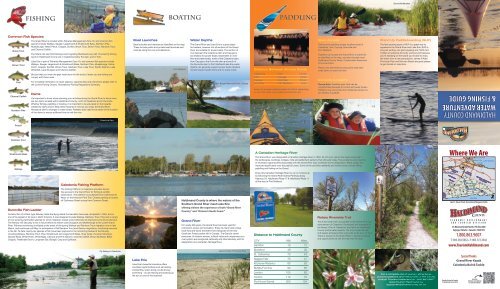
Water Adventure & Fishing Guide - Haldimand County
Water Adventure & Fishing Guide - Haldimand County
- No tags were found...

You also want an ePaper? Increase the reach of your titles
YUMPU automatically turns print PDFs into web optimized ePapers that Google loves.
Dunnville Marshes<br />
Common Fish Species<br />
Brook Trout<br />
Brown Trout<br />
Carp<br />
Channel Catfish<br />
Northern Pike<br />
Pearch<br />
Rainbow Trout<br />
fishing<br />
The Grand River is located within Fisheries Management Zone 16, and common fish<br />
species include Walleye, Sauger, Largemouth & Smallmouth Bass, Northern Pike,<br />
Muskellunge, Yellow Perch, Crappie, Sunfish, Brook Trout, Brown Trout, Rainbow Trout,<br />
and Channel Catfish.<br />
Fly fishers can also find Mooneye and migrating Steelhead every fall. The best fly fishing<br />
spots in Haldimand County are in Caledonia below the dam, and in York.<br />
Lake Erie is part of Fisheries Management Zone 19, and common fish species include<br />
Walleye, Sauger, Largemouth & Smallmouth Bass, Northern Pike, Muskellunge, Yellow<br />
Perch, Crappie, Sunfish, Brown Trout, Rainbow Trout, Lake Trout, Pacific Salmon, Lake<br />
Whitefish, Lake Sturgeon and Channel Catfish.<br />
Be sure that you know the gear restrictions for the body of water you are fishing and<br />
comply with these rules.<br />
For complete information on open seasons, opportunities and restrictions please refer to<br />
the current Fishing Ontario, Recreational Fishing Regulations Summary.<br />
Dams<br />
It’s important to know when planning your activities along the Grand River to know there<br />
are two dams located within Haldimand County; north of Caledonia and in Dunnville.<br />
Whether fishing, paddling or boating, it is important to be educated on the hazards<br />
created by dams and to keep these hazards in mind as you enjoy the Grand River.<br />
Always be alert to changes in water levels, Paddlers also need to be aware of the location<br />
of the dams to ensure sufficient time to exit the river.<br />
Caledonia Dam<br />
Boat Launches<br />
Boating<br />
Boat launches and marinas are identified on the map.<br />
These include public and private boat launches and<br />
marinas along the river and lakeshore.<br />
Port Maitland<br />
Water Depths<br />
The Grand River and Lake Erie is a great place<br />
for boaters, however not all sections of the Grand<br />
River are suitable for power boats. The section of<br />
river between the Caledonia dam and Cayuga is<br />
too shallow for power boats. Dependent on river<br />
flow and water levels, north of the Caledonia dam,<br />
from Cayuga to the Dunnville dam and south of<br />
the Dunnville dam to Port Maitland/Lake Erie water<br />
depths can generally support power boats. Boaters<br />
should respect speed limits and no wake zones.<br />
Bob Baigent Memorial Part, Cayuga<br />
Marina along Lower Grand River<br />
paddling<br />
Cayuga<br />
Distance Between Access Points<br />
Caledonia York 7.5 km<br />
York Cayuga 10 km<br />
Cayuga Dunnville 25 km<br />
Dunnville Port Maitland 8 km<br />
Expect an average paddling speed of 4 km/h, depending<br />
on river flow rates, wind speed and direction, etc.<br />
<strong>Photographer</strong>, Ed Sullivan, Grand River Kayak<br />
River Access<br />
Parking and paddling access locations exist in<br />
Caledonia, York, Cayuga, Dunnville and<br />
Port Maitland.<br />
Paddlers can access the Grand River or Lake Erie<br />
as identified on the map, and also through most<br />
Haldimand County Parks, Conservation Areas and<br />
Provincial Parks.<br />
Please note that these access points may have<br />
small banks to reach the river.<br />
Currents & Depths<br />
Please Note: Paddling near York can be<br />
unpredictable because of current and water levels –<br />
Paddlers may encounter short distances where it is<br />
too shallow to paddle.<br />
Stand Up Paddleboarding (SUP)<br />
The fast growing sport of SUP is a great way to<br />
experience the Grand River and Lake Erie. SUP is<br />
one part surfing, one part kayaking and 100% fun!<br />
It offers an amazing full body workout and because<br />
you’re standing on the board you’re able to enjoy<br />
the water from a new perspective. James N Allen<br />
Provincial Park and Myrnam Beach are great places<br />
to get started on Lake Erie.<br />
<strong>Photographer</strong>, Ed Sullivan, Grand River Kayak<br />
HALDIMAND COUNTY<br />
Water Adventure<br />
& Fishing Guide<br />
Smallmouth Bass<br />
Walleye<br />
Dunnville Fish Ladder<br />
Caledonia Fishing Platform<br />
The Fishing Platform in Caledonia provides barrierfree<br />
access to the Grand River for fishing & wildlife<br />
observation. The platform is accessible from Caithness St.<br />
West, on the Kinsmen Park Trail. Closest parking is located<br />
off Caithness Street across from Cameron Street.<br />
Construction of a Denil-type fishway inside the Byng Island Conservation Area was completed in 1994, and is<br />
one of the largest of its type in North America. It was designed to pass Walleye, Rainbow Trout, Pike and a variety<br />
of non-jumping warmwater species for which migration routes would otherwise be blocked by the Dunnville Dam.<br />
The fishway will also play a role in future efforts to restore Lake Sturgeon and Muskellunge to the Lower Grand<br />
River. Fishway monitoring is initiated at the onset of the spring Walleye and Rainbow Trout migration runs in late<br />
March, and continues until May. In anticipation of fall Rainbow Trout and Salmon migrations, monitoring resumes<br />
in the fall. To date, twenty-six species of fish have been captured in the monitoring basket at the fishway,<br />
including Walleye, Rainbow Trout, Pike, Smallmouth and Largemouth Bass, three types of sucker, Mooneye,<br />
Gizzard Shad, White Perch, White Bass, Chinook and Pink Salmon, Channel Catfish, Brown Bullhead, Black<br />
Crappie, Freshwater Drum, Longnose Gar, Bluegill, Carp and Quillback.<br />
Fly fishing in Caledonia<br />
Lake Erie<br />
Lake Erie’s beautiful shoreline offers<br />
countless opportunities such as boating,<br />
windsurfing, water skiing, scuba diving,<br />
swimming - or just relaxing and soaking up<br />
the sun on one of the beaches!<br />
Haldimand County is where the waters of the<br />
Southern Grand River meet Lake Erie<br />
offering visitors the experience of both “Grand River<br />
Country” and “Ontario’s South Coast.”<br />
Grand River<br />
For nearly 300 years, the Grand River has been used for<br />
commerce, power and recreation. Enjoy its charm and unique<br />
local flora and fauna that stem from being part of the only<br />
Carolinian Forest pocket left in Canada. The Grand’s varied<br />
resources, its historic echoes, cultural value and uniqueness as a<br />
river system are recognized nationally and internationally with its<br />
designation as a Canadian Heritage River.<br />
James N Allen Provincial Park<br />
A Canadian Heritage River<br />
The Grand River was designated a Canadian Heritage River in 1994. Its rich river culture has been preserved in<br />
the landscapes, buildings, bridges, mills and settlement patterns that still exist today. The excellence and diversity<br />
of recreation opportunities associated with the Grand River also contribute to the designation. Water quality has<br />
improved significantly over the past 60 years. Some of the activities residents and visitors enjoy include hiking,<br />
paddling and fishing on the Grand.<br />
Enjoy this Canadian Heritage River by car or motorcycle<br />
by following the Grand River Scenic Parkway along<br />
Highway 54, Haldimand Road 17 & Haldimand Road 11<br />
all the way to Port Maitland.<br />
Distance to Haldimand County<br />
CITY KM Miles<br />
Hamilton 19 12<br />
Brantford 49 30<br />
St. Catherines 70 43<br />
Niagara Falls 75 47<br />
Kitchener/Waterloo 80 50<br />
Buffalo/Fort Erie 90 56<br />
London 100 62<br />
Toronto 112 70<br />
Port Huron/Sarnia 200 124<br />
Rotary Riverside Trail<br />
This 6 km linear trail runs parallel to the Grand River just<br />
downstream of Caledonia. Developed and managed by<br />
the Rotary Club of Caledonia, the trail is on Haldimand<br />
County and private property. The trail is open all year<br />
and begins at Seneca Park and ends at the town of York.<br />
There is access to the Grand River in several locations<br />
and opportunities to exit the trail onto the road.<br />
For a complete list of tourism attractions,<br />
accommodations and restaurants in the County<br />
contact Tourism Haldimand at 1.800.863.9607<br />
www.TourismHaldimand.ca,<br />
tourism@haldimandcounty.on.ca<br />
18B r a n t fo r d<br />
N O R F O L K<br />
C O U N T Y<br />
54<br />
S I X N AT I O N S<br />
9<br />
403<br />
69<br />
70<br />
Where We Are<br />
55<br />
5<br />
6<br />
55<br />
18<br />
52<br />
2 53<br />
C O U N T Y O F<br />
B R A N T<br />
N E W C R E D I T<br />
20<br />
Jarvis<br />
Proudly Printed in Canada<br />
© Haldimand County 2012<br />
A n c a s t e r<br />
3<br />
3<br />
62<br />
9<br />
D u n da s<br />
53<br />
6<br />
29<br />
12<br />
G R A N D<br />
33<br />
3<br />
66<br />
54<br />
18 20<br />
6<br />
Hagersville<br />
Cayuga<br />
Selkirk<br />
QEW<br />
8<br />
2<br />
53<br />
R I V E R<br />
8<br />
Lincoln Alexander Pkwy<br />
Caledonia<br />
Fisherville<br />
C I T Y O F<br />
H A M I L T O N<br />
York<br />
9<br />
Red Hill<br />
Creek Expwy<br />
56<br />
H A M I L T O N<br />
20<br />
Haldimand<br />
County<br />
3<br />
32<br />
17 17<br />
B U R L I N G T O N<br />
20<br />
2<br />
S t o n e y<br />
C r e e k<br />
14<br />
50<br />
3<br />
65<br />
Lake Erie<br />
49<br />
QEW<br />
63<br />
48<br />
20<br />
Lake Ontario<br />
R E G I O N A L M U N I C I PA L I T Y<br />
O F N I A G A R A<br />
Byng<br />
11<br />
15<br />
Dunnville<br />
Port<br />
Maitland<br />
Just 1 hour from Toronto & Niagara Falls<br />
ECONOMIC DEVELOPMENT<br />
AND TOURISM DIVISION<br />
45 Munsee Street North, P.O. Box 400<br />
Cayuga, Ontario • Canada • N0A 1E0<br />
1.800.863.9607<br />
T: 905.318.5932 • F: 905.772.3542<br />
www.TourismHaldimand.com<br />
Special Thanks<br />
Grand River Kayak<br />
Caledonia Bait & Tackle<br />
Scan this<br />
with your smartphone<br />
to visit our website!<br />
7<br />
3<br />
3
HAWK<br />
ST<br />
HARRISON RD<br />
SINGER RD<br />
MOOTE RD<br />
HART RD<br />
DOWNEY RD<br />
KING RD<br />
PYLE RD<br />
N<br />
s<br />
Brantford<br />
54<br />
54<br />
Six Nations<br />
County of<br />
22<br />
Brant<br />
From Brantford<br />
(20 min.)<br />
54<br />
ONONDAGA TLINE RD<br />
LaFortune<br />
Park<br />
˘<br />
ONEIDA RD<br />
SAWMILL RD<br />
GREENS RD<br />
HALDIMAND HWY 54 W<br />
54<br />
6<br />
6TH LINE<br />
STIRLING ST<br />
MINES RD<br />
Bothwright Industrial Park<br />
GREENS RD<br />
UNITY SIDE RD<br />
INDUSTRIAL DR<br />
UNITY SIDE ROAD<br />
HIGHWAY #6<br />
UNITY SIDE RD E<br />
Caledonia<br />
ARGYLE ST N<br />
6<br />
66<br />
From Toronto<br />
(1 hour)<br />
RIVER RD<br />
MCCLUNG RD<br />
54<br />
66<br />
SIMS LOCK<br />
TYNESIDE RD<br />
ABBEY RD<br />
33<br />
HALDIMAND RD 66<br />
STONEMAN RD<br />
YOUNG RD<br />
HALDIBROOK RD<br />
MOORES RD<br />
City of<br />
Hamilton<br />
56<br />
66<br />
STONEY CREEK RD RD<br />
BLACKHEATH<br />
HALDIBROOK RD<br />
56<br />
CONC 4 LN<br />
IRVINE RD<br />
Regional<br />
Municipality of<br />
Niagara<br />
We have all your fishing needs covered &<br />
current river reports<br />
BRANTFORD<br />
o n t a r i o W CANADA<br />
for a Grand Experience!<br />
1-800-265-6299 • 519-751-9900<br />
www.discoverbrantford.com<br />
SINCLAIRVILLE<br />
RD<br />
of the Grand<br />
YORK RD<br />
STONEY CREEK RD<br />
HALDIMAND RD 9<br />
EMPIRE CORNERS<br />
2<br />
Norfolk<br />
County<br />
COUNTY LINE<br />
INDIAN LINE<br />
CONC 16 WALPOLE<br />
Townsend<br />
From Simcoe<br />
(15 min.)<br />
5<br />
6<br />
20<br />
CONC 12 TWNS<br />
3<br />
CONC 15 WALPOLE<br />
CONC 13 TWNS<br />
CONC 14 WALPOLE<br />
CONC 13 WALPOLE<br />
74<br />
CONC 14 TWNS<br />
CONC 12 WALPOLE<br />
3<br />
CONC 11 WALPOLE<br />
KEITH<br />
RICHARDSON PKY<br />
CONC 6 WDH<br />
CONC 10 WALPOLE<br />
CONC 5 WDH<br />
6<br />
TOWNLINE RD<br />
NANTICOKE<br />
CREEK PKY<br />
W CONC 7 WALPOLE<br />
HALDIMAND RD 70<br />
70<br />
69<br />
LYNN VALLEY RD<br />
HALDIMAND RD 3<br />
CONC 2 WDH<br />
SPRINGVALE<br />
6<br />
HIGHWAY #6<br />
70<br />
New<br />
Credit<br />
55<br />
20<br />
FIELD RD<br />
Lake Erie Industrial Park<br />
9<br />
27<br />
6<br />
CRANSTEN<br />
RD<br />
Jarvis<br />
U.S. Steel Lake Erie Works<br />
YULE RD<br />
GARNET<br />
RIVERSIDE DR<br />
NEW LAKESHORE RD<br />
HALDIMAND RD 55<br />
HALDIMAND RD 3<br />
55<br />
ERIE ST<br />
18<br />
NANTICOKE<br />
HICKORY<br />
BEACH LN<br />
H<br />
CONC 9 WALPOLE<br />
Imperial<br />
Oil<br />
(Esso)<br />
SOUTH<br />
COAST DR<br />
Ontario<br />
Power<br />
Generation<br />
Hickory Beach<br />
CONC 6 WALPOLE<br />
SANDUSK RD<br />
CONC 5 WALPOLE<br />
1ST LINE<br />
CONC 4 WALPOLE<br />
CONC 3 WALPOLE<br />
CONC 2 WALPOLE<br />
2ND LINE<br />
Hagersville<br />
CO NC 8 WALPOLE<br />
18<br />
3<br />
9<br />
6<br />
20<br />
RAINHAM RD<br />
SOUTH COAST DR<br />
3RD LINE<br />
CHEAPSIDE RD<br />
62<br />
BROOKLIN RD<br />
4TH LINE<br />
DUXBURY RD<br />
3<br />
MCGOWAN RD<br />
5TH LINE<br />
HALDIMAND RD 20<br />
E CONC 7 WALPOLE<br />
CHEAPSIDE<br />
PEACOCK POINT<br />
Haldimand Conservation Area<br />
53<br />
MCKENZIE RD<br />
WHEELER RD<br />
DRY LAKE RD<br />
WOODLAWN PARK<br />
Selkirk<br />
Provincial Park<br />
HALDIMAND RD 9<br />
NELLES CORNERS<br />
53<br />
29<br />
CONC 8 RD<br />
CONC 7 RD<br />
HALDIMAND RD 53<br />
BLUEWATER PKY<br />
5TH LINE<br />
TOWNLINE RD W<br />
CONC 6 RD<br />
CONC 5 RD<br />
VOLA BEACH<br />
GRANT RD<br />
HIGHWAY #3<br />
CONC 4 RD<br />
CONC 3 RD<br />
12 RD<br />
NELLES RD<br />
INDIANA RD W<br />
DECEWSVILLE RD<br />
HALDIMAND HWY 54<br />
BROAD RD<br />
MOUNT HEALY RD<br />
Taquanyah<br />
Conservation<br />
Area<br />
DECEWSVILLE<br />
Selkirk<br />
53<br />
9<br />
SUMMERHAVEN<br />
Rotary Riverside Trail<br />
12<br />
LITTLE RD<br />
FISHERVILLE<br />
HALDIMAND RD 12<br />
YORK<br />
REEDS RD<br />
IRISH LINE<br />
12<br />
Conservation<br />
Areas<br />
H Hospitals<br />
Industrial<br />
Park<br />
FISHERVILLE RD<br />
RIVER RD<br />
8<br />
LINK RD<br />
HOOVER POINT<br />
9<br />
GOWLAND<br />
RD<br />
54<br />
HALDIMAND HWY 54<br />
˘<br />
20<br />
˘<br />
KOHLER<br />
3<br />
8<br />
KOHLER RD<br />
Provincial<br />
Parks<br />
EMERSON<br />
RD<br />
BROOKS<br />
RD<br />
LINK RD<br />
Lighthouse<br />
Urban<br />
Areas<br />
RICHERT RD<br />
BROOKS RD<br />
MOUNT<br />
REICHELD RD<br />
SINGER<br />
RD<br />
Cayuga<br />
MCFARLANE<br />
RD<br />
OLIVET RD<br />
RAINHAM CENTRE<br />
FEATHERSTONE POINT<br />
WILSON RD<br />
RAINHAM RD<br />
17<br />
Beach<br />
WILSON<br />
RD<br />
Fishing<br />
Access<br />
INDIANA RD E<br />
SWEETS CORNERS<br />
RD<br />
Wetlands<br />
TOWNLINE RD E<br />
WINDECKER RD<br />
HALDIMAND HWY 56<br />
RIVER RD<br />
MEADOWS RD<br />
SUTOR RD<br />
CONC 2 RD<br />
20<br />
WINDECKER RD<br />
BROOKERS RD<br />
CONC 1 RD<br />
RIVERSIDE DR<br />
SUTOR<br />
SWEETS CORNERS<br />
RD<br />
56<br />
YAREMY RD<br />
TURNBULL RD<br />
Hedley<br />
Forest<br />
Lake Erie<br />
˘<br />
50<br />
32<br />
BOOKERS BAY<br />
˘<br />
Campground<br />
Boat Launch<br />
/Marina<br />
Woodlot<br />
HALDIMAND RD 32<br />
CONC 1 STR<br />
BAINS RD<br />
˘<br />
CANFIELD<br />
HALDIMAND RD 50<br />
CONC 2 STR<br />
˘<br />
EVANS POINT<br />
˘<br />
SOUTH CAYUGA RD<br />
JUNCTION RD<br />
˘<br />
SOUTH CAYUGA<br />
Tourist<br />
Information<br />
River Access<br />
for Paddlers<br />
Provincial<br />
Parks<br />
CAISTORVILLE RD<br />
HALD-DUNN TLINE RD<br />
DARLING RD<br />
HALD-DUNN TLINE RD<br />
HALD-DUNN TLINE RD<br />
Ruigrok Tract<br />
Conservation<br />
Area<br />
Canborough<br />
Conservation<br />
Area<br />
ORTT RD<br />
17<br />
20<br />
2<br />
RICKER RD<br />
LAKESHORE RD<br />
Park<br />
BARRY RD<br />
AIKENS RD<br />
JARDEN RD<br />
DICK RD<br />
HALDIMAND RD 49<br />
SMITHVILLE RD<br />
CANBOROUGH<br />
49<br />
BURKE RD<br />
James N. Allan<br />
Provincial Park<br />
Rotary<br />
Riverside<br />
Trail<br />
3<br />
FEERE RD<br />
WOODS<br />
RD<br />
LANE RD<br />
HALDIMAND RD 17<br />
BLOTT POINT<br />
MYRNAM BEACH RD<br />
3<br />
Low Point<br />
14<br />
JAMES RD<br />
20<br />
RAMSEY RD<br />
BAYGROVE LINE<br />
MARSHALL RD<br />
HALDIMAND<br />
TRAIL<br />
MELICK RD<br />
KENTUCKY<br />
HILL RD<br />
HALDIMAND TRACT RD<br />
KINGS ROW<br />
Grant Point<br />
MOOTE RD<br />
BYNG<br />
CANBOROUGH RD<br />
SWAYZE RD<br />
STRINGER RD<br />
SANDY BAY RD<br />
ROBINSON RD<br />
RAMSEY RD<br />
JOHNSON RD<br />
15<br />
63<br />
BARTLETT RD<br />
Dunnville<br />
48<br />
Please Note:<br />
LOGAN RD<br />
Frank A.<br />
Marshall<br />
Business<br />
Park<br />
PORT MAITLAND RD<br />
LIGHTHOUSE DR<br />
CARTER RD<br />
ATTERCLIFFE STATION<br />
DILTZ RD<br />
MCLAUGHLIN RD<br />
11<br />
COMFORT RD<br />
3<br />
˘<br />
HUTCHINSON RD<br />
MUMBY RD<br />
PORT MAITLAND<br />
SIDDALL RD<br />
HINES RD<br />
MARSHAGEN RD<br />
JENNY JUMP RD<br />
BIRD RD<br />
64<br />
FEEDER CANAL RD<br />
Rock Point<br />
Provincial Park<br />
7<br />
MOULTON-AIKEN RD<br />
FEEDER LN<br />
NIECE RD<br />
YOUNG RD<br />
INMAN RD<br />
Rock Point<br />
CALVERT RD<br />
MOULTON STATION<br />
CROWN RD<br />
GORE 'A' RD<br />
SOUTH FEEDER CANAL RD<br />
STROMNESS<br />
45<br />
192 Caithness St. West Caledonia, Ontario<br />
905-765-3215 www.caledoniabaitandtackle.com<br />
63<br />
RATTLESNAKE RD<br />
˘<br />
65<br />
HIGHWAY #3<br />
RYMER RD<br />
3<br />
63<br />
JENNY JUMP RD<br />
HUTCHINSON RD<br />
BIRD RD<br />
NORTH SHORE DR<br />
Mohawk (Gull)Island<br />
DICKHOUT RD<br />
27<br />
CANAL BANK RD<br />
HOTO LINE<br />
DUNN-WAINFLEET TLINE RD<br />
BOOKER RD<br />
FARR RD<br />
4<br />
From Niagara Falls<br />
(1 hour)<br />
POTH RD<br />
65<br />
MOULTON SHERBROOKE TLINE RD<br />
MOHAWK POINT RD<br />
Mohawk Point<br />
CANAL<br />
BANK RD<br />
NORTH SHORE DR<br />
The information provided is made available in good faith and derived from sources believed to be reliable and<br />
accurate at time of release. However, the information is provided solely for information purposes and readers are<br />
responsible for making their own assessment of the matters discussed herein and they should verify all relevant<br />
representations, statements and information.<br />
Before taking part in any activity near, on, or in water, make sure you and your family are prepared.<br />
Visit www.healthycanadians.gc.ca for water safety facts and tips.<br />
Questions or comments on any information listed can be addressed by contacting 1-800-863-9607.<br />
Haldimand County Tourism<br />
@VisitHaldimand<br />
27<br />
3<br />
LOWBANKS<br />
3<br />
<br />
<br />
Sunset Dinner Cruises<br />
Lunch Cruises with<br />
entertainment<br />
36 Brant County Road 22 Caledonia, ON N3W 2G9<br />
Reservations required for all cruises<br />
Call 905-765-4107 or 800-847-3321<br />
www.grandrivercruises.ca<br />
<br />
<br />
Private Cruises<br />
Open end of May to<br />
end of September<br />
Enjoy mansion<br />
tours, walking<br />
trails,<br />
picnics, events,<br />
workshops, bird<br />
banding,<br />
school programs .<br />
Rentals available.<br />
Visit us online for upcoming events and hours<br />
243 Haldimand Hwy #54, Cayuga ON<br />
905-772-0560 info@ruthvenpark.ca<br />
www.ruthvenpark.ca