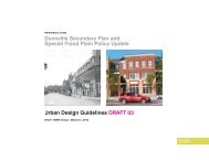
& Special Flood Plain Policy Update
Issues and Options Report - Haldimand County
Issues and Options Report - Haldimand County
- No tags were found...

Create successful ePaper yourself
Turn your PDF publications into a flip-book with our unique Google optimized e-Paper software.
SECONDARY PLAN &<br />
FLOOD PLAIN POLICY<br />
UPDATE<br />
DUNNVILLE<br />
Secondary Plan<br />
& <strong>Special</strong> <strong>Flood</strong><br />
<strong>Plain</strong> <strong>Policy</strong><br />
<strong>Update</strong><br />
ISSUES AND OPTIONS<br />
REPORT<br />
January 2012<br />
DTAH
TABLE OF CONTENTS<br />
1.0 Introduction .................................................................................................................................................................. 1<br />
1.1 Study Purpose ............................................................................................................................................................ 1<br />
1.2 Study Area Description .............................................................................................................................................. 1<br />
1.3 Study Process/Timeline ............................................................................................................................................. 2<br />
2.0 <strong>Flood</strong> <strong>Plain</strong> Analysis .................................................................................................................................................... 5<br />
2.1 Existing <strong>Flood</strong> <strong>Plain</strong> <strong>Policy</strong> and Secondary Plan ....................................................................................................... 5<br />
2.2 Existing <strong>Flood</strong> <strong>Plain</strong> Description and Hydraulic Modelling ........................................................................................ 9<br />
3.0 Public Consultation ................................................................................................................................................... 10<br />
3.1 Public Open House #1 – September 14, 2011 ........................................................................................................ 11<br />
3.2 Public Open House #2 / Design Workshop – November 8, 2011 ............................................................................ 12<br />
4.0 Issues and Options .................................................................................................................................................... 14<br />
4.1 <strong>Special</strong> <strong>Flood</strong> <strong>Plain</strong> <strong>Policy</strong> Area Boundaries ............................................................................................................ 14<br />
4.2 Repositioning County-Owned Waterfront Lands ...................................................................................................... 15<br />
a) Expansion of Historic Commercial Core .................................................................................................................. 22<br />
b) Waterfront Access .................................................................................................................................................... 22<br />
4.2.1 County-Owned Waterfront Land Options ......................................................................................................... 23<br />
4.2.2 Land Use and Urban Design Options .............................................................................................................. 34<br />
4.3 Main Street Corridor ................................................................................................................................................. 39<br />
4.3.1 Land Use and Urban Design Options .............................................................................................................. 40<br />
4.4 Broad Street/Taylor Road Retail Node..................................................................................................................... 42<br />
4.4.1 Land Use and Urban Design Options .............................................................................................................. 44<br />
4.5 Broad Street Transition Area .................................................................................................................................... 47<br />
4.5.1 Land Use and Urban Design Options .............................................................................................................. 49<br />
5.0 Recommendations & Next Steps .............................................................................................................................. 51<br />
DUNNVILLE SECONDARY PLAN AND SPECIAL FLOOD PLAIN POLICY UPDATE: ISSUES AND OPTIONS REPORT | i
FIGURES<br />
Figure 1.1 Study Area ............................................................................................................................................. 4<br />
Figure 2.1a: Existing <strong>Special</strong> <strong>Policy</strong> Areas and Regulatory <strong>Flood</strong> <strong>Plain</strong> ................................................................... 7<br />
Figure 2.1b: Existing <strong>Special</strong> <strong>Policy</strong> Areas and Regulatory <strong>Flood</strong> <strong>Plain</strong> (County-Owned Lands) ............................. 8<br />
Figure 4.2.1: Option 1 – High Level of Redevelopment ......................................................................................... 18<br />
Figure 4.2.2: Option 2 – Intermediate Level of Redevelopment ............................................................................. 19<br />
Figure 4.2.3: Option 3 – Minimal Level of Redevelopment .................................................................................... 20<br />
Figure 4.2.4: Option 4 – Open Space/Park Redevelopment .................................................................................. 21<br />
County-Owned Lands: Components...................................................................................................................... 24<br />
Option 1.A – High Level of Redevelopment ........................................................................................................... 28<br />
Option 2.A – Medium Level of Redevelopment ..................................................................................................... 29<br />
Option 2.B – Medium Level of Redevelopment ..................................................................................................... 30<br />
Option 3.A – Low Level of Redevelopment ............................................................................................................ 31<br />
Option 3.B – Low Level of Redevelopment ............................................................................................................ 32<br />
Option 3.C – Low Level of Redevelopment ........................................................................................................... 33<br />
Figure 4.3 – Broad Street/Taylor Road Retail Node .............................................................................................. 43<br />
Figure 4.4 – Broad Street Transition Area ............................................................................................................. 48<br />
ii | JANUARY 2012 | MMM GROUP & DTAH
1.0 INTRODUCTION<br />
1.1 Study Purpose<br />
Haldimand County has initiated the preparation of a Secondary Plan and <strong>Special</strong> <strong>Flood</strong> <strong>Plain</strong> <strong>Policy</strong> <strong>Update</strong> for the community<br />
of Dunnville. This study presents an exciting opportunity for residents and members of the community to identify a solid<br />
framework to plan for the growth and evolution of Dunnville.<br />
The Dunnville Secondary Plan will establish a more detailed policy framework for the Dunnville Secondary Plan area, identify<br />
community-specific issues, and provide policy guidance for resolving these issues. The <strong>Flood</strong> <strong>Plain</strong> <strong>Policy</strong> <strong>Update</strong> includes<br />
the development of recommendations on whether to proceed with an update to the Haldimand County Official Plan <strong>Special</strong><br />
<strong>Flood</strong> <strong>Plain</strong> <strong>Policy</strong> Area policies.<br />
The Issues and Options Report identifies the planning and urban design issues and potential options to be addressed in the<br />
Secondary Plan and <strong>Special</strong> <strong>Flood</strong> <strong>Plain</strong> <strong>Policy</strong> <strong>Update</strong>, including potential redevelopment options for the County-owned<br />
waterfront lands. Furthermore, the Report provides a basis for which new policies will be established to guide Dunnville in<br />
achieving its goals.<br />
1.2 Study Area Description<br />
The Study Area comprises Dunnville’s historic commercial core, the Grand River waterfront and extends east through the<br />
residential area towards the large format retail area at Taylor Road and Broad Street East. Figure 1.1 outlines the Study<br />
Area, which has been divided into two key areas:<br />
1. Secondary Plan Area; and<br />
2. <strong>Flood</strong> <strong>Plain</strong> <strong>Policy</strong> Areas.<br />
The Secondary Plan area is generally bounded by Cedar Street in the west, the former CNR Line in the north, slightly east of<br />
Taylor Road in the east, and Main Street East/North Shore Drive and the Grand River/Front Street in the south.<br />
The County Official Plan divides the flood plain area into 3 distinct policy areas, each containing varying policy regulations to<br />
protect from flood hazards.<br />
DUNNVILLE SECONDARY PLAN AND SPECIAL FLOOD PLAIN POLICY UPDATE: ISSUES AND OPTIONS REPORT | 1
They include:<br />
1. Area 1: Grand River in the south, west of George Street/Helena Street in the west, south of the former CNR Line,<br />
Cedar Street in the east.<br />
2. Area 2: Grand River in the south, south of Taylor Road in the west, Main Street East/North Shore Drive in the north,<br />
and Main Street East and east of Hydro Street.<br />
3. Area 3: Cedar Street in the West, South Cayuga Street/Alder Street East in the north, Tamarac Street in the west,<br />
and Main Street East in the south.<br />
1.3 Study Process/Timeline<br />
The Study is being conducted in 3 Phases:<br />
<br />
<br />
<br />
Phase 1: Background Review<br />
Phase 2: Issues and Options<br />
Phase 3: Prepare Secondary Plan and <strong>Special</strong> <strong>Flood</strong> <strong>Plain</strong> Analysis <strong>Policy</strong> <strong>Update</strong><br />
The following sections briefly summarize the goals and anticipated timing for each of the project phases:<br />
Phase 1: Background Review<br />
Phase 1 of the Dunnville Secondary Plan and <strong>Special</strong> <strong>Flood</strong> <strong>Plain</strong> <strong>Policy</strong> <strong>Update</strong> involves a thorough background review of<br />
existing reports, documents and resource materials that relate to the community, the planning policy framework, urban design<br />
and flood plain analysis. An overview of these initiatives and how they relate to the Study and the Secondary Plan and<br />
<strong>Special</strong> <strong>Flood</strong> <strong>Plain</strong> policies are summarized in the Background Report.<br />
A Public Open House was held on September 14, 2011, to introduce the Study, provide an overview of the background work,<br />
and present preliminary issues and options for Dunnville. The Open House provided attendees with an opportunity to provide<br />
input, identify issues and ask questions of the Study.<br />
Anticipated Timeframe: June – September 2011<br />
Phase 2: Issues and Options<br />
Phase 2 of the Study involves the identification/confirmation of issues, opportunities, constraints and options based on<br />
feedback received from the Public Open House, and the Background Report, including the <strong>Flood</strong> <strong>Plain</strong> Analysis. An important<br />
2 | JANUARY 2012 | MMM GROUP & DTAH
component of this Phase is the Issues and Options Report and Public Open House/Design Workshop, to gain essential<br />
feedback on the issues facing the community of Dunnville and options regarding future development of the downtown and<br />
waterfront area, and particularly the County-owned lands.<br />
Based on the feedback received and background work completed, alternative land use and urban design options have been<br />
identified for the repositioning of the County-owned lands adjacent to the Grand River, the Broad Street Corridor and the<br />
emerging Broad Street/Taylor Road Retail Node. These concepts are presented as part of this Issues and Options Report,<br />
and anticipated for endorsement by Council in February 2012.<br />
Anticipated Timeframe: September 2011 – February 2012<br />
Phase 3: Prepare Secondary Plan and <strong>Special</strong> <strong>Flood</strong> <strong>Plain</strong> <strong>Policy</strong> <strong>Update</strong><br />
Phase 3 of the Study involves the preparation of the Secondary Plan and <strong>Special</strong> <strong>Flood</strong> <strong>Plain</strong> <strong>Policy</strong> <strong>Update</strong>. Based on<br />
previous analysis and public feedback, more detailed land use policies and urban design guidelines will be prepared, and a<br />
recommendation will be made as to whether the County should proceed with an update to the <strong>Special</strong> <strong>Flood</strong> <strong>Plain</strong> Policies in<br />
the Official Plan or consider alternative flood plain policies for the Study Area. A third Public Open House and a final public<br />
meeting will be held by the County Council in Committee, to obtain feedback on the County-owned waterfront land options,<br />
Draft Secondary Plan, Urban Design Guidelines, and <strong>Special</strong> <strong>Flood</strong> <strong>Plain</strong> <strong>Policy</strong> <strong>Update</strong> recommendations. The Final Drafts<br />
will be presented to Council for adoption/endorsement in May/June 2012.<br />
Anticipated Timeframe: February 2012 - June 2012<br />
DUNNVILLE SECONDARY PLAN AND SPECIAL FLOOD PLAIN POLICY UPDATE: ISSUES AND OPTIONS REPORT | 3
Figure 1.1 Study Area<br />
4 | JANUARY 2012 | MMM GROUP & DTAH
2.0 FLOOD PLAIN ANALYSIS<br />
2.1 Existing <strong>Flood</strong> <strong>Plain</strong> <strong>Policy</strong> and Secondary Plan<br />
Riverine hazard lands exist within the Dunnville Secondary Plan area. <strong>Flood</strong>ing originates from the Grand River under<br />
extreme flow events, this flooding potential is recognized in various past flood plain mapping studies and within the existing<br />
<strong>Special</strong> <strong>Policy</strong> Area (SPA) that addresses a portion of lands within the Secondary Plan area and along the waterfront.<br />
Existing SPA delineation in relationship to the Secondary Plan area is indicated in Figure 2.1. Also indicated in the Figure is<br />
the extent of predicted flooding as outlined on existing Grand River Conservation Authority (GRCA) flood plain mapping for a<br />
Regulatory event (additional details outlined in Section 2.2).<br />
The SPA applicable to Dunnville and currently adopted within County planning documents is contained in Section 2.C.1.11 of<br />
the Official Plan and shown in Figure 2.1. In summary, the three zones within the existing SPA (labeled as Area 1, 2 & 3)<br />
ensure protection of new buildings, structures and major additions by requiring flood-proofing to the following levels:<br />
Area 1: to the level of the Regulatory <strong>Flood</strong> - to an elevation of 179.0 m<br />
Area 2: to the level of the Regulatory <strong>Flood</strong> - to an elevation of 176.5 m<br />
Area 3: to the level of the 100 Year <strong>Flood</strong> - to an elevation of 178.7 m<br />
As indicated, the existing SPA does not extend to all Regulatory flood inundated portions of the Secondary Plan area. Most<br />
notably lands located east of SPA Area 3 and north of SPA Area 2 are not included in an SPA. Additionally, it is clear that<br />
where Areas 1, 2 and 3 of the SPA converge, determining the correct protection level to use will require further analysis<br />
(discussed further in Section 4.1.)<br />
The Provincial <strong>Policy</strong> Statement requires that significant development be excluded from areas prone to flood inundation<br />
unless those areas are addressed within an approved SPA (or a Two-Zone <strong>Flood</strong> <strong>Plain</strong> <strong>Policy</strong>). Areas that lie outside of an<br />
SPA (or Two-Zone <strong>Flood</strong> <strong>Plain</strong> <strong>Policy</strong>) are generally subject to a One-Zone policy approach whereby all new development is<br />
restricted from areas subject to flood inundation.<br />
Given the opportunity to address a larger and contiguous area of historical flood plain development, such as lands located<br />
within the Dunnville Secondary Plan area, consideration is usually given to applying a common policy across the lands – i.e.,<br />
a <strong>Special</strong> <strong>Policy</strong> Area. An SPA sets common rules for development that have been agreed to by the flood plain regulator (i.e.<br />
GRCA), the County and the Province. The Province is party to the agreements, and is ultimately the approval authority<br />
through an Official Plan Amendment. It is based upon recognition of a given additional level of flood risk, with this determined<br />
DUNNVILLE SECONDARY PLAN AND SPECIAL FLOOD PLAIN POLICY UPDATE: ISSUES AND OPTIONS REPORT | 5
through a hydraulic study of various potential development configurations combined with the existing area’s overall<br />
characteristics.<br />
6 | JANUARY 2012 | MMM GROUP & DTAH
Figure 2.1a: Existing <strong>Special</strong> <strong>Policy</strong> Areas and Regulatory <strong>Flood</strong> <strong>Plain</strong><br />
DUNNVILLE SECONDARY PLAN AND SPECIAL FLOOD PLAIN POLICY UPDATE: ISSUES AND OPTIONS REPORT | 7
Figure 2.1b: Existing <strong>Special</strong> <strong>Policy</strong> Areas and Regulatory <strong>Flood</strong> <strong>Plain</strong> (County-Owned Lands)<br />
8 | JANUARY 2012 | MMM GROUP & DTAH
2.2 Existing <strong>Flood</strong> <strong>Plain</strong> Description and Hydraulic Modelling<br />
The Regulatory event defining flood susceptible areas in Dunnville is the Hurricane Hazel event, which has also been adopted<br />
across other applicable areas of Ontario as a probable ‘worst-case’ flood event. This Regulatory event approximately equates<br />
to the predicted flows in the river associated with the 1954 Hurricane Hazel storm – if that storm were to occur over the entire<br />
upstream Grand River watershed. For Dunnville, the appropriate flow in the river resulting from such a storm has already been<br />
accurately determined by GRCA through past study, and further analysis of that value is not deemed necessary at this time.<br />
In summary, the flow value resulting from the extreme rainfall event runoff is quite well known.<br />
A hydraulic model is a computer program that takes the known flow value in the river and predicts how high the resulting<br />
flooding will be. In other words, the rainfall runoff from a Hurricane Hazel storm event causes a certain flow amount in the<br />
river. The hydraulic model takes this flow amount and mathematically determines how high the flooding will be, based on the<br />
surrounding landscape and other river characteristics. The exact way the river and surrounding landscape are input to the<br />
hydraulic model can differ on the type of model used, but all models will use the same flow value. Areas on the map that are<br />
predicted to be flooded because of their location and elevation are termed flood plain.<br />
It should be noted that in addition to the potential for high flows from upstream, the Grand River near Dunnville can also be<br />
significantly affected by temporary level increases in downstream Lake Erie (seiche events) and also by ice. These two items<br />
add another layer of complexity to the overall consideration of flooding potential in Dunnville. For example, the flooding event<br />
that took place in February 2009 is said to have been caused by a combination of many factors, including ice jamming<br />
problems, a seiche event on Lake Erie, and high flows in the Grand River resulting from both snow melt and rainfall events.<br />
Although the 2009 event had less flooding than the Regulatory event, it has potential to occur on a more frequent basis.<br />
The Grand River and associated flood plain in the vicinity of Dunnville is recognized by the GRCA and others as having many<br />
challenging characteristics to consider when developing an accurate hydraulic. The number of in-river weirs affecting flows as<br />
well as the large number of flood prone buildings and streets within the community result in many different potential patterns<br />
and directions of flow for floodwaters. Hydraulic modelling of places like Dunnville is quite complex, driven by the challenges<br />
of modelling the many uneven landforms typical of a downtown. At the same time, determining the level of flood risk in highly<br />
populated areas warrants an extra level of detail.<br />
A Two-Dimensional (2-D) modelling approach can be effective in addressing some types of flood plain complexity. Basically,<br />
a 2-D model does a better job of predicting flooding depths and velocities in situations where floodwaters significantly proceed<br />
in directions that are different from the flow in the main channel of the river. 2-D models have been around for some time, but<br />
only recently has computing power grown to allow their more widespread use.<br />
DUNNVILLE SECONDARY PLAN AND SPECIAL FLOOD PLAIN POLICY UPDATE: ISSUES AND OPTIONS REPORT | 9
A 2-D model is able to compute flow movements in two directions, with tens of thousands (or more) individual grid points<br />
solved simultaneously for flow velocity, flow direction and flooding depth. Grid sizes can vary, with the Dunnville study area<br />
broken into 5 m by 5 m sized grids for the analysis and results outlined in this report. The extent of flood plain indicated in<br />
Figure 2.1 has been produced using a 2-D modelling approach, with these results matching quite closely with previously<br />
determined GRCA flood plain definitions.<br />
One of the main advantages of the hydraulic modelling approach taken in this report is the relatively straightforward way that<br />
‘what-if’ options for development can be modelled to predict their flood proofing requirements and their resulting impacts upon<br />
the flood plain. Section 4.2 contains discussion of preliminary hydraulic modelling results and considerations for various<br />
‘what-if’ planning and development scenarios explored in this study for the County-owned waterfront lands.<br />
10 | JANUARY 2012 | MMM GROUP & DTAH
3.0 PUBLIC CONSULTATION<br />
The final product of this Study will be a Secondary Plan for the<br />
community of Dunnville, and a set of recommendations on how to<br />
proceed with an update to the <strong>Flood</strong> <strong>Plain</strong> policies for Dunnville.<br />
The Secondary Plan will be a document written for the<br />
community, and developed by the community. Consultation with<br />
residents, business owners and interested groups and<br />
stakeholders is a critical component to the success of this project.<br />
3.1 Public Open House #1 – September 14, 2011<br />
The first public open house was held on September 14, 2011 to<br />
introduce the Dunnville Secondary Plan and <strong>Flood</strong> <strong>Plain</strong> <strong>Policy</strong> <strong>Update</strong> to the community and interested stakeholders, as well<br />
as provide an overview of the background work and identification of preliminary issues and options, undertaken as part of<br />
Phase 1 of the Study. Approximately 30-40 individuals attended the public open house, to review display boards and ask<br />
questions to the study team on their thoughts, concerns and visions for Dunnville.<br />
Many questions and issues were raised at this open house, which helped to establish a preliminary view of some of the critical<br />
issues and opportunities facing Dunnville. Some of the key topics that were discussed include:<br />
<br />
<br />
<br />
<br />
Farmer’s Market: The Dunnville Farmer’s Market is a community focal point, and should be enhanced or expanded<br />
to accommodate a larger number of stalls, and potentially include an indoor component to accommodate uses in cold<br />
and inclement weather, and potentially boutique shops, restaurants and cafes. The Farmer’s Market should be<br />
maintained generally in the core waterfront area.<br />
County-Owned Lands: The County should ensure that the former Dunnville Arena lands remain in public ownership,<br />
and that the property be used in a way that benefits the community.<br />
Main Street Parking Lot: The municipal parking lot on Main Street divides Downtown Dunnville and the waterfront<br />
area. The buildings flanking the parking lot “turn their backs” to Main Street and the waterfront and do not facilitate a<br />
relationship between the downtown core and the waterfront. Further concerns were expressed regarding the<br />
aesthetics and streetscape along Main Street, which may be improved.<br />
<strong>Flood</strong>ing: <strong>Flood</strong>ing hazards are a key concern to the community, as many homes and businesses in Downtown<br />
Dunnville were affected by the February 2009 flood event. Opportunities should be explored to mitigate potential<br />
flood risks while still accommodating appropriate development.<br />
DUNNVILLE SECONDARY PLAN AND SPECIAL FLOOD PLAIN POLICY UPDATE: ISSUES AND OPTIONS REPORT | 11
These issues, among many others, will be considered in developing a policy framework for Dunnville. More importantly, the<br />
topics will help frame the critical issues and options identified for Dunnville, and will play an important role in shaping the<br />
recommendations that will form the Dunnville Secondary Plan and <strong>Special</strong> <strong>Flood</strong> <strong>Plain</strong> <strong>Policy</strong> <strong>Update</strong>.<br />
3.2 Public Open House #2 / Design Workshop – November 8, 2011<br />
The second public open house and design workshop was held on<br />
November 8, 2011 to present the issues identified in the first<br />
phase of the study and seek public input on land use and urban<br />
design options, particularly as they relate to the repositioning of<br />
the County-owned lands. Approximately 80-90 individuals<br />
attended the second public open house and participated in the<br />
design workshop.<br />
Working groups of roughly 8-10 people were tasked with<br />
identifying redevelopment options for the County-owned lands,<br />
which were categorized within four preliminary redevelopment<br />
scenarios, which reflected varying degrees of development:<br />
<br />
<br />
<br />
<br />
Option 1 – Redevelop All Available Land<br />
Option 2 – Intermediate Level of Redevelopment<br />
Option 3 – Minimal Level of Redevelopment<br />
Option 4 – Open Space/Park Redevelopment<br />
A variety of ideas were put forward, with all groups working within the spirit of the workshop exercise. In general, participants<br />
understood the important role of the County owned lands and the waterfront to Dunnville, and the potential to improve the<br />
downtown, provide a higher level of public amenity, and create a stronger relationship to the Grand River.<br />
A key concern was to retain the Farmers Market in the downtown, in a new improved shelter with a possible strategic<br />
relocation to serve multiple planning and design objectives. Several ideas were put forward to expand the Market and include<br />
year round operations in a single use weather protected structure or as part of a civic minded mixed-use project.<br />
Another concern was the viability of the boat club and marina, with several recommendations to combine these waterfront<br />
operations with a restaurant in a new building. Boat launch parking should also be accommodated on the site. Views to and<br />
from the river were stated as a valuable amenity to capitalize on, and highlight the community’s waterfront.<br />
12 | JANUARY 2012 | MMM GROUP & DTAH
Participants expressed interest in retaining the County owned lands as a public waterfront park, with features such as<br />
programming, a playground, washrooms, amphitheatre/bandshell/gazebo. Public access to the river was also another shared<br />
idea, perhaps with a riverfront trail from the bridge to the marina.<br />
Support for the local business community was also discussed. Parking for downtown businesses, the Farmers Market and the<br />
Marina was a common element to all of the groups. Incentives were suggested to improve the rear facades of the properties<br />
that border the Main Street municipal parking lot. Improvements could include tree planting, painting, or screening with<br />
another architectural feature like an arbor or the Farmers Market.<br />
Participants expressed that new infill development should be limited overall. The groups agreed that if it is part of the land use<br />
option, buildings should respect the existing character and scale of the downtown and positively contribute to the image of<br />
Dunnville. Buildings should relate strongly to Main Street and allow—not block--views to the river.<br />
More green space was encouraged overall, including new street trees, gardens, and parks.<br />
In all, participants agreed that a balanced plan is most appropriate, and that it should not be all comprised of one thing.<br />
Participants strongly recommended that the County not sell off the entire public asset and that they only have one chance to<br />
get the redevelopment of lands right and that the project should provide an overall benefit to the community of Dunnville.<br />
DUNNVILLE SECONDARY PLAN AND SPECIAL FLOOD PLAIN POLICY UPDATE: ISSUES AND OPTIONS REPORT | 13
4.0 ISSUES AND OPTIONS<br />
Based on the background review, discussions with County staff, and comments from the public, the following section identifies<br />
the key issues to be addressed through the Secondary Plan and <strong>Special</strong> <strong>Flood</strong> <strong>Plain</strong> <strong>Policy</strong> <strong>Update</strong> Study and potential land<br />
use and urban design options.<br />
4.1 <strong>Special</strong> <strong>Flood</strong> <strong>Plain</strong> <strong>Policy</strong> Area Boundaries<br />
Since the existing <strong>Special</strong> <strong>Policy</strong> Area (SPA) does not extend to all flood prone lands within the Secondary Plan area, the SPA<br />
is recommended to be expanded to encompass these areas as required.<br />
The existing SPA also currently requires different flood protection levels for each of its three existing zones (Areas 1, 2 & 3 as<br />
indicated in Figure 2.1). Where these areas abut one another, the current policy requires adherence to different flood levels<br />
for areas that are literally right beside each other. The distinction of one area versus another in this case is hard not to be<br />
seen as arbitrary in some way, and needs to be addressed within a revised and expanded SPA.<br />
The complexity of the flood plain in the Dunnville area warrants consideration of further developing a 2-D model (appropriately<br />
linked to a 1-D river model as is necessary) to inform the SPA. A 2-D model will allow much greater detail or granularity in<br />
determining appropriate flood protection levels, thereby allowing the policy to better address transitions in levels for various<br />
areas of the revised SPA. A 2-D model will have better ability to pinpoint areas of high floodwater velocity and depth that<br />
should be addressed within the SPA. As well, the modelling of various anticipated ‘what-if’ development scenarios can be<br />
better facilitated through use of a 2-D model, allowing more informed policies within the revised SPA.<br />
The update to the <strong>Special</strong> <strong>Policy</strong> Area should also ensure that Lake Erie levels and the effects of river and lake ice are<br />
appropriately integrated into the analysis of flooding risks.<br />
14 | JANUARY 2012 | MMM GROUP & DTAH
4.2 Repositioning County-Owned Waterfront Lands<br />
The County-owned waterfront lands consisting of the former Dunnville Memorial Arena and Recreation Centre, outdoor<br />
farmers market, Garfield Disher Park, and associated parking areas (including the parking lot on the north side of Main Street)<br />
and vacant lands provide an opportunity for revitalization and redevelopment of Dunnville’s waterfront. Following the<br />
completion of the new Dunnville Arena and Community Centre in the east end of the community, the old arena complex on<br />
Main Street has since been demolished.<br />
The Haldimand County Streetscape Plan and Urban Design Guidelines (Streetscape Plan) identifies the creation of a<br />
riverfront park place on Main Street that faces and integrates with the urban form of the downtown, which includes the Countyowned<br />
lands and privately owned lands to the east.<br />
A major impetus of the Study is to identify strategies and establish a policy framework for the repositioning of these Countyowned<br />
lands, including potential strategies for the redevelopment and future use of these lands. Alternative land use options<br />
were explored through consultation with the community and a design charrette/workshop at the second Public Meeting held<br />
on November 8, 2011.<br />
Issues and options related to the repositioning of the County-owned waterfront lands may include:<br />
expansion/improvement of existing assets, including the boating/docking facilities, Garfield Disher Park and farmers<br />
market;<br />
the development of new community uses or facilities;<br />
extension of public open spaces, pedestrian connections and trails;<br />
the development of new commercial/retail or mixed residential uses should the County consider disposing of certain<br />
lands;<br />
reconfiguration/improvements to the internal road network and streetscape (Bridge Street, Hydro Street, Market<br />
Street);<br />
future development opportunity in light of the constraints associated with the flood plain hazards; and<br />
ensure compatibility of land uses given the critical flood hydraulics impacting these lands.<br />
Hydraulic 2-D modelling has been modified in anticipation of the types of development that might be considered at this<br />
location. Specifically, modifications made to the modelling allow a general determination of changes in velocities and flooding<br />
levels associated with the various ‘what-if’ scenarios outlined for the County-Owned waterfront lands to help inform the<br />
planning directions and land use options.<br />
DUNNVILLE SECONDARY PLAN AND SPECIAL FLOOD PLAIN POLICY UPDATE: ISSUES AND OPTIONS REPORT | 15
Preliminary examination of the modelling suggests that the County-owned lands are located in a somewhat sensitive hydraulic<br />
juncture along the river, although not in as critical a location as was once thought prior to completion of the modelling. It<br />
should be noted that some preliminary review of the results of the 2-D modelling has been completed in consultation with<br />
GRCA, but only enough to indicate a general understanding and concurrence with original modelling results. Considerable<br />
additional review and study will be required for these lands prior to determining a final arrangement that is most appropriate<br />
from a flood plain standpoint.<br />
Preliminary concept and analysis of hydraulic considerations<br />
Four preliminary development scenarios were prepared to test their potential impact on flooding and velocities during the<br />
control storm event as presented at the second Public Open House/Design Workshop. The scenarios ranged from a relatively<br />
high level of development to primarily open space/park areas. The form and character of development is not defined and<br />
could accommodate new buildings for a range of potential land uses and built form intensity.<br />
The preliminary development scenarios and their potential impact on flooding and velocities are presented in the following<br />
Figures, and include the following options.<br />
<br />
<br />
<br />
<br />
Option 1 – High Level of Redevelopment. This option considered what would happen if all three potential development<br />
parcels were raised above the high water mark. The existing public rights-of-way remained in their current<br />
configuration (Figure 4.2.1).<br />
Option 2 – Intermediate Level of Redevelopment. This option was Similar to option 1 but with smaller development<br />
footprints to allow for greater flow through the sites (Figure 4.2.2).<br />
Option 3 – Minimal Level of Redevelopment. Only portions of the arena site are redeveloped, including the western<br />
portion which is currently above the flood level. The northern parking lot remains with the former arena site becoming<br />
an open space that allows flood waters to flow through towards the river (Figure 4.2.3).<br />
Option 4 – Open Space/Park Redevelopment. The Main Street parking lot remains in its current configuration, with the<br />
entirety of the former arena lands developed/retained as public open space (Figure 4.2.4).<br />
The hydraulic analysis of the four options indicates a range of potential impacts. The potential areas of development on the<br />
options are illustrated by the hatching. As one would expect, a higher level of development and built form coverage would<br />
have a greater influence on the flood plain and would likely require greater mitigation. Conversely, the options with more open<br />
space and fewer obstacles will allow more predictable flows and require less mitigation.<br />
The arrows on the Figures represent the direction and velocity of flows. Areas where the flow is both deep and fast are<br />
intuitively more significant to identify than just slow moving areas or just shallow and fast moving areas. A larger arrow<br />
represents a higher flow velocity. Fast flowing water is most significant where it is also deep. The product of depth and<br />
16 | JANUARY 2012 | MMM GROUP & DTAH
velocity (i.e. the calculation of depth times velocity) in any given location will be important in determining the potential risk at<br />
that location. However, areas of significant depth, even if relatively slow moving, will also be important to identify in<br />
determining overall risk.<br />
DUNNVILLE SECONDARY PLAN AND SPECIAL FLOOD PLAIN POLICY UPDATE: ISSUES AND OPTIONS REPORT | 17
Figure 4.2.1: Option 1 – High Level of Redevelopment<br />
18 | JANUARY 2012 | MMM GROUP & DTAH
Figure 4.2.2: Option 2 – Intermediate Level of Redevelopment<br />
DUNNVILLE SECONDARY PLAN AND SPECIAL FLOOD PLAIN POLICY UPDATE: ISSUES AND OPTIONS REPORT | 19
Figure 4.2.3: Option 3 – Minimal Level of Redevelopment<br />
20 | JANUARY 2012 | MMM GROUP & DTAH
Figure 4.2.4: Option 4 – Open Space/Park Redevelopment<br />
DUNNVILLE SECONDARY PLAN AND SPECIAL FLOOD PLAIN POLICY UPDATE: ISSUES AND OPTIONS REPORT | 21
Issues which also relate to the repositioning of County-owned waterfront lands are further outlined below and include:<br />
a) opportunities to expand the historic commercial core area;<br />
b) improving access to the waterfront; and<br />
c) built form and urban design options for Main Street.<br />
a) Expansion of Historic Commercial Core<br />
The Official Plan identifies that the Dunnville Secondary Plan should assess and make recommendations regarding the<br />
expansion of the community’s historic commercial core to incorporate the Grand River Waterfront. The historic commercial<br />
core is delineated by the Community Commercial designation in the County Official Plan. The Community Commercial<br />
designation accommodates a broad range of retail, shopping functions, offices, professional and personal services,<br />
entertainment and other commercial activities. Additional uses include institutional and community facilities, and apartment<br />
units.<br />
The County-owned waterfront lands, consisting of the former Dunnville Memorial Arena Recreation Centre, outdoor farmers<br />
market, and Garfield Disher Park, are located within the Community Commercial designation and the repositioning of these<br />
lands to accommodate new/enhanced uses and their configuration are explored in this Report. These lands represent the<br />
most logical and impactful opportunity to address the policy objectives of the Official Plan to expand the historic commercial<br />
core.<br />
Issues and options for the expansion of the historic commercial core may include:<br />
<br />
<br />
<br />
<br />
the potential impacts and transitions with neighbouring land uses (i.e., residential, employment uses);<br />
provide for visual and physical connections from the downtown to the waterfront (signage, walkways, landscaping,<br />
building facades);<br />
future development opportunity in light of the constraints associated with the flood plain hazards; and<br />
economic and market conditions to support additional community commercial development.<br />
b) Waterfront Access<br />
Improving the accessibility and connectivity of the downtown core and the waterfront is desirable to capitalize on the social,<br />
economic and recreational amenities associated with the waterfront. The Streetscape Plan identified improved pedestrian<br />
connections from Bridge Street to the waterfront and the extension of the pedestrian connection from the Chestnut Street<br />
alleyway, extending south of Main Street to the waterfront.<br />
22 | JANUARY 2012 | MMM GROUP & DTAH
Issues and options regarding waterfront access may include:<br />
improved/new pedestrian accesses/connections from the historic core to Main Street and the waterfront;<br />
improved connections from Main Street to the Garfield Disher Park through the repositioning of the County-owned<br />
waterfront lands and Bridge Street;<br />
new pedestrian facilities (trails/boardwalks) along the waterfront; and<br />
potential acquisition of additional strategic waterfront lands and/or public easements, if deemed appropriate, which<br />
may facilitate a more continuous waterfront trail or public space.<br />
4.2.1 County-Owned Waterfront Land Options<br />
Many opportunities exist to allow for the expansion of the commercial core, provide greater access to the waterfront, and<br />
revitalize and incorporate the Main Street Corridor with the community and its amenities. The following section presents<br />
various options for the repositioning of the County-owned waterfront lands, which have been informed through the issues and<br />
options identified in this Report and the input received from the second Public Open House/Design workshop.<br />
The options present alternative development concepts for the various components or sub-areas which comprise the Countyowned<br />
lands (i.e, the waterfront, north parking lot, west block, east block and southeast block), as identified on Figure 4.2.5. It<br />
is anticipated that the recommended option may consist of the preferred elements for each of the various sub-areas, as<br />
opposed to simply selecting one option.<br />
Table 4.1 summarizes the strengths and weaknesses associated with each of the options, which are illustrated in the following<br />
figures.<br />
DUNNVILLE SECONDARY PLAN AND SPECIAL FLOOD PLAIN POLICY UPDATE: ISSUES AND OPTIONS REPORT | 23
Figure 4.2.5: County-Owned Lands: Components<br />
north parking lot<br />
east block<br />
west block<br />
southeast block<br />
waterfront<br />
24 | JANUARY 2012 | MMM GROUP & DTAH
Table 4.1 – County-Owned Waterfront Land Options<br />
1. High Level of Redevelopment<br />
Option 1.A North Parking Lot: New Farmers<br />
Market structure and improved<br />
streetscape with small public<br />
space at east end<br />
<br />
<br />
<br />
<br />
<br />
Component Strengths Weaknesses<br />
West Block: Townhouse infill<br />
fronting Main Street and larger<br />
park space extending to<br />
waterfront<br />
East Block: Improved parking lot<br />
Southeast Block: Low-rise<br />
apartment building (4 stories) and<br />
associated parking lot<br />
Waterfront: combined<br />
marina/restaurant and river walk<br />
promenade<br />
2. Medium Level of Redevelopment<br />
Option 2.A North Parking Lot: Improved<br />
streetscape with small public<br />
space at east end<br />
West Block: Townhouse infill<br />
units, 3- to 4-storey maximum and<br />
small park space closer to<br />
waterfront<br />
East Block: New Farmers Market<br />
structure and improved parking lot<br />
Southeast Block: new park<br />
extending to Garfield Disher Park<br />
Waterfront: combined<br />
marina/restaurant and river walk<br />
promenade<br />
<br />
<br />
<br />
<br />
<br />
<br />
<br />
<br />
<br />
<br />
<br />
<br />
<br />
<br />
<br />
<br />
<br />
<br />
Redevelopment to help fund public<br />
space improvements<br />
New downtown residents<br />
Improved security with ‘eyes on the<br />
street’<br />
Expanded park space connects<br />
riverfront and Garfield Disher Park<br />
to downtown<br />
Improves entrance into downtown<br />
and streetscape character<br />
Improved built form edge along<br />
Main Street<br />
Improved Farmers Market<br />
Improves access along river’s edge<br />
Provides a commercial opportunity<br />
to help attract people to the<br />
waterfront<br />
Redevelopment to help fund public<br />
space improvements<br />
New downtown residents<br />
Improved security with ‘eyes on the<br />
street’<br />
Expanded park space connects<br />
riverfront and Garfield Disher Park<br />
to downtown<br />
Improves entrance into downtown<br />
and streetscape character<br />
Strong built form edge along south<br />
side of Main Street<br />
Improved Farmers Market<br />
Improves access along river’s edge<br />
Provides a commercial opportunity<br />
to help attract people to the<br />
waterfront<br />
<br />
<br />
<br />
<br />
<br />
<br />
<br />
<br />
<br />
Requires easement across private<br />
lands to complete river walk<br />
promenade<br />
Requires relocating marina parking and<br />
boat storage<br />
Townhouse and apartment<br />
development could influence water<br />
flows during flood event<br />
Reduced parking supply in Main Street<br />
parking lot<br />
Interrupts views towards the river from<br />
Main Street.<br />
Requires easement across private<br />
lands to complete river walk<br />
promenade<br />
Requires relocating marina parking and<br />
boat storage<br />
Townhouse infill and Farmers Market<br />
on south side of Main Street could<br />
influence water flows during flood event<br />
Interrupts views towards the river from<br />
Main Street.<br />
DUNNVILLE SECONDARY PLAN AND SPECIAL FLOOD PLAIN POLICY UPDATE: ISSUES AND OPTIONS REPORT | 25
Option 2.B Similar to Option 2.B, with an<br />
expanded streetscape frontage<br />
along the North Parking Lot<br />
Component Strengths Weaknesses<br />
<br />
More opportunity to improve Main<br />
Street character and entrance to<br />
the downtown<br />
<br />
Loss of parking spaces on North<br />
Parking Lot<br />
3. Low Level of Redevelopment<br />
Option 3.A North Parking Lot: New Farmers<br />
Market structure and improved<br />
streetscape with small public<br />
space at east end<br />
West Block: new park and<br />
amphitheatre extending from Main<br />
Street to the waterfront<br />
East Block: Improved parking lot<br />
Southeast Block: new park<br />
extending to Garfield Disher Park<br />
Waterfront: combined<br />
marina/restaurant and river<br />
walk promenade<br />
Option 3.B Similar to Option 3.A except that<br />
new Farmers Market structure is<br />
located on East Block with parking<br />
lot<br />
<br />
<br />
<br />
<br />
<br />
<br />
<br />
<br />
<br />
Greatest amount of public open<br />
space<br />
Open views to river from Main<br />
Street<br />
Expanded park space connects<br />
riverfront and Garfield Disher Park<br />
to downtown<br />
Improves entrance into downtown<br />
and streetscape character<br />
Improved Farmers Market<br />
Improves access along river’s edge<br />
Provides a commercial opportunity<br />
to help attract people to the<br />
waterfront<br />
Improved floodplain conditions<br />
Similar to Option 3.A, and maintain<br />
all parking spaces in North Parking<br />
Lot<br />
<br />
<br />
<br />
<br />
<br />
<br />
<br />
<br />
No redevelopment to help fund for<br />
public space improvements<br />
Loss of parking spaces on North<br />
parking lot closest to downtown<br />
Requires relocating marina parking and<br />
boat storage<br />
Requires easement across private<br />
lands to complete river walk<br />
promenade<br />
No redevelopment to help fund for<br />
public space improvements<br />
Requires easement across private<br />
lands to complete river walk<br />
promenade<br />
Requires relocating marina parking and<br />
boat storage<br />
Farmers Market on southside of Main<br />
Street could influence flows during<br />
flood event<br />
26 | JANUARY 2012 | MMM GROUP & DTAH
Option 3.C Similar to Option 3.A and 3.B, with<br />
open outdoor Farmers Market<br />
without a structure<br />
Component Strengths Weaknesses<br />
<br />
<br />
Similar to Option 3.B, except no<br />
Farmers Market structure<br />
Best option for floodplain<br />
conditions<br />
<br />
<br />
<br />
<br />
<br />
No redevelopment to help fund for<br />
public space improvements<br />
Requires easement across private<br />
lands to complete river walk<br />
promenade<br />
Requires relocating marina parking and<br />
boat storage<br />
No permanent shelter for Farmers<br />
Market during inclement weather or<br />
year-round use<br />
No additional architectural element to<br />
help improve Main Street character<br />
DUNNVILLE SECONDARY PLAN AND SPECIAL FLOOD PLAIN POLICY UPDATE: ISSUES AND OPTIONS REPORT | 27
Option 1.A – High Level of Redevelopment<br />
28 | JANUARY 2012 | MMM GROUP & DTAH
Option 2.A – Medium Level of Redevelopment<br />
DUNNVILLE SECONDARY PLAN AND SPECIAL FLOOD PLAIN POLICY UPDATE: ISSUES AND OPTIONS REPORT | 29
Option 2.B – Medium Level of Redevelopment<br />
30 | JANUARY 2012 | MMM GROUP & DTAH
Option 3.A – Low Level of Redevelopment<br />
DUNNVILLE SECONDARY PLAN AND SPECIAL FLOOD PLAIN POLICY UPDATE: ISSUES AND OPTIONS REPORT | 31
Option 3.B – Low Level of Redevelopment<br />
32 | JANUARY 2012 | MMM GROUP & DTAH
Option 3.C – Low Level of Redevelopment<br />
DUNNVILLE SECONDARY PLAN AND SPECIAL FLOOD PLAIN POLICY UPDATE: ISSUES AND OPTIONS REPORT | 33
4.2.2 Land Use and Urban Design Options<br />
Land Use and Built Form<br />
The most effective way to improve the physical connection and extend the historic commercial core toward the river is by<br />
adding new buildings, preferably to both sides of Main Street. This will create more urban street edges and facilitate<br />
pedestrian movement, similar to the existing downtown. The existing core has street-related buildings of two to three storeys<br />
with-grade related retail and access and parking to the rear. New buildings should be of an appropriate scale and relate to<br />
their context. Ideally, a mix of uses with residential or office above retail would help to create an active pedestrian<br />
environment, but the existing development sites may not be able to accommodate certain building typologies and<br />
configurations.<br />
Farmer’s Market<br />
The Farmers Market is a long-standing downtown Dunnville institution and tourist attraction. It serves an important function for<br />
the local farming community and is a cultural hub that should remain related to the waterfront and the historic commercial<br />
core. However, the current shelter is utilitarian and not in an ideal location. A new structure--architecturally befitting its<br />
importance--could be repositioned to provide a better frontage along Main Street and to satisfy multiple urban design<br />
objectives. The market structure could be a stand-alone building or combined with other uses in a larger mixed-use project. In<br />
either case, accessible washroom facilities are an important element to consider. The Market should provide a focus for the<br />
downtown and signify entrance into the waterfront district. It should be of a flexible design to accommodate other uses and<br />
functions. Above all else, it should improve the primary market activities.<br />
Parks and Open Space<br />
Public access to the river’s edge is an important factor in strengthening the relationship between the downtown and the<br />
waterfront. The current Garfield Disher Park is some distance from Main Street and is flanked by the boat club and marina<br />
with no immediate frontage or access to the river’s edge. New walkways along the riverfront both east and west of the bridge<br />
would improve public access. Extending the park in some form towards the downtown will provide a green amenity along Main<br />
Street. Adding an informal facility such as an amphitheatre would provide a setting for gatherings and performances that take<br />
advantage of the riverfront setting.<br />
Precedents<br />
On the following pages are images to suggest an appropriate character for the Waterfront. The precedents are not a<br />
recommendation for what should happen or what Dunnville should look like; they are examples from other places to suggest<br />
what is possible in a similar context. The majority of the images were presented at community open houses and were useful<br />
to facilitate an informed discussion.<br />
34 | JANUARY 2012 | MMM GROUP & DTAH
Precedents: Expand Historic Commercial Core<br />
DUNNVILLE SECONDARY PLAN AND SPECIAL FLOOD PLAIN POLICY UPDATE: ISSUES AND OPTIONS REPORT | 35
Precedents: Waterfront Access<br />
36 | JANUARY 2012 | MMM GROUP & DTAH
Precedents: Farmers Market<br />
DUNNVILLE SECONDARY PLAN AND SPECIAL FLOOD PLAIN POLICY UPDATE: ISSUES AND OPTIONS REPORT | 37
Precedents: Waterfront Built Form<br />
38 | JANUARY 2012 | MMM GROUP & DTAH
4.3 Main Street Corridor<br />
The Main Street Corridor represents a significant component of Dunnville’s waterfront, and offers potential to allow for further<br />
connection and integration with the waterfront. The Official Plan identifies that the Dunnville Secondary Plan should assess<br />
and make recommendations regarding the establishment of urban design guidelines for the Main Street Corridor. The<br />
Haldimand County Streetscape Plan and Urban Design Guidelines (Streetscape Plan) identifies a number of improvements to<br />
Main Street. The Study area for the Streetscape Plan was based on the CIP boundaries and extends along Main Street from<br />
generally John Street in the west, to Tamarac Street in the east. The Streetscape Plan identifies a Main Street promenade<br />
and cross-section which provides a consistent right-of-way and links the CIP area and tourist destinations with the waterfront.<br />
It is not the intent of this Study to revisit these recommendations, but rather identify opportunities to implement the<br />
Streetscape Plan recommendations through the policies of the Secondary Plan, and consider opportunities for lands beyond<br />
the Streetscape Plan study area.<br />
The County is currently undertaking improvements to Main Street to implement the Streetscape Plan for Main Street that will<br />
result in an improved pedestrian and streetscape environment, making Main Street safer, more aesthetically pleasing and<br />
improving driving and walking conditions along this important corridor in Dunnville.<br />
The Dunnville Secondary Plan may implement through policy, the recommendations of the Streetscape Plan. This Study may<br />
establish urban design and built form guidelines for the development of buildings along Main Street to ensure the<br />
development of an attractive and cohesive streetscape. This may include establishing build-to-lines to ensure infill<br />
development is close to the street to create a vibrant and pedestrian oriented environment; and provide opportunities for infill<br />
development within existing parking areas to create a built form edge along the street.<br />
Issues and options for Main Street may include:<br />
identify appropriate urban design and built form guidelines for the redevelopment of lands fronting Main Street, and<br />
east of Tamarac Street, which are consistent with the Streetscape Plan;<br />
implement recommendations of the Streetscape Plan through policies in the Secondary Plan which encourage new<br />
infill commercial/retail development along Main Street and improved edge treatments to provide an attractive and<br />
pedestrian oriented streetscape along Main Street;<br />
opportunities to enhance the relationship of the downtown core to the waterfront through new infill development which<br />
faces the waterfront and provides linkages and greater pedestrian animation along Main Street;<br />
Main Street is an important truck route, and safe and efficient truck movements must be maintained; and<br />
future development requires addressing flood plain hazards.<br />
DUNNVILLE SECONDARY PLAN AND SPECIAL FLOOD PLAIN POLICY UPDATE: ISSUES AND OPTIONS REPORT | 39
4.3.1 Land Use and Urban Design Options<br />
Land Use and Built Form<br />
The most effective way to improve the physical connection and extend the historic commercial core toward the river is by<br />
adding new buildings, preferably to both sides of Main Street. This will create more urban street edges and facilitate<br />
pedestrian movement, similar to the existing downtown. The existing core has street-related buildings of two to three storeys<br />
with-grade related retail and access and parking to the rear. New buildings should be of an appropriate scale and relate to<br />
their context. Ideally, a mix of uses with residential or office above retail would help to create an active pedestrian<br />
environment, but the existing development sites may not be able to accommodate certain building typologies and<br />
configurations.<br />
Streetscape<br />
Main Street is currently designed to accommodate vehicles first, with four mid-block travel lanes and no on-street parking or<br />
cycling facilities. The County Streetscape Master Plan does recommend improvements (‘sharrow’ bicycle markings, more<br />
visible crosswalks, new street trees and lighting, gateway at Main St. and Queen St.) but does not functionally modify the<br />
street cross section. Although a designated truck route, the current vehicular volume does not require the use of all four lanes.<br />
A more urban cross-section with one travel lane in each direction with the curb lane dedicated to parking and loading would<br />
provide a better balance of space. Adding curb extensions to define the parking lane at intersections and crossings would<br />
further improve the pedestrian environment.<br />
Precedents<br />
On the following page are images to suggest an appropriate built form and streetscape character for the Main Street Corridor.<br />
The precedents are not a recommendation for what should happen or what Dunnville should look like; they are examples from<br />
other places to suggest what is possible in a similar context. The majority of the images were presented at community open<br />
houses and were useful to facilitate an informed discussion.<br />
40 | JANUARY 2012 | MMM GROUP & DTAH
Precedents: Main Street Built Form and Streetscape<br />
DUNNVILLE SECONDARY PLAN AND SPECIAL FLOOD PLAIN POLICY UPDATE: ISSUES AND OPTIONS REPORT | 41
4.4 Broad Street/Taylor Road Retail Node<br />
The Official Plan identifies that the Dunnville Secondary Plan should assess and make recommendations regarding<br />
establishing linkages, both economic and physical, between the emerging area of large format retail uses near Taylor Road<br />
between Broad Street (Highway 3) and Main Street to the historic commercial core of Dunnville; and consider the implications<br />
of the large format retail uses and historic commercial core on the intervening lands.<br />
The retail node, as illustrated on Figure 4.3, is characterized by a mix of large format retail, commercial retail, employment<br />
uses and large vacant land parcels. The new Canadian Tire and Sobey’s complex is located at the southeast corner of the<br />
intersection of Broad Street and Taylor Road (Site Specific <strong>Policy</strong> Area 29). Two development applications are currently<br />
being reviewed; the first is for a No Frills supermarket in the southwest quadrant of the intersection of Broad Street and Taylor<br />
Road (Site Specific <strong>Policy</strong> Area 42), for which zoning is in place to permit this development and a Site Plan application is<br />
currently under review; and the second is for a development proposal for an addition to the existing building, located at 1017<br />
Broad Street East, to permit commercial uses. A Market Impact Analysis has been completed for this property to assess the<br />
application and its broader impact on the historic downtown commercial core. The Analysis has been peer reviewed and<br />
extended to the parcels of land to the immediate east and west of the Broad Street property. The review concluded that<br />
additional commercial activity can take place at these sites. In addition, Site Specific <strong>Policy</strong> Area 43, which applies to the<br />
property located on the northeast corner of Taylor Road and Main Street, was intended to permit up to approximately 5,100m 2<br />
of new large format retail and commercial retail uses.<br />
Issues and options for the emerging Broad Street/Taylor Road Retail Node may include:<br />
urban design and built form guidelines to address large format retail development and the urban design objectives of<br />
the County;<br />
assess the intersection of Broad Street and Taylor Road as a potential gateway;<br />
assess implications of additional commercial uses in the area on the historic downtown commercial core;<br />
review development opportunities on vacant and/or underutilized lands; and<br />
future development requires addressing flood plain hazards.<br />
42 | JANUARY 2012 | MMM GROUP & DTAH
Figure 4.3 – Broad Street/Taylor Road Retail Node<br />
DUNNVILLE SECONDARY PLAN AND SPECIAL FLOOD PLAIN POLICY UPDATE: ISSUES AND OPTIONS REPORT | 43
4.4.1 Land Use and Urban Design Options<br />
Land Use/Built Form<br />
As the emerging eastern gateway, the Retail Node should more effectively reinforce Dunnville’s small town character. The<br />
current developments assume a typical arrangement and architectural style more representative of the individual businesses<br />
found in any town or city. The site organization of buildings, surface parking and service areas should contribute in a more<br />
positive way. New buildings should be located to provide a stronger relationship to the street. Surface parking should be<br />
distributed throughout the site to the front, side and rear of buildings and be well-planted. Service areas should be located to<br />
the rear or side of buildings away from the primary street frontage and well screened with planting or fencing. Architecturally,<br />
the buildings should do more to fit into a small town and be more characteristic of Dunnville.<br />
Streetscape<br />
Broad Street, as it passes through the Retail Node, is the primary eastern route into Dunnville. The transition from rural road<br />
into urban place should be evident not only in the type and intensity of built form but streetscape character as well. Vertical<br />
elements such as street lights, trees and signs should identify this transition. Larger scale plantings should present an<br />
appropriate rural landscape character.<br />
Gateway<br />
This gateway into Dunnville is not only the intersection, but the entire retail node. A gateway can be a single structure such as<br />
a pylon sign with plantings, a ‘big’ thing similar to the Muddy Mudcat statue on the west side of Dunnville, or the arrangement<br />
of buildings and other elements and spaces to indicate the transition from the rural countryside into a townscape. The County<br />
owns land at the northwest corner of the Taylor Rd. and Broad St. intersection. This site is a possible location to develop a<br />
gateway feature, although a site further east might be more appropriate since it would not distract from the traffic signal<br />
operation.<br />
Precedents<br />
On the following page are images to suggest an appropriate built form and streetscape character for the Broad/Taylor Retail<br />
Node. The precedents are not a recommendation for what should happen or what Dunnville should look like; they are<br />
examples from other places to suggest what is possible in a similar context. The majority of the images were presented at<br />
community open houses and were useful to facilitate an informed discussion.<br />
44 | JANUARY 2012 | MMM GROUP & DTAH
Precedents: Broad and Taylor: Retail Commercial Site Organization and Built Form<br />
DUNNVILLE SECONDARY PLAN AND SPECIAL FLOOD PLAIN POLICY UPDATE: ISSUES AND OPTIONS REPORT | 45
Precedents: Broad and Taylor: Gateways<br />
46 | JANUARY 2012 | MMM GROUP & DTAH
4.5 Broad Street Transition Area<br />
The Official Plan identifies that the Dunnville Secondary Plan should assess and make recommendations regarding<br />
brownfield/greyfield redevelopment opportunities; and regarding the establishment of urban design guidelines for the Broad<br />
Street (Highway 3) Corridor. In addition, the implications and linkages between the large format retail node and historic<br />
commercial core on these intervening lands should be considered.<br />
The Broad Street transition area is generally defined as the area of Broad Street between the historic downtown commercial<br />
core (Tamarac Street) to the emerging large format retail node (Figure 4.4). The Broad Street transition area is characterized<br />
by a mix of residential and commercial uses and employment uses. A consistent planning and urban design framework is<br />
required for the future growth/transition of the corridor. The Smucker’s Plant closed in November 2011. Reuse of the existing<br />
building and site should be further explored.<br />
Issues and options for the Broad Street transition area may include:<br />
establish physical linkages between the downtown core and the emerging retail node, through urban design and built<br />
form guidelines which provide for a consistent streetscape;<br />
defining appropriate lands uses and built form for the corridor;<br />
consider impacts on existing residential uses and land use transitions between commercial/ employment uses in the<br />
corridor (including the residential pocket at Brant and Brace Street); and<br />
use of the Smucker’s facility which is anticipated to close.<br />
DUNNVILLE SECONDARY PLAN AND SPECIAL FLOOD PLAIN POLICY UPDATE: ISSUES AND OPTIONS REPORT | 47
Figure 4.4 – Broad Street Transition Area<br />
48 | JANUARY 2012 | MMM GROUP & DTAH
4.5.1 Land Use and Urban Design Options<br />
Land Use/Built Form<br />
The transition from the retail node to the downtown core is not immediate and takes place over several blocks. New<br />
development, whether residential or commercial, should be street related and contribute to Dunnville’s small town character.<br />
Parking and servicing should be located to the side or rear, rather than between the street and building face. Large<br />
consolidated parcels should be organized with a streets and blocks pattern to provide greater redevelopment flexibility.<br />
Streetscape<br />
Broad Street should have an Avenue character—lined with large canopy street trees and new street lights. Historic postcards<br />
indicate that at one time Broad was defined by American Elms to create a wonderful entry into the downtown. These two<br />
vertical elements should elevate the physical design character of Broad St. to match its important role in the community.<br />
Continuous sidewalks on both sides of the street should be provided, with well-marked pedestrian crossings at controlled<br />
intersections. The travel way dimension is greater than what is required for the current volume of vehicles, which may provide<br />
opportunity for formal bike lanes or sharrows to encourage cycling. Full-time on-street parking lanes should be defined by curb<br />
extensions at intersections.<br />
Precedents<br />
On the following page are images to suggest an appropriate streetscape character for the Broad Street Transition Area. The<br />
precedents are not a recommendation for what should happen or what Dunnville should look like; they are examples from<br />
other places to suggest what is possible in a similar context. The majority of the images were presented at community open<br />
houses and were useful to facilitate an informed discussion.<br />
DUNNVILLE SECONDARY PLAN AND SPECIAL FLOOD PLAIN POLICY UPDATE: ISSUES AND OPTIONS REPORT | 49
Precedents - Broad Street Transition Area: Streetscape Trees and Street Lights<br />
50 | JANUARY 2012 | MMM GROUP & DTAH
5.0 RECOMMENDATIONS & NEXT STEPS<br />
The input and feedback received from the second Public Meeting/Design Workshop on November 8, 2011, has been used to<br />
prepare the Issues and Options Report. The Issues and Options Report will be presented to Council in February 2012 for<br />
endorsement and to request authorization to present the issues and options to the Public, particularly the preliminary<br />
redevelopment options for the County-owned lands. It is recognized that the preferred redevelopment option for the Countyowned<br />
lands may include certain elements from each of the various options.<br />
The Issues and Options Report will form the basis for preparing the first draft of the Secondary Plan and <strong>Special</strong> <strong>Flood</strong> <strong>Plain</strong><br />
<strong>Policy</strong> <strong>Update</strong>, and Urban Design Guidelines in February 2012.<br />
It is anticipated that the Issues and Options Report, including the first draft of the Secondary Plan and <strong>Special</strong> <strong>Flood</strong> <strong>Plain</strong><br />
<strong>Policy</strong> <strong>Update</strong>, and Urban Design Guidelines will be presented at the third Public Open House to be held in March/April 2012<br />
for public review and comment.<br />
Further opportunities will be available for review and input on the draft Secondary Plan and <strong>Special</strong> <strong>Flood</strong> <strong>Plain</strong> <strong>Policy</strong> <strong>Update</strong><br />
which is anticipated to be presented to Council at the Statutory Public Meeting in May/June 2012.<br />
DUNNVILLE SECONDARY PLAN AND SPECIAL FLOOD PLAIN POLICY UPDATE: ISSUES AND OPTIONS REPORT | 51