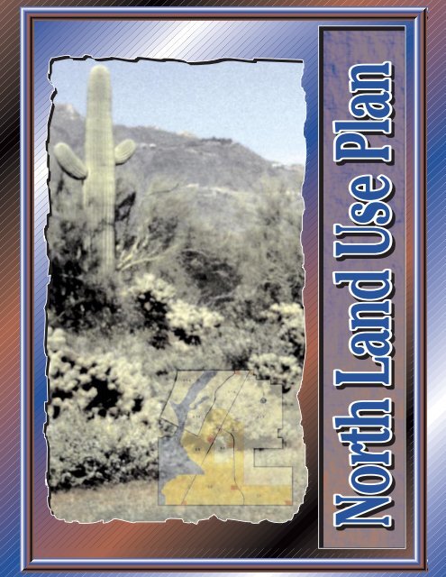
North Land Use Plan - City of Phoenix
North Land Use Plan - City of Phoenix
North Land Use Plan - City of Phoenix

You also want an ePaper? Increase the reach of your titles
YUMPU automatically turns print PDFs into web optimized ePapers that Google loves.
<strong>City</strong> Council<br />
Skip Rimsza, Mayor<br />
Dave Siebert, District 1<br />
Frances Emma Barwood, District 2<br />
Peggy A. Bilsten, District 3<br />
Craig L. Tribken, District 4<br />
John Nelson, District 5<br />
Sal DiCiccio, District 6<br />
Doug Lingner, District 7<br />
Cody Williams, District 8<br />
<strong>Plan</strong>ning Commission*<br />
Mary Jo Waits, Chair<br />
Mike Bielecki, Vice Chair<br />
Virgil Berry Jr.<br />
Chris Hamel<br />
Jim Sasser<br />
Lois Savage<br />
Gary Trujillo<br />
<strong>City</strong> Management<br />
Frank Fairbanks, <strong>City</strong> Manager<br />
Raymond F. Bladine, Deputy <strong>City</strong> Manager<br />
Supervision<br />
David E. Richert, <strong>Plan</strong>ning Director<br />
Ray Quay, Assistant <strong>Plan</strong>ning Director<br />
Jim Mathien, <strong>Plan</strong>ner III, <strong>North</strong> Team Leader<br />
David Moody, Deputy Development Services Director<br />
ACKNOWLEDGMENTS<br />
Project Team<br />
Jolene Ostler, <strong>Plan</strong>ner II, Project Manager, <strong>North</strong> <strong>Land</strong> <strong>Use</strong> <strong>Plan</strong><br />
Al Zelinka, <strong>Plan</strong>ner I, Project Manager, <strong>North</strong> <strong>Land</strong> <strong>Use</strong> Study<br />
Dean Brennan, <strong>Plan</strong>ner II<br />
Randy Weaver, <strong>Plan</strong>ner I<br />
John Eamigh, <strong>Plan</strong>ning Technician IV, Graphic Designer<br />
Diana Moissonnier, <strong>Plan</strong>ning Technician IV, Graphics<br />
Howard Steere, Secretary II<br />
Dawn Coomer, <strong>Plan</strong>ning Intern<br />
Desert View Tri-Villages <strong>Plan</strong>ning Committee<br />
Matthew Brady, Chair<br />
Gordon Taylor, Vice-Chair<br />
Faith Sussman, <strong>North</strong> <strong>Land</strong> <strong>Use</strong> <strong>Plan</strong> Subcommittee Chair<br />
Jean Anderson<br />
Howard Bickerdyke<br />
Daniel Bradley<br />
Arthur Burrows<br />
Bruce Dressel<br />
Christopher Estes<br />
Susan Miner<br />
Carol Shuler<br />
Pat Shepherd-Achenbaugh<br />
Howard Sobelman<br />
Jennifer Mund-Thomas<br />
Special thanks are extended to Dean John Meunier, Frederick Steiner, and many faculty and students <strong>of</strong> the College <strong>of</strong><br />
Architecture and Environmental Design, Arizona State University who participated in the <strong>North</strong> Sonoran <strong>Land</strong> <strong>Use</strong><br />
Character Charrette which laid groundwork for this <strong>Plan</strong>. Thanks are also extended to the Arizona Fish and Game and<br />
Arizona State University West for providing guidance on desert ecology.<br />
*at time <strong>of</strong> adoption<br />
Prepared by<br />
<strong>City</strong> <strong>of</strong> <strong>Phoenix</strong> <strong>Plan</strong>ning Department<br />
May 1997
1<br />
Background<br />
TABLE TABLE OF CONTENTS CONTENTS<br />
<strong>North</strong> <strong>Land</strong> <strong>Use</strong> Study<br />
Strategic <strong>Land</strong> <strong>Use</strong> <strong>Plan</strong>ning Concepts<br />
<strong>North</strong> <strong>Land</strong> <strong>Use</strong> <strong>Plan</strong><br />
Implementation<br />
Appendix: Conclusions <strong>of</strong> the <strong>North</strong> <strong>Land</strong> <strong>Use</strong> Study<br />
Upon request, this publication will be made available within a reasonable<br />
length <strong>of</strong> time through appropriate auxiliary aids or services to accommodate<br />
an individual with a disability. this publication may be made available through<br />
the following auxiliary aids or services: large print, Braille, audiotape or<br />
computer diskette. Contact Theresa Damiani, 262-6368/v or 534-5500 TDD.<br />
3<br />
6<br />
8<br />
12<br />
19<br />
20
LEGEND<br />
COMMERCIAL<br />
RESIDENTIAL 0-2<br />
Number (1.2 or 1.5) indicates<br />
dwelling unit limit per acre<br />
(a cap)<br />
RESIDENTIAL 2-5<br />
RESIDENTIAL 5-10<br />
RESIDENTIAL 10+<br />
0-1.2<br />
Cave Creek Wash<br />
CAVE CREEK RD<br />
0-1.2<br />
2-5<br />
2-5<br />
0-2<br />
0-1.5<br />
2-5<br />
NORTH LAND USE MAP<br />
Approved by <strong>City</strong> Council June 1996<br />
#SA/DVTV-03-94-2<br />
TATUM BLVD<br />
0-1.5<br />
2-5<br />
SCOTTSDALE RD<br />
2
3<br />
During 1993 and 1994 the <strong>City</strong> Council heard several controversial zoning cases in Desert<br />
View Tri-Villages. Issues included density, life style, desert preservation, and development<br />
character. In late 1994, three General <strong>Plan</strong> amendments were filed that proposed<br />
changing the <strong>City</strong>’s policies related to development in these areas. The <strong>North</strong> <strong>Land</strong> <strong>Use</strong><br />
<strong>Plan</strong> responded to the General <strong>Plan</strong> amendment filed by Desert View Tri-Villages <strong>Plan</strong>ning<br />
Committee.<br />
The area <strong>of</strong> the <strong>North</strong> <strong>Land</strong> <strong>Use</strong> <strong>Plan</strong> extends from just west <strong>of</strong> Cave Creek Wash to<br />
Scottsdale Road and from Carefree Highway south to Pinnacle Peak Road. This area is<br />
upper Sonoran Desert and the hydrology varies from undefined sheet flow in the south to<br />
more defined washes in the north. Desert and wash areas west <strong>of</strong> 40th Street are<br />
generally undisturbed, while east <strong>of</strong> 40th Street the washes and deserts have been altered<br />
in various locations. Cave Creek Wash is generally undisturbed north <strong>of</strong> the Cave Buttes<br />
Recreation area. Two exceptions are the area near the Dynamite Road alignment, which<br />
is being mined for sand and gravel, and the county-operated land fill south <strong>of</strong> Carefree<br />
Highway.<br />
Figure 1<br />
Cave Cave Cave<br />
Creek Creek Creek<br />
Cave Buttes<br />
Recreation Area<br />
Gravel Mine<br />
BACKGROUND<br />
Wash Wash Wash<br />
40th ST 40th ST<br />
CAREFREE HWY<br />
<strong>Land</strong>fill<br />
PINNACLE PEAK RD<br />
DYNAMITE BLVD<br />
SCOTTSDALE RD
Cave Cave Cave<br />
Creek Creek Creek<br />
Figure 2<br />
Figure 3<br />
Cave Creek Wash<br />
Wash Wash Wash<br />
40th ST 40th ST<br />
PINNACLE PEAK RD<br />
CAREFREE HWY<br />
Tatum<br />
Ranch<br />
Tatum<br />
Highlands<br />
DYNAMITE BLVD<br />
SCOTTSDALE RD<br />
State-owned land, shown in red on<br />
Figure 2, covers sixty percent <strong>of</strong> the<br />
area and is mostly undisturbed<br />
desert. Most <strong>of</strong> the remaining<br />
privately-owned land has been<br />
subdivided in a rural pattern <strong>of</strong><br />
development <strong>of</strong> one dwelling unit per<br />
acre or less. Exceptions to this<br />
include recent subdivisions in Tatum<br />
Ranch and Tatum Highlands, shown in<br />
green, where densities average 3.3<br />
dwelling units per acres. The<br />
remaining private large lot vacant<br />
land has been zoned for densities<br />
ranging from 1.1 to 2 dwelling units<br />
per acre.<br />
Most <strong>of</strong> this area was annexed into<br />
the city in 1985, with smaller<br />
annexations occurring over the last<br />
few years. Tatum Ranch was initially<br />
started in 1986 and is nearly built out.<br />
The land use plan for this area came<br />
when the city adopted the peripheral<br />
AreaC&D<strong>Plan</strong> in 1987.<br />
Prior to this plan, the General <strong>Plan</strong><br />
included a land use and residential<br />
density map, with most <strong>of</strong> the area<br />
designated 0-2, shown in pale yellow<br />
on Figure 3. The exception was a<br />
corridor along Cave Creek Road and<br />
Tatum Boulevard that extends from<br />
Pinnacle Peak Road to Tatum Ranch.<br />
This corridor included densities from<br />
2-5, shown in orange, to 10 plus<br />
dwelling units per acre, shown in<br />
brown. This plan also included a<br />
commercial core, noted by an<br />
asterisk at Dynamite and Cave Creek<br />
Road.<br />
4
5<br />
Cave Cave Cave<br />
Creek Creek Creek<br />
Figure 4<br />
Wash Wash Wash<br />
40th ST 40th ST<br />
PINNACLE PEAK RD<br />
CAREFREE HWY<br />
DYNAMITE BLVD<br />
During 1994 three (3) amendments to the General <strong>Plan</strong> were filed for this area. The first<br />
amendment, filed by Sonoran <strong>North</strong>, a local special interest group, proposed changes to<br />
theAreaC&D<strong>Plan</strong> to refine the plan’s concepts <strong>of</strong> rural development. The second<br />
amendment, filed by the Desert View Tri-Villages <strong>Plan</strong>ning Committee, proposed a general<br />
lowering <strong>of</strong> densities east <strong>of</strong> 19th Avenue and north <strong>of</strong> Pinnacle Peak Road. The third, filed<br />
by a private land owner adjacent to the Squaw Peak, proposed removing the Squaw Peak<br />
north <strong>of</strong> the Outer Loop.<br />
Because <strong>of</strong> the potential impact <strong>of</strong> these amendments on the area, staff suggested<br />
extending the normal review process for these General <strong>Plan</strong> amendments. With the<br />
concurrence <strong>of</strong> the applicants, staff began with examining the land use issues first, with<br />
processing the transportation amendment and detailed development standards to come<br />
later.<br />
SCOTTSDALE RD<br />
Rezoning cases became very active<br />
in 1993. One <strong>of</strong> the first rezoning<br />
cases was Dove Valley Estates with<br />
60 acres, shown in blue on Figure 4.<br />
One <strong>of</strong> the largest cases was Dove<br />
Valley Ranch with almost 500 acres,<br />
shown in red. Other cases include<br />
Tatum Highlands, in green, the<br />
Farmer Property in tan, Colina Del<br />
Norte in orange, and, most recently,<br />
AM Ranch, shown in yellow.
The <strong>North</strong> <strong>Land</strong> <strong>Use</strong> Study was initiated with a series <strong>of</strong> public meetings to identify what<br />
issues the community felt should be addressed by these amendments. From the initial<br />
public meetings, four key issues became clear.<br />
1. Preservation<br />
Preservation <strong>of</strong> desert and mountain areas is a priority <strong>of</strong> the city and region. Within<br />
the city’s Desert Preservation <strong>Plan</strong> and the Maricopa Association <strong>of</strong> Government’s<br />
Regional Open Space <strong>Plan</strong>, 11,000 acres <strong>of</strong> significant mountain and wash area<br />
are proposed for preservation within Desert View Tri-Villages.<br />
2. Rural Character<br />
Many <strong>of</strong> the existing residents commented that they had moved to this area<br />
because <strong>of</strong> the rural lifestyle. They characterized their neighborhoods as lowdensity<br />
residential environments free <strong>of</strong> urban features such as paved streets,<br />
sidewalks, street lights, traffic, and noise. This rural lifestyle was also characterized as<br />
freedom to live in the desert as one chooses: with horse properties or large lots <strong>of</strong><br />
preserved desert, non-traditional building styles, and freedom to move across<br />
private property to undisturbed parts <strong>of</strong> the desert.<br />
3. Density<br />
Some people were concerned about the impacts <strong>of</strong> growth in general, including<br />
traffic, crime, and overburdened schools. Some people expressed concern about<br />
higher densities resulting in loss <strong>of</strong> desert. In contrast, property owners were<br />
concerned that lower densities would render their property uneconomical to<br />
develop in today’s market.<br />
4. Growth Corridors<br />
NORTH LAND USE STUDY<br />
Concern was also expressed that lower densities leading to higher housing costs<br />
would have a negative impact on the city’s ability to attract employment.<br />
Constraints such as unaffordable housing are recognized barriers to attracting new<br />
employers.<br />
6
7<br />
1.0 du/ac<br />
Figure 5<br />
0.96 du/ac<br />
CENTRAL ARIZONA PROJECT<br />
$<br />
$<br />
CAREFREE HWY<br />
Based on the issues raised, staff began<br />
to analyze the impact that lower<br />
densities would have on the area. Staff<br />
reviewed the impact <strong>of</strong> different density<br />
scenarios and found that, with densities<br />
as low as one dwelling unit per acre, the<br />
per unit cost infrastructure, such as water<br />
and sewer, and operational services,<br />
such as police protection, increased<br />
significantly. And while school<br />
enrollments decreased, housing<br />
became less affordable. See the <strong>North</strong><br />
<strong>Land</strong> <strong>Use</strong> Study appendix to learn how<br />
changes in development density in four<br />
development patterns affect areas <strong>of</strong><br />
community importance, such as<br />
infrastructure and open space.<br />
To begin analyzing the urban design issues, the Arizona State University College <strong>of</strong><br />
Architecture and Environmental Design <strong>of</strong>fered assistance through a design charrette. The<br />
objective <strong>of</strong> the charrette was to explore how each <strong>of</strong> the four community characters, that<br />
had been earlier identified by the community, could be designed.<br />
Thirty design pr<strong>of</strong>essionals met with residents and developers to explore detailed design<br />
ideas that would make these character area distinctive and viable.<br />
Figure 6<br />
Artwork by Jesse Drake
They asked question such as, what features, in addition to horses, creates a rural<br />
character?<br />
Figure 7<br />
And how can cluster development in suburban areas preserve wash corridors?<br />
Figure 8<br />
Artwork by Jesse Drake<br />
Artwork by Jesse Drake<br />
STRATEGIC LAND USE PLANNING CONCEPTS<br />
Based on existing city policy, community input, staff analysis, and the design charrette,<br />
staff developed six planning concepts. The intent <strong>of</strong> these concepts was to refine the<br />
existing policies in the Area C&D<strong>Plan</strong>, and guide the development and discussion <strong>of</strong> a<br />
General <strong>Plan</strong> amendment.<br />
8
9<br />
1. <strong>Plan</strong> for Strategic <strong>Land</strong> <strong>Use</strong>s<br />
The first concept emphasizes the strategic nature <strong>of</strong> regional employment and<br />
desert preservation. Opportunities for regional desert preservation are not only<br />
important for recreational and environmental reasons, they are also important<br />
to maintain <strong>Phoenix</strong>’s desert character and quality <strong>of</strong> life. The desert preserves<br />
planned for the city, as shown in green on Figure 9, link washes, hillsides, and<br />
flatlands together in an environmentally viable unit.<br />
Opportunities to develop<br />
employment centers are<br />
critical to the health <strong>of</strong> the<br />
city’s economy. In this<br />
area, the city has two key<br />
regional employment<br />
corridors shown in orange<br />
on Figure 9. One is along<br />
the Outer Loop freeway<br />
near Tatum Boulevard and<br />
one is along the upper I-17<br />
in the vicinity <strong>of</strong> Carefree<br />
Highway. Located on<br />
freeways, these areas have<br />
access to a very large, future<br />
labor pool.<br />
Figure 9<br />
I-17<br />
CAREFREE HWY<br />
OUTER LOOP<br />
CAVE CREEK RD<br />
Fortunately, these corridors do not interfere with the pattern <strong>of</strong> major desert land<br />
forms and have sufficient adjacent residential opportunities to support each<br />
corridor’s employment growth.<br />
2. Preserve Cave Creek Wash as Ecological Spine <strong>of</strong> Desert<br />
The second concept<br />
recognizes the importance<br />
<strong>of</strong> Cave Creek Wash’s role<br />
in maintaining an environmentally<br />
viable desert<br />
preserve for this area.<br />
This wash corridor is an<br />
important wildlife<br />
corridor in that it<br />
provides shelter<br />
and linkage between<br />
adjacent flat land<br />
and mountain desert<br />
areas. It also provides<br />
Figure 10
Figure 12<br />
a linkage from the upper Sonoran Desert in <strong>Phoenix</strong> to the upper sonoran<br />
areas in the Tonto National Forest. The impact <strong>of</strong> losing such linkages was a<br />
lesson learned by <strong>Phoenix</strong> in its existing mountain preserves. These linkages<br />
are important to maintaining the health and variety <strong>of</strong> these desert areas.<br />
3. Recognize Washes as a Development Constraint<br />
The third concept addresses<br />
the constraint that the area’s<br />
flooding characteristics place<br />
on development. The<br />
eastern portion <strong>of</strong> Desert<br />
View has two distinct natural<br />
drainage systems. The area<br />
generally north <strong>of</strong> Jomax<br />
Road has a distinct wash<br />
system, as shown in red on<br />
Figure 11. Flooding events<br />
result in flows with established<br />
washes.<br />
CAREFREE HWY<br />
Site design in this area focuses<br />
PINNACLE PEAK RD<br />
on utilizing the natural drainage<br />
system and locating development<br />
Figure 11<br />
outside these defined washes.<br />
The areas generally South <strong>of</strong> Jomax Road, shown in green, have a different<br />
drainage pr<strong>of</strong>ile, with flooding predominantly occurring in a sheet flow<br />
fashion. This means that flood waters flow over the entire area, creating<br />
smaller and less distinct washes than in the north. When homes are raised<br />
and built above the flood level, as required by city ordinance, the natural<br />
sheet flow is concentrated as it passes around the house.<br />
Cave Cave Cave<br />
Creek Creek Creek<br />
Wash Wash Wash<br />
CAVE CREEK RD<br />
TATUM BLVD<br />
JOMAX RD<br />
Lower density development can<br />
space homes for enough apart<br />
to allow flood water to spread<br />
back out minimizing any impact<br />
on adjacent properties.<br />
SCOTTSDALE RD<br />
10
11<br />
Higher density development must<br />
concentrate these flows. Since the<br />
natural wash system can not handle<br />
concentrated flows, a new drainage<br />
system must be created.<br />
4. Seek Cost Effective Infrastructure<br />
Figure 14<br />
The fourth concept addresses issues related to the cost effectiveness, or<br />
ineffectiveness, <strong>of</strong> providing public infrastructure in low-density areas.<br />
Infrastructure Minimum Sizes<br />
Street 2 Lanes<br />
Sewer Line 8 Inches<br />
Water Line 8 Inches<br />
Figure 13<br />
Most public infrastructure has a<br />
minimum sized unit that can be<br />
built. A road can not be less than<br />
two lanes regardless <strong>of</strong> how little<br />
traffic it carries. A sewer line, in<br />
order to maintain flow, cannot be<br />
any smaller than eight inches<br />
regardless <strong>of</strong> the capacity<br />
needed. This means services to<br />
low-density areas are <strong>of</strong>ten not as<br />
cost effective as areas only slightly<br />
more dense because minimum<br />
size constraints result in more<br />
capacity being built than will be<br />
used.
The location <strong>of</strong> development and its density relative to the placement <strong>of</strong><br />
infrastructure can help reduce such inefficiencies. For example, locating higher<br />
densities along lines with excess capacity can increase the efficiency <strong>of</strong> a system.<br />
Figure 16<br />
5. Maintain established character<br />
8" 8"<br />
Excess Capacity At Capacity<br />
The fifth concept addressed the community’s desire to maintain the character<br />
established by existing developments. For example, the northeastern area has<br />
developed with large custom lots. In contrast, Tatum Ranch and Tatum Highlands<br />
are suburban subdivisions.<br />
6. Recognize Existing Rights<br />
The last concept addressed locations that are undeveloped, but had been<br />
granted development rights. These rights were recognized as revisions to General<br />
<strong>Plan</strong> were considered.<br />
The <strong>North</strong> <strong>Land</strong> <strong>Use</strong> <strong>Plan</strong> addresses community and property owner concerns by modifying<br />
the original Area C&D<strong>Plan</strong> to incorporate the strategic planning concepts. The plan has<br />
six key features:<br />
1. Regional Employment<br />
NORTH LAND USE PLAN<br />
First, the plan recognizes the strategic importance and viability <strong>of</strong> regional<br />
employment. A key regional employment corridor, Desert Ridge, lies just south <strong>of</strong><br />
this area as shown on Figure 16. This corridor was created on the General <strong>Plan</strong> in<br />
1996 when the city realized the opportunity to develop an employment area where<br />
the accelerated freeway construction would provide new access.<br />
In contrast, regional freeway plans have removed freeways north <strong>of</strong> the Outer Loop<br />
which were to serve the primary core shown on the General <strong>Plan</strong> at Cave Creek<br />
Road and Dynamite. The lack <strong>of</strong> freeway access combined with low densities in<br />
the area raised doubt that this location would develop a large employment base.<br />
12
13<br />
Figure 16<br />
I-17<br />
CAREFREE HWY<br />
OUTER LOOP<br />
0-1.5<br />
CAVE CREEK RD<br />
Regional<br />
Employment<br />
Corridors<br />
Desert Ridge<br />
In response, the plan reduces the size <strong>of</strong> the core to 100 acres <strong>of</strong> commercial to function<br />
as a community service area shown as the middle red square on Figure 17. Two other<br />
community service areas are added: one at Carefree Highway and 48th Street in the<br />
north and the second at Cave Creek Road and Pinnacle Peak Road in the south.<br />
Cave<br />
Figure 17<br />
Creek<br />
0-1.2<br />
0-1.2<br />
2-5<br />
CAVE CREEK RD<br />
Wash<br />
2-5<br />
0-2<br />
TATUM BLVD<br />
2-5<br />
0-1.5<br />
2-5<br />
SCOTTSDALE RD
2. Desert Preservation<br />
Second, the plan recognizes that the critical component <strong>of</strong> the desert preservation<br />
system in the north is Cave Creek Wash. In order to preserve the ecological value<br />
<strong>of</strong> the wash, an area <strong>of</strong> approximately one mile on either side <strong>of</strong> the wash is<br />
designated as an inhabited preservation buffer. This buffer expands the habitat <strong>of</strong><br />
Cave Creek Wash to include the many adjacent washes which exist today in a<br />
natural condition. A density limit <strong>of</strong> 1.2 dwelling units per acre applies to the<br />
preservation buffer north <strong>of</strong> Dynamite. Below Dynamite and adjacent to what will<br />
be the Cave Buttes Recreational area, the density is 2 to 5 dwelling units per acre.<br />
This combination balances objectives to give residents recreational opportunities in<br />
the wash and to preserve natural areas. It is recommended that a master plan <strong>of</strong><br />
the entire Cave Creek Wash and buffer area, which is primarily owned by the state,<br />
be prepared in the future.<br />
Figure 18<br />
Cave<br />
Creek<br />
0-1.2<br />
0-1.2<br />
2-5<br />
CAVE CREEK RD<br />
Wash<br />
2-5<br />
0-2<br />
0-1.5<br />
TATUM BLVD<br />
2-5<br />
0-1.5<br />
2-5<br />
14
15<br />
3. General Location <strong>of</strong> Primary<br />
Washes<br />
Third, the plan recognizes the<br />
importance the washes play<br />
in determining appropriate<br />
land use densities. The<br />
amendment added the<br />
general location <strong>of</strong> primary<br />
washes to the General <strong>Plan</strong><br />
<strong>Land</strong> <strong>Use</strong> Map to emphasize<br />
that development will need to<br />
preserve these washes and<br />
their alignments.<br />
4. Residential Changes based on<br />
Hydrology<br />
The transition <strong>of</strong> hydrology from<br />
distinct washes in the north to<br />
sheet flow in the south guided<br />
revisions to residential densities.<br />
The northern densities are<br />
limited to 1.5 where the washes<br />
can be used in their current<br />
natural condition to drain the<br />
properties during rains. In these<br />
areas, a study <strong>of</strong> a site’s<br />
hydrology will be required at the<br />
time <strong>of</strong> rezoning and density will<br />
be determined based on the<br />
hydrology.<br />
Cave Cave Cave<br />
Creek Creek Creek<br />
Figure 19<br />
Cave Cave Cave<br />
Wash Wash Wash<br />
CAVE CREEK RD<br />
Creek Creek Creek<br />
Figure 20<br />
Wash Wash Wash<br />
0-1.2<br />
2-5<br />
TATUM BLVD<br />
TATUM BLVD<br />
52ND ST<br />
CAREFREE HWY<br />
JOMAX RD<br />
PINNACLE PEAK RD<br />
0-1.5<br />
2-5<br />
SCOTTSDALE RD<br />
HAPPY VALLEY RD<br />
Natural drainage will transition to manmade drainage at 52nd Street and at Happy<br />
Valley Road where the hydrology begins to change to sheet flow. Tatum Boulevard<br />
and Happy Valley Road will need to be built as dry crossings that are passable in a<br />
heavy rain. Development occurring west and south <strong>of</strong> these roads will require manmade<br />
alterations to the hydrology. Because such alterations are required<br />
regardless <strong>of</strong> densities built, the plan designates a density <strong>of</strong> 2 to 5 dwelling units<br />
per acre in these areas.
Figure 21<br />
Cave Cave Cave<br />
Creek Creek Creek<br />
Figure 22<br />
The plan deleted the average densities map found in the Area C&D<strong>Plan</strong>. The<br />
concept <strong>of</strong> average densities had been difficult to implement. Frequently during<br />
the zoning process, it was unclear just what was being averaged and how it should<br />
be applied to any one site. Rezoning discussions focused on varying interpretations<br />
<strong>of</strong> average density and not the appropriate density given the natural features on<br />
the site and surrounding land.<br />
Cave Cave Cave<br />
Creek Creek Creek<br />
Wash Wash Wash<br />
Wash Wash Wash<br />
0-1.2<br />
2-5<br />
0-2<br />
Extra<br />
Capacity<br />
TATUM BLVD<br />
Reduced<br />
Facilities<br />
52ND ST<br />
0-1.5<br />
HAPPY VALLEY RD<br />
2-5<br />
The plan establishes two density<br />
limits for land designated 0-2: a<br />
1.2 limit for those areas near<br />
Cave Creek Wash and a 1.5 limit<br />
for the remaining areas. Through<br />
the zoning process, discussion<br />
can focus on how these density<br />
limits can be achieved using the<br />
natural washes for drainage.<br />
5. Infrastructure Efficiency<br />
The fifth feature is improved cost<br />
effectiveness <strong>of</strong> infrastructure.<br />
Three areas for potential<br />
improved efficiency were<br />
identified which provided the<br />
opportunity to move density<br />
from areas inefficiently served in<br />
the north to areas in the south<br />
where exiting capacity was<br />
underutilized.<br />
16
17<br />
The land use changes overall have little impact on the total number <strong>of</strong> potential units in<br />
the area. Roughly half <strong>of</strong> the land in the plan area was already developed or committed<br />
to a final density through rezoning. The plan affects the remaining 12,500 acres, 92<br />
percent <strong>of</strong> which is owned by the State <strong>Land</strong> Department.<br />
Figure 23<br />
The changes shifted units from the<br />
north to the south. The biggest shift is<br />
reducing units on state land east <strong>of</strong><br />
Cave Creek Wash and in the area<br />
that was designated a primary core.<br />
Most <strong>of</strong> these housing units are shifted<br />
to the areas east <strong>of</strong> the Cave Buttes<br />
Recreational Area and the area south<br />
<strong>of</strong> Happy Valley Road. Private units<br />
are also increased in the Cave Buttes<br />
Recreational Area with some minor<br />
private reductions in the north<br />
central area.<br />
<strong>Land</strong> Potentially Affected<br />
State <strong>Land</strong> 11,500 acres 92%<br />
Private <strong>Land</strong> 1,000 acres 08%<br />
Total 12,500 acres 100%<br />
Figure 24<br />
-<br />
Cave Cave Cave<br />
-<br />
Creek Creek Creek<br />
Cave Buttes<br />
Recreation Area<br />
+<br />
Wash Wash Wash<br />
-<br />
40th ST<br />
-<br />
CAREFREE HWY<br />
-<br />
PINNACLE PEAK RD<br />
DYNAMITE BLVD<br />
+<br />
SCOTTSDALE RD
Overall, units are projected to decrease only four percent. Most <strong>of</strong> the reduction occurs<br />
on state land, which loses approximately 3000 units. Private land has a net gain in units,<br />
because <strong>of</strong> the increased density in the Cave Buttes area.<br />
Cave Cave Cave<br />
Creek Creek Creek<br />
Figure 26<br />
Figure 25<br />
Wash Wash Wash<br />
Projected Residential Unit Change<br />
State <strong>Land</strong> 3,000<br />
Private <strong>Land</strong> 300<br />
Total Change 4%<br />
6.<br />
Character Areas<br />
Finally, the <strong>North</strong> <strong>Land</strong> <strong>Use</strong><br />
<strong>Plan</strong> adds a map to the<br />
General <strong>Plan</strong> that identifies<br />
three character areas for<br />
the eastern portion <strong>of</strong><br />
Desert View Tri-Villages. On<br />
figure 26, Desert Preserve is<br />
shown in green, Rural<br />
Desert in brown, and<br />
Suburban Desert in light<br />
blue. The purpose <strong>of</strong> these<br />
character areas is to define<br />
the nature <strong>of</strong> development<br />
that is appropriate in each<br />
area. This plan calls for the<br />
creation <strong>of</strong> zoning overlay<br />
districts that would establish<br />
regulatory development<br />
standards.<br />
18
19<br />
Standards in the Desert Preserve area would reflect a sensitivity for environmental aspects<br />
<strong>of</strong> the buffer along the northern portion <strong>of</strong> Cave Creek Wash. Standards in the Rural Desert<br />
Character area would reflect the desire for a lifestyle associated with rural uses such as<br />
horse properties as well as a lifestyle associated with living in the Sonoran Desert.<br />
Figure 27<br />
Standards for Suburban Desert Character areas would balance the need to provide an<br />
ample supply <strong>of</strong> affordable housing to support nearby employment centers, with quality <strong>of</strong><br />
life associate with living in the north Sonoran Desert.<br />
IMPLEMENTATION<br />
Implementation <strong>of</strong> the <strong>North</strong> <strong>Land</strong> <strong>Use</strong> <strong>Plan</strong> will occur through three primary means.<br />
1. <strong>Land</strong> use changes made on the General <strong>Plan</strong> Map guide the rezoning process.<br />
The changes provide clear development expectations for land owners and<br />
residents and, therefore, should remove controversy on each individual zoning<br />
case.<br />
2. Desert preservation areas identified on the General <strong>Plan</strong> would be acquired through<br />
either purchasing or leasing the land.<br />
3. Finally, overlay districts should be developed for the three character areas to<br />
provide clear development standards which reflect community desires for each<br />
area.
Conceptual Development Patterns<br />
The following maps are from the <strong>North</strong> <strong>Land</strong> <strong>Use</strong> Study Conceptual Open Space and<br />
Development Patterns: Executive Summary,<br />
dated October 1995. The Study laid the<br />
groundwork for the <strong>North</strong> <strong>Land</strong> <strong>Use</strong> <strong>Plan</strong>. It qualitatively and quantitatively examined the<br />
potential impacts <strong>of</strong> various conceptual development patterns within sub-areas <strong>of</strong> the<br />
Desert View Tri-Villages. Four generalized patterns (growth corridor, desert character, rural<br />
desert character, and desert preservation) were applied to subareas <strong>of</strong> Desert View Tri-<br />
Villages. The development factors that change with each pattern are dwelling units, nonresidential<br />
square-footage, residential and nonresidentital acreages, etc. The study’s<br />
development scenarios represent “exercises <strong>of</strong> extremes” intended only to indentify<br />
potential broad-based impacts <strong>of</strong> future land use patterns areas <strong>of</strong> community<br />
importance, such as:<br />
Density:<br />
School Enrollment:<br />
Housing Affordability:<br />
Infrastructure and Operational Costs:<br />
Open Space:<br />
Transportation:<br />
APPENDIX<br />
Potential impacts on the number <strong>of</strong> dwelling units<br />
per acre and commercial floor-to area ratios.<br />
Potential impacts that changes in number <strong>of</strong><br />
dwelling units could have on school enrollments.<br />
Potential impacts <strong>of</strong> density changes, the number<br />
and mix <strong>of</strong> dwelling units, and desired<br />
development character on housing price.<br />
Qualitative effects <strong>of</strong> density changes on<br />
infrastructure and operational costs.<br />
Potential impact on the provision <strong>of</strong> open space<br />
acreage.<br />
Qualitative effects <strong>of</strong> density changes on planned<br />
transportation components.<br />
20
21<br />
Growth Corridor/Core<br />
The General <strong>Plan</strong> currently reflects this development pattern in the I-17 Corridor and the<br />
<strong>North</strong>east Core area; therefore, this pattern was not analyzed in other sub-areas.<br />
LEGEND<br />
$<br />
Figure 28<br />
DENSITY<br />
HOUSING<br />
AFFORDABILITY<br />
SCHOOL<br />
ENROLLMENT<br />
INCREASED<br />
DECREASED<br />
3.45 du/ac<br />
$<br />
INFRASTRUCTURE<br />
COSTS<br />
OPERATIONAL<br />
COSTS<br />
OPEN SPACE<br />
TRANSPORTATION<br />
NO/MINIMAL<br />
CHANGE<br />
3.46 du/ac<br />
Summary<br />
Affordability <strong>of</strong> housing in the I-17 Corridor is enhanced.<br />
Reduced affordability <strong>of</strong> housing occurs in the <strong>North</strong>east Core Area.<br />
$
Desert Character<br />
The Desert Character pattern was analyzed in all sub-areas within the Desert View Tri-<br />
Villages.<br />
LEGEND<br />
$<br />
Figure 29<br />
2.0 du/ac<br />
$<br />
DENSITY<br />
HOUSING<br />
AFFORDABILITY<br />
SCHOOL<br />
ENROLLMENT<br />
INCREASED<br />
DECREASED<br />
2.0 du/ac<br />
$<br />
INFRASTRUCTURE<br />
COSTS<br />
OPERATIONAL<br />
COSTS<br />
OPEN SPACE<br />
TRANSPORTATION<br />
NO/MINIMAL<br />
CHANGE<br />
2.0 du/ac<br />
2.29 du/ac<br />
2.0 du/ac<br />
2.11 du/ac<br />
Summary<br />
Reductions in the affordability <strong>of</strong> housing occurs in the West Area, Central Area,<br />
<strong>North</strong>east Core Area, <strong>North</strong>east Non-Core Area, and Southeast Area.<br />
The I-17 Corridor realizes enhanced housing affordability.<br />
Infrastructure and operational costs could be higher per equivalent dwelling unit in<br />
all sub-areas except the <strong>North</strong>east Non-Core Area and the Southeast Area.<br />
$<br />
$<br />
$<br />
$<br />
22
23<br />
Rural Desert Character<br />
This pattern was analyzed within all sub-areas except the I-17 Corridor and the <strong>North</strong>east<br />
Core Area due to their designation as growth corridor/core areas.<br />
LEGEND<br />
$<br />
Figure 30<br />
1.0 du/ac 1.0 du/ac<br />
DENSITY<br />
HOUSING<br />
AFFORDABILITY<br />
SCHOOL<br />
ENROLLMENT<br />
INCREASED<br />
DECREASED<br />
INFRASTRUCTURE<br />
COSTS<br />
OPERATIONAL<br />
COSTS<br />
OPEN SPACE<br />
TRANSPORTATION<br />
NO/MINIMAL<br />
CHANGE<br />
1.0 du/ac<br />
0.96 du/ac<br />
Summary<br />
Potentially significant decreases in General <strong>Plan</strong>-based densities resulting in relative<br />
decreases in school enrollment.<br />
Housing becomes less affordable in all sub-areas, with dramatic reductions in the<br />
affordability <strong>of</strong> housing occurring in the <strong>North</strong>east Non-Core Area and the<br />
Southeast Area.<br />
Infrastructure and operational costs could be significantly higher per equivalent<br />
dwelling unit in all applicable sub-areas (If rural infrastructure standards are<br />
applied, costs per dwelling unit may be reduced.).<br />
Significant reductions in the planned transportation system would likely occur in the<br />
West Area only.<br />
$<br />
$
Desert Preservation<br />
The existing General <strong>Plan</strong> assigns no densities to "Parks/Open Space," "Hillside," and<br />
"Floodplain" designations. Therefore no implementation mechanisms, such as land<br />
acquisition or transfer <strong>of</strong> development densities, are specifically in the plan for realizing<br />
these areas and other desert preserve lands. For the purposes <strong>of</strong> this study, the Desert<br />
Preservation conceptual development pattern is analyzed through two options for<br />
retaining preserved desert lands; in both cases, density values are assigned to the areas<br />
identified for desert preservation in order to determine possible impacts. The two options<br />
are labeled Desert Preservation(a) and Desert Preservation(b), and are described below.<br />
Desert Preservation(a) (Transfer <strong>of</strong> Development Densities) . This option involves<br />
transferring development densities from those residential lands identified for desert<br />
preservation to other lands appropriate for residential development, thereby increasing<br />
densities and the number <strong>of</strong> dwelling units.<br />
3.03 du/ac<br />
LEGEND<br />
$<br />
Figure 31<br />
DENSITY<br />
HOUSING<br />
AFFORDABILITY<br />
SCHOOL<br />
ENROLLMENT<br />
INCREASED<br />
DECREASED<br />
4.15 du/ac<br />
$<br />
2.62 du/ac<br />
INFRASTRUCTURE<br />
COSTS<br />
OPERATIONAL<br />
COSTS<br />
OPEN SPACE<br />
TRANSPORTATION<br />
NO/MINIMAL<br />
CHANGE<br />
3.49 du/ac<br />
2.31 du/ac<br />
2.0 du/ac<br />
Summary<br />
The Central Area has the potential for significant increases in density.<br />
Moderate increases in the number <strong>of</strong> dwelling units and significant increase to<br />
overall density is possible for the I-17 Corridor.<br />
Housing becomes notably more affordable in the I-17 Corridor and significantly<br />
less affordable in the <strong>North</strong>east Core, the <strong>North</strong>east Non-Core, and the<br />
Southeast Areas.<br />
Infrastructure and operational costs could be reduced per equivalent dwelling unit<br />
in the West Area, the I-17 Corridor, and the Central Area.<br />
The I-17 Corridor and the Central Area hold the greatest potential for increased<br />
open space lands under this option.<br />
$<br />
$<br />
$<br />
24
25<br />
Desert Preservation(b) (<strong>Land</strong> Acquisition or Long-Term Lease). This option involves land<br />
acquisition or long-term lease <strong>of</strong> residential lands desired for desert preservation, thereby<br />
maintaining overall density but reducing the overall number <strong>of</strong> dwelling units.<br />
LEGEND<br />
$<br />
Figure 32<br />
2.81 du/ac<br />
DENSITY<br />
HOUSING<br />
AFFORDABILITY<br />
SCHOOL<br />
ENROLLMENT<br />
INCREASED<br />
DECREASED<br />
3.45 du/ac<br />
$ $<br />
INFRASTRUCTURE<br />
COSTS<br />
OPERATIONAL<br />
COSTS<br />
OPEN SPACE<br />
TRANSPORTATION<br />
NO/MINIMAL<br />
CHANGE<br />
2.07 du/ac<br />
3.5 du/ac<br />
2.29 du/ac<br />
1.82 du/ac<br />
Summary<br />
Housing could become more affordable in the I-17 Corridor, while east <strong>of</strong> the<br />
corridor housing becomes significantly less affordable.<br />
Slight open space increases in all <strong>of</strong> the sub-areas, with most significant increases in<br />
the I-17 Corridor and the Central Area.<br />
$<br />
$<br />
$