
You also want an ePaper? Increase the reach of your titles
YUMPU automatically turns print PDFs into web optimized ePapers that Google loves.
COMMUNITY NEWS, VIEWS, AND MORE<br />
<strong>The</strong> Jemez Mountain Trail<br />
from Bernalillo to<br />
Jemez Springs<br />
By Marc and Debbie LaRouche<br />
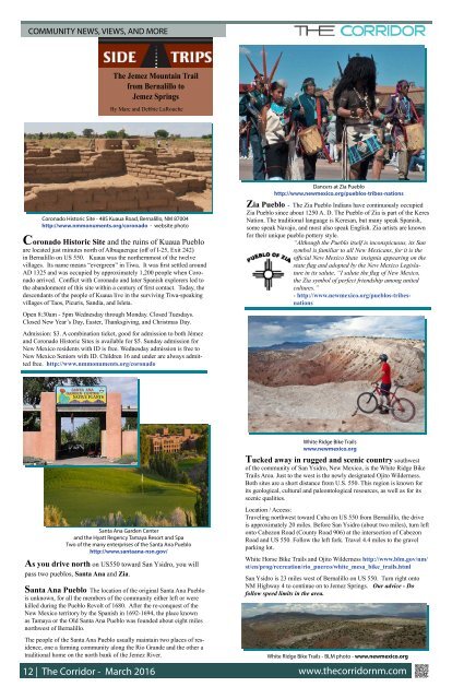
Dancers at Zia Pueblo<br />
http://www.newmexico.org/pueblos-tribes-nations<br />
Coronado Historic Site - 485 Kuaua Road, Bernalillo, NM 87004<br />
http://www.nmmonuments.org/coronado - website photo<br />
Coronado Historic Site and the ruins of Kuaua Pueblo<br />
are located just minutes north of Albuquerque (off of I-25, Exit 242)<br />
in Bernalillo on US 550. Kuaua was the northernmost of the twelve<br />
villages. Its name means “evergreen” in Tiwa. It was first settled around<br />
AD 1325 and was occupied by approximately 1,200 people when Coronado<br />
arrived. Conflict with Coronado and later Spanish explorers led to<br />
the abandonment of this site within a century of first contact. Today, the<br />
descendants of the people of Kuaua live in the surviving Tiwa-speaking<br />
villages of Taos, Picuris, Sandia, and Isleta.<br />
Open 8:30am - 5pm Wednesday through Monday. Closed Tuesdays.<br />
Closed New Year’s Day, Easter, Thanksgiving, and Christmas Day.<br />
Admission: $3. A combination ticket, good for admission to both Jémez<br />
and Coronado Historic Sites is available for $5. Sunday admission for<br />
New Mexico residents with ID is free. Wednesday admission is free to<br />
New Mexico Seniors with ID. Children 16 and under are always admitted<br />
free. http://www.nmmonuments.org/coronado<br />
Zia Pueblo - <strong>The</strong> Zia Pueblo Indians have continuously occupied<br />
Zia Pueblo since about 1250 A. D. <strong>The</strong> Pueblo of Zia is part of the Keres<br />
Nation. <strong>The</strong> traditional language is Keresan, but many speak Spanish,<br />
some speak Navajo, and most also speak English. Zia artists are known<br />
for their unique pueblo pottery style.<br />
“Although the Pueblo itself is inconspicuous, its Sun<br />
symbol is familiar to all New Mexicans, for it is the<br />
official New Mexico State insignia appearing on the<br />
state flag and adopted by the New Mexico Legislature<br />
in its salute, “I salute the flag of New Mexico,<br />
the Zia symbol of perfect friendship among united<br />
cultures.”<br />
- http://www.newmexico.org/pueblos-tribesnations<br />
Santa Ana Garden Center<br />
and the Hyatt Regency Tamaya Resort and Spa<br />
Two of the many enterprises of the Santa Ana Pueblo<br />
http://www.santaana-nsn.gov/<br />
As you drive north on US550 toward San Ysidro, you will<br />
pass two pueblos, Santa Ana and Zia.<br />
Santa Ana Pueblo <strong>The</strong> location of the original Santa Ana Pueblo<br />
is unknown, for all the members of the community either left or were<br />
killed during the Pueblo Revolt of 1680. After the re-conquest of the<br />
New Mexico territory by the Spanish in 1692-1694, the place known<br />
as Tamaya or the Old Santa Ana Pueblo was founded about eight miles<br />
northwest of Bernalillo.<br />
<strong>The</strong> people of the Santa Ana Pueblo usually maintain two places of residence,<br />
one a farming community along the Rio Grande and the other a<br />
traditional home on the north bank of the Jemez River.<br />
White Ridge Bike Trails<br />
www.newmexico.org<br />
Tucked away in rugged and scenic country southwest<br />
of the community of San Ysidro, New Mexico, is the White Ridge Bike<br />
Trails Area. Just to the west is the newly designated Ojito Wilderness.<br />
Both sites are a short distance from U.S. 550. This region is known for<br />
its geological, cultural and paleontological resources, as well as for its<br />
scenic qualities.<br />
Location / Access:<br />
Traveling northwest toward Cuba on US 550 from Bernalillo, the drive<br />
is approximately 20 miles. Before San Ysidro (about two miles), turn left<br />
onto Cabezon Road (County Road 906) at the intersection of Cabezon<br />
Road and US 550. Follow the left fork. Travel 4.4 miles to the gravel<br />
parking lot.<br />
White Horse Bike Trails and Ojito Wilderness http://www.blm.gov/nm/<br />
st/en/prog/recreation/rio_puerco/white_mesa_bike_trails.html<br />
San Ysidro is 23 miles west of Bernalillo on US 550. Turn right onto<br />
NM Highway 4 to continue on to Jemez Springs. Our advice - Do<br />
follow speed limits in the area.<br />
White Ridge Bike Trails - BLM photo - www.newmexico.org<br />
12 | <strong>The</strong> <strong>Corridor</strong> - <strong>March</strong> <strong>2016</strong> www.thecorridornm.com