

“Artificial Towns”
MOSKRJQz
MOSKRJQz

Create successful ePaper yourself
Turn your PDF publications into a flip-book with our unique Google optimized e-Paper software.
Viktória Szirmai<br />
<strong>“Artificial</strong><br />
<strong>Towns”</strong><br />
in the 21 st Century<br />
Social Polarisation<br />
in the New Town Regions of East-Central Europe
The central question of this book<br />
is that whether the development of<br />
new towns was the possibility of a<br />
new urban development model or an<br />
unfulfilled promise. Moreover, whether<br />
aspecial town type, different from any<br />
other town types, was created in the<br />
case of new towns in East-Central<br />
Europe, including Hungary. We want<br />
to answer this central question not by<br />
the method based on going back to<br />
historical traditions. The original town<br />
plans and urban planning doctrines<br />
have never been realised, they were<br />
always compromised partly due to<br />
momentary political interests, and<br />
partly to short-term economic, mainly<br />
cost-saving aspects.<br />
This book describes the current trends,<br />
today’s new town types and other<br />
urban models with their differences<br />
and similarities. Our aim is to find<br />
the still existing relevancies of the new<br />
towns’ character, to reveal what the<br />
new towns of East-Central Europe<br />
are like today, whether they offer<br />
something else, something unique<br />
compared to other spatial formations,<br />
something that may explain why many<br />
people like, can and want to live in<br />
them and this could serve as a basis<br />
for building the future.
<strong>“Artificial</strong> <strong>Towns”</strong><br />
in the 21 st Century
<strong>“Artificial</strong> <strong>Towns”</strong><br />
in the 21 st Century<br />
Social Polarisation in the New Town Regions<br />
of East-Central Europe<br />
Edited by Viktória Szirmai<br />
Institute for Sociology<br />
Centre for Social Sciences<br />
Hungarian Academy of Sciences<br />
Budapest<br />
2016
Translated by György Váradi<br />
Proofreading by Anikó Palásti<br />
© Viktória Szirmai, Nóra Baranyai, Judit Berkes, Márton Berki, Adrienne<br />
Csizmady, Zoltán Ferencz, Peter Gajdoš, Levente Halász, Kornélia Kissfazekas,<br />
Dagmara Mliczyńska Hajda, Katarína Moravanská, Ádám Páthy, János<br />
Rechnitzer, Júlia Schuchmann, Grzegorz Węcławowicz, 2016<br />
ISBN 978-963-8302-52-6<br />
All Rights Reserved<br />
No part of this publication may be reproduced, stored in a retrieval system,<br />
or transmitted, in any form or by any means, electronic, mechanical,<br />
photocopying, recording, scanning or otherwise, without the prior written<br />
permission of the publisher.<br />
Published by Centre for Social Sciences Hungarian Academy of Sciences<br />
Publisher: Tamás Rudas<br />
Typesetting: Virág Göncző<br />
Cover design: Tamás Juhász, Vividesign<br />
Printer: Séd Nyomda, Szekszárd<br />
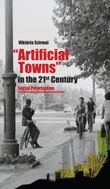
Cover photo: Dunaújváros 1692, Vasmű út (Source: www.fortepan.hu)
“Is there still living a choice between Necropolis and Utopia:<br />
the possibility of building a new kind of city that will, freed of inner<br />
contradictions, positively enrich and further human development?<br />
If we would lay a new foundation for urban life, we must understand<br />
the historic nature of the city…”<br />
Lewis Mumford (1961) The City in History.<br />
Secker and Warburg, London 3.p.<br />
5
Content<br />
Recommendation<br />
Pierre Merlin . . . . . . . . . . . . . . . . . . . . . . . . . . . . . . . . . . . . . . . . . . . . . .11<br />
Preface<br />
Viktória Szirmai . . . . . . . . . . . . . . . . . . . . . . . . . . . . . . . . . . . . . . . . . . .15<br />
PART I. THEORETICAL BACKGROUND . . . . . . . . . . . . . . . . . . . . . . .21<br />
European New Towns in the 21 st Century: An Introduction<br />
Viktória Szirmai . . . . . . . . . . . . . . . . . . . . . . . . . . . . . . . . . . . . . . . . . . . 23<br />
The issues . . . . . . . . . . . . . . . . . . . . . . . . . . . . . . . . . . . . . . . . . . . . . 23<br />
Relevancy of the new towns’ development model . . . . . . . . . . . . . . . . . . . . 32<br />
“Socialist” New Towns’ Development: the Formation Period<br />
Viktória Szirmai . . . . . . . . . . . . . . . . . . . . . . . . . . . . . . . . . . . . . . . . . . . 41<br />
Determining urbanistic doctrines . . . . . . . . . . . . . . . . . . . . . . . . . . . . . . 41<br />
Principal objectives of new towns’ development . . . . . . . . . . . . . . . . . . . . . 44<br />
The Main Characteristics of East-Central European Urbanisation Processes<br />
Viktória Szirmai . . . . . . . . . . . . . . . . . . . . . . . . . . . . . . . . . . . . . . . . . . . 47<br />
A different or a delayed model? . . . . . . . . . . . . . . . . . . . . . . . . . . . . . . . 47<br />
The impacts of transition . . . . . . . . . . . . . . . . . . . . . . . . . . . . . . . . . . . 49<br />
Social-spatial polarisation . . . . . . . . . . . . . . . . . . . . . . . . . . . . . . . . . . . 53<br />
Social-Spatial Mechanisms and Urban Changes in Hungary<br />
Viktória Szirmai . . . . . . . . . . . . . . . . . . . . . . . . . . . . . . . . . . . . . . . . . . . 55<br />
Under-urbanisation issues . . . . . . . . . . . . . . . . . . . . . . . . . . . . . . . . . . . 55<br />
The historical background of urban and rural inequalities . . . . . . . . . . . . . . 57<br />
Deepening urban and rural inequalities . . . . . . . . . . . . . . . . . . . . . . . . . . 58<br />
The social structure of the Hungarian metropolitan areas . . . . . . . . . . . . . . 60<br />
Urban Development in Poland, from the Socialist City to the<br />
Post-Socialist and Neoliberal City<br />
Grzegorz Węcławowicz . . . . . . . . . . . . . . . . . . . . . . . . . . . . . . . . . . . . . 65<br />
The historical background to urbanisation . . . . . . . . . . . . . . . . . . . . . . . . 65<br />
Urbanisation under centrally planned economy . . . . . . . . . . . . . . . . . . . . . 67<br />
Polish cities as socialist cities . . . . . . . . . . . . . . . . . . . . . . . . . . . . . . . . . 69<br />
The transformation of Polish cities into post-socialist cities . . . . . . . . . . . . . 72<br />
Toward the neoliberal city? . . . . . . . . . . . . . . . . . . . . . . . . . . . . . . . . . . 77<br />
The main component of urban policy in Poland . . . . . . . . . . . . . . . . . . . . 79<br />
Conclusions . . . . . . . . . . . . . . . . . . . . . . . . . . . . . . . . . . . . . . . . . . . . 82<br />
7
Developmental Changes in Slovakia’s Socio-Spatial Situation<br />
Peter Gajdoš . . . . . . . . . . . . . . . . . . . . . . . . . . . . . . . . . . . . . . . . . . . . . 83<br />
Introduction . . . . . . . . . . . . . . . . . . . . . . . . . . . . . . . . . . . . . . . . . . . . 83<br />
Historical development of Slovakia’s socio-spatial situation . . . . . . . . . . . . . 86<br />
Development of the socio-spatial situation in Slovakia during the period<br />
of transformation . . . . . . . . . . . . . . . . . . . . . . . . . . . . . . . . . . . . . . . . 97<br />
Specific features of transformation changes in towns and their socio-spatial<br />
structure . . . . . . . . . . . . . . . . . . . . . . . . . . . . . . . . . . . . . . . . . . . . . 110<br />
Settlement and regional impacts of the socio-economic differentiation of society . 117<br />
Conclusions . . . . . . . . . . . . . . . . . . . . . . . . . . . . . . . . . . . . . . . . . . . 127<br />
PART II. SOCIAL-SPATIAL POLARISATION MECHANISMS<br />
IN THE EAST-CENTRAL EUROPEAN NEW TOWN REGIONS<br />
– THE CASE STUDIES . . . . . . . . . . . . . . . . . . . . . . . . . . . . . . . . . . . . .133<br />
Social Polarisation in Tatabánya and its Region<br />
Júlia Schuchmann . . . . . . . . . . . . . . . . . . . . . . . . . . . . . . . . . . . . . . . . 135<br />
Introduction . . . . . . . . . . . . . . . . . . . . . . . . . . . . . . . . . . . . . . . . . . . 135<br />
The specificities of the transition period . . . . . . . . . . . . . . . . . . . . . . . . . 138<br />
The main trends of socio-spatial polarisation . . . . . . . . . . . . . . . . . . . . . 147<br />
Conclusions . . . . . . . . . . . . . . . . . . . . . . . . . . . . . . . . . . . . . . . . . . . 162<br />
Social and Economic Transition in Dunaújváros and its Region<br />
Nóra Baranyai . . . . . . . . . . . . . . . . . . . . . . . . . . . . . . . . . . . . . . . . . . . 165<br />
Introduction . . . . . . . . . . . . . . . . . . . . . . . . . . . . . . . . . . . . . . . . . . . 165<br />
The social characteristics . . . . . . . . . . . . . . . . . . . . . . . . . . . . . . . . . . . 167<br />
Features of the social polarisation . . . . . . . . . . . . . . . . . . . . . . . . . . . . . 181<br />
The future of the local society . . . . . . . . . . . . . . . . . . . . . . . . . . . . . . . 192<br />
Conclusions . . . . . . . . . . . . . . . . . . . . . . . . . . . . . . . . . . . . . . . . . . . 195<br />
Social and Economic Transformation in Komló and its Region<br />
Levente Halász . . . . . . . . . . . . . . . . . . . . . . . . . . . . . . . . . . . . . . . . . . . 197<br />
Introduction . . . . . . . . . . . . . . . . . . . . . . . . . . . . . . . . . . . . . . . . . . . 197<br />
The town’s historical development . . . . . . . . . . . . . . . . . . . . . . . . . . . . . . 198<br />
The decline . . . . . . . . . . . . . . . . . . . . . . . . . . . . . . . . . . . . . . . . . . . 201<br />
Social and demographic characteristics . . . . . . . . . . . . . . . . . . . . . . . . . 202<br />
Urban economy . . . . . . . . . . . . . . . . . . . . . . . . . . . . . . . . . . . . . . . . . 206<br />
Social polarisation . . . . . . . . . . . . . . . . . . . . . . . . . . . . . . . . . . . . . . . 209<br />
Spatial polarisation . . . . . . . . . . . . . . . . . . . . . . . . . . . . . . . . . . . . . . 213<br />
Conclusions . . . . . . . . . . . . . . . . . . . . . . . . . . . . . . . . . . . . . . . . . . . 215<br />
Economic Restructuring and Social Polarisation in Kazincbarcika<br />
and its Region<br />
Márton Berki . . . . . . . . . . . . . . . . . . . . . . . . . . . . . . . . . . . . . . . . . . . . 217<br />
Introduction . . . . . . . . . . . . . . . . . . . . . . . . . . . . . . . . . . . . . . . . . . . 217<br />
History of the new town . . . . . . . . . . . . . . . . . . . . . . . . . . . . . . . . . . . 218<br />
Demographic, educational and housing characteristics . . . . . . . . . . . . . . . .221<br />
Economy and business environment . . . . . . . . . . . . . . . . . . . . . . . . . . . 226<br />
Social polarisation . . . . . . . . . . . . . . . . . . . . . . . . . . . . . . . . . . . . . . . 232<br />
Polarisation processes of the new town region . . . . . . . . . . . . . . . . . . . . . 240<br />
Conclusions . . . . . . . . . . . . . . . . . . . . . . . . . . . . . . . . . . . . . . . . . . . 244<br />
8
The Former “New Socialist City” in the Neoliberal Condition<br />
– The Case of Tychy in Poland<br />
Grzegorz Węcławowicz – Dagmara Mliczyńska-Hajda . . . . . . . . . . . . . 245<br />
Introduction . . . . . . . . . . . . . . . . . . . . . . . . . . . . . . . . . . . . . . . . . . . 245<br />
New town concepts versus the concept of the socialist city . . . . . . . . . . . . . . 246<br />
The industrial city as the model for the socialist city . . . . . . . . . . . . . . . . . 249<br />
The perception of the post-1989 problems and crises . . . . . . . . . . . . . . . . 260<br />
Conclusions . . . . . . . . . . . . . . . . . . . . . . . . . . . . . . . . . . . . . . . . . . . 267<br />
Nová Dubnica and its Region: The Slovak Case Study<br />
Peter Gajdoš – Katarína Moravanská . . . . . . . . . . . . . . . . . . . . . . . . . . 269<br />
Introduction . . . . . . . . . . . . . . . . . . . . . . . . . . . . . . . . . . . . . . . . . . . 269<br />
The geographical location and history of Nová Dubnica and its region . . . . . 270<br />
Characteristics of the growth of the Nová Dubnica region and current<br />
processes of its formation . . . . . . . . . . . . . . . . . . . . . . . . . . . . . . . . . . 278<br />
The socio-demographic structures and socio-spatial polarisation . . . . . . . . . 297<br />
Conclusions . . . . . . . . . . . . . . . . . . . . . . . . . . . . . . . . . . . . . . . . . . . 309<br />
PART III. POSITIONS OF NEW TOWN REGIONS IN THE URBAN<br />
NETWORK – SIMILARITIES AND DIFFERENCES . . . . . . . . . . . . . . 313<br />
Social Polarisation Mechanisms in the Hungarian New Town Regions<br />
Adrienne Csizmady – Zoltán Ferencz . . . . . . . . . . . . . . . . . . . . . . . . . . 315<br />
Introduction . . . . . . . . . . . . . . . . . . . . . . . . . . . . . . . . . . . . . . . . . . . 315<br />
New town societies versus the societies of large urban regions . . . . . . . . . . 316<br />
Characteristics of the spatial-social structure . . . . . . . . . . . . . . . . . . . . . 325<br />
Comparison of the spatial-social structures . . . . . . . . . . . . . . . . . . . . . . . 333<br />
Conclusions . . . . . . . . . . . . . . . . . . . . . . . . . . . . . . . . . . . . . . . . . . . 338<br />
Post-Socialist New Towns in the Urban Network<br />
János Rechnitzer – Judit Berkes – Ádám Páthy . . . . . . . . . . . . . . . . . . . 341<br />
Introduction . . . . . . . . . . . . . . . . . . . . . . . . . . . . . . . . . . . . . . . . . . . 341<br />
The rankings of post-socialist towns . . . . . . . . . . . . . . . . . . . . . . . . . . . 342<br />
The internal divisions of the post-socialist new towns . . . . . . . . . . . . . . . . 359<br />
Conclusions . . . . . . . . . . . . . . . . . . . . . . . . . . . . . . . . . . . . . . . . . . . 368<br />
The Hungarian Old and New Towns – The Results of the<br />
Comparative Analyses<br />
Adrienne Csizmady . . . . . . . . . . . . . . . . . . . . . . . . . . . . . . . . . . . . . . . . 371<br />
Specificities of the historical background . . . . . . . . . . . . . . . . . . . . . . . . 371<br />
Impacts of socialist development policy (1945–1989) . . . . . . . . . . . . . . . 374<br />
The features of the transition period (1990–2014) . . . . . . . . . . . . . . . . . 380<br />
Conclusions . . . . . . . . . . . . . . . . . . . . . . . . . . . . . . . . . . . . . . . . . . . 399<br />
Urban Structures and Architectural Specificities in the<br />
Post-Socialist New Towns<br />
Kornélia Kissfazekas . . . . . . . . . . . . . . . . . . . . . . . . . . . . . . . . . . . . . . . 403<br />
Introduction . . . . . . . . . . . . . . . . . . . . . . . . . . . . . . . . . . . . . . . . . . . 403<br />
General aspects of planning . . . . . . . . . . . . . . . . . . . . . . . . . . . . . . . . . 405<br />
Urban structure – urban-scale formal and structural characteristics . . . . . . 407<br />
City centres . . . . . . . . . . . . . . . . . . . . . . . . . . . . . . . . . . . . . . . . . . . 409<br />
Changes in urban architecture and image . . . . . . . . . . . . . . . . . . . . . . . 414<br />
9
Dunaújváros . . . . . . . . . . . . . . . . . . . . . . . . . . . . . . . . . . . . . . . . . . . 418<br />
Kazincbarcika . . . . . . . . . . . . . . . . . . . . . . . . . . . . . . . . . . . . . . . . . . 420<br />
Mining towns – Tatabánya and Komló . . . . . . . . . . . . . . . . . . . . . . . . . .423<br />
The Polish example – Tychy . . . . . . . . . . . . . . . . . . . . . . . . . . . . . . . . 427<br />
The Slovakian example – Nová Dubnica . . . . . . . . . . . . . . . . . . . . . . . . 430<br />
Conclusions . . . . . . . . . . . . . . . . . . . . . . . . . . . . . . . . . . . . . . . . . . . 433<br />
PART IV. CONCLUSIONS . . . . . . . . . . . . . . . . . . . . . . . . . . . . . . . . . 439<br />
The Main Social Polarisation Features of the East-Central European<br />
New Town Regions<br />
Viktória Szirmai . . . . . . . . . . . . . . . . . . . . . . . . . . . . . . . . . . . . . . . . . . 441<br />
Introduction . . . . . . . . . . . . . . . . . . . . . . . . . . . . . . . . . . . . . . . . . . . 441<br />
Path dependency and the contemporary changes . . . . . . . . . . . . . . . . . . . 443<br />
Social polarisation among the post-socialist new towns . . . . . . . . . . . . . . . 450<br />
A “new” urban development model or merely an unfulfilled promise? . . . . . 452<br />
Conclusions . . . . . . . . . . . . . . . . . . . . . . . . . . . . . . . . . . . . . . . . . . . 338<br />
References . . . . . . . . . . . . . . . . . . . . . . . . . . . . . . . . . . . . . . . . . . . . . . 457<br />
APPENDIX . . . . . . . . . . . . . . . . . . . . . . . . . . . . . . . . . . . . . . . . . . . . . . 475<br />
List of Authors . . . . . . . . . . . . . . . . . . . . . . . . . . . . . . . . . . . . . . . . . . 477<br />
List of Figures . . . . . . . . . . . . . . . . . . . . . . . . . . . . . . . . . . . . . . . . . . . 480<br />
List of Tables . . . . . . . . . . . . . . . . . . . . . . . . . . . . . . . . . . . . . . . . . . . . 483<br />
List of Maps . . . . . . . . . . . . . . . . . . . . . . . . . . . . . . . . . . . . . . . . . . . . 485<br />
Subject Index . . . . . . . . . . . . . . . . . . . . . . . . . . . . . . . . . . . . . . . . . . . . 486<br />
Photos . . . . . . . . . . . . . . . . . . . . . . . . . . . . . . . . . . . . . . . . . . . . . . . . . 489<br />
10
Recommendation<br />
New towns were constructed in many parts of the world and in<br />
various periods since antiquity, including a lot of medieval cities,<br />
despite the fact that the Middle Ages was not a period of rapid<br />
urban growth in Europe. But what is considered as the “New Town<br />
Movement” took place during the 20 th century after the publication<br />
of the famous book by Ebenezer Howard (“Tomorrow: a<br />
peaceful path to real reform”, 1898, reprinted under the title<br />
“Garden Cities of Tomorrow) and translated into many languages.<br />
The first “garden cities” were built in the London area (Letchworth<br />
from 1903, Welwyn after 1919) and later on in France, in the<br />
United States and in many other countries (New Delhi, etc.).<br />
But, between the two World Wars, the original New Town<br />
Movement faced a rival movement, developed by “modern” architects<br />
who organised the “Congrès internationaux d’architecture<br />
moderne (CIAM)” and adopted the “Charte d’Athènes” (1933).<br />
After World War II, most architects and urban planners adhered<br />
to the CIAM principles and most reconstruction works as well as<br />
new urbanisation in Europe were attempts, although not always<br />
successful, to respect the rigid rules of the Charte d’Athènes. Only<br />
in Britain, the post-war new towns were in the line of Howard’s<br />
theory and of the first garden cities. In the Netherlands, Sweden,<br />
Finland and elsewhere, new towns were planned according to the<br />
CIAM. As early as the 1930s, and after the war, more than one<br />
thousand “socialist towns” were built in the Soviet Union as applications<br />
of the Charte d’Athènes revised by the “constructivist”<br />
Russian architects. French new towns, whose construction was<br />
decided at the end of the 1960s, appeared as a compromise<br />
between Howard’s and Le Corbusier’s (the most famous of the<br />
CIAM group) ideas. In Central and Eastern Europe, the construction<br />
of new towns was decided, mostly in Poland and in Hungary,<br />
and built according to the “socialist town” model.<br />
In most developed countries, from the 1980s, two questions<br />
appeared: ‘Should we build a new generation of new towns? What<br />
should be done with nearly completed postwar new towns?’ The<br />
answer has generally been that, due to the decline of demogra phic<br />
growth, and also under the dominant influence of “liberal” ideo -<br />
logy, it was useless to build other new towns in the developed<br />
Recommendation<br />
11
countries. And for existing new towns, the best for them would be<br />
to become old towns.<br />
In Russia and in other former socialist countries, including<br />
Central Europe, an additional question was: ‘Can the socialist new<br />
towns, developed under strict state governance and planned eco -<br />
nomy, adapt to the new context of market economy and to selfgovernance?<br />
For these towns what have been the consequences of<br />
the regime change, of the demographic stagnation (if not a<br />
decline) and of the loss of economic priority having been given to<br />
mining and heavy manufacturing activities (which was the economic<br />
base of these postwar towns)?<br />
The interest of the book edited by Viktoria Szirmai is precisely to<br />
scrutinise how the socialist towns of Central Europe coped with<br />
this brutal change of the political, economic and social context in<br />
the 1990s and 2000s. Through several studies written by the specialists<br />
of urban development from these countries, the book is<br />
concerned mostly with Hungarian new towns (chapters are devoted<br />
to Dunaújváros, Komló, Kazinbarcika and Tatabánya) but also<br />
with Polish (Tychy) and even Slovak ones (the small town of Nová<br />
Dubnica). It appears that these towns were handicapped by their<br />
narrow economic specialisations and by a population which was<br />
lacking middle- and upper-class families. But most of them succeeded<br />
in their adaptation to self-governance. The demographic<br />
and social evolution is more controversial. Some towns still have<br />
an unbalanced demographic structure, while other ones benefit<br />
from a better equilibrium due to ageing and the partial replacement<br />
of the original population. The economic level has generally<br />
increased, but the educated young population has difficulties to<br />
find jobs in towns still dominated by manufacturing activities and<br />
this induces significant out-migration.<br />
The book is not limited to the history and the description of the<br />
present state of these new towns, not even to a presentation of the<br />
evolution since the drastic change of 1989. It includes a lot of<br />
comparisons, mostly based on the Hungarian situation: with large<br />
metropolitan areas, with other medium-sized cities, etc., in order<br />
to point out similarities and differences. The book is mostly written<br />
by specialists of social sciences and will concern mainly social<br />
planners.<br />
What is the future of these socialist towns? For the main author,<br />
there are more questions than answers about their possible evolu-<br />
12<br />
Pierre Merlin
tions: “What will the new towns do with their heritage? Are they<br />
able to build on the peculiarities they exclusively possess? Are they<br />
able to build on their past, on their special architectural endowments,<br />
on the activities of the inhabitants who are committed to<br />
their town? Are they able to actually accommodate the economic<br />
and social requirements of today and are they able to act for the<br />
benefit of transition? Are they able to renew? Do they have the<br />
ability to establish smaller and broader regional cooperation<br />
frameworks where cooperation, the joint exploitation of benefits<br />
and not the individual competition, and not the other party’s displacement<br />
is the goal?”. It would have been hazardous for the<br />
book to provide a clear prognosis. Factors at work are too nume -<br />
rous and mostly unpredictable to allow any forecast. But the<br />
analysis included in the book may help to decide what to do in<br />
order to help the socialist towns of Central Europe to turn into<br />
successful ‘old towns’.<br />
Pierre MERLIN<br />
Professor at l’université de Paris-I (Panthéon-Sorbonne)<br />
President of the Institut d’urbanisme et d’aménagement de la Sorbonne<br />
(Town and Regional Planning Institute of the University Paris-Sorbonne)<br />
Recommendation 13
Preface<br />
Viktória Szirmai<br />
The missions of this book<br />
The main mission of this book is to present the artificial towns,<br />
in other words the post-socialist new towns in the East-Central<br />
European context. The new town is not only a specific, but a<br />
unique city type in the framework of the “world city” map,<br />
because of the conditions of historical formation, and the features<br />
of contemporary transformations. Here we must immediately<br />
note that the book does not aim to completely describe the problem<br />
as that has been already done by several authors 1 , including<br />
ourselves (Haumont et al, 1999; Gaborit, 2010; Merlin, 1972; 1991;<br />
Merlin–Sudarkis, 1991; Provoost, 2010; Szirmai, 1988; 1991; 1998;<br />
2013). The mission of this book (<strong>“Artificial</strong> Towns in the 21 st Century:<br />
Social Polarisation in the New Town Regions of East-Central Europe”) is to<br />
present polarisation mechanisms, contemporary social structural<br />
relationships and their economic, political and architectural<br />
determination in new towns and their regions in Hungary, Poland<br />
and Slovakia.<br />
Targeted structural analysis of social conditions was less present<br />
in earlier works. Although addressing social spatial inequalities<br />
and shaping local community life through providing favourable<br />
physical conditions including architecture and infrastructure were<br />
key planning goals in both Western and East-Central European<br />
The study has been realised within the confines of the research entitled “Social<br />
Polarisation in the Hungarian and Eastern-Central European ‘New Town’<br />
Regions: Impacts of Transition and Globalisation” (K 106169), funded by the<br />
National Research, Development and Innovation Office.<br />
1 See them in the extra summaries, for example in the Preface introducing<br />
Gaborit’s book. (Gaborit, 2010)<br />
Preface<br />
15
new urban developments. This is why the special mission of this<br />
book as well as of the research project underpinning it 2 (titled<br />
“Social Polarisation in the Hungarian and Eastern-Central European ‘New<br />
Town’ Regions. Impacts of Transition and Globalisation.”) is to explore<br />
and analyse the mechanisms of social polarisation in East-Central<br />
Europe. We were convinced that this research may provide new<br />
insights compared to previous works as it has been built on previous<br />
research results and goes even further.<br />
This project was preceded by a comprehensive research project 3<br />
titled “Emergence of a New Urban Development Model? Transition and<br />
Globalisation in the Hungarian Regions and Their New <strong>Towns”</strong>. The<br />
results were published in Hungarian (Szirmai, 2013).<br />
Under the research project we compared the social and economic<br />
conditions of Dunaújváros and Kazincbarcika, two<br />
Hungarian new towns, and of Baja and Gyöngyös, two traditional<br />
Hungarian towns and their regions. (We compared the Duna -<br />
újváros region in Central Hungary with the geographically close<br />
Baja region and the Kazincbarcika region in Northern Hungary<br />
with the nearby Gyöngyös region.)<br />
During the course of the project embedded in European context<br />
we widened and partly changed research sites. As a result of this<br />
decision we examined the Tatabánya and Dunaújváros regions<br />
located in Central Transdanubia, the Komló region in Southern<br />
Hungary and Kazincbarcika and its region in North-Eastern<br />
Hungary. Another important difference is that we applied new<br />
research methods as well. Although the previous study was built<br />
mainly on social statistical analyses and in-depth interviews, the<br />
second project also featured a representative sociological sampling<br />
for the 11 Hungarian new towns and their regions. The<br />
2 The project realised between 2013 and 2016, was co-funded by the Hungarian<br />
Scientific Research Fund. The institutional framework for the research was provided<br />
by the Institute for Sociology Centre for Social Sciences Hungarian<br />
Academy of Sciences. The research was led by Viktória Szirmai. Project<br />
Reference Number: K 106 169<br />
3 The project realised between 2010 and 2012, was also co-funded by the<br />
Hungarian Scientific Research Fund. The institutional framework for the<br />
research was provided by the Institute for Sociology Centre for Social Sciences<br />
Hungarian Academy of Sciences. The research was led by Viktória Szirmai.<br />
Project Reference Number: K 81547<br />
16<br />
Viktória Szirmai
empirical sampling significantly improves the analyses by describing<br />
the main conditions of Hungarian new town societies by representative<br />
instruments. It also provides general knowledge, as this<br />
has been the first time that a comprehensive sociological survey<br />
has been made of all the new towns and their regions in Hungary.<br />
To explore polarisation conditions in new towns as accurately as<br />
possible, we also made comparative analyses, made possible by<br />
representative sociological data sampling in two Hungarian large<br />
urban regions. The first one was carried out in 2005 with a sample<br />
size of 5000 in 9 Hungarian large urban regions with a population<br />
of more than 100 000 each 4 , while the second one was carried<br />
out in 2014, also with a sample size of 5000 and also in 9<br />
Hungarian large urban regions with populations exceeding<br />
100 000 people 5 . We compared these results with the social polari -<br />
sation characteristics revealed in the 11 Hungarian new town<br />
regions. This has an outstanding importance as we had the opportunity<br />
to identify the differences and similarities between the social<br />
circumstances of new towns and large cities based on fresh data,<br />
and on the basis of these data we could also define the spatial<br />
characteristics of new towns and large urban regions and by proceeding<br />
from these regional (i.e. new towns or large urban<br />
regions) circumstances we could map the differentiated impact of<br />
social structural determinants as well.<br />
We considered it essential to analyse the differences and similarities<br />
of Hungarian new towns compared to their old (traditio -<br />
nally developed) counterparts of similar size and geographical<br />
position, as well as to make a comparative analysis between<br />
Hungarian new towns and all other Hungarian cities. Another new<br />
element of our research agenda was to present the architectural<br />
characteristics and urban structural endowments of new towns.<br />
4 The research conducted in 2005 was implemented under the project “Urban<br />
Areas, Spatial Social Inequalities and Conflicts – The Spatial Social Factors of<br />
European Competitiveness” with the co-funding of National Research and<br />
Development Programmes (Project Reference Number: 5/083/2004).The<br />
research was led by Viktória Szirmai.<br />
5 The 2014 research, “Social Conflicts – Social Well-being and Security –<br />
Competitiveness and Social Development” was implemented under the project<br />
with reference number: TÁMOP 4.2.2. A-11/1 / CONV-2012-0069 ID. The<br />
research was led by Viktória Szirmai.<br />
Preface 17
Compared to the previous project, this book features studies<br />
on East-Central European level as a completely new factor,<br />
although our financial resources did not make it possible for us<br />
to conduct a full empirical survey on the polarisation conditions<br />
of East-Central European new towns. Therefore the study<br />
focused on the analysis of Polish 6 and Slovak new towns (based<br />
on in-depth interviews summarised in case studies) and on the<br />
historic analysis of spatial processes in Poland and Slovakia. Due<br />
to financial constraints, a comparison of the conditions of new<br />
towns in the three countries was not a priority, nevertheless, we<br />
attempted to perform this task based on social statistical data<br />
and on the major trends that emerged in the analytical studies.<br />
The structure of this book<br />
In the first major part after the preface (Part 1) we clarify some<br />
theoretical issues. As an introduction we present European new<br />
towns in the 21 st century. Here the main issues will be revealed and<br />
a basic question here is whether the new towns’ development<br />
model is still timely today and what relevance new town theories<br />
and development models have today (by Szirmai). The second chapter<br />
summarises the urbanist doctrines and theories that underlie<br />
“socialist” new town developments and describes dominant social<br />
and ideological mechanisms. The third part of the theoretical background<br />
summarises the historical changes of the social spatial<br />
structure and the impacts of transition and globalisation on the<br />
social polarisation mechanisms of Hungary, Poland and Slovakia.<br />
(by Szirmai, Węcławowicz, and Gajdoš)<br />
Part 2 contains the case studies made in the three countries and<br />
gives a description of social spatial polarisation processes. We<br />
mainly present Hungarian case studies: the results of in-depth<br />
interviews and social statistics in the Tatabánya region (by<br />
Schuchmann), the Dunaújváros region (by Baranyai), the Komló<br />
6 The selection of the Polish research site was motivated by the existing results of<br />
previous researches: as a part of an international comparative research led by<br />
Nicole Haumont I myself took part in the research of Polish new cities, including<br />
the examination of Nowe Tychy (Haumont et al, 1999).<br />
18<br />
Viktória Szirmai
egion (by Halász) and finally the Kazincbarcika region (by Berki).<br />
This is followed by the case of Tychy in Poland (by Węcławowicz,<br />
Hajda) and a Slovakian case study about the Nová Dubnica region<br />
(by Gajdoš, Moravanská).<br />
In Part 3 this will be followed by comparative analyses of new<br />
towns and other types of towns based on various criteria: Hungarian<br />
new towns compared to large urban regions (by Csizmady,<br />
Ferencz), new towns compared to all Hungarian cities (by Rechnitzer,<br />
Berkes, Páthy), new towns compared to old towns (by Csizmady) and<br />
finally we present the similarities and differences between the architectural<br />
characteristics of Hungarian, Polish and Slovak new towns<br />
(by Kissfazekas).<br />
In the final Part 4 we summarise our conclusions. Here we<br />
attempt to answer the original question of what new town societies<br />
mean today, and finally, we evaluate whether we can regard<br />
this unique city type as the possibility of a new urban development<br />
model or as an unfulfilled promise.<br />
Acknowledgements<br />
I kindly recommend this book to the inhabitants of new and old<br />
towns, to the planners of new and old towns and their regions, to<br />
local authorities, to the professionals, intellectuals, entrepreneurs,<br />
NGO representatives in the surveyed settlements, to university students<br />
interested in regional processes and to my students as well.<br />
But most of all I would like to recommend it to the inhabitants of<br />
the Hungarian, Polish and Slovakian new town regions as well.<br />
Without them this work would never have been born. Therefore,<br />
the first thanks are for them actually. I would like to thank them<br />
for being at our disposal for telling us their opinions that helped<br />
broaden us in our research.<br />
The support of the National Scientific Research Fund was crucial<br />
for the current exploration of the problems of new towns and<br />
for an objective and independent from any organisational inte -<br />
rests analysis of facts. I highly appreciate it on behalf of all my colleagues<br />
as well.<br />
I also thank the authors, including my close colleagues and my<br />
team (among them, especially Márton Berki and Levente Halász)<br />
for their dedicated work. But I am especially grateful to the<br />
Preface 19
Polish and Slovak colleagues who agreed to participate in this<br />
work, which was far from easy because of the distances.<br />
However, we solved it on the basis of mutual interest and commitment<br />
to science.<br />
The support of the Social Science Research Centre of the<br />
Hungarian Academy of Sciences, the translation, the linguistic<br />
proof reading as well as the preparation of the book for printing,<br />
the high quality appearance and cover design, along with the kind<br />
recommendation by Professor Pierre Merlin are also standing<br />
behind the results. They are also acknowledged.<br />
Viktória Szirmai<br />
Head of research project and the editor of book<br />
20<br />
Viktória Szirmai
PART I.<br />
THEORETICAL BACKGROUND<br />
21
European New Towns in the 21 st<br />
Century: An Introduction<br />
Viktória Szirmai<br />
The issues<br />
Industrial cities stagnating or vegetating in the shadow of big<br />
cities, steel mills, mines, factories closing down, recently laid off<br />
workers protesting in the streets, high unemployment, hopelessness,<br />
people moving away from cities, dwindling population, and<br />
once thriving cities turning into ghost towns – we can see these<br />
and similar images in thematic 1990s English films, such as Peter<br />
Cattaneo’s “The Full Monty” (1997) or Mark Herman’s “Brassed<br />
Off” (1996) which are somewhat grotesque and humorous but<br />
generally sad. There are also Hungarian examples, a very remarkable<br />
one among them is Tamás Almási’s 1998 documentary titled<br />
“Tehetetlenül” (Helpless), which presents the decay of the metallurgical<br />
plant which provided the livelihood of Ózd, a typical<br />
Hungarian “socialist” industrial town and the hopeless situation<br />
of its employees.<br />
These movies are merely mentioned as illustrations of an era,<br />
and do not serve as a framework for the analysis, although the<br />
situ ations they show are depicted accurately. We have to evoke the<br />
atmosphere of these films to make a contrast between the problems<br />
of a new town development era which they depict and the<br />
formation periods when the concepts of the underlying urbanistic<br />
doctrines, along with designers and decision-makers were promising<br />
hopes of a happy new life and community.<br />
The study has been realised within the confines of the research entitled “Social<br />
Polarisation in the Hungarian and Eastern-Central European ‘New Town’<br />
Regions: Impacts of Transition and Globalisation” (K 106169), funded by the<br />
National Research, Development and Innovation Office.<br />
European New Towns in the 21st Century: An Introduction 23
In their planning phase these cities not only received special<br />
attention and development opportunities but also specific missions:<br />
in the drafts of their first designers, such as Ebenezer<br />
Howard, Le Corbusier, Soviet constructivists, or the CIAM group 1<br />
the development goals of new towns were presented as spatial<br />
solutions to the social problems, tensions and poverty typical in<br />
the urban explosion period. Social, economic and spatial formation<br />
missions associated with the planning of new towns received<br />
objectified forms, as after World War II many new towns were<br />
built in Europe as well as in Scandinavia and the United States of<br />
America.<br />
Meanwhile it is clear that urbanisation theories would never have<br />
materialised if social needs had not arisen after World War II that<br />
required new town development. Among them were the interests<br />
of the central government, which hoped to shape the spatial<br />
development of the economy and to tackle some social tensions<br />
(including the mass housing shortage) and even shape the way of<br />
life through the building of new towns.<br />
With their new town development programmes Western Euro -<br />
pean governments essentially sought to control rapid urban deve -<br />
lopment that met the needs of extensive economic development,<br />
to manage the spatial distribution of their populations, to reduce<br />
housing shortages, to treat specific social conflicts, and to meet<br />
the housing and employment needs of the middle-class wishing to<br />
escape from the problems of large cities.<br />
The central powers of Eastern and Central European countries<br />
also saw opportunities in the development of new towns, namely<br />
ways of gaining power through political, ideological and social<br />
influence. After World War II new town planning strategies were<br />
formulated as a means of introducing the so-called socialist<br />
urbanisation model, which is completely different from the spatial<br />
development that took place in the western world. Meanwhile,<br />
these strategies essentially served industrial development objectives<br />
and political power interests. In the early fifties forced heavy<br />
industry development programmes were advocated in order to<br />
achieve a socialist type of simple accumulation of capital.<br />
1 CIAM=Congrès internationaux d’architecture moderne<br />
24<br />
Viktória Szirmai
Through stressing rapidly paced development they wanted to<br />
catch up with the economic level of developed Western European<br />
societies. Disrupting civilian towns and creating the habitations of<br />
the new socialist working class were also important objectives.<br />
The new town programmes also played ideological roles as the<br />
newly formed settlements aspired to become prototypes of the<br />
socialist-type social system, community spirit and lifestyle.<br />
Signs of failure<br />
In Western Europe the dynamism of building new towns broke<br />
in the late 1970s and the 1980s. The economic crises in the 1970s<br />
and the processes that followed them slowed down the development<br />
of urban economies. Lessened business interest in new<br />
settle ments, the dwindling of anticipated new job opportunities,<br />
and new demographic waves all contributed to the decrease in the<br />
population of new towns. The shaping of lifestyles and the deve -<br />
lopment of community relations turned out to be a failure, as well<br />
as the regulation of the development of metropolitan regions. For<br />
instance, satellite-type new towns around London even if they<br />
sought to slow down the migration into the capital city but could<br />
not stabilise the population of the London region: while the<br />
agglomeration’s population grew almost by 2 million during the<br />
course of about 20 years, they only managed to house a little more<br />
than one sixth of this figure (Merlin, 1972). This was because the<br />
plan did not bear in mind the trend of suburbanisation: many<br />
people migrated from London to satellite towns, thereby lowering<br />
the chances of other people settling there. Meanwhile, the tertiary<br />
sector in London underwent an accelerated development which<br />
also pulled people towards the capital.<br />
The new settlements failed to provide the isolated but comfor -<br />
table suburban existence dreamed up by Howard which would<br />
have given them a well-rounded but still local way of life. As in contrast<br />
to the original plans, many people were commuting from<br />
these satellite towns to the centre (resulting from the needs of the<br />
tertiary sector) and on weekends these suburban areas saw an<br />
outflow of residents from the centre making them crowded and<br />
noisy (Castells, 1972). The new towns created around Paris also<br />
proved to be a disappointment: although they did not aspire to<br />
create a singular place for habitation and work as envisioned by<br />
European New Towns in the 21st Century: An Introduction 25
Howard, they were still hoped to create an active local community<br />
life. However, this did not succeed under the circumstances of<br />
modern commuting. New town residents who worked mostly in<br />
the capital also had their other everyday activities bound to the<br />
capital, so during the day new towns were empty and deserted.<br />
Regional and territorial development agencies in Western Europe<br />
therefore were on the opinion that new towns cannot efficiently<br />
handle spatial processes and they are unfit for shaping everyday<br />
life and community and social relationships.<br />
The changing relationship between Western European states<br />
and local powers also played a role in downgrading the significance<br />
of new settlements. Due to the intensifying crisis of welfare<br />
states since the early 1970s, regional development by the state was<br />
weakened and gradually receded from local levels. Among other<br />
causes this was due to the pressure by civil society, local social<br />
movements and strengthened local area development efforts. The<br />
regional development resources and subsidisation that stronger<br />
settlements applied for and received from the state were different<br />
from the previous ones and were less favourable to new towns and<br />
more favourable to larger cities.<br />
In the 1970s and 1980s new towns in Central and Eastern<br />
Europe were also labelled as a failure, partly due to factors similar<br />
to those experienced in western models. The relationships<br />
between the central party-state and local powers also changed in<br />
communist countries: in the 1950s centralised regional governance<br />
was typical, with central powers being exclusively in charge<br />
of planning and development. Planning and development characteristics<br />
and planning decisions were made in the state’s internal<br />
negotiation processes, independently of residents, stakeholder<br />
social groups and the public (Ekler–Hegedüs–Tosics, 1980). In the<br />
1970s planning and development decisions became partially<br />
decentralised as the economically strengthened big cities came<br />
2 The New Economic Mechanism was a comprehensive reform of the economic<br />
governance and planning, which was prepared in Hungary in the mid-1960s,<br />
and was introduced on 1 January 1968. The reform has brought major changes<br />
in three areas: 1) it reduced the role of central planning and increased corporate<br />
autonomy in production and investment; 2) it liberalized prices, i.e. the<br />
officially fixed prices of certain products could be changed according to market<br />
demand; 3) a centrally defined wage system has been replaced by a flexible<br />
company regulation system within certain limits.<br />
26<br />
Viktória Szirmai
into stronger political bargaining positions against the party-state<br />
and demanded bigger than usual development resources, at the<br />
expense of new industrial towns. For instance, in Hungary this<br />
happened as a result of the 1968 New Economic Mechanism 2 and<br />
thanks to reforms it gave some room for market processes. To<br />
legitimise the changes in the sharing of public resources, it became<br />
necessary to phrase the failure of new towns and to disseminate<br />
views stating the fall of earlier development goals.<br />
Due to the crises of communist regimes steadily intensifying<br />
since 1980 new towns increasingly lost their ideological appeal<br />
and utopian dreams formulated at the time of their constructions<br />
shattered. At that time the regime intentionally planted the hope<br />
of a better life in these towns, promising happiness and a more<br />
communal life, with the new towns having jobs, homes, nurseries,<br />
kindergartens, schools and adequate healthcare services.<br />
Although most of the latter facilities were in fact available there,<br />
especially when compared to other settlements and towns and villages<br />
of similar size that were struggling with developmental disadvantages,<br />
people living in new towns still increasingly felt not<br />
only the deterioration of living conditions but also the deepening<br />
of social differences that were hitherto officially kept secret 3 . The<br />
citizens of new towns felt the decrease of their towns’ economic<br />
power. Similarly to the whole communist economic system, new<br />
urban economies increasingly struggled with foreign debt, the<br />
gradual loss of eastern markets, loss-making production, the<br />
results of the crisis caused by the outdated product and price<br />
structure, the structural problems of the expensive yet inefficient<br />
economy, the erosion of large enterprises and their engineering<br />
3 Once in the past, during a research project of Dunaújváros, a town in Hungary,<br />
the locals told the researchers that urban social life is full of inequalities, there<br />
are several social contradictions among the members of working-class who are<br />
uniformly treated both by the central and local politics. They also said that the<br />
homogenous assumed working class is very much structured because the<br />
skilled workers’ and semi-skilled workers’ or unskilled workers’ living conditions,<br />
wages, incomes and housing conditions varied widely. It was also mentioned<br />
that women were in particularly disadvantaged situation especially in<br />
comparison to male qualified workers in almost every respect. (That’s why at<br />
that time Dunaújváros was referred to as “men’s town” (Szirmai–Zelenay, 1983).<br />
Social cohesion was poor there too, the intellectual groups, including human<br />
professionals were excluded not only from local power, but from local social<br />
public life as well.<br />
European New Towns in the 21st Century: An Introduction 27
and technical problems. It became clear for the leaders of new<br />
towns that despite the benefits of long decades of development,<br />
they cannot continue to operate their towns, nor renew them.<br />
They had to face the increasing scarcity of resources necessary for<br />
renewing or even just stabilising the economy needed for the<br />
towns’ operation.<br />
The regime changes of Central and Eastern Europe in 1989 and<br />
1990 did not promise positive changes in new towns either;<br />
among other things, because even in the first half of the 1990s, it<br />
seemed that transitioning to a market-based society will be harder<br />
in Eastern and Central European new towns than in traditional<br />
cities. Mostly this was due to the fact that the characteristics of the<br />
re-distributive urban management model typical of state socialism<br />
not only prevailed more clearly and forcefully than in other settlement<br />
types but also because certain factors still persisted during<br />
the formative years of the new, market-based society, namely the<br />
presence of the state and central financial dependencies, and<br />
these factors continued to influence the economic and social relationships<br />
of cities. This can be explained by the coincidence of certain<br />
interests of the state, corporates and employees. In the early<br />
1990s the energy, chemical and steel industries were of strategic<br />
importance to the state so privatising them was not a goal.<br />
Instead, slow privatisation seemed to be a good solution. The<br />
mono-functional economic structure of new towns based on<br />
heavy industry proved inflexible and the presence and interests of<br />
large enterprises delayed the formation of a diversified economic<br />
structure, the development of private capital-based entrepreneu -<br />
rial economies and the consolidation of the service sector alongside<br />
the industrial sector.<br />
Among the reasons for slow transformation were the belated<br />
development of the middle-class, the lack of civil society traditions,<br />
the low number of local social organisations which were<br />
also weak in power, and the fact that most existing ones were created<br />
in a “top-down” manner (by public institutions, social organi -<br />
sations or large companies) and not by the needs of local social<br />
powers. The numerous natural environmental issues created by<br />
the heavy industry based economy of new towns were also a serious<br />
problem. The accumulation of economic, social and environmental<br />
problems led to intense social conflicts in many new towns<br />
(Szirmai, 1993), with even more new conflicts on the horizon.<br />
28<br />
Viktória Szirmai
After the social, economic and political transition in 1989 the<br />
municipal governments of new towns tried to diversify the<br />
economies of their towns and to establish new trade, banking,<br />
tourism, and service functions. However, both foreign and local<br />
capital as well as tertiary and quaternary functions were more<br />
attracted to metropolises with wide-ranging international connections<br />
and regions with developed infrastructure and highly skilled<br />
workforces. The broadening of urban functions would have<br />
required greater local economic strength, more enterprises and a<br />
solvent customer base. Ecological problems also hampered the<br />
development of new economic functions and the establishing of<br />
new industrial investments. 4 The establishment of new roles would<br />
also have required greater regional cooperation – unified lobbying<br />
by the state – between regional centres and surrounding communities.<br />
Horizontal cooperation among municipalities was less<br />
developed in the redistributive structure. New towns seemed to<br />
find it more difficult to establish connections with their surroundings<br />
than old towns which had been more dependent on<br />
each other due to their disadvantaged position in the local and<br />
social governance system of state socialism.<br />
Signs of renewal<br />
The researches in the first half of the 1990s gave more differentiated<br />
answers than was expected from predictions. Professional<br />
pessimism did not always come true and the forecasted fall of new<br />
towns did not come true in all cases. The results of an international<br />
research on new towns have verified this. In 1993 French,<br />
English, Polish and Hungarian researchers decided to launch a<br />
comparative research titled “Villes nouvelles et villes traditionelles.<br />
Une comparaison internationale” (New Towns and Traditional<br />
4 For example, Dunaújváros failed to convince the Japanese car manufacturer<br />
Suzuki to build its Hungarian branch there as the air pollution caused by the<br />
town’s steel manufacturing led them to choose Esztergom, an old town.<br />
According to the local citizens of Dunaújváros, a contributing factor was the<br />
new town’s unfavourable lobbying position against both the state and larger<br />
capital investors. Although this seems a realistic cause, it is more likely that du -<br />
ring state and other negotiation processes, the interest enforcement power of<br />
groups interested in broadening the town’s roles were weaker than of those<br />
interested in the exclusivity of old roles.<br />
European New Towns in the 21st Century: An Introduction 29
Towns: An International Comparison) to analyse and comprehensively<br />
assess the social, planning and ecological problems of<br />
Western and Eastern European new towns. In this comprehensive<br />
assessment they aspired to study state (and in western countries,<br />
also market) interventions that were implemented through the<br />
new town development strategies of previous decades, to summarise<br />
conflicts and results, to explore the action mechanisms of<br />
local planning, and also to study the urban planning opportunities<br />
and limits of various social actors (such as local governments,<br />
economic actors, civil organisations and citizen groups). Through<br />
this they planned to establish a more coordinated model supported<br />
by a state and local planning and development system able<br />
to intervene in urban development processes. In all countries stu -<br />
died they also compared new towns with old towns as a control<br />
group (Szirmai, 1996; Haumont et al, 1999).<br />
This international research basically presented the success of<br />
Western European new towns: in the case of English and French<br />
towns successes were reported mostly in the field of regional<br />
development. The research also pointed out an increase in similarities<br />
between the social, structural and spatial characteristics of<br />
traditional and new towns. The studies investigating the social<br />
structure of French and English new towns found that social structural<br />
inequalities had eased since the residents of new towns<br />
around metropolises were mostly the members of young, educated<br />
and affluent middle-class (e.g. Haumont et al, 1999; Uzzolli–Baji,<br />
2013). Although to varying degrees, new towns in the Ile-de-France<br />
region of Paris mostly accommodate upper and middle-classes,<br />
(which are especially highly present in Marne La-Vallée, a “showcase”<br />
new town) (Brevet, 2011). 5 New towns are not a new space of<br />
spatial and social segregation as the presence of high-status,<br />
young families has always been typical in these towns. In the new<br />
towns around Paris the tendency of segregation has even<br />
increased in recent years (Herve–Baron, 2009). This suggests that<br />
5 The social structure of French metropolises, including new towns around Paris,<br />
is not similar to that of metropolises’ outer zones, suburbs and large housing<br />
estates. These are urban zones and societies where second and third-generation<br />
descendants of immigrants live, who are, similarly to their predecessors,<br />
unskilled and uneducated, and mostly unemployed. (for details, see Szirmai, 2011,<br />
pp. 31-32.)<br />
30<br />
Viktória Szirmai
Western European new towns have always provided living spaces<br />
for certain middle-class groups, namely young families with child -<br />
ren. They provided a place for them to escape from the often<br />
annoying multicultural and lower status inner city environment to<br />
better suburbs.<br />
The studied Eastern and Central European (Hungarian and<br />
Polish) cases also verified the converging trends; similarly to historic<br />
towns segregation in new towns has become perceptible:<br />
higher social status groups were located in ecologically more<br />
favourable urban quarters with better conditions while lower<br />
social status groups were located in less favourable ones. The<br />
social demographic composition in the two town types has also<br />
become similar; the process of ageing, the decreasing proportion<br />
of physical workers in the cities in question have both become<br />
typical features (Szirmai, 1998; Haumont et al, 1999).<br />
Another important lesson of the international research is that<br />
the transformation of new cities in Eastern and Central Europe<br />
was regionally differentiated; more developed regions in general<br />
more successfully handled their crisis, more successfully adapted<br />
to market-based social conditions than industrial towns under<br />
disadvantaged regional conditions, economic restructuring took<br />
place with greater difficulty there. Furthermore, it became clear<br />
that a key factor in the successful transition was the presence of<br />
state in some form. Experience has shown that especially those<br />
new cities, urban areas have survived successfully, where the<br />
state’s role at the beginning of the transition and the first half of<br />
the 1990s 6 still prevailed, either by conducting the privatisation<br />
process, thus underpinning the privatisation process with government<br />
regulations and rules shaping or even by ordaining persis -<br />
tently high ratio of assets to remain in state-ownership in the case<br />
of privatised large state-owned enterprises or by determining other<br />
technical conditions and regulating employment.<br />
6 For example, in Dunaújváros the presence of state property was maintained at<br />
Dunaferr Share Company until 2002. The town of Komló also managed to<br />
agree with the government that its mines of vital importance should not<br />
immediately shut down as a part of shock therapy, but from 1990 to 2000 they<br />
would gradually be closed, the auxiliary industries should be gradually reduced,<br />
so that the town could avoid a crash situation which had happened in the town<br />
of Ózd.<br />
European New Towns in the 21st Century: An Introduction 31
Relevancy of the new towns’ development model<br />
As a result of abandoning earlier criticisms a number of deve -<br />
lopment objectives and development strategies of new towns are<br />
becoming popular again in developed and developing countries.<br />
Today in many places urban development efforts by the instruments<br />
of social planning, including the establishment of new<br />
settle ments intend to intervene in the spatial social processes. For<br />
example, the modern versions of English new town development<br />
models are created in Asia, China, Hong Kong, where the building<br />
and development of new towns are key instruments of planning. In<br />
these cases, the spatial social processes of large metropolitan<br />
areas, especially the location of population living in high-density<br />
areas, are intended to be formulated by the further development<br />
of peripheral first generation new towns built in the previous periods,<br />
on the basis of their good transport connections and adequate<br />
infrastructure 7 .<br />
Another good example may be an initiative of the French new<br />
towns today. Some of the leaders of new towns realised that they<br />
can use the social, residential needs arisen in connection with the<br />
“étalement l’urbain” (the French term for urban sprawl) processes.<br />
Although formerly they were against it but now they have<br />
realised that they themselves may be the “engines” of urban<br />
expansion, not only by ensuring new areas for moving out to the<br />
suburban zone and at the same time controlling it, but also by<br />
offering appropriate transport connections and maintaining and<br />
even widening urban service functions (Duheim et al, 2000, p. 71.).<br />
The success of the initiative is demonstrated by the results of<br />
French urban sociological researches, according to which middleclasses<br />
wishing to live in private family houses have moved out or<br />
built their house not only in traditional small town or village type<br />
settlements or newly built gated communities located around<br />
7 For example, the 9 new towns, built on Hong Kong Island, had several deve -<br />
lopment phases: the first new towns were developed in the early 1970s, the<br />
se cond generation in the late 1970s, the third generation in the 1980s and in<br />
the 1990s. Increasing the number of population is still a target. Today 3.5 million<br />
people live in these settlements. Since 1966 five new cities have been built in the<br />
Seoul metropolitan area, a further development is an objective here as well.<br />
http://www.gov.hk/en/about/abouthk/factsheets/docs/towns&urban_<br />
developments.pdf)<br />
32<br />
Viktória Szirmai
large urban centres but they have also moved out into the surroundings<br />
of new towns (Brevet, 2011). These new towns thus<br />
found their new function in the current urbanisation trends,<br />
acknowledged the recently emerged social needs, and with the<br />
support of the small suburban hubs organised around new towns<br />
they have ensured the city centre’s’ long-term sustainability as well<br />
while once again they influence the spatial coverage of the population<br />
as well.<br />
There are further examples for the renewal of new towns: as it<br />
was said on an international conference organised by the<br />
International New Town Institute in 2010. New towns or in other<br />
words planned cities around the world are in change; i.e. they are<br />
turning into unplanned, renewed, modernised, and receiving such<br />
an urban and social outlook which is adapting to their citizens’<br />
needs. This process is taking place thanks to the residents’, professionals’<br />
and users’ residential developments, to the shaping of<br />
a milieu differing from the built environment of the past (Provoost,<br />
2010). We can find precedents for such phenomena in the eastern<br />
and central European environment as well, since the new city dist -<br />
ricts built after 1990 are no longer planned in the classical sense<br />
but organised in compliance with local social and individual needs<br />
and embodying them.<br />
Thus, in today’s Europe (but as we can see, elsewhere as well)<br />
the idea of new town is reviving: previous criticisms are revalued<br />
and referred to as “utopias that have become reality” and pertinent<br />
scientific conferences are organised 8 . A growing number of<br />
Western European experts accept that new town developments<br />
are effective instruments for central planning interventions. In<br />
addition to this, scientific studies and books highlighting the<br />
benefits of the new town environment and lifestyle are published<br />
more and more frequently. (e.g. Haumont et al, 1999; Gaborit, 2010;<br />
Provoost, 2010; Brevet, 2011).<br />
8 The examples for the conferences are as follows: Colloque du 22 mai 2003, “Les<br />
villes nouvelles de l’Ile-de-France, une utopie devenue réalité”, and Colloque: 20<br />
ans de Transformations Economiques et Sociales au Val d’Europe, Val d’Europe<br />
– 18 et 19 décembre 2012.<br />
“New Towns in Ile-de-France, an Utopia Became Reality” 22 May, 2003 and a<br />
Conference held in Val d’Europe on 18-19 December, 2012 celebrating the 20<br />
years’ anniversary of socio-Economic Transformations in Val d’Europe.<br />
European New Towns in the 21st Century: An Introduction 33
Probably several key factors (varying per country) can be found<br />
behind the revival process, but one of them is definitely the state’s<br />
recurring intensifying attempts to intervene again, especially in<br />
order to mitigate the contemporary tensions as an outcome of the<br />
2007 and 2008 global economic crisis on the basis of a controlled<br />
stimulation of world economy. The aim of managing demogra phic<br />
processes also plays a role essentially in developing countries<br />
(including Eastern and South-East Asian); the primary goal there<br />
is the central control of the spatial location of certain social strata<br />
of the population 9 .<br />
In Western Europe, a specific target is detected, namely the purpose<br />
of providing a residential milieu for the members of the upper<br />
middle-class (mostly families with high income) wishing to escape<br />
from urban social problems. This milieu is supposed to offer<br />
favourable architectural features and infrastructure facilities, the<br />
proximity to big cities, but at the same time rustic, nature-close<br />
environment, and a homogeneous social structure segregated by<br />
certain sections of the middle-class.<br />
The position of new towns in East-Central Europe today<br />
Actually, in the East-Central European countries there is no significant<br />
interest towards the new town development model or<br />
towards the present situations and the changing processes, nor is<br />
the future of the new town phenomena present in public policies<br />
and future territorial development concepts, or scientific life.<br />
To explore the reasons for this, detailed analyses are necessary.<br />
After all, neither the past, nor the present, but not even the future<br />
of the new towns can be interpreted without examining the overall<br />
territorial and social mechanisms: the conditions of their forma-<br />
9 Although the number of the world’s population growth rate is expected to<br />
decrease as it is shown in the following quote: “The World history can be divided<br />
into three periods of distinct trends in population growth. The first period<br />
(pre-modernity) was a very long age of very slow population growth. The second<br />
period, beginning with the onset of modernity (with rising standards of living<br />
and improving health) and lasting until 1962, had an increasing rate of growth.<br />
Now that period is over, and the third part of the story has begun: the population<br />
growth rate is falling and will continue to fall, leading to an end of growth<br />
before the end of this century. (‘World Population Growth’ (2015) Published<br />
online at OurWorldInData.org. Retrieved from: http://ourworldindata.org/<br />
data/population-growth-vital-statistics/world-population-growth/<br />
34<br />
Viktória Szirmai
tion, the failures and the renewals have been determined by the<br />
contemporary economic, territorial and social processes, and as<br />
we have seen by power and ideological considerations.<br />
The first period of the new town developments, the period of<br />
recovery was mobilised by the first period of urbanisation, the population<br />
and urban explosion, the resulting social tensions and by the<br />
characteristics and changes of the underlying economic forces.<br />
The later new town developments were induced by the urbanisation<br />
cycle which was based on the decentralised location of the<br />
economy and population. This urbanisation stage has been comp -<br />
leted by now, and now concentrated regional mechanisms are<br />
being formed again. By György Enyedi’s interpretation these concentration<br />
processes can be explained by the unfolding of the<br />
latest cycle of urbanisation the so-called global urbanisation. In his<br />
view, the global urbanisation process expresses the global econo -<br />
mic process of today’s world, the full unfolding of the world’s capi -<br />
talist system that involves the rapid growth of population and the<br />
strengthening of metropolitan areas (Enyedi, 2011, pp. 55-60.).<br />
Today’s urban development is not only concentration, but also<br />
decentralisation. The socially differentiated forms of the residents’<br />
outmigration from big cities, their different spatial directions, the<br />
new spatial demands of the economy and urban sprawl result in a<br />
process where big cities are expanding their territorial boundaries<br />
integrating satellite towns and other settlements into the given<br />
space. The middle-classes rejecting the metropolitan milieu are<br />
longing for a better living environment, which will result in the<br />
growth or the population exchange of suburbs or even of some<br />
new towns. The development of the inner districts of large cities,<br />
rehabilitation interventions, and the resulting high real estate<br />
prices are laying down the foundations of social exclusion and a<br />
low social status suburbanisation model.<br />
Meanwhile, a strong exchange of urban social structure is also<br />
taking place: due to the central roles inner city zones are playing in<br />
global economy, because of rehabilitation processes, and also<br />
because of the leading elite’s demands for leading an ultra-urban<br />
lifestyle (Sassen, 1991) in European capitals and large cities; the<br />
gentrification processes, the metropolitan concentration of elite<br />
teams and high social status groups and of wealth at the same<br />
time are vigorously accelerating (Savitch–Kántor, 2004). On the<br />
other hand, lower social status groups are crowded out to the<br />
European New Towns in the 21st Century: An Introduction 35
metropolitan region’s peripheral areas, or they are excluded outside<br />
the city gate or they are even moving back into their former<br />
rural residences.<br />
The characteristics of geographical location cannot be separated<br />
from social structural features. Although the presentation of<br />
the features of the social structure are beyond the scope of this<br />
book’s task, so much so longs here that during the last 10 years in<br />
Eastern European countries, radical structural changes, intensifying<br />
polarisation can be observed that have resulted in a significant<br />
decrease in the number and proportion of people belonging to<br />
higher social classes and at the same time the falling behind<br />
process of middle-class rapidly accelerated, while the proportion<br />
of poor people has increased. This is also a problem, as the Eastern<br />
and Central European middle-class was neither historically too<br />
large: since the communist regimes homogenized their societies by<br />
oppressing the old bourgeois class and by excluding them from<br />
their countries and sending them to the periphery. This social class<br />
is still not large and what is more, weak: the regime change of the<br />
1990s, the reallocations taking place within its context, the 2007,<br />
the 2008 world economic crisis and the currency crisis have<br />
squeezed these societies and even their middle-classes. That is why<br />
up to now a broad middle-class that should have a key role in<br />
modernisation has not been born yet.<br />
Social polarisation is reflected in the country’s territorial division<br />
as well, namely in the social gap between the dwellings of<br />
capital city metropolitan and small urban and rural areas.<br />
According to this pattern, members of the upper classes, including<br />
the typically highly-educated people live in metropolitan and<br />
urban dwellings. The lower classes of society are concentrated in<br />
the residential areas of small towns, including new towns and of<br />
rural villages.<br />
In Eastern and Central Europe (as well as in Western Europe),<br />
people of the highest social position, the elite and the most educated,<br />
high-income groups of the middle-class live in large cities<br />
and their more favourable suburban zones. In Western European<br />
new towns one can also find members of the middle-class<br />
(although their status is lower). In the new towns of Eastern<br />
Europe the social milieu is different, not only the middle-class, but<br />
also the members of the skilled working class are present in low<br />
proportion. As members of the (skilled, higher-income) middle-<br />
36<br />
Viktória Szirmai
class who formerly lived there fled to larger cities, and the capital<br />
city or to the region’s more fashionable parts capable of providing<br />
work and residence. Today there are several post-socialist new<br />
towns inhabited rather by the members of the lower middle-class<br />
or very often their impoverished social strata.<br />
All these are essential criteria of the current era when the worldwide<br />
global impacts generate almost completely new typed<br />
strongly polarised regions which differ from the previous ones in<br />
many aspects; the dichotomies between urban and rural areas,<br />
sharp social polarisation between different city types, including<br />
new towns. This means the spatial manifestations of inequalities<br />
regarding skills, knowledge, and particularly wealth and income<br />
positions (Stiglitz, 2012; Piketty, 2014).<br />
The societies of new towns: the possibility of a new urban<br />
development model or an unfulfilled promise?<br />
Today new towns are no longer built in Eastern and Central<br />
Europe. And this statement is true even if new urban quarters<br />
have been built in several places due to the establishment of the<br />
conditions of market economy and society based on the effects of<br />
the transition in the 1990s and as a result of the development and<br />
planning activities of the region’s new players. As a consequence<br />
of global urbanisation trends, including urban sprawl, suburban<br />
settlements are transformed and get a new modern architectural<br />
face: they reflect the new residential needs of citizens moving out<br />
to the suburbs, and to the metropolitan areas of large cities. It is<br />
obvious that these new formats are not identical with the phenomena<br />
of new towns interpreted in the classic sense. The same<br />
is true in the case of the mass of former villages freshly declared<br />
as towns.<br />
All this raises the following question: can we and do we have to<br />
deal with the already implemented, so-called new towns in a scientific<br />
sense? We are sure that the answer is yes. Namely because<br />
of the evolution of the above described social polarisation phenomena,<br />
namely because of the formation of two different but at<br />
the same time comprehensive social spatial inequality mechanisms.<br />
One type of inequality exists between the Eastern and<br />
Central European new towns. The other type of inequality arises<br />
from the comparison of urban societies of the new towns of<br />
European New Towns in the 21st Century: An Introduction 37
Eastern and Central Europe and Western Europe. This latter is<br />
particularly dangerous. In the above parts one could see that<br />
Western European new towns are mostly inhabited by the middleclass.<br />
However, in Eastern and Central Europe, new towns (it<br />
should be added again that in differentiated aspects) are inhabited<br />
not by the middle-class but rather by lower status groups which<br />
in several cases belong to the underclass.<br />
Both are cases of segregation but while one – due to the possession<br />
of favourable earnings and other economic benefits – is<br />
organised voluntarily by the inhabitants’ own choices, the other is<br />
organised by constraints, the lack of favourable income and other<br />
economic or even market advantages. These inequalities cause a<br />
major concern, as they are spoiling Eastern and Central European<br />
competitiveness and the social and economic regeneration of the<br />
individual countries. Moreover, they make the easing of tension<br />
arising from polarising social inequalities between the different<br />
European countries difficult as well. Therefore, the investigation<br />
of Eastern and Central European new towns and the presentation<br />
of facts is an important task for regional science and sociology.<br />
The central question of this book is that whether the development<br />
of new towns was the possibility of a new urban development<br />
model or an unfulfilled promise. Moreover, whether a special<br />
town type, different from any other town types, was created<br />
in the case of new towns in Eastern and Central Europe, including<br />
Hungary. We want to answer this central question not by the<br />
method based on going back to historical traditions. The original<br />
town plans and urban planning doctrines have never been<br />
realised, they were always compromised partly due to momentary<br />
political interests, and partly to short-term economic, mainly<br />
cost-saving aspects. What’s more, the built new Eastern and<br />
Central European new towns have never offered the establishment<br />
of the conditions of the community life envisioned in the plans<br />
but even if they had offered it, it could not have been a real success<br />
because without the transformation of social structures the social<br />
community-forming power of physical life conditions is weak and<br />
limited.<br />
This book describes the current trends, today’s new town types<br />
and other urban models with their differences and similarities.<br />
Our aim is to find the still existing relevancies of the new towns’<br />
character, to reveal what the new towns of Eastern and Central<br />
38<br />
Viktória Szirmai
Europe are like today, whether they offer something else, something<br />
unique compared to other spatial formations, something<br />
that may explain why many people like, can and want to live in<br />
them and this could serve as a basis for building the future. The<br />
modernisation of the specific features of new towns, the preservation<br />
of architectural and historical values, and the development<br />
of urban societies by treating polarisation inequalities may provide<br />
the so far mostly losers of the 1990 transition with new life<br />
opportunities.<br />
European New Towns in the 21st Century: An Introduction 39
“Socialist” New Towns’ Development:<br />
the Formation Period<br />
Viktória Szirmai<br />
Determining urbanistic doctrines<br />
With the new town construction wave following World War II,<br />
not only town types lacking historical traditions and spontaneous,<br />
organic development spread around Europe (and other parts of<br />
the world), but spatial and social formations striving for the regulation<br />
of social life, for the management of social conflicts that are<br />
well-balanced and capable of eliminating social inequalities and<br />
promising well-being for their local community also emerged.<br />
There may be different periods, different manifestations or even<br />
different forms and characteristics of building new towns (including<br />
for example the new towns and satellite towns), they are mostly<br />
planned for different aspects and purposes in various countries.<br />
This is the reason why the concept of new towns is not easy to<br />
specify, as it can be defined according to several criteria 1 . Among<br />
the many criteria history and genesis are the most important<br />
‘which appeared in a certain site practically “at a bare place” in<br />
The study has been realised within the confines of the research entitled “Social<br />
Polarisation in the Hungarian and Eastern-Central European ‘New Town’<br />
Regions: Impacts of Transition and Globalisation” (K 106169), funded by the<br />
National Research, Development and Innovation Office.<br />
1 New towns must be differentiated from the administratively declared new<br />
towns which can be defined on the basis of functional capabilities, regional<br />
central roles and the number of population. Although new towns have such<br />
characteristics as well because their formation is associated with administrative<br />
decisions that are mostly state decisions. What is important here is that this<br />
concept is dynamically changing. These towns are characterised by slow<br />
changes. It is important for them to have good urban infrastructure which<br />
ensures the well-being of the population. Demographic criteria (young population<br />
of childbearing age) are also among the major determinants. Although this<br />
“Socialist” New Towns Development: the Formation Period 41
accordance with the specially elaborated new urbanistic and<br />
architectural concept, or at least with a new general plan.’<br />
(Szymanska, 2005, p. 2.).<br />
The introduction of the European new towns developments<br />
are really inseparable from the urban doctrines seeking town<br />
planning solutions for spatial-social problems, for the negative<br />
phenomena of urban sprawl, for urban poverty and overcrowding<br />
in the late 18 th and the early 20 th centuries, and finding them<br />
in the building of new towns. It was Ebenezer Howard, an<br />
English architect, who first proposed the introduction of new<br />
urban forms, the creation of new suburbs for the remedy of metropolitan<br />
social problems (Howard, 1898). Howard’s idea as -<br />
piring for connecting the urban with the rural style of life was not<br />
only promoting the planning of suburban forms but the effects<br />
of Howardian doctrine can also be perceived behind the most<br />
diverse types of new towns.<br />
The term of new industrial town was first used by Tony Garnier,<br />
a French architect, in the early 20 th century who for the treatment<br />
of industrial production related social problems planned modern,<br />
new industrial towns (Garnier, 1914; Meggyesi, 1985). Le Corbusier<br />
and his staff devoted to modern architecture represent the idea<br />
that interfering in social relationships should be done with the creation<br />
of new towns in the most mature form. They replaced old<br />
towns neither by garden towns, nor by small towns, but rather by<br />
highly populated, densely built centres with rich community life<br />
opportunities, lively centres, garden towns, villa neighbourhoods<br />
around the town centre to ensure separation (Le Corbusier, 1966).<br />
The dialogue between the Soviet constructivists and the leading<br />
architects of the CIAM group during the twenties was not only of<br />
the era’s most exciting – and in its effect still controversial – discussion<br />
but it also served as a theoretical ideological basis for a<br />
new urban form spreading across the territory of the former Soviet<br />
Union and Central and Eastern European countries. The building<br />
of new dwellings was complemented by such society-shaping<br />
has changed a lot in different developmental periods, in the first period the differences<br />
between the ratio of inflowing migrants and the indigenous population<br />
was in favour of the former ones. This rate, however, changed during deve -<br />
lopment, and the proportion of the two types of population has become more<br />
balanced in the subsequent periods.<br />
42<br />
Viktória Szirmai
efforts that were aimed at intervening in the processes of social<br />
lifestyle by the instruments of planning and architecture and<br />
which saw the guarantees of creating new socialist life and society<br />
in building new towns (new districts). As an influence of the era’s<br />
urban thinking, and mostly of CIAM, an avant-garde group of<br />
Soviet architects, the Constructivists attached crucial importance<br />
to urban planning in creating a new social order, especially to the<br />
architecture different from the previous ones, based on rationality,<br />
on the principle of utility, on the functional order of elements<br />
and on the architecture denying the past and oriented for the<br />
future (Gans, 1979; Guinzburg, 1979).<br />
Between 1929 and 1931 two trends emerged among the avantgarde<br />
architects, one of them was the urbanist, the other was the<br />
dezurbanist theory (Sabsovitch, 1979). Both trends were for those<br />
decentralised industrial and urban developments that later on<br />
were realised by the development of cities built next to industrial<br />
areas, and giga-investment projects. There was a significant difference<br />
between the representatives of the two groups. The urba -<br />
nists were for decentralised and regional urban development<br />
showing some signs of centralised development with towns of 30-<br />
60,000 inhabitants while dezurbanists proposed full decentrali -<br />
sation with homogeneously dispersed individual dwellings instead<br />
of towns. Both urbanists and dezurbanists sought for the elimination<br />
of differences between town and country, and for the establishment<br />
of new settlements different from the cities of capitalist<br />
societies, with creating and expressing socialist way of life. Despite<br />
the debates they agreed that the establishment of a socialist society<br />
can be expected from building an institutional system creating<br />
the possibilities of living in community.<br />
The CIAM and the constructivists collectively prepared the socalled<br />
Collective House, a new type of residence, which attempts<br />
to harmonize individual and collective life; it was planned not only<br />
for the world of work but also for spending free time. Sabsovitch,<br />
the head of urbanists, imagined future socialist cities as a combination<br />
of 15-20 huge adjoining community buildings, inhabited<br />
by two or three thousand people (Sabsovitch, 1979b, p. 234.).<br />
In the 1920s and 1930s, all the Central and Eastern European<br />
countries were influenced by the modern architectural concepts.<br />
Due to the spread of Stalin’s policy, the policy of isolation from<br />
the Western relations since the late 1930s in the Soviet Union and<br />
“Socialist” New Towns Development: the Formation Period 43
from the middle of the 1940s in Eastern and Central European<br />
countries the ideas of modern architecture were gradually abandoned.<br />
The socialist economies were unable to follow the modern<br />
architectural models and the ruling political powers did not want<br />
to satisfy the housing needs of societies. The rational nature of<br />
new architecture was not spectacular enough for the political<br />
powers. In the Soviet Union using the style of the so-called classic<br />
socialist realist architecture seeking for monumentalism was promoted,<br />
which according to the political concept was thought to<br />
raise the enthusiasm of people with greater efficiency. The new<br />
towns of the early 1950s in Eastern and Central Europe were built<br />
in this slow and expensive style.<br />
Principal objectives of new towns development<br />
Settlement and urban policies used urban theories propagating<br />
the social opportunities of planning and architecture. Party states<br />
proclaimed in the 1950s the idea of founding social change<br />
through new towns developments with the purpose of political<br />
legitimacy. This ideological purpose of creating conflict-free<br />
municipalities sometimes was above any other issues. Regional<br />
development processes were subordinated to the interests of<br />
accelerated industrialisation, and to the development of heavy<br />
industry, energy and metallurgy. In the 1950s, only industrial settle -<br />
ments and towns were developed, while traditional towns and villages<br />
were declining.<br />
The central powers considered energy and raw material supply<br />
as the preconditions of forced industrial development. When<br />
selecting the location of new settlements the proximity to raw<br />
material resources was an important aspect. In some countries,<br />
for example in the former Soviet Union, a significant part of the<br />
raw materials was located in remote areas, far from cities, thus in<br />
the Asian regions. And as more than three-quarters of the population<br />
lived in the European region, and industrial investments<br />
were realised in Siberia and Central Asia they founded new cities<br />
for the employees there (Merlin, 1991, p. 92.). In Central and Eastern<br />
Europe new towns were built mostly next to small villages, small<br />
towns, traditionally developed industrial settlements, industrial<br />
agglomerations to ensure access to the existing road and transport<br />
44<br />
Viktória Szirmai
network, to maintain contacts with industrial regions, due to the<br />
country’s regional endowments. The designation of the location<br />
of new towns was determined by not only the availability of free<br />
labour supply, but also by strategic military considerations.<br />
The number of new towns in the former Soviet Union is more<br />
than 1000 with more than 40 million inhabitants; a quarter of the<br />
total urban population lives in new towns (Merlin, 1991, p. 89.). In<br />
Central Europe much fewer new towns were built (in Poland 24, in<br />
Slovakia 4, in Hungary 11 urban settlements are classified as new<br />
towns). In Hungary, in 2015 3.2% of the total population was living<br />
in new towns, which is 4.6% of the total urban population. 2<br />
Many people claim that the new settlements cannot be named as<br />
towns. In the early 1950s new towns were mostly the housing<br />
estates of factories with deficient facilities unable to serve the<br />
needs of the town and its neighbourhood zone. In the first periods<br />
of planning there were even no needs for regional functions,<br />
although it is a very important criterion for the town. New towns<br />
gradually became regional centres only from the 1960s when the<br />
conditions of education, health and trade facilities able to serve<br />
town’s catchment area were created.<br />
In the mid-1950s new towns were built according to a general<br />
plan, based on strategic concept, with a complex approach of<br />
town building. In several new towns now these are the best neighbourhoods.<br />
The new towns or districts built in later periods by the<br />
changing standards of modern industrial construction technology<br />
are mostly of inferior quality, due to the quantitative approach of<br />
flat construction to the purpose of increasing the density of builtin<br />
areas, to the aims of saving the costs of public facilities, to the<br />
over-centralisation of institutions and to the monotony of architectural<br />
styles.<br />
The first generation of new towns was created in connection<br />
with the forced development of heavy industry and was built in the<br />
spirit of performing industrial functions. (For example, in Poland<br />
Żory, Wodzisław, Głogów, Lubin, Tychy were built for coal mining<br />
and processing while Polkowice for copper mining. Tatabánya and<br />
Komló in Hungary were examples of mining towns; Dunaújváros,<br />
Ózd, and the Polish Stalowa Wola are metallurgical towns.)<br />
2 Source: Gazetteer of Hungary, 1st January 2015<br />
“Socialist” New Towns Development: the Formation Period 45
From the 1960s onwards modern industries, such as hydrocarbon<br />
extraction, and chemical industry became the leading powers<br />
of development. (Kędzierzyn, Police in Poland and Kazincbarcika,<br />
Tiszaújváros in Hungary are functioning as centres for chemical<br />
industry.) Nuclear energy sector also created new towns (Paks in<br />
Hungary, Obninsk in the former Soviet Union). In the area of the<br />
former Soviet Union new towns were built for scientific research<br />
centres (Akademgorod and Novosibirsk in Siberia) (Merlin, 1991, p.<br />
92.). The central powers also wanted to influence the economy,<br />
the territorial decentralisation of population, and the urbanisation<br />
of urban peripheries. New settlements were built on the surrounding<br />
areas of large cities such as new industrial satellite towns<br />
around Moscow and St. Petersburg (Merlin, 1991, p. 92.). In connection<br />
with the decentralisation of Budapest, the capital of Hun -<br />
gary, the question of building new satellite towns was raised in the<br />
1960s in Hungary as well, but due to the informal conflicts<br />
between interests, the fights for resources and the resistance of<br />
provincial Hungarian cities this idea was rejected.<br />
The functions and the industrial structure of the new towns of<br />
the former socialist countries embodied the demands for centra -<br />
lised power in the 1950s. From the 1970s onwards, industrial<br />
roles were less and less influenced by the central government’s<br />
exclusive criteria, but rather by the new forces of the changed<br />
power structure during the reform processes in the meantime;<br />
such as the interests of corporate lobbies – which were rather<br />
political ideological, standing on the basis of exploiting the legiti -<br />
macy of the workers’ town character than economic. The possibility<br />
of enforcing these interests came from the fact that local<br />
interests coincided with the central power’s political and ideo -<br />
logical interests. During the transition period in the 1990s the<br />
coincidence of the interests of certain government and specific<br />
local power groups in maintaining the existing industrial urban<br />
functions was still maintained.<br />
46<br />
Viktória Szirmai
The Main Characteristics<br />
of East-Central European<br />
Urbanisation Processes<br />
Viktória Szirmai<br />
A different or a delayed model?<br />
In connection with the evaluation of the Eastern European<br />
model of urbanisation there are various professional opinions<br />
and opposing views. The two key arguments are represented by<br />
Iván Szelényi (Szelényi, 1996) and György Enyedi (Enyedi, 1996) in<br />
the most explicit way. By Szelényi’s opinion: ‘the urban development<br />
in the socialist epoch in Eastern Europe was quite different<br />
from the urban development in Western countries at a similar<br />
stage of economic growth’ (Szelényi, 1996, p. 286.). In contrast,<br />
Enyedi points out that ‘the socialist urbanisation (more precisely,<br />
the urbanisation of East-Central European countries) was not a<br />
new model of modern urbanisation. Rather East-Central<br />
European socialist countries replicated stages of a more generally<br />
applicable global process of urban development. These count -<br />
ries also exhibited special characteristics at each stage of urbanisation,<br />
because of the delayed economic and urban modernisation,<br />
and the mechanisms of the socialist political system.’<br />
The study has been realised within the confines of the research entitled “Social<br />
Polarisation in the Hungarian and Eastern-Central European ‘New Town’<br />
Regions: Impacts of Transition and Globalisation” (K 106169), funded by the<br />
National Research, Development and Innovation Office.<br />
The main characteristics of East-Central European urbanisation processes 47
(Enyedi, 1996, p. 102.) Musil is substantially on similar opinion<br />
when he accepts Enyedi’s concept, but points out the historical<br />
process of differentiation: ‘Urbanisation trajectories in socialist<br />
countries differed from those in capitalist countries, most<br />
notably in the first phase after the socialist takeover. After 10 to<br />
15 years of socialist rule, however, urbanisation trends in Central<br />
and Eastern European countries began to converge with those in<br />
Western Europe’ (Musil, 2005, p. 40.).<br />
The author on the basis of her own empirical experiences,<br />
including the exploration of the characteristic features of the society<br />
of new towns, agrees with the latter approach. According to<br />
this, urbanisation in Central and Eastern Europe is seen as a part<br />
of modern global urbanisation, it does not constitute a specific<br />
socialist model, except for some early historical periods (for example,<br />
the first periods of the development of new towns). Central<br />
and Eastern European urbanisation is characterised by the mecha -<br />
nisms determining urbanisation processes in developed Western<br />
European countries, and by each country’s specific historical features<br />
or regional power and political social conditions, according<br />
to their semi-peripheral status, and their influences.<br />
The differences from the West-European processes are partly<br />
the outcomes of the regional historical heritage, the power of the<br />
past (Hamilton et al, 2005, p. 11; Musterd–Kovács, 2013). The history<br />
of Central and Eastern European countries both in the 19 th and<br />
the 20 th centuries was characterised with the dependence on va -<br />
rious superpowers, the lack of Western-style autonomous urban<br />
development, the historically peripheral economic and social<br />
situ ation compared to Western Europe, and as a partial consequence,<br />
delayed development, including belated urbanisation<br />
(Węcławowicz, 1992; Enyedi, 1998).<br />
An evidence for the delay is that in the researched region indust -<br />
rialisation and urbanisation only began in the 19 th century. The<br />
Polish, Slovak and Hungarian society for a long time maintained<br />
its rural character (an example for that is that in 1950 the proportion<br />
of rural population in Poland was 70% and 60% in Hungary.<br />
In today’s Slovakia, even in 1970 this ratio was still 63%). The<br />
Czech society as Central Europe’s central region was more urbani -<br />
sed (Enyedi, 1998; Węcławowicz, 1997).<br />
The state socialist system created further differences. These systems<br />
were characterised by centralised, one-party-based power<br />
48<br />
Viktória Szirmai
structure, redistributive social management mechanisms, which<br />
means reallocation was based on the redistribution of financial<br />
resources 1 . In addition to this, the lack of local (corporate, regio -<br />
nal) autonomy, exclusive state property, neglected market conditions,<br />
the absence of social participation, civil society organisations<br />
and movements, and last but not least, ‘zigzaggings’<br />
between the characteristic features of “soft” and hard “dictatorship,<br />
the intimidating presence of the party state perching on individuals’<br />
everyday lives, the total lack of the freedom of speech. The<br />
social, political, power system mechanisms partly delayed the<br />
emergence of global urbanisation and partly dampened the effectiveness<br />
of processes as well. These are the reasons why the socia -<br />
list type of urbanisation model is called delayed.<br />
The impacts of transition<br />
As a result of the social and political transformation processes<br />
of the 1990s, the regime change in the Central and Eastern<br />
European countries, then of the European integration, and the<br />
effects of globalisation regional and social differences (even in<br />
the new towns) steadily declined in Western and Central and<br />
Eastern Europe and similarities strengthened. This was namely<br />
due to the gradual build-up of the market economy, to privatisation<br />
processes, to the evolution of the real estate market, to the<br />
inflow of foreign capital, to the emergence of international companies,<br />
and in general to the transformation of the urban economy<br />
(Enyedi, 1998). Another essential factor of the transformation<br />
process was the establishment of local governments, local territorial<br />
self-organisation which giving way to local planning and<br />
1 Max Weber defines two kinds of territorial governance and management by his<br />
distinction of autonomous western cities capable for self-advocacy, planning,<br />
settlement development against the central power from eastern cities capable<br />
neither for independent community advocacy, nor for autonomous management,<br />
planning and development against the central power, and local residents<br />
are individually subjected to the central authority. (Weber, M. (1947).<br />
Wirtschaft und Gesellschaft in Tübingen. Moht, 385.p.) In the case of re -<br />
distributive allocation, central state authority distracts and centralises the local<br />
companies’ municipalities’ resources and redistributes them according to its<br />
own preferred aspects.<br />
The main characteristics of East-Central European urbanisation processes 49
development, thanks to the new laws 2 enabling the local-level<br />
utili sation of locally generated resources and to the development<br />
of non-governmental organisations 3 , creating the preconditions<br />
of public participation.<br />
The built mostly urban environment was also re-generated: in all<br />
major cities: foreign financial institutions appeared in a significant<br />
number: banks, modern office buildings, economic and trade<br />
centres, large shopping centres were built. Many hotels were reno -<br />
vated or new ones were built: business-market real estate development<br />
was a characteristic feature of urban development.<br />
Large urban centres were modernised rapidly by elegant shops,<br />
new restaurants and cafes, pedestrian streets, and the transformed<br />
public spaces as well. The new towns were not exceptions<br />
from this: urban centres were and are renovated, commercial and<br />
other services also started to develop, although there are strong<br />
differences between cities.<br />
Today inner city quarters, the new architectural solutions reflect<br />
the atmosphere of West-European cities. This is due to the fact<br />
that the transformation of urban neighbourhoods more strongly<br />
depends on the spread of the global economy and from its local<br />
effects than on the influence of the national economy. The urban<br />
characteristics of large cities, especially in the capital’s inner-city<br />
parts such as hotels, office buildings, commercial centres, fast<br />
food restaurants and entertainment centres are becoming more<br />
and more standardised; due to the functional solutions and design<br />
serving for the interests of the big multinational trading and service<br />
companies. This city-centre structure becoming more homogeneous<br />
in its tendencies is mainly serving for the interests of transnational<br />
and cosmopolitan elite groups (Martinotti, 2010, p. 9.).<br />
2 Later on they changed, for example, because of the financial centralisation<br />
introduced in Hungary. In 1990 local personal income tax revenues were entirely<br />
collected for the local municipality’s budget. In 1992 there was equal sharing<br />
between the central government and the local government. In 1993, it was only<br />
30% of tax revenues that remained at the local governments. Since 2013 no personal<br />
income tax revenues have remained at local governments.<br />
3 There were significant differences between countries in civil society organisations:<br />
the legal framework and opportunities were not always in line with the<br />
actual processes; the lack of resources and the urge for party organisation were<br />
generally stronger than movement organisations, due to the absence of civil<br />
society bases.<br />
50<br />
Viktória Szirmai
The integration into the network of European cities, the participation<br />
of cities in international competition, and, last but not<br />
least, the restructuring of urban societies also contributed to the<br />
catching up trends. Bourgeois middle-class, the new elite groups,<br />
including entrepreneurs, multinational company employees,<br />
financial and other advisors having been existing for a long time in<br />
Western societies have also appeared (albeit at a much smaller<br />
scale) in Central and Eastern European societies, in the new towns<br />
even in smaller proportions. The social polarisation, the structu ral<br />
dichotomy between the high and the low social status classes and<br />
its territorial imprints, the processes of social segregation, residential<br />
segregation, territorial exclusion also followed the western<br />
trends, albeit delayed and in different quantity and quality (Enyedi,<br />
1998, p. 16.).<br />
The suburbanisation process was also accelerated in the context<br />
of the transition; with the strengthening of the housing and real<br />
estate market, with the building of market economy, with the<br />
availability of personal cars for masses and last but not least, with<br />
the slow but nevertheless starting middle-classification, with the<br />
emergence of needs for new residential (including detached<br />
house) neighbourhoods.<br />
Central and Eastern European countries are highly urbanised.<br />
The proportion of urban population is between 50-74%. The concentration<br />
of urban population, economic activity, and global<br />
capital in metropolitan areas are also indicating that the development<br />
progress is harmonising with the European trends. (Illés,<br />
2002, p. 74.). In accordance with global trends, the regions’ major<br />
cities, especially capital cities play a key role in economic and<br />
social modernisation (Węcławowicz, 1998, p. 55.).<br />
There are internal differences in the concentration of urban<br />
population by country size, for example, between larger and smaller<br />
countries. The table below shows these internal differences, the<br />
concentration of urban population is the highest in Poland in big<br />
cities with over 100 thousand population (and the capital). It is<br />
followed by the concentration of Hungarian urban population in<br />
metropolitan areas (and the capital) and by the Czech urban popu -<br />
lation in metropolitan areas. The Slovakian data suggest a lower<br />
level of concentration.<br />
The main characteristics of East-Central European urbanisation processes 51
Table 1: The distribution of urban population by city size in 2011 (total population=100%)<br />
City size<br />
category<br />
Poland<br />
Czech<br />
Republic<br />
Hungary<br />
Slovakia<br />
Below 5 000 2.49% 8.55% 2.97% 1.35%<br />
5 000-9 999 3.35% 8.77% 7.37% 6.03%<br />
10 000-49 999 18.25% 21.90% 23.49% 24.52%<br />
50 000-99 999 8.33% 8.42% 6.29% 10.46%<br />
Over 100 000 28.30% 22.28% 27.05% 12.07%<br />
Share of capital city 4.42% 12.16% 15.99% 7.62%<br />
Share of urban population in<br />
the country’s total population<br />
60.72% 69.91% 67.16% 54.43%<br />
Source: http://www.stat.gov.pl/test/search.jsp, http://www.fat.admin.ch/eaae96/abstracts/s24.pdf<br />
KSH Hungarian Statistical Yearbook 2004, www.statistik.sk, www.infostat.sk/vdc/<br />
There are further differences between the growth paths of<br />
Western and the East-Central European cities: due to economic<br />
and social suburbanisation, inner-city social problems and urban<br />
natural environmental hazards the Western European metropolitan<br />
population since the 1970s steadily declined and in the 1980s,<br />
the decline was even more significant. However, the 1990s, resulted<br />
in re-urbanisation, further concentration processes brought<br />
about a new phase of global urbanisation. In this context, the<br />
urban population started to grow again.<br />
The growth of Central and Eastern European cities was high in<br />
the 1950s and from the 1970s onwards, there was a slight<br />
decrease which was very significant in the 1980s (Jeney, 2002). In<br />
the early 2000s, a perceivable transformation took place: in the<br />
Eastern and Central European big cities (among them in several<br />
major cities such as Bratislava, Prague, Berlin, Warsaw, Budapest)<br />
population decline stopped, stagnated or even started to grow<br />
(Demographic trends; Jeney, 2005; 2007).<br />
At the time of state socialism there was a typical difference<br />
between the Western and the Central and Eastern European<br />
trends in the development dynamics of city centres and their<br />
urban peripheries. The city’s surrounding settlements were often<br />
rural, with low-population density where a metropolis emerged<br />
52<br />
Viktória Szirmai
like an island. This difference by now has mostly disappeared due<br />
to the economic and social suburbanisation processes, although<br />
differences still occur according to the regional development level<br />
of urban areas.<br />
In Central and Eastern European urban economies, the role of<br />
the industry is generally higher than in the Western cases, and the<br />
importance of the tertiary sector is lower. Relative deconcentration<br />
is a typical phenomenon as well. The simultaneity of several<br />
urbanisation processes can also be observed: in addition to suburbanisation<br />
and in parallel with it re-urbanisation process is also<br />
a characteristic feature: not only is the moving out but also the<br />
moving back of middle-class is an existent phenomenon. The reason<br />
for this phenomenon, in addition to the suburban infrastructural<br />
deficiencies and the unfavourable traffic, commuting conditions,<br />
is that European, including Eastern and Central European<br />
middle-classes (as opposed to the majority of American middleclasses,<br />
for example), are less fond of suburbs, living in downtown<br />
districts has always been a value.<br />
Social-spatial polarisation<br />
It has already turned out from Sassen’s analysis that urban networks,<br />
cities and their urban areas formulated by the globalising<br />
world economy, (and the national societies concerned) have<br />
strongly differentiated development opportunities (Sassen, 1991).<br />
The researches on Central and Eastern Europe also verified the<br />
global impacts of territorial polarisation mechanisms and the<br />
spatial inequalities originating not only from global connectivity<br />
(and its territorial differences), but also from their historical<br />
determinations and their organic nature as well as from their<br />
intensifying as a result of social and political transition processes<br />
(Gajdoš, 2008; Precupetu–Precupetu, 2013; Horváth, 2015). Researches<br />
show that dichotomies in metropolitan and rural economic<br />
development, infrastructure endowment are typical, just like the<br />
differences between big cities and their urban areas or in other<br />
word the inequalities between centres and peripheries. The diffe -<br />
rentiation deepened between the post-socialist cities of the East<br />
and Central European countries, and also between the new towns<br />
in each country.<br />
The main characteristics of East-Central European urbanisation processes 53
The capital cities’ historically determined advantages can be<br />
seen in all the countries examined; they have not only been conserved,<br />
but have even strongly increased during the last few years<br />
(Muster–Smith, 2013). From the analytical case studies from<br />
Slovakia the advantage of Bratislava, the capital city, (including<br />
the GDP) is clearly visible over the country’s other regions, which<br />
– among other things – is due to the presence of the Volkswagen<br />
Company in the capital city (Gajdoš, 2005; Gajdoš, 2008). The economic<br />
situation of Bucharest, the Romanian capital, is also much<br />
better than the other, such as the east, the north-eastern and<br />
south-eastern regions (Precupetu–Precupetu, 2013). The Hungarian<br />
capital’s historical and contemporary advantages are obvious:<br />
“From 1989 until the middle of the 1990s, Budapest received far<br />
more FDI than other towns in the Central European region (except<br />
East Berlin)” (Tosics, 2005, p. 248.). The regional distribution of FDI<br />
in Hungary shows the significant advantages of the Central<br />
Hungary region for many years (see related figure in the next section).<br />
54<br />
Viktória Szirmai
Social-Spatial Mechanisms and<br />
Urban Changes in Hungary<br />
Viktória Szirmai<br />
Under-urbanisation issues<br />
Due to the slow and prolonged Industrial Revolution, urbanisation<br />
in Hungary (as well as in Eastern and Central Europe) was<br />
delayed in the context of a basically agrarian society and spatial<br />
structure. The first phase of urbanisation took place in the middle<br />
of the 19 th century, but urban sprawl at that time was limited to<br />
Budapest, the country’s capital city. The development of modern<br />
industry affected only a few mining towns, while market towns<br />
and medieval cities either remained immobile or were declining.<br />
This regional endowment had an impact on their later regional<br />
development as well.<br />
The second phase of global urbanisation, the relative deconcentration<br />
was detected in the case of Budapest already in the<br />
19 th century; at the beginning of the 20 th century the country’s<br />
capital was surrounded by developed metropolitan agglomeration.<br />
The growth of suburbs at that time was faster than that of<br />
Budapest. The capital city’s growing suburbanisation at the end of<br />
the 19 th century was an indication of a looser spatial location of the<br />
previously more concentrated development of urban popu lation.<br />
In the 1960s the agglomeration process intensified around the<br />
capital and the major cities. The development of small and mediumsized<br />
cities also marked the next phase’s entering into force.<br />
The study has been realised within the confines of the research entitled “Social<br />
Polarisation in the Hungarian and Eastern-Central European ‘New Town’<br />
Regions: Impacts of Transition and Globalisation” (K 106169), funded by the<br />
National Research, Development and Innovation Office.<br />
Social-Spatial Mechanisms and Urban Changes in Hungary 55
According to the communist political regime state ownership and<br />
the full state control of spatial processes eliminate spatial-social<br />
problems. However, in the 1960s and the 1970s with the villagers’<br />
mass migration to cities various deviant phenomena appeared in<br />
Hungary as well. Due to the elimination of poor hous ing, full<br />
employment and social policies they emerged in less radical forms<br />
than in developed Western countries. Crime was extremely high<br />
especially in the new industrial cities: in the 1960s in Dunaújváros<br />
and Kazincbarcika and in the 1970s in Tiszaújváros (called Lenin<br />
town at that time). Since 1970 in Budapest, in the five major cities,<br />
and out of the new towns in Dunaújváros divorce rate remained<br />
higher than the national average.<br />
Based on Szelényi’s concept there are several significant and<br />
important features of urbanisation in Eastern Europe. Among<br />
them, the following characteristic is particularly important: “less<br />
population growth and less spatial concentration of the population<br />
than in market capitalist societies at the same stage of economic<br />
development. The socialist societies of Eastern Europe<br />
became “under-urbanised” during the extensive socialist industrialisation.”<br />
(Szelényi, 1996, p. 287.) “Under-urbanisation means that<br />
the growth of the urban population falls behind the growth of<br />
urban industrial and tertiary sector jobs.” (see ibid. p. 295.) This<br />
proved to be true in Hungary as well, because settlement and economic<br />
development policies favoured industrial developments<br />
and did not increase urban infrastructure sufficiently during the<br />
1960s. Under these circumstances but also because of historically<br />
existing backwardness the majority of workers in cities and nearly<br />
half of the country’s total workers could not get housing in the<br />
cities and became commuters.<br />
In Hungary in the 1970s the number of daily commuters out of<br />
the entire population was approximately 20%; that is slightly more<br />
than one million people. Approximately 300 thousand people<br />
commuted with longer intervals. The evaluation of commuting<br />
was controversial: according to some views (see, for example Szelényi,<br />
1996) working in city and living in village commuters, the so-called<br />
peasant-workers faced a highly serious social problem. It was<br />
because due to the redistributive mechanisms villagers in their<br />
community did not benefit from the surplus products which they<br />
themselves produced in the city. Other opinions (see, e.g. Enyedi,<br />
1996), however, argued that commuting is a general concomitant<br />
56<br />
Viktória Szirmai
of urbanisation. Its problematic aspects may be solved by<br />
improv ing the cultural and social conditions of rural population<br />
and the development of transport services. Moreover, rural<br />
commuters create a lot of values in the urban environment as well<br />
(Enyedi, 1996, pp. 115-118.).<br />
Commuting is a much more common phenomenon today: since<br />
1990 the rate of commuting has been rising continuously (Szabó et<br />
al, 2014). In 2011 3,943 000 people, 35.4% of the employed popu -<br />
lation commuted, thus compared to the 1970 figures, far more<br />
people commute. (Hardi–Szörényiné, 2014) The 2011 census data<br />
recorded show the highest figures ever (while the number of<br />
employees has also increased). The main reason for the increased<br />
commuting is the growth of spatial inequalities, the increasing<br />
concentration of jobs in cities and towns and hence the higher<br />
suction effect of cities on the labour force.<br />
The historical background of urban and rural<br />
inequalities<br />
In the 1950s the socialist accumulation of capital, the requirements<br />
of forced industrial development, and the ideological<br />
ambitions for catching up with the Western world defined the<br />
interest structure of Hungarian regional development: resources<br />
were diverted from agriculture and villages and were transferred<br />
to the industrial sector, to areas considered important for indust -<br />
rialisation. Not only industrial settlements, especially those built<br />
next to new industrial towns but also Budapest was in a privileged<br />
situation.<br />
A 1970 government decision brought change by shifting the<br />
focus of economic development to large and medium-sized cities<br />
with highly favourable conditions and intensive development.<br />
According to the government’s decision industrial premises equip -<br />
ped with modern technology and demanding highly skilled labour<br />
must be located into the centres.<br />
The economic development ideas bringing about some de -<br />
centralisation economically strengthened larger cities and county<br />
centres and even put them into political bargaining position and<br />
became independent re-distributive centres. As a result of this,<br />
they were able to gain more development funds and planning<br />
Social-Spatial Mechanisms and Urban Changes in Hungary 57
options for themselves and they were free to decide on the territorial<br />
allocation and utilisation of their infrastructural, housing<br />
development resources.<br />
The county centres during the distribution of their funds secured<br />
benefits for themselves, and for larger municipalities, cities; 70-80%<br />
of the resources available for the development of housing and<br />
infrastructure remained at the top of the settlement hierarchy; in<br />
county seats and major cities. Only 20-30% of the resources were<br />
left for villages. This method of the allocation of development<br />
resources further increased territorial inequalities, including social<br />
inequalities between cities and villages. Due to the lack of regional<br />
employment opportunities and because of the location of public<br />
institutions in the cities and the lack of primary provisional servi ces,<br />
the qualified younger and more marketable social classes gradu ally<br />
moved to towns and cities from disadvantaged rural regions.<br />
Deepening urban and rural inequalities<br />
During the 1990s, the Hungarian society and the Hungarian<br />
settle ments have become part of the global system; the global<br />
trends in the world prevail here too, but – due to the country’s<br />
peripheral historical heritage – with problematic consequences.<br />
The territorial demands of global economy polarised the Hun -<br />
garian territorial social structure in a peculiar way; the positive<br />
effects of the transition unfolding in 1990, foreign capital investments<br />
and the major international and multinational companies’<br />
site selection affected especially the historically-developed regions,<br />
such as the Central-Hungarian and West-Hungarian re gions, the<br />
county seats and the major cities (especially the met ro politan<br />
areas of Budapest, Győr, Székesfehérvár). Several areas were left<br />
out from the beneficial effects of global processes (mostly the<br />
northern and eastern regions of Hungary, the interior zones of the<br />
Great Hungarian Plain, industrial cities, small towns, rural areas).<br />
The differences in the regional distribution of FDI are still significant<br />
regional disparity generating factors (see Figure 1).<br />
Owing to the impacts of the strengthening market economy, the<br />
globalisation of the Hungarian economy, the accession to the<br />
European Union, and of the enforcement of modern Western<br />
European regional and urban development processes major<br />
58<br />
Viktória Szirmai
Figure 1: The regional distribution of FDI in 2008 and in 2013<br />
<br />
<br />
<br />
<br />
<br />
<br />
<br />
<br />
<br />
<br />
<br />
<br />
<br />
<br />
<br />
<br />
<br />
<br />
<br />
<br />
<br />
<br />
<br />
<br />
<br />
<br />
<br />
<br />
<br />
<br />
Source: Central Statistical Office – the author’s own edition<br />
Hungarian cities have also turned into key actors of the econo mic,<br />
social and political life; their competitiveness has become stronger<br />
compared to other places and they successfully resolved the crisis<br />
stemming from their pre-transition periods. Now they are the<br />
engines of economic development concentrating a significant part<br />
of the national economic potential and enterprises that participate<br />
more intensively in global economy; employment rate is<br />
much higher in these cities than the national average, and so is the<br />
ratio of the working population, including the proportion of intellectual<br />
workers (mainly in towns), the tax base is higher and there<br />
are higher incomes.<br />
During the last decade, the development of the Hungarian metropolitan<br />
areas significantly differentiated: in particular, the social<br />
and economic disparities between metropolitan and provincial<br />
metropolitan areas (although historically they were always existing)<br />
strongly deepened. The economic power potentials of the region of<br />
Budapest are much better compared to other regions (a significant<br />
percentage of foreign investment is concentrated in the region of<br />
Budapest), the regional social endowments are also favourable:<br />
with higher education and higher income ratio and lower unemployment<br />
than the provincial metropolitan areas (Schuchmann–<br />
Váradi, 2015). (Similarly to international trends elite social groups<br />
were located in the metropolitan areas, although the ratio of<br />
Social-Spatial Mechanisms and Urban Changes in Hungary 59
Hungarian elites living in Hungarian major cities and their metropolitan<br />
areas is lower than in their international counterparts.)<br />
However, this does not change the basic trend: the most dyna -<br />
mic actors in the current economic and social development are<br />
still the metropolitan areas. Because the really problematic spatial<br />
units are the peripheral border areas, rural micro-regions, the victims<br />
of historically established social and economic closure,<br />
excluded not only from today’s modernisation, but also from<br />
global economic life, furthermore, areas with weak economy suffering<br />
from the lack of resources and with strongly diminishing<br />
and poor population.<br />
The social structure of the Hungarian<br />
metropolitan areas<br />
The social spatial structure of the metropolitan areas in<br />
Hungary was historically formed by the pattern of the high social<br />
status core and low social status periphery model. In the period of<br />
state socialism this historical inequality model was rearranged as<br />
the social prestige of city centres decreased due to the phenomena<br />
of the deterioration of cities and to the quasi-suburban deve -<br />
lopment resulting from the construction of new housing estates in<br />
inner city quarters and later on in the suburbs.<br />
The centralised (re-distributive distribution system based) urban<br />
development and housing policy supported the construction of<br />
new housing estates built for the social strata important for the<br />
regime; in the first period of construction houses and flats in the<br />
new quarters were built primarily for the educated classes and<br />
managers. In the next phase of development, residential areas in<br />
the cities’ peripheral quarters and industrial districts flats and<br />
housing estates were mostly built for members of the blue collar<br />
working class and people with families. Meanwhile, old quarters<br />
were doomed to perish: no money was spent on old historical<br />
buildings, they were not renovated, so higher social status classes<br />
moved out from there and old-aged people, mostly pensioners<br />
with low-income were abandoned. They became vulnerable to the<br />
gentrification consequences of the isolated state implemented<br />
renovations during the socialist regime and later on to the marketdriven<br />
rehabilitation interventions.<br />
60<br />
Viktória Szirmai
The gentrification of inner city neighbourhoods became more<br />
dynamic, only as a consequence of the social and political changes<br />
in the 1990s; downtown ‘citification’, and the social and economic<br />
functional change of the inner districts also contributed to<br />
this process. The building of offices, new or refurbished hotels,<br />
restaurants and coffee houses, commercial and cultural centre<br />
developments, including the renovation of old apartment blocks,<br />
also put an end to the deterioration of inner quarters and accele -<br />
rated the process of downtown “embourgeoisement,” or gentrification,<br />
using the English equivalent, now as a result of market<br />
conditions, private equity, foreign real estate development as well.<br />
They not only stopped the deterioration of the internal parts, but<br />
kept urban citizens there and even tempted many of the previously<br />
relocated former citizens to return back from satellite towns and<br />
suburban settlements (especially in the case of Budapest).<br />
Suburbanisation, another phase of global urbanisation, also<br />
accelerated and emerged in a pure form in the transition period.<br />
Although (as a result of the domestic economic reform processes)<br />
already in the 1960s and 1970s suburban and peri-urban private<br />
(or condominium) building constructions started through which<br />
some of the more skilled and better-off social groups spread from<br />
the newly built housing estates out into the green zone; they built<br />
their new homes there. This process further intensified during the<br />
1990s, due to the above-mentioned reasons (i.e. because of the<br />
development of the housing – and real estate market, the deve -<br />
lopment of market economy, and slow embourgeoisement).<br />
Among the members of the middle-class, many were highly motivated<br />
to move out to the suburban zone to escape from the innercity’s<br />
social and environmental problems, from the slowness of<br />
urban regeneration and also because of their desire for suburban<br />
lifestyle, for a private house, which idea was based on their (usually<br />
newly purchased) car.<br />
In this period, in the developed European countries, capitals,<br />
major cities suburbanisation slowed down and moving back to<br />
city centres started; gentrification was very dynamic. In<br />
Hungarian urban areas out-migration, loss of urban population<br />
are still more dominant features, except in Budapest, where the<br />
process seems to reverse due to disappointments in the suburban<br />
forms of life, the incessant traffic problems, but also as a<br />
result of the renewal of cities.<br />
Social-Spatial Mechanisms and Urban Changes in Hungary 61
The data of a representative sociological research for the metropolitan<br />
area of nine Hungarian cities conducted in 2005 shows<br />
that the processes of transition rebuilt the historically evolved, traditional<br />
centre-periphery structure; partly confirmed and partly<br />
reorganised it. The confirmation is verified by the strong spatial<br />
social hierarchy: starting from the city centre and progressing<br />
towards the city’s outer districts, or suburban zones the presence<br />
of higher-status (the better educated, the skilled workers and higher<br />
income) classes hierarchically declined while the concentration<br />
of lower social status (lower-skilled, unskilled and low-income)<br />
groups increased.<br />
The reorganisation was indicated by an analysis 1 of metropolitan<br />
zones by development levels: in neighbourhoods with deve -<br />
loped infrastructure the previously seemingly clear social gradient<br />
“broke”, the declining trend of social status stopped; then it started<br />
to rise again. This is because due to suburbanisation processes<br />
generated by the different inclinations and motivations of high<br />
and lower social classes the social structure of suburban zones<br />
became differentiated and was split to suburban zones and villages<br />
populated by high and low social status groups.<br />
The research conducted in 2014 compared to the processes<br />
detected in 2005 showed a new trend: in 2014 the internal social<br />
hierarchy of metropolitan areas began to dissolve; the social structure<br />
of districts also became more balanced, due to the gentrification<br />
of cities and to the higher proportion of higher social status<br />
groups, including graduates 2 . Comparative analyses show<br />
while in 2005 starting from the inner city and progressing towards<br />
the outer parts of the city the proportion of low schooled people<br />
1 For the selection and the definition of suburban settlements to be involved in<br />
the research the rank-number method was used. In this procedure accessibility,<br />
housing, public and higher education, health care, entrepreneurship activity,<br />
taxation, income, employment, unemployment, mobility, social welfare<br />
indicators were assessed which was followed by the aggregation of indicators;<br />
this served as a basis for the ranking of settlements and on the basis of this<br />
ranking the three most developed and the three most underdeveloped settlements<br />
were selected.<br />
2 Behind the process lies a national trend, the increasing ratio of domestic gradu -<br />
ates. According to the 2011 census, 18.2% of the 25 years old and older population<br />
had university or college degree, which is three times higher than it was<br />
in the year 1980. Changes in the ratio of graduates were already indicated by<br />
the differences in the ratio of graduates between the 2005 and 2014 samples.<br />
Their ratio was 18.4% in 2005, and 25.9%, in 2014.<br />
62<br />
Viktória Szirmai
increased and the number of people with high (or intermediate<br />
level) education decreased continuously, in 2014 this kind of hie -<br />
rarchical growth or decline eased: people of higher social status<br />
(including graduates, people with GCSE, vocational secondary<br />
schools and with higher incomes) occupy more and more space<br />
in the inner city parts, even though their proportion increased in<br />
the cities’ outer districts as well (for details see: Szirmai–Ferencz,<br />
2015, pp. 79-101.).<br />
This is demonstrating a domestic manifestation of a western<br />
European trend: namely that in big cities higher social status citizens<br />
continuously “crowd out” lower social status groups (it is<br />
also due to the high real estate prices), thereby expressing their<br />
social advantages (and better economic market position) to possess<br />
more favourable spatial conditions.<br />
Social-Spatial Mechanisms and Urban Changes in Hungary 63
Urban Development in Poland,<br />
from the Socialist City to the<br />
Post-Socialist and Neoliberal City<br />
Grzegorz Węcławowicz<br />
The historical background to urbanisation<br />
Urban development in Poland was endowed with its regional<br />
specificity: Polish culture had a landowning and rural character<br />
throughout the whole of the Middle Ages until almost the midtwentieth<br />
century. The network of cities shaped at that time<br />
matched the needs of economy and rural settlements. In the<br />
Renaissance period this network was modified with innovations<br />
coming from the west that concerned social life, economic and<br />
cultural functions, as well as legal solutions, which made it possible<br />
to isolate people living “in line with urban law” in the social<br />
structure of a city. (Gieysztor, 1994) In Poland, the moderate<br />
growth of cities from the mid-seventeenth century was accompanied<br />
by a decline in their political and legal status imposed by<br />
“gentry democracy”. Gentry represented the cultural, political and<br />
economic aspirations, while the bourgeoisie was often treated<br />
with suspicion, as competitors to power and privilege. As a result<br />
the cities were developing significantly more slowly than cities in<br />
Western Europe due to institutional barriers and to the social and<br />
geographical mobility of the peasantry which was restricted by<br />
serfdom. In addition, the economic slump and military defeats in<br />
The study has been realised within the confines of the research entitled “Social<br />
Polarisation in the Hungarian and Eastern-Central European ‘New Town’<br />
Regions: Impacts of Transition and Globalisation” (K 106169), funded by the<br />
National Research, Development and Innovation Office.<br />
Urban Development in Poland, from the Socialist City … 65
the 17 th and 18 th centuries that in 1794 led to the loss of independence<br />
and partition of Poland caused the “agrarisation” of<br />
civilisation and urban decline. Historical research shows, however,<br />
that in 1578 the urban population amounted to 28.8% of the<br />
inhabitants of the Polish territory, and in the mid-nineteenth century<br />
(1842) their proportion was only 20% (Herbst, 1954; Dumała,<br />
1974). This phenomenon occurred in spite of the adoption of the<br />
modern Act on Cities in the May 3 rd Constitution 1792 (the first<br />
constitution in Europe), which could not be implemented due to<br />
the lack of time and independence (since 1795 Poland had no<br />
independence).<br />
The beginnings of urbanisation concerted with western-style in -<br />
dust rialisation were initiated on the Polish territory as late as the<br />
second half of the nineteenth century. On the former Polish territory<br />
which was under Russian rule during the whole 19 th century,<br />
new industrial towns were created or industrialised and deve -<br />
loped, such as: Łódź, Zgierz, Żyrardów, Sosnowiec, Dąbrowa<br />
Górnicza, Królewska Huta. On the territory under Prussian rule all<br />
the new industrial towns were located or industrialised in the<br />
Upper Silesia region. One of the key factors of urbanisation and<br />
urban development was the fact that in all partitioned areas serfdom<br />
had been abolished by the end of the nineteenth century and<br />
partial enfranchisement of the peasantry was carried out, which<br />
enabled masses of rural population to move into the cities.<br />
However, the rural migrants from the Prussian partition migrated<br />
en masse to Westphalia and other western European cities,<br />
while people from the Russian and Austrian partitions, especially<br />
from the overpopulated rural areas, migrated to North American<br />
cities, due to the limited capacity of local urban networks. In spite<br />
of these constrains, at the beginning of the 20 th century the indust -<br />
rialisation level of the Polish areas was estimated at 26.6%, whereas<br />
in England and Wales it amounted to 77%, in France to over 40%<br />
and in Germany this proportion was 54.3% (Dziewoński et al, 1977).<br />
After World War I and regaining independence in 1918, the situ -<br />
ation changed. The first National Population Census in Poland,<br />
carried out after regaining independence in 1918, showed that in<br />
1921 only 24.6% (i.e. 6.97 million) of the Polish population lived<br />
in 632 cities. Within the period of almost twenty years of the<br />
Second Polish Republic in August 1939 the share of urban population<br />
increased to 28.4% (Gawryszewski, 2005). A slight increase in<br />
66<br />
Grzegorz Węcławowicz
the level of urbanisation in the interwar period partially resulted<br />
from the growing overpopulation of rural areas that in turn followed<br />
from hampered foreign emigrations, the economic crisis<br />
that started in the 1920s and the economic lagging of peripheral<br />
areas forming the reborn Poland, which were left behind by the<br />
superpowers that took part in the partition.<br />
For example the western part of the country covered the more<br />
industrialised and urbanised Silesia and Greater Poland regions<br />
with a dense network of cities and urbanisation at the level of<br />
above 30%, while the eastern part of the country covered agricultural<br />
voivodships – e.g. Nowogródzkie, Wołyńskie, Poleskie – where<br />
the urbanisation level was below 15%. In the period of 1918-1939<br />
it was impossible for the Polish government to radically reduce this<br />
regional differentiation formed through over a hundred years of<br />
partition and lack of independence in such a short time period.<br />
Urbanisation under centrally planned economy<br />
Analyses of territorial changes (carried out by A. Gawryszewski in<br />
2005) caused by World War II in Poland, showed a balance of<br />
quantitative changes concerning the network of cities. As a result of<br />
moving the Polish border to the West, Poland lost 164 cities, these<br />
were mainly small cities with low wooden buildings, usually without<br />
urban infrastructure, as well as two large cities Vilnius and Lviv. On<br />
the other hand, Poland obtained 256 cities with compact brick<br />
buildings and good urban infrastructure. However, the cities on<br />
reclaimed territories – especially the largest ones: Wrocław,<br />
Szczecin, Gdańsk, Kołobrzeg, Elbląg – were signifi cantly destroyed.<br />
The old territories were affected by even greater damages. Warsaw<br />
and many other major cities were also largely devastated.<br />
The post World War II Population Census of 1946 gives only a<br />
rough picture of the regional differences, due to the fact that postwar<br />
migrations related to resettlements and displacements were<br />
not completed yet. This Census showed that in 1946 33.1% of the<br />
country’s population lived in Polish cities (within its new borders).<br />
According to data from the National Population Census of 1950,<br />
cities were inhabited by 39% of the country’s population.<br />
From 1950s onwards, urbanisation in Poland was determined,<br />
mainly, by intensive industrialisation, which was driven first of all<br />
Urban Development in Poland, from the Socialist City … 67
y the needs of the communist ideology. It overlapped with the<br />
formation of a vision of urban life style, which became a symbol<br />
of social progress and modernisation of society.<br />
The specific nature of this type of urbanisation under socialism<br />
in Central and Eastern Europe, was called “controlled urbanisation”<br />
by a Czech sociologist (Musil, 1984), while the process of the<br />
forced socialist type of industrialisation was named “imposed” or<br />
“forced” by a Polish sociologist (Morawski, 1980). Both processes<br />
changed Polish society from a rural to an urban one, at least in<br />
numerical terms, and brought important modernisation consequences.<br />
The research carried out by K. Dziewoński (1977) showed that in<br />
1950-1955 both the urbanisation processes and the industrialisation<br />
processes were the most intensive. Within this period indust -<br />
rialisation was way ahead of urbanisation, while in 1956-1960,<br />
because the pace of industrialisation was slowed down, the urbanisation<br />
process gained some advantage. In the next decade, in the<br />
1960s, the industrialisation process is again predominating, due<br />
to the imposition of selective registration restrictions which constrains<br />
migration inflow to urban areas by administrative means.<br />
In spite of this, in 1966 the number of people living in cities<br />
exceeded the number of people living in rural areas.<br />
The migration pattern from rural to urban areas was to a signifi -<br />
cant degree regional in nature, i.e. it involved migration to the<br />
nearest major city. Interregional and intercity migration concerns<br />
mostly the largest urban metropolitan areas of Warsaw, Upper<br />
Silesia region and Tricity (Gdańsk, Gdynia, Sopot), which attracted<br />
the immigrants from all over the country.<br />
In the next two decades (1970s and 1980s) the urbanisation<br />
process became more important than the industrialisation process,<br />
despite huge investments in industry. In the 1970s on average the<br />
cities grew by 2.4% per annum, the growth rate of the number of<br />
people in 22 cities exceeded 22% per annum (Gawryszewski, 2005).<br />
The decade of the 1970s was called the se cond stage of industrialisation,<br />
which was based on a scientific and technical revolution<br />
and increase in the share of qualified labour force in the<br />
production processes (Dziewoński, 1988). The State’s policy also<br />
aimed at increasing the living conditions and satisfying consumption<br />
needs (including housing needs) to a greater extent than<br />
before, especially in cities. The implementation of such objectives<br />
68<br />
Grzegorz Węcławowicz
was possible, partially, because the favourable international situation<br />
ensured easy access to cheap western loans and modern technology.<br />
The new industrial investments were mainly allocated outside<br />
the existing industrial regions (in the new industrialising cities),<br />
which followed from the idea of equalising spatial differences (especially<br />
in 1971-1974). As a result, such a policy strengthened urbanisation<br />
processes in the regions with a relatively lower share of urban<br />
population. It also led to significant quantitative investments and<br />
consequently to the increase of new housing resources in the areas<br />
of the existing urban agglomerations.<br />
In the 1980s presented by the two National Population Censuses<br />
(1978-1988) the increase in the number of cities dropped. From<br />
the end of the 1980s onwards, further slowdown of the urbanisation<br />
process was observed. This was due to the introduction of<br />
martial law, the economic slump of communism in Poland and<br />
the start of economic restructuring as a result of the 1989 transformation.<br />
The new, most visible problem was the emergence of<br />
unemployment.<br />
A more constant element of the slowdown of the urbanisation<br />
process was accompanied by a slower increase in Polish population<br />
since the 1980s (in general), due to a systematic decrease in the<br />
number of births, which continued in the next decades. The slowing<br />
down of the urbanisation process, however, is highly differentiated<br />
on the regional scale. The pace of urbanisation remains relatively<br />
higher in the eastern areas, where there is a further increase in<br />
the share of urban population, whereas in western areas the size of<br />
urban population undergoes stabilisation or regression.<br />
Polish cities as socialist cities<br />
The cities created in Poland under the conditions of the centrally<br />
planned economy as socialist cities were different from the cities<br />
formed under market economy, which was proved by different<br />
sociologists and geographers (Węcławowicz, 1979, 1988, 1992, 1993,<br />
1996, 2007, 2013; Dangschat–Blasius, 1987). The series of nume rous<br />
investigations on individual different Polish cities support such a<br />
statement in the case of: Poznań (Gaczek, 1979), Wrocław (Jagielski,<br />
1996), Płock (Kaltenberg–Kwiatkowska, 1982), Toruń (Jaroszewska–<br />
Brudnicka, 2004), Kraków (Zborowski, 2005), Tychy (Szczepański, 1991,<br />
Urban Development in Poland, from the Socialist City … 69
1993). It concerns the international perspectives written on Polish<br />
cities as well (French–Hamilton, 1979; Enyedi, 1998; Regulska, 1987;<br />
Hamilton–Dimitrovska-Andrews–Pilchner-Milanovic, 2005).<br />
The communist ideology was imposed with different success on<br />
the regionally differentiated urban areas which were formed in the<br />
past by different civilisation traditions (Russian Empire pattern,<br />
Austrian-Hungarian Monarchy pattern and German pattern). In<br />
post World War II Poland, i.e. on the current Polish territory, we<br />
can still identify the different urban structures formed in the 19 th<br />
century (due to the partition of Poland). This regional structure<br />
concerns four former parts: Tsarist Russian partition (1),<br />
Austrian-Hungarian partition (2), Prussian partition (3), and re -<br />
gained western territory (4 – after World War II).<br />
The concept of socialist city in Poland is closely related to the concept<br />
of industrial city. The communists in power treated the city<br />
firstly as a centre of political support from the working class and,<br />
only then, as a centre of industrial production. The new industrial<br />
cities, as well as fully reconstructed old cities, were created as socia -<br />
list cities. Older large and medium-sized cities were transformed at<br />
a significantly slower pace. Warsaw and Wrocław are the special<br />
cases, because of the extent of war devastation with the extermination<br />
of over 800 000 inhabitants in the case of Warsaw, and the<br />
total exchange of the population in the case of Wrocław. Mediumsized<br />
cities underwent radical transformations only after large<br />
industrial establishments had been set up in them. New, huge<br />
comp lexes of housing estates for workers of the new establishments<br />
were introduced into the traditional structure of the city, which<br />
often had such far reaching consequences that the old urban structure<br />
was broken down and absorbed by the new style of blocks of<br />
flats. In spite of their historical heritage such cities as Bełchatów,<br />
Głogów, Jastrzębie Zdrój, Legnica, Łęczna, Lubin, Płock, Polkowice,<br />
Puławy, Konin, Tarnobrzeg, Tychy became in reality “new towns”<br />
located both, in the old and the new industrial regions.<br />
Larger cities, which were not destroyed during the war and<br />
which had stronger cultural and historical traditions, such as<br />
Kraków, rather absorbed their new “socialist city-districts” Nowa<br />
Huta and did not allow for the predominance of the new form of<br />
development. Similarly, in the case of Częstochowa, in spite of the<br />
industrialisation “push”, the city maintains its pilgrim and religious<br />
functions.<br />
70<br />
Grzegorz Węcławowicz
In 1988 in Polish and in 1992, 1996 in English the concept of the<br />
socialist city was presented concerning the Central European<br />
region as well (Węcławowicz, 1988, 1992, 1996). The most significant<br />
features of the socialist cities include:<br />
1. The domination of employment by the industrial production<br />
sector and a low percentage of middle-class residents (townspeople)<br />
meant that the inhabitants of these towns mainly consisted<br />
of the working class (proletariat).<br />
2. The egalitarian principle and class homogeneity of socialist<br />
ideology resulted in relatively low levels of economic differentiation.<br />
3. The central allocation of inhabitants to particular dwellings<br />
often forced citizens to live in undesirable social surroundings,<br />
reducing the chances of creating local communities.<br />
4. The organisation of the social life of urban dwellers was<br />
around the place of work.<br />
5. The city was absolutely dependent on the central government<br />
for its finances and was “organisationally divided”. The centralised<br />
authoritarian system had split off different decisions<br />
concerning the city, which came from different government<br />
departments and, at the local scale, from the authorities of<br />
the particular cities.<br />
6. The mayor represented the interests of the state against the<br />
citizens, rather than the interests of citizens against authority.<br />
Even the elected city councils represented no local interests<br />
but rather the central government and its policies. The muni -<br />
cipal offices became units subordinated to the state administ -<br />
ration.<br />
7. Uniformity of architecture and urban landscape created a<br />
higher proportion of waste land and led to the deterioration<br />
of the old quarters of cities (except cultural heritage parts of<br />
the old towns).<br />
8. The builders were pressed to construct first of all only blocks<br />
of apartments, and delayed the construction of shops, restaurants,<br />
schools and post offices. As a result, in the largest cities<br />
huge homogeneous estates emerged, usually with no adequate<br />
service facilities, and frequently inhabited by more than<br />
100,000 people.<br />
9. Environmental problems caused by industry and urban deve -<br />
lopment were ignored. There were permanent attempts to<br />
Urban Development in Poland, from the Socialist City … 71
edistribute or eliminate visible presences of non-communist<br />
symbols from the city space.<br />
10. There was an attempt to control the inflow of people to the<br />
city by administrative means.<br />
Polish cities together with Czech and Slovak, and Hungarian<br />
cities conformed to these generalizations to varying degrees, while<br />
maintaining a national and European character to some degree<br />
(Węcławowicz, 1992, 1998).<br />
In respect to social composition, these cities were characterised<br />
by a predominance of the so-called producing professions in the<br />
employment structure, especially employment in industry. The<br />
share of other social categories was smaller, and urban society was<br />
to a great extent homogeneous in respect to class and only slightly<br />
differentiated in respect to economy.<br />
It is important to mention that the egalitarian rules on class and<br />
economic uniformity, which had been adopted at the beginning,<br />
were relatively quickly and significantly reduced, and then totally<br />
abandoned. The social and professional composition of cities was<br />
determined by the control of registration (however, not so effective),<br />
which was transformed into a control tool to monitor the<br />
inflow of people to cities in line with the contemporary political<br />
interests and temporary economic needs.<br />
In general, the evolution of urban areas in Poland could be charac -<br />
terised by the following priorities: post war reconstruction, industrialisation,<br />
drift toward the formation of egalitarian cities, the formation<br />
of the elements of elite cities, and, by the end of the socialist<br />
era, the gradual growth of social and spatial differentiations.<br />
The transformation of Polish cities into<br />
post-socialist cities<br />
In Poland and in the other Central European countries the<br />
socio-economic transition that started together with the abandonment<br />
of the communist system in 1989 and 1990 brought the<br />
return of market economy and democracy. The changes in the<br />
urbanisation and spatial character of the city were already visible<br />
long before 1989, which was related to the crisis of the centrally<br />
planned economy and discredit of the idea of social egalitaria -<br />
72<br />
Grzegorz Węcławowicz
nism. The economic and political crisis of the closing stage of the<br />
real socialism resulted in reduced control over urban space and a<br />
vivid development of such phenomena as illegal allotments, illegal<br />
street trade, open and public presentation of patriotic, anti-communist<br />
and religious symbols, as well as the establishment of elite<br />
wealthy areas. All these factors eroded the image of the socialist<br />
city. The process of liberating Polish cities from the features of the<br />
socialist city was significantly accelerated when the political transformation<br />
was initiated.<br />
The most important political and economic processes, which<br />
had a direct influence on eliminating the socialist city features<br />
concerned the following elements (Węcławowicz, 1993, 1994, 1996):<br />
1. the return of the importance of land rent and the increased<br />
number of actors competing for space,<br />
2. the return of self-government, the shift in the absolute control<br />
over space from central to local,<br />
3. the increase of social and spatial differentiation and the<br />
changing rules of the spatial allocation of people from political<br />
to economic criteria,<br />
4. the transformation of the employment structure from the<br />
domination of industry to the domination of the service sector,<br />
5. the substantial transformation of the urban landscape and<br />
architecture,<br />
6. the transformation of values and symbols, mostly by replacing<br />
many manifestations of politically symbolical space by other<br />
functions and symbols.<br />
The key element which was the most important in the process<br />
of transformation was the return of the rent of land and other<br />
market mechanisms, as well as changes in the ownership structure<br />
that were related to them. Reconstruction of the economy<br />
brought radical changes in the employment structure in the<br />
cities, which consisted primarily in decreasing employment in the<br />
industrial sector in favour of employment in the service sector,<br />
and as a result the formation of a new social and political structure<br />
of cities.<br />
The control exercised over space was moved from central to<br />
local authorities as a result of establishing actual territorial selfgovernments<br />
to represent the interests of local communities,<br />
there was also increase in the number of entities competing for<br />
Urban Development in Poland, from the Socialist City … 73
urban space and specific localisations, as well as change in the<br />
spatial allocation criteria from political to economic ones.<br />
Development of private entrepreneurship gained special significance<br />
along with a quantitative increase of small and medium<br />
sized enterprises, modernisation of urban organisation and ma -<br />
nagement methods.<br />
The reintroduction of real self-government in 1989 has had po -<br />
sitive consequences for most urban areas. The democratic legislation<br />
encouraging the formation of new social connections and ties<br />
reoriented the public attention from place of work to place of re -<br />
sidence, provided opportunities for the formation of new social<br />
groups and social interest categories. All these new groups and<br />
categories gradually became aware of their interests in the structure<br />
of cities and learned how to express their own interests<br />
through the democratic election of local representatives to local<br />
governments. The shift of control over urban space from central<br />
to local created many problems, firstly, due to the fact that the<br />
new self-government had not been prepared to deal with the emergence<br />
of several new actors competing for space. The learning<br />
process, however, even after the decades of democratic transformation<br />
and under the impact of European integration has not<br />
completely finished yet.<br />
The political and economic phenomena listed above, above all,<br />
increased the social and spatial differences as well as changed the<br />
spatial behavior of city residents. The urban landscape and architecture<br />
also underwent changes, the intensity of land use<br />
increased; many areas of the cities changed their functions, especially<br />
in their central parts. The symbolism of many places also<br />
changed as they were given new significance or their old – natio -<br />
nal, historical or religious values were restored.<br />
Under the conditions of market economy the urbanisation<br />
process consisting in migration from rural to urban areas, as well<br />
as the adoption of urban lifestyle and urban professions by rural<br />
residents may be classified in terms of winning and losing socioeconomic<br />
transformations. The changes in the social hierarchy<br />
and structure had basic significance (Węcławowicz, 2002). The best<br />
example of the above is the disappearance of the social group of<br />
rural smallholders employed in factories (peasant-workers, in<br />
Polish: chłoporobotnik) who played a significant part in the<br />
urbanisation of rural areas under the conditions of a centrally<br />
74<br />
Grzegorz Węcławowicz
planned economy. Emergence of unemployment in the 1990s<br />
affected, first of all, this social group. Geographical location within<br />
the areas affected by economic crisis or in mono-functional<br />
industrial areas was an important element that had an adverse<br />
impact on the development of many cities.<br />
In the decades of 1988-1998 and 1998-2008 there was a signifi -<br />
cant change of trends within the scope of population development<br />
on a national scale in cities and villages. According to the data<br />
provided by the Government Population Council (2008-2009) in<br />
the first decade (i.e.: 1988-1998), the population figures in the<br />
cities increased by 495.2 thousand persons, and in rural areas<br />
these figures decreased by 102.9 thousand persons. In the next<br />
decade (i.e.: 1998-2008), population figures in the cities dropped<br />
by 393.8 thousand persons (partly as a result of a negative natural<br />
increase in cities), and in villages they increased by 252.7 thousand<br />
persons. It should be, however, recalled that the population<br />
figures dropped by 141.1 thousand persons in the whole country<br />
due to a negative balance of international migration and a<br />
decreasing level of natural increase. The contemporary urbanisation<br />
process takes place under the conditions of decreasing population<br />
figures in Poland (while temporary moderate increase for<br />
several past years will not change this general longer term trends).<br />
As a result the spatial pattern in urban population trends became<br />
evident (Map 1).<br />
In general, urban areas increased around the largest agglomeration<br />
in the suburban zone with strong urban shrinking of small<br />
and medium sized cities and with the particularly large depo pu -<br />
lation of Łódź and Upper Silesian urban complexes.<br />
Growing economic competition between the cities, as well as<br />
differentiated levels of economic development were the basic elements<br />
that shaped urbanisation and the extent to which the cities<br />
were attractive to their new residents. The competitiveness of cities<br />
that depends to a great extent on the inherited resources but also<br />
on the policy of local authorities determines the attractiveness for<br />
investments. The most competitive cities in respect of attracting<br />
investments and people are the metropolitan areas of Warsaw,<br />
Poznań, Wrocław, Kraków and Tricity (Gdańsk, Gdynia, Sopot).<br />
The general regularity is that the investment attractiveness of<br />
cities drops as one moves from the west to east in Poland, and the<br />
qualitative and quantitative character of urbanisation processes<br />
Urban Development in Poland, from the Socialist City … 75
Map 1: Changes in the population figures of urban areas in Poland (2000-2008)<br />
Source: The author's own edition based on data of Polish Statistical Office<br />
change. In the western part of the country urbanisation is subject<br />
to restructurisation in the form of more rapid development of suburbanisation<br />
processes, the formation of a network of mediumsized<br />
cities and the large share of migration between cities (from<br />
smaller to bigger cities). In eastern Poland the classical form of<br />
urbanisation, which mainly consists in migration from rural to<br />
urban areas, is still predominating.<br />
According to the 2014 data from the Central Statistical Office in<br />
Warsaw, it was 913 towns, of which 16 were larger than 200,000,<br />
that together accounted for over 33% of the urban inhabitants in<br />
Poland. The category of larger than 100,000 consists of 39 towns.<br />
The smallest category of towns, below 5000 inhabitants, involved<br />
326 towns (Table 2).<br />
In general, the settlement system structure remains relatively<br />
balanced, which ranks Poland among the group of states with the<br />
highest level of settlement pattern polycentrism in Europe. Such<br />
76<br />
Grzegorz Węcławowicz
Table 2: Cities by size distribution in Poland (1950-2014) (%)<br />
Cities by size<br />
Percentage of urban inhabitant in:<br />
1950 1990 2002 2014<br />
Number of cities in<br />
2014<br />
Urbanisation in Poland 39 61,8 61,7 60,3<br />
Below 5 000 4,3 2,1 2,4 2,6 326<br />
5 000 – 10 000 4,5 3,3 3,5 3,3 176<br />
10 000 – 20 000 4,2 6,7 7,0 7,0 187<br />
20 000 – 50 000 6,2 10,4 10,7 10,9 135<br />
50 000 – 100 000 3,4 8,4 8,7 8,4 45<br />
100000 – 200 000 6,7 7,9 7,8 8,2 23<br />
200 000 and more 9,7 23,0 21,6 19,9 16<br />
Total 913<br />
Source: Central Statistical Office, Warsaw<br />
structure has positively distinguished and is still distinguishing<br />
Poland from other European states. The following Polish cities<br />
belong to the largest urban centers of the European Union, socalled<br />
MEGAs4: Warsaw, Krakow, Gdańsk-Gdynia, Wrocław,<br />
Poznań, Katowice along with Górny Śląsk conurbation, Łódź and<br />
Szczecin. A particularly important factor in the size structure of<br />
urban areas in Poland is that the capital does not exceedingly<br />
dominate over other cities in comparison with other EU countries.<br />
The situation is different, however, in terms of economic activity.<br />
Currently the urbanisation level (in 2015) is very differentiated<br />
regionally from 77.3% in Śląskie voivodship to 41.3% in<br />
Podkarpackie.<br />
Toward the neoliberal city?<br />
The processes of the transformation of post-socialist cities, from<br />
the very beginning to current developments have been occurring in<br />
the dominant neoliberal political context, together with the<br />
Urban Development in Poland, from the Socialist City … 77
impact of globalisation and European integration processes. The<br />
neoliberal policy – generally defined as a reliance on market mecha -<br />
nisms – which has developed in Poland and in other Central<br />
European countries maintained some regional specificities, particularly<br />
in the scope of social, economic and spatial policies<br />
affecting urban development.<br />
The de-industrialisation processes, initiated before the collapse<br />
of real socialism in Central Europe, overlap with the post-socialist<br />
transformation, accelerating changes in employment structure,<br />
which have become one of the most important phenomena gene -<br />
rated by the new social and political order in cities. In general, the<br />
decrease in the number of industrial jobs was not easily replaced<br />
by booming employment in the service sector, leaving former<br />
industrial workers unemployed. This shift in the employment<br />
structure remains till now an unresolved problem in former indust -<br />
rial cities not only in Central Europe but also in many urban areas<br />
of the developed world elsewhere.<br />
The new phenomena which have shaped post-socialist urban<br />
space after the 2004 European Union enlargement overlapped<br />
with the more direct impact of the neoliberal attitudes. First of all,<br />
it concerns the lack of explicit urban policy at national and local<br />
levels. Secondly, acceleration in the increase of socio-spatial segregation<br />
at regional and intra-urban scale was widely observed.<br />
Thirdly, the whole built environment was gradually improved and<br />
refurbished. The forth phenomenon or consequence of the neoliberal<br />
impact has been the complex of changes in demographic<br />
and social behaviour, and the formation of new migration patterns<br />
on international, national, urban and interurban scales.<br />
Polish cities, like all Central European cities, have become open to<br />
the impacts of globalisation, and European-scale competition<br />
resulted in the search for new functional roles (i.e. niches in the<br />
economy or market place).<br />
In case of Warsaw, the neoliberal direction of transformation is<br />
the most evident on the housing market (Stępniak, 2012; Stępniak–<br />
Mendel, 2013; Górczyńska, 2015) and also in population compo -<br />
nents (Bierzyński et al, 2011; Bierzyński, 2014; Piekut et al, 2012) and<br />
social segregation (Marcińczak et al, 2012, 2013).<br />
The last year evolution of EU policies including the new urban<br />
policy and particularly the shift toward more place-based policy<br />
interventions overlaps with the economic crises resulting in threats<br />
78<br />
Grzegorz Węcławowicz
to the economic prosperity of urban dwellers. In addition, the discovery<br />
and recognition of the negative consequences of following<br />
the neoliberal theory have become visible.<br />
The main component of urban policy in Poland<br />
All elements of urban policy in Poland are conducted under the<br />
general legal framework concerning public administration and<br />
self-government. The constitution of the Republic of Poland identified<br />
the “gmina” as the basic self-government unit at the lowest<br />
level of administrative division (corresponding to the NUTS 5 EU<br />
classification). There are three types of those units: urban, urbanrural<br />
and rural gminas. The definition of urban is based on a legal<br />
status. As far as the urban areas are concerned, the following<br />
types of cities may be identified in Poland depending on their hie -<br />
rarchical status: cities with county (poviat) status, including cities<br />
like Warsaw as the capital of the country, others having regional<br />
capital status (voivodeships), and other sub-regional (poviat)<br />
county capitals status. The right of the poviats status for 65 cities<br />
was attributed by the 1999 administrative reform. The last category<br />
concerns the (gminas) cities which have urban status and<br />
mixed urban-rural status. All together there are 903 municipalities<br />
with the cities (with gminas competences), cities (with right of<br />
poviats competences) and cities of mixed urban-rural character<br />
(with gminas competencies) status 1 . Nearly each year the new<br />
administrative decision modified the urban statistics. For example<br />
the latest state of 2015 indicate 915 towns, of which 304 have<br />
urban status, (66 of these urban areas have also poviat status)<br />
and 611 communes of urban-rural status.<br />
1 Division into NUTS units. Situation on: 01-01-2015<br />
NUTS-1 Region (6 Units groups of woivodships),<br />
NUTS-2 voivodships (units 16)<br />
NUTS-3 sub-regions (72 units – groups of poviats)<br />
NUTS-4 poviats (314 units) plus 66 cities of urban status<br />
NUTS-5 Communes (Gminy) – (2478 units including 66 units having urban status<br />
and poviat status.<br />
Urban Development in Poland, from the Socialist City … 79
The evolution and instability of legislation and governance of<br />
urban areas are visible in case of the capital of Poland. Warsaw as<br />
the capital and the largest city of the country represents one of the<br />
specific cases. From the beginning of the 1990s till 2002 Warsaw<br />
was a municipal association of 11 gminas, with the largest Centrum<br />
gmina (inhabited by one million people). Each of Warsaw’s gminas<br />
had different status, objectives, interests bringing immediate<br />
conflicts and colliding competences (particularly at the time of<br />
the rebirth of local democracy). In October 2002 Warsaw became<br />
again one administrative unit with unified status, integrated<br />
budget and management. The President of the city together with<br />
the Council deal with all the general issues and coordination, however,<br />
all the 18 districts (with historical roots) at the lowest level,<br />
have auxiliary functions. While structural problems of governance<br />
in intra boundaries Warsaw seem to be solved, the unresolved<br />
issues remain the fragmented administration of the whole metropolitan<br />
area. Currently, since the end of 2015, the new government<br />
has initiated a discussion aimed at the formation of the<br />
Metropolitan Region of Warsaw as an independent unit from the<br />
rest of Mazowsze voivodship.<br />
In general, national urban policies should be formulated as a<br />
guide for local governments at sub-regional or urban scales, as<br />
well as for those in government administration, for the business<br />
community and for any relevant social and non-governmental<br />
organisations. Such policies should set out the intentions, main<br />
objectives and strategy of central governments towards urban<br />
problems. Problems which are manifest at more local levels and<br />
strategies to address them could then be articulated in more<br />
coherent ways.<br />
The current stage of urban policy formation in Poland is facing<br />
several important challenges. The spatial consequence of the do -<br />
minant neoliberal political attitudes in intra-urban governance<br />
practice is the lack of efficient planning regulations which resulted<br />
in deepening the chaos of the inherited urban structures. In the formation<br />
of a new urban policy, the basic challenge lies between competitiveness<br />
and cohesion or between social and economic priorities.<br />
The pressure to be competitive on the European and global<br />
scale requires the formulation of a comprehensive urban policy at<br />
national, local and intra-urban levels. A policy which will be effectively<br />
(in practice) congruent with the social, cultural, spatial and<br />
80<br />
Grzegorz Węcławowicz
economic policies, and first of all with the strategic vision of the<br />
country’s development in the next decades must be worked out.<br />
In the process of forming the national urban policy the question<br />
of planning for whom should be seriously considered. The concept,<br />
that in the socialist countries planning (particularly spatial<br />
planning) was structured along ideological priorities, has been<br />
replaced in neoliberal attitudes by the concept of planning in the<br />
interest of the capital. However, some questions arise. Why not<br />
plan cities in the interest of society? What can we learn (efficiently<br />
adapt) from EU and OECD urban policies, documents and<br />
practices? In the document prepared for Poland the OECD identified<br />
the following challenges related to the future development of<br />
urban areas (OECD, 2011).<br />
The first concern is “an aging and shrinking labour force”. The<br />
second one is related to the “industrial restructuring”; it indicated<br />
the continuation in the processes of industrial decline in terms of<br />
employment and increase in the service sector. The structural<br />
transformation of employment in the situation of inadequate<br />
skills will generate unemployment problems in the long term. The<br />
third challenge addressed “inequalities within urban areas and<br />
social concerns”<br />
The next three challenges concern transport. On the regional<br />
scale it involves “...poorly developed transport infrastructure,<br />
which fails to connect urban systems and integrate the neighbourhoods<br />
within them.” On intra urban scale the municipalities<br />
are the main actors providing public transport, but the most<br />
important challenge concerns urban sprawl and congestion with<br />
the radical increase of people employed outside their municipality.<br />
On the country scale the basic challenge concerns the lack of<br />
proper and efficient transport links between urban centres.<br />
The permanent historical challenge concerns the “housing<br />
deficit” and probably will remain so in the next decades. As the<br />
Central Statistics Office indicates the 347 housing units per 1000<br />
inhabitants in Poland remain one of the lowest in the EU. Such a<br />
problem overlaps with the large demand for modernisation and<br />
renovation of the old housing stock.<br />
The last set of challenges concern environmental issues. In spite<br />
of the basic improvements since 1989 and particularly after EU<br />
integration in 2004 the basic problems still include wastewater<br />
treatment, air pollution, and the lack of energy efficiency initiatives.<br />
Urban Development in Poland, from the Socialist City … 81
Conclusions<br />
The question posed at the beginning of the socio-political transformation<br />
in the last decade of the 20 th century “What should be<br />
done with the socialist cities in Central and Eastern Europe?” to a<br />
high extent has been answered in practice. The last twenty years of<br />
political, social and economic development has brought, in ge -<br />
neral, the substantial modernisation and improvements of living<br />
conditions in urban areas. The numerous former industrial cities,<br />
however, are still in a stagnant or crisis situation.<br />
Currently the most important challenge is making urban areas<br />
less vulnerable to political, economic and environmental changes.<br />
One of the best examples of a field where such change is needed<br />
is that of environmental issues, particularly energy saving.<br />
The dominant neoliberal approach to the role of local government<br />
at the district or city level needs some consideration. In ge -<br />
neral, a simple minded or naive application of market theory to<br />
the functioning of local communities remains too radical and<br />
insensitive because local governments cannot be treated like markets,<br />
particularly in the European context, where cities have followed<br />
historically diverse paths of development which have fostered<br />
and enriched their cultural diversity and local distinctiveness<br />
or uniqueness. The latter diversity is the outcome of constant<br />
interactions between the state, the market and local cultural traditions,<br />
which in the case of the cultural heritage of post-socialist<br />
cities have both positive and negative consequences.<br />
The EU regional policies, particularly the cohesion policy inclu d -<br />
ing its urban dimension, will be a sort of “soft neoliberalism”<br />
which reminded me of the attempts in the deep past to create<br />
“socialism with human face”, which in the end failed. What will<br />
happen now in EU cities depends to a large extent on progress in<br />
the development of democratic institutions and particularly on<br />
whether a strong and effective civil society is formed and fostered.<br />
82<br />
Grzegorz Węcławowicz
Developmental Changes in Slovakia’s<br />
Socio-Spatial Situation<br />
Peter Gajdoš<br />
Introduction<br />
The purpose of this study is to describe the developmental<br />
changes in Slovakia’s socio-spatial situation in a wider historical<br />
context. We wish to focus on profiling differentiating and polarising<br />
tendencies in the Slovak society and their socio-spatial impact<br />
in terms of settlements and regions.<br />
Slovakia’s current socio-spatial situation is the product of a<br />
whole range of social changes which Slovak society and its spatial<br />
organisation have undergone. These were stages whose changes<br />
were of a short-term or long-term nature, as was the extent of their<br />
impact on the spatial organisation of society (at various spatial le -<br />
vels). The historically most important changes undoubtedly<br />
include the changes from an agrarian to an industrial society, and<br />
from a rural to an urban society. This was related to changes in<br />
housing, in the settled environment and its physical and spatial<br />
structures, changes in the settlements themselves, in their social<br />
structure and social environment, their way of life, environment etc.<br />
The results of these changes were reflected in the society’s sociospatial<br />
situation, which is a process of constant change in which<br />
both people’s everyday activities and the influences of a macrosocial<br />
and supranational (now global) level are also apparent.<br />
The socio-spatial situation is characterised by a set of specific<br />
components (social and non-social) which are part of the society’s<br />
living situation. Its contents are bounded in the first instance<br />
The study has been realised within the confines of the research entitled “Social<br />
Polarisation in the Hungarian and Eastern-Central European ‘New Town’<br />
Regions: Impacts of Transition and Globalisation” (K 106169), funded by the<br />
National Research, Development and Innovation Office.<br />
Developmental Changes in Slovakia’s Socio-Spatial Situation 83
y the historical dimension/ development. Slovakia’s current<br />
socio-spatial situation is the result of continuing historical deve -<br />
lopment and reflects a whole range of factors which are active in<br />
the long term and whose change is gradual.<br />
Fundamental changes have taken place in Slovakia’s socio-spatial<br />
situation in several periods, stages when the specific impacts<br />
of processes appeared, changing the social, demographic, cultu -<br />
ral, settlement and infrastructure components of society’s sociospatial<br />
situation. In our work, we wish to focus, in particular, on<br />
two main stages in the development of Slovakia’s socio-spatial<br />
situation.<br />
In the course of the 20 th century and its period of pre-transformation<br />
(1930/50 – 1989), however, several central stages can be<br />
defined, differing in terms of their dynamics, the range of changes<br />
and their impact on society and its socio-spatial situation. The<br />
most important and widest-ranging changes took place in the se -<br />
cond half of the 20 th century and are associated with the significant<br />
effects of the processes of industrialisation and urbanisation. Their<br />
consequences were reflected in the fundamental change in the<br />
socio-spatial organisation of the life of society and they also have<br />
had important modernising effects on the society. The timeline of<br />
the central changes suggest that the majority of these changes took<br />
place during the period of Socialism, which was characterised by<br />
directive management, centralisation and state paternalism.<br />
As a result of the series of changes from 1950 to 1990, the whole<br />
of society and the regional structure of built-up areas went<br />
through some massive changes. Slovakia entered this period as a<br />
very rural country with over 70% of its population living in rural<br />
municipalities, with a positive yearly growth rate in the rural po pu -<br />
lation in all age categories, and ended as a country with over 56%<br />
of its population living in towns and with an average yearly fall in<br />
the population of rural villages in all age categories by the beginning<br />
of the 1990s.<br />
During the second – transformational – period from 1990, associated<br />
with complex changes in Slovak society, the dominant factor<br />
became globalism and the growth of world economy, affecting<br />
all spatial levels and social segments of society. During this period,<br />
new factors and actors at a global level entered into the formation<br />
and development of society’s socio-spatial situation, without any<br />
direct links to a particular territory or settlement. The impact of<br />
84<br />
Peter Gajdoš
Map 2: Territorial and administrative organisation of Slovakia (regions, districts)<br />
Source: The author’s own edition<br />
globally-active political, social, cultural and economic processes<br />
which no longer have an immediate relationship with the systems<br />
of settlement of the socialist past is increasing. The sources and<br />
Developmental Changes in Slovakia’s Socio-Spatial Situation 85
consequences of differentiating and polarising processes taking<br />
place both in the vertical and horizontal structure of society are<br />
also partially changing.<br />
In our study we seek to point out the developmental changes in<br />
the socio-spatial situation in Slovakia. Emphasis will be placed<br />
mainly on the period after 1989, when fundamental changes took<br />
place in the nature of Slovak society, although since the aim is to<br />
present the historical development of Slovakia’s socio-spatial<br />
situ ation, I consider it necessary to describe the pre-transformation<br />
period, when fundamental processes of differentiation took<br />
place, some of the aftermath of which also has an impact on<br />
development in the period of transformation and on the consequences<br />
of globalisation. Particular emphasis will be placed on<br />
presenting mainly the social impact of differentiating processes at<br />
a regional level, as well as at the level of urban-rural relations. We<br />
wish to pay particular attention to developmental changes in<br />
towns, as well as in centres of innovation and in the economic<br />
and social centres of regions. 1<br />
Historical development of Slovakia’s<br />
socio-spatial situation<br />
The development of the socio-spatial situation of Slovak society<br />
and its differentiation at different spatial levels were formed histori -<br />
cally by a series of factors. The conditions for the development of<br />
society were long associated mainly with the growth of industry,<br />
which was developed in Slovakia in stages of varying intensity,<br />
bringing with it the development of various territories or settle-<br />
1 We will analyse the question at several levels, where knowledge is needed on<br />
Slovakia’s territorial and administrative organisation, we will present some<br />
basic information on this subject. Slovakia is divided into 4 areas (NUTS II): the<br />
Bratislava region, western, central and eastern Slovakia. At NUTS III level, it has<br />
8 regions; at NUTS IV it has 79 districts. (Map 2) The structure of population<br />
centres in Slovakia can be characterised as very fragmented with a large proportion<br />
of small rural municipalities. Slovakia has 2,890 municipalities, of<br />
which 138 are towns; the majority are small towns with a population of up to<br />
20,000. Towns are distributed relatively equally across the whole of Slovakia,<br />
but larger towns are mainly concentrated in its western part. Slovakia is charac -<br />
terised by a dense settlement structure; the average distance between municipalities<br />
is around 3.5 km. The population density is 110 inhabitants/ km 2 .<br />
86<br />
Peter Gajdoš
ments. From the 12 th century to the end of the 15 th century, Slovakia<br />
saw a large growth in mining and metallurgy. Important mining<br />
centres were founded: Banská Štiavnica, Kremnica, Banská<br />
Bystrica, Spišská Nová Ves, Smolník and others. Towns were also<br />
founded where crafts formed an important basis: Nitra, Bratislava,<br />
Trnava, Zvolen, Krupina, Košice, Levoča and others. Guilds were<br />
created, and the craft and commercial functions of towns were<br />
brought together. In the 16 th to 18 th centuries, many glass works,<br />
sawmills and paper mills were founded in the mountainous areas<br />
of central and eastern Slovakia. During the course of the 17 th and<br />
18 th centuries, the territory of Slovakia was the craft and industrial<br />
base for the whole of Hungary. Favourable conditions for its own<br />
industrial revolution were only created in the second half of the 19 th<br />
century, which was much later compared to developed European<br />
countries. The expected transformation of crafts and manufactures<br />
into factory production in the 18 th century and the beginning of the<br />
19 th century did not, however, take place.<br />
In the 19 th century, industrial development did exist in Slovakia;<br />
however, it was greatly differentiated in terms of branches and territories<br />
and consisted of small plants and businesses. Slovakia’s<br />
socio-spatial openness to modernisation processes was complicated<br />
at the turn of the 20 th century. Slovakia’s late and slow<br />
industrialisation in the 19 th century stood out for the significant<br />
fragmentation of industry and for its agrarian, backward areas; it<br />
took place within a dispersed network of population centres, even<br />
though the latter was already marked at the time by a certain<br />
amount of inter-municipal contacts and commuting to work from<br />
villages to the small towns of the period. The urbanisation of<br />
Slovakia in the 19 th century was only partial, due to unfavourable<br />
conditions for industry.<br />
The situation did not change greatly even during the First<br />
Czechoslovak Republic (1918 to 1938). The majority of Slovak<br />
towns were only centres for the surrounding villages; few of them<br />
were industrial and commercial centres. Slovakia found itself in<br />
the position of being Bohemia’s agrarian hinterland, and there<br />
was no interest in its industrial development. On the contrary,<br />
some industrial sectors were closed down (metal-working, the<br />
chemical and textile industries and glassworks in particular). The<br />
dismantling of industry particularly affected the little-industrialised<br />
lands of eastern Slovakia and the southern part of central<br />
Developmental Changes in Slovakia’s Socio-Spatial Situation 87
Slovakia, thus deepening the existing territorial imbalance in the<br />
distribution of industry, which was reflected in a differentiated<br />
social structure in different regions of Slovakia.<br />
During the First Czechoslovak Republic, no significant econo mic<br />
base was created for a more rapid urbanisation. There was a certain<br />
awakening in the 1930s, particularly in the heavy metal-working<br />
and chemical industries. The structure of settlements itself did<br />
not change very much during the First Czechoslovak Republic, and<br />
from 1930 to 1940 around 20% of the population lived in towns;<br />
in 1950 it was around 26% of Slovakia’s population, which only<br />
goes to prove that the low level of urbanisation of society matched<br />
the low economic level.<br />
Slovakia’s main wave of industrialisation began after World<br />
War II and took place under the conditions of a planned, command<br />
economy, focusing mainly on building heavy and chemical<br />
industries, and armaments manufacturing. Slovakia’s industrial<br />
backwardness was supposed to be solved by the removal of part<br />
of the industrial base from the Czech border regions. Around 245<br />
companies were transferred, out of the 269 planned, and only 33<br />
of them went to eastern Slovakia. This situation was characteristic<br />
not only for eastern Slovakia, but also for other, previously backward<br />
industrial areas (Kysuce, Orava, southern Slovakia). The reason<br />
was the fact that these areas were not ready in terms of infrastructure,<br />
transport and technology. This is why industry was concentrated<br />
into already existing industrial centres; existing factories<br />
were expanded, and new businesses were created to a lesser extent<br />
in Slovakia.<br />
After February 1948, there was a sharp growth in industrial<br />
production, leading to changes in its sectoral structure and territorial<br />
distribution. The reason was the attempt to balance out<br />
economic growth and the standard of living between individual<br />
regions in Slovakia. Industry, often one single industrial factory,<br />
became the basis for the development of individual towns or<br />
regions. These factories helped the growth in each town’s population,<br />
and industrialisation as such was an important factor in<br />
Slovakia’s urbanisation.<br />
The level of industrialisation and urbanisation only began to<br />
grow more intensively in Slovakia in the 1950s. At the beginning of<br />
the 1950s, Slovak society had a specific socio-demographic, cultural,<br />
economic, civilisation and urbanisation base. It was charac-<br />
88<br />
Peter Gajdoš
terised by its agrarian nature, and marked differences between<br />
regions in their economic, cultural and social levels. Slovakia had<br />
unfavourable economic conditions for accelerating industrialisation<br />
and urbanisation, whether in terms of unequally distributed<br />
job opportunities across its territory, the development of transport<br />
and roads, the range of job opportunities on offer in indust -<br />
ry or in services, and the system of higher education was not deve -<br />
loped either. Slovakia’s settlement structure was characterised by<br />
a low level of population concentration in towns, and overall a<br />
rela tively undeveloped town settlement structure, which matched<br />
the nature of economic development, as well as the high density of<br />
settlements and the easy access to economic centres.<br />
The period from 1950 to 1970 is characterised by a marked<br />
acce leration in the process of industrialisation and urbanisation.<br />
During this stage, development began with the post-war reconst -<br />
ruction of the economy and population centres. In the 1950s,<br />
towns began to grow as a consequence of the development of<br />
industrialisation and the collectivisation of agriculture. In this period,<br />
industrialisation was very spread out in spatial terms; it was<br />
trying to address the question of the development of backward<br />
areas, governed by the principle of the equal distribution of productive<br />
forces. The development of industry in many cases led to<br />
the de-concentration of the population. The main criterion when<br />
deciding on the localisation of industrial works was the available<br />
sources of labour, which were made up to a great extent of the<br />
workforce released from agriculture, as well as a natural growth in<br />
the working-age population. The working potential was understood<br />
mainly in extensive terms. In this sense, it was positively<br />
influenced in each period by a favourable demographic structure<br />
and a relatively high implication of the working-age population in<br />
the work process. The rapid process of urbanisation only<br />
appeared in the 1960s, and most of all in the subsequent period<br />
(1970 to 1980). In 1970, three quarters of the urban population<br />
lived in towns with a population of over 10,000, although only one<br />
third of the urban population lived in towns with a population of<br />
over 50,000.<br />
Even though industrialisation did not achieve all the expected<br />
effects, its exceptional benefit to Slovakia’s general socio-cultural<br />
and regional development must be acknowledged. It aided the<br />
growth of individual towns and regions and increased the level of<br />
Developmental Changes in Slovakia’s Socio-Spatial Situation 89
modernisation and urbanisation of Slovak society. It also helped<br />
increase the population’s level of education and standard of living,<br />
and improved the quality of life in all types of population centres.<br />
It created suitable conditions for the new social mobility of inhabi -<br />
tants of different ages and social categories. On the other hand,<br />
the differential tendencies in the development of individual<br />
regions and types of population centres in Slovakia were already<br />
strengthened during the period of industrialisation, and became<br />
fully apparent at the beginning of the 1990s with the beginning of<br />
the transformation of society. Although the change of Slovak society<br />
to an industrial society took place essentially at the turn of the<br />
1970s, the predominantly rural character of its society remained.<br />
Secondary (indirect) urbanisation, however, was very active during<br />
this period. The transformation of society into a predominantly<br />
urban society only culminated in the 1980s (in 1980 the proportion<br />
of people living in towns exceeded 50%).<br />
From 1970 to 1985 the most significant urban growth takes<br />
place, which is gradually absorbed more and more not by indust -<br />
ry, but by significant growth in the tertiary sector. During this period<br />
Slovakia achieved its highest rate of growth in the numbers of<br />
urban population out of the whole period to date. As a result, it<br />
can be described as a “velocity acceleration” of the concentrated<br />
movement of the population into towns (accelerated urbanisation).<br />
After 1970, the development of 77 central towns – centres<br />
of local importance (district towns) – was preferred, where production,<br />
facilities and the population were concentrated.<br />
In 1991, 72.8% of job opportunities (1.8 million in absolute<br />
terms) were concentrated in these 77 towns. From the point of<br />
view of the distribution of industry, socialist industrialisation<br />
had several particular features. The localisation of factories near<br />
the eastern border was given priority. Many industrial centres<br />
became the basis for the economy of a whole region, which<br />
meant this region was very vulnerable with a low potential for<br />
adaptation. In this way, interregional disparities were successfully<br />
reduced in many cases, and employment was increased, but<br />
gradually the negative consequences of this strategy became<br />
apparent, such as the low performance of economy, the low<br />
quality of production, the relative lagging behind of pensions, an<br />
environment without innovation, technological backwardness<br />
and environmental pollution.<br />
90<br />
Peter Gajdoš
The consequence of this was that during the 1970s the planned<br />
and directed rural-urban migration intensified greatly, in particular<br />
towards medium-sized and large towns, and newly-created<br />
industrial centres. This in turn created the need for intensive<br />
housing construction carried out mainly in the form of concrete<br />
panel housing estates on the outskirts of towns, where these new<br />
urban immigrants settled. From 1971 to 1985, 625,000 housing<br />
units were built, creating a large space for concentrating the<br />
popu lation in towns. This was reflected in the rapid territorial<br />
and demographic growth of towns, which were not usually ready<br />
in terms of social, infrastructural and cultural facilities to deal<br />
with this influx of people. The quantitative “accumulation” of the<br />
town population (meeting the quantitative plans of urbanisation)<br />
did take place, it is true, on the one hand, but usually this<br />
happened without the adequate development of a social and<br />
technical infrastructure, and thus the socio-cultural effects of<br />
urbanisation were only partial, particularly in terms of the style<br />
and quality of life.<br />
Table 3: Share of urban and rural population in Slovakia in period 1869−1990 (%)<br />
Urban<br />
Population<br />
Rural<br />
1869 11,9 88,1<br />
1880 12,7 87,3<br />
1890 13,6 86,5<br />
1900 16,0 84,5<br />
1910 18,3 81,7<br />
1920 18,0 82,0<br />
1930 22,6 77,4<br />
1940 24,5 75,5<br />
1950 26,2 73,8<br />
1960 29,8 70,2<br />
1970 37,0 63,0<br />
1980 50,2 49,8<br />
1990 56,1 43,9<br />
Source: Gajdoš, P., Pašiak, J.: Development of socio-ecological situation of Slovak society. Bratislava,<br />
VEDA 1995.<br />
Developmental Changes in Slovakia’s Socio-Spatial Situation 91
The end of the 1980s (1985 to 1990) was a relatively short period<br />
of some sort of urbanisation “lull”, a moderation in urban<br />
growth. It was a period when so-called demographic urbanisation<br />
came to a standstill. A further increase in population came<br />
to appear unrealistic given the fall in the rural population, its<br />
source, and also due to the increasing problems in trying to satis -<br />
fy the housing needs of new immigrants in towns. The territorial<br />
link between production and population centres became more<br />
fluid, enabling new approaches to their spatial organisation to be<br />
chosen. Industrial urbanisation of a concentrated/centralising<br />
type came to an end, when it exhausted its opportunities for<br />
development.<br />
The final phase before the pre-transformation period (1980s)<br />
was specific in that the social, economic and political consequences<br />
of the industrial urbanisation and simple modernisation<br />
of the end-phase socialist period began to become apparent. The<br />
impact of factors from the nascent post-industrial and globalisation<br />
period could also be seen; these reached into all parts of<br />
Slovakia’s socio-spatial situation and presented a whole range of<br />
problems and obstacles to development within the context of the<br />
demands made by these processes, as a result of the defects of<br />
social planning, including the “mortification of growth” in areas<br />
where urbanisation was more developed, the absence of metro -<br />
poli sation, dis-urbanisation as well as suburbanisation. This direction<br />
taken by Slovakia’s settlement structure was also supported<br />
in the 1970s and 1980s by the strict application of the system of<br />
strategic population centres. The backbone of strategic population<br />
centres was supposed to be the hierarchy of so-called strategic<br />
population centres, which were supposed to be the focal<br />
points of territorial growth, were to provide services to the population<br />
of their catchment area and were also to be the target of<br />
investments. This meant the division of population centres into<br />
those to be developed and those not to be developed, which had<br />
an unfavourable, even destructive effect on restricting the deve -<br />
lopment of mainly small rural population centres or their admi -<br />
nist rative merger with larger villages or towns.<br />
As well as positive effects which brought about an undoubtedly<br />
marked shift towards modernisation and increased the quality of<br />
life and cultural level of Slovak society, the consequences of the<br />
development of regions and settlements during the pre-transfor-<br />
92<br />
Peter Gajdoš
mation period included, however, the widening and deepening of<br />
socio-demographic, economic and cultural infrastructure diffe -<br />
rences between regions and individual types of settlements, and<br />
the growth of the number of regions and settlements with<br />
unfavou r able conditions for further development. Inequalities<br />
became apparent in one pole of population centres with the crisis<br />
of villages and small towns, and in another pole with the crisis of<br />
larger towns. In the rural pole, this was seen in the loss of population<br />
in villages, the rapid ageing of their population, the lack of an<br />
elite in their social environment, a lack of technology and social<br />
infrastructure, in the threat to the very existence of small villages<br />
where the demog raphic situation brought about a complicated<br />
situation for the reproduction of the local community.<br />
The stagnation in population centres also affected small towns<br />
with the loss of their demographic vitality, economic and service<br />
facilities and the overall decline of their position in the structure of<br />
settlements. In the pole of larger towns with an intensive population<br />
concentration, the social and technical infrastructure was<br />
under-dimensioned, the environment devastated, the housing<br />
stock dilapidated and services little-developed. As a result of in -<br />
ten sive growth, these towns saw a decline in their spatial compactness<br />
and the disruption of their inner socio-spatial stability as<br />
a consequence of the foundation of large-scale concrete panel<br />
housing estates on the edges of the towns. In the inner town, the<br />
population aged rapidly and almost the entire natural growth was<br />
concentrated in the town’s housing estates.<br />
The differentiation and polarisation of regional and population<br />
centre growth was the result of many factors (economic, social,<br />
political, territorial…). The concentration of economic activities<br />
(and subsequently of the population) was very selective in spatial<br />
terms. Industrial regions and larger towns were those that gained<br />
the most. Regions were thus polarised, mainly according to their<br />
position along the main urbanisation axes and zones. Nonurbanised<br />
areas of regions were marginalised, and in particular<br />
the border districts in southern and northern Slovakia, as well as<br />
certain dist ricts of eastern Slovakia; the spatial periphery became<br />
gradually associated with social and economic problems.<br />
The specific characteristic of Slovakia’s post-war development<br />
was large population growth. During the period from 1950 to<br />
1985, Slovakia’s population grew by 1.7 million people (from<br />
Developmental Changes in Slovakia’s Socio-Spatial Situation 93
3.464 million in 1950 to 5.162 million in 1985). The bulk of this<br />
growth came from the natural population increase. In 1950, the<br />
natural population increase was 60,053 people and in 1956 it rose<br />
to 66,652, falling to 44,521 people in 1980. (Statistical office of the<br />
SR) Intensive population growth required both new job opportunities,<br />
and housing facilities etc. A longer-term comparison shows<br />
that among districts with the largest population growth from<br />
1930 to 1991, or from 1930 to 2001, there are many districts with<br />
later large town centres, as well as many eastern Slovak districts<br />
(eastern Slovakia had the highest birth rate). The population in<br />
the Bratislava region grew the fastest; it doubled, mainly due to<br />
migration. For eastern Slovakia, just a slightly lower growth was<br />
characteristic, as a result of a high birth rate. In western and cen -<br />
t ral Slovakia, the population was multiplied by 1.5. We can see,<br />
however, marginalised territories from the southern, ethnically<br />
mixed zone in particular among the territories with a falling popu -<br />
lation. A significant milestone in the intensity of population<br />
growth of regional groups was the 1970s. The polarised position<br />
of the northern border area, which became the area in Slovakia<br />
with the most dynamic population growth, became even stronger<br />
in comparison with the southern border area, whose backwardness<br />
compared to other areas deepened further in the course of<br />
the following period.<br />
The beginning of intensive industrialisation after World Was II<br />
meant for the majority of Slovak towns the period of greatest economic,<br />
population and territorial growth, together with the significant<br />
extra impact of urbanisation. This is documented by the<br />
situ ation of the ten largest towns in Slovakia (according to their<br />
situation in 2010) which in 1950 had a population of between 10<br />
and 23 thousand, with the exception of Bratislava (almost<br />
200,000 inhabitants) and Košice (around 63,000 inhabitants).<br />
From 1950 to 1970, and particularly during the most intensive<br />
period of urbanisation (1970 to 1980), their populations<br />
increased several fold. Today, Bratislava has a population of<br />
around 450,000, Košice around 240,000 and the others between<br />
50 and 100 thousand inhabitants. This situation was influenced<br />
to a significant extent by the high population growth in Slovakia<br />
from 1950 to 1970.<br />
The period from the 1950s to the 1980s, combined with the<br />
intensive, centralised processes of industrialisation and urbanisa-<br />
94<br />
Peter Gajdoš
tion were associated with an extensive migratory movement<br />
caused both by the localisation of job opportunities and by the<br />
opportunities for social mobility in developing towns. After World<br />
War II, we can see large migratory movements of the popu lation<br />
(mainly from the countryside towards towns) in Slovakia. The<br />
dynamics of internal migration in Slovakia saw important changes<br />
in the post-war period. We can differentiate several deve lopmental<br />
trends. From 1950 to 1980, there was a large growth in migratory<br />
movements associated with the building of a centrally planned<br />
economy and concentrated industrialisation and urbanisation. In<br />
the 1980s, settlement migration fell as a result of the deceleration<br />
of investment activities, the construction of housing and the stabilisation<br />
of the structure of regional production. In the 1960s and<br />
1970s, some specific characteristics of the mobility of the workforce<br />
were created which remain in place in Slovakia today.<br />
Dependence on public transport and a strong bond with the<br />
houses people built became an obstacle during the later period of<br />
economic transformation, when the regional distribution of production<br />
activities changed, and a more significant mobility of the<br />
workforce towards the new economic centres was required.<br />
During the period of internal migration in the 1970s, the main<br />
destination was Bratislava and Košice. At this time, up to 132,000<br />
people moved to Bratislava from the rest of Slovakia, and just<br />
under 50,000 people moved away. In the 1970s and 1980s,<br />
Bratislava’s high attractiveness for settlers mitigated the fall in<br />
western Slovakia’s proportion in the country’s population. During<br />
this period, the migration was mainly from the countryside to the<br />
towns. The migration, aided by the state, of people from villages<br />
to selected towns, mainly large towns at the beginning of industrial<br />
urbanisation, was quite natural; later on it led to the emptying<br />
of the countryside’s population, and was linked to the subsequent<br />
processes of the rapid ageing of the rural population, the fall in<br />
the demographic opportunities for the reproduction of the settlement<br />
community. It resulted in a diminution of the workforce and<br />
loss of opportunities, a reduction in social infrastructure, a reduction<br />
in the possibilities of using existing housing and other problems.<br />
This led to the countryside gradually finding itself with deve -<br />
lopmental problems, both in terms of human potential, and<br />
regarding the economic base and level of its living conditions and<br />
opportunities for development in general.<br />
Developmental Changes in Slovakia’s Socio-Spatial Situation 95
The period of pre-transformation is also characterised by intensive<br />
labour migration. Out of the total economically active population,<br />
up to 53% travelled to work in 1960. This proportion gradu -<br />
ally fell in 1970 to 43%; in 1980, it grew to 46% and fell to 37% in<br />
1991. In 1991, 928,099 people travelled to work. With the population<br />
growth in towns, the population physically shifted towards<br />
job opportunities. In the 77 town centres themselves, only 13% of<br />
the economically active population travelled to work outside their<br />
home town. On the other hand, 60 to 80% of the economically<br />
active population in rural settlements travelled to work in 1991.<br />
The intensive migration of the population was caused by the fact<br />
that at the end of the 1960s, 60% of job opportunities were to be<br />
found in towns where just under 30% of the population lived at the<br />
time. Similarly, in 1980 rural areas offered only 25% of work op -<br />
por tunities, whereas almost 50% of the population lived in villages.<br />
(Buchta, 1999)<br />
High labour migration was also the result of the fact that the<br />
places where industry was concentrated were relatively easy to<br />
access, and thus the fast-growing non-agricultural rural population<br />
was forced to travel to work in towns, since the vast majority<br />
of this population was relatively strongly anchored in the countryside<br />
through the ownership of a house. The important development<br />
of industry and the growth in the numbers of people it<br />
employed, meant at first that not all employees could be provided<br />
with housing, not even in the main industrial centres. In Slovakia,<br />
this situation was resolved with the extensive construction of individual<br />
housing, mainly in rural areas, aided by the state.<br />
The extensive construction of individual homes in the countryside<br />
stabilised people’s settlement there, thus creating a large population<br />
group which lived in the countryside and worked in the<br />
town (rural-urban population). The latter also effectively changed<br />
the social structure of the countryside.<br />
From 1950 to 1980, Slovakia’s socio-spatial situation was influenced<br />
not only by intensive processes of urban industrialisation<br />
aimed at concentrating the population, but also by managed<br />
interventions in resolving the large differences between regions,<br />
using mainly industry and its localisation in less developed re -<br />
gions. Another aspect which influenced the socio-spatial situation<br />
in Slovakia was the intention of evening out civilizational diffe -<br />
rences between the town and the countryside, where Slovakia was<br />
96<br />
Peter Gajdoš
most densely settled and which, during the pre-industrial period<br />
and at the beginning of industrialisation, did not require the concentration<br />
of workforce in towns and took advantage of the easy<br />
accessibility of economic centres, a trend which was helped by the<br />
dense and cheap public transport network linking towns with their<br />
rural hinterland. Migration into towns was all the more intensive<br />
because of this in the 1970s and 1980s. This had an impact on the<br />
growth of towns and their regions, as well as providing the opportunity<br />
to react to new development trends.<br />
Despite the problems and disproportions mentioned, the deve -<br />
lopment stage of industrial urbanisation was a period which<br />
brought the most significant and fundamental changes to<br />
Slovakia’s socio-spatial situation, which had already exhausted its<br />
opportunities for development in the 1980s. It gradually came<br />
into conflict with incoming new development trends, as well as the<br />
needs, values and preferences of the population, which began to<br />
appear even in the field of settlement with new demands for creating<br />
conditions for socio-spatial development corresponding to<br />
the post-industrial and globalisation period.<br />
Development of the socio-spatial situation in<br />
Slovakia during the period of transformation<br />
Slovakia’s starting position at the beginning of the transformation<br />
process was marked by a whole range of material and<br />
system-based differences compared to the developed countries<br />
of the EU. The material differences were mainly associated with<br />
the low level of competitiveness of individual regions and towns,<br />
with their unsuitable sectoral structure, an insufficient capacity<br />
for innovation, a mono-structural economic base, as well as a<br />
differentiated quality in terms of human potential and the bad<br />
transport accessibility of certain regions as a result of a lack of<br />
sufficient infrastructure facilities. System-based differences<br />
were mainly associated with the absence of value criteria when<br />
conceiving development programmes for individual areas, with<br />
the lack of complexity and inefficiency of the use of sources of<br />
development within the region, as well as with the slow creation<br />
of management institutions both at town and regional level.<br />
(Tvrdoň, 2005)<br />
Developmental Changes in Slovakia’s Socio-Spatial Situation 97
In the development of Slovakia from 1990 onwards, newly-arising<br />
and re-emerging differential dimensions related to the posttotalitarian<br />
and post-industrial transformation of society combined<br />
to bring about changes in the social stratification and value<br />
focuses of the population, as well as uneven territorial impacts.<br />
The result of the spatially selective action of the transformation<br />
processes was a newly-shaped socio-spatial differentiation of society<br />
at different spatial levels. We can identify it among regions,<br />
among urban and rural population centres, as well as among population<br />
centres within these types of population centres (Gajdoš–<br />
Pašiak, 2006).<br />
In the 1990s in particular, and later too, changes took place<br />
which also contributed to making qualitative changes in population<br />
centres more dynamic. A reform in public administration at<br />
local level (1991) was introduced, later at regional level (1996 and<br />
2001), and competencies shifted to a local and regional level<br />
(2002-2004). 2 Slovakia gained a new territorial and administration<br />
structure (1996), thus creating territorial conditions for more<br />
effective population centre-based and region-based development,<br />
although more at a macro-regional level than at sub-regional or<br />
micro-regional level.<br />
These changes led to the development of a new hierarchy of<br />
population centres and regional structures, and above all to the<br />
polarisation and heightening of disparities at a local and regional<br />
level. On the one hand, this strengthened intra-regional and interregional<br />
relations within the urban network, the need for mutual<br />
cooperation and integration by using joint planning activities; on<br />
the other hand, it contributed to widening disparities at the level<br />
2 It was beginning to implement the reform of public administration in the early<br />
90s, which should be completed in 2020. The reform is divided into several<br />
stages, within which are being developed systematic steps towards forming a<br />
rational form of government. It is an important part of the reform of government<br />
relations and local self-government. Part of the previously completed<br />
phases of this reform was the restoration of self-government municipalities, the<br />
legal personality of communities (municipalities gained autonomous status in<br />
deciding on local issues), the new territorial-administrative organisation of the<br />
country (spatial organisation of public administration), the decentralisation of<br />
state powers to local authorities (municipalities and autonomous regions), the<br />
fiscal decentralisation, the modernisation and computerisation of public<br />
administration.<br />
98<br />
Peter Gajdoš
of regions and their parts, reflected in a deepening of their economic,<br />
social and cultural differences.<br />
Slovakia’s regional development from 1990 to 2006 was conditioned<br />
above all by four groups of “factors”: 1) post-communist<br />
transformation (the democratisation of society and the arrival of<br />
market economy), 2) the arrival of the post-industrial stage in the<br />
development of society, 3) endogenic factors “typical” of all postcommunist<br />
countries, particularly those belonging to the Visegrad<br />
Four (hierarchy of built-up areas, macro-position attraction, and<br />
the economic specialisation of regions) and 4) exogenic factors<br />
(including globalisation, manifested in the localisation of direct<br />
foreign investments). (Korec, 2010)<br />
As a result of this whole set of interconnected changes, there<br />
was both a gradual change in the position of individual regions<br />
from the point of view of the attained level of social and econo mic<br />
development, and also an unequal territorial distribution of “new”<br />
phenomena such as unemployment, foreign investments, the<br />
growing tertiary sector etc. (Blažek, 2001) Development problems<br />
were experienced more significantly in those regions which had<br />
inherited from the period of central planning a markedly unsuitable<br />
structure for the local economy, in particular regions with a<br />
high proportion of heavy industry and mining, where the<br />
unfavourable economic structure was also combined with social<br />
and environmental problems, as a result of which these areas had<br />
a negative image, which influenced the decisions of potential<br />
investors, as well as the migratory behaviour of the population.<br />
Mainly rural regions, or regions which were on the periphery compared<br />
to economic centres, or in locations on the outskirts found<br />
themselves in an unfavourable position for development.<br />
Development at the level of built-up areas was relatively dyna -<br />
mic during the transformation period; it had a different impact,<br />
however, in urban and rural population centres. The economic<br />
and social differentiation deepened not only between urban and<br />
rural population centres but also within these types of population<br />
centres. Differences in access to jobs, the quality of human potential<br />
as well as in living conditions and the infrastructure facilities<br />
deepened between the urban and rural environments. At town<br />
level, differentiations grew mainly between Bratislava and other<br />
towns, as well as between larger (regional) towns and other towns<br />
(for example – GDP, number of jobs, the proportion of foreign<br />
Developmental Changes in Slovakia’s Socio-Spatial Situation 99
investment, the quality of human capital, a high proportion of tertiary<br />
and quaternary sector, scientific and research potential, etc).<br />
In the countryside, this took place between large and small villages;<br />
mainly smaller villages found themselves in a more difficult<br />
social and economic situation. The influence of regional identity<br />
(particularly in the case of little-developed regions) is also strongly<br />
felt, together with the impact of spatial localisation in relation<br />
to the main urban/ economic centres.<br />
The period of transformation can be divided into two specific<br />
stages, which differ by their course, by the factors involved and by<br />
their impacts on each socio-spatial level of society.<br />
During the first stage of transformation (1990-2001), which prioritised<br />
a rapid “shock” strategy of reform for the economy,<br />
Slovakia – still part of Czechoslovakia – experienced a rapid and<br />
deep economic collapse. The quick privatisation of state property,<br />
the closure of ineffective factories, the limitation of the government’s<br />
intervention in the economy, the liberalisation of prices<br />
and the job market, the reliance on the market’s self-regulatory<br />
function and further characteristics of this stage of transformation<br />
caused problems in Slovakia resulting from the disadvantageous<br />
structure of its industry, its technological backwardness and<br />
low level of competitiveness. The problem was not really the unilateral<br />
preference for economic factors but rather the excessive<br />
emphasis on rapid economic change which heightened social and<br />
socio-economic disparities. These disparities mainly affected particular<br />
social segments and social groups and were concentrated<br />
in certain territories and built-up areas (Bunčák et al, 2013).<br />
Those who were most dependent on the state, relying most on<br />
social guarantees provided by the state, on the system of institutional<br />
care were often the poor. Seasonal workers in industry,<br />
unqualified workers, as well as a large part of the Roma population<br />
were the ones most reliant on socialism’s social safety net.<br />
They were the very people who under these new conditions were<br />
pushed out of the official job market and became dependent for<br />
the most part on occasional and badly paid work. They were<br />
joined by agricultural workers who ended up without an income<br />
from work after the privatisation of state property and the breakup<br />
of former agricultural cooperative farms (Danglová, 1997).<br />
Particularly in rural areas, there are social groups in the population<br />
who more and more often and markedly find themselves in a<br />
100<br />
Peter Gajdoš
position of social exclusion, among whom an unstable career, low<br />
social status, unhealthy consumer habits, low individual and<br />
group aspirations, poor access to education, limited social contacts<br />
etc. are common characteristics.<br />
Perhaps the most characteristic accompanying feature of transformation<br />
in this period was the rapid growth in regional socioeconomic<br />
disparities. Individual regions with varying primary and<br />
locational potential and with a differentiated level of use of the<br />
latter, differing quality of economic and human potential, differing<br />
ability to react to the new conditions of market economy and<br />
to the heterogeneity of social processes, developed in differentiated<br />
ways. The development positions of each region depended not<br />
only on the quality and development accessibility of their potentials,<br />
but also on their different “starting positions” from which<br />
they entered the transformation process. During the transformation<br />
period, built-up areas also experienced significant changes in<br />
their human, or social potentials, in the conditions of their population<br />
centres and in their overall development background.<br />
Processes associated with globalisation and the uneven socioecono<br />
mic development of individual areas and regions in Slovakia<br />
were linked to the increasing openness of the economy; its supranational<br />
integration put more demand on the competitiveness of<br />
businesses and regions. A characteristic trait was the polarisation<br />
between dynamic growth in metropolitan areas and slow development<br />
or stagnation, even regression, in peripheral areas and<br />
regions with low potential for growth. It is possible to earmark<br />
areas integrated into the global economy and places which remain<br />
outside the main flow of economic change. It was mainly the traditional<br />
metropolitan areas of Bratislava and Košice, together<br />
with Žilina and Trnava, where important economic activity from<br />
foreign capital was localised, that can be considered successfully<br />
integrated into the new economic relationships. Peripheral rural<br />
areas, in contrast, are not sufficiently equipped and competitive<br />
enough. The differentiation in development potential is also<br />
reflected in the selective localisation of foreign investments and in<br />
the concentration of progressive economic activities.<br />
The majority of investments which support the development of<br />
infrastructure, or its maintenance, goes into urban areas, and has<br />
a positive impact on solving a whole range of their transformation<br />
problems. This also applies to the allocation of foreign capital,<br />
Developmental Changes in Slovakia’s Socio-Spatial Situation 101
whose greatest proportion was placed in Bratislava and the<br />
Bratislava region, representing in 1993 56.1% and in 1996 66% of<br />
its total volume in the Slovak economy. This trend continues today,<br />
and up to 70% of direct foreign investments went to the Bratislava<br />
region in 2012. The second region with the largest proportion of<br />
foreign capital is the Košice region (6.3%), followed by the Žilina<br />
region with 6%. The Žilina region (Kia Slovakia), together with the<br />
Bratislava region (Volkswagen Slovakia) and the Trnava region<br />
(PSA Peugeot Citroën) naturally profit the most from the growth of<br />
the automotive industry in Slovakia. (Statistical office of the SR)<br />
One of the significant and most negative characteristics of the<br />
development of the job market in Slovakia was unemployment,<br />
which appeared soon after the beginning of the economic transformation<br />
as a result of the application of the “shock” transformation<br />
of the economy not only in industry, but also in agriculture;<br />
in 1991, there were around 300,000 registered unemployed<br />
people in Slovakia. The unemployment rate in Slovakia from the<br />
beginning of the 1990s continued to rise, and by 1999 had<br />
reached 19.2%; in 2006 it fell to 13.3%, falling to 12.7% in 2010<br />
and 12.3% in 2014. (Statistical office of the SR) The region with the<br />
lowest unemployment has long been the Bratislava region. In<br />
contrast, the highest unemployment rate has long been found in<br />
the two eastern regions, the Prešov and Košice regions, and also<br />
the Banská Bystrica region. These three regions have 55% of all<br />
the unemployed in Slovakia. Unemployment in Slovakia began to<br />
fall significantly and systematically after 2005, but it is a fluctuating<br />
trend, which was unfavourably affected by the crisis after<br />
2008. The situation for the short-term unemployed is better; the<br />
long-term unemployed are in a worse situation. The long-term<br />
unemployed (those who have been unemployed for longer than<br />
one year), however, make up the larger part of our unemployment<br />
statistics.<br />
The number of long-term unemployed who have not worked for<br />
more than four years rose in all Slovakia’s regions from March<br />
2012 to March 2015. The most marked growth during this period<br />
was in the Prešov region, increasing by 6,400 people to 20,900.<br />
This was followed by the Košice region, where the number of longterm<br />
unemployed increased by 4,100 to 18,100 people. The third<br />
worst off is the Banská Bystrica region, where the number of longterm<br />
unemployed rose by 3,300 to over 18,200 jobseekers. As the<br />
102<br />
Peter Gajdoš
length of the period of unemployment grows, so does the ethnic<br />
make-up of the unemployed change; over half of all long-term<br />
unemployed people are Roma. (Registered unemployment, The Natio -<br />
nal Labour Office, 1999)<br />
The dramatic nature of the changes during the period of transformation<br />
can be seen in the area of housing. The starting-point<br />
at the beginning of the 1990s was a period when there was an<br />
important reduction in housing construction and the real estate<br />
market was not functioning. Compared to the level in 1989<br />
(33,000 homes completed), there was a marked fall in construction<br />
(around 6,000 homes annually) at the beginning of the<br />
1990s. The housing problem was accentuated mainly in towns,<br />
where it was also associated with the loss of housing, mainly as a<br />
result of the transformation of homes into other premises, parti -<br />
cularly for commercial use.<br />
The restitution of housing also affected the development of the<br />
housing situation, and a wide-scale privatisation of housing<br />
(based on an Act from 1993) was launched in the 1990s. From<br />
1991 to 1995, there was a net growth of only around 20,000<br />
homes in Slovakia. In 1995, only 1.15 homes per 1,000 inhabitants<br />
were built. The situation in the second half of the 1990s did not<br />
change significantly, and in 1997, for example, only 7,172 homes<br />
were completed. In 2001, 10,321 homes were completed in<br />
Slovakia and 18,834 in 2009, when the construction of 20,325<br />
Table 4: The unemployment rate (from registered unemployed) in Slovakia<br />
(1996–2014) (%)<br />
1996 10,8 2007 8,1<br />
2000 17,5 2008 8,4<br />
2001 17,5 2009 12,9<br />
2002 16,5 2010 13,0<br />
2003 15,3 2011 14,4<br />
2004 13,0 2012 15,3<br />
2005 11,3 2013 14,4<br />
2006 9,2 2014 13,6<br />
Source: Statistical office of SR<br />
Developmental Changes in Slovakia’s Socio-Spatial Situation 103
Map 3: Unemployment rate from registered unemployed in districts of Slovakia (in 2014)<br />
Source: The author’s own edition based on data of the Statistical office of the SR<br />
homes began. (Housing construction in SR) Completed housing<br />
included a large number of houses (47.9%), most of which were<br />
individual homes built in suburban population centres in the rural<br />
104<br />
Peter Gajdoš
hinterland of towns. A total of one third of the homes built in<br />
2009 were to be found in the Bratislava region, whereas eastern<br />
Slovakia had only 13.5% of the total of homes completed in the<br />
Slovak Republic. In 2012, 15,255 homes were completed, of which<br />
30% were in the Bratislava region, but three little-developed<br />
regions (Banská Bystrica, Prešov and Košice) had only 22.9% of<br />
homes. (Statistical office of the SR) The most intensive construction<br />
of homes took place both in large towns (Bratislava, Košice), in<br />
the context of their status as their region’s natural economic centre<br />
with important investor activity, and most of all in the hinterland<br />
of large Slovak towns, which is related to the process of suburbanisation.<br />
The lowest growth in housing was recorded by<br />
towns in southern and western Slovakia.<br />
Since 1990, when the market began to play an active role, this<br />
was also reflected in the migratory movement of the population,<br />
where changes in the population’s main directions of migration<br />
appeared. In the 1990s, there was also an important change in the<br />
population’s migration trends; there was a fall in people moving<br />
larger distances, limiting migration to the district level, a reduction<br />
in the concentration of the population in towns, a relative increase<br />
in commuting (to work and for other reasons) which can be<br />
consi d e red as a boom in the process of suburbanisation.<br />
From the point of view of internal migration, the new conditions<br />
in the 1990s had an effect mainly on the spatial stabilisation of the<br />
population. However, the question of housing most probably play -<br />
ed a decisive role, together with the lack of a properly functioning<br />
housing market, unaffordable housing particularly in the urban en -<br />
vi ronment and in Slovakia’s economic centres, and also the marked<br />
collapse of housing construction. Intensified internal migration<br />
after 2000 was linked to the growth in the construction of homes<br />
and the opportunities for obtaining the funds needed to buy homes,<br />
the partially improved affordability of homes and the shaping of<br />
market conditions in the sector of home ownership and sales.<br />
At the same time, the dominance of moving short distances<br />
increased (from municipality to municipality within the district), as<br />
well as to important economic centres. The turnover in internal<br />
migration in 2013 indicates that 75% of those moving did not cross<br />
the borders of the region. Almost half of all migrants moved within<br />
the district (46.2%). (Statistical office of the SR) So far, the hypo -<br />
thesis that Slovakia’s population will move from areas with high<br />
Developmental Changes in Slovakia’s Socio-Spatial Situation 105
unemployment, a low number of jobs and a lower average wage to<br />
regions with the opposite characteristics has only partially been<br />
confirmed. (Podolák, 2006) An important role in this process is<br />
probably played by migration abroad for work. (Bahna, 2011)<br />
Opportunities for moving are influenced by the price of hou se -<br />
ing, which is often not affordable for potential migrants (parti -<br />
cularly from little-developed regions). These people then deal<br />
with the situation by commuting to work, even over longer distances.<br />
This is a well-used formula in Slovakia. From the point of<br />
view of the destinations of migration within Slovakia, the<br />
Bratislava region has the greatest power of attraction, and the<br />
Prešov and Košice the lowest attraction. Among the ten districts<br />
with the largest losses of population due to internal migration,<br />
there are eight districts from eastern Slovakia (Office of Statistics of<br />
the SR).<br />
A fundamental characteristic of the first stage of transformation<br />
was the intensification of the differentiation and polarisation of<br />
Slovak society based on location, settlement and social space.<br />
Society became polarised both horizontally, as shown in the economic,<br />
social and infrastructural differentiation between regions<br />
and types of population centres (socio-spatial differentiation) and<br />
at the same time vertically (socio-economic polarisation), which<br />
was expressed in the differentiation between economic and social<br />
subjects and social groups. Vertical differentiation is also apparent<br />
in the social and demographic structure, in the unemployment rate<br />
and in conditions for social dynamics (of the individual or family),<br />
as well as in the population migration brought about by these<br />
changes. Vertical polarisation has a strong impact on the social<br />
stratification of society, creating a new social layer of wealthy people<br />
and also one of the poor and unemployed. (Gajdoš, 2001)<br />
Korec points out that during the period after 1989, remedial<br />
steps were taken as part of the transformation in Slovakia to correct<br />
the “industrial” regional structure deformed during the socia -<br />
list period. At the same time, there is a gradual implementation of<br />
new post-industrial processes in the development of society. This<br />
means that both sets of processes “aided” differentiated regional<br />
development, or significant regional divergence. Since 1998, glo -<br />
balisation has joined these two sets of processes, multiplying the<br />
growth in regional differences with one of its basic manifestations,<br />
direct foreign investments (Korec, 2010).<br />
106<br />
Peter Gajdoš
In the 1990s, new factors began to affect Slovak society’s sociospatial<br />
situation, their impact in various areas and territorial units<br />
showing up in differing ways. In these changing circumstances, the<br />
impact of the quality of the accessibility and the ability of indivi -<br />
dual territories and population centres to face up to the change in<br />
economic and social conditions became more marked, affecting<br />
their competitiveness. However, here too the burden inherited from<br />
the past proved significant, i.e. very individual specific features of<br />
this or that region or built-up area came to prominence. The influence<br />
of the so-called west-east gradient is apparent, meaning that<br />
territories which are closer to the developed countries beyond the<br />
Slovak border (mainly Austria) develop more intensively.<br />
Slovakia’s passage into the second (post-transformation) phase<br />
of transformation (we limit it here to the period post-2002) created<br />
new qualitative opportunities for the development of regions<br />
and popu lation centres. This was a period of qualitative change,<br />
when the first stage of transformation was more or less over, which<br />
was marked by the creation and growth of regional differences.<br />
Slovakia’s spatial division on a macro level into the “wealthy northwest<br />
and poor south-east” was clear and the border between deve -<br />
loped and little-developed regions was practically stabilised. On<br />
the other hand, however, the regional processes of differentiation<br />
continued, or continued in differentiated ways on an individual<br />
spatial level. Disparities grew in the sense that problems were still<br />
more and more concentrated in little-developed regions. This concerned<br />
not only the indicators of economic performance and competitiveness<br />
of these regions (and related subjects, such as un -<br />
employment, poverty), but also concerned the area of socio-demographic<br />
structures and the socio-cultural environment.<br />
A specific feature of the post-transformation period was the fact<br />
that the main centre of the processes of polarisation and differentiation<br />
shifted to an intra-regional or micro-regional level, where<br />
their internal potential was made apparent (including the broad<br />
concept of human potential) for effective endogenic development.<br />
During this period, some important changes and reforms took<br />
place in society. In 2004, Slovakia joined the EU. By 2006, the<br />
transformation of public administration was practically complete,<br />
a condition for carrying out effective regional policy, and from<br />
2007 Slovakia began to use financial funds from the EU. This created<br />
qualitatively new conditions for solving socio-spatial dispari-<br />
Developmental Changes in Slovakia’s Socio-Spatial Situation 107
ties; however, regional disparities shaped during the previous period<br />
appear differently in the case developed regions, and differently<br />
in the case of backward regions and their sub-regional and<br />
micro-regional structures.<br />
This is also evident in the territorial differentiation of Slovakia’s<br />
economy, which is characterised by the fact that the polarisation<br />
between more developed western Slovakia and the regions of large<br />
towns on the one hand, and the backward rural areas of central<br />
and eastern Slovakia is clear at a regional and sub-regional level.<br />
This is confirmed by the fact that during the post-industrial period,<br />
the dominance and role of metropolitan regions within the<br />
regional structure of the state increased. As the country’s capital<br />
and its key economic and cultural centre, Bratislava is clearly<br />
Slovakia’s most dominant metropolis. Its whole range of tertiary<br />
and quaternary activities, naturally located in Bratislava, meet the<br />
demands of the whole of Slovakia and complicate opportunities<br />
for other regional centres (Bleha et al, 2010).<br />
In the field of population, the opposite is true. Areas with the<br />
highest reproductive rate remain the north and east of Slovakia.<br />
This causes a growing discrepancy between economic backwardness<br />
and a favourable population situation. Growth has shown<br />
that these regions are gradually reducing their population increase,<br />
even though they retain their status as a population resource for<br />
the Slovak republic. They are reacting to the complicated socioeconomic<br />
situation in which they have found themselves for a long<br />
time. On the other hand, the favourable conditions for growth in<br />
Bratislava and the Bratislava region during the previous period are<br />
beginning to be reflected in the population revival of this area and<br />
in an improvement in its population situation.<br />
During the last decades, the educational structure of Slovakia’s<br />
population has changed in a relatively significant way. As a result<br />
of institutional changes in the education system, as well as<br />
increased aspirations by young people, the proportion of secon -<br />
dary vocational schools has fallen, the proportion of secondary<br />
schools offering a school leaving exam has risen, and the number<br />
of university students has risen sharply. The result of these changes<br />
is a sharp fall in the proportion of young people who are pre paring<br />
to be blue-collar workers, or to carry out specialised trade activities,<br />
and the proportion of university educated people is growing<br />
(Bunčák et al, 2013).<br />
108<br />
Peter Gajdoš
From 2001 to 2011, the level of education of the Slovak population<br />
changed significantly in favour of people with completed university<br />
education. While in 2001, the proportion of permanent<br />
residents with university education was 7.8%, in 2011 it was<br />
already 13.8%. University-educated inhabitants increased from<br />
2001 to 2011 in all Slovak regions. In 2011, the largest percentage<br />
of university-educated people was in the Bratislava region<br />
(26.2%), in the Košice region (13%) and in the Žilina region (13%).<br />
In other regions, the proportion of people with a university education<br />
ranged from 11.5% to 12.5%. On the other hand, the<br />
regional fall from 2001 to 2011 in the percentage of the population<br />
with secondary education is, among others, the result of the<br />
regionally weak links between vocational education and the needs<br />
of the regional economy during the transformation period. During<br />
this period, the “shift” from a lower level of secondary education<br />
to higher levels is clear. (Statistical office of the SR)<br />
At the end of the 1990s, and particularly after 2001, the diffe -<br />
rentiating process of the development of population centres was<br />
significantly influenced by the process of suburbanisation. As a<br />
result, the growth of rural population centres near towns (and of<br />
small towns) became much more dynamic, as they became<br />
attractive residential areas for wealthier social groups originating<br />
Figure 2: Level of education of the population in Slovakia (1991–2011) (%)<br />
<br />
<br />
<br />
<br />
<br />
<br />
<br />
<br />
<br />
<br />
<br />
<br />
<br />
Source: Statistical office of SR<br />
Developmental Changes in Slovakia’s Socio-Spatial Situation 109
from the urban population. In contrast, problems were quicker to<br />
affect that part of the rural settlement structure which was losing<br />
the economic base it had been associated with until then, where<br />
the urban background was traditionally slight and where the abi -<br />
lity to take comparative advantage of its rural nature and ecolo -<br />
gical countryside values was weakened. This concerned mainly<br />
the southern belt of Slovakia, the north-east and the east of the<br />
country. This is where problems are concentrated, with very unfa -<br />
vourable consequences for those living there and for the growth<br />
of communities. (Gajdoš, 2005)<br />
Overall, it can be said that the process of widening disparities in<br />
Slovakia’s population centres and regional growth continued du -<br />
ring the second stage of transformation, or was stabilised on the<br />
polarised basis of the first stage. However, spatial levels where the<br />
central point of polarisation appears, changed; the sources and<br />
consequences of differentiation also partially changed. It was<br />
shown, however, that the limitation of active regulatory possibilities<br />
by municipalities, the region and the state during the process<br />
of the global social transformation gradually led to the implementation<br />
of trends in spatial and social segregation with all its consequences<br />
from the intolerable migration of high-quality human<br />
resources to towns and developed regions, through the economic<br />
and social marginalisation of certain groups of population centres<br />
or types of population centres, the concentration of poverty in<br />
certain population centres or territories etc. It is a type of vicious<br />
circle, when the actions of one factor strengthen other factors and<br />
their effects are then cumulatively reflected in the stagnation or<br />
decline of a certain region or population centre.<br />
Specific features of transformation changes<br />
in towns and their socio-spatial structure<br />
The process of transformation took place in the urban environment<br />
in a more dynamic way than in the countryside, and even the<br />
expressions and impacts of these changes are more widespread,<br />
but different in terms of content (and values), which was related<br />
to Slovakia’s specific features, its settlement and the size/specific<br />
features of the towns. The transformation of towns is a double<br />
transformation, which is also about the return to the long-term<br />
110<br />
Peter Gajdoš
trends in the growth of population centres, which began at the<br />
turn of the 20 th century and were blocked during the socialist period.<br />
In Slovak towns, not only the conditions for internal growth<br />
after 1989, but also the specific conditions for the integration of<br />
towns and town areas into supra-regional and global structures,<br />
as well as the impacts of globalisation were apparent.<br />
At the beginning of the 1990s, it was already possible to identify<br />
in Slovakia a return to a certain natural growth in population<br />
centres, to the strengthening of the self-governing authority of<br />
population centres, as well as changes in the development trajectories<br />
of population centres at different spatial levels and types of<br />
settlement. It has to be pointed out, however, that towns and their<br />
urban environment showed a similarity with the situation in the<br />
western part of Europe, with their gradual industrial urbanisation<br />
at the end of the 1980s, despite differences in conditions for deve -<br />
lopment during the socialist period. This can be explained by the<br />
fact that industrialisation inevitably led to the same consequences<br />
everywhere, such as the migration from villages to towns, suburbanisation,<br />
the spread of the urban network, the integration of villages<br />
into town agglomerations, etc. (Pašiak, 1990).<br />
The urban settlement structure was characterised from the<br />
beginning of the 1990s on the one hand by a certain stabilisation<br />
in urban population centres which turned to a fall after 2000 (if<br />
we consider mainly the quantitative indicator of population); on<br />
the other hand, the economic and innovative position of towns<br />
increased, for example, according to the number of job opportunities<br />
in different sectors of the economy, in their information<br />
capacities, in the quantity of people travelling here for work and<br />
for their facilities etc.<br />
Developmental changes in towns in Slovakia are associated with<br />
a set of socio-spatial problems linked to the shaping of the new<br />
physico-spatial and socio-spatial structure of towns, to a re-evalu -<br />
ation of the functions of individual town spaces, as well as to resi -<br />
dential mobility, residential segregation (accelerated socio-economic<br />
differentiation of society), residential and commercial suburbanisation,<br />
the need to resolve the problems of town centres<br />
(turning into financial cities), as well as to housing estates and<br />
their revitalisation etc.<br />
Changes took place in the status of towns within the structure<br />
of population centres as well as in the relations between towns.<br />
Developmental Changes in Slovakia’s Socio-Spatial Situation 111
Transformation led to the end of previous networks of relations<br />
between population centres organised by the state, which were<br />
partially replaced by market-orientated relations. Towns were in<br />
competition for high quality human resources and finances, particularly<br />
foreign investments. At the same time, however, population<br />
centres – towns in particular – joined inter-municipal coope -<br />
ration and integration programmes. However, differences<br />
between different types and size categories of towns remain (or<br />
are even widening), which is a result both of their realistic potential<br />
and of their spatial localisation. Bratislava’s position in particular<br />
is specific, as an area with important potential for growth<br />
not only in the national context, but also in a Central European<br />
and European context.<br />
At the beginning of the period of transformation, our towns<br />
were often exposed to the need to radically change their econo mic<br />
base and replace their usual industrial base with another econo -<br />
mic sector. These were often difficult changes with significant<br />
impacts not only on employment but also on the reorganisation of<br />
the economic and social lives of the town and its population. The<br />
effects on the towns and their populations were not always easy to<br />
deal with and resulted in a more or less significant social impact,<br />
not only in the town, but also in its catchment area (often the dist -<br />
rict), considering the economic connections between this area and<br />
the towns.<br />
The greatest change and developmental trend for towns in<br />
Slovakia is the significant change in their population growth,<br />
which was one of the important characteristics and conditions for<br />
growth for towns in Slovakia at the end of the 1980s. Since the<br />
middle of the 1990s, the situation in Slovakia has relatively clearly<br />
signalled the end of the population growth of towns, the end of<br />
urbanisation in its concentrated form, and the passage to a new<br />
developmental trajectory of town population growth. Towns in<br />
Slovakia in the 1990s began to lose inhabitants as a result of the<br />
rapid ageing of their population, as well as due to people moving<br />
to the countryside. The trend of leaving towns is also related to<br />
people’s changing values in relation to housing and preferences<br />
for where to settle. Interest has grown for living in places with a<br />
good environment, with certain social and security qualities, in<br />
smaller areas with good access to jobs, and to the facilities, culture<br />
and schools of towns.<br />
112<br />
Peter Gajdoš
After 1990, the social situation of people in towns changed,<br />
which was reflected in the area of housing. The upper and middleclasses<br />
in formation reacted to new opportunities and changed<br />
their housing estate life, which did not meet their spatial, functional<br />
or even aesthetic criteria for housing, and started looking<br />
for a more suitable environment to meet their hou sing-related<br />
ideas. For wealthier town inhabitants, there is a tendency to<br />
move away from housing estates and to look for a “higher qual-<br />
Figure 3: Development of the share of urban and rural population (1880–2014) (%)<br />
<br />
<br />
<br />
<br />
<br />
<br />
<br />
<br />
<br />
<br />
<br />
<br />
<br />
<br />
Source: Gajdoš–Pašiak, 1995; years 2001, 2010 a 2014 by Statistical Office of SR<br />
Figure 4: Ageing index in urban and rural areas in Slovakia (1996–2014) (%)<br />
<br />
<br />
<br />
<br />
<br />
<br />
<br />
<br />
<br />
Source: The author's own edition based on data of the Statistical Office of SR<br />
Developmental Changes in Slovakia’s Socio-Spatial Situation 113
ity” of housing, particularly in the newly-founded locations of<br />
estates with family houses in the suburbs and near the towns;<br />
this first applied to Bratislava, but is now the case for all large<br />
towns.<br />
Towns still retain a certain qualitative lead in potential, conditions<br />
for growth, infrastructure, and today the dynamics of their<br />
development are much higher than in the countryside. Mainly<br />
larger towns have greater economic and social potential. Their<br />
economic basis is diversified with a strong percentage of activities<br />
in the tertiary and quaternary sectors. These towns are currently<br />
the centres of areas or regions and, for individual regions<br />
in today’s globalised world, act as intermediaries of ideas coming<br />
from abroad. Large towns have better social and technical infrastructure<br />
and a more favourable demographic and educational<br />
population structure. It is clear that larger towns and their<br />
regions have better conditions for a successful transformation<br />
process. Current tendencies in urban areas will probably conti -<br />
nue to increase, mainly for the benefit of Bratislava, Košice and<br />
regional capitals.<br />
Towns are taking up the position of the preferred type of popu -<br />
lation cent re. It is justified by the fact that in the main the ab -<br />
sence of larger towns is an important obstacle to the development<br />
of regions in Slovakia, regions which might concentrate<br />
activities, investors and become an activating pole for the growth<br />
of the entire regions. In the case of southern, north-eastern and<br />
eastern Slovakia, this is multiplied by the insufficient size of the<br />
transport infrastructure, its position at the edge of the country<br />
and its neighbouring position with the less developed regions of<br />
neighbouring countries. The need to focus in priority on the<br />
development of towns which might have the function of “deve -<br />
lopment leader” for their district (region) has been pointed out.<br />
Since the town structure, mainly in little-developed regions of<br />
Slovakia, is founded on small or medium-sized towns, this function<br />
cannot be fulfilled. On top of this, investors mainly prefer<br />
towns in western Slovakia, mainly because of the quality of their<br />
human resources and state of their infrastructure.<br />
From the 1990s onwards, we note a whole range of internal<br />
differentiating processes in – mainly large – towns, which are<br />
reflected in their socio-spatial and functional situations. We<br />
note socio-spatial pressures of a segregational nature, as well as<br />
114<br />
Peter Gajdoš
a new evaluation of the function of individual town areas, in<br />
many cases under the pressure of increased commercialisation.<br />
The result is that certain functions are increasingly pushing out<br />
less profitable activities, leading to changes in the functional use<br />
of town centres in particular, to a large decrease in housing and<br />
facilities. The important reinforcement of the tertiary function is<br />
taking place at the cost of the gradual weakening of the residen-<br />
Figure 5: Crude rate of the natural increase of urban and rural population in Slovakia<br />
(2003–2014) (%)<br />
<br />
<br />
<br />
<br />
<br />
<br />
<br />
<br />
<br />
<br />
<br />
<br />
Source: The author's own edition based on data of the Statistical Office of SR<br />
Figure 6: Crude migration rate of the population in urban and rural Slovakia<br />
(2003–2014) (%)<br />
<br />
<br />
<br />
<br />
<br />
<br />
<br />
<br />
<br />
<br />
Source: The author's own edition based on data of the Statistical Office of SR<br />
Developmental Changes in Slovakia’s Socio-Spatial Situation 115
tial function and a fall in population in these parts of towns.<br />
Social polarisation, an increase in differences between individual<br />
classes of urban society is becoming more intensive. This can be<br />
seen in the creation of residential areas with luxury housing (e.g.<br />
gated communities), as well as areas of towns where socially vulnerable<br />
people are concentrated (a typical example is Luník IX.<br />
in Košice).<br />
The development of towns was more and more influenced by<br />
the intensification of the processes of suburbanisation and deurbanisation,<br />
which are moreover very selective socially and spatially,<br />
and from which only certain categories of population and<br />
rural settlements profit. (Gajdoš–Moravanská, 2011) In the conditions<br />
present in Slovakia, where the suburbanisation process was<br />
delayed by blocking its natural development during the socialist<br />
period, we can talk about several stages in this process which differ<br />
both socially and spatially, and in terms of their consequences.<br />
In the first stage, this concerned mainly the rich inhabitants of<br />
larger towns, who left for the nearby rural hinterland of the town;<br />
in terms of space, this process was concentrated mainly in the surroundings<br />
of Bratislava, and partially of Košice. In the second<br />
stage, the majority of towns in Slovakia took part in this process<br />
(isochronic in terms of time or distance), and even the size of the<br />
rural area affected by the process of suburbanisation was much<br />
larger. Mainly young people and young families, together with<br />
people with a higher socio-economic status left towns for suburban<br />
locations in Slovakia. Today, we can note a further shift in the<br />
development of housing preferences, particularly among the highest<br />
social classes. Satellite towns have been gradually left behind<br />
by the rich population who have moved to areas of town with<br />
high-quality villa housing or family residences in attractive locations<br />
in the town. Social prestige purveyed by a “good address” is<br />
increasing in importance. It appears that the large wave of suburbanisation<br />
is beginning to calm down in Slovakia, mainly around<br />
larger towns, and the influence of re-urbanisation is beginning to<br />
show. This is also influenced by changes in the centres of towns,<br />
which are being physically and functionally revived by processes of<br />
commercialisation, as well as by the creation of specific areas in<br />
inner towns, revitalised by the process of gentrification. However,<br />
this concerns only a certain number of towns in Slovakia and a<br />
small number of town areas (Gajdoš, 2013)<br />
116<br />
Peter Gajdoš
This momentum of built-up development is again considerably<br />
penalizing the less developed regions of south-eastern Slovakia,<br />
dominated by districts founded according to the structure of small<br />
rural settlements with small towns of a predominantly rural<br />
nature. In this environment, the status of towns is different from<br />
that in the western part of Slovakia, and the effects of suburbanisation<br />
are also more modest.<br />
Settlement and regional impacts of the<br />
socio-economic differentiation of society<br />
With the arrival of processes of transformation and globalisation,<br />
growth in Slovakia significantly impacted differentiation and<br />
polarisation on all relevant spatial levels of society, as mentioned<br />
earlier.<br />
For all post-socialist countries going through transformation,<br />
the same rule applies, namely that the change of their societies to<br />
a new economic, social and political basis created conditions for<br />
a change in the developmental trajectory in the socio-spatial area,<br />
too. In the previous period, the latter was affected by factors<br />
which complicated – or distorted – natural tendencies for deve -<br />
lopment in the settlement system, as well as the expectations of<br />
growth for urban and rural settlements and various large or other -<br />
wise typologically differentiated forms of settlement. The consequence<br />
was the marked appearance of processes of differentiation<br />
and polarisation both in the structures of the territorial communities<br />
and in settlements. Slovakia’s socio-spatial situation from<br />
1990 onwards clearly reflects this growth in social, economic and<br />
also spatial (in terms of settlements and regions) disparities.<br />
The transformation processes in Slovakia, associated with fundamental<br />
changes in the societal system, accompanied by a new<br />
political, economic, social and administrative situation, had<br />
marked and effected the new conditions for settlement and<br />
regional development. Taking into consideration the very different<br />
“starting positions” of individual Slovakian regions entering the<br />
transformation process, socio-economic differentiation dee -<br />
pened, or the positions of the regions were newly aligned on the<br />
basis of centre-periphery or developed-undeveloped. There was a<br />
concentration of social and economic problems in certain territo-<br />
Developmental Changes in Slovakia’s Socio-Spatial Situation 117
ies and regions, which was reflected in the growth of the typological<br />
differentiation of regions or territorial units.<br />
In practice during the period of pre-transformation, we could<br />
already observe in Slovakia marked inter-regional differences<br />
which became even deeper during the period of transformation,<br />
and certain dimensions of differentiation were highlighted. The<br />
continuing transformation of society sharpened new regional disparities<br />
which currently take the form of clear social and sociospatial<br />
inequalities. Current regional disparities are mainly<br />
expressed in terms of the share of regions in the creation of GDP,<br />
in their unemployment rate and level of poverty, in the amount of<br />
foreign capital invested, in the regions’ capacity for innovation, in<br />
the level of income, in the population’s standard of living, in the<br />
dynamics of the development of small and medium-sized businesses,<br />
in the level of use of intra-regional sources of development,<br />
in the quality of human resources, in their social and demog raphic<br />
structure, in the quality of life etc.<br />
Table 5: Defined regional types and their quantities<br />
Regional type<br />
Number of<br />
districts of<br />
this type<br />
Proportion of<br />
this type out of<br />
SR’s districts (%)<br />
Type 1 – very developed type 4 5,4<br />
Type 2 – developed type 8 11,0<br />
Type 3 – mainly developed type 13 17,8<br />
Type 4 – transition type, inclining towards<br />
a developed type<br />
Type 5 – transition type, inclining towards<br />
a backward type<br />
12 16,4<br />
6 8,2<br />
Type 6 – little-developed type 10 13,7<br />
Type 7 – significantly backward type 10 13,7<br />
Type 8 – marginal type 10 13,7<br />
Total 73 100,0<br />
Source: Gajdoš, Moravanská, 2005<br />
118<br />
Peter Gajdoš
We will attempt to document the deepening of the impact of<br />
processes of differentiation and polarisation both at a regional<br />
and settlement level, and the profiling of their specific socio-spatial<br />
structure by means of the results of typological analyses.<br />
The situation of deepening inter-regional differentiation and<br />
polarisation is documented by the typology of the regions of<br />
Slovakia. 3 By means of a multi-dimensional analysis, 8 regional<br />
types were identified based on different levels of development<br />
(table 2). Type 1 groups together the most developed regions of<br />
Slovakia. Types 2 and 3 represent developed regions with mainly<br />
favourable conditions for development. Types 4 and 5 represent<br />
transition types inclining more towards a favourable, or proble -<br />
matic situation, and types 6 to 8 represent various types of littledeveloped<br />
regions, differentiated by different factors which produce<br />
(impact) their problematic nature.<br />
The regional typology above shows that it is mainly the regions<br />
of large towns (town regions) which are classed among the most<br />
developed (types 1-3). This is mainly the case for Bratislava,<br />
Košice, Banská Bystrica and Zvolen. The districts of Pezinok,<br />
Piešťany, Trnava, Prievidza, Púchov, Trenčín, Nitra, Žilina are also<br />
characterised by a high level of development and are also mainly<br />
based on important town centres. On the other hand, the littledeveloped<br />
and marginal regions (types 6-8) are mainly districts<br />
from the south of central Slovakia, and above all the majority of<br />
districts of eastern Slovakia.<br />
The above-mentioned typology also demonstrates how Slovakia<br />
is developing in a markedly differentiated way as far as regions are<br />
concerned. On the one hand, developed regions have been formed<br />
with a mainly urban structure, with strongly developed economic<br />
(in particular manufacturing and services) activities or with intensive<br />
agriculture, which continue to attract new activities, create an<br />
3 The basic analytical framework for the typology of regions was composed of 6<br />
problematic dimensions covering relevant areas of potential and development<br />
for each of the SR’s districts (economic dimension, political-administrative dimension,<br />
social dimension, infrastructural dimension, environmental dimension, settlement-spatial<br />
dimension), which were decomposed into 11 factors (variables). This block of<br />
factors, filled with over 50 indicators, was the basic framework on which the<br />
typological analysis of each of the SR’s districts was based. The synthesis of the<br />
state in each of the problematic areas under scrutiny was used to build up a<br />
synthetic indicator of the level of development, thus classifying every district on<br />
a typological scale (very developed – marginal).<br />
Developmental Changes in Slovakia’s Socio-Spatial Situation 119
Map 4: The spatial location of regional types in Slovakia<br />
Source: The author’s own edition<br />
attractive environment for investment activity and a modern civic<br />
and technical infrastructure. On the other hand, little-developed<br />
regions have been formed, mainly of a rural nature with growing<br />
levels of unemployment, a weakly developed and poorly diversified<br />
120<br />
Peter Gajdoš
structure of manufacturing and services, less intensive agriculture<br />
and developed forestry, a lower level of education of the population,<br />
undeveloped technical and social infrastructure etc.<br />
The regional typology shows that in Slovakia, there is a wide<br />
range of regional types, and the basic line dividing them into<br />
socio-economically “strong” and “weak” is becoming more and<br />
more relevant. Within the territory of Slovakia, we can observe a<br />
marked difference between districts in the east and west of the<br />
country, as well as between the little-developed regions of the<br />
southern and northern border territories. Less developed regio -<br />
nal types are spatially concentrated and form a whole territorial<br />
band, mainly from the districts of southern Slovakia stretching<br />
from western to eastern Slovakia, and also the districts of east-<br />
Table 6: Definition of social types of settlement and their representation<br />
Social type of settlement<br />
1. Municipalities with an urban population<br />
structure<br />
Number of<br />
municipalities<br />
of this type<br />
Proportion<br />
of municipalities<br />
of this type (%)<br />
145 5,01<br />
2. Outskirts of towns 523 18,09<br />
3. Municipalities with above-average employment<br />
in industry<br />
4. Industrial municipalities with elderly<br />
population and empty housing<br />
5. Municipalities with above-average employment<br />
in the primary sector<br />
6. Markedly agricultural municipalities<br />
with declining population<br />
7. Municipalities with high unemployment,<br />
high birth rate and low education<br />
8. Municipalities with a prevalence of preproductive<br />
population and high birth rate<br />
697 24,10<br />
352 12,17<br />
487 16,84<br />
89 3,07<br />
153 5,29<br />
324 11,20<br />
9. Declining municipalities 100 3,45<br />
Municipalities with missing data, or<br />
specific function<br />
21 0,72<br />
Total 2891 100,0<br />
Source: Gajdoš, Moravanská, 2009<br />
Developmental Changes in Slovakia’s Socio-Spatial Situation 121
ern Slovakia. It is not a territory where problems have appeared<br />
only during the period of transformation. It is a territory where<br />
the historical backwardness of the territory is clearly marked, a<br />
feature which processes of industrialisation and urbanisation<br />
disguised to a certain extent, as is also reflected in the area’s<br />
infrastructure.<br />
As well as a growth in regional disparities, there is also a dee -<br />
pening of inter-settlement differences, and not just at the level of<br />
town-countryside, where the situation in certain areas has been<br />
changing radically over the last decade (compared to the situation<br />
in the 1980s or the beginning of the 1990s) to the benefit of the<br />
country side. Even within these types of settlement (for example<br />
between small and large rural villages, or small and large towns)<br />
there is a more significant differentiation and polarisation. This<br />
process of differentiation at a settlement level leads to the expansion<br />
of the typological differentiation of settlements in Slovakia,<br />
reflecting the deepening differences in their social potential, living<br />
conditions and development capacities.<br />
Social differentiation between different types of settlements is<br />
becoming significantly greater, as documented by the social<br />
typology of settlements. 4 The typology of settlements pointed to<br />
the existence of a wide spectrum of types of settlements, as well<br />
as the marked disparities, becoming even wider in some areas, in<br />
the human potential of settlements, the existence of social barriers<br />
to development in certain types of settlements in various<br />
combinations and often their spatial concentration in certain<br />
regions (territories).<br />
This presentation of the quantities of each type of settlement<br />
within Slovakia’s settlement structure shows that as far as the<br />
number of municipalities is concerned, the industrial type of settle -<br />
ment is dominant, which corresponds to the industrial nature of<br />
the majority of Slovakia’s territory. Together with industrial<br />
4 The analyses concerned 2,891 cases (i.e. all the municipalities in Slovakia),<br />
which were characterised by 16 variables in six fields (education, economic<br />
activity, spatial mobility, age, birth rate, housing). The social typology of settle -<br />
ments is based on deviations from the Slovak average for each variable. Each<br />
municipality is thus characterised by 16 characteristics and by their distance<br />
from the Slovak average in the given variable. The summary characteristic for<br />
this settlement type is calculated on this basis.<br />
122<br />
Peter Gajdoš
municipalities which are characterised by an ageing population<br />
and a larger quantity of uninhabited housing, they make up<br />
36.3%. The most marked intensity of suburbanisation, which can<br />
be seen not only in the hinterland of larger towns, has appeared in<br />
a relatively high proportion of the type of settlement known as<br />
town outskirts, which show similar structural characteristics in<br />
population to towns. The third most numerous type of settlement<br />
is agricultural municipalities, where employment in agriculture is<br />
not dominant but is significantly above the SR average. Muni -<br />
cipalities with a prevalence of pre-productive inhabitants and a<br />
high birth rate overall are also a more significant type, which is,<br />
however, much differentiated internally since it is made up on the<br />
one part of municipalities from traditionally populous areas (the<br />
north of central and eastern Slovakia), as well as of municipalities<br />
with a higher representation of socially disadvantaged groups with<br />
a high birth rate.<br />
The typological analysis of the settlements identified two important<br />
socio-spatial processes. On the one hand, there is the shaping<br />
of town agglomerations and town regions documenting the<br />
strengthening of the positions in towns in the system of settlement,<br />
and also in the sense of the expansion of their social structural<br />
characteristics into the hinterland of towns, which is to a<br />
large extent the result of the process of suburbanisation and the<br />
movement of the popu lation from the town to the country. We<br />
can consider the process of depopulation – the marginalisation of<br />
certain settlements and regions in southern and eastern Slovakia<br />
(partially settlement type 4, type 5, type 6 and type 9) as a certain<br />
anti-pole of suburbanisation processes. This also concerns some<br />
smaller territories with scattered settlements, primarily as a result<br />
of emigration from these areas. Some indicators of population<br />
development indicate the gradual demise of these areas.<br />
On the other hand, settlement types with very complicated and<br />
unfavourable combinations in the characteristics of their human<br />
potential and settlement conditions are clearly defined, and<br />
charac terised by the accumulation of various social obstacles.<br />
These include, for example, social problems (high unemployment,<br />
low education, high proportion of the population of postproductive<br />
age, low economic activity, emigration from the<br />
municipality), which are specifically concentrated in regions, and<br />
are associated with rural settlements. Or there are social obsta-<br />
Developmental Changes in Slovakia’s Socio-Spatial Situation 123
cles which appear in various combinations of the structural cha -<br />
racteristics of the population and settlements, such as:<br />
• high proportion of population with primary education – low<br />
economic activity – high proportion of population working in<br />
agriculture – high proportion of people moving out of the muni -<br />
cipality and a lot of uninhabited housing (type 5 and type 6),<br />
• high proportion of population with primary education – high<br />
unemployment – low spatial mobility (type 7)<br />
• high birth rate – very high proportion of population with primary<br />
education and high unemployment (type 8).<br />
“Declining municipalities” (type 9) are a specific type of settlement<br />
displaying decline – marginalisation in all areas under scrutiny<br />
(age, education, economic activity, housing, unemployment).<br />
Municipalities with very complicated and unfavourable conditions<br />
of human potential and settlement conditions, characterised<br />
by the accumulation of various social obstacles to development<br />
are exclusively made up of rural municipalities which are mostly<br />
concentrated in certain territories (regions). It is the very cumulative<br />
nature of the problems and its concentration in the territory<br />
that pushes them into the trap of so-called cumulative circulating<br />
causality, which is difficult to back out of and which creates whole<br />
marginal territories. It is a sort of vicious circle, in which the influence<br />
of one factor (e.g. the position at the edge of a developing<br />
region, unemployment, low education of the population) streng -<br />
thens others, which then cumulatively add up to create the stagnation<br />
or decline of a territory.<br />
These municipalities with social obstacles (mainly rural municipalities)<br />
can be divided into two groups which differ fundamentally,<br />
where the decline in population is expressed in different<br />
ways. On the one hand, there are rural municipalities where there<br />
is a decline in the number of inhabitants, be it by emigration (type<br />
6), low birth rate (type 5), a combination of a high proportion of<br />
the population of post-productive age and low birth rate (type 4)<br />
or a combination of all three factors (type 9). A falling population<br />
combined with unemployment creates a vicious circle leading to<br />
the depopulation of these territories. A fundamental factor which<br />
can trigger stagnation or decline can be the very absence of a<br />
development centre (large town centre); this hypothesis requires<br />
more detailed investigation.<br />
124<br />
Peter Gajdoš
Map 5: The spatial location of the social settlement types in Slovakia<br />
Source: Gajdoš, Moravanská, SU SAV<br />
On the other hand, there are rural municipalities where the popu -<br />
lation is growing (above all as a result of a high birth rate): these<br />
are settlement types 7 and 8. Nevertheless, these municipalities<br />
find themselves in a complicated socio-economic situation (high<br />
Developmental Changes in Slovakia’s Socio-Spatial Situation 125
unemployment rate combined with the poor education of the<br />
population and low economic activity). In these types of settlement,<br />
the problem of a higher representation of the Roma population<br />
comes to the fore, where there is an important statistical<br />
correlation between unemployment and a higher proportion of<br />
the population with primary education. Social decline has the<br />
nature of more complex socio-cultural exclusion, which in combination<br />
with socio-economic barriers creates once more a vicious<br />
circle of decline for municipalities and even whole regions. A fundamental<br />
factor which can be a trigger for further social problems<br />
in these municipalities can be the poor education of the population,<br />
which as an institutionalised type of cultural capital con t ri -<br />
butes to the reproduction of the low social positions of parents<br />
and their children.<br />
In the case of rural settlements, the problem of the quality of<br />
human resources is becoming increasingly apparent. The opportunities<br />
for development of rural settlements are also under threat<br />
from the insufficient development of infrastructure and limited<br />
transport possibilities. The disadvantageous situation of this type<br />
of settlement increases their spatial, settlement and social margi -<br />
nalisation. The processes of suburbanisation have an impact on<br />
the transformation of only a part of Slovakia’s rural settlement<br />
structure. The majority must deal with the fact that their endogenous<br />
development potential is often very limited and if they are<br />
situ ated in so-called problem regions, the development impact of<br />
exogenous factors is also limited. The fact that the regional econo -<br />
mic infrastructure on which an important part of the rural workforce<br />
was focused was little-diversified contributed to the significant<br />
settlement and spatial settlement differentiation with an<br />
impact on these rural settlements.<br />
The typological analyses presented here demonstrate that the<br />
social nature of settlement-regional disparities is growing in<br />
Slovakia. These interregional and inter-settlement differences are<br />
influenced by a set of potential (mainly human resources), infrastructural,<br />
civilisational and positional dispositions which increase<br />
– or reduce – their capacity to develop and their level of attraction.<br />
In the background to these differences, however, there is also a differentiation<br />
in the social and demographic structure, in the unemp -<br />
loyment rate, and also in the conditions for social dynamics (individual,<br />
family), and the migration of the population which is<br />
126<br />
Peter Gajdoš
caused by the above. It can be seen that the differences in the living<br />
conditions, the advantages or disadvantages of a local or regional<br />
situation provide a significant stimulus for individual behaviour.<br />
Growing social differentiation is reflected in a growing stratification<br />
differentiation within settlement and territorial communities.<br />
Conclusions<br />
The research deals with the development of Slovakia’s sociospatial<br />
situation as a process which reflects the turbulence of society’s<br />
development changes. The specific features of its formation<br />
in historical contexts are briefly mentioned, but mainly in connection<br />
to the development of society’s industrial and urban base. We<br />
deal more extensively with the period of pre-transformation<br />
(1930s-1980s) associated with the intensive advance of indust -<br />
riali sation and urbanisation, as well as the two stages of the period<br />
of transformation since 1990s, with an emphasis on describing<br />
the social, socio-economic and socio-spatial impacts of the<br />
processes at work during these periods on a macro-social and also<br />
at a regional and local level.<br />
The development of Slovakia’s socio-spatial situation has long<br />
been characterised by a whole range of specific features resulting<br />
from the nature of society, its economic basis, specific socio-cultu -<br />
ral features and the type of settlement. Until the middle of the 20 th<br />
century, Slovak society and its settlement sphere had a specific<br />
socio-demographic, cultural, economic, civilisational and urbanisation<br />
base. It was characterised by its mainly agrarian character and<br />
relatively great differences between areas at economic, cultural and<br />
social levels. It also stood out for the marked fragmentation of<br />
industrial locations, which was determined by the nature of indust -<br />
ry, particularly its strong focus on the food and extraction indust -<br />
ries, which did not require a large concentration of population and<br />
was supported by the traditionally dense settlement structure of<br />
small towns and villages. There was also a certain regional differentiation<br />
which gradually deepened with further industrialisation, as<br />
well as through the specific course of the process of urbanisation.<br />
A characteristic feature of Slovakia’s socio-economic development<br />
after 1989 is the high level of regional differentiation and<br />
polarisation, which is reflected in the “establishment” of a large<br />
Developmental Changes in Slovakia’s Socio-Spatial Situation 127
number of backward regions. The main reason for these disparities<br />
arising is the differences in the regions’ capacities and opportunities<br />
for adapting to the new economic and social circumstances.<br />
Differentiated opportunities to adapt are often inherited<br />
from the period of pre-transformation and are also affected by the<br />
demands of the globalisation processes.<br />
As a result of the spatially selective action of the transformation<br />
processes, society’s newly-shaped socio-spatial differentiation lies<br />
at different spatial levels. We can identify its presence between<br />
regions, between urban and rural settlements as well as between<br />
settlements within these types of settlements.<br />
Regional polarisation is clearly visible in several areas. Among the<br />
most important ones, we may mention large regional differences:<br />
• in the unemployment rate,<br />
• in the economic productivity of regions,<br />
• in basic information, technical and transport infrastructure<br />
facilities,<br />
• in the connection of regions to a large transport infrastructure<br />
and mainly to the metropolises of the country,<br />
• in the level of education and in the social and demographic<br />
structure of the population of the regions. The expected result<br />
of this development is the trend of creating so-called margi nal,<br />
or peripheral, regions for which a wide range of development<br />
barriers is typical.<br />
During the first stage of the transformation period (1990s), re -<br />
gi o n al differentiation took on marked spatial contours. A group of<br />
regions with relatively good potential and development capacities<br />
was clearly defined, just as more numerous groups of little-deve -<br />
loped and marginal regions emerged. Regional typology shows<br />
that the great majority of developed or transitory regions are situa -<br />
ted mainly in western Slovakia and in northern central Slovakia.<br />
The group of little-developed regions is in the south of central<br />
Slovakia and in eastern Slovakia.<br />
It can be seen that the limitation of active regulatory opportunities<br />
for municipalities, regions, and the state during the period of<br />
globalisation can lead to the enforcement of trends of spatial and<br />
social segregation with all its consequences, from the intolerable<br />
migration of high-quality human resources into towns and deve -<br />
loped regions, through the economic and social marginalisation<br />
128<br />
Peter Gajdoš
of certain groups of settlements or types of settlements, the concent -<br />
ration of poverty in certain settlements or territories etc. It is a<br />
kind of vicious circle in which the actions of one factor reinforce<br />
others and their effects are then cumulatively reflected in the stagnation<br />
or decline of a certain region or settlement.<br />
Both the limitations of regional distribution policies, which led to<br />
a growth in differences between regions, and the growth of decent -<br />
ralisation leading to a growth in the importance of the endogenous<br />
economic, social and cultural capitals of individual regions and<br />
settle ments, have played a role in the polarisation effect of the<br />
transformation changes in Slovakia’s socio-spatial situation. This<br />
has been reflected in the great dynamic growth of the country capi -<br />
tal, as well as of the regions of western Slovakia which had more<br />
favourable development potential, and in the detriment of the<br />
regions of central – and especially eastern – Slovakia, where littleurbanised<br />
and rural regions built on the settlement basis of small<br />
rural municipalities are more concentrated.<br />
We have identified a similar differentiation trend at a settlement<br />
level, where the differences between town and village are widening,<br />
thus leading to a differentiation within these types of settlement.<br />
The differentiation concerns both human potential and conditions<br />
of settlement and living. The situation of settlements in developed<br />
and little-developed regions differs, while the influence of regional<br />
contexts on settlement development continues to exist. At settlement<br />
level, there is a more significant advance in the process of<br />
suburbanisation and suburban municipalities create a specific type<br />
of settlement, whose social characteristics of human potential, and<br />
social environment, are closer to the town than to the countryside.<br />
The social typology of settlements pointed to the deepening<br />
typological differentiation of settlements and enabled a large<br />
number of municipalities with very complicated and unfavourable<br />
conditions of human potential and settlement conditions to be<br />
identified, characterised by the accumulation of several social<br />
obstacles to development. These are exclusively rural municipalities,<br />
whereas on the whole they are not isolated municipalities, but<br />
rather are concentrated in certain territories (regions).<br />
Recently, the question of an appropriate or socially necessary level<br />
of regional differences has been addressed in Slovakia more and<br />
more urgently. Available knowledge has shown that too great diffe -<br />
rences can pose a threat to the stability of society in the social – and<br />
Developmental Changes in Slovakia’s Socio-Spatial Situation 129
later political – field. On the other hand, however, excessive efforts<br />
made to reduce regional differences can lead to a deceleration, or<br />
stagnation, in the socio-economic development of the whole count -<br />
ry. The problem, however, is finding an appropriate level of diffe -<br />
rence in various spheres of regional availability, which relates to finding<br />
an answer to the question of whether regional development<br />
should aim for convergence or divergence. The sensitivity of Slovak<br />
society to the existence of regional differences is relatively low.<br />
The state, as well as regions and settlements, much prefer shortterm,<br />
mainly economic, activities and effects compared to more<br />
long-term development projects, which is understandable in a<br />
situ ation where there is a significant lack of finances for settlement<br />
and territorial self-government, but on the other hand this often<br />
complicates the social and ecological situation of the territories,<br />
as well as the opportunities for achieving more long-term deve -<br />
lopment projects. Sufficient space is not created for more significant<br />
respect for and development of the specific features of actual<br />
settlements or regions; there is usually an effort made for some<br />
kind of universal approach and solution, particularly at a regional<br />
level (the situation is better at settlement level).<br />
The situation was complicated by the unclear definition of<br />
regions which required supporting measures (the criteria frequently<br />
change, or there was no serious analysis of a more comp -<br />
lex and multi-dimensional definition and indication of the sources<br />
of their problematic nature). Too much focus on economic criteria<br />
to define these regions did not allow for sufficient consideration<br />
of the significance of human factors, as well as for the social,<br />
socio-cultural and historical layers of the problems behind problematic<br />
regions. The social reality of our regions is very differentiated<br />
and the standard solutions applied are not sensitive enough<br />
to Slovakia’s important socio-cultural diversity, particularly in<br />
problem areas. The result is the low efficiency of financial means<br />
to aid problematic regions.<br />
During the transformation process, the social structure of<br />
regions also underwent a radical differentiation change, mainly as<br />
a result of changes in ownership relations. The diversity of the<br />
social structure of regions is distorted by the large disparities in<br />
the distribution of jobs, financial, social, human, social and cultural<br />
capital. In backward regions, there is an accumulation of this<br />
lack of capital and the whole region enters a situation of socio-<br />
130<br />
Peter Gajdoš
economic exclusion and marginalisation. The social structure of<br />
these regions is strongly influenced by a high level of unemployment,<br />
resulting in a lower quality of life.<br />
It has been shown that the territories where current economic<br />
problems meet a low quality of human potential find themselves in<br />
a difficult situation, which has complicated even further the stabili -<br />
sation of better-quality human potential which the territory had<br />
until recently. The static nature and poor prospect for a change to<br />
this situation has a demotivating, fatalistic effect and a negative<br />
impact on the territory’s social and cultural capital. On top of this,<br />
it creates a sort of awareness of the unfavourable situation and lack<br />
of interest in the human resources of these territories, which has a<br />
whole range of negative social, psychological and other impacts.<br />
The complexity of the current situation lies in the existence of se -<br />
veral serious risks which make solving regional disparities a complicated<br />
and difficult process. The basic framework is determined by<br />
the existence of a significant number of highly marginalised<br />
regions and sub-regions in Slovakia. This is linked for example to<br />
the risks of deepening regional disparities regarding the quality of<br />
human potential, the risk of increasing regional and sub-regional<br />
disparities considering the quality of the living environment, as<br />
well as infrastructural qualities and the risk of deepening the differentiated<br />
level of readiness (human and specialist) for carrying<br />
out regional policies, both internal and multi-national, in order to<br />
increase differences in competitiveness, and to create conditions<br />
for a quality life, building a knowledge society etc.<br />
There is a growth in the significance of the local level and intersettlement<br />
relations, as well as an increased impact of the regio nal<br />
level on the local level. The extent and scope of problems in volving<br />
inter-regional and inter-settlement cooperation is also changing<br />
greatly. A fundamental factor in this process is the growing importance<br />
of the self-government of settlements and associations of<br />
municipalities within a micro-region or region, and the activities of<br />
regional self-government. It has been confirmed that there is an<br />
increase in the number of settlements which have understood the<br />
significance of mutual cooperation, and recently in particular<br />
settle ments have been joining together in various settlement and<br />
micro-regional groups to create more suitable conditions for the<br />
existence and development of smaller municipalities, and to take<br />
advantage of endogenous sources of development.<br />
Developmental Changes in Slovakia’s Socio-Spatial Situation 131
PART II.<br />
SOCIAL-SPATIAL POLARISATION<br />
MECHANISMS<br />
IN THE EAST-CENTRAL EUROPEAN<br />
NEW TOWN REGIONS<br />
THE CASE STUDIES<br />
133
Social Polarisation in Tatabánya<br />
and its Region<br />
Júlia Schuchmann<br />
Introduction<br />
Tatabánya is the Central Transdanubian region’s second most<br />
populous town of county rank, with a population of 67,000 in<br />
2013. The largest city in the region is Székesfehérvár with more<br />
than 100 thousand inhabitants (100,570 people). The location<br />
transportation geography of Tatabánya and its urban area is<br />
excellent. Its distance from the Slovakian and Austrian border is 50<br />
and 100 kilometres, respectively. It lies 70 kilometres away from<br />
Budapest.<br />
Tatabánya is situated along the Pan-European Transport corridor<br />
connecting Berlin with Istanbul and Venice with Lvov. Part of<br />
the corridor is the M1 motorway that links Vienna with Budapest.<br />
It is accessible not only through express road but also via rail,<br />
which is also an international line, namely an express line from<br />
Budapest to Vienna and Munich. Tatabánya’s geographical location<br />
is unique among Hungarian new towns because Budapest’s<br />
attraction can be strongly felt here (in terms of economy, labour<br />
market, and culture).<br />
The town has tight functional connections with the capital.<br />
These ties appear in the commuting characteristics of Tatabánya<br />
residents, in economic relationships, and in the utilisation of the<br />
capital’s cultural and commercial services. Tatabánya is an important<br />
sub-centre of the Budapest metropolitan area that has its<br />
The study has been realised within the confines of the research entitled “Social<br />
Polarisation in the Hungarian and Eastern-Central European ‘New Town’<br />
Regions: Impacts of Transition and Globalisation” (K 106169), funded by the<br />
National Research, Development and Innovation Office.<br />
Social Polarisation in Tatabánya and its Region 135
own spatial organisation functions as well. According to the<br />
National Spatial Development Concept created for the development<br />
period between 2014 and 2020, Tatabánya is a member of<br />
the Budapest metropolitan area’s urban network which trans -<br />
cends administrative boundaries (see Map 6).<br />
According to development documents (such as the National<br />
Regional Development Plan, and the National Development Plan<br />
2020), relations between the capital and its urban region (including<br />
Tatabánya) are no longer bilateral (existing between the capital<br />
and surrounding settlements), but are tending towards networking,<br />
which means an increase in economic, service and coope rative<br />
relationships among settlements surrounding the centre. In the<br />
light of this, the joint planning and development of the capital and<br />
its urban area is increasingly justified, especially in case of transportation<br />
and economic development issues. How successful this<br />
Map 6: Tatabánya’s relative location to Budapest<br />
Source: National Development 2020 National Development Concept, p. 202.<br />
136<br />
Júlia Schuchmann
will be in the future is going to be decisive for Tatabánya and its<br />
urban region, as currently its proximity to the capital often manifests<br />
as a disadvantage, especially with the brain drain it exerts on<br />
skilled workers; although that is also caused by local deficiencies,<br />
such as the low number and quality of local job opportunities.<br />
The basis for the development of Tatabánya and its urban region<br />
was coal mining and the heavy industry (aluminium and steel production)<br />
built upon it. Of the factors supporting industrialisation<br />
we must highlight the area’s abundance of minerals and natural<br />
resources (brown coal, bauxite, limestone). In addition to coal, an<br />
important factor in favour of industrialisation was the presence of<br />
underwater springs and water bodies (such as the Öreg-tó [”old<br />
lake”] in Tata). All of these conditions created a favourable basis<br />
for the establishment of heavy industry. The first mine was opened<br />
in 1896 (which involved English capital). Thanks to the profitabi -<br />
lity of coal extraction, by 1902 Tatabánya had already managed to<br />
transform from a mining site to an independent settlement.<br />
During World War II the mines and their associated facilities were<br />
spared from destruction (due in part to military and security reasons),<br />
leading to the former mining settlement becoming one of<br />
the country’s largest centres for heavy industry. Tatabánya was elevated<br />
to town status in 1947, and to the status of town of county<br />
rank in 1950. With the prosperity of mining and cement production<br />
came the opening of new mining sites. By the mid-1950s<br />
Tatabánya’s coal production satisfied two thirds of the country’s<br />
demand for coal.<br />
The 1960s and 70s brought another wave of the town’s deve -<br />
lopment. At this time new investments in heavy industry and the<br />
expansion of existing industrial capacities (such as the announcement<br />
of the Eocene Programme, and the 1965 opening of the<br />
Márkushegy mining operation) once again brought the town a<br />
strong demand for labour, which the government then solved with<br />
bringing people to Tatabánya from the country’s other regions.<br />
The increase in population required housing and infrastructure. In<br />
the 1960s large housing estates were built for several thousand<br />
people using then-current prefabricated block technology. At that<br />
time the coal mines were employing nearly 17,000 people. While<br />
in 1950 the city had 40,000 residents in 1980 it was home to<br />
75,000 people who lived here. Tatabánya and its urban region<br />
faced new challenges with the gradual depletion of carbon stocks<br />
Social Polarisation in Tatabánya and its Region 137
starting in the mid-1980s. The increasingly expensive and inefficient<br />
mining eventually led to the mine’s closure in 1987. After the<br />
closure, the mines in Oroszlány and the ones still operating in<br />
Tatabánya (e.g. the Márkushegy mines) were incorporated into<br />
Vértesi Erőmű Zrt 1 .<br />
The sharp decline in coal mining and heavy industry activity, and<br />
the related social crisis (unemployment) stopped the town’s deve -<br />
lopment for a while. The previous population growth was halted<br />
and the number of inhabitants started to dwindle as the previously<br />
positive migration balance shifted to the negative. Halted con -<br />
st ruction projects and shrinking job opportunities forced many<br />
people to return their original place of residence which they originally<br />
left for the enticing prospects here.<br />
The specificities of the transition period<br />
The years of the political transition, the adoption of market<br />
economy and global effects had a different impact on Central<br />
Eastern European post-socialist industrial towns. One reason for<br />
this is their unique history of social and economic development<br />
(Szymanska, 2005). Another one is the higher vulnerability of socia -<br />
list industrial towns and their urban regions, since their economy<br />
of such a town was built almost completely on a state-owned<br />
large enterprise and was dependent on its performance and problems.<br />
Strong dependence on the public sector meant that a successful<br />
transition from a planned economy to a market-based one<br />
was dependent on the presence of the state.<br />
In case of Hungarian new towns two models emerged. One was<br />
the “shock therapy” model, which involves the sudden and quick<br />
“retreat” of the state, mostly without a concept for handling the<br />
1 Vértesi Erőmű Zrt. is the most important power-generating thermal power<br />
plant of the Transdanubian Tatabánya and the nearby Oroszlány, which owes<br />
its existence to coal mining. The thermal power plant has both gas and coalfuelled<br />
units. Coal was mined in the nearby Márkushegy coal mines owned by<br />
the power plant, which were operating until 2015. Due to tightening EU environmental<br />
standards, coal-based power generation had to be shut down,<br />
which led to the loss of 400 jobs in the area. Units fuelled by gas are planned<br />
to be built until 2020. The power plant currently has more than 1300 emplo -<br />
yees, making it one of the region’s major employers.<br />
138<br />
Júlia Schuchmann
economic and social tensions that were expected to arise after the<br />
privatisation of state-owned large enterprises. These towns (such<br />
as Ózd) have been struggling with severe structural problems ever<br />
since: high levels of unemployment and an increasingly accele rating<br />
exodus of the population. In new towns belonging to the other<br />
(successful) model the presence of the state and state property<br />
did not vanish but only gradually reduced, while state intervention<br />
still remained in some form (either during the privatisation process<br />
or when old business real estate was sold). Research shows that<br />
these new towns were able to successfully integrate into the glo bal<br />
economy. (Enyedi, 1998; Węcławowicz, 1998; Szirmai et al, 2013). This<br />
other, more successful model also characterised Dunaújváros and<br />
Tatabánya, which towns are also analysed in this book.<br />
In Tatabánya the disintegration of socialist heavy industry was<br />
gradual and only ended in the mid-2000s. For instance, coal production<br />
in the Márkushegy mines owned by the Vértes thermal<br />
power plant continued until 2015 when it was closed due to tightening<br />
EU environmental standards. Closing the mines and shutting<br />
down coal-based energy production ended the employment<br />
of 400 people from the area (including Tatabánya). Signs of the<br />
crisis were apparent in the early 1980s with mining becoming<br />
unprofitable and the cement plant being shut down in 1986. The<br />
crisis was further deepened by environmental pollution, decaying<br />
abandoned mining facilities, 2 a unilaterally skilled labour<br />
force, the complete lack of institutions of higher education, and<br />
the increasing costs of maintaining the institutional network and<br />
infrastructure built in welfare socialism, which fell on the local<br />
government.<br />
Thanks to government subsidies (spent on the severance pay<br />
and equitable retirement of former miners and cement plant<br />
workers, and the rehabilitation of abandoned factory buildings)<br />
the town’s economy did not collapse at once after the political<br />
transition, and social problems did not fall on the local government<br />
all at once. Nevertheless, damages were still considerable.<br />
The almost complete shutdown of heavy industry production led<br />
to the disappearance of more than 13 000 jobs until the mid-<br />
1990s. If we also include affected family members then the future<br />
2 The utilisation of former mining buildings is still a problem for the town.<br />
Social Polarisation in Tatabánya and its Region 139
of approximately 40 thousand people became uncertain in the<br />
town. According to one urban professional, “the closure of the<br />
mines had an effect on nearly every family on some level. That is<br />
why we could not speak of a depression localised to certain neighbourhoods,<br />
since it affected the entirety of the town.” The most<br />
vulnerable groups were not the miners who lost their jobs in their<br />
retirement age, as they received reasonable severances and large<br />
miners’ pensions (due to which their monthly income is still often<br />
higher than that of private sector employees). The crisis and<br />
unemployment, and the risk of marginalisation mostly affected<br />
those who worked in so-called service industries related to the<br />
mines (such as repair shops). The latter experienced a significant<br />
drop in their monthly income.<br />
Unemployed people were also at risk of not finding jobs at the<br />
mostly foreign-owned companies that were being established in<br />
the town from the mid-1990s onwards, as they required more<br />
modern, or more specialised skills, or even language skills, which<br />
these people did not possess, or were too old to be retrained or to<br />
further their education. However, a smaller group could benefit<br />
from the early years of the transition, especially those who started<br />
their own businesses (mechanicians and mechatronics specia -<br />
lists), providing special services required by the growing number of<br />
multinational companies that were establishing themselves here.<br />
Features of economic restructuring<br />
Tatabánya and its region were relatively successful in their economic<br />
restructuring and quick integration into global economic<br />
processes. This was due to the simultaneous presence of several<br />
favourable factors. One of the most important of these was its<br />
favourable location. Since it was close to the capital, its excellent<br />
accessibility soon attracted the attention of foreign capital 3 . The<br />
town’s geographical location undoubtedly helped it to more quickly<br />
recover from the crisis emerging in the early 1990s but this alone<br />
3 Of all post-socialist countries, in the early 1990s most foreign direct investment<br />
(FDI) flowed to Slovakia, the Czech Republic and Hungary. In the country,<br />
working capital was mostly concentrated in Budapest and its agglomeration,<br />
followed by some Transdanubian cities with strong traditional economic foundations,<br />
and into the towns of regions with good accessibility.<br />
140<br />
Júlia Schuchmann
would have not been enough had it not been paired with conscious<br />
crisis management and economic development policies. A good<br />
counter-example here is the new town Várpalota in Western<br />
Transdanubia, which is also situated near a motorway but its eco -<br />
nomy was unable to restructure itself and it has since been struggling<br />
with a severe structural crisis (Szirmai, 2013, p. 21.). 5 In addition<br />
to the location’s good accessibility, multinational companies<br />
are also attracted to the local pool of relatively cheap workers who<br />
nevertheless are highly skilled and have a good work ethic. Thanks<br />
to these characteristics, the Central Transdanubian Region realised<br />
the third largest per capita foreign investment (after the Central<br />
and Western Hungarian regions). In 2008 64% of incoming foreign<br />
direct investment was concentrated in the Central Hungarian<br />
Region with Budapest at its centre, 13% in the Western<br />
Transdanubian Region, and 11% in the Central Transdanubian<br />
Region. In 2013 the concentration of foreign capital continued to<br />
strengthen in Budapest and the western regions, with 18% directed<br />
to the Central Transdanubian Region (CSO, 2013).<br />
Good accessibility alone would not have been enough for a<br />
structural change in the economy had it not been accompanied by<br />
an active development policy by the town’s administration. Back<br />
then, instead of drifting along with current events, Tatabánya’s<br />
administration, in cooperation with a Canadian crisis management<br />
company, created Tatabánya’s long-term economic deve -<br />
lopment strategy, a key element of which was the creation of a<br />
modern industrial park 4 . As a first step, the local government created<br />
an Organisation for Economic Development (which they still<br />
own), whose task is to make the town and its industrial park more<br />
attractive to foreign investors 5 .<br />
So far the Industrial Park has created some 6,000 jobs for the<br />
town and its area. The first establishment in the Industrial Park was<br />
4 Ipari park (Industrial Park): is an area zoned and planned for the purpose of<br />
industrial development. Industrial parks are usually located on the edges of, or<br />
outside the main residential area of a city, and normally have good transportation<br />
access, including road and rail. In 2011 179 industrial parks operated<br />
in Hungary.<br />
5 The town offered significant tax discounts and even tax exemption to companies<br />
with an annual income below 5 million HUF. Companies with a turnover<br />
of over 100 million HUF were granted a 5% tax discount.<br />
Social Polarisation in Tatabánya and its Region 141
an American wheel rim manufacturer, followed by many others<br />
afterwards. Empirical research shows that the reason these companies<br />
chose Tatabánya and its area, in addition to the previously<br />
mentioned logistical advantages, infrastructural endowments,<br />
higher level public services and skilled labour force, there were also<br />
subjective reasons such as good relations with the local government<br />
and swift administration (Szirmai et al, 2002, p.74.). Currently<br />
there are companies from 25 different nationalities here (Ameri -<br />
can, German, Japanese, Austrian, Hungarian) operating mostly in<br />
globally competitive market sectors (such as microelect ronics,<br />
mechanics, medical devices, the chemical industry, etc.). One can<br />
also find here larger multinational companies such as Grundfos<br />
and Henkel. In 2001 the Industrial Park underwent an expansion to<br />
create additional capacity for further companies. The town consciously<br />
sought to attract companies that are competitive in the<br />
global market. Having learnt from the disadvantages of a monocentric<br />
economic structure, they also sought to have the town’s<br />
economy stand on multiple legs (see Table 7). Since the 2008 crisis<br />
no new company has come to the town, while there is still room for<br />
new ones. The town had applied for the establishment of the<br />
Mercedes factory which in the end was built in Kecskemét.<br />
Tatabánya puts great emphasis on developing the industrial park’s<br />
infrastructure and make it most attractive to foreign investors.<br />
In addition to the establishment of the industrial park in the city<br />
the foundation of the Modern Business Studies (today Edutus)<br />
College in 1992 was an important moment from the viewpoint of<br />
the town’s development. It was hoped that the town will expand<br />
its regional role; its population retaining power will improve and<br />
will create a social environment and innovative milieu more attractive<br />
to economic operators.<br />
Launching joint (dual) training programmes with local companies<br />
has been the college’s priority for several years. However, the<br />
surveyed local entrepreneurs believe that the structure of the college’s<br />
training programme still cannot match the labour demands<br />
of local entrepreneurs. There is a dominance of economics courses,<br />
even though more technical training is needed.<br />
The college has been in a very strong competition for students<br />
with other higher education institutions (e.g. College of Dunaújváros)<br />
in the region but it is mostly the capital city’s supply of<br />
higher education is what it can hardly compete with. Over the past<br />
142<br />
Júlia Schuchmann
Figure 7: The number of applicant and admitted college students at Edutus College<br />
(State funded and fee-paying) (2001-2015) (people)<br />
<br />
<br />
<br />
<br />
<br />
<br />
<br />
<br />
<br />
<br />
<br />
<br />
<br />
<br />
<br />
<br />
<br />
<br />
<br />
<br />
<br />
<br />
<br />
<br />
<br />
<br />
<br />
Source: The author’s own edition based on the data of Eduline<br />
fifteen years, the number of college students steadily declined, and<br />
after 2010 and the termination of publicly-funded training courses<br />
this trend fell even further.<br />
Employment, commuting, unemployment rate<br />
The employment rates of Tatabánya have changed over the last<br />
twenty-five years. On the one hand, following the economic<br />
restructuring and the development of market economy the<br />
employment rate fell temporarily, on the other hand, it has been<br />
restructured. The former mainly functional structure of an economy<br />
based on heavy industry and monofunctional economy –<br />
thanks to the town’s economic development strategy – has been<br />
replaced by a diversified suburban zone economy. This is well illustrated<br />
by the fact that employment share in the industrial sector<br />
declined, while it increased in the service and commercial sectors.<br />
While the employment share in industry was 62% in 1980, this<br />
ratio by 1990 dropped to 5% (due to the mass termination of the<br />
heavy industrial companies). New industrial sectors appeared in<br />
the town, so the proportion of workers employed in electronics,<br />
manufacturing or in chemical industry is significant today.<br />
Social Polarisation in Tatabánya and its Region 143
Nonetheless, in 2011 the proportion of workers employed in<br />
industry in Tatabánya (38%) was still higher than the national<br />
average, which was 23%.<br />
The improvement in employment between 2001 and 2011 is<br />
mainly due to the new multinational companies settling in the city.<br />
Between 2001 and 2011 a total of seven large, foreign-owned<br />
companies, employing hundreds of people, settled in the industrial<br />
park. Among them were large employers such as AGC, the<br />
Japanese automotive company or Samsung or Henkel (see Table 7).<br />
Tatabánya’s favourable employment indicators are due to the<br />
proximity of the capital city, because those who cannot find a job<br />
locally commute to Budapest. The residents of Tatabánya and its<br />
urban area have always been characterised by commuting as<br />
Tatabánya is located in the labour market catchment area of seve -<br />
ral regional scope cities (including the capital city, but also Győr and<br />
Komárom. The destination of commuting is Budapest, the capital<br />
city, in the highest proportion, Győr is the second in rank and<br />
Komárno, located on the Slovakian side, can also be mentioned.<br />
The results of the previously mentioned empirical record show<br />
differences in the proportion of commuters commuting from the<br />
Table 7: The most important companies of Tatabánya settled in the Industrial Park<br />
between 1995-2011<br />
Company name Activity Nationality Year of settlement<br />
OTTO FUCHS Hungary<br />
Grundfos Magyarország<br />
Gyártó kft.<br />
FCI Connector Kft<br />
aluminium wheel rims<br />
manufacturing<br />
German 1995<br />
pumps manufacturing Danish 1999<br />
electronic plugs and<br />
sockets manufacturing<br />
French 1999<br />
Coloplast Hungary Kft car glass manufacturing Japanese 2005<br />
AGC Autóipar<br />
Magyarország Kft.<br />
plasters Danish 2005<br />
Samsung Chemical<br />
plastic raw material<br />
production<br />
South-Korean 2006<br />
HENKEL adhesives production German 2011<br />
Source: Tatabánya Industrial Park (iph.hu)<br />
144<br />
Júlia Schuchmann
different urban zones of Tatabánya. People living in the city centre<br />
(13%) and in the residential areas of higher status around the city<br />
centre (13.7%) do commute at above the city average (12%) ratio.<br />
The citizens living in gated communities commute in the highest<br />
proportion (15%). Presumably, the reason for this is that the higher<br />
professional status or higher job position and income groups in<br />
comparison to the average in Tatabánya live here (see more details<br />
on this later).<br />
The surrounding communities also benefited from Tatabánya’s<br />
attractiveness, especially Környe administratively bordered by the<br />
town, where the settling firms were also expected by favourable<br />
infrastructure and fiscal conditions (the Japanese Briston glass<br />
factory for example, settled in Környe). This resulted in a competition<br />
and some conflict between the leaders of Tatabánya and<br />
Környe but finally, the two settlements have agreed in a compromise<br />
solution (proportional distribution of business tax).<br />
One of the professionals living and working in the town who was<br />
interviewed said: “Today in Tatabánya it is just those people do not<br />
work, who do not want to.” However, this does not mean that the<br />
problem of unemployment would have been eliminated in the town,<br />
especially among the less educated. Changes in the unemployment<br />
rate over the last twenty-five years followed the national trends, but<br />
always remained higher than that. The unemployment rate right<br />
after the transition (1990-1995) rose to its historical top (in the<br />
country as well), with a rate fluctuating between 12-14%. Then the<br />
unemployment rate dramatically dropped from 1996 onwards,<br />
which can clearly be linked to the establishment of the industrial<br />
park in 1996. The unemployment rate in the middle of the 2000s<br />
began to noticeably increase (as the effect of the 2008 economic crisis),<br />
and reached its peak (10%) in 2011. Then it began to decline<br />
again in 2011, which may be associated with the dynamic development<br />
of the local economy and the emergence of new companies,<br />
and company sites (e.g. Henkel, Samsung) (see Figure 8).<br />
The stable operation of local economy is indicated by the fact<br />
that 14% of the total surveyed respondents living in Tatabánya<br />
urban area claimed to be very afraid of losing their jobs, but more<br />
than half of the respondents, 59%, were not afraid at all (32%) or<br />
only moderately (17%) of losing their job.<br />
In the total sample the rate of those who are very much afraid of<br />
losing their jobs is higher, 16%. Comparing the level of public satis-<br />
Social Polarisation in Tatabánya and its Region 145
faction with local job opportunities, it can be concluded that citizens<br />
living in Tatabánya urban region declared themselves to be more<br />
satis fied than the surveyed respondents living in other new towns.<br />
The proportion of those rather pleased with local employment<br />
opportunities is 17% in Tatabánya urban region, while the average<br />
Figure 8: Changes in the unemployment rate in the country and Tatabánya between<br />
1990 and 2015 (%)<br />
<br />
<br />
<br />
<br />
<br />
<br />
<br />
<br />
<br />
<br />
<br />
Source: The author’s own edition based on CSO data<br />
Figure 9: The satisfaction rate with local employment opportunities in Tatabánya’s<br />
region and other new towns regions, 2015 (%)<br />
<br />
<br />
<br />
<br />
<br />
<br />
<br />
<br />
<br />
<br />
Source: Hungarian Scientific Research Fund survey results, 2015<br />
146<br />
Júlia Schuchmann
of the sample in this matter is 13%. In Tatabánya urban area the<br />
rate of citizens moderately satisfied with local employment opportunities<br />
reached 51%, while the average of new towns urban<br />
regions is 29.2% (see Figure 9).<br />
The main trends of socio-spatial polarisation<br />
Demographic and social characteristics<br />
Over the past twenty-five years the demographic and social conditions<br />
of Tatabánya and its region have changed. The earlier<br />
demographic structure, typical of a socialist industrial town,<br />
namely the surplus of male population, the younger age structure<br />
and the positive migration balance has changed. Today Tatabanya<br />
hardly meets these formerly new town’s criteria. The 2011 census<br />
data and Tatabánya city’s population pyramid show a picture of<br />
an ageing local population, where the proportion of children and<br />
juvenile age people is significantly lower than the proportion of<br />
the elderly generation within the total population.<br />
The regime change has brought a revolution in the number of<br />
urban population. While until 1990 the number of urban population<br />
steadily increased, after 1990, this growth turned into a<br />
decline. Between 1990 and 2013, the population of the town of<br />
Tatabánya decreased from 72 thousand to 67 thousand. At the<br />
same time, in the town’s neighbourhood settlements the population<br />
decline was much more moderate (Figure 11).<br />
The steady decline of birth rate also contributed to the decrease<br />
in the population. According to the last three censuses the ratio of<br />
14-year olds in Tatabánya decreased, while the proportion of el -<br />
derly people increased the most. The ageing index also confirms<br />
this. While in 2001, the number of elderly (over the age of 65 years)<br />
was 80 per 100 juvenile (under 14 years), this figure was 87 in 2011,<br />
and 118 (!) in 2014.<br />
The population decline, is only partly to blame for the low birth<br />
rate level, it can rather be explained by the years of negative<br />
migration difference. Although in recent times, a number of<br />
multinational enterprises settled in the town and in the region<br />
creating new jobs and services, but this could not offset the continued<br />
population decline in the city and its surroundings.<br />
Social Polarisation in Tatabánya and its Region 147
Figure 10: The distribution of the population pyramid of Tatabánya by gender 2011<br />
(people)<br />
<br />
<br />
<br />
<br />
<br />
<br />
<br />
<br />
<br />
<br />
<br />
<br />
<br />
<br />
<br />
<br />
<br />
<br />
<br />
<br />
Source: The author’s own edition on the basis of CSO data<br />
Figure 11: Population change in Tatabánya and its region between 1941 and 2013<br />
(people)<br />
<br />
<br />
<br />
<br />
<br />
<br />
<br />
<br />
<br />
<br />
<br />
<br />
<br />
<br />
Source: The author’s own edition on the basis of CSO data<br />
However, if the process of migration balance is divided into two<br />
periods (pre- and post-economic crisis period) and compared to<br />
the county seat and at the same time a traditional town,<br />
148<br />
Júlia Schuchmann
Esztergom 6 , the net migration data, the characteristics and the<br />
new trends can be observed (see Figure 12).<br />
On the one hand it appears that in the pre-crisis years, 2000-<br />
2007, while there was a major exodus in Tatabánya, Esztergom<br />
had a posi tive migration balance. This trend since 2008 seems to<br />
turn around. After 2008 the dynamics of migration slowed down<br />
in Tatabánya and a positive migration balance was observed,<br />
while in Esztergom the previous positive migration balance<br />
turned into negative. Among the reasons may be mentioned that<br />
Suzuki Esztergom, one of Hungary’s largest car manufacturers,<br />
employed nearly 6,000 people in the city and the surrounding<br />
areas but it attracts labour even from the Slovak side of the border.<br />
The economic crisis particularly seriously hit the car industry<br />
and car companies such as Suzuki too. In 2008-2009, the factory<br />
was forced to lay off nearly 1200 of its workers. The town was<br />
hit by the crisis very heavily, because 30% of the town’s total business<br />
tax revenues came from Suzuki.<br />
Figure 12: The migration balance of Tatabánya and of Esztergom, between<br />
2000-2007 and 2008-2014 (people)<br />
<br />
<br />
<br />
<br />
<br />
<br />
<br />
<br />
<br />
<br />
<br />
<br />
<br />
Source: The author’s own edition on the basis of CSO data<br />
6 After Esztergom, Tatabánya is the second most populous city of Komárom-<br />
Esztergom county, whose old county seat is a religious centre, the headquarters of<br />
Suzuki Hungary factory, the Japanese car manufacturer, has been operating here<br />
since 1998. According to 2011 census data, the population of Esztergom was<br />
29,000 people.<br />
Social Polarisation in Tatabánya and its Region 149
In Tatabánya there were no similar to Esztergom scale layoffs, in<br />
fact, after 2008 a new IT company settled in the industrial park,<br />
and of the existing companies some were developing and some<br />
expanded their capacity. Presumably, it also helped to slow down<br />
the dynamics of the outmigration from the town.<br />
Qualification characteristics<br />
Tatabánya’s industrial workers’ town character even in the 21 st<br />
century has survived in part, as it is reflected by the qualification<br />
characteristics of the population. Although the proportion of<br />
graduates – similarly to national trends – increased between the<br />
two censuses in the town (this is partly due to the operation of the<br />
local college as well) their share is still below the national or<br />
regional average.<br />
In contrast, the ratio of people with professional qualifications<br />
is higher. According to the empirical results of a representative survey<br />
for 11 new Hungarian towns and their urban regions, the proportion<br />
of skilled workers in Tatabánya urban region (46.5%) is<br />
exceeding the average of the sample (36%) significantly.<br />
Figure 13: The qualification data of the population in Tatabánya, and in the new<br />
towns’ urban regions, 2015, (%)<br />
<br />
<br />
<br />
<br />
<br />
<br />
<br />
<br />
<br />
<br />
<br />
<br />
<br />
<br />
<br />
<br />
<br />
Source: Hungarian Scientific Research Fund survey results, 2015<br />
150<br />
Júlia Schuchmann
Socio-spatial inequalities<br />
As a consequence of global urbanisation, during the last two<br />
decades in East-Central European regions, including urban areas,<br />
social spatial inequalities increased: social disparities between<br />
cities and their surroundings became stronger (Szirmai et al, 2005;<br />
2014; Kubes, 2013).<br />
In Tatabánya and its urban region the spatial separation of the<br />
residential area of different social status groups was already typical<br />
even in the 1950s. One reason for this is that Tatabánya is a<br />
“mosaic” city. Tatabánya’s urban structure is different from the<br />
rest of the new towns, as it has grown into a town not from a village<br />
centre; housing estates were built not around it as in the case<br />
of Du na új város. But previously built housing estates, family home<br />
neighbourhoods or more recently built gated communities were<br />
built amidst physically separated settlement districts. All this had<br />
an impact on the town’s and its urban area’s territorial social<br />
inequalities. This is because different social status groups moved<br />
into the different parts of the municipality with different urban<br />
ecological conditions. The state-socialist housing allocation<br />
mechanisms resulted in intensified territorial separation; different<br />
studies found a correlation between the social structure of the<br />
housing estates’ population and the ecological conditions of residential<br />
neighbourhoods not only in Hungary but in Tatabánya as<br />
well. (Csanády et al, 2011).<br />
This means that in better positioned housing estates higher proportion<br />
of apartments were given to higher status groups, while<br />
lower-status groups could move in their new home in lower quality<br />
housing estates. In Tatabánya’s housing estates built in diffe -<br />
rent decades, positioned under different urban ecological conditions,<br />
people of different social status set their homes. The mana -<br />
gers of the local municipality, the Board of Directors members of<br />
state enterprises and mines and their families were housed in the<br />
town centre built in the 1950s and 1960s, in the residential hou -<br />
ses equipped by modern conveniences and highest technology by<br />
the standards of the contemporary architectural technology. Of<br />
the higher status citizens several had already had a rural family<br />
home or cottage at that time in the town’s suburban zone or at the<br />
foot of Vértes Mountains in villages with favourable natural and<br />
living environment or at the nearby Tatai Lake.<br />
Social Polarisation in Tatabánya and its Region 151
Parallel with the prestigious residential areas and suburban<br />
settle ments, the urban neighbourhoods and housing estates<br />
inhabited by lower-status groups (the lower strata of miners’<br />
society) have always been present. A good example in Tatabanya<br />
is the neighbourhoods inhabited by cement workers and colliers<br />
that already at the time of their completion had been separated<br />
both physically and in their societies from the other parts of the<br />
town. These neighbourhoods were considered unhealthy even at<br />
the time of their construction, due to the close proximity of the<br />
cement plants. In Tatabánya due to a further deterioration of<br />
these parts of the town (e.g. Mésztelep, Hatos telep) segregated<br />
areas have evolved.<br />
The extreme examples of social polarisation in Tatabánya can<br />
be observed in relatively easily definable small segregated areas<br />
inhabited by socially handicapped groups being in seriously disadvantaged<br />
position in every respect. The borders of the town’s<br />
segregated areas were marked by the Hungarian Central<br />
Statistical Office for the first time in 2011, according to the 2011<br />
census data. Based on the demarcation, those areas should be<br />
regarded as segregated, where the proportion of unemployed in<br />
the working-age population is more than 50% and the ratio of<br />
inhabitants with maximum primary school attainment also<br />
exceeds 50%.<br />
On the basis of this definition, three smaller neighborhoods in<br />
the town can be regarded as segregated areas (see map). A common<br />
feature of these segregated areas is their relatively distant<br />
(approx. 7 km) location from to the city centre and their separation<br />
from the rest of the town by physical barriers (highway, railway).<br />
2.6% of the town’s total population live in the three segregated<br />
areas, this is 1800 people. Currently more than 60% of<br />
households living in segregated areas have no jobs. According to<br />
the CSO data the proportion of homes without comfort in<br />
Tatabánya’s segregated areas is more than two-thirds, while their<br />
share in the whole town is 4%. Today’s segregated areas are not<br />
the results of economic and social changes of the past twenty<br />
years; they had been formed much earlier.<br />
The present run-down parts of the town have largely carried the<br />
risk of social and physical deterioration even during their build-up<br />
(the early 1930s) as they were far away from the city centre with<br />
poor access and in low housing quality.<br />
152<br />
Júlia Schuchmann
Map 7: The segregated areas of Tatabánya<br />
Source: Integrated Urban Development Strategy of the City of Tatabánya, 2015<br />
These houses have been built typically for colliers in single-story<br />
no comfort buildings of six flats, with one room and a kitchen.<br />
Just because their unhealthy living environment their demolition<br />
was proposed even in the 1940s. However, when in the 1950s and<br />
60s when the construction of new housing estates started in other<br />
parts of the town, the plan of the final liquidation of these slum<br />
quarters was finally given up.<br />
Simultaneously, most of the wealthy mining families and working<br />
class families moved to one of the town’s newly constructed residential<br />
areas, where they had been granted housing estate apartments<br />
that were modern and equipped with all the comforts of that<br />
time. These emptying and abandoned slum quarters in an increasing<br />
proportion were populated by low-status families and minorities<br />
coming from further parts of the country which were typically<br />
underdeveloped regions hit by social and economic problems.<br />
After 1990 the segregated areas’ social and physical degradation<br />
accelerated. The existing problems were exacerbated by the fact<br />
that the town’s public utilities providers and the urban social welfare<br />
system gradually abandoned these parts of the town. With<br />
Social Polarisation in Tatabánya and its Region 153
this step the town has essentially postponed 7 and preserved the<br />
problem of segregated areas. The problem is so serious that the<br />
city administration has been trying for a decade to solve the problems<br />
of segregated areas.<br />
At present, the town’s municipal authorities are working together<br />
with the Maltese Charity Service 8 to mitigate poverty and exclusion<br />
(not only in segregated areas but in residential communities living in<br />
the most run-down multi-storey blocks of flats). Together with the<br />
local government with the help of social workers in the areas concerned,<br />
a continuous work is ongoing, with the active involvement<br />
of stakeholders for finding socially sustainable solutions. The go -<br />
vernment anti-segregation program covers the field of education as<br />
well, i.e. assistance in providing the conditions for educating the<br />
children of seriously disadvantaged families. The legal regulation of<br />
this issue was passed by the local municipality in 2010.<br />
Over the years, the municipality worked out several “scenarios”<br />
to eliminate segregated areas. According to one version, these<br />
slum quarters should completely be terminated, the people who<br />
live there should be placed in residential apartments built at a fairer<br />
place. The other version suggests another liquidation possibility<br />
for the people living in segregated areas is placing them dispersedly<br />
into different parts of the town. Building rental apartments<br />
owned by the local government 9 of which approximately<br />
20% would be allocated for social housing purposes could be<br />
another solution for the municipality for the future.<br />
The third version would move these people to a concentrated<br />
place, such as a housing estate. But the reality is that so far, in this<br />
issue the town’s management has never succeeded to find a solution,<br />
and as a municipal expert put it: “As we see the future deve -<br />
7 The fact that the problems of these disadvantaged urban parts and of those<br />
living in extreme poverty still, has not been resolved, can partly be explained by<br />
the “less visibility” of their presence.<br />
8 The first concrete joint work of this type started in 2013. Its aim is to help<br />
fami lies trapped in utility debt. As a part of this collaboration with the electricity<br />
power company itself, the so-called “pre-paid metering devices were<br />
placed for families with payment problems. The local government is transforming<br />
its aid program, which in this way will be more sensitive to debt problems.<br />
Respectively from its owned property the local government provided<br />
homes for the families in need of them.<br />
9 In Hungary, the proportion of homes owned by local governments is negligible,<br />
less than 5%, the same rate in Western Europe, in Germany is around 10%.<br />
154<br />
Júlia Schuchmann
lopment plans of the present government, I do not think that any<br />
of these scenarios will come true. It is much more possible that<br />
these run-down slums will “wear out”. But it might take decades,<br />
which also means “the presence of unresolved problems”.<br />
The interviewed local experts said that the town’s society clearly<br />
polarised in recent decades. The town’s mosaic social structure<br />
characterised by differing social composition in the different parts<br />
of the city has still been preserved, which seems to be maintained<br />
in the future as well. The results of the empirical survey also show<br />
a picture of a socially polarised town. The demographic and social<br />
conditions of local citizens living in the urban region of various<br />
urban ecological circumstances show diversity.<br />
The town centre has a higher proportion of older age groups (over<br />
65 years) (23%) as well as the family home zone of the formerly village<br />
area (18.8%). The older age structure of the town centre and its<br />
surrounding districts is verified by the fact that these neighbourhoods<br />
have the highest proportion of those who moved to their current<br />
place of residence the earliest of all. In higher-status housing<br />
estates the proportion of older age groups is higher (20%), while it<br />
is lower (13%) in low-status housing estates. The primary reason for<br />
this (as it has been written above) is the real estate market prices.<br />
The young people who want to remain in the city, or even for young<br />
families moving into a new flat, the only affordable property type is<br />
currently the panel house. The rate of children aged (0-14 years) is<br />
excessively high in this otherwise ageing town, in segregated areas<br />
and slums, due to the local inhabitants’ higher fertility rate, or to the<br />
regrettable fact that by the mortality indicators these districts are by<br />
several degrees worse than the other parts of the town.<br />
The proportion of people suffering from long-term disease is<br />
higher in low-status and at the same time ageing urban areas.<br />
While among respondents living in low status housing estates 16%<br />
suffer from a long-term (chronic) disease, this ratio among highstatus<br />
people living in housing complexes is only 9%. A good indication<br />
of social polarisation is the location of people with high<br />
educational attainment within the town as well. The ratio of gradu -<br />
ates is varying in the town’s different zones 10 .<br />
10 The research has distinguished a total of 13 urban zones. A detailed explanation<br />
can be found in the research methods part.<br />
Social Polarisation in Tatabánya and its Region 155
The survey results show that a higher proportion of graduates<br />
surveyed are present in newly built gated community areas (16%)<br />
and high status suburban zones (14%). Their proportion is lower<br />
in the city centre (11.8%), in the low (10.1%) and in the high-status<br />
housing estates (10.9%). This suggests that the people with<br />
higher level of educational attainment moved out to the town’s<br />
suburban, family housing zones.<br />
The tensions resulting from socio-spatial inequalities – by the<br />
opinion of the town’s surveyed decision-makers – despite the<br />
above-described facts are “not significant”. This was explained by<br />
the fact that the new higher-status neighbourhoods (gated community<br />
developments, see for example Panorama gated community)<br />
that have been built in the last ten years, have rather “lifted<br />
up the surrounding residential areas,” than caused problems.<br />
However, the positive effects of gated community developments<br />
are not seen by all the professionals in that way, so according to<br />
them new developments do not solve the social problems of the<br />
city at all, but rather reinforce the already strong presence of segregation<br />
and contribute to social exclusion.<br />
Table 8: The proportion of graduates in different urban zones, 2014 (%)<br />
Urban zones Tatabánya New towns’ average<br />
City centre 11.8 11.3<br />
Near centre (high) 12.5 10.5<br />
Near centre (low) 0 21.3<br />
Housing estate (high) 10 12<br />
Housing estate (low) 10.9 7.9<br />
Suburban zone (high) 13.8 13.1<br />
Suburban zone (low) 10.5 7.9<br />
Rural type family home (high) 0 6.5<br />
Rural type family home (low) 18.8 17.5<br />
Villa quarter 0 20<br />
Gated community 15.9 29.3<br />
Enclosed garden, recreation area 4.8 11.4<br />
Slum, poor housing 1.4 6<br />
Source: Hungarian Scientific Research Fund survey data, 2014<br />
156<br />
Júlia Schuchmann
Environmental conditions, quality of living environment<br />
Tatabánya, like other heavy industrial towns in the past, had to<br />
face the serious environmental problems as the consequences of<br />
mining and heavy industrial activities. It should also account for<br />
the unfavourable and wrong quality and state of the natural environment<br />
and air, the problems and costs of the re-cultivation and<br />
re-utilisation of abandoned mines buildings.<br />
After the mine closures, the issue of rehabilitation of abandoned<br />
degraded industrial sites and plants has not been resolved up to<br />
this day. Since in the early nineties, the vast majority of large companies<br />
having freshly moved into the town started their operation<br />
as a greenfield investment in the industrial park, the proportion of<br />
brownfield investments remained low. It is typically small- and<br />
medium-size enterprises that began to operate sporadically in<br />
these former factory buildings, offices.<br />
On the site of the cement plant today, especially such kind of<br />
small and medium-sized businesses operate. However, there was<br />
no comprehensive strategy for the city as to how the brownfield<br />
zone in the town’s area should be rehabilitated and create new<br />
urban function .<br />
Although the local government has modified the urban structural<br />
plan in order to integrate these building complexes into the<br />
urban fabric better and to attach new functions to them, only partial<br />
results have been achieved. Today a number of abandoned former<br />
industrial buildings and plots are left in the town in very poor<br />
physical condition, the exploitation of which is currently still in<br />
question and they are still spoiling the cityscape.<br />
It is not only the perishing reminiscent buildings of heavy indust -<br />
ry cause concerns in the town, but also of the historic public buildings<br />
of high architectural value such as the former mine, the socalled<br />
People’s House (now the property of the municipal and<br />
county government), the building of the Mine Officers’ Club and<br />
of the Infirmary. These public buildings built at the turn of the<br />
century in the 1910s and 1920s are representing high architectu ral<br />
value. They are currently vacant, though there have been some<br />
attempts for their utilisation.<br />
“In the early 2000s, in the period of the major real estate deve -<br />
lopment boom there was plan for creating a mixed-use (residential,<br />
recreation, spa tourism) area in the territory of Hospital.<br />
Social Polarisation in Tatabánya and its Region 157
But now that option became unrealisable for several reasons. It is<br />
mostly because of the crisis.” The utilisation of these buildings and<br />
their extension with new functions have yet to be left for the future<br />
as a serious contradiction has been gene rated by the town’s<br />
declining population and the monumentality of these buildings.<br />
Another serious problem in the city is the absence of high standard<br />
and quality commercial and cultural services and the lack of<br />
pleasant public spaces. This problem is exactly manifested by the<br />
fact that, although the top managers of Tatabánya’s multinatio -<br />
nal companies work in Tatabánya but they chose to live near Tata<br />
or Vértesszőlős, the dwelling spaces of much higher prestige, providing<br />
high-quality services (elegant hotels, restaurants, cafes),<br />
and not to mention Budapest, being at a distance of only 60 kilometres.<br />
Tatabánya has only one three-star hotel, which was built<br />
in the seventies. It is in a deteriorating state, satisfying neither the<br />
local nor the regional demands any more.<br />
The rejection of low quality residential environment is reflected<br />
in the results of a residential satisfaction survey as well. Almost<br />
half of the surveyed inhabitants of Tatabánya area are moderately<br />
satisfied with their residential environment (see Figure 14).<br />
Figure 14: Residential satisfaction with the residential environment, in connection with<br />
the renovation of buildings, 2015 (%)<br />
<br />
<br />
<br />
<br />
<br />
<br />
<br />
<br />
<br />
Source: The author’s own edition based on the results of the questionnaire survey of the Hungarian<br />
Scientific Research Fund, 2015<br />
158<br />
Júlia Schuchmann
The local experts interviewed believe that in the future improving<br />
the town’s living environment quality, increasing the quality<br />
and supply of local services will inevitably be indispensable,<br />
because without this there will be serious impediments to maintain<br />
the town’s middle and upper middle-class.<br />
Intentions to move<br />
The liberated real estate market after the regime change, the<br />
possibility of moving and the start of the new real estate deve -<br />
lopments strengthened the residential mobility and the demand<br />
for it, and had an impact on social polarisation within the urban<br />
area as well. The population growth that has already been presented<br />
also indicates an increase in residential mobility in periurban<br />
settlements and even signals the start of residential suburbanisation<br />
processes. As a result of strong private construction<br />
projects hou sing stock growth became more dynamic in suburban<br />
settlements and their population also increased. Between 2000<br />
and 2013, the population number of Tatabánya dropped by nearly<br />
6,000 people, while the overall population of suburban settlements<br />
increased by 2%. The growth dynamics of the housing stock<br />
surpassed on the one hand the population growth, on the other<br />
hand, in suburban zones showed a much larger increase. In the<br />
surveyed period, between 2001 and 2013 the housing stock<br />
growth in Tatabánya was 105% and in the town’s surrounding<br />
settle ments it was more than ten percent (112%).<br />
Table 9: Changes in population and housing stock between 2001 and 2013 (%)<br />
Changes between 2001 and 2013<br />
Population number (%) Housing stock (%)<br />
Tatabánya 91.8 105.7<br />
Tatabánya’s urban region 102.8 112.2<br />
Total 93.9 106.8<br />
Source: Based on CSO data<br />
Social Polarisation in Tatabánya and its Region 159
In suburban settlements the growth in housing stock is the consequence<br />
of private house building and from the middle of the 2000s<br />
of condominium construction as well. That is due to the fact that a<br />
part of the citizens of Tatabánya (typically families who could afford<br />
it financially) moved out of the city and its surrounding villages and<br />
built their homes there, or purchased a family house. Moving out of<br />
the town was urged by the changing preferences of residence (such<br />
as a desire for a healthier living environment, inner-city problems like<br />
homelessness, pollution, avoidance of parking problems, or the<br />
desire for family housing lifestyle) as well.<br />
Or the moral and physical obsolescence of some housing estates<br />
(e.g. Bánhidai, Gál housing estates), as by the end of the nineties,<br />
most of them had been in need of rehabilitation, the real value of<br />
these apartments deteriorated rapidly. From the town’s housing<br />
estates of worse ecological situation the people who could (with<br />
higher level of educational attainment and income) had moved out<br />
just in time. Typically, the middle and the lower status groups<br />
remained in them.<br />
As one expert put it, many people have been “stuck” in panel<br />
flats, among them even the middle-classes. One reason for this is<br />
that the housing market is quite limited in Tatabánya, the smaller<br />
and medium-income groups can only pay the price of a panel flat.<br />
Under the panel program 11 , which started in the mid-2000s and is<br />
still going on, many residential buildings have been renovated, but<br />
only the ones where the residents could pay the necessary contribution<br />
costs.<br />
On housing estates where residents are not able to contribute<br />
(e.g. suburban housing estates), there is an accelerated erosion.<br />
This is a serious problem for the town, because more than a quarter<br />
of its population lives in housing estates. Apart from one or two<br />
housing estates of higher status, the typical inhabitants of middle<br />
and lower-status housing estates are pensioners. They are particularly<br />
at risk, since they are the social groups who have no savings<br />
and cannot take out loans either.<br />
11 The panel program after the regime change is the most significant cross-go -<br />
vernment term residential rehabilitation program aimed at improving the<br />
energy efficiency and physical condition, the liveability of the houses built by<br />
panel factory technology. Its funding is based partly on public financing (30%)<br />
and partly on private funding.<br />
160<br />
Júlia Schuchmann
It is also not uncommon that those who have not been able to<br />
maintain their panel apartments move into the outskirts districts<br />
of the town to live in enclosed backyards. According to the empi -<br />
rical findings of the survey conducted in 2015 in the urban area of<br />
Tatabánya, more than three-quarters of the local residents, 89.7%<br />
did not want to leave their home, a total of 6.1% said they would<br />
move, and the remaining 4.1% said they would be willing to go but<br />
did not have the possibilities. The highest proportion of citizens<br />
wishing to relocate wanted to move abroad (35.4%), they were<br />
followed by those aiming to move to Budapest (32.8%) and 15%<br />
wished to move to another town within the county.<br />
Comparing intentions to move with the relocation indices of<br />
other new towns’ urban areas studied it is seen that citizens in<br />
Tatabánya intend to move in the same ratio as the average of the<br />
other urban areas of the studied new towns. In Tatabánya urban<br />
area the proportion of respondents who do not plan to move in<br />
the near future (87%) is above the average (and in comparison to<br />
the other new towns studied is the highest). The proportion of citi -<br />
zens intending to move in the urban area of Komló, being in a far<br />
worse social and economic situation than Tatabánya, is double of<br />
the average (12%) (see Table 10).<br />
The results showed that compared to the average of the samples<br />
in Tatabánya a higher proportion of respondents answered that<br />
they do not want to leave, and it was also in Tatabánya where the<br />
lowest proportion of the interviewed inhabitants said they would<br />
move, but have no opportunities.<br />
Table 10: Intentions to move in the urban area of Tatabánya and of the other new<br />
towns studied (%)<br />
Will definitely<br />
move<br />
Would move<br />
but have<br />
no opportunities<br />
Have no intentions<br />
to move within the<br />
next few years<br />
Tatabánya Dunaújváros Komló Kazincbarcika<br />
Average of<br />
new towns<br />
6.1 2.1 11.9 8.5 6.2<br />
4.1 21.4 17.4 16.6 13.4<br />
89.7 73.7 69.8 73.4 78.8<br />
Source: The author’s own edition based on Hungarian Scientific Research Fund survey data 2015<br />
Social Polarisation in Tatabánya and its Region 161
Among the respondents living in Tatabánya urban area and<br />
intending to move, there was an above urban area average ratio<br />
(6.1%) of people with very low educational attainment, such as elementary<br />
graduates (8%); the ratio of vocational school and GCSE<br />
graduates (10%) was also higher of the urban area average. As<br />
regards occupational position, manual workers, small business<br />
owners and artisans intend to move in above average ratio<br />
(14.3%). Finally, what is not too favourable for the town is that the<br />
proportion of young people but of working age (18 to 29 year olds)<br />
intending to move out of the town is much higher-than-average.<br />
Conclusions<br />
Tatabánya is known as a successful “artificial town” 12 of the<br />
Central Transdanubian Region. The former heavy industrial centre<br />
relatively quickly recovered from the economic and social crisis following<br />
the 1989 Hungarian regime change in comparison to the<br />
North-Eastern Hungarian heavy industrial zones (like Salgótarján<br />
and Ózd), thanks to its excellent geographical location, good<br />
access opportunities, and to its proximity to Budapest, the capital<br />
city and the city of Győr.<br />
Tatabánya and its urban region were able to successfully integ -<br />
rate into the global economy. Over the past two and a half<br />
decades, a number of foreign-owned companies settled in the<br />
town and its surroundings, these have been operating well since<br />
that time. Thirdly, the local government’s active development po -<br />
licy had a very important role in the town’s and its urban area’s<br />
successful economic transformation, which has supported (and<br />
still supports today) by various means (e.g. tax benefits, quick and<br />
efficient administration, business-friendly local policy) multinationals<br />
to settle down.<br />
The success of the town’s strong economy (especially the multinationals)<br />
interest-driven development policy is shown by the fact<br />
that employment rates are stable, the unemployment rate was<br />
12 The term <strong>“Artificial</strong> town” was first used by Viktória Szirmai for socialist<br />
indust rial cities in her book published in 1988, see Szirmai, p. 239.<br />
162<br />
Júlia Schuchmann
decreasing during the last few years and the town is still popular<br />
among foreign companies. The town’s economy relying on diverse<br />
resources prevented the coming of more severe consequences of<br />
the economic crisis. Empirical research shows that Tatabánya’s<br />
citizens are less afraid of losing their jobs than the residents of the<br />
other researched new towns, and they are more satisfied with local<br />
job opportunities than the average of new towns.<br />
But the relatively successful economic development policy of<br />
Tatabánya could only partially remedy the social problems caused<br />
by global economic effects, the growing social and spatial inequali -<br />
ties in the urban area threatening the town’s and its urban area’s<br />
long-term economic and social competitiveness. One obstacle to<br />
the development of the town even now is that although there are<br />
job opportunities in the city, they absorb mainly the uneducated<br />
labour force, appropriate positions are offered only for a small<br />
part of the graduates and highly skilled workforce. Tatabánya du -<br />
ring the past twenty-five years managed to improve its quality of<br />
living environment, the physical condition of residential buildings<br />
built mostly by prefabricated technology, the condition of public<br />
spaces and public buildings as well as the quality of commercial<br />
and recreational services only in very small increments. Without<br />
improving the cityscape and the overall living environment the<br />
outmigration of skilled and younger generation will be unstoppable<br />
in the future.<br />
Finally, the town’s future development processes will be influenced<br />
by a number of factors, such as the overall socio-economic<br />
development of the country, including the global economic<br />
processes, the general economic situation of the East-Central<br />
European region. Among others whether the attractiveness of<br />
Tatabánya can be increased, whether the present business-friendly<br />
policies and tax incentives and the town’s good transport connections<br />
will be sufficient for it.<br />
The position of Tatabánya in the Hungarian regional and urban<br />
network is another factor in the town’s future development. In this<br />
context, the question is whether the area studied is able (and other<br />
potential partners agree with this as well) to become a sub-centre<br />
of the more and more powerfully shaping field around Budapest,<br />
the metropolitan region.<br />
It is not easy to answer these questions: although it is encouraging<br />
that the Hungarian prime minister in the spring of 2016<br />
Social Polarisation in Tatabánya and its Region 163
launched the Modern City Programme; under the Economic<br />
Recovery Programme the Hungarian government and the town<br />
leaders of Tatabánya signed an agreement on town development<br />
of about 10 billion HUF. As part of it the town’s transport system,<br />
educational and cultural institutions will be developed. How this<br />
will be achieved and to what extent these improvements will really<br />
facilitate the social and economic development of the town, how<br />
they will reduce or increase social polarisation, it will become clear<br />
in the future as well.<br />
164<br />
Júlia Schuchmann
Social and Economic Transition<br />
in Dunaújváros and its Region<br />
Nóra Baranyai<br />
Introduction<br />
With a population below 50,000, Dunaújváros is a mediumsized<br />
town situated 67 kilometres south of Budapest, in the southeast<br />
part of Fejér county (NUTS3). It is the centre of the<br />
Dunaújváros district (LAU1) (Map 8). One of the town’s most<br />
important potentials is its favourable transport geography both in<br />
the past and the present. Located in the central part of the count -<br />
ry, near the Danube, it boasts of excellent transportation facilities<br />
(with the close proximity of the M6 motorway, the Pentele Bridge,<br />
a river port, railways and highways). The town resides at one of<br />
the subsections of the Pan-European Transport Corridor V connecting<br />
Kiev with Venice. The planned construction of the M8<br />
motorway would bring the possibility of new economic relationships.<br />
Dunaújváros is situated on the Mezőföld plains area, its<br />
loess-covered table structured soil has good fertility. The River<br />
Danube plays a prominent role in the region’s life with its opportunities<br />
for recreation and sports (IVS, 2008); although the town<br />
does not yet fully make use of the opportunities for tourism provided<br />
by the natural and built environment (TK and ITS Foundation<br />
Study, 2013).<br />
The old town part of Dunaújváros, formerly called Pentele, has<br />
existed since the Bronze Age. In the time of the Roman Empire it<br />
was called Intercisa and was a part of the eastern fortification sys-<br />
The study has been realised within the confines of the research entitled “Social<br />
Polarisation in the Hungarian and Eastern-Central European ‘New Town’<br />
Regions: Impacts of Transition and Globalisation” (K 106169), funded by the<br />
National Research, Development and Innovation Office.<br />
Social and Economic Transition in Dunaújváros and its Region 165
Map 8: Location of Dunaújváros district in Fejér County (left) and the location of<br />
Dunaújváros in the district (right)<br />
Source of maps: OpenStreetMap (2015)<br />
tem (Limes) protecting Pannonia. Hungarian tribes settled in the<br />
region in the tenth century. Pentele (which is named after a Greek<br />
saint, St. Pantaleon) was destroyed during the Mongolian invasion,<br />
and came under Turkish rule in 1541. After the 1688 liberation it<br />
saw an influx of Serbs. After the defeat of the War of Independence<br />
led by Rákóczi, Hungarians were settled down again in the deserted<br />
settlement. The predominantly agricultural town was raised to<br />
the rank of market town in 1833. During the administration<br />
reforms in 1870, it was again downgraded to village status. It kept<br />
its agricultural character until the middle of the 20 th century.<br />
The construction of today’s Dunaújváros was approved by the<br />
Council of Ministers 1 on 28 December 1949. It was built as the<br />
most important project of the first five-year plan (1950-54) 2 . The<br />
Metallurgical Plants were to be constructed in the outskirts of the<br />
village of Pentele, then having a population of 4,000. This selection<br />
was justified by the settlement’s good transportation geography<br />
and location as the Cabinet wanted to keep this new industrial<br />
base well away from both the capital and the Yugoslavian border.<br />
Dunapentele was declared town and renamed as Sztálinváros<br />
1 The former name of the Hungarian government between 1949 and 1990.<br />
2 The three and most of the five-year plans were medium-term economic deve -<br />
lopment programmes of the state socialist period.<br />
166<br />
Nóra Baranyai
(Stalin City) in 1951. The town and the industrial complex were<br />
originally planned for 25,000 inhabitants (later 40,000) and<br />
became one of the symbols of the industrialisation of the 1950s<br />
and of the Hungarian socialist realist architecture (Szirmai, 1988).<br />
The ‘Sztálin Vasmű’ (Stalin Iron Works) was renamed ‘Dunai<br />
Vasmű’ (Danube Iron Works, today Dunaferr). Sztálinváros was<br />
renamed Dunaújváros in 1961.<br />
In the 1950s and 1960s regional development policy including<br />
housing developments, community services and infrastructure<br />
development, extreme attention was paid to the town. It maintained<br />
its privileged position later as well. Industry, namely metallurgy,<br />
was the driving force behind the town’s development,<br />
although the domination of heavy industry did not lead to an entirely<br />
one-sided industrialisation. Many light industrial plants were built<br />
in the 1960s and 1970s, mainly to employ the significant amount of<br />
women workers. The heavy industrial complex that formed the<br />
town’s economic base was built over the first five-year plan and<br />
became one of the most important hubs of the Hungarian steel<br />
industry. Industrial development and new heavy industrial establishments<br />
created many new jobs. The increased demand for labour<br />
increased the population more than sevenfold from the 1949 number<br />
of 3949 people to 30,976 in 1960. Housing development also<br />
boomed with the creation of a large number of new jobs: between<br />
1970 and 1990 the housing stock almost doubled, from 11,627 to<br />
21,942 units. The homes were built by the company and had high<br />
comfort levels. Institutions such as nurseries, kindergartens, schools<br />
and doctor’s surgeries were built to provide a high standard of care<br />
for workers. The combined effect of job and housing opportunities<br />
led to the continued growth of the population, which almost<br />
reached 60,000 in 1980. The concentration of industry affected the<br />
region’s settlements as heavy industry employed more and more<br />
workers from neighbouring villages.<br />
The social characteristics<br />
Over the last twenty-five years the town’s society has undergone<br />
significant structural changes. The town’s population numbers<br />
were primarily affected by economic processes although overall<br />
national trends (e.g. natural population decrease) also played a<br />
Social and Economic Transition in Dunaújváros and its Region 167
ole. After a dynamic growth during the state socialist period, the<br />
heavy industrial centre’s population started to dwindle slowly but<br />
steadily, starting a few years before the regime change (see figure<br />
15). This was caused by (1) the low number of births which was<br />
further decreasing, (2) the several waves of suburbanisation, and<br />
(3) migration due to the difficulty of finding new jobs. During the<br />
boom period the town saw an excess of males (51.1 percent)<br />
which plateaued in 1980 and since then it has been steadily<br />
decreasing (to 48.1 percent in 2011).<br />
Dunaújváros has an ageing population, which is congruent with<br />
national trends (Figure 15). Due to its “artificial town” nature, its<br />
population was young in the beginning, most of them of working<br />
age, and the influx of young people also meant a significant<br />
amount of children. However, after the 1989 regime change the<br />
town’s population started to drastically shift towards older people.<br />
The 2011 census data show that almost 25 percent of the<br />
population is in the oldest age group. The 0.3 ageing index 3 of the<br />
1970s and 1980s has increased eightfold, being 2.1 in 2011, which<br />
means a very rapid aging of the population.<br />
Figure 15: Changes in the population of Dunaújváros (1949-2011) (people)<br />
<br />
<br />
<br />
<br />
<br />
<br />
<br />
<br />
<br />
<br />
<br />
<br />
Source: The author’s own edition based on the census figures of the Central Statistical Office<br />
Note: The figure uses data for the “present population” for the period between 1949 and 1960, and data<br />
for permanent population afterwards<br />
3 As data for the period prior to the regime change is limited, in this case we calculated<br />
the index based on population aged over 60 instead of 65.<br />
168<br />
Nóra Baranyai
In line with demographic trends, the number of families is also<br />
decreasing, although the average number of family members has<br />
not changed in the past 30 years. The share of single-parent fami -<br />
lies has increased in recent decades, which is also indicated by the<br />
nationally significant divorce rate (16.4% compared to the 11.6%<br />
national average). In contrast to previous processes, the number<br />
of households continues to grow in Dunaújváros, which essentially<br />
implies a reduction in the average number of households. In<br />
addition to ageing, social problems are also implied by the high<br />
rate of families (26.7%) and households (38.4%) with no<br />
employed members, which has increased in the past decade.<br />
The educational attainment of the population has significantly<br />
changed compared to the early years. It has significantly increased<br />
since 2001: high school graduates went from 27% to 33%, while<br />
the share of people with college and university degrees increased<br />
from 9% to 14%. However, this positive change did not affect the<br />
town’s sluggish development much: although the number of high<br />
school graduates is significantly higher than the county average,<br />
the increase in university graduates has been much slower than<br />
elsewhere.<br />
The economy’s industrial nature can be felt by looking at the<br />
percentage of employees by economic sectors. Although in recent<br />
decades the share of service sector workers has increased, the<br />
Figure 16: Changes in the age structure of Dunaújváros (1970-2011) (%)<br />
<br />
<br />
<br />
<br />
<br />
<br />
<br />
Source: CSO Census Data 1970-2011.<br />
Social and Economic Transition in Dunaújváros and its Region 169
share of industrial employees is still important (47 percent). On<br />
the one hand, the dominance of industry is a problem, not only<br />
because tertiary industry has more favourable indicators in deve -<br />
loped economies from the standpoint of employment and GDP,<br />
but also from the point that in the case of Dunaújváros industry<br />
means practically a single company, which carries significant risks.<br />
On the other hand, it is an advantage, as it shows how this sector<br />
managed to survive in the last 25 years, unlike in other new towns.<br />
Unemployment in Dunaújváros and its micro-region (especially<br />
in a national context) only became a palpable problem due to the<br />
2008 financial and economic crisis when it reached almost 9%. In<br />
2013 it fell back to almost the previous levels. However, long-term<br />
unemployment affects a large number of people, especially wo -<br />
men, with 33% of job seekers taking more than a year to find a job.<br />
The more severe unemployment affecting women is partly due to<br />
lower education as they made up the larger portion of semi-skilled<br />
and unskilled workers (which was higher than the national average)<br />
(Szirmai, 1988), so their job prospects are much worse in the<br />
town’s male-dominated, qualified workforce. In addition to disability<br />
pensions and retirements, the absorption of women workers<br />
was mostly possible by services and newly established retail<br />
chains, with alternatives including healthcare and education.<br />
Some social features make Dunaújváros stand out from other<br />
new towns. With its population boom during the state socialist<br />
period, it has become the second most populous new town. After<br />
the regime change it also showed the most dynamic rate of population<br />
loss (21%). Due to limitations resulting from the size of<br />
the town’s administrative area, expansion is almost impossible<br />
and even with the steadily declining population, its density is particularly<br />
high (883 people/km 2 ). This means the majority of the<br />
housing stock consists of 50-55 square metre 2-room panel flats,<br />
giving Dunaúj város the smallest average apartment size on average<br />
(58 m 2 ). However, as a result of planned housing projects the<br />
percentage of fully equipped apartments is more favourable than<br />
in other new towns (at 95.1%). At the change of regime most<br />
(46.7%) of the housing stock consisted of council flats. In the<br />
coming years the municipality – by the speed and volume of selling<br />
these flats – was among the first ones in getting rid of them, so<br />
the amount of council housing dropped from more than 10,000<br />
in 1990 to 635 residential units in 2001 and to 348 in 2011.<br />
170<br />
Nóra Baranyai
In terms of the population’s income level, and thus tax paid<br />
(2012), Dunaújváros is in a favourable position, ranking 4 th among<br />
new towns. Statistical data shows that the population is bigger in<br />
higher income brackets than in other new towns (except Paks<br />
where their numbers are much higher). This is explained by a larger<br />
number of managers and especially well-paid skilled workers 5<br />
(based on questionnaire surveys they make up 45.3% of the active<br />
population, compared to the 37.8% new town average). This<br />
favourable income situation is also shown in subjective evaluations.<br />
Out of the 11 Hungarian new towns surveyed, Dunaújváros<br />
has the fewest people struggling with financial problems (including<br />
utility payments and loan repayments), although the abundance of<br />
wealth is also limited to a relatively smaller group. The above is<br />
somewhat contradicted by the fact that residents of the Dunaúj -<br />
város region believe their social situation is worse than the average<br />
of new town regions. The residents of Dunaújváros, a town built<br />
with the aim of ensuring high quality of life, is on average more dissatisfied<br />
with local, regional characteristics (facilities, environment,<br />
infrastructure) than other new town residents. The exceptions are<br />
education and social services, which are rated better than average.<br />
The locals also attach moderate importance to factors that may<br />
play a role in urban development. The expectations of the local residents<br />
of Dunaújváros regarding the impact of multinational companies<br />
are more subdued (maybe due to Dunaferr’s problems),<br />
while other rural communities have greater hopes for the settlement<br />
of these companies. A more detailed exploration of the relationship<br />
between multinational companies and urban development<br />
shows us that the residents of Dunaújváros region expect miracles<br />
from foreign capital to a lesser extent than people do elsewhere.<br />
In the interviews one expert also reported on the following<br />
phenomenon: “Nowadays the public has negative sentiments<br />
towards multinationals but we must not forget that this town<br />
would perish without the Iron Works.” Despite the relatively<br />
unfavourable opinion about the local situation, locals feel social<br />
problems and regional conflicts less severe in the Dunaújváros<br />
micro-region than in new town regions as a whole. They see the<br />
increase of poverty as the biggest problem, and among conflict<br />
4 Dunaferr employees receive 13 th and 14 th month salaries as well.<br />
Social and Economic Transition in Dunaújváros and its Region 171
types they list the tensions between employees and managers,<br />
probably inseparable from major employers, and tensions between<br />
the rich and the poor as the most prominent ones.<br />
Based on objective – i.e. statistical – indices, the subjective opi -<br />
nion of the local residents of Dunaújváros did not match on the<br />
favourable position of the town and its micro-region among new<br />
towns. We can assume that the atmosphere that sprung up in the<br />
last years due to the uncertainty of the issues around Dunaferr has<br />
had a significant effect on people’s state of mind.<br />
The characteristics of the new town region’s development<br />
The ownership structure of corporations changed after the<br />
regime change, with privatisation pushing back the amount of<br />
state-owned property in new town economies that were often<br />
exclusively based on state enterprises, which by now has almost<br />
completely disappeared. As a result of globalisation and market<br />
economy, foreign capital has become a decisive factor in the lives<br />
of new towns, although its influx did not equally affect all cities.<br />
With the privatisation of Dunaferr, state capital has completely<br />
vanished in Dunaújváros and foreign capital has become dominant<br />
(at 57%) since the regime change, and especially since 2003.<br />
Major employers completely vanished in some new towns while in<br />
others they were replaced by new ones although smaller in numbers.<br />
The number of large companies also shrank in Dunaújváros<br />
(the town currently has three companies with 500+ employees)<br />
although significant ones have remained or been reformed in the<br />
past decades. The strength of local economies is illustrated by the<br />
specific index of business taxes paid by companies (2011), which<br />
ranks Dunaújváros at the 5 th place among new towns.<br />
The town’s regional organisation functions could only streng -<br />
then after the regime change as in the early period its institutions<br />
were deficient and lacked traditional relations with surrounding<br />
communities. In addition to the gradual, spontaneous expansion<br />
of central functions, the creation of the micro-regional system<br />
strongly influenced the development of regional relations 5 .<br />
5 Micro-regions became the building blocks of regional development thanks to the<br />
1996/XXI. Act on regional development and physical planning. In multi-purpose<br />
micro-regional associations they fulfilled public service tasks as well. The district<br />
172<br />
Nóra Baranyai
Dunaújváros is the centre of employment, services and institutions<br />
in the region. The town’s attraction is mainly apparent on a<br />
regional 6 and county level (in the eastern and southern parts of<br />
Fejér County), although some of its functions (education, transportation,<br />
employment) have elevated it to a regionally important<br />
municipality. The construction of the Pentele Bridge in 2007<br />
brought a significant change by creating an interregional role for<br />
Dunaújváros. This can be seen in the intensification of relationships<br />
with settlements near the Danube in Bács-Kiskun County<br />
(expansion of the catchment area of suburbanisation, employment<br />
and education).<br />
As a result of the global steel crisis the town’s development significantly<br />
slowed down even before the regime changed. The<br />
recession continued to deepen in the early 1990s. The large enterprises<br />
of Dunaújváros reached a crisis due to huge debts, the loss<br />
of eastern markets, unprofitable production and outdated pro -<br />
ducts and prices (Szirmai, 1997). The town’s role in Hungary’s spatial<br />
structure changed after the political transition. Dunaújváros<br />
lost its privileged position but retained its original, mono-cultural<br />
economic structure that was based on heavy industry. Any form of<br />
economic transition (and its associated symptoms and problems)<br />
barely appeared in the next decade.<br />
Thanks to the Antall government’s privatisation policy 7 the<br />
Danube Iron Works stayed among long-term state-owned assets,<br />
meaning it was still state property (although it was partly council<br />
property as well by then) 8 , so changes only affected the company’s<br />
internal organisational structure. After the crisis prevention stra -<br />
system established in 2013 stripped micro-regions of their functions, leading to<br />
their demise in 2014. Excluding Dunaújváros itself, the Dunaújváros micro-region<br />
was formed by eight municipalities: Baracs, Daruszentmiklós, Előszállás,<br />
Kisapostag, Mezőfalva, Nagykarácsony, Nagyvenyim, and Rácalmás. In addition<br />
to these municipalities, the Dunaújváros district also includes Adony, Kulcs, and<br />
Perkáta, which had formerly separated from the micro-region.<br />
6 The intensifying relationships with neighbouring municipalities are indicated by<br />
the fact that the 2014 demarcation of agglomerations by the CSO included the<br />
creation of the Dunaújváros joint settlement (which includes Kisapostag, Kulcs,<br />
Nagyvenyim and Rácalmás in addition to the centre). (Tóth, 2014)<br />
7 Hungary’s first government after the political transition (MDF–KDNP–FKgP<br />
coalition) led by Prime Minister József Antall (1990–1993).<br />
8 The Municipality Dunaújváros possessed initially 15%, later on, at the time of<br />
privatisation 5.59% of the shares of the Danube Iron Works Corporation<br />
Limited.<br />
Social and Economic Transition in Dunaújváros and its Region 173
tegy of the 1980s 9 the foundation of the Dunaferr Iron Works<br />
Corporation in 1992 meant the development of a new enterprise<br />
resource planning system, and the reorganisation of the various<br />
units into one company. Following national trends, the town’s<br />
other companies and factories were either privatised, significantly<br />
downsized or dissolved after the collapse of the Soviet market, giving<br />
rise to unemployment, especially among women employed in<br />
light industries. The settlement’s new town nature left another distinctive<br />
mark on the local economy, namely the lack of entrepreneurial<br />
spirit. In the full employment (and hidden unemployment)<br />
of the socialist period entrepreneurial culture did not develop and<br />
there was no need to acquire skills and knowledge needed for<br />
enterprise. Although local small businesses did appear after the<br />
regime change but they were largely destroyed as they could not<br />
compete with newly entering multinational companies. The entrepreneurial<br />
sector is still not strong on a regional level (see Table 11),<br />
and despite a significant restructuring during the last decade the<br />
presence of industrial companies is still stronger (especially among<br />
business partnerships) than in historic cities.<br />
Although more than a decade did not bring significant changes<br />
to the economy of Dunaújváros (especially when compared to<br />
other cities), the situation immediately changed in the early 2000s<br />
with the privatisation of the Danube Iron Works. The Medgyessy<br />
government decided to sell state property in 2002 10 and although<br />
it built safeguards 11 into the contract to mitigate the crisis that<br />
would have followed privatisation, local society was shocked by<br />
the sale of the company in 2003. The company group was bought<br />
by the Donbass-Duferco investment consortium 12 . It is currently<br />
owned by the ISD Donbass Group 13 .<br />
9 In the 1980s the corporate strategy of the Danube Iron Works included distancing<br />
the company from relying on CMEA exports (Havellant, 2007).<br />
10 The fifth government of Hungary after the regime change (MSZP–SZDSZ<br />
coalition) led by prime minister Péter Medgyessy (2002–2004).<br />
11 see V. Szirmai’s chapter for more details.<br />
12 Consortium members include the Donbass Industrial Union (Ukraine), the<br />
Alchevsky Steel Combine (Ukraine), Duferco International Trading Holding<br />
Ltd. (Switzerland) and Kundax AG (Germany).<br />
13 Founded in Donetsk in 1995, the company is among the world’s 40 largest<br />
steel producers, with a yearly capacity of 10 million tons of steel. In 2009 the<br />
majority of Donbass shares (50% + 2 shares) were acquired by a Russian buyer<br />
(Weiner, 2013). Presumably the state-owned Vnesheconombank is the entity<br />
behind these indirect capital investments (Kalotay et al, 2014).<br />
174<br />
Nóra Baranyai
Table 11: Main features of the economic entities in the Central Transdanubian (NUTS<br />
2) towns of county rank (2014)<br />
settlement<br />
Number of<br />
businesses<br />
per 1000<br />
inhabitant (No.)<br />
Number of<br />
corporate enterprises<br />
per 1000<br />
inhabitants (No.)<br />
Proportion of<br />
enterprises<br />
operating in<br />
industry (%)<br />
Proportion of<br />
joint enterprises<br />
operating in<br />
industry (%)<br />
Dunaújváros 121 44 12.7 23.6<br />
Tatabánya 131 58 15.0 23.2<br />
Székesfehérvár 178 68 10.9 19.4<br />
Veszprém 173 62 10.7 16.2<br />
Country total 173 59 10.0 17.9<br />
Source: CSO<br />
Contrary to other cities’ efforts, the leaders of Dunaújváros –<br />
feeling confident in Dunaferr (formerly the Iron Works) and the<br />
financial security it provided – did not seek to encourage the<br />
establishment of domestic or multinational companies. The need<br />
for foreign direct investments appeared only almost a decade later<br />
than in the country as a whole. For such purposes, the town desig -<br />
nated two potential industrial parks from its limited territory, one<br />
in the north (1997) and one in the south (1999). However, the<br />
expected impact was moderate (obviously due to the delay in<br />
interest), with the first major foreign investor (Aikawa) only<br />
inquiring in 1999. Hankook, the company able to counterweigh<br />
Dunaferr and having similar economic importance, settled in<br />
2005 in Rácalmás (a northern neighbour of Dunaújváros) and has<br />
been producing since 2007. The South Korean tire-manufacturing<br />
company chose this site because of its favourable location, transportation,<br />
its distance from the capital, the availability of skilled<br />
labour, and significant industrial traditions. With the closure of<br />
the plant’s third phase of expansion, Hankook’s labour demand is<br />
more than 3000 people although interviews showed that the company<br />
is only interested in hiring male workers who are qualified<br />
and younger than 35. (“The company does not really, how should<br />
I say, advertise this, but it does not hire women or anyone over<br />
35.”). The company therefore absorbed all appropriate available<br />
Social and Economic Transition in Dunaújváros and its Region 175
workforce in the region but it cannot remedy the problems of<br />
unskilled groups, and it increasingly satisfies its needs from (in<br />
some cases remote) areas outside the region. Disputes are still<br />
standing between the two municipalities surrounding Hankook’s<br />
establishment, especially the division of business tax. Rácalmás<br />
managed to implement many improvements thanks to the mostly<br />
freely usable local taxes. Meanwhile, Dunaújváros believes that it<br />
has lost opportunities due to Hankook’s site selection decision:<br />
“Hankook did not come here because of Rácalmás but because of<br />
Dunaújváros. You do not find Rácalmás on a map of Europe, and<br />
yet they are the ones that can reap the rewards”. Hankook’s significance<br />
and economic power is clear when we look at its position<br />
among the top 500 list of companies in fiscal year 2014, where it<br />
took favourable positions by ranking 8 th by profit and 57 th by<br />
turnover. The company’s development and national economic<br />
importance is highlighted by the fact that it is ranked the 3 rd<br />
among companies who have increased their profits most since the<br />
economic crisis, and 24 th among those yielding the highest added<br />
value (HVG, 2015, 2015b).<br />
During the transition of Dunaújváros, 55 foreign-owned enterprises<br />
settled in the town (these include production facilities and<br />
retail establishments), which is small on a regional scale but in<br />
terms of capital strength these are the most significant ones, with<br />
equity capital per company at 2.5 billion HUF each (Megyei jogú<br />
városok, 2011). The town’s former light industrial sector was revived<br />
by Hamburger Hungária. The company, which employs about 400<br />
workers and is the industry leader in Hungary 14 (HVG, 2015a,<br />
2015b), made Dunaújváros one of Europe’s leaders in paper production.<br />
Another branch of light industry is the clothing industry,<br />
which also returned to the town with the establishment of Body<br />
Fashion Magyarország Kft., creating employment opportunities<br />
for women and promising qualitative development in the town’s<br />
urban economy.<br />
Despite the appearance of major employers and multinational<br />
companies, the economic engine of Dunaújváros is still Dunaferr,<br />
and although its relationship with the town is weakening, the dis-<br />
14 Based on fiscal year 2014 results, Hamburger Hungária is ranked 80 th by profit<br />
and 124 th by turnover. Among Fejér County companies it is ranked 6 th and 10 th ,<br />
respectively.<br />
176<br />
Nóra Baranyai
solution of the company would lead to unprecedented social problems.<br />
Layoffs have been continuous since 2012 as the agreement<br />
made at the time of privatisation had expired and the employee<br />
head count needed to be rationalised, especially among administ -<br />
rative workers. The last such layoff included some 100 people.<br />
Department closures affecting more people have not yet been<br />
realised due to protests and political negotiations, although ow -<br />
ners have refused purchase offers from the Hungarian government.<br />
After operating with loss in recent years, the factory has now financially<br />
stabilised, with renovations also being followed by other<br />
developments and the factory aiming for new directions (namely,<br />
to become a supplier for the automotive industry), all indicating<br />
positive tendencies. At the same time, surviving and achieving these<br />
goals require more developments and (more importantly) capital.<br />
To secure these, the company applied to the government for<br />
resources such as EU funds for financing strategic investments.<br />
Table 12: The basic data of Dunaújváros micro-region’s most important companies<br />
Company Founded Main activity<br />
ISD Dunaferr Zrt. 1955<br />
Hankook Tire<br />
Hungary Kft.<br />
2005<br />
Manufacturing iron, steel and<br />
ferro-alloy base materials<br />
Manufacturing rubber tires and<br />
tubes<br />
Number of<br />
employees (in year)<br />
4526 people (2014)<br />
3182 people (2016)<br />
ISD Kokszoló Kft. 1992 Coke manufacturing 641 people (2014)<br />
ISD Power Kft. 1996 Steam supply and air conditioning 434 people (2014)<br />
Hamburger<br />
Hungária Kft.<br />
2005 Paper production 374 people (2016)<br />
Ferrobeton Zrt. 1991<br />
Body Fashion<br />
(Hungary) Kft.<br />
Momert Zrt. 1989<br />
Aikawa<br />
Hungary Kft.<br />
Source: http://ceginformacio.creditreform.hu<br />
Production of concrete products<br />
for construction<br />
370 people (2016)<br />
2000 Production of undergarments 333 people (2016)<br />
1998<br />
N.e.c. Production of miscellaneous<br />
general-purpose machinery<br />
N.e.c. Production of miscellaneous<br />
metal processing products<br />
255 people (2016)<br />
199 people (2016)<br />
Social and Economic Transition in Dunaújváros and its Region 177
The College of Dunaújváros satisfies local economic needs for<br />
education in metallurgical and mechanical engineering, playing a<br />
key role in the town’s scientific, professional and intellectual life<br />
and the creation of knowledge capital. Its predecessor was the<br />
Kerpely Antal Metallurgical Technical Centre established in 1953.<br />
The palette of this institute of higher education which separated<br />
from the University of Miskolc in 2000 15 later on was expanded<br />
with other engineering and business administration programmes<br />
and, after 2000, with liberal arts education as well. Development<br />
projects implemented in education and infrastructure (a major<br />
project of which was the creation of the Campus) have greatly<br />
contributed to the growth in the number of students, increasing<br />
Dunaújváros College attendees to sixfold between 1990 and 2000.<br />
Since 2008, this dynamic growth has turned into a gradual<br />
decrease in both the number of students (see Figure 17) and professors.<br />
The change in numbers is mostly the result of higher education<br />
reforms, which brought about the elimination of humanities<br />
and social sciences degree programmes and even threatened<br />
the college’s autonomy. Since 1 January 2016 the institution has<br />
been operating independently as a university of applied sciences<br />
under the name University of Dunaújváros.<br />
In addition to political and economic actors, civil society organi -<br />
sations and professional organisations have also played a significant<br />
role in the region’s development. In order to develop the<br />
region, the “Összefogás Dunaújváros és Térsége Fejlesztéséért”<br />
/Coalition for the Development of Dunaújváros and its Microregion/<br />
foundation and the „HÍD” Association of Dunaújváros and<br />
Its Neighbourhood focused on fostering the cooperation of<br />
(regional) political, educational and economic spheres and the creation<br />
of common strategies. The main goals of the micro-regional<br />
development strategy (which was unique in being created early, in<br />
1999, and by civil initiatives), and the Acél-Híd Employment and<br />
Regional Development Programme (2003) founded during<br />
Dunaferr’s privatisation – such as privatisation, a bridge over the<br />
Danube, the M6 motorway, the establishment of new companies,<br />
15 The institute was called Technicum of Metallurgy and Mechanical Engineering<br />
between 1962 and 1969, Dunaújváros College Faculty of Metallurgical<br />
Engineering and Metalworking from 1969 to 1990, and University of Miskolc<br />
College Faculty of Dunaújváros between 1990 and 2000.<br />
178<br />
Nóra Baranyai
Figure 17: Enrolment figures of the College of Dunaújváros (2001-2015) (people)<br />
<br />
<br />
<br />
<br />
<br />
<br />
<br />
<br />
<br />
<br />
<br />
<br />
<br />
<br />
Source: felvi.hu<br />
and the development of the college – have been realised. However,<br />
its intended successor, the strategy of “Regional Programme of<br />
National Cooperation – Dunaújváros”, did not bring similar successes:<br />
“But none of these have been realised, so this was all on a<br />
political level now. What we had before, and this is important, is<br />
that leaders used to constantly communicate with each other, for<br />
example at Board of Trustees meetings. By now this has completely<br />
vanished with the new leadership, as new leaders on either the<br />
Iron Works’ side or the political side simply did not realise that you<br />
have to be on good terms with each other. And thus, no major<br />
developments have been realised in Dunaújváros ever since.”<br />
Institutional and environmental specificities<br />
Even after the regime change, Dunaferr played a significant role<br />
in maintaining the local system of institutions developed in the<br />
state socialist era. More accurately, through the business taxes<br />
paid by the company, the local government could smoothly perform<br />
its statutory obligations. The rationalisation of educational<br />
and social institutions only took place after 1999 by way of e.g.<br />
closing institutions due to the decreasing number of children. This<br />
and the concentrated nature of institutions created local and<br />
regional conflicts. Later the threat of bankruptcy due to the local<br />
Social and Economic Transition in Dunaújváros and its Region 179
municipality’s internal debts was remedied by the national debt<br />
consolidation programme, with central budget assuming 11 billion<br />
HUF debt from the local government in 2012, and an additional<br />
5.2 billion HUF in 2013. The transfer of educational and<br />
healthcare institutions to state funding meant relieving the muni -<br />
cipal budget and putting an end to regional conflicts created by<br />
deficient funding of the institutions and the lack of cooperation<br />
among their maintainers. The town’s hardest task was the maintenance<br />
of the St. Pantaleon Hospital and Clinic which served the<br />
inpatient and outpatient needs of the entire region (about 130<br />
000 people). It was among the first to be privatised on 1 May<br />
2012. Since then many projects have been implemented in the<br />
institution from EU funds. Numerous institutions formerly mana -<br />
ged by the local government have been taken over by the state.<br />
Public educational institutions were handed over by 1 January<br />
2013 with the creation of school districts. At this time most of the<br />
country’s schools were integrated into the Klebelsberg Institution<br />
Maintenance Centre 16 . A change to the social sphere was the reorganisation<br />
of the social benefit system effective from 1 March<br />
2015, with the disbursement of certain benefits (income compensation<br />
grants) now being handled by district offices instead of<br />
local governments.<br />
The special features of Dunaújváros include a cityscape and<br />
structure, which in the beginning (prior to the construction of the<br />
dull, prefabricated panel flats) undoubtedly made it a liveable<br />
town. The design of the town centre reflects a complex townbuilding<br />
approach, so residential buildings were built here alongside<br />
supply and service institutions. With the central reduction in<br />
infrastructural and housing investment funds and the rapid<br />
increase of the population, higher density housing estates were<br />
built, mostly consisting of prefabricated panel flats, which had<br />
worse ecological conditions than the town centre. The negative<br />
effects of “artificial urbanity” can be felt when comparing the<br />
town with other traditional cities: Dunaújváros never had a real<br />
pedestrian central area, and churches are entirely absent from the<br />
16 Founded in 2012, the Klebelsberg Institution Maintenance Centre is a budge -<br />
tary organisation under the control of the Ministry of Human Resources, participating<br />
in national public education and the maintenance of educational<br />
institutions.<br />
180<br />
Nóra Baranyai
town centre’s view. It did have large public spaces and green areas<br />
(which are missed in other cities) and residential areas with all<br />
necessary facilities provided favourable living conditions and a<br />
framework for the development of small communities. However,<br />
the neighbourhoods that were classified as residential areas after<br />
the regime change are mostly lacking in institutions and facilities,<br />
merely providing housing. To mitigate the environmental damage<br />
caused by Dunaferr’s industrial activity, an environmental rehabili -<br />
tation programme and significant environmental investments<br />
have been actioned, although air pollution is still a problem with<br />
a considerably high level of noise pollution.<br />
Features of the social polarisation<br />
In the region<br />
Within the urban area of Dunaújváros, two groups of suburban<br />
municipalities are increasingly visible: the inner 18 and outer 19 rings,<br />
which both have completely different socio-economic and deve -<br />
lopmental characteristics. The suburbanisation that started in the<br />
1980s first focused towards Rácalmás in hope of a better quality<br />
of life. The settlement, which has since evolved into a town, could<br />
improve the quality of its existing infrastructure and services<br />
thanks to Hankook and effective tendering. However, the settlement’s<br />
increasing property prices due to its popularity did not<br />
make Rácalmás an ideal choice for all social groups who wished to<br />
leave the town, and so they started to move out to other nearby<br />
settlements providing quick commuting opportunities for them.<br />
The unanimous opinion of experts is that these settlements saw<br />
mostly the influx of intellectuals and managers who considered<br />
maintaining their contact with the town important but now also<br />
had the opportunity to create their homes in environments providing<br />
a higher quality of life. Settlements more distant from<br />
Dunaújváros, belonging to the inner periphery of the southern<br />
part of Fejér County are not so popular, in part due to their dis-<br />
17 Baracs, Kisapostag, Nagyvenyim and Rácalmás<br />
18 Daruszentmiklós, Előszállás, Mezőfalva and Nagykarácsony<br />
Social and Economic Transition in Dunaújváros and its Region 181
tance and to the quality of transportation. However, they can provide<br />
an alternative of city life for less well-off social groups. These<br />
people are moving away from Dunaújváros in hopes of lowering<br />
their housing costs and they seek “a house worth maybe 2 or 3<br />
million forints that at least won’t collapse on them”. The services<br />
and infrastructure of this underdeveloped region are weak compared<br />
to settlements in the inner ring.<br />
Among the groups affected to varying degrees in suburbani -<br />
sation the migration wave between 1980-2011 brought positive<br />
impacts on the society of the settlements of the inner ring, which<br />
was suitable for mitigating the natural loss of population; so this<br />
is a clear indication that young people (young families and young<br />
couples) moved out of the town. The volume of immigration was<br />
lower while the volume of outmigration was higher in the settlements<br />
of the outer ring so on the national level otherwise typical<br />
natural decrease could not be outweighed by the migration<br />
process. Dunaújváros, in terms of migration, is an absolute loser;<br />
positive natural population trends have resulted from (mainly) the<br />
1980s and the 1990s; during the last decade, however, the diffe -<br />
rence between births and deaths was -2,145 people. The value of<br />
ageing index partly correlates with this process, which in<br />
Dunaújváros by far exceeds the national average, while in the suburban<br />
zone the situation is more favourable.<br />
The spatial location of the higher education graduates is ano ther<br />
indicator of the suburban zone’s social polarisation. The smaller<br />
than national average ratio of highly qualified strata (16.4%) highlights<br />
the new town nature and migration losses of Dunaújváros<br />
and at the same time the migratory gains – with a ratio of higher<br />
education inhabitants between 10.6 and 21.6% – of the settle -<br />
ments of the inner ring as well. On the less developed parts of the<br />
micro-region highly qualified classes rate up to a maximum 7.7%,<br />
from which it can be assumed that the majority of those who have<br />
completed university or college moved out from those settlements.<br />
However, these differences are not only characteristic of<br />
higher education, but they also exist among secondary and primary<br />
education graduates; this in total view indicates the existence<br />
of significant regional inequalities.<br />
The favourable labour market situation of Dunaújváros and its<br />
micro-region indicates that the employment rate of the microregion<br />
is above while the unemployment rate is below the nation-<br />
182<br />
Nóra Baranyai
Table 13: The main demographic and labour market indicators of Dunaújváros microregion<br />
(2011) (%)<br />
Demographic and labour<br />
market indicator<br />
inner<br />
ring<br />
outer<br />
ring<br />
Dunaújváros<br />
microregion<br />
Hungary<br />
Natural increase or decrease<br />
(1980–2011, people)<br />
Migration difference<br />
(1980–2011, people)<br />
Total population change<br />
(1980–2011, people)<br />
707 -1349 -904 -1546 -902307<br />
-12959 6652 314 -5993 130472<br />
-12252 5303 -590 -7539 -771835<br />
Ageing index (2011, people) 1.53 1.05 1.12 1.36 1.16<br />
The proportion of higher education<br />
graduates in the population older<br />
than 25 years (2011, %)<br />
Employment rate within the working<br />
age population (2011, %)<br />
Unemployment rate within the<br />
working age population (2011, %)<br />
16.4 15.5 5.8 15.0 19.0<br />
60.1 62.4 55.3 59.9 57.9<br />
7.3 6.2 10.0 7.4 8.3<br />
Source: Hungarian Central Statistical Office<br />
al average both within the circle of the total and the working age<br />
population. The degree of polarisation within the micro-region is<br />
spectacularly high. It is better in Dunaújváros and the inner ring<br />
than the national average, while it is worse in the outer ring according<br />
to these indicators. It is also worth pointing out that the inner<br />
ring has more favourable employment and unemployment indices<br />
than the town of Dunaújváros. Beside Dunaújváros Rác-almás is<br />
another major employment centre; the commuting diffe rence indicator<br />
in these two settlements are positive (31.2 and 6.4 %), the<br />
proportion of daily commuters is 78.2% in Rácalmás and 36.7% in<br />
Dunaújváros. From the above data it can be concluded that while<br />
in Dunaújváros the proportion of daily commuters to other towns<br />
is relatively small (16.9%), in the neighbouring small town except<br />
for a small group virtually the total range of residents is replaced<br />
at “working time” (with a commuters’ rate of 76.8%).<br />
The social characteristics of commuters can be interpreted in<br />
the context of developed-undeveloped categorisation. Among the<br />
Social and Economic Transition in Dunaújváros and its Region 183
daily commuters of Dunaújváros the proportion of young people<br />
(max. 29 years), is the highest which partly can be explained by the<br />
employment principles of the local branch of Hankook Company,<br />
partly by the town’s labour market shortcomings. The commuters<br />
from the settlements of the inner ring mostly belong to the elderly<br />
and middle generation, while the commuters from the villages of<br />
the outer ring are mainly members of the young and middle gene -<br />
ration. There are pronounced educational differences among the<br />
commuters as well; of the commuters from Dunaújváros and the<br />
settlements of the inner ring the majority have graduated (at least)<br />
from high school, but the employees commuting from the outer<br />
ring of settlements are typically less educated, without high school<br />
graduation certificate.<br />
Dunaújváros – although with a reduced share of employment in<br />
industry – is still a workers’ town. With some exceptions it is true<br />
to the town’s surrounding settlements, i.e. the proportion of<br />
industrial workers is high (from 43.8 to 51.7%), but declining. The<br />
distribution of population by occupational or positional category<br />
also points at the differences between the town and the two settle -<br />
ment groups formulating its urban area. The proportion of mana -<br />
gers, intellectuals and other white collar workers in the settlements<br />
of the inner ring is near or sometimes even exceeds the values of<br />
Dunaújváros, while the dominance of industrial workers – which is<br />
therefore characteristic for all the settlements in the micro-region<br />
– is greater in the villages of the outer ring.<br />
The ratio of long-term job seekers among jobless people is relatively<br />
high in the micro-region; it is between 40-60 percent in case<br />
of people with over 180 days of unemployment. The problem is<br />
even more important as the proportion of people receiving<br />
unemp loyment benefit in the region is higher than the national<br />
and county average; here in the micro-region lives a significant<br />
group that cannot participate even in public employment 19 that<br />
masses of people are involved in today. The public employment<br />
indicator 20 exceeds the national average only in some economically<br />
backward settlements hit by serious unemployment (2.59%);<br />
19 Public employment (a kind of special, temporary employment) is a state prog -<br />
ram aimed at returning public employees previously long-term unemployed<br />
successfully back into the mainstream of labour market.<br />
20 The public employment indicator is the annual average number of public<br />
employees in the population of working age.<br />
184<br />
Nóra Baranyai
Table 14: The major taxation data of Dunaújváros micro-region (2012)<br />
proportion of<br />
taxpayers (%)<br />
personal income<br />
per capita (HUF)<br />
business tax per capita<br />
(thousand HUF) (2011)<br />
Dunaújváros 49.6 326582 72<br />
inner ring 50.2 356508 62<br />
Baracs 48.8 313439 20<br />
Kisapostag 52.7 334653 15<br />
Nagyvenyim 51.5 350894 11<br />
Rácalmás 49.4 402984 156<br />
outer ring 44.6 250481 8<br />
Daruszentmiklós 37.7 277763 15<br />
Előszállás 45.8 249401 8<br />
Mezőfalva 46.0 252187 9<br />
Nagykarácsony 44.3 225045 2<br />
Source: National Tax and Customs Administration, Central Statistical Office<br />
this form of employment became widespread rather in less deve -<br />
loped suburban settlements (kozfoglalkoztatas.bm.hu).<br />
The above described suburbanisation trends, the social composition<br />
of the population moving out to the different types of settle -<br />
ments and the development gaps between the micro-region’s<br />
settle ments can be supported by the differing income and tax data<br />
as well (see Table 14). The proportion of taxpayers and (partly)<br />
resulting from it the personal income per capita is high in the settlements<br />
of the inner ring characterised by better employment indicators.<br />
In Dunaújváros a smaller amount of taxpayers pay a smaller<br />
amount of income tax, which once again confirms the hypothesis<br />
that the truly wealthy people live in the settlements of the suburban<br />
zone. However, the development of settlements is influenced<br />
not only by the structure of the local society but local businesses,<br />
settled in enterprises also play a part in it through their<br />
business tax payments. Rácalmás, through the presence of<br />
Hankook Company by outperforming even Dunaújváros, stands<br />
out from the crowd.<br />
Social and Economic Transition in Dunaújváros and its Region 185
In the city<br />
Dunaújváros, as an artificial town, had a local society different<br />
from traditional cities. During the state socialist period urban and<br />
deployment policy focused mainly on the balanced spatial distribution<br />
of population with vocational qualifications. This was mani -<br />
fested in the randomness of housing allowances. Despite deliberate<br />
efforts to prevent segregation social homogenization was not successful<br />
at this time either. The town’s more liveable districts already<br />
concentrated the higher, while the less green urban areas with less<br />
developed infrastructure accommodated the lower-status population<br />
(Szirmai, 1988). After the change of the regime with the privatisation<br />
of housing stock, with the development of new residential<br />
areas and with the dominance of private house construction<br />
instead of central state initiated housebuilding, mobility possibilities<br />
within the town had undergone a substantial transformation<br />
which opened the door to greater spatial and social segregation.<br />
The expansion possibilities of Dunaújváros due to the reasons<br />
described above were limited, but in the post-transition period,<br />
previously unused areas were reclassified as residential areas, mostly<br />
in the north part of the town. On the new functionless residential<br />
neighbourhoods private family homes were built but the value<br />
of real estate properties built close to the Danube bank<br />
(Táborállás) depreciated because of landslides. In the downtown<br />
area’s green zones also a lot of new family houses and terraced<br />
houses have been built. In Újpentele district this makes up for<br />
almost the full real estate portfolio, while in Újtelep district new<br />
streets lie next to the old streets. In the latter district houses were<br />
rented for the South Korean employees of the Hankook but a significant<br />
number of them have moved (mainly to Budapest). The<br />
town’s more traditional or prefabricated building stock image has<br />
also undergone significant changes during recent times.<br />
With the implementation of a panel building renovation prog -<br />
ramme, 80% of the residential blocks have undergone moderni -<br />
sation; in the Római district not only the buildings, but also the<br />
social environment has been renewed under the social urban<br />
regeneration programme (2013-2015). The downtown’s function<br />
expanding revitalisation project (2012-2014) has recently been<br />
completed. The renovation of brick buildings – because unlike in<br />
case of panel buildings no government support is available for the<br />
186<br />
Nóra Baranyai
funding of this programme – depends on the residential community’s<br />
will and potentials, but in many cases not every household<br />
has the necessary resources, so a significant part of the housing<br />
stock is deteriorating. Kertváros, the town’s slumming quarter,<br />
consists of three to four multi-storey residential buildings belonging<br />
to the inner part where the majority of municipal social apartments<br />
(formerly CS-apartments) are situated.<br />
The not at all insignificant differences in the quality of life provided<br />
by the different architectural and residential areas make<br />
flats and houses in the town’s districts liveable for groups of different<br />
social status (with different income, lifestyles and needs).<br />
The somewhat simplistic categorisation by local experts pointed<br />
out that while the private family house zones are the homes of the<br />
elite (senior entrepreneurs) and of the middle-classes, the blocks<br />
of flats zones are inhabited by the working class, the traditional<br />
residential areas are populated by the elderly town founders, while<br />
Kertváros threatened by segregation is the dwelling place of disadvantaged<br />
groups. The results of the questionnaire survey also<br />
support this; by the respondents’ opinion the ‘poor’ evidently live<br />
in Kertváros (47 mentions) in Római district (19 mentions) in the<br />
outskirts (18 mentions), while the ‘rich’ live in Újpentele district<br />
(42 mentions) and in Újtelep district (37 mentions).<br />
Although during the interviews, the experts emphasised that the<br />
status of residential areas has not changed fundamentally, demog -<br />
raphic processes and internal migration undoubtedly have transformed<br />
the town’s internal structure. The decline in population in<br />
some residential areas – particularly in the panel house districts of<br />
the town – was significant even in the period between 1990 and<br />
2001 although because of their densely built-up and prefabricated<br />
nature they remained the most densely populated parts of the town.<br />
However, as a result of deaths, internal and external migration<br />
processes in the last decade the relative depopulation of certain<br />
residential areas also became characteristic (“there are blocks,<br />
where out of the twenty flats two are inhabited, and the rest are<br />
completely empty, in fact, there are parts where we cannot show<br />
a family in the whole block, just because only single elderly people<br />
live there… there are lots of them like this”), which is confirmed by<br />
an increase in the number of unoccupied housing units (in 2001<br />
there were 724 unoccupied flats, and this number in 2011<br />
increased to 1612 properties).<br />
Social and Economic Transition in Dunaújváros and its Region 187
The social processes set back the demand for housing as well,<br />
which led to the depreciation of local properties. The characteristics<br />
of age structure by districts are basically determined by the<br />
resi dential area’s construction date, and the following movements<br />
within the town. Beside the oldest parts of the town mainly inha -<br />
bited by the town’s founders (Downtown, Barátság, Technikum)<br />
however, now even on the so-called young age structured housing<br />
estates – especially in the Római district – and on some suburban<br />
areas (Újtelep) the proportion of elderly people is high. However,<br />
the younger generation even in districts with widespread old gene -<br />
ration groups forms a significant part of the local society; this is<br />
indicated by the fact that the proportion of child-aged population<br />
on none of the traditional residential areas or housing estates differs<br />
significantly from the urban average with the only exception of<br />
Barátság district where the ageing process has accelerated. The<br />
proportion of child-age population is higher than the average,<br />
however, in the unfavourable inner city (Kertváros) and in the<br />
favourable suburban zones such as Újpentele and the residential<br />
area in the town’s northern part stands out with its proportion<br />
more than twice of the town average. The ageing index and the<br />
dependency ratio give a complex picture of the demographic composition<br />
of town districts. The Barátság district has the highest<br />
ageing index (3.7), while Újpentele, the Northern Residential Area<br />
(0.2) and Béke district (0.6) have favourable values – and the same<br />
is true in Kertváros as well, but this may primarily be due to the<br />
greater number of children in the socially disadvantaged groups,<br />
and to the shorter lifespan of the significant number of Roma<br />
population living there. The dependency ratio values for Béke and<br />
Napospart districts are the best (25.6 and 28.6%), but while in the<br />
first one it may be due to the relatively low percentage of the elderly<br />
population, in the second one it may be explained by the relatively<br />
low percentage of children.<br />
The proportion of the inactive population is the highest in the<br />
downtown area with an outstanding 46% dependency ratio of the<br />
elderly people. The level of education and especially the change in<br />
the proportion of residents with tertiary education is a major factor<br />
in the fundamental transformation of a workers’ town. The<br />
homogenous distribution seen in 1990 had greatly changed by<br />
2001 and neighbourhoods concentrating highly qualified social<br />
strata have emerged (Downtown, Old Town, Újtelep) which still<br />
188<br />
Nóra Baranyai
today are characterised by high values different from the average.<br />
The most highly qualified population lives in Napospart with an<br />
almost triple percentage than the municipal average (35.6%), but<br />
in the suburban areas and in the downtown also higher than the<br />
average values are typical. The lowest proportion of tertiary educated<br />
people lives in Kertváros, the town’s segregation threatened<br />
area. The labour market situation is another important indicator<br />
in the assessment of the characteristic features of the population<br />
of the town districts. The ratio of the employed within the total<br />
population and within the population of active employment age is<br />
by more than 10% higher than the town’s average in Béke housing<br />
estate, as well as in some suburban areas as Újpentele, the<br />
Northern Residential Area, Napospart and in a part of the Old<br />
Town. These neighbourhoods concentrate commuters in the<br />
largest proportion as well. The educational attainment and labour<br />
market data suggest that commuting in these local societies, on<br />
the one hand, is directed towards the Hankook Company (workers<br />
or managerial groups), on the other hand to other relatively<br />
easily accessible towns. These town districts have relatively<br />
Table 15: The difference between the best and the most disadvantaged urban areas<br />
in each socio-economic indicator in Dunaújváros (2011) (%)<br />
the higher value of<br />
the socio-economic<br />
indicators of the<br />
villa quarter<br />
degree of<br />
difference<br />
between the<br />
two zones (%)<br />
the higher value of the<br />
socio-economic<br />
indicators of the<br />
working class quarter<br />
degree of<br />
difference<br />
between the<br />
two zones (%)<br />
the proportion of 0-14<br />
year-olds<br />
9.5<br />
the proportion of 65+<br />
year-olds<br />
8.6<br />
dependency ratio 1.8 ageing index 0.7<br />
the share of higher<br />
education graduates<br />
15.0 the share of unemployment 5.1<br />
the share of employment 12.6<br />
the share of unemployment<br />
(between aged 15-64)<br />
7.1<br />
the share of employment<br />
(between aged 15-64)<br />
18.7<br />
the share of Roma<br />
population<br />
7.4<br />
the share of commuters 5.5<br />
Source: research room of Central Statistical Office<br />
Social and Economic Transition in Dunaújváros and its Region 189
favourable unemployment rate, we have seen an outstanding<br />
unemployment figure on local level in Kertváros only, which was<br />
higher than 8% of the total population.<br />
Based on the results of statistical data and opinions – which<br />
coincide 21 with the typical characteristic features of residential<br />
societies described in the Town Development Strategy – it can be<br />
demonstrated that social polarisation is present in Dunaújváros,<br />
and that spatial and social disparities are not insignificant at all.<br />
The urban neighbourhoods dominated by higher status, middleclass<br />
and low-status groups are clearly outlined and if we compare<br />
the data of the zones located at the two endpoints 22 , the degree of<br />
social polarisation can clearly be perceived (Table 15).<br />
Despite the internal social differences no segregated areas were<br />
formed in the town; based on the segregation index 23 only one segregation<br />
threatened area (a part of Kertváros described above)<br />
has been identified in the town (IVS, 2008; ITS, 2014). Experts<br />
explain this phenomenon by the town’s “artificial” character: “The<br />
construction of panel housing estates created an urban structure<br />
where the apartment stock consists of flats between 50-55 square<br />
meters, with mostly two rooms, making up 80% of the total housing<br />
stock. This is the reason whyt people living there represent the<br />
same stratum. Now, where can segregation start? Only at places<br />
with no adequate infrastructure but there are no such places all<br />
around the town, because it is an artificial one. Or at places where<br />
some ethnic groups have been formed, and the town has no such<br />
parts either.”<br />
Besides hard indicators it is essential to nuance the picture by<br />
the opinion of the locals, since the statistical and the experienced<br />
sides of the polarisation do not necessarily match. The town is still<br />
basically considered a workers’ town by experts. The work culture<br />
bound to the working class has played a major role in the town’s<br />
development and this characteristic feature has also proved deci-<br />
21 Although these neighbourhoods do not completely agree with the areas we<br />
delineated, they are significantly overlapping with them.<br />
22 It must be added that not in all cases do these two residential zones represent<br />
the extreme values of a given indicator.<br />
23 According to the definitions of IVS – Integrated Town Development Strategy –<br />
segregated areas are places where the ratio of people with maximum primary<br />
education or with no regular employment income reaches or exceeds 50 per<br />
cent of the working-age population in a given area (IVS, 2008).<br />
190<br />
Nóra Baranyai
sive during the site-selection and establishment of firms. The<br />
rhythm of the town’s life is defined by the working class, at the<br />
time of shift changes it livens up but in the evenings, all the streets<br />
become deserted. There are no cultural effervescences – this was<br />
another characteristic feature of a workers’ town mentioned by<br />
the experts – and in a broader sense, there is no traditional middle-class,<br />
which has not been strengthened during the past<br />
decades, “because there was nothing it could have been originated<br />
from and taken root.”<br />
Of course, this does not mean that the intelligentsia is missing in<br />
Dunaújváros, but “they are not as numerous, as say, in cities with<br />
a historic past.” The experts also emphasised that the town has<br />
lost much with suburbanisation, “however, such a middle-class is<br />
starting to take shape, so this is why the urban, the so-called elite<br />
lives there in Rácalmás.”<br />
However, emphasising the workers’ town character does not<br />
necessarily mean that the local society was regarded as homogeneous<br />
by experts, although some of them emphasised that the<br />
new towns’ formerly typical relative social equality is still palpable.<br />
According to that opinion Dunaújváros “was homogenous, and I<br />
think it is still very homogeneous, in comparison to say other historic<br />
towns” and social differences are also smaller than what is<br />
observed on national level.<br />
In another approach, the new town character „cannot be felt<br />
any more today; it is felt only minimally that we started out from<br />
an industrial town, where almost everyone was equal to start life,<br />
everyone got an apartment and a Trabant or Buri, so it’s about<br />
this is where we started (...) we are the same as say, Győr or<br />
Székesfehérvár, although they are historic towns.” The truth may<br />
be somewhere between the two views, the phenomenon cannot be<br />
originated from the ideology and policy of the state socialist period<br />
only. The intensifying processes since the regime change (suburbanisation<br />
and migration) have transformed the society of<br />
Dunaújváros; the town lost a significant portion of its high status<br />
inhabitants and the lower social strata have also moved out of the<br />
town in significant number (as a result of this, the settlements of<br />
the outer ring have depreciated, “they received a lot of social problems<br />
but nothing from personal income tax”). Due to these<br />
processes, many are on the opinion that only the middle-class<br />
remained in Dunaújváros; this cannot be supported by the above<br />
Social and Economic Transition in Dunaújváros and its Region 191
described statistical data, but a more moderate form of spatial<br />
polarisation can be verified by the argument that in fact no segregated<br />
areas have been formed in the town. Although the low and<br />
high status suburban zones are located in the outskirts zone of the<br />
town, in the majority of cases they lie next to one another, between<br />
the town’s so-called elite part (Újtelep-Napospart) and the slumming<br />
zone (Kertváros) situated in the central part of the settlement<br />
and this makes real isolation between the two urban dist -<br />
ricts’ societies impossible. For example, one expert said about<br />
Kertváros, the segregation threatened district: “This problem has<br />
not worsened, because it had no space to grow or it could not<br />
suck in the surrounding areas (...) it has not reached the critical<br />
mass and it has remained so up to this day”. However Kertváros,<br />
the district facing major social problems and being problematic<br />
from public safety aspects as well, is a less noticeable daily phenomenon<br />
for the local society and its size and local transport<br />
routes make it easy to be circumvented. A local programme led by<br />
DHHF – Dunaújvárosi Hátrányos Helyzetűek Foglalkoztatásáért<br />
Nonprofit Kft. (Nonprofit Ltd. for the Employment of the<br />
Disadvantaged of Dunaújváros) founded and owned by the Local<br />
Roma Self-Government is trying to prevent the further expansion<br />
and deterioration of the town’s disadvantaged social strata. The<br />
employment pilot programme provides employment and training<br />
opportunities not only for persons belonging to minorities but<br />
also tries to help the towns’ whole disadvantaged society. Under<br />
the programme, the members of the groups involved were given a<br />
job in various forms of employment under 2159 contracts between<br />
2012 and 2014.<br />
The future of the local society<br />
The young generation’s large-scale outmigration is the biggest<br />
problem of Dunaújváros. The town’s population retaining power<br />
does not apply in the case of the youngest age group, which can<br />
partly be explained by the absence of future perspectives and partly<br />
by the lack of parochialism: “there is a very local patriotic old<br />
generation who built the town (...), and another generation of the<br />
seventies and eighties; they grew up together with the factory, they<br />
see how the town has developed, and it is hard for them to change<br />
192<br />
Nóra Baranyai
(...), but those who came afterwards are the generation after the<br />
regime change, they are by far less attached to the town.” The<br />
town’s job opportunities offer limited chances for the educated<br />
classes, so in the case of a favourable job offered from other cities<br />
the mobile young people do not hesitate too much. The same<br />
applies to employees coming to Dunaújváros (“a good job may<br />
attract professionals, it may attract them but they must be<br />
retained here, which is not an easy task”) and to the freshly graduated<br />
from the College of Dunaújváros of whom there are “very<br />
few who settled in here in the town ... they go west. Or go to<br />
Budapest.” Graduates after finishing their higher education stu -<br />
dies do not return to the town, but settle down rather in the seat<br />
of their Alma Mater – often in Budapest and Pécs – and start working<br />
there. However, recently an increasing proportion of population<br />
is working abroad, which is typical among the young adult<br />
generation, and its negative impact on the town cannot be estimated<br />
yet. However, one interviewee has mentioned the future<br />
losses arising from this problem, “especially those in their 30s, I<br />
know and hear, 30-40 olds go out to work, and very often with<br />
children or just alone, young women, for example, who cannot<br />
find a job in Dunaújváros; I could bring many examples for those<br />
who have not given birth to a child yet and unfortunately they will<br />
not do this here.”<br />
The outmigration is expected to lead to a further population<br />
decrease and ageing, which already – with the simultaneous ageing<br />
of the builders of the town – is a great challenge for the town<br />
and its social care service systems. Dunaferr Iron Works still plays<br />
a significant role through its organisations in the elderly care system<br />
and in the maintaining and improving the quality of life for<br />
seniors. Within the older age group the “Iron Works’ pensioners”<br />
therefore are in privileged situation on the one hand due to the<br />
high pensions, on the other hand, as a result of social benefits having<br />
provided still today by the manufacturer (e.g. reduced priced<br />
meals) and other programmes (e.g. excursions).<br />
Dunaferr Iron Works provides extra services not only for the past<br />
but also for the current employees; such an example is the 13 th and<br />
14 th monthly income having already been terminated in the public<br />
sector. Hankook, although in different form, but provides significant<br />
fringe benefits (e.g. high-quality food service, work clothes,<br />
Christmas presents) for its employees. Because of the additional<br />
Social and Economic Transition in Dunaújváros and its Region 193
enefits and the income gap tensions have also been developed at<br />
the company on the one hand between local white-collar groups<br />
and white-collar groups coming from other parts of the country<br />
and living in the Hankook Apartment House and on the other<br />
hand, between Hungarian and South Korean white-collar workers.<br />
The residents of the apartment house receive benefits (free<br />
accommodation, a monthly reimbursed return ticket for travelling<br />
home) which the local residents do not dispute but they resent for<br />
not receiving the same level of refunding (e.g. contribution to the<br />
costs of housing, bills). The South Korean company employees<br />
receive higher income than the Hungarians – for the same attainment<br />
level, position – and receive their salary in euro. The comp -<br />
letely different work culture can also raise tensions and despite the<br />
fact that the company settled down in the region already a decade<br />
ago, there is no convergence in this matter.<br />
However, the company’s social responsibility role (reconstruction<br />
of institutions, sponsorship, grants, and donations) is indisputable,<br />
it can more or less fill in the gap left after Dunaferr Iron<br />
Works Corporation.<br />
Local society by itself, from own resources is certainly unable to<br />
solve the problem of stopping the decrease of the town’s population.<br />
Even to maintain the current level would require significant<br />
surplus population, which may take place according to two scena -<br />
rios. One would be the settlement scenario, which is justified by the<br />
micro-region’s long-term labour market needs. The two largest<br />
employers are still struggling with labour shortages; in the case of<br />
Hankook this has justified the construction of the apartment house.<br />
Despite the company’s strategy which was based primarily on<br />
absorbing micro-regional labour, all pre-formulated needs, both<br />
in recruitment and geographical scope had to be changed: “First<br />
they wanted to employ everyone who had a GCSE, but they could<br />
not find too many. Then they opened positions to everyone who<br />
has a vocational certificate, but did not find anyone; then they<br />
expanded the circle; now it is already enough if someone has some<br />
primary education and completes the Hankook’s basic course”.<br />
In Dunaferr Iron Works the age group of the 40s and mostly the<br />
50s constitutes the majority of employees, so the company may<br />
face labour supply problems in the future (“I actually think in the<br />
Iron Works even the skilled worker supply is not solved. That is,<br />
neither the problems of intellectual nor the skilled worker labour<br />
194<br />
Nóra Baranyai
supply“) which will have to be ensured mainly by external labour<br />
force. Another possible alternative of increasing or at least maintaining<br />
the current level of population is immigration.<br />
Among the news about the refugees reaching the country it was<br />
said that the region gives shelter to migrants displaced from their<br />
homeland: “people were very scared in this migrant situation. The<br />
military barracks in Mezőfalva are completely empty, their suita -<br />
bility for accommodating migrants often came up as an idea<br />
together with Dunaújváros. There exist such ghost houses here...”.<br />
Of course, it is not necessary to set the maintenance of the current<br />
level of population as a goal, although the shrinkage of the settlement<br />
is noticeably a painful point both for the city administration<br />
and for the public – especially the town builders. One expert referr -<br />
ing not only to Dunaújváros but with respect to the future of all the<br />
medium-sized towns struggling with similar problems underlined<br />
the possibility of some positive scenarios resulting from the population<br />
decline: “you might have to forget it and have to reckon with<br />
the fact that we are among the towns with 60-40 thousand inhabi -<br />
tants, but we will be among those with 25 thousand inhabitants<br />
but the town will be viable and appropriate for everyone.”<br />
Conclusions<br />
Dunaújváros by preserving Dunaferr Iron Works, which has<br />
been playing a dominant role in the town’s life, in state ownership<br />
succeeded in preventing the threat of a severe economic and social<br />
collapse in the late 1980s and early 1990s. The avoidance of crisis<br />
could have been really successful if the town’s administration had<br />
used the time gained for economic restructuring and for measures<br />
aimed at preventing and mitigating the eventually unavoidable<br />
social crisis. However, this did not happen and the economic<br />
structure based on one large-scale employer, typical for the statesocialist<br />
period, survived until 2005, and the change of model<br />
took place only after a considerable delay.<br />
The failure of restructuring, leaving the mono-cultural econo mic<br />
structure untouched, the total indifference towards promoting<br />
foreign or domestic capital investments delayed transition by a<br />
decade in Dunaújváros. Despite the emergence of companies suitable<br />
for dissolving mono-functionality, operating prosperously,<br />
Social and Economic Transition in Dunaújváros and its Region 195
and mitigating the problems of employment and of the municipal<br />
budget in the region, Dunaferr Iron Works, struggling with difficulties<br />
due to the crisis in the European steel industry, is still the<br />
town’s driving engine, its survival is a matter of key importance not<br />
only in economic, labour market, but even in symbolic sense.<br />
The decline and ageing of the town’s population is more dyna -<br />
mic than the national trends, which is the consequence of a town<br />
essentially created from scratch, once attracting mainly young<br />
people to settle in, and now turning into a society of simultaneously<br />
ageing people in great numbers. In addition to the natural<br />
processes, outmigration including suburbanisation processes also<br />
plays an important role in the town’s population decline and<br />
social restructuring. Regional polarisation is clearly demonstrated<br />
by the data in the sub-chapter, which can be interpreted in the following<br />
sequence: the inner ring formed by advanced settlements –<br />
Dunaújváros – the settlements of the outer ring of the disadvantaged<br />
inner periphery. The settlements of the inner ring with the<br />
moving out of high status and in a considerable part young people<br />
are winners of the suburbanisation process both in demog -<br />
raphic-social and economic terms. The villages of the outer ring<br />
with the inflow of low status groups are typically forced to face<br />
new problems to be solved.<br />
The demographic and social indicators examined by town dist -<br />
ricts revealed clear internal differences and polarisation. Social<br />
segregation, however, is not extreme in the locality, and the will to<br />
solve or at least to mitigate the social problems of the problema -<br />
tic areas exists. The high level of young people’s outmigration in<br />
many cases to foreign countries which may lead to further radical<br />
reduction in the population raises rightful concerns about the<br />
town’s future. The exodus – which mostly affects the educated<br />
strata; those who in search of better living conditions leave the<br />
town because of a reasonable job offer or hopes for it. However,<br />
this decrease foreshadows a more unfavourable demographic and<br />
social situation than the current one. At the same time outmigration<br />
highlights the main problems of the settlement and of the<br />
micro-region in a wider aspect; the structural concerns of the<br />
labour market, the poor quality services, all of which can be traced<br />
back to the delayed regime change and to the specific model consisting<br />
of a mixture of socialist and market development.<br />
196<br />
Nóra Baranyai
Social and Economic Transformation<br />
in Komló and its Region<br />
Levente Halász<br />
Introduction<br />
Komló is the fifth most populous settlement in Southern<br />
Transdanubia NUTS2 region and the second in Baranya County<br />
(NUTS3). It is the central town of Komló District (NUTS4), located<br />
20 kilometres to the north-east of Pécs. The town is built on<br />
seven hills along a tectonic fault. Its climate and terrain offers few<br />
advantages as it lies in a narrow valley along a creek, in a mountainous<br />
region that is difficult to access.<br />
It is one of the settlements in Hungary with the highest ave -<br />
rage above-ground level at 215 metres, which strongly marks<br />
both its present and future urban development. In terms of<br />
trans portation it lies in the shadows, as no nationally significant<br />
road or rail touches the town. However, the intraregional<br />
Route 66 that runs from north to south across the Mecsek<br />
Mountains, does go through the town’s administrative area,<br />
thereby connecting it to the national transport network. Part of<br />
the proposed southern motorway’s path (Motorway M9) is<br />
planned to go near the town, which would improve its peri -<br />
pheral situation, although the motorway’s realisation is unlikely<br />
to happen within the next decade.<br />
The study has been realised within the confines of the research entitled “Social<br />
Polarisation in the Hungarian and Eastern-Central European ‘New Town’<br />
Regions: Impacts of Transition and Globalisation” (K 106169), funded by the<br />
National Research, Development and Innovation Office.<br />
Social and Economic Transformation in Komló and its Region 197
The town’s historical development<br />
A village called “Villa Comlov” standing at the site of modern-day<br />
Komló was first mentioned in a certificate from 1256. In the<br />
Middle Ages it was one of the region’s major settlements, namely<br />
whose development was significantly set back by the Turkish invasion.<br />
Its population was slowly but steadily rising over the 17 th and<br />
18 th centuries thanks to the influx of Hungarians and Germans, and<br />
its municipal functions were also multiplying. High-quality black<br />
coal, which can only be found here in Hungary, was first discovered<br />
in 1812, although industrial mining began only almost a century<br />
later. From the beginning to the end of the 20 th century the town’s<br />
profile was coal mining and its ancillary industries. Up to World<br />
War II, Komló was characterised by linear development. It became<br />
one of the region’s richest mining towns, making it an attractive<br />
place to live. Medicinal water was discovered near the town, and a<br />
spa complex was built upon it, establishing the town as an important<br />
centre for health and recreation.<br />
The years after the war brought radical change, as the extraction<br />
of the roughly 280 million tons of high-quality coking coal, which<br />
was strategically important for the military and heavy industries,<br />
was privileged in the national economic policy of the late 1940s.<br />
Between 1947 and 1948 the town saw more development than in<br />
the previous 20 years. Blast furnace coke was produced since 1948.<br />
This was indispensable on a national level, as Komló had to deliver<br />
a constant and reliable supply to the Stalin Iron Works in<br />
Sztálinváros (today Dunaújváros), which meant that the two cities<br />
had to be simultaneously developed in close co-operation. As a<br />
new town it was one of the model cities of Hungary’s forced socia -<br />
list industrialisation, whose development already became an<br />
important programme in the first three-year plan. In 1947 it was<br />
elevated to large village status, and in 1951 it was declared a town. 1<br />
In the early 1950s Komló was the country’s largest investment<br />
project (Moldova, 1971). Its population was rapidly growing, and<br />
along with this its urban functions were multiplying. Miners<br />
1 Administrative integration of municipalities, which was typical of the socialist<br />
period, managed to increase Komló’s territory and population, as the town<br />
saw the annexation of the Kisbattyán, Mecsekjánosi, Sikonda and Mánfa<br />
municipalities – though the latter seceded in 1992.<br />
198<br />
Levente Halász
arrived to the town primarily from Baranya County, the Hungarian<br />
Plains and the Little Hungarian Plain, at first by themselves and<br />
later with their families. At the time of its elevation to town status,<br />
Komló had the population of a few thousands. This grew to 25,000<br />
until 1959, and in 1980 it was already an influential indust rial town<br />
of 32,000. The degree of industrialisation is made clearly visible by<br />
the fact that in 90% of the working population was employed by<br />
the coal industry, while 1969 records show the presence of not a<br />
single peasant family. (Karvalics, 1996)<br />
The town was built simultaneously with the mine’s development,<br />
as a pilot project. New districts, housing estates and institutions<br />
were haphazardly appended to the crooked old village,<br />
causing permanent architectural chaos. When comparing the former<br />
townscape to the current one the misguided nature of such<br />
planning and implementation is clearly visible. The planners had<br />
their hands tied by the location’s topographical features and so<br />
housing estates had to be built on steep hillsides and hilltops.<br />
Several professionals would have found it more appropriate if the<br />
mining town had been built in a completely virgin area which<br />
would have been less affected by air pollution. However, the tre -<br />
pidation caused by forced heavy industry development and war<br />
preparations left this plan unfulfilled.<br />
The town’s development continued steadily until the mid-1960s,<br />
with infrastructure developing as the population boomed. Railway<br />
connections were constructed, educational and cultural institutions<br />
were built (such as the famous mining school), and many<br />
service and catering units were opened. 60% of the town’s active<br />
population was working in the mines and their ancillary industrial<br />
facilities (timber yards, maintenance plants, machine factories).<br />
Their standard of living was higher than the national average, with<br />
one miner’s wages being sufficient to sustain a family of five.<br />
This steady prosperity was slightly set back by the 1963 merger of<br />
the Pécs and Komló mines’ management. This created the 28,000<br />
strong Mecseki Szénbányák Vállalat (Mecsek Coal Mines<br />
Company), of which 10,000 people were employed in the Komló<br />
mines and administrative units. Due to the strong lobbying of Pécs,<br />
the company’s centre was established in the county seat, which<br />
meant that Komló lost the leadership of the town’s sole major<br />
company. This decision put the town at a disadvantage, since the<br />
bulk of Komló departments were afterwards disbanded and the<br />
Social and Economic Transformation in Komló and its Region 199
town’s leading position in the state’s redistribution also waned.<br />
This can be seen in the cancellation of previously planned representative<br />
investment projects and the slowing pace of housing construction.<br />
Komló became the town of branch offices, and the<br />
vision of Greater Komló remained a utopian dream.<br />
Development was also set back by factors of unfavourable<br />
transportation geography. The unsustainable nature of a unilate -<br />
ral economy built on the extraction industry was made clear and<br />
rumours about the end of the town’s heyday became increasingly<br />
common. The introduction of light industry companies was seen<br />
as an indispensable solution, ensuring locally both the employment<br />
of former miners and women. Two light industrial plants,<br />
each employing between 3,000 and 4,000 were established in<br />
Komló, which produced shoes, garments and furniture products,<br />
mainly for the COMECON 2 market.<br />
In the 1970s and 1980 the town’s advancement slowed even<br />
more visibly. The so-called Liász Programme 3 aimed to remedy this,<br />
however, its targeted technical and economic indicators seemed<br />
unrealistic even during the planning period. Unfortunately, the<br />
“glory” of this unfeasible programme eclipsed any concern for<br />
Komló and its residents, should the programme fail to be realised.<br />
Some 7 billion forints that had been wasted until the programme<br />
was shut down (about 70 billion in current value) 4 would have been<br />
better spent on other developments that would have served<br />
Komló’s future. Fortunately, despite the local economy’s downturn<br />
the operation of several mines continued undisturbed, including<br />
the one at Zobák with 70 million tons of known black coal assets.<br />
Komló subsequently saw the development of a sports hall, a theatre,<br />
a cultural centre, and a hospital, which made it a clear functional<br />
centre of Eastern Mecsek, covering a zone with a radius of<br />
roughly 40 to 50 kilometres.<br />
2 The COMECON (Council for Mutual Economic Assistance) was an organisation<br />
for economic cooperation among Central and Eastern European communist<br />
countries during the Cold War between 1949 and 1991.<br />
3 The Liász Programme was a complex development package approved by the<br />
State Planning Commission in 1981 to increase the production of coking coal<br />
in the Mecsek.<br />
4 1 EUR = 312 HUF; 70 billion HUF = € 225 million<br />
200<br />
Levente Halász
The decline<br />
The transitional years of the first half of the 1990s radically and<br />
permanently changed Komló’s post-socialist development.<br />
Degradation did not occur from one day to the next but gradually,<br />
thanks to town leaders’ effective lobbying which led to the closure<br />
of the Pécs mine in the early 1990s, while the Komló mine’s<br />
operation was extended for one more decade. Over these 10 years<br />
the number of employees was continuously reduced, while once<br />
working mines were recultivated, and mining equipment was<br />
demolished or privatised. The last cart of extracted black coal surfaced<br />
in 2000, putting an end to Komló’s coal mining history,<br />
which had been a success story for more than a century. This<br />
opened the way to an accelerating and protracted structural crisis.<br />
Economic collapse started in the 1990s, although to a less<br />
extent than in county centres. The extended, artificially maintained<br />
prosperity was visible in the still adequate services, and the<br />
appearance of the global economy with supermarkets and hypermarkets<br />
quickly establishing themselves in Komló. Local cultural<br />
life was vibrant as well. For several years some five cinemas served<br />
the town, while the town’s theatre (Súgólyuk Színház) is still ope -<br />
rating successfully and nationally famous handball and basketball<br />
teams train at the prestigious local sports hall. In particular, the<br />
town’s hospital supplies quality health services not only to the<br />
Komló district but also to several municipalities in nearby districts.<br />
Between 1950 and 1990 Komló not only did play a dominant<br />
role in the region as an educational, cultural, healthcare and trade<br />
centre but also a major employer with its economy built on coal<br />
mining. With coal mining dismantled and the collapse of the textile<br />
and footwear industry that produced primarily for Eastern<br />
European markets this role was greatly diminished. Poor transport<br />
access and the homogeneous (or in cases, inadequate) qualification<br />
of the town’s workforce, Komló and its region fell behind in<br />
the competition for foreign investors and job creators, which<br />
caused increasing unemployment from the 1990s onwards.<br />
We must mention the role that Pécs played in Komló’s case. The<br />
relationship between the two urban settlements has changed since<br />
their rivalry in the socialist period. Today the development of<br />
Baranya county seat and the volume of FDI arriving there also<br />
have a strong impact on Komló’s development. Workplaces in<br />
Social and Economic Transformation in Komló and its Region 201
Pécs managed to employ Komló residents after they lost their jobs<br />
there. Such was the Finnish Elcoteq which grew into Europe’s<br />
largest electronics manufacturer and service provider, employing<br />
7,000 people (750 of them from Komló) before its operations<br />
stopped in 2011. Several small and medium-sized enterprises wishing<br />
to establish themselves in the Mecsek region have chosen<br />
Komló instead of Pécs as their base due to various business incentives.<br />
It can clearly be stated that the development of Pécs has<br />
been (and still is) the driving force behind the former industrial<br />
town’s progress, therefore strengthening the currently very weak<br />
cooperation between the two towns would be vital.<br />
Today Komló is still a regional centre in terms of services (with a<br />
district hospital, theatre, community centre, elementary and secondary<br />
educational facilities), nevertheless, Pécs exerts a draining<br />
effect here as well. The richness and diversity of urban functions<br />
remained, however, a drastic reduction in the number of jobs led<br />
to the town not providing its own working-age population with<br />
adequate employment.<br />
Social and demographic characteristics<br />
The peculiarities of a new town (such as the population’s rapid<br />
growth during the state socialist period, an economy whose structure<br />
was monolithic, strong dependence on a major company, a<br />
predominantly young and male population, and a higher than<br />
average standard of living thanks to the high wages paid to mi -<br />
ners) fundamentally determined Komló’s social, economic and<br />
ecological character. Changes after 1989-90 were also charac -<br />
teristic in new towns that were built and developed by force du ring<br />
the socialist period, namely rapid economic decline and population<br />
loss which left the town deserted and in a severe recession<br />
while it was seeking new ways.<br />
As in other industrial towns, up to World War II Komló’s population<br />
was slowly but steadily increasing. After the communist<br />
takeover, however, it became the flagship of industrial developments<br />
during the first 3-year plan. The social implications of this<br />
are well illustrated by Figure 18, which shows a 20,000 increase in<br />
population between 1949 and 1960. This dynamism persisted in<br />
the next three decades of the socialist period, although to a lesser<br />
202<br />
Levente Halász
Figure 18: Changes in Komló’s population between 1870 and 2015 (people)<br />
<br />
<br />
<br />
<br />
<br />
<br />
<br />
<br />
<br />
Source: The author’s own edition on the basis of CSO data<br />
extent. The cause for this subsiding is the gradual depletion of<br />
Komló mines and the shift in the spatial balance of national<br />
indust rial developments towards county centres, rural regional<br />
centres in the Great Plains, and new towns based on chemical<br />
industry (such as Tiszaújváros and Százhalombatta). After the<br />
political transition the rapid drop in population typical of most<br />
socialist new towns also occurred here. There were several reasons<br />
behind this. It was primarily due to the rapid downsizing and closing<br />
of workplaces which led to a radical growth in unemployment.<br />
Workers who previously migrated here went back to their home<br />
villages or migrated towards regions offering stable employment<br />
opportunities. (Integrated Urban Development Strategy, 2008) In addition,<br />
other factors also played a role, including economic recession<br />
and the subsequent social crisis, the natural decline of the<br />
population, decreasing fertility, the large number of divorces, the<br />
growing number of single people, and a continuously aging population.<br />
In the early 2000s the number of live births per 1000 inhabi -<br />
tants was between 9 and 10. Today, this number decreased to<br />
between 7 and 8, while mortality is at a high level, stagnating at<br />
14-15 per 1000. The high divorce ratio previously typical of socia -<br />
list new towns has eased, and in the last 25 years it has been in line<br />
with national trends. The nationwide average divorce ratio is 50-<br />
55 per 100 marriages, which, aside from smaller anomalies, is also<br />
observable in Komló, with 116 weddings and 56 divorces in 2014.<br />
The decline of population kept accelerating in the last decade with<br />
Social and Economic Transformation in Komló and its Region 203
forecasts indicating that this will neither slow down nor stagnate<br />
in the future 5 . The town’s administration currently does not have<br />
a realistic strategy that could actually stop people’s exodus. Of all<br />
11 new towns, here we can find the most migratory intentions,<br />
with more than 10% of survey respondents – who were questioned<br />
within the confines of the research project in 2015 giving adequate<br />
empirical information in terms of the 11 Hungarian socialist new<br />
towns’ attitudes, subjective opinions – definitely intending to leave<br />
the industrial town. We see an even sadder picture if we compare<br />
among new towns the ratio of people who would migrate but are<br />
prevented from doing so by financial reasons: Komló is also the<br />
“leader” in this area among the 11 studied industrial towns, with<br />
17.9% of the population belonging to this group. The situation is<br />
exacerbated by the fact that 10-12% of the town’s housing stands<br />
unoccupied. Moreover, some 1,000 residents currently work<br />
abroad and they tend to take other family members, furthermore,<br />
Figure 19: Komló’s population pyramid, 2011 (people)<br />
<br />
<br />
<br />
<br />
<br />
<br />
<br />
<br />
<br />
<br />
<br />
<br />
<br />
<br />
<br />
<br />
<br />
<br />
<br />
<br />
<br />
Source: The author’s own edition on the basis of CSO data<br />
5 It is important to note that in addition to migration and mortality, the decline<br />
of the population also had administrative causes as the area of Mánfa, annexed<br />
to Komló since 1958, became a legally independent self-governing municipality<br />
in 1992.<br />
204<br />
Levente Halász
migrant workers who gained financial strength increasingly tend<br />
to also take their elderly parents with them.<br />
The town’s population pyramid shows the drastic local and<br />
regional demographic crisis that occurred over the last 10 years.<br />
The figure is similar to the beehive shape typical of East-Central<br />
European, and even Western European countries, although<br />
Komló’s case shows some local peculiarities. Despite the fact that<br />
the number of children per 100 families is the lowest here, the<br />
number of young people is relatively high. This is due to the higher<br />
than average fertility of the town’s Roma population (which<br />
makes up about 10% of the town’s total population), and the fact<br />
that these young people do not leave the town. The spectacularly<br />
large percentage of women is explained by the lower average<br />
age and premature mortality of males who worked in mines for<br />
decades, often acquiring chronic illnesses, such as Silicosis.<br />
There is a visible dominance of two age groups, people aged 35-<br />
40 who were born during the town’s economic consolidation<br />
and the deployment of complex infrastructural systems, and the<br />
50-60 year old population who were born between 1949 and<br />
1953 when the birth control laws issued by Anna Ratkó 6 were in<br />
effect, which coincides with the town’s initial, turbulent conjuncture<br />
period.<br />
In terms of educational attainment, Komló’s situation is special.<br />
The relative well-being of the socialist period was also manifested<br />
in education, with some of the region’s best teachers teaching at<br />
Komló’s prestigious secondary schools, and large numbers of<br />
local students later attending universities in Pécs and Budapest.<br />
Additionally, the region’s largest mining school was a huge attraction,<br />
although it was closed in the early 1990s due to lack of<br />
demand. In the 2014/15 academic year the training started again<br />
but proved to be ephemeral as the organisers could not recruit<br />
enough students one year later thanks to declining interest.<br />
The ratio of people who finished primary school, hold a high<br />
school certificate, or have secondary-level qualifications (without<br />
a high school certificate) is well above the average compared to<br />
6 Anna Ratkó was the minister of healthcare in the early 1950s whose name is<br />
linked to strict birth control laws. Abortion was forbidden by law, having child -<br />
ren (even outside marriage) was encouraged by propaganda, and childless people<br />
were taxed.<br />
Social and Economic Transformation in Komló and its Region 205
that of the county, and even Pécs. Of all new towns, Komló has the<br />
most people with vocational qualifications at 47.5% of its population.<br />
In contrast, the proportion of university graduates is low at<br />
5.5%, which is a figure more typical of early 1980s Hungary for<br />
people aged 25 and up. This figure is only a quarter of the natio -<br />
nal average of 19%. In light of data from the CSO’s Research<br />
Room, there are huge differences among the town’s various zones,<br />
with 17% of the population in the villa district, high-status housing<br />
estates and suburbs having university or college degrees, while<br />
their number is practically zero in low-status areas.<br />
Urban economy<br />
In terms of urban economy Komló is situated in one of the<br />
regions of Hungary below the average level of development in<br />
Baranya County; its geographical location and economic role is<br />
peripheral both on national and regional level as it lies far away<br />
from the country’s advanced central and north-western regions.<br />
The transformation of the local economy in the past quarter century<br />
was not favourable for the progress of the coal town, as the<br />
mining bound heavy industrial traditions and mono-cultural<br />
industrial structure did not facilitate the creation of a diversified,<br />
multiple business based local economy. The internal resources<br />
which after the change of regime could have contributed to<br />
restructuring, to the strengthening of administrative functions and<br />
to the establishment of a skilled labour market meeting the<br />
demands of technological improvement, were historically absent.<br />
Nevertheless, the city of Komló was able to avoid the economic<br />
and social collapse owing to two factors; partly because of the<br />
proximity of Pécs, and partly the mines and their ancillary indust -<br />
ries nurtured a group of home-town bound entrepreneurs with<br />
strong patriotic ties to the town who started their local economic<br />
activities here, and they even implement their innovative projects,<br />
imagine their future right here and decisively rely on the labour<br />
force of Komló. The city’s liquidity troubles were greatly relieved by<br />
the government’s financial debt consolidation programme. From<br />
the city’s nearly 3.5 billion HUF debt accumulated until 2010, in<br />
2014 Komló had 350 million HUF of long-term loan, but this<br />
amount was eliminated by the government’s takeover, so this year’s<br />
206<br />
Levente Halász
Figure 20: Number of active enterprises (broken down by business demography), 2011 (%)<br />
<br />
Source: The author’s own edition on the basis of CSO data<br />
budget could be planned – for the first time in decades – without<br />
calculating with debts (Municipal Budget, Komló 2010-2014).<br />
At present, the economy of Komló is based on locally operating<br />
small and medium-sized enterprises. 60% of the operating businesses<br />
are engaged in the service sector, 22% in industrial and mining<br />
activities, while 8% are in agriculture and forestry. (Gazdasági<br />
Program (Economic Program), 2015). The lack of suitable areas for<br />
creating expanded built in areas due to the city’s topographic conditions<br />
was and will never in the future make the settling of large<br />
enterprises possible, so the municipality’s primary objective in<br />
stimulating local economy is to attract small and medium-sized<br />
enterprises, because they are able to provide satisfactory business<br />
sites only for them.<br />
Currently, the town’s largest employers – besides the hospital<br />
and the local municipality – are the RÁK Antenna Manufacturing<br />
Ltd., producing car radio antennas and employing 130 people,<br />
Ratipur Ltd. also specialised in manufacturing car accessories, and<br />
KÖKA – Crushed Stone and Gravel Mining Ltd. employing a few<br />
dozen people. In 1999, in the town’s Kökönyös district an indust -<br />
rial park was established with the majority ownership of the local<br />
government, it is currently operating with 18 enterprises mostly in<br />
the field of car industry, trade, energy and wood processing.<br />
It is interesting that a growing number of automotive suppliers<br />
are settling down in Komló, so that process will establish an auto-<br />
Social and Economic Transformation in Komló and its Region 207
motive cluster; the further strengthening of this economic profile<br />
is important for the town’s municipality. The rate of local business<br />
tax is 2% – the maximum to be tailored in Hungarian settlements;<br />
nonetheless this will not be further reduced by the local government,<br />
but brownfield industrial business sites are offered either<br />
for free or at very affordable prices to future investors. The weakness<br />
of local economy is shown by the low level economic activity<br />
of the working-age Komló citizens in county and regional compa -<br />
rison. Their employment rate is 35%, which is below the national<br />
and the Hungarian urban average (40%). Among them, the proportion<br />
of blue-collar workers is outstanding, which out of the 11<br />
new towns in Hungary ranks the second highest position with<br />
74.8%, after Ózd. The 22% dependency ratio and the 35% of inactive<br />
earners are a huge burden for the state and municipal social<br />
care systems. The unemployment rate is statistically low (8%),<br />
which is closer to the national average, but 1,200 people are<br />
employed in public works programs – having low work-efficacy,<br />
who by statistical data also have been registered as employed.<br />
The mass of disability pensioners is another “improving factor”<br />
of the employment data. Under the 1993/21 Government Decree<br />
1,000 coal miners in Komló applied for disability benefits, so statistically<br />
they did not become unemployed, but this should be seen<br />
as a pseudo-problem solving procedure, which postponed the<br />
latent social crisis of the early 1990s. As the above-mentioned<br />
facts illustrate and the various urban policymakers’ concordant<br />
opinion say, real unemployment rate is approaching the extremely<br />
high level of 40%. In the Hungarian new towns the proportion<br />
of public employees is higher than the average for – especially<br />
those working in the disproportionately expanded local government<br />
sector – the ratio, however, Komló is standing out of line in<br />
this aspect, because the proportion of private sector employees –<br />
taking primarily the number of small and medium-sized enterprises<br />
into account – is much more spectacular than the average of<br />
Hungarian industrial towns.<br />
Out of the total 5403 employed people living in Komló, 2750<br />
are outgoing commuters, their majority works in Pécs, while 1219<br />
are incoming commuters especially from the surrounding small<br />
villages. These figures also show that the former mining town’s<br />
labour catchment area shrank and it is an important labour issuer<br />
in the catchment area of Pécs. Out of the towns in Baranya<br />
208<br />
Levente Halász
County – in addition to Komló – only Sásd, with low population,<br />
Szentlőrinc, a satellite town in the agglomeration zone of Pécs and<br />
Szigetvár, and Siklós, competing with Harkány, the prestigious spa<br />
town have urban functional deficits with more people going to<br />
work out than the number of incoming commuters these towns<br />
are capable to employ.<br />
Retired miners 7 , living in large amount in the city, are a special<br />
group of the local urban society. The miners’ allowances are se ve -<br />
ral times higher than the average Hungarian pensions, so often a<br />
retired (can) support four to five family members. Notwithstanding,<br />
the aging of local society, the premature deaths occurring in<br />
the great majority of cases because of the poor health condition of<br />
former miners narrow this affluent urban social group, which in<br />
some years or within a couple of decades may bring up a serious<br />
social problem to the surface, as many working-age people thanks<br />
to insufficient local job opportunities, or to their lack of motivation<br />
do not take a job because they choose to live on the miners’<br />
pension of their grandparents.<br />
Social polarisation<br />
In Komló, after World War II, similarly to the other socialist<br />
Hungarian industrial towns, an extraordinary level of industrial<br />
development, and settling of new inhabitants from the country’s<br />
most diverse settlements took place. During the housing boom,<br />
social homogenisation constantly enjoyed privilege, so there was a<br />
general aim to resettle newly arriving miners and their families –<br />
while taking their social position into account – as mixed as possible,<br />
in accordance with the pursuit of egalitarian socialism.<br />
Naturally, a slight polarisation could be observed, because the<br />
settlement’s residential districts with favourable location, placed<br />
away from the mines, the town centre’s power plant (e.g. Dávid -<br />
föld, Kökönyös) were inhabited by higher income status groups,<br />
mostly middle and upper managers, living in mainly brick walled<br />
apartments, while in the apartment buildings of the neighbourhoods<br />
built close to the industrial area along the railway line with<br />
7 There are some 20,000 retired miners currently living in the country.<br />
Social and Economic Transformation in Komló and its Region 209
unfavourable ecological conditions (downtown, Kenderföld)<br />
middle- and low-status classes lived in majority.<br />
The grassroots regional and urban Roma population until the<br />
1980s were living in small communities around Komló, and the<br />
town’s outskirts – in mostly poor hygienic conditions, in dilapidated<br />
properties with low level of amenities or without comfort,<br />
while a smaller number of Roma groups with fixed-income working<br />
in the mines lived in the town’s housing estates. The years<br />
around the change of regime brought great changes especially for<br />
the Roma colonies pushed into the peripherals, as they were frequently<br />
relocated into the downtown areas.<br />
After the change of political system, especially after the permanent<br />
cessation of mining in 2000, fundamental social changes<br />
have happened. Unemployment jumped into unprecedented<br />
heights, urban economy collapsed, employment opportunities<br />
lessened resulting in fast population decrease and deepening segregation.<br />
The increasing number and concentration of lowincome<br />
status, usually under-qualified residents living in inadequate<br />
sanitary conditions, has become the most serious complex<br />
conflict of the city of Komló in the 21 st century, crying for effective<br />
and urgent solutions.<br />
Map 9: The segregated zones of the city of Komló<br />
Source: Integrated Urban Development Strategy volume III, Anti-segregation Plan (2015)<br />
210<br />
Levente Halász
The part of town that is clearly hit the hardest by slumming is<br />
located next to the city centre called Kenderföld district, the<br />
streets of Vörösmarty, Kazinczy, and Zrínyi and their surroundings.<br />
In the ghettoing segregated zones with predominantly Roma<br />
inhabitants, more than six hundred people live. 342 apartments<br />
are located in the zone of which (of the inhabited ones) the ratio<br />
of houses without amenities, semi-comfort and temporary homes<br />
is 42.5% – this is ten times higher than the average urban rate,<br />
while the share of one-bedroom apartments is 69%. (ITS, 2015)<br />
One-third of the town’s 600-unit municipal housing stock is located<br />
here. Some of them are extremely rundown, with windowless,<br />
half-burned vacant homes, in some cases, which are used as wastedeposits<br />
by the district’s local residents.<br />
The educational attainment of people living here is very low (2%<br />
have tertiary qualifications); the ratio of long-term unemployed<br />
and dependants is extremely high. An effective solution to the city’s<br />
main source of conflict is still awaited, but the main development<br />
priorities for the upcoming years are making order in the area, the<br />
demolition and renovation of the strongly depreciating housing<br />
stock, and the reversal of the increasing ghettoing process.<br />
Sport Valley, lying on the town’s northwest part, in a borough<br />
called Szállásfalu, was the most problematic district from the<br />
point of segregation; social situation was so unfavourable that the<br />
segregation index (the proportion of citizens with maximum primary<br />
school attainment and with no regular employment income<br />
among working-age population) value reached 56%. The city<br />
administration under a desegregation project, implemented in<br />
2015, has recently managed to demolish or renovate unsuitable<br />
housing structures in the area, establish a community room in the<br />
spirit of humanisation and relocate a large part of Roma families,<br />
formerly living in Szállásfalu, into an integrated environment.<br />
For this purpose, the local government bought 17 apartments<br />
mainly in various parts of the town in order to curb the further concentration<br />
of low-status groups. The renovated buildings of Szállás -<br />
falu accommodated families from Sport Valley that could only<br />
intermittently be integrated. The desegregation program has<br />
proved to be successful, living conditions improved in Sport Valley,<br />
however, the relocation of families, once living there, to the innercity<br />
homes was strongly criticised by the indigenous local residents;<br />
therefore, the problem has not been resolved, just restructured.<br />
Social and Economic Transformation in Komló and its Region 211
Komló’s urban peripheral areas, namely Cseresznyák district and<br />
Dávidföld gardens are also characterised by strong segregation.<br />
Both areas are classified as enclosed garden zones, where spontaneous<br />
segregation seems to emerge. The local plots were divided<br />
into lots even in the socialist era and were purchased by Komló’s<br />
workers living in apartments where they could continue pursuing<br />
rural life (grape cultivation, animal husbandry, horticulture). The<br />
buildings of the enclosed gardens were never used for accommodation<br />
purposes before; they just during the past decade have<br />
turned into at first temporary and then into permanent homes for<br />
those citizens who have become impoverished – e.g. who were<br />
unable to pay the high overhead costs of housing estates – due to<br />
their permanent impoverishment. Another problem here is the<br />
closed gardens’ poor infrastructure (no paved roads, the lack of<br />
sanitation) and the extremely poor living conditions. It is important<br />
to note here that similar spontaneous (involuntary) internal<br />
migrations started in several new towns; for example in<br />
Kazincbarcika, mainly due to the economic and financial crisis.<br />
The segregation process of Komló’s Kökönyös housing estate<br />
compared to the previous case shows a less serious social situation,<br />
nevertheless, it is progressing at a remarkable speed. The area’s<br />
special characteristics originates from the fact that the former city<br />
administration at the end of the 1970s and in the early 1980s,<br />
planned to build a Soviet panel technology based housing estate<br />
for several thousand people because the demographic and migration<br />
trends of the period forecasted a more intensive population<br />
increase. The first phase of the housing project had been completed,<br />
however, the predictions seemed to be false, and the number of<br />
incoming settlers drastically reduced, the expansion of housing<br />
estates was suspended, thereby an architectural torso, a semi-fi -<br />
nished, dull panel town district was established in the outskirts of<br />
Komló. Mostly low- and middle-status population lives in these<br />
buildings, but in recent years an increasing concentration of impove -<br />
rished, low educated population with insufficient income has<br />
become noticeable, consequently at the same higher status residents<br />
are leaving the district. This neighbourhood is far from the<br />
town centre and from the power plant, so the public service fees<br />
(due to the relatively long access time) are the highest here, imposing<br />
severe burdens on the residents living here day-to-day. The conf -<br />
lict of the area is duplicated by a project of building a new prison<br />
212<br />
Levente Halász
here for Komló. Pursuant to the Government’s decision in autumn<br />
2015, a prison will be built for 500 people right next to the housing<br />
estate’s kindergarten. Locals fearing from crime, the increased<br />
appearance of socially deviant people held violent demonstrations<br />
and tried to stop the project. Despite the protests the prison will be<br />
built and the resulting hundreds of new jobs will to a great extent<br />
be able to recover the balance of the urban labour market.<br />
Otherwise, crime is not blatant in Komló and its urban area;<br />
recent decades have seen a clear decrease in the number of<br />
crimes. In terms of violent and truculent crimes, however, it<br />
stands out of the urban area’s and the region’s other districts;<br />
among the known crimes committed, 14% fall into this category.<br />
(Horváthné Takács, 2007)<br />
The two main areas concentrating high-status social groups are<br />
Dávidföld, Sikonda and the northwest hills of Szállásfalu.<br />
Dávidföld was Komló’s elite neighbourhood in historical perspective;<br />
this area is located the farthest from the mines, from the<br />
power plant and from the crowded town centre, so noise and air<br />
pollution are the lowest here and natural conditions are also outstandingly<br />
favourable. Today, it is the residential area of the local<br />
middle and high status citizens; one can find not only four-storey<br />
brick houses built in the heroic age, ten storey panel house mons -<br />
ters, but cottages with small gardens too.<br />
The villa quarter located in the north-western part of Szállásfalu<br />
is another important place concentrating Komló’s more affluent<br />
social strata; its building started with the beginning of the new<br />
millennium and the local leading elite still likes to build their houses<br />
here. Sikonda, famous for its medicinal spa and sanatorium<br />
also stands out with its high status, highly qualified population.<br />
The spa quarter is increasingly becoming the target place for pensioners<br />
abandoning the town and for the elite, though all this can<br />
be regarded as a kind of suburbanisation phenomenon as well.<br />
Spatial polarisation<br />
Komló district of 36-thousand people is made up of 20 munici -<br />
palities, of them only Komló, the district seat, has town status.<br />
Especially the eastern part of the depressed area, hit by high<br />
unemployment as a result of industrial restructuring and mine<br />
Social and Economic Transformation in Komló and its Region 213
closures, has inner peripheral characteristics, where the employment<br />
situation is very critical.<br />
Two thirds of the population are residents of the industrial town<br />
of the Mecsek Mountains, while other settlements are mostly small<br />
villages, stretching in a long valley with a few tens, hundreds of<br />
people. The villages around Komló, apart from a few positive<br />
exceptions, are increasing the group of the country’s less deve -<br />
loped municipalities.<br />
The district townships, villages, without exception, are in a state<br />
of demographic decline, the average population of the settlements<br />
have decreased 75-60% of their 1990 value. Unfortunately, primarily<br />
trained young residents leave the rural area permanently, thus<br />
the tendencies of aging, isolation, economic and social “exclusion”<br />
are getting worse. Ethnically Komló district is famous for the<br />
large number of ethnic German population. In the decades of<br />
socialism their number drastically reduced, but since 1990, in<br />
some settlements minority self-governments have been created,<br />
thus they keep their traditions more efficiently and defend their<br />
minority interests more effectively.<br />
Roma people are also present in large numbers around Komló.<br />
In some villages of small population their share is well over 50%<br />
and there is a risk of formulating ethnic ghettos, because of the<br />
accelerated aging of indigenous locals, of the outmigration of<br />
young people, which is often a consequence of the Roma population<br />
moving in from other settlements where they used to live.<br />
Figure 21: Changes in the number of population in Komló district (1870-2011) (people)<br />
<br />
<br />
<br />
<br />
<br />
<br />
<br />
<br />
<br />
Source: The author’s own edition on the basis of CSO data<br />
214<br />
Levente Halász
Strong spatial and social polarisation is noticeably present in the<br />
Komló district. The villages in the forefront of transport connections<br />
with significant German minority population are characterised<br />
by more balanced social circumstances and by the absence<br />
of deepening segregation, while villages with aging population are<br />
rapidly getting deserted, villages with a high proportion of Roma<br />
population are dynamically turning into ghettos and getting into<br />
backward position.<br />
Conclusions<br />
The Southern Hungarian mining town for decades was consi -<br />
dered one of the greatest successes of socialist industrialisation<br />
and was characterised by dynamic development, spectacular<br />
urbanisation, tremendous population growth and diversity of<br />
urban functions. The collapse of the local industry due to the<br />
change of regime and the gradually increasing backlog of regional<br />
economic competitiveness during the transition to a market eco -<br />
nomy have led to serious employment and social crises.<br />
Then the 2000s were characterised as the years of “fight”, seeking<br />
for perspectives and finally survival came thanks to the creation<br />
of jobs, to the development of local small and medium-sized<br />
enterprises, to subsidies from various sources (e.g. EU, government),<br />
to capital injections, to the proximity of Pécs and to the<br />
wide range of job offerings in the seat of Baranya County.<br />
The rapid emptying of the city, the definitive outmigration of its<br />
inhabitants, the slow disappearance of generations with former<br />
miners’ experiences and serious segregation in the strongly ghettoing<br />
residential districts in both the city centre and the outskirts are<br />
definitely the most imperious problems of today’s Komló.<br />
Nonetheless, the city is seeking for its own profile and tries to get<br />
rid of the image of a smoky mining town by active city marketing<br />
and providing sustainable high-level public services for local and<br />
regional residents. This way it will be capable to live on as a mediumsized<br />
town.<br />
Social and Economic Transformation in Komló and its Region 215
Economic Restructuring and<br />
Social Polarisation in Kazincbarcika<br />
and its Region<br />
Márton Berki<br />
Introduction<br />
Kazincbarcika is a town in Northern Hungary (NUTS 2) in<br />
Borsod-Abaúj-Zemplén County (NUTS 3), in the Kazincbarcika<br />
district (LAU 1) (see Map 10). The new town is situated along the<br />
so-called ‘energy axis’ (Krajkó, 1982), an area strongly industrialised<br />
in the socialist era, while also being located on the country’s<br />
‘urbanisation axis’. Via roads it is 205 kilometres from Budapest,<br />
20 kilometres from the county seat Miskolc, and 23 kilometres<br />
from the Bánréve border crossing on the Hungarian–Slovakian<br />
border. Via railway it can be reached by the Miskolc–Bánréve line.<br />
Concerning the town’s post-1990 economic processes, its limited<br />
accessibility has definitely been a key factor, since it is far less<br />
favourable than that of Tatabánya and Dunaújváros. (In this<br />
regard, it is similar to the equally marginalised Ózd in Borsod-<br />
Abaúj-Zemplén County, or Komló, also discussed in this book.)<br />
With its population of 27.487, it is the third most populous town<br />
in the county after Miskolc (159.554) and Ózd (33.493) (CSO<br />
Gazetteer of Hungary, 2015). Its population density of 798<br />
people/km 2 for its area of 36.67 km 2 puts it as one of the most<br />
densely populated settlements in Hungary.<br />
The study has been realised within the confines of the research entitled “Social<br />
Polarisation in the Hungarian and Eastern-Central European ‘New Town’<br />
Regions: Impacts of Transition and Globalisation” (K 106169), funded by the<br />
National Research, Development and Innovation Office.<br />
Economic Restructuring and Social Polarisation in Kazincbarcika… 217
Map 10: The location of Kazincbarcika district in Borsod-Abaúj-Zemplén County (left)<br />
and Kazincbarcika’s location within the district (right)<br />
Source of base maps: OpenStreetMap (2015)<br />
History of the new town<br />
Sajókazinc, one of the new town’s predecessors, was first mentioned<br />
in documents in 1240. By the mid-19 th century it gradually<br />
became a significant agrarian town in its locale. During the 1850s,<br />
however, the village’s holders opened up a coal mine in the nearby<br />
Herbolya Valley, as a result of which some of the inhabitants<br />
were already oriented towards industrial activity. At that time mining<br />
was mostly seasonal, so thus a significant share of local people<br />
led a dual life; they were mining in the autumn and winter<br />
months, while most of the year they worked in agriculture in their<br />
family estates (Váradi, 2013). This way of life was fostered by railway<br />
development as well, since the 1871 opening of the rail line<br />
that connected Sajókazinc’s neighbour Barcika (created from the<br />
villages of Alsóbarcika and Felsőbarcika) with the county seat and<br />
other mining villages provided people with new opportunities for<br />
commuting. Later, in 1923, a power plant was built in Barcika by<br />
Borsodi Szénbányák Rt. (Borsod Coal Mines Co.) to utilise the<br />
extracted coal. The power plant was expanded in the following<br />
decades so that instead of supplying only a handful of local settlements,<br />
it could now provide electricity via long-distance power<br />
lines to the town of Eger, as well as to the entire southern Borsod<br />
area (Csurák, 2004). At the same time the villages’ traditional<br />
agrarian society unravelled as the number of industrial employees<br />
218<br />
Márton Berki
was quickly growing. Local mining achieved particular importance<br />
in the 1940s owing to the Barcika Coal Mine Company, and a<br />
chemical plant was also established to supply agriculture with<br />
nitrogen-based fertilisers, based on coked coal from the mines<br />
and water from River Sajó. However, the new-town-to-be Kazincbarcika<br />
still mostly owes its importance to the massive wave of<br />
industrialisation that began after World War II. In 1947, Sajókazinc<br />
and Barcika were merged under the name of Kazincbarcika,<br />
which was granted the town status in 1954, when it also annexed<br />
the adjacent village of Berente. The development of the new town<br />
began with the first five-year plan (1950–1954) in the previously<br />
mostly uninhabited valley of the Tardona Creek. As such, the new<br />
town was built along a northeast-southwest axis, which is perpendicular<br />
to the northwest-southeast axis of former villages lying in<br />
the valley of River Sajó (Map 11).<br />
Designed by the Town Building and Planning Company, the construction<br />
of the new town began on 1 September 1951. The masterplan<br />
of Kazincbarcika was primarily based on that of Tatabánya,<br />
with some inspiration from Sztálinváros (Dunaújváros) as well,<br />
which was built not much earlier (see Szirmai, 1988, pp. 108–109.).<br />
The ambitious plan covered all details of the construction of the<br />
new town and its industry, including the site allocation for the<br />
industrial facilities and the schedule for their construction, the<br />
number of housing units, the capacity of the town’s institutions<br />
and, taking into account the town’s expected future growth, vari-<br />
Map 11: The villages of Alsóbarcika, Felsőbarcika and Sajókazinc on the map of the<br />
Third Military Survey (1869–1887) (left), and the new town of Kazincbarcika in 2015<br />
(right)<br />
Source of maps: http://mapire.eu/en/, OpenStreetMap (2015)<br />
Economic Restructuring and Social Polarisation in Kazincbarcika… 219
ous parameters of public buildings and service facilities.<br />
According to contemporary sources, ‘locals did not really know what<br />
was to be built, and when word got around that the goal was to create a large<br />
city and a centre for heavy industry, they did not believe it would succeed’<br />
(Géczi–Nagy, 1956, p. 22.). The first phase of the construction was<br />
heavy on manual labour, attracting workers (and future inhab -<br />
itants) from all over the country; mostly from Eastern Hungary<br />
and the poorest areas of the northern parts of the Great<br />
Hungarian Plains, among them a great number of Roma families.<br />
The best-educated masons and skilled workers came from Szeged<br />
and Győr, moreover, some workers also came from the GDR who<br />
later settled down in Kazincbarcika (Csurák, 2004). Contemporary<br />
sources also point out that many of these workers previously took<br />
part in the construction of other industrial and new towns such as<br />
Sztálinváros, Tatabánya or Inota (Géczi–Nagy, 1956). Meanwhile,<br />
as a less-known (and less-propagated) episode of the town’s construction,<br />
besides the volunteers who came here for a job and a<br />
livelihood, around 1.000 of the workers were prisoners of war and<br />
political prisoners interned at the local forced labour camp operating<br />
here between 1950 and 1953. As a result, constructions<br />
claimed several fatalities (Csurák, 2004).<br />
In the latter half of the 1950s, a power plant and a chemical<br />
plant (producing nitrogen) were built near the town, based on the<br />
locally mined coal. It was followed by the construction of several<br />
related facilities (e.g. a coal grading plant, a coking plant, a mining<br />
machinery repair plant). The Borsod Chemical Plant (BVK),<br />
which is practically as old as Kazincbarcika itself and was created<br />
by the merger of three previous companies, played a key role in the<br />
new town’s life, as in addition to the jobs it created, the plant also<br />
supported several local institutions and took a major part in the<br />
town’s construction. Development greatly sped up by the 1960s,<br />
making the town a real success story just over 10 years; plenty of<br />
buildings, roads and public institutions were ready by then, and<br />
industrial plants were already in operation. (The town’s strategic<br />
importance is also reflected by the fact that even Nikita<br />
Khrushchev visited Kazincbarcika in 1964, on the 10 th anniversary<br />
of its official foundation [Csurák, 2004, p. 93.].)<br />
Development continued in the 1970s, with the new town’s population<br />
still rapidly growing. Along with large residential areas, a<br />
new town centre was built, many previously missing public build-<br />
220<br />
Márton Berki
ings were finally completed, and the town’s institutions also<br />
extended their catchment areas. As a result of this extensive development<br />
policy, by the end of the 1970s Kazincbarcika undoubtedly<br />
became a town in a functional sense as well (Sikos T. Ed., 1995).<br />
In order to honour these spectacular successes, the Hungarian<br />
Society for Urban Planning awarded the János Hild Prize to<br />
Kazincbarcika in 1982, for the planners’ outstanding achievements<br />
in the field of urban development and planning.<br />
(Importantly, of all socialist new towns discussed in this book, the<br />
only other recipient was Ajka in 1987.)<br />
The decade of the 1980s, however, brought several (mainly economic)<br />
problems to the surface. The recession primarily started<br />
due to the decreasing demand for raw materials and the depletion<br />
of the resources of forced industrialisation. In Kazincbarcika and<br />
its region, many mines were closed as they became economically<br />
unviable, leaving some 2.500 miners unemployed or dependent on<br />
commuting (Csurák, 2004). At the end of the decade, coal extraction<br />
completely stopped, leading to the closure of the coal grading<br />
and mining machinery repair plants as well. The importance of<br />
the local construction industry decreased, and the chemical industry<br />
was also hit hard by the recession. BVK could remain on its feet<br />
through modernising their production process and introducing<br />
new products and services. However, the number of its employees<br />
was steadily decreasing. The shrinking local labour market led to<br />
an increasing exodus of the population, with the town gradually<br />
becoming an ‘exporter’ rather than an ‘importer’ of labour force.<br />
Originally planned for a population of 40.000 and receiving<br />
extraordinary state support as a model socialist new town,<br />
Kazincbarcika faced enormous difficulties during the politico-economic<br />
transition, with the unfolding free market competition significantly<br />
changing the town’s society and economy.<br />
Demographic, educational and housing<br />
characteristics<br />
The town’s ‘artificial’ nature is best illustrated by its population<br />
dynamics (Figure 22). As a result of forced industrialisation after<br />
World War II, its population saw a large boom during the 1950s<br />
and especially in the 1960s. Owing to its exceptionally young<br />
Economic Restructuring and Social Polarisation in Kazincbarcika… 221
demographics, at this time it was considered as the ‘city of youth’<br />
(Szilágyi–Ják Ed., 1963), as were many other socialist new towns,<br />
such as Nowa Huta (Lebow, 2001) and Dunaújváros (Havellant,<br />
2006). In 1970, children under the age of 14 made up 30% of the<br />
total population, while people over 60 made up less than 6% (see<br />
Figure 23). Even in the 1980s age groups showed a similar distri-<br />
Figure 22: Changes in Kazinbarcika’s population between 1870 and 2015 (capita)<br />
<br />
<br />
<br />
<br />
<br />
<br />
<br />
<br />
<br />
<br />
<br />
<br />
<br />
<br />
<br />
<br />
<br />
<br />
Data source: CSO censuses, CSO Gazetteer of Hungary (2015)<br />
Figure 23: Changes in the age structure of Kazincbarcika between 1970 and 2011 (%)<br />
<br />
<br />
<br />
<br />
<br />
<br />
<br />
<br />
<br />
<br />
<br />
<br />
<br />
<br />
<br />
<br />
<br />
<br />
<br />
<br />
<br />
<br />
<br />
<br />
<br />
<br />
<br />
<br />
<br />
<br />
<br />
Data source: CSO censuses (1970; 1980; 1990; 2001; 2011)<br />
222<br />
Márton Berki
ution in the town. Population growth, however, started to slow<br />
down after the 1970s, and in line with the majority of Hungarian<br />
towns, it peaked in the 1980s and has been steadily shrinking ever<br />
since in the last three decades.<br />
Kazincbarcika’s current age structure shows a clear picture of an<br />
ageing local society with a strong majority of women in older age<br />
groups. (This gender imbalance is likely a consequence of the<br />
town’s male population mostly having been employed in the<br />
industrial sector and the subsequent damage to their health.) The<br />
town’s 2011 population pyramid (Figure 24) still shows a relative<br />
majority of the 50–65 year age groups, which is the ‘founding’ generation<br />
of the town and their children. However, groups under 30<br />
are constantly shrinking. It is therefore doubtless that in addition<br />
to its obvious political and economic impacts, the post-socialist<br />
transition had far-reaching demographic consequences as well.<br />
The main political aim of the socialist leadership, at least at the<br />
level of official propaganda, was the creation of a (more) just society,<br />
which was to be achieved – besides collectivisation – by the<br />
state-controlled allocation of housing (Sýkora, 2009). As a result,<br />
the official marriages and the compulsory childbearing required<br />
for these subsidies both contributed to the survival of the traditional<br />
family model, and also ‘protected’ socialist countries<br />
against the alarming demographic trends of Western (capitalist)<br />
societies. This situation greatly changed from the 1990s when former<br />
socialist states started to experience declining birth rates and<br />
rapid ageing processes. Concerning the intra-urban spatial distribution<br />
of the elderly (over-65) population in Kazincbarcika, they<br />
mostly live in slums, emergency housing, low-status suburban<br />
areas and the town centre, whereas young people (under 14) are<br />
concentrated in two main kinds of areas, with radically different<br />
social status: in the town’s high-prestige villa district (emerged in<br />
the 1990s) on the one hand, and in the enclosed garden areas on<br />
the other hand (CSO Research Room, 2014).<br />
As another aspect of the ‘artificial’ (industrial) nature of the new<br />
town of Kazincbarcika, its local economy was predominantly<br />
based on an unqualified (manual) labour force in the socialist<br />
period, however, even after the massive wave of deindustrialisation<br />
of the 1990s, its population is still not characterised by high levels<br />
of education. According to the data of the 2011 census, the town<br />
fares better than the country and district average in terms of people<br />
Economic Restructuring and Social Polarisation in Kazincbarcika… 223
Figure 24: Kazincbarcika’s population pyramid (2011)<br />
<br />
<br />
<br />
<br />
<br />
<br />
<br />
<br />
<br />
<br />
<br />
<br />
<br />
<br />
<br />
<br />
<br />
<br />
<br />
Data source: CSO Census (2011)<br />
who only completed primary education (22.6%) and university or<br />
college graduates (12.7%), even though both indicators fall short<br />
of the levels in the county seat Miskolc (Figure 25) 1 . The spatial<br />
concentration of people with higher educational attainment<br />
shows remarkable spatial patterns. University and college graduates<br />
make up as much as 30.5% of the population in the previously<br />
mentioned villa district, 19.1% of the residents of high-status garden<br />
city-style suburban areas, and 16.6% of village-style suburban<br />
areas (while the 9.2% of the town centre is below the average)<br />
(CSO Research Room, 2014).<br />
In terms of its housing conditions and urban morphology,<br />
Kazincbarcika is a typical compact socialist town: its population<br />
density is one of the highest in the country at 798 people/km 2 .<br />
1 Kazincbarcika’s educational deficit compared to the county seat is most apparent<br />
in terms of higher education graduates, which is mainly due to Miskolc<br />
being a university town. (The University of Miskolc currently has 13.600 students.)<br />
Nonetheless, it is worth noting that Kazincbarcika’s former Higher<br />
Technical Institute was reorganised as the Chemical Industrial Automation<br />
College of the Miskolc University of Heavy Industry in 1970, operating in the<br />
town until 1987.<br />
224<br />
Márton Berki
Figure 25: The percentage of people who only completed primary education, and<br />
people with higher educational attainment in Miskolc, Kazincbarcika, Borsod-Abaúj-<br />
Zemplén County and the Kazincbarcika district (2011)<br />
<br />
<br />
<br />
<br />
<br />
<br />
<br />
<br />
<br />
<br />
<br />
<br />
<br />
<br />
<br />
<br />
<br />
<br />
Data source: CSO Census (2011)<br />
(Miskolc, which was similarly strongly industrialised in the socialist<br />
period, stands at 688 people/km 2 , while the town of<br />
Sárospatak – which had strong historical roots and ties to the<br />
church and was therefore less favoured after World War II – has a<br />
population density of only 94.2 people/km 2 .) The specificities of<br />
new towns also appear in its housing stock: the amount of<br />
dwellings built before 1946 makes up only 2% of the total (this<br />
value is 10% in Miskolc and 20% in the historic Sárospatak), and<br />
of all residential buildings, the percentage of multi-storey buil -<br />
dings is 25% (while 11% in Miskolc and only 3.7% in Sárospatak).<br />
This architectural character is reflected in the average floor area<br />
per unit as well, which is 60 m 2 in Kazincbarcika, 65 m 2 in Miskolc,<br />
and 87 m 2 in Sárospatak. Additionally, historical determinations<br />
are also visible in the number of rooms per housing unit: while<br />
units with 4 or more rooms (which are typically home to affluent<br />
social groups) is much higher in Sárospatak (24%) than in<br />
Kazincbarcika (9%), the percentage of 2-room apartments (which<br />
mostly reflects the share of housing estates built in the socialist<br />
period) shows the opposite. In this category Kazincbarcika’s share<br />
(61%) exceeds both that of Miskolc (47%) and Sárospatak (37%)<br />
(CSO Census, 2011). Quite remarkably, more than half of<br />
Economic Restructuring and Social Polarisation in Kazincbarcika… 225
Kazincbarcika’s population lives in housing estates, which even<br />
exceeds the 43.6% value of the complete new town sample<br />
(Questionnaire survey, 2014).<br />
Economy and business environment<br />
In the state socialist era, the town had a high percentage of<br />
industrial workers: in 1970, 67% of the labour force was employed<br />
in this sector, whereas this value was still 65% as late as in 1980<br />
(Sikos T. Ed., 1995, p. 13.). In the first years of the politico-economic<br />
transition, with socialism’s mono-functional economic structure<br />
unravelling, many new local businesses appeared. In 2011, a<br />
significant number of businesses operated in the town, 2.396 in<br />
total, of which 1.575 were individual ones and 821 were joint ventures<br />
(TeIR, 2011). As for the breakdown of these businesses by the<br />
scope of their activities, it is apparent that the local economy –<br />
once dominated by industry – significantly restructured since the<br />
socialist period. Today, as in other Hungarian towns and cities,<br />
tertiary (service) functions are on an increase in Kazincbarcika as<br />
well, although chemical industry still retains a special importance.<br />
The Borsod Chemical Plant, founded in 1954 (practically at the<br />
same time as the town itself), was legally succeeded by<br />
BorsodChem Zrt. since 1991. The reformed company inherited<br />
‘bankruptcy from [its] predecessors’, 13 billion HUF of debt, and a ‘disorganised<br />
company preparing for bankruptcy proceedings and liquidation’<br />
(BorsodChem, 1994, p. 1.). As a result, in the first years of transition<br />
the company was forced to rationalise production and to lay off<br />
many employees; although it had 7.000 employees in the late<br />
1980s, this number dropped to 5.500 in 1991, and to only 3.700<br />
in 1994 (Sikos T. Ed., 1995, p. 19.). The situation was somewhat<br />
eased by the fact that an additional 500 people worked in spinoffs,<br />
and in so-called ‘forced enterprises’ employing 1–2 people,<br />
constituting a peculiar form of enterprises during the post-socialist<br />
transition. (The exceptionally high number of companies cited<br />
above is mostly due to this, although most of them were created<br />
and operated without prior experiences, managerial skills, and a<br />
sufficient amount of start-up capital.)<br />
In the first half of the 1990s, the company’s relationship with<br />
the town fundamentally changed. While previously BVK was a sig-<br />
226<br />
Márton Berki
nificant sponsor of the town’s culture, arts and sports life and also<br />
operated many of its institutions as a paternalistic gesture, this<br />
ceased after privatisation due to the company’s shortage in financial<br />
resources. The town’s prospects were further overshadowed<br />
by the fact that after four and a half decades of ‘co-existence’,<br />
Berente wished to become an independent municipality again. As<br />
the home to BorsodChem’s premises, Berente already expressed<br />
their ambition to separate in 1993, which meant the restoration of<br />
the borders before the administrative unification in 1954. Their<br />
attempt was mostly motivated by the hope of receiving a higher<br />
share of business taxes from BorsodChem. In 1996, Berente’s residents<br />
overwhelmingly voted for independence, resulting in the<br />
settlement – often nicknamed as ‘Little Kuwait’ in local vernacular<br />
– officially being declared independent in May 1999. Due to protracted<br />
litigation on the division of business taxes, the local governments<br />
of Kazincbarcika and Berente only settled out of court in<br />
2007. Kazincbarcika was particularly hit hard by Berente’s secession,<br />
as only 1/8 th of the industrial park around BorsodChem<br />
remained on the administrative area of the town, the rest now<br />
belongs to Berente 2 . In addition, the ‘settlement changing’<br />
BorsodChem’s vicissitudes continued after the millennium as well:<br />
in 2000, 24.7% of the company’s share was bought by Milford<br />
Holdings, an Irish-owned offshore company, and the stake –<br />
acquired in a Mergers & Acquisitions transaction – was sold to<br />
Vienna Capital Partners, a financial advisory and investment firm,<br />
and CIB Bank, the Hungarian subsidiary of Banca Commerciale<br />
Italiana. In 2006, through a leveraged buy-out, the company got<br />
into the ownership of a London-based private equity firm named<br />
Permira, from whom in the end Wanhua Group, one of China’s<br />
leading chemical companies bought it in 2011, for 1.6 $ billion<br />
(with the significant financial support of a banking group led by<br />
2 According to the strategic agreement which concluded the litigation,<br />
Kazincbarcika handed over the area to Berente but in return ‘for investments<br />
realised in the area in question after 2008, 50% of all local taxes (except property taxes)<br />
paid by the businesses to Berente must be paid by Berente’s council to the local government<br />
of Kazincbarcika every year for a fixed term of 30 years beginning 1 January 2008’ (based<br />
on an interview with a council economic expert). Despite the agreement,<br />
Kazincbarcika has never received any taxes to date, as Berente claims that no<br />
new investments have been made in the area since that.<br />
Economic Restructuring and Social Polarisation in Kazincbarcika… 227
the Bank of China). The Chinese investor originally planned to<br />
build a new chemical plant in the Netherlands, however, instead<br />
decided to buy the indebted factory in Kazincbarcika. Prior to this,<br />
BorsodChem sought to lay off about 2.700 employees, so that the<br />
purchase essentially saved the long-existing chemical company 3 .<br />
Following the 2011 transaction, the company’s condition consolidated.<br />
Later on, its position was further strengthened by a<br />
strategic partnership with the Government of Hungary, as well as<br />
by a strategic agreement between the company and the town of<br />
Kazincbarcika, both made in 2014. Under the strategic partnership<br />
agreement BorsodChem indicated to the government that<br />
Berente levied an excessive land tax (whereas in Kazincbarcika<br />
there is no land tax), which is – compared to the municipality’s<br />
size and population – the highest in the country (the 25 fold value<br />
of the land). Partly due to this dissatisfaction, it is not surprising<br />
that the company does not provide any kinds of social contribution<br />
to Berente. On the other hand, however, maintaining a<br />
favourable relationship with BorsodChem appears to be a key<br />
issue for Kazincbarcika. Since the access to foreign direct investments<br />
turned out to be one of the main differentiating factors of<br />
economic prosperity during the post-socialist transition, the<br />
appearance of multinational and transnational corporations significantly<br />
reshaped local economies. The majority of the interview -<br />
ees in Kazincbarcika clearly emphasised the role of multinational<br />
companies in the development of the town, while the residents<br />
were – somewhat surprisingly – on the opposite opinion; here, the<br />
company’s positive impact on the development of the new town<br />
region was considered the least important of all new town regions<br />
surveyed (Questionnaire survey, 2014).<br />
In connection with Kazincbarcika’s largest companies – and at<br />
the same time its largest current employers – (Table 16), it is essential<br />
to point out that in addition to BorsodChem Zrt., there are several<br />
other major local companies that are (or have been) closely<br />
3 There are other visible signs of this new kind of (Far Eastern) orientation in the<br />
town: the contemporary art creation of Gábor Miklós Szőke, a 13 metres long<br />
and 5 metres high Chinese dragon statue enriched the town in 2014. (The public<br />
space artwork was made in the spirit of the Chinese–Hungarian cooperation<br />
at the request of the town’s administration, with the financial support of<br />
Wanhua Group and BorsodChem Zrt.)<br />
228<br />
Márton Berki
Table 16: The largest companies of Kazincbarcika in 2015<br />
Company name<br />
Owner’s<br />
background<br />
Number of<br />
employees<br />
(person)<br />
Scope of activities<br />
BorsodChem Zrt. Chinese 2.564 Chemical industry<br />
ÉRV Zrt. Hungarian 1.134 Waterworks<br />
Salzol Kft. Hungarian 160 Work clothing manufacturing<br />
Ongropack Kft. Hungarian 140 Hard and soft PVC film production<br />
Zöld Völgy Kft. Hungarian 130 Waste management<br />
BorsodChem MDI<br />
Termelő Kft.<br />
Chinese 123 Production of chemical products<br />
Framochem Kft. American 113 Chemical industry<br />
Ongrobau Kft. Hungarian 80<br />
Heinzler<br />
Gépgyártó Kft.<br />
Ongroelektro Kft. Hungarian 75<br />
Chemical building maintenance<br />
and implementation<br />
German 77 Mechanical engineering<br />
Electrical instrument maintenance<br />
and implementation<br />
Barcika Príma Kft. Hungarian 72 Public meal service, catering<br />
Barcika Art Kft. Hungarian 66 Communication, culture, sport<br />
Barcika Szolg Kft. Hungarian 66<br />
Barcika Park Kft. Hungarian 54<br />
ZVG Kft. Hungarian 54<br />
Air-Liquide Kft. French 50<br />
Real estate, district heating,<br />
industrial park<br />
Public employment, urban management,<br />
funerals, fish farming<br />
Pipelines, industrial equipment, manufacturing<br />
and installation of steel structures<br />
Nitrogen, oxygen and hydrogen<br />
production, air breakdown<br />
Source: Data collection of the Municipality of Kazincbarcika<br />
tied to the Chinese-owned company. These include Ongropack Kft.,<br />
BorsodChem MDI Termelő Kft., the currently US-owned Framo -<br />
chem Kft., as well as many other smaller companies, so thus – rather<br />
indirectly – the number of employees connected to BorsodChem is<br />
also well above the 2.564 statistical value.<br />
Economic Restructuring and Social Polarisation in Kazincbarcika… 229
In the first years of the post-socialist transition, Borsod Power<br />
Plant, the town’s other former major employer got into private<br />
ownership as well; it was purchased by AES, an American company<br />
in 1993. In 2011, only 120 people worked in the power plant of<br />
great historic past (at that time it was owned by a Ukrainian company);<br />
then the owner became insolvent and the company was liquidated<br />
in the same year. In addition to the thermal power plant,<br />
the Foam Silk Knitwear Factory – an industrial plant created in<br />
1968 in the spirit of economic reform – was also a major local<br />
employer. It was privatised in 1994, becoming the property of the<br />
German Kübler Group. Under their leadership, the construction of<br />
a modern plant started as a greenfield investment north of the<br />
town, which is now operating with 160 employees under the name<br />
Salzol; its main profile is the manufacturing of protective equipment<br />
and work clothing (especially for BorsodChem and Suzuki).<br />
In addition to these top employers of Kazincbarcika, the companies<br />
of the local municipality are of major importance as well<br />
(both within and around the town, in its wider surroundings): four<br />
of these companies are listed among the largest ones (Barcika<br />
Príma Kft., Barcika Art Kft., Barcika Szolg Kft., Barcika Park Kft.),<br />
with a total staff of 258 employees 4 . The empirical survey shows<br />
that among all new town regions, Kazincbarcika and its region has<br />
the highest proportion of people employed in municipal companies<br />
(Questionnaire survey, 2014). All of this is consistent with the<br />
increasingly fast-paced neoliberalisation of Hungarian urban governance,<br />
in which the former ‘managerial’ approach is gradually<br />
replaced by an entrepreneurial approach of urban management<br />
(Harvey, 1989), organising more and more local government tasks<br />
in market-(and profit-)oriented forms.<br />
After the turn of the millennia, the influx of various creative<br />
urban policies into capitalist semi-peripheries is just another characteristic<br />
urban process (in the case of Hungary, see the recapitulation<br />
by Czirfusz, 2013). The most prominent example of this phenomenon<br />
in Kazincbarcika is the so-called ‘KolorCity’ initiative,<br />
and particularly the ‘Coloured Walls’ programme as part of it,<br />
4 All in all, currently the local municipality (including the network of its institutions)<br />
is the largest employer in Kazincbarcika; a total number of approx. 3.200<br />
people work in its public institutions and business associations (Váradi, 2013).<br />
230<br />
Márton Berki
under which the facades of 30 residential and public buildings<br />
have been renewed with large-scale artworks between 2013–2016.<br />
This project, entitled ‘The Job-Creating Development of Kazinc -<br />
barcika and its Catchment Area’, is financed by the ‘Swiss Contri -<br />
bution to the Enlarged Europe – Co-operation Programme with<br />
Hungary’; it is jointly implemented with three nearby settlements<br />
(Bánhorváti, Rudabánya and Sajókaza) and its important local<br />
actor is Barcika Art Kft., one of the previously mentioned municipal<br />
enterprises. Beyond the wall paintings and other creative activi -<br />
ties (such as guerrilla crocheting on tree trunks, or setting up giant<br />
print installations in the town centre), the organisation of an annual<br />
summer music festival (‘KolorFeszt’), as well as a local business<br />
incentive programme are also parts of the project. In the latter<br />
case, the organisers mainly expected IT firms and creative craft<br />
enterprises (initially with little success), however, in a rather general<br />
sense, they consider the re-branding of Kazincbarcika as highly<br />
important as well. With such a new image and brand for the town,<br />
i.e. by placing the emphasis on the ‘colourfulness’ of Kazincbarcika<br />
(instead of dullness and monotony), they hope to attract further<br />
investors in the near future 5 .<br />
Established as part of the Swiss Contribution project, the enterprise<br />
development fund has contributed to the above-mentioned<br />
goals with 234 million HUF so far, and in 2016, it is accompanied<br />
by an investment promotion ordinance prepared by the local<br />
municipality. As these efforts illustrate, the leadership of the town<br />
handles employment growth as a priority task, even if Kazincbar -<br />
cika is in a better position regarding the share of employees (38.1%)<br />
than the average of Borsod-Abaúj-Zemplén County (33.8%) (CSO<br />
Census, 2011). The intra-urban spatial distribution of those being<br />
employed, however, shows remarkable disparities. The highest proportion<br />
of wage earners is concentrated in the town’s high-status<br />
residential areas (in the villa quarter 43.9% of the population, in<br />
the high-status suburban family housing zones 41.8% of the population<br />
is employed), while the unemployed are mostly residents of<br />
the extremely low status enclosed garden areas and of low-status<br />
housing estates (CSO Research Room, 2014). Although the unem-<br />
5 Based on an interview with a municipal economic specialist.<br />
Economic Restructuring and Social Polarisation in Kazincbarcika… 231
ployment rate of Kazincbarcika (16.6%) is slightly better than the<br />
county average (18.4%) according to the data of the 2011 census,<br />
still it has to be underlined that within the full sample of new town<br />
regions, the region of Kazincbarcika has the highest proportion of<br />
people (59.9%) who have ever experienced unemployment 6<br />
(Questionnaire survey, 2014).<br />
Social polarisation<br />
The new town’s society has always been characterised by a sort<br />
of social polarisation since its foundation, as – apart from the<br />
predecessor settlements’ grassroots families – the inhabitants of<br />
the town were all newly arrived ‘strangers’ in the beginning. The<br />
newcomers, mostly arriving from the country’s poor regions,<br />
brought with themselves their rather diverse cultural and socialisation<br />
patterns. In this way, the town under construction ‘attracted<br />
not only people seeking for better life through honest work but also fortune<br />
hunters, adventurers, and even prostitutes’ (Csurák, 2004, p. 82.), moreover<br />
– as it is written in the works of early local history – the town’s<br />
public security was also in a disastrous condition. In this diversity,<br />
which has been a characteristic feature since the beginnings, keeping<br />
up with the pace of industrial production was the only certain<br />
point, the termination of which has led to a profound social crisis<br />
of values, and later on to different types of deviance to become a<br />
mass phenomenon.<br />
During the 1990s, homelessness, a previously non-existent phenomenon<br />
appeared, and among those who lost their homes – in<br />
addition to single, unemployed middle-aged males – it is the elder -<br />
ly who represent an increasing proportion (Messing–Molnár, 2010,<br />
p. 26.). The gradual erosion of local society is also shown by the<br />
fact that of all the new town regions involved in the empirical<br />
research it was the region of Kazincbarcika where the proportion<br />
of divorced people was the highest; almost one quarter of families<br />
are affected by this (Questionnaire survey, 2014).<br />
6 During the first half of the 1990s, the town’s unemployment rate regularly<br />
exceeded 30%, whereas in the second half of the decade, it only ranged between<br />
10–15% (Messing–Molnár, 2010, p. 24.). The lower numbers, however, presumably<br />
may also result from many of the citizens’ early retirement or disability<br />
retirement in order to escape unemployment.<br />
232<br />
Márton Berki
The local Roma population, living in the town in a significant<br />
number (estimated to be approx. 4.500–5.000 people), is a group<br />
hit by complex labour market and housing market discrimination 7 .<br />
Before 1990, there was a broad array of local employment opportunities<br />
for the Roma in Kazincbarcika (mainly in construction<br />
industry, and partly in the Borsod Chemical Plant), however, as a<br />
result of the structural crisis of the first years of the post-socialist<br />
transition, job opportunities were narrowing, and it was the Roma<br />
who first lost their jobs. The massive unemployment for the majority<br />
of the Roma population has usually been coupled with lower<br />
levels of educational attainment, which led to rapid social amortisation<br />
(divorces, alcohol dependence etc.).<br />
The strongest and the most visible form of the current polarisation<br />
of urban society is the spatial segregation of low status (and<br />
at the same time mostly Roma) population. Based on the data of<br />
the 2011 census, the Central Statistical Office marked altogether<br />
5 segregated areas and areas at risk of segregation in Kazinc -<br />
barcika (Map 12), a relatively significant number especially for such<br />
a settlement size. Out of these areas three are defined as segregated<br />
areas 8 , two of which are located in the southern part of the<br />
town (1, 2) and one is west of the town centre (3), right in its near<br />
proximity. Their common characteristics include a high proportion<br />
of children (aged 14 years and under), an outstanding share<br />
of low-skilled people, high unemployment rate and low employment<br />
rate, and a higher ratio of no comfort and single-room<br />
apartments. In addition to these three segregated areas, there are<br />
two other areas at risk of segregation 9 as well, one of which is situated<br />
in the north-eastern fringe of the town (4), while the other<br />
one consists of enclosed garden areas in the outskirts.<br />
With its 370 inhabitants, the so-called Herbolya Old-settlement<br />
is the town’s oldest segregated area with the worst housing condi-<br />
7 Based on an interview with a local minority government official. In addition,<br />
sociological research dealing with the Roma minority of Kazincbarcika also<br />
confirms this opinion (see e.g. Messing–Molnár, 2010).<br />
8 By the definition of the 314/2012 (XI. 8) Government Decree, segregated areas<br />
are residential areas with at least 50 inhabitants with a segregation index of above<br />
35% rate, calculated on the ratio of people with maximum primary level educational<br />
attainment and of working-age with no regular employment income.<br />
9 Areas at risk of segregation are residential areas with at least 50 inhabitants with<br />
a segregation index value, calculated as previously described, exceeding 30%.<br />
Economic Restructuring and Social Polarisation in Kazincbarcika… 233
Map 12: Segregated areas and areas at risk of segregation in Kazincbarcika in 2015<br />
Source: Integrated Urban Development Strategy of Kazincbarcika (2015, p. 79.)<br />
tions (indicated by number 1 on the map). The deterioration of<br />
these so-called ‘CS-houses’ (houses with reduced comfort level)<br />
started already in the state socialist era, as early as in the 1970s 10 .<br />
At that time, the houses here used to function as the emergency<br />
rental houses of the town council as well, where people who were<br />
forced to move out of their homes (due to high rental debts or<br />
other reasons by court judgment) got housing. Subsequently,<br />
from 1990 onwards, another specific form of fluctuation also<br />
started in the town, which drove the residents of Kazincbarcika’s<br />
other segregated areas (e.g. Hámán Kató Street) to continuously<br />
move here, to Herbolya Old-settlement. The main reason for this<br />
is that these wood-heated CS-housing properties were significant-<br />
10 Based on an interview with a municipal officer. It is important to point out<br />
that in the same period the town’s areas with rather rural character – i.e. the<br />
core areas of the former villages – were not considered as low-status areas<br />
because their residents were able to earn extra incomes through various activities<br />
associated with the socialist ‘second economy’ (for instance animal husbandry<br />
and plant cultivation).<br />
234<br />
Márton Berki
ly cheaper to maintain compared than gas-heated housing estate<br />
flats. As a result, the small and unsanitary houses of Herbolya<br />
Old-settlement for most people meant the final station from<br />
which it was impossible to move to a ‘cheaper’ place, so this area<br />
has been conserved as the town’s most ill-famed segregated area.<br />
As the 2015 Integrated Urban Development Strategy (ITS) reports,<br />
in 2011 70.4% of the people living here had no jobs, 53.2% had<br />
basic schooling, and the rate of no comfort, semi-comfort and<br />
emergency housing units was quite outstanding with 78.6% of all<br />
the houses inhabited.<br />
During the European Union’s 2007–2013 funding cycle, a social<br />
urban rehabilitation programme was carried out in Herbolya Oldsettlement<br />
(between 2011 and 2013). As part of it, a park and a<br />
playground has been created, a community building project<br />
(including family support), utility improvements and road modernisation<br />
programmes have been implemented. Furthermore,<br />
adult education programmes and a volunteer vigilante movement<br />
have been established, several sports events, information and<br />
awareness programmes were conducted, along with a broad<br />
range of other activities including garbage collection, flower planting,<br />
information forum for prospective mothers about healthy<br />
child care, infectious diseases etc. (The Economic Programme of<br />
Kazincbarcika 2015–2019, 2015). The programme continues in the<br />
current 2014–2020 period as well, and is aimed at the redevelopment<br />
of properties in the worst condition. The results of the<br />
socially sensitive urban rehabilitation of Herbolya Old-settlement<br />
achieved so far are, however, not unanimously evaluated by the<br />
locals 11 ; while a number of ideas (e.g. the public-laundry) are consensually<br />
considered as helpful and as a good initiative, on the<br />
other hand, for instance in connection with the sewage canalisation<br />
network it was highlighted that although it was built up in the<br />
local streets, the houses in the majority of cases were eventually<br />
not connected to it.<br />
In addition to Herbolya Old-settlement, the other most ill-famed<br />
residential area of Kazincbarcika is undoubtedly Hámán Kató Road<br />
and its surroundings, a segregated area with 928 inhabitants<br />
(marked by number 3 on the map). Even though it was initially con-<br />
11 Based on an interview with a local minority government official.<br />
Economic Restructuring and Social Polarisation in Kazincbarcika… 235
sidered as a kind of ‘model housing estate’ inhabited by engineers,<br />
teachers, doctors etc., the gradual deterioration – and finally, the<br />
partial demolition – of the buildings is the outcome of rather complex<br />
factors. From the turn of the 1970s and 1980s, many people living<br />
in riverside slums and low-status miners’ colonies became<br />
homeless due to the floods of River Sajó, and since the housing policy<br />
of the socialist era was characterised by centralised housing allocation,<br />
they received flats in Hámán Kató Road, originally inhabited<br />
by middle and higher status groups. Even after the beginning of<br />
the politico-economic transition, most of the housing stock in this<br />
area was not privatised, it remained in municipal ownership.<br />
Subsequently, the built environment was deteriorating at a significantly<br />
accelerating pace; as the majority of low-skilled (mostly<br />
Roma) residents had lost their previously stable jobs, they were<br />
unable to maintain their flats. After 1990, a rapid selective outmigration<br />
began; the more affluent and non-Roma residents gradually<br />
moved out of Hámán Kató Road and the surrounding streets. As<br />
the 2015 Integrated Urban Development Strategy (ITS) reports, in<br />
2011 68.4% of the people living here had no job, 50.3% had basic<br />
schooling, and the rate of no comfort, semi-comfort and emergency<br />
flats was 46.7% of all the houses inhabited. A municipal resolution<br />
on the demolition of the four-storey buildings on the odd numbered<br />
side of the street (also owned by the local government) was passed<br />
in 2014 and by the end of 2015, the buildings had already been<br />
pulled down. The area’s other major problems include public utility<br />
arrears; until the start of the demolitions, 300 million HUF of<br />
arrears arose which the municipality was unable to levy.<br />
As a recent phenomenon in the wake of the economic crisis,<br />
besides these two large segregated areas (along with a smaller one<br />
with 86 residents, marked with number 2 on the map), several of<br />
Kazincbarcika’a low status residents tend to move out to the<br />
town’s hilly enclosed garden areas as well. For many people, this<br />
strategy was a rational decision taken ‘just in time’ (i.e. before<br />
complete impoverishment); even though it has been ongoing since<br />
1990, however, has become a mass phenomenon during the period<br />
of the financial crisis 12 . In Vécsetál-farm, marked as an area at<br />
12 Based on interviews with a municipal government official and a local church<br />
leader.<br />
236<br />
Márton Berki
isk of segregation in the Integrated Urban Development Strategy<br />
in 2011, 76.2% of the residents had no jobs, 38.8% had basic<br />
schooling, and the rate of people living in no comfort, semi-comfort<br />
and emergency housing was quite outstanding with a rate of<br />
94.9% (Integrated Settlement Development Strategy of Kazincbarcika,<br />
2015, p. 85.). In addition to Vécsetál-farm, further enclosed garden<br />
areas are also involved in this process, mainly the wine cellars area<br />
located south-east of the boating lake (in the eastern part of the<br />
town). Common features of these outskirt areas include not only<br />
unfavourable housing conditions and educational deficits but<br />
also the over-representation of male population (60.4%), as well<br />
as the highest proportion of Roma population (21.7%) (CSO<br />
Research Room, 2014).<br />
As a specific ‘counterpoint’ of the above-described phenomenon,<br />
the segregation of high status social groups in Kazincbarcika<br />
can also be identified in the outskirts 13 . On one hand, such a prestigious<br />
residential area has been Rózsadomb (‘Rose Hill’) on the<br />
western part of the town from the 1980s onwards (situated within<br />
the so-called New Garden City), inhabited by doctors, engineers<br />
and later on by entrepreneurs, and on the other hand, a ‘villa<br />
quarter’ formed after 1990 along the Tardona Creek, north-east of<br />
Herbolya. Besides the segregation of low and high status residents<br />
in the outskirt, however, it is important to emphasise that the<br />
town centre (Egressy Road and the adjacent squares) also undergone<br />
significant changes in the recent years, due to the ongoing<br />
urban regeneration programme (Map 13).<br />
Similarly to the experiences gained in Dunaújváros (Szirmai,<br />
1988), sociological research even in the 1980s revealed the separation<br />
of so-called ‘elite staircases’ in the case of the centre of<br />
Kazincbarcika as well (see Andor–Hidy, 1987, pp. 22–23.), however,<br />
after 1990 this central part could not maintain its high (elite) status.<br />
During the years of the post-socialist transition, both the built<br />
environment and the quality of local services gradually deteriorated,<br />
and the area could less and less perform the role of a real, functional<br />
(and at the same time symbolic and representative) centre,<br />
so that its function expanding rehabilitation seemed a justifiable<br />
13 In Hungarian socialist new towns, affluent citizens typically live in the outer<br />
parts (the ‘outskirts’) of new towns (Questionnaire survey, 2014).<br />
Economic Restructuring and Social Polarisation in Kazincbarcika… 237
Map 13: The action area of the function expanding rehabilitation of the town centre<br />
Source: Kazincbarcika ‘Town Centre’ Action Area Plan (2010, p. 10.)<br />
decision. The four major project elements of the first phase of<br />
town centre rehabilitation (carried out between 2011 and 2013)<br />
were (1) the reconstruction of the terrace and ramp system in<br />
Egressy Road, (2) the renovation of Egressy Road and six squares<br />
opening from there (Rákóczi, Munkácsy, Ságvári, Szabadság and<br />
Egressy squares), (3) providing Újváros Primary School with new<br />
238<br />
Márton Berki
functions, and (4) the construction of Nyugati collector road. As<br />
a result of the project, the previously one-way track Egressy Road<br />
has been transformed into a pedestrian street (completely blocked<br />
from traffic), and new pavement cover and fountains have been<br />
built on the renovated squares.<br />
The rehabilitation programme continues with a second phase,<br />
however, after the completion of the first one it is seen that the<br />
shops and services of Egressy Road and the nearby squares (household<br />
article shops, second-hand clothing stores, food stores etc.)<br />
are currently far from being such high standard to be worth speaking<br />
about the gentrification of the area. The interviewees seemed to<br />
agree that the rehabilitation project has not increased the prices of<br />
local services in the centre of the town, and real estate prices have<br />
not increased significantly either. Nevertheless, it is important to<br />
emphasise that the centre is one of the Kazincbarcika’s most ageing<br />
residential areas (CSO Research Room, 2014); hence, in a few<br />
years, the replacement of inhabitants may be expected, presumably<br />
with residents of higher social status.<br />
As shown on the example of the two (social and function expanding)<br />
urban rehabilitation programmes, Kazincbarcika (like the vast<br />
majority of medium-sized and large Hungarian cities including the<br />
capital) implements urban development projects mostly financed<br />
by the European Union. At the same time, however, it is somewhat<br />
paradoxical that while the rehabilitation of the town centre was<br />
realised from 1.167 billion HUF (of which 927 million HUF was<br />
subsidisation), and the Swiss Contribution’s total project amount<br />
was 1.496 billion HUF (of which 1.172 billion HUF was subsidisation),<br />
the overall budget for the social urban rehabilitation programme<br />
– that would be more capable of substantially reducing<br />
social polarisation – was far less, 521 million HUF (of which 409<br />
million HUF was subsidisation) 14 ; in fact, a portion of this amount<br />
was even used for demolitions which is hardly compatible with the<br />
basic principles of social urban rehabilitation.<br />
Finally, in addition to the European Union and the Swiss<br />
Contribution, the role of local churches (as important actors) is also<br />
necessary to point out, partly because their attempts to reduce the<br />
14 The source of project amounts: The Economic Programme of Kazincbarcika<br />
2015–2019 (2015, pp. 47–49.)<br />
Economic Restructuring and Social Polarisation in Kazincbarcika… 239
level of social polarisation has been significant even before the social<br />
urban rehabilitation programme started. Since the first half of the<br />
1990s and onwards, the churches have continually been present in<br />
both Herbolya and Hámán Kató Road, and even in the enclosed<br />
garden areas in the outskirts, they regularly donate food, shoes,<br />
clothes etc. Currently 5 out of the town’s 20 educational institutions<br />
are run by the church; the Roman Catholic Church maintains one<br />
institution (which is a primary school, a vocational school, a secondary<br />
technical school and a dorm all-in-one), the Reformed<br />
Church runs two institutions (a primary school and a vocational<br />
school with a dorm), the Salesians of Don Bosco maintain a high<br />
school, while the Greek Catholic Church runs a nursery. Apart from<br />
these important educational and charitable roles, according to the<br />
interview with the leader of one of the local churches, in terms of<br />
religious life Kazincbarcika can still be regarded as a ‘socialist new<br />
town’, with low level of religiosity and with a significantly decreasing<br />
number of believers since the beginning of the politico-economic<br />
transition. This might be just another specific sign of the general<br />
value crisis mentioned at the beginning of this subsection.<br />
Polarisation processes of the new town region<br />
Not unlike the roots of several other current conflicts, the main<br />
underlying reason for the wide developmental gap between<br />
Kazincbarcika and its immediate surroundings should also be<br />
sought in the state socialist past. As a beneficiary industrial town<br />
of a beneficiary industrial region, Kazincbarcika enjoyed the benefits<br />
of centralised redistribution for nearly four decades; at the<br />
same time, however, it is evident that maintaining such prestige<br />
investments was only possible at the expense of a systematic withdrawal<br />
of resources from other regions. While thousands of apartments<br />
were built in Kazincbarcika under various forms of subsidisation<br />
(governmental support, housing associations, service<br />
apartments), housing loans were unavailable in the surrounding<br />
villages for a long time. Similarly, while many new classrooms were<br />
built in the schools of the new town, several elementary schools<br />
were shut down by political ordinances in the neighbouring villages<br />
(Sikos T. Ed., 1995). The end of this privileged position not<br />
only caused an ‘unusual’ situation for the leaders and the popula-<br />
240<br />
Márton Berki
tion of the new town, but also reinforced the striking disparities<br />
between the new town and its region. Furthermore, this gap is not<br />
likely to change in the short or medium run either.<br />
The highly disadvantaged position of the villages in the new<br />
town region becomes especially apparent when comparing the<br />
complex developmental ranks 15 of the socialist new towns investigated<br />
in the book with the settlements of the Kazincbarcika district<br />
(Table 17). According to this ranking even Kazincbarcika, one<br />
of the ‘laggards’ among new towns (preceding only Komló and<br />
Ózd), stands out high among its surrounding settlements. In<br />
terms of developmental level, only Sajóivánka and Berente (the<br />
latter hosting BorsodChem) are closing up to the new town; they<br />
are followed by Tardona which is on the same level as Komló,<br />
while a significant proportion of the district’s villages (e.g. Sajókaza,<br />
Alsótelekes, Felsőtelekes, Ormosbánya) belongs to the poorest<br />
settlements of Hungary.<br />
Inauspicious demographic processes, especially the long-term<br />
population decline undoubtedly plays an important role in the<br />
conservation of the underdevelopment of the new town region. As<br />
part of this trend, outward migration is of key importance besides<br />
natural decrease (Figure 26), which has also been hitting the region<br />
for a long time. (Between 2001 and 2011, only a few villages in the<br />
district had a positive migration balance, and only Sajókaza witnessed<br />
natural growth). It has been observed for decades, and<br />
affects especially active adult groups (aged 20–40); moreover, it is<br />
typically people with higher educational attainment who are more<br />
likely to wander away. However, the issue of migration affects<br />
Kazincbarcika in two directions; on the one hand, educated and<br />
economically active generations move to the more liveable neighbouring<br />
villages (e.g. to Sajóivánka), while Roma population of<br />
the surrounding villages tend to migrate to the new town in hope<br />
of an easier life 16 .<br />
15 Taking into account all municipalities of Hungary, this complex developmental<br />
ranking is based on 30 (social, economic and infrastructural) indicators;<br />
its methodology is described in the study of Faluvégi–Tipold (2012). For the<br />
complete list of settlements, see<br />
http://www.budaors.hu/?module=news& action=show&nid=182806<br />
16 Based on an interview with a municipality official.<br />
Economic Restructuring and Social Polarisation in Kazincbarcika… 241
Table 17: Social, economic and infrastructural developmental ranking of Hungarian<br />
socialist new towns (left), and the settlements of the Kazincbarcika district (right) (2011)<br />
Socialist new towns<br />
Rank Name K avg<br />
18 Százhalombatta 7.70<br />
58 Tiszaújváros 7.33<br />
79 Paks 7.15<br />
117 Dunaújváros 6.95<br />
183 Tatabánya 6.71<br />
338 Oroszlány 6.34<br />
373 Várpalota 6.25<br />
457 Ajka 6.11<br />
572 Kazincbarcika 5.93<br />
1129 Komló 5.26<br />
2155 Ózd 4.17<br />
Kazincbarcika district<br />
Rank Name K avg<br />
572 Kazincbarcika 5.93<br />
691 Sajóivánka 5.77<br />
875 Berente 5.54<br />
1117 Tardona 5.27<br />
1374 Kurityán 5.00<br />
1461 Vadna 4.92<br />
1506 Dédestapolcsány 4.88<br />
1531 Sajógalgóc 4.85<br />
1562 Sajószentpéter 4.80<br />
1599 Mályinka 4.76<br />
1710 Múcsony 4.65<br />
1757 Bánhorváti 4.59<br />
1807 Rudolftelep 4.54<br />
1830 Nagybarca 4.52<br />
1974 Izsófalva 4.36<br />
2017 Szuhakálló 4.32<br />
2114 Rudabánya 4.21<br />
2190 Alacska 4.13<br />
2484 Ormosbánya 3.75<br />
2551 Felsőtelekes 3.65<br />
2682 Alsótelekes 3.44<br />
2752 Sajókaza 3.32<br />
Data source: CSO data, complex index based on the 67/2001 (VI.28.) Parliamentary Resolution<br />
In absence of local employment opportunities in their own villages,<br />
the majority of people who have not left the county and the<br />
district during the past decades are now forced to commute for<br />
their daily livelihood, several of them to the district seat,<br />
Kazincbarcika. Already in 1990, a substantial proportion of people<br />
commuted to the new town from the nearby towns including<br />
Edelény, Sajószentpéter, Szendrő, and even from Ózd and Miskolc;<br />
their rate is currently 40% of all employees of Kazincbarcika (CSO<br />
Census, 2011). The commuters – primarily those employed in<br />
242<br />
Márton Berki
Figure 26: Natural population change (growth / decline) and migration difference in<br />
the municipalities of the Kazincbarcika district between 2001 and 2011 (capita)<br />
<br />
<br />
<br />
<br />
<br />
<br />
<br />
<br />
<br />
<br />
<br />
<br />
<br />
<br />
<br />
<br />
<br />
<br />
<br />
<br />
<br />
<br />
<br />
<br />
<br />
Data source: CSO Census (2011)<br />
BorsodChem – are attracted from the new town’s 15–20 km zone<br />
(more than 20 settlements), while commuters from Miskolc mostly<br />
work either for the local municipality or the companies associated<br />
with it. In the case of the county seat, there is significant workrelated<br />
commuting in the reverse direction as well, since the<br />
Miskolc branch of Bosch Group (a large German electric hand tool<br />
manufacturing company) attracts many workers from Kazincbarcika<br />
and its surrounding area as well 17 . According to the data of the<br />
2011 census, the overall number of commuters to Kazincbarcika<br />
was 5.005 people, while the number of those commuting from the<br />
new town was less, 3.288 people.<br />
Finally, concerning the income conditions of Kazincbarcika’s<br />
new town region, the incomes of its settlements are 22–25%<br />
below the national average, while the costs of living here are only<br />
8–10% lower than the national average (Váradi, 2013, based on<br />
the data of the National Tax and Customs Office). Besides that,<br />
the area’s peripheral position and developmental deficits are also<br />
17 Based on an interview with a municipality official.<br />
Economic Restructuring and Social Polarisation in Kazincbarcika… 243
illustrated by the fact that the proportion of households in the<br />
lowest income category within the entire new town regions sample<br />
is the highest in the region of Kazincbarcika; here, 41.3% of all<br />
households have a monthly income of less than 150.000 HUF<br />
(Questionnaire survey, 2014).<br />
Conclusions<br />
To recapitulate the main processes outlined in the chapter, it can<br />
be stated that after four decades of a privileged (socialist) urban<br />
development trajectory Kazincbarcika has undergone shock-like<br />
changes during the 1990s and most part of the 2000s. Since the<br />
beginning of the 2010s, for the second time in its history, it is<br />
mostly dependent on external sources again; the new town’s current<br />
development is predominantly based on capital investment<br />
from China on the one hand, as well as on the funding of the<br />
European Union and the Swiss Contribution on the other hand.<br />
Regarding the principal trends of social polarisation, the spatial<br />
segregation of both high-status and low-status groups is on an<br />
increase. Better-off social groups typically reside in the villa quarters<br />
emerged from the late 1980s and early 1990s, while a great<br />
number of low-status inhabitants live not only in the segregated<br />
areas of Herbolya Old-settlement and the Hámán Kató Road<br />
neighbourhood, but – due to the economic crisis – they also move<br />
into the outskirts districts and enclosed garden areas of the town.<br />
Simultaneously, as a consequence of the urban rehabilitation programmes<br />
carried out in the town centre (mainly financed by the<br />
European Union), the replacement of its current (elderly) population<br />
and – even if indirectly – a slow but gradual process of ‘middleclassification’<br />
of the centre can be forecasted.<br />
244<br />
Márton Berki
The Former “New Socialist City”<br />
in the Neoliberal Condition<br />
– The Case of Tychy in Poland<br />
Grzegorz Węcławowicz – Dagmara Mliczyńska-Hajda<br />
Introduction<br />
The post-socialist heritage of the cities of East-Central Europe,<br />
particularly after 1989, became the source of several economic<br />
and social problems which generated constraints and obstacles<br />
for their future development. Tychy, however, while featuring all<br />
the typical elements of socialist legacy, represents a relatively good<br />
standard of living (in regional context) and remains a competitive,<br />
prosperous and attractive place for living.<br />
So the question arises which former elements contributed to the<br />
prosperity of the city, and which new democratic and liberal concepts<br />
have had the most important impacts. The main research<br />
question concerns the explanation of how this post-socialist city<br />
has been adapting to the contemporary political, social and economic<br />
conditions and to the challenges of the future.<br />
The study has been realised within the confines of the research entitled “Social<br />
Polarisation in the Hungarian and Eastern-Central European ‘New Town’<br />
Regions: Impacts of Transition and Globalisation” (K 106169), funded by the<br />
National Research, Development and Innovation Office.<br />
The Case of Tychy in Poland 245
Map 14: Tychy – the current division of the city into districts, settlements and estates<br />
with indication of the downtown area<br />
Source: Studium, 2013<br />
New town concepts versus the concept of the<br />
socialist city<br />
The new town of Tychy was designated in October 1950, by a<br />
governmental decree that followed the principles of the Upper<br />
Silesian Industrial Centre’s regional plan [GOP] 1 . The general aim<br />
was to re-establish the industrial production ability of the core<br />
area of Upper Silesia, which was destroyed during World War II.<br />
This strongly urbanised area concentrated the traditional heavy<br />
industry and mining and was responsible for serious environmen-<br />
1 Also called as the master economic plan of the Upper Silesian Industrial Region<br />
(GOP –Górnośląski Okręg Przemysłowy). One of the important elements of<br />
such a plan concerns the formation of several satellite towns around the core<br />
“black country” – the coal basin area is already densely populated and concent -<br />
rates old industrial infrastructure and a high level of environmental pollution.<br />
246<br />
Grzegorz Węcławowicz – Dagmara Mliczyńska-Hajda
tal pollution. For example, large wasted and polluted areas<br />
remaining from the mining activities contributed to the environmental<br />
deterioration of existing settlements. So the next priority<br />
of this regional plan was to create a sort of surrounding “suburban<br />
zone” which will be devoted to new and better housing and<br />
modern industry. Such a policy, named as “de-glomeration” represents<br />
the ideological background for the location of new cities<br />
and housing estates (like Tychy, Pyskowice, Tarnowskie Góry,<br />
Zabkowice).<br />
Subsequent development took place in the rural areas south to<br />
Katowice, near the small town of Tychy, which received the muni -<br />
cipal right in 1934, and had a population of 10,000 inhabitants.<br />
The basic urban planning instrument was a spatial master plan<br />
(formulated in 1953, while the construction started in 1950) of a<br />
rigid urban composition based on geometrical axes, that was initially<br />
targeted towards a population of 120,000 inhabitants<br />
(Wejchert, 1970, p. 23.). This town, from the very beginnings has<br />
been designed as a socialist city, although, with the passage of<br />
time, not all the assumptions of the original plan were fully implemented.<br />
The main modification concerns the delay in service<br />
infrastructure provision, increasing the scale of buildings (blocks<br />
of flats) and the size of housing estates, the change of construction<br />
technologies and materials from traditional ones toward<br />
more and more prefabricated ones. While the master plan was<br />
completed in 1953, the construction of the first housing complex<br />
called ‘A’ (built in the typical socialist realistic style for around<br />
6,000 inhabitants) started a year earlier (Adamczewska–Wejhert,<br />
1985, p. 75.), which can be ironically regarded as a symptom of the<br />
proficiency of the socialistic centralised planning.<br />
Rapid expansion of the city caused changes in the administrative<br />
boundaries several times by including adjacent rural areas.<br />
In addition, the first decades of city development were often<br />
shaped by ad hoc decisions that bypassed regional planning<br />
decisions. In 1964 the central government completely stopped<br />
the development of the city, directing the potential of (state<br />
owned) building companies for the reconstruction of housing in<br />
other cities. This halted the construction of new cities in Poland<br />
till 1971 when it was resumed, but in the 1970s only apartments<br />
without service facilities were built causing substantial shortage<br />
(Nowakowski, 2013).<br />
The Case of Tychy in Poland 247
Nevertheless, as M. S. Szczepański writes (1993, p. 2.) the city of<br />
Tychy was created as the embodiment of the new socialist principles<br />
of urbanisation and architecture. The new city of Tychy (to -<br />
gether with Jastrzębie Zdrój located in the southern part of Silesia<br />
and the new town of Nowa Huta, erected near Cracow) was used<br />
by the authorities to reinforce the supremacy of socialism as a<br />
political system as well as a progressive urban culture. The new city<br />
of Tychy is described as probably the most successful example of<br />
post-war urban development in Poland (Golany, 1976, p. 94.).<br />
The contemporary townscape of Tychy consists of a broad range<br />
of formal architectural solutions, from historical to post-moder -<br />
nistic and fashionable up-today ones (Lipok–Bierwiaczonek, 2014, p.<br />
24.) but the preserved composition of the first spatial master plan,<br />
grounded on a strict geometrical concept of a large scale, dominative<br />
centre surrounded by numerous massive satellite housing<br />
compl exes, still and clearly reminds us of its conceptual fundament:<br />
the city is the prime emblem of (socialist) progress. Since<br />
1952 the city has been under constant construction, the master<br />
plan has been, and still is, verified but its basic concept, as S. Gzell<br />
noticed (2000), have remained unchanged (however, due to the<br />
administrative interventions, certain elements were caricaturised).<br />
The prime assumption was that the city should differ from the 19 th<br />
century capitalist town. The International Congresses of Modern<br />
Architecture (CIAM: 1928-1959) advanced the cause of ‘architecture<br />
as a social art’ by promoting the architectural principles of the<br />
Modern Movement (later called modernism). Architecture was considered<br />
a political tool that should be used to improve the world,<br />
basically through the design of buildings and through urban planning.<br />
The contradiction between the old and the new approach to<br />
design, architecture and city planning was also expressed by<br />
vocabu lary – a modern city was called the new city. The city of Tychy<br />
– as it is named today – was from 1951 to 1973 called ‘the New<br />
Tychy’. Pre-fixed by the adjective new qualifies the city as a modern -<br />
istic one, and today explains why since the beginning of the 1980s<br />
criticism of ‘Nowe Tychy’ (the New Tychy) has become in Poland a<br />
vivid tradition. Nevertheless, as remarked by S. Gzell (2000), the city<br />
of Nowe Tychy still belongs to the same group as the new British<br />
cities, Stockholm’s satellites and the city of Brasilia.<br />
There is a common agreement that the location of the city was<br />
decided according to the political decision of the communists to<br />
248<br />
Grzegorz Węcławowicz – Dagmara Mliczyńska-Hajda
produce better living conditions for the working class labour force<br />
of the Upper Silesian old industrial region. The region was formed<br />
under former capitalist regimes. As a result, according to the first<br />
deep research on Tychy as a socialist city M. S. Szczepański (1993, p.<br />
1.) claims that this city “... served as a model of how to solve the<br />
housing problems in a socialist society”. In general, the original<br />
concept, based on the Charter of Athens, at the beginning (1950s)<br />
modified the function of the new city by limiting it to housing and<br />
recreation and treating the new town as a dormitory of Katowice<br />
or its satellite (Szczepański, 1993).<br />
The rationalities behind the location of the new town close to<br />
old Tychy was based on several factors. Among them the most<br />
important was the convenient accessibility of the existing coal<br />
mines in the region for future labour force, the lack of the damaging<br />
impact of mining (popular in other Silesian industrial cities),<br />
low air pollution and much better environmental conditions, good<br />
access to potential recreational areas (Pszczyńskie forest, and Lake<br />
Paprocany), open and unconstrained space for planning and new<br />
constructions.<br />
The industrial city as the model<br />
for the socialist city<br />
In Poland, parallel to the ideas of the socialist city, a concept of<br />
social housing estates (Brukalska, 1948) has become very famous.<br />
Social housing estates were considered as an instrument of social<br />
change and especially to improve the living conditions of the<br />
working class (Syrkus, 1976). The implementation of this concept<br />
of housing in the Polish cities after World War II resulted that<br />
almost all urban development was carried out nearly exclusively<br />
in the form of such a housing estate. Virtually every town had its<br />
“socialist” quarter, consisting of post-war housing estates (communal<br />
or cooperative) or groups of settlements. The most typical<br />
socialist town was Tychy, created almost from scratch in the period<br />
of real socialism. At the end of the eighties, which also marks<br />
the end of real socialism in Poland, the city was rated by some as<br />
an urban wonder of the world, and by others as a concrete slum<br />
(Szczepanski, 1991).<br />
The Case of Tychy in Poland 249
The national and regional context<br />
Silesia (voivodeship) covers the area of 12 331 km 2 , and is inha -<br />
bited by over 4.7 million people, which represents 12.4% of the<br />
total Polish population, hence it is Poland’s most urbanised and<br />
densely populated region. The geographical location of Silesia<br />
combined with its resources, both natural and anthropogenic, has<br />
a big impact on the formation of socio-economic processes and<br />
settlement structure. As far as the regional context is concerned,<br />
an analytical description of the socio-economic transition of the<br />
Silesian region, was given by J. Runge (2009), who underlines the<br />
observed evident aberrations from theoretical concepts of socialeconomic<br />
transformations, as well the specific characteristics of<br />
the regional urban structure of the area (such as cities losing their<br />
spatial integrity, becoming amorphous organisms).<br />
The urban structure of the region clearly differs from the typical<br />
urban structures of contemporary Poland, mainly due to the historical<br />
conditions. The process of urbanisation in Silesian<br />
Voivodship (i.e. the Upper Silesia) was bolstered in the middle ages<br />
in two phases: a decisive in the 13 th century and a complementary<br />
in the 14 th and 15 th centuries (the creation of so called ‘new towns’)<br />
and then it was again strongly intensified in the period of the<br />
indust rial revolution (Map 15).<br />
The pathways of economic growth and regional development in<br />
transition economies are strongly influenced by national and<br />
regional policies. The scale and dynamics of socio-economic<br />
transformation were fuelled by economic globalisation, that for<br />
more than three decades has been transgressing the national<br />
boundaries. But, as has been noticed by Krtička (2013), the local<br />
comparative advantages of post-industrial cities, like low production<br />
costs and relatively high skilled workforce were generally not<br />
sufficient for establishing long-term economic growth and competitiveness<br />
without a necessary political (structural) support, on<br />
national (and sometimes also on regional) level.<br />
The case of Tychy well exemplifies the dependences of the re -<br />
cognised urban development pathway regulated by both levels of<br />
governance, the national and regional one. Due to the fact that<br />
the contemporary structure of regional self-government was<br />
legally introduced almost a decade later (1998) then the local one<br />
(1990), the dependences of policies on the state seem to be more<br />
250<br />
Grzegorz Węcławowicz – Dagmara Mliczyńska-Hajda
Map 15: Distribution, genesis and the demographic size of the cities of the Silesia region<br />
Source: Based on the map published by Silesian Encyclopedia – http://ibrbs.pl/mediawiki/index.php/<br />
Plik:Miasta_mapa1.jpg<br />
significant, at least before the accession to EU (2004). According<br />
to the results of the econometric research by E & Y (Raport, 2011,<br />
p. 40.) the establishing of SEZ branch in Tychy, may be regarded<br />
as the key factor of the city’s current economic stability. Hence,<br />
the Bill of SEZ (1994), that grounded the national system of special<br />
economic zones, shall be regarded as the most important<br />
impact on the development of Tychy executed on national level<br />
after 1989.<br />
The Case of Tychy in Poland 251
Tychy as a socialist city in the period of socialism<br />
Imposed ideological priorities in the architecture and spatial structure<br />
of the city did not lead to the formation of local communities or<br />
to identifying with the city or neighbourhoods. M.S. Szczepanski’s<br />
investigation of that time reveals some of the social consequences<br />
which were reflected in the spatial differentiations that distinguish<br />
socialist cities from the towns formed in Western Europe (in the se -<br />
cond half of the twentieth century). Essential features of socialist<br />
cities include the irrational and wasteful use of space; the existence of<br />
over intensively used areas (for example, housing estates) together<br />
with empty spaces as a reserve for future expansion. This caused a<br />
spontaneous appropriation of space, especially public space, by<br />
some social groups, expanding the “self”, e.g. by creating home<br />
gardens (Szczepański, 1991). In the case of Tychy it concerned the<br />
church and the workers’ hotel. It was reflecting the situation that in<br />
the cities of socialist Poland, it was possible to observe attempts to<br />
eliminate the sacred space which frequently caused social conflicts.<br />
Followed with spontaneous persistence (in spite of the official spatial<br />
plans) or the appropriation of space and the creation of new<br />
spaces of worship in places were not anticipated in the plans.<br />
Since 1970 Tychy has been among the towns dominating in<br />
Katowice conurbation’s population with the percentage share of<br />
3.8. According to the results of the study by Runge (2008, p. 67-<br />
68.) the share of Tychy’s population grew constantly throughout<br />
the period of socialism (as well in the phase of transformation),<br />
reaching the highest level of the share in population structure of<br />
the conurbation by 5.6%, in the year 2005.<br />
Studies conducted in the late 1980s (Szczepanski, 1991) revealed<br />
the social composition of the new socialist city. Most of the residents<br />
came from the Upper Silesian Industrial District, but a large<br />
part of them were migrants from other, mainly agricultural regions<br />
of Poland, but also re-emigrants from Belgium, France and<br />
Germany. A specific group constituted families repatriated from<br />
the Soviet Union (in 1958), who were settled in housing estate C<br />
(which was under construction that time and these families<br />
account for around 50% of the inhabitants of this estate), and the<br />
workers’ hotels, which as determined by M. Szczepanski (1991)<br />
were the social ghettos (in the early 1990s around 7000 emplo yees<br />
lived in dormitories and boarding houses).<br />
252<br />
Grzegorz Węcławowicz – Dagmara Mliczyńska-Hajda
An important social feature that shaped the city was the lack of<br />
the citizens’ social integration. In spite of the new and relatively<br />
modern technologies, though, due to the unfavourable structure of<br />
the functional pattern of urban space social integration has been<br />
marginal. This is particularly true in the case of housing estate (sets<br />
of blocks of flats: C, D, E, O, N and M, F) areas 2 . The spatial pattern<br />
of the core city formed according to the ideological doctrine<br />
was based on the radical separation of the place of work from the<br />
place of living (as required by the Charter of Athens). The negative<br />
impact of such spatial pattern forced inhabitants to long commuting<br />
to work. In addition, the lack of the shaped symbolic space, ser -<br />
vices, cultural and recreational facilities had limited the development<br />
of the local community. As a result the inhabitants’ identity<br />
with their place of living was very poor. Only two residents of 100<br />
respondents identified Tychy as a “homeland”, and 25 would immediately<br />
have moved beyond Silesia if they had had the opportunity<br />
(Szczepanski, 1991, p. 60.). In the 1980s Tychy was generally treated as<br />
a bedroom for Katowice and as a temporary place to stay.<br />
In case of housing estates (blocks of flats) located on the outskirts<br />
of the city, the situation was more strongly differentiated.<br />
The most extreme case, shown by M.S. Szczepanski (1991) was the<br />
complex of housing blocks R (Regina) inhabited by 5,000 people,<br />
which was equipped only with one small grocery store, a newsstand<br />
and one nursery organised in physically connected apartments.<br />
Better conditions for social integration were physically and<br />
organisationally formed in the complex of housing blocks named<br />
K, which was equipped with several every day services.<br />
In 1973, the “Polski Fiat” factory 3 , which in 2009 became the<br />
largest factory of Fiat in Europe, was located in Tychy (and Bielsko<br />
Biała). Such a factory generated a large demand for labour, from<br />
the very beginnings it diversified and reduced commuting to the<br />
central part of Silesia to some extent, and pushed further housing<br />
development in the southern direction.<br />
2 The first housing estate of the „New Town Tychy” was named „A” (Anna) and<br />
the next estates, consisting a complex of block of flats as well, constructed in the<br />
following years were named using the alphabet letters B, C, D, E etc.<br />
3 The production of „Polski Fiat 126p” lasted till 2000, than the models Uno,<br />
Siena and Palio Weekend, Panda, Seicento, Fiat 500, as well Ford Ka II and<br />
Lancia Ypsilon II were made.<br />
The Case of Tychy in Poland 253
The sociological assessment of the new city of Tychy as a “socia -<br />
list city” expresses disappointments. First of all it has not created<br />
conditions for the emergence of a strong community that would<br />
identify itself with the place of residence. The architectural structure<br />
had a uniformed, totalitarian and egalitarian character,<br />
which only provided institutional and efficient management cont -<br />
rol tools over the residents. The seeds of local communities<br />
emerged only in those parts of the city where the imposed norms,<br />
ideologies, doctrines and plans were not implemented (Szczepanski,<br />
1991, p. 64.). It is characteristic that in spite of their relatively hard<br />
living condition the inhabitants of Tychy were aware that living<br />
conditions in other Silesian cities were much harder.<br />
The post-1989 challenges<br />
The political change of 1989 generated the immediate transformation<br />
of the socialist city of Tychy. One of the first elements of<br />
abandoning the socialist city features was the rebirth of democ -<br />
ratic local self-government, which made the – that time extremely<br />
rare – decision to reduce the administrative area of the city. As a<br />
result in 1991, 5 former neighbourhoods: Bieruń, Bojszowy,<br />
Kobiór, Lędziny and Wyry again became administratively separate<br />
communities (gminas) from proper Tychy. (Map 16)<br />
Before the division the territory of Tychy was approximately 271<br />
km 2 , and the population was about 191 000. Although the territory<br />
of Tychy was decreased by 65% to the area of 87.72 km 2 , after<br />
the dissociation the population of Tychy decreased only by 30% to<br />
approximately 133 000 inhabitants. Due to that administrative<br />
changes outside the city most of the troublesome coal mine indust -<br />
ry was left aside and the density of population almost doubled,<br />
hence Tychy entered the phase of intense socio-economic transformation<br />
in a much more compact urban form.<br />
Many street names were changed from communist heroes to the<br />
historical patrons of democracy in Poland. The same evolution as<br />
the changes of street names concerns the landscape and monuments.<br />
In this “socialist city” the establishment of numerous elements<br />
of sacred spaces (like churches) has particular significance.<br />
The most dramatic challenge connected with post-1989 transformation,<br />
which was unknown in the previous political system,<br />
concerns unemployment. This phenomenon associated with the<br />
254<br />
Grzegorz Węcławowicz – Dagmara Mliczyńska-Hajda
Map 16: Location of Tychy with its neighbouring communities (in dark grey) in relation<br />
to the borders of Katowice – the regional centre of Silesia.<br />
Source: The authors' own edition<br />
transformation was much more serious on the whole country<br />
scale than on the local scale – in the town of Tychy. In the last<br />
decade on the national scale unemployment declined from 17.6%<br />
in 2005 to 9.8% in 2015, on the regional scale (of Silesia) for the<br />
same period the decline was from 15.4% to 8.2%. In the case of<br />
Tychy the progress was much larger, unemployment dropped from<br />
12% in 2005 to only 3.9% in 2015. In spite of that increased un -<br />
employment has remained the most important factor of generating<br />
poverty and different social problems.<br />
Despite the systematic decline (in the last decade) the number<br />
of people in need of social assistance involves 1,098 families. In<br />
general, the main cause why people seek assistance (72.22%) was<br />
unemployment. In addition, in 2014 pending the feeding program<br />
benefited 3,664 people and as part of the so-called “tasks own<br />
The Case of Tychy in Poland 255
communes” i.e. financed from local authority budget, including<br />
assistance in the form of targeted benefits supported 2,293 families,<br />
representing 3.7% of the population. The structure of the<br />
receivers of social assistance concerns first of all 57,46% singleperson<br />
households, 19.35% of single-parents families, 9.72% fami -<br />
lies with many children, and only 13.47% is full families (Pomoc–<br />
Społeczna, 2014)<br />
One of the serious challenges is the demographic crisis characterised<br />
by the gradual decrease of the population from 133 760 in<br />
1995, to 128 621 in 2014. In terms of economic categories, the<br />
share of the post-working groups jumped from 9.9% in 1995 to<br />
19.1% in 2014. In case of the pre-working age citizens, we observe<br />
a radical drop from 29.2% in 1995 to 16.6% in 2014. Only in the<br />
case of working age population was an increase noticed between<br />
1995 and 2010 and since then their number has gradually been<br />
decreasing (Table 18).<br />
The forecast for 2035, however, looks more challenging. A<br />
decrease will occur in all economic categories: for the pre-working<br />
category (0-17 years of age) will drop by 31.7%, for the working age<br />
(of 18-60/65 years) will drop 28.5%. While the share of retirement<br />
age people will increase by 27.1%. So the aging of Tychy’s society is<br />
one of the future challenges of the local self-government, although,<br />
Table 18: Population in Tychy by economic categories (1995-2014) (people; %)<br />
Population w %<br />
Years<br />
Total<br />
in preworking<br />
age<br />
in working<br />
age<br />
in postworking<br />
age<br />
in preworking<br />
age<br />
in working<br />
age<br />
in postworking<br />
age<br />
2014 128 621 21 408 82 654 24 529 16,6 64,3 19,1<br />
2012 129 112 21 187 85 851 22 074 16,4 66,5 17,1<br />
2010 129 386 21 122 88 191 20 073 16,3 68,2 15,5<br />
2005 131 153 23 107 90 721 17 325 17,6 69,2 13,2<br />
2000 133 463 29 545 88 730 15 188 22,1 66,5 11,4<br />
1995 133 760 39 117 81 443 13 200 29,2 60,9 9,9<br />
Source: Statistical Office, Bank Danych Lokalnych – www.stat.gov.pl<br />
256<br />
Grzegorz Węcławowicz – Dagmara Mliczyńska-Hajda
Map 17: Change in the number of Tychy inhabitants (1988-2008)<br />
(Source: Studium uwarunkowa i kierunków zagospodarowania przestrzennego miasta Tychy. pp.47,<br />
http://bip.umtychy.pl/index.php?action=PobierzPlik&id=122571)<br />
the disadvantageous structural change of Tychy’s demography has<br />
not been considered yet as a key development factor by the autho -<br />
rities (in January 2016 only half of the 35 municipal decision makers<br />
interviewed identified the ‘rapid aging of the population’ as one<br />
of the ‘only three’ crucial development factors).<br />
The characteristic transformation represents the new way of<br />
strategic planning, visible in the document: “Urban Strategy of<br />
Tychy till 2020+”. In addition to the involvement of experts, it takes<br />
the social participation into account more and more seriously. A<br />
wide range of local actors are invited to participate in identifying<br />
and solving problems, in the formulation and implementation of<br />
the planning and building strategy. For example, during the consultations<br />
in the framework of workshops the proposed solutions<br />
were approved according to the principle of consensus.<br />
The survey on 1000 Tychy citizens prepared in 2009 by P. Rojek<br />
and G. Gawron (2011) on the perception of the city demonstrat-<br />
The Case of Tychy in Poland 257
ed the post-socialist development. According to this research 60%<br />
of the respondents declared strong, plus another 35% average<br />
identity with Tychy. In addition, 65% would not move permanently<br />
to another city with their family even if they had such an opportunity.<br />
Respondents assessing particular elements of the living<br />
conditions put shopping opportunities, access to consumer ser -<br />
vices and public transport among the best features of the city.<br />
Relatively good ratings were given to educational opportunities,<br />
the business environment and availability of public administration.<br />
The lowest assessment concerned the state of communal<br />
economy, housing and environmental protection.<br />
These studies based on the semantic differential technique<br />
(analysis of several pairs of opposite adjectives, positive and negative)<br />
showed an extremely positive image of their city. The highest<br />
values obtained such adjectives defining the city as: “mine”,<br />
“green”, “nice”, “comfortable”, “well connected city”. The only<br />
negative adjective used, was “dispersed city” (Rojek–Adamek–<br />
Gawron, 2011).<br />
Economic development on regional and city scale<br />
Tychy is a city located in the Katowicki sub-region which,<br />
according to the Institute for Market Economics (Nowicki, 2014),<br />
was at the top in investment attractiveness for industrial activities<br />
in 2013-2014 among Polish sub-regions, however, in terms of<br />
attractiveness for service activities it came third place. Such attractiveness<br />
is based on the high density of road infrastructure, access<br />
to the international airport, proximity to the A4 motorway, aboveaverage<br />
availability of the western border, well-developed transport<br />
and logistics sector, large resources of high qualified emplo -<br />
yees, high number of vocational graduates, available Special<br />
Economic Zone, very large number of companies with foreign ca -<br />
pital, very high performance and relatively low share of protected<br />
areas. On the scale of the whole region (Silesian Voivodeship) it is<br />
one of the strongest (after Warsaw) in Poland. Silesian Voivodship<br />
is generating 12.4% of Poland’s GDP. In general, “The Silesian<br />
Voivodeship is rich in natural resources such as hard coal, deposits<br />
of zinc, lead, methane, natural gas, marlstone, chalkstone, and<br />
natural break-stone, as well as medicinal, thermal and mineral<br />
waters. The existing raw material base led to the creation of<br />
258<br />
Grzegorz Węcławowicz – Dagmara Mliczyńska-Hajda
Poland’s one of largest industrial regions. (…) Hard coal mining<br />
and iron and steel industry were undergoing deep restructuring.<br />
Reduced employment rate and improved efficiency are some of<br />
the effects brought by the transformations implemented in mining.<br />
Metallurgy, on the other hand, has been affected by essential<br />
changes in forms of ownership and management structure. The<br />
result is nearly complete privatisation of the industry. Now in the<br />
process of restructuring, traditional Silesian industrial branches<br />
created the basis on which branches connected with their operation<br />
were developed, that is, first of all engineering industry,<br />
equipped with appropriate machines and experienced staff. After<br />
the difficult transformations introduced in the first years of the<br />
nineties, the industry entered numerous foreign markets and now<br />
is a crucial element of the industrial landscape of the Voivodeship.<br />
(…) Restructuring in the recent years has caused systematic<br />
changes in the economic structure of the Voivodeship. The whole<br />
industry reports a decreased share of mining and metallurgy,<br />
which until recently were predominant in the economy of the<br />
Voivodeship, and an increased share of the electro-engineering<br />
industry, the information technology industry, power industry<br />
and, reporting the most rapid growth, the automotive industry<br />
(the region is Poland’s largest car producer) and food industry”<br />
(Nowicki, 2014).<br />
Evolution of the social and occupational structure<br />
According to the survey from 2013, nearly 70% of the inhabitants<br />
declare a strong sense of connection with the city, and only<br />
every fiftieth person claims that they do not feel bound with Tychy.<br />
Only 14% of respondents, mostly young people, would take into<br />
account the possibility to leave Tychy permanently, for professio -<br />
nal, family or household reasons. At the same time 80% of residents<br />
assessed living conditions positively, while only 1.1% of<br />
respondents had the opposite opinion. The vast majority of residents<br />
attributed high marks almost to all analysed indicators of<br />
the quality of life which are associated with consumption and<br />
access to services. The lowest rates, however, were recorded in the<br />
assessment of job opportunities and development entrepreneurship<br />
(Strategia Rozwoju Miasta, Tychy 2020+). Employment in the<br />
industrial sector still prevails. (Table 19)<br />
The Case of Tychy in Poland 259
Table 19: Structure of employment in Tychy (according to the Polish Classification of<br />
Activities (PKD 2007)<br />
Number of employed persons<br />
Years<br />
Agriculture,<br />
forestry and<br />
fishing<br />
Industry and<br />
construction<br />
Sections<br />
G H H I J<br />
Sections<br />
K L<br />
Other<br />
services<br />
2005 478 18 706 7 311 1472 10 099<br />
2006 430 21 147 7 564 1456 9 535<br />
2007 428 24 712 7 473 1513 10 074<br />
2008 423 26 982 8 342 1980 10 395<br />
2009 412 26 285 8 608 1950 12 052<br />
2010 257 26 183 8 846 2078 12 240<br />
2011 534 25 034 8 357 2603 10 503<br />
2012 253 25 311 8 295 3050 9 695<br />
2013 251 22 996 8 128 3085 10 678<br />
Source: Central Statistical Office, Bank Danych Lokalnych – www.stat.gov.pl<br />
Sections G, H, I, J – “Wholesale and retail trade, repair of motor vehicles and motorcycles”,<br />
“Transportation and storage”, “Accommodation and food service activities”,<br />
“Information and Communications”<br />
Sections K, L – “Financial and insurance activities”, “Real estate activities”<br />
The perception of the post-1989 problems and<br />
crises in the light of interviews<br />
The interviews revealed the majorities of real social and econo mic<br />
issues, problems and challenges. The most striking and characteristic<br />
element of the transformation concerns the concept of<br />
democracy itself. One of the respondents while stating that the<br />
immediate first issue concerns the management problem, the local<br />
community of the city has been “receiving independence”. Such a<br />
strong statement was in different, more moderate ways confirmed<br />
by all respondents. The administrative changes connected with the<br />
introduction of new local self-government in case of Tychy, have<br />
reduced the former territory by dividing it into 3 administrative<br />
units, with one proper Tychy urban area making the town more<br />
compact and easier to manage. Particularly important was the for-<br />
260<br />
Grzegorz Węcławowicz – Dagmara Mliczyńska-Hajda
mation of separate communities which includes the territory of the<br />
coal mines in the outskirts. As a result in all the statistics the popu -<br />
lation of the proper Tychy city area has dropped to around 130 000<br />
instead of 190 000 inhabitants under previous administrative divisions.<br />
The reduction of Tychy’s territory also brought positive<br />
changes, at present Tychy is no longer an amorphous town, it is<br />
much easier to form a close relation between inhabitants and the<br />
town they live in. Current administrative structure on the subregional<br />
scale also proved to be very good. The sub-region of Tychy<br />
(Subregion Tyski) consists of 12 communities. Each of them has<br />
their own development plans in which the coordination of the<br />
responsibilities of self-government is distributed – they are delegated<br />
to the particular communities to serve the whole sub-region.<br />
This is a unique situation and a rare example of good cooperation<br />
between local self-government authorities on the country scale. It<br />
concerns the share of the budget as well. Such cooperation is voluntarily<br />
accepted by all participating communities and supported by<br />
the regional self-government (Silesian Voivodship).<br />
Identification of the socio-economic problems of the transformation<br />
The positive noticeable changes include the improvement in the<br />
service sector, particularly the much easier access to daily pro -<br />
ducts. By general opinion such a deveopment has substantial significance<br />
in the ameliorating living conditions in the city; however,<br />
the full saturation of the market has not been reached yet.<br />
Unemployment as one of the typical problems of the whole<br />
country appeared in more moderate ways in Tychy. While mentioning<br />
unemployment as a problem respondents immediately<br />
mentioned the development of the free economic zone, which has<br />
contributed to the reduction of the initial appearance of un emp loy -<br />
ment. The special economic zone, organised and located in Tychy<br />
was the main factor concerning the change of the city’s life. Such<br />
a localisation decision has commonly been assessed as an adequate<br />
choice that protected the majority of the inhabitants from<br />
the negative effects of the economic transformation. Nevertheless,<br />
it is necessary to mention that some segregated areas do exist with<br />
unemployment problems. One example is the district of Tychy<br />
named: “Czułów – Osada”, inhabited by app. 350 people, where<br />
due to its privatisation the large local paper factory stopped to be<br />
The Case of Tychy in Poland 261
the main employer of this neighbourhood. Consequently the structural<br />
and long term unemployment in case of the inhabitants of<br />
that settlement since the mid-90s led to a deep urban decay of that<br />
part of Tychy. Unemployment as a basic phenomenon, just after<br />
1990, has also been reduced thanks to the spontaneous formation<br />
of individual entrepreneurships. In addition, like in other urban<br />
areas in Poland, the phenomenon of “spontaneous market”<br />
appeared. The most popular form was just selling different goods:<br />
from hands, pavements, tourist stalls, or primitive temporary<br />
kiosks. Transformation of such spontaneous economic activities<br />
into more civilised market forms has been gradu ally organised by<br />
the local authority. The privatisation of the ground floor levels of<br />
blocks of flats and converting them into commercial units (usually<br />
shops) became frequent and visible trends till now. This phenomenon<br />
was frequently named as “ground floor capitalism”.<br />
In all the interviews the general attitude in connection with the<br />
post-1989 system changes is positive. Tychy certainly belongs to<br />
the category of cities which are the winners of transformation. For<br />
the respondents Tychy is “a good place for living, better than other<br />
parts of Silesia”. Constant comparisons are characteristic to the<br />
regional context of Upper Silesia, the region dominated by severe<br />
environmental problems, old technical infrastructure and the congestion<br />
of old industrial production and which region is currently<br />
the largest producer of coal in Europe. Tychy is among those cities<br />
which have the ability to adopt themselves to the demands of market<br />
economy and could develop service functions to the surrounding<br />
region, which is rarely the case in Silesia.<br />
In case of Tychy one of the “good practice” examples is the selfgovernment<br />
initiative (grassroots initiative) to revitalize and create<br />
the regional railway as tools to serve surrounding areas. It is worth<br />
to emphasise that this innovative initiative was launched in spite of<br />
the unfavourable legislation conditions. This only involves the partnership<br />
between Tychy’s self-government and the railway company.<br />
Such local policy maintains the regional position of Tychy as urban<br />
centre on regional scale. Currently Tychy serves three surrounding<br />
counties like: Pszczyński, Mikołowski and Bieruńsko-Lędziński, having<br />
all together around 400 000 inhabitants.<br />
262<br />
Grzegorz Węcławowicz – Dagmara Mliczyńska-Hajda
The characteristics of the socio-spatial polarisation and inequalities<br />
The assessment of the current socio-spatial differentiation is usually<br />
very general. In most cases it is assessed as “equal” or “ba -<br />
lanced”, however, sometimes some problematic areas of lower status<br />
or problem areas are named. As an example, respondent referred to<br />
the “Czułów – Osiedle (i.e. estate)” in the vicinity of the old paper<br />
factory. This former paper factory “patronage” estate currently consists<br />
of 8 blocks of flats and is inhabited by around 350 people and<br />
is characterised by the quick rotation of inhabitants, concentration<br />
of poverty and social exclusion. Currently this estate is owned by the<br />
city, and serves as a municipal social housing facility. Interestingly<br />
this estate is close to the very wealthy neighbourhood.<br />
At the beginning – the first decades of the city, residents constituted<br />
a conglomerate of people of different origins and cultural<br />
background, which generated the conflict associated with their<br />
altering social norms and adaptation to urban lifestyle. It was a<br />
substantial problem particularly for the migrants from rural areas.<br />
In spite of this diversity of origin and social affiliation the conflicts<br />
between those social groups gradually ceased to be relevant due to<br />
the progressive integration.<br />
Some respondents just deny socio-spatial inequalities: “In Tychy<br />
there is no clear division between good and bad neighbourhoods’”,<br />
however, they indicate some exceptional cases of poverty<br />
in Tychy and particularly in other cities of Silesia, or say “There are<br />
no larger diversities in Tychy, you cannot see “glaring poverty”.<br />
This phenomenon is visible more expressively in Katowice. Poverty<br />
in Tychy is represented by dispersed single buildings that do not<br />
dominate their neighbourhood. Such a district appears in Gliwice,<br />
but not in Tychy”. Sometimes respondents stress that: “people of<br />
different social status use well designed public space together”.<br />
The interviewed described Tychy as a town composed of settlements<br />
(estates) of mixed socio-economic structure, where wealthy<br />
and poor live ‘together’, giving several examples, such as Czułów,<br />
Wilkowyje, Paprocany, Stare Tychy or estates B, C, P or O.<br />
In spite of the prevailing assessment that Tychy currently represents<br />
a relatively equal (or balanced) social structure, respondents<br />
identified the different positions of miner-, worker-families and<br />
intelligentsia families, and also admitted that visually noticeable<br />
economic disparities are present in Tychy.<br />
The Case of Tychy in Poland 263
Attitude towards the existing social and spatial diversity remains<br />
surprising. A rather frequent reaction to the question about the<br />
existence of social differentiation or inequalities is denial, or while<br />
confirming such facts, the respondents attempted to reduce their<br />
significance. First of all the majority of respondents deny the existence<br />
of inequality in the public space, in the official public life of<br />
the town, but allocate such problems to the practices of everyday<br />
life. Some respondents mentioned extra-large luxuriously equip -<br />
ped cars in use and the shopping behaviour of inhabitants as most<br />
visible signs of current differentiation.<br />
Frequently, the ownership, quality and location of housing were<br />
regarded as signs of social differentiation. In general, the development<br />
of private housing is blamed for the increase of social diffe -<br />
rentiation, particularly the formation of ‘gated communities” promoted<br />
by housing developers and suburban development in the<br />
form of urban sprawl. The participation in mass events organised<br />
in the public spaces of the city where usually the dominative<br />
majority of the participants is composed of poor inhabitants with<br />
less income was also given as a significant symptom of social differentiation.<br />
At the same time, respondents pointed out the relationship<br />
of the quality of the public space in the city with the pre -<br />
sence of people from different social groups in it: good design (of<br />
medium standard, acceptable by the middle and upper class) has<br />
an inclusive potential. Two public spaces – Baczyński sq. (in the<br />
city centre) and Lake Paprocany esplanade 4 (at the outskirts) were<br />
mentioned as empirical evidences for that in Tychy by the inter -<br />
viewees, these places are frequently used by socially diverged<br />
inhabitants in great numbers.<br />
The comments concerning the demographic structure, particularly<br />
an increase in the share of elderly people in the city’s population<br />
are most popular signs of social differentiation. Surprisingly,<br />
unemployment is very rarely mentioned in case of Tychy, just like<br />
the level of education and generally access to education.<br />
4 The urban design of the Paprocany’s Lake Esplanade by RS+Robert Skitek<br />
Office, got the Grand Prix price as the Best Public Space of the Twenty-fifth<br />
Years of Democracy in Poland awarded by the Society of Polish Urban Planners,<br />
as well the best Public Space in Silesia Region in 2015 awarded by the Self-<br />
Government of the Silesian Region.<br />
264<br />
Grzegorz Węcławowicz – Dagmara Mliczyńska-Hajda
While a large proportion of respondents denied social differentiation<br />
in a certain way, they easily and more precisely identified<br />
the spatial allocation of rich and poor areas. Particularly two<br />
areas are more frequently mentioned; part of Czułów (Osada)<br />
representing the poverty stricken area and Paprocany as a rich and<br />
the best area.<br />
The wealthiest area in the socio-spatial structure of Tychy consists<br />
of (in general not so sharply) separated areas. According to<br />
the respondents the wealthiest population live in the historically<br />
oldest part of the city (i.e. Stare Tychy), on Paprocany estate (an<br />
area of prosperity, and “good address” dominated by individual<br />
houses); on Z1 estate (constructed from the beginning as a<br />
compre hensive urbanistic concept); in Mąkołowiec area (characterised<br />
as wealthy estate but unplanned with a chaotic spatial<br />
pattern) and in smaller enclaves in the areas of Czułów,<br />
Wygorzele, Suble, Jaroszowiec.<br />
The poorest inhabitants are concentrated in dispersed enclaves<br />
and in general in the high multi-storey panel buildings or communal<br />
housing stocks. The oldest section of the new city estates A, B, C<br />
and D currently concentrate more pensioners (mostly former miners)<br />
and elderly people, so some poverty is visible in those areas. The<br />
same is true for the high-rise buildings in the southern part of<br />
Tychy’s downtown (estates named H and M). Some smaller<br />
enclaves of poverty were identified by respondents in the housing<br />
estates near the streets of Katowicka (Czułów – Osada), Leśna,<br />
Browarowa, Świerkowa (communal housing). It concerns as well<br />
settlement H (inhabited by former employees of the FIAT factory),<br />
and settlement C (which concentrates the social group dependant<br />
on social assistance). The rest of the city – the large majority of the<br />
city territory – is inhabited by average and generally well-to-do<br />
popu lation. In terms of socio-spatial differentiation respondents<br />
also compared relatively low differentiation in Tychy in relation to<br />
a much larger differentiation in other Silesian cities.<br />
The impact of European integration and globalisation processes<br />
on the economic prosperity of the city<br />
The inflow of foreign capital to Tychy was gradual. It was not a<br />
linear process but there were some intensive periods of changes in<br />
investments. The previous existence of the Fiat factory and its con-<br />
The Case of Tychy in Poland 265
tinuation in the car production has been positively perceived all<br />
the time as a chance, even under communism, to change the origi -<br />
nal mining and dormitory character of the city. At the beginning<br />
the processes of the industrial reconstruction prevailed. The turning<br />
point after the transformation of 1989 was the formation of<br />
the Special Economic Zone (SEZ) in Tychy that attracted the<br />
majority of the inflow of new foreign investments. (foreign capital<br />
invested in Tychy came from Italy, USA, Japan, Republic of South<br />
Africa, Great Britain, France, Portugal)<br />
The evaluation of the impact of international and generally fo -<br />
reign companies on the economic development and prosperity in<br />
the city was much differentiated. In case of salaries a part of the<br />
respondents claim that they are higher in case of companies with<br />
foreign owners, others say that they are lower than in companies<br />
owned by Poles. In general, the public opinion is that salaries are<br />
higher in foreign companies. In reality, since one of the objectives<br />
of the international companies is the search for lower paid labour,<br />
in reality they pay lower wages to their employees in comparison<br />
to Polish companies, when the salaries of workers, technicians,<br />
administrative staff and middle-range managers are concerned.<br />
Generally, respondents confirm the opinion that international<br />
companies search mostly for low-paid labour with just basic vocational<br />
training, and accessibility to labour resources of this kind<br />
was the most important element of the localisation decision for<br />
them in this particular country, region and the city. The majority<br />
of the respondents recognised the impact of SEZ on the exceptional<br />
upgrading of the city’s competitiveness and the reduction of<br />
the investors’ risk, which was already mentioned in the study, as a<br />
key factor of the (relative) good condition of the present labour<br />
market. There is important differentiation concerning the quality<br />
of the labour force, education and skills. The majority of the interviewees<br />
claim that they are better in international corporations.<br />
Respondents often deny the importance of the differentiation of<br />
salaries according to the division between foreign and Polish companies,<br />
or state that they have no adequate knowledge and information.<br />
International investors demand workers mostly for simple<br />
manual jobs, which was fulfilled by the commuting labour from<br />
neighbouring communities. Tychy inhabitants, however, representing<br />
higher skills and better labour qualifications than the<br />
majority of the population in the neighbouring communities tend-<br />
266<br />
Grzegorz Węcławowicz – Dagmara Mliczyńska-Hajda
ed to look for jobs rather in Katowice. Nevertheless, the existence<br />
of international companies has a considerable impact on the<br />
diversification of job opportunities.<br />
In general, the future and the prosperity of the city depend, to a<br />
high extent, on global market and development tendencies gene -<br />
rated outside the city and the sub-region. It was mentioned that<br />
the urban development of Tychy has created good conditions for<br />
international companies to start their activity. As an example one<br />
of the respondent mentioned the location of the printing company<br />
delivering the nationwide daily issue of “Gazeta Wyborcza” – a<br />
popular Polish newspaper and the call centres for the whole world.<br />
Conclusions<br />
In the post-1989 democratic transformation the rebirth of the<br />
local self-governments and their reaching maturity during the last<br />
25 years have the basic importance. The last decades of Tychy’s<br />
positive development indicates, however, thanks to the new forms<br />
of governance, a new relationship between civil society (which is<br />
still not fully formed in the case of Tychy) and the formal structure<br />
of local government. Gradual implementation of the subsidiarity<br />
ideas has created a favourable atmosphere among the inhabitants,<br />
which is essential for a post-socialist city like Tychy in order to be<br />
able to respond to future challenges. The city is on the good way to<br />
build up its new image and its new economic base. In the case of<br />
Tychy regarding the formation processes we can see the conversion<br />
from a coherent plan pattern domination to a more “organic”<br />
development, characterised by the domination of spontaneous<br />
adaptation to the evolving demands of inhabitants and adopting<br />
external impacts of the political, economic and social situation.<br />
On the basis of the conducted empirical research it can be noted<br />
that Tychy is an example of great changes occurring both through<br />
the far-reaching strategic decisions of the municipal government<br />
and owing to the specific features of the socio-spatial structure of<br />
this city at the beginning of the transformation process, which also<br />
consisted of a properly (consequently) planned urban pattern.<br />
From the international comparative research of the postsocialist<br />
cities (Węcławowicz, 2013) we can draw the conclusions,<br />
which could be applicable in the case of Tychy as well, that various<br />
The Case of Tychy in Poland 267
strategic perspectives are necessary at appropriate spatial levels,<br />
and the formation of coalition between citizens, local and external<br />
investors and local authorities is needed in order to shape the<br />
cities. The last decade of institutional activities concerns mainly<br />
the observation, recording, acceptance or adaptation of the<br />
chances for development resulting from the domination of the<br />
‘invisible hands of the market’.<br />
The city development spatial plan (Studium 2013) primarily suggests<br />
focusing strongly on actions to increase the position of Tychy<br />
in the hierarchy of regional economic centres, which is associated<br />
with the expected abolition of tax preference for investors active in<br />
SEZ (hence the re-location of present industry is predicted, and<br />
expected). The development priorities of the city also include<br />
slowing down the outflow of people, especially the working-age<br />
population and the creation of conditions conducive to the socioeconomic<br />
factors of improving fertility rates and attracting new<br />
residents.<br />
Conservation and exhibition of objects, public goods of modern<br />
culture and urbanity highly relevant to the identity of the city (created<br />
mainly as the result of the planned urbanisation after 1950)<br />
slowly become highly valued by Tychy’s society (monuments,<br />
buildings and areas of contemporary urban compositions, like the<br />
‘Green Axis’ of specific rank in the urban composition).<br />
The vision of the future is, basically, the ‘clever continuation’ of<br />
the main directives of the socio-spatial composition of the ‘histori -<br />
cal new city’, including the strict delimitation of dominant functional<br />
zones of residential, commercial or industrial assignment,<br />
that’s very much typical for the invincible modernistic approach to<br />
urban planning.<br />
268<br />
Grzegorz Węcławowicz – Dagmara Mliczyńska-Hajda
Nová Dubnica and its Region:<br />
The Slovak Case Study<br />
Peter Gajdoš – Katarína Moravanská<br />
Introduction<br />
Nová Dubnica is a representative example of the new industrial<br />
towns which were put forward during the socialist period as mo -<br />
dels, the flagships of the state’s self-declared successful social<br />
poli cy (Abaffyová, 2014). As a result, these towns were often given<br />
preference when creating favourable conditions for growth/living,<br />
over other types of towns. For architects and town planners, the<br />
construction of new towns offered opportunities for designing the<br />
ideal towns of the future. This is also the case for the new “ideal<br />
socialist town” of Nová Dubnica built in the 1950s.<br />
The frequent public presentation of these towns made them<br />
well-known. With their dynamic growth and good living conditions,<br />
these new towns attracted young people in particular, for<br />
whom growing industrialism and associated modernisation created<br />
new opportunities for personal, family and social development.<br />
The changes brought about by the total transformation of society<br />
after 1989 were often complicated for these types of towns and<br />
required both fundamental changes in their economic base and in<br />
the town’s management and development strategies, as well as<br />
placing significant demands on their population when adapting to<br />
changing circumstances in the fields of work, housing and lifestyle.<br />
In this case study, we want to use the example of the town of<br />
Nová Dubnica and its region to present specific characteristics of<br />
The study has been realised within the confines of the research entitled “Social<br />
Polarisation in the Hungarian and Eastern-Central European ‘New Town’<br />
Regions: Impacts of Transition and Globalisation” (K 106169), funded by the<br />
National Research, Development and Innovation Office.<br />
Nová Dubnica and its region: the Slovak case study 269
certain areas of industrial towns during socialism, as well as the<br />
changes which the society-transforming processes starting in 1989<br />
and the beginning of globalisation at the end of the 1990s brought<br />
to this type of settlement.<br />
The case study focuses its attention on the socio-economic and<br />
socio-spatial processes which lay behind these changes, their<br />
impact on the town’s development opportunities and on the popu -<br />
lation’s social structure and living conditions. We attempt to point<br />
out strategies which this small industrial town is applying during<br />
this current stage of globalisation, both in terms of economics<br />
and in solving existing social, socio-economic and socio-spatial<br />
problems within the town community. 1<br />
The geographical location and history of Nová<br />
Dubnica and its region<br />
Geographical situation of Nová Dubnica and its position within<br />
the region’s urban structure<br />
The town of Nová Dubnica lies in Western Slovakia, in the cen -<br />
t ral Považie region, in the southern part of the Ilava basin through<br />
which flows Slovakia’s longest and biggest river, the Váh.It is one<br />
of Slovakia’s most industrially developed regions, as well as one of<br />
the most developed overall in terms of economy and society.<br />
Within Slovakia’s territorial and administrative organisation,<br />
Nová Dubnica is part of the Trenčín region (NUTS III) and within<br />
the region, it belongs to the Ilava district (NUTS IV). It is also part<br />
of the nodal (municipal) region of Trenčín, which is founded on<br />
1 We are aware that a town’s image is always socially constructed, made up of<br />
various factors which perceive the current situation and developmental changes<br />
in markedly differing ways. Age, a person’s socio-economic status, the level of<br />
identification with the town etc. all have an impact. For this reason, we used va -<br />
rious sources of data and methodological approaches in our analyses with the<br />
intention of attempting to identify a realistic image of the status and nature of<br />
developmental changes in Nová Dubnica as reflected by different types of<br />
inhabitants of the town. Since it is a case study, we used a combination of different<br />
data collection techniques to prepare it: an analysis of documents (historical<br />
sources), supplemented by interviews with experts from the town and<br />
region, as well as a secondary analysis of the results of a sociological survey of<br />
the town’s population, and naturally, above all, an analysis of statistical data.<br />
270<br />
Peter Gajdoš – Katarína Moravanská
Map 18: Spatial localisation of Trencín region, Ilava district and town Nová Dubnica<br />
Source: The authors' own edition<br />
the mutual relations and connections between the central city of<br />
Trenčín and its surrounding settlements, regardless of their admi -<br />
nistrative divisions.<br />
Nová Dubnica and its region: the Slovak case study 271
Territorial and administrative organisation of Slovakia<br />
Nová Dubnica has a good geographical situation and conve nient<br />
location near main transport routes, which makes it easy to access.<br />
Two important international road and rail links pass near the town.<br />
The public airport in Trenčín with civil and military ope rations and<br />
a further small airfield in Dubnica-Slavnica are located near the<br />
town. Neither airport, however, has regular flights. The proximity<br />
to the Czech Republic, adjacent to the Trenčín region, is of strategic<br />
importance.<br />
An important factor in the attraction of the built-up area of<br />
Nová Dubnica is the fact that the town has no through transit<br />
traffic. There is no municipal public transport in the town, which<br />
is unnecessary due to its size. However, there is a sufficiently dense<br />
network of inter-town bus links in the region, ensuring the population’s<br />
mobility between surrounding built-up areas and regions.<br />
Another important factor in Nová Dubnica’s accessibility is the<br />
town’s specific position within the built-up region. Trenčín, the<br />
regional capital, lies just 8 km to the south-west and the wellknown<br />
spa town of Trenčianske Teplice is 7 km to the south-east;<br />
the towns of Dubnica nad Váhom and Ilava, whose district Nová<br />
Dubnica is part of, lie to the north-east. Nová Dubnica is a convenient<br />
starting-point for hiking, cycling and leisure activities.<br />
Slovakia’s new territorial organisation introduced in 1996<br />
brought significant change to Slovakia’s urban structure. For the<br />
Map 19: Geographical situation of Nová Dubnica<br />
Source: Google Maps<br />
272<br />
Peter Gajdoš – Katarína Moravanská
town of Nová Dubnica, this changed its position from being on<br />
the edge to gaining an almost central position within the newlyformed<br />
region and district. Further significant changes were the<br />
public administration reform (1991) combined with a shift of<br />
competencies from state administration to municipal self-government,<br />
and financial decentralisation (2004), which created more<br />
favourable conditions for the self-government of Nová Dubnica<br />
from the point of view of the growth of the town and for improving<br />
living conditions for its population.<br />
Specific features of the foundation of Nová Dubnica and the<br />
historical contexts behind its growth<br />
The foundation of Nová Dubnica is closely linked with the construction<br />
and growth of the mechanical engineering works in<br />
Dubnica nad Váhom (Dubnica). The construction of the latter<br />
began in the middle of the 1930s as part of the Škoda works in<br />
Plzeň. World War II had a great impact on their development, so<br />
dynamic growth was not in evidence until the post-war period. The<br />
Považie region to which Nová Dubnica belongs was already an<br />
area with significant growth during the pre-industrial period, and<br />
particularly during the industrial period of the 1950s. Alongside<br />
Trenčín, Dubnica become a centre for employment in this region<br />
with its heavy engineering and general engineering works, employing<br />
at one time over 15,000 workers from within a perimeter of up<br />
to 50 km. (Kiacová, 2007)<br />
The growth in the volume of production was linked to increasing<br />
numbers of workers. As a result of the lack of accommodation<br />
facilities, workers needed to commute daily to Dubnica. The<br />
intensive growth in local bus services was able to meet the need for<br />
transporting employees to work. Providing a transport system for<br />
workers also, however, contributed to the creation of many new<br />
jobs, enabling the population to be mobile in a completely new<br />
way, thus impacting the development of the urban area and an<br />
explosion in the construction of flats, together with a change in<br />
the structure of employment. Dubnica gradually became the<br />
biggest employer in the Považie region. (Kiacová, 2007)<br />
This fact, conditioned by targeted social benefits and a higher<br />
than average wage, brought hundreds of people each year to this<br />
location from throughout Slovakia. This was one of the reasons<br />
Nová Dubnica and its region: the Slovak case study 273
why new blocks of flats had to be built rapidly, as well as the corresponding<br />
facilities and infrastructure. Since the factory in<br />
Dubnica had no free accommodation facilities, the solution to<br />
this situation was to be the construction of a new housing estate<br />
with rental flats for employees near the town of Dubnica, which<br />
was supposed to be built on a greenfield site. The project for<br />
building a completely new residential complex became a challenge<br />
for architects to design a model socialist town which would represent<br />
not only the ideology and priorities of a socialist facility, but<br />
would also represent the architecture of socialist realism and its<br />
idea of a town.<br />
Preparatory works for this urban complex began in 1951, and<br />
the design project for the town was carried out by the studio of the<br />
architect Jiří Kroha. The centre was a large square made up of re -<br />
sidential blocks with arcades housing shops and services. The rest<br />
of the town was designed as a set of residential blocks with small<br />
squares and parks. As well as a civilised number of facilities for its<br />
time, the new town was also supposed to have a properly deve -<br />
loped network of primary and secondary schools, and also nur -<br />
sery schools and crèches, which were not very common at the<br />
time. A unique urban structure was thus created, giving the town<br />
an ori ginal image even today.<br />
The construction of Nová Dubnica began in September 1952,<br />
around 3.5 km to the south of Dubnica; the total cost of the con -<br />
st ruction of the housing estate was supposed to be 548 million<br />
CSK. At the time of its foundation, Nová Dubnica was the largest<br />
investment in housing in Slovakia. Nová Dubnica gained its first<br />
inha bitants in the winter of 1953. In 1954, the Medical Centre was<br />
opened, and a regular bus route between towns was opened. In<br />
1955, public lighting was installed in Nová Dubnica and the first<br />
post and telegraph office was established. 1956 saw the opening<br />
of the first nursery school, the first primary school and the “Mier”<br />
cinema, which was also used for cultural and social events. Later,<br />
it was equipped with a restaurant and canteen. (Kiacová, 2007)<br />
The housing estate, which until then had belonged to the selfgoverning<br />
entity of Dubnica, became a municipality on June 1 st<br />
1957, when it was given the name of Nová Dubnica. On June 8 th<br />
1960, Nová Dubnica was given the status of a town, giving further<br />
impulse to its development. Shops, cultural and sports facilities<br />
were built. In 1961, the construction of a 23-class primary school<br />
274<br />
Peter Gajdoš – Katarína Moravanská
egan; in 1969, another primary school was built, the most mo -<br />
dern one in the region. In the middle of the 1960s, a sports stadium,<br />
ice rink, outdoor swimming-pool and seven co-operative<br />
blocks of flats were built in the town. At this point, the town<br />
already had 3 primary schools, 3 nursery schools, 2 crèches and a<br />
shopping centre. In 1969, the first panoramic cinema in Slovakia<br />
was opened with 550 seats. (Kiacová, 2007)<br />
At the beginning of the 1960s, as a result of the town’s increasing<br />
population, the construction of new housing was launched on<br />
the initiative of the municipal administration; these concrete panel<br />
blocks of flats differed completely in their architecture and urban<br />
layout from the concept of the town built in the 1950s. In the<br />
1970s, the Miklovky suburb was added to the town, where over<br />
750 individual houses were built. In 1971, the villages of Malý<br />
Kolačín and Veľký Kolačín, located around 2 km from the town<br />
were incorporated into Nová Dubnica. These were the only rural<br />
municipalities within Nová Dubnica with which the town had<br />
intensive links (for example, at the beginning of the construction<br />
of Nová Dubnica, children attended the primary school in<br />
Kolačín). This marked the end of the town’s territorial growth.<br />
This building and territorial growth of the town was a reaction<br />
to an important growth in its population. In 1958, Nová Dubnica<br />
had around 3,000 inhabitants. According to the 1961 census,<br />
Nová Dubnica had 4,474 inhabitants, 1034 flats and 26 blocks of<br />
flats. At the end of 1967, the town had 9,106 inhabitants, of<br />
which only 140 were pensioners, 923 were housewives and 289<br />
were students. The town’s age structure was very young: the percentage<br />
of the population aged up to 39 was 84% of the town’s<br />
total population. Only 121 people were over 60. The educational<br />
structure was also relatively favourable: over 1/3 of the population<br />
aged over 15 had secondary education and above. In the 1980<br />
census, Nová Dubnica already had 12,042 inhabitants, of which<br />
7,040 were economically active (58.5%). (Kiacová, 2007) A large<br />
proportion was made up of housewives and women on maternity<br />
leave. By 1991, the population of Nová Dubnica had grown to<br />
12,590; from then on, however, the town’s population has<br />
decreased constantly. According to the projects approved by territorial<br />
planning, the town was designed to provide housing and<br />
services for 20,000 people. This was not achieved, far from it, even<br />
during the period of the town’s greatest growth. (Kiacová, 2007)<br />
Nová Dubnica and its region: the Slovak case study 275
Figure 27: Population development of Nová Dubnica (1961-2014) (people)<br />
<br />
<br />
<br />
<br />
<br />
<br />
<br />
<br />
<br />
Source: The authors' own edition based on data of Statistical Office of SR<br />
Despite the town’s intensive building and population growth,<br />
Nová Dubnica did not have its own economic base and only fulfilled<br />
the function of housing employees who worked in businesses<br />
in Dubnica. The establishment of the Electrotechnical Research<br />
Institute (EVÚ) in 1969 helped Nová Dubnica a great deal in this<br />
extent, marking the beginning of the creation of the town’s<br />
autonomous economic base. Since this time, Nová Dubnica began<br />
to profile itself gradually as a regional centre for the electrotechnical<br />
industry.<br />
During the 1990s the extensive conversion of the armaments<br />
industry took place, significantly affecting the Trenčín region. This<br />
concerned in particular the factory in Dubnica, followed by Nová<br />
Dubnica since this is where the majority of the town’s economically<br />
active population worked. In the 1990s, the industrial colossus<br />
in Dubnica encountered problems, and eventually collapsed.<br />
A large number of employees were made redundant, leading to a<br />
significant increase in unemployment in the town. The town of<br />
Nová Dubnica made a relatively rapid recovery, and its inhabitants<br />
gradually found employment in developing businesses in the town<br />
and its surroundings, as well as in Moravia.<br />
The electrotechnical industry which made up Nová Dubnica’s<br />
economic base was not so prone to the industrial crisis at the time.<br />
On the contrary, it developed rapidly, and several companies,<br />
including foreign businesses active in this industry came to Nová<br />
276<br />
Peter Gajdoš – Katarína Moravanská
Map 20: The spatial structure of the town Nová Dubnica<br />
Source: Google Maps<br />
Dubnica, thus combining Slovak and foreign capital and creating<br />
supranational companies. In 1995, the Slovak-Swedish company<br />
Q-NOVA opened in Nová Dubnica, and the German company<br />
LEONI Slovakia. Later, other companies mainly from the electrical<br />
industry were founded here; some were created by local businessmen<br />
from Nová Dubnica.<br />
Since the beginning of the 1990s, the situation concerning facilities<br />
in Nová Dubnica has also changed. Municipal property was<br />
privatised together with businesses previously run by the state or<br />
town. Overall, 50 shops and facilities (e.g. the hotel and the buil -<br />
ding of the former school) were auctioned off during the small privatisation<br />
scheme, which had a significant impact on the running<br />
of businesses on the square, where the town’s main facilities are si -<br />
tuated. There were also changes in the area of housing in the<br />
1990s, when previously company flats were offered to the town,<br />
and subsequently the great majority of the town’s housing was sold<br />
off to the tenants occupying the flats. (Gajdoš–Moravanská, 2015)<br />
Recently, the municipality has been trying mainly to revitalise the<br />
town’s unfavourable age structure and stop the decrease in population,<br />
and trying to stabilise the settlement of mainly young people,<br />
both by creating conditions for their employment in the town<br />
and also by means of high-quality housing. A lack of free space for<br />
the construction of new housing, however, has proved limiting.<br />
Nová Dubnica and its region: the Slovak case study 277
Characteristics of the growth of the Nová<br />
Dubnica region and current processes of<br />
its formation<br />
The reference framework for the presentation of the development<br />
of the Nová Dubnica region will be composed of the Trenčín<br />
region (NUTS III) on the one hand, and the Ilava district (NUTS<br />
IV) on the other, to which Nová Dubnica belongs administratively<br />
and statistically, as well as the nodal / municipal region whose<br />
centre is Trenčín and which is made up of the districts of Trenčín<br />
and Ilava.<br />
The Trenčín region is situated in the central Považie region,<br />
which is one of the Slovak Republic’s more developed territories.<br />
The common factor for this territory is the strong presence of<br />
industrial production, in particular mechanical engineering. The<br />
central Považie region is part of the main development corridor<br />
which is the result of the creation and localisation of economic<br />
centres from the socialist period. Together with the Bratislava,<br />
Košice and Banská Bystrica regions, it makes up the principal centres<br />
for regional development in Slovakia.<br />
With a surface area of 4,502 m 2 , the Trenčín region is one of<br />
Slovakia’s smaller regions (9.2 percent of Slovakia’s surface area).<br />
On December 31 st 2014, the region’s population was 601,392.<br />
A traditional industrial base with a wide spectrum is characte -<br />
ristic of the region. It has a long tradition, in particular in the field<br />
of mechanical engineering, the textile, chemical and rubber indust -<br />
ries. At present, it is one of Slovakia’s economically strongest<br />
regions. The region is also attractive to foreign investors.<br />
The region is characterised by a relatively high gross domestic<br />
product (GDP) per inhabitant (3 rd place among the regions of the<br />
SR) and the unemployment rate in 2007 was 4.7%, rising to<br />
around 9% in 2014, nevertheless, remaining under the average of<br />
the SR. The region has maintained a stable proportion (around<br />
4.5% in 2012) of direct foreign investments made in Slovakia. The<br />
region has the 3 rd highest average gross monthly salary from<br />
among the regions of the SR. (Statistical office of the SR)<br />
An important factor for the Trenčín region is its advantageous<br />
geographic location within Slovakia, as well as its strategic position<br />
within the east-west and north-south transport infrastructure.<br />
The region is crossed by the Bratislava – Žilina – Košice<br />
278<br />
Peter Gajdoš – Katarína Moravanská
motorway, as well as by the international railway route. Its position<br />
on the border with the Czech Republic is also important,<br />
carry ing opportunities for developing cross-border cooperation.<br />
The current settlement structure of the Trenčín region is composed<br />
of 276 municipalities, of which 18 have the status of towns<br />
and 257 are rural villages. The latter are mainly small villages with<br />
a population of under 2,000 (89% of the region’s rural villages).<br />
The average size of villages in the region is 2,194 inhabitants. The<br />
region’s centre and its largest town is Trenčín (pop. 55,886),<br />
which is the economic, cultural and educational centre of the<br />
regions; international fairs and exhibitions are held here, and it<br />
has a University and another institute of higher education. The<br />
demographic development in the region is characterised by a<br />
decline in the birth rate and an ageing population. The ageing<br />
index in the region is at 111.4, which greatly exceeds the national<br />
average in Slovakia (88.3). The region is characterised by the popu -<br />
lation’s high level of education. (Statistical office of the SR)<br />
The Trenčín region has a wide range of opportunities for deve -<br />
loping tourism with favourable natural conditions, a suitable<br />
background for the development of rural tourism and agrotourism,<br />
a rich history, a variety of cultural and social events of<br />
international standing, as well as the significant potential of spa<br />
tourism (Trenčianske Teplice, Bojnice, Nimnica).<br />
The present-day borders of the Trenčín region date from the<br />
1996 Act the on territorial and administrative division of Slovakia.<br />
The Trenčín region has 9 districts, one of which is the Ilava district<br />
to which Nová Dubnica belongs. The Ilava district is the third<br />
smallest district in the Trenčín region. With its population of<br />
60,194, it is one of Slovakia’s medium-sized districts. The administrative<br />
centre of the district is the town of Ilava, which is one of<br />
Slovakia’s smallest district towns (pop. 5,483). The district’s territory<br />
lies on Slovakia’s main development axis. The Ilava district<br />
has an industrial history and has traditional links with Dubnica’s<br />
industrial potential. Over 50% of economically active people work<br />
in industry. A large majority of employees (75%) commute to<br />
work, mainly to Dubnica. Unemployment in the Ilava district (7,9<br />
% in 2014) has long been below the Slovak average. (Statistical office<br />
of the SR) The district is one of the most urbanised in the Trenčín<br />
region. The district has excellent natural conditions for developing<br />
tourism.<br />
Nová Dubnica and its region: the Slovak case study 279
In our analyses of the developmental changes in the Nová<br />
Dubnica region, we will focus our main attention on the nodal<br />
(municipal) region of Trenčín, to which Nová Dubnica belongs.<br />
The municipal region (MR) consists of the two districts of Trenčín<br />
and Ilava. The gravitational centre of this region is made up of<br />
towns and villages which are linked by natural, mutual associations<br />
and relations, which have emerged in the course of time<br />
despite changes to their administrative organisation. These are<br />
settlements linked together mainly by their association with the<br />
main industrial factories in the region, particularly from the period<br />
of industrialisation, which are in close proximity and easily<br />
accessible. With the exception of Trenčín, these are small towns.<br />
Despite certain similarities, the towns in the MR have preserved<br />
their own specific characters, which were partly shaped by history<br />
and partly after the beginning of transformation and the<br />
impact of globalisation. With the exception of Nová Dubnica,<br />
these are historic towns founded in the 10 th to 14 th centuries,<br />
which have a relatively wide spectrum of economic activities and<br />
whose growth was mainly activated by industrialisation at the<br />
end of the 19 th century and the beginning of the 20 th century. The<br />
town of Trenčianske Teplice is different by the fact that it was<br />
built as a spa town, and this still remains its focal point. This partial<br />
difference in function is also characteristic of the regional<br />
centre, the town of Trenčín, whose functions are much more differentiated<br />
and whose diversification took place already during<br />
the pre-industrial and pre-transformation period (capital of the<br />
county and later of the region), and which currently has a wide<br />
range of functions. The status of Ilava is also special, only becoming<br />
a district town in 1996 and thus gaining several new functions<br />
which had a positive impact on its development during the period<br />
of transformation.<br />
Since 1990, however, the municipalities in the MR are going<br />
through similar transformational changes: de-industrialisation<br />
and the conversion of industry (Dubnica, Trenčín) in the 1990s,<br />
processes for revitalising industry with a new industrial basis at the<br />
end of the 1990s and also globalisation with the participation of<br />
foreign capital, beginning in the 1990s. In this MR we can also<br />
note a process of suburbanisation, even though the urban structure<br />
of the MR is specific in that it consists mainly of small towns,<br />
some of which have no rural past. We identified the appearance<br />
280<br />
Peter Gajdoš – Katarína Moravanská
of suburbia only within the town of Trenčín in its southern and<br />
western part, which have no direct links to Nová Dubnica and its<br />
closest surroundings/towns. (Gajdoš–Moravanská, 2011)<br />
Settlements in the MR are relatively densely connected among<br />
themselves by a network of relations and associations and by the<br />
use of the region’s conditions and facilities. Work-based relations<br />
among settlements in the MR in particular are intensive.<br />
The process of de-industrialisation and subsequent re-industrialisation,<br />
as well as the beginning of globalisation, took place in<br />
specific circumstances in this MR. This concerns the districts (particularly<br />
the district of Ilava, but also the town of Nová Dubnica),<br />
which inherited from the period of socialist industrialisation relatively<br />
mono-industrial structures, which was also reflected in the<br />
specific educational profile and qualifications of the population,<br />
which were often difficult to adapt to new circumstances. This<br />
was shown during the conversion period of the armament<br />
factories in Dubnica and Trenčín. The advantage of this MR was<br />
on the one hand a certain amount of diversification in its economic<br />
base, or that of the nearby Czech Republic, as well as the<br />
proximity and accessibility of new jobs, so that even less well-paid<br />
work (than that to which employees in industry were accustomed)<br />
was worthwhile, since the financial costs of commuting were not<br />
high. The situation was partially stabilised when several small and<br />
successful businesses were founded on the ruins of the Dubnica<br />
works, employing some of the former employees of the former factory.<br />
On top of this, several small and medium-sized businesses<br />
were founded in the MR, expanding the offer of jobs.<br />
De-industrialisation and the conversion of industry had a negative<br />
impact on unemployment in the MR. The mechanical engineering<br />
works in Dubnica were not successfully transformed to<br />
their original extent. Since they employed over 15,000 people from<br />
the region before 1989, their demise had a negative impact on the<br />
whole region. In 1990, the unemployment rate in the MR was<br />
1.3%, but by 1991 it had risen to 10.8%, stabilising at around 8%<br />
in subsequent years. After a significant rise in the 1990s, the<br />
unemployment rate fell gradually from around 7% in 2001 to<br />
around 2.5% in 2007; from 2008 it rose as a result of the beginning<br />
of the crisis to around 7% in 2010 and to over 9% in 2012. For<br />
this whole period, it still remains significantly below the Slovak<br />
average. (Statistical office of the SR)<br />
Nová Dubnica and its region: the Slovak case study 281
The collapse of large industrial factories at the beginning of the<br />
1990s and the subsequent rise in unemployment were not linked,<br />
however, to a more marked, long-term unemployment. For example,<br />
in 2001, in the district of Ilava there were only 1.75% long-term<br />
unemployed over one year, and in 2008 their number fell to 0.69%.<br />
The situation in the district of Trenčín (which had a wider variety of<br />
industries) was similar, where long-term unemployment fell from<br />
1.76% in 2001 to 0.56% in 2008. In both cases, these figures are<br />
much lower than the Slovak average. (Statistical office of the SR)<br />
The process of re-industrialisation shows the re-growth of industry,<br />
in particular in the Ilava district, while in the Trenčín district,<br />
the position of industry is reduced and another focus is preferred<br />
for an economic base. This is also shown by the development of<br />
the employee structure of the economically active population of<br />
the MR. Compared to the overall situation in Slovakia, where the<br />
position of industry in employment is relatively stabilised (around<br />
27 to 28%), in the MR it is differentiated and is growing, in particularly<br />
in the Ilava district. The tradition of strong, industrial<br />
companies was maintained even after their transformation, and is<br />
kept up by several small and medium-sized businesses which use<br />
the area’s industrial potential (in terms of equipment and people).<br />
From 2001 to 2011 there were further changes in employment in<br />
both districts. In the Ilava district, employment in industry (43.7%)<br />
and in the service sector (46.5%) are relatively balanced; in the<br />
Trenčín district, there has been a rise in employment in industry<br />
over the period in question to 32%. However, the service sector<br />
remains dominant (57.4%). (Statistical office of the SR)<br />
Globalisation via foreign investments became present in the MR<br />
at the beginning of the 1990s. The structure of industry, an educated<br />
and cheap workforce and good business opportunities<br />
attracted businessmen from various countries. Industrial parks<br />
were built, where incoming capital found good conditions for<br />
doing business. For Nová Dubnica, the existence of a strong industrial<br />
region and industrial centres around the town is on the one<br />
hand an advantage from the point of view of job opportunities<br />
for its population, but on the other hand it gives it a certain competitive<br />
edge, since several industrial parks have been built in<br />
proximity to Nová Dubnica. The most significant industrial parks<br />
in the Trenčín region near Nová Dubnica are the Industrial Park<br />
in Trenčín, Dubnica Industrial Area and Ilava Industrial Area. All<br />
282<br />
Peter Gajdoš – Katarína Moravanská
the latter are dominated by foreign investors. At present, a new<br />
industrial park is also being built in Nová Dubnica, with the signi -<br />
ficant participation of foreign capital.<br />
Economic, social and environmental problems<br />
Before analysing the situation and processes which shaped the<br />
town of Nová Dubnica and its development potential or ob -<br />
stacles, we consider it necessary to point out in brief some speci -<br />
fic features of the town which, we hope, will enable the town’s<br />
problems to be understood in the wider context (in terms of time<br />
and space) of facts which had a great impact on its development<br />
and present situation.<br />
We have already described the beginnings of Nová Dubnica<br />
from an economic point of view. Its beginnings also have a speci -<br />
fic social and socio-cultural aspect. The creation of the town itself<br />
on a greenfield site was a specific social phenomenon related to<br />
the creation of a local community. People from the whole of<br />
Czechoslovakia moved here, mainly from Slovakia. The population<br />
which came here in great numbers and in waves was socially,<br />
economically and culturally mixed. Mainly young people came<br />
here, wanting to lay the foundations for their personal and family<br />
life. They were allocated flats to rent and given relatively well-paid<br />
work in a prosperous company and opportunities for social<br />
mobility. This significantly increased the stability of their settlement<br />
in the town.<br />
The fact that the town was settled in waves was reflected in the<br />
population’s markedly homogenous age, social and employment<br />
structure, which is currently seen in the high proportion of the<br />
population of post-productive age and with a high index of ageing.<br />
The clear population migration, particularly among young<br />
people attracted by the much wider range of facilities and diversified<br />
work opportunities in nearby large towns than on offer in<br />
Nová Dubnica, also has an impact on the town’s unfavourable<br />
population situation.<br />
Nová Dubnica consists of two specific town quarters. One of<br />
Nová Dubnica’s town quarters is a compact town-style residential<br />
area, with blocks of flats and individual houses and with appropriate<br />
facilities. The second part of Nová Dubnica is Kolačín, composed<br />
of the former rural villages of Veľký Kolačín and Malý<br />
Nová Dubnica and its region: the Slovak case study 283
Kolačín.There is a strip of land around 1 km wide which has not<br />
been built up between the residential areas of Nová Dubnica and<br />
Kolačín, through which the road linking the two parts of the town<br />
passes. In terms of buildings, Kolačín is more homogenous and is<br />
characterised by individual housing. Villas have lately been built<br />
here by richer inhabitants of Nová Dubnica and its surroundings.<br />
Both parts of the town have retained certain specific social and<br />
socio-cultural features which have a partial impact on their<br />
mutual relations. Kolačín retains its “rural nature”, as reflected<br />
both in social relations and in the function of the local community<br />
and the ability to come together if joint interests are to be carried<br />
out. Their attitude to the town of Nová Dubnica is of slight<br />
disrespect (Kolačín is 780 years old and Nová Dubnica only 58).<br />
The inhabitants of Nová Dubnica on the other hand look on those<br />
who live in Kolačín as villagers.<br />
When presenting Nová Dubnica’s selected opportunities, we<br />
focus on the relevant areas which represent on the one hand the<br />
town’s positive development opportunities, and on the other its<br />
obstacles. We concentrate timewise on the transformation period,<br />
also marked by globalisation processes. We base ourselves mainly<br />
on information obtained from available literature and data<br />
sources and interviews with experts and their reflections on the<br />
situ ation during the periods in question. 2<br />
Development and problems of the town and region’s economic base<br />
The development of Nová Dubnica’s economic base was signifi -<br />
cantly influenced by the fact that the town was built as a residential<br />
area for employees of the mechanical engineering works in<br />
Dubnica. For this reason, it is no surprise that until 1989 Nová<br />
Dubnica did not create its own economic base, with the exception<br />
2 The presentation of the town’s growth opportunities and problems from the point<br />
of view of experts is based on a survey which we carried out among planners, representatives<br />
of local and regional government, architects, businessmen and inha -<br />
bitants knowledgeable about the situation in the town, whom we all consider to<br />
be experts on the town. The methodological basis for the survey was interviews<br />
with experts based on a sample questionnaire provided by the project’s main<br />
administ rator. 10 respondents participated in the survey, of whom almost all have<br />
lived for a long time in the town, or have worked for a long time in positions important<br />
for the town’s life and development. We call this set of respondents “experts”.<br />
284<br />
Peter Gajdoš – Katarína Moravanská
of the Electrotechnical Research Institute founded in 1969, which<br />
was a research and development centre for the mechanical engineering<br />
works in Dubnica. (Kiacová, 2007)<br />
Fundamental economic changes only affected the region after<br />
1989. The conversion of the armaments production in Dubnica<br />
has a marked negative impact, reflected by a large increase in<br />
unemployment in the region and in Nová Dubnica. The high rise<br />
in the unemployment rate was also linked to a growth in the popu -<br />
lation’s work migration, mainly within the region. This rate, however,<br />
was able to be reduced in a relatively short period of time,<br />
aided by the gradual re-industrialisation which took in Nová<br />
Dubnica as early as at the beginning of the 1990s, as opposed to<br />
the majority of industrial towns in Slovakia.<br />
Following the Electrotechnical Research Institute, several indust -<br />
rial companies focused primarily on electrotechnical production<br />
were gradually set up in the town. Branches of foreign companies<br />
such as Leoni Slovakia, Neways Slovakia (Q-NOVA), Delta<br />
Elektronics, Encis, focused on the electrotechnical industry gradually<br />
opened in the town, bringing in foreign capital. Alongside the<br />
latter, Novodubnickáelektronickáspoločnosť, RMC and other companies<br />
with only Slovak capital grew. To a smaller extent, there was<br />
a growth in the manufacture of furniture (Essex, J&J), which helped<br />
create a whole range of industrial jobs in a town which originally<br />
only had a residential function. Nová Dubnica thus avoided the<br />
fate of several industrial towns in Slovakia which had to change<br />
fundamentally their economic base, which was usually also very<br />
demanding in social terms. One of the town’s other advantages<br />
was that the restitutions of private property, which had a significant<br />
impact on most Slovak towns, played an incomparably smaller<br />
role in Nová Dubnica since the town was only founded in 1953.<br />
At present, the infrastructure is being prepared in Nová Dubnica<br />
to build a new industrial park, which should offer around 500<br />
jobs. The industrial park, however, does not have a high level of<br />
support among the town’s population, who think that no more<br />
industrial companies should be built within the town’s borders.<br />
On the other hand, they see its benefits in terms of expanding the<br />
range of jobs and attracting mainly young people to the town.<br />
(Gajdoš–Moravanská, 2015)<br />
It appears that Nová Dubnica’s position in the centre of an<br />
industrial area and close to the Bratislava – Žilina – Košice motor-<br />
Nová Dubnica and its region: the Slovak case study 285
way is very attractive for investors, and the high quality of the deve -<br />
lopment and production of the electrotechnical industry increases<br />
Nová Dubnica’s attraction for businesses active in this sector.<br />
The mainly favourable opportunities for the town in the economic<br />
area are complicated by the narrow focus of the industry’s<br />
structure which neither the town nor its inhabitants wish to<br />
change, by insufficient opportunities for new construction and<br />
ownership problems which are yet to be resolved, as well as by the<br />
underdeveloped market in building land. The migration of specialists<br />
with a high level of education away from Nová Dubnica as<br />
a result of its lack of opportunities is also problematic.<br />
Development of the town’s infrastructure and living conditions<br />
Since its beginnings, Nová Dubnica has been characterised by<br />
above-average facilities which did not match its size but rather its<br />
status as a “model socialist town”. A complete range offacilities<br />
was already part of Kroha’s plan for the town, with shops and<br />
services, school, facilities for leisure time activities etc.<br />
The status of a model socialist town held several advantages for<br />
Nová Dubnica, but was also limiting. The facilities for its population<br />
which were above standard were a clear advantage, making<br />
the town into a shopping centre even within the micro-region. In<br />
1961, Nová Dubnica had 31 shops with various goods for its<br />
inhabitants; in 1969 there were 23 food shops and 21 specialist<br />
shops and 1 public canteen. (Kiacová, 2007) On the other hand,<br />
the construction of any religious buildings was forbidden, and no<br />
religious institutions were allowed to be active. The town only<br />
started building churches after 1990, when a Roman Catholic<br />
church (2005) and a Lutheran church (2012) were built, followed<br />
by another Roman Catholic church in Kolačíne (2011). A Christian<br />
Centre was also established.<br />
After 1989, there were differences in the development of various<br />
sectors dealing with living conditions in the town. On the whole,<br />
the situation grew worse. In particular, the situation concerning<br />
the range of shops and services grew worse, and the latter were<br />
greatly reduced. At the beginning of the 1990s, shops were privatised<br />
and their structure changed. Many existing shops and servi -<br />
ces closed down and were replaced by pubs and gambling centres.<br />
In spatial terms, these changes mainly affected the facilities in the<br />
286<br />
Peter Gajdoš – Katarína Moravanská
natural centre of Nová Dubnica, Mierové námestie, where facilities<br />
and town services were concentrated. This change is evaluated<br />
by the population as very negative.<br />
The town has standard facilities for its population: there is a<br />
post office, three banks and several shops and services, a health<br />
centre and the municipal police. The town ensures the recycling of<br />
waste; it has a collection centre for voluminous waste and buil ding<br />
waste, which is run as a centre for disadvantaged citizens. There<br />
are two three-star hotels in the town (with around 100 beds)<br />
which also house restaurants, cafés, a fitness and a wellness centre.<br />
The town also runs the Pax cinema, which was the first<br />
panoramic cinema in Slovakia and also provides premises for a<br />
wide range of cultural and social events. (The program development of<br />
the town Nová Dubnica)<br />
On the other hand, the town’s population is too small for larger<br />
shopping centres to be interested in building facilities here. This<br />
area of services, however, can be seen in the town’s position in<br />
relation to surrounding, larger towns with easy transport access,<br />
where people go to do their shopping. With a car, this is no problem;<br />
on top of this, a large part of the population works in these<br />
towns and uses their facilities.<br />
Taking into consideration the town’s ageing age structure (over<br />
20% of the town’s population is of a post-productive age), conditions<br />
created for this population category are an important part<br />
of the town’s facilities. There is a retirement home in the town;<br />
however, its capacity of 54 clients is not sufficient and the town<br />
has been trying to expand it for a long time. There is a care service<br />
in the town which looks after 70 senior citizens on average.<br />
Pensioners also have a pensioners’ club, to whose activities the<br />
town makes a contribution. The town’s administration also contributes<br />
to meals for senior citizens by providing reductions on<br />
lunches in the retirement home. (Gajdoš–Moravanská, 2015)<br />
The town’s nursery and school facilities are sufficient. The town<br />
offers a wide range of alternative forms of education. There are<br />
four nursery schools, and the church school also offers pre-school<br />
education. In terms of primary education, there is a “town” primary<br />
school, a private primary school and aprimary art school<br />
which also includes a leisure activity centre. A church school also<br />
offers primary education, with a 4-year and 8-year secondary<br />
school completing the nursery and primary education offered.<br />
Nová Dubnica and its region: the Slovak case study 287
The town also has a technical grammar school, a private centre<br />
offering special pedagogical advice and several private language<br />
schools. Schools in the town’s close surroundings (Trenčín,<br />
Dubnica) provide sufficient options for secondary and higher education.<br />
Falling school rolls led to the closure of one primary school<br />
and to the use of this building for establishing the primary art<br />
school and children’s leisure activity centre.<br />
Since the beginning of the 1990s, the town has been trying to<br />
resolve a set of problems concerning the residential environment<br />
and living conditions in the town, which has met with both positive<br />
and negative reactions from the population. 3 The inhabitants<br />
evaluate as positive particularly the renovation and modernisation<br />
of buildings and public spaces in the town, which have been carried<br />
out thanks to European Union funds. The latter were used to<br />
renovate the school buildings and to regenerate the central town<br />
zone and Mierové námestie. The construction of religious buil -<br />
dings, (3 churches, and the Christian centre) which Nová Dubnica<br />
did not previously have, is also perceived in a positive light, to gether<br />
with the foundation of a secondary school. (Danielová, 2008)<br />
On the other hand, the end to the construction of housing is<br />
evaluated as negative, which has been reflected in a fall in the<br />
town’s population combined with a lower natural population<br />
increase. Insufficient accommodation facilities (hotel), a lack of<br />
rental flats, the insufficient capacity of the retirement home, the<br />
lack of parking spaces, the insufficient use of non-residential<br />
premises for rental or for the town’s needs, the lack of finance for<br />
maintaining town buildings, the insufficient and uneconomical<br />
use of school facilities due to falling rolls are also seen as problem<br />
areas. The closure of the town outdoor swimming-pool and the<br />
open-air cinema can also be seen as negative changes, together<br />
with the sale of certain non-residential buildings belonging to the<br />
town, such as the heating plant. (Danielová, 2008)<br />
3 We are using information obtained from a survey of Nová Dubnica’s population<br />
(Danielová, 2008) which followed how the inhabitants perceive changes in the<br />
town after 1989. Two groups of respondents participated in the survey. The first<br />
group was composed of 120 respondents representing the “older generation”<br />
who lived here during the socialist period and was of working age. The second<br />
group was made up of 46 respondents representing the “younger generation”<br />
(aged 15 to 25) who were born after 1989. We call these respondents in this survey<br />
“inhabitants”.<br />
288<br />
Peter Gajdoš – Katarína Moravanská
Housing and the development of the urban environment<br />
The construction of housing has always held an important place<br />
in presenting the situation and development of the living conditions<br />
of a town’s population. During the socialist period, it also<br />
reflected the state’s social policy priorities, where housing construction<br />
played a key role.<br />
The quality of housing in the town is highly thought of and is<br />
one of the main reasons for the town’s attractiveness and the sa -<br />
tisfaction of its inhabitants. Until the beginning of the 1990s, the<br />
great majority of the town’s flats were made up of company flats<br />
owned by factories in Dubnica. This housing was transferred into<br />
the ownership of the town at the beginning of the 1990s, which<br />
privatised it and sold it off into the private ownership of the then<br />
tenants of the flats. As a result, there was a fall in the number of<br />
flats held by the town. At present, the town owns only 151 flats.<br />
Most of these are flats which tenants did not ask to buy, or could<br />
not request to do so because of debts owed to the town. The town<br />
thus to a certain extent lost its housing stock, which it could have<br />
used as social housing, or as first-time flats for young people and<br />
young families. This was reflected in the increased migration of<br />
young people to surrounding municipalities where a flat or piece<br />
of land for the construction of a house could be obtained.<br />
The town’s housing situation is influenced by the fact that very<br />
little was built in Nová Dubnica for many years. From 1991 to<br />
2001 there was a significant lack of housing construction. During<br />
this period, only 6 new flats were built. In 2001, the town’s total<br />
number of flats was 4,343 in 1,086 blocks of flats. After 2003, the<br />
situation changed only slightly. From 2003 to 2013, only 99 flats<br />
were built in the town; the majority of these were in the Kolačín<br />
town area. (Statistical office of the SR)<br />
As a result, there was a lack of flats for young people and young<br />
families who are leaving the town mainly for reasons of housing.<br />
Stabilising or attracting young people to the town is one of the<br />
town’s long-term priorities. To date, however, this policy has not<br />
be implemented due to a lack of available land for new housing<br />
construction, since the spatial aspect of the town’s growth was<br />
not taken into much account when drawing up the boundaries in<br />
the 1950s. The town is trying to settle the ownership of land but it<br />
is a long and drawn-out process. The town was able to obtain<br />
Nová Dubnica and its region: the Slovak case study 289
Table 20: Change of population, permanently occupied flats and houses (1970-2011)<br />
town/<br />
district<br />
region/ SR<br />
Nová<br />
Dubnica<br />
Ilava<br />
district<br />
Trencín<br />
district<br />
Trencín<br />
region<br />
flats houses population<br />
population<br />
1970 1980 1991 2001 2011<br />
flats houses population<br />
flats houses population<br />
flats houses population<br />
flats houses population<br />
flats houses<br />
10906 2795 423 12488 3566 715 12590 4217 1020 12358 4223 1052 11466 4359 1137<br />
47353 11711 7122 53879 15297 7769 61047 18624 8125 62042 19298 8001 60578 20050 8293<br />
96063 24572 16122 106776 30662 17721 111366 34394 17819 112767 35678 17831 113115 38868 19032<br />
515916 131850 93136 568498 163590 101907 600575 186212 100296 605582 191081 98568 594328 199546 101197<br />
Slovakia 4537290 1150148 815896 4991168 1413932 869839 5274335 1617828 864357 5379455 1665536 862274 5397036 1776698 905815<br />
town/<br />
district<br />
region/ SR<br />
Nová<br />
Dubnica<br />
Ilava<br />
district<br />
Trencín<br />
district<br />
Trencín<br />
region<br />
population<br />
1970/80 1980/91 1991/01 2001/11 1970/1991<br />
flats houses population<br />
flats houses population<br />
flats houses population<br />
flats houses<br />
1582 771 292 102 651 305 -232 6 32 -892 136 85 1684 1422 597<br />
6526 3586 647 7168 3327 356 995 674 -124 -1464 752 292 13694 6913 1003<br />
10713 6090 1599 4590 3732 98 1401 1284 12 348 3190 1201 15303 9822 1697<br />
52582 31740 8771 32077 22622 -1611 5007 4869 -1728 -11254 8465 2629 84659 54362 7160<br />
Slovakia 453878 263784 53943 283167 203896 -5482 105120 47708 -2083 17581 111162 43541 737045 467680 48461<br />
Source: Statistical office of SR<br />
290<br />
Peter Gajdoš – Katarína Moravanská
land from private owners and to build the infrastructure for the<br />
construction of 46 new houses in the Dlhé diely residential area.<br />
The town built two blocks of rental flats (36 flats) and another<br />
two blocks were built by a private investor.<br />
A specific problem in the town’s housing and urban environment<br />
lies in the architecture from the period of socialist realism,<br />
the style in which the original town was built and which has been<br />
preserved to date, despite the fact that it is not protected by the<br />
Heritage Office. For the moment, it is protected by the inhabitants<br />
of the town themselves together with the town authorities who<br />
want to preserve the town’s original architecture. At the moment,<br />
these flats are privately owned. The risk of modifications being<br />
made to this architecture is related to the lack of funds for maintaining<br />
this housing. When the owners of the flats in these blocks<br />
change (especially young people), the risk of modifications being<br />
made to the valuable facades of the buildings increases. This is<br />
already happening in the interiors. The town does not want to step<br />
into this process of preservation, since there are many administrative<br />
obstacles involved.<br />
The town’s housing is differentiated in several ways: by material,<br />
the time and type of construction and by social status in the<br />
last few decades. The town can be divided into four units specific<br />
by their type of housing, which are gradually also taking on specific<br />
social features. The base is made up of the centre with its historic<br />
buildings from the period of socialist realism, where the first<br />
inhabitants of the town live. It is completed by concrete panel<br />
housing built in the 1960s, where people moving to Nová Dubnica<br />
came to live at that time. In the 1970s, the Miklovky area was built,<br />
where there are individual houses and where the inhabitants of the<br />
town who wanted to build a house and had the necessary funds<br />
to do so settled. Today, this is where the richer classes from the<br />
town are concentrated. The fourth type is housing of a rural<br />
nature situated in the town’s Kolačín area, where a growing estate<br />
of villa-type housing is beginning to dominate as a result of intensive<br />
construction over the last 10 years. In the near future, a private<br />
project for a new villa area with a capacity of around 160<br />
houses should be built in this area. The new Dlhé diely residential<br />
area, where houses and blocks of flats have started to be built, will<br />
also provide new housing.<br />
Nová Dubnica and its region: the Slovak case study 291
Table 21: Ownership of the permanently inhabited flats (2011)<br />
permanently occupied<br />
flats – total<br />
the flats in residential<br />
houses<br />
flats in<br />
family house<br />
proportion of flats in<br />
family house<br />
municipal<br />
flats<br />
cooperative<br />
flats<br />
Nová<br />
Dubnica<br />
Ilava<br />
district<br />
Trencín<br />
district<br />
Trencín<br />
region<br />
Slovakia<br />
4 359 20 050 38 868 199 546 1 776 698<br />
3 080 10 255 18 226 85 646 764 100<br />
802 6 776 15 815 83 018 744 203<br />
18,40 33,80 40,69 41,60 41,89<br />
27 132 488 4 383 32 239<br />
123 1 090 905 9 520 62 873<br />
other 204 1 124 253 10 805 97 510<br />
unoccupied<br />
flats<br />
proportion of<br />
unoccupied flats<br />
207 2 090 4 215 27 691 205 729<br />
4,52 9,38 9,72 12,09 10,31<br />
Source: Statistical office of SR<br />
Socio-economic and environmental problems<br />
Part of the transformation process in Slovakia involved a growth<br />
in social and economic inequalities both among the population<br />
and between towns and regions. This phenomenon had a great<br />
impact on the lives of individuals, families as well as town and<br />
regional communities. Socio-economic differentiation, present<br />
latently under socialism though little visible, became more obvious<br />
during this period. These social inequalities can take different<br />
forms and shapes, varying according to the type of environment,<br />
the nature of the settlement and the influence of other factors.<br />
According to experts, there are social differences among the<br />
population in Nová Dubnica, but in the town environment they<br />
are not particularly noticeable and do not tend to spill over into<br />
social tension. Social differences are reflected by the population.<br />
People know each other and know who belongs where.<br />
292<br />
Peter Gajdoš – Katarína Moravanská
Deepening socio-economic differences are beginning to become<br />
more and more apparent in the town’s social and community life.<br />
Socially polarised groups only rarely meet together. This mainly<br />
concerns businessmen who have their own specific activities and<br />
do not usually meet other people. Social differences are also partially<br />
reflected in housing, particularly as far residential areas with<br />
individual housing are concerned, where one’s socio-economic<br />
status can be evidenced. This is apparent in the Miklovky area and<br />
in Kolačín. It is not so apparent in the older residential areas,<br />
despite the fact that the population even in this part of town is<br />
socio-economically differentiated. The transformation of society<br />
brought with it the legalisation of wealth and poverty, and here<br />
too people are beginning to show outwardly their right to be<br />
wealthy and to show their wealth (house, brand and number of<br />
cars, good schools, activities, etc.).<br />
The population’s salaries are also a source of social difference.<br />
During the socialist period, the inhabitants were used to a certain<br />
standard, because their income from industry was relatively high<br />
compared to other sectors. Town archives show that the monthly<br />
salary of employees in industry was around 1,700 CSK, which was<br />
higher than in other professions or economic sectors. The average<br />
cost of occupying a 1-bedroom flat was 365 CSK per month<br />
(Kiacová, 2007). During transformation, employees’ income was<br />
differentiated and reduced on the whole, which had a great<br />
impact on their socio-economic situation. Income from employment<br />
in Slovakia is very variable depending on the type of employer.<br />
It is often assumed that employees can earn more in foreign<br />
companies than in local or Slovak companies. According to the<br />
opinion of experts, differences in salaries between those employed<br />
in local Slovak companies and those employed in foreign-owned<br />
companies are not significant in Nová Dubnica; they are almost<br />
non-existent for manual workers. Foreign companies can pay<br />
managers better, but working conditions and work relations in<br />
foreign companies are often bad. The differences in salary are also<br />
not more significant because foreign companies have adapted to<br />
the standards in place here. Dissatisfaction with one’s salary exists<br />
regardless of the company’s owner. Alongside their salary, some<br />
companies offer employees other benefits, for example in the field<br />
of culture, sports, leisure or health. However, people are beginning<br />
to take more and more into account not the salary itself, but<br />
Nová Dubnica and its region: the Slovak case study 293
ather job security, because not all companies in the town and<br />
region are stable. Owners change, the production programme<br />
changes, companies close down or move to another town, and<br />
people are not tempted to work there even for a higher salary.<br />
Social exclusion and its resolution<br />
The problem of social exclusion is a new phenomenon in the<br />
town. Just as the town was characterised by the homogenity of its<br />
population’s age structure, the town was also relatively homo -<br />
genous in the social area, and differences between inhabitants<br />
were minor. In effect, everyone who lived here was provided with<br />
housing via their work in the factory in Dubnica. In this way,<br />
social circumstances were very similar.<br />
According to expert opinions, the problem of social exclusion<br />
does not appear too significant in the town. There are no problems<br />
based on ethnic group. The problem of social exclusion in the<br />
town is perceived in different ways by the population. People who<br />
are not directly responsible for their difficult social situation and<br />
have been victims of a loss of employment or find it difficult to<br />
find employment because of their age, education or personal circumstances<br />
perceive their situation differently from those for<br />
whom it is a voluntary choice of lifestyle, and who are satisfied<br />
with such a life. This type of attitude to life is seen in the homeless<br />
population, who number around 12 to 15 in the town. Hidden<br />
poverty exists among the unemployed (around 530 people in<br />
2013), but it cannot be seen in public, since they live in families,<br />
where they are able to survive with their family’s help.<br />
In Nová Dubnica, there are not many organisations which might<br />
participate in resolving problems of social exclusions. Non- govern -<br />
mental organisations are not involved in this field, either. The<br />
social situation in the town is not bad enough, according to them,<br />
for them to have to focus specifically on this problem. Groups of<br />
interested people and individuals willing to resolve these problems<br />
are more involved in the social area. For example, the Catholic<br />
charity called Katolická charitais active, organising activities such<br />
as collecting clothes etc. The town also organises activities in this<br />
area and has opened a collection centre where people can bring<br />
clothing, food and furniture which are then made available to<br />
socially vulnerable people from the town. Help from citizens is<br />
294<br />
Peter Gajdoš – Katarína Moravanská
more passive, and not direct, even though there is an interest in<br />
actively helping these people. Some people, however, have had<br />
bad experiences with them and have given up activities in this field.<br />
There is a general opinion that this is a problem which is difficult<br />
to solve for the town and other interest groups, and only serves to<br />
help reduce the consequences of badly functioning mechanisms at<br />
state level. It is first and foremost a question of state policy, followed<br />
by local specific cases which the locals know well. These<br />
two sources of help should come together.<br />
The environment and the town’s environmental problems<br />
The environmental quality of Nová Dubnica’s surroundings is<br />
high, both within and outside the town’s built-up area. There are<br />
forests around the town, which make up around 35% of the total<br />
surface area of the town’s cadastre. The town’s land can be<br />
described as ecologically stable with a very favourable ecological<br />
quality of landscape structure.<br />
The favourable ecological state of the town’s built-up area is the<br />
result of several factors. The first is the fact that a high amount of<br />
public greenery and parks was part of the original planning concept<br />
for the town and was carried out in the 1950s and 1960s; this situation<br />
remains in place today. Another factor contributing to the<br />
favourable state of the town’s environment is the absence of<br />
through traffic in the town; the shift of a part of the through traffic<br />
from near the town to the motorway also had some positive effects.<br />
Industry located in the town is mainly focused on light manufacture,<br />
with a smaller impact on the environment. The town’s<br />
projects intend to continue building the town’s economic base on<br />
these lines, but also maintaining the quality of the environment<br />
and placing emphasis on good quality housing as the main value<br />
of the town. The town is participating in thisby focusing on ecologically-friendly<br />
technologies for manufacturing heat and hot<br />
water (gas, and mainly wood chips).<br />
There is no large source of pollution in Nová Dubnica itself, and<br />
in its surroundings there is one larger source of atmospheric pollution:<br />
the sugar beet factory in Trenčianska Teplá. Only small and<br />
medium-sized sources of atmospheric pollution are registered in<br />
the town.The town has a widespread system of waste recycling.<br />
The town has natural gas and water and sewage systems.<br />
Nová Dubnica and its region: the Slovak case study 295
Inhabitants consider these ecological features of the town’s environment<br />
as a very positive attribute for its attractiveness and qua -<br />
lity of life. This is why they are sensitive to any possible threat to<br />
the town’s ecological environment brought on by an attempt to<br />
increase employment by building industrial parks etc. Their fears<br />
are mainly conditioned by the town’s very small territorial surface<br />
area which has preserved its ecological qualities, and any intervention<br />
in the town’s environment, whether the construction of<br />
housing or of industrial buildings, represents a possible threat.<br />
On the other hand, the town authorities perceived as<br />
unfavourable the population’s insufficient awareness of protecting<br />
and working with their environment, as well as the poor<br />
involvement of the population and interest groups in developing<br />
the town and preserving its ecological qualities.<br />
Town participation in inter-municipal cooperation in the region<br />
Although towns and villages often find themselves competing<br />
against each other for investments, human resources etc., mutual<br />
cooperation in the preparation of conceptual materials, or for<br />
carry ing out more demanding investment activities is beneficial.<br />
This applies particularly to towns within a single micro-region. It<br />
has been shown, however, that in this area, as in others, developmental<br />
changes take place, and factors which have an impact on<br />
the interest or lack of interest in inter-town cooperation change<br />
rapidly, and are often subjectively or politically motivated.<br />
The growth in Nová Dubnica’s inter-town cooperation with surrounding<br />
municipalities is proof of this shift. According to the<br />
experts, cooperation between towns within the micro-region is mi -<br />
nimal and only occasional. Each town tries to be self-sufficient. This<br />
present stage was only reached recently. At the beginning of the<br />
1990s, when all municipalities were just beginning to learn about<br />
self-government, municipalities were interested in cooperation. Even<br />
Nová Dubnica tried to enter inter-municipal cooperation movements,<br />
but in time it reduced this involvement as a result of deepening<br />
differences in their views about how to resolve with the surrounding<br />
towns joint problems over their land, especially those of an<br />
investment nature. At the beginning, the towns proceeded together,<br />
but gradually there was a decrease in interest and now the willingness<br />
to cooperate is much lower. The present nature of cooperation, of<br />
296<br />
Peter Gajdoš – Katarína Moravanská
contacts between the administrations of towns within the microregions<br />
is more or less just a formality. The influence of the political<br />
affiliation of the mayors of towns, or of the people representing the<br />
towns on company boards, is becoming more and more significant<br />
in the complicated world of inter-town cooperation. Everyone tries<br />
to resolve their problems on their own, and every town defends its<br />
own interests, especially when it comes to investors.<br />
Nová Dubnica, too, has been using a similar strategy recently. At<br />
present, it has no cooperation with the surrounding towns, and<br />
does not need it very much either. Over the last few years, the town<br />
has managed to win investments on its own; its self-confidence is<br />
growing. According to representatives of the town, the absence of<br />
close cooperation with the surrounding towns is, however, more<br />
the consequence of a lack of interest expressed by the surrounding<br />
larger towns, which do not want to “stoop down” to small Nová<br />
Dubnica’s level. Any realistically existing and functional cooperation<br />
in the town is based more on personal relations between ma -<br />
yors. Contracts with surrounding towns in the fields of culture,<br />
sport or leisure are ensured using this channel, as well as consultations<br />
on problems and development strategies.<br />
The socio-demographic structures and<br />
socio-spatial polarisation<br />
Growth in the town’s population<br />
In 1958, Nová Dubnica had around 3,000 inhabitants. According<br />
to the 1961 census, Nová Dubnica had 4,474 inhabitants, and by<br />
the end of 1967 the town had a population of 9,106. The milestone<br />
in the town’s history was the period from 1961 to 1970, when the<br />
basis for its settlement was built with the arrival of over 10,000 people.<br />
Until 1980, the population grew to 12,488. The main reason for<br />
this grown in population was the continuing building development<br />
of the Miklovky area and the incorporation of the villages of Veľký<br />
Kolačín and Malý Kolačín into the town. (Kiacová, 2007)<br />
Since the 1990s, the town’s population growth has been<br />
unfavourable. In 1991, the town recorded its highest population<br />
(12,590). Since then, it has seen a constant fall in population.<br />
From 1991 to 2001, the population fell by 185, but over the fol-<br />
Nová Dubnica and its region: the Slovak case study 297
Figure 28: Intensity of increase/decrease of Nová Dubnica’s population (1961-2011) (%)<br />
<br />
<br />
<br />
<br />
<br />
<br />
<br />
<br />
<br />
<br />
<br />
Source: Statistical office of SR<br />
lowing decade (2001 – 2011), it fell by 928. The population continued<br />
to fall during the period from 2011 to 2014, when it fell by<br />
216 people. From 1991 to 2014, the town’s population fell by<br />
1,328, which is a fall of over 10.5% of its population compared<br />
with 1991. (Statistical office of the SR)<br />
Natural population increase and migration are both causes of<br />
this negative population growth. From 2000 to 2013, there was no<br />
year in which the town recorded a positive outcome, either in na -<br />
tural increase or growth from migration.<br />
In 1991, only 32.8% of the town’s population were original<br />
(autochthonous) inhabitants, who had lived in the town since<br />
birth. In 2001, this proportion of Nová Dubnica’s population had<br />
risen to 38.5%. In the following period, there was once more a fall<br />
in the proportion of original inhabitants, and Nová Dubnica is<br />
characterised by a relatively low number of autochthonous inhabitants.<br />
Of the town’s population in 2011, only 29.1% have been living<br />
in the town since birth. The specific circumstances of the<br />
town’s foundation can be seen here, since the majority of people<br />
who moved here after the town’s foundation are still alive. The situ -<br />
ation in surrounding towns, whose population also grew mainly as<br />
a result of migration in the 1950s and 1970s, is similar. Trenčín is<br />
an exception, where over half its population in 2011 had been living<br />
in the town since birth. (Statistical office of the SR)<br />
298<br />
Peter Gajdoš – Katarína Moravanská
Table 22: Characteristics of populaton change (natural and migratory<br />
increase/decrease) (2001-2013) (‰)<br />
town/ district<br />
region/ SR<br />
Natural increase per 1000 inhabitants<br />
2001 2003 2004 2005 2006 2007 2008 2009 2010 2011 2012 2013<br />
Nová Dubnica -2,76 -3,37 -2,24 -0,66 -2,09 -1,42 -0,34 -0,93 -1,11 -0,44 -2,62 -0,79<br />
Ilava district -0,48 -2,22 -0,65 -1,82 0,15 -0,29 -0,53 0,13 0,46 2,08 -1,04 1,34<br />
Trencín district -1,07 -1,32 -0,72 -0,79 -1,14 -1,01 0 0,25 0,89 0,65 -0,13 -0,07<br />
Trencín region -1,08 -1,85 -1,10 -1,58 -1,33 -1,43 -0,77 -0,36 0,18 0,26 -1,05 -0,48<br />
Slovakia -0,16 -0,10 0,35 0,18 0,11 0,11 0,78 1,53 1,28 1,65 0,57 0,51<br />
town/ district<br />
region/ SR<br />
Migration increase per 1000 inhabitants<br />
2001 2003 2004 2005 2006 2007 2008 2009 2010 2011 2012 2013<br />
Nová Dubnica -6,48 -4,85 -4,14 -2,24 -1,17 -0,75 -2,19 -9,29 -6,73 -1,05 -4,54 -4,13<br />
Ilava district -2,56 -0,96 -0,1 -0,96 -1,18 -1,99 -2,05 -3,22 -2,27 -1,17 -0,55 -2,41<br />
Trencín district 0,84 0,54 0,81 2,97 3,71 3,56 3,52 -0,14 1,23 1,26 1,72 2,02<br />
Trencín region -0,65 -0,36 -0,18 -0,09 0,43 1,41 0,81 -0,72 -0,84 -0,71 -0,68 -0,81<br />
Slovakia 0,19 0,26 0,53 0,63 0,71 1,26 1,31 0,81 0,62 0,55 0,63 0,44<br />
Source: Statistical office of SR<br />
Nová Dubnica and its region: the Slovak case study 299
Age structure<br />
The situation concerning the age structure of the town’s population<br />
still remains influenced (even though to a lesser extent) by<br />
its period of foundation and the manner in which the town was<br />
settled. During the period of settlement, mainly young people of<br />
the same age came to the town and have grown old here. The<br />
town’s age structure at the beginning of its foundation was very<br />
young. For example, in 1967, the proportion of the population<br />
aged under 39 was 84%, and only 121 people were aged over 60.<br />
(Kiacová, 2007) The homogenous nature of this age structure could<br />
be seen to different extents throughout the town’s period of existence,<br />
and makes up its specific feature. The social structure of the<br />
town’s population was similarly homogenous, influenced at the<br />
beginning by people carrying out similar work and being employed<br />
in the same factory. Later, as a result of natural increase and mig -<br />
r a tory movements, there was a certain differentiation both in the<br />
town population’s age and social structure.<br />
The age structure in 1991 still showed a relatively favourable situation,<br />
since 22.2% of the population were of pre-working age, 64.8%<br />
of working age and only 13% were of post-working age. The ageing<br />
index was 58.7. In 2001, the situation changed markedly, when the<br />
proportion of children fell to 16.1%, people of working age also fell<br />
to 60.8%, and the proportion of people of retirement age increased<br />
significantly to 22.5%. The ageing index increased briskly to 135.7%.<br />
From 2001 to 2011 the age structure in the town changed significantly.<br />
Children in the population fell to 11.2%; the proportion of<br />
people of working age rose importantly to 69.8%, but there was fall<br />
to 19.1% in people of post-working age. Nevertheless, the ageing<br />
index rose to 171.7. This trend is continuing, and in 2013 there was a<br />
slight fall in people of pre-working age to 11.1%, the working population<br />
fell to 68.6% and the proportion of people of post-working age<br />
rose to 20.3%. The ageing index rose to 182.4, which is much higher<br />
than the average value in Slovakia (88.3). (Statistical office of the SR)<br />
Level of education of the population<br />
The level of education of Nová Dubnica’s population was at its<br />
very beginnings marked by the requirements of the production in<br />
Dubnica’s factory, where the main emphasis was on secondary or<br />
300<br />
Peter Gajdoš – Katarína Moravanská
Table 23: Age structure and proportion of different age groups (1991-2014) (people; %)<br />
town/<br />
district<br />
region/ SR<br />
1991 2001 2011 2014<br />
0-14 15-64 65+ 0-14 15-64 65+ 0-14 15-64 65+ 0-14 15-64 65+<br />
Nová Dubnica 2794 9186 610 1983 3513 1530 1276 7999 2191 1 253 7 693 2 316<br />
Ilava<br />
district<br />
Trencín district<br />
Trencín<br />
region<br />
16175 40035 4837 11524 17958 6434 7 835 45 054 7 674 7 994 43 675 8 525<br />
26714 72504 12148 19479 33987 14508 15 354 81 307 16 443 15 767 79 905 18 191<br />
148428 390627 61520 108862 180595 71733 79 113 433 067 82 067 78 598 422 012 90 623<br />
Slovakia 1 313 961 3 415 721 544 653 1 015 493 1626416 610 923 832 572 3 881 088 690 662 830 181 3 834 289 756 879<br />
town/<br />
district<br />
region/ SR<br />
1991 2001 2011 2014<br />
0-14 15-64 65+ 0-14 15-64 65+ 0-14 15-64 65+ 0-14 15-64 65+<br />
Nová Dubnica 22,2 73,0 4,8 16,0 71,6 12,4 11,1 69,8 19,1 11,1 68,31 20,56<br />
Ilava<br />
district<br />
Trencín district<br />
Trencín<br />
region<br />
26,1 64,5 7,9 18,6 71,1 10,4 12,9 74,4 12,7 13,3 72,56 14,16<br />
23,7 64,3 10,9 17,3 69,9 12,9 13,6 71,9 14,5 13,9 70,18 15,98<br />
24,5 64,5 10,2 18,0 70,2 11,8 13,3 72,9 13,8 13,3 71,38 15,33<br />
Slovakia 24,8 63,5 10,3 18,9 69,8 11,4 15,4 71,8 12,8 15,3 70,73 13,96<br />
Source: Statistical office of SR<br />
Nová Dubnica and its region: the Slovak case study 301
Table 24: Change in level of education (1991-2011) (%)<br />
town/<br />
district, region/SR<br />
Nová<br />
Dubnica<br />
Ilava<br />
district<br />
Trencín<br />
district<br />
Trencín<br />
region<br />
Slovakia<br />
Primary education 1991 24,57 31,75 32,92 41,50 38,20<br />
Primary education 2001 16,96 20,59 20,71 28,16 26,35<br />
Primary education 2011 12,05 13,78 13,00 19,39 17,96<br />
Lower secondary 1991 28,04 32,52 30,32 30,51 28,15<br />
Lower secondary 2001 27,12 32,52 31,58 32,63 29,40<br />
Lower secondary 2011 24,9 29,70 28,86 31,10 27,60<br />
Upper secondary 1991 34,95 27,23 27,14 21,44 24,33<br />
Upper secondary 2001 38,79 34,83 34,55 29,56 32,05<br />
Upper secondary 2011 40,02 38,86 35,53 33,82 35,41<br />
Univesity 1991 12,12 7,12 8,76 5,42 7,75<br />
Univesity 2001 14,69 9,36 11,15 7,43 9,85<br />
Univesity 2011 22,5 16,09 17,79 13,51 16,57<br />
Source: Statistical office of SR<br />
lower secondary professional education. On the other hand, the<br />
favourable conditions under socialism for workers to educate themselves<br />
and improve their qualifications were reflected in a posi tive<br />
way in the level of education of the town’s population, which was<br />
high at the time compared to the Slovak national average.<br />
The 1991 census shows that of the town’s population aged 15 and<br />
over, 24.6% had received only a primary education, 63.2% had<br />
received a secondary education and 12.2% a university education. In<br />
the 2001 census, there was a significant fall in primary education to<br />
17.3%, a growth in secondary education to 67.6% and also a growth<br />
in university education to 15.1%. The greatest change in the town<br />
population’s educational structure took place from 2001 to 2011,<br />
when there was a great increase in the town population’s level of<br />
education. In 2001, only 12% of the population had received only a<br />
302<br />
Peter Gajdoš – Katarína Moravanská
primary education, 65% had received a secondary education and up<br />
to 22.5% of the town’s population over 16 a university education. In<br />
the case of university education, this is much higher than the regio -<br />
nal average (14.6%) and then the Slovak average (16.6%). The town<br />
population’s potential in terms of education can be evaluated as<br />
very good. (Statistical office of the SR)<br />
Economic activity, employee structure and unemployment<br />
The economic activity of Nová Dubnica’s population is influenced<br />
by the size of the economically active population, which reacts to<br />
developments in age structure. In 1991, the number of economically<br />
active people was around 56% of the population. Over the next<br />
period, there was a fall in economically active people to around 50%<br />
in 2001, and to 48.1% of the town’s population in 2011.<br />
The employee structure of Nová Dubnica’s population is influenced<br />
by its industrial nature and by the town’s links to surrounding<br />
industrial centres. In 1991, up to 51% of those economically<br />
Table 25: Employment in the economic sectors – concerning economically active<br />
population (1991-2011) (%)<br />
city/district,<br />
region/SR<br />
Nová<br />
Dubnica<br />
Ilava<br />
district<br />
Trencín<br />
district<br />
Trencín<br />
region<br />
Slovakia<br />
agriculture 1991 2,53 7,54 10,3 10,86 12,62<br />
industry 1991 50,92 53,98 36,22 46,22 31,78<br />
services 1991 74,09 50,32 39,07 44,51 33,98<br />
agriculture 2001 2,21 2,95 4,03 4,12 4,81<br />
industry 2001 48,4 40,04 32,94 38,19 26,21<br />
services 2001 49,41 38,17 44,98 38,99 45,93<br />
agriculture 2011 2,03 3,15 4,02 5,23 4,89<br />
industry 2011 42,17 43,68 31,97 39,19 30,89<br />
services 2011 49,92 46,53 57,37 49,23 56,43<br />
Source: Statistical office of SR<br />
Nová Dubnica and its region: the Slovak case study 303
Table 26: Change in unemployment rate (1996-2014) (%)<br />
city/district,<br />
region/SR<br />
Nová<br />
Dubnica<br />
Ilava<br />
district<br />
Trencín<br />
district<br />
Trencín<br />
region<br />
Slovakia<br />
1996 5,5 8,2 4,3 8,4 10,8<br />
1997 5,3 7,1 4,4 8,9 11,3<br />
1998 5,8 7,4 5,5 11,2 14,7<br />
1999 6,1 8,9 8,1 14,7 18,5<br />
2000 4,9 7,9 7,4 13,5 17,5<br />
2001 6,2 7,7 6,8 13,0 17,5<br />
2002 4,8 6,8 5,8 11,7 16,5<br />
2003 5,1 6,5 5,9 10,3 15,3<br />
2004 5,0 5,7 5,5 8,8 13,0<br />
2005 4,6 4,8 4,0 7,4 11,3<br />
2006 3,4 3,8 2,9 5,7 9,2<br />
2007 2,9 3,2 2,7 5,0 8,1<br />
2008 3,4 3,6 3,1 5,2 8,4<br />
2009 7,9 9,5 7,7 10,7 12,9<br />
2010 7,1 7,5 7,9 10,2 13,0<br />
2011 7,9 8,5 8,8 11,3 14,4<br />
2012 10,3 10,7 10,3 12,3 15,3<br />
2013 9,7 9,8 9,4 11,8 14,4<br />
2014 8,6 8,8 8,6 10,9 13,6<br />
Source: Statistical office of SR<br />
active worked in industry, and 41.7% in the service sector. In 2001,<br />
the employee structure evened up even more, with a slight dominance<br />
of employment in the service sector, where over 49% of economically<br />
active people were employed, and 48% in industry.<br />
During the following period, the employee structure focused even<br />
304<br />
Peter Gajdoš – Katarína Moravanská
more markedly on the service sectors, and their proportion of the<br />
employee structure in 2011 was already 49.9%; employment in<br />
industry fell to 42.2%. (Statistical office of SR)<br />
At the beginning of the 1990s, the growth in unemployment was<br />
influenced more significantly by the collapse of the mechanical engineering<br />
works in Dubnica, where the majority of the town’s economically<br />
active population worked. The number of unemployed in<br />
the town copied the change in the availability of work, mainly in the<br />
region. Compared to the surrounding towns and the region, un -<br />
employment in Nová Dubnica was markedly lower, and after 2000,<br />
it fell to 2.7% in 2007, which did not copy the situation in the region<br />
and in Slovakia, but from 2004 it began to have a similar rate to that<br />
which characterised the district of Ilava and Trenčín. The beginning<br />
of the crisis in 2008 was reflected in Nová Dubnica, too, by a growth<br />
in the unemployment rate, which began to fall once more after<br />
2012, when it reached 10.5%. (Statistical office of the SR)<br />
Residential and work migration<br />
Nová Dubnica, like the surrounding towns and villages in the<br />
Trenčín MR, is characterised by a high level of commuting from<br />
home. In 1991, 74.1% of the economically active population commuted<br />
to work, of which 66.6% worked in industry. In 2010, commuting<br />
affected 54.6% of the economically active population, of<br />
which 43.6% worked in industry. (Statistical office of the SR) Com -<br />
mut ing from town is on the one hand influenced in a positive way<br />
by the growth of job opportunities in the town, on the other hand<br />
the relatively high level of qualified potential of the economically<br />
active population does not correspond to the situation in the<br />
town, where mainly companies offering jobs in manual work are<br />
established. This means that inhabitants with a higher level of education<br />
commute to work in other towns, or move from the town<br />
to other places.<br />
Residential migration has a more negative impact than natural<br />
increase on the growth in the town’s population. From 1996 to<br />
2013, Nová Dubnica has constantly experienced a negative balance<br />
of growth from moving; during this entire period, 2,530 people<br />
moved to the town, and 3,257 people moved away (a balance<br />
of -727 people). No year-on-year increase in population as a result<br />
of moving was recorded. The negative balance of migration is<br />
Nová Dubnica and its region: the Slovak case study 305
Figure 29: Migration of population in town Nová Dubnica (1991-2013) (people)<br />
<br />
<br />
<br />
<br />
<br />
<br />
<br />
<br />
<br />
<br />
<br />
<br />
<br />
Source: The authors' own edition based on data of Statistical Office of SR<br />
responsible for more than 67% of the total fall in population du -<br />
ring this period (-1,085). (Statistical office of the SR) The situation in<br />
the majority of surrounding localities is similar. If they do note<br />
growth from moving, it is only a small rise.<br />
As far as reasons for moving are concerned, in Nová Dubnica<br />
housing is the main reason (around 36%), where the number of<br />
people leaving far exceeds the number of people moving in.<br />
Further important reasons are following a partner or family member<br />
(30%); the number of people who have employment reasons<br />
for moving, whether it is due to a change of workplace, to move<br />
nearer to work or for medical services, is not as high in this group.<br />
Nová Dubnica has population growth mainly from moving for<br />
family reasons, and to a small extent for medical reasons. It loses its<br />
inhabitants who move for housing reasons, and to a small extent for<br />
work reasons. In Nová Dubnica, this mainly concerns young people<br />
who have studied subjects with which they cannot find suitable<br />
employment in the town and move away. For some people, how -<br />
ever, the quality of life and housing in Nová Dubnica is sufficient<br />
motivation to remain in the town, or to return to the town. To a lesser<br />
extent this is also the case for the middle-classes for whom the<br />
declining physical and social environment of an industrial town is<br />
losing attraction and who are looking for housing in nearby towns.<br />
306<br />
Peter Gajdoš – Katarína Moravanská
Socio-spatial differentiation in the town and its development trends<br />
The markedly homogenous age and social structure of Nová<br />
Dubnica’s population is reflected in the town’s environment and<br />
housing where there was no external manifestation of differing<br />
social positions. This changed after 1989, when differing socioeconomic<br />
situations of families and households began to appear<br />
gradually, including in the area of self-presentation, particularly<br />
housing and household equipment. Nevertheless, there has been<br />
no especially significant socio-spatial differentiation as a result of<br />
growing social differentiation between inhabitants in the town,<br />
since the opportunities for residential moving are rather reduced,<br />
and so the socio-differentiation nature of existing residential areas<br />
in the town was reinforced.<br />
This situation was significantly marked by the sale of what used<br />
to be company flats (which made up the vast majority of the<br />
town’s flats) to the town, and their subsequent sale into private<br />
ownership. A flat could be bought for relatively little money, which<br />
the town’s inhabitants took advantage of to a great extent. This<br />
stabilised people’s living space, and often their children too, in the<br />
flats where they moved on arrival in Nová Dubnica. Since there<br />
was no real construction of flats from the 1990s, changes in the<br />
population’s socio-economic status could not be expressed in the<br />
area of housing; only some people decided to use the change in<br />
their socio-economic status to improve their housing by building<br />
a house, mainly in the town area of Kolačín, where there were still<br />
opportunities for building new blocks of flats.<br />
The construction in stages of the flats in Nová Dubnica had very<br />
interesting socio-spatial consequences which showed up more significantly<br />
during the period of transformation. Just as each part of<br />
the town differed in its type of construction (the original town in the<br />
1950s, high-rise concrete panel blocks in the 1960s and individual<br />
houses in the 1970s), there was practically no social differentiation<br />
until the 1990s. Since the 1990s there has been a certain socio-spatial<br />
differentiation within the town, and each part of town with its<br />
specific type of construction has begun to differ also from the point<br />
of view of the socio-economic status of the people living there.<br />
According to the majority of experts, the town is still quite mixed<br />
in social terms. Gradually, however, a certain selection is taking<br />
place based on socio-economic status. Wealthier people live<br />
Nová Dubnica and its region: the Slovak case study 307
mainly in houses in Miklovky, which is seen by experts at present<br />
as a millionaires’ quarter, even though it was founded during<br />
socialism and everyone had the opportunity to build a house here.<br />
The companies where people worked even gave them nonrepayable<br />
loans for construction purposes. At present, social differences<br />
are becoming more apparent. Wealthier inhabitants do<br />
up their houses and improve them, which is why there are notable<br />
differences in the appearance of the houses and their surroundings.<br />
There are around 130 empty flats there, making up a reserve<br />
of flats for future interested parties. Rich people (but mainly<br />
young) are starting to focus on new constructions in Dlhé diely,<br />
near the industrial park. Company managers live in Nová Dubnica<br />
and in Trenčín; they often prefer Nová Dubnica because it has better<br />
housing and living conditions and is cheaper than Trenčín.<br />
Another site favoured by the rich is Kolačín, where there is still<br />
land available for further construction. Wealthier groups, mainly<br />
businessmen, build villas here, often on greenfield sites on large<br />
plots of land in an attractive environment. The richest people live<br />
here, and not only those from Nová Dubnica. New houses are<br />
planned to be built there, a development which is focused deli -<br />
berately on rich people, mainly from Trenčín. The population, however,<br />
has a relatively negative attitude to this new construction.<br />
In Nová Dubnica’s other town quarters, socio-spatial differentiation<br />
is not so clear. In the original part of the town, the buildings<br />
are old and only rarely repaired. But even this part of town has its<br />
supporters who prefer living here to anywhere else. The area with<br />
high-rise concrete panel blocks of flat is not very attractive for living.<br />
The poorer inhabitants are mainly concentrated in the original<br />
part of Nová Dubnica, but it is also partly inhabited by wealthier<br />
people who appreciate the large flats and high quality environment.<br />
The poorest are pensioners, who mainly live in the old part<br />
of town, which they moved to on their arrival in Nová Dubnica.<br />
However, there has been no more explicit expression of segregation<br />
in the town.<br />
308<br />
Peter Gajdoš – Katarína Moravanská
Conclusions<br />
In conclusion, we can say that Nová Dubnica is a typologically<br />
small town with rather limited human, economic and spatial<br />
opportunities to adapt to rapid changes. Perspectives for the<br />
town’s growth are partially determined by the fact that the town<br />
has neither the land nor the human resources for any significant<br />
growth. It is realistic for the town to maintain its present size. For<br />
this, the construction of the industrial park as well as the more efficient<br />
use of empty flats and the construction of new flats will be of<br />
benefit. This may be of interest for people from regional centre<br />
Trenčín, for example, who want to live in a more pleasant environment,<br />
and can also have a positive impact on the town’s growth.<br />
The town has a wide range of growth opportunities both in its<br />
economic base, in the physical and spatial structures of the town’s<br />
environment as well as in the town’s human potential. On the<br />
other hand, the town is characterised by a range of problematic<br />
situations and phenomena which act as obstacles and have a<br />
nega tive impact on the town’s growth.<br />
Both its inhabitants and experts consider Nová Dubnica a pretty<br />
town with pleasant living conditions and see the town’s best<br />
features as: its situation off main roads, the town’s natural surroundings,<br />
the proximity and accessibility of job opportunities,<br />
calm living in an ecologically pleasant environment, a relatively<br />
safe environment, the proximity of the regional capital and a wellknown<br />
spa, the town’s interesting architecture, the good transport<br />
situation in the town, plenty of greenery and parks, a good<br />
level of schooling, waste recycling, the town’s focus on electrotechnics,<br />
the town’s small surface area (“everything is nearby”)<br />
and its relatively compact size. They agree that the quality of life in<br />
the town is rising, and that the town has a good perspective for<br />
growth. The well-governed town hall which has the population’s<br />
confidence is also a factor for its growth.<br />
Inhabitants consider its worst points to be insufficient opportunities<br />
for cultural and social events for young people, a lack of<br />
sporting activities and no outdoor swimming-pool for the summer.<br />
According to the experts, the town’s most important problems<br />
include the question of housing and stabilising people in the<br />
town, the reconstruction of the cinema and outdoor swimmingpool,<br />
preserving the town’s architecture, facilities for children and<br />
Nová Dubnica and its region: the Slovak case study 309
young people’s leisure time, a retirement home, the lack of a quali -<br />
fied workforce for the electrical industry, demographic problems<br />
related to the population’s ageing age structure and the town’s<br />
fall in population.<br />
In the town, we can identify a certain inclination to reminiscence<br />
and nostalgia for the good old days, which originated at the end<br />
of the 1990s and could be felt in the majority of towns in Slovakia<br />
(part of their double transformation). In Nová Dubnica, however,<br />
the situation was specific since the town had only a short history<br />
and thus these reminiscences could not entirely negate the town’s<br />
development during the period of socialism, since the town had<br />
not existed at any other time. Memories are usually turned to the<br />
period of the town’s heyday in the 1970s and the beginning of the<br />
1980s which people would like to recreate.<br />
As well as its intentions of assuring the sustainable development<br />
of the town with an emphasis on an adequate quality of life, the<br />
town also has to solve several conceptual and strategic questions<br />
concerning its further development. This mainly concerns the need<br />
for coo peration with economic partners in the town, effective<br />
forms of cooperation with surrounding towns and villages and the<br />
need to respect the limited possibilities for the town’s quantitative<br />
population growth.<br />
It is clear that the town’s growth could be helped by active coo<br />
peration between the self-government authority and businesses<br />
active in the town. This is the weak point for reflections on deve -<br />
lopment. According to the experts, the activities by local econo mic<br />
players in the town are minimal in terms of their impact on the<br />
town’s development and region, and they are only expressed practically<br />
by the employment of some people from the town. They are<br />
not interested in becoming involved in what is happening in the<br />
town, or in the town’s development. They have no relationship<br />
with the town; for them, it is just about the capital they wish to<br />
invest in. On the other hand, the town’s self-government does not<br />
use these contacts yet, even though it respects the opinions of<br />
businessmen on the development and situation in the town.<br />
The current nature of cooperation and contacts between the<br />
self-government of towns in the micro-region is more or less only<br />
on a formal level. In the complicated world of inter-town coope -<br />
ration, the influence of the political parties represented by the<br />
town mayors or people representing the town on the boards of<br />
310<br />
Peter Gajdoš – Katarína Moravanská
joint companies is more and more apparent, which has a largely<br />
negative impact on the cooperation between municipalities and<br />
also supports a certain individualism from towns. Each town tries<br />
to solve its problems on its own and plays for its own team, especially<br />
when it comes to investors.<br />
Nová Dubnica is an example of the formation of the self-govern -<br />
ment of towns, and documents the stages which this process<br />
involves. At the beginning of the 1990s, there was a stage of learning<br />
to self-govern municipalities and defining the basic framework<br />
for cooperation between municipalities. Then came the first fai -<br />
lures in inter-municipal cooperation, leading to a growth in the<br />
individualism of towns and their mutual competitiveness (also<br />
conditioned by a growth in differentiation within larger-scale po -<br />
litics) and eventually to the need to look for new forms of coope -<br />
ration. This mainly concerns small towns and protecting their<br />
interests against larger towns, as well as the need to strengthen<br />
their specific function vis-à-vis their rural hinterland, of which they<br />
are naturally the central points.<br />
Nová Dubnica represents a type of town which needs to count<br />
on population “shrinkage” on a longer time scale, and its con -<br />
sequences on the town. The majority of towns in Slovakia are<br />
dealing with a fall in population at present, which places indivi -<br />
dual towns in a position of mutual competition both in the fight<br />
for its population and to ensure population growth. Since this is<br />
a long-term development trend, it is important for the town to be<br />
aware of the potential risk associated with a fall in population<br />
and to consider the strategies which might ensure the sustainable<br />
development of the town and an adequate quality of life even in<br />
this situation. Municipal politics might be declared as complex<br />
with a focus on development and quality of life, but the central<br />
factor is mainly the town’s population growth, which conditions<br />
the majority of the town’s activities. The town wants to keep and<br />
attract young people and young families with affordable prices<br />
and new jobs which are being created in the industrial zone. It<br />
appears, however, that the town does not have the population<br />
resources or the territorial reserves for this growth, or sufficient<br />
attraction as a settlement for the migration of young people who<br />
are the most prized by the town.<br />
The main player in solving the outlined problems in Nová<br />
Dubnica is the town’s self-governing authority in deciding which<br />
Nová Dubnica and its region: the Slovak case study 311
development strategy it will prioritise and which values it will focus<br />
on. The town has no opportunity to look to the past for inspiration<br />
or solutions, since it is only 58 years old, during which it lived<br />
for 30 years under a regime of state paternalism, so it did not even<br />
have time to launch its development before being faced with the<br />
necessity of adapting to new circumstances. Developing a contemporary<br />
town is based on the objective of making use of the<br />
capacities which Nová Dubnica gained during socialism and to<br />
place the town today in a new context of attractiveness (greenery,<br />
little transport, transparency, sociability, high quality and affordable<br />
housing, easy access to the regional centre).<br />
312<br />
Peter Gajdoš – Katarína Moravanská
PART III.<br />
POSITIONS OF NEW TOWN REGIONS<br />
IN THE URBAN NETWORK<br />
SIMILARITIES AND DIFFERENCES<br />
313
Social Polarisation Mechanisms in<br />
the Hungarian New Town Regions<br />
Similarities and Differences between the Hungarian New Towns<br />
and Large Urban Regions<br />
Adrienne Csizmady – Zoltán Ferencz<br />
Introduction<br />
This chapter attempts to provide a picture of the spatial characteristics<br />
of Hungarian new towns and their urban areas, and of<br />
social polarisation mechanisms, while comparing it to similar<br />
aspects of more traditionally developed Hungarian large urban<br />
regions. It is well known that new towns organised on (or built for)<br />
heavy industry have followed a somewhat different path of deve -<br />
lopment compared to big cities. The question is whether they are<br />
still on a different path in East-Central Europe even after the economic<br />
changes related to the political transition, or if we can now<br />
see tendencies that are similar to those in other big cities.<br />
This chapter is based on the results of a previous study, showing<br />
how the social and spatial structure of large urban areas had transformed<br />
between 2005 and 2014, and how the relationship had<br />
changed between centre and periphery (Szirmai–Ferencz, 2015). From<br />
these studies it became apparent that the scrutinised big cities and<br />
their urban areas do fit into European trends; among others by the<br />
fact that spatial social differences have increased here as well.<br />
The study has been realised within the confines of the research entitled “Social<br />
Polarisation in the Hungarian and Eastern-Central European ‘New Town’<br />
Regions: Impacts of Transition and Globalisation” (K 106169), funded by the<br />
National Research, Development and Innovation Office.<br />
Social Polarisation Mechanisms in the Hungarian New Town Regions 315
Based on these results, this chapter will examine how these<br />
trends are visible in new towns, and which features are those that<br />
show most characteristically the similarities and differences<br />
between the societies of new towns and big cities.<br />
The study’s empirical background is provided by the results of a<br />
survey conducted in 2015 on 11 Hungarian new towns and their<br />
regions, and the results of another survey conducted in 2005 and<br />
2014 on nine large urban areas (each having more than 100,000<br />
inhabitants). 1, 2<br />
New town societies versus the societies<br />
of large urban regions<br />
General features of new town societies<br />
The population needs of new towns were significant in the<br />
socialist period due to forced industrialisation. As a result, almost<br />
all residents were new to the towns. The childless and working-age<br />
population that recently moved to new towns also tended to have<br />
their children born there, which ensured the next generation of<br />
inhabitants and workers for the town. The situation of new towns<br />
changed radically after the new millennium when secure job<br />
opportunities vanished. As a result, an increasing amount of peo-<br />
1 The latest study (1) was commissioned by the HAS Centre for Social Sciences<br />
and funded by the Hungarian Scientific Research Fund (OTKA). Registration<br />
number: K 106169. The study was conducted through a questionnaire-based<br />
survey of a 2275-person sample which was representative in terms of age, gender,<br />
educational attainment and settlement structure in the 11 new towns and<br />
their suburban settlements. The categories used in creating the sample (e.g.<br />
urban zones, suburban settlement types) were the same as the ones in previous<br />
studies (2) (3). The survey was conducted between 25 November 2014 and 29<br />
January 2015.<br />
Surveys in the large urban regions studies (2) (3) were conducted based on a<br />
5,000-person sample representative in terms of age, gender, educational attainment<br />
and settlement structure. The studies included Budapest, Debrecen,<br />
Szeged, Miskolc, Pécs, Győr, Nyíregyháza, Kecskemét, Székesfehérvár, and their<br />
urban regions. (3) The 2014 study “Social Conflicts – Social Well-Being and<br />
Security – Competitiveness and Social Development” is the outcome of the EU’s<br />
SROP 4.2.2.A-11/1 / KONV 2012-0069 research project. The survey has been<br />
implemented by the sub-programme of Kodolányi János University of Applied<br />
Sciences; the data recording was conducted by TÁRKI Social Research Institute<br />
Inc. between 9 January 2014 and March 17, 2014.<br />
316<br />
Adrienne Csizmady – Zoltán Ferencz
Table 27: Changes in the number of residents (2001-2014; 2010-2014)<br />
(100%=population in the first year)<br />
Name of town and<br />
town region<br />
Between 2001 and 2014 Between 2010 and 2014<br />
Inner city<br />
Suburban<br />
settlements<br />
Inner city<br />
Suburban<br />
settlements<br />
Dunaújváros 86.0% 100.0% 95.7% 98.0%<br />
Komló 86.0% 87.0% 93.3% 96.1%<br />
Kazincbarcika 83.5% 89.6% 95.1% 97.5%<br />
Ózd 85.6% 87.8% 97.4% 101.6%<br />
Tatabánya 92.4% 101.3% 95.2% 97.7%<br />
Ajka 89.1% 93.5% 97.8% 98.7%<br />
Paks 92.1% 92.8% 98.4% 99.4%<br />
Oroszlány 88.2% 94.4% 97.0% 96.6%<br />
Százhalombatta 109.8% 116.5% 100.0% 99.0%<br />
Várpalota 91.9% 94.6% 97.2% 97.8%<br />
Tiszaújváros 92.0% 94.8% 97.9% 96.8%<br />
11 towns total 89.6% 94.8% 98.9% 98.6%<br />
Source: CSO data<br />
ple moved away from the town while the influx of new residents<br />
remained minimal. With the local industry’s structural transformation<br />
after the millennium, emigration started to slow down,<br />
reaching a significantly low level in the 2010-2014 period. While in<br />
Europe the population of urban areas generally increases as the<br />
population of cities decreases, we see a somewhat different picture<br />
in new towns, where both their population and the population<br />
of their urban areas have decreased – although this tendency<br />
has somewhat slowed down in recent years.<br />
Behind the transformation there is a process which in new towns<br />
can also be identified: there is a continuous flow from rural settle -<br />
2 The demographic trends from the questionnaire-based research on new towns<br />
are consistent with the trends readable from the data published by the CSO and<br />
with the information communicated by other publications as well (Csizmady,<br />
2016). They are complemented in this study with data not belonging to the data<br />
collection profile of CSO.<br />
Social Polarisation Mechanisms in the Hungarian New Town Regions 317
ments to cities and their urban agglomeration and from the city’s<br />
core areas to the suburbs and the town region’s settlements 3 . Onesixth<br />
of the respondents living in new towns moved before 1990 to<br />
the settlement where they live now and two-thirds have been living<br />
in their place of residence since their birth. The same proportion<br />
is only one-eighth in the surrounding villages. After 1990 this trend<br />
reversed. In the first decade of the millennium undeveloped suburban<br />
settlements had the highest percentage of immigrants; however,<br />
since 2000 advanced and underdeveloped suburban settle -<br />
ments alike. Nevertheless, at this time the proportion of immig -<br />
rants to cities was only ten per cent.<br />
Among the reasons behind the preference of town region settlements<br />
it is a major argument that the younger, more mobile social<br />
strata prefer living in town region settlements with more<br />
favourable (and often cheaper) physical environment for starting<br />
their family instead of living in new town housing estates or expensive<br />
detached houses in the outskirt zones. As a result, a significant<br />
demographic difference can be seen between towns and their<br />
regions: while in new towns the proportion of population aged 60<br />
and older is over 26.5%, it is only 18% in town regions. Town leader<br />
officials, town planners can also see this and they know how much<br />
pulling force physical environment has. Accordingly they try to<br />
attract educated people with deliberate policy and keep away low<br />
social status layers (Csizmady–Csanádi, 2014). The physical environment<br />
is therefore a repulsive force for cities, but in the case of surrounding<br />
villages it appears as a pulling force and plays a significant<br />
role as a catalyst for immigration and outmigration.<br />
It is no wonder that the intention to move away is high also<br />
among the young generations and it is the highest especially the<br />
among the youngest ones (16.3%), but they – as well as the active<br />
generation of 30-39 years olds (15.9%) – are those who are<br />
increasingly faced with the fact that this is not truly a realistic possibility.<br />
This is because beyond the low level of education, un -<br />
employment, low social status, or financially not strong enough<br />
families, parents unable to ensure their kid’s ‘start-up’, and low<br />
real estate prices all make this form of spatial mobility hard or<br />
even impossible for many people.<br />
3 Unfortunately, no survey data are available on internal migrations therefore we<br />
can use only residential immigration data for demonstrating this trend.<br />
318<br />
Adrienne Csizmady – Zoltán Ferencz
Figure 30: Intention to change residence in the next few years in the Hungarian new<br />
town regions (2015)<br />
<br />
<br />
<br />
<br />
<br />
<br />
<br />
<br />
<br />
<br />
Source: The authors' own edition based on the data of the questionnaire-based survey<br />
The data also indicate that among the older than 40 years the<br />
proportion of those not intending to move is very high. It is no<br />
wonder that among those intending to move the proportion of<br />
active wage earners is the highest; however, among those having<br />
no opportunities to move the proportion of the unemployed and<br />
low income groups is significant as well.<br />
This is a significant obstacle to moving away in new towns and<br />
their region because the unemployment rate since the regime<br />
change has been very high here. Half of the respondents indicated<br />
that since they started working, for some time, at least once have<br />
already been unemployed. Although the situation between 2005<br />
and 2007 began to improve, but the improving trend was broken<br />
by the 2008 crisis, and since then unemployment has been rising 4 .<br />
Many people travel daily or commute for a better job and workplace:<br />
one-third of those living in new town regions travel to work<br />
in a different settlement from where they live. Moving farther from<br />
the centre of new towns the higher is the percentage of people<br />
working elsewhere (not in their home town): among the active<br />
wage earners living in the inner city this rate is 17% while among<br />
those living in the outskirts it is about 24% and in the suburbs it is<br />
4 For more details see Csizmady, 2016<br />
Social Polarisation Mechanisms in the Hungarian New Town Regions 319
about 60%. In other words, nearly two-thirds of people living in<br />
suburban zones do not work locally, but often in the town the<br />
region of which the settlement belongs to. The town region is actually<br />
operating as a unit whose core provides the production-ser -<br />
vice-type jobs and its outer edges the residential areas, where the<br />
majority of residents commute from. There is a very small diffe -<br />
rence between the rate of commuters living in advanced (50.0%)<br />
and underdeveloped (58.0%) town regions.<br />
The frequent shorter or longer period of unemployment leaves its<br />
mark on the general welfare level and contributes to the significant<br />
polarisation of society. In the new town regions only 5 percent of<br />
families live without troubles and can even save up money beyond<br />
the daily expenditures; and there are detectable regional differences<br />
in this, i.e. affluent families live in a less segregated manner.<br />
One third of the sample just gets by on their income by econo -<br />
mising but the relative majority can hardly make ends meet from<br />
their monthly income. The proportion of this category is higher in<br />
the surrounding settlements (and including the undeveloped suburban<br />
zones) is higher. Among them the proportion of people having<br />
serious financial problems is one-seventh and of people living<br />
in destitute is 2.3 percent.<br />
General characteristics of the societies of large urban regions<br />
Analysing the society of big cities and their large urban areas the<br />
general European trends are seen. Under socialism, the population<br />
was growing strongly for some time after the regime change it began<br />
to decline everywhere. The decline on the one hand, resulted from<br />
natural deaths, which could not be compensated by the falling popu -<br />
lation growth. On the other hand, it was a consequence of the outmigration,<br />
which over the last 15 years has exceeded immigration.<br />
Although the population of cities – by now even if not strongly but<br />
still decreases – while the population of large urban areas is growing.<br />
The inflow is indicated by relocation data as well: About onethird<br />
of the respondents living in large urban regions are immig -<br />
rants so they do not live in their town since birth. Of them 14.7%<br />
came during the socialist period, in the nineties the intensity of<br />
sett lings in reduced, and only 5.1% of the people living here came<br />
at that time. After 2000, with the economic recovery, however,<br />
more people came again (12%).<br />
320<br />
Adrienne Csizmady – Zoltán Ferencz
The reasons for this are suburbanisation processes and the<br />
influx from rural areas into the family house settlements of large<br />
urban regions which will change the social status of these areas.<br />
The ingoing higher education graduates aspire to live in municipalities<br />
and residential districts with better physical environment.<br />
The number of higher education graduates is increasing: their<br />
ratio between 2005 and 2014 increased from 14.8% to 25.9% but<br />
the ratio of people not having a certificate of secondary education<br />
remained unchanged. Naturally it is the general increase in the<br />
level of education, the strengthening of the position of big cities<br />
and their increasing ability to absorb qualified labour capacity<br />
that are standing in the background of this trend.<br />
The population retaining power of settlements corresponds to<br />
the national average. 14.2% of the people living here intend to<br />
move further at some time in the future. The younger the age<br />
group, the more likely it wants to go away: while 22.5% of 18-29<br />
year olds, only 9.3% of the 50-59 year olds intend to do this.<br />
However, there is a significant gap between desires and their feasibility;<br />
this appears most clearly in the generation between the<br />
ages of 18-39, as nearly one-tenth is the proportion of those who<br />
would move away, but have no opportunities for this now and in<br />
the near future.<br />
The greatest barriers to moving away are unemployment and<br />
low income. Among those who do not have the opportunity to<br />
move away 56.3% indicated that they had been unemployed at<br />
some time during their active wage earner life. Experiencing un -<br />
employment is characteristic for one-third of the sample.<br />
Currently more than half of our sample is still employed. 80% of<br />
the people living in large urban regions work on their place of resi -<br />
dence. One fifth is the proportion of those who go to work elsewhere.<br />
Of the active ones living in city centres only one-tenth, of<br />
those living in advanced suburban zones 40% and of the inhabitants<br />
of underdeveloped suburban zones 65% “go out to work”.<br />
The progress of social polarisation has already been analysed by<br />
Szirmai (2015) and her colleagues in their previous research.<br />
According to this, on the one hand in the major cities the centreperiphery<br />
model has been revealed and on the other hand, in pa -<br />
rallel with this, the dichotomy of the recently formed low-status<br />
centre and the increasing status periphery where people from the<br />
city centre moved towards lower status peripheral settlements,<br />
Social Polarisation Mechanisms in the Hungarian New Town Regions 321
Figure 31: Intention to change residence in the next few years in the urban regions of<br />
the nine Hungarian major cities (2014)<br />
<br />
<br />
<br />
<br />
<br />
<br />
<br />
<br />
<br />
<br />
Source: The authors' own edition based on the data of the questionnaire-based survey<br />
due to the inflow of high status groups and at the same time to<br />
the exclusion of lower status groups.<br />
This has been verified by the survey’s subjective social status<br />
measuring indicator as well. The farther we move from the central<br />
part of the city the higher is the proportion of people living in<br />
good conditions. In the inner cities compared to the regional ave -<br />
rage, half (3.2%), in outskirts compared to the inner city areas 2.8<br />
times more people (8.9%) evaluate their social position as good.<br />
More than two-fifths of the large urban region’s population just<br />
gets by on their income by economising (44.9%). Their proportion<br />
is high in inner cities (51.3%), in outskirts zones (49.8%) and<br />
underdeveloped suburban zones (49.7%). Nearly one-third of the<br />
population of big cities (31%) can hardly make ends meet from<br />
their monthly income. Their proportion is extremely high in innercity<br />
areas and in advanced suburban settlements. Like in the new<br />
towns one seventh of the population is struggling with financial<br />
problems from month to month. Such households are found in<br />
the least proportion in inner city areas and mainly in transitional<br />
zones. The ratio of destitute people, however, is the highest in the<br />
city centre (5.5%).<br />
322<br />
Adrienne Csizmady – Zoltán Ferencz
The social characteristics of the two regions<br />
In this section the major tendencies, similarities and differences<br />
appear as a list. One of the most important problems of the recent<br />
years is the decline in urban population. After the change of the<br />
regime this process was much faster in the new towns than in big<br />
cities. In the new town regions the rate of decline in a given year<br />
was significantly influenced by the transformation of industrial<br />
production: the closure of factories, plants, the emergence of new<br />
owners, the launch of production, they are all factors that can<br />
either give a boost to the exodus, or give hope and are more likely<br />
to retain working-age population in the towns. Big cities in the<br />
same period recorded a much smaller population decline, and the<br />
decline soon turned rather into stagnation.<br />
The negative changes in the composition of society by age, the<br />
ageing of population present a significant problem on European<br />
level. This trend is seen in both town types. However, new towns<br />
really faced this problem only after the millennium. The age structure<br />
was much better than the national average of big cities as a<br />
result of labour force settling in from the fifties. However, this<br />
favourable situation has quickly annulated due to the outmigration<br />
of population, not independent from economic changes, and<br />
now considering age composition, there is hardly any difference<br />
between the two town types.<br />
The unemployment rate has always been higher in new towns<br />
since the regime change. Apart from a few years after the millennium,<br />
the difference was always increasing. In the big cities it was<br />
much easier to find suitable work locally. There is a significant difference<br />
in commuting between the people living in new town<br />
regions and large urban regions. To find a suitable job locally in<br />
new towns – mainly because of the lower presence of service in -<br />
dustry – is more difficult. This is reflected in the commuting<br />
habits: while one-third of people living in the new town regions,<br />
are forced to travel for work to another settlement, out of those<br />
living in large urban regions, only one in five. Two-thirds of the<br />
economically active population of new towns and their regions<br />
work at the same place where they live, and nearly one-third tra -<br />
vels for work to another settlement. Compared to big cities the<br />
ratio of commuters is much higher in new towns, due perhaps to<br />
the fact that the available jobs in new towns were concentrated in<br />
Social Polarisation Mechanisms in the Hungarian New Town Regions 323
the inner parts of town not in the surroundings, and after the<br />
degradation of industry new businesses settled rather in an existing,<br />
but often empty building infrastructure and developed their<br />
sites there, and not on one of the settlements of the new town<br />
region. But if they did so, they preferred more developed settlements<br />
– or the settlements became more developed thanks to<br />
these incoming workplaces. In this regard there are no significant<br />
differences between the new town regions’ developed and underdeveloped<br />
settlements, but there is a significant (20%) difference<br />
between those of large urban regions.<br />
Social polarisation is significant, if we look at the families’ own<br />
admission of how well they live on their salaries in new town<br />
regions: the occurrence of social strata that live without problems,<br />
or beyond daily spending has even been able to save up is very low<br />
and spatially not segregated, but the occurrence of families living<br />
amongst troubles, or hardly make ends meet from their monthly<br />
income is quite widespread.<br />
People being in the worst situation can find affordable housing<br />
in the less developed regions, only, where there are fewer job<br />
opportunities, so for them even commuting can be a serious logistical<br />
and financial problem.<br />
The proportion of families living without problems (6.8%) is<br />
slightly higher in large urban regions than in the new town regions<br />
(5%). While the spatial polarisation along this subjective indicator<br />
in new towns is not really noticeable, in surrounding settlements it<br />
is the less developed ones where the ratio of those living monthby-month<br />
with financial problems and of the destitute is higher.<br />
However, the gap between the physical-spatial-social ‘upward<br />
slope’ and centre-periphery and between the advanced and underdeveloped<br />
urban areas ranging from the city centre to the suburban<br />
zone is clearly visible in the case of large cities.<br />
The population retaining power of new towns and their regions<br />
is slightly smaller than that of large urban regions: in the previous<br />
area the ratio of people wishing to move is 7.3% while in the latter<br />
one it is 14.2%. The opportunities in case of both town region<br />
types are limited; in case of the inhabitants of new towns and their<br />
regions more significantly (11.3% indicated that they would like to<br />
move, but there’s no way for them) and to a smaller degree for the<br />
inhabitants of bigger cities (6.5%). In both of these areas it is more<br />
difficult for those living in underdeveloped urban peripheries to<br />
324<br />
Adrienne Csizmady – Zoltán Ferencz
move, except in towns around the capital city, where it is more difficult<br />
to move to more advanced settlements. The reason behind<br />
this may be that families moving here undertook too much financial<br />
burden, and they do not see an opportunity to move further<br />
for living in a better and not worse physical environment.<br />
It is generally known that young families are more mobile, but<br />
the number of those being unable to move further is the highest<br />
just among them. Even in this respect there is a significant diffe -<br />
rence between the two studied areas: while this problem affects<br />
one-tenth of 18-29 year olds and 30-39 year olds living in large<br />
cities and their urban regions, 1.7-1.8 times higher proportion of<br />
people living in new towns and their regions in the same age group<br />
face the same problem. There is a ten per cent difference even<br />
between those who have ever experienced unemployment: while in<br />
large urban regions the ratio of people unable to move is 56.3%, it<br />
is 68.5% in new town regions.<br />
While in Western Europe in case of big cities this rearrangement<br />
is often dominated by spontaneous processes, in new towns urban<br />
planning instruments that facilitate the ignition of this process are<br />
becoming increasingly important (see Szirmai’s introductory<br />
study). In contrast to Hungarian big cities, in new towns this trend<br />
works only partially as since the regime change the population both<br />
in towns and their surrounding settlements has mostly reduced: in<br />
the former category to a greater, in the latter one to a much less<br />
extent. Although in new towns the number of urban population<br />
declined after the turn of the millennium, but the decrease became<br />
less intense in the last 5 years. In the case of urban areas the<br />
decrease was so little that it can be interpreted as stagnation.<br />
Characteristics of the spatial-social structure<br />
The spatial-social structure of the new town regions<br />
In new towns in recent years the fourth stage of urbanisation,<br />
the re-concentration has been visibly formulating (Enyedi, 2012),<br />
while social polarisation becomes more and more powerful<br />
(Szirmai, 2016). Segregation and the consolidation of the tendencies<br />
in this direction generate more and more pronounced patterns<br />
of spatial segregation. Unlike in Western Europe, starting<br />
Social Polarisation Mechanisms in the Hungarian New Town Regions 325
outward from the city centre, the proportion of graduates shows<br />
a fluctuating pattern. In the transition zone it is similar to that of<br />
the city centre and in the outskirts and advanced suburbs it is<br />
slightly higher, while in the underdeveloped urban peripheries it is<br />
a little lower than in the city centre. Some of the city’s central areas<br />
that are valuated higher as a result of gentrification provide residential<br />
place for higher status groups similarly to the Western<br />
European trends. Other parts preserve their micro segregated<br />
areas of low status groups. Similar processes are witnessed in the<br />
urban neighbourhood zones: in better physical conditioned suburbs<br />
the higher status social strata while in worse suburbs the<br />
lower status population is concentrated. As a result of suburba -<br />
nisation the trend, formed after the change of regime and reinforced<br />
later by town planning tools, structured the population in<br />
the urban neighbourhoods by a pattern similar to the inner part<br />
of the city. The peri-urban settlements are also not of the same<br />
type: some of them have become popular residential areas for high<br />
status groups. The municipalities are divided into two parts:<br />
advanced and underdeveloped settlements.<br />
The spatial differences appear in the realisation possibilities of<br />
moving intentions as well. The definite move away intentions in<br />
Figure 32: The distribution of population by educational attainment groups in the<br />
diffe rent zones of new town regions (2015)<br />
<br />
<br />
<br />
<br />
<br />
<br />
<br />
<br />
Source: The authors' own edition based on the data of the questionnaire-based survey<br />
326<br />
Adrienne Csizmady – Zoltán Ferencz
intra-urban territories are typical for low status, village-type areas<br />
with less good physical characteristics. The conditional intention<br />
(would move away if had the opportunity) has rather been manifested<br />
by the inhabitants of high-status residential areas. This is<br />
because in such housing estates like that the next step higher on<br />
the housing slope is the gated community flat which is either very<br />
rare or not one but two degrees more expensive than people living<br />
here could afford. The high status suburban areas with good phy -<br />
sical parameters are the most popular ones and accordingly, the<br />
moving away intentions are the lowest here.<br />
The situation is similar in suburban zones. The physical environment,<br />
the quality and quantity of services around a residential<br />
home may be serious attractive or repulsive factors. Therefore, no<br />
wonder if moving away intentions are higher in underdeveloped<br />
settlements. But it is coupled with the fact that people living here<br />
feel most often the lack of feasibility of moving away from here.<br />
Behind this in most cases low social status, the lack of income<br />
security can be found because these areas are populated by<br />
unskilled workers and agricultural unqualified blue-collar workers<br />
and those who have never worked in much higher than average<br />
proportion.<br />
The survey provides an opportunity to explore a number of factors:<br />
on the one hand, which social group lives in the highest proportion<br />
in the respective areas, and secondly, the spatial diffe -<br />
rences through the situation of a particular social group.<br />
In the inner cities 5 – which in a significant number of new towns<br />
are predominantly the areas of panel housing estates – the ratio of<br />
people with secondary education and within this GCSE graduates<br />
stands out. The level of education already predestines the avai -<br />
lable job positions: the area is inhabited by managers and whitecollar<br />
workers with mostly an average (151-200 thousand HUF per<br />
month) income.<br />
The general trends of European cities are relevant for the people<br />
living here; this means a lower ratio of married and a higher ratio<br />
of unmarried people and accordingly childless households. So<br />
here can be found the better positioned young generation house-<br />
5 In our research on inner cities they mean the internal parts of cities where most<br />
of the servicing functions are available.<br />
Social Polarisation Mechanisms in the Hungarian New Town Regions 327
holds, wishing to lead a more urban type lifestyle, whose parents<br />
live in a family house on the outskirts of the city or in more deve -<br />
loped urban peripheries. At the same time almost every town has<br />
an inner city part which is a segregation risk zone or derelict, with<br />
extremely high ratio of manual workers and unemployment and<br />
the ratio of families is also the highest here.<br />
The panel flats of the transitional zone 6 are mostly inhabited<br />
by people with secondary educational attainment without<br />
GCSE, and in a large proportion by skilled workers who are<br />
often employed as physical workers in “precarious” jobs. This is<br />
indicated by the fact that every second of them has already been<br />
unemployed. The big international plants and the domestic<br />
small factories, enterprises replacing the former heavy industry<br />
will provide stable and often higher than the Hungarian average<br />
income as long as they can remain on the market. Because of the<br />
intense competition they often go bankrupt and then several<br />
hundred employees may get into an unstable situation at the<br />
same time.<br />
Among the people living here there is a high proportion of those<br />
receiving by one category higher salary than inner city inhabitants<br />
(200-300 thousand HUF/month). But this is not enough to constitute<br />
a significant saving for the family, so due to the recurring<br />
unemployment, the emergence of people, living in month-bymonth<br />
financial difficulties unable to pay even their monthly bills,<br />
is quite a common phenomenon.<br />
People living in better flats in traditionally built in areas are<br />
slightly better off, they mostly work as senior employees.<br />
The proportion of those who were born here is above-average,<br />
and even of their children who from other cities, or even from<br />
other parts of the country moved to the town’s housing estates<br />
built in connection with the forced industrialisation. The parents’<br />
generation is getting older together with the flats; the proportion<br />
of people aged 60 or over is extremely high and even of women<br />
within this category. This is the reason for the high proportion of<br />
single-person households as well.<br />
6 A substantial part of the transitional zones consist of housing estates but also<br />
here can be found traditional urban residential areas and some poorer parts in<br />
a dispersed spatial pattern.<br />
328<br />
Adrienne Csizmady – Zoltán Ferencz
The panel flats that were desirable in the socialist era for some<br />
time due to the absence of the high level of comfort and housing<br />
shortages lost their attractiveness after the regime change and by<br />
the period between 1990 and 1999 they had become the least<br />
desirable areas of new towns for home seekers. Thus, it is no wonder<br />
either, that among people living there the wish to move away<br />
is very strong and the proportion of those who would be happy to<br />
move away but have no opportunities is also high.<br />
The outskirts areas are architecturally very heterogeneous, as<br />
they include garden city, rural type family housing areas, gated<br />
communities and recreation areas as well. No wonder, therefore,<br />
that ageing households, middle-aged families; married and<br />
divorced people are all present in the area. Accordingly, it is difficult<br />
to define a typical inhabitant, but not impossible: mostly se -<br />
condary school graduates with GCSE and higher education gradu -<br />
ates prefer these areas who have stable jobs, are often selfemployed<br />
or work as employed intellectuals in the private sector in<br />
high proportion. Among them, there are also those who have jobs<br />
in other municipalities, so they commute. The stable, good jobs<br />
are coupled with high family-level income (300 thousand HUF or<br />
more per month) so here lives the highest proportion of people<br />
who have no problem to pay their bills. This provides a solid basis<br />
to a significant proportion of families who dare to take out loans<br />
and be able to pay the instalments without difficulty. It is secon -<br />
dary school graduates with GCSE who live in the highest proportion<br />
in high status suburban zones, while higher education graduates<br />
live in gated communities, skilled workers live in rural type,<br />
family housing neighbourhoods in the highest proportion.<br />
The settlements of the suburban zone of new towns can also be<br />
divided into two distinctive parts. The developed suburban zones<br />
are preferred by the middle-class; entrepreneurs, civil servants, live<br />
here in high proportion. Young married couples starting their fa -<br />
mily life, planning to live with their children often move out of the<br />
city centre to live here and couples with more children than the<br />
average also live here in the highest proportion.<br />
The ratio of those with financial problems, with problems of paying<br />
their bills is low. Apartments / houses purchased with loans the<br />
repayment of which for most families does not cause particular problems<br />
are very common here. However, there are some areas where<br />
inhabitants sometimes have difficulties in repaying their loans.<br />
Social Polarisation Mechanisms in the Hungarian New Town Regions 329
The typical inhabitants of underdeveloped suburban settlements<br />
are unmarried physical employees or entrepreneurs. Many<br />
of these people have troubles with paying their bills, the proportion<br />
of those struggling with month to month financial difficulties<br />
and destitute is high.<br />
The spatial-social structure of large urban regions<br />
Previous researches on big cities and their large urban regions<br />
(Szirmai, 2007) in 2005 verified the emergence of the classic centreperiphery<br />
model (moving from the centre outward the social status<br />
of inhabitants is declining and the settlements of the urban<br />
area can sharply be distinguished into advanced and underdeve -<br />
loped categories). However, the research conducted in 2014<br />
slightly changed this picture. The differences between the urban<br />
zones appeared to be diminishing, which was explained by Viktória<br />
Szirmai (2015) as a result of an inner suburbanisation process (the<br />
higher status groups often moved toward suburban garden area<br />
zones instead of moving out of town). Thus, the process of moving<br />
out of city slowed down, as people started moving in or moving<br />
back from the surrounding villages. This can be interpreted as<br />
a sign of population concentration processes when newcomers to<br />
the city are attracted by better job opportunities and facilities and<br />
the lack of the same factors and the extension of well-being deficit<br />
areas push away the inhabitants from regional settlements.<br />
(Szirmai–Ferencz, 2015)<br />
The empirical data by educational attainment make this change<br />
well-traceable. While in each zone – due to the increase in the ge -<br />
neral level of education – the proportion of university graduates<br />
slightly increased, the internal structures have slightly been<br />
rearranged: the city centre still stands, however, the suburban area<br />
caught up with the transitional zone. The proportion of university<br />
graduates has not changed significantly in city centres. The small<br />
increase shown by the data can be attributed to the rise of ge neral<br />
educational level between 2005 and 2014. The change in the transitional<br />
zones, however, is even more than that, as the proportion<br />
of university graduates has increased to 1.4-fold. It was an even<br />
greater change in the suburban zone. However, this has rather<br />
been the consequence of urban sprawl than of gentrification<br />
resulting from urban rehabilitation. The “beneficiaries” of family<br />
330<br />
Adrienne Csizmady – Zoltán Ferencz
house and condominium constructions generated by the real<br />
estate market boom were the higher-status families who bought a<br />
home for themselves preferably in this zone. As a result of this, the<br />
proportion of university graduates has tripled. Thus, the suburban<br />
zones have polarised and while there was a high demand for good<br />
positioned, often newly parcelled parts, the properties being in<br />
less good physical condition, and more difficult to access were<br />
avoided by university graduates.<br />
The differences in suburban settlements registered in 2005 also<br />
seem to be slightly decreasing. The differences in educational attainment<br />
and income between advanced and underdeveloped suburban<br />
zones seem to dissolve. Maybe it is not independent from the<br />
fact that university graduates could not find cheap plots with phy -<br />
sical characteristics suitable to their needs elsewhere. The developed<br />
suburban zones have been sold out, the only direction led to town<br />
regions’ underdeveloped but well accessible settlements.<br />
It is not only the processes induced by the spontaneously booming<br />
real estate market resulting from economic recovery that may<br />
stand behind all these changes but also those catalysed by town<br />
planning. The urban regeneration projects co-funded by the EU –<br />
Figure 33: The distribution of population by educational attainment groups in the different<br />
zones of the urban regions of nine major cities (2005; 2014 )<br />
<br />
<br />
<br />
<br />
<br />
<br />
<br />
<br />
<br />
<br />
<br />
<br />
Source: NRDP and SROP research<br />
Social Polarisation Mechanisms in the Hungarian New Town Regions 331
which took place not only in the inner cities but also in the transitional<br />
zones and in the suburbs – almost everywhere ignited the<br />
gentrification processes which were halted only by the 2008 glo -<br />
bal economic crisis.<br />
In order that the structure of new towns and their region could<br />
more easily be compared to the big cities, the same categorisation<br />
as in the previous section should be done, i.e. to find out the cha -<br />
racteristic types of different zones.<br />
The typical inner city dweller, on the one hand is a man/wo -<br />
man with higher educational qualifications, being at the top of<br />
his/her career, 50-59 years old; on the other hand he/she is<br />
young, being at the beginning of his/her career, often coming<br />
from the countryside, graduated from a secondary school and<br />
currently studying at an institute of higher education. Due to the<br />
age characteristics of the two groups the number of children is<br />
small in the zone; the proportion of two-person households is<br />
outstanding. Every inner city has a part which is of lower status,<br />
mainly white-collar employees live here. The proportion of those<br />
living in destitute or from month-to-month just making ends<br />
meet from their monthly salary is high. The mobility here is lower<br />
than average.<br />
The transitional zone is very heterogeneous, not only in terms of<br />
its architectural character, but also of its inhabitants. Therefore, it<br />
is very difficult to find its typical inhabitant. The research samples<br />
do not make the further division of the zone into sub-sections possible,<br />
but it is still worth checking who live here. No wonder that<br />
we can find here – presumably around the former industrial zones<br />
– people living from month-to-month being in financial troubles,<br />
those who have already been more than 3 times unemployed for a<br />
longer period. The number of broken families living in one-person<br />
households, divorced or widowed is high. They are the ones who,<br />
due to the absence of necessary financial resources, are able to<br />
move away only by external (governmental) support.<br />
It is the outskirts with better physical properties (as it has previously<br />
been described) that were steadily invaded by the higher status<br />
population in recent years. This does not necessarily mean<br />
people of the highest level of educational attainment (in addition<br />
to university graduates the ratio of vocational high school graduates<br />
rate is also high) but rather those who live in good financial<br />
conditions. Here the ratio of residents with higher than the<br />
332<br />
Adrienne Csizmady – Zoltán Ferencz
300,000 HUF per month family income living without financial<br />
problems in marriage and the proportion of people living in<br />
households with three people is very high. However, the fact that<br />
the number of people intending to move away from here is the<br />
highest here and they have the greatest opportunity for doing so,<br />
signals changes in the migratory trends.<br />
The population of advanced suburban settlements has soared<br />
recently due to the growing number of immigrants from the<br />
country side or from the central settlements. They are the ones who<br />
justified their choice by better air quality or by the interests of their<br />
children. That is also a reason why families of 4 members live here<br />
in a high percentage. However, it also appears that it is not the<br />
most highly qualified (there are both leaders and blue collar<br />
employees here) and not the high-income social groups are in<br />
majority here. The typical household type has lower than 200,000<br />
HUF per month disposable household income. In certain areas the<br />
proportion of primary education graduates and of inactive people<br />
who can hardly make ends meet from their monthly income is high.<br />
They are the ones who live in less-favourable physical conditioned,<br />
suburban slum areas.<br />
People with low level of educational attainment live in the highest<br />
proportions among the inhabitants of underdeveloped suburban<br />
zones. And typically they are in the age group of 40-59 and on<br />
ave rage they have already been two times unemployed. It is typically<br />
manual workers and entrepreneurs who nonetheless get<br />
along well on their incomes. The average family size is very big consisting<br />
of five members or more.<br />
Comparison of the spatial-social structures<br />
The research data from 2005 showed that the centre-periphery<br />
model prevails, according to its classical criteria for major cities<br />
and their large urban regions. Higher social status groups chose<br />
the central areas of cities in higher proportion as their dwelling<br />
place (with the exception of run-down downtowns) against city<br />
outskirts and urban area settlements.<br />
The research conducted in 2014 found a slightly different situation<br />
to the extent that the social structure of urban districts<br />
seemed to be more balanced. The gradient of high status in urban<br />
Social Polarisation Mechanisms in the Hungarian New Town Regions 333
peripheries was only true for certain localities. The proportion of<br />
higher educational graduates has increased in the area’s other<br />
municipalities.<br />
This indicated that the city’s suburban settlements have been<br />
differentiated. The higher social status groups have emerged in<br />
underdeveloped suburban settlements as well and with this the<br />
overall status of the town region has also increased, while of the<br />
centres slightly decreased. This change is clearly shown by the fi -<br />
gure prepared on the basis of large urban region research data: in<br />
the structure of the large urban region starting from the city cen -<br />
t re progressing towards the large urban region’s settlements for a<br />
while the proportion of high status groups decreased in a linear<br />
way; then this decrease was broken in advanced large urban region<br />
settlements, while the rate of low-status groups increased linearly.<br />
Behind this are the gentrification processes which were cata -<br />
lysed by the real estate boom between 2004 and 2008 and by the<br />
EU subsidisation of urban regeneration processes launched in the<br />
early 2000s which were typical not only in big cities but also in<br />
some smaller surrounding settlements.<br />
This model in the context of new towns and their regions seems<br />
to work a bit differently. In the case of urban areas social status<br />
Figure 34: Change of social status in the different structural zones of the nine<br />
Hungarian major cities and their urban areas (2014) (%)<br />
<br />
<br />
<br />
<br />
<br />
<br />
<br />
<br />
<br />
<br />
<br />
<br />
<br />
<br />
<br />
<br />
<br />
Source: The author’s own edition on the basis of Szirmai-Ferenc, 2014<br />
334<br />
Adrienne Csizmady – Zoltán Ferencz
Figure 35: Change of social status in the different structural zones of the Hungarian<br />
new town regions (2015) (%)<br />
<br />
<br />
<br />
<br />
<br />
<br />
<br />
<br />
<br />
<br />
<br />
<br />
<br />
Source: The authors' own edition based on the representative survey conducted in 2015<br />
increases (a little) going outward from the centre – so this is a<br />
reverse trend. The suburb seems to be most in transition, as compared<br />
to other zones as the proportion of both the low and the<br />
high status groups “pops out from the trend”: the low status rate<br />
is much lower, the high status rate is a little higher. There is no significant<br />
difference in the rates between the city centre and the<br />
transition zone, which is due to the fact that the two zones are of<br />
very similar architectural character. However, the trends in the<br />
settle ments of new town regions are similar to that of large urban<br />
regions: in developed settlements the social status of inhabitants<br />
is also higher (approx. the same as of those living in the suburbs).<br />
However, in underdeveloped settlements the high-status indicator<br />
line drops to the level seen in the transitional zone. Therefore, in<br />
case of new town regions the greater proportion presence of higher<br />
status groups 7 is not visible in less developed settlements.<br />
7 However, it is not known whether this proportion of high status groups is static<br />
or has dynamically changed in recent years. This means whether the ratio of lowstatus<br />
groups at a smaller scale, but also began to grow as seen in large urban<br />
regions. This could be indicated by another study by measuring the change.<br />
Social Polarisation Mechanisms in the Hungarian New Town Regions 335
The difference between the two types of urban areas – as shown<br />
by the above figures – is well illustrated for example by the proportion<br />
of entrepreneurs. They live in high proportions in the cen -<br />
t ral parts of big cities, in transitional zones and less developed<br />
suburban settlements; in the case of new towns in more advanced<br />
suburbs and peri-urban settlements.<br />
The differences of the inner zones between the two types of<br />
urban areas could be best illustrated perhaps with the following<br />
details: the inner parts of new towns – where the presence of panel<br />
technology is conspicuous – cannot compete with the historical<br />
style centres of big cities (even if both are refurbished).<br />
Accordingly, the ratio of higher educational graduates in the cen -<br />
t ral parts of big cities is three times, in the transitional zones 2.5<br />
times, in the outskirts 1.8 times higher than in the respective zones<br />
of new towns. In new town regions the proportion of those having<br />
no GCSE is higher; however, the proportion of higher education<br />
graduates is half of those living in large urban regions. Between the<br />
advanced suburban areas the difference is minimal: 1.4 fold and it<br />
is 2.2 fold between the underdeveloped ones.<br />
Examining the internal spatial and social structure of new towns<br />
through educational attainment groups, patterns significantly different<br />
from large cities can be seen. While there are no differences<br />
between the inner city area and the transitional zone of new towns<br />
in the proportion of higher educational graduates, in big cities the<br />
difference is 1.2 fold. In contrast, the proportion of higher educational<br />
graduates is 1.5 times higher in the new towns’ suburban<br />
areas, while the difference is not so significant in large cities. The<br />
same is true for advanced and underdeveloped suburban zones; in<br />
the advanced suburban zones of new town regions the proportion<br />
of higher educational graduates is 1.5 times higher than in underdeveloped<br />
ones but in the case of big cities no difference is found<br />
between the two zone types.<br />
Comparing the two urban area types by their typical inhabitants<br />
also significant differences can be detected.<br />
The inner city population of big cities and new towns are<br />
markedly different. While on much of the above areas (except the<br />
slum areas) the characteristics of population is similar to those living<br />
in Western Europe – i.e. highly skilled, well paid, middle-aged<br />
households, facing childbirth or young people engaged in tertiary<br />
studies often coming from the countryside as tenants – in new<br />
336<br />
Adrienne Csizmady – Zoltán Ferencz
towns rather secondary school graduates, average income staff<br />
leaders or intellectual staff members are the typical inhabitants.<br />
Both places have citizens living in run-down districts which have<br />
not yet been affected by urban regeneration. Their income is gene -<br />
rally low and they have been unemployed several times as well.<br />
The transitional zone is architecturally very heterogeneous, so it is<br />
difficult to define a distinct group. In new towns, the architectural<br />
style attracts different social groups. The typical inhabitants of<br />
panel house districts are skilled manual workers. They are the ones<br />
who may be less stable because of the nature of their low qualifications<br />
and work and because they may often be bound to foreignowned<br />
and also due to the domestic legal regulations unstable<br />
entrepreneurs, but as long as they have a job it provides good<br />
income for them. The traditionally built-in areas are inhabited by<br />
the ageing indigenous population and the higher status groups having<br />
settled in after the regime change. In big cities those living in rundown<br />
neighbourhoods, or in worse conditioned housing estates<br />
form a well identifiable characteristic group. They are the ones who<br />
are struggling with financial problems, and only external support<br />
can improve their situation. Our data seem to indicate that the<br />
other areas of the zone rather have a heterogeneous population,<br />
which is also a good indicator of the zone’s changes between 2005<br />
and 2014. It is still in transition but probably after 10 years from<br />
now the typical inhabitant can easily be found.<br />
The outskirts are architecturally similar to the transitional zone<br />
and may be very heterogeneous. Recently both in new towns and<br />
in big cities even if not the entire zone’s but some of its areas’ status<br />
has slightly increased. Therefore, among the new towns’ popu -<br />
lation worse positioned aging households, home life starter, rising<br />
middle-aged families; married couples and divorced individuals<br />
are emerging at the same time. In big cities households with child -<br />
ren, higher educational graduates and well-paid skilled workers<br />
are the typical inhabitants.<br />
In advanced suburban zones the difference between the two<br />
town types is already more significant. While in large urban<br />
regions moderately high-income employees, often manual workers<br />
are the most typical inhabitants, in new town regions mostly<br />
high-income entrepreneurs and civil servants live in high proportion.<br />
However, a higher than average proportion of families with<br />
more children is characteristic for this zone in both town types.<br />
Social Polarisation Mechanisms in the Hungarian New Town Regions 337
The underdeveloped suburban settlements of both town types<br />
serve as residential places for lower status groups who are threatened<br />
by unemployment, they are manual workers, and more than<br />
once have experienced the out of salary problems at the end of the<br />
month.<br />
Conclusions<br />
At the beginning of the 21 st century the most pressing problem<br />
of big cities and their urban regions as well as of new towns and<br />
their region is to maintain their population. This has been recognised<br />
by the management of some cities and by deploying some<br />
urban planning instruments (rehabilitation, the involvement of<br />
new areas into construction zones, the expansion of services etc.)<br />
they keep trying to retain, even to attract young people and taxpaying<br />
active population. However, this process does not go easily.<br />
For example, it does not really help if there is a higher education<br />
institution in the locality. One might think that a large proportion<br />
of graduates will look for a job locally. Although the assumption is<br />
not wrong, as it was previously the case. Today, however, they cannot<br />
really find a job either in new towns or in big cities, so they go<br />
back to the nearby places of their permanent residence or “move<br />
up” to Budapest.<br />
From this rule that part of industrial towns or big cities is an<br />
exception where the courses are in compliance with the needs of<br />
multinational companies settled there and their curriculum was<br />
compiled in accordance with them. Simply put, where the emplo -<br />
yers had an opportunity to select the students competent for the<br />
job themselves during the training period. Because of all these factors,<br />
although the upward flow of rural population is continuous,<br />
even this cannot compensate the decline of population. The<br />
polari sation of cities and their urban areas is continuous, as we<br />
have seen, clearly distinct zones can be identified which shows the<br />
presence of certain over-represented social groups. These pictures<br />
formed by the comparison of these zones helped to find the major<br />
differences between the development of the two town types and<br />
their urban areas.<br />
The biggest difference between the average inhabitants was<br />
found in the case of the inner city areas of big cities and new<br />
338<br />
Adrienne Csizmady – Zoltán Ferencz
towns. The population of big cities reflects the classic Western<br />
European trends, while the population of new towns – perhaps<br />
not independently of the architectural character and meaning of<br />
the inner city – has specific character. While the transitional zones<br />
of cities are very heterogeneous, in the case of big cities less identifiable,<br />
in the case of new towns better identifiable groups can<br />
characterise the diversely built in areas. In the latter case they are<br />
the blue-collar workers of panel housing estates and the changing<br />
from lower to higher status population of family home neighbourhoods.<br />
There are no significant differences between the outskirts<br />
of the two town types either. In both town types, poorer and<br />
rising, better off households can be found either. However, due to<br />
the architectural limitations of new towns it is the outskirts that<br />
provide such housing solutions that in most part comply with<br />
today’s expectations; this has significantly increased the value of<br />
these areas since the regime change: as the research data also<br />
veri fy, the proportion of higher status groups has increased here;<br />
it is them who do not want to move far away from urban servi ces.<br />
In big cities, however, it rather seems that the outskirts are only a<br />
temporary solution and mobile families often wish to live in better<br />
physical environment. Advanced suburban zones in new town<br />
regions seem less favourable residential places, but more preferable<br />
than less developed settlements. Although the outskirts dist -<br />
ricts of big cities – even because of their bigger territory – can provide<br />
more favourable residential places for higher status groups,<br />
they still cannot be the most popular areas. The underdeveloped<br />
suburban settlements in both cases have the potential which in<br />
case of a real estate market boom (which now is likely with the<br />
introduction of the new state support system) may attract families<br />
susceptible to the most fashionable residential areas of the<br />
middle-class.<br />
Social Polarisation Mechanisms in the Hungarian New Town Regions 339
Post-Socialist New Towns in the<br />
Urban Network<br />
János Rechnitzer – Judit Berkes – Ádám Páthy<br />
Introduction<br />
The 1989 political transition significantly changed Hungary’s<br />
spatial structure and settlement network, and brought a new type<br />
of structural differentiation. Based on this, the study of former<br />
socialist new towns is given special importance, as they form a<br />
special group within the urban network. Additionally, they were<br />
more strongly affected by the transition’s negative effects.<br />
Handling their crises also required special resources which have<br />
not always been available.<br />
The main purpose of this chapter is to identify the place of new<br />
towns in the urban network, to follow up on changes that<br />
occurred after the millennium and to find out whether new towns<br />
represent an identifiable, relatively homogeneous type. The analysis<br />
uses a wide range of “hard” socio-economic indicators but also<br />
emphasises the study of certain factors (such as industrial employment<br />
and attracting employees, and special demographic processes)<br />
which are key in the state and transformation of the towns we<br />
studied. It was important to compare processes in Hungarian<br />
socialist industrial towns with similar towns in Poland using basic<br />
socio-economic indicators.<br />
The study has been realised within the confines of the research entitled “Social<br />
Polarisation in the Hungarian and Eastern-Central European ‘New Town’<br />
Regions: Impacts of Transition and Globalisation” (K 106169), funded by the<br />
National Research, Development and Innovation Office.<br />
Post-Socialist New Towns in the Urban Network 341
Thus, the chapter attempts to present the position of former<br />
socialist industrial towns in the Hungarian urban network and to<br />
describe, through specific indicators, the employment structure of<br />
these towns and some specifics of their social structures. The<br />
internal structure of the group of industrial towns will be revealed<br />
by a hierarchical cluster analysis. Finally, some of those Polish<br />
towns will be examined that show a special picture similar to<br />
Hungarian “artificial towns”.<br />
The rankings of post-socialist towns<br />
The ranking of former socialist new towns is analysed using<br />
unique variables categorised into five thematic principal components.<br />
The economic factors include attainable urban economic<br />
characteristics (employment rate, number of taxpayers, personal<br />
income tax rate, number of unincorporated enterprises, unemployment<br />
rate, inactive earners, business tax, number of self-employed<br />
entrep reneurs), the educational and management component<br />
describes the labour market (the percentage of intellectual leaders,<br />
people who attained higher education, white-collar workers, and<br />
service employees). Under social activity actions and institutions<br />
expressing the manifestations of local communities (participation<br />
in the votes, the number of and support for non-profit organisations,<br />
local public forums) were marked. The human resources<br />
principal component includes indicators related to higher education<br />
and institutions of higher qualifications (higher educational<br />
institutions, secondary schools); the variable group expressing<br />
innovation intends to make conclusions concerning renewal initiatives<br />
and institutions (innovation initiatives; patents and related<br />
categories, registered domain servers, companies working in the<br />
R&D&I sector, present innovative institutions), although this has<br />
not been analysed in detail in this chapter. Based on the defined<br />
five principal components, multivariable analyses were performed,<br />
assessing the role of each variable in shaping the structure then<br />
groups were formed among towns with related, identical elements<br />
in search of their characteristics and specificities.<br />
Thus, the former socialist towns are illustrated in the following<br />
three sections within the context of the Hungarian urban network.<br />
First, their position in the key components (their ranking) based<br />
342<br />
János Rechnitzer – Judit Berkes – Ádám Páthy
on analyses for the years 2001 and 2011; the ten-year perspective<br />
of the changes in their positions is demonstrated in such a way.<br />
The other section,on the basis of the specific characteristics of the<br />
given town group in comparison to other cities, highlights how<br />
they differ from them and whether they show some significant features.<br />
Finally, it is demonstrated how the investigated towns can<br />
be grouped and with this the similarities and differences between<br />
the development pathways of the investigated towns is identified.<br />
In 2001, 251 settlements of town rank could be examined; to<br />
ensure comparability, in the present study also a 251 towns based<br />
ranking was studied. The ranking was made on the basis of all the<br />
four dimensions, which well illustrates the changes having taken<br />
place in some towns or even the maintenance or the strengthening<br />
of positions.<br />
Economy<br />
The transformation of the economic structure of former socia -<br />
list towns has essentially been completed by 2001, and the 2010s<br />
are seen as the years of stability. The economic indicators of Ózd<br />
– which is one of the biggest losers of the regime change – show a<br />
smaller decline but during the previous analysis it was also at the<br />
end of the town ranking sequence, its situation has not improved,<br />
the continually initiated restructuring attempts were unsuccessful.<br />
Similar trends can be reported for Komló, it was not able to stabilise<br />
its situation so it has slipped down to the bottom part of the<br />
town group ranking list.<br />
Százhalombatta was able to maintain its strong industrial town<br />
character – thanks to basically its chemical, oil-processing indust -<br />
ry – the town owns one of the distinguished leadership roles in the<br />
town ranking. Paks and Tiszaújváros significantly improved their<br />
positions; they are among the top ten towns in terms of econo mic<br />
indicators. The biggest leap is shown by Oroszlány and Tatabá nya;<br />
in both towns the economic indicators were favourable in the<br />
decade after the millennium, this is probably due to their location<br />
and local development policies.<br />
Post-Socialist New Towns in the Urban Network 343
Figure 36: The positions of former socialist towns and their shifts in the ranking<br />
based on the economic principal component (2001; 2011)<br />
Source: The author’s own edition on the basis of the urban network database of Győr Automotive District<br />
research project<br />
Education, labour market<br />
Higher schooling and qualification played an important role in<br />
the restructuring of the urban network after the regime change<br />
(Rechnitzer, 1993). The settling in companies primarily focused no<br />
longer on low-skilled labour force but rather on professionals, the<br />
ratio of manual workers decreased while the share of white collar<br />
workers increased.<br />
It was Ózd that produced the steepest fall in the ranking of education,<br />
sliding back by 68 places. In 1992, steel production ceased<br />
completely, the individual production units were trying to survive<br />
as an independent company – rather with less success and the<br />
durability of unemployment still cannot be eliminated. The situation<br />
of Tatabánya was different, its economy had been stabilised<br />
by the millennium, primarily due to foreign investments and the<br />
production and employment systems associated with them.<br />
These organisations were hit hard by the 2008 crisis so the<br />
town’s employment situation worsened between the two dates. It<br />
344<br />
János Rechnitzer – Judit Berkes – Ádám Páthy
should also be added that the educated, higher-income population<br />
does not live in the town, but rather in Tata and its region,<br />
they have moved out there, and these circumstances also played a<br />
role in its position changing in the ranking. The loss of the position<br />
of Kazincbarcika and Komló can also be explained by the crisis<br />
and the disruption of the economic structure. Várpalota’s has also<br />
fallen back in rank. Tiszaújváros, however, sank only by two places<br />
lower, so it was able to maintain its relatively high level achieved in<br />
2001, on the basis of employment and schooling indicators.<br />
The biggest winners regarding educational indicators in the surveyed<br />
period are Dunaújváros and Paks. They show a spectacular<br />
improvement in the ranking, which can be explained partly by the<br />
high schooling demands of energy industry, as well as bythe medium-sized<br />
city’s (city of county rank) widening institutional and<br />
servicing functions. Ajka, Százhalombatta and Oroszlány have<br />
also improved their situation to some extent, indicating that they<br />
were able to keep their skilled and highly trained labour force.<br />
Figure 37: The positions of former socialist industrial towns and their shifts in the<br />
ranking based on the educational and management principal component (2001; 2011)<br />
Source: The author’s own edition on the basis of the urban network database of Győr Automotive District<br />
research project<br />
Post-Socialist New Towns in the Urban Network 345
Social activity and human resources<br />
The positions of Ózd and Várpalota changed dramatically for<br />
the two dates. The principal component’s indicators were strongly<br />
bound to incomes and to local community activity, which is<br />
probably moderate in both towns, although the reasons are certainly<br />
not identical –and these towns’ character, location, history,<br />
development path – may all be different.<br />
It is noteworthy that Komló with the negative economic indicators<br />
could improve its position by the indicators of social activity; the<br />
reasons for this require further analysis. We hypothetise that the<br />
higher participation on elections indicates a disciplined community;<br />
while the city’s population declined it has better parameters in other<br />
indicators. Paks as an industrial small-medium town has already<br />
had a prominent position in these activities and could further<br />
improve it. Regarding this principal component no major shifts can<br />
be observed in case of other towns, which may indicate that there<br />
were no or only little changes in social activity, and its preconditions.<br />
Figure 38: The positions of former socialist towns and their shifts in the ranking<br />
based on the social activity principal component (2001; 2011)<br />
Source: The author’s own edition on the basis of the urban network database of Győr Automotive District<br />
research project<br />
346<br />
János Rechnitzer – Judit Berkes – Ádám Páthy
For the majority of towns the data related to human resources<br />
show an overall decline as the set of variables usually includes data<br />
referring to higher education institutions. With the exception of<br />
Dunaújváros and Tatabánya, there are no colleges or universities or<br />
even affiliated colleges or university departments in the former<br />
socialist towns either. The improving position of Százhalombatta is<br />
primarily due to its location in the agglomeration of Budapest (this<br />
partly explains the changes of the previous period).<br />
Changes in income and employment<br />
The observed positions in the rankings prepared on the basis of<br />
complex indicators and their changes well illustrate the place of<br />
former socialist industrial cities in the urban network, and the fact<br />
that heterogeneity is more and more perceivable within the stu -<br />
died group,the different development paths on the basis of pro -<br />
cesses of the last decade have become more clear.<br />
When seeking an answer to the question, what processes are<br />
going on in the background of changes, the changes of specific<br />
indicators must be examined, which themselves have significant<br />
explanatory value for economic development. On one hand, the<br />
decisive indicators of economic performance can be analysed, on<br />
the other hand, the indicators describing the structural changes.<br />
In the latter case, one can get an answer to the question whether<br />
in the case of socialist towns that in the past decade maintained<br />
their position and made a relative progress how much role the successful<br />
process of industrial change has, and in addition, whether<br />
the investigated towns retained their industrial character both in<br />
their production and occupational structure.<br />
The changes in key indicators were overviewed in such a way<br />
that the values of the investigated towns were given in per cent,<br />
rela tive to average value of the 251 settlements of town rank for<br />
both dates. On the basis of this, both the relative positions and<br />
the shifts can be tracked accurately.<br />
For examining the income level, the personal income tax base<br />
index was used. The values show that the studied towns occupy a<br />
relatively favourable position, in 2001, only three towns – Komló<br />
and Ózd – produced below average indicators.<br />
Taking the changes of the last decade into account, some convergence<br />
can be experienced within the analysed group of towns,<br />
Post-Socialist New Towns in the Urban Network 347
which is mainly due to the fact that out of the four towns with outstanding<br />
income indicators it is only Paks where an improving<br />
trend is seen; in Százhalombatta, Tiszaújváros and Dunaújváros a<br />
spectacular negative shift can be detected.<br />
Figure 39: The relative value of the personal income tax base in the former socialist<br />
towns (2001; 2012)<br />
<br />
<br />
<br />
<br />
<br />
<br />
<br />
<br />
<br />
<br />
Source:The author’s own edition based on the personal income tax database of National Tax and<br />
Customs Office<br />
Figure 40: The relative level of employment in industrial towns (2001; 2011)<br />
<br />
<br />
<br />
<br />
<br />
<br />
<br />
<br />
<br />
Source: The author’s own edition on the basis of CSO Census (2001, 2011) data<br />
348<br />
János Rechnitzer – Judit Berkes – Ádám Páthy
Figure 41: The relative rate of business tax per capita in the former socialist towns<br />
(2001; 2012)<br />
<br />
<br />
<br />
<br />
<br />
<br />
<br />
<br />
<br />
Source: The author’s own edition on the basis of Hungarian State Treasury data.<br />
Basically convergent processes can be observed in economic<br />
activity for the 2000s. A significant increase in the relative level of<br />
employment is seen in the towns occupying the worst position in<br />
this regard – Kazincbarcika, Ózd and Komló, while it is stagnating<br />
in the majority of settlements characterised by above average<br />
employment. In two towns being in a relatively favourable position<br />
compared to the average of the group – Dunaújváros and<br />
Százhalombatta – a sharp turn into a downward trend can be seen.<br />
In terms of economic performance the relative size of business<br />
tax is a telling indicator. In this case, there is a considerable variance<br />
in the group of former socialist towns. Paks, Százhalombatta<br />
and Tiszaújváros primarily due to their large industrial plants are<br />
in the high elite of the entire urban network, further improving<br />
their relatively favourable positions gained over the past<br />
decade.The other extreme, the group of towns below the average<br />
index is represented by Ózd, Kazincbarcika and Várpalota; this latter<br />
town is characterised by favourable positions based on em ploy -<br />
ment and income indicators. Far behind, they are followed by<br />
Komló which could not substantially improve its poor starting<br />
position by 2011. In terms of shifts the significant strengthening of<br />
Oroszlány is also remarkable.<br />
Post-Socialist New Towns in the Urban Network 349
Changes in employment structure<br />
The transformation of the major economic sectors’ employment<br />
conditions may be a key indicator of coping with the crisis resulting<br />
from the regime change. In the light of the data we attempt to<br />
highlight the distinctive processes that were characteristic of the<br />
studied new towns and which continue to take place today – but<br />
to a different intensity.<br />
For all the towns studied it is true that within the total residential<br />
population the rate of employment between 1980 and 2001<br />
declined steadily, and compared to the 2001 figures, the 2011<br />
data show a slight improvement (although it should be noted that<br />
during the investigation of the entire new town network it has<br />
become clear that public employment plays a significant role in<br />
the improvement of employment level). In 1980 the employment<br />
rate was prominent in Paks, Százhalombatta and Tiszaújváros, the<br />
three municipalities, which served as locations for the “youngest”<br />
giant investment projects. None of the three towns have succeeded<br />
in reaching this ratio ever since. The 1990 data show a little<br />
variation between the towns, it can consistently be stated that the<br />
decline in the employment rate was dramatic even in the pre-transition<br />
decade. After the millennium as the transition process was<br />
slowing down, general trends, similar to the entire urban network,<br />
can be observed in industrial towns as well.<br />
The employment figures in 2001 well reflect the difficulties of<br />
transition resulting from the regime change. The lowest employment<br />
potential can be observed in Ózd, Kazincbarcika and Komló<br />
which the latter three towns were able to surpass by 2011, but<br />
their positions remained the same.<br />
The general trends of changes in employment structure right<br />
from the 1980s onwards show that the number of people<br />
employed in agricultural and industrial sectors started to decline,<br />
while in services it began to grow, but its extent varied differently<br />
during each of the periods; Between 1980 and 1990, this process<br />
was clearly more moderate than after the regime change.<br />
Differences are found not only in the intensity but also in how<br />
these proportions were changing between the investigated towns,<br />
and – keeping the number of elements of the previous survey –<br />
between the figures of employment in the different sectors of the<br />
251 cities.<br />
350<br />
János Rechnitzer – Judit Berkes – Ádám Páthy
During the 1980s in the Hungarian cities (251) the relative<br />
majority of employees were working in the industrial sector<br />
(46.3%), but the representation of workers in the services area was<br />
already significant even at that time (41%). In contrast to this, 66%<br />
of the employees of the investigated towns were registered in the<br />
industrial sector and 30% in the service sector. The figures for the<br />
cities reversed after the transition, so the share of employment in<br />
the service sector reached an absolute majority. In the case of<br />
industrial towns this turn around took place after the millennium,<br />
but even then service sector workers were present in nearly the<br />
same proportion as workers in the industry. The 2011 Census data<br />
clearly show that industrial character is still strong in cities (44%),<br />
there was a much more modest than the national average (30%)<br />
decline in the share of employees in this sector. It is worth noting<br />
that the decline in the overall employment rate for the industrial<br />
cities is significantly higher than the urban average – even if a<br />
“compensation” process between 2001 and 2011 is taken into<br />
account – so in addition to a smaller reduction a significant narrowing<br />
of the base can be observed.<br />
It would be worth examining the members of the group of indust -<br />
rial towns separately, that is to study what characteristic features<br />
the changes in the employment figures have within each sector.<br />
The number of employees in each sector provided the basis for<br />
this by helping to define the employment structure for the surveyed<br />
cities (251) and for 11 industrial towns in certain years (1980,<br />
1990, 2001, and 2011). The comparison of these records made it<br />
possible to calculate the deviation of the sectoral composition of<br />
employment for each industrial town from the mean value.<br />
In 1980, the proportion of people employed in agriculture in<br />
Paks was similar to the national urban average, which means that<br />
compared to the average of the investigated 11 towns it was much<br />
higher (by nearly 10%). The reason for this may be that although<br />
the building of the nuclear power plant had already started in<br />
1969 its first block was put into operation in 1982, thus at that<br />
time it did not increase significantly the share of employment in<br />
industry. Besides, it must not be forgotten that Paks has always<br />
been performing market town functions and due to this inherent<br />
nature agricultural workers will always be present here in a higher<br />
proportion. As it has been mentioned earlier, in the case of indust -<br />
rial cities workers in the agricultural sector were always present in<br />
Post-Socialist New Towns in the Urban Network 351
a lower proportion, in 1980 in Ózd, Kazincbarcika and Komló the<br />
presence of workers employed in the agricultural sector was by<br />
10% less than the national urban average.<br />
In the 1980s the industrial employment ratio was particularly high<br />
in Ózd and Tiszaújváros, exceeding the national urban average by<br />
25%, and the group average by more than 5%. In contrast to this,<br />
although there were industrial workers in Tatabánya, Dunaújváros<br />
and Paks in an above the national average ratio, yet they were slightly<br />
below average in the group, and this trend has subsequently been<br />
further strengthened, and in the case of the former two towns ser -<br />
vice sector won spectacularly more space, as Dunaújváros and<br />
Tatabánya of all the municipalities studied are the two most populous<br />
ones and thus this fact itself influences the palette of services<br />
offered. Tatabánya is a county seat at the same time, the centre of<br />
a larger region in the case of non-market services, so its employment<br />
needs are higher for non-market services. However, it can also be<br />
stated that in 1980, the presence of the service sector was weaker in<br />
industrial cities than the national urban average.<br />
In the early 1990s industrial employment is still in the leading<br />
proportion, which is much higher than the national urban ave -<br />
rage. Tatabánya is the only town, whicha little bit obscuring its<br />
mining town character, had to perform the administrative tasks of<br />
more and more public services, and parallel with this, the proportion<br />
of people employed in the service sector was increasing. To a<br />
lesser extent, but in Paks, the employment rate in the industrial<br />
sector was also lower than in the other industrial towns.<br />
By 2001, these trends appeared to be strengthened, thus the<br />
importance of agriculture was more and more declining, while the<br />
service sector became more and more prominent. However, the<br />
effects of the radical change in the industrial sector had become<br />
measurable which in the case of Tatabánya still can be explained<br />
by performing the county seat, and the town of county rank functions<br />
but the data also suggest that the two biggest losers of the<br />
forced industrialisation are Ózd and Komló. In the case of<br />
Százhalombatta the share of employment in the industrial sector<br />
is well below the average of the 11 investigated towns, which is the<br />
first sign that it began serving the labour demands of Budapest by<br />
the relative shrinking of local employment capacities.<br />
According to the latest (2011) data, it can be stated that the role<br />
of agriculture is less dominant, employment rate in the industrial<br />
352<br />
János Rechnitzer – Judit Berkes – Ádám Páthy
sector is higher and the importance of service sector is still lower<br />
than the national urban average. The comparison to the average<br />
of the surveyed towns showed that in Ózd the employment rate in<br />
the agricultural sector was close to the national average, and it is<br />
higher than the average of the industrial towns. This means that<br />
parallel with the shrinking of absolute employment all sectors,<br />
except the industrial one, have undergone changes, after the closure<br />
of the factory the administrative tasks remained, which can<br />
be seen from the data as well.<br />
The same is true for Paks as has been explained just above. In<br />
Ajka, one of the town’s largest employers has been closed down<br />
thus liquidating one of the pillars of the local industry but here the<br />
proportion of industrial workers is high within the circle of indust -<br />
rial towns, and the presence of service sector is weak. One even<br />
more spectacular example for that is Oroszlány, where industry<br />
has maintained its strength and still does not concentrate servicing<br />
functions. The same is true for Tiszaújváros, where industrial<br />
base has not declined much.<br />
One of the aims of the research is to find the role of industrial<br />
towns in the urban network. To do this, industrial towns were exa -<br />
mined to see which position they can take regarding the proportion<br />
of industrial employment in the total urban network of (251) cities.<br />
To highlight the changes the rates for the year 1990 were sorted as<br />
a first step.The 11 industrial towns fall into the 10% of municipalities<br />
which could register the highest rate of industrial employment<br />
this year. Tatabánya is the only exception to this rule, which is<br />
explained by the reasons described above. After the regime change<br />
there has been a greater variance in terms of rankings, but the investigated<br />
industrial towns are still in the “upper” quintile. In the light<br />
of the 2011 data it can be verified that Ózd is the biggest loser of the<br />
period, producing the 10 th highest rate of industrial employment in<br />
1990, but being on the 73 rd position in the ranking in 2011. There<br />
was a similar level of fall-back in the case of Százhalombatta, which<br />
can be explained by the proximity of Budapest.<br />
Employment potential<br />
Beyond the structural characteristics of employment the economic<br />
development processes of the surveyed towns is very well<br />
illustrated by changes in the employment potential. In this con-<br />
Post-Socialist New Towns in the Urban Network 353
text, it was studied what changes has the figure 1 of local emplo yees<br />
undergone, on the other hand, by using commuting data, it was<br />
also examined what features can be discovered regarding the role<br />
of labour catchment centre.<br />
Looking at the number of local employees it can be generally<br />
stated that in the former socialist industrial towns the narrowing<br />
of the employment potential was significantly greater after the<br />
regime change than in other towns. In the year 2011 in comparison<br />
to 1980 a 38.3% rate of decline was experienced in industrial<br />
towns, while the aggregate index of other investigated towns was<br />
only 22.3%. For industrial towns producing the largest decline<br />
this ratio exceeds 50%, of them Várpalota (69.7%) and Komló<br />
(63.7%) stand out; these two cities with Ózd (58.7%) even on<br />
national level are at the end of the list, among the ten towns<br />
showing the worst tendency. Lower than the total urban average<br />
decline rate is seen only for Százhalombatta, Paks and<br />
Tiszaújváros; the last town is one of the rare exceptions where the<br />
number of employees in the municipality has slightly expanded<br />
during the last three decades.<br />
Analysing the processes in the period between 2001 and 2011, it<br />
can be said that the former socialist industrial towns overall have<br />
not taken a different from the whole urban network development<br />
path with typically slight growth in the number of local employees;<br />
the 5.1% growth rate may be considered to be somewhat more<br />
favourable in comparison with the other cities’ corresponding<br />
indicator (4.4%). However, examining each of the towns individually,<br />
significant differences can be observed for the same period.<br />
The number of local employees dramatically increased in<br />
Tiszaújváros (44.1%) and in Oroszlány (30.8%); considering the<br />
entire urban network these rates are also outstanding. Tatabánya<br />
and Paks show a relatively favourable trend but there is a significant<br />
decline of around 10% in Dunaújváros and Várpalota.<br />
The employment potential can even more spectacularly be<br />
demonstrated by a relative indicator comparing the number of<br />
local employees with the total population of the municipality. In<br />
this regard, Tiszaújváros shows the best image; the number of<br />
1 The number of local employees in this case is understood as all the employed<br />
staff in the locality (local residents, local workers, and inward commuters).<br />
354<br />
János Rechnitzer – Judit Berkes – Ádám Páthy
local employees in 2011 was nearly the same as the permanent<br />
population (94.2%); in comparison to year 2001, it is more than a<br />
30% increase. In Paks that can also be characterised by high rates<br />
(63.4%), the progress has been much less, about 10%; the situation<br />
is similar for Oroszlány as well but here the rate numbers are<br />
much lower (35.1%). The local employment potential of the two<br />
towns with the weakest economic performance, Ózd (30.1%) and<br />
Komló (25.4%) on the basis of this indicator is considered to be<br />
very weak and even Várpalota (25.9%) can be in the same category<br />
with them.The rest of the towns in 2011, were located in the<br />
band of 40-55%. Looking at these data it can be stated that after<br />
the regime change the inclusion of the former socialist industrial<br />
towns by their employment potential into the urban network<br />
shows an increasingly heterogeneous picture, and this trend continued<br />
even after the millennium. After a temporary decline in the<br />
1990s the towns that can be considered successful from this aspect<br />
(Tiszaújváros, Paks, Oroszlány and partly Tatabánya) were able to<br />
improve their position and the situation of some cities stabilised at<br />
a lower level after 2000 (Ajka, Dunaújváros, Kazincbarcika), and<br />
there are some towns (Komló, Ózd) where the “free fall” following<br />
the regime change did not stop even in the last decade. The transformation<br />
after the regime change is well demonstrated by the fact<br />
Figure 42: Changes in the ratio of local employees within the total local population<br />
(2001; 2011)<br />
<br />
<br />
<br />
<br />
<br />
<br />
<br />
<br />
<br />
<br />
<br />
<br />
<br />
Source: The author’s own edition on the basis of CSO Census (2001, 2011) data<br />
Post-Socialist New Towns in the Urban Network 355
that based on data from the year 1980, concerning the indices<br />
studied here, only two industrial towns (Ózd, Tatabánya) were not<br />
in the first third part of the city ranking, while by 2011<br />
Kazincbarcika, Komló, Oroszlány and Várpalota also dropped out<br />
from there. A good illustration of the general decline is the average<br />
ranking order of socialist industrial towns – based on 251 cities –<br />
in 1970 it was 34, in 1980 48, while in 2011 it was only 92.<br />
The specific features of commuting make the image of employment<br />
potential more diverse. In terms of national indicators, basically<br />
speaking, there was a decrease in the absolute number of<br />
commuters starting from the 1980s – which coupled with an<br />
increased downturn of employment still moderately increased the<br />
proportion of commuters – after the millennium this trend is<br />
reversed, additionally increasing the rate; as a result of this, by<br />
2011 more than one third of employees in Hungary (34.5%) were<br />
commuters (Kovács–Egedy–Szabó, 2015). The aggregate examination<br />
of the inward commuting ratio 2 among industrial town<br />
employees reveals that in the period between 2001 and 2011 in the<br />
former socialist industrial towns the pace of growth was faster<br />
than average, so they were a little bit ahead of the rest of the<br />
towns. While from 1980 until the turn of the millennium, there<br />
was no significant difference in inward commuting ratio between<br />
industrial cities and the rest of the towns, by 2011, the gap had vi -<br />
sibly deepened; the inward commuting ratio in industrial towns<br />
was 36%, while in the rest of the towns the overall ratio was 32.9%.<br />
Examining the towns one by one, in all cases an upward trend is<br />
seen, the growth of inward commuting ratio only in three towns –<br />
Komló, Ózd, Várpalota – remained under the national urban average<br />
(6%), in other cases exceeded it. The indicator of Tiszaújváros<br />
is outstanding; its inward commuting ratio has increased to one<br />
and a half fold (from 42 to 65%), which means a 22% increase in<br />
absolute terms. The growth rate indicator of Dunaújváros (10%)<br />
and Oroszlány (8.1%) also significantly exceed the urban average.<br />
Regarding the ratio of inward commuters among local employees,<br />
in addition to the already mentioned Tiszaújváros (7 th ),<br />
2 Inward commuting ratio means the share of inward commuters in the total<br />
number of local employees.<br />
356<br />
János Rechnitzer – Judit Berkes – Ádám Páthy
Figure 43: The ratio of inward commuters among local employees (2001; 2011)<br />
<br />
<br />
<br />
<br />
<br />
<br />
<br />
<br />
<br />
<br />
Source: The author’s own edition on the basis of CSO Census (2001, 2011) data<br />
Százhalombatta (53 rd ) and Kazincbarcika (62 nd ) take a relatively<br />
good position in the ranking of towns. In five towns – Ajka,<br />
Komló, Ózd, Tatabánya and Várpalota – the inward commuting<br />
ratio remained below the national urban average.<br />
In case of outward commuting the dynamics was not similar<br />
between 2001 and 2011, the growth rate of the ratio is similar to<br />
that of other towns, and thus, the level in 2011 was the same,<br />
around 25% as well. The big break in this case was brought by the<br />
regime change; the typical for the socialist industrial towns, negligible<br />
outward commuting ratio 3 by 2001 caught up with the ave -<br />
rage of the other cities.The one by one examination of towns<br />
reveals greater heterogeneity than for the inward commuting ratio<br />
and the change tendencies cannot be considered as one-way<br />
processes. The positions of the three towns with the highest rate<br />
outward commuting rate figures in 2011 are radically different<br />
from each other in terms of employment potential characteristics.<br />
In the case of Százhalombatta that can be characterised by<br />
dynamic, positive economic indicators but shrinking relative local<br />
3 Outward commuting ratio means the share of outward commuters in the total<br />
number of local employees.<br />
Post-Socialist New Towns in the Urban Network 357
employment potential, the high outward commuting ratio<br />
(41.2%) is mainly due to its proximity and the labour force draining<br />
impact of Budapest; it is the capital city’s suburbanisation<br />
processes that stand behind the positive net migration and population<br />
growth, thus, a substantial portion of newly arriving citizens<br />
has already got a job in Budapest. In Várpalota, the most affected<br />
town by outward commuting (50.9%) a continuing decline of<br />
local employment potential can be experienced, and the town’s<br />
geographical location – the proximity of two relatively dynamic<br />
centres (Székesfehérvár, Veszprém) – provides favourable opportunities<br />
for absorbing the local labour surplus. About two-thirds<br />
of the town’s outward commuters work on the two adjacent<br />
county seats. The fact that Pétfürdő, formerly belonging to the<br />
town, became independent in 1997 facilitated the narrowing of<br />
local employment potential and the increase of outward commuting<br />
ratio. It is important to note that the most drastic changes can<br />
be observed in the case of Várpalota; while Százhalombatta and<br />
Oroszlány had significantly higher than the industrial towns’ ave -<br />
rage outward commuting ratio before the regime change, this<br />
indicator in Várpalota was among the lowest values on national<br />
level (in 1980, only 5.1%). The position of Oroszlány (37.4%) is<br />
special from the aspect, that its improving employment potential<br />
yet could not fully compensate for the negative trends of the<br />
1990s, after the millennium, as a consequence of which by 2001<br />
nearly half of the employees had become outward commuters. In<br />
any case, Oroszlány is the only former socialist industrial town –<br />
and it is among the 35 towns in Hungary – where from 2001 to<br />
2011 outward commuting ratio was declining and the extent of<br />
this downfall (9.3%) is the second highest among the 251 cities<br />
studied. The geographical factors are partly responsible for the –<br />
already in pre-transition period – higher than the average degree of<br />
outward commuting. From the 1990s onward the proximity of<br />
Tatabánya provided increasing employment opportunities,<br />
although it should be noted that the only about a quarter of outward<br />
commuters work in the county seat.<br />
The examination of the impacts of commuting balance on<br />
employment potential reveals that the former socialist industrial<br />
towns form a specific, more or less homogeneous group on the<br />
basis that the resources of the tendency, manifesting in somewhat<br />
more favourable than the overall average of towns employment<br />
358<br />
János Rechnitzer – Judit Berkes – Ádám Páthy
potential after the turn of the millennium, are less balanced. It can<br />
be seen that the vast majority of the supply of local employment<br />
expansion is provided by inward commuters from other settlements;<br />
among the towns showing an increase in the absolute<br />
number of local employees there are only two – Oroszlány and<br />
Tatabánya – where the number of resident local employees also<br />
increased between 2001 and 2011, the rest of the towns show a<br />
decrease in this aspect, which of course, is largely due to outward<br />
migration, strongly present among the active, especially young<br />
people. This one-sided increase may lead to the question having<br />
been formulated in the introductory part; how the carry over<br />
effects of “under-urbanisation” formulated in the context of<br />
delayed urban development prevail in the present. A more detailed<br />
assessment of employment potential beyond this will help to<br />
refine and also to explain the image, which shows the transformation<br />
of the former socialist industrial towns and the further differentiation<br />
of their development pathways.<br />
The internal divisions of the post-socialist<br />
new towns<br />
The internal stratification of the towns was examined by using<br />
hierarchical cluster analysis. Instead of the five main components<br />
originally developed only three were included in the analysis since<br />
the effects of human resources and of innovation indicators on<br />
the formation of groups are less relevant from the aspects of our<br />
analysis. The results of the cluster analysis for the two points of<br />
time reveal that the internal order of stratification is considered as<br />
stable, shifts and/or changes in the course of group formation are<br />
not typical. Based on the cluster structure three categories of cities<br />
are well outlined, the stratification may be interpreted as a kind of<br />
development hierarchy as well.<br />
The first group consists of the three towns, which stand out<br />
from the group of former socialist towns mainly by their econo mic<br />
performance. For Paks and Tiszaújváros it is the presence of a<br />
large plants that bases the favourable position; for Százhalom -<br />
batta positive conditions are ensured by being the only domestic<br />
crude oil processing base, the location in the proximity of<br />
Budapest, and being part of the capital city’s agglomeration zone.<br />
Post-Socialist New Towns in the Urban Network 359
The second cluster is made up of towns where the negative<br />
trends in the nineties stopped or reversed in the past decade. Ajka,<br />
Várpalota and Oroszlány in economic terms show an improvement<br />
compared to the millennium, and there are no negative<br />
trends in the skills and occupational structure indicators.<br />
However, the indicators of social activity moved adversely in this<br />
town group. Interestingly, these indicators generally do not have a<br />
negative impact on the former socialist towns; in fact, with the<br />
exception of Ózd these towns have improved their positions to<br />
some extent. Tatabánya, the fourth city belonging to this cluster,<br />
indicates changes in the last ten years because as long as its indicators<br />
for the year 2001 showed similar values with those of<br />
Dunaújváros – so to speak they were twin-towns – according to<br />
the clustering for year 2011 did not belong to either group. The<br />
county seat has significantly improved its economic positions,<br />
however, based on its labour skills, and occupational structure<br />
had an opposite career. Dunaújváros is a town with relatively<br />
favourable starting position, able to essentially improve its positions,<br />
so based on the 2011 classification it rather appears as a<br />
separate entity.<br />
The third group is represented by Komló and Ózd, as the two<br />
towns with the worst indices showing the signs of complex crises<br />
and of further falling behind. Both the complex indicators of the<br />
changes of economic potential and the unique indicators having<br />
some demonstrational force for explaining economic perfor -<br />
mance, illustrate the unfavourable trends, and a more moderate<br />
pace of recognisable improving tendencies, registered at certain<br />
factors in the case of other towns. From the changes of indicators<br />
it can be deducted that the unfavourable trends are present in se -<br />
veral dimensions, in a mutually reinforcing manner in these two<br />
towns. Based on the data for year 2001 Kazincbarcika showed<br />
similar to these two towns’ features, but in that case, over the past<br />
decade the degree of falling behind and its complexity were not<br />
moving along with the indicators of Komló and Ózd; in the case of<br />
Kazincbarcika the trends were basically stagnating. As a result of<br />
this, the town cannot be classified clearly into the group of the<br />
weakest performance indicators. It has shown low investment<br />
attraction ability due to its primarily weaker than the average economic<br />
endowments, unfavourable geographical location, and<br />
other factors.<br />
360<br />
János Rechnitzer – Judit Berkes – Ádám Páthy
Figure 44: The hierarchical clustering structure of the former socialist towns on the<br />
basis of the investigated three principal components (2001; 2011)<br />
Source: The author’s own edition on the basis of the urban network database of Győr Automotive District<br />
research project<br />
Post-Socialist New Towns in the Urban Network 361
International background<br />
As a complement to the analysis of domestic towns the examination<br />
of some key indicators provides an opportunity to place<br />
the processes described into a broader context by involving Polish<br />
industrial towns. Performing a multi-dimensional analysis based<br />
on complex indicators on a similar data structure was not possible<br />
as certain indicators are not available on municipal level in<br />
Poland, and some indicators even in our domestic study were<br />
based on individual data collection, which in this case cannot be<br />
carried out.<br />
When selecting the range of surveyed towns, efforts were made<br />
to apply the same criteria determining the scope of the national<br />
socialist industrial towns. Based on these criteria, 11 Polish towns<br />
were selected whose formation, development was basically determined<br />
by industry and their town rank was obtained under the<br />
period of state socialism – the only exception of this is Żory, a town<br />
with centuries-old tradition, but its development as an industrial<br />
town mostly dates back to the period of socialism. It was also<br />
important that the selected Polish industrial towns in terms of production<br />
structures and sectoral determination should be in similar<br />
situation to that of the investigated domestic settlements, so<br />
among them centres of various industries can be found, including<br />
coal mining (Jastrzębie-Zdrój, Ruda Śląska, Piekary Śląskie), metallurgy<br />
and metal processing industry (Stalowa Wola, Świętochłowice<br />
accordingly, Żory), mechanical engineering (Tychy, Świdnik) and<br />
chemical industry (Kędzierzyn-Koźle, Police), as well as a town with<br />
a more diversified industry (Myszków). Similarly to some<br />
Hungarian towns, there are a few among the Polish ones as well of<br />
which industrial traditions reach back to the period before World<br />
War II – such as some cities in the Upper Silesia industrial region<br />
and Stalowa Wola, the metallurgical centre in the Central<br />
Industrial Area developed in the 1930s – but basically these cities<br />
were the same priority targets of socialist industrialisation as Ózd,<br />
Tatabánya and Várpalota in Hungary. Nowa Huta, perhaps the<br />
most spectacular symbol of the Polish socialist heavy industry<br />
investments had to be excluded from the analysis because it is not<br />
an independent settlement and a only very limited scope of statistical<br />
data is available about it. Table 28 shows the basic features of<br />
the Polish towns involved in the analysis.<br />
362<br />
János Rechnitzer – Judit Berkes – Ádám Páthy
First, the demographic processes in the towns are compared,<br />
which allows to get a partial, indirect picture of the development<br />
paths of settlements. In the 1990s the rapid population decline of<br />
towns and among them especially of socialist industrial towns is a<br />
typical trend in the former socialist countries. This happened to a<br />
similar extent and pace in Poland as well (Grossmann Haase–Rink–<br />
Steinführer, 2008; Stryjakiewicz–Ciesiolka–Jaroszewski, 2012). It can be<br />
seen from the demographic data of the surveyed cities, that the<br />
population decline continued even after the millennium, this<br />
process is slightly faster in the case of Hungarian cities (between<br />
2000 and 2014 the population loss was 8% compared to the 5.8%<br />
loss value of Polish towns). Only the population of one town –<br />
Százhalombatta – increased in the period of the survey, and even<br />
in one Polish town – Świdnik – was the population decline rate<br />
below the average value of the given country’s towns.<br />
In order to more precisely determine the demographic conditions<br />
of the towns, an examination of the primary factors behind<br />
the population changes is needed. In terms of age structure today<br />
it can no longer be said in either country, that the age structure of<br />
Table 28: The Polish industrial towns studied<br />
Town Year of town declaration Population (2014)<br />
Jastrzębie-Zdrój 1963 90 794<br />
Kędzierzyn-Koźle 1950 62 840<br />
Myszków 1950 32 499<br />
Piekary Śląskie 1939 56 755<br />
Police 1961 33 404<br />
Ruda Śląska 1959 140 669<br />
Stalowa Wola 1945 63 291<br />
Świdnik 1954 40 078<br />
Świętochłowice 1947 51 494<br />
Tychy 1951 128 621<br />
Żory 1272 62 051<br />
Source: Polish Statistical Office<br />
Post-Socialist New Towns in the Urban Network 363
industrial towns can be regarded as youthful and dynamic which<br />
was typical for the 1990s (Szymanska, 1993); today among the<br />
investigated towns only five were found (Ózd, Police, Százhalom -<br />
batta, Tiszaújváros, Żory), where the ratio of younger age groups<br />
in the population surpassed the national average. The rearrangement<br />
of the age structure of course, determines the natural demog -<br />
raphic processes as well; for both the Hungarian and Polish towns<br />
it is seen that the trends were unfavourable over the past decades<br />
but to varying degrees. Considering the whole territory of Poland<br />
the demographic processes of population are characterised by<br />
favourable indicators – an annual average of 0.2 per thousand<br />
natural population growth between 2002 and 2014, while in<br />
Hungary this indicator is -3.7 per thousand – and similar disparities<br />
are found in the case of the investigated towns as well.<br />
There is a natural population growth in six Polish towns in the<br />
indicated period, while in Hungary it can only be observed in two<br />
cases – Százhalombatta and Tiszaújváros. However, by taking the<br />
migratory movements into account, the differences are smaller<br />
between the Hungarian and Polish towns; in both cases, the<br />
const ant exodus is a characteristic feature, with only a few exceptions,<br />
with sustained positive net migration. On the basis of these<br />
two indicators the demographic profile of the Hungarian and<br />
Polish industrial towns can be drawn, as shown in Figure 45.<br />
It is clearly visible that in terms of demographic characteristics<br />
there is a perceptible difference between the towns of the two<br />
countries; while the exodus is considered a general, identical trend<br />
of both countries, the demographic indicators show differences<br />
between the towns of the two countries; in the majority of Polish<br />
towns natural increase has a certain compensation effect, which<br />
explains the lower the rate of population decline.<br />
Comparing the employment rate 4 with the weight of industrial<br />
employment rate there is an opportunity to typify the restructuring<br />
processes which have taken place in the towns, both by their cha -<br />
racter and their relative success. Basically speaking, in terms of relative<br />
employment ratio the data of Polish cities contain substantially<br />
less favourable values, both for the year of 2001 and for the year of<br />
4 For reasons of comparability, the ratio of employees within the population aged<br />
15 or more was used in the survey.<br />
364<br />
János Rechnitzer – Judit Berkes – Ádám Páthy
Figure 45: The demographic trends of the towns studied (2002-2014) (annual averages)<br />
Source: The author’s own edition on the basis of CSO T-STAR and Glówny Urzad Statystyczny – Local<br />
Data Bank data<br />
2011. While in the majority of the Hungarian industrial towns in<br />
both years the rates are above the national average – the three<br />
exceptions in both cases are Komló, Kazincbarcika and Ózd – in the<br />
Polish towns only the indicators for Police exceed significantly the<br />
national average, and in 2011 Tychy was catching up to it. While in<br />
the case of the Hungarian towns there was some convergence in<br />
employment in 2011, in the Polish cities the deviations were relatively<br />
similar, the lagging cities did not improve their position significantly,<br />
but cities in a better position did not fall back either.<br />
Looking at the relative proportion of employees in the industry,<br />
it is seen that in 2011, for both the Hungarian and the Polish towns<br />
the industrial employment rate was approximately one and a half<br />
times more than the national average. On this basis, industrial<br />
town characteristics can be clearly identified in both countries,<br />
but the tendencies of change compared to 2001 are going in the<br />
opposite direction. While in the Hungarian towns during the last<br />
10 years an increase in the relative rate is observed in general –<br />
only in Százhalombatta can be seen a slight downward trend – i.e.<br />
Post-Socialist New Towns in the Urban Network 365
the decrease in the industrial employment rate does not really<br />
affected these towns, in the case of Polish cities there is a significant<br />
decrease – along constant national industrial employment<br />
rates – which suggests that in Poland the excessive concentration<br />
of the spatial structure of industry has eased during the recent<br />
period. In some cities – the mining and metallurgical centres of the<br />
Upper Silesian industrial zone and Police – the industrial employment<br />
rate remained above 50%, but in towns only slightly exceeding<br />
the national average already in the year 2001 – Myszków,<br />
Świdnik, Kędzierzyn-Koźle – there was a further decrease, a decade<br />
after the millennium these towns did no longer show primary<br />
industrial character in terms of employment.The comparison of<br />
employment rate with the industrial employment rate for the year<br />
2011 is shown in Figure 46.<br />
Figure 46: The position of the Polish and Hungarian industrial towns on the basis of<br />
employment rate and industrial employment rate (2011) (relative standard values) 5<br />
Source: The author’s own edition on the basis of CSO T-STAR and Glówny Urzad Statystyczny – Local<br />
Data Bank data.<br />
5 The scores show the values of standardised (0 average, unit variance) variables<br />
generated from the ratios compared to national average.<br />
366<br />
János Rechnitzer – Judit Berkes – Ádám Páthy
Comparing the indicators the types that can be linked to the differing<br />
development paths depending on the success and way of<br />
restructuring can be well defined. Basically towns with high<br />
employment rate can be regarded as successful. Among them<br />
renewing, restructuring towns are making up one group. Százha -<br />
lom batta can be regarded as such a town; its employment diversification<br />
is primarily due to its favourable position and location in<br />
the Budapest agglomeration; the other is Tatabánya, where on<br />
one hand the transformation of traditional mining based production<br />
structure has partially taken place – primarily due to foreign<br />
capital investment – on the other hand, with the increase of its<br />
regional role, the tertiary sector has also strengthened.<br />
The other group of successful towns consists of those where the<br />
preservation of good positions was secured in a way by the indust -<br />
ry. Such towns, usually built on a big industrial plant, are the cen -<br />
t res of more innovative, more competitive sectors of heavy indust -<br />
ry. By this primarily the chemical industry is meant; the conditions<br />
of Tiszaújváros and Police meet these criteria. Paks, as another<br />
special example of an industrial plant-based town which can be<br />
characterised by positive trends, owes its favourable position to<br />
the energy industry. Those towns can also belong to this category<br />
where the structural change was not primarily going together with<br />
the diversification of the production structure but rather brought<br />
about a relative success in the utilisation of the existing industrial<br />
potentials. Tychy and partly Dunaújváros are towns of such a type.<br />
External factors have a greater impact on the disposition of Orosz -<br />
lány, and Várpalota into this group. In terms of their locations,<br />
they belong to the primary labour catchment area of dynamic or<br />
dynamising centres (Székesfehérvár, Tatabánya), which played a<br />
major role in their recovery from the crisis parallel to the degra -<br />
dation of their industrial capacities before the millennium. This<br />
ambivalent situation is well reflected in the indicators of<br />
Várpalota, where the extremely low local employment potential<br />
generated large-scale migration and population restructuring but<br />
the indicators of economic activity and of living conditions do not<br />
signify definitely unfavourable situations.<br />
One group of towns with low employment rate include those<br />
Polish mining and metallurgical centres where heavy industrial<br />
activity has been preserved, although to a more limited extent,<br />
and where the benefits of the town’s favourable location can be<br />
Post-Socialist New Towns in the Urban Network 367
utilised in some form (the three towns are parts of the Upper<br />
Silesian conurbation).<br />
The towns in the worst position are characterised by the downfall<br />
of industrial employment level with low labour force participation<br />
ratio. These towns are considered to be the biggest losers<br />
of the transition; the restructuring process was inhibited by<br />
mutually reinforcing negative factors. Not only their current situation<br />
is regarded as unfavourable, but generally it can be declared<br />
about them that over the past decade, instead of catching-up<br />
processes and consolidation they are increasingly characterised<br />
by further falling behind. For most of these towns beyond the<br />
regression of heavy industry or mining their far away location<br />
from dynamic regions is another very significant problem<br />
(Komló, Ózd, Stalowa Wola, Świdnik) so their opportunities to<br />
join the suppliers’ networks and to attract new capital investments<br />
are rather limited.<br />
The joint investigation of the situation of Polish and Hungarian<br />
industrial towns and of the recent more than a decade period suggests<br />
that the nature and the extent of transformational crisis and<br />
the successful and unsuccessful ways of restructuring show a si -<br />
milar picture for the two countries. In both countries industrial<br />
towns are forming a special group in the urban network which can<br />
be well characterised in some ways and which face similar problems,<br />
but their opportunities and the pathways they have taken<br />
over the past decade are very diverse.<br />
Conclusions<br />
One of the major goals of analysing socio-economic processes in<br />
the former socialist post-industrial towns after the millennium was<br />
to prepare a kind of register about those tendencies which serve as<br />
a basis for the surveyed towns to appear in a well-identifiable specific<br />
group. Furthermore, those tendencies were also investigated<br />
which serve as a basis for rather an inclusion into an urban network<br />
shaping under a new type of framework. To meet this end, in addition<br />
to providing an overall analysis of complex indicators the aim<br />
was to highlight more specific factor groups; those that in the past,<br />
had a distinctive character mainly in regard of occupational structure,<br />
employment potential, and social structure.<br />
368<br />
János Rechnitzer – Judit Berkes – Ádám Páthy
The analyses reveal a mixed picture;in some cases, common<br />
characteristics can be noticed, but in many aspects the dissolution<br />
of the specific nature, a kind of new fundaments based – successful<br />
or less successful – integration can be observed. The rapid<br />
transformation processes of the 1990s, turning into different<br />
directions, based on the ability of coping with complex crises and<br />
on the existence of its supporting resources, strongly determined<br />
the pathways of the investigated towns in the years following the<br />
millennium.<br />
The primary factor of the differentiation of the former socialist<br />
industrial towns is the extent of the settlement’s industrial character.<br />
Primarily the cities based on a big plant or on the innovative<br />
and advanced sectors of heavy industry – chemical, energy indust -<br />
ry – can be regarded as places where the transition was in such a<br />
way successful that industrial production remained a dominant<br />
factor and the towns managed to more or less retain their positions.<br />
Another way of stabilisation based on industry; the renewal<br />
of the production structure can also be discovered to some extent<br />
– in the cases of Oroszlány and Tatabánya – but its possibilities are<br />
limited to areas that were the primary targets for foreign direct<br />
investment from the 1990s onwards. The falling behind of towns<br />
characterised by the preservation of their industrial character but<br />
also by the drastic narrowing of their potentials and capacities<br />
and by the lack of internal resources necessary for restructuring<br />
continued after the millennium.<br />
Those towns can be considered as examples of successful transition<br />
in which to some extent a detachment from the circle of<br />
industrial towns can be observed, either through a significant shift<br />
in the production and employment structure (Százhalombatta) or<br />
making it more balanced (Tatabánya) in such a way that they are<br />
not considered as a forced process pushing towards a further lag.<br />
Post-Socialist New Towns in the Urban Network 369
The Hungarian Old and New Towns<br />
– The Results of the Comparative<br />
Analyses<br />
Adrienne Csizmady<br />
Specificities of the historical background<br />
The characteristics and the various ways of urban development<br />
have been studied from many aspects. This chapter seeks to find<br />
out how the new towns’ situation has changed compared to the<br />
old towns in the period since the regime change. Which factors<br />
played a key role in this change, which ones were marginal, and to<br />
what extent can it be demonstrated that the difference between<br />
the two groups (old towns and new towns) can be used as a basis<br />
for a new development model for new towns 1 . The study explores<br />
the overall changes of the past decade through the sample of 11<br />
old and 11 new towns, mainly relying on statistical data from the<br />
CSO (Table 29).<br />
The study’s first goal is to uncover the different historical roots<br />
and find out the extent of urban characteristics present in the<br />
town groups examined at the start of social modernisation – in<br />
other words the basis the socialist planned economy was later<br />
built on. The starting point is the end of the 1800s as this was the<br />
The study has been realised within the confines of the research entitled “Social<br />
Polarisation in the Hungarian and Eastern-Central European ‘New Town’<br />
Regions: Impacts of Transition and Globalisation” (K 106169), funded by the<br />
National Research, Development and Innovation Office.<br />
1 This paper was prepared under the research project of the Hungarian Scientific<br />
Research Fund. Registration id.: 81547 K OTKA<br />
The Hungarian Old and New Towns 371
Table 29: Sample settlements<br />
New (industrial) towns<br />
Ajka Oroszlány Tatabánya<br />
Dunaújváros Ózd Tiszaújváros<br />
Kazincbarcika Paks Várpalota<br />
Komló<br />
Százhalombatta<br />
Old towns<br />
Baja Gyöngyös Szekszárd<br />
Dombóvár Eger Szentendre<br />
Eger Mohács Tata<br />
Esztergom<br />
Pápa<br />
Source: Csizmady, 2013<br />
period when most Hungarian settlements underwent a significant<br />
development, evolving from small towns to medium-sized ones.<br />
Settlements in the old town group were mostly traditional small<br />
towns in the 1870s and 1880s, (with their 9-20 thousand population).<br />
Four settlements fell outside this group. Compared to the<br />
others, two of them were of considerable importance: Baja with a<br />
population of 20,000 and Eger, the episcopal seat, which were<br />
medium-sized towns. Two settlements were not yet towns: in this<br />
period Szentendre and Dombóvár were villages with population<br />
between 3 and 5 thousand. The (predecessor settlements of) new<br />
towns can be divided into two groups: villages and small towns<br />
with 3-6 thousand residents and small villages with 900-1,500 residents.<br />
In the 1800s several settlements rose to the rank of town<br />
due to the beginnings of the formation of civil society. However, all<br />
of these are old towns, as the development of several new towns<br />
started with delay.<br />
The major driving force of development in the 1870s was the<br />
extraction and processing of raw materials, as well as trade on sea,<br />
rivers, and rail. Later on large-scale industrial production was built<br />
on this between 1900 and 1939. Rapid industrial development<br />
was accompanied by significant population growth, which slowly<br />
brought the two groups together. While the population figures of<br />
the old town group were 4.5 times higher than that of the new<br />
town group’s, this difference shrank significantly by 1930 to 2.7-<br />
372<br />
Adrienne Csizmady
fold. Despite this, new towns only received the rank of town under<br />
the socialist regime, thanks to forced industrialisation.<br />
Industrialisation and population growth transformed the structure<br />
of settlements as well. Cities saw the appearance of urban<br />
institutions, and they became centres that provided services to<br />
their surroundings. Villages also began to transform, which was<br />
naturally less significant and of a different scale. It can be said that<br />
despite the fact that a few of the settlements we studied have<br />
developed in a slightly different way than others, but on an overall<br />
level each settlement of the new towns’ and old towns’ group<br />
started with different heritages. Old towns were all settlements<br />
with middle-class population that was growing along with the<br />
booming trade and industry of the late 1800s. They had institutions<br />
typical of small and mid-sized towns, as well as services,<br />
trade and industry, which continued to rapidly develop after the<br />
turn of the century. The towns’ historic areas mostly went on to<br />
become today’s city centres, the majority of public service institutions<br />
built then, are still operating today. Although their development<br />
was temporarily halted by World War II but it continued<br />
later, building on the foundations laid earlier.<br />
The group of new towns (or their predecessors) is more heterogeneous.<br />
It can be divided into three groups. One part consists of<br />
settlements which were already municipalities or small towns at<br />
the end of the 1800s, whose growth was stimulated by the construction<br />
of railways, the extraction of raw materials, and the<br />
industry built thereupon (Ajka, Kazincbarcika, Komló, Oroszlány,<br />
Ózd, Tatabánya). Socialist industrialisation after World War II<br />
built upon these foundations when restarting and expanding<br />
industrial activity and creating large cities. Among other factors<br />
this was facilitated by mergers with surrounding communities.<br />
The second group consists of municipalities without any indust -<br />
rial or urban past. Their urbanisation was solely due to the forced<br />
industrialisation in the socialist period and its “greenfield” investments<br />
(such as e.g. Dunaújváros), or due to later but of similar<br />
nature industrial developments (Százhalombatta, Tiszaújváros).<br />
The third group consists of towns whose civilian origins (appa -<br />
rent in its urban structure) were destroyed during the war. Here<br />
the structure of socialist heavy industry was built upon former<br />
indust rial structures. Várpalota is such an example, which in the<br />
1800s had a significant number of Jewish craftsmen who boosted<br />
The Hungarian Old and New Towns 373
the town’s development, and saw the establishment of coal mining<br />
and a power station in the early 1900s. Another example is<br />
Paks, where civic development based on Jewish trade also created<br />
the historic city centre with its typical institutions. However, due<br />
to the devastation of war and the socialist industrial policy, none<br />
of the towns could continue their traditional development.<br />
Instead, they entered a new kind of development phase.<br />
Impacts of socialist development policy<br />
(1945–1989)<br />
The biggest difference between the two town groups is in their<br />
historical embeddedness (their urban structures and institutional<br />
systems). Namely, old towns have a long history of urban legal<br />
status and of fulfilling central functions. This history can be<br />
observed in the development of their structures in the form of a<br />
historic city centre which still bears the architectural features of<br />
the second half of the 19 th century. New towns lack these features,<br />
either because they have not been formed, or because they were<br />
destroyed during the war. These settlements (at least as “new”,<br />
“socialist” cities) are not the results of an organic development<br />
but were artificially created to facilitate contemporary political<br />
goals. The “inventors” therefore did not take into account any historic<br />
roots (if there were such), apart from their industrial history.<br />
In line with contemporary city planning practices, industrial cities<br />
either were built from scratch orwere built on the foundations of<br />
old towns or were created by merging smaller, insignificant muni -<br />
cipalities. (Weiner et al, 1959 via Wehner, 2007).<br />
From the moment of their appearance, new towns have been<br />
“synonymous with modernity” (Germuska, 2004. p. 21.) as well as<br />
being scenes facilitating the spread of socialist lifestyle. Carefully<br />
planned work and residential areas were built (often as greenfield<br />
investments), creating the socialist industrial town, which (among<br />
other things) served as a “monumental tool for propaganda”<br />
(Germuska, 2004. p. 20.). As such, new towns generally received<br />
much more development resources from the state than traditi onal<br />
(industrial) towns.<br />
Settlements can be divided into three groups by their type of<br />
development: (1) In Komló mining was further developed, while in<br />
374<br />
Adrienne Csizmady
Ajka, Tatabánya, Ózd, Várpalota, the scope of already existing<br />
industry was extended. Industrialisation in Dunaújváros, Paks,<br />
Tiszaújváros and Százhalombatta was not based on historic<br />
industrial roots but was carried out on higher orders. The construction<br />
of Dunaújváros (Danube Ironworks) began as a comp -<br />
letely greenfield project near two smaller municipalities which<br />
were later integrated, and this was also the case with Tiszaújváros<br />
(TVK). Here town and industry occupy the “same space”, which<br />
significantly determines space utilisation. Industry was established<br />
as linked to the settlements (but not built seamlessly next to<br />
them) in Százhalombatta (Danube Refinery) and Paks (Paks<br />
Nuclear Power Plant), with some delay after the aforementioned<br />
two towns, in the late 1960s and early 1970s. Here, industry<br />
shaped the town’s structure mainly through housing construction<br />
for the essential labour force, and through growing services.<br />
The transformation of the urban structure<br />
An important symbolic step in the establishment of industrial<br />
towns was the raise of their ranks to township 2 : their elevation<br />
from municipality to town usually happened in the late 1940s and<br />
early 1950s when several smaller neighbouring settlements were<br />
integrated into the territory of the burgeoning towns 3 . The second<br />
step that could also be considered symbolic was the mass construction<br />
of new, modern housing estates. Contemporary politics<br />
viewed housing estates as a means of reducing inequality between<br />
2 In the socialist period the only municipalities given town status were those which<br />
played an important role in fulfilling national economic plans. As such, awarding<br />
town rank fulfilled a political role, since with it came a more favourable position<br />
in centralised redistribution. 8 of the 13 settlements uplifted to the rank of<br />
town between 1945 and 1960 were industrial townships. This eased in the 1970s<br />
and 1980s when a settlement did not have to industrialise to become a town<br />
(old towns and holiday resorts could also be granted this rank) (The number of<br />
cities also surged in the 1990s, and this growth has continued in the last two<br />
decades: according to statistics, there were 52 cities in Hungary in 1945, while<br />
in 1990 this number was 166, and 328 in 2015.)<br />
3 Settlements belonging to old towns were somewhat slower to be granted city<br />
status. This was often preceded by the merger of the old urban area and the socalled<br />
“new estates”, or the administrative inclusion of outlying areas (Dombó -<br />
vár only became a town in 1970, and Szentendre increased its territory in 1979<br />
by absorbing its outskirts areas).<br />
The Hungarian Old and New Towns 375
different social strata (among other things). Ideologists believed<br />
that environment can shape personality, so creating the socialist<br />
person requires the creation of a suitable socialist living environment.<br />
“The panel building system is now considered to be the primary<br />
element shaping the environment, and its role and importance<br />
will only grow. It is understandable, then, that the open or<br />
closed nature of the system, its orientation towards production,<br />
modularity and function can fundamentally affect our environment’s<br />
shape, usability, and through these, the well-being of our<br />
society. (...) All this is still only consequence and a means. The end<br />
toward which this development must be implemented is to create<br />
spaces (both interior and exterior spaces) for social movements<br />
which can enable the massive spread of the socialist way of life.”<br />
(Barna, 1978, pp. 35-36.)<br />
Although new (industrial) towns were a showcase for socialism,<br />
the other reasons behind the construction of housing estates were<br />
the housing shortage, the increasing number of workers requiring<br />
housing, and the interests of prefabricated block manufacturers<br />
(Szirmai, 1988). All this is clearly indicated by the fact that their<br />
construction was not limited to these areas only. The nationwide<br />
housing shortage required massive, rapid and if possible, cheap<br />
construction of compact urban housing. As a result more than<br />
700,000 housing estate flats were built between 1945 and 1996.<br />
The construction of housing estates was accelerated by the spread<br />
of panel block technology. Between 1961 and 1992 a total of<br />
507,870 panel flats were built (191,221 in Budapest and 316,649<br />
elsewhere in the country) (Tóth, 1996. p. 22.). The openly admitted<br />
goal was to settle down the majority of the population in modern<br />
housing estates with the improvement of the country’s financial<br />
situation (Pusztai, 1980).<br />
The spread of these estates can be seen in the growth of the<br />
housing stock in the two town groups we examined. The construction<br />
of new towns already began in the 1950s, and after the<br />
decision to deploy industry, it was followed by the renovation of<br />
industrial facilities (or construction of new ones), along with the<br />
construction of modern housing estates suitable for their future<br />
employees. All power was concentrated on the construction of<br />
new (industrial) towns, which overshadowed the development of<br />
old towns. For this reason, housing stock built in this era only<br />
makes up 21.7% of the total in Kazincbarcika, and only 7% in Baja.<br />
376<br />
Adrienne Csizmady
Table 30: Distribution of housing stock in 1989, by year of construction (%)<br />
before 1919 1920-1944 1945-1959 1960-1989<br />
new town 3.0 4.1 21.0 71.8<br />
old town 13.0 8.9 8.1 70.0<br />
Source: The author’s own work edition based on CSO Statistical Yearbooks<br />
However, in Százhalombatta practically “nothing” was built in the<br />
1950s, as the power plant’s further development was only<br />
approved in the mid-1960s, so 18.7% of housing comes from the<br />
second half of the 1960s, and 47.8% from the 1970s. Looking at<br />
the period between 1960 and 1989 we can see no difference (this<br />
is due to delays in deploying heavy industry), as the housing stock<br />
built in both town groups in this period makes up 70% of the total<br />
(see Table 30).<br />
Population growth<br />
Large-scale housing construction was, naturally, associated with<br />
a significant population growth. Accordingly, the population of<br />
old towns grew at a lower rate than in new towns. The size ratio<br />
between the two town groups shrank from 2.7 in 1930 to 1.3 in<br />
the 1960s, and 1.1 in 1970, then stagnating until 1989. With this<br />
the difference in population sizes between the two groups va -<br />
nished almost completely.<br />
The structure of towns was drastically altered by industrial and<br />
housing projects. The intensity and the pattern of this transformation<br />
were different in the two town groups. The impact of<br />
strategic decisions by the socialist building industry was different<br />
in the two groups as well. This difference became apparent by the<br />
placement of housing estates within the urban structure, their<br />
numbers, and the size and composition of their population. All of<br />
these factors were significant in altering (or creating) the<br />
cityscape. In the case of new towns we can find examples for both<br />
cases. After World War II none of the settlements in this group had<br />
a functioning centre with urban characteristics (the centres of<br />
Várpalota and Paks, two towns with previous urban characteristics,<br />
were more or less destroyed in the war). In the case of other<br />
The Hungarian Old and New Towns 377
settlements 4 the town was actually created through the construction<br />
of housing estates (e.g. in Dunaújváros, formerly Sztálin -<br />
város) 5 , along with the majority of the urban structure, including<br />
the centre (for instance, in Ajka the building of housing estates in<br />
the city centre was started in the 1970s). Public institutions that<br />
also functionally transformed the settlement into a town and a<br />
service centre for neighbouring settlements were also built at that<br />
time (such as city councils, community centres, city hotels and<br />
department stores).<br />
Old towns usually did not become “citadels” of socialist heavy<br />
industry 6 . Nevertheless, some industry was deployed along with<br />
housing estates in almost all of them. However, the historical urban<br />
structure was not significantly changed, with the historic centre<br />
often left intact. To some extent these towns were at a disadvantage<br />
in terms of development during the socialist period (as with e.g.<br />
Pápa), which turned to their advantage after the regime change.<br />
The formation of the old towns’ historic centres was practically<br />
completed in the 1930s. The most important public buildings of<br />
this era were village halls, industrial guilds, schools, churches, theatres,<br />
open-air baths and cafés. During the socialist period, a part<br />
of the old city centres fell victim to developments, and housing<br />
estates were built in the ring around the centre. Although the number<br />
of housing estates built in old towns was 1.6 times that of those<br />
built in new towns, the latter were much larger. As a result, in 1980<br />
more than twice as many people lived in housing estates in new<br />
towns (55%) than in old towns (22%). Five towns were known to<br />
have more than 60% of their populations living in housing estates.<br />
(Table 31)<br />
Beyond the new (industrial) cities and old towns there was an<br />
additional group where according to the plans and ideas, the<br />
establishment of the modern socialist way of life was facilitated by<br />
urban architectural instruments. As a resultof this, at the sites of<br />
4 As we have seen, a significant number of these settlements were created by pooling<br />
villages or through “greenfield” construction projects.<br />
5 During the socialist period, cities were often created entirely from scratch. In the<br />
area of the former Soviet Union 20 such cities were built every year on average<br />
(Rubanenko, 1976).<br />
6 For instance, due to the deteriorating Soviet-Yugoslav relations, which led to<br />
weakened Hungarian-Yugoslav relations, Mohács “escaped” the deployment of<br />
the ironworks, and through this, from the socialist way of urban development.<br />
378<br />
Adrienne Csizmady
Table 31: Five towns where the population of housing estates makes up more than<br />
60% of the total population (1980)<br />
Dunaújváros 90.0% Százhalombatta 65.6%<br />
Oroszlány 79.0% Komló 63.3%<br />
Tatabánya 65.9%<br />
Source: CSO, 1980: p. 24<br />
derelict areas or even old civilian neighbourhoods housing estate<br />
projects were launched and industrial facilities grew out of the<br />
ground. These interventions brought about such significant<br />
changes into the former urban structure that deprived cities from<br />
their past urban structure resulting from their earlier organic<br />
development and created a distorted structure. All this was confirmed<br />
by the arguments of modernity: “The number of actual<br />
housing construction is considerably higher than the growth of<br />
housing stock. The large-scale housing construction in the last<br />
decade [the 1960s], urban planning, the demolition of obsolete<br />
residential homes created a large-scale housing demand which<br />
was satisfied by new, more streamlined, more responsive to needs<br />
housing stock.” (CSO, 1970, p. 3.) These transformations for example<br />
virtually eliminated the historic city centre of Szolnok, the<br />
place was taken over by housing estates. Only a small part<br />
remained of the historic city centre of Székesfehérvár, which is surrounded<br />
by panel housing estates.<br />
There are differences between the two groups not only in regard<br />
to the construction of housing estates but concerning the principles<br />
of housing allocation as well. According to the principles of<br />
housing allocation it is primarily those in need who should have<br />
been given flats in housing estates (blue-collar workers, people living<br />
in poor housing conditions and families with several children<br />
should have been given priority). However, practically, in the late<br />
1960s and early 1960s families considered as important from certain<br />
aspects for the regime were provided housing estate flats in<br />
high proportion.<br />
This is indicated by the 1980 census data as well. Of the active<br />
blue collar wage earners living in the housing estates of Budapest<br />
and in other Hungarian cities 52% were skilled workers, and from<br />
The Hungarian Old and New Towns 379
white-collar wage earners 47.3% was the ratio of directors and<br />
managers. In non-housing estate urban areas the two rates were<br />
59.4% and 38.1% (CSO, 1980, p. 32.). Thus, it was not social situation,<br />
but rather “merits” which was one of the selection criteria in<br />
housing allocation (Konrád–Szelényi, 1969). As a result, in 1980<br />
intellectuals and other white collar workers lived in 1.5 times higher<br />
proportion in the housing estates of old towns than those of new<br />
towns.The two town groups therefore, started under differing circumstances<br />
and won development resources in a different degree<br />
during the period of socialism and, accordingly, faced the regime<br />
change with different heritage. That was the past, which created a<br />
significant difference between the two town groups and determined<br />
(restricted or even opened) more opportunities for them.<br />
The features of the transition period<br />
(1990–2014)<br />
The end of the 20 th century brought new challenges: cities had to<br />
deal with not only the trauma of the regime change but had to<br />
respond to impacts of globalisation, which became more and more<br />
perceivable. In the western and eastern parts of Europe the new<br />
towns’ successful responses to the challenges were different along<br />
different dimensions. Those cities can regard themselves as successful,<br />
which have entered a new development path. On the one<br />
hand their economic structure transformed,shifting from traditional<br />
industries towards the service sector and the so-called new<br />
industries of which labour demand is more relevant to the younger<br />
population’s, significantly increased educational attainment level<br />
in the last 20 years. On the other hand, they managed to stop the<br />
decline of citydwellers and the ageing of the population. Thirdly,<br />
the socio-spatial structure of the city has remained relatively stable<br />
(Uzzoli, 2013). The studied town groups were not immune from<br />
global influences to which they could respond in the manner and<br />
context of their historical past. In the following sections these<br />
changes will be examined in economic and social dimensions.<br />
380<br />
Adrienne Csizmady
Economic specificities<br />
The regime change has brought the disruption and the almost<br />
total breakdown of the socialist heavy industry. The privatisation<br />
of large state enterprises slowly, haltingly took place; the involvement<br />
of both domestic and foreign capital was particularly low in<br />
the new towns. In a short time hundreds of industrial jobs were<br />
lost, and as a result, the number of employees had dropped by<br />
22% in new towns and by 15% in old towns by 2001.The difference<br />
was due to the fact that a significant part of the new town residents<br />
were blue collar labourers whose skills were such that after<br />
losing their jobs could usually find it difficult to find employment<br />
in other sectors. This is verified by the statistical data of census as<br />
well: between 1990 and 2001, the number of (physical) employees<br />
in agriculture, industry, construction and other trades in the new<br />
towns dropped by 46% and by 49% respectively in the old towns<br />
and the proportion of managers, intellectuals and other white collar<br />
employees decreased in new towns by 4%, and by 8% in old<br />
towns respectively.The decline therefore in both cases was a few<br />
percent higher in the old towns, but this was counterbalanced – in<br />
fact in total it was shifted towards higher employment numbers –<br />
by a significant increase in the number of service-employed workers:<br />
in old towns their number increased by 53%, in new cities by<br />
35%. So after the start of the decay of the industrial sector, emplo -<br />
yees living in old towns having lost their jobs, had greater chances<br />
to find themselves a new job in the service sector than those living<br />
in new towns. Of course, this also suggests that in old towns buil -<br />
ding the service sector was faster, while in new towns the survival<br />
of the industrial sector and adaptation to the changed conditions<br />
were going on in this period; this can be an explanation for the<br />
smaller rate of job losses. The period between 2001 and 2010 did<br />
not bring a significant change; the number of employees remained<br />
close to the 2001 level.It seemed that the trauma following the<br />
regime change could be managed in both town groups and the<br />
number of employees has stabilised. However, the development<br />
progress was halted by the global economic crisis, which after<br />
2008 significantly determined the fate of both old and new towns.<br />
One of the most visible consequences of the crisis was the dramatic<br />
increase of unemployment; however, this increase did not<br />
reach the levels experienced during the transition: while in the<br />
The Hungarian Old and New Towns 381
country after 1990, nearly 1 million jobs were terminated 7 , in<br />
2008, this figure was only one-tenth of it, approximately.<br />
The unemployment rate at national level rose between 2001-<br />
2005, stagnated in 2006-2007 thenat the end of 2008 it soared<br />
and rose from the value of 7.7% to 10.9% by 2011 (MPH, 2012)<br />
and then stagnated and once again fell back to 7.7% by 2014. In<br />
the case of new towns the national trend seems to be reflected 8 ,<br />
while the increase was smaller for old towns. Of course, this is<br />
(was) primarily in tight coherence with the difference in industrial<br />
structure.<br />
In the new towns of the 1990s the average unemployment rate<br />
was 1.2-times higher than in old towns, then it started swinging up<br />
and down: in the first half of the 2000s, the difference was<br />
increasing and then decreasing (1.1) over the period of 2005-<br />
2007; it increased again in 2008 (1.3) and with the fading of the<br />
crisis it returned to the approximate level of 1.1. Secondly, the<br />
inherent entrepreneurial culture, the resumption techniques<br />
worked rather well for the inhabitants of old cities while in the new<br />
towns’ workers these skills were less present. In addition, the<br />
state’s assistance in saving large companies seemed to create a<br />
safe background for the future, which reduced the need for taking<br />
individual actions in the labour market.<br />
These data also confirm that the two town groups went on different<br />
ways after the regime change. One of the main reasons for<br />
this was that the economic and political changes were not simultaneous<br />
in the two town groups the new towns the regime change<br />
was protracted or delayed. This is the reason why the city’s economic<br />
transformation and adaptation to the new conditions<br />
started in a different form and pace.<br />
It is no wonder that those towns that underwent economic<br />
structuring after the shock of regime change responded differently<br />
to the shock of the subsequent global economic crisis because<br />
rather those sectors were affected more severely, which in significant<br />
proportion were based on less qualified workers (but this is<br />
7 This included the large group of formerly part-time pensioners amounting to<br />
approx. one third of total unemployed. – According to the CSO data.<br />
8 The unemployment rate from the 6% in 2001 rose to 7.8% in 2008 and 9.9% by<br />
2010 then was stagnating and returned to the 2008 level by 2014.<br />
382<br />
Adrienne Csizmady
more typical for new towns). Consequently, blue collar and white<br />
collar workers were not equally affected by unemployment: within<br />
the circle of the registered unemployed the share of manual workers<br />
increased significantly.<br />
Even in earlier periods, there was a significant difference<br />
between the quotient of the manual and intellectual jobless fi -<br />
gures of the two town groups: in the old towns’ group the number<br />
of blue collar workers within the registered unemployed in 2001<br />
was three times, in the new towns’ group 4.7 times higher than the<br />
number of white collar workers.<br />
While in the old towns this ratio was almost unchanged between<br />
2001-2008 and in the 2008-2014 period, it increased only slightly,<br />
then in new towns it decreased by 2003, was stagnating between<br />
2004 and 2007 and then significantly increased from 2008 and in<br />
2014 it approached the 2001 level. Thus, as a result of differences<br />
in occupational structure, the belated economic profile change is<br />
reflected in the chances of becoming jobless and its turning into<br />
persistent unemployment and significantly limits the manoeuvring<br />
scope of new towns.<br />
All in all, in comparison to the regime change the impact of<br />
world economic crisis on unemployment and on the “strategy” of<br />
becoming jobless should be considered as different at certain<br />
Figure 47: Unemployment rate (1993-2014) (%)<br />
<br />
<br />
<br />
<br />
<br />
<br />
<br />
<br />
<br />
<br />
<br />
<br />
<br />
<br />
<br />
<br />
<br />
<br />
<br />
<br />
<br />
<br />
<br />
<br />
<br />
<br />
<br />
<br />
<br />
<br />
<br />
<br />
<br />
Source: The author’s own edition on the basis of CSO Statistical Information Database.<br />
The Hungarian Old and New Towns 383
points. While after the regime change a considerable part of the<br />
unemployed abandoned the labour market (by taking early retirement<br />
or going on disability pension or previously had been working<br />
as part-time pensioners), of those having lost their jobs as a<br />
consequence of the 2008 crisis only a few had the opportunity of<br />
doing so (VMP, 2010).<br />
After the regime change it is primarily the structural transformation<br />
of the economy that can be suspected behind the massive layoffs.<br />
It was mainly those groups of workers exposed to the crisis<br />
whose work could less be called as stable who were easy to be dismissed<br />
who worked at the company with fixed-term or temporary<br />
contract or were just hired (VMP, 2010).<br />
The impact of the crisis was the most noticeable in the towns or<br />
in regions which relatively well survived the post-transitional years:<br />
in places where the situation was bad even before 2008 with high<br />
unemployment, there was less (further) worsening than in those<br />
areas where either (once again) the industrial or the service sector<br />
was rising. This is indicated by the fact that while in 2008-2009 in<br />
the previously poor conditioned North Hungarian Region unemployment<br />
rate increased by 2.2 per cent, in the more prosperous<br />
Central Transdanubia region it rose from 5.8 to 10% (VMP, 2010).<br />
In both cases, it is the elderly and young entrants, including<br />
groups with low educational attainment and without professional<br />
qualification that have difficulties in finding a job;they have difficulties<br />
in returning back to the labour market (VMP, 2010).Thus, it<br />
is the uneducated and the younger age groups that are hit significantly<br />
by the crisis. Over the past decade, the ratio of high-skilled<br />
workers has increased in the composition of the population by<br />
educational attainment, and the labour market’s demand<br />
increased for skilled work of the same kind respectively.<br />
One consequence of this is that for the educated it was relatively<br />
easy to get a job but on the other side those who could not join<br />
the training level improvement competition, got into a seriously<br />
disadvantageous position.<br />
After the regime change with changes in the structure of education,<br />
with the mass appearance of young workers with tertiary<br />
education, the settling of firms replacing the former socialist<br />
industrial companies no longer employed unskilled labour but<br />
rather professionally qualified skilled workers and those with<br />
GCSE. With this the only option for the uneducated closed down<br />
384<br />
Adrienne Csizmady
and it started to become clear that after the durable unemployment<br />
experienced after the regime change will last for a long time<br />
and breaking out of this will (would) be possible only by migrating<br />
to an area with greater demand for unskilled labour.<br />
In addition, the settling-in foreign industrial (large) companies<br />
besides not absorbing unskilled labour have already diverted the<br />
most skilled employees of the region from – even domestic – enterprises.<br />
Foreign companies coming to Hungary – especially after<br />
2005 – employ a staff with at least GCE certificate even if filling in<br />
the same position abroad does not require it. The reason for this<br />
is a positive relationship between the necessary flexibility and a<br />
higher level of education.Thus, the post-millennium trends indicate,<br />
that although the role of education has significantly<br />
changed, higher educational attainment does not automatically<br />
guarantee job opportunities. It has been shown that in most<br />
cases, it is not enough to retrain the uneducated, semi-skilled and<br />
unskilled workers, it is not enough to make them visit courses du -<br />
ring the unemployment term because the acquired qualifications<br />
may not suit the required and in the given field sought qualifications<br />
or does not provide a useable certificate as employers – even<br />
besides vocational qualifications – would often welcome or<br />
require GCSE (Csanádi et al, 2011).<br />
Social specificities<br />
The economic restructuring had a significant impact on urban<br />
population growth, as well as on its occupational and demog -<br />
raphic composition. The population change is a good indicator of<br />
the rise then of the decline of industry and of the manifestation of<br />
global impacts. The difference between the population figures of<br />
the two town groups was very significant in the period around the<br />
nineteenth century, the time of industrialisation: in 1870, 4.3<br />
times, in 1900 3.6 times, in 1949 2.1 times as many people lived in<br />
the group of old towns than of the new.<br />
The forced industrialisation of socialism, which strongly affected<br />
the new towns, was entailed by the settling in of population in<br />
significant number which resulted in analmost complete disappearance<br />
of difference between the two town groups by 1970.<br />
Later on this minimal difference, because of the global trend of<br />
urban population decrease, even further shrank and disappeared<br />
The Hungarian Old and New Towns 385
y the year of 2014. The change was therefore launched by the<br />
practice of socialist urban development policy and was completed<br />
by the processes of the millennium; practically eliminating one of<br />
the significant differences between the two groups (Table 32).<br />
While during the socialist era the reduction in the gap was caused<br />
by the difference in intensity of population growth, long after the<br />
political changes it was the difference in population decline that<br />
became the main reason. In both groups the number of residential<br />
population started to decline but the larger population losses were<br />
accounted in the new towns: their population during twenty years<br />
shrank by 12%, whereas in the old towns the degree of decrease was<br />
only by 5%. (Of course, the dispersion of population decline in the<br />
town groups is significant: for the new towns the maximum decline<br />
was 22.6% while for the old towns it was 14.1%).<br />
There is also a difference between the two groups in the trend of<br />
decline: the new towns had seen a slow decrease until 1996 and<br />
then it plummeted by 2014, which was broken by stagnation only<br />
in one year (2004) (Figure 48). In contrast, the old towns show a<br />
slow downward trend line without any major breaks, which since<br />
2003 has essentially become stagnant. (Figure 48)<br />
The change in the population in a negative way, of course,<br />
means that births and immigrations cannot offset the decline<br />
caused by death and outmigration. The direction of the migration<br />
in the period 1990-2010 – as in the previous socialist period – was<br />
east-west. The winners of the internal migration were the<br />
advanced, and the losers were the less developed areas.<br />
The population absorption power of Budapest slowly dis -<br />
appeared after the regime change and until 2006 the outmigration<br />
was the stronger factor. This was followed by stagnation, and a<br />
slight moving in surplus by 2010. The migration difference trend of<br />
Table 32: The relative size of the old towns’ permanent population compared to the<br />
group of new towns (1930-2014) (New cities = 1)<br />
1930 1941 1949 1960 1970 1980 1990 2001 2014<br />
2.7 2.5 2.1 1.3 1.1 1.1 1.1 1.1 1.0<br />
Source: The author’s own edition on the basis of CSO Census data.<br />
386<br />
Adrienne Csizmady
Figure 48: Changes in the permanent population of new and old towns (1990-2014)<br />
(people)<br />
<br />
<br />
<br />
<br />
<br />
<br />
<br />
<br />
<br />
<br />
<br />
<br />
<br />
<br />
<br />
<br />
<br />
<br />
<br />
<br />
<br />
<br />
<br />
<br />
<br />
<br />
<br />
<br />
<br />
<br />
<br />
<br />
<br />
<br />
Source: The author’s own edition on the basis of Statistical Information Database<br />
villages moved in the opposite way: at first they were migration<br />
winners and then became losers (Monostori et al, 2015).<br />
New towns were facing significantly higher net migration loss<br />
than old towns, but the dynamism of loss was much more “hectic”<br />
than in the curve of permanent population figures. The new<br />
towns in the middle of the 1990s (1996-1998) significantly<br />
reduced their negative migration margin and for a short time they<br />
got near to the – collapsing at the beginning of the period, and<br />
only slowly improving – indexes of the old towns. Then around<br />
1999 they again dropped to the level of high negative migration<br />
margin shown around 1994, and around 2002-2003 an even more<br />
significant deterioration was experienced.<br />
The old towns during the same period produced an undulating<br />
curve with relatively small amplitudes, then from 2003 to 2008 a<br />
significantly positive trend can be observed. At the end of the<br />
research period the increasingly more positive trend of old towns<br />
was followed by new towns with a three to four year delay: their<br />
average negative migration margin was significantly reduced even<br />
if they did not succeed in getting into the positive range.<br />
The underlying reasons may be diverse, of which one of the most<br />
powerful ones is the impact of the for a short time rising and then<br />
falling industrial production in new towns on manpower demand.<br />
The Hungarian Old and New Towns 387
In the old towns these fluctuations are smaller. This is partly<br />
because there were no changes demanding such large-scale<br />
changes in manpower during the booming and declining periods.<br />
Ageing society<br />
The decline in urban population is closely linked to the ageing<br />
population, which is not a unique post-socialist phenomenon, but<br />
a trend 9 that is characteristic for developed countries which in the<br />
last decade is more and more strongly felt in Hungary as well. In<br />
the European Union statistics – unlike in the one used here – old<br />
age category is starting not from the age of 60, but 65.<br />
The proportion of the population aged 65 and over in the EU-<br />
27 in 2010 was 17.4%, and according to preliminary calculations<br />
in 2050 it will increase to 28.8% and then to 30% by 2060. In<br />
Hungary, the ageing of society and within this of communities has<br />
accelerated after the regime change: the proportion of the population<br />
aged 65 increased from the 13.2% in 1990 to 17.5% in 2014.<br />
According to the projection of researchers of demography by<br />
2050 their ratio will increase to 29.4% by 2050 and to 31.9% in<br />
2060 (Monostori, 2015).There areseveral statistical indices and<br />
indexes to monitor the changes of ageing processes beyond the<br />
ratio of 60 or 65 years and older population, of which we are<br />
going to use the ageing index, now, the value of which in Hungary<br />
rose from 64.5% in 1990 to 123.6% in 2014, strongly indicating the<br />
dominance of the elderly.<br />
The socialist new towns even at the regime change had a surplus<br />
of as many young people, which kept the value of this index relatively<br />
low (59%). In contrast, old cities had relatively old population<br />
even in 1990, with the 94.4% value of ageing index. At that<br />
time the difference in ageing index between the two town groups<br />
was 1.6 times, which twenty years later decreased to 1.1-fold in<br />
2014, in such a way that both town group’s index rose sharply. The<br />
new cities’ageing index increased to 176.8% and that of the old<br />
cities to 190.9%.<br />
9 The age structure of society is in change, and the proportion of the elderly will<br />
grow at an increasing speed in the future. The meaning of the term old will get<br />
a different interpretation as with the delaying of retirement, and with childbearing<br />
at a later age the length and interrelationship of life stages will also change.<br />
388<br />
Adrienne Csizmady
The new towns thus lost their former advantages, the image of a<br />
young city able to employ many active aged, and entered the row<br />
of rapidly ageing cities. Ageing thus in both town groups is a phenomenon<br />
which in the coming years is increasingly necessary to<br />
deal with, and it raises the necessity of strengthening the social<br />
network and services as well as to prevent the massive social<br />
impoverishment of the elderly.<br />
The transformation of spatial and social structure<br />
After the regime change the former social-spatial structure has<br />
undergone a rapid transformation, which resulted in the exodus,<br />
the ageing population, rising unemployment, on the one hand, and<br />
new housing constructions and simultaneously the decreasing<br />
value of housing estates on the other hand. By the mid-1990s state<br />
housing constructions, the building of housing estates under<br />
socialist mega investment projects gradually ceased. Within this,<br />
mainly the markets of major housing investments dropped to a<br />
minimum level for nearly ten years, but following the millennium as<br />
a result of the growing investor interest housing construction started<br />
again with the construction of block type flats. The number of<br />
newly built homes fell significantly in both town groups between<br />
1990 and 1993. In old cities it started to increase again in 1994,<br />
and the pace of construction stagnated around the millennium. In<br />
new towns the number of homes started to rise again since 1996.<br />
Over the next decade in both urban groups – following the housing<br />
market boom – for some time the number of homes built increased;<br />
the growth was higher in the old towns than in the new towns.<br />
However, after 2008, as a result of the crisis-effects housing construction<br />
fell back approximately to the 1992 level. Overall, in the<br />
group of old towns between 1990 and 2000 2.4 times, from 2001<br />
to 2010 1.5 times as many homes were built as in the new towns<br />
during the total period, this means a 1.8-fold difference.<br />
Thus, it seems that the housing market underwent a significant<br />
change after the political change,and in the studied cities the new,<br />
coveted, modern forms of architecture also appeared: large family<br />
houses and condominium apartments. The intensity of building<br />
was higher in the case of old cities, and by 2011 the differences<br />
between the numbers of homes had levelled out between the two<br />
groups: in both groups more than 140.000 apartments were built.<br />
The Hungarian Old and New Towns 389
The composition of homes by the number of rooms was more<br />
favourable in the group of old towns, since the ratio of 3-roomed<br />
or more than 3-roomed apartments is much higher (53%, compared<br />
to 36%). Similarly to the housing estates built previously<br />
under socialist mega projects, these new forms of construction<br />
contributed to changes in the urban spatial and social structure,<br />
though,due to their size and their positions in the urban structure,<br />
they were less significant.<br />
The lack of rental housing, which is rooted in housing privatisation,<br />
but inseparable from the construction of new homes establishing<br />
the real estate market boom – more and more often emerging<br />
in professional discourses – is a more and more urgent problem.<br />
However, during housing privatisation 10 only 15% of the rental<br />
housing stock was privatised between 1980 and 1990.<br />
In 1990, with the Local Government Act–as it transferred the<br />
formerly state-owned flats under the jurisdiction of municipalities<br />
– and with the 1993 Housing Act 11 – which regulated the leasing<br />
and disposal of flats – this process soared.<br />
By 2001 80% of the 1990 housing stock went over into the hands<br />
of the new owner, and thus, a significant part of the public housing<br />
property was sold. The remaining housing stock generally consisted<br />
of low-comfort flats in the worst parts of the place; however, after<br />
2001 24% was still purchased.<br />
In 2011, on national level, the number of public rental housing<br />
only slightly exceeded 100,000. Behind the surge of purchases<br />
wasnot only the desire for private property, but some indirect<br />
coercion because the tenants due to the precarious situation<br />
feared that the government in the near future, may increase rent<br />
fees drastically; therefore collecting all their financial resources<br />
they rather bought their apartments (Farkas–Vajda–Vita, 1997).<br />
10 The history of privatisation process in Hungary dates back to 1969: it was the<br />
year of passing a government decree, which allowed the privatisation of less<br />
than 12 apartment buildings.However, at that time it had no significant effect<br />
on the ownership structure. According to the 1970 and 1980 census, 25-26%<br />
of the country’s housing stock was public rental housing (This meant approx.<br />
800,000 flats in 1970, and slightly more than 860,000 homes in 1990). By the<br />
early 1980s the limit of 12 flats was abolished, and thus the way opened to a<br />
genuine privatisation (Hegedűs-Tosics, 1996).<br />
11 1993 LXXVIII. Act. Until 30 November 1995 only the resident tenants of the<br />
apartment had the opportunity to purchase it, but later on this restriction was<br />
also abolished.<br />
390<br />
Adrienne Csizmady
Following the privatisation, thus the ownership structure of the<br />
country’s housing stock has changed significantly: while in 1980<br />
25% of the apartments were owned by municipalities, this proportion<br />
reduced to 19% by 1990, then in 2001 fell to 3.7% and by<br />
2014 shrank further (2.9%).<br />
The reduction in the number of public rental housing in both<br />
town groups took a swing after 1990 and by 2013 fell to 4.5% in<br />
new towns, and 3.7% in the old towns.<br />
Investment spirit therefore significantly rose between 2004 and<br />
2008: investments were targeted mainly at gated communities and<br />
newly built condominiums attached to downtown rehabilitation<br />
projects which have become a marketform of mass housing construction.<br />
The quickly rising migration spirit due to the favourable<br />
credit facilities has resulted in greater mobility. Although there is a<br />
great demand for the new form of housing, moving to a new apartment<br />
can be afforded by only a fraction; a much larger proportion<br />
of home buyers purchase used flats and very high, one-third is the<br />
proportion of those who changed their flats without purchase.<br />
Presumably mobile population moved towards the more prosperous<br />
parts of settlements, to newly built homes and to the suburbs<br />
from the panel housing estates. Panel housing estates can<br />
still be purchased relatively cheaply, although their maintenance<br />
incurs high costs. Due to the retreat of housing investments after<br />
the 2008 crisis, the shortage of housing loans for young people living<br />
independently is becoming more and more difficult.<br />
Increasing the number of rented homes could be a significant<br />
help in starting a new life, or in selecting an adequate housing for<br />
family growth. In both town groups the rental housing market is<br />
taking over the function of public rental housing only with difficulties<br />
and slowly.<br />
The impacts on urban policy<br />
During this period, settlements belonging to the group of new<br />
towns received a total of 3,333 times support (303 units per settlement),<br />
with 55.4% of domestic resources. Old towns received<br />
1.6 times as much support (5,261 units, an average of 478/settlement),<br />
of which 59.4% were from domestic resources.<br />
The difference in the intensity of support suggests that old cities<br />
on the one hand were more reliant on writing proposals, since the<br />
The Hungarian Old and New Towns 391
development of the city could not get money from other sources.<br />
In contrast, new towns and by making agreements with actors of<br />
industry and foreign investors had better chances for accessing<br />
those resources that contributed to the city’s development. On the<br />
other hand, in the case of old cities more intellectual capital was<br />
available for lobbying and writing applications. Old cities were also<br />
in a better position in the 2007-2012 period: they received funding<br />
under 1.8 times more from EU projects than new cities (1988 pcs).<br />
The amount of support awarded is also much higher, it was 2.2<br />
times more in the case of old cities and the contracted amount was<br />
also slightly higher (97% of the amount awarded, in contrast to the<br />
new towns’ 91%). Both town groups are equal in terms that only<br />
72% of the projects awarded has been implemented.<br />
These data mostly show tender activities and their success. Old<br />
cities were in a better position, not only because they won more<br />
tenders, but also because they could spend larger sums for deve -<br />
lopment.<br />
The urban development parts of applications have made it possible<br />
for a significant part of city managers and planners to work<br />
on projects, which (can) transform significantly for a shorter or<br />
longer term the cityscape, the use of city and often the social composition<br />
as well. Among the proposals there were calls for urban<br />
rehabilitation activities, which can also mean a breakthrough in<br />
the current rehabilitation practice 12 , the more so, because the<br />
implementation of functions expanding rehabilitation (popular<br />
among cities) has been linked together by the implementation of<br />
a social urban rehabilitation project (Kéziköny, 2009).<br />
Every town has a to some extent deteriorated part (so-called<br />
crisis area) or segregated zone where the largest proportion of<br />
Roma live; improving their social situation is one of the key priorities<br />
of social urban rehabilitation projects. The proportion of<br />
12 It is because in the previous period it was almost exclusively the market<br />
investors who were able to ensure a relatively significant source for urban deve -<br />
lopment. However, their special interests are necessarily such that for all of the<br />
goodwill of local decision-making and urban planning – according to many<br />
sociological studies – this would result in the removal of low-status population<br />
from the rehabilitation area. This process might even bring success for certain<br />
local authorities, but as the problem is “exported” on the one hand, it is not a<br />
real solution, on the other hand, it is likely to result in accumulating more serious,<br />
more expensively manageable tensions in the country as a whole.<br />
392<br />
Adrienne Csizmady
Roma within the total population is currently available only in<br />
the 2011 census data.<br />
It is well known that these figures significantly underestimate the<br />
Roma population. Despite this, they can give at least some view on<br />
the magnitude of differences between town groups and towns.<br />
The proportion of Roma population in new towns is 1.6 times<br />
higher (3.6%) than in old towns (2.2%).<br />
As a result of the EU regulation, on the one hand, housing<br />
estates, on the other hand degraded urban areas are included in<br />
the Integrated Urban Development Strategy of several towns as an<br />
action area on which they intend to perform in the near future<br />
some kind of rehabilitation (or have already done it).<br />
Regional roles<br />
These settlements have already had some kind of regional<br />
organisation power under the socialist regime. Until 2012 the<br />
members of both town groups – with the exception of Százhalom -<br />
batta – were micro-regional centres 13 . In this capacity they were<br />
the major employers, health service and educational centres of<br />
their area (or even their micro-region) and the venues of shopping<br />
and various services.<br />
The complexity of these functional relationships and their functioning<br />
significantly affects how easy it is to get from one settlement<br />
to another. This is influenced by the fact how the studied city<br />
can perform its central functional roles and in the given case how<br />
the neighbouring settlements’ residential and recreational functions<br />
can be connected to the settlement performing central role.<br />
This relationship was examined by (not independent of regio nal<br />
conditions) road accessibility. Between the two town groups<br />
there is no significant difference in the number of surrounding villages<br />
accessible by road in half an hour: both groups have an<br />
average of 41-42 settlements located in the surroundings of the<br />
studied towns (Figure 49). However, due to the differences 14 in<br />
13 Although since 1 January 2013 the micro-regional system has been replaced by<br />
the former district system. However, data are not yet available on the effect this<br />
change will have on suburban connections.<br />
14 Natural geographical feature: riverside–hillside location. Settlement geographical<br />
feature: small-sized Transdanubian–greater sized Great Plain settlement area.<br />
The Hungarian Old and New Towns 393
their physical and settlement geographical features there were<br />
significant differences within each group.<br />
The most significant difference is found in the accessibility of<br />
public transport: the integration index 15 of public transport is<br />
about a quarter higher in the old towns (63) than in the new ones<br />
(51). This means that in inter-settlement relations organic deve -<br />
lopment has created more intense, more established systems than<br />
those created in the new towns where among others the establishment<br />
of a central city role was also an essential part of the<br />
explicit goals of urban development.<br />
It should also be observed that from this point of view new towns<br />
show a more homogenous picture than the old towns 16 , which had<br />
run a traditional development path. The geographical and historical<br />
heritage in the old towns play a greater role (see for example the<br />
Figure 49: Transport integration in old and new towns (2012) (minutes)<br />
<br />
<br />
<br />
<br />
<br />
<br />
<br />
<br />
<br />
<br />
<br />
<br />
<br />
<br />
<br />
<br />
<br />
<br />
0 1 2 3 4 5 6 7<br />
<br />
<br />
Source: The author’s own calculation on the basis of KSH T-STAR database<br />
15 The public transport integration index is a ratio of the number of municipalities<br />
accessible by public transport in a given period of time compared to the number<br />
of all municipalities accessible by public transport during the same time period.<br />
This can be expressed by the formula as follows:<br />
PTINT30 =100*PTNUM30/TNUM30<br />
Where PTINT is the index of the respective time interval (Public transport integ -<br />
ration at defined time-level), PTNUM and TNUM represent the corresponding<br />
case numbers indicating the number of settlements accessible by public transport<br />
and by road within a given period of time.<br />
16 The variance of PTINT indicator in new towns is only about two-thirds (233) of<br />
the one experienced in old towns (328), i.e. old towns are more heterogeneous<br />
in this respect.<br />
394<br />
Adrienne Csizmady
case of Szentendre) than in the new ones, where one can face the<br />
consequences of a conscious – often rather forced – development.<br />
The operability of central function hereinafter is worth exploring<br />
in the context of jobs (employment and the number of businesses),<br />
services and the role in the health care system. The disintegration<br />
of industry after the regime change occurred not all at once,<br />
and not to the same extent in the studied town groups. New towns<br />
were hoping for a longer time that heavy industry does not disappear<br />
completely, but it – or at least some of its parts – will further<br />
be run by state or private investors.<br />
As the case studies of this book indicate, the transition was not<br />
easy, maintaining industrial jobs involved ownership changes<br />
which brought about the arising of several conflicts, and still one<br />
cannot be sure whether the given industrial sector in the coming<br />
years will provide secure livelihood for the local employees.<br />
The data indicate that in the new towns industrial jobs in 2001<br />
were able to maintain their leading role: the share of employment<br />
in the aggregated statistics of industry and construction was<br />
47.6%, compared to the one-third in the old towns. The share of<br />
employed in the service sector accordingly was larger in old towns;<br />
64.6%, compared to 51% in the new towns.<br />
The globalised world put new industries in place of the old ones<br />
– including the so-called creative industries – and the establishment<br />
of this new type of industrial production was facilitated in all<br />
settlements by the construction of industrial parks. In this respect<br />
there are no differences between the two town groups.<br />
In all towns at least one industrial park was established. Only a<br />
few towns were in the fortunate position that larger enterprises<br />
continued their previous industrial activity, in several towns smaller<br />
enterprises have become the employers of the local population.<br />
The Central Statistical Office’s data are less suitable to verify 17<br />
this, but it is worth seeing how the number of businesses changed<br />
17 The Central Statistical Office’s collection and communication of the number of<br />
businesses under varying conditions for certain years limits the possibilities of<br />
the analysis and comparison of clustered data. (For example, until 1998 the<br />
CSO communicated the total number of operating and then of registered enterprises<br />
in different size groups: until 1990 enterprises with 300 and more people,<br />
and from 1999 businesses with 250 and more employees and later on with a<br />
staff of 500 or more belong to the highest category.) Because of the many uncertainties<br />
we selected this simple form of analysis.<br />
The Hungarian Old and New Towns 395
Figure 50: The proportion of enterprises in new and old towns (1992-2010) (%)<br />
<br />
<br />
<br />
<br />
<br />
<br />
<br />
<br />
<br />
Source: The author’s own edition based on CSO Statistical Information Database<br />
in the 1990s and in the post-millennium period because the problems<br />
with data do not make the comparison between town groups<br />
unrealistic. Between the two town groups in terms of the number<br />
of businesses there were larger differences in the 1990s.<br />
In both cases, their number steadily declined, but in the old<br />
towns’ group there were significantly more (1.6 times) until 1995,<br />
and then only slightly more (1.3 times) operating businesses<br />
(Figure 50). This difference remained constant until 2004 and then<br />
until 2010 increased to 2.6-fold. It seems that the group of enterprises<br />
in the new towns were more strongly hit by the economic<br />
crisis; at the end of this decade the number of registered enterprises<br />
in this group decreased, while in the group of old towns it<br />
was even slightly increasing.<br />
This, of course, can be explained by the increase in the number<br />
of forced businesses, which, however, at the same time, can be<br />
taken as a kind of response which under the circumstances of the<br />
old towns’ more embedded entrepreneurial traditions can be a<br />
better choice than in the case of new towns.<br />
This effect can be eliminated to some extent if we examine the<br />
large businesses’ relationship figures between the two town<br />
groups. The numbers ranged from 0.9-1.7, and this indicates that<br />
in new towns, although with smaller fluctuations, but there were<br />
396<br />
Adrienne Csizmady
more large (with over 250 employees) businesses during almost<br />
the whole research period. We have data on the number of registered<br />
enterprises employing more than 500 people covering only<br />
the last few years, but it also indicates that really big companies<br />
have settled in larger number in the new towns than in the old<br />
ones. This figure by 2014 decreased to 25 and 11, which in turn<br />
means that some large businesses operating in the new towns<br />
were more sensitive to the crisis.<br />
The heavy industrial past, or its absence thereof even twenty<br />
years after the regime change limits and determines the direction<br />
a settlement’s economy could develop and also how much benefit<br />
it can draw from it. The regional dimension proved to have<br />
stronger influence than the new-old town dimension. (Károlyi,<br />
2011) A further analysis on the type of businesses should reveal<br />
what the trends are in 2014, in the business profiles inthe field of<br />
agriculture, industry and services (Figure 51).<br />
In the industrial sector 18 they show the same proportions as seen<br />
above: the ratio of the proportion of businesses profiled in the<br />
Figure 51: The proportion of business sectors within the total of businesses (2014)<br />
<br />
<br />
<br />
<br />
<br />
<br />
<br />
<br />
<br />
<br />
<br />
<br />
<br />
<br />
Source: The author’s own edition based on CSO Statistical Information Database<br />
18 Mining, quarrying, manufacturing, electricity, gas, steam supply, air conditioning,<br />
water supply, sewage treatment, waste management and remediation acti -<br />
vities, construction.<br />
The Hungarian Old and New Towns 397
industrial sector was higher in new towns in 2014 (13.9%) than in<br />
the old towns (11.3%), while the proportion of enterprises engaged<br />
in agriculture was 1.7 times higher in the latter ones (14.9%).<br />
The local residents and the population of surrounding settlements<br />
often go shopping into the regional centre which means a<br />
relatively high solvent demand. There was no difference between<br />
the town groups inthe proportion of commercial enterprises (13-<br />
13%) in 2014. There was neither any difference in offers: in both<br />
groups 116 stores were counted, and the figures of hypermarkets<br />
were also similar (14 to 12 in new and old towns respectively).<br />
Public and higher education institutions play a very important<br />
role in the life of small towns and cities. The central function can<br />
be detected along this dimension as well, and the proportion of<br />
non-resident students per local students shows significant diffe -<br />
rences between the two town groups: in the new towns it is 22.7%<br />
while in the old towns it is considerably higher, 35.5%.<br />
Inthe 21 st century tourism is one of the leading sectors, which for<br />
many – mainly rural, small – towns may arise as an opportunity to<br />
break out from crisis. With the emergence of the European<br />
Union’s funds those tenders have also been announced that support<br />
the strengthening of countryside and rural tourism. Under<br />
this framework a lot of rural towns have opened a spa, wellness<br />
centre or a waterpark: two in new towns and three in old towns.<br />
In 2014 the proportion of registered enterprises specialised in<br />
tourism and catering industry was 4.3-4.4% (the two new towns<br />
with near average and the other two towns with slightly below<br />
average ratios 3.5-3.6%) in both town groups. In new (industrial)<br />
cities a special, and today more and more fashionable branch of<br />
tourism may also appear; it is visiting run-down factories and their<br />
attached housing estates 19 .<br />
Therefore, with regard to the central role, there is no significant<br />
difference between the two town groups, although the members<br />
of the old towns’ group are more accessible, the agglomeration<br />
settlements are more integrated from the aspects of public transportation.<br />
In the new towns’ group the share of industrial and<br />
19 Some of the former socialist industrial towns in recent times have become a<br />
tourist destination especially for young people visiting from the US and Western<br />
Europe: Nowa Huta, Poruba, Eisenhüttenstadt and Dunaújváros.<br />
398<br />
Adrienne Csizmady
large companies is still significant within the business sector. In the<br />
old towns the share of agricultural enterprises is more significant.<br />
In other areas there is no significant difference between the<br />
groups, but there might be some on the level of individual muni -<br />
cipalities. Within the service sector, there is not any difference<br />
between the two groups either in the number of businesses ope -<br />
rating in trade, education and health care. However, there is diffe -<br />
rence between them in the amount of external funds awarded for<br />
urban development: in this field the old towns’ group performs<br />
much better.<br />
Conclusions<br />
This chapter has revealed the differences between the development<br />
paths and the different adaptation strategies of the socialist<br />
new towns’ and old towns’ group. It is an important finding, that<br />
the transformations in the urban structure of the last more than<br />
100 years can be divided into three major periods: industrialisation<br />
in the late nineteenth century, the socialist (partly forced) industrialisation<br />
(with the construction of attached housing estates), and<br />
post-transition development period. In the first period the still in<br />
use city centres of traditional towns were built with those public<br />
buildings that still fulfil their original functions.<br />
In addition, those industries had developed which the socialist<br />
planned economy was built on later. Under socialism, the settling<br />
of industry and the construction of panel housing estates significantly<br />
transformed the former structure, and (particularly in new<br />
towns) the constraints created by central directives have created<br />
distorted urban structures instead of organic urban development.<br />
The arrival of “freedom” after the regime change could introduce<br />
or could have introduced a practice of urban development being<br />
similar to that of in western democracies.<br />
The analysis has confirmed that there are historically determined<br />
differences between the two town groups. A group of old<br />
towns in terms of population composition and functions went<br />
through the classical urban development path from the 1800s<br />
onwards. The impacts of socialist planned economy on urban<br />
structure and society could change this progress only by slowing<br />
down the process of development.These towns with more or less<br />
The Hungarian Old and New Towns 399
delay were able to adapt to changing circumstances, even after the<br />
change of regime. The new townshad no historical origins, they<br />
were created by the socialist industrialisation policy; a considerable<br />
proportion of them previously existed only as adjacent villages<br />
on the map of the country. A significant part of attention<br />
and resources were focused on these towns for some decades<br />
which resulted in their unconventional urban structure and a<br />
growing population number.<br />
After the regime with the cessation of heavy industry these towns<br />
were in the worst position, they suffered the greatest trauma. The<br />
attempt of foreign investors,arriving from the mid-1990s, to maintain<br />
the former activities in a certain sense and degree was not successful<br />
on the long run. The prosperity of the early 2000s was felt<br />
in every town but the global economic crisis had its impact on<br />
these towns to various extents. In this case the difference pre-dominantly<br />
was seen not between the two town groups but rather<br />
between individual municipalities.In general, it can be said that<br />
municipalities facing more serious trauma at the regime change<br />
have become more adaptable than those having suffered less trauma.<br />
Both town groups have towns that are more adaptable and<br />
more successful and there are also some that proved to be less<br />
successful (Table 33).<br />
The first (advanced) group contains only three new towns;<br />
towns where industry as a greenfield investment settled in next to<br />
a small village (Paks, Százhalombatta, Tiszaújváros) developing it<br />
into a major industrial town. However, Dunaújváros, which both<br />
by its history and development policy belongs to the above three<br />
towns, has been put among stagnant cities. In addition, four cities<br />
have been here, which can be divided into two groups.<br />
The first group consists of those where modern industry has<br />
already been built in the second half of the 1800s (Ajka: glass factory,<br />
krypton factory) or had civilian origin (Várpalota). The other<br />
group’s members are those towns where the main profile was coal<br />
mining (Oroszlány and Tatabánya), which at the time of regime<br />
change almost immediately decayed and therefore these towns<br />
were forced to carry out a profile change at once. The capital<br />
city’s proximity, the extension of its metropolitan agglomeration,<br />
the logistics industry, which found the optimal location between<br />
Budapest, Győr and Tatabánya have played an increasingly important<br />
role in improving the situation of these towns in recent years.<br />
400<br />
Adrienne Csizmady
Table 33: The categorisation of the two town groups’ members by the degree of<br />
development 20<br />
Advanced Stagnant Declining<br />
New towns<br />
Paks,<br />
Százhalombatta,<br />
Tiszaújváros<br />
Ajka, Dunaújváros,<br />
Oroszlány,<br />
Tatabánya, Várpalota<br />
Kazincbarcika,<br />
Komló,Ózd<br />
Old towns<br />
Esztergom,<br />
Szentendre<br />
Baja, Eger, Pápa,<br />
Szekszárd, Tata<br />
Dombóvár,<br />
Gyöngyös,<br />
Mezőkövesd, Mohács<br />
Source: Edited by P. Baji based on CSO T-STAR database 75 and CSO complex index<br />
There are three new towns (Kazincbarcika, Komló, Ózd) among<br />
the declining ones, they are the least able to break out of their current<br />
situation.In these towns the industry was based on mining,<br />
with links to some manufacturing industry (power plants, steel<br />
production, chemical combine). After the regime change manufacturing<br />
industry was not completely shut down, although the<br />
loss of jobs was significant; however, the global economic crisis<br />
brought another trauma, further weakening industrial production.<br />
Of the old cities thetwo smaller ones with some spectacular special<br />
functions (art, tourism, and religion) have become successful.<br />
The stagnant town group includes towns with various backgrounds;<br />
some of them are “pulled up” by the capital city’s proxi -<br />
mity (Eger, Tata), some of them are kept on the surface by their<br />
strong central role (Baja, Pápa, Szekszárd).<br />
The declining group has four old towns, their today’s situation<br />
goes back to their history: Mohács because of its frontier zone<br />
situ ation can get rid of its past with difficulties. The position of<br />
Gyöngyös among traditional towns is limited by its strong indust -<br />
rial past because industrial restructuring was delayed and due to<br />
this it has fallen behind in the race with the surrounding settle -<br />
20 Data grouping was done by Peter Baji using the following method: The specific<br />
indicators in towns were transformed to an ordinal scale where the best indicator<br />
was put on the 1 st , and the worst was put on the 11 th place, and then these<br />
were averaged. Both his own and the CSO index led to the same result.<br />
The Hungarian Old and New Towns 401
ments. Dombóvár and Mezőkövesd in the proximity of several<br />
other important central settlements can find their own place only<br />
with difficulties.<br />
It seems that the urban development process significantly limits<br />
the ways and possibilities a town can respond to the crisis and<br />
that may determine its further development. This is indicated by<br />
the fact that out of the new towns two with traditional small town<br />
roots developing into socialist industrial towns became prospe -<br />
rous, (Paks advanced, and Várpalota stagnant).Those towns that<br />
had significant industry and virtually no urban pastwere established<br />
asgreenfield investments; they were also able to be more<br />
successful because they managed to utilise their strong socialist<br />
heritage. The towns going through a hybrid, interrupted or stalled<br />
development path were less successful. In their case the situation<br />
awareness and the rapid response capacity of the post-transitional<br />
town leaders had greater role in success.<br />
This is because the transformation of towns was greatly influenced<br />
by how much capital investors direct(ed) in the area, what<br />
industrial and service establishments, what kind of homes are<br />
built, and what urban planning interventions are planned and<br />
implemented. In addition, how wisely city officials and local economic<br />
operators were able to utilise the EU and national forms of<br />
support during the past almost 10 years and to what extent they<br />
were able to exploit them.<br />
402<br />
Adrienne Csizmady
Urban Structures and Architectural<br />
Specificities in the Post-Socialist<br />
New Towns<br />
Kornélia Kissfazekas<br />
Introduction<br />
During the formulation of new towns’ urban planning princip -<br />
les, ideological and professional expectations were both present.<br />
The political leadership expected these settlements to reflect the<br />
new social order in their form and spatial arrangement while planning<br />
them along new paradigms provided rarely seen grandiose<br />
opportunities for urban planners. As such, the actors of planning,<br />
the creators and the decision-makers were committed to creating<br />
something new.<br />
These towns are important witnesses to the socialist period’s<br />
regional and urban planning policy, as well as of its ideas about<br />
professional policy. We can therefore assume that they were<br />
“ideal” model cities of contemporary society, being experiments in<br />
social and urban planning. This is partly true; however, their construction<br />
was fundamentally influenced by production and operational<br />
aspects, and financial constraints, which often overwrote<br />
ideological expectations. Urban planning ideas were therefore not<br />
fully met. Buildings of production and housing enjoyed priority, at<br />
times delaying the construction of higher-level service facilities and<br />
representational architecture by several years. Plans were therefore<br />
often far removed from reality.<br />
The study has been realised within the confines of the research entitled “Social<br />
Polarisation in the Hungarian and Eastern-Central European ‘New Town’<br />
Regions: Impacts of Transition and Globalisation” (K 106169), funded by the<br />
National Research, Development and Innovation Office.<br />
Urban Structures and Architectural Specificities… 403
Planners created plenty of plans that in the end never materialised,<br />
while aiming to express the spatial formations of the socia -<br />
list city. They paid special attention to the city centre’s location<br />
and the details of its urban composition. At the same time these<br />
parts were the ones that were delayed the most or in many cases,<br />
entirely omitted. Ideas of composition and spatial organisation<br />
could often only come to fruition fully in residential areas that<br />
were laid out next to each other, each with its unique spatial<br />
arrangement and architectural character.<br />
Soviet city planning principles were intended as guidelines 1 for<br />
socialist countries. We can therefore ask: are there any common<br />
features of Central and Eastern European new towns? Did general<br />
expectations present at the time of planning produce typical situations<br />
and repeat schematic solutions? How were rigorously pres -<br />
c ribed principles of architecture applied, and can their traces be<br />
found in today’s cities? And finally, does the new town model show<br />
any radically different features when compared to traditional historic<br />
towns in terms of spatial organisation and urban planning?<br />
This chapter aims to present the architectural and urban planning<br />
features of state socialist new towns, comparing past planning<br />
ideas with current reality. The study analyses six model cities,<br />
each different in its spatial spread, size and population while<br />
focusing on closely related urban characteristics that were<br />
declared as important elements of a new town at the time of planning.<br />
These are: the structure of the city, the city centre (its place,<br />
functional role, composition, the planning of architecture and<br />
public spaces), as well as issues of urban identity. 2 Kornélia Kissfazekas<br />
1 See for example the Bolshaya Sovetskaya Entsiklopediya’s instructions for town<br />
building; In: Településtudományi Közlemények, April 1953. pp. 165-179. Építőipari,<br />
Műszaki Egyetem Városépítési Tanszéke. Bolshaya Sovetskaya Entsiklopediya was<br />
a grandiose series of encyclopaedias created to summarise the soviet state’s new<br />
worldview. It was published from 1926 to 1947 in 65 volumes, and republished<br />
several times afterwards.<br />
2 „...The socialist town’s design and construction is not only a technical and economic<br />
problem (it is much more than that), the socialist town must express the<br />
strength and perspective of socialist society, and must provide a framework that<br />
is worthy in its appearance for the people of the socialist era. Only those cities<br />
can fully meet the concept of the beautiful city, which take the natural environment<br />
into account, which are built in accordance with a uniform spatial composition,<br />
which have a strong spatial structure, an active silhouette and a city centre.”<br />
(Perényi, 1952, p. 3.)<br />
404
General aspects of planning<br />
Initial expectations, planning principles<br />
The state socialist period paid close attention to urban architecture-related<br />
issues. In contemporary professional press 3 one can<br />
clearly trace changes in political priorities and paradigm shifts.<br />
It has been clear since new towns began to be built that their<br />
final goal is very practical (creating the conditions for production<br />
and ensuring habitation for the workers as soon as possible) but<br />
enforcing ideologically motivated aspects of form and aesthetics<br />
was also a fundamental requirement. A repeatedly expressed<br />
desire was that planners should treat the city as a work of art and<br />
the new town should express the democratic nature of socialist<br />
order in its content and function. To this end all of its parts had to<br />
be built to have the same quality 4 . (Perényi, 1955; Prakfalvi–Szücs,<br />
2010) The issue of the city centre had a peculiar role in contemporary<br />
rhetoric, as it was difficult to reconcile with the previously<br />
mentioned idea of the urban corpus having a singular nature.<br />
(Prakfalvi–Szücs, 2010).<br />
Formal issues of composition played a prominent role in the<br />
1950s, which was when the initial stage of state socialist new<br />
towns’ construction took place. During the building of Hungarian<br />
new towns, creating detailed zoning and development plan took<br />
place at the same time as the creation of the overall urban planning<br />
concept. Many so-called urban compositional plans were<br />
also made, which could clearly and spectacularly present to lay<br />
people the urban architectural features and elements that were<br />
thought to be important at the time. The task of compositional<br />
plans was to illustrate the settlement’s creation, its harmony with<br />
the landscape, and the mutual relationship between landscape<br />
and cityscape (Faragó, 1984). It also had to illustrate the city’s spatial<br />
shaping, and vertically or otherwise accentuated features that<br />
would affect the cityscape. Compositional plans had a good effect<br />
3 In Hungary these are e.g. Városépítés, Településtudományi Közlemények, Magyar<br />
Építőművészet, and in Czechoslovakia Architektura CSR.<br />
4 „Soviet city building opens up limitless opportunities for architecture in the creation<br />
of districts and entire cities that are coherent and ideologically expressive”,<br />
said the previously quoted Bolshaya Sovetskaya, p. 167.<br />
Urban Structures and Architectural Specificities… 405
on zoning plans as they brought forth aesthetic considerations as<br />
well instead of only focusing on the usage of schematic buildings<br />
dictated by pragmatic sensibilities. (Peregi, 1975). Chief among<br />
structural and formal requirements were a representative, broad<br />
thoroughfare that would provide space for public events, and a<br />
need for symbolic high-rise buildings in city centres (Bonta, 2008).<br />
However, from 1957 onwards creating urban compositional plans<br />
was no longer compulsory. This is evidenced by the fact that the<br />
need for representative elements in the cityscape took a back seat<br />
even in planning (Körner–Nagy, 2006).<br />
Urban scale building plans were not only characterised by forma -<br />
lism. The idea was to use them to realise city-building aspirations<br />
and organisational principles that were based on the Athens<br />
Charter’s concepts, which were seen as justified based on seeing<br />
other European new town construction projects in practice. The<br />
‘Városrendezési Normák’ (City Planning Standards) published in<br />
1951 also codified this (Faragó, 1984; Perényi, 1988). Its ideas were<br />
practical, functionally divided land use, a well thought-out transportation<br />
network, advanced service structures, extensive development<br />
of public utilities, and breaking up constructed areas with<br />
green spaces. It became a fundamental requirement in modern<br />
structural planning to apply zoning principles, breaking up the city<br />
into functional areas (residential, industrial, and green areas), and<br />
into transport area units (Körner–Nagy, 2006). The basic unit of<br />
organisation and planning was chosen to be the micro-rayon (or<br />
micro-district) with basic service structures in its centre (these were<br />
typically schools). These units were organised into neighbourhoods,<br />
and neighbourhoods into residential zones. However, “planners’<br />
plans called for constructing residential buildings and neighbourhoods<br />
so large that they were not adequately provided with services<br />
on a city level” (Węcławowicz, 1992). Some researchers therefore<br />
point out the planned uniformity of architecture and inadequate<br />
institutional coverage of large areas as one of the most important<br />
differences between the socialist and the capitalist city type.<br />
Value systems and changes in attitude<br />
Functional planning “with its rational spatial arrangement of<br />
functions, however, could not satisfy the need for emotional order”<br />
(Paksy, 1988). From the second half of the 1960s there had been<br />
406<br />
Kornélia Kissfazekas
increasingly stronger critical analyses that examined settlements<br />
not only from aspects of function, form or physicality but in a holistic<br />
manner, also taking social science aspects into account (Faragó,<br />
1984). There had been critical remarks suggesting that zoning,<br />
functional separation, institutional hierarchy, and treating residential<br />
zones as closed systems are incorrect principles for urban<br />
planning (Kőszegfalvy, 1967). However, Hungarian policy continued<br />
to stand by these principles even in 1970 (Perényi, 1970a). “Our perception<br />
had to be slightly revised”, wrote Imre Perényi 5 much later,<br />
representing the official position, while also suggesting the need for<br />
a more flexible system for organising residential areas where units<br />
are not completely spatially separated, self-sufficient and monofunctional.<br />
This flexibility would enable linear or block arrangements<br />
or a mixture of the two (Perényi, 1988). With this, Perényi<br />
revised his previous views on zoning.<br />
The disadvantages of rigid, non-malleable closed systems that<br />
are hard to link to other functional and spatial components were<br />
a recurring topic in the trade press of the 1980s (Brenner, 1982;<br />
Perényi, 1983). “The more closed and total an architectural system<br />
is, the more likely it is to lead to a uniformed cityscape lacking<br />
character and in the end, damaging the identity and uniqueness of<br />
the city” (Brenner, 1982).<br />
Urban structure – urban-scale formal and<br />
structural characteristics<br />
Contemporary standards contained instructions on the content<br />
of the zones but did not regulate their relationship with each other.<br />
In other words, they did not define specific compulsory guidelines<br />
for city structure. The major structures of new towns were therefore<br />
largely different (Figure 52) despite the efforts by the contemporary<br />
trade press to emphasise the existence of a coherent approach in<br />
planning (Faragó, 1984), whose most important element was the<br />
5 Imre Perényi (1913-2002) was „one of the chief official leaders of architectural<br />
design and an activist of the party … one of the highest officials in Hungarian<br />
architecture and planning” (Bonta, 2008). He was an unavoidable figure in<br />
Hungarian city building in practice, theory, and education as well. As such, this<br />
study will quote from his statements and writings many times.<br />
Urban Structures and Architectural Specificities… 407
Figure 52: Urban structural frameworks<br />
Source: The author’s own edition<br />
direct structural connection between the city centre and the indust -<br />
rial area, expressing that the two belonged together on both ideological<br />
and functional levels. In most cases, however, this core concept<br />
was not expressed in a clear and ‘formulaic’ manner.<br />
408<br />
Kornélia Kissfazekas
In Hungarian examples a common characteristic of the city<br />
structure was the thoroughfare that intersected the city for a long<br />
stretch and the city centre that was organised along it. In all city<br />
plans the centre, which was typically enclosed with facades, was<br />
built near the thoroughfare, regardless whether the road was a historic,<br />
regionally important structural path (Tatabánya, Komló), a<br />
planned new exploratory path (Kazincbarcika), or a new boulevard<br />
expressing the connection between city and industry<br />
(Dunaújváros). In the studied Polish and Slovak new towns centres<br />
were in a different situation: orthogonal order, symmetry, and<br />
a desire to create overarching axes, was much more apparent than<br />
the motivation for creating a central main square.<br />
In all cases major structural principles and the ambitions for<br />
shaping space and form that were defined for urban architectural<br />
collectives could mostly be realised within subdivisions (typically<br />
in the residential units built earliest). Today these are often located<br />
in marginal places within the urban corpus. A frequent trait of<br />
new towns is that residential units are aligned with the city’s primary<br />
structure; they are compact and well-planned by themselves.<br />
However, they often function along their own structural logic as a<br />
closed system. Many times they only share a common border with<br />
their neighbouring units but are not linked to them in their structure<br />
and logic. They are additively placed next to each other, often<br />
clearly showing the patchwork nature of the town’s building.<br />
City centres<br />
Changing roles – idea and reality<br />
The state-socialist urban planning principles attached a prominent<br />
role to urban centres. This fact and the city centres’ general<br />
key role playing in the life of settlements justify a more detailed discussion<br />
on the subject. New towns were sought to distinguish<br />
from historic towns by considering their industrial zone as the<br />
symbolic spiritual centre and the fact that the town was spatially<br />
defined on the basis of its relationship with the industrial zone<br />
needs some clarification.<br />
In socialist new towns industry – as a major economic power in<br />
the newly built society, and the principal motive of creating these<br />
Urban Structures and Architectural Specificities… 409
cities – really had a significant importance. It is also true that du -<br />
ring state socialism, especially in its early stages, behind a number<br />
of decisions there was a strong desire for opposing and denying<br />
the civilian values of the pre-war period. In historic towns city cen -<br />
t es clearly meant the sites of heritage and of spiritual and cultu ral<br />
continuity.<br />
Thus, the logic why socialist new towns attached the role of symbolic<br />
city centre to industrial zones instead of them is fully understandable.<br />
However, their actual spatial and structural formation<br />
caused a problem. While in the ideological field the role and<br />
importance of industry were constantly declared in the early<br />
stages of new town planning, and its visualisation in urban structure<br />
was a definite demand in the rhetoric of professional policy<br />
is, the actual plans were rarely able to materialise it consequently.<br />
In most cases the spatial location of industrial zones, their fragmentation<br />
and landscape characteristics prevented the realisation<br />
of this principle. Over time it had been worn out of the city structure’s<br />
main ideological requirements and remained only as a logistic,<br />
urban management aspect.<br />
However, throughout the planning and construction of new<br />
towns the intention of building a city centre suitable for hosting<br />
institutions and social events, otherwise in real-contents not much<br />
different from the traditional ones – was constantly recognisable.<br />
(Figure 53) In Dunaújváros, which can be regarded as a model to<br />
follow from several aspects, this demand has been clearly formulated:<br />
the city centre should be “an outstanding representative<br />
place of the town; here must be placed the most important poli -<br />
tical, administrative and cultural institutions. The city centre<br />
should be formed as a square; it must be suitable for organising<br />
parades and festivities.” 6<br />
6 Submission in the subject of approving the urban plan of Stalin City<br />
http://www.archivnet.hu/gazdasag/sztalinvarosi_felhokarcolok.html?oldal=2<br />
MOL. XXVI – D – 8 – f /1952/88. d. (Hungarian National Archives – VÁTI Hunga -<br />
rian Nonprofit Ltd. for Regional Development and Town planning – Plan Archive<br />
Collection – Box 88<br />
7 It is worth mentioning that from 1960 with academic support a wide range of city<br />
centre researches started at the Budapest University of Technology, highlighting<br />
the fact that centre “is the concentration of the city’s substance and essence”<br />
(Granasztói, 1963) Among the studied settlements, however there were no new<br />
towns, although the unresolved problems of new town centres were continuously<br />
on the agenda.<br />
410<br />
Kornélia Kissfazekas
Despite these principles, it can be said that it is the role, the<br />
position and the architectural form of urban centres that have<br />
made them one of the most ambivalent elements 7 of new towns. It<br />
was already so throughout the planning and construction process<br />
of these towns, and this in many cases has not changed up to this<br />
day. Simultaneously with propagating the idea of a homogeneous<br />
city (Prakfalvi–Szücs, 2010), the emphasising of the privileged role of<br />
the city centre – structural, spatial and formal – was a basic<br />
demand from functional and policy aspects. However, for a long<br />
time, the issue of the city centre, as an addition to the unavoidable<br />
primary tasks of industrial development and housing, could only<br />
be the popular theoretical topic of urban composition plans and<br />
projects only.<br />
“In places where new centres have been created, they were usually<br />
insufficient in terms of functionality and aesthetically immature”<br />
(Perényi, 1970b). So their tasks – though only on a local level<br />
– in many cases were performed by sub-centres of residential units,<br />
(e.g. Komló, Kökönyös district) or, some small institutional centres<br />
and their public areas (see Dunaújváros, the square in front of<br />
Dózsa Cinema).The absence or timely delay of city centre construction<br />
caused supply i.e. functional shortages (Barta, 2013), but<br />
it also meant a missing urban reference “point”, an urban creative<br />
“element” intended to generate ties, character, identity. All this<br />
had an impact, and still has an impact on today’s operation of the<br />
city and its overall image as well.<br />
Changes in formal requirements<br />
It’s quite contradictory that the socialist new town intending to<br />
convey its political / social mission in physical form “economised”<br />
on one of its most important, most effective means of expression,<br />
the city centre. Yet the political leadership proclaimed not only the<br />
necessity and the expected role of the city centre but in most cases<br />
even its position in the urban structure as well. From formal point<br />
of view in the Hungarian new towns the square-like formation was<br />
favoured, with shaping a large and representative square for various<br />
events, surrounded by the closed facade of institutional buildings.<br />
These squares – in accordance with the previously mentioned<br />
– opened to the city’s main axis, the main road (Kissfazekas, 2013).<br />
During the placement of centres, in many cases, landscape condi-<br />
Urban Structures and Architectural Specificities… 411
tions also were among the city’s compositional devices. During the<br />
planning process and the planning council’s evaluation of<br />
Kazincbarcika’s main square, for example, the elevated location of<br />
the central area and its inherent skyline-shaping opportunities<br />
were continuously on the agenda of the ongoing professional discourses.<br />
In the early plans of Tatabánya’s the main square’s<br />
scenery sketches always showed the terrain in the background as<br />
an integral part of the composition. An often used architectural<br />
composition tool was the tower – typically asymmetrically positioned<br />
with the purpose of representation and the architectural<br />
emphasis of the city centre. In the case of Dunaújváros and<br />
Kazincbarcika in the consecutive plans the tower’s position and<br />
functions essentially have not changed, only the applied stylistic<br />
means, well-illustrating the several paradigmatic changes of the<br />
architecture of the 1950s. The town’s regular geometric shaped,<br />
large-scaled, vertically often emphasised main square became a<br />
recurring element of the early Hungarian state socialist city centre<br />
plans. According to the Soviet planning practice which was considered<br />
as a guideline to be followed, placing some vertical element<br />
into major urban structural positions (e.g. city centre) has<br />
been put as a kind of model into the ‘common knowledge’ of planning<br />
and in future plans it has survived in the form of a typical<br />
‘modernist’ tower house. (See this on the realised examples of<br />
Dunaújváros and Tychy)<br />
The formal features described show that while the era in all<br />
fields sought for abolishing and overriding civilian traditions,<br />
meanwhile in terms of urban architectural tools it was based on<br />
‘traditional’ historical antecedents. The formal images of historic<br />
city centres in an undeniable way had influence on plans.<br />
The contemporary new town centres are often characterised by<br />
the architectural chaos. This is a problem that has been ‘scrolling’<br />
for decades. In 1970 – that is 15-20 years after the start of town<br />
constructions – a critical remark appeared in the book ‘The City<br />
Centre’ that “Hungarian new town centres can mostly be presented<br />
by plans only (…) the majority of town centres are typically<br />
unfinished” (Perényi , 1970b).This statement is still true today from<br />
several aspects. This is only partly because the centres were not<br />
built at the same time with the beginning of town building. Their<br />
place was marked in the plans, occasionally a significant square<br />
was built and in the majority of cases a building of some urban<br />
412<br />
Kornélia Kissfazekas
Figure 53: The location of town centre in the town (planned, implemented)<br />
Source: The author’s own edition<br />
significance was placed next to it. In Dunaújváros this was the<br />
typi cally socialist realist building of the Communist Party’s Head -<br />
quarters, in Komló the Council House with the Party Head -<br />
quarters and the cinema were also built in ‘socialist realism’ style.<br />
Urban Structures and Architectural Specificities… 413
In Tatabánya, which was built not only as a new town but also<br />
became the new county seat, perhaps it was a demonstrative,<br />
political message that in the planned city centre, of the larger institutional<br />
buildings it was the County Hall the first to be built.<br />
However, the ambitious plans died, and many construction pro -<br />
jects have been stalled after the implementation of the first largescale<br />
institutions.<br />
Changes in urban architecture and image<br />
Since the beginning, perhaps the most criticised feature of the<br />
new towns was their architectural image. This may obviously be<br />
associated with the several times changing formal architectural<br />
guidelines and public taste, but also with the two main issues discussed<br />
earlier, the theoretical and formal contradictions and<br />
shortcomings of urban structure and urban centres.<br />
In relation to this, two important factors are worth focusing on:<br />
• The image of city centres, which in each municipality basically<br />
affects our view of the city and<br />
• The first phases of construction, which show most of the<br />
architectural aspirations associated with the ‘artificial town’ –<br />
model. These towns often cannot ‘boast’ of historical ante -<br />
cedents, but their construction’s history still covers several<br />
periods and architectural styles. In this aspect it is instructive<br />
to see how the original, early architectural style is dominant in<br />
today’s cities, and how it is overwritten by the later architectural<br />
periods. (Figure 54)<br />
The characteristic features of urban image and character changes<br />
Dunaújváros, the first Hungarian model town, and personally<br />
Tibor Weiner, its planner, in many aspects was in the centre of<br />
attention. Due to the sometimes occurring contrasts between<br />
plans, desires, expectations and the realised state it has been the<br />
target of numerous attacks by the professionals and even by the<br />
laity. In 1967 a heated debate broke out in one of the most important<br />
cultural and literary journals (Kortárs), around a central<br />
theme that in addition to a number of shortcomings should<br />
Dunaújváros really be regarded as a town (Szíj–Farkasdy–Károlyi–<br />
414<br />
Kornélia Kissfazekas
Molnár, 1967). This issue is very similar to the one raised by the<br />
sociologist Iván Szelényi (Szelényi, 1996) that new towns are not<br />
considered “urban places” in the true sense of the word.<br />
One of the most common criticisms, which even the official<br />
defenders of new towns had admitted was monotony. However,<br />
they often noted that this is such a ‘depressing problem’ that in<br />
other (for example, in the Western) new towns is at least to the<br />
same extent unresolved (Filkey, 1967). Yet, just raising and solving<br />
the aesthetic issues were the task of many urban ‘compositional<br />
plans’. However, their construction faltered, and the architectural<br />
values, along which these former compositional plans had been<br />
formulated, were revaluated or devalued over time.<br />
From the 1960s onwards, in Hungary thanks to the publications<br />
of the professionals of settlement and architectural history, Pál<br />
Granasztói, György Korompay, Frigyes Pogány 8 , the aesthetic<br />
aspects of the settlements have increasingly been put on the agenda,<br />
especially placed in parallel or opposed to the value system of<br />
functionalism (Perényi, 1988). The Hungarian new towns’ facelessness,<br />
the absence of city centres, as yet unresolved problems were<br />
even in the 1970s the main topics of professional discourses<br />
(Perényi, 1970a).<br />
If today we want to define the image of socialist new towns,<br />
it cannot be said that they have well-recognised common criteria.<br />
The ‘patchy’ building practice taking place in phased pace<br />
in the early period of their construction itself gave these towns<br />
a hectic overall image. In addition, the new towns are also the<br />
scenes of various city construction processes and various constructional<br />
periods which decisively and very negatively shaped<br />
their urban image.<br />
This paper is not going to give a detailed description of the events<br />
of the later phases of construction, since their image characteristics<br />
generally do not differ from other features of town building<br />
processes which took place during the state socialist era. Some of<br />
them are marked up by panel housing buildings, although they are<br />
8 P. Granasztói (1908-85), architect, he has published a number of writings, books<br />
on urban aesthetics, urban construction and urban planning. Gy. Korompay<br />
(1905-91), architect, urban architect, academic researcher, professional writer<br />
and university professor. F. Pogány (1908-76), architect, art historian and urba -<br />
nist, professor, critic.<br />
Urban Structures and Architectural Specificities… 415
not among the specificities of new towns. In addition, however,<br />
various public buildings were built in large numbers which were<br />
intended to fill in the lack of institutional functions of the city centre<br />
buildings. From 1970 onwards, a large number of secondary<br />
and tertiary institutions were built, which strengthened the central<br />
role of these settlements.<br />
However, some of them “due to narrow-minded, urban context<br />
ignoring placement or architectural shaping alien from local characteristics<br />
brought about adverse changes and did not serve for the<br />
place’s becoming more orderly, for its harmonious, high-qua lity<br />
architectural and environmental development” (Paksy, 1988).<br />
Socialist realism as a key factor in urban image<br />
In general, the architectural image of socialist new towns are<br />
associated with socialist realism. This is not entirely justified, since<br />
new towns were built not only in the ‘socialist realism’ dominated<br />
1950s but much later, in the 1970s, too. (Szirmai, 1988) The 1950s<br />
itself was not homogeneous. The ‘socialist realism’ was dominant<br />
for only a short time, but undoubtedly in the era when these towns<br />
started and underwent an intensive and therefore decisive deve -<br />
lopment the quantitative provision of housing was the primary<br />
goal. As its introduction and the public dethronement was bound<br />
to the Soviet Union’s political events, in some Central and Eastern<br />
European state socialist countries it had a very similar lifetime, its<br />
architectural reign may typically be placed into the period between<br />
1949-1956/58. Its space organisational attributes and logic and<br />
its architectural styles are well recognised even within a wide range<br />
of historic towns as well. In addition to its pure-style forms, it has<br />
been tinctured, sometimes mixed with the instrumentational<br />
marks of modernism. (Prakfalvi–Szűcs, 2006; Kissfazekas, 2015) From<br />
urban architectural point it used ‘historically traditional’ urban<br />
compositional instruments, of which the main components are<br />
blocks, streets, planned squares and in terms of compositional<br />
principles it was characterised by axis structure and symmetry.<br />
As the main era of socialist new town constructions can be<br />
placed into the 1950s the elements of ‘socialist realism’ style can<br />
really be found in all of them. However, there are significant diffe -<br />
rences in how it is determining in a town’s urban architecture;<br />
whether it is a feature of partial territories or even has an impact on<br />
416<br />
Kornélia Kissfazekas
the whole character and image of the town. This mostly depends<br />
on the spatial location and spatial extent of areas built-up by the<br />
criteria of socialist realism. The most important aspect of spatiality<br />
is the spatial attitude towards the main, most used urban structural<br />
places, typically the city centres. In case of spatial dimension,<br />
according to ‘socialist realism’, the size of built-up areas relative to<br />
the city’s total size should be the determining factor.<br />
The identity-shaping role of city centres<br />
In a city whether it is naturally grown or artificially planned – the<br />
city centre has a certain functional and intellectual role to play. In<br />
particular, this can be said for medium-sized and small cities<br />
(Granasztói, 1963). The locals are tied to the centre and the visitors<br />
from outside orientate by it. City centres have an important role<br />
also in the context of urban architectural image as well. In many<br />
cases, the image of the city centre determines our view of the<br />
cityscape. It is no different in the case of newly constructed towns<br />
either. However, in the majority of state socialist new towns the<br />
city centre, determining the city’s overall character, is missing. Of<br />
the studied examples this characterises the towns of Dunaújváros,<br />
Komló, Tatabánya and in many aspects Tychy. Kazincbarcika and<br />
Nová Dubnica due to their system of urban structure of the tendency<br />
of their urban architectural processes, evolved from inside,<br />
from the centre, not as a centre of a mono-functional institution,<br />
but as a mixed zone. The building of the city centre has fallen into<br />
the period of socialist realism ‘operating’ by single architectural<br />
instruments. This explains that, overall, mostly these two cities can<br />
provide the cityscape, which is generally associated with or expected<br />
from a socialist new town.<br />
In the past times the new town’s square used to play primarily<br />
representational role. However, since the change of regime the uti li -<br />
sation patterns of Central and Eastern European public spaces<br />
have changed significantly. The main square may not only serve as<br />
a place of organised social intercourse, flanked by imposing institutions<br />
as a scenery symbolising the city’s importance but is also<br />
ideal for spontaneous uses of space. The square walls and the<br />
public space they enclosed have become independent of each<br />
other in several aspects. In case of good design a public space<br />
itself, without the boundary buildings, is may become urban<br />
Urban Structures and Architectural Specificities… 417
image forming, identity strengthening element. This has been re -<br />
cognised in more and more settlements involved and by the instruments<br />
of public space renewal they try to offset the functional and<br />
architectural shortcomings of their centre.<br />
In the following part the characteristic features of the investigated<br />
six sample towns will be shown from the aspects of urban structure,<br />
city centre and architectural image.<br />
Dunaújváros<br />
Urban structure<br />
In the case of Dunaújváros, the first Hungarian socialist new<br />
town, a very strict political instruction was formulated concerning<br />
the elements the planned structure of the city should contain.<br />
Among the party policy requirements (which were recorded in<br />
written form as well 9 ) for the structure of the city it was specified<br />
that the city’s main roads, used at the same time as a marching<br />
route, should link the Iron Works with the city centre.It was a clear<br />
and direct reference to the functional and ideological role of<br />
industry in the life of the town. As a result, the grandiosely wide<br />
Vasmű út (Iron works Road) became the most important main<br />
axis of the city having a representative role, which at some places<br />
was complemented even with square expansions.<br />
Thus, in the case of Dunaújváros the realisation of urban structure<br />
followed doctrinal regulations, so it is not by chance that often<br />
the very rational spatial utilisation and the above-described, T-road<br />
system connecting the city centre with the plant and the train station<br />
were identified as the main virtues of the plan (Faragó, 1970).<br />
However, the principles seemingly very evident from the viewpoint<br />
of the system’s logic – i.e. spatial organisation and form<br />
should refer to ideological content, the standing above all role of<br />
industry –did not manifest in other Hungarian new towns in such a<br />
way. Dunaújváros was a ‘model city’, the First among the<br />
Hungarian ones; it was a kind of testing ground for the new urban<br />
9 Submission in the subject of approving the urban plan of Stalin City<br />
418<br />
Kornélia Kissfazekas
architectural ideas of politics and urban professionals, where there<br />
were no ties to struggle with, such as historic legacy, or special<br />
landscape endowments in case of an existing city during the formulation<br />
of a city’s new socialist model of development planners<br />
and builders inevitably faced. However, at this phase a number of<br />
theoretical ideas were formulated only as plans.<br />
City centre<br />
Several plans 10 were prepared for the town – including the city<br />
centre – the construction history is well documented and traceable<br />
(Szirmai, 1988, 1998, 2013; Prakfalvi–Szűcs, 2010; Kissfazekas, 2013,<br />
2015). The plans attached prominent role to a large and geometrically<br />
shaped square suitable for political and social events, which<br />
is lined by the most important urban institutional buildings – typi -<br />
cally a town hall, city/county party committee buildings.<br />
This central square was axially symmetric, geometrically shaped,<br />
and was marked by an asymmetrically positioned spectacular<br />
tower as a vertical signalling element. The tower’s history is a<br />
remarkable phenomenon of the age, as it was strongly influenced,<br />
by the fact that the first house built – in socialist realist style – in<br />
the centre was the headquarters of the local communist party 11 , a<br />
building too little compared to the scale of city centre and its<br />
political importance. The party headquarters’ location on the<br />
square and size caused not a small difficulty for planners and po -<br />
licy-makers during the planning of the future city centre and its<br />
tower house serving as a vertical signal. Although the main<br />
square of the former Sztálinváros (Stalin City) for decades did not<br />
get its final form, the above-described “model” well illustrates<br />
that period’s primary compositional requirements against the<br />
main squares of newly formed towns. (Baranyai, 2016)<br />
It is so much true that sometimes the plans for spaces in front of<br />
major industrial facilities, major factories were following these<br />
principles. Another more frequent feature of these spaces was that<br />
– due to their representative role -the era’s essential monuments,<br />
sculptures of emblematic figures were put at their central space,<br />
which as a kind of visual code was engraved into the minds of con-<br />
10 About 20 plans are known from the period between 1951-54 (Perényi, 1983)<br />
11 planned by Tibor Weiner /Erika Malecz; 1949<br />
Urban Structures and Architectural Specificities… 419
temporary urban users. One such a typical scheme was the statue<br />
of Lenin standing on a high pedestal. The statue of Lenin has for<br />
long become the defining element of public space at the main<br />
square of Dunaújváros too.<br />
Urban architectural image<br />
The first urban quarter 12 in Dunaújváros was built close to the<br />
city centre, but independent of it spatial position and structure<br />
which otherwise was judged even by the later critics as the most<br />
successful architectural ensemble.<br />
“Socialist realist” spatial construction principles are mixed with<br />
modernist built in spaces and buildings the city’s real uniqueness<br />
of styles originates right from this. The closed row of the tall buil -<br />
dings of the several times mentioned main road (Vasmű út / Iron<br />
Works Road) borders this district like a wall, which clearly marks<br />
the metropolitan style socialist new town’s image.<br />
The deficiencies of the constructional, architectural and characteristic<br />
features of city centre have already been mentioned; they<br />
obviously have a bearing on cityscape as well. The Town Hall’s<br />
solid tower house itself is not a sufficient centre-forming element<br />
and in the neighbourhood of the housing estates’ panel houses<br />
reaching up to the city centre it is far from being able to perform<br />
a signal-like role asit has been intended.<br />
The main square was renewed in 2014. It was not easy to formulate<br />
a new centre emphasising public space image after a Lenin<br />
sculptured parade in the town’s former axis which was later on<br />
replaced by a purely functional parking space role; this is proved by<br />
the long hesitation and planning process prior to implementation.<br />
Kazincbarcika<br />
Urban structure<br />
The structural planning of Kazincbarcika may have been influenced<br />
by the existence of several industrial sites (Borsod Chemical<br />
Works and mines) (Berki, 2016), topography and the planner’s<br />
12 planned by Tibor Weiner<br />
420<br />
Kornélia Kissfazekas
attitude 13 . It is a town built on River Sajó and in Tardona Creek<br />
Valley on an approx. 8-meter-high plateau, with a view of relatively<br />
high mountains on both sides of the valley. The town planners<br />
had a clear intention to create an attractive settlement silhouette<br />
for those arriving in the city and to create attractive, urban locations<br />
opening to the countryside for local citizens (Bonta, 2008).<br />
However, the plans did not intend to create an impressive structural<br />
connection between the Chemical Works and the city centre.<br />
Although the plan included a T-shaped highway system with a<br />
large-scale square at the intersection, the main street leading to the<br />
railway station was more emphasised than linking the planned centre<br />
with the industrial area. It was clear that monumentality was<br />
not a goal, but rather creating spatial and visual relationship with<br />
green structural axes opening towards forests and the surrounding<br />
landscape (Körner–Nagy, 2006). The main structure was defined by<br />
a central axis on which the city is almost symmetrically organised.<br />
This main street in the middle became the city’s main spine. Even<br />
today, it is the most important – and based on its spatial location<br />
within the city an ideal – city centre organising structural element.<br />
Based on the symmetrical feature, the axis as the main compositional<br />
element and the sensitivity for environmental conditions<br />
Kazincbarcika peculiarly integrates the two characteristic guidelines<br />
of socialist realism distinguished by Tamás Meggyesi; the<br />
neoclassical and the romantic ones (Meggyesi, 1985).<br />
City centre<br />
Several plans have been prepared for Kazincbarcika’s city centre<br />
as well and it was also the site of a tender (Ádám, 1979; Kissfazekas,<br />
2015; Schmiedl, 1954). The urban master plan resulted in a clear<br />
structure, terrain conditions adapted construction and favourable<br />
spatial connections. The central square has never been built,<br />
although the selection of the site was carried out very carefully; the<br />
landscape connectivity and landscape aspects were also examined<br />
in this aspect. Even in the first version planners sought for complex<br />
architectural composition. The main square was planned for closing<br />
down the main street (central axis), where commercial, admi -<br />
13 planned by Károly Valentyin, 1951.<br />
Urban Structures and Architectural Specificities… 421
nistrative (city hall, party headquarters) and cultural buildings<br />
(theatre, library) would have been clustered with a tower house in<br />
the axis of the main street. Although the square was not built but<br />
subsequently some institutional buildings were erected in hectic<br />
architectural quality following the line of the main street (the town<br />
hall, shops and a department store). Instead of a signal-like tower<br />
house – although not exactly in the axis – the wall of the shorter side<br />
of a long 10-storey residential panel house can be seen.<br />
Today, the role of city centre is filled by this central axis (now<br />
Egressy Road) which from EU funds has recently been turned into<br />
a pedestrian zone further emphasising the street’s urban structu -<br />
ral role in a positive way.<br />
Urban architectural image<br />
The various housing-construction periods are not absent from<br />
Kazincbarcika’s development phases either. The 5 and 10-storey<br />
housing estates, typically built by panel technology surround the<br />
socialist realist core of the city like a shell. As previously said, the<br />
building of the main square and its imposing building complexes<br />
failed but the location of the central axis, its structural position<br />
and the accompanying built in environment well orient visitors to<br />
the town in space and time. The situation within the town’s body<br />
is clearly comprehensible; the town’s architectural language is<br />
well readable.<br />
The main street due to its above-mentioned transformation<br />
into pedestrian zone and the renewal of connected squares<br />
received a new content. It is a main street in the true sense of the<br />
word, which significantly replaces the not built up main square,<br />
and it gives such a surplus to the town, which the majority of<br />
other new towns do not have: a spatially well-defined, mixed-use,<br />
a liveable centre.<br />
One can therefore say that in spite of the subsequent development<br />
and growth the town has a distinctive image, and this image<br />
fits well into the often stereotypical vision that is associated with<br />
the socialist new towns.<br />
422<br />
Kornélia Kissfazekas
Mining towns – Tatabánya and Komló<br />
Urban structure<br />
It was obviously more difficult to define a clear spatial and symbolic<br />
centre of industry in mining towns than the entrance of<br />
Dunaújváros Iron Works that has become a cult. The construction<br />
of mining settlements did not allow for decisions purely made on<br />
‘doctrinal’ basis. During the selection of their site and building-in<br />
methods economic, operational aspects had to receive priority,<br />
which were further refined by geological and topographical conditions<br />
specific to mining areas (Halász, 2016) and the building in<br />
and engineering constraints dictated by them.<br />
There were no uniform guidelines, often short site visits, some<br />
committee discussions and individual estimates provided the basis<br />
for site selection; this situation was further complicated by the fact<br />
that in the early ‘50s, mineral resources, including coal fields were<br />
not fully explored and mapped (Fürst–Sós, 1952). So instead of<br />
‘drawing’ the new defining guidelines of construction, mining<br />
towns retained the historic valley line as a main shaft. This served<br />
as a starting point for the centre and the structural skeleton of re -<br />
sidential space units was also connected to it. This decision was<br />
justified by the fact that small settlements built prior to and merging<br />
into new towns were often following this structural line.<br />
Among the investigated settlements the above-mentioned facts<br />
are true for Komló and Tatabánya. Both towns’ present urban<br />
morphology is strongly influenced by the fact that they were created<br />
by the artificial administrative merging of several small villages.<br />
(Schuchmann, 2016). In the later construction projects there<br />
were efforts to ‘interweave’ the different individual villages to -<br />
gether but this only partially succeeded. In these two towns the<br />
landscape endowments, the valleys cutting the settlement, with<br />
the adaptation of existing roads, railway lines following the main<br />
structure stretching into the linear valley became the characteristic<br />
features of the new town. Komló was one of those cities where<br />
the settlement plan was not scheduled, but was uniformly prepared<br />
for the whole settlement.<br />
Nevertheless, the town still remained very patchy; the town’s<br />
body is highly articulated. The plan organised the town and its<br />
new centre on the valley main road and the residential units on the<br />
Urban Structures and Architectural Specificities… 423
esidential street following layer lines. Due to the latter circumstances<br />
the plan was criticised because the terrain capabilities<br />
were taken into account to a much greater extent (i.e. not adjusted<br />
mechanically to the central directives of urban structure) in<br />
comparison to the previous practice, “its nature due to strong<br />
western influence was less aligned with the traditional formation<br />
of our cityscapes” (Rados, 1971).<br />
In Tatabánya linearity was even stronger; the newly built town<br />
with the planned large-scale city centre was placed into the zones<br />
between nearly parallel transport lines.<br />
City centres<br />
Both in Tatabánya and Komló a prominent square formed the<br />
core of the proposed centre. Their scale, their need for representation,<br />
however, showed significant differences. In Tatabánya in the<br />
so-called New Town district, a symmetrical enclosed square was<br />
envisioned, which would have been suitable for holding celebrations<br />
for 20-30,000 people.The axial geometrically ordered square<br />
was composed with the view of Gerecse and Kő-hegy mountains in<br />
the background. In the centre 14 on a slightly sliding stair-linedsquare<br />
opposite to the County Council the Municipal Council<br />
would have been placed with the building of the Municipal Party<br />
Committee; the square would have been encircled by the buildings<br />
of the County and Municipal Court, Cultural Centre, the headquarters<br />
of the Mining Trust and a department store. Back off the<br />
post office headquarters, the Market Hall and the County Police<br />
Department headquarters 15 with the buildings of an apprenticeship<br />
training school would have been situated (Wehner, 2007).<br />
The County Hall 16 was the only building that has been built. The<br />
plans were continuously prepared at one of the largest state planning<br />
offices of Budapest, but meanwhile architectural guidelines<br />
changed. The new plans left the centre at the original location (the<br />
ribbon-like geometric centre of town), but instead of the previous<br />
perpendicular to hill symmetrical layout a linear layout better fit-<br />
14 planned by Miklós Visontai<br />
15 built in 1953<br />
16 planned by János Scultéty, 1952/53<br />
424<br />
Kornélia Kissfazekas
ting the geographic realities, was chosen 17 . In 1962 a new general<br />
plan also noted the principle that instead of a disintegrated and<br />
disorganised structure and scattered institutional and commercial<br />
network, a new, clear, and general-scale urban structure is needed,<br />
with a redefined city centre (Csanádi, 1988).<br />
Almost all the town’s major public institutions were placed in<br />
the area called ‘Újvárosi városközpont’ (New Town City Centre), a<br />
very narrow zone between the railway and the main road, but the<br />
planned construction of a ‘classic’ tower house to emphasise the<br />
importance of the city centre was cancelled. Over time, nearly all<br />
the major public buildings were built, but the prolonged construction<br />
process, the planning programmes were modified seve -<br />
ral times and the ever-changing urban planning concepts greatly<br />
left their mark on the operation and image of the centre.<br />
There were several criticisms against it, mainly emphasising the<br />
absence of strength in urban composition. The centre is still<br />
extremely heterogeneous, fragmented and mosaic-like in terms of<br />
public space and building stock. As stuck in between the two highways,<br />
its internal system and orientation are hard to be determined.<br />
The architectural quality of the buildings is mixed, the<br />
characteristics of built in space is dominated by rows of standalone<br />
buildings without connections.<br />
The city centre of Komló is hard to define. This is mainly the consequence<br />
of the development process already mentioned, the new<br />
town was built up by an additive sequence of subdivisions. The<br />
main square opening from the historic main road, exploring the<br />
area with the socialist realist style Council House and Hotel, was<br />
completed in the early stages of the town’s construction period.<br />
An additional road was built to the square leading towards<br />
south connecting it with Kökönyös district the town’s first housing<br />
estate, located much farther away from the centre, functioning as<br />
a sub-centre. The square in comparison with the one planned for<br />
Tatabánya is less ambitious, its size and institutional program was<br />
moderate. The original plan as a continuation of the square next<br />
to the main road proposed an urban style, typically closed,<br />
homogenous built-in area, thus it did not consider the square<br />
alone as the centre of the city. However, the built in area lining the<br />
17 planned by Tamás Mandel<br />
Urban Structures and Architectural Specificities… 425
main road was not created in such a form; instead solitary buil -<br />
dings appeared in many cases having no functional relationship<br />
with one another, bearing the architectural character of different<br />
ages along the main road. Their presence, in many cases, seems to<br />
be random and occasional.<br />
Urban architectural image<br />
In Tatabánya the first socialist realist residential buildings were<br />
built adjacent to the planned centre. The homogeneous, typical 4-<br />
storey buildings accompany the west side of the main street (today<br />
Komári Street), the urban style enclosed, street view of framed<br />
apartment blocks and the architectural details undeniably convey<br />
the cityscape of a new socialist realist city. All these, however, are<br />
significantly counterweighed by the extremely heterogeneous<br />
buildings of the city centre ‘launching’ the main street.<br />
The town’s present image is strongly determined by the overall<br />
impression revealed by the panoramic view from the elevated<br />
motorway leading to the capital city. The key elements of the settle -<br />
ment are the low, poor conditioned, slum-like, grey residential<br />
buildings of the same type with tower house groups markedly<br />
standing out. However, arriving in the town one can see that the<br />
housing estates built in the early times with their well-planned<br />
built in space intensity, airspace ratios between buildings, with<br />
their micro-architectural elements still existing in many places and<br />
with their onset of greenery can offer very pleasant residential<br />
quality, in spite of their poor physical condition. This is a very<br />
thought-provoking feature of the early new towns’ residential<br />
areas, especially compared to the high tower house residential<br />
areas built later in these towns.<br />
The cityscape of today’s Tatabánya is significantly determined<br />
by the fact that the city centre was built in stages and often not in<br />
tune with each other; this is all the more so, since this conglome -<br />
rate, called as centre, at the same time serves as a gateway to the<br />
town from south and from the capital city.<br />
In contrast to this, in Komló the different phases of institutio nal<br />
construction are linearly sequenced along the major axis passing<br />
through the city. The central uniform faced town square cannot<br />
give an essential character and it is unable to make the viewer forget<br />
the hectic nature of the main road already mentioned. Of the<br />
426<br />
Kornélia Kissfazekas
pleasant residential units making up a major part of the town not<br />
much is seen from the main road. Only the buildings of the socalled<br />
Kenderföld district ‘slipping down’ to the main axis advancing<br />
through the valley, and connected to the main square, can provide<br />
a more dominant impression on the character of the remote,<br />
residential areas creeping up the hill.<br />
Here the already mentioned Kökönyös 18 (practically the “model<br />
area” in Komló) was the first built residential ensemble. Its buil -<br />
ding was a kind of tabula rasa; it could be linked neither to<br />
Komló’s comb patterned small old historic settlement nor to the<br />
miners’ district, called Újtelep, built in the 1920s. However, it was<br />
connected with the planned new city centre, which was emphasised<br />
by the socialist realist building of the local Mining Industry<br />
Trust, by a direct structural connection – a new road.<br />
Its main square for a long time was regarded as the town’s architectural<br />
symbol; it was a favourite topic of publications and photos<br />
on contemporary urban architecture. In Komló this residential<br />
quarter represented the positive example of built-in area and architectural<br />
image which contemporary (professional) policy wanted<br />
to convey about the town.<br />
In addition, in a similar way to Dunaújváros, the direction<br />
changes in architecture – the style encounters of the alternating<br />
periods of modernism and socialist realism – can be traced back<br />
here too. The residential quarter on the basis of its spatial position<br />
is peripheral within the mosaic patterned urban structure, so<br />
despite its geographical endowments it cannot be regarded as an<br />
essential, city-wide image element.<br />
The Polish example – Tychy<br />
Urban structure<br />
The Polish and Slovak examples show a significant difference to<br />
the Hungarian patterns described above. The Polish Tychy even in<br />
the planning phase was intended to be much larger (planned for<br />
100,000 people) than the other municipalities studied. The proxi -<br />
18 Plans of buildings by László Zoltán<br />
Urban Structures and Architectural Specificities… 427
mity of Katowice, and that the town originally was defined as a<br />
sleeping town, can be seen on the structure as well (Coudroy De<br />
Lille, 2007).<br />
The main directions of the city’s network were determined by the<br />
spatial position of the industrial city in the north-east direction<br />
and of the neighbouring suburban settlements. The city centre was<br />
split into two major parts by the planners’ 19 conception; into<br />
northern and southern territory along the railway line.<br />
The area of the central part was filled in by a square patterned<br />
1 km by 1 km checkerboard type grid system. The planned road<br />
network was shaped a nearly regular rectangular system; its central<br />
element became a green axis closing in a wide park stretching<br />
along the city centre. In the urban structure the same sized blocks<br />
accompanying the city’s green axis are well delineated. Several<br />
plans were prepared, but the uniform orthogonal grid as a structural<br />
frame was a common conceptual element of the plans. In<br />
the structure outside the green axis designating the central axis<br />
there was not a definite hierarchy, there is no focusing on a central<br />
area, on one spectacular square. In this way, out of the settle -<br />
ments studied, perhaps Tychy stands the closest to the idea of<br />
social policy, which defined the socialist model of the city as a<br />
combination of equivalent areas.<br />
Later on, several neighbouring villages were annexed to the city,<br />
which carried on their structure, local identity and community<br />
habits. This fact, as well as the size and structure of the settlement<br />
more inhibited here the creation of a seemingly integrated new<br />
town. (Balockaite, 2012)<br />
City centre<br />
In the physical plans of Tychy the intersection of the settlement<br />
intersecting two perpendicular striking axes (‘Axis of walking’ and<br />
the ‘green axis’) suggests the presence of the city centre. Indeed the<br />
Town Hall’s Y-forming tower house was placed here (1970) by<br />
which, in the already mentioned way, the importance of position<br />
in the urban structure was meant to be emphasised (Bonta, 2008;<br />
Prakfalvi–Szűcs, 2006).<br />
19 Kazimierz Wejchert and Hanna Adamczewska<br />
428<br />
Kornélia Kissfazekas
But this was only a favoured geometric point in the city, not a<br />
real city centre, in the true sense of the word. The building is surrounded<br />
by an ‘extensive empty space’ (Parade Square), which by<br />
that time turned into a public city park (Chojecka, 2015). Tychy had<br />
historical antecedents, a small medieval town, to which in the<br />
symmetric, composed new urban structure no special spatial role<br />
was attained (Polish Ministry, 2010).<br />
Around it was built the city’s other, so-called “B” housing estate<br />
where planners tried to adapt to topographic conditions, they<br />
were striving to compose the views of the old church, and among<br />
the new buildings preserve the old ones. It was a kind of ‘romantic’<br />
planning approach, even the urban architects themselves<br />
called their plan so. (Lipok–Bierwiaczonek, 2010). 20 The heritage of<br />
urban structure can clearly be seen in the environment that is<br />
uniquely combined with the spatial organisation and building<br />
method of the 50s seeking for symmetry. In spite of the axis style,<br />
the closed building form and the uniform cornice heights the dist -<br />
rict is not monotonous.<br />
The housing estate’s spatial relations, the lines of the streets,<br />
historicity provide a sense of historical continuity and real-centre<br />
experience at the same time, which can very rarely be felt in<br />
new towns. The urban architectural products of the period of<br />
socialist realism were often labelled as monotonous, lacking the<br />
virtues of historic towns and settlements (Kőszegfalvi, 1983). This<br />
quarter of Tychy well demonstrates that the style despite a number<br />
of its inflexibilities, in the ‘hands’ of the planner using the<br />
elements not mechanically, could be well adapted to the existing<br />
endowments.<br />
Urban architectural image<br />
Based on Tychy’s size and scope it would be difficult to ask for<br />
a unified city image. The city centre, as described above, would be<br />
difficult to define both in spatial and characteristic aspects.<br />
It is not by chance that in connection with the city the attributes<br />
frequently recurring are as follows: “loose collection of large house-<br />
20 http://www.unikatowetychy.pl/en/etap,2,the-b-c-and-e-housing-estate<br />
Urban Structures and Architectural Specificities… 429
ing estates, a ‘socialist dormitory’, a bedroom in socialist style, an<br />
‘unshaped city’, a ‘desert’, or a ‘workers’ lodging house for Silesia”<br />
(Szceczpanski, 1993; Balockaite, 2012). All of them are suggesting the<br />
lack of real urban life, character and identity, and are similar to<br />
the already mentioned criticisms of the debate having arisen in<br />
1967 about Dunaújváros. In comparison with it, it’s worth reading<br />
the planners’ code of belief: “Our task has been to build a<br />
town, not a group of housing estates separated from each other<br />
and not creating an urban formation. The town is not an agglo -<br />
meration of housing estates with a shopping centre. The town is<br />
an organic creature”. 21<br />
The first built (‘A’) housing estate based on the use of structu -<br />
ral, constructional, architectural and decorative instruments can<br />
be defined as a ‘classic’ socialist realist residential area 22 . It has<br />
been realised as a strictly axis symmetrical closed-building complex<br />
in the eastern corner of today’s city. In the centre of the two house -<br />
ing estates, organised on the east-west axis a library, a post office,<br />
retail and service units, and the former miners’ Community Centre<br />
was located with several micro-architectural decorative elements.The<br />
construction of the housing estate preceded the citywide<br />
zoning plan, which explains its very inorganic relationship<br />
with other areas of the city. Based on the spatial position within<br />
the city it cannot substantially influence the general urban image.<br />
The Slovakian example – Nová Dubnica<br />
Urban structure<br />
For the Slovakian Nová Dubnica an impressive urban structure<br />
was originally planned 23 . The town’s initial 15-20 thousand population<br />
number was increased paralelly by additional 5,000 by<br />
planning. Typically the town, which is lying between two fan-like<br />
21 Contemporary Architects eds. Emanuel, M. p.879. https://books.google.it<br />
22 planned by Tadeusz Teodorowicz-Todorowskiy<br />
23 planned by Jiří Kroha 1951, March. In 1948 „the most vocal supporter of the<br />
‘Soviet model’ among architects in Czechoslovakia”. The assignment with the<br />
Nová Dubnica project was the most important stage of his career. The project<br />
designer was Ivan Ciporanov.<br />
430<br />
Kornélia Kissfazekas
parting main roads, was intended to be placed into an orthogonal<br />
urban network and a regular, uniformly designed four-block<br />
architectural ensemble was formed in its geometric centre.<br />
The central axis of the composition was a wide town square with<br />
a green park, which focused on a huge ampiteathre at the nor -<br />
thern edge of town. Here also the axis leading to the landscape<br />
instead of closing or marking the axis by a grandiose city square<br />
was an important element of the composition as it was in the case<br />
of the investigated Hungarian towns.<br />
In this regard there is a significant structural similarity with the<br />
proposals in the plan of Tychy. However, the composition was only<br />
partially realised. The first phase, which is linked to the main roadnetwork<br />
by an access road, a ‘footstalk’ only, was built according<br />
to the plan. Some of the main elements of the structure were also<br />
implemented according to the original plans. However, the buil -<br />
ding in process in many places did not follow the original plans. In<br />
the southern part of the town the orthogonal road network was<br />
combined with a completely different logic structure (Gajdoš–<br />
Moravanská, 2016).<br />
Although the first construction phase of the new town is a sealed,<br />
completed unit but from the viewpoint of the entire settlement’s<br />
structure and building, however, seems a sort of torso, an alien element,<br />
a separate, enclosed entity within the body of the city.<br />
City centre<br />
The building of Nová Dubnica, similarly to Kazincbarcika, started<br />
from the ‘middle’. According to the plan, the area was built in<br />
by the architectural ensemble enclosing the town’s central main<br />
square. The four-block unit draws a completely regular square<br />
geometry whose central axis is the already mentioned broad,<br />
large-scale landscaped urban square.<br />
This square, however, is by far different from the kind of which<br />
you can see in the plans of Hungarian new towns. In the city centres<br />
of Hungarian new towns representativeness was expressed<br />
only partially by emphasising the size of squares of the new town<br />
centres. The enclosed urban style composition and surrounding<br />
the square with institutions of major importance were more<br />
important. In contrast to this, the main square of Nová Dubnica<br />
has such a depth of space that rather gives the sense of a wide<br />
Urban Structures and Architectural Specificities… 431
Figure 54: First built urban districts of the examined new towns<br />
Source: The author’s own edition<br />
boulevard than a city square. The buildings around the square<br />
typically function as residential flats, with shops running along<br />
under the arcades on the ground floor. Urban services are con-<br />
432<br />
Kornélia Kissfazekas
centrated in the centre (Mierové námestie), this was an important<br />
part of the original concept as well.<br />
At the same time since its beginnings, Nová Dubnica has been<br />
characterised by above-average facilities which did not match its<br />
size but rather its status as a “model socialist town” (Gajdoš–<br />
Moravanská, 2016) Although the rates of empty and built in spaces<br />
are high, the square does not create a megalomaniac sense. Here<br />
the intellectual and formal relationship with historical images is<br />
also noticeable but this is not identical with the architecture of the<br />
Hungarian new towns’ representative spaces of mono-functional<br />
institutions.<br />
Urban architectural image<br />
The centre of Nová Dubnica with a long, wide square formed<br />
between six-storey frame shaped building blocks has a very strong<br />
character. The four blocks appear from outside as a closed entity<br />
which allows access only from a dominant axis; it is not by chance<br />
that the most published facade of the buildings is dominated by a<br />
symmetrical, gate-like composition with a tower motif in the axis.<br />
Some architectural elements (e.g. the towers) are naming the<br />
neighbourhood’s historic buildings as formal historic images.<br />
(Zarecor, 2011)<br />
The wide interior with a circled arcade on the ground floor<br />
intends to reproduce the atmosphere of the historic city centre.<br />
The quality of housing in the town is highly thought of and is one<br />
of the main reasons for the town’s attractiveness and the satisfaction<br />
of its inhabitants. (Gajdoš–Moravanská, 2016). Thus, it can be<br />
declared that although the integrity of the central core within<br />
today’s urban body and its relationship with the surrounding differently<br />
built in areas is controversial, but suits the overall city<br />
scape image of the socialist new towns.<br />
Conclusions<br />
Based on the analysis of the examples shown, it can be stated<br />
that strong similarities can be detected between the Central and<br />
Eastern European state socialist new towns in planning principles<br />
independently of country. It is not surprising, since in all of the<br />
Urban Structures and Architectural Specificities… 433
countries concerned the Soviet general directives were taken into<br />
account in determining which of them should be applied; sometimes<br />
even the representatives of the Soviet urban policy tried to<br />
‘help’ with personal visits and advice. Nevertheless, in terms of<br />
realisation among cities – even within countries – a number of differences<br />
found; a fact which shows that general requirements did<br />
not necessarily result in schematic-type solutions. Local conditions,<br />
or the plan approval process or the unique characteristics of<br />
construction or planner’s qualities have refined, shaped central<br />
requirements to a great extent. On the grounds of these it can also<br />
be observed that although on the level of plans there are recurring<br />
elements in the structure of the surveyed cities (linearly stretched<br />
urban fabric, creation of an urban main axis, which was often<br />
“reinforced” by a concentrated main square in the Hungarian<br />
examples) but in reality, apart from some small details they do not<br />
have fundamentally identical features.<br />
The axial appearance, the parade road, the vertical focus are elements<br />
easily associated with new towns, as they are commonly<br />
known urban architectural instruments of socialist realism. A<br />
parade road built on such ‘pure principle’ motives as in Dunaúj -<br />
város is nowhere to be seen, the so often emphasised structural<br />
relationship with the industrial area is the most direct here in comparison<br />
to the studied cities.<br />
It may arise therefore, that according to which criteria should<br />
socialist new towns be identified. The architectural character may be<br />
relevant, but there are few socialist industrial towns whose character<br />
is based on socialist realism in a uniformed manner. Out of the studied<br />
examples Kazincbarcika and Nová Dubnica (Gajdoš– Moravanská,<br />
2016) are the best fit into this criterion because the features of<br />
“socialist realist” style define the image of the city centre itself.<br />
In the other towns one can often see the hectic cityscape of the<br />
changing settlements, a mix of different construction periods with<br />
the distinctive features of the urban image of the ‘average’ Central<br />
and Eastern European cities forced to live through the urban<br />
development and construction processes in the state socialist era.<br />
The anywhere recognisable patterns of the homogenous architectural<br />
ensembles of socialist realism often appear between spatial<br />
units very different in character.<br />
Compared to historical cities where the expanding development<br />
outward from the dense inner core is well recognisable, the new<br />
434<br />
Kornélia Kissfazekas
urban morphology of new towns is different. Their settlement fabric,<br />
in fact reflects the idea of the ‘same quality’ areas which was<br />
one of the basic principles of the urban planning vision of the past.<br />
Accordingly, the structural compactness and autonomy of individual<br />
territorial units are strongly dominant in comparison to the<br />
grown cities, which is a consequence of the phased building-in<br />
process by neighbourhood units. The patchwork-like system of<br />
residential units with a unique style organised by their own construction<br />
principles, often operating as a separate, difficult to<br />
integrate community as well, is common – typical both in<br />
Hungarian and foreign examples. (Balockaite, 2012).<br />
The lack of city centre is also a general characteristic feature,<br />
which raises problems mainly not because of functional, institutional<br />
deficiencies, but because of the lack of orientation and of<br />
specific city-related unique image. Today’s reinterpretation of<br />
public areas, among others in the majority of cases just wants to<br />
fill in the absence of this central “Place.” Here the searching for<br />
identity issue which is closely linked to the subject-matter should<br />
also be mentioned (Light, 2000), which is one of the most common<br />
problems in Central and Eastern European post-socialist cities<br />
after the change of regime. (Balockaite, 2012).The post-socialist<br />
societies are trying to process, recollect and communicate outwards<br />
their state-socialist era in different ways. Beyond the gene -<br />
ral problems emerging after the regime change (economic restructuring,<br />
privatisation, inflation and their social implications, such<br />
as unemployment, etc.) the planned new towns and historic settle -<br />
ments with strong ties to the state socialist system had to face further<br />
challenges as well. (Csizmady–Ferencz, 2016) Among other<br />
things, as getting rid of the often negative bias associated with the<br />
socialist attribute, they had to fight for their new brand within the<br />
urban network.<br />
All the cities, which have had historical antecedents, have means<br />
that can be activated in the field of identity. Young and Kaczmarek<br />
(2008) set forth three general methods that are used in the affected<br />
municipalities (decommunisation; return to the pre-socialist<br />
Golden Age; Westernisation / Europeanisation of the town). How -<br />
ever, in the purpose-built new industrial cities, they do not always<br />
work, so these cities have to apply other strategies as well.<br />
Balockaite identifies additional familiar methods in the usual matter<br />
of the material and spiritual heritage of socialist new towns:<br />
Urban Structures and Architectural Specificities… 435
(“active forgetting of the socialist past; commercialisation of the<br />
socialist past via tourism; ironic imitation of the West, vis-á-vis<br />
de–ideologised images of “green and young” towns; bifurcation of<br />
consciousness into private remembrance and public forgetting of<br />
the past”) (Balockaite, 2012).<br />
Out of the settlements presented here, the strategy of<br />
Dunaújváros is obvious. With the so-called Architectural Trail consciously<br />
undertakes the new town’s state socialist past and its architectural<br />
heritage.The town organises conferences and issues publications<br />
about its past, and building history. Though, other cities,<br />
are more cautious with the establishment of a new touristic brand<br />
such as the memories of state socialist urban planning, architectural<br />
monuments. The new image that Tychy is going to represent is<br />
that of a green city, able to provide pleasant lifestyle and good environmental<br />
conditions. It seems, as if not so consciously, like Tychy,<br />
but for other new towns mostly the liveable, airy, offering lots of<br />
green space urban vision is the most viable option. However, this<br />
image is not so easy to assert, due to prejudices, related to the former<br />
socialist new industrial cities. The reason for this is that for a<br />
long time industry here was not only an economic driving force, but<br />
it entailed almost an uncontrolled environmental load as well. In<br />
addition, however, the undeniable still existing common values of<br />
these cities are, – especially in the early-built areas – the scale of the<br />
living environment, liveability, the proportion of green areas and the<br />
quality level of the public areas’ micro-architecture. It’s worth<br />
appraising the elements which beyond the building in methods are<br />
making it possible to clearly identify the construction period as a<br />
kind of environmental pattern (reliefs above the entrance, building<br />
decorating figurines) as special values.<br />
While with their schematic topics (“happy child, strong, optimistic<br />
workers, mother and child”) they clearly transmit the old<br />
ideological-political messages, at the same time in many cases<br />
they are demanding, unique, personal, and therefore often really<br />
lovable.<br />
The professional and public perception of socialist realism has<br />
greatly improved recently. It is not by chance that a socialist rea list<br />
building is already under national protection (e.g. in Dunaúj -<br />
város), while at some places the municipalities themselves initiate<br />
the placing of their architectural ensembles at least under local<br />
protection. (Kazincbarcika).<br />
436<br />
Kornélia Kissfazekas
The analysis and investigation of new towns is a high priority<br />
research area. Despite the old principles, the politicisation, these<br />
settlements were formulated along the lines of the idea of a mo -<br />
dern, liveable city; the plans in this regard truly intended to create<br />
a sort of “ideal city”. Following the specific historical and geopoli -<br />
tical situation in the various countries in the development history<br />
of nearly the same guidelines were tinctured, the main structural<br />
criteria, the details of form differentiated, their integrity and ties<br />
are still recognisable.<br />
The processing and analysis of the era’s urban planning, architectural,<br />
albeit slowly, but has already begun in some countries.<br />
However, there is a shortage of the above-mentioned comparative<br />
studies, which could serve as a basis for revealing the urban architectural<br />
aspects of the common fate of Central and Eastern Euro -<br />
pean countries.<br />
Those criteria, although strongly bound to the West-European<br />
intellectual trends in this region, were still specifically reinterpreted<br />
due to historical processes. The research of the specifics of the<br />
region and its cross-border similarities/differences has still many<br />
shortcomings. This study sought to somewhat reduce them.<br />
Urban Structures and Architectural Specificities… 437
PART IV.<br />
CONCLUSIONS<br />
439
The Main Social Polarisation<br />
Features of the East-Central<br />
European New Town Regions<br />
Viktória Szirmai<br />
Introduction<br />
The book titled <strong>“Artificial</strong> <strong>Towns”</strong> in the 21 st Century; Social Polarisation<br />
in the New Town Regions of East-Central Europe undertook the task of<br />
presenting the East-Central European new towns and in this context,<br />
mainly the Hungarian, but also the Polish and Slovak social<br />
polarisation mechanisms of the new towns and their regions, the<br />
contemporary typical social structural interrelationships and their<br />
determinations. Furthermore, the book attempts to give an answer<br />
to the overall question whether a new type of urban development<br />
model has been created during the development of “socialist” new<br />
towns that up to now has preserved the historical features typical<br />
of new towns i.e. whether it has maintained its own characteristic<br />
features stemming from its past along with the differences in comparison<br />
with other town types.<br />
These towns all have been created by governmental decisions<br />
from public resources, in the pursuit of several aspirations. The<br />
forced development of economy – especially of heavy industry –<br />
was a priority, as well as the establishment of their necessary<br />
industrial bases. The political demand of a full reckoning with the<br />
The study has been realised within the confines of the research entitled “Social<br />
Polarisation in the Hungarian and Eastern-Central European ‘New Town’<br />
Regions: Impacts of Transition and Globalisation” (K 106169), funded by the<br />
National Research, Development and Innovation Office.<br />
The Main Social Polarisation Features… 441
(bourgeois) past, the building of new, that is socialist and at the<br />
same time workers’ towns without any social inequalities, which<br />
were different from any earlier towns, were if not the objectives,<br />
but at least very strong promises of the ideologies represented by<br />
central party states.<br />
Therefore, the central element of the researches underlying the<br />
book was the exploration of social structural features, social polari -<br />
sation and their spatial sections. Although it is clear today that<br />
these ideologies could not guarantee the full realisation of the<br />
promises concerning the elimination of social inequalities (as<br />
already mentioned, not least because their realisation would have<br />
required or would require other social structural intervention tools<br />
in addition to urban architectural instruments as well). Therefore,<br />
this book does not seek to examine these promises either. However,<br />
it seeks to examine what these towns are like today? Have they preserved<br />
their historically established features, their urban identity,<br />
the main features of their social structure and their spatial social<br />
positioning? What changes have occurred in these characteristics:<br />
in urbanistic and urban structural features, in the social, spatial<br />
location? What is characteristic of their today’s social structure,<br />
have they preserved their so-called workers’ town nature, young<br />
character? How are they located in the city-region areas? Are there<br />
any signs of social separation, or segregation in them?<br />
The answers to these questions may serve as clues to answering<br />
the two comprehensive questions raised in the introductory part<br />
of this book. One question was whether as a result of new town<br />
developments a special, new town type has been created, different<br />
from any others existing town types, in Eastern and Central<br />
Europe, including Hungary? The other question was whether contemporary<br />
new town societies have realised any of the historically<br />
formulated promises, in other words: how to evaluate the social<br />
conditions characteristic of today’s new town regions; only as<br />
unfulfilled promises or rather as a viable social milieu for their current<br />
inhabitants? For the answers it was necessary to analyse the<br />
historical and contemporary characteristics of “socialist” new<br />
towns, their historical determinations stemming from the past but<br />
still valid today, and the transformation processes characteristic<br />
today. On the other hand, the similarities and differences between<br />
the new town regions and other types of town regions had to be<br />
also examined.<br />
442<br />
Viktória Szirmai
Path dependency and the contemporary changes<br />
Historical effects<br />
The effects of modern architectural doctrines influencing the formation<br />
of Western European new towns can up to the present day<br />
be detected both in the relations and the social polarisation charac -<br />
teristics of the studied Eastern and Central European new towns<br />
and their regions. Evolving from these principles mostly those commonly<br />
specified urban structural prints, architectural characteristic<br />
features can be identified that separate them from the relevant<br />
characteristics of other town types developed in traditional manner.<br />
While obviously, modern architectural features can be found in<br />
every city, but to a lesser extent, and in far more mixed forms, as<br />
the variety of past and modern architectural styles.<br />
In each studied country the planning of the first phases that<br />
determined the development of new towns attempted to control<br />
local social life, including the prevention of spatial social segregation.<br />
Its realisation was supported by a number of planning dogmas:<br />
among them (also) mainly for the purpose of creating “workers’<br />
towns”, the formation of neighbourhood units of a homogeneous<br />
architectural character as well as the principles of order, discipline,<br />
purpose fulness, homogenously composed and connected<br />
cities and the principle of the unity of the factory and the city. For<br />
a long time these principles of planning appeared to be successful<br />
because the lack of segregation was ensured not only by undifferen -<br />
tiated architectural residential conditions, but also by the undif -<br />
feren tiated structural conditions of residential features.<br />
The later developmental periods, have overwritten these social<br />
dogmas and their spatial social panels. The new towns’ standard,<br />
usually two-room flats, the housing estates of essentially onedimensional<br />
architectural image (which served more for labour<br />
force reproduction and less for leisure activities) only in the first<br />
periods fulfilled the needs of the homogeneous (mainly unskilled)<br />
social status population. The afterwards changing social structure<br />
required a different residential environment which the city admi -<br />
nistration was mostly unable to provide either because of the continuous<br />
reduction of local funds or the geographical limitations of<br />
urban development, or the contemporary impacts of short-term<br />
planning mechanisms, ignoring future needs and possibilities.<br />
The Main Social Polarisation Features… 443
Although the state construction industry also evolved in the meantime,<br />
the new towns served quasi as touchstones of the newer versions<br />
of modernising construction technologies. From the 1970s<br />
onwards next to some of the standard (usually four-) storey buildings<br />
built in the previous periods higher (ten storey-) buil dings<br />
were built with more diversified but still standard (two- or threebedroom)<br />
flats. But the real change was brought by the privatisation<br />
of real estate and housing market and the evolution of the<br />
middle-class: from 1980 onwards, but especially in the 1990s in<br />
almost all the new towns modern (typical of the particular era)<br />
residential quarters were built which represented the individual<br />
needs, the expectations and the market power of the residents of<br />
different social positions.<br />
The local manifestations of the communist regime’s mechanisms,<br />
the key positions prevailing at the first stages of the deve -<br />
lopment of new towns and then the disadvantaged positions of<br />
the later periods all draw powerful dividing lines between the new<br />
towns and the other types of towns. In the yet flourishing stages<br />
of communist regimes the conditions of all the socialist new towns<br />
were strongly determined by the characteristic features of the cen -<br />
t ra lised allocation of development resources based on re-distributive<br />
society and regional management, and their many years of<br />
exceptionally favourable situation in that system. One of its very<br />
important manifestations was that the state parties almost<br />
“countlessly” provided housing and infrastructure development<br />
funds for “workers’” towns. In the first periods of new town deve -<br />
lopments these were the only places where people got brand new<br />
flats, (and also a job). This explains why large scale migrations<br />
started especially from the rural (agricultural) settlements held in<br />
atrophy by the central powers of the affected countries to new<br />
towns. In all cases this generated a rapid population growth in the<br />
new settlements.<br />
In the 1990s (and particularly after 2010), their population significantly<br />
decreased; due to the economic crises associated with<br />
the change of regime, the labour layoffs following the large-scale<br />
financial difficulties of big plants and as an attempt to escape<br />
from unemployment many people returned to their home settlements<br />
in this period but others migrated mainly to economically<br />
advanced larger cities able to offer job opportunities, especially to<br />
their neighbouring settlements but more recently (as a result of the<br />
444<br />
Viktória Szirmai
European Union’s employment opportunities) abroad as well. The<br />
present outmigration of the population, the declining population<br />
is one of the serious (even more serious compared to other towns)<br />
problems of post-socialist new towns.<br />
Workers’ cities<br />
According to the ideological aims of socialist urbanisation the<br />
Eastern and Central European new towns were built for the workers.<br />
However, the Hungarian researches of the 1970s and 1980s<br />
revealed that the reality is more differentiated: the socialist new<br />
towns of that period served the interests of the elite; the (usually<br />
highly educated) technical managers of large companies, local<br />
council leaders (the predecessors of today’s local governments),<br />
skilled workers with medium-level qualifications (mainly men) and<br />
of mid-level foremen (Szirmai, 1988). These researches highlighted<br />
the dividedness of the social structures of Hungarian new towns,<br />
the favourable living and working conditions, the higher income of<br />
the elite groups but also the disadvantaged income conditions<br />
and life quality of the unskilled, mostly uneducated female labour<br />
force but also of the free intellectual workers and graduates.<br />
The socialist new town development strategies emphasised not<br />
only the workers’ character of new settlements, but also highlighted<br />
their higher social importance and future building roles compared<br />
to other settlements. It gave a difficult task for local societies<br />
whose members due to the absence of job opportunities<br />
were forced to move away from their original (mostly rural) place<br />
of residence and yet had not been integrated into the new homes<br />
for a long time and because of the lack of coherent urban cultures,<br />
local rules and values historically existing in the traditional town<br />
types, it was even impossible for them to integrate.<br />
Over the years, the partially, but still coming ideological and<br />
local social integration later had negative effects: partly during the<br />
first “dethronements” in the early 1980s, the radical reduction of<br />
central funds following the crises of communism, partly in the<br />
transition periods of the 1990s: when new towns were demoted<br />
on all levels of the society. The population of the new towns did<br />
not understand and still does not understand what “sin” they have<br />
committed that they had to feel almost ashamed of the benefits of<br />
their past, and especially why they need to live worse now.<br />
The Main Social Polarisation Features… 445
Contemporary social structures<br />
The facts of the representative research for 11 new town regions<br />
conducted in 2015 revealed that the historical social structural<br />
features are still existent: based on the distribution of the population<br />
by occupational categories Hungarian new towns can still be<br />
called workers’ towns: among the new towns’ population the<br />
number of blue-collar employees is the highest, even higher than<br />
their proportion in Hungarian large urban metropolitan areas.<br />
The ratio of white-collar workers, high-skilled workers over the<br />
years have considerably increased, but it does not reach the corresponding<br />
rates for Hungarian large urban metropolitan societies.<br />
The Polish and Slovak analyses highlight similar facts.<br />
However, along with this new trends also prevail: in the context<br />
of the regime change the former social structural features of the<br />
new towns have transformed due to the privatisation of large<br />
companies, to the diversification of the economy, to the formation<br />
of new economic roles along with the former heavy industrial<br />
functions, and to the unravelling of private property market and<br />
local town planning and development. New social groups have<br />
appeared in the local structures: such as new foreign owners and<br />
managers, foreign and national property developers, self- em ployed<br />
entrepreneurs. This change was accompanied by the change of the<br />
local elite; the newly emerged social groups pushed the previously<br />
powerful national corporate elite members and even local government<br />
(council) leaders into the background. The gap in income<br />
and quality of life has increased, especially between foreign and<br />
national owners, foreign and national managers, as well as<br />
between semi-skilled, skilled and unskilled workers.<br />
The aspects of civil local communities (including advocacy and<br />
active participation in local social life) were still excluded from<br />
local decision-making mechanisms. This trend was the same as<br />
what could be experienced for many years in different researches,<br />
including the ones for the Hungarian metropolitan areas as well.<br />
According to Hungarian new town societies, in the various local<br />
and municipal decisions primarily the interests of elite groups (in<br />
the following sequence: local political leaders, big entrepreneurs,<br />
major groups of intellectuals, foreign investors) are taken into<br />
account, the aspects of the general public and of individual inte -<br />
rests get a lower priority.<br />
446<br />
Viktória Szirmai
The present results of the representative research for the<br />
Hungarian 11 new town regions clearly demonstrate the new<br />
towns’ population’s less favourable than the average living conditions<br />
(but also in comparison to the major Hungarian cities): the<br />
average level of unemployment is higher than the national average,<br />
half of the sample examined has already been unemployed at<br />
some time. The proportion of those who (though to varying<br />
degrees) live under poor financial circumstances is high, only nearly<br />
half of the respondents stated that they comfortably get by on<br />
their income, nearly the other half live in poverty or live month to<br />
month, or can hardly make ends meet from their monthly income.<br />
Only five percent of families live without worries. The proportion<br />
of people with some kind of loan is also high. A comparison of<br />
large urban areas reveals that in the new towns the proportion of<br />
households with the lowest income is almost exactly the double of<br />
those in big cities and their surroundings (Ferencz, 2015).<br />
Socio-spatial polarisation trends<br />
According to the comparison of the results of the representative<br />
research for the 11 Hungarian new town regions with the results of<br />
the research of Hungarian large urban metropolitan areas conducted<br />
in 2005 and 2014, the current spatial structure of the new<br />
towns’ society with a certain delay follows (in the long term pro -<br />
bably it will follow in an even clearer form) the already experienced<br />
social spatial distributions of Hungarian metropolitan societies,<br />
and on this basis the European trend as well.<br />
This finding is verified by the following facts: 1) The distributions<br />
of the spatial social structures of new town regions measured<br />
in 2015 show the manifestation of some trends revealed in<br />
Hungarian metropolitan areas in 2005 in the new towns: 2) certain<br />
trends of changes in the Hungarian metropolitan areas recorded<br />
between 2005 and 2014 have emerged among the charac teristic<br />
features of the new town regions by 2015 as well.<br />
The representative sociological survey on nine large urban<br />
regions of Hungary conducted in 2005 revealed a strong spatial<br />
social hierarchy in the inner structure of the city and in the relationship<br />
between the city and its urban periphery (Szirmai, 2009).<br />
According to this, going outward from the city centre towards the<br />
urban periphery the presence of high social status (highly educat-<br />
The Main Social Polarisation Features… 447
ed and skilled workers) groups decreased while the concentration<br />
of lower social status (low-skilled, unskilled workers) groups<br />
increased. This gradual hierarchical decrease, however, has been<br />
broken by advanced and less advanced 1 suburban zones; in the<br />
advanced suburban zones the concentration of higher social status<br />
groups was higher than the sample average, while it was lower<br />
in less advanced suburban zones.<br />
In 2014 the social hierarchy of metropolitan areas began to dissolve,<br />
the social structure of individual districts became more ba -<br />
lanced: the highest social status (graduates and the highest wage<br />
earners) occupied more and more space in inner city quarters, but<br />
their ratio has also increased in the outer districts; the difference<br />
in the proportion of higher social status population between the<br />
advanced and less advanced suburban zones has disappeared.<br />
Thus, the higher social status groups have pushed the lower social<br />
status groups out of inner city spaces, and at the same time they<br />
have invaded the less advanced suburban zones as well (for more<br />
details see: Szirmai–Ferencz, 2015; Csizmady–Ferencz, 2016).<br />
The representative sociological survey on Hungarian new town<br />
regions conducted in 2015 indicates the contemporary manifestation<br />
of the metropolitan trends, revealed in the year 2005, in the<br />
context of two correlations. One of them is noticeable in the context<br />
of cities and their surroundings. According to this,<br />
dichotomies between inner city quarters and suburban zones can<br />
be observed between new town centres and their urban peri -<br />
pheries: the population of developed suburban zones has a better<br />
social structure than less advanced urban peripheries. The other<br />
aspect is manifested in the inner parts of cities, by the hierarchical<br />
location of the educated, more qualified social groups. According<br />
to the trends seen in large urban areas, going outward from the<br />
city centre towards the urban periphery the presence of high social<br />
status (highly educated and skilled workers) groups hierarchically<br />
decreased while the concentration of lower social status (lowskilled,<br />
unskilled workers) groups increased but only in the case of<br />
inner city parts and transition zones. The social structure of the<br />
1 The choice of developed and underdeveloped suburban settlements was made<br />
on the basis of the ranking number method by aggregating some basic statistical<br />
indicators (housing, education, income, tax payment, unemployment etc.) then<br />
thematising them according to development level.<br />
448<br />
Viktória Szirmai
suburban zones of new towns brings to mind one of the latest<br />
trends measured in 2014: the moving of higher social status (educated,<br />
skilled workers, managers) further away from the city centre,<br />
as well as the exclusion of lower social status groups from the<br />
city centre and from the transition zones, especially into the transition<br />
zones and underdeveloped urban neighbourhoods.<br />
Behind the changes global urbanisation, partly the acceleration<br />
of suburbanisation, partly a subtle, but already unfolding gentrification<br />
can be found. In the 1990s in new towns suburbanisation<br />
also accelerated thanks to the needs of the middle-class to move<br />
out of the town, and to their more dynamic space occupation in<br />
the smaller neighbouring settlements attractive for them. As a<br />
result of increasing housing and real estate prices in the inner cities<br />
and as a result of the increase in the number of impoverished re -<br />
sidents the number of people moving out of downtown parts has<br />
risen. Naturally, the target areas of the two types of social groups<br />
do not match: the members of higher social status, better-income<br />
groups increasingly sought to move into more developed suburban<br />
areas, while the lower social status, low income groups chose<br />
less developed suburban settlements as their destination.<br />
The latest research data show that the intentions to move today<br />
are not really typical, only a few percent of the respondents want<br />
to and some who would like to, but cannot move out. And obviously<br />
the social problems of the involved play a role, poverty, or<br />
unemployment. But it is also due to the fact that the inner quarters<br />
of new towns in the last few years were restored and renovated.<br />
This financial support system of the European Union played a<br />
significant role in this: approximately 90% of the costs of urban<br />
regeneration were financed by the EU, so the necessity of involving<br />
local resources was insignificant. The towns’ historical parts were<br />
declared protected for the preservation of the socialist realist<br />
architectural style and heritage. All this served for the trends of<br />
further closing up to other types of towns.<br />
The Main Social Polarisation Features… 449
Social polarisation among the post-socialist<br />
new towns<br />
Impacts of the transition period<br />
The crisis and fall of socialist regimes, the regime changes<br />
emerging in 1989-1990, the evolution of market economy, the privatisation<br />
of the state owned land, real estate and housing pro -<br />
perties, the retreat of state territorial and municipal planning, the<br />
formation of their local variant, the emergence of market actors<br />
(real estate developers, investors) the impact of globalisation and<br />
European integration processes created a completely new situation<br />
for the municipalities of the surveyed countries, including new<br />
towns. They (as the previous chapters described) responded to<br />
these trends in different ways: some of them were successful and<br />
others were far less prepared for the changes, for the economic<br />
and social innovations.<br />
The success or failure of the transition depended on the historically<br />
conditioned situation as well; on the conditions in which the<br />
change of regime, the processes shaping the market economy end<br />
the social system emerged. Compared to other town types it can<br />
generally be concluded that for these new towns the transition was<br />
a more difficult process. This is partly due to the fact that the<br />
socialist urban development, the characteristic features of the re -<br />
distributive distribution mechanisms prevailed with a greater than<br />
the average strength, and partly to the still existing dependencies<br />
on the state (most recently on the European Union), the local go -<br />
vernment’s and the local society’s past (and even present) hopes<br />
associated with this in public thinking when other settlements<br />
were already seeking the way for their own renewal. The global<br />
economic impacts also differentially affected these areas (as well),<br />
the privatisations of large state firms proved unsuccessful in case<br />
of several new towns, foreign and national investors showed little<br />
interest in the new town regions.<br />
The kind of corporate culture which was rather common know -<br />
ledge among old town residents and which was present even du -<br />
ring the communist regime, often only implicitly in the background,<br />
preserved in small family businesses was less known for<br />
the citizens of new towns. The citizens of traditional towns remembered<br />
more the life styles of relative autonomy, independence<br />
450<br />
Viktória Szirmai
from the state, and under which they knew better how to survive<br />
the tight state dependencies and how to create individual freedom<br />
in the midst of the dependency on the state. The employees of<br />
large state-owned enterprises did not really have the chance to<br />
develop such skills. Among other things, because the citizens of<br />
new towns, or their parents many years before left behind their old<br />
small-town, rural environment where they were born or where they<br />
were growing up and accepted not only the convenience of new<br />
town life, its superiority (in the contemporary sense), but also the<br />
very limited possibilities of their control over their own life. And<br />
with this they almost refused or ignored all the old, for example<br />
entrepreneurial models, which could have been used (in<br />
favourable conditions) under the regime change.<br />
Polarisation features<br />
Today’s new towns and their regions are by no means a homogeneous<br />
milieu. The formerly winning settlements under the social,<br />
economic and political conditions and advocacy mechanisms of<br />
the socialist system turned to be losers during the transition but<br />
also the losers themselves have become differentiated. The studies<br />
presenting the Polish and Slovak towns clearly reveal the diffe rences<br />
in internal polarisation, the differences between advanced, dyna -<br />
mic, and between stagnant or already crisis regions (Węcławowicz–<br />
Hajda, 2016; Gajdoš–Moravanská, 2016). The Hungarian data show<br />
similar internal structural differences, including a variety of statistical<br />
analyses (Csizmady, 2016; Rechnitzer–Berkes–Páthy, 2016) but the<br />
results of individual case studies as well (Baranyai, 2016; Berki, 2016;<br />
Halász, 2016; Schuchmann, 2016).<br />
Based on the analyses, three different groups of new towns and<br />
new town regions have been formulated: one group includes deve -<br />
loped new towns: Százhalombatta, Paks, and Tiszaújváros, but<br />
Tatabánya also belongs here. But it may include the surveyed<br />
Polish new town of Tychy and the Slovak new town of Nová<br />
Dubnica as well. These are the regions that could easily adapt to<br />
the requirements of market society due to various reasons: the crisis<br />
was not as deep as elsewhere, they had favourable local endowments,<br />
for example, economic functions important for the state,<br />
and the consequent government subsidies, had good geographical<br />
location and transport positions, or the local presence of foreign<br />
The Main Social Polarisation Features… 451
direct investment. The characteristics of the local societies, such as<br />
the young educated skilled labour force also helped them. As a<br />
result of this, their unemployment rate is below average and their<br />
net migration is positive.<br />
The second statistical group contains the stagnant towns. Ajka,<br />
Dunaújváros, Oroszlány, Várpalota may be listed here. These are<br />
the urban areas that were basically able to handle the crisis, which<br />
more or less managed to maintain their population and where the<br />
local residents’ educational attainment is relatively favourable.<br />
The directions of further steps and resources, however, are uncertain,<br />
mainly due to their strong dependence on global economy.<br />
The third group includes the real losers of the regime change:<br />
Kazincbarcika, Komló, Ózd are the members of it. These are the<br />
regions which completely lost their particularly advantageous<br />
positions gained during the state socialist regime, especially in the<br />
1950s and 1960s and got into a very difficult situation during the<br />
transition. Their former urban economies gradually eroded, their<br />
operating state companies degraded, shut down, or having been<br />
transformed into small firms are vegetating now. Foreign and<br />
domestic direct investments avoid these areas, the young marketable<br />
population living there goes away as there are few chances<br />
to break out locally, including business opportunities; for this reason<br />
these towns will gradually lose their population. In these (so -<br />
called) local societies of new town crisis regions, the ratio of people<br />
without primary school education is high and the proportion<br />
of people with certificate of secondary education and especially<br />
university diploma is low. Compared to the national average<br />
unemployment is high, especially among the uneducated and<br />
younger age groups. Thus, the renewal of these regions are substantially<br />
hindered by the local social features.<br />
A “new” urban development model or merely<br />
an unfulfilled promise?<br />
Based on the achieved results it must be declared that there are<br />
no clear answers to the question asked in the introductory part of<br />
the book. Since certain facts and processes suggest that a speci fic,<br />
new town development model has been born, which is different<br />
from the traditional model of town development. Namely along<br />
452<br />
Viktória Szirmai
the sections of historical heritage and the regime change, on the<br />
basis of social structuring still bearing the marks of the past but<br />
also the consequences of the current processes, showing features<br />
different from other urban types. Other factors, however, suggest<br />
that in fact we are not witnessing the organisation of a new qua -<br />
lity, historical effects are insignificant and as a result of today’s<br />
determinative social and economic processes similarities with<br />
other types of towns are more typical and differences are less typi -<br />
cal. To give a clear answer is also complicated by the fact that the<br />
same processes that cause the similarities also ensure the preservation<br />
of differences. This can be seen in the case of urbanistic features,<br />
in the characteristic features of social structure and in the<br />
changes, or in the preservation of the original conditions of social,<br />
spatial location.<br />
To find the best possible answers the three main issues, that is<br />
the urbanistic features, the specifics of social structure and the<br />
characteristic features of the social, spatial location and in their<br />
context the original conditions characteristic of the time of their<br />
formation, and the trends of change occurred over the years are<br />
put on imaginary scales of 0-10 points. Of course the scales indicate<br />
the processes schematically, without providing a deeper content.<br />
Starting from 0 indicating the main endowments of the past<br />
and moving towards 10 on the scale indicates the signs of the<br />
gradual departure from the past. The endpoints of the scales mark<br />
the current features.<br />
The first scale represents the new towns’ urban, architectural<br />
conditions and their transformations, the second scale represents<br />
changes in social structures, and the third one the past and pre -<br />
sent characteristics of spatial social structure. The number of<br />
scales can be increased if needed, but the book’s thematic aims<br />
justify the examination of mainly these three dimensions, and an<br />
additional factor, namely the new towns’ position of in the regime<br />
change of 1990, the manifestation of social, economic, and poli -<br />
tical transitions in new towns, their successful or even unsuccessful<br />
adaptation to market conditions, to global conditions. This<br />
factor is different from the previous ones, since it is only about the<br />
present days; it places today’s conditions on the scale.<br />
The Main Social Polarisation Features… 453
1) On the starting points of the scale presenting urban sections<br />
expressing the transition, the historical determinations of the<br />
analysed new towns we find the rather homogeneous features,<br />
including the mostly protected inner city zones of the socialist<br />
realist architecture (Kissfazakas, 2016), as well as the buildings of<br />
the original settlements, of the old rural, small-town environment.<br />
At the points of later periods the picture is more varied, as<br />
besides the historical parts, the often boring, one-dimensional<br />
homogeneous (prefabricated technology based) housing estates<br />
having been built from state funds, as well as the slowly growing<br />
suburbs are present. At the end of the scale the already heterogeneous<br />
creations of earlier periods, but mainly the market formatted,<br />
recently built, and uniquely faced districts can be found.<br />
However, this mixed image provides less than what today’s similar-sized<br />
cities offer, and most of all does not come up to what<br />
larger cities show.<br />
2) At the starting point of the scale representing the social structure<br />
of towns we can find homogeneous new town communities<br />
made up of mostly unskilled, young working families, which is<br />
typi cal for the first phase of urban development processes; the<br />
subsequent points of the scale represent constantly changing now<br />
more differentiated social structures: the more qualified, better<br />
educated new local societies still with mostly young families and a<br />
high proportion of workers but they are already the social groups<br />
of market economy.<br />
3) The starting point of the scale representing the spatial social<br />
structure represents the relatively homogeneous social structure,<br />
subdued segregation, and the lack of suburbanisation. At the subsequent<br />
points more segregated social units, the dichotomous<br />
contradictions between the town and its surroundings and the<br />
increasing spatial and social polarisation appear.<br />
4) On the scale representing the fourth additional factor, the<br />
investigated Eastern and Central European, namely the Hun ga -<br />
rian, Polish and Slovak new towns would be also given different<br />
rankings: because of the differences of the historical backgrounds,<br />
of the special features of the Eastern European systems by count -<br />
ries, but also because of the differentiation of the European integ -<br />
ration and global impacts. From the aspects of the success positions<br />
achieved during the regime change the investigated Polish<br />
and Slovak towns receive better ranking, but also the group of<br />
454<br />
Viktória Szirmai
Hungarian new towns found as more advanced as a result of a<br />
variety of different types of analyses. Similarly to this, the towns of<br />
the two other groups may get worse rankings.<br />
Based on the thematic differentiations of the new towns’ placement<br />
on the imaginary scale, the contemporary relevancies of the<br />
characteristic features of new towns can be defined: the features<br />
at the starting point of the scale would represent the present day<br />
manifestation, the contemporary viability of the historically established<br />
features of new towns with their difference from other town<br />
types: from the aspects of either urban or social structural or spatial<br />
social position. The subsequent points of the scale are representing<br />
the transformation processes, the end points are fixing the<br />
now typical states and at the same time they express the new<br />
towns’ convergence tendencies to other town types, the trends of<br />
harmonisation with today’s urban systems and the trends of integ -<br />
ration. According to this, contemporary new towns have preserved<br />
something important from the past in terms of all the<br />
analysed dimensions, from the “artificial” town nature and at the<br />
same time in all the examined dimensions transformation and<br />
strong convergence to the characteristic features of other town<br />
types can be detected.<br />
One advantage of the scale analysis is that it highlights the simi -<br />
larities and differences. Another advantage is that it demonstrates<br />
multi-factor differentiation between the new towns and draws the<br />
attention to the evolution of spatial, social inequalities between<br />
new towns, a so far not experienced spatial form of social inequa -<br />
lity in the Eastern and the Central European including the Hunga -<br />
rian settlement network. This new spatial social inequality system<br />
has developed as a consequence of the 1989-1990 social, political<br />
and economic changes, their processes, and the mechanisms<br />
determining the transition, but historical heritage had also played<br />
a role in it.<br />
So for the time being there is no question that the past and its<br />
effects have disappeared. Based on today’s facts, it seems that<br />
there will always be differences between the two types of urban<br />
development model and their characteristics, but what these differences<br />
will be, depends on the development pathways of cities,<br />
on the innovation capacity of different models as well, and what<br />
the stakeholder local and regional social actors will do with their<br />
historical heritage.<br />
The Main Social Polarisation Features… 455
The future processes are clearly unpredictable. It is not yet<br />
known what will happen in the future with today’s constantly<br />
changing post-socialist new towns. What factors will be stronger,<br />
the differences or the convergence processes? This depends on a<br />
number of micro- and macro-mechanisms and their impacts as<br />
well. On this basis, the real question today is not whether this new<br />
model has been created or not, but rather what the new towns will<br />
do with their heritage. Are they able to build on the peculiarities<br />
they exclusively possess? Are they able to build on their past, on<br />
their special architectural endowments, on the activities of the<br />
inhabitants who are committed to their town? Are they able to<br />
actually accommodate the economic and social requirements of<br />
today and are they able to act for the benefit of transition? Are<br />
they able to renew? Do they have the ability to establish smaller<br />
and broader regional cooperation frameworks where cooperation,<br />
the joint exploitation of benefits and not the individual competition,<br />
and not the other party’s displacement is the goal? These<br />
questions are not only to be answered in the future, but the<br />
answers to them may decide the future of the new towns and the<br />
organisational structures of the potential new models of urban<br />
development as well.<br />
456<br />
Viktória Szirmai
References<br />
Abaffyová, L. (2014): Looking to the Future and Back: The Image of an<br />
Industrial Town in the Last Decades of State Socialism and its<br />
Tendencies after 1989: The Case of Považská Bystrica, Slovakia.<br />
Historical Study, 48, pp. 287–308.<br />
Ádám, Gy. (1979): Kazincbarcika városközpontjának beépítési tervpályázata<br />
[The Construction Plan Tender of the City Centre of<br />
Kazincbarcika]. Városépítés, 4, pp. 32–33.<br />
Andor, M. – Hidy, P. (1987): Város-szövevény: Kazincbarcika felfejtése [City-<br />
Fabric: Unweaving Kazincbarcika]. Művelődéskutató Intézet, Budapest.<br />
Bahna, M. (2011): Migration from Slovakia after its Accession to the European<br />
Union. Veda, Bratislava.<br />
Balockaite, R. (2012): Coping with the Unwanted Past in Planned Socialist<br />
Towns: Visaginas, Tychy, and Nowa Huta. Slovo, 24(1), pp. 41–57.<br />
Baranyai, N. (2013): Az acélgyártás fellegvára (?): Dunaújváros és térsége<br />
[The Centre of Steel Manufacturing (?): Dunaújváros and Its<br />
Micro-Region]. In: Szirmai, V. (Ed.): Csinált városok a XXI. század elején:<br />
Egy „új” városfejlődési út ígérete [Artificial Towns at the Beginning of the 21 st<br />
Century: The Promise of a “New” Urban Development Path]. MTA Társada -<br />
lom tudományi Kutatóközpont, Budapest, pp. 91–132.<br />
Baranyai, N. (2016): Social and Economic Transition in Dunaújváros and its<br />
Region. (in print)<br />
Barna, G. (1978): Paneles építés – települési környezet. [Panel Building<br />
Technology – Settlement Environment]. Panel, pp. 35–36.<br />
Baron, H. V. (2009): Les banlieues: Les singularités françaises aux réalites mondiales<br />
[The Outskirts: French Singularities within Global Realities]. Hachette,<br />
Paris.<br />
Barta, Gy. (1991): Az ipar szerepe a szocialista gazdaság- és területfejlesztési<br />
politikában [The Role of Industry in the Socialist Economic<br />
and Regional Development Policy]. Tér és Társadalom, 5(4), pp. 37–51.<br />
Beluszky, P. (1967): A magyar városok központi szerepköre [Central Role<br />
of Hungarian Towns]. Statisztikai Szemle, 6, pp. 543–563.<br />
Beluszky, P. (1990): Magyarország városhálózata 1900-ben [The Urban<br />
Network of Hungary in 1990] In: Tóth J. (Ed.): Tér-idő-társadalom:<br />
Huszonegy tanulmány Enyedi Györgynek [Space-time-society: Twenty-One<br />
Studies for György Enyedi]. MTA RKK, Pécs, pp. 93–129.<br />
Beluszky, P. (1999): Magyarország településföldrajza [Settlement Geography of<br />
Hungary]. Dialóg Campus, Budapest.<br />
Beluszky, P. – Győri, R. (2006): A magyar városhálózat funkcionális versenyképessége<br />
[Functional Competitiveness of Hungarian Urban<br />
Network]. In: Horváth, Gy. (Ed.): Régiók és települések versenyképessége<br />
[Competitiveness of Hungarian Regions]. MTA RKK, Pécs, pp. 236–293.<br />
Berki, M. (2016): Economic Restructuring and Social Polarisation in<br />
Kazincbarcika and its Region. (in print)<br />
References 457
Bierwiaczonek, K. (2014): Tychy miasta (po?) przemysłowe i jego mieszkańcy<br />
[Tychy City (Brownfields and its Inhabitants]. [http://www.slideshare.net/<br />
mik_krakow/tychy-miasto-poprzemysowe-i-jego-mieszkacy]<br />
Bierzyński, A. (2014): Przemiany struktury gospodarstw domowych w<br />
Przestrzeni Warszawy 1988–2011 [The Structure of the Transformation of<br />
Households in Warsaw between 1988 and 2011]. PhD Dissertation, Library<br />
of Institute of Geography and Spatial Organisation, Polish Academy<br />
of Sciences, Warsaw.<br />
Bierzyński, A. – Grabkowska, M. – Haase, A. – Klusacek, P. – Maas, A. –<br />
Mair, J. – Martinat, S. – Sagan, I. – Steinfuehrer, A. – Vaishar, A. –<br />
Węcławowicz, G. – Zapletalova, J. (2011): Łódź, Gdańsk, Brno and<br />
Ostrava and their Inner Cities: Urban and Demographic Development<br />
during Post-Socialism. In: Haase, A. – Steinfuehrer, S. – Kabisch, K. –<br />
Grossmann, R. – Farnham, H. (Eds.): Residential Change and<br />
Demographic Challenge: The Inner City of East Central Europe in the 21 st<br />
Century. Routledge, London, pp. 101–140.<br />
Bleha, B. et al. (2010): Regional Development and Human Capital in Slovakia:<br />
Present and Future. Faculty of Natural Sciences, Comenius University,<br />
Bratislava.<br />
Bonta, J. (2008): A magyar építészet egy kortárs szemével 1945–1960<br />
[Hungarian Architecture as Seen by a Contemporary Person 1945–1960].<br />
TERC, Budapest.<br />
Brenner, J. (1982): A településtervezés tudományának magyarázó (explikatív)<br />
funkciójához [For the Explanatory (Explicative) Functions of the<br />
Sciences of Urban Planning]. Városépítés, 5, pp. 18–21.<br />
Brevet, N. (2011): Le(s) Bassin(s) de Vie de Marne-La-Vallée. L’Harmattan,<br />
Paris.<br />
Brukalska, B. (1948): Zasady społeczne projektowania osiedli mieszkaniowych<br />
[Principles of the Social Design of Housing Estates]. Arkady, Warszawa.<br />
Buchta, S. (1999): Economic Power of Rural Regions and Labour<br />
Market Policy in Slovakia. Agricultural Economics – Czech, 45(11), pp.<br />
491–504.<br />
Buncak, J. et al. (2013): The Century of Changes in Social Inequalities.<br />
In: How the Slovak Society Has Been Changing. Institute for Sociology, SAS,<br />
Bratislava.<br />
Castells, M. (1972): Urban Renewal and Social Conflict in Paris. Social<br />
Science Information, 11(2), pp. 93–124.<br />
Chojecka, E. (2003): The Ideological Principles of a Socialist Town versus<br />
Modern Church Architecture: Tychy 1950–2000. In: Martyn, P. –<br />
Paszkiewicz, P. – Ames-Lewis, F. (Eds.): Art – Ritual – Religion. Institute<br />
of Art of the Polish Academy of Sciences, Warsaw, pp. 217–228.<br />
Le Corbusier (1966): Vers une Architecture. Éditions Vincent, Fréal, Co.,<br />
Paris.<br />
Coudroy De Lille, L. (2007): Nowe Tychy, ville satellite de la conurbation silésienne<br />
[New Tychy: Satellite Town of the Sileasian Conurbantion]. Regard sur<br />
l’Est, Dossier: ‘Les Villes nouvelles á l’Est’.<br />
Czepczyński, M. (2008): Cultural Landscapes of Post-Socialist Cities:<br />
Representation of Powers and Needs. Ashgate, Aldershot.<br />
458<br />
References
Czirfusz, M. (2013): Bevezetés: A kreatív város [Introduction: The<br />
Creative City]. In: Jelinek, Cs. – Bodnár, J. – Czirfusz, M. – Gyimesi, Z.<br />
(Eds.): Kritikai városkutatás [Critical Urban Research]. L’Harmattan,<br />
Budapest, pp. 263–272.<br />
Csanádi, G. – Csizmady, A. – Róbert, P. (2014): Adult Learning in<br />
Hungary: Participation and Labour Market Outcomes. In: Blossfeld,<br />
H. P. – Kilpi-Jakonen, E. – Vono de Vilhena, D. – Buchholz S. (Eds.):<br />
Adult Learning in Modern Societies: An International Comparison from a Life-<br />
Course Perspective. Edward Elgar, Cheltenham, pp. 264–282.<br />
Csanádi, J.-né (1988): Tatabánya, az épülő megyeszékhely [Tatabánya,<br />
the County Seat under Construction]. Városépítés, 2, pp. 5–8.<br />
Csanády, G. – Csizmady, A. – Olt, G. (2011): Urban Renewal and<br />
Gentrification in Budapest City Center. In: Szirmai, V. (Ed.): Urban<br />
Sprawl in Europe. Aula Kiadó, Budapest, pp. 209–252.<br />
Csizmady, A. (2016): The Hungarian New and The Old Towns: The Results of<br />
a Comparative Case Study. (in print)<br />
Csizmady, A. – Csanádi, G. (2014): The Spatial-Migration Cycle in the<br />
Last 20 Years. In: 1989–2014: Twenty-five Years after. What has Happened<br />
to the Societies in Central and Southeast Europe since the Fall of the Iron<br />
Curtain? Conference Proceedings, Universität Graz, Graz, p. 10.<br />
Csizmady, A. – Ferencz, Z. (2016): Social Polarisation Mechanisms in the<br />
Hungarian New Town Regions: Similarities and Differences between the<br />
Hungarian New Towns and the Large Urban Regions. (in print)<br />
Central Statistical Office (1990): Fejér Megye Statisztikai Évkönyve 1990<br />
[Statistical Yearbook of Fejér County 1990]. CSO, Székesfehérvár.<br />
Central Statistical Office (2010): A válság hatása a munkaerőpiacra [The<br />
Impact of Crisis on the Labour Market]. CSO, Budapest.<br />
Central Statistical Office (2011): Megyei jogú városok a Közép-Dunántúlon,<br />
2009 [Towns of County Rank in Central Transdanubia, 2009]. CSO,<br />
Veszprém.<br />
Central Statistical Office (2012): Munkaerő-piaci helyzetkép, 2011: A válság<br />
munkaerő-piaci következményei, 2010–2011, I. félév [Labour Market Situation,<br />
2011: The Consequences of the Crisis on the Labour Market, 2010–2011, 1st<br />
Half of the Year]. CSO, Budapest.<br />
Csomós, Gy. (2009): A regionális központok szerepének változása<br />
Magyarország városhálózatában a szabad királyi városoktól a NUTS<br />
régióközpontokig [Changes of Regional Centres in the Hungarian<br />
Urban Network from Free Royal Cities towards NUTS Regional<br />
Centres]. Tér és Társadalom, 23(2), pp. 97–111.<br />
Csomós, Gy. (2013): Magyarország gazdasági központjainak pozícióváltozása<br />
1992 és 2011 között [Position Change of Hungarian Economic<br />
Centres between 1992 and 2011]. Területi Statisztika, 53(6), pp.<br />
529–550.<br />
Csurák, Zs. (2004): Kazincbarcika története [The History of Kazincbarcika].<br />
Barcikai Közélet Kft., Kazincbarcika.<br />
Danglová, O. (1997): Forms of Poverty in Rural Areas of Southern<br />
Slovakia. Slovak Ethnology, 45(1), pp. 5–24.<br />
References 459
Dangschat, J. – Blasius, J. (1987): Social and Spatial Disparities in<br />
Warsaw in 1978: An Application of Correspondence Analysis to a<br />
Socialist City. Urban Studies, 24(3), pp. 173–191.<br />
Danielová, K. (2008): The Perception of the Transformation Changes in<br />
Nová Dubnica. Geographia Cassoviensis, 2(1), pp. 19–24.<br />
DMJV (2014): Tájékoztató DMJV Roma Nemzetiségi Önkormányzata, valamint<br />
a DHHF Dunaújvárosi Hátrányos Helyzetűek Foglalkoztatásáért Nonprofit Kft.<br />
tevékenységeiről [Information Bulletin on the Activities of Dunaújváros Roma<br />
Nationality Council and of the Nonprofit Ltd. for the Employment of the<br />
Disadvantaged in Dunaújváros]. DMJV Roma Nemzetiségi Önkormányzata,<br />
Dunaújváros.<br />
Dumała, K., (1974): Przemiany przestrzenne miast i rozwój osiedli przemysłowych<br />
w Królestwie Polskim w latach 1831–1869 [Spatial Transformation of<br />
Cities and Industrial Settlements in Polish Kingdom in the Period of<br />
1831–1869]. Ossolineum, Wrocław.<br />
Dziewoński, K. – Gawryszewski, A. – Iwanicka-Lyra, E. – Jelonek, A. –<br />
Jerczyński, M. – Wecławowicz, G. (1977): Rozmieszczenie i migracje ludności<br />
a system osadniczy Polski Ludowej [The Distribution and Migration of the<br />
Population and the Settlement System of Poland]. Ossolineum, Wrocław.<br />
Egedy, T. (2000): A magyar lakótelepek helyzetének értékelése [The<br />
Assessment of the Situation of Hungarian Housing Estates]. Földrajzi<br />
Értesítő, 49(3–4), pp. 265–283.<br />
Ekler, D. – Hegedüs, J. – Tosics, I. (1980): A városépítés alkalmazott társadalmi<br />
és gazdasági modelljének elméleti és gyakorlati kérdései [Theoretical and<br />
Practical Questions of the Socio-Economic Model of Urban Planning].<br />
Budapesti Városépítési Tervező Vállalat, Budapest.<br />
Enyedi, Gy. (1996): Urbanisation under Socialism. In: Andrusz, G. –<br />
Harloe, M. – Szelényi, I. (Eds.): Cities after Socialism: Urban and Regional<br />
Change and Conflicts in Post-Socialist Societies. Blackwell, Oxford, pp.<br />
100–119<br />
Enyedi, Gy. (2012): Városi világ [Urban World]. Akadémiai Kiadó,<br />
Budapest.<br />
Enyedi, Gy. – Szirmai, V. (1992): Budapest: A Central European Capital<br />
(World Cities Series). Belhaven Press, London.<br />
Faluvégi, A. – Tipold, F. (2012): A társadalmi, gazdasági és infrastrukturális<br />
szempontból elmaradott, illetve az országos átlagot jelentősen<br />
meghaladó munkanélküliséggel sújtott települések [Socially,<br />
Economically and Infrastructurally Underdeveloped, as well as High<br />
Rated Unemployment-Affected Settlements]. Területi Statisztika, 52(3),<br />
pp. 278–290.<br />
Faragó, K. (1970): A vidéki városok fejlesztése és építése a felszabadulás<br />
után [The Development and Building of Provincial Towns after the<br />
Second World War]. Városépítés, 1–2, pp. 22–26.<br />
Faragó, K. (1984): A hazai városépítési gyakorlat az elmélet tükrében<br />
[The Hungarian Practice of Town Construction in the Mirror of<br />
Theory]. Településtudományi Közlemények, 32, pp. 18–41.<br />
Farkas, E. J. – Vajda, Á. – Vita, L. (1997): Budapest lakáspiac 1990–1995<br />
[Housing Market in Budapest]. Statisztikai Szemle, 3, pp. 220–239.<br />
460<br />
References
Farkasdy, Z. – Molnár, P. – Károlyi, A. (1967): Dunaújváros építészeti<br />
problémái [Architectural Problems of Dunaújváros]. In: Major, M. –<br />
Osskó, J. (Eds.): Új építészet, új társadalom 1945–1978 [New Architecture,<br />
New Society 1945–1978]. Corvina, Budapest, pp. 293–306.<br />
Ferencz, Z. (2015): Az újvárosok és környékük társadalmi, gazdasági helyzete<br />
[Socio-Economic Characteristics of New Towns and their Surroundings].<br />
Manuscript, MTA TK Szociológiai Intézet, Budapest.<br />
Filkey, L. (1967): Dunaújváros építészeti problémái [Architectural<br />
Problems of Dunaújváros]. Városépítés, 5, pp. 31–33.<br />
French, R. A. – Hamilton, F. E. I. (Eds.) (1979): The Socialist City: Spatial<br />
Structure and Urban Policy. John Wiley and Sons, Chichester.<br />
Fürst, J – Sós, A. (1952): Lakótelepülések helykijelölésének irányelvei<br />
[Guidelines of the Site Selection of Residential Settlements].<br />
Településtudományi Közlemények, 1, pp. 22–85.<br />
Gaborit, P. (2010): European New Towns: Image, Identities, Future Perspectives.<br />
P.I.E. Peter Lang, Brussels.<br />
Gajdoš, P. (2001): To Selected Problems of Transformation of the Socio-<br />
Spatial Situation in Slovakia in the Nineties. Sociology – Slovak<br />
Sociological Review, 33(2), pp. 185–206.<br />
Gajdoš, P. (2005): Regional Development in Slovakia – Developmental<br />
Trends and Social-Spatial Impacts. Agricultural Economics – Czech,<br />
51(12), pp. 257–263.<br />
Gajdoš, P. (2013): Cities and Towns – Countryside – Regions. In: How the<br />
Slovak Society has been changing. Institute for Sociology SAS, Bratislava,<br />
pp. 128-180.<br />
Gajdoš, P. – Moravanská, K. (2005): Typological Clarification of<br />
Intraregional Situation of Selected Model Areas and Analysis of their<br />
Settlement Situation. In: Forms of Regional Disparities in Slovakia. Institute<br />
for Sociology SAS, Bratislava, pp. 46-85.<br />
Gajdoš, P. – Moravanská, K. (2009): Typological Analysis and Definition<br />
of the Social Settlement Types in Slovakia. In: Characteristics of<br />
Settlement Development in Slovakia. Typological Analysis of Settlements.<br />
Institute for Sociology, SAS, Bratislava.<br />
Gajdoš, P. – Moravanská, K. (2011): Suburbanisation and Its Forms in<br />
Slovakia. Institute for Sociology SAS, Bratislava.<br />
Gajdoš, P. – Moravanská, K. (2015): Development Potentials of Nová Dubnica<br />
from the Viewpoint of Inhabitants-Experts. Manuscript, Institute for<br />
Sociology, SAS, Bratislava.<br />
Gajdoš, P. –Moravanská, K. (2016): Nová Dubnica and its Region: the Slovak<br />
Case Study. (in print)<br />
Gajdoš, P. – Pašiak, J. (1995): Development of the Socio-Ecological Situation of<br />
Slovak society. Veda, Bratislava.<br />
Gajdoš, P. – Pašiak, J. (2006): Regional Development of Slovakia from the<br />
Perspective of Spatial Sociology. Institute for Sociology SAS, UNESCO NK<br />
MOST, Bratislava.<br />
Gans, A. (1979): Qu’ est ce que le constructivisme? [What is<br />
Constructivism?]. In: Kopp, A. (Ed.): Architecture et Mode de vie: Textes des<br />
années vingt en U.R.S.S. Presses Universitaires de Grenoble, Grenoble.<br />
References 461
Garnier, T. (1914): Une cité industrielle [An Industrial City]. Ch. Massimet et<br />
Cie, Paris.<br />
Gawryszewski, A. (2005): Ludność Polski w XX wieku [The Population of<br />
Poland in the 20th Century]. Instytut Geografii i PZ PAN, Warszawa.<br />
Géczi, Gy. – Nagy, Gy. (1956): Szemtanúk szavaival: Kazincbarcika<br />
1950–1955 [According to the Words of Witnesses: Kazincbarcika<br />
1950–1955]. Kazincbarcikai Városi Pártbizottság, Kazincbarcika.<br />
Germuska, P. (2001): A szocialista iparosítás Magyarországon<br />
1947–1953 között [Socialist Industrialisation in Hungary between<br />
1947–1953]. In: Kőrösi, Zs. – Rainer, M. – Standeisky, É. (Eds.):<br />
Évkönyv [Yearbook]. 1956-os Intézet, Budapest, pp. 147–172.<br />
Germuska, P. (2002): Válságkezelési utak a magyarországi szocialista<br />
városokban: Szerkezetváltás Tatabányán és Ózdon 1990 és 2000<br />
között [Ways of Crisis Management in the Hungarian Socialist Towns:<br />
Urban Restructuring in Tatabánya and Ózd between 1990 and 2000].<br />
In: Rainer, M. (Ed.): Évkönyv [Yearbook]. 1956-os Intézet, Budapest, pp.<br />
391–417.<br />
Germuska, P. (2008): Between Theory and Practice: Planning Socialist<br />
Cities in Hungary In: Misa, T. – Hĺrd, M. (Eds.): Urban Machinery: Inside<br />
Modern European Cities, 1850–2000. MIT Press, Cambridge–London,<br />
pp. 233–255.<br />
Gieysztor, A. (1994) Miasto polskie, miasto rzeczpospolitej, miasto<br />
europejskie [Polish City, City in the Commonwealth of Poland and<br />
Lithuania, European City]. In: Kaltenberg-Kwiatkowska, E. (Ed.):<br />
Miasta polskie w dwusetlecie prawa o miastach [Polish Cities after Two Hundred<br />
Years of Urban Legislation]. Polskie Towarzystwo Socjologiczne, Sekcja<br />
Socjologii Miasta, Warszawa, pp. 9–11.<br />
Golany, G. (Ed.) (1978): International Urban Growth Policies: New Town<br />
Contributions. Wiley, New York.<br />
Górczyńska, M. (2016): The Property Restitution in Warsaw:<br />
Renaissance or Decline of Pre-War Buildings? Journal of Housing and<br />
Built Environment, 31(2), pp. 367–386.<br />
Granasztói, P. (1963): A magyar városközpont-kutatás eddigi munkálatairól<br />
[On the Previous Works of Hungarian City Centre Research].<br />
Településtudományi Közlemények, 15, pp. 56–72.<br />
Griffin, R. (2007): Modernism and Fascism: The Sense of the Beginning under<br />
Mussolini and Hitler. Basingstoke, New York.<br />
Grossmann, K. – Haase, A. – Rink, D – Steinführer, A. (2008): Urban<br />
Shrinkage in East Central Europe? In: Nowak, M. – Nowosielski, M.<br />
(Eds.): Benefits and Limits of a Cross-National Transfer of Research<br />
Approaches. Declining Citites/Developing Cities: Polish and German<br />
Perspectives. Instytut Zachodni, Poznan, pp. 77–99.<br />
Grosz, A. – Rechnitzer, J. (2005): Régiók és nagyvárosok innovációs potenciálja<br />
Magyarországon [Innovation Potential of Regions and Large Cities in Hungary].<br />
Dialóg Campus, Budapest.<br />
Groys, B. (1992): The Total Art of Stalinism: Avant-Garde, Aesthetic<br />
Dictatorship, and Beyond. Princeton University Press, Princeton.<br />
462<br />
References
Ginzburg, M. (1979): Les nouvelles méthodes de la presse architecturale<br />
[New Methods of the Architectural Press]. In: Kopp, A. (Ed.):<br />
Architecture et Mode de vie: Textes des années vingt en U.R.S.S. Presses<br />
Universitaires de Grenoble, Grenoble.<br />
Gzell, S. (2000): Modernism and Town Planning after Second World<br />
War: Nowe Tychy – New Town Case Study. Kwartalnik Urbanistyki I<br />
Architektury, 45(2) pp. 149–155.<br />
Halász, L. (2016): Socio and Economic Transformation in Komló and its Region.<br />
(in print)<br />
Hamilton, F. E. I. – Dimitrovska Andrews, K. – Pichler-Milanovic, N.<br />
(Eds.) (2005): Transformation of Cities in Central and Eastern Europe:<br />
Towards Globalisation. United Nations University Press, Tokyo–New<br />
York–Paris.<br />
Hardi, T. – Szörényiné Kukorelli, I. (2014): The Extension of Complex<br />
Gravity Zones and Manpower Catchment Areas in North<br />
Transdanubia. In: Csizmadia, Z. – Dusek, T. (Eds.): The Győr Automotive<br />
District. Universitas-Győr Nonprofit Kft., Győr, pp. 39–62.<br />
Harvey, D. (1989): From Managerialism to Entrepreneurialism: The<br />
Transformation in Urban Governance in Late Capitalism. Geografiska<br />
Annaler (Series B), 71(1), pp. 3–17.<br />
Haumont, N. – Jalowiecki, B. – Munro, M. – Szirmai V. (1999): Villes nouvelles<br />
et villes traditionnelles: Une comparaison internationale [New Towns and<br />
Traditional Towns: An Intenational Comparison]. L’Harmattan, Paris.<br />
Havellant, O. (2006): Ipartelepítés Dunaújvárosban pro és kontra<br />
[Industrialisation in Dunaújváros Pro and Contra]. A Miskolci Egyetem<br />
közleményei („A” sorozat, Bányászat), 69, pp. 173–178.<br />
Havellant, O. (2007): Dunaújváros gazdasági és társadalmi folyamatai 1990<br />
után [Economic and Social Processes of Dunaújváros after 1990]. PhD<br />
Dissertation, Miskolci Egyetem Műszaki Földtudományi Kar, Miskolc.<br />
Hegedüs, J. – Tosics, I. (1996): Disintegration of the East-European<br />
Housing Model. In: Clapham, D. – Hegedüs, J. – Kintrea, K. – Tosics,<br />
I. – Kay, H. (Eds.): Housing Privatisation in Eastern Europe. Greenwood<br />
Press, Westport, pp. 15–39.<br />
Herbst, S. (1954): Miasta i mieszczaństwo renesansu polskiego [The Cities and<br />
the Bourgeoisie of Polish Renaissance]. PWN, Warszawa.<br />
Horváth, Gy. (2001): A magyar régiók és települések versenyképessége az<br />
európai gazdasági térben [Competitiveness of Hungarian Regions and<br />
Settlements in the European Economic Space]. Tér és Társadalom,<br />
15(2), pp. 203–231.<br />
Horváth, Gy. (2007): Régióközpontok Európában. [Regional Centres in<br />
Europe]. Magyar Tudomány, 6, pp. 704–721.<br />
Horváth, Gy. (2015): Kelet- és Közép-Európa régióinak portéi [Portraits of the<br />
Regions of Eastern and Central Europe]. Kossuth Kiadó, Budapest.<br />
Horváthné, Takács I. (2007): A bűnözés alakulása a Dél-Dunántúl kistérségeiben<br />
[The Situation of Crime in the Micro-Regions of Southern-Transdanubia].<br />
CSO, Pécs.<br />
Howard, E. (1898): Garden Cities of To-Morrow. S. Sonnenschein, London.<br />
References 463
HVG (2015a): TOP 500: Árbevételi rekorderek [Price Revenue Recorders].<br />
07.11.2015.<br />
HVG (2015b): TOP 500: Nyereségrekorderek [Income Recorders]. 14.11.2015.<br />
Jaroszewska-Brudnicka, R. (2004): Zróżnicowanie przestrzeni społecznej<br />
Torunia [The Social Space Differentiation of Toruń City]. Wydawnictwo<br />
Naukowe UAM, Toruń.<br />
Jeney, L. (2002): A nagyvárosok növekedésének területi jellegzetességei<br />
Európában [Spatial Characteristics of the Growth of European<br />
Metropolises]. Regionális Tudományi Tanulmányok, 7, pp. 133–161.<br />
Jeney, L. (2007): Dualitások az Európai Unió nagyvároshálózatának fejlettségében<br />
az ezredfordulón [Dualities in the State of Development of<br />
the Urban Network in the European Union at the Turn of the<br />
Millennium]. Tér és Társadalom, 21(4), pp. 155–178.<br />
Kalotay, K. – Éltető, A. – Sass, M. – Weiner, Cs. (2014): Russian Capital in<br />
the Visegrad Countries. Working paper 210. MTA KRTK Világgazdasági<br />
Intézet, Budapest.<br />
Kaltenberg-Kwiatkowska, E. (1982): Społeczno-przestrzenne zróżnicowanie<br />
miasta. Fakty i opinie. [The Socio-Spatial Differentiation of the<br />
City. Facts and Opinions]. In: Płock, Społeczeństwo miejskie w procesie uprzemysłowienia.<br />
[Płock, Urban society in the industrialisation process]. KiW,<br />
Warszawa, pp. 131-187.<br />
Karvalics, L. (1996): Magyarország városai I. [The cities of Hungary I.]. Égisz<br />
Kiadó, Budapest.<br />
Kathy, I. (1967): Dunaújváros építészeti problémái. [Architectural<br />
Problems of Dunaújváros]. Kortárs, 11(4), pp. 647–652.<br />
Kiacová, E. (2007): History of the Town Nová Dubnica. In: Kvasnička,<br />
M. et al.: The Town Nová Dubnica (1957-2007). Monography about the<br />
Town of Nová Dubnica.<br />
Kissfazekas, K. (2013): Metamorphosis of Public Spaces in Hungary: Or<br />
the Question of Context within the Public Spaces of the Communist<br />
and Post-Communist Period. Journal of Architecture and Urbanism, 37(3),<br />
pp. 182–193.<br />
Kissfazekas, K. (2015): Relationships between Politics, Cities and<br />
Architecture Based on the Examples of Two Hungarian New Towns.<br />
Cities, 48, pp. 99–108.<br />
Kissfazekas, K. (2016): The Urban Structure and Architectural Specificities in<br />
the Post-Socialist New Towns. (in print)<br />
Konrád, Gy. – Szelényi, I. (1969): Az új lakótelepek szociológiai problémái [The<br />
Sociological Problems of New Housing Estates]. Akadémiai Kiadó,<br />
Budapest.<br />
Korec, P. (2010): Sectoral Changes of the Economics of Slovakia in the First<br />
Period of Societal Transformation from a Regional Point of View. Comenius<br />
University, Bratislava.<br />
Kovács, Z. – Egedy, T. – Szabó, B. (2015): Az ingázás területi jellemzőinek<br />
változása Magyarországon a rendszerváltás után [Changes in the<br />
Spatial Patterns of Commuting in Hungary after the Regime Change].<br />
Területi Statisztika, 55(3), pp. 233–253.<br />
464<br />
References
Körner, Zs. – Nagy, M. (2006): Az európai és a magyar telepszerű lakásépítés<br />
története 1945-től napjainkig. [The History of European and<br />
Hungarian Colony Type Housing Construction from 1945 to the<br />
Present Day]. Urbanisztikai Füzetek, 4. TERC, Budapest.<br />
Kőszegfalvi, Gy. (1967): A szovjet városépítés-városrendezés tanulsága<br />
[Lessons from Soviet Town Building-Urban Planning]. Városépítés, 6,<br />
pp. 9–13.<br />
Kőszegfalvy, Gy. (1983): Az intenzív iparfejlesztés és a településfejlesztés<br />
kölcsönhatása [The Interaction between Intensive Industrial<br />
Development and Urban Development]. Városépítés, 5, pp. 21–23.<br />
Krajkó, Gy. (1982): A gazdasági körzet néhány fontosabb vonása [Some<br />
Important Attributes of the Economic Area]. In: Beluszky, P. – Sikos,<br />
T. T. (Eds.): Területi kutatások 5 [Territorial Research 5]. FKI, Budapest,<br />
pp. 25–41.<br />
Krtička, L. (Ed.) (2013): Political Factors of Economic Growth and Regional<br />
Development in Transition Economies. Papers of the 6th International<br />
Conference on Globalisation, Ostrava.<br />
Kubes, J. (2013): European Post-Socialist Cities and their Near<br />
Hinterland in Intra-Urban Geography Literature. Bulletin of Geography<br />
(Socio-Economic Series), 19, pp. 19–43.<br />
Laki, I. (2015): Magyarországi iparvárosok múltja és jelene [Past and<br />
Present of Hungarian Industrial Towns]. Polgári Szemle, 11(1–3), pp.<br />
370–381.<br />
Lebow, K. A. (2001): Public Works, Private Lives: Youth Brigades in<br />
Nowa Huta in the 1950s. Contemporary European History, 10(2), pp.<br />
199–219.<br />
Light, D. (2000): Gazing on Communism: Heritage Tourism and Post-<br />
Communist Identities in Germany, Hungary and Romania. Tourism<br />
Geographies, 2(2), pp. 157–176.<br />
Lipok-Bierwiaczonek, M. (2011): Od Socrealizmu do Postmodernizmu:<br />
Unikatowe Nowe Tychy [From Socialist Realism to Postmodernism: Unique New<br />
Tychy]. Publishing House of the City of Tychy, Tychy.<br />
Lux, G. (2010): Periférikus fejlődés, szerkezetátalakítási törekvések:<br />
Baranya megye és az államszocialista iparpolitika [Peripheral<br />
Development, Restructuring Efforts: Baranya County and the State<br />
Socialist Industrial Policy]. Közép-Európai Közlemények, 3(3), pp. 161–169.<br />
Marcińczak, Sz. – Gentile, M. – Stępniak, M. (2013): Paradoxes of<br />
(Post)Socialist Segregation: Metropolitan Socio-Spatial Divisions<br />
under Socialism and after in Poland. Urban Geography, 34(3), pp.<br />
327–352.<br />
Marcińczak, Sz. – Musterd, S. – Stępniak, M. (2012): Where the Grass is<br />
Greener: Social Segregation in Three Major Polish Cities at the<br />
Beginning of the 21 st Century. European Urban and Regional Studies,<br />
19(4), pp. 383–403.<br />
Martinotti, G. (2005): Social Morphology and Governance in the New<br />
Metropolis. In: Kazepov, Y. (Ed.): Cities of Europe: Changing Contexts,<br />
Local Arrangements, and the Challenge to Urban Cohesion. Blackwell,<br />
Oxford, pp. 90–108.<br />
References 465
Meggyesi, T. (1985): A városépítés útjai és tévútjai [The Pathways and Failures<br />
of Town Building]. Műszaki Könyvkiadó, Budapest.<br />
Merlin, P. (1972): Les Villes Nouvelles: Urbanisme Régional et Aménagement<br />
[New Towns: Regional Urbanisation and Urban Planning]. Presses<br />
Universitaires de France, Paris.<br />
Merlin, P. – Sudarskis, M. (Eds.) (1991): New Towns in Perspective: From<br />
Garden City to Urban Reconstruction. International New Town Association<br />
Press, Paris.<br />
Messing, V. – Molnár, E. (2010): Szegény családok megélhetési stratégiái regionális<br />
és etnikai metszetekben [Livelihood Strategies of Empoverished Families<br />
from Regional and Ethnic Perspectives] (OTKA 67898 Research Closing<br />
Report). MTA Szociológiai Intézet, Budapest.<br />
Mezei, I. (1999): Két út áll mögöttünk… – Ózd és Tiszaújváros 1997-ben.<br />
[There are Two Roads behind Us… Ózd and Tiszaújváros in 1997].<br />
Comitatus, 4, pp. 21–34.<br />
Miliutin, N. (1930): Socgorod, Problema Stroitelstwa Socjalisticzeskich<br />
Gorodow, Moskwa-Leningrad [Sotsgorod: The Problem of Building Socialist<br />
Cities]. MIT Press, Cambridge.<br />
Miskolczi, M. (1980): Város lesz, csakazért is [It Is Going to be a Town].<br />
Szépirodalmi Könyvkiadó, Budapest.<br />
Moldova, Gy. (1971): Tisztelet Komlónak! [Salute to Komló!]. Szépirodalmi<br />
Könyvkiadó, Budapest.<br />
Monostori, J. (2015): Aging and Retirement. In: Monostori, J. – Őri, P. –<br />
Spéder, Zs. (Eds.) Demographic Portrait of Hungary 2015: Report on the<br />
Conditions of the Hungarian Population. Hungarian Demographic<br />
Research Institute, Budapest, pp. 115–133.<br />
Monostori, J. – Őri, P. – Spéder, Zs. (Eds.) Demographic Portrait of Hungary<br />
2015: Report on the Conditions of the Hungarian Population. Hungarian<br />
Demographic Research Institute, Budapest.<br />
Morawski, W. (1980): Strategia narzuconej industrializacji a społeczeństwo<br />
[Imposed Industrialisation Strategy and the Society]. Studia<br />
Socjologiczne, 79(4), pp. 113–128.<br />
Musil, J. (1984): Urbanizacja w krajach socjalistycznych [Urbanisation in the<br />
Socialist Countries]. Książka i Wiedza, Warszawa.<br />
Musil, J. (2005): Prague Returns to Europe. In: Hamilton, F. E. I. –<br />
Dimitrovska Andrews, K. – Pichler-Milanovic, N. (Eds.) (2005):<br />
Transformation of Cities in Central and Eastern Europe: Towards Globalisation.<br />
United Nations University Press, Tokyo–New York–Paris, pp. 281–317.<br />
Musterd, S. – Kovács, Z. (Eds.) (2013): Place-Making and Policies for<br />
Competitive Cities. Wiley-Blackwell, Chichester.<br />
Népszabadság (2015): Dunaferr: már a lét a tét [Dunaferr: Now the Existence<br />
is at Stake]. 25.11.2015.<br />
Nowakowski, M. (2013): Sto Lat Planowania Przestrzeni Polskich Miast<br />
(1910–2010) [One Hundred Years of Planning the Polish Cities<br />
(1910–2010)]. Oficyna Naukowa, Warszawa.<br />
Nowicki, M. (Ed.) (2014): Atrakcyjność Inwestycyjna Województw i<br />
Podregionów Polski [Investment Attractiveness of Polish Regions and<br />
Subregions]. Instytut Badań nad Gospodarką Rynkową, Gdańsk.<br />
466<br />
References
OECD (2011): Urban Policy Reviews, Poland. OECD Publishing, Paris.<br />
Paksy, G. (1988): A települések térbeli-fizikai szerkezetében, alkatában<br />
bekövetkezett változások [Changes in the Physical-Spatial Structure<br />
and Shape of Settlements]. Városépítés, 6, pp. 8–12.<br />
Pašiak, J. (1990): The Settlement Development. Veda, Bratislava.<br />
Peregi, T. (1975): Az urbanizációs és a területrendezési tervellátottság<br />
fejlődése [The Development of Urbanisation and Land-use Plan<br />
Supply]. Városépítés, 2–3, pp. 13–18.<br />
Perényi, I. (1952): A településtudomány időszerű kérdései [Current<br />
Issues of Settlement Studies]. Településtudományi Közlemények, 1, pp.<br />
3–22.<br />
Perényi, I. (1955): Kompozíciós törekvések tervezési gyakorlatunkban<br />
[Compositional Efforts in our Planning Practice]. Magyar Építőművészet,<br />
3–5, pp. 84–96.<br />
Perényi, I. (1970a): A szocialista városépítés 25 éve Magyarországon [25<br />
Years of Socialist Town Building in Hungary]. Városépítés, 1–2, pp.<br />
9–10.<br />
Perényi, I. (1970b): A város központja [The Centre of the City]. Műszaki<br />
Könyvkiadó, Budapest.<br />
Perényi, I. (1983): Lakótelep-építés vagy komplex városfejlesztés<br />
[Housing Estate Construction or Complex Urban Development].<br />
Városépítés, 2, pp. 5–8.<br />
Perényi, I. (1988): A települési környezet minősége a településrendezéstervezés<br />
szemszögéből [The Quality of Urban Environment from the<br />
Viewpoint of Urban Planning]. Városépítés, 5, pp. 20–24.<br />
Piekut, A. – Rees, P. – Gill, V. – Kupiszewski, M. (2012):<br />
Multidimensional Diversity in Two European Cities: Thinking beyond<br />
Ethnicity. Environment and Planning A, 44, pp. 2988–3009.<br />
Piketty, T. (2014): Capital in the Twenty-First Century. Harvard University<br />
Press, New York.<br />
Podolák, P. (2006): Spatial Mobility of Population: Internal Migration<br />
in Slovakia. In: Demo-Geographical Analysis of Slovakia. Comenius<br />
University, Bratislava, pp. 71–88.<br />
Prakfalvi, E. – Szűcs, Gy. (2010): A szocreál Magyarországon [Socialist Realism<br />
in Hungary]. Corvina, Budapest.<br />
Precupetu, I. (2013): Inequality Trends in Romania. Quality of Life Journal,<br />
23(3), pp. 249–276.<br />
Provoost, M. (2010): New Towns for the 21 st Century: The Planned vs. the<br />
Unplanned City. SUN International New Town Institute, Amsterdam.<br />
Pusztai, É. (1980): Építészet – Életmód – Magyarország [Architecture –<br />
Lifestyle – Hungary]. Élet és Irodalom, 30.08.1980.<br />
Rados, J. (1971): Magyar építészettörténet [Hungarian Architectural History].<br />
Műszaki Könyvkiadó, Budapest.<br />
Raport, Ernst & Young (2011): Specjalne Strefy Ekonomiczne po 2020 roku:<br />
Analiza Dotychczasowej Działalności oraz Perspektywy Funkcjonowania [Special<br />
Economic Zones after 2020: Analysis of Current Operations and Prospects for<br />
the Functioning]. (http://www.paiz.gov.pl/files/?id_plik=16335)<br />
References 467
Rechnitzer, J. (2007): Az európai regionális politika és a városfejlődés<br />
[European Regional Policy and Urban Development]. Magyar<br />
Tudomány, 6, pp. 692–704.<br />
Rechnitzer, J. – Berkes, J. – Páthy, Á. (2016): Post-Socialist New Towns in the<br />
Urban Network. (in print)<br />
Rechnitzer, J. – Páthy, Á. – Berkes, J. (2014): A magyar városhálózat stabilitása<br />
és változása [Stability and Change in the Hungarian City<br />
Network]. Tér és Társadalom, 28(2), pp. 105–127.<br />
Regulska, J. (1987): Urban Development under Socialism: The Polish<br />
Experience. Urban Geography, 8(3), pp. 321–339.<br />
Rojek-Adamek, P. – Gawron, G. (2011): Współczesne Tychy Miasto w<br />
Opinii Mieszkańców. Zeszyty Naukowe Uniwersytetu Szczecińskiego<br />
[Modern Tychy City in the Opinion of the Residents]. Scientific Papers,<br />
University of Szczecin, Studia Sociologica, 21, pp. 165–183.<br />
Rubanenko, B. R. (1976): Shilistschnoje stroitelstvo v SSSR [Housing construction<br />
in the USSR]. Stroyizdat, Moscow.<br />
Runge, J. (2008): Population Transformations in Traditional Economic<br />
Regions of Central Europe. Structural Approach. Bulletin of Geography<br />
(Socio-Economic Series), 10, pp. 63–74.<br />
Runge, J. (2009): Katowice Region in the Light of the Selected<br />
Conceptions of Social-Economic Transformations. Bulletin of Geography<br />
(Socio-Economic Series), 11, pp. 31–48.<br />
Sabsovitch, L. (1979): Les villes de ‘lavenir et l’organisation du mode de<br />
vie [The Cities of the Future and the Organisation of the Ways of<br />
Living]. In: Kopp, A. (Ed.): Architecture et Mode de vie: Textes des années<br />
vingt en U.R.S.S. Presses Universitaires de Grenoble, Grenoble.<br />
Sassen, S. (1991): The Global City: New York, London, Tokyo. Princeton<br />
University Press, Princeton.<br />
Savitch, H. V. – Kantor, P. (2004): Cities in the International Marketplace: The<br />
Political Economy of Urban Development in North America and Western<br />
Europe. Princeton University Press, Princeton.<br />
Schmiedl, F. (1954): Kazincbarcika városközpont terve [The Plan of<br />
Kazincbarcika Town Centre]. Magyar Építőművészet, 3(3), pp. 67–70.<br />
Schuchmann, J. – Váradi, Zs. (2015): The Socio-Demographic Structure<br />
of the Hungarian Metropolitan Regions. In: Szirmai, V. (Ed.): From<br />
Spatial Inequalities to Social Well-Being. Kodolányi János University of<br />
Applied Sciences, Székesfehérvár, pp. 57–78.<br />
Schuchmann, J. (2016): Social Polarisation in Tatabánya and its Region. (in<br />
print)<br />
Sikos, T. T. (Ed.) (1995): Kazincbarcika: Zsákutca vagy útelágazás?<br />
[Kazincbarcika: Dead End or Junction?] MTA RKK, Budapest.<br />
Społeczna, P. (2014): Sprawozdanie z Działalności Miejskiego Ośrodka Pomocy<br />
Społecznej w Tychach [The Report on the Activities of the Social Welfare Centre<br />
in Tychy]. (http://bip.umtychy.pl/)<br />
Stępniak, M. (2012): The Spatial Deconcentration of Housing Resources<br />
in Warsaw in the Years 1945–2008. Geographia Polonica, 85(1), pp.<br />
67–80.<br />
468<br />
References
Stępniak, M. – Mendel, M. (2013): New Housing Investments<br />
Completed in Warsaw, 2002–2012. Geographia Polonica, 86(3), pp.<br />
281–286.<br />
Stiglitz, J. E. (2012): The Price of Inequality: How Today’s Divided Society<br />
Endangers our Future. W.W. Norton & Co., New York.<br />
Stryjakiewicz, T. – Ciesiolka, P. – Jaroszewska, E. (2012): Urban<br />
Shrinkage and the Post-Socialist Transformation: The Case of Poland.<br />
Built Environment, 38(2), pp. 197–214.<br />
Sýkora, L. (2009): Post-Socialist Cities. In: Kitchin, R. – Thrift, N. (Eds.):<br />
International Encyclopedia of Human Geography (Vol. 8). Elsevier, Oxford,<br />
pp. 387–395.<br />
Syrkus, H. (1976): Ku Idei Osiedla Społecznego 1925–1975 [Towards the Idea<br />
of Social Housing Estates 1925–1975]. PWN, Warsawa.<br />
Szabad Nép (1953): Nagy békeművünk: Komló [Our Great Creation of Peace:<br />
Komló].<br />
Szabó, T. – Szabó, B. – Kovács, Z. (2014): Polycentric Urban<br />
Development in Post-Socialist Context: The Case of the Budapest<br />
Metropolitan Region. Hungarian Geographical Bulletin, 63(3), pp.<br />
287–301.<br />
Szczepański, M. S. (1991): Miasto socjalistyczne i świat społeczny jego mieszkańców<br />
[The Socialist City and the Social World of its Inhabitants].<br />
Uniwersytet Warszawski, Warszawa.<br />
Szczepański, M. S. (1993): Planning, Housing and the Community in a<br />
New Socialist Town: The Case of Tychy, Poland. The Town Planning<br />
Review, 64(1), pp. 1–21.<br />
Szczepański, M. S. (2005): Miasta Realnego Socjalizmu – Miasta<br />
Realnego Kapitalizmu. Aktorzy Pierwszoplanowi i Epizodyczni [Cities’<br />
Real Socialism – Cities’ Real Capitalism. Prominent and Episodical<br />
Actors]. In: Jałowiecki, B. – Majer, A. – Szczepański, M. S. (Eds.):<br />
Przemiany miasta: Wokół socjologii Aleksandra Walisa [The Transformation of<br />
City: Around the Sociology of Alexander Wallis]. Scholar, Warszawa, pp.<br />
235–251.<br />
Szelényi, I. (1996): Cities under Socialism and After. In: Andrusz, G. –<br />
Harloe, M. – Szelényi, I. (Eds): Cities after Socialism: Urban and Regional<br />
Change and Conflict in Post-Socialist Societies. Blackwell, Oxford, pp.<br />
286–318.<br />
Szíj, R. (1967) Építészeti problémák [Architectural problems]. In: Major,<br />
M. – Osskó, J. (Eds.): Új építészet, új társadalom 1945–1978 [New<br />
Architecture, New Society 1945–1978]. Corvina, Budapest, pp. 277–292.<br />
Szilágyi, I. – Ják, S. (Eds.) (1963): Kazincbarcika, a fiatalok városa<br />
[Kazincbarcika, the City of Youth]. Magyar Diafilm Vállalat, Budapest.<br />
Szirmai, V. (1988): “Csinált” városok [Artificial Cities]. Magvető Kiadó,<br />
Budapest.<br />
Szirmai, V. (1991): New Towns in Hungary: The Future of the ‘Socialist’<br />
Towns. In: Merlin, P. – Sudarskis, M. (Eds.) (1991): New Towns in<br />
Perspective: From Garden City to Urban Reconstruction. International New<br />
Town Association Press, Paris, pp. 101–119.<br />
References 469
Szirmai, V. (1993): The Structural Mechanisms of the Organisation of<br />
Ecological-Social Movements in Hungary. In: Vári, A. – Tamás, P.<br />
(Eds.): Environment and Democratic Transition, Policy and Politics in Central<br />
and Eastern Europe. Kluver Academic Publishers, Dordrecht–Boston–<br />
London, pp. 146–157.<br />
Szirmai, V. (1996): Közép-európai új városok az átmenetben [Central<br />
European New Towns in the Transition]. Szociológiai Szemle, 3-4, pp.<br />
181–205.<br />
Szirmai, V. (1998): ‘Socialist’ Cities (New Towns) in the Post-Socialist<br />
Era. In: Enyedi, Gy. (Ed.): Social Change and Urban Restructuring in Central<br />
Europe. Akademiai Kiadó, Budapest, pp. 169–189.<br />
Szirmai, V. (Ed.) (2007): Social Inequalities in Urban Areas and Globalisation:<br />
The Case of Central Europe (Discussion Papers Special). MTA RKK, Pécs.<br />
Szirmai, V. (Ed.) (2013): Csinált városok a XXI. század elején: Egy „új”<br />
városfejlődési út ígérete [Artificial Towns at the Beginning of the 21 st<br />
Century: The Promise of a “New” Urban Development Path]. MTA<br />
Társadalomtudományi Kutatóközpont, Budapest.<br />
Szirmai, V. – Ferencz, Z. (2015): The Spatial Social Characteristics of<br />
Hungarian Metropolitan Regions and the Transformation of the Core-<br />
Periphery Model. In: Szirmai, V. (Ed.): From Spatial Inequalities to Social<br />
Well-Being. Kodolányi János University of Applied Sciences,<br />
Székesfehérvár, pp. 79–99.<br />
Szirmai, V. – Zelenay, A. (1983): A remények városa: Lakóhely és művelődés<br />
Dunaújvárosban [The City of Hopes: Residence and Arts in Dunaújváros].<br />
Dunai Vasmű, Dunaújváros.<br />
Szirmai, V. (2016): The Main Social Polarisation Features of the East-Central<br />
European New Town Regions. (in print)<br />
Szymańska, D. (1993): New Towns in Regional Development. Nicolaus<br />
Copernicus University Press, Toruń.<br />
Szymańska, D. (2005): New Towns in the Settlement Systems in Central-Eastern<br />
European Countries. (https://depot.ceon.pl/handle/123456789/2987)<br />
Tagai, G. (2010): A városok szerepe a kelet-közép-európai országok térszerkezetének<br />
formálásában [Role of Cities in the Formation of Spatial<br />
Structure of Eastern and Central Europe]. In: Barta, Gy. – Beluszky, P.<br />
– Földi, Zs. – Kovács, K. (Eds.): A területi kutatások csomópontjai [Nodes of<br />
Regional Studies]. MTA RKK, Pécs, pp. 244–260.<br />
TeIR: Országos Területfejlesztési és Területrendezési Információs Rendszer<br />
[National Regional Development and Regional Planning Information System].<br />
CSO, Budapest.<br />
Tosics, I. (2005): Post-Socialist Budapest: The Invasion of Market Forces<br />
and the Response of Public Leadership. In: Hamilton, F. E. I. –<br />
Dimitrovska Andrews, K. – Pichler-Milanovic, N. (Eds.) (2005):<br />
Transformation of Cities in Central and Eastern Europe: Towards Globalisation.<br />
United Nations University Press, Tokyo–New York–Paris, pp. 248–280.<br />
Tóth, G. (2014): Az agglomerációk, településegyüttesek lehatárolásának<br />
eredményei [The Results of the Demarcation of Agglomerations,<br />
Settlement Groups]. Területi Statisztika, 54(3), pp. 289–299.<br />
470<br />
References
Tóth, J. (1996): A hazai panelos építési technológia történeti áttekintése<br />
[A Historical Overview of Domestic Panel Building Technology]. In:<br />
Dési, A. (Ed.): Panelkalauz [Panel Guide]. Építésügyi Tájékoztatási<br />
Központ Kft., Budapest, pp. 11–21.<br />
T-STAR: Települési Statisztikai Adatok Rendszere [Municipal Statistical Data<br />
System]. CSO, Budapest.<br />
Tvrdon, J. (2005): The Economic Structure of Selected Districts in<br />
Slovakia. In: Forms of Regional Disparities in Slovakia, Bratislava. Institute<br />
for Sociology, SAS, Bratislava, pp. 86–115.<br />
Uzzoli, A. (2013): Az újvárosok kialakulása Európában [The Emergence<br />
of New Towns in Europe]. In: Szirmai, V. (Ed.): Csinált városok a XXI. század<br />
elején: Egy „új” városfejlődési út ígérete [Artificial Towns at the Beginning of<br />
the 21 st Century: The Promise of a “New” Urban Development Path]. MTA<br />
Társadalomtudományi Kutatóközpont, Budapest, pp. 33–52.<br />
Vaughan, C. J. (1973): Soviet Socialist Realism: Origins and Theory.<br />
Macmillan Press, London.<br />
Váradi, Zs. (2013): A vegyipar fellegvára (?): Kazincbarcika és térsége<br />
[The Centre of Chemical Industry (?) Kazincbarcika and its Micro-<br />
Region]. In: Szirmai, V. (Ed.): Csinált városok a XXI. század elején: Egy „új”<br />
városfejlődési út ígérete [Artificial Towns at the Beginning of the 21 st Century:<br />
The Promise of a “New” Urban Development Path]. MTA Társadalomtudo -<br />
mányi Kutatóközpont, Budapest, pp. 133–158.<br />
Węcławowicz, G. (1975): Struktura przestrzeni społeczno-gospodarczej<br />
Warszawy w latach 1931 i 1970 w świetle analizy czynnikowej [The Structure of<br />
the Socio-Economic Space of Warsaw of 1931 and 1970 in the Light of Factor<br />
Analysis]. Prace Geograficzne 116, Ossolineum, Wrocław.<br />
Węcławowicz, G. (1988): Struktury społeczno-przestrzenne w miastach Polski<br />
[Socio-Spatial Structures in Polish Cities]. Ossolineum, Wrocław.<br />
Węcławowicz, G. (1992): The Socio-Spatial Structure of the Socialist<br />
Cities in East-Central Europe, the Case of Poland, Czechoslovakia and<br />
Hungary. In: Lando, F. (Ed.): Urban and Rural Geography. University of<br />
Venice, Venice, pp. 129–140.<br />
Węcławowicz, G. (1993): Die Sozialräumliche Struktur Warschaus –<br />
Ausgangslage und Postkommunistische Umgestaltung (ISR-Forschungsberichte<br />
8). Institute für Stadt- und Regionalforschung Österreichische<br />
Akademie der Wissenschaften, Wien.<br />
Węcławowicz, G. (1998): Social Polarisation in Post-socialist Cities:<br />
Budapest, Prague and Warsaw. In: Enyedi, Gy. (Ed.): Social Change and<br />
Urban Restructuring in Central Europe. Akademiai Kiadó, Budapest, pp.<br />
55–66.<br />
Węcławowicz, G. (2001): Przestrzeń ubóstwa – nowy czy stary wymiar<br />
zróżnicowania społeczno-przestrzennego w miastach Polski [Areas of<br />
Poverty – New or Old Dimension of the Socio-Spatial Differentiation<br />
in Polish Cities]. Przegląd Geograficzny, 73(4), pp. 451–475.<br />
Węcławowicz, G. (2013): Transnational Development Strategy for the Post-<br />
Socialist Cities of Central Europe. Institute of Geography and Spatial<br />
Organisation, Polish Academy of Sciences, Warsaw.<br />
References 471
Węcławowicz, G. – Guszcza, A. – Kozłowski, S. (2004): Large Housing<br />
Estates in Poland: Policies and Practices. Faculty of Geosciences, Utrecht<br />
University, Utrecht.<br />
Węcławowicz, G. – Guszcza, A. – Kozłowski, S. – Bielewska, A. –<br />
Adamiak, A. – Krasowska, M. – Fader, A. – Bierzyński, A. (2005): Large<br />
Housing Estates in Warsaw, Poland: Opinions of Residents on Recent<br />
Developments. Faculty of Geosciences, Utrecht University, Utrecht.<br />
Węcławowicz, G. – Hajda, D. M. (2016): The Former ‘New Socialist City’ in<br />
the neoliberal Condition: The Case of Tychy in Poland. (in print)<br />
Węcławowicz, G. – Kozłowski, S. – Bajek, R. (2003): Large Housing Estates<br />
in Poland: Overview of Developments and Problems in Warsaw. Faculty of<br />
Geosciences, Utrecht University, Utrecht.<br />
Węcławowicz, G. – Mliczyńska-Hajda, D. (2016): The case of Tychy in<br />
Poland. (in print)<br />
Wehner, T. (2007): Félbemaradt építészeti és szobrászati térfoglalás<br />
Tatabányán az ún. ötvenes években [Unfinished Architectural and<br />
Sculptural Space Occupation in Tatabánya in the so-called Fifties]. Új<br />
Forrás, 9.<br />
Weiner, Cs. (2013): Inkább megy, mint jön? Orosz közvetlen tőkeberuházások<br />
Magyarországon [It rather Goes than Comes? Russian Direct<br />
Investments in Hungary]. Geopolitika a 21. században, 3(4), pp. 120–137.<br />
Weiner, T. – Valentiny, K. – Visontai, M. (1959): Sztálinváros, Miskolc,<br />
Tatabánya: Városépítésünk fejlődése [Stalin Town, Miskolc, Tatabánya: The<br />
Development of our Urban Construction]. Műszaki Könyvkiadó, Budapest.<br />
Young, C. – Kaczmarek, S. (2008): The Socialist Past and Post-Socialist<br />
Urban Identity in Central and Eastern Europe: The Case of Lodz,<br />
Poland. European Urban and Regional Studies, 15(1), pp. 53–70.<br />
Zarecor, K. E. (2011): Manufacturing a Socialist Modernity: Housing in<br />
Czechoslovakia, 1945–1960. University of Pittsburgh Press, Pittsburgh.<br />
Zborowski, A. (2005): Przemiany struktury społeczno-przestrzennej regionu<br />
miejskiego w okresie realnego socjalizmu i transformacji ustrojowej: Na przykładzie<br />
Krakowa [The Change of Spatial Social Structures in Urban Regions during<br />
the Real Socialist Period and the System Transformation Period: The Cracow<br />
Case]. IGiGP Uniwersytetu Jagiellońskiego, Kraków.<br />
472<br />
References
Urban development plans<br />
A BorsodChem Rt. reorganizációs programja (1994). [Reorganisation<br />
Program of BorsodChem Rt.]. Manuscript, BorsodChem, Kazinc -<br />
barcika.<br />
Dunaújváros Integrált Városfejlesztési Stratégiája (2008). [Integrated<br />
Town Development Strategy of Dunaújváros]. Dunaújváros Megyei<br />
Jogú Város Önkormányzata – MSB Consult Kft., Dunaújváros.<br />
Dunaújváros Megyei Jogú Város Településfejlesztési Koncepciójának és<br />
Integrált Településfejlesztési Stratégiájának megalapozó vizsgálata<br />
(2013). [Study Underlying the Town Development Concept and<br />
Integrated Local Development Strategy of Dunaújváros]. DV N<br />
Dunaújvárosi Városfejlesztési Nonprofit Zrt., Dunaújváros.<br />
Dunaújváros Megyei Jogú Város Integrált Településfejlesztési Stratégiája<br />
(2015). [Integrated Town Development Strategy of Dunaújváros]. ICG<br />
Ex Ante Tanácsadó Iroda, Budapest.<br />
Előterjesztés Sztálinváros városrendezési tervének jóváhagyása tárgyában.<br />
[Submission in the Subject of Approving the Urban Plan of Stalin<br />
Town].<br />
Kazincbarcika Város Gazdasági Programja 2015-2019 (2015).<br />
[Economic Programme of Kazincbarcika, 2015-2019]. Kazincbarcika<br />
Város Önkormányzata, Kazincbarcika.<br />
Kazincbarcika Város Integrált Településfejlesztési Stratégiája (2015).<br />
[The Local Development Concept of Kazincbarcika]. Kazincbarcika<br />
Város Önkormányzata, Kazincbarcika.<br />
Kazincbarcika „Városközpont” Akcióterületi Terv. Funkcióbővítő városrehabilitáció<br />
(2010). [Kazincbarcika ‘Town Centre’ Action Area Plan.<br />
Urban Rehabilitation Aiming the Extension of Central Functions].<br />
Kazincbarcika Város Önkormányzata, Kazincbarcika.<br />
Károlyi, J. (2011): Város- és térségfejlesztéssel összefüggő dokumentumok.<br />
(kézirat). [Documents on Urban and Regional Development<br />
(manuscript)]. Budapest, MTA TK.<br />
Komló Város Településfejlesztési Koncepciója (2015). [The Local<br />
Development Concept of Komló].<br />
Komló Város Integrált Településfejlesztési Stratégiája (2015). [The<br />
Integrated Local Development Concept of Komló].<br />
Komló Város Integrált Városfejlesztési Stratégiája (2008) /1. változat<br />
[The Integrated Town Development Concept of the City of Komló<br />
(2008) / version 1]<br />
Komló Város Integrált Városfejlesztési Stratégiája (2008) /2. változat<br />
[The Integrated Town Development Concept of the City of Komló<br />
(2008) / version 2]<br />
Komló Város Gazdaságfejlesztési Programja (2014-2020). [The<br />
Economic Development Programme of the City of Komló (2014-<br />
2020)]<br />
Nová Dubnica Development Program. Trenčín Regional and Develop -<br />
ment Agency, Trenčín, (2015).<br />
References 473
Polish Ministry for Regional Development Structural Policy<br />
Coordination Department (2010): Polish Background Report for<br />
OECD National Urban Policy Reviews in Poland; http://www.esponinterstrat.eu/admin/attachments/I_BR_PL_final_26022010_EN.pdf<br />
Program of Economic and Social Development of Town Nová Dubnica,<br />
2007-2013, Trenčín Regional and Development Agency, Trenčín<br />
(2006).<br />
Program of Economic and Social Development of the Trenčín Region for<br />
2004-2006. Trenčín Regional and Development Agency, Trenčín,<br />
(2003).<br />
Részlet a Sztálinváros rendezési tervéről készült bírálatból. (1952)<br />
[Details from the Jury’s Decision of Sztálinváros Structural Plan]. In:<br />
MOL. XXVI – D – 8 – f /1952/88. d. (Magyar Országos Levéltár –<br />
Város építő Tudományos és Tervező Intézet – Tervtár – 88. doboz.<br />
Strategia Rozwoju Miasta Tychy 2020+ [Urban Strategy of Tychy till<br />
2020+]<br />
Studium Uwarunkowań i Kierunków Zagospodarowania Przestrzennego<br />
Miasta Tychy. [Theories of Urban Planning of the City, Tychy] (2013).<br />
Tatabánya 2020: Tatabánya megyei jogú város Integrált Település -<br />
fejlesztési Stratégia, Budapest, (2014).<br />
The Concept of Regional Development and Tourism Trenčín Region for<br />
the Programming Period 2007-2013,Trenčín, (2006).<br />
Városrehabiltiáció 2007-2013-ban. Kézikönyv a városok számára (kézirat).<br />
[Urban Regeneration in 2007-2013. Manual for cities (manuscript)].<br />
Önkormányzati és Területfejlesztési Minisztérium. Területfejlesz -<br />
tési és Építésügyi Szakállamtitkárság. Second Edition.<br />
474<br />
References
APPENDIX<br />
475
List of Authors<br />
Dr. Nóra Baranyai Ph.D<br />
Politologist, sociologist<br />
Research fellow, Hungarian Academy of Sciences, Centre for Economic<br />
and Regional Studies, Institute for Regional Studies<br />
baranyain@rkk.hu<br />
Judit Berkes<br />
Sociologist<br />
Research fellow, Széchenyi István University, Kautz Gyula Faculty of<br />
Economics, Department of Regional Studies and Public Policy<br />
Ph.D candidate, Széchenyi István University, Doctoral School of<br />
Regional and Economic Sciences<br />
berkes.judit@sze.hu<br />
Dr. Márton Berki Ph.D<br />
Geographer<br />
Assistant lecturer, Eötvös Loránd University, Faculty of Science,<br />
Department of Social and Economic Geography<br />
Junior research fellow, Hungarian Academy of Sciences, Centre for<br />
Social Sciences, Institute for Sociology<br />
berkimarton@yahoo.com<br />
Dr. Adrienne Csizmady Ph.D.<br />
Sociologist<br />
Senior research fellow, Hungarian Academy of Sciences, Centre for<br />
Social Sciences, Institute for Sociology<br />
Associate professor of Sociology, Eötvös Loránd University, Faculty of<br />
Social Sciences, Department of Research Methodology<br />
csizmady.adrienne@tk.mta.hu<br />
Dr. Zoltán Ferencz Ph.D<br />
Sociologist<br />
Research fellow, Hungarian Academy of Sciences, Centre for Social<br />
Sciences, Institute for Sociology<br />
ferencz.zoltan@tk.mta.hu<br />
List of Authors 477
Dr. Peter Gajdoš Ph.D<br />
Sociologist<br />
Senior research fellow, Slovak Academy of Sciences, Institute for<br />
Sociology<br />
peter.gajdos@savba.sk<br />
Levente Halász<br />
Geographer<br />
Research fellow, Kodolányi János University of Applied Sciences,<br />
Department of European Urban and Regional Studies<br />
Ph.D candidate, Eötvös Loránd University, Doctoral School of Earth<br />
Sciences<br />
halaszlevente@hotmail.com<br />
Dr. Kornélia Kissfazekas Ph.D<br />
Architect, urban planner<br />
Assistant professor, Budapest University of Technology and Economics,<br />
Faculty of Architecture, Department of Urban Planning and Design<br />
kissfazekas@gmail.com<br />
Dagmara Mliczyńska Hajda<br />
Urban advisor<br />
Ph.D candidate, Polish Academy of Sciences, Institute for Sociology<br />
dagmara@mliczynska.pl<br />
Dr. Katarína Moravanská Ph.D<br />
Sociologist<br />
Research fellow, Slovak Academy of Sciences, Institute for Sociology<br />
katarina.moravanska@savba.sk<br />
Ádám Páthy<br />
Sociologist<br />
Research fellow, Széchenyi István University, Kautz Gyula Faculty of<br />
Economics, Department of Regional Studies and Public Policy<br />
Ph.D candidate, Széchenyi István University, Doctoral School of<br />
Regional and Economic Sciences<br />
pathya@rkk.hu<br />
478<br />
List of Authors
Prof. Dr. János Rechnitzer D.Sc.<br />
Economist<br />
University professor, head of department, Széchenyi István University,<br />
Kautz Gyula Faculty of Economics, Department of Regional Studies<br />
and Public Policy<br />
Head of doctoral School, Széchenyi István University, Doctoral School<br />
of Regional and Economic Sciences<br />
rechnj@sze.hu<br />
Dr. Júlia Schuchmann Ph.D<br />
Geographer<br />
Lecturer, Kodolányi János Unviersity of Applied Sciences, Department<br />
of Communication and Media Studies<br />
Junior research fellow, Hungarian Academy of Sciences, Centre for<br />
Economic and Regional Studies Institute for Regional Studies<br />
s.juliet82@gmail.com<br />
Prof. Dr. Viktória Szirmai D.Sc.<br />
Doctor of Sociological Sciences, Széchenyi Prize winner<br />
Hungarian Academy of Sciences, Centre for Social Sciences, Institute<br />
for Sociology<br />
University professor, head of department, Kodolányi János University<br />
of Applied Sciences, Department of European Urban and Regional<br />
Studies<br />
Szirmai.Viktória@tk.mta.hu<br />
Prof. Dr. Grzegorz Węcławowicz D.Sc.<br />
Geographer<br />
Chairman of the Scientific Council, Polish Academy of Sciences,<br />
Institute of Geography and Spatial Organisation, Department of<br />
Urban and Population Studies<br />
g.wecla@twarda.pan.pl<br />
List of Authors 479
List of Figures<br />
Figure 1: The regional distribution of FDI in 2008 and<br />
in 2013 ........................................................................ 59<br />
Figure 2: Level of education of the population in Slovakia<br />
(1991–2011) (%) ......................................................... 109<br />
Figure 3: Development of the share of urban and rural<br />
population (1880–2014) (%) ....................................... 113<br />
Figure 4: Ageing index in urban and rural areas in Slovakia<br />
(1996–2014) (%) ......................................................... 113<br />
Figure 5: Crude rate of the natural increase of urban and<br />
rural population in Slovakia (2003–2014) (%) .............. 115<br />
Figure 6: Crude migration rate of the population in urban<br />
and rural Slovakia (2003–2014) (%) .............................115<br />
Figure 7: The number of applicant and admitted college<br />
students at Edutus College (State funded and<br />
fee-paying) (2001-2015) (people) ................................ 143<br />
Figure 8: Changes in the unemployment rate in the country<br />
and Tatabánya between 1990 and 2015 (%) .................146<br />
Figure 9: The satisfaction rate with local employment<br />
opportunities in Tatabánya’s region and other<br />
new towns regions (2015) (%) ..................................... 146<br />
Figure 10: The distribution of the population pyramid of<br />
Tatabánya by gender (2011) (people) .......................... 148<br />
Figure 11: Population change in Tatabánya and its region<br />
between 1941 and 2013 (people) ................................ 148<br />
Figure 12: The migration balance of Tatabánya and<br />
of Esztergom between 2000-2007<br />
and 2008-2014 (people) ............................................. 149<br />
Figure 13: The qualification data of the population in<br />
Tatabánya, and in the new towns’ urban regions<br />
(2015) (%) ................................................................. 150<br />
Figure 14: Residential satisfaction with the residential<br />
environment, in connection with the renovation<br />
of buildings (2015) (%) ............................................... 158<br />
Figure 15: Changes in the population of Dunaújváros<br />
(1949-2011) (people) ................................................. 168<br />
Figure 16: Changes in the age structure of Dunaújváros<br />
(1970-2011) (%) ......................................................... 169<br />
Figure 17: Enrolment figures of the College of Dunaújváros<br />
(2001-2015) (people) ................................................. 179<br />
Figure 18: Changes in Komló’s population between<br />
1870 and 2015 (people) ............................................. 203<br />
Figure 19: Komló’s population pyramid (2011) (people) .............. 204<br />
Figure 20: Number of active enterprises (broken down<br />
by business demography) (2011) (%) ........................... 207<br />
480<br />
List of Figures
Figure 21: Changes in the number of population in<br />
Komló district (1870-2011) (people) ........................... 214<br />
Figure 22: Changes in Kazinbarcika’s population<br />
between 1870 and 2015 (capita) ................................. 222<br />
Figure 23: Changes in the age structure of Kazincbarcika<br />
between 1970 and 2011 (%) ........................................ 222<br />
Figure 24: Kazincbarcika’s population pyramid (2011) ................. 224<br />
Figure 25: The percentage of people who only completed<br />
primary education, and people with higher<br />
educational attainment in Miskolc,<br />
Kazincbarcika, Borsod-Abaúj-Zemplén County<br />
and the Kazincbarcika district (2011) .......................... 225<br />
Figure 26: Natural population change (growth/decline)<br />
and migration difference in the municipalities<br />
of the Kazincbarcika district between 2001<br />
and 2011 (capita) ....................................................... 243<br />
Figure 27: Population development of Nová Dubnica<br />
(1961-2014) (people) ................................................. 276<br />
Figure 28: Intensity of increase/decrease of a population<br />
Nová Dubnica ............................................................ 298<br />
Figure 29: Migration of population in town Nová Dubnica .......... 306<br />
Figure 30: Intention to change residence in the next few<br />
years in the Hungarian new town regions<br />
(2015) ........................................................................ 319<br />
Figure 31: Intention to change residence in the next few<br />
years in the urban regions of the nine Hungarian<br />
major cities (2014) ..................................................... 322<br />
Figure 32: The distribution of population by educational<br />
attainment groups in the different zones of new<br />
town regions (2015) ................................................... 326<br />
Figure 33: The distribution of population by educational<br />
attainment groups in the different zones of the<br />
urban regions of nine major cities (2014; 2015) (%) ..... 331<br />
Figure 34: Change of social status in the different structural<br />
zones of the nine Hungarian major cities and<br />
their urban areas (2014) (%) ....................................... 334<br />
Figure 35: Change of social status in the different structural<br />
zones of the Hungarian new town regions (2015) (%) ..335<br />
Figure 36: The positions of former socialist towns and their<br />
shifts in the ranking based on the economic<br />
principal component (2001, 2011) .............................. 344<br />
Figure 37: The positions of former socialist industrial towns<br />
and their shifts in the ranking based on the<br />
educational and management principal<br />
component (2001, 2011) ............................................ 345<br />
Figure 38: The positions of former socialist towns and their<br />
shifts in the ranking based on the social activity<br />
principal component (2001, 2011) .............................. 346<br />
List of Figures 481
Figure 39: The relative value of the personal income tax<br />
base in the former socialist towns (2001; 2012) ........... 348<br />
Figure 40: The relative level of employment in industrial<br />
towns (2001; 2011) .................................................... 348<br />
Figure 41: The relative rate of business tax per capita in<br />
the former socialist towns (2001; 2012) ...................... 349<br />
Figure 42: Changes in the ratio of local employees within<br />
the total local population (2001; 2011) ...................... 355<br />
Figure 43: The ratio of inwardcommuters among local<br />
employees (2001; 2011) ............................................. 357<br />
Figure 44: The hierarchical clustering structure of the<br />
former socialist towns on the basis of the<br />
investigated three principal components (2001; 2011) ..361<br />
Figure 45: The demographic trends of the towns studied<br />
(2002-2014) (annual averages) ................................... 365<br />
Figure 46: The position of the Polish and Hungarian industrial<br />
towns on the basis of employment rate and<br />
industrial employment rate for the year 2011<br />
(relative standard values) ............................................ 366<br />
Figure 47: Unemployment rate (%, 1993-2014) ............................ 383<br />
Figure 48: Changes in the permanent population of new and<br />
old towns (from 1990 to 2014, people) ....................... 387<br />
Figure 49: Transport integration in old and new towns<br />
(2012, minutes) ......................................................... 394<br />
Figure 50: The proportion of enterprises in the new and<br />
old towns (1992-2010)................................................ 396<br />
Figure 51: The proportion of business sectors within the<br />
total of businesses (2014) .......................................... 397<br />
Figure 52: Urban structural frameworks ...................................... 408<br />
Figure 53: The location of town centre in the town (planned,<br />
implemented) ............................................................. 413<br />
Figure 54: First built urban districts of the examined new towns ... 432<br />
482<br />
List of Figures
List of Tables<br />
Table 1: The distribution of urban population by city<br />
size in 2011 (total population=100%) ............................. 52<br />
Table 2: Cities by size distribution in Poland 1950 – 2014 ............ 77<br />
Table 3: Share of urban and rural population in Slovakia<br />
in period 1869-1991 (%) ................................................ 91<br />
Table 4: The unemployment rate (from registered<br />
unemployed) in Slovakia (1996–2014) (%) .................... 103<br />
Table 5: Defined regional types and their quantities ................... 118<br />
Table 6: Definition of social types of settlement and<br />
their representation ..................................................... 121<br />
Table 7: The most important companies of Tatabánya<br />
settled in the Industrial Park between 1995-2011 .......... 144<br />
Table 8: The proportion of graduates in different urban<br />
Table 9:<br />
zones (2014) (%) ......................................................... 156<br />
Changes in population and housing stock<br />
between 2001 and 2013 (%) ......................................... 159<br />
Table 10: Intentions to move in the urban area of Tatabánya<br />
and of the other new towns studied (%) ........................ 161<br />
Table 11: Main features of the economic entities in the Central<br />
Transdanubian (NUTS 2) towns of county rank (2014) ..175<br />
Table 12: The basic data of Dunaújváros micro-region’s most<br />
important companies .................................................. 177<br />
Table 13: The main demographic and labour market indicators<br />
of Dunaújváros micro-region (2011) (%) ....................... 183<br />
Table 14: The major taxation data of Dunaújváros micro-region<br />
(2012) ......................................................................... 185<br />
Table 15: The difference between the best and the most<br />
disadvantaged urban areas in each socio-economic<br />
indicator in Dunaújváros (2011) (%) ............................ 189<br />
Table 16: The largest companies of Kazincbarcika in 2015 ........... 229<br />
Table 17: Social, economic and infrastructural developmental<br />
ranking of Hungarian socialist new towns), .............and the<br />
settlements of the Kazincbarcika district (2011) ............ 242<br />
Table 18: Population in Tychy by economic categories<br />
(1995-2014)................................................................. 256<br />
Table 19: Structure of employment in Tychy (according to the<br />
Polish Classification of Activities (PKD 2007) ............... 260<br />
Table 20: Change of population, permanently occupied flats<br />
and houses (1970-2011) .............................................. 290<br />
Table 21: Ownership of the permanently inhabited flats (2011) .... 292<br />
Table 22: Characteristics of populaton change (natural .....................<br />
and migratory increase/decrease) (2001-2013) (‰) ...... 299<br />
Table 23: Age structure and proportion of different age<br />
groups (1991-2014) ..................................................... 301<br />
List of Tables 483
Table 24: Change in level of education (1991-2011) ..................... 302<br />
Table 25: Employment in the economic sectors – concerning<br />
economically active population (1991-2011) .................303<br />
Table 26: Change in unemployment rate (1996-2014) ................. 304<br />
Table 27: Changes in the number of residents from 2001<br />
to 2014 and 2010 to 2014 (100%=population<br />
in the first year) ........................................................... 317<br />
Table 28: The Polish industrial towns studied .............................. 363<br />
Table 29: Sample settlements ...................................................... 372<br />
Table 30: Distribution of housing stock in 1989, by year<br />
of construction (%) ...................................................... 377<br />
Table 31: Five towns where the population of housing<br />
estates makes up more than 60% of the total<br />
population (1980) ....................................................... 379<br />
Table 32: The relative size of the old towns’ permanent<br />
population compared to the group of new<br />
towns from 1930 to 2014 (New cities = 1) .................... 386<br />
Table 33: The categorisation of the two town groups’<br />
members by the degree of development ........................ 401<br />
484<br />
List of Tables
List of Maps<br />
Map 1: Changes in the population figures of urban<br />
areas in Poland in 2000-2008 .......................................... 76<br />
Map 2: Territorial and administrative organisation of<br />
Slovakia (regions, districts) .............................................. 85<br />
Map 3:<br />
Unemployment rate from registered unemployed<br />
in districts of Slovakia (in 2014) ..................................... 104<br />
Map 4: The spatial location of regional types in Slovakia ............ 120<br />
Map 5: The spatial location of the social settlement types<br />
in Slovakia ..................................................................... 125<br />
Map 6: Tatabánya’s relative location to Budapest ....................... 136<br />
Map 7: The segregated areas of Tatabánya ................................. 153<br />
Map 8: Location of Dunaújváros district in Fejér County<br />
and the location of Dunaújváros in the district .............. 166<br />
Map 9: The segregated zones of the city of Komló .......................210<br />
Map 10: The location of Kazincbarcika district in Borsod-<br />
Abaúj-Zemplén County and Kazincbarcika’s<br />
location within the district ............................................ 218<br />
Map 11: The villages of Alsóbarcika, Felsőbarcika and<br />
Sajókazinc on the map of the Third Military Survey<br />
(1869–1887), and the new town of<br />
Kazincbarcika in 2015 ................................................... 219<br />
Map 12: Segregated areas and areas at risk of segregation<br />
in Kazincbarcika in 2015 ................................................ 234<br />
Map 13: The action area of the function expanding<br />
rehabilitation of the town centre .................................... 238<br />
Map 14: Tychy – the current division of the city into districts<br />
settlements and estates with indication of the<br />
downtown area ............................................................. 246<br />
Map 15: Distribution, genesis and the demographic size<br />
of the cities of the Silesia region ..................................... 251<br />
Map 16: Location of Tychy with its neighbouring<br />
communities in relation to the borders<br />
of Katowice – the regional centre of Silesia. ..................... 255<br />
Map 17: Change in the number of Tychy inhabitants 1988-2008 ... 257<br />
Map 18: Spatial localisation of Trencín region, Ilava district<br />
and town Nová Dubnica ................................................ 271<br />
Map 19: Geographical situation of Nová Dubnica ........................ 272<br />
Map 20: The spatial structure of the town Nová Dubnica ............. 277<br />
List of Maps 485
Subject Index<br />
A<br />
agglomeration 25, 55, 69, 111, 318, 347, 359, 398<br />
architectural image 414, 417, 418, 422, 427, 443<br />
B<br />
Bratislava 52, 54, 109, 112, 114, 116, 119, 278<br />
Budapest 46, 52, 54, 55, 58, 144, 352, 353, 386<br />
C<br />
centralisation 45, 84<br />
centrally planned economy 69<br />
centre-periphery 62, 117, 324, 333<br />
commuting 25, 56, 57, 181, 184, 221, 243, 266, 305, 323, 357<br />
competitiveness 97, 100<br />
crisis 140, 149, 162, 173, 195, 201, 208, 232, 276, 319<br />
D<br />
de-industrialisation 78, 280<br />
decentralisation 35<br />
dezurbanist theory 43<br />
Dunaújváros 27, 29, 31, 45, 56, 165, 169, 170, 176, 195, 345, 348, 373,<br />
400, 409, 414, 417, 418, 420<br />
E<br />
economic crisis 34, 67, 75, 163, 236, 332, 381, 383, 396<br />
European Union 58, 107<br />
G<br />
gated community 32, 116, 264, 327, 329, 391<br />
gentrification 35, 60, 61, 116, 239, 326, 332, 449<br />
ghetto 211, 214, 252<br />
global urbanisation 35, 52, 55<br />
globalisation 58, 78, 92, 97, 101, 111, 128, 172, 270, 282<br />
I<br />
industrial park 141, 175, 227, 282, 309, 395<br />
industrialisation 44, 66, 68, 84, 88, 95, 122, 127, 137, 167, 198, 280,<br />
316, 385<br />
486<br />
Subject Index
K<br />
Kazincbarcika 46, 56, 212, 217, 220, 223, 226, 232, 240, 345, 349, 352,<br />
409, 417, 420, 421<br />
Komló 31, 45, 161, 197, 201, 202, 203, 206, 207, 213, 215, 241, 343,<br />
347, 355, 373, 409, 413, 417, 423, 425<br />
L<br />
large urban areas 315, 320, 447, 448<br />
M<br />
Marne La-Vallée 30<br />
metropolitan area 59, 62<br />
metropolitan region 25, 36, 80, 108, 163<br />
middle-class 24, 31, 53, 113<br />
migration 25, 105<br />
modernisation 68, 82, 87<br />
N<br />
neoliberal 77, 78, 82<br />
New Economic Mechanism 27<br />
new town 18, 24, 32, 34, 41, 46, 70, 135, 163, 191, 202, 218, 248, 269,<br />
315, 341, 372, 405, 410, 441<br />
Nová Dubnica 269, 276, 277, 280, 291, 303, 310, 417, 430<br />
Nowa Huta 70<br />
O<br />
Ózd 45, 139, 208, 242, 343, 347, 352, 355, 360, 373, 452<br />
P<br />
planned economy 72, 95, 371, 399<br />
Poland 45, 51, 65, 67<br />
polarisation 101, 110<br />
polycentrism 76<br />
post-socialist cities 77-78, 82<br />
post-socialist industrial towns 138<br />
poverty 110, 263<br />
privatisation 28, 31, 100, 139<br />
R<br />
re-urbanisation 52, 53, 116<br />
regional development 30<br />
regional differences 130<br />
revitalisation 111, 186<br />
Subject Index 487
S<br />
segregation 30, 31, 38, 51, 78, 110, 111, 128, 154, 186, 190, 210, 212,<br />
233, 325, 308, 443<br />
Slovakia 48, 51, 83, 86, 96, 97, 117, 127<br />
socia list city 404<br />
social exclusion 35, 101, 156, 263, 294<br />
social inequalities 38, 41, 58<br />
social polarisation 36–37, 51, 116, 152, 182, 215, 232, 244, 315, 325,<br />
441–443, 454<br />
socialism 28–29, 60, 73, 78, 84, 100, 139, 209, 226, 249, 252, 292,<br />
310, 320, 362, 376, 385, 399<br />
socialist city 69–71, 249, 252, 254<br />
socialist urbanisation 47<br />
subsidisation 26<br />
suburban zone 32, 61–62, 75, 143, 182, 192, 247, 320, 324, 329, 337,<br />
448<br />
suburbanisation 35, 51, 53, 55, 61, 92, 105, 116, 159, 173, 213, 280,<br />
330, 449<br />
T<br />
Tatabánya 45, 135, 137, 140, 147, 162, 344, 362, 373, 409, 417, 423,<br />
424, 426<br />
Tiszaújváros 46<br />
transformation 31, 49, 50, 52, 73, 82, 97, 100, 107, 127<br />
transition 31, 51, 58, 61, 72, 138, 176, 195, 223, 250, 315, 350, 399,<br />
445, 451<br />
Tychy 70, 245, 247, 249, 263, 417, 427, 429<br />
U<br />
urban architecture 405, 416, 427<br />
urban development 30, 35, 47, 50, 65–66, 171, 197, 239, 250, 359, 371,<br />
urban development model 38<br />
urban doctrines 42<br />
urban economies 25<br />
urban planning 30<br />
urban rehabilitation 235, 239, 330, 392<br />
urban sprawl 32, 35, 37<br />
urbanisation 24, 35, 46, 47, 49, 55, 66, 69, 72, 76, 84, 90, 95, 122<br />
W<br />
Warsaw 52, 67, 68, 75, 78, 79, 80,<br />
488<br />
Subject Index
PHOTOS<br />
489
Tatabánya<br />
City centre<br />
Photo: Júlia Schuchmann<br />
Socialist Realist housing estate<br />
Photo: Júlia Schuchmann<br />
490<br />
Photos
High social-status family house quarter<br />
Photo: Júlia Schuchmann<br />
Housing estates in the Inner City<br />
Photo: Júlia Schuchmann<br />
Photos 491
Dunaújváros<br />
Town Hall<br />
Photo: Nóra Baranyai<br />
Partly renovated housing estate from the 1970s<br />
Photo: Nóra Baranyai<br />
492<br />
Photos
Detached house quarter newly inhabited by local elite people<br />
Photo: Nóra Baranyai<br />
Symbol of Socialist industrialisation: Dunaferr Iron Works<br />
Photo: Nóra Baranyai<br />
Photos 493
Komló<br />
Skyline with the power plant and the inner city<br />
Photo: Levente Halász<br />
Miners' brick houses from the 1950s<br />
Photo: Levente Halász<br />
494<br />
Photos
City centre with the 'Pyramid Building'<br />
Photo: Levente Halász<br />
Contrasts: Modernist housing estates from the 1970s and high<br />
social-strata detached house quarter<br />
Photo: Levente Halász<br />
Photos 495
Rehabilitated main street<br />
Kazincbarcika<br />
Photo: Márton Berki<br />
Demolition of low-comfort blocks of flats in Hámán Kató St.<br />
Photo: Márton Berki<br />
496<br />
Photos
Examples of urban renewal: Coloured walls of housing estates<br />
Photo: Márton Berki<br />
Venue of segregation in low-comfort former wine cellars in the outskirts<br />
Photo: Márton Berki<br />
Photos 497
Nová Dubnica<br />
Aerial view of the town<br />
Photo: Peter Gajdoš<br />
Housing estate<br />
Photo: Peter Gajdoš<br />
498<br />
Photos
The town's main square<br />
Photo: Peter Gajdoš<br />
Newly constructed semi-detached house quarter<br />
Photo: Peter Gajdoš<br />
Photos 499
Tychy<br />
Main square<br />
Photo: Grzegorz Węcławowicz<br />
New residental blocks in light of urban renewal<br />
Photo: Grzegorz Węcławowicz<br />
500<br />
Photos
Inner city park and the town's biggest housing estate<br />
Photo: Grzegorz Węcławowicz<br />
Socialist blocks of flats<br />
Photo: Grzegorz Węcławowicz<br />
Photos 501
Authors of the book<br />
Nóra Baranyai<br />
Judit Berkes<br />
Márton Berki<br />
Adrienne Csizmady<br />
Zoltán Ferencz<br />
Peter Gajdoš<br />
Levente Halász<br />
Kornélia Kissfazekas<br />
Dagmara Mliczyńska Hajda<br />
Katarína Moravanská<br />
Ádám Páthy<br />
János Rechnitzer<br />
Júlia Schuchmann<br />
Viktória Szirmai<br />
Grzegorz Węcławowicz
Viktória Szirmai, editor of the book<br />
Széchenyi Prize winner sociologist,<br />
Doctor of Hungarian Academy of Sciences,<br />
Research professor, Hungarian Academy of Sciences<br />
Centre for Social Sciences Institute for Sociology,<br />
University professor and head of department,<br />
Kodolányi János University of Applied Sciences<br />
…the real question today is not whether this new model has been created or<br />
not, but rather what the new towns will do with their heritage. Are they able<br />
to build on the peculiarities they exclusively possess? Are they able to build<br />
on their past, on their special architectural endowments, on the activities of<br />
the inhabitants who are committed to their town? Are they able to actually<br />
accommodate the economic and social requirements of today and to act<br />
for the benefit of transition? Are they able to renew? Do they have the ability<br />
to establish smaller and broader regional cooperation frameworks where<br />
cooperation, the joint exploitation of benefits and not the individual<br />
competition, and not the other party’s displacement is the goal? These<br />
questions are not only to be answered in the future, but the answers to them<br />
may decide the future of the new towns and the organisational structures of<br />
the potential new models of urban development as well.<br />
9 789638 302526