

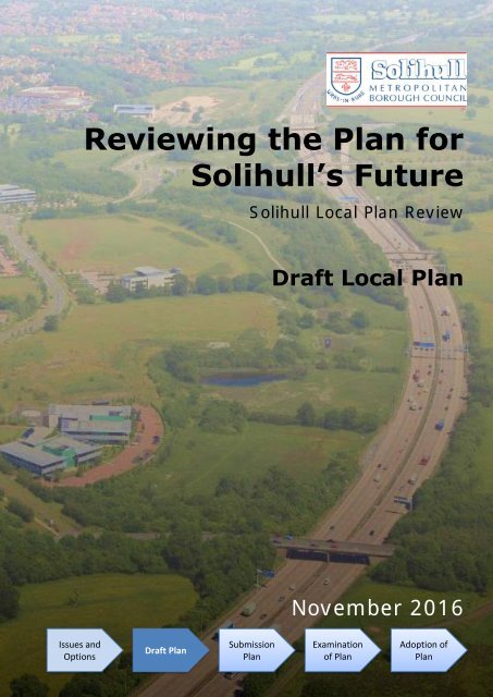
Reviewing the Plan for Solihull’s Future
Draft_Local_Plan_05.12.16
Draft_Local_Plan_05.12.16

Create successful ePaper yourself
Turn your PDF publications into a flip-book with our unique Google optimized e-Paper software.
<strong>Reviewing</strong> <strong>the</strong> <strong>Plan</strong> <strong>for</strong><br />
<strong>Solihull’s</strong> <strong>Future</strong><br />
Solihull Local <strong>Plan</strong> Review<br />
Draft Local <strong>Plan</strong><br />
November 2016<br />
Issues and<br />
Options<br />
Draft <strong>Plan</strong><br />
Submission<br />
<strong>Plan</strong><br />
Examination<br />
of <strong>Plan</strong><br />
Adoption of<br />
<strong>Plan</strong>
This page is left intentionally blank.
<strong>Reviewing</strong> <strong>the</strong> <strong>Plan</strong> <strong>for</strong> <strong>Solihull’s</strong> <strong>Future</strong><br />
Draft Local <strong>Plan</strong><br />
Contents<br />
1. Introduction ................................................................................................... 4<br />
2. Borough Portrait ............................................................................................ 7<br />
3. Challenges.................................................................................................... 18<br />
4. Vision ........................................................................................................... 26<br />
5. Spatial Strategy <strong>for</strong> Solihull .......................................................................... 32<br />
6. Sustainable Economic Growth ...................................................................... 38<br />
7. Providing Homes <strong>for</strong> All ............................................................................... 64<br />
8. Improving Accessibility and Encouraging Sustainable Travel ........................ 80<br />
9. Protecting and Enhancing Our Environment ................................................. 88<br />
10. Promoting Quality of Place ........................................................................ 113<br />
11. Health and Supporting Local Communities ................................................. 123<br />
12. Delivery and Monitoring ............................................................................ 133<br />
APPENDICES<br />
A. Abbreviations ............................................................................................ 140<br />
B. Responding to this Consultation ................................................................ 142<br />
C. Schedule of Allocated Housing Sites ........................................................... 144<br />
D. Proposals Map ........................................................................................... 179<br />
E. Draft Green Infrastructure Opportunities Map ........................................... 180<br />
Solihull MBC - 3 - November 2016
<strong>Reviewing</strong> <strong>the</strong> <strong>Plan</strong> <strong>for</strong> <strong>Solihull’s</strong> <strong>Future</strong><br />
Draft Local <strong>Plan</strong><br />
1. Introduction<br />
Purpose<br />
1. At <strong>the</strong> heart of planning is <strong>the</strong> need to plan positively <strong>for</strong> sustainable development. One of<br />
<strong>the</strong> principal ways this is achieved is by having a local plan to guide <strong>the</strong> development of an<br />
area. Having a local plan is key to delivering sustainable development that reflects <strong>the</strong><br />
vision and aspirations of local communities. The aim is that local authorities should<br />
positively seek opportunities, through <strong>the</strong>ir local plan, to meet <strong>the</strong> development needs of<br />
<strong>the</strong>ir area. The Council’s local plan addresses <strong>the</strong> spatial implications of economic, social<br />
and environmental change that is happening to <strong>the</strong> Borough, both now and in <strong>the</strong> future.<br />
2. The current local plan, <strong>the</strong> “Solihull Local <strong>Plan</strong>” (SLP), was adopted in December 2013 and<br />
covers <strong>the</strong> period 2011 to 2028. Although it is a recently adopted plan, and is up-to-date in<br />
many respects, <strong>the</strong>re are three reasons that have triggered <strong>the</strong> need <strong>for</strong> an early review of<br />
it.<br />
3. Firstly, <strong>the</strong> successful legal challenge to <strong>the</strong> local plan post adoption means that <strong>the</strong> current<br />
Local <strong>Plan</strong> has no overall housing requirement <strong>for</strong> <strong>the</strong> <strong>Plan</strong> period. This makes it difficult to<br />
demonstrate that <strong>the</strong> Borough has a five-year housing land supply, as required by <strong>the</strong><br />
National <strong>Plan</strong>ning Policy Framework (NPPF).<br />
4. Secondly, <strong>the</strong> examination of <strong>the</strong> Birmingham Development <strong>Plan</strong> has made clear that <strong>the</strong><br />
City Council is unable to meet its own housing need within its boundaries, and that <strong>the</strong><br />
shortfall will have to be met elsewhere within <strong>the</strong> Housing Market Area (HMA) (or o<strong>the</strong>r<br />
nearby areas) such as Solihull. The adopted Solihull Local <strong>Plan</strong> acknowledges that when<br />
work on housing needs identifies a need <strong>for</strong> fur<strong>the</strong>r provision in <strong>the</strong> Borough, a review will<br />
be brought <strong>for</strong>ward to address this 1 . This is <strong>the</strong> appropriate time <strong>for</strong> doing so.<br />
5. Finally, <strong>the</strong> arrival of HS2 to <strong>the</strong> Borough, and in particular <strong>the</strong> Interchange station marks a<br />
significant shift from <strong>the</strong> SLP. The UK Central Masterplan and Prospectus <strong>for</strong> a ‘Garden City’<br />
approach to <strong>the</strong> High Speed 2 Interchange have set out <strong>the</strong> Council’s ambitions <strong>for</strong> this part<br />
of <strong>the</strong> Borough. The Proposed Local Area <strong>Plan</strong> 2 <strong>for</strong> <strong>the</strong> High Speed 2 Interchange and<br />
Adjoining Area highlighted <strong>the</strong> need to review <strong>the</strong> Green Belt boundary to enable <strong>the</strong><br />
1 See paragraphs 8.4.5 and 8.4.6.<br />
2 This was a Local Area plan published in November 2014, following which <strong>the</strong> Council decided to plan <strong>for</strong> this area<br />
through a review of <strong>the</strong> local plan ra<strong>the</strong>r than pursue an area plan.<br />
Solihull MBC - 4 - November 2016
<strong>Reviewing</strong> <strong>the</strong> <strong>Plan</strong> <strong>for</strong> <strong>Solihull’s</strong> <strong>Future</strong><br />
Draft Local <strong>Plan</strong><br />
Interchange Area to be allocated <strong>for</strong> development. An updated Local <strong>Plan</strong> addressing this<br />
matter is vital if <strong>the</strong> full potential of <strong>the</strong> High Speed 2 project is to be realised.<br />
Scope, Issues and Options Consultation<br />
6. The National <strong>Plan</strong>ning Policy Framework (NPPF) makes clear that early and meaningful<br />
engagement and collaboration with residents, organisations and businesses is essential.<br />
This engagement commenced with a consultation on <strong>the</strong> scope, issues and options to be<br />
considered as part of <strong>the</strong> local plan review.<br />
7. The consultation 3 took place from November 2015 to January 2016 and sought to engage<br />
with all those who have an interest in shaping <strong>the</strong> future of <strong>the</strong> Borough. It focussed on<br />
scoping <strong>the</strong> local plan review; <strong>the</strong> issues that <strong>the</strong> review will need to address; and an<br />
identification of broad options.<br />
8. The representations 4 to this initial consultation have helped shape <strong>the</strong> review of <strong>the</strong> local<br />
plan and have been taken into account in producing this Draft Local <strong>Plan</strong> – <strong>the</strong> next stage in<br />
planning <strong>for</strong> <strong>the</strong> future of <strong>the</strong> Borough.<br />
The Draft Local <strong>Plan</strong><br />
9. This is a draft plan that has been produced under Regulation 18 of <strong>the</strong> Town & Country<br />
<strong>Plan</strong>ning (Local <strong>Plan</strong>ning) Regulations 2012. It sets out <strong>the</strong> Council’s preferred option <strong>for</strong><br />
accommodating managed growth in a sustainable manner.<br />
10. As <strong>the</strong> SLP was relatively recently adopted (post NPPF), many of its policies remain up-todate<br />
and relevant. Whilst it is clear that some policies need fundamental changes as a result<br />
of <strong>the</strong> challenges now faced, o<strong>the</strong>rs do not. The earlier consultation sought views on <strong>the</strong><br />
scope of <strong>the</strong> review, and whilst this remains a ‘whole’ plan review, <strong>the</strong> opportunity has been<br />
taken, where appropriate, to utilise existing policies, with amendments where necessary.<br />
There<strong>for</strong>e this plan follows <strong>the</strong> structure used <strong>for</strong> <strong>the</strong> 2013 plan in terms of <strong>the</strong> policy<br />
headings that are used.<br />
How could it affect me?<br />
11. The Local <strong>Plan</strong> will set out <strong>the</strong> future spatial strategy <strong>for</strong> <strong>the</strong> Borough and will include <strong>the</strong><br />
allocation of sites to promote development. It will also identify land where development<br />
would be inappropriate because of its impact on, <strong>for</strong> instance, environmental or historic<br />
assets; and it will also incorporate a strategy <strong>for</strong> enhancing <strong>the</strong> natural, built and historic<br />
environment.<br />
12. It is likely that <strong>the</strong> plan will be of interest to a wide range of residents, businesses, groups<br />
and organisations living, working or investing in <strong>the</strong> Borough, and <strong>the</strong> Council wishes to<br />
encourage all those with an interest to comment on <strong>the</strong> matters raised in this document.<br />
What will happen if we don’t find more development sites?<br />
13. The NPPF requires Local <strong>Plan</strong>s to identify a supply of specific deliverable sites to meet <strong>the</strong><br />
housing requirement <strong>for</strong> 5 years with a fur<strong>the</strong>r supply of developable sites (or at least broad<br />
locations <strong>for</strong> <strong>the</strong>m) <strong>for</strong> years 6-10 and, where possible, <strong>for</strong> years 11-15. A Local <strong>Plan</strong> that<br />
does not meet this requirement could be found unsound through <strong>the</strong> examination process.<br />
3 The consultation document can be found at<br />
http://www.solihull.gov.uk/Portals/0/<strong>Plan</strong>ning/LPR/LPR_Scope_Issues_and_Options_Consultation_Full.pdf.<br />
4 The representations and responses are published at<br />
http://www.solihull.gov.uk/Portals/0/<strong>Plan</strong>ning/LPR/Scope_Issues_and_Options_Summary_of_Represenations_and_Re<br />
sponses.pdf<br />
Solihull MBC - 5 - November 2016
<strong>Reviewing</strong> <strong>the</strong> <strong>Plan</strong> <strong>for</strong> <strong>Solihull’s</strong> <strong>Future</strong><br />
Draft Local <strong>Plan</strong><br />
14. The lack of a demonstrable 5 year housing land supply increases <strong>the</strong> Borough’s vulnerability<br />
to speculative housing proposals, and would lead to development and growth taking place<br />
in an unplanned manner.<br />
Consultation dates<br />
15. The Draft Local <strong>Plan</strong> will be open <strong>for</strong> consultation that will run from 5 th December 2016 to<br />
30 th January 2017 5 . Throughout <strong>the</strong> document a series of questions are posed on key points.<br />
For ease of reference all of <strong>the</strong> questions are also listed toge<strong>the</strong>r in Appendix B.<br />
Next steps<br />
16. Following <strong>the</strong> consultation, representations will be considered and <strong>the</strong> Council’s response<br />
prepared and agreed. The results of <strong>the</strong> consultation will <strong>the</strong>n be used, along with o<strong>the</strong>r<br />
evidence, to assist <strong>the</strong> Council in preparing <strong>the</strong> next stage of <strong>the</strong> plan making process – <strong>the</strong><br />
publication of <strong>the</strong> ‘submission’ version of <strong>the</strong> plan, which is <strong>the</strong> plan <strong>the</strong> Council intends to<br />
submit to examination.<br />
17. It is anticipated that <strong>the</strong> submission version 6 of <strong>the</strong> plan will be published in mid 2017 and<br />
that examination in public will take place later in <strong>the</strong> year.<br />
Relationship to O<strong>the</strong>r <strong>Plan</strong>s<br />
18. Once adopted, this plan will replace <strong>the</strong> Solihull Local <strong>Plan</strong> (Dec 2013), and its policies will no<br />
longer carry any weight. However until that point is reached, <strong>the</strong> relevant policies in <strong>the</strong> SLP<br />
will continue to be applied as adopted development plan policy. The weight that can be<br />
attached to <strong>the</strong> emerging plan will be dependent upon <strong>the</strong> stage it reaches; <strong>the</strong> extent of<br />
unresolved objections; and <strong>the</strong> degree of consistency with <strong>the</strong> NPPF.<br />
19. The Gypsy and Traveller Site Allocations DPD was adopted in December 2014 and co-exists<br />
with <strong>the</strong> SLP. This DPD will continue to be used to provide a framework <strong>for</strong> determining<br />
relevant applications and will also continue alongside <strong>the</strong> plan produced as a result of <strong>the</strong><br />
current review process.<br />
20. Presently <strong>the</strong>re are no adopted Neighbourhood <strong>Plan</strong>s in <strong>the</strong> Borough. Any that are pursued<br />
in <strong>the</strong> short term will need to reflect <strong>the</strong> strategic policies of <strong>the</strong> SLP. But once this plan<br />
review is adopted, it will take precedence and subsequent Neighbourhood <strong>Plan</strong>s will need to<br />
reflect <strong>the</strong> strategic policies of <strong>the</strong> reviewed plan.<br />
5 This is 8 weeks, and whilst <strong>the</strong>re is no statutory timescale <strong>for</strong> consultation at this stage, this period is based on <strong>the</strong><br />
statutory minimum 6 weeks given <strong>for</strong> <strong>the</strong> submission stage of <strong>the</strong> plan, with an adjustment recognising that this<br />
consultation spans <strong>the</strong> Christmas period.<br />
6 Often referred to as <strong>the</strong> ‘published’ version of <strong>the</strong> plan, as prepared under regulation 19 of <strong>the</strong> plan making<br />
regulations, and is <strong>the</strong> version <strong>the</strong> Council intends to submit <strong>for</strong> examination.<br />
Solihull MBC - 6 - November 2016
<strong>Reviewing</strong> <strong>the</strong> <strong>Plan</strong> <strong>for</strong> <strong>Solihull’s</strong> <strong>Future</strong><br />
2. Borough Portrait<br />
Draft Local <strong>Plan</strong><br />
Overview of <strong>the</strong> Borough<br />
21. Solihull Metropolitan Borough is located on <strong>the</strong> sou<strong>the</strong>rn edge of <strong>the</strong> West Midlands<br />
conurbation, between Birmingham and <strong>the</strong> Black Country to <strong>the</strong> west and Coventry to <strong>the</strong><br />
east. It is bound to <strong>the</strong> north by <strong>the</strong> rural area of North Warwickshire and to <strong>the</strong> south, by<br />
rural Bromsgrove, Strat<strong>for</strong>d and Warwick. The Borough is renowned <strong>for</strong> its key economic<br />
assets and strategic transport infrastructure both of regional and national significance; its<br />
attractive environment and quality of life; aspirational housing and excellent schools. All of<br />
which mean that Solihull is a desirable place in which to live, work and invest. Toge<strong>the</strong>r,<br />
<strong>the</strong>se elements combine to establish <strong>Solihull’s</strong> character of ‘town in country’ living up to <strong>the</strong><br />
Borough’s motto: “Urbs in Rure”.<br />
22. Solihull is part of <strong>the</strong> Greater Birmingham and Solihull Local Enterprise Partnership<br />
(GBSLEP), a partnership led by key businesses and Local Authorities to drive sustainable<br />
growth and job creation. Solihull is also a constituent member of <strong>the</strong> newly <strong>for</strong>med West<br />
Midlands Combined Authority (WMCA). The Combined Authority has four priorities relating<br />
to economic growth, addressing <strong>the</strong> skills deficit, provision of a fully integrated rail and rapid<br />
transport network, and housing.<br />
Solihull MBC - 7 - November 2016
<strong>Reviewing</strong> <strong>the</strong> <strong>Plan</strong> <strong>for</strong> <strong>Solihull’s</strong> <strong>Future</strong><br />
Draft Local <strong>Plan</strong><br />
23. Solihull is at <strong>the</strong> heart of <strong>the</strong> national rail and motorway network with direct rail services to<br />
London, Birmingham and <strong>the</strong> north along <strong>the</strong> West Coast and Chiltern Mainlines and has<br />
excellent access to o<strong>the</strong>r regions in <strong>the</strong> UK through <strong>the</strong> M42, which links <strong>the</strong> Borough to <strong>the</strong><br />
M6 at <strong>the</strong> nor<strong>the</strong>rn boundary of <strong>the</strong> Borough and <strong>the</strong> M40 to <strong>the</strong> south. This strategic<br />
transport infrastructure, toge<strong>the</strong>r with Birmingham Airport, has ensured <strong>the</strong> Borough is <strong>the</strong><br />
principal national and international gateway to <strong>the</strong> GBSLEP area and <strong>the</strong> wider West<br />
Midlands area.<br />
Historical Development<br />
24. The development of Solihull was highly influenced by <strong>the</strong> arrival of <strong>the</strong> railway stations and<br />
<strong>the</strong> 20th Century expansion of Birmingham south-eastwards. The area now known as<br />
Solihull Borough was predominantly rural with small historic towns and villages of medieval<br />
origin or earlier at Solihull, Meriden, Berkswell, Barston, Hampton-in-Arden, Knowle and<br />
Bickenhill until <strong>the</strong> end of <strong>the</strong> 19th Century, when Birmingham began to expand into rural<br />
Olton, with houses overlooking Olton Mere. Shirley originally developed from a scattered<br />
heathland settlement serving <strong>the</strong> road from Birmingham to Winchester via Ox<strong>for</strong>d.<br />
Development of <strong>the</strong> Grand Union and Strat<strong>for</strong>d-Upon-Avon canals and <strong>the</strong> railways also<br />
occurred during <strong>the</strong> Georgian and early Victorian periods, respectively.<br />
25. The Rural Area once <strong>for</strong>med part of a huge area of wood pasture and ancient farm lands<br />
known as Arden and evidence of previous woodland, commons and heaths are often shown<br />
in local place names. There were also a number of manor houses and halls associated with<br />
large parks situated within <strong>the</strong> Rural Area, <strong>for</strong> example, parkland associated with Berkswell<br />
Hall was once part of a medieval deer park. Much of <strong>the</strong> woodland has now been cleared<br />
and <strong>the</strong> landscape character is predominantly agricultural, characterised by a variety of<br />
fieldscapes from older, irregular piecemeal enclosure to larger planned enclosure and very<br />
large post-war fields.<br />
26. Large settlement expansion from Birmingham into Solihull occurred between 1900 and<br />
1955, particularly during <strong>the</strong> inter-war period. This resulted in <strong>the</strong> development of huge<br />
semi-detached housing estates at Lyndon, Olton, Elmdon and Shirley stretching towards<br />
Solihull and, to a lesser degree, at Castle Bromwich. Detached housing development was<br />
more predominant around Solihull. Small settlement expansion also occurred in <strong>the</strong> Rural<br />
Area at Hampton-in-Arden, Marston Green, Hockley Heath, Meriden and on part of Balsall<br />
Common. During <strong>the</strong> inter-war period, large industrial areas relating to <strong>the</strong> automotive<br />
industry developed, such as <strong>the</strong> Land Rover motor works and <strong>the</strong> early example of a<br />
research and development campus at Shirley, latterly owned by TRW. Birmingham Airport<br />
was also developed at this time, opening in 1939 as a municipal airport.<br />
27. After 1945, <strong>the</strong>re was a huge wave of predominantly terraced and multi-storey residential<br />
development in <strong>the</strong> north-west part of <strong>the</strong> Borough from Castle Bromwich southwards.<br />
Residential development at Kingshurst was followed in <strong>the</strong> 1960s by overspill development<br />
from Birmingham into Smiths Wood and Chelmsley Wood. At <strong>the</strong> same time, Dorridge was<br />
‘created’ by <strong>the</strong> expansion of Knowle south and westwards and development around<br />
Dorridge railway station. Development at Shirley, Olton, Lyndon and Elmdon towards<br />
Solihull continued and by 1955, Solihull had become joined to Birmingham.<br />
28. Since <strong>the</strong> mid 20th Century, most residential development has occurred at Monkspath and<br />
Hillfield, Balsall Common, Cheswick Green, Meriden, Knowle and Dorridge, and most<br />
recently, since <strong>the</strong> late 1990s, at Dickens Heath. Most large scale commercial development<br />
occurred at <strong>the</strong> National Exhibition Centre in <strong>the</strong> 1970s, Birmingham Business Park since <strong>the</strong><br />
Solihull MBC - 8 - November 2016
<strong>Reviewing</strong> <strong>the</strong> <strong>Plan</strong> <strong>for</strong> <strong>Solihull’s</strong> <strong>Future</strong><br />
Draft Local <strong>Plan</strong><br />
late 1980s, Bly<strong>the</strong> Valley Park since <strong>the</strong> late 1990s, and more recently, <strong>the</strong> Touchwood<br />
Shopping Centre in Solihull Town Centre.<br />
The Borough Now<br />
29. The Borough is home to several major economic assets including Birmingham Airport, <strong>the</strong><br />
National Exhibition Centre, Birmingham and Bly<strong>the</strong> Valley Business Parks, Jaguar Land Rover<br />
and Solihull Town Centre. The <strong>for</strong>mation of <strong>the</strong> WMCA and <strong>the</strong> <strong>for</strong>thcoming development of<br />
a high speed rail interchange provide fur<strong>the</strong>r opportunities <strong>for</strong> significant inward<br />
investment, development and employment growth within this area and enhance its role as a<br />
regional and nationally significant economic hub.<br />
30. The regional and national impact and role of <strong>Solihull’s</strong> strategic economic assets is<br />
significant – supporting an estimated 100,000 jobs and £5.1bn GDP in 2012 7 – with 50% of<br />
<strong>the</strong> Borough’s work<strong>for</strong>ce commuting in, it plays a vital role in <strong>the</strong> regional economy and<br />
labour market. O<strong>the</strong>r illustrations of <strong>the</strong> Borough’s economic success include:<br />
Total employment in Solihull increased by just over 6% between in 2015 (+6,500) in<br />
excess of <strong>the</strong> England (2%) and West Midlands averages (1.5%). This was driven by a<br />
12% increase in <strong>the</strong> number of full time private sector employees (+7,300);<br />
Over <strong>the</strong> five years 2010-2015 Solihull had <strong>the</strong> fastest growing labour market outside<br />
of London;<br />
The Borough also ranked 12th out of 152 upper tier Local Authorities in England <strong>for</strong><br />
private sector employment growth over this period (BRES 2015);<br />
At a broad sector level 2015 saw particularly strong employment growth in<br />
manufacturing (+1,300, +12%), transport and communications (+1,100, +14%), as<br />
well as across all financial, professional and business services;<br />
The strength of <strong>Solihull’s</strong> automotive industry is evident by <strong>the</strong> fact that this<br />
manufacturing sub-sector alone added nearly 1,200 jobs to total Borough<br />
employment in 2015;<br />
The significant influence of <strong>the</strong> Airport on <strong>the</strong> Borough’s labour market is reflected in<br />
strong employment growth in <strong>the</strong> air transport (+200 jobs) and transport<br />
warehousing (+300 jobs) sub-sectors in 2015.<br />
31. Around two thirds of <strong>Solihull’s</strong> 17,800 hectares is countryside and designated Green Belt,<br />
which separates <strong>the</strong> West Midlands conurbation from surrounding settlements. The vital<br />
strategic gap between Birmingham/Solihull and Coventry is known as <strong>the</strong> Meriden Gap. This<br />
area is predominantly rural, characterised by a series of settlements, historic villages,<br />
hamlets, scattered farmsteads and dwellings set within attractive countryside. This area has<br />
been under increasing pressure to accommodate development and infrastructure.<br />
32. These factors combine to make Solihull a highly sought after living environment and, as a<br />
result, house prices and land values across most of <strong>the</strong> Borough are substantially above <strong>the</strong><br />
regional average.<br />
33. The Borough has a number of distinct areas and <strong>the</strong>se are described in more detail under<br />
<strong>the</strong> following headings:<br />
UK Central 8 Hub and Key Economic Assets<br />
North Solihull Regeneration Area<br />
7 M42 Economic Gateway Masterplan Report (ARUP et al. 2013)<br />
8 UKC was <strong>for</strong>mally known as M42 Economic Gateway. It includes <strong>the</strong> collection of key economic assets principally<br />
located around and between junctions 4 and 6 of <strong>the</strong> M42.<br />
Solihull MBC - 9 - November 2016
<strong>Reviewing</strong> <strong>the</strong> <strong>Plan</strong> <strong>for</strong> <strong>Solihull’s</strong> <strong>Future</strong><br />
Draft Local <strong>Plan</strong><br />
Mature Suburbs<br />
Solihull Town Centre<br />
Rural Area<br />
o Knowle, Dorridge, Bentley Heath and Hockley Heath<br />
o Ca<strong>the</strong>rine de Barnes, Hampton-in-Arden and Meriden<br />
o Balsall Common, Berkswell, Barston, Temple Balsall and Chadwick End<br />
o Dickens Heath, Tidbury Green, Cheswick Green and Bly<strong>the</strong> Valley Park<br />
UK Central Hub and Key Economic Assets<br />
34. There are four UK Central (UKC) economic opportunity zones:<br />
Zone 1 – The UKC Hub which includes Birmingham Airport, National Exhibition<br />
Centre, Jaguar Land Rover, Birmingham Business Park and <strong>the</strong> site of <strong>the</strong> HS2<br />
Interchange (known as Arden Cross)<br />
Zone 2 – North Solihull<br />
Zone 3 – Solihull Town Centre<br />
Zone 4 – Bly<strong>the</strong> Valley Park<br />
35. These strategic assets, and <strong>the</strong>ir collective impact and potential <strong>for</strong> inward investment to<br />
<strong>the</strong> wider area, are known as “UK Central” – <strong>the</strong> brand and vision <strong>for</strong> unlocking <strong>the</strong>ir long<br />
term economic potential <strong>for</strong> <strong>the</strong> Borough as a whole; with Solihull continuing to per<strong>for</strong>m its<br />
critical role as a major economic contributor to <strong>the</strong> region and to <strong>the</strong> UK as a whole.<br />
36. From 2017 onwards construction will begin on a high speed rail station interchange in <strong>the</strong><br />
heart of <strong>the</strong> UK Central Hub on land adjacent to <strong>the</strong> NEC. It is anticipated that HS2 will be<br />
operational from 2026, at which point <strong>the</strong> journey time from London to UK Central Hub will<br />
be less than 40 minutes.<br />
37. The potential of UK Central, to generate fur<strong>the</strong>r economic and employment growth <strong>for</strong> <strong>the</strong><br />
region as a whole is on a nationally significant scale – over 100,000 jobs and £15bn GDP in<br />
<strong>the</strong> West Midlands by 2040 – jobs and growth that are critical to Solihull, its neighbours and<br />
to <strong>the</strong> rebalancing of <strong>the</strong> national economy. A strategic masterplan produced in 2013<br />
identified that to realise this potential Solihull not only needed to enable appropriate<br />
growth of <strong>the</strong> existing strategic economic assets; but integrate HS2 within its plans and<br />
within future development. This should <strong>the</strong>n be underpinned with new investment in<br />
connectivity and transport infrastructure; thus enabling wider access to <strong>the</strong> new<br />
Solihull MBC - 10 - November 2016
<strong>Reviewing</strong> <strong>the</strong> <strong>Plan</strong> <strong>for</strong> <strong>Solihull’s</strong> <strong>Future</strong><br />
Draft Local <strong>Plan</strong><br />
employment opportunities which would be created. Access not only <strong>for</strong> Borough residents,<br />
but across <strong>the</strong> WMCA area.<br />
38. The WMCA Investment Prospectus 2016 recognises <strong>the</strong> once in a generation opportunity<br />
that <strong>the</strong> HS2 rail link offers to drive economic growth and prosperity, and <strong>the</strong> significance of<br />
UK Central, particularly <strong>the</strong> Hub Area around <strong>the</strong> Interchange station.<br />
Birmingham Airport<br />
39. Birmingham Airport is <strong>the</strong> principal international gateway into <strong>the</strong> Region and has a major<br />
role in <strong>the</strong> national airport’s infrastructure. It is a key economic growth driver, particularly<br />
regarding <strong>the</strong> knowledge economy, high value-added sectors and overseas inward<br />
investment and international trade. The development of new routes to <strong>the</strong> Far East,<br />
America, India and China<br />
enabled by <strong>the</strong> main<br />
runway extension,<br />
completed in 2014,<br />
enhance <strong>the</strong> Airport’s<br />
capacity to contribute to<br />
local and regional<br />
economic growth as a key<br />
component of UKC. The HS2<br />
Station will improve <strong>the</strong><br />
accessibility<br />
and<br />
attractiveness of <strong>the</strong> Airport<br />
from fur<strong>the</strong>r afield,<br />
particularly London and <strong>the</strong><br />
South-East.<br />
National Exhibition Centre (NEC)<br />
40. The continued success of <strong>the</strong> NEC is important to <strong>the</strong> local and regional economy and is <strong>the</strong><br />
UK’s largest exhibition centre. The role of <strong>the</strong> NEC has evolved from its early exhibition<br />
centre beginnings in <strong>the</strong> 1970’s to become a major events, tourism and leisure venue,<br />
serving both business and leisure markets and contributing significantly to <strong>Solihull’s</strong> and<br />
<strong>the</strong> Region’s visitor economy. The opening of Resorts World (a £150 million mixed use leisure<br />
development) in 2015 is a demonstration of <strong>the</strong> evolving role that <strong>the</strong> NEC plays; and <strong>the</strong> Local<br />
<strong>Plan</strong> Review should provide a framework to allow <strong>the</strong> complex to take advantage of future<br />
opportunities.<br />
Jaguar Land Rover (JLR)<br />
41. Jaguar Land Rover is one of <strong>the</strong> West Midlands’, and UK’s, most important businesses and a<br />
key driver of economic recovery, as an advanced manufacturing firm developing leading<br />
technologies including in low emissions vehicles. The Lode Lane plant in Solihull currently<br />
provides about 7,300 jobs and is set to increase to more than 9,000 following substantial<br />
new investment in <strong>the</strong> plant, demonstrating <strong>the</strong> company’s commitment to Solihull.<br />
42. Part of <strong>the</strong> area beyond <strong>the</strong> north east of <strong>the</strong> existing plant has recently been developed to<br />
provide a 14ha vehicle despatch area which opened in 2015. The Council considered that<br />
<strong>the</strong>re were very special circumstances <strong>for</strong> allowing this development in <strong>the</strong> Green Belt. This<br />
was to support <strong>the</strong> operational needs of this internationally significant company that needs<br />
to remain competitive in <strong>the</strong> global vehicles market in order to continue to support<br />
significant numbers of jobs in <strong>the</strong> Region that rely on <strong>the</strong> success of JLR.<br />
Solihull MBC - 11 - November 2016
<strong>Reviewing</strong> <strong>the</strong> <strong>Plan</strong> <strong>for</strong> <strong>Solihull’s</strong> <strong>Future</strong><br />
Birmingham and Bly<strong>the</strong> Valley Business Parks<br />
Draft Local <strong>Plan</strong><br />
43. Birmingham and Bly<strong>the</strong> Valley Business Parks have successfully attracted new investment to<br />
Solihull and <strong>the</strong> Region in accordance with <strong>the</strong>ir original role of helping to modernise and<br />
diversify <strong>the</strong> Region’s economy by attracting knowledge based employment and<br />
combatting decline in <strong>the</strong> Region’s manufacturing base. Birmingham Business Park is well<br />
placed near North Solihull and <strong>the</strong> NEC to encourage new growth and investment linked to<br />
North Solihull regeneration. Bly<strong>the</strong> Valley Business Park is competitive with <strong>the</strong> south-east<br />
and M4 corridor and is capable of developing new facilities to promote and support<br />
innovation and entrepreneurism.<br />
44. These two high quality, managed business parks have a key role in <strong>Solihull’s</strong> success in<br />
attracting business investment in high value added sectors including ICT, business and<br />
professional services, creative industries, construction and engineering. It is important that<br />
<strong>the</strong>se high quality sites continue to attract knowledge economy investment to Solihull and<br />
<strong>the</strong> Region, <strong>the</strong>reby underpinning economic recovery and growth. This includes fur<strong>the</strong>r<br />
realising <strong>the</strong> potential of Bly<strong>the</strong> Valley Business Park as a location <strong>for</strong> innovation uses and<br />
new enterprise. There is also potential <strong>for</strong> Birmingham Business Park to play a greater role<br />
in linking investment and employment opportunities to <strong>the</strong> North Solihull R egeneration<br />
Area.<br />
45. To reinvigorate <strong>the</strong>se sites, <strong>the</strong> range of acceptable uses on <strong>the</strong>m was broadened under<br />
<strong>the</strong> Solihull Local <strong>Plan</strong> in response to changed market conditions. There is growing<br />
competition from town and city centre locations as occupiers realise <strong>the</strong> benefits to<br />
employees of access to a range of facilities and to public transport. Better facilities will be<br />
needed if <strong>the</strong>y are to continue to secure appropriate investment.<br />
North Solihull Regeneration Area<br />
46. The Regeneration Area covers three wards (Chelmsley Wood, Kingshurst & Fordbridge,<br />
Smith’s Wood) to <strong>the</strong> north of <strong>the</strong> A45, as well as some adjoining neighbourhoods in <strong>the</strong><br />
north of Bickenhill ward. A large proportion of local neighbourhoods are in <strong>the</strong> 10% most<br />
deprived in <strong>the</strong> country, with some in <strong>the</strong> bottom 5%. The area has a younger population<br />
than <strong>the</strong> rest of <strong>the</strong> Borough, an above average proportion of single person and lone parent<br />
households and far more people living in socially rented housing. Car ownership is <strong>the</strong><br />
lowest in <strong>the</strong> Borough and is significantly lower than <strong>the</strong> national average. There are<br />
frequent bus services to Birmingham, although public transport access to many of south<br />
<strong>Solihull’s</strong> key employment sites is less good. This is particularly significant as <strong>the</strong>re are few<br />
jobs located in North Solihull itself with very limited commercial and employment space<br />
having been created as part of <strong>the</strong> initial development of <strong>the</strong> area, limited access to jobs,<br />
Solihull MBC - 12 - November 2016
<strong>Reviewing</strong> <strong>the</strong> <strong>Plan</strong> <strong>for</strong> <strong>Solihull’s</strong> <strong>Future</strong><br />
Draft Local <strong>Plan</strong><br />
toge<strong>the</strong>r with below average working age qualification levels have been major causes of<br />
high unemployment, and below average incomes in North Solihull. Poor health is also an<br />
issue, with life expectancy lower than <strong>the</strong> rest of <strong>the</strong> Borough and proportionally far more<br />
working age people not working due to ill health.<br />
47. The area has a distinctive urban <strong>for</strong>m characterised by its 1960s ‘Radburn’ open plan<br />
housing estates arranged around parking courtyards, small green spaces and precinct<br />
shopping areas. Pedestrian and car access is often separated so that dual carriageways,<br />
subways and footpaths are common. A consequence of this is poorly overlooked amenity<br />
areas and pedestrian routes, which exacerbate anti-social behaviour and fear of crime, and<br />
a resultant poor quality environment. However, <strong>the</strong> area has several significant<br />
environmental assets including <strong>the</strong> River Cole and its wider landscaped setting, woodlands,<br />
nature reserves and parks, which provide opportunities <strong>for</strong> enhancement.<br />
48. The area is subject to one of <strong>the</strong> largest regeneration programmes in England which has,<br />
since its inception in 2005, delivered more than 1,350 new homes on over 30 different sites,<br />
such as <strong>the</strong> award winning Burtons Farm Park. This renewal programme has been facilitated<br />
by <strong>the</strong> demolition of a large amount of unsuitable housing stock including five tower blocks.<br />
A large proportion of <strong>the</strong> new homes have been built <strong>for</strong> social rent, with <strong>the</strong> remainder<br />
made available <strong>for</strong> home ownership. This has introduced greater choice into <strong>the</strong> North<br />
Solihull housing market. Alongside housing renewal, regeneration has delivered vibrant<br />
new schools and colleges as well as new parks, improved green space and play facilities. A<br />
new supermarket and improvements to Chelmsley Wood Town Centre have been delivered<br />
along with new village centres at North Arran Way and Chelmunds Cross, which includes a<br />
new Enterprise Centre <strong>for</strong> start-up businesses and a new health centre. There has been an<br />
improvement in educational attainment in North <strong>Solihull’s</strong> schools relative to those in <strong>the</strong><br />
rest of <strong>the</strong> Borough since <strong>the</strong> SLP was adopted in 2013, although <strong>the</strong>re remains a significant<br />
gap.<br />
Solihull MBC - 13 - November 2016
<strong>Reviewing</strong> <strong>the</strong> <strong>Plan</strong> <strong>for</strong> <strong>Solihull’s</strong> <strong>Future</strong><br />
Mature Suburbs<br />
Draft Local <strong>Plan</strong><br />
49. The area contains <strong>the</strong> popular residential suburbs of Castle Bromwich, Marston Green,<br />
Olton, Elmdon, Lyndon, Solihull, Shirley, Monkspath and Hillfield. These areas benefit from<br />
good schools, strong local centres and are relatively affluent. The more historic parts of <strong>the</strong><br />
Mature Suburbs are found in Castle Bromwich, Olton, Solihull and Shirley. These mature<br />
areas are characterised by Victorian and Edwardian development, <strong>the</strong> canal and railway<br />
network, a tighter urban grain, extensive gardens and parks. More modern housing estates<br />
are characterised by an open plan, cul-de-sac layout with on-plot parking and a<br />
predominance of detached and semi-detached properties. Given <strong>the</strong> popularity of<br />
residential areas within <strong>the</strong> Mature Suburbs, house prices are high and <strong>the</strong>re is a severe lack<br />
of af<strong>for</strong>dable housing <strong>for</strong> first time buyers and those wishing to downsize.<br />
50. However, <strong>the</strong> overall affluence of <strong>the</strong> Mature Suburbs masks some local variations, with<br />
pockets of deprivation evident in parts of Shirley, Elmdon, Olton and Lyndon. Whilst health<br />
is generally good across <strong>the</strong> area, <strong>the</strong> population is increasingly ageing, which has<br />
implications <strong>for</strong> <strong>the</strong> type and tenure of housing required and a greater need <strong>for</strong> specialist<br />
housing and health care.<br />
51. The Mature Suburbs are home to a variety of employment opportunities including ZF TRW<br />
and o<strong>the</strong>r businesses located in <strong>the</strong> Solihull and Fore Business Parks, as well as in <strong>the</strong><br />
established Cranmore and Monkspath area. The area benefits from lower unemployment<br />
than <strong>the</strong> Borough average. The area contains <strong>the</strong> strategic transport infrastructure of <strong>the</strong><br />
A34 Strat<strong>for</strong>d Road and <strong>the</strong> A41 Warwick Road; principal routes into Birmingham, and two<br />
railway lines, with stations at Shirley, Olton, Solihull, Widney Manor and Marston Green.<br />
Excellent connectivity to strategic road networks has resulted in traffic congestion at key<br />
destinations such as Solihull and Shirley Town Centres. In <strong>the</strong> case of Shirley this was<br />
contributing to its decline as a shopping destination. The completion of <strong>the</strong> mixed-use<br />
Parkgate development and public realm improvements are <strong>the</strong> first stage of a revitalisation<br />
programme <strong>for</strong> Shirley which will include <strong>the</strong> redevelopment of <strong>the</strong> <strong>for</strong>mer Powergen site.<br />
Solihull Town Centre<br />
52. Solihull Town Centre is a strong, vibrant and regionally important Centre containing a wide<br />
variety of shops, businesses and civic services. It is enriched by its attractive historic core of<br />
St. Alphege church, <strong>the</strong> Square and <strong>the</strong> High Street. To <strong>the</strong> north and south, <strong>the</strong> more<br />
modern retail developments of <strong>the</strong> 1960s precinct style Mell Square and <strong>the</strong> early 21st<br />
Century Touchwood development broaden <strong>the</strong> Centre’s offer. Whilst <strong>the</strong> Centre continues<br />
to thrive, accessibility to and from <strong>the</strong> train and bus interchange is poor, traffic congestion<br />
affects key routes to<br />
<strong>the</strong> Centre and <strong>the</strong>re<br />
is insufficient<br />
diversity of offer in<br />
<strong>the</strong> evenings. Parts<br />
of <strong>the</strong> town centre<br />
are looking dated<br />
and key gateways<br />
into Solihull and<br />
linkages to <strong>the</strong><br />
surrounding parks<br />
could be improved.<br />
Solihull MBC - 14 - November 2016
<strong>Reviewing</strong> <strong>the</strong> <strong>Plan</strong> <strong>for</strong> <strong>Solihull’s</strong> <strong>Future</strong><br />
Draft Local <strong>Plan</strong><br />
53. Recent improvements to <strong>the</strong> town centre include <strong>the</strong> Solihull Gateway, facilitating better<br />
traffic flow and bus access, as well as some refurbishment and development of <strong>the</strong> Mell<br />
Square shopping area. In 2016 Waitrose opened a new store in <strong>the</strong> town centre. An<br />
extension to <strong>the</strong> Touchwood shopping centre due to begin construction in 2017 will fur<strong>the</strong>r<br />
enhance <strong>Solihull’s</strong> retail and leisure offer.<br />
Rural Areas<br />
54. The Rural Area generally has a high quality built and natural environment, characterised by<br />
its Arden landscape setting, attractive countryside, important green corridors such as its<br />
canals and rivers and its rich biodiversity. The predominant land use is agriculture, which<br />
contrasts with <strong>the</strong> urban character of <strong>the</strong> remainder of <strong>the</strong> Borough and most of <strong>the</strong> Rural<br />
Area is protected by Green Belt. There is a wide variety of villages within <strong>the</strong> area, from <strong>the</strong><br />
larger settlements of Knowle, Dorridge and Balsall Common, which have expanded<br />
significantly in recent times, to <strong>the</strong> smaller, historic villages of Hampton-in-Arden, Berkswell,<br />
Meriden and Barston hamlets and farmsteads which have grown more organically, and <strong>the</strong><br />
modern, critically acclaimed new village of Dickens Heath.<br />
55. Generally communities within <strong>the</strong> Rural Area are affluent and occupy attractive residential<br />
environments. The level of car ownership is higher than <strong>the</strong> Borough and national average<br />
at 1.62 cars per household. However, some local rural deprivation is evident in those<br />
neighbourhoods where social housing predominates. The Rural Area generally suffers from<br />
poor public transport connectivity. Schools per<strong>for</strong>m well within <strong>the</strong> area but <strong>the</strong>re is a<br />
severe shortage of af<strong>for</strong>dable housing and an increasingly ageing population, above <strong>the</strong><br />
national average, which could create service delivery difficulties. The rural communities are<br />
mainly commuter settlements and <strong>the</strong>re is a continued threat of loss of key services and<br />
facilities.<br />
56. The Rural Area is also important <strong>for</strong> sand and gravel aggregates at Berkswell and Meriden<br />
quarries. The area also has significant coal reserves. There are waste facilities in <strong>the</strong> Rural<br />
Area but much of <strong>the</strong> amount of waste arising in <strong>the</strong> Borough is managed outside of Solihull.<br />
Much of <strong>the</strong> rural employment is focused in <strong>the</strong> agricultural sector; however, <strong>the</strong>re are<br />
some examples of successful farm diversification.<br />
Knowle, Dorridge, Bentley Heath and Hockley Heath<br />
57. The historic medieval core of Knowle is centred on <strong>the</strong> High Street and <strong>the</strong> church of St.<br />
John <strong>the</strong> Baptist, St. Lawrence and St. Anne, at <strong>the</strong> junction of two historic routes, and is<br />
protected by Conservation Area designation. Similarly, development from <strong>the</strong> later Victorian<br />
and Edwardian periods around and near to Dorridge railway station benefit from<br />
Conservation Area status. The area experienced significant post-war development and <strong>the</strong>re<br />
is no obvious settlement boundary between Knowle, Dorridge and Bentley Heath. The<br />
dated shopping parade at Dorridge has recently been redeveloped to provide up-dated<br />
modern facilities and a new public realm that enhances <strong>the</strong> centre as a whole.<br />
58. Hockley Heath is separated from Knowle and Dorridge and has a sense of remoteness. The<br />
village is largely inter and post-war ribbon development along <strong>the</strong> A34 Strat<strong>for</strong>d Road but<br />
has <strong>the</strong> characteristics of a semi-rural village. The Strat<strong>for</strong>d-Upon-Avon canal provides a<br />
linear heritage asset with a village wharf. The area is affluent, has a high quality residential<br />
environment and good, popular schools.<br />
Ca<strong>the</strong>rine de Barnes, Hampton-in-Arden and Meriden<br />
59. These three small villages are located at key intervals along <strong>the</strong> B4102 Hampton Road and<br />
are separated by attractive countryside. Both Hampton-in-Arden and Meriden have historic<br />
Solihull MBC - 15 - November 2016
<strong>Reviewing</strong> <strong>the</strong> <strong>Plan</strong> <strong>for</strong> <strong>Solihull’s</strong> <strong>Future</strong><br />
Draft Local <strong>Plan</strong><br />
medieval cores which are protected by Conservation Area designation and have grown<br />
organically over time. Hampton Conservation Area is centred on <strong>the</strong> main High Street,<br />
Hampton Manor and <strong>the</strong> church of St. Mary and St. Bartholomew. At Meriden <strong>the</strong>re are<br />
two; one focused on <strong>the</strong> green at <strong>the</strong> heart of <strong>the</strong> village and ano<strong>the</strong>r around St. Lawrence’s<br />
church at Meriden Hill, which has spectacular views over <strong>the</strong> surrounding countryside.<br />
Ca<strong>the</strong>rine de Barnes, on <strong>the</strong> o<strong>the</strong>r hand, is a smaller village with a more modern feel and<br />
which benefits from a canalside setting. The sub-area is generally affluent with some<br />
deprivation experienced in Meriden, which has a distinct rural feel to it and strong links to<br />
<strong>the</strong> surrounding farmland and quarries.<br />
Balsall Common, Berkswell, Barston, Temple Balsall and Chadwick End<br />
60. Balsall Common is a large post-war suburban commuter village bisected by <strong>the</strong> A452<br />
Kenilworth Road. The settlement is characterised by popular, low density residential areas<br />
with an open plan, cul-de-sac style layout and good schools. The village has a thriving local<br />
centre astride <strong>the</strong> A452 with a good range of shops, facilities and services, although <strong>the</strong>re<br />
are some opportunities to improve <strong>the</strong> Centre. Berkswell railway station to <strong>the</strong> north-east of<br />
<strong>the</strong> village provides access to London, Birmingham and Coventry via <strong>the</strong> West Coast<br />
mainline.<br />
61. The remainder of <strong>the</strong> sub-area is distinctly rural with a series of remote historic villages,<br />
hamlets, scattered farmsteads and cottages. The historic settlements of Berkswell, Barston<br />
and Temple Balsall are of medieval or earlier origin and Walsal End has houses dating from<br />
<strong>the</strong> 17th Century. All are protected by Conservation Area designation. This part of <strong>the</strong> Rural<br />
Area is characterised by <strong>the</strong> River Bly<strong>the</strong>, <strong>the</strong> wider Arden landscape and distinctive<br />
fieldscapes and is a popular area <strong>for</strong> recreational walking, being home to part of <strong>the</strong> Heart of<br />
England Way and a network of footpaths. Chadwick End has some 19th Century cottages, a<br />
public house and village hall with a community post office.<br />
Dickens Heath, Tidbury Green, Cheswick Green and Bly<strong>the</strong> Valley Park<br />
62. This area consists of distinct villages set within, and separated by, attractive countryside and<br />
Green Belt, which gives each village a sense of remoteness. Tidbury Green comprises<br />
predominantly inter-war linear development along key roads and Cheswick Green consists<br />
almost entirely of post-war development characterised by cul-de-sac, open plan layouts. The<br />
modern, multi-award winning village of Dickens Heath was ‘created’ in <strong>the</strong> late 1990s and,<br />
guided by an architect-led masterplan. It has since undergone rapid expansion with a<br />
variety<br />
of<br />
architectural styles<br />
of development and<br />
a Village Centre.<br />
Whilst housing<br />
densities are higher<br />
around <strong>the</strong> Village<br />
Centre, <strong>the</strong> area has<br />
an attractive,<br />
mature woodland<br />
and canalside<br />
setting, with a few<br />
early cottages<br />
adding sporadic<br />
visual interest.<br />
There is a railway<br />
Solihull MBC - 16 - November 2016
<strong>Reviewing</strong> <strong>the</strong> <strong>Plan</strong> <strong>for</strong> <strong>Solihull’s</strong> <strong>Future</strong><br />
Draft Local <strong>Plan</strong><br />
station close to Dickens Heath at Whitlock’s End. Bly<strong>the</strong> Valley Park comprises a modern<br />
campus style commercial development within an attractive parkland setting. There are<br />
several award winning signature buildings providing a contemporary and sustainable<br />
working environment. As a whole, <strong>the</strong> sub-area suffers from poor public transport provision<br />
with limited bus services between settlements, which perpetuates travel by private car.<br />
Borough Wide Key Statistics<br />
63. The table below sets out some key statistics <strong>for</strong> <strong>the</strong> Borough.<br />
Key Statistic Solihull West Midlands National Average<br />
Area of Borough<br />
Percentage of Borough that<br />
is Green Belt<br />
17,828 (ha)<br />
67%<br />
Population (mid 2015) 210,400 - -<br />
% Population Aged 65+<br />
(mid 2015)<br />
21% 18% 18%<br />
Households (2014) 86,962 - -<br />
% Single Person<br />
Households (2011)<br />
% Social Rented<br />
Households (2011)<br />
Car Ownership – average<br />
per household (2011)<br />
Travel to work by public<br />
transport (% working<br />
residents 2011)<br />
Unemployment Claimant<br />
Rate (2016)<br />
29% 30% 30%<br />
15% 19% 18%<br />
1.34 1.20 1.16<br />
14% 10% 17%<br />
1.7% 2.3% 1.7%<br />
Average House Price (2015) £284,316 £196,751 £271,964<br />
Solihull MBC - 17 - November 2016
<strong>Reviewing</strong> <strong>the</strong> <strong>Plan</strong> <strong>for</strong> <strong>Solihull’s</strong> <strong>Future</strong><br />
3. Challenges<br />
Draft Local <strong>Plan</strong><br />
64. The SLP highlighted significant problems, tensions and challenges facing <strong>the</strong> Borough. These<br />
were used as a basis <strong>for</strong> developing <strong>the</strong> strategy and policies in <strong>the</strong> plan that could be used<br />
to address <strong>the</strong> challenges.<br />
65. The challenges set out in <strong>the</strong> SLP have been used as a starting point <strong>for</strong> <strong>the</strong> local plan<br />
review, and consideration has been given as to whe<strong>the</strong>r <strong>the</strong>y remain appropriate and up to<br />
date, or whe<strong>the</strong>r <strong>the</strong>re have been any change in circumstances that need to be addressed.<br />
The Scope, Issues and Options consultation invited views on whe<strong>the</strong>r <strong>the</strong>se challenges were<br />
still appropriate, and whe<strong>the</strong>r <strong>the</strong>re were any new ones that needed to be considered.<br />
66. The challenges set out below 9 are based on <strong>the</strong> challenges identified in <strong>the</strong> SLP. Challenges<br />
B (Housing Needs) and Challenge G (Shortage of Gypsy and Traveller Sites) have been<br />
amended and new challenges M and N have been added to reflect changes in circumstances<br />
since 2013.<br />
A<br />
B<br />
C<br />
D<br />
E<br />
F<br />
G<br />
H<br />
I<br />
J<br />
K<br />
L<br />
M<br />
N<br />
Reducing inequalities in <strong>the</strong> Borough<br />
Meeting housing needs across <strong>the</strong> Borough, including <strong>the</strong> Borough’s own<br />
needs and, where possible, assisting with accommodating <strong>the</strong> HMA (Housing<br />
Market Area) wide shortfall.<br />
Sustaining <strong>the</strong> attractiveness of <strong>the</strong> Borough <strong>for</strong> people who live, work and<br />
invest in Solihull<br />
Securing sustainable economic growth<br />
Protecting key gaps between urban areas and settlements<br />
Climate change<br />
To maintain a supply of gypsy and traveller sites.<br />
Increasing accessibility and encouraging sustainable travel<br />
Providing sufficient waste management facilities and providing <strong>for</strong> sand and<br />
gravel aggregates<br />
Improving health and well being<br />
Protecting and enhancing our natural assets<br />
Water quality and flood risk<br />
Maximising <strong>the</strong> economic and social benefits of <strong>the</strong> High Speed 2 rail link and<br />
Interchange<br />
Mitigating <strong>the</strong> impacts of High Speed 2 and <strong>the</strong> growth associated with <strong>the</strong><br />
Interchange area<br />
Challenge A – Reducing Inequalities in <strong>the</strong> Borough<br />
North Solihull Regeneration Area<br />
Significant levels of deprivation with higher levels of crime, fear of crime and<br />
worklessness than <strong>the</strong> Borough average.<br />
Poor public transport links with <strong>the</strong> south of <strong>the</strong> Borough, employment areas and<br />
poor access by walking and cycling to local services and facilities and economic<br />
assets.<br />
Inadequate supply of business premises, particularly space <strong>for</strong> small and medium<br />
size enterprises.<br />
Skills / qualifications gap and low educational attainment.<br />
Poor quality urban environment (including main retail centre), green space and<br />
public realm, lack of variety of tenures, lack of market and af<strong>for</strong>dable housing.<br />
9 The challenges are not set out in any priority order.<br />
Solihull MBC - 18 - November 2016
<strong>Reviewing</strong> <strong>the</strong> <strong>Plan</strong> <strong>for</strong> <strong>Solihull’s</strong> <strong>Future</strong><br />
Draft Local <strong>Plan</strong><br />
Poor health, significantly lower life expectancy with a significant gap between <strong>the</strong><br />
best and <strong>the</strong> worst wards in <strong>the</strong> Borough.<br />
O<strong>the</strong>r areas of <strong>the</strong> Borough<br />
Pockets of deprivation in <strong>the</strong> Mature Suburbs and Rural Area: low incomes,<br />
unemployment and poor health in parts of Bickenhill, Elmdon, Lyndon, Olton and<br />
Shirley.<br />
Problems of access to housing and local services, particularly in some rural areas.<br />
Increasing obesity Borough wide, of particular concern amongst children.<br />
Pockets of anti-social behaviour crime around <strong>the</strong> Borough.<br />
Objective<br />
Close <strong>the</strong> gap of inequality between <strong>the</strong> most and least affluent wards in Solihull,<br />
particularly reducing <strong>the</strong> inequalities that exist between North Solihull Regeneration<br />
Area and <strong>the</strong> rest of <strong>the</strong> Borough.<br />
Challenge B - Meeting housing needs across <strong>the</strong> Borough, including <strong>the</strong><br />
Borough’s own needs and, where possible, assisting with accommodating <strong>the</strong><br />
HMA wide shortfall<br />
Meeting <strong>the</strong> Borough’s full objectively assessed housing needs without adversely<br />
affecting <strong>the</strong> quality of its environment and its attractiveness <strong>for</strong> businesses and<br />
residents.<br />
Accommodating some of <strong>the</strong> HMA wide housing shortfall without adversely affecting<br />
<strong>the</strong> quality of its environment and its attractiveness <strong>for</strong> businesses and residents<br />
Ensuring a supply of housing is available throughout <strong>the</strong> plan period, especially in <strong>the</strong><br />
early period.<br />
A shortage of af<strong>for</strong>dable housing, particularly <strong>for</strong> rent and first time buyers, in all<br />
areas of <strong>the</strong> Borough but especially <strong>the</strong> Mature Suburbs and <strong>the</strong> Rural Areas of <strong>the</strong><br />
Borough.<br />
A need to widen <strong>the</strong> housing offer to ensure <strong>the</strong> provision of an appropriate mix,<br />
type of market housing and encourage intermediate home ownership through <strong>the</strong><br />
provision of Starter Homes and Shared Ownership.<br />
A need <strong>for</strong> a range of af<strong>for</strong>dable housing <strong>for</strong> older people and <strong>for</strong> people with<br />
learning, physical and sensory disabilities and mental health needs.<br />
A need to promote opportunities <strong>for</strong> self and custom house building.<br />
Objectives<br />
To ensure that <strong>the</strong> full objectively assessed housing need <strong>for</strong> <strong>the</strong> Borough is met <strong>for</strong><br />
<strong>the</strong> plan period consistent with <strong>the</strong> achievement of sustainable development and <strong>the</strong><br />
o<strong>the</strong>r objectives of <strong>the</strong> <strong>Plan</strong>.<br />
To ensure that provision is made <strong>for</strong> an appropriate proportion of <strong>the</strong> HMA shortfall<br />
in new housing land consistent with <strong>the</strong> achievement of sustainable development<br />
and <strong>the</strong> o<strong>the</strong>r objectives of <strong>the</strong> <strong>Plan</strong>.<br />
Maximise <strong>the</strong> provision of af<strong>for</strong>dable housing; ensuring <strong>the</strong> provision of an<br />
appropriate mix, type and tenure of housing on sites in a range of locations which<br />
meet <strong>the</strong> needs of Solihull residents, particularly needs <strong>for</strong> af<strong>for</strong>dable housing,<br />
including Starter Homes, and supported housing, on a Borough wide basis.<br />
Address constraints in supply including <strong>the</strong> inability to deliver af<strong>for</strong>dable housing in<br />
recent years through windfall development prioritising locations <strong>for</strong> development<br />
Solihull MBC - 19 - November 2016
<strong>Reviewing</strong> <strong>the</strong> <strong>Plan</strong> <strong>for</strong> <strong>Solihull’s</strong> <strong>Future</strong><br />
Draft Local <strong>Plan</strong><br />
that will best contribute to building sustainable, linked, mixed use and balanced<br />
communities.<br />
Widen <strong>the</strong> range of options <strong>for</strong> older people and <strong>for</strong> people with learning, physical<br />
and sensory disabilities and mental health needs through <strong>the</strong> provision of<br />
accommodation which is designed to meet <strong>the</strong>se diverse needs.<br />
To provide opportunities <strong>for</strong> self and custom build as signalled through <strong>Solihull’s</strong> Self<br />
and Custom House Building Register.<br />
Challenge C - Sustaining <strong>the</strong> attractiveness of <strong>the</strong> Borough <strong>for</strong> people who<br />
live, work and invest in Solihull<br />
Accommodating additional development, whilst:<br />
o Continuing to improve <strong>the</strong> quality of <strong>the</strong> environment in <strong>the</strong> North Solihull<br />
Regeneration Area and in areas of deprivation in <strong>the</strong> Mature Suburbs;<br />
o Conserving <strong>the</strong> qualities of <strong>the</strong> Mature Suburbs, rural settlements and<br />
characteristics of <strong>the</strong> wider rural area that make those places attractive areas<br />
to live;<br />
o Ensuring <strong>the</strong>re is sufficient amenity space and opportunities <strong>for</strong> secure<br />
children’s play;<br />
o Providing healthy places which include opportunities <strong>for</strong> cycling and walking;<br />
and<br />
o Ensuring that residential and o<strong>the</strong>r amenities are protected.<br />
Objectives<br />
Ensure high quality design and development which integrates with its surroundings<br />
and creates safer, inclusive, adaptable and sustainable places which make a positive<br />
contribution to <strong>the</strong> Borough’s sense of place, attractiveness and to people’s quality<br />
of life.<br />
Conserve and enhance <strong>the</strong> qualities of <strong>the</strong> built, natural and historic environment<br />
that contribute to character and local distinctiveness 10 and <strong>the</strong> attractiveness of <strong>the</strong><br />
mature residential suburbs and <strong>the</strong> rural area.<br />
Ensure development does not have an adverse impact on residential and o<strong>the</strong>r<br />
amenities, and where that impact is unavoidable, to incorporate satisfactory<br />
mitigation.<br />
Widen <strong>the</strong> range of options <strong>for</strong> older people and those with disabilities through<br />
provision of accommodation which is designed to meet <strong>the</strong>se diverse needs.<br />
Challenge D - Securing sustainable economic growth<br />
Key Economic Assets<br />
Maintaining <strong>Solihull’s</strong> important regional and sub-regional role.<br />
Meeting aspirations of key businesses to enable <strong>the</strong>m to maintain competitiveness<br />
(Birmingham Airport, National Exhibition Centre, Birmingham Business Park, Bly<strong>the</strong><br />
Valley Park, Jaguar Land Rover) whilst contributing to sustainable development.<br />
Retaining a high skilled work<strong>for</strong>ce.<br />
Impact of congestion on motorways, <strong>the</strong> strategic highway network and rail from<br />
additional growth/housing.<br />
Impact of pressure <strong>for</strong> development on <strong>the</strong> quality of <strong>the</strong> environment.<br />
Need to provide opportunities around workplaces <strong>for</strong> healthy and active lifestyles.<br />
10 Including ensuring sufficient territory to new buildings and <strong>the</strong> opportunity to provide adequate landscaping.<br />
Solihull MBC - 20 - November 2016
<strong>Reviewing</strong> <strong>the</strong> <strong>Plan</strong> <strong>for</strong> <strong>Solihull’s</strong> <strong>Future</strong><br />
Need <strong>for</strong> high speed digital connectivity to enhance competitiveness.<br />
Draft Local <strong>Plan</strong><br />
Solihull Town Centre<br />
Pressure <strong>for</strong> redevelopment and expansion.<br />
Impact of congestion.<br />
Maintaining <strong>the</strong> attractiveness of <strong>the</strong> Town Centre’s historic core and parkland<br />
setting.<br />
Shirley Town Centre<br />
Pressure from out of centre retail development.<br />
Poor quality shopping environment.<br />
Impact of high level of through traffic and congestion.<br />
Chelmsley Wood Town Centre<br />
Dated in appearance and in need of environmental improvements.<br />
Broader diversity of uses needed to improve attraction to shoppers.<br />
Maintain its local importance.<br />
Objectives<br />
Maximise <strong>the</strong> capacity and benefits of <strong>the</strong> recently extended runway at Birmingham<br />
airport, including through enhancing <strong>the</strong> passenger experience.<br />
Support <strong>the</strong> continued success of o<strong>the</strong>r key economic assets such as National<br />
Exhibition Centre, Birmingham and Bly<strong>the</strong> Valley Business Parks and Jaguar Land<br />
Rover whilst maintaining <strong>the</strong> quality of <strong>the</strong> environment and managing congestion.<br />
Support <strong>the</strong> continued success of Solihull Town Centre whilst maintaining <strong>the</strong> quality<br />
of its environment and managing congestion.<br />
Encourage investment into Shirley and Chelmsley Wood Town Centres to improve<br />
competitiveness and <strong>the</strong> shopping environment.<br />
Challenge E - Protecting key gaps between urban areas and settlements<br />
Maintaining <strong>the</strong> integrity of <strong>the</strong> Green Belt and <strong>the</strong> Borough’s attractive rural<br />
setting that helps to attract investment, in <strong>the</strong> context of <strong>the</strong> significant pressures<br />
on agriculture and <strong>for</strong> development to meet <strong>the</strong> housing requirements <strong>for</strong> Solihull<br />
including <strong>the</strong> local and wider Housing Market Area needs.<br />
Objectives<br />
Maintain <strong>the</strong> Green Belt and improve <strong>the</strong> network of green infrastructure in<br />
Solihull, to prevent unrestricted expansion of <strong>the</strong> major urban area, to safeguard <strong>the</strong><br />
key gaps between settlements such as <strong>the</strong> Meriden Gap and <strong>the</strong> countryside.<br />
Ensure that <strong>the</strong> countryside is managed so as to deliver a range of benefits including<br />
<strong>the</strong> growing of food and energy products, create an attractive rural setting and<br />
improved public access and recreational opportunities.<br />
Challenge F - Climate change<br />
Higher than average greenhouse gas emissions.<br />
Low potential <strong>for</strong> wind and biomass.<br />
Strong potential <strong>for</strong> decentralised energy and heating networks around Solihull Town<br />
Centre, UK Central Hub Area and growth areas where feasible and viable.<br />
High level of emissions from transport.<br />
Risk to health of older people and those in fuel poverty in poorly insulated homes.<br />
Solihull MBC - 21 - November 2016
<strong>Reviewing</strong> <strong>the</strong> <strong>Plan</strong> <strong>for</strong> <strong>Solihull’s</strong> <strong>Future</strong><br />
Risk of increased surface water flooding in urban areas.<br />
Urban heating.<br />
Retrofitting of existing buildings.<br />
Impact on biodiversity conservation and landscape character.<br />
Draft Local <strong>Plan</strong><br />
Objectives<br />
Reduce <strong>the</strong> Borough’s greenhouse gas emissions, so as to contribute to <strong>the</strong> national<br />
target <strong>for</strong> reduction, through a range of measures such as <strong>the</strong> location and design of<br />
development, provision of renewable and low carbon energy schemes, and<br />
promoting opportunities <strong>for</strong> low carbon travel.<br />
Promote decentralised energy and heating networks within <strong>the</strong> Mature Suburbs and<br />
North Solihull Regeneration Area, and <strong>the</strong> generation of energy from on-site<br />
renewable sources.<br />
Support <strong>the</strong> implementation of ‘Solihull Connected’ and encourage <strong>the</strong> use of public<br />
transport by ensuring that new development is located in areas of high accessibility<br />
or potential high accessibility.<br />
Promote measures, such as integrated green infrastructure, to improve resilience of<br />
existing and new developments to <strong>the</strong> impacts of climate change.<br />
Challenge G - To maintain a supply of gypsy and traveller sites<br />
The need to maintain an appropriate level of supply of authorised Gypsy and<br />
Traveller sites in Solihull.<br />
Avoiding <strong>the</strong> establishment of unauthorised developments and encampments.<br />
Objective<br />
To ensure adequate provision of authorised pitches to meet <strong>the</strong> needs of Gypsies<br />
and Travellers in <strong>the</strong> Borough, to reduce <strong>the</strong> number of unauthorised developments<br />
and encampments and enable Gypsies and Travellers to access <strong>the</strong> services and<br />
facilities to meet <strong>the</strong>ir needs, whilst respecting <strong>the</strong> interests of <strong>the</strong> settled<br />
community.<br />
Challenge H - Increasing accessibility and encouraging sustainable travel<br />
Difficulties of access to services, facilities and employment leading to social<br />
exclusion, in <strong>the</strong> North Solihull Regeneration Area and <strong>for</strong> young and elderly in rural<br />
areas.<br />
High car use in <strong>the</strong> Mature Suburbs and often this is <strong>the</strong> only <strong>for</strong>m of available<br />
transport in rural parts of <strong>the</strong> Borough.<br />
Ensuring that expected levels of population growth as well as delivery of HS2 and UK<br />
Central do not compound existing levels of peak hour congestion on <strong>the</strong> principal<br />
road network<br />
Public transport journey times and poor reliability can discourage modal-shift.<br />
Poor pedestrian and cycle connectivity between communities and retail and<br />
employment centres.<br />
Physical, behavioural and perceptual barriers to more sustainable <strong>for</strong>ms of<br />
transport, most notably cycling and bus.<br />
Poor north-south public transport links.<br />
Objective<br />
Improve accessibility and ease of movement <strong>for</strong> all users to services, facilities, jobs<br />
and green infrastructure.<br />
Solihull MBC - 22 - November 2016
<strong>Reviewing</strong> <strong>the</strong> <strong>Plan</strong> <strong>for</strong> <strong>Solihull’s</strong> <strong>Future</strong><br />
Draft Local <strong>Plan</strong><br />
Reduce <strong>the</strong> need to travel.<br />
Manage transport demand and reduce car reliance.<br />
Enable and increase <strong>the</strong> modal share of all <strong>for</strong>ms of sustainable transport.<br />
De-couple economic growth and increase in car use.<br />
Challenge I - Providing sufficient waste management facilities and providing<br />
<strong>for</strong> sand and gravel aggregates<br />
Providing sufficient waste management facilities to meet an equivalent tonnage to<br />
<strong>the</strong> waste arising in <strong>the</strong> Borough and to address a predicted gap between waste<br />
arising and capacity of waste management facilities in <strong>the</strong> Borough.<br />
Providing <strong>for</strong> sand and gravel production to meet national and regional targets as<br />
apportioned to <strong>the</strong> West Midlands County sub-region, in <strong>the</strong> context of limited<br />
resources elsewhere in <strong>the</strong> sub-region.<br />
Objectives<br />
To promote <strong>the</strong> management of waste arising in <strong>the</strong> Borough fur<strong>the</strong>r up <strong>the</strong> waste<br />
hierarchy and its treatment as a resource to be used wherever possible.<br />
To address <strong>the</strong> capacity gap between waste arising and <strong>the</strong> capacity of facilities by<br />
taking advantage of opportunities to provide facilities <strong>for</strong> recycled materials,<br />
organic and residual waste.<br />
To provide <strong>for</strong> a total of 7.2 to 8.6 million tonnes of primary sand and gravel<br />
resources from sources across <strong>the</strong> West Midlands Metropolitan Area <strong>for</strong> <strong>the</strong> <strong>Plan</strong><br />
period to 2033, including <strong>the</strong> maintenance of a minimum 7 year landbank, whilst<br />
ensuring that provision is made to encourage <strong>the</strong> use of secondary and recycled<br />
aggregates, that sand and gravel resources are safeguarded from possible<br />
sterilisation by non-mineral development, and that environmental, restoration and<br />
aftercare criteria are met.<br />
Challenge J - Improving health and wellbeing <strong>for</strong> everyone<br />
Significant health inequalities in <strong>the</strong> Borough, particularly between North Solihull<br />
and <strong>the</strong> rest of <strong>the</strong> Borough.<br />
Incidence of unhealthy lifestyles and behaviours, particularly in young people; an<br />
ageing older population, and <strong>the</strong> need to improve <strong>the</strong> physical and mental health<br />
and wellbeing of those who visit, work and live in Solihull, in accordance with <strong>the</strong><br />
Health and Well-Being Strategy.<br />
Objective<br />
Promote development that contributes to a healthy and safe population by providing<br />
<strong>for</strong> opportunities to enable people to pursue an active lifestyle and make healthier<br />
choices.<br />
Meet local housing and employment needs whilst facilitating <strong>the</strong> provision of<br />
appropriate health care services to create healthier safer communities.<br />
Ensure development promotes positive outcomes <strong>for</strong> physical and mental health<br />
and wellbeing through its location, layout and design, inclusion of appropriate levels<br />
of open space and <strong>the</strong> protection and improvement of air quality.<br />
Solihull MBC - 23 - November 2016
<strong>Reviewing</strong> <strong>the</strong> <strong>Plan</strong> <strong>for</strong> <strong>Solihull’s</strong> <strong>Future</strong><br />
Challenge K - Protecting and enhancing our natural assets<br />
Draft Local <strong>Plan</strong><br />
Decline in <strong>the</strong> levels and quality of biodiversity across <strong>the</strong> Borough, including sites<br />
of national importance such as <strong>the</strong> River Bly<strong>the</strong>, loss of sites of local importance,<br />
and fragmentation of habitats.<br />
Degrading of <strong>the</strong> historic Arden landscape character in parts of <strong>the</strong> Borough.<br />
Managing <strong>the</strong> growth agenda so that ecosystem services provided by natural assets<br />
are not harmed and thus undermine <strong>the</strong> Borough’s capacity <strong>for</strong> growth.<br />
Objectives<br />
Promote an ecosystem approach to biodiversity conservation aimed at:<br />
o Halting and reversing decline and loss by conserving and enhancing<br />
biodiversity and habitats of value;<br />
o Contributing to local and sub-regional initiatives to improve <strong>the</strong> natural<br />
environment;<br />
o <strong>Reviewing</strong> and updating biodiversity in<strong>for</strong>mation and <strong>the</strong> network of local<br />
wildlife and geological sites;<br />
o Addressing gaps in <strong>the</strong> strategic ecosystem network to support wildlife and<br />
green infrastructure; and<br />
o Promote a landscape scale approach to protecting and restoring <strong>the</strong><br />
landscape of <strong>the</strong> Borough and its characteristic features.<br />
Challenge L - Water quality and flood risk<br />
Poor or moderate quality of <strong>the</strong> Borough’s main water bodies, <strong>the</strong> Rivers Bly<strong>the</strong> and<br />
Cole and <strong>the</strong>ir tributaries, and increasing risk of flooding associated with new<br />
development.<br />
Objectives<br />
To contribute towards improving <strong>the</strong> quality of <strong>the</strong> water environment by ensuring<br />
that <strong>the</strong> <strong>Plan</strong>’s policies and land allocations help to protect and improve <strong>the</strong> quality<br />
of <strong>the</strong> main water bodies in <strong>the</strong> Borough.<br />
To minimise <strong>the</strong> risk of flooding by avoiding development in high risk areas wherever<br />
possible, reducing flows to rivers during periods of high intensity rainfall, and<br />
ensuring that new development is designed so as to minimise surface water<br />
flooding risks.<br />
Challenge M - Maximising <strong>the</strong> economic and social benefits of <strong>the</strong> High Speed<br />
2 rail link and <strong>the</strong> UKC Hub Area<br />
Securing amendment to <strong>the</strong> HS2 proposal <strong>for</strong> a Parkway style interchange station<br />
with surface car parking, which could undermine ef<strong>for</strong>ts to maximise <strong>the</strong> economic<br />
and social benefits of <strong>the</strong> rail link.<br />
Creating a sense of place and arrival via a well connected and integrated<br />
interchange, public realm and development opportunities that help support <strong>the</strong> HS2<br />
Growth Strategy aspirations <strong>for</strong> employment, skills, environment and infrastructure.<br />
Ensuring appropriate infrastructure is in place that allows <strong>the</strong> Interchange to be well<br />
connected to <strong>the</strong> nearby key economic assets, including Birmingham Airport, <strong>the</strong><br />
NEC and wider Hub area so that <strong>the</strong>y (and o<strong>the</strong>rs) can take advantage of <strong>the</strong><br />
opportunity provided by HS2.<br />
Solihull MBC - 24 - November 2016
<strong>Reviewing</strong> <strong>the</strong> <strong>Plan</strong> <strong>for</strong> <strong>Solihull’s</strong> <strong>Future</strong><br />
Draft Local <strong>Plan</strong><br />
Objective<br />
To provide an appropriate planning framework so as to ensure that <strong>the</strong> potential<br />
economic and social benefits of growth enabled by <strong>the</strong> HS2 rail link and interchange<br />
station are delivered.<br />
Creation of a sense of place that draws upon a modern interpretation of ‘garden<br />
village’ principles.<br />
Challenge N - Mitigating <strong>the</strong> impacts of High Speed 2 and <strong>the</strong> growth<br />
associated with <strong>the</strong> UKC Hub area<br />
Impact of construction works on <strong>the</strong> HS2 rail link and interchange station on <strong>the</strong><br />
environment, communities and transport network, and subsequently during <strong>the</strong><br />
operational phase.<br />
Significant infrastructure requirements associated with <strong>the</strong> rail link and interchange.<br />
Impact of <strong>the</strong> associated economic and housing growth on <strong>the</strong> Borough’s transport<br />
network, communities, environment and its Green Belt.<br />
Objective<br />
To minimise <strong>the</strong> impacts of HS2 and <strong>the</strong> associated growth during both <strong>the</strong><br />
construction and operational phases and to ensure that any unacceptable impacts<br />
are satisfactorily mitigated.<br />
1. Do you agree that we’ve identified <strong>the</strong> right challenges facing <strong>the</strong> Borough? If not why<br />
not? Are <strong>the</strong>re any additional challenges that should be addressed?<br />
Solihull MBC - 25 - November 2016
<strong>Reviewing</strong> <strong>the</strong> <strong>Plan</strong> <strong>for</strong> <strong>Solihull’s</strong> <strong>Future</strong><br />
Draft Local <strong>Plan</strong><br />
4. Vision<br />
Council <strong>Plan</strong> (2014 to 2020)<br />
67. The Council <strong>Plan</strong> is a corporate wide plan that sets out <strong>the</strong> direction <strong>the</strong> Council wants to go<br />
in, how it aims to travel on that journey and what is expected at <strong>the</strong> end of it. It represents<br />
a good starting point to develop a vision that can be used to shape <strong>the</strong> local plan. The <strong>Plan</strong><br />
vision is one:<br />
“Where everyone has an equal chance to be healthier, happier, safer and<br />
prosperous”.<br />
68. The Council <strong>Plan</strong> goes on to set <strong>the</strong> following priorities:<br />
Improve health and wellbeing;<br />
Build stronger communities;<br />
Managed growth; and<br />
Deliver value.<br />
69. The Council <strong>Plan</strong> <strong>the</strong>n identifies a number of key programmes that will help to address <strong>the</strong>se<br />
priorities. Not all of <strong>the</strong> programmes are land use related, but those that are (at least in<br />
part) include <strong>the</strong> following:<br />
Deliver <strong>the</strong> North Solihull Regeneration Programme.<br />
Define and develop <strong>the</strong> Council’s approach to development of and access to housing.<br />
Develop community capacity and enhance engagement and co—production to<br />
identify and meet local needs.<br />
Working in partnership to enable cleaner, greener, safer and healthier<br />
neighbourhoods.<br />
Deliver <strong>the</strong> Green Prospectus to embed sustainability.<br />
Improve life chances <strong>for</strong> all <strong>for</strong> all by enabling all customers and businesses to be<br />
included in <strong>the</strong> digital economy and digital society.<br />
Devolution – delivering and maximising <strong>the</strong> benefits.<br />
Delivering UK Central.<br />
Delivering <strong>the</strong> HS2 Growth Strategy and managing <strong>the</strong> construction impacts.<br />
Deliver <strong>the</strong> Borough Transport Strategy through Solihull Connected.<br />
Shaping <strong>the</strong> employment and skills system to better to better match <strong>the</strong> supply and<br />
demand <strong>for</strong> skills.<br />
Engaging businesses and supporting enterprise.<br />
Local plan delivery and review.<br />
70. The outcomes expected through <strong>the</strong> Council <strong>Plan</strong> by (or in) 2020 include:<br />
We are managing <strong>the</strong> growth that will deliver <strong>Solihull’s</strong> future economic success<br />
which respects <strong>the</strong> character of Solihull and delivers great places <strong>for</strong> people.<br />
We are playing a leading role in <strong>the</strong> region and wider economy to enhance <strong>Solihull’s</strong><br />
competitive advantage.<br />
71. The Local <strong>Plan</strong> is one major tool that can be used to enable <strong>the</strong> Council <strong>Plan</strong> vision to be<br />
achieved, in doing so <strong>the</strong> vision <strong>for</strong> <strong>the</strong> local plan should complement and build upon (in a<br />
land use planning context) <strong>the</strong> Council <strong>Plan</strong> vision. This is what is described in <strong>the</strong> following<br />
paragraphs.<br />
Solihull MBC - 26 - November 2016
<strong>Reviewing</strong> <strong>the</strong> <strong>Plan</strong> <strong>for</strong> <strong>Solihull’s</strong> <strong>Future</strong><br />
Borough Vision - Overview<br />
Draft Local <strong>Plan</strong><br />
By 2033, Solihull will have built on its distinct reputation as an attractive and aspirational<br />
place to live, learn, invest, work and play. It will have taken advantage of <strong>the</strong> unique<br />
opportunity to maximise <strong>the</strong> economic and social benefits of <strong>the</strong> High Speed 2 rail link and<br />
interchange both <strong>for</strong> <strong>the</strong> Borough and wider area; reflecting <strong>the</strong> Borough’s location at <strong>the</strong><br />
heart of <strong>the</strong> national rail and motorway network. In particular <strong>the</strong> opportunity will have<br />
been taken to ensure that <strong>the</strong> HS2 Interchange is well integrated to <strong>the</strong> Borough’s green<br />
infrastructure and key economic assets, including Birmingham Airport, <strong>the</strong> NEC and JLR to<br />
ensure <strong>the</strong>y, and o<strong>the</strong>rs, can capitalise on this potential. The Borough will play a part in<br />
meeting, in a sustainable manner, <strong>the</strong> needs of its housing market area so that its<br />
residents have access to a range and choice of quality accommodation. The Borough will<br />
retain its sense of identity, both in its urban and rural area (including appropriate<br />
protection of <strong>the</strong> Green Belt); and <strong>the</strong> quality of <strong>the</strong> environment that make it a special<br />
place.<br />
This vision will contribute towards <strong>the</strong> ability <strong>for</strong> everyone to have an equal chance to be<br />
healthier, happier, safer and prosperous, through managed growth.<br />
Borough Vision in Detail<br />
72. It will be a Borough that continues to be economically successful and a driver <strong>for</strong> sustainable<br />
growth within <strong>the</strong> West Midlands; where <strong>the</strong> potential <strong>for</strong> managed growth within <strong>the</strong> UK<br />
Central area is unlocked and <strong>the</strong> ambitions <strong>for</strong> <strong>the</strong> economic assets contained within it are<br />
fully realised, without undermining <strong>the</strong> qualities that make <strong>the</strong> Borough attractive to people<br />
and investment. Essential infrastructure will be delivered to facilitate and underpin<br />
sustainable economic growth and <strong>the</strong> Borough will be a more accessible and integrated<br />
place where walking, cycling and public transport are more attractive and convenient<br />
alternatives to travel than by car.<br />
73. Solihull will be a fairer and more equal Borough where all existing and future generations<br />
live healthier lifestyles, make healthier choices and have equal opportunities to a better<br />
range of high quality and af<strong>for</strong>dable housing, education, jobs and an attractive, safe<br />
environment. We will have responded to and reduced <strong>the</strong> Borough’s local housing need<br />
through <strong>the</strong> provision<br />
of a greater range and<br />
type of af<strong>for</strong>dable and<br />
market housing; and<br />
<strong>Solihull’s</strong> Gypsy and<br />
Traveller community<br />
will have been provided<br />
<strong>for</strong>. All local<br />
communities will have<br />
greater involvement in<br />
shaping <strong>the</strong>ir areas and<br />
neighbourhoods,<br />
helping to sustain <strong>the</strong><br />
longevity of rural<br />
settlements through<br />
<strong>the</strong> Neighbourhood<br />
<strong>Plan</strong> process.<br />
Solihull MBC - 27 - November 2016
<strong>Reviewing</strong> <strong>the</strong> <strong>Plan</strong> <strong>for</strong> <strong>Solihull’s</strong> <strong>Future</strong><br />
Draft Local <strong>Plan</strong><br />
74. The Borough will continue to be ‘Urbs in Rure’, realising its ambitions <strong>for</strong> sustainable<br />
economic growth without compromising <strong>the</strong> quality of its environment, protecting <strong>the</strong><br />
integrity of <strong>the</strong> Green Belt and retaining <strong>the</strong> strategic Meriden Gap between <strong>the</strong><br />
Birmingham Conurbation and Coventry. The Borough’s high quality Mature Suburbs,<br />
distinctive rural settlements, villages and wider Rural Area, its historic and natural<br />
environment and green infrastructure network will be protected and enhanced. The quality<br />
of <strong>the</strong> housing, public realm and green space will have been improved in <strong>the</strong> North Solihull<br />
Regeneration Area and in “rundown” areas within <strong>the</strong> Mature Suburbs and Rural Area. New<br />
development shall have taken <strong>the</strong> opportunity to provide additional open space that links<br />
into <strong>the</strong> Borough’s green infrastructure to ensure <strong>the</strong> Borough’s ‘Urbs in Rure’ character is<br />
maintained and enhanced.<br />
75. In tackling climate change, <strong>the</strong> Borough will have significantly reduced its carbon emissions,<br />
realised its potential to deliver renewable and low carbon energy schemes and created<br />
development which has minimised, and is resilient to <strong>the</strong> future, impacts of climate change.<br />
76. Solihull will have reduced <strong>the</strong> amount of waste produced in <strong>the</strong> Borough through increased<br />
recycling and re-use, eliminated <strong>the</strong> gap between <strong>the</strong> amount of waste arising and <strong>the</strong><br />
capacity of its facilities and continued to provide an adequate supply of sand and gravel to<br />
help meet local development needs.<br />
77. This Borough wide vision will have local area perspectives as explained in <strong>the</strong> following<br />
paragraphs.<br />
North Solihull Regeneration Area<br />
78. The North Solihull regeneration programme will continue to have made a real difference to<br />
people’s lives where <strong>the</strong>re will be an increased choice in <strong>the</strong> housing stock through widening<br />
<strong>the</strong> housing mix, size, type and tenure, and improved quality; improved opportunities and<br />
access to employment; a more highly skilled work<strong>for</strong>ce and a better range of jobs. This will<br />
include better connections to employment and o<strong>the</strong>r opportunities beyond <strong>the</strong> area<br />
through investment in public transport. Local communities will have become healthier,<br />
safer and mixed with easier access to thriving community hubs and village centres,<br />
enhanced green space and public realm. The River Cole valley and its setting will have been<br />
protected and enhanced. Chelmsley Wood Town Centre will have become a vibrant centre<br />
with a better range and quality of retail, leisure and community facilities.<br />
Mature Suburbs<br />
79. Additional sustainable development will have been accommodated and a better range and<br />
mix of af<strong>for</strong>dable housing provided without damaging <strong>the</strong> distinctive qualities of <strong>the</strong><br />
residential suburbs of Castle Bromwich, Marston Green, Olton, Elmdon, Lyndon, Solihull,<br />
Hillfield, Monkspath and Shirley. Pockets of deprivation and dereliction within <strong>the</strong> Mature<br />
Suburbs will have been regenerated and <strong>the</strong> ambitions <strong>for</strong> and improvements to Shirley<br />
Town Centre will have been realised. Higher density development will have been delivered<br />
along key public transport corridors, and sustainable urban extensions accommodated to<br />
help meet <strong>the</strong> housing needs of <strong>the</strong> Borough and its housing market area. The Mature<br />
Suburbs will have retained its leafy suburban character and its network of high quality open<br />
spaces. Congestion throughout <strong>the</strong> Mature Suburbs will be better managed and car<br />
dependency reduced through improved opportunities <strong>for</strong> walking, cycling and public<br />
transport.<br />
Solihull MBC - 28 - November 2016
<strong>Reviewing</strong> <strong>the</strong> <strong>Plan</strong> <strong>for</strong> <strong>Solihull’s</strong> <strong>Future</strong><br />
Solihull Town Centre<br />
Draft Local <strong>Plan</strong><br />
80. The Town Centre will have been streng<strong>the</strong>ned as a strong, vibrant, accessible and<br />
strategically important centre and will continue to be <strong>the</strong> location of choice <strong>for</strong> both major<br />
and independent retailers and businesses. It will have become a mixed and sustainable<br />
community, providing <strong>for</strong> town centre living and a vibrant evening economy, and also<br />
catering <strong>for</strong> <strong>the</strong> shopping, employment, cultural and leisure needs of people in and beyond<br />
<strong>the</strong> Borough. The Town Centre’s historic medieval core will have been protected and<br />
enhanced, toge<strong>the</strong>r with its historic buildings, structures, spaces and views. Linkages to <strong>the</strong><br />
surrounding attractive parks and <strong>the</strong> train station and key gateways into <strong>the</strong> Town Centre<br />
will have been improved. The potential <strong>for</strong> reducing carbon emissions through renewable<br />
and low carbon energy schemes within <strong>the</strong> Town Centre will have been realised and<br />
opportunities <strong>for</strong> travel by public transport, walking and cycling maximised.<br />
UK Central Hub Area<br />
81. The UK Central initiative captures <strong>the</strong> potential and ambitions <strong>for</strong> <strong>the</strong> Borough as a catalyst<br />
<strong>for</strong> a globally competitive knowledge based economy and driver <strong>for</strong> sustainable economic<br />
growth and employment will have been realised, without compromising <strong>the</strong> quality of its<br />
attractive countryside setting. The High Speed 2 rail link and supporting infrastructure will<br />
have been delivered, facilitating major economic and housing growth across <strong>the</strong> UK Central<br />
Hub Area. Investment in physical and green/blue infrastructure critical to <strong>the</strong> delivery of <strong>the</strong><br />
plan will have been provided to underpin sustainable development within <strong>the</strong> area. The<br />
juxtaposition between town generating economic activity alongside <strong>the</strong> beauty of <strong>the</strong><br />
ancient woodland, natural hedgerows, rolling green fields and wildlife is one of UKC’s<br />
unique characteristics and greatest strengths, underpinning <strong>the</strong> ‘urbs in rure’ character.<br />
82. The NEC will have diversified its offer in leisure and visitor facilities and remained a<br />
nationally important centre <strong>for</strong> exhibitions and major events. Airport capacity and<br />
capability will have been maximised through efficient use of <strong>the</strong> extended runway and<br />
through connecting <strong>the</strong> airport to <strong>the</strong> HS2 Interchange. JLR will have continued to be an<br />
Solihull MBC - 29 - November 2016
<strong>Reviewing</strong> <strong>the</strong> <strong>Plan</strong> <strong>for</strong> <strong>Solihull’s</strong> <strong>Future</strong><br />
Draft Local <strong>Plan</strong><br />
internationally acclaimed company manufacturing high quality vehicles, whilst opportunities<br />
<strong>for</strong> its expansion and <strong>the</strong> location of suppliers close to <strong>the</strong> Solihull works will have been<br />
realised. Birmingham Business Park will have diversified its employment offer and have<br />
stronger links to <strong>the</strong> North Solihull Regeneration Area and Bly<strong>the</strong> Valley Park will have<br />
become a mixed and sustainable community with exemplar development and supporting<br />
facilities, and stronger links to adjacent communities.<br />
Rural Area<br />
83. The network of strong and vibrant communities across <strong>the</strong> Rural Area will have been<br />
sustained with a range of local facilities and services that are readily accessible on foot and<br />
by bicycle and that are appropriate to <strong>the</strong> scale and hierarchy of <strong>the</strong> settlement. An<br />
increased range of af<strong>for</strong>dable housing will have been provided within each community,<br />
commensurate with <strong>the</strong> size of <strong>the</strong> settlement and its needs. The Borough will have<br />
continued to protect <strong>the</strong> best of <strong>the</strong> Green Belt, whilst sustainable extensions to those<br />
settlements that are highly accessible or have a wide range of services, and adjustments<br />
elsewhere in exceptional circumstances, will provide <strong>for</strong> <strong>the</strong> Borough’s housing needs. The<br />
distinctive historic and natural environment of <strong>the</strong> Rural Area will have been protected and<br />
enhanced. The Borough will have continued to support <strong>the</strong> farm-based rural economy and<br />
encouraged sustainable management of <strong>the</strong> countryside. Appropriate waste management<br />
facilities will have been developed and sufficient sand and gravel extracted to facilitate<br />
development. The Rural Area has a number of distinct places that need to be recognised as<br />
explained in <strong>the</strong> following paragraphs.<br />
Knowle, Dorridge, Bentley Heath, Hockley Heath<br />
84. New development in <strong>the</strong> village centres of Knowle and Dorridge will have ensured that <strong>the</strong><br />
centres remain strong, vibrant and provide a variety of services and facilities <strong>for</strong> <strong>the</strong> local<br />
population. The historic core of Knowle will have been protected and enhanced and <strong>the</strong><br />
local character and distinctiveness of <strong>the</strong> four settlements conserved, particularly, <strong>the</strong><br />
Victorian and Edwardian development around and including Dorridge train station and <strong>the</strong><br />
semi-rural village character of Hockley Heath. A mix of market and af<strong>for</strong>dable housing will<br />
have been provided in Knowle, Dorridge and Bentley Heath, with significant new<br />
Solihull MBC - 30 - November 2016
<strong>Reviewing</strong> <strong>the</strong> <strong>Plan</strong> <strong>for</strong> <strong>Solihull’s</strong> <strong>Future</strong><br />
Draft Local <strong>Plan</strong><br />
development on <strong>the</strong> edge of Knowle and Dorridge; and in Hockley Heath, af<strong>for</strong>dable housing<br />
will have been provided to contribute towards meeting <strong>the</strong> Borough’s local housing needs.<br />
Schools will have continued to thrive and grow to serve <strong>the</strong> local area.<br />
Ca<strong>the</strong>rine de Barnes, Hampton-in-Arden and Meriden<br />
85. A mix of market and af<strong>for</strong>dable housing will have been provided in Hampton-in-Arden and<br />
Meriden to contribute towards meeting <strong>the</strong> Borough’s housing needs and to secure <strong>the</strong><br />
reclamation of <strong>the</strong> ammunition depot in <strong>the</strong> <strong>for</strong>mer. Local facilities and services will have<br />
been focused in Village Centres so that <strong>the</strong>y are sustained and continue to cater <strong>for</strong> <strong>the</strong><br />
needs of <strong>the</strong> local population. Whilst accommodating some development, <strong>the</strong> distinctive<br />
historic character of <strong>the</strong> settlements will have been conserved, particularly <strong>the</strong> Conservation<br />
Areas of Bickenhill, Hampton-in-Arden, Meriden Green and Meriden Hill and <strong>the</strong> separation<br />
of <strong>the</strong> villages within <strong>the</strong> Arden landscape. The area will have continued to extract sand and<br />
gravel and manage waste with facilities assimilated into <strong>the</strong> countryside, and worked<br />
quarries will have been restored.<br />
Balsall Common, Berkswell, Barston, Temple Balsall, Chadwick End<br />
86. A mix of market and af<strong>for</strong>dable housing will have been provided through significant new<br />
development on <strong>the</strong> edge of Balsall Common to contribute towards meeting <strong>the</strong> Borough’s<br />
housing need, and <strong>the</strong> centre of <strong>the</strong> village will have continued to thrive and cater <strong>for</strong> <strong>the</strong><br />
needs of <strong>the</strong> local community. An alternative route will have been provided to relieve<br />
through traffic using <strong>the</strong> Kenilworth Road in <strong>the</strong> settlement. Schools will have continued to<br />
thrive and grow to serve <strong>the</strong> local area. The local distinctiveness of <strong>the</strong> area, characterised<br />
by its open countryside setting, sense of remoteness, distinctive fieldscapes, woodland and<br />
assets such as <strong>the</strong> River Bly<strong>the</strong>, Grand Union Canal and <strong>the</strong> network of scattered historic<br />
hamlets and farmsteads will have been protected and enhanced and <strong>the</strong> sustainable<br />
management of <strong>the</strong> countryside achieved. The historic almshouses, church, school and<br />
home farm of Temple Balsall will continue to be <strong>the</strong> heart of <strong>the</strong> hamlet. The special<br />
character of Temple Balsall, Berkswell, Walsal End and Barston will have been safeguarded<br />
by Conservation Area designation, with limited infilling only within <strong>the</strong> settlement of<br />
Chadwick End.<br />
Dickens Heath, Tidbury Green, Cheswick Green, Bly<strong>the</strong> Valley Park<br />
87. The area will have provided new market and af<strong>for</strong>dable housing through significant new<br />
development at Dickens Heath, Cheswick Green, and Bly<strong>the</strong> Valley Park to contribute<br />
towards meeting <strong>the</strong> Borough’s housing need, whilst retaining its intrinsic character of<br />
distinctive villages separated by open countryside. Bly<strong>the</strong> Valley Park will have become a<br />
mixed and sustainable community and aspirational place to live, work and play, amplified by<br />
its exemplar standard of design and construction and distinctive sense of place.<br />
Improvements to local facilities, services and public transport will have been realised,<br />
encouraging more sustainable travel patterns and improved connectivity to surrounding<br />
communities.<br />
2. Do you agree with <strong>the</strong> Borough Vision we have set out? If not why not, and what<br />
alternative would you suggest?<br />
Solihull MBC - 31 - November 2016
<strong>Reviewing</strong> <strong>the</strong> <strong>Plan</strong> <strong>for</strong> <strong>Solihull’s</strong> <strong>Future</strong><br />
Draft Local <strong>Plan</strong><br />
5. Spatial Strategy <strong>for</strong> Solihull<br />
Introduction<br />
88. Solihull has an enviable record of promoting and delivering growth in a way which enhances<br />
<strong>the</strong> Borough whilst at <strong>the</strong> same time not undermining <strong>the</strong> characteristics that make it<br />
special and attractive to investment. The spatial strategy will continue to manage growth<br />
and protect <strong>the</strong>se characteristics.<br />
89. The 2013 Local <strong>Plan</strong> incorporated a spatial strategy that was based on a housing target that<br />
reflected <strong>the</strong> emerging requirements from <strong>the</strong> revisions to <strong>the</strong> Regional Spatial Strategy.<br />
This was a target that was ‘constrained’ and wasn’t meeting <strong>the</strong> Borough’s own needs.<br />
Fur<strong>the</strong>rmore it didn’t accommodate any of <strong>the</strong> shortfall that was beginning to occur across<br />
<strong>the</strong> housing market area 11 . This plan seeks to do so by not only accommodating <strong>the</strong><br />
Borough’s own needs, but also in making a contribution towards accommodating some of<br />
<strong>the</strong> shortfall from <strong>the</strong> housing market area.<br />
90. At <strong>the</strong> time <strong>the</strong> 2013 plan was being prepared, <strong>the</strong> plans <strong>for</strong> HS2 had not reached an<br />
advanced stage. The plan acknowledged that <strong>the</strong> high speed rail link could play a key role in<br />
<strong>the</strong> future growth of <strong>the</strong> Borough, but at <strong>the</strong> time it would have been wrong to assume its<br />
development. Now is <strong>the</strong> right time to do so with <strong>the</strong> expectation that Royal Assent <strong>for</strong> <strong>the</strong><br />
Bill will be given whilst consultation on this draft plan is underway. The arrival of <strong>the</strong> high<br />
speed link will have a profound effect on <strong>the</strong> Borough and this local plan review must<br />
address how its benefits can be maximised. This is in <strong>the</strong> context of <strong>the</strong> unique opportunity<br />
that is available to do so; with <strong>the</strong> interchange being located at <strong>the</strong> heart of <strong>the</strong> Boroughs<br />
key economic assets and transport infrastructure.<br />
91. The two factors outlined above represent a significant shift from <strong>the</strong> starting point of <strong>the</strong><br />
2013 plan and requires <strong>the</strong> spatial strategy to be looked at afresh. This is in <strong>the</strong> context that<br />
to deliver <strong>the</strong> level of growth envisaged, will require significant releases of land from <strong>the</strong><br />
Green Belt. Solihull is not alone in having to accommodate development within <strong>the</strong> Green<br />
Belt - <strong>the</strong>re are examples within <strong>the</strong> same housing market area where this has had to be<br />
undertaken.<br />
92. The Strategy seeks to develop <strong>the</strong> potential of each part of <strong>the</strong> Borough to contribute to <strong>the</strong><br />
growth agenda through a place making approach aimed at enhancing Solihull as a place<br />
where people aspire to live, learn, invest, work and play; whilst recognising and protecting<br />
character and local distinctiveness. This includes realising <strong>the</strong> potential of <strong>the</strong> UK Central<br />
11 Although it was noted that evidence was emerging, this had not been advanced far enough to be directly<br />
accommodated in <strong>the</strong> 2013 plan, but it warranted a modification to acknowledge that this may be sufficient to trigger<br />
an early review of <strong>the</strong> plan.<br />
Solihull MBC - 32 - November 2016
<strong>Reviewing</strong> <strong>the</strong> <strong>Plan</strong> <strong>for</strong> <strong>Solihull’s</strong> <strong>Future</strong><br />
Draft Local <strong>Plan</strong><br />
Area to drive growth and recognising <strong>the</strong> needs and growth potential of all communities in<br />
<strong>the</strong> Borough. Opportunities <strong>for</strong> development to meet <strong>the</strong>se needs will be balanced with <strong>the</strong><br />
importance of protecting <strong>the</strong> Mature Suburbs and <strong>the</strong> open countryside within <strong>the</strong> Solihull<br />
Green Belt.<br />
Developing <strong>the</strong> Spatial Strategy<br />
93. The Scope, Issues and Options consultation indicated that whilst many elements of <strong>the</strong><br />
spatial strategy in <strong>the</strong> Local <strong>Plan</strong> 2013 remained relevant, <strong>the</strong> Review is being undertaken in<br />
a different strategic context and needs to accommodate a substantial increase in <strong>the</strong> level of<br />
growth to be accommodated. A significant number of representations considered that <strong>the</strong><br />
2013 spatial strategy was no longer appropriate, as it needed to be amended to reflect <strong>the</strong><br />
increased emphasis on economic and housing growth. Whilst this is accepted, it would not<br />
be right to suggest that accommodating growth at all costs is an appropriate response.<br />
Ra<strong>the</strong>r <strong>the</strong> balance between <strong>the</strong>se potentially competing demands needs a shift towards<br />
accommodating additional growth – in a managed fashion; and provided an appropriate<br />
balance is maintained (by ensuring a sustainable pattern of development is achieved), this<br />
would be an acceptable approach.<br />
94. In order to update <strong>the</strong> Spatial Strategy some ‘strategic objectives’ have been developed.<br />
These can <strong>the</strong>n be used to help determine <strong>the</strong> locations where growth should be directed<br />
towards. As a supplement to <strong>the</strong>se strategic objectives, some ‘guiding principles’ have also<br />
been developed which can be used when assessing individual sites or locations as to<br />
whe<strong>the</strong>r <strong>the</strong>y should be allocated in <strong>the</strong> plan.<br />
Strategic Objectives<br />
95. The purpose of <strong>the</strong> strategic objectives is to ensure that a strategy is arrived at that makes<br />
effective use of land and creates a pattern of development that focusses significant<br />
development in locations that are, or can be made, sustainable.<br />
96. The strategic objectives set out a sequential approach to directing growth in locations as<br />
follows:<br />
a. Non Green Belt:<br />
i. Previously Developed Land – if highly or moderately accessible location.<br />
ii. Greenfield - if not in reasonable beneficial existing use (e.g. avoid loss of open<br />
space, unless compensated <strong>for</strong>) - if highly or moderately accessible location.<br />
b. Green Belt:<br />
i. Previously Developed Land – if highly or moderately accessible location<br />
ii. Greenfield - if highly or moderately accessible location and is being lost as a<br />
result of committed development.<br />
iii. Greenfield – o<strong>the</strong>r.<br />
97. This hierarchy has been adopted to ensure that first preference is given to appropriate sites<br />
not located in <strong>the</strong> Green Belt, and only <strong>the</strong>n sites that are located in <strong>the</strong> Green Belt. This<br />
also has <strong>the</strong> advantage that most non-Green Belt land is likely to be in a highly or<br />
moderately accessible location (i.e. within <strong>the</strong> urban area or within an existing<br />
settlement 12 ).<br />
12 Although <strong>the</strong> accessibility of settlements does differ (as does <strong>the</strong> range of services <strong>the</strong>y provide), it is not anticipated<br />
that opportunities <strong>for</strong> significant development within <strong>the</strong>ir exiting boundaries will come <strong>for</strong>ward.<br />
Solihull MBC - 33 - November 2016
<strong>Reviewing</strong> <strong>the</strong> <strong>Plan</strong> <strong>for</strong> <strong>Solihull’s</strong> <strong>Future</strong><br />
Draft Local <strong>Plan</strong><br />
98. This reflects <strong>the</strong> guidance in <strong>the</strong> NPPF. Mostly notably core planning principles under <strong>the</strong> 8 th<br />
and 11 th bullet points of paragraph 17.<br />
99. It is also recognised that that some fur<strong>the</strong>r structure is needed to assess sites that fall within<br />
category (b)(iii). In doing so, a balance should be struck between concentrating<br />
development in a relatively small number of locations and dispersing development over a<br />
greater number of locations.<br />
100. This balanced approach between concentration and dispersal has a number of advantages:<br />
Concentration could support <strong>the</strong> UK Central masterplan and HS2 growth strategy,<br />
and <strong>the</strong> investment priorities in ‘Solihull Connected’;<br />
Focussing on urban areas and sustainable urban extensions provides <strong>the</strong> best<br />
opportunity <strong>for</strong> achieving accessibility and delivering public transport improvements;<br />
Larger scale developments offer <strong>the</strong> opportunity <strong>for</strong> significant infrastructure<br />
improvements;<br />
Provision <strong>for</strong> some smaller sites will assist <strong>the</strong> early delivery of housing during <strong>the</strong><br />
<strong>Plan</strong> period and support existing services;<br />
A totally dispersed pattern of growth would be unlikely to deliver <strong>the</strong> scale of growth<br />
required and be more likely to result in adverse impacts associated with piecemeal<br />
development which would affect a greater area.<br />
101. There<strong>for</strong>e <strong>the</strong> following additional criteria are suggested <strong>for</strong> category (b)(iii) so that<br />
development will be focussed in locations which are:<br />
<br />
<br />
<br />
Located adjacent to a highly accessible settlement or;<br />
Located adjacent to a settlement that although it may be less accessible, it has a<br />
wide range of local services (including a secondary school) or;<br />
Development that would be a proportionate addition adjacent to an existing<br />
settlement that although is less accessible still has a limited range of services<br />
available within it (including a primary school).<br />
102. This approach would thus discourage development that is:<br />
<br />
<br />
<br />
Isolated from any settlement;<br />
A disproportionate addition to a settlement that only has a limited range of facilities;<br />
Occurs in relatively less accessible locations;<br />
Guiding Principles<br />
103. In addition to <strong>the</strong> strategic objectives outlined above, some guiding principles have been<br />
identified which can be used to help identify locations where development can be<br />
appropriately located, and locations where development should be discouraged. Both <strong>the</strong><br />
strategic and guiding principles can <strong>the</strong>n be used to assess broad options identified in <strong>the</strong><br />
Scope, Issues and Option consultation, toge<strong>the</strong>r with assessing <strong>the</strong> call <strong>for</strong> sites<br />
submissions/SHELAA outputs.<br />
104. The guiding principles fall into two categories, ei<strong>the</strong>r a consideration that may be in support<br />
of a particular location/site or one that would indicate that <strong>the</strong> location/site is not<br />
supported. Often <strong>the</strong>re will be a balance to be struck and <strong>the</strong>se considerations should be<br />
seen in <strong>the</strong> ‘round’ ra<strong>the</strong>r than simple isolated assessments.<br />
Solihull MBC - 34 - November 2016
<strong>Reviewing</strong> <strong>the</strong> <strong>Plan</strong> <strong>for</strong> <strong>Solihull’s</strong> <strong>Future</strong><br />
Guiding Principles Generally in Support<br />
Draft Local <strong>Plan</strong><br />
Enabling <strong>the</strong> delivery of <strong>the</strong> UK Central Masterplan and HS2 Growth Strategy,<br />
including <strong>the</strong> major growth opportunity and place making potential around <strong>the</strong> HS2<br />
Interchange station;<br />
Releasing land from <strong>the</strong> Green Belt to maximise <strong>the</strong> growth potential from HS2;<br />
Recognising <strong>the</strong> longer time scales involved in delivering larger scale developments;<br />
Optimising opportunities to bring <strong>for</strong>ward developments that address identified<br />
issues within communities and contribute to wider community benefits;<br />
Making sustainable use of natural resources, including waste and minerals;<br />
Designing and integrating new developments into existing communities so as to<br />
minimise longer term impacts; and<br />
Contributing to <strong>the</strong> health and well-being of communities.<br />
Guiding Principles Generally Not in Support<br />
Protecting <strong>the</strong> strategic purposes of <strong>the</strong> Green Belt;<br />
Areas of <strong>the</strong> Green Belt that per<strong>for</strong>m well against <strong>the</strong> purposes of including land in<br />
<strong>the</strong> Green Belt,<br />
Protecting, conserving, enhancing and restoring environmental assets;<br />
Assessing <strong>the</strong> Broad Options <strong>for</strong> Growth & Development<br />
105. The Scope, Issues and Options consultation set out 7 broad options <strong>for</strong> accommodating<br />
growth as follows 13 :<br />
Growth Option A – High Frequency Public Transport Corridors & Hubs<br />
Growth Option B – Solihull Town Centre<br />
Growth Option C – North Solihull/Chelmsley Wood<br />
Growth Option D – Shirley Town Centre & <strong>the</strong> A34 Corridor<br />
Growth Option E – The UK Central Hub Area & HS2<br />
Growth Option F – Limited Expansion of Rural Villages/Settlements<br />
Growth Option G – New Settlements, Large Scale Urban Extensions or Significant<br />
Expansion of Rural Villages/Settlements<br />
106. It is considered that <strong>the</strong> strategic objectives and guiding principles outlined above are<br />
sufficient to enable opportunities/proposals that may come <strong>for</strong>ward under options A to D to<br />
be appropriately assessed, particularly those that can be accommodated in <strong>the</strong> urban area<br />
without needing land to be released from <strong>the</strong> Green Belt. However, <strong>for</strong> options E, F & G it is<br />
thought that it would be helpful to set out in a spatial manner <strong>the</strong> outcome of an exercise<br />
that has looked at <strong>the</strong> options <strong>for</strong> accommodating growth against <strong>the</strong> objectives and<br />
principles identified above.<br />
107. Using <strong>the</strong> LPR evidence base (including <strong>the</strong> Green Belt Assessment, accessibility mapping<br />
and constraint mapping), areas of opportunity <strong>for</strong> development in accordance with options<br />
E, F & G have been assessed. This included looking along <strong>the</strong> urban edge <strong>for</strong> opportunities<br />
<strong>for</strong> a large scale urban extension; and looking around <strong>the</strong> edge of <strong>the</strong> settlements in <strong>the</strong><br />
rural area <strong>for</strong> ei<strong>the</strong>r limited or significant expansions of <strong>the</strong>m. This exercise is undertaken<br />
and explained in full in <strong>the</strong> ‘<strong>Reviewing</strong> <strong>the</strong> Options <strong>for</strong> Growth and Site Selection Process<br />
Topic Paper’. The result is an indication as to <strong>the</strong> areas where development should not be<br />
13 It should be noted that individual development opportunities/proposals could fall into more than one of <strong>the</strong> options<br />
identified.<br />
Solihull MBC - 35 - November 2016
<strong>Reviewing</strong> <strong>the</strong> <strong>Plan</strong> <strong>for</strong> <strong>Solihull’s</strong> <strong>Future</strong><br />
Draft Local <strong>Plan</strong><br />
located and land retained in <strong>the</strong> Green Belt; and areas where development should be<br />
focussed and land released from <strong>the</strong> Green Belt to allow this to occur.<br />
108. This exercise has revealed that appropriate growth opportunities are available under <strong>the</strong>se<br />
options. The locations where growth should be focussed and land released from <strong>the</strong> Green<br />
Belt are as follows:<br />
Growth Option E (The UK Central Hub Area & HS2):<br />
o Land to <strong>the</strong> east of <strong>the</strong> NEC<br />
Growth Option F – Limited Expansion of Rural Villages/Settlements:<br />
o Land to <strong>the</strong> east of Hampton-in-Arden<br />
o Land to <strong>the</strong> west of Meriden<br />
o Land south and south east of Balsall Common<br />
Growth Option G – Large Scale Urban Extensions:<br />
o Land to <strong>the</strong> north east of Damson Parkway<br />
o Land south of Shirley (ei<strong>the</strong>r side of Tanworth Lane)<br />
o Land east of Solihull (between Lugtrout Lane and Hampton Lane)<br />
Growth Option G –Significant Expansion of Rural Villages/Settlements:<br />
o Land west of Dickens Heath<br />
o Land south of Knowle<br />
o Land north east of Knowle<br />
o Land north east of Balsall Common<br />
Solihull MBC - 36 - November 2016
<strong>Reviewing</strong> <strong>the</strong> <strong>Plan</strong> <strong>for</strong> <strong>Solihull’s</strong> <strong>Future</strong><br />
Draft Local <strong>Plan</strong><br />
109. These growth locations are shown in <strong>the</strong> following spatial strategy key diagram:<br />
3. Do you agree with <strong>the</strong> spatial strategy we have set out? If not why not, and what<br />
alternative would you suggest?<br />
Solihull MBC - 37 - November 2016
<strong>Reviewing</strong> <strong>the</strong> <strong>Plan</strong> <strong>for</strong> <strong>Solihull’s</strong> <strong>Future</strong><br />
Draft Local <strong>Plan</strong><br />
6. Sustainable Economic Growth<br />
Introduction<br />
110. Solihull has one of <strong>the</strong> most productive economies in <strong>the</strong> Midlands. The presence of its key<br />
economic assets combined with <strong>Solihull’s</strong> central location on <strong>the</strong> national motorway and rail<br />
networks and <strong>the</strong> quality of its environment, have been key to its success in attracting<br />
investment, particularly in high value-added sectors that include automotive<br />
manufacturing, ICT, business and professional services, creative industries and<br />
construction. The attractiveness of <strong>the</strong> Borough to businesses and investors is set to take a<br />
significant leap <strong>for</strong>ward with <strong>the</strong> arrival of <strong>the</strong> high speed rail link and <strong>the</strong> Interchange<br />
station that is to be accommodated in <strong>the</strong> Borough.<br />
UK Central<br />
111. The UK Central proposals present a unique opportunity on a nationally significant scale to<br />
bring <strong>for</strong>ward major growth. This will contribute to wider strategic ambitions and in doing<br />
so make a substantial contribution to <strong>the</strong> economic growth aims of not just <strong>the</strong> Council, but<br />
also both <strong>the</strong> WMCA and <strong>the</strong> GBSLEP. The UK Central area, including The Hub, where key<br />
economic assets are located, also encompasses <strong>the</strong> proposed High Speed 2 Interchange<br />
railway station within <strong>the</strong> triangle of land bounded by <strong>the</strong> A45, A452 and <strong>the</strong> M42, now<br />
known as Arden Cross.<br />
112. The UKC Masterplan (June 2013) highlights <strong>the</strong> opportunity as follows:<br />
“At <strong>the</strong> heart of <strong>the</strong> proposition is <strong>the</strong> notion that, by capitalising on one of <strong>the</strong><br />
strongest economic bases in <strong>the</strong> country today, <strong>the</strong> area has <strong>the</strong> potential to<br />
underpin a national economic resurgence. By targeting investment in local<br />
infrastructure and committing to deliver an expanded Airport and proposed HS2<br />
station, <strong>the</strong> benefits <strong>for</strong> <strong>the</strong> area and <strong>the</strong> UK are not only startlingly significant but<br />
also very exciting at a time when <strong>the</strong> country is moving out of one of <strong>the</strong> worst<br />
economic cycles in modern history.”<br />
Solihull MBC - 38 - November 2016
<strong>Reviewing</strong> <strong>the</strong> <strong>Plan</strong> <strong>for</strong> <strong>Solihull’s</strong> <strong>Future</strong><br />
Draft Local <strong>Plan</strong><br />
113. The GBSLEP’s HS2 Growth Strategy (July 2015) also outlined how to fully maximise <strong>the</strong><br />
benefits of one of <strong>the</strong> largest infrastructure projects in Europe – including <strong>the</strong> need to take<br />
advantage of <strong>the</strong> opportunity <strong>for</strong> development around <strong>the</strong> interchange station to create a:<br />
“high value, mixed activity economic growth hub in a highly accessible, well serviced<br />
and concentrated urban environment. Through taking an innovative and modern<br />
approach to ‘garden city’ principles that are fit <strong>for</strong> <strong>the</strong> current and future era, <strong>the</strong><br />
development of ‘lifestyle districts’ in and around <strong>the</strong> Interchange Station will embrace<br />
a range of mixed uses; sustainability techniques; <strong>the</strong> very best infrastructure; and<br />
accessibility.”<br />
114. Now that <strong>the</strong> area’s potential has been recognised, it is important that every opportunity is<br />
taken to ensure that <strong>the</strong> vision is realised and delivery gets underway. To help achieve this<br />
an appropriate planning framework is needed that can encourage, guide and facilitate<br />
development to take place in a managed and coordinated manner. The approach of this<br />
Local <strong>Plan</strong> Review recognises that delivery of <strong>the</strong> area’s potential will take place over many<br />
years and it must remain flexible to ensure that no future opportunities are lost.<br />
115. Delivery isn’t just about having an appropriate planning framework in place, and it’s in this<br />
context that in 2016 <strong>the</strong> Council established <strong>the</strong> UK Central Urban Growth Company (UGC)<br />
to lead <strong>the</strong> delivery of <strong>the</strong> project. In particular its aims are:<br />
To focus on securing <strong>the</strong> necessary infrastructure, connectivity and infrastructure<br />
improvements to create <strong>the</strong> optimum environment <strong>for</strong> investment, new jobs and<br />
homes.<br />
To co-ordinate planning, sequencing and delivery of <strong>the</strong> infrastructure and wider<br />
public transport connectivity across <strong>the</strong> UK Central Hub Area.<br />
To work collaboratively with <strong>the</strong> land owners to in<strong>for</strong>m <strong>the</strong> masterplan process to<br />
optimise financial, social and economic value.<br />
To work commercially and to realise <strong>the</strong> development opportunity of <strong>the</strong> Arden<br />
Cross site and <strong>the</strong> wider benefits this will bring to <strong>the</strong> Hub.<br />
116. The UGC is bringing toge<strong>the</strong>r <strong>the</strong> key stakeholders from The Hub area to develop a concept<br />
framework that will illustrate <strong>the</strong> key components and growth aspirations of <strong>the</strong> partners;<br />
toge<strong>the</strong>r with an indication of <strong>the</strong> infrastructure needed to support delivery of <strong>the</strong> project.<br />
The UGC will have an opportunity, through responding to this plan, an opportunity to feed<br />
this work into <strong>the</strong> Local <strong>Plan</strong> Review process as more detail emerges, and is ano<strong>the</strong>r reason<br />
why a degree of flexibility is required, especially at this stage.<br />
117. It is clear from what has already been described that <strong>the</strong> Hub area embraces a unique<br />
concentration of economic assets and potential which holds out <strong>the</strong> prospect of making a<br />
significant contribution to <strong>the</strong> Government’s aims <strong>for</strong> job creation and growth. What is<br />
needed as part of this plan is a policy approach that allows <strong>the</strong>se assets to flourish whilst<br />
providing a framework to ensure that <strong>the</strong> resulting developments provide a well integrated<br />
sense of place, with easy access through <strong>the</strong> area, and is supported by appropriate<br />
infrastructure. The focus of <strong>the</strong> policy is to ensure <strong>the</strong>se existing, new and expanded assets<br />
work toge<strong>the</strong>r as part of a whole. This will ensure that <strong>the</strong> ‘whole is greater than <strong>the</strong> sum of<br />
<strong>the</strong> parts’.<br />
Solihull MBC - 39 - November 2016
<strong>Reviewing</strong> <strong>the</strong> <strong>Plan</strong> <strong>for</strong> <strong>Solihull’s</strong> <strong>Future</strong><br />
Draft Local <strong>Plan</strong><br />
Policy P1 UK Central Hub Area<br />
The UKC Hub Growth Area (as indicated on <strong>the</strong> spatial strategy) embraces Birmingham<br />
Airport, <strong>the</strong> NEC, Arden Cross, Birmingham Business Park and JLR (which are each key<br />
economic assets) and seeks to support <strong>the</strong>ir future aspirations in a holistic, well connected<br />
way, toge<strong>the</strong>r with <strong>the</strong> development of <strong>the</strong> HS2 Interchange Station.<br />
Development proposals within <strong>the</strong> growth area will be expected to demonstrate how <strong>the</strong>y<br />
achieve <strong>the</strong> following key objectives :<br />
• Contribute towards growth and place making aspirations of <strong>the</strong> area,<br />
• Ensure that connectivity within and beyond <strong>the</strong> site creates an integrated<br />
approach to movement throughout <strong>the</strong> Hub area,<br />
• Make an appropriate contribution towards infrastructure provision<br />
• Do not impede <strong>the</strong> provision of infrastructure necessary to support<br />
development elsewhere in <strong>the</strong> Hub area, or o<strong>the</strong>rwise prevent or hinder<br />
development occurring in o<strong>the</strong>r parts of <strong>the</strong> Hub area.<br />
• Encourages <strong>the</strong> use of modes of travel o<strong>the</strong>r than <strong>the</strong> private car,<br />
• Incorporate high quality design aspirations <strong>for</strong> both <strong>the</strong> development and<br />
public realm.<br />
• Contribute towards <strong>the</strong> strategic green infrastructure network across <strong>the</strong><br />
Hub area,<br />
• Encompasses sustainability principles, including support <strong>for</strong> growth and<br />
innovation, <strong>the</strong> development of strong, vibrant and healthy communities,<br />
minimising <strong>the</strong> use of natural resources and incorporating low carbon and<br />
renewable energy principles.<br />
In addition to <strong>the</strong> above, <strong>the</strong> Council will also take into account <strong>the</strong> following:<br />
Arden Cross<br />
The Council will support and encourage <strong>the</strong> development of <strong>the</strong> Arden Cross land as an<br />
exemplary international station, with new public realm that supports <strong>the</strong> creation of a<br />
sense of place supporting <strong>the</strong> potential <strong>for</strong> commercial and residential opportunities, that<br />
will be well integrated into <strong>the</strong> surrounding environment, seamlessly linking to Birmingham<br />
Airport and <strong>the</strong> NEC in a well co-ordinated way.<br />
The Council will support proposals that include passenger facilities, offices, and residential<br />
(toge<strong>the</strong>r with associated ancillary uses (including retail developments of an appropriate<br />
scale)).<br />
Land bounded by <strong>the</strong> M42, A452 and A45 will be removed from <strong>the</strong> Green Belt to facilitate<br />
<strong>the</strong> use of <strong>the</strong> site in its contribution towards <strong>the</strong> aims of <strong>the</strong> UKC Hub Growth Area. This<br />
area of land is shown in <strong>the</strong> appendices to this plan as site 19.<br />
National Exhibition Centre (NEC)<br />
To enable <strong>the</strong> NEC to meet its future aspirations and to drive economic and employment<br />
growth, <strong>the</strong> Council will enable a broad range of developments to enhance visitor offer,<br />
diversify facilities and increase international competitiveness.<br />
Development <strong>the</strong> Council will support and encourage will include that needed <strong>for</strong><br />
operational purposes such as new or refurbished exhibition halls, transport facilities and<br />
o<strong>the</strong>r development needed to enable <strong>the</strong> NEC to enhance its international<br />
competitiveness.<br />
Solihull MBC - 40 - November 2016
<strong>Reviewing</strong> <strong>the</strong> <strong>Plan</strong> <strong>for</strong> <strong>Solihull’s</strong> <strong>Future</strong><br />
Draft Local <strong>Plan</strong><br />
The Council will also support a broad range of ancillary and complementary facilities<br />
needed to enhance visitor experience and support operational needs. These will include<br />
hotels, administrative offices, warehouses, catering, meeting space, appropriate leisure<br />
and o<strong>the</strong>r supporting development, provided it is justified in terms of scale, its support <strong>for</strong><br />
<strong>the</strong> NEC as a whole and is appropriately located within <strong>the</strong> NEC.<br />
The Council will also support proposals that contribute towards wider place making<br />
objectives including residential development and o<strong>the</strong>r business uses. This will particularly<br />
be <strong>the</strong> case in circumstances where it can be demonstrated that surface level car parking is<br />
surplus to requirements, or where appropriate compensatory provisions can be made<br />
elsewhere (including <strong>the</strong> use of decked parking).<br />
Birmingham Airport<br />
The Council will support and encourage fur<strong>the</strong>r development needed <strong>for</strong> operational<br />
purposes such as passenger and freight facilities, terminals, transport facilities and o<strong>the</strong>r<br />
development that supports operational needs, or which allows <strong>the</strong> capacity of <strong>the</strong><br />
extended runway to be maximised.<br />
The Council will also support a broad range of ancillary and complementary facilities<br />
including hotels, administrative offices car parks and o<strong>the</strong>r appropriate facilities needed to<br />
serve <strong>the</strong> needs of air travellers using <strong>the</strong> Airport. Proposals should be justified in terms of<br />
scale and in terms of supporting <strong>the</strong> Airport function and be appropriately located so as not<br />
to detract from Airport function.<br />
Jaguar Land Rover (JLR)<br />
The Council will support JLR to compete and fur<strong>the</strong>r its success in <strong>the</strong> global vehicles<br />
industry. To achieve this JLR site will need to continue to evolve and where necessary<br />
expand, <strong>the</strong> only realistic opportunity <strong>for</strong> significant expansion is to <strong>the</strong> north east.<br />
The Council will support and encourage <strong>the</strong> development of JLR within its boundary<br />
defined in this Local <strong>Plan</strong>. This will include a broad range of development needed to<br />
maintain or enhance <strong>the</strong> function of Jaguar Land Rover as a major manufacturer of<br />
vehicles.<br />
In order to make specific provision <strong>for</strong> JLR needs during <strong>the</strong> plan period <strong>the</strong> Council<br />
proposes to release land from <strong>the</strong> Green Belt to <strong>the</strong> north east as indicated in Appendix C.<br />
The land will be protected (at least in part) <strong>for</strong> JLR operational needs or to enable JLR<br />
component suppliers, needed to directly support JLR operational needs, to be located close<br />
to <strong>the</strong> plant. It will be expected that proposals <strong>for</strong> development of <strong>the</strong> area will be<br />
promoted in a comprehensive and coordinated manner that can make provision <strong>for</strong> a<br />
phased approach, if required.<br />
Birmingham Business Park<br />
The Council will support and encourage <strong>the</strong> development of Birmingham Business Park<br />
within its boundary defined in this Local <strong>Plan</strong> to support its role as a prime employment<br />
location and enhance its important role as a high quality, managed business park.<br />
Development will be supported that includes uses falling in <strong>the</strong> Business Use Classes (B1,<br />
B2 and B8). The Council will expect development to progress in a well planned way that will<br />
maintain <strong>the</strong> attractiveness of <strong>the</strong> business park to investors and that will protect and<br />
enhance <strong>the</strong> environment including <strong>the</strong> natural environment.<br />
Solihull MBC - 41 - November 2016
<strong>Reviewing</strong> <strong>the</strong> <strong>Plan</strong> <strong>for</strong> <strong>Solihull’s</strong> <strong>Future</strong><br />
Draft Local <strong>Plan</strong><br />
The Council will also support a broad range of ancillary or complementary uses needed to<br />
enhance <strong>the</strong> attraction of <strong>the</strong> business park to occupiers. These could include hotels, health<br />
and fitness, leisure, childcare facilities and local facilities falling within use classes A1 to A5<br />
of a scale that does not compete with existing or planned facilities outside of Birmingham<br />
Business Park.<br />
Justification<br />
118. The policy reflects <strong>the</strong> Government’s commitment, as set out in <strong>the</strong> NPPF, to securing<br />
sustainable economic growth in order to create jobs and prosperity, building on <strong>the</strong> area’s<br />
strengths and meeting <strong>the</strong> challenges of global competition and a low carbon future.<br />
UKC Hub Growth Area<br />
119. The establishment of <strong>the</strong> UGC is a key factor assisting in <strong>the</strong> delivery of <strong>the</strong> development<br />
potential of <strong>the</strong> area. The development of a concept framework plan, by <strong>the</strong> UGC, <strong>for</strong> <strong>the</strong><br />
area will assist in ensuring a comprehensive and coordinated approach is followed. The<br />
concept framework will be a non-statutory plan which will be updated from time to time in<br />
response to changing circumstances. The need <strong>for</strong> flexibility is important given <strong>the</strong> time<br />
period development is expected to come <strong>for</strong>ward in <strong>the</strong> area – i.e. from 2016 to beyond <strong>the</strong><br />
plan period.<br />
120. A Concept Framework produced on a collaborative basis and supported by all stakeholders<br />
will show at a high level how <strong>the</strong> key objectives set out in Policy P1 will be met. The concept<br />
framework will <strong>the</strong>n be expected to be used by those promoting development via planning<br />
applications to demonstrate, in greater detail, how <strong>the</strong> criteria in Policy P1 have been met.<br />
121. It is recognised that given <strong>the</strong> time span <strong>for</strong> development to be undertaken, and <strong>the</strong><br />
uncertainties about what may take place in <strong>the</strong> later years, <strong>the</strong>re needs to be an increased<br />
emphasis on monitoring what does come <strong>for</strong>ward, and what <strong>the</strong> implications are <strong>for</strong> <strong>the</strong><br />
plan. There<strong>for</strong>e a bespoke regime will be put in place and this will be overseen by<br />
appropriate governance arrangements that <strong>the</strong> Council will put in place.<br />
122. For purposes relating to housing land supply (which is dealt with in chapter 7), it has been<br />
assumed that across <strong>the</strong> whole UKC Hub Growth Area <strong>the</strong>re will be 1,000 dwellings coming<br />
<strong>for</strong>ward in <strong>the</strong> plan period.<br />
Arden Cross<br />
123. The Arden Cross proposals focus on <strong>the</strong> HS2 interchange station and <strong>the</strong> triangle of land<br />
east of <strong>the</strong> NEC bounded by <strong>the</strong> A45, A452 and M42 (some 140ha in area) and present an<br />
important and unique opportunity to maximise economic and social benefits. The<br />
prospectus <strong>for</strong> a Garden City Approach (July 2014) envisages a well planned and vibrant new<br />
place. Development is to be guided by strong urban design principles and provision <strong>for</strong><br />
strong connectivity. It will be a place of combined national and international assets with<br />
investment potential and full integration into <strong>the</strong> environment and economic landscape<br />
124. It will be a place of design excellence offering investment and businesses <strong>the</strong> potential to<br />
benefit from proximity to international significant leaders in high tech industries, space <strong>for</strong><br />
large-scale campus style opportunities <strong>for</strong> companies and a digitally connected business<br />
environment where a diverse range of large and small businesses can network.<br />
125. The Arden Cross proposals require land to be taken from <strong>the</strong> Green Belt. The proposals are<br />
vitally important to <strong>the</strong> aim of maximising <strong>the</strong> economic growth and job creation potential<br />
of <strong>the</strong> Hub area that is of national significance. These will meet <strong>the</strong> aim of <strong>the</strong> NPPF to<br />
proactively promote economic growth; and through improved connectivity with North<br />
Solihull MBC - 42 - November 2016
<strong>Reviewing</strong> <strong>the</strong> <strong>Plan</strong> <strong>for</strong> <strong>Solihull’s</strong> <strong>Future</strong><br />
Draft Local <strong>Plan</strong><br />
Solihull will hold out <strong>the</strong> prospect of improved access to employment from an area of<br />
persistently high unemployment. Arden Cross is a vitally important part of <strong>the</strong> Hub<br />
proposals that seek to meet <strong>the</strong> needs of key economic assets. It is also important to<br />
maximise <strong>the</strong> efficient use of <strong>the</strong> Arden Cross land that would not have been possible if <strong>the</strong><br />
land were not removed from <strong>the</strong> Green Belt and a simple parkway station developed<br />
instead 14 . The Arden Cross Proposals are site specific in that <strong>the</strong>y rely on <strong>the</strong> development<br />
of HS2 and its interchange station that will be built in <strong>the</strong> Green Belt and will address <strong>the</strong><br />
needs of key economic assets that are of crucial significance to <strong>the</strong> local and regional<br />
economy. The land will be bounded by main roads that provide strong defensible Green Belt<br />
boundaries. There are <strong>the</strong>re<strong>for</strong>e exceptional circumstances <strong>for</strong> releasing <strong>the</strong> Arden Cross<br />
land defined in this plan from <strong>the</strong> Green Belt.<br />
Birmingham Airport<br />
126. The Airport Master <strong>Plan</strong> (2007) 15 <strong>for</strong>ecasts that passenger related air transport movement<br />
will grow substantially over <strong>the</strong> plan period (2016 throughput 11.6m passengers/year, 2030<br />
throughput 27.2m passengers /year). Forecasts <strong>for</strong> airport activity and its continuing<br />
development indicate a strong market <strong>for</strong> new investment as evidenced by <strong>the</strong> extension to<br />
<strong>the</strong> main runway that was completed in 2014.<br />
127. In order to enable <strong>the</strong> Airport to meet its aspirations a variety of operational development<br />
will be required and ancillary and complementary developments to serve <strong>the</strong> needs of<br />
travelling passengers. Appropriate types of development are described in Policy P1.<br />
128. “The <strong>Future</strong> of Air Transport” White Paper (2003) suggested a second runway may be<br />
needed to serve <strong>the</strong> Airport. Whilst <strong>the</strong> White paper suggested that <strong>the</strong> new runway could<br />
be needed as early as 2016, it left it <strong>for</strong> <strong>the</strong> Airport operator to determine when <strong>the</strong> project<br />
would be commercially viable. Subsequent work by <strong>the</strong> Airport into passenger <strong>for</strong>ecasts<br />
and existing runway capacity indicated that a second runway would not be needed until<br />
after 2030 and this position is reflected in <strong>the</strong> current Airport Master <strong>Plan</strong>.<br />
129. In October 2016 <strong>the</strong> Government indicated that it would publish a draft Airports National<br />
<strong>Plan</strong>ning Statement (NPS) early in 2017. The local plan review will need to respond to this if,<br />
and when, necessary. In <strong>the</strong> meantime <strong>the</strong> Council believes it is right that <strong>the</strong> airport should<br />
be supported to maximise <strong>the</strong> capacity and capability of <strong>the</strong> existing extended runway.<br />
National Exhibition Centre<br />
130. The role of <strong>the</strong> National Exhibition Centre has evolved since opening in 1976. The NEC is<br />
now acknowledged as a venue <strong>for</strong> major exhibitions, events, tourism and leisure and an<br />
important driver of <strong>the</strong> visitor economy. In order <strong>for</strong> <strong>the</strong> NEC to remain competitive in a<br />
market where key competitors are international it will need to respond to changing<br />
markets and expectation and provide an improved offer. The NEC aspires to maintain its<br />
competitive position in <strong>the</strong> market <strong>for</strong> hosting major events but also intends to widen its<br />
product offer to encompass a wide range of major leisure and entertainment uses. The NEC<br />
aims to fulfil its ambitions by:<br />
Maximising commercial opportunities of current footfall through enhanced activities<br />
to increase dwell time at <strong>the</strong> NEC site;<br />
Creating new footfall by introducing new facilities as an attractor to <strong>the</strong> NEC;<br />
14 The parkway station is <strong>the</strong> design in <strong>the</strong> HS2 Bill, but through a change control process, an alternative design <strong>for</strong> <strong>the</strong><br />
rail and station infrastructure is being pursued that would allow <strong>the</strong> wider, none rail related, development to be<br />
accommodated in line with <strong>the</strong> visions and strategies set out.<br />
15 As <strong>the</strong> Airport update <strong>the</strong> masterplan, <strong>the</strong> local plan review will need to respond accordingly.<br />
Solihull MBC - 43 - November 2016
<strong>Reviewing</strong> <strong>the</strong> <strong>Plan</strong> <strong>for</strong> <strong>Solihull’s</strong> <strong>Future</strong><br />
Draft Local <strong>Plan</strong><br />
Providing a more compelling sense of arrival to <strong>the</strong> Region;<br />
Increasing reputation and brand of <strong>the</strong> NEC and <strong>the</strong> Region through partnerships;<br />
Providing a site that has appeal across ages, cultures and social types.<br />
131. This will require new investment to refurbish or replace halls, create new floorspace and<br />
meet new challenges in meeting visitor expectations and on site experiences including<br />
improved visitor management, upgraded choice in its food offer and greater opportunities<br />
<strong>for</strong> relaxation and entertainment.<br />
132. There is <strong>the</strong>re<strong>for</strong>e a need <strong>for</strong> flexibility to enable a broad range of development that will<br />
support operational needs but also a need <strong>for</strong> ancillary and complementary supporting<br />
facilities toge<strong>the</strong>r with provision <strong>for</strong> sustainable transport and links to employment<br />
opportunities.<br />
133. Developments at <strong>the</strong> NEC will play a key part in <strong>the</strong> place-making role that is expected<br />
across <strong>the</strong> Hub area, especially given its position between <strong>the</strong> Airport and Arden Cross.<br />
Jaguar Land Rover (JLR)<br />
134. The Council will continue to support <strong>the</strong> fur<strong>the</strong>r development and modernisation of <strong>the</strong><br />
vehicles plant in order to enable its continued success in <strong>the</strong> competitive global vehicles<br />
market. Land Rover is constrained in terms of its ability to expand by its location within <strong>the</strong><br />
main urban area. To reflect this and having regard to <strong>the</strong> vital importance of Jaguar Land<br />
Rover to <strong>the</strong> region’s economy and to job creation, Policy P1 includes proposals to remove<br />
land from <strong>the</strong> Green Belt to support this aim.<br />
135. The land indicated to be removed from <strong>the</strong> Green Belt also includes land on <strong>the</strong> south<br />
eastern side of Damson Parkway/Old Damson Lane. Given its location it may be attractive<br />
to businesses and investments which support <strong>the</strong> automotive and motorsport industries.<br />
136. The exceptional circumstances to justify this approach are as follows:<br />
Solihull MBC - 44 - November 2016
<strong>Reviewing</strong> <strong>the</strong> <strong>Plan</strong> <strong>for</strong> <strong>Solihull’s</strong> <strong>Future</strong><br />
Draft Local <strong>Plan</strong><br />
Jaguar Land Rover is a major international business and one of <strong>the</strong> largest employers<br />
in <strong>the</strong> West Midlands, whose continued growth and success are of vital importance<br />
to <strong>the</strong> local and regional economy, and to <strong>the</strong> aspirations in <strong>the</strong> UK Central<br />
Masterplan. Failure to provide <strong>for</strong> future growth and expansion would put <strong>the</strong><br />
Company at a competitive disadvantage with its motor manufacturing rivals and<br />
jeopardise <strong>the</strong> significant potential <strong>for</strong> new employment;<br />
The Lode Lane plant is severely constrained by surrounding residential areas, Elmdon<br />
Park and local nature reserves, and <strong>the</strong> only realistic option <strong>for</strong> expansion and<br />
redevelopment is to <strong>the</strong> east on Green Belt land;<br />
There is no suitable alternative that meets <strong>the</strong> Company’s need <strong>for</strong> contiguous<br />
growth to consolidate a single comprehensive site;<br />
The need <strong>for</strong> sites in close proximity to <strong>the</strong> Lode Lane plant to provide opportunities<br />
<strong>for</strong> key supply chain businesses to locate so as to minimise <strong>the</strong> potential impact of<br />
transport delays;<br />
A significant part of <strong>the</strong> site already has planning permission <strong>for</strong> use as a despatch<br />
facility which was justified with very special circumstances;<br />
The land per<strong>for</strong>ms only moderately in <strong>the</strong> Solihull Strategic Green Belt Assessment<br />
2016;<br />
The creation of a logical and defensible boundary to <strong>the</strong> Green Belt beyond Damson<br />
Parkway/Old Damson Lane that acknowledges <strong>the</strong> development that has taken place<br />
in <strong>the</strong> area and <strong>the</strong> area of land taken out of <strong>the</strong> Green Belt to accommodate <strong>the</strong><br />
gypsy and traveller site 16 .<br />
137. It will be expected that a concept masterplan will be developed <strong>for</strong> this allocation in a<br />
similar manner as to <strong>the</strong> concept masterplans being sought in relation to <strong>the</strong> housing<br />
allocations detailed in a later chapter.<br />
16 Through <strong>the</strong> Gypsy and Traveller Site Allocations <strong>Plan</strong>.<br />
Solihull MBC - 45 - November 2016
<strong>Reviewing</strong> <strong>the</strong> <strong>Plan</strong> <strong>for</strong> <strong>Solihull’s</strong> <strong>Future</strong><br />
Birmingham Business Park<br />
Draft Local <strong>Plan</strong><br />
138. Most of <strong>the</strong> remaining area of <strong>the</strong> business park is committed to development through<br />
detailed planning consents. To supplement <strong>the</strong> land offer of <strong>the</strong> business park and<br />
potentially accelerate <strong>the</strong> delivery of new employment opportunities and enable stronger<br />
links to North Solihull, especially by public transport, a 9.0 hectare site at <strong>the</strong> south west<br />
corner of <strong>the</strong> business park was allocated in <strong>the</strong> SLP. This would facilitate a development<br />
with a buffer zone of green space between <strong>the</strong> business park and <strong>the</strong> residential<br />
development along Coleshill Road and Blackfirs Lane. This buffer, toge<strong>the</strong>r with that<br />
existing to <strong>the</strong> north west of <strong>the</strong> business park, is to be positively managed and enhanced.<br />
This would facilitate public transport access to <strong>the</strong> site from North Solihull via a new bus<br />
link into <strong>the</strong> business park from Blackfirs Lane that would also link to <strong>the</strong> National Exhibition<br />
Centre.<br />
Challenges and Objectives Addressed by <strong>the</strong> Policy<br />
A<br />
B<br />
C<br />
D<br />
F<br />
H<br />
J<br />
K<br />
L<br />
M<br />
N<br />
Reducing inequalities in <strong>the</strong> Borough<br />
Meeting housing needs across <strong>the</strong> Borough, including <strong>the</strong> Borough’s own<br />
needs and, where possible, assisting with accommodating <strong>the</strong> HMA wide<br />
shortfall.<br />
Sustaining <strong>the</strong> attractiveness of <strong>the</strong> Borough <strong>for</strong> people who live, work and<br />
invest in Solihull<br />
Securing sustainable economic growth<br />
Climate change<br />
Increasing accessibility and encouraging sustainable travel<br />
Improving health and well being<br />
Protecting and enhancing our natural assets<br />
Water quality and flood risk<br />
Maximising <strong>the</strong> economic and social benefits of <strong>the</strong> High Speed 2 rail link and<br />
Interchange<br />
Mitigating <strong>the</strong> impacts of High Speed 2 and <strong>the</strong> growth associated with <strong>the</strong><br />
Interchange area<br />
4. Do you agree with Policy P1? If not why not, and what alternative would you suggest?<br />
5. Do you agree with <strong>the</strong> key objectives that development is expected to meet as identified<br />
in Policy P1 are appropriate? If not why not? Are <strong>the</strong>re any o<strong>the</strong>rs you think should be<br />
included?<br />
Policy P1A Bly<strong>the</strong> Valley Business Park<br />
The Council will support and encourage <strong>the</strong> development of Bly<strong>the</strong> Valley Business Park<br />
within its boundary defined in this Local <strong>Plan</strong> to support its role as a mixed use<br />
development including as a prime employment location (to enhance its important role as a<br />
high quality, managed business park) and residential community. Development that will be<br />
supported and encouraged as follows:<br />
Business development <strong>for</strong> uses falling in <strong>the</strong> Business Use Classes (B1, B2 and B8). The<br />
Council will expect development to progress in a well planned way that will maintain <strong>the</strong><br />
attractiveness of <strong>the</strong> Business Park to investors and that will protect and enhance <strong>the</strong><br />
environment including <strong>the</strong> natural environment.<br />
Solihull MBC - 46 - November 2016
<strong>Reviewing</strong> <strong>the</strong> <strong>Plan</strong> <strong>for</strong> <strong>Solihull’s</strong> <strong>Future</strong><br />
Draft Local <strong>Plan</strong><br />
The Council will also support a broad range of supporting ancillary or complementary uses<br />
needed to enhance <strong>the</strong> attraction of <strong>the</strong> business park to occupiers. These could include<br />
hotels, health and fitness, leisure, childcare facilities and local facilities falling within use<br />
classes A1 to A5 (of <strong>the</strong> Use Classes Order) of a scale that does not compete with existing<br />
or planned facilities outside <strong>the</strong> business park.<br />
At Bly<strong>the</strong> Valley Business Park <strong>the</strong> Council will support and encourage <strong>the</strong> delivery of a<br />
major quantity of employment floorspace by improving <strong>the</strong> attractiveness of <strong>the</strong> park to<br />
investors through an improved range of amenities, supported by well planned residential<br />
development that will create an overall sense of place and a more sustainable location.<br />
The Council will expect new facilities, including <strong>the</strong> residential element of Bly<strong>the</strong> Valley<br />
Park, to be developed within <strong>the</strong> context of a masterplan to demonstrate how integration<br />
would be achieved between existing and planned facilities and with <strong>the</strong> network of villages<br />
that lie nearby and that <strong>the</strong> business park looks outwards as well as inwards in terms of<br />
connectivity to facilities beyond <strong>the</strong> business park and how any new facilities could be<br />
provided in a way that benefits <strong>the</strong> wider area including nearby communities.<br />
Justification<br />
139. Bly<strong>the</strong> Valley Business Park did not begin to be developed until <strong>the</strong> late 1990s and has a<br />
different character to Birmingham Business Park in terms of its architecture and occupiers.<br />
It has attracted large buildings <strong>for</strong> corporate occupiers though more recently has catered<br />
<strong>for</strong> smaller scale uses whilst retaining its commitment to distinctive high quality design.<br />
140. The Business Park has a substantial area of land remaining to be developed. The Business<br />
Park has aspirations to increase vitality and provide a greater sense of place by broadening<br />
<strong>the</strong> business use offer and enabling a range of supporting facilities that will help to make<br />
<strong>the</strong> business park attractive to investors and occupiers and making <strong>the</strong> business park more<br />
sustainable.<br />
141. This was recognised in <strong>the</strong> SLP which included a substantial residential allocation at <strong>the</strong> park<br />
that was expected to deliver some 600 dwellings. This was intended to help to reinvigorate<br />
<strong>the</strong> park by helping to support a broader range of on-site facilities, supporting <strong>the</strong> vitality<br />
of <strong>the</strong> park and accelerating job delivery. It would also provide <strong>the</strong> opportunity to develop<br />
a real sense of place and improved public transport facilities to villages in <strong>the</strong> area, better<br />
links to <strong>the</strong> main urban area of Solihull, improved pedestrian and cycle links and increased<br />
accessibility <strong>for</strong> local communities. Through <strong>the</strong> efficient use of land <strong>the</strong> Council will expect<br />
a substantial quantity of employment development to be brought <strong>for</strong>ward sufficient to<br />
reflect <strong>the</strong> primary purpose of <strong>the</strong> site as a business park<br />
142. To pursue <strong>the</strong> SLP allocation a vision document was prepared by <strong>the</strong> <strong>the</strong>n new site owners<br />
(IM Properties) and submitted to <strong>the</strong> Council in 2015. This was endorsed by <strong>the</strong> Council as a<br />
vision shared by <strong>the</strong> authority <strong>for</strong> <strong>the</strong> future development of <strong>the</strong> park. A planning<br />
application has now been submitted and is due to be determined shortly.<br />
Challenges and Objectives Addressed by <strong>the</strong> Policy<br />
A<br />
B<br />
D<br />
E<br />
Reducing inequalities in <strong>the</strong> Borough<br />
Meeting housing needs across <strong>the</strong> Borough, including <strong>the</strong> Borough’s own<br />
needs and, where possible, assisting with accommodating <strong>the</strong> HMA wide<br />
shortfall.<br />
Securing sustainable economic growth<br />
Protecting key gaps between urban areas and settlements<br />
Solihull MBC - 47 - November 2016
<strong>Reviewing</strong> <strong>the</strong> <strong>Plan</strong> <strong>for</strong> <strong>Solihull’s</strong> <strong>Future</strong><br />
F Climate change<br />
J Improving health and well being<br />
Draft Local <strong>Plan</strong><br />
6. Do you agree with Policy P1A? If not why not, and what alternative would you suggest?<br />
Policy P2 Maintain Strong, Competitive Town Centres<br />
Solihull Town Centre<br />
Solihull Town Centre will be developed and sustained as a place of quality and distinction.<br />
It will provide <strong>the</strong> civic heart of <strong>the</strong> Borough and <strong>the</strong> principal focus of commercial activity<br />
and public transport. It will be shaped and managed to ensure continued economic growth<br />
and success. The extent of Solihull Town Centre is defined on <strong>the</strong> Proposals Map.<br />
The character and quality of <strong>the</strong> town will be protected and enhanced through <strong>the</strong><br />
promotion and careful control of new development which balances <strong>the</strong> sometimes<br />
conflicting needs <strong>for</strong> growth and infrastructure investment with quality of place.<br />
The town centre masterplan establishes a number of principles:<br />
• The desire to diversify Solihull Town Centre through <strong>the</strong> introduction of new<br />
commercial and residential uses to attract more people throughout <strong>the</strong> day<br />
and to meet changing demands. To create a broader mixture of land uses,<br />
across different areas of <strong>the</strong> town centre, which blend toge<strong>the</strong>r and create a<br />
positive and distinct identity whilst ensuring that <strong>the</strong> existing character of<br />
Solihull is preserved and streng<strong>the</strong>ned.<br />
• The benefits that could be realised if <strong>the</strong> train station were to be relocated<br />
to an alternative site including; improvements in connectivity with <strong>the</strong> core<br />
of <strong>the</strong> town centre, creation of a bespoke station which responds to its<br />
surroundings and acts as an important new landmark within <strong>the</strong> town<br />
centre; and <strong>the</strong> associated opportunities that would emerge <strong>for</strong><br />
trans<strong>for</strong>mational changes to <strong>the</strong> commercial and business quarter around<br />
Homer Road and Princes Way.<br />
• The desire to streng<strong>the</strong>n connectivity by providing improved routes <strong>for</strong><br />
pedestrians, cyclists and public transport that are high quality, legible and<br />
safe. This includes <strong>the</strong> need to streng<strong>the</strong>n <strong>the</strong> “place” element of <strong>the</strong><br />
transport network in Solihull town centre including those areas where <strong>the</strong><br />
needs of pedestrians, cyclists and public transport users are to be<br />
prioritised.<br />
• The need to ensure that <strong>the</strong> provision of parking in <strong>the</strong> town centre meets<br />
<strong>the</strong> needs of retailers and businesses, whilst not acting as a constraint to<br />
development or mode shift.<br />
• The need to mark <strong>the</strong> town’s gateways through <strong>the</strong> creation of unique<br />
landmark buildings, and to create well designed street with attractive active<br />
frontages which encourage vibrant and active street life and create<br />
characterful and well defined spaces and routes.<br />
• The value of good urban design and green infrastructure <strong>for</strong> <strong>the</strong> town<br />
centre, and <strong>the</strong> importance of creating legible, distinctive, flexible,<br />
attractive, safe and inclusive public realm throughout <strong>the</strong> town centre.<br />
• Opportunity sites which might accommodate significant additional growth<br />
and improvements to <strong>the</strong> connectivity of <strong>the</strong> town centre. In total, new<br />
development in <strong>the</strong> town centre could deliver:<br />
Solihull MBC - 48 - November 2016
<strong>Reviewing</strong> <strong>the</strong> <strong>Plan</strong> <strong>for</strong> <strong>Solihull’s</strong> <strong>Future</strong><br />
o<br />
o<br />
o<br />
Draft Local <strong>Plan</strong><br />
Up to 11,700 sqm of commercial and leisure development<br />
Up to 74,620 sqm of new office development<br />
1400 new homes in <strong>the</strong> town centre, with potential <strong>for</strong> over<br />
100 additional homes on land near <strong>the</strong> train station.<br />
Development proposals that fulfil <strong>the</strong> principles listed above will be supported.<br />
All new development will be expected to make a reasonable and proportionate<br />
contribution to <strong>the</strong> cost of providing and maintaining necessary town centre infrastructure,<br />
especially <strong>for</strong> walking and cycling access, public transport, <strong>the</strong> public realm and on key<br />
highway links & junctions within & serving <strong>the</strong> town centre.<br />
Demand <strong>for</strong> and provision of public and private parking will be considered within <strong>the</strong><br />
context of a parking strategy which sets out <strong>the</strong> requirements <strong>for</strong> parking provision in <strong>the</strong><br />
town centre.<br />
SHIRLEY TOWN CENTRE<br />
Shirley Town Centre will be developed and sustained as a focus of commercial activity &<br />
services <strong>for</strong> <strong>the</strong> local community. It will be shaped and managed to secure its regeneration<br />
and economic success; whilst recognising <strong>the</strong> need to create an environment that will also<br />
be attractive to residential uses.<br />
The extent of Shirley Town Centre is defined on <strong>the</strong> Proposals Map. The boundary focuses<br />
commercial activity south of <strong>the</strong> junction between Strat<strong>for</strong>d Road and Haslucks Green Road<br />
and in a new development west of Strat<strong>for</strong>d Road which creates a new heart to <strong>the</strong> Centre<br />
and better links into Shirley Park.<br />
Retail activity will be focused within <strong>the</strong> town centre boundary and will be required to front<br />
onto Strat<strong>for</strong>d Road or <strong>the</strong> new public realm between Strat<strong>for</strong>d Road and <strong>the</strong> Park. No<br />
substantial retail development will be granted planning permission elsewhere within <strong>the</strong><br />
centre.<br />
The <strong>for</strong>mer Powergen site on <strong>the</strong> Strat<strong>for</strong>d Road North of Haslucks Green Road will be<br />
developed in a manner which effectively connects to and complements <strong>the</strong> town centre<br />
that may include a mix of residential, office, hotel, leisure or community uses but shall not<br />
include any substantial retail floorspace.<br />
All new development should be sensitive to local character and enhance <strong>the</strong> public realm.<br />
Where appropriate, <strong>the</strong> opportunity shall be taken to promote public realm improvements,<br />
which shall be undertaken in a coordinated manner.<br />
CHELMSLEY WOOD TOWN CENTRE<br />
Chelmsley Wood Town Centre will be developed and sustained as a focus of commercial<br />
activity, services and public transport. It will be shaped and managed to secure its<br />
regeneration and economic growth and to provide a focus <strong>for</strong> <strong>the</strong> local community and an<br />
identity of which it can be proud.<br />
The extent of <strong>the</strong> Town Centre is defined on <strong>the</strong> Proposals Map and retail activity will be<br />
focused within it.<br />
Solihull MBC - 49 - November 2016
<strong>Reviewing</strong> <strong>the</strong> <strong>Plan</strong> <strong>for</strong> <strong>Solihull’s</strong> <strong>Future</strong><br />
Draft Local <strong>Plan</strong><br />
New development on <strong>the</strong> edge of <strong>the</strong> Town Centre will be encouraged to assist<br />
regeneration of both <strong>the</strong> Town Centre and <strong>the</strong> wider area of North Solihull. It will also be<br />
encouraged to better link <strong>the</strong> Town Centre to Meriden Park and Cole Valley; and enhance<br />
<strong>the</strong> public realm in and around <strong>the</strong> centre.<br />
MAIN TOWN CENTRE USES ELSEWHERE<br />
The <strong>Plan</strong> seeks to ensure <strong>the</strong> vitality of its town centres as <strong>the</strong> heart of <strong>the</strong>ir communities.<br />
Proposals <strong>for</strong> main town centre uses will be expected to locate in Solihull Town Centre<br />
and/or Shirley and Chelmsley Wood town centres. Proposals <strong>for</strong> main town centre uses<br />
elsewhere, that do not accord with <strong>the</strong> policies and proposals of this local plan, will be<br />
considered in <strong>the</strong> light of <strong>the</strong> requirements of <strong>the</strong> National <strong>Plan</strong>ning Policy Framework.<br />
Justification – Solihull Town Centre<br />
143. Solihull Town Centre is strategically important in <strong>the</strong> West Midlands and <strong>the</strong> principal focus<br />
of community, civic and business activity in <strong>the</strong> Borough. It is of crucial importance to <strong>the</strong><br />
economic and social well-being of Solihull and to <strong>the</strong> achievement of a sustainable pattern<br />
of development.<br />
144. The National <strong>Plan</strong>ning Policy Framework promotes <strong>the</strong> vitality and viability of town centres<br />
as important locations <strong>for</strong> sustainable economic growth and in creating sustainable patterns<br />
of development that enables ease of access by a variety of transport modes, particularly<br />
public transport. It also recognises <strong>the</strong> important role that residential development has in<br />
supporting <strong>the</strong> vitality of centres.<br />
145. The existing Land Use <strong>Plan</strong> shows how <strong>the</strong> town centre is predominantly arranged around<br />
large single use areas. <strong>Future</strong> development should deliver complementary mixed land uses,<br />
which can deliver multiple benefits including greater promotion of walking and cycling,<br />
enhanced vitality and development of an area’s unique identity.<br />
Existing Land Use <strong>Plan</strong>:<br />
Solihull MBC - 50 - November 2016
<strong>Reviewing</strong> <strong>the</strong> <strong>Plan</strong> <strong>for</strong> <strong>Solihull’s</strong> <strong>Future</strong><br />
Draft Local <strong>Plan</strong><br />
146. In order to streng<strong>the</strong>n <strong>the</strong> role of <strong>the</strong> centre and enhance its appearance, it is important to<br />
make appropriate planned provision <strong>for</strong> development needs over <strong>the</strong> period of <strong>the</strong> Local<br />
<strong>Plan</strong>, building on opportunities to improve access, <strong>the</strong> public realm and <strong>the</strong> range and<br />
quality of services that it offers so that it will be sustained as a place of quality and<br />
distinction.<br />
<br />
<br />
<br />
Residential - The introduction of new residential uses in <strong>the</strong> heart of <strong>the</strong> town centre<br />
will support existing commercial and leisure uses, whilst also providing additional<br />
activity and vibrancy outside normal shopping and working hours.<br />
Retail – In order to maintain <strong>the</strong> current success of <strong>the</strong> High Street, <strong>the</strong>re is a need to<br />
keep <strong>the</strong> retail circuit tight, and <strong>the</strong>re<strong>for</strong>e an opportunity site should only be<br />
developed as retail, leisure, food and beverage if <strong>the</strong> site has a quality that can<br />
present something unique to <strong>the</strong> town centre and relates well to <strong>the</strong> circuit. Primary<br />
retail frontages where retailing activity will be expected to be <strong>the</strong> main street level<br />
use are largely in line with <strong>the</strong> current situation :<br />
o High Street No’s 1-161 and 12-134<br />
o Poplar Way, Mill Lane and Drury Lane 10-58 and 5-45<br />
o Warwick Road No 700<br />
o Mell Square and Touchwood.<br />
Office – Opportunity sites have been identified which intensify <strong>the</strong> provision of office<br />
accommodation around Homer Road and Princes Way, which have excellent access<br />
to <strong>the</strong> town centre amenities and <strong>the</strong> train station (current and potential location),<br />
such accessibility being increasingly important to corporate occupiers.<br />
147. In 2016 SMBC commissioned <strong>the</strong> development of a Town Centre Masterplan which would<br />
provide a blueprint <strong>for</strong> future investment and development which maximises <strong>the</strong><br />
opportunities <strong>for</strong> Solihull Town Centre, capitalises on its existing assets, and sets out a clear<br />
vision <strong>for</strong> Solihull 2036; as a vibrant, sustainable, aspirational and diverse 21st century town.<br />
The masterplan has been in<strong>for</strong>med by <strong>the</strong> findings and proposals of a number of previous<br />
and concurrently run studies. These studies and <strong>the</strong> inter-relationship between <strong>the</strong>m are<br />
shown below:<br />
Solihull MBC - 51 - November 2016
<strong>Reviewing</strong> <strong>the</strong> <strong>Plan</strong> <strong>for</strong> <strong>Solihull’s</strong> <strong>Future</strong><br />
Draft Local <strong>Plan</strong><br />
148. The evidence base that supports <strong>the</strong> masterplan has been in<strong>for</strong>med by discussions and<br />
engagement with a wide range of town centre stakeholders through one on one, and group<br />
workshop sessions. The proposals of <strong>the</strong> draft masterplan have been presented <strong>for</strong> public<br />
consultation during August and September 2016, and <strong>the</strong> responses have helped in<strong>for</strong>m <strong>the</strong><br />
development of <strong>the</strong> final preferred masterplan. This draft masterplan has helped shape <strong>the</strong><br />
proposals of <strong>the</strong> town centre policy. The centre is contained within clearly defined<br />
boundaries, <strong>the</strong> Chiltern railway and Prince’s Way to <strong>the</strong> south-west, Blossomfield Road,<br />
Lode Lane to <strong>the</strong> north-west, Warwick Road to <strong>the</strong> north, New Road and Churchill Road to<br />
<strong>the</strong> east.<br />
149. Near <strong>the</strong> centre, to <strong>the</strong> west, is Solihull railway station and to <strong>the</strong> south and east Tudor<br />
Grange and Malvern Parks respectively. The High street is an important principal pedestrian<br />
route through <strong>the</strong> centre providing pedestrian links to <strong>the</strong> modern Touchwood shopping<br />
mall on <strong>the</strong> south side and to <strong>the</strong> older Mell Square precinct to <strong>the</strong> North. It also links <strong>the</strong><br />
Poplar Road bus interchange area in <strong>the</strong> direction of <strong>the</strong> railway station with St Alphege<br />
Church and <strong>the</strong> attractive historic core along <strong>the</strong> High Street.<br />
150. The Town Centre is an appropriate location <strong>for</strong> a broad range of town centre uses including<br />
retail, leisure and entertainment facilities, appropriate sport and recreation uses, offices,<br />
Solihull MBC - 52 - November 2016
<strong>Reviewing</strong> <strong>the</strong> <strong>Plan</strong> <strong>for</strong> <strong>Solihull’s</strong> <strong>Future</strong><br />
Draft Local <strong>Plan</strong><br />
arts, culture and tourism and residential. It is important that opportunities <strong>for</strong> development<br />
improve <strong>the</strong> centre, adding to vitality and vibrancy, whilst retaining or enhancing important<br />
characteristics.<br />
151. High quality urban design will <strong>the</strong>re<strong>for</strong>e be expected to ensure that development will<br />
protect <strong>the</strong> character of <strong>the</strong> Centre’s historic heritage, improve public realm and improve<br />
pedestrian movement around <strong>the</strong> centre, <strong>for</strong> example, to improve links to <strong>the</strong> Centre’s<br />
parks and provide improved articulation between Touchwood and nearby open spaces and<br />
improve <strong>the</strong> pedestrian link between Mell Square and <strong>the</strong> Warwick Road Morrison’s store<br />
which has poor public realm. Design principles that developers will be expected to follow<br />
are identified in <strong>the</strong> policy.<br />
152. The timing of development will maintain a balance of activity throughout <strong>the</strong> centre over<br />
<strong>the</strong> <strong>Plan</strong> period and to ensure continued success ei<strong>the</strong>r side of <strong>the</strong> High Street and to fit with<br />
provision of new infrastructure, including public transport improvements and traffic<br />
management measures. The area to <strong>the</strong> south of <strong>the</strong> High Street has been <strong>the</strong> focus of<br />
activity in more recent times, with <strong>the</strong> development of Touchwood and current proposals<br />
<strong>for</strong> its extension and <strong>the</strong> recently opened Waitrose store, but parts of <strong>the</strong> Centre are<br />
becoming outdated in appearance and would benefit from new development to modernise<br />
it and increase its attraction.<br />
Illustrative Master <strong>Plan</strong>:<br />
Mell<br />
Square<br />
Mell<br />
Square<br />
East<br />
Homer<br />
Road<br />
Triangle<br />
Homer Road<br />
Civic Buildings<br />
Job<br />
Centre<br />
Site<br />
Monkspath<br />
Hall Road<br />
153. The Illustrative Town Centre Masterplan Diagram a number of opportunity sites where<br />
development has <strong>the</strong> potential to come <strong>for</strong>ward within <strong>the</strong> period of <strong>the</strong> local plan and<br />
beyond. The sites represent <strong>the</strong> opportunity to improve <strong>the</strong> attractiveness of <strong>the</strong> Centre as a<br />
place of quality and distinction reflecting strong urban design principles.<br />
Solihull MBC - 53 - November 2016
<strong>Reviewing</strong> <strong>the</strong> <strong>Plan</strong> <strong>for</strong> <strong>Solihull’s</strong> <strong>Future</strong><br />
Draft Local <strong>Plan</strong><br />
154. The sites are identified in <strong>the</strong> Town Centre Masterplan 2016-2036 which was in<strong>for</strong>med by a<br />
market review carried out in 2016 by Cushman and Wakefield which found that:<br />
<br />
<br />
<br />
There is latent demand <strong>for</strong> office space in <strong>the</strong> town centre, especially <strong>for</strong><br />
‘headquarter style’ offices characterised by large floorplates which efficiently serve<br />
<strong>the</strong> operational requirements of <strong>the</strong> occupier<br />
There is continued market interest in apartment buildings with well-located<br />
apartments com<strong>for</strong>tably achieving values which would make <strong>the</strong> provision of one<br />
floor of basement parking viable, which has <strong>the</strong> potential to impact on achievable<br />
development densities.<br />
The retail function of <strong>the</strong> town centre should be streng<strong>the</strong>ned through <strong>the</strong><br />
introduction and addition of complementary town centre uses in appropriate places<br />
with new office and residential development playing an important role in increasing<br />
visits and use of <strong>the</strong> town centre as a whole.<br />
155. The level and type of development identified <strong>for</strong> each site has been developed as an urban<br />
design response in <strong>the</strong> first instance, and <strong>the</strong>n tested through an iterative review which<br />
considered <strong>the</strong> capacity, deliverability and viability of each site. The masterplan evidence<br />
base confirms that in broad terms <strong>the</strong>se sites could support <strong>the</strong> level of residential<br />
development indicated in mixed and standalone developments, and that <strong>the</strong>re would be<br />
capacity <strong>for</strong> <strong>the</strong> level of retail and office development indicated:<br />
<br />
Residential – up to 860 new homes within <strong>the</strong> town centre. The masterplan identifies<br />
<strong>the</strong> capacity to deliver up to 1,400 new homes, however a cautious approach has<br />
been taken and only capacity on those sites where <strong>the</strong>re is a reasonable level of<br />
confidence that <strong>the</strong>y will be delivered within <strong>the</strong> plan period have been included in<br />
this number<br />
Solihull MBC - 54 - November 2016
<strong>Reviewing</strong> <strong>the</strong> <strong>Plan</strong> <strong>for</strong> <strong>Solihull’s</strong> <strong>Future</strong><br />
Office – up to 74,620m 2 of new office development<br />
<br />
Commercial and Leisure – up to 11,700m 2 of new commercial and leisure<br />
development.<br />
Draft Local <strong>Plan</strong><br />
156. A diverse evening economy can help shape <strong>the</strong> attraction of <strong>the</strong> Town Centre as a place that<br />
is vibrant and inclusive. The Council will encourage, through <strong>the</strong> development management<br />
process, a broad age spectrum of residents into <strong>the</strong> centre to enjoy a wide variety of leisure<br />
and entertainment facilities.<br />
157. The scale of <strong>the</strong> changes envisaged <strong>for</strong> Solihull Town Centre will inevitably take some time<br />
to realise and will be realised gradually throughout <strong>the</strong> life of <strong>the</strong> plan, and beyond. The<br />
timescales within which <strong>the</strong> opportunity sites are delivered will be influenced by a range of<br />
factors, including land ownership, predicted longevity of existing uses and market<br />
conditions. Sites already in public ownership or currently being considered <strong>for</strong> development<br />
are likely to come <strong>for</strong>ward in <strong>the</strong> short term, and will need to be supported by upgrades to<br />
<strong>the</strong> public realm and connectivity. This will help to create a setting <strong>for</strong> investment in large<br />
scale developments in <strong>the</strong> medium to long term, on sites outside public ownership or with<br />
more complex land assembly requirements. There is also <strong>the</strong> opportunity to bring <strong>for</strong>ward<br />
developments in support of Policy P9 (Mitigating and Adapting to Climate Change),<br />
particularly through district energy and/or heat networks.<br />
Solihull Town Centre Masterplan Opportunity Sites<br />
Monkspath Hall Road<br />
Design Principles:<br />
• Located just south of <strong>the</strong> town centre and adjacent to Tudor Grange Park,<br />
Monkspath Hall Road Car Park represents a strategically significant<br />
opportunity to accommodate a relocated train station, and substantial new<br />
development, within a few minutes’ walk of <strong>the</strong> town centre.<br />
• A relocated train station could span <strong>the</strong> railway line providing easy access<br />
between a new civic square and associated development to <strong>the</strong> south and<br />
<strong>the</strong> town centre to <strong>the</strong> north.<br />
• A new multi-storey would provide car parking <strong>for</strong> commuters and visitors,<br />
and <strong>the</strong> creation of a new transport interchange would ensure a linked<br />
public transport system <strong>for</strong> Solihull.<br />
• The creation of a new civic square would be complemented by surrounding<br />
commercial development which could enhance <strong>the</strong> user experience by<br />
providing places to eat, drink and browse overlooking <strong>the</strong> square.<br />
• There is opportunity to provide family housing to <strong>the</strong> south of <strong>the</strong> site,<br />
which could come <strong>for</strong>ward prior to <strong>the</strong> station relocation, with higher<br />
density residential development coming <strong>for</strong>ward and infilling around <strong>the</strong><br />
station once it has been relocated.<br />
Potential capacity and preferred use <strong>for</strong> <strong>the</strong> site:<br />
• Up to 1,900m2 of leisure / commercial uses<br />
• A new multi-storey car park providing up to 950 spaces<br />
• Up to 398 new high density homes (to <strong>the</strong> north) incorporating up to 398<br />
basement car parking spaces<br />
• Up to 54 new medium density family homes (to <strong>the</strong> south) incorporating on<br />
plot parking<br />
• Relocated train station and transport interchange<br />
Solihull MBC - 55 - November 2016
<strong>Reviewing</strong> <strong>the</strong> <strong>Plan</strong> <strong>for</strong> <strong>Solihull’s</strong> <strong>Future</strong><br />
Draft Local <strong>Plan</strong><br />
Homer Road Triangle<br />
Design Principles:<br />
• Located on Lode Lane/ Blossomfield Road roundabout, Homer Road Triangle<br />
is situated on a prominent gateway into <strong>the</strong> town centre and provides<br />
opportunity to create an attractive new arrival point into <strong>Solihull’s</strong> business<br />
and commercial quarter.<br />
• Development should deliver new ‘Grade A’ offices providing larger<br />
floorplate ‘headquarter type space’ particularly on <strong>the</strong> corner affronting <strong>the</strong><br />
Blossomfield Road, Lode Lane, Princes Way Roundabout, to emphasise <strong>the</strong><br />
scale and prominence of <strong>the</strong> development.<br />
• Development should include enhancements to <strong>the</strong> public realm around Lode<br />
Lane/Blossomfield Road roundabout which improve pedestrian connectivity<br />
and provide an attractive setting <strong>for</strong> new development.<br />
The potential capacity and preferred use <strong>for</strong> <strong>the</strong> site:<br />
• Up to 32,320m 2 of new office development<br />
• Accommodated on buildings between four and six storeys in height<br />
• Up to 497 surface car parking spaces to serve <strong>the</strong> development<br />
Homer Road Civic Buildings<br />
Design Principles<br />
• Situated along Homer Road in <strong>the</strong> heart of <strong>the</strong> business and commercial<br />
area of <strong>the</strong> town centre, this site provides <strong>the</strong> opportunity <strong>for</strong> large scale<br />
redevelopment, if <strong>the</strong> police station were to be relocated and developed<br />
along with <strong>the</strong> Magistrates Court which is currently being marketed<br />
• Development of this site could streng<strong>the</strong>n <strong>Solihull’s</strong> current residential offer<br />
integrating new urban living opportunities to create a vibrant mixed use<br />
area. This combination of living and working uses will brea<strong>the</strong> life into <strong>the</strong><br />
area beyond traditional office hours.<br />
• Development of <strong>the</strong> site also provides a key opportunity to create a northsouth<br />
pedestrian and cycle link between Touchwood and Homer Road,<br />
which in <strong>the</strong> long term could be extended to Princes Way and <strong>the</strong> station if it<br />
were to be relocated.<br />
The potential capacity and preferred use <strong>for</strong> <strong>the</strong> site are:<br />
• Up to 226 new homes<br />
• Accommodated on buildings approximately 4-6 stories in height<br />
• Up to 226 basement car parking spaces to serve <strong>the</strong> development<br />
Mell Square East<br />
Design Principles:<br />
• Forming <strong>the</strong> north eastern edge of <strong>the</strong> town centre and fronting Warwick<br />
Road, this prominent site has <strong>the</strong> long term potential to accommodate large<br />
scale redevelopment <strong>for</strong> high density urban living.<br />
• Providing attractive new frontage onto Warwick Road, new residential<br />
development should present an opportunity to enhance <strong>the</strong> existing public<br />
realm and tie in with future Mell Square proposals to improve pedestrian<br />
connectivity.<br />
• There are opportunities to bring <strong>for</strong>ward <strong>the</strong> site in stages to align with<br />
when sites become available, however it will be important to ensure that<br />
Solihull MBC - 56 - November 2016
<strong>Reviewing</strong> <strong>the</strong> <strong>Plan</strong> <strong>for</strong> <strong>Solihull’s</strong> <strong>Future</strong><br />
Draft Local <strong>Plan</strong><br />
<strong>the</strong> overall development has a common character and links toge<strong>the</strong>r.<br />
• The masterplan identifies additional capacity in this site to deliver fur<strong>the</strong>r<br />
residential development in future phases.<br />
The potential capacity and preferred use <strong>for</strong> <strong>the</strong> site are:<br />
• Up to 123 new homes<br />
• Accommodated on buildings up to five storeys in height<br />
• Up to 123 car parking spaces (mixture of surface and basement) to serve <strong>the</strong><br />
development<br />
Mell Square<br />
Design Principles<br />
• Development of Mell Square should seek to create a retail loop<br />
encompassing Touchwood, High street, Drury lane, Mell Square, Mill lane to<br />
complete <strong>the</strong> town centre shopping experience;<br />
• Development should uplift <strong>the</strong> identity of <strong>the</strong> area establishing it as a<br />
destination, with increased dwell time attracting and high quality retailers<br />
and restaurateurs.<br />
• Development should maximise pedestrian linkages and views to Warwick<br />
Road and Poplar Road by direct, attractive and active routes and should<br />
open up opportunities to improve pedestrian linkages to Mell Square East<br />
• Development will create a legible and attractive environment <strong>for</strong> visitors<br />
through <strong>the</strong> scale and massing of buildings to <strong>the</strong> detailing of <strong>the</strong><br />
landscaping, street furniture and signage.<br />
• Development should provide <strong>the</strong> right environment to support high quality<br />
new apartment living in <strong>the</strong> Square.<br />
The preferred use <strong>for</strong> <strong>the</strong> site is includes:<br />
• Elements of retail, offices, civic accommodation and high density residential<br />
accommodation, with <strong>the</strong> potential capacity to deliver 147 new homes.<br />
Job Centre Site<br />
Design principles<br />
• Located within <strong>the</strong> historic St Alphege Quarter, <strong>the</strong> job centre site has <strong>the</strong><br />
potential to accommodate comprehensive future redevelopment.<br />
• New development would provide an attractive frontage onto New Road,<br />
providing an attractive entrance to <strong>the</strong> heart of <strong>the</strong> town centre.<br />
• Development should sit sensitively within <strong>the</strong> existing historical and<br />
characterful context of <strong>the</strong> area and provide similar typologies to those that<br />
already exist along New Road.<br />
The preferred use <strong>for</strong> <strong>the</strong> site is:<br />
Medium density family housing could be developed, with <strong>the</strong> capacity to deliver 11<br />
new homes.<br />
Solihull MBC - 57 - November 2016
<strong>Reviewing</strong> <strong>the</strong> <strong>Plan</strong> <strong>for</strong> <strong>Solihull’s</strong> <strong>Future</strong><br />
158. The following table indicates potential phasing 17 :<br />
Site and Indicative Phasing<br />
Short Term (0-5 years)<br />
Homer Road<br />
226<br />
Mell Square<br />
147<br />
Monkspath Hall Road (Low density element)<br />
54<br />
Medium Term (5-10 years)<br />
Job Centre Site 11<br />
Long Term (10-15 years)<br />
Monkspath Hall Road (medium)<br />
Mell Square East<br />
Estimated Capacity<br />
300 18<br />
123<br />
Total Potential Capacity 861<br />
Justification - Shirley Town Centre<br />
Draft Local <strong>Plan</strong><br />
159. Shirley Town Centre is <strong>the</strong> Borough’s second largest shopping centre and an important<br />
centre <strong>for</strong> commercial activity and services to a broad local catchment. The Centre faces<br />
competition from nearby out of centre retailing in <strong>the</strong> A34 corridor and from increased<br />
offer in Solihull Town Centre. It is a long, linear centre arranged ei<strong>the</strong>r side of <strong>the</strong> A34, with<br />
a number of foodstores anchoring mini-clusters. It has a variety of convenience and<br />
comparison goods retailers and continues to maintain its vitality and viability.<br />
160. The Centre lacked a substantial retail core that will help to provide a ‘heart’ <strong>for</strong> <strong>the</strong> Centre<br />
that could streng<strong>the</strong>n its competitive position. To remedy this weakness a mixed use<br />
scheme (known as Parkgate) anchored by a food-based superstore, and including a<br />
variety of comparison retail units designed to meet modern retailer requirements and<br />
residential accommodation, was developed and is now trading. The scheme also improves<br />
links to Shirley Park as an important local amenity that improves <strong>the</strong> attractiveness of <strong>the</strong><br />
Centre to shoppers.<br />
161. Near to <strong>the</strong> Town Centre on <strong>the</strong> corner of Haslucks Green Road and Strat<strong>for</strong>d road is <strong>the</strong><br />
<strong>for</strong>mer Powergen offices site. The site has been vacant <strong>for</strong> well over a decade but <strong>the</strong><br />
development of Parkgate has stimulated interest in its development and permission has<br />
now been granted <strong>for</strong> a largely residential scheme.<br />
162. Nationally, <strong>the</strong> traditional high street faces numerous strategic challenges, including <strong>the</strong><br />
growth of on-line retailing in particular. Consequently, <strong>the</strong>re is a need <strong>for</strong> town centres to<br />
reinvent <strong>the</strong>mselves as places to visit, with attractive public realm, open spaces and core<br />
retail offer supported by a mix of civic and leisure facilities. Interest has been expressed by<br />
businesses within <strong>the</strong> town centre to explore <strong>the</strong> feasibility of establishing a Business<br />
Improvement District (BID) to address <strong>the</strong> strategic challenges. This will be considered<br />
through an economic plan <strong>for</strong> Shirley, which <strong>the</strong> Council will prepare.<br />
Justification - Chelmsley Wood Town Centre<br />
163. Chelmsley Wood Town Centre is <strong>the</strong> main centre <strong>for</strong> North Solihull and is an important<br />
centre of commercial activity and services and <strong>for</strong> its public transport accessibility. The<br />
17 For purposes of housing land supply, a more cautious approach will be assumed to <strong>the</strong> delivery of <strong>the</strong> sites indicated<br />
in <strong>the</strong> short term and it will be assumed <strong>the</strong>y won’t be delivered until years 5-10.<br />
18 Based on train station remaining in current location freeing up land earmarked <strong>for</strong> its relocation <strong>for</strong> delivery as<br />
medium density housing. If <strong>the</strong> station was to be relocated to this site, higher density units would be appropriate and<br />
up to an additional 99 homes could be delivered.<br />
Solihull MBC - 58 - November 2016
<strong>Reviewing</strong> <strong>the</strong> <strong>Plan</strong> <strong>for</strong> <strong>Solihull’s</strong> <strong>Future</strong><br />
Draft Local <strong>Plan</strong><br />
main part is a purpose built precinct that opened in 1971 to serve <strong>the</strong> Birmingham overspill<br />
estates that are now part of North Solihull. The per<strong>for</strong>mance of <strong>the</strong> Centre deteriorated<br />
between 1998 and 2006 but <strong>the</strong>n improved following increased investment in and<br />
management of <strong>the</strong> Centre. The Centre is anchored by a recently constructed food-based<br />
superstore that is part of o<strong>the</strong>r improvements that have included a new library,<br />
housing/social services offices, bus interchange and public realm improvements. Fur<strong>the</strong>r<br />
limited comparison retail development is also included. New development can bring<br />
opportunities to streng<strong>the</strong>n <strong>the</strong> role of <strong>the</strong> Centre in serving <strong>the</strong> community by improving<br />
links to North Solihull and to nearby open spaces.<br />
Challenges and Objectives Addressed by <strong>the</strong> Policy<br />
A<br />
B<br />
C<br />
D<br />
F<br />
H<br />
J<br />
Reducing inequalities in <strong>the</strong> Borough<br />
Meeting housing needs across <strong>the</strong> Borough, including <strong>the</strong> Borough’s own<br />
needs and, where possible, assisting with accommodating <strong>the</strong> HMA wide<br />
shortfall.<br />
Sustaining <strong>the</strong> attractiveness of <strong>the</strong> Borough <strong>for</strong> people who live, work and<br />
invest in Solihull<br />
Securing sustainable economic growth<br />
Climate change<br />
Increasing accessibility and encouraging sustainable travel<br />
Improving health and well being<br />
7. Do you agree with Policy P2? If not why not, and what alternative would you suggest?<br />
8. Do you believe <strong>the</strong> right scale and location of development has been identified? If not<br />
why not?<br />
Policy P3 Provision of Land <strong>for</strong> General Business and Premises<br />
To encourage sustainable economic growth and provide a broad range of employment<br />
opportunities <strong>the</strong> Council will plan <strong>for</strong> a continuing supply of employment land. The table<br />
below identifies <strong>the</strong> strategic sites that comprise <strong>the</strong> Council’s supply of main employment<br />
land <strong>for</strong> this purpose, adopting a plan monitor and manage approach to avoid over<br />
allocating land that may lead to unnecessary loss of Green Belt.<br />
The Council will support <strong>the</strong> allocated sites <strong>for</strong> purposes set out in <strong>the</strong> table. Small-scale<br />
supporting facilities may be allowed where needed to specifically enhance or complement<br />
business use in <strong>the</strong> particular business locality and are compatible with sustainable<br />
development principles.<br />
To ensure that an adequate supply of land remains available <strong>for</strong> employment purposes,<br />
sites will be protected <strong>for</strong> <strong>the</strong>ir allocated purposes. Non-allocated employment sites will<br />
also be protected <strong>for</strong> employment use (Classes B1, B2, B8 and, where appropriate, waste<br />
management). Alternative uses may be allowed where <strong>the</strong> following criteria are met:<br />
• The site is relatively isolated from o<strong>the</strong>r business premises or is out of place<br />
in <strong>the</strong> context of o<strong>the</strong>r neighbouring uses, such as residential; or<br />
• It is clearly demonstrated that <strong>the</strong>re is no longer a need to retain <strong>the</strong><br />
site/premises <strong>for</strong> <strong>the</strong>ir intended business class purpose; or<br />
• In <strong>the</strong> case of vacant premises, <strong>the</strong>re is no longer a reasonable prospect of<br />
attracting business development in market terms;<br />
Solihull MBC - 59 - November 2016
<strong>Reviewing</strong> <strong>the</strong> <strong>Plan</strong> <strong>for</strong> <strong>Solihull’s</strong> <strong>Future</strong><br />
Draft Local <strong>Plan</strong><br />
• The alternative use will support sustainable development principles and will<br />
directly support employment locally;<br />
• There is no conflict with o<strong>the</strong>r policies of <strong>the</strong> Local <strong>Plan</strong> or National <strong>Plan</strong>ning<br />
Policy.<br />
The Council will encourage <strong>the</strong> retention of small and medium sized enterprises, and <strong>the</strong><br />
creation of new ones, both in urban and rural areas as a key economic driver and to help<br />
facilitate growth in a broad variety of locations, including North Solihull as a priority,<br />
subject to <strong>the</strong> following criteria:<br />
• Form, use and scale are appropriate to <strong>the</strong> character of <strong>the</strong> particular<br />
location.<br />
• There is no significant harm to <strong>the</strong> local environment, including landscape<br />
quality and character.<br />
• Proposals <strong>for</strong> home-working are compatible with <strong>the</strong> character of <strong>the</strong> local<br />
environment and are consistent with <strong>the</strong> amenity policies of <strong>the</strong> Local <strong>Plan</strong>.<br />
• The land or premises are not in <strong>the</strong> Green Belt or are compliant with Green<br />
Belt policy.<br />
• In <strong>the</strong> case of development in rural areas, it is consistent with <strong>the</strong> Council’s<br />
countryside policies and does not undermine <strong>the</strong> quality and character of<br />
<strong>the</strong> natural environment.<br />
The Council will expect development proposals on business sites to include <strong>the</strong> necessary<br />
infrastructure to accommodate high capacity digital communication.<br />
In order to encourage sustainable access to business developments and reduce <strong>the</strong> need to<br />
travel, applicants <strong>for</strong> planning permission <strong>for</strong> business use will be expected to demonstrate<br />
<strong>the</strong> anticipated level of employment that will be generated and how this will be of benefit<br />
to meet local employment needs.<br />
Employment development will not be allowed where it sterilises natural resources or key<br />
sites needed to secure sustainable development, particularly in regard to provision <strong>for</strong><br />
distributed heat and energy networks.<br />
Justification<br />
164. The Borough is home to a number of business sites of more local significance of varying age<br />
and quality. These are important <strong>for</strong> local employment opportunities to provide a broad<br />
range of business accommodation in terms of type and size and a number of <strong>the</strong>m have<br />
land that remains to be developed, <strong>for</strong> instance Fore . O<strong>the</strong>r older sites, such as Cranmore<br />
Industrial Estate, Boulton Road and Elmdon Trading Estate, provide some fur<strong>the</strong>r<br />
opportunities through redevelopment of older outmoded premises.<br />
Solihull MBC - 60 - November 2016
<strong>Reviewing</strong> <strong>the</strong> <strong>Plan</strong> <strong>for</strong> <strong>Solihull’s</strong> <strong>Future</strong><br />
Draft Local <strong>Plan</strong><br />
165. The table below includes existing allocations to be carried <strong>for</strong>ward from <strong>the</strong> SLP and new<br />
allocations. Although <strong>the</strong>se new allocations have come <strong>for</strong>ward in support of Policy P1, <strong>the</strong>y<br />
are included here <strong>for</strong> completeness.<br />
Site<br />
Site<br />
no 19 .<br />
Available<br />
allocated<br />
(ha)<br />
area<br />
Readily available<br />
allocated area<br />
(ha)<br />
Preferred<br />
Classes<br />
Use<br />
Bly<strong>the</strong> Valley Business Park SLP 10 See footnote 20 B1, B2, B8<br />
TRW/The Green, Strat<strong>for</strong>d<br />
Road, Shirley<br />
Fore, Strat<strong>for</strong>d Road, adj<br />
M42<br />
Chep/Higginson, Bickenhill<br />
Lane, Bickenhill<br />
Land north of Clock<br />
Interchange, Coventry Road<br />
Land adj Birmingham<br />
Business Park<br />
SLP 25 18.5 21 18.5 21 B1, B2, B8<br />
SLP27 2.0 2.0 B1<br />
SLP 28 4.0 0.0 B1, B2, B8<br />
SLP 29 2.0 1.0 B1<br />
SLP 31 9.0 9.0 B1, B2, B8<br />
Land at HS2 Interchange LPR 19 c140 See Policy P1<br />
Land at Damson Parkway LPR 20 c94 22 See Policy P1<br />
166. Allocated provision comprises land remaining to be developed on existing employment<br />
sites. The evidence base supports <strong>the</strong> approach of using existing allocations with a broad<br />
range of employment uses where possible so that <strong>the</strong>re is less reliance on <strong>the</strong> B1 use class.<br />
This is supported by market trends that show a preference <strong>for</strong> town centres as office<br />
locations.<br />
167. The above table also includes two allocations (LPR 19 & 20) which will necessitate land to be<br />
removed from <strong>the</strong> Green Belt. The justification <strong>for</strong> Policy P1 provides <strong>the</strong> exceptional<br />
circumstances <strong>for</strong> this approach.<br />
168. In addition to <strong>the</strong> allocated employment sites, Solihull has a number of employment sites<br />
where opportunities to recycle employment land may come <strong>for</strong>ward. For example,<br />
substantial recycling of land has already occurred in older premises at Cranmore Industrial<br />
Estate (Monkspath) to create new offices and modern industrial/warehouse units and<br />
similar opportunities may come <strong>for</strong>ward elsewhere, such as within Elmdon Trading Estate<br />
(near <strong>the</strong> Airport).<br />
19 SLP references refer to <strong>the</strong> numbers given to <strong>the</strong> sites in <strong>the</strong> SLP.<br />
20 The current planning application <strong>for</strong> <strong>the</strong> site proposes B1/B2/B8 development of between 59,000 sqm and 99,000<br />
sqm to come <strong>for</strong>ward as part of a mixed use scheme<br />
21 This represents <strong>the</strong> area available identified though <strong>the</strong> SLP, but through this local plan review this will be reduced to<br />
accommodate <strong>the</strong> residential allocation detailed in a later chapter. Once a concept masterplan has been developed <strong>for</strong><br />
<strong>the</strong> next iteration of <strong>the</strong> plan, it will be clearer how much employment floorspace can be accommodated on <strong>the</strong> site as<br />
part of a mixed use scheme.<br />
22 For all of this area to be available it will be necessary to demonstrate that <strong>the</strong> sport/recreational uses on <strong>the</strong> wider<br />
area are ei<strong>the</strong>r surplus or can be re-provided elsewhere.<br />
Solihull MBC - 61 - November 2016
<strong>Reviewing</strong> <strong>the</strong> <strong>Plan</strong> <strong>for</strong> <strong>Solihull’s</strong> <strong>Future</strong><br />
Draft Local <strong>Plan</strong><br />
169. Birmingham and Bly<strong>the</strong> Valley Business Parks have about 29 23 hectares remaining to be<br />
developed. This should be sufficient land <strong>for</strong> <strong>the</strong> plan period. The evidence base suggests<br />
average annual take up 2001-2016 has been about 1.6ha on <strong>the</strong>se sites collectively.<br />
However, this may increase as a result of enabling a broader range of development.<br />
170. For <strong>the</strong> purposes of <strong>the</strong> Local <strong>Plan</strong> employment uses are business class uses and<br />
appropriate waste management facilities. <strong>Plan</strong>ning applications <strong>for</strong> waste management<br />
facilities will be considered in <strong>the</strong> context of effects on local environment and amenity both<br />
within <strong>the</strong> employment site and its broader surroundings and <strong>the</strong> nature of waste<br />
management operation, <strong>for</strong> example, <strong>the</strong> extent that it takes place within <strong>the</strong> confines of a<br />
building, <strong>the</strong> amenity and traffic or transport effects on <strong>the</strong> road network and effects on<br />
pollution.<br />
171. Solihull does not have substantial amounts of previously developed land that would be<br />
suitable or available <strong>for</strong> employment purposes. It is <strong>the</strong>re<strong>for</strong>e important to protect <strong>the</strong><br />
limited supply of employment land and premises from alternative uses, including types of<br />
economic development that would be more appropriate in a town centre environment.<br />
172. The policy sets out <strong>the</strong> particular circumstances when alternative development may be<br />
accepted. These include, <strong>for</strong> example, small isolated premises in predominantly residential<br />
surroundings that render <strong>the</strong> premises out of context and better able to support<br />
sustainable development principles in an alternative use.<br />
173. Mixed business uses may be enabled on employment sites where this will help to support<br />
sustainable development principles. Business class uses should predominate. O<strong>the</strong>r uses of<br />
an ancillary nature may be enabled provided <strong>the</strong>y are small scale in <strong>the</strong> context of <strong>the</strong><br />
mixed use development and justified in terms of supporting <strong>the</strong> business function of <strong>the</strong><br />
mixed use development and do not conflict with National <strong>Plan</strong>ning Policy, particularly in<br />
regard to its aims of supporting sustainable economic development and growth and<br />
supporting town centres.<br />
23 Including <strong>the</strong> expansion land at BBP allocated under <strong>the</strong> SLP, but excluding land to be used <strong>for</strong> housing at BVP.<br />
Solihull MBC - 62 - November 2016
<strong>Reviewing</strong> <strong>the</strong> <strong>Plan</strong> <strong>for</strong> <strong>Solihull’s</strong> <strong>Future</strong><br />
Draft Local <strong>Plan</strong><br />
174. Small and medium sized enterprises will be encouraged in all areas of <strong>the</strong> Borough,<br />
including rural areas, North Solihull and within established business sites, through<br />
redevelopment and creation of o<strong>the</strong>r opportunities <strong>for</strong> <strong>the</strong> development of small business<br />
space, provided <strong>the</strong>y meet <strong>the</strong> criteria in <strong>the</strong> Policy that seek to protect <strong>the</strong> environment,<br />
local amenity and <strong>the</strong> Green Belt.<br />
175. Digital connectivity and high capacity communication networks are key to commercial<br />
success in <strong>the</strong> 21st Century. Solihull is committed to increasing digital capacity across <strong>the</strong><br />
Borough to help in remaining competitive, attracting inward investment, reducing<br />
inequalities and remaining a leading centre of enterprise.<br />
Challenges and Objectives Addressed by <strong>the</strong> Policy<br />
A<br />
C<br />
D<br />
F<br />
H<br />
J<br />
Reducing inequalities in <strong>the</strong> Borough<br />
Sustaining <strong>the</strong> attractiveness of <strong>the</strong> Borough <strong>for</strong> people who live, work and<br />
invest in Solihull<br />
Securing sustainable economic growth<br />
Climate change<br />
Increasing accessibility and encouraging sustainable travel<br />
Improving health and well being<br />
9. Do you agree with Policy P3? If not why not, and what alternative would you suggest?<br />
10. Do you believe <strong>the</strong> right scale and location of development has been identified? If not<br />
why not?<br />
Solihull MBC - 63 - November 2016
<strong>Reviewing</strong> <strong>the</strong> <strong>Plan</strong> <strong>for</strong> <strong>Solihull’s</strong> <strong>Future</strong><br />
Draft Local <strong>Plan</strong><br />
7. Providing Homes <strong>for</strong> All<br />
Introduction<br />
176. A well functioning housing market is essential <strong>for</strong> Solihull to meet its full potential as an area<br />
which is a good place to live and <strong>for</strong> its future economic success. It is also recognised that<br />
<strong>the</strong> Borough is not an isolated housing market and that it operates as part of a wider<br />
housing market area (HMA) based on Birmingham and 13 surrounding authorities.<br />
177. Good housing is essential <strong>for</strong> social, environmental and economic wellbeing. A broad range<br />
of housing of different types and sizes, of different values and tenures are required to create<br />
and maintain mixed and balanced communities.<br />
178. Solihull provides some of <strong>the</strong> best housing in <strong>the</strong> West Midlands, with values consistently<br />
above <strong>the</strong> regional average. It is a strong attractor of households, given its location and<br />
connectivity, <strong>the</strong> strength of <strong>the</strong> local economy and local employment opportunities.<br />
179. These advantages are enhanced by <strong>the</strong> quality of <strong>the</strong> Borough’s residential environments,<br />
and particularly strong offers on retail and education. However, <strong>the</strong>re are areas of <strong>the</strong><br />
Borough, particularly North Solihull, where <strong>the</strong>re is a need to provide more attractive<br />
choices of home and community environments, to encourage economically active and<br />
independent households to stay.<br />
180. More housing is needed because <strong>the</strong> number of households in <strong>the</strong> Borough is increasing.<br />
Population is projected to increase by around 22,900 (2014-2033); more people are staying<br />
single longer; more couples and families are separating and people are living longer and<br />
continuing to live in <strong>the</strong>ir own home, often alone. The number of households is projected to<br />
increase by 11,600 over <strong>the</strong> period 2014 to 2033. It is expected that by 2033 around 31% of<br />
all households will be single people including those over pensionable age, people with<br />
disabilities and households re-<strong>for</strong>ming. Many of <strong>the</strong>se households are likely to require<br />
af<strong>for</strong>dable ra<strong>the</strong>r than market housing (SHMA 2016).<br />
181. The number of households represented by <strong>the</strong> over 75s is projected to increase by 7,000<br />
between 2014 and 2033 to comprise 22% of all <strong>the</strong> Borough’s households. This leads to<br />
market demand <strong>for</strong> specialist and supported housing toge<strong>the</strong>r with homes which can<br />
provide opportunities <strong>for</strong> households to ‘downsize’, <strong>the</strong>reby releasing family housing <strong>for</strong><br />
resale and re-letting.<br />
182. There is a Borough<br />
wide shortage of<br />
homes which are<br />
af<strong>for</strong>dable and homes<br />
which are suitable <strong>for</strong><br />
older people and<br />
specially designed<br />
homes <strong>for</strong> people with<br />
learning and physical<br />
disabilities. This leads<br />
to a strong local<br />
Borough need <strong>for</strong><br />
family-sized af<strong>for</strong>dable<br />
rented housing and<br />
intermediate tenure<br />
homes toge<strong>the</strong>r with<br />
Solihull MBC - 64 - November 2016
<strong>Reviewing</strong> <strong>the</strong> <strong>Plan</strong> <strong>for</strong> <strong>Solihull’s</strong> <strong>Future</strong><br />
Draft Local <strong>Plan</strong><br />
both smaller and lower cost market housing. It is important that housing of <strong>the</strong> right type is<br />
delivered to meet <strong>the</strong>se needs and <strong>the</strong> Council will seek to achieve this through use of a<br />
range of approaches, including Supplementary <strong>Plan</strong>ning Documents and how it brings<br />
<strong>for</strong>ward and disposes of its own land 24 .<br />
183. Af<strong>for</strong>dable housing need is exceptionally high as Solihull has one of <strong>the</strong> most severe<br />
af<strong>for</strong>dability problems in <strong>the</strong> West Midlands Region. The shortage of af<strong>for</strong>dable housing is<br />
particularly acute in parts of <strong>the</strong> Mature Suburbs and <strong>the</strong> Rural Area. Department <strong>for</strong><br />
Communities and Local Government (DCLG) data shows that <strong>the</strong> ratio of lower quartile<br />
house prices to lower quartile earnings in 2015 was 8.45. This is notably higher than <strong>the</strong><br />
average <strong>for</strong> England (7.02).<br />
184. The provision of new homes should address <strong>the</strong> needs of all types of household, including<br />
families, single people, older and disabled people and those who want to build <strong>the</strong>ir own<br />
home. New homes should be af<strong>for</strong>dable by those who are seeking a first home and those<br />
who wish to move home. There must be increased provision of af<strong>for</strong>dable housing <strong>for</strong> rent<br />
and intermediate tenure to meet <strong>the</strong> growing needs of households which cannot af<strong>for</strong>d<br />
market solutions. In <strong>the</strong> North Solihull Regeneration Area <strong>the</strong>re is a limited range of homes<br />
<strong>for</strong> owner-occupation, particularly larger homes, which will meet <strong>the</strong> aspirations of local<br />
households.<br />
185. The Council aims to ensure that everyone has <strong>the</strong> opportunity of access to a decent and safe<br />
home within a quality living environment, by:<br />
<br />
<br />
<br />
<br />
identifying deliverable housing land supply <strong>for</strong> fifteen years from <strong>the</strong> date <strong>the</strong> <strong>Plan</strong><br />
will be adopted and ensuring that at least a five-year supply of housing land is<br />
available <strong>for</strong> development;<br />
prioritising locations <strong>for</strong> development that will best contribute to building<br />
sustainable, linked, mixed use and balanced communities;<br />
ensuring <strong>the</strong> provision of an appropriate mix, type and tenure of housing on sites in a<br />
range of locations which meet <strong>the</strong> needs of <strong>Solihull’s</strong> residents, particularly needs <strong>for</strong><br />
af<strong>for</strong>dable housing, including Starter Homes, and supported housing, on a Borough<br />
wide basis;<br />
promoting opportunities <strong>for</strong> self and custom build.<br />
Policy P4 Meeting Housing Needs<br />
A Af<strong>for</strong>dable Housing<br />
The Council will require developers of allocated and unidentified sites to make a<br />
contribution to af<strong>for</strong>dable housing on residential sites of 11 units or more, or which have a<br />
maximum combined gross floor space of more than 1,000sqm to meet <strong>the</strong> housing needs<br />
of <strong>the</strong> Borough. Af<strong>for</strong>dable housing includes social rented, af<strong>for</strong>dable rented,<br />
intermediate tenure and Starter Homes, which is available at below market price or rent<br />
and which is af<strong>for</strong>dable to households whose needs are not met by <strong>the</strong> market.<br />
The Borough definition of ‘af<strong>for</strong>dable’ is set out in a Meeting Housing Needs<br />
Supplementary <strong>Plan</strong>ning Document (SPD) which will be updated periodically to reflect<br />
changes in local incomes and house prices.<br />
Contributions will be expected to be made in <strong>the</strong> <strong>for</strong>m of 50% af<strong>for</strong>dable dwelling units on<br />
24 Including, where appropriate, <strong>for</strong> uses that fall within class C2 of <strong>the</strong> Use Classes Order.<br />
Solihull MBC - 65 - November 2016
<strong>Reviewing</strong> <strong>the</strong> <strong>Plan</strong> <strong>for</strong> <strong>Solihull’s</strong> <strong>Future</strong><br />
Draft Local <strong>Plan</strong><br />
each development site, but will take into account:<br />
Site size;<br />
Accessibility to local services and facilities and access to public transport;<br />
The economics of provision, including particular costs that may threaten <strong>the</strong><br />
viability of <strong>the</strong> site;<br />
Whe<strong>the</strong>r <strong>the</strong> provision of af<strong>for</strong>dable housing would prejudice <strong>the</strong> realisation<br />
of o<strong>the</strong>r planning objectives that need to be given priority in <strong>the</strong><br />
development of <strong>the</strong> site;<br />
The need to secure a range of house types and sizes in <strong>the</strong> locality in helping<br />
to achieve socially balanced and mixed communities; and<br />
The need to achieve a successful housing development.<br />
Where on-site provision is not feasible or viable <strong>the</strong>re will be a financial contribution<br />
towards <strong>the</strong> provision of af<strong>for</strong>dable housing that would not o<strong>the</strong>rwise be provided,<br />
elsewhere within <strong>the</strong> Borough.<br />
The extent of af<strong>for</strong>dable housing that should be provided in relation to developments that<br />
ei<strong>the</strong>r re-use existing buildings or include <strong>the</strong> demolition of existing buildings will be<br />
assessed according to <strong>the</strong> 'vacant building credit'. The approach to calculating <strong>the</strong> vacant<br />
building credit is set out in <strong>the</strong> Meeting Housing Needs Supplementary <strong>Plan</strong>ning Document.<br />
This policy applies to all qualifying sites across <strong>the</strong> Borough and includes Gypsy and<br />
Traveller sites.<br />
The policy applies to all development in <strong>the</strong> ‘C3’ use class . The policy will also apply to ‘C2’<br />
development that provides individual self-contained units that can be counted as part of<br />
<strong>the</strong> Borough’s overall housing numbers. In addition to requiring a proportion of <strong>the</strong> homes<br />
to be ‘af<strong>for</strong>dable’, <strong>the</strong> Council will identify <strong>the</strong> tenure, mix and type of <strong>the</strong> homes and any<br />
requirements <strong>for</strong> homes to be designed to meet specific needs such as those of older or<br />
disabled people.<br />
B Rural Exceptions<br />
The provision of af<strong>for</strong>dable housing developments on green belt land to meet <strong>the</strong> local<br />
needs of households in that Parish or neighbourhood will be supported in circumstances<br />
where:<br />
<br />
<br />
The development proposal is consistent with <strong>the</strong> Village, Parish or Neighbourhood<br />
<strong>Plan</strong>; or<br />
There is evidence that people with a local connection to <strong>the</strong> Parish area have a<br />
housing need that cannot be met through af<strong>for</strong>dable housing provision on an<br />
allocated housing site and <strong>the</strong> proposed development is supported by <strong>the</strong> Parish<br />
Council or Neighbourhood Forum.<br />
C Market Housing<br />
Where <strong>the</strong> Council issues a development brief <strong>for</strong> a site this will include details of <strong>the</strong> likely<br />
profile of household types requiring market housing, e.g. multi-person, including families<br />
and children (x%), single persons (y%) and couples (z%), as identified by <strong>the</strong> latest Strategic<br />
Housing Market Assessment. In assessing <strong>the</strong> housing mix of allocated and unidentified<br />
sites, <strong>the</strong> Council will, in negotiations, have regard to:<br />
Site size;<br />
<br />
The existing mix of market housing and local housing demand in <strong>the</strong> area as guided<br />
Solihull MBC - 66 - November 2016
<strong>Reviewing</strong> <strong>the</strong> <strong>Plan</strong> <strong>for</strong> <strong>Solihull’s</strong> <strong>Future</strong><br />
by <strong>the</strong> Strategic Housing Market Assessment;<br />
<br />
<br />
<br />
<br />
Accessibility to local services and facilities and access to public transport;<br />
The economics of provision, including particular costs that may threaten <strong>the</strong><br />
viability of <strong>the</strong> site;<br />
Draft Local <strong>Plan</strong><br />
The need to secure a range of house types and sizes in <strong>the</strong> locality in helping to<br />
achieve socially balanced and mixed communities; and<br />
The need to achieve a successful housing development.<br />
D Self and Custom Housebuilding<br />
Option 1<br />
The Council will allocate a site(s) to provide <strong>for</strong> <strong>the</strong> requirements of <strong>Solihull’s</strong> Self and<br />
Custom Housebuilding Register as required by <strong>the</strong> Housing and <strong>Plan</strong>ning Act.<br />
Or<br />
Option 2<br />
The Council will require developers of allocated sites to make a contribution to Self and<br />
Custom Build Housing on residential sites of 100 units or more. Contributions will be<br />
expected to be made in <strong>the</strong> <strong>for</strong>m of 5% of open market dwellings in <strong>the</strong> <strong>for</strong>m of Self and<br />
Custom Build Plots on each development site, but will take into account:<br />
Site size;<br />
<br />
<br />
<br />
<br />
<br />
Accessibility to local services and facilities and access to public transport;<br />
The economics of provision, including particular costs that may threaten <strong>the</strong><br />
viability of <strong>the</strong> site;<br />
Whe<strong>the</strong>r <strong>the</strong> provision of self and custom build plots would prejudice <strong>the</strong><br />
realisation of o<strong>the</strong>r planning objectives that need to be given priority in <strong>the</strong><br />
development of <strong>the</strong> site;<br />
The need to secure a range of house types and sizes in <strong>the</strong> locality in helping to<br />
achieve socially balanced and mixed communities; and<br />
The need to achieve a successful and functional housing development.<br />
The Council expects <strong>the</strong>se plots to be offered <strong>for</strong> sale with outline planning permission,<br />
services to <strong>the</strong> boundary and access to <strong>the</strong> highway <strong>for</strong> period of 12 months to those<br />
Registered on <strong>Solihull’s</strong> Self and Custom Build Housing Register. The value of <strong>the</strong> plots will<br />
be subject to an independent valuation by a Registered Surveyor.<br />
The mechanisms and criteria <strong>for</strong> delivery of Policy P4 will be set out in <strong>the</strong> Meeting Housing<br />
Needs Supplementary <strong>Plan</strong>ning Document.<br />
Justification<br />
Policy 4(A) - Af<strong>for</strong>dable Housing<br />
186. Policy 4 (a) is set on a Borough wide basis. This reflects <strong>the</strong> fact that needs cannot always be<br />
met where <strong>the</strong>y arise, so use has to be made of <strong>the</strong> development opportunities that become<br />
available. There<strong>for</strong>e any development may need to provide <strong>for</strong> needs arising in ano<strong>the</strong>r part<br />
of <strong>the</strong> Borough. The only exception to this may be on rural ‘exceptions’ sites where housing<br />
may be reserved <strong>for</strong> those with a local connection.<br />
187. The requirement <strong>for</strong> <strong>the</strong> provision of af<strong>for</strong>dable housing is justified on <strong>the</strong> basis that Solihull<br />
has a high level of unmet housing need, as evidenced in <strong>the</strong> Strategic Housing Market<br />
Assessment (SHMA). This is supported by official data produced by DCLG and local Borough<br />
wide data on housing need.<br />
Solihull MBC - 67 - November 2016
<strong>Reviewing</strong> <strong>the</strong> <strong>Plan</strong> <strong>for</strong> <strong>Solihull’s</strong> <strong>Future</strong><br />
Draft Local <strong>Plan</strong><br />
188. The SHMA also demonstrated a growing need <strong>for</strong> homes which are suitable <strong>for</strong> older people<br />
and those with disabilities (physical, sensory and learning). This is also evidenced by local<br />
Borough wide data and <strong>the</strong> Independent Living and Extra Care Housing Strategy.<br />
189. The level of need <strong>for</strong> af<strong>for</strong>dable housing is high in relation to <strong>the</strong> level of new provision.<br />
Provision of af<strong>for</strong>dable homes is limited by <strong>the</strong> proportion of development that takes place,<br />
and will continue to take place, on sites below <strong>the</strong> national af<strong>for</strong>dable housing threshold.<br />
The site size threshold below which <strong>the</strong>re is no requirement to provide af<strong>for</strong>dable housing<br />
will result in many sites which could reasonably have provided af<strong>for</strong>dable homes being fully<br />
developed only with market housing.<br />
190. The af<strong>for</strong>dable housing threshold adopted in <strong>the</strong> 2013 Solihull Local <strong>Plan</strong> was 0.2 hectares or<br />
3 or more net dwellings. This threshold did not discourage development of small sites or <strong>the</strong><br />
replacement of individual homes at <strong>the</strong> end of <strong>the</strong>ir lifespan, and <strong>the</strong> Council considered<br />
that it was appropriate to <strong>Solihull’s</strong> local circumstances<br />
191. The new threshold is dictated by changes to National <strong>Plan</strong>ning Policy Guidance and is<br />
consistent with this. Setting <strong>the</strong> threshold at developments of 11 units or more, or which<br />
have a maximum combined gross floor space of more than 1,000 sqm is justified on <strong>the</strong><br />
basis that housing developments at and above this level should contribute to meeting <strong>the</strong><br />
need <strong>for</strong> af<strong>for</strong>dable housing.<br />
192. Since <strong>the</strong> adoption of a 40% af<strong>for</strong>dable housing target (Policy H4 in <strong>the</strong> Solihull UDP,<br />
February 2006 and Policy P4 in <strong>the</strong> Solihull Local <strong>Plan</strong>, December 2013), a wide range of<br />
privately led residential developments have made provision at this level. The<br />
implementation of <strong>the</strong> policy has had due regard to <strong>the</strong> suitability of each site and its<br />
capacity to provide af<strong>for</strong>dable homes. It is <strong>the</strong>re<strong>for</strong>e considered appropriate to <strong>the</strong><br />
Borough’s local circumstances.<br />
193. Evidence of housing need from <strong>the</strong> 2016 SHMA, <strong>the</strong> higher threshold and <strong>the</strong> requirement<br />
to provide Starter Homes as a part of <strong>the</strong> af<strong>for</strong>dable housing has resulted in <strong>the</strong> Council<br />
reviewing <strong>the</strong> af<strong>for</strong>dable housing target. The target has been set at 50%. This reflects <strong>the</strong><br />
requirement that 20% must be provided through Starter Homes. The remaining 30% of <strong>the</strong><br />
af<strong>for</strong>dable housing obligation will be shared as evidenced by <strong>the</strong> SHMA by rent of 22% and<br />
shared ownership of 8%. It is anticipated that <strong>the</strong> greater value from starter homes will be<br />
able to support this approach, but fur<strong>the</strong>r evidence will be pursued to justify this.<br />
194. The Council recognises that provision of af<strong>for</strong>dable housing will result in a cost to<br />
developers and so <strong>the</strong> implementation of this policy requires a reasonable and flexible<br />
approach, reflecting individual site characteristics. Where <strong>the</strong>re are factors that could<br />
threaten <strong>the</strong> viability of developments as a result of site specific constraints or<br />
circumstances <strong>the</strong>se will be considered in negotiations. However, <strong>the</strong> overall target is that<br />
50% of all new housing built in <strong>the</strong> Borough will be af<strong>for</strong>dable housing.<br />
195. The Council is justified in adopting its definition of af<strong>for</strong>dability because it provides clear<br />
guidance to developers on what is required. The definition will be based on Borough data on<br />
incomes and house prices, subject to monitoring and review.<br />
196. The Council is justified in defining <strong>the</strong> tenure of ‘af<strong>for</strong>dable’ homes on <strong>the</strong> basis that a<br />
spread of tenure options is required to satisfy needs and aspirations of households.<br />
197. Most households in housing need are only able to af<strong>for</strong>d to rent below market level, so <strong>the</strong><br />
provision of homes at social rent or af<strong>for</strong>dable rent is <strong>the</strong> most important aspect of<br />
af<strong>for</strong>dable housing provision. In view of <strong>the</strong> greater cost to land value of rented provision,<br />
<strong>the</strong> ability to require a proportion of any af<strong>for</strong>dable provision to be <strong>for</strong> rent is essential. The<br />
Solihull MBC - 68 - November 2016
<strong>Reviewing</strong> <strong>the</strong> <strong>Plan</strong> <strong>for</strong> <strong>Solihull’s</strong> <strong>Future</strong><br />
Draft Local <strong>Plan</strong><br />
objective will be to maximise housing provision <strong>for</strong> those in most need whilst producing<br />
balanced communities and to secure a level and mix of provision which is viable and<br />
practicable to <strong>the</strong> developer.<br />
198. The Council also wishes to promote opportunity <strong>for</strong> af<strong>for</strong>dable home ownership through<br />
Starter Homes and shared ownership. The policy <strong>the</strong>re<strong>for</strong>e provides a range of af<strong>for</strong>dable<br />
housing provision.<br />
199. The Council is justified in requiring <strong>the</strong> provision of homes which are designed to meet<br />
specific needs of older and/or disabled people (including people with learning and/or<br />
physical or sensory disabilities) because of <strong>the</strong> outstanding need <strong>for</strong> such accommodation<br />
and <strong>the</strong> relatively high cost of provision.<br />
200. Because of <strong>the</strong> age and disability of many of those who require specialist or supported<br />
housing, <strong>the</strong> required provision is most often social or af<strong>for</strong>dable rent. Insofar as this is <strong>the</strong><br />
case on any development <strong>the</strong> provision will be part of <strong>the</strong> af<strong>for</strong>dable housing requirement.<br />
201. It is recognised that this provision can be relatively expensive to Registered Providers so a<br />
policy requirement which secures a reasonable level of provision on suitable sites is<br />
appropriate.<br />
202. The Council is justified in requiring <strong>the</strong> on-site provision of af<strong>for</strong>dable housing wherever<br />
feasible in order to maximise <strong>the</strong> provision of af<strong>for</strong>dable homes on sites of all values. It is<br />
recognised that <strong>the</strong> provision of af<strong>for</strong>dable housing in some parts of <strong>the</strong> Borough can<br />
present challenges to developers because of existing use values. These are often in parts of<br />
<strong>the</strong> Borough where af<strong>for</strong>dable homes are in particularly short supply so insistence on on-site<br />
provision is justified to ensure that homes are provided in <strong>the</strong>se locations.<br />
203. This policy is consistent with <strong>the</strong> Government’s policy that where local authorities have<br />
identified that af<strong>for</strong>dable housing is required <strong>the</strong>y should set policies <strong>for</strong> meeting this need<br />
on site, unless off-site provision or a financial contribution of broadly equivalent value can<br />
be robustly justified and <strong>the</strong> agreed approach contributes to <strong>the</strong> objective of creating mixed<br />
and balanced communities.<br />
Policy 4(B) – Rural Exceptions<br />
204. Policy 4(b) responds to <strong>the</strong> identified need in some Parish and Neighbourhood <strong>Plan</strong> areas of<br />
providing af<strong>for</strong>dable housing <strong>for</strong> people with a local connection to <strong>the</strong> Parish or<br />
Neighbourhood <strong>Plan</strong> area and <strong>the</strong> importance of development in helping to sustain local<br />
community services.<br />
205. The policy supports <strong>the</strong> provision of af<strong>for</strong>dable housing where <strong>the</strong>re is evidence of need that<br />
cannot be met through af<strong>for</strong>dable housing provision on an allocated housing site. The<br />
provision of af<strong>for</strong>dable housing developments to meet <strong>the</strong> needs of people with a local<br />
connection to <strong>the</strong> Parish or neighbourhood will be supported on green belt land. The policy<br />
will ensure that <strong>the</strong> most suitable site in <strong>the</strong> village is used as outlined in <strong>the</strong> Parish or<br />
Neighbourhood <strong>Plan</strong>. All sites will be assessed <strong>for</strong> <strong>the</strong>ir accessibility to services and facilities,<br />
<strong>the</strong> impact of development on <strong>the</strong> Green Belt and environmental considerations.<br />
206. The policy is justified by <strong>the</strong> acknowledged role that providing homes <strong>for</strong> local people in<br />
<strong>the</strong>se Parishes or Neighbourhood <strong>Plan</strong> areas has in supporting communities and maintaining<br />
<strong>the</strong> vitality of rural settlements through retaining population which supports local services<br />
and facilities.<br />
Solihull MBC - 69 - November 2016
<strong>Reviewing</strong> <strong>the</strong> <strong>Plan</strong> <strong>for</strong> <strong>Solihull’s</strong> <strong>Future</strong><br />
Policy 4(C) – Market Housing<br />
Draft Local <strong>Plan</strong><br />
207. The Council is justified in requiring <strong>the</strong> mix of market housing to reflect <strong>the</strong> types of<br />
households requiring market housing to ensure that market provision reflects local Borough<br />
demand and to sustain mixed and balanced communities.<br />
Policy 4 (D) – Self and Custom Build<br />
208. The Council is considering how best to ensure that <strong>the</strong> needs of <strong>the</strong> self and custom build<br />
market are catered <strong>for</strong> and is seeking views through this consultation on whe<strong>the</strong>r all <strong>the</strong><br />
provision ought to be made on one (or at least a small number of sites), or whe<strong>the</strong>r all sites<br />
of a certain threshold should make provision. These are options 1 and 2 as set out in Policy<br />
P4(D).<br />
209. The Council is justified in making provision <strong>for</strong> self and custom build housing in order to<br />
comply with <strong>the</strong> Self and Custom Housebuilding Act, <strong>the</strong> Housing and <strong>Plan</strong>ning Act, National<br />
<strong>Plan</strong>ning Policy Guidance and <strong>the</strong> needs on <strong>the</strong> self-build register.<br />
210. The Self and Custom Housebuilding Register was established in Solihull in March 2016. As at<br />
<strong>the</strong> 30 September 2016 <strong>the</strong>re were 91 people Registered.<br />
Challenges and Objectives Addressed by <strong>the</strong> Policy<br />
A<br />
B<br />
C<br />
J<br />
Reducing inequalities in <strong>the</strong> Borough<br />
Meeting housing needs across <strong>the</strong> Borough, including <strong>the</strong> Borough’s own<br />
needs and, where possible, assisting with accommodating <strong>the</strong> HMA wide<br />
shortfall.<br />
Sustaining <strong>the</strong> attractiveness of <strong>the</strong> Borough <strong>for</strong> people who live, work and<br />
invest in Solihull<br />
Improving health and well being<br />
11. Do you agree with Policy P4? If not why not, and what alternative would you suggest?<br />
12. Do you agree with <strong>the</strong> level of af<strong>for</strong>dable housing being sought in Policy P4? If not why<br />
not, and what alternative would you suggest?<br />
13. Which option <strong>for</strong> delivering self and custom housebuilding do you favour and why? If<br />
nei<strong>the</strong>r do you have any o<strong>the</strong>r suggestions?<br />
Policy P5 Provision of Land <strong>for</strong> Housing<br />
The Council will allocate sufficient land <strong>for</strong> at least 6,522 net additional homes to ensure<br />
sufficient housing land supply to deliver 15,029 additional homes in <strong>the</strong> period 2014-2033.<br />
The allocations will be part of <strong>the</strong> overall housing land supply detailed in <strong>the</strong> table below.<br />
The annual housing land provision target is 791 net additional homes per year (2014-2033).<br />
A trajectory showing how this target will be delivered from all sources of housing land<br />
supply is shown below. It will be subject to annual review through <strong>the</strong> AMR.<br />
New housing will be supported on unidentified sites in accessible locations where <strong>the</strong>y<br />
contribute towards meeting borough-wide housing needs and towards enhancing local<br />
character and distinctiveness. Unless <strong>the</strong>re are exceptional circumstances, new housing will<br />
not be permitted in locations where accessibility to employment, centres and a range of<br />
services and facilities is poor.<br />
Solihull MBC - 70 - November 2016
<strong>Reviewing</strong> <strong>the</strong> <strong>Plan</strong> <strong>for</strong> <strong>Solihull’s</strong> <strong>Future</strong><br />
Draft Local <strong>Plan</strong><br />
The density of new housing will make <strong>the</strong> most efficient use of land whilst providing an<br />
appropriate mix and maintaining character and local distinctiveness. Higher densities will<br />
be more appropriate in <strong>the</strong> most accessible locations.<br />
The submission version of <strong>the</strong> plan will include a phasing designation <strong>for</strong> each of <strong>the</strong><br />
allocations. Sites will not be released <strong>for</strong> development be<strong>for</strong>e <strong>the</strong>y reach <strong>the</strong>ir specified<br />
phase, unless existing housing land supply falls below national planning policy deliverable<br />
housing land supply requirements<br />
Justification<br />
211. A strategic housing needs study (SHNS) <strong>for</strong> <strong>the</strong> whole HMA was undertaken in 2015. It<br />
indicated that <strong>the</strong>re is a shortfall across <strong>the</strong> area of some 37,500 dwellings over <strong>the</strong> period<br />
2011-2031. Under <strong>the</strong> Duty to Cooperate <strong>the</strong> Council has been working with its partners to<br />
address this shortfall. This shortfall included 2,654 dwellings arising from Solihull as <strong>the</strong><br />
Borough was not meeting its own needs. Whilst <strong>the</strong> outcome is yet to be finalised, a<br />
direction of travel that has received a measure of support is indicating that <strong>the</strong> Council<br />
ought to be testing, through this local plan review, <strong>the</strong> potential to accommodate a fur<strong>the</strong>r<br />
2,000 dwellings from <strong>the</strong> shortfall, in addition to accommodating <strong>the</strong> Borough’s own<br />
needs 25 .<br />
212. As <strong>the</strong> SHNS provides a consistent basis <strong>for</strong> considering housing need in <strong>the</strong> HMA from 2011,<br />
<strong>the</strong> Council is mindful of wishing to avoid any of <strong>the</strong> housing expected to be provided in <strong>the</strong><br />
Borough from 2011 to 2014 (<strong>the</strong> base date <strong>for</strong> this plan) being ‘lost’ or o<strong>the</strong>rwise added to<br />
<strong>the</strong> HMA shortfall noted above. It has <strong>the</strong>re<strong>for</strong>e decided to include within its housing target<br />
an allowance of 1,184 dwellings to cover <strong>the</strong> period 2011 to 2014 26 .<br />
25 This effectively means that through <strong>the</strong> housing target in this plan, <strong>the</strong> 37,500 shortfall identified in <strong>the</strong> SHNS will be<br />
reduced by some 4,600 dwellings (2,600 from <strong>the</strong> Council now accommodating all of its own needs and 2,000 as <strong>the</strong><br />
Borough’s additional contribution towards accommodating shortfall that arises within <strong>the</strong> HMA but not from within<br />
Solihull).<br />
26 These are <strong>the</strong> dwellings <strong>the</strong> SHNS assumes would be built in Solihull in <strong>the</strong> period 2011-14, less <strong>the</strong> number of<br />
completions in <strong>the</strong> period.<br />
Solihull MBC - 71 - November 2016
<strong>Reviewing</strong> <strong>the</strong> <strong>Plan</strong> <strong>for</strong> <strong>Solihull’s</strong> <strong>Future</strong><br />
Draft Local <strong>Plan</strong><br />
213. The Council’s full objectively assessed need is based upon <strong>the</strong> 2014 based household<br />
projections published by DCLG in July 2016 and includes a 10% uplift due to market<br />
signals 27 . This is set out in <strong>the</strong> 2016 Strategic Housing Market Assessment.<br />
214. The housing land provision target of 14,905 net additional dwellings (2014-2033) <strong>the</strong>re<strong>for</strong>e<br />
reflects <strong>the</strong> full objectively assessed housing need (OAN) <strong>for</strong> <strong>the</strong> Borough, a contribution to<br />
<strong>the</strong> wider HMA shortfall and an allowance to ensure consistency with <strong>the</strong> SHNS <strong>for</strong> <strong>the</strong><br />
period 2011-14. This target has been weighed against <strong>the</strong> Borough’s capacity <strong>for</strong> growth<br />
over <strong>the</strong> plan period.<br />
215. Solihull is recognised <strong>for</strong> its high quality environment which attracts residents and investors<br />
to <strong>the</strong> sub-region. These include green infrastructure assets such as <strong>the</strong> Arden Landscape,<br />
<strong>the</strong> River Bly<strong>the</strong> SSSI, tree-lined suburbs and principal parks as well as major transport and<br />
economic assets such as UK Central, <strong>the</strong> M42 corridor and <strong>for</strong>thcoming HS2 Interchange.<br />
Growth needs to be managed at a sustainable rate so that <strong>the</strong> success of <strong>the</strong>se assets are<br />
not compromised and can continue to deliver <strong>the</strong>ir economic and ecosystem services.<br />
216. The proposed level of growth is significantly more than previously planned <strong>for</strong> and is a<br />
recognition that <strong>the</strong> SLP 2013 used a constrained figure. The Council is now not only seeking<br />
to accommodate its own needs, but also help to accommodate some of <strong>the</strong> shortfall<br />
occurring in <strong>the</strong> HMA.<br />
217. This housing growth can be delivered through sites with planning permission, suitable<br />
deliverable sites identified within <strong>the</strong> Strategic Housing and Economic Land Availability<br />
Assessment, locations proposed <strong>for</strong> allocation by this policy and unidentified windfall sites,<br />
predominantly within South Solihull. The following table provides an overview of housing<br />
land supply:<br />
27 This 10% uplift has also been applied to <strong>the</strong> SHNS expectations <strong>for</strong> <strong>the</strong> period 2011 to 2014.<br />
Solihull MBC - 72 - November 2016
<strong>Reviewing</strong> <strong>the</strong> <strong>Plan</strong> <strong>for</strong> <strong>Solihull’s</strong> <strong>Future</strong><br />
Solihull Housing Land Supply 2014-2033 (as of 1 st April 2016)<br />
Source<br />
Draft Local <strong>Plan</strong><br />
Estimated<br />
Capacity<br />
1 Housing completions (2014-2016) 1,385<br />
<strong>Future</strong> Housing Land Supply:<br />
2 Sites with planning permission (started) 795<br />
3 Sites with planning permission (not started) 1,467<br />
4 Sites identified in land availability assessments 286<br />
5 Solihull Local <strong>Plan</strong> allocations without planning permission at 1 st<br />
April 2016<br />
6 Less a 10% to sites with planning permission (not started), sites<br />
identified in land availability assessments and SLP sites<br />
2,640<br />
-439<br />
7 Windfall housing land supply (2018-2033) 2,250<br />
Subtotal of above (rows 1-7) 8,384<br />
8 Local <strong>Plan</strong> Review Proposed Sites (new allocations) 6,150<br />
9 UK Central Hub Area 1,000<br />
Total Estimated Capacity (rows 1-9) 15,534<br />
218. This estimated capacity of 15,534 exceeds <strong>the</strong> requirement (15,029) by 505 dwellings. This<br />
represents a margin of 8% compared with <strong>the</strong> number of additional dwellings being<br />
allocated through this local plan review. This represents a cautious approach to ensure that<br />
<strong>the</strong> housing requirement figure will be met.<br />
Windfall Housing Supply<br />
219. Windfall housing sites are sites that will become available <strong>for</strong> residential development<br />
during <strong>the</strong> <strong>Plan</strong> period that cannot be identified now. There is compelling evidence that<br />
windfall sites consistently become available in Solihull. The NPPF introduced policy to resist<br />
inappropriate development in residential gardens, however this has been a policy objective<br />
<strong>for</strong> <strong>the</strong> Council since 2003 when <strong>the</strong> Council adopted supplementary planning guidance <strong>for</strong><br />
such development “New Housing in Context”. In any event <strong>the</strong> Local <strong>Plan</strong> windfall housing<br />
assumption is cautious in comparison to long-term past trends. The windfall supply<br />
included in <strong>the</strong> table above amounts to 15 years worth and is in recognition that to avoid<br />
double counting with existing permissions (that will include windfall sites), <strong>the</strong> future<br />
completions from presently unknown sites is likely to commence from 2018 onwards.<br />
Housing Trajectory<br />
220. To ensure that an adequate supply of housing will be available throughout <strong>the</strong> plan period<br />
consideration has been given to <strong>the</strong> likely delivery rates of both existing commitments and<br />
<strong>the</strong> proposed allocations. Soon after <strong>the</strong> LPR is expected to be adopted (and sites released<br />
Solihull MBC - 73 - November 2016
<strong>Reviewing</strong> <strong>the</strong> <strong>Plan</strong> <strong>for</strong> <strong>Solihull’s</strong> <strong>Future</strong><br />
Draft Local <strong>Plan</strong><br />
from <strong>the</strong> Green Belt are available), <strong>the</strong> level of completions is expected to be ahead of <strong>the</strong><br />
requirement. This is indicated in <strong>the</strong> cumulative chart indicated below.<br />
16,000<br />
15,000<br />
14,000<br />
13,000<br />
12,000<br />
11,000<br />
10,000<br />
9,000<br />
8,000<br />
7,000<br />
6,000<br />
5,000<br />
4,000<br />
3,000<br />
2,000<br />
1,000<br />
0<br />
2014<br />
2015<br />
2016<br />
2017<br />
2018<br />
2019<br />
2020<br />
2021<br />
2022<br />
2023<br />
2024<br />
2025<br />
2026<br />
2027<br />
2028<br />
2029<br />
2030<br />
2031<br />
2032<br />
Completions<br />
Housing Target<br />
Spatial Distribution of Housing – Phasing<br />
221. It is recognised that <strong>the</strong> local plan review should ensure that <strong>the</strong>re is a continuous supply of<br />
new housing throughout <strong>the</strong> plan period, and a particular challenge is that <strong>the</strong>re are<br />
sufficient opportunities <strong>for</strong> sites to come <strong>for</strong>ward early in <strong>the</strong> plan period. However,<br />
<strong>Solihull’s</strong> strong housing market characteristics could lead to <strong>the</strong> early delivery of too many<br />
sites with unsustainable infrastructure capacity and pressure <strong>for</strong> fur<strong>the</strong>r growth in<br />
undesirable locations later in <strong>the</strong> <strong>Plan</strong> period. Supply would outstrip <strong>the</strong> Borough’s demand<br />
and lead to increased migration from o<strong>the</strong>r parts of <strong>the</strong> West Midlands. There<strong>for</strong>e an<br />
element of phasing will be required and this will be explored when delivery rates from <strong>the</strong><br />
allocated sites become clearer.<br />
222. Phasing also has a role to play in protecting <strong>the</strong> Borough’s communities from an excessive<br />
extent of construction traffic associated not only with <strong>the</strong> house building being<br />
accommodated, but also from <strong>the</strong> largest infrastructure project <strong>the</strong> Borough has<br />
accommodated in recent times in <strong>the</strong> <strong>for</strong>m of HS2. This is about ‘managing <strong>the</strong> growth’.<br />
Solihull MBC - 74 - November 2016
<strong>Reviewing</strong> <strong>the</strong> <strong>Plan</strong> <strong>for</strong> <strong>Solihull’s</strong> <strong>Future</strong><br />
Summary Table of Allocated Sites<br />
Draft Local <strong>Plan</strong><br />
223. Appendix C contains a detailed schedule of <strong>the</strong> new allocated housing sites, <strong>the</strong> following<br />
table is provided as a summary.<br />
Area 28 Ref. Site Name<br />
Green<br />
Belt<br />
Site Area<br />
(ha)<br />
Indicative<br />
Capacity<br />
Balsall<br />
Common<br />
1 Barratt’s Farm Yes 57 800<br />
2 Frog Lane Yes 6 150<br />
Dickens<br />
Heath<br />
3 Windmill Lane/Kenilworth<br />
Road<br />
4 West of Dickens Heath (off<br />
Ty<strong>the</strong> Barn Lane, Tile House<br />
Lane and Birchy Leasowes<br />
Lane)<br />
Yes 11 200<br />
Yes 41 700<br />
Fordbridge 5 Chester Road/Moorend<br />
Avenue<br />
Yes 4 100<br />
Hampton in<br />
Arden<br />
6 Meriden Road Yes 7 100<br />
Kingshurst 7 Kingshurst Village Centre No 4 100<br />
Knowle 8 Hampton Road Yes 13 300<br />
9 South of Knowle (between<br />
Station Road, Warwick Road<br />
and Grove Road)<br />
Meriden 10 West of Meriden (between<br />
Birmingham Road and<br />
Maxstoke Lane)<br />
Shirley 11 TRW/The Green, The Green,<br />
Strat<strong>for</strong>d Road<br />
Yes 46 750<br />
Yes 3 50<br />
No 19 400<br />
12 South of Dog Kennel Lane Yes 42 850<br />
13 South of Shirley (between<br />
Whitlocks End Farm and<br />
Dickens Heath Road)<br />
Yes 30 600<br />
Smith’s<br />
Wood<br />
14 Arran Way No 2 50<br />
15 Jensen House, Auckland Drive No 4 100<br />
28 The area or settlement <strong>the</strong> allocation is adjacent to (not necessarily <strong>the</strong> ward or parish it falls within).<br />
Solihull MBC - 75 - November 2016
<strong>Reviewing</strong> <strong>the</strong> <strong>Plan</strong> <strong>for</strong> <strong>Solihull’s</strong> <strong>Future</strong><br />
Draft Local <strong>Plan</strong><br />
Area 28 Ref. Site Name<br />
Green<br />
Belt<br />
Site Area<br />
(ha)<br />
Indicative<br />
Capacity<br />
Solihull 16 East of Solihull (between<br />
Lugtrout Lane and Hampton<br />
Lane)<br />
Yes 39 650<br />
17 Moat Lane/Vulcan Road No 5 150<br />
18 Sharmans Cross Road No 3 100<br />
Non Green Belt Sites 37 900<br />
Green Belt Sites 299 29 5,250<br />
Total 336 6,150<br />
224. These sites are indicated on a series of maps in <strong>the</strong> appendices. At this stage it should be<br />
noted that <strong>the</strong> boundaries of <strong>the</strong> sites are not fixed and fur<strong>the</strong>r work will be undertaken on<br />
<strong>the</strong> options to be taken <strong>for</strong>ward and included in <strong>the</strong> submission version of <strong>the</strong> plan 30 . This<br />
fur<strong>the</strong>r work will be undertaken in conjunction with <strong>the</strong> site promoters/land owners and<br />
local communities (including Parish Councils and Neighbourhood <strong>Plan</strong>ning Forums) and will<br />
include:<br />
<br />
<br />
<br />
<br />
<br />
<br />
<br />
A clear objective/aim <strong>for</strong> what is intended to be achieved in <strong>the</strong> overall<br />
development.<br />
That key site constraints have been identified (both those that are fixed (i.e. to be<br />
accommodated within <strong>the</strong> scheme (e.g. important open spaces)) and those that<br />
need to be overcome or mitigated).<br />
That all <strong>the</strong> different land uses/proposals and <strong>the</strong>ir scale that <strong>the</strong> site is to<br />
accommodate (including dwelling capacity) have been identified (this will include key<br />
green infrastructure/open space (including, where relevant, areas of biodiversity<br />
value that are to be retained) ei<strong>the</strong>r within <strong>the</strong> site or adjacent to it).<br />
Key access and movement routes to and through <strong>the</strong> site.<br />
The infrastructure that is required to make that development an attractive and<br />
sustainable location has been identified.<br />
A clear phasing and delivery programme (and this may demonstrate <strong>the</strong> need <strong>for</strong><br />
critical infrastructure to be in place be<strong>for</strong>e occupation of certain phases).<br />
Establishing a clear and logical boundary to identify precisely <strong>the</strong> land to be released<br />
from <strong>the</strong> Green Belt (<strong>for</strong> those allocations which require land to be removed from<br />
<strong>the</strong> Green Belt). This does not mean that all of <strong>the</strong> site will be developed as it is<br />
29 The Borough has 11,945ha of land in <strong>the</strong> Green Belt, 299ha of land to be released <strong>for</strong> residential development<br />
amounts to 2.5%<br />
30 The inclusion of a particular parcel of land within <strong>the</strong> allocated area does not necessarily mean that it is to be<br />
developed. In some instances <strong>the</strong> plans represent <strong>the</strong> area of land to be removed from <strong>the</strong> Green Belt, and to create<br />
logical defensible boundaries will mean that some existing buildings/uses that are not intended to be redeveloped will<br />
be removed from <strong>the</strong> Green Belt.<br />
Solihull MBC - 76 - November 2016
<strong>Reviewing</strong> <strong>the</strong> <strong>Plan</strong> <strong>for</strong> <strong>Solihull’s</strong> <strong>Future</strong><br />
Draft Local <strong>Plan</strong><br />
necessary to ensure a clear, logical and defensible boundary to <strong>the</strong> Green Belt is<br />
<strong>for</strong>med.<br />
225. The outcome from <strong>the</strong> above will be a concept masterplan <strong>for</strong> each of <strong>the</strong> allocations that<br />
will be incorporated into <strong>the</strong> submission version of <strong>the</strong> local plan. This will not only help to<br />
illustrate <strong>the</strong> <strong>for</strong>m <strong>the</strong> development will take, but also to demonstrate its delivery.<br />
226. It will be expected that where <strong>the</strong>re are multiple ownerships involved, <strong>the</strong> concept<br />
masterplan will show a coordinated and comprehensive approach to <strong>the</strong> development of<br />
<strong>the</strong> site. This needn’t necessarily preclude a phased approach where one parcel of land or<br />
part of <strong>the</strong> site may be available <strong>for</strong> development in advance of ano<strong>the</strong>r.<br />
227. The indicative capacities are currently based on:<br />
a. Overall site area leading to a gross developable area (when physical site constraints<br />
(such as waterways, woodlands, floodplain, existing buildings to be retained) are<br />
excluded);<br />
b. The gross developable area leading to a net developable area (where land <strong>for</strong><br />
infrastructure such as estate roads, open space, utilities or new facilities etc. is<br />
excluded);<br />
c. Average density of 36dph across <strong>the</strong> site, to include a mix of types, size and tenures.<br />
228. It is recognised that <strong>the</strong> final capacities are likely to vary from <strong>the</strong>se indicative numbers as<br />
<strong>the</strong> concept masterplans are advanced. This may mean that some sites can accommodate<br />
more than currently indicated, or less; but this will be established through a design-led<br />
approach ra<strong>the</strong>r than relying on a crude application of a density to an overall site area. At<br />
this stage a cautious approach to indicative capacities has been used to ensure that <strong>the</strong> final<br />
version of <strong>the</strong> plan will be able to accommodate <strong>the</strong> level of growth envisaged in Policy P5.<br />
229. The table of allocated sites includes a number that will require land to be released from <strong>the</strong><br />
Green Belt to enable <strong>the</strong>m to be delivered. It is considered that <strong>the</strong> scale of housing growth<br />
to be accommodated, and <strong>the</strong> lack of alternative sites that are not located in <strong>the</strong> Green Belt,<br />
provide <strong>the</strong> exceptional circumstances required to justify this approach.<br />
230. The following table is a schedule of <strong>the</strong> SLP allocated sites which have not yet commenced<br />
development and will be retained as allocations in this review.<br />
Ref 31 . Site Name Site Area (ha)<br />
Indicative<br />
Capacity<br />
3 Simon Digby, Chelmsley Wood 4.57 200<br />
8 Solihull Town Centre 861 32<br />
9 Chelmsley Lane, Marston Green 1.96 80<br />
11 Powergen 3.84 374 33<br />
31 Site reference number as used in <strong>the</strong> SLP.<br />
32 The SLP was based on 950 units coming <strong>for</strong>ward in <strong>the</strong> plan period. The updated masterplan described in an earlier<br />
chapter revises this to 861.<br />
33 The SLP estimated that <strong>the</strong> site would yield 130 units. The planning application approval provides <strong>for</strong> a development<br />
that accommodates 374 units.<br />
Solihull MBC - 77 - November 2016
<strong>Reviewing</strong> <strong>the</strong> <strong>Plan</strong> <strong>for</strong> <strong>Solihull’s</strong> <strong>Future</strong><br />
Ref 31 . Site Name Site Area (ha)<br />
Draft Local <strong>Plan</strong><br />
Indicative<br />
Capacity<br />
10 Bly<strong>the</strong> Valley Park 12.25 950 34<br />
19 Riddings Hill, Balsall Common 1.61 65<br />
24 Meriden Road, Hampton-in-Arden 2.79 110<br />
Total 2,640<br />
Challenges and Objectives Addressed by <strong>the</strong> Policy<br />
A<br />
B<br />
E<br />
H<br />
J<br />
K<br />
L<br />
Reducing inequalities in <strong>the</strong> Borough<br />
Meeting housing needs across <strong>the</strong> Borough, including <strong>the</strong> Borough’s own<br />
needs and, where possible, assisting with accommodating <strong>the</strong> HMA wide<br />
shortfall.<br />
Protecting key gaps between urban areas and settlements<br />
Increasing accessibility and encouraging sustainable travel<br />
Improving health and well being<br />
Protecting and enhancing our natural assets<br />
Water quality and flood risk<br />
14. Do you agree that we are planning to build <strong>the</strong> right number of new homes? If not why<br />
not, and how many do you think we should be planning to build?<br />
15. Do you believe we are planning to build new homes in <strong>the</strong> right locations? If not why<br />
not, and which locations do you believe shouldn’t be included? Are <strong>the</strong>re any o<strong>the</strong>r<br />
locations that you think should be included?<br />
16. Do you believe we have identified <strong>the</strong> infrastructure 35 required to support <strong>the</strong>se<br />
developments? If not why not? Are <strong>the</strong>re any additional facilities you believe are<br />
required, if so what are <strong>the</strong>y?<br />
Sites <strong>for</strong> Gypsy & Travellers<br />
231. The SLP set out a need <strong>for</strong> 38 permanent pitches to 2027; <strong>the</strong> need being identified in <strong>the</strong><br />
2012 Gypsy & Traveller Accommodation Assessment. The provision of pitches to meet this<br />
need was made through <strong>the</strong> Gypsy and Traveller Site Allocations <strong>Plan</strong>, adopted in December<br />
2014. Most of <strong>the</strong>se pitches now have planning permission and have been implemented.<br />
232. Should it be demonstrated that additional pitches are required in <strong>the</strong> future, <strong>the</strong>n <strong>the</strong><br />
criteria set out in <strong>the</strong> policy below will be used when allocating sites.<br />
34 The SLP estimated that <strong>the</strong> site would yield 600 dwellings, <strong>the</strong> current planning application proposes up to 1,000<br />
units (750 dwellings and an extra care proposal of 250 units).<br />
35 This is set out under each allocation in <strong>the</strong> appendices.<br />
Solihull MBC - 78 - November 2016
<strong>Reviewing</strong> <strong>the</strong> <strong>Plan</strong> <strong>for</strong> <strong>Solihull’s</strong> <strong>Future</strong><br />
Policy P6 Provision of Sites <strong>for</strong> Gypsies and Travellers<br />
Draft Local <strong>Plan</strong><br />
The following criteria will be used in <strong>the</strong> allocation of future sites:<br />
The size and scale of <strong>the</strong> site and <strong>the</strong> number of caravans stationed is appropriate<br />
to <strong>the</strong> size and density of <strong>the</strong> local settled community;<br />
<br />
<br />
<br />
<br />
<br />
<br />
Any unacceptable adverse visual impact can be adequately minimised;<br />
The site is not in an area prone to flooding;<br />
Any unacceptable adverse impact on landscape or local nature conservation<br />
designations, ecology, biodiversity or <strong>the</strong> historic environment can be mitigated;<br />
There is no unacceptable adverse impact on privacy and residential amenity <strong>for</strong><br />
both site residents and neighbouring land uses;<br />
The site has safe and convenient access to <strong>the</strong> highway network;<br />
Local services and facilities such as schools, health facilities, fresh food and<br />
employment are accessible by walking, cycling and public transport, or it can be<br />
demonstrated that <strong>the</strong> site is sustainable in o<strong>the</strong>r ways.<br />
Sites in <strong>the</strong> Green Belt will not be permitted unless o<strong>the</strong>r locations have been considered<br />
and <strong>the</strong>n only in “very special circumstances.”<br />
Justification<br />
233. It is recognised that Gypsies and Travellers are amongst <strong>the</strong> most socially excluded groups in<br />
society and research has consistently confirmed <strong>the</strong> link between <strong>the</strong> lack of good quality<br />
sites <strong>for</strong> Gypsies and Travellers and poor health and education. The Government and <strong>the</strong><br />
Council acknowledge that <strong>the</strong>se inequalities must be addressed, but it is crucial to ensure<br />
that <strong>the</strong> planning system is not abused and that development is located in <strong>the</strong> most<br />
appropriate locations.<br />
234. The Council has demonstrated a positive and proactive approach to making sure that <strong>the</strong><br />
needs of <strong>the</strong> gypsy and traveller community have been met, and it will continue to do so. It<br />
can be demonstrated that <strong>the</strong>re is an up-to-date supply of pitches to satisfy <strong>the</strong> five year<br />
requirement set out in “<strong>Plan</strong>ning Policy <strong>for</strong> Travellers Sites” (DCLG August 2015). Indeed <strong>the</strong><br />
supply is not only met, but exceeded by a considerable margin – as of 1 st January 2016, <strong>the</strong><br />
need has been met and exceeded by a fur<strong>the</strong>r 5.8 years supply.<br />
235. In due course, <strong>the</strong> Gypsy and Traveller Accommodation Assessment will be updated and<br />
should it demonstrate <strong>the</strong> need to provide additional pitches, ei<strong>the</strong>r to meet <strong>the</strong> need to<br />
2027, or beyond <strong>the</strong>n, <strong>the</strong>n <strong>the</strong> Council will bring <strong>for</strong>ward a review of <strong>the</strong> Gypsy and<br />
Traveller Allocations <strong>Plan</strong>. If a review of <strong>the</strong> allocations plan is necessary, <strong>the</strong>n <strong>the</strong> criteria<br />
<strong>for</strong> assessing potential sites will be as set out in Policy P6.<br />
Challenges and Objectives Addressed by <strong>the</strong> Policy<br />
A<br />
B<br />
G<br />
Reducing inequalities in <strong>the</strong> Borough<br />
Meeting housing needs across <strong>the</strong> Borough, including <strong>the</strong> Borough’s own<br />
needs and, where possible, assisting with accommodating <strong>the</strong> HMA wide<br />
shortfall.<br />
To maintain a supply of gypsy and traveller sites.<br />
17. Do you agree with Policy P6? If not why not, and what alternative would you suggest?<br />
Solihull MBC - 79 - November 2016
<strong>Reviewing</strong> <strong>the</strong> <strong>Plan</strong> <strong>for</strong> <strong>Solihull’s</strong> <strong>Future</strong><br />
Draft Local <strong>Plan</strong><br />
8. Improving Accessibility and Encouraging Sustainable Travel<br />
Introduction<br />
236. To make provision <strong>for</strong> sustainable communities and to realise <strong>the</strong> future economic<br />
ambitions of Solihull it is critical <strong>the</strong>re is an integrated approach to transport and<br />
development across <strong>the</strong> borough. Easy access to services and facilities such as jobs,<br />
education, fresh food retailers and open space by all modes; and an efficient, safe and<br />
attractive street and highway network are crucial to supporting <strong>the</strong>se ambitions. The<br />
development of policies in this section of <strong>the</strong> draft local plan have had regard to <strong>Solihull’s</strong><br />
role in <strong>the</strong> wider area recognising that both national road and rail networks cross through<br />
<strong>the</strong> Borough.<br />
237. The Borough Portrait and Challenges identify <strong>the</strong> local transport issues in <strong>the</strong> Borough. This<br />
includes <strong>the</strong> difficulty in achieving sustainable modes of transport in <strong>the</strong> rural parts of <strong>the</strong><br />
Borough, due to <strong>the</strong> number of small settlements and dispersed population, whilst many of<br />
<strong>the</strong> Borough’s roads suffer from congestion during peak hours. As well as creating social<br />
exclusions <strong>the</strong>se issues can in turn detract from <strong>Solihull’s</strong> attractiveness as a place to live,<br />
work and learn whilst also supressing its economic potential. Effective land use planning<br />
can, however, make a positive contribution towards re-balancing <strong>the</strong> transport system by<br />
influencing <strong>the</strong> location of development, supporting rural transport and encouraging take up<br />
of sustainable modes of transport.<br />
238. Solihull Council is embarking on a strategy of ‘Managed Growth’ through <strong>the</strong> promotion of<br />
‘UK Central’. UK Central brings toge<strong>the</strong>r all of <strong>the</strong> Borough’s key economic assets, including<br />
regional business parks, town centres, Jaguar Land Rover, <strong>the</strong> Airport, future HS2<br />
interchange station and <strong>the</strong> NEC. A key component to making UK Central a reality will be a<br />
balanced approach to transport - one that recognises <strong>the</strong> need to cater <strong>for</strong> cars and places<br />
appropriately as well as increasing emphasis on alternative transport modes.<br />
239. The West Midlands Combined Authority, has through its ‘Movement <strong>for</strong> Growth’ strategy<br />
set out <strong>the</strong> strategic direction <strong>for</strong> <strong>the</strong> region, while <strong>the</strong> Council’s transport strategy ‘Solihull<br />
Connected’ (adopted 2016) sets out <strong>the</strong> strategic vision <strong>for</strong> managing <strong>the</strong> quality and<br />
per<strong>for</strong>mance of <strong>the</strong> transport system within Solihull and connections with <strong>the</strong> rest of <strong>the</strong><br />
region and <strong>the</strong> UK.<br />
Solihull MBC - 80 - November 2016
<strong>Reviewing</strong> <strong>the</strong> <strong>Plan</strong> <strong>for</strong> <strong>Solihull’s</strong> <strong>Future</strong><br />
240. Solihull Connected has five primary objectives:<br />
<br />
<br />
<br />
<br />
<br />
Draft Local <strong>Plan</strong><br />
Ensure that major transport investment enables and manages growth to achieve <strong>the</strong><br />
Council priorities <strong>for</strong> homes and jobs;<br />
Support and enable <strong>the</strong> integrated delivery of sustainable and efficient <strong>for</strong>ms of<br />
transport like mass-transit, cycling and walking;<br />
Contribute to <strong>the</strong> Council priorities to support people’s everyday lives and improve<br />
health and wellbeing through <strong>the</strong> promotion of smarter choices programmes linked<br />
to major and local infrastructure investment;<br />
Identify a prioritised short, medium and long term delivery plan to achieve <strong>the</strong><br />
overarching vision and objectives whilst recognising <strong>the</strong> specific needs of <strong>the</strong><br />
different parts of <strong>the</strong> Borough;<br />
Ensure that <strong>the</strong> objectives of Solihull Connected are embedded in Local <strong>Plan</strong> and<br />
Health and Wellbeing policies to support walking, cycling and public transport use.<br />
241. Both ‘Movement <strong>for</strong> Growth’ and Solihull Connected set out a vision of an inter-connected<br />
network of rapid-transit <strong>for</strong> <strong>the</strong> region, comprising Metro (light rapid transit) and SPRINT<br />
(bus rapid transit). In addition, Midlands Connect, of which Solihull is a partner, will, through<br />
its strategic transport strategy, identify <strong>the</strong> key road and rail infrastructure with <strong>the</strong> greatest<br />
economic impact across <strong>the</strong> whole (East & West) Midlands region.<br />
Policy P7 Accessibility and Ease of Access<br />
All new development should be focussed in <strong>the</strong> most accessible locations and seek to<br />
enhance existing accessibility levels and promote ease of access.<br />
The Council will expect development proposals to fulfil <strong>the</strong> following:<br />
• demonstrate how access to <strong>the</strong> site will be achieved in a sustainable manner<br />
by a range and choice of transport modes.<br />
• <strong>for</strong> residential development over 100 dwellings, provide access to a bus<br />
service offering at least a 30 minute daytime, evening and weekend<br />
frequency within 400m of <strong>the</strong> site;<br />
• <strong>for</strong> all o<strong>the</strong>r development, provide access to a bus service offering at least a<br />
30 minute daytime frequency within 400m of <strong>the</strong> site;<br />
• provide on-site transport infrastructure that promotes ease of access and<br />
enhances accessibility levels;<br />
• provide, contribute to and/or enhance off-site transport infrastructure<br />
schemes where appropriate and viable;<br />
• are consistent with, and contribute to, <strong>the</strong> implementation of <strong>the</strong> ‘Solihull<br />
Connected’ strategy;<br />
• <strong>for</strong> offices, retail and leisure development, are directed to locations in town<br />
centres, or o<strong>the</strong>r established locations including Birmingham Business Park,<br />
Bly<strong>the</strong> Valley Business Park, Birmingham Airport and NEC, as defined in<br />
Policies P1, P2 and P19;<br />
Access to all development will be required to demonstrate that:<br />
• it is safe, attractive and suitable <strong>for</strong> all people by all modes.<br />
• opportunities <strong>for</strong> sustainable transport modes have been taken up.<br />
assessed in accordance with Policy P8 ‘Managing Travel Demand and Reducing<br />
Congestion’ and Policy P15 ‘Securing Design Quality’ in <strong>the</strong> Local <strong>Plan</strong>.<br />
Solihull MBC - 81 - November 2016
<strong>Reviewing</strong> <strong>the</strong> <strong>Plan</strong> <strong>for</strong> <strong>Solihull’s</strong> <strong>Future</strong><br />
Draft Local <strong>Plan</strong><br />
Policy P8 Managing Travel Demand and Reducing Congestion<br />
The Council will support development proposals which:<br />
• are located in accordance with <strong>the</strong> spatial strategy in seeking to reduce <strong>the</strong><br />
need to travel and that essential travel can be met by <strong>for</strong>ms of sustainable<br />
transport in addition to <strong>the</strong> private car;<br />
• promote linked trips by encouraging mixed use development where<br />
appropriate;<br />
• do not result in <strong>the</strong> reduction of safety <strong>for</strong> users of <strong>the</strong> highway or o<strong>the</strong>r<br />
transport network;<br />
• takes an evidence-based approach to demonstrate appropriate car parking<br />
provision, taking account of location, trip rates and, where relevant, travel<br />
plan targets and <strong>for</strong>ecast levels of car ownership;<br />
The Council is unlikely to support developments:<br />
• where <strong>the</strong> impacts of increased delay to vehicles, pedestrians or cyclists,<br />
taking account of <strong>the</strong> residual cumulative transport effects of development,<br />
are severe.<br />
• where <strong>the</strong>y will result in a reduction in safety <strong>for</strong> any users of <strong>the</strong> highway or<br />
o<strong>the</strong>r transport network.<br />
The Council will support proposals <strong>for</strong> local Park and Ride at appropriate railway stations<br />
subject to o<strong>the</strong>r policies in <strong>the</strong> Local <strong>Plan</strong>.<br />
Off-site parking provision proposed in association with economically important sites will be<br />
supported, subject to o<strong>the</strong>r policies in <strong>the</strong> Local <strong>Plan</strong>, where sustainable transport links<br />
between those sites and <strong>the</strong> parking provision are of a good quality, direct and attractive to<br />
use.<br />
The Council will require Transport Assessments and/or Travel <strong>Plan</strong>s to accompany planning<br />
applications that include proposals which may generate significant traffic volumes or<br />
o<strong>the</strong>rwise likely to have a significant impact on <strong>the</strong> highway network.<br />
Policy P8A Rapid Transit<br />
The Council will support proposals <strong>for</strong> <strong>the</strong> delivery of METRO and SPRINT as part of an<br />
inter-connected network of rapid-transit lines across <strong>the</strong> region, particularly along <strong>the</strong><br />
following three corridors in Solihull that provide access to <strong>the</strong> UK Central Hub:<br />
• Eastern Corridor Metro Extension to UK Central Hub<br />
• Birmingham City Centre to UK Central Hub SPRINT<br />
• Hall Green to UK Central Hub/North Solihull SPRINT<br />
Justification - Locating Development<br />
242. NPPF sets out <strong>the</strong> principle that Local <strong>Plan</strong>s should support development which facilitates,<br />
where possible, <strong>the</strong> use of sustainable modes of transport. In addition, local authorities are<br />
expected to work with neighbouring authorities and key stakeholders to develop strategies<br />
<strong>for</strong> <strong>the</strong> provision of viable infrastructure necessary to support sustainable development.<br />
243. Paragraph 34 of <strong>the</strong> NPPF states that “plans and decisions should ensure developments that<br />
generate significant movement are located where <strong>the</strong> need to travel will be minimised and<br />
<strong>the</strong> use of sustainable transport modes can be maximised”. However, it also recognises (at<br />
Solihull MBC - 82 - November 2016
<strong>Reviewing</strong> <strong>the</strong> <strong>Plan</strong> <strong>for</strong> <strong>Solihull’s</strong> <strong>Future</strong><br />
Draft Local <strong>Plan</strong><br />
paragraph 29) that different policies and measures will be required in different<br />
communities, and opportunities to maximise sustainable transport solutions will vary from<br />
urban to rural areas. Careful choice of location and layout of new development, combined<br />
with appropriate design and management measures (including adequate provision <strong>for</strong><br />
pedestrians, cyclists and users of public transport) in all new development can help to<br />
reduce <strong>the</strong> dependence upon private cars, providing a safer, and more sustainable (and in<br />
<strong>the</strong> case of walking a cycling, a more healthy) alternative means of travel <strong>for</strong> leisure or<br />
functional purposes.<br />
244. Improvement to existing public transport such as rail and bus service along with <strong>the</strong><br />
development of new public transport modes such as light rapid transit and bus rapid transit<br />
can offer enhanced access <strong>for</strong> communities to jobs, service and leisure opportunities. This<br />
can reduce reliance on private cars <strong>for</strong> travel and lead to lowering in traffic levels arising<br />
from new development. To be most effective <strong>the</strong>y should provide direct links between main<br />
areas of population, and retail and employment centres; complemented by high quality<br />
inter-changes with o<strong>the</strong>r modes of transport.<br />
245. Without reliable access to local services, healthy and af<strong>for</strong>dable food, jobs, education, open<br />
space, medical and leisure facilities; communities can become disadvantaged and enter into<br />
a cycle of social exclusion. For example, 18-24 year olds in North Solihull experience high<br />
levels of unemployment, but also low car ownership, leaving <strong>the</strong>m reliant on o<strong>the</strong>r transport<br />
modes to access jobs, education and training opportunities. Fur<strong>the</strong>r exacerbating <strong>the</strong>ir<br />
circumstance is <strong>the</strong> poor connection between North Solihull and employment locations in<br />
<strong>the</strong> south of <strong>the</strong> Borough, especially Solihull town centre. Toge<strong>the</strong>r with Solihull Connected<br />
and Movement <strong>for</strong> Growth, <strong>the</strong> Local <strong>Plan</strong> will work to improve accessibility and ease of<br />
movement within, and from, <strong>the</strong> Regeneration Area to create opportunities <strong>for</strong> improved<br />
connectivity to key centres <strong>for</strong> employment and education.<br />
246. Policy P7 directs residential development to <strong>the</strong> most accessible locations that benefit from<br />
realistic, commercially and environmentally sustainable opportunities to access local<br />
services and jobs; and non-residential development to locations where it can be readily<br />
accessed by non-car modes but particularly by public transport.<br />
247. In assessing access to bus services, access to frequent and reliable services are critical in<br />
ensuring <strong>the</strong> bus is considered a realistic mode of travel. In this respect Policy P7 sets out an<br />
expectation that all new development is located within a 400m walking distance of a bus<br />
service offering at least a 30 minute daytime frequency.<br />
Solihull MBC - 83 - November 2016
<strong>Reviewing</strong> <strong>the</strong> <strong>Plan</strong> <strong>for</strong> <strong>Solihull’s</strong> <strong>Future</strong><br />
Draft Local <strong>Plan</strong><br />
248. Fur<strong>the</strong>r to <strong>the</strong> location of development, consideration must be given to <strong>the</strong> quality of access<br />
to it by sustainable transport modes, and ease of access in, around and to that development<br />
<strong>for</strong> different users. Policy P7 expects high quality access by non-car modes to be designed<br />
into developments in order <strong>for</strong> public transport, walking or cycling to become <strong>the</strong> preferred<br />
modes of travel. Access routes that are well connected, attractive, legible and safe, as well<br />
as facilities to encourage travel by sustainable transport modes, such as provision of cycle<br />
storage, will be required where <strong>the</strong>y do not exist.<br />
249. The Council is committed to ensuring that new developments are located in locations with<br />
<strong>the</strong> highest accessibility where reliance on <strong>the</strong> private car is low and take up of sustainable<br />
modes is high, <strong>the</strong>reby not materially adding to existing highway congestion. <strong>Plan</strong>ning can<br />
influence road safety through its control and influence on <strong>the</strong> design of new development<br />
and consideration should be given to pedestrian and cycle links in terms of personal safety,<br />
ensuring nei<strong>the</strong>r a sense of fear nor crime encouraged through an isolation of <strong>the</strong> routes<br />
from o<strong>the</strong>r activities and street users which may discourage <strong>the</strong> use of <strong>the</strong> connecting links.<br />
Developers should consider <strong>the</strong> safety and needs of everyone in <strong>the</strong> community.<br />
Managing Demand <strong>for</strong> Travel<br />
250. The expected increase in travel demand arising from population growth, HS2 and UK Central<br />
will introduce transport challenges which, without application of effective land use planning,<br />
are likely to fur<strong>the</strong>r compound congestion on <strong>the</strong> Borough’s road network during peak<br />
hours. To ensure that transport does not in itself become a barrier to growth, <strong>the</strong> local plan<br />
sets a framework <strong>for</strong> promotion and facilitation of sustainable development where housing,<br />
jobs, local services and facilities are connected through a range and choice of transport<br />
modes.<br />
251. Fur<strong>the</strong>rmore, increased availability and uptake of public transport, walking and cycling can<br />
complement wider accessibility and social inclusion, particularly in helping narrow income<br />
and health equality gaps between North Solihull and <strong>the</strong> remainder of <strong>the</strong> Borough.<br />
Worklessness and health inequalities can be reduced through increasing opportunities to<br />
travel via non-car modes through <strong>the</strong> increased levels of activity involved in travelling by<br />
non-car modes. Enabling people to access <strong>the</strong>ir local area in a variety of ways can help to<br />
provide a sense of belonging and community cohesion as people become familiar with <strong>the</strong><br />
area and build social networks.<br />
252. Policy P7 sets out a framework under which development will be located in <strong>the</strong> most<br />
accessible locations. It <strong>the</strong>re<strong>for</strong>e provides <strong>the</strong> primary step in managing travel demands<br />
associated with development from <strong>the</strong> outset, by ensuring that realistic opportunities are<br />
available to travel by non-car modes.<br />
253. Policy P8 seeks <strong>the</strong>reafter to ensure that <strong>the</strong> travel demands associated with new<br />
development are managed in a sustainable manner and that subsequent traffic generated<br />
does not create or exacerbate network congestion to a point of severe highway impact,<br />
when taking account of <strong>the</strong> residual cumulative impacts of development. Provision of safe<br />
and secure access to new development remains paramount. Transport Assessments and<br />
Travel <strong>Plan</strong>s will be required in association with particular types and scale of development to<br />
<strong>for</strong>ecast <strong>the</strong> transport impacts associated with development, ensure that detrimental<br />
impacts are adequately mitigated and secure <strong>the</strong> implementation of, or contributions<br />
towards, appropriate measures to encourage and enable travel by non-car modes.<br />
254. The Council will expect an evidence-based approach in <strong>for</strong>ecasting parking demand and<br />
servicing provision which uses established evidences bases and/or, where relevant, first<br />
principles.<br />
Solihull MBC - 84 - November 2016
<strong>Reviewing</strong> <strong>the</strong> <strong>Plan</strong> <strong>for</strong> <strong>Solihull’s</strong> <strong>Future</strong><br />
High Speed 2 Rail<br />
Draft Local <strong>Plan</strong><br />
255. Upon enactment, <strong>the</strong> High Speed Rail (London – West Midlands) Bill will provide <strong>the</strong><br />
Department <strong>for</strong> Transport with <strong>the</strong> powers and land necessary to construct and operate<br />
High Speed 2. Detailed matters relating to design and construction arrangements will be<br />
submitted to, and considered by, <strong>the</strong> Council as <strong>the</strong> approval body (termed ‘Qualifying<br />
Authority’) under <strong>the</strong> HS2 <strong>Plan</strong>ning Regime.<br />
256. However, <strong>the</strong> Act also ‘disapplies’ many aspects of national, regional and local legislation<br />
and policy, replacing it with that which is more directly relevant to <strong>the</strong> design and delivery<br />
of <strong>the</strong> railway. Specific grounds are set out upon which HS2 related applications can be<br />
considered, conditioned or refused; meaning that <strong>the</strong> policies set out in this <strong>Plan</strong> cannot be<br />
applied by <strong>the</strong> Council when considering such applications.<br />
257. There will be, in broad terms, two main sets of grounds upon which works may be<br />
considered <strong>for</strong> refusal or conditions by a Qualifying Authority. These are:<br />
<br />
<br />
That <strong>the</strong> design or external appearance of <strong>the</strong> works ought to be modified (and is<br />
reasonably capable of being so modified):<br />
o to preserve <strong>the</strong> local environment or local amenity; and / or<br />
o to prevent or reduce prejudicial effects on road safety or on <strong>the</strong> free flow of<br />
traffic in <strong>the</strong> local area; and / or<br />
o to preserve a site of archaeological or historic interest or nature conservation<br />
value.<br />
That <strong>the</strong> development ought to, and could reasonably, be carried out elsewhere on<br />
land within <strong>the</strong> Act limits.<br />
258. The Council will continue to work with HS2 Ltd on measures to minimise impacts on<br />
communities and <strong>the</strong> environment as a result of <strong>the</strong> construction of <strong>the</strong> railway and<br />
associated infrastructure.<br />
259. O<strong>the</strong>r policies in <strong>the</strong> plan (most notably Policy P1 “UK Central Hub Area”), provide <strong>the</strong> policy<br />
framework <strong>for</strong> considering development proposals associated with <strong>the</strong> railway, such that no<br />
fur<strong>the</strong>r policies are required in this chapter.<br />
Rapid Transit<br />
260. An efficient and accessible inter-connected rapid-transit network can play a vital role in<br />
improving <strong>the</strong> current transport system both locally and regionally whilst accommodating<br />
<strong>for</strong>ecast increases in travel demand. The network can also help support wider urban<br />
regeneration and, in a more local context, go some way to reducing <strong>the</strong> transport severance<br />
between North and South Solihull.<br />
261. A detailed technical study is currently underway by Transport <strong>for</strong> West Midlands to examine<br />
how rapid-transit corridors can be accommodated on <strong>Solihull’s</strong> roads, which will include a<br />
recommendation as to what level of priority should be given to public transport in different<br />
locations across <strong>the</strong> network. This study will provide a prioritised list of mass-transit<br />
corridors which focus on bringing <strong>for</strong>ward routes which best support <strong>the</strong> economic growth<br />
of <strong>the</strong> Borough and will comprise of ei<strong>the</strong>r Metro (Light Rapid Transit) or SPRINT (Bus Rapid<br />
Transit). Delivery of rapid transit schemes is subject to fur<strong>the</strong>r approval by <strong>the</strong> West<br />
Midlands Combined Authority and realising a successful business case. Policy P8A<br />
recognises <strong>the</strong> importance of rapid-transit in delivering wider social and economic transport<br />
Solihull MBC - 85 - November 2016
<strong>Reviewing</strong> <strong>the</strong> <strong>Plan</strong> <strong>for</strong> <strong>Solihull’s</strong> <strong>Future</strong><br />
Draft Local <strong>Plan</strong><br />
objectives and supports its roll-out in <strong>the</strong> Borough as a mechanism to improve accessibility<br />
and fur<strong>the</strong>r underpinning policies P7 and P8.<br />
Freight<br />
262. Freight is a major user of our road network and implementing a system that controls and<br />
manages <strong>the</strong> flow of freight will be important <strong>for</strong> safety, congestion and environmental<br />
purposes. It is also advantageous <strong>for</strong> businesses to have detailed in<strong>for</strong>mation on road space<br />
and loading/unloading slots available in order to optimise <strong>the</strong>ir operations and remain<br />
competitive.<br />
263. The West Midlands Metropolitan Freight Strategy (2013) includes proposals which affect<br />
Solihull directly, including encouraging greater freight use of <strong>the</strong> M6 Toll, <strong>the</strong> development<br />
of an Urban Road Freight Network and efficient and reliable access to national airports.<br />
O<strong>the</strong>r proposals include Freight Consolidation Centres, enhanced local deliveries and<br />
strategic rail freight interchanges. This strategy is currently being updated and a key<br />
component of this is <strong>the</strong> ambition to make <strong>the</strong> West Midlands a hub of logistics best<br />
practice, attracting investment while reducing impacts on communities and <strong>the</strong><br />
environment.<br />
264. The impact of freight movements generated onto <strong>the</strong> highway network must be managed<br />
and minimised by a Freight Management Strategy produced as part of <strong>the</strong> Transport<br />
Assessment/Travel <strong>Plan</strong> process.<br />
265. The movement of freight by sustainable modes will be encouraged, particularly via rail and<br />
canal networks.<br />
Bypass Improvement Lines<br />
266. The 2006 UDP sought to safeguard <strong>the</strong> lines of three longstanding potential by-passes to<br />
Balsall Common, Hockley Heath and Knowle. The 2013 SLP concluded that <strong>the</strong> need to<br />
retain safeguarding of <strong>the</strong> lines was no longer justified. In relation to Hockley Heath and<br />
Knowle, <strong>the</strong>re is nothing to suggest that this conclusion needs to be revisited. However this<br />
is not necessarily <strong>the</strong> case in relation to Balsall Common.<br />
267. The traffic associated with <strong>the</strong> HS2 Interchange site (and wider Hub area), and growth<br />
potential south of Coventry, especially when combined with traffic generated from new<br />
housing in <strong>the</strong> area, is likely to have an effect on <strong>the</strong> A452 as it passes through Balsall<br />
Common. This is expected to justify <strong>the</strong> provision of an alternative route that could<br />
accommodate through traffic, and provide a basis <strong>for</strong> new residential developments to<br />
access <strong>the</strong> network in an appropriate manner. This alternative route will be pursued<br />
through <strong>the</strong> local plan review, although at this stage a specific line is not being proposed.<br />
Fur<strong>the</strong>r scoping/feasibility work will be undertaken to assess costs, benefits and potential<br />
funding/delivery options and timescales <strong>for</strong> its provision. This work will be taken <strong>for</strong>ward<br />
through <strong>the</strong> later stages of <strong>the</strong> local plan review.<br />
Motorway Service Areas (MSA)<br />
268. In 2001 <strong>the</strong> Secretary of State (SoS) was minded to grant permission <strong>for</strong> an on-line MSA to<br />
serve <strong>the</strong> M42 near to Ca<strong>the</strong>rine de Barnes. It was judged that <strong>the</strong> need <strong>for</strong> <strong>the</strong> services<br />
outweighed <strong>the</strong> harm to <strong>the</strong> Green Belt that had been identified. However, in 2005 prior to<br />
<strong>the</strong> <strong>for</strong>mal decision being made, <strong>the</strong> SoS was of <strong>the</strong> view that due to material change in<br />
circumstances since <strong>the</strong> original inquiry that <strong>the</strong> inquiry ought to be re-opened.<br />
269. The inquiry re-opened in 2008 and <strong>the</strong> MSA proposals near to Ca<strong>the</strong>rine de Barnes were<br />
considered alongside alternative proposals <strong>for</strong> an off line facility at junction 4. At <strong>the</strong> re-<br />
Solihull MBC - 86 - November 2016
<strong>Reviewing</strong> <strong>the</strong> <strong>Plan</strong> <strong>for</strong> <strong>Solihull’s</strong> <strong>Future</strong><br />
Draft Local <strong>Plan</strong><br />
opened inquiry <strong>the</strong> Highways Agency’s (as Highways England was <strong>the</strong>n known) primary<br />
concern was to ensure that <strong>the</strong> safe and efficient operation of <strong>the</strong> strategic highway<br />
network would not be compromised by an MSA; and this included <strong>the</strong> operation of <strong>the</strong><br />
Active Traffic Management (ATM) which had been bought into use after <strong>the</strong> initial inquiry.<br />
270. In 2009 <strong>the</strong> Secretary of State dismissed <strong>the</strong> two appeals. Although <strong>the</strong> SoS concluded that<br />
<strong>the</strong>re was still a significant unmet need, this need did not constitute <strong>the</strong> ‘very special<br />
circumstances’ that would be sufficient to clearly outweigh <strong>the</strong> substantial harm that had<br />
been identified in relation to both schemes. In relation to <strong>the</strong> Ca<strong>the</strong>rine de Barnes<br />
proposals, she did not consider that <strong>the</strong> proposals be<strong>for</strong>e her were compatible with <strong>the</strong> safe<br />
and efficient working of <strong>the</strong> ATM system.<br />
271. Since <strong>the</strong>n revised planning applications have been submitted and are currently being<br />
assessed by <strong>the</strong> Council and Highways England. Whilst <strong>the</strong> applications are under active and<br />
detailed consideration it is not considered necessary to address <strong>the</strong> issue fur<strong>the</strong>r through<br />
this review of <strong>the</strong> development plan.<br />
Challenges and Objectives Addressed by <strong>the</strong> Policy<br />
A<br />
D<br />
F<br />
H<br />
J<br />
Reducing inequalities in <strong>the</strong> Borough<br />
Securing sustainable economic growth<br />
Climate change<br />
Increasing accessibility and encouraging sustainable travel<br />
Improving health and well being<br />
18. Do you agree with <strong>the</strong> policies <strong>for</strong> improving accessibility and encouraging sustainable<br />
travel? If not why not, and what alternatives would you suggest?<br />
Solihull MBC - 87 - November 2016
<strong>Reviewing</strong> <strong>the</strong> <strong>Plan</strong> <strong>for</strong> <strong>Solihull’s</strong> <strong>Future</strong><br />
Draft Local <strong>Plan</strong><br />
9. Protecting and Enhancing Our Environment<br />
Introduction<br />
272. The national definition of sustainable development aims to enable people to meet <strong>the</strong>ir<br />
needs without compromising <strong>the</strong> quality of life of future generations, and includes<br />
protection and enhancement of <strong>the</strong> physical and natural environment, and efficient use of<br />
resources and energy. The NPPF states that <strong>the</strong> purpose of <strong>the</strong> planning system is to<br />
contribute to sustainable development, which includes <strong>the</strong> need to protect and enhance <strong>the</strong><br />
natural environment, use natural resources more prudently, and to mitigate and adapt to<br />
climate change, <strong>the</strong>reby moving to a low carbon economy.<br />
273. Since <strong>the</strong> SLP was adopted, <strong>the</strong> Council has developed a “Green Prospectus” which captures<br />
how <strong>the</strong> Council is delivering a sustainable, low carbon Solihull. The prospectus sets out <strong>the</strong><br />
Council’s vision <strong>for</strong> <strong>the</strong> future, along key <strong>the</strong>mes that are essential if <strong>the</strong> Borough is to<br />
become more sustainable. They are:<br />
Greening <strong>the</strong> Economy<br />
Energy and Resources<br />
Building and Efficiency<br />
Transport and Mobility<br />
Natural Capital and Adaptation<br />
Communications, Education and Engagement<br />
274. It is recognised that <strong>the</strong> Green Prospectus has a number of cross cutting <strong>the</strong>mes, in a similar<br />
way that <strong>the</strong> local plan does, and so its contribution should be seen in a holistic manner<br />
contributing in a number of ways; <strong>for</strong> example to climate change, biodiversity and health.<br />
Where <strong>the</strong>se areas have a land use dimension, <strong>the</strong> opportunity has been taken to ei<strong>the</strong>r<br />
incorporate <strong>the</strong>m into <strong>the</strong> policies of this plan or provided added justification <strong>for</strong> <strong>the</strong>m.<br />
275. Climate change is one of <strong>the</strong> greatest challenges facing <strong>the</strong> nation, and is reflected in <strong>the</strong><br />
challenges and objectives in this plan. Mitigation means reducing or preventing <strong>the</strong> causes<br />
of climate change, such as promoting renewable or low-carbon energy sources and reducing<br />
energy consumption. Adaptation refers to dealing with <strong>the</strong> impacts of climate change that<br />
are occurring now and will continue to affect our people and places.<br />
276. <strong>Plan</strong>ning can help to support <strong>the</strong> transition to a low carbon economy and to provide<br />
resilience to impacts from a changing climate. The location and design of new development<br />
in <strong>the</strong> Borough will help to minimise greenhouse gas emissions, <strong>the</strong> risk of flooding, and<br />
o<strong>the</strong>r impacts from a changing climate, whilst policies will encourage <strong>the</strong> use of renewable<br />
and low carbon energy. The WMCA recognises <strong>the</strong> value of supporting <strong>the</strong> demand and<br />
supply chain of <strong>the</strong> environmental technologies sector <strong>for</strong> <strong>the</strong> regional economy.<br />
277. The Borough’s high quality green and blue infrastructure (GI) is one of its greatest assets.<br />
Our longest river, <strong>the</strong> River Bly<strong>the</strong>, is a designated SSSI, 14 of our parks have Green Flag<br />
awards and our suburbs are characterised by tree-lined streets. High quality, well-connected<br />
GI is our Natural Capital and has multiple benefits, which include:<br />
Attracting Investment<br />
Creating Sense of Place<br />
Providing opportunities <strong>for</strong> recreation and play<br />
Improving health and well-being<br />
Habitat <strong>for</strong> wildlife<br />
Solihull MBC - 88 - November 2016
<strong>Reviewing</strong> <strong>the</strong> <strong>Plan</strong> <strong>for</strong> <strong>Solihull’s</strong> <strong>Future</strong><br />
Flood prevention and alleviation<br />
Addressing Climate Change<br />
Urban cooling<br />
Filtering air and soil pollution<br />
Reducing noise impacts<br />
Draft Local <strong>Plan</strong><br />
278. GI is not just our parks and countryside, but is a network of green and blue spaces made up<br />
of street trees, gardens, ponds, rivers, canals, hedgerows, woodlands, playing pitches, public<br />
rights of way and more.<br />
279. The Government recognises <strong>the</strong> need <strong>for</strong> “more, bigger, better and joined” habitats to<br />
address fragmentation, degradation and <strong>the</strong> consequent decline in biodiversity. The<br />
ecosystem services provided by a healthy well-functioning natural environment are<br />
essential <strong>for</strong> sustainable economic growth and tackling <strong>the</strong> causes and effects of climate<br />
change. The economic and social benefits of protecting our Natural Capital far outweigh <strong>the</strong><br />
cost of <strong>the</strong>ir protection, and <strong>the</strong>re are significant economic opportunities available <strong>for</strong><br />
greener goods and services.<br />
280. The natural environment is fundamental to <strong>Solihull’s</strong> attractive urban and rural<br />
environment, which helps to attract and retain investment and people. The need to address<br />
<strong>the</strong> decline in biodiversity and fragmentation of habitats locally and to enhance and restore<br />
<strong>the</strong> Borough’s green infrastructure network to maximise <strong>the</strong> benefits <strong>for</strong> people and nature<br />
are recognised in <strong>the</strong> challenges and objectives, and <strong>the</strong> policies of this plan.<br />
Solihull MBC - 89 - November 2016
<strong>Reviewing</strong> <strong>the</strong> <strong>Plan</strong> <strong>for</strong> <strong>Solihull’s</strong> <strong>Future</strong><br />
Draft Local <strong>Plan</strong><br />
281. The Council values its existing GI assets and has set out a broad GI vision capturing <strong>the</strong><br />
opportunities to address this challenge based on <strong>the</strong> GI Infrastructure Study (2012) and Subregional<br />
GI Study (2013). This is shown in Appendix E on <strong>the</strong> GI Opportunities Map.<br />
282. Using natural resources more sustainably will help to protect resources <strong>for</strong> <strong>the</strong> future and<br />
contribute towards economic efficiency. This is reflected in a number of <strong>the</strong> challenges and<br />
objectives in this plan, notably those relating to water resources, waste management and<br />
minerals. More efficient use of water resources in new development will help to reduce <strong>the</strong><br />
amount of waste water requiring treatment and discharge to <strong>the</strong> Borough’s watercourses,<br />
protecting water quality, and minimising <strong>the</strong> risk of flooding. Treating waste as a resource<br />
that has value and using recycled materials will help businesses to be more efficient as well<br />
as conserving natural resources, such as <strong>the</strong> mineral resources in <strong>the</strong> Borough. The plan<br />
addresses <strong>the</strong> challenges involved in providing <strong>for</strong> more waste management facilities and to<br />
contribute to local and sub-regional needs <strong>for</strong> sand and gravel aggregates.<br />
283. The Government recognises <strong>the</strong> importance of protecting <strong>the</strong> amenities of existing and<br />
future occupiers of land and buildings (NPPF). This plan recognises that protecting amenity<br />
whilst providing <strong>for</strong> employment, housing and o<strong>the</strong>r growth will be a challenge and has as<br />
an objective <strong>the</strong> need to avoid, minimise or mitigate adverse impacts.<br />
Policy P9 Mitigating and Adapting to Climate Change<br />
Proposals <strong>for</strong> development will be required to demonstrate that, dependent on <strong>the</strong>ir scale,<br />
use and location, measures are included that mitigate and adapt to <strong>the</strong> impacts of climate<br />
change. Full details of <strong>the</strong> proposed measures should be incorporated into <strong>the</strong> proposal.<br />
At a strategic level, measures to reduce carbon emissions and transition to a low carbon<br />
economy will include:<br />
• Locate development where it minimises <strong>the</strong> need to travel and encourages<br />
sustainable <strong>for</strong>ms of transport such as cycling, walking, public transport.<br />
• Design development to reduce carbon emissions and make efficient use of<br />
natural resources.<br />
• Promote district, low carbon and renewable energy schemes.<br />
• Expect major developments, particularly in Solihull Town Centre and <strong>the</strong><br />
UKC Hub Area, to connect to or contribute towards existing or planned<br />
district energy and/or heat networks.<br />
At a site level, <strong>the</strong> Council will promote an ‘energy hierarchy’ in seeking to reduce carbon<br />
dioxide emissions as follows:<br />
• Reduce energy demand through energy efficiency measures.<br />
• Supply energy efficiently and give priority to decentralised and/or district<br />
energy supply.<br />
• Provide energy from renewable or low carbon sources.<br />
• Promote connections <strong>for</strong> electric vehicles.<br />
In order that development proposals are adaptive to climate change, measures will include:<br />
• Flood prevention and mitigation measures, including (SUDS) and water<br />
efficiency measures as set out in Policy P11.<br />
• Layout and design that minimises <strong>the</strong> need <strong>for</strong> energy <strong>for</strong> heating and<br />
cooling.<br />
• Integrated green infrastructure, such as SUDs, green spaces and corridors,<br />
retaining and planting trees, green roofs & walls, landscaping and rain<br />
gardens.<br />
Solihull MBC - 90 - November 2016
<strong>Reviewing</strong> <strong>the</strong> <strong>Plan</strong> <strong>for</strong> <strong>Solihull’s</strong> <strong>Future</strong><br />
Draft Local <strong>Plan</strong><br />
Community energy<br />
The Council will support <strong>the</strong> establishment of Renewable Energy Service Companies and<br />
community-led initiatives to reduce energy use and exploit renewable energy sources<br />
within <strong>the</strong> Borough.<br />
Justification<br />
284. The NPPF is clear that planning, at both a strategic and decision-making level, should fully<br />
support <strong>the</strong> transition to a low carbon economy; secure radical reductions in greenhouse<br />
gas emissions and support <strong>the</strong> delivery of renewable and low carbon energy. The Council<br />
recognises that it has a crucial role to play in mitigating against and adapting to climate<br />
change through this plan.<br />
285. National climate change<br />
targets aim to reduce<br />
greenhouse gas emissions to<br />
34% of 1990 levels by 2020<br />
and 80% by 2050, and to<br />
deliver 15% of energy from<br />
renewable energy sources<br />
by 2020. In <strong>the</strong> period 2005-<br />
2014, CO 2 emissions per<br />
person in <strong>the</strong> Borough have<br />
declined, but at a slower<br />
rate than <strong>the</strong> wider GBSLEP<br />
area. For electricity, <strong>the</strong><br />
GBSLEP area is a net<br />
importer of renewable<br />
power. The GBSLEP Low<br />
Carbon Energy <strong>Plan</strong> (2015) sets out initiatives to not only reduce energy consumption and<br />
thus CO 2 emissions, but also increase renewable and decentralised energy generation. The<br />
Council will take full account of national and local targets <strong>for</strong> reducing greenhouse gas<br />
emissions, and increasing <strong>the</strong> generation of energy from renewable and low carbon sources,<br />
when considering development proposals.<br />
286. The Council’s Home Energy Efficiency and Af<strong>for</strong>dable Warmth Strategy includes <strong>the</strong><br />
adoption of <strong>the</strong> Government’s new Fuel Poverty target: to ensure that as many fuel poor<br />
homes as is reasonably practicable achieve a minimum energy standard (Energy<br />
Per<strong>for</strong>mance Certificate rating) of Band ‘C’ by 2030.<br />
287. Greenhouse gas emissions can be minimised by reducing <strong>the</strong> need to travel and ensuring<br />
that future occupiers of new developments have a choice of low carbon travel options. The<br />
Council’s Transport Strategy ‘Solihull Connected’ states to support a low-carbon future<br />
Solihull will work in partnership with regional partners and align with <strong>the</strong> West Midlands<br />
Strategic Transport <strong>Plan</strong> ‘Movement <strong>for</strong> Growth’, <strong>the</strong> GBSLEP Low-carbon Transport<br />
Strategy, Birmingham Connected and Highways England, in particular to support people<br />
making low-carbon travel choices such as walking, cycling and public transport, <strong>the</strong> market<br />
<strong>for</strong> low-carbon vehicles and investment in recharging infrastructure and new technologies.<br />
Wherever possible, <strong>the</strong> plan’s spatial strategy promotes development in <strong>the</strong> most accessible<br />
locations.<br />
Solihull MBC - 91 - November 2016
<strong>Reviewing</strong> <strong>the</strong> <strong>Plan</strong> <strong>for</strong> <strong>Solihull’s</strong> <strong>Future</strong><br />
Draft Local <strong>Plan</strong><br />
288. This policy seeks to encourage <strong>the</strong> development of low carbon and renewable energy<br />
solutions appropriate to <strong>the</strong> circumstances and scale of development. The contribution that<br />
such proposals make towards <strong>the</strong> reduction of emissions will be given significant weight.<br />
289. Proposals to develop decentralised energy and heating networks in <strong>the</strong> Borough will be<br />
encouraged and should be based on <strong>the</strong> latest available evidence, such as <strong>the</strong> Heat Network<br />
Delivery Unit (HNDU) report (2016). Any impacts from infrastructure, including on-site low<br />
carbon and renewable energy installations, on <strong>the</strong> surrounding natural, built and historic<br />
environment, including ground and surface water quantity and quality, or on residents or<br />
businesses will be considered, with significant weight to be given to <strong>the</strong> reduction of<br />
greenhouse gas emissions to be achieved. Where adverse impacts are identified, <strong>the</strong>se<br />
should be minimised, or be subject to appropriate mitigation. In locations where<br />
decentralised energy and heating networks or off-gas networks exist, or have <strong>the</strong> greatest<br />
potential, such as Solihull town centre, UKC Hub, and major business parks, developers will<br />
be expected to connect to or deliver decentralised networks, unless it is demonstrated that<br />
this is not feasible or viable.<br />
290. Climate change is already happening, with rising temperatures and increase in flooding. The<br />
anticipated effects of climate change include more frequent extreme wea<strong>the</strong>r events;<br />
heavier rainfall and greater risk of flooding; and more and longer-lasting heat waves. The<br />
more vulnerable in society; those on low incomes, <strong>the</strong> elderly and young, those with longterm<br />
illness are also more vulnerable to <strong>the</strong> effects of climate change. This policy aims to<br />
ensure that all sections of <strong>the</strong> community are more resilient to <strong>the</strong> effects of climate<br />
change.<br />
291. It makes good economic sense to ensure resilience to <strong>the</strong> impacts of a changing climate at<br />
<strong>the</strong> build stage ra<strong>the</strong>r than retrofit. The consideration of a range of adaptation measures,<br />
including <strong>the</strong> location, design, materials, build and operation of developments, and <strong>the</strong><br />
provision of green infrastructure, will be given substantial weight.<br />
292. Green infrastructure delivers multiple cost-effective benefits in mitigating and adapting to<br />
climate change. <strong>Plan</strong>ted areas can slow water flows, decrease surface run-off, even out<br />
temperature fluctuations, trap pollution and encourage biodiversity.<br />
293. Guidance on minimising <strong>the</strong> consumption of water resources and addressing flood risk<br />
concerns, which are likely to increase in importance in <strong>the</strong> future, is included within Policy<br />
P11. Guidance on minimising demand <strong>for</strong> energy in new developments is included within<br />
Policy P15 and protecting <strong>the</strong> most vulnerable from <strong>the</strong> impacts of climate change in Policy<br />
P18.<br />
Challenges and Objectives Addressed by <strong>the</strong> Policy<br />
A<br />
B<br />
C<br />
D<br />
F<br />
H<br />
I<br />
J<br />
Reducing inequalities in <strong>the</strong> Borough<br />
Meeting housing needs across <strong>the</strong> Borough, including <strong>the</strong> Borough’s own<br />
needs and, where possible, assisting with accommodating <strong>the</strong> HMA wide<br />
shortfall.<br />
Sustaining <strong>the</strong> attractiveness of <strong>the</strong> Borough <strong>for</strong> people who live, work and<br />
invest in Solihull<br />
Securing sustainable economic growth<br />
Climate change<br />
Increasing accessibility and encouraging sustainable travel<br />
Providing sufficient waste management facilities and providing <strong>for</strong> sand and<br />
gravel aggregates<br />
Improving health and well being<br />
Solihull MBC - 92 - November 2016
<strong>Reviewing</strong> <strong>the</strong> <strong>Plan</strong> <strong>for</strong> <strong>Solihull’s</strong> <strong>Future</strong><br />
K Protecting and enhancing our natural assets<br />
Draft Local <strong>Plan</strong><br />
Policy P10 Natural Environment<br />
The Council recognises <strong>the</strong> importance of a healthy natural environment in its own right,<br />
and <strong>for</strong> <strong>the</strong> economic and social benefits it provides to <strong>the</strong> Borough. The full value and<br />
benefits of <strong>the</strong> natural environment will be taken into account in considering all<br />
development proposals, including <strong>the</strong> contribution to <strong>the</strong> green economy and <strong>the</strong> health of<br />
residents, and <strong>the</strong> potential <strong>for</strong> reducing <strong>the</strong> impacts of climate change. Joint working with<br />
neighbouring authorities and partners will be supported, recognising <strong>the</strong> need <strong>for</strong> a<br />
landscape scale approach to <strong>the</strong> natural environment and conservation of biodiversity.<br />
Arden Landscape<br />
The Council will seek to protect, enhance and restore <strong>the</strong> diverse landscape features of <strong>the</strong><br />
Borough and to create characteristic habitats such as new woodlands, copses, hedgerows<br />
and standard trees, species-rich grassland and wood pasture. To halt and where possible<br />
reverse <strong>the</strong> degrading of <strong>the</strong> Arden landscape and promote local distinctiveness.<br />
Development should take full account of national and local guidance on protecting and<br />
restoring <strong>the</strong> landscape and <strong>the</strong> areas in need of enhancement, including guidance relating<br />
to <strong>the</strong> countryside. Developers will be expected to incorporate measures to protect,<br />
enhance and restore <strong>the</strong> landscape, unless it is demonstrated that it is not feasible,<br />
disproportionate or unnecessary.<br />
Biodiversity and Geodiversity<br />
The Council will seek to conserve, enhance and restore biodiversity and geodiversity across<br />
<strong>the</strong> Borough. Protection of designated sites, ancient woodland, and priority habitats shall<br />
include <strong>the</strong> establishment of buffers to any new development so that <strong>the</strong>y connect with<br />
existing and created green infrastructure assets.<br />
Development should be in<strong>for</strong>med by <strong>the</strong> latest in<strong>for</strong>mation on habitats and species, and<br />
take full account of national and local guidance on conserving biodiversity, opportunities<br />
<strong>for</strong> biodiversity enhancement and <strong>for</strong> improving and restoring <strong>the</strong> Borough’s green<br />
infrastructure (especially fragmentation of habitats). When appropriate, development<br />
should seek to enhance accessibility to <strong>the</strong> natural environment, especially <strong>for</strong> disabled<br />
people.<br />
Habitat and species protection and enhancement<br />
The Council will protect areas of national and local importance <strong>for</strong> biodiversity and<br />
geodiversity, where it is reasonable, proportionate and feasible to do so.<br />
Sites of Special Scientific Interest: Development likely to have an adverse effect on a Site<br />
of Special Scientific Interest, whe<strong>the</strong>r directly or indirectly, will be subject to special<br />
scrutiny and will be permitted only if <strong>the</strong> reasons <strong>for</strong> <strong>the</strong> development clearly outweigh <strong>the</strong><br />
nature conservation value of <strong>the</strong> site and <strong>the</strong> national policy to safeguard such sites. Where<br />
development may have an adverse effect on a Site of Special Scientific Interest, developers<br />
will be expected to incorporate measures to enhance <strong>the</strong> condition of <strong>the</strong> site.<br />
Local Nature Reserve, Local Wildlife Site or Geological Site: Development likely to have an<br />
adverse effect on a Local Nature Reserve will be permitted only if <strong>the</strong> reasons <strong>for</strong> <strong>the</strong><br />
development clearly outweigh <strong>the</strong> nature conservation or geological value of <strong>the</strong> site and<br />
its contribution to wider biodiversity objectives. Where development would have an<br />
adverse effect on a site of local value, developers will be expected to incorporate measures<br />
Solihull MBC - 93 - November 2016
<strong>Reviewing</strong> <strong>the</strong> <strong>Plan</strong> <strong>for</strong> <strong>Solihull’s</strong> <strong>Future</strong><br />
Draft Local <strong>Plan</strong><br />
to enhance <strong>the</strong> site or to restore <strong>the</strong> links between sites to improve connectivity in <strong>the</strong><br />
ecosystem network based on local evidence.<br />
Outside Designated Sites: Developers will be expected to take full account of <strong>the</strong> nature<br />
conservation or geological value, and <strong>the</strong> existence of any habitats or species included in<br />
<strong>the</strong> Local Biodiversity Action <strong>Plan</strong>, national S.41 list, or sites in <strong>the</strong> Local Geological Action<br />
<strong>Plan</strong> as well as <strong>the</strong> Wildlife and Countryside Act and EU Directives.<br />
Developers will be required to undertake a full ecological survey and to deliver a net gain<br />
or enhancement to biodiversity, unless it is demonstrated that it is not appropriate or<br />
feasible. In considering <strong>the</strong> need <strong>for</strong> green space improvements associated with new<br />
development, developers should have regard <strong>for</strong> <strong>the</strong> standards and priorities in <strong>the</strong> Green<br />
Spaces Strategy in relation to accessible natural green space.<br />
Mitigation hierarchy<br />
Where development is likely to have significant harmful effects on <strong>the</strong> natural<br />
environment, as a result of <strong>the</strong> development itself, or <strong>the</strong> cumulative impact of<br />
developments, developers must demonstrate that all possible alternatives that would<br />
result in less harm have been considered. Where development is permitted, appropriate<br />
mitigation of <strong>the</strong> impacts and compensation where relevant will be required to deliver a<br />
net gain in biodiversity, habitat creation, landscape character and local distinctiveness.<br />
Enhancements should be undertaken ei<strong>the</strong>r on <strong>the</strong> site, or in its vicinity, but where it is<br />
demonstrated that this is not possible, offsetting, as a last resort, in alternative strategic<br />
locations within <strong>the</strong> biodiversity or green infrastructure network, to deliver biodiversity or<br />
o<strong>the</strong>r objectives may be considered.<br />
Justification<br />
294. The Natural Environment White Paper seeks to address concerns about <strong>the</strong> decline and<br />
fragmentation of <strong>the</strong> natural environment, highlighted in <strong>the</strong> Lawton Report, through <strong>the</strong><br />
provision of more, better, bigger and joined spaces <strong>for</strong> nature. It sets out a national target to<br />
halt biodiversity loss by 2020. The Government recognises <strong>the</strong> economic benefits that are<br />
obtained from natural environment resources or natural capital and makes clear that<br />
biodiversity loss has important adverse economic and social consequences, as well as<br />
environmental ones. In response to <strong>the</strong>se challenges <strong>the</strong> Council is participating in <strong>the</strong><br />
Natural Capital planning toolkit pilot. The policy addresses <strong>the</strong> <strong>the</strong>mes in <strong>the</strong> White Paper by<br />
confirming that <strong>the</strong> full value of<br />
<strong>the</strong> natural environment will be<br />
taken into account in<br />
considering development<br />
proposals. This should include<br />
<strong>the</strong> potential <strong>for</strong> <strong>the</strong> natural<br />
environment to improve health,<br />
contribute to <strong>the</strong> multifunctional<br />
benefits of green<br />
infrastructure, and reduce <strong>the</strong><br />
impacts of climate change,<br />
through urban cooling and <strong>the</strong><br />
management of surface water<br />
flows.<br />
Solihull MBC - 94 - November 2016
<strong>Reviewing</strong> <strong>the</strong> <strong>Plan</strong> <strong>for</strong> <strong>Solihull’s</strong> <strong>Future</strong><br />
Draft Local <strong>Plan</strong><br />
295. The Borough lies within Arden landscape character area, <strong>for</strong> which guidance is provided in<br />
Natural England’s National Character Area study and <strong>the</strong> Warwickshire Landscapes<br />
Guidelines <strong>for</strong> Arden. These identify <strong>the</strong> landscape types that are characteristic to <strong>the</strong> area<br />
and <strong>the</strong> need <strong>for</strong> enhancement or restoration in much of <strong>the</strong> Borough. The Council has<br />
commissioned a Landscape Character Assessment (LCA) as part of <strong>the</strong> Local <strong>Plan</strong> Review<br />
evidence base. ‘<strong>Solihull’s</strong> Countryside’ sets out <strong>the</strong> strategy <strong>for</strong> <strong>the</strong> countryside in <strong>the</strong><br />
Borough and defines a number of zones within which different policy objectives apply. It<br />
highlights continuing landscape change and declining distinctiveness within <strong>the</strong> Borough’s<br />
countryside. Developers will be expected to take <strong>the</strong> LCA, Countryside strategy or its<br />
successor into account in locating and designing development.<br />
296. An integrated approach to <strong>the</strong> conservation of natural ecosystems will be sought, based on<br />
landscape-scale conservation, so as to contribute to targets to halt and reverse biodiversity<br />
loss, and to deliver economic and social benefits <strong>for</strong> <strong>Solihull’s</strong> residents and businesses.<br />
New development should incorporate biodiversity conservation through good design.<br />
Developers will be expected to use national guidance on <strong>the</strong> provision of buffers between<br />
development and any ancient woodland, designated site or priority biodiversity action plan<br />
habitat. Where development is within 500 metres of woodland recorded in Natural<br />
England’s Ancient Woodland Inventory, <strong>the</strong> Forestry Commission will be consulted. Up to<br />
date in<strong>for</strong>mation on biodiversity resources is provided through <strong>the</strong> Warwickshire, Coventry<br />
and Solihull Habitat Biodiversity Audit, of which <strong>the</strong> Council is a partner, and opportunities<br />
<strong>for</strong> enhancement highlighted in <strong>the</strong> Warwickshire, Coventry and Solihull Green<br />
Infrastructure Strategy. Developers will be expected to make use of this in<strong>for</strong>mation in<br />
seeking to protect and enhance biodiversity through development.<br />
297. The Council recognises and will promote <strong>the</strong> need <strong>for</strong> and benefits of joint working with<br />
o<strong>the</strong>r agencies to achieve landscape scale conservation and enhance <strong>the</strong> strategic green and<br />
blue infrastructure network. The Council is a partner in <strong>the</strong> Kingfisher Country Park project,<br />
with Birmingham and environmental agencies and groups, to protect and restore <strong>the</strong><br />
landscape of <strong>the</strong> River Cole and Kingshurst Brook and <strong>the</strong>ir surrounds in North Solihull. The<br />
Council supports <strong>the</strong> work of <strong>the</strong> Local Nature Partnership <strong>for</strong> Warwickshire, Coventry and<br />
Solihull, such as <strong>the</strong> West Arden Living Landscape project and Tame Valley NIA. ‘Nature<br />
Conservation in Solihull’ sets out <strong>the</strong> strategic objectives <strong>for</strong> biodiversity conservation in <strong>the</strong><br />
Borough, and developers should take <strong>the</strong>se and o<strong>the</strong>r strategies relating to <strong>the</strong> natural<br />
environment into account.<br />
298. The policy recognises <strong>the</strong> importance of designated areas such as <strong>the</strong> nationally important<br />
Sites of Special Scientific Interest, of which <strong>the</strong>re are five in <strong>the</strong> Borough including <strong>the</strong> River<br />
Bly<strong>the</strong>, and locally important wildlife and geological sites and nature reserves. It also<br />
recognises that many of <strong>the</strong>se important sites are in unfavourable condition, and <strong>the</strong><br />
potential <strong>for</strong> nearby development to help deliver improvements. The policy sets out <strong>the</strong><br />
relative importance to be attached to designated sites when considering development<br />
proposals, including <strong>the</strong> special scrutiny af<strong>for</strong>ded to Sites of Special Scientific Interest, in line<br />
with national guidance. However, biodiversity conservation will not be achieved by<br />
protecting Sites of Special Scientific Interest alone. Locally important wildlife and geological<br />
sites continue to be designated in <strong>the</strong> Borough and have been successfully protected<br />
through policies in development plans <strong>for</strong> many years.<br />
Solihull MBC - 95 - November 2016
<strong>Reviewing</strong> <strong>the</strong> <strong>Plan</strong> <strong>for</strong> <strong>Solihull’s</strong> <strong>Future</strong><br />
Draft Local <strong>Plan</strong><br />
299. The policy highlights <strong>the</strong> importance of creating opportunities <strong>for</strong> wildlife in enhancing and<br />
restoring <strong>the</strong> green infrastructure network both within and around new development sites.<br />
Integrating biodiversity through green infrastructure networks and wildlife corridors will be<br />
essential to halt and reverse <strong>the</strong> fragmentation of resources identified in <strong>the</strong> Lawton Report<br />
and evidenced in <strong>the</strong> State of Nature report 2016. Developers will be expected to take<br />
proper account of <strong>the</strong> value of sites proposed <strong>for</strong> development, to deliver a net gain in<br />
biodiversity and habitat creation wherever feasible, and to have regard <strong>for</strong> Local Biodiversity<br />
Action <strong>Plan</strong> priorities, accessible natural green space standards and priorities in <strong>the</strong> Green<br />
Spaces Strategy.<br />
300. Where development would be harmful to <strong>the</strong> natural environment, developers will be<br />
expected to consider alternatives that would result in less harm, and to incorporate<br />
appropriate mitigation and, where relevant, compensation so as to deliver a net gain in<br />
biodiversity, landscape character restoration and ecosystem services. The Council has been<br />
successful in implementing a sub-regional approach to biodiversity offsetting, in line with<br />
<strong>the</strong> initiative in <strong>the</strong> Natural Environment White Paper, albeit recognising that offsetting is a<br />
last resort.<br />
Challenges and Objectives Addressed by <strong>the</strong> Policy<br />
A<br />
C<br />
E<br />
F<br />
J<br />
K<br />
L<br />
Reducing inequalities in <strong>the</strong> Borough<br />
Sustaining <strong>the</strong> attractiveness of <strong>the</strong> Borough <strong>for</strong> people who live, work and<br />
invest in Solihull<br />
Protecting key gaps between urban areas and settlements<br />
Climate change<br />
Improving health and well being<br />
Protecting and enhancing our natural assets<br />
Water quality and flood risk<br />
Policy P11 Water Management<br />
Water Quality<br />
All new development should have regard to <strong>the</strong> actions and objectives of <strong>the</strong> relevant River<br />
Basin Management <strong>Plan</strong> in striving to protect and improve <strong>the</strong> quality of water bodies in<br />
and adjacent to <strong>the</strong> Borough, including <strong>the</strong> Rivers Bly<strong>the</strong> and Cole and <strong>the</strong>ir tributaries.<br />
Developers shall undertake thorough risk assessments of <strong>the</strong> impact of proposals on<br />
surface and groundwater systems and incorporate appropriate mitigation measures where<br />
necessary. The Council will require developers to demonstrate that all proposed<br />
development will be served by appropriate sewerage infrastructure and that <strong>the</strong>re is<br />
Solihull MBC - 96 - November 2016
<strong>Reviewing</strong> <strong>the</strong> <strong>Plan</strong> <strong>for</strong> <strong>Solihull’s</strong> <strong>Future</strong><br />
Draft Local <strong>Plan</strong><br />
sufficient sewage treatment capacity to ensure that <strong>the</strong>re is no deterioration of water<br />
quality, or that <strong>the</strong> delivery of any development will not be delayed by <strong>the</strong> need <strong>for</strong><br />
additional water treatment provision. Drainage systems shall deploy surface features<br />
within <strong>the</strong> development site <strong>for</strong> water quality purposes, unless <strong>the</strong>se are demonstrated to<br />
be unviable.<br />
Water Efficiency and Disposal<br />
Disposal of surface water must comply with <strong>the</strong> following hierarchy:<br />
• Recycling/reuse;<br />
• Discharge into <strong>the</strong> ground by infiltration;<br />
• Discharge to a surface water body or watercourse;<br />
• Discharge to a surface water sewer, highway drain, or ano<strong>the</strong>r drainage<br />
system;<br />
• Discharge to a combined sewer.<br />
Recycling/reuse<br />
The Council recognises <strong>the</strong> need <strong>for</strong> water efficiency in all new development. Developers<br />
must demonstrate <strong>the</strong> highest possible standards of water efficiency through <strong>the</strong> recycling<br />
of potable, grey water and rainwater, and <strong>the</strong> use of water efficient fittings and appliances,<br />
in order to minimise consumption to a rate of 110 litres per person per day.<br />
Infiltration<br />
Development within areas identified as being at risk from groundwater flooding must be<br />
subject to full and careful investigation be<strong>for</strong>e infiltration measures are proposed, in order<br />
to minimise flood risk on <strong>the</strong> site and reduce risks elsewhere. The use of infiltration<br />
systems in areas deemed to be at risk from groundwater flooding must be agreed with <strong>the</strong><br />
Council as Lead Local Flood Authority.<br />
Discharge to watercourse<br />
Where a developer proposes that a site discharges to a watercourse, appropriate modelling<br />
and supporting calculations must be provided to ensure sufficient receiving capacity exists.<br />
The Environment Agency must be consulted if a proposal relates to a Main River.<br />
Discharge to sewer<br />
Where discharge to a public sewer is proposed discharge rates must be agreed with <strong>the</strong><br />
Council as Lead Local Flood Authority, and confirmation obtained from <strong>the</strong> relevant<br />
infrastructure owner.<br />
Sustainable Drainage Systems<br />
All major development must include <strong>the</strong> use of sustainable drainage systems, in order to<br />
contribute towards wider sustainability considerations, including amenity, recreation,<br />
conservation of biodiversity and landscape character, as well as flood alleviation and water<br />
quality control. Minor development is expected to include <strong>the</strong> use of sustainable drainage<br />
systems unless demonstrated to be inappropriate to do so. Developers are encouraged to<br />
secure reduction of flood risk by <strong>the</strong> provision or enhancement of green infrastructure.<br />
Sustainable drainage systems must be considered <strong>for</strong> all developments at an early stage,<br />
with developers allowing <strong>for</strong> <strong>the</strong> allocation of sufficient land to accommodate an<br />
appropriate train of adequate sustainable drainage systems features that are technically<br />
appropriate <strong>for</strong> <strong>the</strong> environment in which <strong>the</strong>y are to be placed. All features must be<br />
Solihull MBC - 97 - November 2016
<strong>Reviewing</strong> <strong>the</strong> <strong>Plan</strong> <strong>for</strong> <strong>Solihull’s</strong> <strong>Future</strong><br />
located outside of <strong>the</strong> 1 in 100 year plus climate change flood extent.<br />
Draft Local <strong>Plan</strong><br />
Water Quantity<br />
On all greenfield development sites, surface water discharge rates to any drain, sewer or<br />
surface water body shall be limited to <strong>the</strong> equivalent site specific greenfield run off rate.<br />
For brownfield or previously developed sites, surface water discharge rates to any drain,<br />
sewer or surface water body shall be as close as reasonably practicable to <strong>the</strong> greenfield<br />
runoff rate from <strong>the</strong> development, taking account of <strong>the</strong> capacity of any existing drainage<br />
system, but must not exceed <strong>the</strong> rate of discharge from <strong>the</strong> development prior to<br />
redevelopment. Where it is proposed to discharge runoff at rates greater than greenfield<br />
rates, developers will be required to demonstrate why it is not feasible to achieve<br />
greenfield rates and to secure agreement from <strong>the</strong> Council as Lead Local Flood Authority.<br />
In all cases, <strong>the</strong> greenfield runoff rate shall be agreed with <strong>the</strong> Council as Lead Local Flood<br />
Authority, <strong>the</strong> Environment Agency, Severn Trent Water and <strong>the</strong> Canal and River Trust, as<br />
appropriate. The greenfield runoff rate should take into account <strong>the</strong> 1 in 1 year, 1 in 30<br />
year and 1 in100 year rainfall events, including climate change allowances.<br />
Flood Risk Reduction<br />
Developers shall explore opportunities to contribute towards <strong>the</strong> objectives of relevant<br />
Catchment Flood Management <strong>Plan</strong>s and Flood Risk Management <strong>Plan</strong>s. Development<br />
must promote <strong>the</strong> reduction of flood risk by seeking to reinstate <strong>the</strong> natural floodplain, and<br />
<strong>the</strong> de-culverting and improvement of on-site watercourses. Development should be set<br />
back from any watercourse, whe<strong>the</strong>r culverted or not, in agreement with <strong>the</strong> Council as<br />
Lead Local Flood Authority, so as to provide an easement <strong>for</strong> maintenance purposes.<br />
New development will not normally be permitted within areas at risk of flooding. Where it<br />
is clearly demonstrated that <strong>the</strong>re are no o<strong>the</strong>r viable sites at lower risk of flooding,<br />
consideration will be given to development in such locations, providing that it is designed<br />
to be safe from <strong>the</strong> effects of flooding and will minimise flood risk on <strong>the</strong> site and reduce<br />
risks elsewhere. Applications <strong>for</strong> new development where <strong>the</strong>re is a flood risk issue must<br />
be accompanied by a site specific flood risk assessment.<br />
Developers must demonstrate that <strong>the</strong> layout and design of a development, including <strong>the</strong><br />
finished floor levels, and <strong>the</strong> drainage system take account of both fluvial and surface<br />
water flows in extreme events so as to avoid flooding of properties, both within and<br />
outside <strong>the</strong> site.<br />
All developments should not detrimentally impact upon existing and planned flood risk<br />
management schemes including ensuring land identified <strong>for</strong> flood storage is safeguarded.<br />
Developers are required to contribute towards <strong>the</strong> cost of planned flood risk management<br />
schemes through Section 106 or Community Infrastructure Levy charging schedules. All<br />
new developments that benefit from existing flood risk management schemes should<br />
contribute towards <strong>the</strong>ir on-going maintenance.<br />
Justification<br />
301. The European Water Framework Directive became part of UK law in 2003 and requires<br />
improvements to <strong>the</strong> quality of water bodies, including rivers, lakes, reservoirs, canals and<br />
aquifers. These requirements are reflected in <strong>the</strong> Environment Agency’s River Basin<br />
Management <strong>Plan</strong>s, with <strong>the</strong> Humber River Basin Management <strong>Plan</strong> setting out <strong>the</strong> Water<br />
Solihull MBC - 98 - November 2016
<strong>Reviewing</strong> <strong>the</strong> <strong>Plan</strong> <strong>for</strong> <strong>Solihull’s</strong> <strong>Future</strong><br />
Draft Local <strong>Plan</strong><br />
Framework Directive target <strong>for</strong> each water body to achieve ‘good’ status. At March 2016,<br />
one part of <strong>the</strong> River Bly<strong>the</strong> was classified ‘bad’, three parts ‘poor’ and one part ‘moderate’.<br />
For <strong>the</strong> length of <strong>the</strong> River Cole within <strong>the</strong> Borough, a decline has been measured from<br />
‘moderate’ status in 2009 to ‘poor’ status in 2015. The Council requires well designed<br />
development in <strong>the</strong> right locations with appropriate drainage processes that can contribute<br />
towards River Basin Management <strong>Plan</strong> objectives. Where viable, surface drainage features<br />
shall be deployed in accordance with <strong>the</strong> Construction Industry Research In<strong>for</strong>mation<br />
Association (CIRIA) sustainable drainage systems manual, with approved proprietary<br />
engineered pollution control features used only if surface features are demonstrated not to<br />
be viable.<br />
302. National planning guidance on water quality and flood risk requires plans to take account of<br />
infrastructure needs such as water resources, and a sequential, risk-based approach to <strong>the</strong><br />
location of new development to avoid and/or manage flood risk.<br />
303. The Council is undertaking an update to <strong>the</strong> Water Cycle study <strong>for</strong> <strong>the</strong> Borough, in<br />
consultation with <strong>the</strong> Environment Agency and Severn Trent Water. The study is expected to<br />
indicate that <strong>the</strong> level of development and <strong>the</strong> site allocations proposed in <strong>the</strong> plan are<br />
capable of being delivered without significant water and sewerage infrastructure<br />
improvements. However, <strong>the</strong> policy requires all new development to contribute to Water<br />
Framework Directive and River Basin Management <strong>Plan</strong> objectives by protecting and<br />
improving <strong>the</strong> quality of water bodies through <strong>the</strong> provision of appropriate sewerage<br />
infrastructure and sustainable drainage techniques. Developers will be expected to<br />
demonstrate that <strong>the</strong>y have thoroughly assessed <strong>the</strong> impact of <strong>the</strong>ir proposals on surface<br />
and ground water systems, and incorporated any necessary sewerage and drainage<br />
mitigation measures.<br />
304. The Council recognises <strong>the</strong> need <strong>for</strong> water efficiency in all new development. The policy<br />
requires developers to demonstrate <strong>the</strong> optional higher standard of water efficiency<br />
through <strong>the</strong> recycling of potable, grey water and rain water, and <strong>the</strong> use of water efficient<br />
fittings and appliances, be<strong>for</strong>e seeking disposal of surface water, in accordance with <strong>the</strong><br />
hierarchy in Part H of <strong>the</strong> Building Regulations.<br />
305. Reducing water consumption has <strong>the</strong> effect of reducing carbon emissions as water<br />
companies use energy to collect, treat and supply water and to treat waste water. Simple<br />
demand management measures, particularly those that reduce hot water use, have<br />
significant potential to save water and energy, and reduce <strong>the</strong> carbon footprint of <strong>the</strong> water<br />
system. This accords with guidance in <strong>the</strong> NPPF, which requires local planning authorities to<br />
adopt proactive strategies to adapt to climate change.<br />
306. The Environment Agency is promoting<br />
<strong>the</strong> use of sustainable drainage<br />
techniques as a means of contributing<br />
to <strong>the</strong> requirements of <strong>the</strong> Water<br />
Framework Directive and reducing<br />
flood risk, as well as <strong>for</strong> wider benefits,<br />
such as <strong>the</strong> conservation of<br />
biodiversity, enhancement of <strong>the</strong><br />
amenity of urban areas and to assist in<br />
adaptation to climate change. The<br />
NPPF gives priority to <strong>the</strong> use of<br />
sustainable drainage systems in areas<br />
at risk of flooding and <strong>for</strong> major<br />
Solihull MBC - 99 - November 2016
<strong>Reviewing</strong> <strong>the</strong> <strong>Plan</strong> <strong>for</strong> <strong>Solihull’s</strong> <strong>Future</strong><br />
Draft Local <strong>Plan</strong><br />
development. Sustainable drainage systems assist with <strong>the</strong> provision of green infrastructure,<br />
supported by <strong>the</strong> NPPF and <strong>the</strong> Council’s Green Infrastructure study.<br />
307. Sustainable drainage systems will be required <strong>for</strong> all major development, defined as 10 or<br />
more dwellings or sites of 0.5 hectares or more <strong>for</strong> residential development, and 1,000<br />
square metres or 1 hectare and above <strong>for</strong> non-residential. For o<strong>the</strong>r development,<br />
sustainable drainage systems should be used unless it is shown to be inappropriate to do so.<br />
Developers will be expected to design in <strong>the</strong>se requirements at an early stage in <strong>the</strong><br />
development of new proposals, and to demonstrate that <strong>the</strong> proposed solution will<br />
maximise <strong>the</strong> benefits to <strong>the</strong> water environment. The Council does not regard underground<br />
storage tanks only as an appropriate sustainable drainage system, and will require at least<br />
one surface feature to be deployed within <strong>the</strong> drainage system <strong>for</strong> a development site <strong>for</strong><br />
water quality purposes, with more features where runoff may contain higher levels of<br />
pollutants.<br />
308. Control of discharge rates from new and previously developed sites is an important part of<br />
flood risk management, supporting <strong>the</strong> NPPF by utilising opportunities offered by new<br />
development to reduce <strong>the</strong> causes and impacts of flooding, and <strong>the</strong> overall level of risk in<br />
<strong>the</strong> area and beyond. Ensuring that new developments discharge to greenfield rates reduces<br />
<strong>the</strong> wider impact, whilst limiting discharge rates associated with previously developed sites<br />
will reduce pressure on existing watercourses and sewer systems.<br />
309. The Environment Agency’s Catchment Flood Management <strong>Plan</strong>s provide an overview of<br />
flood risk across river catchments and recommend ways in which risks now and in <strong>the</strong> future<br />
can be managed. New development in <strong>the</strong> Borough will be expected to contribute towards<br />
<strong>the</strong> policy objectives of <strong>the</strong> Catchment Flood Management <strong>Plan</strong>s. Most of <strong>the</strong> Borough lies<br />
within <strong>the</strong> Mid Staf<strong>for</strong>dshire and Lower Tame policy unit within <strong>the</strong> Trent Catchment Flood<br />
Management <strong>Plan</strong>, where <strong>the</strong> objective is to take action to store water or manage runoff in<br />
locations that provide overall flood risk reduction or environmental benefits locally or<br />
elsewhere in <strong>the</strong> catchment. The western part of <strong>the</strong> Borough adjacent to Birmingham, and<br />
<strong>the</strong> eastern part adjoining Coventry lie in <strong>the</strong> Birmingham and Black Country, and <strong>the</strong><br />
Coventry Cluster policy units in <strong>the</strong> Severn Catchment Flood Management <strong>Plan</strong> respectively.<br />
The Catchment Flood Management <strong>Plan</strong> objective in <strong>the</strong>se areas is to take fur<strong>the</strong>r action to<br />
reduce flood risk. Reinstatement of <strong>the</strong> natural floodplain, <strong>the</strong> de-culverting and<br />
improvement of on-site watercourses also helps contribute towards <strong>the</strong> objectives of <strong>the</strong><br />
Humber River Basin Management <strong>Plan</strong> and achieving <strong>the</strong> Water Framework Directive target<br />
of each water body within <strong>the</strong> Borough achieving good status.<br />
310. The Council is <strong>the</strong> Lead Local Flood Authority <strong>for</strong> Solihull and has published a Local Flood<br />
Risk Management Strategy to help reduce flood risk and mitigate <strong>the</strong> impact of flooding in<br />
<strong>the</strong> Borough. Developers will be expected to review and pay due regard to <strong>the</strong><br />
recommendations included within <strong>the</strong> Local Flood Risk Strategy produced by <strong>the</strong> Lead Local<br />
Flood Authority. The Strategy may highlight opportunities to work in partnership with <strong>the</strong><br />
Environment Agency and <strong>the</strong> Lead Local Flood Authority to contribute to <strong>the</strong> reduction of<br />
flood risk to new development and to third party land.<br />
311. The Level 1 Strategic Flood Risk Assessment <strong>for</strong> Solihull has identified <strong>the</strong> main flood risk<br />
areas within <strong>the</strong> Borough and has been used alongside <strong>the</strong> Environment Agency’s flood zone<br />
and surface water maps to help guide new land allocations within <strong>the</strong> plan to areas at low<br />
risk of flooding, via a sequential test.<br />
312. For new developments at risk of flooding, a site specific flood risk assessment must be<br />
undertaken which demonstrates that <strong>the</strong> development will be safe <strong>for</strong> its lifetime, in<br />
accordance with <strong>the</strong> NPPF.<br />
Solihull MBC - 100 - November 2016
<strong>Reviewing</strong> <strong>the</strong> <strong>Plan</strong> <strong>for</strong> <strong>Solihull’s</strong> <strong>Future</strong><br />
Draft Local <strong>Plan</strong><br />
313. New development sites must be resistant and resilient to flooding, to accord with <strong>the</strong> NPPF.<br />
Drainage systems must be designed so that flooding does not occur on any part of <strong>the</strong> site in<br />
a 1 to 30 year rainfall event, unless an area is designated to hold or convey water as part of<br />
<strong>the</strong> design, or in any part of a building or plant susceptible to water in a 1 to 100 year<br />
rainfall event. The design of <strong>the</strong> site should ensure that flows resulting from events in excess<br />
of a 1 to 100 year rainfall event, are managed so as to minimise <strong>the</strong> risks to people and<br />
property, including flows from adjacent land where relevant. Finished floor levels must be<br />
no lower than 300mm above average surrounding ground level. Where at risk from fluvial<br />
flooding, finished floor levels must be a minimum of 600mm above <strong>the</strong> 1 to 100 year plus<br />
climate change flood level, or <strong>for</strong> minor development where detailed modelling of <strong>the</strong> latest<br />
climate change allowances has not been undertaken, no lower than 600mm above <strong>the</strong> 1 in<br />
1000 year flood level.<br />
314. Around 2,000 existing properties are considered to be at risk of fluvial flooding. For surface<br />
water flooding, <strong>the</strong>re are approximately 1,500 properties across <strong>the</strong> Borough considered to<br />
be within a 1 in 30 year flood outline and 4,500 properties within <strong>the</strong> 1 in 100 year flood<br />
outline. In order to increase resilience, where developments are proposed that increase <strong>the</strong><br />
size of buildings within areas identified to be at risk from flooding <strong>the</strong>n appropriate<br />
individual property level resilience measures should be incorporated in order to reduce <strong>the</strong><br />
impact and associated costs of repair of homes and buildings along with misery and<br />
disruption caused by flooding to families and businesses.<br />
Challenges and Objectives Addressed by <strong>the</strong> Policy<br />
C<br />
F<br />
J<br />
K<br />
L<br />
Sustaining <strong>the</strong> attractiveness of <strong>the</strong> Borough <strong>for</strong> people who live, work and<br />
invest in Solihull<br />
Climate change<br />
Improving health and well being<br />
Protecting and enhancing our natural assets<br />
Water quality and flood risk<br />
Policy P12 Resource Management<br />
Management of waste<br />
The Council will promote and control new development to prevent <strong>the</strong> production of waste<br />
within <strong>the</strong> Borough wherever possible, and will encourage prevention from existing<br />
buildings and uses. Where this is not feasible, waste shall be treated as a resource to be<br />
reused, recycled, or from which value will be recovered, with management to be as high up<br />
<strong>the</strong> waste hierarchy as possible. Disposal of waste shall be a last resort, to be considered<br />
only when all o<strong>the</strong>r options have been exhausted.<br />
Management of waste shall seek to maximise <strong>the</strong> contribution to economic development<br />
and employment in <strong>the</strong> Borough, especially within and accessible to <strong>the</strong> North Solihull<br />
Regeneration Area. Waste operators will be expected to demonstrate that <strong>the</strong> greenhouse<br />
gas emissions from <strong>the</strong> operations involved and associated transport of waste from source<br />
to processing facility have been minimised.<br />
Need <strong>for</strong> waste management facilities:<br />
The Council will seek to address <strong>the</strong> waste capacity gap in <strong>the</strong> Borough through this policy,<br />
so that an equivalent tonnage is provided within waste management facilities to that<br />
arising in <strong>the</strong> Borough.<br />
Solihull MBC - 101 - November 2016
<strong>Reviewing</strong> <strong>the</strong> <strong>Plan</strong> <strong>for</strong> <strong>Solihull’s</strong> <strong>Future</strong><br />
Draft Local <strong>Plan</strong><br />
Identifying suitable sites and areas<br />
A sequential approach will be used to determine <strong>the</strong> appropriate location <strong>for</strong> new waste<br />
management facilities:<br />
• On-site management<br />
• Consolidation or expansion at strategic waste management sites<br />
• Suitable industrial areas<br />
• Co-location of complementary waste management operations at Berkswell<br />
and Meriden quarries<br />
• Area of Search <strong>for</strong> waste management facilities.<br />
Wherever possible, on-site management of waste shall be preferred, unless <strong>the</strong> activities<br />
would result in unacceptable harm through impacts on <strong>the</strong> environment, transport or on<br />
neighbouring uses, or it is demonstrated that management elsewhere would have wider<br />
sustainability benefits.<br />
Strategically important waste management sites within <strong>the</strong> Borough, where waste<br />
management activities will be supported in principle, are identified on <strong>the</strong> Proposals Map.<br />
These sites include <strong>the</strong> site of <strong>the</strong> <strong>for</strong>mer Arden Brickworks in Bickenhill, which contains <strong>the</strong><br />
household waste recycling centre, and a range of o<strong>the</strong>r waste management operations, <strong>the</strong><br />
materials recovery facility at Meriden Quarry, <strong>the</strong> composting facilities in Berkswell, and<br />
<strong>the</strong> Moat Lane and Chapelhouse Depot waste transfer stations in <strong>the</strong> Mature Suburbs and<br />
North Solihull Regeneration Area.<br />
When investigating <strong>the</strong> suitability of sites <strong>for</strong> waste management operations in <strong>the</strong><br />
Borough, <strong>the</strong> potential <strong>for</strong> consolidating or expanding waste management facilities at <strong>the</strong><br />
<strong>for</strong>mer Arden Brickworks site, <strong>for</strong> <strong>the</strong> co-location of complementary waste operations at<br />
Berkswell and Meriden quarries, and <strong>for</strong> locating waste management facilities on<br />
appropriate industrial sites within <strong>the</strong> Borough shall be considered. Where it is not possible<br />
or appropriate <strong>for</strong> new operations to be developed on-site or in <strong>the</strong>se locations, developers<br />
shall consider <strong>the</strong> potential of sites within <strong>the</strong> Area of Search <strong>for</strong> waste management<br />
facilities identified on <strong>the</strong> Proposals Map.<br />
Criteria <strong>for</strong> suitability of waste management proposals<br />
The Council will have regard to <strong>the</strong> following criteria in considering <strong>the</strong> suitability of sites<br />
<strong>for</strong> waste management facilities:<br />
• The contribution towards national and local waste management strategies,<br />
objectives and targets, including <strong>the</strong> Solihull Municipal Waste Management<br />
strategy 2010-2020<br />
• The contribution towards economic development and employment in <strong>the</strong><br />
Borough, particularly in or accessible from <strong>the</strong> North Solihull Regeneration<br />
Area<br />
• The contribution to national and local targets to reduce greenhouse gas<br />
emissions, taking account of those resulting directly from <strong>the</strong> operations<br />
(Policy P9), and those from <strong>the</strong> transport of wastes from <strong>the</strong> source of<br />
arisings to <strong>the</strong> end management<br />
• The potential <strong>for</strong> on-site management associated with development and<br />
o<strong>the</strong>r uses<br />
• The potential <strong>for</strong> <strong>the</strong> development of shared facilities <strong>for</strong> more than one<br />
waste planning authority where <strong>the</strong>se would accord with this policy<br />
• The potential <strong>for</strong> <strong>the</strong> co-location of complementary activities where <strong>the</strong>re<br />
Solihull MBC - 102 - November 2016
<strong>Reviewing</strong> <strong>the</strong> <strong>Plan</strong> <strong>for</strong> <strong>Solihull’s</strong> <strong>Future</strong><br />
Draft Local <strong>Plan</strong><br />
are no adverse cumulative impacts<br />
• The contribution towards <strong>the</strong> restoration of <strong>for</strong>mer mineral workings in <strong>the</strong><br />
Borough<br />
• The suitability of <strong>the</strong> site <strong>for</strong> <strong>the</strong> type of wastes and operations involved,<br />
including whe<strong>the</strong>r <strong>the</strong> activity can take place within a building or o<strong>the</strong>r<br />
enclosure<br />
• The impacts on transport infrastructure, including <strong>the</strong> potential <strong>for</strong> <strong>the</strong> use<br />
of alternative modes to road transport, and highway safety<br />
• The compatibility of waste management activities with neighbouring uses,<br />
including <strong>the</strong> nature of <strong>the</strong> wastes, operations, hours of working and any<br />
cumulative effects where waste management activities already exist<br />
• The availability of suitable previously developed land and/or redundant<br />
buildings<br />
• The impact on <strong>the</strong> Green Belt, taking account of National Policy and Policy<br />
P17 of this plan<br />
• The impact on <strong>the</strong> environment, including <strong>the</strong> protection of water resources<br />
and quality (Policy 11), conservation of biodiversity (Policy P10), high quality<br />
design (Policy P15), <strong>the</strong> protection of <strong>the</strong> historic environment and built<br />
heritage (Policy P16), and on air quality from emissions and dust<br />
• The impact on amenity and health, including visual intrusion, noise and<br />
vibration, litter, odour, vermin and bird attraction, including <strong>the</strong> impact on<br />
aerodrome safeguarding.<br />
Provision in non-waste development<br />
In considering non-waste management development proposals, <strong>the</strong> Council will take into<br />
account any adverse impact on <strong>the</strong> strategically important waste management sites and<br />
<strong>the</strong> potential of <strong>the</strong> Area of Search <strong>for</strong> waste management facilities identified in this plan.<br />
Non-waste development will be required to accommodate facilities <strong>for</strong> <strong>the</strong> storage, sorting<br />
and presentation of waste arising from <strong>the</strong> development, and developers will be expected<br />
to demonstrate satisfactory provision <strong>for</strong> waste management through a Site Waste<br />
Management <strong>Plan</strong> or similar supporting evidence.<br />
Justification<br />
315. Waste is a product of inefficient processes and <strong>the</strong> Government’s aim is to prevent waste,<br />
treat it as a resource, and drive waste management up <strong>the</strong> waste hierarchy to improve<br />
efficiency and reduce impacts. The waste hierarchy consists of prevention, preparing <strong>for</strong><br />
reuse, recycling, o<strong>the</strong>r recovery, with disposal only as a last resort. National guidance<br />
expects communities to take more responsibility <strong>for</strong> managing <strong>the</strong>ir own waste, which can<br />
be equated to managing an equivalent tonnage of waste to that arising in <strong>the</strong>ir areas.<br />
Waste management should be considered alongside o<strong>the</strong>r spatial planning concerns,<br />
including economic development, regeneration and <strong>the</strong> national imperative to reduce<br />
greenhouse gas emissions. The National <strong>Plan</strong>ning Policy <strong>for</strong> Waste requires that sites and/ or<br />
areas <strong>for</strong> <strong>the</strong> location of waste management facilities should be identified in Local <strong>Plan</strong>s,<br />
and sets out locational criteria.<br />
316. A number of studies relating to waste management were undertaken to in<strong>for</strong>m <strong>the</strong> revision<br />
of <strong>the</strong> Regional Spatial Strategy. Whilst <strong>the</strong> Regional Spatial Strategy has been revoked, <strong>the</strong><br />
evidence in <strong>the</strong> waste management studies will remain relevant. This indicated that <strong>the</strong>re<br />
will be a significant gap between <strong>the</strong> waste arising in <strong>the</strong> Borough, and <strong>the</strong> capacity of<br />
facilities in <strong>the</strong> Borough to manage waste. The policy recognises that, whilst it will not be<br />
possible to manage all waste arising within <strong>the</strong> Borough, Solihull should aim to manage an<br />
Solihull MBC - 103 - November 2016
<strong>Reviewing</strong> <strong>the</strong> <strong>Plan</strong> <strong>for</strong> <strong>Solihull’s</strong> <strong>Future</strong><br />
Draft Local <strong>Plan</strong><br />
equivalent tonnage of waste to that arising locally. The evidence indicated waste arisings to<br />
2030-31 of up to 0.1 million tonnes per annum of municipal, 0.26 million tonnes per annum<br />
of commercial and industrial, 0.3 million tonnes per annum of construction, demolition and<br />
excavation, and 0.01 million tonnes per annum of hazardous waste 36 . The capacity of waste<br />
management facilities in <strong>the</strong> Borough was estimated at 0.17 million tonnes per annum,<br />
based on <strong>the</strong> licensed sites <strong>for</strong> 2011, although this had increased to 0.48 million tonnes <strong>for</strong><br />
2014 37 . The estimated gap between waste arising and capacity of facilities in <strong>the</strong> Borough<br />
was 0.35 million tonnes in 2011. The evidence indicated that this could increase to over 0.5<br />
million tonnes per annum by <strong>the</strong> end of <strong>the</strong> <strong>Plan</strong> period, made up of 0.09 million tonnes per<br />
annum municipal, 0.25 million tonnes per annum commercial and industrial with <strong>the</strong><br />
requirement mainly <strong>for</strong> recycling facilities, 0.16 million tonnes per annum construction,<br />
demolition and excavation and 0.01 million tonnes per annum of hazardous waste 38 . The<br />
requirement <strong>for</strong> additional capacity was estimated at 0.4 million tonnes per annum <strong>for</strong><br />
recycling, 0.03 million tonnes per annum <strong>for</strong> organic treatment, 0.05 million tonnes per<br />
annum <strong>for</strong> recovery and 0.03 million tonnes per annum <strong>for</strong> o<strong>the</strong>r treatment annually. This<br />
takes account of national municipal waste management targets <strong>for</strong> reuse, recycling and<br />
composting of 45% by 2015 and 50% by 2020, whilst <strong>the</strong> Council has an aspiration to<br />
achieve a per<strong>for</strong>mance of 60% by 2020. The targets <strong>for</strong> recovery and biodegradable waste to<br />
landfill <strong>for</strong> 2020 have already been exceeded. Significant progress has been made since <strong>the</strong><br />
development of <strong>the</strong> Local <strong>Plan</strong> 2013, and whilst <strong>the</strong> waste capacity gap in <strong>the</strong> Borough is<br />
now much smaller, <strong>the</strong> evidence does not yet indicate that Solihull is managing an<br />
equivalent tonnage to that arising locally.<br />
317. The first option <strong>for</strong> managing waste should be on-site where this is feasible, delivers wider<br />
sustainability objectives, and does not result in unacceptable harm to environmental assets,<br />
transport infrastructure or on neighbouring uses. If this is not possible, developers will be<br />
expected to consider <strong>the</strong> potential of <strong>the</strong> strategic waste management sites, or suitable<br />
industrial sites in <strong>the</strong> Borough <strong>for</strong> appropriate or complementary activities. For operations<br />
that are complementary to mineral extraction, such as recycling of construction and<br />
demolition waste, or more appropriate in remote locations, such as open composting, an<br />
Area of Search <strong>for</strong> waste management facilities has been identified, utilising opportunities<br />
offered by <strong>for</strong>mer mineral workings. The line of <strong>the</strong> High Speed 2 rail link has a direct impact<br />
on <strong>the</strong> Household Waste Recycling Centre off Coventry Road, Bickenhill, which will need to<br />
be relocated, although <strong>the</strong> remainder of <strong>the</strong> strategic waste management site is not directly<br />
affected.<br />
36 West Midlands Landfill Capacity study 2009<br />
37 Environment Agency Waste Data Interrogator 2011 and 2014<br />
38 Waste: A <strong>Future</strong> Resource <strong>for</strong> Business 2008; Regional Approach to Landfill Diversion Infrastructure 2009<br />
Solihull MBC - 104 - November 2016
<strong>Reviewing</strong> <strong>the</strong> <strong>Plan</strong> <strong>for</strong> <strong>Solihull’s</strong> <strong>Future</strong><br />
Draft Local <strong>Plan</strong><br />
318. The policy sets out <strong>the</strong> criteria that will be used to assess <strong>the</strong> appropriateness of waste<br />
management proposals. These include national and local strategies, objectives and targets,<br />
including <strong>the</strong> National Waste Management <strong>Plan</strong> <strong>for</strong> England, National <strong>Plan</strong>ning Policy <strong>for</strong><br />
Waste and <strong>the</strong> Solihull Municipal Waste Management strategy 2010-2020 and <strong>the</strong> Mid-Point<br />
Update 2015, <strong>the</strong> contribution towards economic development and regeneration, including<br />
North Solihull Regeneration, and to national and local targets to reduce greenhouse gas<br />
emissions. The potential <strong>for</strong> on-site management, shared facilities and co-location of<br />
complementary activities will be taken into account, along with <strong>the</strong> suitability of <strong>the</strong><br />
location or site, <strong>the</strong> availability of previously developed land or redundant buildings, and<br />
whe<strong>the</strong>r <strong>the</strong> operations would take place in <strong>the</strong> open or are enclosed. The impacts of<br />
proposed waste management operations on <strong>the</strong> Green Belt, <strong>the</strong> environment, transport<br />
infrastructure including aerodrome safeguarding, highway safety, amenity and health will be<br />
considered, and any unacceptable harm will need to be minimised and/or appropriate<br />
mitigation incorporated.<br />
319. O<strong>the</strong>r development may compromise or restrict <strong>the</strong> potential of waste management<br />
operations on <strong>the</strong> strategic waste management sites or in <strong>the</strong> area of search <strong>for</strong> waste<br />
management facilities. In considering proposals <strong>for</strong> non-waste management development in<br />
or adjacent to <strong>the</strong>se locations, <strong>the</strong> Council will take account of any adverse effect on <strong>the</strong><br />
potential <strong>for</strong> waste management activities. Non-waste development in all areas will be<br />
expected to include appropriate facilities <strong>for</strong> <strong>the</strong> storage, sorting and presentation of waste.<br />
Developers will be expected to demonstrate satisfactory provision <strong>for</strong> waste management<br />
through a Site Waste Management <strong>Plan</strong> or similar supporting evidence, taking account of<br />
<strong>the</strong> Council’s waste and recycling service guide <strong>for</strong> developers.<br />
Challenges and Objectives Addressed by <strong>the</strong> Policy<br />
D<br />
E<br />
F<br />
H<br />
I<br />
Securing sustainable economic growth<br />
Protecting key gaps between urban areas and settlements<br />
Climate change<br />
Increasing accessibility and encouraging sustainable travel<br />
Providing sufficient waste management facilities and providing <strong>for</strong> sand and<br />
gravel aggregates<br />
Policy P13 Minerals<br />
Mineral Safeguarding Areas<br />
Mineral Safeguarding Areas (MSAs) <strong>for</strong> important underground coal resources in <strong>the</strong><br />
eastern part of <strong>the</strong> Borough, and <strong>for</strong> sand and gravel aggregate resources between<br />
Berkswell, Hampton and Meriden and east of <strong>the</strong> NEC and M42, including sites <strong>for</strong><br />
important associated infrastructure and to meet potential needs are defined on <strong>the</strong><br />
Proposals Map.<br />
The Council will permit <strong>the</strong> search <strong>for</strong> new minerals, including coal bed methane resources,<br />
whe<strong>the</strong>r within or outside <strong>the</strong> Mineral Safeguarding Areas, providing that <strong>the</strong> criteria <strong>for</strong><br />
minerals development proposals are met. Permission <strong>for</strong> exploration will not necessarily<br />
imply that a subsequent consent <strong>for</strong> mineral extraction will be <strong>for</strong>thcoming.<br />
Within <strong>the</strong>se MSAs, proposals <strong>for</strong> non-mineral development will only be permitted where it<br />
can be demonstrated that <strong>the</strong> development will not result in <strong>the</strong> sterilisation of mineral<br />
resources or <strong>the</strong> loss of important infrastructure or sites <strong>for</strong> potential infrastructure needs<br />
in <strong>the</strong> areas. Prior to development, developers will be expected to ensure that all<br />
Solihull MBC - 105 - November 2016
<strong>Reviewing</strong> <strong>the</strong> <strong>Plan</strong> <strong>for</strong> <strong>Solihull’s</strong> <strong>Future</strong><br />
Draft Local <strong>Plan</strong><br />
safeguarded minerals that would be affected are extracted, unless it is demonstrated that<br />
<strong>the</strong> resources have no economic value, extraction is not feasible or would result in<br />
excessive costs or delays, or that <strong>the</strong>re is an overriding need <strong>for</strong> <strong>the</strong> development that<br />
outweighs <strong>the</strong> need to safeguard <strong>the</strong> mineral resources.<br />
Alternative materials<br />
The Council will promote <strong>the</strong> use of alternative materials, such as secondary and recycled<br />
aggregates in all new development within <strong>the</strong> Borough. Provision <strong>for</strong> alternative materials<br />
will be encouraged on sites <strong>for</strong> significant development within <strong>the</strong> Borough, where<br />
appropriate. Permanent facilities will be encouraged within <strong>the</strong> area of search <strong>for</strong><br />
appropriate waste management facilities defined on <strong>the</strong> Proposals Map.<br />
Provision <strong>for</strong> primary sand and gravel extraction<br />
Provision <strong>for</strong> primary sand and gravel resources will be made through a mixture of specific<br />
sites, preferred areas and/or areas of search to help meet <strong>the</strong> identified requirement of<br />
between 7.2 and 8.6 million tonnes <strong>for</strong> <strong>the</strong> West Midlands Metropolitan Area over <strong>the</strong> plan<br />
period. These will include sites already granted planning permission where not included in<br />
<strong>the</strong> current sub-regional landbank.<br />
Preferred areas <strong>for</strong> primary sand and gravel extraction are identified at Marsh House Farm,<br />
Hornbrook Farm and west of Berkswell Quarry, which will provide around 2.5 million<br />
tonnes and are defined on <strong>the</strong> Proposals Map. Extraction of any site or part <strong>the</strong>reof that<br />
will impact on an adjacent Site of Special Scientific Interest will be permitted only if <strong>the</strong><br />
necessary avoidance and/or mitigation is incorporated to protect <strong>the</strong> SSSI.<br />
Areas of search <strong>for</strong> primary sand and gravel extraction are identified between Berkswell,<br />
Hampton and Meriden and east of <strong>the</strong> NEC and M42 to meet <strong>the</strong> shortfall in provision, and<br />
are defined on <strong>the</strong> Proposals Map. However, inclusion within an area of search does not<br />
imply that all of <strong>the</strong> mineral resources are viable or that extraction would be acceptable.<br />
Sand and gravel extraction outside <strong>the</strong> areas of search may also be permitted, if <strong>the</strong>re is<br />
evidence that insufficient mineral resources from <strong>the</strong> areas of search are likely to come<br />
<strong>for</strong>ward within <strong>the</strong> plan period, or that production targets will not be met.<br />
Mitigation, restoration, aftercare and after use<br />
Proposals <strong>for</strong> mineral working or related infrastructure will be assessed against <strong>the</strong><br />
following criteria:<br />
• Contribution towards national and local strategic objectives or wider needs<br />
including national and local targets <strong>for</strong> minimising carbon emissions and<br />
using alternative materials;<br />
• Contribution towards <strong>the</strong> local and sub-regional economy and <strong>the</strong><br />
regeneration of North Solihull;<br />
• Contribution towards local communities and character and quality of <strong>the</strong><br />
environment;<br />
• Opportunities <strong>for</strong> <strong>the</strong> co-location of related uses and wider benefits such as<br />
<strong>the</strong> production of secondary or recycled aggregates;<br />
• Impact of <strong>the</strong> proposed activities, including any associated infrastructure, on<br />
surrounding land uses and amenity, taking account of <strong>the</strong> nature of <strong>the</strong><br />
operations, duration, hours of operation, noise, dust vibration, air pollution,<br />
visual impacts and, in respect of underground extraction, <strong>the</strong> impact of<br />
subsidence;<br />
Solihull MBC - 106 - November 2016
<strong>Reviewing</strong> <strong>the</strong> <strong>Plan</strong> <strong>for</strong> <strong>Solihull’s</strong> <strong>Future</strong><br />
Draft Local <strong>Plan</strong><br />
• Impact on <strong>the</strong> local and sub-regional transport network, including <strong>the</strong><br />
routing of lorries to and from <strong>the</strong> site and <strong>the</strong> potential <strong>for</strong> rail freight;<br />
• Impact on <strong>the</strong> environment, landscape, built heritage and archaeology,<br />
nature conservation interests, ground and surface water quantity and<br />
quality, best and most versatile farmland, agricultural businesses and<br />
aerodrome safeguarding;<br />
• Measures <strong>for</strong> mitigating any environmental , transport or o<strong>the</strong>r impacts or<br />
<strong>for</strong> compensation <strong>for</strong> loss or damage where appropriate, including <strong>the</strong><br />
provision of appropriate buffers between extraction and environmental or<br />
o<strong>the</strong>r assets;<br />
• The potential <strong>for</strong> subsidence, migration of gases and contamination of<br />
ground water associated with underground extraction;<br />
• Restoration to a safe and high quality condition with appropriate aftercare<br />
in accordance with agreed restoration and aftercare schemes and within an<br />
agreed period following <strong>the</strong> cessation of extraction; and<br />
• Reclamation to an agreed use, which should prioritise <strong>the</strong> contribution <strong>the</strong><br />
site could make to green infrastructure, <strong>the</strong> conservation and enhancement<br />
of biodiversity, including Local Biodiversity Action <strong>Plan</strong>s, <strong>the</strong> enhancement<br />
and restoration of <strong>the</strong> Arden landscape, flood risk management, appropriate<br />
recreation uses and agriculture, as well as <strong>the</strong> availability of suitable infill<br />
material if appropriate.<br />
Proposals <strong>for</strong> ancillary uses will be permitted where <strong>the</strong>y are located within <strong>the</strong> extraction<br />
site, are limited to <strong>the</strong> life of <strong>the</strong> permitted reserves and minimise <strong>the</strong> impacts on<br />
environmental assets, transport infrastructure and surrounding occupiers and uses. The<br />
Council will support proposals <strong>for</strong> complementary recycling facilities, which should be as<br />
close as possible to <strong>the</strong> point of extraction or disposal.<br />
Justification<br />
320. The NPPF requires <strong>the</strong> Council to safeguard proven mineral resources from sterilisation by<br />
non-mineral development, toge<strong>the</strong>r with existing, planned and potential infrastructure<br />
facilities. Mineral Safeguarding Areas have been defined <strong>for</strong> both underground coal and<br />
sand and gravel resources, based on work undertaken in Mineral Safeguarding in Solihull.<br />
The Mineral Safeguarding Areas include any known or anticipated sites <strong>for</strong> infrastructure<br />
including <strong>the</strong> production of secondary and recycled materials. The policy requires <strong>the</strong> prior<br />
extraction of minerals where non-mineral development that could sterilise resources is<br />
proposed unless justified, in accordance with national guidance.<br />
321. The national and local guidelines <strong>for</strong> aggregates provision in England 2005 to 2020 assume<br />
a significant contribution from alternative materials, which reduces <strong>the</strong> requirement <strong>for</strong> <strong>the</strong><br />
production of primary aggregates. The policy promotes <strong>the</strong> use of alternative materials in<br />
construction within <strong>the</strong> Borough and provides <strong>for</strong> new and expanded facilities within a<br />
defined area of search. The co-location of primary extraction and permanent secondary<br />
facilities is likely to bring benefits in minimising transport and environmental costs.<br />
Temporary facilities <strong>for</strong> alternative materials will be encouraged on sites <strong>for</strong> significant<br />
development in <strong>the</strong> Borough.<br />
322. The national and local guidelines <strong>for</strong> aggregates provision in England 2005 to 2020 provide<br />
a target production figure <strong>for</strong> primary aggregates <strong>for</strong> <strong>the</strong> West Midlands, which has been<br />
apportioned to sub-regions following advice from <strong>the</strong> West Midlands aggregates working<br />
party (WMAWP). Whilst account still needs to be taken of <strong>the</strong> guidelines, <strong>the</strong> NPPF requires<br />
Solihull MBC - 107 - November 2016
<strong>Reviewing</strong> <strong>the</strong> <strong>Plan</strong> <strong>for</strong> <strong>Solihull’s</strong> <strong>Future</strong><br />
Draft Local <strong>Plan</strong><br />
minerals planning authorities to prepare an annual Local Aggregate Assessment (LAA) to plan<br />
<strong>for</strong> a steady and adequate supply of aggregates. The West Midlands Metropolitan Area LAA<br />
2015 puts <strong>for</strong>ward two scenarios based firstly on <strong>the</strong> apportioned figure of 0.55 million tonnes<br />
per annum, and secondly on <strong>the</strong> ten year rolling average of sales data of just under 0.5 million<br />
tonnes per annum. This results in a requirement of between 12.359 and 13.750 million<br />
tonnes <strong>for</strong> <strong>the</strong> period 2014 to 2031, including a seven year landbank. This would<br />
increase to 13.347 and 14.850 million tonnes <strong>for</strong> <strong>the</strong> <strong>Plan</strong> period to 2033.<br />
323. The latest WMAWP AMR <strong>for</strong> 2015 identifies permitted reserves of 5.2 million tonnes <strong>for</strong><br />
<strong>the</strong> Metropolitan Area as at 31 December 2015. This would leave between 7.2 and 8.6<br />
million tonnes to be provided <strong>for</strong> across <strong>the</strong> Metropolitan Area to 2033.<br />
324. The Borough is <strong>the</strong> main source of primary aggregate production <strong>for</strong> <strong>the</strong> Metropolitan<br />
Area, with annual production of around 0.5 million tonnes of sand and gravel representing<br />
over 90% of <strong>the</strong> sub-regional apportionment figure. This reflects <strong>the</strong> relative levels of sand<br />
and gravel resources in Solihull and Walsall, <strong>the</strong> only authorities that contribute to primary<br />
sand and gravel production. This policy takes account of <strong>the</strong> provision <strong>for</strong> primary sand and<br />
gravel production within <strong>the</strong> Black Country Core Strategy.<br />
325. In seeking to meet <strong>the</strong> requirement <strong>for</strong> primary sand and gravel production, <strong>the</strong> Council<br />
identified a number of preferred areas <strong>for</strong> extraction in <strong>the</strong> adopted Local <strong>Plan</strong> 2013. These<br />
preferred areas provide <strong>for</strong> a proportion of <strong>the</strong> total requirement only, with <strong>the</strong> remainder<br />
to be provided from within defined areas of search in both Solihull and Walsall. Proposals<br />
<strong>for</strong> sand and gravel extraction outside <strong>the</strong>se areas will be permitted where this can be<br />
justified. The policy provides <strong>for</strong> a minimum landbank of 7 years at <strong>the</strong> end of <strong>the</strong> plan<br />
period, in accordance with national guidance.<br />
326. The policy sets out <strong>the</strong> criteria <strong>for</strong> new minerals development in <strong>the</strong> Borough, to ensure<br />
mitigation of environmental and transport impacts, in accordance with national guidance.<br />
It seeks to ensure that minerals development contributes to wider national and local<br />
objectives, such as <strong>the</strong> reduction of carbon emissions, <strong>the</strong> use of alternative materials and<br />
<strong>the</strong> regeneration of North Solihull.<br />
327. The criteria include <strong>the</strong> protection of <strong>the</strong> amenities of surrounding occupiers and land uses,<br />
and <strong>the</strong> local and sub-regional transport network from unacceptable impacts. Working<br />
practices will be required to avoid or minimise impacts on health and <strong>the</strong> environment<br />
from extraction, processing, management and transportation of materials. Environmental<br />
and o<strong>the</strong>r assets of acknowledged importance, including best and most versatile<br />
Solihull MBC - 108 - November 2016
<strong>Reviewing</strong> <strong>the</strong> <strong>Plan</strong> <strong>for</strong> <strong>Solihull’s</strong> <strong>Future</strong><br />
Draft Local <strong>Plan</strong><br />
agricultural land, <strong>the</strong> natural and historic environment, and water resources and quality<br />
will need to be protected, with appropriate mitigation and compensation where necessary,<br />
in accordance with <strong>the</strong> environmental policies in this plan. The impact on aerodrome<br />
safeguarding shall include <strong>the</strong> need to minimise bird strike hazard. Any proposal adjacent<br />
to <strong>the</strong> River Bly<strong>the</strong> Site of Special Scientific Interest will be expected to maintain a<br />
minimum 30 metre buffer to <strong>the</strong> Site of Special Scientific Interest. The Council will require<br />
that investigations are undertaken to demonstrate that <strong>the</strong>re will be no adverse impact on<br />
a Site of Special Scientific Interest be<strong>for</strong>e planning permission is granted.<br />
328. Guidance is provided on <strong>the</strong> restoration and aftercare of mineral sites once extraction has<br />
ceased and on <strong>the</strong> after use to which <strong>the</strong> land should be put, in accordance with national<br />
guidance. The restoration of any site that has a biodiversity designation, or equivalent<br />
biodiversity value, shall prioritise <strong>the</strong> contribution to biodiversity objectives. Reclamation<br />
schemes will be expected to prioritise <strong>the</strong> potential <strong>for</strong> contributing to green infrastructure,<br />
biodiversity objectives, including national and local biodiversity action plan targets, to<br />
policies seeking to enhance and restore <strong>the</strong> Arden landscape, and to flood risk management.<br />
Where appropriate, after uses may include agriculture and recreation uses providing <strong>the</strong>se<br />
are in accordance with o<strong>the</strong>r national and local planning policies. The availability of<br />
materials to restore mineral sites will need to be a consideration to avoid unreasonably<br />
lengthy restoration.<br />
Challenges and Objectives Addressed by <strong>the</strong> Policy<br />
D<br />
E<br />
F<br />
H<br />
I<br />
K<br />
Securing sustainable economic growth<br />
Protecting key gaps between urban areas and settlements<br />
Climate change<br />
Increasing accessibility and encouraging sustainable travel<br />
Providing sufficient waste management facilities and providing <strong>for</strong> sand and<br />
gravel aggregates<br />
Protecting and enhancing our natural assets<br />
Policy P14 Amenity<br />
The Council will seek a good standard of amenity <strong>for</strong> all existing and future occupiers of<br />
houses, businesses and o<strong>the</strong>r uses in considering proposals <strong>for</strong> new development,<br />
extensions and changes of use and will:<br />
• Permit development only if secures high quality design (see Policy P15);<br />
• Consider <strong>the</strong> visual and o<strong>the</strong>r amenities of potential occupiers and users of<br />
new developments close to overhead power lines and substations.<br />
Developers will be expected to locate and design new developments so as to<br />
minimise <strong>the</strong> visual and o<strong>the</strong>r amenity impacts;<br />
• Support <strong>the</strong> development of electronic communications networks including<br />
telecommunications and high speed broadband, whilst also seeking to keep<br />
<strong>the</strong> numbers of radio and telecommunications installations to a minimum<br />
consistent with <strong>the</strong> efficient operation of <strong>the</strong> network. The Council will have<br />
regard to <strong>the</strong> needs of telecommunications operators, any technical<br />
constraints on location of telecommunications apparatus, <strong>the</strong> potential <strong>for</strong><br />
sharing sites and o<strong>the</strong>r existing tall buildings and structures, <strong>the</strong> impact of<br />
development on its surroundings, <strong>the</strong> sensitivity of <strong>the</strong> environment and <strong>the</strong><br />
design and external appearance of telecommunications apparatus. In<br />
considering proposals <strong>for</strong> new sites or equipment, developers will be<br />
expected to demonstrate that <strong>the</strong>re are no o<strong>the</strong>r technically suitable<br />
Solihull MBC - 109 - November 2016
<strong>Reviewing</strong> <strong>the</strong> <strong>Plan</strong> <strong>for</strong> <strong>Solihull’s</strong> <strong>Future</strong><br />
Draft Local <strong>Plan</strong><br />
locations or design solutions that meet operational requirements and cause<br />
less environmental harm;<br />
• Safeguard important trees, hedgerows and woodlands, and will require new<br />
and replacement tree and hedgerow planting; and, where appropriate, new<br />
woodlands;<br />
• Ensure development that would contribute to air pollution, ei<strong>the</strong>r directly or<br />
indirectly does not have a significant adverse impact on local air quality<br />
resulting in unacceptable effects on human health, local amenity and <strong>the</strong><br />
natural environment, and that it incorporates appropriate attenuation,<br />
mitigation or compensatory measures where necessary;<br />
• Require proposals <strong>for</strong> development on land known or suspected to be<br />
contaminated to include appropriate in<strong>for</strong>mation to enable <strong>the</strong> potential<br />
implications to be assessed and to incorporate any necessary remediation;<br />
• Require design features and operational measures to minimise and contain<br />
noise from developments and protect existing residential development from<br />
background noise. Where development adjoins o<strong>the</strong>r buildings or<br />
structures, developers will be required to demonstrate that as far as<br />
reasonably practicable, developments will be designed and operated to<br />
prevent <strong>the</strong> transmission of audible noise or perception of vibration through<br />
<strong>the</strong> fabric of <strong>the</strong> building or structure to adjoining properties;<br />
• Protect <strong>the</strong> amenity of residential and shopping areas, community facilities<br />
and open space from bad neighbour uses. Development that would be<br />
significantly harmful because of smell, noise or atmospheric pollution will<br />
not be permitted, whilst development that would be potentially harmful to<br />
such areas will be expected to incorporate appropriate attenuation,<br />
mitigation or compensatory measures. In locations close to existing bad<br />
neighbour uses, <strong>the</strong> Council will not permit new residential or o<strong>the</strong>r<br />
sensitive development, unless <strong>the</strong> effects can be satisfactorily mitigated as<br />
part of <strong>the</strong> development;<br />
• Safeguard those parts of <strong>the</strong> countryside in <strong>the</strong> Borough that retain an<br />
intrinsically dark sky from <strong>the</strong> impacts of light pollution; and<br />
• Protect <strong>the</strong> tranquil and locally distinctive areas in <strong>the</strong> Borough by guiding<br />
new development to locations that will avoid or minimise adverse impacts.<br />
Justification<br />
329. The NPPF indicates that planning policies should seek to secure a good standard of amenity<br />
<strong>for</strong> existing and future occupiers of land and buildings. Developments that affect people’s<br />
visual and o<strong>the</strong>r amenities, such as those that create noise, smell or air pollution require<br />
careful siting to minimise impacts and appropriate measures to minimise or mitigate any<br />
impacts that location does not resolve. Equally, <strong>the</strong> siting and design of sensitive uses, such<br />
as residential development needs careful consideration to ensure that problems are not<br />
created. Significant new growth in <strong>the</strong> Borough is being promoted through this plan to<br />
meet needs <strong>for</strong> new employment, housing, retail, leisure and community facilities. The<br />
Council will seek to protect people’s amenities whilst ensuring provision <strong>for</strong> essential<br />
development.<br />
Solihull MBC - 110 - November 2016
<strong>Reviewing</strong> <strong>the</strong> <strong>Plan</strong> <strong>for</strong> <strong>Solihull’s</strong> <strong>Future</strong><br />
Draft Local <strong>Plan</strong><br />
330. The policy recognises <strong>the</strong> need to consider amenity, access, good design and noise in<br />
relation to development close to electricity generation, transmission and distribution<br />
sources. Where possible, development should be located and designed so as to minimise<br />
any impacts.<br />
331. The NPPF indicates that authorities should support <strong>the</strong> expansion of electronic<br />
communications networks, whilst aiming to keep <strong>the</strong> number of masts and sites to a<br />
minimum, consistent with <strong>the</strong> efficient operation of <strong>the</strong> network. The guidance <strong>for</strong><br />
telecommunication development reflects both <strong>the</strong> strategic requirements of networks and<br />
<strong>the</strong> limitations imposed by <strong>the</strong> nature of <strong>the</strong> technology, as well as <strong>the</strong> need to protect<br />
amenity and sensitive environments. Sensitive uses include residential areas, education and<br />
health institutions, all heritage assets and <strong>the</strong>ir settings, features characteristic of <strong>the</strong><br />
Arden landscape, sites of ecological and geological importance, open space and <strong>the</strong> Green<br />
Belt. In such areas telecommunications infrastructure development will be discouraged,<br />
unless <strong>the</strong>re are no o<strong>the</strong>r locations that meet operational requirements and cause less<br />
environmental harm.<br />
332. The policy recognises <strong>the</strong> importance of protecting and increasing trees and woodlands <strong>for</strong><br />
amenity and o<strong>the</strong>r benefits, such as <strong>the</strong> enhancement or restoration of <strong>the</strong> Arden<br />
landscape, green infrastructure, conservation of biodiversity, in<strong>for</strong>mal recreation, and to<br />
address <strong>the</strong> impacts of climate change. Important trees, hedgerows and woodlands will<br />
include those covered by tree preservation orders, veteran trees or those with potential to<br />
be veteran trees, features characteristic of <strong>the</strong> Arden landscape or included in national or<br />
local biodiversity action plans, and trees and hedgerows covered by regulations or best<br />
practice guidance, such as <strong>the</strong> Hedgerow Regulations and <strong>the</strong> British Standard <strong>for</strong> trees<br />
and construction. Policy on conserving <strong>the</strong> landscape and biodiversity, including <strong>the</strong><br />
protection of ancient woodlands in <strong>the</strong> Borough, is contained in Policy P10.<br />
333. The Council is a partner in <strong>the</strong> Low Emissions Towns and Cities (LET&C) Programme and will<br />
support proposals aimed at securing better air quality across <strong>the</strong> metropolitan area, such<br />
as <strong>the</strong> provision of infrastructure to encourage <strong>the</strong> use of electric vehicles <strong>for</strong> freight and<br />
public transport journeys within and beyond <strong>the</strong> Borough. Good Practice Air Quality<br />
<strong>Plan</strong>ning Guidance was produced in 2014 to provide guidance <strong>for</strong> local authorities and<br />
Solihull MBC - 111 - November 2016
<strong>Reviewing</strong> <strong>the</strong> <strong>Plan</strong> <strong>for</strong> <strong>Solihull’s</strong> <strong>Future</strong><br />
Draft Local <strong>Plan</strong><br />
developers. Developers will be expected to ensure that development does not have a<br />
significant adverse impact on local air quality in considering <strong>the</strong> location and design of new<br />
development, and to incorporate appropriate measures where necessary.<br />
334. Whilst <strong>the</strong>re are likely to be few potential previously developed sites where <strong>the</strong>re are<br />
contaminated land issues coming <strong>for</strong>ward <strong>for</strong> redevelopment in <strong>the</strong> Borough, <strong>the</strong> policy<br />
reflects <strong>the</strong> importance of in<strong>for</strong>mation on any contamination that may be present.<br />
335. The Council recognises <strong>the</strong> existence of significant sources of noise or potential noise within<br />
<strong>the</strong> Borough, such as Birmingham Airport, major roads and railways, mineral workings and<br />
some industrial processes, and <strong>the</strong> need to protect noise sensitive uses, including housing,<br />
education and health institutions. The policy seeks to ensure that noise and vibration are<br />
contained by appropriate design and operational measures.<br />
336. Some uses may be harmful to amenity as a result of smell, noise or atmospheric pollution,<br />
such a mineral workings, sewage treatment works, certain types of waste management<br />
activities or certain intensive agricultural uses. The Council will protect residential,<br />
shopping, heritage assets, community and recreation areas from uses that are significantly<br />
harmful, and ensure that, where permitted, such development incorporates measures to<br />
avoid or minimise any adverse impacts.<br />
337. <strong>Solihull’s</strong> Countryside identifies suburbanisation as a threat to <strong>the</strong> character and quality of<br />
<strong>the</strong> countryside, which includes those areas outside rural settlements that retain a dark sky.<br />
Built development is controlled through Green Belt policy, but light spillage and pollution<br />
can be a problem both from residential and business properties and from o<strong>the</strong>r sources<br />
and can be harmful to biodiversity.<br />
338. “<strong>Solihull’s</strong> Countryside” notes <strong>the</strong> loss of remoteness and a reduction in tranquillity<br />
associated with development and traffic growth and <strong>the</strong> need to maintain local<br />
distinctiveness. Whilst much of <strong>the</strong> Borough is subject to interference from road, rail or air<br />
traffic, o<strong>the</strong>r noisy activities, or urban influences, <strong>the</strong>re remain some quiet areas. These<br />
include canal cuttings, footpaths, some conservation areas, villages and hamlets away from<br />
major roads and flight paths, and some more remote rural areas. The Council will seek to<br />
protect tranquil and locally distinctive areas by guiding development, especially that<br />
involving noisy operations or significant traffic, away from <strong>the</strong>se areas.<br />
Challenges and Objectives Addressed by <strong>the</strong> Policy<br />
C<br />
E<br />
J<br />
K<br />
Sustaining <strong>the</strong> attractiveness of <strong>the</strong> Borough <strong>for</strong> people who live, work and<br />
invest in Solihull<br />
Protecting key gaps between urban areas and settlements<br />
Improving health and well being<br />
Protecting and enhancing our natural assets<br />
19. Do you agree with <strong>the</strong> policies <strong>for</strong> protecting <strong>the</strong> environment? If not why not, and what<br />
alternatives would you suggest?<br />
Solihull MBC - 112 - November 2016
<strong>Reviewing</strong> <strong>the</strong> <strong>Plan</strong> <strong>for</strong> <strong>Solihull’s</strong> <strong>Future</strong><br />
Draft Local <strong>Plan</strong><br />
10. Promoting Quality of Place<br />
Introduction<br />
339. Solihull Borough is made up of five distinctive ‘places’ with common characteristics and<br />
within <strong>the</strong> Rural Area, a finer grain of attractive rural villages. The thrust of <strong>the</strong> Spatial<br />
Strategy is to remain an economically successful Borough through sustainable economic<br />
growth whilst sustaining its attractiveness and without undermining <strong>the</strong> qualities and<br />
defining characteristics of those places, which attract people and investment to Solihull.<br />
340. The policies contained in this section are critical to retaining <strong>the</strong> quality of <strong>Solihull’s</strong><br />
distinctive places. Toge<strong>the</strong>r with <strong>the</strong> o<strong>the</strong>r policies in <strong>the</strong> <strong>Plan</strong>, particularly, in <strong>the</strong> chapters<br />
dealing with Protecting and Enhancing our Environment, and Supporting Local Communities;<br />
and <strong>the</strong> application of Policies in this section will ensure Solihull remains an attractive,<br />
locally distinctive and prosperous Borough.<br />
341. High quality design is fundamental to making places more attractive, sustainable, safe,<br />
healthy and accessible. Good design can help reduce and mitigate <strong>the</strong> impacts of climate<br />
change; promote healthier lifestyles; create safer places and make high quality and<br />
attractive places that foster civic pride.<br />
342. NPPF states that local planning authorities should set out in <strong>the</strong>ir Local <strong>Plan</strong> a positive<br />
strategy <strong>for</strong> <strong>the</strong> conservation and enjoyment of <strong>the</strong> historic environment, including heritage<br />
assets most at risk and should seek to conserve <strong>the</strong>m in a manner appropriate to <strong>the</strong>ir<br />
significance. Heritage assets include buildings, monuments, sites, places, areas or<br />
landscapes identified as having a degree of significance meriting consideration in planning<br />
decisions.<br />
343. Most of <strong>the</strong> undeveloped area of <strong>the</strong> Borough is designated as Green Belt, where national<br />
policy provides a presumption against development that is inappropriate in a rural area.<br />
The Borough’s Green Belt includes <strong>the</strong> strategically important open land between <strong>the</strong> urban<br />
areas of Birmingham and Solihull and <strong>the</strong> city of Coventry, known as <strong>the</strong> Meriden Gap, and<br />
key gaps between urban areas and rural settlements. Protecting <strong>the</strong> Green Belt in Solihull<br />
will contribute to <strong>the</strong> purposes set out in <strong>the</strong> national policy. It is also vital <strong>for</strong> maintaining<br />
<strong>the</strong> attractive rural setting and environment that helps to bring investment and people to<br />
<strong>the</strong> Borough. Management of <strong>the</strong> countryside is largely dependent on agricultural<br />
businesses, which face significant pressures on incomes and changing demands <strong>for</strong><br />
products.<br />
344. The Green Belt in Solihull has been under constant pressure since it was first proposed in<br />
1960. Successive development plans <strong>for</strong> Solihull have removed land from <strong>the</strong> Green Belt to<br />
meet housing and o<strong>the</strong>r needs. Developments of national and regional significance have<br />
also been allowed, justified by very special circumstances. This plan recognises that <strong>the</strong><br />
scale of <strong>the</strong> growth faced by <strong>the</strong> Borough and <strong>the</strong> lack of significant development<br />
opportunities outside <strong>the</strong> Green Belt mean that substantial adjustments to <strong>the</strong> Green Belt<br />
are required to meet development needs.<br />
Solihull MBC - 113 - November 2016
<strong>Reviewing</strong> <strong>the</strong> <strong>Plan</strong> <strong>for</strong> <strong>Solihull’s</strong> <strong>Future</strong><br />
Draft Local <strong>Plan</strong><br />
Policy P15 Securing Design Quality<br />
All development proposals will be expected to contribute to, or create, high quality places<br />
and spaces which have regard to local distinctiveness to achieve high quality, inclusive and<br />
sustainable design. Proposals will be expected to meet <strong>the</strong> following key principles:<br />
• Conserves and enhances local character, distinctiveness and streetscape<br />
quality and ensures that <strong>the</strong> scale, massing, density, layout, territory<br />
(including space between buildings), materials and landscape of <strong>the</strong><br />
development respect <strong>the</strong> surrounding natural, built and historic<br />
environment;<br />
• Secures <strong>the</strong> sustainable long-term use of new development through flexible,<br />
robust and future-proofed design and layout;<br />
• Makes appropriate provision <strong>for</strong> water management within development,<br />
and provides innovative design solutions <strong>for</strong> all development;<br />
• Be proactive in responding to climate change and adopts sustainable and<br />
low carbon construction principles in terms of <strong>the</strong>ir design, layout and<br />
density, meeting <strong>the</strong> requirements of Approved Document M of <strong>the</strong> Building<br />
Regulations, or subsequent equivalent;<br />
• Conserves, restores or enhances biodiversity;<br />
• Respects and enhances landscape quality, including trees, hedgerows and<br />
o<strong>the</strong>r landscape features of value, and contributes to strategic green<br />
infrastructure;<br />
• Creates attractive, safe, active, legible and uncluttered streets and public<br />
spaces which are accessible, inter-connected and easily maintained, and<br />
encourages walking and cycling and reduces crime and <strong>the</strong> fear of crime<br />
through <strong>the</strong> adoption of Secured by Design principles in all developments.<br />
All residential development proposals shall demonstrate how <strong>the</strong>y meet Building <strong>for</strong> Life<br />
10, or its equivalent.<br />
All developments should comply with <strong>the</strong> urban design principles set out in established<br />
current design guidance, including at present; Urban Design Compendium 1 and 2 (2007),<br />
By Design (2000 and 2001), Manual <strong>for</strong> Streets 1 (2007) and 2 (2010), Car Parking: What<br />
Works Where (2006), Building <strong>for</strong> Life 10 and Secured by Design principles, or <strong>the</strong>ir<br />
equivalents, and <strong>the</strong> adopted SPG New Housing in Context.<br />
Applicants are encouraged to engage in pre-application discussions at an early stage in <strong>the</strong><br />
design process and will be required to demonstrate that <strong>the</strong>y have followed <strong>the</strong> robust<br />
Assessment-Involvement-Evaluation-Design process outlined in <strong>the</strong> national guidance on<br />
Design and Access Statements. Major development proposals are required to demonstrate<br />
how <strong>the</strong> local community has been consulted and engaged in <strong>the</strong> design process, in<br />
accordance with <strong>the</strong> Council’s adopted Statement of Community Involvement. Significant<br />
development proposals will also be encouraged to engage with and be reviewed through<br />
<strong>the</strong> Regional Design Review process (MADE).<br />
Justification<br />
345. The Government’s policy on design is clear in <strong>the</strong> NPPF. ‘The Government attaches great<br />
importance to <strong>the</strong> design of <strong>the</strong> built environment. Good design is a key aspect of<br />
sustainable development, is indivisible from good planning and should contribute<br />
positively to making places better <strong>for</strong> people’. The NPPF also highlights <strong>the</strong> importance of<br />
high quality design in planning and creating places and demonstrates that good design is<br />
Solihull MBC - 114 - November 2016
<strong>Reviewing</strong> <strong>the</strong> <strong>Plan</strong> <strong>for</strong> <strong>Solihull’s</strong> <strong>Future</strong><br />
Draft Local <strong>Plan</strong><br />
concerned with more than just <strong>the</strong> aes<strong>the</strong>tics of a building, it is integral to <strong>the</strong> success of<br />
buildings and places, how <strong>the</strong>y function and how people connect with <strong>the</strong> surrounding<br />
built, natural and historic environment. Although <strong>the</strong>re can be many individual design<br />
‘issues’ to be addressed, <strong>the</strong> key to a successful design is how <strong>the</strong>y integrate to create a place<br />
in a holistic manner.<br />
346. As such, Policy P15 provides a set of design principles <strong>for</strong> applicants to adhere to,<br />
concerning <strong>the</strong> scale and visual appearance of <strong>the</strong> building (including <strong>the</strong> territory it sits<br />
within), as well its environmental per<strong>for</strong>mance, impact on flood risk and <strong>the</strong> natural<br />
environment, its integration with its surroundings and neighbouring public spaces. The<br />
policy recognises that high quality sustainable materials and construction standards are<br />
also important to ensure <strong>the</strong> durability and longevity of new development.<br />
347. Policy P15 also requires development proposals to create safe and attractive streets and<br />
public spaces, which reduce crime and <strong>the</strong> fear of crime. Whilst adherence to Secured<br />
by Design principles is important <strong>for</strong> all new built development, it can also be<br />
relevant to smaller scale proposals such as changes of use to licensed premises<br />
and <strong>the</strong> installation of cash points, where applicants should engage with a West<br />
Midlands Crime Prevention Design Advisor at an early stage. As well as considering<br />
<strong>the</strong> impact of development proposals on public safety and <strong>the</strong> incidences of anti-social<br />
behaviour, <strong>the</strong> reference to crime in <strong>the</strong> Policy also relates to creating safer buildings and<br />
places that are better protected from terrorist attack. This reflects <strong>the</strong> Government’s<br />
strategy <strong>for</strong> countering terrorism. Applications <strong>for</strong> development which affect higher risk<br />
buildings or spaces such as those that could attract crowds of people, are encouraged to<br />
consider <strong>the</strong> advice provided in <strong>the</strong> national guidance; “Crowded Places: The <strong>Plan</strong>ning<br />
System and Counter-Terrorism” (January 2012).<br />
348. The Borough’s high quality environment is fundamental to its success as an attractive place<br />
to live, work and invest. As such, <strong>the</strong> policy strives to create development with <strong>the</strong> highest<br />
standards of design and sustainability, across <strong>the</strong> Borough. This should be evidenced by an<br />
Solihull MBC - 115 - November 2016
<strong>Reviewing</strong> <strong>the</strong> <strong>Plan</strong> <strong>for</strong> <strong>Solihull’s</strong> <strong>Future</strong><br />
Draft Local <strong>Plan</strong><br />
appropriate national standard such as BREEAM or Building <strong>for</strong> Life. Development associated<br />
with <strong>the</strong> key economic assets within UK Central will be expected to be designed to <strong>the</strong><br />
highest quality standard to ensure <strong>the</strong>se areas become design exemplars <strong>for</strong> <strong>the</strong> Borough<br />
and sustainable communities. Policy P1 makes clear that to assist <strong>the</strong> growth proposals <strong>for</strong><br />
<strong>the</strong> High Speed 2 (HS2) Interchange, a concept framework will be prepared to guide <strong>the</strong><br />
development of <strong>the</strong> area.<br />
349. However, not all parts of <strong>the</strong> Borough have a high quality environment and a key part of <strong>the</strong><br />
strategy is to improve <strong>the</strong> environment in <strong>the</strong> North Solihull Regeneration Area and parts of<br />
<strong>the</strong> Mature Suburbs. In order to raise <strong>the</strong> design quality in North Solihull, <strong>the</strong> North Solihull<br />
Design Code will continue to be applied.<br />
350. Concept Masterplans will be sought <strong>for</strong> each of <strong>the</strong> allocated sites to be taken<br />
<strong>for</strong>ward to <strong>the</strong> submission version of <strong>the</strong> plan. These should also indicate how<br />
physical and green infrastructure (including open space) is to be integrated into <strong>the</strong><br />
development, including capacity <strong>for</strong> high-speed digital connectivity, sustainable drainage<br />
systems and potential <strong>for</strong> renewable and low carbon energy schemes.<br />
351. The Council will undertake a review of its current principal supplementary planning<br />
guidance relating to design (New Housing in Context) to ensure it remains fit <strong>for</strong><br />
purpose or whe<strong>the</strong>r it requires amending to ensure it provides appropriate guidance<br />
to assist in <strong>the</strong> application of this policy. This is particularly <strong>the</strong> case to ensure that<br />
new development being assimilated into an existing residential area is designed to<br />
avoid ‘town cramming’, where overly large properties are squeezed onto plots that<br />
are only big enough <strong>for</strong> smaller dwellings.<br />
Challenges and Objectives Addressed by <strong>the</strong> Policy<br />
A<br />
C<br />
D<br />
E<br />
F<br />
H<br />
J<br />
K<br />
L<br />
Reducing inequalities in <strong>the</strong> Borough<br />
Sustaining <strong>the</strong> attractiveness of <strong>the</strong> Borough <strong>for</strong> people who live, work and<br />
invest in Solihull<br />
Securing sustainable economic growth<br />
Protecting key gaps between urban areas and settlements<br />
Climate change<br />
Increasing accessibility and encouraging sustainable travel<br />
Improving health and well being<br />
Protecting and enhancing our natural assets<br />
Water quality and flood risk<br />
Policy P16 Conservation of Heritage Assets and Local Distinctiveness<br />
The Council recognises <strong>the</strong> importance of <strong>the</strong> historic environment to <strong>the</strong> Borough’s local<br />
character and distinctiveness, and to civic pride, and <strong>the</strong> cultural, social, environmental and<br />
economic benefits that its conservation brings. Heritage assets are an irreplaceable<br />
resource that should be conserved as appropriate to <strong>the</strong>ir significance, sustained and<br />
enhanced, and put to viable use consistent with <strong>the</strong>ir conservation.<br />
The Council considers that <strong>the</strong> following characteristics make a significant contribution to<br />
<strong>the</strong> local character and distinctiveness of <strong>the</strong> Borough:<br />
• The historic core of Solihull Town Centre and its adjacent parks;<br />
• The historical development and variety of architectural styles within <strong>the</strong><br />
Mature Suburbs and <strong>the</strong> larger established rural settlements of Meriden,<br />
Hampton-in-Arden, Balsall Common, Knowle, Dorridge, Bentley Heath,<br />
Solihull MBC - 116 - November 2016
<strong>Reviewing</strong> <strong>the</strong> <strong>Plan</strong> <strong>for</strong> <strong>Solihull’s</strong> <strong>Future</strong><br />
Draft Local <strong>Plan</strong><br />
Hockley Heath, Cheswick Green and Tidbury Green;<br />
• The Arden landscape, historic villages, hamlets, farmsteads, country and<br />
lesser houses and <strong>the</strong> distinct medieval core of historic rural settlements<br />
including Berkswell, Barston, Temple Balsall, Meriden Hill, Walsal End,<br />
Hampton-in-Arden, Bickenhill and Knowle;<br />
• Parks, gardens and landscape including common, woodland, heathland and<br />
distinctive fieldscapes as defined in <strong>the</strong> Warwickshire Historic Landscape<br />
Characterisation; and<br />
• The canal and railway network, including disused railway lines and <strong>the</strong><br />
working stations at Solihull, Olton, Dorridge and Shirley, toge<strong>the</strong>r with<br />
associated structures.<br />
Development proposals that impact upon this character and significance will be expected<br />
to demonstrate how this impact has been assessed and minimised, using a recognised<br />
process of assessment, involvement, evaluation and design.<br />
Development will be expected to conserve heritage assets in a manner appropriate to <strong>the</strong>ir<br />
significance, conserve local character and distinctiveness, create or sustain a sense of place<br />
and seek and take opportunities to enhance <strong>the</strong> contribution made by <strong>the</strong> historic<br />
environment to <strong>the</strong> character of a place. In Solihull, heritage assets include; Listed<br />
Buildings, Scheduled Ancient Monuments, Registered Parks and Gardens, Conservation<br />
Areas and also non-designated assets. The latter include buildings, monuments,<br />
archaeological sites, places, areas or landscapes positively identified in <strong>Solihull’s</strong> Historic<br />
Environment Record, or during development management work as having a degree of<br />
significance meriting consideration in planning decisions, such as those identified on <strong>the</strong><br />
Local List of Heritage Assets. The historic landscape includes ancient woodlands,<br />
hedgerows and field boundaries, and archaeological features such as earthworks.<br />
All applications that affect <strong>the</strong> historic environment will be expected to have considered<br />
and used, as a minimum <strong>the</strong> evidence in <strong>the</strong> Solihull Historic Environment Record to in<strong>for</strong>m<br />
<strong>the</strong> design of <strong>the</strong> proposal. Heritage assets should be assessed using fur<strong>the</strong>r sources and<br />
appropriate expertise where necessary. This should be explained in <strong>the</strong> accompanying<br />
Design and Access Statement or, <strong>for</strong> significant proposals, in a Heritage Statement.<br />
Proposals seeking to modify heritage assets <strong>for</strong> <strong>the</strong> mitigation of and adaptation to <strong>the</strong><br />
effects of climate change will be expected to be sympa<strong>the</strong>tic and conserve <strong>the</strong> special<br />
interest and significance of <strong>the</strong> heritage asset or its setting.<br />
Justification<br />
352. Paragraph 126 of <strong>the</strong> NPPF advises that ‘Local <strong>Plan</strong>ning Authorities should set out in <strong>the</strong>ir<br />
Local <strong>Plan</strong> a positive strategy <strong>for</strong> <strong>the</strong> conservation and enjoyment of <strong>the</strong> historic<br />
environment’, recognising that ‘heritage assets are an irreplaceable resource’ which should<br />
be conserved in a manner appropriate to <strong>the</strong>ir significance. The <strong>Plan</strong>ning (Listed Buildings<br />
and Conservation Areas) Act 1990 also places several duties on Local <strong>Plan</strong>ning Authorities:<br />
<br />
<br />
In considering whe<strong>the</strong>r to grant listed building consent <strong>for</strong> any works, to pay special<br />
regard to <strong>the</strong> desirability of preserving <strong>the</strong> listed building or its setting or any<br />
features of special architectural or historic interest which it possesses;<br />
To designate and review <strong>the</strong> designation of Conservation Areas and publish<br />
proposals <strong>for</strong> <strong>the</strong>ir preservation and enhancement; and<br />
Solihull MBC - 117 - November 2016
<strong>Reviewing</strong> <strong>the</strong> <strong>Plan</strong> <strong>for</strong> <strong>Solihull’s</strong> <strong>Future</strong><br />
Draft Local <strong>Plan</strong><br />
To pay special attention to <strong>the</strong> desirability of preserving or enhancing <strong>the</strong> character<br />
or appearance of Conservation Areas.<br />
353. The Council recognises <strong>the</strong> importance of <strong>the</strong> historic environment to <strong>the</strong> Borough’s local<br />
character and distinctiveness, its contribution to <strong>the</strong> five distinct ‘places’ of Solihull and <strong>the</strong><br />
cultural, social, environmental and economic benefits of conserving heritage assets in<br />
proportion to <strong>the</strong>ir significance. Policy P16 defines <strong>the</strong> special characteristics which <strong>the</strong><br />
Council considers make a significant<br />
contribution to <strong>Solihull’s</strong> local<br />
distinctiveness and advocates strong<br />
protection of those qualities and <strong>the</strong><br />
Borough’s wider historic environment.<br />
The policy also seeks to ensure that all<br />
development preserves or enhances<br />
heritage assets in a manner appropriate<br />
to <strong>the</strong>ir significance, as defined in <strong>the</strong><br />
evidence base <strong>for</strong> <strong>the</strong> Local <strong>Plan</strong>, or as<br />
<strong>the</strong>ir significance emerges during <strong>the</strong><br />
planning process.<br />
354. To conserve <strong>the</strong> heritage assets and<br />
sense of place within Solihull, all<br />
development proposals affecting<br />
heritage assets will also be expected to<br />
adhere to current established guidance.<br />
At present this includes National<br />
<strong>Plan</strong>ning Practice Guidance and all<br />
relevant Historic England 39 publications<br />
including Conservation Principles,<br />
Policies and Guidance (2008).<br />
355. A substantial body of evidence on <strong>the</strong> historic environment has been collected and in<strong>for</strong>med<br />
<strong>the</strong> development of <strong>the</strong> Local <strong>Plan</strong> and this Review, its strategy <strong>for</strong> <strong>the</strong> Borough’s historic<br />
environment and <strong>the</strong> selection of sites allocated <strong>for</strong> development. Key pieces of evidence<br />
such as <strong>the</strong> Warwickshire Historic Landscape Characterisation (June 2010), Warwickshire<br />
Historic Farmstead Characterisation Project (August 2010), Warwickshire Landscape<br />
Guidelines: Arden (November 1993), Solihull Characterisation Study (December 2011) and<br />
Solihull Historic Environment Record have been used to develop an understanding of<br />
<strong>Solihull’s</strong> historic environment, local distinctiveness and its heritage assets; those parts of<br />
<strong>the</strong> historic environment which have a particular value or significance. The Historic England<br />
Heritage at Risk registers, <strong>Solihull’s</strong> Conservation Area Appraisals and Management <strong>Plan</strong>s<br />
have also identified current threats to <strong>the</strong> Borough’s historic environment and one of <strong>the</strong><br />
purposes of Policy P16 and <strong>the</strong> delivery strategy is to focus on addressing such threats. The<br />
Solihull Landscape Character Assessment provides evidence of <strong>the</strong> character and local<br />
distinctiveness of <strong>the</strong> landscape, including historic landscapes.<br />
Challenges and Objectives Addressed by <strong>the</strong> Policy<br />
C<br />
Sustaining <strong>the</strong> attractiveness of <strong>the</strong> Borough <strong>for</strong> people who live, work and<br />
invest in Solihull<br />
39 Including those published under <strong>the</strong> organisations previous name of English Heritage.<br />
Solihull MBC - 118 - November 2016
<strong>Reviewing</strong> <strong>the</strong> <strong>Plan</strong> <strong>for</strong> <strong>Solihull’s</strong> <strong>Future</strong><br />
D Securing sustainable economic growth<br />
E Protecting key gaps between urban areas and settlements<br />
F Climate change<br />
K Protecting and enhancing our natural assets<br />
Draft Local <strong>Plan</strong><br />
Policy P17 Countryside and Green Belt<br />
The Council will safeguard <strong>the</strong> “best and most versatile” agricultural land in <strong>the</strong> Borough<br />
unless <strong>the</strong>re is an overriding need <strong>for</strong> development that outweighs <strong>the</strong> loss, and will seek<br />
to protect <strong>the</strong> character of <strong>the</strong> countryside.<br />
Inappropriate development will not be permitted in <strong>the</strong> Solihull Green Belt, unless very<br />
special circumstances have been demonstrated in accordance with <strong>the</strong> NPPF. Paragraphs<br />
89 and 90 of <strong>the</strong> NPPF set out <strong>for</strong>ms of development that are not regarded as<br />
inappropriate. In interpreting <strong>the</strong>se paragraphs <strong>the</strong> following provisions will apply:<br />
• Limited in-filling or redevelopment may take place in <strong>the</strong> following<br />
settlements without constituting an inappropriate development:<br />
o Chadwick End<br />
o Cheswick Green<br />
o Millison’s Wood<br />
o Tidbury Green<br />
• Limited infilling in villages shall be interpreted as <strong>the</strong> filling of a small gap<br />
within an o<strong>the</strong>rwise built up frontage with not more than two dwellings.<br />
• Disproportionate additions shall be interpreted as additions that are more<br />
than 40% of <strong>the</strong> original floorspace of <strong>the</strong> building.<br />
• Where <strong>the</strong> re-use of buildings or land is proposed, <strong>the</strong> new use, and any<br />
associated use of land surrounding <strong>the</strong> building, should not conflict with, nor<br />
have a materially greater impact on, <strong>the</strong> openness of <strong>the</strong> Green Belt and <strong>the</strong><br />
purposes of including land in it, and <strong>the</strong> <strong>for</strong>m, bulk and general design of <strong>the</strong><br />
buildings shall be in keeping with <strong>the</strong>ir surroundings.<br />
In considering proposals <strong>for</strong> inappropriate development in <strong>the</strong> Green Belt, <strong>the</strong> following<br />
factors may be taken into account as very special circumstances:<br />
• The reasonable expansion of established businesses into <strong>the</strong> Green Belt will<br />
be allowed where <strong>the</strong> proposal would make a significant contribution to <strong>the</strong><br />
local economy or employment, providing that appropriate mitigation can be<br />
secured.<br />
• Changes of use to accommodate outdoor sport and recreation uses<br />
provided <strong>the</strong>y preserve <strong>the</strong> openness of <strong>the</strong> Green Belt.<br />
• Changes of use to accommodate natural burial grounds provided <strong>the</strong>y<br />
preserve <strong>the</strong> openness of <strong>the</strong> Green Belt.<br />
• Waste management operations that create new capacity towards <strong>the</strong><br />
treatment gap provided <strong>the</strong> development accords with <strong>the</strong> waste<br />
management policy of <strong>the</strong> plan.<br />
Development within or conspicuous from <strong>the</strong> Green Belt must not harm <strong>the</strong> visual amenity<br />
of <strong>the</strong> Green Belt by reason of siting, materials or design.<br />
The small settlements of Hampton-in-Arden, Hockley Heath, Meriden and Ca<strong>the</strong>rine de<br />
Barnes are inset in <strong>the</strong> Green Belt and are not <strong>the</strong>re<strong>for</strong>e subject to Green Belt policy.<br />
Never<strong>the</strong>less, <strong>the</strong> Council, in considering applications <strong>for</strong> development in <strong>the</strong>se<br />
Solihull MBC - 119 - November 2016
<strong>Reviewing</strong> <strong>the</strong> <strong>Plan</strong> <strong>for</strong> <strong>Solihull’s</strong> <strong>Future</strong><br />
Draft Local <strong>Plan</strong><br />
settlements, will take into account <strong>the</strong> importance of <strong>the</strong>ir rural setting and of <strong>the</strong>ir<br />
attributes, such as historic buildings, open space, density of development, landscape and<br />
townscape that contribute towards <strong>the</strong>ir special character. Immediately beyond <strong>the</strong> inset<br />
boundary, strict Green Belt policies will apply.<br />
Justification<br />
356. Most of <strong>the</strong> countryside within <strong>the</strong> Borough is in use <strong>for</strong> agriculture, and farmers are largely<br />
responsible <strong>for</strong> managing <strong>the</strong> land. Farmland is generally of good to moderate quality<br />
capable of supporting a healthy mixed farming economy. About one fifth of <strong>the</strong> farmland<br />
falls within <strong>the</strong> ‘best and most versatile’ agricultural land category, which <strong>Solihull’s</strong><br />
Countryside Strategy 2010-2020 indicates should be protected, as an irreplaceable resource<br />
and <strong>for</strong> its contribution to <strong>the</strong> rural character of <strong>the</strong> Borough. The Solihull Landscape<br />
Character Assessment highlights <strong>the</strong> character and local distinctiveness of <strong>the</strong> landscape and<br />
its sensitivity to development, and is a key tool in helping to manage change.<br />
357. Green Belt policy is set out in <strong>the</strong> national policy and will apply across <strong>the</strong> whole of <strong>the</strong> rural<br />
area of <strong>the</strong> Borough, o<strong>the</strong>r than <strong>the</strong> inset areas around settlements and o<strong>the</strong>r major<br />
developments. National policy makes clear that established Green Belt boundaries should<br />
be altered only in exceptional circumstances and only when a local plan is being prepared or<br />
reviewed. It also describes <strong>the</strong> circumstances when built and o<strong>the</strong>r development should be<br />
considered as an exception to inappropriate development.<br />
358. The pressure on <strong>the</strong> Green Belt in Solihull has been intensified by <strong>the</strong> requirement <strong>for</strong><br />
development emerging from housing needs (both <strong>for</strong> <strong>the</strong> Borough and wider HMA); <strong>the</strong> lack<br />
of vacant and derelict land in <strong>the</strong> Borough; national guidance on windfall housing; and local<br />
requirements <strong>for</strong> employment land, waste management and mineral extraction. This is<br />
reflected both in <strong>the</strong> significant number of sites in <strong>the</strong> Green Belt in <strong>the</strong> SHELAA, and <strong>the</strong><br />
paucity of sites in <strong>the</strong> urban area.<br />
359. Significant adjustments to Green Belt boundaries are required in <strong>the</strong> UK Central Hub Area to<br />
provide an appropriate planning framework <strong>for</strong> <strong>the</strong> Council’s ambitions <strong>for</strong> <strong>the</strong> HS2<br />
Interchange and adjoining area, and to meet <strong>the</strong> needs of <strong>the</strong> key economic assets within<br />
<strong>the</strong> area. Fur<strong>the</strong>r significant adjustments are required elsewhere to meet local housing and<br />
employment land needs and to address <strong>Solihull’s</strong> contribution toward <strong>the</strong> shortfall in new<br />
housing land across <strong>the</strong> wider housing market area. Where land is to be deleted from <strong>the</strong><br />
Green Belt as part of this <strong>Plan</strong>, exceptional circumstances are considered to be met to justify<br />
<strong>the</strong> change in boundaries, as required by <strong>the</strong> NPPF.<br />
Solihull MBC - 120 - November 2016
<strong>Reviewing</strong> <strong>the</strong> <strong>Plan</strong> <strong>for</strong> <strong>Solihull’s</strong> <strong>Future</strong><br />
Draft Local <strong>Plan</strong><br />
360. The Solihull Strategic Green Belt Assessment (GBA) 40 assesses <strong>the</strong> contribution that <strong>the</strong><br />
Green Belt in <strong>the</strong> Borough makes towards <strong>the</strong> purposes of including land in <strong>the</strong> Green Belt.<br />
The GBA demonstrates that <strong>the</strong> Green Belt in <strong>the</strong> Meriden Gap between Solihull and<br />
Coventry makes <strong>the</strong> most significant contribution, although <strong>the</strong> Green Belt on <strong>the</strong> edge of<br />
<strong>the</strong> urban area and some settlements also contributes significantly. The findings have been<br />
used to help justify <strong>the</strong> removal of land in <strong>the</strong> UK Central Hub Area from <strong>the</strong> Green Belt and<br />
to identify suitable sites <strong>for</strong> new housing and o<strong>the</strong>r purposes elsewhere.<br />
361. A small number of minor changes will be made to address anomalies in Green Belt<br />
boundaries across <strong>the</strong> Borough, taking into account an assessment of submissions made<br />
during <strong>the</strong> preparation of this <strong>Plan</strong>.<br />
362. The policy is consistent with national Green Belt policy, but provides some fur<strong>the</strong>r guidance<br />
to help establish whe<strong>the</strong>r development would be inappropriate.<br />
363. Limited infilling in villages, identified as appropriate development in <strong>the</strong> Green Belt in <strong>the</strong><br />
NPPF, will be permitted in Chadwick End, Millison’s Wood and Tidbury Green, as defined on<br />
<strong>the</strong> Proposals Map. In <strong>the</strong> o<strong>the</strong>r Green Belt villages and hamlets in <strong>the</strong> Borough, new<br />
building, o<strong>the</strong>r than that required <strong>for</strong> agriculture and <strong>for</strong>estry, outdoor sport, outdoor<br />
recreation and cemeteries, or <strong>for</strong> extensions and alterations will be considered to be<br />
inappropriate development, in order to protect <strong>the</strong> Green Belt and <strong>the</strong> character and quality<br />
of <strong>the</strong> settlements. The policy provides some additional guidance to assist interpretation of<br />
limited infilling.<br />
364. A number of established businesses are located within or adjacent to <strong>the</strong> Green Belt in<br />
Solihull, such as Jaguar Land Rover and Whale Tankers. The reasonable expansion of such<br />
businesses into <strong>the</strong> Green Belt, whilst remaining inappropriate development, will be allowed<br />
where justified by a significant contribution to <strong>the</strong> local economy or employment.<br />
365. The re-use of permanent and substantial buildings in <strong>the</strong> Green Belt is not inappropriate<br />
development. Locally, <strong>the</strong>re is considerable pressure <strong>for</strong> <strong>the</strong> conversion of agricultural barns<br />
to new uses. The policy sets out some additional criteria <strong>for</strong> re-use of buildings to ensure<br />
that <strong>the</strong> new use does not conflict with or have a materially greater impact on <strong>the</strong> Green<br />
Belt, and is in keeping with <strong>the</strong> surroundings.<br />
366. Most changes of use within <strong>the</strong> Green Belt amount to inappropriate development. However<br />
some such uses can make beneficial use of land in <strong>the</strong> Green Belt without having an undue<br />
impact on <strong>the</strong> openness of <strong>the</strong> Green Belt. Policy P17 seeks to identify <strong>the</strong>se and that <strong>the</strong>y<br />
may constitute very special circumstances in favour of <strong>the</strong> granting of a planning permission.<br />
367. Policy P12 identifies <strong>the</strong> need <strong>for</strong> additional waste management capacity in <strong>the</strong> Borough, a<br />
number of strategic waste management sites, and an area of search <strong>for</strong> new waste<br />
management facilities within <strong>the</strong> Green Belt. This policy is consistent with guidance in <strong>the</strong><br />
NPPF but makes clear that <strong>the</strong> contribution towards new waste management capacity in <strong>the</strong><br />
Borough may amount to very special circumstances, provided <strong>the</strong> development accords<br />
with <strong>the</strong> waste management policy in this plan.<br />
368. The NPPF supports positive planning to retain and enhance landscapes, visual amenity and<br />
biodiversity, and this policy indicates that development within or conspicuous from <strong>the</strong><br />
Green Belt must not harm visual amenity through siting, materials or design.<br />
369. The settlements of Ca<strong>the</strong>rine de Barnes, Hampton in Arden, Hockley Heath and Meriden are<br />
inset from <strong>the</strong> Green Belt. Whilst Green Belt policies do not apply within <strong>the</strong>se settlements,<br />
40 Atkins (2016)<br />
Solihull MBC - 121 - November 2016
<strong>Reviewing</strong> <strong>the</strong> <strong>Plan</strong> <strong>for</strong> <strong>Solihull’s</strong> <strong>Future</strong><br />
Draft Local <strong>Plan</strong><br />
<strong>the</strong> Council will take into account <strong>the</strong>ir rural setting and special character in considering<br />
development proposals.<br />
Challenges and Objectives Addressed by <strong>the</strong> Policy<br />
C<br />
E<br />
F<br />
I<br />
Sustaining <strong>the</strong> attractiveness of <strong>the</strong> Borough <strong>for</strong> people who live, work and<br />
invest in Solihull<br />
Protecting key gaps between urban areas and settlements<br />
Climate change<br />
Providing sufficient waste management facilities and providing <strong>for</strong> sand and<br />
gravel aggregates<br />
20. Do you agree with <strong>the</strong> policies <strong>for</strong> quality of place? If not why not, and what alternatives<br />
would you suggest?<br />
Solihull MBC - 122 - November 2016
<strong>Reviewing</strong> <strong>the</strong> <strong>Plan</strong> <strong>for</strong> <strong>Solihull’s</strong> <strong>Future</strong><br />
Draft Local <strong>Plan</strong><br />
11. Health and Supporting Local Communities<br />
Introduction<br />
370. There are many factors which contribute to creating healthy communities and <strong>the</strong> NPPF<br />
recognises <strong>the</strong> importance of promoting healthy communities and <strong>the</strong> role that <strong>the</strong> Local<br />
<strong>Plan</strong> can play in creating healthy, inclusive communities. The Health and Social Care Act<br />
(2012) gave local authorities new duties and responsibilities <strong>for</strong> health improvement and<br />
requires every local authority to use all <strong>the</strong> levers at its disposal to improve health and<br />
wellbeing, and <strong>the</strong> Local <strong>Plan</strong> is one such lever.<br />
371. The health of Solihull residents is generally good and is getting better, however, good health<br />
is not consistent across <strong>the</strong> borough, and <strong>the</strong> health of some of our residents is significantly<br />
below an acceptable level. Premature deaths, work limiting illness and disability and acute<br />
morbidity are issues that still disproportionately affect some parts of our population.<br />
372. Ano<strong>the</strong>r factor contributing to a population’s health and wellbeing is a successful economy<br />
that offers good jobs and provides income <strong>for</strong> all communities, thus underlining <strong>the</strong><br />
importance of <strong>the</strong> economic policies in this plan.<br />
373. Additionally, people need access to a choice of facilities and activities to suit <strong>the</strong>ir need to<br />
enable <strong>the</strong>m to keep fit and well, both physically and mentally, and be part of a community<br />
which is welcoming, safe, clean and prosperous. The provision of a broad range of services<br />
also contributes to an area’s character and in place shaping, which in turn can be a fur<strong>the</strong>r<br />
contributory factor to <strong>the</strong> state of an individual’s health.<br />
374. The Council recognises <strong>the</strong> importance of health and wellbeing and <strong>the</strong> Local <strong>Plan</strong> has a key<br />
role to play in implementing strategies to help people lead healthier, active lifestyles. Many<br />
of <strong>the</strong> policies in <strong>the</strong> Local <strong>Plan</strong> will have an impact on health and wellbeing and in drafting<br />
<strong>the</strong> local plan policies, this has been given due consideration to ensure that, <strong>the</strong> overall<br />
impact of any new development should result in positive health outcomes.<br />
375. The draft Local <strong>Plan</strong> contributes to supporting communities and promotes health through its<br />
spatial strategy and policies. These include policies relating to <strong>the</strong> location of new<br />
development, sustainable development, infrastructure, provision of new homes, jobs, town<br />
centres and sustainable travel (promoting public transport, walking and cycling). These<br />
policies demonstrate that improved health outcomes are integral to <strong>the</strong> local plan and<br />
meeting its vision and objectives.<br />
Policy P18 Health and Wellbeing<br />
The Council will, with its partners, create an environment, which supports positive health<br />
outcomes and reduces inequality.<br />
New development proposals will be expected to promote, support and enhance physical<br />
and mental health and wellbeing. Healthy lifestyles will be enabled by:<br />
• Facilitating opportunities <strong>for</strong> <strong>for</strong>mal and in<strong>for</strong>mal physical activity, exercise<br />
opportunities, recreation and play through access to well maintained open<br />
spaces;<br />
• Contributing to and creating a high quality, inclusive and attractive<br />
environment which minimise and mitigate against potential harm from risks<br />
such as pollution and obesogenic environments, and promoting health and<br />
well-being & opportunities <strong>for</strong> social interaction;<br />
• Increasing opportunities <strong>for</strong> walking, cycling and encouraging more<br />
Solihull MBC - 123 - November 2016
<strong>Reviewing</strong> <strong>the</strong> <strong>Plan</strong> <strong>for</strong> <strong>Solihull’s</strong> <strong>Future</strong><br />
Draft Local <strong>Plan</strong><br />
sustainable travel choices.<br />
• Improving <strong>the</strong> quality and access to <strong>the</strong> strategic and local green<br />
infrastructure network in <strong>the</strong> Borough, particularly in <strong>the</strong> North Solihull<br />
Regeneration Area and in areas where accessible green spaces and<br />
infrastructure is identified as lacking.<br />
• Supporting <strong>the</strong> retention and protection of facilities which promote healthy<br />
lifestyles such as open space, including public rights of way to open space,<br />
playing pitches and allotments;<br />
• Supporting safe and inclusive design that discourage crime and anti-social<br />
behaviour, and encourage social cohesion.<br />
• Delivering new and improved health services and facilities in areas accessed<br />
by sustainable transport modes (facilities <strong>for</strong> primary medical care should be<br />
identified and planned <strong>for</strong>);<br />
• Supporting initiatives which enable or improve access to healthy food. For<br />
example, provide opportunities <strong>for</strong> growing local produce and encouraging<br />
people to make healthy food choices;<br />
• Encouraging initiatives to promote <strong>the</strong> energy efficiency of housing;<br />
• Seeking to retain and enhance, where appropriate, green spaces and<br />
incorporate planting, trees, open spaces and soft surfaces wherever possible<br />
in order to secure a variety of spaces <strong>for</strong> residents, visitors or employees to<br />
use and observe and;<br />
• Resisting proposals <strong>for</strong> hot food takeaways being located in areas that could<br />
lead to an undue influence on poor diet choices.<br />
Health Impact Assessments<br />
Formal consideration of health impacts through <strong>the</strong> use of Health Impact Assessments will<br />
provide opportunity to maximise positive impacts of <strong>the</strong> proposed development and<br />
minimise potential adverse impacts. For significant developments, such as large scale<br />
housing sites and significant commercial developments, a Health Impact Assessment<br />
should be submitted. The Council will develop an HIA tool to assist developers to assess <strong>the</strong><br />
impacts of a proposal and recommend measures to address negative impacts and<br />
maximise benefits. The tool will include measures to assist scoping a more comprehensive<br />
assessment <strong>for</strong> <strong>the</strong> particularly significant and complex proposals and will be based upon a<br />
principle of proportionality to <strong>the</strong> nature and scale of development being proposed.<br />
Justification<br />
376. The Marmot Review (February 2010) highlighted that socio-economic inequalities, including<br />
<strong>the</strong> built environment, have a clear effect on <strong>the</strong> health outcomes of <strong>the</strong> population. One of<br />
<strong>the</strong> key policy objectives aimed at reducing <strong>the</strong> gap in life expectancy between people of<br />
lower and higher socio-economic backgrounds, is to “create and develop healthy and<br />
sustainable places and communities”.<br />
377. The Solihull Health and Wellbeing Board in <strong>the</strong>ir Health & Wellbeing Strategy 2016-19 set<br />
four priority areas <strong>for</strong> Solihull to improve health and wellbeing. One of <strong>the</strong>se priorities is to<br />
create ‘Healthy & Sustainable Places and Communities’ through maximising opportunities to<br />
address <strong>the</strong> social determinants of health through greater integration of <strong>the</strong> planning,<br />
transport, housing, environmental and health systems.<br />
Solihull MBC - 124 - November 2016
<strong>Reviewing</strong> <strong>the</strong> <strong>Plan</strong> <strong>for</strong> <strong>Solihull’s</strong> <strong>Future</strong><br />
378. The main elements identified as having significant impacts on health are:<br />
<br />
<br />
<br />
<br />
<br />
<br />
Draft Local <strong>Plan</strong><br />
Pollution: There is evidence of <strong>the</strong> adverse effects of outdoor air pollution and on<br />
cardio-respiratory mortality and morbidity. A reduction in traffic to reduce air<br />
pollution, <strong>for</strong> example, is proven to improve health.<br />
Green / open space: It is recognised that living close to areas of green space – parks,<br />
woodland and o<strong>the</strong>r open spaces – can improve health, regardless of social class.<br />
Research has identified <strong>the</strong> direct benefits of green space to both physical and<br />
mental health and wellbeing.<br />
Transport: It is suggested that transport is a significant challenge to public health in<br />
terms of road traffic injuries, physical inactivity, community severance and noise and<br />
air pollution. However, it also allows access to work, education, social networks and<br />
services that can improve people’s opportunities.<br />
Food: It is recognised that dietary change can play a key role in promoting health by<br />
reducing <strong>the</strong> consumption of saturated fat. The availability of healthy food is often<br />
worse in deprived areas due to <strong>the</strong> mix of shops that tend to locate <strong>the</strong>re.<br />
Housing: Poor housing conditions and design have significant impacts on health<br />
inequalities. Living in cold housing is a risk to health, fuel poverty contributes to<br />
winter deaths and incidences of respiratory disease, and accidents in <strong>the</strong> home are<br />
also an issue.<br />
Community participation and social isolation: It is recognised that social participation<br />
acts as a protective factor against dementia and cognitive decline over <strong>the</strong> age of 65.<br />
Solihull MBC - 125 - November 2016
<strong>Reviewing</strong> <strong>the</strong> <strong>Plan</strong> <strong>for</strong> <strong>Solihull’s</strong> <strong>Future</strong><br />
Draft Local <strong>Plan</strong><br />
379. <strong>Plan</strong>ning has a key role in shaping <strong>the</strong> wider determinants of health and wellbeing; at a local<br />
and strategic scale. The priorities of <strong>the</strong> Solihull Health & Wellbeing Board are founded on<br />
<strong>the</strong> understanding that a wide range of social, economic and environmental factors, over<br />
which individuals often have little control, influences a person’s health. This is summarised<br />
in <strong>the</strong> diagram below (reproduced with permission from Barton & Grant).<br />
380. The Council recognises <strong>the</strong> positive benefits that access to green infrastructure, physical<br />
activity, exercise opportunities, recreation and play have on both physical and mental<br />
health, as well as child development. The availability of a variety of high quality and<br />
accessible open spaces and play, sports and leisure facilities is vital to enabling opportunities<br />
<strong>for</strong> <strong>for</strong>mal and in<strong>for</strong>mal sport and recreation, both indoor and outdoor, in order to improve<br />
health and wellbeing. The multi-functional benefits of green infrastructure extend beyond a<br />
place <strong>for</strong> outdoor pursuits and enjoyment of visual amenity. It can create a healthier<br />
environment by filtering pollutants, attenuating noise pollution, decreasing <strong>the</strong> urban heat<br />
island effect, reducing flood risk impacts and providing opportunities to interact with<br />
nature.<br />
381. Evidence from <strong>the</strong> Solihull Joint Strategic Needs Assessment highlights that more affluent<br />
areas of <strong>the</strong> Borough tend to be less physically active through ‘lifestyle activities’ such as<br />
walking and carrying shopping, partly due to higher car ownership levels and car use. An<br />
Solihull MBC - 126 - November 2016
<strong>Reviewing</strong> <strong>the</strong> <strong>Plan</strong> <strong>for</strong> <strong>Solihull’s</strong> <strong>Future</strong><br />
Draft Local <strong>Plan</strong><br />
increased emphasis on walking and cycling, in addition to providing opportunities <strong>for</strong><br />
physical activity, also contributes to improved air quality.<br />
382. In order to assess potential health impacts early in <strong>the</strong> development process, significant<br />
proposals of at least 100 residential units, 10,000sqm non-residential floorspace or large<br />
transport projects should include a Health Impact Assessment or equivalent. This could<br />
include supporting evidence where requirements are being explicitly met through some<br />
o<strong>the</strong>r means, such as a sustainability statement or environmental impact assessment (EIA).<br />
Where significant adverse impacts are identified and unavoidable, measures to mitigate or<br />
compensate <strong>for</strong> <strong>the</strong>se will be provided.<br />
383. Poor quality neighbourhoods can impact negatively on <strong>the</strong> health and well-being of those<br />
who live in <strong>the</strong>m and <strong>the</strong> quality and design of <strong>the</strong> built environment and wider public realm<br />
has an impact on whe<strong>the</strong>r and how people use a place. High quality and well designed<br />
buildings and spaces which have safe, attractive and convenient access can encourage social<br />
interaction, reduce crime and fear of crime and influence travel mode, <strong>the</strong>reby having a<br />
positive effect on health and well-being.<br />
384. The provision of appropriate, well designed, secure, af<strong>for</strong>dable and energy efficient housing<br />
is essential in securing improvements to people’s health and well-being. <strong>Solihull’s</strong> ageing<br />
population is likely to lead to increasing problems with ill-health from poorly insulated and<br />
damp properties which are expensive to heat. In conjunction with Policy P4 ‘Meeting<br />
Housing Needs’ and Policy P15 ‘Securing Design Quality’, developments which address <strong>the</strong>se<br />
issues and mitigate some of <strong>the</strong> health impacts of an ageing population will be supported.<br />
Provision of and access to health facilities and services has a direct effect on health. It is<br />
<strong>the</strong>re<strong>for</strong>e crucial to ensure that health care is available and accessible to those who need it.<br />
385. Poor diet is a significant factor in obesity and associated poor health. Some parts of Solihull,<br />
particularly in <strong>the</strong> nor<strong>the</strong>rn part of <strong>the</strong> borough, can experience a high proportion of certain<br />
food and drink uses, which can detract from a diversity of services in those areas. In<br />
particular, a high concentration of hot food takeaways (Use Class A5) in certain areas, or<br />
proposals that are not appropriately located, can result in an undue influence on poor<br />
choice of diet that in turn contributes to a wide range of health issues (e.g. obesity,<br />
diabetes, etc.). In addition such proposals can lead to increased levels of environmental<br />
health issues (odour and litter issues; and anti-social behaviour).<br />
Challenges and Objectives Addressed by <strong>the</strong> Policy<br />
A<br />
G<br />
H<br />
J<br />
Reducing inequalities in <strong>the</strong> Borough<br />
To maintain a supply of gypsy and traveller sites.<br />
Increasing accessibility and encouraging sustainable travel<br />
Improving health and well being<br />
Policy P19 Range and Quality of Local Services<br />
Designated district & local centres.<br />
These include: Knowle, Dorridge, Castle Bromwich, Marston Green, Balsall Common, Hobs<br />
Moat, Kingshurst, Arran Way, Craig Croft, Dickens Heath, Hatch<strong>for</strong>d Brook, Shelly Farm,<br />
Meriden and Olton.<br />
Proposals reflecting <strong>the</strong> scale and nature of <strong>the</strong> centre’s role and function in serving local<br />
needs; <strong>the</strong> opportunity to reduce <strong>the</strong> need to travel; or <strong>the</strong> need to sustain <strong>the</strong> economic<br />
viability and vitality of <strong>the</strong> centre will be supported.<br />
All new development will need to be sensitive to local character and enhance <strong>the</strong> public<br />
Solihull MBC - 127 - November 2016
<strong>Reviewing</strong> <strong>the</strong> <strong>Plan</strong> <strong>for</strong> <strong>Solihull’s</strong> <strong>Future</strong><br />
realm.<br />
Draft Local <strong>Plan</strong><br />
Parades and Local Shops<br />
Proposals which result in <strong>the</strong> loss of local shops, without appropriate alternative provision<br />
will not be supported, unless it is has been demonstrated that <strong>the</strong>re is no reasonable<br />
prospect of <strong>the</strong> use being retained.<br />
New Convenience Shops<br />
New convenience shops within existing communities or as part of new development will be<br />
encouraged provided <strong>the</strong>y are of an appropriate scale and enhance <strong>the</strong> public realm.<br />
O<strong>the</strong>r Community and Social Infrastructure<br />
Proposals which result in <strong>the</strong> loss of community and social infrastructure, without<br />
appropriate alternative provision, will not be supported, unless it is has been demonstrated<br />
that <strong>the</strong>re is no reasonable prospect of <strong>the</strong> use being retained.<br />
Justification<br />
386. District Centres provide services and goods to <strong>the</strong>ir local communities and in <strong>the</strong> hierarchy<br />
of town centres are second tier to <strong>the</strong> main town centres of Solihull, Shirley and Chelmsley<br />
Wood. Castle Bromwich has been identified as <strong>the</strong> only District Centre in <strong>the</strong> Borough, <strong>the</strong><br />
centres in Knowle, Dorridge, Balsall Common function as ‘local centres’ which service <strong>the</strong><br />
communities immediately around <strong>the</strong>m and reduce <strong>the</strong> need to travel <strong>for</strong> staple purchases.<br />
387. Local Centres typically include a convenience shop or a small supermarket; <strong>the</strong>y may also<br />
have newsagents, pharmacy, local café/restaurants, hot food takeaways, small office and<br />
may also be a popular location <strong>for</strong> independent retailers.<br />
388. In terms of function, local centres add considerably to <strong>the</strong> quality of life, and <strong>the</strong> Council<br />
considers it is important to retain <strong>the</strong> vitality of <strong>the</strong> local centres, even though permitted<br />
development rights mean <strong>the</strong> Council now has limited control over changes of use.<br />
389. Solihull has a number of local<br />
centres of varying size which act as a<br />
focus and provide key services <strong>for</strong><br />
<strong>the</strong> communities <strong>the</strong>y serve (which<br />
can also include <strong>the</strong> surrounding<br />
rural area of those centres outside<br />
<strong>the</strong> conurbation).<br />
390. While shopping habits change and<br />
evolve, <strong>the</strong> Council will enable a<br />
broad range of facilities of a suitable<br />
scale in local centres and will expect<br />
good design that respects local<br />
character and enhances <strong>the</strong> local<br />
public realm.<br />
391. There are numerous local parades and freestanding small shops throughout <strong>the</strong> Borough.<br />
Local parades and shops provide <strong>for</strong> <strong>the</strong> day to day needs, as well as offering a place <strong>for</strong><br />
in<strong>for</strong>mal interaction and <strong>the</strong>reby contributing to health and well-being of <strong>the</strong> community.<br />
The Council will seek to sustain and encourage <strong>the</strong>se valued facilities and services,<br />
particularly in rural areas where this would reduce <strong>the</strong> ability of <strong>the</strong> community to meet its<br />
day to day needs.<br />
Solihull MBC - 128 - November 2016
<strong>Reviewing</strong> <strong>the</strong> <strong>Plan</strong> <strong>for</strong> <strong>Solihull’s</strong> <strong>Future</strong><br />
Draft Local <strong>Plan</strong><br />
392. Small scale local shops and services providing <strong>for</strong> local needs on a daily basis can be<br />
particularly important in rural areas where access to larger centres may be more difficult<br />
without car access.<br />
393. Where proposals are submitted that would lead to <strong>the</strong> loss of local facilities without <strong>the</strong>re<br />
being appropriate alternative provision, it will be expected that applicants will demonstrate<br />
that <strong>the</strong>re is no reasonable prospect of <strong>the</strong> use being retained. This may include<br />
demonstrating that <strong>the</strong> premises have been appropriately marketed to retain <strong>the</strong> existing<br />
use.<br />
394. The provision of facilities will be expected to support sustainable development principles<br />
and meet <strong>the</strong> requirements of o<strong>the</strong>r relevant parts of <strong>the</strong> plan, including Policy P15 that<br />
seeks to secure design quality.<br />
Challenges and Objectives Addressed by <strong>the</strong> Policy<br />
A<br />
C<br />
D<br />
H<br />
Reducing inequalities in <strong>the</strong> Borough<br />
Sustaining <strong>the</strong> attractiveness of <strong>the</strong> Borough <strong>for</strong> people who live, work and<br />
invest in Solihull<br />
Securing sustainable economic growth<br />
Increasing accessibility and encouraging sustainable travel<br />
Policy P20 Provision <strong>for</strong> Open Space, Childrens Play, Sport, Recreation and<br />
Leisure<br />
A Existing public open space, children’s play, sports and recreational facilities:<br />
The Council will support proposals which will contribute towards <strong>the</strong> enhancement of<br />
existing recreational facilities; children’s play and open space.<br />
Existing facilities that are of value to <strong>the</strong> local community <strong>for</strong> recreation, visual amenity,<br />
nature conservation or that make an important contribution to <strong>the</strong> quality of <strong>the</strong><br />
environment or network of green infrastructure will be protected, unless:<br />
• it can be evidenced clearly that <strong>the</strong> open space or facilities are surplus to<br />
requirements and are no longer required to meet local need<br />
• <strong>the</strong> proposed development provides equivalent or better replacement open<br />
space, sport, or recreation facilities in size, quality and accessibility within an<br />
accessible location <strong>for</strong> existing and potential new users; or<br />
• <strong>the</strong> development results in a substantial community benefit that clearly<br />
outweighs <strong>the</strong> harm resulting from <strong>the</strong> loss of <strong>the</strong> existing open<br />
space/facilities.<br />
Where existing provision is not being protected <strong>the</strong>n <strong>the</strong> Council will require appropriate<br />
compensatory measures. Enhancement of open space or buildings shall be in accordance<br />
with Policy P15 – Securing Design Quality and Policy P10 – Natural Environment.<br />
The Council supports <strong>the</strong> principle of designating land as Local Green Space, including<br />
designation within Neighbourhood <strong>Plan</strong>s. Where designation would be appropriate,<br />
necessary and where <strong>the</strong> open space meets <strong>the</strong> criteria outlined in national guidance.<br />
B Provision of new public open space, children’s play, sports and recreational<br />
facilities:<br />
The Council will seek to secure well-designed new and improved open space and <strong>the</strong>ir<br />
maintenance as an integral part of new residential (including care homes), commercial<br />
Solihull MBC - 129 - November 2016
<strong>Reviewing</strong> <strong>the</strong> <strong>Plan</strong> <strong>for</strong> <strong>Solihull’s</strong> <strong>Future</strong><br />
(over 1ha or 1,000 sqm) or mixed use development.<br />
Draft Local <strong>Plan</strong><br />
New housing developments will be required to provide or contribute towards new open<br />
spaces or <strong>the</strong> improvement of existing provision in <strong>the</strong> area, unless financial unviability is<br />
clearly demonstrated.<br />
In areas where an existing local open space provision shortfall is identified, new or<br />
improved provision to accommodate <strong>the</strong> needs of <strong>the</strong> new and existing population should<br />
accord with <strong>the</strong> local standards and priorities <strong>for</strong> action outlined in <strong>the</strong> adopted Green<br />
Spaces Strategy (reviewed 2014) and future revisions, <strong>the</strong> Indoor Sports Facilities Strategy<br />
and Green Infrastructure Study.<br />
Where <strong>the</strong> minimum standard <strong>for</strong> children’s play and youth facilities is already met,<br />
developments will be expected to provide additional enhancements as a result of<br />
development.<br />
To ensure a high quality living environment <strong>for</strong> all new residential development, including<br />
supported housing schemes [<strong>for</strong> <strong>the</strong> elderly and those with disabilities], provision should<br />
be made <strong>for</strong> on-site amenity space that is well designed and in accordance with Policy P15<br />
– Securing Design Quality. Proposals <strong>for</strong> family housing will be expected to provide<br />
opportunities <strong>for</strong> safe children’s play in accordance with <strong>the</strong> Design <strong>for</strong> Play and <strong>the</strong> Free<br />
Play Network’s 10 Design Principles.<br />
C Provision of new indoor sports and leisure facilities<br />
The Council will support proposals <strong>for</strong> new or improved sports and leisure facilities<br />
providing that <strong>the</strong> development:<br />
• Addresses any shortfall in provision outlined in relevant Council strategies<br />
and policies (e.g. <strong>the</strong> Indoor Sports Facilities Strategy or <strong>the</strong> adopted Green<br />
Spaces Strategy (reviewed 2014));<br />
• Reflects <strong>the</strong> ‘town centre first’ principle outlined in national guidance and is<br />
of a scale and size appropriate to <strong>the</strong> hierarchy of Town Centres as defined<br />
in Policies P1 – Support Economic Success, P2 – Maintain Strong Competitive<br />
Town Centres, and P19 – Range and Quality of Local Services;<br />
• Is situated within an accessible location as defined in Policy P7 –<br />
Accessibility, where <strong>the</strong> development is easily accessible to <strong>the</strong> local<br />
community and is well served, or is capable of being well served, by public<br />
transport, walking and cycling; and<br />
• Accords with Policies P14 & P17.<br />
Subject to <strong>the</strong> above criteria, <strong>the</strong> Council will support proposals <strong>for</strong> shared sports facilities<br />
at educational centres, where <strong>the</strong> facility also serves <strong>the</strong> local area.<br />
D Waterways<br />
The Council will support proposals that encourage greater recreational and leisure use and<br />
enhancement of <strong>the</strong> river and canal network providing that <strong>the</strong> development safeguards<br />
<strong>the</strong> historic and natural environment and purposes of <strong>the</strong> Green Belt, in accordance with<br />
Policies P10 – Natural Environment, P16 – Conservation of Heritage Assets and Local<br />
Distinctiveness and P17 – Countryside and Green Belt.<br />
Solihull MBC - 130 - November 2016
<strong>Reviewing</strong> <strong>the</strong> <strong>Plan</strong> <strong>for</strong> <strong>Solihull’s</strong> <strong>Future</strong><br />
Justification<br />
Draft Local <strong>Plan</strong><br />
395. Open space is defined in <strong>the</strong> glossary of <strong>the</strong> NPPF as “all open space of public value including<br />
not just land, but also areas of water (such as rivers, canals, lakes and reservoirs) which offer<br />
important opportunities <strong>for</strong> sport and recreation and can act as a visual amenity.”<br />
396. Open spaces include green spaces such as parks and allotments, natural habitats,<br />
playground and amenity space. While some open spaces have a strategic importance and<br />
are consequently identified as Green Belt, o<strong>the</strong>rs have a local importance. However all <strong>for</strong>m<br />
<strong>the</strong> network of open space.<br />
397. Open spaces have many roles including providing <strong>for</strong> recreation and physical activity;<br />
encouraging social interactions; promoting health and well-being and quality of life;<br />
providing facilities <strong>for</strong> a child’s development; encouraging walking and cycling; reducing<br />
flood risk; and safeguarding biodiversity. They are essential to encouraging healthy<br />
lifestyles, benefitting wellbeing and a key component of <strong>the</strong> quality of <strong>the</strong> local character of<br />
areas, providing visual amenity and wildlife value.<br />
398. The loss of open spaces can not only lead to longer journeys <strong>for</strong> sports and recreation,<br />
potentially limiting <strong>the</strong> health benefits of open spaces and opportunities <strong>for</strong> <strong>the</strong> community<br />
to meet and participate in local life but may adversely impact on creating strong, vibrant<br />
communities, and affect inward investment into an area.<br />
399. National <strong>Plan</strong>ning Guidance is clear that existing open spaces, sports and recreational<br />
buildings of land should not be built on unless development proposals meet <strong>the</strong> exceptions<br />
set out in NPPF. Policy P20 advocates strong protection of open space, sports and<br />
recreational facilities, and where proposed development would result in <strong>the</strong> loss of a facility<br />
or area of open space, <strong>the</strong> policy requires appropriate compensation <strong>for</strong> <strong>the</strong> loss. Such<br />
compensatory measures could include re-provision or <strong>the</strong> enhancement of existing open<br />
space or facilities, and be in accordance with <strong>the</strong> priorities <strong>for</strong> action outlined in adopted<br />
Council strategies such as <strong>the</strong> Green Spaces Strategy (reviewed 2014).<br />
Solihull MBC - 131 - November 2016
<strong>Reviewing</strong> <strong>the</strong> <strong>Plan</strong> <strong>for</strong> <strong>Solihull’s</strong> <strong>Future</strong><br />
Draft Local <strong>Plan</strong><br />
400. Paragraphs 77 & 78 of <strong>the</strong> NPPF introduced <strong>the</strong> Local Green Space (LGS) Designation. This<br />
designation allows local communities to identify areas of local green space which should be<br />
provided special protection. LGS can only be designated when a Local <strong>Plan</strong> or<br />
Neighbourhood <strong>Plan</strong> is prepared or reviewed. The existing Local <strong>Plan</strong> seeks to protect open<br />
space, which has specific importance to a local community and development will be<br />
restricted on such land unless exceptional circumstances are provided. Where land is<br />
designated as LGS, it will need to be consistent with <strong>the</strong> wider planning policy <strong>for</strong> <strong>the</strong> area<br />
and look to complement investment in <strong>the</strong> provision of news homes, employment and o<strong>the</strong>r<br />
services.<br />
401. The policy also seeks to ensure that new development integrates open space, sports and<br />
recreational facilities into <strong>the</strong> design of <strong>the</strong> scheme to ensure a high quality environment or<br />
contributes to <strong>the</strong> Green Infrastructure network. In particular, and to address issues with<br />
childhood obesity within <strong>the</strong> Borough, proposals <strong>for</strong> family housing will be expected to<br />
provide opportunities <strong>for</strong> safe children’s play, such as gardens and enhance existing play and<br />
youth facilities. Proposals <strong>for</strong> new indoor sports and leisure facilities should address any<br />
existing shortfalls in provision and be directed to centres and <strong>the</strong> most accessible locations<br />
within <strong>the</strong> Borough.<br />
402. The major rivers within <strong>the</strong> Borough, alongside <strong>the</strong> canal network, have an important role in<br />
<strong>the</strong> Borough’s local distinctiveness, biodiversity, adaptation to climate change, leisure and<br />
recreation and tourism potential. The rivers and canals can be a particular draw <strong>for</strong> people,<br />
both residents and visitors, who are looking <strong>for</strong> quite enjoyment of <strong>the</strong>m, with pastimes like<br />
narrow boating, fishing, walking or wildlife observation. While development near to <strong>the</strong>se<br />
water courses will be restricted, since much of <strong>the</strong> watercourses are located within <strong>the</strong><br />
Green Belt, proposals, sensitive to <strong>the</strong> local character and that encourage greater<br />
recreational use and enhancement of <strong>the</strong> ‘blue’ network will, where appropriate, be<br />
considered favourably.<br />
Challenges and Objectives Addressed by <strong>the</strong> Policy<br />
A<br />
C<br />
D<br />
E<br />
F<br />
H<br />
J<br />
K<br />
L<br />
Reducing inequalities in <strong>the</strong> Borough<br />
Sustaining <strong>the</strong> attractiveness of <strong>the</strong> Borough <strong>for</strong> people who live, work and<br />
invest in Solihull<br />
Securing sustainable economic growth<br />
Protecting key gaps between urban areas and settlements<br />
Climate change<br />
Increasing accessibility and encouraging sustainable travel<br />
Improving health and well being<br />
Protecting and enhancing our natural assets<br />
Water quality and flood risk<br />
21. Do you agree with <strong>the</strong> policies health and supporting communities? If not why not, and<br />
what alternatives would you suggest?<br />
Solihull MBC - 132 - November 2016
<strong>Reviewing</strong> <strong>the</strong> <strong>Plan</strong> <strong>for</strong> <strong>Solihull’s</strong> <strong>Future</strong><br />
Draft Local <strong>Plan</strong><br />
12. Delivery and Monitoring<br />
Introduction<br />
403. The draft local plan is both aspirational and realistic. It is important to demonstrate that it is<br />
deliverable and how to show that <strong>the</strong> challenges have been addressed.<br />
404. Delivery may be enabled through a number of ways, including (but not limited to):<br />
<br />
<br />
<br />
<br />
<br />
Developer Contribution Policy<br />
Infrastructure Delivery <strong>Plan</strong><br />
<strong>Plan</strong>ning Process<br />
Partnership working, including <strong>the</strong> West Midlands Combined Authority<br />
Urban Growth Company<br />
405. In recognising that it cannot deliver <strong>the</strong> Local <strong>Plan</strong> strategy alone, <strong>the</strong> Council will work with<br />
public, private and voluntary sector organisations to draw toge<strong>the</strong>r <strong>the</strong> necessary resources.<br />
Delivering Development<br />
406. New development will be expected to meet its own physical infrastructure needs, such as<br />
on-site provision of utilities or a new road junction to access a site. Where new<br />
development puts pressure on social or green infrastructure, or creates a need, e.g. <strong>for</strong> new<br />
community facilities or open space, <strong>the</strong>n provision will also have to be made <strong>for</strong> <strong>the</strong>se.<br />
Where necessary and viable, <strong>the</strong>se will be secured through developer contributions. Early<br />
consideration of infrastructure needs and integration into <strong>the</strong> design will reduce <strong>the</strong> endcosts<br />
of provision. It will also be expected that <strong>the</strong> cost of af<strong>for</strong>dable housing will be met by<br />
development.<br />
407. The schedule of housing allocations in Appendix C sets out <strong>the</strong> likely infrastructure<br />
requirements <strong>for</strong> each of <strong>the</strong> sites <strong>the</strong> Council has identified. One of <strong>the</strong> key infrastructure<br />
requirements will be to ensure that <strong>the</strong>re is ei<strong>the</strong>r sufficient capacity at existing schools, or<br />
provision is made to increase capacity. Increasing capacity may be in <strong>the</strong> <strong>for</strong>m of working<br />
with existing schools to increase <strong>the</strong>ir existing capacity or via <strong>the</strong> construction of new<br />
schools.<br />
408. At this stage detailed planning <strong>for</strong> school places has not been undertaken, as this will be<br />
dependent upon which sites are taken <strong>for</strong>ward into <strong>the</strong> submission version of <strong>the</strong> plan; and<br />
which sites could potentially accommodate on site provision and when it may be delivered.<br />
Solihull MBC - 133 - November 2016
<strong>Reviewing</strong> <strong>the</strong> <strong>Plan</strong> <strong>for</strong> <strong>Solihull’s</strong> <strong>Future</strong><br />
Draft Local <strong>Plan</strong><br />
However from <strong>the</strong> scale of growth to be accommodated it is anticipated that this is likely to<br />
require <strong>the</strong> construction of four new primary schools. At this stage it is not thought that a<br />
new secondary school will be required as it is expected that additional capacity can be<br />
provided at existing schools, but fur<strong>the</strong>r detailed analysis is needed when <strong>the</strong> final sites are<br />
confirmed.<br />
409. Developer contributions may be sought as Section 106 obligations, Section 278 agreements<br />
or through <strong>the</strong> adopted Community Infrastructure Levy (CIL) Charging Schedule (April 2016).<br />
CIL will contribute to <strong>the</strong> provision of strategic infrastructure and that which arises from a<br />
larger number of incremental developments. CIL will also have an important role to play in<br />
assisting local communities to fund <strong>the</strong> infrastructure projects <strong>the</strong>y wish to prioritise. This<br />
will be achieved through <strong>the</strong> proportion of <strong>the</strong> levy being collected being passed on to <strong>the</strong><br />
communities concerned.<br />
410. <strong>Plan</strong>ning obligations will continue to be used to ensure <strong>the</strong> site specific mitigation measures<br />
required in connection with a proposed development are properly and timely secured.<br />
411. Statutory agencies, such as water companies, are also responsible <strong>for</strong> meeting <strong>the</strong>ir<br />
statutory obligations and responding to growth.<br />
412. There will be a need <strong>for</strong> both public and private sector investment in capital infrastructure<br />
and revenue streams to support development. The Council will carry out its statutory duties<br />
and work with lead delivery partners to optimise <strong>the</strong> use of its assets and bid <strong>for</strong> public<br />
sector funding from national, regional, strategic and local grants.<br />
Digital Infrastructure<br />
413. Access to broadband is a vital component of infrastructure in today’s world. It is key to<br />
growing a sustainable local economy, vital <strong>for</strong> education and home working and an<br />
increasingly central part of community cohesion and resilience, particularly in rural areas. In<br />
addition, Local Authorities are increasingly reliant on digital infrastructure to provide<br />
services and interact with <strong>the</strong>ir customers.<br />
414. Local <strong>Plan</strong>ning Authorities have a pivotal role to play in encouraging developers to ‘futureproof’<br />
<strong>the</strong>ir developments by installing direct fibre access, wherever possible.<br />
415. In addition to <strong>the</strong> reputational and wider economic benefits of ensuring that residents are<br />
able to access high speed broadband when <strong>the</strong>y move into new developments, <strong>the</strong>re is also<br />
<strong>the</strong> issue of avoiding <strong>the</strong> costs and frustrations to occupiers of future retrofitting if <strong>the</strong><br />
infrastructure is not fit <strong>for</strong> purpose.<br />
416. Enhanced broadband provision also has <strong>the</strong> potential to reduce <strong>the</strong> need <strong>for</strong> road, rail and<br />
air travel. Developers are key in determining how projects shape an area; <strong>the</strong>re<strong>for</strong>e <strong>the</strong><br />
planning of telecommunications infrastructure in relation to development is vital.<br />
417. This will be complementary to <strong>the</strong> Coventry, Solihull and Warwickshire Superfast Broadband<br />
project which <strong>the</strong> Council is part of. This is a project that is helping to deliver <strong>the</strong> broadband<br />
initiative , particularly in <strong>the</strong> rural areas.<br />
Developer Contribution Policy<br />
418. <strong>Plan</strong>ning obligations or ‘Section 106 agreements’ may be entered into by developers as part<br />
of <strong>the</strong> development process. They are used to mitigate <strong>the</strong> impact of development, to<br />
compensate <strong>for</strong> <strong>the</strong> loss of or damage to specific features, or to prescribe <strong>the</strong> <strong>for</strong>m of<br />
development and will be:<br />
<br />
Necessary to make <strong>the</strong> development acceptable in planning terms<br />
Solihull MBC - 134 - November 2016
<strong>Reviewing</strong> <strong>the</strong> <strong>Plan</strong> <strong>for</strong> <strong>Solihull’s</strong> <strong>Future</strong><br />
Directly related to <strong>the</strong> development; and<br />
Fairly and reasonably related in scale and kind to <strong>the</strong> development<br />
Draft Local <strong>Plan</strong><br />
419. Most of <strong>the</strong> local plan objectives will be delivered through private sector development. The<br />
Council will work with <strong>the</strong> private sector to ensure that development comes <strong>for</strong>ward which<br />
fits with <strong>the</strong> vision and objectives of <strong>the</strong> local plan and to balance policy requirements with<br />
<strong>the</strong> economics of provision, including particular costs that may threaten <strong>the</strong> viability of a<br />
particular site.<br />
Community Infrastructure Levy (CIL)<br />
420. The Council adopted its CIL Charging Schedule in 2016 and relevant planning permissions<br />
that are now granted are liable to <strong>the</strong> levy. As part of <strong>the</strong> viability work on <strong>the</strong> submission<br />
version of <strong>the</strong> plan <strong>the</strong> Council will consider if it is necessary <strong>for</strong> <strong>the</strong> CIL charging schedule to<br />
be updated.<br />
Policy P21 Developer Contributions and Infrastructure Provision<br />
Development will be expected to provide, or contribute towards provision of:<br />
• Measures to directly mitigate its impact and make it acceptable in planning<br />
terms<br />
• Physical, social, green and digital infrastructure to support <strong>the</strong> needs<br />
associated with <strong>the</strong> development<br />
Infrastructure and mitigation measures will be provided in a timely manner to support <strong>the</strong><br />
objectives of <strong>the</strong> Local <strong>Plan</strong>.<br />
The Council will, where appropriate, seek to secure site-specific measures through planning<br />
obligations. The nature and scale of any planning obligations sought will be related to <strong>the</strong><br />
<strong>for</strong>m of development and its potential impact on <strong>the</strong> site and surrounding area. The<br />
cumulative impact of developments will also be taken into account.<br />
Developer contributions in <strong>the</strong> <strong>for</strong>m of <strong>the</strong> Community Infrastructure Levy will contribute<br />
towards strategic infrastructure required to support <strong>the</strong> overall development in <strong>the</strong> Local<br />
<strong>Plan</strong><br />
Contributions secured through planning obligations may be pooled to address need or<br />
cumulative impacts arising from more than one development proposal.<br />
The Council will work in partnership with infrastructure providers and o<strong>the</strong>r delivery<br />
agencies in updating <strong>the</strong> Infrastructure Delivery <strong>Plan</strong>.<br />
Infrastructure Delivery <strong>Plan</strong><br />
421. <strong>Plan</strong>ning <strong>for</strong> infrastructure is an essential element in delivering <strong>the</strong> local plan. Infrastructure<br />
in this sense is not just <strong>the</strong> physical infrastructure such as roads and pipes, but also <strong>the</strong>,<br />
social, green and digital infrastructure (e.g.. health care, open spaces, community facilities<br />
etc.) required to enable sustainable development.<br />
422. The 2012 Infrastructure Delivery <strong>Plan</strong> (IDP) provides a baseline of <strong>the</strong> existing infrastructure<br />
capacity and needs in <strong>the</strong> Borough, including a gap analysis. The IDP aimed to:<br />
<br />
<br />
Set out <strong>the</strong> existing infrastructure capacity and needs in <strong>the</strong> Borough with <strong>the</strong> lead<br />
delivery organisations and <strong>the</strong>ir partners;<br />
Assess <strong>the</strong> impact of <strong>the</strong> proposed scale and location of development in <strong>the</strong> Borough<br />
over <strong>the</strong> plan period on infrastructure, where this in<strong>for</strong>mation is available;<br />
Solihull MBC - 135 - November 2016
<strong>Reviewing</strong> <strong>the</strong> <strong>Plan</strong> <strong>for</strong> <strong>Solihull’s</strong> <strong>Future</strong><br />
Draft Local <strong>Plan</strong><br />
List <strong>the</strong> projects which will address existing and future infrastructure needs, where<br />
possible; and<br />
<br />
Align <strong>the</strong> implementation of <strong>the</strong> IDP with <strong>the</strong> aims and objectives of o<strong>the</strong>r national,<br />
regional, local or neighbourhood strategies and plans.<br />
423. While <strong>the</strong> 2012 IDP’s Schedule identified <strong>the</strong> list of ‘essential’ or ‘desirable’ infrastructure,<br />
<strong>the</strong> schedule requires updating to reflect <strong>the</strong> current infrastructure priorities, based on <strong>the</strong><br />
anticipated levels of growth and <strong>the</strong> most relevant in<strong>for</strong>mation. In consultation with<br />
infrastructure providers <strong>the</strong> 2012 IDP will be updated to reflect <strong>the</strong> current position and to<br />
ensure that <strong>the</strong> essential infrastructure needed to support <strong>the</strong> revised Local <strong>Plan</strong> is<br />
identified.<br />
424. As it is anticipated that it will not be possible to fund, and hence deliver all essential<br />
infrastructure, particularly major schemes such as strategic transport projects, through<br />
developer contributions alone some infrastructure will be delivered via funding secured<br />
from o<strong>the</strong>r sources, <strong>for</strong> example that available from <strong>the</strong> WMCA.<br />
Partnership Working<br />
425. The Council has a ‘duty to co-operate’ and often works in partnership with o<strong>the</strong>r bodies and<br />
<strong>the</strong> local communities to determine and deliver <strong>the</strong>se and o<strong>the</strong>r services. It has been<br />
working with, and will continue to work with o<strong>the</strong>r statutory delivery agencies to enable<br />
delivery of <strong>the</strong> Local <strong>Plan</strong> objectives.<br />
426. Partnership working has involved working with (but not limited to):<br />
<br />
<br />
<br />
<br />
<br />
<br />
<br />
Developers, landowners, business and community interests to secure deliverable<br />
development.<br />
The North Solihull Partnership to support <strong>the</strong> successful regeneration of <strong>the</strong> three<br />
wards of Chelmsley Wood, Kingshurst & Fordbridge and Smith’s Wood.<br />
Neighbouring authorities<br />
Local parish councils, communities and neighbourhood <strong>for</strong>ums<br />
West Midland Combined Authority & GBSLEP<br />
Environment and Highways Agencies<br />
Homes and Communities Agency - to access funding including <strong>the</strong> Af<strong>for</strong>dable Homes<br />
Programme 2016-2021. This includes a particular focus on North Solihull and<br />
development proposals that provide af<strong>for</strong>dable housing in excess of Policy P4a<br />
Meeting Housing Needs, Af<strong>for</strong>dable Housing.<br />
Service Delivery<br />
427. Solihull MBC has a pivotal role as service and infrastructure provider. Some of <strong>the</strong> Council’s<br />
duties include that as:<br />
<br />
<br />
<br />
<br />
<br />
<br />
Local Highways Authority<br />
Local Education Authority<br />
Local Housing Authority<br />
Waste and Minerals Authority<br />
Adult and Children’s Social Care<br />
Lead Local Flood Authority<br />
Solihull MBC - 136 - November 2016
<strong>Reviewing</strong> <strong>the</strong> <strong>Plan</strong> <strong>for</strong> <strong>Solihull’s</strong> <strong>Future</strong><br />
Draft Local <strong>Plan</strong><br />
428. In preparing <strong>the</strong> Local <strong>Plan</strong>, <strong>the</strong> Council has considered that requirements of o<strong>the</strong>r public<br />
service providers. Delivering many of <strong>the</strong>se services will be critical to delivering <strong>the</strong> Local<br />
<strong>Plan</strong> objectives. The Council will work <strong>the</strong>se service providers in delivering <strong>the</strong> Local <strong>Plan</strong>.<br />
<strong>Plan</strong>ning Applications<br />
429. A key role <strong>for</strong> <strong>the</strong> Council is as <strong>the</strong> local planning authority and <strong>the</strong> determination of<br />
planning applications. <strong>Plan</strong>ning decisions will be made by <strong>the</strong> Council in line with <strong>the</strong><br />
policies in this plan, which reflect <strong>the</strong> vision and objectives set out in <strong>the</strong> Local <strong>Plan</strong> and<br />
o<strong>the</strong>r supporting documents.<br />
Fur<strong>the</strong>r policy development (<strong>Plan</strong>-making)<br />
430. Residential site allocations in <strong>the</strong> Local <strong>Plan</strong> have been based on an up-to-date “Strategic<br />
Housing & Economic Land Availability Assessment” (SHELAA) <strong>for</strong> <strong>the</strong> Borough, which<br />
ensures that <strong>the</strong> sites are ‘deliverable’ within <strong>the</strong> proposed phasing periods, i.e. suitable,<br />
available and achievable.<br />
431. The Employment Land Review is in <strong>the</strong> process of being updated and confirms that allocated<br />
employment sites are suitable and deliverable over <strong>the</strong> plan period.<br />
432. For some local plan policies fur<strong>the</strong>r details may need to be set out in o<strong>the</strong>r supporting<br />
documents such as Supplementary <strong>Plan</strong>ning Documents. Where necessary, <strong>the</strong> Council will<br />
prepare <strong>the</strong>se to provide additional guidance to applicants.<br />
Neighbourhood <strong>Plan</strong>ning<br />
433. Neighbourhood <strong>Plan</strong>s can be produced by Parish Councils or in <strong>the</strong> absence of a Parish<br />
Council by Neighbourhood Forums. They can identify how an area should grow and change.<br />
While Neighbourhood <strong>Plan</strong>s provide ano<strong>the</strong>r opportunity <strong>for</strong> local people to influence what<br />
is built in <strong>the</strong>ir area – it should be noted that <strong>the</strong>se need to be in con<strong>for</strong>mity with <strong>the</strong><br />
strategic policies of <strong>the</strong> Local <strong>Plan</strong> and can only provide <strong>for</strong> equal or additional growth. A<br />
Neighbourhood <strong>Plan</strong> becomes part of <strong>the</strong> statutory plan <strong>for</strong> Solihull, and its policies will be<br />
af<strong>for</strong>ded full weight once <strong>the</strong> Neighbourhood <strong>Plan</strong> is adopted.<br />
434. We will proactively work with local communities to bring <strong>for</strong>ward Neighbourhood <strong>Plan</strong>s and<br />
Neighbourhood Development Orders.<br />
Monitoring<br />
435. Monitoring is an essential component of an effective planning system. Under <strong>the</strong> planmonitor-manage<br />
approach, monitoring plays an important role in evaluating policy<br />
per<strong>for</strong>mance, understanding policy implications and <strong>for</strong>mulating robust policies.<br />
436. The purpose of <strong>the</strong> local plan monitoring framework is to:<br />
<br />
<br />
<br />
<br />
<br />
Assess <strong>the</strong> per<strong>for</strong>mance of <strong>the</strong> plan in delivering <strong>the</strong> spatial vision and objectives<br />
Establish whe<strong>the</strong>r policies have unintended consequences<br />
Identify a need <strong>for</strong> additional, amended or deletion of policies or supplementary<br />
planning documents<br />
Establish whe<strong>the</strong>r targets are being achieved; and establish whe<strong>the</strong>r assumptions<br />
and objectives behind policies are still relevant; and<br />
Demonstrate <strong>the</strong> plan is deliverable in <strong>the</strong> plan period.<br />
437. The outcome of <strong>the</strong> monitoring may result in:<br />
Solihull MBC - 137 - November 2016
<strong>Reviewing</strong> <strong>the</strong> <strong>Plan</strong> <strong>for</strong> <strong>Solihull’s</strong> <strong>Future</strong><br />
Draft Local <strong>Plan</strong><br />
A review or partial review of <strong>the</strong> local plan (where policies have been identified as<br />
not per<strong>for</strong>ming); or<br />
Providing <strong>for</strong> <strong>the</strong> preparation of supplementary planning documents or o<strong>the</strong>r<br />
supporting evidence/documents<br />
Challenges and Objectives Addressed by <strong>the</strong> Policy<br />
A<br />
B<br />
C<br />
D<br />
E<br />
F<br />
G<br />
H<br />
I<br />
J<br />
K<br />
L<br />
M<br />
N<br />
Reducing inequalities in <strong>the</strong> Borough<br />
Meeting housing needs across <strong>the</strong> Borough, including <strong>the</strong> Borough’s own<br />
needs and, where possible, assisting with accommodating <strong>the</strong> HMA wide<br />
shortfall.<br />
Sustaining <strong>the</strong> attractiveness of <strong>the</strong> Borough <strong>for</strong> people who live, work and<br />
invest in Solihull<br />
Securing sustainable economic growth<br />
Protecting key gaps between urban areas and settlements<br />
Climate change<br />
To maintain a supply of gypsy and traveller sites.<br />
Increasing accessibility and encouraging sustainable travel<br />
Providing sufficient waste management facilities and providing <strong>for</strong> sand and<br />
gravel aggregates<br />
Improving health and well being<br />
Protecting and enhancing our natural assets<br />
Water quality and flood risk<br />
Maximising <strong>the</strong> economic and social benefits of <strong>the</strong> High Speed 2 rail link and<br />
Interchange<br />
Mitigating <strong>the</strong> impacts of High Speed 2 and <strong>the</strong> growth associated with <strong>the</strong><br />
Interchange area<br />
22. Do you agree with <strong>the</strong> Policy P21? If not why not, and what alternatives would you<br />
suggest?<br />
Solihull MBC - 138 - November 2016
<strong>Reviewing</strong> <strong>the</strong> <strong>Plan</strong> <strong>for</strong> <strong>Solihull’s</strong> <strong>Future</strong><br />
APPENDICES<br />
Draft Local <strong>Plan</strong><br />
Solihull MBC - 139 - November 2016
<strong>Reviewing</strong> <strong>the</strong> <strong>Plan</strong> <strong>for</strong> <strong>Solihull’s</strong> <strong>Future</strong><br />
Draft Local <strong>Plan</strong><br />
A. Abbreviations<br />
AMR Annual Monitoring Report<br />
ANITA Airport and NEC Integrated Transport Access<br />
BBP Birmingham Business Park<br />
BVP Bly<strong>the</strong> Valley Park<br />
CA<br />
Combined Authority (as in West Midlands Combined Authority)<br />
CFMP Catchment Flood Management <strong>Plan</strong><br />
CfSH Code <strong>for</strong> Sustainable Homes<br />
CIL<br />
Community Infrastructure Levy<br />
CIRIA Construction Industry Research In<strong>for</strong>mation Association<br />
CLG Department <strong>for</strong> Communities and Local Government<br />
CROW Countryside and Rights of Way<br />
CSWDC Coventry & Solihull Waste Disposal Company<br />
CTC City Technology College<br />
DECC Department of Energy and Climate Change<br />
DPD Development <strong>Plan</strong> Document<br />
DtC Duty to Cooperate<br />
EA<br />
Environment Agency<br />
EIP<br />
Examination in Public<br />
ERDF European Regional Development Fund<br />
ESCO Energy Services Company<br />
FE<br />
Form Entry (e.g. 1FE is one <strong>for</strong>m of entry (<strong>for</strong> schools))<br />
FOAN Fully Objectively Assessed Needs<br />
FRA Flood Risk Assessment<br />
FWMA Flood Water Management Act<br />
GB<br />
Green Belt<br />
GBA Green Belt Assessment<br />
GBSLEP Greater Birmingham and Solihull Local Enterprise Partnership<br />
GHG Greenhouse Gas<br />
GI<br />
Green Infrastructure<br />
GTAA Gypsy and Traveller Accommodation Assessment<br />
GVA Gross Value Added<br />
HBA Habitat Biodiversity Audit<br />
HMA Housing Market Area<br />
HNDU Heat Network Delivery Unit<br />
HS2 High Speed 2 Rail link<br />
ICT<br />
In<strong>for</strong>mation and Communications Technology<br />
IDP<br />
Infrastructure Delivery <strong>Plan</strong><br />
JLR<br />
Jaguar Land Rover<br />
JSNA Joint Strategic Needs Assessment<br />
LAA Local Aggregate Assessment<br />
LBAP Local Biodiversity Action <strong>Plan</strong><br />
LCA Landscape Character Assessment<br />
LDF Local Development Framework<br />
LEP<br />
Local Enterprise Partnership<br />
LFMP Local Flood Management <strong>Plan</strong><br />
LFRMS Local Flood Risk Management Strategy<br />
LGS Local Green Space<br />
LLFA Lead Local Flood Authority<br />
Solihull MBC - 140 - November 2016
<strong>Reviewing</strong> <strong>the</strong> <strong>Plan</strong> <strong>for</strong> <strong>Solihull’s</strong> <strong>Future</strong><br />
Draft Local <strong>Plan</strong><br />
LNR Local Nature Reserve<br />
LPA Local <strong>Plan</strong>ning Authority<br />
LPR<br />
Local <strong>Plan</strong> Review<br />
LTP<br />
Local Transport <strong>Plan</strong><br />
LWS Local Wildlife Site<br />
MBC Metropolitan District Council<br />
MSA Motorway Service Area<br />
NEC National Exhibition Centre<br />
NERC Natural Environment and Rural Communities<br />
NIA<br />
Nature Improvement Area<br />
NPPF National <strong>Plan</strong>ning Policy Framework<br />
NSSF North Solihull Strategic Framework<br />
OAN Objectively Assessed Needs<br />
ONS Office <strong>for</strong> National Statistics<br />
PCT Primary Care Trust<br />
PFRA Preliminary Flood Risk Assessment<br />
PPG <strong>Plan</strong>ning Practice Guidance<br />
PPS <strong>Plan</strong>ning Policy Statement<br />
RBMP River Basin Management <strong>Plan</strong><br />
RIS<br />
Regional Investment Site<br />
RLCERAF Renewable and Low Carbon Energy Resource Assessment and Feasibility<br />
ROW Rights of Way<br />
RSS<br />
Regional Spatial Strategy<br />
SELAA Strategic Economic Land Availability Assessment<br />
SFRA Strategic Flood Risk Assessment<br />
SHELAA Strategic Housing and Economic Land Availability Assessment<br />
SHLAA Strategic Housing Land Availability Assessment<br />
SHMA Strategic Housing Market Assessment<br />
SHNS Strategic Housing Needs Study<br />
SLP Solihull Local <strong>Plan</strong> (Dec 2013)<br />
SMBC Solihull Metropolitan Borough Council<br />
SME Small and Medium Enterprises<br />
SoS<br />
Secretary of State<br />
SPD Supplementary <strong>Plan</strong>ning Document<br />
SPfG Spatial <strong>Plan</strong> <strong>for</strong> Growth<br />
SSSI Site of Special Scientific Interest<br />
STW Severn Trent Water<br />
SUDS Sustainable Urban Drainage Systems<br />
UDP [Solihull] Unitary Development <strong>Plan</strong> (Feb 2006)<br />
UKBAP UK Biodiversity Action <strong>Plan</strong><br />
UKC UK Central<br />
UKCIP UK Climate Impacts Programme<br />
WAST Woodland Access Statement<br />
WFD Water Framework Directive<br />
WMAWP West Midlands Aggregates Working Party<br />
WMAS West Midlands Ambulance Service<br />
WMCA West Midlands Combined Authority<br />
WMP West midlands police<br />
WMS Waste Management Strategy<br />
WRZ Water Resource Zone<br />
Solihull MBC - 141 - November 2016
<strong>Reviewing</strong> <strong>the</strong> <strong>Plan</strong> <strong>for</strong> <strong>Solihull’s</strong> <strong>Future</strong><br />
Draft Local <strong>Plan</strong><br />
B. Responding to this Consultation<br />
438. This Appendix lists all of <strong>the</strong> consultation questions set out in this document <strong>for</strong> ease of<br />
reference. An online portal is available where <strong>the</strong> Draft Local <strong>Plan</strong> Review can be viewed<br />
and comments submitted. Please visit <strong>the</strong> website at www.solihull.gov.uk/lpr or go directly<br />
to <strong>the</strong> portal http://solihull.jdi-consult.net/localplan/ when making your response.<br />
Responses should be made by 30 th January 2017.<br />
439. The in<strong>for</strong>mation you provide will be used by <strong>the</strong> Council to help prepare <strong>the</strong> review of <strong>the</strong><br />
local plan and will be shared with o<strong>the</strong>r employees or agencies (such as <strong>the</strong> <strong>Plan</strong>ning<br />
Inspectorate) who may be involved with <strong>the</strong> process. Additionally, your personal details may<br />
be shared with o<strong>the</strong>r Solihull MBC departments and partner organisations to ensure our<br />
records are kept accurate and to keep you in<strong>for</strong>med of future consultation documents.<br />
Please note that <strong>the</strong> Council is obliged to make representations available <strong>for</strong> public<br />
inspection, this means that with <strong>the</strong> exception of personal telephone numbers, email<br />
addresses and signatures, your comments and o<strong>the</strong>r personal details that you provide will<br />
be publicly available <strong>for</strong> inspection at <strong>the</strong> Council’s principal offices and will also be<br />
published on <strong>the</strong> internet. Should you have any fur<strong>the</strong>r queries please contact Spatial<br />
<strong>Plan</strong>ning on 0121 704 6393 or email psp@solihull.gov.uk.<br />
Challenges<br />
1. Do you agree that we’ve identified <strong>the</strong> right challenges facing <strong>the</strong> Borough? If not<br />
why not? Are <strong>the</strong>re any additional challenges that should be addressed?<br />
Vision<br />
2. Do you agree with <strong>the</strong> Borough Vision we have set out? If not why not, and what<br />
alternative would you suggest?<br />
Spatial Strategy<br />
3. Do you agree with <strong>the</strong> spatial strategy we have set out? If not why not, and what<br />
alternative would you suggest?<br />
Sustainable Economic Growth<br />
4. Do you agree with Policy P1? If not why not, and what alternative would you<br />
suggest?<br />
5. Do you agree with <strong>the</strong> key objectives that development is expected to meet as<br />
identified in Policy P1 are appropriate? If not why not? Are <strong>the</strong>re any o<strong>the</strong>rs you<br />
think should be included?<br />
6. Do you agree with Policy P1A? If not why not, and what alternative would you<br />
suggest?<br />
7. Do you agree with Policy P2? If not why not, and what alternative would you<br />
suggest?<br />
8. Do you believe <strong>the</strong> right scale and location of development has been identified? If<br />
not why not?<br />
9. Do you agree with Policy P3? If not why not, and what alternative would you<br />
suggest?<br />
10. Do you believe <strong>the</strong> right scale and location of development has been identified? If<br />
not why not?<br />
Solihull MBC - 142 - November 2016
<strong>Reviewing</strong> <strong>the</strong> <strong>Plan</strong> <strong>for</strong> <strong>Solihull’s</strong> <strong>Future</strong><br />
Providing Homes <strong>for</strong> All<br />
Draft Local <strong>Plan</strong><br />
11. Do you agree with Policy P4? If not why not, and what alternative would you<br />
suggest?<br />
12. Do you agree with <strong>the</strong> level of af<strong>for</strong>dable housing being sought in Policy P4? If not<br />
why not, and what alternative would you suggest?<br />
13. Which option <strong>for</strong> delivering self and custom housebuilding do you favour and why?<br />
If nei<strong>the</strong>r do you have any o<strong>the</strong>r suggestions?<br />
14. Do you agree that we are planning to build <strong>the</strong> right number of new homes? If not<br />
why not, and how many do you think we should be planning to build?<br />
15. Do you believe we are planning to build new homes in <strong>the</strong> right locations? If not<br />
why not, and which locations do you believe shouldn’t be included? Are <strong>the</strong>re any<br />
o<strong>the</strong>r locations that you think should be included?<br />
16. Do you believe we have identified <strong>the</strong> infrastructure required to support <strong>the</strong>se<br />
developments? If not why not? Are <strong>the</strong>re any additional facilities you believe are<br />
required, if so what are <strong>the</strong>y?<br />
17. Do you agree with Policy P6? If not why not, and what alternative would you<br />
suggest?<br />
Improving Accessibility and Encouraging Sustainable Travel<br />
18. Do you agree with <strong>the</strong> policies <strong>for</strong> improving accessibility and encouraging<br />
sustainable travel? If not why not, and what alternatives would you suggest?<br />
Protecting and Enhancing our Environment<br />
19. Do you agree with <strong>the</strong> policies <strong>for</strong> protecting <strong>the</strong> environment? If not why not, and<br />
what alternatives would you suggest?<br />
Promoting Quality of Place<br />
20. Do you agree with <strong>the</strong> policies <strong>for</strong> quality of place? If not why not, and what<br />
alternatives would you suggest?<br />
Health and Supporting Local Communities<br />
21. Do you agree with <strong>the</strong> policies health and supporting communities? If not why not,<br />
and what alternatives would you suggest?<br />
Delivery and Monitoring<br />
22. Do you agree with <strong>the</strong> Policy P21? If not why not, and what alternatives would you<br />
suggest?<br />
Any O<strong>the</strong>r Comments<br />
23. Are <strong>the</strong>re any o<strong>the</strong>r comments you wish to make on <strong>the</strong> Draft Local <strong>Plan</strong>?<br />
Solihull MBC - 143 - November 2016
<strong>Reviewing</strong> <strong>the</strong> <strong>Plan</strong> <strong>for</strong> <strong>Solihull’s</strong> <strong>Future</strong><br />
C. Schedule of Allocated Housing Sites<br />
Draft Local <strong>Plan</strong><br />
LPR Ref<br />
(SHELAA<br />
Refs 41 )<br />
Site Name Area Green<br />
Belt<br />
Site<br />
Area<br />
(ha)<br />
Site Delivery years Site constraints Reasons and Conditions Likely Infrastructure Requirements<br />
Capacity<br />
42<br />
1-5 6-10 11-15<br />
1 Barratt’s<br />
Farm<br />
(1002 –<br />
inc. 33 &<br />
102; and<br />
1016 –<br />
inc. 30,<br />
196 &<br />
236) 43<br />
Balsall<br />
Common<br />
Yes 57 800 Includes existing<br />
park.<br />
Listed buildings to<br />
edge of site.<br />
Area of search <strong>for</strong><br />
coal.<br />
Scores better in<br />
accessibility terms than<br />
western edge of Balsall<br />
Common due to proximity<br />
to railway station and<br />
access to main town centre<br />
services.<br />
Cumulative Green Belt<br />
score of 5, compared to 7<br />
along north-western edge.<br />
Need to respect historic<br />
setting of listed buildings.<br />
Excludes area of Flood<br />
Zones 2 and 3 in SHELAA<br />
Ref. 33.<br />
Coal is deep underground<br />
resource that is unlikely to<br />
be affected by surface<br />
development in this<br />
location.<br />
Integrate highway access with Station<br />
Road.<br />
Highway capacity improvements at Station<br />
Road and junction with A452.<br />
Improvement to passenger waiting facilities<br />
at Berkswell Station.<br />
Requires multiple points of vehicular<br />
access.<br />
Potential <strong>for</strong> bypass line.<br />
Pedestrian and cycling connectivity<br />
enhancements towards Balsall Common<br />
centre and Berkswell train station.<br />
Bus service improvements.<br />
Provision of, or contribution to, existing<br />
play area/parks and open space.<br />
Integration of green infrastructure<br />
connectivity with wider countryside and<br />
LWS to south of Waste Lane.<br />
Increased primary and secondary school<br />
41 SHELAA reference numbers have been included where <strong>the</strong>y are wholly or partly within <strong>the</strong> area indicated <strong>for</strong> allocation. Scores are based on <strong>the</strong> draft technical assessment and are not<br />
definitive. S= Suitability; Av= Availability, Ac= Achievability scores. 1 = deliverable; 2 = developable and 3 = not currently developable within first 10 years of plan period.<br />
42 Rounded to <strong>the</strong> nearest 50.<br />
43 SHELAA 1002: S=2, Av=1, Ac=1.<br />
SHELAA 1016: S=1, Av=1, Ac=2.<br />
Solihull MBC - 144 - November 2016
<strong>Reviewing</strong> <strong>the</strong> <strong>Plan</strong> <strong>for</strong> <strong>Solihull’s</strong> <strong>Future</strong><br />
Draft Local <strong>Plan</strong><br />
LPR Ref<br />
(SHELAA<br />
Refs 41 )<br />
Site Name Area Green<br />
Belt<br />
Site<br />
Area<br />
(ha)<br />
Site Delivery years Site constraints Reasons and Conditions Likely Infrastructure Requirements<br />
Capacity<br />
42<br />
1-5 6-10 11-15<br />
provision or new school.<br />
SUDs.<br />
Local healthcare facilities.<br />
50% af<strong>for</strong>dable housing.<br />
2 Frog Lane Balsall<br />
(75) 44 Common<br />
Yes 6 150 Holly Lane<br />
allotments.<br />
Listed building at<br />
Cottage farm.<br />
Listed buildings<br />
adjacent to northwest<br />
of site at<br />
Frogmore Grange<br />
and Stables at<br />
Frogmore Grange.<br />
Area of search <strong>for</strong><br />
coal.<br />
Cumulative Green Belt<br />
score of 5.<br />
Generally accessible, but<br />
lower <strong>for</strong> GPs.<br />
The proposed allocation<br />
would position <strong>the</strong> Green<br />
Belt boundary on Holly<br />
Lane so that it is <strong>for</strong>ms a<br />
defensible boundary. The<br />
allotments and listed<br />
building are not proposed<br />
<strong>for</strong> redevelopment.<br />
Coal is deep underground<br />
resource that is unlikely to<br />
be affected by surface<br />
development in this<br />
location.<br />
Highway and access improvements at<br />
Balsall Street East and at Frog Lane/Balsall<br />
Street East junction, including possible road<br />
widening of Frog Lane.<br />
Pedestrian and cycling connectivity<br />
enhancements towards Balsall Common.<br />
Bus service improvements and primary<br />
school and village centre.<br />
Provision of, or contribution to, existing<br />
play area/parks and open space.<br />
Integration of green infrastructure<br />
connectivity with wider countryside.<br />
Preservation of significance of historic<br />
setting of listed building.<br />
Increased primary and secondary school<br />
provision.<br />
SUDs.<br />
Local healthcare facilities.<br />
50% af<strong>for</strong>dable housing.<br />
44 SHELAA 75: S=1, Av=1, Ac=1.<br />
Solihull MBC - 145 - November 2016
<strong>Reviewing</strong> <strong>the</strong> <strong>Plan</strong> <strong>for</strong> <strong>Solihull’s</strong> <strong>Future</strong><br />
Draft Local <strong>Plan</strong><br />
LPR Ref<br />
(SHELAA<br />
Refs 41 )<br />
Site Name Area Green<br />
Belt<br />
Site<br />
Area<br />
(ha)<br />
Site Delivery years Site constraints Reasons and Conditions Likely Infrastructure Requirements<br />
Capacity<br />
42<br />
1-5 6-10 11-15<br />
3 Windmill<br />
Lane/<br />
(47,<br />
138) 45 Kenilworth<br />
Road<br />
Balsall<br />
Common<br />
Yes 11 200 Area of search <strong>for</strong><br />
coal.<br />
Listed building to<br />
east of site, ‘The<br />
Windmill’.<br />
Cumulative Green Belt<br />
score of 4.<br />
Generally accessible <strong>for</strong> bus<br />
services and primary<br />
school, but lower <strong>for</strong> fresh<br />
food and GPs.<br />
Coal is deep underground<br />
resource that is unlikely to<br />
be affected by surface<br />
development in this<br />
location.<br />
Highway, access and capacity<br />
improvements on Kenilworth Road, A452.<br />
Pedestrian and cycling connectivity<br />
enhancements towards Balsall Common.<br />
Bus service improvements and primary<br />
school and village centre.<br />
Possible secondary access on Windmill<br />
Lane.<br />
Provision of, or contribution to, existing<br />
play area/parks and open space.<br />
Integration of green infrastructure<br />
connectivity with wider countryside.<br />
Increased primary and secondary school<br />
provision.<br />
SUDs.<br />
Local healthcare facilities.<br />
50% af<strong>for</strong>dable housing.<br />
4<br />
(126, 130<br />
& 176) 46<br />
West of<br />
Dickens<br />
Heath (off<br />
Dickens<br />
Heath<br />
Yes 41 700 Little Tyburn<br />
Coppice LWS.<br />
Ty<strong>the</strong> Barn Lane<br />
Defensible Green Belt<br />
boundary of Birchy<br />
Leasowes Lane to south,<br />
Replacement of existing sport pitches<br />
provision if not in surplus.<br />
Highway widening, capacity and access<br />
45 SHELAA 47: S=1, Av=1, Ac=1.<br />
SHELAA 138: S=1, Av=1, Ac=1.<br />
46 SHELAA 126: S=1, Av=1, Ac=1.<br />
SHELAA 130: S=1, Av=1, Ac=1.<br />
Solihull MBC - 146 - November 2016
<strong>Reviewing</strong> <strong>the</strong> <strong>Plan</strong> <strong>for</strong> <strong>Solihull’s</strong> <strong>Future</strong><br />
LPR Ref<br />
(SHELAA<br />
Refs 41 )<br />
Site Name Area Green<br />
Belt<br />
Ty<strong>the</strong> Barn<br />
Lane,<br />
Tilehouse<br />
Lane &<br />
Birchy<br />
Leasowes<br />
Lane)<br />
Site<br />
Area<br />
(ha)<br />
Site Delivery years Site constraints Reasons and Conditions Likely Infrastructure Requirements<br />
Capacity<br />
42<br />
1-5 6-10 11-15<br />
Meadows LWS.<br />
Existing sports<br />
pitches & football<br />
club.<br />
Tilehouse Lane to west,<br />
railway line to west and<br />
canal to north.<br />
Cumulative Green Belt<br />
score of 7, with section of 8<br />
to north of site.<br />
Little Tyburn Coppice to be<br />
retained as a Local Wildlife<br />
Site.<br />
No net loss of biodiversity<br />
<strong>for</strong> meadows.<br />
Area between railway line<br />
and west of Tilehouse Lane<br />
scores less well in Green<br />
Belt terms, but includes<br />
station car park and<br />
existing ribbon<br />
development.<br />
Accessible to train station;<br />
accessibility to o<strong>the</strong>r<br />
services would be<br />
improved as a result of<br />
development.<br />
Draft Local <strong>Plan</strong><br />
improvements along Ty<strong>the</strong> Barn Lane and<br />
Ty<strong>the</strong> Barn Lane/Tilehouse Lane junction.<br />
Requires primary and secondary points of<br />
vehicular access.<br />
Pedestrian and cycling connectivity<br />
improvements to Whitlocks End Station<br />
and Dickens Heath local centre.<br />
Bus service improvements.<br />
Increased primary & secondary school<br />
provision.<br />
Local healthcare facilities.<br />
Green infrastructure connectivity through<br />
<strong>the</strong> site and with wider countryside.<br />
Provision of play area and community<br />
access to existing natural green space and<br />
open space within site boundaries.<br />
50% af<strong>for</strong>dable housing.<br />
SHELAA 176: S=3, Av=1, Ac=1. N.B. Suitability is adversely affected by impact of replacing <strong>the</strong> sports pitches.<br />
Solihull MBC - 147 - November 2016
<strong>Reviewing</strong> <strong>the</strong> <strong>Plan</strong> <strong>for</strong> <strong>Solihull’s</strong> <strong>Future</strong><br />
Draft Local <strong>Plan</strong><br />
LPR Ref<br />
(SHELAA<br />
Refs 41 )<br />
Site Name Area Green<br />
Belt<br />
Site<br />
Area<br />
(ha)<br />
Site Delivery years Site constraints Reasons and Conditions Likely Infrastructure Requirements<br />
Capacity<br />
42<br />
1-5 6-10 11-15<br />
5 Chester<br />
(52) 47 Road/<br />
Moorend<br />
Avenue<br />
Fordbridge Yes 4 100 Viability.<br />
Remodelling of<br />
road junction.<br />
Regeneration of North<br />
Solihull.<br />
Highly accessible location.<br />
Cumulative GB score of 7 to<br />
<strong>the</strong> east and 2 to <strong>the</strong> south<br />
and west.<br />
Remodelling of road junction.<br />
Vehicular and pedestrian access.<br />
Pedestrian and cycling connectivity.<br />
Provision of, or contribution to, existing<br />
play area/parks and open space.<br />
Green Infrastructure connectivity with<br />
adjacent Cole Bank Park LWS.<br />
SUDs.<br />
Local healthcare facilities.<br />
50% af<strong>for</strong>dable housing.<br />
6 Meriden<br />
Road<br />
(117 &<br />
129) 48<br />
Hamptonin-Arden<br />
Yes 7 100 Existing green<br />
space site<br />
allocation within<br />
Local <strong>Plan</strong>.<br />
Adjacent to existing<br />
housing site within <strong>the</strong><br />
Local <strong>Plan</strong> and includes<br />
brownfield land that <strong>the</strong><br />
local Parish Council would<br />
like to see regenerated.<br />
Part of site has been<br />
designated as a green<br />
space site, should housing<br />
development come<br />
<strong>for</strong>ward on existing<br />
allocated site.<br />
Would result in small<br />
Highway speed reduction and access<br />
improvements along Meriden Road.<br />
Pedestrian and cycling connectivity<br />
enhancements towards Hampton village<br />
centre and train station.<br />
Provision of, or contribution to, existing<br />
play area/parks and open space, especially<br />
important given existing designations in<br />
SLP. Potential <strong>for</strong> comprehensive approach<br />
in conjunction with existing SLP allocation.<br />
Increased primary and secondary school<br />
47 SHELAA 52: S=3, Av=1, Ac=3. N.B. Suitability and Achievability due to site comprising a roundabout. Works to remodel roundabout being undertaken separately.<br />
48 SHELAA 117: S=2, Av=1, Ac=1.<br />
SHELAA 129: S=1, Av=1, Ac=2.<br />
Solihull MBC - 148 - November 2016
<strong>Reviewing</strong> <strong>the</strong> <strong>Plan</strong> <strong>for</strong> <strong>Solihull’s</strong> <strong>Future</strong><br />
Draft Local <strong>Plan</strong><br />
LPR Ref<br />
(SHELAA<br />
Refs 41 )<br />
Site Name Area Green<br />
Belt<br />
Site<br />
Area<br />
(ha)<br />
Site Delivery years Site constraints Reasons and Conditions Likely Infrastructure Requirements<br />
Capacity<br />
42<br />
1-5 6-10 11-15<br />
rounding off of settlement<br />
and would not encroach<br />
into wider countryside.<br />
Cumulative Green Belt<br />
score of 5, compared with<br />
12 <strong>for</strong> <strong>the</strong> Broad area<br />
between Hampton-in-<br />
Arden and Meriden.<br />
provision.<br />
SUDs.<br />
Potential contribution to existing local<br />
healthcare facilities.<br />
50% af<strong>for</strong>dable housing.<br />
7 Kingshurst<br />
(229) 49 Village<br />
Centre<br />
Kingshurst No 4 100 Viability.<br />
Demolitions<br />
required.<br />
Re-use of previously<br />
developed land.<br />
Regeneration of North<br />
Solihull.<br />
Highly accessible location.<br />
Vehicular and pedestrian access<br />
improvements.<br />
Pedestrian and cycling connectivity.<br />
Provision of, or contribution to, existing<br />
play area/parks and open space.<br />
SUDs.<br />
Local healthcare facilities.<br />
50% af<strong>for</strong>dable housing.<br />
8 Hampton<br />
Road<br />
(166 &<br />
213) 50<br />
Knowle Yes 13 300 Purnell’s brook.<br />
Existing playing<br />
pitches.<br />
Small portion of<br />
nor<strong>the</strong>rn site is a<br />
Local Wildlife Site.<br />
Split site. Nor<strong>the</strong>rn section<br />
has a cumulative Green<br />
Belt score of 7 and<br />
sou<strong>the</strong>rn section of 11. The<br />
eastern edge of Knowle,<br />
Dorridge & Bentley Heath<br />
(KDBH), which adjoins more<br />
Speed reduction and access improvements<br />
along Hampton Road.<br />
Highway capacity improvements at A4141<br />
junction.<br />
Replacement playing pitch provision,<br />
required on or off-site.<br />
49 SHELAA 229: S=1, Av=1, Ac=3. N.B. Achievability due to low value area in multiple use/ownership. Significant site clearance and relocation required.<br />
50 SHELAA 166: S=1, Av=1, Ac=1.<br />
SHELAA 213: S=1, Av=1, Ac=1.<br />
Solihull MBC - 149 - November 2016
<strong>Reviewing</strong> <strong>the</strong> <strong>Plan</strong> <strong>for</strong> <strong>Solihull’s</strong> <strong>Future</strong><br />
Draft Local <strong>Plan</strong><br />
LPR Ref<br />
(SHELAA<br />
Refs 41 )<br />
Site Name Area Green<br />
Belt<br />
Site<br />
Area<br />
(ha)<br />
Site Delivery years Site constraints Reasons and Conditions Likely Infrastructure Requirements<br />
Capacity<br />
42<br />
1-5 6-10 11-15<br />
Historic setting of<br />
Knowle<br />
Conservation Area.<br />
open countryside, scores<br />
more highly overall than<br />
<strong>the</strong> western edge, which<br />
has more urbanising<br />
influences and ribbon<br />
development.<br />
However, <strong>the</strong> western edge<br />
separates <strong>the</strong> main Solihull<br />
conurbation from <strong>the</strong><br />
villages of KDBH and<br />
prevents merging of <strong>the</strong>se<br />
distinct localities.<br />
Fur<strong>the</strong>rmore, <strong>the</strong> River<br />
Bly<strong>the</strong> SSSI winds through<br />
this gap, with resulting<br />
large areas of floodplain<br />
and biodiversity interest,<br />
which <strong>for</strong>m an important<br />
green and blue corridor.<br />
In accessibility terms, <strong>the</strong><br />
sites also score more highly<br />
than those on <strong>the</strong> western<br />
edge of KDBH, due to<br />
proximity to services in<br />
Knowle village centre.<br />
The sou<strong>the</strong>rn section<br />
scores highly in Green Belt<br />
terms due to views into<br />
Knowle Conservation Area,<br />
and responding to <strong>the</strong><br />
Pedestrian and cycling connectivity<br />
enhancements towards Knowle local<br />
centre.<br />
Potential canal towpath improvements.<br />
Provision of, or contribution to, existing<br />
play area/parks and open space.<br />
Retain green infrastructure connectivity<br />
within site and links to wider countryside.<br />
Increased primary and secondary school<br />
provision.<br />
SUDs.<br />
Local healthcare facilities.<br />
50% af<strong>for</strong>dable housing.<br />
Solihull MBC - 150 - November 2016
<strong>Reviewing</strong> <strong>the</strong> <strong>Plan</strong> <strong>for</strong> <strong>Solihull’s</strong> <strong>Future</strong><br />
Draft Local <strong>Plan</strong><br />
LPR Ref<br />
(SHELAA<br />
Refs 41 )<br />
Site Name Area Green<br />
Belt<br />
Site<br />
Area<br />
(ha)<br />
Site Delivery years Site constraints Reasons and Conditions Likely Infrastructure Requirements<br />
Capacity<br />
42<br />
1-5 6-10 11-15<br />
historic setting of KCA<br />
would be a key factor in<br />
lay-out and design.<br />
9 South of<br />
Knowle<br />
(1010,<br />
inc. 148, (between<br />
149, 151, Station<br />
152, 153, Road,<br />
154 & Warwick<br />
156) 51 Road and<br />
Grove Road)<br />
Knowle Yes 46 750 Arden Academy on<br />
constrained site.<br />
Existing pond.<br />
Cuttle brook.<br />
Potential Local<br />
Wildlife Site<br />
through sou<strong>the</strong>rn<br />
part of site.<br />
Cumulative Green Belt<br />
score of 5.<br />
Defensible Green Belt<br />
boundary along A4141 and<br />
Grove Road.<br />
Make best use of existing<br />
green infrastructure and<br />
biodiversity assets; to<br />
retain rural fringe character<br />
along boundary roads.<br />
Avoids intrusion into<br />
Knowle Conservation Area.<br />
Respect landscape<br />
character and historic<br />
setting of listed buildings to<br />
south of site.<br />
Accessible to Knowle and<br />
Dorridge local centres;<br />
accessibility to services<br />
would be improved as a<br />
result of development.<br />
Highway capacity and access<br />
improvements along A4141 & B4101.<br />
Requires multiple points of vehicular<br />
access.<br />
Increased primary and secondary school<br />
provision; submitted scheme includes<br />
replacement secondary school.<br />
Pedestrian and cycling connectivity<br />
enhancements towards Knowle and<br />
Dorridge local centre, and across site to<br />
replacement school.<br />
Provision of play area and open space,<br />
making best use of existing green and blue<br />
infrastructure assets.<br />
Community access to school facilities out of<br />
hours, such as playing pitches.<br />
SUDs.<br />
Local healthcare facilities.<br />
50% af<strong>for</strong>dable housing.<br />
51 SHELAA 1010: S=1, Av=1, Ac=1.<br />
Solihull MBC - 151 - November 2016
<strong>Reviewing</strong> <strong>the</strong> <strong>Plan</strong> <strong>for</strong> <strong>Solihull’s</strong> <strong>Future</strong><br />
Draft Local <strong>Plan</strong><br />
LPR Ref<br />
(SHELAA<br />
Refs 41 )<br />
Site Name Area Green<br />
Belt<br />
Site<br />
Area<br />
(ha)<br />
Site Delivery years Site constraints Reasons and Conditions Likely Infrastructure Requirements<br />
Capacity<br />
42<br />
1-5 6-10 11-15<br />
10 West of<br />
Meriden<br />
(119 &<br />
137) 52 (between<br />
Birmingham<br />
Road and<br />
Maxstoke<br />
Lane)<br />
Meriden Yes 3 50 Area of search <strong>for</strong><br />
coal.<br />
Cumulative GB score of 5.<br />
Addresses local housing<br />
need including higher<br />
proportion of af<strong>for</strong>dable<br />
housing.<br />
Accessible location.<br />
Coal is deep underground<br />
resource that is unlikely to<br />
be affected by surface<br />
development in this<br />
location.<br />
Access to site in comprehensive manner.<br />
Provision of, or contribution to, existing<br />
play area/parks and open space.<br />
Potential increased primary and secondary<br />
school provision.<br />
50+% af<strong>for</strong>dable housing.<br />
Some existing built<br />
development present.<br />
11 TRW/The<br />
(124) 53 Green<br />
(Strat<strong>for</strong>d<br />
Road)<br />
Shirley No 19 400 Site is currently<br />
allocated <strong>for</strong><br />
B1, B2 and B8<br />
employment land.<br />
TPOs.<br />
Re-use of previously<br />
developed land.<br />
Site promoter reports that<br />
no substantive market<br />
interest <strong>for</strong> office<br />
development since 2005.<br />
Potential to use part of site<br />
<strong>for</strong> complementary mixed<br />
use retail/leisure<br />
development.<br />
Vehicular and pedestrian access<br />
improvements.<br />
Pedestrian and cycling connectivity<br />
enhancements towards Strat<strong>for</strong>d Road to<br />
east and proposed allocation to south of<br />
Shirley.<br />
Primary and secondary school places<br />
provision, dependent on scale and phasing<br />
with o<strong>the</strong>r allocations.<br />
Provision of, or contribution to, existing<br />
52 SHELAA 119: S=2, Av=1, Ac=1.<br />
SHELAA 137: S=1, Av=1, Ac=1.<br />
53 SHELAA 124: S=1, Av=1, Ac=2.<br />
Solihull MBC - 152 - November 2016
<strong>Reviewing</strong> <strong>the</strong> <strong>Plan</strong> <strong>for</strong> <strong>Solihull’s</strong> <strong>Future</strong><br />
Draft Local <strong>Plan</strong><br />
LPR Ref<br />
(SHELAA<br />
Refs 41 )<br />
12<br />
Site Name Area Green<br />
Belt<br />
South of<br />
(122 - Dog Kennel<br />
included Lane<br />
in 1007) 54<br />
Site<br />
Area<br />
(ha)<br />
Site Delivery years Site constraints Reasons and Conditions Likely Infrastructure Requirements<br />
Capacity<br />
42<br />
1-5 6-10 11-15<br />
Highly accessible location.<br />
play area/parks and open space.<br />
TPOs to be retained where appropriate.<br />
SUDs.<br />
Local healthcare facilities.<br />
50% af<strong>for</strong>dable housing.<br />
Shirley Yes 42 850 Ponds and small Defensible Green Belt Integrating new highway with proposed<br />
area of Flood Zones boundary along field edges. development at West of Dickens Heath on<br />
2&3 to south-west<br />
B4102 and Dog Kennel Lane.<br />
Cumulative Green Belt<br />
of site.<br />
score of 6.<br />
Possible capacity enhancement to A34.<br />
Retains Green Belt buffer<br />
between surrounding<br />
countryside and Cheswick<br />
Green settlement.<br />
Respect historic setting of<br />
listed building at Light Hall<br />
Farm.<br />
Avoids building on <strong>the</strong><br />
Flood Zones.<br />
Retains landscape<br />
character to <strong>the</strong> south of<br />
site. Proposed urban<br />
extension would sit in<br />
valley of site and be less<br />
visually prominent.<br />
Requires multiple points of vehicular<br />
access.<br />
Pedestrian and cycling connectivity<br />
enhancements to Shirley South, especially<br />
Tanworth Lane and integration with<br />
proposed residential development at<br />
TRW/The Green site.<br />
Increased primary & secondary school<br />
provision.<br />
Provision of play area and open space,<br />
making best use of existing green and blue<br />
infrastructure assets.<br />
Bus service improvements.<br />
Local healthcare facilities.<br />
54 SHELAA 1007: S=2, Av=1, Ac=1.<br />
Solihull MBC - 153 - November 2016
<strong>Reviewing</strong> <strong>the</strong> <strong>Plan</strong> <strong>for</strong> <strong>Solihull’s</strong> <strong>Future</strong><br />
Draft Local <strong>Plan</strong><br />
LPR Ref<br />
(SHELAA<br />
Refs 41 )<br />
Site Name Area Green<br />
Belt<br />
Site<br />
Area<br />
(ha)<br />
Site Delivery years Site constraints Reasons and Conditions Likely Infrastructure Requirements<br />
Capacity<br />
42<br />
1-5 6-10 11-15<br />
Accessibility to services<br />
would be improved as a<br />
result of development.<br />
Green infrastructure.<br />
50% af<strong>for</strong>dable housing.<br />
13<br />
(part-41<br />
& 223) 55<br />
South of<br />
Shirley<br />
(between<br />
Whitlocks<br />
End Farm<br />
and Dickens<br />
Heath Road)<br />
Shirley Yes 30 600 Christmas tree<br />
farm.<br />
Access into and<br />
across site.<br />
Defensible Green Belt<br />
boundary along field edges<br />
Cumulative Green Belt<br />
score of 6.<br />
Retains Green Belt buffer<br />
between surrounding<br />
countryside and Strat<strong>for</strong>d<br />
on Avon canal.<br />
Accessibility to services<br />
would be improved as a<br />
result of development.<br />
Integrating new highway and access from<br />
B4102 including capacity improvements.<br />
Possible capacity enhancements to A34.<br />
Requires primary and secondary points of<br />
vehicular access.<br />
Pedestrian and cycling connectivity to<br />
Shirley South, especially Light Hall School.<br />
Increased primary & secondary school<br />
provision.<br />
Bus service improvements.<br />
Local healthcare facilities.<br />
Green infrastructure connectivity to be<br />
retained and enhanced within <strong>the</strong> site as<br />
well as links to wider countryside.<br />
50% af<strong>for</strong>dable housing<br />
14 Arran Way Smith’s<br />
(50) 56 Wood<br />
No 2 50 Viability. Re-use of previously<br />
developed land.<br />
Regeneration of North<br />
Vehicular and pedestrian access<br />
improvements.<br />
Pedestrian and cycling connectivity<br />
55 SHELAA part 41: S=1, Av=1, Ac=2. N.B. Achievability is affected by potential adverse impact on Christmas Tree business.<br />
SHELAA 223: S=1, Av=1, Ac=1.<br />
56 SHELAA 50: S=1, Av=1, Ac=3. N.B. Achievability constraints due to low value area. Site would need to come <strong>for</strong>ward as part of a comprehensive redevelopment scheme.<br />
Solihull MBC - 154 - November 2016
<strong>Reviewing</strong> <strong>the</strong> <strong>Plan</strong> <strong>for</strong> <strong>Solihull’s</strong> <strong>Future</strong><br />
Draft Local <strong>Plan</strong><br />
LPR Ref<br />
(SHELAA<br />
Refs 41 )<br />
Site Name Area Green<br />
Belt<br />
Site<br />
Area<br />
(ha)<br />
Site Delivery years Site constraints Reasons and Conditions Likely Infrastructure Requirements<br />
Capacity<br />
42<br />
1-5 6-10 11-15<br />
Solihull.<br />
Highly accessible location.<br />
Provision of, or contribution to, existing<br />
play area/parks and open space.<br />
Green infrastructure connectivity with<br />
adjacent open space and LWS/LNR.<br />
SUDs.<br />
Potential enhancement to local healthcare<br />
facilities.<br />
50% af<strong>for</strong>dable housing.<br />
15 Jensen<br />
(51) 57 House/<br />
Auckland<br />
Drive<br />
Smith’s<br />
Wood<br />
No 4 100 Viability. Re-use of previously<br />
developed land.<br />
Regeneration of North<br />
Solihull.<br />
Highly accessible location.<br />
Vehicular and pedestrian access<br />
improvements.<br />
Pedestrian and cycling connectivity<br />
Provision of, or contribution to, existing<br />
play area/parks and open space.<br />
SUDs.<br />
Potential enhancement to local healthcare<br />
facilities.<br />
50% af<strong>for</strong>dable housing.<br />
16<br />
(11 &<br />
1009,<br />
which<br />
includes<br />
15, 67,<br />
East of<br />
Solihull<br />
(between<br />
Lugtrout<br />
Lane and<br />
Hampton<br />
Solihull Yes 39 650 Listed building at<br />
Field Farmhouse on<br />
eastern edge of<br />
site.<br />
Relatively low cumulative<br />
Green Belt score of 4, with<br />
defensible boundaries<br />
along Hampton Lane,<br />
Lugtrout Lane and Field<br />
Highway and access improvements along<br />
Lugtrout Lane, Damson Parkway &<br />
Hampton Road with possible road widening<br />
of Field Lane.<br />
Requires multiple points of vehicular access<br />
57 SHELAA 51: S=1, Av=1, Ac=3. N.B. Achievability constraints due to extensive site clearance required and relocation required. Site would need to come <strong>for</strong>ward as part of<br />
a comprehensive scheme.<br />
Solihull MBC - 155 - November 2016
<strong>Reviewing</strong> <strong>the</strong> <strong>Plan</strong> <strong>for</strong> <strong>Solihull’s</strong> <strong>Future</strong><br />
Draft Local <strong>Plan</strong><br />
LPR Ref<br />
(SHELAA<br />
Refs 41 )<br />
Site Name Area Green<br />
Belt<br />
Site<br />
Area<br />
(ha)<br />
Site Delivery years Site constraints Reasons and Conditions Likely Infrastructure Requirements<br />
Capacity<br />
42<br />
1-5 6-10 11-15<br />
147, Lane) Lane.<br />
230) 58<br />
The west and nor<strong>the</strong>rn part<br />
of <strong>the</strong> site, bordering<br />
Damson Parkway and<br />
Lugtrout Lane score better<br />
in accessibility terms than<br />
<strong>the</strong> sou<strong>the</strong>rn part of <strong>the</strong><br />
site adjoining Hampton<br />
Lane.<br />
Site is close to main town<br />
centre.<br />
Preservation of significance<br />
of historic setting of listed<br />
building.<br />
Capacity enhancements at A41/Hampton<br />
Lane/Marsh Lane/Yew Tree Lane junction.<br />
Pedestrian and cycling connectivity<br />
improvements towards Solihull town<br />
centre local centre.<br />
Provision of, or contribution to, existing<br />
play area/parks and open space.<br />
Green infrastructure connectivity within<br />
<strong>the</strong> site to be integrated as well as links<br />
created with wider countryside.<br />
Increased primary and secondary school<br />
provision.<br />
SUDs.<br />
Local healthcare facilities.<br />
50% af<strong>for</strong>dable housing.<br />
17 Moat Lane/<br />
(222) 59 Vulcan<br />
Road<br />
Solihull No 5 150 Viability.<br />
Current Use as<br />
Council Offices and<br />
Waste transfer<br />
facility.<br />
Re-use of previously<br />
developed land.<br />
Highly accessible location.<br />
Re-provision of Council office space.<br />
Re-provision of Waste transfer facility.<br />
Vehicular and pedestrian access<br />
improvements.<br />
Pedestrian and cycling connectivity.<br />
Provision of, or contribution to, existing<br />
58 SHELAA 11: S=1, Av=1, Ac=1.<br />
SHELAA 1009: S=1, Av=1, Ac=1.<br />
59 SHELAA 222: S=1, Av=1, Ac=3. N.B. Achievability constraints due to relocation of existing use, site clearance and remediation required.<br />
Solihull MBC - 156 - November 2016
<strong>Reviewing</strong> <strong>the</strong> <strong>Plan</strong> <strong>for</strong> <strong>Solihull’s</strong> <strong>Future</strong><br />
Draft Local <strong>Plan</strong><br />
LPR Ref<br />
(SHELAA<br />
Refs 41 )<br />
Site Name Area Green<br />
Belt<br />
Site<br />
Area<br />
(ha)<br />
Site Delivery years Site constraints Reasons and Conditions Likely Infrastructure Requirements<br />
Capacity<br />
42<br />
1-5 6-10 11-15<br />
play area/parks and open space.<br />
SUDs.<br />
Increased primary and secondary school<br />
provision.<br />
Potential contribution to existing local<br />
healthcare facilities.<br />
50% af<strong>for</strong>dable housing.<br />
18 Sharmans<br />
(245) 60 Cross Road<br />
Solihull No 3 100 Sports grounds. Sports ground is currently<br />
unused.<br />
Generally accessible<br />
location, with lower<br />
accessibility to existing GP<br />
facilities.<br />
Adjacent to Pow Grove<br />
LWS.<br />
Re-provision of sports pitches if not in<br />
surplus.<br />
Access into site.<br />
Pedestrian and cycling connectivity.<br />
Increased primary and secondary school<br />
provision.<br />
Provision of, or contribution to, existing<br />
play area/parks and open space.<br />
Green Infrastructure connectivity with<br />
adjacent LWS.<br />
SUDs.<br />
Potential contribution to existing local<br />
healthcare facilities.<br />
50% af<strong>for</strong>dable housing.<br />
60 SHELAA 245: S=1, Av=1 Ac=1.<br />
Solihull MBC - 157 - November 2016
<strong>Reviewing</strong> <strong>the</strong> <strong>Plan</strong> <strong>for</strong> <strong>Solihull’s</strong> <strong>Future</strong><br />
Draft Local <strong>Plan</strong><br />
440. The plans that follow show <strong>the</strong> approximate extent of <strong>the</strong> intended allocation, but at this stage it should be noted that <strong>the</strong> boundaries are not<br />
fixed and fur<strong>the</strong>r work will be undertaken on <strong>the</strong> options to be taken <strong>for</strong>ward and included in <strong>the</strong> submission version of <strong>the</strong> plan.<br />
441. Nor does <strong>the</strong> inclusion of a particular parcel of land within <strong>the</strong> allocated area mean that it is to be developed. In some instances <strong>the</strong> plans<br />
represent <strong>the</strong> area of land to be removed from <strong>the</strong> Green Belt, and to create logical defensible boundaries will mean that some existing<br />
buildings/uses that are not intended to be redeveloped will be removed from <strong>the</strong> Green Belt.<br />
Solihull MBC - 158 - November 2016
<strong>Reviewing</strong> <strong>the</strong> <strong>Plan</strong> <strong>for</strong> <strong>Solihull’s</strong> <strong>Future</strong><br />
Draft Local <strong>Plan</strong><br />
Solihull MBC - 159 - November 2016
<strong>Reviewing</strong> <strong>the</strong> <strong>Plan</strong> <strong>for</strong> <strong>Solihull’s</strong> <strong>Future</strong><br />
Draft Local <strong>Plan</strong><br />
Solihull MBC - 160 - November 2016
<strong>Reviewing</strong> <strong>the</strong> <strong>Plan</strong> <strong>for</strong> <strong>Solihull’s</strong> <strong>Future</strong><br />
Draft Local <strong>Plan</strong><br />
Solihull MBC - 161 - November 2016
<strong>Reviewing</strong> <strong>the</strong> <strong>Plan</strong> <strong>for</strong> <strong>Solihull’s</strong> <strong>Future</strong><br />
Draft Local <strong>Plan</strong><br />
Solihull MBC - 162 - November 2016
<strong>Reviewing</strong> <strong>the</strong> <strong>Plan</strong> <strong>for</strong> <strong>Solihull’s</strong> <strong>Future</strong><br />
Draft Local <strong>Plan</strong><br />
Solihull MBC - 163 - November 2016
<strong>Reviewing</strong> <strong>the</strong> <strong>Plan</strong> <strong>for</strong> <strong>Solihull’s</strong> <strong>Future</strong><br />
Draft Local <strong>Plan</strong><br />
Solihull MBC - 164 - November 2016
<strong>Reviewing</strong> <strong>the</strong> <strong>Plan</strong> <strong>for</strong> <strong>Solihull’s</strong> <strong>Future</strong><br />
Draft Local <strong>Plan</strong><br />
Solihull MBC - 165 - November 2016
<strong>Reviewing</strong> <strong>the</strong> <strong>Plan</strong> <strong>for</strong> <strong>Solihull’s</strong> <strong>Future</strong><br />
Draft Local <strong>Plan</strong><br />
Solihull MBC - 166 - November 2016
<strong>Reviewing</strong> <strong>the</strong> <strong>Plan</strong> <strong>for</strong> <strong>Solihull’s</strong> <strong>Future</strong><br />
Draft Local <strong>Plan</strong><br />
Solihull MBC - 167 - November 2016
<strong>Reviewing</strong> <strong>the</strong> <strong>Plan</strong> <strong>for</strong> <strong>Solihull’s</strong> <strong>Future</strong><br />
Draft Local <strong>Plan</strong><br />
Solihull MBC - 168 - November 2016
<strong>Reviewing</strong> <strong>the</strong> <strong>Plan</strong> <strong>for</strong> <strong>Solihull’s</strong> <strong>Future</strong><br />
Draft Local <strong>Plan</strong><br />
Solihull MBC - 169 - November 2016
<strong>Reviewing</strong> <strong>the</strong> <strong>Plan</strong> <strong>for</strong> <strong>Solihull’s</strong> <strong>Future</strong><br />
Draft Local <strong>Plan</strong><br />
Solihull MBC - 170 - November 2016
<strong>Reviewing</strong> <strong>the</strong> <strong>Plan</strong> <strong>for</strong> <strong>Solihull’s</strong> <strong>Future</strong><br />
Draft Local <strong>Plan</strong><br />
Solihull MBC - 171 - November 2016
<strong>Reviewing</strong> <strong>the</strong> <strong>Plan</strong> <strong>for</strong> <strong>Solihull’s</strong> <strong>Future</strong><br />
Draft Local <strong>Plan</strong><br />
Solihull MBC - 172 - November 2016
<strong>Reviewing</strong> <strong>the</strong> <strong>Plan</strong> <strong>for</strong> <strong>Solihull’s</strong> <strong>Future</strong><br />
Draft Local <strong>Plan</strong><br />
Solihull MBC - 173 - November 2016
<strong>Reviewing</strong> <strong>the</strong> <strong>Plan</strong> <strong>for</strong> <strong>Solihull’s</strong> <strong>Future</strong><br />
Draft Local <strong>Plan</strong><br />
Solihull MBC - 174 - November 2016
<strong>Reviewing</strong> <strong>the</strong> <strong>Plan</strong> <strong>for</strong> <strong>Solihull’s</strong> <strong>Future</strong><br />
Draft Local <strong>Plan</strong><br />
Solihull MBC - 175 - November 2016
<strong>Reviewing</strong> <strong>the</strong> <strong>Plan</strong> <strong>for</strong> <strong>Solihull’s</strong> <strong>Future</strong><br />
Draft Local <strong>Plan</strong><br />
Solihull MBC - 176 - November 2016
<strong>Reviewing</strong> <strong>the</strong> <strong>Plan</strong> <strong>for</strong> <strong>Solihull’s</strong> <strong>Future</strong><br />
Draft Local <strong>Plan</strong><br />
Solihull MBC - 177 - November 2016
<strong>Reviewing</strong> <strong>the</strong> <strong>Plan</strong> <strong>for</strong> <strong>Solihull’s</strong> <strong>Future</strong><br />
Draft Local <strong>Plan</strong><br />
Solihull MBC - 178 - November 2016
<strong>Reviewing</strong> <strong>the</strong> <strong>Plan</strong> <strong>for</strong> <strong>Solihull’s</strong> <strong>Future</strong><br />
D. Proposals Map<br />
Draft Local <strong>Plan</strong><br />
Solihull MBC - 179 - November 2016
<strong>Reviewing</strong> <strong>the</strong> <strong>Plan</strong> <strong>for</strong> <strong>Solihull’s</strong> <strong>Future</strong><br />
Draft Local <strong>Plan</strong><br />
E. Draft Green Infrastructure Opportunities Map<br />
Solihull MBC - 180 - November 2016
This page is left intentionally blank.
Policy & Spatial <strong>Plan</strong>ning<br />
Managed Growth Directorate<br />
Solihull MBC<br />
Council House<br />
Manor Square<br />
Solihull<br />
B91 3QB<br />
Email: psp@solihull.gov.uk<br />
Tel: (0121) 704 6393<br />
Web site: www.solihull.gov.uk/lpr