

East 39th Street Commercial Corridor Plan by Chris Devins
Street Commercial Corridor Plan is a comprehensive commercial real estate development plan that envisions the future of the East 39th Street Commercial Corridor and the surrounding 2 mile trade area in Chicago, based on current demographic, real estate market, zoning, land use, political and commercial business data. For more visit Chris Devins Creative on the web. https;//chrisdevinscreative.com
Street Commercial Corridor Plan is a comprehensive commercial real estate development plan that envisions the future of the East 39th Street Commercial
Corridor and the surrounding 2 mile trade area in Chicago, based on current demographic, real estate market, zoning, land use, political and commercial business data. For more visit Chris Devins Creative on the web. https;//chrisdevinscreative.com

You also want an ePaper? Increase the reach of your titles
YUMPU automatically turns print PDFs into web optimized ePapers that Google loves.
<strong>East</strong> <strong>39th</strong> <strong>Street</strong> <strong>Commercial</strong> <strong>Corridor</strong> <strong>Plan</strong><br />
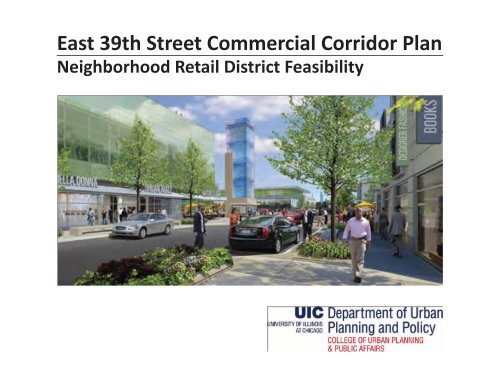
Neighborhood Retail District Feasibility
CREDITS<br />
Author:<br />
<strong>Chris</strong>topher <strong>Devins</strong>, Master’s Candidate<br />
Instructor:<br />
Rachel Weber, Professor<br />
Department of Urban <strong>Plan</strong>ning and Policy<br />
© 2011 Board of Trustees of the University of Illinois<br />
i
ii
TABLE OF CONTENTS<br />
Project Description 4<br />
Existing Conditions 5<br />
<strong>East</strong> <strong>39th</strong> <strong>Street</strong> <strong>Commercial</strong> <strong>Corridor</strong> 7<br />
Neighborhood Assets 8<br />
Primary Market Area 9<br />
Spending Potential In Primary and Secondary Market Areas 10<br />
Supply & Demand Analysis For Half Mile Trade Area 11<br />
Restaurant Potential 13<br />
Competition Within Primary Market Area 15<br />
Development Activity 16<br />
Big Box Retail 17<br />
Existing Land Use 18<br />
Access 22<br />
Transportation & Traffic Counts 23<br />
Chicago White Sox Facts 24<br />
Physical Condition 25<br />
Safety 26<br />
SWOT Analysis 27<br />
Vision Statement 29<br />
Recommendations 30<br />
Retail Development Opportunities 33<br />
Billboard Identity Campaign 34<br />
Implementation 35<br />
Addenda 37<br />
iii
iv
INTRODUCTION<br />
Located in the heart of Bronzeville, <strong>East</strong><br />
<strong>39th</strong> <strong>Street</strong> is an approximately 1 mile<br />
long commercial corridor that runs from<br />
Langley (600 <strong>East</strong>) on the <strong>East</strong> to Interstate<br />
90/94 on the west (200 West).<br />
Historically <strong>East</strong> <strong>39th</strong> <strong>Street</strong> served as a<br />
neighborhood shopping and restaurant<br />
district for the residents of the 3500 unit<br />
Ida B. Wells/Madden Park apartment<br />
complex. As part of the Chicago Housing<br />
Authority’s <strong>Plan</strong> of Transformation<br />
the residents of Wells/Madden Park<br />
were relocated and the complex was<br />
torn down. The last units were demolished<br />
in 2004, greatly reducing the<br />
population density of the neighborhood.<br />
This meant much less money was being<br />
spent on the <strong>39th</strong> <strong>Street</strong> corridor and<br />
conditions began to deteriorate. One<br />
<strong>by</strong> one local businesses, the economic<br />
engines of the corridor, began to close.<br />
Small businesses such as Sunrise Foods<br />
and Grocery, The Blue Sea Drive-In,<br />
Cee’s Gyros, Midway Barbershop, Dorothy’s<br />
Barbershop and Atlanta Liquors,<br />
facing declining revenues ceased operations.<br />
Businesses strong enough to relocate<br />
to other more lucrative areas did<br />
so and a cycle of decline and disinvestment<br />
began which lead to the corridor’s<br />
current state.<br />
<strong>East</strong> <strong>39th</strong> <strong>Street</strong> has some apparent<br />
strengths and there are positive changes<br />
occurring that bode well for its future.<br />
Some pluses on the corridor include<br />
an Average Daily Traffic count at Illinois<br />
Interstate 90/94 of 232,800 cars per day<br />
and 119,700 per day on the east end<br />
at Lake Shore Drive. While population<br />
is expected to decline slightly <strong>by</strong> 2015,<br />
in Douglas (2010 population 27,022) on<br />
the north side of <strong>39th</strong>, median income<br />
rose from $26,720 in 2000 to $31,526 in<br />
2010. This trend is expected to continue<br />
through 2015. Grand Boulevard (population<br />
26,651) to the south has a median<br />
income of $25,249, up from $19,723 in<br />
2000. These numbers are in inflation<br />
adjusted 2009 dollars. Fifteen percent<br />
of Douglas residents have a Master’s Degree<br />
or higher, 17% a Bachelor’s degree.<br />
The numbers from the half and 1 mile<br />
trade areas are similar and improve as<br />
the 3 mile trade area is approached. Access<br />
to funds is another of the corridor’s<br />
strengths. <strong>East</strong> <strong>39th</strong> street is within<br />
both TIF 61 and Enterprise Zone 2, each<br />
of which can supply development and<br />
incentive funds that can be used to<br />
improve the corridor. <strong>39th</strong> <strong>Street</strong> has<br />
political assets, as well. In Pat Dowell<br />
of the 3rd Ward and Will Burns of the<br />
4th, the area has two highly competent,<br />
dynamic aldermen to help lead future<br />
development.<br />
The corridor faces many challenges,<br />
also. A significant land use problem<br />
along <strong>39th</strong> <strong>Street</strong> is the high number of<br />
vacant structures and lots. In addition,<br />
at the center of the corridor, from King<br />
Drive to Langley are small, narrow lots<br />
that are zoned for higher quality uses<br />
than their size allows. These small lot<br />
sizes restrict the types and sizes of businesses<br />
willing to locate on <strong>39th</strong> street.<br />
The corridor is locked in on both sides<br />
<strong>by</strong> dull, uninformative highway exits and<br />
blocks of empty lots as you approach<br />
from both the east and the west, making<br />
what few stores that are present<br />
there difficult to find. Someone exiting<br />
from the major arteries to both the east<br />
and the west must drive two to three<br />
blocks before coming upon the <strong>East</strong> Pershing<br />
<strong>Commercial</strong> <strong>Corridor</strong>. In addition,<br />
Interstate 90/94 forms a barrier that<br />
effectively cuts <strong>East</strong> Pershing off from<br />
neighborhoods to the west. Outside<br />
threats to the corridor include 500,000<br />
square feet of retail development in the<br />
near<strong>by</strong> Lake Meadows Shopping Mall<br />
and the oversaturation of retail development<br />
in the United States. Since 2000,<br />
developers have built 1 billion square<br />
feet of new retail 1 . Economically, <strong>39th</strong><br />
1 “R & G Annual Market Summaries from REIN RETAIL<br />
REPORT.” Rein & Grossoehme <strong>Commercial</strong> Real Estate)- Brokers-<br />
Shopping Centers, Office & Industrial Buildings, Mini<br />
Warehouse/Self Storage and Land Investments (for Sale);<br />
Retail, Office, Industrial <strong>Commercial</strong> Space Leasing; Tenant<br />
Representation. Web. 16 Nov. 2011. .<br />
1
INTRODUCTION<br />
<strong>Street</strong> faces serious competition<br />
from 35th street to the north and<br />
from 43rd street, both within <strong>39th</strong><br />
<strong>Street</strong>’s half mile trade area. This<br />
left a question to be answered: with<br />
viable commercial corridors on both<br />
sides of <strong>East</strong> <strong>39th</strong>, what role should it<br />
play in Bronzeville’s overall economic<br />
development?<br />
Out of this analysis came some recommendations:<br />
1. Concentrate development efforts<br />
on the six blocks between Federal<br />
and King Drive. Development along<br />
this stretch will thus be anchored<br />
<strong>by</strong> the coming Metropolis Development<br />
at State <strong>Street</strong> which includes<br />
a 60,000 square ft. Roundy’s Grocery<br />
Store and residential, and could draw<br />
from the high ADT along 90/94. The<br />
west end of the corridor is already<br />
anchored <strong>by</strong> the new Dollar General<br />
Store at <strong>39th</strong> and Langley and retail/<br />
service resurgence should occur<br />
there as the 3200 units of Oakwood<br />
Shores are completed. Completion<br />
of the units will also solve the vacant<br />
lot problem at that end.<br />
2. Re-establish <strong>39th</strong> as THE local<br />
retail and services destination/neighborhood<br />
center <strong>by</strong> encouraging development<br />
of businesses that provide<br />
the daily necessities of life such as a<br />
dry cleaners, a barbershop, a nail salon,<br />
a coffee shop, a local bookstore<br />
and others. A sustainable urban<br />
form offers people a wide range of<br />
land uses and businesses within a<br />
reasonable walking distance 2 .<br />
Figure 1 <strong>East</strong> <strong>39th</strong> <strong>Street</strong> <strong>Commercial</strong> <strong>Corridor</strong> Source: Google Maps<br />
3. With a significant number of retail<br />
options within its half-mile trade<br />
area, <strong>39th</strong> <strong>Street</strong> should mix in restaurants<br />
to attract visits to the cor-<br />
2 Farr, Douglas. Sustainable Urbanism: Urban Design with<br />
Nature. Hoboken, NJ: Wiley, 2008. Print.<br />
2
idor. A MetroEdge retail scan 3 <strong>by</strong> of<br />
the area shows that the most visited<br />
establishments are <strong>by</strong> far the local<br />
restaurants and fast food places.<br />
4. Close and relocate the two liquor<br />
stores on the corridor. This will<br />
lessen noise, traffic, crime and congestion<br />
in the cluster that is Vegas<br />
and Rothschild’s liquor stores and<br />
improve safety in the area.<br />
5. Replace the two liquor stores with<br />
one sports bar to attract White Sox<br />
fans after games. Tapping into the<br />
fan base spilling out of the Chicago<br />
White US Cellular Field parking lot at<br />
<strong>39th</strong> on the other side of 90/94 after<br />
games will bring new spending to the<br />
area.<br />
6. Enhance the corridor’s streetscape<br />
and improve its look and feel using<br />
TIF 61 and Enterprise Zone 2 funds.<br />
There are other steps that can be<br />
taken, as well. <strong>Plan</strong>t more trees along<br />
the road and plants and benches to<br />
separate the sidewalk from the street<br />
and make for a better pedestrian<br />
3 http://www.metroedge.org/uploads/metroedge/documents/grand_boulevard.pdf<br />
INTRODUCTION<br />
experience. Provide better marking<br />
on the corridor’s available parking<br />
spaces and employ gate¬way signage<br />
on the corridor itself and on<br />
the 90/94 and Lake Shore Drive exits<br />
to lead people to the corridor and<br />
increase corridor visits. Use infill<br />
development to increase population<br />
and stabilize the community.<br />
Provide culture within which to<br />
place the retail <strong>by</strong> creating an identity<br />
billboard and shops campaign<br />
and other mechanisms cultural to<br />
reconnect residents and stakeholders<br />
with Bronzeville’s historic past,<br />
bolster identity and drive retail sales.<br />
Encourage Transit-Oriented Development<br />
around the 40th and Indiana<br />
CTA Green line stop. Break the 90/94<br />
barrier and lure people from West<br />
Pershing Road over to the corridor<br />
with amenities. Attract a “big box”<br />
anchor retailer (with 90/94’s central<br />
location and high ADT’s) to the<br />
large, open tracts of land just east<br />
of 90/94 on <strong>39th</strong> ,some of which are<br />
owned <strong>by</strong> the Illinois Department of<br />
Transportation. Such new businesses<br />
could be attracted to the corridor<br />
given the high traffic counts along<br />
Interstate 90/94. The idea is to create<br />
a local neighborhood commercial<br />
strip that also draws people in from<br />
further out.<br />
3
PROJECT DESCRIPTION<br />
This plan’s purpose was to develop a commercial revitalization strategy for the <strong>East</strong><br />
<strong>39th</strong> <strong>Street</strong> commercial corridor in Chicago, IL. I collected data on the corridor then<br />
analyzed the socio-economic trends likely to affect its future development. In a SWOT<br />
analysis, I inventoried the corridors strengths and weaknesses, which are internal to<br />
the corridor. I then looked at opportunities and threats, which are external. From<br />
the relationship between internal strengths/weaknesses and external opportunities/<br />
threats, I arrived at the corridor’s “competitive advantage”, its market position. Especially<br />
important was <strong>East</strong> <strong>39th</strong> <strong>Street</strong>’s position relative to other local commercial<br />
activity centers. I analyzed the 2010 Bronzeville Alliance, Quad City Development Corporation,<br />
Chicago Tax Increment Financing and Metropolitan <strong>Plan</strong>ning Council development<br />
plans to make sure I was aware of their goals for the area. I then used this<br />
information to make recommendations to guide <strong>39th</strong> <strong>Street</strong>’s future development.<br />
These recommendations will help Bronzeville’s leaders develop the corridor in a way<br />
that takes advantage of its strengths and opportunities, mitigate its weaknesses and<br />
threats and reassert its position as a neighborhood district serving the immediate area<br />
but one that also draws White Sox Fans and commuters from Interstate 90/94.<br />
4
EXISTING CONDITIONS<br />
Bronzeville is located on the mid-south<br />
side of Chicago, Illinois and is generally<br />
considered to be bounded <strong>by</strong> 22nd<br />
<strong>Street</strong> on the north, 67th <strong>Street</strong> on the<br />
south, Stewart <strong>Street</strong> on the west, and<br />
Lake Michigan (north of 47th), Drexel<br />
Blvd., (47th to 51st), and Cottage Grove<br />
(51st to 67th) on the east.<br />
Chicago’s version of the Harlem Renaissance<br />
happened in Bronzeville.<br />
Bronzeville was home to famous African-Americans<br />
like Lorraine Hansberry,<br />
Gwendolyn Brooks, Richard Wright,<br />
Louis Armstrong, Bessie Coleman, Ida<br />
B Wells, Jack Johnson and others. From<br />
the 1920s to the 1940s Bronzeville was<br />
second only to Harlem as a center of<br />
Black culture. Bronzeville had its problems,<br />
as well. Black Chicagoans were<br />
restricted <strong>by</strong> City Hall from renting and<br />
buying property outside of the “Black<br />
Belt”. In 1941 the Ida B Wells housing<br />
project was built to provide housing<br />
and a step up for low and middle income<br />
families, many just starting out.<br />
However, after years of operation Ida<br />
B Wells/Madden Park began to suffer<br />
like the city’s other housing projects<br />
from deferred maintenance, the loss<br />
of middle income renters to tenants on<br />
government assistance and apartments<br />
with too many bedrooms. The latter led<br />
to an abnormally high child to adult ra-<br />
Illinois<br />
Figure 2 Bronzeville, Chicago Source: Wikipedia<br />
Bronzeville, Chicago<br />
5
EXISTING CONDITIONS<br />
tio, resulting in high gang membership 4 .<br />
Urban blight and crime followed, leading<br />
to neighborhood deterioration.<br />
Over ten years ago, in an effort to address<br />
these problems Mayor Richard<br />
Daley and the Chicago Housing Authority<br />
set a goal to tear down Chicago’s<br />
public housing projects and replace<br />
them with a mix of for-sale homes and<br />
subsidized and market-rate rentals. 3500<br />
units in the Ida B Well/Madden Park<br />
projects were torn down and development<br />
of the 3200 unit Oakwood Shores<br />
Development began in earnest in 2004.<br />
Today the neighborhood’s historic significance<br />
is driving new development<br />
efforts. Night life is slowly improving,<br />
and there are a number of coffee shops<br />
and restaurants. The neighborhood’s<br />
rich history is its primary asset. Notably,<br />
revitalization efforts have not extended<br />
west of the Dan Ryan Expressway or into<br />
the Fuller Park and Washington Park<br />
neighborhoods, which suffer from high<br />
violent crime levels and vacant lots.<br />
Figure 3 Brozeville, IL Source: Wikipedia<br />
When the real estate market crashed in<br />
2008 developers began slashing prices<br />
in an effort to sell off their remaining<br />
inventory. Some are being offered at<br />
more than a third off their original price.<br />
The price cuts have caused many original<br />
buyers in Oakwood Shores to lose<br />
their equity while their property taxes<br />
have increased. The loss of the original<br />
units and the slow pace of replacement<br />
has meant few customers for the <strong>East</strong><br />
<strong>39th</strong> <strong>Street</strong> commercial corridor and it<br />
has fallen into disrepair. This drop in<br />
demand for the goods and services once<br />
offered on the corridor has been devastating.<br />
4 Hunt, D. Bradford. Blueprint for Disaster the Unraveling of<br />
Chicago Public Housing. London: University of Chicago, 2009.<br />
Print.<br />
6
NEIGHBORHOOD ASSETS<br />
Bronzeville overall has many assets around which amenities can be built, including these landmarks:<br />
• Wabash Avenue YMCA, 3763 Wabash Ave. Bronzeville’s YMCA was a center for the neighborhood<br />
at its inception. The YMCA was restored in 2000 and is open to the public.<br />
• Chicago Defender Building, 3435 Indiana Ave. This building housed the Chicago Defender, the<br />
nation’s largest Black newspaper, from 1920-1960. The building is vacant and may be for sale.<br />
• Overton Hygienic Building, 3619-27 State St. Built <strong>by</strong> Black businessman Anthony Overton as<br />
the headquarters of his cosmetics company. The building also had Victory Life Insurance Company<br />
and Douglass National Bank, America’s first national African-American bank, as tenants. The building<br />
is now owned <strong>by</strong> the Mid-South <strong>Plan</strong>ning and Development Commission.<br />
• Sunset Cafe (Ace Meyers Hardware Store), 315 35th St, Many jazz legends played at this jazz<br />
club, including: Jimmy Dorsey, Benny Goodman, Fletcher Henderson, Count Basie, and, Louis<br />
Armstrong. The club was run <strong>by</strong> the mafia and the musicians had terrible contracts. The building is<br />
now a hardware store. Still, the Sunset Cafe is Chicago’s number one jazz history site and its name<br />
or flavor could be resurrected in a neighborhood economic development scheme.<br />
• Supreme Life Building, 3501 Martin Luther King Jr. Dr. Built to house the first African-American<br />
insurance company, the building is the site of the Bronzeville Visitor Information Center.<br />
• Eighth Regiment Armory (Bronzeville Military Academy), 3533 Giles Ave This building, once an<br />
armory for an all Black fighting regiment, has been restored and now houses a college-prep military<br />
school.<br />
• Chicago Bee Building, 3647-3655 State St, former home of the Chicago Bee Newspaper. Today it<br />
houses the Chicago Bee Branch Library 5 .<br />
5 http://wikitravel.org/en/Chicago/Bronzeville<br />
7
PRIMARY MARKET AREA<br />
The primary market area is the half mile<br />
radius extending out in all directions<br />
from the corner of <strong>39th</strong> and South Martin<br />
Luther King Drive, which was once<br />
the start of the main shopping strip<br />
going westward. For the pedestrian<br />
this is a 15 minute walk, for the commuter<br />
a five minute drive. Within this<br />
area <strong>39th</strong> street faces competition from<br />
35th and 43rd, which both have more<br />
highly developed retail corridors. At the<br />
Lake Meadows shopping mall there is<br />
500,000 sq feet of space housing a Jewel<br />
Foods, a Walgreen’s and a Dunkin’ Donuts.<br />
There is a Chase National Bank on<br />
the corner of 35th and King Drive.<br />
To the west on <strong>39th</strong> <strong>by</strong> 90/94 there are<br />
several lots large enough for national<br />
and regional stores in the 60,000 to<br />
140,000 square ft., but currently consumers<br />
have very few retail options on<br />
the corridor. Food options are scarce<br />
also; there are two sit-down restaurants<br />
and a fast food restaurant. Since <strong>39th</strong><br />
is surrounded on all sides <strong>by</strong> competing<br />
retail corridors and experiences significant<br />
retail leakage, its main customers<br />
will be those residents coming online in<br />
the immediate half mile trade area. The<br />
three and five mile trade areas are not<br />
as much of a factor because Downtown<br />
Chicago lies within, which shifts the<br />
locus completely.<br />
Figure 4 Primary Trade Area (.5 Mile) Also 1 and 3 mile Source: ESRI Community Analyst<br />
8
PRIMARY MARKET AREA<br />
Figure 5 Job Distribution in the 1 Mile Trade Area Source: US Census On the Map<br />
The primary job center in the trade area is<br />
the Illinois Institute of Technology campus<br />
at 3300 S. Federal, which employs<br />
2,375 including 659 faculty. IIT is a private<br />
Ph.D.-granting university with programs<br />
in engineering, psychology, architecture<br />
and other disciplines 6 . The self-contained<br />
nature of the Institute means that it<br />
meets many of the needs of its employees,<br />
students and faculty itself. Like all<br />
6 “Illinois Institute of Technology.” Wikipedia, the Free Encyclopedia.<br />
Web. 16 Nov. 2011. .<br />
large schools it has a significant number of<br />
dining options. In 35th <strong>Street</strong>, it also has<br />
a developed retail corridor that serves it<br />
quite well. Though it may be desirable, it<br />
is doubtful that enough of its attendees or<br />
staff will pass up 35th for <strong>39th</strong> <strong>Street</strong> to<br />
make the Illinois Institute of Technology<br />
a serious factor in the future of <strong>East</strong> <strong>39th</strong><br />
<strong>Street</strong>. Of course, successful development<br />
of the corridor would bring with it<br />
be beneficial consequences including more<br />
visits from Illinois Institute of Technology<br />
students, employees and faculty, but these<br />
cannot be counted on.<br />
The dark area is the Campus of the Illinois<br />
Institute of Chicago. Because the 35th<br />
street commercial corridor lies between IIT<br />
and <strong>East</strong> <strong>39th</strong> street, and has a relatively<br />
closed campus environment, it is doubtful<br />
that IIT employees will be a strong factor in<br />
<strong>East</strong> <strong>39th</strong> streets future success.<br />
9
SPENDING POTENTIAL IN PRIMARY AND SECONDARY MARKET AREAS<br />
If one looks just at the number of households<br />
and their median income, the retail<br />
spending potential in the half mile trade<br />
area looks weak, however a closer look at<br />
ESRI Community Analyst data reveals that<br />
26% of households in that area earn more<br />
than $50,000 per year and that 14% have<br />
a Masters Degree or higher level education.<br />
By 2015, 33% of the area’s residents<br />
are expected to earn $50,000 or more per<br />
year. Overall, the 2010 median household<br />
income of $19,740 is expected to rise<br />
to $25,631 in 2015, a 33% rise. In 2015,<br />
18% of the households within the primary<br />
trade area will make between $25,000<br />
and $49,000 per year. All numbers are in<br />
inflation adjusted 2009 dollars. Attracting<br />
residents from all of these income groups<br />
to <strong>39th</strong> street will be important to the corridor’s<br />
future success.<br />
Fifteen percent of the half mile trade<br />
area’s 5107 housing units are owner occupied,<br />
85% are renter occupied. Of the<br />
area’s 5107 households, 55% or 2809 are<br />
families. This indicates a stability that<br />
counters the high number of renters. The<br />
median age of 31.9 is projected to rise only<br />
slightly to 32.3 in 2015, which means a<br />
young population whose incomes will most<br />
likely rise in the future and will be able to<br />
support more local development.<br />
The shopper of 2015 will be a more affluent,<br />
more educated version of the 2010<br />
shopper, and a homeowner. With 1 to<br />
3 bedroom condos in 3 to 6-flat buildings,<br />
townhomes and single family homes<br />
priced between $179,000 - $389,000,<br />
Oakwood Shores will bring residents from<br />
Key Stats 2010 <br />
a mix of incomes together. As homeowners<br />
and wage earners they will expect a corridor<br />
with amenities that provide for their<br />
daily needs and aspirations.<br />
.5 Miles: <strong>39th</strong> & KING <br />
DR. 1 Mile 3 Mile Chicago <br />
Households 5,107 16,464 259,055 1,063,047 <br />
Population 13,315 45,557 100,011 2,824,064 <br />
Population Density 15,585 ******* ******* 17092 <br />
Median Age 31.9 29.1 31.3 32.8 <br />
Household Average Income $36,404 $38,563 $54,875 $53,226 <br />
Median Household Income $19,740 $21,616 $38,281 $46,781 <br />
% African American <br />
Population 97.0% 90.9% 52.0% 34.1% <br />
% Hispanic Population 1.4% 1.6% 19.3% 27.4% <br />
Total Retail Expenditure $39,196,449 $132,490,370 $863,438,169 $73,688,472,212 <br />
Apparel and Services $4,909,201 $16,677,424 $145,185,540 $10,683,254,151 <br />
Alcoholic Beverages $1,746,470 $5,858,897 $50,385,774 $324,104,319 <br />
Restaurants $9,236,654 $31,264,151 $270,615,913 $6,844,158,150 <br />
Grocery Stores $13,383,950 $76,366,875 $381,457,722 $19,920,782,603 <br />
Table 1 Demographic Data Source: ESRI Community Analyst In inflation adjusted 2009 dollars.<br />
Key Stats 2015 <br />
.5 Miles: <strong>39th</strong> & KING <br />
DR. 1 Mile 3 Mile <br />
Households 5,051 16,556 260,271 <br />
Population 13,193 45,985 100,808 <br />
Population Density <br />
15,023 <br />
Median Age 32.3 29.2 31.4 <br />
Household Average Income $43,127 $45,861 $66,195 <br />
Median Household Income $25,631 $27,274 $48,445 <br />
% African American <br />
Population 96.4% 90.3% 51.1% <br />
% Hispanic Population 1.9% 2.0% 20.5% <br />
Table 2 Demographic Data Source: ESRI Community Analyst<br />
In adjusted 2009 dollars.<br />
10
SUPPLY & DEMAND ANALYSIS FOR HALF MILE TRADE AREA<br />
Table 3 Supply and Demand Data Source: ESRI Community Analyst<br />
11
SUPPLY & DEMAND ANALYSIS FOR HALF MILE TRADE AREA<br />
Leakage is the difference between buying power and retail sales. It indicates how much residents<br />
of an area spend that is not captured <strong>by</strong> actual sales <strong>by</strong> local stores. For example, if zip<br />
code “X” has $70 million in expenditures <strong>by</strong> local residents on retail goods, and $30 million in<br />
sales of retail goods <strong>by</strong> local stores, the leakage for “X” is $40 million. This tends to produce<br />
a conservative estimate of leakage because stores sell to people outside the neighborhood as<br />
well. Most neighborhoods have positive leakage because certain types of goods and services<br />
are not normally purchased in the neighborhood. For example, you would not find major appliance<br />
stores or large law firms in most neighborhood areas. The above chart shows that key<br />
industry group categories in the immediate trade area show significant leakage. There is 100%<br />
leakage in the Electronics and Appliance Stores category, also in Furniture Stores, meaning that<br />
all shopping in these categories is done outside the trade area. There is a 100% leakage factor<br />
in Specialty Food Stores, which indicates the same. A leakage factor of 57, such as that in<br />
Grocery Stores, indicates that 57% of grocery shopping occurs outside the half-mile trade area.<br />
The only negative leakage figure (above in red), in the half-mile trade area is the -$1,366,326 in<br />
NAICS category 4453: Beer, Wine and Liquor Stores. This negative leakage means that customers<br />
are coming in from outside the trade area to make purchases in the Beer, Wine and Liquor<br />
Stores Category from the areas two liquor stores, which will be named later in the Exisitng<br />
Land Use section. The numbers are similar at the 1 mile trade area also.<br />
12
RESTAURANT POTENTIAL<br />
In a 2010 MetroEdge Retail Scan of Bronzeville’s 43rd, 47th and 51st study areas,<br />
survey respondents, when asked “What are the stores, restaurants, offices, or other<br />
businesses (in Area 1,2 or 3) that you visit most often?” the most visited places <strong>by</strong><br />
far were food related. In area 2 (43rd street), for example, 26 of 52 (50%) respondents<br />
said when visiting a corridor, they most often visited a restaurant or food market.<br />
Services were the next most heavily visited at 11 of 52 (21%). Retail accounted<br />
for only 9 respondents (17%). In Area 1(43rd street) 37 of 53 (70%) visits were food<br />
related. <strong>39th</strong> street has three restaurants: Pearl’s, Sneak Peek, and the Chicago Rib<br />
House. This use also works well with the shallow lot sizes.<br />
This Market Potential Index (MPI) measures relative market demand for restaurants<br />
in the half mile trade area compared to the U.S. average. Numbers over 100 indicate<br />
demand for restaurants greater than the national average. Notice that Old Country<br />
Buffet has an MPI of 247 which means that the demand for this restaurant is almost<br />
two and one-half times the national average. The data shows strong demand for a<br />
family steakhouse, as well.<br />
13
RESTAURANT POTENTIAL<br />
Table 4 Restaurant Potential Source: ESRI Community Analyst<br />
14
COMPETITION WITHIN PRIMARY MARKET AREA<br />
As stated above, <strong>39th</strong> <strong>Street</strong> faces competition from 35th and 43rd, which both have more highly developed retail corridors. At<br />
the Lake Meadows shopping mall, to the east of 3500 South King Drive at Lake Meadows Shopping Mall, there is 500,000 sq feet<br />
of space housing a Jewel Foods, a Walgreen’s and a Dunkin’ Donuts, among other businesses.<br />
1. From 3500 S King Drive and west to State <strong>Street</strong>, a span of four city blocks, nine restaurants, a liquor store, Chase Bank, a hardware<br />
store, two shoe stores, two cell phone stores, and two services.<br />
• Wood’s Food and Liquor<br />
• Chase Bank<br />
• Ace Hardware (the former Sunset<br />
Café, where Louis Armstrong<br />
used to play)<br />
• 213 Wireless<br />
• US Cellular<br />
• Jackson Hewitt Tax Services<br />
• Mena Nail Salon<br />
• Payless Shoes<br />
• Just Fit Shoes<br />
• Popeye’s Chicken<br />
• Kentucky Fried Chicken<br />
• Downtown Sub<br />
• Quiznos<br />
• Church’s Chicken<br />
• McDonald’s<br />
• Jimmy John’s<br />
• Starbuck’s<br />
• Hong Kong Delight<br />
This is significant competition from only a half mile to the north<br />
or south, however the retail and restaurants at both 35th and<br />
43rd are still a half-mile away. By offering retail and services<br />
close to the developments at State <strong>Street</strong> and at King Drive<br />
<strong>39th</strong> could possibly carve an identity out for itself as a neighborhood<br />
shopping/eating cluster that would serve the area’s<br />
residents and draw traffic from 90/94. This approach was successful<br />
in the corridor’s past. Before the destruction of 3500<br />
housing units and the resulting population loss, <strong>East</strong> <strong>39th</strong> <strong>Street</strong><br />
served as a neighborhood shopping center for the area’s local<br />
residents.<br />
Figure 6 3500 S. King Drive Looking West Source: Google Maps<br />
2. Forty-third and King Drive and west to State <strong>Street</strong> is not<br />
as well developed as 35th street, but still has a bar and grill, a<br />
grocery store, three fast food restaurants, and a used furniture<br />
store.<br />
• Saveway Food<br />
• JJ Fish and Chicken<br />
• Pizza Ria<br />
• Alice’s Barbecue<br />
• Lady D’s Used Furniture<br />
• 4310 Bar & Grill<br />
15
DEVELOPMENT ACTIVITY<br />
Oakwood Shores<br />
Lost population density on the corridor<br />
is slated to be replaced. At the eastern<br />
end of the corridor, the 94 acre Oakwood<br />
Shores development is roughly<br />
bounded <strong>by</strong> 35th <strong>Street</strong> to the north,<br />
Lake Park Avenue to the east, Pershing<br />
Road to the south and Martin Luther<br />
King Jr. Drive to the west. Originally<br />
the site of 3,500 public housing units,<br />
when finished Oakwood Shores will add<br />
3,000 units of new rental and for-sale<br />
housing to the corridor. The for-sale<br />
properties are priced between $179,000<br />
and $389,000. Construction began in<br />
2003 and will be completed over several<br />
phases. An exact timeline has not been<br />
published <strong>by</strong> the CHA.<br />
Rental Phase 2, located along Pershing<br />
Road between Cottage Grove Ave.<br />
and Vincennes Ave. consists of 199 new<br />
CHA, affordable and market rate rental<br />
units. Rental unit features include custom<br />
landscaping, dishwashers, a patio<br />
or deck with each unit, energy efficient<br />
central air, private and guest parking,<br />
in low rise, 3 story or less brick buildings.<br />
Developers include UJIMA (rental<br />
and for-sale), The Community Builders<br />
(rental), Granite Development (rental<br />
and for-sale) and MB Real Estate (forsale).<br />
When these units are completed<br />
and occupied, there will be a need once<br />
again for a near<strong>by</strong> neighborhood center<br />
where goods and services can be obtained<br />
7 .<br />
Metropolis<br />
Announced in February of 2007 <strong>by</strong> Capri<br />
Capital Partners LLC, the residential/retail<br />
mixed use development Metropolis<br />
will be coming to the western end of<br />
the corridor at <strong>39th</strong> <strong>Street</strong> and South<br />
State, anchored <strong>by</strong> a 60,000 square<br />
ft. Roundy’s grocery store. In a joint<br />
venture with Judson Investment Company,<br />
“The Metropolis,” is a three phase<br />
mixed-use project that when finished<br />
will be approximately 1,000,000 square<br />
feet in size. The first phase consists of<br />
330,000 square feet of commercial retail<br />
area and 102 residential condominium<br />
units at a cost of $155 million. The initial<br />
phase will include green space surrounded<br />
<strong>by</strong> two six-story curved steel<br />
and glass buildings. Future phases include<br />
three towers dedicated to residential<br />
and hotel uses. The development is<br />
slated for completion <strong>by</strong> 2013 8 .<br />
Figure 7 Metropolis at <strong>39th</strong> and State <strong>Street</strong> Source: EveryBlock<br />
7 “Individual Development Page | Chicago Housing Authority.”<br />
Home | Chicago Housing Authority. Web. 16 Nov. 2011.<br />
.<br />
8 “Breaking News, Press Release Distribution, Targeting and<br />
Monitoring, Public Relations and Investor Relations Services,<br />
Multimedia and Press Release Optimization, Enhanced<br />
Online News, and Regulatory Filings.” Press Release Distribution,<br />
Financial Disclosure, Online Newsrooms, PR, Public<br />
Relations, Investor Relations, EDGAR Filing, XBRL, Breaking<br />
News, Business News, Financial News | Business Wire. Web.<br />
16
BIG BOX RETAIL<br />
Along <strong>39th</strong> <strong>Street</strong>’s western edge, adjacent to Interstate 90/94, there are several two to three<br />
acre parcels that would be suitable for a Big Box retailer. One acre comprises 43,560 square<br />
feet. An easy way to imagine an acre is as a rectangle measuring 88 yards <strong>by</strong> 55 yards, slightly<br />
less than the size of a standard American football field. The designation “Big Box” calls<br />
forth an image of a large, rectangular, windowless, single story building on a concrete slab,<br />
surrounded <strong>by</strong> a huge surface parking lot. The Big Box retail model depends on high volume<br />
sales with tight profit margins. To generate high volume sales, the Big Box retailer must occupy<br />
a large amount of space, and offer enough parking to accommodate many shoppers.<br />
To reduce design and construction costs, Big Box retail stores typically stick to a standardized<br />
layout 9 . The American <strong>Plan</strong>ning Association defines a Big Box store as a stand alone store of<br />
at least 100,000 square feet. On top of these space requirements must be added at least one<br />
parking space for every 200 feet of floor space, a parking requirement of 500 spaces. Generally,<br />
one hundred and fifty 8-foot parking spaces can be fit into an acre 10 , bringing the total<br />
land use requirements for a Big Box store along Interstate 90/94 to approximately five acres.<br />
There is a site on the north side of <strong>39th</strong> <strong>Street</strong> up to 36th <strong>Street</strong> and between Federal and<br />
State <strong>Street</strong>s that meets these requirements and where 232,800 cars pass <strong>by</strong> every day.<br />
16 Nov. 2011. .<br />
9 Dwight H. Merriam, Breaking Big Boxes: Learning from the Horse Whisperers (Symposium 2005), VT. J. OF ENVTL. L.<br />
10 “How Many Standard Parking Spaces Are There in an Acre? | ChaCha.” Questions & Answers | ChaCha. Web. 16 Nov. 2011. .<br />
17
EXISTING LAND USE ON EAST 39TH STREET<br />
Along the south side of <strong>East</strong> <strong>39th</strong> street from<br />
Langley to State the corridor is zoned mostly<br />
B3-3, which allows for commercial development<br />
of any size, with the center of the strip<br />
from King Drive to Indiana being plagued <strong>by</strong><br />
shallow lots that directly abut lots zoned for<br />
residential. Even though much of Pershing<br />
zoned B3-3, which is Community shopping<br />
– destination oriented, with no limit on size<br />
of commercial establishment, the size and<br />
depth of the existing lots are inadequate to<br />
support the higher quality uses permitted.<br />
Marginal retailers, too small to be profitable,<br />
come in, deteriorate, and become vacant.<br />
This adversely impacts the neighborhood<br />
and the economic development of the surrounding<br />
commercial property. The small lots<br />
also increase pressure to rezone neighboring<br />
residential lots for an expansion of the use,<br />
which further destabilizes the situation.<br />
However, as stated before, there are large<br />
parcels on the west end that would be suitable<br />
for large commercial developments.<br />
These lots are adjacent to Interstate 90/94<br />
and its extremely high traffic counts. The primary<br />
reason for examining current land use<br />
is to analyze the impacts the uses are having<br />
on the surrounding neighborhood. Each land<br />
use has impacts associated with it that can<br />
enhance or detract from the community. As<br />
such, <strong>39th</strong> street’s 61 parcels and their land<br />
uses were categorized into 11 groups:<br />
General Land Use Type Use Name Number of <br />
1. Services • Insurance <br />
• Printing <br />
• Barber <br />
• State Farm <br />
• Five Star <br />
Printing <br />
• Clippers <br />
Barbershop <br />
Structures <br />
Percent of <br />
Total <br />
3 5% <br />
2. Alcohol • Alcohol sales • Rothschild’s <br />
2 3% <br />
• Vegas <br />
3. Restaurants/Fast • Food prep and • Pearls Place <br />
3 5% <br />
Food <br />
sale <br />
• Chicago Rib <br />
House <br />
• Baba’s <br />
4. Hotels/Motels • Hotel services • Amber Inn 2 3% <br />
5. Sale of Goods • General <br />
• Flowers <br />
• Used goods <br />
• Cell phone <br />
accessories <br />
• Dollar General <br />
• Blossoms of <br />
Hawaii Flower <br />
Shop <br />
• 339 E. Pershing <br />
• Unlimited <br />
Wireless <br />
4 7% <br />
6. Auto related • Gas station • CITGO 1 2% <br />
7. Health Center • Medical <br />
services <br />
8. Public/Schools • Fire house <br />
• Public <br />
Employee <br />
Association <br />
• Educational <br />
Services <br />
9. Churches • Religious <br />
services <br />
1. Residential • Religious <br />
services <br />
• Bronzeville <br />
Medical Center <br />
• Mastercare <br />
Family Center <br />
• Engine Co. 19 <br />
• Association of <br />
Letter Carriers <br />
• Dawson Tech <br />
• Phillips High <br />
School <br />
• Your School of <br />
Beauty <br />
• Bible Mission <br />
• St Joseph <br />
Baptist <br />
• MBC Church <br />
Outreach <br />
• Beersheba <br />
Bible <br />
• 3845 S. State <br />
• 125-123 E. <br />
Pershing <br />
2 <br />
3% <br />
5 8% <br />
4 7% <br />
2 3% <br />
2. Vacant <br />
33 54% <br />
Structures/Lots <br />
Total 61 100% <br />
Table 5 Existing Land Use<br />
Table 4 Existing Land Uses <br />
18
EXISTING LAND USE ON EAST 39TH STREET<br />
Services<br />
It is well known that while people<br />
tend not to shop locally for retail<br />
items like clothing, accessories etc,<br />
preferring to go “downtown” to the<br />
Central Business District, they will<br />
shop for services in the neighborhood.<br />
Services increase daytime<br />
foot traffic, an important factor in<br />
the health of any commercial corridor<br />
and bring much-needed local<br />
employment. <strong>East</strong> <strong>39th</strong> has three<br />
service businesses, making up 5% of<br />
the corridor’s total land use.<br />
Figure 10 Older Mixed Use on <strong>East</strong> <strong>39th</strong> <strong>Street</strong><br />
Source: The Author<br />
Alcohol<br />
Two alcohol stores, Rothschild’s and<br />
Vegas significantly impact <strong>East</strong> Pershing<br />
Road in a negative way. They are<br />
clustered, which increases their impact.<br />
The alcohol use on the corridor<br />
is 100% off-premises, which is known<br />
to contribute negatively to the surrounding<br />
community. Off premise<br />
use in the overall Chicago area is only<br />
53%. Both Vegas and Rothschild’s<br />
are located near schools and homes.<br />
Restaurants<br />
<strong>39th</strong> street has three restaurants:<br />
Pearl’s, Sneak Peek, and the Chicago<br />
Rib House and a fast food establishment,<br />
Baba’s Steak and Lemonade.<br />
They constitute 5% of the land use<br />
on the corridor.<br />
Hotels/Motels<br />
<strong>East</strong> <strong>39th</strong> street has one motel, the<br />
Amber Inn, which though it provides<br />
customers for Pearl’s Place<br />
Restaurant, has raised community<br />
resident’s concern and perception of<br />
prostitution and drug trafficking.<br />
Sale of Goods<br />
This general land use category includes<br />
outside display, and retail<br />
stores selling used goods. When<br />
located on small parcels, near residential<br />
neighborhoods, and where<br />
the premises are not properly maintained,<br />
these land uses can have an<br />
adverse impact on the community.<br />
Residents don’t like the open display<br />
of washing machines, furniture, etc<br />
at used goods stores and fear that<br />
the merchandise may include stolen<br />
property. Used goods stores are associated<br />
with negative perceptions<br />
that can adversely affect a corridor’s<br />
draw.<br />
Auto Related<br />
The sole automobile use in the study<br />
area is a CITGO Gasoline Station. The<br />
station is clean, well lit and maintained<br />
and appears to have no negative<br />
impact on the surrounding area.<br />
When the 3000 unit CHA mixed-income<br />
Oakwood Shores Development<br />
is finished, there will be a real need<br />
for this station.<br />
Health Center<br />
There are two health Centers on<br />
the corridor that actively contribute<br />
positively economically and healthwise<br />
to Bronzeville. Bronzeville<br />
Medical Center was established in<br />
1980 and incorporated in Illinois. This<br />
company has annual revenue of less<br />
19
EXISTING LAND USE ON EAST 39TH STREET<br />
than $500,000 and employs a staff<br />
of 4. Mastercare Family Medical<br />
Center employs the same number of<br />
people and has approximately the<br />
same revenue as Bronzeville medical<br />
center. Both of these health centers<br />
offer managed health care.<br />
Store Front Churches<br />
When African Americans first began<br />
to move into Bronzeville they<br />
brought with them a number of<br />
churches. In spite of the survival of<br />
several congregations in the neighborhood<br />
religious institutions have<br />
not always prospered nor remained<br />
in the neighborhood. The economy,<br />
racial changes, and urban development<br />
have all had an effect upon the<br />
religious nature of the community,<br />
especially since the fifties. As church<br />
members began to move out of the<br />
community, some churches left,<br />
leaving behind buildings that were<br />
abandoned. Two large churches, Holy<br />
Angels and Apostolic Church contribute<br />
positively to the area. However,<br />
there are three store church buildings<br />
on the corridor that contribute<br />
negatively to the appearance of the<br />
corridor. They are Beersheba Bible<br />
Church, St Joseph Baptist and Bible<br />
Mission Church. They are located in<br />
dilapidated structures that are physically<br />
unattractive and do not reflect<br />
their importance to the community<br />
and their congregations. These structures<br />
are on shallow lots that push<br />
up against lots zoned residential.<br />
Figure 11 Storefront Church at <strong>39th</strong> and Langley<br />
Source: The Author<br />
Public Uses<br />
Public buildings are part of the infrastructure<br />
of the community. Every<br />
neighborhood is anchored in its<br />
buildings, which include its churches,<br />
libraries, civic buildings, schools and<br />
hospitals. A planned Chicago Firefight<br />
Department training station for<br />
Engine Co. 19 and the Association of<br />
Letter Carriers both positively affect<br />
the corridor, adding jobs and stability<br />
to the corridor.<br />
Residential<br />
The CHA Oakwood Shores Development<br />
will provide 3000 mixedincome<br />
units to the corridor, though<br />
it is unclear when exactly they will<br />
be completed. Information on the<br />
development’s timeline is scarce<br />
and developers, looking at the losses<br />
mounting on their pro-forma statements,<br />
have been focusing on selling<br />
the units already completed before<br />
beginning other construction phases<br />
11 . Joseph Williams, of Oakwood<br />
Shores developer Granite Partners,<br />
describes his efforts to continue development<br />
as “missionary work.”<br />
However, when the total development<br />
comes online and a significant<br />
portion of the units have been sold,<br />
the resulting surge in population<br />
could create demand for new shops<br />
and restaurants on <strong>East</strong> <strong>39th</strong> <strong>Street</strong>.<br />
11 “<strong>Plan</strong> for Transformation a Tough Sell in Weak Market<br />
- Chicago Tribune.” Featured Articles From The Chicago<br />
Tribune. 10 June 2011. Web. 16 Nov. 2011.
EXISTING LAND USE ON EAST 39TH STREET<br />
There are some signs that the area<br />
is moving towards more population<br />
density. 3845 S. State is a relatively<br />
large (10-20) unit development that<br />
brings much needed density to<br />
the area. 125 - 123 <strong>East</strong> Pershing is<br />
similarly sized and new also. Neither<br />
development is part of Oakwood<br />
Shores. There are some older apartments<br />
above storefronts at 316 <strong>East</strong><br />
and 617-615 <strong>East</strong> Pershing that need<br />
rehabilitation.<br />
Vacant Lots/Structures: 19 vacant<br />
lots, 14 vacant structures<br />
54% of the land along the corridor is<br />
vacant, not including the two large<br />
empty lots that will be part of the<br />
finished Oakwood Shores development.<br />
This includes 19 vacant lots<br />
and 14 vacant structures. These<br />
vacant lots are a significant problem<br />
because they contribute to the lack<br />
of perceived safety on the corridor,<br />
discourage walking and discourage<br />
passing commuters from stopping for<br />
a visit. However, they are well positioned<br />
directly across from the pending<br />
Oakwood Shores development<br />
and provide an opportunity for infill<br />
development that increases population,<br />
maintains the stability of the<br />
neighborhood and encourages transit<br />
use.<br />
Figure 12 Vacant Lot on <strong>East</strong> <strong>39th</strong> Source: The Author<br />
21
ACCESS<br />
As stated above, the <strong>East</strong> Pershing<br />
<strong>Commercial</strong> <strong>Corridor</strong>, is locked in on<br />
both sides with uninformative highway<br />
signage and blocks of empty<br />
lots as you approach from both the<br />
east and the west, making what few<br />
stores that are present there difficult<br />
to find. Interstate 90/94 forms<br />
a barrier that effectively cuts <strong>East</strong><br />
Pershing off from neighborhoods<br />
to the west. This cuts the corridor<br />
off from the spending potential of<br />
the thousands of White Sox fans<br />
who park at US Cellular Field’s <strong>39th</strong><br />
street parking lot and from the over<br />
274,000 commuters who pass 39ith<br />
on 90/94 daily. West <strong>39th</strong> attracts<br />
truck drivers passing <strong>39th</strong> with a<br />
cluster of truck stop restaurants.<br />
However, truck traffic is neither<br />
desired nor appropriate for <strong>East</strong><br />
<strong>39th</strong> street. Still, someone exiting<br />
from the major arteries to both the<br />
east and the west must drive two<br />
to three blocks before coming upon<br />
the <strong>East</strong> Pershing <strong>Commercial</strong> <strong>Corridor</strong>.<br />
To the east of Langley, substantial<br />
improvements have been<br />
made to the streetscape including<br />
roadway plantings and open park<br />
space.<br />
Figure 13 No Signage at I90/94 Looking <strong>East</strong> Source: Google Maps<br />
Figure 14 I90/94 Exit at <strong>39th</strong> No Signage Indicating Shopping<br />
Source: Google Maps<br />
22
TRANSPORTATION AND TRAFFIC COUNTS<br />
Transportation<br />
Bus service on the corridor (#39 Bus)<br />
has been slowed since the tearing down<br />
of the area’s projects and shut down<br />
completely on weekends. However<br />
<strong>39th</strong> street is served to the west <strong>by</strong><br />
the CTA Red Line train and to the <strong>East</strong><br />
<strong>by</strong> the Green Line, which has a stop at<br />
40th and Indiana. The #3 King Drive Bus<br />
also stops at <strong>39th</strong> and South King Drive.<br />
Also, in May of 2011 Metra opened the<br />
new Lovana S. Jones/Bronzeville Station<br />
at 35th and Federal.<br />
Figure 15 Traffic Counts on <strong>East</strong> <strong>39th</strong> Source: ESRI Community Analyst<br />
Traffic Counts<br />
Traffic counts on the corridor are at<br />
present modest, the highest of 14,800<br />
being located between Michigan and<br />
Wells. The north/south orange street<br />
in the center and at the junction to the<br />
entrance of the main part of the corridor,<br />
King Drive counts 17,400 cars per<br />
day. Importantly, traffic counts at both<br />
the west end 90/94 and the east’s Lake<br />
Shore Drive are much higher. Properly<br />
planned and developed, <strong>East</strong> <strong>39th</strong> could<br />
pull in traffic from these major thoroughfares.<br />
Figure 16 Traffic Counts at I90/94 and Lake Shore Drive<br />
Source: ESRI Community Analyst<br />
23
CHICAGO WHITE SOX FACTS<br />
In 2009 the White Sox Drew<br />
2,284,000 fans to U. S. Cellular<br />
Field, which has a capacity of<br />
40, 615. Gross revenue was<br />
$194M. The White Sox have<br />
averaged 2.5 million fans or<br />
31,000 fans per game since<br />
2005. A large percentage of<br />
game attendees park at the<br />
<strong>39th</strong> street parking lot each<br />
game, few are drawn to east<br />
<strong>39th</strong> street to spend. U.S. Cellular<br />
Field, home of the Chicago<br />
White Sox, ranked 5th in attendance<br />
for Chicago’s largest<br />
tourist attractions. The 2009<br />
White Sox sold more regular<br />
season tickets than the Bulls,<br />
Blackhawks and Bears combined<br />
12 .<br />
Figure 9 White Sox Attendance Comparison Source: Chicago White Sox<br />
12 The Official Site of The Chicago White Sox | Whitesox.com:<br />
Homepage. Web. 16 Nov. 2011. .<br />
24
PHYSICAL CONDITION<br />
Overall, the physical condition of the <strong>East</strong> <strong>39th</strong> street streetscape is sound, with concrete sidewalks on both<br />
sides of the street, adequate lighting even some freshly paved streets. However, because of the many vacant<br />
lots and general deterioration of some of the buildings along the corridor, the pedestrian experience is<br />
poor at best. The sidewalks along <strong>East</strong> <strong>39th</strong> <strong>Street</strong> are in general disrepair, with many hazardous curb cuts<br />
that lead to parking for businesses that were shuttered long ago. Also, the corridor lacks an identity. There<br />
is a sense that in a rush to tear down the Ida B Wells/Madden park complex and relocate its residents, part<br />
of the corridors history and therefore its identity was erased. The New Urbanist structures of the 94-acre<br />
Oakwood Shores development that have replaced the “projects” have a generic, cookie-cutter feel. This,<br />
along with the street’s other problems, contributes to an absence of a real sense of place, of an identity that<br />
would motivate neighborhood stakeholders and residents to stop and shop or dine there. The future of <strong>East</strong><br />
<strong>39th</strong> street involves a reversal of this loss of identity and a reconnection with the street’s history. Similarly,<br />
a general plan to improve the function, safety and appearance of the corridor would create a sense of order<br />
and place and motivate local residents and commuters to visit <strong>East</strong> <strong>39th</strong> street. The city has well known regulatory<br />
techniques that it applies elsewhere but planners seem to have forgotten <strong>East</strong> <strong>39th</strong> <strong>Street</strong>. Elements<br />
of a well-integrated streetscape include gateways and plazas, attractive landscaping, lighting for both cars<br />
and pedestrians, public art, murals, enhanced paving, and branded signage. These enhancements must be<br />
made in a way that fits the needs of business owners, kids on their way to and from school, active adults and<br />
retirees and passing commuters. To the east of Langley, substantial improvements have been made to the<br />
streetscape including roadway plantings and open park space.<br />
25
SAFETY<br />
In the many surveys that have been conducted on the area and in my own interactions with community<br />
members of EveryBlock, safety, especially at night, has been cited as one of the main reasons<br />
local residents are not drawn to <strong>East</strong> <strong>39th</strong> street. Chicago Police statistics show that from October<br />
8, 2011 through November 8, 2011 there were thirty seven crimes reported within two blocks of<br />
<strong>39th</strong> <strong>Street</strong> and King Drive 13 . These crimes range from personal crimes like battery, criminal sexual<br />
assault, gambling and theft to property crimes like burglary and vandalism. The area’s many vacant<br />
lots, the two liquor stores and the deteriorated quality of the streetscape make <strong>East</strong> <strong>39th</strong> street a<br />
non-destination. There are positive signs that show a concerned citizenry committed to lowering<br />
incidents of crime, however. <strong>East</strong> <strong>39th</strong> street does not show signs that people don’t care about the<br />
community like graffiti, the presence of gangs or high levels of violence <strong>by</strong> or against teens. Phillips<br />
public high school has a safety team in place during the day to ensure the safe passage of children<br />
to and from the school and a police presence but does not appear to suffer from the problems many<br />
south side schools face as the displacement of gangs into new environments caused <strong>by</strong> resident relocation.<br />
The police presence at Phillips is more benign and does have the “occupying” police feel of<br />
some of the city’s problem schools. Recently, improvements were made to the lighting on east <strong>39th</strong><br />
street, between King Drive and Federal, a section that includes Rothschild’s Liquors. These improvements<br />
are a step in the right direction in addressing negative safety perceptions on this area of the<br />
corridor.<br />
13 http://files2.chicagotribune.com/metro/crime/<br />
26
SWOT ANALYSIS<br />
Strengths and weaknesses are internal to the corridor, opportunities and threats are external forces.<br />
Strengths<br />
• High Average Daily Traffic<br />
Counts: ADT at 90/94 of 232,800<br />
cars per day. 119,700 at Lake<br />
Shore Drive.<br />
• Rising Median Income: Douglas,<br />
(2010 population 27,022) on<br />
the north side of <strong>39th</strong>, has a median<br />
income of $31,526, up from<br />
2000’s $26,710. Grand Boulevard<br />
(population 26,651), to the<br />
south, has a median income of<br />
$25,249, up from $19,723 in<br />
2000. All figures are in 2009<br />
dollars and adjusted for inflation.<br />
11% of Grand Boulevard’s residents<br />
make $50,000 or more per<br />
year. 15% of Douglas’ residents<br />
make the same.<br />
• Educational Attainment:<br />
15% of Douglas residents have<br />
a Master’s Degree or higher,<br />
17% a Bachelor’s degree. Residents<br />
have a Master’s Degree or<br />
higher, a Bachelor’s degree.<br />
• Available Project Funding:<br />
<strong>East</strong> <strong>39th</strong> <strong>Street</strong> is located within<br />
Tax Increment Financing District<br />
and Enterprise Zone 2.<br />
• Competent Leadership: Dynamic<br />
aldermen in 3rd and 4th<br />
wards.<br />
• An Anchor for the <strong>East</strong> End<br />
of <strong>East</strong> <strong>39th</strong> <strong>Street</strong>: A new large<br />
Dollar General store on the site<br />
of the old Sunrise Grocery at <strong>East</strong><br />
<strong>39th</strong> and Langley.<br />
• A Rise In Population Density:<br />
3000 units of new housing to<br />
be built at Oakwood Shores<br />
and Phase 1 of The Metropolis<br />
development, including 102 condominiums<br />
and anchored <strong>by</strong> a<br />
Roundy’s grocery store, which is<br />
slated to be completed <strong>by</strong> 2013.<br />
• Big Box Store Potential: Large<br />
parcels on the west end suitable<br />
for Big Box retailers.<br />
Weaknesses:<br />
• Few Selling Points: Lack of<br />
identifiable culture within which<br />
to drop the retail (adjacency).<br />
• Difficult to Find: Locked in on<br />
one side <strong>by</strong> 90/94 and the other<br />
<strong>by</strong> LSD and lots of residential and<br />
parks.<br />
• Low Proximity to Employment<br />
Centers: Far from IIT job center.<br />
• No Signage at Interstate 90/94<br />
and Lake Shore Drive: Dull, un<br />
informative highway exits don’t<br />
announce <strong>East</strong> <strong>39th</strong> <strong>Street</strong>’s<br />
presence as a shopping destination.<br />
• 19 Vacant Lots: Decreases<br />
walkability and corridor attractiveness.<br />
Could also be a<br />
strength, as it offers opportunities<br />
for in-fill development that<br />
strengthens the neighborhood.<br />
• Vacant Buildings: 14 vacant<br />
structures. This could also be<br />
a strength, as it allows for infill<br />
development.<br />
• Negative Land Use: Two liquor<br />
stores within 1000 feet of each<br />
other.<br />
• Dilapidated Buildings: Buildings<br />
in need of façade improvements.<br />
• Poor Safety Perception: Polled<br />
residents cite safety as a primary<br />
concern.<br />
• Shallow Lots: Not suitable for<br />
many of today’s retailers.<br />
• Lack of Retail: When lower<br />
population density occurred,<br />
many retailers closed or relocated.<br />
• Moderate Traffic Counts: Only<br />
27
SWOT ANALYSIS<br />
11,200 cars per day at the center<br />
of the corridor.<br />
• Poor <strong>Street</strong>scaping: Broken<br />
sidewalks, lack of a cohesive corridor<br />
“look”.<br />
• Hand painted signs: These<br />
signs give the corridor an unprofessional<br />
look.<br />
• Low Population Density: Loss<br />
of population with CHA project<br />
removal of 3200 units in Wells,<br />
the immediate trade area.<br />
• High Retail Float: $54M in<br />
Total Retail Trade and Food and<br />
Drink leakage in the half-mile<br />
trade area (more demand than<br />
supply).<br />
• Low <strong>Commercial</strong> Rents: Rents<br />
in the $16 to $23 per sq ft range<br />
attract lower quality commercial<br />
tenants. This could also be<br />
strength, helping to attract commercial<br />
tenants.<br />
Opportunities<br />
• Infill Development: Vacant<br />
lots provide an opportunity to<br />
“fill in” the area with development<br />
that stabilizes the neighborhood<br />
and increases population<br />
density.<br />
• Improved Transit: There is<br />
an opportunity to increase the<br />
frequency of bus trips on the #39<br />
bus route and link the area’s existing<br />
CTA and Metra Lines with<br />
bus service.<br />
• Development of Key Intersections:<br />
To identify which intersections<br />
are best positioned for the<br />
future and to suggest appropriate<br />
usage mixes.<br />
Threats<br />
• Near-Term Low Population<br />
Density: Loss of 200,000 Chicago<br />
residents in the past decade,<br />
most of them African-American.<br />
• Near<strong>by</strong> Competition: From<br />
35th and 43rd retail strips,<br />
and from the Lake Meadows<br />
Shopping Center, which offers<br />
500,000 square feet of retail.<br />
• Ecommerce: More and more<br />
products are being purchased on<br />
the Internet, calling into question<br />
the need for more retail.<br />
• Oversaturation of Retail<br />
Market: As cited above, over 1<br />
Billion square feet of retail has<br />
been developed in the US since<br />
the year 2000.<br />
As stated earlier, <strong>by</strong> examining the corridor’s<br />
strengths/weaknesses and opportunities/threats<br />
in a SWOT analysis,<br />
it is possible to ascertain its “competitive<br />
advantage”, its market position and<br />
come up with an appropriate “Vision”.<br />
28
Trends affecting Chicago’s existing corridors<br />
include a market preference for<br />
large format stores, a market preference<br />
for discount power centers with multiple<br />
large format stores, the anti-urban bias<br />
of many retailers, and the decline of<br />
traditional neighborhood anchors like<br />
department stores and grocery stores.<br />
Chicago has over 700 miles of retail<br />
strips. At least 40% of this retail space<br />
is vacant 14 . This indicates the need to<br />
convert some retail into other uses and<br />
to concentrate existing retail into “activity<br />
centers.” Activity centers are focal<br />
points of economic activity, planned<br />
for concentrations of compact development.<br />
Many existing Activity Centers<br />
have the capacity for new growth. There<br />
are three types of Activity Centers:<br />
• Center City<br />
•Mixed Use Centers<br />
• Industrial Centers<br />
Activity Centers are characterized <strong>by</strong><br />
retail designed to serve the surrounding<br />
community and, in some cases the region,<br />
moderate (up to 22 units per acre)<br />
to high density (over 22 units per acre)<br />
and regional and neighborhood serving<br />
office space and civic uses such as urban<br />
parks, religious institutions and libraries.<br />
They are places with a diversity of uses<br />
14 Source: UIC Land Use <strong>Plan</strong>ning Class<br />
that draw traffic from the entire city,<br />
with a significant pedestrian orientation<br />
and both day and evening uses. Successful<br />
examples of naturally occurring activity<br />
centers in Chicago that could provide<br />
a model for the development of <strong>East</strong><br />
<strong>39th</strong> street include Chinatown, the <strong>East</strong><br />
Indian shops and restaurants on Devon<br />
Avenue and the Vietnamese restaurant/<br />
shop cluster on Argyle. <strong>East</strong> <strong>39th</strong> could<br />
establish an identity and position itself<br />
well into the future <strong>by</strong> returning to<br />
its past as a local neighborhood shopping<br />
center with development focused<br />
around specific intersections and <strong>by</strong><br />
drawing in some of the average 31,000<br />
Chicago White Sox Fans who exit US Cellular<br />
Field’s <strong>39th</strong> street parking lots after<br />
home games.<br />
In the short term of 1-2 years, during<br />
the period before the Oakwood Shores<br />
and Metropolis Developments come online,<br />
a commercial market study shows<br />
fairly weak demand for commercial<br />
space. I therefore propose that policies<br />
in the near term consolidate and restrict<br />
retail uses to the area between Interstate<br />
90/94 to the west and South King<br />
Drive, to the east for several reasons.<br />
1. This node has an anchor in Phase<br />
1 of the Metropolis Development<br />
and Roundy’s Grocery at the corner<br />
VISION<br />
of <strong>39th</strong> <strong>Street</strong> and State, which will<br />
be completed <strong>by</strong> 2013. This action<br />
adds new retail space.<br />
2. Residents of the 102 condominiums<br />
being built at Metropolis will be<br />
potential customers of its retail.<br />
3. The area is near US Cellular Field’s<br />
<strong>39th</strong> <strong>Street</strong> parking lot and the<br />
thousands of fans exiting each of 92<br />
home games.<br />
4. Interstate 90/94 exit at <strong>39th</strong> street<br />
has a traffic count of 232,800 cars<br />
and trucks per day., meaning at<br />
least that many potential customers.<br />
Given the existing commercial market<br />
conditions, construction of new retail<br />
buildings to the east of King Drive is<br />
unlikely in the near term. I recommend<br />
improving the existing retail corridor<br />
with facade improvements to the buildings,<br />
coordinated signage, and new<br />
streetscape.<br />
VISION: Develop an anchored<br />
neighborhood retail district on<br />
<strong>East</strong> <strong>39th</strong> <strong>Street</strong> serving local<br />
residents, commuters and Chicago<br />
White Sox Fans. This district will<br />
connect to and support the wider<br />
neighborhood and its amenities.<br />
29
RECOMMENDATIONS<br />
Development of a commercial district<br />
corridor must take into account land<br />
use, access management and aesthetic<br />
standards.<br />
Land Use –At the corridor level, good<br />
land use includes localized actions for<br />
indi¬vidual parcels based on site-specific<br />
strengths and weaknesses. This<br />
helps guide the type and quantity<br />
of development that should occur<br />
based on existing and future capacities.<br />
Access Management – Competent<br />
access management improves traffic<br />
flow, enhances driver and pedestrian<br />
safety, and establishes an image for<br />
the corridor. <strong>East</strong> <strong>39th</strong> street overall<br />
is a sound roadway, with good width,<br />
low traffic speeds and parking along<br />
the strip, but it goes unnoticed to<br />
the hundreds thousands of motorists<br />
traveling down Interstate 90/94 to<br />
the west and to drivers on Lake Shore<br />
Drive, as well.<br />
Aesthetic Standards – Aspects of<br />
<strong>39th</strong> streets physical appearance<br />
such as landscape features, lighting,<br />
pedestrian amenities and sig¬nage<br />
are addressed in Chicago’s zoning ordinance,<br />
and for a time it seemed as<br />
if the corridor was being ignored. Recently<br />
though, lighting improvements<br />
were made from <strong>39th</strong> and Federal to<br />
Indiana <strong>Street</strong>s.<br />
Aesthetic standards and a comprehensive<br />
corridor plan, along with a<br />
reconnection to history are all important<br />
elements in a re-establishment<br />
of its identity. Identity, though not<br />
often discussed in plans, is very important<br />
to the success of any commercial<br />
corridor. There must be a<br />
“culture” within which to develop the<br />
retail. In retail this concept is called<br />
“adjacency”. Adjacency takes advantage<br />
of a space’s history to help create<br />
a cultural sense of place. Like on<br />
Maxwell <strong>Street</strong>, real former culture<br />
creators of the space are replaced <strong>by</strong><br />
statues, original edifices are kept and<br />
restored, and the space’s ambience is<br />
used to sell goods and services. Profit<br />
pursuit needs a milieu within which<br />
to immerse and soften itself, and to<br />
appear interesting. This culture is<br />
one thing that separates retail spaces<br />
that have a generic, Disney feel to<br />
them from those that have a sense<br />
of place like Pikes Place in Seattle,<br />
WA or Fisherman’s Wharf in New<br />
York City. Strong leadership will be<br />
required to organize and encourage<br />
this effort. The leadership can come<br />
from the owner of a major business,<br />
from an elected official or from a<br />
community based organization that<br />
wants to pursue the beautification of<br />
the corridor so that <strong>39th</strong> <strong>Street</strong> can<br />
become known as a clean place to<br />
visit and shop. Taking all of these issues<br />
into consideration, the following<br />
recommendations are made:<br />
Phase One: 1- 3 years<br />
Beautify the streetscape with gateways<br />
and plazas, attractive landscaping,<br />
lighting for both cars and pedestrians,<br />
public art, murals, enhanced<br />
paving, and branded signage. Sidewalks<br />
should be rebuilt. <strong>Street</strong> trees,<br />
banners and transit shelters should<br />
be installed.<br />
Improve the appearance of properties<br />
and store facades along the<br />
corridor with planned corridor development<br />
standards, and establish<br />
visual continuity along the corridor.<br />
Vacant lots and green space should<br />
be adopted <strong>by</strong> neighboring schools<br />
30
RECOMMENDATIONS<br />
and businesses and made into wellmaintained<br />
flower gardens or parks.<br />
Lots that are currently overgrown<br />
with weeds should be maintained on<br />
a regular basis or turned into parks,<br />
playgrounds and sitting areas. This<br />
will require synchronized actions <strong>by</strong><br />
property owners and communitybased<br />
organizations.<br />
Create a “Bronzeville Legends and<br />
History” billboard/mural campaign,<br />
supported <strong>by</strong> the Chicago Public Art<br />
Group and local schools. This will<br />
reconnect <strong>East</strong> <strong>39th</strong> street with its<br />
history and provide a cultural milieu<br />
to drop the restaurants and retail environment<br />
and drive visits and sales.<br />
Position <strong>East</strong> <strong>39th</strong> <strong>Street</strong> as a local<br />
neighborhood shopping and eating<br />
destination that serves the area’s immediate<br />
residents, especially those<br />
expected to occupy the 3200 units of<br />
Oakwood Shores and the 102 condominiums<br />
of Phase 1 of the Metropolis<br />
development. This will return <strong>East</strong><br />
<strong>39th</strong> to its past function as a neighborhood<br />
center.<br />
Support and develop the west end of<br />
Figure 17 Development Example Adjacent to I90/94 An * Indicates Possible New Development<br />
Source: Google Maps<br />
<strong>East</strong> <strong>39th</strong>, around the coming Metropolis/Roundy’s<br />
mixed-use development<br />
on <strong>39th</strong> and State. Develop<br />
amenities around the area’s existing<br />
assets with the addition of small or<br />
medium-sized commercial project<br />
clusters with landscaping, ranging in<br />
type and scale from a single convenience<br />
store to a sizable (30,000 sq.<br />
ft.) regional retailer. Suitable land<br />
uses include food stores, hardware<br />
or clothing stores, insurance offices<br />
and medical offices. Also electronics,<br />
sporting goods stores and office<br />
31
RECOMMENDATIONS<br />
supplies stores; also auto repair, auto<br />
body, ice cream stands, or farmers’<br />
produce stalls. All of these categories<br />
showed significant leakage,<br />
accounting for much of the spending<br />
flowing out of the area on a yearly<br />
basis. Some of these uses would fit<br />
into the storefronts with the shallow<br />
lot sizes.<br />
Reach across the 90/94 better with<br />
better signage and a more attractive<br />
underpass and attract the thousands<br />
of White Sox fans who exit at<br />
<strong>39th</strong> street after watching one of 81<br />
homes games.<br />
Provide better signage to the <strong>East</strong>, at<br />
the <strong>39th</strong> and LSD exit, to let drivers<br />
know there is a restaurant/retail district<br />
a few blocks to the west, starting<br />
at Langley.<br />
Address the restaurant leakage problem<br />
with the addition of a brand or<br />
type that has a high Market Potential<br />
Index.<br />
Phase Two: 3- 5 years<br />
Attract a Big Box store in the 100,000<br />
foot range to the large parcels along<br />
the 90/94 exit. The average daily<br />
traffic count of the highway at <strong>39th</strong><br />
is the building block, the western anchor.<br />
The eastern anchor is the Dollar<br />
General Store at <strong>39th</strong> and Langley.<br />
Provide support and technical assistance<br />
to the area’s existing businesses.<br />
Develop the corridor’s center at <strong>39th</strong><br />
and Martin Luther King Drive corner<br />
with mixed-use quality food and<br />
retail. When the 3000 units of Oakwood<br />
Shores are completed, this will<br />
be needed.<br />
Build to the east on the success of<br />
the Dollar General Store and fill in<br />
the area with new space for restaurants<br />
and services.<br />
Improve public transportation options<br />
on the corridor <strong>by</strong> implementing<br />
weekend service on the #39<br />
Pershing bus.<br />
Encourage Transit Oriented Development<br />
along a half mile radii from<br />
the 40th and Indiana CTA train stop,<br />
first suggested in the July 2011,<br />
Bronzeville Community Development<br />
report. Also from the report:<br />
Secure the future with bus rapid<br />
transit service (BRT) along 35th and<br />
<strong>39th</strong> <strong>Street</strong>s with high capacity vehicles<br />
and pre-paid boarding facilities.<br />
Connect to Red and Green and Red<br />
line stations and to the 35th street<br />
Metra station 15 .<br />
15 http://bronzevillealliance.org/PDF/Archive<strong>Plan</strong>s/Final_<br />
Community_Development_<strong>Plan</strong>s_Summary_Sept_7.pdf<br />
32
RETAIL DEVELOPMENT OPPORTUNITIES<br />
Old Country Buffet<br />
ESRI Community Analyst shows that the restaurant with<br />
the strongest market Potential Index in the trade area is<br />
Old Country Buffet. Old Country Buffet Specializes in serving<br />
meals in which food is placed in a public area where<br />
the diners generally serve themselves. The all-you-can-eat<br />
buffet, is free-form: customers pay a fixed fee and can then<br />
help themselves to as much food as they wish to eat in a<br />
single meal. An Old Country Buffet would be a “destination”<br />
where locals and commuters could affordably feed<br />
themselves and their families on a night out or after a<br />
baseball game. Featuring a causal atmosphere, the buffet<br />
offers simple American food suitable for both adults and<br />
children such as macaroni and cheese, fried chicken, baked<br />
fish, mashed potatoes and fresh vegetables.<br />
Figure 10 Source: oldcountrybuffet.com<br />
Sports Bar w/ Quality Food<br />
Managed <strong>by</strong> someone like the Gibson’s Restaurant group, who runs Gibson’s restaurant on Rush <strong>Street</strong><br />
and Bacardi restaurant at US Cellular Field, a Sports Bar with quality food would draw some of the average<br />
31,000 fans exiting each of 88 home White Sox games. A 2500 sq ft facility would be just about right.<br />
Successful bars can be in the black within the first year and recover their initial investment within three<br />
to four years 16 . Since the main attraction is sporting events, sports bars have televisions in view of every<br />
seat. Keeping up with the latest in audio and video technology is important. Startup costs and revenue<br />
potential vary depending on the size, concept and location.<br />
16 http://www.entrepreneur.com/article/41460<br />
33
BILLBOARD IDENTITY CAMPAIGN<br />
Figure 19 PhotoShopped Billboard of Richard<br />
Wright Source: The Author<br />
The idea is the creation of<br />
a cultural backdrop with<br />
billboards and murals within<br />
which to drop the retail. Ida<br />
B Wells/ Madden Park past<br />
should be preserved as part<br />
of culture. Like the “Cows”<br />
exhibit in downtown Chicago,<br />
these installations will<br />
create pride in the neighborhood<br />
for all residents<br />
and stakeholders, drive foot<br />
traffic and boost retail sales<br />
per square foot.<br />
Figure 23 Art Gallery Participation<br />
Source: The Author<br />
Figure 20 Boxer Jack Johnson Bronzeville<br />
Resident Source: The Author<br />
Figure 21 Louis Armstrong Source: The Author<br />
Figure 22 Local Retailer Participation<br />
Lorraine Hansberry Source: The Author<br />
Figure 24 Congressman William Dawson<br />
Source: The Author<br />
34
IMPLEMENTATION<br />
The <strong>East</strong> <strong>39th</strong> <strong>Street</strong> <strong>Commercial</strong> <strong>Corridor</strong> <strong>Plan</strong> acts as a guide for redevelopment within the Trade Area, however<br />
it is only the first step of the process. Continuing action to implement the vision is necessary if efforts are to have a<br />
long-term impact. Implementation will require the partnership of elected officials, residents and the private sector.<br />
Capital Expenditures<br />
Some of the development along 90/94<br />
should be funded through the capital<br />
budgets of the State and the City utilizing<br />
federal transportation monies for a<br />
share of the cost since Interstate 90/94<br />
is a state highway, therefore eligible for<br />
state and federal funds. The Transportation<br />
Equity Act for the 21st Century or<br />
TEA-21 makes federal transportation<br />
funds available for projects that benefit<br />
pedestrians and bicyclists 17 .<br />
Tax Increment Financing<br />
The western end of <strong>East</strong> Pershing, from<br />
400 <strong>East</strong> Pershing to 200 West Pershing<br />
is inside Tax Increment Financing district<br />
61. Funds from this district are already<br />
being used to help finance the Metropolis<br />
development at <strong>East</strong> <strong>39th</strong> <strong>Street</strong><br />
and State, which can be considered the<br />
catalyst project that will get commercial<br />
development started. Funds should<br />
next be tapped to make improvements<br />
to the facades of buildings along<br />
the corridor, since in the near-term of<br />
17 “TEA-21 - A Summary - Protecting Our Environment.”<br />
Home | Federal Highway Administration. Web. 16 Nov. 2011.<br />
.<br />
one to three years it is doubtful that<br />
more commercial retail buildings will<br />
be erected except for projects already<br />
begun. Funds should also be tapped to<br />
beautify the streetscape and prepare it<br />
for the future residents of the Oakwood<br />
Shores and Metropolis developments.<br />
The TIF district was designated in 1998<br />
and expires in 2022, encompassing 491<br />
acres. It supports the rehabilitation of<br />
existing structures and provides incentives<br />
for new construction on vacant<br />
land. Among the district’s priorities are<br />
business expansion and cultural projects<br />
that promote the area’s attractiveness,<br />
which makes it a good potential funding<br />
source for the billboard/mural identity<br />
campaign suggested later on in this<br />
plan. Recently, funds were used to pay<br />
the debt service of the Pershing Courts<br />
affordable housing development and for<br />
Dunbar Park, among other things. Most<br />
importantly, $64,000 was spent to improve<br />
the lighting in the study area. The<br />
table below shows 2009-2011 activity in<br />
the fund.<br />
EXPENDITURE YEAR AMOUNT BALANCE<br />
Table 5 <strong>39th</strong> <strong>Street</strong> TIF Source: City of Chicago<br />
35
IMPLEMENTATION<br />
Enterprise Zone 2<br />
The <strong>East</strong> <strong>39th</strong> <strong>Street</strong> commercial corridor<br />
is also located in Enterprise Zone 2.<br />
Administrated <strong>by</strong> the city’s Department<br />
of Housing and Economic Development,<br />
the objective of the zone is to help companies<br />
create jobs for Chicago residents.<br />
Incentives include sales tax exemptions,<br />
property tax reductions, finance assistance,<br />
real estate tax exemptions and<br />
others. This will prove useful to developers<br />
and businesses along the corridor<br />
as its future takes shape. Specifically,<br />
funds from this Enterprise Zone should<br />
be tapped in Phase 1 to help make façade<br />
improvements to the existing retail<br />
buildings on the corridor and to beautify<br />
the streetscape, both of which meet the<br />
objectives of the zone as stated above.<br />
The corridor enhancements will help<br />
attract businesses to the corridor, which<br />
will lead to the hiring of Chicago residents.<br />
Possible Additional Funding<br />
Sources and Programs<br />
In addition to City, State and Federal<br />
funds already described for streetscape<br />
improvements and redevelopment actions,<br />
there are additional resources,<br />
mostly designed for use <strong>by</strong> communitybased<br />
organizations that could be<br />
employed to implement small-scale<br />
Figure 25 Bronzeville TIF 61<br />
Source: City of Chicago<br />
projects consistent with the recommendations<br />
contained in this <strong>Plan</strong>.<br />
Funding and technical assistance for the<br />
community identity mural and billboard<br />
program could come from:<br />
• Chicago Public Art Group: The<br />
Group works with communities<br />
and businesses to design and<br />
implement community murals.<br />
• In April of 2009, Clear Channel<br />
announced a commitment to<br />
local community affairs spanning<br />
several areas including charitable<br />
partnerships, local public affairs<br />
programming and local advisory<br />
boards. ClearChannel Communications<br />
owns the billboards<br />
in the area and has a stake in<br />
the success of Bronzeville. They<br />
could be convinced that in order<br />
to keep advertising the latest<br />
hip-hop artists and other products,<br />
a giveback of free or reduced<br />
billboard space would be<br />
good for public image.<br />
Part of the funding to clean up and establish<br />
gardens in the open spaces could<br />
come from the EPA Environmental Justice<br />
(EJ) Small Grants Program. EJ grants<br />
fund projects involving environmental<br />
cleanup, gardens, education and training.<br />
These could be used with other<br />
implementation tools, including floor<br />
area bonuses, to beautify the corridor.<br />
Floor Area Bonuses<br />
Chicago’s Zoning Ordinance contains<br />
provides economic incentives for developers<br />
to provide public amenities that<br />
improve the quality of life for residents<br />
and visitors. One incentive, the floor<br />
area bonus, could be used to build more<br />
public plazas and to increase the number<br />
and quality of local parks, as suggested<br />
in the recommendations. Chapter<br />
17-4-1000 of the Zoning Ordinance<br />
contains application information and<br />
bonus tables.<br />
36
Figure Guide<br />
Cover Page: Figure 7 Metropolis at <strong>39th</strong> and State <strong>Street</strong><br />
Figure 1: <strong>East</strong> <strong>39th</strong> <strong>Street</strong> <strong>Commercial</strong> <strong>Corridor</strong><br />
Figure 2: Bronzeville, Chicago<br />
Figure 3: Figure 11 Map of Bronzeville<br />
Figure 4: Primary Trade Area (.5 Mile) Also 1 and 3 mile<br />
Figure 5: Job Distribution in the 1Mile Trade Area<br />
Figure 6: 3500 S. King Drive Looking West<br />
Figure 7: Metropolis at <strong>39th</strong> and State <strong>Street</strong><br />
Figure 8: Google Maps <strong>Street</strong> Screen Capture of Large Parcels Adjacent to I90/94<br />
Figure 9: White Sox Attendance Comparison<br />
Figure 10: Google Maps Screen Capture of Older Mixed Use on <strong>East</strong> <strong>39th</strong> <strong>Street</strong><br />
Figure 11: Google Maps Screen Capture of Storefront Church at <strong>39th</strong> and Langley<br />
Figure 12: Vacant Lot on <strong>East</strong> <strong>39th</strong><br />
Figure 13: No Signage at I90/94 Looking <strong>East</strong><br />
Figure 14: I90/94 Exit at <strong>39th</strong> No Signage Indicating Shopping<br />
Figure 15: Traffic Counts on <strong>East</strong> <strong>39th</strong><br />
Figure 16: Traffic Counts at I90/94 and Lake Shore Drive<br />
Figure 17: Development Example Adjacent to I90/94<br />
Figure 18: 18 Old Country Buffet jpeg<br />
Figure 19: PhotoShopped Billboard of Richard Wright<br />
Figure 20: Boxer Jack Johnson Bronzeville Resident<br />
Figure 21: Louis Armstrong<br />
Figure 22: Local Retailer Participation Lorraine Hansberry<br />
Figure 23: Art Gallery Participation<br />
Figure 24: Congressman William Dawson<br />
Figure 25: Bronzeville TIF 61<br />
Table Guide<br />
Table 1: Half Mile, Mile and 3 Mile Demographic Data<br />
Table 2: Demographic Data<br />
Table 3: Table 3 Supply and Demand<br />
Table 4: Table 4 Restaurant Potential<br />
Table 5: <strong>39th</strong> <strong>Street</strong> TIF District<br />
ADDENDA<br />
37