AR 2008 revised - West Virginia Legislature
AR 2008 revised - West Virginia Legislature
AR 2008 revised - West Virginia Legislature

You also want an ePaper? Increase the reach of your titles
YUMPU automatically turns print PDFs into web optimized ePapers that Google loves.
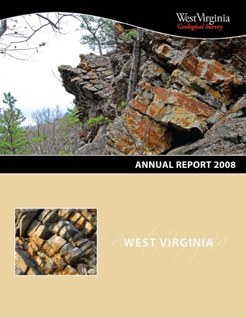
ANNUAL REPORT <strong>2008</strong>
WEST VIRGINIA GEOLOGICAL AND ECONOMIC SURVEY<br />
Principal Staff Directory and Points of Contact<br />
January 2009<br />
Director and State Geologist Michael Ed. Hohn<br />
Deputy Director Finance and Administration John D. May<br />
Chief Geologist Douglas G. Patchen<br />
GIS Program and Statewide GIS Coordinator Vacant<br />
Coal Resources Mitch Blake<br />
Geoscience Education Thomas E. Repine, Jr.<br />
Mapping Ronald R. McDowell<br />
Oil and Gas Resources Katharine L. Avary<br />
Water Issues and Geologic Hazards Jane S. McColloch<br />
Computing Services and Publications Mary C. Behling<br />
Earth Science Information Center Paul R. Liston<br />
Public Service Kenneth C. Ashton<br />
Publication Sales Michael A. Kirk<br />
Address: <strong>West</strong> <strong>Virginia</strong> Geological and Economic Survey Phone: (304) 594-2331<br />
Mont Chateau Research Center On Net: 557-3170<br />
1 Mont Chateau Road<br />
Morgantown, WV 26508-8079 Fax: (304) 594-2575<br />
Web Site: http://www.wvgs.wvnet.edu E-mail: info@geosrv.wvnet.edu<br />
Hours: 8:00 am to 5:00 pm Monday through Friday (closed holidays)
<strong>West</strong> <strong>Virginia</strong> Geological and Economic Survey<br />
The mission of the Geological and Economic Survey is to make available timely, responsive, unbiased, and<br />
credible geoscience information to promote thoughtful public policy; to help create prosperity; and to<br />
maintain a high level of environmental quality, economic opportunity, and quality of life for all <strong>West</strong><br />
<strong>Virginia</strong>ns. We accomplish this mission through research, data collection, and service.<br />
One area of research for this agency has been carbon capture and storage (CCS). Concern over global<br />
warming as a consequence of carbon dioxide emissions has lead to the idea of storing this gas underground<br />
in rocks. Because carbon storage may be required for continued production and use of coal in<br />
<strong>West</strong> <strong>Virginia</strong>, the WVGES has undertaken studies of underground carbon storage in the state for over five<br />
years.<br />
Several possibilities exist for carbon storage<br />
in <strong>West</strong> <strong>Virginia</strong>:<br />
1) Storing CO 2 in deep saline reservoirs<br />
2) Using CO 2 for enhancing production<br />
from existing oil fields<br />
3) Storing CO 2 in coal seams considered<br />
unmineable or for enhanced production<br />
of coal bed methane (CBM)<br />
4) Storing CO 2 in organic-rich Devonian<br />
shales with possible enhancement of<br />
gas production<br />
“ . . . CO 2 capture and sequestration<br />
(CCS) is the critical enabling technology<br />
that would reduce CO 2 emissions significantly<br />
while also allowing coal to meet the<br />
world’s pressing energy needs.”<br />
Source: The Future of Coal Massachusetts Institute of<br />
Technology<br />
Important geologic factors in evaluating whether a sedimentary unit is appropriate for carbon storage<br />
include depth and thickness of the potential reservoir and thickness of an impermeable, confining seal<br />
above the reservoir. The physical characteristics of CO 2 differ with temperature and pressure, both of<br />
which change with depth from the surface. In general, potential reservoirs must be deeper than 2,500 ft.<br />
at which point CO 2 acts like a liquid; CO 2 as a liquid requires a much smaller volume for storage than as a<br />
gas.<br />
Deep Saline Reservoirs<br />
Some of the most promising carbon storage reservoirs in the Appalachians and Midwest are relatively<br />
deep sedimentary units containing saline water. In some areas of the region, these formations are already<br />
used for disposal of waste fluids, so there is a long history of injection of material into deep saline formations.<br />
Storing CO 2 in these rocks involves pumping it down a well drilled for that purpose and injecting it<br />
into the reservoir, where it displaces and mixes with the saline water, filling both voids between grains<br />
and space within minerals. The depth of these rocks helps to guarantee that an adequate rock seal of low<br />
permeability overlies the reservoir, effectively containing the CO 2 .<br />
Compared with adjoining states, <strong>West</strong> <strong>Virginia</strong> has limited opportunities for carbon storage because<br />
appropriate rock units are not present or are perhaps present but contain insufficient pore space and<br />
permeability. In large areas of the state we do not know if appropriate rocks are present simply because<br />
few wells penetrate the deepest formations.<br />
1
Oil Fields<br />
Primary recovery from oil fields in the state is generally only a fraction of the original oil in place.<br />
Additional oil may be obtainable by flooding reservoirs with CO . In this approach to enhanced oil<br />
2<br />
recovery (EOR), CO is injected into the<br />
2<br />
reservoir through one set of wells and<br />
pushes the remaining oil toward<br />
producing wells, or mixes with the oil<br />
<strong>West</strong> <strong>Virginia</strong> Oil<br />
to make it more easily moved to the<br />
producing wells. In this value added<br />
approach,<br />
CO becomes more than simply a<br />
2<br />
waste byproduct requiring disposal.<br />
<strong>West</strong> <strong>Virginia</strong> has a large number of old<br />
oil fields that might be used for carbon<br />
storage; as with saline reservoirs, fields<br />
that lie more than 2,500 feet underground<br />
are the best candidates for<br />
carbon storage.<br />
Coal<br />
Some coal seams may be just too deep and thin to be mined with current or foreseeable technology<br />
and may be candidates for carbon storage. CO 2 adsorbs onto the carbon in coal and fills void<br />
spaces in the coal bed. If the coal bed contains methane in economic quantities for production,<br />
CO 2 could be used to displace the methane; the methane could be removed and sold whereas the<br />
CO 2 remains in the coal.<br />
Organic-Rich Shales<br />
Shales with high organic carbon content are expected by researchers to behave much like coal in<br />
the ability to store CO 2 , both within fractures and bound to organic compounds. <strong>West</strong> <strong>Virginia</strong> has<br />
thick organic-rich shales underlying the southern part of the state from which large quantities of<br />
natural gas have been produced. The low permeability of these rocks could limit the rates at<br />
which carbon could be injected but the storage potential of organic shales is currently under<br />
study.<br />
The Future<br />
Many questions remain and will remain in the near future regarding the practicality of carbon<br />
storage in geologic reservoirs underlying <strong>West</strong> <strong>Virginia</strong>. We have joined the research efforts of the<br />
<strong>West</strong> <strong>Virginia</strong> Division of Energy, <strong>West</strong> <strong>Virginia</strong> University, and the geologic surveys of other states<br />
to identify potential geologic reservoirs for storing CO 2 .<br />
2<br />
WV Oil Field<br />
WV Oil Fields > 2500 feet deep<br />
Michael E. Hohn,<br />
Director and State Geologist
Applied Coal Resources Investigations Program<br />
Coal-bed Mapping Project (CBMP)—The geographic information system (GIS)-based Mineral<br />
Lands Mapping Program is a cooperative effort between the Survey, the <strong>West</strong> <strong>Virginia</strong> Department<br />
of Tax and Revenue, and the <strong>West</strong> <strong>Virginia</strong> University (WVU) Department of Geology and Geography.<br />
The Department of Tax and Revenue is responsible for creating GIS layers of mineral parcel<br />
ownership. WVU is charged with creating various GIS base map layers, or digital line graphs<br />
(DLGs). As part of this project, the Survey is conducting a GIS-based inventory of coal in the State.<br />
Coal-bed maps include: structural contour maps; outcrop maps; mined area maps by methodology;<br />
coal thickness maps;<br />
percent parting maps; and<br />
coal quality maps. At the<br />
end of FY<strong>2008</strong>, coal bed<br />
mapping was completed<br />
for all or parts of 25<br />
counties and work is<br />
continuing in those and<br />
four additional counties<br />
(see map to the right). With<br />
the change in mapping<br />
accounting methodology<br />
from the previous countybased<br />
to a quadrangleseam<br />
base at the end of FYI<br />
2006, it is difficult to give an<br />
exact answer for the actual<br />
number of counties<br />
completed. Currently<br />
approximately half of the<br />
<strong>West</strong> <strong>Virginia</strong> Geological and Economic Survey<br />
Coal Bed Mapping Program<br />
Progress as of July, <strong>2008</strong><br />
All Bed Mapping Finished<br />
Some Beds Finished: Active Work Area<br />
Active Work, Finished FY 2010<br />
No Current Mapping Activity<br />
No Known Coal Resources<br />
No Coal Measures<br />
State has been mapped and it is anticipated that the remaining coal areas will be finished in<br />
calendar year 2014. Work is proceeding in Clay, Grant, Greenbrier, Logan, Mineral, Mingo,<br />
Nicholas, Preston, Raleigh, and Tucker counties (see map above). Completed maps were delivered<br />
to the Department of Tax and Revenue in early June (<strong>2008</strong>) and are publicly available on the<br />
Survey’s web site.<br />
Mineral property tax related issues. Mineral property owners, including general public, land<br />
companies, consultants, extractive industry, oil and gas industry, and the <strong>West</strong> <strong>Virginia</strong> Division of<br />
Tax and Revenue (WVDTR) use the basic data and derived map products from the CBMP to<br />
understand property valuation issues, assist them in filing required mineral appraisal forms,<br />
resolve disputes about resource valuation, and to value mineral parcels for taxation purposes.<br />
Taxes received based on Survey products are used to fund many important parts of the State’s<br />
infrastructure, notably the education system.<br />
Basic Data Collection and Research—Basic geologic data is continually collected and added to<br />
various databases to increase the knowledge base of the Survey. These data include core logs,<br />
3
coal analyses, measured sections of outcrops, highwalls, and road cuts, maps of underground coal<br />
mines and data extracted from the maps and a host of other important information. Most data<br />
collection throughout the year was associated with the Coal-bed Mapping Project. The Coal<br />
Section’s stratigraphic data base exceeded 2 million items in FYI <strong>2008</strong>. The presence of this<br />
amount of data allowed mapping efforts to accelerate.<br />
An interesting part of basic data collecting is the Survey’s drilling program initiated in 1995 as a<br />
tool to solve various geologic questions, including acid producing potential, problematic<br />
stratigraphic relationships, coal bed methane potential of deep coal beds, and to gather information<br />
of the stratigraphic and lithologic distribution of selenium in the Middle Pennsylvanian<br />
Kanawha Formation. To date, 17 holes have been drilled by the Survey alone or as part of<br />
cooperative research initiatives with industry or other government agencies. Although the<br />
Survey did not drill any additional holes in FY<strong>2008</strong>, Coal Section personnel were provided access<br />
to many industry holes allowing important research to continue.<br />
Coal-bed Methane Activities—Coal-bed methane is an increasingly important energy resource<br />
in <strong>West</strong> <strong>Virginia</strong>. Coal Program geologists continue to work cooperatively with various coal<br />
companies and natural gas companies, describing the lithologies from coal bed methane<br />
exploration drill holes in Barbour, Braxton, Calhoun, Monongalia, Pleasants and Ritchie counties<br />
during FY 2007. These data, coupled with data from oil and gas wells, are providing insights into<br />
basin development in previously under-investigated, deeper parts of the Appalachian Basin<br />
within the State.<br />
• Coal Quality—The Coal Program maintains and continually enhances a computerized database<br />
of the chemical and physical characteristics of <strong>West</strong> <strong>Virginia</strong> coals. The data base currently<br />
contains over 35,000 sample analyses and is one of the largest public databases of coal quality<br />
information in the nation. Basic coal analyses, washability data and petrography characteristics<br />
for the State’s coal beds are available by request and trace element data are served through the<br />
Survey’s web site. This database has proven to be very useful in helping potential customers<br />
find the specific <strong>West</strong> <strong>Virginia</strong> coal to meet their needs for power generation and to serve as<br />
chemical feedstock or as a source for coal to liquid studies. Policy makers often call on the<br />
Survey’s coal quality expertise to gauge the potential effects of legislation on the State’s coal<br />
industry. Unfortunately, with the Geology and Geography Department at <strong>West</strong> <strong>Virginia</strong><br />
University moving from White Hall to newly renovated Brooks Hall, the Survey’s coal analytical<br />
laboratories were forced to close due to loss of space. Although in-house analysis will cease,<br />
analytical data will continue to be added to the Survey’s coal quality data base obtained from<br />
various sources when and if it becomes available. It is an important goal for FYI 2009 to<br />
incorporate the coal quality data base into the overall coal stratigraphy database.<br />
• National Coal Resources Data System (NCRDS)—The Survey’s Coal Program has received<br />
numerous grants from the U.S. Geological Survey’s NCRDS program to contribute <strong>West</strong> <strong>Virginia</strong><br />
coal information to the USGS’ national computerized coal database. This database is used for a<br />
4
variety of investigations including Coal Availability Studies, but its use is not limited to cooperative<br />
federal projects.<br />
Data acquisition, entry into Survey computer databases, and verification by Coal Programs<br />
personnel are ongoing processes. Non-confidential data are uploaded to the NCRDS periodically.<br />
Stratigraphic database work accomplished under this effort directly benefits the Coal-bed<br />
Mapping Project. Coal samples collected by Survey geologists are forwarded to the U.S. Geological<br />
Survey for trace element analyses and the results are added to the Survey’s coal quality<br />
database. Other studies funded by the USGS through the NCRDS co-op include selenium<br />
investigations, trace elements in coal, distribution of marine beds in Middle Pennsylvanian strata<br />
that are used for global correlations, and contributions to an electronic lexicon of geologic names<br />
for the United States.<br />
Underground Mine Mapping Project—Recognition of the value of underground mine compilations<br />
to mine safety issues, as highlighted by the Quecreek mine accident in Pennsylvania,<br />
resulted in closer cooperation and communication between the Survey and the <strong>West</strong> <strong>Virginia</strong><br />
Office of Miner’s, Health, Safety, and Training (MHST). The two agencies formed a partnership and<br />
were successful in receiving funding from the U.S. Department of Labor, Mine Safety and Health<br />
Administration, to enhance compiling and providing public access to these important data.<br />
Funding was received in 2004 and the original project is nearing completion. MHST is focusing<br />
on collecting and archiving maps of underground mines, while the Survey digitizes the footprint<br />
of the mines areas, by seam, in a geographic information system format as new data becomes<br />
available. With the Survey’s cooperation, MHST received an additional grant to collect and<br />
process old mine maps from previously identified collections. These additions should be useful in<br />
further delineation of mined areas within the State.<br />
Mining compilation directly benefits coal bed mapping conducted under the Coal-bed Mapping<br />
Project. With the exception of clean-up work on the Douglas coal bed in McDowell County, all<br />
available mine maps from the State have been examined, inventoried and where appropriate, the<br />
mine footprint has been digitized and entered into the Survey’s comprehensive coal bed GIS. All<br />
mine maps and compiled mining by bed are available for examination on the Survey’s web site<br />
and individual mine map documents can be downloaded by interested parties.<br />
Mine Information Database System<br />
The <strong>West</strong> <strong>Virginia</strong> Geological & Economic Survey’s new Mine Information Database System (MIDS)<br />
is now online and available to the public. The database went “live” in March <strong>2008</strong> for internal use<br />
and after testing, was opened to public access. MIDS was developed to overcome a number of<br />
limitations present in the Survey’s former mine map database. While the preceding database was<br />
built in Microsoft Access, MIDS is built on an enterprise Oracle database and offers web based<br />
access with multi-user support. The new MIDS database marks a significant improvement in data<br />
interoperability. This allows our partners at MHST to update the database in real-time rather than<br />
5
y quarterly imports. It also provides much improved integration with our GIS-based Coal Bed<br />
Mapping Project and our online ArcIMS interactive map server.<br />
The MIDS system contains records of every mine map available at the WVGES and is comprised of<br />
over 43,000 documents representing over 69,000 mines. Information concerning coal seams,<br />
mine names, company names, and permit numbers can be found in the Mine Information<br />
Database System. MIDS offers a powerful set of search tools that allows users to setup advanced<br />
queries and provides quick access to downloadable digital images of mine maps.<br />
Mine subsidence related issues. Potential home and land buyers require documentation as to<br />
whether a property of interest has been undermined or overlies potentially minable coals to<br />
evaluate the mine subsidence potential. Homeowners, insurance adjusters, engineering consultants,<br />
and government agencies, notably WVDTR, <strong>West</strong> <strong>Virginia</strong> Department of Environmental<br />
Protection; (WVDEP), <strong>West</strong> <strong>Virginia</strong> Department of Natural Resources (WVDNR), and the U.S.<br />
Geological Survey (USGS) contact us concerning properties experiencing suspected subsidence<br />
problems to obtain information on mining and geological conditions of coal under affected<br />
property. In addition, mining companies search our mine map data base looking for abandoned<br />
mines adjacent to proposed and active mines to forestall Quecreek type disasters. Mined area<br />
maps are available, by seam, through direct contact with Survey geologists or can be downloaded<br />
from the Survey’s web site. The new MIDS system makes this service more “customer<br />
friendly.”<br />
Comparison of Mid-Carboniferous Floras—Geologist Mitch Blake has been participating in a<br />
National Science Foundation (NSF)-funded research project to compare mid-Carboniferous fossil<br />
plant collections available from eastern Europe and North America to address questions relevant<br />
to vegetation responses during onset of a major glacial interval. Since the Carboniferous is the<br />
last time in geologic history when there were extensive equatorial rain forests during an ice age,<br />
findings of this study are being compared with vegetative patterns of change during the Pleistocene.<br />
It is hoped these comparisons will provide insights into the impacts of climate change on<br />
vegetation distributions. Mitch presented the results of his part of the study at the annual<br />
meeting of the Geological Society of America in Lake City in October, 2005 and Philadelphia in<br />
October, 2006. A paper based on the October, 2005 presentation is scheduled for release in July,<br />
<strong>2008</strong>,<br />
General Services and Outreach<br />
Visiting Geologist Program. This popular program, run in cooperation with WVDNR State Parks,<br />
allows Survey geologists to visit WV State Parks where they present programs on <strong>West</strong> <strong>Virginia</strong><br />
and local geology and lead field trips for park visitors. The Survey has just completed the 16 th<br />
season of this popular program.<br />
6
Informational and sales displays. The WVGES annually exhibits at the <strong>West</strong> <strong>Virginia</strong> Hunting<br />
and Fishing show in Charleston in January and the <strong>West</strong> <strong>Virginia</strong> State Fair in August. The set-up<br />
includes an informational exhibit as well as map and publication sales, making all WV topographic<br />
maps and other assorted maps and geological publications available on-site. Another<br />
important outreach meeting is the USGS and WVGES’ cooperative ESIC program that provides<br />
access to various aerial photographs and related products in <strong>West</strong> <strong>Virginia</strong>. Paul Liston, the<br />
Survey’s ESIC Coordinator, provides informational displays mainly on the ESIC products annually<br />
at the Industrial Expo and <strong>West</strong> <strong>Virginia</strong> Surveyor’s Convention, both in Charleston. In addition,<br />
the Survey sponsors a rock and mineral show that draws over 1,000 attendees annually.<br />
Informational Meetings. The Survey routinely host various small to medium sized meetings<br />
that target a diverse clientele. These meetings are as diverse as the ESRI Northern Users Group<br />
meeting, two regional benchmarking workshops on mine maps (participants from AL, CO, IL, IN,<br />
KY, ND, NM, NY, OH, TN, VA, WV ); and regional meetings for professional societies such as GSA and<br />
AAPG. Through the Petroleum Technology Transfer Council program, a joint USDOE/industry<br />
sponsored program, the Survey co-sponsored workshops, a website, and an online newsletter to<br />
provide information on new technology to oil and gas producers through out the 7 state<br />
Appalachian Region.<br />
7
General Geoscience Program<br />
The General Geoscience Program includes: Advanced Geoscience Research, Economic Minerals<br />
Geoscience, Environmental Geoscience, Geologic Mapping, and Geoscience Education.<br />
Geologic Mapping<br />
One of the primary activities of the General Geoscience Program is geologic mapping and the<br />
creation of new 7.5-minute geologic quadrangle maps. Status of mapping is shown in Figure 1.<br />
During FY 2007-<strong>2008</strong>, mapping efforts were carried out in the eastern and northern panhandles,<br />
and in north-central and southeastern <strong>West</strong> <strong>Virginia</strong> as part of U.S. Geological Survey’s annuallyfunded,<br />
competitive grant STATEMAP<br />
Program. The purpose of the<br />
STATEMAP Program is to produce highquality,<br />
7.5-minute quadrangle maps of<br />
<strong>West</strong> <strong>Virginia</strong>’s geology. Completed<br />
mapping projects for FY 2007-<strong>2008</strong><br />
were submitted in June. Three mapping<br />
projects were proposed and<br />
successfully funded for <strong>2008</strong>-2009, and<br />
work commenced on three new quadrangles.<br />
8<br />
Figure 1<br />
Figure 1<br />
Cooperating geologist S. L. Dean<br />
completed mapping of the Burlington<br />
(Mineral and Hampshire counties) 7.5minute<br />
quadrangle and began mapping<br />
the Medley (Grant, Hardy, and<br />
Mineral counties) 7.5-minute quad-<br />
rangle. Senior Research Geologist R. R. McDowell, Geologist and Program Head K. L. Avary, together<br />
with Geologists J. Q. Britton, and J. E. Lewis commenced work on the <strong>West</strong> <strong>Virginia</strong> portion<br />
of the Hightown 7.5-minute quadrangle (Pocahontas County). Geologists G. H. McColloch, Jr. and<br />
J. S. McColloch completed the open-file geologic maps of the Mannington (Monongalia and<br />
Marion counties), the Valley Grove (Ohio and Marshall counties, WV and Washington County, PA)<br />
and the Pennsylvania portion of the Bethany 7.5-minute quadrangles. Mapping of the Pennsylvania<br />
portions of the Bethany and Valley Grove quadrangles is part of a cooperative agreement with<br />
the Pennsylvania Bureau of Topographic and Geologic Survey. Geologist Paula Hunt completed<br />
the final additions and revision of the Canaan Valley four-quadrangle geologic map (OF-9902A –<br />
Bedrock Geology of Canaan Valley, <strong>West</strong> <strong>Virginia</strong>).<br />
A request by a <strong>West</strong> <strong>Virginia</strong> State Mapping Panel member to conduct geologic mapping in the<br />
headwaters area of the Elk River led to the creation of the “Birthplace of Rivers” Initiative, to better<br />
characterize the bedrock geology and its connection to water resources in the headwaters area of<br />
the Elk, Gauley, Shavers Fork of the Cheat, Williams, Cherry, Cranberry, Greenbrier, and Tygart
Valley Rivers. To determine the feasibility of geologic mapping in this area, Geologists G. H.<br />
McColloch, J. S. McColloch, P. J. Hunt and L. Stocks began a pilot study to map the Sharp Knob<br />
(Pocahontas, Randolph, and Webster counties) 7.5-minute quadrangle.<br />
Completed maps and accompanying text and cross section(s) are initially available as an open-file<br />
report. Maps of the bedrock geology and other relevant themes are then produced for the final<br />
publication. The open-file reports are the first step in becoming formal publications in the<br />
Survey’s newly developed digital production facility. These projects also produce digital GIS data<br />
sets and maps conforming to newly adopted Association of American State Geologists guidelines.<br />
Other Mapping-Related Projects<br />
• Digital GIS Map Products Project—This ongoing, long-term project produces geographic<br />
information system (GIS) data sets and digital maps of all <strong>West</strong> <strong>Virginia</strong> geologic quadrangles<br />
mapped under the federal 1:24,000-scale STATEMAP Project and other mapping projects. Other<br />
<strong>West</strong> <strong>Virginia</strong> quadrangles mapped under other projects are also slated to be digitized and converted<br />
into GIS layers to create a complete digital collection of all geologic mapping at 1:24,000scale<br />
in <strong>West</strong> <strong>Virginia</strong>. Line work for all maps is digitized at a scale of 1:24,000. Once this work is<br />
completed, attributes are assigned to geologic contacts, faults, and bedding orientations, thus<br />
completing the process of providing detailed data for inclusion in <strong>West</strong> <strong>Virginia</strong>’s growing<br />
1:24,000-scale GIS database. This digital map conversion process results in Digital Geological<br />
Open-File Map Products that include:<br />
1. GIS shapefiles for layers included in the data model. Layers are named according to feature<br />
type and the USGS 7.5-minute topographic quadrangles from which they are drawn.<br />
2. Hardcopy plots of geologic maps when requested by customer.<br />
3. ArcMap map documents (.mxd files) and layer rendering files (.lyr files) are included for the<br />
convenience of customers that also use ESRI software, when possible. Not all digitized<br />
open-file maps have reached the stage of being published in ArcMap. Some map documents<br />
contain fully published map layouts; others only contain cartographically rendered<br />
GIS layers.<br />
4. Georeferenced scanned images of USGS topo maps used as the base maps for some<br />
quadrangles, when available.<br />
5. Georeferenced scanned images of original geological open-file maps, cross sections, and<br />
other source material that may accompany that quadrangle.<br />
6. Open-File Report of Investigations documents that accompanied the original paper map<br />
(in Microsoft Word or Adobe PDF format), where possible.<br />
7. A README document containing procedures, metadata, and the GIS data model used by<br />
WVGES.<br />
To date, 18 data sets, which include 31 quadrangles, have been completed, and digitizing continued<br />
on various legacy and new open-file map layers, such as bedding orientation points. Quality<br />
Assurance/ Quality Control (QA/QC) procedures began on another five previously digitized data<br />
9
sets, which include 30 quadrangles, to check and standardize these new datasets for eventual<br />
release to the public as digital publications, and for inclusion in the 1:24,000-scale GIS database.<br />
Work began on developing the WVGES 1:24,000-scale GIS database of geologic maps into a new<br />
State Geologic Map and internet-based interactive map application.<br />
Two new publications in the State Park Bulletins booklet series were completed, Canaan Valley<br />
Resort/Blackwater Falls, and Cacapon Resort/Lost River, each containing two 11” by 17” geologic<br />
maps of the respective state parks, derived from the geologic maps completed under the Digital<br />
GIS Map Products Project.<br />
A graduate student thesis project involved digitizing, revising and expanding publication OF9408,<br />
Bedrock and Surficial Geology Maps of the Blackwater Falls Quadrangle into 3 new digital surficial<br />
geology maps of the quadrangle: Landform Units, Origin of Surficial Geology, and Surficial Materials.<br />
These new maps have been made available to the public as paper and digital publications,<br />
and have also been added to the WVGES 1:24,000-scale GIS database of geologic maps.<br />
Completed maps and publications were entered into the U.S. Geological Survey National Geologic<br />
Maps Database (NGMDb). This information is updated annually to keep our records current.<br />
• Full-Color Map Compilation—This project produces full-color geologic map publications from<br />
recent STATEMAP projects. Full-color maps of 20 quadrangles are currently available. Minor<br />
revisions/corrections were made to a few published maps. A substantial revision of the Bedrock<br />
Geology of Canaan Valley map began this fiscal year.<br />
• Derivative Map Project—Geologic data and other information to develop derivative maps are<br />
used to aid in the visualization of geologic hazards and other environmentally related aspects in<br />
the areas where digital geologic map data are available from the Digital GIS Map Products Project.<br />
• Digital Archiving Project—Legacy maps are scanned for preservation and for use with other<br />
GIS datasets. Scanning of legacy 7.5-minute USGS Open-File Landslide and Related Feature maps<br />
continued, and 236 of 383 quadrangles maps have been scanned. Index maps of scanning<br />
progress were created and maintained. Scanning and processing of legacy WVGES Open-File<br />
Geologic maps, cross sections, Volumes, Bulletins, Circulars, and other documents continued, and<br />
75% of the Open File Geologic 1:24,000-scale maps stored in the archives were georeferenced for<br />
use in GIS systems by staff and customers. File naming conventions were established and files in<br />
archives named and organized.<br />
• USGS Winchester 100K Map Project—This project provided QA/QC of the digitized GIS files for<br />
28 <strong>West</strong> <strong>Virginia</strong> 7.5-minute geologic quadrangles submitted to USGS for inclusion in the Winchester<br />
100K Map. Quality control was completed, and final batches of data for this project were<br />
10
delivered to USGS in January <strong>2008</strong>. In May <strong>2008</strong>, by reciprocal arrangement with USGS, WVGES<br />
received 20 maps (paper and/or digital copies) of quadrangles in WV mapped by USGS, which<br />
were not held in the WVGES map archives.<br />
Geoscience Education<br />
Using the premise that WVGES-web-based products would be more useful to a broader audience<br />
and more compatible with a reasonable ongoing updating policy, the rebuilding of a more user<br />
friendly website has become the primary goal of the Geoscience Education Program. Digital<br />
creation of new classroom useful materials and the digital-enhancement of existing RockCamp<br />
materials and illustrations have been undertaken.<br />
Winter of 2007 and the spring of <strong>2008</strong> were spent planning and preparing for the upcoming June<br />
workshops. In June, this planning produced two teacher-enhancement workshops. These sessions<br />
were made possible by reserving a substantial portion of the annual Geoscience Education<br />
Program allocation for use during the last quarter of the fiscal year.<br />
The first June session was a two-day field trip for 12 teachers representing 12 different counties.<br />
These teachers represent a segment of our advanced “recurrent” participants population. These<br />
teachers have participated in multiple<br />
RockCamp sessions and possess sufficient<br />
prior-knowledge that will allow them to comprehend<br />
post-introductory information and the<br />
scientific process associated with data accumulation<br />
and interpretation. These teachers have<br />
clearly and repeatedly stated that our K-12<br />
success is rooted in the WVGES policy of sustained<br />
opportunities to engage in ongoing<br />
learning. In contrast to the WVGES, many<br />
institutions do not employ the “recurrent<br />
model” we use to offer past participants new<br />
and expanded learning.<br />
These teachers are learning to take a strike and dip<br />
measurement of the Mississippian Mauch Chunk<br />
Group on the flank of Spruce Knob during a<br />
RockCamp workshop. ( Photo by Tom Repine)<br />
This session’s primary topic was the unique<br />
igneous rocks of eastern WV. The session<br />
leader was Ron McDowell assisted by Barnes<br />
Nugent. Paula Waggy, a RockCamp graduate<br />
and now RockCamp instructor, acted as coleader,<br />
assistant instructor, and local property<br />
access coordinator. As to be expected, Ron did<br />
a fantastic job of providing this advanced<br />
11
group with both the nature of how geological<br />
science works and what his interpretations are.<br />
When asked about the rocks possible volcanic<br />
origins, he impressed the teachers by stating that<br />
we do not know much at this point, that the<br />
teachers present were seeing things not many<br />
scientists had seen, and that, at this point in time,<br />
that they were watching the scientific process in<br />
action, and that their explanations and hypothesis<br />
were worthwhile.<br />
Accompanying us on this trip were Drs. Behling<br />
and Renton, WVU Geology Department. Dr. Deb<br />
Hemler, of Fairmont State University, was also<br />
present in her role of the Geoscience Education<br />
Program’s Assistant Director. With this type of<br />
scientific representation, the teachers also had<br />
the chance to witness the scientific argument process as different opinions on specific interpretations<br />
were voiced. Our evening was filled with small groups of teachers interacting with the<br />
various scientists as they sought confirmation or explanation.<br />
Our second session was conducted several days later. This 3.5-day session was conducted in<br />
partnership with The Mountain Institute and Fairmont State University. Thirteen teachers from<br />
seven different counties were selected to participate in this residency-oriented session. This was<br />
the first RockCamp session for these teachers. As such, they were “rookies.” This is evident in the<br />
minor content mastery, lack of field techniques, and in the serious number and type of misconceptions<br />
they unknowing perpetuate upon their students. For rookies, exposing misconceptions<br />
is most often the first step in getting them to advance their learning. This is why critical thinking<br />
is more important than rote content at this level. As a side note, the number of teachers who can<br />
be selected for a RockCamp session is constrained by funding and for this reason not all of the<br />
approximately thirty teachers who applied could be accommodated. Lodging and meals were<br />
provided by The Mountain Institute. Dr. Hemler, FSU, provided us with the opportunity to provide<br />
participants with graduate credit. Credit is earned by active workshop participation, submission<br />
of field note and daily journal, completion of assignments, and successful submission of postworkshop<br />
tasks designed to help them share what they learned with colleagues and students.<br />
Barnes Nugent participated in this session as an instructor and observer.<br />
Since the completion of both workshops, focus has shifted to the participants’ post-session<br />
assignments. Individuals and teams in both groups will produce a variety of on-line products that<br />
can be posted (with editing) on the WVGES website. These will be educationally focused ideas<br />
that will provide other educators with either teacher-friendly or student-friendly ideas, photos,<br />
lectures, etc that can help science teachers provide their K-12 students with a more in-depth and<br />
12<br />
Barnes Nugent (center) explains the structure of Germany<br />
Valley and Seneca Rocks to two teachers during this June’s<br />
RockCamp session. This is at night while the teachers are<br />
working on assignments. They are in the classroom of the<br />
Mountain Institute located on top of Spruce Knob.<br />
(Photo by Tom Repine)
more accurately taught lessons on WV geology. Late Fall <strong>2008</strong> completion and submission of<br />
these products is linked to participant stipend and FSU credit. Thus, these workshops are contributing<br />
to the Geoscience Education’s goal of producing tangible products.<br />
Data Collection<br />
Activities associated with the General Geoscience Program’s service and research require continuous<br />
collection and analysis of significant amounts and types of data. Databases for limestone,<br />
springs, geochemical analyses of rock samples, maps, and geographic information are maintained.<br />
Additional information and materials are available for nonfuel minerals, geologic hazards,<br />
map information, and a host of other topics that fall within the expertise of the program.<br />
Service<br />
The General Geoscience Program responds to service requests from industry, government, the<br />
general public, and academia. As the responsibilities of the program are to address all geologic<br />
and geographic matters not directly related to <strong>West</strong> <strong>Virginia</strong>’s fossil-fuel resources, the scope of<br />
service activities is quite diverse. These areas of expertise fall into these general categories:<br />
· Economic Minerals (limestone, dolomite, sandstone, sand and gravel, clay and shale, salt, peat,<br />
etc.).<br />
· Environmental Geology (flood hazards, landslides, karst geology, radon, seismicity, etc.).<br />
· Water (ground- and surface-water hydrology, water resources, water supply, water quality,<br />
water use, springs, etc.).<br />
· Geoscience Education (teacher experiences and related topics).<br />
Publications (bold names denote Survey staff)<br />
• Ashton, K.C. and Stocks, L., <strong>2008</strong>, The Geology of Canaan Valley Resort and Blackwater<br />
Falls State Parks: <strong>West</strong> <strong>Virginia</strong> Geological and Economic Survey Publication SP-6A, 32 p., 2<br />
maps on folded insert.<br />
• Ashton, K.C., <strong>2008</strong>, The Geology of Cacapon Resort and Lost River State Parks: <strong>West</strong><br />
<strong>Virginia</strong> Geological and Economic Survey Publication SP-7, 36 p., 2 maps on folded insert.<br />
• Dean, S.L. and Kulander, B.R., <strong>2008</strong>, Geology of the Burlington Quadrangle, Hampshire<br />
and Mineral Counties, <strong>West</strong> <strong>Virginia</strong>: <strong>West</strong> <strong>Virginia</strong> Geological and Economic Survey Publication<br />
OF-0704, 1:24,000 scale.<br />
• Fedorko, N., Kite, J.S., Cenderelli, D., Springer, G.S., Behling, R.E., Davis, E.N., and Anderton, S.C.,<br />
2007, Surficial Geology Maps of the Blackwater Falls Quadrangle, Tucker County, WV: <strong>West</strong><br />
<strong>Virginia</strong> Geological and Economic Survey Publication OF9408-A, 3 map sheets, scale 1:24,000.<br />
• Matchen, D.L., Fedorko, N., III, Blake, B.M., Jr., Murphy, S.J., McDowell, R.R., and Hunt, P.J.,<br />
<strong>2008</strong>, Bedrock Geology of Canaan Valley, <strong>West</strong> <strong>Virginia</strong>: <strong>West</strong> <strong>Virginia</strong> Geological and Economic<br />
Survey Publication OF9902-A, 2 sheets, scale 1:24,000.<br />
13
• McColloch, J.S., and McColloch, G.H., Jr., 2007, Creating Geologic Maps in a GIS Environment<br />
[abs]: GSA Abstracts with Programs, v. 39, no. 6, p. 161.<br />
• McColloch, J.S. and McColloch, G.H., Jr., <strong>2008</strong>, Creating Geologic Maps for the Appalachian<br />
Plateau in a GIS Environment (poster), Agenda: Digital Mapping Techniques’08 Workshop,<br />
May 18-21, <strong>2008</strong>.<br />
• Ganak, M.E. and McDowell, R.R., <strong>2008</strong>, Mudcracks and ripped-up stromatolites: Sunshine<br />
and stormy weather in the Silurian, Tonoloway Limestone, <strong>West</strong> <strong>Virginia</strong>: GSA Abstracts<br />
with Programs, V. 40, No. 4, p. 60-61, abstract.<br />
• Hunt, P.J., McDowell, R.R., and Matchen, D., <strong>2008</strong>, The mystery corner: Finalizing the bedrock<br />
geology map of Canaan Valley, <strong>West</strong> <strong>Virginia</strong> [abs.]: GSA Abstracts with Programs, v. 40,<br />
no. 4, p. 12.<br />
Presentations<br />
• Geologist G.H. McColloch, Jr. gave two oral presentations: “Developing Three-Dimensional<br />
Geologic Mapping in the Gently Folded Pennsylvanian Rocks in Northern <strong>West</strong> <strong>Virginia</strong>,” at the<br />
2007 GSA Annual Meeting and “Defining a Three Dimensional Geologic Map for the Appalachian<br />
Plateau” at the <strong>2008</strong> Digital Mapping Techniques Workshop.<br />
• Geologist J.S. McColloch gave two poster presentations: “Creating Geologic Maps in a GIS<br />
Environment,” at the 2007 GSA Annual Meeting and “Creating Geologic Maps for the Appalachian<br />
Plateau in a GIS Environment,” at the <strong>2008</strong> Digital Mapping Techniques Workshop.<br />
Awards, Elections, Appointments, Service<br />
• Education Specialist and Manager T.R. Repine, Jr., who began part-time status on November 1,<br />
2007, served on the doctoral committee for Jack Renton’s PhD student. He responded to an<br />
average of 25.6 service requests per month.<br />
• Geologist J.S. McColloch served as an Executive Committee member of the American Association<br />
of Petroleum Geologists Division of Environmental Geosciences (AAPG-DEG) and as an<br />
associate editor of the AAPG-DEG journal Environmental Geosciences. She serves on the Appalachian<br />
States Coalition for Geological Hazards in Transportation Committee.<br />
• Geologist Sarah Gooding served on the thesis project committee of graduate student Susan<br />
Anderton and assisted/oversaw the development of the three new surficial geology maps of<br />
OF9408A, Blackwater Falls quadrangle.<br />
14
Oil and Gas Program<br />
Coalbed Methane<br />
Coal bed methane (cbm) production and drilling has continued to increase. As of September,<br />
2007, records for over 800 wells had been received by the WVGES (Figure 1). Production continues<br />
to increase as well, with calendar year 2007<br />
production totaling over 22 billion cubic feet<br />
(Bcf) of gas (Figure 2). The cumulative production<br />
of CBM surpassed 100 Bcf in 2007. Most of<br />
the activity to date has been in southern and<br />
northern <strong>West</strong> <strong>Virginia</strong>; however, in the summer<br />
and fall of 2006, several wells were completed<br />
in Clay County in addition to more wells<br />
in Barbour County. Late in 2007, cbm wells<br />
were permitted in Gilmer and Harrison counties<br />
in north central <strong>West</strong> <strong>Virginia</strong>. Production<br />
includes post-mining gob gas or coal mine<br />
Devonian Shales<br />
Figure 2<br />
Figure 1<br />
methane, pre-mining de-gasification of coals<br />
using a multilateral horizontal drilling system,<br />
vertical fractured wells, and simple horizontal<br />
wells. The WVGES website has available<br />
downloadable files containing data for individual<br />
CBM wells.<br />
Recent developments in shales in other basins have inspired renewed interest in <strong>West</strong> <strong>Virginia</strong>’s<br />
Devonian shales, both the traditional Lower Huron and Rhinestreet shales in southwestern <strong>West</strong><br />
<strong>Virginia</strong> as well as the deeper Marcellus Shale in other parts of the State. New horizontal drilling<br />
and well stimulation technologies have helped to encourage new drilling and evaluation programs<br />
in these shales. A PTTC workshop on Devonian shales was well-received. New material<br />
was added to the WVGES website to respond to a dramatic increase in requests for information<br />
about the Devonian shales, especially the Marcellus. A significant increase in leasing activity<br />
especially in counties in eastern <strong>West</strong> <strong>Virginia</strong> where historic drilling has been very limited has led<br />
to many inquiries from property owners. In many of these eastern counties in the State, the oil<br />
and gas rights are owned by the surface owner. Surface owners often have concerns about the<br />
potential impacts of drilling on their property.<br />
15
A cooperative project supported by the U.S. Geological Survey to update summary Devonian<br />
shale production data contained in an earlier study performed for the Gas Research Institute (now<br />
the Gas Technology Institute) was completed. Another project to obtain samples for new<br />
geochemical analyses of Devonian shales was also completed. The data obtained from these<br />
analyses will be useful in evaluating the Devonian shales in <strong>West</strong> <strong>Virginia</strong>.<br />
Technology Transfer<br />
The Appalachian Region Petroleum Technology Transfer Council (PTTC) continued to provide<br />
timely workshops on a variety to topics to a broad range of attendees. Funding for this program<br />
from the U. S. Department of Energy was zeroed out in early 2007, so considerable effort was<br />
expended to transition to a new financial structure and implement a new model for the program.<br />
The American Association of Petroleum Geologists (AAPG) now manages the program and the<br />
regional lead organizations were restructured to align with AAPG’s existing domestic sections.<br />
Since its inception in 1996, the Appalachian Region PTTC has hosted over 125 workshops with<br />
over 6,000 registrants, maintained a website including an interactive mapping capability for key<br />
wells, produced a newsletter, and provided technical expertise to many independent oil and gas<br />
producers throughout the Appalachian Basin. Workshop topics during this year included “Fracture<br />
in Devonian Black Shale of the Appalachian Basin”, “Structural Principles and Trap Geometry<br />
in the Northern Appalachians”, “Carbonate Reservoirs”, “Value-added Carbon Capture and Storage:<br />
CO 2 Enhanced Oil Recovery and CO 2 Enhanced Coal Bed Methane”, “Appraising and Developing<br />
Coal Bed Methane and Shale Gas Reservoirs” , and “Drilling and Completion in the Shales of<br />
Appalachia”.<br />
Carbon Dioxide Sequestration<br />
<strong>West</strong> <strong>Virginia</strong> has the potential for storage or sequestration of carbon dioxide in various zones<br />
below the surface. The WVGES is part of the geologic sequestration team for the Midwest Regional<br />
Carbon Sequestration Partnership (MRSCP). The MRCSP is one of seven regional partnerships<br />
established by the U.S. Department of Energy. Battelle Memorial Labs in Columbus, Ohio is<br />
the prime contractor for the MRCSP. The Ohio Geological Survey is the lead agency for the geologic<br />
sequestration team. As part of the Phase 1 MRCSP efforts, a large amount of basic geologic<br />
data was compiled at a regional scale in digital form. Many of these data had not previously been<br />
compiled in such a way; these data are useful for applications beyond identifying zones with<br />
potential for geologic carbon sequestration. The data can be used for oil and gas exploration and<br />
an improved understanding of subsurface geology. During the year, work continued on Phase 2,<br />
which includes more detailed characterization of selected intervals identified during Phase 1, as<br />
well as some pilot tests throughout the region. The Phase 3 large scale demonstration project<br />
award for the MRCSP was finalized. During Phase 3, in addition to the injection project which is to<br />
be located in northwest Ohio, additional regional characterization work will continue.<br />
16
K.L. Avary made a presentation to the <strong>West</strong> <strong>Virginia</strong> <strong>Legislature</strong> Joint Commission on Economic<br />
Development Interim Session on Carbon Dioxide Sequestration Potential in <strong>West</strong> <strong>Virginia</strong>.<br />
D.G. Patchen served on a task force to examine issues associated with regulations and permitting<br />
for potential CO 2 sequestration activities. This task force organized by the Interstate Oil and Gas<br />
Compact Commission, is supported by the U.S. DOE. The IOGCC formally approved the report<br />
during their May 2007 meeting and distributed it to the appropriate state regulatory agencies.<br />
Patchen provided feedback about the draft report to the committee throughout the year.<br />
Improving the Availability and Delivery of<br />
Critical Information for Tight Gas Resource<br />
Development in the Appalachian Basin<br />
This three-year USDOE-sponsored project, begun in fall 2005 in cooperation with the Pennsylvania<br />
Geological Survey, will provide ready public access to well-specific and region-wide data and<br />
interpretations of those regional data that will allow gas producers to advance their understanding<br />
of the nature of six significant regional tight gas accumulations in the central Appalachian<br />
Basin. The improved understanding of these reservoirs will enable expanded resource recoverability<br />
through more cost-effective exploration of new areas, and more efficient infill drilling and<br />
recompletion programs in existing fields.<br />
The project will provide easier access to scanned wireline logs, digitized wireline logs, production<br />
data, core analysis reports, digital photographs of cores, scanned maps and cross-sections, and<br />
related data on tight gas plays through an interactive website. Wireline logs are being scanned<br />
and database entries are being updated for use in system queries.<br />
Two main objectives to this project are:<br />
1. Collect a broad range of data and information in public records and published sources and<br />
convert it to digital format. The work concentrates on the Lower Mississippian/Upper Devonian<br />
Berea/Murrysville play and the Upper Devonian Venango, Bradford, and Elk plays in Pennsylvania<br />
and <strong>West</strong> <strong>Virginia</strong>; the Lower Silurian “Clinton”/Medina play in Pennsylvania; and the Lower Silurian<br />
Tuscarora Sandstone play in <strong>West</strong> <strong>Virginia</strong>. Scanning of wireline logs, digitizing of logs,<br />
database updates, data quality assessment, digital core photography, and digital conversion of<br />
relevant maps are on-going.<br />
2. Design and implement an on-line, interactive digital and geospatial Web site that consolidates a<br />
broad range of existing information about tight gas reservoirs, and has the potential to be extended<br />
to any tight gas reservoir in the future. This Web site will include scanned images of logs,<br />
photomicrographs of thin-sections, digital photographs of core slabs, selected basic well data,<br />
and digital regional maps and cross-sections. Development of this Web site is underway.<br />
17
Zero Emissions Research and Technology (ZERT)<br />
Researchers at Montana State University created a DOE-funded ZERT Center to develop a comprehensive<br />
approach to the measurement, monitoring, migration and risk assessment of geological<br />
sequestration of carbon dioxide. This approach includes fundamental studies of geophysical and<br />
geochemical investigations of CO with formation waters and reservoir lithologies, and develop-<br />
2<br />
ment of new monitoring methods, as well as strategic use of suites of methods, parameterization<br />
of potential leakage/seepage mechanisms and assessment of reservoirs relevant to these mechanisms.<br />
Montana State assembled a research team consisting of scientists from Los Alamos National<br />
Laboratory, Lawrence Livermore National Laboratory, and <strong>West</strong> <strong>Virginia</strong> University, among<br />
others. The WVU team includes members from the National Energy Technology Laboratory, the<br />
<strong>West</strong> <strong>Virginia</strong> Geological Survey, and the Departments of Petroleum & Natural Gas Engineering,<br />
Civil & Environmental Engineering, and Geology & Geography. The task assigned to the WVU<br />
Research team is to determine the feasibility of sequestering carbon dioxide in Appalachian coal<br />
beds.<br />
The WVU-NETL-WVGS researchers organized their effort into four subtasks: computational<br />
modeling and visualization; determination of key physical data; a structural integrity investigation;<br />
risk assessment; and a cost effectiveness investigation. Drs. Thomas Wilson and Douglas<br />
Patchen are cooperating on the first part of the structural integrity subtask, which is to conduct<br />
geophysical monitoring and subsurface characterization of storage and seal intervals. Part two of<br />
this subtask, structural integrity modeling, is being conducted by Dr. Hema Siriwardane.<br />
Consol Energy has drilled multiple horizontal laterals in the Pittsburgh and Upper Freeport<br />
coals in Marshall County. Some of the laterals will become production wells, whereas others will<br />
serve as CO injection wells. Consol plans to produce natural gas from both coals, and to inject<br />
2<br />
CO into the Upper Freeport coal, which will not be mined. Once ECBM from the Upper Freeport<br />
2<br />
ceases, the injected CO will remain as a long-term sequestration project.<br />
2<br />
The WVU research team, of which WVGS is a partner, will conduct characterization studies<br />
of the reservoir, develop computational models and predict the structural integrity of the CO2 storage reservoir. The research team also will develop and implement field methods to monitor<br />
possible CO emissions from the site.<br />
2<br />
The water wells have been drilled and water samples have been take and analyzed to<br />
establish a pre-injection profile of aquifer water in the area. The same has been done for water<br />
samples collected from surface streams in the project area. Sampling to date has met the criteria<br />
in the injection permit, but will continue right up to, during, and after the injection of CO . 2<br />
Obviously, the goal is to see if any CO shows up in the shallow ground water or surface streams.<br />
2<br />
Thirty shallow wells were drilled and tiltmeters were placed in all of them. Data have been<br />
collected over an interval of several months, again to establish a pre-injection baseline. Pinnacle<br />
plans to shut down the data collection in late November, <strong>2008</strong> and wait until two weeks before<br />
injection begins before they begin to collect more data (this is to save us money; injection is<br />
being delayed because of the well problems). Once injection starts, the highly sensitive tiltmeters<br />
will detect any movement of the shallow rock layers caused by injection of CO and production of<br />
2<br />
methane.<br />
18
Tom Wilson finally got his seismic crew on site and has collected his seismic data. The data look<br />
encouraging, although Tom said they could be better. He sees some “interesting” events in the<br />
shallow section and also sees some deeper events, well below the Oriskany. His goal is to determine<br />
the location of any structural zones that may be avenues for CO 2 to move up section. Right<br />
now he needs help placing formal stratigraphic names on the different intervals.<br />
The big news of the year probably is that Consol actually got a permit to inject CO 2 and produce<br />
gas from the project. They have a Class II permit, so the project will not be affected by EPA’s new<br />
Class VI permit, at least for this project.<br />
Basic Oil and Gas Data<br />
As part of the WVGES mission to archive and make available basic data on the State’s mineral<br />
resources, work continued on the Oil and Gas database. Scanning of plats and well records<br />
continued during the year using the new photocopy/scanner machine. In addition, scanning of<br />
wireline logs continued, supported largely with funding from the U.S. Department of Energy.<br />
Professional Service<br />
• K.L. Avary completed her term as Chair of the Honors and Awards Committee of the Eastern Section<br />
AAPG. She began a term as Chair of the Eastern Section AAPG Future Meetings Committee.<br />
She also chaired the Eastern Section AAPG Imperial Barrel Award Committee and organized the<br />
section’s annual Student Job Quest.<br />
• K.L. Avary organized the Field Trips and Spouse/Guest Trips for the Centennial Meeting of the<br />
Association of American State Geologists, in Shepherdstown.<br />
• D.G. Patchen served as President for the AAPG Energy Minerals Division.<br />
• K.L. Avary is a member of the AAPG Student Job Fair, Professional Women in Earth Sciences (PROW-<br />
ESS), and AAPG Committee Oversight committees.<br />
• K.L. Avary is the delegate elected to represent the Appalachian Geological Society and *D.G.<br />
Patchen is the delegate elected to represent the Pittsburgh Association of Petroleum Geologists<br />
in the AAPG House of Delegates. K.L. Avary served as the Eastern Section representative on the<br />
House of Delegates Resolutions Committee. D. G. Patchen served as the Eastern Section representative<br />
on the House of Delegates Nominations Committee.<br />
• D.G. Patchen represents <strong>West</strong> <strong>Virginia</strong> on the Potential Gas Committee, a group funded by the<br />
American Gas Association and company donations. He also serves as the Appalachian Basin Chairman<br />
for the Potential Gas Committee. During the year, the Potential Gas Committee released a<br />
new report which contains estimates of the nation’s remaining gas resources and reserves. During<br />
the current year, the Appalachian Basin committee reviewed the data for the basin and updated<br />
the resources and reserves data for the Trenton-Black River, based on the results of the<br />
DOE-funded study.<br />
• G.H. McColloch served as Chairman of the AAPG Energy Minerals Division Honors and Awards<br />
Committee.<br />
19
• K.L. Avary serves on the <strong>West</strong> <strong>Virginia</strong> Coal Bed Methane Review Board.<br />
• K.L. Avary became an Associate Editor for the AAPG Bulletin E & P notes.<br />
• K.L. Avary received the AAPG Distinguished Service Award.<br />
• K.L. Avary received the Cheat Lake Rotary Club’s Vocational Service Award.<br />
Outreach<br />
• K.L. Avary and R.R. McDowell supervised two summer interns; one from Concord University and<br />
one from <strong>West</strong> <strong>Virginia</strong> University.<br />
• K.L. Avary served as faculty advisor for the <strong>West</strong> <strong>Virginia</strong> University American Association of Petroleum<br />
Geologists Student Chapter.<br />
• D.G. Patchen continued to participate in the Visiting Geologist Program (VGP)of the AAPG. K.L.<br />
Avary and D.G. Patchen serve as Eastern Section Coordinators for the VGP Committee.<br />
• K.L. Avary made presentations to the Morgantown North and Cheat Lake Rotary clubs about the<br />
current oil and gas leasing and drilling activity in <strong>West</strong> <strong>Virginia</strong>.<br />
• K.L. Avary made a presentation at a Girl Scout Day Camp Program at Camp Roy Weller in<br />
Bruceton Mills, WV on geology and working as a geologist.<br />
• K.L. Avary made a presentation to a WVU Faculty Enrichment Group, “What’s Under My Land”.<br />
Presentations<br />
• G.H. McColloch and J.S. McColloch made presentations at the Digital Mapping Techniques’08<br />
Workshop.<br />
• J.E. Lewis made a poster presentation at the Eastern Section AAPG meeting.<br />
• K.L. Avary was a co-author on a poster presentation at the Eastern Section AAPG meeting.<br />
Publications (bold names denote Survey staff)<br />
Lewis, J. E., McDowell, R.R., and Avary, K.L., Use of Digital Log Analysis to Evaluate the<br />
Helderberg Group as a Confining Layer for CO2 Sequestration: Eastern Section American Association<br />
of Petroleum Geologists Annual Meeting Program and Abstracts, p. 43.<br />
McColloch, G.H. and McColloch, J.S., Bedrock Geology of the Valley Grove Quadrangle, Ohio and<br />
Marshall Counties, <strong>West</strong> <strong>Virginia</strong>: <strong>West</strong> <strong>Virginia</strong> Geological and Economic Survey, Open-File Report<br />
OF-0801, scale 1:24,000.<br />
McColloch, G.H. and McColloch, J.S., Bedrock Geology of the Mannington Quadrangle, Marion<br />
and Monongalia Counties, <strong>West</strong> <strong>Virginia</strong>: <strong>West</strong> <strong>Virginia</strong> Geological and Economic Survey, Open-File<br />
Report OF-0802, scale 1:24,000.<br />
20
McColloch, G.H., Jr. and McColloch, J.S., Bedrock Geology of the Bethany Quadrangle, Ohio and<br />
Brooke Counties, <strong>West</strong> <strong>Virginia</strong>: <strong>West</strong> <strong>Virginia</strong> Geological and Economic Survey, Open-File Report<br />
OF-0703, scale 1:24,000.<br />
McColloch, G.H., Jr. and McColloch, J.S., <strong>2008</strong>, Defining a Three Dimensional Geologic Map for<br />
the Appalachian Plateau (talk), Agenda: Digital Mapping Techniques’08 Workshop, May 18-21,<br />
<strong>2008</strong>.<br />
McColloch, G.H., Jr. and McColloch, J.S., 2007, Developing three dimensional geologic mapping<br />
in the gently folded Pennsylvanian Rocks in Northern <strong>West</strong> <strong>Virginia</strong> {abs}: GSA Abstracts with<br />
Programs. v. 39, no. 6, p. 120.<br />
McColloch, J.S. and McColloch, G.H., Jr., 2007 Creating Geologic Maps in a GIS Environment<br />
{abs}: GSA Abstracts with Programs, v. 39, no. 6, p. 161.<br />
Riley, Ronald A., Nuttall, Brandon, Harper, John A. and Avary, K.L., Assessing the Potential for CO 2 -<br />
Enhanced Oil Recovery in the MRCSP Region: Eastern Section American Association of Petroleum<br />
Geologists Annual Meeting Program and Abstracts, p. 50.<br />
21
WV GIS Technical Center<br />
Located in the Department of Geology and Geography at <strong>West</strong> <strong>Virginia</strong> University, the <strong>West</strong> <strong>Virginia</strong><br />
GIS Technical Center (WVGISTC) is separate from the Geological and Economic Survey.<br />
However, the Center receives significant funding through our agency and works with the <strong>West</strong><br />
<strong>Virginia</strong> Geographic Information System Coordinator’s office, a program within our agency.<br />
Mission and Objectives<br />
The WV GIS Technical Center provides focus, direction and leadership to users of geographic<br />
information systems (GIS), digital mapping and remote sensing within the State of <strong>West</strong> <strong>Virginia</strong>.<br />
The WVGISTC was established under Executive Order No. 4-93 in November 1993, which specified<br />
that the Technical Center should provide technical support services to development and operation<br />
of GIS in <strong>West</strong> <strong>Virginia</strong>.<br />
The primary objectives of the Center are to reduce the duplication of GIS data development<br />
among organizations; disseminate GIS spatial data, Web map services, mapping applications, and<br />
other geographic information free-of-charge through the Internet; coordinate acquisition of new<br />
data additions to the <strong>West</strong> <strong>Virginia</strong> Spatial Data Infrastructure; assist with strategic planning,<br />
development and implementation of GIS and mapping guidelines statewide; provide advisory<br />
services and training programs in GIS; and conduct research and provide education towards<br />
improvement of geographic information technologies in <strong>West</strong> <strong>Virginia</strong>.<br />
Personnel<br />
The staff consists of two geography professors who serve as co-directors, five full-time employees,<br />
and student and temporary employees hired periodically to accomplish project tasks.<br />
• Dr. Gregory Elmes, Co-director<br />
• Dr. Trevor Harris, Co-director<br />
• Kurt Donaldson, Manager<br />
• Frank LaFone, Senior Internet Programmer<br />
• Evan Fedorko, GIS Analyst<br />
• Eric Hopkins, GIS Analyst<br />
• Kevin Kuhn, GIS Analyst<br />
Funding<br />
Primary FY 2007-08 funding of $295,000 was received from the state-appropriated Mineral Lands<br />
Mapping Program (Fund 0253, Activity 207) approved under House Bill 2222 in February 1995.<br />
Fiscal management of this program was delegated to the WV Geological & Economic Survey, with<br />
programmatic oversight by the GIS Policy Council. Additional external funding was obtained from<br />
several grants and service contracts.<br />
22
Projects and Activities FY <strong>2008</strong><br />
Build and Disseminate State’s Spatial Data Infrastructure<br />
The WVGISTC supports digital data conversion, data development, and coordination with federal<br />
geospatial data initiatives, statewide mapping programs, and local (county, municipal) data<br />
producers. The Center collaborates with the Statewide Addressing and Mapping Board (SAMB),<br />
U.S. Geological Survey, and other partners to create a value-added, high resolution 1:4800-scale<br />
digital base map for <strong>West</strong> <strong>Virginia</strong>. Elevation, transportation, streams and administrative map<br />
layers benefit the entire state community; government, private sector and non-profits.<br />
National Hydrology Dataset (NHD): In cooperation with the U.S. Geological Survey and WVU<br />
Natural Resource Analysis Center, continued development of an attributed, linear referenced,<br />
1:4800-scale local resolution hydrography data set for two 8-digit watersheds: Upper Guyandotte<br />
(05070101) and Gauley (05050005). Business plan and stewardship agreements for NHD are also<br />
being developed.<br />
Transportation and Structures: In spring <strong>2008</strong> WVGISTC received a grant from the Federal<br />
Geographic Data Committee to build stewardship for integrating statewide structure and transportation<br />
data into national, standardized databases.<br />
Orthophotos: This past year WVGISTC quality checked and published statewide one-meter<br />
resolution natural color and color infrared orthophotos funded by the State and USDA’s National<br />
Agricultural Imagery Program (NAIP). In certain regions of <strong>West</strong> <strong>Virginia</strong> the NAIP imagery has<br />
been added to commercial products like Google Maps.<br />
Geology: In partnership with the <strong>West</strong> <strong>Virginia</strong> Geological and Economic Survey, WVGISTC<br />
digitized and geo-referenced six statewide geophysical and structural maps as well as 36 landslide<br />
maps.<br />
Economic Development: In partnership with the Development Office, WVGISTC created poverty<br />
rate and population maps of <strong>West</strong> <strong>Virginia</strong>.<br />
Historical Geospatial Data: In the summer of 2007, WVGISTC coordinated with the WV Geological<br />
Survey, WVU Library, and State Archives to inventory historical geospatial resources in <strong>West</strong><br />
<strong>Virginia</strong>. A report was published for Sanborn Fire Insurance Maps (1866-1982), Topographic Maps<br />
(1883-present), and Aerial Photographs (1936-present).<br />
Mapping Projects and Applications<br />
During fiscal year <strong>2008</strong>, WVGISTC participated in a number of projects which generated<br />
geospatial data and products. Select projects are highlighted below:<br />
Flood Hazard Mapping and Hazard Determination Tool: In cooperation with FEMA and flood<br />
map modernization contractors, WVGISTC created digital flood insurance rate maps (FIRM) for<br />
select counties in the Eastern Panhandle to assist in the implementation of a statewide digital<br />
flood-mapping program. In partnership with the State Floodplain Manager, WVGISTC created an<br />
23
online Flood Hazard Determination System (Figure 1). This interactive mapping tool, which<br />
utilizes the best available digital flood hazard data, elevation data, and aerial photography for<br />
<strong>West</strong> <strong>Virginia</strong>, allows home and<br />
business owners, insurance and real<br />
estate agents, developers, and flood<br />
plain managers to make informed<br />
decisions about the degree of flood<br />
risk faced and what precautions, if<br />
any, should be taken. The flood<br />
mapping application has garnered<br />
acclaim from FEMA as well as from<br />
the state floodplain management<br />
office and local floodplain managers<br />
and is part of the MapWV.gov initiative<br />
to make online mapping resources<br />
in the Mountain State available<br />
to the public.<br />
Figure 1<br />
Link: http://www.mapwv.gov/flood<br />
Mass Evacuation Mapping and<br />
Modeling: In support of emergency<br />
planning by the WV Department of<br />
Military Affairs and Public Safety, the WVGISTC at <strong>West</strong> <strong>Virginia</strong> University is developing geospatial<br />
data of critical facilities and infrastructure and building models to estimate resource capacities<br />
and potential impacts on the State of a mass evacuation from one of the surrounding metropolitan<br />
areas. Initial modeling efforts have focused on estimating the resource capacities of the food,<br />
fuel, and shelters in <strong>West</strong> <strong>Virginia</strong> under a series of disaster evacuation scenarios. In December<br />
2007, WVGISTC published a GIS data assessment report of resource capacity maps and preliminary<br />
simulation models.<br />
Carbon Sequestration Mapping and Modeling: In cooperation with federal and state energy<br />
partners, WVGISTC created an interactive carbon sequestration explorer to locate potential<br />
sequestration sites in oil, gas, and coal fields suitable for hosting a Coal-To-Liquids facility. Based<br />
on infrastructure and geological variables, 762 sites were rated for their suitability for hosting<br />
Coal-To-Liquids facilities. http://www.wvcarb.org<br />
Internet Mapping Applications: WVGISTC assisted in the development of a Trout Stream Stocking<br />
application for the WV Division of Natural Resources (http://www.mapwv.gov/website/dnr/<br />
viewer.htm), a source water application for the Department of Health and Human Resources, and<br />
a National Register application for the State Historic Preservation Office.<br />
Next Generation Topographic Maps: WVGISTC is working with state partners and the U.S.<br />
Geological Survey to create the next-generation topographic maps in <strong>West</strong> <strong>Virginia</strong>. In fall 2007, a<br />
24
workshop was held at WVGISTC in which federal and state representatives of mapping organizations<br />
presented new ideas and concepts relevant to creating a new nationwide graphic product.<br />
Geographic Information Network Services<br />
WVGISTC provides a suite of Internet<br />
services to disseminate geographic<br />
data and information, including the<br />
MapWV.gov portal, State GIS Data<br />
Clearinghouse, and State GIS Directory.<br />
MapWV.gov: MapWV.gov is a public<br />
gateway to online mapping resources<br />
in the Mountain State,<br />
providing a wealth of high-quality<br />
maps and geographic data via the<br />
Internet. The site provides access to<br />
static and dynamic maps as well as<br />
Web map services. The target audience<br />
of MapWV.gov is the general<br />
Figure 2<br />
public or casual user who is seeking<br />
geospatial information. MapWV.gov<br />
has been visited by nearly 120,000<br />
unique visitors since its inception in early, a 17% increase from the previous year. In spring <strong>2008</strong><br />
the website was re-designed and new content was added (Figure 2). To support the growth of<br />
this public service, a new enterprise hardware system was installed which expanded storage<br />
capacities from16 to 52 Terabytes.<br />
http://www.mapwv.gov/<br />
Data Clearinghouse: The State Data Clearinghouse has over 270 GIS data sets valued at more<br />
than $50 million dollars. Since 2004, the website has serviced 1.8 million visitors. This includes<br />
nine Terabytes of data downloaded from the clearinghouse over the past 5 years. Mapping<br />
professionals in the state and nation are the target audience for this online service. Data is<br />
accessed by FTP download, Web map services, or links to data stewards who routinely post<br />
geospatial data on their websites. Data clearinghouse at http://wvgis.wvu.edu//data/data.php<br />
Strategic Planning Services<br />
This past year WVGISTC and other state partners completed a Fifty States Initiative grant from the<br />
Federal Geographic Data Committee to re-organize the GIS governance in <strong>West</strong> <strong>Virginia</strong>. Other<br />
25
strategic planning efforts include cooperating with the Office of State GIS Coordinator, WV GIS<br />
Steering Committee, and other state partners to update the 1993 GIS Development plan. The<br />
Fifty States Initiative Strategic Planning Process Guide is being used as a template to create an<br />
effective strategic plan.<br />
Technical Support, Educational and Training Services<br />
WVGISTC provides outreach, educational and training support, and advisory services to the<br />
citizens, government agencies, non-profit organizations, and businesses of <strong>West</strong> <strong>Virginia</strong> in the<br />
area of GIS and related spatial data handling technologies.<br />
<strong>2008</strong> WV GIS Conference: WVGISTC was the lead organizer of the biennial WV GIS Conference in<br />
June <strong>2008</strong>. The theme of the WV GIS Conference was “Mapping the Mountain State…Today and<br />
Tomorrow.” The largest program to date, the <strong>2008</strong> WV GIS Conference includes a plenary session,<br />
28 concurrent paper presentations, a poster viewing and competition, and 17 seminars/workshops.<br />
Instructor-Led Training: Staff presented workshops and training throughout the year, including<br />
five “Introduction to GIS” courses by an ESRI-certified instructor.<br />
WV Association of Geospatial Professionals: WVGISTC provided Web site development and<br />
other start-up task in support of the new GIS user and advisory group in <strong>West</strong> <strong>Virginia</strong>.<br />
26
<strong>West</strong> <strong>Virginia</strong> Geological and Economic Survey Staff<br />
<strong>2008</strong><br />
Michael Ed. Hohn, Ph.D. Director and State Geologist<br />
John D. May, M.B.A. Deputy Director Finance and<br />
Administration<br />
Katherine E. Kapo, B.A. Statewide Coordinator<br />
Douglas G. Patchen, Ph.D. Chief Geologist<br />
ADMINISTRATIVE AND FACILITIES MAINTENANCE<br />
Gloria J. Rowan, B.S. Administrative Service Manager<br />
Charles P. Bowman Production Assistant<br />
Linda C. Carlier Administrative Assistant<br />
Louis W. Curkendall Maintenance Man<br />
Michael A. Kirk, B.S. Publication Sales Manager<br />
Judith A. Sparks Receptionist/Director’s Secretary<br />
APPLIED COAL RESOURCES INVESTIGATIONS<br />
Bascombe M. Blake, Jr., M.S. Coal Geologist and<br />
Manager<br />
Kenneth C. Ashton, B.S. Coal Geologist<br />
Tayrn A. Bell, B.A. * GIS Technician<br />
James Q. Britton, M.S. Geologist IV<br />
Michael T. Clifford, M.S.* GIS Technician<br />
William C. Grady, M.S. Microscopist<br />
Robert J. Johnson, B.S. Geologist III<br />
David A. Jones, B.S. Geologist III<br />
Paul R. Liston, A.A. Engineering Technician/<br />
Surveyor<br />
Edward I. Loud, B.S. Coal Geologist<br />
Barnes L. Nugent, M.S. Geologist IV<br />
GENERAL GEOSCIENCE<br />
Ronald R. McDowell, Ph.D. Manager and Senior<br />
Research Geologist<br />
Geologic Mapping<br />
Paula Hunt, M.S. Geologist III<br />
Ledrew Stocks, Jr., M.S. Geologist II<br />
Environmental Geology<br />
Jane S. McColloch, M.S., R.P.G. Hydrogeologist<br />
*Transferred within program during year<br />
**Left during year<br />
28<br />
Geoscience Education<br />
Thomas E. Repine, Jr., Ed.D., R.P.G. Education Specialist<br />
and Manager<br />
INFORMATION SERVICES<br />
Mary C. Behling, M.S. Geologist and Manager<br />
John M. Bocan, B.S. GIS Programmer/Analyst I<br />
Cheryle A. Boggs, B.S.** GIS Technician<br />
Sarah E. Gooding, B.S. Geologist I<br />
Samatha J. Hawkins, B.S. GIS Technician<br />
Susan C. Kite, B.S. Data Analyst<br />
Jeffrey M. Marion, B.S. GIS Technician<br />
Jesse G. Morris, B.A.** GIS Technician<br />
Steven A. Munro, M.S. Network Administrator<br />
Susan E. Pool, B.S. GIS Programmer/Analyst II<br />
John T. Saucer, B.S. Database Administrator<br />
Betty L. Schleger Editorial Assistant<br />
Keith A. Sempkowski GIS Technician<br />
GIS PROGRAM<br />
Tayrn A. Bell, B.A. GIS Technician<br />
Richard D. Binns, Jr., M.S. GIS Database Administrator II<br />
Todd Bowman, B.S. ** GIS Technician I<br />
Leigh A. Cielensky Executive Secretary<br />
Michael T. Clifford, M.S. GIS Programmer Analyst I<br />
Gary W. Daft, Jr., B.S. Geologist II<br />
Nathan T. Heilmann, B.S.** Geologist II<br />
James M. Horner, B.S. Geologist I<br />
Darren McConnell, B.S.** Geologist I<br />
Tara R. Miller, B.A. Geologist I<br />
John T. Snider, B.S. GIS Programmer/Analyst II<br />
Jennifer L. Stump, B.S. Geologist I<br />
Jeanne M. Sutton, B.S. Geologist II<br />
APPLIED OIL AND GAS RESOURCES INVESTIGATIONS<br />
Katharine L. Avary, M.S. Petroleum Geologist and<br />
Manager<br />
Patricia J. Johns Records Manager<br />
J. Eric Lewis, B.S. Geologist III<br />
Gayle H. McColloch, Jr., M.S., R.P.G. Geologist IV
COOPERATING PERSONNEL<br />
Robert E. Behling, Ph.D. Geologist<br />
E. Ray Garton Geologist/Curator<br />
William H. Gillespie, M.S. Geologist<br />
Thomas W. Kammer, Ph.D. Paleontologist<br />
J. Steven Kite, Ph.D. Geologist<br />
Philip A. Martin, M.S. Geologist<br />
Ronald L. Martino, Ph.D. Geologist<br />
P<strong>AR</strong>T-TIME EMPLOYEES<br />
Susan C. Anderton Administrative Services<br />
Edwin K. Berry, M.S. Geoscience Education<br />
John D. Beuthin, Ph.D.** Applied Coal Resources<br />
Investigations<br />
Mary Sue Burns, B.S. Geoscience Education<br />
Stuart L. Dean, Ph.D. Applied Geoscience Research<br />
Richard J. Diecchio, Ph.D. Applied Oil and Gas<br />
Resources Investigations<br />
Allison D. Fredette Administrative Services<br />
Debra A. Hemler, Ph.D. Geoscience Education<br />
Jaana E. Hitzig General Geoscience<br />
James Ross Kite, B.A. ** Applied Oil and Gas<br />
Resources Investigations<br />
John J. Renton, Ph.D. Applied Coal Resources<br />
Investigations<br />
Parmjit Singh Information Services<br />
Christine A. Smith General Geoscience<br />
Gayle E. Suppa Information Services<br />
Mark A. VanDyke General Geoscience<br />
Paula J. Waggy, M.S. Geoscience Education<br />
Karen A. Walton ** Applied Coal Resources<br />
Investigations<br />
*Transferred within program during year<br />
**Left during year<br />
STATEWIDE GEOGRAPHIC INFORMATION SYSTEMS<br />
COOPERATING AGENCIES<br />
<strong>West</strong> <strong>Virginia</strong> GIS Technical Center<br />
<strong>West</strong> <strong>Virginia</strong> University Department of<br />
Geology and Geography<br />
Dr. Trevor Harris Co-director<br />
Dr. Gregory Elmes Co-director<br />
Kurt Donaldson Senior Research Coordinator<br />
Eric Hopkins GIS Analyst<br />
Kevin R. Kuhn GIS Analyst<br />
Frank LaFone Senior Internet Coordinator<br />
Evan Fedorko GIS Analyst<br />
MINERAL P<strong>AR</strong>CEL MAPPING PROJECT<br />
<strong>West</strong> <strong>Virginia</strong> Property Tax Division,<br />
GIS Development Unit<br />
Yi-Ning Chen GIS Manager<br />
David Bailey Tax Map Technician—Field<br />
Robert Barker Tax Map Technician—Office<br />
Randy Butler Tax Map Technician—Field<br />
Jose A. Simental Gis Programmer/Analyst<br />
Robert Hardman Tax Map Technician—Field<br />
Diane Leadmon GIS Unit Office Assistant<br />
Sara LaFavor Tax Map Technician—Field<br />
Norbert Netzel Tax Map Technician—Field<br />
Ron Oxley Tax Map Technician—Field<br />
Craig Wanless Tax Map Technician—Field<br />
John Wright Tax Map Technician—Field<br />
29
30<br />
<strong>West</strong> <strong>Virginia</strong> Geological and Economic Survey<br />
Mont Chateau Research Center<br />
1 Mont Chateau Road<br />
Morgantown, WV 26508-8079<br />
Phone: 304-594-2331<br />
FAX: 304-594-2575<br />
E-mail: info@geosrv.wvnet.edu<br />
Web Site: http://www.wvgs.wvnet.edu