ONE2017finaledits 08-03-17

You also want an ePaper? Increase the reach of your titles
YUMPU automatically turns print PDFs into web optimized ePapers that Google loves.
will move forward,” said Naomi Dreeben,<br />
chairwoman of the Swampscott Board of<br />
Selectmen. “Now it’s time to heal the rift in<br />
our town.”<br />
In addition to trail-related concerns<br />
voiced by other communities facing similar<br />
decisions, Swampscott residents must still<br />
address controversy over land ownership<br />
along the former rail corridor.<br />
The Boston & Maine Railroad once<br />
operated trains along the route. When the<br />
company divested, the land was sold to the<br />
Massachusetts Electric Co., now known as<br />
National Grid. The electric company utility<br />
poles were installed along the right-of-way<br />
and remain in place to transmit kilowatts to<br />
Marblehead.<br />
Over the years, the steel rails and<br />
wooden railroad ties were removed, and<br />
some abutting residential property owners<br />
began using pieces of the National Grid<br />
land as their own. A few of those abutters<br />
attempted, and in some cases may have<br />
succeeded, in obtaining title to those plots.<br />
“If certain residents encroached on land<br />
owned by National Grid, that means they<br />
have been using it and might not be paying<br />
taxes on it,” said Swampscott Community<br />
Development Director Peter Kane. “We’re<br />
not looking to take anyone’s land. We<br />
simply want an easement. We can’t go<br />
forward with any grant application until we<br />
have the acquisition rights in hand.”<br />
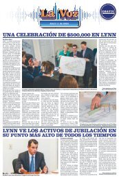
Of the $850,000 approved by Town<br />
Meeting, $610,000 will be used to acquire<br />
the land-use rights. The remainder would<br />
cover design and planning costs.<br />
If a property title search indicates an<br />
owner has encroached on the National<br />
Grid land, it would be difficult to challenge<br />
the town’s intent to obtain an easement.<br />
However, if the property owner holds title to<br />
an abutting piece of the utility corridor, the<br />
town would be forced to take legal steps.<br />
Kane acknowledged the ownership<br />
borders are murky along a small section<br />
of the rail corridor, adding, “This isn’t an<br />
eminent domain taking. We just need to<br />
clarify ownership through title searches.”<br />
Kane’s office will now solicit bids for<br />
design and engineering plans. The annual<br />
debt service on $850,000 is approximately<br />
$65,000, he said.<br />
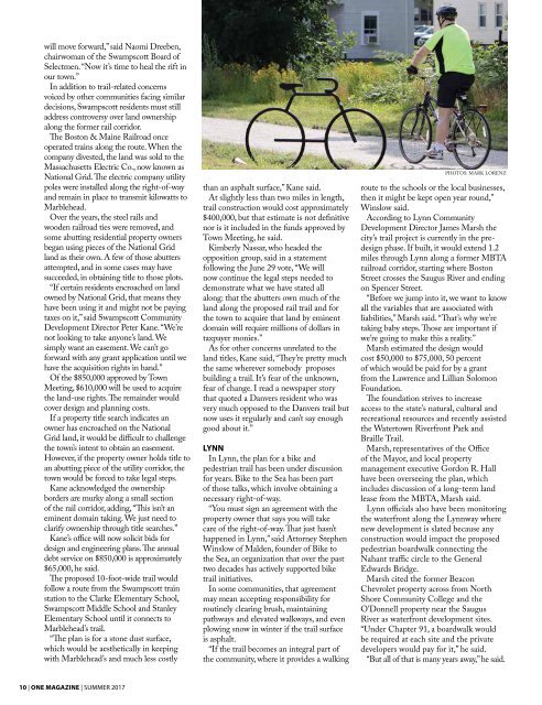
The proposed 10-foot-wide trail would<br />
follow a route from the Swampscott train<br />
station to the Clarke Elementary School,<br />
Swampscott Middle School and Stanley<br />
Elementary School until it connects to<br />
Marblehead’s trail.<br />
“The plan is for a stone dust surface,<br />
which would be aesthetically in keeping<br />
with Marblehead’s and much less costly<br />
than an asphalt surface,” Kane said.<br />
At slightly less than two miles in length,<br />
trail construction would cost approximately<br />
$400,000, but that estimate is not definitive<br />
nor is it included in the funds approved by<br />
Town Meeting, he said.<br />
Kimberly Nassar, who headed the<br />
opposition group, said in a statement<br />
following the June 29 vote, “We will<br />
now continue the legal steps needed to<br />
demonstrate what we have stated all<br />
along: that the abutters own much of the<br />
land along the proposed rail trail and for<br />
the town to acquire that land by eminent<br />
domain will require millions of dollars in<br />
taxpayer monies.”<br />
As for other concerns unrelated to the<br />
land titles, Kane said, “They’re pretty much<br />
the same wherever somebody proposes<br />
building a trail. It’s fear of the unknown,<br />
fear of change. I read a newspaper story<br />
that quoted a Danvers resident who was<br />
very much opposed to the Danvers trail but<br />
now uses it regularly and can’t say enough<br />
good about it.”<br />
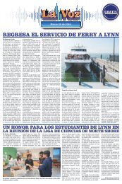
LYNN<br />
In Lynn, the plan for a bike and<br />
pedestrian trail has been under discussion<br />
for years. Bike to the Sea has been part<br />
of those talks, which involve obtaining a<br />
necessary right-of-way.<br />
“You must sign an agreement with the<br />
property owner that says you will take<br />
care of the right-of-way. That just hasn’t<br />
happened in Lynn,” said Attorney Stephen<br />
Winslow of Malden, founder of Bike to<br />
the Sea, an organization that over the past<br />
two decades has actively supported bike<br />
trail initiatives.<br />
In some communities, that agreement<br />
may mean accepting responsibility for<br />
routinely clearing brush, maintaining<br />
pathways and elevated walkways, and even<br />
plowing snow in winter if the trail surface<br />
is asphalt.<br />
“If the trail becomes an integral part of<br />
the community, where it provides a walking<br />
PHOTOS: MARK LORENZ<br />
route to the schools or the local businesses,<br />
then it might be kept open year round,”<br />
Winslow said.<br />
According to Lynn Community<br />
Development Director James Marsh the<br />
city’s trail project is currently in the predesign<br />
phase. If built, it would extend 1.2<br />
miles through Lynn along a former MBTA<br />
railroad corridor, starting where Boston<br />
Street crosses the Saugus River and ending<br />
on Spencer Street.<br />
“Before we jump into it, we want to know<br />
all the variables that are associated with<br />
liabilities,” Marsh said. “That’s why we’re<br />
taking baby steps. Those are important if<br />
we’re going to make this a reality.”<br />
Marsh estimated the design would<br />
cost $50,000 to $75,000, 50 percent<br />
of which would be paid for by a grant<br />
from the Lawrence and Lillian Solomon<br />
Foundation.<br />
The foundation strives to increase<br />
access to the state’s natural, cultural and<br />
recreational resources and recently assisted<br />
the Watertown Riverfront Park and<br />
Braille Trail.<br />
Marsh, representatives of the Office<br />
of the Mayor, and local property<br />
management executive Gordon R. Hall<br />
have been overseeing the plan, which<br />
includes discussion of a long-term land<br />
lease from the MBTA, Marsh said.<br />
Lynn officials also have been monitoring<br />
the waterfront along the Lynnway where<br />
new development is slated because any<br />
construction would impact the proposed<br />
pedestrian boardwalk connecting the<br />
Nahant traffic circle to the General<br />
Edwards Bridge.<br />
Marsh cited the former Beacon<br />
Chevrolet property across from North<br />
Shore Community College and the<br />
O’Donnell property near the Saugus<br />
River as waterfront development sites.<br />
“Under Chapter 91, a boardwalk would<br />
be required at each site and the private<br />
developers would pay for it,” he said.<br />
“But all of that is many years away,” he said.<br />
10 | ONE MAGAZINE | SUMMER 20<strong>17</strong>