W10-20 - Department of Resources, Energy and Tourism
W10-20 - Department of Resources, Energy and Tourism
W10-20 - Department of Resources, Energy and Tourism
Create successful ePaper yourself
Turn your PDF publications into a flip-book with our unique Google optimized e-Paper software.
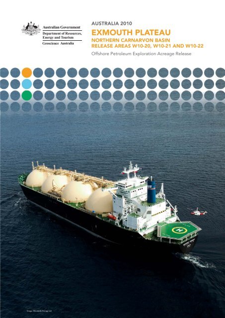
Image: Woodside <strong>Energy</strong> Ltd.<br />
AustrAliA <strong>20</strong>10<br />
exmouth plAteAu<br />
NortherN CArNArvoN BAsiN<br />
releAse AreAs <strong>W10</strong>-<strong>20</strong>, <strong>W10</strong>-21 ANd <strong>W10</strong>-22<br />
Offshore Petroleum Exploration Acreage Release
CoNteNts<br />
GEOlOGicAl infORmAtiOn 1<br />
lOcAtiOn 1<br />
RElEAsE AREA GEOlOGy 2<br />
ExPlORAtiOn HistORy 3<br />
PEtROlEum systEms And HydROcARbOn POtEntiAl 9<br />
fiGuREs 11<br />
REfEREncEs 19<br />
Figures<br />
Figure 1: location map <strong>of</strong> Release Areas <strong>W10</strong>-<strong>20</strong>, <strong>W10</strong>-21 <strong>and</strong> <strong>W10</strong>-22, Exmouth<br />
Plateau, carnarvon basin. 11<br />
Figure 2: Graticular block map <strong>and</strong> graticular block listings for Release Areas<br />
<strong>W10</strong>-<strong>20</strong>, <strong>W10</strong>-21 <strong>and</strong> <strong>W10</strong>-22. 12<br />
Figure 3: structural elements <strong>of</strong> the Exmouth Plateau showing <strong>20</strong>10 Release<br />
Areas <strong>and</strong> location <strong>of</strong> seismic section shown in Figure 5. 14<br />
Figure 4: Generalised stratigraphy <strong>of</strong> the Exmouth Plateau, tied to the geological<br />
timescale after Gradstein et al (<strong>20</strong>04) <strong>and</strong> Ogg et al (<strong>20</strong>08). 15<br />
Figure 5: Geoscience Australia seismic line 110/15 across the central <strong>and</strong> outer<br />
Exmouth Plateau. 16<br />
Figure 6: major oil <strong>and</strong> gas accumulations on the Exmouth Plateau indicating age<br />
<strong>of</strong> main reservoir. 17<br />
Figure 7: Play types on the Exmouth Plateau (modified from Woodside,<br />
<strong>20</strong>09b). lower cretaceous barrow Group basin floor fan <strong>and</strong> turbidite plays (eg<br />
scarborough, nimblefoot <strong>and</strong> briseis shallow) not shown. 18
geologiCAl iNFormAtioN<br />
releAse AreAs <strong>W10</strong>-<strong>20</strong>, <strong>W10</strong>-21 ANd <strong>W10</strong>-22, exmouth<br />
plAteAu, NortherN CArNArvoN BAsiN<br />
WesterN AustrAliA<br />
Bids Close – 11 November <strong>20</strong>10<br />
• Australia’s premier deepwater gas province.<br />
• Adjacent to multi-tcf gas fields.<br />
• fault block <strong>and</strong> structural/stratigraphic traps.<br />
• construction <strong>and</strong> planned expansion <strong>of</strong> regional lnG facilities.<br />
• Water depths 900-1<strong>20</strong>0 m.<br />
• special notices apply, refer to Guidance notes.<br />
loCAtioN<br />
Release Areas <strong>W10</strong>-<strong>20</strong>, <strong>W10</strong>-21 <strong>and</strong> <strong>W10</strong>-22 are located in deep water about 300 km <strong>of</strong>f the coast<br />
<strong>of</strong> Western Australia on the central portion <strong>of</strong> the Exmouth Plateau, within the northern carnarvon<br />
basin (Figure 1). the three Release Areas represent the recently relinquished portions <strong>of</strong> Permit<br />
WA-346-P which was originally granted on 16/07/<strong>20</strong>03 <strong>and</strong> subsequently renewed on 15/10/<strong>20</strong>09.<br />
the Release Areas are adjacent to the multi-tcf thebe gas field, <strong>and</strong> immediately north <strong>of</strong> the giant<br />
~8 tcf (226 bcm) scarborough gas field. no wells have been drilled in the Release Areas. Water<br />
depths range from about 900 to1<strong>20</strong>0 m.<br />
Gas production facilities are currently being developed for the nearby chevron operated Gorgon<br />
<strong>and</strong> Jansz-io fields <strong>and</strong> Woodside operated Pluto field. Exxonmobil <strong>and</strong> bHP billiton are currently<br />
examining development options for the scarborough <strong>and</strong> thebe fields.<br />
the graticular block map <strong>and</strong> listings for the Release Areas are shown in Figure 2.<br />
Geology <strong>of</strong> Release Areas <strong>W10</strong>-<strong>20</strong>, <strong>W10</strong>-21 <strong>and</strong> <strong>W10</strong>-22 | www.petroleum-acreage.gov.au 1
eleAse AreA geology<br />
local tectonic setting<br />
the Exmouth Plateau is a deep water marginal Plateau that represents the western structural<br />
element <strong>of</strong> the northern carnarvon basin (Figure 3). most <strong>of</strong> the plateau is underlain by 10–15 km<br />
<strong>of</strong> generally flat-lying <strong>and</strong> block faulted, tilted lower cretaceous, Jurassic, triassic <strong>and</strong> older<br />
sedimentary section (Figure 4 <strong>and</strong> Figure 5) that was deposited during the periods <strong>of</strong> extension<br />
that preceded breakup <strong>of</strong> Australia <strong>and</strong> Argo l<strong>and</strong> in the middle Jurassic, <strong>and</strong> then Greater india in<br />
the Early cretaceous (stagg et al, <strong>20</strong>04). the dominant fault trend on the Exmouth Plateau is northsouth,<br />
swinging to northeast-southwest near the northern <strong>and</strong> western outer margins <strong>of</strong> the plateau,<br />
<strong>and</strong> along the inner margin adjacent to the Rankin Platform <strong>and</strong> Exmouth–barrow–dampier subbasins<br />
(Figure 3).<br />
structural evolution <strong>and</strong> depositional history <strong>of</strong> the sub-basin<br />
the lower triassic <strong>of</strong> the carnarvon basin is marked by a regional marine transgression that<br />
represents the sag phase <strong>of</strong> a previous Paleozoic rift cycle. the marine locker shale (below td <strong>of</strong><br />
wells on the Exmouth Plateau) unconformably overlies the Permian section <strong>and</strong> grades upwards<br />
into the middle–upper triassic mungaroo formation (Figure 4). the mungaroo formation was<br />
deposited in a broad, low relief, rapidly subsiding fluvio-deltaic coastal plain that extended across<br />
the Exmouth Plateau. during marine transgression in the latest triassic (Rhaetian), carbonate patch<br />
reefs developed on the Wombat Plateau (von Rad et al, 1992a; Williamson et al, 1989) <strong>and</strong> probably<br />
extended across the northern – <strong>and</strong> western-central parts <strong>of</strong> the Exmouth Plateau. coeval marls,<br />
siltstones <strong>and</strong> thin s<strong>and</strong>stones (brigadier formation) were also deposited at this time on the Exmouth<br />
Plateau.<br />
As rifting proceeded between Australia <strong>and</strong> Greater india, several phases <strong>of</strong> faulting occurred in<br />
the Jurassic. in the Pliensbachian, rifting inboard <strong>of</strong> the Exmouth Plateau formed the Exmouth,<br />
barrow <strong>and</strong> dampier sub-basins. several kilometres <strong>of</strong> marine Jurassic sediments were deposited in<br />
these troughs that are the equivalent <strong>of</strong> condensed sections on the central Exmouth Plateau (dingo<br />
claystone equivalents). the major movement on extensional faults on the Exmouth Plateau occurred<br />
in the callovian, <strong>and</strong> continuous oceanic crust was created in the Argo Abyssal Plain to the north<br />
in the late Oxfordian, <strong>and</strong> in the Gascoyne <strong>and</strong> cuvier Abyssal Plains to the west <strong>and</strong> south in the<br />
Valanginian (norvick, <strong>20</strong>02). Rift <strong>and</strong> breakup volcanics are widespread along the outer margins <strong>of</strong><br />
the Exmouth Plateau, <strong>and</strong> probably include late triassic, Oxfordian/callovian <strong>and</strong> Early cretaceous<br />
volcanism (stagg et al, <strong>20</strong>04).<br />
On the eastern portion <strong>of</strong> the Exmouth sub-basin, late Jurassic deposition <strong>of</strong> s<strong>and</strong>y shelfal facies<br />
occurred within restricted shallow depocentres (including the Oxfordian Jansz s<strong>and</strong>stone reservoir<br />
at the giant Jansz-io gas accumulation). during the Early cretaceous the barrow Group delta<br />
prograded northward across the southern portion <strong>of</strong> the plateau to form a major sediment lobe with<br />
the shelf edge arching through or near the investigator 1 <strong>and</strong> Zeepard 1 well locations (boote <strong>and</strong><br />
Kirk, 1989); basin floor fans <strong>of</strong> this succession form the reservoir at the scarborough gas field.<br />
As the newly formed oceanic crust <strong>of</strong> the flanking Argo, Gascoyne <strong>and</strong> cuvier abyssal plains rapidly<br />
subsided, the Exmouth Plateau also foundered <strong>and</strong> was progressively transgressed throughout the<br />
cretaceous by shallow marine mudstone (muderong shale) <strong>and</strong> siltstone (Gearle siltstone), midouter<br />
shelf marl <strong>and</strong> chalk (toolonga calcilutite), <strong>and</strong> finally cenozoic bathyal chalk <strong>and</strong> ooze.<br />
Geology <strong>of</strong> Release Areas <strong>W10</strong>-<strong>20</strong>, <strong>W10</strong>-21 <strong>and</strong> <strong>W10</strong>-22 | www.petroleum-acreage.gov.au 2
explorAtioN history<br />
two major exploration campaigns have focused on the deepwater Exmouth Plateau, the first in 1979<br />
to 1980 for oil targets, <strong>and</strong> the second currently underway searching for gas. the initial exploration<br />
programs undertaken by Esso <strong>and</strong> Phillips (barber, 1988) began when no proven technology<br />
existed to develop a deepwater oil field. Eleven deepwater (740–1375 m) wells were drilled in the<br />
initial exploration phase (Walker, <strong>20</strong>07), with the anticipation <strong>of</strong> oil charge from the Jurassic dingo<br />
claystone. two wells were gas discoveries: Jupiter 1, a triassic horst trap; <strong>and</strong> scarborough 1, a giant<br />
gas accumulation in an inverted lower cretaceous barrow Group basin floor fan. At the time <strong>of</strong> the<br />
scarborough 1 discovery (1979), the available technology <strong>and</strong> the undeveloped lnG market made<br />
the remote, deepwater gas accumulation uneconomic to develop. All other wells drilled during this<br />
period had significant gas shows, but there were no oil discoveries.<br />
After the 1979-1980 drilling campaign no further exploration on the deepwater Exmouth Plateau<br />
was undertaken for over a decade. the second phase <strong>of</strong> activity commenced in the mid 1990s with<br />
a focus on the established triassic fault block play along the eastern margin <strong>of</strong> the Exmouth Plateau,<br />
outboard <strong>of</strong> the Rankin trend. Activity returned to the central Exmouth Plateau in 1996 with the<br />
appraisal drilling <strong>of</strong> the scarborough 2 well. Extensive acreage was released on the surrounding<br />
northern <strong>and</strong> western portions <strong>of</strong> the Exmouth Plateau in <strong>20</strong>00, but failed to attract successful bids.<br />
the super-giant Jansz-io gas field, the largest discovery yet made on the Exmouth Plateau, was<br />
made by Jansz 1 (<strong>20</strong>00) <strong>and</strong> io 1 (<strong>20</strong>01) <strong>and</strong> represented a new Oxfordian play type on the Exmouth<br />
Plateau (Jenkins et al, <strong>20</strong>03). following this discovery, gas became the primary exploration target<br />
<strong>and</strong> extensive new acreage was awarded on the central, northern <strong>and</strong> western portions <strong>of</strong> the<br />
Exmouth Plateau following successive acreage releases in the period <strong>20</strong>02-<strong>20</strong>06. several 3d seismic<br />
surveys were carried out as part <strong>of</strong> the work program bids for these newly awarded permits.<br />
in <strong>20</strong>07, bHP billiton drilled thebe 1 in Permit WA-346-P (immediately north <strong>of</strong> the adjoining<br />
scarborough retention lease) <strong>and</strong> discovered 2 to 3 tcf (57-85 bcm) <strong>of</strong> gas in a triassic fault block<br />
(bHP billiton, <strong>20</strong>07; Anonymous, <strong>20</strong>07). thebe 2 (<strong>20</strong>08) was drilled16 km to the north <strong>of</strong> the initial<br />
discovery <strong>and</strong> confirmed expectations <strong>of</strong> the size <strong>and</strong> quality <strong>of</strong> the thebe resource (bHP billiton,<br />
<strong>20</strong>08a).<br />
market conditions have changed markedly since the first phase <strong>of</strong> exploration on the Exmouth<br />
Plateau in the 1970s, with major gas trade established with Japan, contracts secured to supply<br />
lnG to china, production facilities under construction for Pluto, <strong>and</strong> development proposals being<br />
assessed at Wheatstone, scarborough <strong>and</strong> thebe. An indication <strong>of</strong> the viability <strong>of</strong> the deepwater<br />
frontier plays on the Exmouth Plateau was the competitive bidding for the <strong>20</strong>06 Release Areas <strong>and</strong><br />
the entry <strong>of</strong> a number <strong>of</strong> new explorers including Hess corporation <strong>and</strong> OmV. in <strong>20</strong>07, Hess was<br />
awarded the deepwater petroleum exploration permit WA-390-P, located southwest <strong>of</strong> the supergiant<br />
Jansz-io field, with an aggressive bid including a 16 exploration well drilling commitment.<br />
the first three wells <strong>of</strong> their initial <strong>20</strong>07 four well program were all gas discoveries (Glencoe 1,<br />
briseis 1 <strong>and</strong> nimblefoot 1) but the fourth (Warrior 1) was dry. in all three wells, accumulations<br />
occur within the post-callovian interval, with briseis 1 also encountering additional pay in the<br />
triassic mungaroo formation (smallwood et al, <strong>20</strong>10). the Oxfordian (W. spectabilis) s<strong>and</strong>stones<br />
encountered in Glencoe 1 are analogous to those encountered at Jansz-io to the northeast. in<br />
contrast, nimblefoot 1 <strong>and</strong> briseis 1 both encountered gas pay within deep-water delta-front<br />
turbidite s<strong>and</strong>stones <strong>of</strong> berriasian age sourced from the barrow delta to the south, analogous to the<br />
scarborough gas field.<br />
Other recent giant gas finds have been made at Wheatstone 1 (<strong>20</strong>04) <strong>and</strong> Pluto 1 (<strong>20</strong>05) to the east,<br />
ch<strong>and</strong>on 1 (<strong>20</strong>06) to the northwest, clio 1 (<strong>20</strong>06) to the southeast, <strong>and</strong> martell 1 (<strong>20</strong>09) to the north<br />
<strong>of</strong> the Jansz-io field (Figure 1). At the time <strong>of</strong> writing, Hess has completed six <strong>of</strong> its current 12 well<br />
drilling campaign (<strong>20</strong>09-<strong>20</strong>10) in Permit WA-390-P (toporoa 1, dunlop 1, lightfinger 1, bravo 1,<br />
Rimfire 1 <strong>and</strong> mentorc 1), but so far drilling results have not been disclosed. in the adjacent Permit<br />
WA-374-P to the east, chevron has reported a major gas discovery at Achilles 1 in five triassic<br />
mungaroo s<strong>and</strong>stones (chevron Australia, <strong>20</strong>09a).<br />
Geology <strong>of</strong> Release Areas <strong>W10</strong>-<strong>20</strong>, <strong>W10</strong>-21 <strong>and</strong> <strong>W10</strong>-22 | www.petroleum-acreage.gov.au 3
most <strong>of</strong> the Exmouth Plateau is now under permit, with indicative work program commitments since<br />
<strong>20</strong>04 totalling approximately $1 billion, including nine guaranteed deepwater wells to be drilled in<br />
WA-404-P held jointly by Hess corporation <strong>and</strong> Woodside, <strong>and</strong> two exploration wells in the recently<br />
renewed WA-346-P permit adjacent to Release Areas <strong>W10</strong>-<strong>20</strong> to <strong>W10</strong>-22. 3d seismic <strong>and</strong> AVO<br />
technology are key exploration tools that contribute to high success rates on the Exmouth Plateau<br />
(longley et al, <strong>20</strong>02; Korn et al, <strong>20</strong>03; Williamson <strong>and</strong> Kroh, <strong>20</strong>07).<br />
Well Control<br />
no wells have been drilled within the Release Areas, but several are in close proximity (Jupiter 1,<br />
scarborough 1, thebe 1 <strong>and</strong> 2, Kentish Knock 1) <strong>and</strong> others provide important stratigraphic control<br />
or nearby gas discoveries (Figure 1).<br />
InvestIgator 1 (1979)<br />
investigator 1 was drilled by Esso Australia ltd to test delta front s<strong>and</strong>stones <strong>of</strong> the lower<br />
cretaceous barrow Group in a large closure formed by a combination <strong>of</strong> northward depositional dip<br />
on the delta front, regional south to southeast tilting <strong>of</strong> the Exmouth Plateau <strong>and</strong> gentle cenozoic<br />
arching about a northeast-trending axis (EssO Australia ltd, 1980a). the well was drilled in a water<br />
depth <strong>of</strong> 841 m <strong>and</strong> reached a td <strong>of</strong> 3745 mKb. it penetrated <strong>and</strong> sampled an Albian-barremian<br />
succession <strong>of</strong> claystone, marl <strong>and</strong> siltstone to 1492 mKb, overlying a 1748 m thick section <strong>of</strong> basinal<br />
to prodelta <strong>and</strong> delta front claystone, siltstone <strong>and</strong> s<strong>and</strong>stone <strong>of</strong> the target barrow Group. the<br />
barrow Group was underlain by a 15 m section <strong>of</strong> upper Jurassic claystone, middle-lower Jurassic<br />
marl (44 m), upper triassic (Rhaetian) marl (65 m) <strong>and</strong> upper triassic (norian) interbedded s<strong>and</strong>stone,<br />
siltstone claystone <strong>and</strong> minor coal <strong>of</strong> the mungaroo formation (382 m thick to td). s<strong>and</strong>stones <strong>of</strong><br />
good reservoir quality occur within the barrow Group (13–30% porosity), but those within the upper<br />
triassic mungaroo formation were generally poor (5–16% porosity).<br />
no significant hydrocarbon shows were recorded in the target barrow Group reservoir, but elevated<br />
mud gas levels <strong>and</strong> small amounts <strong>of</strong> wet gas <strong>and</strong> questionable oil films in wireline tests were<br />
recorded in low permeability s<strong>and</strong>stones <strong>of</strong> the mungaroo formation. log analysis indicates 48–86%<br />
water saturation in these s<strong>and</strong>stones. the lack <strong>of</strong> hydrocarbons in the barrow Group s<strong>and</strong>s was<br />
attributed to the absence <strong>of</strong> effective migration pathways for any hydrocarbons generated within the<br />
deeper mungaroo section.<br />
JupIter 1 (1979)<br />
Jupiter 1 was drilled by Phillips Australian Oil company in water depths <strong>of</strong> 960 m to test a<br />
tilted triassic horst (Figure 5). the well reached a total depth <strong>of</strong> 4946 mRt in a thick section <strong>of</strong><br />
interbedded triassic siltstone, claystones, s<strong>and</strong>stone <strong>and</strong> minor coal <strong>and</strong> dolomite (A. reducta to<br />
S. quadrifidus spore/pollen zones) <strong>of</strong> the mungaroo formation (Phillips Australian Oil company,<br />
1980a). the well penetrated 466 m <strong>of</strong> inferred calcareous ooze <strong>and</strong> marl <strong>of</strong> Holocene to late<br />
cretaceous age without returns, <strong>and</strong> sampled cretaceous chalk, calcareous claystone <strong>and</strong> siltstone<br />
to 1857 m, <strong>and</strong> a 15 m section <strong>of</strong> upper Jurassic claystone to 1872 m. this Jurassic claystone was<br />
unconformably underlain by 23 m <strong>of</strong> upper triassic (Rheatian) carbonate <strong>and</strong> claystones 39 m <strong>of</strong><br />
transgressive marine siltstone <strong>and</strong> s<strong>and</strong>stone (ascribed to the brigadier formation by crostella<br />
<strong>and</strong> barter, 1980) <strong>and</strong> a thick section <strong>of</strong> upper-middle triassic deltaic sediments <strong>of</strong> the mungaroo<br />
formation (1895-4946 m td). this is the maximum drilled thickness <strong>of</strong> triassic section on the<br />
Exmouth Plateau.<br />
A 22.5 m gas column was discovered in upper triassic s<strong>and</strong>stones (1911-1933 mKb; brigadier<br />
formation) with reserves <strong>of</strong> about 0.15 tcf (4 bcm; Walker, <strong>20</strong>07). this accumulation has a strong<br />
flat-spot dHi on seismic data, which indicates the spill-point <strong>of</strong> the gas into the bounding fault <strong>and</strong><br />
venting through to a gas-chimney evident on seismic (barber, 1988).<br />
Geology <strong>of</strong> Release Areas <strong>W10</strong>-<strong>20</strong>, <strong>W10</strong>-21 <strong>and</strong> <strong>W10</strong>-22 | www.petroleum-acreage.gov.au 4
scarborough 1 (1979)<br />
scarborough 1 was drilled by Esso Australia ltd to test a large, low relief anticline within the barrow<br />
Group delta that displayed a prominent flat-lying bright spot conforming to the crest <strong>of</strong> the structure<br />
(EssO Australia ltd, 1980b). the well was drilled in a water depth <strong>of</strong> 912 m <strong>and</strong> was ab<strong>and</strong>oned<br />
at a td <strong>of</strong> 2364 mKb due to mechanical problems. it penetrated an upper campanian-Hauterivian<br />
marl <strong>and</strong> claystone succession overlying pro-delta claystone (upper delta sequence) <strong>and</strong> prograding<br />
submarine fan s<strong>and</strong>stone (lower delta sequence) <strong>of</strong> the lower cretaceous barrow Group (total<br />
683 m thick). drilling was ab<strong>and</strong>oned within the barrow Group, <strong>and</strong> the underlying triassic section<br />
was not reached.<br />
scarborough 1 discovered a 59 m gas column within good quality s<strong>and</strong>s (average 23% porosity) <strong>of</strong><br />
the lower barrow Group basin floor fan sealed by prodelta claystone. formation testing at 1904.5 m<br />
recovered 5.2 m 3 <strong>of</strong> methane with only 0.12% ethane <strong>and</strong> no fractions heavier than propane.<br />
Additional appraisal wells scarborough 2 (1996, 1997) <strong>and</strong> scarborough 3, 4 <strong>and</strong> 5 (<strong>20</strong>04-<strong>20</strong>05)<br />
have since been drilled. Scarborough 2 was drilled to a total depth <strong>of</strong> <strong>20</strong>68 m with the objective to<br />
appraise the southeast limit <strong>of</strong> the lower delta fan reservoir discovery, <strong>and</strong> to confirm the presence<br />
<strong>of</strong> higher gas-bearing s<strong>and</strong>s in the upper delta fan with seismic amplitude anomalies (EssO Australia<br />
ltd, 1997). A total <strong>of</strong> 84 m <strong>of</strong> conventional core were cut in the upper <strong>and</strong> lower fans, <strong>and</strong> both<br />
successions were confirmed to be gas bearing from log analysis, mdt samples <strong>and</strong> production<br />
testing. the upper fan reservoir contained a 39 m gross gas interval with lower than expected<br />
porosity (<strong>20</strong>%), permeability (
High quality reservoirs were encountered in the deeper parts <strong>of</strong> the mungaroo formation, but<br />
only poor quality reservoirs (thin argillaceous s<strong>and</strong>stones <strong>and</strong> interbedded siltstone <strong>and</strong> shale)<br />
occur in the uppermost part <strong>of</strong> the tilted fault blocks that are in the zone <strong>of</strong> potential drape closure<br />
entrapment. Only minor hydrocarbon indications were reported in this interval <strong>and</strong> wireline logs<br />
indicated no productive hydrocarbon zones <strong>and</strong> high water saturations. High mud gas readings<br />
(generally 5000–10000 ppm, mainly methane but with minor ethane <strong>and</strong> propane) were recorded<br />
while drilling the Albian to Rhaetian interval 2140–2467 m.<br />
eendracht 1 (1980)<br />
Eendracht 1 was drilled by Esso Australia ltd to test upper triassic (pre-Rhaetian) reservoirs within<br />
an elongate tilted horst bounded to the west by a major normal fault (Esso Australia ltd, 1981). the<br />
well was drilled in a water depth <strong>of</strong> 1354 m <strong>and</strong> reached a td <strong>of</strong> 3410 mKb within the mungaroo<br />
formation. it penetrated Paleocene to Albian calcilutites to 2184.5 m, a thin barremian-Hauterivian<br />
claystone (muderong shale equivalent) to 2195 m, lower cretaceous prodelta siltstone <strong>and</strong><br />
claystone (barrow Group) to 2344.5 m, a condensed section <strong>of</strong> upper to lower Jurassic claystone<br />
(dingo claystone equivalent), upper triassic (Rhaetian) marl to 2419 m, <strong>and</strong> upper triassic shallow<br />
marine to deltaic siltstone, claystone <strong>and</strong> s<strong>and</strong>stone <strong>of</strong> the mungaroo formation.<br />
four gas-bearing s<strong>and</strong>stones in the triassic mungaroo formation were intersected over the interval<br />
2467-2652 mKb, with a total net gas pay <strong>of</strong> 25.5 m. the maximum observed gas column was 44 m<br />
for a thin s<strong>and</strong>stone at 2467 m; the three deeper gas s<strong>and</strong>s were recognised pre-drill as seismic<br />
amplitude anomalies.<br />
ch<strong>and</strong>on 1(<strong>20</strong>06)<br />
ch<strong>and</strong>on 1 was drilled by chevron Australia Pty ltd in 1<strong>20</strong>0 m water depth to a td <strong>of</strong> 3124 mRt,<br />
<strong>and</strong> is located 31 km northwest <strong>of</strong> the Jansz 2 well. unlike the Jansz-io accumulation, the objective<br />
was a triassic fault block, <strong>and</strong> a 197 m gross gas column was intersected in high quality mungaroo<br />
formation s<strong>and</strong>stones (Jonasson, <strong>20</strong>07). the ch<strong>and</strong>on accumulation has been estimated to contain<br />
up to 4 tcf (113 bcm) gas (blevin, <strong>20</strong>07). detailed results <strong>of</strong> the well have not yet been released.<br />
thebe 1 (<strong>20</strong>07) <strong>and</strong> thebe 2 (<strong>20</strong>08)<br />
thebe 1 was drilled by bHP billiton about 50 km north <strong>of</strong> the scarborough gas field in 1173 m water<br />
depth. the well discovered a 73 m gas column (bHP billiton, <strong>20</strong>07) in a triassic fault block that may<br />
contain 2-3 tcf (57–85 bcm) <strong>of</strong> gas (Anonymous, <strong>20</strong>07). thebe 2 was drilled 16 km to the north <strong>of</strong><br />
the initial discovery <strong>and</strong> confirmed expectations <strong>of</strong> the size <strong>and</strong> quality <strong>of</strong> the thebe resource (bHP<br />
billiton, <strong>20</strong>08a). detailed results <strong>of</strong> the wells have not yet been released.<br />
belIcoso 1 (<strong>20</strong>07)<br />
belicoso 1, the most northerly exploration well on the Exmouth Plateau (about 81 km north <strong>of</strong><br />
mercury 1) was drilled by Woodside Petroleum ltd in over 1400 m water depth to test a northnortheast<br />
trending triassic horst (Woodside, <strong>20</strong>07a). the well did not encounter hydrocarbons, but<br />
intersected thick, high-quality reservoirs (Woodside, <strong>20</strong>07b). detailed results <strong>of</strong> the well have not yet<br />
been released.<br />
Martell 1 (<strong>20</strong>09)<br />
martell 1 was drilled by Woodside Petroleum ltd in 1290 m water depth about 27 km northeast<br />
<strong>of</strong> ch<strong>and</strong>on 1. Pressure testing <strong>of</strong> s<strong>and</strong>stones over an interval 2778 to 3<strong>20</strong>1 mmdRt confirmed a<br />
gross gas column <strong>of</strong> about 110 m <strong>and</strong> the presence <strong>of</strong> a gas-water contact (Woodside, <strong>20</strong>09a). the<br />
accumulation occurs within a top triassic horst (Woodside, <strong>20</strong>09b). detailed results <strong>of</strong> the well have<br />
not yet been released.<br />
KentIsh KnocK 1 (<strong>20</strong>09)<br />
Kentish Knock 1, located about 41 km southwest <strong>of</strong> thebe 1, was drilled by chevron Australia Pty<br />
ltd in approximately 1<strong>20</strong>0 m water depth to a td <strong>of</strong> 2525 mRt. the well discovered 34 m <strong>of</strong> net gas<br />
pay (chevron Australia, <strong>20</strong>09b).<br />
Geology <strong>of</strong> Release Areas <strong>W10</strong>-<strong>20</strong>, <strong>W10</strong>-21 <strong>and</strong> <strong>W10</strong>-22 | www.petroleum-acreage.gov.au 6
table 1: Wells listing<br />
Well Operator year total depth Hydrocarbons<br />
belicoso 1 Woodside <strong>Energy</strong> ltd <strong>20</strong>07 2573 mRt not classified<br />
ch<strong>and</strong>on 1 chevron (tAPl) Pty ltd <strong>20</strong>06 3124 mRt Gas<br />
Eendracht 1 Esso Australia ltd 1980 3410 mKb Gas<br />
Guardian 1 chevron Australia Pty ltd <strong>20</strong>09 3315 mRt not classified<br />
investigator 1<br />
(Esso)<br />
Jupiter 1<br />
(Phillips)<br />
Esso Australia limited 1979 3745.6 mKb minor gas<br />
Phillips Australian Oil company 1979 4946 mRt Gas<br />
Kentish Knock 1 chevron Australia Pty ltd <strong>20</strong>09 2525 mRt Gas<br />
martell 1 Woodside Petroleum ltd <strong>20</strong>09 3300 mRt Gas<br />
mercury 1<br />
(Phillips)<br />
Phillips Australian Oil company 1979 3812 mRt dry<br />
OdP 762A texas A <strong>and</strong> m university 1988 1380.8 mRt not classified<br />
OdP 762c texas A <strong>and</strong> m university 1988 2311.4 mRt not classified<br />
scarborough 1<br />
(Esso)<br />
Esso Australia ltd. 1979 2360 mKb Gas<br />
scarborough 2 Esso Australia ltd 1996 <strong>20</strong>68 mKb not classified<br />
scarborough 3 bHP billiton Petroleum Pty. ltd. <strong>20</strong>05 2122 mRt not classified<br />
scarborough 3<br />
cH1<br />
bHP billiton Petroleum Pty. ltd. <strong>20</strong>05 1964 mRt not classified<br />
scarborough 4 bHP billiton Petroleum Pty. ltd. <strong>20</strong>05 1639 mRt not classified<br />
scarborough 4A bHP billiton Petroleum Pty. ltd. <strong>20</strong>05 <strong>20</strong>55 mRt not classified<br />
scarborough 5<br />
thebe 1<br />
thebe 1 cH<br />
bHP billiton Petroleum (north West<br />
shelf) Pty ltd<br />
bHP billiton Petroleum (Australia)<br />
Pty ltd<br />
bHP billiton Petroleum (Australia)<br />
Pty ltd<br />
<strong>20</strong>05 <strong>20</strong>00 mRt not classified<br />
<strong>20</strong>07 2510 mRt Gas<br />
<strong>20</strong>07 2450 mRt not classified<br />
thebe 2 bHP billiton Petroleum Pty ltd <strong>20</strong>08 2550 mRt not classified<br />
thebe 2 cH1 bHP billiton Petroleum Pty ltd <strong>20</strong>08 2450 mRt not classified<br />
Rig Release year shown. Orange shaded areas highlight those wells for which complete data sets are<br />
not available as at 11 december <strong>20</strong>09. note: Wells drilled after 11 december <strong>20</strong>09 are not listed.<br />
Geology <strong>of</strong> Release Areas <strong>W10</strong>-<strong>20</strong>, <strong>W10</strong>-21 <strong>and</strong> <strong>W10</strong>-22 | www.petroleum-acreage.gov.au 7
Seismic Coverage<br />
The Release Areas are covered by regional 2D seismic grids acquired in the late 1970s (approximate<br />
5 km line spacings) <strong>and</strong> subsequent regional grids acquired in 1995 <strong>and</strong> <strong>20</strong>00 (line spacings <strong>of</strong><br />
about 10–<strong>20</strong> km). The southern portion <strong>of</strong> Release Area <strong>W10</strong>-22 is also covered by a detailed 1995<br />
survey (X95A Scarborough; line spacing about 1–2.5 km) that extends across the Scarborough<br />
Retention Lease WA-1-R to the south. The <strong>20</strong>04 Scarborough 3D seismic survey also extends into the<br />
southwest corner <strong>of</strong> Release Area <strong>W10</strong>-22. Deep seismic data was acquired by Geoscience Australia<br />
in 1991–1995 across the central <strong>and</strong> northern Exmouth Plateau (Surveys 101, 110, 128; Geoscience<br />
Australia <strong>20</strong>01), <strong>and</strong> across the outer margins <strong>of</strong> the Plateau (Surveys 135, 162; Stagg et al, <strong>20</strong>04).<br />
BHP Billiton acquired the HEX07B 3D seismic survey in <strong>20</strong>07 <strong>and</strong> Western Geco acquired the<br />
Keystone multi-client 3D survey in <strong>20</strong>08, both <strong>of</strong> which cover portion <strong>of</strong> the original WA-346-P permit<br />
<strong>and</strong> the current Release Areas. In <strong>20</strong>08, a new multi-client survey (PGS New Dawn) was acquired<br />
across the Exmouth Plateau including a few lines over the Release Areas (Petroleum Geo-Services,<br />
<strong>20</strong>09).<br />
Seismic data are generally <strong>of</strong> high quality across the Exmouth Plateau, <strong>and</strong> indications <strong>of</strong> gas charge<br />
<strong>and</strong> gas-water contacts can commonly be directly imaged as amplitude anomalies <strong>and</strong> flat-spots.<br />
Other data<br />
In addition to commercial petroleum exploration efforts on the Exmouth Plateau, there have also<br />
been scientific investigations. In 1988, the Ocean Drilling Program, ODP Leg 122 (Haq et al, 1990;<br />
von Rad et al, 1992b) drilled wells in two locations on the western Exmouth Plateau (Figure 1) <strong>and</strong><br />
four locations on the northern Exmouth Plateau (Wombat Plateau). Detailed descriptions <strong>of</strong> the fully<br />
cored holes <strong>and</strong> the interpretation <strong>of</strong> the results are given by von Rad et al (1992b).<br />
Geology <strong>of</strong> Release Areas <strong>W10</strong>-<strong>20</strong>, <strong>W10</strong>-21 <strong>and</strong> <strong>W10</strong>-22 | www.petroleum-acreage.gov.au 8
petroleum systems ANd hydroCArBoN poteNtiAl<br />
table 2: petroleum systems elements summary<br />
Sources • triassic mungaroo formation (gas-prone)<br />
Reservoirs<br />
Seals<br />
Play Types<br />
• lower cretaceous barrow Group (basin floor fans, turbidites)<br />
• Oxfordian Jansz s<strong>and</strong>stone (upper-lower shoreface)<br />
• upper triassic (Rhaetian) reefs (no discoveries to date)<br />
• upper triassic brigadier formation (shallow marine-deltaic)<br />
• top triassic mungaroo formation (fluvio-deltaic)<br />
• intra-triassic mungaroo formation (fluvio-deltaic)<br />
• lower cretaceous marine muderong shale (regional seal)<br />
• lower cretaceous distal condensed claystones, barrow Group<br />
• Jurassic condensed marls/claystones (dingo claystone equivalents)<br />
• intra-formational mungaroo formation claystones (cross-fault)<br />
• tilted triassic fault blocks <strong>and</strong> associated drapes<br />
• Oxfordian shoreface s<strong>and</strong>stone stratigraphic traps<br />
• lower cretaceous basin floor fan stratigraphic traps<br />
• upper triassic (Rhaetian) Pinnacle reefs (not tested)<br />
the super-giant Jansz-io gas field, giant scarborough gas field, <strong>and</strong> the Jupiter 1 <strong>and</strong> Eendracht 1<br />
gas discoveries, together with the recent gas discoveries in the ch<strong>and</strong>on 1, thebe 1 <strong>and</strong> 2, martell 1,<br />
Glencoe 1, nimblefoot 1, briseis 1 <strong>and</strong> Kentish Knock 1 wells, demonstrate that the deepwater<br />
central Exmouth Plateau is prospective for large gas discoveries. All these discoveries are attributed<br />
to a widespread regional gas system sourced from the triassic succession.<br />
source rocKs<br />
the thick triassic <strong>and</strong> older sedimentary section on the Exmouth Plateau has the greatest potential<br />
for mature source facies, with possible organic-rich units in the lower triassic (marine locker shale<br />
equivalents) <strong>and</strong> upper triassic (deltaic mungaroo formation facies <strong>and</strong> marine equivalents). Recent<br />
exploration activities on the Exmouth Plateau are based on a model that invokes gas charge from the<br />
deeply buried coal <strong>and</strong> carbonaceous claystone <strong>of</strong> the mungaroo formation. Peak gas generation<br />
from these triassic source rocks is interpreted to occur now at depths greater than 5 km subsea<br />
(bussell et al, <strong>20</strong>01).<br />
Organic-rich sediments may also be present within the condensed Jurassic <strong>and</strong> upper cretaceous<br />
succession, but these are immature.<br />
reservoIrs<br />
fluvio-deltaic s<strong>and</strong>stones <strong>of</strong> the upper triassic mungaroo formation (eg Eendracht, thebe, martell<br />
<strong>and</strong> ch<strong>and</strong>on) <strong>and</strong> basin-floor fan <strong>and</strong> turbidite s<strong>and</strong>stones <strong>of</strong> the lower cretaceous barrow Group<br />
(eg scarborough, nimblefoot <strong>and</strong> brieseis shallow) provide good quality reservoirs across the<br />
central Exmouth Plateau <strong>and</strong> are likely to represent the main reservoir target within the release<br />
areas. transgressive marine s<strong>and</strong>stones <strong>of</strong> the brigadier formation (eg Jupiter) <strong>and</strong> Rhaetian reefal<br />
carbonates provide additional potential reservoir targets.<br />
Geology <strong>of</strong> Release Areas <strong>W10</strong>-<strong>20</strong>, <strong>W10</strong>-21 <strong>and</strong> <strong>W10</strong>-22 | www.petroleum-acreage.gov.au 9
SealS<br />
Fine-grained deepwater Cretaceous sediments (Muderong Shale <strong>and</strong> distal facies <strong>of</strong> the Barrow<br />
Group) provide a regional seal across the Exmouth Plateau. There are also intra-formational seals<br />
within the deltaic sequences <strong>of</strong> the Upper Triassic Mungaroo Formation. The Rhaetian marl <strong>and</strong><br />
Jurassic condensed marls/claystones (Dingo Claystone equivalents), where preserved, can also<br />
provide a top seal to Triassic reservoirs.<br />
Play Types<br />
High relief top Triassic fault blocks together with associated drape features <strong>and</strong> deeper intra-<br />
Triassic cross-fault traps provide numerous potential structural traps on the central Exmouth Plateau<br />
(Figure 7). Upper Triassic (Rhaetian) pinnacle <strong>and</strong> patch reefs (such as those intersected in the ODP<br />
holes on the Wombat Plateau on the northern margin <strong>of</strong> the Exmouth Plateau; Williamson et al,<br />
1989) have also recently been identified on new 3D data across parts <strong>of</strong> the central Exmouth Plateau,<br />
<strong>and</strong> represent a potential new play in the region that has yet to be tested. Other proven stratigraphic<br />
traps in the region include Lower Cretaceous basin floor fans (eg Scarborough) <strong>and</strong> Upper Jurassic<br />
shoreface s<strong>and</strong>stones (eg Jansz-Io, Glencoe), but the later are unlikely to extend as far west as the<br />
current release areas.<br />
Critical Risks<br />
Given that a proven hydrocarbon system has already been established across the central Exmouth<br />
Plateau, continued success relies on the identification <strong>of</strong> additional valid traps with access to charge<br />
from the gas-prone Mungaroo source. 3D seismic <strong>and</strong> AVO technology are thus key exploration tools<br />
that are likely to contribute to continued exploration success on the deepwater Exmouth Plateau<br />
(Longley et al, <strong>20</strong>02; Korn et al, <strong>20</strong>03; Williamson <strong>and</strong> Kroh, <strong>20</strong>07).<br />
Geology <strong>of</strong> Release Areas <strong>W10</strong>-<strong>20</strong>, <strong>W10</strong>-21 <strong>and</strong> <strong>W10</strong>-22 | www.petroleum-acreage.gov.au 10
WA<br />
NT<br />
SA<br />
TAS<br />
QLD<br />
NSW<br />
VIC<br />
WA-364-P<br />
ODP 762A, C<br />
Eendracht 1<br />
WA-366-P<br />
WA-386-P<br />
Kentish Knock 1<br />
<strong>20</strong>00<br />
<strong>W10</strong>-<strong>20</strong><br />
WA-365-P<br />
Scarborough<br />
1000<br />
WA-367-P<br />
Thebe 1<br />
Guardian 1<br />
Investigator 1<br />
113°<br />
0 50 km<br />
Thebe 2 CH1<br />
WA-346-P<br />
<strong>W10</strong>-22<br />
WA-348-P<br />
<strong>W10</strong>-21<br />
Jupiter 1<br />
Yellowglen 1<br />
WA-268-P<br />
Bravo 1<br />
Rimfire 1<br />
Briseis 1<br />
Glencoe 1 Dunlop 1<br />
WA-383-P<br />
Nimblefoot 1<br />
Lightfinger 1<br />
Hijinx 1<br />
WA-390-P<br />
Mentorc 1<br />
WA-351-P<br />
WA-401-P<br />
Mercury 1<br />
Belicoso 1<br />
Toporoa 1<br />
Warrior 1<br />
Ch<strong>and</strong>on 1<br />
114°<br />
WA-347-P<br />
Ch<strong>and</strong>on 2<br />
WA-392-P<br />
WA-404-P<br />
WA-374-P<br />
Satyr 1<br />
Martell<br />
1<br />
Io/Jansz<br />
Achilles<br />
1<br />
Where well symbol information is sourced from publicly available "open file" data, it has been provided by Geoscience Australia from Well Completion Reports. These symbols were generated from open file<br />
data as at 11 December <strong>20</strong>09. Where well symbol information is not publicly available from titleholders' data, the information has been extracted from other public sources. Field outlines are<br />
provided by<br />
GPinfo, an Encom Petroleum Information Pty Ltd product. Field outlines in GPinfo are sourced, where possible, from the operators <strong>of</strong> the fields only. Outlines are updated at irregular intervals<br />
but with at<br />
least one major update per year.<br />
<strong>20</strong>10 Offshore Petroleum<br />
Acreage Release Area<br />
Existing petroleum title<br />
Gas field<br />
<strong>20</strong>0<br />
Gas pipeline (proposed)<br />
Bathymetry contour (depth in metres)<br />
Stratigraphic well<br />
Petroleum exploration well - Not classified<br />
Petroleum exploration well - Dry hole<br />
Petroleum exploration well - Gas show<br />
Petroleum exploration well - Gas discovery<br />
Figure 1. Location map <strong>of</strong> Release Areas <strong>W10</strong>-<strong>20</strong>, <strong>W10</strong>-21 <strong>and</strong> <strong>W10</strong>-22,<br />
Exmouth Plateau, Carnarvon Basin.<br />
1000<br />
19°<br />
<strong>20</strong>°<br />
Orthrus<br />
09-4254-1<br />
WA-387-P<br />
WA-387-P<br />
WA-269-P<br />
Eurytion<br />
Geryon<br />
Chrysaor<br />
Clio 1<br />
500<br />
Ixion 1<br />
Bellatr<br />
Saturn<br />
Dion<br />
W09<br />
Bluebel<br />
Gorgon<br />
<strong>20</strong>0
MAP SHEET<br />
SE 49<br />
<strong>20</strong>10 Release Areas<br />
Exmouth Plateau, Carnarvon Basin<br />
Western Australia<br />
<strong>W10</strong>-<strong>20</strong><br />
(2 blocks, approx 160 km 2 )<br />
113°00'04.73"E<br />
19°09'55.31"S<br />
19°19'55.32"S<br />
113°00'04.74"E<br />
2797<br />
2869<br />
19°39'55.33"S<br />
113°05'04.75"E<br />
113°15'04.73"E<br />
19°09'55.31"S<br />
113°05'04.73"E<br />
19°09'55.31"S 2800<br />
19°19'55.32"S<br />
113°05'04.74"E<br />
113°05'04.75"E<br />
19°29'55.32"S<br />
3086<br />
3158<br />
19°14'55.31"S<br />
113°15'04.74"E<br />
113°15'04.74"E<br />
19°24'55.31"S<br />
3016<br />
2873<br />
2945<br />
<strong>W10</strong>-21<br />
(13 blocks, approx 1050 km 2 )<br />
19°39'55.32"S<br />
113°25'04.75"E<br />
19°24'55.31"S<br />
113°30'04.74"E<br />
For convenience, geographical coordinates shown on this map are expressed in terms <strong>of</strong> the Geocentric Datum<br />
<strong>of</strong> Australia 1994 (GDA94). Permit areas are defined by the 5 minute graticular block system set out under<br />
Section 33 <strong>of</strong> the Offshore Petroleum <strong>and</strong> Greenhouse Gas Storage Act <strong>20</strong>06; under Sections 37 <strong>and</strong> 38 <strong>of</strong> the<br />
Act, the position <strong>of</strong> those blocks is determined by reference to the Australian Geodetic Datum (AGD66).<br />
<strong>W10</strong>-22<br />
113°45'04.73"E<br />
19°09'55.29"S<br />
19°19'55.30"S<br />
113°45'04.74"E<br />
(10 blocks, approx 805 km 2 )<br />
IDEAS 9155-12
GRATICULAR BLOCK LISTING<br />
Release Area <strong>W10</strong>-<strong>20</strong><br />
Exmouth Plateau, Carnarvon Basin, Western Australia<br />
Map Sheet SE 49<br />
2797 2869<br />
Assessed to contain 2 full blocks<br />
Release Area <strong>W10</strong>-21<br />
Exmouth Plateau, Carnarvon Basin, Western Australia<br />
Map Sheet SE 49<br />
2800 2801 2802 2803 2804 2805<br />
2873 2874 2875 2876 2877 2945<br />
2946<br />
Assessed to contain 13 full blocks<br />
Release Area <strong>W10</strong>-22<br />
Exmouth Plateau, Carnarvon Basin, Western Australia<br />
Map Sheet SE 49<br />
3016 3017 3086 3087 3088 3089<br />
3158 3159 3160 3161<br />
Assessed to contain 10 full blocks
WA<br />
NT<br />
SA<br />
TAS<br />
QLD<br />
NSW<br />
VIC<br />
110/15<br />
Eendracht 1<br />
Vinck 1<br />
112°<br />
0<br />
Kentish Knock 1<br />
Thebe 2 CH1<br />
<strong>W10</strong>-21<br />
ODP 762A, C Scarborough<br />
ODP 762B<br />
ODP 763A-C<br />
Investigator 1<br />
Investigator<br />
Sub-basin<br />
Sirius 1<br />
<strong>W10</strong>-<strong>20</strong><br />
Thebe 1<br />
<strong>W10</strong>-22<br />
Jacala 1<br />
Figure 5<br />
Yellowglen 1<br />
Bravo<br />
1 Glencoe 1 Briseis 1<br />
Rimfire<br />
1<br />
Nimblefoot<br />
1<br />
Dunlop 1<br />
Lightfinger 1<br />
Hijinx 1<br />
Warrior 1<br />
Mentorc 1<br />
Ch<strong>and</strong>on 1<br />
Toporoa 1<br />
Leyden 1B ST1<br />
Belicoso 1<br />
Mercury 1<br />
Jupiter 1<br />
Ch<strong>and</strong>on 2<br />
Martell 1<br />
Exmouth<br />
Plateau<br />
Clio 2<br />
Satyr 1<br />
Lauda 1<br />
Ixion 1<br />
Io/Jansz<br />
Saturn 1<br />
Eurytion<br />
Maenad<br />
Geryon<br />
<strong>20</strong>°<br />
Dionysus<br />
Orthrus<br />
Achilles 1<br />
Clio 1<br />
Chrysaor<br />
Bluebell 1<br />
Gorgon<br />
Euryale 1<br />
Zeepaard 1 ST1<br />
Spar<br />
114°<br />
18°<br />
Antiope 1 ST1<br />
Altair 1<br />
Woollybutt<br />
Where well symbol information is sourced from publicly available "open file" data, it has been provided by Geoscience<br />
Australia from Well Completion Reports. These symbols were generated from open file<br />
data as at 11 December <strong>20</strong>09. Where well symbol information is not publicly available from titleholders' data, the<br />
information has been extracted from other public sources. Field outlines are provided by<br />
GPinfo, an Encom Petroleum Information Pty Ltd product. Field outlines in GPinfo are sourced, where possible, from the operators <strong>of</strong> the fields only. Outlines are updated at irregular intervals but with at<br />
least one major update per year.<br />
<strong>20</strong>10 Offshore Petroleum<br />
Acreage Release Area<br />
Gas field<br />
Oil field<br />
Seismic cross section location<br />
Basin boundary<br />
Sub-basin boundary<br />
Fault<br />
Syncline<br />
NORTHERN CARNARVON BASIN<br />
Figure 3. Structural elements <strong>of</strong> the Exmouth Plateau showing <strong>20</strong>10 Release Areas <strong>and</strong><br />
location <strong>of</strong> seismic section shown in Figure 5.<br />
100 km<br />
Petroleum exploration well - Dry hole<br />
Petroleum exploration well - Gas show<br />
Petroleum exploration well - Gas discovery<br />
Petroleum exploration well - Oil discovery<br />
09-4254-3<br />
Stratigraphic well Barrow<br />
P<br />
Petroleum exploration well - Not classified Sub-basin<br />
Petroleum exploration well - Gas discovery <strong>and</strong> oil show<br />
Rankin P<br />
Corkybark 1A 11A<br />
ST1
AGE<br />
(Ma)<br />
10<br />
<strong>20</strong><br />
30<br />
40<br />
50<br />
60<br />
70<br />
80<br />
90<br />
100<br />
110<br />
1<strong>20</strong><br />
130<br />
140<br />
150<br />
160<br />
170<br />
180<br />
190<br />
<strong>20</strong>0<br />
210<br />
2<strong>20</strong><br />
230<br />
Triassic Jurassic Cretaceous Paleogene Neogene<br />
Figure 4.<br />
Period Epoch Stage<br />
Quaternary<br />
Holocene<br />
Pleistocene<br />
Pliocene<br />
Miocene<br />
Oligocene<br />
Eocene<br />
Paleocene<br />
Late<br />
Early<br />
Late<br />
Middle<br />
Early<br />
Late<br />
Tarantian<br />
Ionian<br />
Calabrian<br />
Gelasian<br />
Piacenzian<br />
Zanclean<br />
Messinian<br />
Tortonian<br />
Serravallian<br />
Langhian<br />
Burdigalian<br />
Aquitanian<br />
Chattian<br />
Rupelian<br />
Priabonian<br />
Bartonian<br />
Lutetian<br />
Ypresian<br />
Thanetian<br />
Sel<strong>and</strong>ian<br />
Danian<br />
Maastrichtian<br />
Campanian<br />
Santonian<br />
Coniacian<br />
Turonian<br />
Cenomanian<br />
Albian<br />
Aptian<br />
Barremian<br />
Hauterivian<br />
Valanginian<br />
Berriasian<br />
Tithonian<br />
Kimmeridgian<br />
Oxfordian<br />
Callovian<br />
Bathonian<br />
Bajocian<br />
Aalenian<br />
Toarcian<br />
Pliensbachian<br />
Sinemurian<br />
Hettangian<br />
Rhaetian<br />
Norian<br />
Carnian<br />
Middle Ladinian<br />
Exmouth Plateau stratigraphy<br />
Delambre Formation<br />
Trealla Limestone<br />
M<strong>and</strong>u Formation<br />
Walcott Formation<br />
Wilcox Formation<br />
Dockerell Formation<br />
Lambert Formation<br />
Miria Formation<br />
Toolonga Calcilutite<br />
Gearle Siltstone<br />
Windalia Radiolarite<br />
Muderong Shale<br />
Undifferentiated<br />
Barrow Group<br />
Dingo Claystone<br />
Janz S<strong>and</strong>stone<br />
Athol Formation<br />
Murat Siltstone<br />
Brigadier Formation<br />
Mungaroo Formation<br />
Cape Range Group<br />
Guilford 1<br />
Hydrocarbon shows<br />
Briseis 1, Leyden 1BST1<br />
Nimblefoot 1, Scarborough 1<br />
Zeepaard 1 ST1<br />
Geryon 1, Io 1, Maenad 1, Saturn 1<br />
Glencoe 1, Jansz 1, Jansz 3<br />
Callirhoe 1, Geryon 1, Jupiter 1, Zeewulf 1<br />
Saturn 1<br />
Investigator 1<br />
Briseis 1, Callirhoe 1, Ch<strong>and</strong>on 1, Clio 1, Eendracht 1,<br />
Geryon 1, Maenad 1A, Martell 1, Orthrus 1,<br />
Resolution 1 ST1, Sirius 1,Thebe 1, Urania 1, Vinck 1,<br />
Zeepaard 1 ST1<br />
Generalised stratigraphy <strong>of</strong> the Exmouth Plateau, tied to the geological timescale after<br />
Gradstein et al (<strong>20</strong>04) <strong>and</strong> Ogg et al (<strong>20</strong>08).<br />
09-4254-2
Two-way time (s)<br />
0<br />
1<br />
2<br />
3<br />
4<br />
5<br />
6<br />
7<br />
8<br />
9<br />
10<br />
NW SE<br />
Jupiter 1<br />
Base<br />
Cretaceous<br />
Base Jurassic -<br />
Top Triassic<br />
Intra-Triassic<br />
Intra-Triassic<br />
Valanginian<br />
Callovian<br />
Aptian<br />
Top Top Permian Permian<br />
Turonian<br />
<strong>W10</strong>-<strong>20</strong><br />
Exmouth Plateau<br />
Base Cenozoic<br />
0 25 km<br />
Base Eocene<br />
<strong>W10</strong>-22<br />
Mid. Oligocene<br />
Late Late Carboniferous<br />
Carboniferous<br />
Basement Basement<br />
Late Miocene<br />
Line 110/15 09-4254-4<br />
Figure 5. Geoscience Australia seismic line 110/15 across the central <strong>and</strong> outer Exmouth Plateau.<br />
Intrusives Intrusives
WA<br />
NT<br />
SA<br />
TAS<br />
QLD<br />
NSW<br />
VIC<br />
112°<br />
Eendracht<br />
Vinck<br />
Kentish Knock<br />
<strong>W10</strong>-<strong>20</strong><br />
Scarborough<br />
Sirius<br />
Thebe<br />
<strong>W10</strong>-22<br />
<strong>W10</strong>-21<br />
Jupiter<br />
Nimblefoot<br />
Glencoe<br />
0 100 km<br />
Ch<strong>and</strong>on<br />
Briseis<br />
114°<br />
Zeepaard<br />
Martell<br />
Io/Jansz<br />
Clio<br />
Gorgon<br />
Saturn<br />
Eurytion<br />
Geryon<br />
Dionysus<br />
<strong>20</strong>°<br />
Maenad<br />
Orthrus Chrysaor<br />
Spar<br />
East Spar<br />
Lauda<br />
Woollybutt<br />
Field outlines are provided by GPinfo, an Encom Petroleum Information Pty Ltd product. Field outlines in GPinfo are sourced, where possible, from the operators <strong>of</strong> the fields only. Outlines are updated at<br />
irregular intervals but with at least one major update per year.<br />
<strong>20</strong>10 Offshore Petroleum<br />
Acreage Release Area<br />
Existing petroleum title<br />
Barremian<br />
Reservoir Age (Formation)<br />
Valanginian <strong>and</strong> Berriasian<br />
Tithonian, Oxfordian <strong>and</strong> Middle Jurassic<br />
Late Triassic (Brigadier <strong>and</strong> Mungaroo<br />
formations)<br />
Oil accumulation Gas accumulation<br />
Figure 6. Major oil <strong>and</strong> gas accumulations on the Exmouth Plateau indicating age <strong>of</strong><br />
main reservoir.<br />
18°<br />
09-4254-5
Top Triassic<br />
Fields: Briseis (deep), Ch<strong>and</strong>on, Eendracht, Goodwyn, Gorgon,<br />
Jupiter, Martell, N.Rankin, Pluto, Wheatstone<br />
Deep Triassic<br />
Fields: Clio, Goodwyn-H, Urania<br />
Sea floor<br />
NOT TO SCALE<br />
Cretaceous/Jurassic<br />
Fields: Glencoe, Janz-Io<br />
Cenozoic<br />
Cretaceous<br />
Carbonate pinnacle reefs<br />
No fields drilled to date<br />
Recently identified on new 3D<br />
Jurassic Triassic<br />
Figure 7. Play types on the Exmouth Plateau (modified from Woodside, <strong>20</strong>09b). Lower Cretaceous Barrow Group basin floor fan <strong>and</strong><br />
turbidite plays (eg Scarborough, Nimblefoot <strong>and</strong> Briseis shallow) not shown.<br />
09-4254-6
RefeRences<br />
ANONYMOUS, <strong>20</strong>07—Regional Update, Australia. Journal <strong>of</strong> Petroleum Technology, 59 (11),<br />
November <strong>20</strong>07, page 10.<br />
BARBER, P., 1988—The Exmouth Plateau deepwater frontier: a case study. In: Purcell, P.G. <strong>and</strong><br />
Purcell, R.R. (eds), The North West Shelf, Australia: Proceedings <strong>of</strong> the Petroleum Exploration Society<br />
<strong>of</strong> Australia Symposium, Perth, 173–187.<br />
BHP BILLITON, <strong>20</strong>07—[Web page] BHP Billiton announces gas discovery at Thebe 1 <strong>of</strong>fshore<br />
Australia, 13 August <strong>20</strong>07. http://www.bhpbilliton.com/bb/investorsMedia/news.jsp (last accessed<br />
26 November <strong>20</strong>09).<br />
BHP BILLITON <strong>20</strong>08a—[Web page] Defining our future, <strong>20</strong> October <strong>20</strong>08. http://www.bhpbilliton.<br />
cbom/bbContentRepository/docs/definingOurFuture.pdf (last accessed 26 November <strong>20</strong>09).<br />
BHP BILLITON, <strong>20</strong>08b—[Web page] Investment presentation, Australian Analysts’ Tour, 27 October<br />
<strong>20</strong>08, Petroleum Australia presentation. http://www.bhpbilliton.com/bb/investorsMedia/<br />
investmentPresentations.jsp (last accessed 26 November <strong>20</strong>09).<br />
BLEVIN, J.E., <strong>20</strong>07—PESA industry review: Exploration highlights for <strong>20</strong>06. The APPEA Journal, 47,<br />
2, 631-648.<br />
BOOTE, R.D. AND KIRK, R.B., 1989—Depositional wedge cycles on an evolving plate margin,<br />
Western <strong>and</strong> northwestern Australia. American Association <strong>of</strong> Petroleum Geologists Bulletin, 73,<br />
216-243.<br />
BUSSELL, M.R., JABLONSKI, D., ENMAN, T., WILSON, M.J. AND BINT, A.N., <strong>20</strong>01—Deepwater<br />
exploration: northern Western Australia compared with Gulf <strong>of</strong> Mexico <strong>and</strong> Mauritania. The APPEA<br />
Journal, 41(1), 289–319.<br />
CHEVRON AUSTRALIA, <strong>20</strong>09a—[Web page] Chevron announces natural gas find in Australia, 19<br />
October <strong>20</strong>09. http://www.chevronaustralia.com/media/mediastatements/09-10-19/Chevron_<br />
Announces_Natural_Gas_Find_in_Australia.aspx (last accessed 26 November <strong>20</strong>09).<br />
CHEVRON AUSTRALIA, <strong>20</strong>09b—[Web page] Chevron announces two natural gas finds in<br />
Australia, 19 August <strong>20</strong>09. http://www.chevronaustralia.com/media/mediastatements/<br />
exploration/09-08-19/Chevron_Announces_Two_Natural_Gas_Finds_in_Australia.aspx (last<br />
accessed 26 November <strong>20</strong>09).<br />
CROSTELLA AND BARTER, 1980—Triassic-Jurassic depositional history <strong>of</strong> the Dampier <strong>and</strong> Beagle<br />
Sub-basins, Northwest Shelf <strong>of</strong> Australia. APEA Journal, <strong>20</strong> (1), 25-33.<br />
ESSO AUSTRALIA LTD, 1980a —Investigator 1 Well Completion Report, unpublished.<br />
ESSO AUSTRALIA LTD, 1980b—Scarborough 1 Well Completion Report, unpublished.<br />
ESSO AUSTRALIA LTD, 1981—Eendracht 1 Well Completion Report, unpublished.<br />
ESSO AUSTRALIA LTD, 1997—Scarborough 2 Well Completion Report, unpublished.<br />
GEOSCIENCE AUSTRALIA, <strong>20</strong>01—Line drawings <strong>of</strong> Geoscience Australia’s regional seismic pr<strong>of</strong>iles,<br />
<strong>of</strong>fshore northern <strong>and</strong> northwestern Australia. Geoscience Australia Record <strong>20</strong>01/36, GeoCat 36352,<br />
unpublished.<br />
GORTER, J.D., <strong>20</strong>05—<strong>20</strong>04 Exploration Review. The APPEA Journal, 45 (2), 129-144.<br />
GRADSTEIN, F.M., OGG, J. AND SMITH, A., <strong>20</strong>04—A Geologic Time Scale <strong>20</strong>04. Cambridge:<br />
Cambridge University Press, 589.<br />
HAQ, B.U., von RAD, U., O’CONNELL, S. AND OTHERS, 1990—Proceedings <strong>of</strong> Ocean Drilling<br />
Program, Initial Reports, 122. Ocean Drilling Program, College Station, Texas, 862 pp.<br />
Geology <strong>of</strong> Release Areas <strong>W10</strong>-<strong>20</strong>, <strong>W10</strong>-21 <strong>and</strong> <strong>W10</strong>-22 | www.petroleum-acreage.gov.au 19
JENKINS, C.C., MAUGHAN, D.M., ACTON, J.H., DUCKETT, A., KORN, B.E. AND TEAKLE, R.P.,<br />
<strong>20</strong>03—The Jansz gas field, Carnarvon Basin, Australia. The APPEA Journal, 43 (1), 303–324.<br />
JONASSON, K., <strong>20</strong>07—[Web page] Review <strong>of</strong> exploration activities in <strong>20</strong>06. Petroleum in Western<br />
Australia, April <strong>20</strong>07. <strong>Department</strong> <strong>of</strong> Industry <strong>and</strong> <strong>Resources</strong>, Western Australia, page 12.<br />
http://www.dmp.wa.gov.au/documents/PWA_April_<strong>20</strong>07.pdf (last accessed 26 November <strong>20</strong>09).<br />
KORN, B.E., TEAKLE, R.P., MAUGHAN, D.M. AND SIFFLEET, P.B., <strong>20</strong>03—The Geryon, Orthrus,<br />
Maenad <strong>and</strong> Urania gas fields, Carnarvon Basin, Western Australia. The APPEA Journal, 43 (1), 285-<br />
301.<br />
LONGLEY, I.M., BUESSENSCHUETT, C., CLYDSDALE, L., CUBITT, C.J., DAVIS, R.C., JOHNSON,<br />
M.K., MARSHALL, N.M., MURRAY, A.P., SOMERVILLE, R., SPRY, T.B. AND THOMPSON, N.B., <strong>20</strong>02—<br />
The North West Shelf <strong>of</strong> Australia – a Woodside perspective. In: Keep, M. <strong>and</strong> Moss, S.J. (eds), The<br />
Sedimentary Basins <strong>of</strong> Western Australia 3: Proceedings <strong>of</strong> the Petroleum Exploration Society <strong>of</strong><br />
Australia Symposium, Perth, WA, <strong>20</strong>02, 27–88.<br />
NORVICK, M.S., <strong>20</strong>02—Palaeogeographic Maps <strong>of</strong> the Northern Margins <strong>of</strong> the Australian Plate:<br />
Final Report. Unpublished report for Geoscience Australia.<br />
OGG, J.G., OGG, G. AND GRADSTEIN, F.M., <strong>20</strong>08—The Concise Geologic Time Scale. Cambridge:<br />
Cambridge University Press, 177.<br />
PETROLEUM GEO-SERVICES, <strong>20</strong>09—[Web page] http://www.pgs.com/Data_Library/Asia-Pacific/<br />
Australia/New-Dawn-2D/ (last accessed 26 November <strong>20</strong>09).<br />
PHILLIPS AUSTRALIAN OIL COMPANY, 1980a—Jupiter 1 Well Completion Report, unpublished.<br />
PHILLIPS AUSTRALIAN OIL COMPANY, 1980b—Mercury 1 Well Completion Report, unpublished.<br />
SMALLWOOD, J.R., BANFIELD, J., COX, P., GRIFFIN, D., KUSUMANEGARA, Y., OWEN, P.B.,<br />
PRESCOTT, E., SANTONI, S AND SMITH, J.G., <strong>20</strong>10—Extending the Exmouth Plateau post-Callovian<br />
fairway: WA-390-P Phase I exploration. The APPEA Journal, 50, abstract (in press).<br />
STAGG, H.M.J., ALCOCK, M.B., BERNARDEL, G., MOORE, A.M.G., SYMONDS, P.A. AND EXON,<br />
N.F., <strong>20</strong>04—Geological framework <strong>of</strong> the outer Exmouth Plateau <strong>and</strong> adjacent ocean basins.<br />
Geoscience Australia Record, <strong>20</strong>04/13, unpublished.<br />
von RAD, U., EXON, N.F. AND HAQ, B.U., 1992a—Rift to drift history <strong>of</strong> the Wombat Plateau,<br />
northwest Australia: Triassic to Tertiary Leg 122 results. In von Rad, U., Haq, B.U., ET AL, Proceedings<br />
<strong>of</strong> Ocean Drilling Program, Initial Reports, 122. Ocean Drilling Program, College Station, Texas, 765-<br />
800.<br />
von RAD, U., HAQ, B.U., ET AL, 1992b—Proceedings <strong>of</strong> Ocean Drilling Program, Initial Reports, 122.<br />
Ocean Drilling Program, College Station, Texas, 934 pp.<br />
WALKER, T.R., <strong>20</strong>07—Deepwater <strong>and</strong> frontier exploration in Australia – historical perspectives,<br />
present environment <strong>and</strong> likely future trends. The APPEA Journal 47(1), 15-38.<br />
WILLIAMSON, P.E., EXON, N.F., HAQ, B.U., AND von RAD, U., 1989—A North West Shelf Triassic<br />
Reef Play: results from ODP Leg 122. The APEA Journal, 29 (1), 328-344.<br />
WILLIAMSON, P.E. AND KROH, F., <strong>20</strong>07—The role <strong>of</strong> amplitude versus <strong>of</strong>fset technology in<br />
promoting <strong>of</strong>fshore petroleum exploration in Australia. The APPEA Journal, 47 (1), 161-174.<br />
WOODSIDE, <strong>20</strong>07a—[Web page] Woodside investor briefing <strong>20</strong>07, Sydney, 15 November <strong>20</strong>07;<br />
Sustaining growth <strong>and</strong> value presentations.<br />
http://www.woodside.com.au/NR/rdonlyres/7A7B410A-7F01-4A15-BB82-8A505B090078/0/<br />
ASX070aWoodsideInvestorBriefingSustainingGrowth<strong>and</strong>ValuePresentations.pdf (last accessed 26<br />
November <strong>20</strong>09).<br />
Geology <strong>of</strong> Release Areas <strong>W10</strong>-<strong>20</strong>, <strong>W10</strong>-21 <strong>and</strong> <strong>W10</strong>-22 | www.petroleum-acreage.gov.au <strong>20</strong>
WOODSIDE, <strong>20</strong>07b—[Web page] ASX announcement 21 November <strong>20</strong>07, Belicoso well clarification.<br />
http://www.woodside.com.au/NR/rdonlyres/CD92F449-2274-4E68-AE0D-7176198AA49F/0/<br />
BelicosaWellClarification.pdf (last accessed 26 November <strong>20</strong>09).<br />
WOODSIDE, <strong>20</strong>09a—[Web page] Martell gas discovery update, 25 February <strong>20</strong>09.<br />
http://www.woodside.com.au/Investors+<strong>and</strong>+Media/Announcements/<br />
(last accessed 26 November <strong>20</strong>09).<br />
WOODSIDE, <strong>20</strong>09b—[Web page] Half year results briefing, 19 August <strong>20</strong>09 http://www.woodside.<br />
com.au/Investors+<strong>and</strong>+Media/Announcements/ (last accessed 26 November <strong>20</strong>09).<br />
Geology <strong>of</strong> Release Areas <strong>W10</strong>-<strong>20</strong>, <strong>W10</strong>-21 <strong>and</strong> <strong>W10</strong>-22 | www.petroleum-acreage.gov.au 21


