PTMP Booklet (revised) (10 Nov 2016)
You also want an ePaper? Increase the reach of your titles
YUMPU automatically turns print PDFs into web optimized ePapers that Google loves.
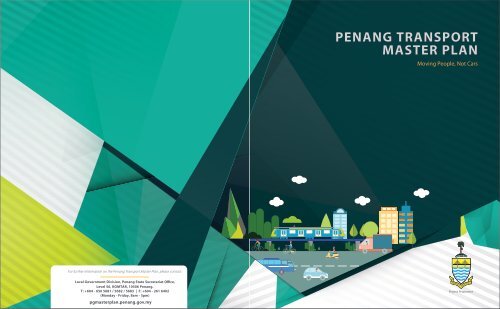
PENANG TRANSPORT<br />
MASTER PLAN<br />
Moving People, Not Cars<br />
For further information on the Penang Transport Master Plan, please contact:<br />
Local Government Division, Penang State Secretariat Office,<br />
Level 56, KOMTAR, <strong>10</strong>506 Penang.<br />
T: +604 - 650 5681 / 5682 / 5683 | F: +604 - 261 6402<br />
(Monday - Friday, 8am - 5pm)<br />
pgmasterplan.penang.gov.my<br />
Project Proponent
PENANG TRANSPORT MASTER PLAN<br />
PENANG SOUTH RECLAMATION<br />
The Penang State Government’s holistic<br />
development vision that offers a solution to<br />
the worsening traffic congestion will also deliver<br />
significant economic and social benefits<br />
to the State of Penang over the long term.<br />
The central premise of Penang State Government’s<br />
strategy is simple – to achieve a public: private<br />
transport modal share of 60:40 by the year 2030.<br />
<strong>PTMP</strong> is a transport blueprint consisting of elevated<br />
Light Rail Transit, Monorail, Bus Rapit Transit,<br />
tram, catamaran, taxis and buses to meet Penang’s<br />
long term needs.<br />
The <strong>PTMP</strong> is the result of comprehensive<br />
engagement with all stakeholder to obtain<br />
valuable feedback and suggestions. It is a<br />
master plan to guide planners, local councils<br />
and stakeholders who are engaging in current<br />
and future development planning of Penang.<br />
In solving Penang’s transport problems, the<br />
<strong>PTMP</strong> will also create significant economic<br />
and employment benefits to Penang in a<br />
sustainable manner through the proposed<br />
creation of three reclaimed islands in the<br />
southern coast of Penang Island.<br />
1<br />
<strong>PTMP</strong> REFLECTS THE PENANG<br />
STATE GOVERMENT’S COMMITMENT TO:<br />
• Mitigate worsening congestion<br />
• Improve connectivity<br />
• Improve Penang’s standard or living<br />
and liveability<br />
• Enhance Penang’s appeal as an ideal business and<br />
leisure destination<br />
The <strong>PTMP</strong> and its funding model – the Penang South Reclamation (PSR)<br />
– combined forms a transformative development master plan that would<br />
render Penang as the destination of choice for industry, business,<br />
education, leisure and residence in the next 50 years.<br />
As the State’s top development priority, the <strong>PTMP</strong> and PSR will keep<br />
Penang’s economic engines humming, help move it up the value chain to<br />
uplift the people’s income opportunities, realis Penang’s full growth<br />
potential.<br />
Key catalysts to Penang’s economic dynamism:<br />
• Expansion of the 40-year-old Bayan Lepas Free Industrial Zone to<br />
further enhance high-tech R&D, value-added manufacturing<br />
and innovation<br />
• Smart City – the future hub of Penang<br />
• Economic benefits:<br />
20%<br />
Contributes additional:<br />
annually to Penang’s GDP from investments<br />
in manufacturing & services sectors by 2050<br />
• Economic spin-offs:<br />
2.5x multiplier<br />
during construction<br />
Productivity<br />
gains<br />
Supports:<br />
300,000<br />
jobs from investments & developments<br />
in manufacturing & services sectors by 2050<br />
Savings from<br />
time travel / vehicle<br />
operating cost<br />
2-IN1 SOLUTION TO<br />
PENANG’S CHALLENGES<br />
<strong>PTMP</strong> and PSR addresses two<br />
primary hurdles to Penang’s<br />
continued successful development<br />
as a thriving economic powerhouse<br />
in the northern Peninsular<br />
region, namely:<br />
• Lack of good quality, readily<br />
developable land for industrial<br />
and commercial expansion,<br />
and quality affordable homes<br />
to house the growing<br />
population.<br />
• Deteriorating traffic<br />
congestion from inadequate<br />
infrastructure and transport<br />
network.<br />
• Haphazard and ad hoc<br />
developments that threaten<br />
the heritage charm of<br />
Penang Island.<br />
2
PENANG AT A GLANCE<br />
Penang is located in the<br />
northwestern part of<br />
Peninsular Malaysia.<br />
This state is divided into<br />
two parts it is island and<br />
Seberang Prai separated<br />
by the Straits of Malacca.<br />
Seberang Prai is bordered:<br />
i. Kedah in the east<br />
ii. Perak in the south.<br />
QUICK INFO<br />
• Capital George Town<br />
• UNESCO World Heritage Site<br />
• Domestic and international<br />
arrivals at 6 mil (2015)*<br />
• #1 growth rate for per capital<br />
growth in GDP (2014-2015)<br />
• One of the most urbanized and<br />
industrialised states in Malaysia<br />
* Source: Penang Global Tourism<br />
PERCENTAGE SHARE OF<br />
ECONOMIC ACTIVITIES, 2014<br />
50%<br />
Services<br />
3<br />
Area (km2)*<br />
Population (million)<br />
2012 2013 2014 2015 <strong>2016</strong><br />
1,031 1,031 1,031 1,031<br />
Total<br />
1.63 1.66 1.68 1.70 1.72 e<br />
Male 0.81 0.84 0.85 0.86 0.87 e<br />
Female 0.81 0.83 0.83 0.84 0.85 e<br />
Average Annual Population<br />
Growth Rate (%)<br />
1.5 2.4 0.9 1.2 1.2 e<br />
Gross Domestic Product (GDP)<br />
GDP at constant 20<strong>10</strong> prices<br />
(RM million) 61,324 66,220 e 69,844 p<br />
GDP per capita at current prices (RM) 38,490 42,130 e 44,847 p<br />
GDP Growth (%) 4.5 5.1 8.0 e 5.5 p<br />
Employment 2<br />
Labour Force ('000) 795.8 826.1 852.5 848.1<br />
Employed ('000) 779.8 811.9 839.2 834.2<br />
Unemployed ('000) 16.0 14.2 13.3 14.0<br />
Labour Force Participation Rates,<br />
LFPR (%)<br />
Total 68.9 69.4 71.0 69.9<br />
Male 81.1 81.3 80.6 80.6<br />
Female 56.7 57.5 61.3 59.0<br />
Unemployment Rate (%) 2.0 1.7 1.6 1.6<br />
Note:<br />
1. 2012-<strong>2016</strong>: Population Estimates based on the adjusted Population and Housing Census of Malaysia 20<strong>10</strong>.<br />
2. Starting 2011, the labour force statistics are estimated based on the latest current population estimates.<br />
Therefore the annually statistics labour force time series is updated.<br />
3. p - Preliminary.<br />
4. e - Estimate.<br />
5. The added total may differ due to rounding.<br />
6. GDP per capita in 2012 has been <strong>revised</strong> based on the latest population estimates from the Census of<br />
Population and Housing 20<strong>10</strong>.<br />
* Source: Department of Survey and Mapping Malaysia.<br />
GDP<br />
RM 66.22 BIL<br />
2014<br />
6%<br />
Construction, Agriculture,<br />
Mining & Quarrying<br />
& Import Duties<br />
44%<br />
Manufacturing<br />
PENANG<br />
TRANSPORT<br />
MASTER PLAN<br />
Island C<br />
Island B<br />
PUBLIC TRANSPORT<br />
PENANG ISLAND<br />
Bayan Lepas<br />
LRT<br />
Bayan Lepas extension to Penang South Reclamation<br />
LRT<br />
Ayer Itam<br />
Monorail<br />
Tanjong Tokong<br />
Monorail<br />
George Town<br />
Tram<br />
Proposed feeder bus network:<br />
• To fill gaps between LRT/ monorail lines which are just 3 km apart<br />
• Bus routes are flexible and can be adjusted to suit ridership demand<br />
PENANG ISLAND & MAINLAND CONNECTION<br />
George Town - Butterworth<br />
LRT<br />
PENANG MAINLAND<br />
Proposed feeder bus network to support KTM commuter services<br />
Raja Uda - Sg Nyiur - Bukit Mertajam - Permatang Tinggi<br />
Monorail<br />
Extension northwards to Kepala Batas<br />
BRT<br />
Permatang Tinggi - Batu Kawan<br />
BRT<br />
Extension northwards to Bukit Tengah / Seberang Jaya<br />
BRT<br />
Extension southwards to Nibong Tebal<br />
BRT<br />
PIL 2<br />
Balik<br />
Pulau<br />
Relau IC<br />
Penang South Reclamation<br />
HIGHWAY IMPROVEMENTS<br />
PENANG ISLAND<br />
Pan Island Links<br />
North Coastal Pair Road (Eastern & Western Sections)<br />
Ayer Itam – Lebuhraya Tun Dr Lim Chong Eu Bypass<br />
Persiaran Gurney – Lebuhraya Tun Dr Lim Chong Eu Bypass<br />
PENANG ISLAND & MAINLAND CONNECTION<br />
Penang Third Link (Undersea Tunnel)<br />
PENANG MAINLAND<br />
Upgrading of BKE interchange<br />
Upgrading of Juru interchange<br />
North-South Expressway link (future bypass)<br />
“Missing links” in Seberang Perai’s local road network at<br />
Permatang Pasir – Perda & Bukit Minyak areas<br />
Ayer Itam<br />
Monorail<br />
Pan Island<br />
Link 1<br />
Paya<br />
Terubong IC<br />
Awang IC<br />
* Certain components to be implemented by the respective Penang State Goverment Agencies<br />
North Coast<br />
Pair Road<br />
Utama IC<br />
Bayan<br />
Baru<br />
Airport<br />
Bayan<br />
Lepas LRT<br />
Island A<br />
PIL 2A<br />
Tg Tokong<br />
Monorail<br />
LCE IC<br />
Gurney<br />
IC<br />
Sea Tunnel<br />
Tram<br />
Catamaran<br />
KOMTAR<br />
Sky Cab<br />
Kepala Batas<br />
Raja Uda –<br />
BM Monorail<br />
Sungai Dua<br />
Penang<br />
Sentral<br />
George Town –<br />
Butterworth<br />
LRT<br />
Raja<br />
Uda<br />
Sunway Carnival<br />
Mall<br />
BKE IC<br />
Prai<br />
Note: Transit alignment & system<br />
are subject to review prior<br />
to implementation<br />
Tmn<br />
Supreme<br />
Juru IC<br />
Bkt<br />
Tengah<br />
Pmtg<br />
Pasir<br />
UiTM Pulau<br />
Pinang<br />
Bdr<br />
Perda<br />
Taman<br />
Indah<br />
Penanti<br />
Bkt Minyak<br />
P/Tinggi – Batu<br />
Kawan BRT<br />
Stadium Batu<br />
Kawan<br />
Bkt<br />
Mertajam<br />
KTM Komuter<br />
Jln<br />
Maju<br />
Pmtg Tinggi<br />
Simpang Ampat<br />
PLANNING & DELIVERY<br />
The <strong>PTMP</strong> is designed under a 50-year planning<br />
timeframe to cater to future travel demand<br />
arising from Penang’s economic, tourism,<br />
population and employment growth.<br />
The aim is to provide a comprehensive<br />
multi-modal integrated system to encourage<br />
gradual shift towards the use of public transport,<br />
while alleviating congestion on the existing road<br />
networks.<br />
The first project components identified with the<br />
highest economic viability for delivery are the<br />
Bayan Lepas LRT and the Pan Island Link 1.<br />
Implementation of eachproject component<br />
in <strong>PTMP</strong> will depend on its economic viability<br />
and funding availability.<br />
The scale and complexity of the <strong>PTMP</strong> and PSR<br />
comes with it significant risk of delays and cost<br />
overruns. To protect the public interest, the <strong>PTMP</strong><br />
and PSR projects will be implemented via the<br />
Project Delivery Partner model to exclude the<br />
delivery risk (time and cost) out of the projects.<br />
Alma<br />
4<br />
Kulim
Gurney<br />
IC<br />
Utama IC<br />
Sea Tunnel<br />
KOMTAR<br />
BAYAN<br />
LEPAS<br />
LRT<br />
PAN<br />
ISLAND<br />
LINKS<br />
Legend:<br />
Interchange for PIL 1<br />
Interchange for PIL 2 and 2A<br />
PIL 2<br />
Balik<br />
Pulau<br />
Paya<br />
Terubong IC<br />
Relau IC<br />
Pan Island<br />
Link 1<br />
Jln Tun<br />
Sardon<br />
Awang IC<br />
Relau<br />
Length (km) 30<br />
No of Stations 27<br />
Airport<br />
LCE IC<br />
Island C Island B Island A<br />
Penang South Reclamation<br />
Legend:<br />
Station<br />
Interchange station<br />
Note: Transit alignment & system subject to review<br />
prior to implementation<br />
Island C<br />
Island B<br />
Penang South Reclamation<br />
Island A<br />
PIL 2A<br />
BAYAN LEPAS LRT<br />
PAN ISLAND LINK 1<br />
The Bayan Lepas LRT will form the main north-south<br />
rail backbone on Penang Island. As the first LRT<br />
system in Penang, it provides direct airport transit<br />
from Penang International Airport to major<br />
destinations on Penang Island and terminates at the<br />
future Penang South Reclamation (PSR) Smart City.<br />
It will also have future connectivity to mainland<br />
Penang through integration with the future<br />
George Town-Butterworth LRT.<br />
FACTS AND FIGURES<br />
The Bayan Lepas LRT line will be served by a feeder<br />
bus network within a 3-kilometre radius to ferry<br />
commuters to and from the stations.<br />
The Pan Island Link 1 (PIL 1) is a strategic alternative<br />
bypass to alleviate heavy traffic load on the Tun Dr<br />
Lim Chong Eu Expressway (LCE) and major adjacent<br />
arterial roads.<br />
Besides enhancing accessibility to major residential<br />
and commercial hubs, PIL 1 opens up opportunities<br />
for future land development on the western and<br />
southern side of Penang Island.<br />
FACTS AND FIGURES<br />
PIL 1 is built around<br />
the developed<br />
periphery of George<br />
Town, to disperse<br />
traffic away from the<br />
congested city centre<br />
by segregating local<br />
from regional traffic.<br />
Length<br />
29.5km<br />
Number<br />
of stations<br />
27<br />
P<br />
Stations with Park<br />
& Ride facilities<br />
8<br />
TOLL-FREE<br />
HIGHWAY<br />
2,000<br />
VEHICLES<br />
6 INTERCHANGES 20 KM<br />
15<br />
MINUTES<br />
Purpose-built highway with Per lane per hour Linking all highly-populated PIL 1 serves as a strategic Travel time between<br />
limited points of access to per direction.<br />
and transport hubs on the bypass segregating regional Gurney Drive and the<br />
ensure certainty in speed<br />
Penang Island from the traffic from local traffic that airport, compared<br />
and travel time over the 1 DEDICATED Second Penang Bridge and not only allows for better with the current 45<br />
Estimated<br />
Serves a<br />
entire length of the highway.<br />
Penang International Airport traffic dispersal but also minutes under normal<br />
end-to-end<br />
catchment<br />
Estimated<br />
Service<br />
BUS LANE<br />
The alignment along the<br />
all the way towards Bayan improves accessibility to traffic conditions on<br />
journey time<br />
population of<br />
daily ridership<br />
frequency<br />
mountainous terrain also A dedicated bus Baru, Relau, Paya Terubong various areas along the the Tun Dr Lim Chong<br />
53min<br />
600,000<br />
116,000<br />
3 mins<br />
avoids the possibility of lane to improve public and George Town.<br />
north-south corridor Eu Expressway (LCE)<br />
(additional 400,000<br />
congestions caused by transport between<br />
of Penang Island.<br />
upon completion.<br />
45 sec<br />
from future Penang<br />
future developments.<br />
residential and<br />
5 South Reclamation)<br />
commercial hubs.<br />
6
GAME CHANGER FOR PENANG<br />
ISLAND C<br />
ISLAND B<br />
ISLAND A<br />
STRENGTHENING<br />
ECONOMIC DYNAMISM,<br />
SOCIAL INCLUSION<br />
AND LIVEABILITY<br />
BUSINESS MODEL<br />
PROPOSED LAND USE COMPOSITION FOR PSR<br />
Land Use<br />
Islands (acre)<br />
Total<br />
A B C (acres)<br />
1 Residential 557 348 346 1,252<br />
2 Commercial 116 99 0 215<br />
3 Mixed Developments 7 313 154 476<br />
4 Industrial 713 0 0 713<br />
5 Public Amenities 187 93 51 331<br />
6 Open Spaces & Parks 347 215 99 662<br />
7 Infrastructure & Utilities 370 330 147 848<br />
2,300 1,400 800 4,500<br />
The proposed PSR development is expected to generate an<br />
additional population of at least 446,000 in Penang by the year 2030.<br />
The State Planning Committee on 20th June <strong>2016</strong> had principally<br />
approved the Penang State Structure Plan 2020 Survey Report and<br />
the proposed indicative plan to integrate PSR and <strong>PTMP</strong> into the<br />
Penang State Draft Sructure Plan 2030.<br />
7<br />
RECLAMATION<br />
TIMEFRAME<br />
The PSR reclamation project<br />
will be carried out over a proposed<br />
15-year period.<br />
Island A Year 1 - 7<br />
Island B Year 4 - 12<br />
Island C Year 8 - 15<br />
1. A new sustainable strategic hub to<br />
decentralise development pressure away<br />
from George Town.<br />
2. The development will provide the<br />
nucleus for:<br />
- Provision of affordable housing close<br />
to employment<br />
- Space for industrial expansion next to the<br />
Bayan Lepas Free Industrial Zone<br />
- Land for green open space and<br />
recreational purposes<br />
- Create new cultural destinations<br />
3. Better utilisation of existing and future<br />
infrastructure:<br />
- Penang 2nd Bridge<br />
- Penang International Airport<br />
- New Bayan Lepas LRT line<br />
- New Pan Island Links<br />
4. Facilitates jobs creation.<br />
5 Moves industries up the value chain via<br />
high-tech R&D and academic hub<br />
through FDIs.<br />
The <strong>PTMP</strong> will primarily be funded through the sale<br />
of Penang South Reclamation (PSR) land.<br />
Other forms of funding include monetising of land<br />
made available by the State Government or<br />
contributions from Government funding.<br />
All <strong>PTMP</strong> components – including Bayan Lepas LRT and<br />
PIL 1 Highway – will be implemented independently.<br />
Work packages in each <strong>PTMP</strong> component & PSR<br />
reclamation works will be tendered out via open tender.<br />
Monetise<br />
State land<br />
Sale of<br />
PSR land<br />
(land<br />
auction)<br />
Government<br />
funding<br />
4,500 acres<br />
reclaim land<br />
PSR<br />
reclamation<br />
Sales<br />
Proceeds<br />
Penang TMP<br />
8
FUTURE CITY FOR ALL<br />
The reclaimed islands from PSR will be developed<br />
into a Smart City, positioning the new southern<br />
hub as the preferred destination for investors,<br />
commerce and talent, while preserving the<br />
sanctity of Penang’s heritage legacy in<br />
George Town.<br />
A future city envisioned for all, Smart City is<br />
comprehensively masterplanned to provide the<br />
right conditions that would shape the way of life<br />
for Penangites in the coming years where efficient<br />
transport is right in front of the doorstep and<br />
places for employment or higher learning are<br />
just a stone’s throw away.<br />
Smart City not only enables a smarter way of<br />
living for the people, but opens up new<br />
opportunities identified under the National Key<br />
Economic Areas (NKEAs) of Malaysia’s Economic<br />
Transformation Programme benefiting the<br />
development of the nation.<br />
SMART CITY – A BETTER LIFE<br />
• A greener and sustainable<br />
living environment.<br />
• Creates a competitive business &<br />
industrial economy.<br />
• Attract and retain talents.<br />
• Affordable houses for the growing population.<br />
SUSTAINING PENANG’S<br />
GROWTH MOMENTUM<br />
SMART GOVERNANCE<br />
and participatory<br />
SMART MOBILITY<br />
& CONNECTIVITY<br />
SMART<br />
ENVIRONMENT<br />
Climate responsive,<br />
low carbon,<br />
integrated and<br />
multi-functional<br />
SMART<br />
CITY<br />
for<br />
PSR<br />
well-connected<br />
SMART<br />
PEOPLE<br />
Healthy, skillful<br />
and knowledgeable<br />
SMART LIVING<br />
High quality of life,<br />
opportunities for live,<br />
learn, work<br />
and play<br />
SMART ECONOMY<br />
Well supported eco-system<br />
of business and industrial<br />
clusters<br />
RM<br />
RM<br />
RM<br />
9





![[Exhibit 6] Tunnelling Virtual Reality Walk](https://img.yumpu.com/62890814/1/184x260/exhibit-6-tunnelling-virtual-reality-walk.jpg?quality=85)
![[Exhibit 2] Autonomous Tunnel Boring Machine](https://img.yumpu.com/62883468/1/190x107/exhibit-2-autonomous-tunnel-boring-machine.jpg?quality=85)
![[Exhibit 1] Tunnelling Centralised Command Control Centre (TC4) Statistics](https://img.yumpu.com/62879681/1/190x107/exhibit-1-tunnelling-centralised-command-control-centre-tc4-statistics.jpg?quality=85)


