Smoky Mountains Around Town / November 2018
What To See And Where To Be In The Smokies!
What To See And Where To Be In The Smokies!

Create successful ePaper yourself
Turn your PDF publications into a flip-book with our unique Google optimized e-Paper software.
Page 10 <strong>Around</strong> <strong>Town</strong><br />
Biodiversity Inventory Reaches 1,000 New Species Mark<br />
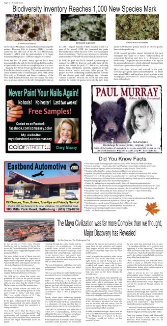
Lecanora sachsiana<br />
Great <strong>Smoky</strong> <strong>Mountains</strong> National Park and its non-profit<br />
partner, Discover Life in America (DLIA), recently<br />
celebrated the 20th year of the All Taxa Biodiversity<br />
Inventory (ATBI) with the announcement of a major<br />
milestone of the project - 1,000 new species to science!<br />
Over the last 20 years, many species have been<br />
documented in the park for the first time, but the number<br />
of species discovered that are completely new to science<br />
- meaning they haven’t been documented anywhere on<br />
Earth before - is truly amazing. The most recent additions<br />
come from the work of lichenologists Erin Tripp, of the<br />
University of Colorado, and James Lendemer, of the<br />
New York Botanical Garden, who have added five more<br />
new-to-science species to the tally, bringing the total up<br />
pertusaria superiana<br />
to 1,000. The past 10 years of their research, which is a<br />
part of the overall ATBI, has increased the parks<br />
knowledge of its lichen fauna by 130% over the original<br />
diversity estimates. The five new lichens were named to<br />
commemorate NPS staff who played a role in their work.<br />
In 1998, the park and DLIA formed a partnership to<br />
conduct the ATBI to discover and understand all the<br />
species that inhabit the park’s 522,000 acres, including<br />
plants, fungi, millipedes, crayfish, tardigrades (water<br />
bears), worms, insects, and many other groups. The<br />
project involves cooperating scientists from all over the<br />
US and abroad, park staff, students, and volunteer<br />
“citizen scientists.” Overall, the ATBI has more than<br />
doubled the number of species known to the park, from<br />
Leprocaulon nicholsiae<br />
about 9,300 historic species records to 19,866 species<br />
known to the park today.<br />
ATBI research provides crucial information for park<br />
managers and leads to a better understanding of<br />
ecosystem function and how it is dependent on<br />
biodiversity. The project involves students of all ages in<br />
the process of discovery, which ultimately inspires them<br />
to be the next generation of park stewards.<br />
More info about science and research in the park:<br />
www.nps.gov/grsm/learn/scienceresearch. To learn<br />
more about DLIA, and learn how to get involved in the<br />
ATBI project: 865-430-4757, visit www.dlia.org, or find<br />
them on Facebook.<br />
Never Paint Your Nails Again!<br />
No tools ! No heater ! Last two weeks !<br />
Free Samples!<br />
Contact me on Facebook:<br />
facebook.com/ccmassey.color<br />
My website:<br />
mycolorstreet.com/ccmassey<br />
Cheryl Massey<br />
Eastbend Automotive<br />
Oil Changes, Tires, Brakes, Tune-Ups and Friendly Service!<br />
(Next to 1885 East Parkway, at the corner of Highway 321 and Mills Park Road)<br />
103 Mills Park Road, Gatlinburg • (865) 325-8266<br />
Did You Know Facts:<br />
• Your shoes are the first thing people subconsciously notice about you. Wear nice shoes.<br />
• If you sit more than 11 hours a day, there’s a 50% chance you will die within the next 3 years.<br />
• There are at least 6 people in the world who look exactly like you. There’s is 9%.<br />
• Sleeping without a pillow reduces back pain and keeps your spine stronger.<br />
• A person’s height is determined by their father, and their weight is determined by their mother.<br />
• If a part of your body falls asleep you can almost always wake it up by shaking your head.<br />
• There are three things the human brain cannot resist noticing - food, attractive people and danger.<br />
• Right handed people tend to chew food on their right side.<br />
• Putting dry tea bags in gym bags and/or smelly shoes will absorb the unpleasant odor.<br />
• Albert Einstein said, if honey bees were to disappear from earth humans would be dead in 4 years<br />
• So many kinds of apples...if you ate a new one every day it would take 20 years to try them all.<br />
• You can survive without eating for weeks, but you will only live 11 days without sleep.<br />
• People who laugh a lot are healthier than those who don’t.<br />
• Laziness and inactivity kills just as many people as smoking.<br />
• A human brain has capacity to store as much as 5 times as much information as Wikipedia.<br />
• Our brain uses the same amount of power as a 10 watt light bulb.<br />
• Our body gives enough heat in 30 minutes to boil 1.5 liters of water.<br />
• The ovum egg is the largest cell and the sperm is the smallest cell.<br />
• Stomach acid is strong enough to dissolve razor blades.<br />
• Smile...it is the ultimate antidepressant.<br />
In the autumn of 1929, Anne Morrow<br />
Lindbergh and her husband Charles flew<br />
across the Yucatán Peninsula. With Charles at<br />
the controls, Anne snapped photographs of the<br />
jungles just below.<br />
She wrote in her journal of Maya structures<br />
obscured by large humps of vegetation. A<br />
bright stone wall peeked through the leaves,<br />
"unspeakably alone and majestic and desolate<br />
- the mark of a great civilization gone."<br />
Nearly a century later, surveyors once again<br />
took flight over the ancient Maya empire, and<br />
mapped the Guatemala forests with lasers.<br />
The 2016 survey, whose first results were<br />
published this week in the journal Science,<br />
comprises a dozen plots covering 830 square<br />
miles, an area larger than the island of Maui.<br />
The largest survey of the Maya region, ever.<br />
The study authors describe the results as a<br />
revelation. "It's like putting glasses on when<br />
your eyesight is blurry," said study author<br />
Mary Jane Acuña, director of El Tintal<br />
Archaeological Project in Guatemala.<br />
In the past, archaeologists had argued that<br />
small, disconnected city-states dotted the<br />
Maya lowlands, though that conception is<br />
falling out of favor.<br />
This study shows that the Maya could<br />
extensively "exploit and manipulate" their<br />
environment and geography, Acuña said.<br />
Maya agriculture sustained large populations,<br />
who in turn forged relationships across the<br />
region.<br />
The Maya Civilization was far more Complex than we thought,<br />
Major Discovery has Revealed<br />
by Ben Guarino, The Washington Post<br />
Combing through the scans, Acuña and her<br />
colleagues, an international 18-strong<br />
scientific team, tallied 61,480 structures.<br />
These included: 60 miles of causeways, roads<br />
and canals that connected cities; large maize<br />
farms; houses large and small; and,<br />
surprisingly, defensive fortifications that<br />
suggest the Maya came under attack from the<br />
west of Central America.<br />
"We were all humbled," said Tulane University<br />
anthropologist Marcello Canuto, the study's<br />
lead author.<br />
"All of us saw things we had walked over and<br />
we realized, oh wow, we totally missed that."<br />
Preliminary images from the survey went<br />
public in February, to the delight of<br />
archaeologists like Sarah Parcak. Parcak, who<br />
was not involved with the research, wrote on<br />
Twitter, "Hey all: you realize that researchers<br />
just used lasers to find 60,000 new sites in<br />
Guatemala? This is HOLY [expletive]<br />
territory.”<br />
Parcak, whose space archaeology program<br />
GlobalXplorer.org has been described as the<br />
love child of Google Earth and Indiana Jones,<br />
is a champion of using satellite data to<br />
remotely observe sites in Egypt and elsewhere.<br />
“The scale of information that we're able to<br />
collect now is unprecedented," Parcak said,<br />
adding that this survey is "going to upend longheld<br />
theories about ancient Maya society.”<br />
With support from a Guatemala-based heritage<br />
foundation called Pacunam, the researchers<br />
conducted the massive and expensive survey<br />
using lidar, or light detection and ranging.<br />
They mapped several active archaeological<br />
sites, plus well-studied Maya cities like Tikal<br />
and Uaxactun.<br />
Lidar's principles are similar to radar, except<br />
instead of radio waves lidar relies on laser<br />
light. From an aircraft flying just a few<br />
thousand feet above the canopy, the surveyors<br />
prickled each square meter with 15 laser<br />
pulses. Those pulses penetrate vegetation but<br />
bounce back from hard stone surfaces. Using<br />
lidar, you can't see the forest through the<br />
invisible trees.<br />
Beneath the thick jungle, ruins appeared. Lots<br />
and lots of them. Extrapolated over the 36,700<br />
square miles, which encompasses the total<br />
Maya lowland region, the authors estimate the<br />
Maya built as many as 2.7 million structures.<br />
These would have supported 7 million to 11<br />
million people during the Classic Period of<br />
Maya civilization, around the years 650 to 800,<br />
in line with other Maya population estimates.<br />
Archaeologist Arlen Chase, a Maya specialist<br />
at the University of Nevada at Las Vegas who<br />
was not involved with this survey, said for<br />
years he has argued that the Maya society was<br />
more complex than widely accepted.<br />
In 1998, he and archaeologist Diane Chase, his<br />
wife, described elaborate agricultural terraces<br />
at the Maya city of Caracol in Belize.<br />
"Everybody would not believe we had<br />
terraces!" he said.<br />
He gets much less push back now, he said.<br />
"The paradigm shift that we've predicted was<br />
happening is in fact happening" Chase said,<br />
which he credits to lidar data. He has seen lidar<br />
evolve from a "hush-hush type of technology"<br />
used by the military to map Fallujah streets to a<br />
powerful archaeological tool.<br />
Chase, who previously used lidar at Caracol,<br />
where as many as 100,000 people lived,<br />
compares this technology to carbon-14 dating.<br />
Radiocarbon dating gives archaeologists a<br />
much more accurate timeline.<br />
L i d a r i s a b o u t t o d o t h e s a m e f o r<br />
archaeologists' sense of space, particularly in<br />
densely forested areas near the equator. Two<br />
years ago, researchers used lidar mapped<br />
dense urban infrastructure around Angkor, the<br />
seat of the medieval Khmer Empire in<br />
Cambodia.<br />
For all its power, lidar cannot supplant oldfashioned<br />
archaeology. For 8 percent of the<br />
survey area, the archaeologists confirmed the<br />
lidar data with boots-on-the-ground visits.<br />
This "ground truthing" suggests that the lidar<br />
analysis was conservative - they found the<br />
predicted structures, and then some.<br />
"There is still much more ground to cover and<br />
work to do," said Acuña, who will continue to<br />
study the large ancient Maya city of El Tindal.<br />
Could you imagine, Canuto said, what might<br />
be found through a lidar survey of the<br />
Amazon? With technology like this, no<br />
forested frontiers are final.