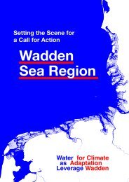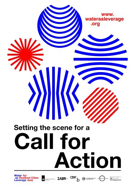
Water as Leverage- Setting the scene for a call for action
- No tags were found...

Create successful ePaper yourself
Turn your PDF publications into a flip-book with our unique Google optimized e-Paper software.
www.<br />
water<strong>as</strong>leverage<br />
.org<br />
<strong>Setting</strong> <strong>the</strong> <strong>scene</strong> <strong>for</strong> a<br />
Call <strong>for</strong><br />
Action
<strong>Setting</strong> <strong>the</strong> Scene <strong>for</strong> a Call <strong>for</strong> Action<br />
Commissioners<br />
Ne<strong>the</strong>rlands Enterprise Agency (RVO.nl) on behalf of <strong>the</strong> Ministry of Foreign Affairs<br />
Henk Ovink, Special Envoy <strong>for</strong> International <strong>Water</strong> Affairs<br />
<strong>Water</strong> <strong>as</strong> <strong>Leverage</strong> Initiative<br />
Henk Ovink, Special Envoy <strong>for</strong> International <strong>Water</strong> Affairs<br />
Asian Infr<strong>as</strong>tructure Investment Bank<br />
International Architecture Biennale Rotterdam<br />
Architecture Workroom Brussels<br />
Support<br />
100 Resilient Cities<br />
Dutch Ministry of Infr<strong>as</strong>tructure and <strong>Water</strong> Management<br />
Global Centre of Excellence on Climate Adaptation<br />
UN/World Bank High Level Panel on <strong>Water</strong><br />
Editors<br />
Henk Ovink, Special Envoy <strong>for</strong> International <strong>Water</strong> Affairs<br />
Ne<strong>the</strong>rlands Enterprise Agency<br />
Architecture Workroom Brussels<br />
Prospective Research<br />
FABRICations<br />
Architecture Workroom Brussels<br />
Expert Input<br />
100 Resilient Cities<br />
Deltares<br />
PBL<br />
Graphic Design<br />
www.gestalte.be<br />
Publisher<br />
Ne<strong>the</strong>rlands Enterprise Agency<br />
Image Credits<br />
Part 1: all images by Architecture Workroom Brussels *<br />
Part 2: all images by FABRICations **<br />
* Except <strong>for</strong> pages 16-17, 32-33, 36-37, 40-41, 44-45, 50-51, 54-55, 62-63, 66-67,<br />
74-75, 78-79: images produced by FABRICations and edited by Architecture<br />
Workroom Brussels<br />
** Except <strong>for</strong> pages 152-153, 220-221, 234-235, 248-249: images produced by<br />
Architecture Workroom Brussels<br />
The Challenge<br />
<strong>Water</strong> represents humanity’s most<br />
challenging and complex risk. Floods and<br />
droughts, pollution and conflicts related to<br />
water combine in conceivably dis<strong>as</strong>trous<br />
ways with rapid urbanization, a growing<br />
demand <strong>for</strong> food and energy, migration, and<br />
climate change. This makes water one of <strong>the</strong><br />
greatest risks to economic progress, poverty<br />
eradication and sustainable development.<br />
Floods and droughts already impose huge<br />
social and economic costs around <strong>the</strong><br />
world, and climate variability will make water<br />
extremes worse. If <strong>the</strong> world continues on its<br />
current path, projections suggest that we may<br />
face a 40% shortfall in water availability by<br />
2030. This means that <strong>the</strong> global water crisis<br />
can be considered <strong>the</strong> biggest threat facing <strong>the</strong><br />
planet over <strong>the</strong> next decade.<br />
That is why, in 2016, United Nations<br />
Secretary General Ban Ki-moon and World<br />
Bank President Jim Yong Kim convened a High<br />
Level Panel on <strong>Water</strong> (HLPW) with 11 sitting<br />
Heads of State and Government, including<br />
<strong>the</strong> Dutch Prime Minister Rutte, to help put<br />
water higher on <strong>the</strong> global agenda and work on<br />
interventions and investments. On 14 March<br />
2<br />
Introduction<br />
3
<strong>Water</strong> <strong>as</strong> <strong>Leverage</strong> <strong>for</strong> Resilient Cities Asia<br />
<strong>Setting</strong> <strong>the</strong> Scene <strong>for</strong> a Call <strong>for</strong> Action<br />
<strong>the</strong> HLPW presented its report ‘Making every<br />
drop count’ to <strong>the</strong> world with a <strong>call</strong> to <strong>action</strong>.<br />
Building on this global awareness,<br />
we also need to see water’s strengths in<br />
connecting people and making <strong>the</strong>m inter -<br />
dependent <strong>as</strong> an opportunity. The time<br />
h<strong>as</strong> come to use water <strong>as</strong> leverage <strong>for</strong><br />
impactful and catalytic change. This requires<br />
a balanced match between long-term<br />
comprehensive urban planning and shortterm<br />
innovative trans<strong>for</strong>mations, and between<br />
ambitious climate adaptation plans and<br />
bankable projects. Vulnerable cities must be<br />
trans<strong>for</strong>med into resilient ones, while at <strong>the</strong><br />
same time developing greater knowledge<br />
of <strong>the</strong> water system and learning to build<br />
greater capacity among both institutions and<br />
individuals. There<strong>for</strong>e result-driven, inclusive<br />
and transparent collaboration is essential,<br />
across all sectors, all layers of government, all<br />
stakeholders – from activists and vulnerable<br />
communities to private and public institutions.<br />
The challenge is to bridge <strong>the</strong> gap<br />
between plans and projects and between a<br />
siloed technocratic approach and an inclusive<br />
process that connects all stakeholders from<br />
day one. The biggest t<strong>as</strong>k is to develop an<br />
approach where those who implement and<br />
fund <strong>the</strong> projects are part of <strong>the</strong> conception of<br />
<strong>the</strong>se projects <strong>as</strong> well, to ensure that innovative<br />
and catalytic projects do not fall between<br />
<strong>the</strong> cracks of <strong>the</strong> process of evaluation and<br />
standardization. We cannot repeat our p<strong>as</strong>t<br />
mistakes and continue to make investments<br />
in isolated projects that aim to deal with <strong>the</strong><br />
dis<strong>as</strong>ters of yesterday but actually lead to even<br />
worse dis<strong>as</strong>ters tomorrow. We have to start<br />
funding innovative and trans<strong>for</strong>mative projects<br />
that link everything toge<strong>the</strong>r and thus meet<br />
<strong>the</strong> Sustainable Development Goals (SDGs) of<br />
<strong>the</strong> United Nations and <strong>the</strong> Paris Agreement’s<br />
climate ambitions, and that help change <strong>the</strong><br />
world and <strong>the</strong> system from <strong>the</strong> ground up.<br />
The Initiative: <strong>Water</strong> <strong>as</strong> <strong>Leverage</strong><br />
To take up this challenge, <strong>the</strong> Special<br />
Envoy <strong>for</strong> International <strong>Water</strong> Affairs, Henk<br />
Ovink, initiated <strong>Water</strong> <strong>as</strong> <strong>Leverage</strong>. O<strong>the</strong>r<br />
partners of this initiative are <strong>the</strong> Dutch Ministry<br />
of Foreign Affairs, <strong>the</strong> Dutch Enterprise<br />
Agency, <strong>the</strong> Dutch Minister of Infr<strong>as</strong>tructure<br />
and <strong>Water</strong>, <strong>the</strong> Asian Infr<strong>as</strong>tructure Investment<br />
Bank, <strong>the</strong> Global Centre of Excellence on<br />
4 Introduction<br />
Introduction<br />
5
<strong>Water</strong> <strong>as</strong> <strong>Leverage</strong> <strong>for</strong> Resilient Cities Asia<br />
<strong>Setting</strong> <strong>the</strong> Scene <strong>for</strong> a Call <strong>for</strong> Action<br />
Climate Adaptation, Architecture Workroom<br />
Brussels, <strong>the</strong> International Architecture<br />
Biennale and 100 Resilient Cities. <strong>Water</strong> <strong>as</strong><br />
<strong>Leverage</strong> launched its first program at <strong>the</strong><br />
23rd Climate Conference in Bonn: ‘<strong>Water</strong> <strong>as</strong><br />
<strong>Leverage</strong> <strong>for</strong> Resilient Cities: Asia’.<br />
The Program:<br />
<strong>Water</strong> <strong>as</strong> <strong>Leverage</strong> <strong>for</strong> Resilient Cities<br />
Asia<br />
<strong>Water</strong> can act <strong>as</strong> leverage <strong>for</strong><br />
climate impact, yet ‘it takes millions to invest<br />
billions wisely’ – that is <strong>the</strong> conviction of our<br />
Special Envoy <strong>for</strong> International <strong>Water</strong> Affairs,<br />
Henk Ovink. The program ‘<strong>Water</strong> <strong>as</strong> <strong>Leverage</strong><br />
<strong>for</strong> Resilient Cities: Asia’ will provide <strong>the</strong><br />
funding <strong>for</strong> an inclusive, collaborative and<br />
innovative process, with <strong>the</strong> aim to develop<br />
pilot projects that will use water <strong>as</strong> leverage<br />
<strong>for</strong> real climate resilience impact. After<br />
an intense period of thorough research,<br />
fieldwork, and workshops, <strong>the</strong> <strong>Water</strong> <strong>as</strong><br />
<strong>Leverage</strong> <strong>for</strong> Resilient Cities: Asia consortium<br />
partnered with <strong>the</strong> cities of Khulna, Chennai,<br />
and Semarang. These three city regions are<br />
only a starting point: <strong>the</strong>y are pilots <strong>for</strong> similar<br />
c<strong>as</strong>es in Asia and <strong>the</strong> world and <strong>the</strong>re<strong>for</strong>e<br />
possible springboards <strong>for</strong> follow-up projects.<br />
Next to preparing excellent and bankable<br />
projects that are ready to be funded and<br />
implemented, <strong>the</strong> goal of <strong>Water</strong> <strong>as</strong> <strong>Leverage</strong><br />
is to develop a trans<strong>for</strong>mative methodology of<br />
pre-project preparation. By institutionalizing<br />
this methodology in cooperation with a<br />
growing group of partners from governments,<br />
financial institutions, investors and o<strong>the</strong>r<br />
professionals, <strong>Water</strong> <strong>as</strong> <strong>Leverage</strong> wants to<br />
be able to apply this methodology in many<br />
more regions that are facing urban, water and<br />
climate challenges.<br />
Call <strong>for</strong> Action<br />
Now, on Earth Day (22th April 2018),<br />
<strong>Water</strong> <strong>as</strong> <strong>Leverage</strong> is launching its first <strong>call</strong><br />
<strong>for</strong> professional interdisciplinary teams to<br />
engage in Chennai, Khulna and Semarang<br />
toge<strong>the</strong>r with and supported by <strong>the</strong> <strong>Water</strong> <strong>as</strong><br />
<strong>Leverage</strong> coalition to develop trans<strong>for</strong>mative<br />
resilience projects in <strong>the</strong> field of water,<br />
climate adaptation and urban planning. This<br />
Call <strong>for</strong> Action is <strong>the</strong> start of an inclusive<br />
and comprehensive competitive process to<br />
6 Introduction Introduction<br />
7
<strong>Water</strong> <strong>as</strong> <strong>Leverage</strong> <strong>for</strong> Resilient Cities Asia<br />
<strong>Setting</strong> <strong>the</strong> Scene <strong>for</strong> a Call <strong>for</strong> Action<br />
identify <strong>the</strong> most ground-breaking projects on<br />
site and move <strong>the</strong>se towards implementation<br />
<strong>as</strong> examples <strong>for</strong> trans<strong>for</strong>mative resilience<br />
interventions to be scaled up across <strong>the</strong><br />
whole Asian region.<br />
P.11 PART 1<br />
From Global <strong>Water</strong><br />
Issues to a Call <strong>for</strong><br />
Action<br />
P.13 1. Global<br />
<strong>Water</strong> Issues<br />
1.1 Since water connects all crises it is both<br />
<strong>the</strong> problem and <strong>the</strong> solution …<br />
1.2 … but long-term change can only be<br />
achieved through a proactive approach …<br />
1.3 … while creating coalitions with local and<br />
global stakeholders in an inclusive learning<br />
environment …<br />
1.4 … and strategi<strong>call</strong>y linking water issues to<br />
urban dynamics.<br />
P.29 2. Asia’s<br />
Co<strong>as</strong>tal Regions<br />
2.1 Some of <strong>the</strong> world’s most challenging<br />
water issues are situated in Asia …<br />
2.2 … and Asia faces many challenging urban<br />
dynamics <strong>as</strong> well.<br />
2.3 Both challenges come toge<strong>the</strong>r in Asia’s<br />
co<strong>as</strong>tal regions …<br />
2.4 … where we selected three partner cities:<br />
Chennai, Khulna and Semarang.<br />
P.83 3. Call <strong>for</strong><br />
Action<br />
3.1 We <strong>as</strong>k <strong>for</strong> projects that are embedded in a<br />
complex planning context …<br />
3.2 … and we <strong>as</strong>k <strong>for</strong> comprehensive proposals<br />
that endorse strategies combining<br />
solutions <strong>for</strong> water and urban challenges …<br />
3.3 … and we <strong>as</strong>k <strong>for</strong> processes that develop<br />
local expertise into concrete solutions with<br />
global resonance.<br />
P.121 PART 2<br />
Background In<strong>for</strong>mation<br />
on <strong>the</strong> Partner Cities<br />
P.123 1.Chennai<br />
1.1 Urban Dynamics<br />
1.2 <strong>Water</strong> Issues<br />
P.171 2.Khulna<br />
2.1 Urban Dynamics<br />
2.2 <strong>Water</strong> Issues<br />
P.217 3.Semarang<br />
3.1 Urban Dynamics<br />
3.2 <strong>Water</strong> Issues<br />
P.265 4.Sources<br />
8 Introduction<br />
9
<strong>Setting</strong> <strong>the</strong> <strong>scene</strong> <strong>for</strong> A Call <strong>for</strong> Action<br />
Content<br />
PART 1<br />
From Global<br />
<strong>Water</strong> Issues<br />
to a Call <strong>for</strong><br />
Action<br />
1. Global <strong>Water</strong> Issues<br />
2. Asia’s Co<strong>as</strong>tal Regions<br />
3. Call For Action<br />
10
<strong>Setting</strong> <strong>the</strong> Scene <strong>for</strong> a Call <strong>for</strong> Action<br />
Content<br />
1.<br />
Global<br />
<strong>Water</strong><br />
Issues<br />
“Worldwide, water is <strong>the</strong><br />
connecting challenge, <strong>the</strong> number one global<br />
risk and an opportunity <strong>for</strong> trans<strong>for</strong>mative<br />
and sustainable impact and comprehensive<br />
cultural change.”<br />
Henk Ovink<br />
Special Envoy <strong>for</strong> International <strong>Water</strong> Affairs <strong>for</strong> <strong>the</strong> Kingdom of <strong>the</strong> Ne<strong>the</strong>rlands,<br />
Sherpa to <strong>the</strong> UN High Level Panel on <strong>Water</strong><br />
12<br />
PART 1 / From Global <strong>Water</strong> Issues to a Call <strong>for</strong> Action 13
<strong>Water</strong> <strong>as</strong> <strong>Leverage</strong> <strong>for</strong> Resilient Cities Asia<br />
<strong>Setting</strong> <strong>the</strong> Scene <strong>for</strong> a Call <strong>for</strong> Action<br />
Content<br />
1.1<br />
Since water connects<br />
all crises it is both<br />
<strong>the</strong> problem and <strong>the</strong><br />
solution …<br />
<strong>Water</strong> represents our world’s<br />
most challenging and complex<br />
risk. Floods and droughts,<br />
pollution and geopolitical water<br />
conflicts combined with rapid<br />
urbanization result in a growing<br />
demand <strong>for</strong> food and energy,<br />
which leads to more migration<br />
and <strong>the</strong> aggravation of climate<br />
change. <strong>Water</strong> connects all<br />
of <strong>the</strong>se crises and intensifies<br />
<strong>the</strong>ir impact, with c<strong>as</strong>cading<br />
effects.<br />
A river shed is a coherent<br />
system that can stretch over<br />
thousands of kilometers, where<br />
<strong>the</strong> smallest flows upstream<br />
impact <strong>the</strong> large delt<strong>as</strong> and<br />
outlets near <strong>the</strong> co<strong>as</strong>t. Along<br />
<strong>the</strong> river towards <strong>the</strong> sea,<br />
different sets of problems<br />
occur; from landslides,<br />
droughts, fl<strong>as</strong>h floods and<br />
extreme wet bulb temperatures<br />
upstream to land subsidence,<br />
salinization, typhoons and tidal<br />
floods downstream. In addition,<br />
water pollution is a recurring<br />
issue that affects <strong>the</strong> whole<br />
river system.<br />
A better understanding of <strong>the</strong><br />
challenges and <strong>the</strong> complexity<br />
of water’s dynamic relationship<br />
with economic, social and<br />
environmental risks allows<br />
<strong>for</strong> better, integrated and<br />
sus tainable interventions.<br />
A sustainable approach is<br />
an integrated approach.<br />
With <strong>the</strong> Agenda 2030, <strong>the</strong><br />
United Nations established<br />
a comprehensive program<br />
of 17 interlinked Sustainable<br />
Development Goals (SDGs)<br />
that represent <strong>the</strong> necessary<br />
ambitions and promises <strong>the</strong><br />
world must fulfil to shift towards<br />
a long-term resilient path.<br />
<strong>Water</strong> itself is one of <strong>the</strong>se<br />
SDGs, yet it also plays a role<br />
in almost every o<strong>the</strong>r SDG.<br />
<strong>Water</strong> cannot be seen <strong>as</strong> one<br />
risk factor that merely amplifies<br />
o<strong>the</strong>rs; on <strong>the</strong> contrary,<br />
because water is linked to all<br />
o<strong>the</strong>r challenges, it h<strong>as</strong> <strong>the</strong><br />
unique capacity of being a<br />
crucial part of <strong>the</strong> solution in<br />
reaching our goals. <strong>Water</strong> can<br />
<strong>the</strong>re<strong>for</strong>e function <strong>as</strong> leverage<br />
ACCESS & SANITATION<br />
Since water-related issues affect<br />
<strong>the</strong> world’s most challenging<br />
goals, tackling <strong>the</strong>se issues offers<br />
an opportunity to develop more<br />
sustainable and resilient solutions<br />
at multiple scale and fronts<br />
simulteanously.<br />
<strong>for</strong> impactful and catalytic<br />
change and can help turn risks<br />
into rewards.<br />
PEACE<br />
NO POVERTY<br />
ZERO HUNGER<br />
ECONOMIC GROWTH<br />
EQUALITY & INCLUSIVITY<br />
GOOD HEALTH & WELL-BEING<br />
AFFORDABLE & CLEAN ENERGY<br />
SUSTAINABLE CITIES & COMMUNITIES<br />
BETTER INFRASTRUCTURE & INDUSTRY<br />
EXTREME TEMPERATURES<br />
LAND SUBSIDENCE<br />
WATER POLLUTION<br />
SEA LEVEL RISE<br />
SALINIZATION<br />
LANDSLIDES<br />
DROUGHTS<br />
TYPHOONS<br />
FLOODS<br />
14<br />
Global <strong>Water</strong> Issues<br />
PART 1 / From Global <strong>Water</strong> Issues to a Call <strong>for</strong> Action<br />
15
<strong>Water</strong> <strong>as</strong> <strong>Leverage</strong> <strong>for</strong> Resilient Cities Asia<br />
<strong>Setting</strong> <strong>the</strong> Scene <strong>for</strong> a Call <strong>for</strong> Action<br />
Content<br />
Extreme wea<strong>the</strong>r events<br />
E WEATHER EXTREME EVENTS WEATHER EVENTS<br />
EXTREME river floods WEATHER EVENTS<br />
r floods<br />
River Floods<br />
river floods<br />
floods<br />
sea Sea floods Floods<br />
sea floods<br />
hoons<br />
typhoons Typhoons<br />
typhoons<br />
slides<br />
landslides Landslides<br />
landslides<br />
ERM EFFECTS LONG Long term TERM effects EFFECTS<br />
LONG TERM EFFECTS<br />
ught stress drought stress<br />
salination<br />
drought Drought stress Stress<br />
nation<br />
salination<br />
salt<br />
Salination<br />
intrusion<br />
intrusion<br />
salt intrusion<br />
sea Salt level Intrusion<br />
level rise<br />
rise<br />
sea level rise<br />
land<br />
Sea<br />
subsidence<br />
Level Rise<br />
subsidence<br />
land subsidence<br />
reme wet bulb temperatures extreme Land Subsidence wet bulb temperatures<br />
extreme wet bulb temperatures<br />
er pollution water Extreme pollution Wet Bulb Temperatures<br />
water <strong>Water</strong> pollution Pollution<br />
compression<br />
Compression<br />
water <strong>Water</strong> level rise<br />
water <strong>Water</strong> extr<strong>action</strong><br />
water <strong>Water</strong> logging<br />
siltation Siltation<br />
incre<strong>as</strong>ed Incre<strong>as</strong>ed salinity<br />
canalization<br />
Canalization<br />
embankement<br />
Embankement<br />
evaporation<br />
Evaporation<br />
compression<br />
water compression level rise<br />
water extr<strong>action</strong> level rise<br />
water logging extr<strong>action</strong><br />
siltation water logging<br />
incre<strong>as</strong>ed siltation salinity<br />
canalization<br />
incre<strong>as</strong>ed salinity<br />
embankement<br />
canalization<br />
embankement<br />
evaporation<br />
evaporation<br />
The impact of<br />
a dynamic water<br />
system on urban<br />
centers in <strong>the</strong><br />
co<strong>as</strong>tal region<br />
translates into<br />
c<strong>as</strong>cading effects<br />
of water issues from<br />
inland to co<strong>as</strong>t<br />
NUTRIENT OUTPUT (absolute)<br />
ECONOMIC OUTPUT/km2<br />
IMPERVIOUS SURFACES<br />
IMPERVIOUS SURFACES<br />
16<br />
Global <strong>Water</strong> Issues<br />
PART 1 / From Global <strong>Water</strong> Issues to a Call <strong>for</strong> Action<br />
17
<strong>Water</strong> <strong>as</strong> <strong>Leverage</strong> <strong>for</strong> Resilient Cities Asia<br />
<strong>Setting</strong> <strong>the</strong> Scene <strong>for</strong> a Call <strong>for</strong> Action<br />
Content<br />
1.2<br />
… but long-term<br />
change can only be<br />
achieved through a<br />
proactive approach …<br />
There are many existing<br />
experiments and initiatives<br />
that try to combine water<br />
and urban challenges, but<br />
<strong>the</strong>se often do not add up to<br />
bring fundamental change.<br />
Yesterday’s approaches and<br />
solutions often create <strong>the</strong><br />
problems of tomorrow and<br />
are not sufficient to address<br />
<strong>the</strong> nature and scale of <strong>the</strong><br />
necessary transitions. Most<br />
solutions are developed in<br />
response to p<strong>as</strong>t events or<br />
focus on immediate response<br />
and thus lack preparedness<br />
<strong>for</strong> <strong>the</strong> distant future. These<br />
solutions are siloed, shortterm<br />
and reactive instead of<br />
comprehensive, inclusive and<br />
long term.<br />
At le<strong>as</strong>t <strong>for</strong> now, <strong>the</strong> ambitious<br />
goals <strong>for</strong> climate change and<br />
water management – <strong>as</strong> well <strong>as</strong><br />
related issues such <strong>as</strong> energy,<br />
circular economy, and social<br />
equality – are not within reach<br />
with such a reactive approach.<br />
1850<br />
Crisis<br />
Temporary Solution<br />
Comprehensive Solution<br />
NON-RESPONSIVE<br />
From crisis to crisis<br />
There is a missing link between<br />
large-scale and long-term goals<br />
and current common practices,<br />
between what happens on<br />
<strong>the</strong> ground and <strong>the</strong> global<br />
agreements. This missing link<br />
fur<strong>the</strong>rmore shows that <strong>the</strong>re<br />
is a lack of <strong>the</strong> political, legal<br />
and financial frameworks that<br />
are necessary to enable and<br />
govern a resilient future.<br />
What is needed is an<br />
innovative, inclusive,<br />
comprehensive and proactive<br />
PRO-ACTIVE<br />
From pre-crisis to<br />
comprehensive solutions<br />
RE-ACTIVE<br />
From crisis to<br />
temporary solutions<br />
1900 1950 2000<br />
We are here<br />
Urban Growth<br />
Storm Intensity<br />
Temperature Rise<br />
2050<br />
approach that can work on<br />
all <strong>the</strong>se fronts combined.<br />
There<strong>for</strong>e, <strong>Water</strong> <strong>as</strong><br />
<strong>Leverage</strong>, wants to include<br />
all relevant stakeholders<br />
from <strong>the</strong> start. Using <strong>the</strong><br />
collective capacity of leading<br />
multilateral development<br />
banks, international<br />
partners, local players and<br />
individuals to merge longterm<br />
comprehensive planning<br />
with short-term innovative<br />
trans<strong>for</strong>mations and bankable<br />
projects.<br />
Sea Level Rise<br />
2100<br />
Crisis<br />
Temporary Solution<br />
Comprehensive Solution<br />
Instead of non-responsive<br />
or re-active approaches,<br />
what is needed is a proactive<br />
approach that does<br />
not wait <strong>for</strong> a crisis to occur<br />
in order to respond, but<br />
instead <strong>for</strong>mulates resilient<br />
solutions able to prevent<br />
crisis and act taking <strong>the</strong><br />
complexity of its effects into<br />
account.<br />
18<br />
Global <strong>Water</strong> Issues<br />
PART 1 / From Global <strong>Water</strong> Issues to a Call <strong>for</strong> Action<br />
NON-RESPONSIVE<br />
19<br />
From crisis to crisis
<strong>Water</strong> <strong>as</strong> <strong>Leverage</strong> <strong>for</strong> Resilient Cities Asia<br />
<strong>Setting</strong> <strong>the</strong> Scene <strong>for</strong> a Call <strong>for</strong> Action<br />
Content<br />
1.3<br />
… while creating<br />
coalitions with<br />
local and global<br />
stakeholders in an<br />
inclusive learning<br />
environment …<br />
Funding<br />
Governance<br />
<strong>Water</strong><br />
Design<br />
Culture<br />
Society<br />
<strong>Water</strong> <strong>as</strong> <strong>Leverage</strong>’s methodology<br />
combines research,<br />
design and implementation<br />
by setting up coalitions<br />
with both local and global<br />
stakeholders. This way it<br />
facilitates a ‘learning by doing’<br />
environment <strong>for</strong> climateresilient<br />
project development<br />
with immediate impact. It<br />
creates an inclusive learning<br />
environment <strong>for</strong> all partners:<br />
<strong>the</strong> communities, cities, businesses<br />
and governments of<br />
<strong>the</strong> cities and regions at risk;<br />
<strong>the</strong> developers, researchers,<br />
engineers and designers that<br />
work on solutions every day;<br />
and partners from <strong>the</strong> public<br />
and private sector that fund <strong>the</strong><br />
projects to make <strong>the</strong>m a reality.<br />
It is crucial to involve all essential<br />
stakeholders from <strong>the</strong><br />
very beginning; from project<br />
identification all <strong>the</strong> way to<br />
implementation. Too often,<br />
implementing partners wait<br />
until fully ‘baked’ projects are<br />
presented, and <strong>the</strong>re<strong>for</strong>e lack<br />
<strong>the</strong> opportunity to understand,<br />
acknowledge and evaluate<br />
<strong>the</strong> innovative capacity of<br />
<strong>the</strong>se projects. Working on <strong>the</strong><br />
ground will generate knowledge<br />
and design strategies that<br />
are replicable and applicable<br />
elsewhere, opening doors<br />
to new urban partnerships.<br />
This process of accumulation<br />
encomp<strong>as</strong>ses a greater field of<br />
knowledge that only <strong>the</strong>n gains<br />
<strong>the</strong> potential <strong>for</strong> a larger impact.<br />
Learning<br />
environment<br />
20<br />
Global <strong>Water</strong> Issues<br />
PART 1 / From Global <strong>Water</strong> Issues to a Call <strong>for</strong> Action<br />
21
<strong>Water</strong> <strong>as</strong> <strong>Leverage</strong> <strong>for</strong> Resilient Cities Asia<br />
<strong>Setting</strong> <strong>the</strong> Scene <strong>for</strong> a Call <strong>for</strong> Action<br />
Content<br />
1.4<br />
… and strategi<strong>call</strong>y<br />
linking water issues to<br />
urban dynamics.<br />
Besides creating coalitions,<br />
<strong>Water</strong> <strong>as</strong> <strong>Leverage</strong> strongly<br />
believes that <strong>the</strong> solutions <strong>for</strong><br />
water problems can be used to<br />
structure urbanization, organize<br />
urban growth, and deal with<br />
related socio-economic and<br />
ecological issues, and vice<br />
versa.<br />
<strong>Water</strong> problems are not solely<br />
<strong>the</strong> responsibility of water<br />
experts; designers, urban<br />
planners and policymakers in<br />
<strong>the</strong> field of spatial planning in<br />
general also have <strong>the</strong> crucial<br />
t<strong>as</strong>k of examining how a strong<br />
demographic concentration in<br />
cities relates spatially to water<br />
supply and management,<br />
and how consequent water<br />
issues correlate with global<br />
environmental issues. Seen<br />
through this lens, water-related<br />
processes become a driver<br />
<strong>for</strong> innovative urban planning<br />
strategies.<br />
Learning from exemplary<br />
prac tices that successfully<br />
link water issues to urban<br />
dynamics throughout <strong>the</strong> world,<br />
we can identify five recurring<br />
solutions or perspectives.<br />
Combining <strong>the</strong>se perspectives<br />
in an adequate way leads<br />
to sustainable development<br />
strategies and qualitative urban<br />
projects that, at <strong>the</strong> same time,<br />
solve water and climate issues.<br />
Improving The Old with The New:<br />
Accommodating urban growth by organizing a<br />
new water management system <strong>for</strong> <strong>the</strong> whole city;<br />
Incremental Upgrading:<br />
Facilitating <strong>the</strong> upgrade of urban living by quick-win<br />
investments in water infr<strong>as</strong>tructure;<br />
History is The Future:<br />
(Re)structuring current and future urbanization<br />
by recovering <strong>the</strong> historical water system;<br />
Living with <strong>Water</strong>:<br />
Introducing amphibious systemic water strategies that<br />
store, delay, retain or re-use available water;<br />
Adapt to Mitigate:<br />
Creating space and adapting urbanization tailored<br />
to <strong>the</strong> se<strong>as</strong>onal dynamics of water bodies.<br />
22<br />
Global <strong>Water</strong> Issues<br />
PART 1 / From Global <strong>Water</strong> Issues to a Call <strong>for</strong> Action<br />
23
<strong>Water</strong> <strong>as</strong> <strong>Leverage</strong> <strong>for</strong> Resilient Cities Asia<br />
<strong>Setting</strong> <strong>the</strong> Scene <strong>for</strong> a Call <strong>for</strong> Action<br />
Content<br />
There are<br />
5 recurring<br />
perspectives<br />
that link<br />
water issues<br />
and urban<br />
dynamics in<br />
a successful<br />
way<br />
Improving The Old<br />
with The New<br />
<strong>Water</strong> issues, failing structures and<br />
demographic growth put pressure<br />
on many obsolete urban are<strong>as</strong>.<br />
This creates a need <strong>for</strong> large-scale<br />
investments in water management.<br />
But smart injections can restructure<br />
<strong>the</strong> water system on <strong>the</strong> scale of<br />
<strong>the</strong> entire city, without renewing it<br />
all: <strong>for</strong> example, when new urban<br />
development gives rise to public<br />
and private investments upstream,<br />
<strong>the</strong>se will automati<strong>call</strong>y have a<br />
positive impact on water quality or<br />
quantity in <strong>the</strong> downstream are<strong>as</strong> of<br />
a city.<br />
Incremental Upgrading<br />
Underprivileged population groups are usually<br />
driven towards <strong>the</strong> most precarious urban<br />
are<strong>as</strong>, often close to major water bodies. These<br />
neighborhoods perpetuate a cycle between<br />
dependence on water <strong>for</strong> economic activities,<br />
continuous natural threats and ecological<br />
degradation. Instead of setting up large-scale,<br />
imposed relocation or redevelopment projects to<br />
clear water structures, gradual and even co-created<br />
adaptations to <strong>the</strong> urban and water infr<strong>as</strong>tructure –<br />
such <strong>as</strong> collective sewerage provision or relocation<br />
within <strong>the</strong> community – could facilitate major<br />
positive impacts on <strong>the</strong> surrounding urban living<br />
and ecological conditions.<br />
History is The Future<br />
Urban settlements in lowlying<br />
are<strong>as</strong> or around complex<br />
river systems usually had to<br />
develop a secure system of<br />
me<strong>as</strong>ures <strong>for</strong> water protection<br />
or storage throughout history.<br />
Due to population pressure,<br />
however, <strong>the</strong>se old inventive<br />
water structures are often<br />
incre<strong>as</strong>ingly abandoned,<br />
disused or considered only <strong>as</strong><br />
cultural heritage.<br />
(Re)structuring current<br />
and future urbanization by<br />
recovering this historical water<br />
system and reactivating it with<br />
contemporary techniques can<br />
contribute to <strong>the</strong> resilience<br />
<strong>the</strong>se water cities once had.<br />
Living with <strong>Water</strong><br />
Urbanization in low-lying are<strong>as</strong><br />
such <strong>as</strong> wetlands or delt<strong>as</strong><br />
h<strong>as</strong> to deal with water issues<br />
in an almost amphibious way.<br />
Periods of too much or too<br />
little water result in a complex<br />
multi-dimensional paradox of<br />
excess and shortage, usually<br />
leading to heavy drainage<br />
or aquifer overexploitation,<br />
setting in motion a<br />
rollerco<strong>as</strong>ter of problems of<br />
<strong>the</strong>ir own. Integrated, systemic<br />
water sensitivity strategies and<br />
typologies that store, delay,<br />
retain or re-use <strong>the</strong> available<br />
water can help to unravel <strong>the</strong><br />
paradox and balance <strong>the</strong> city’s<br />
water issues.<br />
Adapt to Mitigate<br />
<strong>Water</strong> problems in urbanized are<strong>as</strong> are usually<br />
mitigated: protection me<strong>as</strong>ures prevent <strong>the</strong> worst<br />
damage and keep <strong>the</strong> city’s livelihood safe. But<br />
we could also adapt to <strong>the</strong> problems we face by<br />
generating solutions that start from <strong>the</strong> systemic<br />
logic of changing dynamics – such <strong>as</strong> sea level rise,<br />
storm incre<strong>as</strong>e or fl<strong>as</strong>h floods. Literally creating<br />
room <strong>for</strong> water bodies to flood safely could also<br />
generate or streng<strong>the</strong>n adaptive economies and<br />
improve <strong>the</strong> quality of <strong>the</strong> immediate urbanized<br />
surroundings.<br />
24<br />
Global <strong>Water</strong> Issues<br />
PART 1 / From Global <strong>Water</strong> Issues to a Call <strong>for</strong> Action<br />
25
<strong>Water</strong> <strong>as</strong> <strong>Leverage</strong> <strong>for</strong> Resilient Cities Asia<br />
<strong>Setting</strong> <strong>the</strong> Scene <strong>for</strong> a Call <strong>for</strong> Action<br />
Content<br />
The Philippines<br />
Mexico, Mexico City<br />
Manila P<strong>as</strong>ig River<br />
Rehabilitation Project<br />
Af<strong>for</strong>dable technical solutions and community awareness,<br />
starting upstream, one street at a time, created<br />
incremental, noticeable positive effects on <strong>the</strong> quality of<br />
<strong>the</strong> P<strong>as</strong>ig River tributaries, <strong>as</strong> well <strong>as</strong> on Manila’s total<br />
flood resistance, public health, and even crime rate.<br />
www.prrc.gov.ph<br />
Towards a <strong>Water</strong><br />
Sensitive<br />
By considering its history and by acquiring a deeper<br />
understanding of its current hydrological condition, it<br />
is possible to explore possibilities <strong>for</strong> <strong>the</strong> recovery of a<br />
water balance in <strong>the</strong> city. In order to do so, a regional<br />
system analysis w<strong>as</strong> vital to understand how <strong>the</strong> water<br />
cycle currently works and to discover how it could work<br />
optimally in <strong>the</strong> future.<br />
www.deltares.nl/app/uploads/2018/01/20160629_<br />
WS-CDMX_final-version-report-smsize.pdf<br />
Turkey, Istanbul<br />
The Ne<strong>the</strong>rlands<br />
IABR Test Site<br />
Arnavutköy<br />
Traditionally, <strong>the</strong> Turkish hill country w<strong>as</strong> inhabited<br />
upstream, while <strong>the</strong> lower are<strong>as</strong> were used <strong>for</strong> agriculture,<br />
water and nature. By fur<strong>the</strong>r compacting <strong>the</strong> historical<br />
urban fabric on <strong>the</strong> higher are<strong>as</strong>, opportunities arise to<br />
reorganize <strong>the</strong> existing water system <strong>for</strong> <strong>the</strong> entire city.<br />
The water of <strong>the</strong> lake is first used by <strong>the</strong> city, after which<br />
it can drain and be reused by agriculture. Afterwards, <strong>the</strong><br />
water is purified in a natural way be<strong>for</strong>e it returns to <strong>the</strong><br />
lake.<br />
Room <strong>for</strong> <strong>the</strong> River<br />
For this natural flood-protection strategy, over 30 are<strong>as</strong><br />
in <strong>the</strong> Rhine and Meuse delta had to adapt <strong>the</strong>ir land use<br />
to allow temporary flooding – and simultaneously make<br />
space <strong>for</strong> qualitative landscapes, recreation, and <strong>the</strong> local<br />
economy. Local governments that could come up with<br />
a better alternative while still meeting <strong>the</strong> requirements<br />
were offered support by <strong>the</strong> central authorities to work<br />
towards an inclusive, broadly supported plan.<br />
iabr.nl/en/test_site/test-site-istanbul-540<br />
www.ruimtevoorderivier.nl/english/<br />
26<br />
Global <strong>Water</strong> Issues<br />
PART 1 / From Global <strong>Water</strong> Issues to a Call <strong>for</strong> Action<br />
27
<strong>Setting</strong> <strong>the</strong> Scene <strong>for</strong> a Call <strong>for</strong> Action<br />
Content<br />
2.<br />
Asia’s<br />
Co<strong>as</strong>tal<br />
Regions<br />
“Asia is at a critical juncture. Its<br />
role on <strong>the</strong> world stage is incre<strong>as</strong>ing, thanks in<br />
large part to its growing economy, demographic<br />
changes, technological innovations and, more<br />
importantly, enhancements in corporate and<br />
state governance. But despite <strong>the</strong>se impressive<br />
achievements, <strong>the</strong> region now faces new<br />
and complex challenges. In particular, rapid<br />
urbanization, a m<strong>as</strong>sive infr<strong>as</strong>tructure gap, <strong>the</strong><br />
impact of climate change and environmental<br />
degradation are very tough problems to solve.”<br />
Jin Liqun<br />
President of <strong>the</strong> Asian Infr<strong>as</strong>tructure Investment Bank<br />
28<br />
PART 1 / From Global <strong>Water</strong> Issues to a Call <strong>for</strong> Action 29
<strong>Water</strong> <strong>as</strong> <strong>Leverage</strong> <strong>for</strong> Resilient Cities Asia<br />
<strong>Setting</strong> <strong>the</strong> Scene <strong>for</strong> a Call <strong>for</strong> Action<br />
Content<br />
2.1<br />
Some of <strong>the</strong> world’s<br />
most challenging water<br />
issues are situated in<br />
Asia …<br />
Nowhere on earth are waterrelated<br />
dis<strong>as</strong>ters <strong>as</strong> widespread<br />
and costly, both in terms<br />
of human life and loss of<br />
(social) wealth, <strong>as</strong> in South<br />
and Sou<strong>the</strong><strong>as</strong>t Asia. The<br />
impact of climate change,<br />
such <strong>as</strong> <strong>the</strong> deterioration<br />
of Asia’s ‘water towers’,<br />
influences prolonged heat<br />
waves, co<strong>as</strong>tal sea level rise<br />
and modified rainfall patterns<br />
that will disrupt ecosystem<br />
services and lead to severe<br />
effects on <strong>the</strong> population’s<br />
livelihood. This, in return, will<br />
affect human health, migration<br />
dynamics and <strong>the</strong> potential<br />
<strong>for</strong> conflicts (A Region at Risk,<br />
ADB, 2017). The snowy peaks<br />
and glaciers in <strong>the</strong> Himalayan<br />
range currently supply water<br />
to 1.3 billion people living in<br />
<strong>the</strong> great Asian river b<strong>as</strong>ins,<br />
but this supply shows<br />
clear signs of decre<strong>as</strong>ing.<br />
With <strong>the</strong> diminishing of <strong>the</strong><br />
natural storage capacities<br />
of glaciers and <strong>the</strong> outburst<br />
of glacial lakes, <strong>the</strong> risks of<br />
flooding and water shortages<br />
incre<strong>as</strong>e. Climate change<br />
also raises precipitation, and<br />
thus augments <strong>the</strong> frequency<br />
and intensity of heavy rainfall<br />
events, particularly affecting<br />
South and Sou<strong>the</strong><strong>as</strong>t Asia.<br />
Coupled with a me<strong>as</strong>ured<br />
incre<strong>as</strong>e of tropical cyclone<br />
strength and <strong>the</strong> collateral<br />
hazard of sea level rise, tidal<br />
floods will also occur more<br />
often. Eventually, Asian cities<br />
will account <strong>for</strong> 83% of <strong>the</strong><br />
world’s population affected by<br />
sea level rise.<br />
Amount of people affected by sealevel<br />
rise. The three-degree world:<br />
<strong>the</strong> cities that will be drowned by<br />
global warming, Josh Holder, Niko<br />
Kommenda and Jonathan Watts <strong>for</strong><br />
The Guardian, November 3, 2017.<br />
Shanghai<br />
17.5 million<br />
Hong Kong<br />
8.4 million<br />
Osaka<br />
5.2 million<br />
Alexandria<br />
3.0 million The Hague<br />
2.5 million<br />
Miami<br />
2.7 million<br />
Rio de Janeiro<br />
1.8 million<br />
Africa Europe N. America S. America<br />
Asia<br />
30<br />
Asia’s Co<strong>as</strong>tal Regions<br />
PART 1 / From Global <strong>Water</strong> Issues to a Call <strong>for</strong> Action<br />
31
<strong>Water</strong> <strong>as</strong> <strong>Leverage</strong> <strong>for</strong> Resilient Cities Asia<br />
<strong>Setting</strong> <strong>the</strong> Scene <strong>for</strong> a Call <strong>for</strong> Action<br />
Content<br />
The natural water<br />
systems of Asia’s<br />
co<strong>as</strong>tal regions are<br />
shaped by fourteen<br />
majestic rivers<br />
flowing into <strong>the</strong><br />
ocean<br />
32<br />
Asia’s Co<strong>as</strong>tal Regions<br />
PART 1 / From Global <strong>Water</strong> Issues to a Call <strong>for</strong> Action<br />
33
<strong>Water</strong> <strong>as</strong> <strong>Leverage</strong> <strong>for</strong> Resilient Cities Asia<br />
<strong>Setting</strong> <strong>the</strong> Scene <strong>for</strong> a Call <strong>for</strong> Action<br />
Content<br />
2.2<br />
… and Asia faces many<br />
challenging urban<br />
dynamics <strong>as</strong> well.<br />
While flooding and drought<br />
risks are predicted to incre<strong>as</strong>e<br />
due to greater precipitation,<br />
<strong>the</strong> region is also expected to<br />
face water shortages not only<br />
caused by climate change<br />
but also by <strong>the</strong> growing water<br />
demand from rapid population<br />
and economic growth in urban<br />
centers. The rising percentage<br />
of new mega-cities puts greater<br />
stress on food security, which<br />
is concurrently also affected<br />
by higher temperatures, higher<br />
salinity levels, drier conditions,<br />
sea level rise and flooding. The<br />
depreciation and degradation<br />
of natural resources through<br />
climate change threatens to<br />
lead to an incre<strong>as</strong>e in rural<br />
poverty and migration, which<br />
will in turn add to <strong>the</strong> growth<br />
of in<strong>for</strong>mal settlements. The<br />
region currently counts <strong>the</strong><br />
largest share of <strong>the</strong> world’s<br />
slum population, and over 70%<br />
of its workers are in vulnerable<br />
employment. In <strong>the</strong> l<strong>as</strong>t twenty<br />
years, over 200 million people<br />
already migrated to Asian cities,<br />
but since about half of <strong>the</strong><br />
continent’s population still lives<br />
in rural are<strong>as</strong>, it is expected<br />
that Asian cities will have to<br />
cope with an even more rapid<br />
influx of migrants in <strong>the</strong> coming<br />
decades, putting greater strain<br />
on existing housing shortfalls,<br />
on <strong>the</strong> region’s resources and<br />
on its labor market.<br />
Megacities<br />
> 10 million<br />
Megacities<br />
> 10 Megacities million<br />
Large cities<br />
> 10 million<br />
5–10 million<br />
Medium-sized cities<br />
1–5 million<br />
Large cities<br />
5–10 Large million cities<br />
5–10 million<br />
Medium-sized cities<br />
1–5 Medium-sized million cities<br />
1–5 million<br />
Asia<br />
O<strong>the</strong>rs<br />
12 (43%)<br />
16 (36%)<br />
204 (49%)<br />
Asia<br />
O<strong>the</strong>rs<br />
16 (57%)<br />
28 (64%) 212 (51%)<br />
12 (43%)<br />
16 (36%)<br />
204 (49%)<br />
Number of cities of varying size in<br />
Asia and <strong>the</strong> world.<br />
Source: United Nations, 2014.<br />
World Urbanization Prospects of <strong>the</strong><br />
United Nations, 2014 revision.<br />
New York: United Nations.<br />
16 (57%)<br />
28 (64%) 212 (51%)<br />
34<br />
Asia’s Co<strong>as</strong>tal Regions<br />
PART 1 / From Global <strong>Water</strong> Issues to a Call <strong>for</strong> Action<br />
35
<strong>Water</strong> <strong>as</strong> <strong>Leverage</strong> leverage <strong>for</strong> Resilient Cities Asia<br />
<strong>Setting</strong> <strong>the</strong> Scene <strong>for</strong> a Call <strong>for</strong> Action<br />
Content<br />
The global risk<br />
of water-related<br />
hazards in relation<br />
to people affected<br />
h<strong>as</strong> <strong>the</strong> most<br />
severe impact on<br />
<strong>the</strong> regions’ urban<br />
centers<br />
Probabilities of Urban Expansion to 2030<br />
0% 100%<br />
<strong>Water</strong>-related Multiple Hazards Mortality Risk<br />
low<br />
extreme<br />
36<br />
Asia’s Co<strong>as</strong>tal Regions<br />
PART 1 / From Global <strong>Water</strong> Issues to a Call <strong>for</strong> Action<br />
37
<strong>Water</strong> <strong>as</strong> <strong>Leverage</strong> <strong>for</strong> Resilient Cities Asia<br />
<strong>Setting</strong> <strong>the</strong> Scene <strong>for</strong> a Call <strong>for</strong> Action<br />
Content<br />
2.3<br />
Both challenges come<br />
toge<strong>the</strong>r in Asia’s<br />
co<strong>as</strong>tal regions …<br />
Toge<strong>the</strong>r with <strong>the</strong> Indonesian<br />
archipelago, fourteen majestic<br />
rivers flowing from <strong>the</strong><br />
Himalaya and <strong>the</strong> Western<br />
Ghats of India to <strong>the</strong> Bay of<br />
Bengal, <strong>the</strong> South Chinese<br />
Sea and many smaller se<strong>as</strong><br />
shape South and Sou<strong>the</strong><strong>as</strong>t<br />
Asia. For centuries, fertile river<br />
sediments with close proximity<br />
to <strong>the</strong> sea have created<br />
ideal circumstances <strong>for</strong> crop<br />
production and urbanization,<br />
but <strong>the</strong>y are also <strong>the</strong> most<br />
vulnerable geographical are<strong>as</strong>.<br />
The estimate of <strong>the</strong> global<br />
risk induced by multiple<br />
water-related hazards in<br />
relation to <strong>the</strong> amount of<br />
people affected in <strong>the</strong>se<br />
are<strong>as</strong> (UNEP/GRID-Europe,<br />
2011) shows that <strong>the</strong> most<br />
urgent problems are located<br />
in <strong>the</strong> urbanized delt<strong>as</strong> and<br />
co<strong>as</strong>tal plains. Fur<strong>the</strong>rmore,<br />
<strong>the</strong> World Economic Forum<br />
(WEF) Risks Report identifies<br />
water crises – of which <strong>the</strong><br />
v<strong>as</strong>t majority affects <strong>the</strong>se<br />
regions – <strong>as</strong> <strong>the</strong> number one<br />
global risk. Hazards include<br />
extreme wea<strong>the</strong>r events like<br />
tropical cyclones, typhoons,<br />
floods, and landslides, which<br />
cause severe long-term<br />
effects marked by a set of<br />
concurrent issues. Among<br />
<strong>the</strong>m, sea level rise is most<br />
often mentioned in relation to<br />
global climate change; likewise,<br />
land subsidence represents an<br />
equally – if not more – urgent<br />
threat <strong>for</strong> Asia’s urbanized<br />
delt<strong>as</strong> and co<strong>as</strong>tal plains.<br />
In a preliminary research ph<strong>as</strong>e,<br />
a series of locations with<br />
recurring relevance in relation to<br />
<strong>the</strong>ir geographical location and<br />
water-related characteristics<br />
w<strong>as</strong> examined to reveal <strong>the</strong><br />
great diversity of water issues<br />
and <strong>the</strong> opportunity <strong>the</strong>se<br />
locations thus also present.<br />
The co<strong>as</strong>tal regions most vulnerable to<br />
a climate change-related sea-level rise<br />
are situated in Asia and <strong>the</strong> Pacific.<br />
Source: B<strong>as</strong>ed on R. Nicholls et all.<br />
2010. Economics of Co<strong>as</strong>tal Zone<br />
Adaptation to Climate Change.<br />
World Bank Discussion Papers No.10.<br />
W<strong>as</strong>hington, DC World Bank.<br />
38<br />
Asia’s Co<strong>as</strong>tal Regions<br />
PART 1 / From Global <strong>Water</strong> Issues to a Call <strong>for</strong> Action<br />
39
<strong>Water</strong> <strong>as</strong> <strong>Leverage</strong> <strong>for</strong> Resilient Cities Asia<br />
<strong>Setting</strong> <strong>the</strong> Scene <strong>for</strong> a Call <strong>for</strong> Action<br />
Content<br />
The great<br />
diversity of water<br />
issues in Asia’s<br />
co<strong>as</strong>tal regions<br />
EXTREME WEATHER EVENTS<br />
RIVER FLOODS<br />
means that<br />
SEA FLOODS<br />
challenges are<br />
TYPHOONS<br />
also<br />
LANDSLIDES<br />
opportunities<br />
LONG TERM EFFECTS<br />
DROUGHT STRESS<br />
SALINIZATION<br />
SALT WATER INTRUSION<br />
SEA LEVEL RISE<br />
LAND SUBSIDENCE<br />
EXTREME WET BULB TEMPERATURES<br />
WATER POLLUTION<br />
Extreme wea<strong>the</strong>r events<br />
EXTREME WEATHER EVENTS LANDSCAPES OF PROBLEMS<br />
EXTREME river River floods Floods WEATHER EVENTS River RIVER B<strong>as</strong>ins BASINS<br />
river floods<br />
sea Sea floods Floods<br />
sea floods<br />
typhoons Typhoons<br />
typhoons<br />
landslides Landslides<br />
landslides<br />
LONG Long term TERM effects EFFECTS<br />
LONG TERM EFFECTS<br />
drought stress<br />
salination<br />
drought Drought stress Stress<br />
salination<br />
salt<br />
Salination<br />
intrusion<br />
salt intrusion<br />
sea Salt level Intrusion rise<br />
sea level rise<br />
land<br />
Sea<br />
subsidence<br />
Level Rise<br />
land subsidence<br />
extreme Land Subsidence wet bulb temperatures<br />
extreme wet bulb temperatures<br />
water Extreme pollution Wet Bulb Temperatures<br />
water <strong>Water</strong> pollution Pollution<br />
Urbanizing URBANIZING Inland INLANDRiver<br />
RIVER BASINS<br />
B<strong>as</strong>ins<br />
Urbanized URBANIZED Delt<strong>as</strong> DELTAS<br />
Sinking SINKING Land LANDS<br />
compression<br />
water compression level rise<br />
water extr<strong>action</strong> level rise<br />
water logging extr<strong>action</strong><br />
siltation water logging<br />
incre<strong>as</strong>ed siltation salinity<br />
canalization<br />
incre<strong>as</strong>ed salinity<br />
embankement<br />
canalization<br />
embankement<br />
evaporation<br />
evaporation<br />
40<br />
Asia’s Co<strong>as</strong>tal Regions<br />
PART 1 / From Global <strong>Water</strong> Issues to a Call <strong>for</strong> Action<br />
41
<strong>Water</strong> <strong>as</strong> <strong>Leverage</strong> <strong>for</strong> Resilient Cities Asia<br />
<strong>Setting</strong> <strong>the</strong> Scene <strong>for</strong> a Call <strong>for</strong> Action<br />
Content<br />
2.4<br />
CHENNAI<br />
KHULNA<br />
SEMARANG<br />
… where we selected<br />
three partner cities:<br />
Chennai, Khulna and<br />
Semarang.<br />
From Tank<br />
to <strong>Water</strong>shed<br />
<strong>Water</strong> Oriented Infr<strong>as</strong>tructure<br />
and Development<br />
From Brick<br />
to Sponge<br />
A Profitable Balance<br />
between Fresh and Salt<br />
Organizing a City<br />
below Sea Level<br />
Doubling a City<br />
toge<strong>the</strong>r with Height<br />
Naturalization instead<br />
of Normalization<br />
Towards a Softer and<br />
Layered Co<strong>as</strong>tline<br />
Mitigating <strong>the</strong><br />
Old by <strong>the</strong> New<br />
Three partner cities in Asia have<br />
been selected <strong>for</strong> <strong>Water</strong> <strong>the</strong> <strong>as</strong> many Urban<br />
challenges <strong>the</strong>y Common offer both Space in<br />
terms of urban<br />
From<br />
scale<br />
Relocation<br />
and water<br />
systems: Chennai to Trans<strong>for</strong>mation in India,<br />
Khulna in Bangladesh and<br />
A Co<strong>as</strong>t with<br />
Semarang in Indonesia. Two Faces Not<br />
only do <strong>the</strong>y stand out because<br />
Organizing a City<br />
of <strong>the</strong> great diversity of waterrelated<br />
issues, <strong>the</strong>y are<br />
amidst <strong>the</strong> Delta<br />
also<br />
Incremental<br />
Upgrading<br />
History is<br />
<strong>the</strong> Future<br />
Living<br />
with <strong>Water</strong><br />
Adapt to<br />
Mitigate<br />
interested in starting a designoriented<br />
collaborative process.<br />
Hence, <strong>the</strong>se city coalitions<br />
serve <strong>as</strong> exemplary pilot<br />
projects to bring sustainable<br />
solutions and trans<strong>for</strong>mative<br />
capacity to <strong>the</strong> agenda <strong>for</strong><br />
similar c<strong>as</strong>es within Asia and<br />
beyond.<br />
Extreme<br />
Wea<strong>the</strong>r Events<br />
Long-Term Effects<br />
River Floods<br />
Sea Floods<br />
Typhoon / Monsoon Risk<br />
Land Slides<br />
Drought Stress<br />
Inland Salinization<br />
Salt <strong>Water</strong> Intrusion<br />
Sea Level Rise<br />
Land Subsidence<br />
Extreme Temperatures<br />
<strong>Water</strong> Pollution<br />
<strong>Water</strong> Scarcity<br />
<strong>Water</strong> Logging<br />
CHENNAI<br />
KHULNA<br />
SEMARANG<br />
42<br />
Asia’s Co<strong>as</strong>tal Regions<br />
PART 1 / From Global <strong>Water</strong> Issues to a Call <strong>for</strong> Action<br />
43
Palar<br />
Padma<br />
<strong>Water</strong> <strong>as</strong> <strong>Leverage</strong> <strong>for</strong> Resilient Cities Asia<br />
<strong>Setting</strong> <strong>the</strong> Scene <strong>for</strong> a Call <strong>for</strong> Action<br />
Content<br />
Jessore<br />
Kolkata<br />
Khulna<br />
(Bangladesh)<br />
Rups ha<br />
Mongla<br />
Meghna<br />
Sundarbans<br />
0<br />
Som<strong>as</strong>ila Reservoir<br />
Penna River<br />
Volcano<br />
Muria<br />
Kandaleru Reservoir<br />
Buckingham<br />
Canal<br />
Pekalongan<br />
Semarang<br />
Demak<br />
Semarang<br />
(Indonesia)<br />
Kaligaran<br />
Pulicat lake<br />
Kos<strong>as</strong>thalaiyar River<br />
Puzhla<br />
lake<br />
Coovum River<br />
Chennai<br />
(India)<br />
Mount<br />
Sindoro<br />
Mount<br />
Sumbing<br />
Danau Rw Pening<br />
Mount<br />
Merbabu<br />
Palar River<br />
Adyar River<br />
Chembarambakkam<br />
lake<br />
Chennai<br />
0 50 100 200 km<br />
Kaliveli<br />
Tank<br />
Pondicherry<br />
44<br />
Asia’s Co<strong>as</strong>tal Regions<br />
0 50 100 200 km<br />
PART 1 / From Global <strong>Water</strong> Issues to a Call <strong>for</strong> Action<br />
45
<strong>Water</strong> <strong>as</strong> <strong>Leverage</strong> <strong>for</strong> Resilient Cities Asia<br />
Content<br />
Chennai<br />
A Lake Metropolis<br />
by <strong>the</strong> Sea<br />
Chennai is <strong>the</strong> second-largest port in<br />
India and is located on <strong>the</strong> country’s<br />
sou<strong>the</strong><strong>as</strong>tern co<strong>as</strong>t. In addition to<br />
being an important trade center, <strong>the</strong><br />
city is also known <strong>for</strong> its healthcare,<br />
automotive, software export and<br />
chemical industries. Today, industrial<br />
corridors are being built to better<br />
connect <strong>the</strong>se production zones<br />
with road transport to India’s interior.<br />
In this way, Chennai h<strong>as</strong> attracted<br />
many workers and h<strong>as</strong> become <strong>the</strong><br />
fourth most-populated metropolitan<br />
area of India. According to <strong>for</strong>ec<strong>as</strong>ts,<br />
<strong>the</strong>se demographic figures will<br />
incre<strong>as</strong>e by ano<strong>the</strong>r 30% by 2030.<br />
Although water and culture are<br />
histori<strong>call</strong>y strongly intertwined<br />
– <strong>as</strong> can be seen in <strong>the</strong> many<br />
temple ponds and water tanks that<br />
function <strong>as</strong> retention b<strong>as</strong>ins – rapid<br />
urbanization and overexploitation<br />
of <strong>the</strong>se scattered wetlands and<br />
o<strong>the</strong>r marshes have had a negative<br />
impact on <strong>the</strong> expansion of<br />
impenetrable soil and <strong>the</strong> failure of<br />
<strong>the</strong> drainage system. The channels<br />
of Chennai are incre<strong>as</strong>ingly filled<br />
with w<strong>as</strong>te. In addition to clogging<br />
up <strong>the</strong> drainage systems, this w<strong>as</strong>te<br />
also makes <strong>the</strong> water unsuitable<br />
<strong>for</strong> consumption, irrigation or<br />
bathing. Industrial pollution and<br />
sewage water discharged into <strong>the</strong><br />
rivers also incre<strong>as</strong>es <strong>the</strong> risk of<br />
spreading dise<strong>as</strong>es. Today, <strong>the</strong> city<br />
only consists of 15% wetlands,<br />
where<strong>as</strong> 30 years ago wetlands still<br />
accounted <strong>for</strong> 80% of <strong>the</strong> urban<br />
area. In addition, about 40% of<br />
<strong>the</strong> co<strong>as</strong>t of Chennai is currently<br />
threatened by erosion caused by sea<br />
level rise, changing sea currents and<br />
hard sea defenses such <strong>as</strong> dikes and<br />
dams.<br />
46 Asia’s Co<strong>as</strong>tal Regions<br />
PART 1 / From Global <strong>Water</strong> Issues to a Call <strong>for</strong> Action<br />
47
<strong>Water</strong> <strong>as</strong> <strong>Leverage</strong> <strong>for</strong> Resilient Cities Asia <strong>Setting</strong> <strong>the</strong> Scene <strong>for</strong> a Call <strong>for</strong> Action Content<br />
48 Asia’s Co<strong>as</strong>tal Regions<br />
PART 1 / From Global <strong>Water</strong> Issues to a Call <strong>for</strong> Action<br />
49
<strong>Water</strong> <strong>as</strong> <strong>Leverage</strong> <strong>for</strong> Resilient Cities Asia <strong>Setting</strong> <strong>the</strong> Scene <strong>for</strong> a Call <strong>for</strong> Action Content<br />
Buckingham<br />
Canal<br />
Pulicat lake<br />
Kos<strong>as</strong>thalaiyar River<br />
Coovum River<br />
Puzhla<br />
lake<br />
Palar River<br />
Adyar River<br />
Chembarambakkam<br />
lake<br />
Chennai<br />
Palar<br />
Kaliveli<br />
Tank<br />
Pondicherry<br />
50 Asia’s Co<strong>as</strong>tal Regions<br />
PART 1 / From Global <strong>Water</strong> Issues to a Call <strong>for</strong> Action<br />
51
<strong>Water</strong> <strong>as</strong> <strong>Leverage</strong> <strong>for</strong> Resilient Cities Asia <strong>Setting</strong> <strong>the</strong> Scene <strong>for</strong> a Call <strong>for</strong> Action Content<br />
52 Asia’s Co<strong>as</strong>tal Regions<br />
PART 1 / From Global <strong>Water</strong> Issues to a Call <strong>for</strong> Action<br />
53
<strong>Water</strong> <strong>as</strong> <strong>Leverage</strong> <strong>for</strong> Resilient Cities Asia <strong>Setting</strong> <strong>the</strong> Scene <strong>for</strong> a Call <strong>for</strong> Action Content<br />
shallow aquifer<br />
deep aquifer<br />
shallow ground water extr<strong>action</strong><br />
deep ground water extr<strong>action</strong><br />
siltation<br />
sedimentation<br />
cultivated land<br />
incre<strong>as</strong>ed salinity<br />
<strong>Water</strong><br />
issues<br />
crossing <strong>the</strong><br />
urban tissue<br />
of Chennai<br />
canalization<br />
embankement<br />
de<strong>for</strong>estation<br />
marshes<br />
MONSOON<br />
600ML MAX IN NOV.<br />
RIVER FLOOD<br />
TSUNAMI<br />
2004<br />
METROPOLITAN AREA<br />
HIGHLY URBANIZED AREA<br />
COAST PORT AND BAY<br />
WATER POLLUTION<br />
RIVER POLLUTION<br />
COASTAL POLLUTION<br />
SALINATION<br />
FLOOD RISK<br />
WATER SCARCITY<br />
SALT INTRUSION<br />
DROUGHT<br />
LAND SUBSIDENCE<br />
SEA LEVEL RISE<br />
SHRINKING<br />
WATER BODIES<br />
INADEQUATE<br />
IRRIGATION<br />
ENCROACHMENT<br />
INDUSTRY SOLID<br />
CONTAMINATION GARBAGE<br />
LACK OF DRAINAGE SYSTEM<br />
GROUNDWATER EXTRACTION<br />
INDUSTRY<br />
CONTAMINATION<br />
COASTAL<br />
EROSION<br />
Automobile Industry In<strong>for</strong>mal Settlements Chembarambakkam<br />
Industry<br />
Lake / Reservoir<br />
Buckingham Canal<br />
54 Asia’s Co<strong>as</strong>tal Regions<br />
PART 1 / From Global <strong>Water</strong> Issues to a Call <strong>for</strong> Action<br />
Marsh<br />
Landfill<br />
IT Corridor<br />
<strong>Water</strong> Temple<br />
Chennai Beach Ennore Port<br />
(South)<br />
(North)<br />
Chennai<br />
Harbour<br />
55
<strong>Water</strong> <strong>as</strong> <strong>Leverage</strong> <strong>for</strong> Resilient Cities Asia <strong>Setting</strong> <strong>the</strong> Scene <strong>for</strong> a Call <strong>for</strong> Action Content<br />
56 Asia’s Co<strong>as</strong>tal Regions<br />
PART 1 / From Global <strong>Water</strong> Issues to a Call <strong>for</strong> Action<br />
57
<strong>Water</strong> <strong>as</strong> <strong>Leverage</strong> <strong>for</strong> Resilient Cities Asia<br />
Content<br />
Khulna<br />
A Pond City amidst<br />
<strong>the</strong> Delta<br />
Khulna is part of <strong>the</strong> largest delta in<br />
<strong>the</strong> world: <strong>the</strong> Ganges-Brahmaputra<br />
Delta. The largest part of this delta<br />
consists of a labyrinth of canals,<br />
swamps, lakes and flood plains<br />
and is mainly composed of alluvial<br />
soils, making it a very fertile region.<br />
Khulna is also <strong>the</strong> gateway to <strong>the</strong><br />
Sundarbans: <strong>the</strong> world’s largest<br />
mangrove <strong>for</strong>est and <strong>the</strong> home of<br />
<strong>the</strong> royal Bengal tiger. Despite its<br />
strategic position Khulna had a<br />
limited population growth <strong>the</strong> p<strong>as</strong>t<br />
decade. This might change in <strong>the</strong><br />
future since, due to climate change,<br />
a lot of households that inhabit<br />
<strong>the</strong> flood-prone rural are<strong>as</strong> around<br />
Khulna are migrating to <strong>the</strong> city.<br />
The urban structure of <strong>the</strong> city is<br />
dominated by dozens of ponds.<br />
Originally <strong>the</strong>se were used <strong>as</strong><br />
drinking water supply, <strong>for</strong> w<strong>as</strong>hing<br />
and bathing and <strong>for</strong> aquaculture. Like<br />
Khulna’s canals and rivers, many of<br />
<strong>the</strong>se ponds are being drained and<br />
used <strong>for</strong> real estate development.<br />
In addition to direct water problems<br />
caused by poor water drainage, high<br />
water stress, se<strong>as</strong>onal flooding of<br />
rivers and sea level rise, only 64%<br />
of <strong>the</strong> population of Khulna h<strong>as</strong><br />
direct access to potable water. As a<br />
result, many depend on public tube<br />
pumps. The incre<strong>as</strong>e in salinity in<br />
<strong>the</strong> Khulna area represents a serious<br />
new challenge <strong>for</strong> <strong>the</strong> sustainable<br />
development of <strong>the</strong> city: harvest<br />
yields fall and food prices rise,<br />
threatening food security and water<br />
supply, and climate migration is<br />
becoming a growing issue.<br />
58 Asia’s Co<strong>as</strong>tal Regions<br />
PART 1 / From Global <strong>Water</strong> Issues to a Call <strong>for</strong> Action<br />
59
<strong>Water</strong> <strong>as</strong> <strong>Leverage</strong> <strong>for</strong> Resilient Cities Asia <strong>Setting</strong> <strong>the</strong> Scene <strong>for</strong> a Call <strong>for</strong> Action Content<br />
60 Asia’s Co<strong>as</strong>tal Regions<br />
PART 1 / From Global <strong>Water</strong> Issues to a Call <strong>for</strong> Action<br />
61
Padma<br />
<strong>Water</strong> <strong>as</strong> <strong>Leverage</strong> <strong>for</strong> Resilient Cities Asia <strong>Setting</strong> <strong>the</strong> Scene <strong>for</strong> a Call <strong>for</strong> Action Content<br />
Jessore<br />
Khulna<br />
Meghna<br />
Rups ha<br />
Kolkata<br />
Mongla<br />
Sundarbans<br />
62 Asia’s Co<strong>as</strong>tal Regions<br />
PART 1 / From Global <strong>Water</strong> Issues to a Call <strong>for</strong> Action<br />
63
<strong>Water</strong> <strong>as</strong> <strong>Leverage</strong> <strong>for</strong> Resilient Cities Asia <strong>Setting</strong> <strong>the</strong> Scene <strong>for</strong> a Call <strong>for</strong> Action Content<br />
64 Asia’s Co<strong>as</strong>tal Regions<br />
PART 1 / From Global <strong>Water</strong> Issues to a Call <strong>for</strong> Action<br />
65
<strong>Water</strong> <strong>as</strong> <strong>Leverage</strong> <strong>for</strong> Resilient Cities Asia <strong>Setting</strong> <strong>the</strong> Scene <strong>for</strong> a Call <strong>for</strong> Action Content<br />
water level rise<br />
shallow aquifer<br />
deep aquifer<br />
shallow ground water extr<strong>action</strong><br />
deep ground water extr<strong>action</strong><br />
siltation<br />
sedimentation<br />
cultivated land<br />
<strong>Water</strong><br />
issues<br />
crossing <strong>the</strong><br />
urban tissue<br />
of Khulna<br />
incre<strong>as</strong>ed salinity<br />
canalization<br />
embankement<br />
TYPHOONS<br />
SEA FLOOD<br />
de<strong>for</strong>estation<br />
RURAL AREA<br />
URBANIZED AREA<br />
INDUSTRIAL AND PRODUCTION AREA<br />
DROUGHT<br />
WATER POLLUTION<br />
INADEQUATE<br />
IRRIGATION<br />
DENGUE<br />
MALARIA<br />
WATER SCARCITY<br />
WATER SCARCITY<br />
WATER LOGGING<br />
SEA LEVEL RISE<br />
WATER SCARCITY<br />
SALINATION<br />
WATER LOGGING<br />
SALINATION<br />
SYSTEMATIC<br />
INFRASTRUCTURAL<br />
DAMAGE<br />
INADEQUATE<br />
DRAINAGE SYSTEM<br />
TIDAL FLOOD<br />
HIGH TEMPERATURE<br />
SALINATION<br />
GROUND WATER<br />
EXTRACTION<br />
INADEQUATE<br />
WASTE MANAGEMENT<br />
EROSION<br />
INCREASED SEDIMENTATION<br />
EMBANKMENT<br />
DEFORESTATION<br />
EROSION<br />
Agri/Aquaculture<br />
Shrimp Farming<br />
Byp<strong>as</strong>s Outfall Railway Rupsha River Brick Industry Shrimp Farming<br />
66 Asia’s Co<strong>as</strong>tal Regions<br />
PART 1 / From Global <strong>Water</strong> Issues to a Call <strong>for</strong> Action<br />
67
<strong>Water</strong> <strong>as</strong> <strong>Leverage</strong> <strong>for</strong> Resilient Cities Asia <strong>Setting</strong> <strong>the</strong> Scene <strong>for</strong> a Call <strong>for</strong> Action Content<br />
68 Asia’s Co<strong>as</strong>tal Regions<br />
PART 1 / From Global <strong>Water</strong> Issues to a Call <strong>for</strong> Action<br />
69
<strong>Water</strong> <strong>as</strong> <strong>Leverage</strong> <strong>for</strong> Resilient Cities Asia<br />
Semarang<br />
A sinking City between<br />
Co<strong>as</strong>t and Hills<br />
Semarang is a port city on <strong>the</strong><br />
nor<strong>the</strong>rn co<strong>as</strong>t of <strong>the</strong> Indonesian<br />
island of Java. Because of its<br />
central position, it is of strategic<br />
importance <strong>for</strong> domestic trade and<br />
transit. But Semarang h<strong>as</strong> a strongly<br />
fluctuating co<strong>as</strong>tline, created by<br />
natural sedimentation processes and<br />
man-made land reclamation from<br />
<strong>the</strong> sea. The co<strong>as</strong>t w<strong>as</strong> <strong>for</strong>merly<br />
protected by long stretches of<br />
mangrove <strong>for</strong>est. Urbanization and<br />
aquafarming are <strong>the</strong> main causes of<br />
<strong>the</strong> mangrove’s decline, which in turn<br />
led to co<strong>as</strong>tal erosion, tidal flooding<br />
and salinization. The inter<strong>action</strong><br />
between <strong>the</strong>se causes is not yet<br />
sufficiently understood in current<br />
planning practices. Today, programs<br />
have already been started to restore<br />
<strong>the</strong>se mangrove <strong>for</strong>ests, but <strong>the</strong>se<br />
initiatives cannot stop <strong>the</strong> larger<br />
subsidence problem.<br />
Semarang is a sinking city. Every<br />
year <strong>the</strong> soil drops with an average<br />
of about 6 to 7 cm and a maximum<br />
of 14 to 19 cm in <strong>the</strong> most-affected<br />
are<strong>as</strong>. By way of comparison: <strong>the</strong><br />
sea level rise <strong>as</strong> a result of climate<br />
change is only 2 mm per year. The<br />
main cause of this subsidence is<br />
<strong>the</strong> pumping of drinking water from<br />
<strong>the</strong> deep aquifers. In <strong>the</strong> future,<br />
parts of <strong>the</strong> city will <strong>the</strong>re<strong>for</strong>e be<br />
below sea level, which incre<strong>as</strong>es<br />
<strong>the</strong> vulnerability to tidal floods<br />
from <strong>the</strong> sea and fl<strong>as</strong>h floods from<br />
<strong>the</strong> hilly hinterland during cyclonic<br />
wea<strong>the</strong>r. Semarang will <strong>the</strong>re<strong>for</strong>e be<br />
trans<strong>for</strong>med into a polder system.<br />
The m<strong>as</strong>ter plan <strong>for</strong> co<strong>as</strong>tal defense<br />
that is currently under construction<br />
consists of a large dike structure that<br />
will serve <strong>as</strong> an important highway<br />
connection to E<strong>as</strong>t and West<br />
Java, but <strong>the</strong> weakest links in this<br />
vulnerable approach still have to be<br />
investigated.<br />
70 Asia’s Co<strong>as</strong>tal Regions<br />
PART 1 / From Global <strong>Water</strong> Issues to a Call <strong>for</strong> Action<br />
71
<strong>Water</strong> <strong>as</strong> <strong>Leverage</strong> <strong>for</strong> Resilient Cities Asia <strong>Setting</strong> <strong>the</strong> Scene <strong>for</strong> a Call <strong>for</strong> Action Content<br />
72 Asia’s Co<strong>as</strong>tal Regions<br />
PART 1 / From Global <strong>Water</strong> Issues to a Call <strong>for</strong> Action<br />
73
<strong>Water</strong> <strong>as</strong> <strong>Leverage</strong> <strong>for</strong> Resilient Cities Asia <strong>Setting</strong> <strong>the</strong> Scene <strong>for</strong> a Call <strong>for</strong> Action Content<br />
Volcano<br />
Muria<br />
Pekalongan<br />
Semarang<br />
Demak<br />
Kaligaran<br />
Mount<br />
Sindoro<br />
Danau Rw Pening<br />
Mount<br />
Sumbing<br />
Mount<br />
Merbabu<br />
74 Asia’s Co<strong>as</strong>tal Regions<br />
PART 1 / From Global <strong>Water</strong> Issues to a Call <strong>for</strong> Action<br />
75
<strong>Water</strong> <strong>as</strong> <strong>Leverage</strong> <strong>for</strong> Resilient Cities Asia <strong>Setting</strong> <strong>the</strong> Scene <strong>for</strong> a Call <strong>for</strong> Action Content<br />
76 Asia’s Co<strong>as</strong>tal Regions<br />
PART 1 / From Global <strong>Water</strong> Issues to a Call <strong>for</strong> Action<br />
77
<strong>Water</strong> <strong>as</strong> <strong>Leverage</strong> <strong>for</strong> Resilient Cities Asia <strong>Setting</strong> <strong>the</strong> Scene <strong>for</strong> a Call <strong>for</strong> Action Content<br />
compression<br />
water level rise<br />
shallow aquifer<br />
deep aquifer<br />
shallow ground water extr<strong>action</strong><br />
deep ground water extr<strong>action</strong><br />
siltation<br />
sedimentation<br />
cultivated land<br />
incre<strong>as</strong>ed salinity<br />
canalization<br />
embankement<br />
de<strong>for</strong>estation<br />
w<strong>as</strong>te<br />
land land slide<br />
LANDSLIDES TYPHOONS SEA FLOOD<br />
RIVER FLOOD<br />
HINTERLAND<br />
URBANIZED AREA<br />
<strong>Water</strong><br />
issues<br />
crossing <strong>the</strong><br />
urban tissue<br />
of Semarang<br />
COAST PORT AND BAY<br />
WATER SCARCITY<br />
FLASH FLOOD<br />
URBAN GROWTH & DISPLACEMENT<br />
LAND SUBSIDENCE<br />
SALT INTRUSION<br />
DEFORESTATION<br />
NEW SETTLEMENTS<br />
WATER POLLUTION<br />
AGRICULTURE<br />
INDUSTRY<br />
INFORMAL<br />
ECONOMY<br />
SEWAGE<br />
SOLID WASTE<br />
SEA LEVEL RISE<br />
NORMALIZED<br />
RIVER<br />
GROUNDWATER<br />
EXTRACTION<br />
compression / sinking<br />
Jatibarang Reservoir<br />
Jatibarang Landfill<br />
Banjir Kanal<br />
Mangrove<br />
Re<strong>for</strong>estation<br />
Program<br />
Marina Project<br />
Discharge canal<br />
78 Asia’s Co<strong>as</strong>tal Regions<br />
PART 1 / From Global <strong>Water</strong> Issues to a Call <strong>for</strong> Action<br />
79
<strong>Water</strong> <strong>as</strong> <strong>Leverage</strong> <strong>for</strong> Resilient Cities Asia <strong>Setting</strong> <strong>the</strong> Scene <strong>for</strong> a Call <strong>for</strong> Action Content<br />
80 Asia’s Co<strong>as</strong>tal Regions<br />
PART 1 / From Global <strong>Water</strong> Issues to a Call <strong>for</strong> Action<br />
81
<strong>Setting</strong> <strong>the</strong> Scene <strong>for</strong> a Call <strong>for</strong> Action<br />
Content<br />
3.<br />
Call<br />
<strong>for</strong><br />
Action<br />
<strong>Water</strong> <strong>as</strong> <strong>Leverage</strong> invites water,<br />
climate and urban experts – engineers,<br />
architects, designers, social scientists,<br />
economists, financial specialists, and affiliated<br />
experts – to build a team of global and local<br />
talent that can develop outstanding innovative,<br />
sustainable and bankable projects. We are<br />
looking <strong>for</strong> multidisciplinary teams that can deal<br />
with complex design processes built on local<br />
knowledge and partners; <strong>as</strong>piring teams that<br />
can effectively combine solutions in ambitious<br />
but fe<strong>as</strong>ible development strategies or urban<br />
projects.<br />
82<br />
PART 1 / From Global <strong>Water</strong> Issues to a Call <strong>for</strong> Action 83
<strong>Water</strong> <strong>as</strong> <strong>Leverage</strong> <strong>for</strong> Resilient Cities Asia<br />
<strong>Setting</strong> <strong>the</strong> Scene <strong>for</strong> a Call <strong>for</strong> Action<br />
Content<br />
3.1<br />
We <strong>as</strong>k <strong>for</strong> projects<br />
that are embedded in<br />
a complex planning<br />
context …<br />
Chennai<br />
Khulna<br />
Each city h<strong>as</strong> different<br />
vulnerabilities in relation to<br />
water-related risks and in <strong>the</strong>ir<br />
capacity to deal with <strong>the</strong>se<br />
risks. There is often no holistic<br />
urban plan that addresses<br />
water issues in an effective<br />
way, and, in c<strong>as</strong>e an overall<br />
plan exists, it generally lacks<br />
a comprehensive approach<br />
to support <strong>the</strong> development<br />
of sustainable projects.<br />
Inadequate governance and<br />
planning strategies may<br />
lead to a c<strong>as</strong>cading chain of<br />
dis<strong>as</strong>trous consequences that<br />
eventually incre<strong>as</strong>es risks and<br />
vulnerability. The aim is to<br />
deliver not only trans<strong>for</strong>mative<br />
and bankable projects, but also<br />
to streng<strong>the</strong>n local capacity<br />
to help carry <strong>the</strong>se projects<br />
<strong>for</strong>ward and engage in a range<br />
of interventions on all levels:<br />
from better overall governance<br />
plans to excellent projects<br />
implemented in <strong>the</strong> complexity<br />
of <strong>the</strong> local planning scheme.<br />
Urban Area<br />
<strong>Water</strong> System<br />
Existing Plan<br />
Comprehensive Projects<br />
Isolated Projects<br />
New Holistic Urban Plan<br />
Semarang<br />
Call <strong>for</strong> Action<br />
Urban Area<br />
Urban Area<br />
<strong>Water</strong> System<br />
<strong>Water</strong> System<br />
Existing Plan<br />
Existing Plan<br />
Comprehensive Projects<br />
Comprehensive Projects<br />
Isolated Projects<br />
Isolated Projects<br />
New Holistic Urban Plan<br />
New Holistic Urban Plan<br />
84<br />
Call <strong>for</strong> Action<br />
PART 1 / From Global <strong>Water</strong> Issues to a Call <strong>for</strong> Action<br />
85
<strong>Water</strong> <strong>as</strong> <strong>Leverage</strong> <strong>for</strong> Resilient Cities Asia <strong>Setting</strong> <strong>the</strong> Scene <strong>for</strong> a Call <strong>for</strong> Action Content<br />
Chennai<br />
Creating an<br />
ambitious urban<br />
plan by developing<br />
comprehensive local<br />
projects<br />
According to Chennai’s latest<br />
M<strong>as</strong>ter Plan (2026) and several<br />
o<strong>the</strong>r official city reports, <strong>the</strong><br />
Chennai administration is striving to<br />
accomplish <strong>the</strong> following objectives:<br />
(1) creating a hub <strong>for</strong> tech companies<br />
<strong>call</strong>ed <strong>the</strong> IT Corridor, (2) addressing<br />
urban inequality, (3) tackling water<br />
governance and climate change<br />
issues, and (4) improving spatial<br />
knowledge management and<br />
participation.<br />
On site, several individual waterrelated<br />
projects are already<br />
underway, which are financed and<br />
supported by different banks. A<br />
set of me<strong>as</strong>ures h<strong>as</strong> been taken<br />
to reduce <strong>the</strong> shortage of water.<br />
Landowners are obliged to install<br />
sufficient rainwater infiltration<br />
me<strong>as</strong>ures, a v<strong>as</strong>t road-b<strong>as</strong>ed<br />
distribution network brings water<br />
from upstream are<strong>as</strong> and b<strong>as</strong>ins to<br />
<strong>the</strong> city, and two reverse osmosis<br />
plants were constructed to convert<br />
saline water into fresh water.<br />
Additionally, cleanup me<strong>as</strong>ures<br />
by <strong>the</strong> government, volunteer<br />
organizations and NGOs attempt to<br />
reduce <strong>the</strong> pollution of <strong>the</strong> surface<br />
water.<br />
Chennai’s ambitions to improve<br />
waterworks and decre<strong>as</strong>e urban<br />
inequality have also led to initiatives<br />
that aim to beautify Marina Beach<br />
and to restore <strong>the</strong> waterways,<br />
canals and riverbanks. In turn, <strong>the</strong>se<br />
initiatives have created momentum<br />
to relocate inhabitants of in<strong>for</strong>mal<br />
settlements to in-situ housing and<br />
large-scale tenement clusters on <strong>the</strong><br />
outskirts of Chennai.<br />
Urban Area<br />
However, <strong>the</strong>se existing initiatives<br />
are barely linked to each o<strong>the</strong>r; being<br />
short-term and sectorial <strong>the</strong>y don’t<br />
Existing Plan<br />
ad up to a bigger picture. An update<br />
of Chennai’s M<strong>as</strong>ter Plan could<br />
embody this overall framework,<br />
but <strong>as</strong> <strong>for</strong> today it doesn’t succeed<br />
to integrate <strong>the</strong>se separated but<br />
potentially interdependent projects.<br />
So in order to steer this M<strong>as</strong>ter<br />
Plan towards an ambitious and<br />
sustainable urban plan, <strong>Water</strong> <strong>as</strong><br />
<strong>Leverage</strong> is looking <strong>for</strong> new local<br />
projects that strive to connect with<br />
Chennai’s many urban challenges<br />
and, by doing so, represent an<br />
added value <strong>for</strong> <strong>the</strong> city on many<br />
fronts simultaneously.<br />
<strong>Water</strong> System<br />
Comprehensive Projects<br />
Isolated Projects<br />
New Holistic Urban Plan<br />
Call <strong>for</strong> Action<br />
Urban Area<br />
<strong>Water</strong> System<br />
Existing Plan<br />
Comprehensive Projects<br />
Isolated Projects<br />
New Holistic Urban Plan<br />
86 Call <strong>for</strong> Action<br />
PART 1 / From Global <strong>Water</strong> Issues to a Call <strong>for</strong> Action<br />
87
<strong>Water</strong> <strong>as</strong> <strong>Leverage</strong> <strong>for</strong> Resilient Cities Asia <strong>Setting</strong> <strong>the</strong> Scene <strong>for</strong> a Call <strong>for</strong> Action Content<br />
Khulna<br />
Developing com prehen<br />
sive local projects<br />
within <strong>the</strong> larger scope<br />
of a national plan<br />
In combination with alleviating<br />
pover ty and prioritizing better educa<br />
tion, Khulna’s local govern ment<br />
<strong>as</strong>pires to improve its strategic<br />
infr<strong>as</strong>tructure, incre<strong>as</strong>e international<br />
dynamics, create more employment<br />
opportunities and enhance <strong>the</strong><br />
regional urban-rural integration.<br />
Improving water, road and airb<strong>as</strong>ed<br />
infr<strong>as</strong>tructure seems to be an<br />
important precondition <strong>for</strong> realizing<br />
Khulna’s prospects, especially since<br />
<strong>the</strong> city’s strategic position by <strong>the</strong><br />
river is expected to lead to fur<strong>the</strong>r<br />
economic growth, particularly in <strong>the</strong><br />
trading sector. In this respect, <strong>the</strong><br />
city’s connection with <strong>the</strong> country’s<br />
second-largest port, Mongla, could<br />
be of particular importance in terms<br />
of competitiveness.<br />
The water system in Khulna is in <strong>the</strong><br />
early stages of development. The<br />
Mollarhat reservoir, 20 kilometers<br />
e<strong>as</strong>t of Khulna, h<strong>as</strong> been installed<br />
in order to harvest water from <strong>the</strong><br />
rivers, which is <strong>the</strong>n processed<br />
through a surface water treatment<br />
plant, a series of overhead tanks<br />
and a system of smaller distribution<br />
stations to provide <strong>the</strong> city with<br />
drinking water. In accordance with<br />
Khulna’s ambition to improve public<br />
utilities and services, <strong>the</strong> city’s<br />
water supply and drainage system<br />
h<strong>as</strong> expanded over <strong>the</strong> l<strong>as</strong>t few<br />
years and is predicted to expand<br />
fur<strong>the</strong>r through <strong>the</strong> initiatives of<br />
KWASA (Khulna <strong>Water</strong> Supply and<br />
Sewage Authority) and <strong>the</strong> Asian<br />
Development Bank.<br />
Various local initiatives are being<br />
developed, such <strong>as</strong> <strong>for</strong>mal and<br />
in<strong>for</strong>mal pipe systems, local<br />
‘embankments’, and a river park.<br />
At <strong>the</strong> national level, Khulna is<br />
part of <strong>the</strong> Bangladesh Delta Plan<br />
2100. The Delta Plan 2100 allows<br />
<strong>the</strong> Bangladesh government to<br />
integrate short-term, medium-term<br />
and long-term planning at a scale<br />
that considers <strong>the</strong> delta <strong>as</strong> a whole<br />
and takes into account <strong>the</strong> effect of<br />
delta management in all sectors, with<br />
<strong>the</strong> aim of empowering Bangladesh<br />
through <strong>the</strong> optimal and efficient use<br />
of limited resources.<br />
However, <strong>the</strong> few existing qualitative<br />
projects remain often too fragmented<br />
or isolated to consolidate into an<br />
overarching urban development plan<br />
and, altoge<strong>the</strong>r, <strong>the</strong>y do not succeed<br />
in benefiting <strong>for</strong>m <strong>the</strong> dynamics of<br />
<strong>the</strong> Delta Plan initiative. In relation<br />
to this, <strong>Water</strong> <strong>as</strong> <strong>Leverage</strong> aims to<br />
contribute in developing local or<br />
even regional strategies and projects<br />
that match with <strong>the</strong> ambitions of <strong>the</strong><br />
Delta Plan.<br />
Urban Area<br />
<strong>Water</strong> System<br />
Existing Plan<br />
Comprehensive Projects<br />
Isolated Projects<br />
New Holistic Urban Plan<br />
Call <strong>for</strong> Action<br />
Urban Area<br />
<strong>Water</strong> System<br />
Existing Plan<br />
Comprehensive Projects<br />
Isolated Projects<br />
New Holistic Urban Plan<br />
88 Call <strong>for</strong> Action<br />
PART 1 / From Global <strong>Water</strong> Issues to a Call <strong>for</strong> Action<br />
89
<strong>Water</strong> <strong>as</strong> <strong>Leverage</strong> <strong>for</strong> Resilient Cities Asia <strong>Setting</strong> <strong>the</strong> Scene <strong>for</strong> a Call <strong>for</strong> Action Content<br />
Semarang<br />
Enhancing <strong>the</strong><br />
ambitions of an urban<br />
plan by developing<br />
comprehensive local<br />
projects<br />
In order to facilitate its growth <strong>as</strong> a<br />
service and trade center, Semarang’s<br />
m<strong>as</strong>ter plan aims to trans<strong>for</strong>m a large<br />
part of <strong>the</strong> city’s center into a service<br />
hub with trade corridors along all<br />
major national roads, and to enlarge<br />
both <strong>the</strong> seaport and airport.<br />
The city authorities are currently<br />
redeveloping parts of <strong>the</strong> co<strong>as</strong>tal<br />
zone, which is suffering from tidal<br />
flooding and industrial pollution. The<br />
major development strategy <strong>for</strong>eseen<br />
by Semarang’s co<strong>as</strong>tal defense<br />
m<strong>as</strong>ter plan comprises <strong>the</strong> building<br />
of its own polder system. The<br />
project is supported by <strong>the</strong> national<br />
government and consists of a large<br />
sea wall infr<strong>as</strong>tructure that connects<br />
local urban traffic with regional flows<br />
and serves <strong>as</strong> a new ring road <strong>for</strong><br />
Semarang. As part of this sea wall<br />
plan, <strong>the</strong> larger rivers in Semarang<br />
are canalized to streng<strong>the</strong>n <strong>the</strong> water<br />
system. The canalization strategy<br />
is part of Semarang’s program to<br />
‘normalize’ <strong>the</strong> rivers. The strategy<br />
provides <strong>for</strong> investments to achieve<br />
a better and f<strong>as</strong>ter discharge of<br />
surplus rainwater, but does not seem<br />
to integrate land subsidence and<br />
water supply in <strong>the</strong> overall plan.<br />
Next to this hard infr<strong>as</strong>tructural<br />
approach, <strong>the</strong> government h<strong>as</strong><br />
set up a program to restore <strong>the</strong><br />
local mangrove area that w<strong>as</strong><br />
once extensively present along <strong>the</strong><br />
co<strong>as</strong>tline of Semarang, defending<br />
<strong>the</strong> city from flooding. Ironi<strong>call</strong>y, this<br />
restoration is mainly situated along<br />
riverbeds that, from <strong>the</strong> moment<br />
<strong>the</strong> sea wall is completed, will<br />
Urban<br />
lose<br />
Area<br />
<strong>the</strong>ir natural relation with <strong>the</strong> co<strong>as</strong>tal<br />
system.<br />
<strong>Water</strong> System<br />
Existing Plan<br />
<strong>Water</strong> <strong>as</strong> <strong>Leverage</strong> could contribute<br />
to developing a larger-scale<br />
perspective, from <strong>the</strong> riverine system<br />
uphill all <strong>the</strong> way to <strong>the</strong> oceanic<br />
and urban dynamics; leading to an<br />
ambitious overall plan linked with<br />
comprehensive projects that, taken<br />
individually, offer local qualities, and,<br />
at <strong>the</strong> same time, work toge<strong>the</strong>r to<br />
serve <strong>the</strong> larger scale. In combining<br />
urban challenges with water issues<br />
in a sustainable way, <strong>the</strong>se projects<br />
could become a lever <strong>for</strong> <strong>the</strong><br />
optimization or enhancement of <strong>the</strong><br />
current overall plan and, moreover,<br />
break ground <strong>for</strong> a new sustainable<br />
water and urban development plan.<br />
Comprehensive Projects<br />
Isolated Projects<br />
New Holistic Urban Plan<br />
Call <strong>for</strong> Action<br />
Urban Area<br />
<strong>Water</strong> System<br />
Existing Plan<br />
Comprehensive Projects<br />
Isolated Projects<br />
New Holistic Urban Plan<br />
90 Call <strong>for</strong> Action<br />
PART 1 / From Global <strong>Water</strong> Issues to a Call <strong>for</strong> Action<br />
91
<strong>Water</strong> <strong>as</strong> <strong>Leverage</strong> <strong>for</strong> Resilient Cities Asia<br />
<strong>Setting</strong> <strong>the</strong> Scene <strong>for</strong> a Call <strong>for</strong> Action<br />
Content<br />
3.2<br />
… and we <strong>as</strong>k <strong>for</strong><br />
comprehensive<br />
proposals that endorse<br />
strategies combining<br />
solutions <strong>for</strong> water and<br />
urban challenges …<br />
We want to invite multidisciplinary<br />
teams consisting<br />
of water, climate and urban<br />
experts that are experienced<br />
in developing strategies or<br />
projects that tackle water<br />
issues and climate and that,<br />
at <strong>the</strong> same time, enhance <strong>the</strong><br />
urban environment <strong>the</strong>y are<br />
part of.<br />
To make this question more<br />
concrete per city, <strong>Water</strong> <strong>as</strong><br />
<strong>Leverage</strong> h<strong>as</strong> already initiated<br />
prospective research on many<br />
levels; local and regional<br />
desktop research, on-site<br />
explorations through field<br />
trips and conversations with<br />
potential stakeholders h<strong>as</strong><br />
nourished both overarching<br />
knowledge concerning <strong>the</strong><br />
region and in-depth insights on<br />
<strong>the</strong> ground.<br />
B<strong>as</strong>ed on this prospective<br />
research, a series of concrete<br />
design questions or challenges<br />
touching upon city-specific<br />
issues were identified. All of<br />
<strong>the</strong>se questions and challenges<br />
are <strong>the</strong>matized in relation to<br />
<strong>the</strong> recurring perspectives that<br />
are described in Chapter 1.<br />
Thus, <strong>the</strong>y serve <strong>as</strong> potential<br />
approaches or pathways that<br />
could help <strong>the</strong> submitting<br />
teams to orient <strong>the</strong>ir proposals<br />
towards relevant project plans<br />
per city.<br />
CHENNAI<br />
KHULNA<br />
SEMARANG<br />
From Tank<br />
to <strong>Water</strong>shed<br />
<strong>Water</strong> <strong>as</strong> Urban<br />
Common Space<br />
From Relocation<br />
to Trans<strong>for</strong>mation<br />
A Co<strong>as</strong>t with<br />
Two Faces<br />
Organizing a City<br />
amidst <strong>the</strong> Delta<br />
<strong>Water</strong> Oriented Infr<strong>as</strong>tructure<br />
and Development<br />
From Brick<br />
to Sponge<br />
A Profitable Balance<br />
between Fresh and Salt<br />
Organizing a City<br />
below Sea Level<br />
Doubling a City<br />
toge<strong>the</strong>r with Height<br />
Naturalization instead<br />
of Normalization<br />
Towards a Softer and<br />
Layered Co<strong>as</strong>tline<br />
Mitigating <strong>the</strong><br />
Old by <strong>the</strong> New<br />
Incremental<br />
Upgrading<br />
History is<br />
<strong>the</strong> Future<br />
Living<br />
with <strong>Water</strong><br />
Adapt to<br />
Mitigate<br />
92<br />
Call <strong>for</strong> Action<br />
PART 1 / From Global <strong>Water</strong> Issues to a Call <strong>for</strong> Action<br />
93
<strong>Water</strong> <strong>as</strong> <strong>Leverage</strong> <strong>for</strong> Resilient Cities Asia<br />
Chennai<br />
From Tank to<br />
<strong>Water</strong>shed<br />
For its fresh water, Chennai<br />
used to mainly depend on <strong>the</strong><br />
numerous lakes and tanks that<br />
were connected by rivers and open<br />
canals and were scattered across<br />
<strong>the</strong> city. Due to encroachment<br />
and pollution, pipelines linking<br />
large, centralized water reservoirs<br />
situated on <strong>the</strong> fringes of <strong>the</strong> city<br />
replaced <strong>the</strong>se canals. [1] As<br />
this proved insufficient to provide<br />
Chennai’s expanding population<br />
with fresh water, many households<br />
individually subtract groundwater<br />
from <strong>the</strong> deep aquifers underneath<br />
<strong>the</strong>ir houses. [2]Additionally, more<br />
centralized and on a larger scale,<br />
<strong>the</strong> subtr<strong>action</strong> and distribution<br />
of deep groundwater is exploited<br />
commercially, with trucks delivering<br />
household water on demand<br />
throughout <strong>the</strong> city. [3]<br />
This infr<strong>as</strong>tructural approach results<br />
in lowering <strong>the</strong> water table all over<br />
<strong>the</strong> city, incre<strong>as</strong>ed polluting traffic<br />
by <strong>the</strong> water tank trucks, and<br />
additional manmade infr<strong>as</strong>tructure<br />
[i.e. new canals]; it is <strong>the</strong>re<strong>for</strong>e not<br />
sustainable. Moreover, Chennai’s<br />
current drainage system h<strong>as</strong> many<br />
defects that result in frequent<br />
flooding of streets and houses.<br />
and numerous peri-urban water<br />
bodies originally used <strong>for</strong> irrigation<br />
and o<strong>the</strong>r [agricultural] uses. [4]<br />
Their reactivation and linkage could<br />
restore <strong>the</strong>ir close relation with <strong>the</strong><br />
local communities that depend on<br />
<strong>the</strong>se water bodies. In addition,<br />
Chennai’s ra<strong>the</strong>r flat terrain h<strong>as</strong><br />
enough height difference to support<br />
draining and harvesting rainwater in<br />
a natural and hazard-free way. [5]<br />
To move towards a more natural<br />
and effective watershed, a better<br />
understanding and characterization<br />
of each of <strong>the</strong> water bodies – and<br />
Chennai’s topography in general – is<br />
needed. This knowledge could serve<br />
<strong>the</strong> city in laying out a water plan that<br />
addresses both <strong>the</strong> water system<br />
and <strong>the</strong> communal dependence on<br />
its water sources. How can Chennai<br />
create a sustainable network of wellconnected<br />
water bodies tailored<br />
to <strong>the</strong> city’s current scale? Which<br />
role can each tank or tributary play<br />
in storing, delaying, retaining or reusing<br />
<strong>the</strong> available water? Can this<br />
network of tanks <strong>for</strong>m a watershed<br />
that functions <strong>as</strong> a natural backbone<br />
to manage <strong>the</strong> existing and future<br />
urban development of this lake<br />
metropolis? [6]<br />
[6]<br />
[4]<br />
[5]<br />
[2]<br />
[1]<br />
[3]<br />
However, <strong>the</strong>re is great potential<br />
in <strong>the</strong> underused historic system<br />
consisting of manmade tanks<br />
(e.g. <strong>the</strong> Parth<strong>as</strong>arathy and<br />
Marundheeswarar temple tanks)<br />
94 Call <strong>for</strong> Action<br />
PART 1 / From Global <strong>Water</strong> Issues to a Call <strong>for</strong> Action<br />
95
<strong>Water</strong> <strong>as</strong> <strong>Leverage</strong> <strong>for</strong> Resilient Cities Asia<br />
Chennai<br />
<strong>Water</strong> <strong>as</strong> Urban<br />
Common Space<br />
[5]<br />
In Chennai, both <strong>the</strong> authorities and<br />
citizens tend to underestimate <strong>the</strong><br />
quality of <strong>the</strong>ir urban environment<br />
and <strong>the</strong> collective <strong>as</strong>set of water.<br />
This lack of awareness h<strong>as</strong> resulted<br />
in <strong>the</strong> dramatic negligence of<br />
pollution reduction. <strong>Water</strong> bodies<br />
are too often seen merely <strong>as</strong> places<br />
<strong>for</strong> w<strong>as</strong>te disposal instead of unique<br />
features of <strong>the</strong> urban environment<br />
that are beneficial and worth<br />
preserving. [1] Yet Chennai’s history<br />
h<strong>as</strong> proven that <strong>the</strong> relationship<br />
between city and water can be very<br />
successful.<br />
The city’s w<strong>as</strong>te management policy<br />
is insufficient and tends to add<br />
to <strong>the</strong> deterioration of <strong>the</strong> current<br />
situation by blurring who exactly<br />
– <strong>the</strong> government or <strong>the</strong> citizens –<br />
is responsible <strong>for</strong> <strong>the</strong> problem of<br />
pollution. In addition, in<strong>for</strong>mal and<br />
<strong>for</strong>mal housing developments keep<br />
on afflicting <strong>the</strong> functionality or even<br />
existence of <strong>the</strong> water bodies. It is<br />
not only slums that encroach large<br />
parts of Chennai’s major rivers Adyar,<br />
Cooum and Kos<strong>as</strong>thaliyar, <strong>the</strong> lakes<br />
and <strong>the</strong> Buckingham Canal. [2] Also<br />
authorized developments, such <strong>as</strong><br />
<strong>the</strong> IT corridor along <strong>the</strong> canal or<br />
<strong>the</strong> governmental buildings in <strong>the</strong><br />
wetlands, cause surface hardening<br />
and malfunctioning of what w<strong>as</strong><br />
once an effective water system. [3]<br />
Today, <strong>the</strong>re are already strategies<br />
that deal with this problem, but <strong>the</strong>re<br />
is a missing link between those<br />
conducted top-down and those<br />
initiated from <strong>the</strong> bottom up. For<br />
example, on <strong>the</strong> one hand, activist<br />
groups try to restore <strong>the</strong> lakes by<br />
cleaning <strong>the</strong>m, but <strong>the</strong>y lack <strong>the</strong><br />
means to turn <strong>the</strong>se initiatives into<br />
structural solutions that trans<strong>for</strong>m<br />
<strong>the</strong> lakes into qualitative public<br />
spaces that are actively used and<br />
protected from new building projects<br />
or w<strong>as</strong>te dumping. [4]<br />
On <strong>the</strong> o<strong>the</strong>r hand, <strong>the</strong> government<br />
restores lakes by physi<strong>call</strong>y cutting<br />
<strong>the</strong>m off from <strong>the</strong> urban fabric<br />
and daily use, so that <strong>the</strong>y reamin<br />
clean. This results in ecosystems<br />
that add up to <strong>the</strong> property value<br />
of <strong>the</strong> adjacent buildings and<br />
sometimes even function <strong>as</strong> a<br />
catalyst <strong>for</strong> local developments,<br />
but that mostly re main invisible and<br />
inaccessible. [5]<br />
What middle ground lies in<br />
between <strong>the</strong>se two solutions?<br />
Restoring <strong>the</strong> historical bond with<br />
water is a responsibility of both<br />
<strong>the</strong> governmental authorities and<br />
<strong>the</strong> citizens <strong>the</strong>mselves. If both<br />
parties recognize water <strong>as</strong> a shared<br />
responsibility, can <strong>the</strong>y move away<br />
from regarding <strong>the</strong> water bodies <strong>as</strong><br />
urban leftovers deprived of ownership<br />
or care and, instead, turn <strong>the</strong>m<br />
into qualitative public spaces that<br />
structure <strong>the</strong> city? The challenge<br />
could <strong>the</strong>n lie in reactivating <strong>the</strong><br />
numerous lakes, not only <strong>as</strong> part of<br />
<strong>the</strong> water system, but also <strong>as</strong> urban<br />
living environment, and in integrating<br />
this endeavor <strong>as</strong> a cornerstone of a<br />
revised urban development plan <strong>for</strong><br />
Chennai. 6<br />
96 Call <strong>for</strong> Action<br />
PART 1 / From Global <strong>Water</strong> Issues to a Call <strong>for</strong> Action<br />
[4]<br />
[3]<br />
[2]<br />
[6]<br />
97<br />
[1]
<strong>Water</strong> <strong>as</strong> <strong>Leverage</strong> <strong>for</strong> Resilient Cities Asia<br />
Chennai<br />
From Relocation to<br />
Trans<strong>for</strong>mation<br />
[6]<br />
The inhabitants of <strong>the</strong> many slums<br />
in Chennai are not only <strong>the</strong> most<br />
vulnerable group on a social and<br />
economic level; <strong>the</strong>y also live in <strong>the</strong><br />
most endangered parts of <strong>the</strong> city.<br />
These in<strong>for</strong>mal settlements can be<br />
found in riverbeds, along <strong>the</strong> canal or<br />
amidst <strong>the</strong> estuaries in unprotected<br />
and low-lying land that is <strong>the</strong> most<br />
prone to flooding.[1]<br />
In an attempt to clear <strong>the</strong> water<br />
system, <strong>the</strong> government encourages<br />
<strong>the</strong>se precarious settlers to leave<br />
<strong>the</strong>ir in<strong>for</strong>mal dwellings in order to<br />
relocate into organized collective<br />
housing projects elsewhere in <strong>the</strong><br />
city – ironi<strong>call</strong>y, some of <strong>the</strong>se are yet<br />
again situated in <strong>the</strong> wetlands.[2]<br />
However, this strategy of relocation<br />
h<strong>as</strong> shown to be unfe<strong>as</strong>ible on a<br />
practical level. The slum dwellers<br />
have deeply rooted ties within <strong>the</strong>ir<br />
community and with <strong>the</strong>ir urban<br />
environment, and <strong>the</strong>re<strong>for</strong>e often<br />
refuse to leave.[3] Conversely, once<br />
a community h<strong>as</strong> been relocated,<br />
ano<strong>the</strong>r will replace it shortly after<br />
<strong>the</strong> demolition of <strong>the</strong> in<strong>for</strong>mal<br />
settlement and <strong>the</strong> encroachment<br />
on <strong>the</strong> water bodies remains. Can<br />
a more humane and sustainable<br />
alternative to <strong>the</strong> relocation<br />
strategy be found in a strategy<br />
of trans<strong>for</strong>mation that consists<br />
in upgrading existing in<strong>for</strong>mal<br />
settlements and starts a process of<br />
<strong>for</strong>malizing <strong>the</strong>m?<br />
The slum inhabitants <strong>for</strong>m <strong>the</strong> group<br />
of citizens most affected by <strong>the</strong><br />
consequences of water- and w<strong>as</strong>terelated<br />
issues on a daily b<strong>as</strong>is. By<br />
making <strong>the</strong>m not only responsible<br />
<strong>for</strong> <strong>the</strong> problem but also part of <strong>the</strong><br />
solution, a co-creative process of<br />
incremental upgrading can unfold in<br />
three beneficial steps: first, <strong>as</strong> a side<br />
effect of <strong>the</strong> restoration of <strong>the</strong> water<br />
system, <strong>the</strong> living conditions of <strong>the</strong><br />
slum dwellers improve.[4] Second,<br />
<strong>as</strong> co-owners of this solution <strong>the</strong><br />
slum dwellers become responsible<br />
<strong>for</strong> <strong>the</strong> maintenance after <strong>the</strong><br />
restoration [clean water stays clean].<br />
[5] And third, <strong>the</strong> trans<strong>for</strong>mation<br />
leads to an upgrade of both <strong>the</strong><br />
ecological environment and <strong>the</strong><br />
urban surroundings of <strong>the</strong> water<br />
system.[6]<br />
To ensure a durable and efficient<br />
trans<strong>for</strong>mation, <strong>the</strong>se steps should<br />
be implemented not <strong>as</strong> solitary<br />
incidents randomly across <strong>the</strong> city,<br />
but <strong>as</strong> part of a greater plan that<br />
effects change starting upstream<br />
and – tributary-by-tributary – flows<br />
into <strong>the</strong> estuarine are<strong>as</strong> of <strong>the</strong> Adyar,<br />
Cooum and Kos<strong>as</strong>thaliyar rivers<br />
downstream.[7]<br />
[3]<br />
[1]<br />
SCHOOL<br />
[2]<br />
[4]<br />
SCHOOL<br />
[5]<br />
98 Call <strong>for</strong> Action<br />
PART 1 / From Global <strong>Water</strong> Issues to a Call <strong>for</strong> Action<br />
[7]<br />
99
<strong>Water</strong> <strong>as</strong> <strong>Leverage</strong> <strong>for</strong> Resilient Cities Asia<br />
Chennai<br />
A Co<strong>as</strong>t with<br />
Two Faces<br />
?<br />
[6]<br />
[5]<br />
[7]<br />
A relatively new threat to Chennai is<br />
<strong>the</strong> occurrence of artificial co<strong>as</strong>tal<br />
erosion and sedimentation. Naturally,<br />
<strong>the</strong> waves that hit Chennai’s co<strong>as</strong>t<br />
from <strong>the</strong> sou<strong>the</strong><strong>as</strong>t cause a strong<br />
longitudinal drift northwards,<br />
resulting in a self-sustaining process<br />
of erosion and sedimentation.[1]<br />
The infr<strong>as</strong>tructure of <strong>the</strong> harbor<br />
docks, however, blocks <strong>the</strong>se<br />
natural flows, causing an incre<strong>as</strong>e of<br />
sedimentation south of <strong>the</strong> harbor<br />
and extreme <strong>for</strong>ms of erosion on <strong>the</strong><br />
nor<strong>the</strong>rn side.[2] The co<strong>as</strong>t h<strong>as</strong><br />
recently exhibited a disruption in<br />
sediment supply and unpredictable<br />
behavior during <strong>the</strong> nor<strong>the</strong><strong>as</strong>t<br />
monsoon. As a consequence,<br />
<strong>the</strong> shoreline h<strong>as</strong> receded by 500<br />
meters in <strong>the</strong> l<strong>as</strong>t 150 years due to<br />
co<strong>as</strong>tal erosion, <strong>the</strong> co<strong>as</strong>tal aquifer<br />
h<strong>as</strong> suffered damage due to <strong>the</strong><br />
landward shift and <strong>the</strong> co<strong>as</strong>tal<br />
highway h<strong>as</strong> suffered substantial<br />
damage, which h<strong>as</strong> consequences<br />
<strong>for</strong> traffic p<strong>as</strong>sing through <strong>the</strong> co<strong>as</strong>tal<br />
corridor.[3]<br />
Infr<strong>as</strong>tructural me<strong>as</strong>ures to reduce<br />
erosion, such <strong>as</strong> concrete seawalls<br />
and groins, have limited effect and<br />
might even incre<strong>as</strong>e erosion on<br />
certain locations.[4] Especially <strong>the</strong><br />
nor<strong>the</strong>rn area of Ennore is eroding<br />
f<strong>as</strong>t, <strong>for</strong>cing an estimated 5500<br />
households to move within <strong>the</strong> next<br />
years.[5] Also a softer approach of<br />
continuously adding sand along <strong>the</strong><br />
outlets of <strong>the</strong> three estuaries is not<br />
helping. That is because <strong>the</strong> threat of<br />
flooding is twofold: while keeping <strong>the</strong><br />
estuary outlet artificially narrow to<br />
keep <strong>the</strong>m under safer control, it also<br />
incre<strong>as</strong>es <strong>the</strong> risk of flooding through<br />
heavy rainfall.[6]<br />
How can a sustainable co<strong>as</strong>t<br />
protection system be installed?<br />
Giving <strong>the</strong> estuaries more room is<br />
certainly a part of <strong>the</strong> solution.[7]<br />
But also a seaward approach can be<br />
beneficial; <strong>the</strong> careful examination of<br />
<strong>the</strong> maritime landscape morphology<br />
[e.g. its ridges, sandbanks, etc.]<br />
situated in front of Chennai’s<br />
co<strong>as</strong>tline could, if put into a larger<br />
perspective, play a key role in<br />
an integrated co<strong>as</strong>tal system of<br />
sedimentation, erosion, salinization<br />
and flood protection.[8]<br />
[1]<br />
[3]<br />
[2]<br />
[4]<br />
[8]<br />
100 Call <strong>for</strong> Action<br />
PART 1 / From Global <strong>Water</strong> Issues to a Call <strong>for</strong> Action<br />
101
<strong>Water</strong> <strong>as</strong> <strong>Leverage</strong> <strong>for</strong> Resilient Cities Asia<br />
Khulna<br />
Organizing a City<br />
amidst <strong>the</strong> Delta<br />
[1]<br />
Ganges<br />
INDIA<br />
Brahmaputra<br />
BANGLADESH<br />
[2]<br />
INDIA<br />
BANGLADESH<br />
Khulna is situated in <strong>the</strong> largest<br />
delta in <strong>the</strong> world. The Bengal Delta<br />
consists of about 147,570 square<br />
kilometers of rivers and floodplains<br />
stretched out between <strong>the</strong> Himalaya<br />
and <strong>the</strong> Bay of Bengal. The delta<br />
consists of three transnational<br />
b<strong>as</strong>ins: <strong>the</strong> Ganges, Brahmaputra<br />
and Meghna.[1] The largest part<br />
of <strong>the</strong> catchment area of <strong>the</strong>se<br />
three rivers, namely 62% of 1.72<br />
million square kilometers, falls<br />
within India; leaving Bangladesh<br />
largely dependent on <strong>the</strong> water<br />
management of a neighboring<br />
country. [2]<br />
That is why in 2012 <strong>the</strong> government<br />
of Bangladesh, in cooperation with<br />
<strong>the</strong> government of <strong>the</strong> Ne<strong>the</strong>rlands,<br />
initiated <strong>the</strong> Bangladesh Delta Plan<br />
2100. In <strong>the</strong> light of climate change,<br />
<strong>the</strong> Delta Plan aims to ensure<br />
long-term water and food security,<br />
economic growth and environmental<br />
sustainability through strategic and<br />
more equitable water governance<br />
and adaptive delta management.<br />
But <strong>the</strong> Delta Plan h<strong>as</strong> also been<br />
criticized <strong>for</strong> endorsing an approach<br />
that emph<strong>as</strong>izes engineering while<br />
tending to neglect its impact at a<br />
local level.<br />
Jessore<br />
Khulna<br />
[4]<br />
[3]<br />
[6]<br />
Dhaka<br />
Bangladesh<br />
Delta Plan<br />
Co<strong>as</strong>tal Zone<br />
[5]<br />
Meghna<br />
Most of <strong>the</strong> delta’s surface lies just<br />
above sea level. Khulna is located in<br />
<strong>the</strong> center of <strong>the</strong> tidally active part of<br />
<strong>the</strong> Bengal Delta. Thus, it is part of<br />
<strong>the</strong> delta’s most flood-prone zone, at<br />
risk of severe damage when <strong>the</strong> sea<br />
level rises. A rise of 25 centimeters<br />
could already w<strong>as</strong>h away Khulna and<br />
its surroundings. The city is also very<br />
vulnerable to tidal floods, cyclones,<br />
storm surges and water logging after<br />
heavy rainfall. The combination of<br />
typhoons and high tide in particular<br />
leads to surges that inundate large<br />
parts of <strong>the</strong> city, affecting thousands<br />
of people.[3]<br />
The rest of <strong>the</strong> Bengal Delta is<br />
endangered <strong>as</strong> well. It is estimated<br />
that, without appropriate me<strong>as</strong>ures,<br />
by 2050 an additional 14% of <strong>the</strong><br />
country will be extremely vulnerable<br />
to floods and more than 35 million<br />
people will be dislocated in co<strong>as</strong>tal<br />
districts.[4]<br />
As part of <strong>the</strong> deltaic co<strong>as</strong>tal zone,<br />
Khulna is one of <strong>the</strong> Delta Plan’s<br />
hotspots focused on co<strong>as</strong>tal defense<br />
and land reclamation.[5] But <strong>as</strong><br />
a crossroads between <strong>the</strong> Mongla<br />
Port and Jessore airport, between<br />
<strong>the</strong> major cities of Calcutta and<br />
Dhaka, Khulna’s strategic position<br />
also opens up opportunities <strong>for</strong><br />
renewable energy, ecotourism and<br />
port development.[6] The severity<br />
of Khulna’s c<strong>as</strong>e and its relationship<br />
to o<strong>the</strong>r urbanized are<strong>as</strong> within<br />
<strong>the</strong> delta remains unclear. For how<br />
long and in what way can Khulna<br />
streng<strong>the</strong>n its relationship with <strong>the</strong><br />
Bengal Delta when, at <strong>the</strong> same<br />
time, <strong>the</strong> precarious condition of this<br />
delta is <strong>the</strong> biggest threat to <strong>the</strong> city?<br />
What are <strong>the</strong> strategies that could<br />
turn this threat into an opportunity?<br />
And how can <strong>the</strong>se lead to projects<br />
that aim to improve <strong>the</strong> urban quality<br />
of Khulna on <strong>the</strong> local level?<br />
102 Call <strong>for</strong> Action<br />
PART 1 / From Global <strong>Water</strong> Issues to a Call <strong>for</strong> Action<br />
Calcutta<br />
Mongla<br />
103
<strong>Water</strong> <strong>as</strong> <strong>Leverage</strong> <strong>for</strong> Resilient Cities Asia<br />
Khulna<br />
<strong>Water</strong> Oriented<br />
Infr<strong>as</strong>tructure and<br />
Development<br />
[6]<br />
Khulna w<strong>as</strong> originally built on<br />
<strong>the</strong> intersection of <strong>the</strong> Rupsa<br />
and <strong>the</strong> Bhairab rivers. Scattered<br />
over multiple locations, <strong>the</strong> early<br />
settlements were mainly situated<br />
on <strong>the</strong> western shore of <strong>the</strong> rivers,<br />
where <strong>the</strong> slightly elevated ground<br />
offered protection from flooding<br />
and water logging.[1] Today, <strong>the</strong><br />
waterways remain a backbone <strong>for</strong><br />
development and <strong>the</strong> proximity of<br />
water is both a necessity and a<br />
threat. Throughout <strong>the</strong> entire city,<br />
from <strong>the</strong> sou<strong>the</strong>rn central area to<br />
<strong>the</strong> nor<strong>the</strong>rn periphery, in<strong>for</strong>mal<br />
settlements are built on municipal<br />
grounds close to <strong>the</strong> rivers. About<br />
40% of <strong>the</strong>se slum dwellers are<br />
climate refugees who had to leave<br />
<strong>the</strong>ir flooded homes and arable land<br />
in <strong>the</strong> rural are<strong>as</strong> around <strong>the</strong> city of<br />
Khulna.[2]<br />
To reduce <strong>the</strong> impact of tidal cyclone<br />
floods, existing embankments<br />
are <strong>for</strong>tified and new ones are<br />
erected. To make room <strong>for</strong> <strong>the</strong>se<br />
embankments, several in<strong>for</strong>mal<br />
settlements are upgraded by<br />
displacing <strong>the</strong>m fur<strong>the</strong>r away from<br />
<strong>the</strong> river.[3] Un<strong>for</strong>tunately, this<br />
embankment strategy also tends<br />
to incre<strong>as</strong>e land subsidence,<br />
leaving <strong>the</strong> urban fabric even more<br />
vulnerable to flooding. Moreover,<br />
embankments lead to more<br />
sedimentation: <strong>for</strong> example, <strong>the</strong><br />
abundance of silt in <strong>the</strong> Rupsa River<br />
h<strong>as</strong> deteriorated its navigability and<br />
turned Khulna from a water-oriented<br />
into a car-driven city.[4]<br />
New infr<strong>as</strong>tructure h<strong>as</strong> been laid<br />
out in order to connect <strong>the</strong> city with<br />
its surroundings, including Jessore<br />
airport in <strong>the</strong> north and <strong>the</strong> Mongla<br />
harbour in <strong>the</strong> south. But since<br />
Khulna is part of <strong>the</strong> tidal flood plain<br />
of <strong>the</strong> delta, <strong>the</strong>se <strong>as</strong>phalted roads<br />
are flushed away every year.[5]<br />
As a result, Khulna depends <strong>for</strong> its<br />
accessibility on a vulnerable and<br />
thus high-maintenance transport<br />
network.<br />
Two challenges emerge from <strong>the</strong><br />
current situation. Firstly, could<br />
Khulna restore its waterway system<br />
by creating more room <strong>for</strong> <strong>the</strong><br />
natural riverbeds?[6] As such, <strong>the</strong><br />
rivers could regain <strong>the</strong>ir function <strong>as</strong><br />
ecological and economic <strong>as</strong>sets,<br />
and Khulna would not depend on<br />
a road network that is permanently<br />
under construction. Secondly, can<br />
<strong>the</strong>se roads be constructed in a<br />
more sustainable and damageresistant<br />
way by embedding <strong>the</strong>m in<br />
a softer and greener drainage system<br />
that retains floodwater instead of<br />
discharging it (e.g. wadis)?[7]<br />
Doing so, <strong>the</strong> development of<br />
infr<strong>as</strong>tructure could become a<br />
solution ra<strong>the</strong>r than an additional<br />
problem.<br />
[7]<br />
[2]<br />
[5]<br />
[3]<br />
[4]<br />
104 Call <strong>for</strong> Action<br />
PART 1 / From Global <strong>Water</strong> Issues to a Call <strong>for</strong> Action<br />
[1]<br />
105
<strong>Water</strong> <strong>as</strong> <strong>Leverage</strong> <strong>for</strong> Resilient Cities Asia<br />
Khulna<br />
From Brick to Sponge<br />
Khulna is <strong>the</strong> third-largest city in<br />
Bangladesh and h<strong>as</strong> a strategic<br />
position between <strong>the</strong> Ganges’ main<br />
branch and <strong>the</strong> Gulf of Bengal.<br />
Despite its prime location and<br />
<strong>the</strong> incre<strong>as</strong>ing number of climate<br />
refugees, Khulna strongly lags<br />
behind <strong>the</strong> national trend in terms<br />
of demographic growth. In total,<br />
Bangladesh is growing by two<br />
million people every year on top of<br />
its current population of 163 million.<br />
In Khulna, however, <strong>the</strong>re h<strong>as</strong> been<br />
no demographic growth in <strong>the</strong> p<strong>as</strong>t<br />
ten years. It’s unclear if <strong>the</strong> re<strong>as</strong>on<br />
<strong>for</strong> this is to be found in <strong>the</strong> lack<br />
of connectivity with <strong>the</strong> rest of <strong>the</strong><br />
country or in a series of socioeconomic<br />
factors, including strict<br />
land ownership regulations that limit<br />
possibilities <strong>for</strong> densification.<br />
This local trend of demographic<br />
stagnation h<strong>as</strong> resulted in a lowdensity<br />
city with few high-rise<br />
buildings and many green spaces.<br />
Crucial in <strong>the</strong> existence of <strong>the</strong>se<br />
open spaces are <strong>the</strong> dozens of<br />
ponds scattered throughout Khulna,<br />
which play an important role in <strong>the</strong><br />
social and economic structure of <strong>the</strong><br />
city.[1] Surrounded by low-density<br />
housing complexes, <strong>the</strong> semiprivately<br />
owned ponds are used <strong>for</strong><br />
bathing, farming and fishing and<br />
provide communities and small-scale<br />
production facilities with household<br />
and drinking water. Toge<strong>the</strong>r with a<br />
network of connecting canals, <strong>call</strong>ed<br />
‘khals’, <strong>the</strong> ponds used to be key in<br />
<strong>the</strong> drainage capacity of <strong>the</strong> city.[2]<br />
To overcome Khulna’s strict limits<br />
on urban development, <strong>the</strong> urban<br />
growth of <strong>the</strong> p<strong>as</strong>t 30 years h<strong>as</strong> been<br />
accommodated by gradually filling<br />
<strong>the</strong> ponds with sediments from <strong>the</strong><br />
city’s major rivers.[3] By now, about<br />
50% of <strong>the</strong> ponds have vanished<br />
to make room <strong>for</strong> real estate<br />
development. Besides filling <strong>the</strong>se<br />
ponds, <strong>the</strong> river sediments are also<br />
used <strong>for</strong> <strong>the</strong> many brick and cement<br />
factories in Khulna.[4] Altoge<strong>the</strong>r,<br />
<strong>the</strong> city’s land is being covered to<br />
a large extent with hard-surfaced<br />
structures, reducing its water<br />
absorption capacity dr<strong>as</strong>ti<strong>call</strong>y.[5]<br />
Khulna is on a tipping point; <strong>the</strong><br />
city might continue to stagnate<br />
demographi<strong>call</strong>y or, due to climate<br />
migration, it might boom like <strong>the</strong><br />
rest of <strong>the</strong> country. Ei<strong>the</strong>r way, its<br />
water-retaining capacity needs<br />
to be restored. There<strong>for</strong>e, one of<br />
<strong>the</strong> city’s challenges is to deal<br />
with economic and development<br />
dynamics in a way that goes hand<br />
in hand with sustainable water<br />
and open space management.<br />
Within this perspective, a couple of<br />
questions arise. Could <strong>the</strong> activities<br />
of <strong>the</strong> brick and cement industry<br />
be linked back to <strong>the</strong> reopening of<br />
<strong>the</strong> historical structure of ponds<br />
and canals?[6] Without losing its<br />
environmental qualities, could this<br />
sponge-like structure become a<br />
lever <strong>for</strong> new circular economies and<br />
– where needed – new inhabitable<br />
space?[7] And will this lead to new<br />
development regulations?<br />
[7]<br />
?<br />
[2]<br />
[1]<br />
[5]<br />
[6]<br />
[3]<br />
[4]<br />
106 Call <strong>for</strong> Action<br />
PART 1 / From Global <strong>Water</strong> Issues to a Call <strong>for</strong> Action<br />
?<br />
?<br />
107
<strong>Water</strong> <strong>as</strong> <strong>Leverage</strong> <strong>for</strong> Resilient Cities Asia<br />
Khulna<br />
A Profitable Balance<br />
between Fresh and Salt<br />
[5]<br />
[4]<br />
Khulna lies at <strong>the</strong> gate to <strong>the</strong><br />
Sundarbans: an immense marine<br />
nature area, without doubt <strong>the</strong><br />
ecological highlight of <strong>the</strong> Bengal<br />
Delta. Unique <strong>for</strong> its size – with<br />
an area of about 10,000 square<br />
kilometers – it is <strong>the</strong> world’s largest<br />
network of salt water streams,<br />
mud shores and co<strong>as</strong>tal mangrove<br />
<strong>for</strong>ests, housing a rich variety of<br />
wildlife, including <strong>the</strong> Bengal tiger,<br />
crocodiles and snakes.[1] Although<br />
Khulna is situated on <strong>the</strong> nor<strong>the</strong>rn<br />
edge of <strong>the</strong> Sundarbans, it struggles<br />
to attract tourists, which seem more<br />
tempted to visit <strong>the</strong> sandy beaches<br />
of Chittagong.<br />
The Bengal Delta is also one of <strong>the</strong><br />
most fertile places in <strong>the</strong> world, and<br />
is <strong>the</strong>re<strong>for</strong>e <strong>call</strong>ed <strong>the</strong> Green Delta.<br />
Khulna’s soil is so fertile that <strong>the</strong><br />
saying goes: ‘if you drop a seed,<br />
you’ll find a tree tomorrow’.[2]<br />
Agriculture is thus one of Khulna’s<br />
main economic activities; from landb<strong>as</strong>ed<br />
agriculture and aquafarming<br />
to small-scale urban farming in <strong>the</strong><br />
fertile are<strong>as</strong> along <strong>the</strong> city ponds.<br />
But <strong>the</strong> condition of <strong>the</strong> delta also<br />
brings with it a range of challenges.<br />
Although mangroves are <strong>the</strong> most<br />
effective ecosystem to protect<br />
co<strong>as</strong>tal are<strong>as</strong> from flooding and to<br />
keep sedimentation in place, sea<br />
level rise and cyclonic storms still<br />
endanger <strong>the</strong> marine area of <strong>the</strong><br />
delta.[3] More inland, <strong>the</strong> deltaic<br />
flood plane is prone to droughts,<br />
reducing <strong>the</strong> inflow of fresh water.<br />
[4] Although inhabiting a waterrich<br />
delta, only 64% of Khulna’s<br />
population h<strong>as</strong> access to fresh water,<br />
with many of <strong>the</strong>m relying on public<br />
tube pumps.[5]<br />
Because of this lack of fresh water<br />
agricultural activities shifted, more<br />
and more, towards <strong>the</strong> expansion of<br />
shrimp farms that produce mainly<br />
<strong>for</strong> <strong>the</strong> international market. Next<br />
to co<strong>as</strong>tal flooding, leaks in <strong>the</strong><br />
salt-water tanks of <strong>the</strong>se shrimp<br />
farms cause salinization of what<br />
w<strong>as</strong> once fertile arable land.[6]<br />
Because <strong>the</strong>re are no means to drain<br />
this land and irrigate it with fresh<br />
water, o<strong>the</strong>r agricultural sectors<br />
are in decline; <strong>for</strong>cing farmers to<br />
flee from <strong>the</strong> rural are<strong>as</strong> to <strong>the</strong> city.<br />
[7] Besides climate migration, this<br />
reduced food production also leads<br />
to chronic malnourishment of certain<br />
households in <strong>the</strong> more urban are<strong>as</strong><br />
of Khulna.[8]<br />
Altoge<strong>the</strong>r, keeping <strong>the</strong> balance<br />
between fresh and salt water is<br />
crucial to Khulna. On <strong>the</strong> one<br />
hand, how could Khulna profit from<br />
its unique location close to <strong>the</strong><br />
Sundarbans and be developed <strong>as</strong> a<br />
gateway <strong>for</strong> ecotourism?[9] On <strong>the</strong><br />
o<strong>the</strong>r hand, how could it stabilize its<br />
fresh water supply in order to save<br />
space <strong>for</strong> soil-bound agriculture<br />
in addition to aquafarming? How<br />
can this balance be maintained in a<br />
sustainable and profitable way?[10]<br />
[2]<br />
[3]<br />
[9]<br />
[8]<br />
[6]<br />
[7]<br />
[10]<br />
108 Call <strong>for</strong> Action<br />
PART 1 / From Global <strong>Water</strong> Issues to a Call <strong>for</strong> Action<br />
[1]<br />
109
<strong>Water</strong> <strong>as</strong> <strong>Leverage</strong> <strong>for</strong> Resilient Cities Asia<br />
Semarang<br />
Organizing a City below<br />
Sea Level<br />
The city center of Semarang is a<br />
low-lying area, pressured by sea<br />
level rise and vulnerable to frequent<br />
tidal floods, especially in <strong>the</strong><br />
tropical se<strong>as</strong>on.[1] Its co<strong>as</strong>t used<br />
to be lined with long stretches of<br />
mangrove <strong>for</strong>est, capturing sediment<br />
flows and extending <strong>the</strong> city’s<br />
land on sea.[2] The combination<br />
of natural sedimentation and<br />
human land reclamation h<strong>as</strong> led<br />
Semarang to expand seawards.[3]<br />
However, <strong>the</strong>se weaker clay-layered<br />
sediments are not ideal <strong>for</strong> building<br />
upon, causing problems of land<br />
subsidence.[4]<br />
Additionally, insufficient freshwater<br />
supply <strong>for</strong>ced <strong>the</strong> city to extract<br />
groundwater from deep aquifers,<br />
speeding up <strong>the</strong> process of land<br />
subsidence.[5] Semarang is a<br />
sinking city, subsiding by an average<br />
of about 6 to 7 centimeters and a<br />
maximum of 14 to 19 centimeters<br />
in <strong>the</strong> most-affected are<strong>as</strong>. By<br />
comparison, sea level rise due to<br />
climate change amounts to about<br />
2 millimeters each year. While <strong>the</strong><br />
in<strong>for</strong>mal settlements in <strong>the</strong> lowestlying<br />
are<strong>as</strong> of <strong>the</strong> city are <strong>the</strong> most<br />
vulnerable, this phenomenon causes<br />
severe damage to housing and<br />
infr<strong>as</strong>tructure throughout <strong>the</strong> city.<br />
In <strong>the</strong> future, parts of <strong>the</strong> city will<br />
lie below sea level, incre<strong>as</strong>ing its<br />
vulnerability to flooding during high<br />
tide.[6]<br />
Semarang’s city planners are<br />
presently debating <strong>the</strong> locations<br />
and heights of prospective building<br />
developments in relation to where<br />
land subsidence occurs.[7] Can<br />
this process only lead to a very<br />
restrictive <strong>for</strong>m of urban planning or<br />
could <strong>the</strong> issue of sinking become an<br />
opportunity to develop amphibious<br />
activities and functions – urban or<br />
o<strong>the</strong>rwise – that benefit from <strong>the</strong><br />
direct and se<strong>as</strong>onal presence of<br />
water?<br />
Though <strong>the</strong> causes of land<br />
subsidence are currently being<br />
addressed, it will take many years<br />
be<strong>for</strong>e <strong>the</strong> process comes to a<br />
standstill. Even in <strong>the</strong> best scenario,<br />
<strong>the</strong> land will still sink by 1.6 meters.<br />
The mangrove restoration programs<br />
are believed to have positive<br />
effects on land subsidence, but <strong>the</strong><br />
mangroves alone are incapable of<br />
mitigating <strong>the</strong> sinking process <strong>as</strong> a<br />
whole. The challenge is <strong>the</strong>re<strong>for</strong>e<br />
twofold: one <strong>the</strong> one hand, what<br />
could be a systematic strategy that<br />
solves <strong>the</strong> problem of sinking in <strong>the</strong><br />
long term, and, on <strong>the</strong> o<strong>the</strong>r hand,<br />
what planning strategy should <strong>the</strong><br />
city endorse in <strong>the</strong> meantime? For<br />
example, is it sustainable to build a<br />
hard co<strong>as</strong>tal defense infr<strong>as</strong>tructure<br />
in a place that is dr<strong>as</strong>ti<strong>call</strong>y sinking;<br />
or is it eventually more fe<strong>as</strong>ible to<br />
retreat and [partially] move <strong>the</strong> city of<br />
Semarang to higher ground?[8]<br />
[5]<br />
[4]<br />
[2]<br />
[7]<br />
[3]<br />
[6]<br />
[8]<br />
[1]<br />
110 Call <strong>for</strong> Action<br />
PART 1 / From Global <strong>Water</strong> Issues to a Call <strong>for</strong> Action<br />
111
<strong>Water</strong> <strong>as</strong> <strong>Leverage</strong> <strong>for</strong> Resilient Cities Asia<br />
Semarang<br />
Doubling a City<br />
toge<strong>the</strong>r with Height<br />
After World War II, Semarang ex perienced<br />
an economic boom sparked<br />
by its port and industry in general.<br />
The city’s continuous growth<br />
since resulted in a demographic<br />
expansion that initiated <strong>the</strong> process<br />
of urban sprawl on <strong>the</strong> fringes of<br />
<strong>the</strong> city. This development led to<br />
<strong>the</strong> decre<strong>as</strong>e of mangroves, which<br />
were replaced by new industrial<br />
facilities, fish-farming ponds and<br />
urbanization.[1] Today, Semarang<br />
is <strong>the</strong> third-largest city on Java’s<br />
nor<strong>the</strong>rn co<strong>as</strong>t, with a population of<br />
approximately 1.8 million people in<br />
<strong>the</strong> urban area and over 3.9 million<br />
inhabitants in <strong>the</strong> metropolitan area.<br />
Urban sprawl in <strong>the</strong> hilly are<strong>as</strong> of<br />
southwest Semarang already causes<br />
de<strong>for</strong>estation, with landslides and<br />
f<strong>as</strong>ter fl<strong>as</strong>h floods <strong>as</strong> a result.[2]<br />
In <strong>the</strong> future, its population and<br />
urban sprawl will continue to grow,<br />
especially towards <strong>the</strong> south and<br />
e<strong>as</strong>t.<br />
Due to this ongoing urban growth,<br />
water demand is expected to incre<strong>as</strong>e<br />
by up to 200% in <strong>the</strong><br />
co ming 15 years. As such, <strong>the</strong><br />
government h<strong>as</strong> been developing<br />
various infr<strong>as</strong>tructural projects <strong>for</strong><br />
sewage, water distribution and water<br />
treatment.[3] However, <strong>the</strong>se ef<strong>for</strong>ts<br />
do not only struggle to keep up with<br />
<strong>the</strong> expanding urban sprawl on <strong>the</strong><br />
hillsides; <strong>the</strong>y also neglect <strong>the</strong> needs<br />
of <strong>the</strong> emerging, often unregulated<br />
slums. Flooding and water logging<br />
threaten more than 62 illegal<br />
settlements comprising a surface<br />
area of 415.83 hectares in <strong>the</strong> lowlying<br />
are<strong>as</strong> of <strong>the</strong> city.[4]<br />
Histori<strong>call</strong>y, demographic growth<br />
w<strong>as</strong> accommodated in ‘kampongs’.<br />
[5] These typical socio-spatial<br />
structures still <strong>for</strong>m neighborhoods<br />
characterized by a strong identity<br />
and cultural traditions. Even<br />
more importantly, some of <strong>the</strong>se<br />
kampongs are exploring pioneering<br />
methods in <strong>the</strong> provision of <strong>the</strong>ir<br />
own water and food supply (e.g.<br />
aquaponics systems). This positive<br />
dynamic, however, is overshadowed<br />
by <strong>the</strong> new suburban developments<br />
on <strong>the</strong> fringes of <strong>the</strong> city where <strong>the</strong><br />
typology of <strong>the</strong> kampongs is being<br />
replaced by a more <strong>for</strong>mal type of<br />
housing developed by real estate<br />
offices.<br />
Could <strong>the</strong> need <strong>for</strong> a more effective<br />
water supply offer an opportunity<br />
to improve <strong>the</strong> organization of <strong>the</strong><br />
ongoing urbanization processes<br />
on <strong>the</strong> hills of Semarang? Can<br />
<strong>the</strong> kampong be a prototypical<br />
typology <strong>for</strong> <strong>the</strong> fur<strong>the</strong>r expansion<br />
of <strong>the</strong> city? Are <strong>the</strong>re o<strong>the</strong>r, waterrelated,<br />
lessons to be learned from<br />
<strong>the</strong>se vernacular self-organized<br />
settlements? Can <strong>the</strong> substantial<br />
height differences in Semarang be<br />
used to capture, store and distribute<br />
fresh water and, accordingly,<br />
serve <strong>as</strong> a backbone <strong>for</strong> <strong>the</strong><br />
implementation of new housing?[6]<br />
In this way, urban growth and<br />
sustainable water management<br />
could go hand in hand, instead of<br />
being two separated worlds.<br />
[6]<br />
[5]<br />
[1]<br />
[2]<br />
[3]<br />
[4]<br />
112 Call <strong>for</strong> Action<br />
PART 1 / From Global <strong>Water</strong> Issues to a Call <strong>for</strong> Action<br />
113
<strong>Water</strong> <strong>as</strong> <strong>Leverage</strong> <strong>for</strong> Resilient Cities Asia<br />
Semarang<br />
Naturalization instead<br />
of Normalization<br />
[1]<br />
[7]<br />
Due to <strong>the</strong> proximity of hills and<br />
mountains, Semarang suffers from<br />
fl<strong>as</strong>h floods in <strong>the</strong> tropical se<strong>as</strong>on,<br />
causing erosion, landslides and<br />
heavy sedimentation.[1] This<br />
natural sedimentation processes,<br />
toge<strong>the</strong>r with bad maintenance,<br />
h<strong>as</strong> slowly filled <strong>the</strong> rivers of<br />
Semarang with silt.[2] Toge<strong>the</strong>r<br />
with <strong>the</strong> encroachment by in<strong>for</strong>mal<br />
settlements, this h<strong>as</strong> caused <strong>the</strong><br />
– now reduced – riverbeds to lose<br />
<strong>the</strong>ir important role in <strong>the</strong> drainage of<br />
surplus water during heavy rainfall.<br />
[3]<br />
Semarang’s government recently<br />
initiated a program to ‘normalize’<br />
<strong>the</strong> rivers, which implies <strong>the</strong>ir<br />
canalization in order to significantly<br />
incre<strong>as</strong>e <strong>the</strong>ir discharge speed.<br />
[4] Most of <strong>the</strong> main canals have<br />
already been normalized, except <strong>for</strong><br />
<strong>the</strong> e<strong>as</strong>tern Banjir Kanal Timur. The<br />
practice of normalization is a ra<strong>the</strong>r<br />
safe solution <strong>for</strong> flooding. But <strong>the</strong><br />
f<strong>as</strong>t and effective discharge of <strong>the</strong><br />
canalized rivers’ does not contribute<br />
to <strong>the</strong> refilling of <strong>the</strong> shallow aquifers.<br />
[5] Hence, while <strong>the</strong> process of<br />
land subsidence keeps on going, this<br />
creates issues in lower-lying are<strong>as</strong><br />
where gravitational discharge is<br />
insufficient during high tide, so that<br />
pumps have to be installed to clear<br />
<strong>the</strong> surplus of rainwater.[6]<br />
In addition to this c<strong>as</strong>cading<br />
effect, <strong>the</strong> ‘hardening’ of rivers<br />
through canalization h<strong>as</strong> negative<br />
consequences <strong>for</strong> <strong>the</strong> ambient fauna<br />
and flora. The embankments cut<br />
through <strong>the</strong> natural riverbed leave<br />
little room <strong>for</strong> potential riverine<br />
ecosystems and habitats. Besides,<br />
<strong>the</strong> dam used <strong>for</strong> controlling <strong>the</strong><br />
fl<strong>as</strong>h floods is situated relatively<br />
high upstream, leading to more<br />
salinization inland.[7] Fur<strong>the</strong>rmore,<br />
<strong>the</strong> design of <strong>the</strong> canalization does<br />
not live up to its potential <strong>as</strong> public<br />
space; <strong>the</strong> many kilometers of hardedged<br />
infr<strong>as</strong>tructure are hardly<br />
used <strong>for</strong> recreational purposes or<br />
functional corridors connecting<br />
several places within <strong>the</strong> city, nor<br />
is it seen <strong>as</strong> a backbone <strong>for</strong> urban<br />
development.<br />
Could Semarang still reverse <strong>the</strong><br />
normalization of its rivers into a<br />
softer approach of naturalization<br />
and make room within <strong>the</strong> city <strong>for</strong> a<br />
natural river system?[8] <strong>Water</strong>ways<br />
that have enough space <strong>for</strong> a natural<br />
river dynamic can do more than only<br />
prevent Semarang from flooding;<br />
by holding floodwater ra<strong>the</strong>r than<br />
quickly discharging it, <strong>the</strong>y can<br />
supply water <strong>for</strong> both economic and<br />
ecological purposes [e.g. mitigating<br />
land subsidence] and, at <strong>the</strong> same<br />
time, become highly accessible<br />
landscapes and qualitative housing<br />
environments. Naturalization<br />
or normalization, ei<strong>the</strong>r way, in<br />
Semarang <strong>the</strong>re is still sufficient<br />
room to improve <strong>the</strong> relationship<br />
between its water system and <strong>the</strong><br />
adjacent urban activities.[9]<br />
[3]<br />
[2]<br />
[4]<br />
[6]<br />
[5]<br />
SCHOOL<br />
[9]<br />
[8]<br />
114 Call <strong>for</strong> Action<br />
PART 1 / From Global <strong>Water</strong> Issues to a Call <strong>for</strong> Action<br />
115
<strong>Water</strong> <strong>as</strong> <strong>Leverage</strong> <strong>for</strong> Resilient Cities Asia<br />
Semarang<br />
Towards a Softer and<br />
Layered Co<strong>as</strong>tline<br />
[6]<br />
Semarang’s co<strong>as</strong>tline used to<br />
accommodate large stretches of<br />
mangrove <strong>for</strong>ests. Besides being a<br />
unique ecosystem, mangroves also<br />
function <strong>as</strong> a great natural buffer<br />
between city and sea. Mangroves<br />
prevent <strong>the</strong> co<strong>as</strong>t from eroding,<br />
stimulate sedimentation, reduce<br />
wind speeds and filter rainwater<br />
discharged from <strong>the</strong> land.(1)<br />
Altoge<strong>the</strong>r, <strong>the</strong>y have <strong>the</strong> potential<br />
to shape a sustainable system that<br />
protects Semarang from flooding.<br />
Over <strong>the</strong> l<strong>as</strong>t decades, <strong>the</strong> ongoing<br />
urbanization of Semarang and<br />
<strong>the</strong> growing importance of aqua<br />
farming have caused a dr<strong>as</strong>tic<br />
decre<strong>as</strong>e of <strong>the</strong> mangrove area.<br />
The mangroves are quickly losing<br />
both <strong>the</strong>ir function <strong>as</strong> an ecological<br />
<strong>as</strong>set and <strong>the</strong>ir protective potential,<br />
turning Semarang’s co<strong>as</strong>tline into an<br />
unpredictable intertidal flat.(2)<br />
A mangrove restoration program<br />
provides <strong>for</strong> <strong>the</strong> planting of new trees<br />
on some parts of <strong>the</strong> co<strong>as</strong>tline and<br />
along <strong>the</strong> E<strong>as</strong>t canal and <strong>the</strong> West<br />
canal.(3) Many of <strong>the</strong>se initiatives<br />
are successful in streng<strong>the</strong>ning<br />
and incre<strong>as</strong>ing <strong>the</strong> presence of<br />
<strong>the</strong> mangrove <strong>for</strong>ests and could<br />
potentially improve <strong>the</strong> natural protec<br />
tive capacity of Semarang’s<br />
co<strong>as</strong>tline.<br />
However, in addition, <strong>the</strong> government<br />
also plans to build a seawall,<br />
combining flood protection with an<br />
important highway corridor. This<br />
large dyke structure would not only<br />
cut right through <strong>the</strong> remaining mangrove<br />
area, but also isolate <strong>the</strong> newly<br />
planted mangrove are<strong>as</strong> from <strong>the</strong><br />
sea, making <strong>the</strong> restoration program<br />
useless and changing <strong>the</strong> existing<br />
aqua farming activities dr<strong>as</strong>ti<strong>call</strong>y.<br />
(4) A series of pumps will drain<br />
this new polder system, keeping <strong>the</strong><br />
water level artificially low, <strong>the</strong>reby<br />
allowing rivers to discharge into <strong>the</strong><br />
adjacent b<strong>as</strong>ins during heavy rainfall.<br />
The polders are inherently only<br />
<strong>as</strong> safe <strong>as</strong> <strong>the</strong>ir weakest link; one<br />
breach in such a dyke structure can<br />
lead to <strong>the</strong> flooding of a complete<br />
area.(5)<br />
In general, compartmentalization<br />
is used <strong>as</strong> a me<strong>as</strong>ure to counter<br />
this risk. It remains unclear what<br />
me<strong>as</strong>ures are taken in <strong>the</strong> c<strong>as</strong>e<br />
of Semarang’s new seawall. The<br />
complex interrelationships of<br />
cause and effect are not yet fully<br />
understood. At <strong>the</strong> same time,<br />
bigger questions arise. What<br />
would be a more sustainable way<br />
of keeping Semarang safe from<br />
co<strong>as</strong>tal flooding? And how does <strong>the</strong><br />
natural potential of <strong>the</strong> mangrove<br />
<strong>for</strong>ests contribute to this? Should <strong>the</strong><br />
linear co<strong>as</strong>tal protection logic of <strong>the</strong><br />
seawall be completed or replaced by<br />
a strategy that consists of multiple<br />
lines of defense, both on land and<br />
on sea?(6) And doing so, how can<br />
a layered and softer co<strong>as</strong>tline create<br />
new conditions <strong>for</strong> Semarang’s<br />
urban development and improve <strong>the</strong><br />
position of its harbor?<br />
[3]<br />
[2]<br />
[4]<br />
[1]<br />
[5]<br />
116 Call <strong>for</strong> Action<br />
PART 1 / From Global <strong>Water</strong> Issues to a Call <strong>for</strong> Action<br />
117
<strong>Water</strong> <strong>as</strong> <strong>Leverage</strong> <strong>for</strong> Resilient Cities Asia<br />
<strong>Setting</strong> <strong>the</strong> Scene <strong>for</strong> a Call <strong>for</strong> Action<br />
Content<br />
3.3<br />
… and we <strong>as</strong>k <strong>for</strong><br />
processes that develop<br />
local expertise into<br />
concrete solutions with<br />
global resonance.<br />
Khulna and Semarang, we<br />
aim to build up an adaptable<br />
methodology that can become<br />
a foundation <strong>for</strong> subsequent<br />
coalitions with o<strong>the</strong>r cities<br />
where similar challenges are at<br />
stake, and where local solutions<br />
can define global strategies<br />
and vice versa. Partnering with<br />
<strong>for</strong> example <strong>the</strong> city-b<strong>as</strong>ed<br />
network of 100 Resilient Cities<br />
and national emb<strong>as</strong>sy’s gives<br />
us <strong>the</strong> opportunity to explore<br />
a broad landscape of potential<br />
exemplary cities where we can<br />
put our approach into practice.<br />
This will enable us to link<br />
common or recurring questions,<br />
<strong>for</strong>mulate <strong>the</strong> most apt<br />
solutions, stimulate follow-up<br />
programs and help develop<br />
new or existing innovative<br />
practices that can potentially be<br />
scaled up and replicated across<br />
Asia and <strong>the</strong> rest of <strong>the</strong> world.<br />
The selected teams will be<br />
invited to actively participate<br />
in local workshops organized<br />
in <strong>the</strong>ir elected city. Through<br />
an approach combining research<br />
and design, <strong>the</strong> teams<br />
are expected to develop work<br />
processes in close colla bo ration<br />
with local stakeholders and<br />
governments, <strong>the</strong> goal of which<br />
is to lead to inclusive and<br />
implementable solutions.<br />
To make sure that we also<br />
end up with bankable projects,<br />
international financial<br />
institutions like <strong>the</strong> Asian<br />
Infr<strong>as</strong>tructure Investment<br />
Bank (AIIB) and <strong>the</strong> Dutch<br />
development bank (FMO) are<br />
involved from <strong>the</strong> beginning<br />
and <strong>the</strong>y will have an ob serving<br />
role throughout <strong>the</strong> whole<br />
Prospective research<br />
process. Eventually, toge<strong>the</strong>r<br />
with all <strong>the</strong> <strong>Water</strong> <strong>as</strong> <strong>Leverage</strong><br />
partners, <strong>the</strong>y will <strong>as</strong>sess per<br />
city <strong>the</strong> research and design<br />
work in terms of financial<br />
fe<strong>as</strong>ibility.<br />
Fur<strong>the</strong>rmore, we aim to maintain<br />
a continuous and evergrowing<br />
exchange between<br />
<strong>the</strong>matic knowledge across<br />
regions and concrete are<strong>as</strong>pecific<br />
projects. Starting in<br />
<strong>the</strong> city regions of Chennai,<br />
Call<br />
Design on <strong>the</strong> ground<br />
CHENNAI<br />
KHULNA<br />
SEMARANG<br />
GLOBAL RESONANCE<br />
Funding Implementation LOCAL SOLUTIONS<br />
. . .<br />
. . .<br />
. . .<br />
. . .<br />
. . .<br />
. . .<br />
118<br />
Call <strong>for</strong> Action<br />
PART 1 / From Global <strong>Water</strong> Issues to a Call <strong>for</strong> Action<br />
119
<strong>Setting</strong> <strong>the</strong> <strong>scene</strong> Scene <strong>for</strong> A a Call <strong>for</strong> Action<br />
Content<br />
PART 2<br />
Background<br />
in<strong>for</strong>mation<br />
on <strong>the</strong><br />
Partner Citieses<br />
1.Chennai<br />
2.Khulna<br />
3.Semarang<br />
4.Sources<br />
120<br />
PART 2/Background In<strong>for</strong>mation on <strong>the</strong> Partner Cities
<strong>Setting</strong> <strong>the</strong> Scene <strong>for</strong> a Call <strong>for</strong> Action<br />
Content<br />
1.<br />
Chennai<br />
122<br />
PART 1 / From Global <strong>Water</strong> Issues to a Call <strong>for</strong> Action 123
<strong>Water</strong> <strong>as</strong> <strong>Leverage</strong> leverage <strong>for</strong> Resilient Cities Asia<br />
<strong>Setting</strong> <strong>the</strong> <strong>scene</strong> Scene <strong>for</strong> A a Call <strong>for</strong> Action<br />
Content<br />
Hyderabad<br />
India<br />
Population: 6,8 millions (2011)<br />
630km – 1hr flight<br />
Vijayawada<br />
India<br />
Population: 1 million (2011)<br />
455km – 1.5hr flight<br />
Bangalore<br />
India<br />
Population: 8 millions (2011)<br />
550km – 5hrs train – 1hr flight<br />
Chennai<br />
India<br />
Population: 4,6 millions (2010)<br />
Coimbratore<br />
India<br />
Population: 1,6 million (2011)<br />
509km – 2.45hr flight<br />
Pondicherry<br />
India<br />
Population: 0,6 million (2011)<br />
170km – 4hrs train<br />
124<br />
CHENNAI<br />
PART 2/Background In<strong>for</strong>mation on <strong>the</strong> Partner Cities<br />
125
<strong>Water</strong> <strong>as</strong> leverage <strong>Leverage</strong> <strong>for</strong> Resilient Cities Asia<br />
<strong>Setting</strong> <strong>the</strong> Scene <strong>for</strong> a Call <strong>for</strong> Action Content<br />
1.1 Urban Dynamics<br />
Chennai is a colorful city, known<br />
<strong>for</strong> its multiculturalism, numerous<br />
temples (including water temples)<br />
and its famous music, <strong>the</strong>ater and<br />
dance <strong>scene</strong>s. It is <strong>the</strong> second<br />
largest port of India, giving access to<br />
a powerful economic region. Due to<br />
its strong trading sector, innovative<br />
healthcare, automotive, software and<br />
chemical industries, Chennai offers<br />
many job opportunities, ensuring a<br />
consistent demographic growth. This<br />
co<strong>as</strong>tal metropolis is currently India’s<br />
fourth largest city and is expected<br />
to grow by a fur<strong>the</strong>r 30% in <strong>the</strong> next<br />
fifteen years.<br />
Chennai’s lively Marina<br />
Beach is <strong>the</strong> second<br />
largest urban beach in<br />
<strong>the</strong> world, it offers plenty<br />
of space and favourable<br />
circumstances <strong>for</strong> <strong>the</strong><br />
local population to set<br />
up shops, ga<strong>the</strong>r and<br />
enjoy <strong>the</strong>ir leisure time.<br />
126 CHENNAI<br />
Urban Dynamics<br />
PART 2/Background In<strong>for</strong>mation on <strong>the</strong> Partner Cities<br />
127
<strong>Water</strong> <strong>as</strong> leverage <strong>for</strong> Resilient Cities Asia<br />
<strong>Setting</strong> <strong>the</strong> Scene <strong>for</strong> a Call <strong>for</strong> Action<br />
Content<br />
New buildings under construction<br />
by <strong>the</strong> waterfront<br />
The city evolved initially between <strong>the</strong> rivers<br />
Cooum (or Koovam) and Adyar, and along<br />
<strong>the</strong> co<strong>as</strong>t. The soil on which <strong>the</strong> city is built<br />
<strong>the</strong>re<strong>for</strong>e consists of shale, sandstone and<br />
clay, creating a heterogeneous pattern of<br />
low hills and depressions, with an average<br />
elevation of 6.7 m, and 60 m at its highest<br />
(Pulikesi, 2005).<br />
The origins of <strong>the</strong> city of Chennai can be<br />
traced back to <strong>the</strong> 1st century B.C., when<br />
small settlements, a harbor and <strong>the</strong> first<br />
water temples were built. For centuries <strong>the</strong><br />
village experienced very little expansion and<br />
trans<strong>for</strong>mation. However, this changed in 1639,<br />
when <strong>the</strong> British christened <strong>the</strong>ir colonial post<br />
Fort St. George, which would turn out to be <strong>the</strong><br />
first major English settlement in India. By 1646,<br />
Chennai housed 19,000 inhabitants.<br />
1.1.1<br />
Booming Chennai<br />
Chennai is a growing city. Already<br />
<strong>the</strong> fourth largest city of India and <strong>the</strong><br />
capital of Tamil Nadu, its metropolitan<br />
area is home to over 8.6 million<br />
inhabitants. Due to its strategic<br />
location on <strong>the</strong> e<strong>as</strong>tern co<strong>as</strong>t of <strong>the</strong><br />
subcontinent, in <strong>the</strong> Bay of Bengal,<br />
<strong>the</strong> city h<strong>as</strong> histori<strong>call</strong>y always been<br />
a sea-trading hub, used <strong>as</strong> an entry<br />
point <strong>for</strong> regional commercial routes.<br />
Still attracting many workers today,<br />
Chennai’s population is expected to<br />
incre<strong>as</strong>e up to 30% by 2030.<br />
At <strong>the</strong> beginning of <strong>the</strong> 19th century, <strong>the</strong><br />
water-transport network w<strong>as</strong> extended with<br />
<strong>the</strong> construction of <strong>the</strong> 796 km Buckingham<br />
Canal, parallel to <strong>the</strong> co<strong>as</strong>t. Its primary aim<br />
w<strong>as</strong> to create a north-south connection <strong>for</strong><br />
cargo boats. A beneficial side effect of <strong>the</strong><br />
canal w<strong>as</strong> that it acted <strong>as</strong> a secondary co<strong>as</strong>tal<br />
defense during cyclones, effectively reducing<br />
<strong>the</strong> damage inflicted. Ano<strong>the</strong>r ambitious<br />
infr<strong>as</strong>tructural operation w<strong>as</strong> <strong>the</strong> construction<br />
of <strong>the</strong> railway in 1856 to connect Chennai<br />
with <strong>the</strong> rest of India with f<strong>as</strong>t land-b<strong>as</strong>ed<br />
connections.<br />
Population Growth Chennai<br />
Source: Census, 2011<br />
1850<br />
A British colonial harbour<br />
city, connected to o<strong>the</strong>r<br />
co<strong>as</strong>tal settlements via <strong>the</strong><br />
Buckingham canal<br />
1950<br />
Chennai is growing f<strong>as</strong>t<br />
along <strong>the</strong> transport<br />
corridors landwards<br />
2017<br />
Chennai became a metropolis<br />
with a major harbour,<br />
industry and many IT<br />
companies.<br />
Between 1941 and 1971, a period marked<br />
by India’s independence in 1947, <strong>the</strong> city of<br />
Chennai experienced an economic boom due<br />
to industry and trade, launching a period of<br />
strong population growth. Initially, <strong>the</strong> city grew<br />
along <strong>the</strong> economic corridors in <strong>the</strong> southwest,<br />
south and north, where<strong>as</strong> later it started<br />
following a more organic growth pattern. The<br />
economic focal point shifted from <strong>the</strong> city<br />
center to <strong>the</strong> corridors, effectively laying <strong>the</strong><br />
foundations <strong>for</strong> a polycentric city. Because<br />
of <strong>the</strong> large area of wetlands and extensive<br />
industry in <strong>the</strong> nor<strong>the</strong>rn are<strong>as</strong>, up until now<br />
most of <strong>the</strong> expansion h<strong>as</strong> occurred in <strong>the</strong><br />
southwest. City planners are currently trying<br />
to implement radial urbanism, consisting of a<br />
system of ring roads and corridors.<br />
Nowadays, Chennai’s metropolitan population<br />
is 8.6 million, with 4,646,732 inhabitants<br />
living in <strong>the</strong> urban are<strong>as</strong>. Of <strong>the</strong> urban<br />
population, a third lives in in<strong>for</strong>mal settlements<br />
(Chandramouli, 2003). There are 1,142,121<br />
households, giving <strong>the</strong> city a medium density<br />
of 65 households per hectare. The average<br />
household in Chennai h<strong>as</strong> four persons<br />
(Census of India, 2011).<br />
The city kept on growing until it became one<br />
of India’s most significant outposts in <strong>the</strong> 19th<br />
century (CDP Chennai). During this growth<br />
period, <strong>the</strong> city relied on an Ery system, a<br />
network of interconnected water bodies.<br />
(Ery is <strong>the</strong> Tamil word <strong>for</strong> a water reservoir.)<br />
5000000<br />
4500000<br />
4000000<br />
3500000<br />
3000000<br />
2500000<br />
2000000<br />
1500000<br />
1000000<br />
500000<br />
0<br />
1901 1911 1921 1931 1941 1951 1961 1971 1981 1991 2001 2011<br />
128 CHENNAI<br />
Urban Dynamics<br />
PART 2/Background In<strong>for</strong>mation on <strong>the</strong> Partner Cities 129
<strong>Water</strong> <strong>as</strong> <strong>Leverage</strong> <strong>for</strong> Resilient Cities Asia <strong>Setting</strong> <strong>the</strong> Scene <strong>for</strong> a Call <strong>for</strong> Action Content<br />
1.1.2<br />
Co<strong>as</strong>tal Metropolis<br />
Chennai is a large metropolis on India’s e<strong>as</strong>tern<br />
co<strong>as</strong>t. Its urban fabric ranges from high-rise<br />
development in prime locations to in<strong>for</strong>mal<br />
settlements along <strong>the</strong> main water bodies, dotted<br />
with remnants from <strong>the</strong> British colonial era and <strong>the</strong><br />
historical Ery water system.<br />
Historical<br />
Centre<br />
Ery Systems<br />
The city currently covers 426 km 2 and contains<br />
a wide range of urban tissues, from stateof-<strong>the</strong>-art<br />
high-rise urban developments to<br />
in<strong>for</strong>mal settlements. Some of <strong>the</strong> highlighted<br />
urban fabrics are:<br />
Historical Centre The center<br />
includes <strong>the</strong> oldest parts of <strong>the</strong> city and<br />
contains clear evidence of <strong>the</strong> British colonial<br />
presence. The urban tissue of <strong>the</strong> center<br />
is characterized by a compact reticular<br />
framework. The main open spaces tend to<br />
be dedicated to monumental and iconic<br />
constructions.<br />
Ery Systems The Ery system is<br />
compiled of rivers, drains, canals, reservoirs,<br />
ponds and water temples. The urban tissue<br />
of <strong>the</strong> Erys, which integrates <strong>the</strong> water bodies<br />
<strong>as</strong> common spaces, is widely prevalent in<br />
Chennai and highly heterogeneous.<br />
Urban Development Rapid urbaniza<br />
tion h<strong>as</strong> been swallowing up Chennai’s<br />
water bodies and vacant plots, replacing<br />
<strong>the</strong>m with medium high-rise buildings and<br />
infr<strong>as</strong>tructure. Open spaces in this tissue tend<br />
to be temporary, <strong>as</strong> <strong>the</strong>y are often built upon.<br />
Once fully developed, <strong>the</strong>se are<strong>as</strong> will have a<br />
high density.<br />
High-Rise Urban Development<br />
The high-rise urban developments are currently<br />
restricted to are<strong>as</strong> on Old Mahabalipuram<br />
Road (OMR) and <strong>the</strong> outer ring road, and<br />
mirror Chennai’s economic welfare. Situated in<br />
unique locations, surrounded by public space<br />
and housing <strong>the</strong> most expensive residences,<br />
<strong>the</strong>se are<strong>as</strong> are driving up land value and<br />
exemplify <strong>the</strong> inequality that exists in <strong>the</strong> city.<br />
In<strong>for</strong>mal Settlements The<br />
in<strong>for</strong>mal settlements are usually located along<br />
<strong>the</strong> waterfronts (rivers and sea) or on vacant<br />
spots in between medium and high-rise<br />
developments. Housing <strong>the</strong> most vulnerable<br />
populations, <strong>the</strong>y are <strong>the</strong> densest and<br />
underserved are<strong>as</strong> in <strong>the</strong> city, lacking b<strong>as</strong>ic<br />
services and facilities.<br />
Urban<br />
Development<br />
High-Rise<br />
Urban<br />
Development<br />
In<strong>for</strong>mal<br />
Settlements<br />
130<br />
CHENNAI<br />
Urban Dynamics<br />
131
<strong>Water</strong> <strong>as</strong> <strong>Leverage</strong> <strong>for</strong> Resilient Cities Asia <strong>Setting</strong> <strong>the</strong> Scene <strong>for</strong> a Call <strong>for</strong> Action Content<br />
1.1.3<br />
Chennai is a Diverse and Powerful<br />
Economic Region<br />
The metropolis h<strong>as</strong> <strong>the</strong> second largest port in India<br />
and is well connected to major harbors in <strong>the</strong> rest of<br />
India, South and Sou<strong>the</strong><strong>as</strong>t Asia, North America, <strong>the</strong><br />
United Kingdom and <strong>the</strong> Middle E<strong>as</strong>t. Besides being<br />
a hub <strong>for</strong> trade, <strong>the</strong> city also benefits from strong<br />
health care, automotive and chemical industries.<br />
Chennai is also <strong>the</strong> largest exporter of software in<br />
India. Currently, industrial corridors, including an IT<br />
corridor, are being built to combine industrial zones<br />
with road transport to inland India.<br />
Sea-trading Chennai Chennai is<br />
a prime destination <strong>for</strong> commerce and trade<br />
in India. Chennai Port is <strong>the</strong> second largest<br />
in India and handles 60% of all <strong>the</strong> cargo of<br />
Tamil Nadu. Besides Chennai Port, Ennore<br />
Port (located on <strong>the</strong> north co<strong>as</strong>t) is growing,<br />
showing an incre<strong>as</strong>e of 22% in p<strong>as</strong>senger<br />
traffic over <strong>the</strong> l<strong>as</strong>t five years, encouraging<br />
<strong>the</strong> planning of <strong>the</strong> Special Economic Zone of<br />
Ennore Port. Of equal relevance <strong>for</strong> Chennai’s<br />
rise to international economic importance is its<br />
airport, which is also set <strong>for</strong> major expansion<br />
(Chennai Metropolitan Development Authority,<br />
2008).<br />
Chennai is well connected in terms of<br />
infr<strong>as</strong>tructure. At <strong>the</strong> start of <strong>the</strong> 20th century,<br />
<strong>the</strong> city moved from a trading-b<strong>as</strong>ed to an<br />
administration and service-b<strong>as</strong>ed economy.<br />
After India’s independence in 1947, Chennai<br />
shifted to manufacturing, becoming <strong>the</strong> most<br />
important industrial center of <strong>the</strong> state. The<br />
city still harbors industry, of which about 40%<br />
is situated in <strong>the</strong> nor<strong>the</strong>rn industrial are<strong>as</strong> of<br />
Ennore and Manali and <strong>the</strong> western industrial<br />
are<strong>as</strong> of Ambattur and Avadi. Ano<strong>the</strong>r 10%<br />
of <strong>the</strong> industry is stationed in Anna Salai and<br />
its extensions in <strong>the</strong> southwest. These are<strong>as</strong><br />
have seen interest in <strong>the</strong> more recent m<strong>as</strong>ter<br />
plans of Chennai <strong>for</strong> <strong>the</strong> creation of transport<br />
corridors, urban nodes, <strong>the</strong> dispersal of certain<br />
activities from <strong>the</strong> central business district<br />
(CBD) and <strong>the</strong> development of satellite towns.<br />
Chennai’s main industries are petrochemical,<br />
heavy vehicle, electrical and lea<strong>the</strong>r<br />
industries (CDP, 2006; Chennai Metropolitan<br />
Development Authority, 2008).<br />
At present, most people are employed in<br />
<strong>the</strong> tertiary sector, consisting largely of retail<br />
markets with a low degree of <strong>for</strong>malization.<br />
Within <strong>the</strong> tertiary sector <strong>the</strong>re is a strong<br />
growth in IT, which is enabling services and<br />
business process outsourcing industries.<br />
Chennai is currently <strong>the</strong> largest exporter of<br />
software. L<strong>as</strong>tly, <strong>the</strong> medical sector is an<br />
important economic <strong>for</strong>ce within Chennai. The<br />
city is considered <strong>the</strong> medical capital of India<br />
and thus experiences a lot of medical tourism<br />
from <strong>the</strong> rest of <strong>the</strong> country.<br />
Chennai had <strong>the</strong> first railway in India. It is<br />
well connected to national roads and h<strong>as</strong><br />
an international airport. Chennai’s main port<br />
h<strong>as</strong> seen extensive growth since <strong>the</strong> 1990s,<br />
doubling its imports to 32 million tons and<br />
exports to 17 million tons a year. Principal<br />
import goods are fuels, making up <strong>for</strong> a third<br />
of total imports, with <strong>the</strong> remainder consisting<br />
of minerals and chemicals. Regarding export,<br />
fuels, grain, stone and cement are among <strong>the</strong><br />
principal goods. Within India, <strong>the</strong> port is mainly<br />
connected through water-b<strong>as</strong>ed transport,<br />
railway (mainly <strong>for</strong> <strong>the</strong> transport of granite,<br />
grain and dry bulk) and, to a lesser extent, road<br />
transport (Chennai Port, 2016).<br />
Detroit of Asia Due to its status<br />
<strong>as</strong> a major export hub of vehicles, Chennai is<br />
also known <strong>as</strong> <strong>the</strong> ‘Detroit of Asia’. Besides<br />
vehicles, Chennai also h<strong>as</strong> large petrochemical,<br />
heavy vehicle electrical and lea<strong>the</strong>r industries.<br />
The industrial are<strong>as</strong> are spread over <strong>the</strong> city;<br />
<strong>the</strong> petrochemical industry is situated on <strong>the</strong><br />
north co<strong>as</strong>t, <strong>the</strong> vehicles factory in-land to <strong>the</strong><br />
west, <strong>the</strong> industrial corridor in <strong>the</strong> southwest<br />
and <strong>the</strong> upcoming IT corridor on <strong>the</strong> south<br />
co<strong>as</strong>t (Kennedy et al., 2014).<br />
In terms of road transport, <strong>the</strong> number of<br />
vehicles used <strong>for</strong> goods transport incre<strong>as</strong>ed<br />
from 2,671 to 32,629 between 1980 and<br />
2005. With <strong>the</strong> growing economy of Chennai,<br />
this number is expected to incre<strong>as</strong>e fur<strong>the</strong>r<br />
over <strong>the</strong> next few years. Generally, <strong>the</strong> items<br />
that were transported were manufactured<br />
goods (15.5%), building materials (9.9%),<br />
raw materials destined <strong>for</strong> industry (9.2%),<br />
perishables (9.1%) and parcels (8.5%)<br />
(Kennedy et al., 2014). In accordance with<br />
its green strategy, <strong>the</strong> Chennai Metropolitan<br />
Development Authority h<strong>as</strong> recently taken<br />
steps to reduce <strong>the</strong> amount of traffic used<br />
<strong>for</strong> goods transport in <strong>the</strong> city by moving<br />
wholesale markets to <strong>the</strong> periphery, close by<br />
<strong>the</strong> industry, and merging <strong>the</strong>m with truck<br />
terminals. Currently, <strong>the</strong> Sattangadu steel<br />
market, <strong>the</strong> Koyambedu perishables market<br />
and Madavaram truck terminal are operational<br />
(Kennedy et al., 2014).<br />
In general, <strong>the</strong> city suffers from air pollution,<br />
mostly from vehicles (71%), followed by<br />
industry (20%). Most air pollution relates to <strong>the</strong><br />
combustion of petrol and diesel fuels, and <strong>the</strong><br />
incineration of wood, furnace oil, coal, LPG<br />
and kerosene. To a smaller extent, households<br />
contribute to air pollution by dumping w<strong>as</strong>te<br />
in open spaces and using fuels <strong>for</strong> cooking.<br />
Given <strong>the</strong> large amount of air pollution from<br />
traffic, Chennai’s initiatives to build transport<br />
terminals on <strong>the</strong> urban peripheries might<br />
alleviate air pollution in <strong>the</strong> city center.<br />
In order to counter air pollution and to ensure<br />
ecological stability, while at <strong>the</strong> same time<br />
meeting <strong>the</strong> demand <strong>for</strong> outdoor recreation,<br />
Chennai h<strong>as</strong> emph<strong>as</strong>ized <strong>the</strong> enhancement<br />
of <strong>the</strong> amount of green space in <strong>the</strong> city. As<br />
of today, <strong>the</strong> city h<strong>as</strong> more than 200 parks,<br />
covering a total of 60 hectares, which is 2%<br />
of <strong>the</strong> city’s area. In <strong>the</strong> metropolitan area,<br />
<strong>the</strong>re is an additional 2% of <strong>the</strong> area dedicated<br />
to <strong>for</strong>est. A future opportunity <strong>for</strong> extending<br />
Chennai’s green space might be in combining<br />
it with <strong>the</strong> city’s ambition to extend <strong>the</strong><br />
agricultural lands.<br />
Currently, Chennai is experimenting with<br />
<strong>the</strong> re-use of industrial w<strong>as</strong>te. Examples<br />
include using w<strong>as</strong>te from <strong>the</strong> ceramics<br />
and granite industry <strong>for</strong> cement, and using<br />
chrome shavings from <strong>the</strong> tanning industry<br />
(Senthamarai, Manoharan & Gobinath,<br />
2011; Rao et al., 2002; Knagaraj et al., 2015;<br />
Vijayalakshmi & Sekar, 2013). There are also<br />
multiple examples of re-using w<strong>as</strong>te from<br />
<strong>the</strong> food industry (Parvathi, Nagendran &<br />
Nareshkumar, 2007). As such, it seems that <strong>the</strong><br />
petrochemical and vehicle industries still have<br />
a lot of potential in terms of re-use of w<strong>as</strong>te.<br />
Producer of most sustainable<br />
energy Chennai’s state, Tamil Nadu,<br />
currently produces <strong>the</strong> most sustainable<br />
energy within India. The installed capacity of<br />
sustainable energy h<strong>as</strong> reached 8533.26 MW,<br />
which amounts to <strong>as</strong> much <strong>as</strong> 36.96% of <strong>the</strong><br />
total 22474.70 MW of installed capacity. The<br />
majority of sustainable energy comes from<br />
wind energy (7470.86 MW), while <strong>the</strong> remaining<br />
energy is generated by solar, biom<strong>as</strong>s and<br />
co-generation plants. The o<strong>the</strong>r 13941.44<br />
MW is generated by hydro (not considered a<br />
sustainable energy source due to water flow<br />
disruption), <strong>the</strong>rmal and g<strong>as</strong> power plants<br />
(ENVIS Centre Tamil Nadu, 2015).<br />
In May 2017, electricity demand in Chennai<br />
reached a new maximum, hitting 3200 MW<br />
(Srikanth, 2017). Fortunately, within Chennai<br />
itself, <strong>the</strong>re are five power plants that toge<strong>the</strong>r<br />
provide 3790 MW on average. More than half<br />
of this energy is produced in three <strong>the</strong>rmal<br />
power plants in nor<strong>the</strong>rn Chennai, near Ennore<br />
Port. Besides <strong>the</strong> plants, w<strong>as</strong>te incineration<br />
132 CHENNAI<br />
Urban Dynamics<br />
PART 2/Background In<strong>for</strong>mation on <strong>the</strong> Partner Cities<br />
133
<strong>Water</strong> <strong>as</strong> <strong>Leverage</strong> <strong>for</strong> Resilient Cities Asia <strong>Setting</strong> <strong>the</strong> Scene <strong>for</strong> a Call <strong>for</strong> Action Content<br />
and wind energy are sources of energy,<br />
although it is unknown how much energy this<br />
provides to <strong>the</strong> city.<br />
Although India h<strong>as</strong> successfully managed to<br />
supply half a billion people with electricity<br />
since 2000, <strong>the</strong>re are still many ambitions that<br />
are visible at local level in Chennai. Chennai<br />
<strong>as</strong>pires to incre<strong>as</strong>e <strong>the</strong> amount of energy<br />
generated by sustainable sources. Besides<br />
this, Chennai still experiences frequent<br />
blackouts and parts of <strong>the</strong> slum population still<br />
have no access to electricity (Chandramouli,<br />
2003). As such, preventing blackouts is a<br />
priority and – especially considering <strong>the</strong><br />
fact that Chennai wishes to alleviate social<br />
inequality – supplying electricity to <strong>the</strong> in<strong>for</strong>mal<br />
housing is still a challenge that needs to be<br />
tackled.<br />
Ery system and historical defense systems<br />
(i.e., Fort George). The water temples are<br />
of particular interest, taking <strong>the</strong> aim of this<br />
publication in consideration. The water temples<br />
of Chennai are known <strong>for</strong> <strong>the</strong>ir ornamental<br />
architecture and intricate sculptural works,<br />
which embody <strong>the</strong> spiritual meaning of water.<br />
The water temples, toge<strong>the</strong>r with <strong>the</strong> many<br />
festivals in <strong>the</strong> city, attract thousands of<br />
devotees, while tourists visit <strong>the</strong> water temples<br />
each year <strong>as</strong> well.<br />
Although <strong>the</strong> streets of Chennai are vibrant and<br />
<strong>the</strong>re is plenty of public space <strong>for</strong> people to<br />
ga<strong>the</strong>r, <strong>the</strong> beach of Chennai holds a special<br />
place in <strong>the</strong> hearts of <strong>the</strong> population. Marina<br />
Beach is <strong>the</strong> second largest urban beach in <strong>the</strong><br />
world and offers plenty of space and favorable<br />
circumstances <strong>for</strong> <strong>the</strong> local population to set<br />
up shops, ga<strong>the</strong>r and enjoy <strong>the</strong>ir leisure time<br />
(British Council, 2013).<br />
1.1.4<br />
Chennai is a Colorful City<br />
The city is known <strong>for</strong> its multiculturalism, temple<br />
architecture and music, <strong>the</strong>ater and dance <strong>scene</strong>s,<br />
culminating in one of <strong>the</strong> world’s largest cultural<br />
events, <strong>the</strong> Madr<strong>as</strong> Music Se<strong>as</strong>on. <strong>Water</strong> and<br />
culture are strongly interwoven, <strong>as</strong> can be seen in<br />
<strong>the</strong> many temple tanks that function <strong>as</strong> retention<br />
b<strong>as</strong>ins and where <strong>the</strong> spiritual meaning of bodies of<br />
water is embraced. In addition to <strong>the</strong>se man-made<br />
water elements, hundreds of natural water system<br />
tanks are scattered across <strong>the</strong> gentle slope that<br />
defines Chennai’s topography, toge<strong>the</strong>r <strong>for</strong>ming an<br />
enormous potential watershed.<br />
The city presents a very strong social<br />
and cultural identity, with highly inclusive<br />
communities. Chennai w<strong>as</strong> rated in 2015 <strong>as</strong><br />
<strong>the</strong> safest city in India, while it is also one of<br />
<strong>the</strong> most popular tourist destinations in <strong>the</strong><br />
world, ranking 41st in <strong>the</strong> Global Top 100 City<br />
Destination Ranking according to Euromonitor<br />
International 2013.<br />
Chennai is a colorful and lively city. The city is<br />
known <strong>for</strong> its multiculturalism and its vibrant<br />
arts <strong>scene</strong>. Its multiculturalism is reflected in<br />
<strong>the</strong> fact that, besides English, people speak<br />
French, Portuguese, Dutch, Telugu, Urdu,<br />
Kannada, Bengali, Punjabi and Malayalam.<br />
In terms of religion, about 80% identifies <strong>as</strong><br />
Hindu, while Christians and Muslims each<br />
make up 10% of <strong>the</strong> population (Census of<br />
India, 2001). Regarding <strong>the</strong> arts, Chennai is<br />
known <strong>for</strong> its music, <strong>the</strong>ater and dance <strong>scene</strong>s.<br />
As such, it is no coincidence that one of <strong>the</strong><br />
world’s largest cultural events, <strong>the</strong> five-week<br />
long Madr<strong>as</strong> Music Se<strong>as</strong>on, is hosted in<br />
Chennai.<br />
Chennai also h<strong>as</strong> a strong cultural heritage<br />
stemming from its natural systems<br />
management, such <strong>as</strong> <strong>the</strong> water temples, <strong>the</strong><br />
Most water temples,<br />
that originally served <strong>as</strong><br />
water b<strong>as</strong>ins <strong>as</strong> much<br />
<strong>as</strong> a place to venerate<br />
<strong>the</strong> spirit of water<br />
bodies, have lost <strong>the</strong>ir<br />
utilitarian function and<br />
have become attractive<br />
locations <strong>for</strong> tourists.<br />
Nowadays, markets are<br />
often stationed around<br />
Chennai’s water temples,<br />
while <strong>the</strong>y may<br />
have lost parts of <strong>the</strong>ir<br />
original purpose, <strong>the</strong>y<br />
remain valuable public<br />
spaces, even in contemporary<br />
times.<br />
134 CHENNAI<br />
Urban Dynamics<br />
PART 2/Background In<strong>for</strong>mation on <strong>the</strong> Partner Cities<br />
135
<strong>Water</strong> <strong>as</strong> <strong>Leverage</strong> leverage <strong>for</strong> Resilient Cities Asia<br />
<strong>Setting</strong> <strong>the</strong> Scene <strong>for</strong> a Call <strong>for</strong> Action Content<br />
Healthy Living<br />
Industry<br />
Parks<br />
Smaller Urban Parks<br />
Slums<br />
Resettlement slums are<strong>as</strong> are<strong>as</strong><br />
Highly polluted air air<br />
River pollution<br />
Sea contamination<br />
Landfill contamination<br />
Urban area<br />
1 Fly<strong>as</strong>h dumping fron Ennore industries<br />
21 Fly<strong>as</strong>h Petroleum dumping contamination fron Ennore in industries ground water<br />
32 Petroleum Sea contamination contamination from in Coovum ground water<br />
and Adyar Rivers<br />
3 Sea contamination from Coovum and<br />
4 Perungudi landfill<br />
5 Adyar IKodungaiyur Rivers landfill<br />
6 Resettlements are<strong>as</strong><br />
4 Perungudi Kannagi Nagar landfill 16.000 Households<br />
Semmenchery 6.800 Households<br />
5 IKodungaiyur landfill<br />
Perumbakkam planned <strong>for</strong><br />
6 Resettlements 20.000 Households are<strong>as</strong><br />
0 5 10 15 20km<br />
Kannagi Nagar 16.000 Households<br />
136<br />
Semmenchery 6.800 Households<br />
Perumbakkam planned <strong>for</strong> 20.000 Households<br />
CHENNAI<br />
Urban Dynamics<br />
PART 2/Background In<strong>for</strong>mation on <strong>the</strong> Partner Cities<br />
137
<strong>Water</strong> <strong>as</strong> <strong>Leverage</strong> <strong>for</strong> Resilient Cities Asia <strong>Setting</strong> <strong>the</strong> Scene <strong>for</strong> a Call <strong>for</strong> Action Content<br />
One of Chennai’s many<br />
street markets. Chennai<br />
is a prime destination <strong>for</strong><br />
commerce and trade in<br />
India. At present most<br />
people are employed in<br />
<strong>the</strong> tertiary sector which<br />
consists largely of low<br />
<strong>for</strong>malized retail markets.<br />
138 CHENNAI<br />
Urban Dynamics<br />
PART 2/Background In<strong>for</strong>mation on <strong>the</strong> Partner Cities<br />
139
<strong>Water</strong> <strong>as</strong> <strong>Leverage</strong> <strong>for</strong> Resilient Cities Asia <strong>Setting</strong> <strong>the</strong> Scene <strong>for</strong> a Call <strong>for</strong> Action Content<br />
Vital Economy<br />
Harbours<br />
Industrial existing<br />
IT IT cluster and and parks<br />
Trunk and and motorway<br />
Railway<br />
Metro and MRTS<br />
Terminal station<br />
Train station<br />
Markets<br />
Urban are<strong>as</strong><br />
<strong>Water</strong> bodies<br />
1 Avadi Heavy Vehicles<br />
2<br />
1 Avadi<br />
Ambattur<br />
Heavy<br />
Industrial<br />
Vehicles<br />
estate<br />
3 Manali Petro chemicals fertilizers<br />
2 Ambattur Industrial estate<br />
4 Shipbuilding - Ennore Cargo Port station<br />
5 Madhavaram Truck terminal<br />
3 Manali Petro chemicals fertilizers<br />
6 Koyambedu perishables market<br />
7 Moderm manufacturing service sector<br />
4 Shipbuilding - Ennore Cargo Port station<br />
8 IT parks and clusters<br />
5 Madhavaram Truck terminal<br />
6 Koyambedu perishables market<br />
140 CHENNAI<br />
Urban Dynamics<br />
PART 2/Background In<strong>for</strong>mation on <strong>the</strong> Partner Cities<br />
7 Moderm manufacturing service sector<br />
0 5 10 15 20km<br />
0 5 10 15 20km<br />
141
<strong>Water</strong> <strong>as</strong> <strong>Leverage</strong> <strong>for</strong> Resilient Cities Asia <strong>Setting</strong> <strong>the</strong> Scene <strong>for</strong> a Call <strong>for</strong> Action Content<br />
2<br />
1<br />
Socio Cultural<br />
Historical elements<br />
Universities and campus<br />
3<br />
4<br />
Historical water temples<br />
Historical temples<br />
5<br />
<strong>Water</strong>front<br />
Urban are<strong>as</strong><br />
1 Old Town and Fort S. George<br />
21 Old Buckingham Town and Fort Canal S. George<br />
3 Anthropological society<br />
4<br />
2 Buckingham<br />
Marina beach<br />
Canal<br />
5 University and IT campus<br />
3 Anthropological society<br />
6 <strong>Water</strong> Temples<br />
Thiruvateeswarar temple Pond<br />
4 Marina beach<br />
Parth<strong>as</strong>arathy temple tank<br />
Arulmigu Kapaleeswarar temple<br />
5 University and IT campus<br />
Arulmigu Marundeeswarar temple<br />
6 <strong>Water</strong> Shiva Temples Vishnu temple<br />
6<br />
0 5 10 15 20km<br />
Thiruvateeswarar temple Pond<br />
Parth<strong>as</strong>arathy 142 temple tank CHENNAI<br />
Urban Dynamics<br />
PART 2/Background In<strong>for</strong>mation on <strong>the</strong> Partner Cities<br />
143<br />
0 5 10 15 20km<br />
Arulmigu Kapaleeswarar temple
<strong>Water</strong> <strong>as</strong> <strong>Leverage</strong> <strong>for</strong> Resilient Cities Asia <strong>Setting</strong> <strong>the</strong> Scene <strong>for</strong> a Call <strong>for</strong> Action Content<br />
<strong>Water</strong> and culture are<br />
closely intertwined in<br />
Chennai <strong>as</strong> is visible<br />
in <strong>the</strong> ornamental<br />
architecture and intricate<br />
sculptural works of<br />
<strong>the</strong> water temples<br />
scattered over <strong>the</strong><br />
city. They originally<br />
provided drinking water<br />
while at <strong>the</strong> same time<br />
embodying <strong>the</strong> spiritual<br />
meaning of water.<br />
144 CHENNAI<br />
Urban Dynamics<br />
PART 2/Background In<strong>for</strong>mation on <strong>the</strong> Partner Cities<br />
145
<strong>Water</strong> <strong>as</strong> <strong>Leverage</strong> <strong>for</strong> Resilient Cities Asia <strong>Setting</strong> <strong>the</strong> Scene <strong>for</strong> a Call <strong>for</strong> Action Content<br />
6<br />
9<br />
2<br />
4<br />
Material Cycles<br />
3<br />
Industry<br />
5<br />
Port<br />
Landfill<br />
Ship routes<br />
Main road routes - - material transportation<br />
<strong>Water</strong> treatment plant<br />
7<br />
Trunk termimal<br />
Garbage Collectors<br />
Urban are<strong>as</strong><br />
1<br />
1 Perungudi landfill<br />
2 Ikodungaiyur landfill<br />
31 Perungudi Chennai Container landfill and p<strong>as</strong>sengers Port<br />
8<br />
4 Sattangadu steel market<br />
52 Ikodungaiyur Koyambedu perishables landfill market<br />
6 Manali petro chemicals fertilizers industry<br />
73 Chennai Industrial Container corridor and p<strong>as</strong>sengers Port<br />
8 Tambaran export processing zone<br />
9<br />
4 Sattangadu<br />
Madavaran<br />
steel<br />
track<br />
market<br />
terminal<br />
5 Koyambedu perishables market<br />
6 Manali petro chemicals fertilizers industry<br />
146 CHENNAI<br />
Urban Dynamics<br />
PART 2/Background In<strong>for</strong>mation on <strong>the</strong> Partner Cities<br />
7 Industrial corridor<br />
0 5 10 15 20km<br />
0 5 10 15 20km<br />
147
<strong>Water</strong> <strong>as</strong> <strong>Leverage</strong> <strong>for</strong> Resilient Cities Asia <strong>Setting</strong> <strong>the</strong> Scene <strong>for</strong> a Call <strong>for</strong> Action Content<br />
Next to transport,<br />
Chennai’s industries –<br />
mainly petrochemical,<br />
heavy vehicle,<br />
electrical and lea<strong>the</strong>r<br />
industries –are source<br />
of air pollution. They are<br />
situated <strong>for</strong> a great part<br />
in <strong>the</strong> nor<strong>the</strong>rn are<strong>as</strong> of<br />
<strong>the</strong> city, which is also<br />
<strong>the</strong> area counting a large<br />
amount of wetlands,<br />
thus <strong>for</strong>cing <strong>the</strong> city’s<br />
expansion towards <strong>the</strong><br />
south-west.<br />
148 CHENNAI<br />
Urban Dynamics<br />
PART 2/Background In<strong>for</strong>mation on <strong>the</strong> Partner Cities<br />
149
<strong>Water</strong> <strong>as</strong> <strong>Leverage</strong> <strong>for</strong> Resilient Cities Asia <strong>Setting</strong> <strong>the</strong> Scene <strong>for</strong> a Call <strong>for</strong> Action Content<br />
Energy<br />
Industry<br />
Energy stations<br />
Power consumption-High population density<br />
Power network (high capacity)<br />
Urban are<strong>as</strong><br />
1 Power Station:<br />
Madr<strong>as</strong> Atomic Nuclear 470 MW<br />
2 B<strong>as</strong>sin Bridge G<strong>as</strong> Turbine Power Station<br />
120 MW<br />
3<br />
1 Power<br />
Sustainable<br />
Station:<br />
Energy<br />
Madr<strong>as</strong><br />
Station<br />
Atomic<br />
GMR<br />
Nuclear 470 MW<br />
(V<strong>as</strong>avi Diesel Power Plant 640MW)<br />
42 B<strong>as</strong>sin CPCL Bridge Chennai G<strong>as</strong> Petroleum Turbine Power Station 120 MW<br />
Corporation Limited<br />
53 Sustainable Vallur Thermal Energy Power Station 750MW GMR<br />
6 North Chennai Thermal Power Station<br />
(V<strong>as</strong>avi 1830MW Diesel Power Plant 640MW)<br />
7 Ennore Thermal Power Station 450MW<br />
4 CPCL Chennai Petroleum Corporation Limited<br />
5 Vallur Thermal Power 750MW<br />
150 CHENNAI<br />
Urban Dynamics<br />
PART 2/Background In<strong>for</strong>mation on <strong>the</strong> Partner Cities<br />
6 North Chennai Thermal Power Station 1830MW<br />
0 5 10 15 20km<br />
0 5 10 15 20km<br />
151<br />
7 Ennore Thermal Power Station 450MW
<strong>Water</strong> <strong>as</strong> <strong>Leverage</strong> <strong>for</strong> Resilient Cities Asia <strong>Setting</strong> <strong>the</strong> Scene <strong>for</strong> a Call <strong>for</strong> Action Content<br />
1.2 <strong>Water</strong> Issues<br />
In Chennai, water and culture are<br />
histori<strong>call</strong>y strongly intertwined, <strong>as</strong><br />
reflected by <strong>the</strong> many temple ponds<br />
and water tanks that functioned <strong>as</strong><br />
retention reservoirs. However, rapid<br />
urbanization and overexploitation<br />
of <strong>the</strong>se scattered wells, wetlands<br />
and marshes have had a negative<br />
impact on water supply and <strong>the</strong><br />
drainage system, and have incre<strong>as</strong>ed<br />
<strong>the</strong> risk of land subsidence. On its<br />
se<strong>as</strong>ide, about 40% of Chennai’s<br />
co<strong>as</strong>t is threatened by erosion,<br />
caused by hard co<strong>as</strong>tal defenses<br />
and accelerated by sea-level rise and<br />
changing currents.<br />
Since drinking water is<br />
scarce, commercially<br />
operated trucks with<br />
tanks transport water<br />
into <strong>the</strong> city to provide<br />
families with fresh<br />
household and drinking<br />
water, <strong>the</strong>y tend to<br />
systemati<strong>call</strong>y block <strong>the</strong><br />
streets of Chennai.<br />
152 CHENNAI<br />
<strong>Water</strong> Issues<br />
PART 2/Background In<strong>for</strong>mation on <strong>the</strong> Partner Cities<br />
153
<strong>Water</strong> <strong>as</strong> <strong>Leverage</strong> <strong>for</strong> Resilient Cities Asia <strong>Setting</strong> <strong>the</strong> Scene <strong>for</strong> a Call <strong>for</strong> Action Content<br />
1.2.1<br />
Historical Drainage System<br />
Chennai’s hundreds of connected ponds, temple<br />
tanks, extensive wetlands and lakes were<br />
histori<strong>call</strong>y used <strong>as</strong> water b<strong>as</strong>ins <strong>for</strong> irrigation and<br />
still serve <strong>as</strong> flood accommodators. This ingenious<br />
system captured rainwater and protected <strong>the</strong> city<br />
from fl<strong>as</strong>h floods. After <strong>the</strong> water bodies lost <strong>the</strong>ir<br />
function <strong>for</strong> irrigation, people failed to recognize <strong>the</strong><br />
o<strong>the</strong>r services this system delivered to <strong>the</strong> city. The<br />
rivers still function relatively well <strong>as</strong> drains, but <strong>the</strong><br />
encroachment of ponds, wetlands and canals h<strong>as</strong><br />
reduced <strong>the</strong>ir drainage capacity to a minimum, while<br />
solid w<strong>as</strong>te and illegal constructions cause many of<br />
<strong>the</strong> canals and rivers to clog. This is one of <strong>the</strong> main<br />
issues related to <strong>the</strong> major floods that occur every<br />
few years. In addition, siltation of <strong>the</strong> river mouths<br />
blocks <strong>the</strong> water flow towards <strong>the</strong> sea, b<strong>as</strong>i<strong>call</strong>y<br />
making <strong>the</strong> rivers stagnant.<br />
<strong>the</strong> tap water chain. However, most buildings<br />
in Chennai individually pump consumption<br />
water from great depths under <strong>the</strong> city, hence<br />
affecting <strong>the</strong> underground and its natural water<br />
system. By shortcutting <strong>the</strong> system <strong>the</strong> natural<br />
water balance in <strong>the</strong> underground is distorted:<br />
too little rainwater infiltrates to recharge <strong>the</strong><br />
superficial and deep aquifers under <strong>the</strong> city.<br />
The railway station in <strong>the</strong> Buckingham Canal.<br />
Canal used <strong>for</strong> navigation<br />
Encroachment by<br />
illegal housing<br />
Landfil<br />
Pollution<br />
and solid w<strong>as</strong>te<br />
Rainwater storage pond<br />
Agriculture<br />
irrigated by ponds<br />
Bridge<br />
p<strong>as</strong>t<br />
present<br />
The Buckingham Canal<br />
h<strong>as</strong> been encroached<br />
by infr<strong>as</strong>tructure, landfill<br />
and housing.<br />
Chennai h<strong>as</strong> its roots at <strong>the</strong> mouth of Cooum<br />
River and is situated on a co<strong>as</strong>tal plain<br />
that stretches from <strong>the</strong> sou<strong>the</strong><strong>as</strong>t of India<br />
to Bangladesh. Three rivers cross <strong>the</strong> city:<br />
Cooum River in <strong>the</strong> middle, Adyar River in<br />
<strong>the</strong> south and Kos<strong>as</strong>thalaiyar River that flows<br />
through <strong>the</strong> nor<strong>the</strong>rn industrial fringes of <strong>the</strong><br />
city. However, <strong>the</strong>se rivers are small and mostly<br />
stagnant, carrying too little fresh water to serve<br />
<strong>as</strong> water supply <strong>for</strong> <strong>the</strong> city. For this re<strong>as</strong>on,<br />
Chennai h<strong>as</strong> always been dependent on<br />
rainwater. With <strong>the</strong> city built on a slight slope,<br />
city inhabitants constructed <strong>the</strong> ingenious<br />
Ery system, consisting of interconnected<br />
b<strong>as</strong>ins, wetlands and canals. Toge<strong>the</strong>r with<br />
a network of reservoirs and local harvesting<br />
mechanisms, such <strong>as</strong> water temples, <strong>the</strong><br />
Ery system w<strong>as</strong> responsible <strong>for</strong> <strong>the</strong> storage<br />
of <strong>as</strong> much rainwater <strong>as</strong> possible during <strong>the</strong><br />
monsoon se<strong>as</strong>on, <strong>the</strong> restoration of shallow<br />
aquifers and <strong>the</strong> provision of freshwater <strong>for</strong><br />
<strong>the</strong> rest of <strong>the</strong> year. Besides <strong>the</strong> ingenious<br />
Ery system, Chennai h<strong>as</strong> ano<strong>the</strong>r <strong>as</strong>tounding<br />
man-made water work: <strong>the</strong> Buckingham Canal.<br />
This canal w<strong>as</strong> constructed during <strong>the</strong> British<br />
colonial period <strong>for</strong> cargo transport. It is over<br />
700 kilometers long and connects <strong>the</strong> three<br />
rivers. Even though it h<strong>as</strong> lost its function <strong>for</strong><br />
water-b<strong>as</strong>ed transport, it still h<strong>as</strong> an important<br />
function in discharging rainwater.<br />
Chennai’s gentle slope crosses different<br />
types of water bodies: <strong>the</strong> water b<strong>as</strong>ins<br />
upstream, <strong>the</strong> rivers and canals between<br />
<strong>the</strong>se b<strong>as</strong>ins and large wetland are<strong>as</strong> parallel<br />
to <strong>the</strong> co<strong>as</strong>t. The city’s water system is a<br />
collection of separate, but interconnected,<br />
functioning complexes that consist of varying<br />
compositions of water bodies. Within this<br />
complex system, <strong>the</strong> buildings within <strong>the</strong> urban<br />
fabric play an interesting role. On <strong>the</strong> one hand,<br />
buildings can normally play a modest positive<br />
role in catching and infiltrating rainwater,<br />
while on <strong>the</strong> o<strong>the</strong>r <strong>the</strong>y are also at <strong>the</strong> end of<br />
Encroachments by real estate developments. The small islands are<br />
attempts to create mirco biotopes in this pond.<br />
Activities by <strong>the</strong> waterfronts are common,<br />
whe<strong>the</strong>r by <strong>the</strong> rivers, wetlands or by <strong>the</strong> beach.<br />
Connection ditch<br />
disappeared<br />
Overflow ditch<br />
Solid w<strong>as</strong>te<br />
Encroachment<br />
Pond removed <strong>for</strong><br />
urban development<br />
Fishing, bathing, cooking<br />
High turnover of inhabitants<br />
= low social connectivity<br />
The Erie system is a<br />
way to store surplus<br />
water during <strong>the</strong> monsoon<br />
se<strong>as</strong>on. Much of<br />
it h<strong>as</strong> disappeared and<br />
existing ponds are in a<br />
bad shape.<br />
154 CHENNAI<br />
<strong>Water</strong> Issues<br />
PART 2/Background In<strong>for</strong>mation on <strong>the</strong> Partner Cities<br />
155
<strong>Water</strong> <strong>as</strong> <strong>Leverage</strong> <strong>for</strong> Resilient Cities Asia <strong>Setting</strong> <strong>the</strong> Scene <strong>for</strong> a Call <strong>for</strong> Action Content<br />
1.2.2<br />
Wetland Chennai<br />
Chennai houses some of <strong>the</strong> largest wetland<br />
systems in South India; until recently, <strong>the</strong>se swampy<br />
are<strong>as</strong> comprised a huge open space reaching far<br />
into <strong>the</strong> city, providing rainwater storage, fresh air<br />
and clean water, and containing unique ecosystems<br />
that are home to many bird and fish species.<br />
Nowadays, due to encroachment, only 15% of<br />
<strong>the</strong> city consists of wetland, where<strong>as</strong> 30 years<br />
ago this figure still amounted to 80%. Stagnant<br />
water and <strong>the</strong> reduction of bird populations lead<br />
to incre<strong>as</strong>ed numbers of mosquitos, spreading<br />
dise<strong>as</strong>es like dengue fever and malaria. Moreover,<br />
at <strong>the</strong> Perungudi landfill, located at one of <strong>the</strong> v<strong>as</strong>t<br />
wetlands of Chennai, pollution is seeping through<br />
<strong>the</strong> surface layers of <strong>the</strong> earth, making <strong>the</strong> water of<br />
<strong>the</strong> aquifer beneath undrinkable.<br />
Chennai’s shore is a natural lagoon system,<br />
with sand banks along <strong>the</strong> co<strong>as</strong>t and lagoons<br />
behind. As a natural process, Cooum River<br />
and Adyar River are silting up, <strong>for</strong>ming<br />
sandbanks at <strong>the</strong>ir mouths <strong>as</strong> a result of silt<br />
migration along <strong>the</strong> co<strong>as</strong>t. This is a system<br />
that floods naturally on a regular b<strong>as</strong>is, and<br />
only during <strong>the</strong> rainy se<strong>as</strong>on do <strong>the</strong> river<br />
mouths have a direct connection to <strong>the</strong> sea.<br />
Since <strong>the</strong> colonial period, <strong>the</strong>se wetlands<br />
have been considered w<strong>as</strong>teland, with<br />
little limitation <strong>for</strong> urban development. The<br />
encroachment and insufficient management<br />
of <strong>the</strong>se wetlands, <strong>the</strong> rivers and many canals<br />
(including <strong>the</strong> Buckingham Canal) strongly<br />
reduced <strong>the</strong> drainage capacity of <strong>the</strong> city<br />
and have suddenly made natural inundation<br />
an economic and human problem. The<br />
v<strong>as</strong>t construction initiatives are destroying<br />
wetlands and creeks, and <strong>the</strong>y incre<strong>as</strong>e land<br />
subsidence, robbing Chennai of even more<br />
drainage capacity. This is taking place in <strong>the</strong><br />
Pallikaranai wetlands, around <strong>the</strong> ‘IT corridor’<br />
in <strong>the</strong> south of Chennai, and around <strong>the</strong> Ennore<br />
creek and wetlands in <strong>the</strong> proximity of <strong>the</strong><br />
newly constructed Ennore Port in <strong>the</strong> north.<br />
Besides <strong>the</strong> encroachment and insufficient<br />
management of this natural system, in many<br />
places drainage canals are clogged by solid<br />
w<strong>as</strong>te. The reduction of drainage capacity and<br />
a tradition of building in <strong>the</strong> most vulnerable<br />
are<strong>as</strong>, in combination with more severe<br />
rainfall due to climate change, cause regular<br />
floods during <strong>the</strong> monsoon se<strong>as</strong>on. The 2015<br />
monsoon flood killed approximately 470<br />
people (Parliament of India Report 198, 2016)<br />
and displaced thousands. Besides floods<br />
during monsoon events, Chennai suffered<br />
heavily during <strong>the</strong> floods of <strong>the</strong> 2004 tsunami.<br />
The wave, reportedly up to 6 meters high,<br />
w<strong>as</strong>hed away 206 people.<br />
One of <strong>the</strong> v<strong>as</strong>t are<strong>as</strong> of<br />
wetland in Chennai.<br />
The v<strong>as</strong>t creeklands<br />
north of Chennai are<br />
considered a blank sheet<br />
<strong>for</strong> industrial development.<br />
156 CHENNAI<br />
<strong>Water</strong> Issues<br />
PART 2/Background In<strong>for</strong>mation on <strong>the</strong> Partner Cities<br />
157
<strong>Water</strong> <strong>as</strong> <strong>Leverage</strong> <strong>for</strong> Resilient Cities Asia <strong>Setting</strong> <strong>the</strong> Scene <strong>for</strong> a Call <strong>for</strong> Action Content<br />
1.2.3<br />
Rainwater City<br />
Public water facilities in<br />
Chennai.<br />
Chennai h<strong>as</strong> <strong>the</strong> lowest per capita availability<br />
of water of India’s major cities. Climate change<br />
will most likely incre<strong>as</strong>e <strong>the</strong> duration, frequency<br />
and severity of dry spells. Histori<strong>call</strong>y, <strong>the</strong> ponds,<br />
wetlands and marshes were important in providing<br />
Chennai with water during droughts. Due to rapid<br />
urbanization and overexploitation, however, <strong>the</strong>se<br />
are disappearing. To make matters worse, a<br />
significant portion of Chennai’s surface water and<br />
groundwater h<strong>as</strong> been contaminated to such an<br />
extent that it is undrinkable. Commercially operated<br />
tanker trucks that provide families with fresh<br />
household and drinking water now systemati<strong>call</strong>y<br />
operate on and block <strong>the</strong> streets of Chennai.<br />
With 108 liters per capita per day, Chennai h<strong>as</strong><br />
<strong>the</strong> lowest availability of water among large<br />
cities in India (Kennedy et al., 2014). Household<br />
water scarcity is <strong>the</strong>re<strong>for</strong>e one of <strong>the</strong> most<br />
prevalent issues in Chennai. The Ery system<br />
of Chennai consists of about 320 connected<br />
ponds, wetlands and lakes that were <strong>for</strong>merly<br />
used <strong>as</strong> water source <strong>for</strong> irrigation and now<br />
serve <strong>as</strong> flood accommodators (M<strong>as</strong>ter Plan,<br />
2007). In <strong>the</strong> upstream area, <strong>the</strong> Red Hills Tank<br />
(which also serves <strong>as</strong> main source <strong>for</strong> <strong>the</strong> water<br />
supply of <strong>the</strong> city), <strong>the</strong> Kesavaram Anicut,<br />
Korattur Anicut, Tamarapakkam Anicut and <strong>the</strong><br />
Vallur Anicut are mainly used to regulate water<br />
discharges. Within <strong>the</strong> city, <strong>the</strong> Buckingham<br />
canal, <strong>the</strong> Virumgambakkam Arumbakkam,<br />
Velachery and Mambalam Drains and <strong>the</strong> Otteri<br />
Nullah serve <strong>as</strong> flood accommodators. The<br />
original system of ponds and canals is not<br />
functioning <strong>as</strong> it should be, due to pollution,<br />
solid w<strong>as</strong>te and lack of maintenance. Local<br />
demand outreaches <strong>the</strong> potential supply by<br />
shallow and deep wells.<br />
A set of me<strong>as</strong>ures h<strong>as</strong> been taken to reduce<br />
<strong>the</strong> shortage of water. This includes requiring<br />
landowners to install sufficient rainwater<br />
infiltration me<strong>as</strong>ures. Fur<strong>the</strong>rmore, a v<strong>as</strong>t roadb<strong>as</strong>ed<br />
distribution network brings water from<br />
upstream are<strong>as</strong> and b<strong>as</strong>ins to <strong>the</strong> city. L<strong>as</strong>tly,<br />
three reverse osmosis plants were constructed<br />
to convert saline water into freshwater.<br />
However, this does not mean Chennai is free<br />
of problems: in order to have a reliable water<br />
supply, people have to rely on multiple types of<br />
water sources. The poorest still depend on low<br />
quality and highly saline water, causing severe<br />
long-term health problems.<br />
Since drinking water is<br />
scarce, water is transported<br />
by truck into <strong>the</strong><br />
city.<br />
158 CHENNAI<br />
<strong>Water</strong> Issues<br />
PART 2/Background In<strong>for</strong>mation on <strong>the</strong> Partner Cities<br />
159
<strong>Water</strong> <strong>as</strong> <strong>Leverage</strong> <strong>for</strong> Resilient Cities Asia <strong>Setting</strong> <strong>the</strong> Scene <strong>for</strong> a Call <strong>for</strong> Action Content<br />
1.2.4<br />
Pollution Awareness<br />
Chennai’s population is growing f<strong>as</strong>t and with it its<br />
w<strong>as</strong>te production. Most of this w<strong>as</strong>te is currently<br />
being collected and stored in wetland-b<strong>as</strong>ed<br />
landfills (but not reused, recycled or recuperated<br />
<strong>for</strong> energy), <strong>the</strong>re are still tons of w<strong>as</strong>te that end<br />
up in <strong>the</strong> canals. Besides clogging up <strong>the</strong> drainage<br />
systems, <strong>the</strong> w<strong>as</strong>te makes <strong>the</strong> water unsuitable<br />
<strong>for</strong> consumption, bathing or irrigation. Industrial<br />
pollution and sewerage discharged to <strong>the</strong> rivers<br />
incre<strong>as</strong>es <strong>the</strong> risk of dise<strong>as</strong>es.<br />
Besides <strong>the</strong> unsustainable resources of <strong>the</strong><br />
water that is used in cities, pollution of water<br />
bodies is a huge threat. Litter pollutes <strong>the</strong><br />
banks of water bodies and tanks, water bodies<br />
are used <strong>as</strong> sewerage, while entrepreneurs<br />
engaged in industrial and building activities<br />
dump <strong>the</strong>ir w<strong>as</strong>te flows into <strong>the</strong> water system.<br />
Although most of <strong>the</strong> houses in Chennai are<br />
connected to a sort of sewerage system or<br />
septic tanks, in <strong>the</strong> end most of <strong>the</strong> sewers<br />
still flow into <strong>the</strong> surface water bodies and<br />
<strong>the</strong> septic tanks are emptied <strong>the</strong>re <strong>as</strong> well.<br />
This is all in addition to <strong>the</strong> v<strong>as</strong>t amounts of<br />
industrial and solid w<strong>as</strong>te that also end up in<br />
<strong>the</strong> city’s surface water. The pond and canal<br />
system and <strong>the</strong> rivers in Chennai suffer badly<br />
from pollution. More specifi<strong>call</strong>y, Buckingham<br />
Canal receives 60% of <strong>the</strong> untreated sewerage<br />
surplus, while <strong>the</strong> Cooum River is one of <strong>the</strong><br />
main sewerage drains of central Chennai.<br />
On <strong>the</strong> o<strong>the</strong>r hand, <strong>the</strong> Adyar River and<br />
Kos<strong>as</strong>thalaiyar River suffer from chemical<br />
pollution due to effluents from industrial<br />
processes. At <strong>the</strong> Perungudi landfill, located in<br />
one of <strong>the</strong> v<strong>as</strong>t wetlands of Chennai, pollution<br />
seeping through <strong>the</strong> surface layers of <strong>the</strong> earth<br />
h<strong>as</strong> made <strong>the</strong> water of <strong>the</strong> aquifer beneath<br />
undrinkable and thus h<strong>as</strong> fur<strong>the</strong>r incre<strong>as</strong>ed<br />
health risks.<br />
Chennai’s population is growing f<strong>as</strong>t and with it<br />
its w<strong>as</strong>te production. According to <strong>the</strong> Greater<br />
Chennai Corporation, its services are removing<br />
between 5000 MT and 5200 MT of solid w<strong>as</strong>te<br />
per day, using 966 conservancy vehicles,<br />
maintaining Kodungaiyur and Perungudi<br />
dumping grounds <strong>for</strong> dumping <strong>the</strong> solid w<strong>as</strong>te.<br />
At <strong>the</strong>se landfills, organic and non-organic<br />
w<strong>as</strong>te is separated to be ei<strong>the</strong>r composted or<br />
burnt. Although w<strong>as</strong>te management h<strong>as</strong> seen<br />
improvements over <strong>the</strong> l<strong>as</strong>t years, such <strong>as</strong><br />
door-to-door collection, street cleaning and <strong>the</strong><br />
abolition of open storage of w<strong>as</strong>te, <strong>the</strong>re are<br />
still challenges to overcome (Kennedy et al.,<br />
2014; Esakku et al., 2007).<br />
Like o<strong>the</strong>r Indian cities, in<strong>for</strong>mal settlements<br />
still have a considerable presence in both<br />
economic and spatial development of Chennai.<br />
According to recent data, 70% of <strong>the</strong> economy<br />
is considered to be in<strong>for</strong>mal, while it is<br />
reported that 23% of <strong>the</strong> population currently<br />
lives in in<strong>for</strong>mal settlements. According to<br />
Census of India data, in 2001 some 19%<br />
and of <strong>the</strong> population lived in slums, while<br />
in 2011 this figure w<strong>as</strong> 28.5%. However, <strong>the</strong><br />
definition of slum in <strong>the</strong> census is exclusive<br />
of <strong>the</strong> small slum clusters with less than<br />
300 people, which are likely to be <strong>the</strong> most<br />
precarious and underserved (Census of India,<br />
2001; Kennedy et al., 2014). Initiatives such<br />
<strong>as</strong> Transparent Chennai attempt to resolve<br />
<strong>the</strong>se issues of inaccurate data by providing<br />
specific locations and in<strong>for</strong>mation about slums<br />
in Chennai (Transparent Chennai, 2017). The<br />
Chennai Metropolitan Development Authority<br />
groups <strong>the</strong> slums in two categories. Firstly,<br />
slums that are located on river margins, road<br />
margins, <strong>the</strong> se<strong>as</strong>hore and o<strong>the</strong>r places<br />
intended <strong>for</strong> public purposes. These cannot<br />
benefit from developmental programs by <strong>the</strong><br />
Tamil Nadu Slum Clearance Board, unless <strong>the</strong>y<br />
clear <strong>the</strong> land so that public welfare schemes<br />
targeted at improving <strong>the</strong> waterways can be<br />
implemented. These slums are mainly located<br />
along <strong>the</strong> Cooum River, <strong>the</strong> Buckingham Canal,<br />
<strong>the</strong> Adyar River, feeder canals, on <strong>the</strong> road<br />
margins and along <strong>the</strong> se<strong>as</strong>hore. The second<br />
type refers to slums that are not located in <strong>the</strong><br />
previously mentioned locations, and thus will<br />
be prioritized in terms of redevelopment.<br />
The ambitions of Chennai to improve<br />
waterworks and decre<strong>as</strong>e urban inequality<br />
have led to initiatives to beautify Marina Beach<br />
and to restore <strong>the</strong> waterways, canals and<br />
riverbanks. In turn, <strong>the</strong>se initiatives have given<br />
momentum to relocate inhabitants of in<strong>for</strong>mal<br />
settlements to in situ housing and large-scale<br />
tenement clusters on <strong>the</strong> outskirts of Chennai.<br />
In <strong>the</strong> 2000s, two large resettlement are<strong>as</strong> were<br />
erected in Kannagi Nagar and Semmenchery in<br />
<strong>the</strong> sou<strong>the</strong>rn periphery of Chennai, respectively<br />
sheltering 16,000 and 6,800 households. Even<br />
<strong>the</strong> IT corridor seems to be involved in <strong>the</strong><br />
resettlement projects, <strong>as</strong> multiple high-rises<br />
have been dedicated to <strong>the</strong> purpose of housing<br />
<strong>for</strong>mer inhabitants of in<strong>for</strong>mal settlements.<br />
Many initiatives attempt to reduce <strong>the</strong> pollution<br />
of <strong>the</strong> surface water. Cleanup me<strong>as</strong>ures by<br />
<strong>the</strong> government, volunteer organizations and<br />
NGOs often merely have short-term effects.<br />
For example, a group of dedicated volunteers<br />
h<strong>as</strong> been cleaning <strong>the</strong> same pond <strong>for</strong> eight<br />
consecutive years and is finally starting to<br />
Chennai’s w<strong>as</strong>te is being collected and stored in <strong>the</strong> wetland-b<strong>as</strong>ed<br />
landfills, however, tons of w<strong>as</strong>te still ends up in <strong>the</strong> canals.<br />
The lack of b<strong>as</strong>ic services<br />
and facilities such<br />
<strong>as</strong> w<strong>as</strong>te management<br />
in in<strong>for</strong>mal settlements,<br />
combined with precarious<br />
constructions and<br />
in<strong>for</strong>mal housing, causes<br />
hazardous situations.<br />
see a shift in behavior of <strong>the</strong> inhabitants around<br />
<strong>the</strong> pond. However, with 1600 ponds still left to<br />
clean, <strong>the</strong> cleanup seems to be an impossible<br />
t<strong>as</strong>k. Fur<strong>the</strong>rmore, <strong>the</strong> large turnover of young<br />
office workers in city planning reduces <strong>the</strong><br />
opportunity to build awareness concerning<br />
solid w<strong>as</strong>te management.<br />
Chennai still seems to struggle with a shortage<br />
of land <strong>for</strong> w<strong>as</strong>te disposal, which leads to<br />
w<strong>as</strong>te accumulation. W<strong>as</strong>te accumulation h<strong>as</strong><br />
two consequences. First, it emits methane,<br />
which is explosive and contributes to global<br />
warming. Second, it results in an incre<strong>as</strong>e of<br />
risk of epidemics due to a higher number of<br />
insects and vermin. Researchers also noted<br />
two problems specifi<strong>call</strong>y related to <strong>the</strong> two<br />
landfills. With regards to <strong>the</strong> Kodungaiyur<br />
landfill, covering 182 hectares, it h<strong>as</strong> been<br />
noted that certain medical w<strong>as</strong>tes and pl<strong>as</strong>tics<br />
had been left unsegregated and burnt. An<br />
air sample taken in <strong>the</strong> vicinity of <strong>the</strong> landfill<br />
showed that <strong>the</strong> air contained 69 volatile g<strong>as</strong>es<br />
and 20 sulphur g<strong>as</strong>es (Jamwal, 2007). On <strong>the</strong><br />
o<strong>the</strong>r hand, <strong>the</strong> Perungudi landfill currently<br />
compromises 142 hectares in <strong>the</strong> nor<strong>the</strong>rn<br />
part of <strong>the</strong> city and w<strong>as</strong> <strong>for</strong>merly a marshland<br />
that functioned <strong>as</strong> a percolation system, and<br />
thus can be considered crucial <strong>for</strong> refilling<br />
<strong>the</strong> aquifers. Given its direct contact with <strong>the</strong><br />
aquifer, poor drainage and lack of sanitation,<br />
it is quite likely that <strong>the</strong> landfill contributes<br />
to <strong>the</strong> contamination of drinking water to <strong>the</strong><br />
extent that it is no longer drinkable nowadays.<br />
Moreover, <strong>the</strong>re are reports of an incre<strong>as</strong>e in<br />
cancer in hospitals in <strong>the</strong> area, which seems to<br />
be related to <strong>the</strong> contaminated water.<br />
160 CHENNAI<br />
<strong>Water</strong> Issues<br />
PART 2/Background In<strong>for</strong>mation on <strong>the</strong> Partner Cities<br />
161
<strong>Water</strong> <strong>as</strong> <strong>Leverage</strong> <strong>for</strong> Resilient Cities Asia <strong>Setting</strong> <strong>the</strong> Scene <strong>for</strong> a Call <strong>for</strong> Action Content<br />
1.2.5<br />
Co<strong>as</strong>tal Erosion<br />
Over <strong>the</strong> l<strong>as</strong>t 40 years, Chennai’s co<strong>as</strong>t h<strong>as</strong> suffered<br />
from erosion caused by a combination of sea level<br />
rise, changing ocean currents and hard water<br />
constructions like harbors and dams. In some<br />
places, up to 500 meters of co<strong>as</strong>tline h<strong>as</strong> been lost.<br />
Forty percent of Chennai’s co<strong>as</strong>t is currently under<br />
threat of erosion. Because of <strong>the</strong> landward shift,<br />
Chennai’s co<strong>as</strong>tal aquifer h<strong>as</strong> suffered damage,<br />
decre<strong>as</strong>ing its capacity. The co<strong>as</strong>tal highway h<strong>as</strong><br />
undergone substantial damage, cutting off transport<br />
p<strong>as</strong>sing through <strong>the</strong> co<strong>as</strong>tal corridor. Due to this,<br />
around 5500 homes will have to be replaced in <strong>the</strong><br />
coming years.<br />
Chennai’s co<strong>as</strong>tal erosion<br />
is a recent problem<br />
caused by <strong>the</strong> construction<br />
of sea harbours.<br />
Chennai<br />
Ennore creek<br />
Buckingham canal<br />
Kamarajar Port<br />
Ennore Port<br />
A relatively new threat to Chennai is co<strong>as</strong>tal<br />
erosion <strong>as</strong> a consequence of <strong>the</strong> construction<br />
of sea harbors. The harbor docks block <strong>the</strong><br />
sediment flow, which runs northwards along<br />
<strong>the</strong> co<strong>as</strong>t, causing sedimentation south of<br />
<strong>the</strong> harbors and erosion north of <strong>the</strong> harbors.<br />
In terms of co<strong>as</strong>tal protection, an area of<br />
particular interest is Madr<strong>as</strong> Harbor on <strong>the</strong><br />
nor<strong>the</strong>rn co<strong>as</strong>tline. The co<strong>as</strong>t h<strong>as</strong> recently<br />
exhibited a disruption in sediment supply and<br />
unpredictable behavior during <strong>the</strong> nor<strong>the</strong><strong>as</strong>t<br />
monsoon. As a consequence, <strong>the</strong> shoreline h<strong>as</strong><br />
receded by 500 meters due to co<strong>as</strong>tal erosion<br />
since 1876 (Mani, 2001), <strong>the</strong> co<strong>as</strong>tal aquifer<br />
h<strong>as</strong> suffered damage due to <strong>the</strong> landward<br />
shift and <strong>the</strong> co<strong>as</strong>tal highway h<strong>as</strong> experienced<br />
substantial damage, which h<strong>as</strong> consequences<br />
<strong>for</strong> traffic p<strong>as</strong>sing through <strong>the</strong> co<strong>as</strong>tal corridor<br />
(Sundar & Sundaravadivelu, 2005). It is<br />
estimated that over <strong>the</strong> next few years, 5500<br />
homes will have to be replaced due to co<strong>as</strong>tal<br />
erosion. As such, <strong>the</strong>re are several programs<br />
running to conserve <strong>the</strong> co<strong>as</strong>tline.<br />
Especially <strong>the</strong> area north of Ennore Port is<br />
eroding f<strong>as</strong>t, <strong>for</strong>cing 5500 households to move<br />
within <strong>the</strong> next years. Me<strong>as</strong>ures to reduce<br />
erosion, such <strong>as</strong> concrete seawalls and groins,<br />
have limited effect and might even incre<strong>as</strong>e<br />
erosion at certain locations.<br />
Erosion<br />
Accretion<br />
The o<strong>the</strong>rwise lively<br />
co<strong>as</strong>tal shore of<br />
Chennai is also threatened<br />
by erosion, which<br />
h<strong>as</strong> led to its severe<br />
receding and damage.<br />
162 CHENNAI<br />
<strong>Water</strong> Issues<br />
PART 2/Background In<strong>for</strong>mation on <strong>the</strong> Partner Cities<br />
163
<strong>Water</strong> <strong>as</strong> <strong>Leverage</strong> <strong>for</strong> Resilient Cities Asia <strong>Setting</strong> <strong>the</strong> Scene <strong>for</strong> a Call <strong>for</strong> Action Content<br />
Cholavaram<br />
water reservoir<br />
Puzhal<br />
water reservoir<br />
Ennore creek<br />
Poondi<br />
water reservoir<br />
Buckingham Canal<br />
<strong>Water</strong> System<br />
Drinking water supply<br />
Drinking water supply<br />
<strong>Water</strong> reservoirs<br />
<strong>Water</strong> reservoirs<br />
Drinking water supply<br />
Drinking Aquifers water supply (higher)<br />
Aquifers (higher)<br />
<strong>Water</strong> reservoirs reservoirs<br />
Aquifers (deeper)<br />
Aquifers (deeper)<br />
Aquifers (higher) (higher)<br />
Tapwater production plant<br />
Tapwater production plant<br />
Pumpimg Aquifers (deeper) station (deeper)<br />
Pumpimg station<br />
Tapwater production production plant plant<br />
District water distribution<br />
District water distribution<br />
Pumpimg Pumping station station<br />
Overhead Tanks<br />
Overhead Tanks<br />
Canals District (Drinking<br />
Canals (Drinking<br />
water water distribution water distribution<br />
supply)<br />
water supply)<br />
<strong>Water</strong> supply network<br />
<strong>Water</strong> Overhead supply Tanks network Tanks<br />
Canals (Drinking (Drinking water supply) water supply)<br />
<strong>Water</strong> supply supply network network<br />
Urban are<strong>as</strong><br />
Chembarambakkam<br />
water reservoir<br />
Adyar river<br />
Cooum river<br />
Surface water and drainage<br />
Surface water and drainage<br />
Surface water and drainage<br />
Dranaige direction direction<br />
Dranaige direction<br />
Surface water Rivers, and reservoirs drainage reservoirs and drains and drains<br />
Rivers, reservoirs and drains<br />
Dranaige Buckingham Buckingham direction Canal<br />
Canal Canal<br />
Rivers, reservoirs and drains<br />
<strong>Water</strong>bodies<br />
<strong>Water</strong>bodies<br />
Buckingham Canal<br />
Wetlands Wetlands march<br />
and march and march<br />
<strong>Water</strong>bodies<br />
Wetlands<br />
Marsh Marsh<br />
and march<br />
O<strong>the</strong>r<br />
Marsh<br />
Sewage treatments plant<br />
Sewage treatments treatments plant plant<br />
O<strong>the</strong>r<br />
Sewage treatments plant<br />
164 CHENNAI<br />
<strong>Water</strong> Issues<br />
PART 2/Background In<strong>for</strong>mation on <strong>the</strong> Partner Cities<br />
0 5 10 15 20km<br />
165
<strong>Water</strong> <strong>as</strong> <strong>Leverage</strong> <strong>for</strong> Resilient Cities Asia <strong>Setting</strong> <strong>the</strong> Scene <strong>for</strong> a Call <strong>for</strong> Action Content<br />
In<strong>for</strong>mal settlements<br />
<strong>as</strong> well <strong>as</strong> dense<br />
urban neighborhoods<br />
suffer from a lack of<br />
b<strong>as</strong>ic services and<br />
facilities such <strong>as</strong> w<strong>as</strong>te<br />
management.<br />
166 CHENNAI<br />
<strong>Water</strong> Issues<br />
PART 2/Background In<strong>for</strong>mation on <strong>the</strong> Partner Cities<br />
167
<strong>Water</strong> <strong>as</strong> <strong>Leverage</strong> <strong>for</strong> Resilient Cities Asia <strong>Setting</strong> <strong>the</strong> Scene <strong>for</strong> a Call <strong>for</strong> Action Content<br />
Fly<strong>as</strong>h dumping<br />
Co<strong>as</strong>tal erosion<br />
Landfill in wetland area<br />
Petroleum contamination<br />
in ground water<br />
Flood risk<br />
Co<strong>as</strong>tal pollution<br />
<strong>Water</strong> Issues<br />
Flood area area<br />
Encroachment and shrinking<br />
Encroachment and shrinking water system<br />
water system<br />
Inundation points points above above 1-1.5m 1-1.5m<br />
Inundation points points above above 1.5-2m 1.5-2m<br />
Encroachment of wetland by IT corridor<br />
Landfill in wetland area<br />
Inundation points points above above 2m 2m<br />
Co<strong>as</strong>tal real estate<br />
Are<strong>as</strong> affected by water by water logging logging<br />
Sea walls walls (typhoon defence) defence)<br />
River River pollution pollution<br />
Urban are<strong>as</strong><br />
0 5 10 15 20km<br />
168 CHENNAI<br />
<strong>Water</strong> Issues<br />
PART 2/Background In<strong>for</strong>mation on <strong>the</strong> Partner Cities<br />
0 5 10 15 20km<br />
169
<strong>Setting</strong> <strong>the</strong> Scene <strong>for</strong> a Call <strong>for</strong> Action<br />
Content<br />
2.<br />
Khulna<br />
170<br />
171
Padma<br />
<strong>Water</strong> <strong>as</strong> <strong>Leverage</strong> <strong>for</strong> Resilient Cities Asia <strong>Setting</strong> <strong>the</strong> Scene <strong>for</strong> a Call <strong>for</strong> Action Content<br />
volgt<br />
Nepal<br />
Bhutan<br />
Brahmaputra River<br />
India<br />
Gange River<br />
Bangladesh<br />
India<br />
Dhaka<br />
Bangladesh<br />
Population: 2,7 millions (2010)<br />
314km – 4hrs train<br />
Jessore<br />
Bangladesh<br />
International Airport<br />
Population: 0,2 millions (2011)<br />
55km – 2hrs train<br />
Khulna<br />
Bangladesh<br />
Population: 0,7 million (2011)<br />
Kolkata<br />
India<br />
Population: 2,4 millions (2010)<br />
276km – 5hrs driving<br />
Sundarbans<br />
Mongla<br />
Bangladesh<br />
International harbor<br />
54km – 1,5hr driving<br />
Meghna<br />
Chittagong<br />
Bangladesh<br />
Main Port Bangladesh<br />
Population: 2,6 millions (2011)<br />
352km – 12hrs driving<br />
Myanmar<br />
172 KHULNA<br />
PART 2/Background In<strong>for</strong>mation on <strong>the</strong> Partner Cities<br />
173
<strong>Water</strong> <strong>as</strong> <strong>Leverage</strong> <strong>for</strong> Resilient Cities Asia <strong>Setting</strong> <strong>the</strong> Scene <strong>for</strong> a Call <strong>for</strong> Action Content<br />
2.1 Urban Dynamics<br />
Khulna is <strong>the</strong> third-largest city of<br />
Bangladesh, although it is over<br />
ten times smaller than Dhaka.<br />
Although <strong>the</strong> country is booming<br />
and many rural dwellers are moving<br />
to <strong>the</strong> city <strong>as</strong> climate refugees,<br />
Khulna’s demographic numbers<br />
have remained constant. This h<strong>as</strong><br />
resulted in a green city fabric – a<br />
sponge-like structure of low-density<br />
housing dotted with water ponds. As<br />
part of <strong>the</strong> Bengal delta, this green<br />
environment is enhanced by its<br />
agriculture, aquaculture and fisheries<br />
and reaches up to <strong>the</strong> largest<br />
mangrove <strong>for</strong>est in <strong>the</strong> world: <strong>the</strong><br />
Sundarbans.<br />
The skyline of Khulna<br />
shows a network of<br />
open green space and<br />
urban fabric.<br />
174 KHULNA<br />
Urban Dynamics<br />
PART 2/Background In<strong>for</strong>mation on <strong>the</strong> Partner Cities<br />
175
<strong>Water</strong> <strong>as</strong> <strong>Leverage</strong> <strong>for</strong> Resilient Cities Asia <strong>Setting</strong> <strong>the</strong> Scene <strong>for</strong> a Call <strong>for</strong> Action Content<br />
2.1.1<br />
Stagnant number of city dwellers<br />
in a booming nation<br />
Khulna is <strong>the</strong> third-largest city in Bangladesh and<br />
h<strong>as</strong> a strategic position between <strong>the</strong> port of Mongla<br />
and Jessore airport. As such, its future growth is<br />
projected to be mainly b<strong>as</strong>ed on trade. However,<br />
population growth in Khulna lags behind <strong>the</strong><br />
average growth in Bangladesh – <strong>the</strong>re h<strong>as</strong> b<strong>as</strong>i<strong>call</strong>y<br />
been no growth in <strong>the</strong> p<strong>as</strong>t ten years, resulting in a<br />
low-rise, green city fabric. Though Khulna is home<br />
to many brick and cement factories, it does not<br />
have many high-rise buildings and is filled with open<br />
spaces, especially around <strong>the</strong> dozens of ponds that<br />
function <strong>as</strong> a ‘sponge’ <strong>for</strong> water retention and fresh<br />
air.<br />
With a population of 663,342 people, Khulna<br />
ranks <strong>as</strong> <strong>the</strong> third-largest city of Bangladesh.<br />
There is a wide population gap, however, in<br />
comparison to <strong>the</strong> capital city of Dhaka (8.9<br />
million) and <strong>the</strong> largest port city Chittagong (2.6<br />
million) (Census, 2011). The Khulna region is<br />
<strong>the</strong> only district in Bangladesh that h<strong>as</strong> seen a<br />
decline in population numbers. While <strong>the</strong> whole<br />
country is experiencing a rapid urbanization<br />
process, <strong>the</strong> district of Khulna h<strong>as</strong> witnessed<br />
a shrinking number of inhabitants since 2001,<br />
with an annual population growth rate of -0.25<br />
(Census, 2011). This process mainly affects<br />
<strong>the</strong> rural are<strong>as</strong> of <strong>the</strong> city, where large parts<br />
of <strong>the</strong> population abandon <strong>the</strong>ir agricultural<br />
settlements to move to urbanized are<strong>as</strong>. Today,<br />
climate refugees occupy about 40% of <strong>the</strong><br />
in<strong>for</strong>mal housing in Khulna. There<strong>for</strong>e, <strong>the</strong><br />
population decline is smaller in <strong>the</strong> city, but it<br />
still does not appear to be growing.<br />
Density is generally low, with small-scale<br />
construction and occ<strong>as</strong>ional mid-rise buildings.<br />
A v<strong>as</strong>t share of <strong>the</strong> buildings are in<strong>for</strong>mal and<br />
rely on in<strong>for</strong>mal infr<strong>as</strong>tructure. Those <strong>as</strong>pects,<br />
combined with <strong>the</strong> high vegetation density,<br />
convey <strong>the</strong> spatial feeling of a suburban area.<br />
In fact, due to its tropical climate, Khulna<br />
is populated by flourishing vegetation and<br />
a particularly favorable environment <strong>for</strong><br />
agriculture.<br />
40,000,000.00<br />
35,000,000.00<br />
30,000,000.00<br />
Comparison of population<br />
growth between Khulna and<br />
Bangladesh<br />
Colonial era<br />
Railways and roads develop along<br />
<strong>the</strong> river.<br />
West Pakistan era<br />
Khulna expands along <strong>the</strong> river<br />
and landwards.<br />
Current<br />
New byp<strong>as</strong>s roads accellerate<br />
westward expansion. The e<strong>as</strong>t<br />
of <strong>the</strong> Rupsha river is connected<br />
with a bridge and slowly starts to<br />
urbanize.<br />
Numerous economic activities, such <strong>as</strong> shrimp<br />
farming in <strong>the</strong> ponds and markets by <strong>the</strong><br />
embankments, and most of <strong>the</strong> inhabitant’s<br />
social lives take place in <strong>the</strong> proximity of<br />
water and vegetation. In combination with <strong>the</strong><br />
lack of a strong leisure economy, inhabitants<br />
of Khulna rely on <strong>the</strong> landscape <strong>as</strong> powerful<br />
social attractor, ga<strong>the</strong>ring in parks, around<br />
<strong>the</strong> ponds and on <strong>the</strong> waterfront <strong>for</strong> meetings,<br />
swimming, and socio-economic activities<br />
(Asian Development Bank, 2016; Bangladesh<br />
Bureau of Statistics, 2011).<br />
In terms of sustainable energy, private<br />
investors have shown interest in investing<br />
in off-grid energy. This mainly regards solar<br />
energy using mini-grids or combining solar<br />
energy with desalinization and irrigation<br />
systems. The interest in off-grid solar energy<br />
could be an interesting development. On<br />
<strong>the</strong> one hand, it could provide power during<br />
blackouts, which occur from time to time due<br />
to flooding. On <strong>the</strong> o<strong>the</strong>r hand, it might help<br />
alleviate spatial inequality, since it is e<strong>as</strong>y to<br />
implement in energy-poor in<strong>for</strong>mal settlements.<br />
Incineration of w<strong>as</strong>te might also be an effective<br />
way of dealing with <strong>the</strong> w<strong>as</strong>te that is collected<br />
at <strong>the</strong> landfill and that is not processed<br />
fur<strong>the</strong>r (Sustainable & Renewable Energy<br />
Development Authority, 2015).<br />
Khulna counts 246,544 households, with an<br />
average of four persons per household. The<br />
urban fabric is considered to be medium<br />
density, with an average of 54.7 households<br />
per hectare. However, this density differs<br />
over <strong>the</strong> diverse urban fabrics within <strong>the</strong> city.<br />
25,000,000.00<br />
40,000,000.00<br />
20,000,000.00<br />
35,000,000.00<br />
30,000,000.0015,000,000.00<br />
25,000,000.0010,000,000.00<br />
20,000,000.00<br />
5,000,000.00<br />
15,000,000.00<br />
10,000,000.00<br />
5,000,000.00<br />
0.00<br />
Bangladesh<br />
Khulna<br />
1974 1981 1991 2001 2011<br />
Bangladesh<br />
Khulna<br />
0.00<br />
1974 1981 1991 2001 2011<br />
176 KHULNA<br />
Urban Dynamics<br />
PART 2/Background In<strong>for</strong>mation on <strong>the</strong> Partner Cities<br />
177
<strong>Water</strong> <strong>as</strong> <strong>Leverage</strong> <strong>for</strong> Resilient Cities Asia <strong>Setting</strong> <strong>the</strong> Scene <strong>for</strong> a Call <strong>for</strong> Action Content<br />
2.1.2<br />
Sponge City<br />
As a city on an alluvial flood plain, Khulna’s urban<br />
fabric is dominated by its sponge-like structure:<br />
low-density housing (historic tissue, recent urban<br />
development and in<strong>for</strong>mal settlements) punctured<br />
by green open spaces and communal water ponds.<br />
Khulna counts 246,544 households, with an<br />
average of four persons per household. The<br />
urban fabric is considered to be medium<br />
density, with an average of 54.7 households<br />
per hectare. However, this density differs<br />
over <strong>the</strong> diverse urban fabrics within <strong>the</strong> city.<br />
Khulna’s urban tissue can be characterized in<br />
terms of six types:<br />
Historical Centre The historical<br />
center is situated within <strong>the</strong> urban center<br />
in <strong>the</strong> sou<strong>the</strong>rn part of <strong>the</strong> west riverbank.<br />
In <strong>the</strong> historical center, <strong>the</strong> buildings were<br />
originally situated around <strong>the</strong> ponds, <strong>the</strong>reby<br />
creating small blocks where <strong>the</strong> pond served<br />
<strong>as</strong> a shared backyard. However, in <strong>the</strong> highdensity<br />
area virtually all nature and water h<strong>as</strong><br />
disappeared. The roads in this urban fabric<br />
follow an organic pattern structured in a<br />
hierarchy that contains motorways, primary,<br />
secondary and residential roads.<br />
Historical Urban Growth<br />
The historical urban growth typology is<br />
mostly situated in <strong>the</strong> northwestern area and<br />
<strong>the</strong> periphery of <strong>the</strong> city. Unlike most of <strong>the</strong><br />
historical center, it still contains <strong>the</strong> organic<br />
nature network and <strong>the</strong> ponds <strong>as</strong> essential<br />
common spaces. This urban fabric is of<br />
interest <strong>as</strong> it exemplifies a local perspective on<br />
healthier urbanism.<br />
In<strong>for</strong>mal Settlements<br />
The in<strong>for</strong>mal settlements are situated<br />
throughout <strong>the</strong> entire city from <strong>the</strong> sou<strong>the</strong>rn<br />
central area to <strong>the</strong> nor<strong>the</strong>rn periphery. High<br />
density and a lack of open space between<br />
houses characterize this urban fabric. The<br />
in<strong>for</strong>mal settlements house <strong>the</strong> city’s most<br />
vulnerable populations, which do not have<br />
access to b<strong>as</strong>ic services and facilities.<br />
Interestingly, <strong>the</strong> settlements follow <strong>the</strong><br />
historical growth pattern, in <strong>the</strong> sense that<br />
houses often share a water body <strong>as</strong> common<br />
space.<br />
Low-rise Urban Development<br />
In <strong>the</strong>se are<strong>as</strong>, most of <strong>the</strong> roads follow<br />
planned structures with reticular patterns. The<br />
ponds were included in <strong>the</strong> urban development<br />
to create an urban tissue that is quite similar to<br />
<strong>the</strong> historical urban growth. In o<strong>the</strong>r words, this<br />
tissue combines historical growth patterns with<br />
planned structures in order to create a dense<br />
area with open spaces with vegetation and<br />
water.<br />
High-rise Urban Development<br />
These are<strong>as</strong> are shaped by private and public<br />
housing initiatives in order to provide social<br />
housing. Generally speaking, <strong>the</strong> buildings<br />
have three or four floors, which is above <strong>the</strong><br />
average in Khulna. Open spaces in this urban<br />
fabric are mostly temporarily vacant and<br />
waiting <strong>for</strong> future urbanization processes, and<br />
thus are not likely to become public spaces.<br />
Historical<br />
Centre<br />
Historical<br />
Urban Growth<br />
In<strong>for</strong>mal<br />
Settlements<br />
Low-rise<br />
Urban<br />
Development<br />
High-rise<br />
Urban<br />
Development<br />
178 KHULNA<br />
Urban Dynamics<br />
179
<strong>Water</strong> <strong>as</strong> <strong>Leverage</strong> <strong>for</strong> Resilient Cities Asia <strong>Setting</strong> <strong>the</strong> Scene <strong>for</strong> a Call <strong>for</strong> Action Content<br />
2.1.3<br />
The Sundarbans Gate<br />
The enchanting mangroves of <strong>the</strong> Sundarbans,<br />
home to <strong>the</strong> royal Bengal tiger, could potentially be<br />
developed <strong>as</strong> a popular attr<strong>action</strong> <strong>for</strong> ecotourism. In<br />
this scenario, Khulna would become <strong>the</strong> green gate<br />
to <strong>the</strong> largest mangrove <strong>for</strong>est of <strong>the</strong> world.<br />
The Sundarbans are <strong>the</strong> world’s largest mangrove<br />
<strong>for</strong>ests. Situated in <strong>the</strong> proximity of Khulna, <strong>the</strong> <strong>for</strong>ests<br />
are predicted to become an important eco-tourism<br />
attr<strong>action</strong> in <strong>the</strong> future <strong>for</strong> <strong>the</strong> city.<br />
The city of Khulna is located in <strong>the</strong> nor<strong>the</strong>rn<br />
area of <strong>the</strong> Khulna district, approximately 40<br />
km from <strong>the</strong> largest mangrove <strong>for</strong>est in <strong>the</strong><br />
world: <strong>the</strong> Sundarbans. The mangrove <strong>for</strong>est,<br />
toge<strong>the</strong>r with <strong>the</strong> Mosque City of Bagerhat,<br />
is currently listed <strong>as</strong> UNESCO world heritage,<br />
and is mainly accessible by boat from <strong>the</strong> port<br />
of Mongla. The ecotourism industry could<br />
contribute to <strong>the</strong> future economic growth of<br />
Khulna with its proximity to <strong>the</strong> Sundarbans.<br />
With <strong>the</strong>se prospects, <strong>the</strong>re is a chance that<br />
Khulna’s road-b<strong>as</strong>ed infr<strong>as</strong>tructure will become<br />
more water-b<strong>as</strong>ed (Asian Development Bank,<br />
2016).<br />
<strong>Water</strong>-b<strong>as</strong>ed transport through <strong>the</strong> mangroves.<br />
180 KHULNA<br />
Urban Dynamics<br />
PART 2/Background In<strong>for</strong>mation on <strong>the</strong> Partner Cities<br />
181
<strong>Water</strong> <strong>as</strong> <strong>Leverage</strong> <strong>for</strong> Resilient Cities Asia <strong>Setting</strong> <strong>the</strong> Scene <strong>for</strong> a Call <strong>for</strong> Action Content<br />
2.1.4<br />
Fertile Delta<br />
An example of <strong>the</strong> agriculture in <strong>the</strong> rural area around<br />
Khulna is fish farming, in this c<strong>as</strong>e with crops being<br />
grown in <strong>the</strong> nets above <strong>the</strong> water.<br />
Khulna’s soil is so fertile that ‘if you drop a seed,<br />
you’ll find a tree tomorrow’. It allows <strong>for</strong> a variety<br />
of economic activities (land-b<strong>as</strong>ed agriculture,<br />
aquafarming, cement and brick industry) related to<br />
<strong>the</strong> rich soil on which it is built.<br />
Khulna is <strong>the</strong> third-largest city in Bangladesh<br />
and h<strong>as</strong> been an important manufacturing<br />
hub since <strong>the</strong> 1960s. Today, <strong>the</strong> service<br />
sector comprises about 75% of <strong>the</strong> labor<br />
market, while <strong>the</strong> manufacturing sector (i.e.<br />
jute, food processing and brick) is declining<br />
and provides 19% of <strong>the</strong> jobs. Nine percent<br />
of <strong>the</strong> population is unemployed and about<br />
half <strong>the</strong> population lives below <strong>the</strong> poverty<br />
line (Bangladesh Bureau of Statistics, 2011;<br />
Zohar, 2011). In <strong>the</strong> Khulna region, agriculture<br />
is still an important sector, thus it is important<br />
<strong>for</strong> Khulna to improve urban–rural integration.<br />
A recent topic in relation to agriculture h<strong>as</strong><br />
been <strong>the</strong> fact that <strong>the</strong> local population does<br />
not seem to have gained from <strong>the</strong> profits of<br />
<strong>the</strong> growing shrimp farming and processing<br />
industry (Lovatt, 2016).<br />
The Khulna region produces many raw<br />
materials such <strong>as</strong> food, sugar cane, jute<br />
and tobacco. Materials are ei<strong>the</strong>r processed<br />
in <strong>the</strong> industrial are<strong>as</strong> throughout <strong>the</strong> city<br />
or transferred to <strong>the</strong> co<strong>as</strong>tal regions of<br />
Bangladesh or to Calcutta, India. Given<br />
<strong>the</strong> importance of agriculture in <strong>the</strong> area<br />
surrounding Khulna, current ambitions include<br />
improving urban–rural linkages.<br />
Khulna is currently served by <strong>the</strong> port of<br />
Mongla, which is <strong>the</strong> second-busiest seaport<br />
of Bangladesh and a vital node in Sou<strong>the</strong><strong>as</strong>t-<br />
Asian trading routes with an annual container<br />
volume of 70,000 TEUs (Parvez, 2017). Future<br />
economic growth is expected to be facilitated<br />
by Khulna’s strategic position by <strong>the</strong> river:<br />
economic growth will likely be steered by <strong>the</strong><br />
trading sector. With <strong>the</strong>se prospects, <strong>the</strong>re is a<br />
chance that Khulna’s road-b<strong>as</strong>ed infr<strong>as</strong>tructure<br />
will become more water-b<strong>as</strong>ed (Asian<br />
Development Bank, 2016).<br />
L<strong>as</strong>tly, even though Khulna h<strong>as</strong> large amounts<br />
of green space and electric vehicles, Khulna<br />
is still affected by air pollution. This concerns<br />
<strong>the</strong> industrial are<strong>as</strong> around Daulatapur in<br />
particular, where <strong>the</strong> air quality is hazardous.<br />
Besides industry, biom<strong>as</strong>s burning (used <strong>as</strong><br />
energy source in households) and unmanaged<br />
w<strong>as</strong>te seem to be <strong>the</strong> biggest sources of air<br />
pollution in <strong>the</strong> city (Begum et al., 2014). As<br />
such, <strong>the</strong> entire residential area is affected by<br />
an unhealthy level of air pollution.<br />
A farmer shows his<br />
crops. The salinization<br />
from <strong>the</strong> artificially<br />
salted shrimp farming<br />
ponds is threatening<br />
future food supply.<br />
182 KHULNA<br />
Urban Dynamics<br />
PART 2/Background In<strong>for</strong>mation on <strong>the</strong> Partner Cities<br />
183
<strong>Water</strong> <strong>as</strong> <strong>Leverage</strong> <strong>for</strong> Resilient Cities Asia <strong>Setting</strong> <strong>the</strong> Scene <strong>for</strong> a Call <strong>for</strong> Action Content<br />
Healty Living<br />
Ponds<br />
Industry<br />
In<strong>for</strong>mal settlements<br />
Parks<br />
Hazardous Hazardous air air quality quality (extreme air pollution)<br />
(extreme air pollution)<br />
Highly polluted air air<br />
Urban are<strong>as</strong><br />
1 Wonder Land Park<br />
2 Khulna Navy Colony Children Park<br />
31 Wonder Solar Park Land Park<br />
4 Shadis Hadis Park<br />
52 Khulna Golok Moni Navy Park Colony Children Park<br />
6 Jatisongha Park<br />
3 Solar Park<br />
4 Shadis Hadis Park<br />
5 Golok Moni Park<br />
6 Jatisongha Park<br />
0 1 2<br />
3 4km<br />
184 KHULNA<br />
Urban Dynamics<br />
PART 2/Background In<strong>for</strong>mation on <strong>the</strong> Partner Cities 0 1<br />
2 1853 4 km
<strong>Water</strong> <strong>as</strong> <strong>Leverage</strong> <strong>for</strong> Resilient Cities Asia <strong>Setting</strong> <strong>the</strong> Scene <strong>for</strong> a Call <strong>for</strong> Action Content<br />
Brick is one of Khulna’s<br />
main industries.<br />
186 KHULNA<br />
Urban Dynamics<br />
PART 2/Background In<strong>for</strong>mation on <strong>the</strong> Partner Cities<br />
187
<strong>Water</strong> <strong>as</strong> <strong>Leverage</strong> <strong>for</strong> Resilient Cities Asia <strong>Setting</strong> <strong>the</strong> Scene <strong>for</strong> a Call <strong>for</strong> Action Content<br />
Vital Economy<br />
Industry<br />
Agriculture<br />
Jute mills<br />
Ferry stations<br />
Railway<br />
Railway programmed<br />
Ferry route<br />
Main train stations<br />
Airport<br />
Urban are<strong>as</strong><br />
1 Direction to Jessore<br />
International Airport<br />
1 Direction to Jessore International Airport<br />
2 Dalautapur Industrial Area<br />
3 Khulna Railway Junction<br />
2 Dalautapur Industrial Area<br />
4 Khulna-Mongla Port Rail line<br />
3 Khulna planned Railway Junction<br />
5 <strong>Water</strong>-b<strong>as</strong>ed trades<br />
64 Khulna-Mongla Jute industriesPort Rail line planned<br />
7 Brick industries<br />
85 <strong>Water</strong>-b<strong>as</strong>ed Fresh food industries trades<br />
9 Shipyard industry<br />
6 Jute industries<br />
7 Brick industries<br />
8 Fresh food industries<br />
9 Shipyard industry<br />
0 1 2<br />
3 4km<br />
188 KHULNA<br />
Urban Dynamics<br />
PART 2/Background In<strong>for</strong>mation on <strong>the</strong> Partner Cities 0 1<br />
2 1893 4 km
<strong>Water</strong> <strong>as</strong> <strong>Leverage</strong> <strong>for</strong> Resilient Cities Asia <strong>Setting</strong> <strong>the</strong> Scene <strong>for</strong> a Call <strong>for</strong> Action Content<br />
Socio Cultural<br />
Universities and and Institute of of Research<br />
Agricultural Hub and and Research<br />
<strong>Water</strong> tradition and and identity<br />
Meeting places<br />
Mosque<br />
Urban are<strong>as</strong><br />
Kuet Computer Center<br />
1 Kuet Computer Center<br />
2 Agricultural Colleges<br />
3<br />
2 Agricultural<br />
Khulna Polytechnic<br />
Colleges<br />
Institute<br />
4 Khulna University<br />
53 Khulna Shahid Polytechnic Hadis ParkInstitute<br />
6 Lineair Park<br />
74 Khulna Rupsha University Bridge<br />
8 Mosque City of Bagerhat<br />
5 Shahid Hadis Park<br />
6 Lineair Park<br />
7 Rupsha Bridge<br />
8 Mosque City of Bagerhat<br />
0 1 2<br />
3 4km<br />
190 KHULNA<br />
Urban Dynamics<br />
PART 2/Background In<strong>for</strong>mation on <strong>the</strong> Partner Cities 0 1<br />
2 1913 4 km
<strong>Water</strong> <strong>as</strong> <strong>Leverage</strong> <strong>for</strong> Resilient Cities Asia <strong>Setting</strong> <strong>the</strong> Scene <strong>for</strong> a Call <strong>for</strong> Action Content<br />
The waterfront north of<br />
<strong>the</strong> railroad junction will<br />
be developed to host<br />
retail and public space.<br />
192 KHULNA<br />
Urban Dynamics<br />
PART 2/Background In<strong>for</strong>mation on <strong>the</strong> Partner Cities<br />
193
<strong>Water</strong> <strong>as</strong> <strong>Leverage</strong> <strong>for</strong> Resilient Cities Asia <strong>Setting</strong> <strong>the</strong> Scene <strong>for</strong> a Call <strong>for</strong> Action Content<br />
Material Cycles<br />
Industry<br />
River<br />
River<br />
routes<br />
routes<br />
(transporting people, goods)<br />
(transporting people, goods)<br />
W<strong>as</strong>te route<br />
<strong>Water</strong> treatment plant<br />
Ferry stations<br />
Solid w<strong>as</strong>te transportation infr<strong>as</strong>tructure<br />
infr<strong>as</strong>tructure<br />
Urban are<strong>as</strong><br />
1 Daulatpur Industrial Area<br />
2 Jute industry<br />
1 Daulatpur Industrial Area<br />
3 Brick industry<br />
4 Shipyard industry<br />
2 Jute industry<br />
5 Food industry<br />
63 Brick Flows industry along Rupsha river<br />
from and to Mongla Port<br />
74 Shipyard Landfill in industry Rajbandh <strong>for</strong><br />
municipal solid w<strong>as</strong>te<br />
5 Food industry<br />
6 Flows along Rupsha river from and to Mongla Port<br />
7 Landfill in Rajbandh <strong>for</strong> municipal solid w<strong>as</strong>te<br />
0 1 2<br />
3 4km<br />
194 KHULNA<br />
Urban Dynamics<br />
PART 2/Background In<strong>for</strong>mation on <strong>the</strong> Partner Cities 0 1<br />
2 3<br />
195<br />
4 km
<strong>Water</strong> <strong>as</strong> <strong>Leverage</strong> <strong>for</strong> Resilient Cities Asia <strong>Setting</strong> <strong>the</strong> Scene <strong>for</strong> a Call <strong>for</strong> Action Content<br />
Boat tranport on<br />
<strong>the</strong> Rupsa river. The<br />
unhealthylooking<br />
black exhaust fumes<br />
of <strong>the</strong> ship epitomizes<br />
<strong>the</strong> relevance of<br />
moving towards more<br />
sustainable energy<br />
sources.<br />
196 KHULNA<br />
Urban Dynamics<br />
PART 2/Background In<strong>for</strong>mation on <strong>the</strong> Partner Cities<br />
197
<strong>Water</strong> <strong>as</strong> <strong>Leverage</strong> <strong>for</strong> Resilient Cities Asia <strong>Setting</strong> <strong>the</strong> Scene <strong>for</strong> a Call <strong>for</strong> Action Content<br />
Energy<br />
Industry<br />
Population Population density-electricity consumption<br />
0-14000<br />
14000-25000<br />
25000-37000<br />
37000-54000<br />
Power plant<br />
Power network (high voltage)<br />
1 Power Plant 225MW<br />
Combined Cycle<br />
2 Power plant near Sundarbans<br />
3 Khalishpur Housing State<br />
41 Power Daulatpur Plant Industrial 225MW Area Combined Cycle<br />
5 Brick industry<br />
62 Power Historical plant centre near Sundarbans<br />
3 Khalishpur Housing State<br />
4 Daulatpur Industrial Area<br />
5 Brick industry<br />
6 Historical centre<br />
0 1 2<br />
3 4km<br />
198 KHULNA<br />
Urban Dynamics<br />
PART 2/Background In<strong>for</strong>mation on <strong>the</strong> Partner Cities 0 1<br />
2 1993 4 km
<strong>Water</strong> <strong>as</strong> <strong>Leverage</strong> <strong>for</strong> Resilient Cities Asia <strong>Setting</strong> <strong>the</strong> Scene <strong>for</strong> a Call <strong>for</strong> Action Content<br />
2.2 <strong>Water</strong> Issues<br />
Khulna’s environment consists of a<br />
labyrinth of canals, swamps, lakes<br />
and flood plains. The city’s fabric<br />
follows this sponge-like structure<br />
with its numerous ponds. These<br />
are used <strong>as</strong> a supply of drinking<br />
water, <strong>for</strong> w<strong>as</strong>hing and bathing,<br />
and <strong>for</strong> aquaculture. But many of<br />
<strong>the</strong>se ponds are now filled in and<br />
used <strong>for</strong> real estate development,<br />
limiting direct access to potable<br />
water and decre<strong>as</strong>ing <strong>the</strong> city’s<br />
retention capacity. Coupled with<br />
more se<strong>as</strong>onal inland flooding, sea<br />
level rise, salinization, high water<br />
stress and poor drainage, this puts<br />
more strain on general health and<br />
food security and incre<strong>as</strong>es climate<br />
migration.<br />
The ponds are a signature<br />
element in Khulna’s<br />
urban structure. Originally<br />
used <strong>as</strong> water retention<br />
systems <strong>for</strong> drinking<br />
water supply, w<strong>as</strong>hing<br />
and aqua farming, <strong>the</strong>y<br />
also <strong>for</strong>m central public<br />
spaces where kids and<br />
adults meet and play.<br />
200 KHULNA<br />
<strong>Water</strong> Issues<br />
PART 2/Background In<strong>for</strong>mation on <strong>the</strong> Partner Cities<br />
201
<strong>Water</strong> <strong>as</strong> <strong>Leverage</strong> <strong>for</strong> Resilient Cities Asia <strong>Setting</strong> <strong>the</strong> Scene <strong>for</strong> a Call <strong>for</strong> Action Content<br />
2.2.1 Pond City<br />
Dozens of ponds play an important part in <strong>the</strong> social<br />
structure of Khulna. Neighbourhoods are often<br />
situated around <strong>the</strong>m, making <strong>the</strong> ponds central<br />
public spaces where children and adults meet and<br />
play. The ponds are a signature element in Khulna’s<br />
urban structure. Originally, <strong>the</strong>y were constructed<br />
<strong>as</strong> systems <strong>for</strong> water retention and were used <strong>as</strong><br />
a supply of drinking water, <strong>for</strong> w<strong>as</strong>hing and <strong>for</strong><br />
aquafarming. Just <strong>as</strong> Khulna’s canals and rivers,<br />
many of <strong>the</strong> ponds are currently being filled in <strong>for</strong><br />
real estate development.<br />
2008). The city is characterized by a very<br />
low-density urban structure. This is due to a<br />
series of socioeconomic factors, including<br />
land ownership issues, which are inhibiting<br />
possibilities <strong>for</strong> densification. To overcome<br />
<strong>the</strong>se limits, <strong>the</strong> ponds are occ<strong>as</strong>ionally<br />
filled in order to generate additional plots<br />
<strong>for</strong> construction. As a direct consequence,<br />
<strong>the</strong> already small water absorption capacity<br />
of <strong>the</strong> city’s soil h<strong>as</strong> been fur<strong>the</strong>r reduced.<br />
Additionally, <strong>the</strong> ponds and <strong>the</strong>ir capacity<br />
to host small-scale socioeconomic and<br />
environmental ecosystems h<strong>as</strong> also been<br />
compromised by <strong>the</strong> pollution caused by solid<br />
w<strong>as</strong>te and ineffective sewage infr<strong>as</strong>tructure<br />
(Rekittke, 2009). Given that houses were<br />
traditionally built around <strong>the</strong>se ponds, <strong>the</strong>y<br />
<strong>for</strong>m central are<strong>as</strong> in neighborhoods where<br />
children and adults alike meet and play. On top<br />
of that, <strong>the</strong> fertile are<strong>as</strong> around <strong>the</strong>m are often<br />
used <strong>for</strong> agriculture. As such, maintenance and<br />
improvement of <strong>the</strong> ponds could provide new<br />
opportunities <strong>for</strong> an extension of public space<br />
or urban food production within <strong>the</strong> city while<br />
tackling water challenges simultaneously (Foré,<br />
van de Sande, Rekittke & Shannon, 2008).<br />
The early settlements that would later evolve<br />
into Khulna were established <strong>for</strong> <strong>the</strong>ir strategic<br />
position vis-à-vis <strong>the</strong> trading routes to <strong>the</strong><br />
Ganges River and <strong>the</strong> Bay of Bengal on<br />
<strong>the</strong> intersection of <strong>the</strong> Rupsa and Bhairab<br />
rivers. Scattered over multiple locations, <strong>the</strong><br />
early settlements were mainly situated on<br />
<strong>the</strong> western shore of <strong>the</strong> rivers, where <strong>the</strong><br />
slightly elevated ground offered protection<br />
from flooding and waterlogging. At <strong>the</strong> time,<br />
<strong>the</strong> extremely permeable ground w<strong>as</strong> often<br />
excavated to reach superficial aquifers and<br />
provide direct sources of fresh water. This<br />
process, toge<strong>the</strong>r with heavy se<strong>as</strong>onal rains,<br />
generated a series of water ponds, which<br />
would become a unique <strong>as</strong>pect of Khulna’s<br />
urban tissue.<br />
Occupation started to take place on slightly<br />
higher creek ridges, often densely planted with<br />
trees. Land w<strong>as</strong> elevated with soil that w<strong>as</strong><br />
ga<strong>the</strong>red by digging ponds. The ponds could<br />
ei<strong>the</strong>r be dug on new locations, or <strong>the</strong>y could<br />
be made by trans<strong>for</strong>ming linear water bodies<br />
into a series of ponds with <strong>the</strong> use of dams,<br />
after which <strong>the</strong>y were deepened. These ponds<br />
still are – especially in <strong>the</strong> more rural are<strong>as</strong> –<br />
<strong>the</strong> social core of communities, which people<br />
use <strong>for</strong> bathing, fishing and <strong>for</strong> household<br />
and drinking water. The ponds used to be a<br />
functional ‘backyard’ <strong>for</strong> low-density housing<br />
complexes and production facilities, hosting<br />
small-scale economies, like fish farming and<br />
agriculture. Each pond w<strong>as</strong> semi-privately<br />
owned, being shared by <strong>the</strong> surrounding<br />
houses and being only partially accessible<br />
from <strong>the</strong> street. Toge<strong>the</strong>r with a network of<br />
connecting canals, <strong>call</strong>ed khals, <strong>the</strong>y ended<br />
up supporting <strong>the</strong> drainage capacity of <strong>the</strong> city<br />
(Rekittke, 2009).<br />
With recent growth and urban expansion,<br />
<strong>the</strong> city continued to follow <strong>the</strong> river and <strong>the</strong><br />
main infr<strong>as</strong>tructure along a north-south axis,<br />
<strong>the</strong>reby maximizing <strong>the</strong> contact with <strong>the</strong> water<br />
to empower new economic activities. Located<br />
by <strong>the</strong> Rupsa River, sediment (i.e. sand) is<br />
an abundant resource in Khulna. On <strong>the</strong> one<br />
hand, <strong>the</strong> incre<strong>as</strong>e in sedimentation made <strong>the</strong><br />
navigability of <strong>the</strong> rivers problematic. After <strong>the</strong><br />
beginning of large-scale industrialization in<br />
<strong>the</strong> 1960s, <strong>the</strong> city started transitioning from a<br />
water-b<strong>as</strong>ed economy, where waterways were<br />
<strong>the</strong> primary catalysts <strong>for</strong> commercial activities,<br />
to a street-b<strong>as</strong>ed economy by improving<br />
ground-b<strong>as</strong>ed infr<strong>as</strong>tructure.<br />
On <strong>the</strong> o<strong>the</strong>r hand, <strong>the</strong>se sediments are used<br />
<strong>for</strong> <strong>the</strong> brick industry in <strong>the</strong> e<strong>as</strong>tern tributary<br />
and <strong>for</strong> <strong>the</strong> urban development relating to<br />
<strong>the</strong> ponds and canals. With regards to <strong>the</strong><br />
latter, sediment h<strong>as</strong> been used over <strong>the</strong><br />
l<strong>as</strong>t thirty years to fill up <strong>as</strong> much <strong>as</strong> 50%<br />
of <strong>the</strong> ponds and a large amount of canals<br />
in order to create more inhabitable space<br />
(Foré, van de Sande, Rekittke & Shannon,<br />
Green pond edges<br />
<strong>Water</strong> filter<br />
Swimming and bathing<br />
Pond Entrance<br />
Traditional use of <strong>the</strong><br />
pond: fishing, bathing<br />
and <strong>for</strong> drinking water.<br />
Fishing<br />
Rain <strong>Water</strong> Infiltration<br />
Salt intrusion<br />
Land Elevated with<br />
excavated soil<br />
New developments around water tank<br />
OverheadTank<br />
Piping<br />
New urban developments<br />
around <strong>the</strong> construction<br />
of a drinking<br />
water system.<br />
202 KHULNA<br />
<strong>Water</strong> Issues<br />
PART 2/Background In<strong>for</strong>mation on <strong>the</strong> Partner Cities<br />
203
<strong>Water</strong> <strong>as</strong> <strong>Leverage</strong> <strong>for</strong> Resilient Cities Asia <strong>Setting</strong> <strong>the</strong> Scene <strong>for</strong> a Call <strong>for</strong> Action Content<br />
2.2.2 Drainage<br />
Almost 50% of <strong>the</strong> canals and rivers that<br />
histori<strong>call</strong>y shaped Khulna’s drainage system have<br />
disappeared in <strong>the</strong> l<strong>as</strong>t thirty years. This is mostly<br />
due to human intervention; people filled in canals<br />
to create more inhabitable space. O<strong>the</strong>r re<strong>as</strong>ons<br />
include <strong>the</strong> accumulation of solid w<strong>as</strong>te and natural<br />
sedimentation processes. As a consequence,<br />
<strong>the</strong> drainage system is not working optimally,<br />
contributing to more frequent and severe floods and<br />
waterlogging. In addition, open and green spaces in<br />
central Khulna are disappearing.<br />
Khulna is very vulnerable to tidal floods,<br />
cyclones, storm surges and waterlogging after<br />
heavy rainfall. Especially <strong>the</strong> combination<br />
of typhoons and high tide leads to surges<br />
that inundate large parts of <strong>the</strong> city, affecting<br />
thousands of people.<br />
Legal and illegal real estate developments<br />
on embankments and ponds, <strong>as</strong> well <strong>as</strong><br />
encroachment by agriculture, reduce <strong>the</strong><br />
drainage capacity of <strong>the</strong> city. Where<strong>as</strong> <strong>the</strong><br />
ponds are traditionally <strong>the</strong> most important<br />
source of water, <strong>the</strong> rivers and canals function<br />
<strong>as</strong> drainage <strong>for</strong> rainwater and sewerage.<br />
As such, <strong>the</strong> canals and rivers are generally<br />
of little social importance. Due to natural<br />
sedimentation processes and w<strong>as</strong>te disposal,<br />
big parts of <strong>the</strong> original canals (khals), <strong>for</strong>ming<br />
<strong>the</strong> backbone of <strong>the</strong> drainage system, became<br />
stagnant or disappeared. The Mayur river,<br />
into which most canals flow, faces similar<br />
problems. The river lies lower than <strong>the</strong> Rupsha<br />
river, is protected by gates <strong>for</strong> flooding and will<br />
need pumps in <strong>the</strong> future in order to maintain<br />
its drainage function. Taken toge<strong>the</strong>r, this lack<br />
of drainage capacity leads to waterlogging<br />
during heavy rains. It takes several days to<br />
drain <strong>the</strong> logged water, paralyzing daily life,<br />
which in turn results in income loss <strong>for</strong> people<br />
who rely on occ<strong>as</strong>ional work, like street<br />
venders and rickshaw drivers.<br />
A person removing solid w<strong>as</strong>te from one of Khulna’s ponds.<br />
Encroachment <strong>for</strong> agricultural purposes.<br />
Toge<strong>the</strong>r with accumulation of solid w<strong>as</strong>te<br />
and sedimentation processes, this h<strong>as</strong> led<br />
to impairments of Khulna’s drainage system,<br />
resulting in more frequent and more severe<br />
floods. In turn, <strong>the</strong>se floods might impede<br />
mobility, <strong>as</strong> infr<strong>as</strong>tructure becomes unusable or<br />
damaged, and might contribute to <strong>the</strong> spread<br />
of waterborne dise<strong>as</strong>es such <strong>as</strong> diarrhea,<br />
dengue, ringworm and dysentery. A lack<br />
of sewerage <strong>as</strong> well <strong>as</strong> proper solid w<strong>as</strong>te<br />
management results in <strong>the</strong> distribution of<br />
large amounts of pollution and w<strong>as</strong>te through<br />
<strong>the</strong> city during floods. The lack of w<strong>as</strong>te<br />
management itself also incre<strong>as</strong>es <strong>the</strong> drainage<br />
problems. Many drains and drainage canals are<br />
blocked by solid w<strong>as</strong>te.<br />
Khulna h<strong>as</strong> a population of 1.9 million, which<br />
produces about 450 tons of solid w<strong>as</strong>te each<br />
day. Given that <strong>the</strong> population is growing<br />
rapidly, enhancing <strong>the</strong> w<strong>as</strong>te management<br />
system is an important challenge <strong>for</strong> <strong>the</strong><br />
future. At this point, about 42% of this w<strong>as</strong>te is<br />
collected and transferred by truck to a landfill<br />
close by Rajbandh, about ten kilometers away<br />
from Khulna. Fur<strong>the</strong>rmore, w<strong>as</strong>te management<br />
is currently still handled by too few people<br />
and with inadequate resources (i.e. small<br />
trucks and small garbage bins). The w<strong>as</strong>te<br />
Siltation of a creek.<br />
that remains uncollected tends to end up in<br />
<strong>the</strong> open spaces throughout <strong>the</strong> city, <strong>the</strong>reby<br />
possibly contributing to issues of waterlogging<br />
and contamination of <strong>the</strong> air and water. A<br />
wide range of NGOs have shown interest in<br />
improving <strong>the</strong> w<strong>as</strong>te processing system of<br />
Khulna. Recent interests focused on fur<strong>the</strong>r<br />
improving <strong>the</strong> community w<strong>as</strong>te management<br />
programs and using <strong>the</strong> w<strong>as</strong>te collected at <strong>the</strong><br />
landfill <strong>as</strong> a resource (Ahsan & Shams, 2009).<br />
Encroachment<br />
by Agriculture<br />
Landfill<br />
Encroachment and<br />
siltation of a creek.<br />
Encroachment by<br />
housing development<br />
Algae bloom<br />
Tidal Sedimentation<br />
204 KHULNA<br />
<strong>Water</strong> Issues<br />
PART 2/Background In<strong>for</strong>mation on <strong>the</strong> Partner Cities<br />
205
<strong>Water</strong> <strong>as</strong> <strong>Leverage</strong> <strong>for</strong> Resilient Cities Asia <strong>Setting</strong> <strong>the</strong> Scene <strong>for</strong> a Call <strong>for</strong> Action Content<br />
2.2.3<br />
Living with Floods<br />
Khulna is situated along <strong>the</strong> Rupsa River, which<br />
tends to flood frequently during <strong>the</strong> wet se<strong>as</strong>on<br />
or during high tides. Tidal floods occur almost<br />
monthly during <strong>the</strong> wet se<strong>as</strong>on. Floods in rural are<strong>as</strong><br />
incre<strong>as</strong>e <strong>the</strong> pressure on in<strong>for</strong>mal settlements in<br />
Khulna: 40% of <strong>the</strong> inhabitants of slums are flood<br />
refugees.<br />
Embankment of <strong>the</strong><br />
Rupsha river.<br />
New Public Space<br />
New commercial front<br />
<strong>for</strong> in<strong>for</strong>mal settlement<br />
The in<strong>for</strong>mal settlements are situated<br />
throughout <strong>the</strong> entire city, from <strong>the</strong> sou<strong>the</strong>rn<br />
central area to <strong>the</strong> nor<strong>the</strong>rn periphery. Although<br />
in <strong>the</strong> census (2011) it is mentioned that 90%<br />
of <strong>the</strong> households have access to electricity or<br />
piped water provision, <strong>the</strong> data does not take<br />
<strong>the</strong> in<strong>for</strong>mal settlements into account, which<br />
house almost 30% of <strong>the</strong> city’s population.<br />
These are<strong>as</strong> of <strong>the</strong> city are characterized<br />
by high density and a lack of open spaces<br />
between houses, <strong>as</strong> well <strong>as</strong> a lack of access to<br />
healthcare, b<strong>as</strong>ic infr<strong>as</strong>tructure and services.<br />
Interestingly, <strong>the</strong> settlements follow <strong>the</strong><br />
historical growth pattern, in <strong>the</strong> sense that<br />
houses often share a water body <strong>as</strong> common<br />
space.<br />
According to local experts, <strong>the</strong> in<strong>for</strong>mal<br />
settlements are mostly situated on municipal<br />
grounds in <strong>the</strong> proximity of <strong>the</strong> railway and<br />
<strong>the</strong> waterfronts. Given <strong>the</strong> threats that go<br />
with underper<strong>for</strong>ming housing constructions,<br />
sanitation and w<strong>as</strong>te management, Khulna<br />
wishes to alleviate poverty and spatial<br />
inequality by upgrading <strong>the</strong> in<strong>for</strong>mal<br />
settlements. Toge<strong>the</strong>r with Khulna’s ambition<br />
to densify urban are<strong>as</strong>, <strong>the</strong>re is an opportunity<br />
in relocating <strong>the</strong> slum population to districts<br />
with better access to public facilities. However,<br />
<strong>the</strong>se plans seem to be impeded by <strong>the</strong><br />
fact that <strong>the</strong> are<strong>as</strong> of interest are generally<br />
inhabited by landowners who might prevent<br />
urban development on <strong>the</strong>ir land.<br />
People in Khulna have learned how to live with<br />
floods and are taking me<strong>as</strong>ures to reduce flood<br />
risks. Along <strong>the</strong> main rivers of <strong>the</strong> city, <strong>the</strong><br />
embankments are <strong>for</strong>tified and raised to reduce<br />
tidal cyclone floods. Maintenance projects are<br />
set up <strong>for</strong> <strong>the</strong> lower-lying canals and rivers,<br />
in order to remove elements that block <strong>the</strong><br />
water flow. This regards solid w<strong>as</strong>te, natural<br />
sediments, encroachments <strong>for</strong> o<strong>the</strong>r types of<br />
land use, landfills and buildings. Un<strong>for</strong>tunately,<br />
some drainage me<strong>as</strong>ures and embankment<br />
<strong>for</strong>tifications incre<strong>as</strong>e land subsidence. Erosion<br />
of <strong>the</strong> river banks, land subsidence, sea level<br />
rise and failed flood protection projects (i.e.<br />
embankments that incre<strong>as</strong>e land subsidence)<br />
are also incre<strong>as</strong>ing <strong>the</strong> risk of flooding and<br />
waterlogging.<br />
Rain <strong>Water</strong> Discharge<br />
Elevated embankment<br />
Land subsidence<br />
<strong>Water</strong> logging<br />
In<strong>for</strong>mal settlements by <strong>the</strong> waterfront.<br />
206 KHULNA<br />
<strong>Water</strong> Issues<br />
PART 2/Background In<strong>for</strong>mation on <strong>the</strong> Partner Cities<br />
207
<strong>Water</strong> <strong>as</strong> <strong>Leverage</strong> <strong>for</strong> Resilient Cities Asia <strong>Setting</strong> <strong>the</strong> Scene <strong>for</strong> a Call <strong>for</strong> Action Content<br />
2.2.4<br />
<strong>Water</strong> Supply under Threat<br />
Although located in a water-rich delta,<br />
only 64% of Khulna’s population<br />
h<strong>as</strong> access to potable water, with<br />
many relying on public tube pumps.<br />
Although <strong>the</strong>re are initiatives that aim<br />
to improve <strong>the</strong> water supply system,<br />
salinization poses a serious threat to<br />
<strong>the</strong> future supply of water. The lack<br />
of fresh water also threatens food<br />
production <strong>as</strong> salt intrusion decre<strong>as</strong>es<br />
<strong>the</strong> productivity of <strong>the</strong> land. Are<strong>as</strong> that<br />
are flooded by salt water (from <strong>the</strong><br />
sea or from broken embankments of<br />
shrimp farms) lose <strong>the</strong>ir agricultural<br />
value, especially if means are lacking<br />
to drain <strong>the</strong> area and irrigate it with<br />
fresh water. The loss of productive<br />
land is probably one of <strong>the</strong> main<br />
re<strong>as</strong>ons <strong>for</strong> climate refugees to leave<br />
<strong>the</strong>ir homes.<br />
twenty kilometers e<strong>as</strong>t of Khulna, h<strong>as</strong> been<br />
installed in order to harvest water from <strong>the</strong><br />
rivers. The water from <strong>the</strong> reservoir is <strong>the</strong>n<br />
processed at a surface water treatment plant<br />
and distributed in <strong>the</strong> city through a system of<br />
smaller distribution stations. More centralized<br />
water supply solutions are under construction.<br />
The local water supply authority KWASA is<br />
constructing a water production plant, using<br />
fresh river water from upstream. A series of<br />
overhead tanks and distribution reservoirs<br />
Fresh water<br />
intake (new)<br />
store and distribute <strong>the</strong> fresh water throughout<br />
Khulna. A large storage b<strong>as</strong>in contains enough<br />
raw water <strong>for</strong> two weeks in c<strong>as</strong>e <strong>the</strong> river<br />
water is too salty in dry times. In rural are<strong>as</strong>,<br />
<strong>the</strong> focus is on making better use of rainwater<br />
(especially <strong>for</strong> irrigation) and on small reversedosmosis<br />
plants (drinking water ATMs), where<br />
people can buy five liters of fresh water.<br />
However, this does not resolve <strong>the</strong> issue that<br />
large are<strong>as</strong> of southwestern Bangladesh have<br />
become uninhabitable due to salinization.<br />
Saline Drinking <strong>Water</strong> Shallow<br />
wells and surface water are <strong>the</strong> main water<br />
sources of Khulna’s inhabitants. Up to<br />
twenty years ago, this w<strong>as</strong> sufficient. But<br />
although located in a water-rich river delta,<br />
only 64% of Khulna’s population h<strong>as</strong> access<br />
to potable water today. Eighteen percent of<br />
<strong>the</strong> population h<strong>as</strong> access to water through<br />
<strong>the</strong> water network, while almost <strong>the</strong> entire<br />
remainder relies on tube wells (ei<strong>the</strong>r private or<br />
public).<br />
Today, <strong>the</strong> shallow aquifer is salinizing and<br />
<strong>the</strong> water level drops during <strong>the</strong> dry se<strong>as</strong>on,<br />
leaving shallow wells empty. Salinity is one<br />
of <strong>the</strong> main issues affecting <strong>the</strong> water supply,<br />
caused by sea level rise, land subsidence<br />
and a handful of external factors like shrimp<br />
farming. The relatively small Gorai river, a<br />
distributary river of <strong>the</strong> Ganges, is <strong>the</strong> only<br />
significant source of fresh water. Unable to<br />
push back tidal sea water, salt water intrudes<br />
up to 160 kilometres land-inward, causing a<br />
shortage of surface water that is suitable <strong>for</strong><br />
consumption in households and agriculture.<br />
Salt-water intrusion is fur<strong>the</strong>r incre<strong>as</strong>ed <strong>as</strong><br />
a result of dams and water consumption<br />
upstream, which reduce <strong>the</strong> flow of <strong>the</strong> Ganges<br />
in <strong>the</strong> dryer se<strong>as</strong>ons. Throughout <strong>the</strong> year,<br />
salinity incre<strong>as</strong>es in <strong>the</strong> dry se<strong>as</strong>on (February–<br />
May) and drops sharply in June.<br />
A very small portion of <strong>the</strong> population uses rain<br />
collection systems, canals, rivers and ponds to<br />
obtain drinking water (Gunatilake, 2012; Islam<br />
& Ali, 2015). Recently, <strong>the</strong> Mollarhat reservoir,<br />
Bottling facility<br />
Overhead<br />
tanks<br />
Impounding<br />
reservoir<br />
Although located in a<br />
water-rich river delta,<br />
only 64% of Khulna’s<br />
population h<strong>as</strong> access to<br />
potable water, with many<br />
relying on public tube<br />
pumps.<br />
208 KHULNA<br />
<strong>Water</strong> Issues<br />
PART 2/Background In<strong>for</strong>mation on <strong>the</strong> Partner Cities<br />
209<br />
Gravital
<strong>Water</strong> <strong>as</strong> <strong>Leverage</strong> <strong>for</strong> Resilient Cities Asia <strong>Setting</strong> <strong>the</strong> Scene <strong>for</strong> a Call <strong>for</strong> Action Content<br />
Sanitation Khulna is affected<br />
by major health problems, relating mostly<br />
to scarcity of water and food, and a lack<br />
of w<strong>as</strong>te management, sanitation and<br />
access to healthcare. For one, 80% of<br />
Khulna’s population h<strong>as</strong> access to some<br />
<strong>for</strong>m of sanitation in <strong>the</strong> urban are<strong>as</strong> and <strong>the</strong><br />
surrounding region. Most of <strong>the</strong>se sanitation<br />
systems are below minimum standards and are<br />
shared by many people. On average, a toilet<br />
is shared by twenty families, with five to eight<br />
members each (Tusar, 2017).<br />
For <strong>the</strong> procurement of drinking water, in<strong>for</strong>mal<br />
settlements tend to use <strong>the</strong> ponds, tube<br />
wells and rivers which at <strong>the</strong> same time are<br />
being contaminated by w<strong>as</strong>te (Tusar, 2017).<br />
Recently, <strong>for</strong>mal and in<strong>for</strong>mal pipe systems<br />
have been built throughout <strong>the</strong> city to improve<br />
<strong>the</strong> water supply network. These in<strong>for</strong>mal pipe<br />
systems suffer from leakage from time to time<br />
and contribute to erosion of <strong>the</strong> river banks<br />
(Rekittke, 2009; KWASA, 2017).<br />
Khulna<br />
Agriculture Agriculture is still<br />
one of Khulna’s main economic activities,<br />
on a small scale in urban are<strong>as</strong>, and more<br />
extensively in rural zones. The Khulna<br />
m<strong>as</strong>terplan defines <strong>the</strong> land use distribution <strong>as</strong><br />
46% <strong>for</strong> residential, 18% <strong>for</strong> agriculture, 15%<br />
<strong>for</strong> industry and 5% <strong>for</strong> commercial use.<br />
On <strong>the</strong> western outskirts of <strong>the</strong> city, <strong>as</strong> well<br />
<strong>as</strong> on <strong>the</strong> e<strong>as</strong>tern side of <strong>the</strong> river, shrimp<br />
farming causes extensive salinization and<br />
contamination by using salt and chemicals to<br />
accommodate <strong>the</strong> shrimp. Not only does this<br />
affect <strong>the</strong> availability of drinking water, it also<br />
affects fertility of <strong>the</strong> land and thus future food<br />
supplies (Shamsuzzaman, 2012).<br />
The risk of food shortage due to salinization<br />
should be taken seriously, given recent reports<br />
of disabilities due to weak bone structure <strong>as</strong><br />
a consequence of chronic malnourishment<br />
(Lovatt, 2016). Moreover, <strong>the</strong> 2011 census<br />
pointed out that 40% of <strong>the</strong> population<br />
in Khulna’s region suffers from physical<br />
disabilities (Bangladesh Bureau of Statistics,<br />
2011). Although a causal link is missing, it<br />
is likely that <strong>the</strong> a<strong>for</strong>ementioned issues of<br />
malnourishment contribute to this problem.<br />
At this moment, Khulna’s most relevant<br />
educational and research facilities are<br />
universities that specialize in engineering,<br />
technology and agriculture. Khulna’s main<br />
university is positioned in <strong>the</strong> southwest, which<br />
is projected to be an important area <strong>for</strong> <strong>the</strong><br />
future development of <strong>the</strong> city. The agricultural<br />
college is positioned in <strong>the</strong> nor<strong>the</strong>rn part of <strong>the</strong><br />
city nearby an important agricultural hub within<br />
<strong>the</strong> city. The agricultural college is currently<br />
experimenting with using waterlogging <strong>as</strong> a<br />
resource <strong>for</strong> aquaponics, which can be seen <strong>as</strong><br />
a positive development given that Khulna h<strong>as</strong><br />
<strong>the</strong> ambition to enhance urban-rural linkages<br />
(Awal, 2014; Asian Development Bank, 2016).<br />
Also in <strong>the</strong> north is Khulna’s University <strong>for</strong><br />
Engineering and Technology, which, according<br />
to local experts, currently seems to be<br />
focusing on waterfront development.<br />
Salt intrusion in<br />
<strong>the</strong> southwest of<br />
Bangladesh.<br />
210 KHULNA<br />
<strong>Water</strong> Issues<br />
PART 2/Background In<strong>for</strong>mation on <strong>the</strong> Partner Cities<br />
211
<strong>Water</strong> <strong>as</strong> <strong>Leverage</strong> <strong>for</strong> Resilient Cities Asia <strong>Setting</strong> <strong>the</strong> Scene <strong>for</strong> a Call <strong>for</strong> Action Content<br />
KWASA water treatment<br />
and supply plant<br />
<strong>Water</strong> System<br />
Supply system<br />
Supply system<br />
Distribution Reservoirs<br />
Pumping water water stations stations<br />
Bhairab river<br />
Overhead tanks tanks<br />
Clean water transmission pipes pipes<br />
Tapwater<br />
Tapwater production<br />
production plant<br />
plant<br />
Drainage system<br />
Rivers and and ponds ponds<br />
Outfall canal<br />
Canals<br />
Drain<br />
Drain system<br />
system by<br />
by KCC<br />
KCC<br />
W<strong>as</strong>tewater Treatment Plant Plant<br />
Rhupsa river<br />
KWASA bottle<br />
water plant<br />
Impounging<br />
Reservoir<br />
SWTP Surface <strong>Water</strong><br />
treatment plant<br />
fresh water intake<br />
Mollarhat (20 km)<br />
Tidal influence<br />
212 KHULNA<br />
<strong>Water</strong> Issues<br />
PART 2/Background In<strong>for</strong>mation on <strong>the</strong> Partner Cities<br />
0 1 2<br />
3 4km<br />
213
<strong>Water</strong> <strong>as</strong> <strong>Leverage</strong> <strong>for</strong> Resilient Cities Asia <strong>Setting</strong> <strong>the</strong> Scene <strong>for</strong> a Call <strong>for</strong> Action Content<br />
6 ppt<br />
8 ppt<br />
<strong>Water</strong> Issues<br />
Sedimentation<br />
Embankment erosion<br />
Ponds<br />
10 ppt<br />
Dranaige system (clogging risk) risk)<br />
6 ppt<br />
Current salinity level level<br />
Flooding<br />
Flooding<br />
Annual flooded area area<br />
<strong>Water</strong> logging<br />
Moderate water logging logging<br />
High water logging<br />
8 ppt<br />
10 ppt<br />
6 ppt<br />
15 ppt<br />
0 1 2<br />
3 4km<br />
214 KHULNA<br />
<strong>Water</strong> Issues<br />
PART 2/Background In<strong>for</strong>mation on <strong>the</strong> Partner Cities<br />
215
<strong>Setting</strong> <strong>the</strong> Scene <strong>for</strong> a Call <strong>for</strong> Action<br />
Content<br />
3.<br />
Semarang<br />
216<br />
217
<strong>Water</strong> <strong>as</strong> <strong>Leverage</strong> <strong>for</strong> Resilient Cities Asia <strong>Setting</strong> <strong>the</strong> Scene <strong>for</strong> a Call <strong>for</strong> Action Content<br />
Sampit<br />
Kumai<br />
Kijang<br />
Jakarta<br />
Indonesia<br />
Population: 9,6 millions (2010)<br />
450km – 8hrs driving – 1hr flight<br />
Semarang<br />
Indonesia<br />
Population: 1,5 millions (2010)<br />
Surabaya<br />
Indonesia<br />
Population: 3,4 millions (2016)<br />
314km – 4hrs train – 1hr flight<br />
Yogyakarta<br />
Indonesia<br />
Population: 0,4 millions (2016)<br />
120km – 3hrs driving<br />
218 SEMARANG<br />
PART 2/Background In<strong>for</strong>mation on <strong>the</strong> Partner Cities<br />
219
<strong>Water</strong> <strong>as</strong> <strong>Leverage</strong> <strong>for</strong> Resilient Cities Asia <strong>Setting</strong> <strong>the</strong> Scene <strong>for</strong> a Call <strong>for</strong> Action Content<br />
3.1 Urban Dynamics<br />
Semarang is an important port<br />
city on <strong>the</strong> nor<strong>the</strong>rn co<strong>as</strong>t of <strong>the</strong><br />
Indonesian island of Java. Because<br />
of its central position, it is of<br />
strategic importance <strong>for</strong> domestic<br />
trade and transit. As a result, it is<br />
a diverse economic region, with<br />
activities including trade, industry<br />
and services. Histori<strong>call</strong>y, it h<strong>as</strong><br />
also attracted a mixed population,<br />
organized around its rich heritage<br />
and <strong>the</strong> community structure of <strong>the</strong><br />
kampongs. Semarang is already<br />
<strong>the</strong> fifth most populous area of<br />
Indonesia, with its population still<br />
growing. In <strong>the</strong> next fifteen years<br />
alone, water demand is expected to<br />
incre<strong>as</strong>e by up to 200% – doubling<br />
<strong>the</strong> city’s needs.<br />
A square pond (‘polder’)<br />
<strong>for</strong>ms <strong>the</strong> largest public<br />
space in <strong>the</strong> historic<br />
colonial center of Semarang,<br />
characterized by<br />
<strong>the</strong> many remnants of<br />
<strong>the</strong> Dutch colonization.<br />
220 SEMARANG<br />
Urban Dynamics<br />
PART 2/Background In<strong>for</strong>mation on <strong>the</strong> Partner Cities<br />
221
<strong>Water</strong> <strong>as</strong> <strong>Leverage</strong> <strong>for</strong> Resilient Cities Asia <strong>Setting</strong> <strong>the</strong> Scene <strong>for</strong> a Call <strong>for</strong> Action Content<br />
3.1.1<br />
Doubling <strong>the</strong> City<br />
Located on <strong>the</strong> nor<strong>the</strong>rn co<strong>as</strong>t of central Java,<br />
<strong>the</strong> most densely populated island of Indonesia,<br />
Semarang is <strong>the</strong> largest city in <strong>the</strong> province and<br />
<strong>the</strong> fifth largest in <strong>the</strong> country. After <strong>the</strong> Jakarta<br />
metropolitan area, Semarang is <strong>the</strong> largest city<br />
on Java’s nor<strong>the</strong>rn co<strong>as</strong>t. It covers an estimated<br />
area of 737.8 square kilometers between <strong>the</strong> Java<br />
Sea and higher hinterland and h<strong>as</strong> a population of<br />
approximately 1.8 million people in <strong>the</strong> urban area<br />
and over 3.9 million inhabitants in <strong>the</strong> metropolitan<br />
area.<br />
Originally a Javanese settlement, <strong>the</strong> first<br />
settlements in <strong>the</strong> Semarang area were<br />
strategi<strong>call</strong>y positioned; protected in <strong>the</strong><br />
e<strong>as</strong>t and west by rivers, in <strong>the</strong> north by<br />
<strong>the</strong> mangrove <strong>for</strong>est and in <strong>the</strong> south by<br />
mountains. In recent years, expansion h<strong>as</strong><br />
been oriented towards <strong>the</strong> elevated are<strong>as</strong> in<br />
<strong>the</strong> island’s interior. Interestingly, <strong>the</strong> small<br />
hill of Koenokoeni, which is considered one<br />
of <strong>the</strong> most prestigious residential locations<br />
in Semarang today, used to be a Chinese<br />
cemetery until <strong>the</strong> l<strong>as</strong>t century.<br />
Because of its excellent location 300<br />
kilometers e<strong>as</strong>t of Jakarta and 100 kilometers<br />
north of <strong>the</strong> cultural center Yogyakarta, <strong>the</strong><br />
city w<strong>as</strong> occupied by <strong>the</strong> Dutch E<strong>as</strong>t India<br />
Company (VOC) in <strong>the</strong> 16th century and soon<br />
became one of <strong>the</strong> Dutch strategic trading<br />
posts in Indonesia. At <strong>the</strong> time, <strong>the</strong> settlement<br />
w<strong>as</strong> divided in three parts, according to <strong>the</strong><br />
different ethnicities living in <strong>the</strong> area: <strong>the</strong> Dutch<br />
<strong>for</strong>tress, <strong>the</strong> Chinese quarter and <strong>the</strong> Javanese<br />
palace. The three ethnic groups shared a<br />
common market place close to <strong>the</strong> river,<br />
which acted <strong>as</strong> <strong>the</strong> city’s main public space<br />
<strong>for</strong> people to ga<strong>the</strong>r. During this period, <strong>the</strong>re<br />
were no road connections and <strong>the</strong> city w<strong>as</strong><br />
only accessible by sea. Moreover, at <strong>the</strong> time<br />
<strong>the</strong> co<strong>as</strong>t w<strong>as</strong> almost 6.5 kilometers fur<strong>the</strong>r<br />
inland, and, due to a process of sedimentation,<br />
it slowly extended to reach today’s co<strong>as</strong>tline.<br />
Mangrove <strong>for</strong>ests naturally protected <strong>the</strong> new<br />
land from co<strong>as</strong>tal erosion and land subsidence,<br />
favouring <strong>the</strong> process of urban expansion and<br />
providing natural defence <strong>for</strong> <strong>the</strong> city (Pratiwo,<br />
2004).<br />
In <strong>the</strong> following two centuries, <strong>the</strong> city<br />
experienced relatively limited growth, reaching<br />
a maximum spread of two kilometers from<br />
<strong>the</strong> initial core. To deal with flooding, <strong>the</strong><br />
Dutch enhanced <strong>the</strong> drainage capacity of <strong>the</strong><br />
rivers by building additional canals. Through<br />
this system, <strong>the</strong> city w<strong>as</strong> provided with flood<br />
prevention, while <strong>the</strong> landscape around it<br />
35000000<br />
30000000<br />
25000000<br />
20000000<br />
15000000<br />
10000000<br />
5000000<br />
0<br />
Population Growth<br />
Semarang<br />
Source: Census, 2011<br />
1971 1980 1990 1995 2000 2010<br />
1880<br />
A small Dutch settlement behind<br />
<strong>the</strong> mangroves.<br />
1970<br />
The expantion of Semarang’s<br />
harbour pushes <strong>the</strong> mangrove<br />
area away.<br />
Current<br />
retained part of <strong>the</strong> precipitation and prevented<br />
sea flooding and landslides. In addition, fresh<br />
water w<strong>as</strong> mainly provided from groundwater<br />
and surface water, including rivers, canals and<br />
small water reservoirs.<br />
Considerable expansions started with <strong>the</strong> first<br />
main infr<strong>as</strong>tructural changes. First, a mail road<br />
w<strong>as</strong> introduced, connecting Semarang with<br />
<strong>the</strong> rest of Java and changing <strong>the</strong> city’s urban<br />
growth from a south–north orientation to an<br />
e<strong>as</strong>t–west orientation along <strong>the</strong> infr<strong>as</strong>tructure.<br />
Secondly, <strong>the</strong> railway w<strong>as</strong> implemented at <strong>the</strong><br />
end of <strong>the</strong> 19th century following <strong>the</strong> same<br />
direction. The city harbour w<strong>as</strong> expanded<br />
and improved in 1861. Much later, after <strong>the</strong><br />
Japanese occupation (1942–45) and <strong>the</strong><br />
independence struggle (1945–49), Semarang<br />
experienced an economic boom sparked<br />
by industry, which led to <strong>the</strong> beginning of<br />
considerable urban sprawl. The new expansion<br />
caused de<strong>for</strong>estation of <strong>the</strong> mangroves, which<br />
were replaced by new industrial facilities, fish<br />
farming ponds and urbanization (100 Resilient<br />
Cities, 2016).<br />
Today <strong>the</strong> city is mainly growing inland,<br />
particularly in <strong>the</strong> southwestern are<strong>as</strong>. The<br />
population count h<strong>as</strong> reached 1.7 million<br />
inhabitants, of which 48.4% live in urban<br />
are<strong>as</strong>. The city’s surface area is 373.70 square<br />
kilometers, with a density of 4,627 inhabitants<br />
per square kilometer. Twenty-one percent of<br />
<strong>the</strong> surface is dedicated to agriculture (i.e. <strong>the</strong><br />
cultivation of rice, corn and c<strong>as</strong>sava), while<br />
42.17% is used <strong>for</strong> residential purposes (Kota<br />
Semarang Dalam Angka, 2017).<br />
On a social level, <strong>the</strong>re appears to be a<br />
disconnection between government and large<br />
segments of society, which is reflected in <strong>the</strong><br />
lack of coordination of dis<strong>as</strong>ter management<br />
and awareness campaigns. Since v<strong>as</strong>t are<strong>as</strong><br />
of <strong>the</strong> city are unregulated, developments<br />
and large social segments rely on in<strong>for</strong>mal<br />
provision systems. The local government is<br />
now working to create a link between bottomup<br />
and top-down initiatives. According to<br />
<strong>the</strong> Determination and Location Program <strong>for</strong><br />
Housing Environment and Slum Residents,<br />
<strong>the</strong>re are currently more than 62 illegal<br />
settlements in <strong>the</strong> city, compromising a surface<br />
222 SEMARANG<br />
Urban Dynamics<br />
PART 2/Background In<strong>for</strong>mation on <strong>the</strong> Partner Cities<br />
223
<strong>Water</strong> <strong>as</strong> <strong>Leverage</strong> <strong>for</strong> Resilient Cities Asia <strong>Setting</strong> <strong>the</strong> Scene <strong>for</strong> a Call <strong>for</strong> Action Content<br />
area of 415.83 hectares. This issue is linked<br />
with continuous urban expansion that is not<br />
supported by effective w<strong>as</strong>te management,<br />
energy provision or a mobility plan. In fact,<br />
most of <strong>the</strong> city relies on personal vehicles <strong>for</strong><br />
daily commuting, making mobility <strong>the</strong> main<br />
source of <strong>the</strong> city’s excessive CO2 emissions.<br />
Since most households use LPG-powered<br />
generators <strong>for</strong> energy, individual energy<br />
production also contributes significantly<br />
to CO2 emissions. Additionally, <strong>the</strong> urban<br />
sprawl is also affecting <strong>the</strong> hilly are<strong>as</strong> in <strong>the</strong><br />
southwest, causing de<strong>for</strong>estation and, <strong>as</strong> a<br />
consequence, landslides (100 Resilient Cities,<br />
2016).<br />
<strong>Water</strong> demand is expected to incre<strong>as</strong>e by up<br />
to 200% in <strong>the</strong> next 15 years. For this re<strong>as</strong>on,<br />
Semarang h<strong>as</strong> been developing various<br />
infr<strong>as</strong>tructural projects <strong>for</strong> sewage, water<br />
distribution and water treatment. Similarly,<br />
<strong>the</strong> city h<strong>as</strong> been developing plans <strong>for</strong> energy<br />
provision, residential development and harbor<br />
expansion. Un<strong>for</strong>tunately, <strong>the</strong>se ef<strong>for</strong>ts have<br />
to keep up with large and often unregulated<br />
growth; and, most importantly, <strong>the</strong>y have to<br />
inspire dr<strong>as</strong>tic behavioral changes in local<br />
communities in order to have l<strong>as</strong>ting impact<br />
(100 Resilient Cities, 2016).<br />
Historical<br />
Centre<br />
Regular Urban<br />
Fabric<br />
3.1.2<br />
Downtown versus Uptown<br />
The urban structure of Semarang stretches between<br />
<strong>the</strong> sea and <strong>the</strong> mountains. There are traditional<br />
fishing ponds and in<strong>for</strong>mal settlements near <strong>the</strong><br />
co<strong>as</strong>tline <strong>as</strong> well <strong>as</strong> high-rise downtown urban<br />
fabric behind <strong>the</strong> old mangrove stretch and new<br />
low-rise suburban development uphill.<br />
Urban<br />
Developments<br />
in <strong>the</strong><br />
Hills<br />
With an average of eleven households per<br />
hectare, Semarang h<strong>as</strong> a low density. Although<br />
<strong>the</strong> urban fabrics are diverse, <strong>the</strong> city is<br />
generally characterized by low-rise buildings.<br />
The highlighted urban fabrics in Semarang are:<br />
Historical Centre The historical<br />
center contains <strong>the</strong> city’s most important<br />
infr<strong>as</strong>tructure, such <strong>as</strong> <strong>the</strong> central train<br />
station and motorways. The city center<br />
is characterized not by dense historical<br />
neighbourhoods, but by brand-new highrise<br />
buildings intended <strong>for</strong> institutions and<br />
companies and wide streets suited <strong>for</strong><br />
motorcycles and cars.<br />
Regular Urban Fabric This fabric<br />
is characterized by low-rise buildings and a<br />
homogenous tissue. Although low-density, this<br />
fabric lacks open and green spaces. This type<br />
of fabric can be found on <strong>the</strong> waterfronts of <strong>the</strong><br />
canals and rivers, which creates several issues<br />
related to recreational and common spaces.<br />
Markets and o<strong>the</strong>r economic activities also<br />
tend to be situated here, reducing <strong>the</strong> open<br />
space even fur<strong>the</strong>r.<br />
Urban Developments in <strong>the</strong> Hills<br />
Recent rapid urbanization processes<br />
have taken place in <strong>the</strong> mountainous area,<br />
following planned patterns. The difference<br />
between this tissue and <strong>the</strong> regular urban<br />
fabric lies mainly in <strong>the</strong> fact that <strong>the</strong> hills make<br />
it more difficult to create a compact urban<br />
tissue. Hence, <strong>the</strong>se are<strong>as</strong> contain more open<br />
and green spaces.<br />
Marine Village<br />
Tambaklorok<br />
Fishing Ponds<br />
224 SEMARANG<br />
Urban Dynamics<br />
225
<strong>Water</strong> <strong>as</strong> <strong>Leverage</strong> <strong>for</strong> Resilient Cities Asia <strong>Setting</strong> <strong>the</strong> Scene <strong>for</strong> a Call <strong>for</strong> Action Content<br />
Marine Village Tambaklorok<br />
This characteristic neighbourhood houses a<br />
socially vulnerable population and is currently<br />
undergoing significant enhancements. The<br />
buildings and unpaved streets are heavily<br />
affected by water-related issues.<br />
3.1.3<br />
Central Port City<br />
Fishing Ponds This urban fabric<br />
is nearly entirely inundated. The streets and<br />
<strong>the</strong> connecting houses are virtually <strong>the</strong> only<br />
construction remaining, extending into <strong>the</strong><br />
water like long backbones. This area mainly<br />
houses fish farmers.<br />
Semarang is a port city on <strong>the</strong> nor<strong>the</strong>rn co<strong>as</strong>t<br />
of Central Java. Owing to its central position, it<br />
h<strong>as</strong> particular strategic importance <strong>for</strong> domestic<br />
trade. In order to facilitate its growth <strong>as</strong> a service<br />
and trade center, Semarang’s m<strong>as</strong>ter plan aims to<br />
trans<strong>for</strong>m a large part of <strong>the</strong> center into a service<br />
hub with trade corridors along all major national<br />
roads, and to enlarge both <strong>the</strong> seaport and airport.<br />
around <strong>the</strong> import and processing of raw<br />
materials and <strong>the</strong> export of finished goods.<br />
Imports consist <strong>for</strong> <strong>as</strong> much <strong>as</strong> 90% of raw<br />
industrial materials. The remaining 10% are<br />
consumer goods, which are ei<strong>the</strong>r destined <strong>for</strong><br />
Semarang or transported by road and railroad<br />
to o<strong>the</strong>r cities and towns in Central Java. Soy<br />
beans are a commodity which h<strong>as</strong> recently<br />
seen a boom in imports, reaching 600,000<br />
tons in 2016 with numbers still incre<strong>as</strong>ing.<br />
Fur<strong>the</strong>rmore, from <strong>the</strong> rest of Central Java,<br />
agricultural materials come in by road and railb<strong>as</strong>ed<br />
transport (Khamdi, 2017; 100 Resilient<br />
Cities, 2016).<br />
After arrival, industrial materials are transported<br />
by road to <strong>the</strong> factories located along <strong>the</strong><br />
entire co<strong>as</strong>t of Semarang, where <strong>the</strong>y are<br />
processed. Industrial w<strong>as</strong>te is often dumped<br />
in <strong>the</strong> waterways, leading to pollution, which<br />
seems to be <strong>the</strong> most severe in <strong>the</strong> industrial<br />
area of Genuk, situated in <strong>the</strong> proximity of <strong>the</strong><br />
port; never<strong>the</strong>less, <strong>the</strong>re are also reports of<br />
pollution in <strong>the</strong> nor<strong>the</strong><strong>as</strong>tern industrial are<strong>as</strong><br />
around <strong>the</strong> Tapak River (see <strong>the</strong> Healthy Living<br />
and Resilient Systems sections <strong>for</strong> more<br />
in<strong>for</strong>mation).<br />
Semarang currently h<strong>as</strong> <strong>the</strong> ambition to make<br />
an economic transition towards services<br />
and trade, <strong>the</strong>reby diminishing <strong>the</strong> focus on<br />
industry. These ambitions are not to be taken<br />
lightly, considering that Semarang hopes to<br />
take over part of <strong>the</strong> trade from Jakarta. As<br />
such, <strong>the</strong> city plans to trans<strong>for</strong>m a large part<br />
of <strong>the</strong> city center, Semarang Tengah, into<br />
a mixed-use service and housing hub. The<br />
Tanjung Em<strong>as</strong> port and <strong>the</strong> airport are set<br />
to expand in order to improve accessibility,<br />
along with <strong>the</strong> construction of new roads and<br />
transport hubs that connect Semarang with <strong>the</strong><br />
rest of Central Java (Khamdi, 2017; Semarang<br />
M<strong>as</strong>terplan, 2011).<br />
Additionally, <strong>the</strong> city plans to develop <strong>the</strong><br />
in<strong>for</strong>mal trade sector that is currently active<br />
around public spaces such <strong>as</strong> universities,<br />
mosques, governmental institutions, sport<br />
facilities, Simpang Lima Park and are<strong>as</strong><br />
around <strong>the</strong> river banks (i.e. Krokosono Street)<br />
in order to support <strong>the</strong> transition to a service<br />
and trade economy. Regarding <strong>the</strong> river<br />
banks, <strong>the</strong> ambition is to both <strong>for</strong>malize <strong>the</strong><br />
in<strong>for</strong>mal trade and to improve water resilience<br />
around <strong>the</strong> riverfronts. Fur<strong>the</strong>rmore, <strong>the</strong> crafts<br />
Semarang h<strong>as</strong> virtually always been a port<br />
city. Trade h<strong>as</strong> thus been an important part<br />
of Semarang’s economy over <strong>the</strong> course of<br />
history. According to data from 2010, <strong>the</strong><br />
trading sector comprised <strong>the</strong> largest part of<br />
<strong>the</strong> economy, making up 35% toge<strong>the</strong>r with<br />
hospitality businesses. This w<strong>as</strong> followed by<br />
industry, making up 31% of <strong>the</strong> economy.<br />
Twelve percent of <strong>the</strong> economy came from<br />
services and ano<strong>the</strong>r 8% came from <strong>the</strong><br />
transportation and communication sectors.<br />
The latter two sectors are expected to grow<br />
in <strong>the</strong> near future. L<strong>as</strong>tly, 7% came from <strong>the</strong><br />
finance, rental and governmental sectors<br />
(Wilonoyudho, 2010; 100 Resilient Cities,<br />
2016).<br />
After <strong>the</strong> independence struggle in 1945–49,<br />
<strong>the</strong> city went through an era of industrialization,<br />
evolving gradually into <strong>the</strong> balanced economy<br />
it h<strong>as</strong> today. Currently, <strong>the</strong> city <strong>as</strong>pires to<br />
move fur<strong>the</strong>r towards a service, energy and<br />
trade-b<strong>as</strong>ed economy. The new economic<br />
development <strong>call</strong>s <strong>for</strong> highly specialized<br />
human resources, which are often unavailable.<br />
In addition, large segments of <strong>the</strong> economy<br />
are currently in <strong>the</strong> in<strong>for</strong>mal sector and<br />
unemployment rates (7.76%) are higher than<br />
average in central Java (5.86%) (100 Resilient<br />
Cities, 2016).<br />
Exploring <strong>the</strong> trading sector fur<strong>the</strong>r, it h<strong>as</strong><br />
been calculated that <strong>the</strong> Semarang port h<strong>as</strong><br />
a surplus of exports over imports, amounting<br />
to a monthly value of around $500 million.<br />
Exports are mostly manufactured goods,<br />
which are mostly destined <strong>for</strong> Japan, China<br />
and <strong>the</strong> United States. Exports are expected to<br />
incre<strong>as</strong>e, although <strong>the</strong> local domestic market<br />
needs to streng<strong>the</strong>n <strong>as</strong> well in order to see<br />
significant growth (Khamdi, 2017).<br />
Given its status <strong>as</strong> a port and industrial city,<br />
Semarang’s material cycles revolve largely<br />
Whe<strong>the</strong>r it is <strong>the</strong><br />
international port or <strong>the</strong><br />
local in<strong>for</strong>mal trade,<br />
Semarang’s economy<br />
depends on water.<br />
226 SEMARANG<br />
Urban Dynamics<br />
PART 2/Background In<strong>for</strong>mation on <strong>the</strong> Partner Cities<br />
227
<strong>Water</strong> <strong>as</strong> <strong>Leverage</strong> <strong>for</strong> Resilient Cities Asia <strong>Setting</strong> <strong>the</strong> Scene <strong>for</strong> a Call <strong>for</strong> Action Content<br />
sector (especially <strong>the</strong> traditional batik craft)<br />
in Genung Pati, which is closely connected<br />
to <strong>the</strong> in<strong>for</strong>mal sector, is expected to evolve<br />
into a creative industry and might initiate<br />
female empowerment in <strong>the</strong> city’s work<strong>for</strong>ce<br />
(Kurniawari, 2012; Haryono, 2013; Handoyo,<br />
Handoyo & Pati, 2017; Rahayuningsih, 2016).<br />
Fur<strong>the</strong>rmore, <strong>the</strong> nor<strong>the</strong><strong>as</strong>tern co<strong>as</strong>tal<br />
zone of Demak, which is currently suffering<br />
from tidal flooding and industrial pollution,<br />
is being redeveloped by replanting <strong>the</strong><br />
natural protection of <strong>the</strong> mangrove <strong>for</strong>ests.<br />
Economi<strong>call</strong>y speaking, <strong>the</strong> city aims to<br />
combine this with ecotourism and urban<br />
farming that had disappeared due to water<br />
issues. Similarly, <strong>the</strong> ecozone around<br />
Jatibarang is to be combined with urban<br />
farming and ecotourism <strong>as</strong> well (ecoshape,<br />
n.d.; Murtini, Harani & Ernadia, 2017).<br />
L<strong>as</strong>tly, <strong>the</strong> city wishes to make human<br />
resources more competitive. This mainly<br />
depends on improving educational levels.<br />
Hence, <strong>the</strong> accessibility of universities<br />
is becoming more important. Interesting<br />
initiatives include a pro-religious diversity<br />
and an ecological university, which have <strong>the</strong><br />
potential to combine economic ambitions with<br />
socio-cultural and ecological ambitions.<br />
3.1.4<br />
Diverse social heritage<br />
As a port city, Semarang h<strong>as</strong> a relatively tolerant<br />
population, attracting minorities like Chinese and<br />
Hindu communities from o<strong>the</strong>r parts of Indonesia,<br />
thus contributing to <strong>the</strong> city’s steady growth.<br />
Many ‘Kampongs’ can<br />
be found around <strong>the</strong><br />
city. They <strong>for</strong>m typical<br />
socio-spatial structures<br />
defined <strong>as</strong> fenced<br />
villages or compounds<br />
with a strong communal<br />
character.<br />
Semarang, like <strong>the</strong> rest of Indonesia, h<strong>as</strong><br />
a Muslim majority that comprises about<br />
90% of <strong>the</strong> population. As is typical <strong>for</strong> <strong>the</strong><br />
nor<strong>the</strong>rn co<strong>as</strong>t of Java, <strong>the</strong> city also h<strong>as</strong> a<br />
Chinese minority that comprises about 5%<br />
of <strong>the</strong> population and is mostly situated<br />
around Gang Pinggir in <strong>the</strong> historical center of<br />
Semarang. The historical center also contains<br />
<strong>the</strong> historical Dutch quarter, which is <strong>the</strong> most<br />
intact Dutch settlement in all of Java. Recently,<br />
<strong>the</strong> municipality h<strong>as</strong> rele<strong>as</strong>ed funds to renovate<br />
<strong>the</strong> quarter. Fur<strong>the</strong>rmore, <strong>the</strong> <strong>for</strong>mer Dutch<br />
presence can still be seen from <strong>the</strong> fact that<br />
10% of <strong>the</strong> population is Christian (Badan<br />
Pusat Statistik, 2010). Given Semarang’s<br />
multicultural p<strong>as</strong>t, <strong>the</strong>re are initiatives aiming<br />
<strong>for</strong> peace between cultural groups. Recently,<br />
<strong>for</strong> instance, <strong>the</strong> Wahid H<strong>as</strong>yim University h<strong>as</strong><br />
reached out to promote moderate Islam and<br />
peace between cultural groups (Suherdjoko,<br />
2017).<br />
As a result of <strong>the</strong> diverse history of Indonesia,<br />
<strong>the</strong> social heritage of <strong>the</strong> city is extremely<br />
rich, with a multi-ethnic society coexisting<br />
without any relevant social tensions. There is<br />
a historical presence of a Chinese population<br />
and a series of preserved buildings from <strong>the</strong><br />
Dutch colonial era, which are under UNESCO<br />
protection and contribute to <strong>the</strong> archeological<br />
value of <strong>the</strong> city (UNESCO. Taylor, J. 2010).<br />
Hoping to incre<strong>as</strong>e<br />
tourism in <strong>the</strong> city,<br />
Semarang’s government<br />
is stimulating <strong>the</strong><br />
renovation of <strong>the</strong><br />
colonial city center.<br />
228 SEMARANG<br />
Urban Dynamics<br />
PART 2/Background In<strong>for</strong>mation on <strong>the</strong> Partner Cities<br />
229
<strong>Water</strong> <strong>as</strong> <strong>Leverage</strong> <strong>for</strong> Resilient Cities Asia <strong>Setting</strong> <strong>the</strong> Scene <strong>for</strong> a Call <strong>for</strong> Action Content<br />
3.1.5 Kampongs<br />
A square pond (‘polder’) <strong>for</strong>ms <strong>the</strong> largest public<br />
space in <strong>the</strong> historical colonial center of Semarang,<br />
where many remnants of Dutch colonization can<br />
be found. Around <strong>the</strong> city are so-<strong>call</strong>ed kampongs,<br />
typical socio-spatial structures. Kampongs can be<br />
defined <strong>as</strong> fenced villages or compounds with a<br />
strong communal character. This system can be<br />
highly resilient: in one kampong, a majority of <strong>the</strong><br />
inhabitants implemented small aquaponics systems,<br />
providing <strong>the</strong> compound with its own food supply.<br />
Small initiatives arise which have <strong>the</strong> potential to be<br />
scaled up.<br />
An important socio-spatial structure in<br />
Semarang is <strong>the</strong> kampong. Kampongs can<br />
be defined <strong>as</strong> fenced villages or compounds<br />
with a strong communal character. Kampongs<br />
generally have a leader who can have a<br />
significant impact on its development. For<br />
instance, <strong>the</strong>re is a kampong in Semarang<br />
where its leader inspired <strong>the</strong> community to<br />
implement aquaponics, <strong>the</strong>reby providing <strong>the</strong><br />
compound with its own food supply.<br />
In terms of socio-economic groups, wellknown<br />
issues are related to in<strong>for</strong>mal<br />
settlements or economies. Semarang<br />
recognizes and prioritizes opportunities in<br />
<strong>the</strong>se neighborhoods. Recently, Kampong<br />
Pelangi h<strong>as</strong> been upgraded, <strong>as</strong> well <strong>as</strong> in<strong>for</strong>mal<br />
housing in <strong>the</strong> Tanjungm<strong>as</strong> district (Esariti,<br />
2009; Coffey, 2017). It is argued that <strong>the</strong><br />
in<strong>for</strong>mal economy, which is mainly situated<br />
around <strong>the</strong> river banks and crowded public<br />
spaces, will play a key role in <strong>the</strong> socioeconomic<br />
emancipation of socially vulnerable<br />
groups and women.<br />
The accessibility of <strong>the</strong>se public are<strong>as</strong> is also<br />
being investigated. This includes <strong>as</strong>sessing<br />
signage <strong>for</strong> people with bad eyesight and<br />
reconsidering policies regarding restricted<br />
access <strong>for</strong> homeless people and women<br />
(Kurniawati, 2012). Given Semarang’s<br />
challenges, <strong>the</strong> development of <strong>the</strong>se public<br />
spaces could also bring o<strong>the</strong>r opportunities,<br />
like <strong>the</strong> extension of green space in <strong>the</strong> city,<br />
w<strong>as</strong>te-collection points, distribution of water,<br />
food and perhaps even energy production (i.e.<br />
installation of solar panels).<br />
Even though Semarang currently meets <strong>the</strong><br />
energy demand of 2000 MW thanks to <strong>the</strong><br />
steam power plant in <strong>the</strong> nor<strong>the</strong>rn district of<br />
Tambak Lorok, it is far from free of energy<br />
challenges. Firstly, in 2013, 1,144 blackouts<br />
were reported. Secondly, some parts of <strong>the</strong><br />
city still do not have access to <strong>the</strong> electricity<br />
network. Thirdly, energy consumption is<br />
expected to incre<strong>as</strong>e by 75% between<br />
2010 and 2020 (100 Resilient Cities, 2016).<br />
And l<strong>as</strong>tly, energy still mainly comes from<br />
unsustainable sources, such <strong>as</strong> oil, g<strong>as</strong> and<br />
coal. In order to overcome <strong>the</strong>se challenges,<br />
Semarang is investing heavily in improving its<br />
energy supply.<br />
The first two challenges, of blackouts and<br />
lack of access to <strong>the</strong> network, have led to<br />
widespread use of off-grid energy sources.<br />
Households and industry tend to have <strong>the</strong>ir<br />
own energy sources such <strong>as</strong> kerosenepowered<br />
generators and firewood stoves.<br />
Realizing that <strong>the</strong>re are ways to make off-grid<br />
energy sources more sustainable, Semarang<br />
h<strong>as</strong> launched <strong>the</strong> LPG program in order to<br />
make a transition from kerosene to LPG. This<br />
worked successfully, especially <strong>for</strong> middle- and<br />
upper-income homes. However, little change<br />
w<strong>as</strong> observed in lower-income homes, <strong>as</strong><br />
<strong>the</strong>y kept on using firewood and kerosene or<br />
remained deprived of energy. Never<strong>the</strong>less,<br />
LPG is regarded <strong>as</strong> a ‘stackable’ energy<br />
source, which lends itself to be combined<br />
with o<strong>the</strong>r energy sources (Andadari, Mulder<br />
& Rietveld, 2013). As such, to address <strong>the</strong><br />
challenge of incre<strong>as</strong>ing <strong>the</strong> use of sustainable<br />
energy, Semarang is also developing off-grid<br />
solar systems and wind energy systems,<br />
mounted on <strong>the</strong> roofs of high-rise buildings<br />
(Sari & Kusumaningrum, 2014).<br />
In terms of on-grid energy, and relating to<br />
<strong>the</strong> third and fourth challenge (<strong>the</strong> incre<strong>as</strong>e<br />
of energy demand and use of unsustainable<br />
energy, respectively), Semarang is currently<br />
experimenting with w<strong>as</strong>te incineration<br />
and biofuels, such <strong>as</strong> cocoa bean shells<br />
(Fikri, Purwanto & Sunoko, 2015). A recent<br />
achievement in renewable energy h<strong>as</strong> been <strong>the</strong><br />
implementation of a micro hydro-energy plant<br />
at Jatibarang, which currently supplies <strong>the</strong> city<br />
with an additional 1.5 MW (Rohnah, 2013).<br />
Good leadership can<br />
trans<strong>for</strong>m a Kampong<br />
into an beautiful and<br />
innovative place <strong>as</strong>, <strong>for</strong><br />
instance, <strong>the</strong> implementation<br />
of small aquaponics<br />
system.<br />
230 SEMARANG<br />
Urban Dynamics<br />
PART 2/Background In<strong>for</strong>mation on <strong>the</strong> Partner Cities<br />
231
<strong>Water</strong> <strong>as</strong> <strong>Leverage</strong> <strong>for</strong> Resilient Cities Asia <strong>Setting</strong> <strong>the</strong> Scene <strong>for</strong> a Call <strong>for</strong> Action Content<br />
Healty Living<br />
Industry<br />
Forest<br />
Parks Parks<br />
Eco-are<strong>as</strong><br />
High Highly population population density density area area<br />
Eco-rpoject Eco-project<br />
Mangrove area area<br />
Fresh Fresh air air direction<br />
Urban are<strong>as</strong><br />
1 1 Mangrove re<strong>for</strong>estation projects<br />
2 Marine Village Tambaklorok-improving<br />
2 housing Marine and Village public Tambaklorok-improving space conditions housing<br />
3 Eco-district area improving <strong>the</strong> riverfront<br />
4 Eco-housing and public space around conditions Madukoro road<br />
5 UNNES eco-university<br />
6<br />
3<br />
Eco-zone<br />
Eco-district<br />
around<br />
area<br />
<strong>the</strong><br />
improving<br />
Jatibarang<br />
<strong>the</strong><br />
reservoir<br />
riverfront<br />
7 Wijayakusuma Industrial park.<br />
4 Eco-housing around Madukoro road<br />
Eco-industry project<br />
8 Green and natural are<strong>as</strong> toward <strong>the</strong> urban<br />
5 UNNES eco-university<br />
dense area bringing fresh air and<br />
improving air quality<br />
6 Eco-zone around <strong>the</strong> Jatibarang reservoir<br />
9 Compact and dense urban area with<br />
dise<strong>as</strong>e risks (dengue)<br />
7 Wijayakusuma Industrial park.<br />
Eco-industry project<br />
8 Green and natural are<strong>as</strong> toward <strong>the</strong> urban dense<br />
0 1 2km<br />
area bringing fresh air and improving air quality<br />
232 SEMARANG<br />
Urban Dynamics<br />
PART 2/Background In<strong>for</strong>mation on <strong>the</strong> Partner Cities<br />
233<br />
9 Compact and dense urban area with dise<strong>as</strong>e<br />
risks (dengue)
<strong>Water</strong> <strong>as</strong> <strong>Leverage</strong> <strong>for</strong> Resilient Cities Asia <strong>Setting</strong> <strong>the</strong> Scene <strong>for</strong> a Call <strong>for</strong> Action Content<br />
Men are fishing<br />
in <strong>the</strong> canalized<br />
Semarang River. Part<br />
of <strong>the</strong> normalization<br />
programme is incre<strong>as</strong>ing<br />
<strong>the</strong> attractivity of rivers<br />
and canals <strong>as</strong> meeting<br />
places.<br />
234 SEMARANG<br />
Urban Dynamics<br />
PART 2/Background In<strong>for</strong>mation on <strong>the</strong> Partner Cities<br />
235
<strong>Water</strong> <strong>as</strong> <strong>Leverage</strong> <strong>for</strong> Resilient Cities Asia <strong>Setting</strong> <strong>the</strong> Scene <strong>for</strong> a Call <strong>for</strong> Action Content<br />
Vital Economy<br />
6<br />
236 SEMARANG<br />
Urban Dynamics<br />
PART 2/Background In<strong>for</strong>mation on <strong>the</strong> Partner Cities<br />
Harbours<br />
Harbours<br />
Industry<br />
Industry<br />
In<strong>for</strong>mal economies<br />
In<strong>for</strong>mal economies<br />
Agriculture<br />
Motorway<br />
Railway<br />
Primary roads<br />
Airport<br />
Train station<br />
Markets<br />
Mixed area<br />
Urban are<strong>as</strong><br />
1 Semarang Tanjung Em<strong>as</strong><br />
Container Port<br />
2 Semarang Tawan Railway Station<br />
3 Ahmad Yani International Airport<br />
4 Industrial area of Genuk<br />
5<br />
Container<br />
Wijayakusuma<br />
Port<br />
Eco-industrial park<br />
6 Jatibarang eco-zone tourism<br />
1 Semarang Tanjung Em<strong>as</strong><br />
2 Semarang Tawan Railway Station<br />
3 Ahmad Yani International Airport<br />
4 Industrial area of Genuk<br />
0 1 2km<br />
5 Wijayakusuma Eco-industrial park<br />
237<br />
6 Jatibarang eco-zone tourism
<strong>Water</strong> <strong>as</strong> <strong>Leverage</strong> <strong>for</strong> Resilient Cities Asia <strong>Setting</strong> <strong>the</strong> Scene <strong>for</strong> a Call <strong>for</strong> Action Content<br />
Whe<strong>the</strong>r it is <strong>the</strong><br />
international port or <strong>the</strong><br />
local in<strong>for</strong>mal trade,<br />
Semarang’s economy<br />
depends on water.<br />
238 SEMARANG<br />
Urban Dynamics<br />
PART 2/Background In<strong>for</strong>mation on <strong>the</strong> Partner Cities<br />
239
<strong>Water</strong> <strong>as</strong> <strong>Leverage</strong> <strong>for</strong> Resilient Cities Asia <strong>Setting</strong> <strong>the</strong> Scene <strong>for</strong> a Call <strong>for</strong> Action Content<br />
Socio Cultural<br />
Historical quarters<br />
Universities and colleges<br />
Mosque<br />
Catholic church<br />
Buddhist temple<br />
Urban are<strong>as</strong><br />
1 Dutch quarter<br />
2 Gang Pinggir - old Chinese<br />
settlement<br />
1 Dutch quarter<br />
3 Kauman Semarang Central Mosque<br />
4<br />
2<br />
China<br />
Gang<br />
town<br />
Pinggir - old Chinese settlement<br />
5 Kampong Pelangi -<br />
3 upgrade Kauman settlement Semarang Central Mosque<br />
4 China town<br />
5 Kampong Pelangi - upgrade settlement<br />
0 1 2km<br />
240 SEMARANG<br />
Urban Dynamics<br />
PART 2/Background In<strong>for</strong>mation on <strong>the</strong> Partner Cities<br />
241
<strong>Water</strong> <strong>as</strong> <strong>Leverage</strong> <strong>for</strong> Resilient Cities Asia <strong>Setting</strong> <strong>the</strong> Scene <strong>for</strong> a Call <strong>for</strong> Action Content<br />
Material Cycles<br />
Industry<br />
Port<br />
Landfill<br />
W<strong>as</strong>te route<br />
Main<br />
Main<br />
road<br />
road<br />
routes<br />
routes<br />
-<br />
-<br />
material<br />
material<br />
transportation<br />
transportation<br />
Ship routes<br />
<strong>Water</strong> treatment plant<br />
Market<br />
Urban are<strong>as</strong><br />
1 Container Terminal Semarang-Port<br />
2 Industrial area of Genuk<br />
31 Container Jatibarang Terminal landfill Semarang-Port<br />
4 Main water reservoir-Jatibarang<br />
52 Industrial Main connection area of Genuk to Yogyakarta<br />
6 Manufacture industry<br />
3 Jatibarang landfill<br />
4 Main water reservoir-Jatibarang<br />
0 5 Main connection 1 to Yogyakarta<br />
2km<br />
242 SEMARANG<br />
Urban Dynamics<br />
PART 2/Background In<strong>for</strong>mation on <strong>the</strong> Partner Cities<br />
6 Manufacture industry<br />
243
<strong>Water</strong> <strong>as</strong> <strong>Leverage</strong> <strong>for</strong> Resilient Cities Asia <strong>Setting</strong> <strong>the</strong> Scene <strong>for</strong> a Call <strong>for</strong> Action Content<br />
A rise in motorized<br />
personal vehicles are<br />
currently plaguing<br />
Semarang, however,<br />
public transport (i.e.<br />
electric busses) might<br />
offer opportunities to<br />
integrate sustainable<br />
energy into transport.<br />
244 SEMARANG<br />
Urban Dynamics<br />
PART 2/Background In<strong>for</strong>mation on <strong>the</strong> Partner Cities<br />
245
<strong>Water</strong> <strong>as</strong> <strong>Leverage</strong> <strong>for</strong> Resilient Cities Asia <strong>Setting</strong> <strong>the</strong> Scene <strong>for</strong> a Call <strong>for</strong> Action Content<br />
Energy<br />
Industry<br />
Population Population density-electricity density-electricity consumption consumption<br />
Low<br />
Medium-low<br />
Medium-high<br />
High<br />
Power plant<br />
Power network (high voltage)<br />
1 PT Power UP Semarang<br />
Electrical Energy<br />
21 PT Triana Power Bintang UP Semarang Electrical Electrical Energy Energy<br />
3 TANEKO Electrical Energy<br />
42 Triana Jatibarang Bintang Micro Electrical hydro-energy Energy<br />
plant 1.5 MW<br />
3 TANEKO Electrical Energy<br />
4 Jatibarang Micro hydro-energy plant 1.5 MW<br />
0 1 2km<br />
246 SEMARANG<br />
Urban Dynamics<br />
PART 2/Background In<strong>for</strong>mation on <strong>the</strong> Partner Cities<br />
247
<strong>Water</strong> <strong>as</strong> <strong>Leverage</strong> <strong>for</strong> Resilient Cities Asia <strong>Setting</strong> <strong>the</strong> Scene <strong>for</strong> a Call <strong>for</strong> Action Content<br />
3.2 <strong>Water</strong> Issues<br />
Semarang h<strong>as</strong> a fluctuating<br />
co<strong>as</strong>tline, created by natural<br />
sedimentation and land harvesting<br />
by humans. The co<strong>as</strong>t w<strong>as</strong> <strong>for</strong>merly<br />
protected by mangrove <strong>for</strong>ests, but<br />
urbanization, harbor expansion and<br />
aquafarming caused <strong>the</strong>se <strong>for</strong>ests to<br />
decline, which in turn led to co<strong>as</strong>tal<br />
erosion, flooding and salinization.<br />
Due to <strong>the</strong> proximity of a small<br />
mountain range, Semarang’s rivers<br />
are very short, causing fl<strong>as</strong>h floods in<br />
<strong>the</strong> cyclonic se<strong>as</strong>on, but also limiting<br />
<strong>the</strong> access to potable rainwater. This<br />
pushes <strong>the</strong> growing population to<br />
extract more groundwater, but this<br />
causes severe land subsidence, at<br />
some places <strong>for</strong>ty times f<strong>as</strong>ter than<br />
sea level rise.<br />
Land subsidence is one<br />
of Semarang’s main<br />
water issues.<br />
248 SEMARANG<br />
<strong>Water</strong> Issues<br />
PART 2/Background In<strong>for</strong>mation on <strong>the</strong> Partner Cities<br />
249
<strong>Water</strong> <strong>as</strong> <strong>Leverage</strong> <strong>for</strong> Resilient Cities Asia <strong>Setting</strong> <strong>the</strong> Scene <strong>for</strong> a Call <strong>for</strong> Action Content<br />
3.2.1 Sinking City<br />
Semarang is a sinking city, subsiding eight<br />
centimeters each year in <strong>the</strong> most severely affected<br />
are<strong>as</strong>. By comparison, sea level rise due to climate<br />
change amounts to about two millimeters each year.<br />
The weak soil also causes buildings to sink into <strong>the</strong><br />
clay. Pumping drinking water from <strong>the</strong> deep aquifers<br />
is <strong>the</strong> main cause of land subsidence in Semarang.<br />
A direct consequence of land subsidence is<br />
damage to housing and infr<strong>as</strong>tructure. In <strong>the</strong> future,<br />
parts of <strong>the</strong> city will lie below sea level, incre<strong>as</strong>ing<br />
vulnerability to flooding during high tide. Even if <strong>the</strong><br />
causes of land subsidence are tackled now, it will<br />
still take many years <strong>for</strong> land subsidence to come to<br />
a standstill. Even in <strong>the</strong> best scenario, <strong>the</strong> land will<br />
still sink by 1.6 meters.<br />
villages, land owners are elevating <strong>the</strong>ir<br />
land and public space. This results in <strong>the</strong><br />
phenomenon of ‘sinking houses’, buildings<br />
where <strong>the</strong> ground floor slowly disappears<br />
below <strong>the</strong> surface, <strong>for</strong>cing people to move to<br />
<strong>the</strong> first floor and, if <strong>the</strong>y can af<strong>for</strong>d it, build<br />
ano<strong>the</strong>r floor on top.<br />
The waterways are not only used <strong>for</strong> w<strong>as</strong>te<br />
disposal; <strong>the</strong>y provide vital resources <strong>as</strong> well.<br />
Semarang’s water network is mostly supplied<br />
by <strong>the</strong> Jatibarang reservoir and <strong>the</strong> Semarang<br />
river. Never<strong>the</strong>less, most industrial, residential<br />
and business complexes tend to pump up <strong>the</strong>ir<br />
own water from <strong>the</strong> aquifers. As mentioned<br />
be<strong>for</strong>e, this h<strong>as</strong> contributed to land subsidence<br />
and salt water intrusion issues in central and<br />
co<strong>as</strong>tal are<strong>as</strong>.<br />
Natural compression<br />
Sinking houses<br />
Road<br />
elevation<br />
Load of buildings<br />
and infr<strong>as</strong>tructure<br />
Groundwater extr<strong>action</strong><br />
The area around <strong>the</strong> city consists of a stretch<br />
of alluvial plains <strong>for</strong>med by hundreds of small<br />
rivers. This low-lying land consists of young<br />
alluvial sediments. The natural mangrove<br />
ecosystem had to make place <strong>for</strong> urbanization,<br />
fish farming and o<strong>the</strong>r <strong>for</strong>ms of agriculture,<br />
leaving only small patches of <strong>the</strong> mangrove<br />
intact. With <strong>the</strong> loss of <strong>the</strong> mangroves,<br />
Semarang lost its natural co<strong>as</strong>tal protection.<br />
However, this is not <strong>the</strong> only issue that affects<br />
<strong>the</strong> city. Land subsidence h<strong>as</strong> by far <strong>the</strong><br />
largest impact on floods; some parts of central<br />
Semarang sink up to eight centimeters per<br />
year. In comparison, sea level rise is a few<br />
millimeters per year.<br />
Land subsidence is caused by groundwater<br />
extr<strong>action</strong>, natural consolidation of alluvium<br />
soil and by <strong>the</strong> pressure of <strong>the</strong> weight of<br />
constructions. Besides incre<strong>as</strong>ed flood risk,<br />
land subsidence is related to issues of water<br />
logging, salinization and impaired drainage.<br />
What makes this process more threatening is<br />
that <strong>the</strong> process is almost invisible, resulting<br />
in a lack of a sense of urgency among<br />
inhabitants.<br />
Large restoration projects of <strong>the</strong> mangroves<br />
<strong>as</strong>pire to protect <strong>the</strong> city from floods but,<br />
although <strong>the</strong>se developments have a positive<br />
impact on ecology and <strong>the</strong> mitigation of<br />
co<strong>as</strong>tal erosion, <strong>the</strong>y do not reduce <strong>the</strong> flood<br />
risk related to land subsidence. Moreover, <strong>the</strong><br />
issue of land subsidence is not tackled at <strong>the</strong><br />
main source: people prefer to use water from<br />
deep wells <strong>for</strong> drinking and cooking, ra<strong>the</strong>r<br />
than <strong>the</strong> surface-water-b<strong>as</strong>ed tap water that<br />
is available in over half of <strong>the</strong> city, because it<br />
h<strong>as</strong> a bad t<strong>as</strong>te. As a result, <strong>the</strong> construction of<br />
deep wells is still a standard procedure when<br />
new apartment buildings, hotels and shopping<br />
malls are erected. Stopping or slowing down<br />
this process is very hard; even if groundwater<br />
extr<strong>action</strong> would stop today, subsidence would<br />
continue <strong>for</strong> years, resulting in approximately<br />
a fur<strong>the</strong>r 1.6 meters of subsidence in some<br />
are<strong>as</strong>, leaving <strong>the</strong>m permanently below sea<br />
level.<br />
Restoring subsided are<strong>as</strong> is b<strong>as</strong>i<strong>call</strong>y<br />
impossible. Never<strong>the</strong>less, attempts to elevate<br />
<strong>the</strong> land are common in <strong>the</strong> harbor are<strong>as</strong>,<br />
where <strong>the</strong>re is direct economic benefit from<br />
flood mitigation. Also, at neighboring marine<br />
Semarang is subiding;<br />
<strong>the</strong> weak soil causes<br />
buildings to sink into<br />
<strong>the</strong> clay, <strong>for</strong>cing home<br />
owners to give up <strong>the</strong>ir<br />
ground floor.<br />
Urban developments in<br />
flood prone are<strong>as</strong>.<br />
250 SEMARANG<br />
<strong>Water</strong> Issues<br />
PART 2/Background In<strong>for</strong>mation on <strong>the</strong> Partner Cities<br />
251
<strong>Water</strong> <strong>as</strong> <strong>Leverage</strong> <strong>for</strong> Resilient Cities Asia <strong>Setting</strong> <strong>the</strong> Scene <strong>for</strong> a Call <strong>for</strong> Action Content<br />
The early VOC settlement<br />
of Semarang with<br />
its prominent pentagonal<br />
<strong>for</strong>tress and <strong>the</strong> large<br />
mangroves between<br />
city and sea. The north<br />
is facing downwards on<br />
this map.<br />
3.2.2<br />
Loss of Mangroves<br />
Semarang’s co<strong>as</strong>t used to be<br />
protected by long stretches of<br />
mangroves. Urbanization and<br />
aquafarming have caused <strong>the</strong> largescale<br />
destruction of <strong>the</strong>se mangroves,<br />
leading to co<strong>as</strong>tal erosion, floods, and<br />
salinization. If no me<strong>as</strong>ures are taken,<br />
<strong>the</strong> loss of mangroves combined with<br />
continuing land subsidence might<br />
lead to <strong>the</strong> complete inundation of <strong>the</strong><br />
city’s center in <strong>the</strong> future. Fortunately,<br />
programs to restore <strong>the</strong> mangrove<br />
<strong>for</strong>ests are currently underway,<br />
combined with <strong>the</strong> upgrading of<br />
in<strong>for</strong>mal housing in <strong>the</strong> co<strong>as</strong>tal area<br />
and ecotourism. The mangroves<br />
alone cannot, however, mitigate <strong>the</strong><br />
subsidence issues.<br />
running in order to restore <strong>the</strong> mangrove<br />
<strong>for</strong>ests, combined with <strong>the</strong> upgrading of<br />
in<strong>for</strong>mal housing in <strong>the</strong> co<strong>as</strong>tal area and<br />
stimulating ecotourism. Though some attempts<br />
display a lack of knowledge on how to restore<br />
<strong>the</strong> are<strong>as</strong>, many initiatives are successful:<br />
once sedimentation is stimulated and seeds<br />
of mangrove trees are planted, <strong>the</strong> rest of <strong>the</strong><br />
process is self-sufficient. However, <strong>the</strong>re is one<br />
big catch: <strong>the</strong> restoration of <strong>the</strong> mangroves is a<br />
way to mitigate flood issues but does not stop<br />
<strong>the</strong> subsidence process. In o<strong>the</strong>r words, o<strong>the</strong>r<br />
me<strong>as</strong>ures are necessary to keep Semarang<br />
safe.<br />
The ancient mangroves, which disappeared<br />
<strong>as</strong> a consequence of land subsidence and <strong>the</strong><br />
removal of vegetation by farmers to create<br />
more space, are being reconstructed in order<br />
to restore <strong>the</strong> natural co<strong>as</strong>tal protection of<br />
<strong>the</strong> city. Developments of co<strong>as</strong>tal defenses<br />
coincide with current in<strong>for</strong>mal housing<br />
upgrading programs in <strong>the</strong> co<strong>as</strong>tal area of<br />
<strong>the</strong> Tanjungm<strong>as</strong> district, agriculture and <strong>the</strong><br />
creation of ecotourism (Esariti, 2009).<br />
From left to right: Restoring <strong>the</strong> mangroves by building with nature<br />
(© Deltares) – Replanting mangroves (© Semarang City Government)<br />
– Solid w<strong>as</strong>te on <strong>the</strong> beach and in <strong>the</strong> mangrove are<strong>as</strong>.<br />
Semarang’s co<strong>as</strong>tline used to be protected<br />
by long stretches of mangroves. Besides<br />
<strong>the</strong>ir ecological value, <strong>the</strong>se mangroves<br />
have a variety of functions in <strong>the</strong> ecosystem.<br />
The mangroves prevent <strong>the</strong> co<strong>as</strong>t from<br />
erosion – and in some c<strong>as</strong>es even stimulate<br />
sedimentation. They function <strong>as</strong> water filters<br />
be<strong>for</strong>e river water is discharged into <strong>the</strong> sea,<br />
are breeding grounds <strong>for</strong> fish populations,<br />
have a cooling effect on air, and reduce wind<br />
speeds during typhoons. Overall, <strong>the</strong>y <strong>for</strong>m a<br />
protective buffer between <strong>the</strong> sea and <strong>the</strong> land.<br />
Urbanization and aquafarming have caused<br />
large-scale destruction of <strong>the</strong> mangroves,<br />
resulting in co<strong>as</strong>tal erosion, floods and saltwater<br />
intrusion. If no me<strong>as</strong>ures are taken,<br />
<strong>the</strong> loss of <strong>the</strong> mangroves, combined with<br />
continuing land subsidence, might lead to<br />
complete inundation of <strong>the</strong> city’s center in <strong>the</strong><br />
future. Fortunately, programs are currently<br />
Semarang’s co<strong>as</strong>tal line<br />
used to be protected<br />
by long stretches of<br />
mangroves.<br />
252 SEMARANG<br />
<strong>Water</strong> Issues<br />
PART 2/Background In<strong>for</strong>mation on <strong>the</strong> Partner Cities<br />
253
<strong>Water</strong> <strong>as</strong> <strong>Leverage</strong> <strong>for</strong> Resilient Cities Asia <strong>Setting</strong> <strong>the</strong> Scene <strong>for</strong> a Call <strong>for</strong> Action Content<br />
3.2.3<br />
Siltation of Rivers<br />
The rivers of Semarang play an important role<br />
in <strong>the</strong> drainage of surplus water. Due to natural<br />
sedimentation processes and bad maintenance,<br />
<strong>the</strong> rivers are slowly being filled with silt. Besides<br />
<strong>the</strong>ir role <strong>as</strong> a drainage system, some parts of <strong>the</strong><br />
population use <strong>the</strong> rivers <strong>as</strong> <strong>the</strong>ir source of drinking<br />
water. In <strong>the</strong> upstream are<strong>as</strong>, <strong>the</strong> rivers are also<br />
used <strong>for</strong> w<strong>as</strong>hing. Taken toge<strong>the</strong>r, <strong>the</strong> filling of <strong>the</strong><br />
rivers impedes Semarang’s drainage system and<br />
will deprive parts of <strong>the</strong> population of <strong>the</strong>ir source of<br />
drinking water and w<strong>as</strong>hing facilities.<br />
Fl<strong>as</strong>h Floods Besides tidal floods,<br />
fl<strong>as</strong>h floods – sudden floods due to high<br />
amounts of precipitation upstream – also<br />
hit Semarang on an incidental b<strong>as</strong>is. The<br />
rivers of Semarang play an important role in<br />
drainage of surplus water. Several problems,<br />
however, occur in <strong>the</strong> drainage system. Due<br />
to natural sedimentation processes and bad<br />
maintenance, <strong>the</strong> rivers are slowly being filled<br />
with silt and occ<strong>as</strong>ionally with landfill. In<strong>for</strong>mal<br />
settlements are also erected in <strong>the</strong>se are<strong>as</strong>,<br />
encroaching on <strong>the</strong> riverbeds even more.<br />
Semarang’s government recently initiated<br />
a program to ‘normalize’ <strong>the</strong> rivers, which<br />
implies canalization of <strong>the</strong> rivers in order to<br />
incre<strong>as</strong>e <strong>the</strong>ir discharge speed significantly.<br />
However, this impedes <strong>the</strong> refilling of <strong>the</strong><br />
shallow aquifers, contributing to fur<strong>the</strong>r land<br />
subsidence. Besides, ‘hardening’ <strong>the</strong> riverbeds<br />
h<strong>as</strong> negative consequences <strong>for</strong> flora and<br />
fauna.<br />
Most main canals have already been<br />
normalized, except <strong>for</strong> <strong>the</strong> e<strong>as</strong>tern Banjir<br />
Kanal Timur canal. Fur<strong>the</strong>rmore, in lower-lying<br />
are<strong>as</strong>, <strong>the</strong>re are issues with <strong>the</strong> discharge<br />
of floodwater <strong>as</strong> a consequence of land<br />
subsidence. During high tide, gravitational<br />
discharge is insufficient, which means pumps<br />
need to be installed to get rid of surplus<br />
rainwater. L<strong>as</strong>tly, a so-<strong>call</strong>ed ‘polder’, which<br />
is a large water retention pond – not to be<br />
confused with a traditional polder system –<br />
w<strong>as</strong> installed to deal with floods and control<br />
<strong>the</strong> groundwater level, preventing <strong>the</strong> old city<br />
center from waterlogging.<br />
Drought Dry spells are expected to<br />
become more frequent due to climate change.<br />
Are<strong>as</strong> suffering from dry spells do not only<br />
struggle with water scarcity, but also with<br />
landslides. Dry spells are mainly affecting <strong>the</strong><br />
south of <strong>the</strong> city, such <strong>as</strong> Candisari. Although<br />
retention ponds are set to be built around<br />
<strong>the</strong> Semarang river and <strong>the</strong> e<strong>as</strong>tern co<strong>as</strong>t,<br />
it seems that <strong>the</strong>re are hardly any me<strong>as</strong>ures<br />
that could deal with issues of drought and<br />
landslides in <strong>the</strong> more sou<strong>the</strong>rn are<strong>as</strong>.<br />
However, research h<strong>as</strong> shown that <strong>the</strong>re is a<br />
willingness among <strong>the</strong> population to revegetate<br />
are<strong>as</strong> to improve <strong>the</strong> air quality. Revegetation<br />
around infr<strong>as</strong>tructure could be an option, given<br />
that this could also reduce <strong>the</strong> incidence of<br />
landslides. Ano<strong>the</strong>r opportunity would be to<br />
combine revegetation with socio-economic<br />
development, since poverty rates in droughtand<br />
landslide-prone are<strong>as</strong> are high (Gravitiani &<br />
Kristiani, 2015; Mercy Corps, 2009).<br />
Pollution Besides flooding,<br />
pollution is also an issue. Pollution, because<br />
of <strong>the</strong> dumping of industrial and household<br />
w<strong>as</strong>te in <strong>the</strong> water, creates risks of dise<strong>as</strong>e,<br />
clogging of drainage canals and contributes<br />
to issues of water scarcity. The Jatibarang<br />
reservoir provides Semarang’s main water<br />
supply through <strong>the</strong> Semarang river. Current<br />
projects <strong>for</strong> <strong>the</strong> Jatibarang reservoir and <strong>the</strong><br />
upstream area of <strong>the</strong> Semarang river include<br />
building a conservation zone and a tr<strong>as</strong>h rack.<br />
Fur<strong>the</strong>rmore, preservation projects have been<br />
planned around <strong>the</strong> waterfront, such <strong>as</strong> <strong>the</strong><br />
construction of an ecodistrict and collective<br />
water management of <strong>the</strong> Kaligarang River<br />
(Susilowati, 2006). Except <strong>for</strong> <strong>the</strong> creation of<br />
an ecological industrial area, it seems that<br />
<strong>the</strong>re are currently few plans to reduce water<br />
pollution from industry (WW: SSEA, 2017, in<br />
press.).<br />
Besides w<strong>as</strong>te disposal, <strong>the</strong> rivers are also<br />
used <strong>for</strong> w<strong>as</strong>hing (both humans and animals),<br />
irrigation, sand mining, fish farming, producing<br />
brick and, to a very small extent, drinking. Even<br />
though outdated and specific, a c<strong>as</strong>e study of<br />
<strong>the</strong> Kaligarang River from 2002 indicated that<br />
<strong>the</strong> upstream are<strong>as</strong> are used by almost half of<br />
<strong>the</strong> population <strong>for</strong> w<strong>as</strong>hing and by a third of <strong>the</strong><br />
population <strong>for</strong> w<strong>as</strong>te disposal. Midstream, 65%<br />
of <strong>the</strong> population uses it <strong>for</strong> w<strong>as</strong>te disposal,<br />
while 20% uses it <strong>for</strong> sand mining, fish farming<br />
and producing brick. The downstream area,<br />
which is <strong>the</strong> most polluted, is used by more<br />
than half of <strong>the</strong> population <strong>for</strong> w<strong>as</strong>te disposal<br />
and by 15% of <strong>the</strong> population <strong>for</strong> irrigation,<br />
w<strong>as</strong>hing, sand mining, fish farming and<br />
producing brick (Sulisowati, 2006). W<strong>as</strong>te<br />
management services currently manage to pick<br />
up 34% of <strong>the</strong> w<strong>as</strong>te generated in Semarang,<br />
with in<strong>for</strong>mal housing districts being most<br />
affected by <strong>the</strong> seemingly underper<strong>for</strong>ming<br />
w<strong>as</strong>te management (100 Resilient Cities, 2016).<br />
W<strong>as</strong>te is <strong>the</strong>n transported to <strong>the</strong> Jatibarang<br />
landfill, which is close by <strong>the</strong> main water<br />
reservoir of Semarang. Here, organic w<strong>as</strong>te<br />
is composted and <strong>the</strong> remainder incinerated<br />
to generate energy. Interestingly, several<br />
w<strong>as</strong>te management experiments are currently<br />
underway, including <strong>the</strong> re-use of gl<strong>as</strong>s w<strong>as</strong>te<br />
to create water filters and community w<strong>as</strong>te<br />
management programs (most notably in Graha<br />
Padma Estate) (Baba, Purwanto & Sunoko,<br />
2012; Aji et al., 2015).<br />
Pollution from household and industrial<br />
w<strong>as</strong>te is responsible <strong>for</strong> a more rapid spread<br />
of waterborne dise<strong>as</strong>es such <strong>as</strong> ringworm,<br />
diarrhea and dengue (Ginandjar et al., 2015;<br />
Susilowati, 2006; Widianarko, Verweij, van<br />
Gestel & van Straalen, 2000; Baba, Purwanto<br />
& Sunoko, 2012). These issues are interrelated<br />
<strong>as</strong> w<strong>as</strong>te clogs <strong>the</strong> waterways, allowing <strong>for</strong><br />
stagnant water to grow bacteria. In order to<br />
counter <strong>the</strong>se problems, Semarang is planning<br />
to make big improvements to <strong>the</strong> water<br />
system, including <strong>the</strong> installation of tr<strong>as</strong>h racks,<br />
enhancements of <strong>the</strong> drainage systems and<br />
dredging <strong>the</strong> canals (see <strong>the</strong> Resilient Systems<br />
section).<br />
In<strong>for</strong>mal housing<br />
in canal bed<br />
Drainage canal.<br />
Siltation<br />
The E<strong>as</strong>t canal is heavily silted.<br />
Solid W<strong>as</strong>te<br />
254 SEMARANG<br />
<strong>Water</strong> Issues<br />
PART 2/Background In<strong>for</strong>mation on <strong>the</strong> Partner Cities<br />
255
<strong>Water</strong> <strong>as</strong> <strong>Leverage</strong> <strong>for</strong> Resilient Cities Asia <strong>Setting</strong> <strong>the</strong> Scene <strong>for</strong> a Call <strong>for</strong> Action Content<br />
To address <strong>the</strong> issues at <strong>the</strong> source, Semarang<br />
h<strong>as</strong> been developing several ecozones: <strong>the</strong><br />
ecohousing around Madukoro road and <strong>the</strong><br />
Keluharan village, <strong>the</strong> UNNES eco-university,<br />
<strong>the</strong> Wijayakusuma Industrial Park and <strong>the</strong><br />
ecozone around <strong>the</strong> Jatibarang reservoir<br />
(Yuli<strong>as</strong>tuti, Wahyono, Syafrudin & Sariffudin,<br />
2017; Murtini et al., 2017). These are<br />
developed to preserve <strong>the</strong> environment around<br />
<strong>the</strong> are<strong>as</strong>, to set an example <strong>for</strong> sustainable<br />
development and to create awareness<br />
of pollution issues. There might still be<br />
opportunities to improve w<strong>as</strong>te management in<br />
existing districts. For one, only 34% of <strong>the</strong> city<br />
h<strong>as</strong> w<strong>as</strong>te management and <strong>the</strong>re is only one<br />
landfill at Jatibarang. Concrete possibilities to<br />
extend w<strong>as</strong>te management include community<br />
w<strong>as</strong>te management and creating an extra<br />
landfill (Baba, Purwanto & Sunoko, 2012).<br />
Fur<strong>the</strong>rmore, de<strong>for</strong>estation and a rising amount<br />
of personal vehicles have had quite an impact<br />
on <strong>the</strong> air quality in Semarang (Gravitiani &<br />
Kristiani, 2015). At this point, only 15% of <strong>the</strong><br />
city is green space, which is far below <strong>the</strong><br />
25% minimum. As such, re<strong>for</strong>estation and<br />
creation of public parks could be opportunities<br />
(Setyowati, Martuti & Amin, 2016). In order<br />
to manage <strong>the</strong> levels of personal vehicles,<br />
Semarang is investing in public transport such<br />
<strong>as</strong> <strong>the</strong> Bus Rapid Transit. Attempts are made<br />
to reduce air pollution indirectly by using LED<br />
light <strong>for</strong> street lights and by reducing emissions<br />
from air conditioning (WWF, 2016).<br />
h<strong>as</strong> nothing to do with <strong>the</strong> public ponds that<br />
are lo<strong>call</strong>y named ‘polders’ <strong>as</strong> well. The co<strong>as</strong>tal<br />
defense m<strong>as</strong>ter plan that is currently under<br />
construction consists of a large dyke structure<br />
surrounding <strong>the</strong> urbanized region of Semarang<br />
<strong>as</strong> well <strong>as</strong> its shoreline and mangrove are<strong>as</strong>.<br />
This seawall will also serve <strong>as</strong> a highway,<br />
and is to become an important corridor <strong>for</strong><br />
Semarang and <strong>the</strong> e<strong>as</strong>t and west of Java. The<br />
new dyke is projected around existing b<strong>as</strong>ins<br />
and ponds near <strong>the</strong> shore, disconnecting <strong>the</strong>m<br />
Fish ponds<br />
Demak Rural Area<br />
from <strong>the</strong> sea and thus creating water storage<br />
b<strong>as</strong>ins <strong>for</strong> heavy rainfall. A series of pumps<br />
will drain <strong>the</strong> new polder system, keeping an<br />
artificially low water level in order to allow<br />
rivers to discharge into <strong>the</strong> b<strong>as</strong>ins. However,<br />
<strong>the</strong> low water level removes <strong>the</strong> natural estuary<br />
system with its transition from fresh to salt<br />
water. Though <strong>the</strong> plans are already being<br />
discussed on all levels of governance, <strong>the</strong><br />
weakest links within this approach of co<strong>as</strong>tal<br />
defense still need to be examined.<br />
Flood wall with<br />
breaches<br />
Harbor<br />
3.2.4 Seawall<br />
Rain water buffer<br />
Fresh water b<strong>as</strong>in<br />
Fresh water b<strong>as</strong>in<br />
Rain water buffer<br />
Semarang is currently being trans<strong>for</strong>med into a<br />
polder system. The co<strong>as</strong>tal defense m<strong>as</strong>ter plan<br />
that is in <strong>the</strong> making consists of a large dyke<br />
structure circumscribing <strong>the</strong> urbanized region of<br />
Semarang <strong>as</strong> well <strong>as</strong> its shoreline and mangrove<br />
are<strong>as</strong>. This seawall will also serve <strong>as</strong> a highway, an<br />
important connector <strong>for</strong> Semarang and <strong>the</strong> regional<br />
traffic between <strong>the</strong> e<strong>as</strong>t and <strong>the</strong> west of Java. A<br />
series of pumps and water b<strong>as</strong>ins will drain <strong>the</strong> new<br />
polder system; however, <strong>the</strong> weakest links in this<br />
vulnerable approach to co<strong>as</strong>tal defense still need to<br />
be examined.<br />
Pump<br />
Future sea wall<br />
Pump<br />
Future sea wall<br />
The new dam in rural<br />
and urban context,<br />
protecting <strong>the</strong> co<strong>as</strong>t but<br />
removing <strong>the</strong> relation<br />
between sea and land.<br />
Downstream, a larger range of projects h<strong>as</strong><br />
been set up. This includes installing pumping<br />
stations and automatic water gates throughout<br />
<strong>the</strong> city’s canals and rivers. In line with this<br />
development, <strong>the</strong> city is endeavoring to<br />
normalize <strong>the</strong> western canal and <strong>the</strong> Tengang,<br />
Sringin and Semarang rivers. On a grander<br />
scale, and more focused on sea flooding,<br />
a polder system is to be built with retention<br />
ponds and a series of protective dykes along<br />
<strong>the</strong> co<strong>as</strong>t line. The polder system is fur<strong>the</strong>r<br />
supported by <strong>the</strong> Kali Banger, which is being<br />
dredged, deepened and will have pumps and<br />
a dam installed. To clarify, this polder system<br />
Proposal <strong>for</strong> a new<br />
dam/highway, creating<br />
a polder system<br />
landwards.<br />
256 SEMARANG<br />
<strong>Water</strong> Issues<br />
PART 2/Background In<strong>for</strong>mation on <strong>the</strong> Partner Cities<br />
257
<strong>Water</strong> <strong>as</strong> <strong>Leverage</strong> <strong>for</strong> Resilient Cities Asia <strong>Setting</strong> <strong>the</strong> Scene <strong>for</strong> a Call <strong>for</strong> Action Content<br />
Jatibarang b<strong>as</strong>in<br />
West canal<br />
Polder Tawang<br />
Marine<br />
village<br />
E<strong>as</strong>t canal<br />
Demak<br />
fish ponds<br />
<strong>Water</strong> System<br />
Main Rivers and o<strong>the</strong>r water bodies<br />
Main Rivers and o<strong>the</strong>r water bodies<br />
Rivers and and drains drains<br />
Dranaige Drainage direction direction<br />
High productive aquifer<br />
High productive aquifer<br />
Jatibarang<br />
water reservoir<br />
water reservoir<br />
Good water water supply supply conditions<br />
conditions<br />
Reservoirs<br />
Pump stations stations<br />
<strong>Water</strong> treatment treatment plant plant<br />
<strong>Water</strong> supply supply network network<br />
<strong>Water</strong> supply distribution station<br />
<strong>Water</strong> supply distribution station<br />
Landfill<br />
Landfill<br />
Urban are<strong>as</strong><br />
0 1 2km<br />
258 SEMARANG<br />
<strong>Water</strong> Issues<br />
PART 2/Background In<strong>for</strong>mation on <strong>the</strong> Partner Cities<br />
259
<strong>Water</strong> <strong>as</strong> <strong>Leverage</strong> <strong>for</strong> Resilient Cities Asia <strong>Setting</strong> <strong>the</strong> Scene <strong>for</strong> a Call <strong>for</strong> Action Content<br />
A local fisherman<br />
working in <strong>the</strong> ponds in<br />
nor<strong>the</strong>rn Semarang.<br />
260 SEMARANG<br />
<strong>Water</strong> Issues<br />
PART 2/Background In<strong>for</strong>mation on <strong>the</strong> Partner Cities<br />
261
<strong>Water</strong> <strong>as</strong> <strong>Leverage</strong> <strong>for</strong> Resilient Cities Asia <strong>Setting</strong> <strong>the</strong> Scene <strong>for</strong> a Call <strong>for</strong> Action Content<br />
West canal<br />
West canal<br />
E<strong>as</strong>t canal<br />
<strong>Water</strong> Issues<br />
Sea Sea flood flood area area<br />
Pumping up groundwater up Genuk (industrial area)<br />
Sedimentation area)<br />
<strong>Water</strong> bodies<br />
(Rivers, Embankment reservoir) reservoir) erosion<br />
Land Ponds Subsidence<br />
6 ppt<br />
Salt Salt water water intrusion intrusion<br />
Dranaige system (clogging risk)<br />
Drought prone prone area area<br />
Current salinity level<br />
Land slide slide risk risk<br />
Urban are<strong>as</strong><br />
Flooding<br />
FloodingAnnual flooded area<br />
<strong>Water</strong> logging<br />
Moderate water logging<br />
High water logging<br />
0 1 2km<br />
262 SEMARANG<br />
<strong>Water</strong> Issues<br />
PART 2/Background In<strong>for</strong>mation on <strong>the</strong> Partner Cities<br />
263<br />
salini
<strong>Setting</strong> <strong>the</strong> Scene <strong>for</strong> a Call <strong>for</strong> Action<br />
Content<br />
4.<br />
Sources<br />
264<br />
PART 1 / From Global <strong>Water</strong> Issues to a Call <strong>for</strong> Action 265
<strong>Water</strong> <strong>as</strong> <strong>Leverage</strong> <strong>for</strong> Resilient Cities Asia <strong>Setting</strong> <strong>the</strong> Scene <strong>for</strong> a Call <strong>for</strong> Action Content<br />
The prospective research per<strong>for</strong>med <strong>for</strong> both<br />
Part 1 and Part 2 of this document is b<strong>as</strong>ed<br />
on numerous sources that were consulted<br />
between June 2017 and April 2018:<br />
General<br />
Center <strong>for</strong> International Earth Science<br />
In<strong>for</strong>mation Network (CIESIN). Columbia<br />
University. www.ciesin.org<br />
Conservation Biology Institute. Datab<strong>as</strong>in Map<br />
generator. datab<strong>as</strong>in.org/maps/new<br />
Dartmouth Flood Observatory, 2002.<br />
Dartmouth Flood Observatory.<br />
www.dartmouth.edu/~floods/Archives/<br />
Deltares. Aqueduct flood analyzer.<br />
www.deltares.nl/en/software/aqueduct-globalflood-analyzer/<br />
European Commission’s science and<br />
knowledge service, 2008. Scientific tools &<br />
datab<strong>as</strong>es. www.ec.europa.eu/jrc/en<br />
FAO In<strong>for</strong>mational System on <strong>Water</strong> and<br />
Agriculture (FAO Aqu<strong>as</strong>tat), 2016.<br />
www.fao.org/nr/water/aqu<strong>as</strong>tat/main/index.stm<br />
Fluet-Chouinard E., Lehner B., Rebelo L.M.,<br />
Papa F., Hamilton S.K., 2015. Toward a High-<br />
Resolution Monitoring of Continental Surface<br />
<strong>Water</strong> Extent and Dynamics, at Global Scale:<br />
from GIEMS (Global Inundation Extent from<br />
Multi-Satellites) to SWOT (Surface <strong>Water</strong><br />
Ocean Topography). Surveys in Geophysics.<br />
Food and Agriculture Organization Statistics<br />
(FAOStat), 2005.<br />
www.fao.org/faostat/en/#home<br />
GeoCurrents. GC Maps.<br />
www.geocurrents.info/gc-maps<br />
Global land Cover maps, European Space<br />
Agency (ESA), 2009. ArcGIS<br />
www.arcgis.com/home/item.<br />
html?id=6e3086125b664d8bbd13422fd5d43<br />
ab7<br />
Global Researvois and Dam Datab<strong>as</strong>e<br />
(GRanD), 2011. Global <strong>Water</strong> System Project.<br />
www.gwsp.org/products/grand-datab<strong>as</strong>e.html<br />
Global Forest Change 2000–2015. University of<br />
Maryland Department of Geographical Studies.<br />
www.ear<strong>the</strong>nginepartners.appspot.com/<br />
science-2013-global-<strong>for</strong>est/download_<br />
v1.3.html<br />
Hutchison J, Manica A, Swetnam R, Balm<strong>for</strong>d<br />
A, Spalding, 2014. Predicting Global Patterns<br />
in Mangrove Forest Biom<strong>as</strong>s. Journal of<br />
society <strong>for</strong> Conservation Biology<br />
India <strong>Water</strong> Portal, www.indiawaterportal.org/<br />
datafinder<br />
International WCRP/IOC CONFERENCE 2017,<br />
Regional Sea Level Changes and Co<strong>as</strong>tal<br />
Impact. Columbia University.<br />
www.sealevel2017.org/Seto<br />
NASA Socioeconomic data and applications<br />
center (SEDAC), 2015. www.sedac.ciesin.<br />
columbia.edu ,<br />
Notre Dame Adaptation Index, 2015. ND Gain<br />
Index. Notre Dame Global Adaptation Initiative.<br />
www.index.gain.org<br />
PBL, 2017. <strong>Water</strong>, climate and conflict: security<br />
risks on <strong>the</strong> incre<strong>as</strong>e?<br />
Regulatory Indicators <strong>for</strong> Sustainable Energy.<br />
2017. World Bank. www.rise.esmap.org/<br />
River in Crisis working group, 2010.<br />
www.riverthreat.net<br />
Seto, K., B. Güneralp, and L.R. Hutyra, 2015.<br />
Global <strong>for</strong>ec<strong>as</strong>ts of urban expansion to 2030<br />
and direct impacts on biodiversity and carbon<br />
pools. PNAS.<br />
UK <strong>for</strong>eign and commonwealth office, 2017.<br />
Foreign and Commonwealth Office Annual<br />
Report and Accounts 2016 to 2017.<br />
UNESCO. UIS Statistics.<br />
www.data.uis.unesco.org/<br />
United Nations Environment Program (UNEP)<br />
/ Grid Geneva, 2014. Environmental data<br />
Explored. www.grid.unep.ch/index<br />
United Nations Environment Program (UNEP),<br />
WCMC, WorldFish Centre, WRI, TNC. Ocean<br />
Viewer, 2010.<br />
www.data.unep-wcmc.org/dat<strong>as</strong>ets/1<br />
United Nations Trade and Development, 2015.<br />
Trade and development Report.<br />
UN <strong>Water</strong>, 2017. World <strong>Water</strong> program United<br />
Nations water report<br />
World Resources Institute. Maps & Data.<br />
www.wri.org/resources<br />
Chennai<br />
City Report Chennai, b<strong>as</strong>ed on fieldwork in<br />
Chennai, in October 2017, done<br />
by FABRICations, 100 Resilient Cities<br />
and Architecture Workroom Brussels and<br />
commissioned by <strong>Water</strong> <strong>as</strong> <strong>Leverage</strong>.<br />
http://water<strong>as</strong>leverage.org/<br />
document/5ad99e7a05580<br />
Bal<strong>as</strong>ubramanian D., 2015. Buckingham canal<br />
buffered tsunami fury. The Hindu.<br />
Bremner, C., 2011. Top 100 City Destinations<br />
Ranking. Euromonitor International. http://<br />
blog.euromonitor.com/2013/01/top-100-<br />
cities-destination-ranking.html Accessed on<br />
23/09/2017.<br />
Care Earth Trust, 2017. Land use Change<br />
and Flooding in Chennai. Care Earth Website.<br />
http://careearthtrust.org/flood/ Accessed on<br />
18/09/2017.<br />
Census, 2011. Urban Agglomerations<br />
Census 2011. https://www.census2011.co.in/<br />
urbanagglomeration.php<br />
Chandramouli, R., 2008. Chennai emerging <strong>as</strong><br />
India’s Silicon Valley?. The Economic Times.<br />
https://economictimes.indiatimes.com/tech/<br />
software/chennai-emerging-<strong>as</strong>-indi<strong>as</strong>-siliconvalley/articleshow/3000410.cms<br />
Accessed on<br />
22/09/2017.<br />
Chandramouli, Dr.C., I.A.S. “Slums In Chennai:<br />
A Profile” in Martin J. Bunch, V. Madha Suresh<br />
and T. V<strong>as</strong>antha Kumaran, eds., Proceedings<br />
of <strong>the</strong> Third International Conference on<br />
Environment and Health, Chennai, India, 15-17<br />
December, 2003. Chennai: Department of<br />
Geography, University of Madr<strong>as</strong> and Faculty<br />
of Environmental Studies, York University.<br />
Pages 82 – 88.<br />
Chennai Airport. Official Website.<br />
https://www.chennaiairport.com<br />
Accessed on 08/11/17.<br />
Chennai Corporation. 2006. Development Plan<br />
For Chennai metropolitan area (CDP)<br />
Chennai Corporation. 2008. About Greater<br />
Chennai Corporation.<br />
http://www.chennaicorporation.gov.in/aboutchennai-corporation/aboutCOC.htm<br />
Accessed<br />
on 26/02/18.<br />
Cities Development Initiative <strong>for</strong> Asia – CDIA,<br />
2007.City Development Plan Investment<br />
Program Review and Institutional Development<br />
Support, Chennai. Chennai Corporation.<br />
Chennai Metropolitan Development Authority,<br />
2006. Development Plan <strong>for</strong> Chennai<br />
Metropolitan Area. Chennai, India.<br />
Chennai Metropolitan Development Authority,<br />
2008. Development Plan <strong>for</strong> Chennai<br />
Metropolitan Area: Second M<strong>as</strong>ter Plan For<br />
Chennai Metropolitan Area.<br />
http://www.cmdachennai.gov.in/Volume3_<br />
English_PDF/Vol3_Chapter07_Infr<strong>as</strong>ructure.pdf<br />
Accessed on 15/09/2017.<br />
Chennai Port, 2016. Chennai Port Trust<br />
Administration Report 2015-2016. Obtained<br />
from: http://www.chennaiport.gov.in Accessed<br />
on 09/09/2017.<br />
Darvill, S., 2011. India’s First Railways. Indian<br />
Railways Fan Club. http://www.irfca.org/docs/<br />
history/india-first-railways.html Accessed on<br />
08/10/2017.<br />
Deccan Chronicle, 2015-2016. Over 5,500<br />
families under siege due to sea erosion.<br />
https://www.deccanchronicle.com/151024/<br />
nation-current-affairs/article/over-5500-<br />
families-under-siege-due-sea-erosion<br />
Dekho C., 2014. Why Chennai turned into<br />
‘Detroit Of India’. Financial Express.<br />
http://www.financialexpress.com/archive/whychennai-turned-into-detroit-of-india/1233254/<br />
Directorate of Census Operations Tamil Nadu,<br />
2011. District census handbook Chennai,<br />
Census of India 2011. Obtained from:<br />
http://www.censusindia.gov.in<br />
ENVIS Centre: Tamil Nadu, 2015. Energy<br />
Sector. Obtained from: http://www.tnenvis.nic.<br />
in/Datab<strong>as</strong>e/Energy_1170.<strong>as</strong>px<br />
Esakku, S., Swaminathan, A., Parthiba<br />
Karhtikeyan, O., Kurain, J., & Palanivelu,<br />
K., 2007, October. Municipal solid w<strong>as</strong>te<br />
management in Chennai city, India.<br />
In Proceedings Sardinia.<br />
Faiz Ahmed, C., 2015. GIS b<strong>as</strong>ed 3D<br />
volumetric analysis in Urban planning.<br />
A c<strong>as</strong>e study of Kannad<strong>as</strong>an Nagar Chennai.<br />
Anna University.<br />
Greater Chennai Corporation (GCC). About<br />
Greater Chennai Corporation. Official Website<br />
266 Sources<br />
PART 2/Background In<strong>for</strong>mation on <strong>the</strong> Partner Cities<br />
267
<strong>Water</strong> <strong>as</strong> <strong>Leverage</strong> <strong>for</strong> Resilient Cities Asia <strong>Setting</strong> <strong>the</strong> Scene <strong>for</strong> a Call <strong>for</strong> Action Content<br />
of Greater Chennai Corporation.<br />
http://www.chennaicorporation.gov.in/aboutchennai-corporation/aboutCOC.htm<br />
Accessed on 22/09/2017.<br />
India Environmental Portal, 2016. Dis<strong>as</strong>ter<br />
in Chennai caused by torrential rainfall and<br />
consequent flooding.<br />
http://www.indiaenvironmentportal.org.in/files/<br />
file/Dis<strong>as</strong>ter%20in%20Chennai.pdf<br />
India Meteorological Department (IMD), 2017.<br />
Chennai Climatological In<strong>for</strong>mation. https://<br />
web.archive.org/web/20170901093121/http://<br />
www.imdchennai.gov.in/climate/chennai2.htm<br />
Accessed on 22/10/2017.<br />
Jamwal, N., 2007. W<strong>as</strong>te Dumpsites Choke<br />
Chennai. Down to Earth. Obtained from:<br />
http://www.downtoearth.org.in/news/w<strong>as</strong>tedumpsites-choke-chennai-5464<br />
Kamajar Port limited. Official Website.<br />
http://www.ennoreport.gov.in/content/<br />
Accessed on 09/09/2017.<br />
Kanagaraj, J., Senthilvelan, T., Panda,<br />
R. C., & Kavitha, S., 2015. Eco-friendly<br />
w<strong>as</strong>te management strategies <strong>for</strong> greener<br />
environment towards sustainable development<br />
in lea<strong>the</strong>r industry: a comprehensive review.<br />
Journal of Cleaner Production, 89, 1-17.<br />
Kennedy L., Varrel A., Denis E., Dupont V.,<br />
Dhanalakshmi R., Roumeau S., Baud I., Pfeffer<br />
K., Sridharan N., Vijayab<strong>as</strong>kar J., Suresh Babu<br />
S., Seifelislam A., Rouanate H., Saharan T.,<br />
2014. Engaging with Sustainability Issues in<br />
Metropolitan Chennai. Chance2Sustain.<br />
Lakshmi, K.; Deepa H Ramakrishnan D. H.,<br />
2011. Untreated sewage pollutes waterways.<br />
The Hindu. http://www.<strong>the</strong>hindu.com/todayspaper/tp-national/tp-tamilnadu/untreatedsewage-pollutes-waterways/article2495513.<br />
ece Accessed 22/10/2017<br />
Mani, J. S., 2001. A co<strong>as</strong>tal conservation<br />
programme <strong>for</strong> <strong>the</strong> Chennai se<strong>as</strong>hore, India—<br />
A c<strong>as</strong>e study. Journal of Co<strong>as</strong>tal conservation,<br />
7(1), 23-30.<br />
New Indian Express, 2017. Desalination Plant<br />
sought <strong>for</strong> Chennai’s <strong>Water</strong> Needs.<br />
http://www.newindianexpress.com/<br />
cities/chennai/2017/jul/31/rs-5300-croredesalination-plant-sought-<strong>for</strong>-chennais-waterneeds-1636189.html<br />
Newslaundry, 2016. Karnataka and Telangana<br />
clock highest growth rate in IT exports.<br />
https://www.newslaundry.com/2016/04/08/<br />
karnataka-telangana-clock-highest-growthrate-exports<br />
Parvathi, K., Nagendran, R., & Nareshkumar,<br />
R., 2007. Lead biosorption onto w<strong>as</strong>te beer<br />
ye<strong>as</strong>t by-product: a means to decontaminate<br />
effluent generated from battery manufacturing<br />
industry. Electronic Journal of Biotechnology,<br />
10(1), 92-105.<br />
Public Works Department, Government of<br />
Tamil Nadu, 2011. Policy Note (2010-2011),<br />
Public Works Department of Tamilnadu.<br />
Pulikesi M., B<strong>as</strong>karalingam P., Elango D.,<br />
Rayudu V.N, Ramamurthi V.,Sivanesan S.,<br />
2005. Air quality monitoring in Chennai, India,<br />
in <strong>the</strong> summer of 2005. Journal of Hazardous<br />
Materials.<br />
The Quint, 2015. Heavy Rains Raise <strong>the</strong> Death<br />
Toll to 59 in Chennai. https://www.<strong>the</strong>quint.<br />
com/news/india/heavy-rains-raise-<strong>the</strong>-deathtoll-to-55-in-chennai<br />
Rao, J. R., Thanikaivelan, P., Sreeram, K. J., &<br />
Nair, B. U., 2002. Green route <strong>for</strong> <strong>the</strong> utilization<br />
of chrome shavings (chromium-containing<br />
solid w<strong>as</strong>te) in tanning industry. Environmental<br />
science & technology, 36(6), 1372-1376.<br />
Senthamarai, R. M., Manoharan, P. D., &<br />
Gobinath, D., 2011. Concrete made from<br />
ceramic industry w<strong>as</strong>te: durability properties.<br />
Construction and Building Materials, 25(5),<br />
2413-2419.<br />
Shivakumar, C., 2015. Chennai Expansion<br />
Could Be Tricky, Suggests History. The New<br />
Indian Express. http://www.newindianexpress.<br />
com/states/tamil-nadu/2015/aug/24/Chennai-<br />
Expansion-Could-Be-Tricky-Suggests-<br />
History-804135.html. Accessed on 15/09/2017.<br />
Srikanth, R., 2017. Power Demand Touches<br />
3,200 MW. The Hindu.<br />
Sundar, V. & Sundaravadivelu, R., 2005.<br />
Protection me<strong>as</strong>ures <strong>for</strong> Tamil Nadu co<strong>as</strong>t.<br />
Public Works Department, Government of<br />
Tamil Nadu, India.<br />
The British Council., 2013. An iconic symbol of<br />
Madr<strong>as</strong> – The Marina. Obtained from:<br />
http://blog.britishcouncil.org.in/an-iconicsymbol-of-madr<strong>as</strong>-<strong>the</strong>-marina/<br />
Transparent Chennai, 2017. Map about Slums<br />
location and current situation in Chennai.<br />
Obtained from: http://www.transparentchennai.<br />
com/maps/<br />
UN Habitat, 2016. Urbanization and<br />
Development, Emerging Futures. UN-Habitat,<br />
Nairobi, Kenya.<br />
Venkateshwarlu, K., 2017. An ambitious<br />
plan to revive <strong>the</strong> Buckingham Canal. The<br />
Hindu. http://www.<strong>the</strong>hindu.com/news/<br />
national/andhra-pradesh/long-live-<strong>the</strong>-canal/<br />
article19429503.ece Accessed on 22/10/2017.<br />
Vijayalakshmi, M., & Sekar, A. S. S., 2013.<br />
Strength and durability properties of concrete<br />
made with granite industry w<strong>as</strong>te. Construction<br />
and Building Materials, 46, 1-7.<br />
Khulna<br />
City Report Khulna, b<strong>as</strong>ed on fieldwork in<br />
Khulna, in October 2017, done<br />
by FABRICations and Architecture Workroom<br />
Brussels and commissioned by <strong>Water</strong> <strong>as</strong><br />
<strong>Leverage</strong>.<br />
http://water<strong>as</strong>leverage.org/<br />
document/5ad99e7a1eeab<br />
Ahsan, R., Islam, A. K. M. K., & Shams,<br />
S., 2009. Municipal w<strong>as</strong>te management<br />
mechanism <strong>for</strong> Khulna City: a practice <strong>for</strong><br />
better environment (Doctoral dissertation,<br />
Khulna University of Engineering and<br />
Technology).<br />
Asian Development Bank, 2016. Adapting to<br />
Climate Change: Streng<strong>the</strong>ning <strong>the</strong> Climate<br />
Resilience of <strong>the</strong> <strong>Water</strong> Sector Infr<strong>as</strong>tructure in<br />
Khulna (Bangladesh).<br />
Asian Development Bank, 2016. Bangladesh:<br />
Khulna <strong>Water</strong> Supply Project. Obtained on<br />
23/10/2017 from: https://www.adb.org/<br />
projects/42171-013/main<br />
Awal, M. A., 2014. <strong>Water</strong> logging in southwestern<br />
co<strong>as</strong>tal region of Bangladesh: local<br />
adaptation and policy options. Science<br />
Postprint, 1(1), e00038.<br />
Bangladesh Bureau of Statistics 2011.<br />
Population and Housing Census.<br />
http://203.112.218.65:8008/PageWebMenu-<br />
Content.<strong>as</strong>px?MenuKey=534<br />
Accessed on 31/10/2017.<br />
Bangladesh Bureau of Statistics<br />
2013. Final Report of Economic<br />
Census. http://203.112.218.65:8008/<br />
PageWebMenuContent.<strong>as</strong>px?MenuKey=534<br />
Accessed on 31/10/2017.<br />
Bangladesh Bureau of Statistics 2014.<br />
Slums Census. http://203.112.218.65:8008/<br />
PageWebMenuContent.<strong>as</strong>px?MenuKey=534<br />
Accessed on 31/10/2017.<br />
Begum, B. A., N<strong>as</strong>iruddin, M., Randall,<br />
S., Sivertsen, B., & Hopke, P. K., 2014.<br />
Identification and apportionment of<br />
sources from air particulate matter at urban<br />
environments in Bangladesh.<br />
Chaudhury A. H., 2010. Metropolitan Planning<br />
in Bangladesh with reflections on Khulna City<br />
M<strong>as</strong>terplan 1961 and <strong>the</strong> current trend. Urban<br />
and Rural Planning Discipline Khulna University<br />
Foré, P., van de Sande, B., Rekittke,<br />
J., Shannon, K., 2008. Ponds <strong>as</strong> Spatial<br />
Structuring Components in <strong>the</strong> City of Khulna,<br />
Bangladesh, Final Presentation M<strong>as</strong>ter Thesis<br />
Landscape Architecture.<br />
General Economics Division (GED), Bangladesh<br />
Planning Commission.<br />
Government of <strong>the</strong> People’s Republic of<br />
Bangladesh, 2015. Bangladesh Delta Plan<br />
2100 Formulation Project.<br />
Gunatilake, H., 2012. Willingness to pay and<br />
inclusive tariff designs <strong>for</strong> improved water<br />
supply services in Khulna, Bangladesh.<br />
Islam T., Ali A., 2015. Assessment of <strong>Water</strong><br />
Supply Network of Khulna City.<br />
Istiaque A. & Mahmud A., Shaila K & Shaila<br />
I., 2014. A Study on Historical Trans<strong>for</strong>mation<br />
of <strong>the</strong> Urban Integration Core of Khulna City,<br />
Bangladesh. International Journal of Innovation<br />
and Applied Studies. 8. 2028-9324.<br />
Khulna City Corporation, 2017.<br />
About Khulna. http://www.khulnacity.<br />
org/Content/index.php?page=About_<br />
KCC&aGQ&pid=30 Accessed on 31/10/2017<br />
Khulna Development Authority, 2001.<br />
Khulna M<strong>as</strong>terplan<br />
KWASA, 2017. KWSP: Capital Works<br />
Presentation.<br />
Lovatt, J., 2016. The Bangladesh shrimp<br />
farmers facing life on <strong>the</strong> edge. The Guardian.<br />
268 Sources<br />
PART 2/Background In<strong>for</strong>mation on <strong>the</strong> Partner Cities<br />
269
<strong>Water</strong> <strong>as</strong> <strong>Leverage</strong> <strong>for</strong> Resilient Cities Asia <strong>Setting</strong> <strong>the</strong> Scene <strong>for</strong> a Call <strong>for</strong> Action Content<br />
Parvez S., 2017, http://www.<strong>the</strong>dailystar.<br />
net/business/mongla-not-fit-take-heat-ctgport-1442713<br />
Accessed on 31/10/2017.<br />
Rehan, T., & Raju, A. A., 2016. Assessment of<br />
<strong>Water</strong> Supply Networks <strong>for</strong> Khulna City.<br />
Rekittke, J., 2009. Gr<strong>as</strong>sroots landscape<br />
architecture <strong>for</strong> <strong>the</strong> in<strong>for</strong>mal Asian city. In<br />
The 4th International Conference of <strong>the</strong><br />
International Forum on Urbanis, The New<br />
Urban question-Urbanism beyond Neo-<br />
Liberalism, 667-675.<br />
Roy, T., K., 2017. Presentation on <strong>Water</strong>front<br />
Development of Rupsha-Bhairab and Mayur<br />
River.<br />
Shamsuzzaman, M. M., & Bisw<strong>as</strong>, T. K., 2012.<br />
Aqua chemicals in shrimp farm: A study from<br />
south-west co<strong>as</strong>t of Bangladesh. The Egyptian<br />
Journal of Aquatic Research, 38(4), 275-285.<br />
Sustainable & Renewable Energy Development<br />
Authority Government of <strong>the</strong> Peoples Republic<br />
of Bangladesh, Power Division, Ministry of<br />
Power, Energy, & Mineral Resources, 2015.<br />
Scaling up Renewable energy in Low Income<br />
Countries: Investment Plan <strong>for</strong> Bangladesh<br />
Zohir, S., 2011. Regional Differences in Poverty<br />
Levels and Trends in Bangladesh: Are we<br />
<strong>as</strong>king <strong>the</strong> right questions. Economic Research<br />
Group, Dhaka. http://www.ergonline. org/<br />
documents/sajjad% 20regpov% 2010july11.<br />
pdf Accessed on 20/06/2012.<br />
Semarang<br />
City Report Semarang, b<strong>as</strong>ed on fieldwork in<br />
Semarang, in October 2017, done<br />
by FABRICations, Deltares, 100 Resilient Cities<br />
and Architecture Workroom Brussels and<br />
commissioned by <strong>Water</strong> <strong>as</strong> <strong>Leverage</strong>.<br />
http://water<strong>as</strong>leverage.org/<br />
document/5ad99e7a509cf<br />
100 Resilient Cities. (2016). RESILIENT<br />
SEMARANG: Moving Toge<strong>the</strong>r Towards a<br />
Resilient Semarang.<br />
Aji, M. P., Wiguna, P. A., Rosita, N., Susanto,<br />
S., Savitri, M. I., Said, M. A. N., & Sulhadi, S.,<br />
2015. Multilayer porous composite from w<strong>as</strong>te<br />
gl<strong>as</strong>s <strong>for</strong> water filtration. Jurnal Pendidikan<br />
Fisika Indonesia, 11(2), 170-176.<br />
Andadari, R. K., Mulder, P., & Rietveld, P., 2014.<br />
Energy poverty reduction by fuel switching.<br />
Impact evaluation of <strong>the</strong> LPG conversion<br />
program in Indonesia. Energy Policy, 66, 436-<br />
449.<br />
Baba, S. J. O., Purwanto, D. E. A., & Sunoko,<br />
H. R., 2015. Evaluation of Municipal Solid<br />
W<strong>as</strong>te Management System (C<strong>as</strong>e Study:<br />
Graha Padma Estate, Semarang). Science<br />
Journal of Environmental Engineering<br />
Research, 2015.<br />
Badan Pusat Statistik Republik, 2010.<br />
Indonesia Data Sensus Penduduk.<br />
Obtained on 27/10/2017 from:<br />
http://sp2010.bps.go.id/index.php/site/<br />
tabel?tid=321&wid=3300000000&lang=id<br />
BPS, 2010. Census of Indonesia.<br />
Coffey, H., 2017. Rainbow Village: Indonesian<br />
Hamlet is Instagram Hit with Colourful<br />
Makeover. Independent. Obtained on<br />
27/10/2017 from: http://www.independent.<br />
co.uk/travel/news-and-advice/rainbow-villageindonesia-neon-day-glo-instagram-kampungpelangi-randusari-central-java-a7740006.html<br />
CCROM-IPB, 2010. Final Report: Vulnerability<br />
Assessment and Climate Change Adaptation in<br />
Semarang<br />
Ecoshape. (n.d.) Building with Nature<br />
Indonesia. Obtained on 27/10/2017 from:<br />
https://www.ecoshape.org/en/projects/<br />
building-with-nature-indonesia/partners/<br />
Esariti, L., 2009. An Environmentally Upgrading<br />
Approach in Slums Area of Tanjungm<strong>as</strong> District<br />
Semarang.<br />
Fikri, E., Purwanto, P., & Sunoko, H. R.,<br />
2015. Modelling of household hazardous<br />
w<strong>as</strong>te (HHW) management in Semarang city<br />
(Indonesia) by using life cycle <strong>as</strong>sessment<br />
(LCA) approach to reduce greenhouse g<strong>as</strong><br />
(GHG) emissions. Procedia Environmental<br />
Sciences, 23, 123-129.<br />
Ginandjar, P., Sar<strong>as</strong>wati, L. D., Pangestuti,<br />
D. R., Jati, S. P., & Rahfiludin, Z., 2015. Risk<br />
Assessment of Drinking <strong>Water</strong> Supply System<br />
in <strong>the</strong> Tidal Inundation Area of Semarang–<br />
Indonesia. Procedia Environmental Sciences,<br />
23, 93-98.<br />
Gravitiani, E., & Kristanti, R. E. W., 2015.<br />
Adaptation Strategy on Urban Air Quality,<br />
C<strong>as</strong>e Study: Semarang Urban Area, Indonesia.<br />
Advances in Economics and Business, 3(2),<br />
57-61.<br />
Handoyo, E., Handoyo, M. S. E., & Pati, G.,<br />
2017. Social Protection <strong>for</strong> Street Vendors in<br />
Semarang. The Social Sciences, 12(4),<br />
729-736.<br />
Haryono, A. T. Cognitive-Cultural industries<br />
and Creative Economic Development; How<br />
role of Urban Communities in Semarang City<br />
toward Sustainable urban Development.<br />
Manusia dan Lingkungan, 17(3), 173-182.<br />
Kementerian Pekerjaan Umum, 2014.<br />
Peta Infr<strong>as</strong>truktur Indonesia , Kota Semarang,<br />
Provinsi Jawa Tengah<br />
Khamdi, M., 2017. Reklam<strong>as</strong>i Pelabuhan<br />
Tanjung Em<strong>as</strong>: Pelindo III Anggarkan<br />
Rp150 Miliar. Bisnis Indonesia. Obtained<br />
on October 27, 2017 from: http://industri.<br />
bisnis.com/read/20170221/98/630590/<br />
reklam<strong>as</strong>i-pelabuhan-tanjung-em<strong>as</strong>-pelindo-iiianggarkan-rp150-miliar<br />
Kurniawati, W., 2012. Public space <strong>for</strong> marginal<br />
people. Procedia-Social and Behavioral<br />
Sciences, 36, 476-484.<br />
Mercy Corps, 2009. City Profile. Obtained on<br />
27/10/2017 from: https://www.mercycorps.org/<br />
sites/default/files/Semarang%201.pdf<br />
Mulyana W., Dodman D., Zhang S.<br />
and Schensul D., 2013. Urbanisation,<br />
Demographics and Adaptation to Climate<br />
Change in Semarang. UNFPA, IIED<br />
Murtini, T. W., Harani, A. R., & Ernadia, L., June<br />
2017. The function of green belt Jatibarang<br />
<strong>as</strong> quality control <strong>for</strong> <strong>the</strong> environment of<br />
Semarang city. In AIP Conference Proceedings<br />
(Vol. 1855, No. 1, p. 040007). AIP Publishing.<br />
Perimenta Kota Semarang, 2011.<br />
Recana Tata Ruang Wilayah Kota Semarang<br />
Tahun 2011-2031.<br />
Pratiwo, 2004. The City Planning of Semarang<br />
1900-1970. The 1st International Urban<br />
Conference, Surabaya.<br />
Rahayuningsih, S., 2016. Enhancement Ef<strong>for</strong>t<br />
Of Poor Household Income Through Woman<br />
Empowerment In Producing Indigo P<strong>as</strong>te<br />
As Natural Coloring For Batik (Study C<strong>as</strong>e<br />
on Batik Craftsman In Gunung Pati District,<br />
Semarang). Proceeding ICOBAME.<br />
Rohnah, A., 2013. Jatibarang Dam to Begin<br />
Operation Soon. Jakarta Post. Obtained on<br />
27/10/2017 from: http://www.<strong>the</strong>jakartapost.<br />
com/news/2013/05/21/jatibarang-dam-beginoperation-soon.html<br />
Sari, D. P., & Kusumaningrum, W. B., 2014. A<br />
Technical Review of Building Integrated Wind<br />
Turbine System and a Sample Simulation<br />
Model in Central Java, Indonesia. Energy<br />
Procedia, 47, 29-36.<br />
Setyowati, D. L., 2008. Iklim mikro dan<br />
kebutuhan ruang terbuka hijau di Kota<br />
Semarang. Jurnal Manusia dan Lingkungan,<br />
15(3), 125-140.<br />
Suherdjoko, 2017. Center <strong>for</strong> religious, peace<br />
studies launched in Semarang. Jakarta Post.<br />
Obtained on 27/10/2017 from: http://www.<br />
<strong>the</strong>jakartapost.com/news/2017/04/16/center<strong>for</strong>-religious-peace-studies-launched-insemarang.html<br />
Susilowati, I., 2006. Managing River without<br />
Management?: <strong>the</strong> experience of Kaligarang<br />
(Banjir Kanal Barat) River, Semarang –<br />
INDONESIA. Paper presented in Brisbane<br />
Riverfestival, 4-7 September 2006. Brisbane,<br />
Australia.<br />
Taylor, J., 2010. Community B<strong>as</strong>ed Vulnerability<br />
Assessment: Semarang and Bandar Lampung,<br />
Indonesia. Mercy Corps<br />
UNESCO. “Semarang Old Town”, Official<br />
website. http://whc.unesco.org/en/<br />
tentativelists/6011/ Accessed on 20/10/2017.<br />
Widianarko, B., Van Gestel, C. A. M.,<br />
Verweij, R. A., & Van Straalen, N. M., 2000.<br />
Associations between trace metals in<br />
sediment, water, and guppy, Poecilia reticulata<br />
(Peters), from urban streams of Semarang,<br />
Indonesia. Ecotoxicology and Environmental<br />
Safety, 46(1), 101-107.<br />
Wilonoyudho, S., 2010. Urbanis<strong>as</strong>i Dan<br />
Dampaklingkungan Di Koridor Kendal-<br />
Semarang-Demak (Urbanization and<br />
Environmental Impact in Kendal Semarang-<br />
Demak Corridor). Jurnal Manusia dan<br />
Lingkungan, 17(3), 173-182.<br />
270 Sources<br />
PART 2/Background In<strong>for</strong>mation on <strong>the</strong> Partner Cities<br />
271
<strong>Water</strong> <strong>as</strong> <strong>Leverage</strong> <strong>for</strong> Resilient Cities Asia<br />
WWF, n.d.. Semarang: Pioneer in climate<br />
change resilience. Obtained on 27/10/2017<br />
from: http://wwf.panda.org/what_we_do/<br />
footprint/one_planet_cities/urban_solutions/<br />
semarang_us_2016/<br />
Yuli<strong>as</strong>tuti, N., Wahyono, H., Syafrudin,<br />
S., & Sariffuddin, S., 2017. Dimensions of<br />
community and local institutions’ support:<br />
Towards an Eco-Village Kelurahan in Indonesia.<br />
Sustainability, 9(2), 245.<br />
www.water<strong>as</strong>leverage.org