Create successful ePaper yourself
Turn your PDF publications into a flip-book with our unique Google optimized e-Paper software.
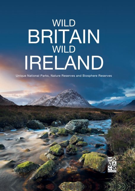
WILD<br />
BRITAIN<br />
WILD<br />
IRELAND<br />
Unique National Parks, Nature Reserves and Biosphere Reserves
WILD BRITAIN, WILD IRELAND<br />
2
3
4
Previous double page: Loch Lomond and the<br />
Trossachs is Scotland’s first national park and<br />
boasts an idyllic landscape of lakes, rivers,<br />
forests and villages nestling among rolling<br />
hills.<br />
Bottom: Aira Force is a waterfall in England’s<br />
Lake District National Park, which tumbles 20<br />
metres / 66 feet down into Lake Ullswater not<br />
far from the mouth of Aira Beck. A beautiful<br />
natural spectacle and therefore also a popular<br />
destination for day trips.<br />
5
6
The Isle of Thanet is an island in the south-east<br />
of England that was originally completely separate<br />
from the mainland. It was only joined later<br />
with the building of several bridges. Botany<br />
Bay creates a popular beach backdrop.<br />
7
8
Walkers taking any of the numerous hiking<br />
trails through the Gap of Dunloe are surrounded<br />
by unique natural landscapes. The gorge lies<br />
in County Kerry in the Republic of Ireland, at<br />
the island’s south-western tip.<br />
9
10
Over millions of years, rugged volcanic and<br />
lava rocks have formed this strange rock<br />
landscape on the beach of Kilfarassy, on<br />
Ireland’s Copper Coast. The atmosphere<br />
changes with each passing hour and season.<br />
11
12
The Isle of Skye lies in Scotland’s Inner<br />
Hebrides and serves as dramatic and impressive<br />
testimony to the wild beauty of the landscapes<br />
of Western Europe.<br />
13
ABOUT THIS BOOK<br />
14
Scarcely anywhere else is nature as rich and<br />
abundant as it is on this north-western archipelago.<br />
The wild beauties of the British Isles<br />
are landscapes full of mystery and legend, full<br />
of tragedy and fortune, that once inspired<br />
hosts of poets and have lost none of their poetic<br />
majesty since. Ireland, Scotland, England<br />
and Wales – each region has its own characteristic<br />
features, with all of them sharing a<br />
landscape shaped by wind and weather and<br />
featuring seemingly endless fields and meadows,<br />
picturesque river courses, mysterious forests<br />
and steep cliffs tumbling down into the<br />
sea.<br />
The rugged peaks of the Cuillin Hills, the<br />
highest on the Scottish Isle of Skye, are almost<br />
completely barren. Further down there are<br />
shrubs, ice-blue mountain lakes and wild<br />
streams.<br />
15
CONTENTS<br />
The British Isles 18<br />
IRELAND<br />
Dublin Bay 20<br />
Wicklow Mountains 22<br />
Copper Coast 24<br />
Kerry 26<br />
Killarney 32<br />
Skellig Islands 34<br />
Northern Gannets 35<br />
Burren 36<br />
Cliffs of Moher 38<br />
Connemara 42<br />
Ballycroy 44<br />
Killary Harbour / Mweelrea<br />
Mountains 46<br />
Achill Island 47<br />
Glenveagh 48<br />
Donegal Coast 50<br />
THE UNITED KINGDOM: NORTHERN<br />
IRELAND<br />
Giant’s Causeway 54<br />
Antrim Coast 56<br />
THE UNITED KINGDOM: SCOTLAND<br />
Shetland 58<br />
Orkney Islands 68<br />
St Kilda 70<br />
Isle of Skye 72<br />
Inverpolly 78<br />
An Teallach Mountains 80<br />
Northwest Highlands 82<br />
Wester Ross 84<br />
Rannoch Moor 90<br />
Glen Coe 96<br />
Ben Nevis 98<br />
Cairngorms 100<br />
Loch Tay & Tay Forest Park 102<br />
Glen Lyon 103<br />
St Abbs and Eyemouth 104<br />
Loch Lomond & The Trossachs 106<br />
Galloway and Southern Ayrshire 110<br />
Galloway 112<br />
16
Some of the most striking rock formations in<br />
the spectacular natural phenomenon of Giant's<br />
Causeway in Northern Ireland have even been<br />
given vivid names such as "the Giant’s Boot",<br />
"the Camel's Hump" and "the Wishing Chair".<br />
THE UNITED KINGDOM: ENGLAND<br />
Northumberland 114<br />
North Pennines 116<br />
Isle of Man 120<br />
Lake District 122<br />
<strong>Wild</strong>life in the Lake District 128<br />
Yorkshire Dales 130<br />
North York Moors 132<br />
Peak District 136<br />
Sherwood Forest 138<br />
Charnwood Forest 139<br />
Shropshire Hills 140<br />
Norfolk Coast 142<br />
The Broads 144<br />
South Foreland and Heritage Coast 146<br />
Brighton and Lewes Downs 148<br />
South Downs 150<br />
New Forest 152<br />
Cranborne Chase 154<br />
Dorset and East Devon Coast<br />
(Jurassic Coast) 156<br />
Dartmoor 160<br />
Cornwall Coast 162<br />
Braunton Burrows-North Devon 164<br />
Exmoor 165<br />
THE UNITED KINGDOM: WALES<br />
Anglesey 166<br />
GeoMôn 167<br />
Snowdonia 168<br />
Pembrokeshire Coast 170<br />
Brecon Beacons 172<br />
Fforest Fawr 174<br />
Biosffer Dyfi 175<br />
Photo credits, imprint 176<br />
17
THE BRITISH ISLES<br />
18 THE BRITISH ISLES
Short summer nights, dark winter months -<br />
the northern part of the British Isles is a little<br />
bit like the Arctic. But the Gulf Stream means<br />
there’s no permafrost. Instead, there’s a truly<br />
extraordinary light; especially in summer, when<br />
sunrise seems to follow just after sunset. That<br />
is when mysterious rock formations cast long<br />
shadows, and mosses and grasses glimmer intensely<br />
in that strange light. The landscapes of<br />
the British Isles vary widely but there is one<br />
thing they certainly have in common: the<br />
green. It seems to come in thousands of<br />
shades here and coats the crags and plateaus<br />
like a deep, velvety carpet.<br />
To the west of York, between the Lake District<br />
and the North York Moors, is the hiking paradise<br />
that is the Yorkshire Dales. A beautiful 18.5<br />
kilometre / 11 mile circular trail leads along the<br />
White Scars from Ingleton to Chapel-le-Dale.<br />
THE BRITISH ISLES 19
DUBLIN BAY<br />
UNESCO Biosphere Reserve<br />
In 1981, UNESCO recognised the significance<br />
of Dublin Bay, with its rare and internationally<br />
important habitats and wildlife species of wildlife,<br />
and designated it a Biosphere Reserve. To<br />
support sustainable development, UNESCO’s<br />
concept of a Biosphere has evolved to include<br />
not just areas of ecological value but also the<br />
areas surrounding them. Thus, since 2015, the<br />
reserve has been expanded to include<br />
everything that reflects its economic, cultural<br />
and tourism importance. It now covers an area<br />
of 300 square kilometres / 116 square miles.<br />
Nowadays over 300,000 people live within the<br />
newly enlarged Biosphere reserve, which is divided<br />
into three zones. The core zone has areas<br />
of high natural value, the buffer zone has<br />
public and private green spaces such as parks<br />
and golf-courses, and the transition zone has<br />
harbours, ports, and residential and industrial<br />
areas.<br />
At a glance<br />
Location: Dublin Bay, a delta-shaped<br />
estuary of the rivers Liffey and Dodder,<br />
opening into the Irish Sea on the east<br />
coast of Ireland near Dublin<br />
Area: 300 km² /116 mi²<br />
Designation as UNESCO<br />
Biosphere Reserve: 1981<br />
www.dublinbaybiosphere.ie<br />
20 BRITISH ISLES | IRELAND
The former fishing village of Howth is now one<br />
of the most popular day trip destinations in the<br />
bay. Just before the lighthouse there is a path<br />
taking you up the hill to Howth summit, from<br />
which point you can feast your eyes on the<br />
whole expanse of Dublin Bay.<br />
Although there is sometimes a strong breeze<br />
blowing, you can savour the picturesque<br />
sunset with this stunning panoramic view of<br />
the sea. If you’re lucky you can catch a glimpse<br />
of a large freight ship or cruise liner.<br />
IRELAND | BRITISH ISLES 21
WICKLOW MOUNTAINS<br />
National Park<br />
Founded in 1991, the Wicklow Mountains National<br />
Park covers a nature conservation area of<br />
about 200 square kilometres / 77 square miles<br />
close to the east coast of Ireland. This mountain<br />
landscape of volcanic origin is made up of granite<br />
and schists rounded by Ice Age glaciers.<br />
Deeply rutted by rushing streams, areas of bog<br />
and heathland, broadleaf and coniferous woodland<br />
alternate across the hillsides. The highest<br />
elevation is Lugnaquilla at 925 metres / 3,035<br />
feet, with the source of the river Slaney at its<br />
southwesterly base. On a clear day you can see<br />
all the way to the Irish Sea from its summit. The<br />
Wicklow Mountains were the setting for a gold<br />
rush in 1795, but the excitement didn’t last<br />
long. The mine was exhausted after just a few<br />
years and a mere 300 kg / 661 lb had been<br />
found. Nowadays, it is no longer gold hunters<br />
who are attracted to the area but those searching<br />
for peace and relaxation.<br />
At a glance<br />
Location: mountain range in the east<br />
and southeast of Ireland, running in a<br />
north-south direction, directly from<br />
South Dublin to the counties of Wicklow<br />
and Wexford<br />
Area: 200 km² / 77 mi²<br />
Foundation: 1991<br />
www.wicklowmountainsnational<br />
park.ie<br />
22 BRITISH ISLES | IRELAND
Brightly coloured hills covered in swathes of<br />
grasses and heathers (top picture) are typical of<br />
this boggy landscape. It is hard to believe that<br />
this pure, natural idyll is only one hour from<br />
the vibrant city of Dublin.<br />
Around 130 kilometres / 80 miles long, the<br />
Wicklow Way is a long-distance trail which<br />
runs from the suburbs of Dublin across the<br />
mountains. The remains of old native woodland<br />
are now only to be found near the rivers<br />
(left); the small coniferous forests are plantations<br />
used for timber production.<br />
IRELAND | BRITISH ISLES 23
COPPER COAST<br />
UNESCO Global Geopark<br />
The Copper Coast Geopark is a designated<br />
area comprising a stretch of the southern<br />
coast of Ireland in County Waterford, extending<br />
for some 17 kilometres / 10 miles from Kilfarrasy<br />
in the east to Stradbally in the west.<br />
Both the coast and the geopark are named<br />
after the historic 19th century copper-mining<br />
industry, whose legacies now form a tourist<br />
attraction. A local interest group formed in<br />
1997 came up with the idea of the geopark.<br />
The area, with its spectacular cliffs, was declared<br />
a European Geopark in 2001 and a UN-<br />
ESCO Global Geopark in 2004. This geologically<br />
diverse area contains records of<br />
Palaeozoic volcanism and the last ice age - a<br />
heritage which comes to life for the visitor.<br />
One example is the visitor centre at Monksland<br />
Church in Knockmahon, which is dedicated to<br />
the Geopark and its 460 million year old history.<br />
At a glance<br />
Location: in County Waterford, from<br />
Kilfarrasy to Stradbally<br />
Area: 50 km² / 19 mi²<br />
Foundation: 1997<br />
Designation as UNESCO Global<br />
Geopark: 2004<br />
www.coppercoastgeopark.com<br />
24 BRITISH ISLES | IRELAND
The Gaulstown Dolmen is a historical attraction<br />
consisting of six upright stones which<br />
form a chamber with a five metre / sixteen<br />
feet-long cap stone. The portal stones<br />
protrude from the ground and are approximately<br />
two metres / six feet high.<br />
The small cove of Goat Island Beach is situated<br />
around five kilometres / three miles to the<br />
west of Ardmore in County Waterford. The<br />
remote beach faces south and is difficult to<br />
find, which is why it is considered a local<br />
treasure.<br />
IRELAND | BRITISH ISLES 25


