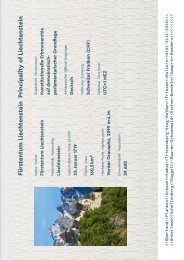
Princely Hikes in Liechtenstein
Which country in Europe has the densest network of hiking trails? It’s not the alpine classics of Switzerland or Austria, but in fact the small Principality of Liechtenstein nestling between those two countries. More than 400 kilometres of well-maintained and clearly signposted trails and majestic mountains up to 2600 metres above sea level attract walkers and hikers to Liechtenstein.
Which country in Europe has the densest network of hiking trails? It’s not the alpine classics of Switzerland or Austria, but in fact the small Principality of Liechtenstein nestling between those two countries. More than 400 kilometres of well-maintained and clearly signposted trails and majestic mountains up to 2600 metres above sea level attract walkers and hikers to Liechtenstein.

Create successful ePaper yourself
Turn your PDF publications into a flip-book with our unique Google optimized e-Paper software.
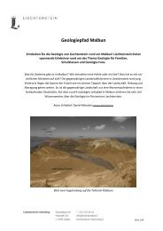
20 → tourismus.li/hik<strong>in</strong>g<br />
WALKING TRAIL<br />
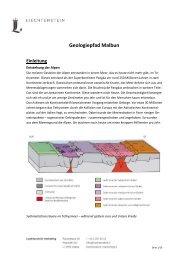
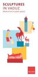
Fly through the mounta<strong>in</strong>s -<br />
Malbun Sw<strong>in</strong>g Trail<br />
Sareis - Alpe Turna - Heita – Pradamee – Malbun<br />
In Malbun, young and old can enjoy spectacular open-air sw<strong>in</strong>gs with fantastic<br />
views along the sw<strong>in</strong>g trail. The easy hik<strong>in</strong>g route, along which you can catapult<br />
yourself <strong>in</strong>to the air on a total of ten sw<strong>in</strong>gs, extends over 5.5 km. The trail<br />
is also easy to for children from the age of five to master.<br />
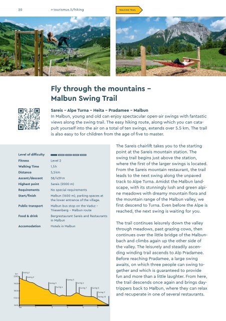
hm<br />
2000<br />
1900<br />
1800<br />
1700<br />
Level of difficulty<br />
Fitness Level 2<br />
Walk<strong>in</strong>g Time<br />
Distance<br />
Ascent/descent<br />
1,5 h<br />
5,5 km<br />
58/439 m<br />
Highest po<strong>in</strong>t Sareis (2000 m)<br />
Requirements<br />
Start/f<strong>in</strong>ish<br />
No special requirements<br />
Malbun (1600 m), park<strong>in</strong>g spaces at<br />
the lower entrance of the village.<br />
Public transport Malbun bus stop on the Vaduz –<br />
Triesenberg – Malbun route<br />
Food & dr<strong>in</strong>k<br />
Accomodation<br />
Sw<strong>in</strong>g 1<br />
Sw<strong>in</strong>g 2<br />
Bergrestaurant Sareis and Restaurants<br />
<strong>in</strong> Malbun<br />
Hotels <strong>in</strong> Malbun<br />
Sw<strong>in</strong>g 3<br />
Sw<strong>in</strong>g 4<br />
Sw<strong>in</strong>g 5<br />
Sw<strong>in</strong>g 6<br />
Sw<strong>in</strong>g 7 Sw<strong>in</strong>g 8<br />
Sw<strong>in</strong>g 9<br />
Sw<strong>in</strong>g 10<br />
The Sareis chairlift takes you to the start<strong>in</strong>g<br />
po<strong>in</strong>t at the Sareis mounta<strong>in</strong> station. The<br />
sw<strong>in</strong>g trail beg<strong>in</strong>s just above the station,<br />
where the first of the larger sw<strong>in</strong>gs is located.<br />
From the Sareis mounta<strong>in</strong> restaurant, the trail<br />
leads to the next sw<strong>in</strong>g along the unpaved<br />
track to Alpe Turna. Amidst the Malbun landscape,<br />
with its stunn<strong>in</strong>gly lush and green alp<strong>in</strong>e<br />
meadows with dreamy mounta<strong>in</strong> flora and<br />
the mounta<strong>in</strong> range of the Malbun valley, we<br />
first descend to Turna. Even before the Alpe is<br />
reached, the next sw<strong>in</strong>g is wait<strong>in</strong>g for you.<br />
The trail cont<strong>in</strong>ues leisurely down the valley<br />
through meadows, past graz<strong>in</strong>g cows, then<br />
cont<strong>in</strong>ues over the little bridge of the Malbunbach<br />
and climbs aga<strong>in</strong> up the other side of<br />
the valley. The leisurely and steadily ascend<strong>in</strong>g<br />
w<strong>in</strong>d<strong>in</strong>g trail ascends to Alp Pradamee.<br />
Before reach<strong>in</strong>g Pradamee, a large sw<strong>in</strong>g<br />
awaits, on which three people can sw<strong>in</strong>g together<br />
and which is guaranteed to provide<br />
fun and more than a little laughter. From here,<br />
the trail descends once aga<strong>in</strong> and br<strong>in</strong>gs daytrippers<br />
back to Malbun, where they can relax<br />
and recuperate <strong>in</strong> one of several restaurants.<br />
1600<br />
km 1 2 3 4 5