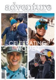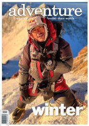
Adventure Magazine 226
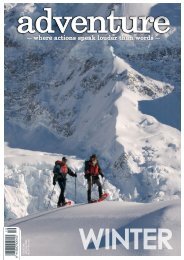
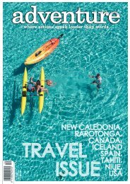
Winter issue of Adventure Magazine
Winter issue of Adventure Magazine

You also want an ePaper? Increase the reach of your titles
YUMPU automatically turns print PDFs into web optimized ePapers that Google loves.
It was 1pm and we had 20km of unknown wilderness river<br />
in front of us, so we promptly pushed off to enjoy the first<br />
few kms of stunning alpine country. A few boulder choked<br />
rapids kept us on our toes, until we came around a bend to<br />
see a horizon line in the river and a lone ancient beech tree<br />
far below us. With the river looking like it dropped off the<br />
edge of the world we expected a big portage and got out to<br />
inspect the rapid, to be pleasantly surprised to find a clean<br />
3m waterfall and boulder gardens. This was our entry into<br />
the beech forest, and a section of amazing whitewater. We<br />
made quick ground until encountering a more technical and<br />
consequential rapid. By this point it was late in the day, and<br />
our margin for error was disappearing along with the sun.<br />
We opted to bushwhack our boats up and around the rapid.<br />
I made an unfortunate misstep and gathered some cuts<br />
and bruises from a gravity assisted descent at one point,<br />
but we all made it back to the river safely. Our stoke came<br />
back with just a few paddle strokes on the river, and we all<br />
shared high fives half an hour later when we popped out of<br />
the beech forest and could relax and watch the sunset as<br />
we floated the few kilometres of flat water.<br />
We loaded our boats onto the waiting vehicle as it got dark.<br />
Satisfaction levels were high, but the trip wasn’t done yet<br />
with our other vehicle still parked way up in the hills where<br />
we’d left it that morning. A layer of low cloud had moved<br />
into the Teviot valley, and we crawled our way up through<br />
the mud and the murk onto the top of the Old Man Range<br />
once more. It was 11pm at night and we were above the<br />
cloud for a stunning moonrise, while crossing all fingers<br />
and toes that we didn’t get a vehicle stuck in the snow or<br />
mud. The cards fell our way, and I made it back to Wanaka<br />
at 1am thoroughly exhausted but stoked on exploring a<br />
new part of our backyard.<br />
A couple of weeks later conditions aligned once more, and<br />
five of us found ourselves at the Aspiring Helipad at midday<br />
on a Monday. It had rained the day before, and we hoped<br />
that the North Branch of the Motatapu River would now be<br />
at an ideal water level. As the heli gained elevation it was<br />
odd to gain a new perspective of our local area, Glendhu<br />
bay, Treble Cone ski area, and Wanaka itself. Only a few<br />
minutes later we found ourselves very much alone, high<br />
in an alpine valley with no marked access. Our friend Ben<br />
Young had done his chopper pilot training in Wanaka,<br />
and regularly flew this route as he gathered his hours.<br />
This river was his project, and after taking a moment to<br />
appreciate the snow capped mountains, we set to our task<br />
of discovering what the river held downstream.<br />
It was low volume and bouncy to begin with, much like<br />
a poorly shaped water slide. The alpine setting was<br />
spectacular though, and the moody afternoon light painted<br />
a stunning picture as we found a few bigger rapids and<br />
drops to really get our hair wet. It was not long until the<br />
river grew in size and became consistently steeper.<br />
The quality of the whitewater increased, however the<br />
opportunities to stop were slim and margins for error<br />
low. We took our time, settling into an efficient leap frog<br />
style where one person would get out and scope the line<br />
through the next rapid, and then if things looked positive<br />
wave us through. In this method we moved at a solid pace,<br />
with periodic interruptions to stretch our legs by walking<br />
around a rapid that was not going to leave a kayaker in a<br />
healthy state.<br />
Distance wise we began to get close to the confluence of<br />
the North and South Branches of the Motatapu, however<br />
we were conscious that the valley still looked a long way<br />
below us. We weren’t wrong, a particularly long section of<br />
tight continuous whitewater awaited. This section would’ve<br />
required linking consequential move after move for almost<br />
500 m, and while it seemed each move was possible we<br />
were conscious of the dwindling daylight and the fact we<br />
were still a long way from home. In the best interests of<br />
leaving our future selves something to aspire to (and more<br />
honestly our own self preservation in the moment) we<br />
opted for the tramping with kayaks option. Our portage<br />
put us back on the river at the top of another steep rapid,<br />
however we could see a pool at the bottom and too many<br />
great moves to ignore so we took turns at paddling the<br />
best rapid of the day. After emerging from this mini gorge<br />
thankfully the river did finally ease, and we popped out at<br />
the confluence with the South Branch.<br />
The sun was low in the sky, and floating through the far<br />
mellower whitewater we had ample time to appreciate the<br />
revegetation work going on around the Motatapu river.<br />
This was highlighted with one more mini gorge and two<br />
harder rapids amongst the beech forest. We emerged to a<br />
stunning sunset over Glendhu, rather thankful for going two<br />
from two and again escaping nightfall on the river.<br />
Spring had a kick in it’s tail though, and another weekend<br />
rain event lined up the Otago headwaters. This time my<br />
friend Cam Kerr and I had our eyes on another close-asthe-crow-flies<br />
Wanaka river, the Dingle Burn. Our ambition<br />
was to paddle from its source below Highlander Peak<br />
where it starts life as a small stream and follow it 30 km out<br />
to Lake Hawea.<br />
The weather was clear and sunny as we left Wanaka, but<br />
got steadily more gloomy as we approached the Ahuriri. A<br />
flooded river and muddy 4wd access into Ahuriri Base Hut<br />
boded well for our kayaking, but not so much for the uphill<br />
grunt to come. Our planned access route was to tramp<br />
600 m up onto the crest of the mountain range separating<br />
the Ahuriri valley from the Dingle Burn, and then descend<br />
to Top Dingle Hut. The climb was a proper slog, but we<br />
were able to move surprisingly quickly on the old farm<br />
track. Standing at 1450 m with our kayaks looking across<br />
to the snowy peaks of the Barrier Range was a stunning<br />
and surreal moment of ‘why did we think this was a good<br />
idea?’.<br />
The rain turned right back on for our descent, which was<br />
to prove more technical and scary than the kayaking to<br />
come. The track was muddy and slippery, and our kayaks<br />
were acting like anchors trying to drag us to the bottom<br />
of the hill by the fastest route possible. There was a real<br />
sense of relief when we reached the friendly fishermen and<br />
warm fire of Top Dingle Hut. The crux of the trip was now<br />
in front of us; how good had our weather forecasting been,<br />
and was there the right amount of water in the river for our<br />
kayaks?<br />
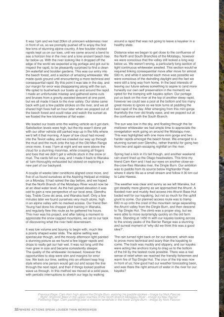
Previous Page: Cam Kerr high above the Dingle Burn, earning his paddle strokes - Image by Nick Pascoe<br />
Right: Shannon Mast in the upper reaches of the North Branch Motatapu River - Image by Max Rayner<br />
Following Page: Cam paddling past a massive landslide in the lower Dingle Burn - Image by Nick Pascoe<br />
32//WHERE ACTIONS SPEAK LOUDER THAN WORDS/#<strong>226</strong>