March Stones Trail - Aberdeen City Council
March Stones Trail - Aberdeen City Council
March Stones Trail - Aberdeen City Council

You also want an ePaper? Increase the reach of your titles
YUMPU automatically turns print PDFs into web optimized ePapers that Google loves.
<strong>Aberdeen</strong>’s <strong>March</strong> <strong>Stones</strong> <strong>Trail</strong><br />
is one of a series of themed trails<br />
being developed around the <strong>City</strong>.<br />
These are part of the<br />
Energising <strong>Aberdeen</strong> programme,<br />
supported by the <strong>City</strong> Growth Fund.<br />
Further details about these trails can be found at:<br />
www.aberdeencity.gov.uk/trails<br />
Please ensure you follow the Scottish Outdoor Access Code<br />
when enjoying the outdoors. The code is available from<br />
<strong>Aberdeen</strong> <strong>City</strong> <strong>Council</strong> on 01224 523316 or at<br />
www.outdooraccess-scotland.com<br />
Kingswells<br />
Charleston<br />
For further information contact<br />
Chris Croly<br />
Historian<br />
01224 523653<br />
or visit www.aberdeencity.gov.uk<br />
<strong>Aberdeen</strong> Visitor Information Centre<br />
01224 288828<br />
www.aberdeen-grampian.com<br />
For public transport information contact Travel Line<br />
on 0870 608 2608<br />
or visit www.travelinescotland.com<br />
For a large text version contact<br />
01224 522070<br />
A90<br />
www.aberdeencity.gov.uk<br />
<strong>Trail</strong> 2<br />
<strong>Trail</strong> 1<br />
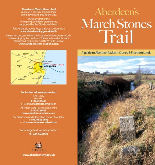
<strong>Aberdeen</strong>’s<br />
<strong>March</strong> <strong>Stones</strong><br />
<strong>Trail</strong><br />
A guide to <strong>Aberdeen</strong>’s <strong>March</strong> <strong>Stones</strong> & Freedom Lands
1. Lands of Rubislaw<br />
Acquired 1379<br />
2. Lands of Gilcomston<br />
Acquired 1680<br />
3. Lands of Cruives<br />
Acquired 1405<br />
Courtesy of Yvonne Holton<br />
<strong>Aberdeen</strong>’s <strong>March</strong> <strong>Stones</strong><br />
& Freedom Lands<br />
Introduction<br />
This is the story of how <strong>Aberdeen</strong> acquired its boundaries and<br />
ultimately established itself as the city we know today. Walking<br />
or riding this boundary by following stone markers was an<br />
important tradition in <strong>Aberdeen</strong>. This leaflet explores the<br />
history of the Freedom Lands and provides details on how<br />
to continue the tradition of ‘Riding the <strong>March</strong>es’.<br />
The <strong>March</strong> <strong>Stones</strong><br />
There are two sets of boundary stones: the inner and the outer.<br />
The inner march stones mark the boundary of the crofts that<br />
ringed the medieval Royal Burgh of <strong>Aberdeen</strong>. The outer march<br />
stones define a much larger area known as the Freedom Lands.<br />
These lands went on to become the right and responsibility of<br />
the medieval and later Royal Burgh of <strong>Aberdeen</strong>. The name<br />
‘march stones’ derives from the 16th century meaning of march<br />
as a boundary.<br />
Robert the Bruce<br />
In 1313, Robert the Bruce<br />
granted <strong>Aberdeen</strong><br />
custodianship over his Royal<br />
Forest of the Stocket. The term<br />
Royal Forest is slightly<br />
misleading as it really meant<br />
a hunting ground, which may<br />
have included a wooded area.<br />
In 1319 Robert issued a<br />
second charter. This granted<br />
<strong>Aberdeen</strong> fuller rights over the<br />
Stocket, in return for an annual<br />
payment, or feu, of £213 6s 8d<br />
Sterling - the modern day<br />
equivalent of approximately<br />
£91,000.<br />
Charter issued by King Robert the<br />
Bruce feuing the Stocket Forest<br />
to <strong>Aberdeen</strong>, 1319<br />
The Freedom Lands<br />
The <strong>City</strong> <strong>Council</strong> also bought<br />
three other plots of land, which together with the Stocket<br />
Forest came to be called the Freedom Lands. These purchases<br />
were Rubislaw, bought in 1379, the lands of Cruives (Woodside)<br />
bought in 1405 and finally, the lands of Gilcomston, bought in<br />
1680. The lands of Caprastone (Hilton) were also purchased in<br />
1595. However, they were not strictly speaking ever part of the<br />
Freedom Lands.<br />
In 1551, for a number of financial reasons, <strong>Aberdeen</strong> applied to<br />
Mary Queen of Scots for the rights to let these lands. This<br />
meant that in return for a yearly payment, the lands became<br />
privately managed. Many of the main estates established at<br />
this time are still recognisable today, such as Countesswells,<br />
Forresterhill, Hazlehead and Kingswells.
Boundary Markers<br />
The earliest boundary markers were probably natural features<br />
such as burns and stones (described as ‘earthfast’ stones), with<br />
the addition of small purpose-built cairns. The first description<br />
of the marches dates back to a ‘riding of the marches’ in 1525.<br />
The practice of riding the boundary lines was intended to<br />
ensure they were being observed and respected, and that no<br />
adjacent landowners had encroached onto the town’s lands.<br />
These rides were accompanied by a great deal of ceremony<br />
and feasting.<br />
From the description of 1525 it is certain that there had been<br />
no standardised marking system. However, large ‘earthfast’<br />
stones are a common feature in the records of this riding: some<br />
were described as including saucers, others as having a varied<br />
number of holes. It is possible that the saucer marks were filled<br />
with lead and then the town’s mark (or possibly seal) was<br />
impressed into it. Although, from a description of <strong>March</strong> Stone<br />
1 made in 1578, it would seem that the town’s mark had been<br />
engraved into this particular stone. Moreover, through the<br />
16th and 17th centuries there are repeated references to cairns<br />
next to march stones. In a riding of the marches in 1673,<br />
several cairns were ordered to be erected to mark the line of<br />
the marches on the Chapman road (this track ran from<br />
<strong>Aberdeen</strong>, out through Newhills to the Chapman ford, from<br />
stones No 44-34). This may have been an older practice, in<br />
spite of which, none of these ‘march cairns’ survive.<br />
It was after 1790 that the saucer stone system was replaced by<br />
a new system of lettered and numbered stones. This style,<br />
which is still with us today, has a number coupled with the<br />
letters ABD for <strong>Aberdeen</strong> and in the case of the inner march<br />
stones the additional letters CR for either <strong>City</strong> Royalty or <strong>City</strong><br />
Regality. In the years immediately following 1790 the<br />
stones up to number 48 were replaced with the new<br />
letter stones and the entire series was completed by<br />
1810. The new series was not entirely the same<br />
as the older one had been; some stones were<br />
omitted whilst a number of new stones were<br />
introduced. Over the years the courses of<br />
older natural boundaries (such as burns)<br />
had been altered, thus necessitating<br />
some changes in the series.<br />
Using This Guide<br />
Although the <strong>March</strong> <strong>Stones</strong> of <strong>Aberdeen</strong> were intended to be<br />
easy to access, the city has since expanded and many are<br />
difficult to get to. The Land Reform (Scotland) Act 2003 gives<br />
everyone a right of responsible access to most land. In most<br />
cases, members of the public can get access to stones that<br />
are ‘off the beaten track’. Nevertheless, some stones are not<br />
publicly accessible and in such cases, the right of responsible<br />
access does not apply.<br />
Whilst enjoying the outdoors, please ensure that you behave<br />
responsibly by respecting the interests of others, caring for<br />
the environment and taking responsibility for your own<br />
actions. Further information can be found on the back cover<br />
of this leaflet.<br />
A map has been included, indicating the historic line of the<br />
march stones. Two maps have been included indicating<br />
recommended trails that take in some of the more accessible<br />
stones. These trails include sections ranging from highly urban<br />
to countryside, from flat firm surfaces to steep, uneven and<br />
sometimes muddy paths. Where possible, descriptions of these<br />
conditions have been included for each stone. In addition to<br />
this, it is the responsibility of individual members of the public<br />
to ensure their personal safety. The descriptions given with<br />
each stone assume a starting point at Alpha and an end at<br />
Omega. Some of the routes will take you past private property.<br />
Please respect the privacy of the residents.<br />
Inner march stones are marked with an additional ‘CR’, as in<br />
<strong>Stones</strong> Alpha to 1 and 61 to Omega<br />
Six stones marked simply ‘CR’ are appended at the end of the<br />
descriptive list: these may have been inner march stones at one<br />
point. Others of this kind may also exist: please note that these<br />
stones can be difficult to find.<br />
All photographs © <strong>Aberdeen</strong> Art Gallery and Museums Collections, unless<br />
otherwise stated.<br />
Key to Symbols<br />
Uneven or steep slope<br />
Not wheelchair accessible<br />
No access<br />
STEEP
<strong>Aberdeen</strong>’s <strong>March</strong> <strong>Stones</strong><br />
& Freedom Lands<br />
Descriptive List<br />
Please note, the engraving on some of these stones<br />
has faded.<br />
<strong>March</strong> Stone Alpha<br />
Marked ‘ABD CR’<br />
Location: North end of parapet over the mouth of Ferryhill<br />
Burn at River Dee, opposite Old Ford Road.<br />
This stone is a comparatively recent addition to the series,<br />
dating to the early nineteenth century.<br />
<strong>March</strong> Stone 1<br />
Marked ‘1 ABD CR’<br />
Location: Set in<br />
carriageway, near kerb at<br />
79 Hardgate.<br />
In 1525 described as ‘ane<br />
gret grey stane, with ane<br />
sawssir . . .’ It was still<br />
marked with a saucer in<br />
1698 but a new stone<br />
marked ABD was in place<br />
Stone 1<br />
by the late 18th century.<br />
<strong>March</strong> Stone 2<br />
Marked ‘2 ABD’<br />
Location: Flush in pavement, south side of Fonthill Road, next<br />
to car park at Library, in small garden area.<br />
No mention of this stone in 1525, certainly existed by 1698.<br />
Please note that this stone is immediately next to a very busy road<br />
and care should be taken. Wheelchair users may need to use<br />
opposite side of road.<br />
<strong>March</strong> Stone 3<br />
Marked ‘3 ABD’<br />
Location: Against cemetery wall, corner of Nellfield Place and<br />
Great Western Road.<br />
In 1780 described as ‘a large earthfast stone in the North West<br />
corner of Mrs Cochrane’s Parks of Ferryhill . . . ’<br />
<strong>March</strong> Stone 4<br />
Marked ‘4 ABD’<br />
Location: Bottom of the steps at the side of The Short Mile<br />
Public House.<br />
In 1698 described as a saucer stone in a dyke, whilst in 1780<br />
as ‘a large earthfast stone upon the outside of the North dyke<br />
of Pitmuckston . . . ‘<br />
<strong>March</strong> Stone 5<br />
Marked ‘5 ABD’<br />
Location: At back garden wall of 319 Great Western Road.<br />
In 1780 described as ‘a large earthfast stone at a place called<br />
Collielaw upon the top of a Rock . . . ‘ Moved to its present<br />
location in 1889.<br />
STEEP<br />
<strong>March</strong> Stone 6<br />
Marked ‘6 ABD’<br />
Location: In back garden of No.11 Hammerfield Ave.<br />
In 1698 described as ‘ane great craige stone, wherein there is an<br />
sauser and four witter holes, and ane carne beside the same. . . ’<br />
<strong>March</strong> Stone 7<br />
Marked ‘7 ABD’<br />
Location: Back of pavement at 3 Craigton Road.<br />
In 1698 described as marked with a ‘P’ for property, and also<br />
marked with a saucer in 1780.<br />
<strong>March</strong> Stone 8<br />
Marked ‘8 ABD’<br />
Location: Back of<br />
pavement at 37<br />
Craigton Road.<br />
Described in 1698 and<br />
1780 as marked with a<br />
saucer. The original<br />
saucer stone survived<br />
until some time after<br />
1929.<br />
<strong>March</strong> Stone 9<br />
Marked ‘9 ABD’<br />
Location: Back of<br />
pavement at 126<br />
Craigton Road.<br />
Photograph taken by<br />
James Cruickshank,1929<br />
In 1698 described as an ‘eard-fast ston with an carne . . . ’<br />
The 1780 description mentions a saucer mark. Path on one side<br />
of the road only from stone 9 to 12.<br />
<strong>March</strong> Stone 10<br />
Marked ‘10 ABD’<br />
Location: Back of pavement at Senang Cottage, Craigton Road,<br />
opposite Slopefield Reservoir.<br />
In 1780 this was described as an earthfast stone, with saucer.<br />
<strong>March</strong> Stone 11<br />
Marked ‘11 ABD’<br />
Location: Back of pavement, 36 metres west of ‘Woodlands’<br />
entrance gate, Craigton Road.<br />
Described in 1698 as a long stone and in 1780 as a large stone,<br />
again earthfast and with a saucer mark.<br />
<strong>March</strong> Stone 12<br />
Marked ‘12 ABD’<br />
Location: Adjacent to footpath at amenity area, south of<br />
Friarsfield Road and Kirkbrae junction, Cults. Unsurfaced path<br />
here.<br />
In 1698 described as ‘ane merch stone, with an sauser and four<br />
witter holes . . . ’<br />
STEEP
<strong>March</strong> Stone 13<br />
Marked ‘13 ABD’<br />
Location: In picnic<br />
area at Hillview<br />
Crescent, Cults. Entry<br />
point opposite head<br />
of Quarry Road.<br />
In 1525 described as<br />
‘ane gret grey stane<br />
standand on the top<br />
of the Blak Hill of<br />
Queyltis . . . ’ The 1698<br />
description noted a<br />
sauser mark and four<br />
‘witter holes . . . ’<br />
Stone 13<br />
<strong>March</strong> Stone 14<br />
Marked ‘14 ABD’<br />
Location: Opposite the entrance to Cults Primary School, off<br />
Earlswells Road.<br />
In 1525 described as a stone with ‘three hollis hewing in the<br />
same . . . ’ In 1698 a saucer stone was recorded, which may be<br />
the one sitting adjacent to the lettered nineteenth-century<br />
stone.<br />
<strong>March</strong> Stone 15<br />
Marked ‘15 ABD’<br />
Location: In the amenity area adjacent to 30 Springdale Road,<br />
at junction with Baillieswells Road.<br />
In 1525 described as ‘ane gray stane with four hollis in the<br />
quhilk thar is irne zeit with laid . . . ’ In 1698 described as a large<br />
earthfast stone, marked on top by a saucer and on the side<br />
with three holes.<br />
<strong>March</strong> Stone 16<br />
Marked ‘16 ABD’<br />
Location: In boggy ground adjacent to summer house of ‘The<br />
Policies’, off Baillieswells Road.<br />
In 1780 described as an earthfast saucer stone. Saucer stone is<br />
adjacent to the lettered stone.<br />
<strong>March</strong> Stone 17<br />
Marked ‘17 ABD’<br />
Location: 150 metres east of ‘Hillhead Cottage’ (east of Hillhead<br />
Road), adjacent to dyke and 2 burns.<br />
In 1780 described as an earthfast saucer stone.<br />
<strong>March</strong> Stone 18<br />
Marked ‘18 ABD’<br />
Location: In field 150 metres south-west of entrance to Hilton<br />
Farm, west of Hillhead Road.<br />
Described in 1698 as a saucer stone next to a cairn on the edge<br />
of a road: by 1929 the road had disappeared but the cairn was<br />
still there. The saucer stone survives next to the lettered stone,<br />
which had been broken by 1810 and the current one probably<br />
dates to the 1821 riding of the marches.<br />
Stone 18 with 'earthfast' saucer stone<br />
<strong>March</strong> Stone 19<br />
Marked ‘19 ABD’<br />
Location: Stone adjacent to dyke in fields to south east of<br />
Westfield Farm.<br />
Described in 1780 as ‘a low flat earthfast Stone, with a saucer<br />
situated partly under the march dyke dividing the lands of<br />
Binghill and Westfield . . . ’<br />
<strong>March</strong> Stone 20<br />
Marked ‘20 ABD’<br />
Location: Adjacent to dyke in fields to south east of Westfield<br />
Farm, on same line as above.<br />
First mentioned in the eighteenth century when described as a<br />
long earthfast stone with a saucer mark.<br />
<strong>March</strong> Stone 21<br />
Marked ‘21 ABD’<br />
Location: In field south west of Westfield Cottage.<br />
Described in 1698 as upon a ‘knowhead’ (hillock head) with<br />
a cairn.
Stone 22<br />
<strong>March</strong> Stone 22<br />
Marked ‘22 ABD’<br />
Location: In field south west of Westfield Cottage.<br />
In 1698 was on top of a hillock and marked with a saucer.<br />
<strong>March</strong> Stone 23<br />
Marked ‘23 ABD’<br />
Location: Summit of Bean’s Hill at junction of fences.<br />
A saucer marked stone (described in 1698 and 1780) is<br />
adjacent to the lettered stone. Highest point on line of<br />
marches.<br />
<strong>March</strong> Stone 24<br />
Marked ‘24 ABD’<br />
Location: Top of bank at angle of fence, west of North<br />
Westfield farm.<br />
In 1698 and 1780 described as being located at a place called<br />
Brunie’s, or Brownie’s grave.<br />
<strong>March</strong> Stone 25<br />
Marked ‘25 ABD’<br />
Location: East side of rock outcrop at Brunt Hill near Silver<br />
Burn. Access from track at East Brotherfield Farm.<br />
In 1780 described as ‘a large stone or part of a Rock marked<br />
with a saucer. . . ’ Saucer stone is adjacent to lettered stone.<br />
Stone 26<br />
<strong>March</strong> Stone 26<br />
Marked ‘26 ABD’<br />
Location: At confluence of Brodiach and Silver Burns. Access<br />
from Brotherfield farm.<br />
In 1698 it was noted that there had never been a march stone<br />
here but the location had always been pointed out on ridings.<br />
A stone was recommended in 1780.<br />
<strong>March</strong> Stone 27, ‘The Ringing Stone’<br />
Marked ‘27 ABD’<br />
Location: Adjacent to Brodiach Burn. Access from Brotherfield<br />
Farm.<br />
Origins of this intriguing name are unknown. There are 2 miles<br />
to the next stone, being the longest distance between stones;<br />
the Brodiach burn was taken to provide a sufficient marker.<br />
<strong>March</strong> Stone 28<br />
Marked ‘28 ABD’<br />
Location: Adjacent to Littlemill Burn, on rough ground, north<br />
west of Borrowstone Farm, off Blackburn Road.<br />
<strong>March</strong> Stone 29<br />
Marked ‘29 ABD’<br />
Location: Adjacent to Littlemill Burn in corner of field west of<br />
Wynford Farm, off Blackburn Road.<br />
Saucer stone is adjacent to the lettered stone.<br />
<strong>March</strong> Stone 30<br />
Marked ‘30 ABD’<br />
Location: In field north of Wynford, opposite road junction.<br />
An older saucer stone mentioned in 1698 and 1780 survived<br />
until some time after 1929.
<strong>March</strong> Stone 31 ‘The Doupin’ Stone’<br />
Marked ‘31 ABD’<br />
Location: In field north of Wynford, opposite road junction.<br />
From the descriptions in 1525 and 1698 it would seem that<br />
there had not been a stone here. In 1780 two large earthfast<br />
stones were noted, both saucer marked. It was here that new<br />
burgesses underwent the initiation of ‘doupin’, or being<br />
dropped onto the stone. A cup stone is adjacent to the<br />
lettered stone.<br />
Detail of saucer stone adjacent to stone 32<br />
<strong>March</strong> Stone 32<br />
Marked ‘32 ABD’<br />
Location: In field south of Southside Croft, close to burn.<br />
A saucer stone is adjacent to the lettered stone.<br />
<strong>March</strong> Stone 33<br />
Marked ‘33 ABD’<br />
Location: In field 130 metres north east of No. 32, near stepped<br />
approach to Elrick Hill.<br />
Described in 1525 as ‘the gret marche stanniss markit with the<br />
sauchter. . . ’ A saucer stone remains adjacent to the lettered<br />
stone.<br />
Stone 33, with saucer stone<br />
Detail of saucer stone<br />
adjacent to stone 33<br />
Photograph taken in 1920s, near stone 34, showing the line of the<br />
Chapman Road. Taken from ‘Freedom Lands and <strong>March</strong>es of <strong>Aberdeen</strong>,<br />
1319-1929’, by James Cruickshank, 1929<br />
<strong>March</strong> Stone 34<br />
Marked ‘34 ABD’<br />
Location: In field north west of Craibstone Golf Course, against<br />
a dry stone dyke.<br />
This is the last stone recorded in 1525, as afterwards the<br />
marches followed a well-known highway. In 1698 a cairn was<br />
noted as standing beside the stone.<br />
Uneven surface: some may find access difficult.<br />
<strong>March</strong> Stone 35<br />
Marked ‘35 ABD’<br />
Location: In field north west of Craibstone Golf Course, against<br />
a dry stone dyke.<br />
A saucer marked stone described in 1698 was reported in the<br />
1780 riding as having been removed by quarriers.<br />
<strong>March</strong> Stone 36<br />
Marked ‘36 ABD’<br />
Location: In field north east of Craibstone Golf Course, against<br />
a dry stone dyke.<br />
In 1698 a cairn was described as adjacent to the saucer stone,<br />
which was also described, in 1780, as being marked by a ‘P’.<br />
<strong>March</strong> Stone 37<br />
Marked ‘37 ABD’<br />
Location: At south east end of outbuilding of Ashtown farm.<br />
Described in 1698 as ‘ane great march-stone marked with ane<br />
P for Propertie and ane sauser at the west head of the croft of<br />
Ashehillocks . . . ’
<strong>March</strong> Stone 38<br />
Marked ‘38 ABD’<br />
Location: On south side of road from Ashtown near bridge<br />
where Gough Burn issues from Moss of Brimmond.<br />
Described in 1698 as an earthfast stone marked by a saucer.<br />
Gough Burn was historically given as Golf Burn.<br />
<strong>March</strong> Stone 39<br />
Marked ‘39 ABD’<br />
Location: North side of road, 50 metres east of No.38.<br />
This stone may mark the original extent of the Lands of<br />
Craibstone.<br />
<strong>March</strong> Stone 40<br />
Marked ‘40 ABD’<br />
Location: Against dry stone dyke, in field to south of 1 Christie<br />
Grange.<br />
Described in 1698 as a saucer marked stone next to a cairn.<br />
<strong>March</strong> Stone 41<br />
Marked ‘41 ABD’<br />
Location: South side of main road to Bucksburn, east of<br />
Newhills Church and south east of Hopetoun Reservoir.<br />
In 1698 described as ‘another stone marked with an sauser and<br />
a carne... ’<br />
<strong>March</strong> Stone 42<br />
Marked ‘42 ABD’<br />
Location: North side of main road, 175 metres east of No.41.<br />
A saucer stone is adjacent to the lettered stone.<br />
<strong>March</strong> Stone 43<br />
Marked ‘43 ABD’<br />
Location: North end of group of lock ups at rear of 1-4 Nether<br />
Brae, opposite Sclattie Park.<br />
Described in 1698 as ‘an eard-fast stone, with an sauser and<br />
an carne . . . ’<br />
Start of <strong>Trail</strong> 2<br />
<strong>March</strong> Stone 44<br />
Marked ‘44 ABD’<br />
Location: On east side of Bucksburn.<br />
A copy of this original stone is located on the east side of the<br />
Bucksburn, near the site of the old ford across the burn. It is<br />
adjacent to the road. The original stone is situated on the west<br />
side of the burn, although we do not recommend visiting<br />
that site.<br />
<strong>March</strong> Stone 45<br />
Marked ‘45 ABD’<br />
Location: Corner of south west access road 35 metres from<br />
Newton of Auchmill. Access from Golf Club car park.<br />
<strong>March</strong> Stone 46<br />
Marked ‘46 ABD’<br />
Location: At gable end of 104 Bonnyview Drive, Heathryfold.<br />
In 1780 described as 'a large earthfast stone with a saucer but<br />
not mentioned in the Old marches, altho' it appears to be one'.<br />
STEEP<br />
<strong>March</strong> Stone 47<br />
Marked ‘47 ABD’<br />
Location: In lane at rear of 17 Howes Drive.<br />
In 1780 described as ‘a large earthfast Stone marked with a<br />
deep saucer which is neither mentioned among the Old<br />
<strong>March</strong>es, nor appears to have been one, but to have been<br />
placed there since the <strong>Council</strong> gave over the Riding . . . ‘<br />
<strong>March</strong> Stone 48<br />
Marked ‘48 ABD’<br />
Location: In amenity area of 8-16 <strong>March</strong>burn Drive near corner<br />
of Oldtown Place.<br />
The saucer stone survived until some time after 1929.<br />
End of <strong>Trail</strong> 2<br />
<strong>March</strong> Stone 49<br />
Marked ‘49 ABD’<br />
Location: There are two stones numbered ‘49’. The newer one<br />
is situated back of pavement on south west corner of Persley<br />
Bridge. This is a replacement for the earlier stone which was<br />
washed away from its original site, east of Scatterburn. We do<br />
not encourage visiting the original stone due to its hazardous<br />
location.<br />
<strong>March</strong> Stone 50<br />
Marked ‘50 ABD’<br />
Location: Very attractive area, but please note that the path is<br />
uneven. Grandholm and Persley Bridges are accessible by car.<br />
Cross Grandholm Bridge and take cobbled street with sharp<br />
Right turn. Stone is against wall at corner of Don Terrace,<br />
Woodside, near ‘Jacob’s Ladder’; staircase now closed to public.<br />
Described in 1698 as adjacent to ‘the old Ford of the<br />
Dirra-dyke . . . ’<br />
<strong>March</strong> Stone 51<br />
Marked ‘51 ABD’<br />
Location: Cross A96 using crossing then double back along<br />
pavement and up Deer Road. Stone is at back of pavement,<br />
Clifton Road, opposite Woodside Primary School.<br />
Described in 1698 and 1780 as a saucer stone.<br />
<strong>March</strong> Stone 52<br />
Marked ‘52 ABD’<br />
Location: On pavement adjacent to 2-8 Smithfield Road.<br />
Described in 1780 as ‘a large earthfast stone…marked with a<br />
saucer and also a key. . . ‘<br />
<strong>March</strong> Stone 53<br />
Marked ‘53 ABD’<br />
Location: Up Smithfield<br />
Road, left along Hilton<br />
Drive. Stone is set flush in<br />
pavement at Hilton Road<br />
/Drive, south east corner.<br />
Described in 1780 as<br />
marked with a saucer<br />
and key.<br />
STEEP<br />
STEEP<br />
STEEP<br />
Stone 53
<strong>March</strong> Stone 54<br />
Marked ‘54 ABD’<br />
Location: In pavement on west side of Smithfield Drive, at<br />
junction with Provost Rust Drive.<br />
Described in 1780 as marked with a saucer and a key. In 1698<br />
ridings, it was noted to stand next to the supposed site of<br />
Caperstown kiln.<br />
Level access bus stop on Provost Rust Drive. Stewart Park provides<br />
a convenient rest spot with good views.<br />
Start of <strong>Trail</strong> 1<br />
STEEP<br />
<strong>March</strong> Stone 55<br />
Marked ‘55 ABD’<br />
Location: Against wall near gateway at junction of Cattofield<br />
Terrace and Back Hilton Road.<br />
Described in 1780 as marked with a saucer and key.<br />
<strong>March</strong> Stone 56<br />
Marked ‘56 ABD’<br />
Location: Back of pavement opposite 12 Clifton Road.<br />
Described in 1698 as marked with a saucer and key.<br />
<strong>March</strong> Stone 57<br />
Marked ‘57 ABD’<br />
Location: 55 Powis Terrace.<br />
Described in 1698 as at ‘the croft of Pickelltillin, in the midst of<br />
which croft there are two march stones, markt with Sanct<br />
Peter’s Key with carnes . . . ‘<br />
<strong>March</strong> Stone 58<br />
Marked ‘58 ABD’<br />
Location: Back of pavement against front garden wall of 21<br />
Elmbank Terrace.<br />
Not mentioned in 1698 but described in 1780 as marked with<br />
a saucer and a key.<br />
<strong>March</strong> Stone 59<br />
Marked ‘59 ABD’<br />
Location: Back of pavement near amenity area in front of<br />
10 Elmbank Terrace.<br />
No seventeenth or eighteenth-century descriptions.<br />
<strong>March</strong> Stone 60<br />
Marked ‘60 ABD’<br />
Location: At gate in front garden of 74 Jute Street.<br />
No seventeenth or eighteenth-century descriptions.<br />
<strong>March</strong> Stone 61<br />
Marked ‘61 ABD CR’<br />
Location: Adjacent to gable wall of 35 King’s Crescent, in front<br />
garden of Viewton Cottage.<br />
Described in 1698 as an earthfast stone with a saucer and key<br />
mark, this stone marks the junction of Inner and Outer marches<br />
on the north side.<br />
This stone is at the top of a steep path: some may find access<br />
difficult.<br />
<strong>March</strong> Stone 62<br />
Marked ‘62 ABD CR’<br />
Location: Back of pavement opposite 39 King’s Crescent, at<br />
corner of St Peter Street.<br />
<strong>March</strong> Stone 63<br />
Marked ‘63 ABD CR’<br />
Location: Set flush into pavement on Golf Road, near east<br />
entry to Pittodrie Football Ground.<br />
Described in 1698 as an earthfast stone marked by a saucer<br />
and key.<br />
<strong>March</strong> Stone 64<br />
Marked ‘64 ABD CR’<br />
Location: In traffic island at east end of School Road at<br />
junction with Golf Road.<br />
<strong>March</strong> Stone 65<br />
Marked ‘65 ABD CR’<br />
Location: North east corner of wall adjacent to access road<br />
to Brickfield Cottage (Cat and Dog Home).<br />
<strong>March</strong> Stone Omega<br />
Marked ‘Ω ABD CR’<br />
Location: On amenity area, north side of Beach Esplanade,<br />
on line of Powis Burn, near confluence with River Don.<br />
End of <strong>Trail</strong> 1<br />
<strong>March</strong> Stone marked ‘CR’<br />
Location: 34-41 Thistle Lane, built into wall of car park at rear<br />
of block.<br />
<strong>March</strong> Stone marked ‘CR’<br />
Location: Thistle Street, adjacent to car park.<br />
<strong>March</strong> Stone marked ‘CR’<br />
Location: Alford Lane, on side of Holburn Central Church.<br />
<strong>March</strong> Stone marked ‘CR’<br />
Location: Jack’s Brae amenity area, free standing stone.<br />
CR stone on Jack's Brae<br />
<strong>March</strong> Stone marked ‘CR’<br />
Location: 4 Mackie Place.<br />
<strong>March</strong> Stone marked ‘CR’<br />
Location: 5 Mackie Place.<br />
<strong>March</strong> Stone marked ‘CR’<br />
Location: 48 Canal Road.
<strong>Trail</strong> 1
<strong>Trail</strong> 2<br />
<strong>Aberdeen</strong>’s<br />
<strong>March</strong><br />
<strong>Stones</strong><br />
© Wendy Price Cartographic Services.<br />
Based on Ordnance Survey mapping with the permission of the<br />
Ordnance Survey on behalf of the Controller of Her Majestyʼs<br />
Stationery Office. © Crown Copyright.<br />
<strong>Aberdeen</strong> <strong>City</strong> <strong>Council</strong> Licence no 100023401.