Delphi, facility investigation report, appendix a, section 4
Delphi, facility investigation report, appendix a, section 4
Delphi, facility investigation report, appendix a, section 4

You also want an ePaper? Increase the reach of your titles
YUMPU automatically turns print PDFs into web optimized ePapers that Google loves.
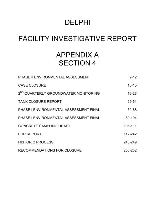
DELPHI<br />
FACILITY INVESTIGATIVE REPORT<br />
APPENDIX A<br />
SECTION 4<br />
PHASE II ENVIRONMENTAL ASSESSMENT 2-12<br />
CASE CLOSURE 13-15<br />
2 ND QUARTERLY GROUNDWATER MONITORING 16-28<br />
TANK CLOSURE REPORT 29-51<br />
PHASE I ENVIRONMENTAL ASSESSMENT FINAL 52-88<br />
PHASE I ENVIRONMENTAL ASSESSMENT FINAL 89-104<br />
CONCRETE SAMPLING DRAFT 105-111<br />
EDR REPORT 112-242<br />
HISTORIC PROCESS 243-249<br />
RECOMMENDATIONS FOR CLOSURE 250-252
PRIVILEGED AND CONFIDENTIAL<br />
PREPARED AT DELPHI CORPORATION'S COUNSEL'S REQUEST<br />
PHASE I1 ENVIRONMENTAL SITE ASSESSMENT<br />
DELPHI CORPORATION<br />
ANAHEIM BATTERY OPERATIONS<br />
1201 N. MAGNOLIA AVE.<br />
ANAHEIM, CALIFORNIA<br />
Prepared For:<br />
<strong>Delphi</strong> Corporation<br />
MARCH<br />
2005<br />
REF. NO. 37616-06 (6)<br />
This <strong>report</strong> is printed on recycled paper.
PRIVILEGED AND CONFIDENTIAL<br />
PREPARED AT DELPHI CORPORATION'S COUNSEL'S REQUEST<br />
TABLE OF CONTENTS<br />
...................................................................................................................<br />
INTRODUCTION 1<br />
1.1 BACKGROUND .................................................................................................. 1<br />
1.2 REPORT ORGANIZATION 2<br />
..............................................................................<br />
...................................................................................................................<br />
SCOPE OF WORK 3<br />
GEOLOGY AND HYDROGEOLOGY .......................................................................... 5<br />
RESULTS AND DISCUSSION .............................................................................................. 6<br />
4.1 FORMER UNDERGROUND STORAGE TANK AREAS ............................. 6<br />
4.2 FORMER LEAD RECLAMATION AREA ....................................................... 7<br />
4.3 USED OIL PROCESSING AREA ...................................................................... 7<br />
4.4 SOLID WASTES .................................................................................................. 7<br />
4.5 SPILLS/RELEASES OF LEAD OXIDE DUST 7<br />
................................................<br />
.....................................................................................................................<br />
CONCLUSIONS 9
FIGURE 1 SITE LOCATION<br />
PRIVILEGED AND CONFIDENTIAL<br />
PREPARED AT DELPHI CORPORATION'S COUNSEL'S REQUEST<br />
LIST OF FIGURES<br />
(Following Text)<br />
FIGURE 2 SITE PLAN - REC LOCATIONS<br />
FIGURE 3 SOIL BORING LOCATIONS<br />
FIGURE 4 ANALYTICAL DATA SUMMARY J<br />
TABLE 1<br />
TABLE 2<br />
LIST OF TABLES<br />
(Following Text)<br />
SAMPLING AND ANALYSIS PLAN<br />
SUMMARY OF DETECTED ANALYTES IN SOIL SAMPLES<br />
APPENDIX A STRATIGRAPHIC LOGS<br />
LIST OF APPENDICES<br />
APPENDIX B LABORATORY ANALYTICAL RESULTS<br />
APPENDIX C ANALYTICAL DATA VALIDATION
EXECUTIVE SUMMARY<br />
PRIVILEGED AND CONFIDENTIAL<br />
PREPARED AT DELPHI CORPORATION'S COUNSEL'S REQUEST<br />
Conestoga-Rovers & Associates (CRA) was retained by <strong>Delphi</strong> Corporation (<strong>Delphi</strong>) to<br />
complete a Phase I1 Environmental Site Assessment (Phase I1 ESA) of <strong>Delphi</strong>'s Anaheim<br />
Battery Operations (Site), located at 1201 N. Magnolia Avenue in Anaheim, Orange<br />
County, California. The Phase I1 ESA activities were conducted to investigate eight<br />
Recognized Environmental Conditions (RECs) identified in CRA's Phase I ESA prepared<br />
for the Site, dated November 2004. The RECs identdied during the Phase I ESA are as<br />
follows:<br />
Former underground storage tanks (USTs);<br />
Former lead reclamation area;<br />
Aboveground storage tanks (ASTs);<br />
Raw material and chemical storage;<br />
Battery charging tables;<br />
Used oil processing area;<br />
Solid wastes; and<br />
Spills/releases of lead oxide dust.<br />
RECs 3,4, and 5 listed above are not specifically addressed in this Phase I1 ESA. Due to<br />
access issues, these items will be investigated after current plant operations have ceased.<br />
It should be noted that the Region 9 (modified for California) Preliminary Remediation<br />
Goal (PRG) for lead at potential residential sites is 150 mg/kg. No Modified for<br />
California PRG for lead is listed for industrial sites. The USEPA Region 9 PRG for<br />
industrial sites is 800 mg/kg.<br />
The results of the Phase I1 ESA showed the following:<br />
REC No. 1 -Former USTs<br />
No evidence of petroleum hydrocarbon impact above Region 9 PRGs for potential<br />
residential or industrial sites was detected at either of the former UST areas.
REC No. 2 - Former lead reclamation area<br />
PRIVILEGED AND CONFIDENTIAL<br />
PREPARED AT DELPHI CORPORATION'S COUNSEL'S REQUEST<br />
No evidence of lead impact above Region 9 PRGs for potential residential (Modified<br />
California) or industrial sites was detected beneath the concrete flooring of the former<br />
lead reclamation area.<br />
REC No. 6 - Used oil processing area<br />
No evidence used oil impact above Region 9 PRGs for potential residential or industrial<br />
sites was detected at the used oil processing area.<br />
REC No. 7 - Solid wastes<br />
Lead concentrations exceeding Modified California Region 9 residential site PRGs were<br />
detected in the 0 to 6-inch bgs surface soil sample from SB-20 collected adjacent to the<br />
storm water retention basin. The underlying sample from the 12 to 18-inch bgs interval<br />
did not exceed the residential PRG.<br />
REC No. 8 - Spillslreleases of lead oxide dust<br />
Lead concentration exceeding Modified California residential PRGs were detected at<br />
several Site areas. These areas are as follows:<br />
along the railroad spur, particularly along the loading docks (SB-15, SB-16, SB21,<br />
SB-25, and SB-26) in samples collected from 0 to 6/12 to 18, and 24 to 30 inches bgs;<br />
the grassy area across from the bagpg operations north of the driveway (SB-10<br />
through SB-14) in samples collected from 0 to 6 inches bgs;<br />
the grassy area near the Guard House (SB-1 and SB-3) in samples collected from 0 to<br />
6 inches bgs; and<br />
the grassy areas along southern driveway downwind of the breezeway between the<br />
air washers (SB-8 and SB-9) in samples collected from 0 to 6 inches bgs.<br />
Elevated concentrations of lead above the industrial PRGs were also detected along the<br />
railway spur in the 0 to 6-inch interval and the 12-18-inch interval, and in the grassy area<br />
across from the bagging operations in the 0 to 6-inch interval.
1.0 INTRODUCTION<br />
BACKGROUND<br />
PRIVILEGED AND CONFIDENTIAL<br />
PREPARED AT DELPHI CORPORATION'S COUNSEL'S REQUEST<br />
At the request of <strong>Delphi</strong> Corporation (<strong>Delphi</strong>), Conestoga-Rovers & Associates (CRA)<br />
was retained to conduct a Phase I1 Environmental Site Assessment (Phase I1 ESA) of the<br />
<strong>Delphi</strong>'s Anaheim Battery Operations (Site) located at 1201 N. Magnolia Avenue,<br />
Anaheim, Orange County, California. The Site location is shown on Figure 1. A Site<br />
plan is shown on Figure 2. This <strong>report</strong> presents the findings and recommendations of<br />
the Site Phase 11 ESA.<br />
The Phase I ESA was conducted by CRA on October 5 and 6, 2004. The Phase I ESA<br />
included Site inspection and database/file review to identify Potential Recognized<br />
Environmental Conditions (RECs) associated with historic or current activities<br />
conducted at the Site. The following RECs, as presented on Figure 2, were identified<br />
during the Phase I ESA:<br />
Former underground storage tanks (USTs);<br />
Former lead reclamation area;<br />
Above ground storage tanks (ASTs);<br />
Raw Material and chemical storage;<br />
Battery charging tables;<br />
Used oil processing Area;<br />
Solid wastes; and<br />
Spills/releases of lead oxide dust.<br />
RECS 3, 4, and 5 listed above are not specifically addressed in this ESA. Due to access<br />
issues, these items will be investigated after current plant operations have ceased.<br />
Based on discussion with <strong>Delphi</strong>, a Phase I1 ESA field <strong>investigation</strong> was designed to<br />
collect additional data to evaluate five of the eight RECs. The Phase I1 ESA field<br />
activities were conducted by CRA on November 16 and 17, 2004. The objective of the<br />
Phase I1 ESA was to confirm whether compound releases due to Site related operations<br />
have occurred at concentration levels, which may have adverse impacts to the public or<br />
the environment.
PRIVILEGED AND CONFIDENTIAL<br />
PREPARED AT DELPHI CORPORATION'S COUNSEL'S REQUEST<br />
REPORT ORGANIZATION<br />
The Phase I1 ESA Report is organized as follows:<br />
Section 1.0 - Introduction;<br />
Section 2.0 - Scope of Work;<br />
Section 3.0 - Geology and Hydrogeology;<br />
Section 4.0 - Results and Discussion; AND<br />
Section 5.0 - Conclusions.
3.0 GEOLOGY AND HYDROGEOLOGY<br />
PRIVILEGED AND CONFIDENTIAL<br />
PREPARED AT DELPHI CORPORATION'S COUNSEL'S REQUEST<br />
Limited information regarding geologic/hydrogeologic conditions at the Site was<br />
collected during the Phase 1 ESA. site <strong>report</strong>s reviewed during the Phase I ESA <strong>report</strong><br />
preparation indicate that the Site is underlain by alluvial deposits consisting of poorly<br />
consolidated to unconsolidated clay, silt, sand and gravel of continental origins.<br />
Groundwater in the Site area was <strong>report</strong>ed at approximately 30 feet bgs with -- potable<br />
aquifers at depths greater than 100 feet. The groundwater flow was <strong>report</strong>ed to be to the<br />
southwest. There are no surface water bodies or water courses located on Site. The<br />
nearest surface water course is Fullerton Creek located approximately 0.8miles<br />
northwest of the Site.<br />
Information regarding geologic conditions at the Site was collected during the Phase I1<br />
ESA. The overburden at the Site consists of a surficial layer, comprised of fill materials<br />
(gravel and sand), underlain by a native clayey silt soil horizon. The fill layer appears to<br />
be discontinuous across the Site and is thickest beneath the loading dock areas where it<br />
reaches a maximum thickness of approximately four feet. The underlying native<br />
material consists of brown, stiff to compact, damp clayey silt. This upper native soil<br />
horizon grades downward to light gray brown to light gray silty sand, clayey sand, and<br />
clayey silt. The lower material is crudely stratdied and is consistent with the alluvial<br />
deposits described above. Depth to groundwater was not confirmed during the boring<br />
installations; however, the materials became quite moist at 22 to 24 feet bgs in the two<br />
deeper borings. Water did not enter the borings during the field activities; therefore, no<br />
groundwater samples were collected.
PRIVILEGED AND CONFIDENTIAL<br />
PREPARED AT DELPHI CORPORATION'S COUNSEL'S REQUEST<br />
None of the concentrations detected at the former UST areas exceeded Region 9 PRGs<br />
for potential residential sites. The measured pH levels are slightly alkaline, but<br />
relatively neutral.<br />
4.2 FORMER LEAD RECLAMATION AREA<br />
One soil boring was advanced to one foot below the concrete within the former lead<br />
reclamation area. One soil sample was collected and submitted for lead analysis. Lead<br />
was detected at a concentration of 5.9 mg/kg, which is well below the Modified<br />
California PRG for lead for potential residential sites.<br />
4.3 USED OIL PROCESSING AREA<br />
One soil boring (SB-24) was advanced at the location of the Used Oil Processing area.<br />
Organic vapors were detected at a depth of 4 feet bgs. A soil sample from this depth<br />
was submitted for BTEX and TPH analysis. +I_ Toluene was the only parameter detected, at<br />
a concentration of 150pg/kg. The toluene concentration is well below the listed<br />
Region 9 PRG for toluene for potential residential sites (520 mg/kg).<br />
4.4 SOLID WASTES<br />
Two soil borings (SB-19 and SB-20) were advanced 30-inches bgs to investigate areas of<br />
potential solid wastes (sweepings). Three soil samples from each boring (0 to 6/12 to 18,<br />
and 24 to 30 inches bgs) were submitted for lead analysis. Lead was detected in all<br />
samples but only exceeded the Region 9 (modified for California) PRG (150 mg/kg) for<br />
potential residential sites in the 0 to 6 inch sample at SB-20 (lead concentration of<br />
487 mg/kg). The industrial PRG was not exceeded.<br />
4.5 SPILLSIRELEASES OF LEAD OXIDE DUST<br />
Twenty-one soil borings (SB-1 through SB-18, SB-21, and SB-25 and SB-26) were<br />
advanced 30-inches bgs to investigate potential spills or releases and accumulations of<br />
lead oxide dust. These areas are located primarily along the railroad spur and grassy<br />
areas surrounding the Site operations. Three soil samples from each boring 10 to 6/12 to<br />
18, and 24 to 30 inches bgs) were submitted for lead analysis except at SB-25 where only
PRIVILEGED AND CONFIDENTIAL<br />
PREPARED AT DELPHI CORPORATION'S COUNSEL'S REQUEST<br />
two were collected due to no recovery from the 0 to 6 inches interval. Lead was detected<br />
in all samples at concentrations that ranged from 2.1 mg/kg to 63,500 mg/kg.<br />
Fourteen soil samples collected from the 0 to 6-inch interval (SB-1, SB-3, SB-8 through<br />
SB-16, SB-20, SB-21, and SB-26) exceeded the Modified California residential PRG. Six<br />
soil samples from the 0 to 6-inch interval (SB-11, SB-13, SB-14, SB-16, SB-21, and SB-26)<br />
exceeded the USEPA Region 9 PRG for industrial sites. Three soil samples collected<br />
from the 12 to l&inch interval (SB-21, SB-25, and SB-26) exceeded the Modified<br />
California residential PRG, while only one soil sample (SB-21) exceeded USEPA<br />
industrial PRG. Two soil samples collected from the 24 to 30-inch interval (SB-21 and<br />
SB-25) exceeded the Modified California residential PRG, but none of the soil samples<br />
exceeded the USEPA industrial PRG.
5.0 CONCLUSIONS<br />
PRIVILEGED AND CONFIDENTIAL<br />
PREPARED AT DELPHI CORPORATION'S COUNSEL'S REQUEST<br />
The following presents the conclusions based on the data collected during the Phase I1<br />
ESA:<br />
REC No. 1 - Former USTs<br />
No evidence of petroleum hydrocarbon impact above Region 9 PRGs for potential<br />
residential or industrial sites was detected at either of the former UST areas.<br />
REC No. 2 - Former lead reclamation area<br />
No evidence of lead impact above Region 9 PRGs for potential residential (Modified<br />
California) or industrial sites was detected beneath the concrete flooring of the former<br />
lead reclamation area.<br />
REC No. 6 - Used oil processing area<br />
No evidence used oil impact above Region 9 PRGs for potential residential or industrial<br />
sites was detected at the used oil processing area.<br />
REC No. 7 - Solid wastes<br />
Lead concentrations exceeding Modified California Region 9 residential site PRGs were<br />
detected in the 0 to 6-inch bgs surface soil sample from SB-20 collected adjacent to the<br />
storm water retention basin. The underlying sample from the 12 to 18-inch bgs interval<br />
did not exceed the residential PRG.<br />
REC No. 8 - Spills/releases of lead oxide dust<br />
Lead concentration exceeding Modified California residential PRGs were detected at<br />
several Site areas. These areas are as follows:<br />
along the railroad spur, particularly along the loading docks (SB-15, SB-16, SB21,<br />
SB-25, and SB-26) in samples collected from 0 to 6,12 to 18, and 24 to 30 inches bgs;<br />
the grassy area across from the bagging operations north of the driveway (SB-10<br />
through SB-14) in samples collected from 0 to 6 inches bgs;<br />
the grassy area near the Guard House (SB-1 and SB-3) in samples collected from 0 to<br />
6 inches bgs; and
PRIVILEGED AND CONFIDENTIAL<br />
PREPARED AT DELPHI CORPORATION'S COUNSEL'S REQUEST<br />
the grassy areas along southern driveway downwind of the breezeway between the<br />
air washers (SB-8 and SB-9) in samples collected from 0 to 6 inches bgs.<br />
Elevated concentrations of lead above the industrial PRGs were also detected along the<br />
railway spur in the 0 to 6-inch interval and the 12-18-inch interval, and in the grassy area<br />
across from the bagging operations in the 0 to 6-inch interval.
March 3,2000<br />
COUNTY OF ORANGE<br />
HEALTHCAREAGENCY<br />
. . REGULATQRY HEALTH SERVICES<br />
ENVIRONMENTAL HEALTH<br />
]Eric Weng<br />
Facihty Enpeer<br />
-hi Energy & Engine Management System<br />
lzOl North Magnolia Avenue<br />
Anaheim, CA 92801<br />
Re: BlpM Energy & Engine Management Systems<br />
m=ly Lklco &my)<br />
1201 North Magnolia Avenue<br />
Anaheim, CA 92801<br />
OCHCA Case # 881C80<br />
Dear Mr. Weng:<br />
klCnAu SCHUMACHER, PhD.<br />
MRECrWI<br />
MQwmGmN<br />
DWLWAGENCIDIRECTOR<br />
REGUATOFN~3H8ERVlCES<br />
JffiKUaLERM<br />
MRECrOR<br />
ENVIRONMENTAL HEALTH<br />
MAlUNGAD~<br />
2 m u m ~ A V € N u E<br />
M A ANA CA n27054720<br />
TELEPHONE: (714) 667-36m<br />
FAX (714) Mi4749<br />
EMk timk+ml@)#aco.-w<br />
This letter confbns the completion of r e d acticm at the above-referenced site. With the<br />
provision that tk info~on provided to this Agency was acc- and representative of existing<br />
conditions, it is the position of this office that no furthtr action is required at thjs the.<br />
This confirmation of completion is limited in scope. It is limited to site anditions made known to<br />
this Agency under the above-referenced case number. It is based 012 an evaluation of the health<br />
threat pnwntd by the inhalation, ingestion, or dermal absowon of the ~~idual con taminants. In<br />
addition, this evaluation considered the present and proposed us0 of the property. Changes in the<br />
pqosed land use may require further site charactmn andlor site mitigation activity.<br />
The presence of lead (Pb) and the potential br residual contamination to cause groundwater<br />
degruhon was discussed with Kamron Saremi of the Santa Ana Regional Water Quahty Control<br />
Bod Regional Board staff concurred that no further action is required at this time.<br />
Please be advised that this letter does not relieve you of any liability under the ChMbrnia Health<br />
and SaWy Code or Water Code for past, present or future oper&ions at the site. Nor does it relieve<br />
you of the responsibii to clean up existing, additional or previously unidentified conditions at<br />
the she: which cause or thaten to cause pollution or nuisance or othemise pose a threat to water<br />
quality or public health. Any activity in the 'northwest field' that would result in soil disposal as<br />
defined by the: Departmem of Toxic Substances Control must be dealt with under hazardous waste<br />
I I<br />
EB/ZB ' d 6Z8ZPZE8 01 0809 0ZZ PTL WI3HUNtJ 3 IHdl3a/W9 ad LP:BT 000Z 90 EJWW
4<br />
Eric Wwg March 3, UX)[)<br />
a' w2<br />
regulations. It is the pmperty owner's rep- to now this Agency of any changes in futtm<br />
contamination Wings or site usage.<br />
If you have any questions regarding this matter, please contact Luis Ldrjgucza at (714) 467-<br />
3717.<br />
Sincerely,<br />
fihn J t cS<br />
Karen L. Hodel, R.G.<br />
Programmer. . . . . . . ...<br />
Hazardous Mateaids Maqpmnt Section<br />
bvimnrnental Health<br />
KLKILt;<br />
CC: Kammn Saxmi, Santa Ana RegionaI Water Quality Control Board
Division of General Motors Corporat~on 1201 North Magnolia Avenue<br />
Mr. Steven D. Overman<br />
California Regional Water<br />
Quality Control Board<br />
Santa Ana Region<br />
6809 Indiana Avenue, Suite 200<br />
Riverside, California 92506<br />
Dear Mr. Overman:<br />
October 30,1990<br />
P. 0. Box 3190 Anahelm. California 92803-3190<br />
Please find enclosed the second quarterly ground-water monitoring results as<br />
conducted by Dames & Moore for Delco Remy-Anaheim.<br />
The data enclosed is for your evaluation and in response to your letter dated<br />
May 23, 1990 requiring quarterly monitoring of ground-water wells MW-1 and<br />
MW-4 for a period of one year.<br />
Enclosure<br />
knr23.ltr<br />
KEN RAYLE<br />
Project Engineer<br />
,
SECOND QUARTERLY GROUND-WATER MONITORING<br />
DELCO REMY<br />
1201 NORTH MAGNOLIA AVENUE<br />
ANAHEIM, CALIFORNIA<br />
FOR DELCO REMY<br />
JOB NO. 14197-013-128<br />
October 25, 1990<br />
-DAMES & MOORE
- 6 H mON CENTRE DRIVE SUITE 700, SANTA ANA, CALIFORNIA 92707 (714) 433-2000<br />
FAX (714) 433-2364 FAX (7i4 433-2365<br />
Delco Remy<br />
Division of General Motors<br />
1201 North Magnolia Avenue<br />
~naheim, California 92803<br />
~ttention: Mr. Ken Rayle<br />
Project Engineer<br />
Sub j ect :<br />
Gentlemen:<br />
October 25, 1990<br />
Second Quarterly Ground-Water Monitoring Results<br />
1201 North Magnolia Avenue<br />
Anaheim, California<br />
For Delco Remv<br />
1.0 INTRODUCTION<br />
Transmitted with this letter are the second quarterly ground-<br />
water monitoring results for the Delco Remy Site, Anaheim,<br />
California (Figure 1). The monitoring program is being conducted<br />
to comply with a request by the California Regional Water Quality<br />
Control Board (CRWQCB) as stated in a letter from the CRWQCB dated<br />
May 23, 1990. The request for the continued <strong>investigation</strong> is based<br />
on the analytical results of ground-water samples collected in<br />
December, 1989. The results of the December, 1989 monitoring are<br />
presented in Table 1.<br />
1.1 BACKGROUND<br />
In July 1986 a ground-water monitoring well (MW-1) was<br />
installed at the subject site in the area of a former underground<br />
storage tank. MW-1 exhibited a pH of 9.44 and a deep brown-black<br />
color. No odor was detected in the samples collected.<br />
Analytical results indicated that the dark coloring was not<br />
caused by organic and/or heavy metal contamination. Instead, it
Delco Remy<br />
October 25, 1990<br />
Page 2<br />
was demonstrated that a release of sodium hydroxide into the soil<br />
and ground water in the vicinity of MW-1 has caused naturally<br />
occurring molecules of humic acid (natural organic content of the<br />
soil) to be partly dissolved and partly suspended in the ground<br />
water as colloidal particles. Because of this release, the ground<br />
water in the immediate vicinity of MW-1 has been found to have<br />
elevated concentrations of dissolved sodium ion and pH levels of up<br />
to 9.6.<br />
In July 1988 two additional monitoring wells, MW-2 and MW-3,<br />
were installed to assess the ground-water flow direction at the<br />
site. In August 1989, monitoring well MW-4 was installed<br />
downgradient from MW-1 to investigate the downgradient water<br />
quality. To date, the ground-water samples collected from<br />
monitoring wells MW-2, MW-3, and MW-4 have shown relatively neutral<br />
pH values (7.42 to 7.20) and no discoloration.<br />
Based on the previous investigative results, Dames & Moore<br />
have demonstrated that natural processes in the aquifer are<br />
remediating the relatively high pH and discoloration of the ground<br />
water in the vicinity of MW-1. Thus, no additional remediation was<br />
proposed. In the May 23, 1990 letter, the CRWQCB concurred with<br />
Dames & Moore's conclusion and requested quarterly monitoring of<br />
MW-1 and MW-4 for a period of one year. The first quarterly<br />
monitoring was conducted in June, 1990. The results of the second<br />
quarterly monitoring was consistent with our previous monitoring<br />
results (see Table 1). This letter <strong>report</strong> presents the results of<br />
the second quarterly monitoring and sampling of MW-1 and MW-4.<br />
2.0 PURPOSE AND SCOPE<br />
The purpose of the program was to comply with the CRWQCBts<br />
request and to monitor the effectiveness of the natural processes
Delco Remy<br />
October 25, 1990<br />
Page 3<br />
in remediating the discolored ground water found in monitoring well<br />
MW-1. The scope of work included:<br />
o collecting a ground-water sample from monitoring wells<br />
MW-1 and MW-4;<br />
o analyzing the ground-water samples for sodium, calcium,<br />
color, and pH; and<br />
o preparing this letter <strong>report</strong> to present our findings and<br />
conclusions.<br />
3.0 INVESTIGATIVE METHODS<br />
Monitoring wells MW-1 and MW-4 were sampled on September 7,<br />
1990. Prior to sampling, each well was purged a minimum of three<br />
well volumes using a polpinylchloride bailer. Water samples were<br />
collected using a disposable polyethylene bailer. Samples from<br />
each well were collected in bottles supplied by the analytical<br />
laboratory. These bottles were prepared by the analytical<br />
laboratory in accordance with standard EPA laboratory protocol.<br />
The bottles were filled usingthe submerged fill technique, leaving<br />
no headspace in the bottle. The sample bottles were labeled with<br />
the following information: sample number, date, collector name,<br />
owner, sample location, and time of collection. The samples were<br />
placed in an ice-cooled chest transported Del Mar Analytical of<br />
Irvine, California. Del Mar Analytical is certified by the<br />
California State Department of Health Services to perform the<br />
laboratory analyses. Chain of custody records were maintained<br />
throughout the sampling program.
Delco Remy<br />
October 25, 1990<br />
Page 4<br />
The ground-water samples were analyzed for calcium by<br />
Environmental Protection Agency (EPA) Method 215.1, sodium by EPA<br />
Method 7770, pH by EPA Method 150.1, and color by EPA Method 110.2.<br />
4.0 FINDINGS<br />
The analytical results of the second round of quarterly<br />
monitoring as well as the previous monitoring results are shown in<br />
Table 1. Copies of the Chain of Custody and the laboratory <strong>report</strong>s<br />
for the second quarterly monitoring are in Appendix A. In summary,<br />
the analytical results of the September, 1990 monitoring indicate<br />
similar sodium and calcium concentrations tothe December, 1989 and<br />
June, 1990 monitoring results. The pH and ground-water<br />
discoloration in both wells, however, have diminished. The pH in<br />
Well MW-1 has been steadily decreasing and becoming less alkaline.<br />
These results are consistent with our previous conclusion that the<br />
discolored and relatively high pH ground water in the vicinity of<br />
MW-1 is becoming diluted and neutralized by natural processes. As<br />
stated in our previous <strong>report</strong>s, in our opinion additional remedial<br />
actions would not be necessary.
Delco Remy<br />
October 25, 1990<br />
Page 5<br />
We trust this letter addresses your current requirements.<br />
Should you have questions regrading the contents of this letter or<br />
require additional information, please contact us.<br />
~ssi E. Esmaili, Ph. D.<br />
Registered Geologist #4469<br />
Associate<br />
Taras B. Kruk<br />
Project Geologist<br />
Attachments: Table 1 (Results of Laboratory Analyses)<br />
Appendix A (Chain of Custody and Laboratory Reports)<br />
pc : DRQM.2. LTR
TABLE 1<br />
RESULTS OF LABORATORY ANALYSES<br />
FOR GROUND-WATER MONITORING<br />
DELCO REMY<br />
ANAHEIM, CALIFORNIA<br />
Color Sodium Calcium PH<br />
Well NO. (APHAColor Units) (Ppn) (PPn) (units)<br />
MW- 1<br />
MW-4<br />
December, 1989<br />
June, 1990<br />
September, 1990<br />
~xplanation<br />
ppm = parts per million<br />
APHA = American Public Health Association<br />
pH = hydrogen ion concentration
FULLERTON<br />
* l R p 7<br />
LA PALMA<br />
LINCOLN AVE<br />
COUWNW EALTH AVE<br />
- i<br />
O<br />
SCALE IN MILES<br />
VICINITY MAP<br />
~ELCO REMY SITE<br />
ANAHEIM, CALIFORNIA<br />
Dames & Moore<br />
FIGURE 1
APPENDIX A<br />
CHAIN OF CUSTODY AND LABORATORY REPORTS
ANALYTICAL LABORATOR _a - -<br />
C<br />
LOCATION<br />
/<br />
SHEET OF<br />
6 IIWTON CENlRE DRlVE. SUITE 700<br />
SANTA ANA. CALII OR~~A 92707 COLLECTOR DATE OF COLLECTION<br />
(714) 433 2000 FAX 014) 433-2364 4
I<br />
- '-- Del Mar Analytical<br />
18102 Sky Park South, Suite F . Itvine, CA 92714<br />
1 (714) 261-1022 . FAX (714) 26l-1228<br />
pH<br />
Calcium, mg/L<br />
sodium, mg/L<br />
Cdor. APHA<br />
LABORATORY ANALYSIS<br />
I<br />
Analytes <strong>report</strong>ed as N.D. were not present above the stated limit of detection.<br />
DEL MAR ANALYTICAL<br />
EPA Method Detection Limit Sample Resub-<br />
N.A.<br />
0.05<br />
0.05<br />
N.A.
I<br />
Calcium, mg/L I pH Sodium, mg/L<br />
Color. APHA<br />
- Drd Mar Analytical<br />
18102 Sky Park Soul h, Surte F . Irvlne, CA 92714<br />
(714) 261-1022 . FAX (714) 261-1228<br />
LABORATORY ANALYSIS<br />
EPA Method<br />
Analytes <strong>report</strong>ed as N.D. were not present above the stated limit of detection.<br />
I<br />
DEL MAR ANALYTlCAL<br />
I .\k<br />
Ga Steube<br />
Detection Limit<br />
N.A.<br />
0.05<br />
0.05<br />
N.A.<br />
Sample R esub
u<br />
oelco Remu Division 0, ,.era, ~otors ~or~rat~on 1201 mrth ~a~nolia:~venue P. 0. BOX 3190 Anaheim Caifornm 92.3-~0<br />
Mr. Timothy Naprawa<br />
Orange County Health Care Agency<br />
2009 E. Edinger Avenue<br />
Santa Ana, California 92702<br />
Dear Mr. Naprawa: J<br />
January 9, 1990<br />
Please find enclosed a Tank Closure Report prepared by<br />
Dames & Moore, Environmental Consultants, for Delco Remy,<br />
Anaheim, California.<br />
This <strong>report</strong> documents the removal of one 500 gallon under-<br />
ground storage tank (UST) used for gasoline storage.<br />
Please contact me at (714) 220-6048 if you have any further<br />
questions.<br />
KGL<br />
Sincer<br />
Enc.<br />
Project Engineer<br />
cc : Sylvia Mendez, Anaheim Fire Department<br />
Garish Mathur, SCAQMD
TANK CLOSURE REPORT<br />
DELCO REMY<br />
1201 NORTH MAGNOLIA<br />
ANAHEIM, CALIFORNIA<br />
Post-It" bran<br />
r-<br />
" f ric CO.<br />
Dept.<br />
JOB NO. 14197-001-128<br />
DECEMBER 22, 1989<br />
"'204 - 9 83-@?60<br />
Phone #<br />
Fax#<br />
J C ~<br />
a?<br />
-33ry<br />
4-<br />
-DAMES & MOORE<br />
SANTA ANA, CALIFORNIA
TANK CLOSURE REPORT<br />
DELCO REMY<br />
1201 NORTH MAGNOLIA<br />
ANAHEIM, CALIFORNIA<br />
1.0 INTRODUCTION<br />
This <strong>report</strong> documents the removal of an approximately<br />
500-gallon Underground Storage Tank (UST) from the Delco Remy<br />
<strong>facility</strong> in Anaheim, California (Figure 1). This work was<br />
conducted in accordance with an approved work plan by Orange<br />
County Health Care Agency (OCHCA), dated August 29, 1989, and<br />
a permit (Number 89-2733) obtained from South Coast Air<br />
Quality Management District (SCAQMD).<br />
Dames & Moore was retained by Delco Remy to observe and<br />
document the removal of the UST from their <strong>facility</strong> in<br />
Anaheim, California. R. Fox Construction Company was also<br />
retained as a subcontractor by Delco Remy for this project.<br />
The R. Fox Construction Services consisted of excavation,<br />
removal, neutralization, and disposal of the UST that<br />
historically contained regular gasoline. The UST was located<br />
west and north of the main Delco Remy buildings (Figure 2).<br />
The tank_ was connected to a pump dispenser<br />
__ _____ _- - -- ~10cted-~_towards the a<br />
south end of the tank (Figure 3). According to Mr. Ken Rayle<br />
of Delco Remy, the tank was installed onsite in 1953, and has<br />
been in operation since 1954.<br />
2.0 TANK REMOVAL<br />
On November 6, 1989, the asphalt cover and surficial<br />
soils were removed to expose the UST. This procedure was not<br />
observed by Dames & Moore personnel. According to R. Fox<br />
Construction Company, there was no evidence of soil staining<br />
on the sides or top of the tank.<br />
The tank removal was scheduled for November 7, 1989.<br />
However, a break in an adjacent water line forced the early
emoval of the tank from the excavation on the afternoon of<br />
November 6. A small electric pump was used by Delco Remy personnel<br />
to remove most of the water in the pit prior to<br />
sampling. In addition, the bottom of the pit was excavated to<br />
drier soil approximately three feet beneath the bottom of the<br />
former tank. The final dimensions of the excavation were<br />
-- - -. - -- -_<br />
approximately 15 X 15 X 8 feet.<br />
-<br />
Removal of the tank was conducted under the supervision<br />
of Ms. Sylvia Mendez of the Anaheim Fire Department on<br />
November 7, 1989. The --_- tank -- did not appear to have any perforations<br />
or rusted-through spots through which fuel may have<br />
leaked. Prior to removal, the tank was filled with dry ice.<br />
The removed tank was shipped to American Metal Recycling,<br />
Inc., for disposal under EPA manifest, as shown in Appendix A.<br />
' 3.0 CONFIRMATORY SAMPLING<br />
Subsequent to the tank removal, three confirmatory<br />
samples, _I _ __ ____I___ two - from the bottom II______I--<br />
of the-<br />
_ _-<br />
- *<br />
from the spoil pile, were collected under the supervision of<br />
-- - -- I* _l-.-. - --- -I<br />
Mr. Timothy Naprawa of the OCHCA. The sampling locations are<br />
shown in Figure 3. The samples were collected in 2.5-inch<br />
diameter and 3-inch long stainless steel rings that were<br />
driven directly into the excavation bottom wall or spoil pile<br />
side. The open ends of the rings were covered with teflon<br />
sheeting and sealed with plastic end caps. Sample labels with<br />
the following information were affixed to one end of the<br />
rings: sample number, date and time of collection, project<br />
number and owner's name, collector~s name and location. The<br />
sealed and labeled samples were immediately placed in a cooler<br />
with blue ice and shipped, cooled, to the laboratory for<br />
analysis. Chain-of-Custody forms are presented in Appendix B.<br />
The three soil samples were analyzed chemically by Curtis<br />
and ~ompkins Ltd. (CTL), Analytical Laboratory of Los Angeles,<br />
California. CTL is a California Department of Health
Services-certified laboratory. The samples were analyzed for<br />
~0tal Volatile Hydrocarbons (TVH) using gasoline as a standard<br />
by Modified EPA Method 8015 (California ~epartment of Health<br />
procedure ) , for Benzene, Toluene, total Xylenes<br />
-<br />
and<br />
. . _ I _ _ -<br />
-<br />
Ethylbenzene (BTXE) by EPA Method 8020, and for Total Lead<br />
-<br />
using EPA ~ethod 7420. Extraction for TVH was conducted by<br />
-- _<br />
EPA Method 5030 Purge and Trap. TVH as _ gasoline _--- and BTXE-__~-ere<br />
not detected in any es collected. Lead with a<br />
concentration of 2.5 ~axt.;_ger- million (pprn) was detected in<br />
one of the two samples collected in the excavation pit. The<br />
spoil pile sample was found to contain lead with a<br />
concentration of , 445 pp~. A summary of the analytical testing<br />
program and chemical testing results is included on Table I.<br />
Copies of the <strong>report</strong>s received from the analytical laboratory<br />
are included in Appendix C.<br />
Organic vapor emissions in the excavation pit and from<br />
the spoil pile were monitored using a photoionization Tip<br />
calibrated to known concentrations of hexane, and with a<br />
Gastechtor operated by Mr. Naprawa of the OCHCA. Readings<br />
were taken from newly-exposed soil scrapped off with a shovel<br />
or spatula from the bottom and sides of the excavation. Tip<br />
readings ranged from 1.5 to 1.8 ppm in the walls, and from 1.6<br />
to 2.1 from the bottom of the pit. Vapor emissions from the<br />
spoil pile ranged from 0.6 to 1.1 ppm. These readings did not<br />
vary when the pile was dug into with a shovel. Ambient air<br />
ranged from 0.5 to 2.3 ppm. Readings with the Gastechtor<br />
ranged from 0 to 50 ppm in both the excavation pit and spoil<br />
pile.<br />
4.0 BACKFILLING<br />
As <strong>report</strong>ed by Delco Remy (Mr. Ken Rayle, personal<br />
communication), the excavation pit was backfilled by imported<br />
material. R. Fox Construction supervised the placement and<br />
compaction of fill material. The excavated soil was stored<br />
onsite at the northwest field of the property for future<br />
handling.
\a ,' 5.0 DISCUSSION<br />
n the analytical data of the soil samples anaylzed,<br />
it i r opinion that the operation and removal of the<br />
approximately 500-gallon UST had not caused contamination of<br />
the surrounding soils, and therefore, no additional soil<br />
characterization or excavation is necessary. Our opinion is<br />
supported by the following findings:<br />
o Total Hydrocarbon Volatiles and BTXE were not<br />
detected in any of the samples collected in either<br />
the excavation or in the spoil pile;<br />
o Organic vapor emissions above background levels were<br />
not detected in either the excavation pit or in the<br />
spoil pile;<br />
o The lead detected in the spoil pile sample is most<br />
likely associated with the elevated levels of lead<br />
that have been detected in the nearby off-site areas<br />
and other parts of the Delco Remy <strong>facility</strong>.<br />
Therefore, the lead is not believed to be associated<br />
with any potential leak from the underground storage<br />
tank ;<br />
Please contact us if you have any questions about this<br />
project or require further assistance.
The following are attached and complete this <strong>report</strong>:<br />
Table I ~aboratory Results<br />
Figure 1 Vicinity Map<br />
Figure 2 Site Plan<br />
Figure 3 Tank Location Map and Tank Removal Sample<br />
Locations<br />
Appendix A Tank Disposal Documents and Manifests<br />
Appendix B Chain-of-Custody Records<br />
Appendix C Laboratory Reports<br />
Santa Ana, California<br />
November 1989<br />
EEE:TG:mdm<br />
89EE.11-13<br />
- E. Essi Esmaili, Ph.D.<br />
Associate<br />
Registered Geologist 4469<br />
Geologist
TABLE I<br />
ANALYTICAL TESTING RESULTS<br />
DELCO REMY - TANK CLOSURE<br />
Total Ethyl<br />
Approximate TVH* Benzene To1 uene Xyl enes Benzene<br />
Sample No. Depth (ppm) (ppb) (ppb) (ppb) (ppb)<br />
SS-P 3 inch ND ND ND ND ND<br />
into<br />
pile<br />
*TVH - Total Volatile Hydrocarbons with gasoline as standard<br />
analyzed by EPA Method Modified 8015<br />
BTXE - Analyzed by EPA Method 8020<br />
Total Lead - Analyzed by EPA Method 7420<br />
Total<br />
Lead<br />
0<br />
2.5<br />
\
1<br />
I<br />
1 12 0<br />
Scale in miles<br />
VICINITY MAP<br />
DELCO REMY<br />
1201 NORTH MAGNOLIA<br />
ANAHEIM, CALIFORNIA<br />
For Delco Remy<br />
REFERENCE: USGS 7.5 Minute Series Topographic Maps, "Anaheim, Dames & Moore<br />
California" Quadrangles, Photorevised 1981.<br />
1<br />
i
PLOT PLAN<br />
DELCO REMY<br />
1201 NORTH MAGNOLIA<br />
Z<br />
ANAHEIM, CALIFORNIA<br />
0<br />
o For Delco Remy<br />
3<br />
PARKING
APPROXIMATE LOCATION<br />
OF FUEL DISPENSER<br />
I<br />
LIMITS OF<br />
EXCAVATION<br />
EXPLANATION<br />
LIMITS OF<br />
/ EXCAVATION<br />
@ SOIL SAMPLE LOCATION<br />
WATER MAIN<br />
0 FORMER TANK LOCATION<br />
APPROXIMATE-<br />
SCALE IN FEET<br />
RAILROAD<br />
LINE<br />
TANK LOCATION MAP<br />
WITH TANK REMOVAL SAMPLE LOCATIONS<br />
TANK CLOSURE REPORT<br />
DELCO REMY<br />
1201 NORTH MAGNOLIA<br />
ANAHEIM, CALIFORNIA<br />
For Delco Remy Dames & Moore
ULLC~U \LI I I r11~n1 ILLI I I LL. l lqLLUVUOU IYUV LO 9 03 11m3Y My. UU4<br />
I I<br />
~ - 4 - - 4 . - d A b =<br />
4<br />
$PECiAL tNSTRUCTIONS<br />
@d&TUL FEE-<br />
PROJECTEO TANKS<br />
+ .<br />
- -<br />
._1*- . . .<br />
. &<br />
CERTIFICATE OF TANK DISPOSAL I DESRUCTIOM<br />
D ACCEPTANCE OF THE TAN&$)<br />
COMPLETELY DESTROYED FOR<br />
TANK DISPOSAL FORM<br />
1
YLLL.V I,LI I I I IIVI II ILAII I LL - I<br />
lwtmwn1MIm- * k&uu<br />
J.-rLLwwuww IYUV L01V3 11.33 I Y U .UU4 I UL<br />
Hmmuarrs.-m\wwrIlrr*,<br />
k+ri~sryp.. 179mkrbnrd~~sr,rY)*(1~6FdwJ.<br />
C<br />
UNIFORM HAZARDOUS<br />
WASTE MANIFEST<br />
YaruHo*kOwWmO<br />
. -<br />
. '<br />
C<br />
U<br />
I<br />
6. U1 EPA D Nunbw<br />
No. TW<br />
" ' 8 . .<br />
I I 1 ! I l l<br />
..t * , fbt* ,.< 1 -,;.<br />
, ,,: .,..A -.<br />
l t I I 1 . 1<br />
EPA/Olhw<br />
I EPAtOmw<br />
d. Walr<br />
J. A&Hienml Oeocdptkmr for Maldmlr Llated knw<br />
'i<br />
"1 .<br />
1<br />
EvAloth~<br />
I I I 1 1 1 1<br />
&' WMhm Cadu (# vantom Lktd Abm<br />
b. .<br />
" 01<br />
a. d. .<br />
8i.t.<br />
. 1<br />
6,.<br />
-.<br />
I<br />
Wmd* No.<br />
QENERATOR'S CERTCtCATIOW: I hereby dedore that the emants of thla conalgnment are Iulty and aoa~atdy Oe1~rI8Od Ob4 by VQOU OhiOpinQ nrme<br />
mnd mre tlweifird, packed, marked. mnd IcW, and are k, all n$prctt In proper condition far lrrnaport by Mghway mccordlng to ippllubk Internmtlond m d<br />
lullma1 govmnmeni r)puYtign).<br />
I I om 0 large quantlly generotw, I cbrtlty 1hH 1 have l proofam h place lo noucc the valume .nd toxldty d ramie g.nwmtmd to the dqrw I hmw ddarmhed<br />
to be ecohOfhk+Hy ptrttiirbk and that I ha*. ~1ect.d the prmdI~.ble method of tre4IrhM1, otw~~.. ar -1 wwty avmU.bk lo me which mlnlmlrea Ihe<br />
prerml and luluro lhrrrt 10 LumCn h#bIth mnd lke envhonment: OR. If I .m r amall quantity pmrrmtor, I hrr* mr& r good hith enor) to mininrlre mv rrat*<br />
omnoration rod belocl tho boa1 wart9 mmnmpmwnl method that k available to me and thrl 1 C4n<br />
u li<br />
t R I 1 1 1 1 1 1<br />
19. Dikerepmy Mitallan Space<br />
1 I I i I.IIII<br />
,Po. Not Write blow This Line Wus: -TOR SWDS THIS COW TO mlN :<br />
100, S#mr#n)o, a 958124400<br />
ons 8022 A (1 186)<br />
€PA 8tOO-22<br />
(Rev. 8-81)) Prsvbua edlllona arb ob~olrle. 701 p.0. k c
COUNTY OF ORANCE/HEALTH CARE AGENtY<br />
ENVIRONMENTAL HEALTH (714) 834-8020<br />
I725 WEST 17TH STREET, P.O. 53X 355<br />
SANTA ANA, CA 32702<br />
WASTE MANAGEMENT SECTION<br />
CHAIN OF CUSTODY<br />
1. ALL SAMPLES ARE TO BE HANDLED AS COURT EVIDENCE. AND ARE TO BE PROPERLY STORED IN A<br />
SECURE LOCATION.<br />
2. PLEASE WlTE LEGIBLY.<br />
3. ATTACH THIS FORM TO THE ORIGINAL REPORT OF THE ANALYTICAL RESULTS AND RETURN THEM TO THIS<br />
OFFICE. UBORATORY RESULTS RECEIVED W IWUT PXOPER CHAIN OF CUSTODY DOCUMENTATION WILL<br />
BE ACCEPTED.<br />
TO BE COMPLETED BY LABORATORY ANALYST<br />
I I<br />
I DATE RECElMD: I<br />
I CONTAINER IN CCXD CONDITION: - I<br />
/ DATE ANALYSIS C-LETED: I<br />
6. SAMPLE I NFORMAT 1 ON<br />
I<br />
SAMPLE<br />
NUMBER<br />
TO BE COMPLETED EY SAMPLE COLLECTOR<br />
SAMPLE LOCATION: - ~ELCO IIf+4Y<br />
.J20( bJ. lilprcmuq<br />
DATE OF COLLECTION: !!/~/q<br />
I<br />
SAMPLE COLLECTOR :T f d ~<br />
DETERM 1 NAT l ON<br />
REQUESTED SAMPLE DESCR I PT I ON/COMMENTS<br />
&Ad+/ &e, : i 9<br />
T l TLE , 1<br />
-<br />
T 1 TLE I NCLUS I VE DATES<br />
I~/?/B,#I -<br />
LUSIVE DATES<br />
S I GNATURE T l TLE INCLUSIVE DATES<br />
S I GNANRE T l TLE INCLUSlVE DATES<br />
PINK-cONTRACTOR/CONSULTANT COPY. COLDENROD-OFFICE COPY
ct C~f"ti~ & Tompkins, Ltd., Analytical Laboratories. Since I 878<br />
1250 S. Boyle Ave., Los Angeles, CA 90023, Phone (213) 269-7421, Fax (213) 268-5328<br />
Berkeley<br />
-<br />
LAB NUMBER: 25063<br />
CLIENT: DAMES & MOORE<br />
REPORT ON: THREE SOIL SAMPLES<br />
PROJECT # : DELCO REMY<br />
DATE RECEIVED: 11/07/89<br />
DATE REPORTED : 11/08/89<br />
PAGE 1 OF 3<br />
LOCATION: 1201 N. MAGNOLIA ANAHEIM<br />
RESULTS: SEE ATTACHED<br />
Los Angeles
LABORATORY NUMBER: 25063<br />
CLIENT: DAMES & MOORE<br />
PROJECT #: DELCO REMY<br />
LOCATION: 1201 N. MAGNOLIA, ANAHEIM<br />
C ! Curtls & Tompkins. Ltd.<br />
DATE RECEIVED: 11/07/89<br />
DATE ANALYZED: 11/08/89<br />
DATE REPORTED : 11/08/89<br />
PAGE 2 OF 3<br />
METHOD: EPA 8015 (MODIFIED), EPA 8020<br />
TOTAL VOLATILE HYDROCARBONS AS GASOLINE IN SOILS AND WASTE<br />
BENZENE, TOLUENE, XYLENES, ETHYL BENZENE<br />
EXTRACTION: EPA 5030 PURGE & TRAP<br />
...........................................................................<br />
LAB ID SAMPLE ID TVH AS BENZENE TOLUENE TOTAL ETHYL<br />
GASOLINE XYLENES BENZENE<br />
(mg/Kg) (ug/Kg) (ug/Kg). (ug/Kg) (ug/Kg)<br />
...........................................................................<br />
ND = NOT DETECTED; LIMIT OF DETECTION IN PARENTHESES.<br />
...........................................................................<br />
QA/QC DATA SUMMARY:<br />
...........................................................................<br />
Precision (Relative % Difference): 6<br />
Accuracy (Spike % Recovery) : 86<br />
...........................................................................
LABORATORY NUMBER: 25063<br />
CLIENT: DAMES t MOORE<br />
PROJECT #: DELCO REMY<br />
LOCATION: 1201 N. MAGNOLIA, ANAHEIM<br />
.........................................................................<br />
ANALYSIS: TOTAL LEAD IN SOIL AND WASTE<br />
.........................................................................<br />
C ! Curtis & Tompkins, Ltd<br />
DATE RECEIVED: 11/07/89<br />
DATE ANALYZED: 11/08/89<br />
DATE REPORTED: 11/08/89<br />
PAGE 3 OF 3<br />
C&T ID SAMPLE ID RESULT UNITS DETECTION METHOD<br />
LIMIT<br />
ND = NOT DETECTED<br />
.........................................................................<br />
QA/QC DATA SUMMARY:<br />
.........................................................................<br />
Precision (Relative % Difference)
ct Curtis & Tompkins, Ltd., Analvtical Laboratories. Since 1878<br />
1250 S. kyle Ave., Los Angeles, CA 90023, Phone (213) 269-7421, Fax (213) 268-5328<br />
DATE RECEIVED: 11/09/89<br />
DATE NPORTED : 11/ 09/8 9<br />
PAGE 1 OF 2<br />
......................................................................<br />
LAB NUMBER: 25075<br />
CLIENT: DAMES & MOORE<br />
REPORT ON: ONE SOIL SAMPLE<br />
PROJECT #: DELCO REMY<br />
LOCATION: 1201 N. MAGNOLIA<br />
RESULTS: SEE ATTACHED<br />
Berkeley Wilmington Los Angeles
LABORATORY NUMBER : 2 5 0 7 5<br />
CLIENT: DAMES & MOORE<br />
PROJECT #: DELCO REMY<br />
LOCATION: 1201 N. MAGNOLIA<br />
------y------------------------------------------------------------------<br />
TOTAL LEAD ANALYSIS IN SOIL AND WASTE, EPA 7420<br />
.........................................................................<br />
SAMPLE ID<br />
S SP; 25063-3<br />
LIMIT OF DETECTION = 2.5 MG/KG.<br />
C ! Curtis & Tompkins, Ltd.<br />
DATE RECEIVED: 11/09/89<br />
DATE ANALYZED: 11/09/89<br />
DATE REPORTED : 11/ 09/89<br />
PAGE 2 OF 2<br />
.........................................................................<br />
QA/QC DATA SUMMARY:<br />
.........................................................................<br />
Precision (Relative % Difference) 2<br />
Accuracy (Spike % Recovery) 102<br />
.........................................................................<br />
LEAD<br />
(mg/Kg)
PRIVILEGED AND CONFIDENTIAL<br />
PREPARED AT DELPHI CORPORATION'S COUNSEL'S REQUEST<br />
PHASE I ENVIRONMENTAL SITE ASSESSMENT<br />
DELPHI CORPORATION<br />
ANAHEIM BATTERY OPERATIONS<br />
1201 N. MAGNOLIA AVE.<br />
ANAHEIM, CALIFORNIA<br />
Prepared For:<br />
<strong>Delphi</strong> Corporation<br />
NOVEMBER 2004<br />
REF. NO. 37616-01 (2)<br />
This <strong>report</strong> is printed on recycled paper.
PRIVILEGED AND CONFIDENTIAL<br />
PREPARED AT DELPHI CORPORATION'S COUNSEL'S REQUEST<br />
TABLE OF CONTENTS<br />
1.0 INTRODUCTION ...................................................................................................................1<br />
2.0 ENVIRONMENTAL DATABASES SEARCH AND HISTORICAL<br />
RECORDS SEARCH ...............................................................................................................3<br />
2.1 ENVIRONMENTAL DATABASES SEARCH.................................................3<br />
2.1.1 FEDERAL DATABASES.....................................................................................3<br />
2.1.2 STATE DATABASES ..........................................................................................7<br />
2.2 HISTORICAL RECORDS REVIEW.................................................................10<br />
2.2.1 SANBORN FIRE INSURANCE MAPS...........................................................10<br />
2.2.2 AERIAL PHOTOGRAPHS...............................................................................11<br />
2.2.3 CITY DIRECTORIES .........................................................................................12<br />
2.3 PREVIOUS SITE INVESTIGATIONS/ESAS .................................................13<br />
3.0 SITE INSPECTION ...............................................................................................................16<br />
3.1 SITE OVERVIEW...............................................................................................16<br />
3.2 ENVIRONMENTAL SETTING/ADJACENT PROPERTIES ......................17<br />
3.3 UTILITY SERVICES ..........................................................................................18<br />
3.4 UNDERGROUND STORAGE TANKS (USTs) .............................................19<br />
3.5 ABOVEGROUND STORAGE TANKS (ASTs)..............................................19<br />
3.6 RAW MATERIAL AND CHEMICAL USE AND STORAGE .....................20<br />
3.7 SOLID WASTE...................................................................................................22<br />
3.8 HAZARDOUS WASTE.....................................................................................23<br />
3.9 WASTEWATER .................................................................................................24<br />
3.10 STORMWATER .................................................................................................24<br />
3.11 AIR EMISSIONS ................................................................................................25<br />
3.12 ASBESTOS CONTAINING MATERIALS (ACM) ........................................25<br />
3.13 POLYCHLORINATED BIPHENYLS (PCBs).................................................26<br />
3.14 IONIZING RADIATION..................................................................................26<br />
3.15 SPILLS/RELEASES...........................................................................................27<br />
3.16 CERCLA LIABILITY POTENTIAL.................................................................27<br />
3.17 LEAD-BASED PAINT (LBP)............................................................................28<br />
4.0 SUMMARY OF IDENTIFIED ENVIRONMENTAL ISSUES ..........................................29<br />
4.1 FINDINGS ..........................................................................................................29<br />
4.1.1 POTENTIAL HISTORIC RECOGNIZED ENVIRONMENTAL<br />
CONDITIONS....................................................................................................29<br />
4.1.2 POTENTIAL CURRENT RECOGNIZED ENVIRONMENTAL<br />
CONDITIONS....................................................................................................29<br />
4.2 CONCLUSIONS ................................................................................................30<br />
Page<br />
37616 -01() CONESTOGA-ROVERS & ASSOCIATES
FIGURE 1 SITE LOCATION MAP<br />
FIGURE 2 SITE PLAN<br />
PRIVILEGED AND CONFIDENTIAL<br />
PREPARED AT DELPHI CORPORATION'S COUNSEL'S REQUEST<br />
LIST OF FIGURES<br />
(Following Text)<br />
LIST OF TABLES<br />
(Following Text)<br />
TABLE 1 BULK TANK INFORMATION<br />
TABLE 2 HAZARDOUS WASTE SHIPMENTS 2003/2004<br />
TABLE 3 WASTEWATER TREATMENT RESULTS (2004)<br />
TABLE 4 AIR POLLUTION CONTROL PERMITS TO OPERATE<br />
LIST OF APPENDICES<br />
APPENDIX A ASSESSOR QUALIFICATIONS<br />
APPENDIX B SUMMARY OF DATABASE SEARCH<br />
APPENDIX C HISTORIC AERIAL PHOTOGRAPHS<br />
APPENDIX D CITY DIRECTORY SEARCH RESULTS<br />
APPENDIX E PHOTOGRAPHIC LOG<br />
APPENDIX F CHEMICAL INVENTORY<br />
37616 -01() CONESTOGA-ROVERS & ASSOCIATES
EXECUTIVE SUMMARY<br />
PRIVILEGED AND CONFIDENTIAL<br />
PREPARED AT DELPHI CORPORATION'S COUNSEL'S REQUEST<br />
Conestoga-Rovers & Associates (CRA) was retained by <strong>Delphi</strong> Corporation (<strong>Delphi</strong>) to<br />
complete a Phase I Environmental Site Assessment (ESA) of the <strong>Delphi</strong> Corporation<br />
Anaheim Battery Operations <strong>facility</strong> located at 1201 N. Magnolia Avenue in Anaheim,<br />
Orange County, California (Site or Property). The purpose of the Phase I ESA was to<br />
identify recognized environmental conditions (RECs), as defined by ASTM Standard<br />
E1527-00, at the Site. This ESA was conducted to assist <strong>Delphi</strong> in evaluating business<br />
environmental risk, as defined in ASTM E1527-00, for the Site. The Phase I ESA Site<br />
inspection was conducted by CRA on October 5 and 6, 2004.<br />
The Site consists of a 26-acre parcel of land occupied by an active, one story<br />
manufacturing building with a total of 285,568 square feet of floor space, three<br />
warehouse buildings and various ancillary buildings. <strong>Delphi</strong> currently occupies the Site<br />
for the manufacture of lead acid storage batteries for the automotive industry.<br />
Based on the Phase I ESA including the Site inspection, database search, historic records<br />
reviewed, information provided by Site personnel, and interviews, the following<br />
potential RECs were identified at the Site.<br />
POTENTIAL HISTORIC RECOGNIZED ENVIRONMENTAL CONDITIONS<br />
Potential historic RECs identified at the Site were as follows:<br />
i) Leaking Underground Storage Tanks (LUSTs): According to Site <strong>report</strong>s<br />
reviewed, six USTs were removed from two areas at the Site in 1986. Neither the<br />
removal <strong>report</strong> nor any documentation regarding the regulatory status of the<br />
UST areas could be located at the Site. Additionally, indications are that<br />
monitoring wells were associated with the UST removal and no documentation<br />
regarding the status of these wells was available. The database information<br />
obtained from EDR indicates that the USTs are listed as closed; however, no<br />
information was available for CRA to review<br />
ii) Former Lead Reclamation Area: Up until the mid-1980’s, scrap lead was<br />
reclaimed in the area now occupied by the Site's hazardous waste storage area.<br />
The floor in this area is concrete and shows signs of wear and cracking.<br />
37616 -01(2) i CONESTOGA-ROVERS & ASSOCIATES
PRIVILEGED AND CONFIDENTIAL<br />
PREPARED AT DELPHI CORPORATION'S COUNSEL'S REQUEST<br />
POTENTIAL CURRENT RECOGNIZED ENVIRONMENTAL CONDITIONS<br />
The following potential current RECs were identified at the Site:<br />
i) Above Ground Storage Tanks (ASTs): All acid ASTs are situated on top of acid<br />
resistant bricks that sit on top of the concrete slab. While secondary containment<br />
for all spilled liquids is present, there was a significant amount of liquid pooled<br />
around the base of the tanks. Based on the condition of the bricks, the potential<br />
for a release from this area is high. Potential impact to underlying soils could not<br />
be determined.<br />
ii) Raw Material and Chemical Use and Storage: At several locations within the<br />
production area, acid is drained and recharged in the individual batteries. This<br />
is done in areas where the floor is covered with acid resistant bricks. Based on<br />
observations during the Site inspection, the integrity of these bricks is<br />
questionable, with an associated risk for release. Potential impact to underlying<br />
soils could not be determined.<br />
iii) Battery Charging Tables: In the main production building there are battery<br />
charging tables with underflow ventilation. Around each of these tables,<br />
concrete cracks were observed along with sulfuric acid residue buildup. The<br />
potential impact from a release from this area to underlying soils could not be<br />
determined.<br />
iv) Oil Processing Area: Used oils are transferred from the production area to the<br />
used oil processing building via transport carts. It is then dumped into the used<br />
oil handling sump from which it is pumped through a particle separator and<br />
then to the holding tank. The integrity of the sump could not be determined<br />
during the Site inspection. Potential impact to underlying soils could not be<br />
determined.<br />
v) Solid Wastes: According to Site personnel and as observed by CRA, dry sweeper<br />
material from the cleaning of the outside pavement areas has been dumped in<br />
the northwest area of the Site; adjacent to the gravel former truck parking area.<br />
This activity no longer occurs, and the majority of the material has been removed<br />
and properly disposed of off Site. However, it is very likely that these sweepings<br />
contained minor amounts of lead and may have impacted Site soils.<br />
vi) Spills/Releases of Lead Dust: Releases of lead oxide may have occurred in at<br />
the Site. The extent to which these releases have impacted Site soil and<br />
groundwater quality is not known. There are no known or documented releases<br />
of lead oxide dust.<br />
37616 -01(2) ii CONESTOGA-ROVERS & ASSOCIATES
PRIVILEGED AND CONFIDENTIAL<br />
PREPARED AT DELPHI CORPORATION'S COUNSEL'S REQUEST<br />
RECOGNIZED ENVIRONMENTAL CONDITIONS<br />
CRA has performed a Phase I Environmental Site Assessment of the industrial Property<br />
and buildings located at 1201 N. Magnolia Avenue in Anaheim, California in<br />
conformance with the scope and limitations of ASTM Practice E1527-00. Any exceptions<br />
to or deletions from this practice are described in Section 1.0 of this <strong>report</strong>. This<br />
assessment has identified the following recognized environmental conditions at this Site:<br />
• Leaking USTs;<br />
• Former Lead Reclamation Area;<br />
• ASTs;<br />
• Raw Material and Chemical Use and Storage;<br />
• Battery Charging Tables;<br />
• Used Oil Processing Area;<br />
• Solid Wastes; and<br />
• Spills/Releases of Lead Dust.<br />
37616 -01(2) iii CONESTOGA-ROVERS & ASSOCIATES
1.0 INTRODUCTION<br />
PRIVILEGED AND CONFIDENTIAL<br />
PREPARED AT DELPHI CORPORATION'S COUNSEL'S REQUEST<br />
Conestoga-Rovers & Associates (CRA) was retained by <strong>Delphi</strong> Corporation (<strong>Delphi</strong>) to<br />
complete a Phase I Environmental Site Assessment (ESA) of the <strong>Delphi</strong> Corporation,<br />
Anaheim Battery Operations <strong>facility</strong> located at 1201 N. Magnolia Avenue in Anaheim,<br />
Orange County, California (Property or Site). The purpose of the Phase I ESA was to<br />
identify recognized environmental conditions (RECs), as defined by ASTM Standard<br />
E1527-00, at the Site. This ESA was conducted to assist <strong>Delphi</strong> in evaluating business<br />
environmental risk, as defined in ASTM E1527-00, for the Site. The Phase I ESA Site<br />
inspection was conducted by CRA on October 5 and 6, 2004. A Site location map is<br />
provided on Figure 1. A Site plan is provided on Figure 2.<br />
The Site consists of a 26-acre parcel of land occupied by an active, one story<br />
manufacturing building with a total of 285,568 square feet of floor space, three<br />
warehouse buildings and various ancillary buildings. <strong>Delphi</strong> currently occupies the Site<br />
for the manufacture of lead acid storage batteries for the automotive industry.<br />
The Phase I ESA was conducted in general accordance with ASTM Standard E1527-00<br />
for conducting environmental assessments. The assessment included an environmental<br />
database search, historical records review, a Site inspection of accessible areas, a review<br />
of relevant Site records made available to CRA, and interviews with individuals<br />
associated with the Site. No exceptions to ASTM E1527-00 were taken during this Phase<br />
I ESA. This Phase I ESA was prepared by Mr. Erik Friedrich and Mr. Brian Boevers of<br />
CRA. Copies of curriculum vitae outlining their qualifications are contained in<br />
Appendix A.<br />
The following tasks were conducted during the assessment:<br />
• review of Federal and State environmental databases and historical records (e.g., fire<br />
insurance maps, topographic maps, etc.);<br />
• review of Property title information;<br />
• review of aerial photographs of the Site;<br />
• review of past and current Property use and adjacent property occupancy;<br />
• inspection of the facilities, equipment, utility services, operations, and associated Site<br />
records;<br />
• observations of conditions that represented potential environmental concerns;<br />
• review of chemical use and storage and spill/release incidents;<br />
37616 -01(2) 1 CONESTOGA-ROVERS & ASSOCIATES
PRIVILEGED AND CONFIDENTIAL<br />
PREPARED AT DELPHI CORPORATION'S COUNSEL'S REQUEST<br />
• review of the results of prior inspections conducted at the Site;<br />
• review of waste handling, accumulation, storage, and disposal practices;<br />
• review of air emissions and wastewater discharges;<br />
• review of equipment that potentially contain polychlorinated biphenyls (PCBs);<br />
• observation of potential asbestos-containing materials and lead-based paint;<br />
• review of aboveground and underground storage tank records;<br />
• review of environmental related permits and their present compliance status; and<br />
• inquiries with regulatory agencies and discussions with persons knowledgeable of<br />
the Site and Site operations.<br />
CRA relied on information received from regulatory agencies and Site personnel as<br />
accurate unless contradicted by written documentation or field observations.<br />
The following <strong>report</strong> summarizes the information gathered by CRA during the Phase I<br />
ESA, including any recognized environmental conditions, as defined in ASTM Standard<br />
E1527-00, and substantive environmental compliance issues at the Site.<br />
The Phase I ESA has been prepared for the use of <strong>Delphi</strong> and may not be relied upon by<br />
any other party without written consent from CRA.<br />
37616 -01(2) 2 CONESTOGA-ROVERS & ASSOCIATES
2.0 ENVIRONMENTAL DATABASES SEARCH AND<br />
HISTORICAL RECORDS SEARCH<br />
PRIVILEGED AND CONFIDENTIAL<br />
PREPARED AT DELPHI CORPORATION'S COUNSEL'S REQUEST<br />
2.1 ENVIRONMENTAL DATABASES SEARCH<br />
CRA contracted Environmental Data Resources, Inc. (EDR) to conduct a search of<br />
federal and state environmental databases. Based on the address of the Site, the<br />
database searches were completed to assist in the identification of conditions at the Site<br />
and within a radius distance specified in ASTM Standard E1527-00. A copy of the<br />
database search is included as Appendix B. The following databases were searched with<br />
the findings as follows:<br />
2.1.1 FEDERAL DATABASES<br />
1. National Priority List (NPL) - The NPL is a United States Environmental<br />
Protection Agency (USEPA) listing of the nation’s worst uncontrolled or<br />
abandoned hazardous waste sites. NPL Sites are targeted for possible long-term<br />
remedial action under the Comprehensive Environmental Response,<br />
Compensation and Liability Act (CERCLA) of 1980. In addition, the NPL Report<br />
includes information concerning cleanup agreements between the USEPA and<br />
potentially responsible parties, any liens filed against contaminated properties,<br />
as well as the past and current USEPA budget expenditures tracked within the<br />
Superfund Consolidated Accomplishments Plan (SCAP).<br />
FINDING: According to the databases searched, the Site was not on the NPL.<br />
No sites within a one-mile radius of the Site were on the NPL.<br />
2. Comprehensive Environmental Response, Compensation and Liability<br />
Information System (CERCLIS) – The CERCLIS List contains data on potentially<br />
hazardous waste sites that may have been <strong>report</strong>ed to the USEPA by states,<br />
municipalities, private companies and private persons, pursuant to Section 103 of<br />
the Comprehensive Environmental Response, Compensation, and Liability Act<br />
(CERCLA). CERCLIS contains sites which are either proposed to be or on the<br />
NPL and sites which are in the screening and assessment phase for possible<br />
inclusion on the NPL.<br />
FINDING: According to the databases searched, the Site was not on the<br />
CERCLIS List. No sites within a half-mile radius of the Site were on the<br />
CERCLIS List.<br />
37616 -01(2) 3 CONESTOGA-ROVERS & ASSOCIATES
PRIVILEGED AND CONFIDENTIAL<br />
PREPARED AT DELPHI CORPORATION'S COUNSEL'S REQUEST<br />
3. No Further Remedial Action Planned Sites Report (NFRAP) – As of February<br />
1995, CERCLIS sites designated “No Further Remedial Action Planned” have<br />
been removed from CERCLIS. NFRAP sites may be sites where, following an<br />
initial <strong>investigation</strong>, no contamination was found, contamination was removed<br />
quickly without the need for the site to be placed on the NPL, or the<br />
contamination was not serious enough to require Federal Superfund Action or<br />
NPL consideration. USEPA has removed approximately 25,000 CERCLIS sites to<br />
lift the unintended barriers to the redevelopment of these properties and has<br />
archived them as historical records so USEPA does not needlessly repeat the<br />
<strong>investigation</strong>s in the future. This policy change is part of the USEPA’s<br />
Brownfields Redevelopment Program to help cities, states, private investors and<br />
affected citizens to promote economic redevelopment of unproductive urban<br />
sites.<br />
FINDING: According to the databases searched, the Site was listed in the<br />
NFRAP Sites Report (see Section 3.8). No sites within a quarter-mile radius of<br />
the Site were listed in the NFRAP Sites Report.<br />
One site was listed in the NFRAP Sites Report, but could not be located with<br />
respect to the Site due to incomplete address information, this being Hooker<br />
Chemical & Plastics Corporation located at 5460 Knott Avenue.<br />
4. Resource Conservation and Recovery Information System (RCRIS) - Non-<br />
Corrective Action Treatment, Storage and Disposal (TSD) Facilities Report - The<br />
RCRIS-TSD Report contains information regarding those facilities that either<br />
treat, store or dispose of USEPA-regulated hazardous waste. The following<br />
information also is included in the RCRIS-TS Report: information regarding the<br />
status of facilities tracked by the Resource Conservation and Recovery Act<br />
(RCRA) Administrative Action Tracking System (RAATS); inspections and<br />
evaluations conducted by Federal and State Agencies; all <strong>report</strong>ed <strong>facility</strong><br />
violations, the environmental statutes violated and any proposed and actual<br />
penalties; and a complete listing of USEPA-regulated hazardous wastes which<br />
are generated or stored on site.<br />
FINDING: According to the databases searched, the Site was listed in the<br />
RCRIS-TSD Report (see Section 3.8). No sites within a one-mile radius of the Site<br />
were listed in the RCRIS-TSD Report.<br />
One site was listed in the RCRIS-TSD Report, but could not be located with<br />
respect to the Site due to incomplete address information, this being Hooker<br />
Chemical & Plastics Corporation located at 5460 Knott Avenue.<br />
37616 -01(2) 4 CONESTOGA-ROVERS & ASSOCIATES
PRIVILEGED AND CONFIDENTIAL<br />
PREPARED AT DELPHI CORPORATION'S COUNSEL'S REQUEST<br />
5. Resource Conservation and Recovery Act (RCRA) - Corrective Action<br />
(CORRACTS) Report - The CORRACTS Report contains information pertaining<br />
to hazardous waste treatment, storage and disposal facilities (RCRA TSDs) which<br />
have conducted or are currently conducting corrective actions as regulated by<br />
the Resource Conservation and Recovery Act. The following information also is<br />
included in the CORRACTS Report: information regarding the status of facilities<br />
tracked by the RAATS; inspections and evaluations conducted by Federal and<br />
State Agencies; all <strong>report</strong>ed <strong>facility</strong> violations, the environmental statutes<br />
violated and any proposed and actual penalties; information pertaining to<br />
corrective actions undertaken by the <strong>facility</strong> or the USEPA; and a complete listing<br />
of USEPA-regulated hazardous wastes which are generated or stored on site.<br />
FINDING: According to the databases searched, the Site was listed in the<br />
CORRACTS Report (see Section 3.8). No sites within a one-mile radius of the<br />
Site were listed in the CORRACTS Report.<br />
One site was listed in the CORRACTS Report, but could not be located with<br />
respect to the Site due to incomplete address information, this being Hooker<br />
Chemical & Plastics Corporation located at 5460 Knott Avenue.<br />
6. Resource Conservation and Recovery Information System - Large Quantity<br />
Generators (RCRIS-LQG) Report - The RCRIS-LQG Report contains information<br />
regarding facilities that either generate more than 1,000 kilograms (kg) of<br />
USEPA-regulated hazardous waste per month or meet other applicable<br />
requirements of RCRA. The following information also is included in the RCRIS-<br />
LQG Report: information regarding the status of facilities tracked by the RAATS;<br />
inspections and evaluations conducted by Federal and State Agencies; all<br />
<strong>report</strong>ed <strong>facility</strong> violations, the environmental statutes violated and any<br />
proposed and actual penalties; information pertaining to corrective actions<br />
undertaken by the <strong>facility</strong> or the USEPA; and a complete listing of USEPAregulated<br />
hazardous wastes which are generated or stored on site.<br />
FINDING: According to the databases searched, the Site was listed in the<br />
RCRIS-LQG Report (see Section 3.8). No adjacent sites were listed in the RCRIS-<br />
LQG Report. The following sites within a quarter-mile radius of the Site were<br />
listed in the RCRIS-LQG Report:<br />
Facility Address<br />
Fuji Anaheim Color Lab Inc. 2665 Woodland Drive<br />
Century Laminators 1182 Knollwood Circle<br />
Micel Inc. 1240 N. Knollwood Circle<br />
37616 -01(2) 5 CONESTOGA-ROVERS & ASSOCIATES
PRIVILEGED AND CONFIDENTIAL<br />
PREPARED AT DELPHI CORPORATION'S COUNSEL'S REQUEST<br />
Century Laminators Inc. 1225 N. Knollwood Circle<br />
7. Resource Conservation and Recovery Information System - Small Quantity<br />
Generators (RCRIS-SQG) Report - The RCRIS-SQG Report contains information<br />
regarding facilities that either generate between 100 kg and 1,000 kg of USEPAregulated<br />
hazardous waste per month or meet other applicable requirements of<br />
RCRA. The following information also is included in the RCRIS-SQG Report:<br />
information regarding the status of facilities tracked by the RAATS; inspections<br />
and evaluations conducted by Federal and State Agencies; all <strong>report</strong>ed <strong>facility</strong><br />
violations, the environmental statutes violated and any proposed and actual<br />
penalties; information pertaining to corrective actions undertaken by the <strong>facility</strong><br />
or the USEPA; and a complete listing of USEPA-regulated hazardous wastes<br />
which are generated or stored on site.<br />
FINDING: According to the databases searched, the Site was not listed in the<br />
RCRIS-SQG Report. One adjacent site was listed in the RCRIS-SQG Report, this<br />
being FHP Anaheim Commercial Center located at 1236 N. Magnolia Avenue.<br />
The following additional sites within a quarter-mile radius of the Site were listed<br />
in the RCRIS-SQG Report:<br />
Facility Address<br />
S and S Metals Inc. 2607 W. Woodland Drive<br />
FHP Anaheim Senior Center 1200 N. Magnolia<br />
Harvey Hubbell, Inc. 1212 N. Hubbell Way<br />
Milwaukee Electric Tool 1130 N. Magnolia<br />
Star Laminators 2665 W. Woodland Drive<br />
Wesval Inc. 2545 W. Via Palma<br />
Water & Energy Systems Technology 2516 Woodland Drive<br />
Shell Service Station 1101 N. Magnolia<br />
Portable X-Ray Labs Inc. 1151 Knollwood Circle<br />
Optima Assett Management 1161 Knollwood Circle<br />
Ellsworth Truck 1167 Knollwood<br />
L&S Machine Enterprises 1190 Knollwood Circle<br />
IPC Cal Flex Inc. 1255 N. Knollwood Circle<br />
Aggressive Engineering Corp. 1235 N. Knollwood Circle<br />
The following sites were listed in the RCRIS-SQG Report, but could not be<br />
located with respect to the Site due to incomplete address information:<br />
37616 -01(2) 6 CONESTOGA-ROVERS & ASSOCIATES
PRIVILEGED AND CONFIDENTIAL<br />
PREPARED AT DELPHI CORPORATION'S COUNSEL'S REQUEST<br />
Facility Address<br />
General Telephone of Ca. 2311 E. Anaheim Road<br />
Hooker Chemical & Plastics Corp. 5460 Knott Avenue.<br />
8. Emergency Response Notification System (ERNS) - ERNS records and stores<br />
information on <strong>report</strong>ed releases of oil and hazardous substances.<br />
FINDING: According to the databases searched, the Site was not listed in the<br />
ERNS.<br />
9. Toxic Chemical Release Inventory System (TRIS) - The TRIS Database identifies<br />
facilities which release toxic chemicals to the air, water and land in <strong>report</strong>able<br />
quantities under SARA Title III Section 313.<br />
FINDING: According to the databases searched, the Site was listed in the TRIS<br />
Database. No sites within a half-mile radius of the Site were listed in the TRIS<br />
Database.<br />
2.1.2 STATE DATABASES<br />
1. California Underground Storage Tank (UST) Database – The California UST<br />
Database contains a list of active UST facilities gathered from the local regulatory<br />
agencies.<br />
FINDING: According to the databases searched, the Site was listed in the<br />
California UST Database (see Section 2.4). One adjacent site was listed in the<br />
California UST Database, this being Talbert Medical Group Anaheim located at<br />
1236 N. Magnolia Avenue. The following additional sites within a quarter-mile<br />
radius of the Site were listed in the California UST Database:<br />
Facility Address<br />
Hubbell Lighting Division 1212 N. Hubbell Way<br />
Metro Media Paging Service 1125 N. Magnolia<br />
Good Guys Lube N Tune 2604 W. La Palma Avenue<br />
Target Station 88 2604 W. La Palma Avenue<br />
Arco Master Auto Repair 2604 W. La Palma Avenue<br />
Chico Petroleum #1 1013 W. 1 st Street<br />
Jack N The Box Restaurant #35 2508 W. Woodland Drive<br />
37616 -01(2) 7 CONESTOGA-ROVERS & ASSOCIATES
PRIVILEGED AND CONFIDENTIAL<br />
PREPARED AT DELPHI CORPORATION'S COUNSEL'S REQUEST<br />
Century Laminators, Inc. 1225 N. Knollwood Circle<br />
Number of Tanks and Status information was not provided in the EDR database.<br />
The following sites were listed in the California UST Database, but could not be<br />
located with respect to the Site due to incomplete address information:<br />
Facility Address<br />
Arco #203 1700 W. La Palma Avenue<br />
Anaheim 76 #254705 2585 W. La Palma Avenue<br />
ANHMCA1W-ANA POP 2461 W. La Palma Avenue<br />
Chevron #93558 2175 W. La Palma Avenue<br />
S&R Industrial Sheet Metal 2535 W. La Palma Avenue<br />
Unocal #4705 2585 W. La Palma Avenue<br />
Ed’s Chevron #9-3558 2175 W. La Palma Avenue<br />
2. California Historical UST Database – The California Historical UST Database is a<br />
historical listing of underground storage tanks.<br />
FINDING: According to the databases searched, the Site was listed in the<br />
California Historical UST Database (see Section 2.4). No adjacent sites were<br />
listed in the California Historical UST Database. The following sites within a<br />
quarter-mile radius of the Site were listed in the California Historical UST<br />
Database:<br />
Facility Address<br />
Water & Energy Systems Technology 2516 Woodland Drive<br />
Union Oil Service Station 2585 W. La Palma Avenue<br />
Station #4705 2585 W. La Palma Avenue<br />
Station 088 2604 W. La Palma Avenue<br />
CW Poss., Inc. 2508 W. Woodland Drive<br />
Aggressive Engineering Corp. 1235 N. Knollwood Circle<br />
Century Laminators Inc. 1225 N. Knollwood Circle<br />
One site was listed in the California Historical UST Database, but could not be<br />
located with respect to the Site due to incomplete address information, this being<br />
Chevron #93558 located at 2175 W. La Palma Avenue.<br />
37616 -01(2) 8 CONESTOGA-ROVERS & ASSOCIATES
PRIVILEGED AND CONFIDENTIAL<br />
PREPARED AT DELPHI CORPORATION'S COUNSEL'S REQUEST<br />
3. California Facility Inventory Database (FID) UST Database – The California FID<br />
UST Database contains a historical listing of active and inactive underground<br />
storage tank locations from the State Water Resource Control Board.<br />
FINDING: According to the databases searched, the Site was listed in the<br />
California FID UST Database (see Section 3.4). No adjacent sites were listed in<br />
the California FID UST Database. The following sites within a quarter-mile<br />
radius of the Site were listed in the California FID UST Database:<br />
Facility Address<br />
Hubbell Lighting Division 1212 N. Hubbell Way<br />
Unocal #4705 2585 La Palma Avenue<br />
Arco/Fast Fuel SS #88 2604 W. La Palma Avenue<br />
CW Poss., Inc. 2508 W. Woodland Drive<br />
Aggressive Engineering Corp. 1235 N. Knollwood Circle<br />
Century Laminators Inc. 1225 N. Knollwood Circle<br />
4. Leaking Underground Storage Tank (LUST) Report - The LUST Report contains<br />
an inventory of <strong>report</strong>ed leaking underground storage tank incidents.<br />
FINDING: According to the databases searched, the Site was listed in the LUST<br />
Report and was <strong>report</strong>ed as having a closed status. One adjacent site was listed<br />
in the LUST Report, this being FHP Health Plan located at 1236 N. Magnolia<br />
Avenue, which was <strong>report</strong>ed as having a closed status. The following additional<br />
sites within a half-mile radius of the Site were listed in the LUST Report:<br />
Facility Address Status<br />
Tosco – 76 Station #4705 2585 La Palma Avenue Closed<br />
Arco/Fast Fuel SS #88 2604 W. La Palma Avenue Open<br />
Portable X-Ray Labs Inc. 1151 Knollwood Circle Closed<br />
One site was listed in the LUST Report, but could not be located with respect to<br />
the Site due to incomplete address information, this being Former Anaheim Car<br />
Wash located at 900 Lincoln Avenue.<br />
5. Solid Waste Facility List - The Solid Waste Facility List contains an inventory of<br />
solid waste disposal facilities or landfills in a particular state. Depending on the<br />
state, these may be active or inactive facilities or open dumps that failed to meet<br />
RCRA Subtitle D Section 4004 criteria for solid waste landfills or disposal sites.<br />
37616 -01(2) 9 CONESTOGA-ROVERS & ASSOCIATES
PRIVILEGED AND CONFIDENTIAL<br />
PREPARED AT DELPHI CORPORATION'S COUNSEL'S REQUEST<br />
FINDING: According to the databases searched, the Site was not on the Solid<br />
Waste Facility List. No sites within a half-mile radius of the Site were on the<br />
Solid Waste Facility List.<br />
The following sites were listed on the Solid Waste Facility List, but could not be<br />
located with respect to the Site due to incomplete address information:<br />
Facility Address<br />
Disposal Waste System/Kraft 2680 S. Garnsey<br />
Anaheim-Olive Blvd. Dump 15505 Lincoln @ Glassel<br />
Corona Dump Not Reported<br />
Cosby Oil / 5 Points Use Not Reported<br />
6. Cal-Sites Database – State hazardous waste site records are the states’ equivalent<br />
to CERCLIS. Cal-Sites (AWP) identifies know hazardous substance sites targeted<br />
for cleanup. The Cal-Sites (ASPIS) database contains potential or confirmed<br />
hazardous substance release properties. These sites may or may not already be<br />
listed on the federal CERCLIS List. Priority sites planned for cleanup using state<br />
funds are identified along with sites where cleanup will be paid for by the<br />
potentially responsible parties.<br />
FINDING: According to the databases searched, the Site was not listed in the<br />
Cal-Sites Database. No sites within a one-mile radius of the Site was listed in the<br />
Cal-Sites Database.<br />
7. Annual Workplan Sites (AWP) – California DTSC’s Annual Workplan (AWP)<br />
identifies known hazardous substance sites targeted for cleanup. The AWP<br />
Database is the states’ equivalent to the Federal NPL.<br />
FINDING: According to the databases searched, the Site was not listed in the<br />
AWP Database. No sites within a one-mile radius of the Site was listed in the<br />
AWP Database.<br />
2.2 HISTORICAL RECORDS REVIEW<br />
2.2.1 SANBORN FIRE INSURANCE MAPS<br />
Sanborn Fire Insurance Maps assist in the identification of historic land use and<br />
commonly indicate the existence and location of aboveground and underground storage<br />
tanks, structures, improvements and <strong>facility</strong> operations.<br />
37616 -01(2) 10 CONESTOGA-ROVERS & ASSOCIATES
PRIVILEGED AND CONFIDENTIAL<br />
PREPARED AT DELPHI CORPORATION'S COUNSEL'S REQUEST<br />
No Sanborn Maps were <strong>report</strong>ed to be available for the Site in the EDR Historic Map<br />
Collection.<br />
2.2.2 AERIAL PHOTOGRAPHS<br />
Aerial photographs assist in the identification of Site features and outdoor activities of<br />
potential environmental concern. CRA contracted EDR to obtain aerial photographs of<br />
the Site and surrounding lands. Photographs for the years 1938, 1947, 1954, 1968, 1977,<br />
1990, 1994, and 2002 were obtained.<br />
• 1938 (scale 1” = 555’): The 1938 aerial photograph indicates that the Site and<br />
surrounding properties were used for agricultural purposes at that time. The<br />
surrounding areas appear to be orchards, while the subject Site appears to be used<br />
for row crop production. There is a building that may be a rural residence in the<br />
northeast portion of the Site along Magnolia Avenue.<br />
• 1947 (scale 1” = 666’): The 1947 aerial photograph indicates that the Site and<br />
surrounding properties continued to be used for agricultural purposes at that time.<br />
The Site and surrounding areas appear virtually unchanged from those conditions<br />
observed in the 1938 aerial photograph.<br />
• 1954 (scale 1” = 833’): The 1954 aerial photograph shows that the main production<br />
building and associated parking lot had been constructed. The remaining<br />
surrounding areas appear unchanged with the exception of the area to the far<br />
southeast of the Site, which has been developed as residential dwellings. No other<br />
significant changes have occurred in the surrounding areas.<br />
• 1968 (scale 1” = 480’): The 1968 aerial photograph shows the Site in a similar<br />
condition to that depicted in the 1954 aerial photograph, with the exception of the<br />
newly constructed baseball fields in the northern portion of the Site and an add-on<br />
portion to the main process building in the southwestern corner. Additionally, the<br />
western portion of the Site appears to be used for outside storage. Areas adjacent<br />
to the Site appear to be used for agricultural crop production, but areas furthest<br />
from the Site on all sides have been partially or completely developed. To the far<br />
west, south, and northeast, this development appears to be residential, while to the<br />
east, it appears to be commercial. To the north, the Interstate Freeway, I-5, has<br />
been widened and improved.<br />
• 1977 (scale 1” = 666’): The 1977 aerial photograph depicts the Site in a condition<br />
very similar to that of the 1968 aerial photograph. The most notable changes in the<br />
aerial photograph were the surrounding areas. The adjacent areas to all sides of the<br />
Site have been developed as commercial developments. Numerous commercial<br />
37616 -01(2) 11 CONESTOGA-ROVERS & ASSOCIATES
PRIVILEGED AND CONFIDENTIAL<br />
PREPARED AT DELPHI CORPORATION'S COUNSEL'S REQUEST<br />
type buildings can be observed to the west, south, and east. In regards to the Site,<br />
there is a newly constructed building to the southwest (Warehouse #2) and there<br />
are visible areas of what appears to be stained or darkened soils on the west side of<br />
the Site. There appears to be some earthwork activity of unknown nature at the far<br />
northwest corner of the Site.<br />
• 1990 (scale 1” = 666’): The 1990 aerial photograph of the Site depicts new Site<br />
structures to the south and west. These structures are the new charge room,<br />
wastewater treatment units, and Warehouse #3. To the northwest, the stormwater<br />
retention area appears to have been installed. The majority of the soil staining is<br />
no longer visible with the exception of a small area adjacent to the northwest<br />
corner of the production building. Additional development has occurred to the<br />
northeast, west, south and east of the Site.<br />
• 1994 (scale 1” = 666’): In the 1994 aerial photograph, the Site and the surrounding<br />
areas appear relatively unchanged from the conditions observed in the 1990 aerial<br />
photograph.<br />
• 2002 (scale 1” = 666’): In the 2002 aerial photograph, the Site and the surrounding<br />
areas appear relatively unchanged from the conditions observed in the two<br />
previous aerial photographs.<br />
Copies of the aerial photographs are included in Appendix C.<br />
2.2.3 CITY DIRECTORIES<br />
CRA contracted EDR to conduct a search of city directories. Based on the address of the<br />
Site, the city directories search was completed to assist in the identification of historical<br />
occupants of the Site and adjacent properties. A copy of the city directories search<br />
results is included as Appendix D.<br />
Business directories including city, cross-reference and telephone directories were<br />
reviewed, if available, at approximately five-year intervals from the earliest available<br />
directory to the present. Directories were available for the years spanning 1920 through<br />
2002. The search indicated that there were no listings for the Site from 1920 through<br />
1965. The Site was first listed in 1970 as the Delco Battery Plant, General Motors<br />
Corporation. In 1975, the listing changed to Delco Remy, Division of General Motors<br />
Corporation. It was listed as Delco Remy until 1995 after which the address was not<br />
listed in the Research Source.<br />
37616 -01(2) 12 CONESTOGA-ROVERS & ASSOCIATES
PRIVILEGED AND CONFIDENTIAL<br />
PREPARED AT DELPHI CORPORATION'S COUNSEL'S REQUEST<br />
2.3 PREVIOUS SITE INVESTIGATIONS/ESAS<br />
According to Site personnel and Site records reviewed, various environmental<br />
<strong>investigation</strong>s and assessments have been conducted at the Site. The following is a list<br />
and a brief summary of the <strong>report</strong>s reviewed:<br />
• April 2003: Environmental Liability Assessment, prepared by Harding ESE, a<br />
Mactec Company.<br />
An internal liability assessment of the Site was conducted to quantify significant<br />
recognized liabilities related to environmental remediation at the Site. The<br />
assessment did not identify any Type C or Type B environmental liabilities and<br />
identified only one Type A liability. This liability was identified as follows:<br />
• Soil Removal in the Area of the Storm Water Retention Basin – Lack of<br />
confirmatory samples for a 1996 soil removal program.<br />
In addition to the Type A liability identified, five potential areas of liability (PAOL)<br />
were dropped from further evaluation because these PAOLs did not meet the<br />
evaluation criteria for Types A, B or C as they were not probable. These PAOLs<br />
were:<br />
• Acid mixing room;<br />
• Unknown piping labeled "Flammable Gas";<br />
• Used oil and new oil storage areas;<br />
• Hazardous waste storage areas; and<br />
• Asbestos in building materials.<br />
These potential areas of concern are discussed further in other <strong>section</strong>s of this <strong>report</strong>.<br />
• January 1999: Draft Soil Remediation Closure Report, Northwest Field prepared by<br />
ENV America Incorporated.<br />
Between August 25 and 31, 1998, soils were excavated from the northwest field. The<br />
reason for the excavation was the presence of lead in the shallow soils. Lead had<br />
been detected at concentrations ranging from 38 mg/kg to 9,850 mg/kg. The soil<br />
cleanup goal for this activity was 1,000 mg/kg. For each location excavated,<br />
confirmation soil samples were collected at depth to confirm the complete removal<br />
of all lead contaminated soils above the remedial criteria. A total of 1,108 tons of<br />
37616 -01(2) 13 CONESTOGA-ROVERS & ASSOCIATES
PRIVILEGED AND CONFIDENTIAL<br />
PREPARED AT DELPHI CORPORATION'S COUNSEL'S REQUEST<br />
soil were excavated and shipped to the Laidlaw Environmental Services/Safety-<br />
Kleen, Lone Mountain Facility in Waynoka, Oklahoma.<br />
• Between 1988 and 1991, various workplans by Dames & Moore for the remediation<br />
of the northwest field were reviewed. These included the following:<br />
• August 1991: Workplan for Remedial Action, Delco Remy Site, Northwest Field<br />
Area;<br />
• March 1991: Workplan for Remedial Action, Delco Remy Site, Northwest Field<br />
Area;<br />
• October 1989: Revised Report, Evaluation of Remedial Action Alternatives and<br />
Selection of an Appropriate Alternative, Delco Remy Site, Northwest Field Area;<br />
and<br />
• November 1988: Report, Site Assessment and Remedial Action Plan, Delco<br />
Remy Facility, Northwest Field and Storm Drain Ditch.<br />
• August 1989: Report, Further Investigation of Groundwater Conditions prepared by<br />
Dames & Moore.<br />
This <strong>report</strong> documents further groundwater <strong>investigation</strong> activities conducted to<br />
determine the cause of discoloration of groundwater samples collected from<br />
monitoring well MW-1 at the Site. This was pursuant to a request made by the<br />
Regional Water Quality Control Board (RWQCB), Santa Ana Region dated May 15,<br />
1989. In this <strong>report</strong> it is documented that six underground diesel fuel and used oil<br />
tanks were removed from two tank areas of the Site. Tank area #1 was located<br />
adjacent to the northwest corner of the production building while the second tank<br />
area (#2) was located adjacent to the central portion of the west side of the building.<br />
No contamination was detected in soil samples analyzed from tank area #1 (Dames<br />
& Moore, 1986). Soils excavated from tank area #2, where waste oil had been stored,<br />
were found to be impacted with total petroleum hydrocarbons (TPH). The impacted<br />
soils in tank area #2 were excavated and hauled off Site.<br />
In July 1986, monitoring well MW-1 was installed near tank area #2. This well was<br />
installed in a shallow groundwater zone encountered at a depth of approximately 30<br />
feet below the ground surface (bgs). No detectable TPH were found in the<br />
groundwater samples but pH values were <strong>report</strong>ed as 9.0 and 9.6. Additionally, the<br />
water samples exhibited a cloudy brown color.<br />
37616 -01(2) 14 CONESTOGA-ROVERS & ASSOCIATES
PRIVILEGED AND CONFIDENTIAL<br />
PREPARED AT DELPHI CORPORATION'S COUNSEL'S REQUEST<br />
In July 1988, two additional monitoring wells (MW-2 and MW-3) were installed in<br />
areas several hundred feet to the northeast and southeast of MW-1. No detectable<br />
TPH concentrations were detected and the pH values ranged from 7.36 to 7.42.<br />
To determine why the groundwater had a brownish color, groundwater samples<br />
were again collected from all three wells and analyzed for various parameters. It<br />
was discovered that the discoloration was due to dissolved natural organic<br />
substances called humic acids present in the aquifer materials in the soil near MW-1.<br />
• January 1989: Report, Soil Hydrocarbon Investigation, South end of Former Drainage<br />
Ditch, prepared by Dames & Moore.<br />
This <strong>report</strong> presents the results of a soil sampling and analysis program for the<br />
southern end of the former unlined storm drainage ditch located in the northwest<br />
<strong>section</strong> of the Site. This ditch was used to collect Site surface drainage resulting from<br />
precipitation. The unlined drainage ditch discharged to the Magnolia storm drain<br />
channel under a NPDES permit. In September 1988, during the course of lining the<br />
ditch, Delco Remy excavated a few feet of soil containing elevated lead<br />
concentrations. During the course of soil sampling conducted prior to lining the<br />
ditch, hydrocarbon odors and discoloration were observed. Soil samples were<br />
collected and analyzed. No benzene, toluene, ethylbenzene, and xylene (BTEX) or<br />
diesel fuel range TPH were detected. However, total recoverable petroleum<br />
hydrocarbons (TRPH) concentrations ranging from 1,300 mg/kg to 2,600 mg/kg<br />
were detected. It was concluded that the soils were impacted due to a past minor<br />
hydrocarbon spill and that deeper soils were not impacted (>7 feet bgs). It was<br />
estimated that the soils impacted consisted of 2 to 7 cubic yards.<br />
There are other Site <strong>investigation</strong> <strong>report</strong>s as referenced in the <strong>report</strong>s reviewed, but they<br />
were not available for review at the Site.<br />
37616 -01(2) 15 CONESTOGA-ROVERS & ASSOCIATES
PRIVILEGED AND CONFIDENTIAL<br />
PREPARED AT DELPHI CORPORATION'S COUNSEL'S REQUEST<br />
3.0 SITE INSPECTION<br />
On October 5 and 6, 2004, Mr. Erik Friedrich of CRA completed a Site inspection of the<br />
<strong>Delphi</strong> Site located at 1201 N. Magnolia Avenue in Anaheim, California. This included<br />
an inspection of the Site and Site structures, review of relevant Site records made<br />
available to CRA, visual observations of adjacent properties as viewed from the Site and<br />
surrounding roadways, and interviews with individuals associated with the Site.<br />
CRA was accompanied by Mr. Bill Vierra during the Site inspection. Mr. Vierra is the<br />
Site’s environmental <strong>facility</strong> engineer and has been associated with the Site for almost<br />
three years. Site personnel provided information regarding the current and historic use<br />
of the Site.<br />
Representative photographs of the Site are provided as Appendix E.<br />
3.1 SITE OVERVIEW<br />
The Site consists of approximately 26 acres of land located in a commercial/industrial<br />
<strong>section</strong> of the City of Anaheim, Orange County, California. A Site plan is shown on<br />
Figure 2. The original production building was constructed in 1953 by Delco Remy,<br />
Division of General Motors for the production of automobile batteries. Major<br />
construction activities have occurred in 1963, 1974, and 1977 for a warehouse,<br />
production line buildings, and an unknown project. The production area floor space is<br />
285,568 square feet.<br />
The main production building, which was built in 1953, is principally brick and block<br />
construction on a slab-on-grade. The office area, which comprises a small portion of the<br />
eastern side of the <strong>facility</strong>, consists of vinyl tiled floors, suspended ceilings with<br />
fluorescent lights, and wood paneled wall dividers. The ceiling of the main production<br />
area is open with skylights and metal support beams.<br />
The ancillary buildings are either sheet metal or masonry block walls with wood and<br />
metal roof support structures. They also are slab-on-grade construction.<br />
Also associated with the Site are the process water treatment basin and system, the<br />
stormwater retention basin, a rail line spur, <strong>facility</strong> landscaped areas, employee parking<br />
lots, driveways, and until recently, two baseball diamonds. These diamonds and<br />
associated land (approximately two acres) were sold to the City of Anaheim along with<br />
access easements. With the exception of the lawn and landscaped areas east of the<br />
37616 -01(2) 16 CONESTOGA-ROVERS & ASSOCIATES
PRIVILEGED AND CONFIDENTIAL<br />
PREPARED AT DELPHI CORPORATION'S COUNSEL'S REQUEST<br />
production area and the gravel covered former truck/van parking area, the entire Site is<br />
paved.<br />
The Site manufactures lead/acid storage batteries, primarily for the automotive<br />
industry. This includes melting and reforming lead by heat treating and cooling. The<br />
plant receives the lead from an outside source. The lead is melted and reformed into<br />
strips that are rolled into coils. The coils are heated and pressed into plates, which are<br />
covered with paste consisting of lead oxide, sulfuric acid, and water. The plates are then<br />
heated in a humidity oven or steam oven, grouped and wrapped in plastic, and placed<br />
into battery cases, which are also manufactured on Site. The batteries are then filled<br />
with acid, charged for 8 hours, emptied of initial acid, and refilled with fresh acid. The<br />
batteries are then sealed and stored on pallets for delivery to <strong>Delphi</strong>’s clients.<br />
Operations include plastic injection molding of battery cases and covers, lead oxide<br />
manufacturing, lead plate manufacturing, lead paste coating and curing, lead plate<br />
encapsulation, battery assembly with welded posts, heat sealing of batteries, acid<br />
mixing, and battery wet finishing and charging. Operations also included lead<br />
reclamation until the mid 1980s. Attendant support services include tool repair and<br />
manufacture, quality control, engineering, warehousing, maintenance and utility<br />
services, wastewater pretreatment, stormwater treatment, and employee services.<br />
3.2 ENVIRONMENTAL SETTING/ADJACENT PROPERTIES<br />
The Site is located in the City of Anaheim, Orange County, California in a<br />
commercial/industrial area in the center of a wider residential area. The Property is<br />
rectangular with frontage onto Magnolia Avenue. The surrounding area is used<br />
primarily for commercial and industrial use. The Site is relatively flat and is bordered<br />
by the following properties:<br />
North: By Interstate I-5 and Southern California Tow Equipment;<br />
East: Magnolia Avenue and further east by Wickes Furniture, American Cancer<br />
College, and Talbert Medical Group;<br />
South: ROP Career & Technical Institute and strip office buildings;<br />
West: CaliWest Car Wash Systems, a vacant office/commercial building, Ryan<br />
Herco Pumps, another vacant commercial building, and L&S Screw<br />
Machines.<br />
37616 -01(2) 17 CONESTOGA-ROVERS & ASSOCIATES
PRIVILEGED AND CONFIDENTIAL<br />
PREPARED AT DELPHI CORPORATION'S COUNSEL'S REQUEST<br />
Site personnel were not aware of any adverse environmental impact to the Site from the<br />
adjacent properties. No evidence of adverse impact to the Site from surrounding<br />
properties was observed by CRA during the Site inspection. One adjacent property was<br />
identified in the EDR database <strong>report</strong>, this being the property located at 1236 N.<br />
Magnolia Avenue. This property is listed as having occupants identified as follows:<br />
• FHP Anaheim Commercial Center, and<br />
• Talbert Medical Group<br />
This property was listed in the RCRIS-SQG federal list and in the California UST<br />
database as well as the California LUST <strong>report</strong>. In the LUST <strong>report</strong>, the site is listed as<br />
having a closed status.<br />
There are no surface water bodies or water courses located on Site or immediately<br />
adjacent to the Property. The nearest surface water body/water course is unknown.<br />
The EDR database search did not provide any information regarding the Site soils.<br />
However, information from the Site <strong>report</strong>s reviewed indicates that the Site soils are<br />
alluvial deposits consisting of poorly consolidated to unconsolidated clay, silt, sand, and<br />
gravel of continental origins. Perched groundwater in the area is encountered at a depth<br />
of approximately 30 feet bgs with potable aquifers at a depth greater than 100 feet bgs.<br />
The groundwater flow direction is <strong>report</strong>ed to be to the southwest.<br />
3.3 UTILITY SERVICES<br />
Potable water is provided to the Site by the City of Anaheim. According to Site<br />
personnel and based on observations made during the Site inspection, no water supply<br />
wells exist at the Site.<br />
All sanitary wastewater and process wastewater are and have been discharged to the<br />
local municipal stormwater system after treatment since the <strong>Delphi</strong> <strong>facility</strong> was built in<br />
1953. No evidence of a septic system was observed during the Site inspection or noted<br />
in the review of available information.<br />
Electricity is provided to the Site by Anaheim Local Utility Service while natural gas is<br />
provided by Southern California Gas. The Site building space heating is provided by<br />
either localized gas fired heaters or by roof mounted HVAC units. Process heat is<br />
supplied by steam generated by one gas-fired boiler. There is a backup boiler that is<br />
currently unused. Electricity is supplied to the Site from five transformer substations;<br />
37616 -01(2) 18 CONESTOGA-ROVERS & ASSOCIATES
PRIVILEGED AND CONFIDENTIAL<br />
PREPARED AT DELPHI CORPORATION'S COUNSEL'S REQUEST<br />
two are located near the north central portion of the main building, two are south of the<br />
production building, while the last one is on the east side of the production building.<br />
3.4 UNDERGROUND STORAGE TANKS (USTs)<br />
According to Site personnel, there are no USTs that contain petroleum or hazardous<br />
substances located on the property. There were a number of such USTs in the past as<br />
discussed below. No evidence of any currently present USTs (e.g., vent or fill pipes) was<br />
observed by CRA during the Site inspection, with the exception of a fill pipe located on<br />
the northern portion of the property near the gasoline AST. This fill pipe was associated<br />
with the diesel UST discussed below.<br />
While no documents regarding the closure of these six tanks could be located by Site<br />
personnel, other documents reviewed by CRA contained information stating that six<br />
diesel/used oil tanks were removed in 1986 from two areas at the Site. During the UST<br />
removals, TPH concentrations <strong>report</strong>edly were detected only in the UST area #2 and the<br />
impacted soils were removed and three monitoring wells were installed. Confirmatory<br />
analytical results were not included in the documents reviewed by CRA. No TPH<br />
concentrations were detected in any of the groundwater samples analyzed from the<br />
monitoring wells after the soil removal.<br />
The Site is listed in the California UST, the California Historical UST, the California FID<br />
UST and the California LUST information databases in Section 2.0. The Site is listed in<br />
the LUST database as having a closed status.<br />
3.5 ABOVEGROUND STORAGE TANKS (ASTs)<br />
The Site maintains various ASTs at the Site. Table 1 contains a listing of the tanks, their<br />
contents, volume and containment.<br />
The following is a discussion of the primary above ground storage tanks located on the<br />
Site property:<br />
• Sulfuric Acid ASTs: The 12 on-Site sulfuric acid tanks are located either outside the<br />
acid mixing room or inside the room adjacent to the wastewater treatment system in<br />
the southeastern portion of the Site. All of these tanks are fiberglass and sit on top of<br />
acid resistant brick on top of concrete. The condition of these acid resistant bricks<br />
varied from good to very poor. There is secondary containment for all of these<br />
37616 -01(2) 19 CONESTOGA-ROVERS & ASSOCIATES
PRIVILEGED AND CONFIDENTIAL<br />
PREPARED AT DELPHI CORPORATION'S COUNSEL'S REQUEST<br />
tanks. For the eight tanks inside, the secondary containment consists of a drain<br />
trench that flows to a collection sump. Acid and/or water collected in the sump is<br />
transferred to a mixing tank for reuse.<br />
• Sodium Hydroxide ASTs: There is one AST that contains sodium hydroxide, which<br />
is located in the wastewater treatment portion of the south building. The tank is<br />
surrounded by a grated trench that is connected to a blind sump. The floor beyond<br />
the grated trench is concrete. No pipes enter the tank below the liquid level and exit<br />
the secondary containment structure (the room). No pipes penetrate the secondary<br />
containment that affect secondary containment. No signs of leakage were observed.<br />
• Oil Recovery System AST: Hydraulic oil collected from the plastic injection<br />
molding machines is recovered through a used oil recovery system. This system<br />
consists of individual troughs around each machine to collect the oils. On a routine<br />
basis, the oils are removed via mobile units that vacuum the oils out. The units are<br />
then taken to the used oil recovery building located east of Warehouse #3. There,<br />
the oil is drained into a trough, siphoned through a particulate screener and pumped<br />
to the 5,000-gallon used oil storage tank located adjacent to the building. The tank is<br />
welded steel sitting on a concrete slab with concrete containment walls. The<br />
concrete appeared to be in good condition and no evidence of leaks was observed.<br />
• Gasoline AST: A 217-gallon, self-contained (tank within a tank) AST is located<br />
northeast of the main building near the shipping docks. There were no signs of<br />
leakage from this tank.<br />
• Diesel Fuel AST: This AST, which supplies the firewater pump, is filled no more<br />
than once every two years. The tank is located within the pumphouse and has<br />
secondary containment. The concrete appeared to be in good condition and no<br />
evidence of leaks was observed.<br />
No evidence of abandoned on-Site ASTs was observed by CRA at the time of the Site<br />
inspection with the exception of a former propane tank pad in the Site’s far northwest<br />
corner. The Site is not listed in any of the AST related databases discussed in Section 2.0.<br />
3.6 RAW MATERIAL AND CHEMICAL USE AND STORAGE<br />
The following materials are used in the production of lead/acid batteries at the <strong>facility</strong>:<br />
37616 -01(2) 20 CONESTOGA-ROVERS & ASSOCIATES
PRIVILEGED AND CONFIDENTIAL<br />
PREPARED AT DELPHI CORPORATION'S COUNSEL'S REQUEST<br />
• Lead and lead dioxide used in the production of lead plates: Lead is received in<br />
2,000 pound ingots (hogs) and stored in the production area on pallets. Smaller 200<br />
pound ingots (pigs) The majority of the lead is extruded into plates. The remainder<br />
is converted into lead oxide and is the major ingredient of the paste placed on the<br />
plates.<br />
• Sulfuric acid which acts as the electrolyte: Sulfuric acid is stored in tanks, mixed in<br />
the acid house, and transported to and from the acid filling and acid draining areas<br />
through overhead pipes.<br />
• Polypropylene used to form the battery cases and covers; Polypropylene is<br />
delivered by train cars to two silos on Site. This material is pneumatically<br />
transferred to the case and cover forming areas in the plant where it is melted and<br />
extruded to form cases and covers.<br />
• Polyethylene envelopes used to separate the oppositely charged plates:<br />
Polyethylene film is received in roll form by truck, stored in the production area, and<br />
formed into envelopes for the plates that hold one of the charges within the battery.<br />
Smaller quantities of the following materials are also used in battery production or<br />
found in the major raw materials:<br />
• Hot melt;<br />
• Paper (wood pulp);<br />
• Antimony (in lead);<br />
• Tin (in lead);<br />
• Calcium (in lead);<br />
• Lignosulfonic acid;<br />
• Caustic soda;<br />
• Silver; and<br />
• Colloidal carbon.<br />
The manufacturing floor occupies most of the main building. Included are the tool<br />
room, encapsulation operation, case and cover molding and assembly, lead plate<br />
manufacturing, battery assembly, battery wet finishing and charging, lead oxide<br />
manufacturing, and lead reclamation areas (now shut down). Secondary<br />
containment/diversion generally consists of the concrete floor, and some floors are also<br />
covered with acid resistant brick. The largest potential leak in the manufacturing area<br />
would occur at the battery acid filling area. The largest vessel in the area has a volume<br />
of 7,200 gallons.<br />
Generally, the floor drains and trench drains are part of the process sewer system. In the<br />
wet finishing areas, the acid is collected in a separate trench system and is recycled. In<br />
37616 -01(2) 21 CONESTOGA-ROVERS & ASSOCIATES
PRIVILEGED AND CONFIDENTIAL<br />
PREPARED AT DELPHI CORPORATION'S COUNSEL'S REQUEST<br />
the case and cover molding areas, the used hydraulic oil is collected in a trench drain<br />
that surrounds each station. The oil is pumped out on a regular basis to the oil recovery<br />
system waste oil AST portion of that system.<br />
Materials used in support operations include: hydraulic oil; propane; water and<br />
wastewater treatment chemicals, such as sodium hydroxide, coagulants, and biocides;<br />
gasoline; and maintenance-related chemicals. Oils and other chemicals are stored either<br />
at points of use or in the hallway near the boiler room.<br />
Finished batteries, containing approximately one gallon of acid solution each, are stored<br />
in the warehouses prior to shipping. The concrete floor of each warehouse appears to<br />
provide adequate secondary containment.<br />
The railroad line is used to deliver only non-hazardous material to the plant. Site<br />
personnel were unsure whether in the past, lead and sulfuric acid were delivered by rail.<br />
If they had been, spillage could have occurred along the railroad spurs.<br />
According to Site personnel, no significant spills or releases of any of the chemicals used<br />
at the Site has occurred in the past. No significant staining or other visual evidence of<br />
releases was observed by CRA in the vicinity of the chemical storage areas.<br />
3.7 SOLID WASTE<br />
Waste materials generated at the <strong>facility</strong> are collected and placed into dumpsters or<br />
compactors for cardboard; aluminum cans, bottles and plastics; and general trash.<br />
Except for trash, all materials are recycled by various companies. General plant trash is<br />
transported and disposed by Anaheim Commercial Services for local landfill<br />
disposition.<br />
According to Site personnel, there has not been any on-Site disposal of solid wastes.<br />
CRA did observe signs of solid waste disposal in the northwestern portion of the Site.<br />
This waste disposal consisted of outside pavement area sweepings, principally dust,<br />
which had been disposed of in various piles in the northwestern portion of the Site.<br />
The industrial trash is disposed of by Safety Kleen of Utah, while the plastics and lead<br />
wastes are recycled by RSR Quemet Company. Cardboard is recycled by a local service.<br />
No other evidence of on-Site solid waste disposal was observed by CRA during the Site<br />
inspection.<br />
37616 -01(2) 22 CONESTOGA-ROVERS & ASSOCIATES
3.8 HAZARDOUS WASTE<br />
PRIVILEGED AND CONFIDENTIAL<br />
PREPARED AT DELPHI CORPORATION'S COUNSEL'S REQUEST<br />
The Site is a large quantity generator of hazardous waste and has one storage area used<br />
to store hazardous wastes. This area is the former lead reclaim area that, although no<br />
longer used for reclaim operations, is still used to store lead scrap. In this area, the<br />
<strong>facility</strong> recontainerizes their hazardous waste and segregates the hazardous materials<br />
that are to be recycled. The Site’s generator ID No. is CAD008323396. Table 2 contains a<br />
listing of the hazardous wastes generated and disposed of at the Site for 2003 – 2004.<br />
The Site generates lead scrap, lead-contaminated plant cleanup material, PPE, corrosive<br />
waste, used hydraulic oil, lead-containing filterpress cake , sand filter waste, leadcontaminated<br />
equipment, and process wastewater.<br />
All lead scrap, lead-contaminated cleanup material, and lead-contaminated equipment<br />
are stored in the hazardous waste storage. The lead-containing filterpress filtrate is<br />
stored in the wastewater treatment <strong>facility</strong>. The used hydraulic oil is stored in the used<br />
oil building. Cleaning solutions and sand in the sand filter are used until transported<br />
from the <strong>facility</strong> as waste. Process wastewater undergoes no storage, but is treated on<br />
Site as it is generated under a wastewater pretreatment permit.<br />
All lead scrap from battery component manufacturing and the lead-containing<br />
filterpress cake are recycled by Quemetco in the City of Industry, California. All leadbearing<br />
wastes generated through cleanup, sand filter replacement, and scrapping of<br />
equipment is sent to the Clean Harbor, Grassy Mountain Facility in Clive, Utah for<br />
disposal. DeMenno Kerdoon in Compton, California recycles the plant’s used oils.<br />
According to Site personnel, there has been no on-Site disposal of hazardous waste to<br />
the best of their knowledge. No evidence of on-Site disposal of hazardous waste was<br />
observed by CRA during the Site inspection. As mentioned in Section 3.7, floor<br />
sweepings in the northwest portion of the Site would be expected to contain lead and<br />
may be a hazardous waste. CRA was not aware of any sampling completed to<br />
determine if this may be a hazardous waste.<br />
The site is listed in several of the Hazardous Waste databases searched. It is listed in the<br />
NFRAP Sites Report, the RCRA-TSD <strong>report</strong>, the CORRACTS <strong>report</strong> and the RCRIS-LQG<br />
<strong>report</strong>. According to Site personnel, the <strong>facility</strong> is not listed as a TSDF as they do not<br />
keep hazardous wastes on-Site longer than 90 days. It is not clear why the Site is listed<br />
in the NFRAP, RCRA-TSD, and CORRACTS <strong>report</strong>s. According to <strong>Delphi</strong> personnel,<br />
37616 -01(2) 23 CONESTOGA-ROVERS & ASSOCIATES
PRIVILEGED AND CONFIDENTIAL<br />
PREPARED AT DELPHI CORPORATION'S COUNSEL'S REQUEST<br />
the reason may be that the Site had an interim RCRA Part A permit in the 1980s that<br />
does not appear to have been closed out.<br />
CRA reviewed the site Hazardous Waste Manifests for the past two years and found<br />
them to be complete with the return copies contained in the files.<br />
3.9 WASTEWATER<br />
Wastewater is collected by a process sewer in the main building. Most of the<br />
wastewater is carried by a system of overhead lines from sumps and pits to the<br />
processing tanks in the wastewater treatment plant. The in-ground process sewer is<br />
pumped to the wastewater treatment system. The capacity of the three-tiered system is<br />
60,000 gallons. The underground sewer lines and sumps and pits have only received<br />
maintenance on an as-needed basis and have not been subjected to periodic inspection.<br />
According to Site personnel, sanitary sewerage is discharged to the local municipality<br />
for treatment.<br />
The wastewater treatment consists of three phases. The first, neutralization, is<br />
accomplished by addition of sodium hydroxide to adjust the pH. The second is the<br />
addition of chemical polymer to precipitate the lead. The third is the removal of the<br />
precipitated lead using a filterpress. The filter cake is sent to a recycler for processing.<br />
The liquid effluent is discharged to the city sewer for final treatment under an Industrial<br />
Wastewater Discharge Class I Permit, Permit No. 03-1-089 issued by the Orange County<br />
Sanitation District. CRA reviewed the wastewater treatment permit as well as the most<br />
recent analytical results. According to Site personnel, the <strong>facility</strong> has not exceeded the<br />
permit limitations in the past four years. The last notice of violation for the wastewater<br />
system was dated January 1, 2001. Table 3 provides the wastewater treatment flow and<br />
analytical data for the past year.<br />
3.10 STORMWATER<br />
Stormwater generated at the Site either infiltrates into the ground or is routed by<br />
overland flow through an oil/water separator to the on-Site 380,000-gallon stormwater<br />
retention basin and, after filtration, discharges to the municipal storm sewer. The<br />
oil/water separator is located in the northwest corner of the retention basin. On the basis<br />
of outdoor waste material storage practices as well as outdoor raw material loading<br />
practices, <strong>Delphi</strong> is required to maintain a general National Pollutant Discharge<br />
37616 -01(2) 24 CONESTOGA-ROVERS & ASSOCIATES
PRIVILEGED AND CONFIDENTIAL<br />
PREPARED AT DELPHI CORPORATION'S COUNSEL'S REQUEST<br />
Elimination System (NPDES) Permit (#CAS000001). A copy of the general stormwater<br />
permit as well as the most recent stormwater discharge analytical data were reviewed<br />
by CRA as was a recent (8/2002) RWQCB inspection <strong>report</strong>. The <strong>facility</strong> had corrected<br />
the deficiencies as noted by the RWQCB and is now in compliance. The last exceedance<br />
of the 0.050 mg/L RWQCB stormwater benchmark for lead was in January 2001.<br />
3.11 AIR EMISSIONS<br />
The <strong>Delphi</strong> <strong>facility</strong> has air pollution control permits for approximately 76 different<br />
sources of air contaminants (Table 4). Most of the exhaust of the entire building passes<br />
through baghouses with the exception of heat exhausters in the Barton Pod area, the<br />
warehouses, and the new cell area in the <strong>facility</strong>.<br />
The principal emissions from the <strong>Delphi</strong> <strong>facility</strong> are lead and sulfuric acid. <strong>Delphi</strong><br />
maintains three Site perimeter air samplers from which samples are collected every six<br />
days. These samplers have not recorded ambient air concentrations of lead in excess of<br />
the ambient air quality standard of 1.5 ug/m3. In addition to the perimeter air sampling, <strong>Delphi</strong> conducts air emission calculations<br />
based on <strong>facility</strong> production, processes and materials used. This information is used to<br />
document permit compliance. CRA reviewed these data and the <strong>facility</strong> is in<br />
compliance with the permit requirements. All permits are current.<br />
Site personnel interviewed during the course of the Site inspection were not aware of<br />
any adverse impacts to the Site related to the operation of air emission equipment by<br />
<strong>Delphi</strong>. No adverse impacts to the Property from air emission sources were observed by<br />
CRA during the Site inspection.<br />
3.12 ASBESTOS CONTAINING MATERIALS (ACM)<br />
The presence of ACM at the Site was investigated through discussions with <strong>facility</strong><br />
personnel and visual observations made by CRA. No intrusive <strong>investigation</strong>s were<br />
conducted to examine areas of concealed space and no samples were collected. Facility<br />
representatives were aware of ACM being present in the buildings, primarily in<br />
association with the boilers and associated steam lines. They were not aware of any<br />
ACM surveys that had been conducted at the Site. Facility representatives indicated that<br />
to their knowledge, only small amounts of asbestos have been removed from the Site.<br />
37616 -01(2) 25 CONESTOGA-ROVERS & ASSOCIATES
PRIVILEGED AND CONFIDENTIAL<br />
PREPARED AT DELPHI CORPORATION'S COUNSEL'S REQUEST<br />
This is documented by August 1998 and October 1989 <strong>report</strong>s, which document asbestos<br />
removal activities.<br />
An ACM survey was not conducted as part of this ESA. Based on observations during<br />
the Site inspection and due to the age of the buildings, it is likely that ACM is present.<br />
Potential ACM observed by CRA was limited to ceiling tile and floor tile in office areas.<br />
For the production and warehouse areas, suspect ACM consisted of bricks, roof mastic,<br />
drywall joint compound, floor tiles, piping insulation, spray on fire proofing, furnace<br />
and boiler insulation, and other mastics. All materials were observed to be in good<br />
condition.<br />
3.13 POLYCHLORINATED BIPHENYLS (PCBs)<br />
Electrical service to the Site is provided by Anaheim Public Utility through two separate<br />
lines that feed 7 on-Site transformers. According to Site personnel, these transformers<br />
do not contain PCBs and a PCB survey of the <strong>facility</strong> had been conducted.<br />
Documentation of this was not available and the transformers were not labeled. No<br />
leaks from the transformers were observed. There is also an out-of-service electrical<br />
transformer stored outside the production area. The transformers are <strong>report</strong>edly owned<br />
by <strong>Delphi</strong>.<br />
According to Site personnel, no PCB-containing equipment has been or is currently<br />
being used, stored, or handled at the Site. At the time of the Site inspection, potential<br />
PCB-containing equipment observed by CRA included the electrical transformers. Site<br />
personnel were unable to provide documentation of the age of the transformers or<br />
analytical testing for PCBs in the dielectric fluid. Potential PCB equipment also included<br />
the ballasts in the fluorescent lighting and high intensity discharge fixtures in the<br />
buildings.<br />
With the exception of the out-of-service transformer, the potential PCB-containing<br />
equipment observed by CRA was in operation and appeared to be in good working<br />
condition.<br />
3.14 IONIZING RADIATION<br />
According to Site personnel, the Site has not used any sources of ionizing radiation in<br />
plant operations. No labeled radiation sources were observed by CRA during the Site<br />
inspection. Site personnel were unaware of any radon gas testing having been<br />
37616 -01(2) 26 CONESTOGA-ROVERS & ASSOCIATES
PRIVILEGED AND CONFIDENTIAL<br />
PREPARED AT DELPHI CORPORATION'S COUNSEL'S REQUEST<br />
conducted at the Site. The USEPA has determined Orange County to be in a Level 3<br />
Radon Zone, with indoor air concentrations of radon anticipated to be less than 2 pCi/L.<br />
The USEPA established action level for radon gas is 4 pCi/L. There are no basements or<br />
occupied below grade areas at the Site in which radon gas potentially could accumulate.<br />
3.15 SPILLS/RELEASES<br />
Available site personnel were not aware of any <strong>report</strong>able spills or releases associated<br />
with Site operations. No evidence of significant spills/releases was observed by CRA at<br />
the time of the Site inspection. The concrete floor of the production area exhibited signs<br />
of cracking; however, the concrete floor was well maintained and is cleaned on a regular<br />
basis. According to <strong>facility</strong> personnel, only minor hydraulic oil releases and coolant<br />
water releases onto the concrete floor inside the building have occurred at the Site. This<br />
is consistent with observations made by CRA at the time of the Site inspection.<br />
For the areas in which sulfuric acid is handled, the floor consisted of acid bricks over<br />
concrete. This included the acid tank farm area. The acid brick showed signs of wear<br />
and standing liquid was observed.<br />
Facility personnel also <strong>report</strong>ed that no recordable chemical or petroleum releases have<br />
occurred there. CRA reviewed a 1990 letter from the RWQC that indicated the elevated<br />
pH detected in the groundwater in the former monitoring well MW-1 was the result of a<br />
sodium hydroxide release at the Site. Also, the results of the databases search, NFRAP<br />
<strong>report</strong>, indicates that there had been remedial actions conducted at the Site; however<br />
specifics were not provided.<br />
3.16 CERCLA LIABILITY POTENTIAL<br />
The Site is not listed on the NPL or in the State Hazardous Waste Site Databases.<br />
According to Mr. Vierra, <strong>Delphi</strong> has never received notification from any government<br />
agency or third party of liability as a potentially responsible party for any hazardous<br />
waste treatment, storage, or disposal Site. <strong>Delphi</strong> has never defended any<br />
environmental-related claims or litigation asserted by any governmental agency or third<br />
party related to this Site, and no potential claims or litigation presently exist to the best<br />
knowledge of Mr. Vierra.<br />
37616 -01(2) 27 CONESTOGA-ROVERS & ASSOCIATES
3.17 LEAD-BASED PAINT (LBP)<br />
PRIVILEGED AND CONFIDENTIAL<br />
PREPARED AT DELPHI CORPORATION'S COUNSEL'S REQUEST<br />
Based on the age of the <strong>facility</strong>, LBP may be present on the Site. A LBP survey was not<br />
conducted by CRA. Site personnel were not aware of the presence of LBP at the Site.<br />
37616 -01(2) 28 CONESTOGA-ROVERS & ASSOCIATES
PRIVILEGED AND CONFIDENTIAL<br />
PREPARED AT DELPHI CORPORATION'S COUNSEL'S REQUEST<br />
4.0 SUMMARY OF IDENTIFIED ENVIRONMENTAL ISSUES<br />
4.1 FINDINGS<br />
Based on the Phase I ESA including the Site inspection, database search, historic records<br />
reviewed, information provided by Site personnel, and interviews, the following<br />
findings were identified at the Site.<br />
4.1.1 POTENTIAL HISTORIC RECOGNIZED<br />
ENVIRONMENTAL CONDITIONS<br />
Potential historic RECs identified at the Site were as follows:<br />
i) Leaking Underground Storage Tanks (LUSTs): According to Site <strong>report</strong>s<br />
reviewed, six USTs were removed from two areas at the Site in 1986. Neither the<br />
removal <strong>report</strong> nor any documentation regarding the regulatory status of the<br />
UST areas could be located at the Site. Additionally, indications are that<br />
monitoring wells were associated with the UST removal and no documentation<br />
regarding the status of these wells was available. The database information<br />
obtained from EDR indicates that the USTs are listed as closed; however, no<br />
information was available for CRA to review.<br />
ii) Former Lead Reclamation Area: Up until the mid-1980s, scrap lead was<br />
reclaimed in the area now occupied by the Site's hazardous waste storage area.<br />
The floor in this area is concrete and shows signs of wear and cracking.<br />
4.1.2 POTENTIAL CURRENT RECOGNIZED<br />
ENVIRONMENTAL CONDITIONS<br />
The following potential current RECs were identified at the Site:<br />
i) Above Ground Storage Tanks (ASTs): All acid ASTs are situated on top of acid<br />
resistant bricks that sit on top of the concrete slab. While secondary containment<br />
for all spilled liquids is present, there was a significant amount of liquid pooled<br />
around the base of the tanks. Based on the condition of the bricks, the potential<br />
for a release from this area is high. Potential impact to underlying soils could not<br />
be determined.<br />
ii) Raw Material and Chemical Use and Storage: At several locations within the<br />
production area, acid is drained and recharged in the individual batteries. This<br />
37616 -01(2) 29 CONESTOGA-ROVERS & ASSOCIATES
PRIVILEGED AND CONFIDENTIAL<br />
PREPARED AT DELPHI CORPORATION'S COUNSEL'S REQUEST<br />
is done in areas where the floor is covered with acid resistant bricks. Based on<br />
observations during the Site inspection, the integrity of these bricks is<br />
questionable, with an associated risk for release. Potential impact to underlying<br />
soils could not be determined.<br />
iii) Battery Charging Tables: In the main production building there are battery<br />
charging tables with underflow ventilation. Around each of these tables,<br />
concrete cracks were observed along with sulfuric acid residue buildup. The<br />
potential impact from a release from this area to underlying soils could not be<br />
determined.<br />
iv) Oil Processing Area: Used oils are transferred from the production area to the<br />
used oil processing building via transport carts. They are then dumped into the<br />
used oil handling sump from which it is pumped through a particle separator<br />
and then to the holding tank. The integrity of the sump could not be determined<br />
during the Site inspection. Potential impact to underlying soils could not be<br />
determined.<br />
v) Solid Wastes: According to Site personnel and as observed by CRA, dry sweeper<br />
material from the cleaning of the outside pavement areas has been dumped in<br />
the northwest area of the Site; adjacent to the gravel former truck parking area.<br />
This activity no longer occurs, and the majority of the material has been removed<br />
and properly disposed of off Site. However, it is very likely that these sweepings<br />
contained minor amounts of lead and may have impacted Site soils.<br />
vi) Spills/Releases of Lead Dust: Releases of lead oxide may have occurred in the<br />
at the Site. The extent to which these releases have impacted Site soil and<br />
groundwater quality is not known. There are no known or documented releases<br />
of lead oxide dust.<br />
4.2 CONCLUSIONS<br />
CRA has performed a Phase I Environmental Site Assessment of the industrial Property<br />
and buildings located at 1201 N. Magnolia Avenue in Anaheim, California in<br />
conformance with the scope and limitations of ASTM Practice E1527-00. Any exceptions<br />
to or deletions from this practice are described in Section 1.0 of this <strong>report</strong>. This<br />
assessment has identified the following recognized environmental conditions at this Site:<br />
37616 -01(2) 30 CONESTOGA-ROVERS & ASSOCIATES
• Leaking USTs;<br />
• Former Lead Reclamation Area;<br />
• ASTs;<br />
PRIVILEGED AND CONFIDENTIAL<br />
PREPARED AT DELPHI CORPORATION'S COUNSEL'S REQUEST<br />
• Raw Material and Chemical Use and Storage;<br />
• Battery Charging Tables;<br />
• Used Oil Processing Area;<br />
• Solid Wastes; and<br />
• Spills/Releases of Lead Dust.<br />
37616 -01(2) 31 CONESTOGA-ROVERS & ASSOCIATES
All of Which is Respectfully Submitted,<br />
CONESTOGA-ROVERS & ASSOCIATES<br />
Erik A. Friedrich<br />
Brian Boevers<br />
PRIVILEGED AND CONFIDENTIAL<br />
PREPARED AT DELPHI CORPORATION'S COUNSEL'S REQUEST<br />
37616 -01(2) 32 CONESTOGA-ROVERS & ASSOCIATES
PRIVILEGED AND CONFIDENTIAL<br />
PREPARED AT DELPHI CORPORATION'S COUNSEL'S REQUEST<br />
PHASE II ENVIRONMENTAL SITE ASSESSMENT<br />
DELPHI CORPORATION<br />
ANAHEIM BATTERY OPERATIONS<br />
1201 N. MAGNOLIA AVE.<br />
ANAHEIM, CALIFORNIA<br />
Prepared For:<br />
<strong>Delphi</strong> Corporation<br />
MARCH 2005<br />
REF. NO. 37616-06 (6)<br />
This <strong>report</strong> is printed on recycled paper.
PRIVILEGED AND CONFIDENTIAL<br />
PREPARED AT DELPHI CORPORATION'S COUNSEL'S REQUEST<br />
TABLE OF CONTENTS<br />
1.0 INTRODUCTION ...................................................................................................................1<br />
1.1 BACKGROUND ..................................................................................................1<br />
1.2 REPORT ORGANIZATION...............................................................................2<br />
2.0 SCOPE OF WORK ..................................................................................................................3<br />
3.0 GEOLOGY AND HYDROGEOLOGY .................................................................................5<br />
4.0 RESULTS AND DISCUSSION ..............................................................................................6<br />
4.1 FORMER UNDERGROUND STORAGE TANK AREAS.............................6<br />
4.2 FORMER LEAD RECLAMATION AREA .......................................................7<br />
4.3 USED OIL PROCESSING AREA.......................................................................7<br />
4.4 SOLID WASTES...................................................................................................7<br />
4.5 SPILLS/RELEASES OF LEAD OXIDE DUST .................................................7<br />
5.0 CONCLUSIONS......................................................................................................................9<br />
Page<br />
37616 (6) CONESTOGA-ROVERS & ASSOCIATES
FIGURE 1 SITE LOCATION<br />
PRIVILEGED AND CONFIDENTIAL<br />
PREPARED AT DELPHI CORPORATION'S COUNSEL'S REQUEST<br />
LIST OF FIGURES<br />
(Following Text)<br />
FIGURE 2 SITE PLAN – REC LOCATIONS<br />
FIGURE 3 SOIL BORING LOCATIONS<br />
FIGURE 4 ANALYTICAL DATA SUMMARY<br />
LIST OF TABLES<br />
(Following Text)<br />
TABLE 1 SAMPLING AND ANALYSIS PLAN<br />
TABLE 2 SUMMARY OF DETECTED ANALYTES IN SOIL SAMPLES<br />
APPENDIX A STRATIGRAPHIC LOGS<br />
LIST OF APPENDICES<br />
APPENDIX B LABORATORY ANALYTICAL RESULTS<br />
APPENDIX C ANALYTICAL DATA VALIDATION<br />
37616 (6) CONESTOGA-ROVERS & ASSOCIATES
EXECUTIVE SUMMARY<br />
PRIVILEGED AND CONFIDENTIAL<br />
PREPARED AT DELPHI CORPORATION'S COUNSEL'S REQUEST<br />
Conestoga-Rovers & Associates (CRA) was retained by <strong>Delphi</strong> Corporation (<strong>Delphi</strong>) to<br />
complete a Phase II Environmental Site Assessment (Phase II ESA) of <strong>Delphi</strong>'s Anaheim<br />
Battery Operations (Site), located at 1201 N. Magnolia Avenue in Anaheim, Orange<br />
County, California. The Phase II ESA activities were conducted to investigate eight<br />
Recognized Environmental Conditions (RECs) identified in CRA's Phase I ESA prepared<br />
for the Site, dated November 2004. The RECs identified during the Phase I ESA are as<br />
follows:<br />
• Former underground storage tanks (USTs);<br />
• Former lead reclamation area;<br />
• Aboveground storage tanks (ASTs);<br />
• Raw material and chemical storage;<br />
• Battery charging tables;<br />
• Used oil processing area;<br />
• Solid wastes; and<br />
• Spills/releases of lead oxide dust.<br />
RECs 3, 4, and 5 listed above are not specifically addressed in this Phase II ESA. Due to<br />
access issues, these items will be investigated after current plant operations have ceased.<br />
It should be noted that the Region 9 (modified for California) Preliminary Remediation<br />
Goal (PRG) for lead at potential residential sites is 150 mg/kg. No Modified for<br />
California PRG for lead is listed for industrial sites. The USEPA Region 9 PRG for<br />
industrial sites is 800 mg/kg.<br />
The results of the Phase II ESA showed the following:<br />
REC No. 1 – Former USTs<br />
No evidence of petroleum hydrocarbon impact above Region 9 PRGs for potential<br />
residential or industrial sites was detected at either of the former UST areas.<br />
37616 (6) i CONESTOGA-ROVERS & ASSOCIATES
REC No. 2 - Former lead reclamation area<br />
PRIVILEGED AND CONFIDENTIAL<br />
PREPARED AT DELPHI CORPORATION'S COUNSEL'S REQUEST<br />
No evidence of lead impact above Region 9 PRGs for potential residential (Modified<br />
California) or industrial sites was detected beneath the concrete flooring of the former<br />
lead reclamation area.<br />
REC No. 6 - Used oil processing area<br />
No evidence used oil impact above Region 9 PRGs for potential residential or industrial<br />
sites was detected at the used oil processing area.<br />
REC No. 7 - Solid wastes<br />
Lead concentrations exceeding Modified California Region 9 residential site PRGs were<br />
detected in the 0 to 6-inch bgs surface soil sample from SB-20 collected adjacent to the<br />
storm water retention basin. The underlying sample from the 12 to 18-inch bgs interval<br />
did not exceed the residential PRG.<br />
REC No. 8 - Spills/releases of lead oxide dust<br />
Lead concentration exceeding Modified California residential PRGs were detected at<br />
several Site areas. These areas are as follows:<br />
• along the railroad spur, particularly along the loading docks (SB-15, SB-16, SB21,<br />
SB-25, and SB-26) in samples collected from 0 to 6, 12 to 18, and 24 to 30 inches bgs;<br />
• the grassy area across from the bagging operations north of the driveway (SB-10<br />
through SB-14) in samples collected from 0 to 6 inches bgs;<br />
• the grassy area near the Guard House (SB-1 and SB-3) in samples collected from 0 to<br />
6 inches bgs; and<br />
• the grassy areas along southern driveway downwind of the breezeway between the<br />
air washers (SB-8 and SB-9) in samples collected from 0 to 6 inches bgs.<br />
Elevated concentrations of lead above the industrial PRGs were also detected along the<br />
railway spur in the 0 to 6-inch interval and the 12-18-inch interval, and in the grassy area<br />
across from the bagging operations in the 0 to 6-inch interval.<br />
37616 (6) ii CONESTOGA-ROVERS & ASSOCIATES
1.0 INTRODUCTION<br />
1.1 BACKGROUND<br />
PRIVILEGED AND CONFIDENTIAL<br />
PREPARED AT DELPHI CORPORATION'S COUNSEL'S REQUEST<br />
At the request of <strong>Delphi</strong> Corporation (<strong>Delphi</strong>), Conestoga-Rovers & Associates (CRA)<br />
was retained to conduct a Phase II Environmental Site Assessment (Phase II ESA) of the<br />
<strong>Delphi</strong>'s Anaheim Battery Operations (Site) located at 1201 N. Magnolia Avenue,<br />
Anaheim, Orange County, California. The Site location is shown on Figure 1. A Site<br />
plan is shown on Figure 2. This <strong>report</strong> presents the findings and recommendations of<br />
the Site Phase II ESA.<br />
The Phase I ESA was conducted by CRA on October 5 and 6, 2004. The Phase I ESA<br />
included Site inspection and database/file review to identify Potential Recognized<br />
Environmental Conditions (RECs) associated with historic or current activities<br />
conducted at the Site. The following RECs, as presented on Figure 2, were identified<br />
during the Phase I ESA:<br />
• Former underground storage tanks (USTs);<br />
• Former lead reclamation area;<br />
• Above ground storage tanks (ASTs);<br />
• Raw Material and chemical storage;<br />
• Battery charging tables;<br />
• Used oil processing Area;<br />
• Solid wastes; and<br />
• Spills/releases of lead oxide dust.<br />
RECS 3, 4, and 5 listed above are not specifically addressed in this ESA. Due to access<br />
issues, these items will be investigated after current plant operations have ceased.<br />
Based on discussion with <strong>Delphi</strong>, a Phase II ESA field <strong>investigation</strong> was designed to<br />
collect additional data to evaluate five of the eight RECs. The Phase II ESA field<br />
activities were conducted by CRA on November 16 and 17, 2004. The objective of the<br />
Phase II ESA was to confirm whether compound releases due to Site related operations<br />
have occurred at concentration levels, which may have adverse impacts to the public or<br />
the environment.<br />
37616 (6) 1 CONESTOGA-ROVERS & ASSOCIATES
1.2 REPORT ORGANIZATION<br />
PRIVILEGED AND CONFIDENTIAL<br />
PREPARED AT DELPHI CORPORATION'S COUNSEL'S REQUEST<br />
The Phase II ESA Report is organized as follows:<br />
Section 1.0 - Introduction;<br />
Section 2.0 - Scope of Work;<br />
Section 3.0 - Geology and Hydrogeology;<br />
Section 4.0 - Results and Discussion; AND<br />
Section 5.0 - Conclusions.<br />
37616 (6) 2 CONESTOGA-ROVERS & ASSOCIATES
2.0 SCOPE OF WORK<br />
PRIVILEGED AND CONFIDENTIAL<br />
PREPARED AT DELPHI CORPORATION'S COUNSEL'S REQUEST<br />
The Scope of Work for the Phase II ESA is presented in the sampling and analysis plan<br />
in Table 1. The Phase II investigative activities conducted at the Site are summarized<br />
below:<br />
• advanced one soil boring at the UST area # 1 and one soil boring at the UST area # 2<br />
location and collected soil samples for benzene, toluene, ethyl benzene, and total<br />
xylenes (BTEX), methyl-tert-butyl-ether (MTBE), and pH analyses;<br />
• advanced one soil boring beneath the concrete flooring in the former lead<br />
reclamation area and collected a soil sample for lead analysis;<br />
• advanced one soil boring beneath the used oil processing area and collected a soil<br />
sample for BTEX and total extractable petroleum hydrocarbons (TPH);<br />
• advanced two soil borings in areas where suspected solid wastes (sweepings) are<br />
present and collected soil samples for lead analysis; and<br />
• advanced 21 soil borings in areas where suspected spills or releases of lead oxide<br />
dust (along railroad spur and grassed areas) and collected soil samples for lead<br />
analysis.<br />
Phase II field <strong>investigation</strong> activities were conducted by CRA on November 16 and 17,<br />
2004. CoreProbe International, Inc. of Irwindale, California provided soil borehole<br />
installation services. All work conducted at the Site followed CRA's standard operating<br />
procedures for <strong>investigation</strong> and sampling. Prior to initiating field activities a Health<br />
and Safety Plan (HASP) was prepared. The HASP was developed to minimize hazards<br />
and exposures to workers during the field activities. In addition, all underground<br />
utilities were located adjacent to the proposed sampling locations by Underground<br />
Service Company of Newport Beach, California.<br />
A total of 27 soil borings utilizing direct push (GeoProbe®) technology were advanced<br />
to investigate the RECs. The boring locations are shown on Figure 3. Twenty-one<br />
shallow soil borings were advanced to a depth of 30 inches below ground surface (bgs)<br />
to investigate the presence of lead impact in shallow near-surface soils associated with<br />
RECs 7 and 8 (solid wastes and spill/releases of lead oxide dust, respectively). An<br />
additional shallow boring was advanced one foot below the concrete flooring to<br />
investigate the presence of lead impact beneath the former lead reclamation area<br />
(REC 2). Continuous soil samples were collected from these borings with a 2-foot long<br />
by 1.5-inch outside diameter (OD) samplers containing clear plastic liners. Soil samples<br />
were cut from the liners at depth intervals corresponding 0 to 6, 12 to 18, and 24 to<br />
37616 (6) 3 CONESTOGA-ROVERS & ASSOCIATES
PRIVILEGED AND CONFIDENTIAL<br />
PREPARED AT DELPHI CORPORATION'S COUNSEL'S REQUEST<br />
30 inches bgs, respectively. The samples were sealed, labeled, and packed in ice-cooled<br />
chests for shipment to STL Laboratories of Pensacola, Florida under chain-of-custody<br />
protocol.<br />
The remaining borings were advanced 24 to 32 feet bgs to investigate subsurface<br />
conditions at the REC's 1 and 6 (UST area and used oil processing area, respectively).<br />
Soil samples were continuously collected using a 4-foot long 2.125-inch OD macro core<br />
sampler containing clear plastic liners. Recovered soil samples were field screened for<br />
the presence of organic vapors using a photoionization detector (PID) and examined for<br />
visual and olfactory evidence of chemical impact. The samples were prepared for<br />
shipment to the analytical laboratory as described above. No groundwater was<br />
encountered in either of the borings advanced to investigate the UST locations.<br />
Only the stratigraphic logs prepared for the deeper borings are attached in Appendix A.<br />
Stratigraphic logs for the shallow borings are not attached. These soils consisted<br />
primarily as gravel and sand underlain by dark brown silt grading to clayey silt.<br />
37616 (6) 4 CONESTOGA-ROVERS & ASSOCIATES
3.0 GEOLOGY AND HYDROGEOLOGY<br />
PRIVILEGED AND CONFIDENTIAL<br />
PREPARED AT DELPHI CORPORATION'S COUNSEL'S REQUEST<br />
Limited information regarding geologic/hydrogeologic conditions at the Site was<br />
collected during the Phase I ESA. Site <strong>report</strong>s reviewed during the Phase I ESA <strong>report</strong><br />
preparation indicate that the Site is underlain by alluvial deposits consisting of poorly<br />
consolidated to unconsolidated clay, silt, sand and gravel of continental origins.<br />
Groundwater in the Site area was <strong>report</strong>ed at approximately 30 feet bgs with potable<br />
aquifers at depths greater than 100 feet. The groundwater flow was <strong>report</strong>ed to be to the<br />
southwest. There are no surface water bodies or water courses located on Site. The<br />
nearest surface water course is Fullerton Creek located approximately 0.8 miles<br />
northwest of the Site.<br />
Information regarding geologic conditions at the Site was collected during the Phase II<br />
ESA. The overburden at the Site consists of a surficial layer, comprised of fill materials<br />
(gravel and sand), underlain by a native clayey silt soil horizon. The fill layer appears to<br />
be discontinuous across the Site and is thickest beneath the loading dock areas where it<br />
reaches a maximum thickness of approximately four feet. The underlying native<br />
material consists of brown, stiff to compact, damp clayey silt. This upper native soil<br />
horizon grades downward to light gray brown to light gray silty sand, clayey sand, and<br />
clayey silt. The lower material is crudely stratified and is consistent with the alluvial<br />
deposits described above. Depth to groundwater was not confirmed during the boring<br />
installations; however, the materials became quite moist at 22 to 24 feet bgs in the two<br />
deeper borings. Water did not enter the borings during the field activities; therefore, no<br />
groundwater samples were collected.<br />
37616 (6) 5 CONESTOGA-ROVERS & ASSOCIATES
4.0 RESULTS AND DISCUSSION<br />
PRIVILEGED AND CONFIDENTIAL<br />
PREPARED AT DELPHI CORPORATION'S COUNSEL'S REQUEST<br />
This <strong>section</strong> provides a summary of the Phase II ESA results and a discussion of the<br />
results as they pertain to each individual Site REC. The analytical results have been<br />
compared to criteria established by the U.S. Environmental Protection Agency (USEPA),<br />
Region 9, Preliminary Remediation Goals (PRGs). The PRGs are risk-based tools for<br />
evaluation and cleaning up of contaminated sites. The Region 9 PRG screening<br />
concentrations are based on direct contact exposure pathways (i.e., ingestion, dermal<br />
contact, and inhalation) for specific land-use conditions and do not consider impact to<br />
groundwater or ecological receptors. When considering PRGs as cleanup goals, it is<br />
USEPA's preference to assume maximum beneficial use of a property (that is, residential<br />
use) unless a non-residential number (for example, industrial soil PRG) can be justified.<br />
For this <strong>report</strong>, both values are discussed. For lead, the Region 9 (modified for<br />
California) PRG for potential residential sites is 150 mg/kg. No Modified for California<br />
PRG (lead) is listed for industrial sites. The USEPA Region 9 PRG for industrial sites is<br />
800 mg/kg.<br />
A summary of detected analytical parameters and comparison to PRGs are presented in<br />
Table 2 and on Figure 4. Original laboratory data, as received from STL, are presented<br />
in Appendix B. The data validation memorandum is presented in Appendix C.<br />
The following sub<strong>section</strong>s provide a detailed discussion of the analytical findings at the<br />
individual RECs as they pertain to the PRG screening levels.<br />
4.1 FORMER UNDERGROUND STORAGE TANK AREAS<br />
One soil boring (SB-22) was advanced at the location of the Area #1 former UST. No<br />
organic vapors were detected by the PID and there was no visual or olfactory evidence<br />
of petroleum hydrocarbon impact. One soil sample was collected from a depth of 24 feet<br />
bgs, where moist soils were first encountered. This sample was submitted for BTEX,<br />
MTBE, and pH analysis. None of the above chemical parameters were detected above<br />
laboratory <strong>report</strong>ing limits. The pH was measured at 9.1.<br />
One soil boring (SB-27) was advanced at the location of the Area #2 former UST. No<br />
organic vapors were detected by the PID and there was no visual or olfactory evidence<br />
of petroleum hydrocarbon impact. One soil sample was collected from a depth of 22 feet<br />
bgs, were moist soils were first encountered. This sample was submitted for BTEX,<br />
MTBE, and pH analysis. Toluene was detected at a concentration of 6.6 µg/kg. The pH<br />
was measured at 8.7.<br />
37616 (6) 6 CONESTOGA-ROVERS & ASSOCIATES
PRIVILEGED AND CONFIDENTIAL<br />
PREPARED AT DELPHI CORPORATION'S COUNSEL'S REQUEST<br />
None of the concentrations detected at the former UST areas exceeded Region 9 PRGs<br />
for potential residential sites. The measured pH levels are slightly alkaline, but<br />
relatively neutral.<br />
4.2 FORMER LEAD RECLAMATION AREA<br />
One soil boring was advanced to one foot below the concrete within the former lead<br />
reclamation area. One soil sample was collected and submitted for lead analysis. Lead<br />
was detected at a concentration of 5.9 mg/kg, which is well below the Modified<br />
California PRG for lead for potential residential sites.<br />
4.3 USED OIL PROCESSING AREA<br />
One soil boring (SB-24) was advanced at the location of the Used Oil Processing area.<br />
Organic vapors were detected at a depth of 4 feet bgs. A soil sample from this depth<br />
was submitted for BTEX and TPH analysis. Toluene was the only parameter detected, at<br />
a concentration of 150 µg/kg. The toluene concentration is well below the listed<br />
Region 9 PRG for toluene for potential residential sites (520 mg/kg).<br />
4.4 SOLID WASTES<br />
Two soil borings (SB-19 and SB-20) were advanced 30-inches bgs to investigate areas of<br />
potential solid wastes (sweepings). Three soil samples from each boring (0 to 6, 12 to 18,<br />
and 24 to 30 inches bgs) were submitted for lead analysis. Lead was detected in all<br />
samples but only exceeded the Region 9 (modified for California) PRG (150 mg/kg) for<br />
potential residential sites in the 0 to 6 inch sample at SB-20 (lead concentration of<br />
487 mg/kg). The industrial PRG was not exceeded.<br />
4.5 SPILLS/RELEASES OF LEAD OXIDE DUST<br />
Twenty-one soil borings (SB-1 through SB-18, SB–21, and SB-25 and SB-26) were<br />
advanced 30-inches bgs to investigate potential spills or releases and accumulations of<br />
lead oxide dust. These areas are located primarily along the railroad spur and grassy<br />
areas surrounding the Site operations. Three soil samples from each boring (0 to 6, 12 to<br />
18, and 24 to 30 inches bgs) were submitted for lead analysis except at SB-25 where only<br />
37616 (6) 7 CONESTOGA-ROVERS & ASSOCIATES
PRIVILEGED AND CONFIDENTIAL<br />
PREPARED AT DELPHI CORPORATION'S COUNSEL'S REQUEST<br />
two were collected due to no recovery from the 0 to 6 inches interval. Lead was detected<br />
in all samples at concentrations that ranged from 2.1 mg/kg to 63,500 mg/kg.<br />
Fourteen soil samples collected from the 0 to 6-inch interval (SB-1, SB-3, SB-8 through<br />
SB-16, SB-20, SB-21, and SB-26) exceeded the Modified California residential PRG. Six<br />
soil samples from the 0 to 6-inch interval (SB-11, SB-13, SB-14, SB-16, SB-21, and SB-26)<br />
exceeded the USEPA Region 9 PRG for industrial sites. Three soil samples collected<br />
from the 12 to 18-inch interval (SB-21, SB-25, and SB-26) exceeded the Modified<br />
California residential PRG, while only one soil sample (SB-21) exceeded USEPA<br />
industrial PRG. Two soil samples collected from the 24 to 30-inch interval (SB-21 and<br />
SB-25) exceeded the Modified California residential PRG, but none of the soil samples<br />
exceeded the USEPA industrial PRG.<br />
37616 (6) 8 CONESTOGA-ROVERS & ASSOCIATES
5.0 CONCLUSIONS<br />
PRIVILEGED AND CONFIDENTIAL<br />
PREPARED AT DELPHI CORPORATION'S COUNSEL'S REQUEST<br />
The following presents the conclusions based on the data collected during the Phase II<br />
ESA:<br />
REC No. 1 – Former USTs<br />
No evidence of petroleum hydrocarbon impact above Region 9 PRGs for potential<br />
residential or industrial sites was detected at either of the former UST areas.<br />
REC No. 2 - Former lead reclamation area<br />
No evidence of lead impact above Region 9 PRGs for potential residential (Modified<br />
California) or industrial sites was detected beneath the concrete flooring of the former<br />
lead reclamation area.<br />
REC No. 6 - Used oil processing area<br />
No evidence used oil impact above Region 9 PRGs for potential residential or industrial<br />
sites was detected at the used oil processing area.<br />
REC No. 7 - Solid wastes<br />
Lead concentrations exceeding Modified California Region 9 residential site PRGs were<br />
detected in the 0 to 6-inch bgs surface soil sample from SB-20 collected adjacent to the<br />
storm water retention basin. The underlying sample from the 12 to 18-inch bgs interval<br />
did not exceed the residential PRG.<br />
REC No. 8 - Spills/releases of lead oxide dust<br />
Lead concentration exceeding Modified California residential PRGs were detected at<br />
several Site areas. These areas are as follows:<br />
• along the railroad spur, particularly along the loading docks (SB-15, SB-16, SB21,<br />
SB-25, and SB-26) in samples collected from 0 to 6, 12 to 18, and 24 to 30 inches bgs;<br />
• the grassy area across from the bagging operations north of the driveway (SB-10<br />
through SB-14) in samples collected from 0 to 6 inches bgs;<br />
• the grassy area near the Guard House (SB-1 and SB-3) in samples collected from 0 to<br />
6 inches bgs; and<br />
37616 (6) 9 CONESTOGA-ROVERS & ASSOCIATES
PRIVILEGED AND CONFIDENTIAL<br />
PREPARED AT DELPHI CORPORATION'S COUNSEL'S REQUEST<br />
• the grassy areas along southern driveway downwind of the breezeway between the<br />
air washers (SB-8 and SB-9) in samples collected from 0 to 6 inches bgs.<br />
Elevated concentrations of lead above the industrial PRGs were also detected along the<br />
railway spur in the 0 to 6-inch interval and the 12-18-inch interval, and in the grassy area<br />
across from the bagging operations in the 0 to 6-inch interval.<br />
37616 (6) 10 CONESTOGA-ROVERS & ASSOCIATES
TABLE OF CONTENTS<br />
TABLE OF CONTENTS ........................................................................................... 1-1<br />
1.0 DRAFT CONCRETE SAMPLING ACTIVITIES AND RESULTS ................................ 1-2<br />
1.1 TERMINOLOGY .................................................................................. 1-2<br />
1.2 APPROACH........................................................................................ 1-2<br />
1.3 RATIONAL FOR SAMPLING.................................................................. 1-3<br />
1.3.1 Sampling Locations and Rationale ............................................ 1-3<br />
1.3.2 Sample Collection Procedures ................................................. 1-4<br />
1.3.3 Decontamination ................................................................... 1-4<br />
1.3.4 Concrete Analytical Procedures................................................ 1-4<br />
1.4 CONCRETE CHARACTERIZATION METHODS ........................................ 1-5<br />
1.4.1 Regulatory Classifications ....................................................... 1-5<br />
1.5 REPEATABILITY TEST......................................................................... 1-6<br />
1-1
1.0 CONCRETE SAMPLING ACTIVITIES AND RESULTS<br />
The Concrete <strong>investigation</strong> consisted of two phases: concrete Chip sampling and a<br />
concrete Core sampling. The purpose of sampling was to characterize the floor<br />
concrete for on-site use or off-site disposal as it relates to lead impact.<br />
1.1 TERMINOLOGY<br />
The following terminologies are used in this letter.<br />
Concrete Refers to floor slab only<br />
Chip Sample Samples collected by chipping the surface of concrete, typically<br />
from the upper 1/2-inches of surface<br />
Core Sample Sample collected by coring the entire depth of concrete<br />
1.2 APPROACH<br />
Based on initial discussion with <strong>Delphi</strong>, the plan for concrete slab was to remove, crush,<br />
and use the crushed concrete as fill at the Site (if clean), or remove and transport it to<br />
an appropriated disposal <strong>facility</strong>. Because of the historical use of <strong>facility</strong>, a plan to<br />
sample the concrete and profile the concrete was developed. The phase I and II site<br />
assessment conducted for the Site indicated that lead is the chemical of concern at this<br />
Site.<br />
Two types of concrete lead impact were considered. The first impact included<br />
penetration of lead into the surface of concrete (typically less than ½-inches) and the<br />
second impact is when the lead has penetrated through most of the concrete thickness.<br />
Under the two options of onsite use of concrete by crushing and offsite disposal of<br />
concrete, two types of sampling methodology was developed, including 1) chip<br />
sampling, and 2) Core sampling.<br />
The purpose of Chip sampling was to identify the concentration of lead in surface of<br />
concrete. The basis for this sampling was based on the assumption that if the concrete<br />
is crushed at the site, this layer may get separated from the rest of concrete. If average<br />
concentration of Chip sample exceeds 1200 mg/kg, then the concrete may not be used<br />
onsite and has to be transported offsite.<br />
All the Chip samples were collected based on both biased and random basis. The<br />
biased samples were collected in areas where surface erosion of cement and exposed<br />
gravel was observed. The random samples where collected on a grid system of 25 to<br />
1-2
100 feet distance based on operational history. The entire paved area of the <strong>facility</strong><br />
(excluding the asphalt parking to the north) was sampled.<br />
1.3 RATIONAL FOR SAMPLING<br />
Two types of sampling were conducted at the Site, including biased (authoritative) and<br />
random (non-authoritative sampling). The Site has good documentation regarding the<br />
location of the past operations, including engineering drawings that show the locations<br />
and dimensions of the hazardous material storage and use areas, aboveground tanks,<br />
access roads, etc. Based on this information, the concrete <strong>investigation</strong> was designed<br />
to determine sampling locations at the Site on both authoritative “biased” and<br />
systematic random basis.<br />
Authoritative or biased sampling was conducted in areas where the presence of lead<br />
was expected due to previous activities or features such as hazardous material storage<br />
areas, aboveground tanks, etc. The main purpose of the authoritative “biased” samples<br />
was to investigate the presence, extent, and concentrations of lead, if any. Systematic<br />
random sampling was conducted in areas of the Site where no indication of Site-related<br />
activities that could have impacted the soil were evident from the historical information.<br />
The purpose of systematic random samples was to verify the absence of lead in these<br />
areas. The proposed systematic random samples also provided sufficient statistical<br />
power to characterize the concentrations of lead in non-source areas with a reasonable<br />
degree of confidence.<br />
1.3.1 SAMPLING LOCATIONS AND RATIONALE<br />
Concrete sample locations were based on previous Site operations and on site specific<br />
sample grids for the buildings and outside areas. Samples were collected from inside<br />
the main building based on suspected contaminant areas. A concrete sample location<br />
map is presented as Figure X.<br />
To evaluate the surface concrete for contaminants associated with recent Site activities,<br />
Earth Tech, under the direction of PIVOX Corporation, collected concrete samples at<br />
more than 80 different locations within the main building and more than 80 locations<br />
outside and in smaller adjacent buildings.<br />
Within the main building a grid was set up based on increments of 50 feet by 50 feet<br />
starting in the south west corner of the building. Sample locations were identified by<br />
their grid location followed by a numerical identifier unique to each sample location<br />
within that grid (i.e. A1-1). In some areas of concern, a grid system of 25 feet by 25 feet<br />
was used for sampling location.<br />
1-3
Outside of the main building a grid was set up based on increment of 100 feet by 100<br />
feet starting in the south west corner of the property and using a double letter to<br />
distinguish from main building samples (i.e. AA1-1). Figure X shows the concrete<br />
sample locations at the Site. In some areas of concern, a grid system of 50 feet by 50<br />
feet was used for sampling location.<br />
1.3.2 SAMPLE COLLECTION PROCEDURES<br />
Concrete Chip samples were collected using a large electric hammer drill to Chip the<br />
surface concrete. Concrete was chipped from grade to approximately ½-inches deep<br />
and the chips were collected in four ounce glass jars for submittal to the laboratory.<br />
All sample jars were labeled, packed in pre-chilled coolers, and transported to<br />
Associated Laboratories in Orange, California, (a California certified laboratory) under<br />
proper chain-of-custody procedures.<br />
1.3.3 DECONTAMINATION<br />
To avoid cross contamination, the sampling equipment was cleaned prior to sampling at<br />
each location and again at the conclusion of sampling activities at each location. The<br />
sampling materials were decontaminated using the following:<br />
o Wash with Alconox TM (a non-phosphate soap) solution,<br />
o Rinse with distilled water,<br />
o Second rinse with distilled water, and<br />
o Air dry.<br />
Decontamination water was processed through the onsite Waste Water Treatment<br />
System.<br />
1.3.4 CONCRETE ANALYTICAL PROCEDURES<br />
Each of the concrete samples was submitted for total lead analysis following EPA<br />
Method 6010B. Based on the results of total load, selected samples were analyzed for<br />
STLC lead by USEPA Method 6010/STLC and TCLP lead by USEPA Method<br />
1311/6010. A total of three samples were selected for total petroleum hydrocarbons as<br />
1-4
carbon chain (TPH-cc) analysis including diesel and heavy hydrocarbon ranges by<br />
USEPA Method 8015 and volatile aromatic compounds (VOCs) by USEPA Method<br />
8260B. These three samples were located within visibly oily stained areas.<br />
1.4 CONCRETE CHARACTERIZATION METHODS<br />
Concrete characterization and profile is always conducted based on California and<br />
RCRA regulations. Core sampling of concrete is appropriate method of sampling since<br />
concrete impact is typically limited to the upper 1/2 –inches of concrete and Core<br />
samples represent the entire thickness (4 to 8-inches). The Core samples were<br />
collected and crushed in an analytical laboratory and then tested.<br />
1.4.1 REGULATORY CLASSIFICATIONS<br />
For the purpose of offsite disposal, both RCRA and California regulations require the<br />
following limits:<br />
RCRA and California 5 mg/l (using TCLP test procedure)<br />
California 5 mg/l (using STLC test procedure)<br />
California 1,000 mg/kg (using TTLC test procedure)<br />
If lead concentration exceeded the levels discussed above, then the waste was<br />
considered as both RCRA and California hazardous. If lead concentration is below<br />
RCRA and above California levels, then the waste was RCRA non-hazardous but<br />
California hazardous. If concentrations were below the levels shown above, then the<br />
concrete is non-hazardous by both RCRA and California.<br />
If the Chip samples showed significant concentration of lead, then a Core sample<br />
(representing the entire thickness of concrete) was collected for the purpose of profiling<br />
the waste for offsite disposal. In each area of the operation, one Core sample was<br />
collected adjacent to the Chip sample with the highest concentration of lead.<br />
1-5
1.5 REPEATABILITY TEST<br />
Even though EPA standards for testing is uniform, for non-standard media such as<br />
concrete, sample crushing and preparation could vary depending on the technician incharge.<br />
In order to establish the accuracy and consistency of analytical testing, a<br />
repeatability test was conducted. This test was also conducted to verify the<br />
concentrations of lead in areas where elevated concentrations were not expected.<br />
The repeatability test included duplicate sampling (adjacent to the previous location)<br />
and repeating the test once or twice for the same sample. As indicated earlier, the<br />
samples were chosen from areas where the surrounding samples showed low<br />
concentrations and the locations were not part of main manufacturing <strong>facility</strong>. The<br />
following table presents the results of repeatability test. The “B” designation refers to<br />
the sample collected adjacent to the previous sample and “DUP” designation refers to<br />
duplicate sample of the same location.<br />
Sample ID Sample<br />
Designation<br />
BB2-CHIP-4<br />
EE3-CHIP-1<br />
GG2-CHIP-2<br />
II4-CHIP-3<br />
ChipTotal<br />
Lead<br />
(mg/kg)<br />
2,790<br />
DUP 2,260<br />
B 222<br />
2,140<br />
DUP 1,550<br />
DUP 1,720<br />
1810<br />
DUP 1,510<br />
DUP 1,980<br />
874<br />
DUP 806<br />
B 3,570<br />
B, DUP 4,430<br />
Chip<br />
Average<br />
(mg/kg)<br />
1-6<br />
Core<br />
Total<br />
(mg/kg)<br />
Core<br />
STLC<br />
(mg/kg)<br />
1,757 17.4 NA NA<br />
1,803 18.2 NA NA<br />
1,767 NA NA<br />
3,226 333 NA NA<br />
Core<br />
TCLP<br />
(mg/kg)
The result of repeatability test indicates that the data are consistent for duplicate<br />
sample. However, the samples collected adjacent to the original sample showed at<br />
least an order of magnitude of 10 differences.<br />
These results are not considered as major concern for this project for the following<br />
results:<br />
• The difference in concentration for Chip samples (adjacent location) shows<br />
presence of very small localized area. If similar situation is present throughout the<br />
<strong>facility</strong>, it is very localized and the number of samples collected are more than<br />
adequate to show the localization;<br />
• As expected, the Core samples results show that the concentrations are low; and<br />
• The areas with Chip sample concentrations exceeding 1,200 mg/kg (target goal to<br />
achieve an average 800 mg/kg PRG) are planned to be sent offsite for disposal,<br />
even though the Core results are low.<br />
1-7
The EDR Radius Map<br />
with GeoCheck ®<br />
<strong>Delphi</strong> Facility<br />
1201 N. Magnolia Avenue<br />
Anaheim, CA 92801<br />
Inquiry Number: 1534288.2s<br />
October 18, 2005<br />
The Standard in<br />
Environmental Risk<br />
Management Information<br />
440 Wheelers Farms Road<br />
Milford, Connecticut 06461<br />
Nationwide Customer Service<br />
Telephone: 1-800-352-0050<br />
Fax: 1-800-231-6802<br />
Internet: www.edrnet.com<br />
FORM-TIM
SECTION PAGE<br />
Executive Summary ES1<br />
Overview Map 2<br />
Detail Map 3<br />
Map Findings Summary 4<br />
Map Findings 6<br />
EDR Proprietary Historical Map Findings 68<br />
Orphan Summary 69<br />
EPA Waste Codes EPA-1<br />
Government Records Searched/Data Currency Tracking GR-1<br />
GEOCHECK ADDENDUM<br />
TABLE OF CONTENTS<br />
Physical Setting Source Addendum A-1<br />
Physical Setting Source Summary A-2<br />
Physical Setting Source Map A-8<br />
Physical Setting Source Map Findings A-9<br />
Physical Setting Source Records Searched A-27<br />
Thank you for your business.<br />
Please contact EDR at 1-800-352-0050<br />
with any questions or comments.<br />
Disclaimer - Copyright and Trademark Notice<br />
This Report contains certain information obtained from a variety of public and other sources reasonably available to Environmental Data<br />
Resources, Inc. It cannot be concluded from this Report that coverage information for the target and surrounding properties does not exist from<br />
other sources. NO WARRANTY EXPRESSED OR IMPLIED, IS MADE WHATSOEVER IN CONNECTION WITH THIS REPORT. ENVIRONMENTAL<br />
DATA RESOURCES, INC. SPECIFICALLY DISCLAIMS THE MAKING OF ANY SUCH WARRANTIES, INCLUDING WITHOUT LIMITATION,<br />
MERCHANTABILITY OR FITNESS FOR A PARTICULAR USE OR PURPOSE. ALL RISK IS ASSUMED BY THE USER. IN NO EVENT SHALL<br />
ENVIRONMENTAL DATA RESOURCES, INC. BE LIABLE TO ANYONE, WHETHER ARISING OUT OF ERRORS OR OMISSIONS, NEGLIGENCE,<br />
ACCIDENT OR ANY OTHER CAUSE, FOR ANY LOSS OF DAMAGE, INCLUDING, WITHOUT LIMITATION, SPECIAL, INCIDENTAL,<br />
CONSEQUENTIAL, OR EXEMPLARY DAMAGES. ANY LIABILITY ON THE PART OF ENVIRONMENTAL DATA RESOURCES, INC. IS STRICTLY<br />
LIMITED TO A REFUND OF THE AMOUNT PAID FOR THIS REPORT. Purchaser accepts this Report "AS IS". Any analyses, estimates, ratings,<br />
environmental risk levels or risk codes provided in this Report are provided for illustrative purposes only, and are not intended to provide, nor<br />
should they be interpreted as providing any facts regarding, or prediction or forecast of, any environmental risk for any property. Only a Phase I<br />
Environmental Site Assessment performed by an environmental professional can provide information regarding the environmental risk for any<br />
property. Additionally, the information provided in this Report is not to be construed as legal advice.<br />
Copyright 2005 by Environmental Data Resources, Inc. All rights reserved. Reproduction in any media or format, in whole<br />
or in part, of any <strong>report</strong> or map of Environmental Data Resources, Inc., or its affiliates, is prohibited without prior written permission.<br />
EDR and its logos (including Sanborn and Sanborn Map) are trademarks of Environmental Data Resources, Inc. or its affiliates. All other<br />
trademarks used herein are the property of their respective owners.<br />
TC1534288.2s Page 1
EXECUTIVE SUMMARY<br />
A search of available environmental records was conducted by Environmental Data Resources, Inc.<br />
(EDR). The <strong>report</strong> meets the government records search requirements of ASTM Standard Practice for<br />
Environmental Site Assessments, E 1527-00. Search distances are per ASTM standard or custom<br />
distances requested by the user.<br />
TARGET PROPERTY INFORMATION<br />
ADDRESS<br />
COORDINATES<br />
1201 N. MAGNOLIA AVENUE<br />
ANAHEIM, CA 92801<br />
Latitude (North):<br />
33.851900 - 33˚ 51’ 6.8’’<br />
Longitude (West):<br />
117.977600 - 117˚ 58’ 39.4’’<br />
Universal Tranverse Mercator: Zone 11<br />
UTM X (Meters):<br />
409560.7<br />
UTM Y (Meters):<br />
3745971.0<br />
Elevation:<br />
97 ft. above sea level<br />
USGS TOPOGRAPHIC MAP ASSOCIATED WITH TARGET PROPERTY<br />
Target Property:<br />
Source:<br />
TARGET PROPERTY SEARCH RESULTS<br />
33117-G8 ANAHEIM, CA<br />
USGS 7.5 min quad index<br />
The target property was identified in the following government records. For more information on this<br />
property see page 6 of the attached EDR Radius Map <strong>report</strong>:<br />
Site<br />
DELPHI<br />
1201 N MAGNOLIA AVE<br />
ANAHEIM, CA 92801<br />
DELPHI CORP<br />
1201 N MAGNOLIA AVE<br />
ANAHEIM, CA 92801<br />
1201 MAGNOLIA AVENUE<br />
1201 MAGNOLIA AVENUE<br />
ANAHEIM, CA 92801<br />
DELCO REMY<br />
1201 N MAGNOLIA AVE<br />
ANAHEIM, CA 92801<br />
DELCO REMY<br />
1201 MAGNOLIA AVE<br />
ANAHEIM, CA 92801<br />
Database(s)<br />
UST<br />
FINDS<br />
HAZNET<br />
RCRA-LQG<br />
TRIS<br />
RCRA-TSDF<br />
CORRACTS<br />
CERC-NFRAP<br />
ERNS<br />
Orange Co. Industrial Site<br />
HIST UST<br />
EMI<br />
CA WDS<br />
LUST<br />
Cortese<br />
CA FID UST<br />
SWEEPS UST<br />
EPA ID<br />
N/A<br />
92801DLCRM12<br />
N/A<br />
N/A<br />
N/A<br />
TC1534288.2s EXECUTIVE SUMMARY 1
DELCO REMY DIV. G.M.C.<br />
1201 N MAGNOLIA AVE<br />
ANAHEIM, CA 92801<br />
DATABASES WITH NO MAPPED SITES<br />
EXECUTIVE SUMMARY<br />
HIST UST<br />
No mapped sites were found in EDR’s search of available ( "reasonably ascertainable ") government<br />
records either on the target property or within the ASTM E 1527-00 search radius around the target<br />
property for the following databases:<br />
FEDERAL ASTM STANDARD<br />
NPL National Priority List<br />
Proposed NPL Proposed National Priority List Sites<br />
CERCLIS Comprehensive Environmental Response, Compensation, and Liability Information<br />
System<br />
STATE ASTM STANDARD<br />
AWP Annual Workplan Sites<br />
Cal-Sites Calsites Database<br />
CHMIRS California Hazardous Material Incident Report System<br />
Notify 65 Proposition 65 Records<br />
Toxic Pits Toxic Pits Cleanup Act Sites<br />
SWF/LF Solid Waste Information System<br />
WMUDS/SWAT Waste Management Unit Database<br />
CA BOND EXP. PLAN Bond Expenditure Plan<br />
VCP Voluntary Cleanup Program Properties<br />
INDIAN UST Underground Storage Tanks on Indian Land<br />
INDIAN LUST Leaking Underground Storage Tanks on Indian Land<br />
FEDERAL ASTM SUPPLEMENTAL<br />
CONSENT Superfund (CERCLA) Consent Decrees<br />
ROD Records Of Decision<br />
Delisted NPL National Priority List Deletions<br />
HMIRS Hazardous Materials Information Reporting System<br />
MLTS Material Licensing Tracking System<br />
MINES Mines Master Index File<br />
NPL Liens Federal Superfund Liens<br />
PADS PCB Activity Database System<br />
UMTRA Uranium Mill Tailings Sites<br />
US ENG CONTROLS Engineering Controls Sites List<br />
ODI Open Dump Inventory<br />
FUDS Formerly Used Defense Sites<br />
DOD Department of Defense Sites<br />
INDIAN RESERV Indian Reservations<br />
RAATS RCRA Administrative Action Tracking System<br />
TSCA Toxic Substances Control Act<br />
N/A<br />
TC1534288.2s EXECUTIVE SUMMARY 2
EXECUTIVE SUMMARY<br />
SSTS Section 7 Tracking Systems<br />
FTTS INSP FIFRA/ TSCA Tracking System - FIFRA (Federal Insecticide, Fungicide, &<br />
Rodenticide Act)/TSCA (Toxic Substances Control Act)<br />
STATE OR LOCAL ASTM SUPPLEMENTAL<br />
AST Aboveground Petroleum Storage Tank Facilities<br />
CLEANERS Cleaner Facilities<br />
DEED Deed Restriction Listing<br />
SCH School Property Evaluation Program<br />
WIP Well Investigation Program Case List<br />
NFA No Further Action Determination<br />
NFE Properties Needing Further Evaluation<br />
BROWNFIELDS DATABASES<br />
US BROWNFIELDS A Listing of Brownfields Sites<br />
US INST CONTROL Sites with Institutional Controls<br />
VCP Voluntary Cleanup Program Properties<br />
EDR PROPRIETARY HISTORICAL DATABASES<br />
See the EDR Proprietary Historical Database Section for details<br />
SURROUNDING SITES: SEARCH RESULTS<br />
Surrounding sites were identified.<br />
Elevations have been determined from the USGS Digital Elevation Model and should be evaluated on<br />
a relative (not an absolute) basis. Relative elevation information between sites of close proximity<br />
should be field verified. Sites with an elevation equal to or higher than the target property have been<br />
differentiated below from sites with an elevation lower than the target property.<br />
Page numbers and map identification numbers refer to the EDR Radius Map <strong>report</strong> where detailed<br />
data on individual sites can be reviewed.<br />
Sites listed in bold italics are in multiple databases.<br />
Unmappable (orphan) sites are not considered in the foregoing analysis.<br />
FEDERAL ASTM STANDARD<br />
CERCLIS-NFRAP: As of February 1995. CERCLIS sites designated "No Further Remedial Action Planned"<br />
(NFRAP) have been removed from CERCLIS. NFRAP sites may be sites where, following an initial<br />
<strong>investigation</strong>, no contamination was found, contamination was removed quickly without the need for the<br />
site to be placed on the NPL, or the contamination was not serious enough to require Federal Superfund<br />
Action or NPL consideration. EPA has removed approximately 25,000 NFRAP sites to lift the unintended<br />
barriers to the redevelopment of these properties and has archived them as historical records so EPA<br />
does not needlessly repeat the <strong>investigation</strong>s in the future. This policy change is part of the EPA’s<br />
Brownfields Redevelopment Program to help cities, states, private investors and affected citizens to<br />
promote economic redevelopment of unproductive urban sites.<br />
A review of the CERC-NFRAP list, as provided by EDR, and dated 05/17/2005 has revealed that there is<br />
TC1534288.2s EXECUTIVE SUMMARY 3
EXECUTIVE SUMMARY<br />
1 CERC-NFRAP site within approximately 0.25 miles of the target property.<br />
____________________<br />
Lower Elevation ________ Address<br />
__________<br />
Dist / Dir _____ Map ID _____ Page<br />
INTERCEM CORP<br />
1380 KNOLLWOOD CIRCLE 1/8 - 1/4NW<br />
G20 45<br />
RCRAInfo: RCRAInfo is EPA’s comprehensive information system, providing access to data supporting<br />
the Resource Conservation and Recovery Act ( RCRA) of 1976 and the Hazardous and Solid Waste<br />
Amendments (HSWA) of 1984. RCRAInfo replaces the data recording and <strong>report</strong>ing abilities of the<br />
Resource Conservation and Recovery Information System(RCRIS). The database includes selective<br />
information on sites which generate, transport, store, treat and/or dispose of hazardous waste as defined<br />
by the Resource Conservation and Recovery Act (RCRA). Conditionally exempt small quantity generators<br />
(CESQGs) generate less than 100 kg of hazardous waste, or less than 1 kg of acutely hazardous<br />
waste per month. Small quantity generators (SQGs) generate between 100 kg and 1,000 kg of hazardous<br />
waste per month Large quantity generators generate over 1,000 kilograms (kg) of hazardous waste,<br />
or over 1 kg of acutely hazardous waste per month. Transporters are individuals or entities that<br />
move hazardous waste from the generator offsite to a <strong>facility</strong> that can recycle, treat, store, or<br />
dispose of the waste. TSDFs treat, store, or dispose of the waste.<br />
A review of the RCRA-LQG list, as provided by EDR, and dated 08/11/2005 has revealed that there are 2<br />
RCRA-LQG sites within approximately 0.25 miles of the target property.<br />
____________________<br />
Lower Elevation ________ Address<br />
__________<br />
Dist / Dir _____ Map ID _____ Page<br />
CENTURY LAMINATORS INCORPORATE 1225 N KNOLLWOOD CIRCLE 1/8 - 1/4SW<br />
D15 32<br />
CENTURY LAMINATORS<br />
1182 KNOLLWOOD CIRCLE 1/8 - 1/4SSW<br />
H24 51<br />
RCRAInfo: RCRAInfo is EPA’s comprehensive information system, providing access to data supporting<br />
the Resource Conservation and Recovery Act ( RCRA) of 1976 and the Hazardous and Solid Waste<br />
Amendments (HSWA) of 1984. RCRAInfo replaces the data recording and <strong>report</strong>ing abilities of the<br />
Resource Conservation and Recovery Information System(RCRIS). The database includes selective<br />
information on sites which generate, transport, store , treat and/or dispose of hazardous waste as defined<br />
by the Resource Conservation and Recovery Act (RCRA). Conditionally exempt small quantity generators<br />
(CESQGs) generate less than 100 kg of hazardous waste, or less than 1 kg of acutely hazardous<br />
waste per month. Small quantity generators (SQGs) generate between 100 kg and 1,000 kg of hazardous<br />
waste per month Large quantity generators generate over 1,000 kilograms (kg) of hazardous waste,<br />
or over 1 kg of acutely hazardous waste per month. Transporters are individuals or entities that<br />
move hazardous waste from the generator offsite to a <strong>facility</strong> that can recycle, treat, store, or<br />
dispose of the waste. TSDFs treat, store, or dispose of the waste.<br />
A review of the RCRA-SQG list, as provided by EDR, and dated 08/11/2005 has revealed that there are<br />
13 RCRA-SQG sites within approximately 0.25 miles of the target property.<br />
____________________<br />
Equal/Higher Elevation ________ Address<br />
__________<br />
Dist / Dir _____ Map ID _____ Page<br />
F H P ANAHEIM COMMERCIAL CENTE 1236 N MAGNOLIA AVE 1/8 - 1/4SSE<br />
E14 32<br />
S AND S METALS INC<br />
2607 W WOODLAND DR 1/8 - 1/4SSE<br />
F17 40<br />
F H P ANAHEIM SENIOR CENTER 1200 N MAGNOLIA AVE 1/8 - 1/4SSE<br />
F23 51<br />
PORTABLE X RAY LABS INC<br />
1151 KNOLLWOOD CR<br />
1/8 - 1/4SSW<br />
I27 54<br />
____________________<br />
Lower Elevation ________ Address<br />
__________<br />
Dist / Dir _____ Map ID _____ Page<br />
IPC CAL FLEX INC<br />
1255 N KNOLLWOOD CIR 1/8 - 1/4WSW<br />
B7 19<br />
ICEE USA<br />
1330 KNOLLWOOD<br />
1/8 - 1/4WNW<br />
C8 22<br />
AMF INC<br />
1335 KNOLLWOOD CIRCLE 1/8 - 1/4WNW<br />
C9 23<br />
MICEL INC.<br />
1240 N KNOLLWOOD CIR 1/8 - 1/4WSW<br />
B10 23<br />
AGGRESSIVE ENGINEERING CORP<br />
1235 N KNOLLWOOD CIRCLE 1/8 - 1/4SW<br />
D11 26<br />
TC1534288.2s EXECUTIVE SUMMARY 4
EXECUTIVE SUMMARY<br />
____________________<br />
Lower Elevation Address ________<br />
__________<br />
Dist / Dir _____ Map ID _____ Page<br />
INTERCEM CORP<br />
1380 KNOLLWOOD CIRCLE 1/8 - 1/4NW<br />
G20 45<br />
L & S MACHINE ENTERPRISES<br />
1190 KNOLLWOOD CIRCLE 1/8 - 1/4SW<br />
H21 48<br />
ELLSWORTH TRUCK<br />
1167 KNOLLWOOD<br />
1/8 - 1/4SSW<br />
I25 52<br />
OPTIMA ASSETT MANAGEMENT 1161 KNOLLWOOD CIR 1/8 - 1/4SSW<br />
I26 53<br />
STATE ASTM STANDARD<br />
CORTESE: This database identifies public drinking water wells with detectable levels of contamination,<br />
hazardous substance sites selected for remedial action, sites with known toxic material identified<br />
through the abandoned site assessment program, sites with USTs having a <strong>report</strong>able release and all<br />
solid waste disposal facilities from which there is known migration. The source is the California<br />
Environmental Protection Agency/Office of Emergency Information.<br />
A review of the Cortese list, as provided by EDR, has revealed that there are 4 Cortese sites within<br />
approximately 0.5 miles of the target property.<br />
____________________<br />
Equal/Higher Elevation ________ Address<br />
__________<br />
Dist / Dir _____ Map ID _____ Page<br />
FHP HEALTH PLAN<br />
1236 MAGNOLIA AVE<br />
1/8 - 1/4SSE<br />
E13 30<br />
PORTABLE X RAY LABS INC<br />
1151 KNOLLWOOD CR<br />
1/8 - 1/4SSW<br />
I27 54<br />
ARCO / FAST FUEL SS #88<br />
2604<br />
1/4 - 1/2SSE<br />
28 58<br />
UNOCAL #4705<br />
2585 LA PALMA AVE<br />
1/4 - 1/2SSE<br />
J29 62<br />
LUST: The Leaking Underground Storage Tank Incident Reports contain an inventory of <strong>report</strong>ed<br />
leaking underground storage tank incidents. The data come from the State Water Resources Control<br />
Board Leaking Underground Storage Tank Information System.<br />
A review of the LUST list, as provided by EDR, and dated 07/11/2005 has revealed that there are 6<br />
LUST sites within approximately 0.5 miles of the target property.<br />
____________________<br />
Equal/Higher Elevation ________ Address<br />
__________<br />
Dist / Dir _____ Map ID _____ Page<br />
FHP HEALTH PLAN<br />
1236 MAGNOLIA AVE<br />
1/8 - 1/4SSE<br />
E13 30<br />
FIRESTONE TIRES<br />
1200 MAGNOLIA<br />
1/8 - 1/4SSE<br />
F22 49<br />
PORTABLE X RAY LABS INC<br />
1151 KNOLLWOOD CR<br />
1/8 - 1/4SSW<br />
I27 54<br />
ARCO / FAST FUEL SS #88<br />
2604<br />
1/4 - 1/2SSE<br />
28 58<br />
76 STATION #4705<br />
2585 W. LA PALMA AVENUE 1/4 - 1/2SSE<br />
J30 63<br />
TOSCO - 76 STATION #4705<br />
2585 LA PALMA AVE<br />
1/4 - 1/2SSE<br />
J31 65<br />
UST: The Underground Storage Tank database contains registered USTs. USTs are regulated under<br />
Subtitle I of the Resource Conservation and Recovery Act (RCRA). The data come from the State<br />
Water Resources Control Board’s Hazardous Substance Storage Container Database.<br />
A review of the UST list, as provided by EDR, and dated 07/11/2005 has revealed that there are 2 UST<br />
sites within approximately 0.25 miles of the target property.<br />
Equal/Higher ____________________ Elevation Address ________<br />
Dist __________ / Dir Map _____ID<br />
_____ Page<br />
TALBERT MEDICAL GROUP ANAHEIM 1236 N MAGNOLIA AVE<br />
1/8 - 1/4SSE<br />
E12 30<br />
____________________<br />
Lower Elevation ________ Address<br />
__________<br />
Dist / Dir _____ Map ID _____ Page<br />
CENTURY LAMINATORS, INC.<br />
1225 N KNOLLWOOD CIR 1/8 - 1/4SW<br />
D16 39<br />
TC1534288.2s EXECUTIVE SUMMARY 5
EXECUTIVE SUMMARY<br />
CA FID: The Facility Inventory Database contains active and inactive underground storage tank<br />
locations. The source is the State Water Resource Control Board.<br />
A review of the CA FID UST list, as provided by EDR, has revealed that there are 2 CA FID UST sites<br />
within approximately 0.25 miles of the target property.<br />
____________________<br />
Lower Elevation ________ Address<br />
__________<br />
Dist / Dir _____ Map ID _____ Page<br />
AGGRESSIVE ENGINEERING CORP 1235 N KNOLLWOOD CIRCLE 1/8 - 1/4SW<br />
D11 26<br />
CENTURY LAMINATORS INCORPORATE 1225 N KNOLLWOOD CIRCLE 1/8 - 1/4SW<br />
D15 32<br />
HIST UST: Historical UST Registered Database.<br />
A review of the HIST UST list, as provided by EDR, and dated 10/15/1990 has revealed that there are 2<br />
HIST UST sites within approximately 0.25 miles of the target property.<br />
____________________<br />
Lower Elevation ________ Address<br />
__________<br />
Dist / Dir _____ Map ID _____ Page<br />
AGGRESSIVE ENGINEERING CORP 1235 N KNOLLWOOD CIRCLE 1/8 - 1/4SW<br />
D11 26<br />
CENTURY LAMINATORS INCORPORATE 1225 N KNOLLWOOD CIRCLE 1/8 - 1/4SW<br />
D15 32<br />
SWEEPS: Statewide Environmental Evaluation and Planning System. This underground storage<br />
tank listing was updated and maintained by a company contacted by the SWRCB in the early<br />
1980?s. The listing is no longer updated or maintained. The local agency is the contact<br />
for more information on a site on the SWEEPS list.<br />
A review of the SWEEPS UST list, as provided by EDR, and dated 06/01/1994 has revealed that there are<br />
3 SWEEPS UST sites within approximately 0.25 miles of the target property.<br />
____________________<br />
Equal/Higher Elevation ________ Address<br />
__________<br />
Dist / Dir _____ Map ID _____ Page<br />
PORTABLE X RAY LABS INC<br />
1151 KNOLLWOOD CR<br />
1/8 - 1/4SSW<br />
I27 54<br />
____________________<br />
Lower Elevation ________ Address<br />
__________<br />
Dist / Dir _____ Map ID _____ Page<br />
AGGRESSIVE ENGINEERING CORP 1235 N KNOLLWOOD CIRCLE 1/8 - 1/4SW<br />
D11 26<br />
CENTURY LAMINATORS INCORPORATE 1225 N KNOLLWOOD CIRCLE 1/8 - 1/4SW<br />
D15 32<br />
STATE OR LOCAL ASTM SUPPLEMENTAL<br />
REF: This category contains properties where contamination has not been<br />
confirmed and which were determined as not requiring direct DTSC<br />
Site Mitigation Program action or oversight. Accordingly, these sites<br />
have been referred to another tate or local regulatory agency.<br />
A review of the REF list, as provided by EDR, and dated 08/08/2005 has revealed that there is 1 REF<br />
site within approximately 0.25 miles of the target property.<br />
____________________<br />
Lower Elevation ________ Address<br />
__________<br />
Dist / Dir _____ Map ID _____ Page<br />
INTERCEM<br />
1380 NORTH KNOLLWOOD 1/8 - 1/4NW<br />
G19 43<br />
TC1534288.2s EXECUTIVE SUMMARY 6
EXECUTIVE SUMMARY<br />
CA SLIC: SLIC Region comes from the California Regional Water Quality Control Board.<br />
A review of the SLIC list, as provided by EDR, and dated 07/11/2005 has revealed that there is 1 SLIC<br />
site within approximately 0.5 miles of the target property.<br />
____________________<br />
Lower Elevation ________ Address<br />
__________<br />
Dist / Dir _____ Map ID _____ Page<br />
INTERCOM CORP<br />
1380 KNOLLWOOD CIRCLE 1/8 - 1/4NW<br />
G18 41<br />
EDR PROPRIETARY HISTORICAL DATABASES<br />
See the EDR Proprietary Historical Database Section for details<br />
TC1534288.2s EXECUTIVE SUMMARY 7
EXECUTIVE SUMMARY<br />
Due to poor or inadequate address information, the following sites were not mapped:<br />
Site ____________ Name Database(s)<br />
____________<br />
HOOKER CHEMICAL & PLASTICS CORP<br />
RCRA-SQG, FINDS,<br />
RCRA-TSDF, CORRACTS,<br />
CERC-NFRAP<br />
FACILITY 8232-1<br />
Cortese<br />
FACILITY 13113-1<br />
Cortese<br />
COSBY OIL / 5 POINTS U SE<br />
SWF/LF, Cortese<br />
KESTER SOLDER FACILITY<br />
LUST<br />
INSIDE PCB STORAGE FACILITY.<br />
ERNS<br />
TC1534288.2s EXECUTIVE SUMMARY 8
EDR Inc.<br />
230 kV 230 kV<br />
230 kV<br />
230 kV<br />
230 kV<br />
230 kV<br />
230 kV<br />
230 kV
EDR Inc.<br />
230 kV<br />
230 kV
MAP FINDINGS SUMMARY<br />
Search<br />
Target Distance Total<br />
Database Property (Miles) < 1/8 1/8 - 1/4 1/4 - 1/2 1/2 - 1 > 1 Plotted<br />
FEDERAL ASTM STANDARD<br />
NPL<br />
Proposed NPL<br />
CERCLIS<br />
CERC-NFRAP<br />
CORRACTS<br />
RCRA TSD<br />
RCRA Lg. Quan. Gen.<br />
RCRA Sm. Quan. Gen.<br />
ERNS<br />
STATE ASTM STANDARD<br />
AWP<br />
Cal-Sites<br />
CHMIRS<br />
Cortese<br />
Notify 65<br />
Toxic Pits<br />
State Landfill<br />
WMUDS/SWAT<br />
LUST<br />
CA Bond Exp. Plan<br />
UST<br />
VCP<br />
INDIAN UST<br />
INDIAN LUST<br />
CA FID UST<br />
HIST UST<br />
SWEEPS UST<br />
FEDERAL ASTM SUPPLEMENTAL<br />
CONSENT<br />
ROD<br />
Delisted NPL<br />
FINDS<br />
HMIRS<br />
MLTS<br />
MINES<br />
NPL Liens<br />
PADS<br />
UMTRA<br />
US ENG CONTROLS<br />
ODI<br />
FUDS<br />
DOD<br />
INDIAN RESERV<br />
X<br />
X<br />
X<br />
X<br />
X<br />
X<br />
X<br />
X<br />
X<br />
X<br />
X<br />
X<br />
1.000<br />
1.000<br />
0.500<br />
0.250<br />
1.000<br />
0.500<br />
0.250<br />
0.250<br />
TP<br />
1.000<br />
1.000<br />
TP<br />
0.500<br />
1.000<br />
1.000<br />
0.500<br />
0.500<br />
0.500<br />
1.000<br />
0.250<br />
0.500<br />
0.250<br />
0.500<br />
0.250<br />
0.250<br />
0.250<br />
1.000<br />
1.000<br />
1.000<br />
TP<br />
TP<br />
TP<br />
0.250<br />
TP<br />
TP<br />
0.500<br />
0.500<br />
0.500<br />
1.000<br />
1.000<br />
1.000<br />
0<br />
0<br />
0<br />
0<br />
0<br />
0<br />
0<br />
0<br />
NR<br />
0<br />
0<br />
NR<br />
0<br />
0<br />
0<br />
0<br />
0<br />
0<br />
0<br />
0<br />
0<br />
0<br />
0<br />
0<br />
0<br />
0<br />
0<br />
0<br />
0<br />
NR<br />
NR<br />
NR<br />
0<br />
NR<br />
NR<br />
0<br />
0<br />
0<br />
0<br />
0<br />
0<br />
0<br />
0<br />
0<br />
1<br />
0<br />
0<br />
2<br />
13<br />
NR<br />
0<br />
0<br />
NR<br />
2<br />
0<br />
0<br />
0<br />
0<br />
3<br />
0<br />
2<br />
0<br />
0<br />
0<br />
2<br />
2<br />
3<br />
0<br />
0<br />
0<br />
NR<br />
NR<br />
NR<br />
0<br />
NR<br />
NR<br />
0<br />
0<br />
0<br />
0<br />
0<br />
0<br />
0<br />
0<br />
0<br />
NR<br />
0<br />
0<br />
NR<br />
NR<br />
NR<br />
0<br />
0<br />
NR<br />
2<br />
0<br />
0<br />
0<br />
0<br />
3<br />
0<br />
NR<br />
0<br />
NR<br />
0<br />
NR<br />
NR<br />
NR<br />
0<br />
0<br />
0<br />
NR<br />
NR<br />
NR<br />
NR<br />
NR<br />
NR<br />
0<br />
0<br />
0<br />
0<br />
0<br />
0<br />
0<br />
0<br />
NR<br />
NR<br />
0<br />
NR<br />
NR<br />
NR<br />
NR<br />
0<br />
0<br />
NR<br />
NR<br />
0<br />
0<br />
NR<br />
NR<br />
NR<br />
0<br />
NR<br />
NR<br />
NR<br />
NR<br />
NR<br />
NR<br />
NR<br />
0<br />
0<br />
0<br />
NR<br />
NR<br />
NR<br />
NR<br />
NR<br />
NR<br />
NR<br />
NR<br />
NR<br />
0<br />
0<br />
0<br />
NR<br />
NR<br />
NR<br />
NR<br />
NR<br />
NR<br />
NR<br />
NR<br />
NR<br />
NR<br />
NR<br />
NR<br />
NR<br />
NR<br />
NR<br />
NR<br />
NR<br />
NR<br />
NR<br />
NR<br />
NR<br />
NR<br />
NR<br />
NR<br />
NR<br />
NR<br />
NR<br />
NR<br />
NR<br />
NR<br />
NR<br />
NR<br />
NR<br />
NR<br />
NR<br />
NR<br />
NR<br />
NR<br />
NR<br />
NR<br />
NR<br />
0<br />
0<br />
0<br />
1<br />
0<br />
0<br />
2<br />
13<br />
0<br />
0<br />
0<br />
0<br />
4<br />
0<br />
0<br />
0<br />
0<br />
6<br />
0<br />
2<br />
0<br />
0<br />
0<br />
2<br />
2<br />
3<br />
0<br />
0<br />
0<br />
0<br />
0<br />
0<br />
0<br />
0<br />
0<br />
0<br />
0<br />
0<br />
0<br />
0<br />
0<br />
TC1534288.2s Page 4
MAP FINDINGS SUMMARY<br />
Search<br />
Target Distance Total<br />
Database Property (Miles) < 1/8 1/8 - 1/4 1/4 - 1/2 1/2 - 1 > 1 Plotted<br />
RAATS<br />
TRIS<br />
TSCA<br />
SSTS<br />
FTTS<br />
STATE OR LOCAL ASTM SUPPLEMENTAL<br />
AST<br />
CLEANERS<br />
CA WDS<br />
DEED<br />
SCH<br />
REF<br />
WIP<br />
EMI<br />
NFA<br />
NFE<br />
SLIC<br />
HAZNET<br />
Orange Co. Industrial Site<br />
X<br />
X<br />
X<br />
X<br />
X<br />
EDR PROPRIETARY HISTORICAL DATABASES<br />
Gas Stations/Dry Cleaners<br />
Coal Gas<br />
BROWNFIELDS DATABASES<br />
US BROWNFIELDS<br />
US INST CONTROL<br />
VCP<br />
TP<br />
TP<br />
TP<br />
TP<br />
TP<br />
TP<br />
0.250<br />
TP<br />
0.500<br />
0.250<br />
0.250<br />
0.250<br />
TP<br />
0.250<br />
0.250<br />
0.500<br />
TP<br />
TP<br />
0.250<br />
1.000<br />
0.500<br />
0.500<br />
0.500<br />
NR<br />
NR<br />
NR<br />
NR<br />
NR<br />
NR<br />
0<br />
NR<br />
0<br />
0<br />
0<br />
0<br />
NR<br />
0<br />
0<br />
0<br />
NR<br />
NR<br />
NOTES:<br />
See the EDR Proprietary Historical Database Section for details<br />
TP = Target Property<br />
NR = Not Requested at this Search Distance<br />
Sites may be listed in more than one database<br />
0<br />
0<br />
0<br />
0<br />
0<br />
NR<br />
NR<br />
NR<br />
NR<br />
NR<br />
NR<br />
0<br />
NR<br />
0<br />
0<br />
1<br />
0<br />
NR<br />
0<br />
0<br />
1<br />
NR<br />
NR<br />
0<br />
0<br />
0<br />
0<br />
0<br />
NR<br />
NR<br />
NR<br />
NR<br />
NR<br />
NR<br />
NR<br />
NR<br />
0<br />
NR<br />
NR<br />
NR<br />
NR<br />
NR<br />
NR<br />
0<br />
NR<br />
NR<br />
NR<br />
0<br />
0<br />
0<br />
0<br />
NR<br />
NR<br />
NR<br />
NR<br />
NR<br />
NR<br />
NR<br />
NR<br />
NR<br />
NR<br />
NR<br />
NR<br />
NR<br />
NR<br />
NR<br />
NR<br />
NR<br />
NR<br />
NR<br />
0<br />
NR<br />
NR<br />
NR<br />
NR<br />
NR<br />
NR<br />
NR<br />
NR<br />
NR<br />
NR<br />
NR<br />
NR<br />
NR<br />
NR<br />
NR<br />
NR<br />
NR<br />
NR<br />
NR<br />
NR<br />
NR<br />
NR<br />
NR<br />
NR<br />
NR<br />
NR<br />
0<br />
0<br />
0<br />
0<br />
0<br />
0<br />
0<br />
0<br />
0<br />
0<br />
1<br />
0<br />
0<br />
0<br />
0<br />
1<br />
0<br />
0<br />
0<br />
0<br />
0<br />
0<br />
0<br />
TC1534288.2s Page 5
Map ID<br />
Direction<br />
Distance<br />
Distance (ft.)<br />
Elevation Site<br />
Actual:<br />
97 ft.<br />
Site 1 of 6 in cluster A<br />
State UST:<br />
Facility ID:<br />
Total Tanks:<br />
Region:<br />
Local Agency:<br />
4468<br />
1<br />
STATE<br />
30011<br />
MAP FINDINGS<br />
Database(s)<br />
EDR ID Number<br />
EPA ID Number<br />
A1 DELPHI UST U003713459<br />
Target 1201 N MAGNOLIA AVE N/A<br />
Property ANAHEIM, CA 92801<br />
A2 DELPHI CORP FINDS 1000110298<br />
Target 1201 N MAGNOLIA AVE HAZNET 92801DLCRM12<br />
Property ANAHEIM, CA 92801<br />
RCRA-LQG<br />
Actual:<br />
97 ft.<br />
Site 2 of 6 in cluster A<br />
CERCLIS-NFRAP Classification Data:<br />
Federal Facility: Not a Federal Facility<br />
Non NPL Code: DR<br />
NPL Status: Not on the NPL<br />
CERCLIS-NFRAP Assessment History:<br />
Assessment: DISCOVERY<br />
Assessment: PRELIMINARY ASSESSMENT<br />
Assessment: ARCHIVE SITE<br />
CORRACTS Data:<br />
EPA Id:<br />
Region:<br />
Area Name:<br />
Actual Date:<br />
Corrective Action:<br />
2002 NAICS Title:<br />
EPA Id:<br />
Region:<br />
Area Name:<br />
Actual Date:<br />
Corrective Action:<br />
2002 NAICS Title:<br />
RCRAInfo Corrective Action Summary:<br />
Event: CA Prioritization, Facility or area was assigned a low corrective action<br />
priority.<br />
Event Date: 06/09/1992<br />
Event:<br />
Event Date:<br />
Completed:<br />
Completed:<br />
Completed:<br />
CAD008323396<br />
9<br />
ENTIRE FACILITY<br />
06/09/1992<br />
CA075LO - CA Prioritization, Facility or area was assigned a low corrective<br />
action priority<br />
Storage Battery Manufacturing<br />
Storage Battery Manufacturing<br />
CAD008323396<br />
9<br />
ENTIRE FACILITY<br />
08/31/1990<br />
CA075LO - CA Prioritization, Facility or area was assigned a low corrective<br />
action priority<br />
Storage Battery Manufacturing<br />
Storage Battery Manufacturing<br />
Stabilization Measures Evaluation,This <strong>facility</strong> is not amenable to<br />
stabilization activity at the present time for reasons other than 1) it<br />
appears to be technically infeasible or inappropriate (NF) or 2) there is a<br />
lack of technical information (IN). Reasons for this conclusion may be the<br />
status of closure at the <strong>facility</strong>, the degree of risk, timing<br />
considerations, the status of corrective action work at the <strong>facility</strong>, or<br />
other administrative considerations.<br />
06/09/1992<br />
TRIS<br />
RCRA-TSDF<br />
CORRACTS<br />
CERC-NFRAP<br />
06/12/1990<br />
08/30/1990<br />
01/23/1996<br />
TC1534288.2s Page 6
Map ID<br />
Direction<br />
Distance<br />
Distance (ft.)<br />
Elevation Site<br />
Event:<br />
Event Date:<br />
RCRAInfo:<br />
Owner:<br />
EPA ID:<br />
Contact:<br />
_____ Waste ____________<br />
Quantity (Lbs)<br />
D008<br />
580822.00<br />
Violation Status: Violations exist<br />
Regulation Violated:<br />
Area of Violation:<br />
Date Violation Determined:<br />
Actual Date Achieved Compliance:<br />
Enforcement Action:<br />
Enforcement Action Date:<br />
Penalty Type:<br />
Enforcement Action:<br />
Enforcement Action Date:<br />
Penalty Type:<br />
Regulation Violated:<br />
Area of Violation:<br />
Date Violation Determined:<br />
Actual Date Achieved Compliance:<br />
Enforcement Action:<br />
Enforcement Action Date:<br />
Penalty Type:<br />
Regulation Violated:<br />
Area of Violation:<br />
Date Violation Determined:<br />
Actual Date Achieved Compliance:<br />
Enforcement Action:<br />
Enforcement Action Date:<br />
Penalty Type:<br />
Regulation Violated:<br />
Area of Violation:<br />
Date Violation Determined:<br />
Actual Date Achieved Compliance:<br />
Regulation Violated:<br />
Area of Violation:<br />
Date Violation Determined:<br />
Actual Date Achieved Compliance:<br />
Regulation Violated:<br />
Area of Violation:<br />
MAP FINDINGS<br />
CA Prioritization, Facility or area was assigned a low corrective action<br />
priority.<br />
08/31/1990<br />
DELCO REMY DIV GMC<br />
(714) 220-6001<br />
CAD008323396<br />
Not <strong>report</strong>ed<br />
Classification: Large Quantity Generator, TSDF<br />
TSDF Activities: Not <strong>report</strong>ed<br />
BIENNIAL REPORTS:<br />
Last Biennial Reporting Year: 2003<br />
Not <strong>report</strong>ed<br />
GENERATOR-GENERAL REQUIREMENTS<br />
11/14/2003<br />
02/12/2004<br />
WRITTEN INFORMAL<br />
03/05/1987<br />
Not <strong>report</strong>ed<br />
WRITTEN INFORMAL<br />
11/14/2003<br />
Not <strong>report</strong>ed<br />
264.170-177.I<br />
TSD-OTHER REQUIREMENTS (OVERSIGHT)<br />
02/22/1995<br />
03/21/1995<br />
WRITTEN INFORMAL<br />
02/22/1995<br />
Not <strong>report</strong>ed<br />
264.10-18.B<br />
TSD-OTHER REQUIREMENTS (OVERSIGHT)<br />
02/22/1995<br />
03/21/1995<br />
WRITTEN INFORMAL<br />
02/22/1995<br />
Not <strong>report</strong>ed<br />
270<br />
TSD-OTHER REQUIREMENTS (OVERSIGHT)<br />
Database(s)<br />
262.50-60<br />
GENERATOR-ALL REQUIREMENTS (OVERSIGHT)<br />
03/05/1992<br />
08/13/1992<br />
262.20-23.B<br />
GENERATOR-ALL REQUIREMENTS (OVERSIGHT)<br />
03/05/1992<br />
08/13/1992<br />
EDR ID Number<br />
EPA ID Number<br />
DELPHI CORP (Continued) 1000110298<br />
TC1534288.2s Page 7
Map ID<br />
Direction<br />
Distance<br />
Distance (ft.)<br />
Elevation Site<br />
Date Violation Determined:<br />
Actual Date Achieved Compliance:<br />
Enforcement Action:<br />
Enforcement Action Date:<br />
Penalty Type:<br />
Regulation Violated:<br />
Area of Violation:<br />
Date Violation Determined:<br />
Actual Date Achieved Compliance:<br />
Enforcement Action:<br />
Enforcement Action Date:<br />
Penalty Type:<br />
Regulation Violated:<br />
Area of Violation:<br />
Date Violation Determined:<br />
Actual Date Achieved Compliance:<br />
Enforcement Action:<br />
Enforcement Action Date:<br />
Penalty Type:<br />
Enforcement Action:<br />
Enforcement Action Date:<br />
Penalty Type:<br />
Regulation Violated:<br />
Area of Violation:<br />
Date Violation Determined:<br />
Actual Date Achieved Compliance:<br />
Enforcement Action:<br />
Enforcement Action Date:<br />
Penalty Type:<br />
Regulation Violated:<br />
Area of Violation:<br />
Date Violation Determined:<br />
Actual Date Achieved Compliance:<br />
Enforcement Action:<br />
Enforcement Action Date:<br />
Penalty Type:<br />
Penalty Summary:<br />
Penalty Description<br />
---------------------------<br />
Final Monetary Penalty<br />
Proposed Monetary Penalty<br />
MAP FINDINGS<br />
05/25/1989<br />
06/27/1989<br />
WRITTEN INFORMAL<br />
05/02/1989<br />
Not <strong>report</strong>ed<br />
270<br />
TSD-OTHER REQUIREMENTS (OVERSIGHT)<br />
04/20/1989<br />
06/27/1989<br />
WRITTEN INFORMAL<br />
05/25/1989<br />
Not <strong>report</strong>ed<br />
270<br />
TSD-OTHER REQUIREMENTS (OVERSIGHT)<br />
03/05/1987<br />
09/04/1987<br />
WRITTEN INFORMAL<br />
03/05/1987<br />
Not <strong>report</strong>ed<br />
WRITTEN INFORMAL<br />
11/14/2003<br />
Not <strong>report</strong>ed<br />
264.70-77.E<br />
TSD-OTHER REQUIREMENTS (OVERSIGHT)<br />
03/05/1987<br />
09/04/1987<br />
WRITTEN INFORMAL<br />
03/05/1987<br />
Not <strong>report</strong>ed<br />
WRITTEN INFORMAL<br />
03/05/1987<br />
Not <strong>report</strong>ed<br />
Penalty Date<br />
---------------------<br />
3/4/1992<br />
3/4/1992<br />
Database(s)<br />
264.110-120.G<br />
TSD-CLOSURE/POST-CLOSURE REQUIREMENTS<br />
03/05/1987<br />
09/04/1987<br />
Penalty Amount<br />
---------------------<br />
4700<br />
4700<br />
EDR ID Number<br />
EPA ID Number<br />
DELPHI CORP (Continued) 1000110298<br />
Lead Agency<br />
------------------<br />
STATE<br />
STATE<br />
There are 10 violation record(s) <strong>report</strong>ed at this site:<br />
________________________________________ Evaluation<br />
________________________<br />
Area of Violation<br />
Date of<br />
__________<br />
Compliance<br />
Compliance Evaluation Inspection GENERATOR-GENERAL REQUIREMENTS<br />
20040212<br />
Compliance Evaluation Inspection TSD-OTHER REQUIREMENTS (OVERSIGHT)<br />
19950321<br />
TSD-OTHER REQUIREMENTS (OVERSIGHT)<br />
19950321<br />
Compliance Evaluation Inspection GENERATOR-ALL REQUIREMENTS (OVERSIGHT) 19920813<br />
GENERATOR-ALL REQUIREMENTS (OVERSIGHT) 19920813<br />
Compliance Evaluation Inspection TSD-OTHER REQUIREMENTS (OVERSIGHT)<br />
19890627<br />
Compliance Evaluation Inspection TSD-OTHER REQUIREMENTS (OVERSIGHT)<br />
19890627<br />
TC1534288.2s Page 8
Map ID<br />
Direction<br />
Distance<br />
Distance (ft.)<br />
Elevation Site<br />
MAP FINDINGS<br />
FINDS:<br />
Other Pertinent Environmental Activity Identified at Site:<br />
AEROMETRIC INFORMATION RETRIEVAL SYSTEM/AIRS FACILITY SYSTEM<br />
HAZARDOUS WASTE TRACKING SYSTEM-DATAMART<br />
NATIONAL COMPLIANCE DATABASE SYSTEM<br />
NATIONAL EMISSIONS INVENTORY<br />
RESOURCE CONSERVATION AND RECOVERY ACT INFORMATION SYSTEM<br />
TOXIC CHEMICAL RELEASE INVENTORY SYSTEM<br />
HAZNET:<br />
Gepaid: CAD008323396<br />
TSD EPA ID: CAD028409019<br />
Gen County: Orange<br />
Tsd County: Los Angeles<br />
Tons:<br />
.0000<br />
Waste Category: Other inorganic solid waste<br />
Disposal Method: Not <strong>report</strong>ed<br />
Contact: DELPHI AUTOMOTIVE SYSTEMS LLC<br />
Telephone: (313) 556-4203<br />
Mailing Address: 1201 N MAGNOLIA AVE<br />
ANAHEIM, CA 92801 - 2609<br />
County Orange<br />
Gepaid: CAD008323396<br />
TSD EPA ID: CAD028409019<br />
Gen County: Orange<br />
Tsd County: Los Angeles<br />
Tons:<br />
.2919<br />
Waste Category: Off-specification, aged, or surplus organics<br />
Disposal Method: Transfer Station<br />
Contact: DELPHI AUTOMOTIVE SYSTEMS LLC<br />
Telephone: (313) 556-4203<br />
Mailing Address: 1201 N MAGNOLIA AVE<br />
ANAHEIM, CA 92801 - 2609<br />
County Orange<br />
Gepaid: CAD008323396<br />
TSD EPA ID: CAD028409019<br />
Gen County: Orange<br />
Tsd County: Los Angeles<br />
Tons:<br />
.0125<br />
Waste Category: Off-specification, aged, or surplus inorganics<br />
Disposal Method: Transfer Station<br />
Contact: DELPHI AUTOMOTIVE SYSTEMS LLC<br />
Telephone: (313) 556-4203<br />
Mailing Address: 1201 N MAGNOLIA AVE<br />
ANAHEIM, CA 92801 - 2609<br />
County Orange<br />
Database(s)<br />
TSD-OTHER REQUIREMENTS (OVERSIGHT)<br />
TSD-OTHER REQUIREMENTS (OVERSIGHT)<br />
TSD-CLOSURE/POST-CLOSURE REQUIREMENTS<br />
EDR ID Number<br />
EPA ID Number<br />
DELPHI CORP (Continued) 1000110298<br />
Non-Financial Record Review<br />
19870904<br />
19870904<br />
19870904<br />
TC1534288.2s Page 9
Map ID<br />
Direction<br />
Distance<br />
Distance (ft.)<br />
Elevation Site<br />
Actual:<br />
97 ft.<br />
MAP FINDINGS<br />
Gepaid: CAD008323396<br />
TSD EPA ID: CAD028409019<br />
Gen County: Orange<br />
Tsd County: Los Angeles<br />
Tons:<br />
.0000<br />
Waste Category: Waste oil and mixed oil<br />
Disposal Method: Not <strong>report</strong>ed<br />
Contact: DELPHI AUTOMOTIVE SYSTEMS LLC<br />
Telephone: (313) 556-4203<br />
Mailing Address: 1201 N MAGNOLIA AVE<br />
ANAHEIM, CA 92801 - 2609<br />
County Orange<br />
Gepaid: CAD008323396<br />
TSD EPA ID: CAD028409019<br />
Gen County: Orange<br />
Tsd County: Los Angeles<br />
Tons:<br />
.3750<br />
Waste Category: Waste oil and mixed oil<br />
Disposal Method: Transfer Station<br />
Contact: DELPHI AUTOMOTIVE SYSTEMS LLC<br />
Telephone: (313) 556-4203<br />
Mailing Address: 1201 N MAGNOLIA AVE<br />
ANAHEIM, CA 92801 - 2609<br />
County Orange<br />
Click this hyperlink while viewing on your computer to access<br />
81 additional CA HAZNET record(s) in the EDR Site Report.<br />
Database(s)<br />
EDR ID Number<br />
EPA ID Number<br />
DELPHI CORP (Continued) 1000110298<br />
A3 1201 MAGNOLIA AVENUE ERNS 90170265<br />
Target 1201 MAGNOLIA AVENUE N/A<br />
Property ANAHEIM, CA 92801<br />
Site 3 of 6 in cluster A<br />
Click this hyperlink while viewing on your computer to access<br />
additional ERNS detail in the EDR Site Report.<br />
A4 DELCO REMY Orange Co. Industrial Site U001578540<br />
Target 1201 N MAGNOLIA AVE HIST UST N/A<br />
Property ANAHEIM, CA 92801<br />
Site 4 of 6 in cluster A<br />
EMI<br />
CA WDS<br />
Actual:<br />
97 ft. Industrial Site:<br />
Case ID:<br />
88IC080<br />
Record ID: RO0000161<br />
Region:<br />
ORANGE<br />
Released Chemical: LEAD COMPOUNDS<br />
Current Status: CLOSED<br />
Closure Type: 3/3/2000<br />
WDS:<br />
Facility ID: Santa Ana River 30I015140<br />
Facility Contact BILL VIERRA<br />
SIC Code: 0<br />
Agency Name: DELPHI AUTOMOTIVE SYSTEMS LLC<br />
Agency Address: 5725 DELPHI DR<br />
Facility Telephone (714) 220-6027<br />
SIC Code 2: Not <strong>report</strong>ed<br />
TC1534288.2s Page 10
Map ID<br />
Direction<br />
Distance<br />
Distance (ft.)<br />
Elevation Site<br />
UST HIST:<br />
Facility ID:<br />
Total Tanks:<br />
Owner Address:<br />
Tank Used for:<br />
Tank Num:<br />
Tank Capacity:<br />
Type of Fuel:<br />
Leak Detection:<br />
Contact Name:<br />
Facility Type:<br />
Facility ID:<br />
Total Tanks:<br />
Owner Address:<br />
Tank Used for:<br />
Tank Num:<br />
Tank Capacity:<br />
Type of Fuel:<br />
Leak Detection:<br />
Contact Name:<br />
Facility Type:<br />
Facility ID:<br />
Total Tanks:<br />
Owner Address:<br />
Tank Used for:<br />
Tank Num:<br />
48056<br />
7<br />
1201 N. MAGNOLIA<br />
ANAHEIM, CA 92801<br />
PRODUCT<br />
1<br />
00000550<br />
REGULAR<br />
Visual<br />
FRED BERCHER<br />
Other<br />
48056<br />
7<br />
1201 N. MAGNOLIA<br />
ANAHEIM, CA 92801<br />
PRODUCT<br />
2<br />
00019000<br />
DIESEL<br />
Visual<br />
FRED BERCHER<br />
Other<br />
48056<br />
7<br />
1201 N. MAGNOLIA<br />
ANAHEIM, CA 92801<br />
PRODUCT<br />
3<br />
MAP FINDINGS<br />
Owner Name:<br />
Region:<br />
Container Num: 4153-54SFS<br />
Year Installed: 1953<br />
Tank Construction: Not Reported<br />
Telephone:<br />
Other Type:<br />
Owner Name:<br />
Region:<br />
Container Num: FUEL 1<br />
Year Installed: 1954<br />
Tank Construction: 12 inches<br />
Telephone:<br />
Other Type:<br />
Owner Name:<br />
Region:<br />
Container Num:<br />
FUEL 2<br />
Database(s)<br />
Agency Contact:<br />
TROY 48098 - 2815<br />
JOHN JAFFURS<br />
Agency Phone: (248) 267-5670<br />
Design Flow: 0.00000 Million Gal/Day<br />
Baseline Flow: 0.00000 Million Gal/Day<br />
Facility Type: Industrial - Facility that treats and/or disposes of liquid or semisolid wastes from any<br />
servicing, producing, manufacturing or processing operation of whatever nature, including<br />
mining, gravel washing, geothermal operations, air conditioning, ship building and<br />
repairing, oil production, storage and disposal operations, water pumping.<br />
Facility Status: Active - Any <strong>facility</strong> with a continuous or seasonal discharge that is under Waste<br />
Discharge Requirements.<br />
Agency Type: Private<br />
Waste Type: Not <strong>report</strong>ed<br />
Threat to Water: Minor Threat to Water Quality. A violation of a regional board order should cause a<br />
relatively minor impairment of beneficial uses compared to a major or minor threat. Not:<br />
All nurds without a TTWQ will be considered a minor threat to water quality unless coded<br />
at a higher Level. A Zero (0) may be used to code those NURDS that are found to represent<br />
no threat to water quality.<br />
Complexity: Category C - Facilities having no waste treatment systems, such as cooling water<br />
dischargers or thosewho must comply through best management practices, facilities with<br />
passive waste treatment and disposal systems, such as septic systems with subsurface<br />
disposal, or dischargers having waste storage systems with land disposal such as dairy<br />
waste ponds.<br />
Reclamation: Not <strong>report</strong>ed<br />
POTW: Not <strong>report</strong>ed<br />
NPDES Number: CAS000001 The 1st 2 characters designate the state. The remaining 7 are assigned by the<br />
Regional Board<br />
Subregion: 8<br />
DELCO REMY DIV. G.M.C.<br />
STATE<br />
(714) 527-7204<br />
BATTERY PLANT<br />
DELCO REMY DIV. G.M.C.<br />
STATE<br />
(714) 527-7204<br />
BATTERY PLANT<br />
DELCO REMY DIV. G.M.C.<br />
STATE<br />
EDR ID Number<br />
EPA ID Number<br />
DELCO REMY (Continued) U001578540<br />
TC1534288.2s Page 11
Map ID<br />
Direction<br />
Distance<br />
Distance (ft.)<br />
Elevation Site<br />
Tank Capacity:<br />
Type of Fuel:<br />
Leak Detection:<br />
Contact Name:<br />
Facility Type:<br />
Facility ID:<br />
Total Tanks:<br />
Owner Address:<br />
Tank Used for:<br />
Tank Num:<br />
Tank Capacity:<br />
Type of Fuel:<br />
Leak Detection:<br />
Contact Name:<br />
Facility Type:<br />
Facility ID:<br />
Total Tanks:<br />
Owner Address:<br />
Tank Used for:<br />
Tank Num:<br />
Tank Capacity:<br />
Type of Fuel:<br />
Leak Detection:<br />
Contact Name:<br />
Facility Type:<br />
Facility ID:<br />
Total Tanks:<br />
Owner Address:<br />
Tank Used for:<br />
Tank Num:<br />
Tank Capacity:<br />
Type of Fuel:<br />
Leak Detection:<br />
Contact Name:<br />
Facility Type:<br />
Facility ID:<br />
Total Tanks:<br />
Owner Address:<br />
Tank Used for:<br />
Tank Num:<br />
Tank Capacity:<br />
Type of Fuel:<br />
Leak Detection:<br />
Contact Name:<br />
Facility Type:<br />
EMISSIONS :<br />
Year :<br />
Facility ID :<br />
Air District Code :<br />
00019000<br />
DIESEL<br />
Visual<br />
FRED BERCHER<br />
Other<br />
48056<br />
7<br />
1201 N. MAGNOLIA<br />
ANAHEIM, CA 92801<br />
PRODUCT<br />
4<br />
00019000<br />
DIESEL<br />
Visual<br />
FRED BERCHER<br />
Other<br />
48056<br />
7<br />
1201 N. MAGNOLIA<br />
ANAHEIM, CA 92801<br />
PRODUCT<br />
5<br />
00019000<br />
DIESEL<br />
Visual<br />
FRED BERCHER<br />
Other<br />
48056<br />
7<br />
1201 N. MAGNOLIA<br />
ANAHEIM, CA 92801<br />
WASTE<br />
6<br />
00012000<br />
WASTE OIL<br />
Visual<br />
FRED BERCHER<br />
Other<br />
48056<br />
7<br />
1201 N. MAGNOLIA<br />
ANAHEIM, CA 92801<br />
WASTE<br />
7<br />
00012000<br />
WASTE OIL<br />
Visual<br />
FRED BERCHER<br />
Other<br />
MAP FINDINGS<br />
1990<br />
7865<br />
SC<br />
Year Installed: 1954<br />
Tank Construction: 12 inches<br />
Telephone:<br />
Other Type:<br />
Owner Name:<br />
Region:<br />
Container Num: FUEL 3<br />
Year Installed: 1954<br />
Tank Construction: 12 inches<br />
Telephone:<br />
Other Type:<br />
Owner Name:<br />
Region:<br />
Container Num: FUEL 4<br />
Year Installed: 1954<br />
Tank Construction: 12 inches<br />
Telephone:<br />
Other Type:<br />
Owner Name:<br />
Region:<br />
Container Num: OIL 1<br />
Year Installed: 1954<br />
Tank Construction: 12 inches<br />
Telephone:<br />
Other Type:<br />
Owner Name:<br />
Region:<br />
Container Num: OIL 2<br />
Year Installed: 1954<br />
Tank Construction: 12 inches<br />
Telephone:<br />
Other Type:<br />
Database(s)<br />
(714) 527-7204<br />
BATTERY PLANT<br />
DELCO REMY DIV. G.M.C.<br />
STATE<br />
(714) 527-7204<br />
BATTERY PLANT<br />
DELCO REMY DIV. G.M.C.<br />
STATE<br />
(714) 527-7204<br />
BATTERY PLANT<br />
DELCO REMY DIV. G.M.C.<br />
STATE<br />
(714) 527-7204<br />
BATTERY PLANT<br />
DELCO REMY DIV. G.M.C.<br />
STATE<br />
(714) 527-7204<br />
BATTERY PLANT<br />
EDR ID Number<br />
EPA ID Number<br />
DELCO REMY (Continued) U001578540<br />
TC1534288.2s Page 12
Map ID<br />
Direction<br />
Distance<br />
Distance (ft.)<br />
Elevation Site<br />
Year :<br />
Facility ID :<br />
Air District Code :<br />
SIC Code :<br />
Air Basin :<br />
Air District Name :<br />
MAP FINDINGS<br />
SIC Code :<br />
0<br />
Air Basin :<br />
SC<br />
Air District Name :<br />
SOUTH COAST AQMD<br />
Community Health Air Pollution Info System : Not <strong>report</strong>ed<br />
Consolidated Emission Reporting Rule : Not <strong>report</strong>ed<br />
County Code :<br />
30<br />
County ID :<br />
30<br />
Total Organic Hydrocarbon Gases Tons/Yr: 0<br />
Reactive Organic Gases Tons/Yr:<br />
0<br />
Carbon Monoxide Emissions Tons/Yr: 1<br />
NOX - Oxides of Nitrogen Tons/Yr:<br />
3<br />
SOX - Oxides of Sulphur Tons/Yr:<br />
0<br />
Particulate Matter Tons/Yr :<br />
10<br />
Part. Matter 10 Micrometers and Smaller Tons/Yr : 10<br />
Year :<br />
1993<br />
Facility ID :<br />
7865<br />
Air District Code :<br />
SC<br />
SIC Code :<br />
3714<br />
Air Basin :<br />
SC<br />
Air District Name :<br />
SOUTH COAST AQMD<br />
Community Health Air Pollution Info System : Not <strong>report</strong>ed<br />
Consolidated Emission Reporting Rule : Not <strong>report</strong>ed<br />
County Code :<br />
30<br />
County ID :<br />
30<br />
Total Organic Hydrocarbon Gases Tons/Yr: 1<br />
Reactive Organic Gases Tons/Yr:<br />
1<br />
Carbon Monoxide Emissions Tons/Yr: 4<br />
NOX - Oxides of Nitrogen Tons/Yr:<br />
3<br />
SOX - Oxides of Sulphur Tons/Yr:<br />
0<br />
Particulate Matter Tons/Yr :<br />
9<br />
Part. Matter 10 Micrometers and Smaller Tons/Yr : 6<br />
Year :<br />
1995<br />
Facility ID :<br />
7865<br />
Air District Code :<br />
SC<br />
SIC Code :<br />
3714<br />
Air Basin :<br />
SC<br />
Air District Name :<br />
SOUTH COAST AQMD<br />
Community Health Air Pollution Info System : Not <strong>report</strong>ed<br />
Consolidated Emission Reporting Rule : Not <strong>report</strong>ed<br />
County Code :<br />
30<br />
County ID :<br />
30<br />
Total Organic Hydrocarbon Gases Tons/Yr: 1<br />
Reactive Organic Gases Tons/Yr:<br />
1<br />
Carbon Monoxide Emissions Tons/Yr: 4<br />
NOX - Oxides of Nitrogen Tons/Yr:<br />
3<br />
SOX - Oxides of Sulphur Tons/Yr:<br />
0<br />
Particulate Matter Tons/Yr :<br />
9<br />
Part. Matter 10 Micrometers and Smaller Tons/Yr : 6<br />
1996<br />
7865<br />
SC<br />
3714<br />
SC<br />
SOUTH COAST AQMD<br />
Database(s)<br />
EDR ID Number<br />
EPA ID Number<br />
DELCO REMY (Continued) U001578540<br />
TC1534288.2s Page 13
Map ID<br />
Direction<br />
Distance<br />
Distance (ft.)<br />
Elevation Site<br />
MAP FINDINGS<br />
Community Health Air Pollution Info System : Not <strong>report</strong>ed<br />
Consolidated Emission Reporting Rule : Not <strong>report</strong>ed<br />
County Code :<br />
30<br />
County ID :<br />
30<br />
Total Organic Hydrocarbon Gases Tons/Yr: 1<br />
Reactive Organic Gases Tons/Yr:<br />
1<br />
Carbon Monoxide Emissions Tons/Yr: 14<br />
NOX - Oxides of Nitrogen Tons/Yr:<br />
4<br />
SOX - Oxides of Sulphur Tons/Yr:<br />
0<br />
Particulate Matter Tons/Yr :<br />
10<br />
Part. Matter 10 Micrometers and Smaller Tons/Yr : 7<br />
Year :<br />
1997<br />
Facility ID :<br />
7865<br />
Air District Code :<br />
SC<br />
SIC Code :<br />
3714<br />
Air Basin :<br />
SC<br />
Air District Name :<br />
SOUTH COAST AQMD<br />
Community Health Air Pollution Info System : Not <strong>report</strong>ed<br />
Consolidated Emission Reporting Rule : Not <strong>report</strong>ed<br />
County Code :<br />
30<br />
County ID :<br />
30<br />
Total Organic Hydrocarbon Gases Tons/Yr: 1<br />
Reactive Organic Gases Tons/Yr:<br />
1<br />
Carbon Monoxide Emissions Tons/Yr: 7<br />
NOX - Oxides of Nitrogen Tons/Yr:<br />
3<br />
SOX - Oxides of Sulphur Tons/Yr:<br />
0<br />
Particulate Matter Tons/Yr :<br />
8<br />
Part. Matter 10 Micrometers and Smaller Tons/Yr : 5<br />
Year :<br />
1998<br />
Facility ID :<br />
7865<br />
Air District Code :<br />
SC<br />
SIC Code :<br />
3714<br />
Air Basin :<br />
SC<br />
Air District Name :<br />
SOUTH COAST AQMD<br />
Community Health Air Pollution Info System : Not <strong>report</strong>ed<br />
Consolidated Emission Reporting Rule : Not <strong>report</strong>ed<br />
County Code :<br />
30<br />
County ID :<br />
30<br />
Total Organic Hydrocarbon Gases Tons/Yr: 2<br />
Reactive Organic Gases Tons/Yr:<br />
1<br />
Carbon Monoxide Emissions Tons/Yr: 7<br />
NOX - Oxides of Nitrogen Tons/Yr:<br />
3<br />
SOX - Oxides of Sulphur Tons/Yr:<br />
0<br />
Particulate Matter Tons/Yr :<br />
8<br />
Part. Matter 10 Micrometers and Smaller Tons/Yr : 5<br />
Year :<br />
1999<br />
Facility ID :<br />
7865<br />
Air District Code :<br />
SC<br />
SIC Code :<br />
3714<br />
Air Basin :<br />
SC<br />
Air District Name :<br />
SOUTH COAST AQMD<br />
Community Health Air Pollution Info System : Not <strong>report</strong>ed<br />
Consolidated Emission Reporting Rule : Not <strong>report</strong>ed<br />
County Code :<br />
30<br />
Database(s)<br />
EDR ID Number<br />
EPA ID Number<br />
DELCO REMY (Continued) U001578540<br />
TC1534288.2s Page 14
Map ID<br />
Direction<br />
Distance<br />
Distance (ft.)<br />
Elevation Site<br />
County ID :<br />
30<br />
Total Organic Hydrocarbon Gases Tons/Yr: 1<br />
Reactive Organic Gases Tons/Yr:<br />
1<br />
Carbon Monoxide Emissions Tons/Yr: 7<br />
NOX - Oxides of Nitrogen Tons/Yr:<br />
3<br />
SOX - Oxides of Sulphur Tons/Yr:<br />
0<br />
Particulate Matter Tons/Yr :<br />
8<br />
Part. Matter 10 Micrometers and Smaller Tons/Yr :<br />
MAP FINDINGS<br />
Year :<br />
2000<br />
Facility ID :<br />
7865<br />
Air District Code :<br />
SC<br />
SIC Code :<br />
3714<br />
Air Basin :<br />
SC<br />
Air District Name :<br />
SOUTH COAST AQMD<br />
Community Health Air Pollution Info System : Not <strong>report</strong>ed<br />
Consolidated Emission Reporting Rule : Not <strong>report</strong>ed<br />
County Code :<br />
30<br />
County ID :<br />
30<br />
Total Organic Hydrocarbon Gases Tons/Yr: 1<br />
Reactive Organic Gases Tons/Yr:<br />
1<br />
Carbon Monoxide Emissions Tons/Yr: 7<br />
NOX - Oxides of Nitrogen Tons/Yr:<br />
3<br />
SOX - Oxides of Sulphur Tons/Yr:<br />
0<br />
Particulate Matter Tons/Yr :<br />
8<br />
Part. Matter 10 Micrometers and Smaller Tons/Yr : 5<br />
Year :<br />
2001<br />
Facility ID :<br />
7865<br />
Air District Code :<br />
SC<br />
SIC Code :<br />
3714<br />
Air Basin :<br />
SC<br />
Air District Name :<br />
SOUTH COAST AQMD<br />
Community Health Air Pollution Info System : Not <strong>report</strong>ed<br />
Consolidated Emission Reporting Rule : Not <strong>report</strong>ed<br />
County Code :<br />
30<br />
County ID :<br />
30<br />
Total Organic Hydrocarbon Gases Tons/Yr: 1<br />
Reactive Organic Gases Tons/Yr:<br />
1<br />
Carbon Monoxide Emissions Tons/Yr: 7<br />
NOX - Oxides of Nitrogen Tons/Yr:<br />
3<br />
SOX - Oxides of Sulphur Tons/Yr:<br />
0<br />
Particulate Matter Tons/Yr :<br />
8<br />
Part. Matter 10 Micrometers and Smaller Tons/Yr : 5<br />
Year :<br />
2002<br />
Facility ID :<br />
120965<br />
Air District Code :<br />
SC<br />
SIC Code :<br />
3691<br />
Air Basin :<br />
SC<br />
Air District Name :<br />
SOUTH COAST AQMD<br />
Community Health Air Pollution Info System : Not <strong>report</strong>ed<br />
Consolidated Emission Reporting Rule : Not <strong>report</strong>ed<br />
County Code :<br />
30<br />
County ID :<br />
30<br />
Total Organic Hydrocarbon Gases Tons/Yr: 0<br />
Reactive Organic Gases Tons/Yr:<br />
0<br />
5<br />
Database(s)<br />
EDR ID Number<br />
EPA ID Number<br />
DELCO REMY (Continued) U001578540<br />
TC1534288.2s Page 15
Map ID<br />
Direction<br />
Distance<br />
Distance (ft.)<br />
Elevation Site<br />
Carbon Monoxide Emissions Tons/Yr: 1<br />
NOX - Oxides of Nitrogen Tons/Yr:<br />
3<br />
SOX - Oxides of Sulphur Tons/Yr:<br />
0<br />
Particulate Matter Tons/Yr :<br />
2<br />
Part. Matter 10 Micrometers and Smaller Tons/Yr :<br />
MAP FINDINGS<br />
Year :<br />
2003<br />
Facility ID :<br />
120965<br />
Air District Code :<br />
SC<br />
SIC Code :<br />
3691<br />
Air Basin :<br />
SC<br />
Air District Name :<br />
SOUTH COAST AQMD<br />
Community Health Air Pollution Info System : Not <strong>report</strong>ed<br />
Consolidated Emission Reporting Rule : Not <strong>report</strong>ed<br />
County Code :<br />
30<br />
County ID :<br />
30<br />
Total Organic Hydrocarbon Gases Tons/Yr: 0<br />
Reactive Organic Gases Tons/Yr:<br />
0<br />
Carbon Monoxide Emissions Tons/Yr: 1<br />
NOX - Oxides of Nitrogen Tons/Yr:<br />
3<br />
SOX - Oxides of Sulphur Tons/Yr:<br />
0<br />
Particulate Matter Tons/Yr :<br />
2<br />
Part. Matter 10 Micrometers and Smaller Tons/Yr : 1<br />
1<br />
Database(s)<br />
EDR ID Number<br />
EPA ID Number<br />
DELCO REMY (Continued) U001578540<br />
A5 DELCO REMY LUST S101619841<br />
Target 1201 MAGNOLIA AVE Cortese N/A<br />
Property ANAHEIM, CA 92801<br />
Site 5 of 6 in cluster A<br />
CA FID UST<br />
SWEEPS UST<br />
Actual:<br />
97 ft. State LUST:<br />
Cross Street: LA PALMA<br />
Qty Leaked: Not <strong>report</strong>ed<br />
Case Number 083000126T<br />
Reg Board: Santa Ana Region<br />
Chemical: 1310732<br />
Lead Agency: Regional Board<br />
Local Agency : 30011<br />
Case Type: Drinking Water Aquifer affected<br />
Status:<br />
Case Closed<br />
Review Date: Not <strong>report</strong>ed<br />
Confirm Leak: Not <strong>report</strong>ed<br />
Workplan: Not <strong>report</strong>ed<br />
Prelim Assess: Not <strong>report</strong>ed<br />
Pollution Char: Not <strong>report</strong>ed<br />
Remed Plan: Not <strong>report</strong>ed<br />
Remed Action: Not <strong>report</strong>ed<br />
Monitoring: 1990-05-23 00:00:00<br />
Close Date: 1992-09-10 00:00:00<br />
Release Date: 1986-11-18 00:00:00<br />
Cleanup Fund Id : Not <strong>report</strong>ed<br />
Discover Date : Not <strong>report</strong>ed<br />
Enforcement Dt : Not <strong>report</strong>ed<br />
Enf Type: Not <strong>report</strong>ed<br />
Enter Date : 1987-05-21 00:00:00<br />
Funding: State Funds<br />
Staff Initials: ROW<br />
How Discovered: Not <strong>report</strong>ed<br />
How Stopped: Not <strong>report</strong>ed<br />
Interim : Not <strong>report</strong>ed<br />
Leak Cause: Not <strong>report</strong>ed<br />
Leak Source: Not <strong>report</strong>ed<br />
TC1534288.2s Page 16
Map ID<br />
Direction<br />
Distance<br />
Distance (ft.)<br />
Elevation Site<br />
LUST Region 8:<br />
Region: 8<br />
Regional Board: 08<br />
Local Case Num: Not <strong>report</strong>ed<br />
Facility Status: Case Closed<br />
Staff:<br />
CAB<br />
Facility Contact: Not <strong>report</strong>ed<br />
Lead Agency: Regional Board<br />
Local Agency: City of Anaheim, Utilities Dept.<br />
Qty Leaked: Not <strong>report</strong>ed<br />
County: Orange<br />
Cleanup Fund Id : Not <strong>report</strong>ed<br />
Review Date: Not <strong>report</strong>ed<br />
Workplan: Not <strong>report</strong>ed<br />
Pollution Char: Not <strong>report</strong>ed<br />
Remed Action: 5/23/1990<br />
Close Date: 9/10/1992<br />
Discover Date : Not <strong>report</strong>ed<br />
Enforcement Dt : Not <strong>report</strong>ed<br />
Enf Type: Not <strong>report</strong>ed<br />
Enter Date : 5/21/1987<br />
Funding: State Funds<br />
Staff Initials: ROW<br />
How Discovered: Not <strong>report</strong>ed<br />
How Stopped: Not <strong>report</strong>ed<br />
Interim : Not <strong>report</strong>ed<br />
Lat/Lon : 33.8515377 / -117.9763069<br />
MAP FINDINGS<br />
Cross Street:<br />
Confirm Leak:<br />
Prelim Assess:<br />
Remed Plan:<br />
Monitoring:<br />
LA PALMA<br />
Not <strong>report</strong>ed<br />
Not <strong>report</strong>ed<br />
Not <strong>report</strong>ed<br />
5/23/1990<br />
Database(s)<br />
MTBE Date : Not <strong>report</strong>ed<br />
Max MTBE GW : Not <strong>report</strong>ed<br />
MTBE Tested: Not Required to be Tested.<br />
Priority: Not <strong>report</strong>ed<br />
Local Case # : Not <strong>report</strong>ed<br />
Beneficial: Not <strong>report</strong>ed<br />
Staff :<br />
CAB<br />
GW Qualifier : Not <strong>report</strong>ed<br />
Max MTBE Soil : Not <strong>report</strong>ed<br />
Soil Qualifier : Not <strong>report</strong>ed<br />
Hydr Basin #: COASTAL PLAIN OF ORA<br />
Operator : Not <strong>report</strong>ed<br />
Oversight Prgm: LUST<br />
Review Date : 1992-09-10 00:00:00<br />
Stop Date : Not <strong>report</strong>ed<br />
Work Suspended : Not <strong>report</strong>ed<br />
Responsible PartyDELCO<br />
REMY<br />
RP Address: Not <strong>report</strong>ed<br />
Global Id: T0605900098<br />
Org Name: Not <strong>report</strong>ed<br />
Contact Person: Not <strong>report</strong>ed<br />
MTBE Conc: 0<br />
Mtbe Fuel: 0<br />
Water System Name: Not <strong>report</strong>ed<br />
Well Name:<br />
Not <strong>report</strong>ed<br />
Distance To Lust:<br />
0<br />
Waste Discharge Global ID: Not <strong>report</strong>ed<br />
Waste Disch Assigned Name: Not <strong>report</strong>ed<br />
Summary : 9/20/90 - MONITORING HIGH PH PLUME. APPEARS TO SELF-REMEDIATING<br />
THROUGH NATURAL BUFFERING AND DILUTION<br />
EDR ID Number<br />
EPA ID Number<br />
DELCO REMY (Continued) S101619841<br />
TC1534288.2s Page 17
Map ID<br />
Direction<br />
Distance<br />
Distance (ft.)<br />
Elevation Site<br />
CORTESE:<br />
Region:<br />
Fac Address 2:<br />
FID:<br />
Facility ID:<br />
Reg By:<br />
Cortese Code:<br />
Status:<br />
Mail To:<br />
Contact:<br />
DUNs No:<br />
Creation:<br />
EPA ID:<br />
Comments:<br />
CORTESE<br />
1201 MAGNOLIA AVE<br />
SWEEPS:<br />
Status :<br />
A<br />
Comp Number : 4468<br />
Number :<br />
9<br />
Board Of Equalization : Not <strong>report</strong>ed<br />
Ref Date :<br />
02-11-92<br />
Act Date :<br />
02-11-92<br />
Created Date : 12-31-88<br />
Tank Status :<br />
A<br />
Owner Tank Id : 730<br />
Swrcb Tank Id : 30-011-004468-000018<br />
Actv Date :<br />
Not <strong>report</strong>ed<br />
Capacity :<br />
15000<br />
Tank Use :<br />
M.V. FUEL<br />
Stg :<br />
W<br />
MAP FINDINGS<br />
30000006<br />
Regulate ID:<br />
Active Underground Storage Tank Location<br />
Not <strong>report</strong>ed<br />
SIC Code:<br />
Active<br />
Facility Tel:<br />
Not <strong>report</strong>ed<br />
1201 N MAGNOLIA<br />
ANAHEIM, CA 92801<br />
Not <strong>report</strong>ed<br />
Contact Tel:<br />
Not <strong>report</strong>ed<br />
NPDES No:<br />
10/22/93<br />
Modified:<br />
Not <strong>report</strong>ed<br />
Not <strong>report</strong>ed<br />
Not <strong>report</strong>ed<br />
Not <strong>report</strong>ed<br />
(714) 220-6000<br />
Not <strong>report</strong>ed<br />
Not <strong>report</strong>ed<br />
00/00/00<br />
Database(s)<br />
EDR ID Number<br />
EPA ID Number<br />
DELCO REMY (Continued) S101619841<br />
Leak Cause: Not <strong>report</strong>ed<br />
Leak Source: Not <strong>report</strong>ed<br />
Beneficial: Not <strong>report</strong>ed<br />
MTBE Date : Not <strong>report</strong>ed<br />
MTBE Tested : NRQ<br />
Max MTBE GW : Not <strong>report</strong>ed<br />
GW Qualifies : Not <strong>report</strong>ed<br />
Max MTBE Soil : Not <strong>report</strong>ed<br />
Soil Qualifies : Not <strong>report</strong>ed<br />
Hydr Basin #: COASTAL PLAIN OF ORA<br />
Oversight Prgm : LUST<br />
Global ID:<br />
T0605900098<br />
Organization Name: Not <strong>report</strong>ed<br />
Priority : Not <strong>report</strong>ed<br />
Work Suspended : Not <strong>report</strong>ed<br />
MTBE Class:<br />
*<br />
Case Type:<br />
A<br />
How Stopped Date:<br />
Not <strong>report</strong>ed<br />
MTBE Concentration: 0<br />
MTBE Fuel:<br />
0<br />
Case Number:<br />
083000126T<br />
Substance:<br />
1310732<br />
Staff:<br />
CAB<br />
Summary :<br />
9/20/90 - MONITORING HIGH PH PLUME. APPEARS TO SELF-REMEDIATING<br />
THROUGH NATURAL BUFFERING AND DILUTION<br />
TC1534288.2s Page 18
Map ID<br />
Direction<br />
Distance<br />
Distance (ft.)<br />
Elevation Site<br />
Actual:<br />
97 ft.<br />
Content :<br />
Number Of Tanks :<br />
Not <strong>report</strong>ed<br />
1<br />
Status :<br />
Not <strong>report</strong>ed<br />
Comp Number : 4468<br />
Number :<br />
Not <strong>report</strong>ed<br />
Board Of Equalization : Not <strong>report</strong>ed<br />
Ref Date :<br />
Not <strong>report</strong>ed<br />
Act Date :<br />
Not <strong>report</strong>ed<br />
Created Date : Not <strong>report</strong>ed<br />
Tank Status :<br />
Not <strong>report</strong>ed<br />
Owner Tank Id : Not <strong>report</strong>ed<br />
Swrcb Tank Id : 30-011-004468-000011<br />
Actv Date :<br />
Not <strong>report</strong>ed<br />
Capacity :<br />
500<br />
Tank Use :<br />
M.V. FUEL<br />
Stg :<br />
WASTE<br />
Content :<br />
DIESEL<br />
Number Of Tanks : 1<br />
MAP FINDINGS<br />
Database(s)<br />
EDR ID Number<br />
EPA ID Number<br />
DELCO REMY (Continued) S101619841<br />
A6 DELCO REMY DIV. G.M.C. HIST UST U001578587<br />
Target 1201 N MAGNOLIA AVE N/A<br />
Property ANAHEIM, CA 92801<br />
Site 6 of 6 in cluster A<br />
UST HIST:<br />
Facility ID:<br />
Total Tanks:<br />
Owner Address:<br />
Tank Used for:<br />
Tank Num:<br />
Tank Capacity:<br />
Type of Fuel:<br />
Leak Detection:<br />
Contact Name:<br />
Facility Type:<br />
Contact:<br />
49909<br />
1<br />
1201 N. MAGNOLIA<br />
ANAHEIM, CA 92801 - 2693<br />
PRODUCT<br />
1<br />
00015000<br />
Not <strong>report</strong>ed<br />
Visual<br />
FRED BERCHER<br />
Other<br />
HINSBERGER HAL<br />
(714) 952-0373<br />
Classification: Small Quantity Generator<br />
TSDF Activities: Not <strong>report</strong>ed<br />
Owner Name:<br />
Region:<br />
Container Num: WATER #1<br />
Year Installed: 1977<br />
Tank Construction: Not Reported<br />
Telephone:<br />
Other Type:<br />
DELCO REMY DIV. G.M.C.<br />
STATE<br />
(714) 527-7204<br />
BATTERY PLANT<br />
B7 IPC CAL FLEX INC RCRA-SQG 1000114238<br />
WSW 1255 N KNOLLWOOD CIR FINDS CAD981159494<br />
1/8-1/4 ANAHEIM, CA 92801<br />
HAZNET<br />
744 ft.<br />
Site 1 of 2 in cluster B<br />
CA WDS<br />
Relative:<br />
Lower RCRAInfo:<br />
Owner: CAL FLEX INC<br />
Actual:<br />
(714) 952-0373<br />
93 ft.<br />
EPA ID: CAD981159494<br />
TC1534288.2s Page 19
Map ID<br />
Direction<br />
Distance<br />
Distance (ft.)<br />
Elevation Site<br />
Violation Status: No violations found<br />
Gepaid: CAD981159494<br />
TSD EPA ID: Not <strong>report</strong>ed<br />
Gen County: Orange<br />
Tsd County: 99<br />
Tons:<br />
0.84<br />
Waste Category: Other inorganic solid waste<br />
Disposal Method: Not <strong>report</strong>ed<br />
Contact: HAL HINSBERGER, QA MGR<br />
Telephone: (714) 952-0373<br />
Mailing Address: 1255 N KNOLLWOOD CIR<br />
ANAHEIM, CA 92801 - 1310<br />
County Not <strong>report</strong>ed<br />
MAP FINDINGS<br />
FINDS:<br />
Other Pertinent Environmental Activity Identified at Site:<br />
HAZARDOUS WASTE TRACKING SYSTEM-DATAMART<br />
RESOURCE CONSERVATION AND RECOVERY ACT INFORMATION SYSTEM<br />
HAZNET:<br />
Gepaid: CAD981159494<br />
TSD EPA ID: Not <strong>report</strong>ed<br />
Gen County: Orange<br />
Tsd County: 99<br />
Tons:<br />
4.17<br />
Waste Category: Liquids with pH 2 with metals<br />
Disposal Method: ***<br />
Contact: HAL HINSBERGER, QA MGR<br />
Telephone: (714) 952-0373<br />
Mailing Address: 1255 N KNOLLWOOD CIR<br />
ANAHEIM, CA 92801 - 1310<br />
County Not <strong>report</strong>ed<br />
Gepaid: CAD981159494<br />
TSD EPA ID: Not <strong>report</strong>ed<br />
Gen County: Orange<br />
Tsd County: Los Angeles<br />
Tons:<br />
0.22<br />
Waste Category: Liquids with pH 2 with metals<br />
Disposal Method: Recycler<br />
Contact: HAL HINSBERGER, QA MGR<br />
Telephone: (714) 952-0373<br />
Mailing Address: 1255 N KNOLLWOOD CIR<br />
ANAHEIM, CA 92801 - 1310<br />
County Not <strong>report</strong>ed<br />
Gepaid: CAD981159494<br />
TSD EPA ID: Not <strong>report</strong>ed<br />
Gen County: Orange<br />
Tsd County: Los Angeles<br />
Tons:<br />
0.22<br />
Waste Category: Liquids with pH 2 with metals<br />
Disposal Method: Not <strong>report</strong>ed<br />
Contact: HAL HINSBERGER, QA MGR<br />
Telephone: (714) 952-0373<br />
Mailing Address: 1255 N KNOLLWOOD CIR<br />
ANAHEIM, CA 92801 - 1310<br />
County Not <strong>report</strong>ed<br />
Database(s)<br />
EDR ID Number<br />
EPA ID Number<br />
IPC CAL FLEX INC (Continued) 1000114238<br />
TC1534288.2s Page 20
Map ID<br />
Direction<br />
Distance<br />
Distance (ft.)<br />
Elevation Site<br />
Gepaid: CAD981159494<br />
TSD EPA ID: Not <strong>report</strong>ed<br />
Gen County: Orange<br />
Tsd County: San Bernardino<br />
Tons:<br />
0.84<br />
Waste Category: Other inorganic solid waste<br />
Disposal Method: Not <strong>report</strong>ed<br />
Contact: HAL HINSBERGER, QA MGR<br />
Telephone: (714) 952-0373<br />
Mailing Address: 1255 N KNOLLWOOD CIR<br />
ANAHEIM, CA 92801 - 1310<br />
County Not <strong>report</strong>ed<br />
MAP FINDINGS<br />
Click this hyperlink while viewing on your computer to access<br />
63 additional CA HAZNET record(s) in the EDR Site Report.<br />
Database(s)<br />
WDS:<br />
Facility ID: Santa Ana River 30I006668<br />
Facility Contact HAROLD L. HINSBERGER<br />
Facility Telephone (714) 952-0373<br />
SIC Code: 0<br />
SIC Code 2: Not <strong>report</strong>ed<br />
Agency Name: IPC CAL FLEX INC<br />
Agency Address: 1255 KNOLLWOOD CIR<br />
ANAHEIM 92801 - 1310<br />
Agency Contact: HAL HINSBERGER<br />
Agency Phone: (714) 952-0373<br />
Design Flow: 0.00000 Million Gal/Day<br />
Baseline Flow: 0.00000 Million Gal/Day<br />
Facility Type: Industrial - Facility that treats and/or disposes of liquid or semisolid wastes from any<br />
servicing, producing, manufacturing or processing operation of whatever nature, including<br />
mining, gravel washing, geothermal operations, air conditioning, ship building and<br />
repairing, oil production, storage and disposal operations, water pumping.<br />
Facility Status: Active - Any <strong>facility</strong> with a continuous or seasonal discharge that is under Waste<br />
Discharge Requirements.<br />
Agency Type: Private<br />
Waste Type: Not <strong>report</strong>ed<br />
Threat to Water: Minor Threat to Water Quality. A violation of a regional board order should cause a<br />
relatively minor impairment of beneficial uses compared to a major or minor threat. Not:<br />
All nurds without a TTWQ will be considered a minor threat to water quality unless coded<br />
at a higher Level. A Zero (0) may be used to code those NURDS that are found to represent<br />
no threat to water quality.<br />
Complexity: Category C - Facilities having no waste treatment systems, such as cooling water<br />
dischargers or thosewho must comply through best management practices, facilities with<br />
passive waste treatment and disposal systems, such as septic systems with subsurface<br />
disposal, or dischargers having waste storage systems with land disposal such as dairy<br />
waste ponds.<br />
Reclamation: Not <strong>report</strong>ed<br />
POTW: Not <strong>report</strong>ed<br />
NPDES Number: CAS000001 The 1st 2 characters designate the state. The remaining 7 are assigned by the<br />
Regional Board<br />
Subregion: 8<br />
EDR ID Number<br />
EPA ID Number<br />
IPC CAL FLEX INC (Continued) 1000114238<br />
TC1534288.2s Page 21
Map ID<br />
Direction<br />
Distance<br />
Distance (ft.)<br />
Elevation Site<br />
Contact:<br />
ENVIRONMENTAL MANAGER<br />
(714) 220-3100<br />
Classification: Small Quantity Generator<br />
TSDF Activities: Not <strong>report</strong>ed<br />
Violation Status: No violations found<br />
MAP FINDINGS<br />
FINDS:<br />
Other Pertinent Environmental Activity Identified at Site:<br />
RESOURCE CONSERVATION AND RECOVERY ACT INFORMATION SYSTEM<br />
HAZNET:<br />
Gepaid: CAD981692833<br />
TSD EPA ID: Not <strong>report</strong>ed<br />
Gen County: Orange<br />
Tsd County: Los Angeles<br />
Tons:<br />
0.39<br />
Waste Category: Aqueous solution with less than 10% total organic residues<br />
Disposal Method: Recycler<br />
Contact: NON-DELIVERABLE PER 95 FEES-PH<br />
Telephone: --<br />
Mailing Address: 1330 KNOLLWOOD CIRCLE<br />
ANAHEIM, CA 92801<br />
County Not <strong>report</strong>ed<br />
Gepaid: CAD981692833<br />
TSD EPA ID: CAT000613927<br />
Gen County: Orange<br />
Tsd County: San Bernardino<br />
Tons:<br />
0.2458<br />
Waste Category: Aqueous solution with less than 10% total organic residues<br />
Disposal Method: Transfer Station<br />
Contact: Not <strong>report</strong>ed<br />
Telephone: (000) 000-0000<br />
Mailing Address: 1330 KNOLLWOOD CIRCLE<br />
ANAHEIM, CA 92801<br />
County Orange<br />
Gepaid: CAD981692833<br />
TSD EPA ID: CAT000613927<br />
Gen County: Orange<br />
Tsd County: San Bernardino<br />
Tons:<br />
1.0133<br />
Waste Category: Aqueous solution with less than 10% total organic residues<br />
Disposal Method: Transfer Station<br />
Contact: Not <strong>report</strong>ed<br />
Telephone: (000) 000-0000<br />
Mailing Address: 1330 KNOLLWOOD CIRCLE<br />
ANAHEIM, CA 92801<br />
County Orange<br />
Database(s)<br />
EDR ID Number<br />
EPA ID Number<br />
C8 ICEE USA RCRA-SQG 1000199134<br />
WNW 1330 KNOLLWOOD FINDS CAD981692833<br />
1/8-1/4<br />
751 ft.<br />
ANAHEIM, CA 92801<br />
Site 1 of 2 in cluster C<br />
HAZNET<br />
Relative:<br />
Lower RCRAInfo:<br />
Owner: ADELE ROGNLIEN<br />
Actual:<br />
(415) 555-1212<br />
92 ft.<br />
EPA ID: CAD981692833<br />
TC1534288.2s Page 22
Map ID<br />
Direction<br />
Distance<br />
Distance (ft.)<br />
Elevation Site<br />
MAP FINDINGS<br />
Gepaid: CAD981692833<br />
TSD EPA ID: CAT000613927<br />
Gen County: Orange<br />
Tsd County: San Bernardino<br />
Tons:<br />
.7130<br />
Waste Category: Aqueous solution with less than 10% total organic residues<br />
Disposal Method: Not <strong>report</strong>ed<br />
Contact: Not <strong>report</strong>ed<br />
Telephone: (000) 000-0000<br />
Mailing Address: 1330 KNOLLWOOD CIRCLE<br />
ANAHEIM, CA 92801<br />
County Orange<br />
Database(s)<br />
EDR ID Number<br />
EPA ID Number<br />
ICEE USA (Continued) 1000199134<br />
C9 AMF INC RCRA-SQG 1000119309<br />
WNW 1335 KNOLLWOOD CIRCLE FINDS CAD982509549<br />
1/8-1/4<br />
760 ft.<br />
ANAHEIM, CA 92801<br />
Site 2 of 2 in cluster C<br />
Relative:<br />
Lower RCRAInfo:<br />
Owner: MARK NORDEN<br />
Actual:<br />
(415) 555-1212<br />
92 ft.<br />
EPA ID: CAD982509549<br />
Contact:<br />
ENVIRONMENTAL MANAGER<br />
(714) 594-5273<br />
Classification: Small Quantity Generator<br />
TSDF Activities: Not <strong>report</strong>ed<br />
Violation Status: No violations found<br />
FINDS:<br />
Other Pertinent Environmental Activity Identified at Site:<br />
RESOURCE CONSERVATION AND RECOVERY ACT INFORMATION SYSTEM<br />
B10 MICEL INC. RCRA-SQG 1004677666<br />
WSW 1240 N KNOLLWOOD CIR FINDS CAR000100180<br />
1/8-1/4 ANAHEIM, CA 92801<br />
HAZNET<br />
841 ft. EMI<br />
Site 2 of 2 in cluster B<br />
CA WDS<br />
Relative:<br />
Lower RCRAInfo:<br />
Owner: CHEMITHON SURFACE FINISHING<br />
Actual:<br />
(206) 937-9954<br />
93 ft.<br />
EPA ID: CAR000100180<br />
Contact:<br />
DUNCAN DUNN<br />
(714) 995-3300<br />
Classification: Small Quantity Generator<br />
TSDF Activities: Not <strong>report</strong>ed<br />
BIENNIAL REPORTS:<br />
Last Biennial Reporting Year: 2003<br />
_____ Waste ____________<br />
Quantity (Lbs)<br />
_____ Waste ____________<br />
Quantity (Lbs)<br />
D002<br />
3444.87<br />
D007<br />
22940.78<br />
D010<br />
22940.78<br />
TC1534288.2s Page 23
Map ID<br />
Direction<br />
Distance<br />
Distance (ft.)<br />
Elevation Site<br />
Violation Status: No violations found<br />
HAZNET:<br />
Gepaid: CAC002288209<br />
TSD EPA ID: CAD982444481<br />
Gen County: Orange<br />
Tsd County: San Bernardino<br />
Tons:<br />
5.7337<br />
Waste Category: Unspecified aqueous solution<br />
Disposal Method: Not <strong>report</strong>ed<br />
Contact: MICEL INC<br />
Telephone: (714) 995-3300<br />
Mailing Address: 1240 N KNOLLWOOD CIR<br />
ANAHEIM, CA 92801<br />
County Orange<br />
MAP FINDINGS<br />
FINDS:<br />
Other Pertinent Environmental Activity Identified at Site:<br />
HAZARDOUS WASTE TRACKING SYSTEM-DATAMART<br />
RESOURCE CONSERVATION AND RECOVERY ACT INFORMATION SYSTEM<br />
Gepaid: CAC002288209<br />
TSD EPA ID: CAD097030993<br />
Gen County: Orange<br />
Tsd County: Los Angeles<br />
Tons:<br />
1.1467<br />
Waste Category: Liquids with chromium (VI) > 500 mg/l<br />
Disposal Method: Recycler<br />
Contact: MICEL INC<br />
Telephone: (714) 995-3300<br />
Mailing Address: 1240 N KNOLLWOOD CIR<br />
ANAHEIM, CA 92801<br />
County Orange<br />
Gepaid: CAC002288209<br />
TSD EPA ID: CAD097030993<br />
Gen County: Orange<br />
Tsd County: Los Angeles<br />
Tons:<br />
3.6696<br />
Waste Category: Off-specification, aged, or surplus inorganics<br />
Disposal Method: Recycler<br />
Contact: MICEL INC<br />
Telephone: (714) 995-3300<br />
Mailing Address: 1240 N KNOLLWOOD CIR<br />
ANAHEIM, CA 92801<br />
County Orange<br />
Gepaid: CAC002288209<br />
TSD EPA ID: CAD097030993<br />
Gen County: Orange<br />
Tsd County: Los Angeles<br />
Tons:<br />
.2293<br />
Waste Category: Liquids with pH 2 with metals<br />
Disposal Method: Recycler<br />
Contact: MICEL INC<br />
Telephone: (714) 995-3300<br />
Mailing Address: 1240 N KNOLLWOOD CIR<br />
ANAHEIM, CA 92801<br />
County Orange<br />
Database(s)<br />
EDR ID Number<br />
EPA ID Number<br />
MICEL INC. (Continued) 1004677666<br />
TC1534288.2s Page 24
Map ID<br />
Direction<br />
Distance<br />
Distance (ft.)<br />
Elevation Site<br />
Gepaid: CAC002288209<br />
TSD EPA ID: CAD097030993<br />
Gen County: Orange<br />
Tsd County: Los Angeles<br />
Tons:<br />
.6500<br />
Waste Category: Other inorganic solid waste<br />
Disposal Method: Disposal, Other<br />
Contact: MICEL INC<br />
Telephone: (714) 995-3300<br />
Mailing Address: 1240 N KNOLLWOOD CIR<br />
ANAHEIM, CA 92801<br />
County Orange<br />
MAP FINDINGS<br />
Click this hyperlink while viewing on your computer to access<br />
10 additional CA HAZNET record(s) in the EDR Site Report.<br />
EMISSIONS :<br />
Year :<br />
1990<br />
Facility ID :<br />
69423<br />
Air District Code :<br />
SC<br />
SIC Code :<br />
3083<br />
Air Basin :<br />
SC<br />
Air District Name :<br />
SOUTH COAST AQMD<br />
Community Health Air Pollution Info System : Not <strong>report</strong>ed<br />
Consolidated Emission Reporting Rule : Not <strong>report</strong>ed<br />
Database(s)<br />
WDS:<br />
Facility ID: Santa Ana River 30I017739<br />
Facility Contact DUNCAN DUNN<br />
Facility Telephone (714) 995-3300<br />
SIC Code: 0<br />
SIC Code 2: Not <strong>report</strong>ed<br />
Agency Name: MICEL INC<br />
Agency Address: 1240 KNOLLWOOD CIRCLE<br />
ANAHEIM 92801<br />
Agency Contact: DUNCAN DUNN<br />
Agency Phone: Not <strong>report</strong>ed<br />
Design Flow: 0.00000 Million Gal/Day<br />
Baseline Flow: 0.00000 Million Gal/Day<br />
Facility Type: Industrial - Facility that treats and/or disposes of liquid or semisolid wastes from any<br />
servicing, producing, manufacturing or processing operation of whatever nature, including<br />
mining, gravel washing, geothermal operations, air conditioning, ship building and<br />
repairing, oil production, storage and disposal operations, water pumping.<br />
Facility Status: Active - Any <strong>facility</strong> with a continuous or seasonal discharge that is under Waste<br />
Discharge Requirements.<br />
Agency Type: Private<br />
Waste Type: Not <strong>report</strong>ed<br />
Threat to Water: Minor Threat to Water Quality. A violation of a regional board order should cause a<br />
relatively minor impairment of beneficial uses compared to a major or minor threat. Not:<br />
All nurds without a TTWQ will be considered a minor threat to water quality unless coded<br />
at a higher Level. A Zero (0) may be used to code those NURDS that are found to represent<br />
no threat to water quality.<br />
Complexity: Category C - Facilities having no waste treatment systems, such as cooling water<br />
dischargers or thosewho must comply through best management practices, facilities with<br />
passive waste treatment and disposal systems, such as septic systems with subsurface<br />
disposal, or dischargers having waste storage systems with land disposal such as dairy<br />
waste ponds.<br />
Reclamation: Not <strong>report</strong>ed<br />
POTW: Not <strong>report</strong>ed<br />
NPDES Number: CAS000001 The 1st 2 characters designate the state. The remaining 7 are assigned by the<br />
Regional Board<br />
Subregion: 8<br />
EDR ID Number<br />
EPA ID Number<br />
MICEL INC. (Continued) 1004677666<br />
TC1534288.2s Page 25
Map ID<br />
Direction<br />
Distance<br />
Distance (ft.)<br />
Elevation Site<br />
County Code :<br />
30<br />
County ID :<br />
30<br />
Total Organic Hydrocarbon Gases Tons/Yr: 0<br />
Reactive Organic Gases Tons/Yr:<br />
0<br />
Carbon Monoxide Emissions Tons/Yr: 0<br />
NOX - Oxides of Nitrogen Tons/Yr:<br />
2<br />
SOX - Oxides of Sulphur Tons/Yr:<br />
0<br />
Particulate Matter Tons/Yr :<br />
0<br />
Part. Matter 10 Micrometers and Smaller Tons/Yr :<br />
MAP FINDINGS<br />
0<br />
Database(s)<br />
EDR ID Number<br />
EPA ID Number<br />
MICEL INC. (Continued) 1004677666<br />
D11 AGGRESSIVE ENGINEERING CORP RCRA-SQG 1000356561<br />
SW 1235 N KNOLLWOOD CIRCLE FINDS CAD981463649<br />
1/8-1/4 ANAHEIM, CA 92801<br />
HAZNET<br />
883 ft.<br />
Relative:<br />
Lower<br />
Site 1 of 3 in cluster D<br />
CA FID UST<br />
Actual:<br />
93 ft.<br />
RCRAInfo:<br />
Owner:<br />
EPA ID:<br />
Contact:<br />
NOT REQUIRED<br />
(415) 555-1212<br />
CAD981463649<br />
Not <strong>report</strong>ed<br />
Classification: Small Quantity Generator<br />
TSDF Activities: Not <strong>report</strong>ed<br />
Violation Status: No violations found<br />
FINDS:<br />
Other Pertinent Environmental Activity Identified at Site:<br />
HAZARDOUS WASTE TRACKING SYSTEM-DATAMART<br />
RESOURCE CONSERVATION AND RECOVERY ACT INFORMATION SYSTEM<br />
HAZNET:<br />
Gepaid: CAD981463649<br />
TSD EPA ID: Not <strong>report</strong>ed<br />
Gen County: Orange<br />
Tsd County: Los Angeles<br />
Tons:<br />
18.59<br />
Waste Category: Waste oil and mixed oil<br />
Disposal Method: Recycler<br />
Contact: JEFF BRIDGES<br />
Telephone: (714) 995-8313<br />
Mailing Address: 1235 N KNOLLWOOD CIR<br />
ANAHEIM, CA 92801 - 1310<br />
County Not <strong>report</strong>ed<br />
Gepaid: CAD981463649<br />
TSD EPA ID: Not <strong>report</strong>ed<br />
Gen County: Orange<br />
Tsd County: Los Angeles<br />
Tons:<br />
0.22<br />
Waste Category: Unspecified solvent mixture Waste<br />
Disposal Method: Recycler<br />
Contact: JEFF BRIDGES<br />
Telephone: (714) 995-8313<br />
Mailing Address: 1235 N KNOLLWOOD CIR<br />
ANAHEIM, CA 92801 - 1310<br />
HIST UST<br />
EMI<br />
CA WDS<br />
SWEEPS UST<br />
TC1534288.2s Page 26
Map ID<br />
Direction<br />
Distance<br />
Distance (ft.)<br />
Elevation Site<br />
County<br />
FID:<br />
Facility ID:<br />
Reg By:<br />
Cortese Code:<br />
Status:<br />
Mail To:<br />
Contact:<br />
DUNs No:<br />
Creation:<br />
EPA ID:<br />
Comments:<br />
WDS:<br />
Facility ID:<br />
Not <strong>report</strong>ed<br />
Santa Ana River 30I000676<br />
MAP FINDINGS<br />
Gepaid: CAD981463649<br />
TSD EPA ID: CAT080025711<br />
Gen County: Orange<br />
Tsd County: San Bernardino<br />
Tons:<br />
.8340<br />
Waste Category: Waste oil and mixed oil<br />
Disposal Method: Recycler<br />
Contact: AGGRESSIVE ENGINEERING CORP<br />
Telephone: (714) 995-8313<br />
Mailing Address: 1235 N KNOLLWOOD CIR<br />
ANAHEIM, CA 92801 - 1310<br />
County Orange<br />
Gepaid: CAD981463649<br />
TSD EPA ID: CAD008364432<br />
Gen County: Orange<br />
Tsd County: Los Angeles<br />
Tons:<br />
1.9761<br />
Waste Category: Halogenated solvents (chloroform, methyl chloride, perchloroethylene, etc.)<br />
Disposal Method: Recycler<br />
Contact: AGGRESSIVE ENGINEERING CORP<br />
Telephone: (714) 995-8313<br />
Mailing Address: 1235 N KNOLLWOOD CIR<br />
ANAHEIM, CA 92801 - 1310<br />
County Orange<br />
Gepaid: CAD981463649<br />
TSD EPA ID: CAD008364432<br />
Gen County: Orange<br />
Tsd County: Los Angeles<br />
Tons:<br />
3.5022<br />
Waste Category: Unspecified solvent mixture Waste<br />
Disposal Method: Recycler<br />
Contact: AGGRESSIVE ENGINEERING CORP<br />
Telephone: (714) 995-8313<br />
Mailing Address: 1235 N KNOLLWOOD CIR<br />
ANAHEIM, CA 92801 - 1310<br />
County Orange<br />
Click this hyperlink while viewing on your computer to access<br />
31 additional CA HAZNET record(s) in the EDR Site Report.<br />
30017712<br />
Regulate ID:<br />
Active Underground Storage Tank Location<br />
Not <strong>report</strong>ed<br />
SIC Code:<br />
Active<br />
Facility Tel:<br />
Not <strong>report</strong>ed<br />
1235 N KNOLLWOOD CL<br />
ANAHEIM, CA 92801<br />
Not <strong>report</strong>ed<br />
Contact Tel:<br />
Not <strong>report</strong>ed<br />
NPDES No:<br />
10/22/93<br />
Modified:<br />
Not <strong>report</strong>ed<br />
Not <strong>report</strong>ed<br />
Not <strong>report</strong>ed<br />
Not <strong>report</strong>ed<br />
(714) 995-8313<br />
Not <strong>report</strong>ed<br />
Not <strong>report</strong>ed<br />
00/00/00<br />
Database(s)<br />
EDR ID Number<br />
EPA ID Number<br />
AGGRESSIVE ENGINEERING CORP (Continued) 1000356561<br />
TC1534288.2s Page 27
Map ID<br />
Direction<br />
Distance<br />
Distance (ft.)<br />
Elevation Site<br />
UST HIST:<br />
Facility ID:<br />
Total Tanks:<br />
Owner Address:<br />
Tank Used for:<br />
Tank Num:<br />
Tank Capacity:<br />
Type of Fuel:<br />
Leak Detection:<br />
Contact Name:<br />
Facility Type:<br />
66210<br />
1<br />
1235 N. KNOLLWOOD CIRCLE<br />
ANAHEIM, CA 92801<br />
WASTE<br />
1<br />
00004000<br />
2<br />
Stock Inventor<br />
Not <strong>report</strong>ed<br />
Other<br />
SWEEPS:<br />
Status :<br />
A<br />
Comp Number : 891<br />
Number :<br />
9<br />
Board Of Equalization : Not <strong>report</strong>ed<br />
Ref Date :<br />
02-11-92<br />
Act Date :<br />
02-11-92<br />
Created Date : 12-31-88<br />
Tank Status :<br />
A<br />
Owner Tank Id : 758<br />
Swrcb Tank Id : 30-011-000891-000001<br />
Actv Date :<br />
Not <strong>report</strong>ed<br />
Capacity :<br />
Not <strong>report</strong>ed<br />
Tank Use :<br />
UNKNOWN<br />
Stg :<br />
P<br />
Content :<br />
Not <strong>report</strong>ed<br />
MAP FINDINGS<br />
Owner Name:<br />
Region:<br />
Container Num: S/NH639076<br />
Year Installed: 1979<br />
Tank Construction: /16 1 inches<br />
Telephone:<br />
Other Type:<br />
Database(s)<br />
Facility Contact Not <strong>report</strong>ed<br />
Facility Telephone Not <strong>report</strong>ed<br />
SIC Code: 0<br />
SIC Code 2: Not <strong>report</strong>ed<br />
Agency Name: AGGRESSIVE ENGINEERING CORP.<br />
Agency Address: 1235 N KNOLLWOOD CIR<br />
ANAHEIM 92801 - 1310<br />
Agency Contact: JEFF BRIDGES<br />
Agency Phone: (714) 995-8313<br />
Design Flow: 0.00000 Million Gal/Day<br />
Baseline Flow: 0.00000 Million Gal/Day<br />
Facility Type: Other - Does not fall into the category of Municipal/Domestic, Industrial, Agricultural or<br />
Solid Waste (Class I, II or III)<br />
Facility Status: Active - Any <strong>facility</strong> with a continuous or seasonal discharge that is under Waste<br />
Discharge Requirements.<br />
Agency Type: Private<br />
Waste Type: Not <strong>report</strong>ed<br />
Threat to Water: Minor Threat to Water Quality. A violation of a regional board order should cause a<br />
relatively minor impairment of beneficial uses compared to a major or minor threat. Not:<br />
All nurds without a TTWQ will be considered a minor threat to water quality unless coded<br />
at a higher Level. A Zero (0) may be used to code those NURDS that are found to represent<br />
no threat to water quality.<br />
Complexity: Category C - Facilities having no waste treatment systems, such as cooling water<br />
dischargers or thosewho must comply through best management practices, facilities with<br />
passive waste treatment and disposal systems, such as septic systems with subsurface<br />
disposal, or dischargers having waste storage systems with land disposal such as dairy<br />
waste ponds.<br />
Reclamation: Not <strong>report</strong>ed<br />
POTW: Not <strong>report</strong>ed<br />
NPDES Number: CAS000001 The 1st 2 characters designate the state. The remaining 7 are assigned by the<br />
Regional Board<br />
Subregion: 8<br />
(714) 995-8313<br />
STEEL STAMPING MFG.<br />
EDR ID Number<br />
EPA ID Number<br />
AGGRESSIVE ENGINEERING CORP (Continued) 1000356561<br />
AGGRESSIVE ENGINEERING CORP.<br />
STATE<br />
TC1534288.2s Page 28
Map ID<br />
Direction<br />
Distance<br />
Distance (ft.)<br />
Elevation Site<br />
Number Of Tanks :<br />
Status :<br />
A<br />
Comp Number : 891<br />
Number :<br />
9<br />
Board Of Equalization : Not <strong>report</strong>ed<br />
Ref Date :<br />
02-11-92<br />
Act Date :<br />
02-11-92<br />
Created Date : 12-31-88<br />
Tank Status :<br />
A<br />
Owner Tank Id : 758<br />
Swrcb Tank Id : 30-011-000891-000006<br />
Actv Date :<br />
Not <strong>report</strong>ed<br />
Capacity :<br />
4000<br />
Tank Use :<br />
M.V. FUEL<br />
Stg :<br />
W<br />
Content :<br />
REG UNLEADED<br />
Number Of Tanks : Not <strong>report</strong>ed<br />
2<br />
MAP FINDINGS<br />
EMISSIONS :<br />
Year :<br />
1987<br />
Facility ID :<br />
13778<br />
Air District Code :<br />
SC<br />
SIC Code :<br />
3444<br />
Air Basin :<br />
SC<br />
Air District Name :<br />
SOUTH COAST AQMD<br />
Community Health Air Pollution Info System : Not <strong>report</strong>ed<br />
Consolidated Emission Reporting Rule : Not <strong>report</strong>ed<br />
County Code :<br />
30<br />
County ID :<br />
30<br />
Total Organic Hydrocarbon Gases Tons/Yr: 2<br />
Reactive Organic Gases Tons/Yr:<br />
0<br />
Carbon Monoxide Emissions Tons/Yr: 0<br />
NOX - Oxides of Nitrogen Tons/Yr:<br />
0<br />
SOX - Oxides of Sulphur Tons/Yr:<br />
0<br />
Particulate Matter Tons/Yr :<br />
0<br />
Part. Matter 10 Micrometers and Smaller Tons/Yr : 0<br />
Year :<br />
1990<br />
Facility ID :<br />
13778<br />
Air District Code :<br />
SC<br />
SIC Code :<br />
3599<br />
Air Basin :<br />
SC<br />
Air District Name :<br />
SOUTH COAST AQMD<br />
Community Health Air Pollution Info System : Not <strong>report</strong>ed<br />
Consolidated Emission Reporting Rule : Not <strong>report</strong>ed<br />
County Code :<br />
30<br />
County ID :<br />
30<br />
Total Organic Hydrocarbon Gases Tons/Yr: 2<br />
Reactive Organic Gases Tons/Yr:<br />
0<br />
Carbon Monoxide Emissions Tons/Yr: 0<br />
NOX - Oxides of Nitrogen Tons/Yr:<br />
0<br />
SOX - Oxides of Sulphur Tons/Yr:<br />
0<br />
Particulate Matter Tons/Yr :<br />
0<br />
Part. Matter 10 Micrometers and Smaller Tons/Yr : 0<br />
Database(s)<br />
EDR ID Number<br />
EPA ID Number<br />
AGGRESSIVE ENGINEERING CORP (Continued) 1000356561<br />
TC1534288.2s Page 29
Map ID<br />
Direction<br />
Distance<br />
Distance (ft.)<br />
Elevation Site<br />
MAP FINDINGS<br />
Database(s)<br />
EDR ID Number<br />
EPA ID Number<br />
E12 TALBERT MEDICAL GROUP ANAHEIM UST U003785431<br />
SSE 1236 N MAGNOLIA AVE N/A<br />
1/8-1/4<br />
895 ft.<br />
ANAHEIM, CA 92801<br />
Site 1 of 3 in cluster E<br />
Relative:<br />
Equal State UST:<br />
Facility ID: 9800<br />
Actual: Total Tanks: 1<br />
97 ft.<br />
Region: STATE<br />
Local Agency: 30011<br />
E13 FHP HEALTH PLAN LUST S102429875<br />
SSE 1236 MAGNOLIA AVE Cortese N/A<br />
1/8-1/4<br />
895 ft.<br />
ANAHEIM, CA 92801<br />
Site 2 of 3 in cluster E<br />
Relative:<br />
Equal State LUST:<br />
Cross Street: Not <strong>report</strong>ed<br />
Actual: Qty Leaked: Not <strong>report</strong>ed<br />
97 ft.<br />
Case Number 083001543T<br />
Reg Board: Santa Ana Region<br />
Chemical: Gasoline<br />
Lead Agency: Local Agency<br />
Local Agency : 30011<br />
Case Type: Soil only<br />
Status:<br />
Case Closed<br />
Review Date: 1990-05-25 00:00:00<br />
Confirm Leak: 1990-05-25 00:00:00<br />
Workplan: 1990-06-07 00:00:00<br />
Prelim Assess: 1990-06-07 00:00:00<br />
Pollution Char: Not <strong>report</strong>ed<br />
Remed Plan: Not <strong>report</strong>ed<br />
Remed Action: Not <strong>report</strong>ed<br />
Monitoring: Not <strong>report</strong>ed<br />
Close Date: 1992-04-02 00:00:00<br />
Release Date: 1990-05-30 00:00:00<br />
Cleanup Fund Id : Not <strong>report</strong>ed<br />
Discover Date : 1990-04-24 00:00:00<br />
Enforcement Dt : 1965-01-01 00:00:00<br />
Enf Type: CLOS<br />
Enter Date : 1990-06-05 00:00:00<br />
Funding: Not <strong>report</strong>ed<br />
Staff Initials: ROW<br />
How Discovered: Not <strong>report</strong>ed<br />
How Stopped: Not <strong>report</strong>ed<br />
Interim : Not <strong>report</strong>ed<br />
Leak Cause: Not <strong>report</strong>ed<br />
Leak Source: Not <strong>report</strong>ed<br />
MTBE Date : Not <strong>report</strong>ed<br />
Max MTBE GW : Not <strong>report</strong>ed<br />
MTBE Tested: Site NOT Tested for MTBE.Includes Unknown and Not Analyzed.<br />
Priority: Not <strong>report</strong>ed<br />
Local Case # : Not <strong>report</strong>ed<br />
Beneficial: Not <strong>report</strong>ed<br />
Staff :<br />
CAB<br />
GW Qualifier : Not <strong>report</strong>ed<br />
Max MTBE Soil : Not <strong>report</strong>ed<br />
Soil Qualifier : Not <strong>report</strong>ed<br />
Hydr Basin #: COASTAL PLAIN OF ORA<br />
Operator : Not <strong>report</strong>ed<br />
Oversight Prgm: LUST<br />
Review Date : Not <strong>report</strong>ed<br />
TC1534288.2s Page 30
Map ID<br />
Direction<br />
Distance<br />
Distance (ft.)<br />
Elevation Site<br />
LUST Region 8:<br />
Region: 8<br />
Regional Board: 08<br />
Local Case Num: Not <strong>report</strong>ed<br />
Facility Status: Case Closed<br />
Staff:<br />
CAB<br />
Facility Contact: Not <strong>report</strong>ed<br />
Lead Agency: Local Agency<br />
Local Agency: City of Anaheim, Utilities Dept.<br />
Qty Leaked: Not <strong>report</strong>ed<br />
County: Orange<br />
Cleanup Fund Id : Not <strong>report</strong>ed<br />
Review Date: 5/25/1990<br />
Workplan: 6/7/1990<br />
Pollution Char: Not <strong>report</strong>ed<br />
Remed Action: Not <strong>report</strong>ed<br />
Close Date: 4/2/1992<br />
Discover Date : 4/24/1990<br />
Enforcement Dt : 1/1/1965<br />
Enf Type: CLOS<br />
Enter Date : 6/5/1990<br />
Funding: Not <strong>report</strong>ed<br />
Staff Initials: ROW<br />
How Discovered: Not <strong>report</strong>ed<br />
How Stopped: Not <strong>report</strong>ed<br />
Interim : Not <strong>report</strong>ed<br />
Lat/Lon : 33.8514857 / -117.9760418<br />
Leak Cause: Not <strong>report</strong>ed<br />
Leak Source: Not <strong>report</strong>ed<br />
Beneficial: Not <strong>report</strong>ed<br />
MTBE Date : Not <strong>report</strong>ed<br />
MTBE Tested : NT<br />
Max MTBE GW : Not <strong>report</strong>ed<br />
GW Qualifies : Not <strong>report</strong>ed<br />
Max MTBE Soil : Not <strong>report</strong>ed<br />
Soil Qualifies : Not <strong>report</strong>ed<br />
Hydr Basin #: COASTAL PLAIN OF ORA<br />
Oversight Prgm : LUST<br />
Global ID:<br />
T0605901178<br />
Organization Name: Not <strong>report</strong>ed<br />
Priority : Not <strong>report</strong>ed<br />
Work Suspended : Not <strong>report</strong>ed<br />
MAP FINDINGS<br />
Stop Date : Not <strong>report</strong>ed<br />
Work Suspended : Not <strong>report</strong>ed<br />
Responsible PartyFHP<br />
HEALTH PLAN<br />
RP Address: 1236 NORTH MAGNOLIA AVENUE, ANAHEIM, CA 92801<br />
Global Id: T0605901178<br />
Org Name: Not <strong>report</strong>ed<br />
Contact Person: Not <strong>report</strong>ed<br />
MTBE Conc: 0<br />
Mtbe Fuel: 1<br />
Water System Name: Not <strong>report</strong>ed<br />
Well Name:<br />
Not <strong>report</strong>ed<br />
Distance To Lust:<br />
0<br />
Waste Discharge Global ID: Not <strong>report</strong>ed<br />
Waste Disch Assigned Name: Not <strong>report</strong>ed<br />
Summary : Not <strong>report</strong>ed<br />
Cross Street:<br />
Confirm Leak:<br />
Prelim Assess:<br />
Remed Plan:<br />
Monitoring:<br />
Not <strong>report</strong>ed<br />
5/25/1990<br />
6/7/1990<br />
Not <strong>report</strong>ed<br />
Not <strong>report</strong>ed<br />
Database(s)<br />
EDR ID Number<br />
EPA ID Number<br />
FHP HEALTH PLAN (Continued) S102429875<br />
TC1534288.2s Page 31
Map ID<br />
Direction<br />
Distance<br />
Distance (ft.)<br />
Elevation Site<br />
MTBE Class:<br />
Case Type:<br />
How Stopped Date:<br />
MTBE Concentration:<br />
MTBE Fuel:<br />
Case Number:<br />
Substance:<br />
Staff:<br />
Summary :<br />
CORTESE:<br />
Region:<br />
Fac Address 2:<br />
*<br />
S<br />
Not <strong>report</strong>ed<br />
0<br />
1<br />
083001543T<br />
8006619<br />
CAB<br />
Not <strong>report</strong>ed<br />
CORTESE<br />
1236 MAGNOLIA AVE<br />
MAP FINDINGS<br />
Database(s)<br />
EDR ID Number<br />
EPA ID Number<br />
FHP HEALTH PLAN (Continued) S102429875<br />
E14 F H P ANAHEIM COMMERCIAL CENTER RCRA-SQG 1000598028<br />
SSE 1236 N MAGNOLIA AVE FINDS CAD983620691<br />
1/8-1/4<br />
895 ft.<br />
ANAHEIM, CA 92801<br />
Site 3 of 3 in cluster E<br />
Relative:<br />
Equal RCRAInfo:<br />
Owner: F H P INC<br />
Actual:<br />
(714) 378-7837<br />
97 ft.<br />
EPA ID: CAD983620691<br />
Contact:<br />
PATRICIA BLANK<br />
(714) 378-7837<br />
Classification: Small Quantity Generator<br />
TSDF Activities: Not <strong>report</strong>ed<br />
Violation Status: No violations found<br />
FINDS:<br />
Other Pertinent Environmental Activity Identified at Site:<br />
RESOURCE CONSERVATION AND RECOVERY ACT INFORMATION SYSTEM<br />
D15 CENTURY LAMINATORS INCORPORATED FINDS 1000422690<br />
SW 1225 N KNOLLWOOD CIRCLE HAZNET CAD982507360<br />
1/8-1/4 ANAHEIM, CA 92801<br />
RCRA-LQG<br />
950 ft. CA FID UST<br />
Site 2 of 3 in cluster D<br />
HIST UST<br />
Relative:<br />
Lower<br />
EMI<br />
SWEEPS UST<br />
Actual: RCRAInfo:<br />
94 ft.<br />
Owner: NOT REQUIRED<br />
(415) 555-1212<br />
EPA ID: CAD982507360<br />
Contact:<br />
Not <strong>report</strong>ed<br />
Classification: Large Quantity Generator<br />
TSDF Activities: Not <strong>report</strong>ed<br />
TC1534288.2s Page 32
Map ID<br />
Direction<br />
Distance<br />
Distance (ft.)<br />
Elevation Site<br />
Regulation Violated:<br />
Area of Violation:<br />
Date Violation Determined:<br />
Actual Date Achieved Compliance:<br />
HAZNET:<br />
Gepaid: CAD982507360<br />
TSD EPA ID: CAD099452708<br />
Gen County: Orange<br />
Tsd County: Los Angeles<br />
Tons:<br />
7.8396<br />
Waste Category: Unspecified oil-containing waste<br />
Disposal Method: Recycler<br />
Contact: CENTURY LAMINATORS INC<br />
Telephone: (714) 828-2071<br />
Mailing Address: 1182 N KNOLLWOOD CIR<br />
ANAHEIM, CA 92801 - 1307<br />
County Orange<br />
Gepaid: CAD982507360<br />
TSD EPA ID: CAD099452709<br />
Gen County: Orange<br />
Tsd County: 0<br />
Tons:<br />
6.6720<br />
Waste Category: Unspecified oil-containing waste<br />
Disposal Method: Not <strong>report</strong>ed<br />
Contact: CENTURY LAMINATORS INC<br />
Telephone: (714) 828-2071<br />
Mailing Address: 1182 N KNOLLWOOD CIR<br />
ANAHEIM, CA 92801 - 1307<br />
County Orange<br />
Gepaid: CAD982507360<br />
TSD EPA ID: CAD000088252<br />
Gen County: Orange<br />
Tsd County: Los Angeles<br />
Tons:<br />
1.3761<br />
Waste Category: Polymeric resin waste<br />
Disposal Method: Transfer Station<br />
Contact: CENTURY LAMINATORS INC<br />
Telephone: (714) 828-2071<br />
Mailing Address: 1182 N KNOLLWOOD CIR<br />
ANAHEIM, CA 92801 - 1307<br />
County Orange<br />
MAP FINDINGS<br />
FINDS:<br />
Other Pertinent Environmental Activity Identified at Site:<br />
NATIONAL EMISSIONS INVENTORY<br />
RESOURCE CONSERVATION AND RECOVERY ACT INFORMATION SYSTEM<br />
TOXIC CHEMICAL RELEASE INVENTORY SYSTEM<br />
Database(s)<br />
262.10-12.A<br />
GENERATOR-ALL REQUIREMENTS (OVERSIGHT)<br />
01/27/1993<br />
10/27/1994<br />
EDR ID Number<br />
EPA ID Number<br />
CENTURY LAMINATORS INCORPORATED (Continued) 1000422690<br />
Violation Status: Violations exist<br />
There are 1 violation record(s) <strong>report</strong>ed at this site:<br />
________________________________________ Evaluation<br />
________________________<br />
Area of Violation<br />
Date of<br />
__________<br />
Compliance<br />
Compliance Evaluation Inspection GENERATOR-ALL REQUIREMENTS (OVERSIGHT) 19941027<br />
TC1534288.2s Page 33
Map ID<br />
Direction<br />
Distance<br />
Distance (ft.)<br />
Elevation Site<br />
Gepaid: CAD982507360<br />
TSD EPA ID: CAD000088252<br />
Gen County: Orange<br />
Tsd County: Los Angeles<br />
Tons:<br />
.1000<br />
Waste Category: Other organic solids<br />
Disposal Method: Transfer Station<br />
Contact: CENTURY LAMINATORS INC<br />
Telephone: (714) 828-2071<br />
Mailing Address: 1182 N KNOLLWOOD CIR<br />
ANAHEIM, CA 92801 - 1307<br />
County Orange<br />
FID:<br />
Facility ID:<br />
Reg By:<br />
Cortese Code:<br />
Status:<br />
Mail To:<br />
Contact:<br />
DUNs No:<br />
Creation:<br />
EPA ID:<br />
Comments:<br />
UST HIST:<br />
Facility ID:<br />
Total Tanks:<br />
Owner Address:<br />
Tank Used for:<br />
Tank Num:<br />
Tank Capacity:<br />
Type of Fuel:<br />
Leak Detection:<br />
Contact Name:<br />
Facility Type:<br />
Facility ID:<br />
Total Tanks:<br />
16008<br />
2<br />
1225 KNOLLWOOD CIRCLE<br />
ANAHEIM, CA 92801<br />
PRODUCT<br />
1<br />
00004000<br />
Not <strong>report</strong>ed<br />
Stock Inventor<br />
SHELLY DAVIS<br />
Other<br />
16008<br />
2<br />
MAP FINDINGS<br />
Gepaid: CAD982507360<br />
TSD EPA ID: CAD089446710<br />
Gen County: Orange<br />
Tsd County: Los Angeles<br />
Tons:<br />
8.2564<br />
Waste Category: Oxygenated solvents (acetone, butanol, ethyl acetate, etc.)<br />
Disposal Method: Recycler<br />
Contact: CENTURY LAMINATORS INC<br />
Telephone: (714) 828-2071<br />
Mailing Address: 1182 N KNOLLWOOD CIR<br />
ANAHEIM, CA 92801 - 1307<br />
County Orange<br />
Click this hyperlink while viewing on your computer to access<br />
18 additional CA HAZNET record(s) in the EDR Site Report.<br />
30009886<br />
Regulate ID:<br />
Active Underground Storage Tank Location<br />
Not <strong>report</strong>ed<br />
SIC Code:<br />
Active<br />
Facility Tel:<br />
Not <strong>report</strong>ed<br />
1225 KNOLLWOOD CIR<br />
ANAHEIM, CA 92801<br />
Not <strong>report</strong>ed<br />
Contact Tel:<br />
Not <strong>report</strong>ed<br />
NPDES No:<br />
10/22/93<br />
Modified:<br />
Not <strong>report</strong>ed<br />
Not <strong>report</strong>ed<br />
Owner Name:<br />
Region:<br />
Container Num: 2<br />
Year Installed: 1980<br />
Tank Construction: Not Reported<br />
Telephone:<br />
Other Type:<br />
Owner Name:<br />
Region:<br />
Not <strong>report</strong>ed<br />
Not <strong>report</strong>ed<br />
(714) 828-2071<br />
Not <strong>report</strong>ed<br />
Not <strong>report</strong>ed<br />
00/00/00<br />
(714) 828-2071<br />
LAMINATION<br />
Database(s)<br />
CENTURY LAMINATORS, INC.<br />
STATE<br />
CENTURY LAMINATORS, INC.<br />
STATE<br />
EDR ID Number<br />
EPA ID Number<br />
CENTURY LAMINATORS INCORPORATED (Continued) 1000422690<br />
TC1534288.2s Page 34
Map ID<br />
Direction<br />
Distance<br />
Distance (ft.)<br />
Elevation Site<br />
Owner Address: 1225 KNOLLWOOD CIRCLE<br />
ANAHEIM, CA 92801<br />
Tank Used for: PRODUCT<br />
Tank Num: 2<br />
Tank Capacity: 00005000<br />
Type of Fuel: Not <strong>report</strong>ed<br />
Leak Detection: Stock Inventor<br />
Contact Name: SHELLY DAVIS<br />
Facility Type: Other<br />
SWEEPS:<br />
Status :<br />
A<br />
Comp Number : 581<br />
Number :<br />
1<br />
Board Of Equalization : 44-034067<br />
Ref Date :<br />
07-08-92<br />
Act Date :<br />
07-10-92<br />
Created Date : 12-31-88<br />
Tank Status :<br />
A<br />
Owner Tank Id : Not <strong>report</strong>ed<br />
Swrcb Tank Id : 30-011-000581-000001<br />
Actv Date :<br />
11-11-92<br />
Capacity :<br />
2500<br />
Tank Use :<br />
CHEMICAL<br />
Stg :<br />
P<br />
Content :<br />
ACETONE<br />
Number Of Tanks : 3<br />
Status :<br />
A<br />
Comp Number : 581<br />
Number :<br />
1<br />
Board Of Equalization : 44-034067<br />
Ref Date :<br />
07-08-92<br />
Act Date :<br />
07-10-92<br />
Created Date : 12-31-88<br />
Tank Status :<br />
A<br />
Owner Tank Id : Not <strong>report</strong>ed<br />
Swrcb Tank Id : 30-011-000581-000005<br />
Actv Date :<br />
11-11-92<br />
Capacity :<br />
5000<br />
Tank Use :<br />
CHEMICAL<br />
Stg :<br />
P<br />
Content :<br />
RESIN<br />
Number Of Tanks : Not <strong>report</strong>ed<br />
Status :<br />
A<br />
Comp Number : 581<br />
Number :<br />
1<br />
Board Of Equalization : 44-034067<br />
Ref Date :<br />
07-08-92<br />
Act Date :<br />
07-10-92<br />
Created Date : 12-31-88<br />
Tank Status :<br />
A<br />
Owner Tank Id : Not <strong>report</strong>ed<br />
Swrcb Tank Id : 30-011-000581-000006<br />
Actv Date :<br />
11-11-92<br />
Capacity :<br />
2500<br />
Tank Use :<br />
CHEMICAL<br />
MAP FINDINGS<br />
Container Num: 1<br />
Year Installed: 1980<br />
Tank Construction: Not Reported<br />
Telephone:<br />
Other Type:<br />
(714) 828-2071<br />
LAMINATION<br />
Database(s)<br />
EDR ID Number<br />
EPA ID Number<br />
CENTURY LAMINATORS INCORPORATED (Continued) 1000422690<br />
TC1534288.2s Page 35
Map ID<br />
Direction<br />
Distance<br />
Distance (ft.)<br />
Elevation Site<br />
Stg :<br />
Content :<br />
Number Of Tanks :<br />
Status :<br />
Not <strong>report</strong>ed<br />
Comp Number : 581<br />
Number :<br />
Not <strong>report</strong>ed<br />
Board Of Equalization : 44-034067<br />
Ref Date :<br />
Not <strong>report</strong>ed<br />
Act Date :<br />
Not <strong>report</strong>ed<br />
Created Date : Not <strong>report</strong>ed<br />
Tank Status :<br />
Not <strong>report</strong>ed<br />
Owner Tank Id : Not <strong>report</strong>ed<br />
Swrcb Tank Id : 30-011-000581-000003<br />
Actv Date :<br />
Not <strong>report</strong>ed<br />
Capacity :<br />
5000<br />
Tank Use :<br />
CHEMICAL<br />
Stg :<br />
PRODUCT<br />
Content :<br />
RESIN<br />
Number Of Tanks : 2<br />
Status :<br />
Not <strong>report</strong>ed<br />
Comp Number : 581<br />
Number :<br />
Not <strong>report</strong>ed<br />
Board Of Equalization : 44-034067<br />
Ref Date :<br />
Not <strong>report</strong>ed<br />
Act Date :<br />
Not <strong>report</strong>ed<br />
Created Date : Not <strong>report</strong>ed<br />
Tank Status :<br />
Not <strong>report</strong>ed<br />
Owner Tank Id : Not <strong>report</strong>ed<br />
Swrcb Tank Id : 30-011-000581-000004<br />
Actv Date :<br />
Not <strong>report</strong>ed<br />
Capacity :<br />
4000<br />
Tank Use :<br />
CHEMICAL<br />
Stg :<br />
PRODUCT<br />
Content :<br />
N N-DIMETHYL<br />
Number Of Tanks : Not <strong>report</strong>ed<br />
Year :<br />
P<br />
DIEMETHYL-FO<br />
Not <strong>report</strong>ed<br />
MAP FINDINGS<br />
EMISSIONS :<br />
Year :<br />
1987<br />
Facility ID :<br />
40764<br />
Air District Code :<br />
SC<br />
SIC Code :<br />
3079<br />
Air Basin :<br />
SC<br />
Air District Name :<br />
SOUTH COAST AQMD<br />
Community Health Air Pollution Info System : Not <strong>report</strong>ed<br />
Consolidated Emission Reporting Rule : Not <strong>report</strong>ed<br />
County Code :<br />
30<br />
County ID :<br />
30<br />
Total Organic Hydrocarbon Gases Tons/Yr: 3<br />
Reactive Organic Gases Tons/Yr:<br />
2<br />
Carbon Monoxide Emissions Tons/Yr: 0<br />
NOX - Oxides of Nitrogen Tons/Yr:<br />
11<br />
SOX - Oxides of Sulphur Tons/Yr:<br />
0<br />
Particulate Matter Tons/Yr :<br />
1<br />
Part. Matter 10 Micrometers and Smaller Tons/Yr : 1<br />
1990<br />
Database(s)<br />
EDR ID Number<br />
EPA ID Number<br />
CENTURY LAMINATORS INCORPORATED (Continued) 1000422690<br />
TC1534288.2s Page 36
Map ID<br />
Direction<br />
Distance<br />
Distance (ft.)<br />
Elevation Site<br />
Year :<br />
Facility ID :<br />
Air District Code :<br />
SIC Code :<br />
MAP FINDINGS<br />
Facility ID :<br />
40764<br />
Air District Code :<br />
SC<br />
SIC Code :<br />
3083<br />
Air Basin :<br />
SC<br />
Air District Name :<br />
SOUTH COAST AQMD<br />
Community Health Air Pollution Info System : Not <strong>report</strong>ed<br />
Consolidated Emission Reporting Rule : Not <strong>report</strong>ed<br />
County Code :<br />
30<br />
County ID :<br />
30<br />
Total Organic Hydrocarbon Gases Tons/Yr: 18<br />
Reactive Organic Gases Tons/Yr:<br />
8<br />
Carbon Monoxide Emissions Tons/Yr: 1<br />
NOX - Oxides of Nitrogen Tons/Yr:<br />
4<br />
SOX - Oxides of Sulphur Tons/Yr:<br />
0<br />
Particulate Matter Tons/Yr :<br />
0<br />
Part. Matter 10 Micrometers and Smaller Tons/Yr : 0<br />
Year :<br />
1993<br />
Facility ID :<br />
40764<br />
Air District Code :<br />
SC<br />
SIC Code :<br />
3083<br />
Air Basin :<br />
SC<br />
Air District Name :<br />
SOUTH COAST AQMD<br />
Community Health Air Pollution Info System : Not <strong>report</strong>ed<br />
Consolidated Emission Reporting Rule : Not <strong>report</strong>ed<br />
County Code :<br />
30<br />
County ID :<br />
30<br />
Total Organic Hydrocarbon Gases Tons/Yr: 11<br />
Reactive Organic Gases Tons/Yr:<br />
5<br />
Carbon Monoxide Emissions Tons/Yr: 1<br />
NOX - Oxides of Nitrogen Tons/Yr:<br />
3<br />
SOX - Oxides of Sulphur Tons/Yr:<br />
0<br />
Particulate Matter Tons/Yr :<br />
0<br />
Part. Matter 10 Micrometers and Smaller Tons/Yr : 0<br />
Year :<br />
1995<br />
Facility ID :<br />
40764<br />
Air District Code :<br />
SC<br />
SIC Code :<br />
3083<br />
Air Basin :<br />
SC<br />
Air District Name :<br />
SOUTH COAST AQMD<br />
Community Health Air Pollution Info System : Not <strong>report</strong>ed<br />
Consolidated Emission Reporting Rule : Not <strong>report</strong>ed<br />
County Code :<br />
30<br />
County ID :<br />
30<br />
Total Organic Hydrocarbon Gases Tons/Yr: 11<br />
Reactive Organic Gases Tons/Yr:<br />
5<br />
Carbon Monoxide Emissions Tons/Yr: 1<br />
NOX - Oxides of Nitrogen Tons/Yr:<br />
3<br />
SOX - Oxides of Sulphur Tons/Yr:<br />
0<br />
Particulate Matter Tons/Yr :<br />
0<br />
Part. Matter 10 Micrometers and Smaller Tons/Yr : 0<br />
1996<br />
40764<br />
SC<br />
3083<br />
Database(s)<br />
EDR ID Number<br />
EPA ID Number<br />
CENTURY LAMINATORS INCORPORATED (Continued) 1000422690<br />
TC1534288.2s Page 37
Map ID<br />
Direction<br />
Distance<br />
Distance (ft.)<br />
Elevation Site<br />
MAP FINDINGS<br />
Air Basin :<br />
SC<br />
Air District Name :<br />
SOUTH COAST AQMD<br />
Community Health Air Pollution Info System : Not <strong>report</strong>ed<br />
Consolidated Emission Reporting Rule : Not <strong>report</strong>ed<br />
County Code :<br />
30<br />
County ID :<br />
30<br />
Total Organic Hydrocarbon Gases Tons/Yr: 4<br />
Reactive Organic Gases Tons/Yr:<br />
3<br />
Carbon Monoxide Emissions Tons/Yr: 1<br />
NOX - Oxides of Nitrogen Tons/Yr:<br />
3<br />
SOX - Oxides of Sulphur Tons/Yr:<br />
0<br />
Particulate Matter Tons/Yr :<br />
0<br />
Part. Matter 10 Micrometers and Smaller Tons/Yr : 0<br />
Year :<br />
1997<br />
Facility ID :<br />
40764<br />
Air District Code :<br />
SC<br />
SIC Code :<br />
3083<br />
Air Basin :<br />
SC<br />
Air District Name :<br />
SOUTH COAST AQMD<br />
Community Health Air Pollution Info System : Not <strong>report</strong>ed<br />
Consolidated Emission Reporting Rule : Not <strong>report</strong>ed<br />
County Code :<br />
30<br />
County ID :<br />
30<br />
Total Organic Hydrocarbon Gases Tons/Yr: 4<br />
Reactive Organic Gases Tons/Yr:<br />
4<br />
Carbon Monoxide Emissions Tons/Yr: 1<br />
NOX - Oxides of Nitrogen Tons/Yr:<br />
3<br />
SOX - Oxides of Sulphur Tons/Yr:<br />
0<br />
Particulate Matter Tons/Yr :<br />
0<br />
Part. Matter 10 Micrometers and Smaller Tons/Yr : 0<br />
Year :<br />
1998<br />
Facility ID :<br />
40764<br />
Air District Code :<br />
SC<br />
SIC Code :<br />
3083<br />
Air Basin :<br />
SC<br />
Air District Name :<br />
SOUTH COAST AQMD<br />
Community Health Air Pollution Info System : Not <strong>report</strong>ed<br />
Consolidated Emission Reporting Rule : Not <strong>report</strong>ed<br />
County Code :<br />
30<br />
County ID :<br />
30<br />
Total Organic Hydrocarbon Gases Tons/Yr: 4<br />
Reactive Organic Gases Tons/Yr:<br />
3<br />
Carbon Monoxide Emissions Tons/Yr: 1<br />
NOX - Oxides of Nitrogen Tons/Yr:<br />
3<br />
SOX - Oxides of Sulphur Tons/Yr:<br />
0<br />
Particulate Matter Tons/Yr :<br />
0<br />
Part. Matter 10 Micrometers and Smaller Tons/Yr : 0<br />
Year :<br />
1999<br />
Facility ID :<br />
40764<br />
Air District Code :<br />
SC<br />
SIC Code :<br />
3083<br />
Air Basin :<br />
SC<br />
Air District Name :<br />
SOUTH COAST AQMD<br />
Community Health Air Pollution Info System : Not <strong>report</strong>ed<br />
Database(s)<br />
EDR ID Number<br />
EPA ID Number<br />
CENTURY LAMINATORS INCORPORATED (Continued) 1000422690<br />
TC1534288.2s Page 38
Map ID<br />
Direction<br />
Distance<br />
Distance (ft.)<br />
Elevation Site<br />
MAP FINDINGS<br />
Consolidated Emission Reporting Rule : Not <strong>report</strong>ed<br />
County Code :<br />
30<br />
County ID :<br />
30<br />
Total Organic Hydrocarbon Gases Tons/Yr: 4<br />
Reactive Organic Gases Tons/Yr:<br />
4<br />
Carbon Monoxide Emissions Tons/Yr: 1<br />
NOX - Oxides of Nitrogen Tons/Yr:<br />
3<br />
SOX - Oxides of Sulphur Tons/Yr:<br />
0<br />
Particulate Matter Tons/Yr :<br />
0<br />
Part. Matter 10 Micrometers and Smaller Tons/Yr : 0<br />
Year :<br />
2000<br />
Facility ID :<br />
40764<br />
Air District Code :<br />
SC<br />
SIC Code :<br />
3083<br />
Air Basin :<br />
SC<br />
Air District Name :<br />
SOUTH COAST AQMD<br />
Community Health Air Pollution Info System : Not <strong>report</strong>ed<br />
Consolidated Emission Reporting Rule : Not <strong>report</strong>ed<br />
County Code :<br />
30<br />
County ID :<br />
30<br />
Total Organic Hydrocarbon Gases Tons/Yr: 4<br />
Reactive Organic Gases Tons/Yr:<br />
4<br />
Carbon Monoxide Emissions Tons/Yr: 1<br />
NOX - Oxides of Nitrogen Tons/Yr:<br />
3<br />
SOX - Oxides of Sulphur Tons/Yr:<br />
0<br />
Particulate Matter Tons/Yr :<br />
0<br />
Part. Matter 10 Micrometers and Smaller Tons/Yr : 0<br />
Year :<br />
2001<br />
Facility ID :<br />
40764<br />
Air District Code :<br />
SC<br />
SIC Code :<br />
3083<br />
Air Basin :<br />
SC<br />
Air District Name :<br />
SOUTH COAST AQMD<br />
Community Health Air Pollution Info System : Not <strong>report</strong>ed<br />
Consolidated Emission Reporting Rule : Not <strong>report</strong>ed<br />
County Code :<br />
30<br />
County ID :<br />
30<br />
Total Organic Hydrocarbon Gases Tons/Yr: 5<br />
Reactive Organic Gases Tons/Yr:<br />
5<br />
Carbon Monoxide Emissions Tons/Yr: 1<br />
NOX - Oxides of Nitrogen Tons/Yr:<br />
3<br />
SOX - Oxides of Sulphur Tons/Yr:<br />
0<br />
Particulate Matter Tons/Yr :<br />
0<br />
Part. Matter 10 Micrometers and Smaller Tons/Yr : 0<br />
Database(s)<br />
EDR ID Number<br />
EPA ID Number<br />
CENTURY LAMINATORS INCORPORATED (Continued) 1000422690<br />
D16 CENTURY LAMINATORS, INC. UST U003713645<br />
SW 1225 N KNOLLWOOD CIR N/A<br />
1/8-1/4<br />
958 ft.<br />
ANAHEIM, CA 92801<br />
Site 3 of 3 in cluster D<br />
Relative:<br />
Lower State UST:<br />
Facility ID: 4371<br />
Actual: Total Tanks: 1<br />
94 ft.<br />
Region: STATE<br />
Local Agency: 30011<br />
TC1534288.2s Page 39
Map ID<br />
Direction<br />
Distance<br />
Distance (ft.)<br />
Elevation Site<br />
Contact:<br />
MARC SANDERS<br />
(714) 236-9151<br />
Classification: Small Quantity Generator<br />
TSDF Activities: Not <strong>report</strong>ed<br />
Violation Status: No violations found<br />
HAZNET:<br />
Gepaid: CAD983644709<br />
TSD EPA ID: CAD000088252<br />
Gen County: Orange<br />
Tsd County: Los Angeles<br />
Tons:<br />
3.8000<br />
Waste Category: Other inorganic solid waste<br />
Disposal Method: Transfer Station<br />
Contact: S AND S METALS INC<br />
Telephone: (714) 236-9151<br />
Mailing Address: 2607 W WOODLAND DR<br />
ANAHEIM, CA 92801<br />
County Orange<br />
Gepaid: CAD983644709<br />
TSD EPA ID: NVT330010000<br />
Gen County: Orange<br />
Tsd County: 99<br />
Tons:<br />
3.0000<br />
Waste Category: Unspecified sludge waste<br />
Disposal Method: Not <strong>report</strong>ed<br />
Contact: S AND S METALS INC<br />
Telephone: (714) 236-9151<br />
Mailing Address: 2607 W WOODLAND DR<br />
ANAHEIM, CA 92801<br />
County Orange<br />
Gepaid: CAD983644709<br />
TSD EPA ID: NVT330010000<br />
Gen County: Orange<br />
Tsd County: 99<br />
Tons:<br />
2.6000<br />
Waste Category: Other inorganic solid waste<br />
Disposal Method: Not <strong>report</strong>ed<br />
Contact: S AND S METALS INC<br />
Telephone: (714) 236-9151<br />
Mailing Address: 2607 W WOODLAND DR<br />
ANAHEIM, CA 92801<br />
County Orange<br />
MAP FINDINGS<br />
FINDS:<br />
Other Pertinent Environmental Activity Identified at Site:<br />
RESOURCE CONSERVATION AND RECOVERY ACT INFORMATION SYSTEM<br />
Database(s)<br />
EDR ID Number<br />
EPA ID Number<br />
F17 S AND S METALS INC RCRA-SQG 1000818588<br />
SSE 2607 W WOODLAND DR FINDS CAD983644709<br />
1/8-1/4<br />
998 ft.<br />
ANAHEIM, CA 92801<br />
Site 1 of 3 in cluster F<br />
HAZNET<br />
Relative:<br />
Higher RCRAInfo:<br />
Owner: S AND S METALS INC<br />
Actual:<br />
(714) 236-9151<br />
98 ft.<br />
EPA ID: CAD983644709<br />
TC1534288.2s Page 40
Map ID<br />
Direction<br />
Distance<br />
Distance (ft.)<br />
Elevation Site<br />
MAP FINDINGS<br />
Gepaid: CAD981632912<br />
TSD EPA ID: Not <strong>report</strong>ed<br />
Gen County: Orange<br />
Tsd County: Los Angeles<br />
Tons:<br />
5.53<br />
Waste Category: Unspecified solvent mixture Waste<br />
Disposal Method: Recycler<br />
Contact: ED SWANSON PRODUCTION MGR MAJD<br />
Telephone: (714) 821-0700<br />
Mailing Address: 1380 N KNOLLWOOD CIR<br />
ANAHEIM, CA 92801 - 1311<br />
County Not <strong>report</strong>ed<br />
Gepaid: CAD981632912<br />
TSD EPA ID: Not <strong>report</strong>ed<br />
Gen County: Orange<br />
Tsd County: Los Angeles<br />
Tons:<br />
10.84<br />
Waste Category: Unspecified oil-containing waste<br />
Disposal Method: Recycler<br />
Contact: ED SWANSON PRODUCTION MGR MAJD<br />
Telephone: (714) 821-0700<br />
Mailing Address: 1380 N KNOLLWOOD CIR<br />
ANAHEIM, CA 92801 - 1311<br />
County Not <strong>report</strong>ed<br />
Gepaid: CAD981632912<br />
TSD EPA ID: Not <strong>report</strong>ed<br />
Gen County: Orange<br />
Tsd County: Los Angeles<br />
Tons:<br />
1.66<br />
Waste Category: Unspecified organic liquid mixture<br />
Disposal Method: Recycler<br />
Contact: ED SWANSON PRODUCTION MGR MAJD<br />
Telephone: (714) 821-0700<br />
Mailing Address: 1380 N KNOLLWOOD CIR<br />
ANAHEIM, CA 92801 - 1311<br />
County Not <strong>report</strong>ed<br />
Database(s)<br />
EDR ID Number<br />
EPA ID Number<br />
G18 INTERCOM CORP HAZNET S103970035<br />
NW 1380 KNOLLWOOD CIRCLE SLIC N/A<br />
1/8-1/4<br />
1035 ft.<br />
ANAHEIM, CA 92801<br />
Site 1 of 3 in cluster G<br />
CA WDS<br />
Relative:<br />
Lower HAZNET:<br />
Gepaid: CAD981632912<br />
Actual: TSD EPA ID: CAT080013352<br />
93 ft.<br />
Gen County: Orange<br />
Tsd County: Los Angeles<br />
Tons:<br />
15.8460<br />
Waste Category: Unspecified oil-containing waste<br />
Disposal Method: Recycler<br />
Contact: INTERCOM CORP<br />
Telephone: (714) 821-0700<br />
Mailing Address: 1380 N KNOLLWOOD CIR<br />
ANAHEIM, CA 92801 - 1311<br />
County Orange<br />
TC1534288.2s Page 41
Map ID<br />
Direction<br />
Distance<br />
Distance (ft.)<br />
Elevation Site<br />
CA STATE SLIC :<br />
Global Id :<br />
Region :<br />
Assigned Name :<br />
Lead Agency Contact :<br />
Lead Agency :<br />
Lead Agency Case Number :<br />
Responsible Party :<br />
Recent Dtw :<br />
Facility Status :<br />
Substance Released :<br />
MAP FINDINGS<br />
Gepaid: CAD981632912<br />
TSD EPA ID: Not <strong>report</strong>ed<br />
Gen County: Orange<br />
Tsd County: 99<br />
Tons:<br />
12.64<br />
Waste Category: Other inorganic solid waste<br />
Disposal Method: Not <strong>report</strong>ed<br />
Contact: ED SWANSON PRODUCTION MGR MAJD<br />
Telephone: (714) 821-0700<br />
Mailing Address: 1380 N KNOLLWOOD CIR<br />
ANAHEIM, CA 92801 - 1311<br />
County Not <strong>report</strong>ed<br />
Click this hyperlink while viewing on your computer to access<br />
13 additional CA HAZNET record(s) in the EDR Site Report.<br />
SL0605992203<br />
STATE<br />
SLICSITE<br />
Not <strong>report</strong>ed<br />
Not <strong>report</strong>ed<br />
Not <strong>report</strong>ed<br />
Not <strong>report</strong>ed<br />
Not <strong>report</strong>ed<br />
Not <strong>report</strong>ed<br />
34475, 34501, 39180<br />
Database(s)<br />
WDS:<br />
Facility ID: Santa Ana River 30I017818<br />
Facility Contact Not <strong>report</strong>ed<br />
Facility Telephone (714) 826-3400<br />
SIC Code: 0<br />
SIC Code 2: Not <strong>report</strong>ed<br />
Agency Name: PRIVATE LABEL LABORATORIES<br />
Agency Address: 1380 KNOLLWOOD CIRCLE<br />
ANAHEIM 92801<br />
Agency Contact: STEWART HOLYK<br />
Agency Phone: (714) 826-3400<br />
Design Flow: 0.00000 Million Gal/Day<br />
Baseline Flow: 0.00000 Million Gal/Day<br />
Facility Type: Industrial - Facility that treats and/or disposes of liquid or semisolid wastes from any<br />
servicing, producing, manufacturing or processing operation of whatever nature, including<br />
mining, gravel washing, geothermal operations, air conditioning, ship building and<br />
repairing, oil production, storage and disposal operations, water pumping.<br />
Facility Status: Active - Any <strong>facility</strong> with a continuous or seasonal discharge that is under Waste<br />
Discharge Requirements.<br />
Agency Type: Private<br />
Waste Type: Not <strong>report</strong>ed<br />
Threat to Water: Minor Threat to Water Quality. A violation of a regional board order should cause a<br />
relatively minor impairment of beneficial uses compared to a major or minor threat. Not:<br />
All nurds without a TTWQ will be considered a minor threat to water quality unless coded<br />
at a higher Level. A Zero (0) may be used to code those NURDS that are found to represent<br />
no threat to water quality.<br />
Complexity: Category C - Facilities having no waste treatment systems, such as cooling water<br />
dischargers or thosewho must comply through best management practices, facilities with<br />
passive waste treatment and disposal systems, such as septic systems with subsurface<br />
disposal, or dischargers having waste storage systems with land disposal such as dairy<br />
waste ponds.<br />
Reclamation: Not <strong>report</strong>ed<br />
POTW: Not <strong>report</strong>ed<br />
NPDES Number: CAS000001 The 1st 2 characters designate the state. The remaining 7 are assigned by the<br />
EDR ID Number<br />
EPA ID Number<br />
INTERCOM CORP (Continued) S103970035<br />
TC1534288.2s Page 42
Map ID<br />
Direction<br />
Distance<br />
Distance (ft.)<br />
Elevation Site<br />
Subregion:<br />
Regional Board<br />
8<br />
MAP FINDINGS<br />
Database(s)<br />
EDR ID Number<br />
EPA ID Number<br />
INTERCOM CORP (Continued) S103970035<br />
G19 INTERCEM REF S101481430<br />
NW 1380 NORTH KNOLLWOOD N/A<br />
1/8-1/4<br />
1035 ft.<br />
ANAHEIM, CA 92801<br />
Site 2 of 3 in cluster G<br />
Relative:<br />
Lower REF:<br />
Facility ID<br />
30280528<br />
Actual: Dtsc Region Code : 4<br />
93 ft.<br />
Region Code Definition : CYPRESS<br />
County Code :<br />
30<br />
Site Name Under : Not <strong>report</strong>ed<br />
Current Status Date : 03011988<br />
Current Status Code : REFOA<br />
Current Status :<br />
PROPERTY/SITE REFERRED TO ANOTHER AGENCY<br />
Lead Agency Code : Not <strong>report</strong>ed<br />
Lead Agency :<br />
N/A<br />
Site Type Code : Not <strong>report</strong>ed<br />
Site Type :<br />
N/A<br />
National Priorities List : Not <strong>report</strong>ed<br />
Tier :<br />
Not <strong>report</strong>ed<br />
Source Of Funding Code : Not <strong>report</strong>ed<br />
Staff Member :<br />
Not <strong>report</strong>ed<br />
Supervisor :<br />
Not <strong>report</strong>ed<br />
Sic Code :<br />
28<br />
Sic Code Definition : MANU - CHEMICALS & ALLIED PRODUCTS<br />
Site Mitigatn & Brnflds Reuse Prog (SMBR) Code : SB<br />
SMBR Branch :<br />
SO CAL - CYPRESS<br />
Regional Water Quality Control Board :<br />
SA<br />
RWQCB Definition :<br />
SANTA ANA<br />
Site Access Controlled :<br />
C<br />
Listed In Haz Wst & Substncs Sites List (CORTESE): Not <strong>report</strong>ed<br />
Date Hazard Ranked :<br />
Not <strong>report</strong>ed<br />
GW Contamination Suspected :<br />
Not <strong>report</strong>ed<br />
# Of Sources Contributing To Contamination : 0<br />
Lat/Long :<br />
0˚ 0´ 0˝ / 0˚ 0´ 0˝<br />
Direction Lat :<br />
Not <strong>report</strong>ed<br />
Direction Long :<br />
Not <strong>report</strong>ed<br />
Lat/long Method :<br />
Not <strong>report</strong>ed<br />
Entity Lat/long Coordinates Refer To :<br />
Not <strong>report</strong>ed<br />
State Assembly Distt Code :<br />
67<br />
State Senate Distt Code :<br />
34<br />
Identifying Code: Not <strong>report</strong>ed<br />
ID Value:<br />
Not <strong>report</strong>ed<br />
Other ID Desc:<br />
Not <strong>report</strong>ed<br />
Alternate Name(s): INTERCEM<br />
Address(es) :<br />
1380 NORTH KNOLLWOOD<br />
ANAHEIM, CA 92801<br />
Background Info : Not <strong>report</strong>ed<br />
Facility Id :<br />
30280528<br />
AWP Activities Code :<br />
1<br />
DTSC Site Activity Code :<br />
DISC<br />
Activity Code Def:<br />
DISCOVERY<br />
AWP Activity Id :<br />
Not <strong>report</strong>ed<br />
Dt Activity Due For Completion :<br />
Not <strong>report</strong>ed<br />
Revised Due Date :<br />
Not <strong>report</strong>ed<br />
TC1534288.2s Page 43
Map ID<br />
Direction<br />
Distance<br />
Distance (ft.)<br />
Elevation Site<br />
MAP FINDINGS<br />
Database(s)<br />
Date Activity Completed :<br />
11241982<br />
Est # Of Person-years To Complete :<br />
0<br />
Est. Size Of An Activity Code :<br />
Not <strong>report</strong>ed<br />
Site Status When Activity Commitment Made : REFOA<br />
Status Code Definition :<br />
PROPERTY/SITE REFERRED TO ANOTHER AGENCY<br />
Cubic Yards Of Solids Removed At Completion : 0<br />
Gallons Of Liquid Removed Upon Completion : 0<br />
Cubic Yards Of Solids Treated Upon Completion : 0<br />
Actvty Deleted Via Commitmnt/Completns Screen : Not <strong>report</strong>ed<br />
Facility Id :<br />
30280528<br />
AWP Activities Code :<br />
2<br />
DTSC Site Activity Code :<br />
SS<br />
Activity Code Def:<br />
SITE SCREENING<br />
AWP Activity Id :<br />
Not <strong>report</strong>ed<br />
Dt Activity Due For Completion :<br />
Not <strong>report</strong>ed<br />
Revised Due Date :<br />
Not <strong>report</strong>ed<br />
Date Activity Completed :<br />
05281987<br />
Est # Of Person-years To Complete :<br />
0<br />
Est. Size Of An Activity Code :<br />
Not <strong>report</strong>ed<br />
Site Status When Activity Commitment Made : REFOA<br />
Status Code Definition :<br />
PROPERTY/SITE REFERRED TO ANOTHER AGENCY<br />
Cubic Yards Of Solids Removed At Completion : 0<br />
Gallons Of Liquid Removed Upon Completion : 0<br />
Cubic Yards Of Solids Treated Upon Completion : 0<br />
Actvty Deleted Via Commitmnt/Completns Screen : Not <strong>report</strong>ed<br />
Facility Id :<br />
30280528<br />
AWP Activities Code :<br />
4<br />
DTSC Site Activity Code :<br />
SS<br />
Activity Code Def:<br />
SITE SCREENING<br />
AWP Activity Id :<br />
Not <strong>report</strong>ed<br />
Dt Activity Due For Completion :<br />
Not <strong>report</strong>ed<br />
Revised Due Date :<br />
Not <strong>report</strong>ed<br />
Date Activity Completed :<br />
10251994<br />
Est # Of Person-years To Complete :<br />
0<br />
Est. Size Of An Activity Code :<br />
Not <strong>report</strong>ed<br />
Site Status When Activity Commitment Made : REFOA<br />
Status Code Definition :<br />
PROPERTY/SITE REFERRED TO ANOTHER AGENCY<br />
Cubic Yards Of Solids Removed At Completion : 0<br />
Gallons Of Liquid Removed Upon Completion : 0<br />
Cubic Yards Of Solids Treated Upon Completion : 0<br />
Actvty Deleted Via Commitmnt/Completns Screen : Not <strong>report</strong>ed<br />
Special Program Code: CERC2<br />
Special Program : CERCLA II<br />
Comments Date : 01261988<br />
Comments :<br />
ANAHEIM FIRE DEPT, PERMIT FOR FLAMMABLES<br />
PRELIM ASSESS DONE NO EVIDENCE OF ON-SITE CONTAMINATION<br />
ALL WASTE DISCHARGE TO SEWER, ONLY<br />
CLARIFIER SLUDGE IS HAULED AWAY 1-2 YRS.<br />
DHS RECOMMENDATION: NO FURTHER ACTION<br />
SUBMIT TO EPA NO FURTHER ACTION UNDER CERCLA 2<br />
SITE SCREENING DONE MORE INFO NEEDED<br />
SUBMIT TO EPA NO FURTHER ACTION UNDER CERCLA2<br />
DATABASE VALIDATION PROGRAM CONFIRMS NFA FOR DTSC.<br />
FACILITY DRIVE-BY 200-300 DRUMS WERE OBSERVED BEING STORED<br />
ON PAVED LOT, DRUMS WERE IN GOOD COND-<br />
ITION AND BERM WAS IN PLACE TO PREVENT<br />
EDR ID Number<br />
EPA ID Number<br />
INTERCEM (Continued) S101481430<br />
TC1534288.2s Page 44
Map ID<br />
Direction<br />
Distance<br />
Distance (ft.)<br />
Elevation Site<br />
MAP FINDINGS<br />
Database(s)<br />
ANY SPILLED MATERIAL FROM LEAVING THE<br />
SITE.<br />
FACILITY IDENTIFIED DURING DRIVEBY.<br />
FACILITY DRIVE-BY LARGE NUMBER OF 55 GAL. DRUM STORAGE.<br />
200-300 55GAL DRUMS IN PARKING LOT<br />
300-400 55GAL DRUMS WITHIN FENCED AREA<br />
DRUMS ON PALLETS FOR MOST PART<br />
QUEST LEGALITY OF DRUM STORAGE<br />
FINAL STRATEGY SITE REFERRED: TO LA HWMB ENF<br />
ORANGE COUNTY ENVIRONMENTAL HEALTH,<br />
INSPECTION REPORTS ON FILE.<br />
ORANGE COUNTY SANITATION, CLASS 1 PERMIT<br />
2-405<br />
EDR ID Number<br />
EPA ID Number<br />
INTERCEM (Continued) S101481430<br />
G20 INTERCEM CORP RCRA-SQG 1000214492<br />
NW 1380 KNOLLWOOD CIRCLE FINDS CAD981632912<br />
1/8-1/4 ANAHEIM, CA 92801<br />
CERC-NFRAP<br />
1035 ft.<br />
Site 3 of 3 in cluster G<br />
SSTS<br />
Relative:<br />
Lower CERCLIS-NFRAP Classification Data:<br />
Federal Facility: Not a Federal Facility<br />
Actual: Non NPL Code: NFRAP<br />
93 ft.<br />
NPL Status: Not on the NPL<br />
CERCLIS-NFRAP Assessment History:<br />
Assessment: DISCOVERY<br />
Completed: 12/01/1987<br />
Assessment: ARCHIVE SITE<br />
Completed: 04/20/1989<br />
Assessment: PRELIMINARY ASSESSMENT<br />
Completed: 04/20/1989<br />
CERCLIS-NFRAP Alias Name(s):<br />
PREVIOUS CERCLIS ID CAD980819890<br />
RCRAInfo:<br />
Owner:<br />
EPA ID:<br />
Contact:<br />
Classification: Small Quantity Generator<br />
TSDF Activities: Not <strong>report</strong>ed<br />
Violation Status: No violations found<br />
FINDS:<br />
Other Pertinent Environmental Activity Identified at Site:<br />
NATIONAL COMPLIANCE DATABASE SYSTEM<br />
NATIONAL EMISSIONS INVENTORY<br />
RESOURCE CONSERVATION AND RECOVERY ACT INFORMATION SYSTEM<br />
TOXIC CHEMICAL RELEASE INVENTORY SYSTEM<br />
SSTS:<br />
Product:<br />
Status:<br />
Registration #:<br />
Report Year:<br />
Permit:<br />
Product #:<br />
Product Type:<br />
Product Class:<br />
Product Use:<br />
KENNETH & DAWN MATNEY<br />
(415) 555-1212<br />
CAD981632912<br />
ENVIRONMENTAL MANAGER<br />
(714) 821-0700<br />
POWER-CIDE PLUS<br />
Active<br />
039502CA 001<br />
1997<br />
Registered<br />
04737100131039502<br />
End-use blend, formulation, or concentrate<br />
20<br />
9<br />
TC1534288.2s Page 45
Map ID<br />
Direction<br />
Distance<br />
Distance (ft.)<br />
Elevation Site<br />
Market:<br />
Country:<br />
Region:<br />
Product:<br />
Status:<br />
Registration #:<br />
Report Year:<br />
Permit:<br />
Product #:<br />
Product Type:<br />
Product Class:<br />
Product Use:<br />
Market:<br />
Country:<br />
Region:<br />
Product:<br />
Status:<br />
Registration #:<br />
Report Year:<br />
Permit:<br />
Product #:<br />
Product Type:<br />
Product Class:<br />
Product Use:<br />
Market:<br />
Country:<br />
Region:<br />
Product:<br />
Status:<br />
Registration #:<br />
Report Year:<br />
Permit:<br />
Product #:<br />
Product Type:<br />
Product Class:<br />
Product Use:<br />
Market:<br />
Country:<br />
Region:<br />
Product:<br />
Status:<br />
Registration #:<br />
Report Year:<br />
Permit:<br />
Product #:<br />
Product Type:<br />
Product Class:<br />
Product Use:<br />
Market:<br />
Country:<br />
Region:<br />
MAP FINDINGS<br />
Marketed in the United States<br />
Not <strong>report</strong>ed<br />
Not <strong>report</strong>ed<br />
PROTECT WT 20<br />
Active<br />
039502CA 001<br />
1990<br />
Registered<br />
03950200011<br />
End-use blend, formulation, or concentrate<br />
Algicide<br />
All other products<br />
Marketed in the United States<br />
Not <strong>report</strong>ed<br />
Not <strong>report</strong>ed<br />
PROTECT II WT<br />
Active<br />
039502CA 001<br />
1990<br />
Registered<br />
03950200007<br />
End-use blend, formulation, or concentrate<br />
Algicide<br />
All other products<br />
Marketed in the United States<br />
Not <strong>report</strong>ed<br />
Not <strong>report</strong>ed<br />
PROTECT WT 6<br />
Active<br />
039502CA 001<br />
1990<br />
Registered<br />
03950200010<br />
End-use blend, formulation, or concentrate<br />
Algicide<br />
All other products<br />
Marketed in the United States<br />
Not <strong>report</strong>ed<br />
Not <strong>report</strong>ed<br />
SENTRY<br />
Active<br />
039502CA 001<br />
1990<br />
Registered<br />
03950200168<br />
End-use blend, formulation, or concentrate<br />
Algicide<br />
All other products<br />
Marketed in the United States<br />
Not <strong>report</strong>ed<br />
Not <strong>report</strong>ed<br />
Database(s)<br />
EDR ID Number<br />
EPA ID Number<br />
INTERCEM CORP (Continued) 1000214492<br />
TC1534288.2s Page 46
Map ID<br />
Direction<br />
Distance<br />
Distance (ft.)<br />
Elevation Site<br />
Product:<br />
Status:<br />
Registration #:<br />
Report Year:<br />
Permit:<br />
Product #:<br />
Product Type:<br />
Product Class:<br />
Product Use:<br />
Market:<br />
Country:<br />
Region:<br />
Product:<br />
Status:<br />
Registration #:<br />
Report Year:<br />
Permit:<br />
Product #:<br />
Product Type:<br />
Product Class:<br />
Product Use:<br />
Market:<br />
Country:<br />
Region:<br />
Product:<br />
Status:<br />
Registration #:<br />
Report Year:<br />
Permit:<br />
Product #:<br />
Product Type:<br />
Product Class:<br />
Product Use:<br />
Market:<br />
Country:<br />
Region:<br />
Product:<br />
Status:<br />
Registration #:<br />
Report Year:<br />
Permit:<br />
Product #:<br />
Product Type:<br />
Product Class:<br />
Product Use:<br />
Market:<br />
Country:<br />
Region:<br />
MAP FINDINGS<br />
MINTICIDE<br />
Active<br />
039502CA 001<br />
1990<br />
Registered<br />
03950200175<br />
End-use blend, formulation, or concentrate<br />
Disinfectant, germicide, sanitizer<br />
All other products<br />
Marketed in the United States<br />
Not <strong>report</strong>ed<br />
Not <strong>report</strong>ed<br />
PINE QUAT<br />
Active<br />
039502CA 001<br />
1990<br />
Registered<br />
03950200176<br />
End-use blend, formulation, or concentrate<br />
Algicide<br />
All other products<br />
Marketed in the United States<br />
Not <strong>report</strong>ed<br />
Not <strong>report</strong>ed<br />
LEMON ODOR DISINFECTANT<br />
Active<br />
039502CA 001<br />
1990<br />
Registered<br />
03950200202<br />
End-use blend, formulation, or concentrate<br />
Algicide<br />
All other products<br />
Marketed in the United States<br />
Not <strong>report</strong>ed<br />
Not <strong>report</strong>ed<br />
SANO RISE DISINFECTANT<br />
Active<br />
039502CA 001<br />
1990<br />
Registered<br />
03950200223<br />
End-use blend, formulation, or concentrate<br />
Algicide<br />
All other products<br />
Marketed in the United States<br />
Not <strong>report</strong>ed<br />
Not <strong>report</strong>ed<br />
Database(s)<br />
EDR ID Number<br />
EPA ID Number<br />
INTERCEM CORP (Continued) 1000214492<br />
TC1534288.2s Page 47
Map ID<br />
Direction<br />
Distance<br />
Distance (ft.)<br />
Elevation Site<br />
Product:<br />
Status:<br />
Registration #:<br />
Report Year:<br />
Permit:<br />
Product #:<br />
Product Type:<br />
Product Class:<br />
Product Use:<br />
Market:<br />
Country:<br />
Region:<br />
MAP FINDINGS<br />
POWER-CIDE-PLUS<br />
Active<br />
039502CA 001<br />
1996<br />
Registered<br />
04737100131039502<br />
End-use blend, formulation, or concentrate<br />
20<br />
9<br />
Marketed in the United States<br />
Not <strong>report</strong>ed<br />
Not <strong>report</strong>ed<br />
Click this hyperlink while viewing on your computer to access<br />
2 additional SSTS record(s) in the EDR Site Report.<br />
Database(s)<br />
EDR ID Number<br />
EPA ID Number<br />
INTERCEM CORP (Continued) 1000214492<br />
H21 L & S MACHINE ENTERPRISES RCRA-SQG 1000130752<br />
SW 1190 KNOLLWOOD CIRCLE FINDS CAD057774358<br />
1/8-1/4<br />
1113 ft.<br />
ANAHEIM, CA 92801<br />
Site 1 of 2 in cluster H<br />
HAZNET<br />
Relative:<br />
Lower RCRAInfo:<br />
Owner: NOT REQUIRED<br />
Actual:<br />
(415) 555-1212<br />
95 ft.<br />
EPA ID: CAD057774358<br />
Contact:<br />
Not <strong>report</strong>ed<br />
Classification: Small Quantity Generator<br />
TSDF Activities: Not <strong>report</strong>ed<br />
Violation Status: No violations found<br />
FINDS:<br />
Other Pertinent Environmental Activity Identified at Site:<br />
RESOURCE CONSERVATION AND RECOVERY ACT INFORMATION SYSTEM<br />
HAZNET:<br />
Gepaid: CAD057774358<br />
TSD EPA ID: CAT080022148<br />
Gen County: Orange<br />
Tsd County: San Bernardino<br />
Tons:<br />
.2000<br />
Waste Category: Unspecified oil-containing waste<br />
Disposal Method: Transfer Station<br />
Contact: KEITH LONGEROT<br />
Telephone: (000) 000-0000<br />
Mailing Address: 1190 N KNOLLWOOD CIR<br />
ANAHEIM, CA 92801<br />
County Orange<br />
TC1534288.2s Page 48
Map ID<br />
Direction<br />
Distance<br />
Distance (ft.)<br />
Elevation Site<br />
Gepaid: CAD057774358<br />
TSD EPA ID: CAD099452708<br />
Gen County: Orange<br />
Tsd County: Los Angeles<br />
Tons:<br />
.3753<br />
Waste Category: Waste oil and mixed oil<br />
Disposal Method: Recycler<br />
Contact: KEITH LONGEROT<br />
Telephone: (000) 000-0000<br />
Mailing Address: 1190 N KNOLLWOOD CIR<br />
ANAHEIM, CA 92801<br />
County Orange<br />
MAP FINDINGS<br />
Database(s)<br />
EDR ID Number<br />
EPA ID Number<br />
L & S MACHINE ENTERPRISES (Continued) 1000130752<br />
F22 FIRESTONE TIRES LUST S105695895<br />
SSE 1200 MAGNOLIA N/A<br />
1/8-1/4<br />
1135 ft.<br />
ANAHEIM, CA 92801<br />
Site 2 of 3 in cluster F<br />
Relative:<br />
Higher State LUST:<br />
Cross Street: Not <strong>report</strong>ed<br />
Actual: Qty Leaked: 0<br />
99 ft.<br />
Case Number Not <strong>report</strong>ed<br />
Reg Board: Santa Ana Region<br />
Chemical: Waste Oil<br />
Lead Agency: Local Agency<br />
Local Agency : 30000L<br />
Case Type: Undefined<br />
Status:<br />
Case Closed<br />
Review Date: Not <strong>report</strong>ed<br />
Confirm Leak: Not <strong>report</strong>ed<br />
Workplan: Not <strong>report</strong>ed<br />
Prelim Assess: Not <strong>report</strong>ed<br />
Pollution Char: Not <strong>report</strong>ed<br />
Remed Plan: Not <strong>report</strong>ed<br />
Remed Action: Not <strong>report</strong>ed<br />
Monitoring: Not <strong>report</strong>ed<br />
Close Date: 1987-08-01 00:00:00<br />
Release Date: 1965-01-01 00:00:00<br />
Cleanup Fund Id : Not <strong>report</strong>ed<br />
Discover Date : 1965-01-01 00:00:00<br />
Enforcement Dt : Not <strong>report</strong>ed<br />
Enf Type: Not <strong>report</strong>ed<br />
Enter Date : Not <strong>report</strong>ed<br />
Funding: Not <strong>report</strong>ed<br />
Staff Initials: WJ<br />
How Discovered: Tank Closure<br />
How Stopped: Close Tank<br />
Interim : Not <strong>report</strong>ed<br />
Leak Cause: Unknown<br />
Leak Source: Unknown<br />
MTBE Date : Not <strong>report</strong>ed<br />
Max MTBE GW : Not <strong>report</strong>ed<br />
MTBE Tested: Not Required to be Tested.<br />
Priority: Not <strong>report</strong>ed<br />
Local Case # : 86UT233<br />
Beneficial: MUN<br />
Staff :<br />
Not <strong>report</strong>ed<br />
GW Qualifier : Not <strong>report</strong>ed<br />
Max MTBE Soil : Not <strong>report</strong>ed<br />
Soil Qualifier : Not <strong>report</strong>ed<br />
TC1534288.2s Page 49
Map ID<br />
Direction<br />
Distance<br />
Distance (ft.)<br />
Elevation Site<br />
Hydr Basin #: Not <strong>report</strong>ed<br />
Operator : Not <strong>report</strong>ed<br />
Oversight Prgm: LUST<br />
Review Date : Not <strong>report</strong>ed<br />
Stop Date : 9999-09-09 00:00:00<br />
Work Suspended : Not <strong>report</strong>ed<br />
Responsible PartyUNK<br />
UNK<br />
RP Address: 1200 S MAGNOLIA AVE<br />
Global Id: T0605928404<br />
Org Name: Not <strong>report</strong>ed<br />
Contact Person: Not <strong>report</strong>ed<br />
MTBE Conc: 0<br />
Mtbe Fuel: 0<br />
Water System Name: Not <strong>report</strong>ed<br />
Well Name:<br />
Not <strong>report</strong>ed<br />
Distance To Lust:<br />
0<br />
Waste Discharge Global ID: Not <strong>report</strong>ed<br />
Waste Disch Assigned Name: Not <strong>report</strong>ed<br />
Summary : Not <strong>report</strong>ed<br />
LUST Region 8:<br />
Region: 8<br />
Regional Board: 08<br />
Local Case Num: 86UT233<br />
Facility Status: Case Closed<br />
Staff:<br />
Not <strong>report</strong>ed<br />
Facility Contact: Not <strong>report</strong>ed<br />
Lead Agency: Local Agency<br />
Local Agency: 30000L<br />
Qty Leaked: 0<br />
County: Orange<br />
Cleanup Fund Id : Not <strong>report</strong>ed<br />
Review Date: Not <strong>report</strong>ed<br />
Workplan: Not <strong>report</strong>ed<br />
Pollution Char: Not <strong>report</strong>ed<br />
Remed Action: Not <strong>report</strong>ed<br />
Close Date: 8/1/1987<br />
Discover Date : 1/1/1965<br />
Enforcement Dt : Not <strong>report</strong>ed<br />
Enf Type: Not <strong>report</strong>ed<br />
Enter Date : Not <strong>report</strong>ed<br />
Funding: Not <strong>report</strong>ed<br />
Staff Initials: WJ<br />
How Discovered: Tank Closure<br />
How Stopped: Close Tank<br />
Interim : Not <strong>report</strong>ed<br />
Lat/Lon : Not <strong>report</strong>ed<br />
Leak Cause: Unknown<br />
Leak Source: Unknown<br />
Beneficial: MUN<br />
MTBE Date : Not <strong>report</strong>ed<br />
MTBE Tested : NRQ<br />
Max MTBE GW : Not <strong>report</strong>ed<br />
GW Qualifies : Not <strong>report</strong>ed<br />
Max MTBE Soil : Not <strong>report</strong>ed<br />
Soil Qualifies : Not <strong>report</strong>ed<br />
Hydr Basin #: Not <strong>report</strong>ed<br />
Oversight Prgm : LUST<br />
MAP FINDINGS<br />
Cross Street:<br />
Confirm Leak:<br />
Prelim Assess:<br />
Remed Plan:<br />
Monitoring:<br />
Not <strong>report</strong>ed<br />
Not <strong>report</strong>ed<br />
Not <strong>report</strong>ed<br />
Not <strong>report</strong>ed<br />
Not <strong>report</strong>ed<br />
Database(s)<br />
EDR ID Number<br />
EPA ID Number<br />
FIRESTONE TIRES (Continued) S105695895<br />
TC1534288.2s Page 50
Map ID<br />
Direction<br />
Distance<br />
Distance (ft.)<br />
Elevation Site<br />
Global ID:<br />
T0605928404<br />
Organization Name: Not <strong>report</strong>ed<br />
Priority : Not <strong>report</strong>ed<br />
Work Suspended : Not <strong>report</strong>ed<br />
MTBE Class:<br />
*<br />
Case Type:<br />
U<br />
How Stopped Date:<br />
9/9/9999<br />
MTBE Concentration: 0<br />
MTBE Fuel:<br />
0<br />
Case Number:<br />
Not <strong>report</strong>ed<br />
Substance:<br />
12035<br />
Staff:<br />
Not <strong>report</strong>ed<br />
Summary :<br />
Not <strong>report</strong>ed<br />
MAP FINDINGS<br />
Database(s)<br />
EDR ID Number<br />
EPA ID Number<br />
FIRESTONE TIRES (Continued) S105695895<br />
F23 F H P ANAHEIM SENIOR CENTER RCRA-SQG 1000598029<br />
SSE 1200 N MAGNOLIA AVE FINDS CAD983620709<br />
1/8-1/4<br />
1135 ft.<br />
ANAHEIM, CA 92801<br />
Site 3 of 3 in cluster F<br />
Relative:<br />
Higher RCRAInfo:<br />
Owner: F H P INC<br />
Actual:<br />
(714) 378-7837<br />
99 ft.<br />
EPA ID: CAD983620709<br />
Contact:<br />
PATRICIA BLANK<br />
(714) 378-7837<br />
Classification: Small Quantity Generator<br />
TSDF Activities: Not <strong>report</strong>ed<br />
Violation Status: No violations found<br />
FINDS:<br />
Other Pertinent Environmental Activity Identified at Site:<br />
RESOURCE CONSERVATION AND RECOVERY ACT INFORMATION SYSTEM<br />
H24 CENTURY LAMINATORS RCRA-LQG 1007198986<br />
SSW 1182 KNOLLWOOD CIRCLE CAD083149617<br />
1/8-1/4<br />
1150 ft.<br />
Relative:<br />
Lower<br />
ANAHEIM, CA 92801<br />
Site 2 of 2 in cluster H<br />
Actual:<br />
95 ft.<br />
RCRAInfo:<br />
Contact:<br />
FRED G OHANIAN<br />
(714) 828-2071<br />
Classification: Large Quantity Generator<br />
TSDF Activities: Not <strong>report</strong>ed<br />
Violation Status: No violations found<br />
TC1534288.2s Page 51
Map ID<br />
Direction<br />
Distance<br />
Distance (ft.)<br />
Elevation Site<br />
Contact:<br />
AL ELLSWORTH<br />
(714) 761-2500<br />
Classification: Small Quantity Generator<br />
TSDF Activities: Not <strong>report</strong>ed<br />
Violation Status: No violations found<br />
Gepaid: CAL000003321<br />
TSD EPA ID: CAT080011059<br />
Gen County: Orange<br />
Tsd County: Los Angeles<br />
Tons:<br />
13.4691<br />
Waste Category: Unspecified oil-containing waste<br />
Disposal Method: Recycler<br />
Contact: ELLSWORTH ALLEN H<br />
Telephone: (000) 000-0000<br />
Mailing Address: 1167 N KNOLLWOOD CIR<br />
ANAHEIM, CA 92801<br />
County Orange<br />
Gepaid: CAL000003321<br />
TSD EPA ID: CAT080011059<br />
Gen County: Orange<br />
Tsd County: Los Angeles<br />
Tons:<br />
.9174<br />
Waste Category: Unspecified oil-containing waste<br />
Disposal Method: Not <strong>report</strong>ed<br />
Contact: ELLSWORTH ALLEN H<br />
Telephone: (000) 000-0000<br />
Mailing Address: 1167 N KNOLLWOOD CIR<br />
ANAHEIM, CA 92801<br />
MAP FINDINGS<br />
FINDS:<br />
Other Pertinent Environmental Activity Identified at Site:<br />
HAZARDOUS WASTE TRACKING SYSTEM-DATAMART<br />
RESOURCE CONSERVATION AND RECOVERY ACT INFORMATION SYSTEM<br />
HAZNET:<br />
Gepaid: CAD983597840<br />
TSD EPA ID: Not <strong>report</strong>ed<br />
Gen County: Orange<br />
Tsd County: Los Angeles<br />
Tons:<br />
0.77<br />
Waste Category: Aqueous solution with less than 10% total organic residues<br />
Disposal Method: Transfer Station<br />
Contact: INACT PER 96 VQ AD<br />
Telephone: --<br />
Mailing Address: 1167 KNOLLWOOD<br />
ANAHEIM, CA 92801<br />
County Not <strong>report</strong>ed<br />
Database(s)<br />
EDR ID Number<br />
EPA ID Number<br />
I25 ELLSWORTH TRUCK RCRA-SQG 1000595829<br />
SSW 1167 KNOLLWOOD FINDS CAD983597840<br />
1/8-1/4<br />
1206 ft.<br />
ANAHEIM, CA 92801<br />
Site 1 of 3 in cluster I<br />
HAZNET<br />
Relative:<br />
Lower RCRAInfo:<br />
Owner: KNOLLWOOD PARTNERSHIP<br />
Actual:<br />
(415) 555-1212<br />
96 ft.<br />
EPA ID: CAD983597840<br />
TC1534288.2s Page 52
Map ID<br />
Direction<br />
Distance<br />
Distance (ft.)<br />
Elevation Site<br />
County<br />
Orange<br />
MAP FINDINGS<br />
Gepaid: CAD983597840<br />
TSD EPA ID: CAT000613893<br />
Gen County: Orange<br />
Tsd County: Los Angeles<br />
Tons:<br />
.1333<br />
Waste Category: Aqueous solution with less than 10% total organic residues<br />
Disposal Method: Transfer Station<br />
Contact: KNOLLWOOD PARTNERSHIP<br />
Telephone: (000) 000-0000<br />
Mailing Address: 1167 KNOLLWOOD<br />
ANAHEIM, CA 92801<br />
County Orange<br />
Gepaid: CAD983597840<br />
TSD EPA ID: CAT000613893<br />
Gen County: Orange<br />
Tsd County: Los Angeles<br />
Tons:<br />
1.1214<br />
Waste Category: Aqueous solution with less than 10% total organic residues<br />
Disposal Method: Transfer Station<br />
Contact: KNOLLWOOD PARTNERSHIP<br />
Telephone: (000) 000-0000<br />
Mailing Address: 1167 KNOLLWOOD<br />
ANAHEIM, CA 92801<br />
County Orange<br />
Click this hyperlink while viewing on your computer to access<br />
3 additional CA HAZNET record(s) in the EDR Site Report.<br />
Database(s)<br />
EDR ID Number<br />
EPA ID Number<br />
ELLSWORTH TRUCK (Continued) 1000595829<br />
I26 OPTIMA ASSETT MANAGEMENT RCRA-SQG 1000256479<br />
SSW 1161 KNOLLWOOD CIR FINDS CAD982019705<br />
1/8-1/4<br />
1220 ft.<br />
ANAHEIM, CA 92801<br />
Site 2 of 3 in cluster I<br />
Relative:<br />
Lower RCRAInfo:<br />
Owner: OPTIMA ASSET MGMT<br />
Actual:<br />
(714) 261-3660<br />
96 ft.<br />
EPA ID: CAD982019705<br />
Contact:<br />
TAYLOR GRANT<br />
(714) 261-3660<br />
Classification: Small Quantity Generator<br />
TSDF Activities: Not <strong>report</strong>ed<br />
Violation Status: No violations found<br />
FINDS:<br />
Other Pertinent Environmental Activity Identified at Site:<br />
RESOURCE CONSERVATION AND RECOVERY ACT INFORMATION SYSTEM<br />
TC1534288.2s Page 53
Map ID<br />
Direction<br />
Distance<br />
Distance (ft.)<br />
Elevation Site<br />
RCRAInfo:<br />
Owner:<br />
EPA ID:<br />
Contact:<br />
JIM LONG<br />
(714) 838-6446<br />
CAD983619768<br />
DENNIS LONG<br />
(714) 761-0701<br />
Classification: Small Quantity Generator<br />
TSDF Activities: Not <strong>report</strong>ed<br />
Violation Status: No violations found<br />
MAP FINDINGS<br />
FINDS:<br />
Other Pertinent Environmental Activity Identified at Site:<br />
RESOURCE CONSERVATION AND RECOVERY ACT INFORMATION SYSTEM<br />
State LUST:<br />
Cross Street: Not <strong>report</strong>ed<br />
Qty Leaked: Not <strong>report</strong>ed<br />
Case Number 083002306T<br />
Reg Board: Santa Ana Region<br />
Chemical: Gasoline<br />
Lead Agency: Local Agency<br />
Local Agency : 30011<br />
Case Type: Soil only<br />
Status:<br />
Case Closed<br />
Review Date: 1993-07-01 00:00:00<br />
Confirm Leak:<br />
Workplan: 1995-04-14 00:00:00<br />
Prelim Assess:<br />
Pollution Char: Not <strong>report</strong>ed<br />
Remed Plan:<br />
Remed Action: Not <strong>report</strong>ed<br />
Monitoring: Not <strong>report</strong>ed<br />
Close Date: 1996-05-21 00:00:00<br />
Release Date: 1993-08-03 00:00:00<br />
Cleanup Fund Id : Not <strong>report</strong>ed<br />
Discover Date : 1993-07-01 00:00:00<br />
Enforcement Dt : Not <strong>report</strong>ed<br />
Enf Type: CLOS<br />
Enter Date : 1993-09-20 00:00:00<br />
Funding: Not <strong>report</strong>ed<br />
Staff Initials: SW<br />
How Discovered: Not <strong>report</strong>ed<br />
How Stopped: Not <strong>report</strong>ed<br />
Interim : Not <strong>report</strong>ed<br />
Leak Cause: Not <strong>report</strong>ed<br />
Leak Source: Not <strong>report</strong>ed<br />
MTBE Date : Not <strong>report</strong>ed<br />
Max MTBE GW : Not <strong>report</strong>ed<br />
MTBE Tested: MTBE Detected. Site tested for MTBE & MTBE detected<br />
Priority: Not <strong>report</strong>ed<br />
Local Case # : Not <strong>report</strong>ed<br />
Beneficial: Not <strong>report</strong>ed<br />
Staff :<br />
VJJ<br />
GW Qualifier : Not <strong>report</strong>ed<br />
Database(s)<br />
1993-07-01 00:00:00<br />
1995-04-14 00:00:00<br />
Not <strong>report</strong>ed<br />
EDR ID Number<br />
EPA ID Number<br />
I27 PORTABLE X RAY LABS INC RCRA-SQG 1000597941<br />
SSW 1151 KNOLLWOOD CR FINDS CAD983619768<br />
1/8-1/4 ANAHEIM, CA 92801<br />
HAZNET<br />
1248 ft. LUST<br />
Site 3 of 3 in cluster I<br />
Cortese<br />
Relative:<br />
Equal<br />
SWEEPS UST<br />
Actual:<br />
97 ft.<br />
TC1534288.2s Page 54
Map ID<br />
Direction<br />
Distance<br />
Distance (ft.)<br />
Elevation Site<br />
LUST Region 8:<br />
Region: 8<br />
Regional Board: 08<br />
Local Case Num: Not <strong>report</strong>ed<br />
Facility Status: Case Closed<br />
Staff:<br />
VJJ<br />
Facility Contact: Not <strong>report</strong>ed<br />
Lead Agency: Local Agency<br />
Local Agency: City of Anaheim, Utilities Dept.<br />
Qty Leaked: Not <strong>report</strong>ed<br />
County: Orange<br />
Cleanup Fund Id : Not <strong>report</strong>ed<br />
Review Date: 7/1/1993<br />
Workplan: Not <strong>report</strong>ed<br />
Pollution Char: Not <strong>report</strong>ed<br />
Remed Action: Not <strong>report</strong>ed<br />
Close Date: 5/21/1996<br />
Discover Date : 7/1/1993<br />
Enforcement Dt : Not <strong>report</strong>ed<br />
Enf Type: Not <strong>report</strong>ed<br />
Enter Date : 9/20/1993<br />
Funding: Not <strong>report</strong>ed<br />
Staff Initials: SW<br />
How Discovered: Not <strong>report</strong>ed<br />
How Stopped: Not <strong>report</strong>ed<br />
Interim : Not <strong>report</strong>ed<br />
Lat/Lon : 33.8481578 / -117.9783989<br />
Leak Cause: Not <strong>report</strong>ed<br />
Leak Source: Not <strong>report</strong>ed<br />
Beneficial: Not <strong>report</strong>ed<br />
MTBE Date : Not <strong>report</strong>ed<br />
MTBE Tested : NT<br />
Max MTBE GW : Not <strong>report</strong>ed<br />
GW Qualifies : Not <strong>report</strong>ed<br />
Max MTBE Soil : Not <strong>report</strong>ed<br />
Soil Qualifies : Not <strong>report</strong>ed<br />
MAP FINDINGS<br />
Max MTBE Soil : NA Parts per Million<br />
Soil Qualifier : =<br />
Hydr Basin #: COASTAL PLAIN OF ORA<br />
Operator : Not <strong>report</strong>ed<br />
Oversight Prgm: LUST<br />
Review Date : Not <strong>report</strong>ed<br />
Stop Date : Not <strong>report</strong>ed<br />
Work Suspended : Not <strong>report</strong>ed<br />
Responsible PartyBARBARA<br />
LONG<br />
RP Address: 11812 HIGHVIEW DRIVE, SANTA ANA, CA 92705<br />
Global Id: T0605901680<br />
Org Name: Not <strong>report</strong>ed<br />
Contact Person: Not <strong>report</strong>ed<br />
MTBE Conc: 2<br />
Mtbe Fuel: 1<br />
Water System Name: Not <strong>report</strong>ed<br />
Well Name:<br />
Not <strong>report</strong>ed<br />
Distance To Lust:<br />
0<br />
Waste Discharge Global ID: Not <strong>report</strong>ed<br />
Waste Disch Assigned Name: Not <strong>report</strong>ed<br />
Summary : Not <strong>report</strong>ed<br />
Cross Street:<br />
Confirm Leak:<br />
Prelim Assess:<br />
Remed Plan:<br />
Monitoring:<br />
Not <strong>report</strong>ed<br />
7/1/1993<br />
Not <strong>report</strong>ed<br />
Not <strong>report</strong>ed<br />
Not <strong>report</strong>ed<br />
Database(s)<br />
EDR ID Number<br />
EPA ID Number<br />
PORTABLE X RAY LABS INC (Continued) 1000597941<br />
TC1534288.2s Page 55
Map ID<br />
Direction<br />
Distance<br />
Distance (ft.)<br />
Elevation Site<br />
Hydr Basin #: COASTAL PLAIN OF ORA<br />
Oversight Prgm : LUST<br />
Global ID:<br />
T0605901680<br />
Organization Name: Not <strong>report</strong>ed<br />
Priority : Not <strong>report</strong>ed<br />
Work Suspended : Not <strong>report</strong>ed<br />
MTBE Class:<br />
*<br />
Case Type:<br />
S<br />
How Stopped Date:<br />
Not <strong>report</strong>ed<br />
MTBE Concentration: 0<br />
MTBE Fuel:<br />
1<br />
Case Number:<br />
083002306T<br />
Substance:<br />
8006619<br />
Staff:<br />
VJJ<br />
Summary :<br />
Not <strong>report</strong>ed<br />
Gepaid: CAD983619768<br />
TSD EPA ID: CAD981402522<br />
Gen County: Orange<br />
Tsd County: Kern<br />
Tons:<br />
Waste Category:<br />
.0040<br />
Disposal Method: Recycler<br />
Contact: BARBARA LONG<br />
Telephone: (714) 838-6446<br />
Mailing Address: 11812 HIGHVIEW<br />
SANTA ANA, CA 92705<br />
County Orange<br />
MAP FINDINGS<br />
HAZNET:<br />
Gepaid: CAD983619768<br />
TSD EPA ID: CAD003963592<br />
Gen County: Orange<br />
Tsd County: Santa Clara<br />
Tons:<br />
.1167<br />
Waste Category: Photochemicals/photoprocessing waste<br />
Disposal Method: Recycler<br />
Contact: BARBARA LONG<br />
Telephone: (714) 838-6446<br />
Mailing Address: 11812 HIGHVIEW<br />
SANTA ANA, CA 92705<br />
County Orange<br />
Gepaid: CAD983619768<br />
TSD EPA ID: CAD070148432<br />
Gen County: Orange<br />
Tsd County: 1<br />
Tons:<br />
.0625<br />
Waste Category: Photochemicals/photoprocessing waste<br />
Disposal Method: Treatment, Incineration<br />
Contact: BARBARA LONG<br />
Telephone: (714) 838-6446<br />
Mailing Address: 11812 HIGHVIEW<br />
SANTA ANA, CA 92705<br />
County Orange<br />
Database(s)<br />
EDR ID Number<br />
EPA ID Number<br />
PORTABLE X RAY LABS INC (Continued) 1000597941<br />
TC1534288.2s Page 56
Map ID<br />
Direction<br />
Distance<br />
Distance (ft.)<br />
Elevation Site<br />
Gepaid: CAD983619768<br />
TSD EPA ID: CAT080013352<br />
Gen County: Orange<br />
Tsd County: Los Angeles<br />
Tons:<br />
.5004<br />
Waste Category: Waste oil and mixed oil<br />
Disposal Method: Not <strong>report</strong>ed<br />
Contact: BARBARA LONG<br />
Telephone: (714) 838-6446<br />
Mailing Address: 11812 HIGHVIEW<br />
SANTA ANA, CA 92705<br />
County Orange<br />
CORTESE:<br />
Region:<br />
Fac Address 2:<br />
CORTESE<br />
Not <strong>report</strong>ed<br />
SWEEPS:<br />
Status :<br />
Not <strong>report</strong>ed<br />
Comp Number : 50<br />
Number :<br />
Not <strong>report</strong>ed<br />
Board Of Equalization : 44-034686<br />
Ref Date :<br />
Not <strong>report</strong>ed<br />
Act Date :<br />
Not <strong>report</strong>ed<br />
Created Date : Not <strong>report</strong>ed<br />
Tank Status :<br />
Not <strong>report</strong>ed<br />
Owner Tank Id : Not <strong>report</strong>ed<br />
Swrcb Tank Id : 30-011-000050-000001<br />
Actv Date :<br />
Not <strong>report</strong>ed<br />
Capacity :<br />
6000<br />
Tank Use :<br />
M.V. FUEL<br />
Stg :<br />
PRODUCT<br />
Content :<br />
PRM UNLEADED<br />
Number Of Tanks : 2<br />
Status :<br />
Not <strong>report</strong>ed<br />
Comp Number : 50<br />
Number :<br />
Not <strong>report</strong>ed<br />
Board Of Equalization : 44-034686<br />
Ref Date :<br />
Not <strong>report</strong>ed<br />
Act Date :<br />
Not <strong>report</strong>ed<br />
Created Date : Not <strong>report</strong>ed<br />
Tank Status :<br />
Not <strong>report</strong>ed<br />
Owner Tank Id : Not <strong>report</strong>ed<br />
Swrcb Tank Id : 30-011-000050-000002<br />
MAP FINDINGS<br />
Gepaid: CAD983619768<br />
TSD EPA ID: CAD003963592<br />
Gen County: Orange<br />
Tsd County: Santa Clara<br />
Tons:<br />
.0625<br />
Waste Category: Photochemicals/photoprocessing waste<br />
Disposal Method: Recycler<br />
Contact: BARBARA LONG<br />
Telephone: (714) 838-6446<br />
Mailing Address: 11812 HIGHVIEW<br />
SANTA ANA, CA 92705<br />
County Orange<br />
Database(s)<br />
EDR ID Number<br />
EPA ID Number<br />
PORTABLE X RAY LABS INC (Continued) 1000597941<br />
TC1534288.2s Page 57
Map ID<br />
Direction<br />
Distance<br />
Distance (ft.)<br />
Elevation Site<br />
Actv Date :<br />
Capacity :<br />
Tank Use :<br />
Stg :<br />
Content :<br />
Number Of Tanks :<br />
Not <strong>report</strong>ed<br />
2000<br />
M.V. FUEL<br />
PRODUCT<br />
REG UNLEADED<br />
Not <strong>report</strong>ed<br />
MAP FINDINGS<br />
Database(s)<br />
EDR ID Number<br />
EPA ID Number<br />
PORTABLE X RAY LABS INC (Continued) 1000597941<br />
28 ARCO / FAST FUEL SS #88 LUST S101589613<br />
SSE 2604 Cortese N/A<br />
1/4-1/2 ANAHEIM, CA 92801<br />
CA FID UST<br />
1900 ft. SWEEPS UST<br />
Relative:<br />
Higher<br />
Actual:<br />
102 ft.<br />
State LUST:<br />
Cross Street: MAGNOLIA<br />
Qty Leaked: Not <strong>report</strong>ed<br />
Case Number 083002484T<br />
Reg Board: Santa Ana Region<br />
Chemical: Gasoline<br />
Lead Agency: Local Agency<br />
Local Agency : 30011<br />
Case Type: Drinking Water Aquifer affected<br />
Status:<br />
Remedial action (cleanup) Underway<br />
Review Date: 1994-03-16 00:00:00<br />
Confirm Leak:<br />
Workplan: 1997-02-03 00:00:00<br />
Prelim Assess:<br />
Pollution Char: Not <strong>report</strong>ed<br />
Remed Plan:<br />
Remed Action: 2003-08-04 00:00:00<br />
Monitoring: Not <strong>report</strong>ed<br />
Close Date: Not <strong>report</strong>ed<br />
Release Date: 1994-04-04 00:00:00<br />
Cleanup Fund Id : Not <strong>report</strong>ed<br />
Discover Date : 1994-03-16 00:00:00<br />
Enforcement Dt : Not <strong>report</strong>ed<br />
Enf Type: SI<br />
Enter Date : 1994-08-29 00:00:00<br />
Funding: Not <strong>report</strong>ed<br />
Staff Initials: SW<br />
How Discovered: Not <strong>report</strong>ed<br />
How Stopped: Not <strong>report</strong>ed<br />
Interim : Not <strong>report</strong>ed<br />
Leak Cause: UNK<br />
Leak Source: UNK<br />
MTBE Date : 1998-03-26 00:00:00<br />
Max MTBE GW : 5340 Parts per Billion<br />
MTBE Tested: MTBE Detected. Site tested for MTBE & MTBE detected<br />
Priority: Not <strong>report</strong>ed<br />
Local Case # : Not <strong>report</strong>ed<br />
Beneficial: Not <strong>report</strong>ed<br />
Staff :<br />
TME<br />
GW Qualifier : =<br />
Max MTBE Soil : 9.4 Parts per Million<br />
Soil Qualifier : =<br />
Hydr Basin #: COASTAL PLAIN OF ORA<br />
Operator : Not <strong>report</strong>ed<br />
Oversight Prgm: LUST<br />
Review Date : 2002-09-28 00:00:00<br />
Stop Date : Not <strong>report</strong>ed<br />
Work Suspended : Not <strong>report</strong>ed<br />
Responsible PartyBLANK<br />
RP<br />
RP Address: 1608 W. ORANGEWOOD AVE., ANAHEIM, CA 92802<br />
1994-03-16 00:00:00<br />
1997-02-03 00:00:00<br />
Not <strong>report</strong>ed<br />
TC1534288.2s Page 58
Map ID<br />
Direction<br />
Distance<br />
Distance (ft.)<br />
Elevation Site<br />
MAP FINDINGS<br />
Global Id: T0605901765<br />
Org Name: Not <strong>report</strong>ed<br />
Contact Person: Not <strong>report</strong>ed<br />
MTBE Conc: 5<br />
Mtbe Fuel: 1<br />
Water System Name: Not <strong>report</strong>ed<br />
Well Name:<br />
Not <strong>report</strong>ed<br />
Distance To Lust:<br />
0<br />
Waste Discharge Global ID: Not <strong>report</strong>ed<br />
Waste Disch Assigned Name: Not <strong>report</strong>ed<br />
Summary : FORMER CALIFORNIA TARGET ENTERPRISES SITE. CTE BANKRUPT.<br />
LUST Region 8:<br />
Region: 8<br />
Regional Board: 08<br />
Local Case Num: Not <strong>report</strong>ed<br />
Facility Status: Remedial action (cleanup) Underway<br />
Staff:<br />
TME<br />
Facility Contact: Not <strong>report</strong>ed<br />
Lead Agency: Local Agency<br />
Local Agency: City of Anaheim, Utilities Dept.<br />
Qty Leaked: Not <strong>report</strong>ed<br />
County: Orange<br />
Cleanup Fund Id : Not <strong>report</strong>ed<br />
Review Date: 3/16/1994<br />
Workplan: 2/3/1997<br />
Pollution Char: Not <strong>report</strong>ed<br />
Remed Action: Not <strong>report</strong>ed<br />
Close Date: Not <strong>report</strong>ed<br />
Discover Date : 3/16/1994<br />
Enforcement Dt : Not <strong>report</strong>ed<br />
Enf Type: SI<br />
Enter Date : 8/29/1994<br />
Funding: Not <strong>report</strong>ed<br />
Staff Initials: SW<br />
How Discovered: Not <strong>report</strong>ed<br />
How Stopped: Not <strong>report</strong>ed<br />
Interim : Not <strong>report</strong>ed<br />
Lat/Lon : 33.8467868 / -117.9762778<br />
Leak Cause: UNK<br />
Leak Source: UNK<br />
Beneficial: Not <strong>report</strong>ed<br />
MTBE Date : 3/26/1998<br />
MTBE Tested : YES<br />
Max MTBE GW : 5340<br />
GW Qualifies : =<br />
Max MTBE Soil : 9.4<br />
Soil Qualifies : =<br />
Hydr Basin #: COASTAL PLAIN OF ORA<br />
Oversight Prgm : LUST<br />
Global ID:<br />
T0605901765<br />
Organization Name: Not <strong>report</strong>ed<br />
Priority : Not <strong>report</strong>ed<br />
Work Suspended : Not <strong>report</strong>ed<br />
MTBE Class:<br />
B<br />
Case Type:<br />
A<br />
How Stopped Date:<br />
Not <strong>report</strong>ed<br />
MTBE Concentration: 5<br />
Cross Street:<br />
Confirm Leak:<br />
Prelim Assess:<br />
Remed Plan:<br />
Monitoring:<br />
MAGNOLIA<br />
3/16/1994<br />
2/3/1997<br />
Not <strong>report</strong>ed<br />
Not <strong>report</strong>ed<br />
Database(s)<br />
EDR ID Number<br />
EPA ID Number<br />
ARCO / FAST FUEL SS #88 (Continued) S101589613<br />
TC1534288.2s Page 59
Map ID<br />
Direction<br />
Distance<br />
Distance (ft.)<br />
Elevation Site<br />
MTBE Fuel:<br />
Case Number:<br />
Substance:<br />
Staff:<br />
Summary :<br />
CORTESE:<br />
Region:<br />
Fac Address 2:<br />
FID:<br />
Facility ID:<br />
Reg By:<br />
Cortese Code:<br />
Status:<br />
Mail To:<br />
Contact:<br />
DUNs No:<br />
Creation:<br />
EPA ID:<br />
Comments:<br />
CORTESE<br />
Not <strong>report</strong>ed<br />
SWEEPS:<br />
Status :<br />
A<br />
Comp Number : 5021<br />
Number :<br />
1<br />
Board Of Equalization : Not <strong>report</strong>ed<br />
Ref Date :<br />
11-03-92<br />
Act Date :<br />
11-03-92<br />
Created Date : 12-31-88<br />
Tank Status :<br />
A<br />
Owner Tank Id : 1<br />
Swrcb Tank Id : 30-011-005021-000001<br />
Actv Date :<br />
11-03-92<br />
Capacity :<br />
8000<br />
Tank Use :<br />
M.V. FUEL<br />
Stg :<br />
P<br />
Content :<br />
REG UNLEADED<br />
Number Of Tanks : 7<br />
Status :<br />
A<br />
Comp Number : 5021<br />
Number :<br />
1<br />
Board Of Equalization : Not <strong>report</strong>ed<br />
Ref Date :<br />
11-03-92<br />
Act Date :<br />
11-03-92<br />
Created Date : 12-31-88<br />
Tank Status :<br />
A<br />
Owner Tank Id : 2<br />
Swrcb Tank Id : 30-011-005021-000002<br />
Actv Date :<br />
11-03-92<br />
Capacity :<br />
8000<br />
Tank Use :<br />
M.V. FUEL<br />
Stg :<br />
P<br />
Content :<br />
REG UNLEADED<br />
Number Of Tanks : Not <strong>report</strong>ed<br />
MAP FINDINGS<br />
30017739<br />
Regulate ID:<br />
Active Underground Storage Tank Location<br />
Not <strong>report</strong>ed<br />
SIC Code:<br />
Active<br />
Facility Tel:<br />
Not <strong>report</strong>ed<br />
1608 W ORANGEWOOD AVE<br />
ANAHEIM, CA 92801<br />
Not <strong>report</strong>ed<br />
Contact Tel:<br />
Not <strong>report</strong>ed<br />
NPDES No:<br />
10/22/93<br />
Modified:<br />
Not <strong>report</strong>ed<br />
Not <strong>report</strong>ed<br />
Not <strong>report</strong>ed<br />
Not <strong>report</strong>ed<br />
(714) 995-9916<br />
Not <strong>report</strong>ed<br />
Not <strong>report</strong>ed<br />
00/00/00<br />
Database(s)<br />
1<br />
083002484T<br />
8006619<br />
TME<br />
FORMER CALIFORNIA TARGET ENTERPRISES SITE. CTE BANKRUPT.<br />
EDR ID Number<br />
EPA ID Number<br />
ARCO / FAST FUEL SS #88 (Continued) S101589613<br />
TC1534288.2s Page 60
Map ID<br />
Direction<br />
Distance<br />
Distance (ft.)<br />
Elevation Site<br />
Status :<br />
A<br />
Comp Number : 5021<br />
Number :<br />
1<br />
Board Of Equalization : Not <strong>report</strong>ed<br />
Ref Date :<br />
11-03-92<br />
Act Date :<br />
11-03-92<br />
Created Date : 12-31-88<br />
Tank Status :<br />
A<br />
Owner Tank Id : 3<br />
Swrcb Tank Id : 30-011-005021-000003<br />
Actv Date :<br />
11-03-92<br />
Capacity :<br />
4000<br />
Tank Use :<br />
M.V. FUEL<br />
Stg :<br />
P<br />
Content :<br />
REG UNLEADED<br />
Number Of Tanks : Not <strong>report</strong>ed<br />
Status :<br />
A<br />
Comp Number : 5021<br />
Number :<br />
1<br />
Board Of Equalization : Not <strong>report</strong>ed<br />
Ref Date :<br />
11-03-92<br />
Act Date :<br />
11-03-92<br />
Created Date : 12-31-88<br />
Tank Status :<br />
A<br />
Owner Tank Id : 4<br />
Swrcb Tank Id : 30-011-005021-000004<br />
Actv Date :<br />
11-03-92<br />
Capacity :<br />
4000<br />
Tank Use :<br />
M.V. FUEL<br />
Stg :<br />
P<br />
Content :<br />
REG UNLEADED<br />
Number Of Tanks : Not <strong>report</strong>ed<br />
Status :<br />
A<br />
Comp Number : 5021<br />
Number :<br />
1<br />
Board Of Equalization : Not <strong>report</strong>ed<br />
Ref Date :<br />
11-03-92<br />
Act Date :<br />
11-03-92<br />
Created Date : 12-31-88<br />
Tank Status :<br />
A<br />
Owner Tank Id : 5<br />
Swrcb Tank Id : 30-011-005021-000005<br />
Actv Date :<br />
11-03-92<br />
Capacity :<br />
4000<br />
Tank Use :<br />
M.V. FUEL<br />
Stg :<br />
P<br />
Content :<br />
REG UNLEADED<br />
Number Of Tanks : Not <strong>report</strong>ed<br />
Status :<br />
A<br />
Comp Number : 5021<br />
Number :<br />
1<br />
Board Of Equalization : Not <strong>report</strong>ed<br />
Ref Date :<br />
11-03-92<br />
MAP FINDINGS<br />
Database(s)<br />
EDR ID Number<br />
EPA ID Number<br />
ARCO / FAST FUEL SS #88 (Continued) S101589613<br />
TC1534288.2s Page 61
Map ID<br />
Direction<br />
Distance<br />
Distance (ft.)<br />
Elevation Site<br />
Act Date :<br />
Created Date :<br />
Tank Status :<br />
Owner Tank Id :<br />
Swrcb Tank Id :<br />
Actv Date :<br />
Capacity :<br />
Tank Use :<br />
Stg :<br />
Content :<br />
Number Of Tanks :<br />
11-03-92<br />
12-31-88<br />
A<br />
6<br />
30-011-005021-000006<br />
11-03-92<br />
6000<br />
M.V. FUEL<br />
P<br />
DIESEL<br />
Not <strong>report</strong>ed<br />
Status :<br />
A<br />
Comp Number : 5021<br />
Number :<br />
1<br />
Board Of Equalization : Not <strong>report</strong>ed<br />
Ref Date :<br />
11-03-92<br />
Act Date :<br />
11-03-92<br />
Created Date : 12-31-88<br />
Tank Status :<br />
A<br />
Owner Tank Id : 7<br />
Swrcb Tank Id : 30-011-005021-000007<br />
Actv Date :<br />
11-03-92<br />
Capacity :<br />
550<br />
Tank Use :<br />
OIL<br />
Stg :<br />
W<br />
Content :<br />
WASTE OIL<br />
Number Of Tanks : Not <strong>report</strong>ed<br />
MAP FINDINGS<br />
Database(s)<br />
EDR ID Number<br />
EPA ID Number<br />
ARCO / FAST FUEL SS #88 (Continued) S101589613<br />
J29 UNOCAL #4705 Cortese S101589447<br />
SSE 2585 LA PALMA AVE CA FID UST N/A<br />
1/4-1/2<br />
1906 ft.<br />
ANAHEIM, CA<br />
Site 1 of 3 in cluster J<br />
SWEEPS UST<br />
Relative:<br />
Higher CORTESE:<br />
Region:<br />
CORTESE<br />
Actual: Fac Address 2:<br />
2585 LA PALMA AVE<br />
103 ft.<br />
FID:<br />
Facility ID: 30012985<br />
Regulate ID: Not <strong>report</strong>ed<br />
Reg By: Active Underground Storage Tank Location<br />
Cortese Code: Not <strong>report</strong>ed<br />
SIC Code: Not <strong>report</strong>ed<br />
Status:<br />
Active<br />
Facility Tel: (714) 828-3428<br />
Mail To: Not <strong>report</strong>ed<br />
P O BOX<br />
ANAHEIM, CA 92801<br />
Contact: Not <strong>report</strong>ed<br />
Contact Tel: Not <strong>report</strong>ed<br />
DUNs No: Not <strong>report</strong>ed<br />
NPDES No: Not <strong>report</strong>ed<br />
Creation: 10/22/93<br />
Modified: 00/00/00<br />
EPA ID: Not <strong>report</strong>ed<br />
Comments: Not <strong>report</strong>ed<br />
SWEEPS:<br />
Status :<br />
A<br />
Comp Number : 5026<br />
Number :<br />
1<br />
Board Of Equalization : 44-001057<br />
Ref Date :<br />
03-09-94<br />
Act Date :<br />
06-23-94<br />
TC1534288.2s Page 62
Map ID<br />
Direction<br />
Distance<br />
Distance (ft.)<br />
Elevation Site<br />
Created Date :<br />
Tank Status :<br />
Owner Tank Id :<br />
Swrcb Tank Id :<br />
Actv Date :<br />
Capacity :<br />
Tank Use :<br />
Stg :<br />
Content :<br />
Number Of Tanks :<br />
12-31-88<br />
A<br />
UNKNOWN<br />
30-011-005026-000001<br />
04-04-94<br />
12000<br />
M.V. FUEL<br />
P<br />
PRM UNLEADED<br />
3<br />
Status :<br />
A<br />
Comp Number : 5026<br />
Number :<br />
1<br />
Board Of Equalization : 44-001057<br />
Ref Date :<br />
03-09-94<br />
Act Date :<br />
06-23-94<br />
Created Date : 12-31-88<br />
Tank Status :<br />
A<br />
Owner Tank Id : UNKNOWN<br />
Swrcb Tank Id : 30-011-005026-000002<br />
Actv Date :<br />
04-04-94<br />
Capacity :<br />
12000<br />
Tank Use :<br />
M.V. FUEL<br />
Stg :<br />
P<br />
Content :<br />
REG UNLEADED<br />
Number Of Tanks : Not <strong>report</strong>ed<br />
Status :<br />
A<br />
Comp Number : 5026<br />
Number :<br />
1<br />
Board Of Equalization : 44-001057<br />
Ref Date :<br />
03-09-94<br />
Act Date :<br />
06-23-94<br />
Created Date : 12-31-88<br />
Tank Status :<br />
A<br />
Owner Tank Id : UNKNOWN<br />
Swrcb Tank Id : 30-011-005026-000003<br />
Actv Date :<br />
03-09-94<br />
Capacity :<br />
500<br />
Tank Use :<br />
OIL<br />
Stg :<br />
W<br />
Content :<br />
WASTE OIL<br />
Number Of Tanks : Not <strong>report</strong>ed<br />
MAP FINDINGS<br />
Database(s)<br />
EDR ID Number<br />
EPA ID Number<br />
UNOCAL #4705 (Continued) S101589447<br />
J30 76 STATION #4705 LUST S106874284<br />
SSE 2585 W. LA PALMA AVENUE N/A<br />
1/4-1/2<br />
1941 ft.<br />
ANAHEIM, CA 92801<br />
Site 2 of 3 in cluster J<br />
Relative:<br />
Higher State LUST:<br />
Cross Street: Not <strong>report</strong>ed<br />
Actual: Qty Leaked: Not <strong>report</strong>ed<br />
103 ft.<br />
Case Number 083004019T<br />
Reg Board: Santa Ana Region<br />
Chemical: Waste Oil<br />
Lead Agency: Local Agency<br />
Local Agency : 30011<br />
TC1534288.2s Page 63
Map ID<br />
Direction<br />
Distance<br />
Distance (ft.)<br />
Elevation Site<br />
Case Type: Soil only<br />
Status:<br />
Not <strong>report</strong>ed<br />
Review Date: Not <strong>report</strong>ed<br />
Workplan: Not <strong>report</strong>ed<br />
Pollution Char: Not <strong>report</strong>ed<br />
Remed Action: Not <strong>report</strong>ed<br />
Monitoring: Not <strong>report</strong>ed<br />
Close Date: Not <strong>report</strong>ed<br />
Release Date: 2004-05-06 00:00:00<br />
Cleanup Fund Id : Not <strong>report</strong>ed<br />
Discover Date : 2004-05-06 00:00:00<br />
Enforcement Dt : Not <strong>report</strong>ed<br />
Enf Type: NONE<br />
Enter Date : Not <strong>report</strong>ed<br />
Funding: LOC<br />
Staff Initials: SW<br />
How Discovered: Tank Closure<br />
How Stopped: Remove Contents<br />
Interim : Not <strong>report</strong>ed<br />
Leak Cause: UNK<br />
Leak Source: Tank<br />
MTBE Date : Not <strong>report</strong>ed<br />
Max MTBE GW : Not <strong>report</strong>ed<br />
MTBE Tested: Not Required to be Tested.<br />
Priority: Not <strong>report</strong>ed<br />
Local Case # : none<br />
Beneficial: Not <strong>report</strong>ed<br />
Staff :<br />
NOM<br />
GW Qualifier : Not <strong>report</strong>ed<br />
Max MTBE Soil : Not <strong>report</strong>ed<br />
Soil Qualifier : Not <strong>report</strong>ed<br />
Hydr Basin #: Not <strong>report</strong>ed<br />
Operator : Not <strong>report</strong>ed<br />
Oversight Prgm: LUST<br />
Review Date : Not <strong>report</strong>ed<br />
Stop Date : Not <strong>report</strong>ed<br />
Work Suspended : Not <strong>report</strong>ed<br />
Responsible PartyCHRISTOPHER<br />
M SWARTZ<br />
RP Address: 3525 HYLAND AVE<br />
Global Id: T0605935924<br />
Org Name: Not <strong>report</strong>ed<br />
Contact Person: Not <strong>report</strong>ed<br />
MTBE Conc: 0<br />
Mtbe Fuel: 0<br />
Water System Name: Not <strong>report</strong>ed<br />
Well Name:<br />
Not <strong>report</strong>ed<br />
Distance To Lust:<br />
0<br />
Waste Discharge Global ID: Not <strong>report</strong>ed<br />
Waste Disch Assigned Name: Not <strong>report</strong>ed<br />
Summary : Not <strong>report</strong>ed<br />
MAP FINDINGS<br />
Confirm Leak:<br />
Prelim Assess:<br />
Remed Plan:<br />
Not <strong>report</strong>ed<br />
Not <strong>report</strong>ed<br />
Not <strong>report</strong>ed<br />
Database(s)<br />
EDR ID Number<br />
EPA ID Number<br />
76 STATION #4705 (Continued) S106874284<br />
TC1534288.2s Page 64
Map ID<br />
Direction<br />
Distance<br />
Distance (ft.)<br />
Elevation Site<br />
MAP FINDINGS<br />
Database(s)<br />
EDR ID Number<br />
EPA ID Number<br />
J31 TOSCO - 76 STATION #4705 LUST S105691384<br />
SSE 2585 LA PALMA AVE N/A<br />
1/4-1/2<br />
1944 ft.<br />
ANAHEIM, CA 92801<br />
Site 3 of 3 in cluster J<br />
Relative:<br />
Higher State LUST:<br />
Cross Street: MAGNOLIA<br />
Actual: Qty Leaked: Not <strong>report</strong>ed<br />
103 ft.<br />
Case Number 083002033T<br />
Reg Board: Santa Ana Region<br />
Chemical: Gasoline<br />
Lead Agency: Local Agency<br />
Local Agency : 30011<br />
Case Type: Soil only<br />
Status:<br />
Case Closed<br />
Abate Method: Excavate and Dispose - remove contaminated soil and dispose in approved<br />
site<br />
Review Date: 1995-01-18 00:00:00<br />
Confirm Leak: 1995-01-18 00:00:00<br />
Workplan: Not <strong>report</strong>ed<br />
Prelim Assess: Not <strong>report</strong>ed<br />
Pollution Char: Not <strong>report</strong>ed<br />
Remed Plan: Not <strong>report</strong>ed<br />
Remed Action: Not <strong>report</strong>ed<br />
Monitoring: Not <strong>report</strong>ed<br />
Close Date: 1995-09-15 00:00:00<br />
Release Date: 1994-01-28 00:00:00<br />
Cleanup Fund Id : Not <strong>report</strong>ed<br />
Discover Date : 1993-12-17 00:00:00<br />
Enforcement Dt : Not <strong>report</strong>ed<br />
Enf Type: CLOS<br />
Enter Date : 1994-04-06 00:00:00<br />
Funding: Not <strong>report</strong>ed<br />
Staff Initials: ROW<br />
How Discovered: OM<br />
How Stopped: Not <strong>report</strong>ed<br />
Interim : Not <strong>report</strong>ed<br />
Leak Cause: Not <strong>report</strong>ed<br />
Leak Source: Not <strong>report</strong>ed<br />
MTBE Date : Not <strong>report</strong>ed<br />
Max MTBE GW : Not <strong>report</strong>ed<br />
MTBE Tested: Site NOT Tested for MTBE.Includes Unknown and Not Analyzed.<br />
Priority: Not <strong>report</strong>ed<br />
Local Case # : Not <strong>report</strong>ed<br />
Beneficial: Not <strong>report</strong>ed<br />
Staff :<br />
NOM<br />
GW Qualifier : Not <strong>report</strong>ed<br />
Max MTBE Soil : Not <strong>report</strong>ed<br />
Soil Qualifier : Not <strong>report</strong>ed<br />
Hydr Basin #: COASTAL PLAIN OF ORA<br />
Operator : Not <strong>report</strong>ed<br />
Oversight Prgm: LUST<br />
Review Date : Not <strong>report</strong>ed<br />
Stop Date : Not <strong>report</strong>ed<br />
Work Suspended : Not <strong>report</strong>ed<br />
Responsible PartyUNOCAL<br />
CORP.<br />
RP Address: 3790 VIA DE LA VALLE, SUITE 308, DEL MAR CA 92014<br />
Global Id: T0605901516<br />
Org Name: Not <strong>report</strong>ed<br />
Contact Person: Not <strong>report</strong>ed<br />
MTBE Conc: 0<br />
TC1534288.2s Page 65
Map ID<br />
Direction<br />
Distance<br />
Distance (ft.)<br />
Elevation Site<br />
Mtbe Fuel: 1<br />
Water System Name: Not <strong>report</strong>ed<br />
Well Name:<br />
Not <strong>report</strong>ed<br />
Distance To Lust:<br />
0<br />
Waste Discharge Global ID: Not <strong>report</strong>ed<br />
Waste Disch Assigned Name: Not <strong>report</strong>ed<br />
Summary : Not <strong>report</strong>ed<br />
MAP FINDINGS<br />
LUST Region 8:<br />
Region: 8<br />
Cross Street: MAGNOLIA<br />
Regional Board: 08<br />
Local Case Num: Not <strong>report</strong>ed<br />
Facility Status: Case Closed<br />
Staff:<br />
NOM<br />
Facility Contact: Not <strong>report</strong>ed<br />
Lead Agency: Local Agency<br />
Local Agency: City of Anaheim, Utilities Dept.<br />
Abate Method: Excavate and Dispose - remove contaminated soil and dispose in approved<br />
site<br />
Qty Leaked: Not <strong>report</strong>ed<br />
County: Orange<br />
Cleanup Fund Id : Not <strong>report</strong>ed<br />
Review Date: 1/18/1995<br />
Confirm Leak: 1/18/1995<br />
Workplan: Not <strong>report</strong>ed<br />
Prelim Assess: Not <strong>report</strong>ed<br />
Pollution Char: Not <strong>report</strong>ed<br />
Remed Plan: Not <strong>report</strong>ed<br />
Remed Action: Not <strong>report</strong>ed<br />
Monitoring: Not <strong>report</strong>ed<br />
Close Date: 9/15/1995<br />
Discover Date : 12/17/1993<br />
Enforcement Dt : Not <strong>report</strong>ed<br />
Enf Type: CLOS<br />
Enter Date : 4/6/1994<br />
Funding: Not <strong>report</strong>ed<br />
Staff Initials: ROW<br />
How Discovered: OM<br />
How Stopped: Not <strong>report</strong>ed<br />
Interim : Not <strong>report</strong>ed<br />
Lat/Lon : 33.8470118 / -117.9754877<br />
Leak Cause: Not <strong>report</strong>ed<br />
Leak Source: Not <strong>report</strong>ed<br />
Beneficial: Not <strong>report</strong>ed<br />
MTBE Date : Not <strong>report</strong>ed<br />
MTBE Tested : NT<br />
Max MTBE GW : Not <strong>report</strong>ed<br />
GW Qualifies : Not <strong>report</strong>ed<br />
Max MTBE Soil : Not <strong>report</strong>ed<br />
Soil Qualifies : Not <strong>report</strong>ed<br />
Hydr Basin #: COASTAL PLAIN OF ORA<br />
Oversight Prgm : LUST<br />
Global ID:<br />
T0605901516<br />
Organization Name: Not <strong>report</strong>ed<br />
Priority : Not <strong>report</strong>ed<br />
Work Suspended : Not <strong>report</strong>ed<br />
MTBE Class:<br />
*<br />
Case Type:<br />
S<br />
How Stopped Date:<br />
Not <strong>report</strong>ed<br />
MTBE Concentration: 0<br />
MTBE Fuel:<br />
1<br />
Case Number:<br />
083002033T<br />
Database(s)<br />
EDR ID Number<br />
EPA ID Number<br />
TOSCO - 76 STATION #4705 (Continued) S105691384<br />
TC1534288.2s Page 66
Map ID<br />
Direction<br />
Distance<br />
Distance (ft.)<br />
Elevation Site<br />
Substance:<br />
Staff:<br />
Summary :<br />
8006619<br />
NOM<br />
Not <strong>report</strong>ed<br />
MAP FINDINGS<br />
Database(s)<br />
EDR ID Number<br />
EPA ID Number<br />
TOSCO - 76 STATION #4705 (Continued) S105691384<br />
TC1534288.2s Page 67
MAP FINDINGS - EDR PROPRIETARY HISTORICAL DATABASES<br />
YEAR NAME ADDRESS CITY ST DIR. DIST. ELEV. TYPE<br />
Coal Gas Site Search: No site was found in a search of Real Property Scan’s ENVIROHAZ database.<br />
EDR Historical Gas Station & Dry Cleaner Search: No mapped sites were found in EDR’s search of the EDR Historical Gas Station & Dry Cleaner Database<br />
within 0.250 mile of the Target Property.<br />
TC1534288.2s Page 68
ORPHAN SUMMARY<br />
City EDR ID Site Name Site Address Zip Database(s)<br />
COUNTY S105022416 FACILITY 8232-1 1747 LINCOLN BLDG. L 92801 Cortese<br />
ANAHEIM 8710209 INSIDE PCB STORAGE FACILITY. INSIDE PCB STORAGE FACILITY. ERNS<br />
ANAHEIM S105022495 FACILITY 13113-1 411 B JULIANNA 92801 Cortese<br />
ANAHEIM S106784789 KESTER SOLDER FACILITY 1730 ORANGETHORPE PKWY 92801 LUST<br />
BUENA PARK S104761060 COSBY OIL / 5 POINTS U SE 6000 90620 SWF/LF, Cortese<br />
BUENA PARK 1000269344 HOOKER CHEMICAL & PLASTICS CORP 5460 KNOTT AVE 90620 RCRA-SQG, FINDS, RCRA-TSDF,<br />
CORRACTS, CERC-NFRAP<br />
TC1534288.2s Page 69
Code<br />
_____<br />
D002<br />
D007<br />
D008<br />
D010<br />
EPA Waste Codes Addendum<br />
Description<br />
_______________________________________________________________________________________<br />
A WASTE WHICH HAS A PH OF LESS THAN 2 OR GREATER THAN 12.5 IS CONSIDERED TO<br />
BE A CORROSIVE HAZARDOUS WASTE. SODIUM HYDROXIDE, A CAUSTIC SOLUTION WITH A<br />
HIGH PH, IS OFTEN USED BY INDUSTRIES TO CLEAN OR DEGREASE PARTS.<br />
HYDROCHLORIC ACID, A SOLUTION WITH A LOW PH, IS USED BY MANY INDUSTRIES TO<br />
CLEAN METAL PARTS PRIOR TO PAINTING. WHEN THESE CAUSTIC OR ACID SOLUTIONS<br />
BECOME CONTAMINATED AND MUST BE DISPOSED, THE WASTE WOULD BE A CORROSIVE<br />
HAZARDOUS WASTE.<br />
CHROMIUM<br />
LEAD<br />
SELENIUM<br />
TC1534288.2s - Page EPA-1
GOVERNMENT RECORDS SEARCHED / DATA CURRENCY TRACKING<br />
To maintain currency of the following federal and state databases, EDR contacts the appropriate governmental agency<br />
on a monthly or quarterly basis, as required.<br />
Number of Days to Update: Provides confirmation that this EDR <strong>report</strong> meets or exceeds the 90-day updating requirement<br />
of the ASTM standard.<br />
FEDERAL ASTM STANDARD RECORDS<br />
NPL: National Priority List<br />
National Priorities List (Superfund). The NPL is a subset of CERCLIS and identifies over 1,200 sites for priority<br />
cleanup under the Superfund Program. NPL sites may encompass relatively large areas. As such, EDR provides polygon<br />
coverage for over 1,000 NPL site boundaries produced by EPA’s Environmental Photographic Interpretation Center<br />
(EPIC) and regional EPA offices.<br />
Date of Government Version: 07/01/05<br />
Date Data Arrived at EDR: 08/03/05<br />
Date Made Active in Reports: 08/22/05<br />
Number of Days to Update: 19<br />
Source: EPA<br />
Telephone: N/A<br />
Last EDR Contact: 08/03/05<br />
Next Scheduled EDR Contact: 10/31/05<br />
Data Release Frequency: Quarterly<br />
NPL Site Boundaries<br />
Sources:<br />
EPA’s Environmental Photographic Interpretation Center (EPIC)<br />
Telephone: 202-564-7333<br />
EPA Region 1 EPA Region 6<br />
Telephone 617-918-1143 Telephone: 214-655-6659<br />
EPA Region 3 EPA Region 8<br />
Telephone 215-814-5418 Telephone: 303-312-6774<br />
EPA Region 4<br />
Telephone 404-562-8033<br />
Proposed NPL: Proposed National Priority List Sites<br />
Date of Government Version: 04/27/05<br />
Date Data Arrived at EDR: 05/04/05<br />
Date Made Active in Reports: 05/16/05<br />
Number of Days to Update: 12<br />
Source: EPA<br />
Telephone: N/A<br />
Last EDR Contact: 08/05/05<br />
Next Scheduled EDR Contact: 10/31/05<br />
Data Release Frequency: Quarterly<br />
CERCLIS: Comprehensive Environmental Response, Compensation, and Liability Information System<br />
CERCLIS contains data on potentially hazardous waste sites that have been <strong>report</strong>ed to the USEPA by states, municipalities,<br />
private companies and private persons, pursuant to Section 103 of the Comprehensive Environmental Response, Compensation,<br />
and Liability Act (CERCLA). CERCLIS contains sites which are either proposed to or on the National Priorities<br />
List (NPL) and sites which are in the screening and assessment phase for possible inclusion on the NPL.<br />
Date of Government Version: 06/27/05<br />
Date Data Arrived at EDR: 07/22/05<br />
Date Made Active in Reports: 08/17/05<br />
Number of Days to Update: 26<br />
Source: EPA<br />
Telephone: 703-413-0223<br />
Last EDR Contact: 09/20/05<br />
Next Scheduled EDR Contact: 12/19/05<br />
Data Release Frequency: Quarterly<br />
CERCLIS-NFRAP: CERCLIS No Further Remedial Action Planned<br />
As of February 1995, CERCLIS sites designated "No Further Remedial Action Planned" (NFRAP) have been removed<br />
from CERCLIS. NFRAP sites may be sites where, following an initial <strong>investigation</strong>, no contamination was found,<br />
contamination was removed quickly without the need for the site to be placed on the NPL, or the contamination<br />
was not serious enough to require Federal Superfund action or NPL consideration. EPA has removed approximately<br />
25,000 NFRAP sites to lift the unintended barriers to the redevelopment of these properties and has archived them<br />
as historical records so EPA does not needlessly repeat the <strong>investigation</strong>s in the future. This policy change is<br />
part of the EPA’s Brownfields Redevelopment Program to help cities, states, private investors and affected citizens<br />
to promote economic redevelopment of unproductive urban sites.<br />
TC1534288.2s Page GR-1
GOVERNMENT RECORDS SEARCHED / DATA CURRENCY TRACKING<br />
Date of Government Version: 05/17/05<br />
Date Data Arrived at EDR: 06/20/05<br />
Date Made Active in Reports: 08/17/05<br />
Number of Days to Update: 58<br />
Source: EPA<br />
Telephone: 703-413-0223<br />
Last EDR Contact: 09/20/05<br />
Next Scheduled EDR Contact: 12/19/05<br />
Data Release Frequency: Quarterly<br />
CORRACTS: Corrective Action Report<br />
CORRACTS identifies hazardous waste handlers with RCRA corrective action activity.<br />
Date of Government Version: 06/28/05<br />
Date Data Arrived at EDR: 07/05/05<br />
Date Made Active in Reports: 08/08/05<br />
Number of Days to Update: 34<br />
Source: EPA<br />
Telephone: 800-424-9346<br />
Last EDR Contact: 09/06/05<br />
Next Scheduled EDR Contact: 12/05/05<br />
Data Release Frequency: Quarterly<br />
RCRA: Resource Conservation and Recovery Act Information<br />
RCRAInfo is EPA’s comprehensive information system, providing access to data supporting the Resource Conservation<br />
and Recovery Act (RCRA) of 1976 and the Hazardous and Solid Waste Amendments (HSWA) of 1984. RCRAInfo replaces<br />
the data recording and <strong>report</strong>ing abilities of the Resource Conservation and Recovery Information System (RCRIS).<br />
The database includes selective information on sites which generate, transport, store, treat and/or dispose of<br />
hazardous waste as defined by the Resource Conservation and Recovery Act (RCRA). Conditionally exempt small<br />
quantity generators (CESQGs) generate less than 100 kg of hazardous waste, or less than 1 kg of acutely hazardous<br />
waste per month. Small quantity generators (SQGs) generate between 100 kg and 1,000 kg of hazardous waste per<br />
month. Large quantity generators (LQGs) generate over 1,000 kilograms (kg) of hazardous waste, or over 1 kg<br />
of acutely hazardous waste per month. Transporters are individuals or entities that move hazardous waste from<br />
the generator off-site to a <strong>facility</strong> that can recycle, treat, store, or dispose of the waste. TSDFs treat, store,<br />
or dispose of the waste.<br />
Date of Government Version: 08/11/05<br />
Date Data Arrived at EDR: 08/23/05<br />
Date Made Active in Reports: 10/06/05<br />
Number of Days to Update: 44<br />
Source: EPA<br />
Telephone: 800-424-9346<br />
Last EDR Contact: 08/23/05<br />
Next Scheduled EDR Contact: 10/24/05<br />
Data Release Frequency: Quarterly<br />
ERNS: Emergency Response Notification System<br />
Emergency Response Notification System. ERNS records and stores information on <strong>report</strong>ed releases of oil and hazardous<br />
substances.<br />
Date of Government Version: 12/31/04<br />
Date Data Arrived at EDR: 01/27/05<br />
Date Made Active in Reports: 03/24/05<br />
Number of Days to Update: 56<br />
FEDERAL ASTM SUPPLEMENTAL RECORDS<br />
Source: National Response Center, United States Coast Guard<br />
Telephone: 202-260-2342<br />
Last EDR Contact: 07/25/05<br />
Next Scheduled EDR Contact: 10/24/05<br />
Data Release Frequency: Annually<br />
BRS: Biennial Reporting System<br />
The Biennial Reporting System is a national system administered by the EPA that collects data on the generation<br />
and management of hazardous waste. BRS captures detailed data from two groups: Large Quantity Generators (LQG)<br />
and Treatment, Storage, and Disposal Facilities.<br />
Date of Government Version: 12/31/03<br />
Date Data Arrived at EDR: 06/17/05<br />
Date Made Active in Reports: 08/04/05<br />
Number of Days to Update: 48<br />
Source: EPA/NTIS<br />
Telephone: 800-424-9346<br />
Last EDR Contact: 09/12/05<br />
Next Scheduled EDR Contact: 12/12/05<br />
Data Release Frequency: Biennially<br />
TC1534288.2s Page GR-2
GOVERNMENT RECORDS SEARCHED / DATA CURRENCY TRACKING<br />
CONSENT: Superfund (CERCLA) Consent Decrees<br />
Major legal settlements that establish responsibility and standards for cleanup at NPL (Superfund) sites. Released<br />
periodically by United States District Courts after settlement by parties to litigation matters.<br />
Date of Government Version: 12/14/04<br />
Date Data Arrived at EDR: 02/15/05<br />
Date Made Active in Reports: 04/25/05<br />
Number of Days to Update: 69<br />
Source: Department of Justice, Consent Decree Library<br />
Telephone: Varies<br />
Last EDR Contact: 07/25/05<br />
Next Scheduled EDR Contact: 10/24/05<br />
Data Release Frequency: Varies<br />
ROD: Records Of Decision<br />
Record of Decision. ROD documents mandate a permanent remedy at an NPL (Superfund) site containing technical<br />
and health information to aid in the cleanup.<br />
Date of Government Version: 06/08/05<br />
Date Data Arrived at EDR: 07/11/05<br />
Date Made Active in Reports: 08/08/05<br />
Number of Days to Update: 28<br />
Source: EPA<br />
Telephone: 703-416-0223<br />
Last EDR Contact: 07/06/05<br />
Next Scheduled EDR Contact: 10/03/05<br />
Data Release Frequency: Annually<br />
DELISTED NPL: National Priority List Deletions<br />
The National Oil and Hazardous Substances Pollution Contingency Plan (NCP) establishes the criteria that the<br />
EPA uses to delete sites from the NPL. In accordance with 40 CFR 300.425.(e), sites may be deleted from the<br />
NPL where no further response is appropriate.<br />
Date of Government Version: 07/01/05<br />
Date Data Arrived at EDR: 08/03/05<br />
Date Made Active in Reports: 08/22/05<br />
Number of Days to Update: 19<br />
Source: EPA<br />
Telephone: N/A<br />
Last EDR Contact: 08/03/05<br />
Next Scheduled EDR Contact: 10/31/05<br />
Data Release Frequency: Quarterly<br />
FINDS: Facility Index System/Facility Registry System<br />
Facility Index System. FINDS contains both <strong>facility</strong> information and ’pointers’ to other sources that contain more<br />
detail. EDR includes the following FINDS databases in this <strong>report</strong>: PCS (Permit Compliance System), AIRS (Aerometric<br />
Information Retrieval System), DOCKET (Enforcement Docket used to manage and track information on civil judicial<br />
enforcement cases for all environmental statutes), FURS (Federal Underground Injection Control), C-DOCKET (Criminal<br />
Docket System used to track criminal enforcement actions for all environmental statutes), FFIS (Federal Facilities<br />
Information System), STATE (State Environmental Laws and Statutes), and PADS (PCB Activity Data System).<br />
Date of Government Version: 07/11/05<br />
Date Data Arrived at EDR: 07/19/05<br />
Date Made Active in Reports: 08/08/05<br />
Number of Days to Update: 20<br />
Source: EPA<br />
Telephone: (415) 947-8000<br />
Last EDR Contact: 07/05/05<br />
Next Scheduled EDR Contact: 10/03/05<br />
Data Release Frequency: Quarterly<br />
HMIRS: Hazardous Materials Information Reporting System<br />
Hazardous Materials Incident Report System. HMIRS contains hazardous material spill incidents <strong>report</strong>ed to DOT.<br />
Date of Government Version: 06/27/05<br />
Date Data Arrived at EDR: 07/22/05<br />
Date Made Active in Reports: 09/01/05<br />
Number of Days to Update: 41<br />
Source: U.S. Department of Transportation<br />
Telephone: 202-366-4555<br />
Last EDR Contact: 07/22/05<br />
Next Scheduled EDR Contact: 10/17/05<br />
Data Release Frequency: Annually<br />
MLTS: Material Licensing Tracking System<br />
MLTS is maintained by the Nuclear Regulatory Commission and contains a list of approximately 8,100 sites which<br />
possess or use radioactive materials and which are subject to NRC licensing requirements. To maintain currency,<br />
EDR contacts the Agency on a quarterly basis.<br />
TC1534288.2s Page GR-3
GOVERNMENT RECORDS SEARCHED / DATA CURRENCY TRACKING<br />
Date of Government Version: 07/14/05<br />
Date Data Arrived at EDR: 07/22/05<br />
Date Made Active in Reports: 08/22/05<br />
Number of Days to Update: 31<br />
Source: Nuclear Regulatory Commission<br />
Telephone: 301-415-7169<br />
Last EDR Contact: 07/05/05<br />
Next Scheduled EDR Contact: 10/03/05<br />
Data Release Frequency: Quarterly<br />
MINES: Mines Master Index File<br />
Contains all mine identification numbers issued for mines active or opened since 1971. The data also includes<br />
violation information.<br />
Date of Government Version: 05/13/05<br />
Date Data Arrived at EDR: 06/27/05<br />
Date Made Active in Reports: 08/08/05<br />
Number of Days to Update: 42<br />
Source: Department of Labor, Mine Safety and Health Administration<br />
Telephone: 303-231-5959<br />
Last EDR Contact: 09/27/05<br />
Next Scheduled EDR Contact: 12/26/05<br />
Data Release Frequency: Semi-Annually<br />
NPL LIENS: Federal Superfund Liens<br />
Federal Superfund Liens. Under the authority granted the USEPA by the Comprehensive Environmental Response, Compensation<br />
and Liability Act (CERCLA) of 1980, the USEPA has the authority to file liens against real property in order<br />
to recover remedial action expenditures or when the property owner receives notification of potential liability.<br />
USEPA compiles a listing of filed notices of Superfund Liens.<br />
Date of Government Version: 10/15/91<br />
Date Data Arrived at EDR: 02/02/94<br />
Date Made Active in Reports: 03/30/94<br />
Number of Days to Update: 56<br />
Source: EPA<br />
Telephone: 202-564-4267<br />
Last EDR Contact: 08/22/05<br />
Next Scheduled EDR Contact: 11/21/05<br />
Data Release Frequency: No Update Planned<br />
PADS: PCB Activity Database System<br />
PCB Activity Database. PADS Identifies generators, transporters, commercial storers and/or brokers and disposers<br />
of PCB’s who are required to notify the EPA of such activities.<br />
Date of Government Version: 03/30/05<br />
Date Data Arrived at EDR: 05/10/05<br />
Date Made Active in Reports: 05/24/05<br />
Number of Days to Update: 14<br />
Source: EPA<br />
Telephone: 202-564-3887<br />
Last EDR Contact: 08/25/05<br />
Next Scheduled EDR Contact: 11/07/05<br />
Data Release Frequency: Annually<br />
DOD: Department of Defense Sites<br />
This data set consists of federally owned or administered lands, administered by the Department of Defense, that<br />
have any area equal to or greater than 640 acres of the United States, Puerto Rico, and the U.S. Virgin Islands.<br />
Date of Government Version: 10/01/03<br />
Date Data Arrived at EDR: 11/12/03<br />
Date Made Active in Reports: 11/21/03<br />
Number of Days to Update: 9<br />
Source: USGS<br />
Telephone: 703-692-8801<br />
Last EDR Contact: 08/09/05<br />
Next Scheduled EDR Contact: 11/07/05<br />
Data Release Frequency: Semi-Annually<br />
UMTRA: Uranium Mill Tailings Sites<br />
Uranium ore was mined by private companies for federal government use in national defense programs. When the mills<br />
shut down, large piles of the sand-like material (mill tailings) remain after uranium has been extracted from<br />
the ore. Levels of human exposure to radioactive materials from the piles are low; however, in some cases tailings<br />
were used as construction materials before the potential health hazards of the tailings were recognized. In 1978,<br />
24 inactive uranium mill tailings sites in Oregon, Idaho, Wyoming, Utah, Colorado, New Mexico, Texas, North Dakota,<br />
South Dakota, Pennsylvania, and on Navajo and Hopi tribal lands, were targeted for cleanup by the Department of<br />
Energy.<br />
Date of Government Version: 12/29/04<br />
Date Data Arrived at EDR: 01/07/05<br />
Date Made Active in Reports: 03/14/05<br />
Number of Days to Update: 66<br />
Source: Department of Energy<br />
Telephone: 505-845-0011<br />
Last EDR Contact: 09/19/05<br />
Next Scheduled EDR Contact: 12/19/05<br />
Data Release Frequency: Varies<br />
TC1534288.2s Page GR-4
GOVERNMENT RECORDS SEARCHED / DATA CURRENCY TRACKING<br />
ODI: Open Dump Inventory<br />
An open dump is defined as a disposal <strong>facility</strong> that does not comply with one or more of the Part 257 or Part 258<br />
Subtitle D Criteria.<br />
Date of Government Version: 06/30/85<br />
Date Data Arrived at EDR: 08/09/04<br />
Date Made Active in Reports: 09/17/04<br />
Number of Days to Update: 39<br />
Source: Environmental Protection Agency<br />
Telephone: 800-424-9346<br />
Last EDR Contact: 05/23/95<br />
Next Scheduled EDR Contact: N/A<br />
Data Release Frequency: No Update Planned<br />
FUDS: Formerly Used Defense Sites<br />
The listing includes locations of Formerly Used Defense Sites properties where the US Army Corps of Engineers<br />
is actively working or will take necessary cleanup actions.<br />
Date of Government Version: 12/31/04<br />
Date Data Arrived at EDR: 06/29/05<br />
Date Made Active in Reports: 08/08/05<br />
Number of Days to Update: 40<br />
Source: U.S. Army Corps of Engineers<br />
Telephone: 202-528-4285<br />
Last EDR Contact: 06/29/05<br />
Next Scheduled EDR Contact: 10/03/05<br />
Data Release Frequency: Varies<br />
INDIAN RESERV: Indian Reservations<br />
This map layer portrays Indian administered lands of the United States that have any area equal to or greater<br />
than 640 acres.<br />
Date of Government Version: 10/01/03<br />
Date Data Arrived at EDR: 11/12/03<br />
Date Made Active in Reports: 11/21/03<br />
Number of Days to Update: 9<br />
Source: USGS<br />
Telephone: 202-208-3710<br />
Last EDR Contact: 08/09/05<br />
Next Scheduled EDR Contact: 11/07/05<br />
Data Release Frequency: Semi-Annually<br />
US ENG CONTROLS: Engineering Controls Sites List<br />
A listing of sites with engineering controls in place. Engineering controls include various forms of caps, building<br />
foundations, liners, and treatment methods to create pathway elimination for regulated substances to enter environmental<br />
media or effect human health.<br />
Date of Government Version: 08/02/05<br />
Date Data Arrived at EDR: 08/12/05<br />
Date Made Active in Reports: 10/06/05<br />
Number of Days to Update: 55<br />
Source: Environmental Protection Agency<br />
Telephone: 703-603-8867<br />
Last EDR Contact: 10/03/05<br />
Next Scheduled EDR Contact: 01/02/06<br />
Data Release Frequency: Varies<br />
RAATS: RCRA Administrative Action Tracking System<br />
RCRA Administration Action Tracking System. RAATS contains records based on enforcement actions issued under RCRA<br />
pertaining to major violators and includes administrative and civil actions brought by the EPA. For administration<br />
actions after September 30, 1995, data entry in the RAATS database was discontinued. EPA will retain a copy of<br />
the database for historical records. It was necessary to terminate RAATS because a decrease in agency resources<br />
made it impossible to continue to update the information contained in the database.<br />
Date of Government Version: 04/17/95<br />
Date Data Arrived at EDR: 07/03/95<br />
Date Made Active in Reports: 08/07/95<br />
Number of Days to Update: 35<br />
Source: EPA<br />
Telephone: 202-564-4104<br />
Last EDR Contact: 09/06/05<br />
Next Scheduled EDR Contact: 12/05/05<br />
Data Release Frequency: No Update Planned<br />
TRIS: Toxic Chemical Release Inventory System<br />
Toxic Release Inventory System. TRIS identifies facilities which release toxic chemicals to the air, water and<br />
land in <strong>report</strong>able quantities under SARA Title III Section 313.<br />
Date of Government Version: 12/31/03<br />
Date Data Arrived at EDR: 07/13/05<br />
Date Made Active in Reports: 08/17/05<br />
Number of Days to Update: 35<br />
Source: EPA<br />
Telephone: 202-566-0250<br />
Last EDR Contact: 09/19/05<br />
Next Scheduled EDR Contact: 12/19/05<br />
Data Release Frequency: Annually<br />
TC1534288.2s Page GR-5
GOVERNMENT RECORDS SEARCHED / DATA CURRENCY TRACKING<br />
TSCA: Toxic Substances Control Act<br />
Toxic Substances Control Act. TSCA identifies manufacturers and importers of chemical substances included on the<br />
TSCA Chemical Substance Inventory list. It includes data on the production volume of these substances by plant<br />
site.<br />
Date of Government Version: 12/31/02<br />
Date Data Arrived at EDR: 04/27/04<br />
Date Made Active in Reports: 05/21/04<br />
Number of Days to Update: 24<br />
Source: EPA<br />
Telephone: 202-260-5521<br />
Last EDR Contact: 07/18/05<br />
Next Scheduled EDR Contact: 10/17/05<br />
Data Release Frequency: Every 4 Years<br />
FTTS INSP: FIFRA/ TSCA Tracking System - FIFRA (Federal Insecticide, Fungicide, & Rodenticide Act)/TSCA (Toxic Substances Control Act)<br />
Date of Government Version: 07/15/05<br />
Date Data Arrived at EDR: 07/25/05<br />
Date Made Active in Reports: 08/22/05<br />
Number of Days to Update: 28<br />
Source: EPA<br />
Telephone: 202-566-1667<br />
Last EDR Contact: 09/19/05<br />
Next Scheduled EDR Contact: 12/19/05<br />
Data Release Frequency: Quarterly<br />
SSTS: Section 7 Tracking Systems<br />
Section 7 of the Federal Insecticide, Fungicide and Rodenticide Act, as amended (92 Stat. 829) requires all<br />
registered pesticide-producing establishments to submit a <strong>report</strong> to the Environmental Protection Agency by March<br />
1st each year. Each establishment must <strong>report</strong> the types and amounts of pesticides, active ingredients and devices<br />
being produced, and those having been produced and sold or distributed in the past year.<br />
Date of Government Version: 12/31/03<br />
Date Data Arrived at EDR: 01/03/05<br />
Date Made Active in Reports: 01/25/05<br />
Number of Days to Update: 22<br />
Source: EPA<br />
Telephone: 202-564-4203<br />
Last EDR Contact: 07/18/05<br />
Next Scheduled EDR Contact: 10/17/05<br />
Data Release Frequency: Annually<br />
FTTS: FIFRA/ TSCA Tracking System - FIFRA (Federal Insecticide, Fungicide, & Rodenticide Act)/TSCA (Toxic Substances Control Act)<br />
FTTS tracks administrative cases and pesticide enforcement actions and compliance activities related to FIFRA,<br />
TSCA and EPCRA (Emergency Planning and Community Right-to-Know Act). To maintain currency, EDR contacts the<br />
Agency on a quarterly basis.<br />
Date of Government Version: 07/15/05<br />
Date Data Arrived at EDR: 07/25/05<br />
Date Made Active in Reports: 08/22/05<br />
Number of Days to Update: 28<br />
STATE OF CALIFORNIA ASTM STANDARD RECORDS<br />
Source: EPA/Office of Prevention, Pesticides and Toxic Substances<br />
Telephone: 202-566-1667<br />
Last EDR Contact: 09/19/05<br />
Next Scheduled EDR Contact: 12/19/05<br />
Data Release Frequency: Quarterly<br />
AWP: Annual Workplan Sites<br />
Known Hazardous Waste Sites. California DTSC’s Annual Workplan (AWP), formerly BEP, identifies known hazardous<br />
substance sites targeted for cleanup.<br />
Date of Government Version: 08/08/05<br />
Date Data Arrived at EDR: 08/29/05<br />
Date Made Active in Reports: 09/21/05<br />
Number of Days to Update: 23<br />
Source: California Environmental Protection Agency<br />
Telephone: 916-323-3400<br />
Last EDR Contact: 08/29/05<br />
Next Scheduled EDR Contact: 11/28/05<br />
Data Release Frequency: Annually<br />
CAL-SITES: Calsites Database<br />
The Calsites database contains potential or confirmed hazardous substance release properties. In 1996, California<br />
EPA reevaluated and significantly reduced the number of sites in the Calsites database.<br />
TC1534288.2s Page GR-6
GOVERNMENT RECORDS SEARCHED / DATA CURRENCY TRACKING<br />
Date of Government Version: 08/08/05<br />
Date Data Arrived at EDR: 08/29/05<br />
Date Made Active in Reports: 09/21/05<br />
Number of Days to Update: 23<br />
Source: Department of Toxic Substance Control<br />
Telephone: 916-323-3400<br />
Last EDR Contact: 08/29/05<br />
Next Scheduled EDR Contact: 11/28/05<br />
Data Release Frequency: Quarterly<br />
CHMIRS: California Hazardous Material Incident Report System<br />
California Hazardous Material Incident Reporting System. CHMIRS contains information on <strong>report</strong>ed hazardous material<br />
incidents (accidental releases or spills).<br />
Date of Government Version: 12/31/03<br />
Date Data Arrived at EDR: 05/18/04<br />
Date Made Active in Reports: 06/25/04<br />
Number of Days to Update: 38<br />
Source: Office of Emergency Services<br />
Telephone: 916-845-8400<br />
Last EDR Contact: 08/22/05<br />
Next Scheduled EDR Contact: 11/21/05<br />
Data Release Frequency: Varies<br />
CORTESE: "Cortese" Hazardous Waste & Substances Sites List<br />
The sites for the list are designated by the State Water Resource Control Board (LUST), the Integrated Waste<br />
Board (SWF/LS), and the Department of Toxic Substances Control (Cal-Sites). This listing is no longer updated<br />
by the state agency.<br />
Date of Government Version: 04/01/01<br />
Date Data Arrived at EDR: 05/29/01<br />
Date Made Active in Reports: 07/26/01<br />
Number of Days to Update: 58<br />
Source: CAL EPA/Office of Emergency Information<br />
Telephone: 916-323-9100<br />
Last EDR Contact: 07/26/05<br />
Next Scheduled EDR Contact: 10/24/05<br />
Data Release Frequency: No Update Planned<br />
NOTIFY 65: Proposition 65 Records<br />
Proposition 65 Notification Records. NOTIFY 65 contains <strong>facility</strong> notifications about any release which could impact<br />
drinking water and thereby expose the public to a potential health risk.<br />
Date of Government Version: 10/21/93<br />
Date Data Arrived at EDR: 11/01/93<br />
Date Made Active in Reports: 11/19/93<br />
Number of Days to Update: 18<br />
Source: State Water Resources Control Board<br />
Telephone: 916-445-3846<br />
Last EDR Contact: 07/19/05<br />
Next Scheduled EDR Contact: 10/17/05<br />
Data Release Frequency: No Update Planned<br />
TOXIC PITS: Toxic Pits Cleanup Act Sites<br />
Toxic PITS Cleanup Act Sites. TOXIC PITS identifies sites suspected of containing hazardous substances where cleanup<br />
has not yet been completed.<br />
Date of Government Version: 07/01/95<br />
Date Data Arrived at EDR: 08/30/95<br />
Date Made Active in Reports: 09/26/95<br />
Number of Days to Update: 27<br />
Source: State Water Resources Control Board<br />
Telephone: 916-227-4364<br />
Last EDR Contact: 08/01/05<br />
Next Scheduled EDR Contact: 10/31/05<br />
Data Release Frequency: No Update Planned<br />
SWF/LF (SWIS): Solid Waste Information System<br />
Active, Closed and Inactive Landfills. SWF/LF records typically contain an inve ntory of solid waste disposal<br />
facilities or landfills. These may be active or i nactive facilities or open dumps that failed to meet RCRA Section<br />
4004 criteria for solid waste landfills or disposal sites.<br />
Date of Government Version: 09/12/05<br />
Date Data Arrived at EDR: 09/13/05<br />
Date Made Active in Reports: 10/06/05<br />
Number of Days to Update: 23<br />
Source: Integrated Waste Management Board<br />
Telephone: 916-341-6320<br />
Last EDR Contact: 09/13/05<br />
Next Scheduled EDR Contact: 12/12/05<br />
Data Release Frequency: Quarterly<br />
WMUDS/SWAT: Waste Management Unit Database<br />
Waste Management Unit Database System. WMUDS is used by the State Water Resources Control Board staff and the<br />
Regional Water Quality Control Boards for program tracking and inventory of waste management units. WMUDS is composed<br />
of the following databases: Facility Information, Scheduled Inspections Information, Waste Management Unit Information,<br />
SWAT Program Information, SWAT Report Summary Information, SWAT Report Summary Data, Chapter 15 (formerly Subchapter<br />
15) Information, Chapter 15 Monitoring Parameters, TPCA Program Information, RCRA Program Information, Closure<br />
Information, and Interested Parties Information.<br />
TC1534288.2s Page GR-7
GOVERNMENT RECORDS SEARCHED / DATA CURRENCY TRACKING<br />
Date of Government Version: 04/01/00<br />
Date Data Arrived at EDR: 04/10/00<br />
Date Made Active in Reports: 05/10/00<br />
Number of Days to Update: 30<br />
Source: State Water Resources Control Board<br />
Telephone: 916-227-4448<br />
Last EDR Contact: 09/06/05<br />
Next Scheduled EDR Contact: 12/05/05<br />
Data Release Frequency: Quarterly<br />
LUST: Geotracker’s Leaking Underground Fuel Tank Report<br />
Leaking Underground Storage Tank Incident Reports. LUST records contain an inventory of <strong>report</strong>ed leaking underground<br />
storage tank incidents. Not all states maintain these records, and the information stored varies by state.<br />
Date of Government Version: 07/11/05<br />
Date Data Arrived at EDR: 07/12/05<br />
Date Made Active in Reports: 08/03/05<br />
Number of Days to Update: 22<br />
Source: State Water Resources Control Board<br />
Contact: Anaheim City Fire Department, (714) 765-405<br />
Contact: Orange County Environmental Health, (714)433-6471<br />
Last EDR Contact: 07/12/05<br />
Next Scheduled EDR Contact: 10/10/05<br />
Data Release Frequency: Quarterly<br />
LUST REG 1: Active Toxic Site Investigation<br />
Del Norte, Humboldt, Lake, Mendocino, Modoc, Siskiyou, Sonoma, Trinity counties. For more current information,<br />
please refer to the State Water Resources Control Board’s LUST database.<br />
Date of Government Version: 02/01/01<br />
Date Data Arrived at EDR: 02/28/01<br />
Date Made Active in Reports: 03/29/01<br />
Number of Days to Update: 29<br />
LUST REG 2: Fuel Leak List<br />
Date of Government Version: 09/30/04<br />
Date Data Arrived at EDR: 10/20/04<br />
Date Made Active in Reports: 11/19/04<br />
Number of Days to Update: 30<br />
LUST REG 3: Leaking Underground Storage Tank Database<br />
Date of Government Version: 05/19/03<br />
Date Data Arrived at EDR: 05/19/03<br />
Date Made Active in Reports: 06/02/03<br />
Number of Days to Update: 14<br />
Source: California Regional Water Quality Control Board North Coast (1)<br />
Telephone: 707-576-2220<br />
Last EDR Contact: 08/22/05<br />
Next Scheduled EDR Contact: 11/21/05<br />
Data Release Frequency: No Update Planned<br />
Source: California Regional Water Quality Control Board San Francisco Bay Region (2)<br />
Telephone: 510-286-0457<br />
Last EDR Contact: 07/11/05<br />
Next Scheduled EDR Contact: 10/10/05<br />
Data Release Frequency: Quarterly<br />
Source: California Regional Water Quality Control Board Central Coast Region (3)<br />
Telephone: 805-549-3147<br />
Last EDR Contact: 08/15/05<br />
Next Scheduled EDR Contact: 11/14/05<br />
Data Release Frequency: No Update Planned<br />
LUST REG 4: Underground Storage Tank Leak List<br />
Los Angeles, Ventura counties. For more current information, please refer to the State Water Resources Control<br />
Board’s LUST database.<br />
Date of Government Version: 09/07/04<br />
Date Data Arrived at EDR: 09/07/04<br />
Date Made Active in Reports: 10/12/04<br />
Number of Days to Update: 35<br />
LUST REG 5: Leaking Underground Storage Tank Database<br />
Date of Government Version: 07/01/05<br />
Date Data Arrived at EDR: 08/02/05<br />
Date Made Active in Reports: 09/01/05<br />
Number of Days to Update: 30<br />
Source: California Regional Water Quality Control Board Los Angeles Region (4)<br />
Telephone: 213-576-6600<br />
Last EDR Contact: 09/27/05<br />
Next Scheduled EDR Contact: 12/26/05<br />
Data Release Frequency: No Update Planned<br />
Source: California Regional Water Quality Control Board Central Valley Region (5)<br />
Telephone: 916-464-3291<br />
Last EDR Contact: 07/08/05<br />
Next Scheduled EDR Contact: 10/03/05<br />
Data Release Frequency: Quarterly<br />
TC1534288.2s Page GR-8
GOVERNMENT RECORDS SEARCHED / DATA CURRENCY TRACKING<br />
LUST REG 6L: Leaking Underground Storage Tank Case Listing<br />
For more current information, please refer to the State Water Resources Control Board’s LUST database.<br />
Date of Government Version: 09/09/03<br />
Date Data Arrived at EDR: 09/10/03<br />
Date Made Active in Reports: 10/07/03<br />
Number of Days to Update: 27<br />
LUST REG 6V: Leaking Underground Storage Tank Case Listing<br />
Date of Government Version: 06/07/05<br />
Date Data Arrived at EDR: 06/07/05<br />
Date Made Active in Reports: 06/29/05<br />
Number of Days to Update: 22<br />
LUST REG 7: Leaking Underground Storage Tank Case Listing<br />
Date of Government Version: 02/26/04<br />
Date Data Arrived at EDR: 02/26/04<br />
Date Made Active in Reports: 03/24/04<br />
Number of Days to Update: 27<br />
Source: California Regional Water Quality Control Board Lahontan Region (6)<br />
Telephone: 916-542-5424<br />
Last EDR Contact: 09/06/05<br />
Next Scheduled EDR Contact: 12/05/05<br />
Data Release Frequency: No Update Planned<br />
Source: California Regional Water Quality Control Board Victorville Branch Office (6)<br />
Telephone: 760-346-7491<br />
Last EDR Contact: 07/08/05<br />
Next Scheduled EDR Contact: 10/03/05<br />
Data Release Frequency: No Update Planned<br />
Source: California Regional Water Quality Control Board Colorado River Basin Region (7)<br />
Telephone: 760-346-7491<br />
Last EDR Contact: 09/27/05<br />
Next Scheduled EDR Contact: 12/26/05<br />
Data Release Frequency: No Update Planned<br />
LUST REG 8: Leaking Underground Storage Tanks<br />
California Regional Water Quality Control Board Santa Ana Region (8). For more current information, please refer<br />
to the State Water Resources Control Board’s LUST database.<br />
Date of Government Version: 02/14/05<br />
Date Data Arrived at EDR: 02/15/05<br />
Date Made Active in Reports: 03/28/05<br />
Number of Days to Update: 41<br />
Source: California Regional Water Quality Control Board Santa Ana Region (8)<br />
Telephone: 951-782-4130<br />
Last EDR Contact: 08/08/05<br />
Next Scheduled EDR Contact: 11/07/05<br />
Data Release Frequency: Varies<br />
LUST REG 9: Leaking Underground Storage Tank Report<br />
Orange, Riverside, San Diego counties. For more current information, please refer to the State Water Resources<br />
Control Board’s LUST database.<br />
Date of Government Version: 03/01/01<br />
Date Data Arrived at EDR: 04/23/01<br />
Date Made Active in Reports: 05/21/01<br />
Number of Days to Update: 28<br />
Source: California Regional Water Quality Control Board San Diego Region (9)<br />
Telephone: 858-467-2980<br />
Last EDR Contact: 07/18/05<br />
Next Scheduled EDR Contact: 10/17/05<br />
Data Release Frequency: No Update Planned<br />
CA BOND EXP. PLAN: Bond Expenditure Plan<br />
Department of Health Services developed a site-specific expenditure plan as the basis for an appropriation of<br />
Hazardous Substance Cleanup Bond Act funds. It is not updated.<br />
Date of Government Version: 01/01/89<br />
Date Data Arrived at EDR: 07/27/94<br />
Date Made Active in Reports: 08/02/94<br />
Number of Days to Update: 6<br />
CA UST:<br />
UST: Active UST Facilities<br />
Active UST facilities gathered from the local regulatory agencies<br />
Source: Department of Health Services<br />
Telephone: 916-255-2118<br />
Last EDR Contact: 05/31/94<br />
Next Scheduled EDR Contact: N/A<br />
Data Release Frequency: No Update Planned<br />
TC1534288.2s Page GR-9
GOVERNMENT RECORDS SEARCHED / DATA CURRENCY TRACKING<br />
Date of Government Version: 07/11/05<br />
Date Data Arrived at EDR: 07/12/05<br />
Date Made Active in Reports: 08/11/05<br />
Number of Days to Update: 30<br />
Source: SWRCB<br />
Contact: Anaheim City Fire Department, (714) 765-405<br />
Contact: Orange County Environmental Health, (714)433-6471<br />
Last EDR Contact: 07/12/05<br />
Next Scheduled EDR Contact: 10/10/05<br />
Data Release Frequency: Semi-Annually<br />
VCP: Voluntary Cleanup Program Properties<br />
Contains low threat level properties with either confirmed or unconfirmed releases and the project proponents<br />
have request that DTSC oversee <strong>investigation</strong> and/or cleanup activities and have agreed to provide coverage for<br />
DTSC’s costs.<br />
Date of Government Version: 08/08/05<br />
Date Data Arrived at EDR: 08/29/05<br />
Date Made Active in Reports: 09/21/05<br />
Number of Days to Update: 23<br />
INDIAN UST: Underground Storage Tanks on Indian Land<br />
Date of Government Version: 04/18/05<br />
Date Data Arrived at EDR: 05/16/05<br />
Date Made Active in Reports: 05/31/05<br />
Number of Days to Update: 15<br />
Source: Department of Toxic Substances Control<br />
Telephone: 916-323-3400<br />
Last EDR Contact: 08/29/05<br />
Next Scheduled EDR Contact: 11/28/05<br />
Data Release Frequency: Quarterly<br />
Source: EPA Region 9<br />
Telephone: 415-972-3368<br />
Last EDR Contact: 08/25/05<br />
Next Scheduled EDR Contact: 11/21/05<br />
Data Release Frequency: Varies<br />
INDIAN LUST: Leaking Underground Storage Tanks on Indian Land<br />
LUSTs on Indian land in Arizona, California, New Mexico and Nevada<br />
Date of Government Version: 06/02/05<br />
Date Data Arrived at EDR: 06/03/05<br />
Date Made Active in Reports: 07/01/05<br />
Number of Days to Update: 28<br />
INDIAN LUST: Leaking Underground Storage Tanks on Indian Land<br />
LUSTs on Indian land in Alaska, Idaho, Oregon and Washington.<br />
Date of Government Version: 06/14/05<br />
Date Data Arrived at EDR: 06/14/05<br />
Date Made Active in Reports: 07/15/05<br />
Number of Days to Update: 31<br />
Source: Environmental Protection Agency<br />
Telephone: 415-972-3372<br />
Last EDR Contact: 08/25/05<br />
Next Scheduled EDR Contact: 11/21/05<br />
Data Release Frequency: Varies<br />
Source: EPA Region 10<br />
Telephone: 206-553-2857<br />
Last EDR Contact: 08/25/05<br />
Next Scheduled EDR Contact: 11/21/05<br />
Data Release Frequency: Varies<br />
CA FID UST: Facility Inventory Database<br />
The Facility Inventory Database (FID) contains a historical listing of active and inactive underground storage<br />
tank locations from the State Water Resource Control Board. Refer to local/county source for current data.<br />
Date of Government Version: 10/31/94<br />
Date Data Arrived at EDR: 09/05/95<br />
Date Made Active in Reports: 09/29/95<br />
Number of Days to Update: 24<br />
Source: California Environmental Protection Agency<br />
Telephone: 916-341-5851<br />
Last EDR Contact: 12/28/98<br />
Next Scheduled EDR Contact: N/A<br />
Data Release Frequency: No Update Planned<br />
HIST UST: Hazardous Substance Storage Container Database<br />
The Hazardous Substance Storage Container Database is a historical listing of UST sites. Refer to local/county<br />
source for current data.<br />
Date of Government Version: 10/15/90<br />
Date Data Arrived at EDR: 01/25/91<br />
Date Made Active in Reports: 02/12/91<br />
Number of Days to Update: 18<br />
Source: State Water Resources Control Board<br />
Telephone: 916-341-5851<br />
Last EDR Contact: 07/26/01<br />
Next Scheduled EDR Contact: N/A<br />
Data Release Frequency: No Update Planned<br />
TC1534288.2s Page GR-10
GOVERNMENT RECORDS SEARCHED / DATA CURRENCY TRACKING<br />
SWEEPS UST: SWEEPS UST Listing<br />
Statewide Environmental Evaluation and Planning System. This underground storage tank listing was updated and<br />
maintained by a company contacted by the SWRCB in the early 1980?s. The listing is no longer updated or maintained.<br />
The local agency is the contact for more information on a site on the SWEEPS list.<br />
Date of Government Version: 06/01/94<br />
Date Data Arrived at EDR: 07/07/05<br />
Date Made Active in Reports: 08/11/05<br />
Number of Days to Update: 35<br />
STATE OF CALIFORNIA ASTM SUPPLEMENTAL RECORDS<br />
AST: Aboveground Petroleum Storage Tank Facilities<br />
Registered Aboveground Storage Tanks.<br />
Date of Government Version: 08/01/05<br />
Date Data Arrived at EDR: 08/25/05<br />
Date Made Active in Reports: 09/30/05<br />
Number of Days to Update: 36<br />
Source: State Water Resources Control Board<br />
Telephone: N/A<br />
Last EDR Contact: 06/03/05<br />
Next Scheduled EDR Contact: N/A<br />
Data Release Frequency: No Update Planned<br />
Source: State Water Resources Control Board<br />
Telephone: 916-341-5712<br />
Last EDR Contact: 08/16/05<br />
Next Scheduled EDR Contact: 10/31/05<br />
Data Release Frequency: Quarterly<br />
CLEANERS: Cleaner Facilities<br />
A list of drycleaner related facilities that have EPA ID numbers. These are facilities with certain SIC codes:<br />
power laundries, family and commercial; garment pressing and cleaner’s agents; linen supply; coin-operated laundries<br />
and cleaning; drycleaning plants, except rugs; carpet and upholster cleaning; industrial launderers; laundry and<br />
garment services.<br />
Date of Government Version: 04/18/05<br />
Date Data Arrived at EDR: 04/18/05<br />
Date Made Active in Reports: 05/06/05<br />
Number of Days to Update: 18<br />
CA WDS: Waste Discharge System<br />
Sites which have been issued waste discharge requirements.<br />
Date of Government Version: 09/19/05<br />
Date Data Arrived at EDR: 09/20/05<br />
Date Made Active in Reports: 10/06/05<br />
Number of Days to Update: 16<br />
DEED: Deed Restriction Listing<br />
Source: Department of Toxic Substance Control<br />
Telephone: 916-327-4498<br />
Last EDR Contact: 07/05/05<br />
Next Scheduled EDR Contact: 10/03/05<br />
Data Release Frequency: Annually<br />
Source: State Water Resources Control Board<br />
Telephone: 916-341-5227<br />
Last EDR Contact: 09/20/05<br />
Next Scheduled EDR Contact: 12/19/05<br />
Data Release Frequency: Quarterly<br />
TC1534288.2s Page GR-11
GOVERNMENT RECORDS SEARCHED / DATA CURRENCY TRACKING<br />
Site Mitigation and Brownfields Reuse Program Facility Sites with Deed Restrictions & Hazardous Waste Management<br />
Program Facility Sites with Deed / Land Use Restriction. The DTSC Site Mitigation and Brownfields Reuse Program<br />
(SMBRP) list includes sites cleaned up under the program’s oversight and generally does not include current<br />
or former hazardous waste facilities that required a hazardous waste <strong>facility</strong> permit. The list represents deed<br />
restrictions that are active. Some sites have multiple deed restrictions. The DTSC Hazardous Waste Management<br />
Program (HWMP) has developed a list of current or former hazardous waste facilities that have a recorded land<br />
use restriction at the local county recorder’s office. The land use restrictions on this list were required by<br />
the DTSC HWMP as a result of the presence of hazardous substances that remain on site after the <strong>facility</strong> (or<br />
part of the <strong>facility</strong>) has been closed or cleaned up. The types of land use restriction include deed notice, deed<br />
restriction, or a land use restriction that binds current and future owners.<br />
Date of Government Version: 08/02/05<br />
Date Data Arrived at EDR: 08/02/05<br />
Date Made Active in Reports: 09/01/05<br />
Number of Days to Update: 30<br />
Source: Department of Toxic Substances Control<br />
Telephone: 916-323-3400<br />
Last EDR Contact: 07/05/05<br />
Next Scheduled EDR Contact: 10/03/05<br />
Data Release Frequency: Semi-Annually<br />
NFA: No Further Action Determination<br />
This category contains properties at which DTSC has made a clear determination that the property does not pose<br />
a problem to the environment or to public health.<br />
Date of Government Version: 08/08/05<br />
Date Data Arrived at EDR: 08/29/05<br />
Date Made Active in Reports: 10/06/05<br />
Number of Days to Update: 38<br />
Source: Department of Toxic Substances Control<br />
Telephone: 916-323-3400<br />
Last EDR Contact: 08/29/05<br />
Next Scheduled EDR Contact: 11/28/05<br />
Data Release Frequency: Quarterly<br />
EMI: Emissions Inventory Data<br />
Toxics and criteria pollutant emissions data collected by the ARB and local air pollution agencies.<br />
Date of Government Version: 12/31/03<br />
Date Data Arrived at EDR: 07/19/05<br />
Date Made Active in Reports: 08/11/05<br />
Number of Days to Update: 23<br />
Source: California Air Resources Board<br />
Telephone: 916-322-2990<br />
Last EDR Contact: 07/19/05<br />
Next Scheduled EDR Contact: 10/17/05<br />
Data Release Frequency: Varies<br />
WIP: Well Investigation Program Case List<br />
Well Investigation Program case in the San Gabriel and San Fernando Valley area.<br />
Date of Government Version: 07/27/05<br />
Date Data Arrived at EDR: 07/28/05<br />
Date Made Active in Reports: 08/11/05<br />
Number of Days to Update: 14<br />
Source: Los Angeles Water Quality Control Board<br />
Telephone: 213-576-6726<br />
Last EDR Contact: 07/25/05<br />
Next Scheduled EDR Contact: 10/24/05<br />
Data Release Frequency: Varies<br />
REF: Unconfirmed Properties Referred to Another Agency<br />
This category contains properties where contamination has not been confirmed and which were determined as not<br />
requiring direct DTSC Site Mitigation Program action or oversight. Accordingly, these sites have been referred<br />
to another state or local regulatory agency.<br />
Date of Government Version: 08/08/05<br />
Date Data Arrived at EDR: 08/29/05<br />
Date Made Active in Reports: 10/06/05<br />
Number of Days to Update: 38<br />
Source: Department of Toxic Substances Control<br />
Telephone: 916-323-3400<br />
Last EDR Contact: 08/29/05<br />
Next Scheduled EDR Contact: 11/28/05<br />
Data Release Frequency: Quarterly<br />
SCH: School Property Evaluation Program<br />
This category contains proposed and existing school sites that are being evaluated by DTSC for possible hazardous<br />
materials contamination. In some cases, these properties may be listed in the CalSites category depending on the<br />
level of threat to public health and safety or the environment they pose.<br />
TC1534288.2s Page GR-12
GOVERNMENT RECORDS SEARCHED / DATA CURRENCY TRACKING<br />
Date of Government Version: 08/08/05<br />
Date Data Arrived at EDR: 08/29/05<br />
Date Made Active in Reports: 10/06/05<br />
Number of Days to Update: 38<br />
Source: Department of Toxic Substances Control<br />
Telephone: 916-323-3400<br />
Last EDR Contact: 08/29/05<br />
Next Scheduled EDR Contact: 11/28/05<br />
Data Release Frequency: Quarterly<br />
NFE: Properties Needing Further Evaluation<br />
This category contains properties that are suspected of being contaminated. These are unconfirmed contaminated<br />
properties that need to be assessed using the PEA process. PEA in Progress indicates properties where DTSC is<br />
currently conducting a PEA. PEA Required indicates properties where DTSC has determined a PEA is required, but<br />
not currently underway.<br />
Date of Government Version: 08/08/05<br />
Date Data Arrived at EDR: 08/29/05<br />
Date Made Active in Reports: 09/21/05<br />
Number of Days to Update: 23<br />
Source: Department of Toxic Substances Control<br />
Telephone: 916-323-3400<br />
Last EDR Contact: 08/29/05<br />
Next Scheduled EDR Contact: 11/28/05<br />
Data Release Frequency: Quarterly<br />
SLIC: Statewide SLIC Cases<br />
The Spills, Leaks, Investigations, and Cleanups (SLIC) listings includes unauthorized discharges from spills<br />
and leaks, other than from underground storage tanks or other regulated sites.<br />
Date of Government Version: 07/11/05<br />
Date Data Arrived at EDR: 07/12/05<br />
Date Made Active in Reports: 08/03/05<br />
Number of Days to Update: 22<br />
SLIC REG 1: Active Toxic Site Investigations<br />
Date of Government Version: 04/03/03<br />
Date Data Arrived at EDR: 04/07/03<br />
Date Made Active in Reports: 04/25/03<br />
Number of Days to Update: 18<br />
Source: State Water Resources Control Board<br />
Contact: Anaheim City Fire Department, (714) 765-405<br />
Contact: Orange County Environmental Health, (714)433-6471<br />
Last EDR Contact: 07/12/05<br />
Next Scheduled EDR Contact: 10/10/05<br />
Data Release Frequency: Varies<br />
Source: California Regional Water Quality Control Board, North Coast Region (1)<br />
Telephone: 707-576-2220<br />
Last EDR Contact: 08/22/05<br />
Next Scheduled EDR Contact: 11/21/05<br />
Data Release Frequency: No Update Planned<br />
SLIC REG 2: Spills, Leaks, Investigation & Cleanup Cost Recovery Listing<br />
Any contaminated site that impacts groundwater or has the potential to impact groundwater.<br />
Date of Government Version: 09/30/04<br />
Date Data Arrived at EDR: 10/20/04<br />
Date Made Active in Reports: 11/19/04<br />
Number of Days to Update: 30<br />
Source: Regional Water Quality Control Board San Francisco Bay Region (2)<br />
Telephone: 510-286-0457<br />
Last EDR Contact: 07/11/05<br />
Next Scheduled EDR Contact: 10/10/05<br />
Data Release Frequency: Quarterly<br />
SLIC REG 3: Spills, Leaks, Investigation & Cleanup Cost Recovery Listing<br />
Any contaminated site that impacts groundwater or has the potential to impact groundwater.<br />
Date of Government Version: 08/19/05<br />
Date Data Arrived at EDR: 08/22/05<br />
Date Made Active in Reports: 09/21/05<br />
Number of Days to Update: 30<br />
Source: California Regional Water Quality Control Board Central Coast Region (3)<br />
Telephone: 805-549-3147<br />
Last EDR Contact: 08/15/05<br />
Next Scheduled EDR Contact: 11/14/05<br />
Data Release Frequency: Semi-Annually<br />
SLIC REG 4: Spills, Leaks, Investigation & Cleanup Cost Recovery Listing<br />
Any contaminated site that impacts groundwater or has the potential to impact groundwater.<br />
Date of Government Version: 11/17/04<br />
Date Data Arrived at EDR: 11/18/04<br />
Date Made Active in Reports: 01/04/05<br />
Number of Days to Update: 47<br />
Source: Region Water Quality Control Board Los Angeles Region (4)<br />
Telephone: 213-576-6600<br />
Last EDR Contact: 07/25/05<br />
Next Scheduled EDR Contact: 10/24/05<br />
Data Release Frequency: Varies<br />
TC1534288.2s Page GR-13
GOVERNMENT RECORDS SEARCHED / DATA CURRENCY TRACKING<br />
SLIC REG 5: Spills, Leaks, Investigation & Cleanup Cost Recovery Listing<br />
Unregulated sites that impact groundwater or have the potential to impact groundwater.<br />
Date of Government Version: 04/01/05<br />
Date Data Arrived at EDR: 04/05/05<br />
Date Made Active in Reports: 04/21/05<br />
Number of Days to Update: 16<br />
SLIC REG 6V: Spills, Leaks, Investigation & Cleanup Cost Recovery Listing<br />
Date of Government Version: 05/24/05<br />
Date Data Arrived at EDR: 05/25/05<br />
Date Made Active in Reports: 06/16/05<br />
Number of Days to Update: 22<br />
SLIC REG 6L: SLIC Sites<br />
Date of Government Version: 09/07/04<br />
Date Data Arrived at EDR: 09/07/04<br />
Date Made Active in Reports: 10/12/04<br />
Number of Days to Update: 35<br />
SLIC REG 7: SLIC List<br />
Date of Government Version: 11/24/04<br />
Date Data Arrived at EDR: 11/29/04<br />
Date Made Active in Reports: 01/04/05<br />
Number of Days to Update: 36<br />
SLIC REG 8: Spills, Leaks, Investigation & Cleanup Cost Recovery Listing<br />
Date of Government Version: 07/01/04<br />
Date Data Arrived at EDR: 08/10/04<br />
Date Made Active in Reports: 09/08/04<br />
Number of Days to Update: 29<br />
SLIC REG 9: Spills, Leaks, Investigation & Cleanup Cost Recovery Listing<br />
Date of Government Version: 06/27/05<br />
Date Data Arrived at EDR: 06/27/05<br />
Date Made Active in Reports: 07/21/05<br />
Number of Days to Update: 24<br />
Source: Regional Water Quality Control Board Central Valley Region (5)<br />
Telephone: 916-464-3291<br />
Last EDR Contact: 07/08/05<br />
Next Scheduled EDR Contact: 10/03/05<br />
Data Release Frequency: Semi-Annually<br />
Source: Regional Water Quality Control Board, Victorville Branch<br />
Telephone: 619-241-6583<br />
Last EDR Contact: 07/05/05<br />
Next Scheduled EDR Contact: 10/03/05<br />
Data Release Frequency: Semi-Annually<br />
Source: California Regional Water Quality Control Board, Lahontan Region<br />
Telephone: 530-542-5574<br />
Last EDR Contact: 09/06/05<br />
Next Scheduled EDR Contact: 12/05/05<br />
Data Release Frequency: No Update Planned<br />
Source: California Regional Quality Control Board, Colorado River Basin Region<br />
Telephone: 760-346-7491<br />
Last EDR Contact: 08/22/05<br />
Next Scheduled EDR Contact: 11/21/05<br />
Data Release Frequency: No Update Planned<br />
Source: California Region Water Quality Control Board Santa Ana Region (8)<br />
Telephone: 951-782-3298<br />
Last EDR Contact: 07/05/05<br />
Next Scheduled EDR Contact: 10/03/05<br />
Data Release Frequency: Semi-Annually<br />
Source: California Regional Water Quality Control Board San Diego Region (9)<br />
Telephone: 858-467-2980<br />
Last EDR Contact: 09/26/05<br />
Next Scheduled EDR Contact: 11/28/05<br />
Data Release Frequency: Annually<br />
HAZNET: Facility and Manifest Data<br />
Facility and Manifest Data. The data is extracted from the copies of hazardous waste manifests received each year<br />
by the DTSC. The annual volume of manifests is typically 700,000 - 1,000,000 annually, representing approximately<br />
350,000 - 500,000 shipments. Data are from the manifests submitted without correction, and therefore many contain<br />
some invalid values for data elements such as generator ID, TSD ID, waste category, and disposal method.<br />
Date of Government Version: 12/31/02<br />
Date Data Arrived at EDR: 11/24/03<br />
Date Made Active in Reports: 01/08/04<br />
Number of Days to Update: 45<br />
Source: California Environmental Protection Agency<br />
Telephone: 916-255-1136<br />
Last EDR Contact: 08/23/05<br />
Next Scheduled EDR Contact: 11/07/05<br />
Data Release Frequency: Annually<br />
TC1534288.2s Page GR-14
GOVERNMENT RECORDS SEARCHED / DATA CURRENCY TRACKING<br />
LOCAL RECORDS<br />
ALAMEDA COUNTY:<br />
Underground Tanks<br />
Date of Government Version: 06/28/05<br />
Date Data Arrived at EDR: 06/28/05<br />
Date Made Active in Reports: 07/26/05<br />
Number of Days to Update: 28<br />
Source: Alameda County Environmental Health Services<br />
Telephone: 510-567-6700<br />
Last EDR Contact: 06/28/05<br />
Next Scheduled EDR Contact: 10/24/05<br />
Data Release Frequency: Semi-Annually<br />
Contaminated Sites<br />
A listing of contaminated sites overseen by the Toxic Release Program (oil and groundwater contamination from<br />
chemical releases and spills) and the Leaking Underground Storage Tank Program (soil and ground water contamination<br />
from leaking petroleum USTs).<br />
Date of Government Version: 08/16/05<br />
Date Data Arrived at EDR: 08/16/05<br />
Date Made Active in Reports: 09/01/05<br />
Number of Days to Update: 16<br />
CONTRA COSTA COUNTY:<br />
Source: Alameda County Environmental Health Services<br />
Telephone: 510-567-6700<br />
Last EDR Contact: 07/25/05<br />
Next Scheduled EDR Contact: 10/24/05<br />
Data Release Frequency: Semi-Annually<br />
Site List<br />
List includes sites from the underground tank, hazardous waste generator and business plan/2185 programs.<br />
Date of Government Version: 08/29/05<br />
Date Data Arrived at EDR: 08/30/05<br />
Date Made Active in Reports: 10/06/05<br />
Number of Days to Update: 37<br />
FRESNO COUNTY:<br />
Source: Contra Costa Health Services Department<br />
Telephone: 925-646-2286<br />
Last EDR Contact: 08/29/05<br />
Next Scheduled EDR Contact: 11/28/05<br />
Data Release Frequency: Semi-Annually<br />
CUPA Resources List<br />
Certified Unified Program Agency. CUPA’s are responsible for implementing a unified hazardous materials and hazardous<br />
waste management regulatory program. The agency provides oversight of businesses that deal with hazardous materials,<br />
operate underground storage tanks or aboveground storage tanks.<br />
Date of Government Version: 07/22/05<br />
Date Data Arrived at EDR: 07/25/05<br />
Date Made Active in Reports: 08/25/05<br />
Number of Days to Update: 31<br />
KERN COUNTY:<br />
Underground Storage Tank Sites & Tank Listing<br />
Kern County Sites and Tanks Listing.<br />
Date of Government Version: 05/10/05<br />
Date Data Arrived at EDR: 05/10/05<br />
Date Made Active in Reports: 06/06/05<br />
Number of Days to Update: 27<br />
Source: Dept. of Community Health<br />
Telephone: 559-445-3271<br />
Last EDR Contact: 07/25/05<br />
Next Scheduled EDR Contact: 11/07/05<br />
Data Release Frequency: Semi-Annually<br />
Source: Kern County Environment Health Services Department<br />
Telephone: 661-862-8700<br />
Last EDR Contact: 09/26/05<br />
Next Scheduled EDR Contact: 12/05/05<br />
Data Release Frequency: Quarterly<br />
TC1534288.2s Page GR-15
GOVERNMENT RECORDS SEARCHED / DATA CURRENCY TRACKING<br />
LOS ANGELES COUNTY:<br />
List of Solid Waste Facilities<br />
Date of Government Version: 02/01/05<br />
Date Data Arrived at EDR: 02/18/05<br />
Date Made Active in Reports: 03/28/05<br />
Number of Days to Update: 38<br />
City of El Segundo Underground Storage Tank<br />
Date of Government Version: 08/29/05<br />
Date Data Arrived at EDR: 08/29/05<br />
Date Made Active in Reports: 09/28/05<br />
Number of Days to Update: 30<br />
City of Long Beach Underground Storage Tank<br />
Date of Government Version: 03/28/03<br />
Date Data Arrived at EDR: 10/23/03<br />
Date Made Active in Reports: 11/26/03<br />
Number of Days to Update: 34<br />
City of Torrance Underground Storage Tank<br />
Date of Government Version: 08/16/05<br />
Date Data Arrived at EDR: 09/14/05<br />
Date Made Active in Reports: 09/28/05<br />
Number of Days to Update: 14<br />
City of Los Angeles Landfills<br />
Date of Government Version: 03/01/05<br />
Date Data Arrived at EDR: 03/18/05<br />
Date Made Active in Reports: 04/08/05<br />
Number of Days to Update: 21<br />
HMS: Street Number List<br />
Industrial Waste and Underground Storage Tank Sites.<br />
Date of Government Version: 04/28/05<br />
Date Data Arrived at EDR: 07/08/05<br />
Date Made Active in Reports: 08/03/05<br />
Number of Days to Update: 26<br />
Site Mitigation List<br />
Industrial sites that have had some sort of spill or complaint.<br />
Date of Government Version: 05/25/05<br />
Date Data Arrived at EDR: 05/27/05<br />
Date Made Active in Reports: 07/01/05<br />
Number of Days to Update: 35<br />
Source: La County Department of Public Works<br />
Telephone: 818-458-5185<br />
Last EDR Contact: 08/18/05<br />
Next Scheduled EDR Contact: 11/14/05<br />
Data Release Frequency: Varies<br />
Source: City of El Segundo Fire Department<br />
Telephone: 310-524-2236<br />
Last EDR Contact: 08/29/05<br />
Next Scheduled EDR Contact: 11/14/05<br />
Data Release Frequency: Semi-Annually<br />
Source: City of Long Beach Fire Department<br />
Telephone: 562-570-2563<br />
Last EDR Contact: 08/22/05<br />
Next Scheduled EDR Contact: 11/21/05<br />
Data Release Frequency: Annually<br />
Source: City of Torrance Fire Department<br />
Telephone: 310-618-2973<br />
Last EDR Contact: 08/15/05<br />
Next Scheduled EDR Contact: 11/14/05<br />
Data Release Frequency: Semi-Annually<br />
Source: Engineering & Construction Division<br />
Telephone: 213-473-7869<br />
Last EDR Contact: 09/13/05<br />
Next Scheduled EDR Contact: 12/12/05<br />
Data Release Frequency: Varies<br />
Source: Department of Public Works<br />
Telephone: 626-458-3517<br />
Last EDR Contact: 08/15/05<br />
Next Scheduled EDR Contact: 11/14/05<br />
Data Release Frequency: Semi-Annually<br />
Source: Community Health Services<br />
Telephone: 323-890-7806<br />
Last EDR Contact: 08/15/05<br />
Next Scheduled EDR Contact: 11/14/05<br />
Data Release Frequency: Annually<br />
TC1534288.2s Page GR-16
GOVERNMENT RECORDS SEARCHED / DATA CURRENCY TRACKING<br />
San Gabriel Valley Areas of Concern<br />
San Gabriel Valley areas where VOC contamination is at or above the MCL as designated by region 9 EPA office.<br />
Date of Government Version: 12/31/98<br />
Date Data Arrived at EDR: 07/07/99<br />
Date Made Active in Reports: N/A<br />
Number of Days to Update: 35<br />
MARIN COUNTY:<br />
Underground Storage Tank Sites<br />
Currently permitted USTs in Marin County.<br />
Date of Government Version: 08/08/05<br />
Date Data Arrived at EDR: 08/26/05<br />
Date Made Active in Reports: 09/28/05<br />
Number of Days to Update: 33<br />
NAPA COUNTY:<br />
Sites With Reported Contamination<br />
Date of Government Version: 06/27/05<br />
Date Data Arrived at EDR: 06/27/05<br />
Date Made Active in Reports: 07/26/05<br />
Number of Days to Update: 29<br />
Closed and Operating Underground Storage Tank Sites<br />
Date of Government Version: 06/27/05<br />
Date Data Arrived at EDR: 06/27/05<br />
Date Made Active in Reports: 07/26/05<br />
Number of Days to Update: 29<br />
ORANGE COUNTY:<br />
List of Underground Storage Tank Cleanups<br />
Orange County Underground Storage Tank Cleanups (LUST).<br />
Date of Government Version: 09/01/05<br />
Date Data Arrived at EDR: 09/19/05<br />
Date Made Active in Reports: 10/06/05<br />
Number of Days to Update: 17<br />
List of Underground Storage Tank Facilities<br />
Orange County Underground Storage Tank Facilities (UST).<br />
Date of Government Version: 06/01/05<br />
Date Data Arrived at EDR: 06/10/05<br />
Date Made Active in Reports: 07/13/05<br />
Number of Days to Update: 33<br />
Source: EPA Region 9<br />
Telephone: 415-972-3178<br />
Last EDR Contact: 07/06/99<br />
Next Scheduled EDR Contact: N/A<br />
Data Release Frequency: No Update Planned<br />
Source: Public Works Department Waste Management<br />
Telephone: 415-499-6647<br />
Last EDR Contact: 08/01/05<br />
Next Scheduled EDR Contact: 10/31/05<br />
Data Release Frequency: Semi-Annually<br />
Source: Napa County Department of Environmental Management<br />
Telephone: 707-253-4269<br />
Last EDR Contact: 09/26/05<br />
Next Scheduled EDR Contact: 12/26/05<br />
Data Release Frequency: Semi-Annually<br />
Source: Napa County Department of Environmental Management<br />
Telephone: 707-253-4269<br />
Last EDR Contact: 09/26/05<br />
Next Scheduled EDR Contact: 12/26/05<br />
Data Release Frequency: Annually<br />
Source: Health Care Agency<br />
Telephone: 714-834-3446<br />
Last EDR Contact: 09/09/05<br />
Next Scheduled EDR Contact: 12/05/05<br />
Data Release Frequency: Quarterly<br />
Source: Health Care Agency<br />
Telephone: 714-834-3446<br />
Last EDR Contact: 09/09/05<br />
Next Scheduled EDR Contact: 12/05/05<br />
Data Release Frequency: Quarterly<br />
TC1534288.2s Page GR-17
GOVERNMENT RECORDS SEARCHED / DATA CURRENCY TRACKING<br />
List of Industrial Site Cleanups<br />
Petroleum and non-petroleum spills.<br />
Date of Government Version: 09/01/05<br />
Date Data Arrived at EDR: 09/19/05<br />
Date Made Active in Reports: 10/06/05<br />
Number of Days to Update: 17<br />
PLACER COUNTY:<br />
Source: Health Care Agency<br />
Telephone: 714-834-3446<br />
Last EDR Contact: 09/09/05<br />
Next Scheduled EDR Contact: 12/05/05<br />
Data Release Frequency: Annually<br />
Master List of Facilities<br />
List includes aboveground tanks, underground tanks and cleanup sites.<br />
Date of Government Version: 08/10/05<br />
Date Data Arrived at EDR: 08/31/05<br />
Date Made Active in Reports: 09/13/05<br />
Number of Days to Update: 13<br />
RIVERSIDE COUNTY:<br />
Listing of Underground Tank Cleanup Sites<br />
Riverside County Underground Storage Tank Cleanup Sites (LUST).<br />
Date of Government Version: 09/15/05<br />
Date Data Arrived at EDR: 09/16/05<br />
Date Made Active in Reports: 10/06/05<br />
Number of Days to Update: 20<br />
Underground Storage Tank Tank List<br />
Date of Government Version: 05/24/05<br />
Date Data Arrived at EDR: 05/25/05<br />
Date Made Active in Reports: 06/16/05<br />
Number of Days to Update: 22<br />
SACRAMENTO COUNTY:<br />
CS - Contaminated Sites<br />
Date of Government Version: 08/19/05<br />
Date Data Arrived at EDR: 09/02/05<br />
Date Made Active in Reports: 10/06/05<br />
Number of Days to Update: 34<br />
Source: Placer County Health and Human Services<br />
Telephone: 530-889-7312<br />
Last EDR Contact: 09/19/05<br />
Next Scheduled EDR Contact: 12/19/05<br />
Data Release Frequency: Semi-Annually<br />
Source: Department of Public Health<br />
Telephone: 951-358-5055<br />
Last EDR Contact: 07/18/05<br />
Next Scheduled EDR Contact: 10/17/05<br />
Data Release Frequency: Quarterly<br />
Source: Health Services Agency<br />
Telephone: 951-358-5055<br />
Last EDR Contact: 07/18/05<br />
Next Scheduled EDR Contact: 10/17/05<br />
Data Release Frequency: Quarterly<br />
Source: Sacramento County Environmental Management<br />
Telephone: 916-875-8406<br />
Last EDR Contact: 08/26/05<br />
Next Scheduled EDR Contact: 10/31/05<br />
Data Release Frequency: Quarterly<br />
ML - Regulatory Compliance Master List<br />
Any business that has hazardous materials on site - hazardous material storage sites, underground storage tanks,<br />
waste generators.<br />
Date of Government Version: 07/25/05<br />
Date Data Arrived at EDR: 08/19/05<br />
Date Made Active in Reports: 09/13/05<br />
Number of Days to Update: 25<br />
Source: Sacramento County Environmental Management<br />
Telephone: 916-875-8406<br />
Last EDR Contact: 08/05/05<br />
Next Scheduled EDR Contact: 10/31/05<br />
Data Release Frequency: Quarterly<br />
TC1534288.2s Page GR-18
GOVERNMENT RECORDS SEARCHED / DATA CURRENCY TRACKING<br />
SAN BERNARDINO COUNTY:<br />
Hazardous Material Permits<br />
This listing includes underground storage tanks, medical waste handlers/generators, hazardous materials handlers,<br />
hazardous waste generators, and waste oil generators/handlers.<br />
Date of Government Version: 09/20/05<br />
Date Data Arrived at EDR: 09/20/05<br />
Date Made Active in Reports: 10/06/05<br />
Number of Days to Update: 16<br />
SAN DIEGO COUNTY:<br />
Solid Waste Facilities<br />
San Diego County Solid Waste Facilities.<br />
Date of Government Version: 08/01/00<br />
Date Data Arrived at EDR: 12/13/01<br />
Date Made Active in Reports: 01/15/02<br />
Number of Days to Update: 33<br />
Source: San Bernardino County Fire Department Hazardous Materials Division<br />
Telephone: 909-387-3041<br />
Last EDR Contact: 09/06/05<br />
Next Scheduled EDR Contact: 12/05/05<br />
Data Release Frequency: Quarterly<br />
Source: Department of Health Services<br />
Telephone: 619-338-2209<br />
Last EDR Contact: 08/22/05<br />
Next Scheduled EDR Contact: 11/21/05<br />
Data Release Frequency: Varies<br />
Hazardous Materials Management Division Database<br />
The database includes: HE58 - This <strong>report</strong> contains the business name, site address, business phone number, establishment<br />
’H’ permit number, type of permit, and the business status. HE17 - In addition to providing the same information<br />
provided in the HE58 listing, HE17 provides inspection dates, violations received by the establishment, hazardous<br />
waste generated, the quantity, method of storage, treatment/disposal of waste and the hauler, and information<br />
on underground storage tanks. Unauthorized Release List - Includes a summary of environmental contamination cases<br />
in San Diego County (underground tank cases, non-tank cases, groundwater contamination, and soil contamination<br />
are included.)<br />
Date of Government Version: 05/16/05<br />
Date Data Arrived at EDR: 05/18/05<br />
Date Made Active in Reports: 06/16/05<br />
Number of Days to Update: 29<br />
SAN FRANCISCO COUNTY:<br />
Local Oversite Facilities<br />
Date of Government Version: 09/07/05<br />
Date Data Arrived at EDR: 09/08/05<br />
Date Made Active in Reports: 10/06/05<br />
Number of Days to Update: 28<br />
Underground Storage Tank Information<br />
Date of Government Version: 06/07/05<br />
Date Data Arrived at EDR: 06/08/05<br />
Date Made Active in Reports: 07/13/05<br />
Number of Days to Update: 35<br />
Source: Hazardous Materials Management Division<br />
Telephone: 619-338-2268<br />
Last EDR Contact: 07/08/05<br />
Next Scheduled EDR Contact: 10/03/05<br />
Data Release Frequency: Quarterly<br />
Source: Department Of Public Health San Francisco County<br />
Telephone: 415-252-3920<br />
Last EDR Contact: 09/06/05<br />
Next Scheduled EDR Contact: 12/05/05<br />
Data Release Frequency: Quarterly<br />
Source: Department of Public Health<br />
Telephone: 415-252-3920<br />
Last EDR Contact: 09/06/05<br />
Next Scheduled EDR Contact: 12/05/05<br />
Data Release Frequency: Quarterly<br />
TC1534288.2s Page GR-19
GOVERNMENT RECORDS SEARCHED / DATA CURRENCY TRACKING<br />
SAN MATEO COUNTY:<br />
Fuel Leak List<br />
Date of Government Version: 08/11/05<br />
Date Data Arrived at EDR: 08/12/05<br />
Date Made Active in Reports: 09/13/05<br />
Number of Days to Update: 32<br />
Source: San Mateo County Environmental Health Services Division<br />
Telephone: 650-363-1921<br />
Last EDR Contact: 07/11/05<br />
Next Scheduled EDR Contact: 10/10/05<br />
Data Release Frequency: Semi-Annually<br />
Business Inventory<br />
List includes Hazardous Materials Business Plan, hazardous waste generators, and underground storage tanks.<br />
Date of Government Version: 08/17/05<br />
Date Data Arrived at EDR: 08/17/05<br />
Date Made Active in Reports: 09/21/05<br />
Number of Days to Update: 35<br />
SANTA CLARA COUNTY:<br />
Fuel Leak Site Activity Report<br />
Date of Government Version: 03/29/05<br />
Date Data Arrived at EDR: 03/30/05<br />
Date Made Active in Reports: 04/21/05<br />
Number of Days to Update: 22<br />
Hazardous Material Facilities<br />
Date of Government Version: 09/13/05<br />
Date Data Arrived at EDR: 09/13/05<br />
Date Made Active in Reports: 10/06/05<br />
Number of Days to Update: 23<br />
SOLANO COUNTY:<br />
Leaking Underground Storage Tanks<br />
Date of Government Version: 06/28/05<br />
Date Data Arrived at EDR: 06/28/05<br />
Date Made Active in Reports: 07/26/05<br />
Number of Days to Update: 28<br />
Underground Storage Tanks<br />
Date of Government Version: 06/28/05<br />
Date Data Arrived at EDR: 06/28/05<br />
Date Made Active in Reports: 07/26/05<br />
Number of Days to Update: 28<br />
Source: San Mateo County Environmental Health Services Division<br />
Telephone: 650-363-1921<br />
Last EDR Contact: 07/11/05<br />
Next Scheduled EDR Contact: 10/10/05<br />
Data Release Frequency: Annually<br />
Source: Santa Clara Valley Water District<br />
Telephone: 408-265-2600<br />
Last EDR Contact: 09/27/05<br />
Next Scheduled EDR Contact: 12/26/05<br />
Data Release Frequency: Semi-Annually<br />
Source: City of San Jose Fire Department<br />
Telephone: 408-277-4659<br />
Last EDR Contact: 09/06/05<br />
Next Scheduled EDR Contact: 12/05/05<br />
Data Release Frequency: Annually<br />
Source: Solano County Department of Environmental Management<br />
Telephone: 707-784-6770<br />
Last EDR Contact: 09/12/05<br />
Next Scheduled EDR Contact: 12/12/05<br />
Data Release Frequency: Quarterly<br />
Source: Solano County Department of Environmental Management<br />
Telephone: 707-784-6770<br />
Last EDR Contact: 09/12/05<br />
Next Scheduled EDR Contact: 12/12/05<br />
Data Release Frequency: Quarterly<br />
TC1534288.2s Page GR-20
GOVERNMENT RECORDS SEARCHED / DATA CURRENCY TRACKING<br />
SONOMA COUNTY:<br />
Leaking Underground Storage Tank Sites<br />
Date of Government Version: 07/01/05<br />
Date Data Arrived at EDR: 07/25/05<br />
Date Made Active in Reports: 08/25/05<br />
Number of Days to Update: 31<br />
SUTTER COUNTY:<br />
Underground Storage Tanks<br />
Date of Government Version: 01/29/04<br />
Date Data Arrived at EDR: 01/29/04<br />
Date Made Active in Reports: 02/23/04<br />
Number of Days to Update: 25<br />
VENTURA COUNTY:<br />
Source: Department of Health Services<br />
Telephone: 707-565-6565<br />
Last EDR Contact: 07/25/05<br />
Next Scheduled EDR Contact: 10/24/05<br />
Data Release Frequency: Quarterly<br />
Source: Sutter County Department of Agriculture<br />
Telephone: 530-822-7500<br />
Last EDR Contact: 07/18/05<br />
Next Scheduled EDR Contact: 10/03/05<br />
Data Release Frequency: Semi-Annually<br />
Inventory of Illegal Abandoned and Inactive Sites<br />
Ventura County Inventory of Closed, Illegal Abandoned, and Inactive Sites.<br />
Date of Government Version: 08/01/05<br />
Date Data Arrived at EDR: 09/20/05<br />
Date Made Active in Reports: 10/06/05<br />
Number of Days to Update: 16<br />
Listing of Underground Tank Cleanup Sites<br />
Ventura County Underground Storage Tank Cleanup Sites (LUST).<br />
Date of Government Version: 06/01/05<br />
Date Data Arrived at EDR: 07/05/05<br />
Date Made Active in Reports: 08/03/05<br />
Number of Days to Update: 29<br />
Source: Environmental Health Division<br />
Telephone: 805-654-2813<br />
Last EDR Contact: 09/09/05<br />
Next Scheduled EDR Contact: 11/21/05<br />
Data Release Frequency: Annually<br />
Source: Environmental Health Division<br />
Telephone: 805-654-2813<br />
Last EDR Contact: 09/13/05<br />
Next Scheduled EDR Contact: 12/12/05<br />
Data Release Frequency: Quarterly<br />
Underground Tank Closed Sites List<br />
Ventura County Operating Underground Storage Tank Sites (UST)/Underground Tank Closed Sites List.<br />
Date of Government Version: 07/05/05<br />
Date Data Arrived at EDR: 07/22/05<br />
Date Made Active in Reports: 08/04/05<br />
Number of Days to Update: 13<br />
Source: Environmental Health Division<br />
Telephone: 805-654-2813<br />
Last EDR Contact: 07/15/05<br />
Next Scheduled EDR Contact: 10/10/05<br />
Data Release Frequency: Quarterly<br />
Business Plan, Hazardous Waste Producers, and Operating Underground Tanks<br />
The BWT list indicates by site address whether the Environmental Health Division has Business Plan (B), Waste<br />
Producer (W), and/or Underground Tank (T) information.<br />
Date of Government Version: 06/01/05<br />
Date Data Arrived at EDR: 07/06/05<br />
Date Made Active in Reports: 08/03/05<br />
Number of Days to Update: 28<br />
Source: Ventura County Environmental Health Division<br />
Telephone: 805-654-2813<br />
Last EDR Contact: 09/13/05<br />
Next Scheduled EDR Contact: 12/12/05<br />
Data Release Frequency: Quarterly<br />
TC1534288.2s Page GR-21
GOVERNMENT RECORDS SEARCHED / DATA CURRENCY TRACKING<br />
YOLO COUNTY:<br />
Underground Storage Tank Comprehensive Facility Report<br />
Date of Government Version: 07/19/05<br />
Date Data Arrived at EDR: 08/08/05<br />
Date Made Active in Reports: 08/30/05<br />
Number of Days to Update: 22<br />
EDR PROPRIETARY HISTORICAL DATABASES<br />
Source: Yolo County Department of Health<br />
Telephone: 530-666-8646<br />
Last EDR Contact: 07/18/05<br />
Next Scheduled EDR Contact: 10/17/05<br />
Data Release Frequency: Annually<br />
EDR Historical Gas Station and Dry Cleaners: EDR has searched select national collections of business directories and has<br />
collected listings of potential dry cleaner and gas station/filling station/service station sites that were available to<br />
EDR researchers. EDR’s review was limited to those categories of sources that might, in EDR’s opinion, include dry cleaning<br />
and gas station/filling station/service station establishments. The categories reviewed included, but were not limited to:<br />
gas, gas station, gasoline station, filling station, auto, automobile repair, auto service station, service station, dry<br />
cleaner, cleaners, laundry, laundromat, cleaning/laundry, wash & dry, etc.<br />
This information is meant to assist and complement environmental professionals in their conduct of environmental site<br />
assessments, and is not meant to be a substitute for a full historical <strong>investigation</strong> as defined in ASTM E1527. The<br />
information provided in this proprietary database may or may not be complete; i.e., the absence of a dry cleaner or gas<br />
station/filling station/service station site does not necessarily mean that such a site did not exist in the area covered<br />
by this <strong>report</strong>.<br />
(A note on "dry cleaning" sites: it is not possible for EDR to differentiate between establishments that use PERC on-site as<br />
a cleaning solvent and sites that function simply as drop-off and pick-up locations or that are traditional wet cleaning/laundry<br />
facilities. Therefore, it is essential for environmental professionals to incorporate professional judgment in the evaluation of<br />
each site.)<br />
Former Manufactured Gas (Coal Gas) Sites: The existence and location of Coal Gas sites is provided exclusively to<br />
EDR by Real Property Scan, Inc. ©Copyright 1993 Real Property Scan, Inc. For a technical description of the types<br />
of hazards which may be found at such sites, contact your EDR customer service representative.<br />
Disclaimer Provided by Real Property Scan, Inc.<br />
The information contained in this <strong>report</strong> has predominantly been obtained from publicly available sources produced by entities<br />
other than Real Property Scan. While reasonable steps have been taken to insure the accuracy of this <strong>report</strong>, Real Property<br />
Scan does not guarantee the accuracy of this <strong>report</strong>. Any liability on the part of Real Property Scan is strictly limited to a refund<br />
of the amount paid. No claim is made for the actual existence of toxins at any site. This <strong>report</strong> does not constitute a legal<br />
opinion.<br />
BROWNFIELDS DATABASES<br />
VCP: Voluntary Cleanup Program Properties<br />
Contains low threat level properties with either confirmed or unconfirmed releases and the project proponents<br />
have request that DTSC oversee <strong>investigation</strong> and/or cleanup activities and have agreed to provide coverage for<br />
DTSC’s costs.<br />
Date of Government Version: 08/08/05<br />
Date Data Arrived at EDR: 08/29/05<br />
Date Made Active in Reports: 09/21/05<br />
Number of Days to Update: 23<br />
Source: Department of Toxic Substances Control<br />
Telephone: 916-323-3400<br />
Last EDR Contact: 08/29/05<br />
Next Scheduled EDR Contact: 11/28/05<br />
Data Release Frequency: Quarterly<br />
TC1534288.2s Page GR-22
GOVERNMENT RECORDS SEARCHED / DATA CURRENCY TRACKING<br />
US BROWNFIELDS: A Listing of Brownfields Sites<br />
Included in the listing are brownfields properties addresses by Cooperative Agreement Recipients and brownfields<br />
properties addressed by Targeted Brownfields Assessments. Targeted Brownfields Assessments-EPA’s Targeted Brownfields<br />
Assessments (TBA) program is designed to help states, tribes, and municipalities--especially those without EPA<br />
Brownfields Assessment Demonstration Pilots--minimize the uncertainties of contamination often associated with<br />
brownfields. Under the TBA program, EPA provides funding and/or technical assistance for environmental assessments<br />
at brownfields sites throughout the country. Targeted Brownfields Assessments supplement and work with other efforts<br />
under EPA’s Brownfields Initiative to promote cleanup and redevelopment of brownfields. Cooperative Agreement<br />
Recipients-States, political subdivisions, territories, and Indian tribes become Brownfields Cleanup Revolving<br />
Loan Fund (BCRLF) cooperative agreement recipients when they enter into BCRLF cooperative agreements with the<br />
U.S. EPA. EPA selects BCRLF cooperative agreement recipients based on a proposal and application process. BCRLF<br />
cooperative agreement recipients must use EPA funds provided through BCRLF cooperative agreement for specified<br />
brownfields-related cleanup activities.<br />
Date of Government Version: 08/18/05<br />
Date Data Arrived at EDR: 08/18/05<br />
Date Made Active in Reports: 10/06/05<br />
Number of Days to Update: 49<br />
Source: Environmental Protection Agency<br />
Telephone: 202-566-2777<br />
Last EDR Contact: 08/11/05<br />
Next Scheduled EDR Contact: 12/12/05<br />
Data Release Frequency: Semi-Annually<br />
US INST CONTROL: Sites with Institutional Controls<br />
A listing of sites with institutional controls in place. Institutional controls include administrative measures,<br />
such as groundwater use restrictions, construction restrictions, property use restrictions, and post remediation<br />
care requirements intended to prevent exposure to contaminants remaining on site. Deed restrictions are generally<br />
required as part of the institutional controls.<br />
Date of Government Version: 01/10/05<br />
Date Data Arrived at EDR: 02/11/05<br />
Date Made Active in Reports: 04/06/05<br />
Number of Days to Update: 54<br />
OTHER DATABASE(S)<br />
Source: Environmental Protection Agency<br />
Telephone: 703-603-8867<br />
Last EDR Contact: 07/05/05<br />
Next Scheduled EDR Contact: 10/03/05<br />
Data Release Frequency: Varies<br />
Depending on the geographic area covered by this <strong>report</strong>, the data provided in these specialty databases may or may not be<br />
complete. For example, the existence of wetlands information data in a specific <strong>report</strong> does not mean that all wetlands in the<br />
area covered by the <strong>report</strong> are included. Moreover, the absence of any <strong>report</strong>ed wetlands information does not necessarily<br />
mean that wetlands do not exist in the area covered by the <strong>report</strong>.<br />
Oil/Gas Pipelines: This data was obtained by EDR from the USGS in 1994. It is referred to by USGS as GeoData Digital Line Graphs<br />
from 1:100,000-Scale Maps. It was extracted from the transportation category including some oil, but primarily<br />
gas pipelines.<br />
Electric Power Transmission Line Data<br />
Source: PennWell Corporation<br />
Telephone: (800) 823-6277<br />
This map includes information copyrighted by PennWell Corporation. This information is provided<br />
on a best effort basis and PennWell Corporation does not guarantee its accuracy nor warrant its<br />
fitness for any particular purpose. Such information has been reprinted with the permission of PennWell.<br />
Sensitive Receptors: There are individuals deemed sensitive receptors due to their fragile immune systems and special sensitivity<br />
to environmental discharges. These sensitive receptors typically include the elderly, the sick, and children. While the location of all<br />
sensitive receptors cannot be determined, EDR indicates those buildings and facilities - schools, daycares, hospitals, medical centers,<br />
and nursing homes - where individuals who are sensitive receptors are likely to be located.<br />
AHA Hospitals:<br />
Source: American Hospital Association, Inc.<br />
Telephone: 312-280-5991<br />
The database includes a listing of hospitals based on the American Hospital Association’s annual survey of hospitals.<br />
Medical Centers: Provider of Services Listing<br />
Source: Centers for Medicare & Medicaid Services<br />
Telephone: 410-786-3000<br />
A listing of hospitals with Medicare provider number, produced by Centers of Medicare & Medicaid Services,<br />
a federal agency within the U.S. Department of Health and Human Services.<br />
TC1534288.2s Page GR-23
GOVERNMENT RECORDS SEARCHED / DATA CURRENCY TRACKING<br />
Nursing Homes<br />
Source: National Institutes of Health<br />
Telephone: 301-594-6248<br />
Information on Medicare and Medicaid certified nursing homes in the United States.<br />
Public Schools<br />
Source: National Center for Education Statistics<br />
Telephone: 202-502-7300<br />
The National Center for Education Statistics’ primary database on elementary<br />
and secondary public education in the United States. It is a comprehensive, annual, national statistical<br />
database of all public elementary and secondary schools and school districts, which contains data that are<br />
comparable across all states.<br />
Private Schools<br />
Source: National Center for Education Statistics<br />
Telephone: 202-502-7300<br />
The National Center for Education Statistics’ primary database on private school locations in the United States.<br />
Daycare Centers: Licensed Facilities<br />
Source: Department of Social Services<br />
Telephone: 916-657-4041<br />
Flood Zone Data: This data, available in select counties across the country, was obtained by EDR in 1999 from the Federal<br />
Emergency Management Agency (FEMA). Data depicts 100-year and 500-year flood zones as defined by FEMA.<br />
NWI: National Wetlands Inventory. This data, available in select counties across the country, was obtained by EDR<br />
in 2002 from the U.S. Fish and Wildlife Service.<br />
STREET AND ADDRESS INFORMATION<br />
© 2004 Geographic Data Technology, Inc., Rel. 07/2004. This product contains proprietary and confidential property of Geographic<br />
Data Technology, Inc. Unauthorized use, including copying for other than testing and standard backup procedures, of this product is<br />
expressly prohibited.<br />
TC1534288.2s Page GR-24
TARGET PROPERTY ADDRESS<br />
TARGET PROPERTY COORDINATES<br />
Latitude (North):<br />
Longitude (West):<br />
Universal Tranverse Mercator:<br />
UTM X (Meters):<br />
UTM Y (Meters):<br />
Elevation:<br />
EDR’s GeoCheck Physical Setting Source Addendum has been developed to assist the environmental professional<br />
with the collection of physical setting source information in accordance with ASTM 1527-00, Section 7.2.3.<br />
Section 7.2.3 requires that a current USGS 7.5 Minute Topographic Map (or equivalent, such as the USGS Digital<br />
Elevation Model) be reviewed. It also requires that one or more additional physical setting sources be sought<br />
when (1) conditions have been identified in which hazardous substances or petroleum products are likely<br />
to migrate to or from the property, and (2) more information than is provided in the current USGS 7.5 Minute<br />
Topographic Map (or equivalent) is generally obtained, pursuant to local good commercial or customary practice,<br />
to assess the impact of migration of recognized environmental conditions in connection with the property. Such<br />
additional physical setting sources generally include information about the topographic, hydrologic, hydrogeologic,<br />
and geologic characteristics of a site, and wells in the area.<br />
Assessment of the impact of contaminant migration generally has two principle investigative components:<br />
1. Groundwater flow direction, and<br />
2. Groundwater flow velocity.<br />
GEOCHECK ®<br />
- PHYSICAL SETTING SOURCE ADDENDUM<br />
DELPHI FACILITY<br />
1201 N. MAGNOLIA AVENUE<br />
ANAHEIM, CA 92801<br />
33.851898 - 33˚ 51’ 6.8’’<br />
117.977600 - 117˚ 58’ 39.4’’<br />
Zone 11<br />
409560.7<br />
3745971.0<br />
97 ft. above sea level<br />
Groundwater flow direction may be impacted by surface topography, hydrology, hydrogeology, characteristics<br />
of the soil, and nearby wells. Groundwater flow velocity is generally impacted by the nature of the geologic strata.<br />
EDR’s GeoCheck Physical Setting Source Addendum is provided to assist the environmental professional in<br />
forming an opinion about the impact of potential contaminant migration.<br />
TC1534288.2s Page A-1
SURROUNDING TOPOGRAPHY: ELEVATION PROFILES<br />
Elevation (ft)<br />
Elevation (ft)<br />
85 82<br />
86<br />
North South<br />
TP<br />
83<br />
86<br />
83<br />
GEOCHECK ®<br />
- PHYSICAL SETTING SOURCE SUMMARY<br />
GROUNDWATER FLOW DIRECTION INFORMATION<br />
Groundwater flow direction for a particular site is best determined by a qualified environmental professional<br />
using site-specific well data. If such data is not reasonably ascertainable, it may be necessary to rely on other<br />
sources of information, such as surface topographic information, hydrologic information, hydrogeologic data<br />
collected on nearby properties, and regional groundwater flow information (from deep aquifers).<br />
TOPOGRAPHIC INFORMATION<br />
Surface topography may be indicative of the direction of surficial groundwater flow. This information can be used to<br />
assist the environmental professional in forming an opinion about the impact of nearby contaminated properties or,<br />
should contamination exist on the target property, what downgradient sites might be impacted.<br />
TARGET PROPERTY TOPOGRAPHY<br />
USGS Topographic Map: 33117-G8 ANAHEIM, CA<br />
General Topographic Gradient: General West<br />
Source:<br />
USGS 7.5 min quad index<br />
93<br />
85<br />
93<br />
86<br />
88<br />
87<br />
105<br />
89<br />
99<br />
90<br />
West East<br />
✩Target Property Elevation: 97 ft.<br />
100<br />
92<br />
97<br />
97<br />
96<br />
97<br />
TP<br />
0 1/2 1 Miles<br />
Source: Topography has been determined from the USGS 7.5’ Digital Elevation Model and should be evaluated<br />
on a relative (not an absolute) basis. Relative elevation information between sites of close proximity<br />
should be field verified.<br />
98<br />
101<br />
101<br />
102<br />
101<br />
103<br />
99<br />
105<br />
98<br />
107<br />
99<br />
108<br />
98<br />
110<br />
98<br />
114<br />
TC1534288.2s Page A-2
HYDROLOGIC INFORMATION<br />
FEMA FLOOD ZONE<br />
Target Property County<br />
ORANGE, CA<br />
Additional Panels in search area:<br />
NATIONAL WETLAND INVENTORY<br />
NWI Quad at Target Property<br />
ANAHEIM<br />
HYDROGEOLOGIC INFORMATION<br />
Hydrogeologic information obtained by installation of wells on a specific site can often be an indicator<br />
of groundwater flow direction in the immediate area. Such hydrogeologic information can be used to assist the<br />
environmental professional in forming an opinion about the impact of nearby contaminated properties or, should<br />
contamination exist on the target property, what downgradient sites might be impacted.<br />
AQUIFLOW ®<br />
Site-Specific Hydrogeological Data*:<br />
Search Radius:<br />
1.25 miles<br />
Location Relative to TP: 1 - 2 Miles NW<br />
Site Name:<br />
El Bandido Truck Yard<br />
Site EPA ID Number: CAD982359572<br />
Groundwater Flow Direction: Southwest<br />
Inferred Depth to Water: 75 feet.<br />
Hydraulic Connection: Information is not available about the hydraulic connection between<br />
aquifer(s) under the site.<br />
Sole Source Aquifer: No information about a sole source aquifer is available<br />
Data Quality:<br />
Information is inferred in the CERCLIS <strong>investigation</strong> <strong>report</strong>(s)<br />
Search Radius: 1.000 Mile.<br />
EDR has developed the AQUIFLOW Information System to provide data on the general direction of groundwater<br />
flow at specific points. EDR has reviewed <strong>report</strong>s submitted by environmental professionals to regulatory<br />
authorities at select sites and has extracted the date of the <strong>report</strong>, groundwater flow direction as determined<br />
hydrogeologically, and the depth to water table.<br />
MAP ID<br />
GEOCHECK ®<br />
- PHYSICAL SETTING SOURCE SUMMARY<br />
Surface water can act as a hydrologic barrier to groundwater flow. Such hydrologic information can be used to assist<br />
the environmental professional in forming an opinion about the impact of nearby contaminated properties or, should<br />
contamination exist on the target property, what downgradient sites might be impacted.<br />
Refer to the Physical Setting Source Map following this summary for hydrologic information (major waterways<br />
and bodies of water).<br />
Flood Plain Panel at Target Property:<br />
LOCATION<br />
FROM TP<br />
FEMA Flood<br />
Electronic Data<br />
YES - refer to the Overview Map and Detail Map<br />
06059C0013E<br />
06059C0006E<br />
06059C0005E<br />
06059C0012E<br />
NWI Electronic<br />
Data Coverage<br />
Not Available<br />
GENERAL DIRECTION<br />
GROUNDWATER FLOW<br />
* ©1996 Site−specific hydrogeological data gathered by CERCLIS Alerts, Inc., Bainbridge Island, WA. All rights reserved. All of the information and opinions presented are those of the cited EPA <strong>report</strong>(s), which were completed under<br />
a Comprehensive Environmental Response Compensation and Liability Information System (CERCLIS) <strong>investigation</strong>.<br />
TC1534288.2s Page A-3
MAP ID<br />
2<br />
3<br />
6<br />
8<br />
11<br />
GEOCHECK ®<br />
- PHYSICAL SETTING SOURCE SUMMARY<br />
LOCATION<br />
FROM TP<br />
1/8 - 1/4 Mile NE<br />
1/4 - 1/2 Mile South<br />
1/4 - 1/2 Mile SSE<br />
1/4 - 1/2 Mile NNE<br />
1/2 - 1 Mile NW<br />
GENERAL DIRECTION<br />
GROUNDWATER FLOW<br />
SW<br />
Not Reported<br />
Not Reported<br />
NW<br />
Not Reported<br />
For additional site information, refer to Physical Setting Source Map Findings.<br />
TC1534288.2s Page A-4
ROCK STRATIGRAPHIC UNIT GEOLOGIC AGE IDENTIFICATION<br />
Geologic Age and Rock Stratigraphic Unit Source: P.G. Schruben, R.E. Arndt and W.J. Bawiec, Geology<br />
of the Conterminous U.S. at 1:2,500,000 Scale - a digital representation of the 1974 P.B. King and H.M. Beikman<br />
Map, USGS Digital Data Series DDS - 11 (1994).<br />
DOMINANT SOIL COMPOSITION IN GENERAL AREA OF TARGET PROPERTY<br />
The U.S. Department of Agriculture’s (USDA) Soil Conservation Service (SCS) leads the National Cooperative Soil<br />
Survey (NCSS) and is responsible for collecting, storing, maintaining and distributing soil survey information<br />
for privately owned lands in the United States. A soil map in a soil survey is a representation of soil patterns<br />
in a landscape. Soil maps for STATSGO are compiled by generalizing more detailed (SSURGO) soil survey maps.<br />
The following information is based on Soil Conservation Service STATSGO data.<br />
Soil Component Name:<br />
Soil Surface Texture:<br />
Hydrologic Group:<br />
Soil Drainage Class:<br />
Hydric Status: Soil does not meet the requirements for a hydric soil.<br />
Corrosion Potential - Uncoated Steel:<br />
Depth to Bedrock Min:<br />
Depth to Bedrock Max:<br />
GEOCHECK ®<br />
- PHYSICAL SETTING SOURCE SUMMARY<br />
GROUNDWATER FLOW VELOCITY INFORMATION<br />
Groundwater flow velocity information for a particular site is best determined by a qualified environmental professional<br />
using site specific geologic and soil strata data. If such data are not reasonably ascertainable, it may be necessary<br />
to rely on other sources of information, including geologic age identification, rock stratigraphic unit and soil<br />
characteristics data collected on nearby properties and regional soil information. In general, contaminant plumes<br />
move more quickly through sandy-gravelly types of soils than silty-clayey types of soils.<br />
GEOLOGIC INFORMATION IN GENERAL AREA OF TARGET PROPERTY<br />
Geologic information can be used by the environmental professional in forming an opinion about the relative speed<br />
at which contaminant migration may be occurring.<br />
Era:<br />
Cenozoic<br />
Category:<br />
System:<br />
Quaternary<br />
Series:<br />
Quaternary<br />
Code: Q (decoded above as Era, System & Series)<br />
URBAN LAND<br />
variable<br />
Not <strong>report</strong>ed<br />
Not <strong>report</strong>ed<br />
Not Reported<br />
> 10 inches<br />
> 10 inches<br />
Stratifed Sequence<br />
TC1534288.2s Page A-5
1<br />
0 inches<br />
OTHER SOIL TYPES IN AREA<br />
Soil Surface Textures:<br />
Surficial Soil Types:<br />
Shallow Soil Types:<br />
Deeper Soil Types:<br />
GEOCHECK ®<br />
- PHYSICAL SETTING SOURCE SUMMARY<br />
6 inches<br />
variable<br />
Based on Soil Conservation Service STATSGO data, the following additional subordinant soil types may<br />
appear within the general area of target property.<br />
loam<br />
clay<br />
silt loam<br />
clay loam<br />
sandy loam<br />
gravelly - sandy loam<br />
loamy sand<br />
fine sand<br />
coarse sand<br />
sand<br />
gravelly - sand<br />
loam<br />
clay<br />
silt loam<br />
clay loam<br />
sandy loam<br />
gravelly - sandy loam<br />
loamy sand<br />
fine sand<br />
coarse sand<br />
sand<br />
gravelly - sand<br />
fine sandy loam<br />
gravelly - loam<br />
sand<br />
silty clay<br />
stratified<br />
clay loam<br />
silty clay loam<br />
gravelly - sandy loam<br />
coarse sand<br />
sand<br />
weathered bedrock<br />
very fine sandy loam<br />
Soil Layer Information<br />
Boundary Classification<br />
Layer Upper Lower Soil Texture Class AASHTO Group Unified Soil Permeability Soil Reaction<br />
Rate (in/hr) (pH)<br />
Not <strong>report</strong>ed<br />
Not <strong>report</strong>ed<br />
Max: 0.00<br />
Min: 0.00<br />
TC1534288.2s Page A-6<br />
Max: 0.00<br />
Min: 0.00
WELL SEARCH DISTANCE INFORMATION<br />
DATABASE<br />
Federal USGS<br />
Federal FRDS PWS<br />
State Database<br />
FEDERAL USGS WELL INFORMATION<br />
MAP ID<br />
1<br />
A5<br />
12<br />
13<br />
FEDERAL FRDS PUBLIC WATER SUPPLY SYSTEM INFORMATION<br />
MAP ID<br />
No PWS System Found<br />
Note: PWS System location is not always the same as well location.<br />
STATE DATABASE WELL INFORMATION<br />
MAP ID<br />
A4<br />
7<br />
9<br />
10<br />
14<br />
GEOCHECK ®<br />
- PHYSICAL SETTING SOURCE SUMMARY<br />
ADDITIONAL ENVIRONMENTAL RECORD SOURCES<br />
According to ASTM E 1527-00, Section 7.2.2, "one or more additional state or local sources of environmental<br />
records may be checked, in the discretion of the environmental professional, to enhance and supplement federal<br />
and state sources... Factors to consider in determining which local or additional state records, if<br />
any, should be checked include (1) whether they are reasonably ascertainable, (2) whether they are sufficiently<br />
useful, accurate, and complete in light of the objective of the records review (see 7.1.1), and (3) whether they<br />
are obtained, pursuant to local, good commercial or customary practice." One of the record sources listed in Section<br />
7.2.2 is water well information. Water well information can be used to assist the environmental professional in<br />
assessing sources that may impact groundwater flow direction, and in forming an opinion about the impact of<br />
contaminant migration on nearby drinking water wells.<br />
SEARCH DISTANCE (miles)<br />
1.000<br />
Nearest PWS within 1 mile<br />
1.000<br />
WELL ID<br />
USGS3124570<br />
USGS3124572<br />
USGS3124558<br />
USGS3124556<br />
WELL ID<br />
WELL ID<br />
5193<br />
5226<br />
5109<br />
5111<br />
5110<br />
LOCATION<br />
FROM TP<br />
0 - 1/8 Mile ESE<br />
1/4 - 1/2 Mile WNW<br />
1/2 - 1 Mile SSE<br />
1/2 - 1 Mile SSW<br />
LOCATION<br />
FROM TP<br />
LOCATION<br />
FROM TP<br />
1/4 - 1/2 Mile WNW<br />
1/4 - 1/2 Mile WSW<br />
1/2 - 1 Mile ENE<br />
1/2 - 1 Mile ESE<br />
1/2 - 1 Mile ENE<br />
TC1534288.2s Page A-7
EDR Inc.<br />
120<br />
120
1<br />
ESE<br />
0 - 1/8 Mile<br />
Higher<br />
GEOCHECK ®<br />
- PHYSICAL SETTING SOURCE MAP FINDINGS<br />
Map ID<br />
Direction<br />
Distance<br />
Elevation Database EDR ID Number<br />
FED USGS<br />
Agency cd:<br />
USGS<br />
Site no:<br />
335106117583203<br />
Site name:<br />
004S011W01J003S<br />
Latitude:<br />
335106<br />
Longitude:<br />
1175832<br />
Dec lat:<br />
33.85168137<br />
Dec lon:<br />
-117.97645042<br />
Coor meth:<br />
M<br />
Coor accr:<br />
S<br />
Latlong datum:<br />
NAD27<br />
Dec latlong datum: NAD83<br />
District:<br />
06<br />
State:<br />
06<br />
County:<br />
059<br />
Country:<br />
US<br />
Land net:<br />
SENESES01T04SR11WS<br />
Location map:<br />
ANAHEIM<br />
Map scale:<br />
24000<br />
Altitude:<br />
94.00<br />
Altitude method:<br />
M<br />
Altitude accuracy: 5<br />
Altitude datum:<br />
NGVD29<br />
Hydrologic:<br />
San Gabriel. California. Area = 713 sq.mi.<br />
Topographic:<br />
Valley flat<br />
Site type:<br />
Ground-water other than Spring Date construction:<br />
19530927<br />
Date inventoried: Not Reported<br />
Mean greenwich time offset: PST<br />
Local standard time flag: Y<br />
Type of ground water site: Single well, other than collector or Ranney type<br />
Aquifer Type:<br />
Not Reported<br />
Aquifer:<br />
Not Reported<br />
Well depth:<br />
690<br />
Hole depth:<br />
Not Reported<br />
Source of depth data: Not Reported<br />
Project number:<br />
Not Reported<br />
Real time data flag: 0<br />
Daily flow data begin date: 0000-00-00<br />
Daily flow data end date: 0000-00-00<br />
Daily flow data count: 0<br />
Peak flow data begin date: 0000-00-00<br />
Peak flow data end date: 0000-00-00<br />
Peak flow data count: 0<br />
Water quality data begin date: 0000-00-00<br />
Water quality data end date: 0000-00-00<br />
Water quality data count: 0<br />
Ground water data begin date: 1953-05-27<br />
Ground water data end date: 1986-09-03<br />
Ground water data count: 28<br />
Ground-water levels, Number of Measurements: 28<br />
Feet below Feet to<br />
Feet below Feet to<br />
Date Surface Sealevel<br />
Date Surface Sealevel<br />
-------------------------------------------------<br />
-------------------------------------------------<br />
1986-09-03 97.85 1986-05-05 85.65<br />
1986-02-12 79.15 1985-11-05 87.37<br />
1985-08-21 90.26 1985-05-07 75.77<br />
1985-02-14 64.49 1984-11-14 86.78<br />
1984-08-23 88.67 1984-05-16 73.09<br />
1984-02-16 57.70 1983-11-02 76.94<br />
1983-08-18 89.09 1983-05-11 77.92<br />
1983-02-10 76.99 1982-11-04 88.62<br />
1982-08-04 91.48 1982-04-28 78.68<br />
1982-01-27<br />
1981-11-10<br />
74.00<br />
Note: An obstruction was encountered in the well above the water surface (no water level recorded).<br />
1981-07-30 84.81 1981-05-06 67.70<br />
1981-02-05 74.40 1980-10-30 83.03<br />
1980-08-28 85.10 1980-08-14 86.09<br />
1971-09-30 88.00 1953-05-27 125.00<br />
TC1534288.2s Page A-9<br />
USGS3124570
2<br />
NE<br />
1/8 - 1/4 Mile<br />
Higher<br />
3<br />
South<br />
1/4 - 1/2 Mile<br />
Higher<br />
A4<br />
WNW<br />
1/4 - 1/2 Mile<br />
Lower<br />
Water System Information:<br />
Prime Station Code: 04S/11W-01K01 S<br />
FRDS Number: 3010003016<br />
District Number: 08<br />
Water Type: Well/Groundwater<br />
Source Lat/Long: 335110.9 1175853.2<br />
Source Name: BOISSERANC WELL<br />
System Number: 3010003<br />
System Name: City of Buena Park<br />
Organization That Operates System:<br />
6650 BEACH BLVD<br />
BUENA PARK, CA 90620<br />
Pop Served: 72550<br />
Area Served: BUENA PARK<br />
Sample Information: * Only Findings Above Detection Level Are Listed<br />
Sample Collected: 02/26/1997<br />
Findings:<br />
Chemical:<br />
SOURCE TEMPERATURE C<br />
Sample Collected:<br />
Chemical:<br />
Sample Collected:<br />
Chemical:<br />
Sample Collected:<br />
Chemical:<br />
Sample Collected:<br />
Chemical:<br />
Sample Collected:<br />
Chemical:<br />
Sample Collected:<br />
Chemical:<br />
Sample Collected:<br />
Chemical:<br />
Sample Collected:<br />
Chemical:<br />
GEOCHECK ®<br />
- PHYSICAL SETTING SOURCE MAP FINDINGS<br />
Map ID<br />
Direction<br />
Distance<br />
Elevation Database EDR ID Number<br />
Site ID: 083000126T<br />
Groundwater Flow: SW<br />
Shallow Water Depth: 29<br />
Deep Water Depth: 32<br />
Average Water Depth: Not Reported<br />
Date: 08/22/1989<br />
Site ID: 083002306T<br />
Groundwater Flow: Not Reported<br />
Shallow Water Depth: Not Reported<br />
Deep Water Depth: Not Reported<br />
Average Water Depth: 30<br />
Date: 05/21/1996<br />
02/26/1997<br />
ODOR THRESHOLD @ 60 C<br />
02/26/1997<br />
SPECIFIC CONDUCTANCE<br />
02/26/1997<br />
PH (LABORATORY)<br />
02/26/1997<br />
TOTAL ALKALINITY (AS CACO3)<br />
02/26/1997<br />
BICARBONATE ALKALINITY<br />
02/26/1997<br />
TOTAL HARDNESS (AS CACO3)<br />
02/26/1997<br />
CALCIUM<br />
02/26/1997<br />
MAGNESIUM<br />
User ID:<br />
County:<br />
Station Type:<br />
Well Status:<br />
Precision:<br />
Connections:<br />
Findings:<br />
Findings:<br />
Findings:<br />
Findings:<br />
Findings:<br />
Findings:<br />
Findings:<br />
Findings:<br />
TEE<br />
Orange<br />
WELL/AMBNT/MUN/INTAKE<br />
Active Untreated<br />
100 Feet (one Second)<br />
18211<br />
20.600 C<br />
2.000 TON<br />
510.000 UMHO<br />
7.150<br />
172.000 MG/L<br />
210.000 MG/L<br />
208.000 MG/L<br />
51.300 MG/L<br />
12.000 MG/L<br />
AQUIFLOW<br />
AQUIFLOW<br />
CA WELLS<br />
38624<br />
64498<br />
5193<br />
TC1534288.2s Page A-10
Sample Collected:<br />
Chemical:<br />
Sample Collected:<br />
Chemical:<br />
Sample Collected:<br />
Chemical:<br />
Sample Collected:<br />
Chemical:<br />
Sample Collected:<br />
Chemical:<br />
Sample Collected:<br />
Chemical:<br />
Sample Collected:<br />
Chemical:<br />
A5<br />
WNW<br />
1/4 - 1/2 Mile<br />
Lower<br />
GEOCHECK ®<br />
- PHYSICAL SETTING SOURCE MAP FINDINGS<br />
02/26/1997<br />
SODIUM<br />
02/26/1997<br />
POTASSIUM<br />
02/26/1997<br />
CHLORIDE<br />
02/26/1997<br />
Findings:<br />
FLUORIDE (TEMPERATURE DEPENDENT)<br />
02/26/1997<br />
TOTAL DISSOLVED SOLIDS<br />
02/26/1997<br />
NITRATE (AS NO3)<br />
02/26/1997<br />
TURBIDITY (LAB)<br />
Agency cd:<br />
USGS<br />
Site no:<br />
335110117585701<br />
Site name:<br />
004S011W01K001S<br />
Latitude:<br />
335110<br />
Longitude:<br />
1175857<br />
Dec lat:<br />
33.85277778<br />
Dec lon:<br />
-117.9825<br />
Coor meth:<br />
G<br />
Coor accr:<br />
5<br />
Latlong datum:<br />
NAD83<br />
Dec latlong datum: NAD83<br />
District:<br />
06<br />
State:<br />
06<br />
County:<br />
059<br />
Country:<br />
US<br />
Land net:<br />
Not Reported<br />
Location map:<br />
ANAHEIM<br />
Map scale:<br />
24000<br />
Altitude:<br />
87<br />
Altitude method:<br />
M<br />
Altitude accuracy: 2.5<br />
Altitude datum:<br />
NGVD29<br />
Hydrologic:<br />
Not Reported<br />
Topographic:<br />
Valley flat<br />
Site type:<br />
Ground-water other than Spring Date construction:<br />
19950118<br />
Date inventoried: 20000925<br />
Mean greenwich time offset: PST<br />
Local standard time flag: Y<br />
Type of ground water site: Single well, other than collector or Ranney type<br />
Aquifer Type:<br />
Not Reported<br />
Aquifer:<br />
Not Reported<br />
Well depth:<br />
1275<br />
Hole depth:<br />
1505<br />
Source of depth data: driller<br />
Project number:<br />
470657500<br />
Real time data flag: 0<br />
Daily flow data begin date: 0000-00-00<br />
Daily flow data end date: 0000-00-00<br />
Daily flow data count: 0<br />
Peak flow data begin date: 0000-00-00<br />
Peak flow data end date: 0000-00-00<br />
Peak flow data count: 0<br />
Water quality data begin date: 2000-10-11<br />
Water quality data end date: 2000-10-11<br />
Water quality data count: 1<br />
Ground water data begin date: 0000-00-00<br />
Ground water data end date: 0000-00-00<br />
Ground water data count: 0<br />
Ground-water levels, Number of Measurements: 0<br />
Findings:<br />
Findings:<br />
Findings:<br />
Findings:<br />
Findings:<br />
Findings:<br />
40.800 MG/L<br />
2.100 MG/L<br />
18.900 MG/L<br />
.410 MG/L<br />
294.000 MG/L<br />
2.600 MG/L<br />
.600 NTU<br />
FED USGS<br />
TC1534288.2s Page A-11<br />
USGS3124572
6<br />
SSE<br />
1/4 - 1/2 Mile<br />
Higher<br />
7<br />
WSW<br />
1/4 - 1/2 Mile<br />
Lower<br />
Sample Information: * Only Findings Above Detection Level Are Listed<br />
Sample Collected: 12/12/1983<br />
Findings:<br />
Chemical:<br />
SPECIFIC CONDUCTANCE<br />
Sample Collected:<br />
Chemical:<br />
Sample Collected:<br />
Chemical:<br />
Sample Collected:<br />
Chemical:<br />
Sample Collected:<br />
Chemical:<br />
Sample Collected:<br />
Chemical:<br />
Sample Collected:<br />
Chemical:<br />
Sample Collected:<br />
Chemical:<br />
Sample Collected:<br />
Chemical:<br />
Sample Collected:<br />
Chemical:<br />
Sample Collected:<br />
Chemical:<br />
Sample Collected:<br />
Chemical:<br />
GEOCHECK ®<br />
- PHYSICAL SETTING SOURCE MAP FINDINGS<br />
Map ID<br />
Direction<br />
Distance<br />
Elevation Database EDR ID Number<br />
Site ID: 083002484T<br />
Groundwater Flow: Not Reported<br />
Shallow Water Depth: 25<br />
Deep Water Depth: 30<br />
Average Water Depth: Not Reported<br />
Date: 05/16/1994<br />
Water System Information:<br />
Prime Station Code: 04S/11W-12E02 S<br />
FRDS Number: 3010003011<br />
District Number: 08<br />
Water Type: Well/Groundwater<br />
Source Lat/Long: 335100.0 1175900.0<br />
Source Name: MOSS WELL<br />
System Number: 3010003<br />
System Name: City of Buena Park<br />
Organization That Operates System:<br />
6650 BEACH BLVD<br />
BUENA PARK, CA 90620<br />
Pop Served: 72550<br />
Area Served: BUENA PARK<br />
12/12/1983<br />
PH (LABORATORY)<br />
12/12/1983<br />
TOTAL ALKALINITY (AS CACO3)<br />
12/12/1983<br />
BICARBONATE ALKALINITY<br />
12/12/1983<br />
TOTAL HARDNESS (AS CACO3)<br />
12/12/1983<br />
CALCIUM<br />
12/12/1983<br />
MAGNESIUM<br />
12/12/1983<br />
SODIUM<br />
12/12/1983<br />
POTASSIUM<br />
12/12/1983<br />
CHLORIDE<br />
12/12/1983<br />
Findings:<br />
FLUORIDE (TEMPERATURE DEPENDENT)<br />
12/12/1983<br />
TOTAL DISSOLVED SOLIDS<br />
User ID:<br />
County:<br />
Station Type:<br />
Well Status:<br />
Precision:<br />
Connections:<br />
Findings:<br />
Findings:<br />
Findings:<br />
Findings:<br />
Findings:<br />
Findings:<br />
Findings:<br />
Findings:<br />
Findings:<br />
Findings:<br />
TEE<br />
Orange<br />
WELL/AMBNT/MUN/INTAKE/SUPPLY<br />
Active Untreated<br />
Undefined<br />
18211<br />
750.000 UMHO<br />
7.530<br />
210.000 MG/L<br />
256.000 MG/L<br />
305.000 MG/L<br />
92.000 MG/L<br />
18.000 MG/L<br />
43.000 MG/L<br />
5.000 MG/L<br />
53.000 MG/L<br />
.560 MG/L<br />
492.000 MG/L<br />
AQUIFLOW<br />
CA WELLS<br />
38964<br />
5226<br />
TC1534288.2s Page A-12
Sample Collected:<br />
Chemical:<br />
Sample Collected:<br />
Chemical:<br />
Sample Collected:<br />
Chemical:<br />
Sample Collected:<br />
Chemical:<br />
Sample Collected:<br />
Chemical:<br />
Sample Collected:<br />
Chemical:<br />
Sample Collected:<br />
Chemical:<br />
Sample Collected:<br />
Chemical:<br />
Sample Collected:<br />
Chemical:<br />
Sample Collected:<br />
Chemical:<br />
Sample Collected:<br />
Chemical:<br />
Sample Collected:<br />
Chemical:<br />
Sample Collected:<br />
Chemical:<br />
Sample Collected:<br />
Chemical:<br />
Sample Collected:<br />
Chemical:<br />
Sample Collected:<br />
Chemical:<br />
Sample Collected:<br />
Chemical:<br />
Sample Collected:<br />
Chemical:<br />
Sample Collected:<br />
Chemical:<br />
Sample Collected:<br />
Chemical:<br />
Sample Collected:<br />
Chemical:<br />
Sample Collected:<br />
Chemical:<br />
Sample Collected:<br />
Chemical:<br />
Sample Collected:<br />
Chemical:<br />
Sample Collected:<br />
Chemical:<br />
GEOCHECK ®<br />
- PHYSICAL SETTING SOURCE MAP FINDINGS<br />
12/12/1983<br />
NITRATE (AS NO3)<br />
08/27/1985<br />
SPECIFIC CONDUCTANCE<br />
08/27/1985<br />
PH (LABORATORY)<br />
08/27/1985<br />
TOTAL ALKALINITY (AS CACO3)<br />
08/27/1985<br />
BICARBONATE ALKALINITY<br />
08/27/1985<br />
TOTAL HARDNESS (AS CACO3)<br />
08/27/1985<br />
CALCIUM<br />
08/27/1985<br />
MAGNESIUM<br />
08/27/1985<br />
SODIUM<br />
08/27/1985<br />
POTASSIUM<br />
08/27/1985<br />
CHLORIDE<br />
08/27/1985<br />
Findings:<br />
FLUORIDE (TEMPERATURE DEPENDENT)<br />
08/27/1985<br />
TOTAL DISSOLVED SOLIDS<br />
08/27/1985<br />
NITRATE (AS NO3)<br />
02/16/1988<br />
SPECIFIC CONDUCTANCE<br />
02/16/1988<br />
PH (LABORATORY)<br />
02/16/1988<br />
TOTAL ALKALINITY (AS CACO3)<br />
02/16/1988<br />
BICARBONATE ALKALINITY<br />
02/16/1988<br />
TOTAL HARDNESS (AS CACO3)<br />
02/16/1988<br />
CALCIUM<br />
02/16/1988<br />
MAGNESIUM<br />
02/16/1988<br />
SODIUM<br />
02/16/1988<br />
POTASSIUM<br />
02/16/1988<br />
CHLORIDE<br />
Findings:<br />
Findings:<br />
Findings:<br />
Findings:<br />
Findings:<br />
Findings:<br />
Findings:<br />
Findings:<br />
Findings:<br />
Findings:<br />
Findings:<br />
Findings:<br />
Findings:<br />
Findings:<br />
Findings:<br />
Findings:<br />
Findings:<br />
Findings:<br />
Findings:<br />
Findings:<br />
Findings:<br />
Findings:<br />
Findings:<br />
02/16/1988<br />
Findings:<br />
FLUORIDE (TEMPERATURE DEPENDENT)<br />
20.000 MG/L<br />
800.000 UMHO<br />
8.040<br />
191.000 MG/L<br />
233.000 MG/L<br />
314.000 MG/L<br />
99.900 MG/L<br />
15.400 MG/L<br />
41.400 MG/L<br />
3.000 MG/L<br />
56.000 MG/L<br />
.490 MG/L<br />
487.000 MG/L<br />
21.000 MG/L<br />
550.000 UMHO<br />
7.880<br />
176.600 MG/L<br />
215.500 MG/L<br />
186.400 MG/L<br />
63.400 MG/L<br />
6.700 MG/L<br />
39.300 MG/L<br />
2.100 MG/L<br />
40.900 MG/L<br />
.500 MG/L<br />
TC1534288.2s Page A-13
Sample Collected:<br />
Chemical:<br />
Sample Collected:<br />
Chemical:<br />
Sample Collected:<br />
Chemical:<br />
Sample Collected:<br />
Chemical:<br />
Sample Collected:<br />
Chemical:<br />
Sample Collected:<br />
Chemical:<br />
Sample Collected:<br />
Chemical:<br />
Sample Collected:<br />
Chemical:<br />
Sample Collected:<br />
Chemical:<br />
Sample Collected:<br />
Chemical:<br />
Sample Collected:<br />
Chemical:<br />
Sample Collected:<br />
Chemical:<br />
Sample Collected:<br />
Chemical:<br />
Sample Collected:<br />
Chemical:<br />
Sample Collected:<br />
Chemical:<br />
Sample Collected:<br />
Chemical:<br />
Sample Collected:<br />
Chemical:<br />
Sample Collected:<br />
Chemical:<br />
Sample Collected:<br />
Chemical:<br />
Sample Collected:<br />
Chemical:<br />
Sample Collected:<br />
Chemical:<br />
Sample Collected:<br />
Chemical:<br />
Sample Collected:<br />
Chemical:<br />
Sample Collected:<br />
Chemical:<br />
Sample Collected:<br />
Chemical:<br />
GEOCHECK ®<br />
- PHYSICAL SETTING SOURCE MAP FINDINGS<br />
02/16/1988<br />
MANGANESE<br />
02/16/1988<br />
TOTAL DISSOLVED SOLIDS<br />
03/30/1989<br />
SPECIFIC CONDUCTANCE<br />
03/30/1989<br />
PH (LABORATORY)<br />
03/30/1989<br />
TOTAL ALKALINITY (AS CACO3)<br />
03/30/1989<br />
BICARBONATE ALKALINITY<br />
03/30/1989<br />
TOTAL HARDNESS (AS CACO3)<br />
03/30/1989<br />
CALCIUM<br />
03/30/1989<br />
MAGNESIUM<br />
03/30/1989<br />
SODIUM<br />
03/30/1989<br />
POTASSIUM<br />
03/30/1989<br />
CHLORIDE<br />
03/30/1989<br />
Findings:<br />
FLUORIDE (TEMPERATURE DEPENDENT)<br />
03/30/1989<br />
TOTAL DISSOLVED SOLIDS<br />
03/30/1989<br />
NITRATE (AS NO3)<br />
09/19/1989<br />
GROSS ALPHA<br />
09/19/1989<br />
GROSS ALPHA COUNTING ERROR<br />
11/02/1989<br />
GROSS ALPHA<br />
11/02/1989<br />
GROSS ALPHA COUNTING ERROR<br />
01/17/1990<br />
GROSS ALPHA<br />
01/17/1990<br />
GROSS ALPHA COUNTING ERROR<br />
03/07/1990<br />
SPECIFIC CONDUCTANCE<br />
03/07/1990<br />
PH (LABORATORY)<br />
03/07/1990<br />
TOTAL ALKALINITY (AS CACO3)<br />
03/07/1990<br />
BICARBONATE ALKALINITY<br />
Findings:<br />
Findings:<br />
Findings:<br />
Findings:<br />
Findings:<br />
Findings:<br />
Findings:<br />
Findings:<br />
Findings:<br />
Findings:<br />
Findings:<br />
Findings:<br />
Findings:<br />
Findings:<br />
Findings:<br />
Findings:<br />
Findings:<br />
Findings:<br />
Findings:<br />
Findings:<br />
Findings:<br />
Findings:<br />
Findings:<br />
Findings:<br />
40.000 UG/L<br />
322.700 MG/L<br />
619.000 UMHO<br />
7.800<br />
175.000 MG/L<br />
175.000 MG/L<br />
241.000 MG/L<br />
70.000 MG/L<br />
16.000 MG/L<br />
35.000 MG/L<br />
4.400 MG/L<br />
43.000 MG/L<br />
.550 MG/L<br />
378.000 MG/L<br />
6.650 MG/L<br />
2.100 PCI/L<br />
1.500 PCI/L<br />
2.100 PCI/L<br />
1.800 PCI/L<br />
2.700 PCI/L<br />
1.300 PCI/L<br />
615.000 UMHO<br />
7.800<br />
159.000 MG/L<br />
159.000 MG/L<br />
TC1534288.2s Page A-14
Sample Collected:<br />
Chemical:<br />
Sample Collected:<br />
Chemical:<br />
Sample Collected:<br />
Chemical:<br />
Sample Collected:<br />
Chemical:<br />
Sample Collected:<br />
Chemical:<br />
Sample Collected:<br />
Chemical:<br />
Sample Collected:<br />
Chemical:<br />
Sample Collected:<br />
Chemical:<br />
Sample Collected:<br />
Chemical:<br />
Sample Collected:<br />
Chemical:<br />
Sample Collected:<br />
Chemical:<br />
Sample Collected:<br />
Chemical:<br />
Sample Collected:<br />
Chemical:<br />
Sample Collected:<br />
Chemical:<br />
Sample Collected:<br />
Chemical:<br />
Sample Collected:<br />
Chemical:<br />
Sample Collected:<br />
Chemical:<br />
Sample Collected:<br />
Chemical:<br />
Sample Collected:<br />
Chemical:<br />
Sample Collected:<br />
Chemical:<br />
Sample Collected:<br />
Chemical:<br />
Sample Collected:<br />
Chemical:<br />
Sample Collected:<br />
Chemical:<br />
Sample Collected:<br />
Chemical:<br />
Sample Collected:<br />
Chemical:<br />
GEOCHECK ®<br />
- PHYSICAL SETTING SOURCE MAP FINDINGS<br />
03/07/1990<br />
TOTAL HARDNESS (AS CACO3)<br />
03/07/1990<br />
CALCIUM<br />
03/07/1990<br />
MAGNESIUM<br />
03/07/1990<br />
SODIUM<br />
03/07/1990<br />
POTASSIUM<br />
03/07/1990<br />
CHLORIDE<br />
03/07/1990<br />
FOAMING AGENTS (MBAS)<br />
03/07/1990<br />
TOTAL DISSOLVED SOLIDS<br />
03/07/1990<br />
NITRATE (AS NO3)<br />
03/07/1990<br />
TURBIDITY (LAB)<br />
05/16/1990<br />
GROSS ALPHA<br />
05/16/1990<br />
GROSS ALPHA COUNTING ERROR<br />
05/16/1990<br />
GROSS ALPHA<br />
05/16/1990<br />
GROSS ALPHA COUNTING ERROR<br />
07/21/1993<br />
GROSS ALPHA<br />
07/21/1993<br />
GROSS ALPHA COUNTING ERROR<br />
07/21/1993<br />
URANIUM<br />
07/21/1993<br />
URANIUM COUNTING ERROR<br />
09/21/1993<br />
SPECIFIC CONDUCTANCE<br />
09/21/1993<br />
PH (LABORATORY)<br />
09/21/1993<br />
TOTAL ALKALINITY (AS CACO3)<br />
09/21/1993<br />
BICARBONATE ALKALINITY<br />
09/21/1993<br />
TOTAL HARDNESS (AS CACO3)<br />
09/21/1993<br />
MAGNESIUM<br />
Findings:<br />
Findings:<br />
Findings:<br />
Findings:<br />
Findings:<br />
Findings:<br />
03/07/1990<br />
Findings:<br />
FLUORIDE (TEMPERATURE DEPENDENT)<br />
Findings:<br />
Findings:<br />
Findings:<br />
Findings:<br />
Findings:<br />
Findings:<br />
Findings:<br />
Findings:<br />
Findings:<br />
Findings:<br />
Findings:<br />
Findings:<br />
Findings:<br />
Findings:<br />
Findings:<br />
Findings:<br />
Findings:<br />
Findings:<br />
240.000 MG/L<br />
73.000 MG/L<br />
14.000 MG/L<br />
26.000 MG/L<br />
2.500 MG/L<br />
36.000 MG/L<br />
.580 MG/L<br />
.050 UG/L<br />
382.000 MG/L<br />
8.000 MG/L<br />
.200 NTU<br />
2.600 PCI/L<br />
1.500 PCI/L<br />
2.600 PCI/L<br />
1.500 PCI/L<br />
5.330 PCI/L<br />
2.020 PCI/L<br />
7.230 PCI/L<br />
.340 PCI/L<br />
743.000 UMHO<br />
8.000<br />
187.000 MG/L<br />
228.000 MG/L<br />
287.000 MG/L<br />
17.000 MG/L<br />
TC1534288.2s Page A-15
Sample Collected:<br />
Chemical:<br />
Sample Collected:<br />
Chemical:<br />
Sample Collected:<br />
Chemical:<br />
Sample Collected:<br />
Chemical:<br />
Sample Collected:<br />
Chemical:<br />
Sample Collected:<br />
Chemical:<br />
Sample Collected:<br />
Chemical:<br />
Sample Collected:<br />
Chemical:<br />
Sample Collected:<br />
Chemical:<br />
Sample Collected:<br />
Chemical:<br />
Sample Collected:<br />
Chemical:<br />
Sample Collected:<br />
Chemical:<br />
Sample Collected:<br />
Chemical:<br />
Sample Collected:<br />
Chemical:<br />
Sample Collected:<br />
Chemical:<br />
Sample Collected:<br />
Chemical:<br />
Sample Collected:<br />
Chemical:<br />
Sample Collected:<br />
Chemical:<br />
Sample Collected:<br />
Chemical:<br />
Sample Collected:<br />
Chemical:<br />
Sample Collected:<br />
Chemical:<br />
Sample Collected:<br />
Chemical:<br />
Sample Collected:<br />
Chemical:<br />
Sample Collected:<br />
Chemical:<br />
Sample Collected:<br />
Chemical:<br />
GEOCHECK ®<br />
- PHYSICAL SETTING SOURCE MAP FINDINGS<br />
09/21/1993<br />
SODIUM<br />
09/21/1993<br />
POTASSIUM<br />
09/21/1993<br />
TOTAL DISSOLVED SOLIDS<br />
09/21/1993<br />
NITRATE (AS NO3)<br />
10/21/1993<br />
GROSS ALPHA<br />
10/21/1993<br />
GROSS ALPHA COUNTING ERROR<br />
10/21/1993<br />
URANIUM<br />
10/21/1993<br />
URANIUM COUNTING ERROR<br />
01/18/1994<br />
GROSS ALPHA<br />
01/18/1994<br />
GROSS ALPHA COUNTING ERROR<br />
01/18/1994<br />
URANIUM<br />
01/18/1994<br />
URANIUM COUNTING ERROR<br />
04/27/1994<br />
NITRATE NITROGEN (NO3-N)<br />
04/27/1994<br />
NITRATE (AS NO3)<br />
04/27/1994<br />
NITRATE + NITRITE (AS N)<br />
04/27/1994<br />
GROSS ALPHA<br />
04/27/1994<br />
GROSS ALPHA COUNTING ERROR<br />
04/27/1994<br />
URANIUM<br />
04/27/1994<br />
URANIUM COUNTING ERROR<br />
10/20/1994<br />
NITRATE NITROGEN (NO3-N)<br />
10/20/1994<br />
NITRATE (AS NO3)<br />
10/20/1994<br />
NITRATE + NITRITE (AS N)<br />
03/02/1995<br />
NITRATE (AS NO3)<br />
03/02/1995<br />
NITRATE + NITRITE (AS N)<br />
Findings:<br />
Findings:<br />
09/21/1993<br />
Findings:<br />
FLUORIDE (TEMPERATURE DEPENDENT)<br />
Findings:<br />
Findings:<br />
Findings:<br />
Findings:<br />
Findings:<br />
Findings:<br />
Findings:<br />
Findings:<br />
Findings:<br />
Findings:<br />
Findings:<br />
Findings:<br />
Findings:<br />
Findings:<br />
Findings:<br />
Findings:<br />
Findings:<br />
Findings:<br />
Findings:<br />
Findings:<br />
Findings:<br />
Findings:<br />
38.000 MG/L<br />
3.600 MG/L<br />
.570 MG/L<br />
462.000 MG/L<br />
12.800 MG/L<br />
5.330 PCI/L<br />
2.020 PCI/L<br />
7.230 PCI/L<br />
.340 PCI/L<br />
5.330 PCI/L<br />
2.020 PCI/L<br />
7.230 PCI/L<br />
.340 PCI/L<br />
3120.000 UG/L<br />
13.800 MG/L<br />
3120.000 UG/L<br />
5.330 PCI/L<br />
2.020 PCI/L<br />
7.230 PCI/L<br />
.340 PCI/L<br />
3430.000 UG/L<br />
15.200 MG/L<br />
3430.000 UG/L<br />
19.000 MG/L<br />
4300.000 UG/L<br />
TC1534288.2s Page A-16
Sample Collected:<br />
Chemical:<br />
Sample Collected:<br />
Chemical:<br />
Sample Collected:<br />
Chemical:<br />
Sample Collected:<br />
Chemical:<br />
Sample Collected:<br />
Chemical:<br />
Sample Collected:<br />
Chemical:<br />
Sample Collected:<br />
Chemical:<br />
Sample Collected:<br />
Chemical:<br />
Sample Collected:<br />
Chemical:<br />
Sample Collected:<br />
Chemical:<br />
Sample Collected:<br />
Chemical:<br />
Sample Collected:<br />
Chemical:<br />
Sample Collected:<br />
Chemical:<br />
Sample Collected:<br />
Chemical:<br />
Sample Collected:<br />
Chemical:<br />
Sample Collected:<br />
Chemical:<br />
8<br />
NNE<br />
1/4 - 1/2 Mile<br />
Lower<br />
9<br />
ENE<br />
1/2 - 1 Mile<br />
Higher<br />
GEOCHECK ®<br />
- PHYSICAL SETTING SOURCE MAP FINDINGS<br />
01/04/1996<br />
SPECIFIC CONDUCTANCE<br />
01/04/1996<br />
PH (LABORATORY)<br />
01/04/1996<br />
TOTAL ALKALINITY (AS CACO3)<br />
01/04/1996<br />
BICARBONATE ALKALINITY<br />
01/04/1996<br />
TOTAL HARDNESS (AS CACO3)<br />
01/04/1996<br />
SELENIUM<br />
01/04/1996<br />
TOTAL DISSOLVED SOLIDS<br />
01/04/1996<br />
NITRATE (AS NO3)<br />
01/04/1996<br />
NITRATE + NITRITE (AS N)<br />
10/01/1996<br />
SOURCE TEMPERATURE C<br />
10/01/1996<br />
SPECIFIC CONDUCTANCE<br />
10/01/1996<br />
PH (LABORATORY)<br />
10/01/1996<br />
TOTAL ALKALINITY (AS CACO3)<br />
10/01/1996<br />
CALCIUM<br />
02/04/1997<br />
NITRATE (AS NO3)<br />
Site ID: 083000281T<br />
Groundwater Flow: NW<br />
Shallow Water Depth: Not Reported<br />
Deep Water Depth: Not Reported<br />
Average Water Depth: 31<br />
Date: 10/31/1995<br />
Water System Information:<br />
Prime Station Code: 04S/10W-06F01 S<br />
FRDS Number: 3000767001<br />
District Number: 08<br />
Water Type:<br />
Well/Groundwater<br />
Source Lat/Long: 335115.0 1175805.0<br />
Source Name: WELL 01 - DESTROYED<br />
Findings:<br />
Findings:<br />
Findings:<br />
Findings:<br />
Findings:<br />
01/04/1996<br />
Findings:<br />
FLUORIDE (TEMPERATURE DEPENDENT)<br />
Findings:<br />
Findings:<br />
Findings:<br />
Findings:<br />
Findings:<br />
Findings:<br />
Findings:<br />
Findings:<br />
Findings:<br />
Findings:<br />
User ID:<br />
County:<br />
Station Type:<br />
Well Status:<br />
Precision:<br />
758.000 UMHO<br />
7.800<br />
183.000 MG/L<br />
223.000 MG/L<br />
295.000 MG/L<br />
.440 MG/L<br />
5.500 UG/L<br />
458.000 MG/L<br />
14.200 MG/L<br />
3210.000 UG/L<br />
15.600 C<br />
740.000 UMHO<br />
7.920<br />
184.000 MG/L<br />
84.500 MG/L<br />
10.000 MG/L<br />
AQUIFLOW<br />
CA WELLS<br />
TEE<br />
Orange<br />
WELL/AMBNT/MUN/INTAKE<br />
Destroyed<br />
1,000 Feet (10 Seconds)<br />
54930<br />
5109<br />
TC1534288.2s Page A-17
10<br />
ESE<br />
1/2 - 1 Mile<br />
Higher<br />
Water System Information:<br />
Prime Station Code: 04S/10W-07E01 S<br />
FRDS Number: 3010001008<br />
District Number: 08<br />
Water Type: Well/Groundwater<br />
Source Lat/Long: 335100.0 1175800.0<br />
Source Name: WELL 012<br />
System Number: 3010001<br />
System Name: City of Anaheim<br />
Organization That Operates System:<br />
P.O. BOX 3222 (#559)<br />
ANAHEIM, CA 92805<br />
Pop Served: 292900<br />
Area Served: ANAHEIM<br />
Sample Information: * Only Findings Above Detection Level Are Listed<br />
Sample Collected: 08/29/1989<br />
Findings:<br />
Chemical:<br />
GROSS ALPHA<br />
Sample Collected:<br />
Chemical:<br />
Sample Collected:<br />
Chemical:<br />
Sample Collected:<br />
Chemical:<br />
Sample Collected:<br />
Chemical:<br />
Sample Collected:<br />
Chemical:<br />
Sample Collected:<br />
Chemical:<br />
Sample Collected:<br />
Chemical:<br />
Sample Collected:<br />
Chemical:<br />
Sample Collected:<br />
Chemical:<br />
Sample Collected:<br />
Chemical:<br />
Sample Collected:<br />
Chemical:<br />
Sample Collected:<br />
Chemical:<br />
GEOCHECK ®<br />
- PHYSICAL SETTING SOURCE MAP FINDINGS<br />
System Number: 3000767<br />
System Name: HOUSTON AVE WATER COMPANY<br />
Organization That Operates System:<br />
Not Reported<br />
Pop Served:<br />
Unknown, Small System<br />
Area Served:<br />
Not Reported<br />
08/29/1989<br />
GROSS ALPHA COUNTING ERROR<br />
08/29/1989<br />
SPECIFIC CONDUCTANCE<br />
08/29/1989<br />
PH (LABORATORY)<br />
08/29/1989<br />
TOTAL ALKALINITY (AS CACO3)<br />
08/29/1989<br />
BICARBONATE ALKALINITY<br />
08/29/1989<br />
TOTAL HARDNESS (AS CACO3)<br />
08/29/1989<br />
CALCIUM<br />
08/29/1989<br />
MAGNESIUM<br />
08/29/1989<br />
SODIUM<br />
08/29/1989<br />
POTASSIUM<br />
08/29/1989<br />
CHLORIDE<br />
Connections:<br />
User ID:<br />
County:<br />
Station Type:<br />
Well Status:<br />
Precision:<br />
Connections:<br />
Findings:<br />
Findings:<br />
Findings:<br />
Findings:<br />
Findings:<br />
Findings:<br />
Findings:<br />
Findings:<br />
Findings:<br />
Findings:<br />
Findings:<br />
08/29/1989<br />
Findings:<br />
FLUORIDE (TEMPERATURE DEPENDENT)<br />
Unknown, Small System<br />
TEE<br />
Orange<br />
WELL/AMBNT/MUN/INTAKE/SUPPLY<br />
Active Untreated<br />
Undefined<br />
57397<br />
4.500 PCI/L<br />
1.200 PCI/L<br />
901.000 UMHO<br />
7.600<br />
198.000 MG/L<br />
198.000 MG/L<br />
355.000 MG/L<br />
109.000 MG/L<br />
20.000 MG/L<br />
44.000 MG/L<br />
4.400 MG/L<br />
74.000 MG/L<br />
.550 MG/L<br />
CA WELLS<br />
5111<br />
TC1534288.2s Page A-18
Sample Collected:<br />
Chemical:<br />
Sample Collected:<br />
Chemical:<br />
Sample Collected:<br />
Chemical:<br />
Sample Collected:<br />
Chemical:<br />
Sample Collected:<br />
Chemical:<br />
Sample Collected:<br />
Chemical:<br />
Sample Collected:<br />
Chemical:<br />
Sample Collected:<br />
Chemical:<br />
Sample Collected:<br />
Chemical:<br />
Sample Collected:<br />
Chemical:<br />
Sample Collected:<br />
Chemical:<br />
Sample Collected:<br />
Chemical:<br />
Sample Collected:<br />
Chemical:<br />
Sample Collected:<br />
Chemical:<br />
Sample Collected:<br />
Chemical:<br />
Sample Collected:<br />
Chemical:<br />
Sample Collected:<br />
Chemical:<br />
Sample Collected:<br />
Chemical:<br />
Sample Collected:<br />
Chemical:<br />
Sample Collected:<br />
Chemical:<br />
Sample Collected:<br />
Chemical:<br />
Sample Collected:<br />
Chemical:<br />
Sample Collected:<br />
Chemical:<br />
Sample Collected:<br />
Chemical:<br />
Sample Collected:<br />
Chemical:<br />
GEOCHECK ®<br />
- PHYSICAL SETTING SOURCE MAP FINDINGS<br />
08/29/1989<br />
TOTAL DISSOLVED SOLIDS<br />
08/29/1989<br />
NITRATE (AS NO3)<br />
08/29/1989<br />
TURBIDITY (LAB)<br />
04/04/1990<br />
URANIUM<br />
07/11/1990<br />
SPECIFIC CONDUCTANCE<br />
07/11/1990<br />
PH (LABORATORY)<br />
07/11/1990<br />
TOTAL ALKALINITY (AS CACO3)<br />
07/11/1990<br />
BICARBONATE ALKALINITY<br />
07/11/1990<br />
TOTAL HARDNESS (AS CACO3)<br />
07/11/1990<br />
CALCIUM<br />
07/11/1990<br />
MAGNESIUM<br />
07/11/1990<br />
SODIUM<br />
07/11/1990<br />
POTASSIUM<br />
07/11/1990<br />
CHLORIDE<br />
07/11/1990<br />
Findings:<br />
FLUORIDE (TEMPERATURE DEPENDENT)<br />
07/11/1990<br />
FOAMING AGENTS (MBAS)<br />
07/11/1990<br />
TOTAL DISSOLVED SOLIDS<br />
07/11/1990<br />
NITRATE (AS NO3)<br />
07/11/1990<br />
TURBIDITY (LAB)<br />
08/05/1993<br />
GROSS ALPHA<br />
08/05/1993<br />
GROSS ALPHA COUNTING ERROR<br />
08/05/1993<br />
URANIUM<br />
08/05/1993<br />
URANIUM COUNTING ERROR<br />
12/21/1993<br />
NITRATE (AS NO3)<br />
12/21/1993<br />
GROSS ALPHA<br />
Findings:<br />
Findings:<br />
Findings:<br />
Findings:<br />
Findings:<br />
Findings:<br />
Findings:<br />
Findings:<br />
Findings:<br />
Findings:<br />
Findings:<br />
Findings:<br />
Findings:<br />
Findings:<br />
Findings:<br />
Findings:<br />
Findings:<br />
Findings:<br />
Findings:<br />
Findings:<br />
Findings:<br />
Findings:<br />
Findings:<br />
Findings:<br />
568.000 MG/L<br />
23.000 MG/L<br />
.100 NTU<br />
10.000 PCI/L<br />
926.000 UMHO<br />
7.600<br />
187.000 MG/L<br />
187.000 MG/L<br />
364.000 MG/L<br />
116.000 MG/L<br />
18.000 MG/L<br />
52.000 MG/L<br />
4.600 MG/L<br />
96.000 MG/L<br />
.500 MG/L<br />
.030 UG/L<br />
586.000 MG/L<br />
27.000 MG/L<br />
.200 NTU<br />
5.840 PCI/L<br />
1.930 PCI/L<br />
8.690 PCI/L<br />
.380 PCI/L<br />
19.600 MG/L<br />
5.840 PCI/L<br />
TC1534288.2s Page A-19
Sample Collected:<br />
Chemical:<br />
Sample Collected:<br />
Chemical:<br />
Sample Collected:<br />
Chemical:<br />
Sample Collected:<br />
Chemical:<br />
Sample Collected:<br />
Chemical:<br />
Sample Collected:<br />
Chemical:<br />
Sample Collected:<br />
Chemical:<br />
Sample Collected:<br />
Chemical:<br />
Sample Collected:<br />
Chemical:<br />
Sample Collected:<br />
Chemical:<br />
Sample Collected:<br />
Chemical:<br />
Sample Collected:<br />
Chemical:<br />
Sample Collected:<br />
Chemical:<br />
Sample Collected:<br />
Chemical:<br />
Sample Collected:<br />
Chemical:<br />
Sample Collected:<br />
Chemical:<br />
Sample Collected:<br />
Chemical:<br />
Sample Collected:<br />
Chemical:<br />
Sample Collected:<br />
Chemical:<br />
Sample Collected:<br />
Chemical:<br />
Sample Collected:<br />
Chemical:<br />
Sample Collected:<br />
Chemical:<br />
Sample Collected:<br />
Chemical:<br />
Sample Collected:<br />
Chemical:<br />
Sample Collected:<br />
Chemical:<br />
GEOCHECK ®<br />
- PHYSICAL SETTING SOURCE MAP FINDINGS<br />
12/21/1993<br />
GROSS ALPHA COUNTING ERROR<br />
12/21/1993<br />
URANIUM<br />
12/21/1993<br />
URANIUM COUNTING ERROR<br />
03/07/1994<br />
NITRATE (AS NO3)<br />
03/07/1994<br />
NITRATE + NITRITE (AS N)<br />
03/07/1994<br />
GROSS ALPHA<br />
03/07/1994<br />
GROSS ALPHA COUNTING ERROR<br />
03/07/1994<br />
URANIUM<br />
03/07/1994<br />
URANIUM COUNTING ERROR<br />
06/20/1994<br />
GROSS ALPHA<br />
06/20/1994<br />
GROSS ALPHA COUNTING ERROR<br />
06/20/1994<br />
URANIUM<br />
06/20/1994<br />
URANIUM COUNTING ERROR<br />
11/17/1994<br />
NITRATE (AS NO3)<br />
11/17/1994<br />
NITRATE + NITRITE (AS N)<br />
02/07/1995<br />
NITRATE (AS NO3)<br />
02/07/1995<br />
NITRATE + NITRITE (AS N)<br />
05/16/1995<br />
NITRATE (AS NO3)<br />
05/16/1995<br />
NITRATE + NITRITE (AS N)<br />
08/02/1995<br />
NITRATE (AS NO3)<br />
10/12/1995<br />
NITRATE (AS NO3)<br />
03/15/1996<br />
NITRATE (AS NO3)<br />
08/05/1996<br />
SPECIFIC CONDUCTANCE<br />
08/05/1996<br />
PH (LABORATORY)<br />
08/05/1996<br />
TOTAL ALKALINITY (AS CACO3)<br />
Findings:<br />
Findings:<br />
Findings:<br />
Findings:<br />
Findings:<br />
Findings:<br />
Findings:<br />
Findings:<br />
Findings:<br />
Findings:<br />
Findings:<br />
Findings:<br />
Findings:<br />
Findings:<br />
Findings:<br />
Findings:<br />
Findings:<br />
Findings:<br />
Findings:<br />
Findings:<br />
Findings:<br />
Findings:<br />
Findings:<br />
Findings:<br />
Findings:<br />
1.930 PCI/L<br />
8.690 PCI/L<br />
.380 PCI/L<br />
26.700 MG/L<br />
6030.000 UG/L<br />
5.840 PCI/L<br />
1.930 PCI/L<br />
8.690 PCI/L<br />
.380 PCI/L<br />
5.840 PCI/L<br />
1.930 PCI/L<br />
8.690 PCI/L<br />
.380 PCI/L<br />
18.000 MG/L<br />
4060.000 UG/L<br />
19.200 MG/L<br />
4330.000 UG/L<br />
18.800 MG/L<br />
4230.000 UG/L<br />
18.900 MG/L<br />
23.700 MG/L<br />
22.300 MG/L<br />
951.000 UMHO<br />
8.300<br />
203.000 MG/L<br />
TC1534288.2s Page A-20
Sample Collected:<br />
Chemical:<br />
Sample Collected:<br />
Chemical:<br />
Sample Collected:<br />
Chemical:<br />
Sample Collected:<br />
Chemical:<br />
Sample Collected:<br />
Chemical:<br />
Sample Collected:<br />
Chemical:<br />
Sample Collected:<br />
Chemical:<br />
Sample Collected:<br />
Chemical:<br />
Sample Collected:<br />
Chemical:<br />
Sample Collected:<br />
Chemical:<br />
Sample Collected:<br />
Chemical:<br />
Sample Collected:<br />
Chemical:<br />
Sample Collected:<br />
Chemical:<br />
11<br />
NW<br />
1/2 - 1 Mile<br />
Lower<br />
12<br />
SSE<br />
1/2 - 1 Mile<br />
Higher<br />
Agency cd:<br />
Site name:<br />
Latitude:<br />
Longitude:<br />
Dec lon:<br />
Coor accr:<br />
Dec latlong datum:<br />
State:<br />
Country:<br />
Location map:<br />
GEOCHECK ®<br />
- PHYSICAL SETTING SOURCE MAP FINDINGS<br />
08/05/1996<br />
BICARBONATE ALKALINITY<br />
08/05/1996<br />
TOTAL HARDNESS (AS CACO3)<br />
08/05/1996<br />
CALCIUM<br />
08/05/1996<br />
MAGNESIUM<br />
08/05/1996<br />
SODIUM<br />
08/05/1996<br />
POTASSIUM<br />
08/05/1996<br />
Findings:<br />
FLUORIDE (TEMPERATURE DEPENDENT)<br />
08/05/1996<br />
TOTAL DISSOLVED SOLIDS<br />
08/05/1996<br />
NITRATE (AS NO3)<br />
08/05/1996<br />
NITRATE + NITRITE (AS N)<br />
03/05/1997<br />
NITRATE (AS NO3)<br />
05/06/1997<br />
NITRATE (AS NO3)<br />
08/04/1997<br />
NITRATE (AS NO3)<br />
Site ID: 083002181T<br />
Groundwater Flow: Not Reported<br />
Shallow Water Depth: 22<br />
Deep Water Depth: 45<br />
Average Water Depth: Not Reported<br />
Date: 08/04/1993<br />
USGS<br />
004S010W07E001S<br />
335024<br />
1175820<br />
-117.97222222<br />
5<br />
NAD83<br />
06<br />
US<br />
ANAHEIM<br />
Findings:<br />
Findings:<br />
Findings:<br />
Findings:<br />
Findings:<br />
Findings:<br />
Findings:<br />
Findings:<br />
Findings:<br />
Findings:<br />
Findings:<br />
Findings:<br />
Site no:<br />
Dec lat:<br />
Coor meth:<br />
Latlong datum:<br />
District:<br />
County:<br />
Land net:<br />
Map scale:<br />
244.000 MG/L<br />
399.000 MG/L<br />
124.000 MG/L<br />
21.700 MG/L<br />
47.800 MG/L<br />
4.000 MG/L<br />
.420 MG/L<br />
608.000 MG/L<br />
19.300 MG/L<br />
4370.000 UG/L<br />
16.470 MG/L<br />
20.410 MG/L<br />
19.610 MG/L<br />
AQUIFLOW<br />
FED USGS<br />
335024117582001<br />
33.84<br />
G<br />
NAD83<br />
06<br />
059<br />
Not Reported<br />
24000<br />
55022<br />
TC1534288.2s Page A-21<br />
USGS3124558
Altitude:<br />
100<br />
Altitude method:<br />
M<br />
Altitude accuracy: 2.5<br />
Altitude datum:<br />
NGVD29<br />
Hydrologic:<br />
Not Reported<br />
Topographic:<br />
Flat surface<br />
Site type:<br />
Ground-water other than Spring Date construction:<br />
Not Reported<br />
Date inventoried: 20000927<br />
Mean greenwich time offset: PST<br />
Local standard time flag: Y<br />
Type of ground water site: Single well, other than collector or Ranney type<br />
Aquifer Type:<br />
Not Reported<br />
Aquifer:<br />
Not Reported<br />
Well depth:<br />
510<br />
Hole depth:<br />
Not Reported<br />
Source of depth data: Not Reported<br />
Project number:<br />
470657500<br />
Real time data flag: 0<br />
Daily flow data begin date: 0000-00-00<br />
Daily flow data end date: 0000-00-00<br />
Daily flow data count: 0<br />
Peak flow data begin date: 0000-00-00<br />
Peak flow data end date: 0000-00-00<br />
Peak flow data count: 0<br />
Water quality data begin date: 2000-10-10<br />
Water quality data end date: 2000-10-10<br />
Water quality data count: 1<br />
Ground water data begin date: 0000-00-00<br />
Ground water data end date: 0000-00-00<br />
Ground water data count: 0<br />
Ground-water levels, Number of Measurements: 0<br />
13<br />
SSW<br />
1/2 - 1 Mile<br />
Lower<br />
GEOCHECK ®<br />
- PHYSICAL SETTING SOURCE MAP FINDINGS<br />
FED USGS<br />
Agency cd:<br />
USGS<br />
Site no:<br />
335023117590301<br />
Site name:<br />
004S011W12F001S<br />
Latitude:<br />
335023<br />
Longitude:<br />
1175903<br />
Dec lat:<br />
33.8397371<br />
Dec lon:<br />
-117.98506154<br />
Coor meth:<br />
M<br />
Coor accr:<br />
S<br />
Latlong datum:<br />
NAD27<br />
Dec latlong datum: NAD83<br />
District:<br />
06<br />
State:<br />
06<br />
County:<br />
059<br />
Country:<br />
US<br />
Land net:<br />
SENWS12T04SR11WS<br />
Location map:<br />
ANAHEIM<br />
Map scale:<br />
24000<br />
Altitude:<br />
90.00<br />
Altitude method:<br />
M<br />
Altitude accuracy: 2.5<br />
Altitude datum:<br />
NGVD29<br />
Hydrologic:<br />
San Gabriel. California. Area = 713 sq.mi.<br />
Topographic:<br />
Not Reported<br />
Site type:<br />
Ground-water other than Spring Date construction:<br />
Not Reported<br />
Date inventoried: Not Reported<br />
Mean greenwich time offset: PST<br />
Local standard time flag: Y<br />
Type of ground water site: Single well, other than collector or Ranney type<br />
Aquifer Type:<br />
Not Reported<br />
Aquifer:<br />
Not Reported<br />
Well depth:<br />
Not Reported<br />
Hole depth:<br />
Not Reported<br />
Source of depth data: Not Reported<br />
Project number:<br />
479300200<br />
Real time data flag: 0<br />
Daily flow data begin date: 0000-00-00<br />
Daily flow data end date: 0000-00-00<br />
Daily flow data count: 0<br />
Peak flow data begin date: 0000-00-00<br />
Peak flow data end date: 0000-00-00<br />
Peak flow data count: 0<br />
Water quality data begin date: 0000-00-00<br />
Water quality data end date: 0000-00-00<br />
Water quality data count: 0<br />
Ground water data begin date: 1971-04-29<br />
Ground water data end date: 1983-05-11<br />
Ground water data count: 44<br />
TC1534288.2s Page A-22<br />
USGS3124556
14<br />
ENE<br />
1/2 - 1 Mile<br />
Higher<br />
Water System Information:<br />
Prime Station Code: 04S/10W-06H02 S<br />
User ID:<br />
FRDS Number: 3000585001<br />
County:<br />
District Number: 08<br />
Station Type:<br />
Water Type: Well/Groundwater<br />
Well Status:<br />
Source Lat/Long: 335120.0 1175738.0<br />
Precision:<br />
Source Name: WELL 01<br />
System Number: 3000585<br />
System Name: Page Avenue Mutual Water Company<br />
Organization That Operates System:<br />
1900 PAGE AVENUE<br />
FULLERTON, CA 92633<br />
Pop Served: 185<br />
Connections:<br />
Area Served: Not Reported<br />
Sample Information: * Only Findings Above Detection Level Are Listed<br />
Sample Collected: 09/01/1993<br />
Findings:<br />
Chemical:<br />
NITRATE (AS NO3)<br />
Sample Collected:<br />
Chemical:<br />
Sample Collected:<br />
Chemical:<br />
Sample Collected:<br />
Chemical:<br />
Sample Collected:<br />
Chemical:<br />
GEOCHECK ®<br />
- PHYSICAL SETTING SOURCE MAP FINDINGS<br />
Ground-water levels, Number of Measurements: 44<br />
Feet below Feet to<br />
Feet below<br />
Date Surface Sealevel<br />
Date Surface<br />
-------------------------------------------------<br />
1983-05-11<br />
Note: The well was destroyed (no water level is recorded).<br />
1983-02-10 80.16 1982-11-04 91.84<br />
1982-08-04 97.06 1982-04-29 82.98<br />
1982-01-27 75.76 1981-11-03 87.98<br />
1981-07-31 88.92 1981-05-06 71.77<br />
1981-02-05 76.55 1980-10-28 86.64<br />
1980-08-26 89.56 1980-06-10 79.28<br />
1980-02-07 83.25 1979-11-15 89.57<br />
1979-07-31 95.73 1979-05-01 82.80<br />
1979-02-05 87.97 1978-11-06 98.18<br />
1977-11-02 116.80 1977-01-13 110.60<br />
1976-10-28 112.20 1976-05-05 107.40<br />
1976-03-09 89.10 1976-01-06 84.00<br />
1975-10-31 104.60 1975-08-29 99.80<br />
1975-04-29 85.00 1975-03-18 85.10<br />
1975-01-02 88.10 1974-10-30 95.80<br />
1974-07-02 105.20 1974-03-18 98.40<br />
1973-07-03 107.60 1973-01-04 97.20<br />
1972-10-31 95.00 1972-09-11 107.80<br />
1972-06-29 100.80 1972-04-28 87.10<br />
1972-02-28 80.40 1971-11-01 89.60<br />
1971-07-07 88.50 1971-06-07 78.10<br />
1971-04-29 80.00<br />
09/01/1993<br />
GROSS ALPHA<br />
09/01/1993<br />
GROSS ALPHA COUNTING ERROR<br />
09/01/1993<br />
URANIUM<br />
09/01/1993<br />
URANIUM COUNTING ERROR<br />
Findings:<br />
Findings:<br />
Findings:<br />
Findings:<br />
TEE<br />
Orange<br />
WELL/AMBNT/MUN/INTAKE<br />
Active Untreated<br />
1,000 Feet (10 Seconds)<br />
36<br />
25.900 MG/L<br />
9.390 PCI/L<br />
2.310 PCI/L<br />
6.970 PCI/L<br />
.290 PCI/L<br />
Feet to<br />
Sealevel<br />
-------------------------------------------------<br />
CA WELLS<br />
5110<br />
TC1534288.2s Page A-23
Sample Collected:<br />
Chemical:<br />
Sample Collected:<br />
Chemical:<br />
Sample Collected:<br />
Chemical:<br />
Sample Collected:<br />
Chemical:<br />
Sample Collected:<br />
Chemical:<br />
Sample Collected:<br />
Chemical:<br />
Sample Collected:<br />
Chemical:<br />
Sample Collected:<br />
Chemical:<br />
Sample Collected:<br />
Chemical:<br />
Sample Collected:<br />
Chemical:<br />
Sample Collected:<br />
Chemical:<br />
Sample Collected:<br />
Chemical:<br />
Sample Collected:<br />
Chemical:<br />
Sample Collected:<br />
Chemical:<br />
Sample Collected:<br />
Chemical:<br />
Sample Collected:<br />
Chemical:<br />
Sample Collected:<br />
Chemical:<br />
Sample Collected:<br />
Chemical:<br />
Sample Collected:<br />
Chemical:<br />
Sample Collected:<br />
Chemical:<br />
Sample Collected:<br />
Chemical:<br />
Sample Collected:<br />
Chemical:<br />
Sample Collected:<br />
Chemical:<br />
Sample Collected:<br />
Chemical:<br />
Sample Collected:<br />
Chemical:<br />
GEOCHECK ®<br />
- PHYSICAL SETTING SOURCE MAP FINDINGS<br />
11/09/1993<br />
GROSS ALPHA<br />
11/09/1993<br />
GROSS ALPHA COUNTING ERROR<br />
11/09/1993<br />
NITRATE (AS NO3)<br />
11/09/1993<br />
URANIUM<br />
11/09/1993<br />
URANIUM COUNTING ERROR<br />
02/15/1994<br />
GROSS ALPHA<br />
02/15/1994<br />
GROSS ALPHA COUNTING ERROR<br />
02/15/1994<br />
URANIUM<br />
02/15/1994<br />
URANIUM COUNTING ERROR<br />
06/14/1994<br />
GROSS ALPHA<br />
06/14/1994<br />
GROSS ALPHA COUNTING ERROR<br />
06/14/1994<br />
URANIUM<br />
06/14/1994<br />
URANIUM COUNTING ERROR<br />
08/24/1994<br />
NITRATE (AS NO3)<br />
08/24/1994<br />
NITRATE + NITRITE (AS N)<br />
10/19/1994<br />
NITRATE (AS NO3)<br />
10/19/1994<br />
NITRATE + NITRITE (AS N)<br />
05/31/1995<br />
NITRATE (AS NO3)<br />
05/31/1995<br />
NITRATE + NITRITE (AS N)<br />
07/20/1995<br />
NITRATE (AS NO3)<br />
11/28/1995<br />
NITRATE (AS NO3)<br />
03/26/1996<br />
NITRATE (AS NO3)<br />
03/19/1997<br />
SPECIFIC CONDUCTANCE<br />
03/19/1997<br />
PH (LABORATORY)<br />
03/19/1997<br />
TOTAL ALKALINITY (AS CACO3)<br />
Findings:<br />
Findings:<br />
Findings:<br />
Findings:<br />
Findings:<br />
Findings:<br />
Findings:<br />
Findings:<br />
Findings:<br />
Findings:<br />
Findings:<br />
Findings:<br />
Findings:<br />
Findings:<br />
Findings:<br />
Findings:<br />
Findings:<br />
Findings:<br />
Findings:<br />
Findings:<br />
Findings:<br />
Findings:<br />
Findings:<br />
Findings:<br />
Findings:<br />
9.390 PCI/L<br />
2.310 PCI/L<br />
28.200 MG/L<br />
6.970 PCI/L<br />
.290 PCI/L<br />
9.390 PCI/L<br />
2.310 PCI/L<br />
6.970 PCI/L<br />
.290 PCI/L<br />
9.390 PCI/L<br />
2.310 PCI/L<br />
6.970 PCI/L<br />
.290 PCI/L<br />
27.400 MG/L<br />
6190.000 UG/L<br />
27.000 MG/L<br />
6090.000 UG/L<br />
27.700 MG/L<br />
6250.000 UG/L<br />
28.500 MG/L<br />
29.500 MG/L<br />
31.200 MG/L<br />
1110.000 UMHO<br />
8.200<br />
197.000 MG/L<br />
TC1534288.2s Page A-24
Sample Collected:<br />
Chemical:<br />
Sample Collected:<br />
Chemical:<br />
Sample Collected:<br />
Chemical:<br />
Sample Collected:<br />
Chemical:<br />
Sample Collected:<br />
Chemical:<br />
Sample Collected:<br />
Chemical:<br />
Sample Collected:<br />
Chemical:<br />
Sample Collected:<br />
Chemical:<br />
Sample Collected:<br />
Chemical:<br />
Sample Collected:<br />
Chemical:<br />
Sample Collected:<br />
Chemical:<br />
GEOCHECK ®<br />
- PHYSICAL SETTING SOURCE MAP FINDINGS<br />
03/19/1997<br />
BICARBONATE ALKALINITY<br />
03/19/1997<br />
TOTAL HARDNESS (AS CACO3)<br />
03/19/1997<br />
CALCIUM<br />
03/19/1997<br />
CHLORIDE<br />
03/19/1997<br />
Findings:<br />
FLUORIDE (TEMPERATURE DEPENDENT)<br />
03/19/1997<br />
ARSENIC<br />
03/19/1997<br />
SELENIUM<br />
03/19/1997<br />
TOTAL DISSOLVED SOLIDS<br />
03/19/1997<br />
NITRATE (AS NO3)<br />
03/19/1997<br />
NITRATE + NITRITE (AS N)<br />
09/10/1997<br />
NITRATE (AS NO3)<br />
Findings:<br />
Findings:<br />
Findings:<br />
Findings:<br />
Findings:<br />
Findings:<br />
Findings:<br />
Findings:<br />
Findings:<br />
Findings:<br />
241.000 MG/L<br />
431.000 MG/L<br />
133.000 MG/L<br />
113.000 MG/L<br />
.370 MG/L<br />
4.500 UG/L<br />
6.300 UG/L<br />
750.000 MG/L<br />
23.900 MG/L<br />
5390.000 UG/L<br />
27.000 MG/L<br />
TC1534288.2s Page A-25
AREA RADON INFORMATION<br />
State Database: CA Radon<br />
Zip<br />
__<br />
Radon Test Results<br />
92801<br />
Area<br />
6<br />
GEOCHECK ®<br />
- PHYSICAL SETTING SOURCE MAP FINDINGS<br />
RADON<br />
Total Sites<br />
__________<br />
Federal EPA Radon Zone for ORANGE County: 3<br />
Note: Zone 1 indoor average level > 4 pCi/L.<br />
: Zone 2 indoor average level >= 2 pCi/L and 4 Pci/L<br />
________<br />
1<br />
Average Activity<br />
0.763 pCi/L<br />
Not Reported<br />
Not Reported<br />
Pct. > 4 Pci/L<br />
_____________<br />
16.67<br />
% 20 pCi/L<br />
0%<br />
Not Reported<br />
Not Reported<br />
TC1534288.2s Page A-26
PHYSICAL SETTING SOURCE RECORDS SEARCHED<br />
TOPOGRAPHIC INFORMATION<br />
USGS 7.5’ Digital Elevation Model (DEM)<br />
Source: United States Geologic Survey<br />
EDR acquired the USGS 7.5’ Digital Elevation Model in 2002. 7.5-Minute DEMs correspond to the USGS<br />
1:24,000- and 1:25,000-scale topographic quadrangle maps.<br />
HYDROLOGIC INFORMATION<br />
Flood Zone Data: This data, available in select counties across the country, was obtained by EDR in 1999 from the Federal<br />
Emergency Management Agency (FEMA). Data depicts 100-year and 500-year flood zones as defined by FEMA.<br />
NWI: National Wetlands Inventory. This data, available in select counties across the country, was obtained by EDR<br />
in 2002 from the U.S. Fish and Wildlife Service.<br />
HYDROGEOLOGIC INFORMATION<br />
AQUIFLOW R Information System<br />
Source: EDR proprietary database of groundwater flow information<br />
EDR has developed the AQUIFLOW Information System (AIS) to provide data on the general direction of groundwater<br />
flow at specific points. EDR has reviewed <strong>report</strong>s submitted to regulatory authorities at select sites and has<br />
extracted the date of the <strong>report</strong>, hydrogeologically determined groundwater flow direction and depth to water table<br />
information.<br />
GEOLOGIC INFORMATION<br />
Geologic Age and Rock Stratigraphic Unit<br />
Source: P.G. Schruben, R.E. Arndt and W.J. Bawiec, Geology of the Conterminous U.S. at 1:2,500,000 Scale - A digital<br />
representation of the 1974 P.B. King and H.M. Beikman Map, USGS Digital Data Series DDS - 11 (1994).<br />
STATSGO: State Soil Geographic Database<br />
Source: Department of Agriculture, Natural Resources Conservation Services<br />
The U.S. Department of Agriculture’s (USDA) Natural Resources Conservation Service (NRCS) leads the national<br />
Conservation Soil Survey (NCSS) and is responsible for collecting, storing, maintaining and distributing soil<br />
survey information for privately owned lands in the United States. A soil map in a soil survey is a representation<br />
of soil patterns in a landscape. Soil maps for STATSGO are compiled by generalizing more detailed (SSURGO)<br />
soil survey maps.<br />
ADDITIONAL ENVIRONMENTAL RECORD SOURCES<br />
FEDERAL WATER WELLS<br />
PWS: Public Water Systems<br />
Source: EPA/Office of Drinking Water<br />
Telephone: 202-564-3750<br />
Public Water System data from the Federal Reporting Data System. A PWS is any water system which provides water to at<br />
least 25 people for at least 60 days annually. PWSs provide water from wells, rivers and other sources.<br />
PWS ENF: Public Water Systems Violation and Enforcement Data<br />
Source: EPA/Office of Drinking Water<br />
Telephone: 202-564-3750<br />
Violation and Enforcement data for Public Water Systems from the Safe Drinking Water Information System (SDWIS) after<br />
August 1995. Prior to August 1995, the data came from the Federal Reporting Data System (FRDS).<br />
USGS Water Wells: USGS National Water Inventory System (NWIS)<br />
This database contains descriptive information on sites where the USGS collects or has collected data on surface<br />
water and/or groundwater. The groundwater data includes information on wells, springs, and other sources of groundwater.<br />
TC1534288.2s Page A-27
STATE RECORDS<br />
California Drinking Water Quality Database<br />
Source: Department of Health Services<br />
Telephone: 916-324-2319<br />
The database includes all drinking water compliance and special studies monitoring for the state of California<br />
since 1984. It consists of over 3,200,000 individual analyses along with well and water system information.<br />
California Oil and Gas Well Locations for District 2, 3, 5 and 6<br />
Source: Department of Conservation<br />
Telephone: 916-323-1779<br />
RADON<br />
State Database: CA Radon<br />
Source: Department of Health Services<br />
Telephone: 916-324-2208<br />
Radon Database for California<br />
Area Radon Information<br />
Source: USGS<br />
Telephone: 703-356-4020<br />
The National Radon Database has been developed by the U.S. Environmental Protection Agency<br />
(USEPA) and is a compilation of the EPA/State Residential Radon Survey and the National Residential Radon Survey.<br />
The study covers the years 1986 - 1992. Where necessary data has been supplemented by information collected at<br />
private sources such as universities and research institutions.<br />
EPA Radon Zones<br />
Source: EPA<br />
Telephone: 703-356-4020<br />
Sections 307 & 309 of IRAA directed EPA to list and identify areas of U.S. with the potential for elevated indoor<br />
radon levels.<br />
OTHER<br />
PHYSICAL SETTING SOURCE RECORDS SEARCHED<br />
Airport Landing Facilities: Private and public use landing facilities<br />
Source: Federal Aviation Administration, 800-457-6656<br />
Epicenters: World earthquake epicenters, Richter 5 or greater<br />
Source: Department of Commerce, National Oceanic and Atmospheric Administration<br />
California Earthquake Fault Lines: The fault lines displayed on EDR’s Topographic map are digitized quaternary fault lines,<br />
prepared in 1975 by the United State Geological Survey. Additional information (also from 1975) regarding activity at specific fault<br />
lines comes from California’s Preliminary Fault Activity Map prepared by the California Division of Mines and Geology.<br />
TC1534288.2s Page A-28
2.2.2 CURRENT<br />
Delco Remy currently uses a wet soluble process to manufacture 174 different battery models and<br />
approximately 3 million maintenance free lead acid automotive batteries per year (27,32). Operations<br />
include: the manufacture of lead acid batteries and plastic casings for the batteries; testing defective<br />
batteries returned under warranty; treating wastewater; and maintaining the manufacturing equipment.<br />
The manufacture of lead acid batteries begins with the lead plates. Lead pigs or hogs (a hog equals 1<br />
ton of lead) are melted, formed into a strip, and coiled (1,27). Soluble oil (2% oil, 98% water) is used<br />
to lubricate the lead as it is rolled to a specified thickness depending on whether it is to be used for a<br />
negative or positive plate. The lead is the trimmed to a specified width (scraps are remelted). After the<br />
lead cools and hardens, the lead strip is perforated. Soluble oil is used again as the lead is pressed and<br />
expanded to form a grid (27). The lead grid strip is cut into rectangular plates and is applied with lead<br />
oxide paste (1).<br />
Lead oxide is formed when air is moved through molten lead with agitation in an oxide reactor. From<br />
the oxide reactor, the lead oxide goes to a settling chamber and to a storage hopper. The lead oxide is<br />
ground to particle size and sent through a cyclone collector and baghouse where lead oxide dust is<br />
collected. Sulfuric acid at
towers; the plastic cases are cooled with water after the plastic cases formed and how water is sent to<br />
cooling towers (1).<br />
Wastewater from the <strong>facility</strong> is collected in a 25-foot by 30-foot holding basin where caustic soda<br />
(sodium hydroxide) is added to neutralize the acid in the wastewater and to cause the lead to become<br />
insoluble. The water is mixed and pumped into three neutralization basins with a total area of 40 feet<br />
by 10 feet (32). Sodium hydroxide is added, and the water filtered through rubber-lined cast iron units<br />
with stainless steel filter coated with diatomaceous earth. The filtered water is monitored for pH and<br />
lead before discharge to the County sewer (1,27,32).<br />
5.1.2. CURRENT<br />
Delco Remy currently generates hazardous waste during the manufacture of lead acid batteries, during<br />
maintenance of manufacturing equipment, while testing defective batteries returned under warranty, and<br />
in the treatment of wastewater (1,26).<br />
The <strong>facility</strong> manages its hazardous waste through four general waste streams: wastes containing solid<br />
lead are reclaimed for lead at an off-site lead smelter; wastewater containing dissolved lead and acid is<br />
treated in the on-site wastewater treatment unit; spent diatomaceous earth from the wastewater<br />
treatment unit filters is disposed of at a Class I landfill; and wastewater containing oil is shipped to a<br />
recycler (1).<br />
Approximately 606 tons of diatomaceous earth was sent to a landfill in 1989. Two 20-cubic yard rolloff<br />
bins are used to temporarily store the diatomaceous earth. Additionally, 211 tons of oil and 3,284<br />
tons of lead and spent batteries were sent to recyclers in 1989 (27). A 1988 DRS inspection <strong>report</strong><br />
indicated that 4,530 tons of lead was sent to a recycler, RSR Quemetco in City of Industry (EPA ID<br />
No. CAD066233966); 75 tons of earth was shipped to Casmalia Resources landfill (EPA ID No.<br />
CAD02748125); and 5,000 gallons of oil containing wastewater were sent to Chem Tech in Vernon<br />
(EPA No. CAT080033681) (1).<br />
Management of hazardous waste generate3d at Delco Remy is divided into waste collection areas,<br />
accumulated material storage areas, and regulated discharges.<br />
5.1.2.1 Waste Collection and Pure Product Areas<br />
30-gallon Steel Buckets:<br />
Lead dross and scrap lead are collected in buckets a t satellite accumulation points near the strip milling<br />
machines. When full, the buckets are removed and stored in and indoor staging area.<br />
55-gallon Containers:<br />
Lead Slurry and defective battery plates are collected in 55-gallon containers at satellite collection<br />
points near the plate pasting machines before being stored in and indoor staging area (1,32).<br />
Plastic-lined Cardboard Boxes:
Reclaimed lead (including off-specification plates) is collected in plastic lined boxes and sent to an offsite<br />
smelter.<br />
Concrete Channel:<br />
Waste lead oxide slurry, generated from the late pasting operation, is washed into a concrete channel<br />
witch leads to the “1983 Vacuum Filter Machine” (1).<br />
1983 Vacuum Filter Machine:<br />
The machine spreads the lead oxide slurry on a sheet of filter paper and applies a vacuum to the<br />
underside of the paper which extracts water from the slurry. Water is sent to the wastewater treatment<br />
unit to be treated and to precipitate the dissolved lead. The lead oxide residue and filter paper are put<br />
in open containers for further air drying and are sent to the hazardous waste storage area (32).<br />
Baghouse:<br />
Lead dust from plate heating is collected in a baghouse. The baghouse is emptied, and the dust<br />
containing lead is stored in 55-gallon containers in the reclaim room (1).<br />
Outdoor Tank Area:<br />
Outside storage tanks include three 8,500-gallon pure acid tanks, two 6,000-gallon oxygen-storage<br />
tanks, one 7,000-gallon karbated acid tank (37).<br />
Aboveground storage tanks located outside include two 180,000-pound tanks containing polypropylene,<br />
one 6,000-gallon tank of waste oil, one 1,500-gallon oxygen-storage tank, and one 511-gallon argon<br />
tank.<br />
Hydraulic Oil Collection Channels:<br />
Epoxy coated concrete collection channels surround the plastic battery case molding units. These<br />
channels contain water contaminated with hydraulic oil resulting from any leakage of the hydraulic<br />
molding machines (32).<br />
Battery Autopsy Area:<br />
Old batteries are cut open, the acid is drained, and batteries are tested in the battery autopsy area to<br />
determine the reason for failure (1).<br />
The floor in the area is constructed of 12-inch thick concrete and sealed with protective epoxy coating.<br />
Secondary containment is provided by the sloped concrete floor which directs the waste to the<br />
wastewater treatment unit (32). Lead and plastic are reclaimed. Acid is collected and recycled (1).<br />
Indoor Sodium Hydroxide Tank<br />
The 5,600-gallon sodium hydroxide storage tank is located over an epoxy-coated concrete sum with no<br />
drains.
5.1.2.2 Accumulated Material Storage Areas<br />
Hazardous Waste Storage Area<br />
The hazardous waste storage area is located inside a warehouse. The area stores empty, unused drums<br />
as well as 55-gallon drums which contain virgin materials, acids, and hazardous waste. Grated trench<br />
with a sump contains any spilled material (1).<br />
During the site reconnaissance, FIT noted 55-gallon drums labeled as containing polychlorinated<br />
biphenyls (PCBs). The drums contain the ballasts of fluorescent lights which require separate disposal<br />
according to the <strong>facility</strong> (27).<br />
Collection/Processing Tanks:<br />
Soluble oil wastewater from processing is collected four 120-gallon tanks and stored on a concrete slab<br />
with drainage to the wastewater treatment system (32).<br />
Washdown of Equipment:<br />
Oil-contaminated wastewater from equipment washdown is collected in a 6,000-gallon tank (see Outside<br />
Tank Area). The <strong>facility</strong> generates 5,000 gallons of oil wastewater per month.<br />
Outside Wooden Pallets:<br />
Defective batteries from the final assembly process are loaded on pallets and stored in an area between<br />
the manufacturing building and the warehouse. After the used batteries are tested, they are resealed<br />
and stored with other defective batteries (27).<br />
Indoor Gondola Bin and Roll0off Bins:<br />
Contaminated diatomaceous earth is dumped into an indoor gondola bin which is periodically dumped<br />
into two 20-cubic-yard, covered, roll-off bins. Secondary containment around the filter press and<br />
indoor gondola bin is provided by an epoxy-coated, sloped, concrete floor which drains back into the<br />
wastewater treatment system. The roll-off bins are located outside (27,32).<br />
The roll-off bins are plastic-lined and may also contain other lead-contaminated material, gloves, Leadcontaminated<br />
clothing may be sent to a reclaimer for lead. An estimated average of 30 cubic yards of<br />
keatomaceous earth are used per month (27).<br />
Analytical results of the contaminated diatomaceous earth, sampled in December 1988, indicated lead a<br />
t 4,600 mg/kg and density at 1.18grams/centimeter (41).<br />
5.1.2.3 Regulated Discharges<br />
Wastewater Treatment Unit
The wastewater treatment unit’s 90,000-gallon holding basin and three 12,000-gallon neutralization<br />
basins are located outside and are all constructed of concrete and coated with an acid-resistant epoxy<br />
material. The sodium hydroxide and reclaim eater tanks are constructed of fiberglass (32).<br />
The holding and neutralization basins and the reclaim water tanks are constructed as flow-through<br />
process underground tanks and do not have secondary containment (32). The wastewater treatment unit<br />
treats approximately 26 million gallons of water per year (1).<br />
In March 1989, analysis of the influent to the water treatment system holding basin indicated the<br />
following (38):<br />
Stormwater Retention Basin:<br />
All runoff flows to the 380,000-gallon-capacity stormwater basin, except runoff from the lawn or the<br />
parking lot (27). A pipe takes the stormwater along a natural course, through a filter, and into the<br />
Magnolia storm drain. Delco Remy’s NPDES permit requires testing for lead, oil and grease, total<br />
dissolved solids, and clarity. The <strong>facility</strong> will try to reuse any future stormwater in the plant (27).<br />
5.2 GROUNDWATER<br />
Monitoring wells installed downgradient of an underground sodium hydroxide storage tank in 1986<br />
indicated brownish colored groundwater with a pH of over 9.6 and documented and observed release to<br />
the groundwater (27,29).<br />
The Site lies in the Lower Santa Ana River Basin (11). Three groundwater-bearing units underlie the<br />
site: the upper, middle, and lower units (15). The upper system occurs in stream terrace and older<br />
alluvium deposits which extend from 0 to 700 feet bgs (15). Discontinuous layers may cause hydraulic<br />
continuity between the ground surface and the Talbert aquifer (11). Depth to the Talbert aquifer<br />
beneath the site is approximately 120 feet bgs. The middle system appears to be confined and occurs at<br />
approximately 700 to 2,000 feet bgs and consists of multiple layers of sandstone and gravel deposits.<br />
The Main aquifer of the middle system occurs at approximately 700 feet bgs. The lower aquifer system<br />
is comprised o Pleistocene and older sediments. It occurs at approximately 2,500 to 3,800 feet bgs, in<br />
conglomerate, sandstone and siltstone (15).<br />
According to Delco Remy’s consultant, a silty clay lense and clayey silt exists from the ground surface<br />
to 20to 25 feet bgs. Sand and a mixture of sand, silt and clay are intermittent below 25 feet.<br />
Groundwater is encountered at approximately 30 feet bgs. Groundwater flows in a southwesterly<br />
direction beneath the site (29).<br />
The City of Anaheim’s well #12 is the nearest well to the site and is located .75 miles southeast of the<br />
site (34,35). This well is perforated from 450 to 498 feet bgs and is one of 36 wells in the city’s<br />
system. The city of Anaheim uses 70 percent groundwater and 30 percent Metropolitan Water District<br />
(MWD) water (a blend of Colorado River Water, state water, and treated water from Lake Matthew)<br />
to provide 53,769 service connections with drinking water (34,35). Well #16 is located 1.8 miles from<br />
the site and is perforated from 384 to 414 feet bgs. Well #106 is located 1.8 miles southwest from the<br />
site and is perforated at 182 to 202 feet bgs, 210 to 224 feet bgs, and 540 to 560 feet bgs (34,35).<br />
The City of Fullerton obtains 60 percent of its drinking water from a system of 12 municipal wells and<br />
40 percent from the MWD. Water from these sources is not blended. Water from the MWD serves
the northern part of the city, while local groundwater serves the southern part. Groundwater serves an<br />
estimated population of 66,000 (60 percent of Fullerton’s population of 110,000) (14).<br />
Although all the Fullerton wells are interconnected, they are usually dedicated to one of four service<br />
zones. All wells tap the upper aquifer (14). The nearest Fullerton municipal well, airport well #9, is<br />
located 1.5 miles northwest of the site (14,16).<br />
Bastanchury Water Company owns a w3ell located 2.3 miles northeast of the site which produces<br />
approximately 5,000 5-gallon bottles of water per day ( one person uses and estimated 1-3 bottles per<br />
month) (9).<br />
Groundwater from a City of Buena Park well, located 2.5 miles northwest of the site, is blended with<br />
MWD water to serve 65,000 people (10).<br />
The <strong>facility</strong> uses municipal water for drinking and uses an on-site well for watering the lawn (8). The<br />
net annual precipitation for the site is approximately 3.5” (18,19).<br />
An observed release of sodium hydroxide to groundwater, the presence of lead contaminated soil on<br />
site, and the shallow depth the groundwater indicates the potential for contamination of the Talbert<br />
aquifer which supplies drinking water to a large population.<br />
5.3 Surface Water<br />
The nearest surface water body is Fullerton Creek, located approximately 1.7 miles downslope and<br />
northwest of the Delco Remy site (23). Fullerton Creek joins Coyote Creek approximately 2 miles<br />
downstream from the site. After approximately 6 miles, Coyote Creek merges with the San Gabriel<br />
River which runs for 4 miles before emptying into the Pacific Ocean (12,13,23). Both Fullerton Creek<br />
and Coyote Creek are concrete-lined channels with an average flow rate of 4.7 cubic feet per second<br />
9cfs). The San Gabriel River is also concrete-lined and has an average flow of 154.73 cfs. The creeks<br />
and river are used only for wastewater discharge, including reclaimed sewage effluent, and have no<br />
other beneficial uses within 15 miles of the probable point of entry of contaminants from the site<br />
(12,13,23). An estimated 69,913 pounds of fish are caught per year in a 3 mile radius from the San<br />
Gabriel River’s point of confluence with the Pacific Ocean (24). There are no known sensitive<br />
environments within 15 miles of the probable point of entry of contaminants form the site to the surface<br />
water pathway (20).<br />
All runoff from the site flows to stormawater retention basin except runoff from the lawn or parking<br />
lot. A pipe takes the stormwater along a natural course through a filter and into the Magnolia Street<br />
storm drain (27). RWQBC regulates the <strong>facility</strong>’s storm drainage through NPDES No. CA0107093<br />
(2).<br />
The <strong>facility</strong> is located in a 100-year flood zone where shallow flooding occurs with an average depth of<br />
1 foot (25). Because the area is flat, a flood would significantly increase the potential for a release to<br />
the surface water pathway (25). The 2-year, 24-hour rainfall for the area is approximately 2.5 inches<br />
(21).
Although the site is located in a 100-year flood zone, the potential for a release of hazardous substances<br />
from the <strong>facility</strong> to surface water is low due to the site’s location in an industrial area and its distance to<br />
Fullerton Creek.