

XXIII International FIG Congress German
XXIII International FIG Congress German
XXIII International FIG Congress German

Create successful ePaper yourself
Turn your PDF publications into a flip-book with our unique Google optimized e-Paper software.
ANNUAL<br />
REVIEW<br />
2006<br />
<strong>International</strong> Federation of Surveyors<br />
Fédération <strong>International</strong>e des Géomètres<br />
<strong>International</strong>e Vereinigung der Vermessungsingenieure
Shaping the Change – <strong>XXIII</strong> <strong>International</strong> <strong>FIG</strong> <strong>Congress</strong> in Munich 2006<br />
Surveyor in work for the <strong>FIG</strong><br />
<strong>Congress</strong>.<br />
The organising team promoting the<br />
congress at the <strong>FIG</strong> Regional Conference<br />
in Jakarta in 2004.<br />
Skyline of Munich.<br />
<strong>FIG</strong> together with INTERGEO® creates the biggest global surveyors’ event<br />
The <strong>XXIII</strong> <strong>Congress</strong> of the <strong>International</strong> Federation<br />
of Surveyors, <strong>FIG</strong> will be held in Munich,<br />
<strong>German</strong>y from 8–13 October 2006. The<br />
congress will be hosted by the DVW – <strong>German</strong><br />
Association of Surveying – Society for Geodesy,<br />
Geo-Information and Land Management – which<br />
has assumed the <strong>FIG</strong> presidency for the period<br />
2003–2006. This unique, large-scale event will<br />
make Munich the focus of international activity<br />
for one week in October, at least for surveying<br />
and geomatics. The <strong>International</strong> <strong>FIG</strong> <strong>Congress</strong><br />
will run concurrently with the INTERGEO 2006<br />
as one fully integrated event. The annual <strong>German</strong><br />
INTERGEO® (10–12 October 2006) is the<br />
biggest congress and tradeshow for geodesy,<br />
geo-information and land management in Europe.<br />
Especially the expert fair with almost 500<br />
exhibitors and an exhibition space of 30,000<br />
sqm 2 make <strong>FIG</strong> 2006 the largest meeting for<br />
surveyors this year. The organisers expect<br />
more than 15,000 visitors to the exhibition in<br />
Munich.<br />
Within the common framework there are<br />
several additional events linked to the main<br />
congress. For example the workshop ‘History<br />
of Surveying’ at the Deutsches Museum, the<br />
Geodetic Week, which ensures the exchange<br />
of information on current activities in geodetic<br />
university and research institutes and the joint<br />
symposium of <strong>International</strong> Association of Geodesy<br />
(IAG) and <strong>FIG</strong> Commission 5.<br />
The <strong>FIG</strong> <strong>Congress</strong> will run for a whole week<br />
at the <strong>International</strong> <strong>Congress</strong> Centre in Munich<br />
and at the Holiday Inn Munich. The congress<br />
includes four plenary sessions – three jointly<br />
with the INTERGEO® – and more than 100<br />
technical sessions and workshops with 600<br />
papers. This together with 30 technical tours will<br />
provide the largest professional programme in<br />
surveying business. To balance the high-profi le<br />
technical programme a wide range of sightseeing<br />
tours and social events has been planned.<br />
In order to facilitate the mutual exchange of<br />
ideas, a variety of meetings and events will be<br />
organised jointly, both in the professional fi eld<br />
and on social level.<br />
The <strong>FIG</strong> <strong>Congress</strong> takes place at two different<br />
venues: the congress and exhibition will be<br />
held at the <strong>International</strong> <strong>Congress</strong> Centre Munich<br />
(ICM) while the <strong>FIG</strong> administrative meetings, General<br />
Assemblies and highlights as the welcome<br />
reception, closing ceremony and the party of the<br />
next <strong>FIG</strong> <strong>Congress</strong> (to be held in Sydney in 2010)<br />
will be at the Holiday Inn Munich City Centre. ICM<br />
and Holiday Inn are linked by an effective public<br />
transport system, and the public transport is<br />
included in the congress registration.<br />
“With the motto ‘Shaping the Change’, we<br />
wish to discuss how the surveying profession<br />
can contribute to the present and future challenges<br />
among experts, but also make them<br />
accessible to a more general public”, expresses<br />
Prof. Holger Magel, <strong>FIG</strong> President “Without any<br />
doubt the <strong>FIG</strong> <strong>Congress</strong> will be the highlight of<br />
these four years under the presidency of the <strong>German</strong><br />
surveyors in <strong>FIG</strong>”. This is the second time<br />
<strong>FIG</strong> has its congress in <strong>German</strong>y, the fi rst time<br />
was thirty-fi ve years ago in Wiesbaden in 1971.<br />
The <strong>FIG</strong> congress summarizes the results of past<br />
four years of the ten <strong>FIG</strong> technical commissions<br />
and the <strong>FIG</strong> Council to a common platform. This<br />
is resulted also in the congress programme<br />
reaching from the opening ceremony to the<br />
technical sessions and workshops. The speakers<br />
include our international partners from the<br />
United Nations and its agencies – the long-time<br />
Executive Director of UNEP Prof. Klaus Töpfer<br />
will be the keynote speaker at the opening<br />
ceremony – to our professional partners e.g.<br />
representatives of the geospatial information<br />
societies. <strong>FIG</strong> is also very happy of the increased<br />
co-operation with its corporate members to the<br />
scientifi c programme. President Magel expects<br />
that the <strong>FIG</strong> <strong>Congress</strong> in Munich will make a new<br />
record both in participant fi gures and nations<br />
represented in the congress.
Greeting from the President<br />
by Univ. Prof. Dr.-Ing. Holger Magel, President of the <strong>International</strong> Federation of Surveyors<br />
This year is the last of our four-year term of<br />
presidency, the evaluation of the whole term of<br />
offi ce will be made next year after the highlight<br />
of our period the <strong>FIG</strong> <strong>Congress</strong> in Munich is over.<br />
So this Annual Review will focus on commission<br />
activities and also summarizing the numerous<br />
activities that the Federation has implemented<br />
during the past year.<br />
The end of the term of second <strong>German</strong> <strong>FIG</strong><br />
leadership will at the same time end one part of<br />
the <strong>FIG</strong> history as we will conclude the transition<br />
period of the <strong>FIG</strong> administration structure, a long<br />
way that started a decade ago. When selecting<br />
material for this Annual Review and at the same<br />
time making an interim report of the past three<br />
and a half years, I can without hesitation summarise<br />
– and this was confi rmed to me many times<br />
during my visits of and meetings with member<br />
countries and leading member representatives<br />
- that <strong>FIG</strong> has managed to improve its activities<br />
both internally and externally. This applies when<br />
we consider the number of members, member<br />
associations or the quick increase of universities<br />
as academic members. It is also very true in<br />
our partnership and co-operation with external<br />
partners like the United Nations and its agencies<br />
and other professional – or as I prefer to<br />
call them – sister associations. As part of trust<br />
to our activity and initiatives I am happy to<br />
say that <strong>FIG</strong> has been selected to chair at the<br />
moment both the Habitat Professionals Forum<br />
and the Joint-Board of Geospatial Information<br />
Societies.<br />
As with every council the highlight of the<br />
four-year term of offi ce of the <strong>German</strong> Council<br />
will be the <strong>XXIII</strong> <strong>FIG</strong> <strong>Congress</strong> to be held in my<br />
hometown Munich. This time the congress will<br />
be very special as we organise it jointly with the<br />
<strong>German</strong> Intergeo. This will bring even 15,000<br />
to 20,000 visitors to the biggest <strong>FIG</strong> event<br />
ever. When looking at the huge tradeshow and<br />
numerous tours and side-events we should,<br />
however, not forget that the main purpose of<br />
the <strong>FIG</strong> <strong>Congress</strong> is still to collect the results of<br />
the previous four years from our<br />
ten technical commissions, task<br />
forces and permanent institutions.<br />
Thus, the congress will be a real<br />
showcase on what has happened in<br />
<strong>FIG</strong> during the past four years.<br />
In this Annual Review we give<br />
lot of space to the Commission<br />
activities that have taken place<br />
during the last year. As you can<br />
see from the number of events<br />
and other projects implemented<br />
by the commissions, their chairs,<br />
offi cers and national delegates, the<br />
commissions are as I have already<br />
pointed out many times as former<br />
ACCO chair the real engine and soul of the<br />
Federation. Without these volunteers and their<br />
enthusiasm no seminar, no conference or report<br />
would be possible. The activities that the current<br />
commissions have taken have raised expectations<br />
to a high level for the new chairs elect who<br />
will take over the commissions in Munich. My<br />
special hope lies on an increased awareness<br />
of the importance of commission 10 and the<br />
approach of joining in of all other commissions<br />
with the work of commission 10.<br />
After the previous Annual Review was published<br />
last year there are also some issues<br />
from the Council point of view that I would like<br />
to highlight. I apologise once again that we had<br />
to cancel the regional conference planned for<br />
Havana last year. However, we are very happy<br />
to announce that there will be a regional conference<br />
in Latin America in late 2007. Earlier<br />
this year we managed to organise an excellent<br />
regional conference in Accra thanks to the great<br />
enthusiasm of the Ghana Institution of Surveyors<br />
and the local organizers. The concept of regional<br />
conferences has really approved to be a successful<br />
concept. The Council has considered to<br />
continue with this concept, however in the future<br />
the regional conferences will be organized only<br />
every second year.<br />
As you can also read in this Review the Council<br />
members and I have visited several member<br />
associations and potential member countries.<br />
It seems to be almost tradition that after each<br />
visit interest on <strong>FIG</strong> and to international co-operation<br />
in general increases and often culminates<br />
to membership – I mention here only Georgia<br />
as an example.<br />
I am together with my Council satisfi ed to<br />
the progress and results that we have reached<br />
during the past years and with satisfaction<br />
notice that <strong>FIG</strong> will be in good hands also in<br />
the future. At the Council and Commission Offi<br />
cers meeting in Copenhagen in May we had<br />
the change to discuss the future governance<br />
structure of <strong>FIG</strong>. Even though there is need for<br />
smaller justifi cations, in general we are on the<br />
way to right direction. At the General Assembly<br />
in Munich we will elect a new President and two<br />
Vice Presidents who will take over the administration<br />
for the next four years together with the<br />
two Vice Presidents that will continue in the new<br />
Council. The draft Commission work plans were<br />
discussed at the meeting in Copenhagen, also<br />
they seem to be very interesting and challenging<br />
for the future.<br />
One area that I have been very pleased is<br />
the co-operation with the United Nations where<br />
<strong>FIG</strong> is often considered as the main or even<br />
premium professional partner. As an example<br />
I take our role at the UN regional cartographic<br />
conferences, co-operation with FAO and UN-<br />
Habitat at our own conferences and our visible<br />
role at the World Urban Forum in Vancouver in<br />
June 2006.<br />
Finally I would like to point out that the economy<br />
of the Federation has improved remarkably<br />
during last years, which allows more fl exibility<br />
for the next Council. However, I remind you that<br />
<strong>FIG</strong> can work effi ciently only if the budget is well<br />
in balance. This requires also that all members<br />
have discipline in paying their membership fees.<br />
It is really frustrating or even painful for me and<br />
the Council to expel members of <strong>FIG</strong> which we<br />
have welcomed hearty just few years ago!<br />
I have enjoyed the cooperation and contacts<br />
with you all. Special thanks belong to all our<br />
members, especially those presidents and<br />
board members who have welcomed me and<br />
Council members at our visits, naturally to all <strong>FIG</strong><br />
functioners (especially commission offi cers and<br />
national delegates who are all volunteers),, but<br />
also to the Council members and the <strong>FIG</strong> offi ce<br />
whose strong support and trustful cooperation<br />
I am very grateful for.<br />
Formally the term of presidency of the<br />
<strong>German</strong> Council will conclude at the handover<br />
meeting in Münster, <strong>German</strong>y 2 December<br />
2006 which will be celebrated together with all<br />
old and new Council members and especially<br />
with the DVW. But before that I welcome you<br />
all to the <strong>FIG</strong> <strong>Congress</strong> in Munich in October.<br />
See you there!<br />
Yours sincerely,<br />
Holger Magel<br />
President of <strong>FIG</strong><br />
3
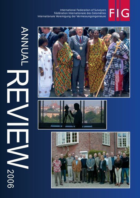
<strong>FIG</strong> Regional Conference in Accra, Ghana, 8–11 March 2006<br />
President Holger Magel had a meeting with the Chiefs before the opening ceremony.<br />
President Magel giving his<br />
opening keynote address.<br />
4<br />
His Excellency John Henry Mensah,<br />
Senior Minister of Ghana gave the<br />
keynote address on behalf of HE Mr.<br />
John Agyekum Kuffour, President of the<br />
Republic of Ghana.<br />
Promoting Land Administration and<br />
Good Governance<br />
The 5 th <strong>FIG</strong> Regional Conference was organised<br />
in Accra, Ghana, 8–11 March 2006 together<br />
with the 37 th Ghana Institution of Surveyors<br />
Conference. This was for the fi rst time that <strong>FIG</strong><br />
organised its regional conference in West Africa.<br />
The interest in Ghana and the region, particularly<br />
Nigeria should be mentioned, exceeded all expectations<br />
of the organisers. Totally almost 650<br />
participants attended representing 50 countries<br />
–- representatives from 20 African countries and<br />
from 30 countries from overseas.<br />
The conference was organised by <strong>FIG</strong> and<br />
the Ghana Institution of Surveyors (GhIS) in cooperation<br />
with the Ministry of Lands, Forestry<br />
and Mines and the Land Administration Program<br />
(LAP). Co-hosts included FAO and UN-Habitat, the<br />
<strong>International</strong> Society for Mine Surveying, Joint<br />
Board of Geospatial Information Societies and<br />
the <strong>International</strong> Society of Photogrammetry and<br />
Remote Sensing (ISPRS). The Regional Centre<br />
for Training in Aerospace Science (RECTAS) and<br />
the Continental Geodetic Reference System for<br />
Africa and the African Geoid Project (AFREF)<br />
organized a special workshop at the conference<br />
sponsored by the UN Economic Commission<br />
for Africa. Sponsors and exhibitors covered the<br />
whole fi eld of surveying and geomatics.<br />
The theme of the conference “Promoting<br />
Land Administration and Good Governance” was<br />
well selected and proved to be most actual not<br />
only for Ghana but for the whole Africa. The big<br />
Dr. B. E. K. Prah, President of GhIS<br />
proudly welcomed the <strong>FIG</strong> family for the<br />
fi rst time to Ghana.
land administration program that has started<br />
in Ghana gave good input both to the technical<br />
programme and discussions during the breaks.<br />
The participants also had the opportunity to<br />
make a study tour to get to know the project<br />
in practice.<br />
At the opening ceremony the keynote addresses<br />
were given by Senior Minister HE John<br />
Henry Mensah on behalf of His Excellency<br />
Mr. John Agyekum Kuffour, President of the<br />
Republic of Ghana and Prof. Holger Magel,<br />
President of <strong>FIG</strong>. Greetings were brought by<br />
Hon. Minister, Prof. Dominic Fobih, Minister<br />
of Lands, Forestry and Mines and Prof. Ian<br />
Dowman, ISPRS, on behalf of JB GIS and other<br />
partners. The welcome address on behalf of<br />
GhIS was given by Dr. B.E.K. Prah, President<br />
of GhIS.<br />
<strong>FIG</strong> was very pleased that the conference<br />
was so well covered in the media, part of this<br />
posted also on the <strong>FIG</strong> web site. This included<br />
the appearance of President Magel and President<br />
Prah in the morning breakfast show on<br />
television.<br />
In the technical programme there were 25<br />
technical sessions and workshops on AFREF,<br />
education in Africa and on cadastral domain<br />
model. Under the theme of the cadastral<br />
domain model the new programme the Global<br />
Land Tool Network established by UN-Habitat<br />
was introduced by Dr. Clarissa Augustinus,<br />
UN-Habitat and Mr. Christiaan Lemmen, <strong>FIG</strong><br />
Commission 7. Running fi ve sessions in parallel<br />
the technical programme attracted lot of<br />
delegates – the biggest sessions over 200<br />
and plenary sessions more than 350 listeners.<br />
Totally almost 150 papers were presented and<br />
published on the <strong>FIG</strong> web site.<br />
The technical exhibition was compact having<br />
booths covering surveying and geomatics<br />
technology internationally and in Ghana.<br />
Social highlights of the week included the<br />
welcome reception and the Ghanaian Evening<br />
at the La-Palm Royal Beach Hotel, which was<br />
the conference venue and Gala Dinner at the<br />
Golden Tulip Hotel. The Gala Dinner was at the<br />
same time the Annual Awards Dinner of the<br />
GhIS including the handover ceremony of the<br />
presidency of the GhIS.<br />
The joint technical tour on Saturday collected<br />
about 120 delegates to visit Kakum National<br />
Park, where they had the change to get to know<br />
rainforest during a canopy walk, and the Cape<br />
Coast Castle, where the history of the slave<br />
trade were explained.<br />
Before the conference the <strong>FIG</strong> Council and<br />
Commission offi cers had their administrative<br />
meetings focussing mainly in implementation of<br />
their work plans and planning the <strong>FIG</strong> <strong>Congress</strong><br />
2006 in Munich in October 2006.<br />
The cannons of the Cape Coast Castle are still on place reminding about the history of<br />
Ghana.<br />
President Magel<br />
together with Mr.<br />
Stephen Djaba,<br />
the <strong>Congress</strong><br />
Coordinator and<br />
without whom the<br />
conference would<br />
have not happen.<br />
Big thanks<br />
belong also to all<br />
volunteers and<br />
the organising<br />
committee that<br />
made the congress<br />
so successful.<br />
5
Commission Activities<br />
Henning Elmstrøm, President of CLGE and<br />
Klaus Rürup, immediate past president of<br />
CLGE chairing the conference.<br />
Group picture of the session chairs at the<br />
joint Commission 2,3 and 7 workshop in<br />
Budapest in April 2006.<br />
Commission 3 Annual Meeting<br />
in Budapest chaired by Gerhard<br />
Muggenhuber from Austria.<br />
6<br />
Commission 1 – Professional<br />
Standards and Practices<br />
Commission 1 has hosted two important<br />
networks with <strong>FIG</strong>. These are the Standards<br />
Network covering all commissions and being<br />
responsible for all <strong>FIG</strong> activities on standards.<br />
These include active participation e.g. in ISO TC<br />
211 work and meetings and its outreach group.<br />
The coordinator for <strong>FIG</strong> standards work is Mr.<br />
Iain Greenway, United Kingdom/Ireland. The<br />
second inter-commission activity is the Network<br />
on Under-represented groups in surveying. This<br />
group started its work as a task force and has<br />
now collected its recommendations to a report<br />
that will be published at the <strong>FIG</strong> <strong>Congress</strong> in<br />
Munich. In addition this group chaired by Ms.<br />
Gabriele Dasse from <strong>German</strong>y publishes a<br />
quarterly newsletter.<br />
The major event in Commission 1 during<br />
the past year was contribution to the CLGE<br />
<strong>International</strong> Conference 2005 “European<br />
Professional Qualifi cations in Surveying” which<br />
was held in Brussels, Belgium, 1–2 December<br />
2005. Mr. Klaus Rürup, chair of Commission 1<br />
and immediate past president of CLGE was one<br />
of the main organisers of this conference.<br />
The conference was opened by a welcome<br />
address of Mr. Henning Elmstrøm, President of<br />
CLGE. The programme then included a number<br />
of themes each with a number of high profi le<br />
papers in following sessions: The Present Status<br />
of the Surveying Profession in Europe (presenters<br />
included Dr. Otmar Schuster, <strong>German</strong>y,<br />
Andrea Liesenfeld, European Commission<br />
DG Internal Market and Services and Hagen<br />
Graeff, <strong>German</strong>y); Free Movement of Surveyors<br />
in Europe; Qualifi cation for Authorised (Licensed)<br />
Surveyors (presenters included Prof. Pedro<br />
Cavero, Chair of Commission 2); Models for<br />
Qualifi cation; The Future of the Surveying Profession<br />
in Europe; and Challenges for Civil Society<br />
(paper presented Philippe Busquin, Chairman<br />
of the Belgian National Mapping Agency, MEP<br />
and former Commissioner for Research).<br />
<strong>FIG</strong> was represented at this conference in<br />
addition to Klaus Rürup by Prof. Stig Enemark,<br />
Vice President of <strong>FIG</strong> and Prof. Pedro Cavero.<br />
Commission 2 – Professional<br />
Education<br />
Commission 2 and its chair elect Prof. Belá<br />
Márkus were responsible for organising the<br />
Geoinformation <strong>International</strong> Summer<br />
School (GISS) which was started by the University<br />
of West Hungary, College of Geoinformatics<br />
in 2001. Last year this one week summer school<br />
titled GI in agricultural monitoring and land use<br />
planning was organised in Székesfehérvár, Hungary,<br />
12–19 August 2005. The main promoter<br />
of these events is the UNIGIS <strong>International</strong>,<br />
which is co-ordinated by the European Masters<br />
in Geographical Information Science (EMGISc)<br />
consortium. In 2003, the <strong>International</strong> Institute<br />
for Geo-Information Science and Earth Observation<br />
(ITC) joined the organizing team. In 2005<br />
GISS focused on the area of GIS applications in<br />
agricultural planning and monitoring. Special emphasis<br />
was given to the impacts of the accession<br />
of new countries to the EU. The students were<br />
enrolled into 3 thematic working groups. The<br />
project-oriented programme included lectures<br />
in a plenary session, methodological seminars,<br />
training sessions, fi eldwork, work in computer<br />
labs and presentation of the results achieved by<br />
the students in the work groups.<br />
Commission 2 was also the main organizer<br />
of the joint Commission 2, 3 and 7 Workshop<br />
on e-Governance, Knowledge Management<br />
and e-Learning. This workshop was organised<br />
in Budapest, Hungary, 27–29 April 2006 in cooperation<br />
with the College of Geoinformatics,<br />
University of West Hungary, the Hungarian Society<br />
of Surveying, Mapping and Remote Sensing<br />
and <strong>FIG</strong> Commissions 2, 3 and 7.<br />
Thirty presentations were given in nine<br />
sessions during this workshop. Speakers<br />
represented educational and governmental<br />
institutes as well as private foundations from all<br />
over Europe. The diversity of submitted papers<br />
is directly related to the 16 different countries<br />
that the authors represented.<br />
The goal of the workshop was to reveal the<br />
present state of e-governmental activities, the<br />
solutions of arising problems as well as the<br />
trends-would-be. Nowadays there is high signifi -<br />
cance of knowledge acquisition, utilisation and<br />
distribution. According to this, there is widerange<br />
opportunity to update and renew teaching<br />
methods exploiting the advantage of information<br />
technology-provided facilities. Materials can<br />
most effectively be distributed over the Internet<br />
to the trainees and learning groups helping their<br />
preparation as well as supporting each other<br />
during their learning. Thus the presentations<br />
of the workshop covered the e-governmental<br />
activities in surveying profession, the roles<br />
of knowledge centres, their maintenances,<br />
facilities, furthermore the up-to-date educational<br />
methods including their technical backgrounds.<br />
This three-day workshop was fi nished by the<br />
meeting of Commission 2. The representatives<br />
presented the current activities of Commission<br />
2, furthermore delineated and discussed the<br />
work plan for the period of 2006–2010.<br />
Commission 2 has further been very active in<br />
Latin America and in Africa discussing curricula<br />
development in these regions and searching<br />
initiatives how to improve the conditions of<br />
universities and surveying educational institutes<br />
in these continents. Following the Bologna
process in Europe is naturally of key interest to<br />
Commission 2.<br />
Commission 3 – Spatial Information<br />
Management<br />
Many people involved in the geographic information<br />
industry will have heard of the term “spatial<br />
data infrastructure” (SDI) and “spatial information<br />
management” (SIM). What do these mean in<br />
practice? Many of us witnessed at the GSDI/<strong>FIG</strong><br />
Working Week in Cairo where several technical<br />
sessions devoted to SDIs and SIM. One session<br />
that was dedicated to defi nition demonstrated<br />
that nearly everyone has a different idea about<br />
what an SDI actually is! The same situation can<br />
be observed about the understanding of SIM.<br />
During the last years SDI and SIM have been<br />
on the way to become a tool required for business<br />
processes. This was the trigger for a joint<br />
<strong>FIG</strong>/GSDI event in Cairo 2005. Commission 3<br />
contributed with awareness to that development<br />
that can be seen in the outlined activities of the<br />
commission.<br />
Commission 3 hold the Annual Meeting in<br />
Cairo and organized a pre-conference Workshop<br />
on e-Government for e-Citizens. The<br />
Workshop was initiated and organized by Mrs.<br />
Kari Strande chair of WG 3.1 (eGovernment<br />
and eCitizen).<br />
Education and training in SDI and SIM are<br />
required ingredients for achieving the goals<br />
outlined in the commission work plan. Thus<br />
Commission 3 actively contributed to the <strong>International</strong><br />
Summer School “GI in agricultural<br />
monitoring and land use planning” in Székesfehérvár,<br />
Hungary, August 2005.<br />
Cooperation is a main issue of this Commission<br />
which is endeavored in collaborations within<br />
<strong>FIG</strong>, but is also interested in close cooperation<br />
with sister organisations as the following examples<br />
show:<br />
– 3D cadastre is a joint activity with Commission<br />
7 where Commission 3 is represented<br />
by Yerach Doytsher.<br />
– Activities on positional accuracy improvement<br />
that resulted in a workshop in Munich<br />
in conjunction with EuroSDR initiated by<br />
Keith Murray, Chair of WG 3.2 (SIM Infrastructure).<br />
– Dr. Chryssy Potsiou, chair of WG 3.3<br />
(State of art of SIM) is a member of the<br />
steering committee of the UN ECE Working<br />
Party on Land Administration. Commission<br />
3 members contributed to the WPLA<br />
publication “Land Administration in the ECE<br />
region – Development Trends and Basic<br />
Principles”.<br />
Commission 3 also promotes inter- and<br />
trans-disciplinary cooperation: its members<br />
participate actively at several conferences with<br />
commission 3 relevant aspects. E.g. Reinfried<br />
Mansberger, Vice Chair on Administration and<br />
Information, participated at the Dubai conference<br />
on Archiving and Documentation. Within<br />
commission internal information exchange and<br />
information management is an important issue,<br />
this includes periodic emails and own website.<br />
Commission members collect continuously information<br />
of national and international SIM-related<br />
activities and conferences. Once in a year this<br />
information is sampled on a CD-Rom which is<br />
sent to approximately 450 people within the<br />
international Commission 3 community.<br />
Commission 3 was co-organizer of the joint<br />
workshop on e-Governance, Knowledge Management<br />
and e-Learning in Budapest, Hungary,<br />
27–29 April 2006. Commission organised also<br />
its annual meeting in conjunction to this workshop.<br />
The annual meeting was attended by<br />
delegates from 8 countries.<br />
Commission 4 – Hydrography<br />
Among the highlights of the work of Commission<br />
4 was the Working Week in Cairo, where<br />
the close relations with the <strong>International</strong> Hydrographic<br />
Bureau were further strengthened as<br />
Vice Admiral Alexandros Maratos, President<br />
of IHB made a keynote presentation. Further a<br />
MoU was signed with the <strong>International</strong> Federation<br />
of Hydrographic Societies.<br />
In August 2005 Ms. Ruth Adams, Co-chair of<br />
WG 4.3 Vertical reference frame (VRSH), a joint<br />
activity with Commission 5, attended conference<br />
Dynamic Planet in Cairns, Australia.<br />
Mr. Adam J. Kerr attended on behalf of<br />
Commission Intergeo in Düsseldorf, <strong>German</strong>y in<br />
October 2005. His presentation “Hydrography<br />
and disaster management” was also published<br />
as the <strong>FIG</strong> article of the month. He also represented<br />
Commission at the UK Hydrographic<br />
Society seminar “More than just Button Pushers”<br />
in November 2005.<br />
Mr. Gordon Johnston represented commission<br />
at the IHO Capacity Building Seminar in<br />
Trieste in October 2005. The seminar’s objective<br />
was to raise awareness at governmental level<br />
of the importance of hydrography to safety of<br />
navigation and national economic development,<br />
and to explore initiatives of common regional<br />
interest. In particular the seminar was arranged<br />
to aid in the development and / or the improvement<br />
of the existing hydrographic capabilities in<br />
the West and Central African Region following a<br />
special request made by several United Nation<br />
Assembly resolutions.<br />
At the end of the year second Commission<br />
4 CD covering years 2004–05 was launched<br />
including IHO manual on hydrography. The CD<br />
was distributed to all national Hydrographic<br />
Societies and IHO Member States.<br />
Commission 5 – Positioning and<br />
Measurement<br />
The past year has been a very active year for<br />
Commission 5. Commission had several strong<br />
technical sessions at the Working Week in Cairo.<br />
Most of the Commission 5 Steering Committee<br />
members attended the meeting, which allowed<br />
good progress on the current work plan and<br />
discussion of Rudolf Staiger’s ideas for his<br />
term as Commission Chair from 2006 to 2010.<br />
A highlight in Cairo was a meeting on the African<br />
Reference Frame Project (AFREF), involving<br />
interested parties from many African countries.<br />
Also in attendance were the President of <strong>International</strong><br />
Association of Geodesy (IAG), President<br />
of IAG Commission 1 and Director of the Central<br />
Bureau of the <strong>International</strong> GNSS Service (IGS).<br />
The IAG leads the AFREF Project and <strong>FIG</strong> was<br />
delighted to assist with the meeting to further<br />
this important project for Africa.<br />
In August, Mikael Lilje, Rob Sarib and<br />
Georgia Fotopoulos (all members of the<br />
Commission 5 Steering Committee) joined<br />
Matt Higgins, Commission Chair at Dynamic<br />
Planet 2005, the IAG Scientifi c Assembly in<br />
Cairns, Australia. Commission co-sponsored<br />
two workshop sessions on Vertical Reference<br />
Frame and on Dynamic Datum, which were very<br />
well received by the operational geodesists. IAG<br />
agreed to cooperate with Commission 5 on<br />
similar sessions at the <strong>FIG</strong> <strong>Congress</strong> in Munich<br />
in 2006. The conference also allowed meetings<br />
with key IAG offi cers (including President<br />
Gerhard Beutler) to discuss practical issues<br />
for continuing the excellent cooperation between<br />
<strong>FIG</strong> and IAG. Representatives of <strong>FIG</strong> Commission<br />
4 and 6 also attended that meeting.<br />
Vice Chair, Naser El-Sheimy and Matt Higgins<br />
met with Dorota Brzezinska (US Institute<br />
of Navigation – ION) and Chris Rizos (IAG Com<br />
4) in Melbourne. This enabled further discussions<br />
toward possible three-way cooperation<br />
between <strong>FIG</strong>, IAG and ION, especially on GNSS<br />
matters.<br />
In late November, the chair attended the<br />
South East Asian Survey <strong>Congress</strong> in Brunei,<br />
as did President Magel and Vice President TN<br />
Wong. That event continues to be a great forum<br />
for Surveyors in that very dynamic region. Chris<br />
Rizos (IAG Com 4), Steve Hewitson and Matt<br />
Higgins were co-authors of a paper, presented<br />
by Chris, on GNSS Developments.<br />
In 2004, UN General Assembly Resolution<br />
59/2 invited GNSS and augmentation providers<br />
to establish an <strong>International</strong> Committee on GNSS<br />
(ICG) to maximize the benefi ts of the use and<br />
applications of GNSS. In December 2005 at a<br />
meeting convened by the UN Offi ce for Outer<br />
Space Affairs (UN OOSA) in Vienna, Austria,<br />
7
Commission Activities<br />
Adam Greenland, Chair of Commission 4<br />
having discussions with Hugo Gorziglia,<br />
Director of IHB at the <strong>FIG</strong> Regional<br />
Conference in Accra.<br />
AFREF Workshop at the Regional<br />
Conference in Accra.<br />
Joel Van Cranenbroeck (Leica, Belgium),<br />
Chris Rizos (Univ. New South Wales,<br />
Australia) and Dorota Grejner-Brzezinska<br />
(Ohio State, USA) at the joint <strong>FIG</strong>/IAG<br />
Symposium in Baden in May 2006.<br />
8<br />
interested governments, inter-governmental<br />
and non-governmental organizations present at<br />
the meeting agreed to establish the ICG. Matt<br />
Higgins represented <strong>FIG</strong> at that meeting and<br />
was appointed <strong>FIG</strong>’s member in the ICG. He also<br />
took the opportunity to meet with staff from UN<br />
OOSA to discuss their MoU with <strong>FIG</strong>. On the way<br />
home from Vienna he also attended the 2005<br />
<strong>International</strong> Symposium on GPS/GNSS in Hong<br />
Kong, SAR China.<br />
In 2006 Rob Sarib has been doing an excellent<br />
job setting up commission 5 programme for<br />
the <strong>FIG</strong> Regional Conference in Accra. A highlight<br />
at this conference was a workshop on AFREF<br />
concentrating on issues for Western Africa’s subregion<br />
(WAFREF). The UN Economic Commission<br />
for Africa sponsored the workshop.<br />
Some highlights of Commission 5 working<br />
groups include: WG 5.1 (Standards, Quality<br />
Assurance and Calibration) has contributed to<br />
a new ISO Work Item on Surveying with GPS;<br />
WG 5.2 (Reference Frame in Practice) made<br />
strong involvement in AFREF Meeting in Cairo<br />
and the IAG Scientifi c Assembly in Cairns and<br />
has developed web content on reference frame<br />
issues relevant to surveyors; WG 5.3 (Integrated<br />
Positioning, Navigation and Mapping Systems)<br />
chair has, as part of the co-operation with UN<br />
OOSA drafted a curricula on GNSS for the Space<br />
Technology Education Centres. The WG continues<br />
to use the web pages for the sub-group<br />
on GNSS Developments and Modernization to<br />
publish up to date information of relevance for<br />
surveyors. WG 5.4 (Cost Effective Surveying<br />
Technology and Techniques for Developing<br />
Countries) has worked on the <strong>FIG</strong> publication on<br />
this topic that will be fi nalized by the <strong>Congress</strong><br />
in Munich.<br />
Commission 6 – Engineering<br />
Surveys<br />
Engineering Surveys also attracted the surveying<br />
and deformation community in 2005 which<br />
was proved by both the dedicated Commission<br />
6 events and the Working Week in Cairo.<br />
Commission 6 has launched two newsletters<br />
and fi rst commission CD including proceedings<br />
of the 1 st <strong>FIG</strong> <strong>International</strong> Symposium on Engineering<br />
Surveys for Construction Works and<br />
Structural Engineering, Nottingham, UK, June<br />
2004 and the 3 rd <strong>International</strong> Conference on<br />
Engineering Surveying and <strong>FIG</strong> Regional Conference<br />
for Central and Eastern Europe, Bratislava,<br />
Slovakia, November 2004.<br />
The 7 th Conference on Optical 3D Measurement<br />
Techniques took place in Vienna, Austria,<br />
3–5 October 2005. This time the conference<br />
was attended by almost 500 attendees and was<br />
supported by the <strong>FIG</strong> Commissions 5 and 6,<br />
ISPRS Commission V, and IAG SC 4.2. The aim<br />
of the conference was to bring together experts<br />
and users from the fi elds of photogrammetry,<br />
surveying, geodesy, machine-, computer- and<br />
robot- vision, spatial information systems from<br />
a variety of working areas (universities, industry,<br />
government) to discuss recent scientifi c and<br />
technical advancements and applications for<br />
optical static and kinematic 3D measurement<br />
techniques. Emphasis in the meeting was placed<br />
at new and emerging technologies, specifi cally<br />
in laser-scanning. A total of 95 papers were<br />
presented at a number of topics such as close<br />
range imaging techniques, metrology and calibration<br />
issues, laser scanning, surface measurement<br />
and modelling techniques, mobile mapping<br />
systems and their applications.<br />
Unfortunately the 12 th <strong>International</strong> Symposium<br />
on Deformation Measurements in<br />
Shandong in China had to be cancelled. It was<br />
replaced by a joint meeting of the <strong>International</strong><br />
Federation of Surveyors (<strong>FIG</strong>), Commission 6,<br />
Working Group 6.1 on Deformation Measurements<br />
and Analysis and the <strong>International</strong> Association<br />
of Geodesy (IAG), Sub-Commission<br />
4.2 was held in Baden, Austria on May 22–24,<br />
2006. The symposium attendance was 140<br />
participants from 35 countries. Over 120 papers<br />
were presented in 23 technical sessions and a<br />
poster session. The symposium opened with<br />
two keynote presentations by Chris Rizos from<br />
University of New South Wales, Australia, and<br />
Joel Van Cranenbroeck of Leica Geosystems,<br />
Belgium. Prof. Heribert Kahmen and Prof.<br />
Adam Chrzanowski were in charge for the<br />
arrangements.<br />
Commission 7 – Cadastre and Land<br />
Management<br />
Commission 7 has continued to act along three<br />
lines: fi rstly, identifying the strategic aspects<br />
for land administration organisations of new<br />
developments in information technology. Part<br />
of the Annual meeting 2005 in Madison<br />
(Wisconsin, USA) was a two-day symposium on<br />
innovative technologies.<br />
Secondly, the Commission was interested<br />
to acquire more knowledge about land administration<br />
under the Islamic law. Therefore the<br />
Commission organised a symposium under the<br />
slogan Towards a Secure and Reliable Land<br />
Register on land registration in the Arab<br />
world at the Dead Sea Valley in Jordan, 1–3<br />
September 2005. During this Symposium the<br />
challenges and ambitions related to the establishment<br />
of secured and reliable land registers in<br />
the Arab world were discussed. The Symposium<br />
was organised by the Jordan’s Department of<br />
Lands & Survey, in close collaboration with the<br />
Arab Union of Survey and <strong>FIG</strong>.<br />
This symposium aimed to portray land reg-
istration systems in the Arab countries, history,<br />
experiences, challenges and future ambitions as<br />
well as to share international experiences in this<br />
domain. The 24 presented papers, were categorized<br />
in four main topics: Land Registration<br />
Systems; Modern Technologies; <strong>International</strong><br />
Experiences, and Future Ambitions. 140 Experts<br />
in Land Registration from 23 Arabic and other<br />
countries participated.<br />
Thirdly the Commission together with UN-<br />
Habitat and UNESCAP organised a two-day<br />
expert group meeting about land tenure,<br />
new land laws and tools in Bangkok, to come<br />
to grips with unconventional approaches to land<br />
administration and land management. More<br />
the 50 experts from more then 20 countries<br />
were invited to join the meeting held in the UN<br />
Conference Centre in Bangkok. 22 papers on<br />
the subject were presented and discussed.<br />
Results of the meeting will be presented at the<br />
World Urban Forum to be held in Vancouver in<br />
June 2006.<br />
Further Commission was represented by<br />
Mr. András Osskó, Chair elect at a three-day<br />
<strong>International</strong> Seminar on Cadastre for Sustainable<br />
Development in Bogotá, Colombia<br />
22–24 November 2005.<br />
Commission also took the initiative together<br />
with GIS Development and Centre for Science,<br />
Development and Media Studies (CSDMS) to<br />
dedicate a two-day international conference<br />
on Enhancing Land Registration and<br />
Cadastre in India, as part of the bigger event<br />
Map India 2006 in January 2006. The event that<br />
witnessed participation of around 50 delegates<br />
from different parts of the world, aimed at<br />
covering the wide spectrum of issues of land<br />
administration ranging from economic and social<br />
benefi ts of good land administration on one<br />
hand to the application of low cost technology<br />
on the other hand.<br />
The <strong>FIG</strong> Commission 7 Annual Meeting<br />
2006, was held in Bled, Slovenia 12–16<br />
May 2006. Because of the <strong>FIG</strong> <strong>Congress</strong> in<br />
Munich, the Commission decided to hold this<br />
year only a short annual meeting. The Meeting<br />
was organised in close co-operation with the<br />
Slovenian Association of Surveyors. In total<br />
50 participants from 25 countries attended<br />
including Bosnia and Herzegovina, Croatia,<br />
India, Latvia, Lithuania, Macedonia, Montenegro,<br />
Portugal and Russia for fi rst time. More than<br />
thirty short presentations were given, each of<br />
them motivating the delegates for lively and<br />
professional discussions. The programme was<br />
very intensive but high quality presentations<br />
and discussions provided suffi cient energy to<br />
the delegates.<br />
Papers and presentations from all events are<br />
available on the <strong>FIG</strong>-website and the documenta-<br />
tion center www.oicrf.org. Three newsletters<br />
were published.<br />
Commission 8 – Spatial Planning<br />
and Development<br />
Commission 8 continues to make headway in its<br />
aspiration to build its profi le from the low activity<br />
level seen in the early part of this term; as the<br />
chairman’s strategy evolves, to promote collaboration<br />
and connectivity as the basis on which<br />
the commission may grow. Since the working<br />
week in Cairo 2005, activity has concentrated<br />
upon working within three key areas, fi rst, within<br />
the Commission, next inter- commissions and<br />
fi nally with member organisations.<br />
Foremost is the need to reach our individual<br />
members. As reported in September 2005<br />
newsletter, commission collaboration continues<br />
to grow as we welcome new members. Clearly,<br />
within the surveying family of geomatics and<br />
land economists, there is only a relatively small<br />
amount of people who work exclusively within<br />
the specifi c technical skill base of the spatial<br />
use of land as their primary focus. Thus it is<br />
recognised that delegates will be drawn from<br />
individuals who consider Commission 8 as<br />
their secondary interest. Thus, the commission<br />
activities have a tendency to refl ect the over<br />
all holistic project management role that land<br />
economics and land use skills demands.<br />
Collaborating at the national level continues<br />
to be busy with networking and meetings<br />
within the African Region. The chair has been<br />
actively involved in Eastern Africa and was able<br />
to collaborate with colleagues, fi rst meeting<br />
with Chairman of the Nairobi Central Business<br />
District Association, to discuss working group<br />
topics. Next, in Nairobi, holding a very positive<br />
meeting with the current president and senior<br />
members of Institution of Surveyors of Kenya<br />
(ISK) to explore and devise themes for a joint<br />
seminar with ISK. In addition, liaison with Ghanaian<br />
colleagues progressed to explore the possibilities<br />
of developing their individual member<br />
involvement in the next terms working groups<br />
relating to environmental and spatial development<br />
topics.<br />
Dr. Diane Dumashie, Commission chair<br />
and Vice President Ken Allred represented <strong>FIG</strong><br />
at a Regional conference of the Commonwealth<br />
Association of Surveying and Land<br />
Economy (CASLE) in Bagamoyo, Tanzania,<br />
13–17 March 2006. The conference theme was<br />
Promoting Sustainable Land Management in Africa.<br />
Nearly fi fty papers addressed sub themes<br />
such as innovative land tenure systems, equity<br />
issues, access to land, and land titling to name<br />
a few. Speakers and delegates represented<br />
most of the British Commonwealth countries in<br />
Africa as well as the United Kingdom, Malaysia,<br />
Commission 7 Annual Meeting in<br />
Madison, Wisconsin, USA in June 2005.<br />
Paul van der Molen welcomes the<br />
participants to the Expert Group Meeting<br />
in Bangkok in December 2005.<br />
Dr Diane Dumashie, Chair of Commission<br />
meeting with W Nabutola Chairman of the<br />
NCBDA, Members of ISK M Makathimo<br />
Hon Treasurer, R Okumu Chairman, I N<br />
Mwathane Past Chairman.<br />
9
Commission Activities<br />
<strong>FIG</strong> representatives Vice President<br />
Andreas Drees (left), Kauko Viitanen,<br />
Carla Seidel, Henning Elmstrøm and<br />
Stephen Yip, Chair of Commission 9, at<br />
the <strong>International</strong> Valuation Conference in<br />
Xian in Octeber 2005.<br />
Commission 10 meeting on quantity<br />
surveying gathered a full hall to discuss<br />
construction economics in <strong>FIG</strong> at the<br />
regional conference in Accra.<br />
Dr. Andreas Drees, Chair of the ACCO,<br />
here at a meeting in the <strong>FIG</strong> offi ce in<br />
2006.<br />
10<br />
Sweden, <strong>German</strong>y and Canada. Approximately<br />
200 people were in attendance.<br />
Co ordinating inter- commission activity occurs<br />
though the working group outputs. Salient<br />
highlights include: WG 8.3 (Spatial and development<br />
aspects within Informal settlements) met<br />
with the UN Habitat Chief of Land and Tenure<br />
Branch to clarify and progress the outputs due<br />
in 2006, identifi ed key people involved in target<br />
projects and continuing to inviting and encourage<br />
appropriate papers and collaboration with<br />
CASLE, in presenting relevant papers at the<br />
conference held in Bagamoyo. WG 8.4 (Disaster<br />
Risk Management) has defi ned the contribution<br />
of the surveying profession to disaster risk<br />
management, geodetic applications in geodetic<br />
engineering, photogrammetry and remote sensing,<br />
geographic information systems, satellite<br />
geodesy as well as urban planning and land<br />
management and continued improvement and<br />
enlargement of the working group web site www.<br />
isbk.uni-bonn.de/fi g. Further it has research<br />
project activity with four papers integrating four<br />
themes including, megacites, tools for prevention,<br />
valuation and risk management strategies<br />
for planning<br />
Commission 9 – Valuation and the<br />
Management of Real Estate<br />
The main activity of Commission 9 was its annual<br />
meeting and the <strong>International</strong> Valuation<br />
Conference in Xian, China 17–20 October<br />
2005 which the Commission organised in cooperation<br />
with CIREA (China Institute of Real<br />
Estate Appraisers and Agents) and the Hong<br />
Kong Institute of Surveyors. The conference<br />
at the Xian <strong>International</strong> Conference Centre<br />
was attended by more than 300 registered<br />
participants. The <strong>FIG</strong> delegation was led by Vice<br />
President Andreas Drees with other representatives<br />
Mr. Stephen Yip (Chair of Commission),<br />
Prof. Kauko Viitanen (incoming Chair) and Mr.<br />
Henning Elmstrøm (Danish delegate to Commission<br />
9 and President of CLGE). On a technical<br />
tour a valuation company founded in 2000 and<br />
having now 25 employees was visited. On top<br />
of this early morning meetings led by Andreas<br />
Drees resulted in a draft for the future work in<br />
Commission 9 and in positive results for the<br />
future cooperation between CIREA and <strong>FIG</strong>.<br />
Commission 10 – Construction<br />
Economics and Management<br />
Commission 10 exists, in the fi rst instance, as<br />
a result of the breadth of scope of the survey<br />
activities of some of the federation’s founding<br />
and longer standing member associations.<br />
Construction economics is a collective title<br />
grouping together a number of professions<br />
as they exist in the construction industries of<br />
most countries of the world. Very broadly, the<br />
science embraces all aspects of budget, cost<br />
and value management; quantifi cation of works;<br />
tendering (bidding) and contract administration<br />
as they apply to construction of the infrastructure<br />
and buildings of the built environment.<br />
Its practitioners may be called Construction<br />
Economists in some countries but elsewhere<br />
they may be known as Quantity Surveyors or<br />
Building Surveyors or Cost Managers; all are<br />
equally appropriate and valid.<br />
Management, as associated with construction<br />
economics, is using the knowledge and<br />
expertise of trained practitioners to achieve the<br />
required commercial and contractual outcomes<br />
to the construction process. This encompasses<br />
formulating procurement strategies and negotiating<br />
the terms and conditions of and managing<br />
contracts through to their fi nal settlement. It has<br />
evolved as a distinct profession whereby the<br />
skills may be applied to manage any contracting<br />
situation to achieve planned objectives and<br />
the optimum commercial result. The title Commercial<br />
Manager is now used widely to convey<br />
the breadth of the skill set of the experienced<br />
practitioner. The function of Commission 10 is<br />
to provide within <strong>FIG</strong> the forum for the study and<br />
discussion of all issues related to construction<br />
economics and commercial management.<br />
Commission had a successful meeting with<br />
participants from many African countries at the<br />
<strong>FIG</strong> regional conference in Accra. The current<br />
challenge is to invigorate Commission 10 with<br />
an agenda that addresses the relevant issues<br />
of the 21 st century and fosters participation in<br />
its activities so that, as an active part of <strong>FIG</strong>,<br />
its work will benefi t all in the global surveying<br />
community.
Activities 2005–2006<br />
Member visits<br />
President Holger Magel visited the Polish<br />
member association of surveyors in Warsaw<br />
22–24 June 2005. His visit was combined to the<br />
60 th anniversary celebrations of the Polish<br />
Head Offi ce of Geodesy and Cartography<br />
(GUGIK) at the Royal Castle in Warsaw. He the<br />
head offi ce of SGP and had a meeting with<br />
representatives of Warsaw geodetic students<br />
association GEOIDA, who invited the President<br />
to the <strong>International</strong> Geodetic Students Meeting<br />
(IGSM) in Krakow in June 2006.<br />
President Magel also visited the Chamber of<br />
Surveying Engineers of Turkey in Ankara 6–7<br />
July 2005 after his visit to the XXII <strong>International</strong><br />
Architects’ <strong>Congress</strong> (UIA) in Istanbul. During<br />
this visit he had a meeting with the Chamber<br />
of Surveying and Cadastral Engineers (HKMO).<br />
Against the background of the intended accession<br />
of Turkey to European Union Prof. Magel<br />
was asked to give two lectures about “European<br />
policy for rural development” and “New paradigms<br />
in Land Consolidation”.<br />
The 25 th ESRI User Conference was organised<br />
at the San Diego Conference Centre 25–29<br />
July 2005. The 3 rd Survey and GIS Summit<br />
was linked to the User Conference taking place<br />
22–26 July at the same venue. <strong>FIG</strong> participated<br />
the Survey and GIS Summit as a gold sponsor<br />
and attended also the exhibition at the User<br />
Conference sharing an exhibition booth with<br />
the American <strong>Congress</strong> on Surveying and<br />
Mapping (ACSM). The Survey and GIS Summit<br />
2005 Bridging the Gap gathered more than<br />
300 participants to discuss how to improve<br />
the co-operation and bridging the gap between<br />
surveying and GIS.<br />
Vice-President Stig Enemark visited Bogotá,<br />
Colombia, 8–13 August under the celebration of<br />
the 70 th Anniversary of the Agustín Codazzi<br />
Geographic Institute, IGAC. The celebration<br />
was held as an international event “Week on<br />
Geomatics 2005”, organized by IGAC and the<br />
Europe Union Project: “Improvement of Colombian<br />
Cartographic Systems”.<br />
President Magel attended the 5 th European<br />
<strong>Congress</strong> on Village Renewal – “Rural Areas<br />
in 2005 – Changing Realities – New Challenges”<br />
which was held in St. Pölten, Austria, 21–22<br />
September 2005. President Magel attended<br />
the congress as the Chair of the Habitat Professionals<br />
Forum and made a keynote presentation<br />
titled: “The resources of rural areas. A plea for<br />
sustainable land management and an active<br />
civil society”.<br />
Intergeo 2005 was organized under theme<br />
“Grenzen ûberschreiten” in Düsseldorf, <strong>German</strong>y<br />
4–6 October. The exhibition was visited by over<br />
16,000 professionals (about 15 per cent outside<br />
President Magel<br />
and Surveyor<br />
General of Poland<br />
Jerzy Albin in<br />
Warsaw in June<br />
2005.<br />
President Magel<br />
and President<br />
Hüsein Ülkü<br />
(HKMO).<br />
Perhaps the most visited booth at the Intergeo 2005 was the <strong>FIG</strong> 2006/Intergeo 2006<br />
stand offering Bavarian beer and snacks.<br />
11
Activities 2005–2006<br />
<strong>International</strong> day at CNG <strong>Congress</strong>: CNG President Piero Panunzi (1. from right) and<br />
<strong>FIG</strong> President Holger Magel with RAI journalist as moderator.<br />
First meeting of the FGF in Rabat in November 2005.<br />
Organisers and keynote speakers of the expert group meeting in Melbourne: Daniel<br />
Steudler (left), Stig Enemark, Holger Magel, Ian Williamson and Paul van der Molen.<br />
12<br />
President Magel<br />
and the Chair of the<br />
organising committee<br />
of SEASC, and<br />
President of BIG<br />
Pg. Hj. Matusin<br />
Matusan (right) and<br />
<strong>Congress</strong> Director<br />
Jamil Ali in Brunei in<br />
November 2005.<br />
<strong>German</strong>y). The exhibition introduced more than<br />
500 exhibitors from 24 countries. The annual<br />
conference of DVW attracted about 1,600 delegates<br />
which is the best fi gure during the last<br />
few years. The conference was organised jointly<br />
with the Geodetic Week (Geodätische Woche). At<br />
the traditional <strong>FIG</strong> Forum, the topic was this year<br />
“Tsunami – Surveyors Contributions in Risk Prevention”.<br />
This special session attracted about<br />
100 participants. Presentations were made by<br />
Adam Kerr on behalf of <strong>FIG</strong> Commission 4 on<br />
“Hydrography and Disaster Management – The<br />
Role of Hydrography in the Management of Marine<br />
Disasters”. <strong>FIG</strong> attended the Intergeo 2006<br />
– a longer tradition by now – also in the exhibition<br />
at the DVW booth distributing information about<br />
the federation and <strong>FIG</strong> future events.<br />
<strong>FIG</strong> founding member Consiglio Nazionale Geometri,<br />
CNG held its 43 rd National <strong>Congress</strong> in<br />
Palermo 17–22 October 2005. CNG had invited<br />
President Magel was invited to speak to more<br />
than 500 participants from all parts of Italy and<br />
representatives from <strong>FIG</strong> member countries. According<br />
to the conference motto “New horizons<br />
for the profession: guarantees for the society in<br />
evolution” <strong>FIG</strong> President gave at the <strong>International</strong><br />
Day a keynote speech “About the identity, sociopolitical<br />
role and technical tasks of surveyors on<br />
the national and international stage”. The next<br />
speaker after Prof. Magel was the former <strong>FIG</strong><br />
Commission 7 Chair and current Division Chief<br />
for Land Tenure of UN FAO Dr. Paul Munro-<br />
Faure, who explained the global work of FAO.<br />
President Magel congratulated President Piero<br />
Panunzi for successfully attracting high ranked<br />
European and Italian Ministers and Members of<br />
the Parliament and also prominent journalists<br />
to the congress.<br />
Dr. Ralf Schroth, Vice President of <strong>FIG</strong><br />
participated the 4 th National <strong>Congress</strong> of<br />
the Ordre National des Ingénieurs Géomètres-Topographes<br />
(ONIGT) in Rabat, Morocco,<br />
24–26 November 2005. The conference was attended<br />
by about 400 participants out of this 100<br />
international. The main topic of the conference<br />
was the new cadastre for Morocco. Dr. Schroth<br />
made his address at the opening ceremony on<br />
behalf of <strong>FIG</strong>. During the conference there was<br />
also the fi rst meeting of the Federation des<br />
Géomètres Francophones (FGF), which was<br />
founded in Rabat. The fi rst President of FGF<br />
is Mr. Alain Gaudet (OGE, France) and Vice<br />
President Mr. Aziz Hilali (ONIGT, Morocco).<br />
In the FGF statutes there is a reference to the<br />
cooperation with <strong>FIG</strong>. At the founding meeting<br />
Dr. Schroth gave a greeting from <strong>FIG</strong> together<br />
with Moroccan Minister of Agriculture.<br />
Ken Allred, <strong>FIG</strong> Vice President, made<br />
a presentation on The Art of Surveying at<br />
Rendezvous 2005 in Spokane Washington,
USA, October 2005. Rendezvous 2005 was<br />
organized by the Surveyors Historical Society<br />
to commemorate “Surveying the Northwest with<br />
David Thompson.” The three day conference had<br />
presentations on the surveying of the Canada<br />
United States boundary.<br />
The Expert Group Meeting on Incorporating<br />
Sustainable Development Objectives<br />
into ICT Enabled Land Administration<br />
Systems was held in Melbourne, Australia,<br />
9–11 November 2005 as a result of a research<br />
project analyzing Land Administration Systems<br />
in Europe and Australia. The project is conducted<br />
by Prof. Ian Williamson and Ms. Jude<br />
Wallace. The international expert group meeting<br />
was conducted to examine how European<br />
countries achieve this integration and to identify<br />
lessons that could be applied in Australia. The<br />
discussions were open, wide ranging and fruitful.<br />
Europe was represented by Prof. Holger Magel,<br />
President of <strong>FIG</strong>, Prof. Paul van der Molen,<br />
Chair of <strong>FIG</strong> Commission 7, Prof. Stig Enemark,<br />
Vice-President of <strong>FIG</strong> and Dr. Daniel Steudler,<br />
<strong>FIG</strong> Commission 7.<br />
<strong>FIG</strong> President and Vice President TN Wong<br />
attended the 8 th South East Asia Survey <strong>Congress</strong><br />
in Brunei Darussalam 21–25 November<br />
2005. About 220 geomaticians and surveyors<br />
from more than 30 countries followed the invitation<br />
to participate the SEASC, which was held<br />
the fi rst time in Brunei Darussalam. President<br />
Magel was invited to give the keynote address<br />
and the closing remark, in which he underlined<br />
the need for more ‘generalists’ than only specialists.<br />
At the already traditional <strong>FIG</strong> session,<br />
chaired by <strong>FIG</strong> commission 5 chair Matt Higgins,<br />
President Magel and Vice President TN Wong<br />
explained some policies of <strong>FIG</strong>.<br />
Following a long standing invitation, <strong>FIG</strong><br />
President Prof. Holger Magel visited the Ukrainian<br />
Member Association on the occasion of the<br />
GEOFORUM 2006 in Jaworiv and Lviv 5–9<br />
May 2006. President of the Ukrainian member<br />
association of <strong>FIG</strong>, Prof. Igor Trevogo regarded<br />
the visit of <strong>FIG</strong> President historical, because<br />
for the fi rst time the <strong>FIG</strong> President visited the<br />
surveyors’ community in Ukraine. During his visit<br />
President Magel gave a welcome address to the<br />
congress and had meetings with the Director of<br />
the Ukrainian Survey and Cartography Authority,<br />
Prof. Rostyslaw Sussa and with the Director of<br />
the State Committee of Land Resources Ukraine<br />
in Lviv Region and at the Polytechnic National<br />
University in Lviv.<br />
<strong>FIG</strong> President was invited by the Austrian<br />
member association Österreichische Gesellschaft<br />
für Vermessung und Geoinformation<br />
to give a key note address at the opening<br />
ceremony of the 9 th Austrian Geodetic Days<br />
in Krems / Lower Austria 3–5 May 2006. Prof.<br />
Magel spoke to more than 550 colleagues from<br />
all parts of Austria and from 8 other European<br />
countries about the “Future of geodesy from<br />
global perspective”. His speech was afterwards<br />
intensively discussed by politicians, scientists<br />
and practitioners. There was a general acceptance<br />
that surveyors should take care of an<br />
excellent education and enlargement of their<br />
activities especially in the increasing fi eld of<br />
land management.<br />
Following the invitation of LKN Earth Research<br />
& Consulting, an <strong>FIG</strong> corporate member,<br />
President Magel visited Tbilisi, Georgia 9–12<br />
May 2006. Director General Merab Nadaraia<br />
emphasised the importance of <strong>FIG</strong> President’s<br />
visit to Georgia, a country which with support<br />
of many international agencies and donors has<br />
to build up modern infrastructure and market<br />
economy mainly based on digitized cadastre<br />
and registers. The membership in <strong>FIG</strong> has to<br />
be fi rst priority for Georgian surveyors and the<br />
newly established association tries to become<br />
a member of <strong>FIG</strong> already at the <strong>Congress</strong> in<br />
Munich. During his visit President Magel gave<br />
a keynote speech at the UNECE WPLA Workshop<br />
on Institutional Framework for Securing<br />
Real Property Rights, which took place at<br />
the same time gathering 120 participants from<br />
25 countries.<br />
President Magel visited Israel 24–28 May<br />
2006 by the invitation the Israel Association of<br />
Licensed Surveyors and the Survey of Israel,<br />
whose Director General Haim Srebro will be the<br />
<strong>Congress</strong> Director of <strong>FIG</strong> Working Week 2009<br />
in Eilat. During their four-day visit, Prof. Magel<br />
and his wife Ansi met the President of ALS,<br />
Mr. Joseph Kraus and members of the local<br />
organizing committee of Working Week 2009.<br />
President Kraus and <strong>Congress</strong> Director Srebro<br />
expressed their great engagement and confi -<br />
dence to guarantee a safe and unforgettable<br />
conference 2009. President Magel expressed<br />
his hope and encouraged his hosts to send a<br />
strong Israeli delegation to the <strong>FIG</strong> <strong>Congress</strong><br />
in Munich and to present according to the high<br />
quality and standard of geodetic education and<br />
practice in Israel a lot of papers.<br />
Prof. Magel with the Director General of<br />
the Ukrainian Geodesy and Cartography<br />
Authority Prof. Dr. Rostyslaw Sussa and<br />
the President of the Ukrainian Association<br />
of Geodesy and Cartography Prof. Dr.<br />
Igor Trevogo.<br />
President Magel in Georgia together with<br />
LKN General Director Merab Nadaraia<br />
(left), Prof. Joseph Salukvadze and<br />
LKN Consultion Group Leader Nino<br />
Sulkhanishvili.<br />
President Magel awards Israeli member<br />
President Joseph Kraus with <strong>FIG</strong> globe.<br />
13
Activities 2005–2006<br />
Vice President Stig Enemark and Prof.<br />
John Parker representing <strong>FIG</strong> at the<br />
UNRCC-A in New York.<br />
Dr. Lars Reutersward, UN-Habitat, Prof.<br />
Holger Magel, Ms. Aydan Erim, UIA and<br />
Mr. Selman Ergyden, UN-Habitat at the<br />
Habitat Professionals Forum Steering<br />
Committee meeting in Istanbul.<br />
Dr. Clarissa Augustinus, Chief of the Land<br />
and Tenure Unit, UN-Habitat, and Prof.<br />
Stig Enemark, Vice President of <strong>FIG</strong>,<br />
during the UN-Habitat Workshop in Oslo.<br />
14<br />
UN Co-operation<br />
Vice-President Stig Enemark and Prof. John<br />
Parker represented <strong>FIG</strong> at the Eighth United<br />
Nations Cartographic Conference for the<br />
Americas (UNRCCA) held in New York 27 June<br />
– 1 July 2005. The conference is convened<br />
every four years (since 1976). The conference<br />
attracted 140 participants from 33 countries.<br />
About 20 country reports were tabled and 40<br />
invited papers were presented. The program<br />
and included a number of interesting paper<br />
on SDI developments in the Latin America and<br />
Caribbean Region as well as a number of invited<br />
paper papers from other countries and professional<br />
institutions. Prof. Enemark presented<br />
a <strong>FIG</strong> position paper on “Supporting Capacity<br />
Development for Sustainable Land Administration<br />
Infrastructures”. He also presented a joint<br />
paper with John Parker focusing on the outcome<br />
of the “Special Forum on the Development of<br />
Land Information Policies in the Americas”. The<br />
<strong>FIG</strong> publication “Aguascalientes Statement” was<br />
tabled and endorsed as a result of resolution<br />
adopted at the UNRCCA held in 2001. Both the<br />
papers and Statement were very well received.<br />
As a further result of the Special Forum in<br />
Aguascalientes, Paul van der Molen, Chair of<br />
Commission 7 was invited to present a paper on<br />
the Land Administration Systems in Europe.<br />
As part of the co-operation with the UN-Habitat<br />
the Habitat Professionals Forum organized<br />
in conjunction to the UIA World <strong>Congress</strong> (<strong>International</strong><br />
Union of Architects) in Istanbul – with<br />
more than 6,000 delegates - an own session on<br />
the hot topic “Governance – People – Professionals”<br />
under the chair of President Magel, who<br />
is the current chair of the Steering Committee<br />
of the HPF. The panelists including Dr. Lars<br />
Reutersward (UN-Habitat), Prof. Magel, Ms.<br />
Aydan Erim (UIA) and Mr. Selman Erguden<br />
(UN-Habitat) discussed the changed roles of<br />
planners and architects as professionals in a<br />
changed world of increasing civil society, good<br />
governance principles and citizens who ask for<br />
more participation. It was summarized that more<br />
than ever professionals must be able to match<br />
these new challenges. Universities have to teach<br />
very early modern methods, instruments and<br />
skills in informal planning, moderation, mediation<br />
and even confl ict management.<br />
At the meeting of the Steering Committee<br />
of the Habitat Professionals Forum (HPF)<br />
the most inspiring outcome of the meeting<br />
was the clear expression of UN-Habitat representatives<br />
that the HPF is regarded as a very<br />
important professional partner for UN-Habitat<br />
at the global level and that it is therefore asked<br />
to make strong contributions to the program<br />
of the 3 rd World Urban Forum in Vancouver in<br />
June 2006.<br />
Vice-President Stig Enemark attended the<br />
UN-Habitat workshop in Oslo 23–24 March<br />
2006 to present the <strong>FIG</strong> commitment to the UN-<br />
Habitat Global Network for Development of<br />
Innovative Pro-Poor Land Tools. About 100<br />
participants attended the workshop by invitation<br />
representing various land right related organisations<br />
throughout the world being potential partners<br />
of the Global Land Tool Network.<br />
The fi rst half day was organised by the High<br />
Level Commission for Legal Empowerment of<br />
the Poor (HLCLEP). The High Level Commission<br />
is chaired jointly by Dr. Madeleine K. Albright,<br />
former Secretary of State, USA, and Mr. Hernando<br />
de Soto, President of the Institute for<br />
Liberty and Democracy, Peru. Presentations<br />
very given, among others, by Mr. Naresh<br />
Singh, Secretary General of the High Level<br />
Commission, Mrs. Anna K. Tibaijuka, Executive<br />
Director of UN-Habitat. The key objective of<br />
the commission is to generate political support<br />
for broad reforms that will ensure legal inclusion<br />
and empowerment of the poor including fungible<br />
property rights for their assets and access to<br />
credit and capital. The following one and a half<br />
day focused on the Global Land Tool Network<br />
(GLTN) with Dr. Clarissa Augustinus, Chief<br />
of the Land and Tenure Section at UN-Habitat,<br />
playing a key role. A range of presentations<br />
were given to introduce and discuss various<br />
mechanisms of the GLTN such as peer review<br />
mechanism, gender mechanism, grassroots<br />
mechanism and dissemination mechanism. Also,<br />
a range of partner presentations were given on<br />
ongoing and planned land tool programmes and<br />
initiatives world wide.<br />
<strong>FIG</strong> Vice-President Stig Enemark presented<br />
the <strong>FIG</strong> commitment to the GLTN which is in line<br />
with the general commitment of <strong>FIG</strong> – especially<br />
within Commission 7 and 8 – for developing and<br />
promoting the concept of land administration<br />
systems for sustainable development where<br />
special attention has been given to good governance,<br />
gender issues, and pro-poor land tools.<br />
The contribution of <strong>FIG</strong> to the GLTN will be mainly<br />
in the area of analysing and designing adequate<br />
land administration systems that include relevant<br />
pro-poor land tools, promote social inclusion,<br />
and support sustainable development. The<br />
project on developing a Social Tenure Domain<br />
Model can be seen as such an example of and<br />
<strong>FIG</strong> contribution to the GLTN. The project was<br />
presented at the recent <strong>FIG</strong> Regional Conference<br />
in Accra, Ghana.
Sister organizations<br />
Vice President Ralf Schroth represented <strong>FIG</strong><br />
at the XXII <strong>International</strong> Cartographic Conference<br />
(ICC2005) in A Coruña, Spain 9–16<br />
July 2005. The <strong>International</strong> Cartographic Association<br />
(ICA), the Spanish Society for Cartography,<br />
Photogrammetry and Remote Sensing<br />
and the A Coruña Local Organizing Committee<br />
prepared an interesting and successful event<br />
in the newly established conference center<br />
PALEXCO in the harbor of A Coruña. The conference<br />
attracted 1,625 participants from<br />
60 countries. The attendees got an excellent<br />
opportunity to get familiar with the state of<br />
the art of the wide fi eld of Cartography and<br />
the latest scientifi c approaches. The technical<br />
programme was almost overloaded - during the<br />
four and half day technical programme there<br />
were 150 technical and poster sessions about<br />
26 different themes, several working group<br />
sessions and some special technical sessions<br />
about ISO Standards, Cartography and SDI,<br />
Aerospace Technologies and European Navigation<br />
Systems. When totally fi ve pre-conference<br />
workshops are added there was professional<br />
programme for 10 days. In the technical programme<br />
more than 500 oral and 200 poster<br />
presentations were made.<br />
Permanent Institutions<br />
<strong>FIG</strong> has three permanent institutions (The<br />
<strong>International</strong> Offi ce of Cadastre and Land<br />
Records – OICRF, www.oicrf.org; The <strong>FIG</strong><br />
Multi-Lingual Dictionary Board, www.bkg.<br />
bund.de/nn_5594/EN/FederalAgency/InformationServices/fi<br />
g_node.html_nnn=true;<br />
and The <strong>International</strong> Institution for the<br />
History of Surveying and Measurement<br />
– Permanent Institution of <strong>FIG</strong>, www.fi g.<br />
net/hsm). In addition there is an independent<br />
the <strong>FIG</strong> Foundation.<br />
Task forces<br />
At the moment <strong>FIG</strong> has one task force established<br />
by the <strong>FIG</strong> Council. The Task Force on<br />
<strong>FIG</strong> Governance Structure shall conduct a<br />
review of the <strong>FIG</strong> Statutes and Internal Rules.<br />
In particular the Task Force will: review the<br />
Commission structure; review the term of offi<br />
ce of Commission Chairs; review the election<br />
procedures including the role of the Nomination<br />
Review Group and the Commission Review<br />
Group; and review the Statutes and Internal<br />
Rules for inconsistencies and redundancies<br />
regarding the new governance structure subsequent<br />
to 2006. This task force is chaired by<br />
Vice President Ken Allred.<br />
Communication<br />
The main tools for communication of the federation<br />
are the <strong>FIG</strong> web site www.fi g.net and<br />
different newsletters (both as soft and hard<br />
copies) and printed material and publications<br />
and CD-Roms.<br />
The web site includes e.g. the work plan<br />
of the Council and the commissions; contact<br />
details of Council members, member associations,<br />
affi liates, corporate members, academic<br />
members, commission offi cers and commission<br />
delegates; forthcoming events; and <strong>FIG</strong> publications<br />
and conference reports.<br />
The <strong>FIG</strong> annual review – an overview of<br />
major activities and achievements and the<br />
main medium of external communication. This<br />
is supported by a monthly e-Newsletter which<br />
The Struve Arc as the fi rst approved<br />
surveying site on the UNESCO’s World<br />
Heritage List – Belarus, Estonia,<br />
Finland, Latvia, Lithuania, Norway,<br />
Republic of Moldova, Russian Federation,<br />
Sweden and Ukraine host the<br />
Struve Geodetic Arc<br />
The Struve Arc is a chain of survey triangulations<br />
stretching from Hammerfest<br />
in Norway to the Black Sea, through ten<br />
countries and over 2,820km. These are<br />
points of a survey, carried out between<br />
1816 and 1855 by the astronomer Friedrich<br />
Georg Wilhelm Struve, which represented<br />
the fi rst accurate measuring of a<br />
long segment of a meridian. This helped<br />
establish the exact size and shape of our<br />
planet and marked an important step in<br />
the development of earth sciences and<br />
topographic mapping. It is an extraordinary<br />
example of scientifi c collaboration among<br />
scientists from different countries, and<br />
of collaboration between monarchs for a<br />
scientifi c cause. The original arc consisted<br />
of 258 main triangles with 265 main station<br />
points. The listed site includes 34 of<br />
the original station points, with different<br />
markings, i.e. a drilled hole in rock, iron<br />
cross, cairns, or built obelisks.<br />
The World Heritage List now numbers<br />
812 sites in total, which includes: 628<br />
cultural; 160 natural and 24 mixed sites<br />
in 137 States Parties.<br />
<strong>FIG</strong> Permanent Institution for the History<br />
of Surveying and Measurement was<br />
actively involved in the project of getting<br />
the Arc on the Heritage List.<br />
is sent free of charge to all subscribers. All<br />
commissions have also their newsletters that<br />
are published 1–2 per year and posted on the<br />
commission’s web sites.<br />
In the <strong>FIG</strong> publications series the federation<br />
publishes formal policy statements and ethical,<br />
educational and technical guidelines, these are<br />
also available on the <strong>FIG</strong> home page. Proceedings<br />
of <strong>FIG</strong> congresses and of selected technical<br />
seminars sponsored or co-sponsored by <strong>FIG</strong>’s<br />
commissions and member associations are published<br />
normally on a CD-Rom and they are also<br />
available on the <strong>FIG</strong> home page. <strong>FIG</strong> publishes<br />
also on the web site a monthly article that is<br />
selected from a conference or event and that<br />
is of general interest.<br />
15
Activities 2005–2006<br />
The <strong>FIG</strong> Foundation –<br />
Building a Sustainable Future<br />
The <strong>FIG</strong> Foundation is an independent body under the<br />
<strong>International</strong> Federation of Surveyors.<br />
– The Foundation has been established for the purpose<br />
of raising funds to fi nance surveying education<br />
development projects and supporting young<br />
surveyors in order to build a sustainable future.<br />
– The Foundation funds shall not be used to support<br />
the normal activities of <strong>FIG</strong>.<br />
– The Foundation is administered by the <strong>FIG</strong> Offi ce<br />
in Copenhagen and directed by a Board of fi ve<br />
Directors appointed by the <strong>FIG</strong> Council.<br />
– The Directors of the Foundation will announce every<br />
year the scholarships and grants available.<br />
The fi rst grants were given in 2002 and there after<br />
each year.<br />
The <strong>FIG</strong> Foundation –<br />
How can I contribute?<br />
Companies, associations, institutions, events, surveyors’<br />
groups and individuals may contribute to the Foundation<br />
by:<br />
– Donations which will be recognised by a plaque or<br />
a certifi cate of different categories refl ecting the<br />
sum of donation as follows:<br />
– platinum plaque EUR 25,000<br />
– gold plaque EUR 10,000<br />
– silver plaque EUR 5,000<br />
– bronze plaque EUR 1,000.<br />
– Donations to support specifi c projects or by offering<br />
scholarships. Donors and Benefactors may use<br />
the <strong>FIG</strong> Foundation logo to promote their project<br />
donations or scholarships.<br />
– Voluntary donation when registering to <strong>FIG</strong><br />
events.<br />
– Attending social functions such as the <strong>FIG</strong> Foundation<br />
Dinners held during every <strong>FIG</strong> <strong>Congress</strong> and<br />
Working Week and other events.<br />
16<br />
<strong>FIG</strong> Defi nition of the Functions of the Surveyor<br />
The defi nition of the functions of the surveyor as adopted by the <strong>FIG</strong><br />
General Assembly in 2004:<br />
Summary<br />
A surveyor is a professional person with the academic qualifi cations<br />
and technical expertise to conduct one, or more, of the following<br />
activities;<br />
– to determine, measure and represent land, three-dimensional<br />
objects, point-fi elds and trajectories;<br />
– to assemble and interpret land and geographically related information,<br />
– to use that information for the planning and effi cient administration<br />
of the land, the sea and any structures thereon; and,<br />
– to conduct research into the above practices and to develop<br />
them.<br />
Detailed Functions<br />
The surveyor’s professional tasks may involve one or more of the following<br />
activities which may occur either on, above or below the surface<br />
of the land or the sea and may be carried out in association with other<br />
professionals.<br />
1. The determination of the size and shape of the earth and the<br />
measurement of all data needed to defi ne the size, position, shape<br />
and contour of any part of the earth and monitoring any change<br />
therein.<br />
2. The positioning of objects in space and time as well as the positioning<br />
and monitoring of physical features, structures and engineering<br />
works on, above or below the surface of the earth.<br />
3. The development, testing and calibration of sensors, instruments<br />
and systems for the above-mentioned purposes and for other<br />
surveying purposes.<br />
4. The acquisition and use of spatial information from close range,<br />
aerial and satellite imagery and the automation of these processes.<br />
5. The determination of the position of the boundaries of public or<br />
private land, including national and international boundaries, and<br />
the registration of those lands with the appropriate authorities.<br />
6. The design, establishment and administration of geographic<br />
information systems (GIS) and the collection, storage, analysis,<br />
management, display and dissemination of data.<br />
7. The analysis, interpretation and integration of spatial objects and<br />
phenomena in GIS, including the visualisation and communication<br />
of such data in maps, models and mobile digital devices.<br />
8. The study of the natural and social environment, the measurement<br />
of land and marine resources and the use of such data in the planning<br />
of development in urban, rural and regional areas.<br />
9. The planning, development and redevelopment of property, whether<br />
urban or rural and whether land or buildings.<br />
10. The assessment of value and the management of property, whether<br />
urban or rural and whether land or buildings.<br />
11. The planning, measurement and management of construction<br />
works, including the estimation of costs.<br />
In the application of the foregoing activities surveyors take into account<br />
the relevant legal, economic, environmental and social aspects<br />
affecting each project.
<strong>FIG</strong> Members (May 2006)<br />
*) Membership to be decided by the General Assembly in October 2006.<br />
Member associations<br />
Algeria<br />
Argentina<br />
Armenia<br />
Australia<br />
Austria<br />
Bahamas<br />
Belarus<br />
Belgium<br />
Benin *)<br />
Botswana<br />
Brazil<br />
Brunei Darussalam<br />
Bulgaria<br />
Burkina Faso<br />
Cameroon<br />
Canada<br />
China P.R.<br />
Colombia<br />
Costa Rica<br />
Croatia<br />
Cuba<br />
Cyprus<br />
Czech Republic<br />
Denmark<br />
Egypt<br />
Estonia<br />
Fiji<br />
Ordre des Géomètres-Experts Fonciers<br />
Federación Argentina de Agrimensores<br />
Association of Private Surveyors<br />
The Institution of Surveyors, Australia /<br />
The Spatial Sciences Institute<br />
Austrian Society for Surveying and<br />
Geoinformation<br />
Bahamas Association of Land Surveyors<br />
Land Reform Association<br />
Union Belge des Géomètres-Experts<br />
Immobiliers<br />
Syndicat National des Géomètres-Topographes<br />
et Assimilés du Bénin<br />
Botswana Surveying and Mapping Association<br />
Brazilian Society of Cartography, Geodesy,<br />
Photogrammetry and Remote Sensing<br />
Brunei Institution of Geomatics<br />
Union of Surveyors and Land Managers in<br />
Bulgaria<br />
Association des Geometres et Topographes<br />
du Burkina<br />
Ordre National des Geometres du Cameroun<br />
The Canadian Institute of Geomatics<br />
Chinese Society of Geodesy, Photogrammetry<br />
and Cartography<br />
Sociedad Colombiana de Topografos<br />
Colegio de Ingenieros Topógrafos de Costa<br />
Rica<br />
Croatian Geodetic Society<br />
Unión Nacional de Arquitectos e Ingenieros<br />
de la Construcción de Cuba<br />
Association of Rural Surveying Engineers of<br />
Cyprus<br />
Czech Union of Surveyors and Cartographers<br />
Czech Association of Certifi ed Property<br />
Appraisers<br />
Den danske Landinspektørforening<br />
Egyptian Committee of Surveying and<br />
Mapping<br />
Association of Estonian Surveyors<br />
Fiji Institute of Surveyors<br />
Full members<br />
Affi liates<br />
Correspondents<br />
Finland<br />
France<br />
<strong>German</strong>y<br />
Ghana<br />
Greece<br />
Hong Kong SAR,<br />
China<br />
Hungary<br />
Indonesia<br />
Iran, Islamic<br />
Republic*)<br />
Ireland<br />
Israel<br />
Italy<br />
Jamaica<br />
Japan<br />
Kenya<br />
Korea, Republic of<br />
Kosovo UNMIK<br />
Latvia<br />
Lebanon<br />
Lithuania<br />
Luxembourg<br />
Malaysia<br />
Malta<br />
Mexico<br />
Mongolia<br />
The Finnish Association of Surveyors<br />
Maanmittausalan ammattikorkeakoulu- ja<br />
opistoteknisten Liitto MAKLI ry<br />
Ordre des Géomètres-Experts<br />
Association Française de Topographie<br />
DVW – Deutscher Verein für Vermessungswesen<br />
– Gesellschaft für Geodäsie,<br />
Geoinformation und Landmanagement<br />
Ghana Institution of Surveyors<br />
Technical Chamber of Greece<br />
Hellenic Association of Rural and Surveying<br />
Engineers<br />
The Hong Kong Institute of Surveyors<br />
Magyar Földméresi, Térképészeti és<br />
Távérzkelési Társaság<br />
Ikatan Surveyor Indonesia<br />
Iranian Society of Surveyors<br />
The Society of Chartered Surveyors<br />
The Irish Institution of Surveyors<br />
Association of Licensed Surveyors in Israel<br />
Consiglio Nazionale Geometri<br />
The Land Surveyors Association of Jamaica<br />
Japan Federation of Surveyors<br />
Institution of Surveyors of Kenya<br />
Korea Confederation of Surveyors<br />
Kosova Surveyors Association<br />
Latvian Associations of Surveyors<br />
Ordre des Géomètres-Topographes du Liban<br />
Lithuanian Association of Surveyors<br />
Lithuanian Association of Property Valuers<br />
Ordre Luxembourg des Géomètres<br />
Association of Authorised Land Surveyors<br />
Malaysia<br />
Land Surveyor Society<br />
Colegio de Ingenieros Topógrafos A.C.<br />
Mongolian Association of Surveying and<br />
Mapping<br />
Mongolian Association of Geodesy and<br />
Cartography*)<br />
17
<strong>FIG</strong> Members (May 2006)<br />
*) Membership to be decided by the General Assembly in October 2006.<br />
Morocco<br />
Netherlands<br />
New Zealand<br />
Nigeria<br />
18<br />
Ordre National des Ingénieurs Géometres-<br />
Topographes<br />
Geo-informatie Nederland<br />
New Zealand Institute of Surveyors<br />
Nigerian Institution of Surveyors<br />
The Nigerian Institute of Quantity Surveyors<br />
Norway<br />
Norges Jordskiftekandidatforening NJKF,<br />
faglig gruppe af NIF and GeoForum<br />
Palestinian Authority Licensed Surveyors Association in Palestine<br />
Papua New Guinea Association of Surveyors of Papua New<br />
Guinea<br />
Poland<br />
Stowarzyszenie Geodetow Polskich<br />
Portugal<br />
Ordem dos Engenheiros, Colégio de<br />
Engenharia Geografi ca<br />
Puerto Rico, USA Colegio de Ingenieros y Agrimensores de<br />
Puerto Rico<br />
Romania<br />
Union of Romanian Geodesy<br />
Russia<br />
Federal Service of Geodesy and Cartography<br />
of Russia<br />
Serbia<br />
Union of Geodetic Engineers and Surveyors<br />
of Serbia<br />
Singapore<br />
Singapore Institute of Surveyors and Valuers<br />
Slovak Republic Slovak Union of Surveyors and Cartographers<br />
Chamber of Surveyors and Cartographers<br />
Slovenia<br />
Association of Surveyors of Slovenia<br />
South Africa South African Council for Professional and<br />
Technical Surveyors<br />
Spain<br />
Colegio Ofi cial de Ingenieros Técnicos en<br />
Topografía<br />
Sri Lanka<br />
Surveyors’ Institute of Sri Lanka<br />
Sweden<br />
Sveriges Lantmätareförening<br />
Switzerland<br />
geosuisse – Swiss Society of Geomatics and<br />
Land Management<br />
Syria<br />
Order of Syrian Engineers and Architects<br />
Tanzania*)<br />
Institution of Surveyors of Tanzania<br />
Togo<br />
Ordre des Géomètres du Togo<br />
Trinidad and Tobago Institute of Surveyors of Trinidad and Tobago<br />
Tunisia<br />
Association Nationale des Ingenieurs<br />
Géomètres-Experts Tunisiens<br />
Turkey<br />
Chamber of Surveying Engineers of Turkey<br />
Ukraine<br />
Ukrainian Society of Geodesy and<br />
Cartography<br />
United Arab Emirates Institution of Surveyors of United Arab<br />
Emirates<br />
United Kingdom The Royal Institution of Chartered Surveyors<br />
RICS<br />
Institution of Civil Engineering Surveyors<br />
Uruguay<br />
Asociacion de Agrimensores del Uruguay<br />
U.S.A.<br />
American <strong>Congress</strong> on Surveying and<br />
Mapping<br />
The Appraisal Institute<br />
Vietnam<br />
Association of Geodesy, Cartography and<br />
Remote Sensing<br />
Zambia<br />
Surveyors Institute of Zambia<br />
Zimbabwe<br />
Survey Institute of Zimbabwe<br />
Affi liate Members<br />
Australia and New ANZLIC – the Spatial Information Council<br />
Zealand<br />
Belgium General Administration of the Patrimonial<br />
Documentation, Federal Public Service Finance<br />
Brunei Darussalam Survey Department, Ministry of Development<br />
Cambodia Ministry of Land Management, Urban Planning<br />
and Construction<br />
Chile Servicio Hidrográfi co y Oceanográfi co de la<br />
Armada de Chile<br />
Colombia Instituto Geográfi co Agustin Codazzi<br />
El Salvador Instituto Geográfi co Nacional<br />
Guatemala Instituto Geográfi co Nacional<br />
Hungary Institute of Geodesy, Cartography and Remote<br />
Sensing (FÖMI)<br />
Iceland The Land Registry of Iceland<br />
Jordan Department of Lands & Survey,<br />
Ministry of Finance<br />
Mexico National Institute of Statistics, Geography and<br />
Informatics (INEGI)<br />
Namibia Offi ce of the Surveyor General, Ministry of<br />
Lands, Resettlement and Rehabilitation<br />
Nepal HMG Survey Department, Nepal<br />
Peru Sistema Nacional Integrado de Información<br />
Catastral Predial (SINICAP) / Consejo Nacional<br />
de Catastro (CNC)<br />
Rwanda Ministry of Lands, Resettlement and<br />
Environment<br />
Saudi Arabia, Ministry of Municipal and Rural Affairs<br />
Kingdom of<br />
Academic Members<br />
Argentina Facultad de Ciencias Exactas y Tecnologias<br />
/ UNSE, Departamento Academico de Agrimensura<br />
Australia The University of Melbourne, Department of<br />
Geomatics<br />
RMIT University, Department of Geospatial<br />
Science<br />
University of New South Wales, School of<br />
Surveying and Spatial Information Systems<br />
University of Southern Queensland, Department<br />
of Surveying and Land Information<br />
University of Technology Sydney, School of<br />
Construction Property & Project Management<br />
Austria University of Agricultural Sciences Vienna,<br />
Institute of Surveying, Remote Sensing and<br />
Land Information<br />
Bahrain Arabian Gulf University, College of Graduate<br />
Studies<br />
Belgium University of Applied Sciences Kaho Sint-<br />
Lieven, Department of Engineering in Construction<br />
and Land Surveying
Botswana University of Botswana, Department of Civil<br />
Engineering<br />
Brazil Universidade do Vale do Rio dos Sinos<br />
– UNISINOS, Centro de Ciências Exatas e<br />
Tecnológicas<br />
Canada University of Calgary, Department of Geomatics<br />
Engineering<br />
University of New Brunswick, Department of<br />
Geodesy and Geomatics Engineering<br />
Chile Universidad de Concepción,<br />
Unidad Académica Los Angeles,<br />
Departamento Geomensura<br />
China, People’s Wuhan University<br />
Republic<br />
Colombia Universidad Distrital Francisco José de<br />
Caldas, Facultad de Ingeniería<br />
Universidad Distrital Francisco José de<br />
Caldas, Facultad del Medio Ambiente y<br />
Recursos Naturales<br />
Universidad del Valle, Departamento del Valle<br />
del Cauca<br />
Costa Rica Universidad Nacional, Escuela de Topografía,<br />
Catastro y Geodesia<br />
Croatia University of Zagreb, Faculty of Geodesy<br />
Denmark Aalborg University,<br />
Department of Development and Planning<br />
Finland Helsinki University of Technology,<br />
Department of Surveying<br />
Espoo-Vantaa Institute of Technology<br />
(EVITech), Land Surveying<br />
France Ecole Supérieure des Géomètres et Topographes<br />
(ESGT)<br />
<strong>German</strong>y Anhalt University of Applied Sciences,<br />
Faculty of Surveying Engineering<br />
Technische Universität München<br />
Technische Universität Berlin, Geodäsie und<br />
Geoinformationstechnik<br />
University of Applied Sciences Oldenburg/<br />
Ostfriesland/Wilhemshaven,<br />
Department of Surveying Engineering<br />
Ghana Kwame Nkrumah University of Science<br />
and Technology, Department of Geodetic<br />
Engineering<br />
University of Mines and Technology,<br />
Department of Geodetic Engineering<br />
Greece National Technical University of Athens,<br />
School of Rural and Surveying Engineering<br />
Technological Educational Institute of Athens,<br />
Department of Topography<br />
Hong Kong SAR,<br />
China<br />
The Hong Kong Polytechnic University, Department<br />
of Land Surveying & Geo-Informatics<br />
Hungary The University of West Hungary, College of<br />
Surveying and Land Management<br />
Indonesia Institute of Technology Bandung,<br />
Department of Geodetic Engineering<br />
Ireland Dublin Institute of Technology,<br />
Department of Geomatics<br />
Jamaica University of Technology Jamaica,<br />
Division of Surveying and Geographic<br />
Information Sciences<br />
Kenya University of Nairobi,<br />
Department of Surveying<br />
Lithuania Vilnius Gediminas Technical University<br />
Lithuanian University of Agriculture, Water and<br />
Land Management Faculty<br />
Malaysia Universiti Teknologi Malaysia, Department of<br />
Geomatics Engineering<br />
Moldova State Agrarian University of Moldova, Faculty<br />
of Cadastre and Environmental Engineering<br />
Mongolia Mongolian Technical University, Department<br />
of Geodesy<br />
Mongolian Agricultural University, School of<br />
Agrobiology<br />
Morocco Institut Agronomique et Vétèrinaire Hassan II,<br />
Filière de Topographie<br />
Netherlands ITC <strong>International</strong> Institute for Geo-Information<br />
Science and Earth Observation<br />
New Zealand University of Otago, Department of Surveying<br />
Nigeria Federal School of Surveying, Oyo<br />
University of Lagos, Department of Surveying<br />
and Geoinformatics<br />
Nnandi Azikiwe University, Faculty of<br />
Environmental Sciences<br />
Norway Agricultural University of Norway, Department<br />
of Land Use and Landscape Planning<br />
Agricultural University of Norway, Department<br />
of Mathematical Sciences and Technology<br />
Oceania University of the South Pacifi c, Land<br />
Management & Development Department<br />
Poland Agricultural University of Cracow, Faculty of<br />
Environmental Engineering & Land Surveying<br />
Puerto Rico, USA University of Puerto Rico, Civil Engineering<br />
Department<br />
Polytechnic University of Puerto Rico,<br />
Department of Land Surveying and Mapping<br />
Romania “Dunarea de Jos” University Galati, Cadastre,<br />
Environment Management and Protection<br />
Department<br />
“1 Decembrie 1918” University of Alba Iulia,<br />
Department of Topography and Cadastre<br />
North University Baia, Surveying Department<br />
Russian Federation Moscow State University of Geodesy and Cartography,<br />
Economic and Land Management<br />
Singapore National University of Singapore, School of<br />
Design and Environment<br />
Slovenia University of Ljubljana, Faculty of Civil and<br />
Geodetic Engineering<br />
South Africa University of Cape Town, Department of<br />
Geomatics<br />
19
Spain Universidad Politécnica de Madrid,<br />
Escuela Universitaria de Ingeniería Técnica<br />
Topográfi ca<br />
Universidade de Santiago de Compostela,<br />
Department of Agricultural and Forestry<br />
Engineering<br />
Spain (cont.) Institut de Geomàtica, Integrated Geodesy<br />
and Navigation<br />
Sweden Royal Institute of Technology, Real Estate<br />
Planning and Land Law<br />
Lund University, Department of Real Estate<br />
Science<br />
Switzerland FHBB Basel Institute of Technology and<br />
Management, University of Applied Sciences,<br />
Department of Geomatic Engineering<br />
Tanzania University College of Lands and Architectural<br />
Studies, Department of Land Surveying<br />
Turkey Istanbul Technical University, Department of<br />
Geodesy and Photogrammetry<br />
United Kingdom Anglia Polytechnic University,<br />
Built Environment<br />
Kingston University, School of Surveying<br />
Oxford Brookes University, School of Built<br />
Environment<br />
The Royal School of Military Survey,<br />
Geographic Engineer Group<br />
Sheffi eld Hallam University,<br />
School of Environment and Development<br />
University College London,<br />
Department of Geomatic Engineering<br />
The University of Nottingham, Institute of<br />
Engineering Surveying and Space Geodesy<br />
University of the West of England,<br />
Faculty of the Built Environment<br />
Uruguay University of Oriental Republic of Uruguay,<br />
Surveying Institute<br />
USA New Mexico State University,<br />
Surveying Engineering<br />
The Pennsylvania State University,<br />
Surveying Program<br />
Texas A&M University - Corpus Christi, Conrad<br />
Blucher Institute for Surveying and Science<br />
West Indies University of the West Indies, Department of<br />
Surveying and Land Information<br />
Correspondents<br />
Bahrain, Benin, Bhutan, Guyana, India, Lesotho, Madagascar, Saint Lucia<br />
(WI), Senegal, Zanzíbar (Tanzania), Thailand, Tonga, Tunisia and Tuvalu.<br />
20<br />
Corporate Members<br />
Platinum level<br />
Gold level<br />
Silver level<br />
Bronze level<br />
Basic level<br />
Regional level<br />
Environmental Systems Research Institute, Inc.<br />
(ESRI), www.esri.com<br />
Intergraph Mapping and Geospatial Solutions,<br />
www.intergraph.com<br />
Leica Geosystems AG, www.leica.com<br />
Topcon Corporation, www.topcon.co.jp/eng/<br />
Trimble Navigation Ltd, www.trimble.com<br />
AED-SICAD Aktiengesellschaft,<br />
www.aed-sicad.com<br />
SOKKIA CO., LTD., www.sokkia.co.jp<br />
BLOM ASA, www.blomasa.com<br />
Grontmij nv, www.grontmij.com<br />
Kampsax A/S, www.kampsax.dk<br />
Eimar Arabia Real Estate Development Co. Ltd.,<br />
www.eimararabia.com<br />
GITC Bv – GIM <strong>International</strong>,<br />
www.gim-international.com<br />
IGN France <strong>International</strong>, www.ignfi .fr<br />
Josef Attenberger GmbH, www.attenberger.de<br />
MENSI S. A., www.mensi.com<br />
Schonstedt Instrument Company,<br />
www.schonstedt.com<br />
GEO:connexion Ltd, www.geoconnexion.com<br />
GEOEXPERT, www.geoexpert.asso.fr<br />
GeoInformatics, www.geoinformatics.com<br />
GIS Development Pvt. Ltd., www.gisdevelopment.net<br />
Hansa Luftbild Sensorik und Photogrammetrie<br />
GmbH, www.hansaluftbild.de<br />
Institut Cartogràfi c de Catalunya,<br />
www.icc.es<br />
<strong>International</strong> Land Systems (ILS), Inc.,<br />
www.landsystems.com<br />
LKN Earth Research & Consulting,<br />
www.lknconsultants.com<br />
P.V. Publications Ltd., www.pvpubs.com<br />
Cameroon Engineering S.A.<br />
Galileo Instruments, Inc., www.earthsurface.<br />
com<br />
GTZ (<strong>German</strong> Agency for Technical<br />
Cooperation), www.gtz.de<br />
Remote Sensing Center of Environment<br />
Consulting<br />
SEPRET (Société des Etudes de Projets et<br />
Réalisation des Travaux, S.A.R.L.),<br />
www.sepret.com
<strong>FIG</strong> Council 2003–2006<br />
Members of <strong>FIG</strong> Council 2003–2006: <strong>Congress</strong> Director Thomas Gollwitzer (<strong>German</strong>y),<br />
President Holger Magel (<strong>German</strong>y), Vice President Andreas Drees (<strong>German</strong>y), Vice<br />
President Ralf Schroth (<strong>German</strong>y), Vice President Stig Enemark (Denmark, 2005–<br />
2008), Matt Higgins (Australia, 2005–2006) as representative of the Commission<br />
Chairs, Vice President T.N. Wong (Hong Kong SAR, China) and Vice President Ken<br />
Allred (Canada, 2005–2008).<br />
President<br />
Univ. Prof. Dr.-Ing. Holger Magel<br />
Director of Institute of Geodesy, GIS and Land<br />
Management<br />
Technische Universität München<br />
Arcisstrasse 21<br />
D-80290 München<br />
GERMANY<br />
Tel. +49 89 289 22535<br />
Fax +49 89 289 23933<br />
Email: magel@landentwicklung-muenchen.de<br />
Vice Presidents<br />
Dr.-Ing. Andreas Drees<br />
Hohenzollernring 47<br />
D-48145 Münster<br />
P.O. Box 2409, D-48011 Münster<br />
GERMANY<br />
Tel. +49 251 133 330<br />
Fax +49 251 136 018<br />
Email: fi g@adrees.de<br />
Prof. Dr.-Ing. Ralf Schroth<br />
c/o Hansa Luftbild<br />
Elbestrasse 5<br />
D-48145 Münster<br />
GERMANY<br />
Tel. +49 251 2330 0<br />
Fax +49 251 2330 112<br />
Email: schroth@hansaluftbild.de<br />
Mr. T. N. Wong,<br />
FHKIS, FRICS, RPS(LS)<br />
Senior Resident Land Surveyor<br />
C/o Maunsell Consultants Asia Ltd.<br />
8/F Grand Central Plaza. Tower 2<br />
138 Shatin Rural Committee Road<br />
Shatin, N.T.<br />
HONG KONG SAR, CHINA<br />
Tel. +852 2607 7888, 2607 7838<br />
Fax +852 2687 2322<br />
Email: wing98nz@netvigator.com<br />
<strong>FIG</strong> Offi ce<br />
<strong>International</strong> Federation of Surveyors<br />
Lindevangs Allé 4<br />
DK-2000 Frederiksberg<br />
DENMARK<br />
Tel. +45 3886 1081<br />
Fax +45 3886 0252<br />
Email: fi g@fi g.net<br />
Web site: www.fi g.net<br />
G. K. (Ken) Allred, ALS, CLS<br />
34 Glenhaven Crescent<br />
St. Albert, Alberta<br />
CANADA T8N 1A5<br />
Tel. +1 780 460 2224<br />
Email: gkallred@telusplanet.net<br />
Prof. Stig Enemark<br />
University of Aalborg<br />
Institute of Development and Planning<br />
Fibigerstraede 11<br />
DK-9220 Aalborg<br />
DENMARK<br />
Tel. +45 96 35 83 44<br />
Fax +45 98 15 65 41<br />
Email: enemark@land.aau.dk<br />
<strong>Congress</strong> Director<br />
Dipl.-Ing. Thomas Gollwitzer<br />
Ltd. Baudirektor<br />
Direktion für Ländliche Entwicklung<br />
Lechstrasse 50<br />
D-93057 Regensburg<br />
GERMANY<br />
Tel. +49 941 4022 200<br />
Fax: +49 941 4022 101<br />
Email: thomas.gollwitzer@ale-opf.bayern.de<br />
ACCO Representative<br />
Matt Higgins<br />
Senior Surveyor<br />
Dept of Natural Resources and Mines<br />
Locked Bag 40<br />
Coorparoo Delivery Centre<br />
Brisbane Qld 4151<br />
AUSTRALIA<br />
Tel. +61 7 3896 3754<br />
Fax +61 7 3891 5168<br />
Email: matt.higgins@nrm.qld.gov.au<br />
Mr. Markku Villikka, <strong>FIG</strong> Director,<br />
email : markku.villikka@fi g.net,<br />
tel. + 358 44 357 0911 (direct)<br />
Mr. Per Wilhelm Pedersen, <strong>FIG</strong> Offi ce Manager,<br />
email: per.wilhelm@fi g.net,<br />
tel. + 45 38 14 67 22 (direct)<br />
Ms. Tine Svendstorp, Assistant,<br />
email: tine.svendstorp@fi g.net<br />
tel. + 45 38 14 67 23 (direct)<br />
21
Commission Chairs and Chairs Elect<br />
Members of ACCO outside of the <strong>FIG</strong> Offi ce in May 2006: Andrew Leyzack, Adam<br />
Greenland, Rudolf Staiger, Matt Higgins, Pedro Cavero, Simon Adcock, Bela Markus,<br />
Kauko Viitanen, Stig Enemark, Alojz Kopacik, Chryssy Potsiou, Klaus Rürup, Andrew<br />
Morley, Svend Kold Johansen, Diane Dumashie, Andreas Drees (chair) and Paul van<br />
der Molen.<br />
Commission 1 – Professional Practice<br />
Chair: Mr. Klaus Rürup (<strong>German</strong>y), email: Klaus.<br />
Ruerup@t-online.de<br />
Chair Elect: Mr. Yaacoub Saade (Lebanon),<br />
email: comandoo1@yahoo.com<br />
Ethical principles and codes of professional<br />
conduct; guidelines relating to the provision of<br />
services; standards of business practice and<br />
total quality management; changes affecting<br />
the operation of surveying practices, their<br />
management and their professional structures;<br />
international legislation affecting the profession<br />
including the liberalisation of trade in services;<br />
the role of surveyors in the public sector.<br />
Commission 2 – Professional Education<br />
Chair: Professor Pedro Cavero (Spain),<br />
email: pjcavero@nivel.euitto.upm.es<br />
Chair Elect: Professor Bela Markus (Hungary),<br />
email: mb@geo.info.hu<br />
Education and teaching methods; continuing<br />
professional development and training; the<br />
interaction between education, research and<br />
practice; encouragement of the exchange of<br />
students and personnel between countries.<br />
Commission 3 – Spatial Information<br />
Management<br />
Chair: Mr. Gerhard Muggenhuber (Austria),<br />
email: geomugg@gmx.at<br />
Chair Elect: Dr. Chryssy Potsiou (Greece),<br />
email: chryssyp@survey.ntua.gr<br />
Management of land, property and hydrographic<br />
information and the related processes, procedures<br />
and resources; spatial data infrastructure–<br />
data models, standards, availability and legal<br />
aspects, management of spatial knowledge; the<br />
impacts on organisational structures, business<br />
models, professional practice and administration;<br />
management of spatial information supporting<br />
sustainable development.<br />
22<br />
Commission 4 – Hydrography<br />
Chair: Mr. Adam Greenland (United Kingdom/New<br />
Zealand), email: adam.greenland@<br />
linz.govt.nz<br />
Chair Elect: Mr. Andrew Leyzack (Canada),<br />
email: leyzacka@dfo-mpo.gc.ca<br />
The marine environment; hydrographic surveying;<br />
data processing and management; nautical<br />
charts and bathymetric maps – analogue, digital<br />
and electronic; other associated tasks.<br />
Commission 5 – Positioning and Measurement<br />
Chair: Mr. Matthew B. Higgins (Australia),<br />
email: matt.higgins@nrm.qld.gov.au<br />
Chair Elect: Professor Rudolf Staiger (<strong>German</strong>y),<br />
email: rudolf.staiger@uni-essen.de<br />
The science of measurement; the acquisition<br />
of accurate, precise and reliable survey data<br />
related to the position, size and shape of<br />
natural and artifi cial features of the earth and<br />
its environment.<br />
Commission 6 – Engineering Surveys<br />
Chair: Mr. Svend Kold Johansen (Denmark),<br />
email: skj@vd.dk<br />
Chair Elect: Professor Alojz Kopacik (Slovakia),<br />
email: alojz.kopacik@stuba.sk<br />
Acquisition, processing and management of<br />
topographic and related information throughout<br />
the life cycle of a project; setting out methods<br />
in engineering projects; validation and quality<br />
control for civil construction and manufacturing;<br />
deformation monitoring, analysis and interpretation;<br />
prediction of deformation in engineering<br />
projects, mines and areas of geological hazard.<br />
Commission 7 – Cadastre and Land<br />
Management<br />
Chair: Professor Paul van der Molen (The Netherlands),<br />
email: paul.vandermolen@kadaster.nl<br />
Chair Elect: Mr. András Osskó (Hungary), email:<br />
foldmeresv@foldhiv.hu<br />
Land management and administration; cadastral<br />
reform and multi-purpose cadastres; parcelbased<br />
land information systems and computerisation<br />
of cadastral records; cadastral surveying<br />
and mapping; land titling, land tenure, land law<br />
and land registration; urban and rural land consolidation;<br />
national and international boundaries;<br />
land and marine resource management.<br />
Commission 8 – Spatial Planning and<br />
Development<br />
Chair: Dr. Diane Dumashie (United Kingdom),<br />
email: ddd@dumashie.co.uk<br />
Chair Elect: Mr. Simon Adcock (Australia),<br />
email: simon.adcock@dse.vic.gov.au<br />
Regional and local structure planning; urban and<br />
rural land use planning; planning policies and<br />
environmental improvement; urban development<br />
and implementation; public-private partnerships;<br />
informal settlements and urbanisation<br />
in developing countries; environmental impact<br />
assessment.<br />
Commission 9 – Valuation and the<br />
Management of Real Estate<br />
Chair: Mr. Stephen Yip (Hong Kong SAR,<br />
China), email: smwyip@netvigator.com<br />
Chair Elect: Professor Kauko Viitanen<br />
( Finland), email: kauko.viitanen@hut.fi<br />
Valuation – the estimating of value of real<br />
estate by valuers and appraisers for various<br />
purposes including market value, property<br />
taxation, eminent domain, claims of damage<br />
or impact on value by some cause or event,<br />
and acquisitions for public use or public policy;<br />
investment market value and investment planning;<br />
development fi nance, land use feasibility<br />
planning; management of property, as a single<br />
asset or by management companies; management<br />
of property systems to ensure effi cient use<br />
of public and private resources; management of<br />
public sector property.<br />
Commission 10 – Construction<br />
Economics and Management<br />
Chair: Mr. Philip Shearer (United Kingdom),<br />
email: philip.shearer@rlf.co.uk<br />
Chair Elect: Mr. Andrew Morley (United<br />
Kingdom), email: andrew.morley@ccmassociates.com<br />
Construction technology and information<br />
technology; construction economics and<br />
measurement; construction management and<br />
environmental management; construction law<br />
and contract administration.
Income and expenditure account 2001–2005<br />
INCOME<br />
Result 2005<br />
Euro<br />
Result 2004<br />
Euro<br />
Result 2003<br />
Euro<br />
Result 2002<br />
Euro<br />
Result 2001<br />
Euro1) Subscriptions<br />
Member associations 230,779 218,683 212,153 216,197 219,977<br />
Affi liates 5,981 4,683 3,152 3,369 2,628<br />
Corporate members 81,156 74,799 69,357 47,766 37,453<br />
Academic members 15,086 12,979 11,346 9,484 6,384<br />
Total<br />
Other income<br />
333,002 311,144 296,008 276,815 266,442<br />
Advertising 0 0 0 1,034 0<br />
Sale of publications 50 35 1,034 857 285<br />
Interest income 8,944 8,038 6,364 1,274 2,391<br />
External projects 83,062 47,733 65,899 27,780 12,907<br />
Various 798 7,622 42,785 39,293 12,404<br />
Total Income 425,856 374,572 412,090 347,053 294,429<br />
EXPENDITURE<br />
Administration, <strong>FIG</strong> Offi ce and Council 95,740 98,309 134,554 69,398 53,526<br />
Council Meetings 31,262 23,270 29,414 21,778 18,087<br />
<strong>FIG</strong> Meetings 43,326 56,639 46,781 40,543 42,633<br />
Member support 55,799 32,469 28,102 40,449 37,181<br />
Commission activity 35,535 43,238 41,403 37,891 43,464<br />
Promotion 30,666 28,483 33,143 27,443 42,212<br />
External Projects 50,117 53,107 52,275 27,508 20,482<br />
Total expenditure 342,445 335,515 365,672 265,010 257,486<br />
Surplus of the year 83,411 39,057 46,418 82,043 36,943<br />
1) The original account in Danish Kroner have been converted to EURO using the exchange rate: 100 DKK = 13.47 EURO.<br />
<strong>FIG</strong> balances 2001–2005<br />
500,000<br />
450,000<br />
400,000<br />
350,000<br />
300,000<br />
250,000<br />
200,000<br />
150,000<br />
100,000<br />
50,000<br />
0<br />
Surplus<br />
Assets<br />
Equity<br />
Development (in € )<br />
2001 2002 2003 2004 2005<br />
Dr. Ralf Schroth, Vice President in charge<br />
for fi nances.
<strong>XXIII</strong> <strong>International</strong> <strong>FIG</strong> <strong>Congress</strong><br />
<strong>German</strong><br />
8–13 October 2006 Munich, <strong>German</strong>y<br />
Shaping the Change<br />
www.fi g2006.de<br />
<strong>German</strong> Association of Surveing – Society for Geodesy, Geo-Information and Land Management (DVW)<br />
<strong>International</strong> Federation of Surveyors Fédération <strong>International</strong>e des Géomètres <strong>International</strong>e Vereinigung der Vermessungsingenieure<br />
<strong>FIG</strong> Annual Review 2006 ISSN 1018-6522 ISBN-87-90907-51-5 Published by the <strong>International</strong> Federation of Surveyors<br />
<strong>FIG</strong> Offi ce, Lindevangs Allé 4, DK-2000 Frederiksberg, DENMARK, tel. +45 3886 1081, fax +45 3886 0252, email fi g@fi g.net, www.fi g.net<br />
<strong>FIG</strong> PLATINUM CORPORATE MEMBERS<br />
DVW<br />
INTERGEO<br />
2006


