Alaska University Transportation Center PROJECT - Institute of ...
Alaska University Transportation Center PROJECT - Institute of ...
Alaska University Transportation Center PROJECT - Institute of ...

You also want an ePaper? Increase the reach of your titles
YUMPU automatically turns print PDFs into web optimized ePapers that Google loves.
Report <strong>of</strong> activities – Geophysical investigation at 9-Mile Hill study site 4<br />
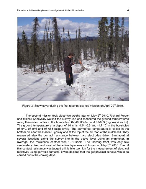
Figure 3: Snow cover during the first reconnaissance mission on April 20 th 2010.<br />
The second mission took place two weeks later on May 5 th 2010. Richard Fortier<br />
and Mikhail Kanevskiy walked the survey line and measured the ground temperatures<br />
along thermistor cables in the boreholes 08-040, 08-046 and 08-053 (Figures 4 and 5).<br />
The ground temperature at a depth <strong>of</strong> 10 m is -1.5, -0.5 and -1.7 °C in the boreholes<br />
08-040, 08-046 and 08-053 respectively. The permafrost temperature is colder in the<br />
bottom hill near the Dalton Highway and at the top <strong>of</strong> the hill than at the middle hill. They<br />
measured also the contact resistance between two electrodes driven 2-m apart at<br />
several locations along the survey line in the active layer using an ohmmeter. In<br />
average, the resistance contact was 10.1 kohm. The thawing front was only few<br />
centimeters deep and most <strong>of</strong> the active layer was still frozen on May 5 th 2010. Even if<br />
this contact resistance was judged a little bite too high for the measurement <strong>of</strong> electrical<br />
resistivity using galvanic contacts, it was decided that the geophysical surveys would be<br />
carried out in the coming days.