7: BIOLOGICAL RESOURCES - Hunterdon County, New Jersey
7: BIOLOGICAL RESOURCES - Hunterdon County, New Jersey
7: BIOLOGICAL RESOURCES - Hunterdon County, New Jersey

Create successful ePaper yourself
Turn your PDF publications into a flip-book with our unique Google optimized e-Paper software.
7: <strong>BIOLOGICAL</strong> <strong>RESOURCES</strong><br />
A. Dominant Vegetation (Land Cover)<br />
The <strong>New</strong> <strong>Jersey</strong><br />
Comparative Risk Project<br />
(March 2003) ranked habitat<br />
fragmentation and habitat loss<br />
as the highest ranking stressors<br />
of Statewide ecological<br />
quality. Certain species that<br />
require large expanses of intact<br />
habitat are becoming less<br />
common. Other factors which<br />
impact ecological health<br />
include exotic species (e.g. the<br />
hemlock wooly adelgid, an<br />
insect which causes the decline<br />
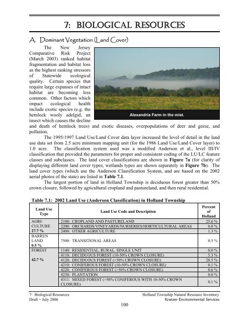
Alexandria Farm in the mist.<br />
and death of hemlock trees) and exotic diseases, overpopulations of deer and geese, and<br />
pollution.<br />
The 1995/1997 Land Use/Land Cover data layer increased the level of detail in the land<br />
use data set from 2.5 acre minimum mapping unit (for the 1986 Land Use/Land Cover layer) to<br />
1.0 acre. The classification system used was a modified Anderson et al., level III/IV<br />
classification that provided the parameters for proper and consistent coding of the LU/LC feature<br />
classes and subclasses. The land cover classifications are shown in Figure 7a (for clarity of<br />
displaying different land cover types, wetlands types are shown separately in Figure 7b). The<br />
land cover types (which use the Anderson Classification System, and are based on the 2002<br />
aerial photos of the state) are listed in Table 7.1.<br />
The largest portion of land in Holland Township is deciduous forest greater than 50%<br />
crown closure, followed by agricultural cropland and pastureland, and then rural residential.<br />
Table 7.1: 2002 Land Use (Anderson Classification) in Holland Township<br />
Land Use<br />
Type<br />
AGRI-<br />
CULTURE<br />
Percent<br />
Land Use Code and Description<br />
of<br />
Holland<br />
2100: CROPLAND AND PASTURELAND 25.6 %<br />
2200: ORCHARDS/VINEYARDS/NURSERIES/HORTICULTURAL AREAS 0.8 %<br />
27.7 % 2400: OTHER AGRICULTURE 1.3 %<br />
BARREN<br />
LAND<br />
0.5 %<br />
FOREST<br />
42.7 %<br />
7500: TRANSITIONAL AREAS 0.5 %<br />
1140: RESIDENTIAL, RURAL, SINGLE UNIT 0.0 %<br />
4110: DECIDUOUS FOREST (10-50% CROWN CLOSURE) 5.3 %<br />
4120: DECIDUOUS FOREST (>50% CROWN CLOSURE) 28.5 %<br />
4210: CONIFEROUS FOREST (10-50% CROWN CLOSURE) 0.1 %<br />
4220: CONIFEROUS FOREST (>50% CROWN CLOSURE) 0.6 %<br />
4230: PLANTATION 0.0 %<br />
4311: MIXED FOREST (>50% CONIFEROUS WITH 10-50% CROWN<br />
CLOSURE)<br />
7: Biological Resources Holland Township Natural Resource Inventory<br />
Draft ~ July 2006 Kratzer Environmental Services<br />
100<br />
0.1 %
Table 7.1: 2002 Land Use (Anderson Classification) in Holland Township<br />
4312: MIXED FOREST (>50% CONIFEROUS WITH >50% CROWN<br />
CLOSURE)<br />
4321: MIXED FOREST (>50% DECIDUOUS WITH 10-50% CROWN<br />
CLOSURE)<br />
4322: MIXED FOREST (>50% DECIDUOUS WITH >50% CROWN<br />
URBAN<br />
20.3%<br />
WATER<br />
CLOSURE)<br />
7: Biological Resources Holland Township Natural Resource Inventory<br />
Draft ~ July 2006 Kratzer Environmental Services<br />
101<br />
0.5 %<br />
0.1 %<br />
0.6 %<br />
4410: OLD FIELD (< 25% BRUSH COVERED) 1.2 %<br />
4420: DECIDUOUS BRUSH/SHRUBLAND 1.1 %<br />
4430: CONIFEROUS BRUSH/SHRUBLAND 1.2 %<br />
4440: MIXED DECIDUOUS/CONIFEROUS BRUSH/SHRUBLAND 3.5 %<br />
1110: RESIDENTIAL, HIGH DENSITY OR MULTIPLE DWELLING 0.1 %<br />
1120: RESIDENTIAL, SINGLE UNIT, MEDIUM DENSITY 1.0 %<br />
1130: RESIDENTIAL, SINGLE UNIT, LOW DENSITY 3.5 %<br />
1140: RESIDENTIAL, RURAL, SINGLE UNIT 10.5 %<br />
1200: COMMERCIAL/SERVICES 0.3 %<br />
1300: INDUSTRIAL 0.4 %<br />
1400: TRANSPORTATION/COMMUNICATION/UTILITIES 0.1 %<br />
1462: UPLAND RIGHTS-OF-WAY DEVELOPED 0.2 %<br />
1463: UPLAND RIGHTS-OF-WAY UNDEVELOPED 1.4 %<br />
1499: STORMWATER BASIN 0.1 %<br />
1700: OTHER URBAN OR BUILT-UP LAND 1.1 %<br />
1710: CEMETERY 0.0 %<br />
1800: RECREATIONAL LAND 1.3 %<br />
1804: ATHLETIC FIELDS (SCHOOLS) 0.1 %<br />
7500: TRANSITIONAL AREAS 0.3 %<br />
5100: STREAMS AND CANALS 1.7 %<br />
1.9 % 5300: ARTIFICIAL LAKES 0.2 %<br />
1461: WETLAND RIGHTS-OF-WAY 0.1 %<br />
1750: MANAGED WETLAND IN MAINTAINED LAWN GREENSPACE 0.1 %<br />
1850: MANAGED WETLAND IN BUILT-UP MAINTAINED REC AREA 0.0 %<br />
2140: AGRICULTURAL WETLANDS (MODIFIED) 0.7 %<br />
2150: FORMER AG. WETLAND (BECOMING SHRUBBY, NOT BUILT-UP) 0.1 %<br />
6210: DECIDUOUS WOODED WETLANDS 4.4 %<br />
WETLANDS 6220: CONIFEROUS WOODED WETLANDS 0.0 %<br />
6231: DECIDUOUS SCRUB/SHRUB WETLANDS 0.2 %<br />
6.9 % 6232: CONIFEROUS SCRUB/SHRUB WETLANDS 0.0 %<br />
6233: MIXED SCRUB/SHRUB WETLANDS (DECIDUOUS DOM.) 0.3 %<br />
6234: MIXED SCRUB/SHRUB WETLANDS (CONIFEROUS DOM.) 0.2 %<br />
6240: HERBACEOUS WETLANDS 0.8 %<br />
6251: MIXED WOODED WETLANDS (DECIDUOUS DOM.) 0.1 %<br />
6252: MIXED WOODED WETLANDS (CONIFEROUS DOM.) 0.0 %<br />
7430: DISTURBED WETLANDS (MODIFIED) 0.0 %<br />
Source: GIS data 1995 Land use/Land Cover<br />
B. Wildlife<br />
<strong>New</strong> <strong>Jersey</strong> hosts 325 bird species, 90 mammal species, 79 reptile and amphibian species<br />
and over 400 species of fish. Per square mile, <strong>New</strong> <strong>Jersey</strong> has the greatest wildlife diversity of<br />
any state in the nation, according to the NJ Division of Fish and Wildlife. <strong>New</strong> <strong>Jersey</strong>'s<br />
geographic position where northern ecosystems reach their southern limit and where southern<br />
ecosystems reach their northern limit provides a wide variety of habitats including mountains,<br />
valleys, rolling hills, wetlands, pinelands, beaches, estuaries and rivers (NJDEP, 2005).
The NJDEP website offers checklists for the birds, mammals, reptiles and amphibians of<br />
<strong>New</strong> <strong>Jersey</strong>, noting the status of each (e.g. common or rare) (see Internet Resources). A variety<br />
of plant and animal species enjoy Holland Township’s diversity of habitat types, although a<br />
catalogue of those specifically found within the boundaries of Holland has never been done.<br />
A few species of interest are discussed below.<br />
White-tailed Deer<br />
The largest herbivore living wild in <strong>New</strong> <strong>Jersey</strong> is the white-tailed deer (Odocoileus<br />
virginianus). Although the deer is a large animal, individuals tend to stay in a one square mile or<br />
less home range, one of the smallest ranges among wild ruminants. Fawns weigh approximately<br />
7½ pounds at birth (which usually occurs between May and the first two weeks of June) while<br />
adult females average 100 pounds and adult males average 150 pounds (Burnett, No Date).<br />
Biologists have estimated that before the arrival of European settlers, there were about 8-<br />
11 white-tailed deer per square mile. By the early 1900’s, <strong>New</strong> <strong>Jersey</strong>’s deer herd was reduced<br />
to a handful by unregulated hunting. However, efforts to protect the deer herd were so<br />
successful that deer were considered over-populous by the 1920’s (Latham et al, 2005). In<br />
addition, deer have been able to adapt to human-altered habitats. Studies have shown that deer<br />
densities of over 10-15 per square mile have negative impacts on the diversity of understory<br />
vegetation and on the native songbird and wildflower populations which depend on a diverse<br />
understory, while deer populations in excess of 20 per square mile prevent tree regeneration<br />
(Latham et al, 2005; Pennsylvania Audubon, no date).<br />
For comparison, NJDEP’s hunting figures 1 for <strong>Hunterdon</strong> <strong>County</strong> show that an average<br />
for the period 1995-2003 of 27 deer per square mile are taken by hunters each year (see Table<br />
7.2), therefore populations are well over the ecological carrying capacity. For the past ten years,<br />
<strong>Hunterdon</strong> <strong>County</strong> has experienced the highest deer harvest in the state (nearly double the<br />
harvest of the next highest, Sussex <strong>County</strong>). Deer Management Zone 10, which encompasses<br />
Holland Township, has<br />
Table 7.2: Deer Hunting Harvest 1995 - 2005<br />
one of the highest harvest<br />
16,000<br />
rates in the county (NJ<br />
Division of Fish and<br />
Number of Deer Harvested<br />
14,000<br />
12,000<br />
10,000<br />
8,000<br />
6,000<br />
4,000<br />
2,000<br />
0<br />
1995 1996 1997 1998 1999 2000 2001 2002 2003 2004 2005<br />
Year<br />
1995 1996 1997 1998 1999 2000 2001 2002 2003 2004 2005<br />
Zone 10 3,019 3,177 3,302 3,534 4,677 4,579 4,046 3,710 4,013 3,676 3,472<br />
<strong>Hunterdon</strong><br />
<strong>County</strong><br />
9,594 9629 10,132 11,031 14,684 14331 12576 11,602 11,893 11,138 10,513<br />
Source: NJ Division of Fish and Wildlife, 2006b.<br />
Wildlife, 2006b).<br />
The<br />
overabundance of deer<br />
results in excessive<br />
damage to agricultural<br />
crops, gardens and<br />
residential landscaping; an<br />
increased incidence of<br />
deer/vehicle collisions;<br />
prevention of forest<br />
regeneration (which<br />
impacts plants and<br />
animals dependent on the<br />
forest); and the potential<br />
for reduced deer health<br />
due to inadequate<br />
1<br />
Deer harvest figures reflect numbers of hunters, availability of land on which to hunt, changes in hunting<br />
regulations, as well as other factors, so are not a direct measure of deer population.<br />
7: Biological Resources Holland Township Natural Resource Inventory<br />
Draft ~ July 2006 Kratzer Environmental Services<br />
102
nutrition and the spread of disease (Bowman’s Hill, 2004; Honachevsky, 2000; Native Plant<br />
Society, 2004; Pennsylvania Audubon, 2004; Sauer, 1998). Despite all this, deer remain a<br />
natural part of the ecosystem, and are not solely responsible for diversity loss and habitat<br />
degradation. Many people still enjoy seeing deer, and many also gain satisfaction from hunting<br />
deer. Deer hunting contributes to the economy, as well, as deer hunters in <strong>New</strong> <strong>Jersey</strong> spend<br />
more than 100 million dollars each year as they enjoy in excess of 1.6 million recreation-days<br />
hunting deer county (NJ Division of Fish and Wildlife, 2006b).<br />
Black Bears<br />
Black bears, the largest land mammals in the state, are occasionally seen in Holland<br />
Township. Evidence of black bears has been recorded in the Musconetcong Gorge section of the<br />
Musconetcong River Reservation. They are most frequently seen during the breeding season of<br />
June and July, when the males travel extensively in search of females. Black bears are<br />
omnivorous in food preferences, consuming a range of foods from skunk cabbage, berries, nuts,<br />
insects, small mammals, road-kill and human garbage. They are sometimes responsible for<br />
damage to bird feeders, beehives, sweet corn, livestock, garbage, etc. Black bears that are fed,<br />
unintentionally or intentionally, can become dangerous and may have to be destroyed (NJ<br />
Division of Fish and Wildlife, 2006a).<br />
The Division of Fish and Wildlife offers information and techniques for damage and<br />
nuisance prevention (see Internet Resources).<br />
Coyotes<br />
The population of eastern coyotes was reduced to 100 in the state in 1975, but has<br />
rebounded to the current population of 3,000. The coyote is the largest canine found in NJ,<br />
primarily nocturnal, but sometimes seen during the day, and extremely wary of humans. They<br />
are not pack animals, although the young may remain with the parents for 1 ½ years. Coyotes<br />
are opportunistic predators, feeding on small animals, carrion, insects, fruit and other vegetable<br />
matter. They occasionally kill and eat small livestock (e.g. chickens, goats) and pets, and raid<br />
garbage (Burnett, 2002).<br />
Wildlife of Vernal Pools<br />
Vernal pools are defined as confined depressions, either natural or man-made, that<br />
maintain ponded water for part of the year, have no permanent outflow, and are devoid of<br />
breeding fish populations. These temporary wetlands provide habitat to many species of<br />
amphibians, several of which breed exclusively in vernal pools, as well as a multitude of insects,<br />
reptiles, plants, and other wildlife (see Table 7.3).<br />
The NJ Freshwater Wetlands Protection Act (adopted in 1989) did little to protect vernal<br />
pools because wetlands less than one acre in size were exempt from regulatory protection. Most<br />
vernal pools in NJ are less than 1/4 acre; therefore vernal pools could be filled, drained, or<br />
modified with a general permit. The loss of this critical habitat put the species that depend on<br />
vernal pools at risk. The NJDEP approved new regulations in September 2001, providing<br />
protection for vernal pools.<br />
7: Biological Resources Holland Township Natural Resource Inventory<br />
Draft ~ July 2006 Kratzer Environmental Services<br />
103
NJDEP Division of<br />
Fish and Wildlife, Nongame<br />
Species Program directs the<br />
Vernal Pool Project, which is<br />
an effort to map and survey<br />
the vernal pools throughout<br />
the state. Because of the<br />
ephemeral nature and small<br />
size of vernal pools, the<br />
program recruits volunteers<br />
to visit possible vernal pools<br />
and confirm, or “certify,”<br />
whether the sites fulfill the<br />
Left: A newly emergent gray treefrog (Hyla versicolor).<br />
Right: Spotted salamander (Ambystoma maculatum) larvae<br />
almost ready to emerge from their eggs.<br />
regulatory definition. The state has identified five potential vernal pools within Holland, one of<br />
which has been “certified”.<br />
Fish & Wildlife of Aquatic Habitats<br />
Table 7.3: Vernal Pool Amphibians and Reptiles<br />
Obligate Vernal Pool<br />
Facultative Vernal Pool<br />
Breeding Amphibians<br />
Breeding Amphibians<br />
Eastern tiger salamander ENDANGERED<br />
Marbled salamander Special Concern<br />
Spotted salamander<br />
Jefferson salamander Special Concern<br />
Blue-spotted salamander ENDANGERED<br />
Wood frog<br />
Eastern spadefoot toad<br />
Green frog<br />
Bullfrog<br />
Pickerel frog<br />
Southern leopard frog<br />
Carpenter frog Special Concern<br />
Northern spring peeper<br />
Northern cricket frog<br />
<strong>New</strong> <strong>Jersey</strong> chorus frog<br />
Upland chorus frog<br />
Northern gray treefrog<br />
Southern gray treefrog ENDANGERED<br />
Pine barrens treefrog ENDANGERED<br />
Four-toed salamander<br />
Long-tailed salamander THREATENED<br />
Reptiles that Inhabit Vernal<br />
Pools on a Seasonal Basis<br />
Wood turtle THREATENED<br />
Spotted turtle Special Concern<br />
Mud turtle<br />
Eastern painted turtle<br />
Common snapping turtle<br />
Note: Species in black are either known to occur in Holland Township or their ranges include Holland; species in<br />
grey have ranges which do not include Holland.<br />
Sources: Tesauro, no date; Kenney et al, no date; Schwartz and Golden, 2002; N.J.A.C 7:7A, Appendix 1.<br />
A NJDEP program called Integrated Biological Aquatics Assessment combines various<br />
studies in an evaluation of the ecological health of aquatic habitats. Beginning in 2000, the<br />
Endangered and Nongame Species Program conducted surveys for freshwater mussels,<br />
dragonflies and damselflies (Odonata) and stream-associated reptiles and amphibians (often<br />
grouped under the term “herptiles”) at selected Ambient Biomonitoring Network (AMNET; see<br />
Section 6H) sites, in addition to stream habitat assessments. Assessments of fish assemblages<br />
are a useful environmental indicator to adequately evaluate biological integrity and protect<br />
surface water quality. The USEPA’s Rapid Bioassessment Protocol V method is used for these<br />
assessments, with some modifications for regional conditions (NJ Department of Fish and<br />
Wildlife, 2000).<br />
(These reptiles visit vernal<br />
pools primarily to eat the eggs<br />
and larvae of amphibians.)<br />
These efforts have identified 12 native freshwater mussel species, 9 of which are listed as<br />
endangered, threatened or special concern; 172 Odonata species, of which 43 are considered<br />
rare; and 72 herptile species, 17 of which are listed as endangered or threatened. The<br />
macroinvertebrate population at one site in Holland was studied and the results discussed in<br />
7: Biological Resources Holland Township Natural Resource Inventory<br />
Draft ~ July 2006 Kratzer Environmental Services<br />
104
Section 6H (surface water).<br />
The Bureau of Freshwater Fisheries evaluates fish populations with its Fish Index of<br />
Biotic Integrity (IBI), which uses fish populations as an indicator of stream water quality.<br />
Although no IBI sampling sites are located within Holland Township, two sites are located on<br />
streams which are partially within Holland: Harihokake Creek near the mouth of the stream in<br />
Alexandria Township (site FIBI034), and Musconetcong River at Route 632/Asbury-<br />
Bloomsbury Road in Franklin Township (Warren <strong>County</strong>) 2 , which is about 4 miles upstream of<br />
where the Musconetcong reaches Holland (FIBI061). “Good” IBI ratings were determined for<br />
Harihokake Creek site FIBI034 and “poor” for the Musconetcong River site FIBI061. A list of<br />
fish species found at these sites during the most recent sampling dates may be found in Table<br />
7.4.<br />
Table 7.4 List of Fishes Collected During Index of Biotic Integrity Sampling of<br />
Harihokake Creek and Musconetcong River (listed in order of abundance)<br />
COMMON NAME SCIENTIFIC NAME # FOUND SIZE RANGE (INCHES)<br />
FIBI034: Harihokake Creek at River Road in Alexandria Township – 2001 (most recent sampling date)<br />
White Sucker* Catostomus commersoni 105<br />
Tesselated Darter Etheostoma olmstedi 47<br />
Blacknose Dace Rhinichthys atratulus 45<br />
American Eel* Anguilla rostrata 43<br />
Creek Chub Semotilus atromaculatus 17<br />
Longnose Dace Rhinichthys cataractae 17<br />
Redbreast Sunfish* Lepomis auritus 12 3.7 – 5.5<br />
Common Shiner Luxilus cornutus 8<br />
Smallmouth Bass* Micropterus dolomieu 5 2.8 - 11.0<br />
Margined Madtom Noturus insignis 4<br />
Green Sunfish* Lepomis cyanellus 3 1.2<br />
Rock Bass* Ambloplites rupestris 3 3.1 - 6.3<br />
Pumpkinseed* Lepomis gibbosus 1 4.3<br />
Number of Fish Species:13 Number of Fish: 310<br />
Nearby AMNET Water Quality Rating:<br />
1992 – moderately impaired<br />
1997 – non-impaired<br />
FIBI Score: 40 FIBI Rating: Good Habitat Score: 163 Habitat Rating: Optimal<br />
FIBI061: Musconetcong River at Route 632/Asbury-Bloomsbury Road – 2003 (most recent sampling date)<br />
American Eel* Anguilla rostrata 48<br />
Blacknose Dace Rhinichthys atratulus 11<br />
Tesselated Darter Etheostoma olmstedi 4<br />
Brown Trout* Salmo trutta 2 7.3-10.4<br />
Satinfin Shiner Cyprinella analostana 2<br />
Rock Bass* Ambloplites rupestris 2 6.7<br />
Longnose Dace Rhinichthys cataractae 1<br />
Number of Fish Species: 7 Number of Fish: 70 Nearby AMNET Water Quality Rating: N/A<br />
FIBI Score: 28 FIBI Rating: Poor Habitat Score: 140 Habitat Rating: Suboptimal<br />
* Regulated as a fishable species under current <strong>New</strong> <strong>Jersey</strong> Fish and Wildlife codes<br />
Sources: NJ Division of Fish and Wildlife, 2002; NJ Division of Fish and Wildlife, 2004; NJ Division of Fish<br />
and Wildlife, 2006d (fish photos are available at this website)<br />
Recreational fishing often focuses on trout or American shad. Trout are stocked in the<br />
Hakihokake Creek and Musconetcong River. The Musconetcong River at Musconetcong Gorge<br />
(county owned property) is also considered a good and fair fishing resource for smallmouth bass<br />
2<br />
An additional FIBI site is located on the Musconetcong in its upper reaches, but is not included here because it is<br />
less relevant to Holland Township.<br />
7: Biological Resources Holland Township Natural Resource Inventory<br />
Draft ~ July 2006 Kratzer Environmental Services<br />
105
and largemouth bass, respectively. The Musconetcong River access site owned by the state<br />
provides fair fishing opportunity for pickerel, catfish and eels. American Shad is an anadromous<br />
fish species which returns from the ocean to spawn in the Delaware River in early spring. The<br />
shad migration is monitored by the NJ Fish and Wildlife service with hydroacoustic equipment<br />
that is mounted on the piers of the Route 202 Bridge at Lambertville, NJ (NJ Fish and Wildlife,<br />
2006c). The study estimated that 160,500 shad passed Lambertville in 2005 (NJ Fish and<br />
Wildlife, 2006e). See Section 6J for Fish Consumption Advisories.<br />
C. Endangered, Threatened and Special Concern Species<br />
The health of an area’s animal and plant populations can be an indicator of the health and<br />
sustainability of the environment for people. The decline or disappearance of one (or more)<br />
species may signal the deterioration of the habitat. Other species, and human health and welfare,<br />
may soon follow. Preserving the future of endangered and threatened species helps preserve our<br />
own species, benefiting human health and quality of life by protecting watersheds, preserving<br />
land in its natural state, and restoring wildlife habitat. Many people also place an intrinsic value<br />
on all species.<br />
The NJDEP Division of Fish and Wildlife, Endangered and Nongame Species Program’s<br />
(ENSP) mission is: “To actively conserve <strong>New</strong> <strong>Jersey</strong>’s biological diversity by maintaining and<br />
enhancing endangered and nongame wildlife populations within healthy functioning<br />
ecosystems.” The program is responsible for the protection and management of <strong>New</strong> <strong>Jersey</strong>’s<br />
wildlife, including 73 species currently listed as endangered or threatened, plus another 57<br />
species of special concern. Table 7.5 presents the definitions used by NJDEP in describing the<br />
status of species. In order to better document the status or change in status of species, NJDEP<br />
solicits information from the general public concerning sightings of endangered, threatened and<br />
special concern species. A reporting form is available on the Internet, and is included in<br />
Appendix C.<br />
Many species are naturally rare in parts of their range, especially at the periphery. <strong>New</strong><br />
<strong>Jersey</strong> often lies at the southern periphery of the range for many "northern" species and at the<br />
northern edge of the range of many "southern" species. Therefore, a species considered rare or<br />
imperiled within the state of <strong>New</strong> <strong>Jersey</strong> is not necessarily in danger of extinction worldwide.<br />
For state-wide species lists, see Internet Resources.<br />
A search of NJDEP Division of Parks and Forestry Natural Heritage Database in<br />
October 2005 revealed the documented presence of 15 endangered, threatened and special<br />
concern animals and 11 plants in Holland Township (see Tables 7.5 for code definitions and<br />
Table 7.6 for list). These include three endangered species (bald eagle, vesper sparrow and bog<br />
turtle), meaning that they likely need management action to avoid extinction within NJ. There<br />
are three threatened species, which are vulnerable and could become endangered, including two<br />
birds (bobolink and Cooper’s hawk) and one reptile (wood turtle). Special concern species,<br />
which warrant concern due to evidence of decline or vulnerability, include four birds (eastern<br />
meadowlark, northern parula warbler, sharp-shinned hawk and veery), one reptile (box turtle)<br />
and three amphibians (carpenter frog, Fowler’s toad, and northern spring salamander). In<br />
addition, there is one threatened invertebrate found within the township (the yellow lampmussel),<br />
as well as five endangered vascular plants and six imperiled vascular plants. No lists are<br />
available for non-vascular plants.<br />
7: Biological Resources Holland Township Natural Resource Inventory<br />
Draft ~ July 2006 Kratzer Environmental Services<br />
106
The bald eagle and the bog turtle are also listed as<br />
threatened on the Federal endangered species list. Federal<br />
cost-sharing programs, which provide funding for habitat<br />
management and improvement, may be available for private<br />
landowners having bog turtles on their land (NJDEP, bog<br />
turtle fact sheet, no date).<br />
Fact sheets, including photos, for many of the rare<br />
animals listed below are presented in Appendix C.<br />
Appendix C also includes a list of <strong>Hunterdon</strong> <strong>County</strong> rare<br />
species and natural communities. The species found in<br />
other locations within the county also have potential to be<br />
present in Holland if suitable habitat is present within the<br />
township.<br />
Table 7.5 Definitions of Species Status<br />
STATE<br />
STATUS<br />
E<br />
T<br />
Special<br />
D<br />
S<br />
STATE STATUS DEFINITIONS<br />
Endangered applies to a species whose prospects for survival within the state are in immediate<br />
danger due to one or several factors, such as loss or degradation of habitat, over-exploitation,<br />
predation, competition, disease or environmental pollution, etc. An endangered species likely<br />
requires immediate action to avoid extinction within NJ.<br />
Threatened applies to species that may become Endangered if conditions surrounding it begin to<br />
or continue to deteriorate. Thus, a Threatened species is one that is already vulnerable as a result<br />
of, for example, small population size, restricted range, narrow habitat affinities, significant<br />
population decline, etc.<br />
Special Concern applies to species that warrant special attention because of some evidence of<br />
decline, inherent vulnerability to environmental deterioration, or habitat modification that would<br />
result in their becoming Threatened. This category would also be applied to species that meet the<br />
foregoing criteria and for which there is little understanding of their current population status in<br />
the state.<br />
Declining species applies to a species which has exhibited a continued decline in population<br />
numbers over the years.<br />
Stable (or increasing) applies to species that appear to be secure in NJ and not in danger of falling<br />
into any of the preceding categories in the near future.<br />
U<br />
Undetermined refers to a species about which there is not enough information available to<br />
determine the status.<br />
FEDERAL<br />
STATUS<br />
FEDERAL STATUS DEFINITIONS<br />
LE Taxa formally listed as endangered.<br />
LT Taxa formally listed as threatened.<br />
STATE RANK STATE ELEMENT RANK DEFINITIONS<br />
S1<br />
S2<br />
Critically imperiled in <strong>New</strong> <strong>Jersey</strong> because of extreme rarity (5 or fewer occurrences or very few<br />
remaining individuals or acres). Species ranked S1 are often restricted to specialized habitats<br />
and/or restricted to an extremely small (3%) geographical area of the state. Also included are<br />
species which were formerly more abundant, but because of habitat destruction or some other<br />
critical factor of its biology, they have been demonstrably reduced in abundance. In essence,<br />
these are species for which, even with intensive searching, sizable additional occurrences are<br />
unlikely to be discovered.<br />
Imperiled in <strong>New</strong> <strong>Jersey</strong> because of rarity (6 to 20 occurrences). Historically many of these<br />
species may have been more frequent, but now, largely through habitat destruction, are known<br />
from fewer extant occurrences. The S2 rank also includes species which occur in habitats<br />
restricted to 10 % of the total state area.<br />
Wood Turtle (Clemmys insculpta),<br />
a state threatened species<br />
Rare in state with 21 to 100 occurrences (plant species in this category have only 21 to 50<br />
S3<br />
occurrences). Includes species which are widely distributed in the state but often occurring in<br />
7: Biological Resources Holland Township Natural Resource Inventory<br />
Draft ~ July 2006 Kratzer Environmental Services<br />
107
small populations, and also in habitats which may be common or widespread. Species having a<br />
moderately restricted distribution (but greater than 10%) in <strong>New</strong> <strong>Jersey</strong>, but are locally abundant,<br />
are also included. Species ranked S3 are not yet imperiled in state but may soon be if additional<br />
populations are destroyed.<br />
S4 Apparently secure in the state, with many<br />
occurrences.<br />
S5 Demonstrably secure in state and essentially ineradicable under present conditions.<br />
B Refers to the breeding population of the element in the state.<br />
N Refers to the non-breeding population of the element in the state.<br />
REGIONAL REGIONAL STATUS CODES FOR PLANTS AND ECOLOGICAL COMMUNITIES<br />
STATUS<br />
LP<br />
HL<br />
GLOBAL<br />
RANK<br />
Indicates taxa listed by the Pinelands Commission as endangered or threatened within their legal<br />
jurisdiction. Not all species currently tracked by the Pinelands Commission are tracked by the<br />
Natural Heritage Program. A complete list of endangered and threatened Pineland species is<br />
included in the NJ Pinelands Comprehensive Management Plan.<br />
Indicates taxa or ecological communities protected by the Highlands<br />
Water Protection and<br />
Planning Act within the jurisdiction of the Highlands Preservation Area.<br />
GLOBAL ELEMENT RANK DEFINITION<br />
Critically imperiled globally because of extreme rarity (5 or fewer occurrences or very few<br />
G1 remaining individuals or acres) or because of some factor(s) making it especially vulnerable to<br />
extinction.<br />
Imperiled globally<br />
because of rarity (6 to 20 occurrences or few remaining individuals or acres)<br />
G2<br />
or because of some factor(s) making it very vulnerable to extinction throughout its range.<br />
Either very rare and local throughout its range or found locally (even abundantly at some of<br />
its<br />
locations) in a restricted range (e.g., a single western state, a physiographic region in the East) or<br />
G3<br />
because of other factors making it vulnerable to extinction throughout its range; with the number<br />
of occurrences in the range of 21 to 100.<br />
Apparently secure globally; although it may<br />
be quite rare in parts of its range, especially at the<br />
G4<br />
periphery.<br />
Demonstrably<br />
secure globally; although it may be quite rare in parts of its range, especially at the<br />
G5<br />
periphery.<br />
GNR Species has not yet been ranked<br />
Note: To express uncertainty, the most likely rank is<br />
assigned and a question mark added (e.g., G2?). A range is<br />
indicated by combining two ranks (e.g., G1G2, S1S3).<br />
Sources: : NJ Division of Fish and Wildlife, 2005: http://www.njfishandwildlife.com/spclspp.htm and<br />
http://www.nj.gov/dep/parksandforests/natural/heritage/spplant_ap1.html<br />
The <strong>New</strong> <strong>Jersey</strong> Endangered Species Conservation Act was signed into law on Dec.14,<br />
1973, preceding<br />
the federal Endangered Species Act by two weeks. According to NJ DEP<br />
Commissioner Bradley Campbell, (Bean, 2003), these regulations have done a good job of<br />
protecting listed species that occur in wetlands and in the Pinelands area, but have often failed to<br />
protect species found elsewhere. Critical habitat regulations (under development) will use the<br />
state's Landscape Project (see Figures 7c through 7f) to also protect upland habitats.<br />
NJDEP provided additional protection of threatened and endangered species<br />
by<br />
designating<br />
waters that provide critical habitat for endangered species as Category One (C1)<br />
waters (see Figure 6d). Rare, threatened and endangered species are often very sensitive to<br />
pollution and habitat disturbances, therefore should benefit from the C1 regulations aimed to<br />
establish stream buffers and maintain water quality.<br />
7: Biological Resources Holland Township Natural Resource Inventory<br />
Draft ~ July 2006 Kratzer Environmental Services<br />
108
Table 7.6: Species Presently Recorded in the Natural Heritage Database for Holland Twp<br />
Common Name Scientific Name<br />
Vertebrates, birds:<br />
Federal<br />
Status<br />
State<br />
Status<br />
Global<br />
Rank<br />
Bald eagle (foraging area) * Haliaeetus leucocephalus LT E G4<br />
State<br />
Rank<br />
S1B,<br />
S2N<br />
Bobolink * Dolichonyx oryzivorus T/T G5 S2B<br />
Cooper’s hawk * Accipiter cooperii T/T G5<br />
Eastern meadowlark Sturnella magna D/S G5<br />
S3B,<br />
S4N<br />
S3B,<br />
S4N<br />
Habitat<br />
Large perch trees<br />
near a body of<br />
water<br />
Large hayfields,<br />
pastures<br />
Mixed riparian or<br />
wetland forests;<br />
avg. 0.2 miles<br />
from nearest house<br />
Northern parula warbler Parula americana Special G5 S3B Humid woods<br />
Sharp-shinned hawk Accipiter striatus Special G5<br />
S2B,<br />
S3N<br />
Woods, thickets<br />
Veery Catharus fuscescens Special G5 S3B<br />
Damp deciduous<br />
woods<br />
Vesper sparrow *<br />
Vertebrates, reptiles:<br />
Pooecetes gramineus E G5<br />
S1B,<br />
S2N<br />
Grasslands,<br />
cultivated &<br />
fallow fields<br />
Bog turtle * Clemmys muhlenbergii LT E G3 S2<br />
Eastern box turtle Terrapene carolina Special G5 S5B<br />
Wood turtle * Clemmys insculpta T G4 S3<br />
Vertebrates, amphibians:<br />
Carpenter frog Rana virgatipes Special G5 S4<br />
Fowler’s toad Bufo woodhousii fowleri Special G5 S4<br />
Calcareous fens,<br />
sphagnum bogs,<br />
wet meadows<br />
Woods &<br />
meadows<br />
Clean streams &<br />
undisturbed<br />
uplands<br />
Sphagnum bogs;<br />
emergent wetlands<br />
Vernal pools,<br />
shallow edges of<br />
lakes & ponds<br />
Cool mountain<br />
streams & shaded<br />
seepages<br />
Northern spring salamander<br />
Invertebrate:<br />
Gyrinophilus p.<br />
porphyrriticus<br />
Special G5T5 S3<br />
Yellow lampmussel *<br />
Natural Community:<br />
Lampsilis cariosa T G3G4 S1 Delaware River<br />
Shale cliff/rock outcrop<br />
community<br />
G3 S2?<br />
Vascular Plants:<br />
Regional<br />
Status<br />
Yellow Giant-hyssop Agastache nepetoides HL G5 S2<br />
Small-fruit groovebur Agrimonia microcarpa HL G5 S2<br />
Bush’s sedge Carex bushii LP,HL E G4 S1<br />
Pale sedge Carex pallescens HL G5 S2<br />
Hairy lipfern Cheilanthes lanosa HL G5 S2<br />
Cornel-leaf aster Doellingeria infirma HL G5 S2<br />
Frank’s love grass Eragrostis frankii HL G5 S2<br />
Green violet Hybanthus concolor LP,HL E G5 S1<br />
False boneset * Kuhnia eupatorioides LP,HL E G5T5 S1<br />
Basil mountain-mint * Pycnanthemum<br />
clinopodioides<br />
LP,HL E G2 S1<br />
Canadian violet Viola canadensis LP,HL E G5TNR S1<br />
* = fact sheets for these species are included in Appendix C.<br />
Note: For status and rank definitions, refer to Table 7.5.<br />
7: Biological Resources Holland Township Natural Resource Inventory<br />
Sources: NJDEP ONLM, October 18, 2005; NJDEP ONLM fact sheets; Schwartz, 2002; Peterson, 1980<br />
Draft ~ July 2006 Kratzer Environmental Services<br />
109
D. Protecting Habitats for Endangered, Threatened & Special Concern Animals:<br />
The Landscape Project<br />
The Landscape Project is a pro-active, ecosystem-level approach to the long-term<br />
protection of rare species and their important habitats in <strong>New</strong> <strong>Jersey</strong>. Its goal is to protect <strong>New</strong><br />
<strong>Jersey</strong>'s biological diversity by maintaining and enhancing rare wildlife populations within<br />
healthy, functioning ecosystems. It provides users with peer reviewed, scientifically sound<br />
wildlife data that is easily accessible and can be used by state, county, and local governments, as<br />
well as nongovernmental conservation organizations and private land owners for planning, open<br />
space acquisition, and land-use regulation (Niles et al, 2004). The NJDEP, Division of Fish and<br />
Wildlife, Endangered and Nongame Species Program is responsible for the Landscape Project.<br />
NJDEP created the dataset by intersecting endangered, threatened and rare species data<br />
with the 1995 Land Use / Land Cover GIS layer, which was derived from satellite imagery. The<br />
resulting data layer identifies, delineates and ranks (based on the conservation status of species<br />
present) critical habitat statewide (see Table 7.7 for rank definitions). Each patch is coded for<br />
the number of special concern, state threatened, state endangered and federally listed species<br />
present. Figure 7c shows emergent wetlands and forested wetlands habitats. Figure 7d displays<br />
forest and grassland habitats. Figure 7e shows habitats for wood turtles and foraging bald<br />
eagles. All habitats are combined in the map in Figure 7f.<br />
Table 7.7: Landscape Project Habitat Rank Definitions<br />
Rank Definition<br />
1 Suitable Habitat - designates a patch as suitable habitat, no species documented<br />
2 Special Concern - patch where species of special concern have been<br />
documented<br />
3 State Threatened - patch where state threatened species have been documented<br />
4 State Endangered - patch where state endangered species have been documented<br />
5 Federal T E - patch where federal T E species have been documented<br />
Note: Not all categories are present for each habitat within Holland Township.<br />
Source: Niles et al, 2004<br />
E. Protecting Habitats for Endangered, Threatened & Special Concern<br />
Plants: Natural Heritage Priority Sites<br />
Natural Heritage Priority Sites<br />
represent some of the best remaining habitat<br />
for rare species and exemplary natural<br />
communities in the state. They have been<br />
identified through the Natural Heritage<br />
Database by the NJDEP Office of Natural<br />
Lands Management (ONLM) as areas<br />
critically important for preservation of <strong>New</strong><br />
<strong>Jersey</strong>’s biological diversity. The database<br />
provides detailed, up-to-date information on<br />
rare plant species and natural communities<br />
for planners, developers, and conservation<br />
agencies for use in resource management,<br />
Prickly Pear Cactus (Opuntia humifusa) on Milford<br />
Bluffs, a Natural Heritage Priority Site of High<br />
Significance.<br />
environmental impact assessment, and both public and private land protection efforts. According<br />
7: Biological Resources Holland Township Natural Resource Inventory<br />
Draft ~ July 2006 Kratzer Environmental Services<br />
110
to the ONLM, if these sites become degraded or destroyed, we may lose some of the unique<br />
components of our natural heritage.<br />
Within Holland Township, there are three Natural Heritage Priority Sites (see Figure 7g).<br />
Table 7.8 provides descriptions of the sites. One is ranked 3 B3 (high significance 4 ) and two are<br />
ranked B4 (moderate significance 5 ).<br />
These Natural Heritage Priority Sites are considered some of the best and most viable<br />
occurrences of endangered and threatened species and natural communities, but they do not<br />
cover all known habitats for endangered and threatened species in Holland Township.<br />
Information on whether or not endangered or threatened species have been documented on a<br />
specific piece of land can be obtained by requesting a search of the Natural Heritage Database<br />
from the Office of Natural Lands Management. In addition, some areas have never been<br />
surveyed, but may also contain endangered or threatened species.<br />
The ONLM has also developed the Natural Heritage Grid Map (see Figure 7g), which<br />
provides a general representation of the locations of rare plant species and natural communities<br />
as of February 2004, including both historically and recently documented habitat. The purpose<br />
of the Grid Map is to document rare plant species and natural community habitats to inform<br />
decision-makers who need to address the conservation of natural resources. The species or<br />
communities of concern are listed in Table 7.9. The map identifies potentially sensitive areas,<br />
and indicates where custom database searches are needed for land use decision-making. The<br />
Grid Map does not include habitat for animal species, and not all areas have been surveyed.<br />
Table 7.8: Natural Heritage Priority Sites Descriptions<br />
Site Name: Javes Road Site Site Code: S.USNJHP1 * 295<br />
Location: Holland Township, <strong>Hunterdon</strong> <strong>County</strong><br />
Description: Wet meadow along small stream.<br />
Boundary Justification: Includes wetlands habitat for state listed endangered plant.<br />
Biodiversity Rank: Biodiversity Significance B4 (moderate significance)<br />
Comments: An excellent occurrence of a state listed endangered plant.<br />
Site Name: Milford Bluffs Site Code: S.USNJHP1 * 368<br />
Location: Holland Township, <strong>Hunterdon</strong> <strong>County</strong><br />
Description: Steep shale cliffs along the edge of the Delaware River with deciduous woodlands and low level<br />
residential housing.<br />
Boundary Justification: Primary boundary follows edge of shale cliff community. Secondary boundary<br />
includes large plateau on tip of bluffs to protect hydrologic integrity of site.<br />
Biodiversity Rank: Biodiversity Significance B3 (high significance)<br />
Comments: This is the best natural red shale cliff community in NJ. Many state rare and endangered plant<br />
species can be found on the dry cliff face and adjacent rich ravines.<br />
Site Name: Vinces Ravine Site Code: S.USNJHP1 * 565<br />
Location: Holland Twp, Bethlehem Twp, Bloomsbury Boro & Pohatcong Twp.; <strong>Hunterdon</strong> & Warren Counties<br />
Description: A hemlock and mixed deciduous woodland on the steep slope of a ravine.<br />
Boundary Justification: Bounds drawn to include the extent of known habitat for rare plant species.<br />
Biodiversity Rank: Biodiversity Significance B4 (moderate significance)<br />
Comments: The site contains a State-listed endangered plant species.<br />
Source: NJDEP ONLM, October 18, 2005<br />
3<br />
Biodiversity Significance Ranks are as follows: B1 – Outstanding significance; B2 – Very high significance; B3 –<br />
High significance; B4 – Moderate significance; B5 – Of general biodiversity interest or open space.<br />
4<br />
“High significance, such as any other viable occurrence of an element that is globally imperiled, a good occurrence<br />
of a globally rare element, an excellent occurrence of any natural community, or a concentration (4+) of good or<br />
excellent occurrences of elements that are critically imperiled in the State.” (NJDEP ONLM, November 2002)<br />
5<br />
“Moderate significance, such as a viable occurrence of a globally rare element, a good occurrence of any natural<br />
community, a good or excellent occurrence or only viable state occurrence of an element that is critically imperiled<br />
in the State, an excellent occurrence of an element that is imperiled in the State, or a concentration (4+) of good<br />
occurrences of elements that are imperiled in the State or excellent occurrences of elements that are rare in the<br />
State.” (NJDEP ONLM, November 2002)<br />
7: Biological Resources Holland Township Natural Resource Inventory<br />
Draft ~ July 2006 Kratzer Environmental Services<br />
111
Table 7.9: Natural Heritage – Species Found in Each Grid (grids are shown in Figure 7g)<br />
Area<br />
unnamed<br />
area –<br />
Western<br />
Vinces Ravine Area<br />
Javes<br />
Road<br />
Area<br />
unnamed<br />
area - Eastern<br />
Milford Bluffs area<br />
Grid<br />
Id. #<br />
Precision<br />
* Class Species Name Species Common Name SRANK<br />
**<br />
Habitat<br />
1816 M Vascular plant ERAGROSTIS FRANKII FRANK'S LOVE GRASS S2 PALUSTRINE<br />
1817 M Vascular plant ERAGROSTIS FRANKII FRANK'S LOVE GRASS S2 PALUSTRINE<br />
1926 M Vascular plant ERAGROSTIS FRANKII FRANK'S LOVE GRASS S2 PALUSTRINE<br />
1927 M Vascular plant ERAGROSTIS FRANKII FRANK'S LOVE GRASS S2 PALUSTRINE<br />
2371 M Vascular plant DOELLINGERIA INFIRMA CORNEL-LEAF ASTER S2 TERRESTRIAL<br />
2372 M Vascular plant DOELLINGERIA INFIRMA CORNEL-LEAF ASTER S2 TERRESTRIAL<br />
2501 M Vascular plant DOELLINGERIA INFIRMA CORNEL-LEAF ASTER S2 TERRESTRIAL<br />
2502<br />
M Vascular plant DOELLINGERIA INFIRMA CORNEL-LEAF ASTER S2 TERRESTRIAL<br />
M Vascular plant CALYSTEGIA SPITHAMAEA ERECT BINDWEED S1 TERRESTRIAL<br />
2642 Both Vascular plant CALYSTEGIA SPITHAMAEA ERECT BINDWEED S1 TERRESTRIAL<br />
2642 Both Vascular plant VIOLA CANADENSIS CANADIAN VIOLET S1 TERRESTRIAL<br />
2778 S Vascular plant CAREX BUSHII BUSH'S SEDGE S1<br />
PALUSTRINE;<br />
TERRESTRIAL<br />
2778 S Vascular plant CAREX PALLESCENS PALE SEDGE S2<br />
PALUSTRINE;<br />
TERRESTRIAL<br />
2919 M Vascular plant AGASTACHE NEPETOIDES YELLOW GIANT-HYSSOP S2 TERRESTRIAL<br />
2920 M Vascular plant AGASTACHE NEPETOIDES YELLOW GIANT-HYSSOP S2 TERRESTRIAL<br />
3059 M Vascular plant AGASTACHE NEPETOIDES YELLOW GIANT-HYSSOP S2 TERRESTRIAL<br />
3060 M Vascular plant AGASTACHE NEPETOIDES YELLOW GIANT-HYSSOP S2 TERRESTRIAL<br />
Both<br />
Ecological<br />
Community<br />
SHALE CLIFF/ROCK OUTCROP COMMUNITY S2?<br />
NO DATA<br />
AVAILABLE<br />
Both Vascular plant KUHNIA EUPATORIOIDES FALSE BONESET S1 TERRESTRIAL<br />
Both Vascular plant PYCNANTHEMUM<br />
2496<br />
CLINOPODIOIDES<br />
BASIL MOUNTAIN-MINT S1 TERRESTRIAL<br />
Both Vascular plant AGRIMONIA MICROCARPA SMALL-FRUIT GROOVEBURR S2 TERRESTRIAL<br />
2497<br />
2636<br />
2637<br />
Both Vascular plant HYBANTHUS CONCOLOR GREEN VIOLET S1 TERRESTRIAL<br />
Both Vascular plant CHEILANTHES LANOSA HAIRY LIPFERN S2 TERRESTRIAL<br />
Both<br />
Ecological<br />
Community<br />
SHALE CLIFF/ROCK OUTCROP COMMUNITY S2?<br />
NO DATA<br />
AVAILABLE<br />
Both Vascular plant KUHNIA EUPATORIOIDES FALSE BONESET S1 TERRESTRIAL<br />
Both Vascular plant PYCNANTHEMUM<br />
CLINOPODIOIDES<br />
BASIL MOUNTAIN-MINT S1 TERRESTRIAL<br />
Both Vascular plant HYBANTHUS CONCOLOR GREEN VIOLET S1 TERRESTRIAL<br />
Both Vascular plant CHEILANTHES LANOSA HAIRY LIPFERN S2 TERRESTRIAL<br />
Both<br />
2776 S<br />
Ecological<br />
Community<br />
SHALE CLIFF/ROCK OUTCROP COMMUNITY S2?<br />
NO DATA<br />
AVAILABLE<br />
Both Vascular plant KUHNIA EUPATORIOIDES FALSE BONESET S1 TERRESTRIAL<br />
Both Vascular plant PYCNANTHEMUM<br />
CLINOPODIOIDES<br />
BASIL MOUNTAIN-MINT S1 TERRESTRIAL<br />
Both Vascular plant AGRIMONIA MICROCARPA SMALL-FRUIT GROOVEBURR S2 TERRESTRIAL<br />
Both Vascular plant HYBANTHUS CONCOLOR GREEN VIOLET S1 TERRESTRIAL<br />
Both Vascular plant CHEILANTHES LANOSA HAIRY LIPFERN S2 TERRESTRIAL<br />
M Vascular plant KUHNIA EUPATORIOIDES FALSE BONESET S1 TERRESTRIAL<br />
M Vascular plant PYCNANTHEMUM<br />
CLINOPODIOIDES<br />
BASIL MOUNTAIN-MINT S1 TERRESTRIAL<br />
Ecological<br />
Community<br />
SHALE CLIFF/ROCK OUTCROP COMMUNITY S2?<br />
NO DATA<br />
AVAILABLE<br />
* Precision: S=documented location known precisely; M=documented location known within 1.5 miles;<br />
Both=both “M” and “S” Occurrences.<br />
** SRank = State Rank. For definitions, refer to Table 7.5.<br />
Source: NJDEP GIS data.<br />
7: Biological Resources Holland Township Natural Resource Inventory<br />
Draft ~ July 2006 Kratzer Environmental Services<br />
112
G. Exotic Species<br />
Exotic species (also called alien or introduced species) are a threat to natural areas.<br />
Exotic species are those that have been introduced by people to an area intentionally (e.g. as<br />
sources of food, for landscaping purposes or the release of unwanted pets) or unintentionally<br />
(e.g. in the ballast of a ship or in a load of lumber); thus, they are not part of the original natural<br />
community.<br />
Some exotic species cannot compete against native species, and never cause problems.<br />
However, some species adapt well to their new environment and proliferate. They compete with<br />
native species for space, nutrients and light, which can result in the local elimination of native<br />
species. The new environment may harbor no natural population controls, such as insects to eat<br />
the invading plant and thereby control its population. Some of the most problematic invasive<br />
exotic species in Holland Township include multiflora rose and autumn olive (see Table 7.10).<br />
According to Robichaud and Anderson, “…as many as 25 percent of the plant species now<br />
present in <strong>New</strong> <strong>Jersey</strong> are exotic plants.”<br />
Table 7.10: Invasive Exotic Plants<br />
Scientific Name Common Name Problems Caused<br />
Dispersed seeds easily sprout in shade, crowding out native<br />
Acer platanoides Norway maple<br />
plants. Canopy produces deep shade and roots produce a<br />
toxic substance preventing growth of wildflowers and other<br />
trees under its canopy.<br />
Ailanthus altissima Tree of Heaven Aggressive in disturbed areas, crowding out native plants.<br />
Alliaria petiolata Garlic Mustard Aggressive in shady habitats, crowding out native plants.<br />
The vine twines around surrounding plants, impeding sap<br />
Celastrus orbiculatus Oriental bittersweet flow. Also makes host plants too heavy, increasing wind<br />
damage.<br />
Cirsium arvense Canada Thistle<br />
Competes with crops and degrades pastures (inedible to<br />
livestock).<br />
Elaeagnus umbellate Autumn Olive<br />
Sprouts vigorously in disturbed areas, produces shade,<br />
preventing sprouting of native trees.<br />
Euonymus alatus Burning Bush<br />
Grows well in many sites, especially upland forests and<br />
pastures, crowding out native plants.<br />
Grows vigorously in deep shade, inhibiting growth of native<br />
Hedera helix English Ivy<br />
woodland plants. Vines up tree trunks, adding to weight,<br />
and increasing likelihood of wind damage.<br />
Ligustrum vulgare Common privet Crowds out more desirable native plants.<br />
Lonicera japonica<br />
Thunberg<br />
Japanese honeysuckle<br />
Spreads aggressively in disturbed habitats, crowding out<br />
native plants.<br />
Spreads aggressively in wetlands, eliminating open water<br />
Lythrum salicaria Purple loosestrife habitats and crowding out native plants. Contributes to the<br />
loss of wildlife which depend on native wetland plants.<br />
Microstegium<br />
vimenium<br />
Japanese stilt grass<br />
Spreads aggressively in disturbed, moist, shady areas,<br />
crowding out native plants.<br />
Miscanthus sinensis Chinese silver grass<br />
Spreads along roadsides and clearings, crowding out native<br />
plants.<br />
Polygonum cuspidatum Japanese Knotweed<br />
Spreads aggressively in disturbed, sunny areas, especially<br />
river banks and wetlands, crowding out native plants.<br />
Rosa multiflora Multiflora rose<br />
Spreads everywhere, except standing water, crowding out<br />
native plants and degrading pastures.<br />
Vinca minor Periwinkle Spreads in shady forests, crowding out native plants.<br />
Source: Courtney, 1997 (fact sheets)<br />
7: Biological Resources Holland Township Natural Resource Inventory<br />
Draft ~ July 2006 Kratzer Environmental Services<br />
113
Native plants can be susceptible to exotic diseases, which they have not evolved<br />
resistance to. The chestnut blight fungus was an accidental introduction which destroyed all<br />
mature chestnut trees, once one of the dominant trees in the <strong>New</strong> <strong>Jersey</strong> landscape. Another<br />
introduced fungus, Dutch elm disease, destroyed the American elm.<br />
In addition, native plants may have little resistance to certain introduced insects, and/or<br />
these insects may have no natural enemies in their new surroundings, allowing them to rapidly<br />
reach pest proportions. Several introduced insects, which are impacting the woodlands of<br />
Holland Township, include the hemlock wooly adelgid, asian longhorned beetle, gypsy moth,<br />
and pine looper. They weaken their host trees, which often succumb to successive years of<br />
infestation, to diseases carried by the insect pests, or other environmental stresses.<br />
References: Biological Resources<br />
Dominant Vegetation (Land Cover)<br />
Bredon, Thomas F. 1989. “A Preliminary Natural Community Classification for <strong>New</strong> <strong>Jersey</strong>.” Reprinted from: E.<br />
F. Karlin (editor). <strong>New</strong> <strong>Jersey</strong>’s Rare and Endangered Plants and Animals. Ramapo College Institute for<br />
Environmental Studies, Mahway, NJ. 280 pages.<br />
Robichaud, Beryl and Karl H. Anderson. 1994. Plant Communities of <strong>New</strong> <strong>Jersey</strong>: A Study in Landscape<br />
Diversity. <strong>New</strong> Brunswick, <strong>New</strong> <strong>Jersey</strong>: Rutgers University Press. 287 pages.<br />
Steering Committee of the <strong>New</strong> <strong>Jersey</strong> Comparative Risk Project. March 2003. Final Report of the <strong>New</strong> <strong>Jersey</strong><br />
Comparative Risk Project. 213 pages.<br />
Wildlife<br />
Bowmans Hill Wildflower Preserve. 2004. Impacts of Deer on Native Plants.<br />
www.bhwp.org/native/impact_of_deer.htm<br />
Burnett, Andrew. No Date. White-tailed Deer – Natural History and Autumn Behavior. NJDEP Division of Fish<br />
and Wildlife. 1 page. http://www.njfishandwildlife.com/deer.htm<br />
Burnett, Andrew. 2002. “The Eastern Coyote in <strong>New</strong> <strong>Jersey</strong>” IN <strong>New</strong> <strong>Jersey</strong> Fish and Wildlife Digest. NJDEP<br />
Division of Fish and Wildlife. 2 pages.<br />
Honachefsky, William B. Ecologically Based Municipal Land Use Planning. 2000. Lewis Publishers: <strong>New</strong> York.<br />
255 pages.<br />
Latham, Roger Earl and, Jan Beyea, Merlin Benner, Cindy Adams Dunn, Mary Ann Fajvan, Ronald R. Freed,<br />
Marrett Grund, Stephen B. Horsley, Ann Fowler Rhoads, and Bryon P. Shissler. January 2005. Managing Whitetailed<br />
Deer in Forest Habitat From an Ecosystem Perspective. Pennsylvania Case Study Report of the Deer<br />
Management Forum convened by Audubon Pennsylvania and the Pennsylvania Habitat Alliance in Harrisburg,<br />
Pennsylvania. 340+ pages. http://pa.audubon.org/deer_report.html<br />
NJDEP Division of Fish and Wildlife. December 2000. 2000 Fish IBI Summary Report. 19 pages.<br />
http://www.state.nj.us/dep/wmm/bfbm/download/ibi2000.pdf<br />
NJDEP Division of Fish and Wildlife. November 2002. 2001 Fish IBI Summary Report. 119 pages.<br />
http://www.state.nj.us/dep/wmm/bfbm/download/ibi2001.pdf<br />
NJDEP Division of Fish and Wildlife. 2004. 2003 Fish IBI Maps, Results and Data Sheets for sites 60 and 61.<br />
http://www.state.nj.us/dep/wmm/bfbm/download/ibi2003Vol2-60-61.pdf<br />
NJDEP Division of Fish and Wildlife. 2005. Watchable Wildlife – Wildlife Diversity Tours.<br />
http://www.njfishandwildlife.com/watchabl.htm<br />
7: Biological Resources Holland Township Natural Resource Inventory<br />
Draft ~ July 2006 Kratzer Environmental Services<br />
114
NJDEP Division of Fish and Wildlife. 2006a. Bear Information. http://www.njfishandwildlife.com/bearinfo.htm<br />
NJDEP Division of Fish and Wildlife. 2006b. Deer Information. http://www.njfishandwildlife.com/deer.htm<br />
NJDEP Division of Fish and Wildlife. 2006c. Fishing Information. http://www.state.nj.us/dep/fgw/fishing.htm<br />
NJDEP Division of Fish and Wildlife. 2006d. List of Fish Collected During 2001 IBI.<br />
http://www.state.nj.us/dep/wmm/bfbm/fishlist2001.html<br />
NJDEP Division of Fish and Wildlife. 2006e. Shad Hotline. http://www.geocities.com/shadhotline/index.html<br />
NJDEP Division of Fish and Wildlife. 2003 and 2004. <strong>New</strong> <strong>Jersey</strong> Fish and Wildlife Digest: A summary of<br />
Rules and Management Information. Volume 16, numbers 1 and 2 and Volume 17 number 1.<br />
NJDEP Division of Fish, Game and Wildlife with the Department of Agriculture. 1999. The Governor’s Report on<br />
Deer Management in <strong>New</strong> <strong>Jersey</strong>. 32 pages. http://www.state.nj.us/dep/fgw/pdf/govdrrpt.pdf<br />
NJDEP Office of Natural Lands Management. October 2005. Database search results.<br />
Sauer, Leslie Jones. 1998. The Once and Future Forest: A Guide to Forest Restoration Strategies. Island Press:<br />
Washington, D.C. 382 pages.<br />
Schwartz, Vicki and David M. Golden. 2002. Field Guide to Reptiles and Amphibians of <strong>New</strong> <strong>Jersey</strong>. <strong>New</strong> <strong>Jersey</strong><br />
Division of Fish and Wildlife, Endangered and Nongame Species Program. Vineland, NJ. 89 pages.<br />
Tesauro, Jason. No date. <strong>New</strong> <strong>Jersey</strong>’s Vernal Pools. NJDEP Endangered and Nongame Species Program. 4<br />
pages.<br />
Native Plant Society of <strong>New</strong> <strong>Jersey</strong>. 2004. Impact of Deer on Biodiversity.<br />
http://www.npsnj.org/deer_biodiversity.htm<br />
Pennsylvania Audubon. 2005. Managing White-tailed Deer in Forest Habitat from an Ecosystem Perspective.<br />
http://pa.audubon.org/deer_report.html<br />
Endangered, Threatened and Special Concern Species<br />
Beans, Bruce. Fall 2003. DEP Commissioner Announces Stronger Protections for Endangered Species, Celebrates<br />
30 years of wildlife protection with innovative exhibit In Conserve Wildlife <strong>New</strong>sletter. Department of<br />
Environmental Protection Division of Fish and Wildlife, Endangered and Nongame Species Program: Trenton, <strong>New</strong><br />
<strong>Jersey</strong>.<br />
Bredon, Thomas F. 1989. “A Preliminary Natural Community Classification for <strong>New</strong> <strong>Jersey</strong>.” Reprinted from: E.<br />
F. Karlin (editor). <strong>New</strong> <strong>Jersey</strong>’s Rare and Endangered Plants and Animals. Ramapo College Institute for<br />
Environmental Studies, Mahway, NJ. 280 pages.<br />
Donato, Melissa. December 1999. Graptemys geographica (map turtle). Michigan State University student<br />
http://animaldiversity.ummz.umich.edu/accounts/graptemys/g._geographica.html<br />
Kenney, Leo, Matthew Burne, Jason Tesauro, Kris Schantz, and Melissa Craddock. No date. Salamanders, Frogs<br />
and Turtles of <strong>New</strong> <strong>Jersey</strong>’s Vernal Pools: A Field Guide. NJDEP Division of Fish and Wildlife, Endangered and<br />
Nongame Species Program. 54 pages.<br />
<strong>New</strong>comb, Lawrence. 1977. <strong>New</strong>comb’s Wildflower Guide. Little, Brown and Company: Boston, MA. 490<br />
pages.<br />
NJDEP Office of Natural Lands Management (ONLM). June 2002. Frequently Asked Questions About The<br />
Natural Heritage Grid Map. 2 pages. File name: gisgridfaqs.doc.<br />
NJDEP Office of Natural Lands Management (ONLM). November 2002. Frequently Asked Questions About The<br />
Natural Heritage Priority Sites GIS File. 2 pages. File name: gissitefaqs.doc.<br />
7: Biological Resources Holland Township Natural Resource Inventory<br />
Draft ~ July 2006 Kratzer Environmental Services<br />
115
NJDEP Office of Natural Lands Management (ONLM). October 18, 2005. Letter Re: Holland Township<br />
Environmental Resource Inventory. Natural Heritage Database Search. One page + attachments.<br />
Peterson, Roger Tory. 1980. Peterson Field Guides: Eastern Birds. Fourth Edition. Houghton Mifflin Company,<br />
Boston. 384 pages.<br />
Schwartz, Vicki and David M. Golden. 2002. Field Guide to Reptiles and Amphibians of <strong>New</strong> <strong>Jersey</strong>. <strong>New</strong> <strong>Jersey</strong><br />
Division of Fish and Wildlife, Endangered and Nongame Species Program. Vineland, NJ. 89 pages.<br />
Protecting Habitats<br />
Niles, L.J., M. Valent, P. Winkler and P. Woerner. 2004. <strong>New</strong> <strong>Jersey</strong>’s Landscape Project, Version 2.0. NJDEP,<br />
Division of Fish and Wildlife, Endangered and Nongame Species Program. 58 pages.<br />
NJDEP Office of Natural Lands Management (ONLM). June 2002. Frequently Asked Questions About The<br />
Natural Heritage Grid Map. 2 pages. File name: gisgridfaqs.doc.<br />
NJDEP Office of Natural Lands Management (ONLM). November 2002. Frequently Asked Questions About The<br />
Natural Heritage Priority Sites GIS File. 2 pages. File name: gissitefaqs.doc.<br />
Exotic Species<br />
Courtney, John Mark. 1997. Fact Sheets: Invasive Exotics. Bowman’s Hill Wildflower Preserve, <strong>New</strong> Hope, PA.<br />
http://www.bhwp.org/native/invasive_plants.htm<br />
<strong>New</strong>comb, Lawrence. 1977. <strong>New</strong>comb’s Wildflower Guide. Little, Brown and Company: Boston, MA. 490<br />
pages.<br />
Snyder, David and Sylvan R. Kaufman. 2004. An overview of nonindigenous plant species in <strong>New</strong> <strong>Jersey</strong>. <strong>New</strong><br />
<strong>Jersey</strong> Department of Environmental Protection, Division of Parks and Forestry, Office of Natural Lands<br />
Management, Natural Heritage Program: Trenton, NJ. 107 pages.<br />
Robichaud, Beryl and Karl H. Anderson. 1994. Plant Communities of <strong>New</strong> <strong>Jersey</strong>: A Study in Landscape<br />
Diversity. <strong>New</strong> Brunswick, <strong>New</strong> <strong>Jersey</strong>: Rutgers University Press. 287 pages.<br />
Internet Resources: Biological Resources<br />
Today’s Landscape<br />
Forest Health (NJDEP Division of Parks and Forestry):<br />
http://www.state.nj.us/dep/parksandforests/forest/njfs_forest_health.html<br />
Native Plants: Bowman’s Hill Wildflower Preserve: http://www.bhwp.org<br />
Natural Heritage Program (NJDEP Division of Parks and Forestry)<br />
http://www.state.nj.us/dep/parksandforests/natural/heritage/index.html<br />
Wildlife<br />
Endangered and Nongame Species Program (NJDEP, Division of Fish and Wildlife)<br />
Home Page: http://www.state.nj.us/dep/fgw/ensphome.htm<br />
Checklists for birds, mammals, reptiles and amphibians of <strong>New</strong> <strong>Jersey</strong>, with status (e.g. common or rare):<br />
http://www.state.nj.us/dep/fgw/chklists.htm<br />
Vernal Pools: http://www.njfishandwildlife.com/ensp/vernalpool.htm<br />
Fish Index of Biotic Integrity (Bureau of Freshwater Fisheries):<br />
http://www.state.nj.us/dep/wmm/bfbm/fishlist2001.html<br />
7: Biological Resources Holland Township Natural Resource Inventory<br />
Draft ~ July 2006 Kratzer Environmental Services<br />
116
Fish and Wildlife (NJDEP, Division of Fish and Wildlife)<br />
Home Page: http://www.njfishandwildlife.com/<br />
Bear Information: http://www.njfishandwildlife.com/bearinfo.htm<br />
Deer Information: http://www.njfishandwildlife.com/deer.htm<br />
Fishing in NJ: http://www.state.nj.us/dep/fgw/fishing.htm<br />
Fish Fact Sheets: http://www.state.nj.us/dep/fgw/fishfact.htm<br />
Integrated Biological Aquatics Assessment http://www.state.nj.us/dep/fgw/ensp/ibaa03.htm<br />
List of Fishes Collected During 2001 IBI Sampling:<br />
http://www.state.nj.us/dep/wmm/bfbm/fishlist2001.html<br />
Regulations (hunting, fishing, nongame): http://www.njfishandwildlife.com/njregs.htm<br />
Shad Hotline: http://www.geocities.com/shadhotline/index.html or 610-954-0577 or 610-954-0578<br />
Impacts of White-tailed Deer<br />
Deer resistant/tolerant Native Plants (Bowmans Hill Wildflower Preserve)<br />
http://www.bhwp.org/native/native_plant_info_sheets/Deer_Tolerant_Resistant_Native_Plants.pdf<br />
Impacts of deer on native plants (Bowmans Hill Wildflower Preserve)<br />
www.bhwp.org/native/impact_of_deer.htm<br />
The Ecological Impact of White-tailed Deer (PA Audubon)<br />
http://pa.audubon.org/deer_report.html<br />
Impact of Deer on Biodiversity (Native Plant Society of <strong>New</strong> <strong>Jersey</strong>)<br />
http://www.npsnj.org/deer_biodiversity.htm<br />
Identification, Delineation and Faunal Surveys of Vernal Pools in <strong>New</strong> <strong>Jersey</strong><br />
http://www.dbcrssa.rutgers.edu/ims/vernal/<br />
Endangered, Threatened and Special Concern Species<br />
Endangered and Nongame Species Program (NJDEP, Division of Fish and Wildlife)<br />
Home Page: http://www.state.nj.us/dep/fgw/ensphome.htm<br />
Endangered & Threatened Wildlife of <strong>New</strong> <strong>Jersey</strong> List, and links to Natural History Profiles:<br />
http://www.state.nj.us/dep/fgw/tandespp.htm<br />
Special Concern – Species Status Listing: http://www.njfishandwildlife.com/spclspp.htm<br />
Checklists for birds, mammals, reptiles and amphibians of <strong>New</strong> <strong>Jersey</strong>, with status (e.g. common or rare):<br />
http://www.state.nj.us/dep/fgw/chklists.htm<br />
Species Reporting Form: http://www.njfishandwildlife.com/ensp/rprtform.htm also link to pdf form<br />
Landscape Project Home Page (wildlife habitat mapping for community land-use planning and endangered<br />
species conservation): http://www.njfishandwildlife.com/ensp/landscape/<br />
Conserve Wildlife <strong>New</strong>sletter: http://www.njfishandwildlife.com/ensp/cwnewslt.htm or 609-2929400.<br />
Vernal Pools: http://www.njfishandwildlife.com/ensp/vernalpool.htm<br />
Fish Index of Biotic Integrity (Bureau of Freshwater Fisheries):<br />
http://www.state.nj.us/dep/wmm/bfbm/fishlist2001.html<br />
7: Biological Resources Holland Township Natural Resource Inventory<br />
Draft ~ July 2006 Kratzer Environmental Services<br />
117
Natural Heritage Program (NJDEP Division of Parks and Forestry)<br />
Home Page: http://www.state.nj.us/dep/parksandforests/natural/heritage/index.html<br />
Rare Species Lists, Reports & Forms:<br />
http://www.nj.gov/dep/parksandforests/natural/heritage/rarelist.html<br />
Species Reporting Forms:<br />
http://www.nj.gov/dep/parksandforests/natural/heritage/repform.html<br />
Mailing Address: DEP - Division of Parks and Forestry,<br />
Office of Natural Lands Management, Natural Heritage Program, PO Box 404, Trenton,<br />
NJ 08625-0404<br />
Protecting Habitats<br />
Landscape Project (NJDEP, Division of Fish Wildlife): http://www.njfishandwildlife.com/ensp/landscape/<br />
NJDEP Office of Natural Lands Management (ONLM):<br />
http://www.state.nj.us/dep/parksandforests/natural/index.html<br />
Natural Heritage Program (NJDEP Division of Parks and Forestry):<br />
http://www.state.nj.us/dep/parksandforests/natural/heritage/index.html<br />
Backyard Habitats & Conservation<br />
National Audubon Society: http://www.audubon.org/bird/at_home/<br />
<strong>New</strong> <strong>Jersey</strong> Audubon Society: http://www.njaudubon.org/Education/BackyardHabitat/<br />
NJDEP Division of Fish and Wildlife (grants): http://www.njfishandwildlife.com/artwhip06.htm<br />
NJDEP Division of Fish and Wildlife Landowner Incentive Program (LIP) Grants:<br />
http://www.njfishandwildlife.com/ensp/lip_prog.htm<br />
NJDEP Outdoor Classroom links: http://www.state.nj.us/dep/seeds/syhart/outclass.htm<br />
USDA Natural Resources Conservation Service:. http://www.nrcs.usda.gov/feature/backyard/<br />
Exotic Species<br />
Federal efforts concerning invasive species Home Page: http://www.invasivespecies.gov<br />
Invasive Species – <strong>New</strong> <strong>Jersey</strong>: http://www.invasivespecies.gov/geog/state/nj.shtml<br />
Native Plant Society of <strong>New</strong> <strong>Jersey</strong> – Invasive Species: http://www.npsnj.org/invasive_species_0103.htm<br />
NJ Forest Service - Forest Health: http://www.state.nj.us/dep/parksandforests/forest/njfs_forest_health.html<br />
7: Biological Resources Holland Township Natural Resource Inventory<br />
Draft ~ July 2006 Kratzer Environmental Services<br />
118
Legend<br />
Parcels<br />
Land Cover 2002<br />
Wetlands (see Figure 12b)<br />
1110 - Residential (high density)<br />
1120 - Residential (medium density)<br />
1130 - Residential (low density)<br />
1140 - Residential (rural)<br />
1200 - Commercial & Services<br />
1300 - Industrial<br />
1400 - Communication/Utilities<br />
1419 - Bridge over Water<br />
1462 - Uplands ROW Developed<br />
1463 - Uplands ROW Undeveloped<br />
1499 - Stormwater Basin<br />
1700 - Other Urban or Built-up Land<br />
1800 - Recreational Land<br />
1804 - Athletic Fields (Schools)<br />
2100 - Cropland & Pastureland<br />
2200 - Orchards, Vineyards, Nurseries, Horticultural Areas<br />
2400 - Other Agriculture<br />
4110 - Decid. Forest (10-50% Crown Closure)<br />
4120 - Decid. Forest >50% Crown Closure)<br />
4210 - Conif. Forest (10-50% Closure)<br />
4220 - Conif. Forest (>50% Crown Closure)<br />
4230 - Plantation<br />
4311 - Mixed Forest (>50% conif.; 10-50% Crown Closure)<br />
4312 - Mixed Forest (>50% conif.; >50% Crown Closure)<br />
4321 - Mixed Forest (>50% decid.; 10-50% Crown Closure)<br />
4322 - Mixed Forest (>50% decid.; >50% Closure)<br />
4410 - Old Field (50% Crown Closure)<br />
4210 - Conif. Forest (10-50% Closure)<br />
4220 - Conif. Forest (>50% Crown Closure)<br />
4230 - Plantation<br />
4311 - Mixed Forest (>50% conif.; 10-50% Crown Closure)<br />
4312 - Mixed Forest (>50% conif.; >50% Crown Closure)<br />
4321 - Mixed Forest (>50% decid.; 10-50% Crown Closure)<br />
4322 - Mixed Forest (>50% decid.; >50% Closure)<br />
4410 - Old Field (
Legend<br />
Land Cover 2002 (wetlands only)<br />
1461 - Wetlands ROW<br />
1750 - Managed Wetland in Lawn<br />
1850 - Managed Wetland in Rec. Area<br />
2140 - Ag. Wetlands (modified)<br />
2150 - Ag. Wetlands (becoming shrubby)<br />
5100 - Streams and Canals<br />
5300 - Artificial Lakes<br />
6120 - Freshwater Tidal Marsh<br />
6210 - Deciduous Wooded Wetlands<br />
6231 - Deciduous Scrub/Shrub Wetland<br />
6232 - Coniferous Scrub/Shrub Wetland<br />
6233 - Mixed Scrub Wet. (decid. dom.)<br />
6234 - Mixed Scrub Wet. (conif. dom.)<br />
6240 - Herbaceous Wetland<br />
6251 - Mixed Wooded Wet. (decid. dom.)<br />
6252 - Mixed Wooded Wet. (conif. dom.)<br />
7430 - Disturbed Wetlands (modified)<br />
IJ 627<br />
Vernal Pools<br />
!. Certified<br />
!(<br />
Roads<br />
not surveyed<br />
Holland Twp. Boundary<br />
Streams<br />
Parcels<br />
<strong>County</strong><br />
Local<br />
Private<br />
Figure 7b: 2002 Land Cover (Wetlands Only) and Vernal Pools<br />
IJ 519<br />
Data Sources: See Appendix B.<br />
Note: Map accuracy is limited to the accuracy and scale of the original data sets; see Appendix B.<br />
Disclaimer: This map was developed using NJDEP and <strong>Hunterdon</strong> <strong>County</strong> GIS digital data, but this<br />
secondary product has not been verified by NJDEP or <strong>Hunterdon</strong> <strong>County</strong> and is not NJDEP or county authorized.<br />
!(<br />
IJ 614<br />
!.<br />
!(<br />
´<br />
0 0.25 0.5 1<br />
Miles<br />
1:49,200<br />
4a: Holland Soils Township NRI, DRAFT 2006<br />
07/12/06 Prepared by Kratzer Environmental Services<br />
IJ 519<br />
IJ 619<br />
!(<br />
!(<br />
Note: Only an official<br />
determination from NJDEP,<br />
called a "Letter of<br />
Interpretation (LOI)," can<br />
verify the presence, absence,<br />
or boundaries of freshwater<br />
wetlands and transition areas<br />
on a site. See Figure 6c.<br />
IJ 631
Legend<br />
Holland Twp. Boundary<br />
Parcels<br />
Streams and Rivers<br />
Grassland Habitat Rank<br />
1 - suitable habitat<br />
2 - Special Concern Species<br />
3 - State Threatened Species<br />
4 - State Endangered Species<br />
Forest Habitat Rank<br />
Roads<br />
2 - Special Concern Species<br />
3 - State Threatened Species<br />
<strong>County</strong> Road<br />
Local Road<br />
Private Road<br />
IJ 627<br />
Figure 7c: Landscape Project - Forest and Grassland Habitats<br />
IJ 519<br />
Data Sources: See Appendix B.<br />
Note: Map accuracy is limited to the accuracy and scale of the original data sets; see Appendix B.<br />
Disclaimer: This map was developed using NJDEP and <strong>Hunterdon</strong> <strong>County</strong> GIS digital data, but this<br />
secondary product has not been verified by NJDEP or <strong>Hunterdon</strong> <strong>County</strong> and is not NJDEP or county authorized.<br />
´<br />
IJ 614<br />
0 0.2 0.4 0.8<br />
Miles<br />
4a: Soils<br />
IJ 519<br />
IJ 619<br />
Holland Township NRI, DRAFT 2006<br />
Prepared by Kratzer Environmental Services<br />
IJ 631
Legend<br />
Roads<br />
Holland Twp. Boundary<br />
Parcels<br />
Streams and Rivers<br />
<strong>County</strong> Road<br />
Local Road<br />
Private Road<br />
Forested Wetlands Rank<br />
1 - suitable habitat<br />
2 - Special Concern Species<br />
3 - State Threatened Species<br />
Emergent Wetlands Habitat Rank<br />
1 - suitable habitat<br />
2 - Special Concern Species<br />
IJ 627<br />
Figure 7d: Landscape Project - Emergent and Forested Wetlands Habitat<br />
IJ 519<br />
Data Sources: See Appendix B.<br />
Note: Map accuracy is limited to the accuracy and scale of the original data sets; see Appendix B.<br />
Disclaimer: This map was developed using NJDEP and <strong>Hunterdon</strong> <strong>County</strong> GIS digital data, but this<br />
secondary product has not been verified by NJDEP or <strong>Hunterdon</strong> <strong>County</strong> and is not NJDEP or county authorized.<br />
´<br />
IJ 614<br />
0 0.25 0.5 1<br />
Miles<br />
4a: Soils<br />
IJ 519<br />
IJ 619<br />
Holland Township NRI, DRAFT 2006<br />
Prepared by Kratzer Environmental Services<br />
IJ 631
Legend<br />
Holland Twp. Boundary<br />
Parcels<br />
Streams and Rivers<br />
Bald Eagle Foraging Habitat Rank<br />
5 - Federal Threatened or Endangered Species<br />
Wood Turtle Habitat Rank<br />
Roads<br />
3 - State Threatened Species<br />
<strong>County</strong> Road<br />
Local Road<br />
Private Road<br />
IJ 627<br />
IJ 519<br />
Data Sources: See Appendix B.<br />
Note: Map accuracy is limited to the accuracy and scale of the original data sets; see Appendix B.<br />
Disclaimer: This map was developed using NJDEP and <strong>Hunterdon</strong> <strong>County</strong> GIS digital data, but this<br />
secondary product has not been verified by NJDEP or <strong>Hunterdon</strong> <strong>County</strong> and is not NJDEP or county authorized.<br />
IJ 614<br />
0 0.25 0.5 1<br />
Miles<br />
4a: Soils<br />
Figure 7e: Landscape Project - Bald Eagle Foraging Habitat and Wood Turtle Habitat<br />
´<br />
IJ 519<br />
IJ 619<br />
Holland Township NRI, DRAFT 2006<br />
Prepared by Kratzer Environmental Services<br />
IJ 631
Legend<br />
Holland Twp. Boundary<br />
Streams and Rivers<br />
Parcels<br />
Habitat Rank<br />
Roads<br />
1 - suitable habitat<br />
2 - Special Concern Species<br />
3 - State Threatened Species<br />
4 - State Endangered Species<br />
5 - Federal Threatened or Endangered Species<br />
<strong>County</strong> Road<br />
Local Road<br />
Private Road<br />
IJ 627<br />
Figure 7f: Landscape Project - Composite of All Habitat Types<br />
IJ 519<br />
Data Sources: See Appendix B.<br />
Note: Map accuracy is limited to the accuracy and scale of the original data sets; see Appendix B.<br />
Disclaimer: This map was developed using NJDEP and <strong>Hunterdon</strong> <strong>County</strong> GIS digital data, but this<br />
secondary product has not been verified by NJDEP or <strong>Hunterdon</strong> <strong>County</strong> and is not NJDEP or county authorized.<br />
´ Holland<br />
IJ 614<br />
0 0.25 0.5 1<br />
Miles<br />
4a: Soils<br />
IJ 519<br />
IJ 619<br />
Township NRI, DRAFT 2006<br />
Prepared by Kratzer Environmental Services<br />
IJ 631
Legend<br />
1817<br />
1816<br />
Holland Twp. Boundary<br />
Natural Heritage Priority Sites (Sept. 2001)<br />
Critical Habitat for Rare Species & Natural Communities<br />
Standard Site (usually < 3200 acres in size)<br />
B1 (Outstanding Significance)-none in Holland<br />
B2 (Very High Significance)-none in Holland<br />
B3 (High Significance)-one in Holland<br />
B4 (Moderate Significance)-two in Holland<br />
B5 (General Biodiversity Interest)-none<br />
Natural Heritage Grid (Feb. 2004)<br />
Generalized Locations of Rare Plant Species<br />
and Ecological Communities<br />
(see Table 7.9 for additional information)<br />
S - Documented Location Known Precisely<br />
M - Documented Location Known Within 1.5 Miles<br />
Both - Both 'M' and 'S' Occurrences<br />
None Documented<br />
2371 2501<br />
1927 2497 2637<br />
IJ 627<br />
Roads<br />
<strong>County</strong> Road<br />
Local Road<br />
Private Road<br />
Streams and Rivers<br />
Parcels<br />
1926 2496 2636 2776<br />
Figure 7g: Natural Heritage Priority Sites and Grid Map<br />
IJ 519<br />
Data Sources: See Appendix B.<br />
Note: Map accuracy is limited to the accuracy and scale of the original data sets; see Appendix B.<br />
Disclaimer: This map was developed using NJDEP and <strong>Hunterdon</strong> <strong>County</strong> GIS digital data, but this<br />
secondary product has not been verified by NJDEP or <strong>Hunterdon</strong> <strong>County</strong> and is not NJDEP or county authorized.<br />
2372<br />
´ Holland<br />
2502<br />
2642<br />
V i n c e s R a v i n e<br />
IJ 614<br />
M i l f o r d B l u f f s<br />
2778<br />
J a v e s R o a d S i t e<br />
0 0.25 0.5 1<br />
Miles<br />
4a: Soils<br />
IJ 519<br />
IJ 619<br />
Township NRI, DRAFT 2006<br />
Prepared by Kratzer Environmental Services<br />
2920 3060<br />
2919 3059<br />
IJ 631