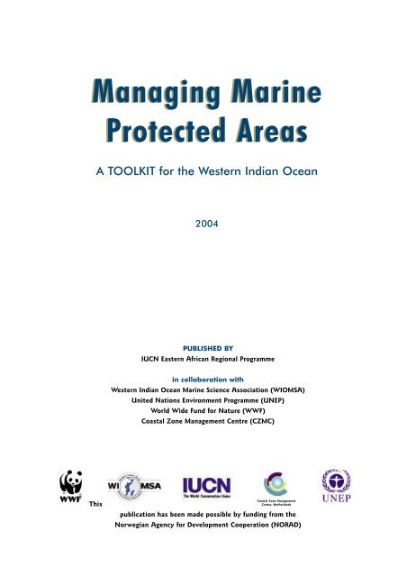
Managing Marine Protected Areas Managing Marine Protected Areas
Managing Marine Protected Areas Managing Marine Protected Areas
Managing Marine Protected Areas Managing Marine Protected Areas

Create successful ePaper yourself
Turn your PDF publications into a flip-book with our unique Google optimized e-Paper software.
<strong>Managing</strong> <strong>Marine</strong><br />
This<br />
<strong>Protected</strong> <strong>Areas</strong><br />
A TOOLKIT for the Western Indian Ocean<br />
2004<br />
PUBLISHED BY<br />
IUCN Eastern African Regional Programme<br />
in collaboration with<br />
Western Indian Ocean <strong>Marine</strong> Science Association (WIOMSA)<br />
United Nations Environment Programme (UNEP)<br />
World Wide Fund for Nature (WWF)<br />
Coastal Zone Management Centre (CZMC)<br />
Coastal Zone Management<br />
Centre, Netherlands<br />
publication has been made possible by funding from the<br />
Norwegian Agency for Development Cooperation (NORAD)
The designation of geographical entities in this toolkit, and the presentation of the<br />
material, do not imply the expression of any opinion whatsoever on the part of IUCN,<br />
WIOMSA, UNEP, WWF, CZMC and NORAD concerning the legal status of any country,<br />
territory, or area, or of its authorities, or concerning the delimitation of its frontiers or<br />
boundaries.<br />
The views expressed in this publication do not necessarily reflect those of IUCN,<br />
WIOMSA, UNEP, WWF, CZMC and NORAD.<br />
This publication has been made possible by funding from the Norwegian Agency for<br />
Development Cooperation (NORAD).<br />
Published by: IUCN Eastern African Regional Programme, Nairobi, Kenya, in collaboration with the<br />
Western Indian Ocean <strong>Marine</strong> Science Association (WIOMSA), United Nations<br />
Environment Programme (UNEP), World Wide Fund for Nature (WWF), and the Coastal<br />
Zone Management Centre (CZMC), Netherlands.<br />
Copyright: © 2004 International Union for Conservation of Nature and Natural Resources.<br />
This publication may be reproduced in whole or part and in any form for education or<br />
non-profit uses, without special permission from the copyright holder, provided<br />
acknowledgement of the source is made. IUCN would appreciate receiving a copy of any<br />
publication which uses this publication as a source.<br />
No use of this publication may be made for resale or other commercial purpose without<br />
the prior written permission of IUCN.<br />
Citation: IUCN 2004. <strong>Managing</strong> <strong>Marine</strong> <strong>Protected</strong> <strong>Areas</strong>: A Toolkit for the Western Indian Ocean.<br />
IUCN Eastern African Regional Programme, Nairobi, Kenya, xii + 172pp.<br />
ISBN: 2-8317-0773-0<br />
Design and layout:<br />
Samaki Consultants Ltd., P.O. Box 77143,<br />
Dar es Salaam, Tanzania.<br />
www.samaki.net<br />
Graphic design: Kaya design. Email: kaya@africaonline.co.tz<br />
Art work by: Adam Lutta, Babatau Inc., Dar es Salaam, Tanzania. Email: babatau@hotmail.com<br />
Coastal Zone Management<br />
Centre, Netherlands<br />
Printed by: Kul Graphics Ltd, Maasai Road, off Mombasa Road, P.O. Box 18095, Nairobi, Kenya<br />
Cover photographs: Front: Background image, monitoring, tourism, zoning, education, conservation and<br />
fishing images by M. Richmond; compliance, community and livelihoods images by<br />
S. Wells. Back: Man with fish and boat by S. Wells; seaweed farming and fish weighing<br />
by M. Richmond.<br />
Available from: IUCN- EARO Publications Service Unit, P. O. Box 68200 - 00200, Nairobi, Kenya;<br />
Telephone + 254 20 890605-12; Fax + 254 20 890615; Email: mail@iucnearo.org
Preface<br />
Introduction - How to use the Toolkit<br />
MPAs of the Western Indian Ocean - maps<br />
MPAs of the Western Indian Ocean - list of details<br />
Addresses and contact details for WIO MPAs<br />
Global and regional conventions and initiatives<br />
Using the Internet<br />
Obtaining further information<br />
Acknowledgements<br />
PART 1. THE MANAGEMENT PROCESS<br />
A LEGISLATIVE & INSTITUTIONAL FRAMEWORK<br />
A1 Types and categories of MPAs<br />
A2 MPA goals and objectives<br />
A3 Organisational structures<br />
A4 Legislation<br />
A5 Integrated coastal management<br />
A6 Environmental impact assessment<br />
B PARTICIPATORY PROCESSES<br />
B1 Participatory techniques<br />
B2 Conflict resolution<br />
B3 Gender and MPAs<br />
B4 Local and traditional knowledge<br />
C PLANNING AND REPORTING<br />
C1 Mapping and surveying<br />
C2 MPA design and zonation<br />
C3 Management plans<br />
C4 Logical framework approach<br />
C5 Progress and donor reports<br />
D HUMAN RESOURCES<br />
D1 Personnel<br />
D2 Consultants and experts<br />
D3 Partnerships and volunteers<br />
D4 Safety and emergency procedures<br />
E FINANCES<br />
E1 Financial planning<br />
E2 Financial management<br />
E3 User fees and direct revenue<br />
E4 Environmental trust funds<br />
E5 Donor proposals<br />
E6 Economic valuation<br />
F EQUIPMENT AND INFRASTRUCTURE<br />
F1 MPA buildings<br />
F2 Energy sources<br />
F3 The MPA office<br />
F4 Equipment purchase and maintenance<br />
F5 Boats and engines<br />
F6 Vehicles<br />
F7 Radio and telecommunication<br />
F8 SCUBA and snorkelling equipment<br />
F9 Moorings and buoys<br />
G MONITORING, EVALUATION AND RESEARCH<br />
G1 Monitoring and evaluation principles<br />
G2 Compliance and enforcement<br />
G3 Monitoring coral reefs<br />
G4 Monitoring mangroves and seagrasses<br />
G5 Monitoring physical conditions<br />
G6 Socio-economic monitoring<br />
G7 Fisheries monitoring<br />
G8 Information management<br />
G9 Assessing management success<br />
G10 Evaluations and reviews<br />
G11 Research<br />
PART 2. CONSERVATION AND<br />
SUSTAINABLE USE<br />
H HABITATS AND SPECIES<br />
H1 Threatened marine species<br />
H2 <strong>Marine</strong> turtles<br />
H3 Seabirds and shorebirds<br />
H4 <strong>Marine</strong> mammals<br />
H5 Biodiversity and ecosystem health<br />
H6 Coral reef rehabilitation<br />
H7 Coral bleaching<br />
H8 Crown-of-thorns outbreaks<br />
H9 Mangrove restoration<br />
H10 Red tides and harmful algal blooms<br />
H11 Diseases of marine organisms<br />
I FISHERIES<br />
I1 No-take areas<br />
I2 <strong>Managing</strong> fishing gears<br />
I3 Mariculture<br />
I4 Fish Aggregating Devices (FADs)<br />
I5 Shark and ray fisheries<br />
I6 Octopus and sea cucumber fisheries<br />
I7 Sport and recreational fishing<br />
I8 <strong>Marine</strong> organisms for aquaria<br />
I9 <strong>Marine</strong> curios<br />
J TOURISM, RECREATION AND EDUCATION<br />
J1 Tourism policy and planning<br />
J2 Visitors and carrying capacity<br />
J3 Publicity materials and promotion<br />
J4 Educational activities<br />
J5 Visitor centres<br />
J6 Visiting the reef<br />
J7 Artificial reefs<br />
J8 Visiting the mangroves<br />
K COASTAL DEVELOPMENT AND SHIPPING<br />
K1 Coastal engineering<br />
K2 Nutrient and sewage pollution<br />
K3 Oil spills<br />
K4 Solid waste disposal<br />
K5 Alien invasive species<br />
<strong>Managing</strong> <strong>Marine</strong> <strong>Protected</strong> <strong>Areas</strong>: A TOOLKIT for the Western Indian Ocean<br />
Contents
Preface<br />
<strong>Marine</strong> protected areas (MPAs) have been established<br />
throughout the world for a variety of purposes such as<br />
conservation, tourism and education. At the time of<br />
producing this Toolkit there are more than 70 individual<br />
sites (nationally and internationally designated), in the<br />
Western Indian Ocean (WIO), over which some form of<br />
management exists. Most of these sites are managed under<br />
formal government mandates while some correspond to<br />
traditional or localised arrangements, and span the spectrum<br />
from fully protected “no take” areas to multiple use areas.<br />
Every country in the region now has one or more MPAs and<br />
the number is on the increase.<br />
The revitalization of the Convention for the Protection,<br />
Management, and Development of the <strong>Marine</strong> and Coastal<br />
Environment in Eastern Africa (the Nairobi Convention,<br />
adopted in 1985) has contributed significantly to this<br />
increase and has also resulted in the establishment of the<br />
Group of Experts on <strong>Marine</strong> <strong>Protected</strong> <strong>Areas</strong> in Eastern<br />
Africa (GEMPA-EA), hosted jointly by the United Nations<br />
Environment Programme (UNEP) and the Western Indian<br />
Ocean <strong>Marine</strong> Science Association (WIOMSA).<br />
A number of other regional initiatives have also contributed<br />
to the progress in MPA establishment and management,<br />
including:<br />
● A Norwegian Agency for Development Co-operation<br />
(NORAD)-funded project - the WIO <strong>Marine</strong> Biodiversity<br />
Conservation Project, which has identified MPAs as a<br />
priority theme for attention.<br />
● The Coastal Zone Management Centre (CZMC) of the<br />
Netherlands - supported project on Capacity building in<br />
MPA management in the Western Indian Ocean region.<br />
Implemented in collaboration with WIOMSA, the<br />
project aimed at providing training in skills, techniques<br />
and tools necessary for effective management of MPAs<br />
in the region.<br />
● World Wide Fund for Nature (WWF)’s Eastern African<br />
<strong>Marine</strong> Ecoregion (EAME) Programme, which covers the<br />
mainland coast from southern Somalia to the northern<br />
coast of South Africa, and promotes, amongst others,<br />
the establishment of a regional representative network<br />
of MPAs based on the ecosystem approach.<br />
IUCN’s Eastern Africa Regional Programme (EARP) initiated<br />
the WIO <strong>Marine</strong> Biodiversity Conservation Project in 2000<br />
with a range of partners, to assist with implementation of<br />
the Jakarta Mandate within the Eastern African region. The<br />
project is led by a Task Force representing six of the Parties<br />
to the Nairobi Convention, as well as a number of regional<br />
organisations including WIOMSA, UNEP, WWF and IUCN-<br />
EARP. The project also provides a mechanism for assisting<br />
with implementation of the Nairobi Convention, since the<br />
Convention and the Jakarta Mandate share similar<br />
objectives.<br />
The Nairobi Convention calls upon the Contracting Parties<br />
to ‘formulate and adopt guidelines, standards or criteria<br />
concerning the identification, selection, establishment and<br />
management of protected areas’. Furthermore, the Biennial<br />
(2000-2001) Work Programme of the Nairobi Convention<br />
proposed that existing MPA global guidelines should be<br />
‘regionalised’ with the intention of improving their relevance<br />
to the situation in the WIO region. The Task Force of the<br />
WIO <strong>Marine</strong> Biodiversity Conservation Project therefore<br />
suggested that such guidelines could be prepared as one of<br />
the Project’s activities.<br />
A needs assessment was first undertaken to determine more<br />
precisely the requirements of MPAs in the region. The<br />
assessment, which was based on questionnaires, email<br />
correspondence and focused discussions, involved a range of<br />
practitioners and experts from within and outside the<br />
region, and benefited from contributions from members of<br />
the Task Force and GEMPA-EA. The assessment revealed that<br />
MPA managers and practitioners felt that many guidelines,<br />
training manuals and other relevant materials already exist<br />
and largely fulfill their intended purposes. However, the<br />
remote locations of many of the WIO MPAs, and their<br />
inadequate funding and communication facilities, mean that<br />
they have very limited access to simple and practical<br />
information. It was therefore recommended that a Toolkit be<br />
prepared to assist MPA managers and practitioners access<br />
existing information relating to all stages of MPA<br />
establishment and management, including site selection,<br />
planning, day-to-day management, sustainable financing,<br />
management effectiveness and monitoring and evaluation.<br />
The Toolkit is designed to complement and build on the<br />
Regional Training Course in <strong>Marine</strong> <strong>Protected</strong> <strong>Areas</strong><br />
Management in the Western Indian Ocean Region and a<br />
manual entitled Training for the sustainable management of<br />
<strong>Marine</strong> <strong>Protected</strong> <strong>Areas</strong>: A training manual for MPA managers.<br />
The Toolkit aims to act as a first point of call in the search<br />
for information on issues that MPA managers and<br />
practitioners face in day-to-day operations.<br />
The Toolkit reflects work by many individuals and<br />
organizations that, over a period of three years, have<br />
collaborated together on conception of the idea, to the<br />
writing of theme sheets, to reviewing them. We hope this<br />
collaboration will continue since the production of this<br />
Toolkit is a small step forward in our long march to improve<br />
the management effectiveness of the MPAs in the WIO<br />
region.<br />
Julius Francis<br />
Executive Secretary, WIOMSA<br />
<strong>Managing</strong> <strong>Marine</strong> <strong>Protected</strong> <strong>Areas</strong>: A TOOLKIT for the Western Indian Ocean
MPAs in the WIO are supported by a host of managers,<br />
wardens, rangers, community members and others. These<br />
MPA managers are tasked with having to deal with a<br />
multitude of different situations, issues and problems on a<br />
daily basis, often in remote locations, without easy reference<br />
to sources of information or help. These may range from<br />
purchasing a boat, managing staff, annual planning,<br />
monitoring fish populations in the MPA, building an<br />
information centre, consulting local villagers, to writing a<br />
proposal to secure funding. This is not an easy job and<br />
requires a diverse array of skills. Recognising this need,<br />
partners involved in the IUCN/NORAD WIO <strong>Marine</strong><br />
Biodiversity Conservation Project decided to publish a Toolkit<br />
for managing MPAs in the WIO. This consists of a ring-binder<br />
of theme sheets, each of which addresses a key issue faced by<br />
an MPA manager, with a focus on the situation in the WIO.<br />
The Toolkit also has a complementary website<br />
(www.wiomsa.org\mpatoolkit.htm) and CD-ROM.<br />
The Toolkit was designed to support MPA managers in the<br />
WIO by providing them with a hands-on guide to a diverse<br />
array of topics, ranging from Communications, Monitoring<br />
Coral Reefs, Energy Sources, Solid Waste Disposal, to Octopus<br />
and Sea Cucumber Fisheries. The Toolkit is designed to address<br />
management issues relevant to all types of MPAs, from<br />
community based, locally managed areas, to nationally<br />
gazetted marine parks. The geographical scope of the Toolkit<br />
comprises Comores, Kenya, Madagascar, Mauritius,<br />
Mozambique, Réunion (France), Seychelles, Somalia, South<br />
Africa (but only Kwazulu Natal) and Tanzania; the ten<br />
countries that are signatory to the Nairobi Convention. The<br />
Toolkit represents a significant review of global information<br />
but draws heavily on information from the WIO region, with<br />
case studies from nine countries. Although written for the<br />
WIO where it will be distributed, it is certainly relevant to<br />
other tropical regions.<br />
Introduction<br />
This first Edition of the Toolkit contains 78 theme sheets,<br />
most of which include a case study to help illustrate each<br />
topic. The Toolkit is arranged in two parts: 1) The<br />
Management Process and 2) Conservation and Sustainable<br />
Use. Although comprehensive, there are certainly gaps and<br />
emerging issues that are not yet included. The Toolkit has<br />
been designed as a ring-binder so it is a dynamic product that<br />
will be revised as new information becomes available, or as<br />
new sheets are developed. WIOMSA and GEMPA-EA have<br />
been instrumental in the development of this Toolkit and will<br />
act as the focal point for this ongoing review and updating.<br />
Comments and reviews should be addressed to:<br />
secretary@wiomsa.org.<br />
It is now widely accepted that MPAs in their various guises<br />
are one of the most effective ways of protecting marine<br />
biodiversity and also serve as a vital management tool for<br />
coastal fisheries. The latter is particularly relevant in the WIO<br />
where coastal people still widely depend on marine resources<br />
for their subsistence and livelihoods. Two economic sectors, in<br />
particular, benefit from MPAs and demonstrate how MPAs can<br />
help to alleviate poverty: fisheries and tourism. There is a<br />
growing body of evidence that MPAs can generate substantial<br />
income through tourism, and potentially play a major role in<br />
the recovery of over-exploited fisheries.<br />
It is intended that this Toolkit will be pivotal in assisting MPA<br />
managers in their important role as custodians of the WIO’s<br />
marine biodiversity.<br />
Melita Samoilys<br />
Programme Coordinator - <strong>Marine</strong> and Coastal Ecosystems<br />
IUCN Eastern African Regional Programme<br />
<strong>Managing</strong> <strong>Marine</strong> <strong>Protected</strong> <strong>Areas</strong>: A TOOLKIT for the Western Indian Ocean
How to use the Toolkit<br />
STRUCTURE<br />
The Toolkit consists of a ring-binder containing double-sided<br />
‘theme sheets’, a series of introductory pages, and a CD-<br />
ROM. The binding is loose leaf so that the theme sheets<br />
can be copied, faxed, individually laminated, and used<br />
separately for specific purposes. It is strongly recommended<br />
that if sheets are removed from the Toolkit, they should be<br />
copied first and the original replaced immediately. The<br />
Toolkit is intended to be a dynamic document and it is<br />
planned that individual theme sheets will be up-dated over<br />
time; the old versions can thus be replaced by the new ones.<br />
Additional theme sheets and other materials can also be<br />
added. Editions of the Toolkit and CD-ROM are also being<br />
prepared in Portuguese and French.<br />
The Toolkit has three parts:<br />
Introductory section - This comprises seven main parts,<br />
including two maps of the WIO showing the location of all<br />
MPAs in the region and a table with details of dates of their<br />
establishment and size. Addresses and contact details for<br />
each MPA, an annotated list of global and regional<br />
conventions and initiatives relevant to MPAs (referred to<br />
frequently in individual theme sheets), guidelines for<br />
Internet searches and details for obtaining some of the more<br />
frequently cited sources of further information are also<br />
provided. The final sheet of the introductory section<br />
provides a description of the process of producing the<br />
Toolkit with a detailed acknowledgement of all the<br />
individuals and institutions that collaborated and assisted in<br />
so many ways.<br />
Part 1 The Management Process - Seven sections contain<br />
theme sheets on management topics or inputs (human,<br />
financial, organizational and technical) required to effectively<br />
manage an MPA and ensure that it meets its objectives.<br />
A. Legislative and institutional framework<br />
B. Participatory processes<br />
C. Planning and reporting<br />
D. Human resources<br />
E. Finances<br />
F. Equipment and infrastructure<br />
G. Monitoring, evaluation and research<br />
Part 2 Conservation and Sustainable Use - Four sections<br />
provide theme sheets on topics related to the results or<br />
outputs of MPA management.<br />
H. Habitats and species<br />
I. Fisheries<br />
J. Tourism, recreation and education<br />
K. Coastal development and shipping<br />
THEME SHEET CONTENT<br />
Each sheet covers a theme relevant to MPA management in<br />
the WIO region. The text aims to provide:<br />
● An introduction to the subject and a description of the<br />
key issues relevant to MPA management;<br />
● Some ideas and guidance on what the MPA might do in<br />
relation to the topic;<br />
● References to publications and Internet websites;<br />
● Where relevant, a short case study from an MPA within<br />
the WIO region, which illustrates a particular point in<br />
the theme sheet and discusses experience and lessons<br />
learnt.<br />
A survey carried out before the Toolkit was developed<br />
indicated that the main need of MPA personnel in the region<br />
is assistance in obtaining information on different subjects.<br />
The theme sheets therefore focus on providing details on<br />
how to obtain the information needed. This is largely in two<br />
formats: printed documentation, with key references listed;<br />
and electronically, from the Internet, with key websites<br />
provided. Guidance on how to maximise use of the Internet<br />
is provided within this introductory section.<br />
Some theme sheets cover very specific technical subjects<br />
whilst others simply provide an introduction to more<br />
complex issues. Given that all theme sheets have a single 2sided<br />
page format, this means that some subjects are<br />
covered in more depth than others. As the Toolkit evolves<br />
and expands, it is intended that the gaps should be filled<br />
and other topics added. Each theme sheet stands alone, but<br />
contains cross-references to other relevant sheets.<br />
The theme sheets were compiled and reviewed by numerous<br />
regional and international experts. They nevertheless<br />
represent only general guidance to the theme in question<br />
and should not be taken as the definitive management<br />
guide. Use should always be made of the additional sources<br />
of information that are provided.<br />
CD-ROM<br />
The CD-ROM contains a full electronic version of the<br />
Toolkit. Theme sheets are in Portable Document Format (pdf)<br />
to allow easy viewing, navigation and printing. The CD-ROM<br />
is identical to the website.<br />
General information and operating instructions for the CD-<br />
ROM, including instructions for installing software, using<br />
the associated software, and accessing the theme sheets will<br />
be included in the CD-ROM. Ultimately, three language<br />
options (English, Portuguese and French) will be available.<br />
Website<br />
The website (www.wiomsa.org/toolkit.htm) has been<br />
created to complement the printed Toolkit and the CD-<br />
ROM. All the theme sheets can be viewed or downloaded as<br />
pdf files. At a future date, information in the website will be<br />
in three languages namely, English, Portuguese and French.<br />
New material and updates will be posted to the website on<br />
a continuing basis.<br />
<strong>Managing</strong> <strong>Marine</strong> <strong>Protected</strong> <strong>Areas</strong>: A TOOLKIT for the Western Indian Ocean
The Western Indian Ocean<br />
MAPUTO<br />
SOUTH<br />
AFRICA<br />
Limpopo R.<br />
Zambezi R.<br />
BEIRA<br />
INHAMBANE<br />
Ilhas da Inhaca e<br />
dos Portugueses FaR<br />
MOZAMBIQUE<br />
Kiunga MNR & BR<br />
Malindi MNP & Malindi-Watamu MNR & BR<br />
Watamu MNP<br />
MOMBASA Mombasa MNP & MNR<br />
Diani MNR<br />
Kisite MNP & Mpunguti MNR<br />
TANGA<br />
Misali I. CA<br />
Pemba I.<br />
Tanga CMAs Maziwe I. MR<br />
ZANZIBAR<br />
Mnemba I. CA<br />
Chumbe I. ReS<br />
Menai Bay CA<br />
DAR ES SALAAM Dar es Salaam MR<br />
Latham I.<br />
TANZANIA<br />
Bazaruto<br />
Archipelago NP<br />
Tongaland RS<br />
St. Lucia MPA<br />
Greater St. Lucia WP & WHS<br />
Maputaland MPA<br />
Trafalgar MPA<br />
DURBAN<br />
Aliwal Shoal MPA<br />
<strong>Marine</strong> <strong>Protected</strong> <strong>Areas</strong> of the Western Indian Ocean<br />
Rufiji R.<br />
KENYA<br />
MTWARA<br />
Ruvuma R.<br />
Tana R.<br />
PEMBA<br />
LAMU<br />
Mafia I. MP<br />
Mnazi Bay-Ruvuma<br />
Estuary MP<br />
MORONI<br />
Anjouan<br />
Quirimbas NP<br />
Moheli MP<br />
N’Gouja ZP<br />
Saziley PM<br />
Ilhas Primeiras<br />
e Segundas<br />
Ilot de Bassas<br />
de India RN<br />
FRANCE<br />
Ilot d’Europa RN<br />
See overleaf for explanation of abbreviations used for MPA names.<br />
SOMALIA<br />
UNION DES COMORES<br />
Tulear RB<br />
Nosy Ve<br />
TULEAR<br />
Eastern Africa to Madagascar<br />
Aldabra SR & WHS<br />
FRANCE<br />
Mayotte<br />
Passe de<br />
Longogori SFR<br />
Sahamalaza-Nosy Radama RB<br />
MADAGASCAR<br />
ANTANANARIVO<br />
SEYCHELLES<br />
Isles Glorieuses RN<br />
Nosy Tanikely<br />
Masoala PN Tanjona PM<br />
Masoala-<br />
Mananara-Nord RB<br />
Ambodilaitry<br />
PM<br />
Nosy<br />
Atafana PM<br />
Ile St. Marie<br />
40 o E 50 o E<br />
<strong>Managing</strong> <strong>Marine</strong> <strong>Protected</strong> <strong>Areas</strong>: A TOOLKIT for the Western Indian Ocean<br />
0 200 400 km<br />
Assumption I.<br />
Providence I.<br />
0 m<br />
50 m<br />
200 m<br />
1000 m<br />
3000 m<br />
4000 m<br />
10o Cosmoledo I.<br />
St. Pierre I.<br />
S<br />
Astove I.<br />
Farquhar Group<br />
Tampolo PM<br />
20 o S<br />
30 o S
<strong>Marine</strong> <strong>Protected</strong> <strong>Areas</strong> of the Western Indian Ocean<br />
Northern Madagascar, Mascarenes and Seychelles<br />
Granitic Islands<br />
Silhouette<br />
MNP<br />
Baie Ternay<br />
MNP<br />
Port Launay<br />
MNP<br />
Curieuse MNP<br />
Praslin ShR<br />
Cousin I.SR<br />
Aride I. SR<br />
La Digue ShR<br />
North East Point ShR<br />
Ste Anne MNP<br />
Victoria<br />
Anse Faure ShR<br />
Aldabra SR & WHS<br />
Providence I.<br />
Cosmoledo I.<br />
St. Pierre I.<br />
Assumption I.<br />
Astove I. Farquhar Group<br />
FRANCE<br />
Mayotte<br />
Passe de<br />
Longogori SFR<br />
Saziley PM<br />
Sahamalaza-Nosy<br />
Radama RB<br />
MADAGASCAR<br />
0 25 50 km<br />
Isles Glorieuses RN<br />
Manamara-Nord RB<br />
AMANANARIVO<br />
Ravine<br />
Trois<br />
Bassins FR<br />
Saline<br />
L’Hermitage FR<br />
Nosy Tanikely<br />
Masoala PN<br />
African<br />
Banks PA<br />
Tampolo PM<br />
Tanjona PM<br />
Masoala-Ambodilaitry<br />
PM<br />
Nosy Antafana PM<br />
Ile St. Marie<br />
0 25 50 75 km<br />
St. Denis<br />
Parc Marin<br />
St. Leu FR<br />
de la Réunion<br />
L’ Etang FR<br />
St. Pierre FR<br />
Réunion<br />
Abbreviations for MPA names:<br />
BR Biosphere Reserve<br />
CA Conservation Area<br />
CMA Collaborative Mngmt Area<br />
ER Estuary Reserve<br />
FaR Faunal Reserve<br />
FR Fishing Reserve<br />
MNP <strong>Marine</strong> National Park<br />
MNR <strong>Marine</strong> National Reserve<br />
SEYCHELLES<br />
Ile Coco,<br />
Ile la Fouche &<br />
Ilot Platte NP<br />
Coetivy I.<br />
Ile Tromelin RN<br />
FRANCE<br />
Réunion<br />
55 o E<br />
Seychelles Bank<br />
Agalega Is.<br />
M a s c a r e n e I s l a n d s<br />
Ile Maurice<br />
MP <strong>Marine</strong> Park<br />
MPA <strong>Marine</strong> <strong>Protected</strong> Area<br />
MR <strong>Marine</strong> Reserve<br />
NP National Park<br />
PA <strong>Protected</strong> Area<br />
PM Parc Marin<br />
PN Parc National<br />
R Reserve<br />
RB Réserve de la Biosphère<br />
0 200 400 km<br />
T h e<br />
M a s c a r e n e<br />
R i d g e<br />
Ile Maurice<br />
MAURITIUS<br />
Nazareth Bank<br />
St. Brandon Is.<br />
Saya de Malha Bank<br />
Ile Rodrigues<br />
Five FRs<br />
Balaclava MP<br />
Poudre d’Or FR<br />
Rivulet Terre Rouge<br />
ER Port Louis FR Port Louis<br />
Poste Lafayette FR<br />
Trou d’Eau<br />
Douce FR<br />
Black River FR<br />
Grand Port FR<br />
Blue Bay MP<br />
0 30 60 90 km<br />
RN Réserve Naturel<br />
RS Ramsar Site<br />
ReS Reef Sanctuary<br />
SFR Strict Fishing Reserve<br />
ShR Shell Reserve<br />
SR Special Reserve<br />
WHS World Heritage Site<br />
WP Wetlands Park<br />
ZP Zone de Protection<br />
0 m<br />
50 m<br />
200 m<br />
1000 m<br />
3000 m<br />
4000 m<br />
<strong>Managing</strong> <strong>Marine</strong> <strong>Protected</strong> <strong>Areas</strong>: A TOOLKIT for the Western Indian Ocean<br />
10 o S<br />
20 o S
<strong>Marine</strong> <strong>Protected</strong> <strong>Areas</strong> of the Western Indian Ocean<br />
The information below was as accurate as possible at the<br />
time of printing. Notice of any errors, changes to status or<br />
creation of new MPAs, should please be made to WIOMSA<br />
for incorporation into future editions. Included are proposed<br />
sites likely to be designated in the near future.<br />
Some sites have both national and international designation.<br />
Where two dates are given, the MPA was gazetted twice, the<br />
second time changing name or size. Sheet A1 provides an<br />
explanation of IUCN categories. n/a = IUCN category not<br />
assigned. Sizes include terrestrial portion of MPAs.<br />
Country <strong>Marine</strong> <strong>Protected</strong> Area Date IUCN Size<br />
estab. category sq km<br />
Comores Moheli <strong>Marine</strong> Park 2001 n/a 404.00<br />
France Ilot d’Europa Réserve Naturelle 1975 IV ..<br />
Iles Eparses Iles Glorieuses Réserve Naturelle 1975 IV ..<br />
Ilot de Bassas de India Réserve Naturelle 1975 IV ..<br />
Ile Tromelin Réserve Naturelle 1975 IV ..<br />
France Passe de Longogori Strict Fishing Reserve 1991 VI 13.80<br />
Mayotte Saziley Parc Marin 1991 II 25.90<br />
N’Gouja Zone de Protection 2001 - 2.00<br />
France Parc Marin de la Réunion 1997/98 VI 18.20<br />
La Réunion L’Etang Fishing Reserve 1992 VI ..<br />
Ravine Trois Bassins-Pointe de Bretagne Fishing Reserve 1978 VI ..<br />
St Leu Fishing Reserve 1992 VI ..<br />
Saline l’Hermitage (lagoon) Fishing Reserve 1992 VI ..<br />
Saline l’Hermitage (reef) Fishing Reserve 1992 VI ..<br />
St Pierre Fishing Reserve 1992 VI ..<br />
Kenya Kiunga <strong>Marine</strong> National Reserve 1979 VI 250.00<br />
within Kiunga Biosphere Reserve 1980 - 600.00<br />
Malindi <strong>Marine</strong> National Park 1968 II 6.30<br />
Watamu <strong>Marine</strong> National Park 1968 II 10.00<br />
Malindi-Watamu <strong>Marine</strong> National Reserve 1968 VI 245.00<br />
Malindi-Watamu Biosphere Reserve [partially covers the MNR] 1979 - 196.00<br />
Mombasa <strong>Marine</strong> National Park 1986 II 10.00<br />
Mombasa <strong>Marine</strong> National Reserve 1986 VI 200.00<br />
Kisite <strong>Marine</strong> National Park 1978 II 28.00<br />
Mpunguti <strong>Marine</strong> National Reserve 1978 VI 11.00<br />
Diani <strong>Marine</strong> National Reserve 1995 VI 75.00<br />
Madagascar Nosy Atafana Parc Marin 1989 II 10.00<br />
(within Réserve de la Biosphère du Mananara-Nord) 1990 - 1,400.00<br />
Masoala Parc National (includes 3 Parcs Marins):<br />
Tampolo, Masoala-Ambodilaitry and Tanjona<br />
1997 - 100.00<br />
Nosy Tanikely [no fishing zone] 1968/95 n/a 0.10<br />
Nosy Ve [community based marine management area] 1999 n/a 10.00<br />
Réserve de la Biosphère du Sahamalaza-Nosy Radama 2001 n/a 322.00<br />
Réserve de la Biosphère du Tulear 2003 n/a ..<br />
Mauritius Balaclava <strong>Marine</strong> Park 1997/2000 II 5.00<br />
Ile Maurice Blue Bay <strong>Marine</strong> Park 1997/2000 - 3.50<br />
Black River Fishing Reserve 1983/2000 IV 7.80<br />
Grand Port Fishing Reserve (Zones A & B) 1983/2000 IV 18.30<br />
Port Louis Fishing Reserve 1983/2000 IV 3.30<br />
Poste Lafayette Fishing Reserve 1983/2000 IV 6.00<br />
<strong>Managing</strong> <strong>Marine</strong> <strong>Protected</strong> <strong>Areas</strong>: A TOOLKIT for the Western Indian Ocean
Ile Maurice cont. Poudre d’Or Fishing Reserve 1983/2000 IV 25.40<br />
Rivulet Terre Rouge Estuary Reserve 1999 - ..<br />
Trou d’Eau Douce Fishing Reserve 1983/2000 IV 5.70<br />
Mauritius Five Fishing Reserves proposed 1984 - 1998: - ..<br />
Ile Rodrigues Anse aux Anglais/Grande Baie Reserve .. - 1.20<br />
Carcasse and Grand Bassin Reserve .. - 9.50<br />
Passe Demie and Islets Reserve .. - 5.20<br />
Riviere Banane Reserve .. - 0.30<br />
Mozambique Bazaruto Archipelago National Park 1971/2001 II 1,430.00<br />
Ilhas da Inhaca e dos Portugueses Faunal Reserve 1965 VI 20.00<br />
Quirimbas National Park 2002 - 7,500.00<br />
Seychelles Aldabra Special Reserve 1981 la 350.00<br />
Aldabra World Heritage Site 1982 - 350.00<br />
Aride Island Special Reserve 1973 Ia 0.70<br />
Baie Ternay <strong>Marine</strong> National Park 1979 II 0.80<br />
Cousin Island Special Reserve 1968/75 la 0.28<br />
Curieuse <strong>Marine</strong> National Park 1979 II 14.70<br />
Port Launay <strong>Marine</strong> National Park 1979 II 1.58<br />
Silhouette <strong>Marine</strong> National Park 1987II 30.45<br />
Ste Anne <strong>Marine</strong> National Park 1973 II 14.23<br />
Ile Coco, Ile la Fouche & Ilot Platte <strong>Marine</strong> National Park 1997- 0.01<br />
African Banks <strong>Protected</strong> Area 1987- 8.20<br />
Anse Faure Shell Reserve 1987n/a 1.08<br />
North East Point Shell Reserve 1987n/a 2.99<br />
La Digue Shell Reserve 1987n/a 1.58<br />
Praslin Shell Reserve 1987n/a 1.74<br />
South Africa Maputaland <strong>Marine</strong> <strong>Protected</strong> Area 1986 n/a 408.00<br />
St Lucia <strong>Marine</strong> <strong>Protected</strong> Area 1979 n/a 414.00<br />
Greater St Lucia Wetlands Park 1895 II 2,587.00<br />
Greater St Lucia World Heritage Site 1999 - 2,396.00<br />
Trafalgar <strong>Marine</strong> <strong>Protected</strong> Area 1979 n/a 2.50<br />
Tongaland turtle beaches and coral reefs Ramsar Site 1986 - 395.00<br />
Aliwal Shoal <strong>Marine</strong> <strong>Protected</strong> Area 2004 n/a 126.00<br />
Tanzania Mafia Island <strong>Marine</strong> Park 1996 VI 822.00<br />
mainland Mnazi Bay – Ruvuma Estuary <strong>Marine</strong> Park 2000 - 650.00<br />
Dar es Salaam <strong>Marine</strong> Reserves<br />
Bongoyo, Fungu, Yasini, Mbudya, Pangavini<br />
Tanga Collaborative Management <strong>Areas</strong><br />
1975 II 26.00<br />
Boma-Mahandakini 2001 - 100.00<br />
Deepsea-Boma 1999 - 400.00<br />
Mwarongo-Sahare 1998/99 - 300.00<br />
Mtanga’ata 1996 - 150.00<br />
Boza-Sange 1996/2000 - 559.00<br />
Mkwaja-Sange 2001 - 405.00<br />
Maziwe Island <strong>Marine</strong> Reserve 1981 II 2.60<br />
Tanzania Chumbe Reef Sanctuary 1994 II 0.30<br />
Zanzibar Menai Bay Conservation Area 1997VI 470.00<br />
Misali Island Conservation Area 1998 VI 22.00<br />
Mnemba Island Conservation Area 2002 VI 0.15<br />
<strong>Managing</strong> <strong>Marine</strong> <strong>Protected</strong> <strong>Areas</strong>: A TOOLKIT for the Western Indian Ocean
This sheet describes the main international conventions or<br />
treaties relating to MPAs and conservation of marine biodiversity<br />
in the WIO, as well as some of the more relevant international<br />
programmes and initiatives.<br />
LEGALLY BINDING CONVENTIONS<br />
Convention on Biological Diversity and the Jakarta Mandate<br />
Lays out measures to be taken by Parties for conservation and<br />
sustainable use of biodiversity, including the establishment of a<br />
system of protected areas, or areas where special measures need<br />
to be taken to conserve biodiversity. The Jakarta Mandate, an<br />
associated instrument, lays out specific requirements for marine<br />
biodiversity conservation and identifies five key areas: integrated<br />
coastal management (ICM), sustainable use of living resources,<br />
MPAs, mariculture and alien species. www.biodiv.org<br />
The Ramsar Convention on Wetlands addresses conservation<br />
and wise use of wetlands and covers freshwater and marine (to<br />
6m depth at low tide) wetlands. Allows for designation of sites of<br />
‘international importance’ that meet criteria covering<br />
representative, rare, unique wetland types or those especially<br />
important for conserving biodiversity. Sites must be managed but<br />
may be subject to ‘wise’ use and do not require formal protected<br />
area legal status. www.ramsar.org<br />
World Heritage Convention Provides for the protection of<br />
outstanding examples of the world’s cultural and natural heritage.<br />
Parties may nominate protected areas that have outstanding<br />
values and that meet the specified criteria as World Heritage Sites.<br />
http://whc.unesco.org<br />
United Nations Convention on the Law of the Sea (UNCLOS)<br />
Gives coastal states jurisdiction over their inland waters,<br />
territorial seas (out to 12 nm from the coast) and Exclusive<br />
Economic Zone (EEZ) (200 nm or 370 km from the coast) provided<br />
they do not infringe the right of innocent passage by foreign<br />
ships. www.un.org/depts/los<br />
International Convention for the Prevention of <strong>Marine</strong><br />
Pollution from Ships (MARPOL) - Covers pollution of the marine<br />
environment by ships from operational or accidental causes (e.g.<br />
oil spills, ballast water discharge, sewage, solid waste). Allows for<br />
the establishment of Particularly Sensitive Sea <strong>Areas</strong> (PSSAs) in<br />
which shipping is regulated. www.imo.org<br />
Convention for the Protection, Management and<br />
Development of the <strong>Marine</strong> and Coastal Environment of the<br />
Eastern African Region (Nairobi Convention) - One of the UNEP<br />
Regional Seas conventions, covering protection of the marine and<br />
coastal environment in the Eastern Africa Region. The Protocol on<br />
<strong>Protected</strong> <strong>Areas</strong> and Wild Fauna and Flora requires the<br />
establishment of a regional programme for the creation of a<br />
network of MPAs. www.unep.org/easternafrica/<br />
African Convention on the Conservation of Nature and<br />
Natural Resources - Covers conservation and sustainable management<br />
of land, soil, water, and biodiversity. Requires parties to<br />
promote the establishment of community-based protected areas.<br />
www.iucn.org/themes/wcpa/wpc2003/pdfs/outputs/africa/afri<br />
ca_pasconvention.pdf<br />
Global and regional conventions and initiatives<br />
NON-BINDING PROGRAMMES AND INITIATIVES<br />
World Summit on Sustainable Development Plan of<br />
Implementation - The Plan promotes sustainable development in<br />
relation to conservation and the environment, and sets several<br />
targets including the establishment of representative networks of<br />
MPAs worldwide by 2012. www.johannesburgsummit.org<br />
UNESCO Man and the Biosphere Programme (MAB) -<br />
Promotes sustainable use and conservation of biodiversity by<br />
improving the relationship between people and their environment.<br />
Central to the programme is an initiative to develop a global<br />
network of ‘biosphere reserves’. www.unesco.org/mab<br />
FAO Code of Conduct for Responsible Fisheries - Provides<br />
guidance on sustainable fisheries management, and recommends<br />
that all critical fisheries habitats be protected. www.fao.org<br />
International Coral Reef Initiative (ICRI) - A partnership of<br />
nations and organisations aimed at stopping the global<br />
degradation of coral reefs and related ecosystems. The Call for<br />
Action and the Indian Ocean Regional Strategy both specifically<br />
recommend the establishment of MPAs. www.icriforum.org<br />
International Coral Reef Action Network (ICRAN) - A global<br />
partnership of international organizations, NGOs, research and<br />
conservation organizations, that is part of ICRI and focuses on<br />
sustainable development of coral reef areas. www.icran.org<br />
African <strong>Protected</strong> <strong>Areas</strong> Initiative (APAI) - A Pan-African<br />
process under the New Partnership for African Development<br />
(NEPAD) established to provide guidance on protected areas and<br />
promote implementation of the African Convention. The<br />
environment plan for NEPAD also includes a specific section on<br />
coastal and marine issues. www.nepad.org<br />
WWF Eastern African <strong>Marine</strong> Ecoregion (EAME) Programme<br />
A partnership programme addressing large-scale conservation,<br />
MPAs and sustainable use of marine resources in mainland<br />
Eastern Africa. A complementary programme - WWF Western<br />
Indian Ocean <strong>Marine</strong> Ecoregion (WIOMER) Programme - is<br />
being established for the island states. www.panda.org<br />
Conventions and programmes, not directly related to<br />
MPAs, but important for biodiveristy conservation<br />
● Convention on International Trade in Endangered Species<br />
of Wild Fauna and Flora (CITES) www.cites.org<br />
● Convention on the Conservation of Migratory Species of<br />
Wild Animals (CMS or Bonn Convention) Includes Indian<br />
Ocean marine turtle conservation agreement.<br />
www.wcmc.org.uk/cmc<br />
● FAO International Plan of Action (IPOA) for Sharks and<br />
IPOA for Seabirds www.fao.org<br />
● Global Programme of Action for the Protection of the<br />
<strong>Marine</strong> Environment from Land-based Activities (GPA)<br />
www.gpa.unep.org<br />
● International Convention for the Control and Management<br />
of Ship Ballast Water and Sediments http://globallast.imo.org<br />
● UN Framework Convention on Climate Change (UNFCC) -<br />
aims to reduce emissions of greenhouse gases. http://unfcc.org<br />
● Small Island Developing States (SIDS). www.sidsnet.org<br />
<strong>Managing</strong> <strong>Marine</strong> <strong>Protected</strong> <strong>Areas</strong>: A TOOLKIT for the Western Indian Ocean
Using the Internet<br />
The Internet is a vast, expanding, worldwide network, available<br />
to anyone with access to a computer, modem and telecommunications.<br />
It provides access to both email and the World Wide<br />
Web (www or ‘the web’). This consists of many millions of<br />
screen pages of text, images and sound files, made available by<br />
individuals or organisations including governments, companies<br />
and NGOs. The information is made available on ‘web pages’<br />
which are located at a specific addresses called a ‘website’.<br />
Websites are viewed by a computer programme called a<br />
browser, of which of two popular ones are Internet Explorer and<br />
Netscape. Exploring the web is called web-surfing or surfing.<br />
Every website has a unique address, known as a domain. The<br />
address generally starts with www and ends with certain letter<br />
combinations. Domains can be registered (owned) by<br />
governments, organizations or individuals. Normally, the letter<br />
combinations .com and .biz are used by companies and<br />
individuals, with .org and .net used by non governmental and<br />
international organizations, and .ac and .edu by academic and<br />
educational institutions. National governments, government<br />
agencies and ministries usually use .gov or .gouv. Sometimes an<br />
address ends with a suffix denoting its country such as .tz<br />
(Tanzania), .ke (Kenya), .mu (Mauritius) or .za (South Africa).<br />
GENERAL PROCEDURE FOR FINDING INFORMATION<br />
The Internet is a mine of information, but often the information<br />
being sought is hidden amongst thousands of irrelevant<br />
websites. To visit a known website, open the web browser,<br />
connect to the Internet, and type in the website address. It is<br />
very important to use precisely the correct spelling, including full<br />
stops (i.e. dots) and any underscores. Any typing error will<br />
prevent the web browser from locating the website. Lower case<br />
letters are generally used for website addresses. Where http:// is<br />
written in front of www in a website address, it signifies the<br />
protocol or language used by computers. Normally browsers will<br />
accept a website address starting with www only.<br />
Frequently-used website addresses can be stored in the browser<br />
memory, typically under the heading ‘Favourites’. This means<br />
that the address does not need be typed in each time a user<br />
wishes to access the website.<br />
Internet users searching for sites for which no details are known,<br />
should use ‘Search Engines’ and ‘Directories’. Web directories are<br />
organized website listings put together by human reviewers. By<br />
comparison, a search engine indexes websites and allows users<br />
to search its database for sites on particular subjects. Hundreds<br />
of search engines are available on the Internet, in many<br />
languages. However no single search engine has a complete<br />
index of all existing websites. Some of the main English language<br />
search engines are Google (www.google.com), and AltaVista<br />
(www.altavista.com). Directories such as MSN<br />
(www.msn.com) and Yahoo (www.yahoo.com) list sites<br />
organised by subject. The site http://directory.google.com may<br />
also prove useful, being a ‘search engine of search engines’,<br />
comprising a database of hundreds of search engines, covering a<br />
wide range of topics in different languages. For example, a typical<br />
subject-specific search engine, held in this database and of use<br />
to MPAs is www.globalislands.net. Within the Toolkit, there<br />
are some website addresses that appear very long and<br />
complicated, such<br />
as:www.leeds.ac.uk/civil/ceri/water/tphe/publicat/pdm/india/<br />
india.html. These are short cuts that direct the browser to a<br />
specific page of the website producing the information, in this<br />
case, Leeds University in UK www.leeds.ac.uk.<br />
The specific location of a page on a website changes frequently<br />
unfortunately. Thus, if a website address does not work, users<br />
should try accessing the main organisation, and searching<br />
through their index and contents to find the right page. When<br />
searching for a specific item such as a publication or report,<br />
many websites have their own search programmes that reduce<br />
search time.<br />
USEFUL TIPS<br />
Surfing the Internet for information can be very time consuming<br />
especially when connection speeds are slow, as is often the case<br />
in the WIO. The following are some tips to help speed up<br />
information retrieval:<br />
● Use the correct spelling. Some search engines like Google<br />
will deduce a spelling mistake and suggest alternative<br />
words, others will not.<br />
● Be specific and group key words. Typing ‘marine protected<br />
areas’ rather than ‘protected areas’ will result in a much<br />
smaller and more relevant set of websites.<br />
● Use quotation marks around a group of words to search for<br />
the group in that particular order.<br />
● Use more than one group of words, in separate quotation<br />
marks. This makes the search even more specific. e.g.<br />
“‘marine protected areas’ and ‘eco-tourism’”.<br />
● Use capital letters for names and proper nouns. e.g.<br />
‘Reunion’ will access information on the country, whereas<br />
‘reunion’ will also include meetings of old friends and<br />
colleagues!<br />
● If searching for a specific website, type the name but omit<br />
the ‘www’ and ‘.com’ which are not regarded as search<br />
engine terminology.<br />
● Try out the advanced features of the search engine.<br />
Advanced search filter options, such language, text, video or<br />
images can again reduce the unwanted material.<br />
● Try out features of the Internet browser, such as the ‘Find<br />
on Page’ command, to locate the specific reference to the<br />
content being searched for. This feature can help determine<br />
quickly if a website is useful or not and save a lot of time.<br />
<strong>Managing</strong> <strong>Marine</strong> <strong>Protected</strong> <strong>Areas</strong>: A TOOLKIT for the Western Indian Ocean
This sheet shows how to obtain some of the more frequently<br />
cited publications, reports and other sources of information.<br />
IUCN – The World Conservation Union<br />
Most IUCN publications, including the IUCN/WCPA Best Practice<br />
<strong>Protected</strong> Area Guidelines Series and others specifically on MPAs<br />
are available from the IUCN Publications catalogue and can be<br />
viewed on the IUCN website (www.iucn.org). Publications specific<br />
to the WIO are available from the regional office in Nairobi.<br />
IUCN Publications Services Unit, 219c Huntingdon Road,<br />
Cambridge CB3 ODL, UK. Fax: + 44 1223 277175;<br />
Email: books@iucn.org ; mail@iucn.org<br />
IUCN Eastern Africa Regional Office, P.O. Box 68200, Nairobi,<br />
Kenya. Tel. + 254 20 890605/12; Fax. + 254 20 890615;<br />
Email: mail@iucnearo.org ; mail@iucn.org<br />
WWF – World Wide Fund for Nature<br />
WWF publications and resources can be obtained by contacting<br />
the following offices:<br />
WWF Eastern Africa Regional Programme Office (WWF EARPO),<br />
5th Floor of A.C.S. Plaza along Lenana Road, Nairobi, Kenya.<br />
Tel: + 254 20 577355; Fax: 577389;<br />
Email: eafrica@wwfearpo.org<br />
WWF Madagascar & West Indian Ocean Programme Office<br />
(WWF MWIOPO), B.P. 738 Antananarivo 101, Madagascar.<br />
Tel: + 261 20 22348 85; Fax: 2234888;<br />
Email: rratsimbazafy@wwf.mg<br />
WWF Tanzania Programme Office, Plot No. 350 Regent Estate,<br />
Mikocheni, Dar es Salaam, PO Box 63117, Dar es Salaam,<br />
Tanzania. Tel: + 255 22 27 00077; Fax: 2775535;<br />
Email: angusaru@wwftz.org<br />
WIOMSA – Western Indian Ocean <strong>Marine</strong> Science<br />
Association<br />
The manual produced by WIOMSA for the MPA manager training<br />
courses that are held in the WIO every two years complements<br />
the toolkit. The manual, other publications and the journal<br />
Western Indian Ocean Journal of <strong>Marine</strong> Science, are available<br />
from:<br />
Western Indian <strong>Marine</strong> Science Association (WIOMSA), P.O. Box<br />
3298, Zanzibar, Tanzania. Tel. + 255 24 2233427; Fax: 2233582;<br />
Email: secretary@wiomsa.org. Website: www.wiomsa.org<br />
UNEP – United Nations Environment Programme<br />
For information on UNEP publications contact:<br />
United Nations Environment Programme: P.O. Box 30552,<br />
Nairobi, Kenya. Tel: + 254 20-621234; Fax: + 254 20 623927;<br />
Email: cpiinfo@unep.org Website: www.unep.org<br />
Obtaining further information<br />
Publications specific to the Global Programme of Action: Contact<br />
Global Programme of Action for the Protection of the <strong>Marine</strong><br />
Environment from Land-based Activities, Kortenaerkade 1,<br />
2518 AX, The Hague, The Netherlands. Tel: + 3170 311 4460;<br />
Fax: 245 6648, Email: gpa@unep.nl Website: www.gpa.unep.org<br />
Publications Specific to the Nairobi Convention: Contact – Nairobi<br />
Convention, P.O. Box 30552, Nairobi, Kenya.<br />
Tel: + 254 20 623258; Fax: 624618;<br />
Email: Nairobi.Convention@unep.org<br />
Website: www.unep.org/eastafrica/<br />
UNEP-World Conservation Monitoring Center, 219 Huntingdon<br />
Road, Cambridge CB3 0DL, United Kingdom.<br />
Tel: + 44 01 22327731; Fax: 223277136;<br />
Email: info@unep-wcmc.org Website: www.unep-wcmc.org<br />
UNDP – United Nations Development Programme<br />
The website of the United Nations Development Programme<br />
(UNDP) has a number of useful materials on project management,<br />
monitoring and evaluation, and GEF projects: www.undp.org (use<br />
the website’s ‘search’ tool).<br />
TRAFFIC<br />
The TRAFFIC network produces publications relating to trade in<br />
wildlife, available from:<br />
TRAFFIC International, 219c Huntingdon Road, Cambridge,<br />
CB3 ODL, UK. Tel: + 44 1223 277427; Fax: 277237;<br />
Email: traffic@wcmc.org.uk<br />
TRAFFIC East/Southern Africa, P.O. Box 63117, Dar es Salaam,<br />
Tanzania. Tel: + 255 22 2700077; Fax: 2775535;<br />
Email: traffictz@raha.com<br />
SEACAM<br />
Several very useful publications produced by the Secretariat for<br />
Eastern African Coastal Area Management (SEACAM) are listed in<br />
the theme sheets. The SEACAM office and website have<br />
unfortunately closed, but the main publications are available from<br />
www.coastalzones.gov.mz or Email: cdcoastal@teledata.mz<br />
attn: Mr. Hermes Pacule<br />
TNC - The Nature Conservancy<br />
Produces several publications on protected areas, particularly on<br />
topics relating to sustainable financing:<br />
The Nature Conservancy, Worldwide Office, 4245 North Fairfax<br />
Drive, Arlington, VA 22203-1606, USA. Tel: + 1 703 8418170;<br />
Fax: 8414880; Email: publications@tnc.org<br />
Website: www.tnc.org<br />
<strong>Managing</strong> <strong>Marine</strong> <strong>Protected</strong> <strong>Areas</strong>: A TOOLKIT for the Western Indian Ocean
continued..<br />
FAO - Food and Agriculture Organisation<br />
Many member countries have sales agents for FAO – check the<br />
website www.fao.org. FAO’s series of Technical Publications on<br />
fisheries issues and catalogue is available from:<br />
FAO Fisheries library, Viale delle Terme di Caracalla, 00100 Rome,<br />
Italy. Tel: + 39 06 57052174; Fax: 57052476;<br />
Email: fi-library@fao.org or publications_sales@fao.org<br />
World Fish Center (previously ICLARM)<br />
Produces a range of resources and materials on fishery-related<br />
issues, including the database Fishbase:<br />
The World Fish Center, PO Box 500, GPO, 10670 Penang,<br />
Malaysia (Street address: Jalan Batu Maung, 11960 Bayan Lepas,<br />
Penang, Malaysia). Tel: + 60 4 6261606; Fax: 6265530;<br />
Website: www.worldfishcenter.org<br />
Also hosts ReefBase, a global coral reef database .<br />
Website: www.reefbase.org<br />
WRI - World Resources Institute<br />
Produces EarthTrends – the Environmental Information Portal<br />
(http://earthtrends.wri.org) which contains a variety of protected<br />
area information. Other WRI publications, such as Reefs at Risk<br />
available from:<br />
World Resources Institute, 10G Street, NE, Suite 600,<br />
Washington D.C., USA. Tel: + 1 202 7297600; Fax: 7297610<br />
AIMS - Australian Institute of <strong>Marine</strong> Science<br />
Produces many reports and guides relating to the monitoring and<br />
management of tropical marine ecosystems.<br />
Australian Institute of <strong>Marine</strong> Sciences, PMB No 3, Townsville<br />
Mail Centre, Townsville, Q 4810, Australia.<br />
Email: bookshop@aims.gov.au<br />
CRC Reef Research Centre for the Great Barrier Reef World<br />
Heritage Area<br />
This research centre produces many technical reports and information<br />
sheets which can be ordered or viewed via their web site.<br />
CRC Reef Research Centre, James Cook University, Townsville<br />
4811, Australia. Website: www.reef.crc.org.au<br />
GBRMPA - Great Barrier Reef <strong>Marine</strong> Park Authority<br />
The GBRMPA manages the Great Barrier Reef in Australia, the<br />
largest coral reef MPA in the world. It produces a wide range of<br />
technical and educational materials which can be viewed via their<br />
web site or obtained in hard copy.<br />
Great Barrier Reef <strong>Marine</strong> Park Authority, PO Box 1379,<br />
Townsville, Queensland 4810, Australia.<br />
Website: www.gbrmpa.gov.au<br />
Coastal Resources Center, University of Rhode Island<br />
Produces many publications and other resources on coastal<br />
management:<br />
Coastal Resources Center, University of Rhode Island,<br />
Narragansett, RI 02882, USA. Tel: +1 401 8746224;<br />
Fax: 7894670; Email: info@crc.uri.edu<br />
Website: www.crc.uri.edu<br />
Newsletters, general references and other useful sources<br />
MPA News - published monthly through the School of <strong>Marine</strong><br />
Affairs, University of Washington, Seattle. Subscriptions are free<br />
and issues can be received electronically or in paper form. To<br />
subscribe, send an email to mpanews@u.washington.edu. The<br />
website www.mpanews.org allows automated searches by<br />
keyword through back issues of the newsletter.<br />
CoastCare Fact Sheet - South Africa has its own ‘marine’<br />
toolkit, which gives a wealth of information on topics relevant to<br />
the WIO in general, although with a South African angle:<br />
Attwood, C., Branch, M., Mann-Lang, J., Matthews, S., Glavovic,<br />
B. 2001. CoastCare Fact Sheet Series. Department of<br />
Environmental Affairs and Tourism, South Africa. Website:<br />
http://sacoast.wcape.gov.za<br />
Coral-List - NOAA’s Coral Health and Monitoring Program<br />
listserver provides a forum for discussions and announcements<br />
by coral reef researchers interested in reef health and<br />
conservation. Subscription details on the website:<br />
http://coral.aoml.noaa.gov/mailman/listinfo/coral-list<br />
UN Atlas of the Oceans – an Internet portal that provides an<br />
information system for use by policymakers, scientists and<br />
resource managers, covering a wide range of coastal and marine<br />
management topics. Website: www.oceansatlas.com<br />
UNESCO OceanPortal – a web-based directory of Ocean Data<br />
and Information related web sites, aimed at helping scientists<br />
and other marine experts locate information.<br />
Website: http://ioc.unesco.org/oceanportal/<br />
Global Islands Network – the website for this non-profit<br />
organisation, aimed at helping with sustainable development in<br />
island nations, has a range of useful publications and resources.<br />
Website: www.globalislands.net<br />
<strong>Managing</strong> <strong>Marine</strong> <strong>Protected</strong> <strong>Areas</strong>: A TOOLKIT for the Western Indian Ocean
BACKGROUND TO THE PRODUCTION<br />
The MPA Toolkit was commissioned by IUCN-EARO in<br />
August 2003, through two contracts, with Samaki<br />
Consultants and the Western Indian Ocean <strong>Marine</strong> Science<br />
Association (WIOMSA). Samaki Consultants was<br />
responsible for the design, research and editing of the theme<br />
sheets. WIOMSA, represented by Julius Francis, was<br />
responsible for overseeing website design, CD preparation,<br />
Toolkit promotion and translation.<br />
Production of each theme sheet included research leading to<br />
the preparation of the first drafts that were then expanded<br />
and edited to incorporate comments from various reviewers.<br />
Under Samaki Consultants, Sue Wells led the preparation of<br />
the majority of the original draft theme sheets and was<br />
responsible for the coordination of both the extensive<br />
review process and all editing. Matt Richmond and Peter<br />
Llewellyn (both of Samaki Consultants) prepared most of<br />
the remaining theme sheet first drafts. Heidi Savelli<br />
Söderberg (assistant to WIOMSA) conducted research on websites.<br />
Advice on format and content of the toolkit was provided<br />
by an Editorial team comprising Julie Church (IUCN), Julius<br />
Francis (WIOMSA), Domingos Gove (CDS-ZC, MICOA),<br />
Nyawira Muthiga (WCS), Magnus Ngoile (NEMC), Amani<br />
Ngusaru (WWF), Remi Ratsimbazafy (WWF), Melita<br />
Samoilys (IUCN), Dixon Waruinge (UNEP), Sue Wells and<br />
Matt Richmond (Samaki Consultants), Helena Motta<br />
(WWF), Nirmal Shah (Nature Seychelles). The IUCN<br />
Technical Reviewers were Melita Samoilys, Julie Church,<br />
Dalmas Oyugi and Geoffrey Howard. The Toolkit concept<br />
was developed through prior contracts undertaken by<br />
Charlotte de Fontaubert, Joseph Tunje and Matt Richmond.<br />
CARTOONS, GRAPHICS & PHOTOGRAPHS<br />
The coordination of artwork and design was undertaken by<br />
Matt Richmond who expresses a special thanks to Sarah<br />
Markes for her continued availability to format and design<br />
theme sheets. Adam Lutta is thanked for his dedication and<br />
excellent cartoons. The SEA Trust is thanked for allowing<br />
the use of the marine biodiversity pie-chart (sheet H5) and<br />
FAD illustration (sheet I4), and Jared Crawford is<br />
acknowledged for the idea behind the cartoon used on the<br />
MPA goals and objectives (sheet A2). The photos used in<br />
this Toolkit were provided freely by numerous individuals,<br />
with names indicated by each picture. All photographers<br />
are thanked for allowing their use and Robert F. Myers is<br />
especially thanked for his image of the Humphead wrasse on<br />
sheet H1. Base maps for the two MPA maps were provided<br />
by the Conservation Science Program, WWF-US, on which<br />
text and graphics were added.<br />
CONTRIBUTORS & REVIEWERS<br />
Many scientists, MPA practitioners and other experts gave<br />
freely of their time to provide valuable reviews of the theme<br />
sheet drafts resulting in the material included in the Toolkit.<br />
The Editorial team wholeheartedly thank all these<br />
individuals for their contributions. Colin Attwood (Dept<br />
Acknowledgements<br />
Environmental Affairs and Tourism, South Africa) and Jude<br />
Bijoux (Seychelles Centre for <strong>Marine</strong> Research and<br />
Technology – <strong>Marine</strong> Parks Authority) are thanked for<br />
providing general information on South African and<br />
Seychelles MPAs respectively. UNEP-WCMC, Cambridge,<br />
kindly provided use of its information and facilities. The list<br />
that follows provides the names of individual contributors<br />
(contr.), being those who provided information and/or draft<br />
text, and of reviewers of the drafts (rev.) who provided<br />
comments on Toolkit theme sheets. For sheet titles see<br />
Contents or individual sheet.<br />
Flora Akwilapo National Environment Management<br />
Council, Tanzania - rev. G4.<br />
Jim Anderson Samaki Consultants Ltd., Tanzania - contrib.<br />
G2, G7, G8, I2, I4; rev: B4, C4, D4, F5, F7-F9, G6, H1, I1.<br />
Yann von Arnim Mauritius <strong>Marine</strong> Conservation Society,<br />
Mauritius - rev. H8, J8.<br />
Mabel Augustowski IUCN/WCPA <strong>Marine</strong>, Brazil -<br />
contrib. J6.<br />
Adnan Awad GloBallast, South Africa - contrib. K5.<br />
Neil Baker Tanzania Bird Atlas, Tanzania - rev. H3.<br />
Todd Barber Reef Balls, USA - rev. H6, J8.<br />
Tom Bayer Tanzania Coastal Management Partnership,<br />
Tanzania - rev. A5.<br />
Katy Beaver Seychelles - contrib. F5 (case study), J5 (case<br />
study), G9 (case study); rev. A6, J4.<br />
Stefano Belfiore NOAA International Programme Office,<br />
USA - rev. A5.<br />
Lindsay ChongSeng Seychelles Island Foundation,<br />
Seychelles - contrib. F5 (case study).<br />
Julie Church IUCN, Kenya - contrib. B3, D3 (case study),<br />
H2, H10 (case study), K4; rev. G2, G6, I1, I9, J4.<br />
Chantal Conand Univ. Réunion, La Réunion - contrib. I6;<br />
rev. H7.<br />
Pascale Cuet Univ. Réunion, La Réunion - contrib. K2 (case<br />
study).<br />
Carol Daniels CHICOP Ltd., Zanzibar, Tanzania - contrib.<br />
F1 (case study), H8, J6 (case study).<br />
Polly Dolan South Africa - contrib. B4.<br />
Vincent Dufour France - rev. I8.<br />
Rudy van der Elst Oceanographic Research Institute, South<br />
Africa - contrib. I5, I7.<br />
Charlotte de Fontaubert USA - rev. A4.<br />
Sarah Fowler IUCN/SSC Shark Specialist Group, UK - rev. I5.<br />
Helen Fox WWF-US, USA - rev. H5.<br />
Catherine Gabrie WWF, France - contrib. C3 (case study);<br />
rev. G2, I8.<br />
Domingos Gove Centro de Desenvolvimento Sustentavel<br />
para as Zonas Costeiras, MICOA, Mozambique - contrib.<br />
G11; rev. C2.<br />
Ed Green UNEP-WCMC, UK - rev. H11.<br />
Pippa Gravestock UK - contrib. E1-E6.<br />
Martin Guard Tanzania - contrib. I6.<br />
Almeida Guissamulo Univ. Eduardo Mondlane, Maputo,<br />
Mozambique - contrib. H4 (case study).<br />
Elizabeth Halpenny Canada - contrib. J6.<br />
<strong>Managing</strong> <strong>Marine</strong> <strong>Protected</strong> <strong>Areas</strong>: A TOOLKIT for the Western Indian Ocean
continued..<br />
Jean Harris Ezemvelo KwaZulu-Natal Wildlife, South Africa -<br />
contrib. K3.<br />
Henry Henley Ker and Downey, Kenya - rev. I7.<br />
Craig Hilton-Taylor UNEP-WCMC, UK - contrib. H1.<br />
Marc Hockings Univ. Queensland, Australia - rev. G9.<br />
Rose Hogan Ireland - contrib. B1, B3.<br />
Tom Hooper Shoals of Capricorn, Rodrigues, Mauritius -<br />
contrib. J4; rev. J3.<br />
Geoffrey Howard IUCN, Kenya - rev. K5.<br />
Kim Howell Univ. Dar es Salaam, Tanzania - rev. H2.<br />
Tony Hughes <strong>Marine</strong> Logistics Ltd., Tanzania - rev. K3.<br />
Sarah Humphrey WWF International, Switzerland - contrib.<br />
D1, F7 (case study); rev. A1-A6, C2, C4, E2, E3, E5, G4, G9,<br />
H3-H5, J1, K5.<br />
Janet Kaleha Kenya Wildlife Service, Kenya - rev. J8.<br />
Abdulrahman Issa IUCN, Tanzania - rev. A6.<br />
Laura Jenkins Univ. Cambridge, UK - rev. A4.<br />
Rachel Kavanagh IUCN/SSC Shark Specialist Group, UK -<br />
contrib. I5.<br />
Anthony King IUCN, MBREMP, Tanzania - contrib. B1<br />
(case study); rev. I1.<br />
Arielle Levine Univ. Berkeley Santa Barbara, USA - contrib.<br />
G11, I2.<br />
Sara Lourie McGill University, Canada - rev. H5.<br />
J.P. Luchmun Albion Fisheries Research Centre, Mauritius -<br />
contrib. H8 (case study), H9 (case study).<br />
James Mackinnon WCS, Madagascar - rev. E1.<br />
Patrick Maguire The Nature Conservancy, USA - contrib.<br />
E5; rev. E1, E3, E4.<br />
Delphine Malleret-King Tanzania - contrib. B1, G6 (case<br />
study).<br />
Judy Mann Lang Oceanographic Research Institute, South<br />
Africa - rev. J4.<br />
Anas Masoud WWF (Menai Bay project), Tanzania - rev. F7.<br />
Thabit Masoud Care International, Tanzania - rev. B4.<br />
Tim McClanahan Wildlife Conservation Society, Kenya -<br />
contrib. C1, G3 (case study), H6, H11 (case study), I2; rev.<br />
A3, B2-B4, C5, D3, D4, E6, F9, G6-G8, G11, H7, I1, I8, I9.<br />
Imène Meliane IUCN, Ecuador - rev. K5.<br />
Jean Mortimer IUCN/SSC <strong>Marine</strong> Turtle Specialist Group,<br />
USA - contrib. H2.<br />
Helena Motta WWF, Mozambique - rev. C2.<br />
Catharine Muir Tanzania Turtle & Dugong Conservation<br />
Programme, Tanzania - contrib. H2 (case study); rev. H4.<br />
Nyawira Muthiga Wildlife Conservation Society, Kenya -<br />
contrib. G3 (case study); rev. I1, K1, K4.<br />
Magnus Ngoile National Environment Management Council,<br />
Tanzania - rev. G4.<br />
Simmons Nzuki KESCOM, Kenya - rev. H2.<br />
David Obura CORDIO East Africa, Kenya - contrib. G3, G5,<br />
G6, I2, K1 (case study); rev. B4, G8, H6, H7, H8, I1.<br />
Mine Pabari IUCN, Kenya - contrib. C4, C5, G10 (case<br />
study).<br />
Rolph Payet Ministry of Environment and Natural<br />
Resources, Seychelles - contrib. A6 (case study).<br />
Esther Peters Tetra Tech Inc., USA - contrib. H11 (case<br />
study).<br />
Bridget Mcgraw, Kenya - rev. Using the Internet.<br />
Adrian Philips IUCN/WCPA, UK - rev. A1.<br />
Jean Pascal Quod ARVAM, La Réunion - rev. G3, H7.<br />
Jone Porter Oceanographic Research Institute, South Africa<br />
- rev. J5.<br />
Steve Raaymakers International Maritime Organisation, UK<br />
- rev. K5.<br />
Nosy Ramamonjisoa WWF and West Indian Ocean<br />
Programme Office, Madagascar - contrib. E1 (case study); E4<br />
(case study).<br />
Remi Ratzimbazafy WWF, Madagascar - contrib. A3, A4,<br />
B2 (case study); rev. E1.<br />
Haja Razafindrainibe Service d'Appui à la Gestion de<br />
l'Environnement, Madagascar - rev. A4.<br />
Sibylle Riedmiller CHICOP Ltd, Zanzibar, Tanzania - rev. A3.<br />
Mike Risk Canada - rev. K2.<br />
Rebekka van Roemburg Yemen - rev. B3.<br />
David Rowat MCSS Seychelles - contrib. F9 (case study).<br />
Jason Rubens WWF, Tanzania - contrib. E3, G9, I1, I2 (case<br />
study).<br />
Tori Rumbold Kenya - rev. B3.<br />
Roger Safford Birdlife International, UK - rev. H3.<br />
Melita Samoilys IUCN-EARO, Kenya - contrib. G7, G8, H8;<br />
rev. A1, C3, H1, H5, I8.<br />
John Sebastion PlusComs Ltd., Tanzania - rev. F7.<br />
Nirmal Shah Nature Seychelles, Seychelles - contrib. A3, D4<br />
(case study), F2 (case study), F9, H3, J1 (case study).<br />
Vincent Shauri LEAT, Tanzania - rev. A4.<br />
Fred Short Univ. New Hampshire, USA - rev. G4.<br />
Paul Siegel WWF, Senegal - rev. A3, A6, B2, C5, D3, D4, E2,<br />
E4, H1, H2, H8, H11, I3-I6, K1, K5.<br />
Scott Smith The Nature Conservancy, USA - contrib. E5; rev.<br />
E1-E4, E6.<br />
Sylvia Spalding <strong>Marine</strong> Aquarium Council, USA - rev. I8.<br />
James Spurgeon Jacobs Consultants, UK - contrib. E6.<br />
Sue Stolton Equilibrium Consultants, UK - rev. G9.<br />
Jerker Tamelander CORDIO/IUCN South Asia, Sri Lanka -<br />
contrib. C1, C5, F8, G8, H6, H7, H10, J8; rev. A1, G3.<br />
Ali Thani Misali Island Conservation Association, Tanzania -<br />
rev. B4.<br />
Steve Trott Watamu Turtle Watch, Kenya - contrib. K4.<br />
Michel Vely Megaptera, Djibouti - rev. H4.<br />
Eric Verheij IUCN, TCZCDP, Tanzania - contrib. F8; rev. F5,<br />
F9.<br />
Rombout Verwimp Tanzania - contrib. C1.<br />
Colette Wabnitz Univ. British Columbia, Canada - rev. I8.<br />
Els van Walsum Tanzania - contrib. C1.<br />
Innocent Wanyonyi CORDIO East Africa, Kenya - rev. G6.<br />
Dixon Waruinge UNEP, Kenya - rev. E2, E3, E6.<br />
Iain Watt IOMEC, Mauritius - contrib. K3.<br />
Birgit Weets WWF, Germany - rev. J1.<br />
Paxton Wellington Canada - rev. F7.<br />
Jordan West Environmental Protection Agency, USA - rev. H7.<br />
Elizabeth Wood <strong>Marine</strong> Conservation Society, UK - rev. I8, I9.<br />
Richard Zanre Watamu Turtle Watch, Kenya - rev. H2.<br />
<strong>Managing</strong> <strong>Marine</strong> <strong>Protected</strong> <strong>Areas</strong>: A TOOLKIT for the Western Indian Ocean
Types and categories of MPAs<br />
Terminology does not directly affect the day-to-day<br />
management of an MPA but it is important to note that<br />
countries and organisations use terms in different ways.<br />
IUCN and other international organisations have developed<br />
internationally recognised definitions and classification<br />
systems to help in communicating and sharing information.<br />
MPA DEFINITIONS<br />
IUCN defines a protected area as an: Area of land and/or<br />
sea especially dedicated to the protection and maintenance of<br />
biological diversity, and of natural and associated cultural<br />
resources, and managed through legal or other effective means.<br />
This definition is the basis of the UN List of <strong>Protected</strong><br />
<strong>Areas</strong>, numbering over 100,000 protected areas. This is a<br />
subset of the larger World Database on <strong>Protected</strong> <strong>Areas</strong><br />
(WDPA), managed by UNEP-WCMC.<br />
An MPA is defined more specifically by IUCN as: Any area<br />
of intertidal or subtidal terrain, together with its overlying<br />
water and associated flora, fauna, historical and cultural<br />
features, which has been reserved by law or other effective<br />
means to protect part or all of the enclosed environment.<br />
MPA is thus a generic term for any marine area that is<br />
protected for the primary objective of biodiversity<br />
conservation, and includes protected areas differing in<br />
purpose, design, management approach, and name (e.g.<br />
marine reserve, sanctuary, marine park). The phrase<br />
‘reserved by law or other effective means’ means that areas<br />
set up under traditional law or through voluntary<br />
agreements can be termed MPAs provided the mechanism<br />
is effective. Other definitions can be found in the literature,<br />
but the IUCN one tends to be the most widely accepted.<br />
Note that MPAs in one country may have different<br />
objectives and be managed differently from those with the<br />
same name in another. Thus in Kenya, National <strong>Marine</strong><br />
Parks prohibit extraction, and National <strong>Marine</strong> Reserves<br />
allow it; whereas in Tanzania, <strong>Marine</strong> Parks allow fishing<br />
and <strong>Marine</strong> Reserves are no-take areas (see sheet I1).<br />
Sometimes sites that are not perceived as meeting IUCN’s<br />
definition of an MPA are considered by the stakeholders<br />
themselves as MPAs. These include some no-take fisheries<br />
management areas (e.g. in Tanga Region, Tanzania) where<br />
regulation of exploitation, rather than conservation is the<br />
primary objective, and some areas under integrated coastal<br />
management programmes which may be very similar to<br />
multiple-use MPAs. This does not affect the management<br />
of an area, but MPA practitioners should be aware of it.<br />
IUCN PROTECTED AREA CATEGORIES<br />
A1<br />
There are many ‘types’ of MPAs (e.g. community, multiple use, World Heritage Sites and Biosphere<br />
Reserves), managed for different purposes and in diverse ways. This sheet provides a basic understanding<br />
of these and describes the IUCN system of categorising protected areas according to their objectives.<br />
IUCN categories (I-VI) with WIO examples (where they exist).<br />
In 1994 IUCN published a system to categorise protected<br />
areas based specifically on management objectives with the<br />
aim of providing:<br />
● a tool for promoting the development of a<br />
representative system of protected areas;<br />
● a framework for collecting data;<br />
● international standards for comparison across<br />
countries; and<br />
● a means of promoting international understanding (a<br />
‘common language’).<br />
The IUCN system comprises six categories, all of which<br />
have equal importance (see table below). Categories Ia-III<br />
cover the stricter forms of protected area. Categories IV<br />
and V are for protected areas where cultural values and<br />
sustainable resource use are important additional<br />
management objectives. Category VI allows for many uses,<br />
although two thirds of the area should remain in its natural<br />
state. Countries are responsible for assigning categories for<br />
their protected areas, using the IUCN guidelines.<br />
MPAs can be difficult to categorise. They may be<br />
administered by a different agency from terrestrial<br />
protected areas, which may not be familiar with IUCN<br />
procedures (for example if it is a Fisheries Department).<br />
Furthermore, MPAs do not always appear to fit comfortably<br />
into the existing categories system, particularly multipleuse<br />
MPAs and no-take areas. In some cases (e.g. Australian<br />
marine reserves) different categories are applied to different<br />
zones. There are plans to revise the IUCN 1994 guidelines<br />
with greater attention being paid to MPAs (see further<br />
information at www.cardiff.ac.ukk/cplan/sacl).<br />
Ia. Area managed mainly for science, or as a Strict Nature Reserve (Cousin I. Special Reserve, Seychelles).<br />
Ib. Area managed mainly for wilderness protection.<br />
II. Area managed mainly for ecosystem protection/recreation (all <strong>Marine</strong> National Parks in Kenya).<br />
III. Area managed mainly for conservation of specific natural features; often called a National Monument.<br />
IV. Area managed mainly for conservation through management intervention e.g. habitat management areas (Mauritius Fishing Reserves).<br />
V. Area managed mainly for land/seascape conservation and recreation.<br />
VI. Area managed mainly for sustainable use of natural ecosystems e.g. multiple-use protected area (Mafia Island <strong>Marine</strong> Park, Tanzania).<br />
<strong>Managing</strong> <strong>Marine</strong> <strong>Protected</strong> <strong>Areas</strong>: A TOOLKIT for the Western Indian Ocean Sheet A1
TRANSBOUNDARY MPAS<br />
These are MPAs that adjoin each other across an<br />
international boundary, although the part on each side of<br />
the boundary is generally set up and managed nationally.<br />
A formal agreement is usually drawn up between the<br />
countries involved, and a coordinating mechanism<br />
established (e.g. a unit or commission). Mechanisms for<br />
joint enforcement activities, research and monitoring, and<br />
other management issues will then be established. At<br />
present, there are no transboundary MPAs in the WIO,<br />
although there are plans for the border between Tanzania<br />
and Mozambique.<br />
INTERNATIONAL DESIGNATIONS<br />
Some MPAs have, in addition to their national designation,<br />
international status as a protected area. This is binding if<br />
the designation is made through an international<br />
agreement that the country has acceded to or ratified. This<br />
provides international recognition of the MPA, which may<br />
help when fund-raising and seeking other forms of<br />
assistance. In some cases, designation may open up<br />
opportunities for direct financial aid.<br />
World Heritage (WH) Sites are established under the<br />
World Heritage Convention (http://whc.unesco.org),<br />
which was drawn up to conserve the world’s cultural and<br />
natural heritage. Countries must be a party to the<br />
Convention if they wish to nominate a site and the site<br />
must already have some form of legal protection. The<br />
nomination procedure involves preparation of a detailed<br />
document explaining how the site meets the criteria laid<br />
out in the Convention, and notably its ‘Outstanding<br />
Universal Value’. Following nomination the protected area<br />
is subject to a rigorous review procedure. At present there<br />
are only two marine WH Sites in the WIO: Aldabra in<br />
Seychelles and St Lucia in South Africa, but several MPAs<br />
potentially meet the criteria for nomination, for example in<br />
Mozambique.<br />
Biosphere Reserves are established under UNESCO’s Man<br />
and the Biosphere (MAB) Programme. They make up a<br />
network of protected areas with a key aim of reconciling<br />
conservation and sustainable use with socio-economic<br />
development and maintenance of cultural values. They<br />
usually have to have a national designation. Biosphere<br />
reserves in the WIO with marine components include<br />
Kiunga and Malindi-Watamu in Kenya and Mananara-Nord<br />
in Madagascar. Details at www.unesco.org/mab<br />
Ramsar Sites are established under the Ramsar Convention<br />
on Wetlands (www.ramsar.org), which defines a wetland<br />
to include “areas of marine water the depth of which at<br />
low tide does not exceed 6m”. Ramsar Sites do not<br />
require formal legal protection as the focus is on ‘wise<br />
use’, and so they are often not part of a national protected<br />
area system. There are few coastal and marine Ramsar<br />
sites in the WIO, but several are being planned.<br />
KEY POINTS FOR THE MPA<br />
❑ MPA managers and other relevant staff should<br />
develop a general understanding of the IUCN<br />
category system and how their MPA fits into this.<br />
❑ If the MPA might be suitable for nomination for an<br />
international designation, communicate this to the<br />
relevant government agency.<br />
❑ If the MPA has international status, use this to raise<br />
funds, improve capacity, and manage the site more<br />
effectively.<br />
Sources of further information<br />
Chape, S. et al. (compilers) 2003. 2003 United Nations List of<br />
<strong>Protected</strong> <strong>Areas</strong>. IUCN, Gland, Switzerland and Cambridge, UK.<br />
http://sea.unep-wcmc.org/wdbpa/unlist<br />
Francis, J. & van’t Hof, T. 2003. Module 1. The <strong>Marine</strong> Environment<br />
and <strong>Protected</strong> <strong>Areas</strong>. In: Francis, J. et al. (eds.) Training for the<br />
sustainable management of <strong>Marine</strong> <strong>Protected</strong> <strong>Areas</strong>: a training<br />
manual for MPA managers. CZMC/Univ. Dar es Salaam, WIOMSA,<br />
The World Bank.<br />
Hillary, A., Kokkonen, M. & Max, L. 2002. Proceedings of the World<br />
Heritage Biodiversity Workshop. World Heritage Papers 4.<br />
http://whc.unesco.org/series/papers_04.pdf<br />
IUCN, CNPPA & WCMC 1994. Guidelines for <strong>Protected</strong> Area<br />
Management Categories, Gland, Switzerland.<br />
Kellehere, G. (ed.) 1998. Special issue on MPAs. Parks 8: 2, IUCN,<br />
Gland, Switzerland.<br />
Salm, R.V., Clark, J.R. & Siirila, E. 2000. <strong>Marine</strong> and Coastal<br />
<strong>Protected</strong> <strong>Areas</strong>: A Guide for Planners and Managers. 3rd Edition.<br />
IUCN, Washington, D.C., USA.<br />
www.iucn.org/themes/marine/pdf/mpaguid2.pdf<br />
Sandwith, T. et al. 2001. Transboundary <strong>Protected</strong> <strong>Areas</strong> for Peace<br />
and Co-operation. IUCN, Gland, Switzerland and Cambridge, UK.<br />
WWF 1998. <strong>Marine</strong> <strong>Protected</strong> <strong>Areas</strong>: WWF’s role in their future<br />
development. WWF International Discussion Document. 56pp.<br />
www.panda.org/resources/publications/water/mpa/mpa.pdf<br />
Sheet A1 <strong>Managing</strong> <strong>Marine</strong> <strong>Protected</strong> <strong>Areas</strong>: A TOOLKIT for the Western Indian Ocean
MPA goals and objectives<br />
The goals and objectives of an MPA must be clearly understood if management is to be successful and<br />
achievements measured. This means that they should be defined and worded in such a way that they<br />
can be monitored. This sheet gives general principles involved in developing goals and objectives.<br />
Management of protected areas is increasingly being carried<br />
out in the style referred to as ‘management by objectives’.<br />
This means that it is proactive i.e. designed to achieve a<br />
specific aim and set of results, rather than reactive, or<br />
simply responding to issues that arise. This management<br />
style requires that MPA managers and personnel look<br />
critically at the goals and objectives of the MPA (which are<br />
often very general), and develop a clear understanding of<br />
the values and importance of the site, and thus the reasons<br />
why it was protected. There are four important steps in<br />
‘management by objectives’:<br />
● Establish clear, concise objectives;<br />
● Develop realistic plans for achieving these (see sheet C3);<br />
● Monitor performance and achievement (see sheet G9);<br />
● Take corrective (or adaptive) management.<br />
Project logframes (see sheet C4) also use the terminology<br />
of goals and objectives. It is important not to confuse the<br />
MPA’s goals and objectives with those of specific projects<br />
that it is involved with, though they may coincide.<br />
GOALS<br />
Sometimes also called visions, aims, or long-term<br />
objectives, these are general summaries of the desired<br />
future state of an MPA. Goals should be:<br />
● Visionary – a positive statement outlining the desired<br />
long-term state of the MPA.<br />
● Broad – a broad and general statement that captures<br />
the vision of the MPA.<br />
● Brief – short and succinct so that it can be<br />
remembered and easily communicated.<br />
IUCN/WCPA-<strong>Marine</strong> has compiled generic goals (Pomeroy<br />
et al., 2004), based on global survey of MPAs: five for<br />
biodiversity (e.g. ‘individual species protected’); six for<br />
socio-economic issues (e.g. ‘food security enhanced or<br />
maintained’; and five for governance (e.g. ‘effective<br />
management structures and strategies maintained’).<br />
Examples of MPA goals in the WIO are:<br />
Cousin Island Special Reserve Seychelles (called a<br />
vision): To make Cousin the best marine and terrestrial smallisland<br />
protected area in the world, and:<br />
Quirimbas National Park Mozambique (called a longterm<br />
objective): To conserve the diversity, abundance and<br />
ecological integrity of all physical and biological resources in<br />
the park area, so that they may be enjoyed and used<br />
productively by present and future generations.<br />
OBJECTIVES<br />
A2<br />
Sometimes called purposes, these are the specific statements<br />
that describe how the goal will be reached. They<br />
should relate to the key values of the MPA (i.e. important<br />
species or ecosystems) or to major areas of management<br />
activity (e.g. tourism, education). The objectives help<br />
managers with planning, measuring progress, and<br />
evaluating success, but this is difficult if they are poorly<br />
expressed or provide only vague guidance (e.g. they are<br />
sometimes worded more like goals). Two or more objectives<br />
are usually required to reach the goal, and should be:<br />
● Specific and easily understood by all stakeholders;<br />
● Written in terms of what will be accomplished, not<br />
how to go about it;<br />
● Achievable, being quite clear when the objective has<br />
been reached;<br />
● Achievable within a reasonable, defined time period;<br />
this should not usually exceed 10 years, although<br />
longer may be required for long-lived, slowreproducing<br />
species (e.g. turtles and dugongs), or the<br />
recovery of degraded habitats with slow recruitment<br />
(e.g. coral reefs);<br />
● Measurable and able to be validated, thus easier to set<br />
up a monitoring programme;<br />
● Realistic, practical and appropriate within the local<br />
context. For example, an objective to exclude resource<br />
use in an MPA would be impractical if local<br />
communities depend on this area for food.<br />
WCPA-<strong>Marine</strong> has compiled generic objectives to help<br />
MPAs develop their own. These comprise:<br />
26 Biophysical objectives e.g. Focal species abundance<br />
increased or maintained;<br />
21 Socio-economic Objectives e.g. Nutritional needs of<br />
coastal residents met or improved.<br />
21 Governance Objectives e.g. Management planning<br />
and process effective.<br />
<strong>Managing</strong> <strong>Marine</strong> <strong>Protected</strong> <strong>Areas</strong>: A TOOLKIT for the Western Indian Ocean Sheet A2
Cousin Island Special Reserve has eight objectives, five<br />
covering biodiversity and natural values, two covering<br />
socio-economic issues, and one covering governance:<br />
1. To maintain viable populations of endemic land birds<br />
and internationally important breeding seabird<br />
populations on the island.<br />
2. To maintain or establish threatened endemic plant<br />
species where appropriate, so long as this does not<br />
conflict with objective 1.<br />
3. To maintain and enhance viable populations of the<br />
island’s endemic terrestrial vertebrates and<br />
invertebrates.<br />
4. To protect and maintain the integrity of the island’s<br />
coastal and littoral habitats, especially the coral reef<br />
and its associated flora and fauna and the<br />
internationally important breeding populations of<br />
hawksbill turtle.<br />
5. To understand and mitigate long-term and external<br />
influences.<br />
6. To use the island’s conservation features as a vehicle<br />
to raise and maintain education and public awareness.<br />
7. To maintain a safe, effective and sustainable physical<br />
infrastructure for carrying out the reserve’s<br />
management plan.<br />
8. To administer and manage the reserve in a<br />
professional manner ensuring that all Nature<br />
Seychelles standards are maintained or exceeded<br />
DEVELOPING GOALS AND OBJECTIVES<br />
In order to ensure that a full understanding of the<br />
ecological and socio-economic values of an MPA is used in<br />
the development or revision of the goals and objectives,<br />
the process should be participatory and involve<br />
consultation with all stakeholder groups. Many of the<br />
objectives of MPAs in the WIO are worded more as goals,<br />
and would benefit from being made more specific (the<br />
example of Cousin Island illustrates objectives that are<br />
based on a good understanding of the values of the<br />
protected area). The generic objectives developed for<br />
MPAs by WCPA-<strong>Marine</strong>, and by Hockey & Branch (1997)<br />
for South African MPAs may be helpful when revising or<br />
developing those for other MPAs. However, it is essential<br />
that the process uses a careful analysis of the specific<br />
values and management issues at the site in question.<br />
Sometimes, the need to make objectives ‘measurable’<br />
leads to objectives being defined with quantitative targets<br />
e.g. ‘Over the next three years, income from MPA tourism<br />
to increase by 4% a year’, or ‘Average ecological<br />
knowledge of visitors to increase by 50% within 5 years’.<br />
This approach is not recommended as, even when it is<br />
based on good information, unforeseen events could make<br />
such objectives unrealistic and inappropriate (e.g. the first<br />
example is vulnerable to changes in the global economic<br />
situation). Further, such specific parameters may be<br />
difficult to measure (e.g. in the second example, there are<br />
no simple techniques for quantifying ‘ecological<br />
knowledge of visitors’). Statements like this may be<br />
useful as targets to encourage good performance in an<br />
MPA, but objectives are best left open-ended (e.g. ‘Income<br />
from MPA tourism to show a significant increase within 3<br />
years’).<br />
The goals and objectives are generally laid out in the<br />
legislation or agreement used in setting up the MPA, and<br />
defined in more detail in the management plan. They<br />
should be assessed at intervals (preferably when the<br />
management plan is reviewed) to see if they need revision.<br />
If they have been formalised through legislation, this may<br />
not be immediately possible, but it may be useful to<br />
identify any weaknesses for future revision opportunities.<br />
Once the objectives have been determined, the MPA can<br />
be categorised according to the IUCN system (see sheet<br />
A1), and a monitoring and evaluation programme can be<br />
developed (see sheet G1), using indicators specifically<br />
selected for measuring the objectives.<br />
KEY POINTS FOR THE MPA<br />
❑ Ensure that MPA personnel and stakeholders have<br />
a good understanding of the current goals and<br />
objectives of the MPA.<br />
❑ Consider whether it would be appropriate to<br />
reword them, e.g. for the next revision of the<br />
management plan and, if so, initiate a process to<br />
do this, bringing in external assistance if required.<br />
❑ Ensure that monitoring programmes are in place or<br />
being developed to measure whether the MPA’s<br />
objectives are being met.<br />
Sources of further information<br />
Eagles, P.F.J., McCool, S.F. & Haynes, D.A. 2002. Sustainable Tourism<br />
in <strong>Protected</strong> <strong>Areas</strong>: Guidelines for Planning and Management.<br />
IUCN, Gland, Switzerland and Cambridge. 183pp.<br />
Hockey, P.A.R. & Branch, G.M. 1997. Criteria, objectives and<br />
methodology for evaluating marine protected areas in South Africa.<br />
S. Afr.J. Sci. 18: 369-383.<br />
Margoluis, R. & Salafsky, N. 1998. Measures of Success: Designing,<br />
<strong>Managing</strong> and Monitoring Conservation and Development Projects.<br />
Island Press, D.C.<br />
Pomeroy, R.S., Parks, J.E. & Watson, L.M. 2004. How is your MPA<br />
doing? A Guidebook. Biophysical, Socioeconomic and Governance<br />
Indicators for the Evaluation of Management Effectiveness of <strong>Marine</strong><br />
<strong>Protected</strong> <strong>Areas</strong>. IUCN, Gland, Switzerland and Cambridge. 230pp.<br />
http://effectiveMPA.noaa.gov<br />
Salm, R.V., Clark, J.R., & Siirila, E. 2000. Chapter 1. The Roles of<br />
<strong>Protected</strong> <strong>Areas</strong>. In: <strong>Marine</strong> and Coastal <strong>Protected</strong> <strong>Areas</strong>: a guide<br />
for planners and managers. IUCN, Washington, D.C. 371pp.<br />
Thomas, L. & Middleton, J. 2003. Guidelines for Management<br />
Planning of <strong>Protected</strong> <strong>Areas</strong>. Best Practice <strong>Protected</strong> Area Guidelines<br />
Series No. 10, World Commission on <strong>Protected</strong> <strong>Areas</strong> (WCPA),<br />
IUCN, Gland, Switzerland and Cambridge, UK. 79pp.<br />
Wells, S. & Mangubhai, S. 2004. Assessing Management<br />
Effectiveness of <strong>Marine</strong> <strong>Protected</strong> <strong>Areas</strong>: a workbook for the Western<br />
Indian Ocean. August 2004. IUCN Eastern African Regional<br />
Programme, Nairobi.<br />
Sheet A2 <strong>Managing</strong> <strong>Marine</strong> <strong>Protected</strong> <strong>Areas</strong>: A TOOLKIT for the Western Indian Ocean
Organisational structures<br />
The management structure sets out the relationships<br />
between all the bodies and groups involved in the<br />
management of an MPA. This is often illustrated in an<br />
organisational chart or organogram showing lines of<br />
authority and responsibility (see Cousin Island example<br />
below from the Seychelles). Each of the bodies on the chart<br />
should have a person in charge and clearly defined functions<br />
and powers, usually described in TOR for the body, or the<br />
job descriptions for the individuals involved.<br />
MPA MANAGEMENT AUTHORITIES<br />
The organisational structure of an MPA varies according to<br />
the national political, legislative, cultural and socioeconomic<br />
framework but even within a country, MPAs may<br />
have different arrangements. The government body<br />
responsible for MPAs is sometimes the same agency as for<br />
terrestrial protected areas, but sometimes several agencies<br />
may be able to establish MPAs. In Kenya, for example, all<br />
MPAs are the responsibility of Kenya Wildlife Service. By<br />
contrast, in Tanzania, the <strong>Marine</strong> Parks and Reserves Unit of<br />
the Department of Fisheries is responsible for <strong>Marine</strong> Parks<br />
and Reserves, and the Tanzania National Parks Agency is<br />
responsible for National Parks, even if the latter include<br />
marine habitat.<br />
Fisheries Departments are often responsible for MPAs, but if<br />
they have no mandate to manage activities undertaken in<br />
the terrestrial areas where these impinge on the<br />
management of the MPA, problems may arise. Equally, if the<br />
role of a Fisheries Department is primarily to improve<br />
fisheries production, there can be a conflict of interest if it<br />
is also responsible for marine biodiversity protection. This<br />
will be an important issue for the MPA management<br />
authority to address by developing effective coordination<br />
between government agencies.<br />
A3<br />
MPAs are managed under a variety of arrangements, of which the three most common are centralised,<br />
community-based (or locally managed) and collaborative (or co-managed). The differences relate mainly<br />
to the degree of stakeholder participation in the process and the location of the management authority<br />
and responsibility. This sheet describes the range of structures involved and provides advice on related<br />
issues such as advisory committees and co-management arrangements.<br />
Birdlife International<br />
owners of Cousin Island<br />
Stakeholders<br />
comprising district staff,<br />
police, tourism businesses,<br />
government agencies and<br />
members of the public<br />
Nature Seychelles<br />
Board of Trustees<br />
Nature Seychelles<br />
Senior Management Team<br />
comprising Nature Seychelles senior staff<br />
Cousin Management Team<br />
comprising Manager, Assistant Manager<br />
and Wardens<br />
In large protected area management authorities, the various<br />
tasks and responsibilities may be delegated to different<br />
departments or divisions and it will be important for the<br />
MPA staff to fully understand the structure. The existence<br />
of a legally mandated MPA decision-making and<br />
management body, responsible for implementing the<br />
management plan, will lead to more professional<br />
management of the MPA. If it has decision making powers<br />
this is more effective than if it has to respond to directives<br />
from some higher authority. Local governments may also<br />
sometimes be responsible for MPA establishment, and their<br />
participation in the structure is in any case essential. They<br />
can often be more responsive to local needs and changing<br />
circumstances. However, since the national government<br />
usually has overall jurisdiction over marine waters, it<br />
generally has to be involved at some level.<br />
DELEGATION OF MPA MANAGEMENT<br />
MPAs are increasingly being set up with the management<br />
authority delegated to, or in the hands of, NGOs, local<br />
community groups or the private sector. This is beneficial<br />
where the government lacks capacity for protected area<br />
management or where land tenure is not in government<br />
hands. The Seychelles demonstrates a wide range of<br />
management arrangements. Two MPAs were set up and are<br />
managed by NGOs (Cousin Island, see below) and Aride<br />
Island Special Nature Reserves). The joint Seychelles Center<br />
for <strong>Marine</strong> Research and Technology and <strong>Marine</strong> Parks<br />
Authority (SCMRT – MPA) is responsible for the<br />
government-managed <strong>Marine</strong> National Parks. The Seychelles<br />
Fishing Authority (SFA) is responsible for Shell Reserves and<br />
the Island Development Company (IDC) for the African<br />
Banks <strong>Protected</strong> Area, but to date no active management<br />
arrangements have been implemented for these MPAs.<br />
Cousin Island Organogram<br />
Ministry of Environment<br />
Various national<br />
committees<br />
on which Nature<br />
Seychelles/Cousin is<br />
represented<br />
<strong>Managing</strong> <strong>Marine</strong> <strong>Protected</strong> <strong>Areas</strong>: A TOOLKIT for the Western Indian Ocean Sheet A3
Some MPAs may be the responsibility primarily or entirely<br />
of local communities with no local or national government<br />
support. Such protected areas are, however, often difficult<br />
to maintain, although community-level local by-laws can<br />
partially help to provide legal backing.<br />
In some cases, the private sector is responsible for<br />
management. On Zanzibar, the management of Chumbe<br />
Reef Sanctuary is delegated to a private company<br />
(Chumbe Island Coral Park Ltd., see organogram below).<br />
An agreement has been drawn up between the<br />
government and the company specifying the role of the<br />
company and a representative Advisory Committee has<br />
been established. In Mozambique, Inhaca Faunal Reserve is<br />
managed by the Universidade Eduardo Mondlane, having<br />
been set up through the <strong>Marine</strong> Biological Station. Such<br />
delegated organisations are generally responsible for<br />
personnel, revenue collection, day-to-day management,<br />
environmental education and visitor management.<br />
COMMITTEES AND BOARDS<br />
Many or most MPAs have a Board of Directors or Advisory<br />
Committee to assist with decision making, and this<br />
sometimes has executive powers. These bodies should<br />
represent key stakeholder groups, including local<br />
communities, scientists and academic institutions, the<br />
private sector and the various government agencies<br />
involved. Such boards and committees should be<br />
established as early on in the planning process as possible,<br />
and certainly at the beginning of development of the<br />
management plan. Members are usually appointed by the<br />
MPA administration or by a government authority such as<br />
a Minister, and their role, functions and procedures should<br />
be clearly defined in TORs or even in law. Depending on<br />
their legal or other structure, these bodies can have<br />
important roles in consultation, evaluation, reviewing<br />
progress and approving management plans, and<br />
authorising budgets and other specific expenditures. They<br />
should interact regularly, and it is often the responsibility<br />
of the MPA to organise and convene meetings. Many<br />
meetings and interactions demand participatory and<br />
conflict resolution skills since they may involve divergent<br />
parties and viewpoints.<br />
Many MPAs also have other committees for specific<br />
purposes. Village level advisory committees are very<br />
important in some MPAs, where communities play an<br />
important role in decision-making, as in some of the<br />
Tanzanian <strong>Marine</strong> Parks. For example, in Mnazi Bay-<br />
Resource Protection<br />
Coordinator and Rangers<br />
Advisory Committee<br />
Village, government and<br />
university representatives<br />
CHICOP Ltd.<br />
Visitor Experience<br />
and Enjoyment<br />
Education and tourism staff<br />
Ruvuma Estuary <strong>Marine</strong> Park, Village Environmental<br />
Committees play a key role. In other MPAs there may be<br />
committees and task forces for specific activities, such as<br />
the Scientific Committee for Aldabra Special Reserve and<br />
World Heritage Site. Where possible, it is advisable to use<br />
existing bodies of this kind, rather than establishing new<br />
committees that will take up time and may risk duplicating<br />
the activities of others.<br />
ENFORCEMENT<br />
The management structure may affect how enforcement<br />
and compliance activities are undertaken. Sometimes<br />
enforcement is carried out by MPA personnel, but other<br />
government personnel with ‘powers of arrest’ may have to<br />
be co-opted to arrest offenders. Links with the judiciary<br />
(e.g. police, magistrates), as well as government planning<br />
bodies and research institutes are important and should<br />
feature on the full organisational chart. Where appropriate,<br />
TOR should be drawn up describing their role in<br />
MPA management and relationship to other stakeholders.<br />
KEY POINTS FOR THE MPA<br />
❑ Be fully conversant with the organisational structure<br />
including policy and legal instruments.<br />
❑ Interact regularly with all bodies and ensure that<br />
formal meetings are organised on a regular basis or<br />
as provided for in the MPA statutes and legislation,<br />
and develop skills for effectively managing these.<br />
❑ Ensure speedy follow-up on decisions made at such<br />
meetings, circulate minutes promptly and promote<br />
continuous dialogue on a day-to-day basis.<br />
❑ Build networks with other relevant agencies such as<br />
land use or physical planning.<br />
Sources of further information<br />
Borrini-Feyerabend, G. 1996. Collaborative Management of<br />
<strong>Protected</strong> <strong>Areas</strong>: Tailoring the Approach to the Context. Issues in<br />
Social Policy, IUCN, Gland, Switzerland. 67pp.<br />
Pomeroy, R.S., Parks, J.E. & Watson, L.M. 2004. How is your MPA<br />
doing? A Guidebook of Natural and Social Indicators for Evaluating<br />
<strong>Marine</strong> <strong>Protected</strong> Area Management Effectiveness. IUCN, Gland,<br />
Switzerland and Cambridge, UK. 230pp.<br />
Salm, R.V., Clark, J.R. & Siirila, E. 2000. <strong>Marine</strong> and Coastal<br />
<strong>Protected</strong> <strong>Areas</strong>: A Guide for Planners and Managers. 3rd Edition.<br />
IUCN, Washington, D.C., USA.<br />
Facilities, Operations<br />
and Maintenance<br />
Ecolodge manager and<br />
support staff<br />
Chumbe Island Organogram<br />
Administration<br />
Administration staff<br />
Sheet A3 <strong>Managing</strong> <strong>Marine</strong> <strong>Protected</strong> <strong>Areas</strong>: A TOOLKIT for the Western Indian Ocean
INTERNATIONAL LAW<br />
The overall framework within which MPAs are established<br />
and managed is provided by international law, in the form of<br />
multi-lateral treaties (see introductory sheet on<br />
conventions), including the:<br />
● UN Convention on the Law of the Sea which gives<br />
coastal states jurisdiction over their inland waters,<br />
territorial seas (out to 12 nm from the coast) and<br />
Exclusive Economic Zone (EEZ) (200 nm or 370 km<br />
from the coast) provided they do not infringe the right<br />
of innocent passage by foreign ships;<br />
● Convention on Biological Diversity, which requires that<br />
signatory states or ‘Parties’ establish protected areas;<br />
● Nairobi Convention, which requires that signatory<br />
states in the WIO establish MPAs.<br />
The treaties themselves do not enact or enforce legislation<br />
at the national level. Individual nations are responsible for<br />
this, which normally requires governments to pass enabling<br />
legislation in order to bringing the national law into line<br />
with what was agreed internationally.<br />
NATIONAL LEGISLATION<br />
Although MPAs can be set up without a legal foundation,<br />
these may not be sustainable as there will be no basis for<br />
court procedures if a prohibited activity takes place. In<br />
some countries, MPAs can be established under traditional<br />
or customary legislation (see sheet B4). This is rare in the<br />
WIO, one exception being Madagascar (see case study).<br />
National protected area legislation varies widely between<br />
countries according to the form of government, public<br />
administrative structures, extent of decentralisation, and<br />
lines of jurisdiction and decision-making. However, there<br />
are certain principles in common and most countries have<br />
a two-tier system, with primary and secondary measures.<br />
Primary legislation<br />
This refers to the overall legislative framework for a sector<br />
or issue, i.e. Acts, Statutes, Ordinances or Decrees. The<br />
primary legislation for protected areas prescribes their<br />
purposes and potential geographical scope, the principal<br />
restrictions and the general approach to management (e.g.<br />
requirements for involvement of stakeholders). It should<br />
allow for additional measures to be introduced to deal with<br />
unforeseen circumstances and for the development of<br />
regulations (e.g. for offences, penalties, and user fees).<br />
Sometimes, terrestrial and marine protected areas are<br />
established under the same primary legislation (e.g. Kenya,<br />
where both terrestrial and marine National Parks and<br />
Reserves are gazetted under the Wildlife Conservation and<br />
Legislation<br />
A4<br />
It is important that MPA personnel understand the legislation relevant to their work, including the laws<br />
and regulations specific to the MPA, other national legislation relevant to its management, and the<br />
international law that provides the overall context. The general regulatory framework of an MPA is<br />
therefore described in this sheet.<br />
Management Act). The advantage of this is that it<br />
recognises that many protected areas include both<br />
terrestrial and marine ecosystems, and that there are basic<br />
similarities between both types. However, such legislation<br />
is often oriented more towards terrestrial protected areas<br />
and does not fully address MPA needs. Elsewhere, MPAs<br />
are established under separate and more marine-oriented<br />
legislation (e.g. the <strong>Marine</strong> Parks and Reserves Act for<br />
mainland Tanzania). MPAs, particularly no-take zones, can<br />
often be declared under fisheries legislation. There may be<br />
several pieces of primary legislation allowing for MPA<br />
declaration, as in the Seychelles which has four.<br />
Depending on the level of decentralisation in a country,<br />
legislation can often be passed at local level (e.g. District or<br />
village bye-laws), and it may be possible to establish MPAs<br />
in this way. For example, areas of reef have been closed to<br />
fishing in northern Tanzania through village bye-laws.<br />
Where local government agencies do not have jurisdiction<br />
seaward of the low water mark, locally managed MPAs will<br />
need central government support if legal backing is required.<br />
Secondary or enabling legislation<br />
This refers to the ‘rules’, ‘regulations’, or ‘notifications’<br />
that are developed under the primary legislation and that<br />
allow for full enforcement. Secondary legislation can be<br />
used to define the boundaries and the specific activities<br />
allowed and prohibited within the MPA in general, or<br />
within different zones. It can also be used to delegate<br />
management to a government minister, a public authority,<br />
or to communities (e.g. under co-management<br />
<strong>Managing</strong> <strong>Marine</strong> <strong>Protected</strong> <strong>Areas</strong>: A TOOLKIT for the Western Indian Ocean Sheet A4
arrangements), and to set licences and other fees.<br />
Regulations should also address:<br />
● Public rights to which people are ordinarily entitled e.g.<br />
rights of navigation, fishing and mangrove harvesting;<br />
● Public activities that are generally tolerated but that<br />
usually have no legal basis e.g. use of the beach;<br />
● Private rights e.g. ownership of the foreshore or<br />
private/communal fisheries.<br />
The territorial sea-bed is usually state property, but the<br />
foreshore between high and low water marks and the<br />
adjacent coastal land can be privately owned, which can<br />
create difficulties. For example, MPAs may have no control<br />
over turtle nesting areas above high water mark. There may<br />
also be private or customary and traditional fishing rights<br />
in inshore waters. Careful consultation is thus required<br />
before regulations are introduced.<br />
OTHER LEGISLATION RELEVANT TO MPAs<br />
Many other pieces of national legislation are relevant to an<br />
MPA and essential for its effective management (e.g. for<br />
fisheries, forestry and mangroves, shipping, waste disposal,<br />
mining, tourism, wildlife and E.I.A). Enforcing this can be<br />
difficult if the mandates of these government agencies take<br />
precedence over that for the MPA. Unless the primary<br />
legislation resolves this, such conflicts can undermine the<br />
effectiveness of the MPA. Harmonisation of MPA legislation<br />
with both primary and secondary fisheries legislation is<br />
particularly essential. An MPA manager must also have a<br />
good understanding of national legislation relating to<br />
employment (MPA personnel), the judiciary (powers of<br />
arrest and court procedures), and financial activities<br />
(management of the MPA’s finances and fundraising).<br />
POLICY<br />
It is important to understand the difference between<br />
legislation and policy. Policies are non-binding, guiding<br />
principles, usually for specific sectors (e.g. fisheries,<br />
forestry) that outline the government’s intentions in<br />
relation to international obligations and national<br />
development. The legislation should then be drawn up to<br />
permit implementation of the policy. Many countries are<br />
revising their policies relating to the environment and<br />
natural resources to reflect new thinking and the<br />
obligations of international agreements. It often takes<br />
longer to revise the legislation which means that national<br />
laws may lag behind the stated policy of the government.<br />
Sources of further information<br />
Gibson, J. & Warren, L. 1995. Legislative requirements. Chap 3. In:<br />
Gubbay, S. (ed.) <strong>Marine</strong> <strong>Protected</strong> <strong>Areas</strong>. Principles and techniques<br />
for management. Chapman and Hall, London.<br />
Kimball, L.A. 2001. International Ocean Governance: using<br />
International Law and Organisations to Manage <strong>Marine</strong> Resources<br />
Sustainably. IUCN, Gland, Switzerland and Cambridge, UK. 124pp.<br />
Salm, R.V., Clark, J.R. & Siirila, E. 2000. <strong>Marine</strong> and Coastal <strong>Protected</strong><br />
<strong>Areas</strong>: A Guide for Planners and Managers. 3rd Edition. IUCN,<br />
Washington, D.C., USA.<br />
Pomeroy, R.S., Parks, J.E. & Watson, L.M. 2004. How is your MPA<br />
doing? A Guidebook of Natural and Social Indicators for Evaluating<br />
<strong>Marine</strong> <strong>Protected</strong> Area Management Effectiveness. IUCN, Gland,<br />
Switzerland and Cambridge, UK. xv + 230pp.<br />
http://effectiveMPA.noaa.gov<br />
KEY POINTS FOR THE MPA<br />
❑ MPA staff should understand all relevant legislation;<br />
copies should be readily accessible and it should be<br />
described in the management plan.<br />
❑ Help stakeholders and visitors to understand both<br />
the primary legislation and the regulations; disseminate<br />
information about it (interpreted in simple<br />
language) widely (e.g. in posters or leaflets); a good<br />
understanding will help to reduce violations.<br />
❑ Assess the adequacy of the legislation and identify<br />
improvements that are needed; there is sometimes a<br />
delay between enacting the primary and secondary<br />
legislation which can make enforcement difficult, so if<br />
regulations are lacking, work with the management<br />
agency to help accelerate the process.<br />
❑ Ensure that key personnel learn about the most<br />
relevant international agreements, so that they<br />
understand the role of the MPA in helping the<br />
country meet these.<br />
CASE STUDY<br />
Legislation for MPAs in Madagascar<br />
The two formal MPAs in Madagascar were created through<br />
decrees in 1989 and 1997, and are in accordance with<br />
guidelines issued by the national protected area agency<br />
ANGAP in 1992. The new Code des Aires Protegées<br />
recognises that protected areas must address research,<br />
education and economic development as well as<br />
conservation, and use the participatory approach, in<br />
fulfilment of the obligations under the international<br />
conventions to which Madagascar is a party. Legislation to<br />
apply the Code to MPAs is being finalised, and will specify<br />
how MPAs should be established and managed, whether<br />
they be under ANGAP or other entities. The Gestion Locale<br />
Securisée (GELOSE) of 1996 allows for delegation of the<br />
management of natural resources to local communities,<br />
and is being used at MPAs where villages play an<br />
important role in management.<br />
Madagascar also has customary law that can be used for<br />
designating local protected areas. A dina, or social<br />
convention, can be developed by communities according to<br />
their needs and enforced by themselves. Six villages near<br />
Toliara have set up a dina that is being successfully used to<br />
protect Nosy Ve Island and its surrounding reefs. Access to<br />
the MPA and its surrounding reefs, and exploitation of<br />
marine resources, are controlled through this. A dina must<br />
not contradict the official legislation, and once officially<br />
approved it tends to be respected.<br />
Grandcourt, E., et al. 2000. Status and Management of the <strong>Marine</strong><br />
<strong>Protected</strong> <strong>Areas</strong> in Madagascar. Report to Eastern African Component<br />
of ICRAN – International Coral Reef Action Network. www.icran.org<br />
Sheet A4 <strong>Managing</strong> <strong>Marine</strong> <strong>Protected</strong> <strong>Areas</strong>: A TOOLKIT for the Western Indian Ocean
M. Richmond<br />
Integrated coastal management<br />
All MPAs are affected by activities taking place outside<br />
their boundaries, including industry, agriculture and<br />
forestry, aquaculture, urban and port development and<br />
other forms of construction, and shipping. These activities<br />
may have as great an impact on the MPA as those taking<br />
place within its boundaries. The tight connections between<br />
MPAs and adjacent land and water, through currents,<br />
migratory species, larval dispersal, nutrient exchange and<br />
other processes, require that MPAs are incorporated within<br />
an overall coastal management regime for the country.<br />
The recommended global approach to MPAs, promoted by<br />
the Convention on Biological Diversity, is a framework<br />
comprising three management levels, of which the third<br />
specifies ICM, as follows:<br />
● A core network of fully protected MPAs or no-take<br />
zones (see sheet I1) protecting critical biodiversity<br />
areas;<br />
● A larger network of multiple-use MPAs maintaining<br />
vital ecosystem functions and processes;<br />
● An overall national MPA system embedded within a<br />
national ICM programme.<br />
ICM and MPAs are sometimes perceived incorrectly as<br />
alternative approaches but both are essential for effective<br />
management of the oceans. ICM provides the framework<br />
for management of the coastal and marine environment,<br />
with MPAs as the key component for protecting<br />
biodiversity and maintaining ecological processes. ICM<br />
focuses primarily on managing coastal development, while<br />
MPAs focus on biodiversity conservation issues.<br />
A 1993 Ministerial Meeting in Arusha marked the<br />
beginning of serious political commitment to ICM in the<br />
WIO. South Africa, Tanzania (see case study) and<br />
Mozambique now have national programmes underway,<br />
and South Africa has a legislative framework. Local level<br />
ICM activities are underway in many countries, such as the<br />
Mecufi Coastal Zone Management Project in Mozambique<br />
and several District-level initiatives in Tanzania. All address<br />
the need to incorporate MPAs into general management of<br />
the coastal zone. Global guidelines on integrating MPAs<br />
and ICM are also in preparation.<br />
THE ROLE OF ICM<br />
A5<br />
Integrated coastal management (ICM) is, like MPAs, an important tool for management of coastal and<br />
marine resources. It has been adopted in many countries worldwide. This sheet explains how MPAs are<br />
more effective as part of an ICM framework and why ICM programmes should include MPAs.<br />
Disharges of sediment-laden water, such as this plume<br />
adjacent to Dar es Salaam <strong>Marine</strong> Reserves in Tanzania, can<br />
have a major impact on MPAs.<br />
ICM can be defined as the process by which multiple use of<br />
the coastal and marine environment is managed so that a<br />
wide range of needs are catered for, including both<br />
biodiversity protection and sustainable use, allowing all<br />
stakeholders (including government, NGOs, different<br />
economic sectors, and local communities) to participate<br />
and benefit. ICM programmes are generally based on<br />
coordinating bodies or committees comprising<br />
representatives of all the sectors involved in coastal<br />
development. Regular meetings should be held to ensure<br />
that information is exchanged about sectoral development<br />
issues and appropriate collaborative action taken where<br />
needed. Representatives of MPA management agencies or<br />
of the MPAs themselves (depending on the level of the<br />
committee) should participate. ICM regulatory mechanisms<br />
can then be brought in to address activities that might<br />
have a negative impact on the MPA and over which the<br />
MPA has no control, such as:<br />
● Pollution from industrial and domestic sources;<br />
● Agricultural run-off that might cause nutrient<br />
enrichment and/or increased turbidity;<br />
● Solid waste from sources such as municipal dumps;<br />
● Port development and coastal engineering, such as<br />
dredging and land reclamation;<br />
● Mining in coastal areas or upstream of rivers that<br />
influence the MPA;<br />
● Construction activities, whether industrial, urban,<br />
residential or tourism;<br />
● Watershed and river basin development activities that<br />
may affect coastal waters.<br />
ICM programmes also play a facilitating role where there is<br />
lack of harmony between national MPA legislation and<br />
sectors such as fisheries or forestry, and can help to promote<br />
effective implementation of EIA recommendations.<br />
THE ROLE OF MPAS IN ICM<br />
MPAs, and preferably a national MPA system or network,<br />
are essential components of ICM programmes, because<br />
they protect the biodiversity and ecological processes on<br />
which human use of the coastal zone depends. Thus they<br />
can be a major contributor to sustainable development and<br />
have an economic benefit. MPA management must also be<br />
coordinated and integrated with management activities<br />
outside the boundaries and linked to development<br />
programmes that address the needs of local people.<br />
<strong>Managing</strong> <strong>Marine</strong> <strong>Protected</strong> <strong>Areas</strong>: A TOOLKIT for the Western Indian Ocean Sheet A5
M.Richmond<br />
Some large multiple-use MPAs are very similar to ICM<br />
programmes, in that they allow for different uses of marine<br />
and coastal resources within an area, and the involvement<br />
of large numbers of stakeholders in the management<br />
process. Such MPAs may be able to help catalyse the<br />
development of an ICM programme in the area. Where<br />
programmes are already in place, the MPA needs to<br />
become one of the ICM ‘stakeholders’ and should share<br />
information and experiences.<br />
Many conservation areas are close to port facilities, such<br />
as Tanga, Tanzania, and managers must keep abreast of<br />
development and expansion plans."<br />
KEY POINTS FOR THE MPA<br />
❑ Ensure that the links between the MPA and the<br />
surrounding environment are fully understood by all<br />
MPA personnel and stakeholders.<br />
❑ Participate in local ICM initiatives and in national<br />
programmes where these exist.<br />
❑ Ensure that the MPA management plan addresses<br />
coastal management issues in the broadest sense,<br />
and that there is clear understanding of the role that<br />
the MPA plays in sustainable coastal development.<br />
Sources of further information<br />
Best, B. 2003. Biodiversity conservation and integrated coastal<br />
management: looking beyond marine protected areas. Intercoast<br />
Network 43: 20-23.<br />
Cicin-Sain, B. & Knecht, R.W. 1998. Integrated Coastal Management<br />
– Concepts and Practices. Island Press, Washington D.C.<br />
Francis, J. & van’t Hof, T. 2003. Module 1. The <strong>Marine</strong> Environment<br />
In: Francis, J. et al. (eds.) Training for the Sustainable Management of<br />
<strong>Marine</strong> <strong>Protected</strong> <strong>Areas</strong>: a training manual for MPA managers.<br />
CZMC/Univ. Dar es Salaam, WIOMSA, The World Bank.<br />
NOAA & WCPA. (in prep.) Principles and Guidelines to Incorporate<br />
<strong>Marine</strong> <strong>Protected</strong> <strong>Areas</strong> into Integrated Coastal Management. Center<br />
for the Study of <strong>Marine</strong> Policy, Univ. Delaware, USA. (draft for<br />
comment available from stefano.belfiore@noaa.gov).<br />
Salm, R.V., Clark, J.R. & Siirila, E. 2000. <strong>Marine</strong> and Coastal <strong>Protected</strong><br />
<strong>Areas</strong>: A Guide for Planners and Managers. 3rd Edition. IUCN,<br />
Washington, D.C., USA.<br />
Voabil, C. & Engahl, S. 2001. The Voyage from Seychelles to Maputo.<br />
Successes and failures of integrated coastal zone management in<br />
Eastern Africa and Island States, 1996-2001. Vols.1 & 2. SEACAM,<br />
Maputo, Mozambique.<br />
Intercoast Network – international newsletter produced by the<br />
Coastal Resources Center, Univ. of Rhode Island. www.crc.uri.edu<br />
Sharing the Experience – coastal management in a rapidly changing<br />
world. CD-ROM containing c 200 publications generated by the<br />
Coastal Resources Management Program (CRMP), Coastal Resources<br />
Center, Univ. Rhode Island. Contact: communications@crc.uri.edu<br />
Global Web Service on ICM - www.icm.noaa.gov – service provided<br />
by a partnership of international organisations including UNESCO,<br />
World Bank, and UNEP-GPA, to give advice and news on ICM.<br />
CASE STUDY<br />
MPAs and ICM in Tanzania<br />
A National Integrated Coastal Environment Management<br />
Strategy was adopted in 2002. There are seven ‘strategies’,<br />
of which Strategy 3 concerns conservation of biodiversity.<br />
It recognises MPAs as an effective tool and proposes that<br />
the existing institutional arrangements for establishing and<br />
managing MPAs and other protected areas should be used.<br />
Since responsibility for natural resource management has<br />
been decentralised in Tanzania, District ICM Action Plans<br />
are proposed as the main mechanism for implementing<br />
ICM on the ground. These plans are expected to identify<br />
locally important critical coastal areas and areas of high<br />
biodiversity and specify actions that provide for their<br />
conservation, restoration and sustainable use.<br />
The national ICM strategy is not yet being fully<br />
implemented but mechanisms are being tested at local<br />
level. Pangani District in northern Tanzania is developing a<br />
District ICM Action Plan that is integrated with a<br />
collaborative fisheries management plan, implemented<br />
jointly by the District and local communities. The fisheries<br />
management plan includes reefs that are closed to fishing<br />
(identified and enforced by the villages that use the fishing<br />
grounds). In one case, a closed area is a formal MPA,<br />
Maziwe <strong>Marine</strong> Reserve, designated under the <strong>Marine</strong> Parks<br />
and Reserves Act. The <strong>Marine</strong> Parks and Reserves Unit<br />
(MPRU) is technically responsible for management of<br />
<strong>Marine</strong> Reserves and has delegated management of Maziwe<br />
to the District and villagers. The District Fisheries Officer<br />
has been designated as an Honorary Ranger.<br />
Integration of MPAs and ICM at the national level needs<br />
further effort. At present, ICM activities are carried out<br />
through the Tanzania Coastal Management Partnership (a<br />
joint initiative of the National Environment Management<br />
Council, University of Rhode Island and US-AID).<br />
Ultimately a coordinating body is to be established, as well<br />
as inter-agency working groups that will draw members<br />
from key disciplines and sectors to provide the main source<br />
of technical input. Working groups for mariculture and<br />
tourism are already established. At present there is no<br />
formal mechanism for coordination with MPRU, but this<br />
would be needed once the strategy is implemented.<br />
Sheet A5 <strong>Managing</strong> <strong>Marine</strong> <strong>Protected</strong> <strong>Areas</strong>: A TOOLKIT for the Western Indian Ocean
Environmental impact assessment<br />
An EIA aims to predict environmental, social and economic<br />
impacts at an early stage in project planning and design,<br />
find ways to reduce adverse impacts, shape projects to suit<br />
the local environment and recommend suitable options to<br />
decision-makers. It should identify and evaluate both<br />
beneficial and adverse impacts, the most environmentally<br />
suitable, cost effective and practical option as well as<br />
alternatives, and should provide recommendations for<br />
mitigation of negative impacts, monitoring and auditing<br />
project implementation. MPA managers need to understand<br />
the principles of EIA and may need to actively engage in an<br />
EIA; they should make use of the extensive literature and<br />
the many training opportunities.<br />
An EIA is normally funded by the developer and carried out<br />
by consultants or a government agency, using a multidisciplinary<br />
team. The EIA must be professional,<br />
independent and transparent in order to be accepted by all<br />
stakeholders. This is often difficult where legislation is still<br />
being developed, if civil society is weak, and when conflicts<br />
of interest exist, because those involved in the EIA also<br />
have an interest in the project. Developers frequently<br />
complain about the costs (which are small compared to the<br />
full project) and any associated delays, but the benefits of<br />
a well-conducted EIA far outweigh any inconveniences.<br />
Several WIO countries including South Africa, Mauritius,<br />
Mozambique, Tanzania and Seychelles, have legal requirements<br />
or general procedures for EIA. Tanzania has EIA<br />
requirements for developments in National Parks, and is<br />
establishing guidelines for EIA specifically in MPAs;<br />
Madagascar is developing EIA requirements for ecotourism<br />
activities in protected areas.<br />
The terms environmental assessment (EA) and EIA are used<br />
by different organisations for essentially similar activities.<br />
Strategic Environmental Assessment (SEA) is equally<br />
important but concerns the cumulative impact of many<br />
projects, and thus involves assessing policies, plans and<br />
procedures, rather than specific development activities.<br />
COMPONENTS OF AN EIA<br />
Screening - Establishes whether an EIA is required and at<br />
what level. It involves checking the proposal against a set<br />
of standard criteria, and is often dependent on local<br />
legislation and/or the requirements of a donor agency.<br />
Scoping - Once the need for an EIA has been agreed, the<br />
key social and scientific concerns, the individuals involved,<br />
and the point at which changes due to the project are<br />
unacceptable must be identified. A preliminary assessment<br />
of potentially suitable sites, technical options and altern-<br />
atives is also made. Scoping should involve the developer,<br />
planning or environmental agencies, local communities and<br />
other stakeholders. The results of scoping determine the<br />
focus, depth and terms of reference for the EIA.<br />
Assessment and selection of best option(s) - This is<br />
the EIA itself. Various techniques can be used including<br />
baseline data collection, field visits and stakeholder<br />
consultations. The EIA team must document the<br />
construction, operation and maintenance plans of the<br />
proposed project and the impact of these on the ecological<br />
and socio-economic environment, and identify alternative<br />
sites, solutions and techniques, as well as their impacts.<br />
Identification of mitigation measures - This may require<br />
modifying the proposal, substituting an alternative<br />
technology or abandoning certain aspects of the project. If<br />
it appears that the project cannot go ahead without<br />
adverse impact, it should be rejected. If further studies will<br />
help with a decision, it should be recommended that the<br />
application be deferred until the information is obtained.<br />
Preparation of an Environmental Impact Statement<br />
(EIS) - This is the report of the findings. It should be clear<br />
and concise, include a non-technical summary for the<br />
public and media, and a more detailed section on the<br />
technical aspects of the assessment.<br />
Reviewing and decision-making - This process must be<br />
clear and consistent, involving an impartial evaluation that<br />
includes the public and government agencies. Standard<br />
criteria should be used for making the final decision.<br />
Monitoring - This is essential to ensure that preventative<br />
and mitigative actions are carried out properly and that the<br />
recommendations of the EIA and conditions of approval are<br />
followed. An Environmental Monitoring Plan is often<br />
included and may be a condition of the donor.<br />
KEY POINTS FOR THE MPA<br />
A6<br />
An Environmental Impact Assessment (EIA) is an essential tool for identifying the environmental, social<br />
and economic impact of a project in advance, so that damage can be prevented or mitigating action<br />
taken. MPA managers must be aware of EIA requirements, which are often mandatory, for developments<br />
both within and outside the MPA boundaries. This sheet outlines the principles and issues involved.<br />
❑ Make sure that EIA requirements for developments<br />
within the MPA, and in relation to protected areas in<br />
general and sensitive habitats, are fully known and<br />
complied with.<br />
❑ Monitor and keep abreast of plans for developments<br />
outside the MPA that might have a negative impact,<br />
and lobby for EIAs to be carried out where required.<br />
❑ Ensure that expert advice is obtained if the MPA is<br />
involved in any EIA activities.<br />
<strong>Managing</strong> <strong>Marine</strong> <strong>Protected</strong> <strong>Areas</strong>: A TOOLKIT for the Western Indian Ocean Sheet A6
Sources of Further Information<br />
Chonguica, E. & Brett, R. (eds.) 2003. Assessing the need for a<br />
Regional Approach to Environmental Impact Assessment in Southern<br />
Africa. IUCN-The World Conservation Union. Available from IUCN<br />
Regional Office for Southern Africa, 6, Lanark Road, Box 745, Harare,<br />
Zimbabwe.<br />
Gove, D.Z. 2003. Strategic Environmental Assessment (SEA)<br />
Procedure in Mozambique. Centre for Sustainable Development of<br />
Coastal Zones, MICOA, Maputo. 10pp.<br />
Grange, N. & Odendaal, F. 1999. Guidelines for the Environmental<br />
Assessment of Coastal Tourism. SEACAM, Maputo, Mozambique.<br />
197pp.<br />
CASE STUDY<br />
Using EIAs to reduce damage in an MPA in the Seychelles<br />
Building land is scarce in the Seychelles, which led to the<br />
East Coast Reclamation Project on Mahe, carried out in<br />
three phases in 1985, 1991 and 2001-2003. Despite an EIA<br />
for Phase I, reefs in St Anne <strong>Marine</strong> National Park, which<br />
lies 5km off Mahe, suffered severe stress from<br />
sedimentation, although there was some recovery. The<br />
Phase II EIA led to greater use of filter cloth to limit silt<br />
transport and deposition, and the slopes of the reclaimed<br />
areas were stabilised with rock armouring, resulting in less<br />
siltation stress. In 1996, Environment Protection (Impact<br />
Assessment) Regulations came into force, which laid out<br />
specific procedures, making EIAs mandatory for all<br />
developments affecting protected or ecologically sensitive<br />
areas. Phase III of the project involved an area of 343.5 ha,<br />
and required over 15 million m 3 of coral fill, extracted from<br />
the channel between Mahe and the <strong>Marine</strong> Park. A Class I<br />
EIA was therefore undertaken in 1998 by the Government,<br />
with an independent team of 12 local experts from various<br />
disciplines. Standard methods were used, and the lessons<br />
learned from Phases I and II were incorporated.<br />
The EIA pointed out that the <strong>Marine</strong> Park would be highly<br />
vulnerable to further sedimentation and made<br />
recommendations for mitigation of ecological and socioeconomic<br />
impacts during all stages of the reclamation.<br />
During the public review, concerns of the <strong>Marine</strong> Parks<br />
Authority were addressed, such as the need for silt screens<br />
around the dredger cutter-head, and monitoring of sediment<br />
levels during operations. A clause was added to the dredger’s<br />
contract for work to be halted if sediment levels rose above<br />
10 mg/l near the Park boundaries. Following approval of the<br />
EIA, the <strong>Marine</strong> Parks Authority was appointed to monitor<br />
the implementation of the EIA recommendations and the<br />
environment management plan.<br />
This case study illustrates some of the problems that can<br />
arise:<br />
● There was little public review of the EIA reports. This is<br />
often the case, given their technical nature, but it may<br />
also may reflect a lack of community involvement, or a<br />
lack of willingness by the government to make<br />
information accessible.<br />
Hambrey, J., et al. 2000. Guidelines for the Environmental<br />
Assessment of Coastal Aquaculture Development. SEACAM, Maputo,<br />
Mozambique. 213pp.<br />
Wamukoya, G.M. & Ludeki, J.V. 2002. Principles of Environmental<br />
Impact Assessment Review. A CREEL Publication No. 2. Centre for<br />
Environmental Legal Research and Education creel9@hotmail.com;<br />
creel@africaonline.com. P.O. Box 45801, 001000 Nairobi.<br />
World Bank 1996. Environment Assessment Handbook. Vols 1-9.<br />
World Bank, Washington D.C. www.worldbank.org - World Bank<br />
Directive OD 4.01 for Environmental Assessment, and report Public<br />
Involvement in Environmental Assessment also available.<br />
Eastern Africa Association for Impact Assessment (EAAIA), Wasaa<br />
Conservation Centre, P.O. Box 68200-00200, Nairobi, Kenya.<br />
Tel: 254 20 890605-12; e-mail: eaaia@iucnearo.org, issa@epiq.or.tz<br />
● Adequate time must be allocated so that all the key<br />
issues are covered: in this case, no studies on currents<br />
were done although modelling was undertaken using<br />
past data.<br />
● The Phase III reclamation work took place shortly after<br />
mass coral bleaching which devastated the reefs in the<br />
<strong>Marine</strong> Park; the results of the monitoring programme<br />
are thus difficult to interpret, but the reefs are now<br />
slowly recovering.<br />
● Ensuring that the proponent complies with the<br />
recommendations of an EIA is not always easy; in this<br />
case the scope and extent of the development was<br />
modified after the project was approved.<br />
Dredger in action near St Anne <strong>Marine</strong> Park, Seychelles.<br />
Payet, R.A. (ed.) 1998. East Coast Reclamation Phase III. Ministry of<br />
Land Use and Habitat, Government of Seychelles.<br />
Payet, R.A. 2003. Effectiveness of the Environmental Impact<br />
Assessment Process in <strong>Managing</strong> Tourism Development in the<br />
Seychelles. In: Chaytor, B. & Gray, K.R. (eds.) International<br />
Environmental Law and Policy in Africa. Kluwer Academic Publishers,<br />
The Netherlands.<br />
Sheet A6 <strong>Managing</strong> <strong>Marine</strong> <strong>Protected</strong> <strong>Areas</strong>: A TOOLKIT for the Western Indian Ocean<br />
S. Wells
Participatory techniques<br />
A participatory (collaborative management) approach is now recommended when establishing and<br />
managing protected areas, experience having shown that this leads to greater success. There are<br />
numerous methodologies and an extensive literature relating to this topic. This sheet provides some<br />
general guidance on the key tools that can be used.<br />
The success of an MPA depends to a large extent on the<br />
active involvement of the stakeholders in all aspects, from<br />
planning through to implementation, monitoring and<br />
evaluation. Shared responsibility and ownership are key to<br />
effective participation, but are not always easily achieved.<br />
MPA staff may not have been trained in participatory<br />
methods or fully understand their importance.<br />
Levels of participation range from passive (stakeholders<br />
informed by unilateral announcements by administration<br />
and or management), to informed and active (people are<br />
given information, are consulted and may play some active<br />
role), through to interactive and decision-making<br />
(stakeholders play a major role or even lead an initiative).<br />
For some MPAs, a passive level of participation may be<br />
appropriate, but MPA managers should aim for as<br />
interactive a role as possible. However, participation does<br />
not mean that everyone must be involved in everything, as<br />
this would be costly and inefficient. Use should be made of<br />
representatives from elected committees or interest groups.<br />
An essential first step is to identify the stakeholders, i.e.<br />
those who use and depend on the MPA, whose activities<br />
affect it or who have an interest in it. They may include<br />
government agencies, NGOs, local users and residents,<br />
universities and researchers, the private sector (tourism,<br />
coastal developers), the MPA staff, and even those living far<br />
from the MPA (e.g. migrant fishers and overseas visitors).<br />
To ensure adequate participation it is important to<br />
establish the following:<br />
● Who will be affected?<br />
● Who needs to have input, be involved and how?<br />
● Who has the key information?<br />
● What are the most appropriate languages and methods<br />
for communication?<br />
COMMONLY USED TECHNIQUES<br />
Most MPAs in the WIO will be familiar with participatory<br />
techniques even if the terminology is not known. These can<br />
be adapted and built on to suit any particular situation.<br />
Natural group or informal interviews - Casual<br />
conversations with groups of people in their natural<br />
surroundings; these provide a broad overview of key issues.<br />
Focus group interviews - Semi-structured discussions<br />
with groups of people with common interests or<br />
characteristics. Participants are chosen using either<br />
statistical or non-statistical sampling methods (e.g. crosssection<br />
of ages; different villages); useful for identifying and<br />
describing group perceptions, attitudes and needs.<br />
B1<br />
Semi-structured interviews with key informants -<br />
Interviews using a checklist of topics instead of a detailed<br />
questionnaire. The interviewee is encouraged to speak<br />
generally on each topic without interruption by the<br />
interviewer, who may prompt on items that have been<br />
overlooked; gives opportunities for issues unforeseen by<br />
the interviewer to be raised.<br />
Observational walks and boat trips - These are<br />
undertaken through an area with a group of local people;<br />
useful for identifying social and environmental issues (e.g.<br />
livelihood issues, evidence of environmental degradation).<br />
Valuable for managers’ induction phase and for participatory<br />
monitoring. Often helps locals to get a new perspective on<br />
resources.<br />
Participatory mapping - Large sketches/maps of the area,<br />
created with local materials, are discussed in a group, and<br />
used to gather data on both natural resources and social<br />
issues, and to get stakeholders to air their views. Data can<br />
be incorporated into more formal maps through ground<br />
truthing and GPS recording.<br />
Venn diagrams - The use of overlapping shapes to illustrate<br />
and summarise relationships, conflicts and issues amongst<br />
different stakeholders. Stakeholder groups can draw on the<br />
ground, or use pre-cut paper shapes. The final overlapping<br />
diagram is captured on paper by the interviewer. This<br />
technique can be used during a focus group discussion.<br />
Gender analysis - The study of gender relations and roles<br />
and how they might be affected by an intervention, e.g.<br />
establishment of the MPA, or introduction of a new fishery<br />
(see sheet B3).<br />
Participatory techniques in use in Mafia Island <strong>Marine</strong> Park.<br />
<strong>Managing</strong> <strong>Marine</strong> <strong>Protected</strong> <strong>Areas</strong>: A TOOLKIT for the Western Indian Ocean Sheet B1<br />
J. Rubens
Participatory Rural Appraisal (PRA) - A general term<br />
for one or a combination of the above activities. Using<br />
several methods help to corroborate (or ‘triangulate’) the<br />
findings. Can be used to identify stakeholders, critical<br />
issues and priorities.<br />
Issue-action analysis - The process of identifying specific<br />
remedial actions for each management issue, and assigning<br />
a responsible person or organisation for implementation.<br />
Participatory Monitoring and Evaluation - Involvement<br />
of stakeholders in monitoring of the physical,<br />
organisational and management aspects (see sheets in<br />
section G).<br />
KEY POINTS FOR THE MPA<br />
❑ Arrange for training in participatory techniques for<br />
MPA staff. Participatory techniques demand greater<br />
effort and skills of the interviewers, and training is<br />
essential to ensure reliable data collection.<br />
❑ Use participatory methods in daily interactions to<br />
strengthen relations between stakeholders and MPA<br />
staff and to encourage stakeholders to participate.<br />
❑ Build an attitude of respect for stakeholders’<br />
knowledge.<br />
Sources of further information<br />
Beaumont, J.C. 1997. Community participation in the establishment<br />
and management of marine protected areas: a review of selected<br />
international experience. S. A. J. Mar. Sci. 18: 333-340.<br />
Borrini-Feyerabend, G. (ed.) 1997. Beyond Fences: Seeking Social<br />
Sustainability in Conservation. IUCN, Gland, Switzerland. 2 Vols.<br />
(a key guide to participatory management)<br />
Bunce, L. et al. 2000. Socioeconomic Manual for Coral Reef<br />
Management. GCRMN/IUCN/AIMS/NOAA.<br />
Chambers, R. 1994. Participatory Rural Appraisal (PRA): analysis of<br />
experience. World Development 22 (9): 1253-1268.<br />
Department of Environmental Affairs and Tourism. 2003. Guidelines<br />
for the implementation of community-based natural resource<br />
management (CBNRM) in South Africa. Dept. Env. Affairs/GTZ/DAI.<br />
Larson, P. & Svendsen, D.S. 1996. Participatory monitoring and<br />
evaluation: a practical guide to successful integrated conservation<br />
and development. WWF, Washington D.C.<br />
Maine, R.A., Cam, B. & Davis-Case, D. 1996. Participatory analysis,<br />
monitoring and evaluation for fishing communities. FAO Fisheries<br />
Technical Paper 364. FAO, Rome, 142pp.<br />
Margolis, R. & Salafsky, N. 1998. Measures of Success. Designing,<br />
<strong>Managing</strong>, and monitoring Conservation and Development Projects.<br />
Island Press. ISBN 1-55963-612-2<br />
Pretty, J.N. et al. 1995. A Trainer’s Guide for Participatory Learning<br />
and Action. International Institute for Environment and<br />
Development, London.<br />
Salm, R.V., Clark, J.R., & Siirila, E. 2000. Chapter 3. Community<br />
Engagement. In: <strong>Marine</strong> and Coastal <strong>Protected</strong> <strong>Areas</strong>: A guide for<br />
planners and managers. IUCN, Washington D.C. 371pp.<br />
Slocum, R., et al. (eds.) 1995. Power, Process and Participation -<br />
Tools for Change, 1st edn. London: Intermediate Technology.<br />
ISBN 0 85339 303 7.<br />
Svendsen, D.S. & Fielding, P.J. 2004. Module 4. Participatory<br />
Processes. Training Session 4.4. Conflict Management. In: Francis, J.<br />
et al. (eds.) Training for the Sustainable management of <strong>Marine</strong><br />
<strong>Protected</strong> <strong>Areas</strong>: a training manual for MPA managers. CZMC/Univ.<br />
Dar es Salaam, WIOMSA, The World Bank.<br />
www.planotes.org. IIED PLA Network, IIED, 3 Endsleigh Street,<br />
London WC1H0DD, UK - PLA notes and participatory methodology<br />
series free to Southern subscribers.<br />
www.odi.org.uk/nrp ODI Natural Resource Perspectives - short<br />
papers on natural resource management, local livelihoods and<br />
community based management.<br />
www.iucn.org/themes/pmns IUCN/Ramsar/WWF Participatory<br />
Management Clearinghouse (PMC) Website – aims to share<br />
information on participatory management of natural resources and<br />
disseminates IUCN field experience.<br />
CASE STUDY<br />
Developing full community participation in a<br />
<strong>Marine</strong> Park in Tanzania<br />
The process of building full stakeholder participation into<br />
the management of Mnazi Bay – Ruvuma Estuary <strong>Marine</strong><br />
Park is ongoing, having started before the park’s creation.<br />
By the mid-1990s it was known that the area was of high<br />
biodiversity value but under serious threat. A local NGO<br />
called Shirikisho, with the support of other NGOs and<br />
local government, initiated efforts with local communities<br />
to stop dynamite fishing. In 1998 this was achieved with<br />
support from national enforcement agencies. A multipleuse<br />
marine park was proposed, as the national legislation<br />
requires that stakeholder institutions be set up to assist<br />
with management. In 1999, government, local community<br />
leaders, private sector representatives and NGOs,<br />
strengthened by the successful stakeholder-based initiative<br />
already in place, reached unanimous agreement to adopt<br />
this approach, and the <strong>Marine</strong> Park was gazetted in 2000.<br />
The first step in ensuring full participation was the<br />
formation of an Advisory Committee that includes<br />
representatives of local government, NGOs, private sector<br />
and local communities. This committee provides the park<br />
managers with advice, and helps to integrate park<br />
activities into the wider setting of Mtwara District. Village<br />
Liaison Committees (VLCs) (comprising eight members<br />
with at least three women) have been set up in each of<br />
the 10 main villages in the Park. The VLC elections were<br />
supervised by the park staff to ensure that they were<br />
democratic and that there would be gender<br />
representation. In addition, two communities outside the<br />
<strong>Marine</strong> Park requested they form VLCs due to their<br />
historical dependence on the park’s resources. The Park<br />
now works with 12 VLCs in activities such as<br />
enforcement patrols, scientific research and awareness<br />
raising. As the process to develop the general<br />
management plan begins, the VLCs will work towards<br />
ensuring that community interests are taken care of and<br />
they are involved in decision making.<br />
Sheet B1 <strong>Managing</strong> <strong>Marine</strong> <strong>Protected</strong> <strong>Areas</strong>: A TOOLKIT for the Western Indian Ocean
A variety of conflicts may arise in relation to an MPA,<br />
most often connected to resource allocation and to the<br />
need to rationalise the MPA’s biodiversity objectives with<br />
its sustainable livelihood objectives. The participatory<br />
approach (see sheet B1) which is frequently recommended<br />
now in the context of protected area management, is<br />
based on the idea of achieving consensus among parties<br />
with different interests and objectives. This often requires<br />
resolving conflicts. Examples of conflicts include:<br />
● Economic (e.g. between hoteliers and the<br />
management authority over entrance fees, when the<br />
hoteliers feel that an increase in fees will reduce the<br />
number of tourists visiting an area);<br />
● Spatial and/or temporal (e.g. between fishers and dive<br />
operators wishing to use the same area);<br />
● Governance related (e.g. local and traditional customs<br />
versus ‘new’ MPA authorities);<br />
● Political and/or legal (e.g. allowing entry to and use of<br />
an area by certain stakeholder groups but not others).<br />
In a conflict situation, one or more stakeholders are<br />
generally perceived as gaining (in terms of power or<br />
resources) at the expense of the others. Often conflict<br />
arises because of perceptions of inequity rather than<br />
actual inequity. While conflicts may drive individuals and<br />
groups apart, conflict resolution presents an opportunity<br />
to create new, better, and more creative solutions for<br />
dealing with problems. It should however be<br />
remembered, that law enforcement is also an important<br />
role of an MPA, and that where MPA legislation is being<br />
disregarded, there may be a need for firm action. In some<br />
cases this can be the trigger for a conflict resolution<br />
process itself, as demonstrated in the case study from<br />
Madagascar.<br />
There are various conflict resolution methods, of which<br />
the most common are:<br />
● Negotiation;<br />
● Mediation;<br />
● Arbitration;<br />
● Community conferencing.<br />
Details of these are given in the sources of further<br />
information provided overleaf. Managers may need to act<br />
as the facilitator or decision-maker, if the conflict relates<br />
to other stakeholders in the MPA. In some cases, the<br />
MPA itself may be part of the conflict, and the manager or<br />
other MPA personnel may have to negotiate with another<br />
party. To some extent, negotiation is like bargaining in a<br />
shop or market to reach an agreed price for a purchase.<br />
To be successful requires certain skills and practice, and a<br />
Conflict resolution<br />
B2<br />
Conflict is common in MPA situations where there are many interests. If not addressed adequately,<br />
conflict will undermine the management of the MPA. Managers are generally wise to face conflict with<br />
and among user groups and to work for a solution, for this can lead to resolutions that enhance<br />
management and please - or appease - varied stakeholders. This sheet outlines key principles and some<br />
of the techniques available.<br />
manager should seek training in negotiating skills before<br />
embarking on conflict resolution.<br />
RESOLVING CONFLICTS<br />
Some of the main steps involved in confict resolution are<br />
as follows:<br />
1. Check that all parties involved are ready to participate<br />
and willing to cooperate;<br />
2. Ensure that the proposed meeting time and place is<br />
agreeable to all parties;<br />
3. At the beginning of the meeting, ask each party to<br />
explain clearly what they want and why;<br />
4. Identify areas of agreement;<br />
5. Identify additional information required for all parties<br />
to understand the claims of others (if necessary, stop<br />
the process in order to obtain the information);<br />
6. Identify the areas of disagreement;<br />
7. Agree on a common overall goal for the negotiation –<br />
e.g. the MPA providing benefits for the stakeholders;<br />
8. Help the parties compile a list of possible options to<br />
meet the goal;<br />
9. List criteria against which each option should be<br />
measured – e.g. urgency, feasibility, economic returns;<br />
10. Evaluate each option against these criteria;<br />
11. Develop an agreement on one or more of the options<br />
that is satisfactory for all parties;<br />
12. Decide on the processes, responsibilities and timeframes<br />
for implementation of the agreement;<br />
13. Write up the decisions made and ask the parties to<br />
sign the agreement.<br />
<strong>Managing</strong> <strong>Marine</strong> <strong>Protected</strong> <strong>Areas</strong>: A TOOLKIT for the Western Indian Ocean Sheet B2
KEY POINTS FOR THE MPA<br />
❑ Attempting to find something that can be agreed<br />
on, however small, can establish a tone of<br />
cooperation and problem-solving to tackle other<br />
issues.<br />
❑ Admit mistakes, when appropriate, and be<br />
prepared to accept different opinions. A manager<br />
who admits a particular policy has not worked as<br />
intended can gain the support of the affected<br />
stakeholder groups and can help to gain trust and<br />
encourage positive future interaction.<br />
❑ Avoid personal attacks and assigning blame. For<br />
example, a manager should not criticize the views<br />
of a fisher opposed to a new area closure, but<br />
should explain why the closure is needed, and ask<br />
the fisher to provide ideas on how to minimize<br />
negative impacts.<br />
❑ Generating several potential answers to a problem<br />
helps to avoid or break deadlocks. If SCUBA diver<br />
impact in a sensitive coral area is causing conflict,<br />
rather than banning divers altogether, it may be<br />
possible to introduce several options such as<br />
having temporary closures, alternating days for<br />
different dive boats, and increasing diver education<br />
and monitoring of divers.<br />
❑ Make sure there is an implementation plan once<br />
the conflict resolution process is complete.<br />
Sources of further information<br />
Bennett, E. 2000. Institutions, economics and conflicts: fisheries<br />
management under pressure. DFID Research Project R7334,<br />
CEMARE, University of Portsmouth.<br />
www.pbs.port.ac.uk/econ/cemare/conflict_pdf/institutionspaper.PDF<br />
Hinkey, L. & Recksiek, H. 2003. <strong>Managing</strong> conflict with and among<br />
user groups – winning strategies for MPA managers. MPA News 4<br />
(10): 6.<br />
Lewis, C. 1997. Conflicts in conservation. Section 4.15. p. 62-64<br />
In: Borrini-Feyerabend, G. (ed). 1997. Beyond Fences: Seeking Social<br />
Sustainability in Conservation. IUCN, Gland, Switzerland.<br />
SEACAM. 1999. From a Good Idea to a Successful Project: a manual<br />
for development and management of local level projects. SEACAM,<br />
Maputo, Mozambique. www.seacam.mz<br />
Svendsen, D.S. & Fielding, P.J. 2001. Module 4. Participatory<br />
Processes. Training Session 4.4. Conflict Management. In: Francis, J.<br />
et al. (eds.) Training for the Sustainable Management of <strong>Marine</strong><br />
<strong>Protected</strong> <strong>Areas</strong>: a training manual for MPA managers. CZMC/Univ.<br />
Dar es Salaam, WIOMSA, The World Bank.<br />
MPA Training and Technical Assistance Coordinator, 2234 South<br />
Hobson Avenue, Charleston, SC 29405-2413, USA. Tel: +1 843 740<br />
1194. Email: heidi.recksiek@noaa.gov – this organisation offers<br />
assistance and advice.<br />
CASE STUDY<br />
Resolving a conflict with stakeholders in<br />
Masoala National Park<br />
Masoala National Park was created in 1997 and<br />
includes three marine parks: Tampolo, Masoala-<br />
Ambodilaitry, and Tanjona. Until donor funding<br />
became available in September 2000, the marine parks<br />
existed only on paper: there were no regular patrols,<br />
the boundaries were unknown by the local population,<br />
and there was no agreement with local people over the<br />
fishing activities that were to be allowed. This situation<br />
led to a negative reaction, particularly from local fishers<br />
living around Tanjona marine park. This culminated in<br />
the establishment of a local fishers’ association at<br />
Antsabobe aimed at countering marine park objectives<br />
and activities. The partnership between ANGAP<br />
(National Association for <strong>Protected</strong> <strong>Areas</strong><br />
Management) and the Wildlife Conservation Society,<br />
with funding from WWF, permitted the implementation<br />
of the basic management systems. These included<br />
regular patrols, collaboration with local fishers’<br />
associations over access to marine resources,<br />
comprehensive regular monitoring, boundary marking,<br />
small scale development projects in the fishing<br />
communities, and education programs to explain the<br />
importance of marine ecosystems and the need for<br />
protection. However, the situation worsened and<br />
negotiation became impossible between the local<br />
fishers and marine park staff, until eventually two<br />
fishers were arrested for contravening marine park<br />
regulations.<br />
This triggered a change in their approach and they<br />
decided to negotiate and ask for help. The marine park<br />
staff organized a small workshop to break down all<br />
misunderstandings between them and the local fishers<br />
about the management of the marine park. After the<br />
workshop, a field visit with snorkelling was organized<br />
with representatives of the fishers, focusing on the core<br />
(closed) area where improvements in the condition of<br />
the coral reef and biomass of the reef fish population<br />
could be seen. The workshop and field visit helped the<br />
fishers to understand the positive impact that the<br />
marine park could bring both to marine biodiversity<br />
and to their own livelihoods. The same approach was<br />
applied in the other two marine parks and also seems<br />
to have had a major impact on the behaviour of the<br />
local communities. However, although there has been a<br />
big reduction in destructive practices in all three<br />
marine parks, there is room for improvement in various<br />
aspects of management, particularly to ensure that<br />
there is more local participation.<br />
This illustrates a number of aspects of conflict<br />
resolution and shows how activities such as field visits<br />
can bring people together. It also demonstrates that<br />
conflict resolution is a long-term process, in that<br />
although there has been improvement, the problems<br />
are not entirely over yet.<br />
Sheet B2 <strong>Managing</strong> <strong>Marine</strong> <strong>Protected</strong> <strong>Areas</strong>: A TOOLKIT for the Western Indian Ocean
The term ‘gender’ refers to the socially-determined roles,<br />
rights and responsibilities of men and women and the<br />
relationship between them. These are very variable across<br />
countries, religion and cultures and may change with time.<br />
In most countries, women are little involved or even<br />
overlooked in the planning, development or management of<br />
marine and coastal resources. This is despite the fact that<br />
such activities could easily involve women, and indeed<br />
would clearly benefit from their contributions. Fortunately,<br />
many WIO countries recognise gender and the<br />
participation of women in development processes as<br />
central for sustainable development, and are signatory to<br />
international agreements on gender equality.<br />
Due to their different roles, MPAs affect women and men<br />
differently whether or not they are consulted or involved,<br />
and both men and women inevitably have an impact on<br />
MPA implementation and management. Recognition of<br />
gender differences and their integration into MPA planning<br />
increases the chance of both women and men participating<br />
in and benefiting from an MPA, which in turn contributes<br />
to its success.<br />
Gender affects MPA establishment and management in<br />
terms of (a) ensuring women’s participation at the<br />
stakeholder level, and (b) the management personnel who<br />
may or may not include women.<br />
WOMEN AS MPA STAKEHOLDERS<br />
Fishing is heavily dependent on tides, weather, seasonal<br />
variations in fish stocks and other variables. Given that in<br />
most societies women have primary responsibility for<br />
child-rearing and running the household, they generally do<br />
not play a major role in direct fishing activities. Processing,<br />
trade, mariculture and gathering marine products on foot<br />
can more easily be combined with women’s roles in the<br />
household, and so these are preferred activities for women,<br />
as summarised below:<br />
● Fishing – although women rarely go out in boats in the<br />
WIO region, they often gather invertebrates and small<br />
fish in intertidal areas, on foot, using a variety of gears<br />
and methods.<br />
● Shell collection and preparation of ornamental shells<br />
for sale.<br />
● Processing of fish products, and associated work such<br />
as collecting freshwater and fuel wood, is largely<br />
carried out by women. Even in industrial fisheries,<br />
women carry out much of the freezing, canning and<br />
processing work.<br />
● Trade – women are extensively involved in the buying<br />
and selling of fish products, through local markets,<br />
restaurants or other outlets.<br />
Gender and MPAs<br />
B3<br />
In the WIO, the role of women in coastal management tends to be overlooked, although women may<br />
play key roles as stakeholders, resource users and in management. This sheet outlines how women and<br />
men can play different but equally important roles, and provides guidance on how to stimulate<br />
participation from both.<br />
● Mariculture – although large-scale, intensive<br />
aquaculture (e.g. shrimp farming) tends to be<br />
dominated by men, women are often involved in the<br />
more extensive, less technological forms of mariculture<br />
in Eastern Africa, most notably seaweed farming.<br />
Women are also involved in other activities that may be<br />
affected by MPA management activities, such as gathering<br />
of mangrove products and making handicrafts. They may<br />
also play a crucial role in aspects of community<br />
involvement in MPA management and are often very<br />
effective in planning and consultation. At Mafia Island<br />
<strong>Marine</strong> Park, in Tanzania, women have been included in the<br />
Park’s planning since its establishment, for example as<br />
leaders of planning committees.<br />
MPA STAFF<br />
<strong>Protected</strong> area staff are often male, and this bias may be<br />
particularly strong in MPAs, since in many cultures women<br />
are not encouraged to learn to swim and do not have<br />
experience of boats. However, women are increasingly<br />
playing key roles; for example in Kenya, there is a female<br />
<strong>Marine</strong> Park Warden and several female rangers. It is<br />
generally recognised that women can bring particular skills<br />
to a management team, for example in helping to involve<br />
communities, children and youth and in relating to<br />
women’s perspectives and knowledge. Gender sensitive<br />
male staff can help by fostering more equitable<br />
involvement of women. Recruitment criteria for long term<br />
staff, researchers and consultants should include gender<br />
sensitivity.<br />
In Kisite <strong>Marine</strong> National Park, the warden has a good relationship<br />
with the women in the local communities that use<br />
the Park’s resources.<br />
<strong>Managing</strong> <strong>Marine</strong> <strong>Protected</strong> <strong>Areas</strong>: A TOOLKIT for the Western Indian Ocean Sheet B3<br />
S. Wells
KEY POINTS FOR THE MPA<br />
❑ Plan and budget for gender sensitivity training for<br />
staff. Develop a gender policy and agree simple<br />
strategies, e.g. where culturally acceptable, address<br />
men and women in the same way and accept that<br />
men can serve tea, be receptionists and file letters,<br />
while women can be Wardens and boat drivers!<br />
❑ Learn about the gender structure of local<br />
communities and find out why women often cannot<br />
participate as much as men; address this by asking<br />
both women and men for solutions; proceed<br />
gradually and gain the support of men as well.<br />
❑ Use the knowledge of women about biodiversity, as<br />
they interact differently with the marine environment<br />
than men (e.g. their role in post-harvest activities<br />
such as gutting fish, may give them greater<br />
knowledge about fish reproductive seasons).<br />
❑ Ensure equitable participation in all activities,<br />
including training, of both stakeholders and staff<br />
(recognising that participation should never be<br />
mandatory). This may mean budgeting for childcare<br />
and scheduling meetings to suit women (e.g. not<br />
at traditional male meeting places); using particular<br />
methods, such as single sex focus groups and<br />
separate meetings with men and women (see sheet<br />
B1); and engaging gender-sensitive facilitators.<br />
❑ Monitor how women and men participate in and<br />
benefit from MPA management. Keep gender<br />
disaggregated data on all employment, training,<br />
enterprise group loans, and meetings, in order to<br />
determine trends in proportions of budgets spent<br />
on and participation of both sexes.<br />
❑ Create ‘role-models’ and encourage leadership and<br />
responsibility in promoting gender equity.<br />
❑ Recognise that for some activities (e.g. school visits<br />
involving snorkelling and swimming) males and<br />
females may need to be in separate groups.<br />
Sources of further information<br />
Aguilar, L. & Castaneda, I. 2001. About Fishermen, Fisherwomen,<br />
Oceans and Tides: a Gender Perspective in <strong>Marine</strong> Coastal Zone.<br />
IUCN-World Conservation Union, Regional Office for MesoAmerica –<br />
ORMA, San Jose, Costa Rica. 267pp. Try these three sites:<br />
www.generoyambiente.org/publicaciones_uicn/marino/;<br />
www.http://iucn.org; www.genderandenvironment.org<br />
Anon. 1998. Sustaining Economies and Ecosystems: Gender and<br />
Coastal Resource Management, WID Works - Information Bulletin,<br />
Office of Women in Development (WID), USAID, April 1998, 4pp.<br />
www.genderreach.com/pdfs/Pubs/ib-coastal.pdf<br />
Anon, 2002. Women and MPAs: how gender affects roles in<br />
planning and management. MPA News 4(5): 1-4.<br />
http://depts.washington.edu/mpanews/MPA36.pdf<br />
Diamond, N.K., Squillante, L. & Hale, L.Z. 2003. Cross currents:<br />
navigating gender and population linkages for intregrated coastal<br />
management. <strong>Marine</strong> Policy 27: 325-331.<br />
http://web.invemar.org.co/redcostera1/invemar/docs/484ICZMgenderorganizations.pdf;<br />
www.sciencedirect.com (30 USD)<br />
Golder, B. & MacDonald, M. 2002. Population and Gender Dynamics<br />
in Coastal Conservation in East Africa. Intercoast Network Winter<br />
p.18-19,38. www.spc.int/coastfish/News/WIF/WIF11/WIF11-2.pdf<br />
Ingen, T. van, Kawau, C. & Wells, S. 2002. Gender equity in coastal<br />
zone management: experiences from Tanga, Tanzania. Tanga Coastal<br />
Zone Conservation and Development Programme/IUCN Eastern<br />
Africa Regional Programme. 26pp. www.generoyambiente.org/ES/<br />
articulos_estudios/docs/Tanga%20Gender.pdf<br />
March, C., Smyth, I. & Mukhopadhyay, M. 1999. A guide to gender<br />
analysis frameworks. Oxfam.<br />
Williams, S., Seed, J., & Mwau, A. 1994 The Oxfam Gender Training<br />
Manual. Oxfam U.K. and Ireland. Reprint 1998. ISBN 0 85598-2675<br />
Woroniuk, B. & Schalkwyk, J. 1998. What gender issues are<br />
relevant in coastal zone areas? www.acdicida.gc.ca/cida_ind.nsf/0<br />
/bf98ed0edaa81c7685256990001676fa/$FILE/12zones.PDF<br />
In Search of the Lost Gender - Equity in <strong>Protected</strong> <strong>Areas</strong><br />
http://www.generoyambiente.org/ES/publicaciones_uicn/modulo<br />
api/moduloapi.htm<br />
Women, Gender and ICDPs in Africa: Lessons Learnt and Experiences<br />
Shared http://www.ucc.ie/famine/GCD/AfricaFINALIIED2-F.pdf<br />
Women, Gender and ICDPs Overview<br />
http://www.ucc.ie/famine/GCD/OverviewFINAL_IIED3-F.pdf<br />
CASE STUDY<br />
Quirimbas National Park: a gender sensitive<br />
approach to MPA establishment<br />
Aida Safire is a co-founder of ASSOCIAÇÃO KARIBO, an<br />
association of friends and residents of Ibo Island in<br />
northern Mozambique that promotes small projects on<br />
fishing, goat production, and other micro-enterprises. Its<br />
work with fishers made Aida and her colleagues<br />
appreciate that donor programs that provide fishing gear<br />
would not solve the problem of overfishing. The<br />
establishment of the Quirimbas National Park would be<br />
more effective, as legal protection would allow fish stocks<br />
to recover and would protect marine habitats.<br />
The Association consulted with each of the 40 villages to<br />
be affected by the Park to determine the state of the<br />
resource base and what could be done to improve it. Aida<br />
often spoke to the women alone as, in the absence of the<br />
men, they tended to speak their minds more openly. All<br />
villages ultimately supported the park through signed<br />
agreements, and the results of the community<br />
consultations were used in the management plan. In<br />
particular it was agreed that there should be no-take areas<br />
so that fish stocks could recover. The zoning plan, the<br />
community agreements, and the proposed management<br />
plan were submitted to the Council of Ministers, and the<br />
National Park was declared in June 2002. Aida is now<br />
working to help implement the marine sanctuaries, four of<br />
which have been organized since the Park’s inception.<br />
Two of these were not included in the original<br />
management plan but are the result of requests from local<br />
communities. She also works with groups of volunteer<br />
rangers who police these areas. In 2003, Aida Safire was a<br />
co-winner of the National Geographic Society/Howard<br />
Buffett Award for leadership in the creation of the<br />
Quirimbas National Park.<br />
Sheet B3 <strong>Managing</strong> <strong>Marine</strong> <strong>Protected</strong> <strong>Areas</strong>: A TOOLKIT for the Western Indian Ocean
Local and traditional knowledge<br />
Fishing communities have their own knowledge about fish<br />
stocks and other marine resources including information on<br />
the location of resources, migration patterns, movements<br />
and seasonal abundance of species of economic<br />
importance, and details on their reproductive and feeding<br />
behaviour. Local people often also have a good<br />
understanding of how resources and the environment have<br />
changed over time and possible reasons why.<br />
Other stakeholders in an MPA also have relevant<br />
knowledge. Women have knowledge of trends in local<br />
community structure and household characteristics.<br />
Government agencies and local businesses may have<br />
information on socio-economic trends (e.g. the<br />
development of tourism in the area or changes in<br />
demography and local government). Divers and dive<br />
operators may be able to provide information on the status<br />
of reefs in terms of coral health and fish populations.<br />
Local communities may have their own names and<br />
classifications (or ‘taxonomy’) for resources, places<br />
(particularly significant sites such as fish spawning<br />
aggregation sites, fishing grounds and landing sites), and<br />
marine-related activities. The ways in which these items<br />
are classified may not reflect the scientific taxonomy<br />
familiar to biologists; for example criteria such as<br />
palatability and seasonal availability may be used to<br />
categorise resources.<br />
Local or traditional knowledge is generally passed by word<br />
of mouth through generations and is not often recorded in<br />
writing. Gathering information of this nature therefore<br />
requires techniques such as interviews, focus groups and<br />
other participatory methods (see sheet B1).<br />
LOCAL KNOWLEDGE FOR MANAGEMENT<br />
In some places local people have traditional systems of<br />
rights over marine areas and resources and these can be a<br />
useful basis for developing community involvement in MPA<br />
establishment and management. Many of the best studied<br />
and applied examples come from the Pacific region, where<br />
customary tenure is providing a basis for more modern<br />
marine resource management. Traditional management often<br />
includes the main forms of regulation that are familiar now:<br />
gear restrictions, limited access, time limits, size restrictions<br />
and sacred or protected areas, although these may be used<br />
more for social, cultural or political reasons than for<br />
increasing fish stocks or protecting biodiversity.<br />
Nevertheless, they may have application for these latter<br />
objectives. Religious and cultural beliefs and customs may<br />
also be highly relevant in MPA management (see case<br />
study).<br />
B4<br />
Local and traditional knowledge is the knowledge held by individuals that comes from their own<br />
observations, experiences, beliefs or perceptions rather than from scientific research. This sheet<br />
emphasises the importance of taking this into account in the development and management of an MPA.<br />
Such customs are rare in the WIO and it seems likely that<br />
traditional tenure was not as well developed here as in the<br />
Pacific. Nevertheless, it is useful for MPA managers to<br />
understand the concept as it may be relevant in some<br />
situations, especially if traditional management systems<br />
exist and are a cause of conflict between local communities<br />
and the MPA authority. Knowledge of such approaches in<br />
other parts of the world can also help to guide community<br />
involvement in a more modern setting.<br />
Misali Island off Pemba, Tanzania, has strong religious<br />
significance among many local Islamic fishers.<br />
One example in the WIO is Menai Bay on Zanzibar,<br />
Tanzania. At Kisimkazi village, a traditional management<br />
system involved seasonal closures of fishing areas, particularly<br />
for octopus, with controls on fishing gear and use<br />
of the area by visiting fishers. The system collapsed with<br />
increased pressure from fishers using the area, but government<br />
support has allowed the system to return improved.<br />
In southern Kenya, traditional systems have recently been<br />
acknowledged as being relevant to natural resource<br />
management. The Digo people inhabit the coastal strip<br />
down to northern Tanzania and have a complex set of<br />
beliefs in spirits associated with natural resources and<br />
places which is overseen by community leaders or elders,<br />
who pass down their knowledge to their sons. The spirits<br />
require offerings (sadaka) which are generally made at<br />
sacred sites: the kaya in the coastal forests, and mzimu at<br />
sea. Significant fishing events (for example, unusual<br />
decreases or increases in catches) are still a reason for<br />
elders to convene a meeting and sometimes for sadakas to<br />
be made. The elders are currently playing an important role<br />
<strong>Managing</strong> <strong>Marine</strong> <strong>Protected</strong> <strong>Areas</strong>: A TOOLKIT for the Western Indian Ocean Sheet B4<br />
M. Richmond
in initiatives undertaken in collaboration with the<br />
Fisheries Department, NGOs and other government<br />
agencies, to introduce and enforce regulations banning<br />
damaging fishing methods and to increase the use of local<br />
knowledge in management. This has been particularly<br />
important in Diani, where a <strong>Marine</strong> National Reserve was<br />
gazetted in 1995 but never implemented because of<br />
opposition from local communities. New initiatives that<br />
respect the indigenous people of the area and their<br />
traditions may prove to be more effective.<br />
KEY POINTS FOR THE MPA<br />
❑ Find out whether local people in or adjacent to the<br />
MPA have relevant traditional beliefs and<br />
knowledge or cultural practices. Asking local fishers<br />
about what they know helps to form a relationship<br />
with them and to build trust.<br />
❑ Where there is a traditional conservation ethic, get<br />
to understand this and use it as a foundation for<br />
local conservation education and awareness-raising.<br />
❑ Use local people’s knowledge to fill gaps in<br />
scientific information e.g. fishers often know the<br />
location of fish spawning areas, and of populations<br />
at a finer scale than academic or government<br />
information can provide.<br />
❑ Learn local names of places, fish and other natural<br />
resources, and use local terminology when talking<br />
to stakeholders if appropriate; this will help to<br />
facilitate interactions with stakeholders (e.g. fishers<br />
may not respect MPA personnel if they do not fully<br />
understand the area and its resources).<br />
❑ Use local knowledge and classifications in<br />
monitoring programmes to increase participation of<br />
communities and make use of as much information<br />
as possible.<br />
Sources of further information<br />
Beltran, J. 2000. Indigenous and Traditional Peoples and <strong>Protected</strong><br />
areas: principles, guidelines and case studies. IUCN, Gland,<br />
Switzerland and Cambridge, UK.<br />
Bunce, L., et al. 2000. Socioeconomic Manual for Coral Reef<br />
Management. GCRMN/IUCN/AIMS/NOAA., AIMS, Townsville,<br />
251pp. www.aims.gov.au/pages/reflib/smcrm/mcrm-000.html<br />
Haggan, N., Brignal, C. & Wood, L. (eds.) 2003. Putting Fishers’<br />
Knowledge to Work. Proc. Conf. Aug 2001. Fisheries Centre Research<br />
Reports 11 (1), Univ. British Columbia, Canada.<br />
www.fisheries.ubc.ca/publications/reports/report11_1.php<br />
King, M. & Fa’asili, U. 1999. A network of small community-owned<br />
village fish reserves in Samoa. Chap 25. In: Stolton, S. & Dudley, N.<br />
(eds.) Partnerships for Protection: new strategies for planning and<br />
management for protected areas. Earthscan Publications Ltd, London.<br />
McClanahan, T.R., et al. 1997. The effects of traditional fisheries<br />
management on fisheries yields and the coral reef ecosystems of<br />
southern Kenya. Environmental Conservation 24 (2): 105-120.<br />
Nelson, J. & Hossack, L. (eds.) 2003. Indigenous Peoples and<br />
<strong>Protected</strong> <strong>Areas</strong> in Africa: from Principles to Practise. Forest Peoples<br />
Programme, UK. www.forestpeoples.org<br />
Obura, D.O., Wanyonyi, I.N. & Mwaura, J.M. 2002. Participatory<br />
monitoring of an artisanal fishery in Kenya. In: Linden, O. et al.<br />
(eds.) Coral Reef Degradation in the Indian Ocean. Status Report<br />
2002. CORDIO/SAREC.<br />
Ruddle, K., Hviding, E. & Johannes, R.E. 1992. <strong>Marine</strong> resources<br />
management in the context of customary tenure. <strong>Marine</strong> Resource<br />
Economics 7: 249-273.<br />
MPA News 3 (5), Nov. 2001. Special section: insight on MPAs and<br />
indigenous peoples. Part 1.<br />
Traditional <strong>Marine</strong> Resource Management and Knowledge.<br />
Information Bulletin. Secretariat of the Pacific Commission.<br />
www.spc.int/coastfish/News/Trad/trad.htm<br />
CASE STUDY<br />
Using religious beliefs to promote effective<br />
MPA management - Misali Island, Zanzibar<br />
The participation and support of local Muslim elders has<br />
been sought in the management of Misali Island<br />
Conservation Area, a small MPA off the west coast of<br />
Pemba Island, comprising a closed sanctuary area and a<br />
larger area open to traditional forms of fishing by local<br />
communities. Many Islamic teachings and concepts are<br />
relevant to marine conservation such as the recognition<br />
that animals should reproduce before they are killed for<br />
human use, the duty to treat all creatures well, and the<br />
guardian or stewardship role of humans in protecting the<br />
environment. Preserving the balance of marine and<br />
terrestrial ecosystems helps to achieve the mizaan, or the<br />
principle of balance on which all creation is based.<br />
Under the Misali Ethics Project (jointly undertaken by<br />
local government departments, the Misali Island<br />
Conservation Association, and CARE Tanzania, with<br />
funding from the MacArthur Foundation), religious leaders<br />
and teachers in the mosques and madrassa schools<br />
associated with Misali Island were provided with<br />
educational materials including posters, calendars, a film<br />
and a short manual explaining how the guidance in the<br />
Holy Qu’ran is relevant to day-to-day decision making by<br />
fishers. The Islamic messages were used to promote<br />
conservation, with religious leaders assisting through their<br />
sermons and teachings.<br />
A baseline study at the beginning of the project showed<br />
that only 34% of fishers thought that Islam related to<br />
their use of the marine environment. An assessment at<br />
the end found that 66% could now relate their religious<br />
beliefs to marine resource use behaviours, and that some<br />
fishers were practising at least one or two specific<br />
conservation measures. It was also found that this<br />
increased understanding had spread beyond the villages<br />
directly involved in the project. As a result of this pilot<br />
programme, the initiative is now being scaled up to<br />
address a broader population on Pemba Island.<br />
Khalid, F. & Thani, A. in press. Guidebook for Islamic Environmental<br />
Education Teachers. Misali Island Conservation Association<br />
Sheet B4 <strong>Managing</strong> <strong>Marine</strong> <strong>Protected</strong> <strong>Areas</strong>: A TOOLKIT for the Western Indian Ocean
Mapping and surveying<br />
A map of the MPA has a wide range of uses. It improves<br />
the quality of leaflets, posters, souvenirs, and other<br />
materials for visitors; it enhances reports; it assists with<br />
research and monitoring; and it helps to make boundaries<br />
and zonation schemes clear to MPA users. Oil spill<br />
contingency planning (see sheet K3) requires sensitivity<br />
mapping to highlight areas vulnerable to oil spills.<br />
Maps designed for use at sea are called ‘charts’. They show<br />
water depth (bathymetry), currents and details related to<br />
navigation (e.g. positions of channels, buoys, islands,<br />
wrecks or other hazards). These, as well as the routes for<br />
surveillance patrols, can be marked on maps produced<br />
specifically for the MPA. Modern tools, such as<br />
Geographical Information Systems (GIS), and digital or laser<br />
printing have greatly simplified map production and<br />
increased speed of production and flexibility. However, the<br />
accuracy of these more modern tools is only as good as the<br />
quality of data collected.<br />
SURVEYS AND ASSESSMENTS<br />
Before a map is prepared, surveys must be undertaken to<br />
determine the distribution of different habitats and species,<br />
human settlements, boundaries and other important<br />
features. Locations are usually measured with a GPS<br />
(Global Positioning System), and ground surveys should be<br />
undertaken on foot, by boat or by snorkelling and/or<br />
diving. Such surveys and assessments will also generally<br />
form the baseline for the monitoring programme (see<br />
sheets G3 and G4). They should include detailed sampling<br />
as well as more rapid, time-efficient methods such as spotsampling<br />
where brief notes are taken. The data can then be<br />
matched against information from other sources (e.g. aerial<br />
photographs or satellite images), enabling a picture of the<br />
entire area to be constructed.<br />
Aerial photographs are useful complements to the ground<br />
surveys. If taken during spring low water, they can show<br />
the coverage of intertidal areas, type of substrate, presence<br />
of macroalgae or seagrass, and shallow seabed features<br />
such as coral reefs. Stereo photographs, when examined<br />
with an appropriate viewer, provide a three dimensional<br />
image that helps interpret topography. Most government<br />
cartographic agencies have collections of aerial<br />
photographs, copies of which can usually be purchased for<br />
a small fee.<br />
Satellite or remote sensing images may be very useful and<br />
relatively cheap. SPOT and LANDSAT satellite images can<br />
be obtained from the relevant supply companies for a fee,<br />
but their use requires equipment and professional training.<br />
Thus, if planning to use them for MPA surveys and<br />
C1<br />
Identifying the locations of the habitats, species and resources of an MPA, and the places and activities<br />
that influence it, is an essential first step in providing the basic information needed for management. A<br />
map is thus essential. This sheet gives a general overview of methods and technologies available for<br />
surveying the MPA and preparing a map.<br />
mapping, it is best to work with a research department or<br />
qualified consultants.<br />
Information can also be collected from local communities<br />
and is very useful for improving detail on a map, e.g.<br />
determining water currents, seasonal changes in water<br />
turbidity or whether certain areas dry out at low tides.<br />
Note that such information will reflect the local peoples’<br />
perspective and may include their own terminology. It can<br />
be stored in the GIS database and incorporated into the<br />
production of maps.<br />
PREPARING MAPS AND CHARTS<br />
The data gathered in the survey are compiled to produce a<br />
map. A preliminary map can also be prepared by compiling<br />
data from other existing maps (i.e. a ‘derived’ map) and this<br />
is often a useful first step. In the absence of computer-aided<br />
software (e.g. GIS – see below), a map can be prepared by a<br />
cartographer, who uses the surveyor’s plot to draw the first<br />
map or ‘base map’, and then adds other features.<br />
Maps can be printed on paper or used in digital form. Digital<br />
maps, when viewed on a computer screen appear sharp<br />
though the resolution of most screens is only 72 dpi (dots<br />
per inch). Prints can be adequate on higher standard printers<br />
and good quality paper, but are likely to be expensive and<br />
colours often fade with light. Standard printing processes<br />
generally have much longer-lasting colours and are produced<br />
at greater resolutions, of 2,400 dpi.<br />
This satellite image of the Mnazi Bay-Ruvuma Estuary<br />
<strong>Marine</strong> Park area, Tanzania, was used when preparing a<br />
map for this MPA.<br />
<strong>Managing</strong> <strong>Marine</strong> <strong>Protected</strong> <strong>Areas</strong>: A TOOLKIT for the Western Indian Ocean Sheet C1<br />
Courtesy of Tanzania Coastal Management Partnership
The following characteristics affect the use of maps:<br />
Scale - The size of the MPA, the scale required and the<br />
size of the printed map (and thus the paper to be used)<br />
must be chosen on the basis of needs and expected uses.<br />
Scale refers to the degree of reduction of the graphic<br />
representation compared to the true size of the feature.<br />
Scale bars are used to indicate the length of miles or<br />
kilometres as represented on the map, or may be given as<br />
a ratio. A scale of 1:50,000 means that a measurement on<br />
the map represents a distance 50,000 times greater on<br />
the land or sea; thus 1cm on the map represents 500m in<br />
reality. Maps of 1:50,000 (used to show buildings, roads,<br />
etc) are considered large-scale compared to those of<br />
1:1,000,000, which are considered small-scale and are<br />
used for whole countries or oceans.<br />
Resolution and Accuracy - This refers to how accurately<br />
a feature can be depicted on a map: the larger the scale,<br />
the higher the resolution. Using a scale of 1:50,000, a<br />
30m long building would be just over 0.5mm on the map.<br />
The choice of line widths used can introduce errors; for<br />
example, on a map with a scale of 1:50,000, a road<br />
represented by a line 0.5mm thick will mean that it is 25m<br />
wide in reality. Similarly, a 1mm error in the location of the<br />
line on the map will mean a 50m deviation from reality.<br />
Factors affecting accuracy can also have cumulative effects.<br />
Coordinates - These are usually marked as intervals along<br />
the margins. They can be in the form of latitude and<br />
longitude (as used on charts) or UTM units (frequently<br />
used by government cartographers). Most GPS and GIS can<br />
convert between these two, and other settings.<br />
GEOGRAPHICAL INFORMATION SYSTEM<br />
(GIS)<br />
GIS is a program that incorporates a database for<br />
positional (geo-referenced) data, allowing manipulation<br />
and analysis. A major benefit is that it allows different<br />
data layers to be overlaid, e.g. data on coral reef status<br />
can be overlain onto data on fishing activity, permitting<br />
analysis of any spatial relationships between the two<br />
parameters. GIS is thus far more than a mapping tool, but<br />
is particularly useful in map production as prints or digital<br />
images can be produced as required, containing the<br />
selection of data layers needed for a particular use.<br />
Setting up and developing a GIS usually requires<br />
considerable experience and MPAs are advised to<br />
collaborate with relevant institutions. MPA staff will be<br />
able to operate the system, once trained, provided there<br />
is expert supervision and appropriate maintenance.<br />
KEY POINTS FOR THE MPA<br />
Sources of further information<br />
Butler, M.J.A. et al. 1987. <strong>Marine</strong> Resource Mapping: an<br />
Introductory Manual. FAO Tech. Paper 274. FAO, Rome. 256pp.<br />
Green, E.P. et al. 1996. A review of remote sensing for the<br />
assessment and management of tropical coastal resources. Coastal<br />
Management 24: 1-40.<br />
Mumby, P.J. et al. 1988. Digital analysis of multispectral airborne<br />
imagery of coral reefs. Coral Reefs 17: 59-69.<br />
Mumby, P. J. et al. 1999. The cost-effectiveness of remote sensing for<br />
tropical coastal resources assessment and management. J. Environ.<br />
Management 55: 157-166.<br />
Roelfsema, C. M., Phinn, S.R. & Dennison, W.C. 2002. Spatial<br />
distribution of benthic microalgae on coral reefs determined by<br />
remote sensing. Coral Reefs 21: 264-274.<br />
www.esri.com – a commercial website providing information and<br />
advice on GIS products, training and support in relation to natural<br />
resources.<br />
CASE STUDY<br />
Mnazi Bay - Ruvuma Estuary <strong>Marine</strong> Park<br />
(MBREMP) GIS and maps<br />
Gazetted in 2000, one of the first requirements of<br />
MBREMP was a good map to guide development of the<br />
management plan and monitoring programmes. With<br />
funding from the Global Environment Facility (GEF) and<br />
the Government of France, and technical support from<br />
IUCN, a geographical database and GIS are being<br />
established. Baseline information on biodiversity<br />
(mangroves, coral reefs and intertidal areas) and socioeconomic<br />
issues was collected by survey teams, in<br />
cooperation with MBREMP staff. GPS readings were taken<br />
at each site surveyed. Data on infrastructure (e.g. roads)<br />
and other physical characteristics, like bathymetry, were<br />
also collected. Additional data (e.g. topography and<br />
mangrove distribution) were obtained by digitising<br />
existing maps and interpreting aerial photographs and<br />
satellite images (see overleaf).<br />
For the design of the database and GIS, MBREMP is<br />
working with a local unit, the GIS Information Centre<br />
(GISic) of the Agricultural Research Institute Naliendele.<br />
The database is designed so that it can be extended over<br />
time, used for long-term monitoring, and takes into<br />
account the financial, technical and staff limitations. To<br />
ensure long term maintenance of the information system,<br />
Park staff are being trained in geographical skills, including<br />
databases, GIS, the use of GPS and mapping.<br />
❑ Ensure that the necessary maps for the MPA are produced and available in printed or digital form as appropriate.<br />
❑ Use a team approach for preparing maps, involving local stakeholders and technical institutions; involve relevant MPA<br />
personnel in the collection of ground and sea survey data and aerial photography, and in finalising the maps (e.g.<br />
editing, choosing colours and other details).<br />
Sheet C1 <strong>Managing</strong> <strong>Marine</strong> <strong>Protected</strong> <strong>Areas</strong>: A TOOLKIT for the Western Indian Ocean
MPA design and zonation<br />
Design aspects include size and shape, location, position of<br />
boundaries, zoning, ecological representation, and links or<br />
connectivity with other MPAs. There are also practical<br />
considerations in terms of ease of management (e.g.<br />
whether the MPA is adjacent to sources of threats such as<br />
urban areas or major fishing grounds) and access.<br />
BOUNDARY LOCATION<br />
The location of MPA boundaries should be based on<br />
ecological factors including breeding, recruitment and<br />
nursery grounds, fish aggregation sites, resilient habitats<br />
(e.g. reefs that survive bleaching), current patterns, and<br />
stability of populations of key species and communities. If<br />
the original designation was driven by socio-economicpolitical<br />
factors (e.g. interests of the stakeholders,<br />
immediate availability of an area), key ecological sites may<br />
lie outside the boundaries of the MPA but it may be<br />
feasible to change this with relatively minor alterations. It<br />
is essential to include within the boundaries ecosystems<br />
that can withstand damaging impacts, and areas of high<br />
biodiversity that have been degraded, to enable them to<br />
recover. For example, coral reefs known to be particularly<br />
resistant or resilient to bleaching (see sheet H7) should be<br />
included wherever possible, and given high protection<br />
under any zoning scheme. New threats may also<br />
necessitate changes, e.g. increasing shipping traffic has led<br />
to a proposal to extend the ship exclusion zone around<br />
Aldabra World Heritage Site.<br />
Stakeholders must be closely involved in establishing or<br />
changing boundaries. In Menai Bay Conservation Area,<br />
Zanzibar, for example, consultations were held with fishers<br />
and village leaders to identify guiding features on which<br />
the boundaries could be based. A draft map was then<br />
prepared with key boundary points identified by GPS and<br />
this was ground truthed by government officers, MPA<br />
management personnel, fishers and scientists.<br />
Clearly marking and maintaining the boundaries of an MPA<br />
is often difficult particularly in deep waters and/or strong<br />
currents but, if this is not done, confusion and conflict<br />
may arise. Good concise descriptions are also needed that<br />
can be translated into legally defensible boundaries in the<br />
field and make it easier for technicians, GIS specialists, and<br />
cartographers to map them.<br />
SIZE<br />
For ecological reasons, MPAs should be as large as possible<br />
because of the open nature of marine ecosystems.<br />
Mozambique has recently increased the size of Bazaruto<br />
Archipelago National Park from 600 to 1,430 km 2 to<br />
provide greater protection for the dugong. Large MPAs have<br />
C2<br />
Careful attention to design is often over-ridden by social, political and economic issues when<br />
establishing an MPA. As a result some MPAs are poorly located, or are inappropriate in size or shape for<br />
achieving their objectives. This sheet describes key design components and suggests how managers may<br />
be able to progressively improve the design, even once the MPA is established.<br />
better buffering capacity, can be zoned to accommodate a<br />
variety of uses and levels of protection, will protect a<br />
higher diversity of habitats and are more likely to retain<br />
viable populations and maintain ecological processes.<br />
However, small MPAs are often more acceptable to local<br />
communities and therefore easier to implement. Small<br />
MPAs are effective conservation tools for many marine<br />
resources, depending on their location, connectivity to<br />
other MPAs, and how well adjacent areas are managed.<br />
ZONING<br />
Zoning is a key management tool for multiple-use MPAs. It<br />
allows areas to be set aside for particular activities such as<br />
protection of key habitats or nursery areas and breeding<br />
sites, research, education, anchoring, fishing and tourism.<br />
Zoning helps to reduce or eliminate conflict between<br />
different users of the MPA, to improve the quality of<br />
activities such as tourism, and to facilitate compliance.<br />
A zoning scheme generally includes areas under strict<br />
protection (see sheet I1) and areas with increasingly fewer<br />
restrictions. There may also be sub-zones, which might be<br />
modified on a seasonal or temporal basis, e.g. for boat<br />
access or because of breeding cycles of organisms. The<br />
scheme should aim to provide a balance between conservation<br />
and use, and should be as simple as possible. If it is<br />
too complex, it will be difficult to enforce as stakeholders<br />
may have difficulty distinguishing the different zones.<br />
The zoning plan may be part of the management plan or a<br />
separate document, and in some cases the zone types are<br />
laid out in the MPA legislation. The plan should identify<br />
the boundaries of the different zones and explain how each<br />
area can be used. As with the outer boundaries of the<br />
MPA, it is essential that zones are clearly marked once<br />
agreed and approved.<br />
CONNECTIVITY<br />
Connections with other MPAs and other ecologically<br />
important areas should be considered. An MPA ideally<br />
needs to be part of a network of protected areas that takes<br />
account of the movements of species, dispersal of larvae,<br />
and exchange of nutrients and other matter between<br />
ecosystems. In the WIO, information on such parameters<br />
is largely lacking, but where it is known or can be obtained,<br />
it should be used. For example, information on current<br />
patterns is increasingly available, and methodologies are<br />
being developed to track the movements of animals (e.g.<br />
satellite tagging for fish and turtles, and acoustic tracking<br />
of fish). MPA design should also take into account any<br />
existing framework of integrated coastal management (see<br />
sheet A5).<br />
<strong>Managing</strong> <strong>Marine</strong> <strong>Protected</strong> <strong>Areas</strong>: A TOOLKIT for the Western Indian Ocean Sheet C2
MOZAMBIQUE<br />
MADAGASCAR<br />
Mucojo<br />
Mipande<br />
Quissanga<br />
Pemba<br />
KEY POINTS FOR THE MPA<br />
❑ Consider carrying out an assessment of the design<br />
of the MPA, to understand any shortcomings and to<br />
make recommendations for improvement; make any<br />
necessary changes that are feasible.<br />
❑ For boundaries, avoid ambiguous language like<br />
‘approximate low water’, and use the most detailed<br />
charts or maps available to ensure the greatest level<br />
of accuracy.<br />
❑ Reference fixed features that will not move over<br />
time e.g. rocky headlands rather than sandy<br />
headlands or buildings.<br />
❑ Changes in the design and zonation of an MPA<br />
must be discussed with stakeholders as their<br />
agreement and support will improve compliance.<br />
Sources of further information<br />
200m<br />
Zala Bank<br />
Rôlas I.<br />
Matemo I.<br />
Anon 2004. Acoustic tracking of fish: how continuous data on fish<br />
movement could change the planning of MPAs. MPA News 5(9): 1-3.<br />
Francis, J. & van’t Hof, T. 2003. Module 1. The <strong>Marine</strong> Environment<br />
and <strong>Protected</strong> <strong>Areas</strong>. In: Francis, J., et al. (eds.) Training for the<br />
sustainable management of <strong>Marine</strong> <strong>Protected</strong> <strong>Areas</strong>: a training<br />
manual for MPA managers. CZMC/Univ. Dar es Salaam, WIOMSA,<br />
The World Bank.<br />
Hocking, M., Stolton, S. & Dudley, N. 2000. Evaluating Effectiveness:<br />
A Framework for Assessing the Management of <strong>Protected</strong> <strong>Areas</strong>.<br />
IUCN, Gland, Switzerland and Cambridge, UK. 121pp.<br />
www.enhancingheritage.net/docs_public.asp<br />
Marshall, P. & Schuttenberg, H. 2004. Responding to Global Change:<br />
a Reef Managers Guide to Coral Bleaching. GBRMPA/NOAA.<br />
Obura, D.O. (in review). Resilience, coral bleaching and MPA design.<br />
Estuarine Coastal and Shelf Science.<br />
Phillips, A. 2002. Management Guidelines for IUCN Category V<br />
<strong>Protected</strong> <strong>Areas</strong>: <strong>Protected</strong> Landscapes/Seascapes. IUCN, Gland,<br />
Switzerland and Cambridge, UK.<br />
Ibo I.<br />
Quirimba I.<br />
Sencar I.<br />
Quilalea I.<br />
Mefunvo I.<br />
Point Nangamba<br />
Point Diabolo<br />
Salm, R.V., Clark, J.R. & Siirila, E. 2000. <strong>Marine</strong> and Coastal <strong>Protected</strong><br />
<strong>Areas</strong>: A Guide for Planners and Managers. 3rd Edition. IUCN,<br />
Washington, D.C., USA.<br />
Stein, D. 2003.Tips for developing marine boundaries. MPA News 4 (7).<br />
Thomas, L. & Middleton, J. 2003. Guidelines for Management<br />
Planning of <strong>Protected</strong> <strong>Areas</strong>. Best Practice <strong>Protected</strong> Area Guidelines<br />
Series No. 10, IUCN, Gland, Switzerland and Cambridge, UK. 79pp.<br />
São Lázaro Bank<br />
0 20 40 60 km<br />
CASE STUDY<br />
Park boundary<br />
Zonation scheme in Quirimbas National Park,<br />
Mozambique<br />
Quirimbas National Park covers some 6,000 km 2 of land<br />
and 1,500 km 2 of marine, intertidal and island habitat (see<br />
map above). The zoning scheme has to take into account<br />
the large area, varied depth ranges, large human population<br />
(about 55,000 people depend on the Park’s resources),<br />
diversity of habitats and species and a range of uses<br />
including fishing and tourism. It can be modified provided<br />
that the area and habitat diversity within the Total<br />
Protection Zones are maintained at, or increased above, the<br />
initial levels. The zoning is prescribed as follows under the<br />
MPA legislation:<br />
Total Protection Zones - All exploitation is prohibited<br />
but regulated tourism and scientific research are permitted.<br />
These zones are being established in collaboration with<br />
local communities and tourist operators, who may be<br />
responsible for their management. Four have been defined<br />
to date:<br />
● the islands of Quilalea and Sencar with their<br />
surrounding waters - to be managed by the tourism<br />
company operating on the islands, in collaboration<br />
with the communities;<br />
● a 20km 2 stand of mangroves adjacent to Ibo Island;<br />
● seagrass beds adjacent to Matemo Island;<br />
● Rôlas Island and Zala Bank - an exposed, and little<br />
used, reef and associated small island.<br />
Specified Use Zones - <strong>Areas</strong> that warrant full protection<br />
but where this is not possible. The only marine example is<br />
the São Lázaro Bank, a seamount which is to be managed<br />
for sportfishing and SCUBA diving. Lying 80km from shore<br />
the bank is not used by artisanal fishers.<br />
Community Development and Use Zones - The<br />
remaining areas of the Park are designated to allow for<br />
sustainable use exclusively by local residents. Regulations<br />
are to be developed with the communities.<br />
Buffer Zone - A 10km wide strip all round the Park within<br />
which all developments must receive Park approval and be<br />
subject to the same environmental considerations as those<br />
within the Park.<br />
Sheet C2 <strong>Managing</strong> <strong>Marine</strong> <strong>Protected</strong> <strong>Areas</strong>: A TOOLKIT for the Western Indian Ocean<br />
200m<br />
Total protection zone<br />
Community development and<br />
use zone<br />
Specified use zone<br />
Coastal portion of the<br />
Quirimbas National Park<br />
Mozambique
The Management Plan is the main tool to guide the<br />
development and management of a protected area and all<br />
MPAs should have one. It helps to:<br />
● Improve use of human and financial resources, by<br />
setting priorities;<br />
● Provide continuity in case of staff changes;<br />
● Increase accountability both at the level of the MPA<br />
itself and the management agency;<br />
● Improve communication with stakeholders, the public,<br />
and potential donors;<br />
● Ensure that management decisions are based on a clear<br />
understanding of the MPA’s objectives.<br />
Management Plans have tended to be ‘issue-driven’, or<br />
focused on issues that were important when they were<br />
prepared. A more useful approach is for a Plan to answer<br />
the question ‘what is needed for the objectives of the MPA<br />
to be met?’ Objective-oriented management is pro-active<br />
rather than reactive, emphasises outcomes, and makes<br />
progress easier to measure.<br />
Most protected area agencies are required by law or policy<br />
directive to produce and implement Management Plans,<br />
and the format, content and process may be defined in the<br />
legislation. For example, in Tanzania, the <strong>Marine</strong> Parks and<br />
Reserves Act requires that a Management Plan be<br />
developed within six months of a <strong>Marine</strong> Park or Reserve<br />
being gazetted. Management agencies should aim to<br />
promote a common approach and format for the Plans for<br />
all MPAs under their mandate, in order to harmonise<br />
objectives, facilitate comparison between sites, and<br />
streamline planning and reviewing procedures. However,<br />
each MPA is unique and its Management Plan must be<br />
designed specifically to address its own needs. Where an<br />
MPA has an international or other specific designation (e.g.<br />
World Heritage Site), the Plan should address this and may<br />
require a certain format.<br />
Management plans<br />
Some Management Plans have the status of legal<br />
documents, in which case failure to manage an MPA in<br />
accordance with it may constitute an offence. Although<br />
this may seem stringent, legally binding Plans are<br />
advantageous as they have greater force and help to back<br />
up management decisions and actions.<br />
Once the plan and any supporting documents are<br />
produced, they should be used to guide implementation of<br />
the MPA, and monitoring programmes should be designed<br />
to assess their effectiveness (see sheet G10). Plans are<br />
often not used or are difficult to implement, particularly if<br />
they were prepared without the participation of all those<br />
involved in implementation, and if they were poorly<br />
structured and written. Management Plans should be<br />
revised and adjusted at intervals to reflect new issues,<br />
lessons learnt, or changes in management objectives,<br />
adapting the contents according to new information gained<br />
from monitoring. The review process for this is usually laid<br />
out in the legislation or in the Plan itself.<br />
MANAGEMENT PLAN PREPARATION<br />
C3<br />
Each MPA should have a Management Plan that is designed to ensure that the objectives are effectively<br />
achieved. The way in which the Plan is prepared, its content, and its presentation all affect the extent<br />
to which it is useful, and this sheet provides general guidance on these key issues.<br />
Management Plan for Moheli <strong>Marine</strong> Park in the<br />
Union des Comores.<br />
The Plan can be prepared before or after the MPA is set up,<br />
and will usually take at least a year to ensure adequate<br />
consultation. MPA agencies often lack the financial<br />
resources for the work involved but donors may be willing<br />
to fund such activities. Management Plan preparation<br />
generally involves the following steps:<br />
● Pre-planning: establish the planning team, define the<br />
process to be used, find funding, and train the<br />
planning team and key stakeholders if required.<br />
● Review existing information (e.g. physical, biological,<br />
social, economic, policies, legislation) and describe the<br />
‘context’ of the MPA.<br />
● Identify stakeholders and establish a transparent<br />
consultation process, which may involve meetings or<br />
workshops, with individual interest groups and for all<br />
stakeholders together.<br />
● Analyse constraints, opportunities, threats, issues,<br />
problems, and needs, and identify solutions.<br />
● Formulate vision, objectives and, where appropriate,<br />
targets.<br />
● Design management actions and interventions,<br />
including boundaries and zonation schemes and<br />
acceptable mechanisms for enforcement and<br />
compliance.<br />
● Determine financing mechanisms, bearing in mind the<br />
need for benefit and revenue sharing with<br />
stakeholders.<br />
● Establish monitoring and evaluation protocols,<br />
including a process for periodic review and revision.<br />
● Prepare the draft Plan, and submit it for public<br />
consultation and review.<br />
<strong>Managing</strong> <strong>Marine</strong> <strong>Protected</strong> <strong>Areas</strong>: A TOOLKIT for the Western Indian Ocean Sheet C3
● Incorporate comments and publish final Plan<br />
(preferably both as a hard copy and electronically)<br />
● Submit plan for approval (the mechanism for this<br />
varies between countries) and disseminate it.<br />
Where an MPA does not have sufficient capacity or<br />
expertise to prepare a Plan, it may be useful to hire a<br />
consultant. Such a person must work closely with MPA<br />
personnel and stakeholders so that when he/she leaves all<br />
involved feel ownership of the Plan and are willing to<br />
implement it.<br />
CONTENT<br />
The Plan may be a single document covering all aspects of<br />
management or a general ‘umbrella’ document. In the<br />
latter case, specific plans are developed separately, such<br />
as a day-to-day operational plan, annual work plans,<br />
detailed zoning plan, business and financial plan, and<br />
visitor plan. These may have different target audiences<br />
and may need to be prepared in different ways. The level<br />
of detail to be included in the plan will be decided by the<br />
site manager and the relevant management agency.<br />
The Plan should present both the stategic and operational<br />
elements of the MPA and clearly link them, be flexible<br />
enough to cater for unforeseen events and interpret<br />
national policies in relation to the MPA, taking into<br />
account obligations under international conventions. It<br />
should identify the assumptions (e.g. adequate funding<br />
and political stability) that have to be made for successful<br />
implementation; these may be beyond the manager’s<br />
control but may have consequences that require<br />
contingencies. Many Plans give too much description;<br />
detailed biological and socio-economic information can be<br />
placed in annexes or a separate volume. Good<br />
presentation, with maps and other visual aids, will help to<br />
ensure the Plan is used. The text should be clear, concise<br />
and accurate. It may be necessary to translate it, or key<br />
sections, into local languages, and prepare a summary for<br />
broader dissemination.<br />
KEY POINTS FOR THE MPA<br />
❑ Ensure that all staff are familiar with and use the<br />
Management Plan, and understand its status (as a<br />
legal document or general guidance).<br />
❑ Revise the Plan at the appropriate intervals,<br />
involving all stakeholders, and ensuring an<br />
objective-oriented approach.<br />
❑ Ensure that the budget allows for preparing and/or<br />
revising the Management Plan, or that special<br />
funding is sought.<br />
❑ Obtain copies of management plans for other<br />
MPAs, both within your country and from other<br />
countries for comparison.<br />
Sources of further information<br />
Amend, S., et al. 2003. Management Plans: concepts and<br />
proposals. Parques Nacionales y Conservacion Ambiental No. 11.<br />
Panama. 114pp. Available from: IUCN Regional Office for<br />
MesoAmerica, Moravia, Apartado Postal 0146-2150, San José, Costa<br />
Rica; www.iucn.org/places/orma; correo@orma.iucn.org<br />
Davey, A.G. 1998. National System Planning for <strong>Protected</strong> <strong>Areas</strong>.<br />
Best Practice <strong>Protected</strong> Area Guidelines Series No. 1, IUCN, Gland,<br />
Switzerland and Cambridge, UK.<br />
Eagles, P.F.J., McCool, S.F. & Haynes, D.A. 2002. Sustainable Tourism<br />
in <strong>Protected</strong> <strong>Areas</strong>: Guidelines for Planning and Management.<br />
IUCN, Gland, Switzerland and Cambridge. 183pp.<br />
Kareko, J. & Siegel, P. 2003. Planning for <strong>Marine</strong> <strong>Protected</strong> <strong>Areas</strong>.<br />
Module 2. p.39-84. In: Francis, J., et al. (eds.) Training for the<br />
Sustainable Management of <strong>Marine</strong> <strong>Protected</strong> <strong>Areas</strong>: a Training<br />
Manual for MPA Managers. CZMC/WIOMSA.<br />
Kelleher, G. 1999. Guidelines for <strong>Marine</strong> <strong>Protected</strong> <strong>Areas</strong>. Best<br />
Practice <strong>Protected</strong> Area Guidelines Series No. 3, IUCN, Gland,<br />
Switzerland and Cambridge, UK. 107pp.<br />
Macleod, P., Leon, P. & Esquivias, P. 2001. Integrated Strategic and<br />
Financial Planning for Non-Governmental Organisatons. TNC/US-<br />
AID. Vol. 3 Resources for Success Series. 64pp.<br />
Thomas, L. & Middleton, J. 2003. Guidelines for Management<br />
Planning of <strong>Protected</strong> <strong>Areas</strong>. Best Practice <strong>Protected</strong> Area Guidelines<br />
Series No. 10, IUCN, Gland, Switzerland and Cambridge, UK. 79pp.<br />
CASE STUDY<br />
Management Plan for Moheli <strong>Marine</strong> Park,<br />
Union des Comores<br />
The decree that established Moheli <strong>Marine</strong> Park requires<br />
that a management plan be prepared. This was done with<br />
support from a UNDP/GEF project and technical<br />
assistance from IUCN. The process took two years and<br />
involved all stakeholders, particularly the 10 villages<br />
involved in collaborative management of the Park. The<br />
process started with a training workshop organised by the<br />
park personnel and ‘eco-gardes’ (village-based rangers).<br />
The objectives were developed through consultations in<br />
the villages and working groups were set up to develop<br />
certain sections of the plan. All aspects of the plan were<br />
developed in consultation including gathering baseline<br />
information, defining the zoning plan, and developing the<br />
regulations and co-management agreements. The<br />
management plan is for five years and will be used to<br />
develop annual work plans and more detailed operational<br />
plans. It was approved by the Management Committee of<br />
the MPA. The contents are as follows:<br />
● Ecological and socio-economic characteristics and<br />
values;<br />
● Threats to the environment and its resources;<br />
● Objectives and strategies to be adopted to ensure<br />
conservation, sustainable use of natural resources,<br />
and the sustainable development of revenue<br />
generating activities;<br />
● Management inputs (management structure, budget<br />
and financial resources, equipment);<br />
● Zonation scheme, regulations, rights of access to<br />
zones and co-management agreements;<br />
● Five year action plan for each objective.<br />
Sheet C3 <strong>Managing</strong> <strong>Marine</strong> <strong>Protected</strong> <strong>Areas</strong>: A TOOLKIT for the Western Indian Ocean
Logical framework approach<br />
Good planning is a key element of successful MPA management. This sheet gives specific guidance on<br />
preparing a Logical Framework Matrix, or logframe, as this planning tool is frequently required by<br />
donors and others involved in MPA establishment and management.<br />
With the recognition that good planning is the basis of<br />
good implementation and effective management, various<br />
methodologies have been developed to assist with, and<br />
improve this process. Donors often require plans to be<br />
developed in a particular way and presented in a set<br />
format. A specific terminology has also developed which<br />
may vary (particularly from donor to donor), but in general<br />
the principles underpinning the approaches are the same.<br />
An effective MPA manager will need to be familiar with<br />
some of these terms and approaches, especially if s/he has<br />
to seek funds from donors.<br />
PRINCIPAL METHODS<br />
Logical Framework Approach (LFA) - originally<br />
developed in the 1970s, this planning process is required<br />
by many donors, including the GEF.<br />
Objective Oriented Project Planning (OOPP; originally<br />
called ZOPP - the German acronym) - very similar to<br />
the LFA.<br />
Results Based Management (RBM) or Results<br />
Oriented Assistance (ROA) - now being used by donors<br />
such as USAID and Canadian CIDA; it places as much<br />
emphasis on management, monitoring and evaluation of a<br />
project as it does on design.<br />
The key points of these methods are that they:<br />
● Require the participation of all key stakeholders and<br />
those who will be involved in implementing the plan;<br />
● Are objective and/or results oriented, i.e. they focus on<br />
what it is to be achieved, as well as on the immediate<br />
things that need to be done.<br />
All the methods involve objective-oriented planning, which<br />
comprises a series of steps:<br />
● Analysing the existing situation;<br />
THE LOGFRAME<br />
ENDS<br />
MEANS<br />
OBJECTIVE<br />
HIERARCHY<br />
GOAL<br />
PURPOSE<br />
OUTPUTS<br />
ACTIVITIES<br />
INPUTS<br />
C4<br />
● Describing the desired situation, which requires<br />
identifying the solutions – often called project<br />
objectives;<br />
● Choosing the strategy for meeting the objectives;<br />
● Identifying the actions to be taken and the desired<br />
results;<br />
● Analysing the risks or potential hindrances to success<br />
and the assumptions.<br />
The plan, for a particular project or initiative, developed<br />
using the above process is often summarised in a table that<br />
is referred to as a logical framework matrix, or logframe.<br />
The three main elements of the matrix are the impact of<br />
the project, the project itself, and the external<br />
environment.<br />
THE LOGFRAME<br />
The logframe summarises the project and its context in a<br />
logical manner, so that the connection between the<br />
activities (sometimes known as inputs) and the expected<br />
results (sometimes called outputs) can be seen.<br />
The framework has both a vertical and a horizontal logic.<br />
The vertical logic shows what the project intends to do,<br />
the relationships between what will done and what will be<br />
achieved (the ‘means to the ends’), and it specifies the<br />
main risks and assumptions. The horizontal logic defines<br />
how progress and performance will be monitored, and the<br />
sources of information for doing this.<br />
OBJECTIVE HIERARCHY - This describes the project in a<br />
logical sequence which is broken down into the following<br />
components:<br />
Goal or Long Term Objective: The expected long term<br />
‘impact’ of the project. The Goal describes a desired<br />
situation for the environment and/or people that the<br />
INDICATORS MEANS OF<br />
VERIFICATION<br />
RISKS AND<br />
ASUMPTIONS<br />
<strong>Managing</strong> <strong>Marine</strong> <strong>Protected</strong> <strong>Areas</strong>: A TOOLKIT for the Western Indian Ocean Sheet C4
project will help to achieve (e.g. integrity of an ecosystem,<br />
or survival of a threatened species). Note that the project<br />
will not itself be able to achieve this goal, it will only<br />
contribute towards it. The timeframe of the goal is usually<br />
more than five years.<br />
Purpose (or Short-term Objective): The situations,<br />
conditions or behaviour that needs to be changed in order to<br />
contribute to the goal. This statement is what will be<br />
achieved by the project (e.g. the protection of an area or<br />
resource). The purpose usually has a time-frame of 3-5 years.<br />
Outputs (sometimes referred to as Results): The<br />
tangible products or services to be delivered, and for<br />
which those implementing the project can be held directly<br />
accountable for producing (e.g. legislation enacted,<br />
management plan produced). Outputs may have a time<br />
frame of around a year.<br />
Activities: Specific actions that must be undertaken to<br />
achieve particular outputs (e.g. baseline surveys, training<br />
courses, staff recruitment, infrastructure development).<br />
Inputs: The resources that are required to carry out<br />
activities, i.e. financial, human and physical resources.<br />
INDICATORS - These are used to measure the extent to<br />
which the different components of the objective hierarchy<br />
are being achieved. Indicators need careful selection (see<br />
sheet G1).<br />
MEANS OF VERIFICATIONS - These include the<br />
sources of information that will show whether the<br />
indicators have been achieved. This column, with the<br />
indicators column, provides the basis for developing the<br />
monitoring and evaluation programme for the project.<br />
RISKS AND ASSUMPTIONS - These may affect whether<br />
the objectives are achieved. A risk is an external factor<br />
that may negatively influence the realisation of<br />
objective(s) while an assumption is the underlying<br />
hypothesis on which the cause-effect relationship is<br />
based. Identifying risks and assumptions helps to<br />
determine what is under the direct control of MPA<br />
management, what requires collaboration with others, and<br />
what is beyond the influence of the MPA and its<br />
stakeholders. An example of a risk that can be managed is<br />
‘cooperation of local communities’. Such a risk may mean<br />
that additional project activities are required such as an<br />
environmental education or income generation<br />
component. Examples of unmanageable risks are the<br />
effects of global warming, international commodity prices<br />
and government policy.<br />
Logframes are generally used for projects of limited<br />
duration with a set budget. An MPA is a permanent<br />
institution and, although potentially feasible, it is not<br />
usual for an MPA management plan to be drafted in the<br />
form of a logframe. The goal and purpose or objective of a<br />
logframe is therefore unlikely to be identical to the goal<br />
and objectives of the MPA itself. However, the principles<br />
used are useful to consider in any form of planning.<br />
The following two examples illustrate how logframes may<br />
be used in MPA development. Mnazi Bay-Ruvuma Estuary<br />
<strong>Marine</strong> Park, in Tanzania, has funding through a 5-year<br />
UNDP/GEF project to support a broad range of activities,<br />
such as baseline assessments and preparation of a<br />
management plan, involved in setting up the MPA. A<br />
project logframe guides implementation of these project<br />
activities, but the Park has separate goals and objectives.<br />
Moheli <strong>Marine</strong> Park, in the Comores, was also set up<br />
through a UNDP/GEF project, but in this case it was one<br />
component of a much larger biodiversity project and was<br />
one ‘Result’ of the logframe. It is thus important not to<br />
confuse the logframe of a project with the managemnbt<br />
plan itself, and vice versa.<br />
KEY POINTS FOR THE MPA<br />
❑ If a logframe is required by a donor or for a<br />
particular project, get advice on how to prepare it.<br />
❑ If a logframe is not required, use a more simple<br />
planning approach, but follow similar principles<br />
(e.g. use a participatory approach, identify clear<br />
measurable objectives and define carefully what is<br />
required to achieve them, and ensure that there is a<br />
monitoring programme to measure success).<br />
Sources of further information<br />
Kareko, J. & Siegel, P. 2003. Planning for <strong>Marine</strong> <strong>Protected</strong> <strong>Areas</strong>.<br />
Module 2. p. 39-84. In: Francis, J. et al. (eds.) Training for the<br />
Sustainable Management of <strong>Marine</strong> <strong>Protected</strong> <strong>Areas</strong>: a Training<br />
Manual for MPA Managers. CZMC/UDSM, WIOMSA, The World<br />
Bank.<br />
SEACAM, 1999. From a Good Idea to a Successful Project: a manual<br />
for development and management of local level projects. SEACAM,<br />
Maputo, Mozambique. www.seacam.mz<br />
UNDP/GEF, 2002. Project Preparation Manual. Introduction to the<br />
LFA. M&E Reference Unit.<br />
www.pops.int/documents/guidance/NIPsFINAL/logframe.pdf<br />
UNEP. 2000. Project Formulation, Approval, Monitoring and<br />
Evaluation Manual. Programme Coordination and Management Unit,<br />
UNEP, Nairobi, Kenya. www.unep.org/ProjectManual/<br />
Donor guidelines are available as follows:<br />
AusAID, 2000. AusGUIDELines. The Logical Framework Approach<br />
www.ausaid.gov.au/ausguide<br />
CIDA, 2000. PRB-RBM Handbook on Developing Results Chains.<br />
Results Based Management Division. www.acdi-cida.gc.ca<br />
European Community – general information on their project approach<br />
http://europa.eu.int/comm/europeaid/<br />
Finland. Dept. for International Development Cooperation. Ministry<br />
of Foreign Affairs. Guidelines for Programme Design, Monitoring &<br />
Evaluation. www.global.finland.fi/english/publications/guidelines<br />
NORAD, 1999. The Logical Framework Approach. Handbook for<br />
objective-oriented planning. www.norad.no<br />
www.teamusa.com - provides Windows-based Project Cycle<br />
Management software for assistance in developing logframes.<br />
Sheet C4 <strong>Managing</strong> <strong>Marine</strong> <strong>Protected</strong> <strong>Areas</strong>: A TOOLKIT for the Western Indian Ocean
Progress and donor reports<br />
Most MPAs have requirements for regular progress reporting. There may also be requirements for a<br />
range of other reports. Report writing is an essential skill to develop, either for the MPA manager or<br />
other staff delegated to this task. This sheet provides guidance on how to prepare reports and a<br />
suggested outline for annual or project reporting.<br />
Planning, monitoring and reporting are all inter-linked.<br />
Progress reports are essential to measure achievements, to<br />
focus activities and improve subsequent work plans, to<br />
encourage new funding, and to provide a historical record<br />
and thus be available for future reference, particularly if<br />
impacts of the work are to be assessed. MPAs generally<br />
have a series of different reports that have to be produced<br />
on a regular basis for various reasons, including progress<br />
reports to the management agency and donors. In addition,<br />
many MPAs have to meet donor reporting guidelines for<br />
some of their activities and these may show a variance in<br />
specifications. While some have clear guidelines, others are<br />
vague and others state that an institution's own guidelines<br />
can be used as long as they are "good".<br />
Compilation of progress reports should involve key<br />
individuals involved in the work undertaken. Use can be<br />
made of photos, maps and graphics where appropriate, as<br />
this can greatly enhance the usefulness of the report.<br />
However, figures should be used to clarify points made, not<br />
to duplicate information. Don’t spend so much time on<br />
figures that the content of the text suffers. As the<br />
WIOMSA training manual, says: ‘What you say is<br />
ultimately more important than how you say it, but<br />
presentation is important if the report is to be read and<br />
taken seriously’.<br />
A good report is not necessarily a long report, despite the<br />
many sections that should be included. Care should be<br />
taken to avoid duplication and text should be relevant to<br />
the section and concise and clear, so that it is immediately<br />
understood by the person reading it. Many donors as well<br />
as other report ‘users’ will have a lot of documents to read,<br />
and thus a report that clearly conveys the message and is<br />
to-the-point is a good report.<br />
REPORT STRUCTURE<br />
Despite the variety of formats that may be required, most<br />
reports generally require the same topics and content to be<br />
covered. The following reporting structure may therefore be<br />
a useful guide but should be adapted to suit the specific<br />
situation. In particular, if there is a logframe (see sheet C4),<br />
the report should reflect the structure of this, and report<br />
on each of the levels (e.g. goal, purpose, outputs/results).<br />
Title and cover - The cover page should clearly show the<br />
title and date of the report, and often it should give details<br />
such as type of report (e.g. annual/semi-annual/quarterly),<br />
period it covers, and number and name of project (if the<br />
report is a project report).<br />
C5<br />
Executive summary - This should capture the essence of<br />
the report and should include an overview of its contents<br />
and summary of its conclusions or findings. It should be<br />
the last section to be written, although it is placed at the<br />
beginning, and it should be kept short. It should not<br />
contain anything that is not referred to and supported in<br />
the main report.<br />
Background and/or introduction - Some donors require a<br />
summary giving highlights of the activity being reported<br />
on, including location, the justification and rationale for it,<br />
start and end dates, and planned period. The introduction<br />
should set the tone of the report and summarise the goals<br />
and objectives. It should include any changes that might<br />
have taken place in the logframe or reporting schedules<br />
since the last report was written.<br />
Update on activities - This section should provide an<br />
overview of the status of activity implementation during<br />
the reporting period, highlighting the extent to which<br />
planned activities were implemented. The report should<br />
refer to the indicators and their means of verification at the<br />
activity level in the LFA, and where there have been<br />
deviations from what was planned, this should be<br />
explained. It is advisable to make a brief narrative<br />
statement highlighting any notable achievements and/or<br />
deviations, and to present a detailed account of progress in<br />
an LFA type table indicating status of implementation.<br />
Results - This section should provide an analysis of the<br />
extent to which implementation of activities has<br />
contributed to the achievement of results (sub- and key<br />
results), planned results achieved and whether the<br />
<strong>Managing</strong> <strong>Marine</strong> <strong>Protected</strong> <strong>Areas</strong>: A TOOLKIT for the Western Indian Ocean Sheet C5
activities were appropriate. This analysis will be<br />
particularly useful in half-yearly and annual reports. The<br />
report should refer to the indicators and their means of<br />
verification at the appropriate level in the LFA, and<br />
provide supporting material as evidence of achievement,<br />
such as special reports, workshop reports, and others.<br />
Provide a list of publications and other outputs.<br />
Contribution to purpose and longer term goal - This<br />
section should provide an analysis of the extent to which<br />
the activities and results achieved have contributed to<br />
achieving the project purpose and its long term goal. In<br />
addition to further reflection on the effectiveness and<br />
relevance questions, an analysis of impact and<br />
sustainability should be attempted, thus: To what extent<br />
have the longer-term goals been achieved? What should<br />
be done differently to ensure progress towards longerterm<br />
goals? Have there been any unanticipated positive or<br />
negative consequences? Why did they arise? If negative,<br />
what should be done about it? Will there be continued<br />
positive impacts as a result of the activity once it has<br />
finished and, if not, why? What should be done<br />
differently to ensure sustainability? Analysis of<br />
contribution to the longer-term goals will usually not be<br />
done in quarterly or half-yearly reports, unless something<br />
very significant happens during the reporting period.<br />
Deviation from the objectives/key results/goals -<br />
State whether the activity is still on track. Has the<br />
logframe been revised extensively as a result of a review<br />
and its recommendations, or for any other reason?<br />
Obstacles encountered and solutions identified -<br />
Obstacles and problems may have origins within the MPA<br />
or project (e.g. staff changes or illness, breakdown of<br />
equipment), or outside (e.g. bad weather, changes in<br />
government policy). An analysis of problems will help the<br />
donor, the project staff and the MPA staff understand the<br />
constraints under which the activities are being carried<br />
out. It is especially important to describe the solutions<br />
that have been found, or the actions that have or will be<br />
taken to overcome the obstacles, and any lessons learnt.<br />
Many people feel they must only report on successes and<br />
achievements. However, there are probably no projects<br />
that do not encounter problems at some time. These<br />
should be identified and an explanation given of the<br />
impact they had on the progress of the project.<br />
Plans for the next reporting period - This is not<br />
always required, but it can be very useful for donors and<br />
others using the report if there is a short summary of the<br />
main activities to be carried out in the next reporting<br />
period. This will show that "lessons learnt" and activities<br />
postponed in this period are being acted upon. Reports<br />
should be focused, but nevertheless reflective.<br />
Financial report - This section should include the<br />
detailed financial report (usually as a spreadsheet), as well<br />
as a short text summary that shows how the resources<br />
have been used and what problems might have been<br />
encountered, highlighting significant deviations from the<br />
approved budget. Any requests for approval for changes<br />
to the budget, such as for budget reallocations, should be<br />
included in this section. Most donors have quite specific<br />
instructions on financial reports.<br />
FINALISING A REPORT<br />
This involves the following steps:<br />
Checking the spelling - Use the computer spell checker<br />
(select appropriate language version).<br />
Editing - Check logic, content with respect to headings,<br />
references, and consistency.<br />
Proof-reading - This should be done by someone other<br />
than the author.<br />
Acronyms and abbreviations - Provide a glossary.<br />
Numbering - Check that annexes, figures, tables etc are<br />
correctly numbered.<br />
It is important to make sufficient copies of the report for<br />
all partners as well as the donor, and to keep reports on<br />
file and use the previous one as a ‘template’ for the next<br />
one. This will allow the donor and other readers to<br />
compare achievements between years. However, do not<br />
‘cut and paste’ the same information from report to<br />
report. Apart from general information in the background<br />
or introduction sections, the information to be provided<br />
will differ in each report.<br />
KEY POINTS FOR THE MPA<br />
❑ Ensure that MPA staff who are responsible for<br />
report writing have appropriate training.<br />
❑ Make sure that all staff involved in the submission<br />
of reports are aware of schedules and deadlines.<br />
❑ Before reports are submitted, look at them<br />
critically, as if you were the recipient.<br />
❑ Ensure that reports are filed in both hard and<br />
electronic form and are accessible for future<br />
reference; associated correspondence should also<br />
be filed.<br />
Sources of further information<br />
Parr, S. & Fielding, P.J. 2003. Communication and Public Relations.<br />
Module 5. p.149-186. In: Francis, J. et al. (eds.). Training for the<br />
Sustainable Management of <strong>Marine</strong> <strong>Protected</strong> <strong>Areas</strong>: a Training<br />
Manual for MPA Managers. CZMC/WIOMSA, The World Bank.<br />
Swamy, K. 1997. Report writing. In: Samoilys, M. (ed.) Manual for<br />
Assessing Fish Stocks on Pacific Coral Reefs. Queensland Department<br />
of Primary Industries, Brisbane. 78pp.<br />
Sheet C5 <strong>Managing</strong> <strong>Marine</strong> <strong>Protected</strong> <strong>Areas</strong>: A TOOLKIT for the Western Indian Ocean
S.Wells<br />
The personnel of an MPA are one of its key resources and<br />
an important task for the manager is to put in place a<br />
group of staff who are capable of working together as a<br />
team. The operational part of the management plan (or<br />
the operational plan if this is a separate document)<br />
should identify the activities and tasks that are needed to<br />
meet the objectives of the MPA. These will range from<br />
issuing permits and patrolling, to research and monitoring,<br />
education and interpretation, community<br />
consultation and facilitation, and a range of support<br />
duties. Each task will need to be broken down into a set<br />
of roles and responsibilities, with individual goals that can<br />
be assigned to different staff members. In this way the<br />
needs in terms of capacity and skills can be assessed. In<br />
reality, some tasks may be carried out by several people;<br />
conversely, individual staff members may have several<br />
responsibilities.<br />
The number of permanent staff employed by MPAs in the<br />
WIO is highly variable and can range from one or two to<br />
over 50. MPA staff are usually a combination of<br />
professional and technical staff with skills in key<br />
programme areas (e.g. fisheries, monitoring or community<br />
Personnel<br />
activities) and support staff with more general skills, but<br />
there tends to be much overlap in jobs. Important staff<br />
positions include field staff or rangers, boat crews, MPA<br />
manager, communications officer, research personnel,<br />
community development coordinator and law enforcement<br />
officer. Support staff such as cooks, mechanics, cleaners<br />
and security guards may also be needed. In general, the<br />
larger the area of the MPA and the greater the number of<br />
visitors (e.g. involved in recreational or commercial<br />
activities), the higher the staff levels. The work force can<br />
be increased by using seasonal staff or volunteers, as well<br />
as consultants or contract staff.<br />
In large MPAs, there may be sufficient funding to appoint<br />
a human resources manager who would be responsible for<br />
management of personnel. However, this is not possible<br />
in most WIO MPAs, and this responsibility often falls to<br />
the senior manager and/or the overall management agency<br />
(whether government or NGO). A good manager will be in<br />
touch with and approachable by employees and will be<br />
aware when there are problems relating to performance,<br />
job satisfaction or working relationships.<br />
RECRUITMENT<br />
D1<br />
MPAs employ a range of personnel for several duties. Management of these staff is very important and<br />
can be time consuming. This sheet outlines some of the key elements in day-to-day management of<br />
MPA personnel: assessing capacity and skills needs; recruitment; use of temporary staff; motivation,<br />
incentives, and performance appraisal; training (courses, workshops, on-the-job; study visits); and<br />
elements of effective teamwork.<br />
The Warden of Kisite <strong>Marine</strong> Park, Kenya discussing issues<br />
with stakeholders.<br />
This involves preparing job descriptions, advertising,<br />
selecting candidates for interview, selection of an<br />
interview panel, interviewing (including development of<br />
interview questions), obtaining references, deciding on<br />
the most appropriate candidate, and appointment<br />
(preparing a letter of appointment). Recruitment is often<br />
best carried out in a phased manner, with a small number<br />
of staff being recruited initially to carry out the core tasks<br />
involved in setting up the MPA. Additional posts can be<br />
filled later. It is important to be aware of the following<br />
when embarking on any recruitment activities:<br />
● Recruitment can be costly, both financially (e.g. costs<br />
of travel and accommodation for interviewees and<br />
selection panel), and in terms of time;<br />
● There may be legal requirements (e.g. working<br />
conditions, provision of holidays, conditions for<br />
dismissal) that affect employment of staff and it is<br />
important that these are observed;<br />
● Attempt to employ staff on as equal terms as<br />
possible, whilst recognising that employees rights and<br />
benefits may vary according to whether they are<br />
permanent or temporary, full-time or part-time, and<br />
their skills and qualifications.<br />
<strong>Managing</strong> <strong>Marine</strong> <strong>Protected</strong> <strong>Areas</strong>: A TOOLKIT for the Western Indian Ocean Sheet D1
S.Wells<br />
It is also important to ensure that all aspects of<br />
recruitment are carried out as fairly, efficiently and<br />
transparently as possible. Following appointment, a<br />
probationary period (usually 3-6 months) may be<br />
appropriate to see if the new employee performs well. The<br />
new staff member should be given the necessary training<br />
or induction course and helped to settle in.<br />
DAY-TO-DAY STAFF PERFORMANCE<br />
All staff must have clearly assigned roles and responsibilities,<br />
laid out in their Terms of Reference and individual<br />
work plans. These should relate clearly to the job<br />
description, and set realistic and time bound targets or<br />
measurable standards that must be accepted by both<br />
employer and employee. ‘Output’ rather than ‘input’<br />
related work standards should be set, e.g. ‘MPA vehicles<br />
must not break down as a result of lack of engine oil’,<br />
rather than ‘check the engine oil once a week’; ‘the beach<br />
by the guest houses must be clean’ rather than ’clean the<br />
beach every morning’.<br />
Staff often prefer to wear uniforms rather than their own<br />
clothes, as it saves on wear and tear, and provides them<br />
with the necessary status when dealing with visitors,<br />
stakeholders and particularly those who may be causing<br />
problems for the MPA.<br />
PERFORMANCE APPRAISALS<br />
An annual performance appraisal for each staff member is<br />
increasingly common in many organisations. It is used to<br />
set and review performance objectives and to determine<br />
training and development needs, and it can be a valuable<br />
tool for maintaining motivation. Other ways to motivate<br />
staff are to hold regular staff meetings to discuss progress<br />
and concerns, and to organise social events (preferably<br />
outside work hours!).<br />
STAFF TRAINING<br />
Periodically it will be necessary to carry out an<br />
assessment of capacity and skills among the staff and<br />
organise training where particular skills are lacking.<br />
Training can take many forms, from formal courses,<br />
exchange visits and study tours, to on-the-job training<br />
which might involve participation in workshops and<br />
meetings, and increasing responsibility. WIOMSA’s<br />
training course for MPA managers which takes place every<br />
two years is one useful option for increasing staff skills.<br />
KEY POINTS FOR THE MPA<br />
❑ Make sure all staff have clear and well understood<br />
job descriptions, a line manager, clearly defined<br />
annual work plans and that progress is assessed on<br />
a regular basis.<br />
❑ Hold regular staff meetings, preferably at least one<br />
a week.<br />
❑ Ensure that performance appraisals are carried out<br />
on a regular basis, and in a participatory manner.<br />
❑ Conduct a capacity building needs assessment<br />
before launching into training.<br />
❑ The manager should regularly evaluate how best to<br />
deploy staff and make sure that they are willing<br />
and able (through training) to be flexible, given<br />
that management priorities may change over time.<br />
❑ Become familiar with local labour law, statutory<br />
minimum pay and conditions of employment,<br />
disciplinary and dismissal procedures.<br />
❑ If staff are not ‘government employees’ have a<br />
local labour lawyer draw up a standard<br />
employment contract.<br />
❑ Remember the key to good staff management is<br />
ensuring staff work together as a team.<br />
Sources of further information<br />
Bird, P. 1998. Performance Appraisals. Hodder and Stoughton Ltd.,<br />
London UK.<br />
Corfield, T. 1993. The Wilderness Guardian: A Practical Handbook.<br />
African Wildlife Foundation/The David Sheldrick Wildlife Trust.<br />
Longman, Kenya. 701pp.<br />
Greenwood, D. 1996. Taking on staff: how to recruit the right<br />
people for the right job. Business Basics Series, How to Books,<br />
Plymouth, UK.<br />
Humphrey, S. 2003. Administration and Management. Module 6.<br />
In: Francis, J. et al. (eds.). Training for the Sustainable Management<br />
of <strong>Marine</strong> <strong>Protected</strong> <strong>Areas</strong>: a Training Manual for MPA Managers.<br />
CZMC/WIOMSA.<br />
SEACAM. 1990. From a good idea to a successful project: a manual<br />
for development and management of local level projects. SEACAM,<br />
Maputo. 152pp.<br />
Taylor, G. 1996. <strong>Managing</strong> Recruitment and Selection. Directory of<br />
Social Change, London, UK.<br />
http://www.toolkit.cch.com/text/p05-0000.asp – gives practical<br />
details on recruitment and staff motivation.<br />
http://www.ee.ed.ac.uk/~gerard/Management/index.html –<br />
information on basic management skills.<br />
http://www.jimcollins.com/ - good articles on management.<br />
http://economist.com/surveys/PrinterFriendly.cfm?Story_ID=77<br />
0819 – good articles on management.<br />
http://www.wiomsa.org – or secretary@wiomsa.org – for<br />
information on the WIOMSA training courses for MPA personnel.<br />
Visitor engaging with staff in Curieuse<br />
<strong>Marine</strong> Park, Seychelles.<br />
Sheet D1 <strong>Managing</strong> <strong>Marine</strong> <strong>Protected</strong> <strong>Areas</strong>: A TOOLKIT for the Western Indian Ocean
It is often necessary to contract out important but shortterm<br />
or highly skilled activities, if the MPA does not have<br />
sufficient capacity within its own staff. This can benefit the<br />
MPA in several ways. For example, consultants may provide<br />
new ideas and approaches and a broader view of issues.<br />
They are likely to bring their experience from other MPAs<br />
or projects, as well as having skills not available amongst<br />
the MPA staff.<br />
Consultants and other short term experts are relatively<br />
expensive in comparison to full time MPA staff. In order for<br />
the MPA to get full value from them, it is essential that<br />
their role is clear, both to them and to the MPA staff. If<br />
not, there may be conflicting expectations and<br />
misunderstandings among MPA staff, other stakeholders<br />
and partner organisations involved. For this reason, a<br />
consultant must have clear and concise Terms of Reference<br />
(TOR) and an agreed contract with the MPA agency.<br />
PREPARING TERMS OF REFERENCE (TOR)<br />
These should be prepared before the consultant is selected,<br />
so that the skills and type of person required is known. All<br />
those who will be affected by the work of the consultant<br />
should have an opportunity to review the TOR. The TOR<br />
should be as specific as possible yet flexible enough to<br />
allow a consultant the opportunity to exercise their<br />
experience and expertise.<br />
The TORs should include:<br />
Consultants and experts<br />
The large and varied work load involved in managing an MPA means that particular skills, experience<br />
and capacity are often lacking. Consultants and short-term experts are often need to help fill this gap.<br />
This sheet provides guidance on engaging such individuals, preparing their contracts and ensuring that<br />
the MPA cost effectively benefits from their services.<br />
● a description of the general purpose or objective of the<br />
consultancy;<br />
● the background to the activity that the consultant is<br />
to undertake;<br />
● the specific role of the consultant (e.g. team leader<br />
technical advisor, facilitator,) and his/her reporting<br />
lines;<br />
● a list of the principal tasks to be undertaken, including<br />
field work, analysis, interviews, where known;<br />
● a clear list of outputs expected from the assignment;<br />
● a schedule of completion dates or deadlines, where<br />
relevant, and any specific requirements concerning<br />
format (whether electronic, paper, bound), quantity or<br />
content of reports;<br />
● any particular working arrangements expected (e.g.<br />
collaboration with certain partners or stakeholders)<br />
and where the work is to be carried out;<br />
● arrangements for consultation and collaboration with<br />
other MPA staff (e.g. meetings);<br />
● administrative support that will (and will not) be<br />
available to the consultant, and particular activities or<br />
logistics that he/she will be responsible for providing.<br />
D2<br />
SELECTING CONSULTANTS<br />
It is essential that a consultant has the necessary skills,<br />
appropriate sensitivity, attitude and cultural understanding,<br />
language skills if necessary, and professional competence<br />
for the required task, and also that she/he is sympathetic<br />
to the approach being taken. A selection of CV’s should be<br />
obtained, and advice sought from a wide range of people<br />
and organisations familiar with appropriate individuals.<br />
Depending on the situation, a consultancy may need to be<br />
advertised or put out to tender.<br />
Thought will need to be given as to whether international<br />
or national consultants are to be used, or a combination of<br />
both, as this may have different budgetary and contractual<br />
implications. If a consultant from overseas is used, it is<br />
advisable to team her/him up with a national counterpart,<br />
which could be a member of the MPA staff. This is<br />
advantageous to both: the international consultant will<br />
benefit from the ready source of local knowledge, and the<br />
staff member will learn from the consultant’s experience.<br />
If a team of consultants is to be used, attention should be<br />
paid to gender and cultural balance and to working<br />
relationships within the team. If using an overseas<br />
consultant, an interpreter will need to be made available if<br />
the consultant does not speak the language.<br />
Can he really understand everything after only a few days?<br />
<strong>Managing</strong> <strong>Marine</strong> <strong>Protected</strong> <strong>Areas</strong>: A TOOLKIT for the Western Indian Ocean Sheet D2
PREPARATION OF A CONTRACT<br />
Whereas the TOR provide a general description of work to<br />
be undertaken, the contract is the legally binding<br />
agreement under which consultants and employees agree<br />
to work, and the hiring agency (e.g. the MPA or other<br />
management agency) agrees to pay remuneration. Since it<br />
is a legally binding document, it is important that all<br />
issues that might result in legal action are covered and<br />
clearly explained and defined. The management agency<br />
may have a standard contract form which is adapted for<br />
individual contracts. If not, one should be developed for<br />
use by the MPA, and it is advisable to seek advice from a<br />
legal expert. Contracts should specify the following;<br />
● Timing of the consultancy and reporting schedule,<br />
including timescale for submission of and comments<br />
on draft reports;<br />
● Fees, payment schedules, and arrangements for other<br />
expenses incurred by the consultants or employee<br />
(such as travel, accomodation, equipment);<br />
● Arrangements for cancellations or delays due to either<br />
party (e.g. late delivery of a report by the consultant;<br />
late reviewing of draft reports by the hiring agency);<br />
● Any insurance arrangements;<br />
● Any penalty clauses (e.g. for late, or non-delivery of<br />
the products);<br />
● Intellectual property rights (i.e. subsequent<br />
ownership of data and other materials gathered<br />
during the work);<br />
● Any force majeure.<br />
Make sure any tax responsibilities are also clearly laid out<br />
in the contract and any statutory tax deductions (such as<br />
withholding taxes) to be made by the paying agency, the<br />
MPA, are clearly defined. The TOR are usually appended to<br />
the contract, and work schedules and tasks laid out in the<br />
TOR should be carefully checked against time lines and<br />
reporting requirements in the contract, to ensure that<br />
there are no contradictions. The time taken to undertake a<br />
task or piece of work can easily be underestimated. This is<br />
particularly so in WIO countries and with tasks related to<br />
MPA management, where unexpected delays may occur<br />
due to events such as equipment purchase being delayed,<br />
unsuitable weather for fieldwork and changes to the<br />
overall MPA work plan. It is therefore important to have a<br />
system whereby the final deadline can be extended<br />
subject to mutual written agreement.<br />
The contract should be reviewed carefully by both the<br />
hiring agency and the consultant or prospective employee<br />
to ensure that both are in full agreement with the<br />
contents before signing. Normal practice is for two copies<br />
of the contract to be signed and for all pages of both the<br />
contract and TOR to be initialled by both parties,<br />
indicating that they have read, understood and agreed to<br />
what is written. The consultant retains the original and<br />
the hiring agency retains a copy.<br />
WORKING WITH CONSULTANTS<br />
On starting work, the consultant should be introduced to<br />
all those with whom she/he will be working, should<br />
receive a full briefing, and be given all the necessary<br />
documentation. When the consultant needs to ask<br />
questions or obtain further information, MPA staff should<br />
be ready and willing to assist. To get full value from a<br />
consultant, priority needs to be given to providing the<br />
necessary MPA inputs, in terms of staff time as well as<br />
other support, in a timely manner. It is important to<br />
remember, that a consultant’s time costs money.<br />
If things go wrong, as they sometimes do, there are a<br />
number of things to consider. Do not accept or pay for<br />
work that is unsatisfactory. The ‘end product’ of most<br />
consultant’s work is their report. A consultant’s report<br />
should be judged by its quality and usefulness to the<br />
MPA, rather than by its size.<br />
A few questions to be asked before paying the consultant<br />
are:<br />
● Has the consultant provided more answers than<br />
questions?<br />
● Does the report clearly analyse the problem(s) rather<br />
than just describe what is already known?<br />
● Is the report easy to read and clearly laid out?<br />
● Are the conclusions and recommendations clear and<br />
unambiguous, and supported by analysis and<br />
evidence?<br />
● Has the consultant met his/her overall TOR?<br />
● Has the agreed information and support been<br />
provided by the MPA to the consultant?<br />
If the answer to all the above questions is yes, then both<br />
the MPA and the consultant have done very well!<br />
KEY POINTS FOR THE MPA<br />
❑ Think carefully before hiring consultants and be<br />
absolutely sure about what is expected from them;<br />
only hire consultants where in-house capacity is<br />
lacking and there are no appropriate partners to<br />
assist.<br />
❑ Obtain samples of TORs and consultancy contracts<br />
from other MPAs, as a guide, before developing<br />
these documents for the first time.<br />
❑ Check both TORs and contracts very carefully<br />
before the contracts are signed, and make<br />
absolutely sure that both parties fully understand,<br />
and are in agreement with the contents.<br />
❑ Keep in touch with the consultant as the work<br />
progresses, so that any problems can be identified<br />
at an early stage, thus assisting the consultant and<br />
helping to ensure that the MPA receives a good<br />
product.<br />
Sources of further information<br />
Gosling, L. & Edwards, M. 1995. Toolkits: a Practical Guide to<br />
Assessment, Monitoring, Review and Evaluation. Development<br />
Manual 5. Save the Children. London, UK. 254pp.<br />
Parr, S. & Fielding, P.J. 2003. Communication and Public Relations.<br />
Module 5. p.149-186. In: Francis, J. et al. (eds.). Training for the<br />
Sustainable Management of <strong>Marine</strong> <strong>Protected</strong> <strong>Areas</strong>: a Training<br />
Manual for MPA Managers. CZMC/WIOMSA. www.seacam.mz<br />
Sheet D2 <strong>Managing</strong> <strong>Marine</strong> <strong>Protected</strong> <strong>Areas</strong>: A TOOLKIT for the Western Indian Ocean
Partnerships and volunteers<br />
MPAs can increase their capacity by taking advantage of<br />
individuals and organisations that, for a variety of reasons,<br />
have an interest in working in such areas at their own cost.<br />
This is particularly useful where MPAs lack staff with<br />
specific skills, such as SCUBA diving, or knowledge of<br />
particular species that need to be surveyed or monitored.<br />
External personnel may also be useful for tasks that are<br />
labour intensive or take a long time. The types of activities<br />
that are suitable to be carried out by non-MPA staff<br />
include:<br />
● Ecological and socio-economic survey and assessment<br />
work of all kinds (e.g. surveys of coral reefs, bird<br />
counts, collecting data on questionnaires). Often<br />
partner institutions and research expeditions bring in<br />
knowledge of methods that the MPA personnel may be<br />
unaware of.<br />
● Research on specific topics. This can sometimes be<br />
carried out by students, research expeditions or<br />
visitors from other institutions.<br />
● Certain types of monitoring. Monitoring should be<br />
carried out on a regular, long-term basis, and so shortterm<br />
visitors are generally not the ideal people to<br />
assist with this. However, groups or individuals that<br />
return to the MPA regularly, or that are based locally<br />
can play important roles (see case study on Kiunga).<br />
● Fundraising. Local residents and NGOs are often willing<br />
to help with this activity.<br />
● Helping to organise special events and assisting with<br />
awareness-raising and educational activities.<br />
● Beach clean-ups (see sheet K4) and other general<br />
maintenance work around the MPA requiring physical<br />
labour.<br />
If non-professionals are involved, it is most important that<br />
the activities are tailored to their skills or that some form<br />
of training is given to ensure that the work done is of an<br />
adequate standard. If this involves data collection, it is<br />
important that the MPA manager fully understands the<br />
quality and reliability of this and to what extent it is<br />
comparable with other data collection activities.<br />
PARTNERSHIPS WITH INSTITUTIONS<br />
These might be local, national or overseas organisations<br />
that can provide specific assistance to an MPA, perhaps in<br />
terms of funding, technical expertise, or training activities.<br />
For example, the organisations Coral Reef Conservation<br />
Project (CRCP) and Coral Reef Degradation in the Indian<br />
Ocean (CORDIO) assist with monitoring activities in<br />
several MPAs in the region, which saves these sites money<br />
(see sheet G11).<br />
VOLUNTEERS<br />
D3<br />
MPAs rarely have enough staff to carry out all the activities that are necessary for fully implementing<br />
the management plan. Capacity can be increased often at little cost by developing partnerships with<br />
local or national institutions with specialist skills or by using volunteers, research groups or student<br />
expeditions from overseas. This sheet outlines the advantages and disadvantages of these arrangements,<br />
the types of work that are most suitable, and gives information on how to find such assistance.<br />
Almost 40% of the population in the UK undertake<br />
volunteer work of some kind, and a similar situation occurs<br />
in many other western countries. ‘Volunteering’, or<br />
working for no money, is less common in many WIO<br />
countries, but nevertheless is growing, particularly among<br />
young people. There are several categories of individuals<br />
who may volunteer to work in an MPA, these include:<br />
● Members of the local community, who may be<br />
benefiting from the MPA and are willing to put back<br />
something in return. These include fishers who assist<br />
with patrolling, village members who participate in<br />
management committees, local residents who help<br />
with monitoring, school children and teachers<br />
participating in beach clean-ups, and dive operators.<br />
● National or overseas students and/or interns, who<br />
come primarily for work experience and on-the-job<br />
training, or where their research interests coincide<br />
with those of the MPA.<br />
● Overseas volunteers, provided either through one of<br />
the bilateral-aid national volunteer programmes or<br />
through international programmes such as the UN.<br />
● Overseas volunteers available through programmes run<br />
by NGOs or commercially-organised operations; these<br />
often work in certain locations over a period of time<br />
and provide volunteers in teams. Most of these are<br />
based in the UK and USA.<br />
● Tourists or visitors to the country who want to do<br />
something useful during their holiday.<br />
International and local community volunteers monitoring<br />
a turtle nest in Kiunga <strong>Marine</strong> National Reserve.<br />
<strong>Managing</strong> <strong>Marine</strong> <strong>Protected</strong> <strong>Areas</strong>: A TOOLKIT for the Western Indian Ocean Sheet D3<br />
S. Wells
Individuals participating in one of the organised volunteer<br />
programmes will usually be paying a substantial sum of<br />
money to cover their travel and costs. Thus they are not<br />
only providing their time for free, but they are also paying<br />
for the experience. It is important that the MPA personnel<br />
they work with understand this – there is often an<br />
assumption that such volunteers are getting something<br />
for free. Furthermore the volunteers will be expecting<br />
some personal benefits, usually in the form of gaining<br />
experience or on-the-job training. Many volunteers of this<br />
type are highly motivated and can make a major<br />
contribution over a short period of time. On the other<br />
hand, they may require support which takes time<br />
(particularly if they are from overseas) and there can be<br />
problems if volunteers choose to ignore, or have not been<br />
fully briefed on, cultural issues and dress codes, and as a<br />
result behave inappropriately in local villages.<br />
KEY POINTS FOR THE MPA<br />
❑ When carrying out a capacity needs assessment,<br />
consider whether other organisations or volunteers<br />
could carry out any of the tasks.<br />
❑ Discuss with the management agency the potential<br />
for taking on one or more volunteers and find out<br />
about insurance requirements and security risks<br />
(some MPAs may not be able to host overseas<br />
groups of volunteers on these grounds).<br />
❑ Be aware that some volunteer programmes may<br />
have a profit motive as much as a genuine desire<br />
to assist the MPA and their interests may not be<br />
directly complementary MPA objectives.<br />
❑ Make sure that MPA personnel are fully involved<br />
and take part in the activities carried out by partner<br />
organisations or volunteers, so that they learn from<br />
the experience.<br />
Sources of further information<br />
Bilateral aid funded volunteer programmes:<br />
UK - Voluntary Service Overseas (VSO): www.vso.org.uk<br />
Japan International Cooperation Agency (JICA):<br />
www.jca.go.jp/english/<br />
Germany – GTZ: www.gtz.de/home/english<br />
US Peace Corps: www.peacecorps.gov<br />
Australian Volunteers International: www.australianvolunteers.com<br />
Overseas programmes that may be able to provide international<br />
volunteers or volunteer groups:<br />
Greenforce: www.greenforce.org; info@greenforce.org<br />
Frontier Conservation: www.frontierconservation.org;<br />
info@frontierconservation.org<br />
Coral Cay Conservation: www.coralcay.org; info@coralcay.org<br />
Earthwatch: www.earthwatch.org - undertakes specific research<br />
projects with scientists and provides volunteers as a work force (has<br />
carried out a number of reef survey and assessment projects)<br />
British Executive Service Overseas (BESO): www.beso.org<br />
Raleigh International: www.raleighinternational.org;<br />
staff@raleigh.org.uk<br />
Global Vision International: www.gvi.co.uk; info@gvi.co.uk<br />
Travellers Worldwide: www.travellersworldwide.com;<br />
info@travellersworldwide.com<br />
i-to-i: www.i-to-i.com; info@I-to-i.com<br />
Wells, S.M. 1995. Reef assessment and monitoring using volunteers<br />
and non-professionals. Report for the International Year of the Reef.<br />
Tropical <strong>Marine</strong> Research Unit, University of York/Coral Cay<br />
Conservation, UK/ University of Miami, USA. 57pp.<br />
CASE STUDY<br />
Local volunteers in Kiunga <strong>Marine</strong> National<br />
Reserve (KMNR), Kenya<br />
Since 1999, KMNR has involved local and foreign<br />
volunteers in its work programmes. Each volunteer has<br />
brought her/his skills to KMNR, and in turn has gone<br />
away with a better understanding of the challenges faced<br />
in managing an MPA. To broaden the involvement of the<br />
local youth members in the KMNR, a volunteer<br />
programme was initiated to assist with turtle monitoring<br />
activities, aimed at:<br />
● Increasing awareness of youth through practical<br />
involvement with KMNR;<br />
● Increasing participation of those who have limited job<br />
opportunities;<br />
● Reducing the number of turtles killed in nets, by<br />
involving youth in conservation and thus discouraging<br />
them from poaching;<br />
● Providing youth with some prestige and discouraging<br />
them from joining the beach seining and gill-net<br />
fishing fleets that cause so much damage.<br />
Six local youths were recruited from the main fishing<br />
villages within KMNR, using the following criteria:<br />
● Good knowledge of the KMNR area and basic<br />
understanding of marine turtles;<br />
● Good communication and networking skills;<br />
● Fourth form leaver with basic written skills.<br />
Their main task is to assist with management and<br />
conservation measures at the Rubu Island outpost in<br />
collaboration with the KMNR Turtle team. Each volunteer<br />
is allocated specific tasks, and at the end is asked to<br />
complete a form to provide feedback on his accumulated<br />
experience, and recommendations for programme<br />
improvement. This initiative has so far only involved<br />
males, as culturally it would be unacceptable to have<br />
young girls working in the field in a mixed sex group, but<br />
there is potential to involve girls in activities that take<br />
place in the more immediate village environment.<br />
Ten international volunteers have also played a crucial role<br />
in the development of the KMNR marine turtle initiative.<br />
They have brought skills and experience from similar<br />
programmes in Sri Lanka, Australia, the US and the<br />
Philippines, and have also assisted in the development of<br />
a marine turtle database, in training and in improving<br />
analytical and writing skills. National interns have also<br />
worked for KMNR and subsequently joined the WWF<br />
technical team that supports the Reserve.<br />
Sheet D3 <strong>Managing</strong> <strong>Marine</strong> <strong>Protected</strong> <strong>Areas</strong>: A TOOLKIT for the Western Indian Ocean
Safety and emergency procedures<br />
The sea is inherently a dangerous environment. Injuries resulting from being in or on the sea are the<br />
most likely, but not the only, emergency incidents in an MPA. Prevention is always better than cure.<br />
There is NO cure for lost life. This sheet provides an outline of some of the key issues to bear in mind<br />
when planning safety and emergency procedures.<br />
EMERGENCY RESPONSE PROCEDURE<br />
MPAs should have a contingency plan or Emergency<br />
Response Procedure (ERP) that lays out measures to be<br />
taken in an accident. The objectives of this should be to<br />
safeguard life, minimise the impact of the accident on<br />
personnel, the environment and property, and speed up<br />
mitigation. The plan or ERP should be developed with the<br />
participation of MPA staff and other stakeholders who will<br />
take responsibility for the logistics, communications and<br />
actions in case involved. Other MPA staff should also be<br />
aware of the procedures as their equipment and skills may<br />
be called upon. The ERP should detail:<br />
● Agreed strategies and lines of communication;<br />
● Actions to be taken in order of priority;<br />
● Individuals involved and resources required.<br />
Insurance for staff, equipment and infrastructure should be<br />
included within the MPA budget and should ideally include<br />
emergency or disaster cover. The inclusion of third party<br />
liability helps protect the MPA from litigation.<br />
Incidents that require the activation of an ERP include fire,<br />
flood, storms and cyclones, oil and other chemical spills<br />
(see sheet K3) and medical evacuation, as described below:<br />
Fire - The best protection is prevention. Smoking must be<br />
banned near all fuel stores. The MPA should have sufficient<br />
fire extinguishers (both type and number), including carbon<br />
dioxide (for oil and electrical fires), and dry powder and<br />
water (for other fires); sand is effective on small fires. Fire<br />
extinguishers must be serviced (recharged). Staff must<br />
have basic training in their use and fully understand<br />
evacuation procedures.<br />
Flood - Keep a supply of sandbags or plastic shopping bags<br />
that can be filled with sand or soil, and placed along the<br />
bottom of doorways to prevent damage to property. Plan for<br />
the aftermath of flooding, which may include damage by<br />
mud and debris, and pollution of drinking water sources.<br />
Storms and cyclones - A system of colour-coded alerts is<br />
often used by the construction industry and could be<br />
adapted for an MPA.<br />
● Green alert - A tropical low or cyclone within 500<br />
n.mi; MPA staff should continue work but the manager<br />
will maintain a constant watch and consider the<br />
amount of time required to stop work and leave the<br />
site if necessary.<br />
● Yellow alert - Forecasts show the site to be in the<br />
predicted path or dangerous influence of a cyclone<br />
within the next 24 hours; all equipment must be<br />
checked and made secure, with additional sea-<br />
D4<br />
fastenings installed as required; work in progress<br />
should be reviewed and no work initiated that does<br />
not allow safe abandonment within 12 hours.<br />
● Red alert - The MPA is within 120 n.mi of a cyclone,<br />
or forecasts place it in the likely path or re-curvature<br />
area within the next 12 hours; all vessels must abandon<br />
their work and transfer crews to safe locations.<br />
Medical Evacuation (medivac) - Required in cases of<br />
severe injury or sickness; air transport to a medical<br />
treatment centre is usually required and the MPA should<br />
have all the information at hand to arrange this.<br />
DANGERS AT SEA<br />
Weather - Changes in weather should be monitored and,<br />
where possible, forecasts should be obtained before going<br />
to sea. If the MPA has access to internet or radio weather<br />
forecasts, storm alerts should be communicated to the<br />
local communities.<br />
Vessel seaworthiness - Unfavourable sea conditions and<br />
poor seamanship often result in the swamping and sinking<br />
of small boats. An MPA can help local boat users to<br />
improve the seaworthiness of their craft, and must ensure<br />
the safety of their own. All vessels should be carefully<br />
maintained and checked periodically by qualified technical<br />
personnel or boat builders. For small boats, safety and<br />
seaworthiness are normally the responsibility of the vessel<br />
operator and/or owner.<br />
Safety equipment - Vessels should not go to sea without<br />
adequate safety equipment. Life jackets, life rings and first<br />
aid kits should be encouraged on boats operating in the<br />
MPA and should be mandatory on MPA boats. Flares, radios,<br />
and survival supplies (including water) are recommended.<br />
Search and rescue man-over-board - The MPA should<br />
have procedures for dealing with a missing vessel, fishing<br />
or tourist dive boat, or person on foot. Procedures depend<br />
on the equipment, skill and experience available, and may<br />
include other stakeholders such as SCUBA diver operations<br />
and air charter companies. Searches should begin from the<br />
last known location and sweep the proposed route, and<br />
search teams should include individuals familiar with the<br />
area. Man-over-board procedures should be well practised.<br />
Swimming - Fishers and MPA personnel often cannot<br />
swim, and most deaths at sea are caused by drowning. An<br />
MPA can organise swimming lessons for all those who<br />
regularly use the MPA. In the case of local communities, it<br />
is good to start with children. As well as saving lives, this<br />
will help to forge good relations.<br />
<strong>Managing</strong> <strong>Marine</strong> <strong>Protected</strong> <strong>Areas</strong>: A TOOLKIT for the Western Indian Ocean Sheet D4
M. Richmond<br />
KEY POINTS FOR THE MPA<br />
❑ Good communications are essential (see sheet F7)<br />
and should cover the entire MPA.<br />
❑ Daily time and travel plans, with check-in times by<br />
radio, helps to keep track of field staff and detect<br />
safety issues.<br />
❑ A communication flow chart should be clearly<br />
posted and should include the names, all phone<br />
numbers and e-mail addresses, radio frequencies or<br />
channels, of the following:<br />
-Police, Navy and Coast Guard<br />
-Airports<br />
-Airline and charter companies<br />
-Weather station<br />
-Air ambulance<br />
-Re-compression facilities<br />
-Doctor<br />
-Hospital<br />
-Fire brigade<br />
-Pollution specialists<br />
-MPA Warden<br />
❑ Maps and charts should be detailed enough to<br />
identify the location of an incident and any wider<br />
geographical implications.<br />
❑ A co-ordinator should be appointed and made<br />
responsible for all initial off-scene tasks, classifying<br />
the incident level, activating the ERP, and/or the<br />
Oil Spill Task Force (if necessary), providing proper<br />
document control, auditing trails and preparing a<br />
full post-incident report, including a review of plans<br />
and lessons learned.<br />
❑ All MPA staff should take part in regular boat and<br />
other drills, and be trained to use the emergency<br />
equipment and other essential procedures. They<br />
should be fully aware of their particular duties so<br />
that no time is lost in an incident.<br />
❑ A full first aid kit should be maintained and its<br />
contents kept in date. All MPA staff should learn<br />
first aid. Oxygen is often needed in diving<br />
accidents and may be available from SCUBA diving<br />
operators. A stretcher should be included among<br />
emergency equipment.<br />
Life jackets are essential for activities involving children as<br />
seen here on snorkelling trips to Chumbe Island Coral Park.<br />
CASE STUDY<br />
Contingency planning and emergency<br />
preparedness in MPAs in Seychelles<br />
In Seychelles, some MPAs have taken contingency<br />
planning and emergency preparedness seriously. In<br />
addition to the recommendations listed above, they are<br />
addressing the following:<br />
Emergency-mindedness - In contingency planning it is<br />
important to think ahead and try to ‘disaster-proof’ the<br />
MPA. In Seychelles, this includes keeping boats and<br />
engines in top condition, with multiple replacements;<br />
removing potential hazards such as old/obsolete materials;<br />
removing overhanging branches near trails and<br />
infrastructure; fire-proofing fuel stores with bunding, and<br />
setting back buildings from the foreshore. On Cousin<br />
Island, the use of kerosene cookers by personnel was seen<br />
to be a potential hazard and was phased out.<br />
Insurance - MPAs in Seychelles have various forms of<br />
insurance cover including third party liability (including<br />
guest personal effects), staff disability or death, damage to<br />
buildings and boat hulls, and cover on engines and<br />
mooring buoys. The insurance also protects the MPA<br />
management from litigation in cases where public or staff<br />
liability is in question.<br />
Emergency landing/meeting points - If an area for<br />
emergency/medivac helicopter landing is necessary, it<br />
should be constructed in collaboration with the civil<br />
aviation authorities and regularly maintained. In<br />
Seychelles, at least three MPAs have helicopter landing<br />
pads, as well as special tools and equipment in case of a<br />
helicopter accident. Emergency meeting points have also<br />
been designated and clearly posted.<br />
Disaster Fund - In 2002, a freak storm damaged<br />
protected areas on Praslin Island and surrounding islands.<br />
Cousin was the only MPA severely affected, and was<br />
closed for three weeks leading to loss of revenue.<br />
Substantial expenses were incurred in clearing hundreds of<br />
fallen trees, repairing infrastructure and rehabilitating<br />
ecosystems. A small emergency fund was used to cover<br />
these costs and thus intervention was swift. It would be<br />
wise for other MPAs to set up such a fund.<br />
Sources of further information<br />
Corfield, T. 1993. The Wilderness Guardian: A Practical Handbook.<br />
African Wildlife Foundation/The David Sheldrick Wildlife Trust. Longman,<br />
Kenya. 701pp.<br />
Eagles, P.F.J., McColl, S.F. & Haynes, D.A. 2002. Sustainable Tourism in<br />
<strong>Protected</strong> <strong>Areas</strong>: Guidelines for Planning and Management. IUCN, Gland,<br />
Switzerland and Cambridge. 183pp.<br />
Petursdottir, G., Hannibalsson, O. & Turner, J.M.M. 2001. Safety at sea as<br />
an integral part of fisheries management. FAO Fisheries Circular. 966: 39pp.<br />
www.safetyatsea.com - major supplier of maritime safety equipment.<br />
www.sailinks.co.uk/safety - short booklet on ‘Safety at Sea’ produced by<br />
the UK’s Royal National Lifeboat Institution (RNLI).<br />
Sheet D4 <strong>Managing</strong> <strong>Marine</strong> <strong>Protected</strong> <strong>Areas</strong>: A TOOLKIT for the Western Indian Ocean
Recent studies have shown that the greatest recurrent cost<br />
for MPAs is wages, followed by operational expenses (e.g.<br />
fuel and maintenance) and compliance (especially if the<br />
MPA is large). Monitoring, general administration, visitors,<br />
education and attendance at meetings and events also<br />
generate significant expenses. Few MPAs in the WIO spend<br />
money on capital investments (e.g. property, visitor<br />
facilities, major equipment) unless there is donor<br />
assistance. In many countries the core operational budget<br />
of an MPA is provided by central or local government as<br />
management of marine and coastal resources is seen as a<br />
public service. However, few governments in the WIO are<br />
able to provide such support and most MPAs face severe<br />
financial constraints.<br />
It is unlikely that any single source of financing will be<br />
adequate and several will probably be required. Spergel &<br />
Moye (2004) describe over 30 mechanisms for funding<br />
marine biodiversity conservation, many of which are<br />
suitable for MPAs, including:<br />
● Governments;<br />
● User fees and direct revenue sources (see sheet E3);<br />
● Environmental trust funds (see sheet E4);<br />
● Donors (see sheet E5).<br />
FINANCIAL PLANS<br />
A long-term financial plan or business plan should be<br />
prepared to complement the MPA management plan.<br />
Business plans are used in the private sector to attract<br />
investors, inform stakeholders and improve management,<br />
and thus are relevant to MPAs. The plan is usually for 5-10<br />
Financial planning<br />
E1<br />
MPA managers face a major challenge in managing funds efficiently and developing a sustainable financing<br />
basis for the MPA. Good financial planning (comparing expected costs with the projected income) is<br />
essential in order to determine which activities have sufficient resources and which need additional<br />
funding. This sheet provides general advice on preparing a long-term financial or business plan.<br />
years and should demonstrate to potential donors,<br />
government personnel and others how the finances will be<br />
aligned to the objectives and ensure they are implemented.<br />
It should incorporate scenario planning, evaluate the costs<br />
of operating the MPA, and identify potential cost<br />
reductions. The plan can be used to help identify new<br />
revenue sources and a sustainable financing strategy and to<br />
ensure that the management plan is feasible. It also guides<br />
fundraising efforts but, unlike a budget, it will be subject<br />
to change, given its longer duration. Quirimbas National<br />
Park in Mozambique, and Masoala National Park in<br />
Madagascar (see case study) have prepared business plans.<br />
The term ‘integrated strategic and financial planning’ is<br />
sometimes used for the combined process of developing a<br />
long-term management and financial plan. Priority<br />
activities for funding will be a combination of those that<br />
are essential for ensuring compliance within the MPA,<br />
those that can be implemented in the current<br />
circumstances (e.g. some activities may have to be reduced<br />
if there is insufficient capacity), and opportunism (e.g.<br />
taking advantage of a donor opportunity or particular<br />
situation in which a specific activity can be implemented).<br />
The plan will also look at the different sources of income,<br />
project these and assess the probability of receiving them.<br />
Funding sources should be matched with activities<br />
according to the type and duration of funding needed.<br />
<strong>Managing</strong> a newly gazetted MPA is expensive, requiring<br />
funds for equipment and infrastructure, baseline<br />
assessments, training and research, which may best be met<br />
through a donor. Subsequent management costs are lower,<br />
involving recurrent operational and administrative support,<br />
patrolling, maintenance of equipment, monitoring,<br />
community outreach and education. Government<br />
subventions, Trust Funds and revenue from user fees can<br />
go a long way to meeting these. It is important to<br />
remember that obtaining funds from donors can be slow,<br />
often taking six months to two years from the time of<br />
initial contact to actually receiving the funds. Potential<br />
financing mechanisms should also be checked to ensure<br />
that they are legal in the country concerned and do not<br />
conflict with the objectives of the MPA; for example, if user<br />
fees are being considered, it is important that user<br />
numbers do not increase to the point that they cause<br />
damage to the MPA.<br />
ESTIMATING COSTS<br />
This is a key component of good financial planning and<br />
should involve administrative staff, technical staff and<br />
others involved in conservation activities, and the central<br />
management agency. There are two kinds of costs:<br />
<strong>Managing</strong> <strong>Marine</strong> <strong>Protected</strong> <strong>Areas</strong>: A TOOLKIT for the Western Indian Ocean Sheet E1
● Management or programmatic activities (e.g.<br />
surveys, monitoring, patrolling). In well-established<br />
MPAs, figures for on-going or recurrent activities<br />
should be readily available from the accountant. For<br />
occasional activities, it is worth looking at previous<br />
budgets to see if costs have been estimated before.<br />
Quotes should be obtained for new equipment and<br />
for work that may need to be contracted out. The<br />
cost of the time of the MPA manager and support<br />
staff spent on an activity should be factored in, as<br />
well as that of those directly involved.<br />
● Administration (known as overheads, fixed costs,<br />
indirect costs or operating costs), e.g. maintenance<br />
of infrastructure and equipment, personnel, and<br />
utilities. These costs should be estimated by the<br />
administrative personnel, with the manager.<br />
Administration (or a certain component of it) is<br />
sometimes expressed as a percentage of the overall<br />
budget and it is generally considered reasonable to<br />
charge 10-15%. This often has to be negotiated as<br />
donors may not want to pay such costs, or will only<br />
pay a portion. Nevertheless these costs must be fully<br />
estimated and accounted for, as they are real costs.<br />
KEY POINTS FOR THE MPA<br />
❑ If there is no long-term financial plan for the MPA,<br />
initiate a process to prepare one, ideally when<br />
revising the management plan.<br />
❑ Encourage the development of a financial<br />
sustainability plan for the whole MPA system.<br />
❑ Ensure that a range of sources of funding are<br />
assessed; do not rely on a single donor or<br />
financing mechanism.<br />
Sources of further information<br />
Boyd, C. & Inamdar, A. 2001. Sustainable Financing of Coastal<br />
Management Activities in Eastern Africa. Report to SEACAM.<br />
www.synergy-global.net/documents/Sustainable-Financing.pdf<br />
Conservation Finance Alliance 2003. The Conservation Finance<br />
Guide. Prepared by Nature Conservancy (TNC). Available on CD-<br />
ROM and at: www.guide.conservationfinance.org. Includes:<br />
TNC 2001. Long-term Financial Planning for Parks and <strong>Protected</strong><br />
<strong>Areas</strong>. The Nature Conservancy. 40pp.<br />
The following are available direct from TNC:<br />
Mcleod, P., Leon, P. & Esquivias, P. 2001. Integrated Strategic and<br />
Financial Planning for Non-governmental Organisations. Vol. 3,<br />
Resources for Success Series, TNC /US-AID. 64pp.<br />
Morris, B. 2002. Transforming Coral Reef Conservation in the 21st<br />
Century: Achieving financially sustainable networks of marine<br />
protected areas. Report to TNC.<br />
Humphrey, S. 2003. Module 7. Financial Management. In: Francis,<br />
J., et al.. (eds.) Training for the sustainable management of <strong>Marine</strong><br />
<strong>Protected</strong> <strong>Areas</strong>: a training manual for MPA managers.<br />
CZMC/Univ. Dar es Salaam, WIOMSA, The World Bank.<br />
SEACAM, 1999. From a Good Idea to a Successful Project: a<br />
manual for development and management of local level projects.<br />
SEACAM, Maputo, Mozambique.<br />
Spergel, B. & Moye, M. 2004. Financing <strong>Marine</strong> Conservation: a<br />
Menu of Options. Center for Conservation Finance, WWF,<br />
Washington D.C., USA.<br />
www.worldwildlife.org/conservationfinance<br />
CASE STUDY<br />
Business plans for Madagascar’s protected<br />
areas<br />
Madagascar, with assistance from the GEF, World Bank,<br />
US-AID and international NGOs, is developing a long term<br />
financial sustainability strategy for its entire protected area<br />
system. A task force has developed a model to calculate<br />
the cost of each protected area as well as that of the<br />
national protected area agency, ANGAP. A financial<br />
projection of the costs over a 10-year period was<br />
generated, covering three main components:<br />
● Operational expenses for the main programmatic<br />
activities at each site e.g. ecotourism, education, and<br />
conservation;<br />
● Investment expenses for major acquisitions,<br />
maintenance and renovation of infrastructure;<br />
● Management expenses for running ANGAP’s<br />
headquarters and coordinating units.<br />
In a separate but related initiative, a business plan was<br />
prepared for Masoala National Park with assistance from<br />
the Wildlife Conservation Society and US National Parks<br />
Conservation Association. The Park is large (2,300 km 2)<br />
and comprises seven different units, three of which are<br />
marine parks covering 100 km 2. Annual operating<br />
expenditure for 2002 was US$263,000 of which 38%<br />
was spent on resource management and protection, 22%<br />
on management and administration, 17% on community<br />
development and outreach, 17% on facility operations<br />
and maintenance and 6% on public use. Additional<br />
investment expenses of US$180,000 was spent on<br />
construction work and technical assistance for setting up<br />
Park management systems.<br />
The business plan estimates that US$555,000 is required<br />
to operate the park effectively, indicating a financial<br />
shortfall of US$292,000. Over half the current funding<br />
comes from three NGOs (WCS, WWF and Zurich Zoo),<br />
30% has come from a GEF project, 12% from the<br />
government (salaries and park operations) and the<br />
remainder from other foreign donors. The government will<br />
be unable to increase support in the near future and the<br />
remoteness of the Park means that tourism will not<br />
provide significant revenue immediately (although this is<br />
being developed). The business plan therefore proposes<br />
building on the Park’s international partnerships with<br />
NGOs. Its innovative relationship with Zurich Zoo, in<br />
particular, may provide a stable source of revenue as a<br />
result of an exhibit at the Zoo which raises funds through<br />
entrance fees. A Trust Fund is also being developed.<br />
www.masoala.org<br />
www.conservationfinance.org/WPC/WPC_documents/Tools_Bu<br />
sinessPlan_MasoalaNP_presentation.pdf<br />
Sheet E1 <strong>Managing</strong> <strong>Marine</strong> <strong>Protected</strong> <strong>Areas</strong>: A TOOLKIT for the Western Indian Ocean
Financial management involves forecasting, monitoring and<br />
reporting on income and expenditure, preparing and<br />
overseeing budgets and expenditures, cash flow<br />
management and projection, auditing, and stock-taking and<br />
inventory control. Demonstrating good financial<br />
management can help to win confidence: users are more<br />
willing to pay entrance and other fees, and donors to<br />
continue their funding if they are sure that their<br />
contributions are being used efficiently and for the right<br />
purposes.<br />
BUDGETS<br />
These are detailed plans that specify anticipated income<br />
and expenditure for the activities involved in running the<br />
MPA over a certain period and usually complement annual<br />
work plans. A budget helps to clarify the relationships<br />
between programme and administrative costs, identify<br />
where financial resources are needed, and control expenses.<br />
An MPA generally has two types of budget:<br />
● The annual operating budget, which should not exceed<br />
the expected total income for the year. This may have<br />
to be adjusted if there is an unexpected shortfall, or if<br />
extra funds become available;<br />
● Budgets for activities of a specific duration, such as<br />
workshops or projects, for which funding may come<br />
from external sources.<br />
Both the income and expenses sections are divided into<br />
budget lines (also called line items or accounts), reflecting<br />
the various types of expenditure. Examples include:<br />
● Recurrent costs - Staff salaries (plus benefits and<br />
insurance), maintenance of infrastructure, and<br />
consumables (e.g. stationery, fuel, water, electricity).<br />
● Capital expenditures - Infrastructure and equipment<br />
are common examples.<br />
● Occasional operational expenditures - Covering, for<br />
example meetings or field trips.<br />
● Contingency - Typically 10% of the total budget to<br />
cover unforeseen price rises or additional costs.<br />
Funds should not usually be reallocated between different<br />
budget lines without justification and approval of the<br />
relevant authority(ies). Donors may allow funds to be<br />
moved between budget lines relating to one particular<br />
component of a project without consultation, and between<br />
different components within a certain percentage (e.g. 5-<br />
10%), but generally approval needs to be sought first. The<br />
terms and conditions of the funding should be checked<br />
carefully. A sudden need for a large re-allocation would<br />
indicate that the budget was inadequately prepared.<br />
Financial management<br />
MPAs receive income from various funding sources. The efficient management of this is vitally<br />
important both for effective management of the MPA and to demonstrate to donors that funds are<br />
being well spent. This sheet introduces the main components of financial management.<br />
E2<br />
FINANCIAL REPORTING<br />
This involves the preparation of a statement of income and<br />
expenditure. If the MPA is part of a national system, or is<br />
managed by an NGO or other organisation, there will be<br />
standard procedures. Accurate and timely financial<br />
reporting is essential to help with decision-making (e.g. if<br />
new equipment is needed), ensure useful information is<br />
available for donors, and to give reassurance that funds are<br />
well administered. Standard financial reporting systems are<br />
often also required to meet legal and contractual<br />
requirements.<br />
As with budgets, two types of financial reports may be<br />
needed: an annual report for the MPA, and reports for<br />
short-term projects or separately funded activities (see also<br />
sheet C5). A basic financial report shows the income and<br />
expenditure in two columns according to the different<br />
budget lines. However, it may be more meaningful to<br />
report expenditures against objectives, and so consultation<br />
with those preparing the activity report that generally<br />
accompanies a financial statement is advisable. If there is<br />
a delay in producing the financial report, this should be<br />
explained in advance with the reasons, since payment of<br />
further instalments, whether from a donor or from the<br />
government, is generally linked to approval of the financial<br />
report from the previous work period.<br />
MAINTENANCE OF ACCOUNTS<br />
Accounting is the term used for financial record-keeping<br />
including book-keeping and the maintenance of ledgers.<br />
<strong>Managing</strong> <strong>Marine</strong> <strong>Protected</strong> <strong>Areas</strong>: A TOOLKIT for the Western Indian Ocean Sheet E2
This is a specialist task, best carried out by a trained<br />
accountant who can also help with other financial<br />
activities such as paying salaries and suppliers. Various<br />
accounting methods are used but all require that at the<br />
end of the fiscal year, a financial statement is prepared,<br />
that covers not only expenditures but also factors in all<br />
that is owed. Note the ‘fiscal’ year (i.e. the one-year<br />
long financial accounting period) is not always the same<br />
as the calendar year; for the MPA it may be useful to<br />
choose a fiscal year that matches that of a major donor<br />
or the government agency to which it reports; fiscal<br />
years may run July-June, or April-March. Separate<br />
accounts may be needed for different sources of funding<br />
if they are bound by different conditions, and it is vital<br />
that these are kept separate.<br />
The balance sheet is a snapshot of the organisation’s<br />
financial condition on a particular date, often the end of<br />
the fiscal year. Discrepancies between the expected<br />
balance and the actual funds held in a bank account<br />
should be investigated and corrected immediately. Two<br />
MPAs could have identical balance sheets but for one<br />
the financial situation might be improving, and for the<br />
other it could be declining. An income statement,<br />
showing ‘financial activity’ over a period of time is thus<br />
also needed. This shows the status of revenue and<br />
expenditures, determines surpluses or deficits, and<br />
shows any unusually large expenditures.<br />
Invoices and receipts must always be kept and filed, and<br />
all financial records must be available for audits, with<br />
supporting evidence. Standard, approved accounting<br />
procedures should always be used, regardless of the size<br />
of the MPA and its staff, with appropriate internal<br />
controls so that the audits are clean each year.<br />
‘Controls’ are the policies brought in to make sure that<br />
funds are correctly handled and to minimise the risk of<br />
mistakes and theft. For example, each financial<br />
transaction, such as receipt of cash, signing of a cheque,<br />
preparation of a financial statement, must require the<br />
involvement of at least two people. Major expenditures<br />
not in line with the budget should always be subject to<br />
approval by the oversight agency or Board. Where an<br />
MPA is very small, the manager may be directly<br />
responsible for much of the financial management and is<br />
therefore likely to benefit from some financial<br />
management training.<br />
CASH FLOW<br />
Good cash flow management is required to ensure that<br />
funds are available when needed. Temporary<br />
disruptions are sometimes inevitable but should be<br />
minimised as suppliers may not be helpful if payments<br />
are not made on time and operational activities can be<br />
disrupted if cash is suddenly unavailable (e.g. for patrol<br />
boat or vehicle fuel). The best way to prevent such<br />
problems is to do cash flow projections on an annual<br />
(using the budget) and quarterly or monthly basis. If a<br />
shortfall is predicted, fundraising can be started earlier,<br />
payments spread out in instalments and warnings given<br />
about potential deficits. Recurrent operational<br />
expenditures tend to be fairly stable and so are easy to<br />
predict, but there should be a contingency for<br />
unexpected price rises or equipment repairs. If an MPA<br />
is short of cash, the reserve or contingency funds could<br />
be used, or funds borrowed from other accounts, or<br />
from the bank (although this will incur interest<br />
payments), but all these options should be avoided.<br />
COST SAVINGS<br />
Keeping costs low is an important component of a<br />
sustainable financing strategy. Cost saving schemes<br />
might include using volunteers (and thus saving on<br />
salaries), in-kind support from the tourism industry,<br />
sharing resources (e.g. technical expertise) among<br />
MPAs, and organising for local communities to help<br />
with enforcement.<br />
INTERNAL AND EXTERNAL AUDITS<br />
An audit is an examination of the accounts, fixed assets<br />
and accounting procedures to verify them, and is often<br />
undertaken when the annual financial report is prepared.<br />
Audit requirements vary from country to country, and<br />
often differ for government agencies, NGOs and<br />
commercial companies. Requirements and procedures for<br />
an MPA will also depend on how it is being managed, and<br />
it might have its own internal audit or alternatively be<br />
part of a larger audit. For large grants over extended<br />
periods of time, donors may require an external audit at<br />
the end of the project and possibly mid-term as well. Such<br />
audits focus on how the donor funds have been spent and<br />
not on the MPA finances as a whole, emphasising the<br />
need for separate accounts for project funds.<br />
KEY POINTS FOR THE MPA<br />
❑ Ensure that staff understand that good financial<br />
management is a pre-requisite for effective overall<br />
management of an MPA.<br />
❑ Set up the standard accounting practices of the<br />
MPAs parent Ministry/organisation, bringing in<br />
advice and expertise as needed, and ensure that<br />
administrative and accounting personnel understand<br />
and are fully trained in implementing<br />
these.<br />
❑ Make sure that audits take place as required and<br />
implement any resulting recommendations.<br />
❑ Look out for special reporting requirements of<br />
external donors and apply these rigorously.<br />
Sources of further information<br />
Corfield, T. 1993. The Wilderness Guardian: A Practical<br />
Handbook. African Wildlife Foundation/The David Sheldrick<br />
Wildlife Trust. Longman, Kenya. 701pp.<br />
Humphrey, S. 2003. Module 7. Financial Management. In: Francis,<br />
J., et al. (eds.) Training for the sustainable management of <strong>Marine</strong><br />
<strong>Protected</strong> <strong>Areas</strong>: a training manual for MPA managers.<br />
CZMC/Univ. Dar es Salaam, WIOMSA, The World Bank.<br />
SEACAM, 1999. From a Good Idea to a Successful Project: a<br />
manual for development and management of local level projects.<br />
SEACAM, Maputo, Mozambique.<br />
Sheet E2 <strong>Managing</strong> <strong>Marine</strong> <strong>Protected</strong> <strong>Areas</strong>: A TOOLKIT for the Western Indian Ocean
USER FEES<br />
User fees and direct revenue<br />
Revenue generated directly by the MPA is an important source of funding for management and can<br />
sometimes be used to compensate stakeholders whose livelihoods are affected by the existence of the<br />
MPA. There are a range of ‘goods and services’ that can be ‘sold’. This sheet describes some of these<br />
and how they can be implemented effectively.<br />
The main forms of user fees are daily tickets for tourists,<br />
seasonal passes for residents, and specific fees for activities<br />
such as diving, filming and photography, mooring of boats,<br />
and overnight stays. It is usual to have a tiered system,<br />
with different rates for local, national, resident and<br />
international users. Activities that are traditionally a<br />
source of livelihood for local communities should not<br />
usually require a fee but access passes may be necessary,<br />
and are useful for monitoring use of the area.<br />
A transparent consultative process must be used when<br />
introducing or changing a fee system, as this is often<br />
controversial. Stakeholders who are expected to comply<br />
with, and help collect fees need to understand how they<br />
were set and to agree with them. Various methodologies<br />
are available to help decide on the size of fees, including<br />
‘willingness-to-pay’ surveys. Fees can help to limit levels of<br />
use of the MPA (see sheet J2), for example, by charging<br />
more where sensitive ecosystems are involved and/or<br />
where mass tourism use is being discouraged.<br />
MPAs are sometimes perceived as a public resource and<br />
some visitors may expect free access. The tourist sector<br />
often does not appreciate the costs of administering an<br />
MPA. However, visitors are usually happy to pay a fee if<br />
they understand that it is to be used for management.<br />
Visible ‘services’ such as patrol boats, demarcation and<br />
mooring buoys, brochures, signboards, and litter bins help<br />
to show that revenue is being put back into management.<br />
Transparency is also important with local communities<br />
who quickly lose faith in an MPA if they think that revenue<br />
is being misused. Where revenue is shared between an<br />
MPA and local communities, the % share by each party<br />
and the purpose for which the funds may be used must be<br />
publicly and clearly agreed and specified.<br />
Sometimes fees are retained exclusively for the use of the<br />
MPA, and in other cases they go to a central agency. There<br />
can be good justifications for both systems. Where some<br />
MPAs have more visitors than others (due to accessibility<br />
or attractiveness to tourists), a centralised system allows<br />
revenue to be shared across the system.<br />
LICENCES<br />
A licence allows a particular activity to be carried out,<br />
normally in a specified area for a specified period. Licences<br />
differ from user fees as they are usually purchased before<br />
the activity is undertaken from the relevant authorised<br />
agent. They are usually required for fishing, cutting<br />
mangroves or other timber, developing tourism operations<br />
and conducting research (see sheet G11).<br />
E3<br />
Licences may not provide revenue directly if the funds go<br />
to a different management agency, but if they are used for<br />
management of a particular resource, they can directly<br />
benefit the MPA. Where there is a lack of harmonisation<br />
between licensing arrangements and MPA regulations (e.g.<br />
fishing licences may be issued for areas that are closed to<br />
fishing under MPA rules), close co-operation is required<br />
between the agency responsible for licensing and the MPA<br />
itself. MPA managers can raise the issue, and a suitable<br />
management arrangement could be developed, perhaps<br />
with a revenue-sharing arrangement between the MPA and<br />
government agency.<br />
CONCESSIONS<br />
A concession is the leasing of an area or activity to a<br />
private individual or organisation for the provision of a<br />
service, such as sales of refreshments or souvenirs (e.g. as<br />
in the Dar es Salaam <strong>Marine</strong> Reserves in Tanzania),<br />
transport to the MPA, access points and launch ramps, or<br />
accommodation. Concessions encourage private<br />
investment in the MPA, can help to attract visitors and, if<br />
managed appropriately, can provide employment for local<br />
people, but they should not compete with private services<br />
provided by local communities who depend on MPA<br />
resources. A concession should be granted and renewed<br />
only if the activity meets appropriate environmental<br />
conditions and does not contradict the objectives of the<br />
MPA.<br />
In Tanzania, park fees contribute towards management costs<br />
of MPAs, as they do for the many world renowned terrestrial<br />
national parks.<br />
<strong>Managing</strong> <strong>Marine</strong> <strong>Protected</strong> <strong>Areas</strong>: A TOOLKIT for the Western Indian Ocean Sheet E3<br />
M. Richmond
SPECIAL EVENTS, SALES AND APPEALS<br />
Open days, competitions, and other public events can be<br />
used to generate funds, but tend to be time-consuming<br />
to organise. However, they have an additional benefit of<br />
awareness-raising (see sheet J3). Shops can sometimes<br />
be run very beneficially by the MPA, providing not only<br />
income but also an opportunity for education and<br />
publicity, for example through sales of T-shirts,<br />
postcards, guidebooks and other merchandise. A shop or<br />
refreshments kiosk can double as an information point,<br />
displaying notices about regulations and giving general<br />
information about the MPA. Special appeals or the<br />
establishment of a programme for supporters to provide<br />
regular donations, such as a ‘Friends programme’ may be<br />
appropriate for some MPAs, particularly if they receive<br />
relatively wealthy visitors (e.g. overseas tourists, or<br />
expatriate residents).<br />
IMPLEMENTATION OF REVENUE<br />
MECHANISMS<br />
Implementing fee and licence systems can be difficult in<br />
an MPA, where there is no single entry point, and in<br />
general, revenue collection tends to be poor in WIO<br />
countries. Tickets should be date-marked and random<br />
checks on boats and individuals may be necessary,<br />
although rangers will quickly become familiar with<br />
regular users such as fishers and should not harass them.<br />
Tickets for in-water activities are a problem unless<br />
armbands or plastic tags are available. Hotels adjacent to<br />
or within an MPA, or boat operators taking visitors to<br />
the reef, may be able to issue tickets and remit the funds<br />
to the MPA. Whatever revenue collection system is<br />
adopted, it should be carefully monitored, and penalties<br />
imposed if it is not adhered to.<br />
KEY POINTS FOR THE MPA<br />
❑ Ensure that all stakeholders are fully aware of any<br />
fees and how the revenue is managed and used,<br />
through publicity and notices at the entrance to<br />
the MPA.<br />
❑ If an MPA has to introduce new fees or revise<br />
existing ones, obtain expert advice and consult<br />
widely with stakeholders.<br />
❑ If the MPA runs a shop, ensure that this provides<br />
a good selection of well-displayed, labelled and<br />
priced goods, does not over-invest in stock which<br />
deteriorates, and sells environmentally sound<br />
souvenirs.<br />
Sources of further information<br />
The Nature Conservancy, Arlington, USA.<br />
http://nature.org/ecotourism/ - information about The Nature<br />
Conservancy’s ecotourism program, including visitor use fees:<br />
Brown, C.R. 2001. Visitor Use Fees in <strong>Protected</strong> <strong>Areas</strong>: Synthesis<br />
of the North American Experience and Recommendations for<br />
Developing Nations.<br />
Drumm, A. & Moore, A. 2002. Ecotourism Development: a<br />
Manual for Conservation Planners and Managers; Vol.1: An<br />
Introduction to Ecotourism Planning; Vol. 2: The Business of<br />
Ecotourism Development and Management.<br />
Conservation Finance Alliance 2003. The Conservation Finance<br />
Guide available on-line or CD-ROM<br />
http://guide.conservationfinance.org/chapter/<br />
Humphrey, S. 2003. Module 7. Financial Management. In: Francis,<br />
J. et al., (eds.) Training for the sustainable management of <strong>Marine</strong><br />
<strong>Protected</strong> <strong>Areas</strong>: a training manual for MPA managers.<br />
CZMC/Univ. Dar es Salaam, WIOMSA, The World Bank.<br />
IUCN. 2000. Financing <strong>Protected</strong> <strong>Areas</strong>. IUCN/WCPA Financing<br />
<strong>Protected</strong> <strong>Areas</strong> Task Force and Economics Unit, IUCN, Gland,<br />
Switzerland and Cambridge, UK.<br />
Spergel, B. & Moye, M. 2004. Financing <strong>Marine</strong> Conservation: a<br />
Menu of Options. Center for Conservation Finance, WWF,<br />
Washington D.C., USA.<br />
www.worldwildlife.org/conservationfinance<br />
The International Ecotourism Society www.ecotourism.org -<br />
publications available on revenue generation from ecotourism.<br />
CASE STUDY<br />
Examples of revenue generation in WIO MPAs<br />
There are no detailed studies assessing the success of<br />
different revenue generating systems in the WIO but<br />
many of the systems described above are in use.<br />
In the Seychelles, the <strong>Marine</strong> Parks Authority generates<br />
revenue through entrance tickets, boat-mooring fees,<br />
filming fees, sales of coco-de-mer and tortoises (both of<br />
which are sustainably harvested in some protected areas),<br />
and hiring of picnic facilities. User fees cover about 70%<br />
of the management costs, and over half comes from just<br />
two of the five parks which thus subsidise the running of<br />
the others. A willingness-to-pay survey showed that 96%<br />
of tourists were willing to pay a fee and 74% were willing<br />
to pay at least the current fee or possibly more. However,<br />
when the fee was raised, it did not increase revenue as<br />
SCUBA divers moved to sites outside the MPAs.<br />
Kenya has a two tiered system for <strong>Marine</strong> Parks, with<br />
lower entrance fees for residents and citizens. In addition,<br />
annual passes can be purchased and there are separate<br />
fees for overnight stays and use of boats in the Parks. The<br />
newly renovated accommodation and meeting facilities at<br />
Malindi <strong>Marine</strong> Park have been estimated to have the<br />
potential to generate about 20% of the operating costs of<br />
this MPA. However, revenue from fees from the <strong>Marine</strong><br />
Parks currently goes to the central KWS authority.<br />
Mainland Tanzania also has a tiered fee system.<br />
Furthermore, visiting fishers and traders are charged for<br />
use of a <strong>Marine</strong> Park, which helps to limit their number,<br />
thus benefiting resident users and providing some<br />
compensation for other use restrictions. The fees are<br />
retained by the MPA for management costs, but a<br />
proportion will be shared with local communities once<br />
implementation mechanisms are in place.<br />
Kenya Wildlife Service. www.kws.org - information on<br />
fees for Kenya’s MPAs.<br />
Sheet E3 <strong>Managing</strong> <strong>Marine</strong> <strong>Protected</strong> <strong>Areas</strong>: A TOOLKIT for the Western Indian Ocean
Environmental trust funds<br />
A trust fund can be broadly defined as a sum of money<br />
that (1) can only be used for specified purposes; (2) must<br />
be kept separate from other funding sources (e.g. a<br />
government’s budget) and (3) is managed by an<br />
independent Board. ETFs thus involve obtaining capital upfront,<br />
investing it, and using the interest to finance<br />
conservation activities, instead of seeking funding on a<br />
case-by-case basis. In theory, ETFs can provide financial<br />
security, covering basic operating costs of an MPA, and<br />
allowing management to concentrate on conservation and<br />
other key activities. However, ETFs are not always suitable<br />
and the following conditions should be met:<br />
● the funding requirements are long-term and sustained,<br />
thus urgent threats requiring a lot of funding over a<br />
short period are not appropriate;<br />
● although ETFs can be set up for individual protected<br />
areas, they are considered most suitable for systems<br />
(e.g. MPA network or national protected area system);<br />
● there is commitment from government and others to<br />
support the fund and participate in its work;<br />
● there are appropriate national legal and financial<br />
practices and supporting institutions, to provide the<br />
confidence for raising the initial capital.<br />
As yet, there are no fully effective ETFs in the WIO<br />
supporting MPAs, although the Comores and Madagascar<br />
(see case study) have experience in developing these for<br />
biodiversity conservation in general, and mainland Tanzania<br />
is in the initial stages of establishing one specifically for<br />
MPAs. As more is learnt about their application, especially<br />
from examples in Latin America and the Caribbean, their<br />
use may increase.<br />
TYPES OF FUNDS<br />
The three main ways in which the capital of a fund is<br />
managed are described below. Independent funds and<br />
foundations set up to provide grants are described in<br />
sheet E5.<br />
Endowment funds - The capital is invested and the<br />
interest is used to finance activities; thus an endowment<br />
fund of US$15 million might produce US$0.7-1 million<br />
annually (depending on the market and types of<br />
investments) over an unlimited amount of time. A<br />
percentage of the earned interest must be re-invested to<br />
keep pace with inflation. These funds are most appropriate<br />
for long-term continuous funding needs, typically the case<br />
of an MPA.<br />
Sinking funds - The entire principal and investment<br />
income is disbursed over a fixed period of time (usually 6-<br />
15 years), enabling larger amounts of money to be used<br />
E4<br />
Conservation or Environmental Trust Funds (ETFs) can be set up to provide a mechanism for releasing<br />
funding on a regular basis to support protected area management or conservation programmes. They are<br />
becoming an increasingly popular tool but considerable expertise is involved in their establishment.<br />
This sheet describes the basic form of these funds, and gives advice on other sources of information.<br />
more rapidly. A sinking fund with a capital base of US$15<br />
million might thus produce US$ 1.5-2 million annually but<br />
over a limited period. Such funds are most useful for large,<br />
urgent conservation issues and where there is enough<br />
capacity to use the funding rapidly and effectively.<br />
Revolving funds - These receive new resources on a<br />
regular basis, such as proceeds of special taxes (e.g. on<br />
tourism), or fees or levies earmarked for conservation work,<br />
which replenish or augment the original capital of the fund<br />
and provide a continuing source of money. These only work<br />
if the source of funds is regular and predictable.<br />
ESTABLISHING A FUND<br />
Key factors involved in setting up successful ETFs,<br />
identified by the Global Environmental Facility (GEF),<br />
include clear and measurable goals and objectives, linkage<br />
between the fund and any national environmental action<br />
plan, a strong executive director, government support, high<br />
levels of stakeholder involvement and financial and<br />
administrative discipline.<br />
Most Funds are managed by a Board of Directors or<br />
Trustees selected through a participatory process involving<br />
the fund’s beneficiaries, local NGOs, community groups,<br />
the private sector, donors, and the government. Developing<br />
and running an ETF requires considerable investment in<br />
terms of staff time. As well as the board and the executive<br />
management, funds also need a financial manager and may<br />
require technical staff to assess the validity of activities to<br />
be funded. Some ETFs also set up Technical Advisory<br />
Bodies which help the board and hired staff.<br />
<strong>Managing</strong> <strong>Marine</strong> <strong>Protected</strong> <strong>Areas</strong>: A TOOLKIT for the Western Indian Ocean Sheet E4
It is best if the Board has a mix of governmental and<br />
non-governmental representatives, because although the<br />
Board needs the support of the government, it should<br />
not be controlled by the government. The Board needs<br />
to be responsive to the needs and concerns of NGOs<br />
and community groups, but should not be pulled in too<br />
many directions by a wide range of constituencies with<br />
conflicting interests. Representation of the private sector<br />
is also useful, increasing efficiency as the private sector<br />
often have experience serving on boards, and often<br />
bringing a level of financial expertise not usually found<br />
in either government or the NGOs.<br />
The Board should be selected in a participatory manner,<br />
with good representation by the Fund’s beneficiaries,<br />
government, donors, and private sector, so that<br />
stakeholders have confidence in decisions that are taken.<br />
The roles and responsibilities of Board members must be<br />
very clear, and they should meet regularly (minimum<br />
annually) to set and approve the fund’s direction,<br />
provide leadership, and craft a vision. An Executive<br />
Director should be appointed to be responsible for dayto-day<br />
management of the ETF. The quality of the Board<br />
and Executive Director and the way in which they are<br />
selected and interact, are key factors in success. Often<br />
members are expected to be volunteers but this is not a<br />
common concept in many WIO countries, and it may be<br />
necessary to provide some form of incentive for their<br />
active participation.<br />
There are a number of ways to build up the initial fund.<br />
The two most important sources in the past have been<br />
debt swaps and the GEF; bilateral aid donors have never<br />
been a major source, with a few exceptions (e.g.<br />
Switzerland, the US, and Finland). The use of new and<br />
innovative sources, such as water usage fees, carbon<br />
sequestration credits, and taxes on tourism, are now<br />
being considered to capitalise funds. An appeal could be<br />
launched with a special event (e.g. anniversary of the<br />
MPA).<br />
KEY POINTS FOR THE MPA<br />
❑ Setting up an ETF is not something that an<br />
individual MPA manager should consider, but<br />
MPA personnel can play a major role in any<br />
assessments as to whether this might be an<br />
appropriate mechanism for the MPA itself or for<br />
the national protected area system as a whole.<br />
❑ Expert advice must be sought from the very<br />
beginning of the process, if it seems that this<br />
might be an appropriate approach to sustainable<br />
financing.<br />
❑ If it is decided to go ahead with an ETF, MPA<br />
managers can assist by helping to develop<br />
alliances with businesses, government agencies,<br />
NGOs, donors and others to stimulate interest.<br />
Sources of further information<br />
Conservation Finance Alliance 2003. The Conservation Finance<br />
Guide. Nature Conservancy (www.nature.org) and available on<br />
CD-ROM and the Website: www.guide.conservationfinance.org.<br />
Chapter on ETFs, with additional resources including:<br />
GEF 1999. Evaluation of Experience with Conservation Trust Funds.<br />
with ‘Lesson Notes’ (also available on<br />
www.gefweb.org.<br />
Bayon, R. et al. 1999. Environmental Funds: Lessons Learned and<br />
Future Prospects. IUCN/GEF. (also available on<br />
http://biodiversityeconomics.org/pdf/topics-18-01.pdf).<br />
Norris, R. (ed.) 2000. The IPG Handbook on Environmental Funds.<br />
Interagency Planning Group on Environmental Funds (IPG) and Pact<br />
Publications. New York. www.pactpub.com<br />
Preliminary Assessment. The Current Situation And Capacity<br />
Building Needs Of Environmental Funds In Africa.<br />
Presentations from the Conference for African Environmental<br />
Funds: Sustainable Finance for Conservation in Africa, Arusha,<br />
Tanzania, 2002 available at: www.conservationfin<br />
ance.org/Africa_Conference/Papers_&_Talks.htm<br />
Humphrey, S. 2003. Module 7. Financial Management. In: Francis,<br />
J., et al. (eds.) Training for the sustainable management of <strong>Marine</strong><br />
<strong>Protected</strong> <strong>Areas</strong>: a training manual for MPA managers.<br />
CZMC/Univ. Dar es Salaam, WIOMSA, The World Bank.<br />
Spergel, B. & Moye, M. 2004. Financing <strong>Marine</strong> Conservation: a<br />
Menu of Options. Center for Conservation Finance, WWF,<br />
Washington D.C., USA.<br />
www.panda.org/downloads/marine/fmcnewfinal.pdf<br />
CASE STUDY<br />
An ETF for protected areas in Madagascar<br />
The Madagascar <strong>Protected</strong> <strong>Areas</strong> and Biodiversity<br />
Foundation is being set up to provide sustainable<br />
funding for the country’s protected areas system as part<br />
of a national sustainable financing strategy. Currently, all<br />
protected areas depend on external funds, mainly from<br />
donors, and it is expected that such assistance will<br />
substantially decrease within the next five years. With<br />
an estimated future capital of US$50 million invested,<br />
the Foundation is expected to cover a significant part of<br />
the costs of protected area management. In addition to<br />
revenue from an endowment fund, sinking funds raised<br />
by the Foundation will provide additional resources. The<br />
Foundation will also manage funds on behalf of donors;<br />
for example the World Bank’s contribution to the<br />
biodiversity component of the last phase of the<br />
Madagascar Environment Program will be channelled<br />
through the Foundation.<br />
The Foundation will provide financial support for all<br />
major management activities such as conservation,<br />
ecotourism, education, and to a lesser extent, research.<br />
Development activities in protected area buffer zones,<br />
however, will not be a priority as there are already<br />
national development programs which reach these<br />
regions. One part of the Foundation’s endowment fund<br />
is earmarked for the creation of new protected areas,<br />
including MPAs.<br />
Sheet E4 <strong>Managing</strong> <strong>Marine</strong> <strong>Protected</strong> <strong>Areas</strong>: A TOOLKIT for the Western Indian Ocean
Donors vary considerably in their interests and what they<br />
wish to fund. Poverty alleviation is currently a priority for<br />
many bilateral donors, with an emphasis on good<br />
governance, institutional strengthening, public sector<br />
reform and integration of biodiversity issues with sustainable<br />
development. Foundations and NGOs also support<br />
sustainable development, but many have a strong focus on<br />
biodiversity conservation. Many funding organisations look<br />
for programmes rather than individual projects, and there is<br />
an increasing expectation of professionalism, good<br />
performance, and strong emphasis on learning and sharing<br />
of lessons. Bilateral and multi-lateral donors and<br />
foundations generally deal only with large-scale funding,<br />
but local companies, NGOs, and embassies often give small<br />
grants. Scholarships for staff training and development are<br />
available, usually on a competitive basis, from some<br />
embassies and international organizations.<br />
A long period may elapse between submitting a proposal<br />
and hearing if it has been successful, so it is important to<br />
start the process well in advance of any potential funding<br />
shortfall, and to engage with several potential donors.<br />
Long-term support by a donor providing regular small sums<br />
of money can be as valuable and often more cost-effective<br />
than a one-off large grant that may be difficult to manage<br />
and is not renewable. Reliance on donor funding can result<br />
in fluctuations in activity levels, unless attention is paid to<br />
ensuring that there are no gaps between projects.<br />
SOURCES OF FUNDING<br />
Bilateral donors - The USA, Canada, Japan, Australia,<br />
some Arab countries and most member states of the<br />
European Union plus Norway and Switzerland offer<br />
bilateral grants. Aid is often channeled through rolling<br />
‘partnership agreements’ with the recipient governments,<br />
which are usually reviewed annually and planned up to five<br />
years ahead. Individual programmes address the priorities<br />
of both donor and recipient and now concentrate more on<br />
sector wide support (e.g. education, environment, health,<br />
private sector development) than on individual projects.<br />
Proposals should usually be in a specified format, often<br />
with a supporting logical framework, and be submitted<br />
through the parent ministry or government agency of the<br />
MPA. Local embassies and websites can provide details,<br />
and embassies may provide small grants for which there<br />
are simpler application and reporting procedures.<br />
Multilateral organizations - Grants and loans from these<br />
(e.g. World Bank, United Nations and the European Union)<br />
are usually tied to a rolling framework of cooperation with<br />
the host government. Applications have to be submitted<br />
through the parent ministry. The Global Environmental<br />
Facility (GEF) supports projects in three areas: protection of<br />
biodiversity, pollution control and protection of<br />
Donor proposals<br />
E5<br />
Most MPAs in the WIO will need external funding and there are many potential donors. Funding<br />
organizations obviously like to support potential successes rather than likely failures but application<br />
processes can appear daunting. This sheet provides general guidance on preparing proposals for donors.<br />
international waters. GEF project proposals are prepared<br />
jointly by the country (which must be a party to the<br />
Convention on Biological Diversity) and either World Bank,<br />
UNDP or UNEP. There is also a GEF Small Grants<br />
Programme supporting NGOs and smaller projects.<br />
International organizations - NGOs such as IUCN,<br />
WWF, The Nature Conservancy (TNC), Conservation<br />
International (CI) and Fauna and Flora International (FFI)<br />
have their own priorities and agreements with recipient<br />
governments and their own formats for applications.<br />
Proposals sometimes have to be channeled through the<br />
parent ministry. These organisations often develop<br />
proposals jointly with local and national partners<br />
(sometimes as a result of previous on-site collaboration)<br />
and tend to stay involved in project implementation,<br />
providing technical, management and administrative<br />
assistance.<br />
Charitable foundations - Numerous examples exist, such<br />
as the SEA Trust, the Pew Charitable Foundation, and<br />
Packard Foundation, that support MPAs. They generally<br />
offer direct grants and are less likely to have a fixed<br />
programme, but they may have particular areas of interests<br />
or priorities. Most foundations prefer to fund particular<br />
projects or activities, rather than operational costs.<br />
Academic and research institutions - These may support<br />
MPAs through research grants for management-oriented<br />
studies. This is likely to be most successful if the MPA<br />
collaborates with a national academic organisation or research<br />
institute. Research grants are competitive and proposals<br />
must demonstrate competence in the proposed field.<br />
Private sector - Examples such as tourism companies,<br />
SCUBA institutions and dive operators, airlines, and hotels<br />
may provide funding, particularly for equipment,<br />
infrastructure, community development, and environmental<br />
education. Success is more likely if there is an opportunity<br />
for publicity (e.g. advertisement of logos, or launch events<br />
<strong>Managing</strong> <strong>Marine</strong> <strong>Protected</strong> <strong>Areas</strong>: A TOOLKIT for the Western Indian Ocean Sheet E5
with media coverage). In some cases tourism operators<br />
may cover most running costs of an MPA (e.g. Chumbe<br />
Reef Sanctuary in Zanzibar) or make in-kind<br />
contributions.<br />
PREPARING A PROPOSAL<br />
Proposals should not be written as begging letters, but<br />
rather as an invitation to a donor to share in achieving a<br />
particular goal. Donors receive numerous applications.<br />
Transparency, clarity and accountability are key elements,<br />
and the more focused and concise the application, the<br />
better the chance of success. Proposals for small grants<br />
should be short and to the point. For larger grants, a<br />
maximum length of about 15 pages is appropriate,<br />
depending on the format required. The proposal should<br />
be comprehensive, refer to partner organisations that the<br />
MPA is working with, and have an adequate budget for<br />
all the activities envisaged: there may be little<br />
opportunity for extensions or upward budget revisions<br />
once a funding agreement is in place. If funding is needed<br />
for only a part of a larger project, this needs to be clear.<br />
KEY POINTS FOR THE MPA<br />
❑ Avoid ‘cold-calling’ potential donors i.e. submitting<br />
a proposal without any prior discussion. Make<br />
contact first to establish their interests; be clear<br />
about what is special about the MPA and have<br />
materials to support this but do not overstate<br />
previous achievements or future plans; ensure that<br />
the proposal relates to the objectives and<br />
management plan of the MPA.<br />
❑ Obtain the required format, dates for submission,<br />
main areas of interest, policy criteria, and other<br />
requirements from donors before starting a<br />
proposal, and ensure approval from MPA management<br />
agency and other responsible bodies.<br />
❑ Check whether visitors to the MPA have contacts<br />
with relevant organizations or be able to help.<br />
❑ Make sure that the funding agency being<br />
approached does not have aims or ongoing<br />
activities that contradict the objectives of the<br />
MPA, which could be used against it.<br />
❑ Consider appointing one MPA staff member to<br />
assist or lead in fundraising; use individuals with<br />
good writing skills and use external assistance if<br />
necessary (e.g. consultant or volunteer); look at<br />
examples of proposals that were successful.<br />
❑ Consider preparing joint funding proposals with<br />
partners and other institutions, incorporating<br />
broader development issues if appropriate.<br />
❑ If successful, remember to thank donors and<br />
ensure their contribution is acknowledged in<br />
publications and media items (e.g. use their logo).<br />
Sources of further Information<br />
Conservation Finance Alliance 2003. The Conservation Finance<br />
Guide. Available at: www.guide.conservationfinance.org or CD.<br />
IUCN 2000. Financing <strong>Protected</strong> <strong>Areas</strong>. IUCN/WCPA Financing<br />
<strong>Protected</strong> <strong>Areas</strong> Task Force in collaboration with the Economics Unit<br />
of IUCN. IUCN, Gland, Switzerland and Cambridge, UK 68pp.<br />
Norton, M. 2003. The Worldwide Fundraiser’s Handbook: a<br />
resource mobilization guide for NGOs and community<br />
organizations. 2nd ed. Directory of Social Change.<br />
www.dsc.org/acatalog/International.html<br />
SEACAM, 1999. From a Good Idea to a Successful Project: a<br />
manual for development and management of local level projects.<br />
SEACAM, Maputo, Mozambique.<br />
Spergel, B. & Moye, M. 2004. Financing <strong>Marine</strong> Conservation: a<br />
Menu of Options. Center for Conservation Finance, WWF, Washington<br />
D.C., USA. www.worldwildlife.org/conservationfinance<br />
UNEP 2000. Project Formulation, Approval, Monitoring and<br />
Evaluation Manual. Programme Coordination and Management<br />
Unit, UNEP, Nairobi, Kenya. www.unep.org/Project_Manual/<br />
Bi-lateral donors include: US-AID – www.usaid.gov; NORAD –<br />
www.norad.no; DFID – www.dfid.gov.uk; FINNIDA –<br />
http://global.finland.fi; CIDA – www.acdi-cida.gc.ca; SIDA –<br />
www.sida.se; JICA – www.jica.go.jp/english; DGCID (France) –<br />
www.cooperation.gouv.fr/cooperation/dgcid; Netherlands<br />
Development Cooperation – www.minbuza.nl<br />
The Foundation Center www.fdncenter.org – commercial website<br />
with information on foundations (subscription basis).<br />
Seashores of Eastern Africa Trust (SEA Trust) www.seatrust.com -<br />
a WIO grant-giving foundation<br />
GEF: www.gefweb.org<br />
ELEMENTS OF A FUNDING PROPOSAL<br />
Title, proposed length of project, contact person<br />
with contact details.<br />
Summary, emphasizing importance of the project and<br />
results to be achieved.<br />
Background information giving a description of the<br />
status, trends and issues relating to the ecological<br />
and socio-economic aspects of the project (a<br />
situation analysis); a stakeholder analysis and a<br />
problem analysis (identification of root causes) may<br />
be appropriate.<br />
Justification for the work and description of related ongoing<br />
initiatives.<br />
Overview of project design process, showing planned<br />
stakeholder participation.<br />
Project intervention logic (objectives, activities,<br />
expected results, outcomes), with a LogFrame if<br />
required.<br />
Implementation procedures, including a description of<br />
partners and beneficiaries with their roles and<br />
responsibilities, and accountability and capacity to<br />
deliver.<br />
Timetables and workplans.<br />
Preliminary monitoring and evaluation strategy<br />
Human resources, existing and required, with TORs if<br />
appropriate.<br />
Budget, often in US$, but check donor requirements;<br />
describe other sources of funding that are available<br />
or being sought, in-kind contributions and their<br />
sources, and how the funds will be managed.<br />
Annexes with any essential detailed information.<br />
Sheet E5 <strong>Managing</strong> <strong>Marine</strong> <strong>Protected</strong> <strong>Areas</strong>: A TOOLKIT for the Western Indian Ocean
<strong>Marine</strong> ecosystems have many benefits that provide an<br />
important economic justification for establishing MPAs,<br />
but these are often not fully understood by decision<br />
makers and stakeholders. For example, it has been<br />
estimated that coral reefs provide nearly US$30 billion<br />
annually in net benefits in goods and services globally.<br />
Coral reef fisheries alone may provide benefits estimated at<br />
US$5-7 billion a year. Being able to demonstrate to local<br />
communities, donors, governments and other stakeholders<br />
that an MPA has significant economic benefit from tourism<br />
or the fisheries it supports can greatly facilitate<br />
management, particularly fundraising and enforcement.<br />
PURPOSE OF ECONOMIC VALUATIONS<br />
An economic analysis and valuation of an MPA is useful to:<br />
● Demonstrate and quantify its economic value in terms<br />
of raw materials, protection of natural and human<br />
systems, and maintenance of options for future<br />
economic production and growth, as well as the costs<br />
associated with the loss of these benefits through<br />
resource degradation;<br />
● Integrating business and economic concerns into<br />
conservation planning and practice;<br />
● Identifying and developing potential financing<br />
mechanisms and economic incentives for management;<br />
● Obtaining funding from insurance companies for<br />
mitigation measures if resources are damaged through<br />
an accident, such as an oil spill or ship wreck; for<br />
example, the Egyptian Government has received<br />
considerable sums of money to compensate for<br />
ship-related damage to their reefs on several occasions.<br />
● Strengthening EIAs;<br />
● Developing mechanisms to ensure that costs and<br />
benefits of an MPA are more equally shared, e.g.<br />
income generating activities for local communities who<br />
have insufficiently benefited from the MPA,<br />
disincentives for damaging activities through taxes or<br />
bonds, and funding from groups who benefit from an<br />
MPA at little or no cost, such as user fees for tourists<br />
and visitors.<br />
Quantifying the economic value of an MPA should not be<br />
seen as an end in itself. An economic valuation will always<br />
be an estimate as some benefits and costs cannot be<br />
measured accurately. For example, it is difficult to measure<br />
the full cost of species and habitat loss, which is one of<br />
the measures that should be factored in, although<br />
techniques are now being developed to address this. Some<br />
values are not necessarily related to real monetary<br />
transactions, and so non-economists often have difficulty<br />
in accepting them. However, if measured appropriately they<br />
are “real” values, although it is vitally important to state<br />
Economic valuation<br />
E6<br />
MPAs are unlikely to be sustainable unless they make economic sense and generate benefits that are at<br />
least equal to the costs they incur. It is important that MPA managers have a basic understanding of the<br />
economic value of the sites for which they are responsible. This sheet introduces the concept and tools<br />
of economic valuation and demonstrates the use of this concept in MPA management.<br />
the assumptions and suppositions that have been used in<br />
their determination. Furthermore, it must be remembered<br />
that some quantified economic values may not be relevant<br />
to all stakeholders, as people have different perceptions of<br />
the value of natural resources and these perceptions may<br />
vary over time.<br />
CARRYING OUT AN ECONOMIC ANALYSIS<br />
This involves the following steps:<br />
1. Identify the total economic value (TEV) of the MPA<br />
which is the sum of:<br />
● Direct values – raw materials, services and products<br />
that can be consumed, traded or enjoyed on site, e.g.<br />
fish, building materials;<br />
● Indirect values – maintenance of natural and human<br />
systems through for example, coastal protection,<br />
storm control, and for provision of habitat for<br />
economically important species caught off-site;<br />
● Option values – the value of maintaining the area to<br />
allow for potential, but currently unknown, future uses<br />
e.g. tourism, pharmaceutical uses, industrial activities;<br />
● Non-use existence values – the intrinsic value of the<br />
area accruing to people who may not use the site,<br />
based on existence, bequest and altruistic motives,<br />
and sometimes including components of social,<br />
including cultural, scientific, and heritage values.<br />
2. Identify the total economic cost incurred in establishing<br />
and running the MPA, which is the sum of:<br />
● Management costs – direct expenditures on, for<br />
example, equipment, infrastructure, human resources;<br />
● Opportunity costs - the value of the uses of the area<br />
that are foregone or precluded because it has been<br />
protected;<br />
● Indirect costs – other indirect costs of actions, e.g.<br />
tourism related impacts.<br />
“Who pays for the damage to the reef...and how much?”<br />
<strong>Managing</strong> <strong>Marine</strong> <strong>Protected</strong> <strong>Areas</strong>: A TOOLKIT for the Western Indian Ocean Sheet E6
3. Quantify the values and costs listed in (1) and (2)<br />
above, to obtain the economic value of the MPA;<br />
techniques for this can be found in the sources and<br />
references below.<br />
4. Identify the distribution of benefits and costs<br />
between different stakeholder groups. This shows<br />
who gains or loses from an MPA and thus what economic<br />
incentives or other benefit mechanisms are<br />
needed; for example, tourism operators may benefit<br />
more from an MPA than fishing communities if the<br />
latter can no longer fish in the area.<br />
KEY POINTS FOR THE MPA<br />
❑ Carry out an economic valuation if this has not<br />
been done, but obtain advice from a professional<br />
environmental economist with experience in<br />
carrying out such tasks; the full range of costs and<br />
benefits should be included and ways explored of<br />
enhancing benefits, capturing values and<br />
minimizing costs.<br />
❑ MPA personnel should work closely with the<br />
economist during the valuation, providing accurate<br />
information and ensuring that the aims of the<br />
study are achieved.<br />
❑ Economic valuations should be repeated periodically,<br />
to monitor changes.<br />
❑ The results of economic valuations should be<br />
widely disseminated, especially to decision makers<br />
to strengthen their support for the MPA, and the<br />
recommendations should be followed up.<br />
Sources of further information<br />
Carter, D.W. 2003. <strong>Protected</strong> areas in marine resource management:<br />
another look at the economics and research issues. Ocean and<br />
Coastal Management 46: 439-456.<br />
www.esm.ucsb.edu/academics/courses/595GG/Readings/Carter<br />
03.pdf<br />
Cesar, H., Burke, L. & Pet-Soede, L. 2003. Economics of Worldwide<br />
Coral Reef Degradation. WWF-Netherlands and ICRAN. 24pp.<br />
Available from WWF Netherlands, Postbus 7, 3700 AA, Zeist,<br />
Netherlands and www.icran.org.<br />
Emerton, L. 1999. Economic tools for the Management of <strong>Marine</strong><br />
<strong>Protected</strong> <strong>Areas</strong> in Eastern Africa. IUCN Eastern Africa Programme,<br />
Nairobi, Kenya. 22pp.<br />
IUCN/WCPA 1998. Economic Values of <strong>Protected</strong> <strong>Areas</strong>: Guidelines<br />
for <strong>Protected</strong> Area Managers. WCPA Task Force on Economic<br />
Benefits of <strong>Protected</strong> <strong>Areas</strong> with the IUCN Economics Service Unit,<br />
Gland, Switzerland and Cambridge, UK. 52pp.<br />
Mathieu, L. 1998. The Economic Value of <strong>Marine</strong> Parks of the<br />
Seychelles. M.Sc. Thesis. University of Edinburgh, Edinburgh, UK.<br />
Moberg, F. & Folke, C. 1999. Ecological goods and services of coral<br />
reef ecosystems. Ecological Economics 29: 215-233.<br />
Spurgeon, J.P.G. 1993. The economic valuation of coral reefs. Mar.<br />
Poll. Bull. 24 (11): 529-536.<br />
Spurgeon, J.P.G. 2001. Valuation of coral reefs: the next 10 years.<br />
Paper presented at International Consultative Workshop on<br />
Economic Valuation and Policy Priorities for Sustainable<br />
Management of Coral Reefs. ICLARM, Penang Malaysia, December<br />
2001. www.icriforum.org/docs/Valuation_CR.pdf<br />
Special issue of MPA News, Aug 2000.<br />
http://depts.washington.edu/mpanews/MPA11.htm<br />
IUCN Business Unit http://biodiversityeconomics.org<br />
IUCN/WCPA Sustainable Financing for <strong>Protected</strong> <strong>Areas</strong>:<br />
www.iucn.org/themes/wcpa/theme/finance/finance.html<br />
CASE STUDY<br />
An economic valuation of an MPA in Kenya<br />
Kisite <strong>Marine</strong> National Park and Mpunguti <strong>Marine</strong><br />
National Reserve, administered by the Kenya Wildlife<br />
Service (KWS), are together an important tourist<br />
destination, and also contribute to fisheries. Exploitation<br />
is banned in the <strong>Marine</strong> Park while fishing using<br />
traditional methods is permitted in the <strong>Marine</strong> Reserve.<br />
An economic valuation was carried out, with the support<br />
of IUCN and with funding from BMZ-the German Federal<br />
Ministry for Economic Cooperation and Development, to<br />
help identify how the financial and management<br />
problems faced by the MPA could be addressed.<br />
It was found that, in 1999, the <strong>Marine</strong> Park and Reserve<br />
was generating income in excess of US$1.6 million a year<br />
in net revenues from tourism, and a further US$39,000<br />
from fisheries. These returns are far in excess of the<br />
estimated management and opportunity costs associated<br />
with the park of some US$190,000 a year. If other<br />
economic benefits of the MPA, such as its contribution<br />
to shoreline protection, marine productivity, wildlife<br />
habitat and nursery, cultural and aesthetic values, had<br />
also been factored in, its economic benefits would have<br />
been even greater.<br />
The valuation was also able to demonstrate that some<br />
groups (primarily the commercial tourism operators)<br />
receive the main economic benefits from the MPA, but<br />
others (the local fishing communities who had reduced<br />
fishing opportunities, and the local KWS office which had<br />
to manage the area although the entrance fee proceeds<br />
are managed centrally by KWS) bear the costs. Once this<br />
had been shown, activities were initiated to rectify the<br />
imbalance, focusing particularly on increasing benefits to<br />
local communities. These included constructing a<br />
mangrove boardwalk that is managed by the village<br />
womens’ group (see sheet J8), and helping local boat<br />
operators to improve their services to tourists (e.g.<br />
preparation of an information leaflet and code of<br />
conduct, and assistance with obtaining appropriate<br />
insurance). These activities have led to a marked<br />
increase in support for the MPA by the local<br />
communities.<br />
Emerton, L. & Tessema, Y. 2001. Economic Constraints to<br />
the Management of <strong>Marine</strong> <strong>Protected</strong> <strong>Areas</strong>: the case of<br />
Kisite <strong>Marine</strong> National Park and Mpunguti <strong>Marine</strong><br />
National Reserve, Kenya. IUCN Eastern Africa<br />
Programme, Nairobi, Kenya. 26pp.<br />
Sheet E6 <strong>Managing</strong> <strong>Marine</strong> <strong>Protected</strong> <strong>Areas</strong>: A TOOLKIT for the Western Indian Ocean
An MPA needs some or all of the following building and<br />
facilities:<br />
● Offices, library, documentation centre, meeting rooms<br />
and laboratory;<br />
● Staff and visitor accommodation;<br />
● Restaurant, kitchen, snack bar, picnic area;<br />
● Visitor centre, exhibition and conference areas;<br />
● Storerooms, maintenance and repair workshops,<br />
generator house, air compressor, room for dive bottles<br />
and other dive gear;<br />
● Garages, boat sheds, vehicle and boat parking.<br />
When planning buildings, compromises will have to be<br />
made between cost, availability of materials, aesthetic,<br />
environmental considerations, and functionality. Lighting,<br />
power and energy needs (see sheet F2) need careful<br />
thought. Other factors to consider include the following,<br />
many of which are interrelated and all of which will have<br />
cost implications:<br />
LOCATION AND SIZE<br />
Minimising the environmental impact of buildings is<br />
essential and for new buildings, or other major<br />
construction work, an Environmental Impact Assessment<br />
may be required and is strongly recommended even if there<br />
is no legal obligation (see sheet A6).<br />
Buildings need to be accessible to roads, harbours, and<br />
boat landing facilities as appropriate. However, they should<br />
not be too close to the sea, where beach erosion may<br />
cause problems, nor to sites of ecological importance<br />
where there is a risk of disturbance to wildlife (e.g. turtle<br />
nesting by lighting, or bird roosts by noise). Buildings sited<br />
close together will permit easier management, better<br />
security, and cheaper connection of water, power and<br />
communication services. Privacy, risk of fire spreading and<br />
adequate ventilation favour separating them however and<br />
so a balance must be sought.<br />
Buildings should be located where there will be a low risk<br />
of storm damage, falling trees, and flooding, but oriented<br />
to catch seasonal prevailing breezes. Adequate capacity<br />
with some flexibility for change of use is important.<br />
Shipping containers can make cost effective ‘instant’ and<br />
secure storerooms and longer term ‘buildings’ if shaded,<br />
camouflaged, ventilated and properly mounted.<br />
SECURITY<br />
The appropriate levels of security will need to be judged<br />
locally. Try and establish the ‘weakest link’ in security, and<br />
if it is judged to be a real issue, seek professional advice.<br />
Cost effective, passive security, to incorporate into<br />
buildings, preferably during construction, include:<br />
MPA buildings<br />
F1<br />
An MPA requires a range of buildings to meet its objectives and the style and layout of these will have<br />
an impact on how the MPA is perceived, particularly by visitors. This sheet aims to give the MPA<br />
manager some guidance on key issues to consider when planning buildings.<br />
unobtrusive metal bars across windows; outer metal grills<br />
on doors; concrete ceilings over rooms that may contain<br />
valuable items such as offices and storerooms (if the roof is<br />
thatching); built-in concrete safes; good quality locks; and<br />
low power security lighting.<br />
DESIGN AND CONSTRUCTION MATERIALS<br />
It is important to determine the local architectural styles<br />
and those that will have minimum environmental impact,<br />
and then to assess whether these are suitable for the<br />
MPA’s needs. Consideration of locally available building<br />
materials is also important. Traditional construction<br />
techniques will usually be cheaper due to locally available<br />
materials and skills, but can deplete resources like<br />
mangroves and other timber. However, maintenance may<br />
be greater and building life shorter than with more modern<br />
materials. Consider making cement blocks on site, but not<br />
with beach sand. When using timber, find out the source<br />
and whether it is sustainable. Ensure timber is treated<br />
against termites and other wood borers. In some<br />
situations, buildings can be constructed from recycled<br />
materials.<br />
Galvanised sheet metal roofs are ideal for catching<br />
rainwater but eventually rust, are noisy during heavy rain,<br />
and need insulation. Thatched roofs offer insulation, but<br />
quality, maintenance and fire risk may be an issue. Tile<br />
roofs can provide insulation and catch water but are often<br />
more expensive.<br />
Advice should be sought on external and interior surface<br />
finishes. Many paints and wood treatments are highly toxic<br />
and do not last long in the salt laden air and strong<br />
ultraviolet light experienced in the WIO region. Natural<br />
finishes or eco-friendly labeled products should be<br />
considered where possible.<br />
View from the Chumbe Island lighthouse showing the ecobungalows<br />
within the forest reserve.<br />
<strong>Managing</strong> <strong>Marine</strong> <strong>Protected</strong> <strong>Areas</strong>: A TOOLKIT for the Western Indian Ocean Sheet F1<br />
S. Wells
VENTILATION AND CLIMATE CONTROL<br />
It is important to decide at an early stage whether natural<br />
ventilation will be adequate or if climate control is<br />
needed. Effective natural ventilation in the tropics requires<br />
open plan spaces with high ceilings, and windows and<br />
doors located to maximize air movement, with usually at<br />
least two windows per room, on different walls. Climate<br />
controlled spaces by contrast are sealed and of minimum<br />
volume compatible with their function. Sometimes local<br />
climatic factors or equipment that is sensitive to dust or<br />
salt laden air will dictate the decision. Dehumidifiers or air<br />
conditioning can however require alot of supply.<br />
WATER AND SANITATION<br />
Freshwater is often a scarce resource in MPAs. It is<br />
important to establish if seasonal or permanent streams or<br />
springs, wells or boreholes exist in the vicinity. If water is<br />
available locally, an assessment should be made of<br />
extraction impacts on ecosystems or users downstream.<br />
Ground-water aquifers can be accessed relatively<br />
inexpensively, if not deep, but must not be over-used, as in<br />
coastal situations this often leads to salt water intrusion.<br />
Check quality of locally-available water, particularly salinity.<br />
If mean annual rainfall is more than 700mm and spread<br />
over three months or more, rainwater harvesting may be<br />
feasible. This requires a catchment area (roofs), capturing<br />
system (gutters and drains) and storage (ground or<br />
surface tanks). A roof of 50 sq. m, with an annual rainfall<br />
of 1,000 mm should provide 50 tonnes of freshwater a<br />
year, or about 140 litres per day.<br />
Minimise water consumption and wastage. Recycle water<br />
by separating drains carrying ‘grey water’ (from washing<br />
and kitchen facilities) from toilet drains, and using the<br />
grey water on gardens or vegetables. Ensure none remains<br />
stagnant to attract mosquitoes. Consider water saving<br />
devices for flush toilets and showers (see sheet K2).<br />
KEY POINTS FOR THE MPA<br />
❑ Buildings are a major investment, hence careful<br />
planning is required; construction often damages<br />
the environment and mitigation may be needed.<br />
❑ Respect set-back and other building regulations and<br />
favour eco-friendly options wherever possible.<br />
❑ MPA buildings can illustrate valuable environmental<br />
approaches to construction (see case study).<br />
Sources of Information<br />
Corfield, T. 1993. The Wilderness Guardian: A Practical Handbook.<br />
African Wildlife Foundation/The David Sheldrick Wildlife Trust.<br />
Longman, Kenya. 701pp.<br />
Eagles, P.F.J., McCool, S.F. & Haynes, C.D. 2002. Sustainable Tourism<br />
in <strong>Protected</strong> <strong>Areas</strong>: Guidelines for Planning and Management.<br />
IUCN, Gland, Switzerland and Cambridge. 183pp.<br />
Grange, N. & Odendaal, F. 1999. Guidelines for the Environmental<br />
Assessment of Coastal Tourism. SEACAM, Maputo,<br />
Mozambique.197pp.<br />
National Park Service. 1993. Guiding Principles for Sustainable<br />
Design. National Park Service, Denver, Colorado, USA.<br />
Tourism Council Australia & CRC Tourism. 1998. Being Green Keeps<br />
You Out of the Red. Tourism Council, Woolloomooloo, NSW, Australia.<br />
http://energy.sourcesguide.com - worldwide souces on energy and<br />
related building design.<br />
www.greenbuilder.com - advice on environmentally appropriate<br />
and sustainable building technologies.<br />
www.cat.org.uk - consultants on appropriate technology buildings,<br />
energy and water and sanitation.<br />
www.fscoax.org and www.fsc-uk.demon.co.uk - Forest<br />
Stewardship Council, for information on sustainable timber.<br />
CASE STUDY<br />
Environmentally sound buildings at Chumbe<br />
Reef Sanctuary, Zanzibar<br />
Chumbe Island has a variety of buildings: seven tourist<br />
eco-bungalows, visitor and education centre, library,<br />
dining areas, kitchen, office, beach shelters, staff<br />
accommodation, maintenance shed, snorkel hut, boat<br />
maintenance stores, compost recycling area and historic<br />
buildings (lighthouse and mosque). There is a separate<br />
head office on the mainland of Zanzibar.<br />
The eco-bungalows are built 50m from the high-water<br />
mark, have an open front to maximise air circulation (no<br />
fans or air-conditioning) and the roofs have maximum<br />
surface area for rainwater collection. Construction uses<br />
local materials (mangrove and termite treated Casuarina<br />
poles with palm-thatched roofs). Each building is a selfsufficient<br />
unit generating its own water and energy, with<br />
rainwater catchment and filtration, solar water heating<br />
and photovoltaic electricity. The decentralised energy and<br />
water generation helped lower building costs and<br />
minimized environmental impact.<br />
There is no natural source of freshwater so rainwater is<br />
collected in tanks under each eco-bungalows, visitor<br />
centre and staff quarters and filtered through natural<br />
gravel and sand. Seasonal rains are usually sufficient to<br />
maintain the supply all year round. The eco-bungalows<br />
and staff quarters have composting toilets (see sheet K2),<br />
so there are no flush toilets or septic tanks. Wind-powered<br />
extraction fans on the composting toilets create an<br />
outward draught that helps aerobic decomposition and<br />
extracts odours. Shower and kitchen grey water is<br />
channeled into clay-encased plant beds that absorb<br />
nutrients before the cleaned water drains naturally through<br />
the coral rag. Organic kitchen waste is composted and<br />
used in the toilets and grey water filtration plant beds.<br />
Any other waste is removed from the island.<br />
Photovoltaic and solar thermal energy provides for<br />
lighting, water heating and VHF radio communication. The<br />
visitor centre and eco-bungalows are powered<br />
independently by 12V units consisting of 48W and 52W<br />
solar panels, regulators, solar batteries and energy-saving<br />
halogen bulbs. Solar-powered torches are provided for<br />
guests to find their way along the path to the visitor<br />
centre (approximately 100m) to prevent disturbance of<br />
nocturnal species.<br />
www.chumbeisland.com<br />
Sheet F1 <strong>Managing</strong> <strong>Marine</strong> <strong>Protected</strong> <strong>Areas</strong>: A TOOLKIT for the Western Indian Ocean
S. Wells<br />
The management of an MPA requires a reliable energy supply<br />
to provide power for many activities and facilities, ranging<br />
from remote radio communications to staff accommodation,<br />
offices, and visitors’ centres. Energy requirements are likely<br />
to include lighting, charging batteries, air compressors,<br />
computers, fridges and possibly laboratories.<br />
Many MPAs do not have access to mains electricity<br />
supplies and, although generators are available in every<br />
size, they require fuel and regular maintenance, and<br />
produce noise and pollution. Traditional electricity<br />
generation from fossil fuels contributes to carbon<br />
emissions and thus to global climate change. An MPA will<br />
wish to conserve energy, reduce costs and contribute to<br />
environmental sustainability. The two sources of small<br />
scale renewable energy most likely to be available to an<br />
MPA in the WIO region are solar and wind. They can be<br />
combined in what is called a hybrid energy system.<br />
Before investing in a solar or wind energy system, an<br />
estimate should be made of the likely maximum load and<br />
total daily power needs. Electrical equipment usually has a<br />
label indicating the load in Watts or current in Amps.<br />
Multiplying the current by the voltage gives the power in<br />
Watts. For example, a desktop PC will need 200-300 Watts,<br />
a low energy light, 10-20 Watts. The total power needs in<br />
Watt Hours for a typical 24 hour period can be estimated<br />
by multiplying the average load in Watts by the expected<br />
hours that the equipment is being used. A supplier of solar<br />
or wind energy equipment will then be able to offer the<br />
optimal solution. If the basic design is correct, additional<br />
solar panels and batteries can usually be added later if there<br />
is a need to increase the capacity of the system. As long as<br />
a solar or wind energy system is properly designed and<br />
installed, it should offer many years of trouble free<br />
operation with minimal, but careful, maintenance.<br />
Energy sources<br />
F2<br />
MPAs need power for a range of activities and provide an opportunity to demonstrate alternative,<br />
environmentally sound energy sources. Where an MPA is remote from the mains electricity supply, such<br />
sources may be the only option. However the use of such systems has to be balanced against a range of<br />
other factors such as cost, availability of technical expertise, and reliability. This sheet provides some<br />
general principles and an overview of the issues to be considered, assuming that in general an MPA<br />
manager will wish to invest in ‘renewable’ energy sources.<br />
However, not all appliances may be suitable for such<br />
systems, and this will need to be checked carefully. Some<br />
standard office equipment, such as photocopiers and laser<br />
printers, has thermal elements with a high temporary<br />
power load. It is also useful to invest in energy efficient<br />
appliances. For example, fluorescent lights are four times<br />
more efficient than ordinary light bulbs. Another way to<br />
conserve energy and reduce costs is through landscaping<br />
and careful building design. For example, buildings can be<br />
designed so that they stay cool, and they can be shaded<br />
with vegetation.<br />
An MPA manager should also be aware that the set-up<br />
costs of many of the alternative systems are high, and a<br />
back-up generator is usually essential where alternative<br />
sources of energy are being used.<br />
WIND ENERGY<br />
Although wind speeds in the tropics are generally lower<br />
than in temperate latitudes, making wind energy less<br />
attractive, in parts of the WIO region, seasonal ‘trade’<br />
winds are reliable and strong enough to make wind energy<br />
feasible (Beaufort 4 and above). Before investing in wind<br />
energy, guidance should be sought on local wind speeds<br />
and duration to be expected during a full year. Local<br />
knowledge, weather station data, plus site measurements<br />
with an anemometer can contribute this information.<br />
Wind energy can be used for physically powering water<br />
pumps or for generating electricity through turbines. A<br />
wind turbine should be mounted as high as possible and<br />
away from the ‘wind shadow’ of buildings and trees. It is<br />
recommended that ‘marine’ turbines, available from a<br />
number of manufacturers, are used in an MPA as the<br />
components of these are selected to withstand the<br />
corrosive operating environment of salt-laden wind. The<br />
advantages of wind energy over solar include the ability to<br />
generate power at night, and a lower unit cost, as wind<br />
turbines are cheaper than the equivalent power generated<br />
from solar panels. They do however produce some noise<br />
and may disturb birds if wrongly sited.<br />
SOLAR ENERGY<br />
The WIO region is blessed with reliable and plentiful<br />
sunshine, and solar energy is the logical choice for most<br />
MPA renewable energy installations, possibly<br />
supplemented by wind.<br />
Solar panels used to generate electricity on<br />
Cousin Island in the Seychelles.<br />
<strong>Managing</strong> <strong>Marine</strong> <strong>Protected</strong> <strong>Areas</strong>: A TOOLKIT for the Western Indian Ocean Sheet F2
Solar energy can be used directly to heat water for<br />
washing and cooking. The simplest method is a black<br />
plastic container but, for a continuous supply, thermal<br />
solar panels are available comprising an array of water<br />
pipes under a glass cover which can be connected to the<br />
water supply. Many good products are available to meet<br />
any of these requirements, including more sophisticated<br />
heat exchange systems.<br />
Electricity generated by solar energy has relatively high<br />
capital outlay costs but low operating costs. Photovoltaic<br />
panels, which generate electricity when exposed to light,<br />
are available in many sizes and when linked together, form<br />
an array. Individual panels are typically rated at 60-80<br />
Watts. The panel rating represents the maximum power<br />
output which occurs when the panel is perpendicular to<br />
direct sunlight. Solar panels mounted so as to ‘track’ the<br />
sun, for example with morning, midday and afternoon<br />
positions, greatly increases efficiency. They need to be<br />
kept clean if they are to remain efficient. This may occur<br />
naturally through rain, but cleaning may need to be made<br />
part of the maintenance schedule.<br />
BATTERIES<br />
Whilst both solar panels and wind turbines can directly<br />
drive small loads, including borehole water pumps,<br />
normally the energy generated is used to charge batteries<br />
and the load drawn from them. This means that power will<br />
still be available when the sun is not shining and the wind<br />
not blowing. Batteries can be ordinary lead acid vehicle<br />
batteries but preferably should be deep cycle batteries,<br />
designed for a renewable energy installation. Batteries are<br />
12 volt or 24 volt if linked together. For small-scale uses,<br />
like radios, power can be drawn directly from the batteries.<br />
For larger uses, like computers and lighting, an inverter is<br />
normally used to convert DC to AC. This takes low voltage<br />
direct current from batteries and produces mains voltage<br />
alternating current, allowing ordinary domestic equipment<br />
to be powered. Suitable inverters come in output power<br />
sizes of between 1 and 3 kilowatts.<br />
KEY POINTS FOR THE MPA<br />
❑ Investigate alternative energy options carefully.<br />
❑ Ensure that adequate expertise is brought in to<br />
design, choose and install the appropriate system.<br />
❑ Be aware that both solar and wind systems can be<br />
relatively expensive to purchase.<br />
❑ Ensure that staff are adequately trained in the use<br />
and up-keep of the system.<br />
❑ All the equipment, particularly solar panels, must be<br />
robust and adapted to withstand the harsh<br />
environmental conditions prevalent in tropical MPAs.<br />
Sources of further information<br />
Corfield, T. 1993. The Wilderness Guardian: A Practical Handbook.<br />
African Wildlife Foundation/The David Sheldrick Wildlife Trust.<br />
Longman, Kenya. 701pp.<br />
Grange, N. & Odendaal, F. 1999. Guidelines for the Environmental<br />
Assessment of Coastal Tourism. Chapter 6. SEACAM, Maputo,<br />
Mozambique. 197pp.<br />
CASE STUDY<br />
Lessons Learned from Solar Energy Systems in<br />
the Seychelles<br />
Diesel generators have served the electricity needs of<br />
protected areas in Seychelles for many years, because of<br />
noise and pollution, a few MPAs have opted for solid state<br />
solar panels. Cousin Special Reserve, Aride Special Reserve<br />
and Curieuse <strong>Marine</strong> Park, for example, have introduced<br />
modern integrated systems recently. The high cost of the<br />
equipment (which had to be imported) meant that external<br />
funding was sought, from the Italian Government and from<br />
the Dutch Trust Fund for Seychelles for Curieuse and<br />
Cousin respectively. As the MPA management authorities<br />
had insufficient expertise to design the systems, staff of<br />
the Energy Affairs Division in the Ministry of Industry and<br />
International Business assisted in ordering appropriate<br />
equipment, and installing the systems.<br />
Since 2000, these MPAs have had electricity 24 hours a<br />
day, a big improvement on the previous systems where<br />
noisy diesel generators provided power for only a few<br />
hours in the evening. On Cousin Island, each building has<br />
a set of solar panels as well as a bank of batteries to store<br />
the energy for use after sundown. The new systems<br />
provide enough power for each house to run several lights<br />
and a TV. However, initial problems with some of the<br />
systems, burnt lights and inverters, and the difficulty of<br />
procuring spare parts in Seychelles, emphasise the need<br />
for proper design and installation, by personnel suitably<br />
experienced in renewable energy systems.<br />
Solar cooker in use for boiling water.<br />
http://energy.sourceguides.com - lists worldwide renewable energy<br />
suppliers by country and by specialisation.<br />
www.bpsolar.com - a major supplier of solar equipment worldwide.<br />
www.dulas.org.uk - consultants in renewable energy with worldwide<br />
small scale power experience.<br />
www.greenbuilder.com - Sustainable Building Technology.<br />
www.uneptie.org/pc/tourism/library/energy.htm - a handbook on<br />
renewable energy<br />
www.windenergy.com - a major low power wind turbine manufacturer.<br />
Sheet F2 <strong>Managing</strong> <strong>Marine</strong> <strong>Protected</strong> <strong>Areas</strong>: A TOOLKIT for the Western Indian Ocean<br />
M. Richmond
The MPA office is the focal point for day-to-day operations.<br />
Many, if not all, the administrative duties are carried out<br />
there. Ideally the office is situated within the MPA but this<br />
is not always possible and it may be in a nearby centre<br />
where communications and other facilities are better. Even<br />
in this situation, those who staff the office need to be in<br />
regular contact with the field staff, at minimum by radio.<br />
The office generally has to have some or all of the following<br />
facilities:<br />
COMPUTERS AND ASSOCIATED<br />
EQUIPMENT<br />
Whilst computers are nowadays more user friendly, with<br />
plug and play hardware and easy to use software, setting<br />
up local networks (LANs), problem/trouble shooting and<br />
maintenance all require particular skills. Ideally, an MPA<br />
should have at least one employee with basic information<br />
technology (IT) skills training, with back up from a<br />
computer specialist in a nearby town, possibly on a<br />
retainer contract. With some basic operator and diagnostic<br />
training in house, external help can often be effective by<br />
telephone or radio. It is important that computers are<br />
properly protected from:<br />
● Power cuts, lightning power spikes, damaging high or<br />
low voltages: use commercially available power<br />
protection equipment such as voltage stabilisers, UPS<br />
or power from inverters;<br />
● Viruses, transmitted from portable storage devices or<br />
from the internet: install and update commercial antivirus<br />
and firewall software;<br />
The MPA office<br />
F3<br />
A professional and well-organised office creates good first impressions and will save time and ultimately<br />
money. It is important to establish some standard procedures for maintaining up-to-date records of all<br />
management activities and to create a comfortable efficient working environment. This sheet provides<br />
advice on some of the activities involved and suggests ways in which office efficiency can be improved.<br />
● Unauthorised users: use passwords and other blocking<br />
methods.<br />
Make sure that staff who use computers have adequate<br />
training for the work they are expected to do. Support staff<br />
should be appropriately trained in preparing documents,<br />
managing e-mail, and maintaining general correspondence.<br />
DOCUMENTATION AREA<br />
The MPA office should include a small library or<br />
documentation centre, with the contents catalogued and<br />
carefully maintained. This centre should contain all the key<br />
references relating to the MPA, as well as more general<br />
field guides, reference books and manuals on research and<br />
monitoring techniques. Many key references can be<br />
obtained free of charge as indicated in this toolkit. A<br />
recognised cataloguing system should be used by<br />
preference.<br />
RECEPTION AND INFORMATION AREA<br />
The office is often the reception point for visitors, where<br />
tickets, brochures and other items are sold, and it may act<br />
as an information centre. A welcoming atmosphere is<br />
particularly important here, and staff should be aware that<br />
a friendly, helpful manner is essential; training for those<br />
regularly welcoming visitors may be valuable. The area can<br />
be used to display materials about the MPA, and a notice<br />
board is often useful to display key information (e.g.<br />
meetings, staff leave and absences, staff travel, visitors,<br />
events in the MPA such as sightings of rare species). A<br />
calendar of key dates and events in the year is also useful.<br />
<strong>Managing</strong> <strong>Marine</strong> <strong>Protected</strong> <strong>Areas</strong>: A TOOLKIT for the Western Indian Ocean Sheet F3
MEETINGS AND PRESENTATIONS<br />
The office is likely to be where most meetings take place<br />
and an area should be made available for this. Meetings<br />
will include discussions with visitors and advisors, regular<br />
staff meetings, and larger events involving stakeholders. It<br />
is easy to waste time on meetings but this can be avoided<br />
by preparing for them carefully, conducting them<br />
efficiently and ensuring that they are followed up in the<br />
right way. Meetings can be one of the best ways of<br />
communicating, sharing ideas, reaching decisions and<br />
planning future activities.<br />
It is important to clearly define the purpose of the<br />
meeting and inform the participants, either verbally or<br />
with a written agenda, distributed in advance. Make sure<br />
that minutes or at minimum notes are taken during the<br />
meeting, and that a summary of the decisions taken and<br />
action points agreed on are circulated to all participants<br />
as soon after the meeting as possible. Staff meetings<br />
should be held regularly, preferably at a predetermined and<br />
fixed time in the week or month. Other opportunities,<br />
whether formal or informal, should be set up and<br />
encouraged to promote communication and information<br />
sharing between MPA staff and between the MPA and the<br />
stakeholders.<br />
OFFICE PROCEDURES<br />
Consumables (i.e. items that are used in day-to-day<br />
management such as fuel and stationery) need regular<br />
replacement and the office manager is likely to be<br />
responsible for stock control. Overstocking is to be<br />
avoided as supplies may have a limited shelf life,<br />
especially in hot or humid conditions. Equally,<br />
understocking may lead to delays and problems in other<br />
work if certain items run out at key moments (e.g. basic<br />
stationary). Aim to recycle materials (e.g. paper)<br />
whenever possible.<br />
It is also important to ensure that the storage conditions<br />
are appropriate – e.g. secure, dry, cool, out of direct<br />
sunlight and protected from pests such as insects or<br />
rodents. Often separate wet and dry storage areas are<br />
required. Older supplies should be issued first – the ‘first<br />
in, first out’ principle will reduce losses due to<br />
deterioration. If the office is the place where equipment is<br />
issued for use in the field, logbooks should be carefully<br />
maintained and checked.<br />
Sheet F4 covers purchase and maintenance of equipment<br />
in general; broken computers, and photocopiers can<br />
seriously hinder the technical and management work of<br />
the MPA and hinder it from meeting its objectives. Phone,<br />
fax, e-mail, internet access and other communications<br />
issues are covered in sheet F7, and maintenance of a good<br />
information system is described in sheet G8.<br />
Office procedures should be designed to ensure that the<br />
MPA provides a good working atmosphere, where<br />
information sharing and networking can flourish. Some<br />
simple ways to encourage this include:<br />
● E-mails, memos and other correspondence should be<br />
friendly, informative and to the point, and copied to<br />
relevant individuals.<br />
● Set up a system to ensure that phone and other<br />
messages are given to staff if they are out of the<br />
office.<br />
● Provide a refreshments area, where staff and visitors<br />
can obtain tea or coffee; keep the area clean and tidy.<br />
● Provide a seating area for general visitors, and desk<br />
and working space for consultants and advisors.<br />
● Promote a culture where individuals respect each<br />
other; acknowledge good work done, ensure that staff<br />
respect each other, and thank people for their<br />
contributions to the good management of the MPA.<br />
KEY POINTS FOR THE MPA<br />
❑ Ensure all equipment is regularly maintained and<br />
that it is repaired when necessary.<br />
❑ Staff should be trained in use of equipment, and<br />
may need further training to keep them up-to-date<br />
in new techniques or materials, e.g. in the use of<br />
new computer programmes.<br />
❑ Make sure that good office procedures are in place<br />
and that staff are familiar with them; provide<br />
refreshment areas, where staff and visitors can<br />
make tea or coffee and eat food; keep the area<br />
clean and tidy and request staff to use this area,<br />
rather than their desks and offices at meal times.<br />
❑ Ensure that everyone is aware of the MPA schedule<br />
and calendar of activities.<br />
❑ Ensure that all office staff are aware of and<br />
understand the standard procedures that are<br />
required by the head office (if it exists), by donors<br />
supporting the MPAs, and others who may have<br />
authority over or be supporting the MPA.<br />
❑ Create a friendly, welcoming environment with<br />
good team spirit between staff; hold regular staff<br />
meetings and make sure that new staff members<br />
have an induction course to learn the MPA<br />
management and office procedures.<br />
Sources of further information<br />
Corfield, T. 1993. The Wilderness Guardian: A Practical Handbook.<br />
African Wildlife Foundation/The David Sheldrick Wildlife Trust.<br />
Longman, Kenya. 701pp.<br />
Humphrey, S. 2003. Module 6. Administration and Management. and<br />
Module 7. Financial Management. In: Francis, J. et al. (eds.)<br />
Training for the sustainable management of <strong>Marine</strong> <strong>Protected</strong> <strong>Areas</strong>:<br />
a training manual for MPA managers. CZMC/Univ. Dar es Salaam,<br />
WIOMSA, The World Bank.<br />
SEACAM 1999. From a good idea to a successful project: a manual<br />
for development and management of local level projects. SEACAM,<br />
Maputo, Mozambique. 152pp.<br />
Sheet F3 <strong>Managing</strong> <strong>Marine</strong> <strong>Protected</strong> <strong>Areas</strong>: A TOOLKIT for the Western Indian Ocean
Equipment purchase & maintenance<br />
An MPA manager will normally have overall responsibility for the procurement, operation and<br />
maintenance of all equipment needed in the MPA. This sheet provides a general introduction to this<br />
topic, stressing the need to buy appropriate, cost-effective equipment, and to develop maintenance<br />
plans, train personnel in and provide guidelines for its use and maintenance.<br />
Many equipment purchases are made without careful<br />
consideration of what is really required, what is most<br />
appropriate for the operating environment, and whether the<br />
skills and funding are available to operate and maintain it.<br />
The types of equipment likely to be required in an MPA are:<br />
● Electrical power generating equipment including solar<br />
and wind power (see sheet F2);<br />
● Boats and engines (see sheet F5), vehicles and trailers<br />
(see sheet F6);<br />
● Radios and other communications equipment (see<br />
sheet F7);<br />
● Diving gear and air compressors (see sheet F8);<br />
cameras and binoculars;<br />
● Office information technology equipment (computers<br />
and other hardware, TV, video);<br />
● Specialised laboratory analysis, field monitoring and<br />
meteorological equipment;<br />
● Domestic household equipment, lighting, water supply<br />
and pump systems.<br />
The three key words governing the procurement and<br />
management of equipment are Availability, Reliability, and<br />
Maintainability or ARM, all of which are equally necessary<br />
for effective MPA management. They can be further<br />
explained as follows:<br />
Availability - enough suitable equipment is ready and<br />
available for use when needed.<br />
Reliability - equipment works immediately and does not<br />
breakdown or fail when used.<br />
Maintainability - service and repairs are straightforward,<br />
staff are trained, and spare parts are in stock or readily<br />
accessible.<br />
PROCUREMENT<br />
There are two main steps in procurement: deciding what to<br />
buy, and obtaining estimates.<br />
Deciding what to buy - think ARM and make a note of<br />
the key technical requirements for the equipment. It helps<br />
to think ahead: e.g. one to two years for a computer, two<br />
to five years for a vehicle, longer for a boat. Equipment<br />
manufacturers and suppliers are always keen to offer<br />
equipment specifications, which can then be used as<br />
guidelines or for comparison, and are useful later when<br />
tendering.<br />
Consider the level of sophistication that is appropriate for<br />
the MPA, particularly if access to technical support, advice<br />
and troubleshooting may be difficult. It is best to avoid<br />
being tempted by suppliers offering equipment with<br />
F4<br />
attractive features that are not needed. Where relevant, try<br />
and balance quantity versus quality. For quality, the old<br />
adage “you get what you pay for” still applies.<br />
If there is a choice of suppliers, which one can offer the<br />
most cost effective backup and support? Which critical<br />
spare parts should be purchased? What guarantees are<br />
being offered and against what failures or breakages? If an<br />
overseas purchase is being considered, how will the<br />
guarantees be honoured? Seek advice from other MPA<br />
managers and learn from their experiences.<br />
Think about standardizing on one product<br />
type/range/manufacturer, if this is likely to simplify operation,<br />
maintenance and spare part inventories. What level of skill is<br />
required to operate and, more importantly, maintain the<br />
equipment. What level of maintenance can realistically be<br />
carried out on site in the MPA? If staff training is considered<br />
necessary, who will provide it and where?<br />
Obtaining estimates - It is essential to get more than<br />
one quotation, and three are advisable, and often required<br />
by government departments and donor agencies. It is<br />
equally important to be clear on what is requested,<br />
otherwise comparisons between quotations become<br />
difficult or impossible. An open invitation to tender may be<br />
required for the procurement of expensive items such as<br />
boats and vehicles. Establish the tax position of the MPA<br />
with respect to Value Added Tax (VAT).<br />
When comparing apparently ‘attractive’ overseas prices<br />
with local prices, ensure that reliable estimates for freight<br />
costs (usually termed FOB) are included, plus all the other<br />
insurance, handling and storage (demurrage) costs,<br />
particularly those associated with sea freight, as well as<br />
import duties and taxes (if applicable).<br />
<strong>Managing</strong> <strong>Marine</strong> <strong>Protected</strong> <strong>Areas</strong>: A TOOLKIT for the Western Indian Ocean Sheet F4
Purchasing from a local agent or dealer may save a lot of<br />
time and effort in dealing with freight and clearing agents,<br />
if the equipment is to be imported. Local agents should be<br />
willing to provide the names of other customers whose<br />
opinion on the agent’s level of customer care, during and<br />
after the sale, can be valuable.<br />
Equipment has several costs including the initial purchase<br />
price (usually the main focus of attention), the through life<br />
running and maintenance costs, and the residual value, if<br />
any, on sale and disposal (a credit). For large and expensive<br />
items such as vehicles and boats, the through life running<br />
costs can be equal or greater than the purchase price,<br />
especially if labour for operation and maintenance is taken<br />
into account. When comparing quotations and tenders,<br />
ask questions about running costs i.e. fuel consumption<br />
and replacement of spare parts.<br />
INSTALLATION<br />
All new equipment should be unpacked and handled<br />
carefully, whether it is obviously delicate or not. It may<br />
have already been paid for and may have travelled round<br />
the world to reach the MPA. The last thing any one<br />
wishes to see is it being dropped off the back of the MPA<br />
pickup!<br />
All components must be checked (if possible) before<br />
delivery is accepted, or notes made of any missing or<br />
damaged components. Instruction manuals should be read<br />
carefully. Installation may require the supplier or someone<br />
professionally competent. This is a small price to pay for<br />
increasing the chance of trouble free service. Instruction<br />
manuals are usually available in major languages, and<br />
individual requirements should be specified at the time of<br />
purchase.<br />
Purchasing equipment without having sufficiently trained<br />
staff to operate and maintain it is a waste of resources<br />
and will quickly lead to problems. In some cases, training<br />
may be available from the supplier, but the MPA manager<br />
should try to recruit staff with the necessary skills or to<br />
plan a training programme that can start as soon as the<br />
equipment arrives. Local technical and vocational training<br />
to meet most of the basic operator skill needs of the MPA<br />
is available in most WIO countries. Some training will<br />
lead to nationally recognised qualifications. Training areas<br />
to consider include:<br />
● Vehicle drivers and mechanics;<br />
● Boat operations and maintenance;<br />
● Radio operators and maintenance;<br />
● Information technology and computer skills;<br />
● SCUBA diving, mooring installation and maintenance;<br />
● Electrical installation and maintenance;<br />
● Water plumbing and piping systems;<br />
● First aid, secretarial and office management, foreign<br />
languages.<br />
MAINTENANCE<br />
Equipment manuals usually provide the manufacturer’s<br />
recommendations for care of the equipment, including<br />
periodic servicing (called planned or ‘preventative’<br />
maintenance). It is vital that these recommendations are<br />
carefully read and followed, particularly with new<br />
equipment. There are often specific recommendations to<br />
‘break-in’ equipment (e.g. running of a new outboard<br />
engine at low revolutions for so many hours).<br />
For major industrial plants, maintenance is often the<br />
largest single controllable expense. There are far fewer<br />
items of equipment in MPAs but the fact remains that<br />
maintenance is critical to ensuring a long useful life for<br />
equipment. Maintenance records for all major equipment<br />
should be carefully kept and a maintenance plan<br />
developed, perhaps linked to the busy and quiet seasons<br />
during the year, with their corresponding demands on<br />
equipment. The emerging approach in industry is for<br />
‘proactive’ maintenance whereby attention is given<br />
particularly to cleanliness, at all times, with a focus on<br />
the causes of equipment failure (e.g. contamination of<br />
fuels or oils, and dust intrusion).<br />
To prevent damage and accidents, only MPA staff with the<br />
required skills should have unsupervised access to key<br />
equipment. Adequate controls regarding access to keys,<br />
storerooms, boats and vehicles, need to be established.<br />
Equipment, buildings, furnishing and even supplies are<br />
part of the assets of the MPA and may be examined in the<br />
course of the annual audit. An up-to-date inventory of all<br />
assets should be maintained and revised at least annually,<br />
to incorporate new equipment and remove from the list<br />
items that have been disposed of. All equipment and<br />
furnishings should be labeled in a permanent manner. A<br />
good storekeeper is recommended to maintain stocks and<br />
spares.<br />
KEY POINTS FOR THE MPA<br />
❑ Identify what equipment is really needed; it may<br />
not be what people think they need.<br />
❑ Take advice and ask questions before committing<br />
funds.<br />
❑ Develop and follow maintenance plans; an<br />
operations person should oversee the management<br />
of all the equipment.<br />
❑ Assign individuals (i.e. driver, boat captain,<br />
mechanic and plumber) responsibility for the<br />
equipment they use and provide the necessary<br />
training.<br />
❑ Construct appropriate storage and maintenance<br />
areas for different types of equipment (see sheet<br />
F1 MPA buildings).<br />
Sources of further information<br />
Corfield, T. 1993. The Wilderness Guardian: A Practical Handbook.<br />
African Wildlife Foundation/The David Sheldrick Wildlife Trust.<br />
Longman, Kenya. 701pp.<br />
Kareko, J. & Musyoki, B. 2003. Module 3. <strong>Marine</strong> <strong>Protected</strong><br />
Operations. In: Francis, J. et al. (eds.) Training for the sustainable<br />
management of <strong>Marine</strong> <strong>Protected</strong> <strong>Areas</strong>: a training manual for MPA<br />
managers. CZMC/Univ. Dar es Salaam, WIOMSA, The World Bank.<br />
Use a search engine on the internet to find websites for<br />
manufacturers of equipment needed by the MPA.<br />
Sheet F4 <strong>Managing</strong> <strong>Marine</strong> <strong>Protected</strong> <strong>Areas</strong>: A TOOLKIT for the Western Indian Ocean
S. Wells<br />
Within an MPA, boats are used for many activities<br />
including: patrols; transporting equipment, personnel and<br />
visitors; search and rescue operations; and research, surveys<br />
and monitoring. A boat for transporting equipment needs a<br />
large cargo area but few furnishings, but a boat for<br />
personnel transport should have seating and preferably<br />
shade. Boats used for SCUBA diving should have space for<br />
equipment and diver access. Rough open sea conditions<br />
require boats with greater stability, higher freeboard,<br />
stronger hulls and more powerful engines than those<br />
operating in sheltered waters. Where boats have to operate<br />
in both situations, the design should be appropriate for the<br />
more difficult conditions. Multi-purpose boats may be<br />
appropriate but, in some cases, it is more efficient and cost<br />
effective to have different boats, each for a specific purpose.<br />
PERFORMANCE AND RANGE<br />
The requirements for boat speed and range will be<br />
determined by the distances to be covered, whether fuel<br />
has to be carried (e.g. for the return journey or for days<br />
away from base), and whether daytime trips only are<br />
essential (for navigation and safety reasons). Suppliers can<br />
offer a boat and engine package to meet the expected<br />
operating scenarios. Note that the top speed quoted by<br />
suppliers will be that obtained in flat calm conditions; the<br />
top speed in open sea conditions may be less than half this.<br />
BOAT MATERIALS<br />
Materials commonly used to build the main structure (the<br />
hull), are wood (including marine ply), rubber, fibreglass,<br />
ferrocement, aluminium and steel, some of which can be<br />
combined, e.g. fibreglass hulls with rubber sponsons<br />
(called semi-rigid inflatables). Weight is a consideration;<br />
for example, an aluminium dinghy is lighter than a<br />
fibreglass one of the same size, and so is easier to<br />
transport on land and haul ashore. In general, select hulls<br />
that are the thickest and strongest that the construction<br />
material will allow to ensure a long service life. The<br />
Boats and engines<br />
F5<br />
All MPAs need some form of vessel to carry out many of the management activities. The choice of boat<br />
design depends on its use, the sea-conditions it will be operating in, and operation and maintenance<br />
costs. With this information, the design options available can be matched against the budget. This<br />
sheet outlines some of the issues to be considered.<br />
Launching a fibreglass boat bought for the Moheli <strong>Marine</strong><br />
Park in the Comores (note two engines).<br />
material used also influences the maintenance schedule<br />
and the need for spares; wooden hulls (e.g. dhows) may<br />
require more maintenance. Fibreglass hulls are vulnerable<br />
to rapid wearing when boats are dragged over sand<br />
without using protective boards or runners.<br />
MODES OF PROPULSION<br />
The length and weight of the vessel determines the<br />
minimum power unit required. Outboard engines are now<br />
common in boats up to 10m. They come in sizes from 6 to<br />
250 HP (horse power), and should be selected in relation<br />
to the expected hull speed, but taking account of fuel<br />
consumption. A large engine used at 50% of its power will<br />
generally consume less fuel than a smaller engine used at<br />
full throttle to achieve the same speed. Outboard engines<br />
are usually 2-stroke, and run on a mixture of 1:50 (1 litre<br />
oil to 50 litres of petrol) or 1:40. 4-stroke outboard engines<br />
are more expensive and require more skilled maintenance<br />
but are generally more economical to operate and quieter.<br />
If budgets allow, twin engines should be purchased to<br />
provide additional security for offshore operations in case<br />
one of the engines fails. If the boat is to travel long<br />
distances in the open ocean and has a single outboard, a<br />
small backup should be carried. Manufacturers of outboard<br />
engines include Yamaha, <strong>Marine</strong>r, Evinrude, Honda and<br />
increasingly Suzuki. Agents for these are present in most<br />
WIO countries and should stock spare parts.<br />
Larger, heavier boats usually have inboard diesel engines<br />
which are efficient in fuel consumption but slower.<br />
Common names are Yanmar, Lister-Petter, Volvo-Penta and<br />
Mitsubishi, but there are fewer back-up agents in the WIO.<br />
The operator must fully understand the engine which may<br />
be more complex to run than outboards (e.g. complicated<br />
electrical systems and some are turbo powered). For<br />
shallow waters, where propellers are regularly damaged or<br />
cause damage to marine life, water jet propulsion systems<br />
should be considered. Sail is unlikely to be the main means<br />
of propulsion, for reasons of efficiency and convenience,<br />
but can be a useful backup to engines and thus provide a<br />
safety measure.<br />
Inflatable boat being used for educational activities.<br />
<strong>Managing</strong> <strong>Marine</strong> <strong>Protected</strong> <strong>Areas</strong>: A TOOLKIT for the Western Indian Ocean Sheet F5<br />
S. Wells
HULL DESIGN<br />
The design and shape of the hull is very important to<br />
consider, especially in relation to:<br />
● Shallow keel - preferable where the mooring dries out<br />
at low tide.<br />
● Flat bottom shallow draft - ideal for shallow waters.<br />
● Solid shallow keel - preferable for regular beaching.<br />
● Flared bow, with high stability and freeboard - safer,<br />
more efficient and more comfortable in rough, open<br />
seas.<br />
● Large hold or seating capacity, good stability, and a<br />
high freeboard - preferable for transportation of large<br />
amounts of cargo or passengers.<br />
● Twin hull - useful when a large working deck area is<br />
needed for research or diving.<br />
MAINTENANCE<br />
As with any equipment used in the sea, washing<br />
engine(s), hull, and trailer (where this is used to remove<br />
the boat from the sea) with freshwater (if available) is<br />
essential. Regular freshwater rinsing of the internal<br />
cooling system after use will prolong engine life. A small<br />
outboard engine can be rinsed by running it for a few<br />
minutes in a drum of freshwater. Rinsing the internal part<br />
of a larger engine requires connecting a freshwater hose to<br />
the water intakes of the engine. Large outboards, inboards<br />
and diesel engines are not rinsed.<br />
Outboard engines should be maintained in accordance<br />
with the users manual, original spare parts used where<br />
possible, and regular services carried out by an<br />
experienced mechanic. Check fuel is of good quality and<br />
not dirty or mixed with oil, and use fuel filters. Ensure the<br />
right mixture of oil and petrol is used. <strong>Marine</strong> grease must<br />
be used on external moving parts of the engine.<br />
KEY POINTS FOR THE MPA<br />
❑ Boats are a major investment, so think carefully<br />
and consult colleagues and other MPAs on what is<br />
really needed.<br />
❑ In selecting the type of boat, look carefully at the<br />
skills available for both maintaining and using it,<br />
and the distance of the MPA from maintenance and<br />
support facilities.<br />
❑ Ensure all personnel who use or maintain boats are<br />
adequately trained, and that their responsibilities<br />
are clearly defined. Ideally have one main boat<br />
operator per boat and where necessary a deck<br />
hand. If possible have a trained boat mechanic on<br />
staff.<br />
❑ Funding for boat purchase is often not available in<br />
the MPA’s operating budget, and comes from<br />
external sources. In such situations, it is important<br />
that donor requirements or the interests of a<br />
commercial sponsor do not result in a compromise<br />
in the type of vessel selected.<br />
❑ Develop operational and maintenance routines for<br />
all MPA boats and have key spares available (e.g.<br />
propeller pins, propellers, fuel filters).<br />
CASE STUDY<br />
Boats in Aldabra Special Reserve and<br />
World Heritage Site - Lessons Learned<br />
Aldabra is one of the remotest and largest MPAs in the<br />
region. Numerous activities, ranging from research and<br />
monitoring, to tourism and education, are undertaken<br />
from the combined management base and research<br />
station. Acquiring and maintaining appropriate vessels is<br />
a major preoccupation for the management agency, the<br />
Seychelles Island Foundation (SIF).<br />
Boat transport is needed for:<br />
● Transferring visitors, personnel and cargo to shore<br />
from vessels that have to anchor outside the reef;<br />
● Patrols in the lagoon (many shallow areas but also<br />
deep channels with extremely fast tidal currents) and<br />
the open waters (deep and often rough);<br />
● Monitoring and research;<br />
● Visits by tourists and school children;<br />
● Occassional transfer of people to and from the nearest<br />
airstrip, on Assumption, about 30 km away;<br />
● Rescue and emergency evacuations;<br />
● Subsistence fishing.<br />
SIF has several boats including a very large zodiac, a<br />
fibreglass catamaran and small tenders. Strong aluminium<br />
heavy-duty hulls (although fibreglass is easier to repair if<br />
damaged) are used as the boats are regularly beached.<br />
One of the most successful boats is the ‘Bumboat’ (see<br />
Toolkit folder cover) which has been used for over 35<br />
years and continues to transport stores to and from the<br />
supply ship, visitors and researchers around the atoll, and<br />
is even used for medical evacuations to the airstrip. With<br />
a heavy aluminium hull including a solid 30mm keel, it is<br />
powered by an 85 HP outboard engine. SIF has a policy of<br />
replacing all outboards every two years, as this means<br />
lower maintenance costs and a higher re-sale value, but<br />
this is not always possible. Older style engines (although<br />
not as environmentally friendly as 4-stroke engines) tend<br />
to be used, as the boatmen and mechanics are familiar<br />
with these and can maintain them in the remote location.<br />
All the boats receive careful operation and regular<br />
maintenance, as spares and fuel are only available through<br />
the supply boat that visits every two months. The Warden<br />
ensures that daily operations (laid out in an operations<br />
manual) are carefully followed, and each boat is allocated<br />
to a particular boatman. The mechanic and head boatman<br />
are recruited with basic skills (e.g. graduates from the<br />
national School of Maritime Studies) and sent for further<br />
training in engine maintenance, navigation skills and<br />
sometimes diving. SIF pays for this, which adds to the<br />
MPA’s costs, but is considered essential.<br />
Sources of further information<br />
Corfield, T. 1993. The Wilderness Guardian: A Practical Handbook.<br />
African Wildlife Foundation/The David Sheldrick Wildlife Trust.<br />
Longman, Kenya. 701pp.<br />
Use a search engine to find websites for manufacturers of engines,<br />
boats and accessories.<br />
Sheet F5 <strong>Managing</strong> <strong>Marine</strong> <strong>Protected</strong> <strong>Areas</strong>: A TOOLKIT for the Western Indian Ocean
Most MPAs use vehicles to transport personnel,<br />
equipment, and supplies or to tow boat trailers. The range<br />
of vehicles used might include mini-buses, saloon cars,<br />
four-wheel drive (4x4) vehicles, small trucks and tractors,<br />
motor cycles and even bicycles. Before investing in new or<br />
additional vehicles, the MPA should first consider what<br />
requirements it has for land transport, both inside and<br />
outside the MPA. In particular, it is important to decide on<br />
journey distances, frequency, type and size of loads and to<br />
take into consideration the geographical area to be covered,<br />
the existence and condition of roads and tracks and what<br />
tasks can be best carried out by vehicle or by boat (see<br />
sheet F5).<br />
Once the requirements are known, identify the vehicle or<br />
combination of vehicles that can most effectively meet<br />
these needs within available budgets. Vehicles cost money<br />
even when not being used, through depreciation and<br />
insurance, and the MPA should aim to have the minimum<br />
number necessary to meet its requirements, with each<br />
having a high utilisation rate.<br />
Costs of new vehicles vary depending on model availability<br />
and type, demand and import duties and other local taxes.<br />
Older vehicle models can sometimes be purchased at a<br />
discount when new models appear. Like boats, an MPA<br />
vehicle is a potential item for sponsorship.<br />
MANUFACTURER AND MODEL<br />
Manufacturers of 4x4 vehicles, commonly in use throughout<br />
the WIO, include Toyota, Land Rover, Jeep, Mitsubishi,<br />
Nissan, Suzuki and Mercedes. Agents for these are present<br />
in most countries and should stock spare parts. Before<br />
deciding on the most appropriate 4x4 vehicle to buy, it may<br />
be useful to seek advice on those that are already in use in<br />
the area, how long they have been used and whether there<br />
are problems in acquiring spare parts. For other vehicles,<br />
such as minibuses, saloon cars and motor cycles, it should<br />
be readily obvious, from the nearest large town, what makes<br />
are locally available and easy to support and maintain.<br />
Some new vehicle designs come with complex electronic<br />
fuel control and management systems, which require highly<br />
specialised diagnostic and maintenance equipment and<br />
appropriately trained personnel. Avoid buying such models<br />
as they are likely to be unsuitable for an MPA, and a<br />
headache to operate. Even ‘standard’ features, such as<br />
electric windows, central locking or air conditioning, may<br />
not be appropriate for harsh operating environments. Select<br />
more basic vehicle models where a choice is available.<br />
ENGINE<br />
Engine size, performance and range will be determined by<br />
the requirements within the MPA. For example, a saloon<br />
car may appear to be the best vehicle for regular trips on<br />
metalled roads to towns and cities but if it sits idle the rest<br />
of the time, unable to operate on the bad roads within the<br />
MPA, then it is the wrong choice. A heavy duty 4x4, that<br />
operates daily within in the MPA and occasionally goes to<br />
town, would be better.<br />
FUEL<br />
Vehicles<br />
Vehicles, like boats, represent a necessary and large investment for the MPA. The purchase of<br />
appropriate vehicles, that can meet clearly defined requirements, will make a valuable contribution to<br />
the management of the MPA, whereas the purchase of unsuitable ones will not only be a waste of<br />
money but is likely to make management more difficult. This sheet offers guidance on the vehicle<br />
procurement process.<br />
F6<br />
Modern engines are very reliable, so the choice between<br />
petrol and diesel is not really a technical one. Diesel engine<br />
vehicles tend to be slightly more expensive than petrol<br />
ones but are in general easier to maintain and can cope<br />
better with extremely wet conditions. What matters more<br />
in the decision is:<br />
● The quality of the locally available fuel and oil and the<br />
reliability of its supply;<br />
● Engine spare part availability;<br />
● Whether the MPA wants to standardise on either just<br />
petrol or just diesel (including for the generator, boat<br />
engines and any other engines).<br />
Diesel, with its lower flammability, is safer to transport.<br />
When filling vehicles or other fuel tanks, the use of basic<br />
strain filters is recommended. New vehicles with petrol<br />
engines are usually designed to run on lead free petrol and<br />
often have catalytic converters fitted to meet European<br />
import requirements. If only leaded petrol is available, the<br />
vehicle will run, but the exhaust filtration will not be<br />
effective.<br />
Maintaining vehicles in difficult conditions with inadequate<br />
availability of spare parts can be a challenging task.<br />
<strong>Managing</strong> <strong>Marine</strong> <strong>Protected</strong> <strong>Areas</strong>: A TOOLKIT for the Western Indian Ocean Sheet F6<br />
M. Richmond
ACCESSORIES<br />
Boat trailers and the corresponding tow bars are a<br />
common requirement of MPA vehicles. Although their use<br />
is fairly simple, there are differences in design that need to<br />
be considered before fitting a tow bar. For example, a boat<br />
trailer fitting may be different from that of a standard<br />
goods trailer i.e. one being a ‘pin hook’ and the other<br />
being a ‘ball hook’.<br />
MPA vehicles may need to be equipped with auxiliary<br />
equipment such as radios (and relevant antenna) and<br />
search lights. A complete tool kit, tow rope, jump leads,<br />
and other items such as flares, torches, first aid kit, fire<br />
extinguisher should also be considered, factored into the<br />
costs, and fitted accordingly. Many other potentially<br />
useful vehicle accessories are available, particularly for 4x4<br />
vehicles used in research, such as roof racks, heavy duty<br />
and high suspension systems, winches, mounted water<br />
tanks, external airfilter extension pipe, diving bottle<br />
holders, spot lights, glass fibre covers for pickups, secure<br />
storage bins and 12V cool boxes. Within the WIO region,<br />
South Africa has probably the greatest choice of suppliers.<br />
MAINTENANCE<br />
The objective of regular preventive maintenance is to<br />
minimise the time the vehicle is non-functional and<br />
ensure a long service life. Lack of maintenance, and wear<br />
and tear, are the major causes of vehicle failure. Damage<br />
from accidents sometimes happens and cannot always be<br />
prevented, but breakdowns due to lack of maintenance<br />
can be minimised. Every vehicle manufacturer produces a<br />
maintenance manual and schedule that should be studied,<br />
understood and followed.<br />
If vehicles are used in rough terrain, constantly working in<br />
mud, dust, and water, oil changes should be more<br />
frequent (including engine, gearbox and differential oils).<br />
The air filter should also be cleaned more frequently, and<br />
wheel bearings and drive shaft and steering joints more<br />
regularly re-packed with suitable grease.<br />
As with any equipment used by the sea, washes with<br />
freshwater are an essential part of preventive<br />
maintenance. In addition, the main areas to inspect<br />
regularly are:<br />
● Bodywork for rust<br />
● Tyres<br />
● Cooling systems<br />
● Electrical systems<br />
Another simple measure that can enhance the value and<br />
working life of vehicles is to fit removable seat covers.<br />
These can probably be locally made from heavy duty<br />
canvas.<br />
In remote areas the MPA may have to maintain a fully<br />
equipped workshop to service vehicles and other<br />
equipment. A range of spare parts needs to be kept to link<br />
with the servicing of the vehicle. Of these, oil and fuel<br />
filters will be the most regularly consumed. The standard<br />
recommendation is to buy genuine manufacturer’s spare<br />
parts from an authorised dealer, although this may not<br />
always be practicable particularly in small islands or<br />
remote places where obtaining supplies is difficult.<br />
Planning ahead for the purchase of spare parts reduces the<br />
need for urgent spares when there is a breakdown. In<br />
some instances it may be possible to bring a specialist<br />
mechanic to the MPA for major servicing of certain<br />
components, but in general the MPA should have a<br />
trained mechanic, competent in the general maintenance<br />
of all MPA vehicles. The MPA should identify and list key<br />
workshop tools required, i.e. ramp where work can be<br />
carried out underneath the car, good lighting and security,<br />
and puncture repair kits.<br />
VEHICLE USE<br />
MPA drivers should have a valid local driving licence<br />
issued by the relevant authorities. Training in additional<br />
car handling skills may be necessary where difficult off<br />
road driving, including water crossing and sand driving, is<br />
a necessary and regular part of vehicle operations. A<br />
training programme for drivers should be built into the<br />
annual work plan where appropriate.<br />
It is recommended that a logbook is kept with the vehicle<br />
and completed by the driver. Basic information to record,<br />
on a daily basis, includes; start and end of day kilometres,<br />
fuel taken, basic checks (oil, tyres, battery) carried out<br />
and punctures or other problems. A separate<br />
maintenance logbook should be kept by the MPA<br />
workshops, recording the date, kilometres and details of<br />
all servicing of the vehicle.<br />
KEY POINTS FOR THE MPA<br />
❑ Develop a set of land transport needs for the MPA,<br />
in as much detail as possible, and use this to focus<br />
decision-making about vehicle procurement; do not<br />
buy extra features that will not be needed.<br />
❑ Aim for maximum usage and flexibility in MPA<br />
vehicles, but use the vehicle primarily for its correct<br />
purpose; do not over load or over use.<br />
❑ Encourage a ‘maintenance’ rather than ‘repair’<br />
culture amongst MPA staff.<br />
❑ Adhere to the insurance points; e.g. avoid using an<br />
open pick-up to transport personnel or local<br />
community members, as this can easily be<br />
overloaded and accidents can occur.<br />
❑ Consider community requirements as part of the<br />
schedule and develop a protocol for this.<br />
❑ Security may be an issue in some areas, and should<br />
be taken into consideration, i.e. a new vehicle is a<br />
potential target for bandits or thieves.<br />
Sources of further information<br />
Corfield, T. 1993. The Wilderness Guardian: A Practical Handbook.<br />
African Wildlife Foundation/The David Sheldrick Wildlife Trust,<br />
Longman, Kenya. 701pp.<br />
Use a search engine on the internet to explore websites for<br />
manufacturers of vehicles and accessories.<br />
Sheet F6 <strong>Managing</strong> <strong>Marine</strong> <strong>Protected</strong> <strong>Areas</strong>: A TOOLKIT for the Western Indian Ocean
Radio and telecommunication<br />
MPAs need good communication links with:<br />
● MPA staff in vehicles or boats or undertaking other<br />
field activities;<br />
● Local and national government offices, the Police and<br />
the Navy;<br />
● Villages within or adjacent to the MPA;<br />
● Visiting vessels (e.g. yachts, commercial shipping or<br />
fishing vessels);<br />
● Oil spill task force and/or emergency response contacts;<br />
● Other MPAs, donors, NGOs and other external<br />
organisations.<br />
RADIO COMMUNICATIONS<br />
Radio communication is based on the reception and<br />
transmission of signals (electromagnetic waves) that travel<br />
through the air in a straight line or by reflection from the<br />
ionosphere or from a communications satellite. The radiowave<br />
spectrum is divided into eight frequency bands,<br />
ranging from very low frequency (VLF) with a long<br />
wavelength, to extremely high frequency (EHF) with a very<br />
short wavelength.<br />
The range of a radio unit is determined mainly by the<br />
frequency used and the transmission power of the set<br />
(measured in watts). Other factors are the height of the<br />
antennae, location of the base station, atmospheric<br />
conditions, time of year and even the presence of<br />
sunspots. A typical <strong>Marine</strong> MF/HF Radio Transceiver<br />
permits radio communications across many thousands of<br />
kilometres. VHF radios have much shorter ranges (a<br />
maximum of about 50 nautical miles off-shore to the<br />
coast) depending on the height of the antennae and<br />
obstructions in the line of sight between radio sets.<br />
The VHF band is ideal for most MPAs. It is divided into 55<br />
numbered channels, with Channel 16 set aside as the<br />
F7<br />
Good communications are vitally important both within an MPA and between the MPA staff and<br />
stakeholders, and others outside the boundaries. Radio, telephone and internet are the primary forms of<br />
communication available to MPAs. Key principles in their selection and use are outlined in this sheet.<br />
Commercial Wave Bands Wavelength Frequency<br />
VLF - Maritime navigation signals. 10-100km 3-30KHz<br />
LF - Navigational aids. 1-10km 30-300KHz<br />
MF - AM radio, maritime radio. 100-1,000m 300KHz–3MHz<br />
HF - Short wave (SW) radio,<br />
radiophone, weatherfax.<br />
10-100m 3-30MHz<br />
VHF - FM radio, navigational aids,<br />
TVs, walkie-talkie 2-way radios;<br />
most short-range services,<br />
e.g. aviation, shipping, police.<br />
1-10m 30-300MHz<br />
UHF - Cell phones, GPS, TVs. 10cm – 1m 300MHz-3GHz<br />
SHF - Microwaves, space and<br />
satellite communications<br />
1-10cm 3-30GHz<br />
EHF - Radars and radio astronomy 1mm – 1cm 30-300GHz<br />
HF radios can be a vital link for remote MAPs or isolated<br />
communities such as this villlage in the Rufiji Delta,<br />
Tanzania, where electricity and phone lines do not reach.<br />
standby channel for opening communications between<br />
different operators, before users switch to other selected<br />
channels. As the designated standby channel, with all<br />
users set to it when they are not on air, it is crucial for<br />
emergency communications. One of the main advantages<br />
of radio is that running costs are very low and it is usually<br />
long lasting.<br />
Obtaining a radio frequency<br />
The International Telecommunication Union (ITU) tightly<br />
regulates use of the radio spectrum to prevent interference<br />
caused by two users on the same frequency: there should<br />
be no duplicate frequencies within a 50km radius. A user is<br />
allocated a frequency band in which to operate, a transmitter<br />
radiation pattern and a maximum transmitter power.<br />
National agencies are responsible for regulating domestic<br />
radio links and selling licences. Annual fees are also paid to<br />
maintain the frequencies, as well as a fee (US$40-80) for<br />
every radio in use on that specific frequency.<br />
Repeater communications<br />
A ‘repeater’ is a relay-base (often unmanned) located on<br />
elevated ground, with more transmission power than a single<br />
radio unit. It re-transmits messages by using radio<br />
waves on different frequencies (a frequency pair) thus<br />
transmitting and receiving simultaneously. A ‘community<br />
repeater’ is a repeater that uses different codes (either<br />
tones or digital) to separate users, thus allowing many<br />
users. By using a repeater station (and its antenna to gain<br />
height), the effective communication range of relatively<br />
low-powered sets is increased.<br />
Radio components<br />
Antennas - These are essential for transmitting and<br />
receiving signals, require power, and vary in length, with<br />
handsets and satellite transponders having the smallest.<br />
<strong>Managing</strong> <strong>Marine</strong> <strong>Protected</strong> <strong>Areas</strong>: A TOOLKIT for the Western Indian Ocean Sheet F7<br />
M. Richmond
Transmitter-receiver - this comprises an electronic<br />
circuitry of transistors, printed circuits and dials. Modern<br />
radios are programmable and only specialised technicians<br />
should open or alter radio settings and components.<br />
<strong>Marine</strong> Radios - these are generally more expensive but<br />
are essential for boat use. The units are non-corrosive<br />
materials, and waterproof.<br />
Power supply - Mains electricity, wind-up dynamos and<br />
batteries can be used. Handsets are powered by<br />
rechargeable batteries or use adaptors to connect to<br />
vehicles, 12V batteries and solar panels. Base stations<br />
normally take 240V mains power.<br />
Radio maintenance and safety<br />
Most radios do not require much maintenance, but an<br />
annual service by a qualified technician is recommended.<br />
The components should be kept clean and dry, and away<br />
from direct sunlight and heat. Rechargeable batteries last<br />
longer if they are regularly fully discharged. Electrical<br />
problems and lightning strikes are the main dangers but<br />
both can be prevented with qualified installation.<br />
TELEPHONE<br />
Fixed land telephone lines are cheapest and installation<br />
costs are generally low. Mobile, or cell, phone use is<br />
restricted by the location of the transmitter network, but<br />
is increasingly available, although it can be expensive. In<br />
remote areas with suitable satellite coverage, a satellite<br />
phone may be appropriate. These phones can be used<br />
anywhere, including in vehicles or boats but are expensive<br />
(user charges typically US$ 1 per minute; purchase costs<br />
is between US$ 500-1,000). Another potentially costeffective<br />
option for low-quality voice communications is<br />
the Inmarsat-M communications service.<br />
INTERNET<br />
Email and the Internet allow remote locations to be connected<br />
to the rest of the world. Internet Service Providers<br />
(ISP), now available in most WIO cities, are companies<br />
that provide connections to the Internet and host email<br />
addresses. Connections to the Internet can be made by:<br />
● Fixed land telephone lines - The cheapest option.<br />
● Mobile phone - More expensive, and so not very<br />
suitable for Internet browsing. Weak mobile signals<br />
can sometimes be boosted locally within the MPA.<br />
● Short wave HF radio - Suitable for email messages<br />
but not for large attached files or Internet access. This<br />
is particularly useful in remote locations due to the<br />
long range of short wave.<br />
● Broadband - A high-speed Internet connection<br />
through phone lines (ISDN and ADSL) with a special<br />
modem, via a wireless link in the VHF band, or with a<br />
direct satellite link.<br />
● Direct satellite link - Sometimes the only possibility<br />
in remote areas but expensive.<br />
Sources of further information<br />
Corfield, T. 1993. The Wilderness Guardian: A Practical Handbook.<br />
African Wildlife Foundation/The David Sheldrick Wildlife Trust.<br />
Longman, Kenya. 701pp.<br />
Gale, J.M 1992. <strong>Marine</strong> SSB operation. Fernhurst Books, Brighton, UK.<br />
96pp.<br />
Companies providing wireless and telecommunications services and<br />
relevant equipment: www.icom.com; www.motorola.com;<br />
www.multisource.co.za; www.kenwood.com;<br />
www.globalcoms.co.za<br />
www.icom.com - commercial company giving information on<br />
creating websites and getting on-line<br />
KEY POINTS FOR THE MPA<br />
❑ Establish a communications system that adequately<br />
covers the MPA and beyond, and that incorporates<br />
the use of computers and relevant accessories.<br />
❑ Provide training and opportunities for staff to<br />
obtain proficiency certificates (this is sometimes<br />
mandatory) in the use of radios.<br />
❑ Establish a radio call procedure (e.g. limit usage to<br />
important exchanges of information only).<br />
❑ Provide waterproof plastic cases for hand-held unit<br />
used on boats, and try to purchase marine models.<br />
CASE STUDY<br />
Use of radios in Menai Bay Conservation<br />
Area, Zanzibar<br />
As part of a WWF-supported project, the Zanzibar<br />
Department of Fisheries has established a network of<br />
radio posts in the Menai Bay Conservation Area linking 19<br />
villages within the MPA to the patrol base in Kizimkazi.<br />
The seven ‘base’ radios include several in villages, some<br />
powered by car batteries connected to solar panel, and<br />
others in a vehicle and a boat. These stations were<br />
initially operated by volunteers from village environment<br />
committees associated with the Conservation Area, and<br />
thus able to report potential violation of park regulations<br />
to Kizimkazi. Radio posts were strategically posted in<br />
villages with clear views of entry points to the MPA and<br />
were installed by a technician. Six hand-held radios were<br />
also bought for use on the fishing and patrol boats,<br />
providing a critical link with the radio base in case of<br />
emergencies, need for reinforcements, or for reporting on<br />
the location of alleged offenders.<br />
Some lessons learned during the first phase of operations<br />
were:<br />
● The radio network was appreciated by those villages<br />
involved who actively reported illegal activities and<br />
were able to use the network in case of other<br />
community needs such as reporting on death or<br />
sickness of community members.<br />
● A speedy response was required since violators could<br />
quickly move on, but the radio network did not<br />
adequately cover the large MPA. Three additional<br />
patrol bases are therefore being established, and the<br />
hand-held units have helped.<br />
● Compensation to radio operators made them more<br />
reliable and it is hoped that they will eventually<br />
receive a government salary.<br />
● Although marine radios are better they have not been<br />
used, as the costs are higher and frequencies are not<br />
compatible with the terrestrial units that were<br />
purchased first.<br />
Sheet F7 <strong>Managing</strong> <strong>Marine</strong> <strong>Protected</strong> <strong>Areas</strong>: A TOOLKIT for the Western Indian Ocean
SCUBA & snorkelling equipment<br />
MPA staff, visitors and researchers may need to snorkel or<br />
dive for monitoring, research, recreation, underwater<br />
guiding and for a range of management activities such as<br />
installation and maintenance of mooring and boundary<br />
buoys, or even finding items that have been lost overboard.<br />
Snorkelling, sometimes called skin diving, requires minimal<br />
skills and training, and just three main pieces of<br />
equipment: mask, fins and snorkel.<br />
SCUBA diving requires specialised training so that the diver<br />
is fully aware of the dangers associated with this activity.<br />
Standard training courses include PADI (most common in<br />
the region), BSAC, and NAUI. The equipment includes<br />
mask, fins and snorkel, as well as all the additional<br />
components to allow the diver to spend time underwater<br />
at depth. Most MPA activities will only require shallowwater<br />
diving, that is dives of around forty minutes to<br />
depths of up to about 20m using compressed air.<br />
Decompression dives, and even dives approaching this<br />
limit, should always be avoided in accordance with PADI<br />
certification guidelines especially in MPAs far from any recompression<br />
chamber, as is the case in most WIO MPAs.<br />
More advanced forms of diving, as practised by commercial<br />
or salvage divers, involve different mixtures of gas, and<br />
depths and duration of dives are much longer. Recompression<br />
chambers in such diving may be essential.<br />
EQUIPMENT<br />
The main items required for diving are mask, fins and<br />
snorkel; wetsuit and booties; cylinder, regulator, pressure<br />
gauge and octopus rig; weight belt and weights, buoyancy<br />
jacket; watch and depth gauge; dive computer, knife,<br />
decompression tables, compass; surface marker buoy (SMB)<br />
and safety sausage; torch, glow sticks and a goody bag.<br />
A slate (plastic sheet), and pencil (attached) are useful for<br />
both snorkelling and diving, and are essential if data are<br />
being collected.<br />
Prices of individual items vary throughout the region. The<br />
only country in the WIO that manufactures diving<br />
equipment is South Africa; other sources are Australia,<br />
USA, Italy, France and other European countries. The<br />
following are details of the more expensive and technical<br />
equipment.<br />
Cylinders or bottles - There are two sorts: steel and<br />
aluminium, and they often come in sizes of 10 or 12 litres.<br />
Both have a steel or bronze pillar valve screwed into the<br />
top of the bottle, for attachment of the first stage of the<br />
F8<br />
Diving or snorkelling provide those working in or visiting MPAs with the means to see underwater and,<br />
in the case of SCUBA diving, to breathe underwater, thereby providing a significant opportunity to<br />
experience the marine environment first hand. Snorkelling and SCUBA equipment needs careful<br />
maintenance and there are a number of safety issues to be aware of in their use. This sheet provides a<br />
brief overview of the key points.<br />
regulator. The Test Date (TD) should be stamped into the<br />
metal around the upper curved sides, as should the<br />
Working Pressure (WP), which is usually 200 bar, although<br />
in some countries 300 bar is common. Steel bottles are<br />
heavier, may rust internally as well as on the outer surface,<br />
but last for a long time if well cared for. Aluminium bottles<br />
are lighter and (become positively buoyant underwater<br />
when almost empty) do not rust, but the surface may<br />
corrode and become pitted.<br />
Cylinders, valves and valve O-rings must be checked and<br />
serviced regularly, preferably every year, and tested under<br />
Test Pressure (TP). The maximum period between tests<br />
varies from country to country, but is usually 3-5 years.<br />
The minimum period is one year as it is important to avoid<br />
over-stressing the cylinder.<br />
Underwater cameras are increasingly becoming an<br />
important tool for coral reef research.<br />
Regulators - There is now a vast range of regulator<br />
models, from at least five international companies. Most<br />
regulators are fitted with a console, which contains the<br />
depth gauge, pressure gauge, and compass. Two main<br />
systems of first stage valve/fitting are common (K-valve<br />
and DIN), and the appropriate model of first stage should<br />
be bought for the tanks in use. Regulators often have a<br />
spare second stage, called an octopus, and this is<br />
<strong>Managing</strong> <strong>Marine</strong> <strong>Protected</strong> <strong>Areas</strong>: A TOOLKIT for the Western Indian Ocean Sheet F8<br />
M. Richmond
mandatory for divers using the PADI certification system.<br />
Regulators must be serviced every year by the<br />
manufacturer or a certified specialist. The first stage, in<br />
particular, is a delicate piece of equipment and dangerous<br />
malfunctions can arise from inappropriate handling.<br />
Furthermore, both the warranty and insurance may be<br />
void if uncertified people have opened or serviced<br />
regulators.<br />
Compressor - The MPA may have its own compressor<br />
for filling bottles, or may have to use the services of a<br />
local dive operator. Compressors range in size, weight and<br />
capacity, from those that are portable and fill a bottle in<br />
20 minutes, to those that are fixed to the ground and fill<br />
five bottles in ten minutes. Power can be supplied by a<br />
petrol, diesel or electric engine. Proper installation and<br />
maintenance of the compressor is vital for safe SCUBA<br />
diving, particularly installation of an up-wind air intake to<br />
avoid contamination of the air by the exhaust fumes of<br />
the engine, and changing the carbon filters as per users’<br />
manual.<br />
Underwater camera and video - Digital cameras and<br />
underwater housings are rapidly becoming cheaper, and<br />
with a computer, images can be produced within minutes<br />
of leaving the water. These are not essential diving items,<br />
but are very useful for obtaining images that can be used<br />
for promoting the MPA (e.g. for fund raising); use in<br />
education materials; and monitoring and research.<br />
MAINTENANCE<br />
SCUBA and snorkelling equipment requires good<br />
maintenance, for the following reasons:<br />
● The lives of those using it may depend on it working<br />
effectively;<br />
● The equipment is often expensive; and,<br />
● Repairs may require specialists and replacement of<br />
spare parts may be difficult.<br />
Maintenance begins with the treatment of the equipment<br />
as soon as it leaves the water before being stored for<br />
future use. The first step for all equipment is a freshwater<br />
wash with a good soaking to remove salt, sand and oils.<br />
This must be followed by dry storage, preferably in an airconditioned<br />
storeroom, which can be used to store boat<br />
equipment as well e.g. outboard engines. However, most<br />
MPAs do not have this luxury so the storeroom should be<br />
kept clean and well-aerated. Following washing, O-rings<br />
may need careful greasing with silicone, or filters may<br />
need replacement. It is advisable to disinfect equipment<br />
regularly to prevent growth of mildew and bacteria,<br />
particularly regulator and snorkel mouthpieces, and<br />
booties. The special products for this purpose are not<br />
widely available in the region, but a mild chlorine solution<br />
can be used. However, check with an expert on<br />
appropriate dilutions as solutions that are too<br />
concentrated will damage the equipment severely.<br />
In addition to regular maintenance by the users and MPA<br />
personnel, SCUBA diving gear, especially regulators, diving<br />
cylinders, and compressors, requires periodic maintenance<br />
by a specialised facility. When purchasing SCUBA<br />
equipment, it is therefore important to consider the<br />
maintenance/repair facilities that are available to the MPA.<br />
Although using official dealers for maintenance and<br />
repairs may appear expensive in the short term, it is more<br />
cost-effective in the long run, and it will help to ensure<br />
that lives are not put at risk through faulty equipment.<br />
DIVING ACCIDENTS AND INSURANCE<br />
All diving operations should have a procedure to treat<br />
diving accidents. Normally this would include evacuation<br />
to a qualified medical centre or re-compression facility. In<br />
many diving accidents, the victim should be given oxygen<br />
as soon as possible after the accident, ideally on site.<br />
Small oxygen bottles can be purchased from commerical<br />
diving centres and should be a standard part of emergency<br />
kit in MPAs where diving is carried out. Many insurance<br />
policies consider SCUBA diving as a ‘dangerous’ sport<br />
that is excluded from standard cover, so that special<br />
arrangements may need to be made. Alternatively,<br />
organisations such as Diver Alert Network (DAN) have<br />
specialist insurance for divers.<br />
KEY POINTS FOR THE MPA<br />
❑ Develop close co-operation with local dive<br />
operators who can provide technical support,<br />
maintenance facilities as well as help with training.<br />
❑ Do not buy equipment without checking with<br />
experts for appropriate models and suppliers; local<br />
dive operators may be able to assist with this or<br />
even help to provide the equipment.<br />
❑ Ensure proper maintenance of diving equipment,<br />
good basic training, additional training and regular<br />
refreshers for diving staff.<br />
❑ Make sure the MPA has a strict policy on diving<br />
practices, particularly safety aspects.<br />
❑ Ensure that any necessary insurance has been taken<br />
out.<br />
❑ Make sure that all MPA personnel are aware of first<br />
aid and emergency procedures that would be<br />
needed in case of a diving accident.<br />
Sources of further information<br />
The NOAA diving manual is available in hard copy and CD-ROM<br />
from: www.ndc.noaa.gov/rp_manual.html or<br />
www.ntis.gov/products/bestsellers/noaadive.asp?<br />
CMAS, BSAC, SSI and PADI other manuals are available from dive<br />
shops and SCUBA training facilities, or online: www.padi.com;<br />
www.cmas2000.org; www.bsac.com or www.bsac.org;<br />
www.divessi.com or www.ssiusa.com<br />
Information on digital underwater camera equipment available at<br />
www.digideep.com/ and www.wetpixel.com/<br />
Manufacturers of SCUBA equipment include: www.poseidon.se/;<br />
www.aqualung.com/; www.technisub.com/; www.diverite.com/<br />
www.sherwoodscuba.com/; www.suunto.com/<br />
Diving insurance details can be found on: www.daneurope.org/<br />
Sheet F8 <strong>Managing</strong> <strong>Marine</strong> <strong>Protected</strong> <strong>Areas</strong>: A TOOLKIT for the Western Indian Ocean
The main uses for buoys in an MPA are for:<br />
● Marking navigation channels, and the boundary and<br />
zones of the MPA;<br />
● Marking a specific location (e.g. a wreck);<br />
● Mooring boats and thus eliminating the need to drop<br />
and haul anchors.<br />
Colour is often used to indicate buoy purpose, and should<br />
conform to the International Association of Lighthouses<br />
(IALA) system. Colour and shape can also designate type<br />
of service, such as for short stays, day use only or<br />
overnight mooring, with spar or pole buoys to designate<br />
boundary marks or obstructions.<br />
Moorings are particularly important in an MPA to protect<br />
the seabed from anchor damage, especially in coral areas,<br />
and to reduce overcrowding (e.g. at popular dive sites<br />
where anchoring is prohibited and the number of buoys<br />
can be limited). Fishers may use the moorings as well as<br />
tourist boats and competition over the buoys can be<br />
reduced by requiring different users to use different buoys<br />
or different times of day. The Great Barrier Reef <strong>Marine</strong> Park<br />
has both public and private moorings, the latter for regular<br />
and guaranteed access by users such as dive operators.<br />
Before installation, it is thus important to estimate<br />
expected frequency and type of use and to carry out a site<br />
survey (depth, seabed conditions, tidal range, currents,<br />
wave and wind factors).<br />
HALAS MOORING SYSTEM<br />
Halas embedment moorings are strongly recommended for<br />
MPAs, and were designed specifically to prevent<br />
environmental damage whilst providing robust and safe<br />
mooring (see www.reefmoorings.com).<br />
Components<br />
● Floats or buoys - 46cm diameter, made from<br />
polypropylene plastic filled with polyurethane.<br />
Moulded medium density polyethylene floats with<br />
ultraviolet (UV) stabilisers can also be used; plastic<br />
containers are sometimes used, but UV damage<br />
significantly reduces their durability.<br />
● Pick-up line - A small, floating, polypropylene pickup<br />
line (with an eye-splice at the end) should be<br />
attached to the main float. The line should be 3m long<br />
(rather than the standard 5m) to encourge users to<br />
pass their own mooring line through the eye and pay<br />
out sufficient scope.<br />
● Mooring line - The main anchor line should be 20%<br />
longer than the maximum high tide depth. Threestrand,<br />
20mm, polypropylene line is ideal. Chain can<br />
be used but is not recommended for the Halas system.<br />
Moorings and buoys<br />
F9<br />
Buoys are used for a variety of purposes in an MPA, including mooring boats to prevent damage to the<br />
seabed from anchors. All buoys require careful installation and proper maintenance to ensure a long life.<br />
This sheet provides guidance, with particular emphasis on the Halas embedment mooring system that is<br />
recommended for MPAs.<br />
To minimise chafing, protective sheaths, thimbles, and<br />
shackles are used at all attachment points. The Halas<br />
design ensures that the mooring line is kept off the<br />
seabed by a float several meters above the anchor<br />
point, and away from the surface (to prevent<br />
entanglement by boats) by a weight several meters<br />
below the mooring float.<br />
● Anchor - Options include a single (or double for larger<br />
boats) stainless steel eyebolt cemented into cores<br />
drilled into bedrock, or a Manta Ray anchor forced into<br />
a cored hole in rubble or sand bottoms. An anchor<br />
cone of resistance, known as a helix mooring system,<br />
may also be used, screwed into the rubble or sand<br />
seabed. Anchors of cast concrete, engine blocks or<br />
scrap metal should be avoided as they may damage the<br />
seabed.<br />
Mooring buoy<br />
Lead weight<br />
Polypropylene<br />
rope<br />
Shackle<br />
Rubble<br />
Manta ray anchor<br />
Variations of the Halas mooring system.<br />
Pick-up line<br />
Maintenance<br />
Specifications of each mooring should be recorded. All<br />
components require regular maintenance, including visual<br />
inspection (using SCUBA) and immediate replacement of<br />
worn parts, a pull test on the system and cleaning from<br />
fouling. A monitoring schedule might involve:<br />
Monthly - Inspect all buoys and pick-up lines; clean pickup<br />
lines of growth or replace if necessary; clean, wax and<br />
polish buoy, check for cracks and replace where needed;<br />
inspect and clean exposed portions of buoy through-line<br />
and replace as needed.<br />
<strong>Managing</strong> <strong>Marine</strong> <strong>Protected</strong> <strong>Areas</strong>: A TOOLKIT for the Western Indian Ocean Sheet F9<br />
Float<br />
Single<br />
eye-bolt<br />
Stainless<br />
steel<br />
rods<br />
Double eye-bolt<br />
(for large boats)<br />
Hydraulic cement<br />
Bedrock
Three months – Inspect mooring line and protective<br />
sheaths for wear and replace as needed; inspect shackles<br />
and mooring, especially contact area between the two.<br />
Six months – Inspect anchor mountings and surrounding<br />
area, checking for signs of movement; replace buoy<br />
through-line and pick-up line if system is regularly used.<br />
Twelve months – Replace pin in mooring line shackle.<br />
Twenty-four months – Replace mooring line if needed.<br />
COSTS<br />
Depending on local materials, components for a single<br />
mooring might cost US$200-2000, with labour, boat use<br />
and fuel costs on top. Maintenance costs can also be<br />
expensive. In many WIO countries, donors have funded<br />
installation costs. Some MPAs in the Caribbean have set<br />
up ‘Adopt a Mooring Buoy’ programmes to raise funds,<br />
and dive operations often contribute financially or in kind.<br />
In the Seychelles, the MPAs themselves help to cover<br />
costs (see case study).<br />
LEGAL LIABILITY<br />
Since mooring buoys are expected to provide a vessel with<br />
a safe anchorage, an accident may have legal<br />
repercussions against those who install and maintain<br />
them. Disclaimers in writing, with terms such as ‘use at<br />
your own risk’ and ‘non-mandatory use’ may reduce the<br />
risk of liability but are inappropriate in an MPA that<br />
requires mooring buoy use. Insurance is possible but is<br />
usually dependent on the ability to show compliance with<br />
‘Best Practice’.<br />
KEY POINTS FOR THE MPA<br />
❑ Provide information on positions of buoys<br />
(particularly MPA boundary marker buoys). This<br />
can be done through a Notice to <strong>Marine</strong>rs issued<br />
by the relevant charting institutions (e.g. Harbour<br />
Master); or by marking positions (determined using<br />
GPS) on charts which can then be made widely<br />
available and lodged with local authorities (e.g.<br />
Police, District Administration, Fisheries Officer).<br />
❑ Disseminate information on mooring buoys and<br />
boundary markers, and their purpose, widely to<br />
reduce conflict.<br />
❑ Endeavour to install moorings even if it requires<br />
securing external funds.<br />
❑ Provide written guidance and training (if required)<br />
on the use of mooring buoys for all boat operators<br />
and ensure a proper maintenance schedule to<br />
reduce accidents and minimise repairs.<br />
❑ Establish a monitoring programme to determine the<br />
use and impact of mooring buoys.<br />
❑ Develop a fee system for use of any moorings that<br />
is harmonised with other MPA user fees.<br />
❑ Carefully examine insurance and legal liability<br />
issues for mooring buoy use; ensure that the MPA<br />
can provide evidence of proper design and<br />
installation, inspection and maintenance, and<br />
provision of clear and detailed advice on use to<br />
boat operators, based on ‘Best Practice’.<br />
Sources of further information<br />
Breda van, A. & Gjerde, K.M. 1992. The use of mooring buoys as a<br />
management tool. Centre for <strong>Marine</strong> Conservation, Washington DC.<br />
56pp.<br />
Environmental Moorings International: www.reefmoorings.com<br />
Gjerde, K.M. 1991. Mooring buoys and legal liability. Centre for<br />
<strong>Marine</strong> Conservation, Environmental Solutions International and The<br />
World Conservation Union. 12pp.<br />
<strong>Marine</strong> Conservation Society Seychelles (MCSS) moorings project:<br />
www.mcss.sc/moorings.htm<br />
International Association of Lighthouses: www.iala-aism.org -<br />
information on the IALA Maritime Buoyage System.<br />
PADI International Project Aware: document on Mooring Buoy<br />
Program Planning: www.projectaware.org<br />
CASE STUDY<br />
The Seychelles mooring buoy programme<br />
The <strong>Marine</strong> Conservation Society Seychelles (MCSS), with<br />
assistance from other organisations, is installing a<br />
national mooring buoy system in and adjacent to MPAs.<br />
100 moorings and buoys (the Halas type) were purchased<br />
with donor funding from the Netherlands. An installation<br />
training course was carried out by John Halas for about 12<br />
staff from the <strong>Marine</strong> Parks Authority, the <strong>Marine</strong> Unit of<br />
the Department of Environment, and the MCSS.<br />
Yellow mooring buoys are designated for large boats and<br />
white for smaller boats. The programme has resulted in<br />
some useful lessons learned and modifications to the<br />
design. The Seychelles is the first place where Halas<br />
embedment moorings are being used for large vessels (35m<br />
length, GRT up to 250 tonnes). On Aldabra, the hard<br />
limestone substrate required modification to the<br />
installation technique, and the difficult diving conditions<br />
due to depth and strong currents required Nitrox diving.<br />
Following initial installation, a public and stakeholder<br />
workshop was held to develop a framework for further<br />
installations and maintenance. A Mooring Stakeholder<br />
Steering Committee, comprising agency and MPA<br />
representatives, was established to oversee the long-term<br />
process. The <strong>Marine</strong> Parks Authority and the NGOs<br />
running the MPAs at Aldabra, Aride and Cousin maintain<br />
the moorings. Under a memorandum of understanding<br />
with the MCSS, the MPAs are responsible for routine<br />
maintenance with MCSS responsible for six monthly<br />
inspections and other essential maintenance. Entrance<br />
and overnight mooring fees fund maintenance and<br />
sometimes installation.<br />
The port and coastguard authorities were worried about<br />
liability if an accident occurred to a vessel moored to a<br />
buoy. Reassurance was provided through information<br />
about the situation in other countries and by obtaining<br />
insurance. The buoys are now serving their immediate<br />
purpose, providing a much-needed service in many areas<br />
used by tourist boats and yachts.<br />
Sheet F9 <strong>Managing</strong> <strong>Marine</strong> <strong>Protected</strong> <strong>Areas</strong>: A TOOLKIT for the Western Indian Ocean
Monitoring and evaluation principles<br />
Monitoring and evaluation (M&E) is an essential component of any successful management activity.<br />
Managers need the information generated to improve their management, and donors and stakeholders<br />
need results to ensure accountability. This sheet provides an introduction to the topic.<br />
The principle reasons for developing an M&E programme<br />
are to (1) Assess the status of the key values (biodiversity<br />
and socio-economic aspects) of the MPA; and (2)<br />
Determine whether management is having its intended<br />
impact and is effective (see sheet G9). Because M&E<br />
terminology, methods and approaches can be confu-sing,<br />
thus it is useful to distinguish the following terms:<br />
Monitoring - A continuous systematic process of<br />
collecting and analyzing information, through the use of<br />
indicators. Ecosystem and biodiversity health (see sheet<br />
H5) and the well-being of local communities dependent on<br />
the MPA should be monitored, as well as the management<br />
process.<br />
Evaluation or Assessment - A one-off activity (preferably<br />
repeated regularly e.g. every 2-3 years) that assesses how<br />
well the objectives of the MPA are being met. Individual<br />
projects may be evaluated, or the management<br />
effectiveness of the MPA as a whole may be assessed. The<br />
word ‘assessment’ also means a survey to establish a<br />
situation at any one point in time; for example, baseline<br />
assessments (see sheet C1) are essential when an MPA is<br />
first established.<br />
Most MPAs in the WIO have monitoring activities<br />
underway, including the following:<br />
● Review of management plans (see sheet C3);<br />
● Regular tracking of implementation through planning<br />
and reporting schedules (see sheet C5);<br />
● Long-term monitoring of environmental and socioeconomic<br />
parameters (see sheets G3, G4, H2, H3, H4,<br />
G5, G6, G7);<br />
● Assessing management success (see sheet G9);<br />
● Evaluations and reviews of donor-funded projects (see<br />
sheet G10).<br />
Unfortunately, few MPAs have integrated M&E<br />
programmes, and many invest time and resources in<br />
collecting data that are never used. Monitoring of single<br />
environmental variables (e.g. coral reef health) or tracking<br />
of implementation through mechanisms such as annual<br />
reports, financial accounting and project reviews, are<br />
important but cannot alone show whether the MPA<br />
objectives are being met. For this, a more analytical and<br />
integrated approach is needed, incorporating the data from<br />
all monitoring components.<br />
DESIGNING M&E PROGRAMMES<br />
The first step is to decide on the scope, recognising that all<br />
the activities described above may be necessary, but that<br />
the resources and capacity of the MPA for M&E are likely<br />
to be limited. Specific M&E requirements (e.g. for donor-<br />
funded projects) will be priorities. Beyond these, a careful<br />
balance is needed between investing resources in<br />
management activities and in assessing their impact.<br />
Second, appropriate indicators (i.e. units of information<br />
that when measured over time will document change)<br />
must be selected, as it is not possible to monitor every<br />
species or process. A baseline assessment of ecological and<br />
socio-economic characteristics and of the threats is thus<br />
essential. In many cases, unrealistic indicators are selected,<br />
that are too difficult to measure regularly with available<br />
skills and capacity, or that are found later not to measure<br />
impact or success.<br />
SELECTING INDICATORS<br />
Selection must be based on:<br />
G1<br />
● First, a careful analysis of the objectives and the types<br />
of changes wanted, as well as how progress might be<br />
measured.<br />
● Second, an analysis of available human, technical and<br />
financial resources.<br />
A good indicator should closely track the objective that it<br />
is intended to measure. For example, abundance and<br />
diversity of coral species would be good indicators if the<br />
objective is to maintain healthy coral reefs. Selection<br />
should also be based on an understanding of threats. For<br />
example, if El Niño events are a potential threat, indicators<br />
should include sea surface temperature and coral bleaching.<br />
Two types of indicator are necessary: ‘impact indicators’<br />
which measure changes in the system (e.g. coral<br />
abundance as a measure of coral health), and ‘process<br />
indicators’ which measure the degree to which activities<br />
are being implemented (e.g. number of patrols undertaken).<br />
<strong>Managing</strong> <strong>Marine</strong> <strong>Protected</strong> <strong>Areas</strong>: A TOOLKIT for the Western Indian Ocean Sheet G1
Note that it may be difficult to attribute a change, or effect,<br />
to one particular cause. For example, an increase in nesting<br />
turtles could be due to good management of the beach or<br />
to a decline in harvesting of turtles outside the MPA.<br />
A good indicator should be precise and unambiguous so<br />
that different people can measure it and get similarly<br />
reliable results. Each indicator should concern just one<br />
type of data (e.g. numbers of nesting turtles rather than<br />
numbers of turtles in general). Quantitative measurements<br />
(i.e. numerical) are most useful, but often only<br />
qualitative data (i.e. based on individual judgements) is<br />
available, and this has its own value. Selecting indicators<br />
for visible objectives or activities (e.g. mooring buoys<br />
installed, reef survey undertaken) is easier than for<br />
objectives concerning behavioural changes (e.g. awareness<br />
raised, women’s empowerment increased).<br />
Indicators must reflect the human capacity available; e.g.<br />
genera diversity would be more appropriate for corals if<br />
there is no one to identify species. An indicator must also<br />
be present frequently enough for meaningful data to be<br />
gathered; e.g. very rare species or events are generally not<br />
good indicators as there will be many ‘zero’ observations<br />
and trends will be difficult to determine. A few good<br />
indicators may therefore be better than many weak ones,<br />
even if this means, for example that it is not possible to<br />
monitor overall biodiversity health. WCPA-<strong>Marine</strong> has<br />
provided generic biophysical (physical conditions, species<br />
and ecosystems), socio-economic and governance<br />
indicators that can be used to help develop monitoring<br />
programmes in MPAs (see Pomeroy et al., 2004).<br />
IMPLEMENTING M&E PROGRAMMES<br />
Given the complexity of M&E, a general plan should be<br />
developed for the MPA comprising:<br />
● A timetable for the main activities and components;<br />
● Indicators and data collection methods;<br />
● Responsibilities for each component;<br />
● Reporting requirements (i.e. formats, frequency) for the<br />
protected area agency, donor and other authorities;<br />
● Budget (note that funding for different components<br />
may come from different sources).<br />
Since monitoring often appears less immediately important<br />
than day-to-day management issues, M&E responsibilities<br />
must be clearly specified in the TOR of relevant staff, and<br />
adequate time made available for analysis and interpretation.<br />
Compliance with the tasks specified in the M&E<br />
plan should be monitored and adjustments made as<br />
appropriate. Separate plans may be required for particular<br />
components (e.g. for coral reef monitoring, which will<br />
involve specific methods, schedules and personnel).<br />
However, the various sectoral components must be<br />
integrated into the overall M&E plan.<br />
Monitoring is best carried out by, or with the full involvement<br />
of, MPA personnel and relevant stakeholders. It may<br />
be necessary, and is often beneficial, to use external<br />
researchers (and in the case of evaluations, external<br />
consultants) but in such cases it is essential that results<br />
are passed back to the MPA and used for management<br />
decisions. Involvement of stakeholders such as local communities<br />
and tourism operators can raise awareness about<br />
the MPA and provide useful information and feedback.<br />
The frequency of data gathering (e.g. annually, monthly,<br />
daily) depends on the parameter monitored. For example,<br />
annual monitoring of tree growth may be adequate, but<br />
monitoring of sediment levels in an estuary might need to<br />
be done weekly. Simple methods are often the best.<br />
KEY POINTS FOR THE MPA<br />
❑ Where budgets allow, appoint someone to oversee<br />
all components of the M&E plan.<br />
❑ Monitoring activities should be set up as soon as<br />
an MPA is established, following the initial baseline<br />
surveys and assessment.<br />
❑ Develop an overall M&E plan that covers all<br />
components – ensure that monitoring programmes<br />
are in place for all the MPA objectives.<br />
❑ Involve stakeholders in all components of M&E<br />
whenever possible.<br />
❑ Ensure that data from all monitoring programmes<br />
and tracking tools are collated, analysed,<br />
interpreted and made available.<br />
Sources of further information<br />
(see also sheets G9 and G10)<br />
Gosling, L. & Edwards, M. 1995. Toolkits: a practical guide to<br />
assessment, monitoring, review and evaluation. Development<br />
Manual 5. Save the Children. London, UK. 254pp.<br />
Johnstone, R. & Mohammed, S. 2003. Monitoring and Evaluation in<br />
a <strong>Marine</strong> <strong>Protected</strong> Area. Module 9. In: Francis, J. et al. (eds.)<br />
Training for the Sustainable Management of <strong>Marine</strong> <strong>Protected</strong> <strong>Areas</strong>:<br />
a Training Manual for MPA Managers. CZMC/WIOMSA.<br />
Larson, P. & Svendsen, D.S. 1996. Participatory monitoring and<br />
evaluation: a practical guide to successful integrated conservation<br />
and development. WWF, Washington D.C.<br />
Maine, R.A., Cam, B. & Davis-Case, D. 1996. Participatory analysis,<br />
monitoring and evaluation for fishing communities. FAO Fisheries<br />
Technical Paper 364. FAO, Rome, 142pp.<br />
Pomeroy, R.S., Parks, J.E. & Watson, L.M. 2004. How is your MPA<br />
doing? A Guidebook. Biophysical, Socioeconomic and Governance<br />
Indicators for the Evaluation of Management Effectiveness of <strong>Marine</strong><br />
<strong>Protected</strong> <strong>Areas</strong>. IUCN, Gland, Switzerland and Cambridge UK.<br />
230pp. http://effectiveMPA.noaa.gov<br />
Salzer, D. & Salafsky, N. 2003. Allocating resources between taking<br />
action, assessing status and measuring effectiveness. TNC/FOS<br />
Working Paper. Foundations of Success http://fosonline.org (this<br />
website has other useful M&E materials and an online bibliography).<br />
UNDP 1997. Who are the Questionmakers? A Participatory<br />
Evaluation Handbook. Office of Evaluation and Strategic Planning,<br />
UNDP. www.undp.org/eo/documents/who.htm<br />
UNDP 2002. Handbook on Monitoring and Evaluation for Results.<br />
UNDP Evaluation Office (in English and French).<br />
http://stone.undp.org/undpweb/eo/evalnet/docstore3/yellowbook<br />
Sheet G1 <strong>Managing</strong> <strong>Marine</strong> <strong>Protected</strong> <strong>Areas</strong>: A TOOLKIT for the Western Indian Ocean
Compliance and enforcement<br />
Patrolling or surveillance refers to physical observation of<br />
the MPA area to see who is using it and how, and in<br />
particular to check that:<br />
● Regulations on zoning, fishing, and mangrove and<br />
forestry legislation, are known, understood and are<br />
being respected;<br />
● User fees are being appropriately collected and tickets<br />
issued;<br />
● Mooring buoys are being used;<br />
● Tourism operators are appropriately licensed and<br />
tourists are using beaches, dive sites and other popular<br />
areas according to regulations;<br />
● Other activities in or adjacent to the MPA, that might<br />
have an adverse impact on it, are monitored.<br />
Patrolling to check on compliance involves ensuring that<br />
regulations are understood, discussing infractions with<br />
offenders, issuing a warning where required, and arrest and<br />
prosecution if compliance cannot be achieved in any other<br />
way. The process should be laid out in the MPA<br />
management plan and regulations.<br />
Most MPAs operate as a partnership between national and<br />
local government agencies, local communities and<br />
sometimes the private sector. To promote voluntary<br />
compliance, MPA users must be consulted when the<br />
regulations and by-laws are prepared, and education and<br />
public awareness-raising should be made part of the<br />
enforcement programme. Incorporation of a coast-watch<br />
(such as a coastal radar system or using local volunteers)<br />
or reef-watch component (monitoring the impact of<br />
management activities on the reef) may be possible, but<br />
individuals participating in such schemes should not<br />
usually undertake any direct enforcement action. Where<br />
local people are participating in compliance activities, it is<br />
essential that their role is clearly defined and mandated by<br />
official enforcement agencies, and that roles and<br />
responsibilities are fully understood.<br />
Some MPA legislation comes under the mandate of other<br />
government agencies, not of the MPA itself. For example,<br />
the Fisheries Department may be responsible for enforcing<br />
fisheries legislation, the Forest Department for enforcing<br />
mangrove use regulations, and the Tourism Department for<br />
issuing licences to tourism operators. The MPA personnel<br />
responsible for compliance must therefore fully understand<br />
the wider national legal framework, and consult with<br />
police, coastguard, navy and other agencies as appropriate.<br />
Information obtained during surveillance of an MPA may be<br />
useful to other management agencies, and the latter may<br />
be able to provide information valuable to the MPA.<br />
G2<br />
An MPA is only effective if stakeholders and users comply with the legislation that has been put in<br />
place to support management. The MPA management authority and relevant government agencies play<br />
a primary role in enforcing legislation, but compliance is greatly improved if the stakeholders also<br />
actively take part. This sheet focuses on patrolling, which is a key activity undertaken by an MPA to<br />
ensure that the regulations are being respected.<br />
Monitoring, control and surveillance (often known as MCS)<br />
of fisheries legislation and management systems is well<br />
developed in many countries and may provide guidance for<br />
an MPA. There may already be national standards for<br />
surveillance activities, and for training in surveillance<br />
techniques, and other MPAs in the country may have<br />
established programmes. Coordination with such groups<br />
can help to improve overall standards and efficiency.<br />
RESPONSIBLE PERSONNEL<br />
Most MPAs have rangers or enforcement officers who are<br />
responsible for daily patrols, on foot or by boat. These are<br />
often salaried MPA personnel but sometimes staff from<br />
other agencies are seconded for this purpose. For example,<br />
in northern Tanzania, the Honorary Ranger for Maziwe<br />
<strong>Marine</strong> Reserve, is the local District fisheries officer, and<br />
enforcement of the collaborative fisheries management<br />
areas is assisted by naval personnel seconded to the<br />
Districts. In other places, community representatives<br />
provide their services voluntarily, for an honorarium, or are<br />
paid by the MPA (see case study).<br />
Involving local stakeholders in patrolling and surveillance<br />
has many advantages. It promotes sharing of responsibility<br />
for compliance, which reduces costs and encourages a<br />
sense of local ownership of management activities. There<br />
are also disadvantages. In some situations MCS can<br />
provoke violence, and so local participants, as well as the<br />
MPA staff involved, must be appropriately selected and<br />
trained. The personal risk to those involved in surveillance<br />
activities must be minimised. It is crucial for surveillance to<br />
be carried out efficiently, honestly and accurately; problems<br />
may arise if locally recruited rangers cast a blind eye over<br />
illegal activities by their own communities, and if<br />
equipment is misused.<br />
Park ‘ecogardes’ in Moheli <strong>Marine</strong> Park, Comores.<br />
<strong>Managing</strong> <strong>Marine</strong> <strong>Protected</strong> <strong>Areas</strong>: A TOOLKIT for the Western Indian Ocean Sheet G2<br />
M. Vely
Training of those responsible for MCS is essential and<br />
should cover verbal communication skills, radio<br />
communications, navigation, boarding and inspection<br />
techniques, chain of evidence, and preparation of legal<br />
staff and witnesses for court proceedings. Although some<br />
government protected area personnel may automatically<br />
receive military training, it is important for enforcement<br />
staff to avoid agression; training should include advice on<br />
appropriate behaviour for this task.<br />
EQUIPMENT<br />
The appropriate equipment for surveillance will be<br />
determined by the physical characteristics of the MPA<br />
(e.g. shape, size, habitat types, location of villages). Some<br />
surveillance is best done by foot, although much will be<br />
done by boat. A basic equipment list would include:<br />
● Binoculars;<br />
● Radios;<br />
● Formal identification (ID-card, uniform);<br />
● Hand-held GPS;<br />
● Standardized report forms, notebook and pens;<br />
● A base station for communications and support.<br />
For surveillance operations at sea, the patrol vessel must be<br />
marked, and contain the necessary safety equipment<br />
including radio and/or telecommunications system. In<br />
Senegal a small coastal radar system is being used, which<br />
allows a ‘no-force’ approach. When an intruder is detected<br />
by the radar system, officials request a local fisher to go<br />
alongside the intruder, take a picture, record its position<br />
with a hand held GPS, record identifying markings on the<br />
vessel, and return to the beach. The information is then<br />
passed to the local law enforcement personnel who take<br />
appropriate action to apprehend the vessel. Coastal radars<br />
are also being tested in Indonesia in two MPAs to provide<br />
early warning against intruders and permit MCS<br />
enforcement staff to intercept the vessels.<br />
Sources of further information<br />
Corfield, T. 1993. The Wilderness Guardian: A Practical Handbook.<br />
African Wildlife Foundation/The David Sheldrick Wildlife Trust.<br />
Longman, Kenya. 701pp.<br />
Flewwelling, P., et al. 2003. Recent Trends in Monitoring, Control and<br />
Surveillance Systems for Capture Fisheries. FAO Fisheries Technical<br />
Paper # 415. ISSN 0429-9345. FAO, Rome.<br />
KEY POINTS FOR THE MPA<br />
Salm, R.V., Clark, J.R. & Siirila, E. 2000. <strong>Marine</strong> and Coastal<br />
<strong>Protected</strong> <strong>Areas</strong>: A Guide for Planners and Managers. 3rd Edition.<br />
IUCN, Washington, D.C., USA.<br />
SADC/EU MCS Project: http://www.schoemans.com.na/sadc<br />
FAO Document Repository: http://www.fao.org/DOCREP<br />
CASE STUDY<br />
Moheli <strong>Marine</strong> Park, Comores - community<br />
involvement to promote compliance<br />
Moheli <strong>Marine</strong> Park was established through individual comanagement<br />
agreements with each of the 10 villages<br />
bordering the Park and the government. The Park manager<br />
is a government appointee, but the rangers, known as<br />
‘ecogardes’ come from the villages. Each village<br />
environmental association selects an ecogarde, jointly<br />
with the local environment department officer on Moheli<br />
Island, on the basis of their educational achievements,<br />
their previous involvement in environmental activities and<br />
their availability. Their tasks are defined in the legislation<br />
that created the <strong>Marine</strong> Park and include monitoring,<br />
surveillance, education and awareness-raising. They are<br />
supervised by the MPA manager and receive a salary from<br />
the Park. They make daily patrols, each covering the part<br />
of the park over which their village has particular<br />
responsibility.<br />
Although not armed, they must report infringements of<br />
legislation to the police who then take action; in case of<br />
any contest, their statements take precedence. They have<br />
however felt at risk of violence on occasions, particularly<br />
from turtle poachers, and there are discussions about<br />
possibly arming them. The UNDP/GEF project that helped<br />
with the establishment of the Park, with technical<br />
assistance from IUCN, enabled all the ecogardes to receive<br />
basic training in terrestrial and marine ecology, navigation,<br />
first aid and other management related issues. Some have<br />
also had specific training in ornithology and turtle<br />
protection and monitoring. The ecogardes provide a key<br />
link between the MPA authority and the local<br />
communities and visitors and tourists, and have proved a<br />
very effective mechanism for improving compliance.<br />
Given that safety, security and legality are so important, ‘Standard Operating Procedures’ must be developed (see website<br />
for SADC/EU MCS Project). These should cover:<br />
❑ Aim of the patrol - What is the purpose of the mission, and what resources are required?<br />
❑ Operational Profile - What does the patrol have to do? How, where, when and for how long? What other factors might<br />
affect the effectiveness of the patrol (e.g. weather, tides, staffing)?<br />
❑ Equipment and logistics - Is the correct equipment available and functioning? What extra equipment might be<br />
required? Is this available and budgeted for? Are fuel, water and other consumables available?<br />
❑ Personnel - Are correctly qualified personnel available? Is their personal safety equipment available and functioning<br />
correctly? Are there support staff at the operations base?<br />
❑ Telecommunications - Are the telecommunications functioning properly?<br />
❑ Dual-tasking - Are there any other functions the surveillance activity can perform during the patrol, such as research?<br />
Can costs be shared with another agency?<br />
❑ Establish a rigorous ‘chain of evidence’ protocol, with advice from appropriate legal authorities, so that the prosecution<br />
is not hampered by legal technicalities that might allow alleged offenders to escape the charge.<br />
Sheet G2 <strong>Managing</strong> <strong>Marine</strong> <strong>Protected</strong> <strong>Areas</strong>: A TOOLKIT for the Western Indian Ocean
Most coral reef monitoring programmes involve periodic<br />
surveys of the bottom (or benthos) and of mobile<br />
invertebrates and fish, in order to measure trends in<br />
population size or area cover of species present. More<br />
detailed methods involve measuring ecological processes,<br />
such as coral recruitment, or fish herbivory and predation<br />
(see case study).<br />
MONITORING METHODS<br />
Rapid surveys - The simplest and quickest way to obtain a<br />
broad qualitative picture of large areas of reef is the manta<br />
tow method, if water clarity is suitable (10m at least). An<br />
observer is towed behind a boat which stops at intervals so<br />
that observations can be made of overall reef condition or<br />
populations of visible species (e.g. COTs and turtles).<br />
Swimming surveys can be used for smaller distances.<br />
ReefCheck is another method, specifically designed for use<br />
by non-professionals, trained and led by marine scientists.<br />
It involves counting key indicator species along transects.<br />
Normally undertaken annually, it can be done by snorkelling<br />
or SCUBA and learnt in one day. ReefCheck methods are<br />
being incorporated into several MPA monitoring<br />
programmes in the WIO, following training workshops,<br />
supported by UNEP. In La Réunion, ReefCheck methods are<br />
combined with more detailed scientific procedures.<br />
Detailed benthic monitoring - Line transects or quadrats<br />
are most commonly used, and require more time in the<br />
water and more complex analysis than the rapid surveys,<br />
but photography and video can be used for data collection.<br />
The Line Intercept Transect (LIT) allows estimations to be<br />
made of percentage cover of different substrate types. A<br />
transect line (or tape measure) is laid and the amount of<br />
each substrate type encountered under it, is recorded.<br />
Transects must be laid systematically and objectively,<br />
generally parallel to the reef edge, or stratified according to<br />
local habitat features. They may be permanently placed or<br />
random depending on the sampling design. Several<br />
replicate transects (>5 recommended) should be laid at<br />
each site so that average % cover can be calculated.<br />
Specific measurement of coral condition and colour will be<br />
necessary if bleaching is occurring (see sheet H7). Changes<br />
in reef rugosity (or topography) can also be recorded, by<br />
laying a chain along part or all of the transect.<br />
Reef fish diversity and abundance - This is usually<br />
monitored using Underwater Visual Census (UVC)<br />
methods, provided there is sufficient water clarity. UVC is<br />
usually carried out using a 50m belt transect with divers<br />
recording the fish observed at a set distance on either side<br />
of the transect. Stationary point counts are equally<br />
effective, and are particularly useful for very heterogeneous<br />
environments or where there are isolated structures (e.g. a<br />
Monitoring coral reefs<br />
A vast literature exists on coral reef monitoring, often making selection of an appropriate method for<br />
use in an MPA a daunting task. This sheet provides some guidance on the methods available and<br />
outlines some of the issues to consider when selecting the one to be used.<br />
large Porites coral head). Other methods are capture with<br />
traps, baited lines and set nets, and application of<br />
rotenone or other poisons, but these should not be used<br />
for regular monitoring or in an MPA.<br />
Invertebrate diversity and abundance - Mobile<br />
invertebrates, such as octopus, lobster and many<br />
echinoderms, can be monitored using transects. If the<br />
same transects are used as for fish, invertebrate monitoring<br />
should be done after the fish counts to avoid affecting fish<br />
behaviour.<br />
DEVELOPING A MONITORING PROGRAMME<br />
The programme must be designed to suit the resources,<br />
personnel available and objectives of the MPA. Professional<br />
guidance should be sought, particularly for sampling design<br />
(location and number of replicate transects) as this must<br />
be correct if the results are to be valid. An MPA may wish<br />
to set up an independent programme, but it is best to<br />
collaborate. Some countries, such as Mozambique, are<br />
developing nationally coordinated reef monitoring<br />
programmes; in others, MPAs have their own programmes<br />
but share data at the national level. There are three<br />
regional programmes:<br />
● Indian Ocean – Reef Network (IO-RN): based in La<br />
Réunion, coordinates monitoring and a database<br />
(COREMO) for the island states.<br />
● Coral Reef Degradation in the Indian Ocean (CORDIO):<br />
focuses on regional assessments, including socioeconomic<br />
monitoring.<br />
● Coral Reef Conservation Project (CRCP): supported by<br />
the Wildlife Conservation Society, works in Kenya and<br />
Tanzania (see case study).<br />
IO-RN and CORDIO<br />
are the regional nodes<br />
for the Global Coral<br />
Reef Monitoring<br />
Network (GCRMN)<br />
which promotes the<br />
methods described in<br />
English et al. (1997); a<br />
similar francophone<br />
manual is available in<br />
Conand et al. (1998).<br />
A summary of GCRMN<br />
and ReefCheck<br />
methods is available on<br />
the C-NAV CD-ROM.<br />
Senior researcher<br />
laying out a coral reef<br />
transect line in Kenya.<br />
G3<br />
<strong>Managing</strong> <strong>Marine</strong> <strong>Protected</strong> <strong>Areas</strong>: A TOOLKIT for the Western Indian Ocean Sheet G3<br />
T. McClanahan
KEY POINTS FOR THE MPA<br />
❑ Seek professional advice in setting up a<br />
programme, to ensure the sampling design is<br />
correct and that simple and suitable methods are<br />
selected and used consistently; this will help to<br />
ensure that monitoring is maintained over time and<br />
that long-term comparisons can be made.<br />
❑ Involve local fishers and communities where<br />
possible; contact CORDIO and IUCN for information<br />
on techniques in common use in the WIO.<br />
❑ Ensure that data collectors, particularly nonprofessionals,<br />
are adequately trained, and<br />
undertake regular inter-calibration to ensure<br />
consistency and quality of data collection.<br />
❑ Use recommended methods to select and mark<br />
monitoring sites to facilitate relocation.<br />
Sources of further information<br />
Conand, C., et al. 1998. Manuel Methodologique. Suivi de l’etat de<br />
sante des recifs coralliens du Sud-Ouest de l’Ocean Indien. PRE-<br />
COI/UE, 27pp.<br />
English, S., Wilkinson, C. & Baker, V. (eds.) 1997. Survey Manual for<br />
<strong>Marine</strong> Resources, 2nd Ed. AIMS, Australia. 390pp. ISBN:<br />
0642259534. Available from: www.aims.gov.au<br />
Halford, A.R. & Thompson, A.A. 1994. Visual Census Surveys of<br />
Reef Fish - Long-term Monitoring of the Great Barrier Reef. Standard<br />
Operational Procedure Number 3. AIMS, Australia.<br />
Obura, D.O., et al. Monitoring of fish and fish catches by local<br />
fishermen in Kenya and Tanzania. Mar. Freshwater Res. 53: 215-<br />
222.<br />
Pomeroy, R.S., Parks, J.E. & Watson, L.M. 2004. How is your MPA<br />
doing? A Guidebook on Natural and Social Indicators for Evaluating<br />
<strong>Marine</strong> <strong>Protected</strong> Area Management Effectiveness. IUCN, Gland,<br />
Switzerland and Cambridge, UK. xv + 230pp.<br />
http://effectiveMPA.noaa.gov/<br />
Salm, R.V. & Coles, S.L. (eds.) 2001. Coral bleaching and marine<br />
protected areas. Proceedings of the Workshop on Mitigating Coral<br />
Bleaching Impact through MPA Design. Bishop Museum, Honolulu,<br />
Hawaii, 29-31 May 2001. Asia Pacific Coastal <strong>Marine</strong> Program<br />
Report #0102, The Nature Conservancy, Honolulu, Hawaii, USA.<br />
118pp. www.conserveonline.<br />
Samoilys, M.A. (ed.) 1997. Manual for Assessing Fish Stocks on<br />
Pacific Coral Reefs. Queensland Department of Primary Industries,<br />
Brisbane.<br />
Samoilys, M. A. & Carlos, G. 2000. Determining methods of<br />
underwater visual census for estimating the abundance of coral<br />
reef fishes. Env. Biol. Fish. 57: 289-304.<br />
Wilkinson, C., et al. 2003. Monitoring Coral Reef <strong>Marine</strong> <strong>Protected</strong><br />
<strong>Areas</strong>: a practical guide on how monitoring can support effective<br />
management of MPAs. IUCN Global <strong>Marine</strong> Programme, Gland,<br />
Switzerland; AIMS, Australia.<br />
Global Coral Reef Monitoring Network (GCRMN):<br />
www.coral.noaa.gov/gcrmn<br />
ReefCheck methods and instruction manual available from:<br />
www.reefcheck.org<br />
C-NAV Coral Navigator - a CD-ROM on GCRMN and ReefCheck<br />
methods, available from AIMS Bookshop Science Communications,<br />
Townsville, Qld 4810, Australia.<br />
Coral Health and Monitoring Programme (CHAMP):<br />
www.coral.noaa.gov/methods.html – lists a variety of resources<br />
for reef monitoring.<br />
Hawaii Coral Reef Monitoring Program (CRAMP):<br />
http://cramp.wcc.hawaii.edu/overview/3._methods/ - provides<br />
an analysis of advantages and disadvantages of different methods.<br />
CORDIO – Coral Reef Degradation in the Indian Ocean:<br />
www.cordio.org<br />
COREMO database for Indian Ocean Commission members; contact:<br />
jpquod.arvam@wanadoo.fr<br />
CASE STUDY<br />
Coral reef monitoring in MPAs in Kenya<br />
Since 1987, the Kenya Wildlife Service (KWS) and the<br />
CRCP have been jointly monitoring five of the six MPAs in<br />
Kenya (Malindi, Watamu, Mombasa, Diani and Kisite).<br />
Sites have been selected to allow comparison between<br />
fully protected areas (marine parks) and partially protected<br />
areas (marine reserves). The annual monitoring program<br />
has several components including:<br />
1. Benthic substrate cover (i.e. live coral, soft coral,<br />
fleshy algae, sand, algal turf, seagrass), measured<br />
using the LIT method (nine 10m transects/site, two<br />
sites/location).<br />
2. Topographic complexity of the substrate.<br />
3. Predation of sea urchins, measured by tethering<br />
Echinometra mathaei and counting the numbers eaten<br />
over a 24-hour period.<br />
4. Herbivory by fish and urchins, measured through<br />
observations of blades of Thalassia hemprichi, secured<br />
onto a transect line for a 24 hour period.<br />
5. Fish diversity, through counts along a 100m belt<br />
transect, with classification by family and size<br />
classes; a more detailed method is used for individual<br />
species in nine common fish families.<br />
Results show that areas closed to fishing (marine parks)<br />
have higher coral cover and coralline algae, lower cover of<br />
fleshy algae, and larger, more numerous and more diverse<br />
fish populations than areas open to fishing, with the<br />
longest established closed areas having higher abundance<br />
of fish and higher coral cover. Predation of sea urchins is<br />
also greater in parks where there are more red-lined trigger<br />
fish Balistapus undulatus. The data from Mombasa <strong>Marine</strong><br />
Park and Reserve show a trend in recovery of reefs after<br />
establishment of the MPA, but the 1997/98 El Niño<br />
bleaching event lead to dramatic decreases of coral cover<br />
due to mortality in all MPAs with the parks showing the<br />
greater effects. This demonstrates the value of long-term<br />
consistent monitoring as many of these trends have<br />
management implications.<br />
McClanahan, T.R. & Arthur, R. 2001. The effect of marine reserves<br />
and habitat on populations of East African coral reef fishes.<br />
Ecological Applications 11: 559-569.<br />
McClanahan, T. R., Maina, J. & Pet-Soede, L. 2002. Effects of the<br />
1998 coral mortality event on Kenyan coral reefs and fisheries.<br />
Ambio 31: 543-550.<br />
Sheet G3 <strong>Managing</strong> <strong>Marine</strong> <strong>Protected</strong> <strong>Areas</strong>: A TOOLKIT for the Western Indian Ocean
Monitoring mangroves & seagrasses<br />
J. Rubens<br />
Many mangrove management and restoration programmes<br />
are underway in the WIO (see sheet H9), but there is little<br />
monitoring of mangroves or seagrasses. MPAs have the<br />
opportunity to set examples by developing monitoring<br />
programmes for these habitats. Simple techniques are now<br />
available that enable communities and non-professionals to<br />
assist, preferably under the guidance of experts. As with all<br />
monitoring, physical data should be collected (e.g. weather,<br />
state of the tide, water quality) at the same time (see<br />
sheet G5) and baseline maps and assessments are essential<br />
(see sheet C1).<br />
MANGROVES<br />
There are ten easily recognisable species in the WIO.<br />
Monitoring methods are described in English et al. (1997),<br />
but a comprehensive programme may be beyond the scope<br />
of many MPAs. Priority parameters should therefore be<br />
selected, and collaboration sought with local forest<br />
departments for personnel and equipment. The main<br />
parameters for monitoring mangroves are:<br />
Community Structure and Biomass - The Transect Line<br />
Plot (TLP) is the basic approach and involves at least three<br />
transect lines perpendicular to the shore, in two sites at<br />
each location. Along each transect, three randomly located<br />
plots (usually 10 x 10m) are staked out, and their positions<br />
recorded with GPS. The species, position, height (using a<br />
tool called a hypsometer) and girth of each tree (including<br />
stumps) in each plot are recorded and the trees are tagged.<br />
This takes time, but need only be repeated every 2-3 years.<br />
A simpler method, that can involve local communities,<br />
uses a greater number of 5 x 5m plots over a wider area,<br />
recording samples of trees in each plot.<br />
G4<br />
Mangroves and seagrass beds are important habitats in many MPAs in the WIO, and it is important that<br />
their health is monitored. This sheet introduces available techniques and encourages MPA managers to<br />
develop monitoring programmes.<br />
Measuring mangrove tree girth, as part of a monitoring<br />
programme in Mafia Island <strong>Marine</strong> Park, Tanzania.<br />
Primary Productivity - Leaf area is correlated with total<br />
photosynthesis and thus primary productivity and mangrove<br />
‘health’. The ‘leaf area index’ is measured using a<br />
portable light meter with an underwater quantum sensor<br />
(for protection from corrosion) and a clinometer to measure<br />
solar zenith angle. The method is quick and reliable.<br />
Leaf litter production - This is sensitive to many environmental<br />
factors, and can be measured using suspended net<br />
traps to catch falling leaves that are dried and weighed.<br />
Soil characteristics - The productivity and structure of<br />
forests are influenced by the soil. Monitoring soil changes<br />
requires collecting 5-10 samples from each location with a<br />
D-section corer, and measuring:<br />
● Redox potential (Eh) (extent to which soils are<br />
conducive to microbial decomposition and thus<br />
nutrient production) and acidity/alkalinity (pH)<br />
(influences chemical transformation of nutrients), with<br />
a pH/Milli-voltmeter, preferably on site.<br />
● Soil salinity (determines growth and zonation) with a<br />
refractometer.<br />
● Temperature at a depth of 10 cm.<br />
● Grain size (proportions of gravel, sand and mud<br />
determine soil permeability) using the time consuming<br />
particle size fractionation method or the simpler<br />
hydrometer method.<br />
Area coverage - Aerial or satellite images (e.g. LANDSAT<br />
MSS, SPOT-XS) can be useful for monitoring changes, but<br />
ground-truthing using TLP methods, is essential to<br />
determine mangrove health and other information needed<br />
for management (see case study).<br />
SEAGRASSES<br />
There are 13 seagrass species in the WIO. They respond<br />
very differently to changes in water temperature, turbidity,<br />
nutrient levels and human disturbance and some species<br />
undergo annual die-back. Distribution, composition and<br />
density of seagrass beds may thus vary over time and<br />
seasonally which must be considered in a monitoring<br />
programme. There are two global monitoring programmes<br />
that provide advice: SeaGrassNet is primarily for managers<br />
and professionals, and involves quarterly data collection;<br />
and Seagrass Watch is for communities and volunteers. A<br />
SeagrassNet monitoring site has been set up in Tanzania by<br />
the University of Dar es Salaam. The following parameters<br />
are usually monitored for seagrass:<br />
Community Structure - The standard method requires<br />
three transects for each location, perpendicular to the<br />
shore, 50-100m apart, extending to the outer limit of the<br />
seagrass bed or reef edge. At regular intervals,
heterogenous communities or up to 20m for homogeneous<br />
meadows, quadrats (ideally 50 x 50 cm, divided into 25<br />
sectors) are used to calculate % cover for each species<br />
through visual estimation. Sometimes a scale (e.g. 0 for<br />
‘absent’ to 5 for ‘over half cover’) is used to estimate<br />
cover. SeagrassNet provides a guide on how to standardise<br />
this to give % cover. Individual shoots can also be counted<br />
for each quadrat, and photographs taken of each quadrat<br />
or a video recording made of the entire transect, either on<br />
foot or using SCUBA.<br />
Biomass - Digging up seagrass from within each quadrat<br />
to calculate biomass from wet and dried samples can be<br />
time consuming, requires laboratory equipment and<br />
damages habitat. Alternatively, a small biomass core<br />
sample may be taken to one side of the transect. A simpler,<br />
less destructive visual technique exists for above ground<br />
biomass, but good observer standardisation is important.<br />
Area coverage - Can be calculated from satellite images,<br />
or by measuring and mapping seagrass beds at low tide.<br />
MONITORING FISH IN MANGROVES AND<br />
SEAGRASS BEDS<br />
Visual methods are not reliable due to low visibility, and<br />
samples must be collected. Beam trawl nets are generally<br />
used in seagrass beds but are not recommended for regular<br />
monitoring in MPAs because of seabed damage. For<br />
mangroves, gill nets and encircling nets (the latter for<br />
intertidal areas only) can be used. To avoid damaging the<br />
fish, they can be caught in traps or on hook-and-line and<br />
then released. Monitoring should be done at different times<br />
of day and night and at different times of year to cover<br />
seasonal variation due to migration and breeding.<br />
KEY POINTS FOR THE MPA<br />
❑ MPAs should develop monitoring programmes for<br />
mangroves and seagrass beds, choosing methods<br />
that reflect the needs of the MPA, the time<br />
constraints, the personnel available and the budget.<br />
❑ Collaboration with appropriate scientists, local<br />
government agencies (particularly forestry for<br />
mangroves) and NGOs, is recommended.<br />
❑ Where possible, involve local people in monitoring.<br />
Sources of further information<br />
Akwilapo, F.D. & Wagner, G.M. 2002. Report on mangrove monitoring<br />
in Mbweni and Kunduchi conducted June 2002. Kinondoni Integrated<br />
Coastal Area Management Programme (KICAMP), Dar es Salaam.<br />
English, S. Wilkinson, C., & Baker, V. (eds.) 1997. Survey Manual for<br />
Tropical <strong>Marine</strong> Resources. (2nd Ed.), AIMS, Townsville, Australia.<br />
Hussein, Y.A., Zuhair, M.M. & Weir, M. 1999. Monitoring mangrove<br />
forests using remote sensing and GIS.<br />
www.gisdevelopment.net/aars/acrs/1999/ps5/weir@itc.nl<br />
Kirkman, H. 1996. Baseline and monitoring methods for seagrass<br />
meadows. J. Environmental Management 47: 191-201.<br />
Phillips, R.C. & McRoy, C.P. (eds.) 1990. Seagrass Research Methods.<br />
UNESCO, France. 210pp.<br />
Semesi, A.K. 1991. Management Plan for the Mangrove Ecosystem of<br />
Mainland Tanzania. Ministries of Tourism, Natural Resources and<br />
Environment, Forest and Beekeeping Division, Catchment Forest<br />
Project, Dar es Salaam.<br />
Short, F.T. & Coles, R.G. 2001. Global Seagrass Research Methods.<br />
Elsevier. Amsterdam, 482pp.<br />
Short, F.T., et al. 2002. SeagrassNet Manual for Scientific Monitoring<br />
of Seagrass Habitat. Queensland Department of Primary Industries,<br />
QFS, Cairns, Australia. 56pp.<br />
Talbot, F. & Wilkinson, C. 2001. Coral Reefs, Mangroves and<br />
Seagrasses: a Sourcebook for Managers. AIMS, Townsville, Australia.<br />
Wang, Y. Q. et al. 2003. Remote sensing of mangrove change along<br />
the Tanzania coast. <strong>Marine</strong> Geodesy 26: 35-48.<br />
GLOMIS -Global Mangrove Database and Information System<br />
www.glomis.com - contains a global mangrove bibliography.<br />
World Seagrass Association - www.worldseagrass.org - a Global<br />
Network of scientists and coastal managers committed to research,<br />
protection and management of seagrasses.<br />
SeagrassNet - www.seagrassnet.org - a global programme to monitor<br />
and document the status of seagrasses.<br />
CRC Reef Research Centre - www.reef.crc.org.au – information on<br />
monitoring including SeagrassWatch (community-based programme).<br />
CASE STUDY<br />
The Mangrove Management Project (MMP) in<br />
Tanzania<br />
The national MMP was initiated in Tanzania in 1988 to<br />
promote mangrove conservation and sustainable<br />
utilisation. All mangrove forests in Tanzania are classified<br />
as Forest Reserves and zoned for different uses, with some<br />
areas strictly protected. To assess the impact of the MMP,<br />
changes in overall mangrove coverage were estimated by<br />
comparing Landsat TM images for the years 1988-1990,<br />
with Landsat-7 ETM+ images for the year 2000. Field<br />
observations and ground verification were undertaken with<br />
District natural resource and mangrove officers. The results<br />
showed that there has been little change over the last 10<br />
years, with some Districts showing a slight increase (e.g.<br />
Tanga, Muheza, and Mtwara, where the MMP has been<br />
very active and has promoted restoration efforts) and<br />
others a decrease (e.g. Rufiji District).<br />
National trends in mangrove cover do not, however,<br />
necessarily reflect trends in mangrove health, and in<br />
Tanzania there is evidence that the latter has declined.<br />
Monitoring mangrove forest quality at the local level is<br />
thus equally important for management, but is not yet<br />
being undertaken widely, even in MPAs. Short term<br />
monitoring activities have been carried out at a few sites<br />
to follow the effectiveness of restoration programmes. For<br />
example, at Mbweni Mangrove Forest, a restoration<br />
initiative was monitored for eight months with assistance<br />
of the village women’s group, and the results showed that<br />
it was successful. However, monitoring of natural stands is<br />
as important, and MPAs could take the lead in developing<br />
appropriate simple long-term methods.<br />
Sheet G4 <strong>Managing</strong> <strong>Marine</strong> <strong>Protected</strong> <strong>Areas</strong>: A TOOLKIT for the Western Indian Ocean
Monitoring physical conditions<br />
Physical conditions may change on a daily basis or over<br />
much longer time periods, and may have natural (e.g.<br />
weather), or human causes (e.g. sedimentation from<br />
coastal construction or deforestation). There may be<br />
several sources (e.g. nutrient increases could be due to<br />
sewage discharge or fertiliser run-off) and care must<br />
therefore be taken in interpretation.<br />
Simple methods for monitoring are available that can be<br />
used by MPA personnel and/or local stakeholders with<br />
appropriate training. Depending on the parameter, data<br />
collection will need to be on a weekly, monthly or annual<br />
basis, and, as seasonal changes can have a major impact,<br />
sampling should be consistent throughout the year.<br />
Monitoring of the physical environment should be linked<br />
with ecological monitoring (see sheets G3 and G4), with a<br />
focus on sites:<br />
● That represent particular communities or habitats;<br />
● Where other monitoring activities (e.g. of coral reef<br />
health) are carried out;<br />
● Adjacent to locations where human activities may<br />
affect the MPA (e.g. construction work, vegetation<br />
clearing or dredging).<br />
Water parameters that can be measured include<br />
temperature, sedimentation rate, turbidity or visibility,<br />
salinity, dissolved oxygen, pH, nutrient loading, and<br />
pollutant levels. Some parameters require the collection of<br />
samples whereas others can be measured directly from a<br />
boat or while in the water. Weather parameters include air<br />
temperature, relative humidity, wind strength and direction,<br />
cloud cover, rainfall and air pressure. A small weather station<br />
can be installed, but it may be preferably to partner with a<br />
local airport or technical institution that is collecting more<br />
comprehensive data. Similarly, where specialised equipment<br />
is needed (e.g. for monitoring heavy metals), collaboration<br />
with a research institute or government agency that has the<br />
necessary skills, expertise and equipment, is usually best.<br />
WATER TEMPERATURE<br />
A marine-rated mercury thermometer in a protective casing<br />
should be used and recordings taken just below the surface<br />
(30cm) and at other depths depending on other data<br />
collection programmes and the presence of a thermocline<br />
or stratification. Retrievable temperature loggers are very<br />
useful for obtaining long-term data sets (see case study).<br />
SALINITY<br />
Water samples should be taken 30cm below the surface<br />
and at specific depths as required. Salinity is measured<br />
with a refractometer, which is a relatively inexpensive piece<br />
G5<br />
Physical conditions of the marine environment have a major impact on species and ecosystems. A good<br />
monitoring programme is therefore essential in an MPA to evaluate ecological changes that may relate<br />
to changes in weather, water quality or other aspects of the physical environment. This sheet outlines<br />
some of the main parameters to consider.<br />
of equipment. Near freshwater discharges, such as river<br />
mouths, a series of readings may be needed to determine<br />
the gradient, bearing in mind that the state of the tide will<br />
affect salinity, as does rainfall and evaporation rate.<br />
LIGHT CONDITIONS, TURBIDITY AND<br />
VISIBILITY<br />
Suspended particles<br />
influence water clarity<br />
(turbidity) and light<br />
penetration, parameters<br />
that are particularly<br />
important in processes<br />
such as coral bleaching.<br />
A Secchi disc is used to<br />
measure water clarity. It<br />
is lowered over the side<br />
of a boat or jetty to the<br />
depth at which it is no<br />
longer visible and then<br />
pulled slowly back until<br />
it is just visible, the<br />
depth being recorded<br />
from graduations on the<br />
rope. A light meter may<br />
be more accurate when<br />
the water is shallow or<br />
very clear. Measurements<br />
should be taken on clear<br />
days, around midday Using a Secchi disk.<br />
when the sun is high.<br />
Relative differences in light condition at different depths<br />
can be estimated using a photometer, or by pairs of divers<br />
making underwater horizontal Secchi disk readings. Cloud<br />
cover is important to record (it can be recorded in ‘oktas’,<br />
or the number of eighths of sky that are covered by cloud).<br />
SEDIMENTATION<br />
The settlement of suspended particles onto the seabed,<br />
called sedimentation, can have a major impact on benthic<br />
filter feeders and species dependent on light for<br />
photosynthesis. Sedimentation rates are measured using a<br />
series of pipes, closed at one end, that are attached<br />
vertically to the substrate and are collected after a fixed<br />
period of time. The sediments that accumulate in the pipes<br />
are washed out, dried and weighed.<br />
CHEMICAL AND BIOTIC PARAMETERS<br />
Measuring chemical and pollution levels is important if landbased<br />
activities may be influencing the MPA, but this is<br />
often complex and advice from specialists should be sought.<br />
Oxygen levels, pH, and some nutrients (e.g. nitrates) can be<br />
<strong>Managing</strong> <strong>Marine</strong> <strong>Protected</strong> <strong>Areas</strong>: A TOOLKIT for the Western Indian Ocean Sheet G5<br />
M. Richmond
measured with electrical probes, sensors, or chemical test<br />
kits, but are difficult to monitor accurately. Water samples<br />
can be screened for pathogens (faecal bacteria and<br />
viruses), hydrocarbons, heavy metals, pesticides, and<br />
other toxins. Samples must be clearly labelled and stored<br />
in refrigerated containers for rapid transfer to a qualified<br />
laboratory or test facility. Measurement of chlorophyll<br />
level gives an estimate of plankton quantities, which is an<br />
indicator of water quality; phytoplankton can be collected<br />
by towing a special net.<br />
WATER MOTION<br />
Tidal regime influences mangrove species distribution,<br />
abundance and growth, and simple methods are available<br />
to measure their inundation. Currents and waves<br />
influence the extent to which bleaching occurs and the<br />
speed of recovery. Plaster of Paris ‘clod cards’ can provide<br />
some information, as well as drifting current buoys and<br />
dye flow determination. Sea conditions can be determined<br />
according to the ‘Beaufort Winds Scale and Sea<br />
Disturbance Table’.<br />
KEY POINTS FOR THE MPA<br />
❑ It may not be essential to monitor all physical<br />
parameters, and priorities should be set according<br />
to the needs and capacity of the MPA; water<br />
temperature, visibility and salinity are among the<br />
more important.<br />
❑ Assign specific MPA personnel to collect routine<br />
data, with a clearly defined schedule; provide<br />
training in the use and maintenance of any<br />
equipment involved.<br />
❑ Involve local partners where possible and develop<br />
partnerships with national monitoring programmes.<br />
❑ If the MPA has regular access to the Internet,<br />
follow global sea surface temperature monitoring<br />
programmes as it may be possible to get advance<br />
warning of a warming event.<br />
❑ Ensure that data are logged promptly and<br />
accurately, and are analysed quickly so that if there<br />
are changes that may affect the MPA, expert advice<br />
can be sought quickly.<br />
Sources of further information<br />
English, S., Wilkinson, C. & Baker, V. (eds.) 1997. Survey Manual for<br />
<strong>Marine</strong> Resources, 2nd Ed. AIMS, Townsville, Australia. 390pp. ISBN:<br />
0642259534.<br />
Jokiel, P.L. & Morrissey, J.I. 1993. Water motion on reefs: evaluation<br />
of the clod card technique. Mar. Env. Prog. Ser. 93: 171-181.<br />
Parsons, T.R., Maita, Y. & Lalli, C.M. 1984. A Manual of Chemical and<br />
Biological Methods for Seawater Analysis. Pergamon Press. 173pp.<br />
Pomeroy, R.S., Parks, J.E. & Watson, L.M. 2004. How is your MPA<br />
doing? A Guidebook on Natural and Social Indicators for Evaluating<br />
<strong>Marine</strong> <strong>Protected</strong> Area Management Effectiveness. IUCN, Gland,<br />
Switzerland and Cambridge, UK. xv + 230pp.<br />
UNEP/IAEA/IOC 1991. Standard chemical methods for marine<br />
environmental monitoring. Reference Methods for <strong>Marine</strong> Pollution<br />
Studies. No. 50. UNEP, Nairobi.<br />
United States Virgin Islands Coastal Zone Management Program<br />
2001. Coastal Water Quality Monitoring Manual: Parameters and<br />
Techniques. Department of Planning and Natural Resources, Division<br />
of Coastal Zone Management, National Oceanic Atmospheric<br />
Administration, Washington D.C., USA.<br />
www.ocrm.nos.noaa.gov/PDF/USVI_Monitoring_Manual.pdf<br />
Information on data loggers from: Onset Computer Corporation:<br />
www.onsetcomp.com; International SeaKeepers Society:<br />
www.seakeepers.org Other suppliers: The Kiwi Group or ACR<br />
Systems, USA.<br />
CASE STUDY<br />
Automatic underwater temperature<br />
recording - a new technology for the WIO<br />
The extensive coral bleaching in 1998 made MPA<br />
managers and scientists in the WIO appreciate the<br />
importance of understanding trends in seawater<br />
temperatures. A programme to install automatic<br />
temperature data loggers was therefore initiated by<br />
CORDIO, in partnership with scientists and MPAs. Those<br />
being installed in the WIO are small self-contained,<br />
battery-powered waterproof units that are tied to holes or<br />
projections on the reef. They are generally hidden to<br />
prevent theft and dislodgement by curious fish. A sketch<br />
map, noting obvious markers (such as a subsurface buoy<br />
or prominent coral heads) helps relocation. Most of the<br />
loggers have been placed in shallow lagoons and at 5-10m<br />
depth on fore reef slopes, with a few in deeper waters to<br />
monitor cooler waters and different habitats.<br />
Before deployment, the data logger is connected to a<br />
personal computer and progammed with the parameters<br />
that are to be measured (e.g. temperature on an hourly<br />
basis). After a certain time (several months or a year), it is<br />
retrieved from the reef, and the data is off loaded and<br />
analysed. Some data loggers have a ‘data shuttle’ that can<br />
be used to retrieve the data in situ, so that the loggers<br />
stay in place for continuous recording. Data loggers cost<br />
about US$100 each, and the software and hardware,<br />
which can be used for many individual loggers, about<br />
US$300.<br />
Many of the loggers are installed in MPAs and are<br />
managed by MPA staff. The longest in situ temperature<br />
records are from Kenya, La Réunion and Mayotte, which<br />
started records in 1998. By 2002 even remote islands<br />
such as Europa and Aldabra had temperature loggers.<br />
When matched with sea surface temperature data from<br />
satellites and other long term records, the WIO data<br />
allows prediction of local warming trends, and will enable<br />
MPA personnel and scientists to be better prepared for<br />
bleaching events.<br />
Further information from CORDIO (cordio@cordio.info).<br />
Sheet G5 <strong>Managing</strong> <strong>Marine</strong> <strong>Protected</strong> <strong>Areas</strong>: A TOOLKIT for the Western Indian Ocean
Socio-economic monitoring<br />
Few MPAs have monitoring programmes to record trends in social and economic issues that affect, or<br />
are affected by its presence, although some do collect data on fisheries or visitor use. However, socioeconomic<br />
monitoring is essential to demonstrate the value of an MPA and provide information for<br />
management. This sheet outlines the main principles involved.<br />
Most MPAs in the WIO have objectives that relate to<br />
social, cultural and economic issues, particularly in terms<br />
of improving livelihoods of local communities and providing<br />
economic benefits nationally. Without a socio-economic<br />
monitoring programme, it is difficult to demonstrate<br />
whether these objectives are being achieved. Socioeconomic<br />
monitoring also provides information that:<br />
● helps managers understand how people interact with<br />
the MPA and its resources;<br />
● can be used to predict conflicts over resource use and<br />
potential changes in pressure on a particular resource;<br />
● helps to identify and/or measure changes in the<br />
motivations of resource users;<br />
● assists economic valuations (see sheet E6).<br />
Socio-economic monitoring should be carried out in<br />
parallel with ecological monitoring because of the close<br />
links between the environment and its users. For example,<br />
monitoring of fish populations underwater should be linked<br />
to fishery data collection, as this will help determine the<br />
causes of changes in catch size or composition.<br />
SOCIO-ECONOMIC INDICATORS<br />
Finding reliable and realistic indicators for socio-economic<br />
issues is difficult. First, the main ‘parameters’, or areas of<br />
interest, must be identified. The ten most commonly used<br />
are as follows (Bunce et al., 2003). Note that not all of<br />
these are relevant to every MPA, and they should be<br />
carefully selected to reflect MPA objectives:<br />
Resource use patterns - e.g. activities on which people<br />
depend for food and income (particularly those associated<br />
with marine resources) and their location, timing and<br />
seasonality, use rights.<br />
Stakeholder characteristics - e.g. household<br />
characteristics (such as age, gender, education level,<br />
religion, literacy, food consumption, incomes).<br />
Gender issues.<br />
Stakeholder perceptions - e.g. perceptions and level of<br />
understanding of MPA management, and of their impact on<br />
the environment; perceptions of other stakeholders;<br />
cultural and religious beliefs; willingness to cooperate.<br />
Organisation and resource governance - e.g. property<br />
rights, management efforts, administrative and political<br />
arrangements at community and governmental levels.<br />
Traditional knowledge (see sheet B4).<br />
Community services and facilities - e.g. medical,<br />
education, transport, communications, public utilities.<br />
Market attributes for extractive uses - e.g. supply,<br />
demand, prices and market structure, such as fishing or<br />
mangrove harvest.<br />
Market attributes for non-extractive uses - as above,<br />
for activities such as tourism or aquaculture.<br />
Non-market and non-use values - e.g. storm protection<br />
and provision of fish habitat.<br />
The parameters allow the selection of indicators. For<br />
example, ‘stakeholder characteristics’ is likely to be<br />
relevant to many MPAs, and appropriate indicators to<br />
monitor might include numbers of inhabitants and<br />
households, ethnic and religious groups, age group<br />
composition, number of men and women, and so on. In<br />
MPAs where fishing is a major activity or impact, ‘market<br />
attributes for extractive uses’ would be an important<br />
parameter, and suitable indicators might include species<br />
harvested, amounts, values, numbers of fishers and<br />
traders. Indicators should be sufficiently simple for<br />
monitoring at regular intervals on a permanent basis.<br />
Detailed guidance on indicator selection is available in<br />
Bunce et al. (2000) and Pomeroy et al. (2004).<br />
Designing a socio-economic monitoring programme<br />
requires a good understanding of the local use of the<br />
area, thus consultation and discussion are essential.<br />
DESIGNING A PROGRAMME<br />
G6<br />
As with all monitoring programmes, clear objectives are<br />
needed, who will use the data and for what purpose must<br />
be known, as well as the methods, frequency of data<br />
collection and personnel needed. A baseline survey should<br />
be carried out, and data then collected at regular intervals<br />
in a standardised format. Data should be entered into a<br />
database or other storage system accurately and promptly,<br />
analysed and interpreted, and the results fed back to the<br />
managers. Sources of data include:<br />
Primary - Interviewing key informants with specialised<br />
knowledge, household interviews, direct observation, mail,<br />
phone or in-person surveys; focus and discussion groups<br />
(see sheet B1); public meetings; MPA personnel, ranger and<br />
visitor log books, ticket stubs, permits and licences.<br />
Secondary - National census data (usually needs to be<br />
ground-truthed in the field); local government and council<br />
records; historical sources, reports, literature; cost-benefit<br />
analysis, modelling.<br />
<strong>Managing</strong> <strong>Marine</strong> <strong>Protected</strong> <strong>Areas</strong>: A TOOLKIT for the Western Indian Ocean Sheet G6<br />
J. Rubens
Some socio-economic parameters are difficult to measure<br />
as people may be reluctant to give accurate information. It<br />
is often not possible to collect data directly on income,<br />
and so another indicator will be needed to show trends in<br />
the economic status (relative wealth or poverty) of<br />
households, such as diet, or their assets.<br />
KEY POINTS FOR THE MPA<br />
❑ Obtain expert advice when developing a socioeconomic<br />
monitoring programme and ensure that it<br />
is sufficiently simple and cost effective to maintain<br />
over the long-term.<br />
❑ Ensure that the indicators selected will provide the<br />
information that is needed for the MPA.<br />
❑ Ensure that those responsible for data collection<br />
are aware of their responsibilities and adequately<br />
trained; if possible, give one person responsibility<br />
for oversight of the programme.<br />
❑ Where possible, use stakeholders, including local<br />
communities and local and national government<br />
representatives, in data collection activities.<br />
CASE STUDY<br />
Socio-economic monitoring in Tanzania and Kenya<br />
CORDIO’s Socio-Economic Monitoring Project (SEMP)<br />
started in 2001 with funding from the Finnish Foreign<br />
Ministry, and aims to develop indicators and a method<br />
for monitoring socio-economic aspects of marine<br />
resource management at community and local<br />
government levels. Although not developed specifically<br />
for use in MPAs, three of the four pilot sites are MPAs<br />
or marine management areas: Diani (a National <strong>Marine</strong><br />
Reserve but never implemented because of opposition<br />
from stakeholders) in Kenya, and Mnazi Bay-Ruvuma<br />
Estuary <strong>Marine</strong> Park (a multiple-use MPA) and Tanga<br />
Region (six collaborative fishery management<br />
programmes), both in Tanzania.<br />
Parameters and indicators were selected to ensure that<br />
costs were within the expected budgets, that the<br />
monitoring would not take up too much time for MPA<br />
staff or community members, and that data would be<br />
easy to collect. The indicators had to have been tested<br />
elsewhere, so that their usefulness was known. The<br />
following three were selected:<br />
Resource use patterns - to determine trends in<br />
pressure on coastal resources; the indicators are how,<br />
where and when resources are used.<br />
Livelihood strategies - to determine dependence on<br />
coastal resources; the indicators are the % of<br />
households involved in each activity.<br />
Attitudes and relations - to provide information for<br />
management interventions, predict future problems and<br />
identify zoning needs; the indicators are conflicts and<br />
relations among user groups.<br />
Sources of further information<br />
Bunce, L. & Pomeroy, B. 2003. Socioeconomic Monitoring<br />
Guidelines for Coastal Managers in South-east Asia: SOCMON SEA.<br />
GCRMN and IUCN/WCPA, NOAA, Washington D.C. 82pp.<br />
http://ipo.nos.noaa.gov/coralgrantsdocs/SocMonSEAsia.doc<br />
Bunce, L. et al. 2000. Socioeconomic Manual for Coral Reef<br />
Management. GCRMN/IUCN/AIMS/NOAA, AIMS, Townsville,<br />
251pp. www.aims.gov.au/pages/reflib/smcrm/mcrm-000.html<br />
Maine, R.A., Cam, B. & Davis-Case, D. 1996. Participatory<br />
analysis, monitoring and evaluation for fishing communities. FAO<br />
Fisheries Technical Paper 364. FAO, Rome, 142pp.<br />
Pomeroy, R.S., Parks, J.E. & Watson, L.M. 2004. How is your MPA<br />
doing? A Guidebook on Natural and Social Indicators for Evaluating<br />
<strong>Marine</strong> <strong>Protected</strong> Area Management Effectiveness. IUCN, Gland,<br />
Switzerland and Cambridge, UK. xv + 230pp.<br />
CORDIO/GCRMN Socio Economic Monitoring Programme (SEMP) –<br />
Brochure, training sheets, manual and review of monitoring issues<br />
available from cordio@cordio.info<br />
National social science strategy for MPAs in the USA:<br />
www.mpa.gov – details priorities for social science research in<br />
relation to planning, management and evaluation of MPAs.<br />
Monitoring teams, comprising community members and<br />
local government staff, were trained by technical<br />
advisors to conduct interviews and focus group<br />
sessions, and to manage data collection. Training notes<br />
and guide sheets are provided so that in the long term<br />
external technical assistance will not be necessary,<br />
although this should be accessible if needed. The<br />
frequency of data collection varies with the indicator,<br />
from 3-5 years (livelihood strategies) to seasonal<br />
(resource use patterns and conflict analysis) and<br />
remains constant unless an event occurs that<br />
accelerates change (e.g. a natural disaster or a major<br />
development, such as hotel construction). The data will<br />
be stored in a database and analy-sed at CORDIO, but<br />
sites are expected to develop their own capacity for<br />
this. Computer skills are lacking at the sites but if longterm<br />
technical support can be made available by<br />
government agencies or NGOs, this gap could be filled.<br />
Although termed monitoring, the pilot phase is a<br />
baseline assessment for each site. The initial results<br />
have provided data on the numbers of households<br />
dependent on fishing, fish selling, glass-bottom boat<br />
and other tourism activities, and thus an indication of<br />
marine resource dependence. In Diani, for example,<br />
some villages depend significantly more on marine<br />
activities than others. Very few households have family<br />
members employed in tourism although this is the<br />
biggest single industry. While these patterns were<br />
generally known before, the assessment gives up-todate<br />
quantified data that will help determine<br />
appropriate management interventions.<br />
Sheet G6 <strong>Managing</strong> <strong>Marine</strong> <strong>Protected</strong> <strong>Areas</strong>: A TOOLKIT for the Western Indian Ocean
Fishing both affects and is affected by the establishment of<br />
an MPA. Increased catches (or fishery yields), as a result of<br />
spill-over from no-take zones and areas of reduced fishing<br />
pressure, can lead to improved coastal livelihoods.<br />
Collecting information on fishing from within and adjacent<br />
to an MPA is thus essential to:<br />
● determine the extent to which fishing is having an<br />
impact on stocks (or populations), species, and<br />
biodiversity within the MPA;<br />
● detect changes (trends) in the fishery and their causes;<br />
● estimate the contribution of fish to food security and<br />
the economy, and how the MPA plays a role in poverty<br />
alleviation, which is useful for influencing national and<br />
local policy-makers, planners and donors.<br />
DATA TO COLLECT<br />
Before starting any fisheries monitoring, a profile (or frame<br />
survey) of the fisheries operating in and near the MPA<br />
should be undertaken. This identifies the number and types<br />
of vessels, gears, fishers (including migratory fishers and<br />
their seaonal movement) and locations of landing<br />
sites/home ports. Frame surveys tend to be costly but are<br />
not needed often, as artisanal fishing fleets do not change<br />
much between years. Note that the data may be available<br />
from Fisheries Departments.<br />
Basic elements of a fisheries monitoring programme are:<br />
Catch (weight) and catch composition (species and/or<br />
families harvested). Lengths are essential for standard<br />
species-specific fisheries stock assessments.<br />
Fishing effort includes type, duration and location of<br />
fishing operations; e.g. number of boat-days, man-hours or<br />
gear-hours per month or year.<br />
Costs and revenues are mainly those of fish prices, fuel,<br />
gear costs and wages.<br />
Information on both catch and effort is needed for estimating<br />
catch rate, or Catch per Unit of Effort (CPUE). It is generally<br />
assumed that a continuing decline in CPUE reflects overfishing,<br />
whereas increased CPUE may reflect recovery of a fish<br />
stock or effective management. However the relationship<br />
between CPUE and stock abundance is not simple, as it is<br />
confounded by changes in gear efficiency, changes in fishers’<br />
behaviour, and by schooling or seasonal movements of fish.<br />
Interpretation of CPUE trends should thus be cautious, but if<br />
both CPUE data and independent survey data on fishery<br />
populations (see Sheet G3) are used, it should be possible to<br />
assess the impacts of the MPA on a fishery.<br />
Fisheries monitoring<br />
G7<br />
Monitoring of fisheries in and adjacent to an MPA is essential to determine the impact of fishing on the<br />
biodiversity within the MPA, and also whether it is having an impact on fishery yields and thus on the<br />
livelihoods of coastal communities. This sheet describes key issues to bear in mind when developing a<br />
fishery monitoring programme.<br />
To determine whether an MPA is contributing to food<br />
security and poverty alleviation a ‘food balance sheet’ can<br />
be created. This is developed from estimates of total fish<br />
catch and information on seasonality, marketing and<br />
distribution of the catch (both inside and outside the<br />
MPA), and the number of people using MPA resources<br />
regularly. The price of fish, ideally at all marketing stages,<br />
and the gross value of the catch should be recorded.<br />
Analysis of these data, with information on labour, effort<br />
and opportunity cost, allows assessment of a fleet’s<br />
economic performance.<br />
DESIGNING A MONITORING PROGRAMME<br />
Since there are often many types of fishing gear and vessels<br />
usually with quite different catch-rates, and even catch<br />
composition, it is necessary to sub-divide, or stratify, the<br />
‘fishery’ into groups that have similar characteristics (e.g.<br />
same gear, same vessel-type, commercial, or subsistence).<br />
If dug-out canoes are grouped with larger sailing vessels<br />
the sampling is not stratified and the average catch, or<br />
income, will not be accurate. Ideally all strata should be<br />
sampled, but the cost of and manpower for this is usually<br />
prohibitive, because enough samples must be taken to<br />
ensure accuracy (see below). For a long term programme,<br />
monitoring just the dominant strata may be sufficient.<br />
Accuracy and precision are two key factors in monitoring<br />
design. Data accuracy indicates how close the estimation<br />
(e.g. average catch per day) is to the actual or true<br />
parameter (i.e. if every fishing trip is measured) and<br />
depends on how well the sampling has been designed. For<br />
example, measuring catch and effort of a handline fishery<br />
Fisheries monitoring can benefit from the involvement of<br />
local fishers, shown here weighing fish catches.<br />
<strong>Managing</strong> <strong>Marine</strong> <strong>Protected</strong> <strong>Areas</strong>: A TOOLKIT for the Western Indian Ocean Sheet G7<br />
M. Richmond
in one season will not be an accurate reflection of the<br />
total fishery if most fish are taken by traps in a different<br />
season.<br />
Effort is harder than catch to measure accurately, and FAO<br />
guidelines recommend that three-times more fishers<br />
should be asked about their fishing effort compared with<br />
their catch. Data precision (measured as the Coefficient of<br />
Variation, CoV) relates to the variability of the samples.<br />
An estimate based on a small number of unrepresentative<br />
samples tends to show a high variability and thus gives<br />
low precision. Precision improves with increasing numbers<br />
of samples or measurements, but if these are not<br />
representative, the data will be inaccurate.<br />
Annual estimates of catch and effort can be improved<br />
using fleet and boat activity surveys. Fleet activity surveys<br />
show the number of days fished each month for each<br />
vessel/gear combination. This information can be obtained<br />
by asking a sample of fishers how many boats went<br />
fishing in the previous month, and how many days were<br />
missed due to bad weather, illness or holidays. Since such<br />
events affect the whole fleet, the sample does not have to<br />
be large. A boat activity (BAC) survey records the number<br />
of days fishers fished in a month, which may vary<br />
between individuals depending on their other<br />
commitments.<br />
Since fish caught within the MPA may be landed some<br />
distance away and since fishing outside the MPA may have<br />
an impact on stocks within its boundaries, the monitoring<br />
programme will need to incorporate data collection at<br />
fishing grounds and landing sites outside the MPA.<br />
GATHERING THE DATA<br />
Fishery catch and effort monitoring is generally done in<br />
one of the following three ways (in decreasing order of<br />
accuracy and cost):<br />
● on-board vessels, recording catch/effort during fishing;<br />
● at landing sites, when fishers land catches; or<br />
● through interviews with fishers after trips, and<br />
personal records.<br />
Although data are likely to be collected by local fisheries<br />
departments, this may not be sufficiently detailed for MPA<br />
purposes. However, any separate monitoring programme<br />
should be closely linked with existing government<br />
programmes, preferably involving local staff. Fishers can<br />
also be involved in data collection, as long as training is<br />
provided, methods are well understood and there is<br />
regular checking and calibration.<br />
Standardised classifications for vessels, gears and species<br />
being fished should be used, but also local names where<br />
appropriate. Use of both scientific and local names allows<br />
scientists, managers and others to understand the data and<br />
results of analyses. Since fish catches are often very diverse<br />
and species are difficult to identify, it may be necessary to<br />
use a family-level or more generic nomenclature.<br />
Data on illegal fishing activities should be obtained where<br />
possible, to monitor compliance with regulations. It can<br />
be obtained from various sources including direct<br />
observations, particularly during patrols, and interviews<br />
with key informants.<br />
KEY POINTS FOR THE MPA<br />
❑ In developing a fishery monitoring programme,<br />
ensure adequate training of those involved, aim to<br />
cover as many exploited species as possible, but set<br />
the priorities according to the MPA objectives.<br />
❑ Use local fishers to help collect data where<br />
appropriate; examples include Kiunga (Kenya),<br />
Tanga (Tanzania), and projects underway through<br />
CORDIO and CRCP.<br />
❑ Establish a good relationship with the local Fisheries<br />
Department and involve it and local communities in<br />
designing and implementing the programme.<br />
❑ If the MPA is closed to fishing (see sheet I1),<br />
information on the adjacent fisheries may still be<br />
important; access to this will require cooperation<br />
with the relevant organisations.<br />
Sources of further information<br />
FAO 2002. Sample-Based Fishery Surveys - A Technical Handbook.<br />
FAO Fisheries Tech. Paper 425, Rome.<br />
Jiddawi, N. & Stanley, R.D. (eds.) 1999. Fisheries Stock Assessment in<br />
the Traditional Fishery Sector: The Information Needs. Proc. Nat.<br />
Workshop on the Artisanal Fisheries Sector, Sept. 22-24, 1997,<br />
Zanzibar, Tanzania. Univ. Dar es Salaam/CIDA (Canadian International<br />
Development Agency).<br />
Maine, R.A., Cam, B. & Davis-Case, D. 1996. Participatory Analysis,<br />
Monitoring and Evaluation for Fishing Communities. FAO Fisheries<br />
Tech. Paper 364. FAO, Rome, 142pp.<br />
Obura, D.O. et al. 2002. Monitoring of fish and fish catches by local<br />
fishermen in Kenya and Tanzania. Mar. Freshw. Res. 53: 215-222.<br />
Polunin, N.V.C. & Roberts, C.M. (eds.) 1996. Reef Fisheries.<br />
Chapman and Hall, London, UK.<br />
Pomeroy, R.S., Parks, J.E. & Watson, L.M. 2004. How is your MPA<br />
doing? A Guidebook on Natural and Social Indicators for Evaluating<br />
<strong>Marine</strong> <strong>Protected</strong> Area Management Effectiveness. IUCN, Gland,<br />
Switzerland and Cambridge, UK. xv + 230pp.<br />
Samoilys, M.A. (ed.) 1997. Manual for Assessing Fish Stocks on<br />
Pacific Coral Reefs. Department of Primary Industries, Queensland,<br />
Training Series QE 97009, Brisbane. 78pp.<br />
Sparre, P. & Venema, S.C. 1992. Introduction to Tropical Fish Stock<br />
Assessment. Part 1. manual. FAO Fisheries Technical Paper 306/1<br />
Rev.1 FAO, Rome.<br />
FAO Fisheries Website http://www.fao.org/fi<br />
FAO Document Repository http://www.fao.org/DOCREP<br />
FAO International Standard Statistical Classifications: Aquatic<br />
Animals and Plants (ISSCAAP); Fishing Gears (ISSCFG); Fishery<br />
Vessels (ISSCFV)<br />
Sheet G7 <strong>Managing</strong> <strong>Marine</strong> <strong>Protected</strong> <strong>Areas</strong>: A TOOLKIT for the Western Indian Ocean
Information management<br />
Large quantities of data are generated in an MPA, from records of visitor numbers and patrols, to the<br />
results of monitoring and research. It is essential that this is organised, stored, analysed and made<br />
available appropriately to provide the information that is needed for management. This sheet provides<br />
advice on how this can be achieved, including basic principles for setting up databases.<br />
The data collected within an MPA provide a vital source of<br />
information by which the effectiveness of the MPA can be<br />
assessed and the best management decisions taken. Data<br />
entry, storage, analysis and write up takes as much time as<br />
data collection, and this is often overlooked in work plans.<br />
As a result, data are often never used and monitoring<br />
programmes fail to be useful because data are lost or never<br />
analysed. A good information management system can<br />
help to overcome this. Types of data may include:<br />
● Textual or qualitative - e.g. words, sentences;<br />
● Graphical - e.g. map, photo;<br />
● Numerical or quantitative - e.g. areas, units, a ranking<br />
score.<br />
An information management system may involve electronic<br />
and/or hard copy files. Software for electronic systems<br />
include Excel-type spreadsheets or database programmes<br />
such as MS Access. Spreadsheets are easy to set up and<br />
view and analysis is easy on a one-off basis, but the<br />
regular analysis and reporting required in most MPAs<br />
generally requires a more rigid system. Furthermore, as the<br />
quantity of data increases, so do the limitations of<br />
spreadsheets, and they are less secure as automated tasks<br />
and values in cells can be changed by any user.<br />
Electronic, packaged databases are preferable because they<br />
can record changes over time more easily, take up less<br />
space and can be duplicated, and allow for efficient,<br />
accurate data entry and retrieval, safe storage, and greater<br />
accessibility. Relational database programmes such as<br />
Oracle, Microsoft SQL Server, or Microsoft Access for PC<br />
users, or FileMaker Pro for MAC users, are particularly<br />
efficient and powerful. These store data by dividing the<br />
information up into tables containing different fields.<br />
Queries can be set up to do analytical tasks in a consistent<br />
way, and standardised reports generated. For example, a<br />
query can be written to ask how many people visited the<br />
MPA over a period and the results can be printed out as a<br />
report in a format designed by the user.<br />
G8<br />
Databases must be kept up-to-date which requires good<br />
maintenance, especially as software is regularly revised,<br />
and it is best if someone is made responsible for this. The<br />
following procedures are involved in management of<br />
electronic data:<br />
DATA COLLECTION<br />
Agree on the terms, format and abbreviations before data<br />
are collected (i.e. create a data dictionary), and use them<br />
consistently; always indicate measurement units, and be<br />
clear about how dates are to be recorded. Maintain a<br />
logbook as a back up. Fill in all fields on data sheets to<br />
show that no data are missing and note any problems or<br />
irregularities. Transcribe data on to clean datasheets after<br />
returning from the field if necessary, and make photocopies<br />
so that the originals can be stored.<br />
DESIGNING THE DATABASE<br />
This should be done jointly by the staff responsible for the<br />
monitoring, research or management programmes and<br />
those responsible for information technology. An external<br />
advisor or consultant in database design is invariably<br />
necessary. Close links, either in-house or with partners,<br />
should be developed between the database programmer,<br />
scientists with experience in analysis, and managers who<br />
know the questions to be answered.<br />
A management-oriented database must have data entry,<br />
verification and analysis pages designed for easy use by<br />
non-specialist staff. Focus on what is relevant or essential<br />
for the analysis so that the required outputs are obtained.<br />
Numerical data fields are preferable for analysis; comments<br />
can be added in text fields.<br />
Other people or institutions may need access to<br />
summarised data, and the database may need to be<br />
compatible or harmonised with international or regional<br />
databases, such as COREMO II and III (developed by the<br />
Indian Ocean Commission), CORDIO, the WIO Fisheries<br />
<strong>Managing</strong> <strong>Marine</strong> <strong>Protected</strong> <strong>Areas</strong>: A TOOLKIT for the Western Indian Ocean Sheet G8
Database (developed with assistance from IUCN),<br />
ReefBase and FishBase). CORDIO has developed databases<br />
for coral reef, fisheries catch and socio-economic<br />
monitoring data which, as open-source databases in MS<br />
Access, can be continually upgraded and improved.<br />
A database may need to include a security protocol, and<br />
this is already available in most good software packages.<br />
While it is advisable to allow only certain individuals to<br />
enter or make changes to the data and structure, some<br />
form of access is essential for those responsible for<br />
analysis and preparing reports.<br />
DATABASE DOCUMENTATION<br />
This is best done by creating word-processing files that<br />
describe how and why the data were collected (including<br />
any known problems or data gaps) and the data within<br />
each table, and any analyses performed.<br />
DATA ENTRY<br />
A key aspect of data entry is quality control. The<br />
following procedures are recommended:<br />
● Enter data as soon as possible after collection; it is<br />
best if the data collector does this or at least is<br />
available for consultation;<br />
● Enter raw data. These can be aggregated later to<br />
produce summaries (e.g. daily averages, site totals),<br />
but it is generally impossible to extract raw data from<br />
a summary;<br />
● Be consistent, as abbreviations, misspellings and data<br />
entered in a different format will not be recognised<br />
and risk being lost.<br />
Customised data-entry forms assist by:<br />
● allowing (or requiring) users to select entries from a<br />
list (e.g. species, fishing gears) which makes data<br />
entry quicker and ensures that the same terms are<br />
used every time;<br />
● standardising formats (e.g. the user has to enter dates<br />
as dd-mm-yy) and preventing entry of text into<br />
numerical fields;<br />
● automatically filling in data fields from entries made<br />
in other fields, which speeds up data entry and<br />
provides additional checks.<br />
Where data-entry is done by someone who may not know<br />
whether the data are correct or not, validation rules can<br />
be set up that indicate values that are unusually low or<br />
high and need checking, and that certain fields are filled<br />
before the user can move on.<br />
DATA VERIFICATION<br />
Summary analyses of data should be carried out regularly<br />
to check that the data being collected are what is required<br />
and that data entry is accurate and complete. The queries<br />
tool can be used for this by, for example:<br />
● Counting the records to check that there are enough<br />
for statistical validity;<br />
● Looking for data entry errors, e.g. unusually high or<br />
low values;<br />
● Counting the records to see if they match the number<br />
of data sheets.<br />
DATA ARCHIVING<br />
Data must be archived for future users, and backed up in<br />
case of damage or loss. Back-ups are short-term copies of<br />
current work. An archive remains in storage as a record of<br />
a database at a particular time, and should be conducted<br />
regularly, but perhaps only monthly or 6 monthly. A<br />
backup is done much more frequently (e.g. weekly) and<br />
the new back-up is written over the old one. An archive<br />
should include the final version of all database files and<br />
data document files in a clearly labelled folder, saved on a<br />
CD-R (non re-writeable) and stored in a central office,<br />
with the original raw datasheets and the print out of the<br />
data tables. The version on the computer, as well as<br />
photocopies of the data sheets, are back-ups and should<br />
be labelled accordingly and stored separately.<br />
KEY POINTS FOR THE MPA<br />
❑ If possible, appoint a data manager and provide<br />
appropriate training. Alternatively, ensure that all<br />
personnel are trained in data collection,<br />
management and analysis for the areas for which<br />
they are responsible.<br />
❑ Make sure that data management and the equipment<br />
needed are put into the budget for the MPA.<br />
❑ Ensure that information on visitor numbers, ticket<br />
revenues, sightings of rare or endemic species, and<br />
other management or occasional events is collected<br />
and stored, as well as data from monitoring<br />
programmes and research.<br />
❑ Maintain close contact with other programmes in<br />
the region to exchange experiences, and help in the<br />
development and maintenance of a database,<br />
especially if funds and staff capacity are low.<br />
Sources of further information<br />
Bainbridge, S.J. & Baker, V.J. 1994. Database design and operation.<br />
pp. 313-328. In: English, S. Wilkinson, C. & Baker, V.J. (eds.) Survey<br />
Manual for Tropical <strong>Marine</strong> Resources. ASEAN-AIMS Project,<br />
Townsville. Queensland 4810, Australia.<br />
Pomeroy, R.S., Parks, J.E. & Watson, L.M. 2003. How is your MPA<br />
doing? A Guidebook on Natural and Social Indicators for Evaluating<br />
<strong>Marine</strong> <strong>Protected</strong> Area Management Effectiveness. IUCN, Gland,<br />
Switzerland and Cambridge, UK. xv + 230pp. (section 3-3 on<br />
‘Manage Collected Data’)<br />
Samoilys, M. & Giles, B. 2003. Data management. Project Seahorse<br />
Technical report No. 5. Version. 1.0. Project Seahorse, Fisheries<br />
Centre, University of British Columbia. 8pp.<br />
www.projectseahorse.org<br />
Samoilys, M.A. (ed.) 1997. Manual for assessing fish stocks on<br />
Pacific coral reefs. Queensland Department of Primary Industries,<br />
Brisbane. 78pp.<br />
Wilkinson, C., et al. 2003. Monitoring Coral Reef <strong>Marine</strong> <strong>Protected</strong><br />
<strong>Areas</strong>: a practical guide on how monitoring can support effective<br />
management of MPAs. Australian Institute of <strong>Marine</strong> Sciences and<br />
IUCN, Switzerland. 68pp.<br />
Reefbase: www.reefbase.org<br />
Fishbase: www.fishbase.org<br />
WIO Fisheries Database www.wiofish.org<br />
CORDIO www.cordio.org<br />
Sheet G8 <strong>Managing</strong> <strong>Marine</strong> <strong>Protected</strong> <strong>Areas</strong>: A TOOLKIT for the Western Indian Ocean
Assessing management success<br />
Assessing or evaluating management effectiveness means<br />
measuring the degree to which a protected area is<br />
achieving its objectives, and how successfully it is<br />
designed, planned and managed. An assessment can also<br />
help to identify threats and needs, improve planning, and<br />
raise awareness about the MPA’s objectives and<br />
performance. It establishes accountability to government<br />
agencies, donors and the public, and helps meet national<br />
and international reporting requirements. It also identifies<br />
issues that are within the control of the manager and those<br />
that go beyond it, provides lessons learnt and allows for<br />
comparison between MPAs, and helps when setting<br />
priorities and developing funding proposals.<br />
Where assessments have been undertaken, managers have<br />
gained valuable insights into what works well, as well as<br />
any shortcomings. The Convention on Biological Diversity<br />
has recommended that countries should assess management<br />
effectiveness of at least 30% of their protected areas<br />
by the year 2010.<br />
GENERAL PRINCIPLES<br />
IUCN/WCPA has developed a ‘framework methodology’<br />
comprising six components (see diagram) relating to the<br />
three key elements of the protected area management<br />
cycle. The key elements are:<br />
Design: What is the context in which the MPA exists, and<br />
what is its vision? How appropriate is the planning?<br />
Management systems and processes: What inputs are<br />
needed? What is the management process?<br />
Delivery of objectives: What are the outputs/products?<br />
What are the outcomes/impacts?<br />
Principles of assessment as identified by IUCN/WCPA are:<br />
● The aim is to improve management and generate<br />
positive change, not compete with other MPAs;<br />
● The guidelines should be adapted to the site – there is<br />
no single ‘right’ method;<br />
● Assessments should ideally be participatory and<br />
involve all stakeholders, and include biophysical,<br />
socio-economic, cultural, and management issues;<br />
● The type of assessment should be chosen according to<br />
available resources and capacity;<br />
● Results and recommendations from the assessment<br />
must be followed up.<br />
Assessments should preferably be repeated every 2-3 years<br />
(e.g. when reviewing the management plan) and<br />
mainstreamed into the MPA’s monitoring and reporting<br />
system (see sheet C3), thus developing an adaptive<br />
management approach.<br />
ASSESSMENT METHODS<br />
G9<br />
Managers need to know how successful or ‘effective’ their MPA is, and stakeholders and donors want<br />
information on whether the objectives are being met. An assessment of management success or<br />
effectiveness can help to provide this information, and to identify where improvements are needed. This<br />
sheet describes the principles involved and introduces some of the methods available.<br />
START ADAPT AND LEARN<br />
Outcomes<br />
Outputs<br />
Context<br />
Assessment<br />
Process<br />
Planning<br />
Inputs<br />
Outcomes<br />
Outputs<br />
There are several methods and common steps include:<br />
● Developing a plan for the assessment;<br />
● Analysing the biophysical and socio-economic<br />
characteristics of the site (if not already available) to<br />
define clearly the values (i.e. why it was established)<br />
and management objectives (see sheet A2);<br />
● Identifying indicators for measuring effectiveness<br />
(indicators for existing monitoring activities can be<br />
reviewed for their suitability – see sheet G1);<br />
● Analysing status and trends in biodiversity, socioeconomic<br />
issues, threats and governance, using<br />
qualitative and numerical rating systems if appropriate;<br />
● Reviewing and revising preliminary assessment results<br />
with stakeholders, through workshops or discussions;<br />
● Preparing a report with recommendations to improve<br />
management; this should be simple and clear so that<br />
both the management authority and key stakeholders<br />
will read it; a summary is useful for the general public.<br />
The first assessment of an MPA tends to be incomplete<br />
whatever method is used, but is invaluable for discovering<br />
where monitoring, other data gathering exercises, and<br />
information management systems need improvement. The<br />
following methods are based on the IUCN framework<br />
methodology:<br />
Outcome/output assessment - IUCN/WCPA-<strong>Marine</strong>,<br />
WWF and NOAA have developed a method focusing on<br />
outputs and outcomes (or impact) of MPAs (Pomeroy et<br />
Context<br />
Assessment<br />
Process<br />
ADAPT AND LEARN<br />
Planning<br />
<strong>Managing</strong> <strong>Marine</strong> <strong>Protected</strong> <strong>Areas</strong>: A TOOLKIT for the Western Indian Ocean Sheet G9<br />
Inputs<br />
<strong>Protected</strong> area<br />
management cycle
al., 2004). This has been piloted at 17 sites worldwide,<br />
including Mafia Island <strong>Marine</strong> Park. For this method, the<br />
MPA ideally needs clear objectives, a management plan,<br />
baseline data from when it was established, and to have<br />
been in operation for at least two years. Indicators are<br />
selected with the help of predetermined generic indicators.<br />
This method helps to provide new information and<br />
emphasises the importance of quantitative monitoring<br />
programmes, but is time-consuming.<br />
Comprehensive assessment - This method was<br />
developed through a UNESCO/IUCN project Enhancing our<br />
Heritage aimed at testing the IUCN framework in World<br />
Heritage Sites, including Aldabra (see case study) and St<br />
Lucia (South Africa). It uses work-sheets that can be<br />
adapted to individual protected areas, to assess each<br />
component of the management cycle. These have been<br />
adapted by IUCN-EARO for shorter assessments of MPAs<br />
in the WIO, and piloted in eight sites. A small<br />
‘implementation team’, comprising MPA personnel, key<br />
stakeholders, and sometimes consultants, leads the<br />
assessment. The completed worksheets are reviewed by<br />
staff and stakeholders in consultative workshops, and a<br />
report and recommendations are produced. This method is<br />
relatively cost-effective and quick but requires subjective<br />
self-assessment which can be difficult.<br />
Scorecard - Developed by the World Bank for use in GEF<br />
projects related to MPAs, this provides a simpler method,<br />
focusing on the Process component of the management<br />
cycle. If repeated at intervals, it will help to track progress.<br />
The scorecard is completed by MPA staff, and makes use<br />
of immediately available information and staff knowledge,<br />
and should take a maximum of half a day to complete.<br />
KEY POINTS FOR THE MPA<br />
❑ Carry out an assessment of management<br />
effectiveness; if financial and human capacity is<br />
limited, one of the simple methods can be tried.<br />
❑ Seek funding for more in-depth assessments (many<br />
donors are interested in this topic).<br />
❑ Use the results when reviewing management and<br />
other plans and to encourage adaptive management.<br />
Sources of further information<br />
(see also sheet G1)<br />
Hockey, P.A.R. & Branch, G.M. 1997. Criteria, objectives and<br />
methodology for evaluating marine protected areas in South Africa.<br />
S. Afr. J. Sci. 18 : 369-383.<br />
Hocking, M., Stolton, S. & Dudley, N. 2000. Evaluating Effectiveness:<br />
A Framework for Assessing the Management of <strong>Protected</strong> <strong>Areas</strong>.<br />
IUCN, Gland, Switzerland and Cambridge, UK. 121pp.<br />
Mangubhai, S. & Wells, S. 2004. Assessing Management<br />
Effectiveness of <strong>Marine</strong> <strong>Protected</strong> <strong>Areas</strong>: a workbook for the Western<br />
Indian Ocean. IUCN EA Regional Programme, Nairobi, Kenya. 74pp.<br />
Margoluis, R. & Salafsky, N. 1998. Measures of success: designing,<br />
managing and monitoring conservation and development projects.<br />
Island Press, Washington D.C.<br />
Pomeroy, R.S., Parks, J.E. & Watson, L.M. 2004. How is your MPA<br />
doing? A Guidebook. Biophysical, Socioeconomic and Governance<br />
Indicators for the Evaluation of Management Effectiveness of <strong>Marine</strong><br />
<strong>Protected</strong> <strong>Areas</strong>. http://effectiveMPA.noaa.gov<br />
Staub, F. & Hatziolos, M.E. 2003. Score Card to Assess Progress in<br />
Achieving Management Effectiveness Goals for <strong>Marine</strong> <strong>Protected</strong><br />
<strong>Areas</strong>. The World Bank. www.MPAscorecard.net<br />
TNC 2000. The Five-S Framework for Site Conservation: a<br />
practitioners handbook for site conservation planning and measuring<br />
conservation success. TNC, Arlington, Virginia.<br />
http://nature.org/summit/files/five_s_eng.pdf<br />
IUCN/WCPA Management Effectiveness Task Force<br />
www.wcpa.iucn.org<br />
Conservation Measures Partnership – a consortium including WWF<br />
and IUCN that is developing standards for conservation practices.<br />
www.conservationmeasures.org/CMP/<br />
UNESCO/IUCN Enhancing our Heritage project - assessing World<br />
Heritage Sites www.enhancingheritage.net<br />
CASE STUDY<br />
Assessing management effectiveness, Aldabra<br />
Atoll, Seychelles<br />
Aldabra World Heritage Area and Special Reserve, managed<br />
by the Seychelles Islands Foundation (SIF), is one of the<br />
pilot sites in the UNESCO Enhancing Our Heritage project.<br />
Using the project methodology, an implementation plan<br />
was prepared. Given the limited personnel, the work was<br />
led by a team of SIF staff with local consultants, who were<br />
independent, but had prior knowledge of Aldabra which<br />
proved useful. Team members took responsibility for<br />
compiling the worksheets for different components, which<br />
accelerated the process. Biases may have arisen as a result<br />
of limited interest from some stakeholders; others found<br />
the process intimidating, particularly when issues relating<br />
to their role were raised, which highlighted the importance<br />
of stressing the positive aspects of an assessment.<br />
The assessment was considered very useful by all SIF staff,<br />
the local Management Committee and the Board of Trustees<br />
as it clarified issues and prioritized future actions, and<br />
it gave staff the opportunity to review their own work.<br />
The involvement of upper management helped to ensure<br />
that recommendations can be followed up, including:<br />
● Lack of awareness of the values of the World Heritage<br />
Site, and of the management plan and operations<br />
manual which were not being used effectively.<br />
● Inadequate monitoring programmes for terrestrial<br />
vegetation, marine ecosystems and the impacts of<br />
introduced animals (e.g. rats), although others were<br />
good or adequate (e.g. giant tortoises, birds).<br />
● The need to create opportunities to involve other<br />
stakeholders, particularly NGOs and civil society;<br />
● The need to improve annual work plans, the system<br />
for reviewing and monitoring the management plan<br />
and the financial management system.<br />
Seychelles Island Foundation 2002. Initial Assessment: report of initial<br />
management effectiveness evaluation. Aldabra Atoll, Seychelles,<br />
Enhancing our Heritage project, IUCN/WCPA. 117pp.<br />
Sheet G9 <strong>Managing</strong> <strong>Marine</strong> <strong>Protected</strong> <strong>Areas</strong>: A TOOLKIT for the Western Indian Ocean
Evaluations and reviews<br />
The terms ‘evaluation’ and ‘review’ are often used in similar<br />
ways. However, a review generally means an assessment of<br />
a piece of work at one point in time in order to check that<br />
it is going in the right direction. Donors often require a<br />
mid-term review part way through a project. An evaluation<br />
is generally an assessment of the impact of a piece of work<br />
and of the extent to which stated objectives are being met.<br />
Evaluations are thus often required at the end of projects<br />
or defined phases within a project. As with assessments of<br />
the management success of MPAs (see sheet G10), evaluations<br />
and reviews should be seen as a learning process,<br />
aimed at increasing project or programme effectiveness.<br />
TERMS OF REFERENCE (TOR)<br />
Donors often have specific TOR for evaluations and<br />
reviews, but may request assistance in preparing these, or<br />
ask for comments and approval. Preferably all partners<br />
should see the TOR and be allowed to comment before<br />
they are finalised. The TOR are often couched in terms of<br />
questions, along the following lines:<br />
Effectiveness, efficiency and timeliness<br />
What outputs were achieved and were the activities in<br />
accordance with the Project Document and work plans? To<br />
what extent did the outputs contribute to the overall<br />
objectives? Were technical and financial resources, skills,<br />
institutional arrangements, organisation and strategies<br />
available adequate? Were the resources used optimally, and<br />
funds spent in accordance with work plans and using<br />
correct procedures? Were any unforeseen problems dealt<br />
with appropriately? Were the capacities of the project<br />
partners adequate and did they all work well together? Was<br />
there a process for self-monitoring and assessment, e.g.<br />
through team meetings, reporting and reflection?<br />
G10<br />
Evaluations and reviews are invariably a condition of donor funding. They should be carried out periodically<br />
in any MPA to determine whether the objectives are being met. This sheet provides guidance on<br />
carrying them out appropriately so that they contribute to improved management of the MPA.<br />
Impact<br />
This section is primarily for evaluations. Were the intended<br />
impacts realised, and were there any unintended positive<br />
or negative impacts? Did the project bring about desired<br />
changes in the behaviour of people and institutions? Have<br />
these changes resulted in an improvement in the lives of<br />
people and a more efficient use of resources upon which<br />
they depend? What might have been the likely situation<br />
without the project? Note that evaluation of the impact of<br />
the project may be difficult if the objectives were neither<br />
clear nor measurable and if there were no monitoring<br />
programmes.<br />
Relevance in relation to the needs of the<br />
stakeholders and environment<br />
What was the context within which the project was<br />
designed and did it address most pertinent issues? Did the<br />
project address identified needs, issues and challenges<br />
facing people and the environment? What have been the<br />
roles of the donor, project partners, and project staff and<br />
were they appropriate?<br />
Long term sustainability<br />
Were all key stakeholders sufficiently involved? Were their<br />
expectations met and were they satisfied with their level of<br />
participation? Do partners have the capacity to continue to<br />
implement all initiated activities, and can they raise adequate<br />
material and financial resources? To what extent were<br />
external factors that influence sustainability (e.g. political<br />
support, availability of funding, technical capacity, economic<br />
development activities) addressed? What else is required to<br />
ensure continued sustainability and positive impact?<br />
Identification of lessons learnt<br />
What lessons were learnt about project structure,<br />
including management (e.g. human resources, financial),<br />
decision making, monitoring, reporting and assessment?<br />
What lessons were learnt regarding the strategic approach<br />
of the project, e.g. stakeholder involvement, partnerships,<br />
and operational strategies used in implementation? What<br />
lessons were learnt regarding the initial assumptions and<br />
hypothesis made during project design?<br />
The TOR should specify the information that the consultants<br />
need to gather and how they may obtain it, how the results<br />
should be presented, arrangements for feedback and<br />
consultation with project partners, and logistical arrangements<br />
with a time scale. Sometimes the evaluation or review<br />
team are asked to develop the methodology themselves.<br />
<strong>Managing</strong> <strong>Marine</strong> <strong>Protected</strong> <strong>Areas</strong>: A TOOLKIT for the Western Indian Ocean Sheet G10
CARRYING OUT AN EVALUATION<br />
The timing of evaluations and reviews is generally laid out<br />
in project documents. Evaluations and reviews are usually<br />
carried out by a team (minimum of two people) that<br />
includes individuals external to the programme. Such<br />
people often provide useful insights to on-site staff who<br />
may be too close to problems, reluctant to acknowledge<br />
them, or too pre-occupied with day-to-day issues and<br />
activities. External teams can also bring in experiences<br />
from other areas to provide fresh perspectives on how to<br />
overcome obstacles. Teams should however also include<br />
someone very familiar with the project or programme, and<br />
certainly a member who is national to the country<br />
involved. The composition of the evaluation team should<br />
be such that it reflects a balance of views, and in its work<br />
it must consider the views of all stakeholders.<br />
Preferably a participatory approach is used, with<br />
widespread consultation among partners, stakeholders<br />
and project beneficiaries. Most evaluations and reviews<br />
will involve:<br />
● A review of the Project Document, work plans and<br />
progress reports, and other relevant documentation;<br />
● Consultation with project partners and staff;<br />
● A field or site visit;<br />
● Presentation of preliminary results to all those<br />
involved, often to the Advisory Committee or Board.<br />
KEY POINTS FOR THE MPA<br />
❑ Ensure that all MPA staff are aware of the<br />
requirements for the evaluations and reviews that<br />
may have to be undertaken for projects and donors<br />
that are supporting the MPA.<br />
❑ Try and encourage MPA staff to see these events as<br />
a learning opportunity rather than a job threat.<br />
❑ Start preparations for evaluations and reviews in<br />
good time, and ensure that all those involved are<br />
aware of what is involved and are available;<br />
sometimes self-assessments with different<br />
stakeholder groups, in advance of the visit from the<br />
external team, can be very useful.<br />
❑ Ensure that the team has all the relevant<br />
documentation and information; make sure the<br />
results of monitoring programmes are accessible<br />
and in a usable format.<br />
❑ Make sure that recommendations from reviews and<br />
evaluations are followed up, and use the lessons<br />
learnt to improve MPA management in general.<br />
Sources of further information<br />
Gosling, L. & Edwards, M. 1995. Toolkits: a practical guide to<br />
assessment, monitoring, review and evaluation. Development manual 5.<br />
Save the Children. London, UK. 254pp.<br />
UNDP/GEF Information Kit on Monitoring and Evaluation:<br />
www.undp.org<br />
Guidelines for managing evaluations in IUCN. Monitoring and<br />
Evaluation Initiative, IUCN, Gland, Switzerland.<br />
www.iucn.org/themes/eval/index.html<br />
CASE STUDY<br />
Lessons learnt from evaluations of a coastal<br />
management programme in Tanzania<br />
Since it started in 1994, the Tanga Coastal Zone<br />
Conservation and Development Programme (funded by<br />
Development Cooperation Ireland and with technical<br />
assistance from IUCN) has had to adapt to many changes,<br />
including the Local Government Reform Programme (LGRP)<br />
which decentralised decision making powers from the<br />
Region to Districts. An adaptive management approach was<br />
therefore adopted, which required a good understanding of<br />
the impacts of the Programme itself and of the political,<br />
social and economic context.<br />
Much of the information required to support planning and<br />
decision-making came from the mid-term reviews and<br />
final evaluations undertaken during each of the three<br />
phases of the Programme. These were not only invaluable<br />
in guiding planning and improving management, but were<br />
also extremely useful in generating shared understanding<br />
amongst the Programme partners, motivating stakeholder<br />
groups and enhancing public and political support.<br />
Examples of information and recommendations generated<br />
include:<br />
Achievements - Confirmation that the Programme had<br />
helped to change the behaviour of key stakeholders,<br />
which in turn contributed to positive impacts on the<br />
environment (e.g. improved coral cover).<br />
Strengths and weaknesses - Observations that while<br />
the Programme was successfully increasing support and<br />
capacity for collaborative coastal management, efforts to<br />
introduce alternative income generating activities were<br />
not so successful. It was thus recommended that the<br />
Programme should focus on fisheries issues.<br />
Relevance - Given decentralisation, the evaluations<br />
recommended increased capacity building at District level,<br />
reaffirmed that the approach of participatory management<br />
and involvement of stakeholders was appropriate, and<br />
recommended greater focus on developing mechanisms to<br />
ensure long term sustainability.<br />
The Programme also learnt crucial lessons about<br />
conducting evaluations efficiently so that they generate<br />
useful and accurate information. For example:<br />
● Sufficient resources (people, time, money) must be<br />
available, to guarantee the quality and usefulness of<br />
the final product;<br />
● TOR need to be clear and comprehensive;<br />
● The evaluation team should have good technical<br />
knowledge of the programme area as well as good<br />
evaluation skills;<br />
● The team must be given time to understand a<br />
programme and develop their methodology with the<br />
evaluation managers before the evaluation starts;<br />
● All partners must understand their roles and<br />
responsibilities in an evaluation.<br />
Sheet G10 <strong>Managing</strong> <strong>Marine</strong> <strong>Protected</strong> <strong>Areas</strong>: A TOOLKIT for the Western Indian Ocean
The natural sciences are vital to understanding ecosystem<br />
function and change, and the social sciences are essential<br />
to identifying the sources of human-induced problems.<br />
Successful MPAs typically involve collaboration between<br />
managers, staff and scientists at all stages: formulating<br />
management policy and interventions; designing the MPA;<br />
identifying sources of human-induced impacts and<br />
conflicts; and evaluating and adapting the approaches used<br />
and their impact.<br />
RESEARCH PARTNERSHIPS<br />
It is rare for a management agency to be able to fund all<br />
the necessary studies, and outside assistance will be<br />
required. This may come from a range of sources: local<br />
universities and research institutes, overseas researchers,<br />
students working on projects or further degrees, or<br />
consultants and volunteers. The MPA or its management<br />
authority may need to contract out research to external<br />
agencies. Developing a good partnership with academic<br />
institutions and universities is vitally important. Depending<br />
upon its location and scientific interest, an MPA may well<br />
be a potentially attractive ‘field laboratory’ for scientific or<br />
other research. Having research teams, including PhD<br />
students, in the MPA can put it on the scientific map,<br />
bring publicity, expose MPA staff to wider experience and<br />
knowledge and bring in modest amounts of income to<br />
support running costs.<br />
Once researchers start working in an area, they may opt to<br />
continue to do so, thus establishing a long-term<br />
relationship that can be useful for monitoring and studies<br />
of long duration. It can result in additional useful research<br />
being carried out for the MPA at no cost. Scientists are also<br />
often willing to help train MPA staff in particular research<br />
or monitoring techniques. A memorandum of<br />
understanding (MOU) or formal agreement with an<br />
academic institution is a good way to formalise links and<br />
ensure that each party understands the expectations and<br />
potential of the other.<br />
RESEARCH WITHIN THE MPA<br />
Some MPA management bodies are large enough to have a<br />
designated Research or Science Officer to oversee, coordinate<br />
and prioritise research activities. In other cases, scientific Task<br />
Forces or working groups can be set up, with staff members<br />
and perhaps individuals from local institutions. Some MPAs<br />
(for example Aldabra Special Reserve in Seychelles) have a<br />
formal scientific Advisory Board that meets on a regular basis<br />
to review research underway in or needed by the MPA and to<br />
set research priorities.<br />
Research<br />
G11<br />
Appropriate research, on both biological and socio-economic issues, is essential for long-term effective<br />
management of an MPA, and many MPAs in the region have the promotion of science or research as one<br />
of their objectives. This sheet provides guidance on how an MPA can develop good relationships with<br />
researchers, build up their own research programmes, and benefit in general from research activities<br />
taking place within their boundaries.<br />
It may be appropriate to develop field station facilities with<br />
a national university or research station, or to develop<br />
collaborative arrangements with researchers from further<br />
afield. A correlation has been found between the presence<br />
of at least basic research facilities and the amount of<br />
research done in a protected area. The MPA can often<br />
charge a fee to cover the use of basic facilities, but in<br />
exchange should also be willing to assist and facilitate the<br />
research work, for example helping to obtain the necessary<br />
visas and research permits, assisting with transport and<br />
accommodation, and providing logistical support where<br />
appropriate.<br />
The MPA should ensure that it is involved in research<br />
activities and should maintain a record of studies<br />
undertaken, and ensure that copies of all research reports<br />
and publications are provided by the scientists. The value<br />
of any research undertaken should be assessed periodically<br />
to ensure that it is contributing to the management of the<br />
MPA. This will help to avoid duplication of studies, will<br />
ensure that new research builds on the results of previous<br />
research, and will help to ensure that the results of<br />
research are fed into the MPA decision-making, planning<br />
and management process. The managers will need to<br />
understand the limitations of the research results and this<br />
can be achieved through regular discussions and feedback<br />
sessions with the scientists.<br />
Village monitoring team in Tanga, Tanzania, preparing<br />
to conduct coral monitoring on shallow reefs.<br />
<strong>Managing</strong> <strong>Marine</strong> <strong>Protected</strong> <strong>Areas</strong>: A TOOLKIT for the Western Indian Ocean Sheet G11<br />
M. Samoilys
KEY POINTS FOR THE MPA<br />
❑ Establish partnerships with appropriate research<br />
institutions, with an MOU or agreement,<br />
concerning areas of collaboration such as joint<br />
authorship of publications, ownership of<br />
specimens, and develop a research plan that lays<br />
out the roles of the MPA personnel and the<br />
external agencies.<br />
❑ If funding is available, appoint a Research or<br />
Science Officer to the MPA personnel.<br />
❑ Prepare a research strategy or plan, identifying key<br />
needs and priorities that can then be made<br />
available to potential researchers or students who<br />
ask to work in the MPA.<br />
❑ Develop a code of conduct for researchers so that<br />
they fully understand how they are expected to<br />
behave in an MPA and what the regulations are.<br />
❑ Ensure that visiting researchers and students work<br />
closely with the MPA staff; if possible assign<br />
certain staff members to the projects or research<br />
studies so that they can learn from the work being<br />
carried out.<br />
❑ Ensure that regular feedback on research underway<br />
in the MPA is provided to staff and other interested<br />
stakeholders, e.g. through informal talks or<br />
seminars.<br />
❑ Compile and keep up-to-date a bibliography of<br />
research work carried out in the MPA, preferably<br />
stored electronically and perhaps made available on<br />
the MPA’s website (if it has one) and establish a<br />
library to host information relevant to the MPA.<br />
❑ To the extent possible, provide basic research<br />
facilities, such as a field laboratory, information<br />
about the area (a standard site description is<br />
useful), simple accommodation, assistance with<br />
transportation on site, and guides, translators, and<br />
other assistants. Establish clear charge rates for<br />
the use of the facilities where appropriate.<br />
Sources of further information<br />
GESAMP (IMO/FAO/UNESCO-IOC/WMO/WHO/IAEA/UN/UNEP Joint<br />
Group of Experts on the Scientific Aspects of <strong>Marine</strong> Environmental<br />
Protection). 1996. The contributions of science to coastal zone<br />
management. Reports and Studies GESAMP 61, FAO, Rome, Italy.<br />
66pp.<br />
Harmon, D. (ed.) 1994. Co-ordinating Research and Management to<br />
Enhance <strong>Protected</strong> <strong>Areas</strong>. IUCN/George Wright Society.<br />
Pomeroy, R.S., Parks, J.E. & Watson, L.M. 2004. How is your MPA<br />
doing? A Guidebook of Natural and Social Indicators for Evaluating<br />
<strong>Marine</strong> <strong>Protected</strong> Area Management Effectiveness. IUCN, Gland,<br />
Switzerland and Cambridge, UK. 230pp.<br />
Salm, R.V., Clark, J.R. & Siirila, E. 2000. <strong>Marine</strong> and Coastal<br />
<strong>Protected</strong> <strong>Areas</strong>: A Guide for Planners and Managers. 3rd Ed.<br />
IUCN, Washington, D.C., USA.<br />
Thorsell, J.W. 1992. Guidelines for managing research in protected<br />
areas. p. 175-180. In: Willison, J.H.M., et al. (eds.) Science and<br />
Management of <strong>Protected</strong> <strong>Areas</strong>. Proc. Int. Conf. on Science and<br />
Management of <strong>Protected</strong> <strong>Areas</strong> (SAMPA 1). Nova Scotia, Canada.<br />
Elsevier.<br />
CASE STUDY<br />
Inhaca <strong>Marine</strong> Biological Station and Ilhas<br />
Inhaca e dos Portugueses Faunal Reserve<br />
Few MPAs in the WIO have as close a relationship with<br />
research as the Ilhas Inhaca e dos Portugueses Faunal<br />
Reserve. It was established in 1965 and has a long history<br />
of research through the biological station that was set up<br />
on the island in 1951. This protected area, comprising<br />
several separate components (mangrove, coral reef, coastal<br />
forest), is managed by the Faculty of Sciences of the<br />
Universidade Eduardo Mondlane, through the <strong>Marine</strong><br />
Biological Station. Diving is allowed in the marine part of<br />
the Reserve but no fishing or aquatic sports. The Director<br />
of the Biological Station is the manager of the protected<br />
area, the station staff are responsible for day-to-day<br />
management of the Reserve, and the University employs<br />
12 guards. Management activities include patrolling the<br />
turtle nesting beaches (Loggerheads and Leatherbacks),<br />
monitoring the nests and erasing the tracks made by the<br />
nesting females.<br />
The station comprises laboratories, a museum for visitors<br />
and scientists and accommodation, and receives<br />
numerous national and international students who<br />
undertake field courses there, as well as many scientists.<br />
Research activities within the coral reef component of the<br />
Reserve have increased dramatically since 2000, producing<br />
much relevant information for management, and including<br />
the establishment of two permanent coral reef monitoring<br />
stations.<br />
The advantage of such close links with the academic<br />
community is that it results in much more consistent<br />
research. The area includes some of the best studied reefs<br />
in Mozambique with records going back to 1935, and<br />
some of the most comprehenisve taxonomic studies have<br />
been carried out here. Much of this work will be used in<br />
development of the management plan that is to be<br />
undertaken shortly. However, it can mean that the<br />
protected areas is overlooked in government initiatives to<br />
support MPAs, which in recent years has tended to<br />
happen at Inhaca, although the government will now be<br />
assisting with the preparation of a management plan. The<br />
research staff also lack experience in some aspects of<br />
management, notably in terms of participatory<br />
approaches, and understanding of some of the key socioeconomic<br />
issues such as the need to provide alternative<br />
livelihoods for those who can no longer use the Reserve<br />
area. This led to considerable conflict with local people<br />
which is now being addressed, as scientists and managers<br />
(in this case the government protected area agency)<br />
increasingly understand the importance of working<br />
together.<br />
Sheet G11 <strong>Managing</strong> <strong>Marine</strong> <strong>Protected</strong> <strong>Areas</strong>: A TOOLKIT for the Western Indian Ocean
Threatened marine species<br />
<strong>Marine</strong> species were once thought to be so widespread and<br />
abundant that they would be unlikely to go extinct. New<br />
information is showing that many are now seriously<br />
threatened, undergoing more rapid declines in population<br />
size as a result of exploitation, and recovering much more<br />
slowly than previously understood. Furthermore, research<br />
is showing that many have more restricted distributions<br />
and are endemic to smaller areas than previously thought.<br />
MPAs are playing a crucial role in maintaining and restoring<br />
populations of many globally threatened species.<br />
Information on distributions and abundance of marine<br />
species in the WIO region is still poor, but there are at least<br />
11,000 macrofaunal species (creatures larger than 1-2 mm)<br />
of which 10-20% are endemic (i.e. do not occur anywhere<br />
else). Little is known about specific centres of endemism<br />
within the region, although one example is the area along<br />
southern Mozambique and the coast of KwaZulu Natal in<br />
South Africa which has several unique coral and fish species.<br />
Large marine animals, such as whales and some dolphins,<br />
turtles, dugong and seabirds are particularly at risk. Turtles,<br />
dugong and whales are vulnerable to human capture as they<br />
have to surface to breathe, making them easy targets at this<br />
time (see sheets H2, H3, H4). Turtles and seabirds both<br />
nest on land, so their eggs and young are also highly<br />
vulnerable to predation, both by humans and other species.<br />
Little information is available on the status of marine fish<br />
and invertebrates. However, the monitoring programme<br />
Reefcheck and other research studies, have revealed<br />
dramatic declines in large parrotfish, Humphead wrasse and<br />
groupers. Groupers are particularly easy to catch and their<br />
spawning aggregations make them very vulnerable to<br />
overfishing; they have been fished out of most shallow reefs<br />
worldwide. Spiny lobsters have also declined dramatically<br />
on coral reefs all over the world. The Coconut crab now<br />
occurs only on small islands and generally only in protected<br />
areas (e.g. Misali, Chumbe, Aldabra and Mafia).<br />
THE IUCN RED LIST<br />
Every year, IUCN publishes the global Red List of threatened<br />
species on-line. Species are classified into the following<br />
eight categories defined by criteria that cover trends in<br />
population size, extent of occurrence and extinction risk.<br />
Extinct (EX) - A taxon is Extinct when there is no<br />
reasonable doubt that the last individual has died.<br />
Extinct in the Wild (EW) - A taxon known only to<br />
survive in cultivation, in captivity or as a naturalised<br />
population (or populations) well outside its past range.<br />
Critically Endangered (CR) - A taxon facing an extremely<br />
high risk of extinction in the wild in the immediate future<br />
as defined by the criteria. WIO examples are Coelacanth,<br />
Southern Bluefin tuna, Hawksbill and Leatherback turtles.<br />
Endangered (EN) - A taxon that is not Critically<br />
Endangered but is facing a very high risk of extinction in<br />
the wild in the near future as defined by the criteria. WIO<br />
examples are Loggerhead, Green and Olive Ridley turtles,<br />
several species of saw fish and the Blue whale.<br />
Vulnerable (VU) - A taxon that is not Critically<br />
Endangered or Endangered but is facing a high risk of<br />
extinction in the wild in the medium-term future as<br />
defined by the criteria. WIO examples are dugong,<br />
Humphead wrasse, Whale shark, Humpback whale, several<br />
shark species including Grey Nurse shark and Great White<br />
shark.<br />
Lower Risk (LR) - A taxon that has been evaluated but<br />
does not satisfy the criteria for any of the above categories.<br />
Such taxa are divided into the sub-categories Near<br />
Threatened and Least Concern. WIO examples include<br />
many shark and whale species.<br />
Data Deficient (DD) - A taxon for which there is<br />
insufficient recent information for assessing threat or a lot<br />
of uncertainty about data for widespread but declining<br />
species. WIO examples are species of whales, dolphins and<br />
fish, including seahorses and sharks.<br />
Not Evaluated (NE) - A taxon that has not yet been<br />
assessed against the criteria.<br />
H1<br />
Biodiversity protection is a primary objective of MPAs and where this includes threatened species, these<br />
will need to be made a specific target and focus for management. This sheet explains the IUCN Red List<br />
of globally threatened species, and provides an introduction to the more detailed theme sheets that<br />
follow on particular groups of species that require special management attention.<br />
Seahorses and the<br />
Humpheaded wrasse are threatened in parts of the WIO.<br />
<strong>Managing</strong> <strong>Marine</strong> <strong>Protected</strong> <strong>Areas</strong>: A TOOLKIT for the Western Indian Ocean Sheet H1<br />
M. Richmond<br />
R. Myers
<strong>Marine</strong> species are poorly represented on the IUCN Red List,<br />
largely because of the lack of information about them. The<br />
status of most of the larger species (marine mammals,<br />
seabirds and turtles) has been assessed and many are<br />
considered globally threatened. Threatened marine fish are<br />
currently being assessed and many are being added to the<br />
Red List including swordfish, sawfish, all tuna species except<br />
Yellowfin and Skipjack, sharks (38 in the WIO), groupers,<br />
seahorses, manta rays and the coelacanth. Very few marine<br />
invertebrates are on the IUCN Red List, with the exception of<br />
six species of Giant clam. This dearth of information and<br />
general lack of awareness of the vulnerability of many marine<br />
species has been taken up by a campaign called ‘Shatter the<br />
Myth’, headed by IUCN’s Species Survival Commision.<br />
The Red List is used to help establish conservation<br />
priorities at international, regional and national levels, and<br />
provides the basis for listing species under environmental<br />
conventions. However, the listings under such<br />
conventions, such as the Convention on International<br />
Trade in Endangered Species of Wild Fauna and Flora<br />
(CITES), do not necessarily equate directly to the IUCN<br />
Red List, as conventions are developed to address specific<br />
threats (international trade in the case of CITES).<br />
Some countries have their own national Red Lists of<br />
threatened species, but few if any include marine species<br />
other than the larger species such as turtles.<br />
<strong>Marine</strong> species on the 2003 IUCN Red List<br />
Global WIO<br />
Whales, dolphins 65 29<br />
<strong>Marine</strong> otters 7 0<br />
Seals 4 0<br />
Manatees/dugong 4 1<br />
Seabirds 155 17*<br />
<strong>Marine</strong> turtles 7 5<br />
<strong>Marine</strong> fish 375 105<br />
Molluscs 93 7<br />
Coelenterates (corals, sea fans, anemones) 3 0<br />
* known to be an underestimate<br />
KEY POINTS FOR THE MPA<br />
Sources of further information<br />
Dulvy, N. K., Sadovy, Y. & Reynolds, J.D. 2003. Extinction vulnerability<br />
in marine populations. Fish and Fisheries 4: 25-64.<br />
Hodgson, G. & Liebeler, J. 2002. The Global Coral Reef Crisis – trends<br />
and solutions. ReefCheck Foundation. www.ReefCheck.org<br />
Jackson, J.B.C. et al. 2001. Historical overfishing and the recent<br />
collapse of coastal ecosystems. Science 293: 629-638.<br />
Myers, R.A. & Worm, B. 2003. Rapid worldwide depletion of<br />
predatory fish communities. Nature 423: 280-283.<br />
Richmond, M.D. (ed.) 2002. A Field Guide to the Seashores of<br />
Eastern Africa and the Western Indian Ocean Islands. 2nd Edition,<br />
SIDA/SAREC/University of Dar es Salaam. 461pp.<br />
Roberts, C.M. & Hawkins, J.P. 1999. Extinction risk in the sea. Trends<br />
in Ecology and Evolution. 14: 241-246.<br />
Roberts, C. et al. 2002. <strong>Marine</strong> biodiversity hotspots and conservation<br />
priorities for tropical reefs. Science 295: 1280-1284.<br />
IUCN 2003. Red List of Threatened Species: www.redlist.org<br />
IUCN/SSC Groupers and Wrasse Specialist Group, IUCN/SSC Coral<br />
Reef Specialist Group, IUCN/SSC Mollusca Specialist Group<br />
www.iucn.org/themes/ssc; www.iucn.org/themes/marine (Note:<br />
websites for IUCN Specialist Groups for sharks, turtles and marine<br />
mammals are listed under the relevant theme sheet)<br />
Oceanographic Biogeographical Information Service (OBIS):<br />
www.iobis.org<br />
<strong>Marine</strong> Species Conservation Factpack, 2001. <strong>Marine</strong> Conservation<br />
Society, Ross-on-Wye, UK<br />
Shatter the Myth: www.iucn.org/themes/ssc<br />
The Coconut crab (Birgus latro) is rare in the Pacific and Asia<br />
and survives in the WIO on remote islands.<br />
❑ It is essential to know whether there are any nationally or globally threatened species within the MPA, so check species<br />
lists against the Red List and any national lists that exist.<br />
❑ All threatened species in an MPA should be monitored; manuals on specific methods are available and regional/global<br />
monitoring programmes have been developed for many species; MPA staff should find out about these and participate.<br />
❑ Some species may need special techniques for their study and management, and in this case, outside appropriate<br />
expertise should be obtained if possible, and MPA personnel should receive relevant training.<br />
❑ There are often global or regional networks and working groups on threatened species, and MPA staff should check<br />
their websites, subscribe to newsletters and email groups, and participate in monitoring programmes.<br />
❑ Protection of breeding and nesting sites of threatened species (e.g. turtles and certain seabirds) that occur within an<br />
MPA will be essential.<br />
❑ Many of the larger threatened marine species (e.g. whales, turtles) are tourist attractions; organised visits, carried out so<br />
that they do not affect the animals themselves or their surroundings, can bring income to the park through visitor fees.<br />
❑ Initiate, or participate in, media campaigns to increase public understanding of marine threatened species.<br />
Sheet H1 <strong>Managing</strong> <strong>Marine</strong> <strong>Protected</strong> <strong>Areas</strong>: A TOOLKIT for the Western Indian Ocean<br />
S. Wells
J. Rubens<br />
Five of the seven species of marine turtle found in the world<br />
occur in the WIO. All are on the IUCN Red List: the<br />
Hawksbill (Eretmochelys imbricata) and the Leatherback<br />
(Dermochelys coriacea) are both categorised as Critically<br />
Endangered; the Green (Chelonia mydas), Olive Ridley<br />
(Lepidochelys olivacea), and Loggerhead (Caretta caretta) are<br />
listed as Endangered. They are also on Appendix 1 of CITES<br />
which means that international trade in live specimens or<br />
their products, such as carapaces and oil, is prohibited.<br />
<strong>Marine</strong> turtles<br />
H2<br />
Many MPAs in the region have nesting or feeding marine turtle populations, which are often a particular<br />
focus for management. This sheet provides guidance to the extensive literature and sources of<br />
information on these species.<br />
Green turtle released from fishing nets on Zanzibar.<br />
KEY POINTS FOR THE MPA<br />
The life cycle of marine turtles involves a variety of<br />
habitats. Eggs are laid and incubate in sandy beaches. The<br />
hatchlings and young juveniles are pelagic and inhabit the<br />
surface waters of convergence zones and major gyre<br />
systems (circular currents) throughout tropical and<br />
temperate oceans. The feeding grounds of most adults<br />
include seagrass beds, coral reefs, sand and mud flats, and<br />
mangrove ecosystems, although the pelagic leatherback<br />
feeds in deep waters.<br />
The major threats to marine turtles in the WIO are:<br />
● Loss and degradation of nesting beaches and foraging<br />
habitat (seagrass beds) as a result of poorly planned<br />
coastal development (tourism, commercial, urban,<br />
residential and housing developments, seasonal fisher<br />
camps);<br />
● Exploitation for meat, eggs, shell, oil, and other<br />
products (traditional medicines, cooking fat);<br />
● Disturbance of nesting turtles by beach lighting, boats<br />
and water-sports offshore, dogs, other predators and<br />
people on the beach;<br />
● Incidental capture and drowning in shrimp trawls, gillnets<br />
and other fishing gears.<br />
❑ Identify turtle species, nesting beaches, feeding areas, and seasons involved, within the MPA.<br />
❑ Use zoning schemes to distinguish ‘critical’ nesting habitat (where all building construction, offshore water sports,<br />
and presence of vehicles, humans, and dogs on the beach would be prohibited) from ’sensitive’ nesting habitats<br />
(where such activities would be reduced, or eliminated just during the nesting season).<br />
❑ Monitor populations, using standardised methods, including patrolling nesting beaches, counting nests and eggs, and<br />
recording tags, sightings and mortalities, and activities in the water (e.g. foraging and mating). Involve MPA rangers,<br />
guides, volunteers, community representatives, and government officers and provide training as needed.<br />
❑ Initiate a tagging programme, but do not start without consulting an expert (there are plans to standardise tag<br />
numbering in the WIO region). If a tag is recovered, return it to the address on the back.<br />
❑ Collaborate with Fisheries and Wildlife Departments, national turtle working groups and local conservation groups<br />
involved in turtle protection.<br />
❑ Promote the use of Turtle Excluder Devices (TEDs); discourage the use of gill-nets where these result in accidental<br />
capture of turtles.<br />
❑ Raise awareness about turtles in MPA publicity and educational materials and, if appropriate, set up an ecotourism<br />
programme for tourists to view turtle nesting, ensuring that there is a code of conduct.<br />
❑ If planning a hatchery or nest translocation programme, seek expert advice, as interfering in the way hatchlings reach<br />
the sea can have negative effects and reduce their chance of returning to the same beach once adult.<br />
❑ Fence in nests at risk from predators, but be sure to check them daily during the hatching period.<br />
❑ If planning a compensation scheme (e.g. for turtles released from nets, or reporting of nests), seek expert advice as<br />
this can be expensive and unsustainable, and may promote intense reporting or even capture.<br />
❑ Never harass, catch, feed or ride turtles; when encountering turtles underwater, keep your distance and avoid<br />
disturbing them.<br />
The techniques needed to implement most of these activities are described in a comprehensive manual produced by the<br />
IUCN/SSC <strong>Marine</strong> Turtle Specialist Group (MTSG).<br />
<strong>Managing</strong> <strong>Marine</strong> <strong>Protected</strong> <strong>Areas</strong>: A TOOLKIT for the Western Indian Ocean Sheet H2
Two regional agreements require parties to carry out<br />
conservation and management actions for turtles:<br />
Nairobi Convention 1985 - All five species are listed as<br />
‘protected migratory species’ in the Protocol on <strong>Protected</strong><br />
<strong>Areas</strong> and Wild Flora and Fauna in the Eastern Africa<br />
Region. Olive Ridley, Loggerhead and Leatherback are<br />
classified as species of wild fauna requiring special<br />
protection. The Green and Hawksbill are classified as<br />
harvestable species of wild fauna requiring protection and<br />
states are required to produce management plans for their<br />
exploitation, although none have yet done so.<br />
Convention on the Conservation of Migratory Species<br />
of Wild Animals (CMS) - This includes a regional<br />
agreement (Memorandum of Understanding on the<br />
Conservation and Management of <strong>Marine</strong> Turtles and their<br />
Habitats of the Indian Ocean and S E Asia (IOSEA)) which<br />
has been signed by Comores, Kenya, Madagascar, Mauritius,<br />
Seychelles, and Tanzania.<br />
Most countries in the WIO now have national legislation<br />
protecting turtles. MPAs play a vitally important role as<br />
they include many of the key nesting beaches and feeding<br />
areas, although not all.<br />
Sources of further information<br />
Al Ghais, S. & Frazier, J. 2000. Workshop on <strong>Marine</strong> Turtles of the<br />
Western Indian Ocean,18-22 November 2000. CMS/MT-IOSEA.2/Inf 5.1.<br />
Bjorndal, K.A. (ed.) 1995. The Biology and Conservation of Sea<br />
Turtles. Smithsonian Institution Press. Washington D.C.<br />
Ciccione, S., Roos, D. & Le Gall, J-Y. (eds.) 2001. Knowledge and<br />
Conservation of Sea Turtles in South-West Indian Ocean. Proceedings<br />
of workshop held at Saint-Leu, Ile de la Réunion. 28 Nov – 2 Dec<br />
1999. Etudes et Colloques du CEDTM No. 01, March 2001.<br />
CMS, 2000. Memorandum of Understanding on the Conservation and<br />
Management of <strong>Marine</strong> Turtles and their Habitats of the Indian Ocean<br />
and South-East Asia.<br />
CMS, 2001. Conservation and Management Plan for <strong>Marine</strong> Turtles and<br />
their Habitats of the Indian Ocean and South East Asia. July 2001.<br />
Eckert, K.L., et al. 1999. Research and Management Techniques for<br />
the Conservation of Sea Turtles. IUCN/SSC <strong>Marine</strong> Turtle Specialist<br />
Group. Publication No. 4. 235pp. Available in English, French and<br />
Spanish<br />
Gove, D., Pascule H. & Goncalves M. 2002. Impacts of Sofala Bank<br />
Shrimp Fishery on <strong>Marine</strong> Turtles and Effects of Introducing Turtle<br />
Excluder Device. Technical Progress Report to WWF, September 2001.<br />
IUCN. 1996. A <strong>Marine</strong> Turtle Conservation Strategy and Action Plan<br />
for the Western Indian Ocean. IUCN/SSC <strong>Marine</strong> Turtle Specialist<br />
Group Publication No. 2. 24pp.<br />
Humphrey, S.L. & Salm, R.V. (eds). 1996. Status of Sea Turtle<br />
Conservation in the Western Indian Ocean. UNEP Regional Seas<br />
Reports and Studies No. 165.<br />
Mortimer, J.A., Donnelly, M. & Plotkin, P. 2000. Sea Turtles.<br />
Chapter 3. p. 59-71. In: Sheppard, C. (ed.) Seas at the Millenium: an<br />
Environmental Evaluation. Elsevier Press.<br />
Wamukoya, G.M., & Salm, R.V. (eds.) 1998. Report of the Western<br />
Indian Ocean Turtle Excluder Device (TED) Training Workshop,<br />
Mombasa, Kenya, January 1997. IUCN Eastern Africa Regional Office<br />
with IUCN/SSC <strong>Marine</strong> Turtle Specialist Group. 30pp.<br />
Witherington, B.E. & Martin, R. E. 2000. Understanding, Assessing,<br />
and Resolving Light-Pollution Problems on Sea Turtle Nesting Beaches.<br />
2nd ed. Rev. Florida <strong>Marine</strong> Research Institute Technical Report TR-2.<br />
73pp.<br />
IUCN/SSC <strong>Marine</strong> Turtle Specialist Group: http://www.iucn-mtsg.org<br />
WIO Regional Contact points are Jeanne Mortimer<br />
jmort@nersp.nerdc.ufl.edu; and George Hughes<br />
ghughes@kznncs.org.za<br />
www.seaturtle.org - includes online access to <strong>Marine</strong> Turtle<br />
Newsletter which is also available by e-mail: mtn@seaturtle.org<br />
www.seaturtle.org/tagging/ - information on tagging.<br />
To subscribe to the Sea Turtle (CTURTLE) electronic mailing list, email:<br />
listserv@lists.ufl.edu.<br />
Turtle watching guidelines fact sheet produced by the Coral Reef<br />
Alliance (CORAL): http://www.coral.org<br />
Wider Caribbean Sea Turtle Conservation Network (WIDECAST):<br />
http://www.widecast.org<br />
Indian Ocean – South-East Asian <strong>Marine</strong> Turtle Memorandum of<br />
Understanding (IOSEA MoU): http://www.ioseaturtles.org/<br />
Mozambique <strong>Marine</strong> Turtle Working Group:<br />
marineturtlemz@hotmail.com<br />
Watamu Turtle Watch, PO Box 125, Watamu, Kenya:<br />
wtwkenya@swiftmalindi.com,<br />
KESCOM (Kenya Sea Turtle Conservation Committee):<br />
kescoms@yahoo.com<br />
CASE STUDY<br />
Mafia Island <strong>Marine</strong> Turtle<br />
Conservation Programme, Tanzania<br />
A community-based turtle conservation programme was<br />
initiated on Mafia Island, Tanzania in collaboration with<br />
Mafia Island <strong>Marine</strong> Park, Mafia District Council and local<br />
communities in January 2001. Threats to turtles on Mafia<br />
included poaching of eggs and nesting females, capture in<br />
gill-nets and fence traps, disturbance from seasonal fisher<br />
camps, predation by monitor lizards and beach erosion.<br />
The main nesting sites and foraging grounds were identified<br />
through interviews and site visits. Locally chosen turtle<br />
monitors were recruited and trained to patrol the main<br />
nesting beaches, relocate nests when necessary and assist<br />
with data collection and tagging. In order to encourage<br />
greater community participation in the programme a nest<br />
protection incentive scheme was initiated in January 2002,<br />
whereby individuals who report a nest receive US$3.0.<br />
They help to protect the nest during the two month<br />
incubation period and are then awarded US$0.40 per live<br />
hatchling and US$ 0.20 per rotten egg. Over the past three<br />
years, the number of nests that have hatched successfully<br />
has increased from 25% to 85% and the number of nests<br />
poached has declined from 49% to 1%. This has been due<br />
in part to the incentive scheme but also to awareness<br />
raising activities which have included village and fisher<br />
meetings, establishment of Environment Clubs and<br />
schools’ projects.<br />
Sheet H2 <strong>Managing</strong> <strong>Marine</strong> <strong>Protected</strong> <strong>Areas</strong>: A TOOLKIT for the Western Indian Ocean
SEABIRDS<br />
Seabirds and shorebirds<br />
Many MPAs in the WIO protect important populations of both seabirds and shorebirds, but their<br />
management is often overlooked. Birdwatchers frequently visit MPAs and they may become regular<br />
visitors and be willing to help with monitoring. This sheet provides some background information on<br />
birds relevant to MPA management, as well as guidance to best practices.<br />
There are nearly 200 species of true seabirds (i.e. species<br />
that spend a large part of their lives at sea). The main<br />
groups of seabirds are albatrosses, petrels, shearwaters,<br />
tropic birds, boobies, frigate birds, gulls and terns, all of<br />
which often breed in large colonies on small islands. A<br />
total of 23 species of seabird breed on the WIO islands,<br />
and an additional number (such as jackass penguins and<br />
cormorants) are known also from the mainland coast of<br />
eastern and south-eastern Africa.<br />
SHOREBIRDS<br />
A second group of birds that are important in MPAs are<br />
coastal resident or migratory waterbirds and waders. These<br />
species include herons, egrets, storks, ibises, spoonbills,<br />
flamingos, plovers and the larger waders. They tend to<br />
congregate in estuaries, creeks, salt pans, mangroves and<br />
beaches, particularly along the mainland coast as these<br />
provide good feeding grounds. Some species use these<br />
areas as wintering grounds; for others, they are essential<br />
stopovers on journeys from the northern tundra to the<br />
southern Cape, but there is very little information on their<br />
migratory patterns.<br />
THREATS<br />
The main threat to both resident and migrant birds in the<br />
WIO is habitat degradation. Other threats are disturbance<br />
Country Important Bird <strong>Areas</strong><br />
H3<br />
by fishers and tourists, egg collecting, and predators such<br />
as rats, cats, dogs and potentially oil spills. Few species are<br />
globally threatened (i.e. on the IUCN Red List, see sheet<br />
H1) because most coastal waders and seabirds have very<br />
wide distributions. The Roseate tern however is of<br />
particular concern in the WIO as populations have<br />
undergone major declines.<br />
Some of the large nesting seabird colonies and key roosting<br />
and feeding sites for coastal migrants lie within MPAs. For<br />
example, the Seychelles has a particularly large number of<br />
important breeding sites which are now protected e.g.<br />
Aldabra, Cousin Island, and Aride. Another mechanism for<br />
the protection of bird populations is through the<br />
designation of Ramsar sites under the Convention on<br />
Wetlands (Ramsar). For designation, a site must meet one<br />
of two criteria of importance to waterbirds: Criterion 5 for<br />
sites that regularly support at least 20,000 waterbirds; and<br />
Criterion 6 for sites that regularly support 1% or more of a<br />
waterbird species’ biogeographic population.<br />
Many of the key sites for bird species are now recognised<br />
internationally as Important Bird <strong>Areas</strong> (IBAs), under a<br />
scheme initiated by BirdLife International, and several of<br />
these are included either within or overlap with MPAs. The<br />
following occur in the WIO:<br />
Comores None<br />
French Territories Baie de Boueni (Mayotte), Ile du Lys (Glorieuses Archipelago), Juan de Nova,<br />
Tromelin, Europa, (none on La Réunion).<br />
Kenya Kiunga, Tana River Delta, Sabaki River Mouth, Mida Creek/Whale Island/Malindi-<br />
Watamu area, Kisite Island and Diani.<br />
Madagascar ca. 20 IBAs around the coast, with the majority on the west. The following IBAs are<br />
also protected areas: Nosy Be and satellite islands, Cape Sainte Marie Special Reserve,<br />
Mananara-Nord National Park and Masoala National Park.<br />
Mauritius Rodrigues Islets, Cargados Carajos Shoals, Round Island and Serpent Island.<br />
Mozambique Maputo Reserve, Bazaruto, Pomene, Zambezi Delta, Moebase Region.<br />
Seychelles Aride Island, Cousin Island, Bird Island, Cousine Island, Fregate Island, African Banks,<br />
Etoile Island, Boudeuse Island, Marie-Louise Island, Desnoeufs Island, Islets of<br />
Farquhar Atoll, Cosmoledo Atoll and Aldabra Atoll.<br />
South Africa (north-east coast only) Kosi Bay system, Richards Bay Game Reserve.<br />
Tanzania Tanga North, Tanga South, Dar es Salaam Coast, Rufiji Delta, Mafia Island, Mnazi Bay,<br />
Pemba Island, Zanzibar South Coast, Zanzibar East Coast, Latham Island.<br />
<strong>Managing</strong> <strong>Marine</strong> <strong>Protected</strong> <strong>Areas</strong>: A TOOLKIT for the Western Indian Ocean Sheet H3
KEY POINTS FOR THE MPA<br />
❑ Determine if the MPA has important bird populations<br />
and is an IBA; if so, ensure management<br />
plans and MPA operations address their protection.<br />
❑ Establish a monitoring programme, documenting:<br />
populations of the most important birds; when and<br />
which part of the MPA is being used; specific short,<br />
medium and long term threats. For seabirds (see case<br />
study), priorities are annual censuses (to determine<br />
long-term trends) and monitoring of breeding<br />
performance (survival of eggs and chicks, chick<br />
growth and fledgling size), diets and feeding rates.<br />
❑ Protect nesting, roosting and if possible feeding<br />
sites, noting that breeding seasons of many sea birds<br />
do not follow a 12-month cycle. The most important<br />
feeding zones may be difficult to determine if<br />
outside the MPA. Littoral feeders follow tidal cycles<br />
coming into conflict with people on an irregular<br />
basis. During the highest tides critically important<br />
roosts will contain the bulk of the population and, if<br />
roosting occurs during daylight, these birds are at<br />
risk from disturbance and predation.<br />
❑ If introduced species are a threat, seek expert advice.<br />
❑ Establish viewing hides or platforms to reduce<br />
general disturbance. An MPA should be able to<br />
welcome both casual birdwatchers and the real<br />
enthusiasts. Careful thought is needed in the siting<br />
of hides. The best places for the viewer are at roosts<br />
but these change with seasons and tide levels.<br />
❑ Since nesting areas and other key sites are easily<br />
disturbed, people should be directed away from<br />
sensitive areas using trails; if essential, erect<br />
screens/fences to keep people out of sight of birds.<br />
❑ For terrestrial coastal birds, allow (or encourage)<br />
appropriate natural vegetation to develop and<br />
ensure that no alien species are introduced.<br />
Sources of further information<br />
Baker, N.E. & Baker, E.M. 2002. Important Bird <strong>Areas</strong> in Tanzania. W.<br />
C. S. T,. Dar es Salaam. http://tanzaniabirdatlas.com<br />
Feare, C.J. 1984. Seabird status and conservation in the tropical<br />
Indian Ocean. Chap. 26, p. 457-471. In: Croxall, J.P., Evans, P.G.H. and<br />
Schreiber, R.W. (eds.) Status and Conservation of the World’s<br />
Seabirds. ICBP Technical Publication No. 2.<br />
Fishpool, L.D.C. & Evans, M.I. (eds). 2001. Important Bird <strong>Areas</strong> in<br />
Africa and related islands: priority sites for conservation. Pisces<br />
Publications and Birdlife International (Birdlife Conservation Series<br />
11). Newbury and Cambridge. 1144pp.<br />
Halpenny, E. 2002. <strong>Marine</strong> Ecotourism: International Guidelines and<br />
Best Practice Case Studies. The International Ecotourism Society.<br />
120pp. www.ecotourism.org<br />
Nature Seychelles, 2003. Seabird Monitoring Handbook for<br />
Seychelles. Nature Seychelles, P.O. Box 1310, Mahe, Seychelles.<br />
nature@seychelles.net; www.nature.org.sc<br />
Walsh, P.M. et al. 1995. Seabird monitoring handbook for Britain and<br />
Ireland: a compilation of methods for survey and monitoring of<br />
breeding seabirds. JNCC. ISBN 1 873701 73 X<br />
BirdLife International Global Office, Wellbrook Court, Girton Rd,<br />
Cambridge CB30NA, UK. www.birdlife.net; birdlife@birdlife.org.uk<br />
Convention on Wetlands: www.ramsar.org<br />
CASE STUDY<br />
Seabird monitoring in the Seychelles<br />
The Seychelles are internationally recognised as a key area<br />
for seabirds both in terms of sheer numbers and diversity<br />
with 18 species breeding in the islands, and many globally<br />
important colonies occuring in protected areas, notably<br />
Aldabra, Aride and Cousin Special Reserves. In some<br />
MPAs, seabirds form the focus of ecotourism activities,<br />
but also suffer from poaching. For such visible birds<br />
surprisingly little is known about population sizes,<br />
breeding success and longevity.<br />
Methods to monitor seabird populations and to increase<br />
information about them have been developed by the<br />
national NGO Nature Seychelles, with funding from the<br />
Dutch government. The methods were tested in Cousin<br />
Island Special Reserve and other MPAs, and discussed in a<br />
number of workshops involving experts and practitioners<br />
working on seabird protection and management in the<br />
Seychelles. As a result, a Seabird Monitoring Handbook for<br />
Seychelles has been published, detailing practical methods<br />
for monitoring seabirds by personnel such as Wardens<br />
and Rangers, and describing the national seabird database.<br />
Workshops have been held with the owners and managers<br />
of important seabird sites in Seychelles, including several<br />
MPAs, to encourage them to start using the methods. A<br />
Seychelles Seabird Group (SSG) was also set up to<br />
facilitate management of seabird populations by setting<br />
priorities, providing training, coordinating monitoring<br />
activities and using the information to direct future<br />
research and/or management. The SSG publishes a<br />
newsletter twice a year, and is developing a strategy that<br />
promotes long-term monitoring in order to detect slow<br />
changes in numbers of long-lived species.<br />
Coordination of the SSG is funded by Nature Seychelles,<br />
with support from Airtel Telecom and the Seychelles<br />
Environment Trust Fund, whilst individual islands and<br />
MPAs cover their own expenses. After two years of use,<br />
the Seabird Handbook needed to be updated and a new<br />
version was published in 2003 with funding from<br />
WIOMSA and the US government.<br />
Pink-backed pelicans (Pelicanus rufescens) and Long-tailed<br />
cormorants (Phalacrocorax africanus) roosting on rocks in<br />
the Ilhas da Inhaca e dos Portugueses Faunal Reserve.<br />
Sheet H3 <strong>Managing</strong> <strong>Marine</strong> <strong>Protected</strong> <strong>Areas</strong>: A TOOLKIT for the Western Indian Ocean<br />
M. Richmond
About 34 species of marine mammals (whales, dolphins<br />
and the dugong) inhabit the WIO. Several species are on<br />
the IUCN Red List, often listed as ‘Data Deficient’ (see<br />
sheet H1) because there is insufficient information to<br />
determine the risk of extinction. The main threats to<br />
marine mammals are fishing-net entanglement, chemical<br />
pollution and noise pollution.<br />
Dugong<br />
These were once common in many WIO countries.<br />
Although they are listed globally as ‘Vulnerable’, their<br />
status in the WIO is almost certainly ‘Endangered’ and<br />
they are probably one of, if not the most, threatened large<br />
mammal in Africa. Dugongs are particularly at risk from<br />
fishing, as their meat is highly valued, and from loss of<br />
seagrass beds, their main feeding habitat. Several remaining<br />
key locations are the focus of projects either to strengthen<br />
MPAs (Kiunga <strong>Marine</strong> Reserve in Kenya, Mafia <strong>Marine</strong> Park<br />
in Tanzania, Bazaruto National Park in Mozambique,<br />
Moheli <strong>Marine</strong> Park in Comores and Aldabra World<br />
Heritage Site in Seychelles), or to create new ones (e.g.<br />
Mnazi Bay-Ruvuma Estuary <strong>Marine</strong> Park in Tanzania).<br />
<strong>Marine</strong> mammals<br />
H4<br />
The WIO has a diverse marine mammal population and several species are found in or migrate through<br />
MPAs. Few of the existing MPAs undertake specific management of marine mammals, apart from the<br />
dugong, but dolphins and whales are increasingly becoming tourist attractions, and in some cases are<br />
providing important revenue for the MPA. This sheet outlines some of the management issues that need<br />
to be considered for these species.<br />
KEY POINTS FOR THE MPA<br />
Dugong drowned in gill-net off Rufiji Delta near the Mafia<br />
Island <strong>Marine</strong> Park, Tanzania (2004).<br />
DOLPHINS<br />
Dolphins are often fished for bait for shark fishing and for<br />
their meat, but there is little information on their status.<br />
Dolphin watching is a popular tourist attraction, for example<br />
in some MPAs, including Zanzibar (Menai Bay), Kenya<br />
(Watamu and Shimoni) and South Africa.<br />
❑ Keep records of sightings of all marine mammals. They can be counted on timed boat or aerial surveys over defined<br />
areas (appropriate survey times do not always coincide with favourable weather periods). Document specific<br />
behaviours, such as breaching, and tail flapping, and where possible identify individuals through colour, scars on the<br />
skin, and shape of flukes. Obtain appropriate field guides and ensure that MPA personnel are trained in identification.<br />
❑ Strandings - A live stranded whale should be kept wet with sea water, and gently pushed back into deeper water,<br />
avoiding pulling or pushing on the flippers as these can easily be damaged. A large team of people will be needed,<br />
so call on visitors, local communities and other willing supporters.<br />
❑ Whale and dolphin watching - New research is showing that marine mammals suffer high levels of stress when being<br />
watched by tourists. It is therefore vitally important that whale and dolphin watching is carefully managed. Obtain<br />
and/or develop codes of conduct and adhere to these. For example, when in a boat near whales and dolphins:<br />
maintain a full-time lookout person; never approach head-on or from behind; allow the animal to approach the boat<br />
rather than vice versa; keep engines running and do not approach animals under sail alone; maintain no-wake speed<br />
of 2 knots (no sudden changes in speed or direction); only reverse in emergency; maintain a parallel course with the<br />
animals; do not cut them off from open water; show extreme caution within 300-400m of the animal and never<br />
approach within 50m (100m is a good distance for viewing feeding, but further away if animals are socialising); do<br />
not go between a calf and adults. Involve local communities/fishers/boat operators in whale watching programmes.<br />
❑ Where marine mammals occur within or adjacent to an MPA, ensure that information is made available to visitors,<br />
local communities and key government officials about the status of, threats and biology of the particular marine<br />
mammals. Obtain information on relevant marine mammal conservation programmes elsewhere and partner up with<br />
relevant agencies.<br />
❑ Dugong - Raise awareness amongst local communities about the status of and threats to dugongs. Encourage fishers<br />
to report live or dead dugongs caught in nets and to use alternative gears where these exist. Avoid using an incentive<br />
system if possible as this may encourage the capture of healthy dugongs and is likely to be difficult to maintain.<br />
<strong>Managing</strong> <strong>Marine</strong> <strong>Protected</strong> <strong>Areas</strong>: A TOOLKIT for the Western Indian Ocean Sheet H4<br />
J. Rubens
WHALES<br />
These are seen in the WIO particularly when they are on<br />
migration. Humpback whales are regularly sighted<br />
between July and November as they migrate south through<br />
the Mozambique Channel and along the east coast of<br />
Madagascar, to their Antarctic feeding grounds. They are<br />
also seen on their return once the southern winter sets in.<br />
Sperm whales are seen in Seychelles in July-September, and<br />
are sometimes stranded on the northern Kenyan Coast.<br />
Whale populations were originally reduced drastically<br />
through whaling. This has now ceased in the WIO, as a<br />
large part (to 40 degrees South) is included within the<br />
Indian Ocean Whale Sanctuary which protects whales from<br />
exploitation. Carcasses of whales that die at sea are<br />
occasionally washed up on beaches, and sometimes groups<br />
or individual whales appear to beach themselves<br />
deliberately. Whale-watching is a commercially important<br />
activity in many countries, including in some MPAs.<br />
CASE STUDY<br />
Protection of the dugong in Bazaruto<br />
Archipelago National Park, Mozambique<br />
The dugongs in the Bazaruto Archipelago are probably the<br />
last viable population on the East African coast but may<br />
only number about 100 individuals. The population is<br />
monitored through regular aerial surveys carried out by a<br />
joint team of researchers from Natural History Museum in<br />
Maputo and Texas A&M University Institute of <strong>Marine</strong> Life<br />
Sciences, and appears to be fairly stable. The National Park<br />
plays a major role in their protection as well as protecting<br />
seagrass bed and other key habitats, guided by the<br />
management plan, which is updated every five years.<br />
The main threats are incidental capture by gillnets set by<br />
local fishers and an illegal commercial shark fishery. Gillnets<br />
are banned within the National Park, but are still used<br />
illegally because of the difficulty in patrolling the large area<br />
(1,400 sq km). Incidental capture is being addressed by<br />
awareness-raising through the local fishers’ associations,<br />
and the fish landing sites on the islands and mainland are<br />
patrolled to check for dugong carcasses and meat. If meat<br />
is found, it is confiscated and destroyed, and dead<br />
specimens are collected for the Museum. Those responsible<br />
are fined and may go to court for additional legal measures<br />
as appropriate. There are plans to implement a gear<br />
exchange programme to replace gill-nets with others, and<br />
to train some of the fishers in other professional skills, to<br />
reduce their dependence on fishing. The rapid development<br />
of tourism in the area provides one livelihood opportunity.<br />
Tackling the shark fishery is more difficult as this involves<br />
illegal Chinese boats. The establishment of a small navy<br />
base in the area and the provision of two powerful<br />
motorised boats to the Park have helped. The Park also<br />
provides education and awareness programmes about the<br />
need for dugong conservation to tourist operators and<br />
local communities.<br />
Sources of further information<br />
Arnold P. W. & Birtles R.A. 1999. Towards sustainable management of<br />
developing dwarf minke whale tourism industry in northern<br />
Queensland. CRC Reef Research Centre Technical Report no. 27. CRC<br />
Reef Research Centre, Townsville.<br />
Carwardine, M. 2000. Whales, Dolphins and Porpoises. Dorling<br />
Kindersley Handbook, Kyodo Printing Co., Singapore.<br />
Englund, A. 2001. The impact of tourism on Indo-Pacific Bottlenose<br />
dolphins (Tursiops aduncus) in Menai Bay, Zanzibar. Field Study 68,<br />
Uppsala University, Sweden.<br />
Halpenny, E. 2002. <strong>Marine</strong> Ecotourism: Impacts, International<br />
Guidelines and Best Practice Case Studies. The International<br />
Ecotourism Society. 120pp. www.ecotourism.org<br />
IFAW, 1999. Report of the Workshop on the Socioeconomic Aspects of<br />
Whale Watching, Kaikoura, New Zealand. 88pp.<br />
Marsh, H. et al. 2001. The Dugong (Dugong dugon): status report and<br />
action plans for countries and territories in its range. UNEP/IUCN<br />
Reeves, R.R. et al. 2002. Sea Mammals of the World. Chanticleer Press.<br />
Reeves, R.R. et al. 2002. Dolphins, Whales and Porpoises: 2002-<br />
2010. Conservation Action Plan for the World’s Cetaceans.<br />
IUCN/SSC Cetacean Specialist Group.<br />
http://www.iucn.org/themes/ssc/actionplans/actionplanindex.htm<br />
Richmond, M.D. (ed.) 2002. A Field Guide to the Seashores of<br />
Eastern Africa and the Western Indian Ocean Islands.<br />
SIDA/SAREC/University of Dar es Salaam. 461pp.<br />
Ripple, J. & Perrine, D. 1999. Manatees and Dugongs of the World.<br />
Voyager Press. 131pp.<br />
Stensland, E. et al. 1998. <strong>Marine</strong> mammals in Tanzanian waters:<br />
urgent need for status assessment. Ambio 26(8): 771-774.<br />
Vely, M. Les Baleines à Bosse des Iles de la Lune: petit guide pratique<br />
à l’usage des observateurs. Megaptera, Association pour la<br />
Connaissance, l’Observation et la Conservation des Mammifères<br />
<strong>Marine</strong> de l’Ocean Indien. 80pp. http://www.megaptera-oi.org<br />
The following sites have information on strandings, responsible whale<br />
watching and other marine mammal conservation issues:<br />
Great Barrier Reef <strong>Marine</strong> Park publications on marine mammals:<br />
www.gbrmpa.gov.au/corp_site/key_issues/tourism/whale_dolphin<br />
_watching.html<br />
Indian and South Atlantic Consortium on Humpback Whales (ISACH):<br />
http://www.isach.org<br />
International Fund for Animal Welfare: http://www.ifaw.org<br />
International Whaling Commission (IWC):<br />
http://www.doc.govt.nz/Conservation/<strong>Marine</strong>-and-<br />
Coastal/International-Whaling-Commission/index.asp<br />
IUCN/SSC Cetacean Specialist Group and IUCN/SSC Sirenia Specialist<br />
Group website http://www.iucn.org/themes/ssc: To subscribe to the<br />
Sirenian mailing list, email: SIRENIAN@listserv.tamu.edu.<br />
Ocean Blue Foundation: Developing an International Whale Watching<br />
Charter: www.responsiblewhalewatching.org<br />
Whale and Dolphin Conservation Society: http://www.wdcs.org<br />
Sheet H4 <strong>Managing</strong> <strong>Marine</strong> <strong>Protected</strong> <strong>Areas</strong>: A TOOLKIT for the Western Indian Ocean
Biodiversity & ecosystem health<br />
The term biodiversity, coined as recently as 1986, is short<br />
for biological diversity, which means the variability among<br />
and between living organisms and the ecosystems of which<br />
they are apart. It includes plants and animals at the gene<br />
and species level, the habitats and ecosystems that they<br />
form or are part of, and the ecological processes that<br />
support them. Biodiversity includes common and alien<br />
species, as well as threatened, endemic and rare species<br />
(see sheet H1). One can talk about the ‘biodiversity’ of a<br />
location, a country, a continent or the world.<br />
Global, regional and national assessments show that<br />
biodiversity is declining dramatically. The World Summit on<br />
Sustainable Development in 2000 adopted the goal of<br />
securing, by 2010, a ‘significant reduction’ in the rate of<br />
biodiversity loss. <strong>Protected</strong> areas are a vital mechanism for<br />
achieving this. Placing them in areas of high biodiversity,<br />
makes conservation more efficient as many species and<br />
ecosystems can be managed at one time. Many MPAs in<br />
the WIO are thus located in areas of high biodiversity.<br />
SPECIES<br />
A species is the fundamental unit of biological<br />
organisation. Individuals in the same species are genetically<br />
similar, look the same, and normally reproduce viably only<br />
with each other. The ocean has fewer species than does<br />
the land, with about 250,000 known marine species<br />
compared with 1.5 million terrestrial species. However,<br />
marine diversity is much greater than terrestrial diversity at<br />
higher taxonomic levels (phyla and classes), with 36 of the<br />
37 animal phyla found in the sea, 18 of which are entirely<br />
marine. In the WIO, 28 phyla are marine (11 exclusively<br />
so), and of the larger creatures, over 1mm in size, there are<br />
estimated to be at least 11,000 species.<br />
H5<br />
Most MPAs have a primary, if not openly stated, goal of biodiversity protection and maintenance of<br />
whole and functioning ecosystems. The terminology involved is not always easy to understand although<br />
the underlying concepts are important. This sheet explains some of the more common terms and<br />
describes how the concepts relate to management.<br />
Two coral reef areas of the WIO are considered globally<br />
significant (or ‘hotspots’) because of their species richness<br />
and endemism – the Southern Mascarenes (Mauritius,<br />
Réunion and Rodrigues), and waters and shores off eastern<br />
South Africa. <strong>Marine</strong> waters of the WIO in general have<br />
high species diversity, typical of tropical regions.<br />
ECOSYSTEMS<br />
Ecosystems are communities of organisms, together with<br />
their habitats, that can be defined by certain features and<br />
characteristics, and that function as an integrated unit.<br />
Ecosystems comprise many species, including humans, all<br />
playing different roles. A habitat specifically refers to the<br />
area occupied by a particular species or group of species.<br />
The terms ‘habitat’ and ‘ecosystem’ are often used interchangeably.<br />
For example, a mangrove forest, a coral reef,<br />
and a seagrass bed are all habitats for the characteristic<br />
species found within them. Equally, they are ecosystems as<br />
they function as whole systems. At larger scales, an area<br />
comprising linked mangroves, seagrass beds and coral reefs<br />
could also be considered an ‘ecosystem’ as each component<br />
is integrated through ecological processes (e.g. fish<br />
movement, nutrient exchange) taking place between them.<br />
Other important concepts are:<br />
Ecosystem services - The services provided by<br />
ecosystems that are of value to humans, e.g. food, water,<br />
shore protection, cultural values, regulation of climate.<br />
Ecosystem functions - Ecological processes e.g. nutrient<br />
retention, succession, productivity, decomposition.<br />
Ecosystem health - An ecosystem is considered healthy if<br />
it is stable, resilient to stress and continuously provides a<br />
particular set of services.<br />
Biodiversity pie-chart, showing approximate proportions of the larger, shallow-water, marine life in the WIO.<br />
Illustration courtesy<br />
of the SEA Trust<br />
<strong>Managing</strong> <strong>Marine</strong> <strong>Protected</strong> <strong>Areas</strong>: A TOOLKIT for the Western Indian Ocean Sheet H5
Ecological or ecosystem integrity - The ability of an<br />
ecosystem to support and maintain a viable community over<br />
the long-term, with species composition, diversity and<br />
functional organisation appropriate for its location, and the<br />
full range of native species and supporting processes.<br />
The main coastal and marine habitats and ecosystems in<br />
the WIO are coral reefs, mangroves, seagrass beds,<br />
estuaries, lagoons and other coastal wetlands, small<br />
islands, beaches and coastal dunes, rocky shores, and the<br />
offshore pelagic and deep sea ocean. Coral reefs tend to<br />
attract most attention, but all ecosystems in an MPA must<br />
be managed, including the less appealing ones such as<br />
muddy bays!<br />
ECOREGIONS<br />
An ecoregion is a biogeographic unit of land and/or water<br />
that includes a range of ecosystems, is relatively large, but<br />
can be characterised by distinct features. The WIO includes<br />
two ecoregions as defined by WWF: the East African<br />
<strong>Marine</strong> Ecoregion (EAME) along the mainland coast, and<br />
and the Western Indian Ocean <strong>Marine</strong> Ecoregion<br />
(WIOMER) including the islands. A biome is an even larger<br />
ecological unit, generally defined by climatic regime; the<br />
ocean is often considered a single biome.<br />
MANAGING BIODIVERSITY<br />
Protection and management of individual biological<br />
elements (e.g. threatened species, sensitive habitats, and<br />
target fishery species) has not been very successful in<br />
ensuring biodiversity conservation and maintaining<br />
productivity. Although small changes in the species that<br />
make up an ecosystem may only slightly alter how well it<br />
functions and the services it provides, some species –<br />
called keystone species - play unique roles, and their loss<br />
can have catastrophic repercussions. As more species are<br />
lost, there is greater risk of an ecosystem’s functions and<br />
services being damaged or lost. Ecosystems, even more so<br />
in the oceans than on land, are linked through a complex<br />
web of direct and indirect interactions, including nutrient<br />
exchange, migration, and predator-prey interactions.<br />
Disruption of any of these processes in one ecosystem can<br />
have a negative impact on others.<br />
The ‘ecosystem approach’ can help to address this. Defined<br />
as ‘the integrated management of land, water and living<br />
resources to promote conservation and sustainable use of<br />
biodiversity in an equitable way’, it is endorsed by many<br />
international agreements including the Convention on<br />
Biological Diversity and the FAO Code of Conduct for<br />
Responsible Fisheries. It recognises that humans are an<br />
integral part of biodiversity and that without effective<br />
management of ecosystems, sustainable development will<br />
not be possible. ‘Ecosystem-based’ management of<br />
fisheries recognises the interdependence of species and<br />
their habitats, the importance of healthy ecosystems for<br />
healthy fisheries, and the impact of fishing not only on<br />
target species but also on the habitats on which they<br />
depend. It thus recognises the need to halt damaging<br />
fishing methods and overfishing of predators and keystone<br />
species in order to prevent habitat damage and alterations<br />
to community structure.<br />
KEY POINTS FOR THE MPA<br />
❑ Carry out baseline assessments of all the main<br />
species and ecosystems of an MPA and ensure that<br />
the basic principles for their management are<br />
understood.<br />
❑ Choose indicators for monitoring programmes that<br />
represent the broader concepts of biodiversity and<br />
ecosystem health (see sheet G1).<br />
❑ Promote the concepts of biodiversity health and<br />
ecosystem integrity using simple, clear language and<br />
minimal jargon.<br />
❑ Understand the ecological linkages with other<br />
MPAs, including in adjacent countries, and<br />
encourage the management of MPAs as a ‘system’.<br />
Sources of further information<br />
Davey, A.G. 1998. National System Planning for <strong>Protected</strong> <strong>Areas</strong>.<br />
IUCN, Gland, Switzerland and Cambridge, UK. 71pp.<br />
De Fontaubert, A.C., Downes, D.R. & Agardy, T.S. 1996. Biodiversity<br />
in the Seas: Implementing the Convention on Biological Diversity in<br />
<strong>Marine</strong> and Coastal Habitats. IUCN, Gland and Cambridge. 82pp.<br />
Francis, J. & van’t Hof, T. 2003. Module 1. The <strong>Marine</strong> Environment<br />
and <strong>Protected</strong> <strong>Areas</strong>. In: Francis, J., et al. (eds.) Training for the<br />
sustainable management of <strong>Marine</strong> <strong>Protected</strong> <strong>Areas</strong>: a training<br />
manual for MPA managers. CZMC/Univ. Dar es Salaam, WIOMSA,<br />
The World Bank.<br />
Garcia, S.M. et al., 2003. The Ecosystem Approach to Fisheries. FAO<br />
Fisheries Technical Paper 443. FAO, Rome.<br />
Groombridge, B. & Jenkins, M.D. 2002. World Atlas of Biodiversity.<br />
UNEP World Conservation Monitoring Centre. Univ. Calif. Press,<br />
Berkeley, USA. 340pp.<br />
Groves, C.R. (ed.) 2003. Drafting a Conservation Blueprint: A<br />
Practitioner's Guide to Planning for Biodiversity. Island Press,<br />
Washington D.C.<br />
Olson, D.M. & Dinerstein, E. 1998. The Global 200: a representation<br />
approach to conserving the earth’s most biologically valuable ecoregions.<br />
Conservation Biology 12: 502-515.<br />
www.worldwildlife.org/science/ecoregions.cfm<br />
Parrish, J.D., Braun, D.P. & Unnasch, R.S. 2003. Are we conserving<br />
what we say we are? Measuring ecological integrity within protected<br />
areas. Bioscience 53(9): 851-860.<br />
http://nature.org/event/wpc/files/parrish_paper.pdf<br />
Richmond, M.D. (ed.) 2002. A Field Guide to the Seashores of<br />
Eastern Africa and the Western Indian Ocean Islands.<br />
SIDA/SAREC/University of Dar es Salaam. 461pp.<br />
Smith, R.D. & Maltby, E. 2003. Using the Ecosystem Approach to<br />
Implement the Convention on Biological Diversity: Key Issues and<br />
Case Studies. IUCN, Gland, Switzerland.<br />
Ward, T. & Hegerl, E. 2003. <strong>Marine</strong> <strong>Protected</strong> <strong>Areas</strong> in Ecosystembased<br />
Management of Fisheries. Report to Dept. Environment &<br />
Heritage, Canberra, Australia.<br />
www.deh.gov.au/coasts/mpa/wpc/fisheries.html<br />
Sheet H5 <strong>Managing</strong> <strong>Marine</strong> <strong>Protected</strong> <strong>Areas</strong>: A TOOLKIT for the Western Indian Ocean
Coral reef rehabilitation<br />
Active rehabilitation can be used to aid recovery of<br />
damaged reefs by enhancing natural processes but is a<br />
controversial issue for three main reasons. Firstly, it<br />
can be expensive unless volunteer labour is available.<br />
Secondly, the activity may cause damage if coral colonies or<br />
fragments for transplantation are taken from healthy reefs,<br />
and finally, it has not yet proved effective on a large scale.<br />
Most attempts have been in areas of
D. Obura<br />
of fragments must be chosen with care, to avoid damage to<br />
other reefs. Coral farms potentially have an additional<br />
benefit as an attraction for snorkellers. Further<br />
investigation is required to reduce costs and increase<br />
success rates.<br />
Transplanted colonies of Porites onto a larger dead colony<br />
in an MPA in Kenya.<br />
Sources of further information<br />
(see also sheet J7 Artificial reefs)<br />
Edwards, A.J. & Clark, S. 1999. Coral transplantation: a useful<br />
management tool or misguided meddling? <strong>Marine</strong> Pollution Bulletin<br />
37(8-12): 474-487.<br />
Franklin, H., Muhando, C.A. & Lindahl, U. 1998. Coral culturing and<br />
temporal recruitment patterns in Zanzibar, Tanzania. Ambio 27(8):<br />
651-655.<br />
Heyward, A.J. & Negri, A.P. 1999. Natural inducers for coral larval<br />
metamorphosis. Coral Reefs 18: 273-279.<br />
Lindahl, U. 2003. Coral reef rehabilitation through transplantation of<br />
staghorn corals: effects of artificial stabilisation and mechanical<br />
damages. Coral Reefs 22: 217-223.<br />
McClanahan, T. R., et al. 1996. Effect of sea urchin reductions on<br />
algae, coral and fish populations. Conservation Biology 10:136-154.<br />
Meyer, T. & Schillak, L. 2000. Mineral substrates for artificial reefs - a<br />
new technology for integrated coastal zone management: experiences<br />
and approaches. Integrated Coastal Zone Management 1(1): 233-238.<br />
Spurgeon, J.P.G. & Lindahl, U. 2000. Economics of coral reef<br />
restoration. p. 125-136. In: Cesar, H. (ed.) Collected Essays on the<br />
Economics of Coral Reefs. CORDIO, Kalmar University, Sweden.<br />
Tamelander, J. & Obura, D. 2002. Coral reef rehabilitation – feasibility,<br />
benefits and need. In: Lindén, O., et al. 2002 (eds.). Coral Reef<br />
Degradation in the Indian Ocean: Status Reports and Project<br />
Presentations 2002. CORDIO/SAREC <strong>Marine</strong> Science Program.<br />
van Treeck, P. & Schuhmacher, H. 1999. Artificial reefs created by<br />
electrolysis and coral transplantation: An approach ensuring the<br />
compatibility of environmental protection and diving tourism.<br />
Estuarine Coastal and Shelf Science 49 (suppl): 75-81. see also<br />
http://www.uniessen.de/hyrdobiologie/e_framesite_meerdirect.htm<br />
Wagner, G.M. et al. 2001. Restoration of coral reef and mangrove<br />
ecosystems at Kunduchi and Mbweni, Dar es Salaam, with community<br />
participation. p. 467-488. In: Richmond, M.D. & Francis, J. (eds.).<br />
<strong>Marine</strong> Science Development in Tanzania and Eastern Africa. Proc.<br />
20th Anniv. Conference on Advances in <strong>Marine</strong> Science in Tanzania.<br />
28 June - 1 July, 1999, Zanzibar, Tanzania. IMS/WIOMSA.<br />
Westmacott, S., et al. 2000. Management of Bleached and Severely<br />
Damaged Coral Reefs. IUCN, Gland, Switzerland and Cambridge, UK.<br />
CORALations: bi-lingual field manual describing non-technical coral<br />
fragment planting and grow out methods for use by non-scientists in<br />
the Caribbean. corals@prtc.net; www.coralations.org<br />
CASE STUDY<br />
Reef rehabilitation initiatives in Kenyan MPAs<br />
The 1998 El Niño-induced bleaching on reefs of Kenya<br />
resulted in very high coral mortality in many MPAs. The<br />
importance of these sites to tourism and fisheries<br />
replenishment provided a strong impetus to find methods<br />
that might accelerate reef recovery. With support from<br />
CORDIO, a comparison was therefore made between<br />
natural recovery processes and transplantation of coral<br />
fragments. Sites were selected in shallow reef lagoon areas<br />
in Mombasa and Kiunga <strong>Marine</strong> National Reserves and in<br />
Mombasa <strong>Marine</strong> National Park. All sites had been affected<br />
by the bleaching with 80-95% reduction in coral cover.<br />
Small fragments of coral were taken from a source colony<br />
(seven species in Mombasa and four in Kiunga) and<br />
attached to cleared natural coral rock substrate with epoxy<br />
putty (in Mombasa) or to cement (in Kiunga). In Mombasa<br />
some transplants were also placed on tiles fixed to elevated<br />
racks. Over 100 fragments were transplanted at each site.<br />
The size of natural recruits, surviving colonies and<br />
transplants was measured every three months for one year<br />
in Kiunga and over a two year period in Mombasa. In<br />
Kiunga, the transplantation was carried out by fishers,<br />
KWS rangers, WWF staff and one scientist. One individual<br />
was designated to look after each site and visit it regularly<br />
to look for any problems, such as loss of transplants, signs<br />
of mortality or predation. In Mombasa the transplantation<br />
was carried out by scientists only.<br />
The study found that recovery through recruitment and<br />
regrowth of surviving colonies was far greater than through<br />
transplantation. The growth rate of natural recruits was<br />
twice as fast as that of surviving colonies, while the lowest<br />
growth rates were those of the transplanted fragments.<br />
Average survivorship of natural corals, both recruits and<br />
surviving colonies, was over 80% whereas in transplants it<br />
was about 50%, dropping to under 30% after two years.<br />
This study thus did not demonstrate a major value in<br />
transplantation, but rather that where natural recruitment<br />
is high or even moderate it is better to promote natural<br />
recovery. A further advantage of natural recovery is the<br />
much higher species diversity: in this study there were 31<br />
genera among the natural recruits, but only nine species<br />
were involved in the transplantations.<br />
Sheet H6 <strong>Managing</strong> <strong>Marine</strong> <strong>Protected</strong> <strong>Areas</strong>: A TOOLKIT for the Western Indian Ocean
Coral bleaching is the whitening or paling of coral tissues<br />
due to the loss of microscopic symbiotic algae<br />
(zooxanthellae) and/or reduction of their photosynthetic<br />
pigment concentrations. The zooxanthellae live in the<br />
tissues of the host coral and provide it with most of its<br />
colour and energy. Bleaching occurs as a result of various<br />
harsh environmental conditions including high sea<br />
temperatures, abnormal salinity, and bacteriological or viral<br />
infection. In most reported incidences high sea temperature<br />
(1-2 0 C above normal maximum) appears to be the main<br />
stress. Low wind speed may also be important, as this<br />
apparently favours localized heating and a greater<br />
penetration of solar (UV) radiation. Prolonged bleaching<br />
conditions (for over c. 10 weeks) eventually kill coral<br />
polyps and ultimately the colony, but in many cases<br />
colonies recover after a certain time.<br />
High sea surface temperatures (SSTs) associated with El<br />
Niño and probably climate change have already caused<br />
extensive coral bleaching and coral death, particularly in<br />
1998, when the most geographically extensive bleaching<br />
event ever recorded took place. The Indian Ocean was the<br />
worst affected region, with a SST increase of 3 0 C for 3-5<br />
months in some places of the WIO. By August 1998,<br />
many reefs had experienced some mortality, with up to<br />
100% in some places (e.g. around the Seychelles granitic<br />
islands). Recovery has been very variable, but most places<br />
now show considerable improvement. To date, the socioeconomic<br />
impact has not proved to be as serious as feared<br />
although potentially bleaching could have long-term<br />
impacts on fisheries and tourism.<br />
The Intergovernmental Panel on Climate Change has<br />
predicted an increase of 1-2 0 C in SST over the next 100<br />
years and coral bleaching may become a more regular event.<br />
RESISTANCE AND RESILIENCE<br />
Even with mass bleaching and severe mortality there is<br />
never a total loss of all reef-building corals, and scattered<br />
colonies, localised communities or whole reef sections will<br />
survive. Some reefs can return to their previous state of<br />
diversity and abundance more quickly than others through<br />
growth and reproduction of surviving colonies and<br />
recruitment of new corals.<br />
Corals seem to be more resistant (i.e. colonies do not<br />
bleach or do not die if they bleach) if they are near, or<br />
affected by: cooler oceanic water and upwellings; strong<br />
currents, winds and high wave energy; shallow waters<br />
cooled through exposure to air at night; deeper waters less<br />
affected by the sun; turbid water which reduces penetration<br />
by UV light; cyclone conditions with high cloud cover<br />
Coral bleaching<br />
and mixing of shallow with deep water; points and narrow<br />
channels in the reef; and angled away from the sun.<br />
Speed of recovery of a reef from bleaching or its resilience<br />
is affected by: connectivity with other reefs through<br />
currents; abundance of coral recruits; abundance of species<br />
that eat algae and create free substrate for coral larval<br />
settlement; and prevalence of bioeroders, corallivores and<br />
disease.<br />
MONITORING AND MITIGATION<br />
Even though there is no ‘cure’ for bleaching, MPAs can play<br />
an important role in mitigation and aiding recovery, helping<br />
to maintain sources of coral larvae that can repopulate<br />
damaged areas and using zoning schemes to ensure full<br />
protection for corals that consistently resist bleaching and<br />
resilient reefs that recover quickly. Determining the start of<br />
a bleaching event is important but not always easy.<br />
Different categories of ‘paling’ tend to be subjective, but<br />
methods are being developed using standard colour charts<br />
(e.g. CoralWatch chart – see sources of information) or<br />
photographic/computer analysis techniques. Always seek<br />
expert advice if it looks as if bleaching may be starting.<br />
KEY POINTS FOR THE MPA<br />
H7<br />
Coral bleaching is a particularly difficult issue for an MPA manager as its cause cannot be ‘controlled’.<br />
This sheet summarises recent information on bleaching and outlines the various ways that an MPA may<br />
be able to assist in mitigation, promotion of the best conditions for recovery, and protection of reefs<br />
that are resilient to bleaching.<br />
❑ Consider developing a bleaching response<br />
programme (as has been done by the Great Barrier<br />
Reef <strong>Marine</strong> Park) that includes identifying resistant<br />
and resilient reefs through research and monitoring,<br />
revising zoning schemes and boundaries to ensure<br />
such reefs are fully protected, checking regularly for<br />
bleaching as part of monitoring, and monitoring<br />
recovery and recruitment after an event.<br />
❑ Install temperature monitors (see sheet G5) and<br />
monitor SST web sites that give ‘early warning’ alerts<br />
for bleaching (see sources) – if the MPA falls into<br />
one of these areas, increase monitoring activities in<br />
order to record the start date of any bleaching event.<br />
❑ Inform MPA users and stakeholders about bleaching<br />
so that they can understand why management<br />
interventions may have to change.<br />
❑ Take all necessary steps to reduce stresses on reefs<br />
from human-induced sources (e.g. poor/destructive<br />
fishing techniques, pollution, siltation) and<br />
encourage conditions that will help corals to resist<br />
bleaching and recover quickly (e.g. protecting<br />
resistant corals).<br />
❑ If the MPA is affected badly by bleaching,<br />
rehabilitation may be necessary (see sheet H6) but<br />
seek expert advice first; where bleaching is mild,<br />
reefs often recover naturally.<br />
<strong>Managing</strong> <strong>Marine</strong> <strong>Protected</strong> <strong>Areas</strong>: A TOOLKIT for the Western Indian Ocean Sheet H7
M. Richmond<br />
Bleached Acropora corals off Zanzibar, Tanzania, during the<br />
most recent El Niño event, May 1998.<br />
Sources of further information<br />
Marshall, P. & Schuttenberg, H. 2004. Responding to Global Change:<br />
a Reef Managers Guide to Coral Bleaching. GBRMPA/NOAA.<br />
Obura, D. & Mangubhai, S. 2003. Assessing environmental and ecological<br />
factors and their contributions to coral bleaching resistance<br />
and resilience of reefs in the Western Indian Ocean. In: Obura, D.,<br />
Payet, R. & Tamelander, J. (eds.) 2003. Proceedings of the<br />
International Coral Reef Initiative (ICRI) Regional Workshop for the<br />
Indian Ocean, 2001. ICRI/UNEP/ICRAN/CORDIO.<br />
Salm, R.V. & Coles, S.L. (eds.) 2001. Coral Bleaching and <strong>Marine</strong><br />
<strong>Protected</strong> <strong>Areas</strong>. Proceedings of the Workshop on Mitigating Coral<br />
Bleaching Impact through MPA Design. Bishop Museum, Honolulu,<br />
Hawaii, 29-31 May 2001. Asia Pacific Coastal <strong>Marine</strong> Program Report<br />
#0102, The Nature Conservancy, Honolulu, Hawaii, USA. 118pp.<br />
www.conserveonline or available from: The Nature Conservancy,<br />
Asia Pacific Region, 923 Nu’uanu Avenue, Honolulu, HI 96817, USA.<br />
The Nature Conservancy et al. 2004. Reef Resilience: Building<br />
Resilience into Coral Reef Conservation. CD-ROM toolkit.<br />
www.tnc.org<br />
Schuttenberg, H.Z. (ed.) 2001. Coral Bleaching: Causes,<br />
Consequences and Response. Coastal Management Report #2230,<br />
Coastal Resources Center, University of Rhode Island, South Ferry<br />
Road, Narragansett, RI 02882, USA. www.crc.uri.edu<br />
West, J.M. & Salm, R.V. 2003. Resistance and resilience to coral<br />
bleaching: implications for coral reef conservation and management.<br />
Conservation Biology 17(4): 956-967<br />
Westmacott, S. et al. 2000. Management of Bleached and Severely<br />
Damaged Coral Reefs. IUCN, Gland, Switzerland and Cambridge, UK.<br />
36pp. Also available in Kiswahili, French and Portuguese.<br />
www.iucn.org/themes/marine/pdf/coralen.pdf<br />
Australian Institute of <strong>Marine</strong> Science:<br />
www.aims.gov.au/pages/research/coral-bleaching/coralbleaching.html<br />
CORDIO Coral Reef Degradation in the Indian Ocean www.cordio.org<br />
CoralWatch charts information available on www.CoralWatch.org<br />
Great Barrier Reef <strong>Marine</strong> Park Authority Coral Bleaching Response<br />
Program:www.gbrmpa.gov.au/corp_site/info_services/science/blea<br />
ching/response_program.html<br />
NOAA Sea Surface Temperature and Coral Bleaching Hotspots:<br />
http://orbit-net.nesdis.noaa.gov/orad/sub/ key_sst_50km_fieldhtml<br />
and<br />
http://orbit-net.nesdis.noaa.gov/orad/coral_bleaching_index.html<br />
ReefBase (gives seawater hot spot data): www.reefbase.org<br />
Reefs at Risk: www.wri.org/wri/reefsatrisk<br />
Report on reefs and climate change: www.pewclimate.org/<br />
Information on bleaching in French: http://www2.univreunion.fr/~coraux/blanc/<br />
CASE STUDY<br />
Rapid response to a bleaching event in<br />
Réunion, 2001<br />
Réunion has only about 12 km 2 of reef, all lying within the<br />
Parc Marin de La Réunion, and any major bleaching event<br />
could have a devastating impact. Fortunately, less than<br />
10% of the coral communities were affected by the 1998<br />
bleaching event, as a result of a cyclone that caused cloudy<br />
conditions at the time. However, in February-March 2001,<br />
a warm water spot resulted in localised but intense bleaching,<br />
although reefs on neighbouring Mauritius were not<br />
affected. Data loggers had been installed and these showed<br />
that SST was 0.5-1 0 C higher than the average for that<br />
period.<br />
A rapid response monitoring programme was put in place<br />
immediately, starting with a survey of 80 sites by scientists<br />
from the organisations ARVAM and ECOMAR, and the<br />
MPA ‘ecoguards’, with financial support from the Ministry<br />
of Environment (DIREN). This showed that the La Saline<br />
lagoon area was most affected, with 50-90% of corals<br />
showing some bleaching. Pockets of resistant corals, with<br />
5-10% mortality or less, were rare. A long-term monitoring<br />
programme was then set up to study the recovery, with 14<br />
permanent monitoring stations in seven sites and using<br />
GCRMN methods.<br />
The bleaching events, as well as two cyclones in early<br />
2002, resulted in high levels of siltation and freshwater<br />
input causing further bleaching and mortality. Despite this,<br />
overall reef condition has been relatively stable. This<br />
demonstrates that natural recovery can occur quickly (in<br />
some cases, bleached areas recovered within 4 months)<br />
and also the value of a long-term monitoring programme<br />
that includes physical parameters. In this case it showed<br />
that bleaching occurred not only in response to elevated<br />
SST, but also to siltation and freshwater input, or a<br />
combination of these stresses.<br />
Turquet, J. et al. 2002. 2001 bleaching on Acropora dominated reefs<br />
in Réunion. In: Linden, O. et al. (eds.) Coral Reef Degradation in the<br />
Indian Ocean. Status Report 2002. CORDIO, University of Kalmar,<br />
Sweden.<br />
Conand, C. et al. 2002. Bleaching in a Western Indian Ocean island,<br />
La Réunion: a multi-scale approach. Proc. 9th Int. Coral Reef Symp.<br />
Bali, Indonesia, Oct. 2000: 1155-1160.<br />
Sheet H7 <strong>Managing</strong> <strong>Marine</strong> <strong>Protected</strong> <strong>Areas</strong>: A TOOLKIT for the Western Indian Ocean
Crown-of-thorns outbreaks<br />
Adult Crown of Thorns (Acanthaster planci), feed<br />
exclusively on live corals. They are often seen as a few large<br />
individuals, sometimes reaching 60cm diameter in size, in<br />
relatively shallow reef areas. COTs prefer branching corals,<br />
perhaps because they can gain a firmer foothold on these.<br />
They leave clean, white areas of coral skeleton after<br />
feeding, which rapidly become overgrown by algae. The<br />
‘scars’ differ from those of bleached or diseased corals in<br />
that there is no damaged tissue around them. Population<br />
outbreaks or ‘plagues’ of COTs can devastate whole reefs<br />
with up to 90% mortality of corals. Outbreaks have<br />
caused, and continue to cause, big problems on Australia’s<br />
Great Barrier Reef, resulting in major reductions in coral<br />
cover. Other areas where outbreaks are common are the<br />
Red Sea, Japan, Palau and Fiji.<br />
To date COTs have rarely occurred in true plague<br />
proportions in the WIO. Reefcheck surveys between 1997<br />
and 2001 found no COTs except for one ‘low’ count in<br />
Madagascar. However small outbreaks have been recorded<br />
off mainland Tanzania in the mid-1990s (Mnazi Bay) and<br />
2003 (Songo-Songo and Dar es Salaam), in Mauritius (see<br />
case study), and in Zanzibar in 2004.<br />
Despite more than 30 years of research on the Great Barrier<br />
Reef (GBR) the cause of COT outbreaks is still not clear.<br />
Three main theories receive scientific support:<br />
● Fluctuations in COT populations are a natural<br />
phenomenon;<br />
● Removal of natural predators has allowed populations<br />
to expand; known predators on the GBR are the giant<br />
triton Charonia tritonis, certain species of pufferfish<br />
and triggerfish and the Napoleon wrasse Cheilinus<br />
undulatus;<br />
● Human use of the coastal zone has increased nutrient<br />
flow to the sea, causing an increase in planktonic food<br />
for COT larvae.<br />
Note that most of the research carried out on COTs has<br />
been on the GBR, and that very little is known about this<br />
species’ life cycle and population dynamics in the WIO.<br />
Even on the GBR, there are major gaps in knowledge and<br />
understanding; for example, despite the large numbers that<br />
may appear during an outbreak, it is not known what<br />
causes the relatively fast decline in numbers, or where they<br />
go at the ‘end’ of an outbreak.<br />
MONITORING COTS<br />
COTs should be included in any regular reef monitoring<br />
programme (50m belt transects is the standard method<br />
used in the WIO). If numbers are seen to increase, more<br />
detailed monitoring of fixed 10 x 10m plots can be carried<br />
H8<br />
Crown of Thorns starfish (COTs) are predators of Indo-Pacific corals, and population outbreaks can<br />
devastate entire reefs. So far, outbreaks have been rare in the WIO but MPA managers should be aware of<br />
their impact, so that appropriate action can be taken if needed. They should also be able to explain the<br />
significance of COTs to visitors who often notice these large animals when diving and snorkelling.<br />
out to look at coral colony mortality rates and recovery;<br />
monitoring of individual COTs is also possible.<br />
On the GBR, the following system is used for defining<br />
outbreaks:<br />
● Incipient outbreak - Meaning the density at which<br />
coral damage is likely. Occurs when there are 0.22<br />
adults per 2-minute manta tow; or >30 adult and<br />
subadults per hectare, where subadults are 15-25cm<br />
diameter (2 years old) and adults are >26cm (>3<br />
years old), using SCUBA diving counts. (N.B. starfish<br />
may be mature at 2 years or c. 20cm diameter, but for<br />
the definition of an outbreak >26cm is used).<br />
● Active outbreak - COT densities are >1.0 adults per<br />
2-minute manta tow, and adults are >15cm diameter;<br />
or >30 adult only starfish per ha if SCUBA diving.<br />
RESPONSE TO AN OUTBREAK<br />
Control of COTs is difficult, but there are two commonly<br />
used techniques for cleaning up infestations:<br />
Physical removal - The easiest and cheapest for shallow<br />
water outbreaks; with COTs buried ashore. This method<br />
has been used in Indonesia successfully (see Best Practices<br />
Guide cited overleaf) and in Mauritius (see case study).<br />
Killing individuals by injecting poison - A large<br />
mechanical syringe (cf the type used on cattle or sheep) is<br />
used and SCUBA diving skills are required. Sodium<br />
bisulphate (or dry acid, the swimming pool chemical) is<br />
considered to be the most effective, is relatively<br />
inexpensive and is harmless to other organisms when<br />
properly handled (see case study). Other poisons are<br />
copper sulphate, formalin, liquid ammonia, and<br />
hydrochloric acid.<br />
Adult COTs, over 40cm diameter, in localised outbreak<br />
reported in January 2004 on shallow reefs in Tanzania.<br />
<strong>Managing</strong> <strong>Marine</strong> <strong>Protected</strong> <strong>Areas</strong>: A TOOLKIT for the Western Indian Ocean Sheet H8<br />
M. Richmond
Note that cutting COTs under water does not kill them and<br />
may risk their numbers increasing (starfish can regenerate<br />
from single arms). Cleaning up an infestation can be<br />
expensive and time-consuming, even if the simplest<br />
methods are used, so careful consideration is needed<br />
before embarking on this.<br />
Cleanups are probably only worthwhile on reefs that are of<br />
particular importance e.g. for tourism or fishing, and<br />
experience suggests that they should be carried out only in<br />
the following situations:<br />
● Reef damage from COTs or human activities is not<br />
already too extensive;<br />
● The area involved is small enough to monitor: 5 ha is<br />
manageable, 200 ha is probably too large;<br />
● The COTs population is small enough to control and<br />
the clean-up response is quick;<br />
● Monitoring can be maintained after the clean-up.<br />
KEY POINTS FOR THE MPA<br />
❑ Make sure that COTs are included in any reef<br />
monitoring programme and ask people to report<br />
their presence; if the scars are spotted, look nearby<br />
for starfish either on or under the corals.<br />
❑ If an outbreak appears to be starting, obtain expert<br />
advice and gather the data to help you decide if a<br />
control method should be used.<br />
❑ Handle live COTs with extreme care as the spines<br />
are poisonous, and can easily penetrate the skin,<br />
and break off causing considerable pain and<br />
sometimes infection; if this occurs, soak the affected<br />
area in hot water immediately.<br />
❑ Make sure that some MPA personnel can respond to<br />
visitors’ enquiries about COTs; outbreaks in<br />
Australia received much publicity and tourists have<br />
often heard of this species and want to know if it is<br />
a problem in the MPA they are visiting.<br />
Sources of further information<br />
CRC Reef News 2001. Science and Industry Focus on Local Control of<br />
Crown of Thorns Starfish, Vol. 8, p 1-2. The CRC Reef Research<br />
Centre in Townsville, Australia www.reef.crc.org.au/publications/<br />
brochures/<br />
English. S, Wilkinson, C & Baker. V, 1997. Survey Manual for Tropical<br />
<strong>Marine</strong> Resources. 2nd edition. AIMS, Townsville. 390pp.<br />
Fraser. N, Crawford, B & Kusen. J. 2000. Best Practices Guide for<br />
Crown of Thorns Clean-ups. Proyek Pesisir, Indonesia. Coastal<br />
Resources Center, Coastal Management Report, #2225.<br />
http://crc.uri.edu<br />
Hodgson, G. & Liebeler, J. The Global Coral Reef Crisis: Trends and<br />
Solutions. Reef Check, Univ. California at Los Angeles, USA.<br />
www.ReefCheck.org<br />
Lassig. B. 1995. Controlling Crown-of-Thorns Starfish. Great Barrier<br />
Reef <strong>Marine</strong> Park Authority. Townsville, Queensland, Australia. 15pp.<br />
www.reef.crc.org.au/publications/ explore/feat45.html<br />
Moran.P.J. 1997. Crown of Thorns Starfish – Questions and Answers.<br />
Australian Institute of <strong>Marine</strong> Sciences, Townsville.<br />
www.aims.gov.au/pages/reflib/cot-starfish/pages/cot-000.html<br />
Yamaguchi, M. 1986. Acanthaster planci infestations of reefs and<br />
coral assemblages in Japan: A retrospective analysis of control<br />
efforts. Coral Reefs 5: 23 - 30.<br />
CORDIO – www.cordio.org – for information on reef monitoring in<br />
the WIO<br />
CASE STUDY<br />
COTs outbreaks in Mauritius<br />
In October 2002, COTs starfish were observed in high<br />
numbers on a patch reef, 0.6km 2 in size, between Ile aux<br />
Cerfs and the fringing reef, adjacent to the fishing reserve of<br />
Trou d’Eau Douce. Ministry of Fisheries personnel<br />
demarcated the infested site using a GPS, and surveyed the<br />
abundance and distribution of COTs using the Line Intercept<br />
Transect (LIT) method. The number, size, depth, associated<br />
substrate and association of single or groups of COTs found<br />
in a belt 2.5m on either side of the transect tapes were<br />
recorded. Four adult COTs were brought from the site to the<br />
laboratory for in vitro tests and were kept alive in a concrete<br />
tank supplied with running seawater. Two of the COTs were<br />
marked and injected with dry acid solution, made of 140 gm<br />
of sodium bisulphate dissolved in one litre of seawater, using<br />
a hypodermic syringe. The other two COTs were injected<br />
with seawater as controls. The COTs injected with dry acid<br />
were found dead and those injected with seawater were still<br />
alive 24 hours after the injections.<br />
The infested area was therefore searched by divers from the<br />
Ministry of Fisheries and the 30 COTs found were injected<br />
in situ with 6 ml of dry acid. The area was checked 48<br />
hours later and all the COTs were found dead or dying,<br />
suggesting that injection of dry acid is an effective method<br />
of elimination, killing the COTs without affecting any other<br />
organisms. As the animals are injected in situ, no damage<br />
was done to the corals as the COTs do not have to be<br />
dislodged from colonies with metal bars or divers’ knives.<br />
The following year an outbreak was recorded near Flic en<br />
Flac in an area 80 x 50m. In this case, some 200 starfish<br />
were removed by hand by the Mauritius <strong>Marine</strong><br />
Conservation Society, using volunteer divers. Joint<br />
initiatives with the Ministry of Fisheries might be<br />
appropriate for future outbreaks.<br />
Juvenile and adult COTs. Note that it is relativey rare to see<br />
very young individuals because they are so well hidden.<br />
Sheet H8 <strong>Managing</strong> <strong>Marine</strong> <strong>Protected</strong> <strong>Areas</strong>: A TOOLKIT for the Western Indian Ocean<br />
M. Richmond
M. Richmond<br />
Most mangroves in the WIO are under some form of<br />
pressure but mangrove forests are being successfully<br />
managed in some places, and there are sites that can still<br />
be considered pristine. Many of the MPAs on mainland<br />
East Africa and in Madagascar contain mangroves which<br />
are either totally protected or under some form of<br />
regulated exploitation, usually for subsistence use only.<br />
However, in many areas, protection alone is insufficient to<br />
reverse the trends in mangrove forest destruction. Even<br />
when disturbance is reduced, the altered soil conditions<br />
and limited natural dispersal mean that natural recovery<br />
can be very slow. Mangrove restoration aims to return an<br />
area to a condition more closely resembling its original<br />
state, including restoring the full range of biological<br />
diversity and all the essential ecological processes.<br />
Most mangrove species produce propagules that are<br />
relatively easy to collect and plant and, in the right<br />
conditions, growth is fast. Propagules may be planted<br />
directly which is generally adequate (particularly for<br />
Rhizophora spp.), although seedlings and saplings can be<br />
grown to a height of 0.3-1.2m beforehand. Partly because<br />
of the ease with which they can be re-planted, there have<br />
been many attempts at mangrove restoration, undertaken<br />
often as a forestry management initiative though also for<br />
conservation of the ecosystem. Replanting mangroves as a<br />
forest is a useful first step but to restore the full<br />
biodiversity values, the following need consideration:<br />
● Determining what the “natural” forest resembled<br />
originally. This requires deciding what the restored<br />
ecosystem should be like, including the abundance and<br />
distribution of other plants and animals in the<br />
community. Literature on the area before deforestation<br />
(if available) and studies from nearby intact systems<br />
will assist, and it is important to find out how the<br />
mangrove was destroyed.<br />
Mangrove restoration<br />
H9<br />
Where areas of mangrove forest have been damaged (by natural or human causes) there may be<br />
opportunity for active restoration in which the MPA can take a leading role. Mangrove restoration is<br />
generally inexpensive, has a high degree of success, and is being undertaken in many parts of the WIO.<br />
It is however labour intensive and requires a certain level of skill, at least for some species. This sheet<br />
provides general guidelines and sources of information on this topic.<br />
Planting of mangrove propagules is simple and can involve<br />
schools and other local community members.<br />
● Deciding on the techniques to use which will depend on:<br />
whether the soils needs treatment (e.g. to reduce acidity)<br />
or physical re-working to attain suitable grain size; the<br />
species to be used; and the seasonal timing, seedling<br />
preparation, field support and developmental stage of the<br />
propagules. It is particularly important to determine the<br />
correct tidal height needed for each species.<br />
● Developing a monitoring programme to measure the<br />
“success” of restoration. Ideally, the restored forest<br />
should be compared to forests that have been left to<br />
regenerate without intervention.<br />
Young mangrove trees planted on Rodrigues Island as part of<br />
a large scale forestry programme in the late 1990 s to<br />
stabilise sediment movement and increase fish nursery areas.<br />
One of the oldest examples of mangrove restoration in the<br />
WIO is in Kiunga in northern Kenya where, in the early<br />
1900s Rhizophora mucronata was planted in a small clearcut<br />
area and attained harvestable size within 50 years.<br />
Other small scale planting efforts include Kisakasaka<br />
(Zanzibar) where villagers began planting propagules in the<br />
early 1990s under guidance from the Forestry Department;<br />
Mbweni Creek near Dar es Salaam where in 1999 over<br />
3,000 R. mucronata and Avicennia marina propagules were<br />
planted by villagers; and Tanga, northern Tanzania where<br />
the national Mangrove Management Project in<br />
collaboration with the Tanga Coastal Zone Conservation<br />
Programme has been replanting mangroves since 1997,<br />
with 107.4 ha of mangroves actively rehabilitated by 2004.<br />
Larger scale programmes include Rodrigues Island<br />
(Mauritius), where in 1998 43,500 R. mucronata<br />
propagules were planted with the involvement of a private<br />
contractor. Similarly, on the main island of Mauritius a<br />
comprehensive programme was developed in 1995 (see<br />
<strong>Managing</strong> <strong>Marine</strong> <strong>Protected</strong> <strong>Areas</strong>: A TOOLKIT for the Western Indian Ocean Sheet H9<br />
J. Turner
case study), while in Kenya at Gazi Bay, over 300,000<br />
propagules were planted with the involvement of the local<br />
community. Some large-scale mangrove restoration efforts<br />
are also underway in Eritrea, using a technique that is<br />
considered controversial, as it involves adding nutrients to<br />
the planted propagules. This could potentially damage<br />
other ecosystems and communities (such as coral reefs)<br />
that require relatively low levels of nutrients, and so is not<br />
recommended. Although most mangrove restoration efforts<br />
are inexpensive, large scale programmes are labour<br />
intensive and may require donor assistance.<br />
KEY POINTS FOR THE MPA<br />
❑ Endeavour to restore any degraded mangrove<br />
ecosystem within the MPA boundaries.<br />
❑ Before starting seek advice from experts and discuss<br />
the ideas with the Forest Department or<br />
government agency responsible for mangrove<br />
management.<br />
❑ Identify people willing to help, such as local<br />
communities, school children and teachers<br />
(mangrove restoration is a good environmental<br />
education activity), or other volunteers.<br />
❑ Establish a monitoring programme to follow the<br />
success of the replanting.<br />
❑ Do not consider introducing mangrove and other<br />
species that are not indigenous to the area.<br />
Sources of further information<br />
Bosire, J.O., et al. 2003. Colonization of non-planted mangrove<br />
species into restored mangrove stands in Gazi Bay, Kenya. Aquatic<br />
Botany 76 (4): 267-279.<br />
East African Mangroves: www.specola.unifi.it/mangroves - information<br />
compiled through project undertaken by the Free University of<br />
Brussels and the University of Florence.<br />
Ellison, A.M. 2000. Mangrove restoration: Do we know enough?<br />
Restoration Ecology 8 (3): 219-229.<br />
FAO. 1994. Mangrove Forest Management Guidelines. FAO Forestry<br />
Paper 117. FAO, Rome. 314pp.<br />
Field, C. 1998. Rationale and practices of mangrove aforestation.<br />
<strong>Marine</strong> and Freshwater Research 49: 353-358.<br />
Kairo, J.G., et al. 2001. Restoration and management of mangrove<br />
systems – a lesson for and from the East African region. S. A. Journal<br />
of Botany 67: 383-389.<br />
Kaly, U. L. & Jones, G. P. 1998. Mangrove restoration: a potential tool<br />
for management in tropical developing countries. Ambio 27(8): 656-<br />
661.<br />
Semesi, A.K. & Howell, K. 1992. The Mangroves of the Eastern<br />
African Region. Nairobi, UNEP.<br />
Snedaker, S.C. & Snedaker, J.G. (eds.) 1984. The Mangrove Ecosystem:<br />
Research Methods. UNESCO. 251pp.<br />
Thorhaug, A. 1990. Restoration of mangroves and seagrasses –<br />
economic benefits for fisheries and mariculture. p. 265-281. In:<br />
Beger, J.J. (ed.) Environmental Restoration: Science and strategies for<br />
restoring the earth. Island Press, Washington, USA.<br />
Wagner, G.M., et al. 2001. Restoration of coral reef and mangrove<br />
ecosystems at Kunduchi and Mbweni, Dar es Salaam, with community<br />
participation. p. 467-488. In: Richmond, M.D. & Francis, J. (eds.).<br />
<strong>Marine</strong> Science Development in Tanzania and Eastern Africa. Proc.<br />
20th Anniv. Conference on Advances in <strong>Marine</strong> Science in Tanzania.<br />
28 June - 1 July, 1999, Zanzibar, Tanzania. IMS/WIOMSA. 569pp.<br />
CASE STUDY<br />
Restoration of mangroves in Mauritius -<br />
improving the habitat for juvenile fish<br />
The MPAs in Mauritius include six Fishing Reserves, which<br />
have been established to ensure that the appropriate<br />
environmental conditions are maintained and appropriate<br />
fishing methods are used for sustainable fisheries<br />
management. Around 70% of commercial fish species<br />
depend on mangroves particularly in their juvenile stages.<br />
It is thus vitally important to maintain healthy mangroves<br />
in this country, but as in many WIO countries, forests<br />
have been damaged by a range of human activities as well<br />
as cyclones. Two species of mangroves are found:<br />
Rhizophora mucronata which is most common and is found<br />
along the north-east and east coast; and Bruguiera<br />
gymnorrhiza which is found in only a few localities. In<br />
1995, the Ministry of Fisheries started a Mangrove<br />
Propagation Programme with the aim of protecting and<br />
reforesting denuded areas and also sensitising the public<br />
about the importance of this ecosystem. The programme<br />
consisted of five phases. A mangrove nursery was set up at<br />
Mahebourg Fish Farm and mangrove propagules were<br />
collected, placed in small plastic bags with mud and kept<br />
in the nursery until they reached four-leaf stages. The<br />
seedlings were then planted at selected sites around the<br />
Island.<br />
During the first phase (June 1995 - 1996), 12,400<br />
seedlings were planted at nine sites around the island<br />
covering a total lagoonal area of 22,750m 2 , much of this in<br />
and adjacent to the MPAs including Black River, Poudre<br />
d’Or and Grand Port Fishing Reserves. An average survival<br />
rate of 65% was noted. The second phase (June 1997 -<br />
December 1998), involved four sites along the west coast,<br />
covering an area of 23,750 m 2 where 47,500 seedlings were<br />
planted. During the third phase (February 2000 - 2001),<br />
five sites along the north shore were selected and 40,000<br />
seedlings were planted covering 20,000 m 2 . For the fourth<br />
phase, three sites in the east with an area of 29,000 m 2<br />
were planted with 58,000 seedlings. The fifth phase,<br />
involved a mud flat of 23,000 m 2 on the western part of<br />
the island. No seedlings were planted at this site but<br />
41,000 propagules were collected from mother trees and<br />
directly inserted in the mud to about one third their<br />
length, without prior development in the nursery. A year<br />
later, over 95% of the propagules had developed into<br />
healthy plants reaching four to six leaf stages, confirming<br />
the success of planting propagules without the need for<br />
the nursery and pre-culture facility.<br />
Sheet H9 <strong>Managing</strong> <strong>Marine</strong> <strong>Protected</strong> <strong>Areas</strong>: A TOOLKIT for the Western Indian Ocean
Red tides & harmful algal blooms<br />
Red tides are natural and seasonal phenomena but some cause damage and are referred to as Harmful<br />
Algal Blooms (HABs). An MPA may never be directly affected by a red tide or HAB, but MPA personnel<br />
should be aware of this phenomenon, as they may be called upon to provide expertise in the case of a<br />
HAB elsewhere in the country.<br />
Red tides or algal blooms are mass occurrences of a<br />
plankton species resulting from nutrient enrichment from<br />
intense upwellings, land runoff or other sources. About<br />
300 species of algae are known to cause blooms, including<br />
dinoflagellates, diatoms, haptophytes and cyanobacteria,<br />
and some silicoflagellates. Algal blooms often occur in or<br />
adjacent to areas of upwelling when prevailing winds blow<br />
surface water offshore, causing cold, deep, nutrient-rich<br />
waters to rise up, bringing large quantities of<br />
phytoplankton with them that rapidly multiply due to<br />
favourable light and nutrient conditions. Algal blooms are<br />
most common in Eastern Africa around November and at<br />
the beginning of the north-east monsoon. For example, red<br />
tides were reported in Kenya (see case study), Zanzibar,<br />
Yemen, Oman and Mauritius in early 2002.<br />
Blooms tend to look like streaks of reddish-brown to<br />
greenish-yellow floating debris, depending on the species<br />
involved, and may extend for several miles. The term ‘Red<br />
Tide’ is often used, because of dinoflagellate blooms, which<br />
can colour the water reddish-brown due to the carotenoid<br />
pigment in their cells.<br />
IMPACT OF HABs<br />
Many red tides are harmless but about one quarter of the<br />
known species that cause blooms produce toxins. HAB or<br />
‘harmful algal bloom’ is a generic term for events that<br />
result in poisonings, although not all of these occur as<br />
‘blooms’. HABs can be divided into those that cause<br />
human poisoning and those that cause fish and other<br />
animal deaths. The toxins tend to accumulate up the food<br />
chain when the plankton are eaten, becoming more<br />
concentrated at higher taxonomic levels. In this way,<br />
toxicity can cause severe health hazards even at a low<br />
abundance of toxin producers (this is particularly the case<br />
with ciguatera), and even result in the meat of sharks and<br />
turtles becoming toxic.<br />
The toxins are generally classified according to the<br />
symptoms they give rise to, some of which are among the<br />
strongest known. There are indications that the frequency<br />
and intensity of HABs are increasing, perhaps due to<br />
increased nutrient run-off from agriculture and sewage<br />
effluent, or even to climate change, although this apparent<br />
increase may be due to better documentation.<br />
The primary vector for human poisoning is shellfish,<br />
particularly bivalves, which can accumulate toxins quickly<br />
as they are filter feeders. Human poisoning is caused by<br />
dinoflagellates (may cause Paralytic Shellfish Poisoning<br />
(PSP), Diarrhetic Shellfish Poisoning (DSP) and Neurotoxic<br />
Shellfish Poisoning (NSP)), diatoms (may cause Amnesic<br />
Unicorn and<br />
porcupine fish<br />
washed up<br />
dead in January<br />
2002 after a<br />
red tide in<br />
Kiunga <strong>Marine</strong><br />
National<br />
Reserve, Kenya<br />
(see case study).<br />
Shellfish Poisoning (ASP), and cyanobacteria<br />
(Trichodesmium thiebautii blooms have been associated<br />
with breathing problems; Lyngbya majuscula, a primarily<br />
benthic species can cause ‘swimmers itch’). Ciguatera<br />
poisoning can occur without a red tide, because<br />
ciguatoxins are produced by dinoflagellates (such as<br />
Gambierdiscus, Ostreopsis and Prorocentrum) that are<br />
invariably present in the benthic substrate.<br />
H10<br />
HABs frequently result in large scale fish mortalities or<br />
shell fish poisoning which can adversely affect aquaculture,<br />
coastal tourism and fisheries. These can be caused by<br />
dinoflagellates (such as Gymnodinium breve and G.<br />
mikimotoi, which also cause NSP), cyanobacteria (such as<br />
T. thiebautii) and haptophytes (such as Prymnesium<br />
parvum, Chrysochromulina polylepis – producing a toxin<br />
that increases the permeability of fish gills, resulting in<br />
osmoregulatory stress and death). High density blooms of<br />
some diatoms, haptophytes and silicoflagellates (e.g.<br />
Dictyocha speculum), can clog fish gills causing suffocation.<br />
Note that some marine organism mortalities and human<br />
poisonings have other causes. For example, humans can be<br />
poisoned by the bacterium Vibrio in oysters, and fish and<br />
crustacean kills in the WIO have often been associated<br />
with high dissolved oxygen concentrations in the water<br />
rather than red tides. If calm weather follows a bloom in a<br />
closed or semi-enclosed bay, the plankton may use up all<br />
the nutrients and ‘die out’, leaving behind a large decaying<br />
biomass. This can cause a ‘black’ tide due to production of<br />
<strong>Managing</strong> <strong>Marine</strong> <strong>Protected</strong> <strong>Areas</strong>: A TOOLKIT for the Western Indian Ocean Sheet H10<br />
J. Church
toxic hydrogen sulphide by anaerobic bacteria, with<br />
associated mortalities of marine animals from oxygen<br />
depletion and because their gills become clogged with<br />
plankton; strandings of crustaceans may also occur.<br />
RESPONDING TO A HAB<br />
The local Fisheries Department is usually responsible for<br />
dealing with a HAB. Fishers may be told that they can no<br />
longer catch or sell certain species and the general public<br />
and visitors may want to know if it is safe to eat marine<br />
products.<br />
If historical data are not available, and there is no long<br />
term sampling programme, it will not be possible to<br />
identify the cause of a bloom definitively. However,<br />
samples should be taken immediately if there are signs of<br />
human poisoning, mortality of marine animals or<br />
discoloration of the water. Samples should be kept cold<br />
and in the dark, and sent for analysis preferably within 24<br />
hours. Freezing samples can destroy cells and make species<br />
identification more difficult, but may be necessary if the<br />
analysis cannot be done quickly. Samples should include:<br />
● water – several samples of at least one litre, from<br />
different locations and depths;<br />
● tissue from dead animals (as fresh as possible), e.g.<br />
gills and livers, and entire animals can be taken if not<br />
too large;<br />
● algal mats and seagrass leaves (kept in water), in the<br />
case of suspected ciguatera (e.g. if there are human<br />
poisonings but no visible bloom).<br />
KEY POINTS FOR THE MPA<br />
If a red tide occurs in or near an MPA, the MPA<br />
personnel must be prepared to help the Fisheries<br />
Department and provide advice as needed. For<br />
example:<br />
❑ Seek immediate technical advice from national,<br />
regional and international experts.<br />
❑ Consult with relevant organisations in the area, and<br />
send samples off for analysis immediately.<br />
❑ Alert visitors and local residents of the problem and<br />
request them to keep a watch for dead organisms<br />
on the beach and other signs.<br />
❑ Recommend that marine products should not be<br />
harvested or consumed until samples have been<br />
analysed; where livelihoods of local communities are<br />
affected, consider ways in which the MPA might be<br />
able to help.<br />
❑ Check NOAA satellite photos for increased level of<br />
chlorophyll.<br />
❑ Designate one person the task of managing media,<br />
emails and any queries.<br />
Sources of further information<br />
UNESCO’s Intergovernmental Oceanographic Commission HAB<br />
Programme is the main global initiative: www.ioc.unesco.org/hab. It<br />
gives information on training courses, a Taxonomic Reference List of<br />
Toxic Plankton Algae, a Bibliographic HAB database and shows how to<br />
obtain the email newsletter and the following publications:<br />
Anderson, D.M. et al. (eds.) 2001. Monitoring and Management<br />
Strategies for Harmful Algal Blooms in Coastal Waters. APEC Report<br />
#201-MR-01.1, Asia-Pacific Programme and IOC Technical Series<br />
No.59.<br />
Hallegraeff, G.M., Anderson, D.M. & Cembella, A.D. (eds.) 2003.<br />
Manual on Harmful <strong>Marine</strong> Microalgae. 2nd Ed. – primary reference<br />
on sampling, identification, monitoring and management of HABs.<br />
Hansen, G. et al. (eds.) 2001. Potentially harmful microalgae of the<br />
Western Indian Ocean – a guide based on a preliminary survey. IOC<br />
Technical Series No. 41. French and English.<br />
Other sources of information:<br />
Botes, L. 2003. Phytoplankton Identification Catalogue. Saldanha Bay,<br />
South Africa. Globallast Mongraph Series, No.7, IMO, London.<br />
http://globallast.imo.org<br />
COI. 2000. Manuel Methodologique. Suivi et prevention des<br />
Intoxications par Consommation d’Animaux Marins (ICAM) dans le<br />
Sud-Ouest de l’Ocean Indien. Prog. Regional Environnement/<br />
Commission de l’Ocean Indien. www.coi-info.org<br />
For testing samples: Analabs Ltd, P.O.Box 24780, Nairobi, Kenya.<br />
analabs@net2000ke.com<br />
CASE STUDY<br />
Red tide at Kiunga <strong>Marine</strong> National Reserve,<br />
Kenya<br />
In January 2002, a HAB occurred along the East African<br />
coast from Mogadishu in Somalia to Lamu in northern<br />
Kenya associated with the strong upwelling of the Somali<br />
current and an unusually strong NE wind (force 5-6) that<br />
may have blown it onshore. In the area of Kiunga National<br />
<strong>Marine</strong> Reserve, in northern Kenya, the bloom lasted for<br />
ten days, with extensive fish mortality during the first<br />
three days and numerous fish and other marine animals,<br />
such as turtles, being washed up on the beaches or found<br />
floating on the ocean surface. Consumption of and trade in<br />
fish from the area was banned for two weeks and trade in<br />
shellfish for four weeks. There were no human fatalities but<br />
some cases of eye irritations and headaches. The economy,<br />
however, was seriously affected as local communities are<br />
almost entirely dependent on fisheries. Furthermore, media<br />
interest deterred tourists from visiting.<br />
Because of the impact of the red tide on biodiversity and<br />
local livelihoods, Kenya Wildlife Service, WWF (which<br />
supports the MPA) and the Fisheries Department contacted<br />
HAB specialists in Kenya and South Africa. On their<br />
advice, water and tissue samples were collected and sent<br />
on ice to Nairobi, where some were analysed and others<br />
sent on to South Africa. Both laboratories identified<br />
Gymnodinium as a major component of the bloom, and<br />
satellite imagery for the period confirmed an increased level<br />
of chlorophyll in the area. Nevertheless, the exact reasons<br />
for the bloom remain unclear. The MPA, with support from<br />
WWF, also helped with publicity and answering the<br />
numerous queries from the local and international media.<br />
Sheet H10 <strong>Managing</strong> <strong>Marine</strong> <strong>Protected</strong> <strong>Areas</strong>: A TOOLKIT for the Western Indian Ocean
During the last two decades, the potential for severe<br />
impacts to coral reef populations and communities from<br />
the effects of various diseases has been recognised.<br />
Diseases have been described affecting corals, fish, coralline<br />
algae, and sea urchins, sometimes with wide-ranging<br />
effects. Disease is defined as any impairment in an<br />
organism’s vital functions, systems, or organs. A pathogen<br />
is an agent that causes disease, which can be biotic, such<br />
as a virus or bacterium, or abiotic, such as a toxic chemical<br />
or above-normal water temperature. Often, biotic and<br />
abiotic disease agents are closely related. For example,<br />
some cases of coral bleaching are caused by newly<br />
discovered species of bacteria when water temperatures are<br />
elevated. Diseases are also classified as infectious,<br />
spreading from one host to another like influenza, or noninfectious,<br />
like a genetic defect. To recognise disease, it is<br />
important to look for signs of change(s) that indicate<br />
abnormal structure or function (metabolism, morphology,<br />
behaviour), morbidity, or death in organisms; it is not<br />
necessary to identify the pathogen causing the changes<br />
(this can be very difficult).<br />
TURTLES<br />
Diseases of marine organisms<br />
Green, loggerhead, hawksbill and olive ridley turtles can<br />
develop fibropapillomatosis disease (FP) which is<br />
characterised by irregular, often large, cauliflower-like<br />
tumours, primarily on soft tissues.These spread over the<br />
body, both internally and externally, and often cause death<br />
by interfering with essential bodily processes. First<br />
described in Atlantic green turtles in the 1930s, FP has<br />
become widespread especially in green turtles. FP is<br />
believed to be caused by herpesviruses interacting with<br />
tumour-promoting biotoxins. It has reached epidemic<br />
proportions in Florida, Hawaii and parts of Australia, and is<br />
possibly linked with pollution. FP has been reported from<br />
the WIO, but has yet to be confirmed through clinical<br />
analysis of tissue samples. Another poorly understood<br />
disease, coccidiosis, killed many green turtles in Florida in 2002.<br />
CORALS<br />
Coral diseases were largely unknown until the 1970s, but<br />
have become a catastrophic problem for coral reefs in the<br />
western Atlantic. Direct and indirect mortality as a result<br />
of disease has modified the composition and structure of<br />
reefs in several parts of the Caribbean Sea by removing<br />
common and locally abundant species. For example, whiteband<br />
disease killed some of the important acroporid reefbuilding<br />
corals. Pathogens have been identified in two coral<br />
diseases: aspergillosis of Caribbean gorgonians is caused by<br />
a fungus; and, a white plague type II is caused by a<br />
bacterium. More than 100 hard and soft coral species in 54<br />
countries, mainly in the Caribbean, have been affected by<br />
possible diseases. Diseases have been reported from other<br />
regions, including the WIO, but have been much less well<br />
studied. One example is black-band disease that is known<br />
to affect many species in the Indo-Pacific and Red Sea, as<br />
well as in the Caribbean. Bleaching can be an important<br />
sign of disease, indicating that the mutually beneficial<br />
relationship between the host coral and its zooxanthellae is<br />
impaired. Causes of bleaching include pathogenic bacteria,<br />
protozoans, and exposure to abiotic stressors. Note that<br />
coral bleaching caused by elevated water temperature<br />
during El Niño events (e.g. in 1998) is not a coral disease.<br />
Loss of tissue from the skeleton of corals can result from<br />
abiotic stressors and pathogenic microorganisms. Physical<br />
damage similarly removes tissue and must be ruled out<br />
when investigating disease. The CD on Caribbean coral<br />
diseases (see Sources) provides information on damage<br />
from coral predators. Butterfly fish, parrotfish, and snails<br />
(e.g. Drupella) can leave marks on coral colonies that look<br />
similar to disease-related tissue loss. Human contact can<br />
also result in lesions on corals that might be confused with<br />
disease. Skeletal damage is one distinguishing<br />
characteristic; for example where parrot fish have been<br />
feeding there will be clear bite marks.<br />
SEAGRASSES<br />
Diseases can have an impact on seagrass beds, as seen in<br />
the wasting disease that devastated eelgrass beds in the<br />
1930s, and the more recent seagrass die-off in tropical<br />
waters in Florida Bay in the late 1990s. The latter was<br />
caused by a bloom of the slime mould Labyrinthula sp.<br />
perhaps triggered by sedimentation and pollution. Seagrass<br />
die-offs have also been reported in eastern and western<br />
Australia, with a large die-off in Queensland in 1996.<br />
To date, no comprehensive study has been conducted on<br />
diseases in the WIO. A common fish disease, ciguatera,<br />
H11<br />
Diseases are increasingly being reported from a range of marine organisms. In part this is due to the<br />
larger number of researchers and observers in the water, but it may also be related to changes in water<br />
quality and other human impacts. This sheet gives a brief introduction to the topic and advises the MPA<br />
manager on how to deal with suspected cases of disease.<br />
Astreopora colony with pale patches resulting from death of<br />
polyps due to an unidentified pathogen.<br />
<strong>Managing</strong> <strong>Marine</strong> <strong>Protected</strong> <strong>Areas</strong>: A TOOLKIT for the Western Indian Ocean Sheet H11<br />
T. McClanahan
which is communicable to humans, is widespread in the<br />
Pacific Ocean, and does occur in the WIO. It is caused by<br />
dinoflagellates living in blue green algae, and probably occurs<br />
naturally, but may be triggered by elevated sedimentation<br />
and loss of water quality through human impacts.<br />
KEY POINTS FOR THE MPA<br />
There are no known cures for most of the diseases of<br />
wild marine organisms, but it is important to<br />
understand if changes seen are due to disease or other<br />
sources. If disease is suspected:<br />
❑ Keep records, particularly as part of the monitoring<br />
programme (e.g. ReefCheck protocol).<br />
❑ Clearly describe the changes from normal function<br />
or behaviour seen; size, shape, colour, and<br />
distribution of lesions; which species are affected;<br />
dates and times.<br />
❑ Look around for possible hidden predators (e.g. fish,<br />
snails, COTS) or abiotic factors (e.g. increased water<br />
temperature or turbidity, decreased salinity, algal<br />
blooms, chemical spills).<br />
❑ Try and get the disease identified (because several<br />
laboratory procedures are often needed to do this,<br />
you might contact the local fisheries agency or a<br />
veterinary pathologist at an aquarium).<br />
Sources of Further Information<br />
Bruckner, A.W. 2002. Priorities for effective management of coral<br />
diseases. NOAA Technical Memorandum, NMFS-OPR-22. NOAA<br />
National <strong>Marine</strong> Fisheries Service, Silver Spring, Maryland, USA.<br />
Green, E.P. & Short, F.T. 2003. World Atlas of Seagrasses. UNEP<br />
World Conservation Monitoring Centre. University of California Press,<br />
Berkely, USA. 298pp.<br />
Korrubel, J.L. 2000. Coral diseases in the Western Indian Ocean. p.<br />
279-283. In: McClanahan, T.R., Sheppard, C.S. & Obura, D.O. (eds.)<br />
Coral reefs of the Indian Ocean: Their Ecology and Conservation.<br />
Oxford University Press, NY.<br />
McCarty, H. B. & Peters, E.C. The Coral Disease Page.<br />
http://ourworld.compuserve.com/home<br />
pages/mccarty_and_peters/coraldis.htm<br />
McClanahan, T.R. 2004. Coral bleaching, diseases and mortality in the<br />
western Indian Ocean. In: Rosenberg, E. & Loya, Y. (eds.) Coral health<br />
and Diseases. Springer-Verlag, Berlin.<br />
McClanahan, T.R., et al. in press. Observations of a new source of<br />
coral mortality along the Kenyan coast. Hydrobiologia.<br />
Peters, E.C. 1997. Diseases of coral reef organisms. p. 114-136. In:<br />
Birkeland, C. (ed.) Life and Death of Coral Reefs. Chapman and Hall<br />
[updated edition to be published in 2004].<br />
Porter, J.W. 2001. The Ecology and Etiology of Newly Emerging<br />
<strong>Marine</strong> Diseases. Kluwer Academic Press, Dordrecht, Netherlands.<br />
Quod, J.P & Turquet, J. 1996. Ciguatera poisoning in Reunion island<br />
(SW Indian Ocean): epidemiology and clinical patterns. Toxicon 34<br />
(7): 779-785.<br />
Richardson, L.L. 1998. Coral diseases: what is really known? Trends<br />
in Ecology and Evolution: 13: 438-443.<br />
UNEP/WCMC Field Guide to Western Atlantic Coral Diseases and<br />
other causes of coral mortality. CD-ROM. (has descriptions and<br />
photos of diseased corals, with identification keys).<br />
www.trinity.unep-wcmc.org/scripts<br />
Global Database on Coral Diseases. <strong>Marine</strong> and Coastal Programme,<br />
UNEP-WCMC: info@unep-wcmc.org; www.unep-wcmc.org<br />
For information on turtle diseases: www.turtles.org and<br />
www.turtletrax.org<br />
CASE STUDY<br />
Coral disease in Kenya and Tanzania<br />
A fungal disease caused mortalities of Montipora spp.,<br />
Astreopora spp., Echinopora spp. and other hard coral<br />
species on reefs along 600km of coastline in Kenya and<br />
Tanga, Tanzania, in March 2002. Montipora was nearly<br />
eliminated from Kenyan reefs. Acropora spp., Platygyra<br />
spp., Goniopora spp., and massive Porites spp. were also<br />
affected; however, Porites spp. and Goniopora spp. rarely<br />
died and often recovered, whereas death for most other<br />
species occurred within two weeks. In Echinopora spp.<br />
and Montipora spp., a dull ashy tissue color and brittle<br />
skeletons characterized the early stages of this event<br />
with a mucus layer forming on the tissue surface. The<br />
mucus then disappeared and the surfaces were covered<br />
in a white calcareous dust. Astreopora spp. tissues<br />
became dull and pale without mucus, and eventually the<br />
skeleton became bare. Samples fixed in seawater-formalin<br />
were sent to two laboratories, but samples for<br />
microbiological studies could not be obtained from the<br />
field sites. Microscopy revealed fungi in the three genera<br />
that died. These were possibly secondary invaders that<br />
killed the corals already weakened by some another<br />
pathogen that could not be identified. This illustrates the<br />
difficulty in identifying diseases even when, as in this<br />
case, experts are called to assist (see reference<br />
McClanahan et al. in press).<br />
Echinopora colony showing clear signs of disease (pale patches)<br />
where the polyps have died. The dark portion is still living.<br />
Sheet H11 <strong>Managing</strong> <strong>Marine</strong> <strong>Protected</strong> <strong>Areas</strong>: A TOOLKIT for the Western Indian Ocean<br />
T. McClanahan
No-take areas (sometimes called marine reserves in the<br />
literature) are marine areas that are closed to all forms of<br />
extraction including fishing. In the WIO, they include the<br />
<strong>Marine</strong> Parks in Kenya and all the MPAs in Seychelles, as<br />
well as no-take zones within multiple use <strong>Marine</strong> Parks in<br />
Tanzania, Comores, Mozambique and Madagascar, and<br />
other management areas.<br />
BENEFITS OF NO-TAKE AREAS<br />
An extensive literature exists on the role of no-take areas<br />
in protecting biodiversity and contributing to fisheries<br />
production. The details are still being debated by the<br />
scientific and conservation specialists but no-take areas are<br />
nevertheless internationally accepted as an essential<br />
conservation and management tool.<br />
Protecting biodiversity<br />
Research around the world has shown that species<br />
richness, biomass, and size and abundance of organisms<br />
are higher inside no-take areas than outside, or compared<br />
with the area before it was closed, even after a period of as<br />
little as three years. In the WIO, the no-take MPAs of<br />
Chumbe (Zanzibar) and Kisite (Kenya) have larger fish and<br />
a higher diversity of fish species than fished reefs nearby.<br />
The abundance of triggerfish, surgeonfish and parrotfish in<br />
particular is higher. No-take areas at Malindi, Watamu,<br />
Mombasa, Kisite and Chumbe appear to have led to partial<br />
recovery of the heavily overfished triggerfish Balistapus<br />
undulatus within 5-10 years.<br />
Higher biomass and diversity could be because the MPAs<br />
were selected because they were naturally more speciesrich,<br />
but similar effects have been seen in areas closed for<br />
other reasons. For example, the closed reefs in the six<br />
collaborative management areas in Tanga Region, Tanzania,<br />
were selected by local communities for fishery stock<br />
replenishment and reef recovery and now show higher<br />
biomass and biodiversity than surrounding areas. Terrestrial<br />
protected areas (e.g. many national parks) where extraction<br />
is prohibited have similar biodiversity benefits.<br />
Increasing fisheries production<br />
Common sense dictates that no-take areas should be<br />
beneficial for this purpose, and FAO recommends them as<br />
a tool. They allow fish to grow older and larger (thus<br />
producing more eggs and juveniles) and fish density to<br />
increase. Together, these should result in replenishment of<br />
adjacent fished areas through export of larvae and<br />
movement of adults (the ‘spillover’ effect) across the MPA<br />
boundary. A few studies have demonstrated spillover, but<br />
some have been inconclusive. However, many fishers<br />
perceive catches to increase following establishment of<br />
No-take areas<br />
No-take areas, either as zones within MPAs or as entire MPAs, are important tools for biodiversity<br />
conservation and fisheries management especially when implemented in close consultation with the<br />
stakeholders. This sheet describes the issues involved and how MPA managers can most effectively<br />
promote establishment of no-take areas.<br />
closed areas, for example in Tanga Region, Tanzania and<br />
Quirimbas National Park, Mozambique. The extent of<br />
spillover may depend on the size of the no-take area, the<br />
species taken outside, and the number of fishers displaced<br />
who may increase pressure on adjacent fishing grounds.<br />
ESTABLISHING NO-TAKE AREAS<br />
The WIO closed areas have been implemented with varying<br />
degrees of ease and success. Three key points to consider<br />
are adequate consultation, location and size.<br />
Stakeholder consultation<br />
Closing an area to fishing inevitably means that some<br />
people will either have to cease fishing or move their<br />
fishing effort elsewhere. Without adequate sensitisation<br />
and participation, communities may view no-take zones as<br />
a form of disenfranchisement. This can lead to unrest and<br />
the situation can become politicised making it more<br />
difficult to resolve, as seen in some places in Kenya and<br />
Tanzania. Establishing no-take areas therefore needs to take<br />
account of the economic interests of fishers and other<br />
users. It is important, in advance, to spend time raising<br />
awareness of the potential economic benefits, such as<br />
increased fish catches or tourism revenue. Where<br />
stakeholders are receptive this process can be<br />
accomplished relatively quickly, but if there are entrenched<br />
negative perceptions it could take considerably longer.<br />
Either way, the time spent is an investment in conflict<br />
prevention. Study tours to meet fishers who already<br />
appreciate the benefits of closure are useful for<br />
communicating the message.<br />
Location<br />
Protecting biodiversity versus enhancing fisheries<br />
productivity may involve closing different areas. For<br />
I1<br />
Large schools of fish, such as these snappers, can rapidly<br />
increase in no-take areas, boosting diving tourism.<br />
<strong>Managing</strong> <strong>Marine</strong> <strong>Protected</strong> <strong>Areas</strong>: A TOOLKIT for the Western Indian Ocean Sheet I1<br />
M. Richmond
fisheries, habitats important for the target species, such as<br />
spawning aggregation sites and nursery grounds, may be<br />
the priority (and will also contribute to biodiversity<br />
protection). A full scientific study is rarely possible but<br />
fishers may provide helpful information if they are<br />
confident that it will be used for good management (see<br />
sheet B4). For example, in Moheli <strong>Marine</strong> Park in the<br />
Comores, some of the no-take areas selected were<br />
subsequently found to be inappropriately located for<br />
protecting fish populations. Discussions were held with the<br />
fishers and the boundaries have now been changed.<br />
Size<br />
The optimal area to close will probably depend on local<br />
conditions although scientists and conservation organizations<br />
have recommended that networks of no-take areas<br />
should cover 20-30% of all marine habitats. The research<br />
on which these figures are based is not yet conclusive, but<br />
nevertheless MPA managers should look at the feasibility<br />
of increasing no-take areas. It is essential to develop a clear<br />
plan for this in collaboration with stakeholders. Where<br />
closed areas exist already, it may be as important first to<br />
ensure that these are well managed and to gather data to<br />
demonstrate their positive impact. In addition, other forms<br />
of fishery management, such as eliminating the use of<br />
damaging gears (see sheet I2), must not be overlooked.<br />
KEY POINTS FOR THE MPA<br />
❑ Actively promote the establishment of no-take areas,<br />
in all habitats, with the full involvement of local<br />
communities, leaders, and fishers.<br />
❑ Ensure that there is a good understanding of fishing<br />
patterns, practices and potential conflicts within an<br />
area before considering closing it.<br />
❑ Establish a rigorous and verifiable monitoring<br />
programme as soon as a no-take area is<br />
implemented, designed to demonstrate its impact,<br />
and involving local fishers; data should be analysed<br />
regularly and made available to all stakeholders.<br />
❑ No-take areas must be well demarcated, with the<br />
involvement of the fishers, to assist with<br />
enforcement and compliance; the boundaries should<br />
be visited with community representatives during<br />
the consultation, to ensure full agreement.<br />
Sources of further information<br />
Agardy, T. et al. 2003. Dangerous targets: differing perspectives,<br />
unresolved issues, and ideological clashes regarding marine protected<br />
areas. Aquatic Conservation: <strong>Marine</strong> and Freshwater Ecosystems 13:<br />
1-15.<br />
Gell. F. & Roberts, C. 2003. The Fishery Effects of <strong>Marine</strong> Reserves<br />
and Fishery Closures. Report available from WWF-US, 1250 24th St.,<br />
N.W., Washington D.C., 20037, USA. 89pp.<br />
Halpern, B. 2003. The impact of marine reserves: do reserves work<br />
and does reserve size matter? Ecological Applications 13: S117-<br />
S137.<br />
Horrill, J.C., Kalombo, H. & Makoloweka, S. 2001. Collaborative Reef<br />
and Reef Fisheries Management in Tanga, Tanzania. Tanga Coastal<br />
Zone Conservation and Development Programme, IUCN Eastern Africa<br />
Programme, Nairobi, Kenya.<br />
McClanahan, T.R. 2000. Recovery of a coral reef keystone predator,<br />
Balistapus undulatus in East African marine parks. Biological<br />
Conservation 94: 191-198.<br />
Palumbi, S.R. 2002. <strong>Marine</strong> Reserves: a Tool for Ecosystem<br />
Management and Conservation. Pew Oceans Commission, Arlington,<br />
Virginia, USA. 45pp.<br />
Roberts, C.M. & Hawkins, J. 2000. Fully <strong>Protected</strong> <strong>Marine</strong> Reserves: a<br />
guide, World Wildlife Fund, Washington D.C.<br />
Ward, T. & Heineman, D. 2002. The role of marine reserves as<br />
fisheries management tools: a review of concepts, evidence and<br />
international experience.<br />
www.affa.gov.au/corporate_docs/publications/pdf/rural_science/fi<br />
sheries/brs_marine_report.pdf<br />
The Science of <strong>Marine</strong> Reserves – video and booklet available from<br />
PISCO (a consortium of US universities) www.piscoweb.org<br />
CASE STUDY<br />
Impact of a no-take area in Kenya - Mombasa<br />
<strong>Marine</strong> National Park<br />
Mombasa MNP was gazetted in 1986, initially without<br />
enforcement of the regulations banning fishing. An annual<br />
monitoring programme was implemented by CRCP (Coral<br />
Reef Conservation Project) in association with KWS,<br />
starting in 1987 when fish biomass was estimated at 180<br />
kg/ha. The fishing ban was eventually enforced in 1991,<br />
and shortly after, populations of surgeonfish, triggerfish,<br />
butterflyfish, wrasse, emperors, parrotfish started to<br />
increase. By 2004, fish biomass in the MNP had reached<br />
1,000 kg/ha. In the surrounding <strong>Marine</strong> Reserve, where<br />
certain forms of fishing are allowed, biomass has remained<br />
lower, and at Vipingo, a site outside both the Park and<br />
Reserve, biomass was lower still (70 kg/ha in 2000).<br />
After 1991, catches per fisher in the Reserve increased by<br />
about 50%, and were highest at landing sites closest to the<br />
MNP. Nevertheless, total fish catch was about 30% lower<br />
than before the MNP was enforced due the number of<br />
fishers decreasing from 100 to 35, as many had to move<br />
fishing grounds or find other livelihoods. Pressure from<br />
fishers in 1994 resulted in an ‘informal’ reduction in the size<br />
of the MNP from 10 to 6 km 2 which resulted in total catches<br />
increasing to levels close to those before the initial area was<br />
closed. Reductions in the use of damaging forms of gear<br />
(notably beach seines) have also increased total catches.<br />
This example demonstrates the benefit of a no-take area to<br />
biodiversity and fish biomass, and also illustrates the<br />
complexity of its impact on a fishery. A good monitoring<br />
programme to track trends in fish catches at different<br />
distances from the closed area is essential; the size of the<br />
closed area must balance fishers’ needs with ecological<br />
requirements; and other fishery management measures<br />
(such as eliminating damaging gear) must be maintained.<br />
McClanahan, T.R. & Arthur, R. 2001. The effect of marine reserves<br />
and habitat on populations of East African coral reef fishes. Ecological<br />
Applications 11(2): 559-569.<br />
Sheet I1 <strong>Managing</strong> <strong>Marine</strong> <strong>Protected</strong> <strong>Areas</strong>: A TOOLKIT for the Western Indian Ocean
J. Rubens<br />
Many MPAs in the WIO have the dual objectives of<br />
improving coastal livelihoods and protecting biodiversity.<br />
Unsustainable fishing practices, such as the use of<br />
destructive fishing gears, dynamite and poison, prevents<br />
the achievement of both these aims. Some fishing gears are<br />
relatively benign when used in one way, but highly<br />
damaging when used in another, so attention must be paid<br />
to determining the most appropriate regulations. Some<br />
gears are used by groups of fishers, and control of their use<br />
may have an important social impact which will also need<br />
consideration.<br />
GEAR TYPES<br />
Hook and line<br />
This gear is generally benign as well as selective. However,<br />
it may be unsustainable if top-level predators are caught in<br />
large numbers. Although the MPA could encourage fishers<br />
to release such species alive, particularly if, like triggerfish,<br />
they are not high value species, putting a limit on the<br />
number of fishers may be more effective. If such fishing is<br />
done from boats anchored on coral reefs or seagrass beds,<br />
this should be discouraged, although permanent moorings<br />
(which reduce anchor damage – see sheet F9) may cause<br />
localised over-fishing at the site and could result in conflict<br />
for use of a buoy.<br />
Traps<br />
When made with small mesh, traps tend to take large<br />
numbers of juvenile fish. Basket and fence traps (which<br />
catch fish as the tide goes out) that are designed to target<br />
larger, mature fish, and are made from bio-degradable<br />
materials, are preferable. Basket traps cause damage if they<br />
are dropped on reefs and break corals, or where fishers use<br />
<strong>Managing</strong> fishing gears<br />
broken coral to weight them down. Damage can be reduced<br />
by agreeing locations for their use, for example, in<br />
intertidal areas, bearing in mind that fishers may lose<br />
earnings if they move to a less suitable area.<br />
Nets<br />
Gill and seine nets are the main types of net used in the<br />
WIO and are often unselective. Gill nets can be selective,<br />
allowing some fish smaller than the mesh size to escape,<br />
and are generally not damaging to benthic habitats.<br />
However, they tend to catch overexploited fishes such as<br />
sharks and rays, and result in incidental catch, which is<br />
one cause of the drastically reduced populations of dugong<br />
and sea turtle. Lost nets sometimes continue fishing,<br />
termed ghost fishing, and get tangled around corals. Beachseine<br />
nets are dragged across the seabed, often damaging<br />
seagrass beds and sometimes coral communities. Large<br />
beach-seine and small pelagic seine nets are generally too<br />
costly for individual fishers to own, and are leased out by<br />
businessmen which makes enforcement difficult as they are<br />
not directly involved in the fishing itself. Ring-nets are<br />
used to catch pelagic fish in deeper water, which may be<br />
less damaging, but generally require a motorised boat.<br />
Spear guns<br />
Spear guns if used selectively to target larger, mature fish<br />
(i.e. not juveniles) cause little damage. They are also easy<br />
and cheap to make and use (e.g. a boat is not essential).<br />
However, if used in large numbers over a small area, and if<br />
used with SCUBA gear, they can exert considerable<br />
pressure on some high value and/or vulnerable reef species<br />
and thus often tend to be prohibited in MPAs and under<br />
national fishery regulations (e.g. Tanzania).<br />
Collection on foot<br />
This is typically done by women and children, who target<br />
small fish and invertebrates. The reef flat and intertidal area<br />
can be damaged by trampling if large numbers of people are<br />
involved. Certain high value species have been overcollected,<br />
such as sea cucumbers, shells and some species<br />
used in the aquarium trade (see sheets I6, I8 and I9).<br />
REDUCING DAMAGE<br />
I2<br />
Fishing gears have different impacts on marine resources and habitats, depending on a variety of factors.<br />
It is important for MPA personnel to understand this in order to ensure appropriate enforcement of<br />
regulations covering types of gear, and the areas and seasons when they can be used. This sheet<br />
provides some guidance on the complex issue of gear management.<br />
Small-meshed seine nets when used in shallow seagrass<br />
areas often result in high by-catch of juvenile fish.<br />
The damaging impacts of fishing gear can be minimised<br />
through:<br />
● good enforcement of gear regulations (see sheet G2);<br />
● zoning, i.e. restricting certain gears to certain areas<br />
(see sheet C2);<br />
● encouraging fishers to use gears that are more benign,<br />
and/or to use their existing gear in a less damaging<br />
manner; a gear exchange programme where nondestructive<br />
fishing gears are offered (usually free in the<br />
<strong>Managing</strong> <strong>Marine</strong> <strong>Protected</strong> <strong>Areas</strong>: A TOOLKIT for the Western Indian Ocean Sheet I2
first instance) in exchange for destructive gears may be<br />
appropriate;<br />
● improving post-harvest treatment and marketing of the<br />
catch so that more revenue is generated, provided this<br />
can be done without encouraging more intensive<br />
fishing.<br />
Gear exchange programmes<br />
These can be difficult to implement successfully, especially<br />
where fishers resist changing from methods used for<br />
generations to new, unfamiliar or unproven gears.<br />
Education, training and patience may be necessary. The<br />
least destructive gears often require more time and energy<br />
(e.g. hook and line), or higher capital (long-lines and deepwater<br />
nets) and fishers may be unwilling to invest in either<br />
of these. Some gears may not be used as intended (see<br />
Mafia case study). Exchange programmes should not be<br />
seen to ‘reward’ destructive fishers by providing them with<br />
new and better gear, or resentment may arise among those<br />
using non-destructive methods but not benefiting from the<br />
exchange. Examples of gear exchange programmes include<br />
the Tanga Coastal Zone Conservation and Development<br />
Programme, Tanzania (exchanged beach seine nets for gill<br />
nets), Kigomani in Unguja, Zanzibar (where the Dutch<br />
Embasssy provided fishers’ cooperatives with larger boats<br />
and gill nets to fish for large pelagic species in open<br />
waters), Nampula Province in Mozambique (beach seines<br />
exchanged for light attraction fishing gear for small pelagic<br />
species), and Mafia Island, Tanzania (see case study).<br />
KEY POINTS FOR THE MPA<br />
❑ In order to understand the fishing methods used in<br />
an MPA, develop a profile and monitoring<br />
programme (see sheet G7) covering method and<br />
frequency of gear use, areas fished, financial<br />
returns, gear ownership, species caught, catches,<br />
marketing and environmental impacts.<br />
❑ Ensure any regulations relating to use of destructive<br />
practices are well enforced.<br />
❑ If a gear exchange programme might be<br />
appropriate, obtain technical advice and carry out a<br />
feasibility study; discuss potential options with<br />
fishers, identify which fishers to involve and<br />
mechanisms for carrying out the exchange (e.g.<br />
feeding new gears into the system slowly) and<br />
evaluate sustainability.<br />
Sources of further information<br />
Berkes, F., et al. 2001. <strong>Managing</strong> Small-scale Fisheries: alternative<br />
directions and methods. International Development Research Centre,<br />
Ottawa, Canada. www.idrc.ca/booktique<br />
King, M. 1995. Fisheries Biology, Assessment and Management.<br />
Fishing News Books. 341pp.<br />
McClanahan, T. R. & Mangi, S. 2004. Gear-based management of a<br />
tropical artisanal fishery based on species selectivity and capture size.<br />
Fisheries Management and Ecology 11: 51-60.<br />
Polunin, N.Y.C. & Roberts, C.M. (eds.) 1996. Reef Fisheries. Chapman<br />
and Hall, London, UK.<br />
CASE STUDY<br />
Gear exchange programme in Mafia Island<br />
<strong>Marine</strong> Park<br />
In 2002, Mafia Island <strong>Marine</strong> Park (MIMP) initiated a<br />
programme to encourage 17 groups of fishers using illegal<br />
small-mesh beach seine nets to switch to less damaging<br />
methods. ‘Traditional’ gears such as handlines, basket traps<br />
or fence traps were not acceptable to the fishers as they do<br />
not require them to work in their groups, which provide food<br />
and income security in the case of, for example, ill health.<br />
Other forms of legal net fishing, that allowed them to<br />
maintain the groups, were considered. One group<br />
exchanged their gear for a purse seine net (and outboard<br />
engine) for use outside the park, taking out an interest-free<br />
loan, successfully adopting the new gear, and maintaining<br />
loan repayments.<br />
Eight groups requested large mesh (13-15 cm) gill nets<br />
which, despite the risk of by-catch and damage to benthic<br />
habitat if set for bottom-fishing (see main text), can also<br />
be used as drift-nets offshore, targeting large commercial<br />
pelagic species such as tuna with minimal by-catch. A<br />
large boat with an engine (and ideally an icebox) is needed<br />
and fishing has to take place at night, which Mafia fishers<br />
do not like. As a trial, two groups were provided with<br />
these gill nets and the process was monitored. During the<br />
first year, the groups, as feared, modified the nets for<br />
bottom fishing which resulted in significant shark and ray<br />
by-catches. In order to persuade them to use the nets<br />
offshore, some group representatives were sent on a study<br />
tour to Zanzibar to learn about the offshore fishing method<br />
used there. This encouraged them to try the technique in<br />
Mafia, but further problems arose. Offshore eddies mean<br />
that boats have to travel further to find suitable<br />
conditions, adding cost in time and fuel, and one group<br />
now feels they need a larger boat for safety, requiring a<br />
further loan. Secondly, there is a limited market for tuna on<br />
Mafia although changes in fish trading laws are expected<br />
which should improve demand.<br />
The Mafia experience shows that a large investment in time<br />
and personnel is needed to liaise with fishers to identify<br />
and resolve obstacles. Close technical supervision is essential,<br />
especially in the initial stages, and marketing issues<br />
should be carefully examined before gear exchanges start.<br />
In MIMP, beach seines were swapped for large meshed gill nets<br />
for use offshore (as seen here), resulting in less by-catch.<br />
Sheet I2 <strong>Managing</strong> <strong>Marine</strong> <strong>Protected</strong> <strong>Areas</strong>: A TOOLKIT for the Western Indian Ocean<br />
M. Richmond
Mariculture is the farming of marine species, whereas<br />
aquaculture is the farming of any aquatic creature and<br />
often refers specifically to freshwater activities. The farming<br />
of a single species is called monoculture, and the growth of<br />
several species together is termed polyculture. The contribution<br />
to world fish production of farmed aquatic foods,<br />
particularly salmon, trout, carp and tilapia species, has<br />
been increasing rapidly over the last 20 years, and now<br />
exceeds 30%. Mariculture has been tried in the WIO in<br />
many places, but only a few species have been<br />
commercially farmed on a long-term basis. Many projects<br />
have been hampered by a lack of aquaculture traditions and<br />
technology or by local political instability and economic<br />
uncertainties.<br />
Aquaculture can be carried out in two ways. Extensive<br />
farming means animals or plants are grown in the natural<br />
environment relying on natural foods, using low densities<br />
of wild-caught juveniles or natural settlement of larvae.<br />
Costs are usually quite low, as are yields. Intensive mariculture<br />
requires maintenance of animals and plants at very<br />
high densities, often in enclosed ponds or cages; they are<br />
usually fed special diets and possibly antibiotics, and fertiliser<br />
may be added to boost production. Investments are<br />
usually high and profits are expected to be considerable.<br />
ENVIRONMENTAL ISSUES<br />
Depending on the location and species involved and the<br />
way in which it is carried out, both extensive and intensive<br />
mariculture can cause environmental damage in the form of:<br />
● Destruction and conversion of natural habitats (e.g.<br />
mangroves for shrimp farms; seabed for intertidal<br />
species) and loss of productive fishing grounds;<br />
● Pollution from uneaten feeds or waste products (e.g.<br />
faeces), cleaning fluids and antibiotics in the feeds, and<br />
excessive sedimentation from cleaning of ponds;<br />
● Introduction and escape of exotic species (see sheet<br />
K5) or disease vectors such as viruses.<br />
SPECIES INVOLVED<br />
Algae (seaweed) - See case study.<br />
Bath sponges - These can be grown in the sea from small<br />
cuttings fixed to lines, with minimal environmental impact.<br />
Sponges are farmed in the Mediterranean, parts of SE Asia,<br />
and the Caribbean but this has not yet been tried in the<br />
WIO. Although technically simple, commercial sponge<br />
farming is often not commercially successful as demand<br />
fluctuates and is generally low, with farms prone to<br />
disease.<br />
Mariculture<br />
I3<br />
Mariculture potentially provides an income or food for local people in and around an MPA and when<br />
carried out in an environmentally sound way it can ease pressure on marine resources. However, some<br />
mariculture operations cause problems and may have a negative impact. An MPA manager needs to be<br />
aware of both the benefits and disadvantages in order to respond to investor proposals, and to decide<br />
whether to become actively involved in such enterprises.<br />
Crustaceans - Shrimp, prawns and crabs are widely<br />
cultured and are the most commercially attractive marine<br />
species for mariculture. Penaeid mariculture accounts for<br />
up to 30% of world production of shrimp and there are<br />
operations in the Seychelles, Madagascar and Mozambique.<br />
Shrimp farms require ponds. The simplest systems obtain<br />
water and stock through natural flushing and little or no<br />
feed is given; annual production is about 400-900 kg/ha.<br />
With greater investment, intensive ponds with pumped<br />
water, formulated feeds and higher pond-stocking<br />
densities, and hatcheries, can produce 7,000 kg/ha<br />
annually. Mud or mangrove crabs (Scylla spp.) can be<br />
produced in extensive on-growing and fattening operations<br />
(ranching) using wild-caught juveniles. Crabs can also be<br />
polycultured with fish and shrimp, an operation currently<br />
undergoing trials near Mombasa. Juvenile crabs can also be<br />
produced in hatcheries, but the process needs further<br />
refinement. The common spiny lobsters (Panulirus spp.) are<br />
difficult to culture because of technical problems in rearing<br />
their larvae.<br />
Seaweed farming, as seen here on Zanzibar’s east coast,<br />
may be an option for reducing pressure on wild resources in<br />
an MPA.<br />
Molluscs - Pearl oysters (Pinctada spp.) can be cultured<br />
for pearls, and mangrove or rock oysters (Crassostrea) and<br />
the mussels (Perna viridis and P. perna) for their meat. All<br />
rely on natural settlement of the seed (spat) onto surfaces<br />
or areas of seabed that can be visited periodically for<br />
harvest and to remove predators. Giant clams (Tridacna<br />
spp.), two species of which occur in the WIO, have been<br />
farmed in the Pacific and in SE Asia, and offer potential<br />
<strong>Managing</strong> <strong>Marine</strong> <strong>Protected</strong> <strong>Areas</strong>: A TOOLKIT for the Western Indian Ocean Sheet I3<br />
M. Richmond
(with demand by the aquarium trade and for meat). The<br />
blood cockle (Anadara spp.) and pen shell (Pinna spp.) are<br />
fast growing intertidal species widely collected as food, and<br />
with potential for culture. Although there is potentially<br />
demand for these species, very few attempts have been<br />
made at culturing them in the WIO.<br />
Holothurians - Certain species of sea cucumbers are being<br />
successfully farmed in the Pacific (e.g. Solomon Islands and<br />
Japan) and there is potential for this in the WIO.<br />
Fish - Most fish farming in the WIO involves freshwater<br />
species (e.g. carp, trout and tilapia). However, some<br />
Oreochromis tilapia tolerate brackish water and may be<br />
acclimatised to full strength seawater. Other candidates<br />
include rabbitfish (Siganus spp.), milkfish (Chanos chanos)<br />
and mullet (Mugil spp.). These fish are desirable on the<br />
local market but not to exporters, and so economic<br />
margins are marginal. Nevertheless, MPAs experiencing<br />
fishing pressure on natural stocks might benefit from the<br />
development of small-scale fish farms.<br />
KEY POINTS FOR THE MPA<br />
❑ Mariculture may be appropriate in or adjacent to an<br />
MPA if it helps to generate income, employment<br />
and food for local communities, and thus reduce<br />
pressure on natural resources, provided it is carried<br />
out in an environmentally and socially sound<br />
manner and developed with the local communities.<br />
❑ MPA managers should consult guidelines for<br />
investment in mariculture enterprises (e.g. those for<br />
Tanzania and Mozambique - see below) before<br />
approval of any project.<br />
❑ If a proposal is provisionally approved, MPA<br />
managers should ensure that a detailed independent<br />
EIA is undertaken (as required by most countries).<br />
❑ If an operation goes ahead, a monitoring<br />
programme should be set up to assess impact on<br />
the natural environment; the skills and experience of<br />
MPA staff may need to be strengthened to interpret<br />
monitoring results.<br />
Sources of further information<br />
Colleen, J., et al. 1995. Farming and physiology of the red algae<br />
Euchema: growing commercial importance in East Africa. Ambio 24:<br />
497-501.<br />
FAO 2000. The State of the World Fisheries and Aquaculture. 142pp.<br />
Hambrey, J. et al. 2000. Guidelines for the Environmental Assessment<br />
of Coastal Aquaculture Development. SEACAM, Maputo,<br />
Mozambique (also available in French).<br />
Pillay, T.V.R. 1990. Aquaculture: Principles and Practices. Fishing<br />
News Books. 575pp.<br />
SEACAM, 2000. Environmental Assessment of Coastal Aquaculture<br />
Development: a short guide for policy makers. Maputo, Mozambique.<br />
Swift, D.R. 1993. Aquaculture Training Manual. 2nd Ed. Fishing News<br />
Books. 158pp.<br />
TCMP 2001. Tanzania Mariculture Guidelines Source Book. Working<br />
Document # 5048, TCMP, Dar es Salaam, Tanzania. 206pp.<br />
Turner, G.E. (ed.) 1988. Codes of practice and manual of procedures<br />
for consideration of introductions and transfers of marine and<br />
freshwater organisms. FAO Rome. 44pp.<br />
Wickins J.F. & Lee D. O’C. 2002. Crustacean farming, ranching and<br />
culture. Blackwell Science Ltd, Oxford, UK. 446pp.<br />
FMC BioPolymer, Philadelphia, Pennsylvania, USA.<br />
www.fmcbiopolymer.com – importing seaweeds from the WIO.<br />
CASE STUDY<br />
Seaweed farming in the WIO<br />
Two species of the red seaweed Eucheuma have been<br />
cultivated widely in the WIO since the late 1980s. Asian<br />
strains are used, grown from cuttings attached to rafts or<br />
strings staked to the seabed in shallow clear inshore<br />
waters. The harvested seaweed is dried and exported to<br />
factories in Europe and the USA where it is processed to<br />
extract carrageenan, a substance used as a thickener in<br />
products ranging from paints to tooth pastes and foods.<br />
Farming is expanding rapidly, offering a relatively simple<br />
income generating activity for coastal communities.<br />
It is conducted within several MPAs in Tanzania including<br />
Mafia <strong>Marine</strong> Park and Mnazi Bay-Ruvuma Estuary <strong>Marine</strong><br />
Park, and in collaborative fishery management areas in<br />
Tanga region. It was discouraged in Moheli <strong>Marine</strong> Park,<br />
Comores, and Kisite <strong>Marine</strong> Park, Kenya, because of<br />
concern that it might cause damage and conflict with the<br />
MPA objectives, but operations in more environmentally<br />
suitable adjacent areas were promoted. Considerable<br />
experience now exists in the WIO that should be used<br />
when MPAs are deciding whether to support this activity<br />
directly. Guidelines for seaweed farming are included in the<br />
general mariculture guidelines published by the Tanzania<br />
Coastal Management Programme.<br />
Key issues to consider are:<br />
● Although often promoted in the hope that the increased<br />
revenue will result in a reduction in fishing pressure,<br />
this may not happen as seaweed farming suits women<br />
in particular, and men may continue to fish.<br />
● Unless carefully planned, seaweed farming may conflict<br />
with other uses of an area as boats can cause damage<br />
to the rafts and lines. A zoning plan, developed with<br />
users of the area, can reduce this risk.<br />
● Income from seaweed farming can fluctuate due to<br />
crop losses from predation, poor weather conditions,<br />
and market issues.<br />
● The long-term environmental impact of seaweed<br />
farming in terms of spread of introduced species,<br />
shading of benthos and increased nutrients has not<br />
been determined. The Asian species and strains seem<br />
to have no negative impact when farmed in SE Asia,<br />
but major problems arose in Hawaii where they began<br />
over-growing coral reefs. In the WIO, no serious<br />
negative impacts have been determined so far, though<br />
a more thorough EIA is required.<br />
Sheet I3 <strong>Managing</strong> <strong>Marine</strong> <strong>Protected</strong> <strong>Areas</strong>: A TOOLKIT for the Western Indian Ocean
Fish Aggregating Devices (FADs)<br />
SEA Trust<br />
Tunas and other pelagic species are often attracted to<br />
floating objects such as coconuts, logs, seaweed, and<br />
plastic bottles. These are often found at current boundaries<br />
and up-wellings, which are areas of the ocean that are<br />
usually very productive and therefore good places for tuna<br />
to search for food. Local fishers generally know about such<br />
areas, but current boundaries, and the fish that feed<br />
around them, are never stationary. Fishers may have to<br />
search a large area to locate them, in order to take<br />
advantage of the good fishing.<br />
Fish aggregating devices (FADs) are floating objects that are<br />
specifically designed and located to attract tunas, and<br />
therefore allow fishers to find them more easily. No one<br />
understands exactly why tunas are attracted to FADs, but<br />
the ropes, floats and the other materials used presumably<br />
mimic the build-up of driftwood and seaweed found<br />
naturally in the sea. A FAD comprises a large anchor (up to<br />
1mt), a heavy-duty mooring chain (usually about 30m in<br />
length) and mooring rope, with about 50 purse-seine floats<br />
strung at the surface. The ropes and chain are joined using<br />
various shackles, rope connectors, splices and thimbles. A<br />
flag-pole is attached to facilitate finding the FAD.<br />
FADs may be placed in shallow (50-100m) or deep (500-<br />
1,500m) waters. Deep-water FADs attract or aggregate<br />
Skipjack (Katsuwonus pelamis), Yellowfin (Thunnus<br />
albacares), and Bigeye tunas (T. obesus) and also sharks,<br />
Dolphin-fish,Rainbow-runner and other smaller fish. FADs<br />
anchored a few kilometres off the coast, and in depths of<br />
I4<br />
MPA managers may want to help fishers who use either the MPA itself or the surrounding waters to<br />
find alternative fishing technologies that will reduce the impact of existing gears and take pressure of<br />
resources within the MPA itself. FAD technology is one method that is proving to be appropriate and is<br />
being tested in the WIO.<br />
Free-floating<br />
FAD<br />
Static FAD<br />
Types of FAD used in deep water in the Indian Ocean.<br />
over 500m are generally more successful in attracting<br />
schools of tunas than shallow-water FADs. FADs aggregate<br />
the smaller tunas (Skipjack and immature Yellowfin, for<br />
example) at the surface and larger tunas (such as mature<br />
Yellowfin and Bigeye) at depths of 300-400m.<br />
A key point to recognise is that FADs do not increase the<br />
biomass of fish (i.e. they do not increase size of a fish<br />
population). All they do is aggregate them in one place,<br />
making them easier to catch. Schools of tuna never actually<br />
‘live’ under a FAD, but they associate with it for a few days<br />
or weeks, often ranging some kilometers away searching<br />
for food, before moving on. Fishing captains have reported<br />
finding individual schools of tuna that exceeded 1,500 mt<br />
in total weight and may hold more than a million<br />
individual fish.<br />
The types of gears used around FADs will depend on local<br />
fishing vessels, but the following are typical:<br />
● Drop lining - using a single hook and bait wrapped in<br />
cloth with slip knot and targeting deep-swimming<br />
tunas.<br />
● Vertical long-lining - Similar to drop-lining but with<br />
a number of hooks hung off branch-lines (or snoods)<br />
and with single baits on each hook. Good baits include<br />
squid and oily fish. Baits do not have to be fresh.<br />
● Trolling - A common and cheap gear used by many<br />
fishers world-wide. There are an enormous range of<br />
lures that be can tried.<br />
There are several successful FAD programmes in the WIO,<br />
including in Seychelles, Comores, and Mauritius where a<br />
programme has been underway since 1985. There are<br />
currently 21 FADs around Mauritius in depths of 400-<br />
3,000m and at distances of 1.5-12 n.mi from the coast.<br />
The average CPUE is 4-5 times higher than the CPUE in the<br />
traditional reef-based fishery. Inshore, shallow-water FADs<br />
have also been trialed in Tanzania (e.g. Tanga, Latham<br />
Island) and in Kenya, although with variable success. The<br />
technology of FAD-design continues to improve and in<br />
some areas around the world (e.g. Hawaii, Western Pacific)<br />
FADs can last for 2-3 years. Most research into FAD design<br />
and the behaviour of tuna around FADs has been done by<br />
the Institute de Recherche pour le Développement in La<br />
Réunion, and in the South-west Pacific Ocean.<br />
Before investing in FADs, their potential success must be<br />
evaluated. Key points to consider are:<br />
● FADs ideally need to be sited in water at least 500m<br />
deep and a minimum of 3-5km from the coast;<br />
● Tuna must be present and not over exploited in the<br />
general area, even if only on a seasonal basis;<br />
<strong>Managing</strong> <strong>Marine</strong> <strong>Protected</strong> <strong>Areas</strong>: A TOOLKIT for the Western Indian Ocean Sheet I4
● Fishers must have appropriate vessels, and ideally<br />
some experience of fishing off-shore;<br />
● There need to be marketing opportunities for FADcaught<br />
fish.<br />
If the introduction of FAD technology seems feasible, the<br />
following steps will have to be taken:<br />
Site Survey - This must be done in collaboration with<br />
local fishers to make sure that they are able to get to the<br />
FAD safely. Important to check local charts and find out<br />
about currents and seasonal winds in the area. Highpowered<br />
SONAR equipment (providing a signal of at least<br />
2Kw) is required to measure the depth accurately, and to<br />
find an area that is relatively flat. SONAR equipment can<br />
be bought but there is at least one suitable SONAR device<br />
available for hire in the WIO (see www.amarulasail.com).<br />
The South Pacific Commission FAD Manual describes how<br />
to conduct a site survey (see Sources).<br />
FAD Construction - There are two main designs: the Spar<br />
Buoy and the Indian Ocean FAD. The latter is probably the<br />
most popular and long-lived, but a detailed comparison of<br />
the two types is provided in the SPC FAD Manual. The<br />
SONAR survey data allow the correct lengths of ropes<br />
(nylon and polypropylene) to be calculated (see SPC<br />
Manual). A FAD anchored in 1,000m of water would<br />
require 1,250m of rope. Prices vary depending on materials<br />
but are typically around US$3,500 per unit excluding<br />
import duties. Because the FAD will be deployed in a highenergy<br />
environment and subject to stress from currents<br />
and waves, the construction procedure needs to be<br />
followed very carefully and expert advice should be sought.<br />
FAD Deployment - Although simple in design, FADs are<br />
very bulky and deployment in deep-water is potentially<br />
dangerous. Expert advice is required, as well as a goodsized<br />
vessel. The rope and surface component are usually<br />
placed in the ocean first and the anchor last, after all ropes<br />
are safely off the boat. The SPC Manual provides details.<br />
KEY POINTS FOR THE MPA<br />
❑ Since there are a number of options for assisting<br />
fishers who are affected by the presence of an MPA,<br />
a careful evaluation is required before deciding to<br />
spend resources on a FADs programme.<br />
❑ An MPA itself is unlikely to have the<br />
resources/capacity/finance to install FADs directly; a<br />
better approach is likely to be to work with the<br />
Fisheries Department and other organisations.<br />
❑ If it is decided that FADs represent a good solution<br />
to some of the problems facing the MPA, seek<br />
expert advice at an early stage.<br />
Sources of further information<br />
Anderson, J.D. & Gates, P.D. 1996. FAD Manual Volume 1: Planning<br />
FAD Programmes. SPC, Noumea, New Caledonia.<br />
http://www.spc.int/coastfish/Fishing/FAD1_E/FAD1English.pdf<br />
Naeem, A. & Latheefa, A. 1995. Bio-economic assessment of the<br />
effects of fish aggregating devices in the tuna fishery in the Maldives.<br />
Bay of Bengal Programme/WP/95.<br />
Fisheries Management Science Programme, Department for<br />
International Development (DfID), UK. www.fmsp.org.uk<br />
Indian Ocean Tuna Commission 2002. Report of the Fifth Session of<br />
the Scientific Committee. Victoria, Seychelles, December 2002.<br />
http://www.iotc.org/files/proceedings/proceedings5/reports/IOTC<br />
-SC-02-RPE.pdf IOTC Secretariat – iotcscre@seychelles.net<br />
Institute de Recherche pour le Développement (IRD), La Réunion.<br />
http://www.ird.fr<br />
Secretariat of the Pacific Community (previously South Pacific<br />
Commission) (SPC) - Oceanic Fisheries Programme ofp@spc.int<br />
South Pacific Commission 1996. FAD Manual Volume II: Rigging<br />
Deep-water FAD Moorings. SPC, Noumea, New Caledonia.<br />
http://www.spc.int/coastfish/Fishing/FAD2_E/FAD2E.pdf<br />
South Pacific Commission 1996. FAD Manual Volume III: Deploying<br />
and Maintaining FAD Systems. SPC, Noumea, New Caledonia.<br />
http://www.spc.int/coastfish/Fishing/FAD3_E/fad3_e.htm<br />
Venkatasami, A. & Sheik, A.M. (no date). Fish-Aggregating Devices<br />
(FADS) as a tool to enhance production of artisanal fishermen:<br />
problems and perspectives. Albion Fisheries Research Center,<br />
Mauritius. http://www.iotc.org/files/proceedings/<br />
miscellaneous/ec/1996/EC602-03.pdf<br />
CASE STUDY<br />
Using FADS to help MPA management in<br />
Tanzania<br />
Following an evaluation of the potential of FADs in East<br />
Africa, a cooperative programme was initiated in Tanzania<br />
in 2003 between the UK Government’s Department for<br />
International Development (DfID) and two independent<br />
conservation initiatives: Mafia Island <strong>Marine</strong> Park (MIMP)<br />
and Conservation Corporation Africa (CCA), which jointly<br />
manages a protected area off the north-east coast of<br />
Unguja Island, Zanzibar with the Zanzibar Department of<br />
Fisheries and <strong>Marine</strong> Resources (DFMR). The programme is<br />
being designed to diversify fishing opportunities for local<br />
fishers who have had the size of their fishing grounds<br />
reduced by the declaration of closed areas or who use<br />
fishing techniques that are believed to damage the benthic<br />
environment and take large quantities of juvenile fish.<br />
Two FADs are being jointly funded by DfID and MIMP<br />
(WWF) and two are funded by CCA. In addition to<br />
providing the FADs, the programme is funding a highly<br />
experienced Masterfisherman to guide their construction<br />
and deployment and, crucially, to provide local fishers with<br />
training in the use of longline technology. The project is<br />
managed by a Tanzania-based marine resources<br />
consultancy company, Samaki Consultants Ltd., in<br />
collaboration with the MIMP authorities and DFMR. The<br />
project is still at an early stage but will provide extremely<br />
valuable experience in how FAD technology can be used to<br />
improve MPA management.<br />
Samaki Consultants Ltd. www.samaki.net.<br />
Sheet I4 <strong>Managing</strong> <strong>Marine</strong> <strong>Protected</strong> <strong>Areas</strong>: A TOOLKIT for the Western Indian Ocean
S. Wells<br />
Sharks and rays, with over 50 and 30 species respectively<br />
in the WIO, are cartilaginous fish in the Subclass<br />
Elasmobranchii. Contrary to popular belief, most sharks are<br />
not dangerous to people. Many elasmobranchs are docile<br />
and include plankton feeders such as manta rays and whale<br />
sharks. Sharks and rays have little capacity to recover from<br />
intense exploitation because of their conservative life<br />
histories. They are among the latest maturing and slowest<br />
reproducing vertebrates, and their biology is more<br />
comparable to large mammals than to the bony fishes. For<br />
example, some species produce only one or two pups, and<br />
not until the adults are 10-15 years old, and in some<br />
species 20-25 years old. Many species are now considered<br />
to be at risk, particularly those that are readily caught in<br />
nets or are targeted in fisheries. Over 55 species of<br />
elasmobranchs are listed on the IUCN Red List (many as<br />
Data Deficient, meaning that insufficient information is<br />
available to assign a category – see sheet H1), and others<br />
are currently being assessed. Although populations of<br />
some species are still abundant in the WIO (e.g. Dusky<br />
shark and Great White shark), there are rapid declines in<br />
other parts of the world.<br />
EXPLOITATION<br />
Sharks and rays are directly targeted in some fisheries and<br />
caught as bycatch in others. Illegal off-shore fishing is one<br />
of the major threats because of demand for a wide range of<br />
products:<br />
● Shark and ray meat is eaten fresh or salted and sundried<br />
and is a valuable food item in many WIO<br />
countries. Prices of shark meat are similar to those for<br />
other fish.<br />
● Shark fins have a particularly high value and sharks are<br />
increasingly caught for these alone, with the rest of<br />
the carcass wasted. Dried shark fins are used for soup<br />
in many Asian countries. In the WIO, fishers are likely<br />
to get far higher prices for shark fins than for the meat.<br />
Shark and ray fisheries<br />
I5<br />
Sharks and rays are under heavy pressure from fishing and habitat damage around the world, with many<br />
populations now depleted and some species considered to be under serious threat. This sheet provides<br />
some background to this issue and guidance as to how MPAs might contribute to their conservation and<br />
sustainable management.<br />
Black-tip reef sharks off Aldabra, clearly showing the fins<br />
that are the main reason for the fishery for sharks.<br />
● Sharks have enormous livers that are rich in oil, and in<br />
Eastern Africa this has traditionally been and<br />
continues to be used as a wood preservative for small<br />
boats. It is also used in the textile, leather, lubricant,<br />
cosmetics and pharmaceutical industries, and is now<br />
recognised as a important natural treatment for certain<br />
cancers which may increase its value.<br />
● Shark curios or memorabilia, such as entire jaws, dried<br />
and varnished, or teeth set in jewellery are of<br />
secondary value (but can be very valuable and in<br />
certain cases may drive a fishery), as is shark skin for<br />
watch-straps or specialised furniture sandpaper.<br />
MANAGEMENT<br />
For much of the WIO there are inadequate data on the<br />
status of populations and no reliable statistics for the<br />
fisheries, which means that information to guide<br />
management is lacking. Despite the ‘boom and bust’ nature<br />
characterising most shark fisheries, with recent evidence of<br />
collapse in some cases after only a few years of fishing,<br />
most are not monitored or regulated.<br />
The International Plan of Action for the Conservation and<br />
Management of Sharks (IPOA-Sharks), developed by FAO’s<br />
Technical Working Group on the Conservation and<br />
Management of Sharks in 1999, is a voluntary agreement<br />
to promote the conservation and sustainable management<br />
of sharks and their long-term sustainable use. It has three<br />
guiding principles:<br />
● Participation - States that contribute to fishing<br />
mortality on a species or stock should participate in its<br />
management.<br />
● Sustaining stocks - Management and conservation<br />
strategies should aim to keep total fishing mortality for<br />
each stock within sustainable levels by applying the<br />
precautionary approach.<br />
● Nutritional and socio-economic considerations -<br />
Management and conservation objectives and<br />
strategies should recognize that in some low-income<br />
food-deficit regions and/or countries, shark catches are<br />
a traditional and important source of food,<br />
employment and/or income. Such catches should be<br />
managed on a sustainable basis to provide a continued<br />
source of food, employment and income to local<br />
communities.<br />
However, due primarily to lack of resources, progress with<br />
implementation of the IPOA-Sharks has been very slow.<br />
Regional cooperation and education at all levels of society<br />
are urgently needed. In the case of some inshore species,<br />
for example reef sharks, MPAs may be the only hope for<br />
their recovery and survival.<br />
<strong>Managing</strong> <strong>Marine</strong> <strong>Protected</strong> <strong>Areas</strong>: A TOOLKIT for the Western Indian Ocean Sheet I5
KEY POINTS FOR THE MPA<br />
❑ Include shark sightings in monitoring programmes<br />
and encourage research on this group. This will help<br />
to improve knowledge of the biology and status of<br />
these species; if an MPA has significant populations<br />
of these species obtain expert advice.<br />
❑ Identify and protect critical habitats, including<br />
nursery, aggregation and breeding areas.<br />
❑ Ensure that any legal shark fishery within the MPA<br />
is monitored and assessed, and help to develop<br />
measures that will ensure its sustainability.<br />
❑ Educate stakeholders on the value of sharks, both as<br />
top predators maintaining the health and balance of<br />
ecosystems, and also for ecotourism (diving and<br />
snorkelling with species such as manta rays and<br />
sharks).<br />
❑ Work with SCUBA diving operators to promote<br />
better understanding and respect for sharks, and<br />
ensure that codes of conduct for shark watching are<br />
observed (e.g. no shark feeding, keep a safe<br />
distance).<br />
❑ Document and report and where possible help to<br />
halt illegal fishing practices, especially by off-shore<br />
fishing fleets.<br />
Sources of further information<br />
Camhi, M. et al. 1998. Sharks and their Relatives - Ecology and<br />
Conservation. Occasional Paper of the IUCN Species Survival<br />
Commission No. 20. IUCN/SSC Shark Specialist Group. IUCN, Gland,<br />
Switzerland and Cambridge, UK. iv + 39pp.<br />
Compagno, L.J.V., Edert, D.A, & Smale, M.J. 1989. Guide to the Sharks<br />
and Rays of Southern Africa. Struik Publishers, South Africa. 160pp.<br />
FAO. 2000. Fisheries management. 1. Conservation and management<br />
of sharks. FAO Technical Guidelines for Responsible Fisheries. No. 4,<br />
Suppl. 1. Rome, FAO. 37p.<br />
Fowler, S.L., Reed, T.M. & Dipper, F.A. (eds.) 2002. Elasmobranch<br />
Biodiversity, Conservation and Management. Proceedings of the<br />
International Seminar and Workshop, Sabah, Malaysia, July 1997.<br />
Occasional Paper of the Species Survival Commission No. 25. 258pp.<br />
Fowler, S.L. et al. in press. Sharks, Rays and Chimaeras: the Status of<br />
the Chondrichthyan Fishes. IUCN SSC Shark Specialist Group. IUCN,<br />
Gland, Switzerland and Cambridge, UK.<br />
Marshall, N.T. & Barnett, R. 1997. The Trade in Sharks and Shark<br />
Products in the Western Indian and southeast Atlantic Oceans.<br />
TRAFFIC East/Southern Africa 132pp<br />
Musick, J.A. & Bonfil, R. in press. Elasmobranch Fisheries Management<br />
Techniques. Asia-Pacific Economic Co-operation Secretariat, Singapore.<br />
Vannuccini, S. 1999. Shark Utilization, Marketing and Trade. FAO<br />
Fish. Tech. Paper 389. Rome.<br />
IUCN/SSC Shark Specialist Group<br />
www.flmnh.ufl.edu/fish/organisations/ssg/ssg.htm<br />
TRAFFIC www.traffic.org<br />
Shark Trust www.sharktrust.org<br />
Many sharks, such as this white<br />
tip reef shark, are accidental<br />
catches of gill net fishing.<br />
CASE STUDY<br />
The role of MPAs in shark conservation in<br />
South Africa<br />
South Africa has the most advanced shark conservation<br />
and management activities underway in the region, with a<br />
comprehensive national shark management strategy<br />
approved by the government. For more than 10 years, there<br />
has been a strict daily bag limit for sharks, with several<br />
species (including the Sawfish, Great White and Raggedtooth)<br />
totally protected. Where sharks form the basis of a<br />
commercial fishery or permitted bycatch, only whole<br />
sharks may be landed in order to avoid “finning” and hence<br />
wasting the resource. The value of sharks to tourism is<br />
increasingly recognised. Diving with sharks has become a<br />
major attraction at several sites, including the Maputaland<br />
MPA of the Greater St Lucia Wetland Park for<br />
Raggedtooth/Nurse and Whale sharks, the new Aliwal<br />
Shoal MPA for Raggedtooth and Tiger sharks and Dyer<br />
Island near Cape Town for White sharks.<br />
South Africa has a long history of shark research, largely as<br />
a result of problems experienced with shark attacks in the<br />
1960s. This resulted in the establishment of the Natal<br />
Sharks Board, which operates 29 km of shark gill nets at 38<br />
locations along 320 km of KwaZulu-Natal coast, aimed at<br />
reducing the risk of shark attacks. Each set of nets is<br />
serviced about 20 times per month and sharks that have<br />
been caught are removed. Although shark netting reduces<br />
the possibility of attacks on bathers, it carries a high<br />
ecological cost (up to 1000 sharks may be caught a year in<br />
South Africa, as well as by-catch such as turtles). However,<br />
it has generated much valuable scientific data. Current<br />
practice is to release and tag live animals from the nets and<br />
in some cases to replace nets with baited drum lines that<br />
have less impact on shark populations and avoid by-catch.<br />
Shark netting is not appropriate in an MPA, even if water<br />
sports are a feature of the MPA. There has been moderate<br />
success with a personal electrical shark repellent that may<br />
help MPA managers in locations where aggressive sharks<br />
are a problem. However, it is more effective to manage the<br />
behaviour of people (e.g. ensuring that they do not<br />
approach sharks inappropriately).<br />
Natal Sharks Board www.shark.co.za<br />
Lemm, S. & Attwood, C. 2003. State of <strong>Marine</strong> <strong>Protected</strong> Area<br />
Management in South Africa. WWF-SA, <strong>Marine</strong> Coastal Management.<br />
110pp + Appendices 1-6.<br />
Sheet I5 <strong>Managing</strong> <strong>Marine</strong> <strong>Protected</strong> <strong>Areas</strong>: A TOOLKIT for the Western Indian Ocean<br />
J.Rubens
Octopus and sea cucumber fisheries<br />
Artisanal fishing for octopus and sea cucumbers is an<br />
important economic and subsistence activity throughout<br />
the WIO. Both are fished from intertidal reef flats and<br />
subtidal reefs during low water spring tides. With the<br />
arrival of marine product processors and foreign buyers in<br />
recent years, fishing intensity for both groups has risen<br />
markedly, placing greater pressure on these resources.<br />
OCTOPUS<br />
Octopuses have been collected for centuries in the WIO<br />
and are a favoured food item. Octopus cyanea is the main<br />
target species and usually comprises 99% of the catch.<br />
Octopuses are collected either by walking over the lower<br />
reaches of the intertidal reef flat or by snorkelling along the<br />
reef edge. There is little information on the WIO fishery but<br />
an estimated 600 tonnes are taken each year in Tanzania.<br />
Octopuses grow extremely fast, increasing in weight by as<br />
much as 200g in only ten days, and thus potentially<br />
supporting a highly productive fishery. This is only possible<br />
if it is well managed, which requires a good understanding<br />
of the life-history. When females are ready to spawn, which<br />
happens only once in their lifetime, they barricade their<br />
den. Following spawning, they attach the eggs to the den<br />
roof, clean and aerate them for about 30 days, and then die.<br />
The ‘brooding’ is essential for successful hatching, and so a<br />
reduction of fishing pressure during this season is highly<br />
recommended. Furthermore, as females normally brood at<br />
their largest size, fishing of large individuals could reduce<br />
recruitment and eventually stock size. In heavily fished<br />
areas both size and weight of octopus is often low, and<br />
reproductive output may already be affected.<br />
A licensing scheme, agreed jointly by octopus fishers and<br />
relevant government departments, would help to provide<br />
the information on catch and effort that is needed for<br />
management. It would also permit regulation of fishing<br />
effort by restricting numbers of licences. Maximum size<br />
limits should also be considered, although this might be<br />
difficult to implement as the value of octopus increases<br />
with weight.<br />
SEA CUCUMBER<br />
About 80 species of sea cucumber occur in shallow waters<br />
of the Indian Ocean. They have been collected since the<br />
1940s in the WIO, when commercial collection started in<br />
Madagascar. While not consumed in the region, at least 24<br />
species are dried and exported to South-East Asia where<br />
they are considered a delicacy, the main ones being:<br />
Thelenota ananas, Stichopus hermanni, S. chloronotus,<br />
Holothuria scabra, H. atra, H. nobilis, H. fuscogilva, and<br />
Bohadschia sp.. Dried sea cucumber is known as ‘trepang’<br />
I6<br />
In the WIO, there are numerous invertebrate fisheries that an MPA may have to consider. Two of the<br />
commonest and most valuable are octopus and sea cucumber. Both of these are artisanal fisheries, both<br />
are poorly documented, and both are being over-exploited. This sheet provides some suggestions as to<br />
how MPAs might assist in their sustainable management.<br />
or ‘bêche-de-mer’. As sea cucumbers are sessile and<br />
defenceless (apart from sticky threads some species exude)<br />
they are hand collected on the intertidal reef flat when<br />
walking, and in deeper water either by snorkelling or using<br />
SCUBA.<br />
Due to their ease of collection, these important detritivores<br />
are prone to localised overfishing yet the effects of their<br />
removal are not fully understood. Size limits may be<br />
appropriate for some species of sea cucumber, and the<br />
potential for listing sea cucumbers under CITES is being<br />
discussed. Few countries have regulations for the fishery,<br />
but in the Great Barrier Reef <strong>Marine</strong> Park, sea cucumbers<br />
are managed as one of several ‘harvest fisheries’ which<br />
means that a permit is needed, numbers issued are<br />
restricted, and certain areas are closed to fishing.<br />
Octopus being sun-dried on Rodrigues Island.<br />
POTENTIAL MANAGEMENT ACTIONS<br />
Monitoring programmes for sea cucumber and octopus<br />
fisheries should be established where possible, with catch<br />
and effort data collected for at least one spring tide per<br />
month, although a quarterly time scale may be adequate.<br />
Local data collection teams could be used, if trained and<br />
supervised. A regional training course on identification<br />
would probably be necessary as sea cucumber taxonomy is<br />
complex. Data should be analysed at least annually to<br />
provide regular assessments of the fishery and to<br />
determine the management actions needed.<br />
O. cyanea has been shown to brood year round but with<br />
seasonal peaks (June-August in Tanzania) in spawning<br />
activity. During such peaks it would be beneficial to either<br />
stop fishing or reduce fishing intensity in the main<br />
brooding zone (sub-tidal areas). Further research may find<br />
similar spawning peaks in sea cucumbers’ reproductive<br />
cycles, and seasonal closures could similarly be<br />
recommended.<br />
<strong>Managing</strong> <strong>Marine</strong> <strong>Protected</strong> <strong>Areas</strong>: A TOOLKIT for the Western Indian Ocean Sheet I6<br />
M. Richmond
Fishing could also be restricted to a maximum of six days<br />
over the spring tide with no fishing allowed during neap<br />
tides. This would ensure a minimum number of no-fishing<br />
days during which octopus and sea cucumbers could<br />
recover. Rotational fishing regimes with a different area<br />
exploited each day during the spring tide would also help to<br />
maintain a healthy size range and stock size. In Mafia Island<br />
<strong>Marine</strong> Park, Tanzania, octopus fishing is already prohibited<br />
during neap tides and there is a maximum size limit of 500g.<br />
KEY POINTS FOR THE MPA<br />
❑ Initiate a monitoring programme for sea cucumbers<br />
and octopus (the ReefCheck protocol includes sea<br />
cucumbers as an indicator species – see sheet G3).<br />
❑ Include the issue of over-exploitation of sea<br />
cucumbers and octopus in awareness raising<br />
materials produced by the MPA.<br />
❑ Support research on sea cucumbers and octopus,<br />
especially where this will contribute to<br />
understanding the role that MPAs might play in<br />
their conservation and management.<br />
❑ Where exploitation is allowed within an MPA,<br />
consider limiting it to spring tides and/or<br />
introducing seasonal closures and rotational fishing<br />
regimes.<br />
Sources of further information<br />
Boyle, P.R., & Rodhouse, P.G., (in press). Cephalopods. Iowa State<br />
University Press, 1st edition, 352pp.<br />
Bruckner, A.W., Johnson, K.A. & Field, J.D. 2003. Conservation<br />
strategies for sea cucumbers: Can a CITES Appendix II listing<br />
promote sustainable international trade? SPC Bêche-de-mer Info.<br />
Bull. 18.<br />
Conand C, 1999. Manuel de qualité des holothuries commerciales du<br />
Sud-Ouest de l’Océan Indien. PRE/COI: 39pp.<br />
Conand, C. 2001. Overview of sea cucumbers fisheries over the last<br />
decade - what possibilities for a durable management? In: Barker (ed.)<br />
Echinoderm 2000, Swets & Zeitlinger: p. 339-344.<br />
Guard, M. & Mgaya, Y.M. 2000. The artisanal fishery for Octopus<br />
cyanea Gray (1949) in Tanzania. Ambio 31 (7-8): 528-536.<br />
Lovatelli, A. et al. (eds.) In press. Advances in sea cucumber<br />
aquaculture and management. FAO, Rome.<br />
Marshall, N., Milledge, S.A.H. & Afonso, P.S. (eds.) 2001. Stormy<br />
Seas for <strong>Marine</strong> Invertebrates: trade in sea cucumbers, sea shells and<br />
lobsters in Kenya, Tanzania and Mozambique. TRAFFIC East/<br />
Southern Africa, Nairobi, Kenya.<br />
Norman, M.D. 2000. Cephalopods: A World Guide. Conchbooks,<br />
Germany.<br />
Samyn, Y. 2000. Conservation of aspidochirotid holothurians in the<br />
littoral waters of Kenya. SPC Bêche-de-mer Info. Bull. 13: 12-17.<br />
South Pacific Commission Bêche-de-mer Information Bulletins 1-19.<br />
Noumea New Caledonia.(English and French) www.spc.int/coastfish/<br />
Great Barrier Reef <strong>Marine</strong> Park Authority www.gbrmpa.gov.au –<br />
information on sea cucumber fishery regulations.<br />
CASE STUDY<br />
Using an MPA to help manage invertebrate<br />
fisheries in Madagascar<br />
Nosy Atafana <strong>Marine</strong> Park, in north-east Madagascar, is<br />
part of the UNESCO Biosphere Reserve of Mananara-Nord.<br />
The <strong>Marine</strong> Park is small (10 sq km), but covers three<br />
islands and their surrounding reefs. The area is important<br />
for artisanal fishing and reef fish, but also for a number of<br />
invertebrates including octopus, sea cucumbers, lobsters,<br />
and bait. All these activities were unregulated prior to<br />
gazettement of the <strong>Marine</strong> Park.<br />
The <strong>Marine</strong> Park was established through an agreement<br />
between the Mananara Biosphere programme and the local<br />
community. It has a central core zone where no activities<br />
are allowed and a buffer zone were fishing is regulated. The<br />
agreement stipulates that the <strong>Marine</strong> Park is open to<br />
fishing on three days of the week only, that fishing is<br />
restricted to fishers from four adjacent villages, and that<br />
fishing for lobsters and sea cucumbers is prohibited<br />
throughout the area. Two park rangers patrol the Park on<br />
days when fishing is permitted to check that fishing gear<br />
and catches are in compliance with the regulations that are<br />
part of the joint agreement. Contravention of regulations is<br />
punished with a ban on fishing in the Park for two weeks<br />
to three months, depending on the nature of the offence.<br />
The catches are monitored from landings at the fishing<br />
villages.<br />
Octopus is an important resource for many of the<br />
fishermen, and for some it is their sole source of income.<br />
They are collected on foot with a harpoon, and there were<br />
concerns that this was resulting in damage to live coral on<br />
the reef flat. With the reduction in the number of days<br />
that the area is fished, it is thought that some recovery of<br />
the reef flat is occurring, and that there has been an<br />
increase in reef fish catches. In addition, the Mananara<br />
Biosphere Programme is running trials with bamboo<br />
octopus traps with a view to introducing these as a less<br />
destructive fishing method.<br />
Grandcourt, E., Andrianarivo, C., Rene de Roland, L. and<br />
Rajaonarison, R. Status and Management of the <strong>Marine</strong> <strong>Protected</strong><br />
<strong>Areas</strong> in Madagascar. Report to Eastern African Component of<br />
ICRAN – International Coral Reef Action Network.<br />
Thelenota ananas, one of more than 20 species of sea cucumber<br />
collected in the WIO.<br />
Sheet I6 <strong>Managing</strong> <strong>Marine</strong> <strong>Protected</strong> <strong>Areas</strong>: A TOOLKIT for the Western Indian Ocean<br />
M. Richmond
S. Wells<br />
Sport and recreational fishing<br />
Sport and recreational fishing are permitted in some MPAs in the WIO. Sport fishing clubs sometimes<br />
want to establish themselves near MPAs to benefit from the associated tourism and perceived better<br />
fish catches. This sheet provides MPA staff with background information on the impact and potential<br />
benefits of these activities and some guidelines on appropriate policies.<br />
Recreational fishing (or angling) refers to fishing, for food<br />
or to release, as a leisure activity or hobby. Sport fishing is<br />
carried out, often on a competitive basis, with the main<br />
aim of breaking size records, the skill lying in landing the<br />
largest possible fish on the lightest fishing tackle (rod and<br />
line). Both therefore differ from commercial or artisanal<br />
fishing which is the mainstay of the fishers concerned.<br />
Sport fishing clubs and services exist in all WIO countries,<br />
most notably in Kenya, Mauritius, South Africa and the<br />
Seychelles. They often keep good catch records and may<br />
have valuable data going back decades.<br />
FISHING METHODS<br />
These depend on the environment and species sought. The<br />
main gears used are described below.<br />
● Trolling - Mainly carried out offshore, this is the term<br />
used for dragging either a lure (often fish or squidshaped),<br />
or live or dead bait through the water, usually<br />
on a monofilament nylon line a few metres below the<br />
surface. This gear probably accounts for most sport<br />
fishing in the region, the most sought after species<br />
being the larger pelagics such as marlin, sailfish, tunas,<br />
mackerels, jacks and sharks.<br />
● Fly-fishing - This mostly takes place in shallow waters,<br />
commonly for jacks (trevallies) and the highly sought<br />
after elusive bonefish. It may also be practised in open<br />
water (as done in Kenya for sailfish), with the fish<br />
attracted to the boat with lures before the fly is cast.<br />
● Bottom fishing - Conducted mostly in waters 5-50m<br />
deep using baited hooks to catch groupers, snappers,<br />
emperors, sharks and other bottom-feeding fish. It may<br />
be conducted from shore (with a long, flexible casting<br />
rod), or from a boat, using a short boat-rod.<br />
Sportfishing, as here in the Seychelles, is a popular activity in the<br />
WIO and MPAs may be able to collaborate with fishing clubs.<br />
I7<br />
● Drift fishing - Uses hooks (sometime using squid bait<br />
and light sticks) set at depths of over 50m specifically<br />
to attract swordfish (also known as broadbill).<br />
● Spearfishing - Involves spearing a fish with a<br />
harpoon, usually fired from an elastic or rubber<br />
propelled spear gun. Larger reef fishes, such as<br />
groupers, are the main target species, but oceanic<br />
species such as billfish and tunas may also be speared.<br />
IMPACTS<br />
If managed well, recreational and sport fishing can bring<br />
economic benefits through employment and revenue from<br />
businesses. It brings people together who have a common<br />
interest in protecting the environment in which they fish,<br />
and, through their clubs and associations, are in a good<br />
position to participate in environmental issues and<br />
contribute to improving the local situation. Sport and<br />
recreational fishers can act as “watch dogs” and report<br />
incidents such as oil spills or illegal fishing. For example,<br />
the presence of illegal long-liners off Mombasa and Dar es<br />
Salaam has been reported to the national authorities by<br />
sport fishing boats.<br />
However, the impact of sport and recreational fishing<br />
depends on the gear, the frequency, the location and the<br />
species. In some places, recreational fishing is now so<br />
intense that it is having a negative impact. Several<br />
gamefish species are on the IUCN Red List of Threatened<br />
Species (see sheet H3) as they are also targeted by<br />
commercial fisheries (e.g. Swordfish); others are considered<br />
to be at risk as they are caught in by-catch (e.g. marlin) or<br />
are over-fished for a variety of reasons (e.g. groupers on<br />
reefs). Other potential negative impacts include anchor<br />
damage by boats. Conflicts have arisen in some places (e.g.<br />
Mafia Island <strong>Marine</strong> Park in Tanzania) between the tourism<br />
industry (particularly SCUBA divers) and sport fishing<br />
enterprises; equally there may be conflict between<br />
commercial and recreational fishers if both target the same<br />
species.<br />
MANAGEMENT<br />
Given the decline of many popular gamefish species, fishing<br />
clubs in many countries have switched to partial or total<br />
catch and release programmes, particularly for large pelagic<br />
fish species. The fish are usually also tagged, training is<br />
provided for fishers on how to handle the fish, and the<br />
results of analyses of the tag returns are published in sport<br />
fishing magazines. South Africa has one of the largest<br />
programmes with 3,500 recreational fishers involved and<br />
over 120,000 fish tagged to date. In Kenya and Mauritius<br />
hundreds of sailfish and other species have been tagged by<br />
sport fishers over the last ten years. The tag shaft holds<br />
<strong>Managing</strong> <strong>Marine</strong> <strong>Protected</strong> <strong>Areas</strong>: A TOOLKIT for the Western Indian Ocean Sheet I7
the address details to which the tag should be sent. The<br />
tags are generally made of a barbed nylon point which is<br />
embedded in the flesh or under the dorsal fin, although<br />
older tags were made of steel. Attachment of a tag<br />
generally does not harm the fish; there are instances where<br />
tagged fish have been re-caught, even on the same day<br />
there were tagged, indicating that they were fit enough to<br />
attack the bait. New aids, such as the Aquatic Release<br />
Conservation (ARC) de-hooker, also help to reduce<br />
mortality of released fish. The results of tagging<br />
programmes have contributed to knowledge about growth<br />
and mortality rates, and movements of these fish.<br />
MPAs can potentially play an important role in the management<br />
of sport and recreational fishing. Those that are<br />
no-take areas (e.g. <strong>Marine</strong> Parks in Kenya and Seychelles)<br />
by definition prohibit such fishing, but in others, it may be<br />
allowed in certain zones under permit and in payment of a<br />
fee. A checklist of good practices in recreational and sport<br />
fishing is being produced by a consortium of conservation<br />
and tourism organisations and provides useful guidance for<br />
MPAs (www.celb.org/marine).<br />
KEY POINTS FOR THE MPA<br />
❑ If sport and recreational fishing is allowed within<br />
the MPA, restrict this to the catch-and-release<br />
method; ensure that it is well supervised, with<br />
guides who know the correct way to release fish<br />
without damaging them.<br />
❑ Make sure that regulations (e.g. size limits, closed<br />
seasons) are clearly understood and are posted for<br />
visitors.<br />
❑ Monofilament line and other gear should never be<br />
discarded over board.<br />
❑ Cooperate with local fishing clubs where<br />
appropriate, in order to share information about fish<br />
behaviour and movement from tagging programmes,<br />
and to obtain help with surveillance in areas not<br />
covered by MPA patrol boats.<br />
❑ Any landings from sport or recreational fishing<br />
within an MPA should be recorded as part of the<br />
MPA fishery monitoring programme.<br />
Sources of further information<br />
African Billfish Foundation - newsletter: available from Tina Harris,<br />
PO Box 342, Watamu, Kenya, Tel: 254 42 20394/31387, Fax: 254 42<br />
31288; e-mail: albatros@swiftmalindi.com<br />
American Sportfishing Association 2002. Sportfishing in America:<br />
values of our traditional pastime.<br />
www.asafishing.org/images/fish_eco_impact.pdf<br />
Aquatic Release Conservation (ARC). Guide to Handling and<br />
Releasing Fish, Sea Turtles, <strong>Marine</strong> Mammals and Seabirds.<br />
www.dehooker4arc.com/release_guide.htm<br />
CELB/CORAL/IHEI/TOI 2004. Developing a Supply Chain Management<br />
Tool: working with marine recreation providers to adopt<br />
environmental and social good practices. www.celb.org/marine.<br />
Great Barrier Reef <strong>Marine</strong> Park Authority. Best Environmental Practices<br />
- Fishing.<br />
www.gbrmpa.gov.au/corp_site/key_issues/tourism/fishing.html<br />
Halpenny, E. 2002. <strong>Marine</strong> Ecotourism: International Guidelines and<br />
Best Practice Case Studies. www.ecotourism.org<br />
International Game Fishing Association (IGFA) – www.igfa.org - an<br />
international body working for the interests of sport fishers, including<br />
habitat protection.<br />
National Coalition for <strong>Marine</strong> Conservation - www.savethefish.org<br />
CASE STUDY<br />
Sport and recreational fishing in South Africa<br />
and Mozambique<br />
South Africa may have one of the biggest recreational<br />
fisheries in the world, with an estimated 750,000<br />
recreational anglers. There are several types of recreational<br />
fishing: shore angling (known as ‘rock-and-surf’) which is<br />
the most accessible and therefore most popular; fishing<br />
from small boats in estuaries; sport fishing for game fish<br />
offshore (with boats known locally as skiboats); fishing for<br />
rock lobsters and abalone; and spear fishing. Most<br />
recreational fishers agree that catches are getting smaller<br />
and more difficult to catch, and scientific studies have<br />
confirmed a decline in abundance of species caught by<br />
shore anglers, with the endemic species now considered<br />
over-exploited. There are comprehensive management<br />
measures: a recreational fishing permit is required; there<br />
are minimum sizes, a bag limit for all species, and closed<br />
seasons for some species; and certain zones within each<br />
MPA prohibit recreational fishing, affording protection to<br />
breeding stocks of resident species.<br />
In Mozambique, the Banco São Lazaro which is part of the<br />
Quirimbas National Park is being zoned as a Specific Use<br />
Zone specifically for sport fishing. The coral bank, which<br />
lies over 40 km offshore, is already a popular sport fishing<br />
area. The zone will comprise all the bank within the 100m<br />
depth contour, and only sport fishing and SCUBA diving<br />
will be allowed. There will be little conflict with artisanal<br />
fishers since they do not go out so far to sea. The<br />
sportfishing boats will play an important role in monitoring<br />
illegal long-line fishing boats and the fees that they pay (a<br />
surcharge will have to be paid for fishing here) will provide<br />
revenue for the Park. Elsewhere in the Park, sportfishing is<br />
prohibited in the Total Protection Zones but permitted in<br />
the Community Use and Development Zones provided it is<br />
done in accordance with the Mozambican sportfishing<br />
regulations (Regulamento da Pesca Desportiva).<br />
Beach angling is popular in St. Lucia MPA, South Africa.<br />
Sheet I7 <strong>Managing</strong> <strong>Marine</strong> <strong>Protected</strong> <strong>Areas</strong>: A TOOLKIT for the Western Indian Ocean<br />
S. Wells
M. Richmond<br />
<strong>Marine</strong> organisms for aquaria<br />
Globally, about 1,500 marine fish species, 200 hard and<br />
soft coral species, about 500 species of other invertebrates<br />
(e.g. shrimp, molluscs such as small clams, and anemones)<br />
and thousands of tonnes of ‘live rock’ (benthic substrate<br />
with attached organisms) are collected for the aquarium<br />
trade. They are known in the trade as marine ‘ornamentals’.<br />
Fish make up about 85% of the trade by value and most<br />
come from coral reefs. The Blue-green damselfish (Chromis<br />
viridis), Clown anemonefish (Amphiprion ocellaris),<br />
Humbug and Three spot dascyllus (Dascyllus aruanus and<br />
D. trimaculatus) and Sapphire devil (Chrysiptera cyanea) are<br />
the most popular species, but angelfish, hamlets, damsels<br />
and Blue tangs are also in demand. An estimated 20-24<br />
million fish, 11-12 million pieces of coral, and 9-10 million<br />
other invertebrate species are traded each year. Around<br />
1.5-2 million people have marine aquaria, of which almost<br />
50% are in North America and 25% in Europe.<br />
Indonesia and the Philippines currently supply over half the<br />
marine fish, and Indonesia and Fiji are the largest suppliers<br />
of corals and live rock. Less than 2% of specimens are<br />
captive-bred and this is growing only slowly as there are<br />
major biological and economic constraints to breeding and<br />
rearing aquarium species (but see case study). The main<br />
importers of marine ornamentals are the US, Europe and<br />
Japan. The WIO is a only small supplier but several<br />
countries are involved, and interest among aquarists for<br />
WIO species is growing. Kenya has one exporter, Mauritius<br />
has three exporters and French companies are interested in<br />
developing links with suppliers in the region. Mozambique<br />
was once large supplier of corals but the trade was banned<br />
in 1999.<br />
POTENTIAL PROBLEMS<br />
I8<br />
MPAs are sometimes approached by aquarium dealers who would like to use the MPA or adjacent areas<br />
for collection of live specimens. This sheet gives background information on the problems and potential<br />
benefits of collecting marine organisms for the aquarium trade, provides information on environmentally<br />
sound practices, and suggests appropriate policies for an MPA.<br />
The collection of marine ornamentals has the following<br />
effects:<br />
● Damaging techniques have been, and still sometimes<br />
are, used to collect specimens, involving poisons (e.g.<br />
sodium cyanide, bleach, fish anaesthetics). This<br />
practice can lead to the death of both targeted and<br />
non-targeted species, including the coral reefs<br />
themselves. Fish that shelter in corals are sometimes<br />
extracted with sticks that cause damage.<br />
● Poor husbandry and shipping leads to high mortalities<br />
for some species (e.g. by leaving cartons of animals<br />
outside in extreme weather).<br />
● Endemic species may be at risk if they occur in small<br />
populations with a very restricted range.<br />
● Sedentary species such as clams, corals and anemones<br />
are at risk as they are very easy to collect.<br />
Since reef fish species are also at risk from other impacts<br />
that can damage coral reefs, careful thought should be<br />
given before authorising a collection operation to go ahead<br />
in an MPA.<br />
BENEFITS FROM MARINE ORNAMENTAL<br />
COLLECTION<br />
Keeping tropical fish, however, brings pleasure to millions<br />
of people and the trade can be an important source of<br />
income for local communities. <strong>Marine</strong> ornamentals have<br />
much higher value than food fish, and may provide a good<br />
alternative to other forms of fishing as for a certain amount<br />
of revenue generated, fewer fish are removed. The species<br />
involved are different from those targeted for food, and<br />
their collection could be seen as a complementary activity.<br />
Efforts are underway to train collectors in environmentally<br />
sound methods and transport methods are being improved<br />
to minimise mortality before the specimens reach their<br />
destination. Collection and trade in threatened or<br />
potentially threatened species, those that have poor<br />
survival rates in captivity and those for which there is little<br />
to no demand is being discouraged. The life cycle of a<br />
species plays a large part in determining how suitable it is<br />
for the aquarium trade. Species with slow growth and late<br />
maturation will be more vulnerable than those with rapid<br />
population turn-over. Corals capable of rapid growth and<br />
regeneration, such as Acropora spp. may be suitable but<br />
slow growing species such as Porites spp. usually cannot be<br />
maintained in captivity.<br />
Anemone fish, one of many species<br />
collected for aquaria.<br />
<strong>Managing</strong> <strong>Marine</strong> <strong>Protected</strong> <strong>Areas</strong>: A TOOLKIT for the Western Indian Ocean Sheet I8
SUSTAINABLE MANAGEMENT<br />
Collection of marine ornamentals is often regulated<br />
through national or municipal fisheries legislation and a<br />
permit is often required. All corals, Giant clams and some<br />
seahorses are on Appendix II of CITES and so all shipments<br />
must be accompanied by a CITES permit issued by the<br />
national CITES authority.<br />
The <strong>Marine</strong> Aquarium Council (MAC) is an international<br />
non-profit organisation, based in Hawaii, that has set up a<br />
certification process for collectors, wholesalers and<br />
retailers, so that they can be certified as to the quality and<br />
environmental sustainability of their business. Certification<br />
is based on a set of ‘International Performance Standards<br />
for the <strong>Marine</strong> Aquarium Trade’ that covers the whole<br />
process from collection to the sales point. Thirty<br />
operations have been certified by MAC, in the Philippines,<br />
Fiji, North America and Europe, although few of these are<br />
collecting operations. MAC Certification requires<br />
compliance to established international, national and local<br />
regulations, assessment of sites before collection and<br />
implementation of a monitoring programme, and<br />
encourages the formation of no-take MPAs as<br />
replenishment areas within MAC Certified collection areas.<br />
KEY POINTS FOR THE MPA<br />
❑ If an aquarium collector or dealer wishes to set up<br />
an operation in or near an MPA a very thorough EIA<br />
should be undertaken to determine if the operation<br />
is in line with MPA objectives.<br />
❑ The collecting operation should be allowed to<br />
operate only if it has been approved by an<br />
environmental certification scheme (e.g. MAC which<br />
requires an EIA, management plan, and monitoring).<br />
❑ Monitor collectors and the numbers of specimens<br />
collected, using, for example, the logbook methods<br />
developed in the Maldives and Sri Lanka; check<br />
figures against export data available from airport<br />
customs.<br />
❑ A carefully developed zoning plan, ensuring that<br />
there are some areas with no collection, will be<br />
necessary (aquarium species are often found in very<br />
specific locations) and should be part of the overall<br />
MPA zonation. The zones should be monitored<br />
regularly (particularly nursery areas) and compared<br />
to detect any changes due to collection. A rotational<br />
system of use and non-use areas is being developed<br />
in Hawaii.<br />
❑ Dive tourism and collection of ornamentals may be<br />
incompatible and may have to be physically<br />
separated through zoning; in some cases the<br />
conservation and economic benefits of dive tourism<br />
may be greater because it is non-extractive.<br />
❑ Ensure that local communities are involved in any<br />
development; since traders and exporters are often<br />
outsiders, local people may be overlooked.<br />
CASE STUDY<br />
A potential new technique for rearing<br />
aquarium fish in the WIO<br />
One potentially environmentally sound method is to catch<br />
post-larvae (juveniles that swim in open waters before<br />
metamorphosing and become reef-based) and rear these in<br />
captivity. The technique is well-developed and has been<br />
assessed in La Réunion, Mayotte and to a lesser extent<br />
Madagascar. A preliminary attempt was made in the<br />
Comores, in association with Moheli <strong>Marine</strong> Park, but was<br />
not continued. Reef crest nets or channel nets and light<br />
traps are used to harvest the fish larvae when they are<br />
most abundant, i.e. when they return to the reef and<br />
lagoon from the plankton stage and before they suffer high<br />
levels of mortality. Subsequent rearing of the caught fish in<br />
cages or inland systems increases the survival rate of the<br />
settlement stage by at least 80%.<br />
In addition to exporting the reared fish for the aquarium<br />
industry, some of them could be released back onto the<br />
reefs. Their larger size means that they are likely to be less<br />
susceptible to predation, thus potentially enhancing local<br />
reef fish populations. The best location for release of reared<br />
fish could be an MPA. This relatively low cost technique<br />
may therefore be of value not only for supplying the<br />
aquarium trade but also for restocking MPAs. It could also<br />
provide employment and income for coastal villages as the<br />
methods involve relatively simple technology. However,<br />
further commercial testing is required to confirm that the<br />
approach is economically viable.<br />
Sources of further information<br />
Bunting, B., Holthus, P. & Spalding, S. 2003. The <strong>Marine</strong><br />
Aquarium Industry and Reef Conservation. In: Cato, J. & Brown,<br />
C. (eds.) <strong>Marine</strong> Ornamental Species: Collection, Culture and<br />
Conservation. Ames, Iowa: Iowa State Press. p. 109-124.<br />
Dufour, V. 1997. Population dynamics of coral reef fish and the<br />
relative abundance of their early life history stages – and example<br />
from French Polynesia. Proc. Workshop on Aquaculture of Coral<br />
Fishes and Sustainable Reef Fisheries. Sabah, Malaysia.<br />
Global <strong>Marine</strong> Aquarium Database (GMAD): www.unepwcmc.org/marine/GMAD<br />
- provides quantitative information on<br />
trade in marine ornamentals.<br />
Kusumaatmadja, R. 2003. Trade-based incentives for establishing<br />
management areas and no-take zones. Paper presented at 5th World<br />
Parks Congress, 'Benefits of MPA Networks for Fisheries and<br />
Endangered Species: Experiences and Innovation in Scaling Up to<br />
Build Networks. www.aquariumcouncil.org/docs/library/<br />
23/12Sept03_Kusumaatmadja_Rezal_Final.ppt<br />
<strong>Marine</strong> Aquarium Council: www.aquariumcouncil.org<br />
Newsletter–MAC News. Available quarterly through free email<br />
subscription. MACnews@aquariumcouncil.org<br />
Wood, E.M. & Dakin, N. 2003. The Responsible <strong>Marine</strong> Aquarist.<br />
<strong>Marine</strong> Conservation Society, UK. www.mcsuk.org<br />
UNEP-WCMC 2003. From Ocean to Aquarium: The Global Trade in<br />
<strong>Marine</strong> Ornamentals. www.unepwcmc.org/resources/<br />
publications/WCMC_Aquarium.pdf or info@unep-wcmc.org<br />
Sheet I8 <strong>Managing</strong> <strong>Marine</strong> <strong>Protected</strong> <strong>Areas</strong>: A TOOLKIT for the Western Indian Ocean
<strong>Marine</strong> curios, and handicrafts or souvenirs containing<br />
marine products, are sold to visitors and tourists<br />
throughout the WIO, often in the vicinity of MPAs and in<br />
some cases within them, either by beach hawkers or even<br />
in shops managed by the MPA. Corals, molluscs with<br />
attractive shells, starfish and pufferfish are particularly<br />
popular.<br />
Gastropods and bivalves have been collected for centuries<br />
both as individual or ‘ornamental’ shells and for shellcraft<br />
(jewellery and handicrafts that are made of shells). In the<br />
WIO, cowries from Zanzibar were historically traded as<br />
currency, helmet shells were exported to Europe for the<br />
cameo industry (carved jewellery), Murex spp. to India for<br />
button-making and the Black-lipped Pearl Oyster (Pinctada<br />
margaritifera) for mother-of-pearl. The shell business in the<br />
WIO is currently small compared to that of SE Asia, but<br />
nevertheless shells are collected in fairly large numbers for<br />
sale to tourists, for export and for some handicraft<br />
industries. Tanzania (e.g. Songo Songo), Mozambique<br />
(northern Provinces) and northern Kenya (Lamu<br />
Archipelago) are among the main sources. In many areas<br />
shell collection provides an important source of cash<br />
income for local communities, and also a source of food<br />
since some of the species are edible (e.g. Lambis spp.).<br />
Collecting is generally carried out by men, women and<br />
children on the reef flats at low tide, and men may also<br />
collect shells while snorkelling or diving.<br />
IMPACT<br />
For marine molluscs in particular, little is known about the<br />
status, population sizes and distribution of most species<br />
involved, and so the extent to which shell collecting poses<br />
a threat is poorly understood. Anecdotal evidence,<br />
particularly the observations of traders and retailers,<br />
suggests that many species are declining in size or<br />
becoming rarer, particularly those with the larger more<br />
attractive shells such as large cowries, helmet shells, the<br />
Giant Triton (Charonia tritonis), and the Great Green<br />
Turban (Turbo marmoratus). Increasingly in the WIO, shells<br />
for tourists are imported from other countries, even from<br />
as far away as SE Asia. Since the 1970s, populations are<br />
considered to have declined in Kenya, a country where the<br />
most detailed research has been carried out. Densities of<br />
gastropod species that are important in the shell trade<br />
have been found to be slightly higher inside the <strong>Marine</strong><br />
Parks than outside, which suggests that overcollection may<br />
be occurring. Studies here have also shown that some of<br />
the most valuable shells are naturally rare.<br />
<strong>Marine</strong> curios<br />
I9<br />
Many MPAs have shops or stalls that sell marine curios and visitors often want to know if they can<br />
collect shells and pieces of coral from the beach. <strong>Marine</strong> curio collection is often discouraged, although<br />
sometimes the same species are used locally for food. It may therefore be difficult for an MPA manager<br />
to decide which activities are allowable. This sheet gives background information on the impact of<br />
marine curio collection and some guidelines on appropriate policies for an MPA.<br />
Shells washed up on beaches are invariably damaged or<br />
have lost their shine and gloss and thus much of their<br />
value. Tourists and visitors nevertheless often find beach<br />
washed shells attractive. However, shells of dead molluscs<br />
have two roles: once broken down they contribute to the<br />
formation of sandy beaches (in some places beaches may<br />
consist entirely of sand made from shells) and they provide<br />
homes for hermit crabs. Shells destined for sale or as<br />
collector specimens are almost always collected from live<br />
molluscs which has a direct impact on populations. An<br />
additional impact from shell collecting is damage to the<br />
habitat, as collectors overturn rocks and corals on the reef<br />
flat in search of them.<br />
MANAGEMENT<br />
The lack of information on the impact of shell collection<br />
means it is difficult to determine the best management<br />
approaches. Collection of marine curios within an MPA is<br />
often banned or controlled, as part of general regulations<br />
prohibiting the collection of living animals. In most<br />
countries, live molluscs can only be collected and sold<br />
under licence (usually from the Fisheries Department),<br />
although in some, such as Mozambique, collection for<br />
subsistence purposes is unregulated. Curio shops usually<br />
require licences, but many beach vendors avoid licensing<br />
and there is little enforcement. A few countries protect<br />
certain species under national legislation. The Seychelles<br />
has established four Shell Reserves, specifically to protect<br />
molluscs valued for their ornamental shells, but these have<br />
not been actively managed and data are not available to<br />
assess their impact.<br />
Opportunistic shell stall set up inside the Dar es Salaam<br />
<strong>Marine</strong> Reserve, Tanzania.<br />
<strong>Managing</strong> <strong>Marine</strong> <strong>Protected</strong> <strong>Areas</strong>: A TOOLKIT for the Western Indian Ocean Sheet I9<br />
S. Wells
International trade in some marine curios is regulated, and<br />
MPAs should be aware of this and inform visitors. Stony<br />
corals and giant clams are listed in Appendix II of CITES<br />
(Convention on International Trade in Endangered Species<br />
of Wild Fauna and Flora) which means that export and<br />
import is allowed but only with the appropriate permits.<br />
Turtle products, such as carapaces and tortoiseshell<br />
jewellery (made from the shell of hawksbill turtles) were<br />
once widely sold but their trade is now strictly controlled;<br />
all marine turtles are listed in Appendix I of CITES which<br />
means export and import is prohibited.<br />
KEY POINTS FOR THE MPA<br />
❑ Ensure that regulations concerning marine curio<br />
collection in the MPA are in place, are clearly<br />
understood by all MPA staff and are posted in<br />
public for tourists and local people.<br />
❑ Discourage tourists from collecting shells while<br />
snorkelling or diving and educate local boatmen so<br />
that they do not promote this activity; discourage<br />
collection of dead shells from beaches within an<br />
MPA, particularly whole large ones.<br />
❑ Do not allow sale of shells, corals or other marine<br />
curios (particularly of CITES-listed species) in the<br />
MPA, either on the beach or in souvenir shops, as<br />
this gives a bad impression.<br />
❑ If there is good evidence to suggest collection of<br />
certain species is sustainable and in line with the<br />
management aims for the MPA, allow this and<br />
explain how this is an ‘eco-friendly’ activity.<br />
❑ Encourage research and monitoring on molluscs and<br />
other marine curios, involving local people and<br />
visitors where feasible.<br />
❑ Provide information on molluscs, corals and other<br />
species used as curios so that visitors understand<br />
their importance as living animals.<br />
Sources of further information<br />
Marshall, N., Milledge, S.A.H., & Afonso, P.S. 2001. Stormy Seas for<br />
<strong>Marine</strong> Invertebrates: trade in sea cucumbers, seashells and lobsters<br />
in Kenya, Tanzania and Mozambique. Trade Review. TRAFFIC<br />
East/Southern Africa. Nairobi, Kenya.<br />
McClanahan, T. R. 2002. The effects of time, habitat and fisheries<br />
management on Kenyan coral-reef associated gastropods. Ecological<br />
Application 12: 1484-1495.<br />
McClanahan, T. R. 2002. A comparison of the ecology of shallow subtidal<br />
gastropods between western Indian Ocean and Caribbean coral<br />
reefs. Coral Reefs 21: 399-406.<br />
Newton, L.N., Parkes, E.V.H., & Thompson, R.C. 1993. The effects of<br />
shell collecting on the abundance of gastropods on Tanzanian shores.<br />
Biological Conservation 63: 241-245.<br />
Wells, S.M. 1989. Impacts of the precious shell harvest and trade:<br />
conservation of rare or fragile resources. p. 443-454. In: Caddy, J.F.<br />
(ed.) <strong>Marine</strong> Invertebrate Fisheries: their assessment and management.<br />
John Wiley and Sons, Inc., New York.<br />
Wood, E. & Wells, S.M. 1995. The shell trade: a case for<br />
sustainable utilization. In: Kay, E.A. (ed.) The Conservation Biology<br />
of Molluscs. Occasional Paper of the IUCN Species Survival<br />
Commission, No.9. IUCN, Gland, Switzerland.<br />
Wood, E. 2000. The <strong>Marine</strong> Curio Trade. <strong>Marine</strong> Conservation<br />
Society, UK. www.mcsuk.org<br />
CASE STUDY<br />
Shell collection in Kiunga National <strong>Marine</strong><br />
Reserve, Kenya<br />
Licensed exploitation is allowed in <strong>Marine</strong> National<br />
Reserves in Kenya, especially when it involves an<br />
important income-earning activity for local communities.<br />
This is the case for shell collecting in Kiunga which is a<br />
major activity in the period April–September, during the<br />
south-east monsoon when there is less fishing. About 20<br />
women and two men collect molluscs (principally Tiger<br />
Cypraea tigris and Gold Ringer C. annulus cowries) on the<br />
seagrass flats. After collection, they are buried to kill the<br />
living animals, the flesh is taken out, and the shells are<br />
boiled to remove the smell and then cleaned. The Gold<br />
Ringer cowries are threaded onto chains for sale to a local<br />
dealer for around 3-7 US cents each. The dealer sells them<br />
to exporters in Mombasa or directly to tourists in Lamu,<br />
where they may fetch US$3 per string. Tiger cowries are<br />
sold to the dealer for 8-30 US cents each, and are sold on<br />
in Lamu or Mombasa for about $ 0.7-1.0 each, as<br />
ornamental shells.<br />
Lobster fishers also bring home any attractive molluscs<br />
that they find while snorkelling, particularly tritons, murex,<br />
helmet shells and the Great Green Turban. These are<br />
usually boiled, the meat consumed, and the shells sold to<br />
the local dealer for 8-40 US cents each. The dealer can<br />
make over 100% profit, depending on the species. The<br />
Giant Triton is the most valuable species and, being very<br />
rare, can be sold to dealers for over US$5 or directly on the<br />
street for $13-26.<br />
Given concerns that such activities might not be<br />
appropriate in an MPA visited by tourists, encouragement<br />
is being given to women to collect shells washed up on the<br />
beach, rather than live molluscs. Many buyers are willing<br />
to take these and so the women still receive an income.<br />
Curio stall on beach adjacent to Diani <strong>Marine</strong> Reserve, Kenya.<br />
Sheet I9 <strong>Managing</strong> <strong>Marine</strong> <strong>Protected</strong> <strong>Areas</strong>: A TOOLKIT for the Western Indian Ocean<br />
S. Wells
Tourism policy and planning<br />
Tourism and recreation are important activities in most MPAs in the WIO, providing revenue both for<br />
management and local communities. However, they also have the potential for a negative impact. This<br />
sheet emphasises the need for clearly defined policies and plans to assist with tourism management.<br />
Tourism is one of the largest global industries, much of it<br />
focusing on the attractions of relatively pristine natural<br />
environments. A visit to an MPA is increasingly part of<br />
coastal holidays for foreign visitors, as well as an outing<br />
for local residents. Investors often want to construct<br />
tourism facilities near to an MPA, as this gives them<br />
additional marketing value. Visitors and tourism operators<br />
are thus key stakeholders in the MPA, bringing benefits<br />
through revenue and employment. Tourism can however<br />
have negative impacts through: increased resource use<br />
(for both food and souvenirs); habitat destruction and<br />
pollution from construction; social and cultural impacts;<br />
physical damage to sensitive habitats such as coral reefs<br />
and mangroves, and disturbance of wildlife.<br />
Many MPAs in the WIO have the promotion of tourism<br />
and recreation as an objective and thus need a clear<br />
policy on the type of tourism (e.g. high value, low<br />
impact) and number of visitors to be encouraged. A plan<br />
for preventing and mitigating adverse impacts, whether<br />
these originate inside or outside the boundaries, is also<br />
required. There is much literature providing guidance on<br />
sustainable tourism, as well as international schemes that<br />
give recognition to initiatives adopting high<br />
environmental standards. An MPA may be able to link<br />
with one of these, or learn from the approach (see case<br />
study).<br />
POLICIES AND PLANS<br />
The policy should lay out how the MPA can maximise<br />
benefits from tourism while minimising environmental<br />
damage and conflict with local stakeholders; it should<br />
reflect national tourism policy and development plans.<br />
A tourism plan may be part of the management plan, a<br />
stand-alone document, or combined with a site tourism<br />
development plan if tourism is important. It should give:<br />
1. An explanation of the objectives of the MPA that<br />
relate to tourism and recreation, the activities to be<br />
encouraged or excluded in different zones, and the<br />
amenities to be provided;<br />
2. The national context (e.g. tourism growth rates,<br />
impact of global or national socio-economic events)<br />
and policies concerning tourism development;<br />
3. Carrying capacity and limits of acceptable change<br />
(see sheet J2);<br />
4. User fees and other income from tourism and local<br />
visitors, recognising that the latter are likely to<br />
provide less revenue but that their support for the<br />
MPA is essential; and the extent to which tourism/<br />
recreation is expected to provide income for the MPA<br />
and other protected areas in the national system;<br />
5. Interpretation and education activities;<br />
6. Recognition that tourism activities and infrastructure<br />
must respect MPA regulations and national<br />
legislation; these should meet required standards and<br />
demonstrate best practices; the MPA will benefit<br />
from this through good publicity and potentially<br />
tourism awards (see case study).<br />
7. The roles of the MPA, government agencies, the<br />
private sector and local communities in tourism<br />
development in and adjacent to the MPA, and any<br />
potential or existing conflict between this and other<br />
economic activities e.g. fishing;<br />
8. Monitoring (see sheet G6); key parameters to<br />
monitor include visitor trends, social and<br />
environmental impact of visitors, quality of the<br />
service provided, whether visitors’ needs are being<br />
met, and their perceptions of the MPA (e.g. use<br />
questionnaires or a comments book).<br />
KEY POINTS FOR THE MPA<br />
J1<br />
❑ Be aware of national tourism policies and plans<br />
and participate in discussions about tourism<br />
develop-ments that relate to the MPA.<br />
❑ Ensure that there is a policy, strategy or plan if<br />
tourism is important to the MPA, carrying out<br />
marketing research to determine the type of<br />
tourism that can be attracted and consulting with<br />
all stakeholders; prepare this in advance of<br />
approaches by investors.<br />
❑ Develop a good relationship with tourism<br />
operators and encourage them to support the<br />
MPA, financially or through management activities<br />
(e.g. beach clean-ups, removal of COTs,<br />
monitoring); inform them in advance about<br />
proposed changes in regulations or fees,and make<br />
the management plan available; offer to provide<br />
information to guests and clients.<br />
❑ Assess whether tourism and recreation companies<br />
operating or wishing to operate in the MPA will<br />
have a positive or negative impact (the CELB/<br />
CORAL/ IHEI/TOI guidelines can assist with this)<br />
before approving operations, and help to promote<br />
local culture and traditions (e.g. songs and drama).<br />
❑ Respect EIA requirements and regulations when<br />
constructing tourism infrastructure within the MPA.<br />
<strong>Managing</strong> <strong>Marine</strong> <strong>Protected</strong> <strong>Areas</strong>: A TOOLKIT for the Western Indian Ocean Sheet J1
S. Wells<br />
Sources of further information<br />
Eagles, P.F.J., McCool, S.F. & Haynes, D.A. 2002. Sustainable Tourism<br />
in <strong>Protected</strong> <strong>Areas</strong>: Guidelines for Planning and Management.<br />
IUCN, Gland, Switzerland and Cambridge. 183pp.<br />
CELB/CORAL/IHEI/TOI 2004. Developing a Supply Chain<br />
Management Tool: working with marine recreation providers to<br />
adopt environmental and social good practices. www.celb.org/<br />
Grange, N. & Odendaal, F. 1999. Guidelines for the Environmental<br />
Assessment of Coastal Tourism. SEACAM, Maputo, Mozambique.<br />
197pp.<br />
The Nature Conservancy<br />
http://nature.org/aboutus /travel/ecotourism/resources/<br />
Drumm, A. et al. 2003. Tourism Impact Monitoring and<br />
Management in <strong>Protected</strong> <strong>Areas</strong>.<br />
Drumm, A. & Moore, A. 2002. Ecotourism Development – a<br />
Manual for Conservation Planners and Managers. 85pp.<br />
Rome, A. 1999. Ecotourism Impacts Monitoring: a review of<br />
methodologies and recommendations for developing monitoring programs<br />
in Latin America.<br />
The International Ecotourism Society<br />
www.ecotourism.org<br />
Halpenny, E. 2002. <strong>Marine</strong> Ecotourism: International Guidelines<br />
and Best Practice Case Studies.<br />
Honey, M. & Rome, A. 2004. Protecting Paradise: certification<br />
programs for sustainable tourism and ecotourism. 114pp.<br />
TIES/CESD Rights and responsibilities: a compilation of codes of<br />
conduct for tourism and indigenous and local communities. E-book<br />
and available on CD-ROM<br />
Eagles, P.F.J. & Nislon, P. (eds.) Ecotourism Annotated Bibliography<br />
5th ed.<br />
UNEP Tourism Programme (Division of Technology, Industry and<br />
Economics) www.uneptie.org/pc/tourism/<br />
Environmental Codes of Conduct. Technical Report no. 29. 1995<br />
Tourism and Biodiversity: mapping tourism’s footprint. 2003<br />
Ecolabels in the Tourism Industry. 1998<br />
Other sources include:<br />
World Tourism Organisation: www.world-tourism.org Green<br />
Globe: www.greenglobe21.com World Tourism and Travel<br />
Council: www.wttc.org Planeta.com: www.planeta.com Tour<br />
Operators’ Initiative: www.toinitiative.org Conservation<br />
International – Center for Environmental Leadership in Business<br />
–Travel and Leisure Programme<br />
www.celb.org/xp/CELB/programme/travel-leisure<br />
Tourism planning is essential to prevent damage to<br />
sensitive habitats, such as these sand dunes on Inhaca<br />
Island, Mozambique.<br />
CASE STUDY<br />
Ecotourism principles for Cousin Island<br />
Special Reserve, Seychelles<br />
About 11,000 people visit Cousin Island each year to see<br />
the seabird breeding colonies, the endemic terrestrial<br />
birds, a restored coastal forest, and nesting hawksbill<br />
turtles. It has been recognised through ecotourism awards<br />
from British Airways and Conde Nast Traveller.<br />
Nature Seychelles (the management agency) has a<br />
tourism policy and Tourism Code of Practice. The<br />
ecotourism operation on Cousin has been aligned to eight<br />
principles defined under the International Ecotourism<br />
Standard for Certification developed by a partnership<br />
comprising the Ecotourism Association of Australia, the<br />
Cooperative Research Centre for Sustainable Tourism of<br />
Australia, and Green Globe (a programme of the World<br />
Travel and Tourism Council). The facilities have not been<br />
certified, but the aim is to ensure that they ultimately<br />
meet ISO 4001 Standards. The principles are:<br />
Natural area focus: The aim of a tour is to see very tame<br />
birds and wildlife - a unique experience for visitors.<br />
Interpretation: The Wardens are trained as guides and<br />
are bilingual (English and French), ensuring visitors<br />
increase their appreciation of nature.<br />
Environmental Sustainability Best Practice: To reduce<br />
impact: guided tours are limited to half days, four<br />
days a week; there is no picnicking, overnight<br />
accommodation, or taking of specimens or souvenirs;<br />
distance is kept from nesting birds and turtles;<br />
mooring buoys have been installed; and the reserve<br />
uses solar power. Wardens may stop anyone<br />
suspected of violating Reserve Regulations.<br />
Direct contribution to conservation: Revenue<br />
generated from landing fees (US$25 for overseas<br />
visitors) and sale of T-shirts, drinks and postcards<br />
covers most Reserve management costs, some goes<br />
to conservation and environmental education projects<br />
at other sites, and some to the Local Environment<br />
Action Programme (LEAP) which funds small<br />
conservation activities.<br />
Benefiting local communities: Ecotourism generates<br />
over US$600,000 annually to local people through<br />
employment (Reserve staff, transportation, tour<br />
operators), and accommodation on adjacent Praslin I.<br />
Cultural respect: All the Reserve staff are Seychellois.<br />
Customer satisfaction: Over 90% of visitors questioned<br />
in 2003 found the tours informative, interesting and<br />
well organized, with many willing to pay more.<br />
Responsible marketing: Visitors receive a free booklet,<br />
and information sheets are sent annually to<br />
operators; the possibility of rough boat rides,<br />
mosquitoes, a humid forest, and the need for<br />
personal insurance are highlighted.<br />
Sheet J1 <strong>Managing</strong> <strong>Marine</strong> <strong>Protected</strong> <strong>Areas</strong>: A TOOLKIT for the Western Indian Ocean
Visitors and carrying capacity<br />
Promoting recreation and tourism so that visitors can<br />
learn about and appreciate an MPA, without damaging the<br />
values for which it was established, can be challenging.<br />
Visitors potentially have many negative impacts including<br />
disturbing wildlife, trampling vegetation, eroding trails,<br />
leaving rubbish, removing ‘souvenirs’ and damaging reefs.<br />
Tourists may also unknowingly offend cultural standards,<br />
for example through improper dress or by taking<br />
photographs of people or traditional sites.<br />
Visitors to an MPA have different expectations of facilities<br />
and recreational and learning opportunities depending on<br />
their backgrounds and experiences. They also differ in<br />
their spending patterns and preferred activities. The main<br />
activities of interest are wildlife viewing, SCUBA diving<br />
and snorkelling, other water-based activities (e.g. swimm-<br />
-ing, sailing, windsurfing), recreational and sport fishing,<br />
and hiking. It is rarely feasible to meet all requirements,<br />
and some expectations may be inconsistent with the<br />
objectives of the MPA. But it is important to understand<br />
the main characteristics of different types of visitor, so<br />
that at least some of their interests can be matched with<br />
what the MPA can provide. Many tourists visiting an MPA<br />
want to increase their understanding of marine life and<br />
what the MPA is doing to reduce threats. Education and<br />
interpretation programmes, materials and facilities are<br />
therefore very important (see sheets J1 and J5) and can<br />
greatly increase visitors’ enjoyment and appreciation.<br />
CARRYING CAPACITY<br />
An MPA manager often wants to know how much use the<br />
MPA can withstand. The optimum number of visitors or<br />
of any particular activity within an area (i.e. how much is<br />
possible before damage occurs or the visitors’ enjoyment<br />
is substantially decreased) is known as ‘carrying capacity’.<br />
Quantifying carrying capacity is very difficult, and it will<br />
vary for each MPA depending on ecological conditions,<br />
the resilience of ecosystems to recover from disturbance<br />
(which may vary over time) and the behaviour of the<br />
visitors. Often the information needed to estimate this is<br />
not available.<br />
Most published studies concern the carrying capacity of<br />
coral reefs for divers. Research in the Red Sea and Bonaire<br />
(in the Caribbean) indicate a maximum of 5,000-6,000<br />
divers per dive site per year but there is great variation<br />
between reefs. Large numbers of divers and snorkellers<br />
may in fact cause less damage than fishers using unsound<br />
J2<br />
MPA personnel may devote a large part of their time to management of visitors and recreational<br />
activities. An MPA manager may want to quantify or predict at what point environmental damage may<br />
occur from this and so needs to understand the concept of carrying capacity. This sheet provides<br />
information on some of the key issues to consider.<br />
fishing methods. Few studies have measured the number<br />
of fishers that a reef can support, although figures on<br />
sustainable yields (i.e. kg of fish per hectare per year)<br />
provide one estimate.<br />
Thus, carrying capacity may have limited practical<br />
application. In the case of diving, it assumes that the<br />
amount of diving is a reliable indicator of damage to the<br />
reef, whereas the behaviour of divers, the activities they<br />
carry out, and the physical and ecological characteristics<br />
of a reef all affect this. Spending resources on trying to<br />
quantify carrying capacity may therefore not be useful, as<br />
figures generated would not be applicable indefinitely and<br />
would vary in different parts of an MPA. However, it is<br />
important to be aware of the concept and to recognise<br />
that too much use will ultimately damage the habitats or<br />
species within an MPA, the cultural and heritage values,<br />
social customs and the visitor experience itself.<br />
The concept of Limits of Acceptable Change (LAC) may be<br />
a more practical approach in that standards are set for the<br />
minimum acceptable conditions (note that these are not<br />
the desired conditions, but they are also not unacceptable).<br />
This involves defining the limit of ecological or<br />
sociological change (which may involve some degradation)<br />
that will be allowed at a site. The management actions<br />
needed to prevent change beyond the limit can then be<br />
identified. Monitoring is essential to indicate the point at<br />
which management should intervene i.e. when the<br />
minimum acceptable condition is reached. The LAC<br />
approach has been applied in Saba <strong>Marine</strong> Park,<br />
Netherlands Antilles. South African National Parks have<br />
A crowded beach bordering Diani <strong>Marine</strong> Reserve in Kenya.<br />
Visitors in such numbers need careful management.<br />
<strong>Managing</strong> <strong>Marine</strong> <strong>Protected</strong> <strong>Areas</strong>: A TOOLKIT for the Western Indian Ocean Sheet J2<br />
S. Wells
developed another method, based on what is termed<br />
‘Thresholds for Potential Concern’ for determining when<br />
management intervention is needed in a certain situation.<br />
MINIMISING VISITOR IMPACT<br />
If it seems that an MPA is suffering from too many<br />
visitors, actions that can be taken include:<br />
● Seasonal or temporal limits on use, e.g. limiting<br />
visiting times, or restricting car parking,<br />
accommodation facilities or public transport.<br />
● Regulating group size, particularly for specialist<br />
activities, or requiring pre-registration (visits only by<br />
prior arrangement), and providing guided tours that<br />
allow for more control, ensure visiting occurs at<br />
appropriate times of day (which may vary diurnally<br />
and seasonally), and maximise enjoyment for<br />
visitors by increasing wildlife viewing opportunities.<br />
● Ensuring that visitors stay on specified routes and<br />
do not trample vegetation or disturb animals, and<br />
that noise and the use of light at night (e.g. during<br />
visits to turtle nesting beaches) is minimised.<br />
● Using zonation e.g. closing areas to visitors, or<br />
reducing visits to ecologically important areas.<br />
● Increasing entrance fees at peak periods.<br />
● ‘Site-hardening’ – i.e. constructing facilities and<br />
trails that reduce impact but allow more visitors<br />
and help them to see the wildlife, e.g. boardwalks<br />
(see sheet J8), hides and pontoons.<br />
● Providing rubbish bins and information boards, to<br />
encourage visitors not to leave litter.<br />
KEY POINTS FOR THE MPA<br />
❑ Make sure all staff know how to welcome and<br />
deal with visitors through appropriate training,<br />
particularly for those who will act as guides;<br />
enforce regulations in a friendly manner.<br />
❑ Make available codes of conduct for particular<br />
activities, and ensure that MPA personnel are<br />
familiar with them and can explain why certain<br />
activities and behaviours are not allowed.<br />
❑ Provide details on when and under what circumstances<br />
photography is appropriate and how<br />
visitors can best interact with local communities.<br />
❑ Ensure impact and benefits of visitors are monitored;<br />
bring the LAC approach into the planning<br />
framework for the MPA if appropriate; if doubt<br />
exists that damage may be occurring due to<br />
visitors, use the precautionary approach and<br />
limit numbers.<br />
❑ Provide activities to involve visitors and<br />
opportunities for them to help either financially or<br />
in kind; provide a guest book and ask for<br />
suggestions.<br />
❑ If appropriate, consider developing a Visitor Risk<br />
Management Programme as part of the emergency<br />
procedures for the MPA (see sheet D4).<br />
Visitor guidelines and codes-of-conduct can be made<br />
available at the MPA or distributed through tourism<br />
facilities. The standard advice of ‘take only<br />
photographs, leave only footprints/bubbles’ is always<br />
valid. Good guides can make a big difference to a<br />
visitor’s experience and willingness to return. A good<br />
guide should be able to help tourists understand the<br />
best way to view wildlife, be well informed of global<br />
and local environmental issues and preferably have<br />
some knowledge of the languages of the most common<br />
visitors. Guides should provide a briefing on safety and<br />
appropriate behaviour before a visit starts, and ensure<br />
that the MPA regulations are observed. Fields guides,<br />
maps, charts, checklists, first aid, and drinking water<br />
should be made available as appropriate. A guide<br />
should be able to say ‘I don’t know’ if that is the case<br />
when asked a question, should never offer an<br />
experience that is not feasible and should explain that<br />
some species may be difficult to see. It may be<br />
necessary to adjust interpretation programmes to<br />
match the abilities of tourists.<br />
Sources of further information<br />
(see also J1 and J6)<br />
Grange, N. & Odendaal, F. 1999. Guidelines for the Environmental<br />
Assessment of Coastal Tourism. SEACAM, Maputo, Mozambique.<br />
197pp.<br />
Eagles, P.F.J., McCool, S.F. & Haynes, C.D. 2002. Sustainable Tourism<br />
in <strong>Protected</strong> <strong>Areas</strong>. IUCN, Gland and Cambridge. 183pp.<br />
Kareko, J. & Musyoki, B. 2003. Module 3. <strong>Marine</strong> <strong>Protected</strong><br />
Operations. In: Francis, J., et al. (eds.) Training for the<br />
sustainable management of <strong>Marine</strong> <strong>Protected</strong> <strong>Areas</strong>: a training<br />
manual for MPA managers. CZMC/Univ. Dar es Salaam,<br />
WIOMSA, The World Bank.<br />
Halpenny, E. 2002. <strong>Marine</strong> Ecotourism: International Guidelines and<br />
Best Practice Case Studies. The International Ecotourism Society.<br />
Oliver, J. 1995. Is the ‘Limit of Acceptable Change’ concept useful<br />
for environmental managers? A case study from the Great Barrier<br />
Reef <strong>Marine</strong> Park. In: Grigg, G.C., Hale, P.I. & Lunney, D (eds.)<br />
Conservation through Sustainable Use of Wildlife. Centre for<br />
Conservation Biology. Univ. Queensland.<br />
Salm, R.V., Clark, J.R., & Siriila, E. 2000. <strong>Marine</strong> and Coastal<br />
<strong>Protected</strong> <strong>Areas</strong>: a guide for planners and managers. IUCN,<br />
Washington D.C. 371pp.<br />
Schleyer, M.H. & Tomalin, B.J. 2000. Damage on South African<br />
coral reefs and an assessment of their sustainable diving capacity<br />
using a fisheries approach. Bull. Mar. Sci. 67(3): 1025-1042.<br />
Thomas, L. & Middleton, J. 2003. Guidelines for Management<br />
Planning of <strong>Protected</strong> <strong>Areas</strong>. Best Practice <strong>Protected</strong> Area<br />
Guidelines Series No. 10, IUCN, Gland, Switzerland and<br />
Cambridge, UK. 79pp.<br />
Coral Reef Alliance (CORAL) – www.coral.org - fact sheet on<br />
carrying capacity.<br />
Saba <strong>Marine</strong> Park Management Plan:<br />
www.sabapark.org/studies/lac_plan.pdf<br />
Sheet J2 <strong>Managing</strong> <strong>Marine</strong> <strong>Protected</strong> <strong>Areas</strong>: A TOOLKIT for the Western Indian Ocean
Publicity materials & promotion<br />
Publicising and promoting an MPA is essential for many<br />
reasons, including:<br />
● Raising awareness among stakeholders and<br />
encouraging their participation;<br />
● Changing people’s thinking and behaviour in relation<br />
to a particular issue (e.g. dynamite fishing);<br />
● Informing people about the MPA and its achievements<br />
and any changes in regulations or management<br />
activities;<br />
● Raising awareness about the MPA at regional and<br />
international levels to strengthen linkages;<br />
● Assisting with fundraising.<br />
Tools for communicating information about the MPA and<br />
its activities include printed materials, videos, websites,<br />
the media (TV, radio, newspapers) and exhibitions and<br />
special events.<br />
PRESENTATIONS<br />
Good oral communication is very important but is often<br />
difficult. Speaking in public and to the media requires skill<br />
and if unsuccessful can have negative impacts, but can be<br />
improved through training and practice. Some MPA staff,<br />
particularly the manager and public relations or community<br />
development officers, have to do this regularly and so<br />
training will be beneficial. Different types of presentations<br />
are required depending on the purpose and target audience<br />
(politicians, donors, visitors, scientists) and it is important<br />
that the contents are adapted as appropriate. It is often<br />
tempting to use a presentation prepared for another<br />
purpose to save time, but in the longer term this may not<br />
be effective (see the WIOMSA Training Manual for MPA<br />
managers for advice).<br />
A ‘communications strategy’ is a useful tool for planning<br />
and fundraising, and is sometimes part of the management<br />
plan. It should define target audiences, the types of<br />
materials and products most suitable, the issues to be<br />
addressed and the time scale. Conservation International<br />
has developed a strategic planning tool (involving the ‘4-P<br />
Workshop’), which can be used to identify the Problems,<br />
Public, Products and Plan that are needed for effective<br />
awareness raising and communication (see WIOMSA<br />
Training manual). Note that environmental education (see<br />
sheet J4) includes similar activities to awareness raising<br />
but involves a more structured approach to help children<br />
and adults learn.<br />
PUBLICITY MATERIALS<br />
Posters – Relatively inexpensive and can be displayed in<br />
numerous locations, such as the MPA buildings, public<br />
buildings, community halls, and schools. Designs should<br />
be kept simple and eye-catching, with minimum text and a<br />
strong clear message.<br />
Leaflets – Generally inexpensive and can be used for<br />
advertising events and short term activities; a general<br />
leaflet about the MPA is also useful.<br />
J3<br />
Publicity materials and other promotion tools (often referred to as ‘communication’ tools) are essential<br />
for raising awareness about the issues that an MPA is addressing, and for education and advocacy.<br />
However, MPA personnel often lack the appropriate skills and experience for developing these. This<br />
sheet describes some of the approaches and materials that can be used.<br />
Longer brochures and pamphlets – Useful for describing<br />
the MPA in more detail, or for specific topics of interest.<br />
Newsletters – Should be produced at regular intervals and<br />
on time. Choose a catchy, easy-to-remember name and use<br />
clear headings and pictures. Length and format should be<br />
as simple as possible, and costs kept low. Many<br />
newsletters are produced irregularly (sometimes just once)<br />
and give a poor image of the MPA.<br />
Calendars – Have the advantage that they are displayed<br />
for at least a year and often have space for different<br />
messages and images. Mafia Island <strong>Marine</strong> Park produced a<br />
calendar in Swahili, giving both international and Muslim<br />
dates, which proved very popular with local fishing<br />
communities. Calendars have since been produced by other<br />
Tanzanian MPAs.<br />
T-shirts, caps, badges, stickers, key-rings, drinks<br />
coasters, etc. – These can be sold to visitors and used as<br />
gifts and prizes. The quality of materials and whether the<br />
print is UV resistant, varies considerably, and samples should<br />
be assessed beforehand.<br />
Display boards – Can be purpose made for use at<br />
exhibitions and events, or can be simple, locally made,<br />
weather-proof boards fixed in suitable locations and used<br />
<strong>Managing</strong> <strong>Marine</strong> <strong>Protected</strong> <strong>Areas</strong>: A TOOLKIT for the Western Indian Ocean Sheet J3
to advertise events or special activities. Regular checks<br />
are needed to ensure that notices and displays continue<br />
to be legible and intact (see sheet J5). Publicity tools that<br />
do not involve printing include:<br />
Websites – These are now considered essential but<br />
require careful design, hosting and maintenance, all of<br />
which generate costs.<br />
Video – Production (and screening) of a video requires<br />
careful thought. The costs can be considerable (a 30minute<br />
documentary might cost US$ 5,000 - 20,000),<br />
but a video can disseminate a message more strongly and<br />
more widely than printed material. Consideration should<br />
be given to VHF versus digital and DVD formats. Moheli<br />
<strong>Marine</strong> Park (Comores) and Kiunga National <strong>Marine</strong><br />
Reserve (Kenya) both produced videos that have brought<br />
these MPAs international attention and helped<br />
fundraising.<br />
The above require specialised skills, and the work usually<br />
has to be contracted out to designers and printers. Costs<br />
vary depending on quantity and quality. The design cost is<br />
usually fixed, but printing costs depend on the number of<br />
copies required (cost per individual copy becomes cheaper<br />
the larger the print-run). It is always important to obtain<br />
at least three quotations, and to find out the cost of<br />
additional print-runs.<br />
The number of items or size of the print-run required, as<br />
well as how the materials will be distributed and whether<br />
different language versions are required need careful<br />
thought. There is no point in producing materials if they<br />
are not distributed and used, and the effort and costs<br />
involved in dissemination can be substantial (e.g. purchase<br />
or hire of projector and/or generator for screening videos;<br />
postage or vehicle costs for distributing posters and<br />
leaflets). Remember that some publicity materials will go<br />
out of date quite quickly if the MPA is being actively<br />
managed. Many MPAs in the WIO have stakeholders that<br />
use different languages, and so the additional cost of<br />
translation must be balanced against the need to get<br />
information to all stakeholders.<br />
USING THE MEDIA<br />
Newspapers, radio and TV reach large audiences, but care<br />
must be taken to ensure that the correct messages are<br />
being printed or broadcast. Particular skills are involved in<br />
preparing press releases (see WIOMSA Training Manual).<br />
The establishment of contacts within the media is always<br />
useful. Regular stories in local newspapers (or a regular<br />
column) about the MPA can be an invaluable means of<br />
integrating it in community life. When interesting events<br />
happen in the MPA (e.g. whales observed passing through<br />
the MPA, coral bleaching event, visit by an important<br />
dignitary, a school trip, or workshop), inform the media<br />
and provide the necessary information for a story.<br />
SPECIAL EVENTS AND EXHIBITIONS<br />
Publicising the MPA through exhibitions, talks and displays<br />
at trade fairs, local museums, schools, fish markets and<br />
activities organised by NGOs should all be encouraged.<br />
Drama and puppet shows in schools are also effective.<br />
KEY POINTS FOR THE MPA<br />
❑ Before initiating any awareness-raising activity,<br />
identify the message and the target audience clearly,<br />
and the most appropriate method and language for<br />
communicating the message (e.g. what is the level<br />
of education of the audience and is it literate?).<br />
❑ Check all publicity materials, press releases and<br />
other products for accuracy, and to ensure that they<br />
are in line with agreed policy. Disseminating<br />
incorrect information about an MPA can do more<br />
harm than disseminating none, and mis-reporting of<br />
controversial issues can be very damaging – the<br />
media unfortunately often prefer to report on a<br />
controversy or negative event rather than on<br />
something positive.<br />
❑ Keep the messages to be delivered concise (KISS =<br />
Keep It Simple and Straightforward). Messages<br />
should be interesting, avoiding unnecessary<br />
background details. Pictures, diagrams and images<br />
should be used whenever possible since ‘a picture<br />
paints a thousand words’.<br />
❑ Develop a ‘house style’ or design theme that is<br />
used for all publicity materials, incorporating the<br />
logo where appropriate; this helps to make<br />
materials about the MPA immediately recognisable.<br />
❑ Following dissemination of publicity material,<br />
evaluate and quantify their usefulness so that<br />
improvements can be made in the future;<br />
❑ Develop a logo – either for the MPA itself, or for<br />
the management agency.<br />
Sources of further information<br />
Conservation International. 1999. The 4-P workshop. Designing<br />
Communications Strategies for Conservation Projects. Conservation<br />
International, Washington D.C., USA.<br />
GreenCom (Strategic Participatory Communications):<br />
www.greencom.org - provides resources and information.<br />
IUCN Commission on Communication and Education:<br />
www.iucn.org/themes/cec - provides information and resources on<br />
communication, media and public relations.<br />
Lemay, M. & Hale, L. 1989. Coastal Resources Management: a Guide<br />
to Public Education Programmes and Materials. Kumarian Press, W.<br />
Hartford, Connecticut, 57pp.<br />
Parr, S. & Fielding, P.J. 2003. Module 5. Communication and Public<br />
Relations. p. 149-186. In: Francis, J., et al. (eds.) Training for the<br />
Sustainable Management of <strong>Marine</strong> <strong>Protected</strong> <strong>Areas</strong>: a Training<br />
Manual for MPA Managers. CZMC/WIOMSA.<br />
Salm, R.V., Clark, J.R. & Siirila, E. 2000. <strong>Marine</strong> and Coastal<br />
<strong>Protected</strong> <strong>Areas</strong>: A Guide for Planners and Managers. 3rd Edition.<br />
IUCN, Washington, D.C., USA.<br />
SEACAM. 1999. From a Good Idea to a Successful Project. A<br />
Manual for Development and Management of local level projects.<br />
Secretariat for Eastern African Coastal Area Management, Maputo,<br />
Mozambique. www.seacam.mz<br />
Shoals Rodrigues Associaton. www.shoalsrodrigues.org<br />
Sheet J3 <strong>Managing</strong> <strong>Marine</strong> <strong>Protected</strong> <strong>Areas</strong>: A TOOLKIT for the Western Indian Ocean
The management plan for the MPA may provide a framework<br />
for developing an educational programme, but this is<br />
often overlooked. By working with schools, fishing groups<br />
and local government departments, the MPA can help to<br />
stimulate environmental awareness and to develop local<br />
capacity for marine resource management. MPAs are often<br />
more exposed to international issues than local organisations<br />
and can provide broader information of educational<br />
interest. This sheet specifically concerns education, but is<br />
closely linked with awareness-raising (see sheet J3).<br />
TARGET GROUPS<br />
It is important to identify the target groups, their needs,<br />
and how the MPA can help before starting an education<br />
programme. These might include:<br />
Universities and institutions - The MPA can provide a<br />
venue for, and assist with input into, field courses and<br />
training activities.<br />
Schools - Developing a joint environmental education<br />
programme, including workshops for teachers. Activities<br />
should be linked to the curriculum, so that both pupils<br />
and staff can see the relevance of the MPA to broader<br />
issues that are being taught. A good contact point within<br />
the school is essential for liaison with staff and parents.<br />
General public and local communities - The MPA could<br />
organise short courses (e.g. for fishers on fisheries<br />
management), one-day events, or talks and lectures (e.g.<br />
by visiting researchers). With local communities,<br />
discussion of topics such as first aid, coastal dangers or<br />
swimming may be a good icebreaker before moving on to<br />
subjects such as sustainable fisheries or MPAs.<br />
Tourists and casual visitors - Visitors may be equally<br />
interested in educational activities aimed at local people<br />
or schools, so advertise these and allow attendance by as<br />
many people as possible.<br />
TYPES OF EDUCATIONAL ACTIVITY<br />
The most successful learning is often that done through<br />
personal experiences and reflection, combined with ‘sense<br />
experiences’. The five senses (touch, sight, smell, taste<br />
and hearing, in order of importance) can be used to maximise<br />
learning (e.g. through touch tanks or feel boxes). The<br />
manual by Doody et al. (see Sources of information)<br />
describes such activities and games for the classroom and<br />
for outdoors. If the MPA has a visitor or interpretation<br />
centre (see sheet J5), activities can be based around its<br />
facilities. It is beneficial to involve local museums, the<br />
business community, and environment groups or wildlife<br />
clubs.<br />
Educational activities<br />
Careful thought should be given to developing an environmental education programme, especially in<br />
MPAs where this is a specific objective. Educational activities are often carried out without any<br />
planning. This sheet gives a broad overview of the many opportunities available, and suggests how a<br />
more comprehensive approach can be taken.<br />
Non-field based activities tend to be cheaper to organise<br />
and include: board and card games, jigsaw puzzles, and<br />
quizzes that can be designed to suit the MPA. Others<br />
include visits to museums; variety shows with plays,<br />
mime, poems, story telling, environmental songs, or<br />
puppets; art activities, including costumes for plays and<br />
creation of displays; radio, TV, and video programmes with<br />
discussion and follow-up; sport and art competitions;<br />
recycling and handicraft projects; and special awarenessraising<br />
events (e.g. the Kenya Wildlife Service and the<br />
MPAs organise an annual <strong>Marine</strong> Environment Day).<br />
Field activities are probably one of the best ways of<br />
creating awareness and can include: visits to intertidal<br />
flats, mangroves, rocky shores, beaches, coral reefs (glass<br />
bottom boats or snorkelling), turtle and bird nesting sites<br />
(if very carefully managed), dolphin, whale and whale<br />
shark watching, and participation in management activities<br />
such as planting beach vegetation and mangroves or<br />
clearing rubbish. Such activities can be costly as vehicles<br />
and boats may be required. Where MPA authorities are<br />
short of funds, donors and the private sector are often<br />
eager to support such activities as long as they are well<br />
organised. Members of local communities may be able to<br />
help (e.g. providing a fishing boat for transport).<br />
Providing incentives is a valuable means of increasing<br />
motivation for people to learn. Children are often more<br />
interested in field based activities, so these can be linked<br />
tightly with classroom work, for example, with swimming<br />
and snorkelling as incentives for completing course work.<br />
Educational programmes can also be linked with national<br />
youth award schemes where these exist, or the MPA can<br />
develop its own system of awards and certificates.<br />
SAFETY<br />
J4<br />
Safety is a very important consideration when organising<br />
educational field trips (see sheet D4). Adequate footwear,<br />
life jackets, a first aid kit, and people trained in first-aid<br />
and life saving, are all essential. Children must be supervised<br />
when in the water. All activities that rely on visits<br />
during low tide should be carefully planned to avoid<br />
participants being caught out in the field with a rising<br />
tide. A protocol for handling creatures (not taking them<br />
out of the water to examine them) and rocks/coral pieces<br />
(always replace them in the same position and same side<br />
downwards) is also important.<br />
<strong>Managing</strong> <strong>Marine</strong> <strong>Protected</strong> <strong>Areas</strong>: A TOOLKIT for the Western Indian Ocean Sheet J4
T. Hooper<br />
KEY POINTS FOR THE MPA<br />
❑ Develop an environmental education programme if<br />
this is appropriate, particularly if education is one<br />
of the objectives of the MPA; if there is no<br />
education officer, find a means of obtaining the<br />
necessary staff capacity or a volunteer.<br />
❑ Develop a monitoring system to measure whether<br />
environmental awareness is increasing as a result<br />
of MPA activities.<br />
❑ Build on local, national or international celebration<br />
days and/or art, dance or song to spread the<br />
message, and ensure the education programme is<br />
sensitive to the social, cultural and religious context.<br />
Sources of further information<br />
Centre for Environment Education 1999. Towards a Green Future – A<br />
Trainer’s Manual on Education for Sustainable Development.<br />
Ministry of Human Resource Development, Government of India.<br />
Doody, K.Z., et al. 2003. Experiential Environmental Learning:<br />
Facilitators’ Manual. Rufiji Environmental Management Programme,<br />
Dar es Salaam. IUCN, Tanzania, 88pp. (in Swahili and English).<br />
Francis, J., Mwinuka, S. & Richmond, M.D. 2000. A Schoolteacher's<br />
Guide to <strong>Marine</strong> Environmental Education in the Eastern Africa<br />
Region. UNEP/FAO. 40pp. www.icran.org/PDF/EAF-<br />
SchoolTeachersGuidebook-complete.pdf<br />
GreenCom 2000. Teacher’s Environmental Education Handbook.<br />
GreenCom Environmental Education and Communication Project,<br />
USAID, TCMP, Dar es Salaam.<br />
Wildlife Clubs of Seychelles 1999. Coastal and <strong>Marine</strong> Activity<br />
Book. Available, with other educational materials from Nature<br />
Seychelles, Mahe, Seychelles. www.nature.org.sc<br />
Shoals Rodrigues Association: www.shoalsrodrigues.org – can<br />
provide a range of educational materials (see case study).<br />
Teaching and Learning for a sustainable future: www.unesco.org/<br />
education/tlsf/ - a multimedia teacher education programme.<br />
International Centre for Conservation Education: www.icce.org.uk –<br />
affordable conservation education materials, including a CD on<br />
protected area case studies.<br />
IUCN Commission on Education - a global network of experts in<br />
environmental communication and education; various materials<br />
available through www.iucn.org/cec/<br />
Group discussion among Club Mer members on Rodrigues.<br />
CASE STUDY<br />
Environmental Education, Rodrigues,<br />
Mauritius<br />
A marine environmental education programme has been<br />
underway on Rodrigues since 1999, developed by the<br />
Shoals Rodrigues Association, a programme providing<br />
technical support on marine conservation, including the<br />
establishment of MPAs. Funding comes from several<br />
commercial sponsors and donors (including the SEA<br />
Trust), and from sales of a board game (Coralation) and a<br />
video (The Reef Beneath) produced through the<br />
programme.<br />
Club Mer is aimed at students aged 14-21 years and has<br />
many members. Two previous members are now the<br />
education officers and organise the activities, visiting<br />
secondary schools and encouraging membership. The main<br />
initiative is a 20-module course on coral reefs, with<br />
subjects ranging from coastal dangers to oceanography<br />
and coral reef fish. Teacher notes, power point<br />
presentations, and demonstration and activity guidelines<br />
for the modules are available. There are also courses on<br />
swimming, snorkelling and diving. The ‘Lagoon Snorkeller’<br />
and the more advanced ‘Reef Snorkeller’ are 10-module<br />
courses, led by an instructor, that cover techniques and<br />
theory about equipment, safety procedure, ecology and<br />
conservation and, in the more advanced case, basic survey<br />
techniques. Student manuals are available for these.<br />
Students can also work towards other certificates such as<br />
‘Fish Watcher’, ‘Beach Patrol’ and ‘Oceanographer’.<br />
Primary school children are targeted through programmes<br />
in their own classrooms. Workshops have been held to<br />
show teachers how marine education can be incorporated<br />
into the curriculum. Each primary school has been given a<br />
‘treasure chest’ of resources such as posters, modelling<br />
clay, paints and games and a 120-page teacher pack<br />
(Discovering the Ocean World) containing lesson plans,<br />
curriculum objectives and activities.<br />
Students are encouraged to come to the Shoals Rodrigues<br />
Centre at other times to read books, watch educational<br />
videos and undertake their own projects. There have been<br />
a variety of special events such as Open Days for families<br />
and other Rodriguans, picnic outings, beach clean ups<br />
and carnivals. Rodrigues is at an early stage in developing<br />
MPAs, and the strong basis of understanding that the<br />
education programme will engender in local people,<br />
passing from students into the communities, will help<br />
generate support for MPAs. Individual MPAs in other<br />
countries are unlikely to be able to develop such a<br />
comprehensive programme, but many of the ideas could<br />
be adapted.<br />
www.shoalsrodrigues.org<br />
Sheet J4 <strong>Managing</strong> <strong>Marine</strong> <strong>Protected</strong> <strong>Areas</strong>: A TOOLKIT for the Western Indian Ocean
A visitor centre is extremely useful in helping an MPA<br />
carry out the important task of interpretation. Good<br />
interpretation can affect the visitor’s behaviour so that<br />
he/she can contribute to the conservation objectives that<br />
the MPA has been set up for, and has several aims. These<br />
include bringing alive the meaning of the MPA and its<br />
role, informing visitors about the marine environment and<br />
communicating to them its importance and value, as well<br />
as helping visitors to understand why the MPA is<br />
managed in certain ways and what any regulations mean.<br />
A visitor centre may have several components, with<br />
separate areas for displays and exhibits, meetings, talks<br />
and slide shows, as well as childrens’ activities.<br />
Refreshments and souvenirs or education materials may<br />
also be sold there, ensuring that any exhibits are well<br />
protected from the eating area.<br />
Displays and exhibits might include the following topics:<br />
● Natural history (e.g. using touch tanks, ‘guess the<br />
object’ games, models, photos, specimens);<br />
● Socio-cultural issues related to the MPA;<br />
● How the MPA is managed;<br />
● A map of the MPA and surrounding area;<br />
● Ways in which visitors can help with the<br />
management or funding of the MPA.<br />
There are several issues to consider when designing a<br />
visitor centre and its displays, including:<br />
● Type of visitor - the main visitors need to be<br />
identified as this will affect the style and content of<br />
the displays, e.g. whether these are tourists, children,<br />
or local adults;<br />
● Language of displays – labels and information should<br />
include local languages and also the language of the<br />
main groups of tourists visiting the MPA;<br />
● Weather-proofing - protection is needed from weather<br />
(sunlight, rain) and from human contact (children<br />
touching, salty water if visitors enter the centre from<br />
the beach);<br />
● Durability - displays and exhibits generally need to be<br />
fairly robust and durable to survive time, handling<br />
and harsh environmental conditions.<br />
● Portability - there may be a need for components of<br />
the exhibition to be portable, for temporary<br />
exhibitions in other parts of the MPA or for use<br />
elsewhere;<br />
● Safety and security - theft possibilities (e.g. if<br />
Visitor centres<br />
A centre where visitors can learn about the MPA, and the natural environment that it has been set up<br />
to protect, is a very useful addition to the MPA facilities and can become a major focus of MPA<br />
activities. This sheet provides ideas on how to make such centres creative, educational and<br />
entertaining, even if resources are limited.<br />
J5<br />
exhibits such as shells are left uncovered) and threat<br />
from falling exhibits (and thus danger to visitors)<br />
need to be minimised;<br />
● Location - siting of the centre is important to ensure<br />
that visitors are drawn to it quickly and easily.<br />
Multi-media exhibits may be appropriate in some<br />
instances, but are expensive to install and maintain<br />
(especially in tropical coastal areas), risk breaking down,<br />
and sometimes create a ‘barrier’ to experiencing the real,<br />
natural environment. It is better to have something<br />
simple that is sure to work. Use the space, walls and<br />
surfaces in the display area carefully and order the<br />
exhibits so that they make sense to visitors, and perhaps<br />
follows a pattern, rather than displaying information<br />
randomly. Ensure there is good lighting of exhibits and<br />
displays, whether natural or artificial; if the exhibits<br />
receive a lot of natural light, printed materials will need to<br />
be UV proof to avoid rapid fading.<br />
Visitors from developed countries may have high<br />
expectations of interpretation materials and visitor<br />
centres, as they are used to professional standards in their<br />
own countries. It is generally better to have a small,<br />
focused visitor centre that is well designed and of high<br />
quality, than a large one of poor quality. A mix of passive<br />
and active displays is recommended. Passive displays are<br />
those that are just read or looked at (e.g. posters, charts,<br />
specimens, models). Interactive displays include for<br />
example, live animals in tanks, ‘guess the object’ games,<br />
or small panels that flip up to find an answer. Make sure<br />
A range of graphic displays used at the Jozani Forest - Pete<br />
mangrove boardwalk visitor centre on Zanzibar.<br />
<strong>Managing</strong> <strong>Marine</strong> <strong>Protected</strong> <strong>Areas</strong>: A TOOLKIT for the Western Indian Ocean Sheet J5<br />
M. Richmond
S. Wells<br />
there is a good balance of pictures and objects and text<br />
(the latter kept very brief and in large clear font so it can<br />
be read easily, as people rarely read much). Lectures, slide<br />
shows, videos, guest talks, tours and special sessions for<br />
school children can be scheduled at appropriate times.<br />
KEY POINTS FOR THE MPA<br />
❑ If your MPA has no visitor centre, consider how<br />
you could create one. Do you have a staff member<br />
who could work on this? What materials do you<br />
have available?<br />
❑ Donors or corporate sponsors often like to fund<br />
such initiatives as they are very visible<br />
contributions to MPA management. Consider<br />
preparing a proposal to upgrade your centre, or<br />
create a new one if none exists.<br />
❑ Obtain professional advice on preparing and<br />
maintaining displays – there will often be qualified<br />
people, such as graphics designers, based in local<br />
towns. If the displays are aimed at children, get<br />
advice from creative/innovative teachers. Museum<br />
personnel also may have good experience of<br />
display preparation.<br />
❑ Ensure good upkeep of displays – neglected,<br />
faded, dusty, old displays reflect a general attitude<br />
of indifference to visitors.<br />
Curieuse <strong>Marine</strong> Park visitor centre.<br />
Sources of further information<br />
Eagles, P.F.J., McCool, S.F. and Haynes, D.A. 2002. Sustainable Tourism<br />
in <strong>Protected</strong> <strong>Areas</strong>: Guidelines for Planning and Management. IUCN,<br />
Gland, Switzerland and Cambridge. 183pp.<br />
British Natural History Museum site: www.nhm.ac.uk/education<br />
CASE STUDY<br />
Curieuse <strong>Marine</strong> Park visitors centre<br />
A two storey visitors centre has been developed at<br />
Curieuse <strong>Marine</strong> Park, in a renovated, historically<br />
important building (previously the house of the doctor<br />
who was in charge of a leprosy centre on the island in<br />
the 19th century). On the ground floor there is a<br />
display on historical and cultural aspects of the island.<br />
The display panels are portable. Upstairs there is an<br />
interactive educational exhibition on the natural<br />
history and conservation of Curieuse and coastal<br />
Seychelles, prepared by local people using local<br />
materials. Use is also made of the upstairs veranda for<br />
displays. Visitor numbers to the <strong>Marine</strong> Park appear to<br />
have increased, partly as a result of the Centre; many<br />
tourists visit Curieuse <strong>Marine</strong> Park from charter boats,<br />
yachts, cruise ships and on day trips from Praslin.<br />
Most display materials are labelled in English, French,<br />
German and Italian, a few have information in English<br />
and French only. There are a number of specially<br />
prepared puzzles, portable board games and card<br />
games for children but outreach would be easier if<br />
there was a trained education officer. However, some<br />
exhibits were successfully transported to the main<br />
island of Mahe for the annual SUBIOS underwater<br />
festival in 2003.<br />
The panels of the ground floor are imported from the<br />
UK and made of a plastic material that should not be<br />
allowed to get wet. This is unfortunate as the room<br />
has shuttered doors on all four sides which are<br />
preferably left open to allow light and cool breezes to<br />
enter, but which also let rain in if they are not<br />
promptly shut. Furthermore, tourists coming off the<br />
beach bring in seawater and sand. The Centre insists<br />
that visitors dry themselves first, but this can be<br />
embarrassing and is not always well accepted by<br />
visitors. The Centre is looked after by one of the Park<br />
staff. T-shirts, posters and paintings of underwater life<br />
are currently sold and it is expected that sales of<br />
booklets, maps of Curieuse, postcards and other<br />
materials at the Centre will help to fund its<br />
maintenance. Snacks and drinks are also sold.<br />
The Centre has received large numbers of visitors as<br />
evidenced by the visitor’s book, and most have been<br />
very appeciative. Although the visitor centre is<br />
popular with children who reach Curieuse, school<br />
visits are relatively scarce due to lack of financial<br />
support for such activities, but it is hoped that this<br />
will gradually change.<br />
Sheet J5 <strong>Managing</strong> <strong>Marine</strong> <strong>Protected</strong> <strong>Areas</strong>: A TOOLKIT for the Western Indian Ocean
S. Wells<br />
SCUBA diving and snorkelling allow direct observation<br />
and interaction with coral reefs and thus can be likened<br />
with bush walking in a terrestrial protected area. Glassbottom<br />
boats and guided reef walking provide a less direct<br />
experience, but allow those not wanting to get wet to see<br />
a reef at first hand. Care must be taken to prevent<br />
damage, given the vulnerability of reefs, and there are<br />
safety issues. Reefs are home to many harmful creatures,<br />
and diving and snorkelling can be dangerous if individuals<br />
are not experienced or supervised (see sheet D4).<br />
SCUBA DIVING AND SNORKELLING<br />
Divers and snorkellers can cause damage by breaking corals,<br />
stirring up sediment, and disturbing animal life. Coral<br />
breakage is the main problem, caused by poor buoyancy<br />
control, careless kicking with fins, and standing on the reef.<br />
Underwater photographers and novice divers may have<br />
greater impact but experienced divers may also break corals<br />
as they tend to swim closer to the reef. However, research<br />
suggests that most divers and snorkellers have little<br />
negative impact and there is no evidence that they cause<br />
declines in coral diversity or abundance.<br />
Many MPAs have codes of practice or guidelines for divers<br />
and snorkellers. For example, in Brazil, guidelines were<br />
produced through a national workshop. Dive boat<br />
operators using an MPA should be required to implement<br />
best practices. These include: securing trailing equipment,<br />
such as gauges, and making buoyancy checks at the<br />
beginning of a dive; discouraging use of gloves to deter<br />
divers from touching marine life; and carrying out practice<br />
activities (e.g. mastering buoyancy control, snorkelling for<br />
beginners) away from coral. Novices should always be<br />
with someone experienced. Good briefings before visitors<br />
enter the water have been shown to reduce damage to<br />
Visiting the reef<br />
coral reefs and should be made obligatory. If a beach entry<br />
is necessary, provide an access point away from corals.<br />
Monitor the impact of divers and snorkellers and limit<br />
numbers if coral breakage or other disturbance increases<br />
(see sheet J2).<br />
UNDERWATER TRAILS<br />
Underwater trails, whether guided or not, provide added<br />
value for visitors. These must be designed so that they do<br />
not concentrate people at fixed points, thus causing<br />
damage. On the Great Barrier Reef <strong>Marine</strong> Park, rest<br />
stations (e.g. poles and floating inner tubes that<br />
snorkellers can hold on to) have been installed. If<br />
underwater signs are used, they should be placed in areas<br />
of sparse coral cover or on sandy bottoms. They are often<br />
difficult to read, particularly for those who cannot duck<br />
dive, and need regular cleaning of algae and other fouling<br />
organisms; numbered markers, with portable waterproof<br />
information sheets explaining each point, may be a better<br />
means of providing information. Visitors should be briefed<br />
in advance about the trail, and visitor numbers and group<br />
size may need to be limited occasionally or the trail<br />
periodically closed to aid recovery. Trails should be sited<br />
away from waves and strong currents for safety reasons,<br />
and in water sufficiently deep to avoid fin damage but<br />
shallow enough to provide good viewing; a minimum<br />
depth of 2.2m is recommended.<br />
REEF WALKING<br />
If an environmentally sound trail can be established over a<br />
reef flat, it can provide an enjoyable and educational<br />
activity, particularly for visitors who may not wish to<br />
snorkel or dive. However, reef walking should be<br />
discouraged if it will cause damage by trampling. The<br />
impact can be minimised if the trail is sited on existing<br />
routes (e.g. those used by fishers), sand channels, and<br />
areas without living coral. It should be marked and<br />
visitors should be required to walk in single file and not<br />
stray. They should have suitable footwear, and use a pole<br />
for balance (but this must not be used to poke animals). If<br />
an organism is picked up for interpretation, it should be<br />
returned to the same place; organisms attached to the reef<br />
surface should not be removed.<br />
FISH WATCHING AND FEEDING<br />
J6<br />
Coral reefs are a major attraction in many WIO MPAs for tourists and local visitors. Reef-related<br />
activities encourage people to take an active interest in the MPA and perhaps subsequently support it,<br />
by giving funds or volunteering. This sheet addresses the main visitor activities that involve this<br />
ecosystem and provides guidance on how they should be managed.<br />
A glass bottom boat in Mombasa <strong>Marine</strong> Park, Kenya.<br />
Colourful reef fish and large ‘charismatic’ open water fish<br />
are always popular with visitors, and some can be observed<br />
underwater or from glass bottom boats. Identification<br />
<strong>Managing</strong> <strong>Marine</strong> <strong>Protected</strong> <strong>Areas</strong>: A TOOLKIT for the Western Indian Ocean Sheet J6
guides add to a visitor’s enjoyment, and many divers like<br />
to participate in monitoring programmes (see sheet D3).<br />
Fish feeding, to increase numbers and activity, should be<br />
discouraged as it disrupts normal behaviour, sometimes<br />
making fish aggressive, and altering their diet. If<br />
considered necessary, it should take place away from<br />
areas used for fishing or research and not when people<br />
are in the water. It should be done only by trained<br />
personnel, the food should be thrown rather than fed<br />
directly by hand, and only raw fish or fish pellets, in<br />
limited amounts (max. 1 kg/day/site), should be used.<br />
GLASS BOTTOM BOATS<br />
The greatest risk from glass bottom boats is physical<br />
damage to corals from anchoring or operating in shallow<br />
water. Boatmen should be trained and must understand<br />
the importance of avoiding corals, boats must be well<br />
maintained (see sheet F5), and mooring buoys should be<br />
installed near popular reef viewing areas (see sheet F9).<br />
KEY POINTS FOR THE MPA<br />
❑ Reef visits should be planned in advance, taking<br />
account of the tide, and publicised, particularly<br />
reef walks which can only be done at low tide.<br />
❑ Pre-departure briefings by tourism operators or<br />
MPA personnel should be essential, using or<br />
adapting existing codes-of-conduct.<br />
❑ Regular meetings can be held with boat and dive<br />
operators to inform them of MPA activities and<br />
opportunities for participation and to discuss visitor<br />
issues; if appropriate, support can be given to local<br />
communities to set up reef tourism operations.<br />
❑ Responsible boat management should be required.<br />
Sources of further information<br />
CELB/CORAL/IHEI/TOI 2004. Developing a Supply Chain<br />
Management Tool: working with marine recreation providers to<br />
adopt environmental and social good practices. www.celb.org/<br />
Davis, D. & Tisdell, C. 1995. Recreational scuba-diving and carrying<br />
capacity in marine protected areas. Ocean & Coastal Management<br />
26(1): 19-40.<br />
Halpenny, E. 2002. <strong>Marine</strong> Ecotourism: Impacts, International<br />
Guidelines and Best Practice Case Studies. The International<br />
Ecotourism Society. Burlington, Vermont, USA. 100pp.<br />
www.ecotourism.org<br />
Harriott, V., Davis, D. & Banks, S. 1997. Recreational diving and its<br />
impact in marine protected areas in Eastern Australia. Ambio 26:<br />
173-179.<br />
Hawkins, J.P. et al. 1999. Effects of scuba diving on Caribbean coral<br />
and fish communities. Cons. Biol. 13(4): 888-897.<br />
Medio, D., Ormond, R.F.G. & Pearson, M. 1997. Effects of briefings<br />
on rates of damage to coral by scuba divers. Biol. Cons. 79: 91-95.<br />
Zakai, D. & Chadwick-Furman, N.E. 2002. Impacts of intensive<br />
recreational diving on reef corals at Eilat, northern Red Sea. Biol.<br />
Cons. 105: 179-187.<br />
Guidelines for Recreational Diving in <strong>Marine</strong> <strong>Protected</strong> <strong>Areas</strong> –<br />
Portuguese with English summary. Contact: Associação<br />
Cunhambebe, Brazil. www.cunhambebe.org.br; and<br />
www.ambiente.sp.gov.br/cemar<br />
Co-operative Research Centre for the Great Barrier Reef World<br />
Heritage Area – www.reef.crc.org.au – information on many reef<br />
related tourism activities.<br />
Coral Reef Alliance (CORAL) – fact sheets on coral friendly diving<br />
and snorkelling. www.coralreefalliance.org/parks/guidelines.html<br />
Great Barrier Reef <strong>Marine</strong> Park Authority: Best Environmental<br />
Practices – Snorkelling and Diving.<br />
www.gbrmpa.gov.au/corp_site/key_issues/tourism/diving.html<br />
PADI Project AWARE Foundation – www.projectaware.org –<br />
information for divers on helping to protect the marine environment;<br />
also provides trainers for MPA courses targeting dive operators - see<br />
www.komodonationalpark.org/downloads/dive%20workshop%2<br />
0report.pdf<br />
UNEP-WCMC/WMO/UNEP-GPA (eds.) 2002. UN Atlas of the<br />
Oceans. (electronic book) www.oceansatlas.org<br />
US National <strong>Marine</strong> Fisheries Service: Shore Diving Responsible<br />
Guidelines – www.shorediving.com/content/know_the_law.htm<br />
Mother Jones Action Atlas – Divers Guide<br />
www.motherjones.com/coral_reef/dive.html<br />
CASE STUDY<br />
Reef visits at Chumbe Island, Zanzibar<br />
Tourists, local and international education groups, and<br />
government officials regularly visit the reef at Chumbe<br />
Reef Sanctuary. Group size is limited, and the rangers act<br />
as guides. Novice snorkellers are given lessons, and<br />
lifejackets are provided if necessary. Covered inner-tubes,<br />
known as Floating Information Modules (FIMs), with fish<br />
identification guides attached, are used for resting or as a<br />
buoyancy device for less confident swimmers. Snorkelling<br />
is restricted to periods of mid-tide, so that fins do not<br />
touch the reef if the snorkeller is vertical in the water.<br />
The ranger gives a simple but comprehensive introductory<br />
talk, including a description of the MPA, information on<br />
coral and fish species, the reef in general, and safety, and<br />
a request not to touch anything or kick corals. After<br />
questions, the ranger enters the water first with the FIM<br />
and waits for the snorkellers. They drift with the current<br />
in order not to have to swim far or fast, the boat drifting<br />
with them nearby but giving them enough space. A<br />
snorkel trail was set up, consisting of three stationary<br />
FIMs (removed after each snorkel session) attached to<br />
concrete-filled tyres on the substrate. This is no longer<br />
regularly used as the FIMs proved time consuming to set<br />
up, and snorkellers tended to spread out between them<br />
and were difficult to manage and check for safety.<br />
www.chumbeisland.com<br />
Sheet J6 <strong>Managing</strong> <strong>Marine</strong> <strong>Protected</strong> <strong>Areas</strong>: A TOOLKIT for the Western Indian Ocean
An artificial reef is a structure that is deliberately or<br />
accidentally introduced to the seabed and that attracts<br />
marine life. It provides shelter from predation and surfaces<br />
for larvae to settle on; the organisms that are attracted<br />
create new food sources and thus attract other species.<br />
Coastal communities in some countries have traditionally<br />
used artificial reefs to increase their catches. They are now<br />
established with the involvement of governments, the<br />
private sector and NGOs for many reasons, using a diverse<br />
range of materials from disused oilrigs, ships, vehicles and<br />
railway tracks, to purpose made concrete blocks and<br />
bamboo structures; in the US and Japan, artificial reef<br />
construction is a major commercial activity.<br />
The purpose of an artificial reef determines how it is<br />
installed, the materials to be used, and whether it is an<br />
appropriate activity. Some artificial reefs may fulfil more<br />
than one purpose, but all artificial reefs do not serve all<br />
purposes. Although they can be beneficial, there are<br />
potential negative effects, including intensification of<br />
overfishing and damage to benthic habitat through<br />
movement of the structure in storms, which must be<br />
evaluated.<br />
Artificial reefs are usually installed for the following<br />
reasons:<br />
FISHERIES ENHANCEMENT<br />
Despite much research, the role of artificial reefs in<br />
fisheries enhancement is controversial. Some studies<br />
indicate that production is enhanced, but others suggest<br />
that artificial reefs act more as a Fish Aggregating Devices<br />
(FADs) (see sheet I4), concentrating fish but not increasing<br />
overall population. An artificial reef can very quickly<br />
display high fish densities and attract heavy fishing, but<br />
the surrounding area may experience a reduction in fish<br />
populations. Artificial reefs thus potentially contribute to<br />
overfishing unless carefully managed, and it may be<br />
appropriate to designate the structure as a no-take area.<br />
Ultimately there may be an overall increase in fish density<br />
due to the increase in available habitat, but this could take<br />
a long time if fishing pressure is high. Ideally an artificial<br />
reef should develop to have similar species diversity and<br />
population densities as natural reefs nearby.<br />
In SE Asia, artisanal fishing communities traditionally used<br />
natural materials such as bundles of brushwood, boxes of<br />
leaves and coconut palm fronds to attract fish. Now a<br />
range of materials, including tyres, are used. The<br />
topography and height of the structure are believed to be<br />
important in attracting certain fish species.<br />
Artificial reefs<br />
J7<br />
Artificial reefs are established for a range of purposes including fisheries enhancement, coastal<br />
protection, reef rehabilitation and recreational diving but can be controversial. Different materials and<br />
structures have been used with variable success. This sheet provides an overview of their advantages and<br />
disadvantages and indicates under what circumstances they can assist with the management of MPAs.<br />
Artificial reefs can also be used to create obstacles for<br />
trawlers and other large fishing vessels to prevent them<br />
using inshore fishing grounds. However, this should not be<br />
necessary in an MPA and should only be attempted in<br />
close consultation with all involved. Artificial reefs can,<br />
however, reduce pressure on natural reefs by redirecting<br />
fishing and tourism elsewhere (see case study).<br />
RECREATIONAL DIVING<br />
For dive sites, an interesting structure is important.<br />
Preferred materials include various kinds of plastics,<br />
perhaps reinforced with fibreglass, concrete and steel, but<br />
decommissioned ships are popular because of the aesthetic<br />
value of wrecks for divers. Scrap materials however are<br />
often less durable than reefs made from new materials. The<br />
materials should be stable, non-corrosive or polluting and<br />
able to withstand extreme weather conditions. Wrecks<br />
must be thoroughly cleaned and materials that might result<br />
in pollution (e.g. cables, paints and alloys that might<br />
contain heavy metals, and anti-biofouling coatings) or that<br />
are loose (e.g. plastics, cabling, and oil residue) removed.<br />
The vessel is then transported to the site and sunk, which<br />
can be expensive. For dive sites, artificial reefs should be<br />
placed in the appropriate depth, usually at 20-40m,<br />
preferably on a featureless seabed, in order not to disturb<br />
the living reef.<br />
When the artificial structure is a dive site, installation and<br />
monitoring can be carried out in partnership with dive<br />
operators. Monitoring should cover diver usage as well as<br />
ecological aspects. Photography can be used for<br />
monitoring, and provides an educational tool to<br />
demonstrate reef development (see sheet G3).<br />
The sinking of the Dania (above) off the Kenya coast has<br />
provided a site for recreational diving and scientific<br />
research, and has attracted large shoals of fish (below).<br />
<strong>Managing</strong> <strong>Marine</strong> <strong>Protected</strong> <strong>Areas</strong>: A TOOLKIT for the Western Indian Ocean Sheet J7<br />
D. Obura B. Phillips
COASTAL PROTECTION<br />
Specially designed modular artificial reefs can be used as<br />
submerged breakwaters to protect coastal areas from<br />
erosion. This should only be considered if expert advice<br />
is available (see sheet K1).<br />
REEF REHABILITATION<br />
This may be necessary after impacts such as bleaching,<br />
ship groundings, and dynamite fishing and is described<br />
in sheet H6.<br />
KEY POINTS FOR THE MPA<br />
❑ Before installing any artificial reef, clearly define<br />
the purposes for which it is needed. MPAs with a<br />
shortage of interesting, accessible dive sites might<br />
benefit, but a careful cost-benefit analysis is<br />
needed; if the proposed purpose is fishery<br />
enhancement, the potential role of the artificial<br />
reef in relation to other fisheries management<br />
mechanisms must be considered.<br />
❑ An EIA may be a legal requirement (see sheet A6)<br />
but if not, a full assessment of the environmental<br />
and socio-economic impact of the proposed<br />
artificial reef should be undertaken.<br />
❑ If installing an artificial reef, consider doing so in<br />
partnership with a hotel or dive operator who<br />
wants to make their diving sites more interesting<br />
for tourists, and is willing to cover the costs, but<br />
lacks the scientific expertise.<br />
❑ Consultation with stakeholders is essential from<br />
the start, to avoid conflict with fishers and other<br />
users of the area. Relevant authorities (e.g. port)<br />
should be consulted to ensure that there is no<br />
conflict with existing or proposed shipping routes.<br />
❑ A baseline survey of the seabed is required before<br />
installation, and the development of the artificial<br />
reef should be monitored.<br />
Sources of further information<br />
(see also sheet H6 Coral reef rehabilitation)<br />
Clark, S. & Edwards, A.J. 1999. An evaluation of artificial reef<br />
structures as tools for marine habitat rehabilitation in the Maldives.<br />
Aquatic Conservation: <strong>Marine</strong> and Freshwater Ecosystems 9: 5-21<br />
Munro, J.L. & Balagos, M.C. (eds.) 1995. Artificial reefs in the<br />
Philippines. ICLARM Conf. Proc. 49, 56pp.<br />
Santos, M.N., Monteiro, C.C. & Lasserre, G. 1997. Finfish attraction<br />
and fisheries enhancement on artificial reefs: a review. p. 97-<br />
114. In: Jensen, A.C. (ed.) European Artificial Reef Research.<br />
Proceedings of the 1st EARNN conference, Ancona, Italy, March<br />
1996. Pub. Southampton Oceanography Centre. 449pp.<br />
Seaman, W. Jr. (ed.) 2000. Artificial Reef Evaluation with<br />
Application to Natural <strong>Marine</strong> Habitats. CRC Press. 246pp.<br />
www.artificialreefs.org - resource page on prefabricated artificial<br />
reef units.<br />
Reef Ball: a US-based organisation promoting prefabricated concrete<br />
artificial reefs: www.reefball.com - Reef Ball Foundation Services<br />
Division; www.reefball.org - Reef Ball Foundation Charity<br />
Division, an associated non-profit charity that provides grants.<br />
NOAA Coral Health and Monitoring Programme:<br />
www.coris.noaa.gov and www.coral.noaa.gov - information on<br />
artificial reefs.<br />
CASE STUDY<br />
Artificial reefs in Mauritius<br />
Since 1981, fourteen ships have been sunk by the<br />
Mauritius <strong>Marine</strong> Conservation Society (MMCS) in<br />
association with relevant authorities such as the<br />
Ministries of Fisheries and Environment and the Port<br />
Authority. The aim was to create artificial reefs for<br />
marine biodiversity conservation, as MMCS was<br />
concerned about the lack of MPAs set aside for this. The<br />
six Fishing Reserves in Mauritius receive little active<br />
management, having been established primarily to<br />
protect fish breeding and nursery areas. Pelagic fish were<br />
attracted within weeks of the sinking of each vessel, and<br />
all now have benthic fish populations and are covered<br />
with soft corals and algal growth.<br />
However, the early reefs became a major attraction for<br />
fishers and were quickly over-exploited. Subsequently,<br />
awareness-raising by MMCS and the demonstrated<br />
benefits from the increased diving industry (fishers<br />
provide boat services for tourists) has led to an<br />
acceptance of their value in many parts of the island,<br />
with less fishing (despite no legal protection) and some<br />
fishers are involved in their installation. On other parts of<br />
the island, fishing communities are opposed to them<br />
fearing that they will cause a navigation hazard. Overall,<br />
the wrecks are considered to benefit the tourism<br />
industry, and have a conservation benefit by reducing<br />
diver pressure on natural reefs, enhancing biodiversity,<br />
and providing an education opportunity. They have also<br />
stimulated awareness of the need for MPAs, and two<br />
<strong>Marine</strong> Parks have been designated, one of which<br />
includes an artificial reef.<br />
The location for each artificial reef is carefully selected<br />
(usually a bare area so that no damage is done to marine<br />
life, and near a natural reef to facilitate recruitment).<br />
One of the first lessons learned was the difficulty of<br />
ensuring that the ships settle at the chosen spot. The<br />
first wreck was sunk with dynamite which caused much<br />
damage to its superstructure. Vessels are now sunk<br />
more slowly by allowing water into their hulls but this<br />
means that they may drift away from the planned site<br />
while sinking. One ship sank so slowly that it was lost<br />
and not found for 10 years, a mile from the planned<br />
location and at 70m depth, beyond the range of normal<br />
SCUBA diving. The wrecks also tend to get damaged and<br />
moved by cyclones and heavy swells. Costs are reduced<br />
by using voluntary assistance from the MMCS, and by<br />
using old barges, fishing boats and ships abandoned in<br />
the port.<br />
Artificial Reefs of Mauritius: special issue of Diodon,<br />
newsletter of the Mauritius <strong>Marine</strong> Conservation Society.<br />
http://pages.intnet.mu/mmcs<br />
Sheet J7 <strong>Managing</strong> <strong>Marine</strong> <strong>Protected</strong> <strong>Areas</strong>: A TOOLKIT for the Western Indian Ocean
WALKS, SNORKELLING AND BOAT TRIPS<br />
Fiddler crabs, mud skippers, wading birds and other<br />
foraging birds are just some of the inhabitants that can be<br />
encountered in most mangrove forests at low tide. In<br />
many WIO countries, local fishers and villagers make<br />
footpaths through mangroves to allow access, and these<br />
can often be incorporated into a low tide shore walk.<br />
Alternatively, new paths can be designed perhaps with<br />
the addition of gravel or stone to consolidate the mud.<br />
Loops in paths can be included to route users through<br />
interesting areas (e.g. into a Rhizophora part of the forest)<br />
returning the walker to the main path further along.<br />
Damage to trees, interference with natural drainage<br />
patterns, and disturbance of the fauna should be avoided<br />
when making paths.<br />
Snorkelling can be a rewarding experience preferably<br />
during slack high tide when the water is clear, and<br />
activities of fish and invertebrates can be observed. Clear<br />
water is usually found only in a few areas e.g. in small<br />
inlets or on offshore islands, away from large sedimentrich<br />
rivers. Care should be taken to avoid damaging<br />
branches and pneumatophores (aerial roots), as wells as<br />
personal injury from attached oysters and barnacles.<br />
Irrespective of water clarity, boat trips through mangrove<br />
forests at high tide are an enjoyable and comfortable way<br />
of viewing trees, birds and often fish. Paddle canoes are<br />
best; motorised vessels should try to keep noise levels<br />
down and minimise pollution from fuel.<br />
MANGROVE BOARDWALKS<br />
Visiting the mangroves<br />
Walking through the mangroves along a purpose-built<br />
platform or boardwalk is the simplest, safest and most<br />
accessible for visitors. Walkways (usually made of wooden<br />
boards) provide footpaths over water and mud allowing<br />
easy access at high or low tide. The deck provides access<br />
for pedestrian, as well as cyclists, wheelchairs and<br />
children’s pushchairs.<br />
Well-situated, designed and constructed boardwalks can<br />
raise public perceptions and increase stewardship for the<br />
forest among users. They are a powerful tool for<br />
recreation and education in an MPA and as such,<br />
construction and maintenance of boardwalks can be an<br />
important management activity. Examples from the WIO<br />
include: Pete-Jozani Mangrove Boardwalk Zanzibar,<br />
Tanzania; and three in Kenya, including those at Mida<br />
Creek in Malindi <strong>Marine</strong> Reserve, and Wasini Island (see<br />
case study). Many boardwalks are capable of generating<br />
enough funds from visitor usage to cover maintenance<br />
costs and provide a contribution to community<br />
development projects. For example, 25% of the visitor’s<br />
fee for the Pete-Jozani boardwalk goes directly to the local<br />
community of Pete village. Boardwalks in other habitats<br />
can also be a useful visitor facility, such as the Gonubie<br />
River Mouth Boardwalk, Eastern Cape, South Africa.<br />
Design and construction<br />
J8<br />
Many MPA visitors have never experienced a mangrove forest, and have no knowledge of this unique,<br />
generally muddy environment. Walks at low tide, snorkelling and boat trips at high tide, and best of all an<br />
elevated boardwalk are good ways to experience the forest. This sheet provides advice on how to visit<br />
mangroves, whether for educational or recreational purposes, and on how to build and manage a boardwalk.<br />
This should follow a careful assessment of the anticipated<br />
uses, and should recognise the sensitive nature of the<br />
mangrove habitat. The routing of the boardwalk must take<br />
into account the purpose of the walkway, and should try<br />
and show the diversity or extent of the forest. The Pete-<br />
Jozani boardwalk is U-shaped. Negative impacts on<br />
marine and shore life should be minimised, especially<br />
during construction. Choice of the start and end points<br />
should aim to minimise possible shoreline erosion.<br />
Damage to trees should be minimised and the canopy left<br />
intact where possible, with paths skirting around trees. If<br />
some tree felling is needed, replacement trees may be<br />
planted where appropriate to reduce erosion and stabilise<br />
the sediments around the construction. The design and<br />
size should be in keeping with the natural setting, and<br />
aimed to be aesthetically pleasing.<br />
The deck height must be carefully calculated. For the WIO<br />
island states and Madagascar’s east coast maximum tidal<br />
range is about 1.5m, but for most of Eastern Africa and<br />
Madagascar’s west coast, it can be up to 4m. The<br />
Wasini Island boardwalk.<br />
<strong>Managing</strong> <strong>Marine</strong> <strong>Protected</strong> <strong>Areas</strong>: A TOOLKIT for the Western Indian Ocean Sheet J8<br />
S. Wells
mangrove zone is half the tidal range, so at sites with a<br />
4m spring tide range, deck height at the seaward end may<br />
need to be 2m. Overall pile length may need to be 3m, to<br />
allow for a metre into the substrate; it may need to be<br />
more if the piling is incorporated into the handrail, or less<br />
where the tidal range is small. Deck width and length will<br />
be determined by type and amount of use (e.g.<br />
pedestrians only or wheeled vehicles as well) and cost.<br />
The Pete-Jozani boardwalk is 220m long and the Wasini<br />
boardwalk is some 1,500m long. Widths are usually<br />
1.5–5.0m. Short wider sections can be incorporated to<br />
provide space for educational displays, exhibitions,<br />
performances or other activities. Deck surfaces should not<br />
retain water and may need to be smooth to meet<br />
wheelchair requirements. Spacing between wooden<br />
planking can prevent water accumulating. Bannisters and<br />
handrails should be well designed for safety reasons.<br />
Materials and maintenance<br />
The life span of a boardwalk will be influenced by the<br />
materials used and the effectiveness of maintenance.<br />
Materials must be resistant to borers such as gribble<br />
(amphipods) and ship-worm (bivalves). Treated medium<br />
density wood (including pine) and hard woods are often<br />
used. Fasteners, clamps and bolts should ideally be<br />
stainless steel or brass to avoid preservatives. Treatment<br />
substances for wood, such as creosote and preservatives<br />
based on poly-aromatic hydrocarbons, are toxic and their<br />
exposure to sediments and water should be minimised as<br />
much as possible. Annual inspection is needed and replacement<br />
of rotten planks and piles must be budgeted for.<br />
Financial considerations often determine whether and how<br />
a boardwalk is developed. Prices of materials vary from<br />
place to place. In Zanzibar, the 220m Pete-Jozani<br />
boardwalk was constructed over three months in 1997<br />
and cost about US$ 8,000. The Municipality of Gonubie<br />
invested about US$ 17,000 in a 500m boardwalk.<br />
KEY POINTS FOR THE MPA<br />
❑ Investigate the options for establishing a mangrove<br />
boardwalk or other mechanisms for visitors to<br />
experience mangrove forests.<br />
❑ If a boardwalk is an option, seek advice on design,<br />
construction and budgeting.<br />
❑ Ensure proper maintenance of the boardwalk, using<br />
revenue generation activities to help cover costs<br />
where possible.<br />
Sources of further information<br />
Celliers, L. 2002. Best practices: boardwalk design and construction.<br />
ORI Technical Report 2002/1, Oceanographic Research Institute,<br />
Durban, 7pp.<br />
Kelaher, B.P., Chapman, M.G & Underwood, A.J. 1998. Changes in<br />
benthic assemblages near boardwalks in temperate urban mangrove<br />
forests. J. Exp. Mar. Biol. Ecol., 228: 291-307.<br />
Lebow, S.T. et al. 2000. Environmental impact of preservative-treated<br />
wood in wetland boardwalks. Research Paper, Forest Products.126pp.<br />
Skilleter, G.A. & Warren, S. 2000. Effects of habitat modification in<br />
mangroves on the structure of molluscs and crab assemblages. J. Exp.<br />
Mar. Biol. Ecol. 244: 107-129.<br />
Environmental Planning Department. 1997. Port of Durban: Bayhead<br />
Natural Heritage Site. Port of Durban Pamphlet, October, 6pp.<br />
The following sites contain information on boardwalk construction:<br />
www.epchc.org/docks_and_boardwalks.htm<br />
www.dnr.state.md.us/criticalarea/guidancepubs/<br />
www.vcc.vic.gov.au/siting<br />
www.entech.co.za/Projects/Coast/P_Gonubie.html<br />
CASE STUDY<br />
Wasini Mangrove Boardwalk, Kenya<br />
In 2001 a mangrove boardwalk was built on Wasini<br />
Island, adjacent to Kisite <strong>Marine</strong> Park and Mpunguti<br />
<strong>Marine</strong> Reserve. The boardwalk extends from Wasini<br />
village, through a unique fossil ‘coral garden’ and into the<br />
mangrove forest over a distance of 1.5 km. The fossil<br />
coral area had long been an attraction for tourists,<br />
intrigued by the strange shapes of the weathered rocks,<br />
but there was no organised system for visiting the area.<br />
The Kenya Wildlife Service (KWS) was searching for<br />
activities that would demonstrate the value of the natural<br />
environment and the idea for the boardwalk arose from<br />
discussions with the village women’s group who had<br />
heard of boardwalks elsewhere.<br />
The Wasini boardwalk was constructed by KWS staff and<br />
villagers, with technical assistance from a construction<br />
engineer experienced in building in similar environments<br />
and financial support from the governments of<br />
Netherlands and Germany. The 70 or so member women’s<br />
group are responsible for its management, collecting<br />
visitors fees, and providing guiding services. IUCN<br />
organised training in book keeping and group dynamics,<br />
provided women with management skills, and some<br />
members were trained in customer care, visitor handling,<br />
and basic natural history of mangroves. The group<br />
developed their own guidelines for management of the<br />
boardwalk.<br />
The visitors’ fee was negotiated at a meeting between the<br />
women’s group and locally-based boat operators who are<br />
responsible for transporting most visitors to the boardwalk.<br />
Non-residents pay about US$1.25, residents about<br />
US$0.75. The revenue generated is used to maintain the<br />
boardwalk, with any remainder going to community<br />
development activities that are identified and prioritised<br />
by the group. Since the inauguration of the boardwalk<br />
several thousand dollars have been generated, bringing<br />
considerable benefit to the local community, and<br />
encouraging them to support the MPA.<br />
Sheet J8 <strong>Managing</strong> <strong>Marine</strong> <strong>Protected</strong> <strong>Areas</strong>: A TOOLKIT for the Western Indian Ocean
S.Wells<br />
Coastal dynamics are a complex and poorly understood<br />
issue, with river estuaries, beaches and other features<br />
constantly changing. Some changes are cyclical (e.g. due to<br />
seasonal weather patterns), some are sudden and<br />
unpredictable (e.g. due to cyclones), and others are long<br />
term, taking a decade or even generations. Sea level rise,<br />
one of the main consequences of global warming, and<br />
caused by thermal expansion of the oceans and melting<br />
glaciers and ice sheets, is also likely to have a major<br />
impact, and is already causing erosion in some areas. The<br />
International Panel on Climate Change has predicted that<br />
sea level will rise by 15-95cm by 2100, with a ‘best<br />
estimate’ of 50cm.<br />
EROSION<br />
Erosion can have serious economic and conservation<br />
consequences, such as damage to buildings and roads and<br />
loss of turtle nesting habitats. It may be sufficiently severe<br />
that beaches have to be artificially replenished if they have<br />
economic value, as in tourism resort areas or along urban<br />
sea fronts. Furthermore, changes in beach profile can<br />
create dangerous rip currents, making the area unsafe for<br />
bathing and swimming. At Kunduchi Beach, north of Dar<br />
es Salaam, hotel development and stream bed mining<br />
contributed to major shoreline changes, with over six<br />
hectares of land being lost in a few years, extensive<br />
damage to properties and coconut trees, and new beaches<br />
being created elsewhere.<br />
Coastal engineering<br />
Coastlines are dynamic environments where erosion and deposition are natural phenomena. Human<br />
activities and the effect of sea level rise compound historical movements. This sheet introduces the<br />
complex subject of coastal engineering and offers the MPA manager some guidelines.<br />
Collapsing sea walls, such as this one in Moheli <strong>Marine</strong><br />
Park, Comores,are a common result of beach erosion and<br />
emphasise the need for set-back regulations.<br />
The continual movement of sand and sediment along the<br />
shore or on and off it by waves and currents, known as<br />
littoral transport, often results in a seasonal cycle of<br />
erosion and accretion. Where breakwaters, formed by rocky<br />
headlands or artificially constructed promontories,<br />
interrupt longshore currents beaches are eroded from the<br />
promontory and built up elsewhere. Stormy weather and<br />
rough seas often cause seasonal deposition of sand on an<br />
offshore sandbank, or further along the shore. Erosion also<br />
results from reduced replenishment, if dunes have been<br />
lost or stabilised by vegetation or if sand is mined. It may<br />
also occur where vegetation and flotsam and jetsam are<br />
regularly removed from beaches by hotels (see case study),<br />
and where protective coral reefs have been destroyed.<br />
Construction activities, whether for coastal development or<br />
to stall shoreline change (e.g. construction of harbours,<br />
jetties, pontoons, seawalls, slipways, groynes, breakwaters,<br />
and the dredging of channels for navigation) often increase<br />
erosion. For example, seawalls erected to prevent erosion<br />
may increase it by cutting off the supply of material from<br />
the land.<br />
LIVING WITH CHANGING COASTS<br />
K1<br />
Current thinking is that ‘soft-engineering’ is the best way<br />
to deal with shoreline changes, which means accepting<br />
natural change and building on natural protection systems.<br />
Techniques include:<br />
● Beach nourishment (putting sand back where it has<br />
been lost), and using coconut matting and jute mesh<br />
for sand dune stabilisation;<br />
● Defining setback lines in legislation for coastal<br />
construction; for example, in Mozambique and<br />
Tanzania these are 100m from highwater mark (and see<br />
case study for Kenya);<br />
● Minimising damage to coral reefs and promoting their<br />
growth (see sheet H6) or creating artificial reefs, to<br />
absorb wave energy, and protecting mangroves and<br />
other coastal ecosystems that provide protection.<br />
IMPACTS OF COASTAL ENGINEERING<br />
It is often essential to carry out engineering activities, such<br />
as construction of harbour and landing facilities, within the<br />
boundaries of an MPA. An MPA will also be affected by<br />
engineering activities that take place outside its<br />
boundaries. In some cases, an MPA will have to face the<br />
consequences of erosion and take a decision on whether to<br />
try to mitigate impacts from this. Coastal engineering has<br />
an environmental impact both during the construction<br />
phase and when the structure is in operation; both must<br />
be assessed, and consideration given to alternatives (e.g.<br />
whether to install floating pontoons or steel and timber<br />
framed jetties instead of concrete jetties). It is essential to<br />
<strong>Managing</strong> <strong>Marine</strong> <strong>Protected</strong> <strong>Areas</strong>: A TOOLKIT for the Western Indian Ocean Sheet K1
obtain good impartial advice and to be clear about the<br />
real needs of the MPA before inviting tenders or engaging<br />
a contractor. The following must be considered:<br />
● What goods, services, numbers of people, size of<br />
boats and vehicles will use the facilities? What are<br />
the mooring requirements?<br />
● Is a fixed structure necessary or could shallow draft<br />
boats and beach landings be used?<br />
● Is this the optimal location, in terms of annual sea<br />
and weather conditions, tidal range, navigation<br />
needs, aesthetic considerations, proximity to land<br />
facilities, and likely impact on local flora and fauna?<br />
Building materials such as mangrove poles should only be<br />
used if the forest is sustainably managed. Maintenance<br />
costs over time must be balanced against initial<br />
construction costs. Where there are already structures in<br />
place, it may be environmentally preferable to continue<br />
their use, depending upon their age. If structures are<br />
derelict, they can often be left to collapse, if there are no<br />
safety and aesthetic issues. Removing large concrete or<br />
steel structures may have a negative short term<br />
environmental impact. Underwater structures may<br />
become artificial reefs and can perhaps be left unless they<br />
are a hazard to navigation or fishing (see sheet J8).<br />
Dredging should be avoided as it is expensive and, if<br />
undertaken to facilitate navigation, often has to be<br />
repeated regularly. Unless professionally carried out with<br />
silt curtains and screens, damage to adjacent coral reefs<br />
is likely to occur.<br />
KEY POINTS FOR THE MPA<br />
❑ Monitor shore line changes within the MPA to<br />
identify areas of erosion and deposition and<br />
whether these are natural, or due to human<br />
impact; seek expert advice if problems develop.<br />
❑ Ensure that MPA facilities are placed well back<br />
from areas vulnerable to erosion or flooding and<br />
that set-back limits are observed.<br />
❑ Ensure that dune systems are appropriately<br />
managed and lobby for banning of sand mining<br />
from areas adjacent to the MPA, to maintain<br />
sources of beach sand replenishment.<br />
❑ Ensure that full EIAs are carried out for any<br />
construction or activity that might affect the MPA<br />
(see sheet A6).<br />
❑ Provide guidelines for hotels concerning beach<br />
raking.<br />
Sources of further information<br />
Attwood, C., et al. 2001. CoastCare Fact Sheet Series. Department<br />
of Environmental Affairs and Tourism, South Africa<br />
http://sacoast.wcape.gov.za<br />
Kairu, K. & Nyandwi, N. (eds). 2000. Guidelines for the study of<br />
shoreline change in the Western Indian Ocean region. IOC Manuals<br />
and Guides. No 40. UNESCO (English). 55pp.<br />
Ochieng, C.A. & Erftemeijer, P.L.A. (1999). Accumulation of<br />
seagrass beach cast along the Kenya coast: a quantitative<br />
assessment. Aquatic Botany 65(1-4): 221-238.<br />
CIRIA 1996. Beach Management Manual Report 153. CIRIA<br />
(London) 448pp. www.ciria.org.uk<br />
CASE STUDY<br />
<strong>Managing</strong> beaches in Kenya<br />
Kenya’s beaches are vitally important for tourism and<br />
coastal protection and many beaches lie within the six<br />
MPAs. The Kenya Wildlife Service (KWS) and other<br />
stakeholders thus play an important role in their<br />
maintenance.<br />
Environmentally sound beach cleaning - Large banks<br />
of seaweed and seagrass are deposited during the southeast<br />
monsoon, helping to prevent erosion by reducing<br />
loss of sand through backwash and wind, whilst the<br />
floating material dampens wave action. The beachcast<br />
contains numerous invertebrates that provide food for<br />
fish at high tide, and crabs and shorebirds at low tide.<br />
However, it is not aesthetically pleasing for visitors and<br />
so hotels bury it under the sand each day, which<br />
increases erosion as the sand is loosened and left<br />
unprotected. KWS has therefore produced guidelines to<br />
encourage hotels to leave the beachcast unless it is<br />
several feet thick, and then to remove only the top<br />
layers, using it as mulch rather than burying it. If removal<br />
is essential, a rake with large spaces between the teeth is<br />
recommended to minimise the amount of sand disturbed.<br />
Visitors should be sensitised to the role of beachcast in<br />
erosion prevention and as a food source.<br />
Enforcement of set-back lines - Kenya’s MPAs have a<br />
set-back regulation of 100ft (30.7m) from the high tide<br />
mark in which permanent structures may not be built.<br />
However, many structures existed before the MPA<br />
regulations were put in place, and property owners<br />
adjacent to Mombasa <strong>Marine</strong> Park have also rebuilt or<br />
extended seawalls and beach-front restaurants and bars<br />
farther out over the beach. This is counter-productive,<br />
causing further erosion. The seawalls thus require<br />
constant rebuilding and beaches in front of them can be<br />
1m lower than those on properties with no sea walls. In<br />
2003, unusually high equinoxal tides in April and<br />
October caused extensive erosion and demolition of<br />
many walls, some installed only three months<br />
beforehand. Some 3-4m of land was lost along the beach<br />
adjacent to the <strong>Marine</strong> Park. Some owners rebuilt their<br />
walls within a few meters of the previous ones but these<br />
are likely to succumb to further erosion. At some other<br />
MPAs, set-back regulations are being observed; for<br />
example, the warden of Malindi <strong>Marine</strong> Park managed to<br />
halt construction of a hotel that was too close to the<br />
high water mark.<br />
Sheet K1 <strong>Managing</strong> <strong>Marine</strong> <strong>Protected</strong> <strong>Areas</strong>: A TOOLKIT for the Western Indian Ocean
Nutrient and sewage pollution<br />
Wastewater discharges, including domestic waste and<br />
sewage, effluent from commercial and industrial<br />
establishments, and urban run-off, combined with<br />
agricultural run-off and aquaculture waste which may<br />
contain fertilisers, are major threats in terms of nutrient<br />
pollution. This damages not only biodiversity but also<br />
human health through illnesses contracted from<br />
contaminated water. Furthermore, there may be a loss of<br />
income from tourism if pollution and unsanitary conditions<br />
deter tourists. Failing to maintain safe standards for<br />
swimming and diving can seriously affect visitation to an<br />
MPA. International standards for water quality in<br />
recreational areas exist but have not been applied widely in<br />
the WIO, although South Africa and Mauritius have<br />
national guidelines. Fisheries may also be affected if fish<br />
and invertebrates suffer poisoning and/or mortalities as a<br />
result of the biological degradation of organic matter which<br />
can lead to hypoxia, anoxia, and anaerobic conditions.<br />
Nutrients such as nitrogen and phosphorus encourage algal<br />
growth that may smother corals, and cause algal blooms<br />
(see sheet H10). Other constituents of wastewater also<br />
have negative impacts. Suspended solids cause turbidity<br />
and may shade seagrasses. Toxic organisms, metals and<br />
pathogens can kill marine organisms or affect reproduction.<br />
ADDRESSING SOURCES OUTSIDE THE MPA<br />
Some forms of pollution originate from point sources such<br />
as untreated urban sewage pipelines and factory outlets;<br />
others have more widespread origins, such as terrestrial<br />
run-off and river outflows. MPA managers often have little<br />
control, as these sources are usually the responsibility of<br />
other government agencies. However, there may be<br />
opportunities to sit on Integrated Coastal Management<br />
committees (see sheet A5) and lobby for better practices.<br />
For example, in Australia, the Great Barrier Reef <strong>Marine</strong><br />
Park Authority helped to persuade the Queensland sugar<br />
industry to adopt better practices to reduce agricultural<br />
run-off and nutrient enrichment of coastal waters.<br />
REDUCING SOURCES WITHIN THE MPA<br />
Wastewater treatment can be very expensive, particular the<br />
traditional forms of treatment plant. These consume much<br />
energy, generate large quantities of sludge that need<br />
disposal, and require relatively sophisticated equipment<br />
that needs maintenance by trained operators. If the MPA is<br />
connected to the main sewerage system, treatment will<br />
occur off-site and the MPA itself may have little influence<br />
on methods. However, there are simple, inexpensive<br />
options that an MPA should consider for disposing of<br />
waste water and sewage on-site, and in many MPAs<br />
selecting one or more of these methods will be essential.<br />
K2<br />
Nutrient and sewage pollution may affect MPAs from sources both outside and within the boundaries.<br />
Ensuring good water quality in the MPA is important, not only for marine plants and animals, but also<br />
for visitors if recreational activities are an attraction. This sheet provides an overview of these problems<br />
and general principles that should be observed by the MPA.<br />
UNEP (2001) provides a guide to appropriate and environmentally<br />
sound systems for wastewater management, with<br />
checklists of recommended practices and procedures.<br />
Re-use of wastewater is the first priority. A fully integrated<br />
wastewater disposal system uses effluents for agriculture,<br />
gardens and aquaculture, either directly or by growing<br />
vegetation that is used to feed farmed fish or invertebrates.<br />
Natural systems such as wetlands can be used to absorb<br />
sewage. Effluent flows into lagoons or stabilisation ponds<br />
and the nutrients are taken up by natural vegetation.<br />
Small-scale stabilisation ponds, using reeds or vetiver<br />
grass, are easily constructed and may attract birds and<br />
other wildlife, becoming an asset to an MPA in themselves.<br />
Septic tanks and pit latrines are low-cost and locally<br />
manageable technologies and may be suitable. However,<br />
freshwater-based systems contribute to water depletion<br />
and pose a risk of pollution to the water source. Boreholes<br />
should be well separated from latrines and septic tanks to<br />
avoid contamination, the minimum distance depending<br />
upon the soil and ground conditions. Local advice should<br />
be sought. Regular maintenance of septic tanks is very<br />
important and seawater should not be used as salt kills<br />
favourable bacteria and destroys the natural decomposition<br />
process. Care must be taken in the siting and design to<br />
avoid exceeding the absorption capacity of the ground (this<br />
will lead to ground water pollution and soil destabilisation)<br />
and so that storm water does not flood the system.<br />
Dry or composting toilets are one of the most environmentally<br />
sound approaches to sewage disposal, allowing odour<br />
free, natural composting of human waste. The residue can<br />
be used as a fertiliser. However, they can be expensive to<br />
install and require careful maintenance.<br />
Discharge into the sea should be avoided if other<br />
mechanisms are available. It should only be undertaken if<br />
Healthy corals in an undisturbed reef area of La Réunion.<br />
<strong>Managing</strong> <strong>Marine</strong> <strong>Protected</strong> <strong>Areas</strong>: A TOOLKIT for the Western Indian Ocean Sheet K2<br />
N. Boucher
the sewage can be piped out to deep water with good<br />
currents, where its impact will be minimised.<br />
KEY POINTS FOR THE MPA<br />
❑ Monitor nutrient levels within the MPA if expertise<br />
and resources are available (see sheet G5); there<br />
are no widely accepted simple methods but<br />
‘bioindicators’ (species that respond to changes in<br />
nutrient levels) have been useful in some<br />
situations, and include boring sponges (clionids)<br />
on reefs, and stomatopods; samples of algal tissue<br />
and coral rubble can also be assessed for nutrients.<br />
❑ Develop links with agencies responsible for<br />
pollution (often the Department of Environment)<br />
in order to monitor future pollution threats to the<br />
MPA from coastal development activities; lobby<br />
for effective use of EIA to help mitigate such<br />
threats (see sheet A6).<br />
❑ Within the MPA, ensure that there are no sources<br />
of nutrient or sewage pollution; keep toilet<br />
facilities clean.<br />
❑ Introduce the most environmentally sound<br />
methodologies for sewage and wastewater disposal<br />
within the MPA as a demonstration model.<br />
Sources of further information<br />
Corfield, T. 1993. The Wilderness Guardian: A Practical Handbook.<br />
African Wildlife Foundation/The David Sheldrick Wildlife Trust.<br />
Longman, Kenya. 701pp.<br />
Dept Water Affairs and Forestry 1996. South African Water Quality<br />
Guidelines. Vol.1. Domestic Use, Vol. 2. Recreational Use.<br />
Grange, N. & Odendaal, F. 1999. Guidelines for the Environmental<br />
Assessment of Coastal Tourism. SEACAM, Maputo, Mozambique.<br />
197pp.<br />
Hambrey, J., et al. 2000. Guidelines for the Environmental Assessment<br />
of Coastal Aquaculture Development. SEACAM, Maputo, Mozambique.<br />
213pp.<br />
Sonani, A. & Aggarwal, S. (eds.) 1998. Pollution Prevention and<br />
Abatement Handbook – Part III. The World Bank.<br />
www.worldbank.org/watsan<br />
UNEP 2001. Guidance on Municipal Wastewater. Practical<br />
Guidance for Implementing the Global Programme of Action for the<br />
Protection of the <strong>Marine</strong> Environment from Land-based Activities<br />
(GPA) on Sewage. Developed by UNEP/GPA, UNEP/IETC and IHE in<br />
collaboration with the World Health Organisation (WHO), the<br />
United Nations Centre for Human Settlements (UNCHS-Habitat)<br />
and the Water Supply and Sanitation Collaborative Council<br />
(WSSCC). www.gpa.unep.org<br />
UNEP International Environmental Technology Centre (UNEP/IETC) –<br />
guidance on environmentally sound technologies www.unep.or.jp<br />
Websites covering nutrient pollution:<br />
www.undp.org/water; www.sanicon.net; www.globalcoral.org<br />
www.coral.org/media/watershedsm.pdf<br />
Websites on wastewater treatment:<br />
www.compostingtoilet.org; wastewater-treatment-options.pdf<br />
www.lboro.ac.uk/well/resources/technical-briefs/64www.leeds.ac.uk/civil/ceri/water/tphe/publicat/pdm/india/india.<br />
html; www.vetiver.com (in English and French)<br />
European Clean Beaches programme and water quality standards:<br />
www.goodbeachguide.co.uk<br />
Fact sheet on impact of nutrients on Great Barrier Reef <strong>Marine</strong> Park<br />
- www.reef.crc.org.au<br />
CASE STUDY<br />
Eutrophication of a coral reef on La Réunion<br />
The impact of nutrients on a reef and the difficulty of<br />
identifying their source is demonstrated by the reefs in<br />
the MPA on La Réunion. Planch’Alizés is a degraded area<br />
of the Saint-Gilles/La Saline fringing reef characterized by<br />
high coral mortality and abundance of macroalgae. In<br />
contrast, the Toboggan/Trois-Chameaux reefs are dominated<br />
by branching corals (Acropora spp.) with high live<br />
coral cover. Significant amounts of nitrate are discharged<br />
to the Planch’Alizes back-reef zone through groundwater<br />
which has become a chronic source of pollution. The<br />
cause of this is still being studied but appears to be a<br />
combination of urban and agricultural discharge from the<br />
watershed associated with the MPA area.<br />
Research by biologists at the University of Réunion, to<br />
determine why some reefs are badly affected and others<br />
are not, suggests that nutrient-enriched groundwater<br />
discharge increases the amount of organic matter<br />
produced on a reef. However, this depends on how much<br />
the reef is influenced by open oceanic waters (e.g. the<br />
Toboggan/Trois-Chameaux reefs receive more open ocean<br />
water). Lack of grazing sea urchins (Echinometra mathaei<br />
and Diadematidae), which are rarer at Planch’Alizes than<br />
at Toboggan/Trois-Chameaux, may also contribute to<br />
high algal cover. The low urchin population may be<br />
related to low oxygen concentrations during the night at<br />
certain times of year because of the algae.<br />
This complexity illustrates the importance of obtaining<br />
expert advice if eutrophication and nutrient pollution is<br />
suspected, and also demonstrates the need to take a<br />
precautionary approach and minimise the potential<br />
impact of nutrients through appropriate waste water<br />
disposal mechanisms. In La Réunion, this goes beyond<br />
the direct mandate of the MPA. However, representatives<br />
of the organisations involved in the economic<br />
development of the watershed are being sought to<br />
participate in the management structure for the MPA.<br />
Dead coral with high macroalgae cover in a reef area of La<br />
Réunion following high urban and agricultural pollution.<br />
Sheet K2 <strong>Managing</strong> <strong>Marine</strong> <strong>Protected</strong> <strong>Areas</strong>: A TOOLKIT for the Western Indian Ocean<br />
O. Naim
Each year about 5,000 tankers use the Mozambique<br />
Channel and some 30% of the world’s oil is transported<br />
through the WIO. This emphasises the need for MPA<br />
personnel to be prepared for oil spills. However, only about<br />
12% of the oil released into the sea is from tanker<br />
accidents such as collisions or groundings, and it is<br />
important to be aware of other sources, such as:<br />
● Rupture or leakage of land-based storage facilities and<br />
marine pipelines;<br />
● Loading and unloading of oil in port or at offshore<br />
facilities and transhipment of oil at sea;<br />
● Operational spills from vessels engaged in construction<br />
work, or while anchored;<br />
● River discharge and terrestrial run-off containing oil.<br />
Many countries in the WIO are parties to the 1973<br />
International Convention for Prevention of Pollution from<br />
Ships (MARPOL), which covers oil pollution, transport of<br />
noxious liquid substances and sewage from ships. The<br />
International Oil Pollution Compensation (IOPC) Fund pays<br />
compensation for oil pollution from shipping to member<br />
states only when ship owners are exempt from liability or<br />
when they or the insurance cannot cover the damage.<br />
ENVIRONMENTAL IMPACT OF OIL<br />
The impact of a spill depends on many factors, including<br />
type of oil, weather, and weathering processes. Light fuels<br />
(petroleum, paraffin and diesel) are more liquid and toxic<br />
than heavy crude oil (e.g. Bunker C fuel for large marine<br />
and industrial engines), which is very persistent if spilled<br />
and disperses less rapidly. The main weathering processes<br />
affecting spilled oil are:<br />
Spreading of surface slick - The speed of this depends on<br />
oil viscosity, air temperature, wind and currents.<br />
Evaporation - Up to 50% of crude oil may evaporate after<br />
48 hours in warm countries, with the toxic fraction being<br />
lost particularly fast.<br />
Dispersion - Oil can disperse into small droplets rapidly<br />
depending on weather, and this speeds up biodegradation.<br />
Emulsification - Rough seas can stir oil slicks into an<br />
emulsion which is a serious threat to marine life,<br />
particularly as it mixes easily into beach sand that is<br />
difficult to clean.<br />
Sedimentation - Oil often mixes with sediments,<br />
particularly in mangrove creeks and estuaries where<br />
suspended sediment levels are high. If oil mixes with sand,<br />
it may form tar balls.<br />
Biodegradation - The speed of breakdown of oil by fungi<br />
and bacteria depends on temperature, oxygen and<br />
nutrients levels.<br />
Oil spills<br />
K3<br />
Oil spills can result from local incidents within an MPA or from events hundreds of miles away that<br />
cause oil to be washed ashore in an MPA. The seriousness of the impact will depend on the species and<br />
ecosystems present, and the type and quantities of oil. MPA staff must be prepared for dealing with an<br />
oil spill and practised in the procedures for different scenarios.<br />
Smothering and direct ingestion of oil are the main<br />
impacts. Sessile fauna become smothered, and the oil<br />
coating prevents re-settlement. Toxic residues may persist<br />
in sediments, killing marine life. The reproductive cycle of<br />
inshore marine invertebrates can be affected by oil<br />
contamination. A tar mat may form on intertidal flats and<br />
salt marshes killing the in-fauna and smothering mangrove<br />
aerial roots (pneumatophores). Coral reefs may not directly<br />
suffer, unless exposed at low tide.<br />
Birds and marine mammals are often the most visible<br />
victims, suffering greatly from damage to feathers or fur,<br />
which affects buoyancy and thermal regulation. Ingestion<br />
of oil during preening may also be a problem. Toxic effects<br />
on fish and other marine life may negatively affect fisheries,<br />
mariculture and the tourism industry, and particularly<br />
activities reliant on intertidal areas.<br />
OIL SPILL CONTINGENCY PLANS<br />
The most important points in dealing with oil spills are<br />
prevention and contingency planning (including<br />
mitigation). MPAs should have an Oil Spill Contingency<br />
Plan (OSCP) and be aware of national OSCPs produced by<br />
harbour authorities or environment departments, and other<br />
emergency procedures (see Sheet D4). OSCPs are generally<br />
divided into three sections:<br />
Strategy<br />
This describes the scope of the plan, including geographic<br />
limits, links with other plans (local, national or regional),<br />
perceived risks, and the proposed response strategy. It<br />
should include maps showing habitats ranked according to<br />
their sensitivity to oil, actions needed to protect them, and<br />
a risk assessment, outlining all relevant shipping, marine<br />
and inland activities in the area. Responses are described<br />
according to three tiers depending on spill size. For each<br />
tier, the OSCP should identify who is responsible for<br />
response and containment, what equipment is available,<br />
where it can be deployed and by whom, and roles of the<br />
MPA and other organisations. Response options include:<br />
● Containment and recovery, which involves removal or<br />
guiding oil into less sensitive environments;<br />
● Use of dispersants to help break up and disperse the<br />
oil (recognising that some can cause further damage);<br />
● Shoreline clean-up to physically remove oil;<br />
● In some circumstances, burning off the oil.<br />
The strategy should include monitoring of the spill’s<br />
movement, and assessment of habitats and species<br />
affected. Rehabilitation, including repair of damage caused<br />
during emergency operations, must also be considered.<br />
<strong>Managing</strong> <strong>Marine</strong> <strong>Protected</strong> <strong>Areas</strong>: A TOOLKIT for the Western Indian Ocean Sheet K3
Actions and Operations<br />
An incident organisation chart should be prepared. Clear<br />
lines of responsibility are required, especially if several<br />
agencies are involved. Usually one individual acts as a<br />
single notification point, controlling all initial off-scene<br />
tasks, classifying the incident level, activating response<br />
groups and providing proper document control. Ideally<br />
someone should also be made responsible for ecological<br />
and conservation issues, since much damage can be<br />
caused by the emergency operations. If the track of the<br />
spill can be correctly predicted, vulnerable sites can be<br />
protected in advance. Prediction requires navigation skills,<br />
knowledge of tides, currents and winds, and relevant<br />
charts. All oil is toxic to humans, hence protective<br />
clothing is essential and direct contact must be minimised.<br />
Data Directory<br />
This must include all relevant maps and charts for the<br />
OSCP area, phone and contact details (e.g. key agencies,<br />
information on coastal facilities, access roads, hotels).<br />
KEY POINTS FOR THE MPA<br />
❑ MPAs should ensure procedures are in place to<br />
prevent local spills within MPA boundaries.<br />
❑ An OSCP should be prepared for the MPA<br />
especially if there is no national plan; if there is a<br />
national OSCP, MPA personnel should be aware<br />
of, and fully understand it, and have good<br />
relations with those responsible for it.<br />
❑ Where necessary, MPAs should lobby governments<br />
to adopt legislation minimising oil spill risks, e.g.<br />
reducing the risk of vessel collisions near the MPA.<br />
Aldabra World Heritage Site, Seychelles, recently<br />
successfully lobbied for a shipping exclusion zone<br />
around the atoll.<br />
❑ Ensure responsibilities of the MPA and other<br />
organisations are fully understood in relation to<br />
different types of oil spill.<br />
Sources of further information<br />
International Petroleum Industry Environmental Conservation Association<br />
(IPIECA): www.ipieca.org - produces the following reports:<br />
Guidelines on Biological Impacts of Oil Pollution.1991. Vol. 1.<br />
15pp.; Biological Impacts of Oil Pollution: Coral Reefs. 1992. Vol.<br />
3. 16pp.; Sensitivity Mapping for Oil Spill Responses.1993. with<br />
IMO Vol. 1. 24pp; Choosing Oil Spill Responses to Minimise<br />
Damage. Net Enviro-nmental Benefit Analysis. 1993. 20pp.;<br />
Biological Impacts of Oil Pollution: Mangroves. 1993. Vol. 4. 20pp.;<br />
Biological Impacts of Oil Pollution: Sedimentary Shores.1993. Vol.<br />
9. 20pp.; Biological Impacts of Oil Pollution: Rocky Shores. 1995.<br />
Vol. 7. 20pp. 1995; Biological Impacts of Oil Pollution: Fisheries.<br />
1997. Vol. 8. 28pp.; A Guide to Contingency Planning for Oil Spills<br />
on Water. 2000. Vol. 2. 28pp.<br />
IOPC Fund: www.iopcfund.org and www.londonconvention.org/<br />
marpol_73.htm - information, membership and manuals.<br />
International Maritime Organisation: www.imo.org - information<br />
on pollution, shipping and marine law.<br />
IMO/UNEP. 1988. Catalogue of oil spill response equipment and products.<br />
UNEP Regional Seas Directories and Bibliographies. FAO, Rome 86pp.<br />
CASE STUDY<br />
Oil spill at St. Lucia World Heritage Site,<br />
South Africa<br />
In September 2002, a fire caused the freighter Jolly Rubino<br />
to ground 12km south of the St. Lucia estuary, adjacent<br />
to the St. Lucia <strong>Marine</strong> <strong>Protected</strong> Area, about 300m from<br />
the shore, and accessible only at low tide. The cargo<br />
included fuel oil, gasoil, hazardous chemicals and<br />
stainless steel. Two tugs, an oil pollution abatement<br />
vessel and patrol aircraft, and two helicopters were<br />
mobilised immediately and the crew was airlifted off. A<br />
disaster management committee was established;<br />
pollution control experts, conservation officers and<br />
volunteers were brought in to help; the army was used to<br />
control public access; and a coordinator responsible for<br />
liaison between the conservation agencies was appointed.<br />
KwaZulu-Natal Wildlife (EKZNW) prepared detailed plans<br />
outlining vulnerable ecosystems, preventative measures<br />
required, and proposed rehabilitation measures.<br />
The Jolly Rubino still ablaze and spilling oil off the coast<br />
of Natal in late 2002.<br />
About 650 tonnes of oil was spilled but most slicks<br />
veered out to sea and broke up. Some oil washed ashore,<br />
mostly as thick tarry lumps, and was removed by<br />
EKZNW staff. Oil pollution of estuaries and mangroves<br />
was prevented with floating absorbent booms and other<br />
mechanisms. Monitoring programmes were put in place<br />
very quickly, involving daily bird surveys and aerial<br />
surveys for marine mammals and whale sharks. The<br />
initial salvage plan was to patch the hull, pump out<br />
seawater and re-float the vessel. Concerns that this<br />
might weaken the hull, spilling the remaining fuel, and<br />
the difficulty of access, meant that the remaining 400<br />
tonnes of fuel was ultimately pumped to another ship. In<br />
February 2004, cargo was still being removed, demonstrating<br />
the long time that such operations can take.<br />
The incident involved a prolonged fire, hazardous<br />
chemicals, oil, and bad weather, but there was no loss of<br />
life and negligible environmental damage. This highlights<br />
the value of having effective oil spill contingency plans<br />
and personnel adequately trained. Although South Africa<br />
has more resources than many WIO states, the principles<br />
involved and the careful planning could be addressed by<br />
most MPAs in the region.<br />
Sheet K3 <strong>Managing</strong> <strong>Marine</strong> <strong>Protected</strong> <strong>Areas</strong>: A TOOLKIT for the Western Indian Ocean<br />
J. Harris
S. Wells<br />
Increasingly, there is a vast amount of debris floating in the<br />
oceans, comprising:<br />
Plastic - This is the most common material as it is very<br />
buoyant, does not degrade and can travel long<br />
distances across the ocean. About 50% of beach debris<br />
comprises food and drink containers; there are also<br />
large quantities of flip flops, bags, sheet wrapping,<br />
fishing floats and nets, ropes, condoms and syringes.<br />
Glass - Includes bottles, bulbs, TV and computer screens.<br />
Metal - Items such as tin cans, spray containers, and even<br />
shipping containers.<br />
Wood - Pallets, assorted timbers, logs.<br />
Paper - Newspapers, labels, cigarettes and cigarette stubs<br />
(30% of all beach litter is smoking-related materials).<br />
<strong>Marine</strong> debris can be a major hazard to wildlife, entangling<br />
seabirds and turtles in particular. It is also hazardous to<br />
human health, as injuries and infections can be caused by<br />
glass and syringes. Its unpleasant appearance can have an<br />
economic impact if tourists are deterred from visiting. It<br />
can also be a hazard to shipping.<br />
DEBRIS FROM OUTSIDE THE MPA<br />
Most marine debris originates from land-based sources<br />
such as coastal construction and land-fill sites, rubbish<br />
dumps, and river discharges. A large proportion also comes<br />
from shipping, drilling rigs and other marine sources, as<br />
both deliberate and accidental discards, although the<br />
International Convention for the Prevention of <strong>Marine</strong><br />
Pollution from Ships (MARPOL) technically limits some of<br />
this. Some floating materials remain offshore for years and<br />
eventually sink, but many eventually wash ashore. An MPA<br />
has little control over this but can participate in activities<br />
to reduce it and to clean it up.<br />
Few MPAs in the WIO are serviced by municipal solid<br />
waste agencies but it may be possible to raise awareness<br />
about the issue. Depending on the situation, the MPA or a<br />
local authority will be responsible for cleaning beaches.<br />
Through reporting of incidents and problems, and by<br />
Solid waste disposal<br />
K4<br />
MPAs have to deal with a variety of forms of solid waste, some of which is generated within the MPA<br />
and some of which will come from beyond its boundaries. This sheet describes how an MPA can help to<br />
address this issue, including various methods of disposal such as beach cleanups and recycling.<br />
Solid wastes are often dumped on the shoreline, as seen<br />
here in the Comores.<br />
creating publicity, the MPA can help to improve waste<br />
management. An MPA can also carry out, or help to<br />
promote, regular beach cleanups in collaboration with local<br />
communities and government agencies. The International<br />
Coastal Cleanup programme which has been running since<br />
1986 and is organised by the US-based Ocean<br />
Conservancy, involves almost 5 million people from nearly<br />
120 countries, who volunteer their services. In 2002, the<br />
annual cleanup resulted in 4000 tonnes of debris being<br />
collected around the world. Underwater clean-ups can<br />
similarly be organised, involving divers and snorkellers, but<br />
these need careful planning and organisation. If possible,<br />
debris from any clean-up should be recycled.<br />
SOLID WASTE FROM WITHIN THE MPA<br />
Construction and maintenance of buildings and facilities,<br />
as well as day-to-day operations, generate a range of solid<br />
waste materials within the MPA. A waste management<br />
strategy should therefore be prepared, based on three<br />
guiding principles:<br />
1.Reduce the amount of waste generated, e.g. by<br />
purchasing products with less packaging or that are<br />
long-lasting, even if they are more costly, or request<br />
borrowing or sharing of products, packages or bags.<br />
2. Recycle materials, e.g. containers, bags, plastics and<br />
paper, and encourage the use of cloth or wicker,<br />
instead of plastic bags. Where possible, support<br />
commercial recycling facilities that purchase or accept<br />
materials such as metals, paper, glass, aluminium, oil<br />
and plastics.<br />
3. Select products that use recycled materials.<br />
Once waste has been generated, it must be appropriately<br />
handled, sorted, stored, and transported to a suitable<br />
disposal site. Different kinds of waste should be stored in<br />
separate areas until in large enough quantities for economical<br />
transport and disposal. Some types of waste can be<br />
disposed of within the MPA but others will need removal.<br />
Metals, plastics, and rubber should be recycled because of<br />
their slow natural degradation rates, and this may require<br />
storage and transport to an appropriate facility. Tyres can<br />
be re-used (e.g. for artificial reefs, sandals), as well as<br />
flipflops (see case study). Burning of plastics and rubber is<br />
not recommended because of the toxic gases produced,<br />
unless a facility is available for safe high temperature<br />
incineration. Recycling is most appropriate for glass; it can<br />
even be mixed with concrete, converted into blocks, and<br />
used in artificial reefs. Re-use and recycling is most<br />
suitable for paper, cardboard and wood, although these can<br />
also be used as fuel. Open air incineration should be a last<br />
resort.<br />
<strong>Managing</strong> <strong>Marine</strong> <strong>Protected</strong> <strong>Areas</strong>: A TOOLKIT for the Western Indian Ocean Sheet K4
If stored, organic matter should be made inaccessible to<br />
scavenging animals. Garden clippings, leaves, kitchen food<br />
wastes and vegetable matter from the beach can be<br />
composted in a frame of wood planks, wire mesh, or<br />
cement blocks. Washed up seaweed, rinsed with fresh<br />
water, is a good additive, and moisture and oxygen are<br />
important to the process. Dryness of the pile can be a fire<br />
hazard, and the pile may become a refuge for snakes and<br />
undesirable pests. A successful compost pile requires<br />
some initial supervision, but should produce a rich soil<br />
additive within three months in the WIO climate.<br />
Burial, or dumping as landfill, should be a last resort,<br />
used only if no other options are available. Recommended<br />
methods should be followed for establishing a sanitary<br />
landfill, which should be carefully sited to avoid ground<br />
water pollution. Dumped wastes should be covered daily<br />
by inert material (e.g. sand, gravel or sawdust), and<br />
carefully managed to keep out scavengers and diseasecarrying<br />
animals.<br />
KEY POINTS FOR THE MPA<br />
❑ Prepare and implement a waste management<br />
strategy, setting an example to local communities,<br />
tourism establishments and other businesses, and<br />
collaborating with local authorities.<br />
❑ Install waste disposal facilities for visiting boats.<br />
❑ A small-scale incinerator may be useful to dispose<br />
of some solid wastes to reduce the amount in<br />
landfills.<br />
❑ MPA authorities may be able to lobby relevant<br />
government authorities to abide by and enforce<br />
international or regional waste and pollution<br />
prevention conventions and agreements.<br />
❑ Organise regular beach cleanups, and participate in<br />
the annual international coastal cleanup, involving<br />
other stakeholders as appropriate.<br />
Sources of further information<br />
Barnes, D.K.A. 2003. Natural and plastic flotsam stranding in the<br />
Indian Ocean. p. 193-205. In: Davenport, J. & Davenport, J.L. (eds.)<br />
The Effects of Human Transport on Ecosystems: Cars and Planes,<br />
Boats and Trains. Royal Irish Academy, Dublin.<br />
Grange, N. & Odendaal, F. 1999. Guidelines for the Environmental<br />
Assessment of Coastal Tourism. SEACAM, Maputo, Mozambique.<br />
197pp.<br />
Henry Doubleday Research Association - A European organic<br />
membership organisation that can provide advice on composting in<br />
tropical environments. www.hdra.org.uk<br />
International Coastal Cleanup (ICC) organises the global annual<br />
event and produces a newsletter Coastal Connection.<br />
www.coastalcleanup.org<br />
UNEP 2003. A Manual for Water and Waste Management: what<br />
the tourism industry can do to improve its performance.<br />
www.uneptie.org/pc/tourism/library/waste_manual.htm<br />
www.coral.org – provides guidelines on underwater cleanups.<br />
CASE STUDY<br />
Beach cleanups in Kenya<br />
In Kenya (the main WIO participant in the annual ICC<br />
beach cleanups), cleanups are organised by an NGO, the<br />
Baobab Trust (Baobabtrust@swiftmombasa.com), in<br />
collaboration with the MPAs, the Wildlife Clubs of Kenya<br />
and various hotels, NGOs, and government agencies. In<br />
2003, about 1,300 people (including many children) took<br />
part and over five tonnes of rubbish were collected from<br />
165km of beach.<br />
Kiunga <strong>Marine</strong> National Reserve, with the assistance of<br />
WWF, organises the cleanups with local villages. In 2002,<br />
13 villages took part, involving nearly 2,400 people<br />
(mainly children) who collected four tonnes of debris. A<br />
co-ordinator is appointed for each village or beach area to<br />
assist with the distribution of equipment (collection<br />
receptacles, gloves, scales to weigh the debris, recording<br />
cards and refreshments). The rubbish is sorted and<br />
weighed, the information for each village or beach area is<br />
recorded, and a report submitted to the national<br />
organising body. Flip flops and some of the other debris<br />
are also used as materials for an ‘eco-friendly’ enterprise<br />
which makes items such as key-rings, jewellery, and other<br />
handicrafts (see picture). This is run by women and<br />
youths from the local villages who receive a 3-4 week<br />
training. The beading and carving is done at home and the<br />
items are then finished off at a purpose built workshop in<br />
the Reserve that ensures quality control and organises<br />
packaging. The handicrafts are marketed internationally<br />
and country wide, providing income to the communities.<br />
Watamu <strong>Marine</strong> Park and Reserve assist with beach<br />
cleanups that are organised by an NGO, Watamu Turtle<br />
Watch, at least once a year and often more frequently.<br />
Schools, fishermen’s associations, boat operators, other<br />
NGOs, hotels and tourists are involved, with local<br />
businesses contributing transport, equipment and<br />
refreshments. The cleanup events are combined with boat<br />
tours to the coral gardens, talks on the importance of<br />
pollution prevention, and sports, which help to attract<br />
participants. Similar cleanups have been organised at<br />
beaches in Mombasa involving Mombasa <strong>Marine</strong> Park and<br />
Reserve, including those run by Kenya Wildlife Service as<br />
part of its annual <strong>Marine</strong> Environment Day. In all cases,<br />
the collected rubbish is disposed of carefully at recycling<br />
centres, or if essential at landfill dumps.<br />
Sheet K4 <strong>Managing</strong> <strong>Marine</strong> <strong>Protected</strong> <strong>Areas</strong>: A TOOLKIT for the Western Indian Ocean<br />
J.Church
Terrestrial, marine and freshwater ecosystems within an<br />
MPA can be affected by alien species from several sources.<br />
This sheet focuses more on marine species as this is a<br />
relatively new issue that may be unfamiliar to MPA<br />
practitioners.<br />
MARINE INTRODUCTIONS<br />
<strong>Marine</strong> plants and animals can be transported huge<br />
distances on the hulls of vessels or in ballast water. Most<br />
do not survive but many do, some with major<br />
consequences. Examples include:<br />
● The European Green Crab (Carcinus maenus), native to<br />
the Atlantic and introduced to Southern Australia,<br />
South Africa, USA and Japan; competes with and<br />
displaces native crabs, consuming and depleting many<br />
other species;<br />
● Australia where there are now a known 250 alien<br />
marine species;<br />
● Several non-indigenous sessile species found on reefs<br />
in Guam, having been introduced via ships hulls;<br />
hydroids have spread particularly widely and rapidly;<br />
● In Hawaii, introduced species of algae, soft coral,<br />
crustaceans, sponges and fish have been recorded on<br />
reefs, with algae having a major negative impact.<br />
Ballast water, carried on empty ships to provide balance<br />
and stability, is discharged when loading cargo, often<br />
introducing alien species from the port of origin. The<br />
International Maritime Organisation (IMO) estimates that<br />
the 3.4 billion tonnes of ballast water that are used<br />
annually may move some 7,000 species around the planet<br />
at any one time. Over 22 million tonnes are estimated to<br />
be discharged at South African ports each year. Large<br />
amounts are probably also discharged at Mombasa, Dar es<br />
Salaam, Maputo and Victoria, making these ports high-risk<br />
for alien species introductions.<br />
Many MPAs are located adjacent to ports and shipping<br />
lanes, or to sites that will eventually become ports. MPAs<br />
are also at risk from species carried on the hulls of yachts<br />
and fishing boats, as has been discovered in Guam.<br />
Eradication has been largely unsuccessful to date, but<br />
might be feasible if an introduction is identified early<br />
enough and is limited in distribution. It is thus essential to<br />
have an effective monitoring and early warning system in<br />
place. Programmes to assess and monitor alien species,<br />
particularly in MPAs, are being set up in several countries,<br />
including the USA, Australia and Seychelles (the last with<br />
IUCN support). The GEF/UNDP/IMO Global Ballast Water<br />
Management Programme (GloBallast), with support from<br />
the Great Barrier Reef Co-operative Research Centre and<br />
Alien invasive species<br />
K5<br />
Alien invasive species are one of the greatest threats to biodiversity. Introduced terrestrial species on<br />
islands cause major damage to native vegetation, seabird populations and endemic invertebrates. The<br />
situation in the marine environment is less well documented but severe problems are developing. This<br />
sheet aims to alert MPA staff to this emerging issue, so that preventative action can be taken if required.<br />
IUCN-EARO, is providing training for several WIO<br />
countries using standardised methods developed by the<br />
Centre for Research on <strong>Marine</strong> Pests (CRIMP) in Australia.<br />
Surveys using the CRIMP Protocols have been carried out<br />
at over 70 ports around the world, with many more<br />
planned. The IUCN Global <strong>Marine</strong> Programme is planning a<br />
general protocol for monitoring invasives on coral reefs,<br />
also based on the CRIMP Protocols.<br />
Prevention is the most desirable option. Reballasting at sea<br />
helps to reduce the transfer of alien species, but has safety<br />
implications for ships and is not 100% effective.<br />
Alternatives include filtration or treatment by thermal,<br />
chemical or radiation means, but these technologies are<br />
still being developed. The IMO provides voluntary<br />
guidelines to minimise the transfer of harmful organisms<br />
through ships’ ballast water, and the International<br />
Chamber of Shipping has developed a Model Ballast Water<br />
Management Plan that is being adapted for national use by<br />
some countries. Globallast (see case study) is promoting<br />
good practices through a series of demonstration sites. The<br />
recently adopted global convention on the regulation of<br />
ballast water movement may help to reduce the threat by<br />
promoting better practices.<br />
TERRESTRIAL INTRODUCTIONS<br />
The impact of terrestrial introduced species, a major<br />
problem on small islands, is well documented. Many<br />
islands in the WIO, some of which lie within or adjacent to<br />
MPAs, have already been affected. Introduced species of<br />
particular concern include rats, dogs and cats, birds (such<br />
as the Indian House Crow), ants, carnivorous snails and<br />
plants (such as creepers and vines that smother indigenous<br />
vegetation). Many animals are affected by introduced<br />
predators that feed on molluscs and other invertebrates,<br />
and on eggs and young of nesting seabirds and turtles.<br />
Ocean-traversing vessels, such as tuna purse-seiners, are<br />
potential carriers of alien invasive species in ballast water.<br />
<strong>Managing</strong> <strong>Marine</strong> <strong>Protected</strong> <strong>Areas</strong>: A TOOLKIT for the Western Indian Ocean Sheet K5<br />
M. Richmond
Numerous techniques have been developed and tested<br />
for eradicating such species, with varying degrees of<br />
success. The Seychelles has played a key role in testing<br />
these in the WIO. Codes of conduct and protocols are<br />
available that can be used to minimise the risk of<br />
introductions (see sources of further information).<br />
AQUACULTURE INTRODUCTIONS<br />
Aquaculture (see sheet I3) has resulted in the spread of<br />
many very damaging alien species throughout the world.<br />
For example in Hawaii, three species of algae were<br />
introduced in a feasibility study for seaweed farming.<br />
One of these, Hypnea musciformis, has spread widely and<br />
is washed up on beaches each week, costing over<br />
US$100,000 a year in beach cleaning. In Eritrea, alien<br />
plants, some of which are becoming established, have<br />
been introduced as part of a mangrove restoration<br />
programme. Information on aquaculture species that<br />
may pose threats is available from the various<br />
information sources and databases cited below.<br />
KEY POINTS FOR THE MPA<br />
❑ Check for alien species when biodiversity surveys<br />
are being carried out in an MPA, particularly if the<br />
MPA is adjacent to a port, shipping area, or<br />
mariculture enterprise.<br />
❑ Ensure that alien species are included in the MPA<br />
monitoring programmes.<br />
❑ If alien species are identified as a problem, contact<br />
experts for advice on mitigation and ensure that<br />
populations are monitored.<br />
❑ Maintain good contact with local Port Authorities<br />
and inform them of the risk.<br />
❑ Keep abreast of the topic; research is reported<br />
through newsletters and websites, and initiatives<br />
are underway to develop monitoring and<br />
assessment methodologies.<br />
Sources of further information<br />
Bax, N.J. 2003. Designing representative and adequate marine<br />
protected areas in a structured environment – implications for<br />
marine invasive alien species management. Aliens 17: 24-25.<br />
Eldredge, L.G. 2003. Coral reef invasions. Aliens 17: 9.<br />
Hewitt, C.L. & Martin, R.B. 2001. Revised protocols for baseline<br />
port surveys for introduced marine species: survey design, sampling<br />
protocols and specimen handling, CRIMP Technical Report Number<br />
22, CSIRO <strong>Marine</strong> Research, Hobart.<br />
Howard, G. 2003. Keeping pests out of paradise. Ballast Water<br />
News 13: 11.<br />
Johnson, C.S. 2001. Invasion of ‘killer’ Mediterranean weed to<br />
California, USA. Intercoast Network 40, p. 21, 21, 25.<br />
Paulay, G., et al. 2000. Anthropogenic biotic interchange in a coral<br />
reef ecosystem: a case study from Guam. Paper presented at symposium<br />
on ‘Coral Reef non-indigenous and invasive species’, 9th Int.<br />
Coral Reef Symp., Bali, Indonesa, October 2000. Papers available<br />
from www.bishopmuseum.org/research/pbs/coralreefsymp.html<br />
Wittenberg, R. & Cock, M.J.W. (eds) 2001. Invasive Alien Species:<br />
a toolkit of best prevention and management practices. CAB<br />
International, Wallingford, UK. www.cabi-publishing.org<br />
FAO Database on Introduction of Aquatic Species (DIAS), available<br />
on Fishbase www.cgiar.org/iclarm/fishbase/<br />
Global Invasive Species Programme (GISP) (a partnership programme<br />
with IUCN): provides many resources www.gisp.org<br />
Globallast, Global Ballast Water Management Programme and<br />
newsletter Ballast Water News http://globallast.imo.org<br />
IUCN Guidelines for the Prevention of Biodiversity Loss caused by<br />
Alien Invasive Species.<br />
http://iucn.org/themes/ssc/pubs/policy/invasivesEng.htm<br />
IUCN/SSC Invasive Species Specialist Group (ISSG): www.issg.org;<br />
services include the Global Invasive Species Database:<br />
www.issg.org/database; Aliens-L, a listserver dedicated to invasive<br />
species- issg@auckland.ac.nz and a newsletter Aliens.<br />
Turning the Tide: the eradication of invasive species. Papers from<br />
the International Conference on Eradication of Island Invasives.<br />
Available from ISSG.<br />
CRC Reef Research Centre (Australia) – information fact sheets on<br />
alien species and introductions. www.reef.crc.org.au<br />
CASE STUDY<br />
Addressing alien species from ballast water in<br />
South Africa<br />
In South Africa, GloBallast has been running a 5-year<br />
programme with local co-ordination by the Department<br />
of Environmental Affairs and Tourism (DEAT), and<br />
funding from the Global Environment Facility (GEF), to<br />
tackle the issue of invasive species introductions from<br />
ballast water. The programme has resulted in a draft<br />
national policy on Ballast Water Management prepared in<br />
2002, a national awareness campaign, standardised<br />
methods for surveys and risk assessments, and training<br />
and capacity building activities.<br />
Saldanha Bay, 150 km north of Cape Town on the west<br />
coast, was selected as a demonstration site. The large<br />
volumes of ballast water transferred at the deepwater port<br />
(8 million tonnes a year) pose a significant threat to the<br />
mariculture industry in the Bay and to the adjacent West<br />
Coast National Park. The project has involved educational<br />
projects, awareness raising, a biological survey within<br />
Saldanha Bay using students from local universities,<br />
assessing the risks of introductions, and training port and<br />
shipping personnel in techniques to minimise and<br />
monitor introductions. The survey revealed eight alien<br />
species, of which four were previously unrecorded from<br />
this area. A ballast water management plan has been<br />
prepared for the Bay, in which the roles and<br />
responsibilities of all stakeholders are identified.<br />
The programme has also established a Regional Task<br />
Force and developed a Regional Strategic Action Plan. The<br />
first activity under the plan will be a survey by GloBallast<br />
South Africa with the Kenya <strong>Marine</strong> Fisheries and<br />
Research Institute (KMFRI) and the Kenya Ports<br />
Authority, of the port of Mombasa to catalogue natural<br />
biodiversity and identify any non-native species.<br />
Sheet K5 <strong>Managing</strong> <strong>Marine</strong> <strong>Protected</strong> <strong>Areas</strong>: A TOOLKIT for the Western Indian Ocean