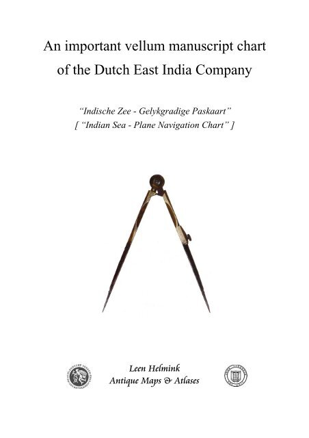
An important vellum manuscript chart of the Dutch East India Company
An important vellum manuscript chart of the Dutch East India Company
An important vellum manuscript chart of the Dutch East India Company

You also want an ePaper? Increase the reach of your titles
YUMPU automatically turns print PDFs into web optimized ePapers that Google loves.
<strong>An</strong> <strong>important</strong> <strong>vellum</strong> <strong>manuscript</strong> <strong>chart</strong><br />
<strong>of</strong> <strong>the</strong> <strong>Dutch</strong> <strong>East</strong> <strong>India</strong> <strong>Company</strong><br />
“Indische Zee - Gelykgradige Paskaart”<br />
[ “<strong>India</strong>n Sea - Plane Navigation Chart” ]<br />
Leen Helmink<br />
<strong>An</strong>tique Maps & Atlases
Illustration 1: Overview <strong>of</strong> <strong>the</strong> VOC <strong>chart</strong>
A CARTOGRAPHICAL RARISSIMA OF THE DUTCH EAST INDIA COMPANY<br />
by Pr<strong>of</strong>. Dr. Günter Schilder<br />
Chart <strong>of</strong> <strong>the</strong> <strong>India</strong>n Ocean with <strong>the</strong> coasts <strong>of</strong> <strong>East</strong> Africa, <strong>the</strong> Arabian Peninsula,<br />
Persian Gulf, <strong>India</strong>, South <strong>East</strong> Asia up to <strong>the</strong> western part <strong>of</strong> Java, part <strong>of</strong> <strong>the</strong><br />
west coast <strong>of</strong> Australia and <strong>the</strong> islands in <strong>the</strong> <strong>India</strong>n Ocean. Middelburg:<br />
Abraham <strong>An</strong>ias, ca. 1730.<br />
Manuscript on <strong>vellum</strong> (calf), ink and various colors, c. 62.5 x 84 cm;<br />
Duijtsche Mijlen 15 voor een Graedt [100=67 mm] (ill. 1).<br />
A strip <strong>of</strong> <strong>the</strong> left and <strong>of</strong> <strong>the</strong> lower margin has been cut <strong>of</strong>f because <strong>the</strong> <strong>chart</strong> has<br />
once been used as a bookbinding.<br />
Manuscript <strong>chart</strong>s <strong>of</strong> <strong>the</strong> <strong>Dutch</strong> <strong>East</strong> <strong>India</strong> <strong>Company</strong> (VOC) are very rare. That a <strong>chart</strong> <strong>of</strong> <strong>the</strong><br />
<strong>India</strong>n Ocean by Abraham <strong>An</strong>ias from <strong>the</strong> VOC Zeeland Chamber appears on <strong>the</strong> market may<br />
be considered a truly exceptional event. This is all <strong>the</strong> more remarkable because so many <strong>of</strong><br />
<strong>the</strong> VOC’s original <strong>chart</strong>s have ei<strong>the</strong>r been lost or have long formed part <strong>of</strong> various public<br />
map collections.<br />
Despite being an anonymous <strong>chart</strong>, <strong>the</strong> characteristic depiction <strong>of</strong> <strong>the</strong> compass rose and <strong>the</strong><br />
style <strong>of</strong> <strong>the</strong> drawing and <strong>the</strong> lettering are unique for <strong>the</strong> work <strong>of</strong> Abraham <strong>An</strong>ias (1694-1750),<br />
<strong>of</strong>ficial examiner <strong>of</strong> <strong>the</strong> steersmen and <strong>chart</strong>-maker <strong>of</strong> <strong>the</strong> Zeeland Chamber <strong>of</strong> <strong>the</strong> VOC<br />
(Nederlandse Vereenigde Oostindische Compagnie, i.e. <strong>Dutch</strong> United <strong>East</strong> <strong>India</strong> <strong>Company</strong>).<br />
As pro<strong>of</strong> serves a <strong>chart</strong> <strong>of</strong> <strong>the</strong> Ari-atol in <strong>the</strong> Maldives Islands, kept in <strong>the</strong> Amsterdam<br />
University Library. That map is essential in <strong>the</strong> attribution <strong>of</strong> this <strong>chart</strong> to <strong>the</strong> cartographer,<br />
because it combines this compass rose with <strong>the</strong> name <strong>of</strong> Abraham <strong>An</strong>ias (ill. 2).<br />
.<br />
The Zeeland Chamber was <strong>the</strong> second most <strong>important</strong> chamber in <strong>the</strong> VOC, after <strong>the</strong><br />
Amsterdam Chamber. In 1720 <strong>the</strong> Chamber <strong>of</strong> Zeeland appointed <strong>An</strong>ias as examiner <strong>of</strong> <strong>the</strong>ir<br />
steersmen, a position he held for thirty years until his death in 1750. His instructions that were<br />
issued on September 12, 1720 give insight in his responsibilities. .<br />
<strong>An</strong>ias’ expertise and cartographical knowledge were highly respected by his contemporaries,<br />
as demonstrated by a judgment <strong>of</strong> <strong>the</strong> famous <strong>chart</strong>-maker Johannes (II) van Keulen, who<br />
attributed <strong>the</strong> large overview map in <strong>the</strong> fifth part <strong>of</strong> his Zee-Fakkel (Sea-Torch, 1728) to<br />
<strong>An</strong>ias ‘tot een teeken van agting’ (‘as a sign <strong>of</strong> high esteem’), (ill. 3).<br />
On October 1, 1731 <strong>the</strong> Zeeland Chamber <strong>of</strong>ficially appointed Abraham <strong>An</strong>ias as her <strong>of</strong>ficial<br />
<strong>chart</strong>-maker responsible to supply her ships with <strong>chart</strong>s, books and navigational instruments<br />
as specified in <strong>the</strong> new equipment list laid down in an <strong>of</strong>ficial resolution by <strong>the</strong> Gentlemen<br />
Seventeen (Heren XVII) on March 28, 1731, <strong>the</strong> “Lijste van de Kaarten en Stuurmansgereetschappen”.
Illustration 2: Attribution to Abraham <strong>An</strong>ias
The Gentlemen Seventeen, <strong>the</strong> highest authority board <strong>of</strong> <strong>the</strong> VOC, were careful that <strong>the</strong> maps<br />
and navigational equipment issued to navigation <strong>of</strong>ficers sent to <strong>the</strong> <strong>East</strong> Indies were returned<br />
and not discarded or sold to outsiders. In order to better exercise control over <strong>the</strong>se tools,<br />
experts in <strong>the</strong> field <strong>of</strong> navigation compiled lists <strong>of</strong> <strong>the</strong> necessary <strong>chart</strong>s and instruments.<br />
The lists (first handwritten, later printed) include a detailed overview <strong>of</strong> <strong>the</strong> instruments and<br />
cartographical material that were allocated, followed by <strong>the</strong> price <strong>of</strong> each item as determined<br />
by <strong>the</strong> <strong>Company</strong>.<br />
Each <strong>of</strong> <strong>the</strong> navigational <strong>of</strong>ficers (skipper, first steersman, and two second steersmen) had to<br />
sign <strong>the</strong> inventory upon receipt and was required to return all <strong>the</strong> material upon completing<br />
<strong>the</strong> journey to Batavia. In <strong>the</strong> event <strong>of</strong> missing or mishandled <strong>chart</strong>s, <strong>the</strong>y were fined an<br />
amount equal to twice <strong>the</strong> list price <strong>of</strong> <strong>the</strong> item in question.<br />
These lists were drawn up for <strong>the</strong> first time in 1655, and were regularly revised and adapted to<br />
navigational developments. Thus, for example, <strong>the</strong> lists <strong>of</strong> 1675, 1731 and 1747 were all<br />
improved. As <strong>of</strong> 1663 <strong>the</strong> lists were printed in order to avoid <strong>the</strong>ir frequent copying, so that<br />
only <strong>the</strong> names <strong>of</strong> <strong>the</strong> ship, ship’s <strong>of</strong>ficer and <strong>the</strong> date had to be filled in by hand.<br />
The printed list for <strong>the</strong> Zeeland Chamber that specifies <strong>the</strong> books, <strong>chart</strong>s and nautical<br />
instruments gives us a detailed insight <strong>of</strong> <strong>the</strong> equipment on board <strong>of</strong> an <strong>East</strong> <strong>India</strong>man <strong>of</strong> that<br />
period (ill. 4). Today <strong>the</strong>se lists are invaluable sources for our knowledge and understanding<br />
<strong>of</strong> <strong>the</strong> navigational equipment used by VOC vessels in <strong>the</strong> seventeenth and eighteenth<br />
centuries, and <strong>the</strong>y allow us to reconstruct <strong>the</strong> kind and number <strong>of</strong> <strong>chart</strong>s used. Thus, we now<br />
know that three or four sets <strong>of</strong> <strong>chart</strong>s were used for navigating from Zeeland to Batavia.<br />
While <strong>the</strong> list <strong>of</strong> 1675 refers almost exclusively to <strong>manuscript</strong> <strong>chart</strong>s, <strong>the</strong> revised list <strong>of</strong> 1731<br />
includes <strong>the</strong> first mention <strong>of</strong> <strong>the</strong> printed <strong>chart</strong>s which Johannes (II) van Keulen had only<br />
recently been permitted to supply to VOC ships. The much more expensive <strong>manuscript</strong> <strong>chart</strong>s<br />
were usually drawn on <strong>vellum</strong>, a sturdy material which was less prone to damage from<br />
climate and moisture as well as wear and tear. These <strong>chart</strong>s were never folded, after use <strong>the</strong>y<br />
were rolled up and stored in large tin containers.<br />
The contract between <strong>the</strong> Zeeland Chamber and Abraham <strong>An</strong>ias formalised that he had to<br />
supply all <strong>East</strong> <strong>India</strong>men <strong>of</strong> <strong>the</strong> Chamber with <strong>the</strong> necessary books, <strong>chart</strong>s and nautical<br />
instruments, as far as <strong>the</strong>y were not in local stock with <strong>the</strong> <strong>Company</strong>. In <strong>the</strong> first half <strong>of</strong> <strong>the</strong><br />
18th century, <strong>the</strong> majority <strong>of</strong> <strong>manuscript</strong> <strong>chart</strong>s on <strong>vellum</strong> was produced by <strong>the</strong> Amsterdam<br />
Chamber, i.e. Isaac de Graaf (1705-43) and his assistants. The Amsterdam Chamber also<br />
equipped <strong>the</strong> o<strong>the</strong>r five chambers with <strong>vellum</strong> <strong>chart</strong>s. Zeeland was <strong>the</strong> only o<strong>the</strong>r Chamber<br />
with a <strong>chart</strong>-making workshop. It was <strong>the</strong> responsibility <strong>of</strong> Abraham <strong>An</strong>ias to provide for<br />
<strong>chart</strong>s that were lacking at <strong>the</strong> Zeeland Chamber, by drawing <strong>the</strong>m in his own hand. Whereas<br />
worldwide eight <strong>vellum</strong> <strong>chart</strong>s <strong>of</strong> <strong>the</strong> <strong>India</strong>n Ocean are known by Isaac de Graaf, only one<br />
single o<strong>the</strong>r example has come to us from <strong>the</strong> hand <strong>of</strong> Abraham <strong>An</strong>ias (The Hague National<br />
Archives). This fact emphasizes <strong>the</strong> great significance and rarity <strong>of</strong> <strong>the</strong> item <strong>of</strong>fered here.<br />
Closer inspection <strong>of</strong> <strong>the</strong> 1731 list <strong>of</strong> <strong>chart</strong>s reveals that two different groups <strong>of</strong> <strong>chart</strong>s can be<br />
distinguished. One group consists <strong>of</strong> small-scale <strong>chart</strong>s that cover large parts <strong>of</strong> <strong>the</strong> area<br />
between Texel and Batavia, whereas <strong>the</strong> o<strong>the</strong>r group contains <strong>the</strong> large-scale <strong>chart</strong>s <strong>of</strong> small<br />
regions that are essential to navigate <strong>the</strong> difficult waters around Holland, <strong>the</strong> English Channel,<br />
<strong>the</strong> treacherous coasts around <strong>the</strong> Cape, and <strong>the</strong> navigation <strong>of</strong> <strong>the</strong> waters near Australia and<br />
<strong>the</strong> Indonesian Archipelago.
Illustration 3: Johannes (II) van Keulen - dedication to Abraham <strong>An</strong>ias
The <strong>chart</strong> here belongs to <strong>the</strong> first group and is specified on <strong>the</strong> list as ‘Indische zee<br />
gelijkgradige van de Caap tot de Straat Sunda’ [Plane <strong>chart</strong> <strong>of</strong> <strong>the</strong> <strong>India</strong>n Ocean, from <strong>the</strong><br />
Cape to Sunda Straits], for a price <strong>of</strong> six guilders and ten stuivers (halfpennies). The <strong>chart</strong><br />
plays a key role for <strong>the</strong> crossing and navigation <strong>of</strong> <strong>the</strong> <strong>India</strong>n Ocean. After a compulsory<br />
period <strong>of</strong> rest at <strong>the</strong> Cape <strong>of</strong> Good Hope, <strong>the</strong> VOC ships were required to follow a prescribed<br />
route (sailing instructions or sailing orders) for <strong>the</strong> journey from <strong>the</strong> Cape to <strong>the</strong> Sunda Strait.<br />
The course first had to be set due south to <strong>the</strong> regions with continuous blowing westerns<br />
winds. With <strong>the</strong>se advantageous sailing winds one had to sail 850 miles to <strong>the</strong> east and <strong>the</strong>n<br />
steer <strong>the</strong> bow north towards Sunda Strait.<br />
Because determining longitude on <strong>the</strong> open sea was <strong>of</strong> great difficulty in those days, <strong>the</strong><br />
crossing <strong>of</strong> <strong>the</strong> <strong>India</strong>n Ocean was a hazardous journey. By changing eastern to nor<strong>the</strong>rn course<br />
too late, some VOC ships unexpectedly ran aground on <strong>the</strong> reefs and shoals <strong>of</strong> <strong>the</strong> west coast<br />
<strong>of</strong> Australia and sank, especially in darkness. A famous fatality is <strong>the</strong> 1727 shipwreck <strong>of</strong> <strong>the</strong><br />
Zeewijck, a 70 tonnes vessel equipped by <strong>the</strong> Chamber <strong>of</strong> Zeeland.<br />
Part <strong>of</strong> <strong>the</strong> west coast <strong>of</strong> Australia is visible on this <strong>chart</strong> (ill. 5). Despite <strong>the</strong> fact that <strong>the</strong> outer<br />
corner has been cut <strong>of</strong>f (because <strong>of</strong> <strong>the</strong> later use as book binding), <strong>the</strong> Australian coast is<br />
visible under <strong>the</strong> name [Land van] den Eendragt, a name originating from <strong>the</strong> oldest <strong>Dutch</strong><br />
contact with this coast by <strong>the</strong> ship Eendracht in 1616. On our <strong>chart</strong> this is also testified by <strong>the</strong><br />
name Dirck Hartogs Rhee.<br />
A remarkable feature <strong>of</strong> this <strong>chart</strong> is <strong>the</strong> reference to <strong>the</strong> 1727 calamity <strong>of</strong> <strong>the</strong> Zeewijck:<br />
Zee[wijck] geble[ven] (Zee[wijck] lost here). On June 9, 1727, this 145 foot ship ran aground<br />
on one <strong>of</strong> <strong>the</strong> coral reefs (Half Moon Reef) <strong>of</strong> <strong>the</strong> Houtman Abrolhos. Part <strong>of</strong> <strong>the</strong> castaways<br />
could survive on nearby Gun Island and after many miseries <strong>the</strong>y succeeded to build a small<br />
sloop from <strong>the</strong> wreck <strong>of</strong> <strong>the</strong> Zeewijck. After ten months, approximately 90 men (<strong>of</strong> <strong>the</strong> crew<br />
<strong>of</strong> 208 that had sailed from Zeeland) managed to leave Gun Island. Incredibly, <strong>the</strong>y managed<br />
to reach Sunda Strait and arrived in Batavia in April 30, 1728.<br />
The reference to <strong>the</strong> wreckage <strong>of</strong> <strong>the</strong> Zeewijck has not been recorded on any o<strong>the</strong>r known<br />
VOC <strong>vellum</strong> <strong>chart</strong> <strong>of</strong> <strong>the</strong> <strong>India</strong>n Ocean, <strong>the</strong> fact that it is recorded here is a fur<strong>the</strong>r<br />
confirmation that this <strong>chart</strong> was produced in Middelburg. In <strong>the</strong> waters between <strong>the</strong> Australian<br />
coast and Java a few islands can be seen. The name Trials Rudsen reminds <strong>the</strong> loss <strong>of</strong> <strong>the</strong><br />
English ship Trial in 1622, and <strong>the</strong> name Monij (today’s Christmas Island) goes back to <strong>the</strong><br />
visit <strong>of</strong> <strong>the</strong> fleet <strong>of</strong> Willem de Vlamingh in 1697.<br />
Our <strong>chart</strong> shows hundreds <strong>of</strong> toponyms along <strong>the</strong> coasts. Although <strong>the</strong> majority is in Portuguese,<br />
we also see <strong>Dutch</strong> names along <strong>the</strong> west coast <strong>of</strong> Sumatra (Cocos Eijlanden, ’t Verkens Eijland,<br />
Goefortuijn, Nassou); on Sumatra (gebroken Hoek, vlacke Hoek); in Sunda Strait (t Prince<br />
Eijland). Remarkable in Malacca is <strong>the</strong> reference to Straet Sincapura. In Bengal <strong>the</strong><br />
Timmerswerf (carpenter’s wharf) is mentioned. On <strong>the</strong> Orissa coast is a reference to <strong>the</strong> 1643<br />
disaster <strong>of</strong> ano<strong>the</strong>r VOC ship: Neptunus verongeluckt (Neptunus lost).<br />
The plane <strong>chart</strong> f <strong>the</strong> <strong>India</strong>n Ocean did not only serve for <strong>the</strong> crossing to Sunda Strait, but also for<br />
<strong>the</strong> journey to Ceylon. After approximately 700 miles east <strong>of</strong> <strong>the</strong> Cape, <strong>the</strong> course is changed<br />
north, as is testified on our <strong>chart</strong> by faint traces <strong>of</strong> a plotted track in pencil (<strong>of</strong> which<br />
unfortunately only <strong>the</strong> number 14 is decipherable, tracks were drawn in pencil and erased later).
Illustration 4: 1731 VOC list <strong>of</strong> instruments and <strong>chart</strong>s for Chamber Zeeland
The fact that not all ships followed <strong>the</strong> prescribed sailing instructions, is demonstrated by <strong>the</strong><br />
1726 disaster <strong>of</strong> <strong>the</strong> Ravensteyn. Against <strong>Company</strong> regulations, this Zeeland Chamber ship<br />
sailed along <strong>the</strong> west side <strong>of</strong> <strong>the</strong> Maldives and ran aground on an outer reef <strong>of</strong> <strong>the</strong> Ari-atol.<br />
This catastrophe is mentioned on our <strong>chart</strong>: Ravensteyn gebleven (Ravensteyn lost here). This<br />
reference is only present on our <strong>chart</strong> – as is <strong>the</strong> case with <strong>the</strong> loss <strong>of</strong> <strong>the</strong> Zeewijck. Being <strong>chart</strong>maker<br />
<strong>of</strong> <strong>the</strong> Zeeland Chamber, Abraham <strong>An</strong>ias gave full attention to this Zeeland calamity, as a<br />
matter <strong>of</strong> fact he even drew a detailed <strong>chart</strong> <strong>of</strong> <strong>the</strong> Ari-atol in 1728 (see ill.2).<br />
The wide-spread trading network <strong>of</strong> <strong>the</strong> VOC also stretched into <strong>the</strong> northwestern corner <strong>of</strong><br />
<strong>the</strong> <strong>India</strong>n Ocean, where <strong>the</strong> <strong>Company</strong> had trading-posts in Suratte, in <strong>the</strong> Persian Gulf and in<br />
Mocha. From Suratte <strong>the</strong> VOC ships sailed via Strait Hormus to Gamron in <strong>the</strong> north <strong>of</strong> <strong>the</strong><br />
Persian Gulf and to Basra on <strong>the</strong> Shatt-al-Arab. The sou<strong>the</strong>rn part shows <strong>the</strong> ‘Isola de Barein’<br />
(Bahrain). While <strong>the</strong> Gulf was significant for <strong>the</strong> silk trade, later <strong>the</strong> trade in gold was more<br />
<strong>important</strong>.<br />
Literature:<br />
Destombes, M., Cartes Hollandaises. La Cartographie de la Compagnie des Indes<br />
Orientales, 1593-1743. Saigon 1941.<br />
De VOC in de kaart gekeken. Cartografie en navigatie van de Verenigde Oostindische<br />
Compagnie, 1602-1799. ’s-Gravenhage, SDU uitgeverij, 1988.<br />
Gaastra, F. De geschiedenis van de VOC. Zutphen: Walburg Pers, 2002.<br />
Paesi, R. Het VOC-retourschip Ravesteyn, Nijmegen, 1999.<br />
Schilder, G.,‘Organization and Evolution <strong>of</strong> <strong>the</strong> <strong>Dutch</strong> <strong>East</strong> <strong>India</strong> <strong>Company</strong>’s Hydrographic<br />
Office in <strong>the</strong> Seventeenth Century’. In: Imago Mundi 28 (1976).<br />
Sigmond, J.P., Zuiderbaan, L.H., <strong>Dutch</strong> Discoveries <strong>of</strong> Australia, 1979, Australia.
Illustration 5: [Land van] den Eendragt, Dirck Hartogs Rhee, and Zee[wijck] geble[ven]