Necesidades básicas - Instituto Nacional de EstadÃÂstica y Censo ...
Necesidades básicas - Instituto Nacional de EstadÃÂstica y Censo ...
Necesidades básicas - Instituto Nacional de EstadÃÂstica y Censo ...

You also want an ePaper? Increase the reach of your titles
YUMPU automatically turns print PDFs into web optimized ePapers that Google loves.
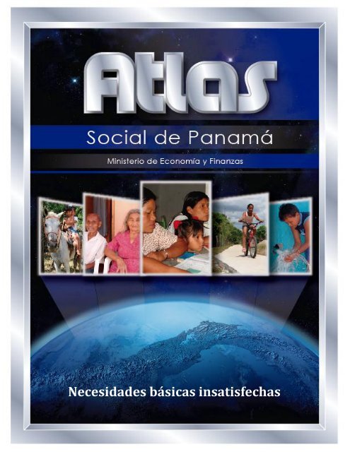
<strong>Necesida<strong>de</strong>s</strong> básicas insatisfechas
Ministerio <strong>de</strong> Economía y Finanzas<br />
Frank De Lima<br />
Ministro<br />
Omar Castillo<br />
Viceministro <strong>de</strong> Economía<br />
Mahesh Khemlani<br />
Viceministro <strong>de</strong> Finanzas
Notas aclaratorias<br />
En caso <strong>de</strong> utilizar el material contenido en este informe, agra<strong>de</strong>ceremos citar la<br />
fuente o acreditar la autoría al Ministerio <strong>de</strong> Economía y Finanzas.<br />
Signos convencionales que se emplean con mayor frecuencia en la publicación:<br />
. Para separar <strong>de</strong>cimales.<br />
, Para la separación <strong>de</strong> millares, millones, etc.<br />
.. Dato no aplicable al grupo o categoría.<br />
… Información no disponible.<br />
- Cantidad nula o cero.<br />
0<br />
0.0<br />
0.00<br />
(P)<br />
Cuando la cantidad es menor a la mitad <strong>de</strong> la unidad o fracción <strong>de</strong>cimal adoptada<br />
para la expresión <strong>de</strong>l dato.<br />
Cifras preliminares o provisionales.<br />
(R) Cifras revisadas.<br />
(E) Cifras estimadas.<br />
n.c.p. No clasificable en otra parte.<br />
n.e. No especificado.<br />
n.e.p. No especificado en otra partida.<br />
n.e.o.c. No especificado en otra categoría.<br />
n.e.o.g. No especificado en otro grupo.<br />
n.i.o.p. No incluida en otra partida.<br />
msnm Metros sobre el nivel <strong>de</strong>l mar<br />
B/. Balboa, unidad monetaria <strong>de</strong>l país.<br />
Debido al redon<strong>de</strong>o <strong>de</strong>l computador, la suma o variación pue<strong>de</strong> no coincidir con la<br />
cifra impresa
<strong>Necesida<strong>de</strong>s</strong> Básicas
<strong>Necesida<strong>de</strong>s</strong> básicas<br />
Por: Julio Diéguez H.<br />
El mapa <strong>de</strong> necesida<strong>de</strong>s básicas es una<br />
imagen comprensiva <strong>de</strong>l bienestar social<br />
<strong>de</strong> los hogares <strong>de</strong>l país. En este, en<br />
particular, la información se <strong>de</strong>sagrega<br />
hasta la unidad política más pequeña, los<br />
corregimientos. Para este efecto, se<br />
califican ciertas carencias o condiciones<br />
básicas <strong>de</strong>l conjunto <strong>de</strong> bienes y<br />
servicios <strong>de</strong> los que no disponen los<br />
hogares, pero que necesitan para vivir.<br />
a<strong>de</strong>cuados, Educación básica, Capacidad<br />
económica <strong>de</strong> los hogares para<br />
costear sus necesida<strong>de</strong>s básicas <strong>de</strong> consumo<br />
y salud. Para efectos <strong>de</strong>l mapa <strong>de</strong><br />
necesida<strong>de</strong>s básicas, las resumimos en<br />
un indicador sintético, equivalente al<br />
promedio pon<strong>de</strong>rado <strong>de</strong> cada uno <strong>de</strong><br />
estos grupos. La cifra, que varía entre<br />
cero y cien, entre más próxima cero,<br />
<strong>de</strong>staca más carencias y su severidad en<br />
los hogares <strong>de</strong> un corregimiento.<br />
(Ministerio <strong>de</strong> Economía y Finanzas, “Metodología<br />
aplicada en la estimación, por corregimiento, <strong>de</strong><br />
los indicadores no censales utilizados en el cálculo<br />
<strong>de</strong>l Índice <strong>de</strong> Satisfacción <strong>de</strong> necesida<strong>de</strong>s<br />
básicas” Diciembre <strong>de</strong> 2004).<br />
El cálculo, dado el nivel <strong>de</strong> <strong>de</strong>sagregación<br />
al que se preten<strong>de</strong> llegar, trabaja<br />
con la información recogida en el XI<br />
<strong>Censo</strong> <strong>Nacional</strong> <strong>de</strong> Población y VII <strong>de</strong><br />
Vivienda, levantado el 16 <strong>de</strong> mayo <strong>de</strong><br />
2010. Para po<strong>de</strong>r hacer una comparación<br />
<strong>de</strong> cómo ha variado el país en una<br />
década, se calcularon los mismos indicadores<br />
y pon<strong>de</strong>raciones empleados en<br />
2000.<br />
Las necesida<strong>de</strong>s básicas se agruparon<br />
en cuatro áreas que son: Calidad <strong>de</strong> la<br />
vivienda y servicios básicos sanitarios<br />
Como entonces, se optó por indicadores<br />
que se pudieran cuantificar a partir <strong>de</strong> la<br />
información censal pero, que al mismo<br />
tiempo aseguraran que <strong>de</strong> cumplirse, se<br />
estarían satisfaciendo las necesida<strong>de</strong>s<br />
básicas mínimas en el hogar para que su<br />
nivel <strong>de</strong> vida sea consi<strong>de</strong>rado a<strong>de</strong>cuado<br />
y digno.<br />
Composición <strong>de</strong>l índice<br />
Para medir la calidad <strong>de</strong> la Vivienda se<br />
seleccionaron seis indicadores, todos<br />
medidas como una proporción respecto<br />
al total. Estos son:<br />
1. Viviendas que en su interior<br />
contaban con piso <strong>de</strong> tierra;<br />
2. Viviendas sin acceso a agua<br />
potable porque la obtienen principalmente<br />
<strong>de</strong> un pozo brocal o su-
perficial, <strong>de</strong> la lluvia, río, quebrada<br />
o lago;<br />
3. Viviendas sin servicio sanitario<br />
(<strong>de</strong> hueco o letrina, conectado a<br />
alcantarillado o tanque séptico);<br />
4. Vivienda sin luz eléctrica (alumbrado<br />
proviene <strong>de</strong> la utilización <strong>de</strong><br />
querosín o diésel, gas o velas,<br />
entre otros);<br />
5. Hacinamiento, entendido como la<br />
proporción <strong>de</strong> viviendas con más<br />
<strong>de</strong> dos personas adultas por<br />
cuarto o más <strong>de</strong> tres cuando<br />
incluyen por lo menos un niño <strong>de</strong><br />
12 o más años <strong>de</strong> edad en<br />
promedio. Se consi<strong>de</strong>ran cuartos<br />
<strong>de</strong> la casa: la sala, el comedor, el<br />
cuarto <strong>de</strong> estudio, <strong>de</strong> costura, <strong>de</strong><br />
recreo y para los servicios<br />
domésticos, y<br />
6. Viviendas con<strong>de</strong>nadas.<br />
La valoración <strong>de</strong> la Educación tomó en<br />
cuenta tres indicadores propios <strong>de</strong> las<br />
personas que viven permanentemente en<br />
Panamá:<br />
1. Analfabetismo (proporción <strong>de</strong> personas<br />
<strong>de</strong> 10 y más años <strong>de</strong> edad<br />
que no saben leer ni escribir);<br />
2. Inasistencia escolar (proporción<br />
<strong>de</strong> niños <strong>de</strong> 6 a 15 años <strong>de</strong> edad<br />
que no asisten a la escuela), y<br />
3. Educación incompleta e insuficiente<br />
(proporción <strong>de</strong> la población<br />
<strong>de</strong> 10 y más años <strong>de</strong> edad con<br />
menos <strong>de</strong> tercer grado <strong>de</strong> primaria<br />
aprobado).<br />
La Capacidad Económica se valoró<br />
tomando en cuenta pautas estándares<br />
que son:<br />
1. La capacidad económica <strong>de</strong> los<br />
hogares se ha estimado según la<br />
metodología <strong>de</strong> la Comisión Económica<br />
para la América Latina y<br />
el Caribe, CEPAL 1 . El coeficiente<br />
correspon<strong>de</strong> a la sumatoria <strong>de</strong><br />
tres condiciones económicas <strong>de</strong>l<br />
perceptor (variables discretas), a<br />
saber: condición <strong>de</strong>l ocupado, jubilado<br />
o pensionado que no trabaja<br />
y las <strong>de</strong>más, así como los<br />
años <strong>de</strong> educación aprobados en<br />
el sistema <strong>de</strong> enseñanza, y<br />
2. Tasa <strong>de</strong> <strong>de</strong>pen<strong>de</strong>ncia económica,<br />
que no es más que el número <strong>de</strong><br />
ocupados respecto a los <strong>de</strong>sempleados,<br />
más la población no económicamente<br />
activa que conforman<br />
el hogar.<br />
Como los <strong>Censo</strong>s <strong>de</strong> Población y<br />
Vivienda <strong>de</strong> Panamá no permiten obtener<br />
indicadores relacionados con la Salud <strong>de</strong><br />
la población, la condición se valoró en<br />
términos <strong>de</strong> la tasa <strong>de</strong> mortalidad <strong>de</strong> la<br />
niñez por 1,000 nacimientos vivos,<br />
resultado que se asocia a la probabilidad<br />
<strong>de</strong> morir en la niñez por las condiciones<br />
<strong>de</strong> vida que ro<strong>de</strong>an a la persona. Para<br />
este efecto, también se empleó la<br />
metodología utilizada por la CEPAL 2 que<br />
toma en cuenta, el número <strong>de</strong> mujeres<br />
entre 15 y 49 años <strong>de</strong> edad por grupos<br />
quinquenales, el número <strong>de</strong> hijos nacidos<br />
vivos repartidos siguiendo la misma<br />
distribución por edad <strong>de</strong> las madres y el<br />
número <strong>de</strong> sobrevivientes o fallecidos <strong>de</strong>l<br />
<strong>Censo</strong>.<br />
1 Gustavo Álvarez: “Capacidad Económica <strong>de</strong><br />
los Hogares: Una aproximación censal a<br />
la insuficiencia <strong>de</strong> ingresos”. <strong>Instituto</strong><br />
<strong>Nacional</strong> <strong>de</strong> Estadística y <strong>Censo</strong>s.<br />
Argentina. 1999.<br />
2 Juan Chackiel: “Métodos <strong>de</strong> estimación <strong>de</strong><br />
la fecundidad y la mortalidad a partir <strong>de</strong><br />
censos: Una aplicación a pueblos<br />
indígenas <strong>de</strong> Panamá”. CEPAL/CELADE.
Luego <strong>de</strong> seleccionar los indicadores<br />
para calcular el Índice <strong>de</strong> <strong>Necesida<strong>de</strong>s</strong><br />
Básicas Insatisfechas se procedió a<br />
“homogeneizar” las variables <strong>de</strong> diferente<br />
naturaleza e indicadores, para llevar los<br />
resultados a valores numéricamente similares,<br />
que fácilmente pudieran emplearse<br />
en cálculos numéricos. Al respecto,<br />
los valores <strong>de</strong> todos los indicadores<br />
seleccionados fueron llevados a una<br />
escala uniforme <strong>de</strong> valores (0 a 100) in<strong>de</strong>pendientemente<br />
<strong>de</strong> cuál haya sido el<br />
rango original <strong>de</strong> valores <strong>de</strong> la variable.<br />
En la escala, siempre el cero indica la<br />
condición más <strong>de</strong>sfavorable y el 100 la<br />
más favorable o beneficiosa <strong>de</strong>l indicador.<br />
Para homogeneizar las variables se emplearon<br />
dos fórmulas. Cuando por su<br />
naturaleza, el valor más bajo <strong>de</strong> un indicador<br />
representa la mejor condición, la<br />
conversión se estima con la siguiente<br />
fórmula:<br />
VMAX VA<br />
VN = * 100<br />
VMAX VMIN<br />
En caso contrario:<br />
don<strong>de</strong>,<br />
VMIN VA<br />
VN = * 100<br />
VMIN VMAX<br />
VN es el índice que varía entre 0 y 100;<br />
VA, el valor original que se quiere convertir<br />
a la nueva escala;<br />
VMAX, el valor más alto <strong>de</strong>l indicador, y<br />
VMIN, el valor más bajo <strong>de</strong>l indicador.<br />
Una vez convertidos todos los indicadores<br />
a la nueva escala (entre 0 y 100) se<br />
sumaron para ser llevados a un solo número.<br />
A cada área <strong>de</strong> bienestar social<br />
que se quiere valorar se le dio un peso<br />
relativo. Estos fueron: 50% a las condiciones<br />
<strong>de</strong> la vivienda, 30% a la educación,<br />
5% a la salud <strong>de</strong> los miembros <strong>de</strong>l<br />
hogar y 15% a las condiciones económicas<br />
<strong>de</strong>l miembro <strong>de</strong>l hogar.<br />
Para asignar estos pesos a cada grupo<br />
así como a los indicadores que los conforman,<br />
tal como se indica a continuación,<br />
no hay una norma universal ni intemporal,<br />
por lo que se <strong>de</strong>cidió mantener,<br />
en el caso que se utilizaran idénticos indicadores,<br />
el mismo criterio que se utilizó<br />
en la asignación <strong>de</strong> pon<strong>de</strong>raciones <strong>de</strong>l<br />
mapa <strong>de</strong> necesida<strong>de</strong>s básicas insatisfechas<br />
que hizo este Ministerio con el<br />
<strong>Censo</strong> <strong>de</strong> 2000 y que se publicó en 2004.<br />
En los nuevos indicadores propuestos,<br />
como los <strong>de</strong> capacidad económica y los<br />
<strong>de</strong> salud, se asignaron las pon<strong>de</strong>raciones<br />
<strong>de</strong> acuerdo a su importancia en el bienestar<br />
<strong>de</strong> los hogares.<br />
Así, por ejemplo, en el caso <strong>de</strong> la vivienda<br />
se consi<strong>de</strong>ró la falta <strong>de</strong> agua potable<br />
como la mayor carencia o la más<br />
importante, y se le asignaron 30 <strong>de</strong> los<br />
100 puntos en la valoración <strong>de</strong> contar o<br />
no con ella. Los 70 puntos restantes se<br />
repartieron entre las cinco variables que<br />
quedaron. Entre estas se pon<strong>de</strong>ró más<br />
si el hogar contaba o no con servicios<br />
sanitarios (se le asignaron 25 puntos). El<br />
material <strong>de</strong>l que estaba hecho el piso<br />
(tierra u otros materiales <strong>de</strong> mejor<br />
calidad) y el hacinamiento recibieron<br />
idéntica pon<strong>de</strong>ración. El habitar en casa<br />
con<strong>de</strong>nada, una condición circunscrita a<br />
las ciuda<strong>de</strong>s <strong>de</strong> Panamá y Colón, fue la<br />
condición menos pon<strong>de</strong>rada y se le<br />
asignaron 5 puntos.<br />
Otro tanto se hizo con la educación y las<br />
condiciones económicas. En el caso <strong>de</strong><br />
la salud, al <strong>de</strong>terminarse sólo una condición<br />
a valorar, a esta sola se le asignaron<br />
los 100 puntos.
Cuadro No. 1. Resumen <strong>de</strong> las condiciones <strong>de</strong> vida y pon<strong>de</strong>raciones utilizadas en los<br />
estimadores: <strong>Censo</strong>s <strong>de</strong> 2000 y 2010<br />
Condiciones <strong>de</strong> vida<br />
Pon<strong>de</strong>ración<br />
total<br />
Pon<strong>de</strong>ración<br />
en la<br />
condición<br />
<strong>de</strong> vida<br />
TOTAL………………………………………………….. 100<br />
VIVIENDAS PARTICULARES OCUPADAS…………………. 50 100<br />
Con piso <strong>de</strong> tierra…………………………………………….. 15<br />
Sin agua potable……………………………………………… 30<br />
Sin servicio sanitario…………………………………………. 25<br />
Sin luz eléctrica……………………………………………….. 10<br />
Hacinamiento………………………………………………….. 15<br />
Con<strong>de</strong>nada……………………………………………………. 5<br />
EDUCACIÓN…………………………………………………….. 30 100<br />
Analfabetismo (población <strong>de</strong> 10 años y más)……………... x 30<br />
Menos <strong>de</strong> tercer grado <strong>de</strong> primaria aprobado……………... x 50<br />
Inasistencia escolar (población <strong>de</strong> 6 a 15 años)………….. x 20<br />
CONDICIONES ECONÓMICAS………………………………. 15 100<br />
Capacidad económica <strong>de</strong> los hogares totales (CAPECO).. 70<br />
Tasa <strong>de</strong> <strong>de</strong>pen<strong>de</strong>ncia económica…………………………... 30<br />
SALUD……………………………………………………………. 5 100<br />
Tasa <strong>de</strong> mortalidad por 1,000 nacimientos vivos……….. 100<br />
Fuente: Ministerio <strong>de</strong> Economía y Finanzas.<br />
Los resultados<br />
De los 631 corregimientos en los que<br />
políticamente estaba dividido el país en<br />
2010, en 63 el índice <strong>de</strong> necesida<strong>de</strong>s<br />
básicas llegó hasta los 50 puntos.<br />
Fueron los corregimientos en los que los<br />
hogares tenían gran<strong>de</strong>s carencias, 54 <strong>de</strong><br />
las comarcas indígenas: 50 en la Ngöbe<br />
Buglé, 3 en la Kuna Yala y 1 en la<br />
Emberá. En casi todos, <strong>de</strong>spués <strong>de</strong> diez<br />
años, se repitió la situación.<br />
Aun cuando la estructura política <strong>de</strong> 2010<br />
no es comparable con la <strong>de</strong> 2000 porque<br />
se segregaron corregimientos para crear<br />
nuevos, fue posible hacer comparaciones<br />
en 593 corregimientos. Los 52 (9%) peor<br />
ubicados en la escala <strong>de</strong> bienestar social<br />
fueron los mismos tanto en 2010 como<br />
en 2000, 22 pertenecientes a la comarca<br />
Ngöbe Buglé.
Cuadro No. 2. Corregimientos, según valor <strong>de</strong>l Índice <strong>de</strong> <strong>Necesida<strong>de</strong>s</strong> Básicas<br />
Insatisfechas: <strong>Censo</strong>s <strong>de</strong> 2000 y 2010<br />
Índice <strong>de</strong> necesida<strong>de</strong>s<br />
básicas<br />
(Rango <strong>de</strong>l número <strong>de</strong><br />
puntos)<br />
Total<br />
Corregimientos por <strong>Censo</strong>s<br />
2010 2000<br />
Distribución<br />
(%)<br />
Total<br />
Distribución<br />
(%)<br />
Variación<br />
(%)<br />
TOTAL………............... 631 100.0 593 100.0<br />
0 - 10..... 1 0.2 2 0.3 -0.2<br />
11 - 15..... 2 0.3 2 0.3 0.0<br />
16 - 20..... 0 0.0 2 0.3 -0.3<br />
21 - 52..... 2 0.3 4 0.7 -0.4<br />
26 - 30..... 7 1.1 10 1.7 -0.6<br />
31 - 35..... 8 1.3 9 1.5 -0.2<br />
36 - 40..... 10 1.6 18 3.0 -1.5<br />
41 - 45..... 18 2.9 16 2.7 0.2<br />
46 - 50..... 16 2.5 12 2.0 0.5<br />
51 - 55..... 12 1.9 16 2.7 -0.8<br />
56 - 60..... 20 3.2 29 4.9 -1.7<br />
61 - 65..... 27 4.3 23 3.9 0.4<br />
66 - 70..... 37 5.9 73 12.3 -6.4<br />
71 - 75..... 73 11.6 52 8.8 2.8<br />
76 - 80..... 76 12.0 57 9.6 2.4<br />
81 - 85..... 109 17.3 126 21.2 -4.0<br />
86 - 90..... 142 22.5 101 17.0 5.5<br />
91 - 95..... 63 10.0 35 5.9 4.1<br />
96 - 100 ..... 8 1.3 6 1.0 0.3<br />
Fuente: <strong>Instituto</strong> <strong>Nacional</strong> <strong>de</strong> Estadística y <strong>Censo</strong>.<br />
De las tres condiciones valoradas, la que<br />
reportó mayores diferencias entre los corregimientos<br />
fue vivienda. En educación<br />
fueron menos marcadas por la acción <strong>de</strong>l<br />
Estado directamente vinculado con la<br />
educación pública.<br />
La distribución, con excepción <strong>de</strong> la condición<br />
económica, fue muy similar en todas,<br />
concentrando a la mayor parte <strong>de</strong><br />
los corregimientos en el extremo positivo,<br />
<strong>de</strong> mejores condiciones en educación,<br />
vivienda y salud.<br />
Los mayores logros en el bienestar social<br />
en una década se dieron en vivienda y<br />
en las condiciones económicas <strong>de</strong> las<br />
personas que eran cabeza <strong>de</strong> familia. En<br />
lo referente a la vivienda <strong>de</strong>stacan los<br />
avances en los hogares <strong>de</strong> las provincias<br />
<strong>de</strong> Darién y Veraguas y en la comarca<br />
indígena Emberá, y en las condiciones<br />
económicas, tanto en esta comarca<br />
como en la Kuna Yala y en la provincia<br />
<strong>de</strong> Veraguas. A diferencia <strong>de</strong> vivienda,<br />
las mejoras fueron más uniformes en las<br />
condiciones económicas y se distribuyeron<br />
más equitativamente.<br />
En 6 <strong>de</strong> las 9 provincias y en dos <strong>de</strong> las<br />
comarcas indígenas (Kuna Yala y Emberá)<br />
<strong>de</strong>smejoró la educación. Sólo mejoraron<br />
las condiciones educativas en<br />
Coclé, Colón y Herrera y en Ngöbe<br />
Buglé.
Cuadro No. 3. Corregimientos por puntuación en las condiciones <strong>de</strong> vida:<br />
<strong>Censo</strong> <strong>de</strong> 2010.<br />
Número <strong>de</strong> corregimientos por condiciones <strong>de</strong> vida<br />
Número <strong>de</strong><br />
puntos<br />
Total<br />
Educación Vivienda Economía Salud<br />
Distribución<br />
(%)<br />
Total<br />
Distribución<br />
(%)<br />
Total<br />
Distribución<br />
(%)<br />
Total<br />
Distribución<br />
(%)<br />
Menos <strong>de</strong> 1 1 0.2 - - - - 1 0.2<br />
1 - 10 0 0.0 2 0.3 23 3.6 - -<br />
11 - 20 1 0.2 6 1.0 38 6.0 2 0.3<br />
21 - 30 1 0.2 13 2.1 51 8.1 2 0.3<br />
31 - 40 5 0.8 23 3.6 175 27.7 5 0.8<br />
41 - 50 7 1.1 26 4.1 190 30.1 9 1.4<br />
51 - 60 24 3.8 21 3.3 93 14.7 24 3.8<br />
61 - 70 58 9.2 43 6.8 44 7.0 36 5.7<br />
71 - 80 128 20.3 76 12.0 8 1.3 78 12.4<br />
81 - 90 194 30.7 122 19.3 5 0.8 188 29.8<br />
91 - 100 212 33.6 299 47.4 4 0.6 286 45.3<br />
Fuente. Ministerio <strong>de</strong> Economía y Finanzas.<br />
Otro tanto ocurrió con la salud:<br />
empeoraron las condicionas en 6 <strong>de</strong> las<br />
9 provincias (en Darién más que en<br />
cualquier otra). Mejoraron en la comarca<br />
indígena Emberá y en las provincias <strong>de</strong><br />
Herrera y Colón. En Bocas <strong>de</strong>l Toro,<br />
Coclé y Panamá hubo mejoras pero casi<br />
imperceptibles en términos <strong>de</strong> los<br />
índices.<br />
Consi<strong>de</strong>rando la pon<strong>de</strong>ración <strong>de</strong> cada<br />
uno <strong>de</strong> los componentes <strong>de</strong>l bienestar<br />
<strong>de</strong>l hogar, mejoró la situación en todas<br />
las provincias y comarcas, con excepción<br />
<strong>de</strong> Bocas <strong>de</strong>l Toro y Chiriquí, provincias<br />
muy afectadas por las migraciones<br />
indígenas, que a<strong>de</strong>más tuvieron mayores<br />
tasas <strong>de</strong> fecundidad. Las mejoras en el<br />
bienestar social fueron más apreciables<br />
en Darién, Emberá y Veraguas.
Cuadro No. 4. Índice <strong>de</strong> necesida<strong>de</strong>s básicas, según provincias y comarcas indígenas:<br />
<strong>Censo</strong>s <strong>de</strong> 2000 y 2010<br />
Índice<br />
Provincias y comarcas indígenas<br />
Educación<br />
Vivienda<br />
Condición<br />
económica<br />
Salud<br />
Total<br />
2000<br />
PROVINCIAS:<br />
Bocas <strong>de</strong>l Toro………….……... 63.3 82.2 43.6 57.5 69.5<br />
Coclé………………………….… 88.8 89.0 54.2 92.8 83.9<br />
Colón…………………………… 97.7 90.1 72.1 92.3 89.8<br />
Chiriquí…………………………. 85.4 90.7 64.1 96.5 85.4<br />
Darién…………………………... 48.6 61.2 40.3 71.2 54.8<br />
Herrera…………………………. 84.6 93.8 67.3 95.2 87.2<br />
Los Santos…………………….. 83.6 96.3 70.8 100.0 88.8<br />
Panamá……………………....... 100.0 93.7 98.6 99.0 96.6<br />
Veraguas……………………….. 74.0 80.2 54.3 91.9 75.0<br />
COMARCAS INDÍGENAS<br />
Kuna Yala……………………… 20.5 25.3 9.7 23.0 21.4<br />
Emberá…………………………. 33.9 32.8 12.2 59.6 31.4<br />
Ngöbe Buglé………………...... 0.0 19.4 2.5 0.0 10.1<br />
PROVINCIAS:<br />
2010<br />
Bocas <strong>de</strong>l Toro……………... 61.6 77.3 47.9 58.2 67.2<br />
Coclé………………………… 89.2 91.5 62.6 92.5 86.6<br />
Colón………………………… 99.0 90.5 79.7 95.7 91.7<br />
Chiriquí……………………… 81.7 91.8 70.3 86.9 85.3<br />
Darién……………………….. 48.3 72.1 48.8 56.6 60.7<br />
Herrera……………………… 85.1 96.0 75.3 100.0 89.8<br />
Los Santos………………….. 82.1 98.4 75.5 93.1 89.8<br />
Panamá……………………... 100.0 96.3 99.8 98.8 98.0<br />
Veraguas……………………. 72.3 85.6 63.4 85.9 78.3<br />
COMARCAS INDÍGENAS<br />
Kuna Yala…………………… 10.8 29.1 23.0 15.7 22.0<br />
Emberá……………………… 26.7 41.1 32.6 43.6 35.6<br />
Ngöbe Buglé………………... 0.0 23.2 0.0 0.0 11.6<br />
Fuente: Ministerio <strong>de</strong> Economía y Finanzas.<br />
Desagregada la información por distrito,<br />
los retrocesos en el bienestar social en<br />
una década fueron la excepción y no la<br />
regla. Sólo en dos distritos aumentaron<br />
las carencias <strong>de</strong> necesida<strong>de</strong>s básicas:<br />
Santa Fe <strong>de</strong> Veraguas y Chiriquí Gran<strong>de</strong><br />
<strong>de</strong> Bocas <strong>de</strong>l Toro. Hubo muchas graduaciones<br />
en las mejoras <strong>de</strong>l bienestar<br />
social <strong>de</strong> los hogares en el resto <strong>de</strong> los<br />
distritos; entre las más <strong>de</strong>stacables, las<br />
<strong>de</strong> los distritos <strong>de</strong> Sambú (Emberá),<br />
Müna, Nole Duima y Ñurum (Ngöbe<br />
Buglé) y Mariato (Veraguas).
Cuadro No. 5. Índice <strong>de</strong> necesida<strong>de</strong>s básicas según provincias, comarcas indígenas y<br />
distritos: <strong>Censo</strong>s <strong>de</strong> 2000 y 2010<br />
Provincias y<br />
comarcas indígenas<br />
Distritos<br />
Índice por año<br />
2010 2000<br />
Variación<br />
(%)<br />
PROVINCIAS<br />
Bocas <strong>de</strong>l Toro……………………. Bocas <strong>de</strong>l Toro 66.6 61.4 5.2<br />
Bocas <strong>de</strong>l Toro……………………. Changuinola 71.6 71.5 0.1<br />
Bocas <strong>de</strong>l Toro……………………. Chiriquí Gran<strong>de</strong> 63.6 66.5 -2.8<br />
Coclé……………………………….. Aguadulce 93.3 91.1 2.2<br />
Coclé……………………………….. Antón 87.4 83.5 3.9<br />
Coclé……………………………….. La Pintada 77.6 73.6 4.0<br />
Coclé……………………………….. Nata 83.1 79.9 3.3<br />
Coclé……………………………….. Olá 67.6 62.3 5.3<br />
Coclé……………………………….. Penonomé 84.1 79.8 4.3<br />
Colón……………………………….. Chagres 75.4 68.8 6.6<br />
Colón……………………………….. Colón 91.5 88.9 2.7<br />
Colón……………………………….. Donoso 63.1 61.2 1.9<br />
Colón……………………………….. Portobelo 87.9 81.9 6.0<br />
Colón……………………………….. Santa Isabel 82.3 75.4 6.9<br />
Chiriquí…………………………….. Alanje 74.5 73.9 0.6<br />
Chiriquí…………………………….. Barú 79.4 77.2 2.2<br />
Chiriquí…………………………….. Boquerón 81.1 78.3 2.8<br />
Chiriquí…………………………….. Boquete 85.1 83.9 1.2<br />
Chiriquí…………………………….. Bugaba 82.6 81.9 0.7<br />
Chiriquí…………………………….. David 93.3 92.6 0.7<br />
Chiriquí…………………………….. Dolega 90.1 87.1 3.0<br />
Chiriquí…………………………….. Gualaca 78.3 72.6 5.7<br />
Chiriquí…………………………….. Remedios 81.3 74.4 6.9<br />
Chiriquí…………………………….. Renacimiento 69.7 67.9 1.8<br />
Chiriquí…………………………….. San Félix 84.7 79.5 5.2<br />
Chiriquí…………………………….. San Lorenzo 73.3 69.0 4.3<br />
Chiriquí…………………………….. Tolé 64.9 59.8 5.1<br />
Darién……………………………… Chepigana 65.7 56.9 8.8<br />
Darién……………………………… Pinogana 64.5 56.9 7.6<br />
Herrera…………………………….. Chitré 96.3 94.8 1.5<br />
Herrera…………………………….. Las Minas 65.3 59.0 6.4<br />
Herrera…………………………….. Los Pozos 76.4 69.0 7.3<br />
Herrera…………………………….. Ocú 80.9 75.8 5.1<br />
Herrera…………………………….. Parita 87.6 86.6 1.1<br />
Herrera…………………………….. Pesé 86.1 82.8 3.2<br />
Herrera…………………………….. Santa María 87.9 85.2 2.7<br />
Los Santos………………………… Guararé 90.8 88.3 2.6<br />
Los Santos………………………… Las Tablas 92.7 90.9 1.8<br />
Los Santos………………………… Los Santos 89.4 87.9 1.5<br />
Los Santos………………………… Macaracas 80.6 76.2 4.4<br />
Los Santos………………………… Pedasí 88.1 84.1 4.0<br />
Los Santos………………………… Pocrí 88.1 86.6 1.5<br />
Los Santos………………………… Tonosí 80.0 75.2 4.7
Provincias y<br />
comarcas indígenas<br />
Distritos<br />
Índice por año<br />
2010 2000<br />
Variación<br />
(%)<br />
Panamá……………………………. Arraiján 95.4 93.1 2.3<br />
Panamá……………………………. Balboa 80.9 80.9 0.0<br />
Panamá……………………………. Capira 82.0 77.7 4.3<br />
Panamá……………………………. Chame 89.6 89.4 0.1<br />
Panamá……………………………. Chepo 75.4 68.9 6.5<br />
Panamá……………………………. Chimán 60.5 55.9 4.6<br />
Panamá……………………………. La Chorrera 93.9 91.3 2.6<br />
Panamá……………………………. Panamá 96.5 94.4 2.1<br />
Panamá……………………………. San Carlos 89.5 84.0 5.5<br />
Panamá……………………………. San Miguelito 97.4 95.9 1.5<br />
Panamá……………………………. Taboga 94.2 91.2 3.0<br />
Veraguas…………………………... Atalaya 87.5 81.7 5.8<br />
Veraguas…………………………... Calobre 71.3 67.8 3.5<br />
Veraguas…………………………... Cañazas 56.4 52.6 3.8<br />
Veraguas…………………………... La Mesa 71.6 65.5 6.0<br />
Veraguas…………………………... Las Palmas 62.1 55.3 6.8<br />
Veraguas…………………………... Mariato 73.4 63.1 10.2<br />
Veraguas…………………………... Montijo 84.4 77.7 6.7<br />
Veraguas…………………………... Río <strong>de</strong> Jesús 80.8 72.3 8.5<br />
Veraguas…………………………... San Francisco 68.7 63.5 5.2<br />
Veraguas…………………………... Santa Fe 57.3 58.3 -0.9<br />
Veraguas…………………………... Santiago 93.5 90.9 2.6<br />
Veraguas…………………………... Soná 72.8 66.6 6.3<br />
COMARCAS INDÍGENAS<br />
Kuna Yala………………………….. Comarca Kuna Yala 32.5 28.7 3.8<br />
Emberá……………………………. Cémaco 40.4 33.7 6.6<br />
Emberá……………………………. Sambú 54.7 44.0 10.7<br />
Ngöbe Buglé………………………. Besiko 13.1 8.5 4.6<br />
Ngöbe Buglé………………………. Kankintú 14.3 14.0 0.3<br />
Ngöbe Buglé………………………. Kusapín 26.5 26.0 0.5<br />
Ngöbe Buglé………………………. Müna 28.2 18.5 9.6<br />
Ngöbe Buglé………………………. Mironó 27.6 19.6 8.0<br />
Ngöbe Buglé………………………. Nole Duima 34.2 25.1 9.1<br />
Ngöbe Buglé………………………. Ñurum 45.6 36.7 9.0<br />
Fuente: Ministerio <strong>de</strong> Economía y Finanzas.<br />
Un distrito que no experimentó cambio<br />
en la valoración <strong>de</strong>l índice fue Balboa<br />
(Panamá). En otros, el cambio fue<br />
imperceptible, como en el distrito <strong>de</strong><br />
Changuinola (Bocas <strong>de</strong>l Toro) y Chame<br />
(Panamá).<br />
En dos, Balboa y Chame, se calcularon<br />
índices muy por encima <strong>de</strong> la mediana<br />
correspondiente a 2000 (74.8 puntos) y<br />
2010 (80.3 puntos). No fue el caso <strong>de</strong><br />
los dos únicos distritos que experimentaron<br />
retrocesos en el índice, con<br />
lo que experimentaron más carencias.
Anexos<br />
Número <strong>de</strong> corregimientos, viviendas, población <strong>de</strong> 10 y más <strong>de</strong> edad y capacidad económica <strong>de</strong> los hogares, por área, según<br />
indicadores: <strong>Censo</strong>s <strong>de</strong> 1990, 2000 y 2010<br />
2010 2000 1990<br />
Indicadores<br />
Total<br />
Urbana<br />
Rural<br />
Total<br />
Total<br />
Urbana<br />
Rural<br />
Total<br />
Total<br />
Urbana<br />
Rural<br />
Total<br />
Número <strong>de</strong> corregimientos ....................... 631 593 511<br />
Viviendas particulares ocupadas .............. 896,050 609,361 286,689 681,799 442,768 239,031 524,281 295,105 229,176<br />
Con piso <strong>de</strong> tierra ............................... 81,268 11,406 69,862 86,587 11,292 75,295 96,990 8,906 88,083<br />
Sin agua potable................................. 63,679 4,290 59,389 63,002 4,258 58,744 98,639 5,915 92,724<br />
Sin servicio sanitario ........................... 49,179 6,760 42,419 46,834 6,101 40,733 62,489 4,642 57,847<br />
Sin luz eléctrica .................................. 111,395 7,736 103,659 126,805 12,441 114,364 142,605 13,097 129,508<br />
Hacinamiento...................................... 76,717 31,265 45,452 80,392 35,103 45,289 93,627 38,091 55,536<br />
Con<strong>de</strong>nada ......................................... 8,704 8,702 2 10,865 10,856 9 11,114 11,045 69<br />
Población <strong>de</strong> 10 años y más <strong>de</strong> edad ...... 2,727,168 1,817,180 909,988 2,206,868 1,414,402 792,466 1,769,488 989,026 780,462<br />
Analfabeta ........................................... 148,747 35,721 113,026 168140 36190 131950 189,184 35,720 153,464<br />
Con menos <strong>de</strong> tercer grado <strong>de</strong> primaria<br />
aprobado .................................... 221,224 68,856 152,368 230,938 65,307 165,631 229,884 49,685 180,199<br />
Población <strong>de</strong> 6 a 15 años <strong>de</strong> edad ...... 666,415 387,377 279,038 578769 324693 254076 524,932 256,355 268,577<br />
No asistió a la escuela ........................ 27,985 8,249 19,736 50678 12121 38557 75,084 14,649 60,435<br />
Capacidad económica <strong>de</strong> los hogares ..... 913,722 622,294 291,428 703,524 458,427 245,097 527,673 297,426 230,247<br />
Muy baja ............................................. 222,450 89,265 133,185 206,595 83,705 122,890 168,929 51,206 117,723<br />
Baja .................................................... 77,165 44,238 32,927 74,330 42,053 32,277 58,234 27,391 30,843<br />
Media .................................................. 168,318 113,329 54,989 146,729 100,165 46,564 113,672 68,595 45,077<br />
Alta ..................................................... 445,789 375,462 70,327 275,870 232,504 43,366 186,838 150,234 36,604<br />
Fuente: <strong>Instituto</strong> <strong>Nacional</strong> <strong>de</strong> Estadística y <strong>Censo</strong>.
Distribución porcentual <strong>de</strong> las viviendas, población <strong>de</strong> 10 y más <strong>de</strong> edad y capacidad económica <strong>de</strong> los hogares, por área, según<br />
indicadores: <strong>Censo</strong>s <strong>de</strong> 1990, 2000 y 2010<br />
2010 2000 1990<br />
Indicadores<br />
Total<br />
Urbana<br />
Rural<br />
Total<br />
Total<br />
Urbana<br />
Rural<br />
Total<br />
Total<br />
Urbana<br />
Rural<br />
Total<br />
Viviendas particulares ocupadas .............. 100.0 100.0 100.0 100.0 100.0 100.0 100.0 100.0 100.0<br />
Con piso <strong>de</strong> tierra ............................... 9.1 1.9 24.4 12.7 2.6 31.5 18.5 3.0 38.4<br />
Sin agua potable................................. 7.1 0.7 20.7 9.2 1.0 24.6 18.8 2.0 40.5<br />
Sin servicio sanitario ........................... 5.5 1.1 14.8 6.9 1.4 17.0 11.9 1.6 25.2<br />
Sin luz eléctrica .................................. 12.4 1.3 36.2 18.6 2.8 47.8 27.2 4.4 56.5<br />
Hacinamiento...................................... 8.6 5.1 15.9 11.8 7.9 18.9 17.9 12.9 24.2<br />
Con<strong>de</strong>nada ......................................... 0.97 1.4 0.0 1.59 2.5 0.0 2.1 3.7 0.0<br />
Población <strong>de</strong> 10 años y más <strong>de</strong> edad ...... 100.0 100.0 100.0 100.0 100.0 100.0 100.0 100.0 100.0<br />
Analfabeta .......................................... 5.5 2.0 12.4 7.6 2.6 16.7 10.7 3.6 19.7<br />
Con menos <strong>de</strong> tercer grado <strong>de</strong> primaria<br />
aprobado .................................... 8.1 3.8 16.7 10.5 4.6 20.9 13.0 5.0 23.1<br />
Población <strong>de</strong> 6 a 15 años <strong>de</strong> edad ........... 100.0 100.0 100.0 100.0 100.0 100.0 100.0 100.0 100.0<br />
No asiste a la escuela ......................... 4.2 2.1 7.1 8.8 3.7 15.2 14.3 5.7 22.5<br />
Capacidad económica <strong>de</strong> los hogares .... 100.0 100.0 100.0 100.0 100.0 100.0 100.0 100.0 100.0<br />
Muy baja ............................................. 24.3 14.3 45.7 29.4 18.3 50.1 32.0 17.2 51.1<br />
Baja .................................................... 8.4 7.1 11.3 10.6 9.2 13.2 11.0 9.2 13.4<br />
Media .................................................. 18.4 18.2 18.9 20.9 21.8 19.0 21.5 23.1 19.6<br />
Alta ..................................................... 48.8 60.3 24.1 39.2 50.7 17.7 35.4 50.5 15.9<br />
Fuente: <strong>Instituto</strong> <strong>Nacional</strong> <strong>de</strong> Estadística y <strong>Censo</strong>.
Población por área y según características <strong>de</strong> las viviendas y capacida<strong>de</strong>s económicas: <strong>Censo</strong>s <strong>de</strong> 1990, 2000 y 2010<br />
Indicadores<br />
2010 2000 1990<br />
Total Urbana Rural Total Total Urbana Rural Total Total Urbana Rural Total<br />
Total <strong>de</strong> personas por vivienda ................. 3,346,485 2,173,824 1,172,661 2,787,232 1,729,582 1,057,650 2,301,602 1,233,342 1,068,260<br />
Con piso <strong>de</strong> tierra................................... 360,966 42,892 318,074 401,463 44,313 357,150 462,681 36,947 425,734<br />
Sin agua potable .................................... 293,274 16,104 277,170 305,776 17,224 288,552 480,378 25,717 454,661<br />
Sin servicio sanitario .............................. 237,619 22,360 215,259 233,304 20,793 212,511 302,698 16,245 286,453<br />
Sin luz eléctrica ...................................... 498,122 25,295 472,827 585,134 44,022 541,112 670,462 50,424 620,038<br />
Hacinamiento ......................................... 514,077 192,538 321,539 543,846 215,433 328,413 622,427 228,765 393,662<br />
Con<strong>de</strong>nada ............................................ 25,051 25,048 3 33,443 33,411 32 37,259 37,042 217<br />
Promedio <strong>de</strong> personas por vivienda .......... 3.73 3.57 4.09 4.09 3.91 4.42 4.39 4.18 4.66<br />
Con piso <strong>de</strong> tierra................................... 4.44 3.76 4.55 4.64 3.92 4.74 4.77 4.15 4.83<br />
Sin agua potable .................................... 4.61 3.75 4.67 4.85 4.05 4.91 4.87 4.35 4.90<br />
Sin servicio sanitario .............................. 4.83 3.31 5.07 4.98 3.41 5.22 4.84 3.50 4.95<br />
Sin luz eléctrica ...................................... 4.47 3.27 4.56 4.61 3.54 4.73 4.70 3.85 4.79<br />
Hacinamiento ......................................... 6.70 6.16 7.07 6.76 6.14 7.25 6.65 6.01 7.09<br />
Con<strong>de</strong>nada ............................................ 2.88 2.88 1.50 3.08 3.08 3.56 3.35 3.35 3.14<br />
Promedio <strong>de</strong> la capacidad económica <strong>de</strong><br />
los hogares ............................................ 5.24 6.33 2.93 4.32 5.31 2.47 3.93 5.14 2.37<br />
Muy baja ................................................ 0.56 0.58 0.54 0.62 0.60 0.64 0.69 0.71 0.68<br />
Baja ........................................................ 2.11 2.13 2.09 2.10 2.12 2.08 2.09 2.11 2.07<br />
Media ..................................................... 3.40 3.44 3.32 3.38 3.42 3.29 3.37 3.43 3.28<br />
Alta ......................................................... 8.82 9.06 7.53 8.19 8.39 7.10 7.78 7.99 6.92<br />
Tasa <strong>de</strong> <strong>de</strong>pen<strong>de</strong>ncia económica .............. 1.59 1.38 2.08 1.87 1.67 2.27 1.89 1.68 2.30<br />
Fuente: <strong>Instituto</strong> <strong>Nacional</strong> <strong>de</strong> Estadística y <strong>Censo</strong>.
Índice <strong>de</strong> necesida<strong>de</strong>s básicas y posición media <strong>de</strong> los hogares, según provincias,<br />
comarcas indígenas, distritos y corregimientos: <strong>Censo</strong>s <strong>de</strong> 2000 y 2010<br />
Provincias, comarcas indígenas,<br />
distritos y corregimientos<br />
Índice <strong>de</strong> necesida<strong>de</strong>s básicas por componentes<br />
Posición<br />
Total Educación Vivienda Económía Salud 2000 2010<br />
Bocas <strong>de</strong>l Toro………….. 67.21 18.48 38.63 7.18 2.91 5 5<br />
Bocas <strong>de</strong>l Toro………………... 66.59 22.03 33.96 8.57 2.03 20 21<br />
Bastimentos……………………… 66.65 25.29 32.45 4.75 4.16 127 137<br />
Bocas <strong>de</strong>l Toro (Cabecera)……. 83.61 27.68 43.23 8.60 4.10 392 391<br />
Cauchero..……………………….. 47.49 19.18 23.52 1.88 2.91 55 56<br />
Punta Laurel…………………….. 48.85 22.76 19.49 3.40 3.20 59 59<br />
Tierra Oscura……………………. 56.80 23.30 26.47 3.40 3.63 79 82<br />
Changuinola………………….. 71.56 21.49 40.26 7.26 2.55 33 26<br />
Almirante…………………………. 80.79 26.50 43.89 6.27 4.12 306 328<br />
Changuinola (Cabecera)………. 82.28 25.60 45.99 6.80 3.89 351 356<br />
Cochigró………………………….. 53.72 20.71 26.14 2.55 4.31 72<br />
El Empalme……………………… 81.09 26.15 44.39 6.40 4.14 332<br />
Guabito…………………………… 62.61 23.36 30.95 4.60 3.70 102 110<br />
La Gloria…………………………. 58.67 21.67 31.56 1.88 3.56 91<br />
Las Delicias……………………… 55.37 19.34 29.70 2.65 3.68 76<br />
Las Tablas………………………. 68.11 22.05 38.91 3.30 3.86 148<br />
Nance <strong>de</strong>l Risco…………………. 48.36 17.73 25.38 1.73 3.51 57<br />
Teribe…………………………….. 66.31 24.00 35.72 2.56 4.03 120 134<br />
Valle <strong>de</strong> Agua Arriba……………. 56.93 22.14 29.16 2.15 3.48 85<br />
Valle <strong>de</strong>l Risco………………….. 51.74 20.03 26.89 1.25 3.57 63 66<br />
Chiriquí Gran<strong>de</strong>………………. 63.64 17.34 37.34 6.15 2.81 25 16<br />
Bajo Cedro……………………….. 56.20 19.59 30.95 2.04 3.63 81<br />
Chiriquí Gran<strong>de</strong> (Cabecera)…… 71.57 23.05 39.17 5.53 3.81 172 178<br />
Miramar………………………….. 56.88 17.92 31.81 3.28 3.87 76 84<br />
Punta Peña………………………. 74.37 23.92 40.94 5.07 4.44 209 225<br />
Punta Robalo…………………….. 66.12 22.25 35.68 4.00 4.18 122 133<br />
Rambala…………………………. 76.20 23.66 42.66 5.48 4.40 238 259<br />
Coclé…………………….. 86.56 26.77 45.77 9.39 4.63 7 8<br />
Agualdulce............................... 93.27 28.57 49.37 11.37 3.95 69 68<br />
Aguadulce (Cabecera) ................ 92.93 29.16 49.69 9.56 4.53 572 611<br />
Barrios Unidos ............................ 89.35 28.75 49.22 7.34 4.04 527 554<br />
El Cristo ...................................... 86.43 27.45 48.55 5.52 4.91 424 469<br />
El Roble ...................................... 87.87 27.97 48.84 6.37 4.69 477 518<br />
Pocrí ........................................... 90.13 28.54 49.28 7.62 4.70 530 567<br />
Antón ....................................... 87.35 28.28 46.20 9.05 3.82 55 54<br />
Antón (Cabecera)....................... 89.09 29.05 48.17 7.43 4.43 519 547<br />
Caballero .................................... 78.77 27.93 41.69 4.84 4.30 268 288<br />
Cabuya ....................................... 79.54 27.58 43.05 4.22 4.68 271 304<br />
El Chirú ....................................... 87.20 28.68 47.80 6.02 4.70 451 492<br />
El Retiro ...................................... 83.91 28.27 46.42 5.23 3.99 378 397<br />
El Valle ........................................ 88.09 28.79 47.69 7.21 4.39 498 525<br />
Juan Díaz .................................... 82.15 28.21 44.47 4.91 4.55 319 352<br />
Río Hato ...................................... 87.50 28.74 47.46 6.67 4.63 471 501<br />
San Juan <strong>de</strong> Dios ........................ 76.26 27.34 41.02 3.48 4.41 230 260
Provincias, comarcas indígenas,<br />
distritos y corregimientos<br />
Índice <strong>de</strong> necesida<strong>de</strong>s básicas por componentes<br />
Posición<br />
Total Educación Vivienda Económía Salud 2000 2010<br />
Santa Rita ................................... 83.31 28.22 45.28 5.32 4.49 350 384<br />
La Pintada ............................... 77.60 24.74 42.39 6.75 3.73 36 35<br />
El Harino ..................................... 79.04 26.54 43.18 4.77 4.56 267 293<br />
El Potrero .................................... 82.81 26.59 46.41 5.00 4.81 330 368<br />
La Pintada (Cabecera)................ 85.61 28.66 46.12 6.32 4.50 418 444<br />
Las Lomas .................................. 74.72 25.28 40.64 4.76 4.05 231<br />
Llano Gran<strong>de</strong> .............................. 74.48 26.02 39.73 4.29 4.45 205 227<br />
Piedras Gordas ........................... 76.77 26.74 41.71 4.12 4.20 243 266<br />
Natá ......................................... 83.12 24.66 46.13 8.32 4.01 49 48<br />
Capellanía ................................... 85.16 27.25 48.14 4.99 4.78 385 425<br />
El Caño ....................................... 84.05 27.15 47.04 5.15 4.70 359 401<br />
Guzmán ...................................... 70.41 23.11 39.18 4.11 4.01 153 164<br />
Las Huacas ................................. 60.42 19.55 32.58 4.50 3.79 92 97<br />
Natá (Cabecera) ......................... 89.59 28.32 48.87 7.40 5.00 518 559<br />
Toza ............................................ 77.06 24.12 44.97 3.83 4.14 245 269<br />
Olá ........................................... 67.60 17.72 40.81 6.10 2.96 21 22<br />
El Copé ....................................... 67.80 20.70 38.73 3.87 4.50 130 145<br />
El Palmar .................................... 66.84 22.28 36.77 4.61 3.19 132 139<br />
El Picacho ................................... 79.50 23.07 45.28 6.15 5.00 275 302<br />
La Pava ....................................... 73.98 22.68 43.22 4.01 4.06 197 214<br />
Olá (Cabecera) ........................... 77.56 24.15 44.31 4.67 4.43 250 274<br />
Penonomé ............................... 84.11 27.68 43.75 9.11 3.56 48 49<br />
Cañaveral ................................... 87.77 28.59 47.89 6.59 4.70 474 512<br />
Chiguirí Arriba ............................. 71.97 27.89 36.69 3.49 3.90 166 184<br />
Coclé ........................................... 85.85 27.78 47.77 5.84 4.46 423 452<br />
El Coco ....................................... 87.66 28.50 47.71 6.57 4.89 465 508<br />
Pajonal ........................................ 82.26 28.29 44.27 5.17 4.54 325 355<br />
Penonomé (Cabecera)................ 92.48 29.30 49.24 9.47 4.48 571 609<br />
Río Gran<strong>de</strong> ................................. 89.33 28.83 48.97 6.92 4.61 517 553<br />
Río Indio ..................................... 66.70 26.95 31.60 4.27 3.88 129 138<br />
Toabré ........................................ 74.52 27.40 38.45 4.18 4.48 204 228<br />
Tulú ............................................. 71.53 26.83 36.18 4.24 4.28 161 176<br />
Colón ................................ 91.69 29.69 45.26 11.96 4.79 11 11<br />
Chagres ................................... 75.40 26.04 38.54 7.02 3.80 29 32<br />
Achiote ........................................ 74.59 26.15 38.81 5.33 4.30 216 229<br />
El Guabo ..................................... 75.13 28.15 36.82 5.16 5.00 210 240<br />
La Encantada .............................. 68.54 26.81 32.96 4.82 3.95 142 151<br />
Nuevo Chagres (Cabecera) ........ 86.52 28.10 47.29 6.13 5.00 435 471<br />
Palmas Bellas ............................. 82.51 28.17 44.20 5.68 4.46 340 358<br />
Piña ............................................. 79.67 27.34 42.18 5.52 4.63 282 306<br />
Salud ........................................... 77.76 27.04 41.32 4.62 4.77 249 275<br />
Colón ....................................... 91.54 29.78 45.90 11.92 3.93 65 66<br />
Barrio Norte................................. 89.43 29.57 46.58 8.73 4.56 529 556<br />
Barrio Sur .................................... 90.11 29.44 47.19 8.90 4.58 542 565<br />
Buena Vista................................. 87.23 28.48 46.96 7.22 4.57 470 493<br />
Cativá .......................................... 91.29 29.42 48.85 8.47 4.55 558 593<br />
Ciricito ......................................... 76.03 27.52 38.63 5.16 4.73 231 256
Provincias, comarcas indígenas,<br />
distritos y corregimientos<br />
Índice <strong>de</strong> necesida<strong>de</strong>s básicas por componentes<br />
Posición<br />
Total Educación Vivienda Económía Salud 2000 2010<br />
Cristóbal ...................................... 91.35 29.46 48.94 8.61 4.33 562 594<br />
Escobal ....................................... 83.39 28.65 43.63 6.22 4.89 349 387<br />
Limón .......................................... 84.79 28.65 44.78 6.88 4.48 397 420<br />
Nueva Provi<strong>de</strong>ncia ...................... 85.35 28.55 45.21 6.97 4.63 411 431<br />
Puerto Pilón ................................ 91.38 29.47 48.92 8.55 4.45 561 596<br />
Sabanitas .................................... 91.01 29.27 48.91 8.32 4.51 554 585<br />
Salamanca .................................. 84.37 27.30 46.43 5.64 5.00 366 411<br />
San Juan ..................................... 88.29 28.72 48.15 6.73 4.69 487 530<br />
Santa Rosa ................................. 85.41 27.77 46.80 5.83 5.00 391 434<br />
Donoso .................................... 63.11 21.06 34.08 5.40 2.57 19 15<br />
Coclé <strong>de</strong>l Norte ........................... 62.84 22.69 33.01 2.95 4.20 98 111<br />
El Guásimo ................................. 65.02 25.44 32.00 3.93 3.65 117 124<br />
Gobea ......................................... 71.22 26.09 37.34 4.85 2.94 181 175<br />
Miguel <strong>de</strong> la Borda (Cabecera) ... 72.93 27.09 36.34 4.98 4.53 183 202<br />
Río Indio ..................................... 73.45 27.76 36.00 5.41 4.29 195 210<br />
San José <strong>de</strong>l General ................. 72.53 23.66 41.50 4.17 3.19 193 193<br />
Portobelo ................................. 87.93 27.40 46.70 9.74 4.09 53 58<br />
Cacique ....................................... 87.17 28.72 45.98 7.48 5.00 456 491<br />
Puerto Lindo o Garrote ............... 83.34 26.95 45.79 5.98 4.62 352 385<br />
Isla Gran<strong>de</strong> ................................. 82.69 27.72 44.31 6.66 4.01 356 364<br />
María Chiquita............................. 87.72 28.14 48.07 6.73 4.78 473 509<br />
Portobelo (Cabecera)................. 86.36 27.92 46.93 6.89 4.63 443 467<br />
Santa Isabel ............................ 82.26 26.10 43.50 9.56 3.09 40 46<br />
Cuango ....................................... 80.66 26.91 44.05 5.50 4.21 301 322<br />
Miramar ....................................... 86.86 28.38 45.03 8.46 5.00 457 480<br />
Nombre <strong>de</strong> Dios .......................... 83.50 27.23 44.60 6.93 4.73 360 390<br />
Palenque (Cabecera).................. 86.91 28.02 47.77 6.86 4.26 463 482<br />
Palmira ........................................ 69.35 24.88 34.48 5.58 4.40 145 157<br />
Playa Chiquita ............................. 74.24 25.41 42.34 6.49 0.00 274 219<br />
Santa Isabel ................................ 83.08 28.10 42.77 7.86 4.36 368 377<br />
Viento Frío .................................. 83.12 27.91 45.44 6.27 3.50 379 378<br />
Chiriquí ............................. 85.29 24.50 45.91 10.55 4.34 8 7<br />
Alanje ...................................... 74.50 21.23 42.80 7.25 3.23 37 31<br />
Alanje (Cabecera)....................... 81.65 25.40 45.51 5.93 4.80 308 341<br />
Canta Gallo ................................. 72.96 23.78 41.87 3.19 4.12 203<br />
Divalá .......................................... 72.83 23.81 40.73 4.47 3.82 190 196<br />
El Tejar ....................................... 80.25 24.51 45.83 5.50 4.41 293 315<br />
Guarumal .................................... 80.68 25.62 44.70 5.63 4.73 295 323<br />
Nuevo México ............................. 65.62 21.92 35.50 4.16 4.04 127<br />
Palo Gran<strong>de</strong> ................................ 78.65 24.72 44.57 4.93 4.43 262 287<br />
Querévalo ................................... 83.04 25.74 46.95 5.81 4.55 348 374<br />
Santo Tomás............................... 78.10 25.00 44.91 4.38 3.82 261 280<br />
Barú ......................................... 79.44 24.27 44.07 7.38 3.72 43 37<br />
Baco ............................................ 75.41 25.51 41.35 4.39 4.16 225 246<br />
Limones ...................................... 71.78 24.60 38.39 5.15 3.64 179 182<br />
Progreso ..................................... 82.61 26.54 46.57 5.09 4.41 337 362<br />
Puerto Armuelles (Cabecera)...... 83.68 27.04 46.25 5.77 4.61 357 393<br />
Rodolfo Aguilar Delgado ............. 74.83 24.83 42.01 3.55 4.44 207 232
Provincias, comarcas indígenas,<br />
distritos y corregimientos<br />
Índice <strong>de</strong> necesida<strong>de</strong>s básicas por componentes<br />
Posición<br />
Total Educación Vivienda Económía Salud 2000 2010<br />
Boquerón ................................. 81.05 24.23 44.38 8.88 3.56 46 43<br />
Bágala ......................................... 75.12 25.31 39.87 6.24 3.69 237 239<br />
Boquerón (Cabecera) ................. 82.10 27.00 44.61 5.92 4.57 326 350<br />
Cordillera .................................... 81.11 23.15 46.13 6.84 5.00 303 334<br />
Guabal ........................................ 71.59 22.69 41.07 4.34 3.50 171 179<br />
Guayabal .................................... 80.41 25.10 44.83 5.49 5.00 286 318<br />
Paraíso ....................................... 76.05 22.41 43.70 4.94 5.00 224 257<br />
Pedregal ..................................... 85.90 27.29 47.67 6.62 4.33 438 455<br />
Tijeras ......................................... 86.14 27.76 47.39 6.80 4.20 447 463<br />
Boquete ................................... 85.11 23.65 47.38 11.23 2.86 56 52<br />
Alto Boquete ............................... 88.81 28.07 48.44 8.04 4.27 520 544<br />
Bajo Boquete (Cabecera) ........... 86.91 26.33 48.03 8.42 4.13 483 481<br />
Cal<strong>de</strong>ra ....................................... 82.75 25.55 47.22 5.74 4.24 347 366<br />
Jaramillo ..................................... 84.40 25.99 46.92 7.21 4.28 395 412<br />
Los Naranjos ............................... 80.77 23.18 46.36 7.19 4.05 316 327<br />
Palmira ........................................ 79.35 24.67 45.45 5.98 3.25 300 299<br />
Bugaba .................................... 82.56 25.04 44.66 9.67 3.19 52 47<br />
Aserrío <strong>de</strong> Gariché ...................... 75.93 26.05 40.26 4.93 4.69 226 255<br />
Bugaba ....................................... 87.65 28.03 47.80 7.02 4.81 472 507<br />
Cerro Punta................................. 80.20 24.50 44.50 7.25 3.95 305 313<br />
El Bongo ..................................... 79.13 25.58 43.94 6.01 3.61 290 295<br />
Gómez ........................................ 70.17 25.44 35.55 4.79 4.38 147 162<br />
La Concepción (Cabecera) ......... 89.36 28.39 48.79 8.09 4.08 531 555<br />
La Estrella ................................... 75.04 26.53 39.96 5.01 3.54 232 236<br />
San Andrés ................................. 80.70 26.12 44.04 6.16 4.39 302 324<br />
Santa Marta ................................ 82.99 27.02 45.42 5.55 5.00 333 373<br />
Santa Rosa ................................. 80.83 25.27 45.31 5.50 4.75 297 330<br />
Santo Domingo ........................... 75.44 25.53 40.80 4.75 4.36 223 247<br />
Sortová ....................................... 75.14 26.01 41.76 5.50 1.87 255 241<br />
Volcán ......................................... 85.36 26.24 47.35 7.33 4.44 425 432<br />
David ....................................... 93.33 28.45 48.31 12.65 3.92 72 69<br />
Bijagual ....................................... 68.29 23.49 35.27 5.06 4.47 135 149<br />
Chiriquí ....................................... 84.31 26.86 46.57 6.25 4.63 381 408<br />
Cochea ....................................... 81.42 26.43 45.91 4.91 4.16 310 337<br />
David (Cabecera)........................ 91.97 28.93 49.25 9.32 4.47 566 603<br />
Guacá ......................................... 72.21 24.96 37.67 5.16 4.42 170 189<br />
Las Lomas .................................. 87.78 28.30 47.62 7.30 4.56 484 513<br />
Pedregal ..................................... 87.05 28.43 47.16 6.87 4.60 458 487<br />
San Carlos .................................. 87.87 28.19 46.79 8.21 4.68 491 517<br />
San Pablo Nuevo ........................ 84.48 26.69 46.89 6.37 4.53 387 414<br />
San Pablo Viejo .......................... 90.12 28.00 48.17 9.34 4.61 545 566<br />
Dolega ..................................... 90.09 27.01 48.20 11.32 3.57 62 64<br />
Dolega (Cabecera)...................... 88.16 27.96 48.57 7.26 4.37 502 526<br />
Dos Ríos ..................................... 86.76 27.55 48.58 6.59 4.05 462 478<br />
Los Algarrobos ............................ 91.00 28.95 48.70 9.05 4.31 583<br />
Los Anastacios............................ 87.62 28.09 48.68 6.88 3.96 493 504<br />
Potrerillos .................................... 85.69 26.06 47.48 7.14 5.00 413 446<br />
Potrerillos Abajo .......................... 86.07 26.77 47.92 7.00 4.38 442 461<br />
Rovira ......................................... 82.69 25.31 47.07 5.67 4.64 339 363<br />
Tinajas ........................................ 78.90 24.85 43.92 5.48 4.64 266 289
Provincias, comarcas indígenas,<br />
distritos y corregimientos<br />
Índice <strong>de</strong> necesida<strong>de</strong>s básicas por componentes<br />
Posición<br />
Total Educación Vivienda Económía Salud 2000 2010<br />
Gualaca ................................... 78.33 23.16 44.46 7.39 3.32 35 36<br />
Gualaca (Cabecera).................... 81.86 26.44 45.88 5.25 4.29 323 345<br />
Hornito ........................................ 80.38 24.88 44.95 5.87 4.68 292 317<br />
Los Angeles ................................ 72.83 24.10 40.30 4.06 4.37 178 198<br />
Paja <strong>de</strong> Sombrero ....................... 74.25 22.86 41.16 5.88 4.34 211 220<br />
Rincón ......................................... 77.24 25.08 43.95 4.67 3.55 256 271<br />
Remedios ................................ 81.26 25.30 44.79 7.65 3.52 38 44<br />
El Nancito ................................... 70.51 24.62 37.70 3.94 4.25 150 167<br />
El Porvenir .................................. 82.08 26.64 46.22 4.81 4.41 321 349<br />
El Puerto ..................................... 79.76 25.79 45.19 4.73 4.04 287 308<br />
Remedios (Cabecera)................. 89.65 28.73 49.11 6.82 5.00 516 561<br />
Santa Lucía ................................. 78.27 26.28 42.61 4.82 4.56 257 282<br />
Renacimiento .......................... 69.74 19.27 40.64 6.60 3.22 28 24<br />
Breñón ........................................ 80.74 25.37 45.70 4.91 4.75 291 326<br />
Cañas Gordas ............................. 70.93 24.22 36.99 4.92 4.81 152 174<br />
Dominical .................................... 70.53 23.15 38.42 4.26 4.70 168<br />
Monte Lirio .................................. 74.88 22.77 43.54 4.96 3.62 227 234<br />
Plaza Caisán ............................... 70.00 23.84 36.52 5.17 4.48 146 161<br />
Río Sereno (Cabecera)............... 76.11 23.89 43.14 5.04 4.04 239 258<br />
Santa Clara ................................. 75.55 21.50 44.87 5.32 3.87 249<br />
Santa Cruz .................................. 75.64 24.78 41.71 4.60 4.55 222 250<br />
San Félix ................................. 84.73 25.68 46.33 8.79 3.92 47 51<br />
Juay ............................................ 69.32 24.36 37.57 2.94 4.45 138 156<br />
Lajas A<strong>de</strong>ntro .............................. 87.48 27.63 48.36 6.49 5.00 455 498<br />
Las Lajas (Cabecera).................. 85.43 27.77 47.61 6.37 3.69 439 435<br />
San Félix ..................................... 84.45 26.67 47.19 5.82 4.76 377 413<br />
Santa Cruz .................................. 82.96 27.10 46.94 4.36 4.56 335 371<br />
San Lorenzo ............................ 73.31 21.21 41.08 7.41 3.61 31 29<br />
Boca Chica ................................. 73.02 24.49 37.84 7.96 2.74 228 204<br />
Boca <strong>de</strong>l Monte ........................... 71.54 23.54 38.92 4.24 4.83 156 177<br />
Horconcitos (Cabecera) .............. 82.60 25.63 46.17 5.80 5.00 328 360<br />
San Juan ..................................... 78.03 25.20 43.38 4.82 4.64 253 278<br />
San Lorenzo................................ 75.07 24.12 41.75 4.86 4.35 219 237<br />
Tolé ......................................... 64.92 19.45 37.63 5.24 2.60 18 18<br />
Bella Vista ................................... 64.11 19.33 37.89 1.88 5.00 100 122<br />
Cerro Viejo .................................. 59.20 22.70 30.40 2.18 3.92 83 93<br />
El Cristo ...................................... 45.39 19.48 21.27 0.83 3.82 43 51<br />
Justo Fi<strong>de</strong>l Palacios .................... 60.48 23.46 30.71 2.77 3.55 88 99<br />
Lajas <strong>de</strong> Tolé .............................. 67.55 23.07 37.19 2.67 4.62 124 144<br />
Potrero <strong>de</strong> Caña .......................... 52.31 21.23 24.61 2.31 4.15 64 67<br />
Quebrada <strong>de</strong> Piedra .................... 72.82 25.10 39.10 4.06 4.55 173 195<br />
Tolé (Cabecera).......................... 80.55 25.22 46.71 5.35 3.26 313 321<br />
Vela<strong>de</strong>ro ..................................... 75.68 23.68 44.60 2.77 4.62 215 251<br />
Darién............................... 60.71 14.49 36.07 7.33 2.83 4 4<br />
Chepigana ............................... 65.70 19.06 36.31 7.34 2.99 14 20<br />
Agua Fría .................................... 73.77 24.81 38.89 5.68 4.39 200 212
Provincias, comarcas indígenas,<br />
distritos y corregimientos<br />
Índice <strong>de</strong> necesida<strong>de</strong>s básicas por componentes<br />
Posición<br />
Total Educación Vivienda Económía Salud 2000 2010<br />
Camogantí .................................. 58.09 19.25 31.41 5.60 1.83 91 88<br />
Chepigana .................................. 63.89 23.51 30.82 5.35 4.21 108 117<br />
Cucunatí ..................................... 54.68 22.91 22.77 5.01 4.00 71 74<br />
Garachiné ................................... 77.83 24.08 43.43 5.87 4.45 258 276<br />
Jaqué .......................................... 70.34 20.67 41.46 4.42 3.79 154 163<br />
La Palma (Cabecera).................. 76.38 25.46 40.04 6.44 4.43 244 262<br />
Puerto Piña ................................. 72.15 20.41 44.38 4.01 3.35 186 186<br />
Río Congo ................................... 55.69 21.67 24.62 5.21 4.19 73 79<br />
Río Congo Arriba ........................ 65.53 22.92 33.14 5.35 4.11 121 126<br />
Río Iglesias ................................. 71.69 24.01 37.82 5.70 4.16 167 180<br />
Sambú ........................................ 75.54 22.12 43.26 5.91 4.26 233 248<br />
Santa Fe ..................................... 70.79 23.03 37.94 5.64 4.19 159 172<br />
Setegantí .................................... 80.36 26.83 42.87 6.14 4.52 296 316<br />
Taimatí ........................................ 67.14 21.74 37.73 3.53 4.13 128 143<br />
Tucutí .......................................... 62.32 22.00 33.10 3.27 3.95 97 107<br />
Pinogana ................................. 64.52 17.60 37.79 7.47 1.66 15 17<br />
Boca <strong>de</strong> Cupé ............................. 64.57 18.78 37.04 4.92 3.84 113 123<br />
Comarca Kuna <strong>de</strong> Wargandí ...... 26.14 10.66 11.99 2.70 0.79 10 6<br />
El Real <strong>de</strong> Santa María (Cab.).... 70.46 23.45 37.59 5.79 3.63 162 166<br />
Metetí .......................................... 79.29 24.84 43.53 6.63 4.30 285 297<br />
Paya ............................................ 37.36 17.27 14.20 3.76 2.13 25 22<br />
Pinogana ..................................... 62.32 23.19 30.72 4.63 3.78 101 106<br />
Púcuro ........................................ 66.01 23.83 34.60 3.13 4.45 116 132<br />
Yape ........................................... 55.54 19.62 27.06 5.58 3.29 77 78<br />
Yaviza ......................................... 72.83 23.52 40.17 4.92 4.23 188 197<br />
Herrera ............................. 89.83 25.52 48.01 11.29 5.00 9 9<br />
Chitré ....................................... 96.33 28.92 49.79 13.73 3.88 75 74<br />
Chitré (Cabecera) ....................... 93.72 29.04 49.73 10.56 4.40 582 619<br />
La Arena ..................................... 92.06 29.01 49.48 8.66 4.91 563 604<br />
Llano Bonito ................................ 90.42 28.38 49.31 8.35 4.37 548 576<br />
Monagrillo ................................... 91.03 28.35 49.50 8.71 4.47 556 588<br />
San Juan Bautista ....................... 93.05 28.99 49.76 9.88 4.42 575 612<br />
Las Minas ................................ 65.32 18.33 37.12 6.35 3.52 17 19<br />
Chepo ......................................... 60.53 19.86 32.53 4.08 4.06 87 100<br />
Chumical ..................................... 83.97 26.49 47.18 5.72 4.58 367 398<br />
El Toro ........................................ 65.12 21.74 35.14 4.06 4.18 112 125<br />
Las Minas (Cabecera)................. 81.84 25.10 46.57 5.69 4.47 320 344<br />
Leones ........................................ 60.01 19.75 31.51 4.01 4.74 85 96<br />
Quebrada <strong>de</strong>l Rosario ................. 68.84 22.71 37.35 4.08 4.71 134 154<br />
Quebrada El Ciprián ................... 57.70 20.99 28.16 3.86 4.68 87<br />
Los Pozos................................ 76.35 20.49 44.42 6.74 4.70 32 34<br />
Capurí ......................................... 75.70 23.62 43.27 3.82 5.00 214 252<br />
El Calabacito ............................... 80.08 23.20 47.29 4.59 5.00 277 311<br />
El Cedro ...................................... 77.19 23.74 44.91 3.55 5.00 236 270<br />
La Arena ..................................... 79.06 24.26 45.44 5.21 4.15 278 294<br />
La Pitaloza .................................. 69.31 20.99 39.26 4.06 5.00 137 155<br />
Las Llanas .................................. 66.64 21.41 36.78 3.86 4.58 136<br />
Los Cerritos................................. 84.33 25.65 48.43 5.25 5.00 362 409<br />
Los Cerros <strong>de</strong> Paja ..................... 69.64 21.57 39.71 3.62 4.74 141 160
Provincias, comarcas indígenas,<br />
distritos y corregimientos<br />
Índice <strong>de</strong> necesida<strong>de</strong>s básicas por componentes<br />
Posición<br />
Total Educación Vivienda Económía Salud 2000 2010<br />
Los Pozos (Cabecera) ................ 83.26 25.14 48.04 5.08 5.00 341 382<br />
Ocú .......................................... 80.87 23.73 44.61 8.42 4.11 41 42<br />
Cerro Largo ................................. 68.62 21.79 37.51 4.61 4.72 133 152<br />
El Tijera ....................................... 56.82 20.74 27.17 4.54 4.37 75 83<br />
Llano Gran<strong>de</strong> .............................. 85.35 26.64 47.75 5.97 5.00 390 430<br />
Los Llanos .................................. 79.60 25.89 43.21 5.67 4.83 279 305<br />
Menchaca ................................... 78.16 24.79 43.44 5.20 4.73 281<br />
Ocú (Cabecera) .......................... 85.50 26.71 47.83 6.42 4.53 414 436<br />
Peñas Chatas ............................. 83.45 26.33 46.92 5.71 4.49 354 389<br />
Parita ....................................... 87.64 26.23 48.52 9.23 3.66 60 56<br />
Cabuya ....................................... 81.99 24.63 47.74 5.02 4.59 314 347<br />
Llano <strong>de</strong> la Cruz .......................... 84.55 26.06 47.62 6.98 3.89 408 416<br />
Los Castillos................................ 84.12 26.51 47.91 5.11 4.59 364 403<br />
París ........................................... 88.75 27.78 48.70 7.27 5.00 500 542<br />
Parita (Cabecera)........................ 88.79 28.74 49.04 6.83 4.18 515 543<br />
Portobelillo .................................. 82.98 26.17 47.78 5.31 3.72 358 372<br />
Potuga ........................................ 84.37 25.54 47.86 5.97 5.00 369 410<br />
Pesé ........................................ 86.05 24.77 48.48 8.53 4.27 54 53<br />
El Barrero .................................... 85.92 27.52 48.50 5.78 4.12 436 457<br />
El Ciruelo .................................... 83.21 25.29 47.75 5.17 5.00 338 381<br />
El Pájaro ..................................... 81.10 25.40 47.47 4.69 3.55 315 333<br />
El Pedregoso .............................. 86.15 26.55 48.71 5.89 5.00 415 464<br />
Las Cabras ................................. 82.25 25.31 46.81 5.31 4.83 318 354<br />
Pesé (Cabecera)......................... 88.73 27.96 49.12 7.20 4.46 514 541<br />
Rincón Hondo ............................. 86.01 26.39 49.08 5.54 5.00 404 459<br />
Sabanagran<strong>de</strong> ............................ 84.23 25.66 48.62 4.94 5.00 355 405<br />
Santa María ............................. 87.88 26.26 48.77 8.79 4.07 59 57<br />
Chupampa .................................. 86.52 27.85 48.41 5.73 4.53 440 472<br />
El Limón ...................................... 87.61 28.38 48.72 5.91 4.59 466 503<br />
El Rincón .................................... 84.24 25.65 48.98 5.07 4.53 370 406<br />
Los Canelos ................................ 85.88 27.51 47.87 5.93 4.57 421 453<br />
Santa María (Cabecera) ............. 87.46 27.13 48.96 6.58 4.78 459 496<br />
Los Santos ....................... 89.83 24.63 49.22 11.32 4.65 10 10<br />
Guararé ................................... 90.85 26.87 49.16 10.85 3.97 64 65<br />
El Espinal .................................... 87.13 27.09 48.57 7.01 4.46 467 490<br />
El Hato ........................................ 81.86 26.65 47.76 3.72 3.73 324 346<br />
El Macano ................................... 84.25 26.10 47.20 5.95 5.00 365 407<br />
Guararé (Cabecera).................... 90.23 28.24 49.34 8.21 4.44 544 568<br />
Guararé Arriba ............................ 86.53 27.59 48.95 6.31 3.70 464 473<br />
La Enea ...................................... 90.25 28.15 49.55 7.55 5.00 528 571<br />
La Pasera ................................... 87.49 26.90 49.44 6.52 4.63 468 499<br />
Las Trancas ................................ 83.37 25.83 48.10 4.44 5.00 334 386<br />
Llano Abajo ................................. 83.19 24.85 48.33 5.01 5.00 336 380<br />
Perales ........................................ 88.08 27.81 48.24 7.03 5.00 480 524<br />
Las Tablas ............................... 92.69 27.11 49.34 12.47 3.77 68 67<br />
Bajo Corral .................................. 84.76 25.83 47.19 6.74 5.00 384 418<br />
Bayano ........................................ 77.51 22.42 44.66 5.44 5.00 246 273
Provincias, comarcas indígenas,<br />
distritos y corregimientos<br />
Índice <strong>de</strong> necesida<strong>de</strong>s básicas por componentes<br />
Posición<br />
Total Educación Vivienda Económía Salud 2000 2010<br />
El Carate ..................................... 87.87 27.68 49.06 6.72 4.41 485 516<br />
El Cocal ...................................... 88.62 27.40 49.11 7.32 4.78 504 538<br />
El Manantial ................................ 87.46 28.07 48.77 7.10 3.52 507 497<br />
El Muñoz ..................................... 83.90 25.63 48.95 5.54 3.77 382 396<br />
El Pedregoso .............................. 86.34 25.89 49.28 6.17 5.00 426 466<br />
La Laja ........................................ 90.35 28.40 49.23 8.41 4.31 549 574<br />
La Miel ........................................ 80.72 24.69 47.87 5.23 2.93 329 325<br />
La Palma ..................................... 88.84 28.19 48.94 6.70 5.00 497 545<br />
La Tiza ........................................ 90.82 27.83 49.50 8.49 5.00 546 581<br />
Las Palmitas ............................... 90.50 27.51 49.32 8.67 5.00 539 578<br />
Las Tablas (Cabecera) ............... 92.35 28.50 49.70 9.57 4.58 570 608<br />
Las Tablas Abajo ........................ 89.13 27.29 49.26 8.60 3.98 533 549<br />
Nuario ......................................... 84.70 24.42 48.45 6.83 5.00 383 417<br />
Palmira ........................................ 78.62 23.89 45.87 3.86 5.00 251 286<br />
Peña Blanca................................ 87.81 27.43 49.66 7.66 3.06 522 514<br />
Río Hondo ................................... 85.71 25.69 48.72 6.30 5.00 403 448<br />
San José ..................................... 91.56 28.66 48.93 8.97 5.00 557 598<br />
San Miguel .................................. 86.94 26.44 48.85 6.64 5.00 446 483<br />
Santo Domingo ........................... 89.64 28.36 49.24 8.19 3.85 543 560<br />
Sestea<strong>de</strong>ro ................................. 91.07 28.56 49.46 8.05 5.00 547 590<br />
Valle Rico .................................... 85.22 25.74 48.20 6.28 5.00 389 427<br />
Vallerriquito ................................. 85.92 26.02 48.46 7.80 3.64 460 456<br />
Los Santos .............................. 89.40 26.06 49.16 10.78 3.40 63 61<br />
Agua Buena ................................ 85.04 25.71 49.41 5.94 3.97 412 424<br />
El Guásimo ................................. 85.67 25.85 49.20 5.62 5.00 396 445<br />
La Colorada ................................ 85.58 26.04 49.14 5.78 4.61 405 441<br />
La Espigadilla.............................. 85.36 26.09 48.67 5.80 4.80 394 433<br />
La Villa <strong>de</strong> los Santos (Cab.) ...... 92.29 28.80 49.46 9.27 4.76 567 606<br />
Las Cruces .................................. 84.01 25.91 48.27 5.18 4.66 361 400<br />
Las Guabas................................. 81.19 25.83 48.52 5.77 1.07 386 335<br />
Llano Largo ................................. 87.91 27.94 48.58 6.39 5.00 469 520<br />
Los Angeles ................................ 85.81 25.98 48.55 6.28 5.00 407 449<br />
Los Olivos ................................... 87.76 27.50 48.89 6.68 4.68 478 510<br />
Sabanagran<strong>de</strong> ............................ 85.83 25.89 48.98 6.41 4.56 427 451<br />
Santa Ana ................................... 86.46 26.04 48.47 7.55 4.40 452 470<br />
Tres Quebradas .......................... 86.59 26.50 49.61 5.48 5.00 429 474<br />
Villa Lour<strong>de</strong>s ............................... 81.49 25.44 48.47 5.71 1.86 375 338<br />
Macaracas ............................... 80.57 21.49 46.55 8.23 4.31 42 39<br />
Bahía Honda ............................... 72.46 21.84 42.26 3.37 5.00 160 192<br />
Bajos <strong>de</strong> Güera ........................... 74.99 22.12 43.89 4.86 4.12 220 235<br />
Chupá ......................................... 86.07 26.19 48.47 6.41 5.00 417 460<br />
Corozal ....................................... 79.31 24.33 46.15 4.29 4.55 270 298<br />
El Cedro ...................................... 80.03 22.61 47.00 5.42 5.00 280 310<br />
Espino Amarillo ........................... 68.75 17.58 42.28 3.89 5.00 131 153<br />
La Mesa ...................................... 78.61 24.02 45.55 4.05 5.00 252 285<br />
Las Palmas ................................. 75.79 23.04 44.10 4.40 4.25 229 254<br />
Llano <strong>de</strong> Piedra ........................... 82.21 24.62 47.10 5.49 5.00 311 353<br />
Macaracas (Cabecera) ............... 87.50 27.01 48.83 7.09 4.58 475 500<br />
Mogollón ..................................... 73.17 20.41 42.68 5.09 5.00 180 207<br />
Pedasí ..................................... 88.07 25.50 47.80 10.81 3.96 58 59<br />
Los Asientos ............................... 82.61 25.37 46.50 5.74 5.00 327 361<br />
Mariabé ....................................... 88.48 27.95 48.11 7.41 5.00 492 535
Provincias, comarcas indígenas,<br />
distritos y corregimientos<br />
Índice <strong>de</strong> necesida<strong>de</strong>s básicas por componentes<br />
Posición<br />
Total Educación Vivienda Económía Salud 2000 2010<br />
Oria Arriba .................................. 75.40 21.06 42.48 7.77 4.09 241 245<br />
Pedasí (Cabecera)...................... 89.25 27.81 48.76 8.14 4.54 523 552<br />
Purio ........................................... 86.38 28.27 48.46 5.45 4.20 441 468<br />
Pocrí ........................................ 88.14 26.49 48.58 10.12 2.96 61 60<br />
El Cañafístulo.............................. 83.97 25.45 47.84 6.08 4.60 371 399<br />
Lajamina ..................................... 85.60 26.95 47.48 6.17 5.00 400 443<br />
Paraíso ....................................... 87.64 28.38 49.00 6.32 3.94 486 506<br />
Paritilla ........................................ 85.28 26.71 48.32 6.09 4.15 416 428<br />
Pocrí (Cabecera)......................... 89.11 27.95 49.01 7.15 5.00 512 548<br />
Tonosí ..................................... 79.96 21.53 46.47 8.30 3.67 39 38<br />
Altos <strong>de</strong> Güera ............................ 79.52 23.42 45.77 5.33 5.00 273 303<br />
Cambutal .................................... 79.50 24.81 45.61 6.10 2.97 304 301<br />
Cañas ......................................... 84.52 26.37 46.82 7.12 4.21 401 415<br />
El Bebe<strong>de</strong>ro ................................ 82.73 24.37 47.39 5.97 5.00 331 365<br />
El Cacao ..................................... 80.91 24.67 46.44 5.21 4.59 299 331<br />
El Cortezo ................................... 74.35 21.15 44.09 4.11 5.00 192 224<br />
Flores .......................................... 82.12 25.17 47.22 5.67 4.06 342 351<br />
Guánico ...................................... 80.52 24.38 45.66 5.47 5.00 288 320<br />
Isla <strong>de</strong> Cañas .............................. 76.48 24.96 42.92 4.56 4.04 264<br />
Tonosí (Cabecera) ...................... 85.54 26.06 47.78 6.88 4.82 410 440<br />
Tronosa ....................................... 78.46 22.87 46.49 5.08 4.02 269 283<br />
Panamá ............................ 98.05 29.99 48.15 14.97 4.94 12 12<br />
Arraiján .................................... 95.36 29.44 48.81 13.02 4.08 73 73<br />
Arraiján (Cabecera)..................... 89.22 28.47 47.86 8.36 4.54 524 551<br />
Burunga ...................................... 89.94 28.80 48.26 8.29 4.59 564<br />
Cerro Silvestre ............................ 91.61 29.12 48.93 8.98 4.58 599<br />
Juan Demóstenes Arosemena .... 93.93 29.56 49.40 10.25 4.71 581 620<br />
Nuevo Emperador ....................... 87.76 28.85 46.60 7.38 4.93 476 511<br />
Santa Clara ................................. 87.59 28.71 47.43 6.58 4.88 461 502<br />
Veracruz ..................................... 88.25 28.31 47.92 7.56 4.47 506 529<br />
Vista Alegre................................. 93.39 29.46 49.55 9.79 4.59 576 617<br />
Balboa ..................................... 80.85 27.38 40.30 9.57 3.60 50 41<br />
La Ensenada ............................... 85.58 29.50 44.97 6.11 5.00 398 442<br />
La Esmeralda .............................. 78.56 28.86 41.93 3.65 4.12 260 284<br />
La Guinea ................................... 82.01 25.37 46.25 5.38 5.00 307 348<br />
Pedro González .......................... 65.79 27.05 26.76 6.99 5.00 119 130<br />
Saboga ....................................... 80.12 28.37 37.59 9.92 4.24 317 312<br />
San Miguel (Cabecera) ............... 84.17 27.60 46.33 5.74 4.51 376 404<br />
Capira ...................................... 82.04 26.25 43.40 8.69 3.70 45 45<br />
Caimito ........................................ 80.79 27.35 43.34 5.28 4.81 294 329<br />
Campana .................................... 86.66 28.35 46.62 6.83 4.86 445 475<br />
Capira (Cabecera) ...................... 89.84 28.45 48.84 8.03 4.52 532 562<br />
Cermeño ..................................... 82.83 27.26 45.28 5.85 4.44 345 369<br />
Cirí <strong>de</strong> los Sotos .......................... 72.56 26.02 38.29 4.06 4.19 176 194<br />
Cirí Gran<strong>de</strong> ................................. 72.19 26.73 36.87 4.42 4.18 169 188<br />
El Cacao ..................................... 73.27 25.98 38.10 4.83 4.36 191 208<br />
La Trinidad .................................. 74.62 25.60 39.75 4.69 4.57 208 230<br />
Las Ollas Arriba .......................... 84.90 28.61 46.11 6.52 3.66 428 423
Provincias, comarcas indígenas,<br />
distritos y corregimientos<br />
Índice <strong>de</strong> necesida<strong>de</strong>s básicas por componentes<br />
Posición<br />
Total Educación Vivienda Económía Salud 2000 2010<br />
Lídice .......................................... 85.52 28.36 45.66 6.96 4.55 422 437<br />
Santa Rosa ................................. 68.36 25.72 34.62 4.22 3.80 140 150<br />
Villa Carmen ............................... 90.71 28.74 49.08 7.89 5.00 538 580<br />
Villa Rosario ................................ 88.20 28.48 48.00 7.07 4.65 490 527<br />
Chame ..................................... 89.55 27.98 47.68 10.69 3.21 66 63<br />
Bejuco ......................................... 88.41 28.38 48.49 7.11 4.43 508 534<br />
Buenos Aires............................... 83.17 28.49 46.47 5.87 2.35 402 379<br />
Cabuya ....................................... 86.26 28.66 46.53 6.19 4.88 431 465<br />
Chame (Cabecera) ..................... 90.38 28.77 48.94 7.98 4.70 537 575<br />
Chicá ........................................... 87.45 27.97 47.37 7.52 4.58 479 495<br />
El Líbano ..................................... 86.72 27.41 48.80 5.51 5.00 434 476<br />
Las Lajas .................................... 90.48 28.83 48.42 8.43 4.80 541 577<br />
Nueva Gorgona........................... 87.64 28.16 47.69 7.96 3.83 510 505<br />
Punta Chame .............................. 91.03 28.82 48.66 8.55 5.00 550 587<br />
Sajalices ..................................... 85.53 27.45 47.27 6.13 4.68 406 438<br />
Sorá ............................................ 84.10 28.36 44.47 6.48 4.78 372 402<br />
Chepo ...................................... 75.42 22.08 41.79 8.40 3.14 30 33<br />
Cañita ......................................... 83.27 26.04 46.33 6.55 4.35 363 383<br />
Chepillo ....................................... 76.83 25.88 39.79 6.16 5.00 240 267<br />
Chepo (Cabecera) ...................... 85.54 27.25 47.23 6.60 4.46 420 439<br />
Comarca Kuna <strong>de</strong> Madungandí .. 32.43 13.45 14.08 2.36 2.53 17 15<br />
El Llano ....................................... 74.11 24.41 39.14 5.78 4.78 198 216<br />
Las Margaritas ............................ 82.77 26.14 45.15 6.84 4.64 346 367<br />
Santa Cruz <strong>de</strong> Chinina ................ 58.28 23.72 24.14 5.43 5.00 80 90<br />
Tortí ............................................ 73.78 24.30 39.97 5.33 4.18 203 213<br />
Chimán .................................... 60.55 19.69 29.67 7.61 3.58 13 13<br />
Brujas .......................................... 52.41 21.25 22.89 4.52 3.75 66 68<br />
Chimán (Cabecera)..................... 70.43 24.23 34.32 7.13 4.74 155 165<br />
Gonzalo Vásquez ........................ 55.08 21.41 23.61 5.06 5.00 69 75<br />
Pásiga ......................................... 61.80 23.11 28.53 5.77 4.38 95 105<br />
Unión Santeña ............................ 72.17 24.97 37.08 5.74 4.39 174 187<br />
La Chorrera ............................. 93.90 29.15 48.29 12.45 4.01 71 71<br />
Amador ....................................... 77.96 26.72 40.89 5.59 4.77 254 277<br />
Arosemena ................................. 78.94 25.79 42.22 5.93 5.00 264 291<br />
Barrio Balboa .............................. 91.72 29.22 49.11 8.79 4.59 564 602<br />
Barrio Colón ................................ 93.69 29.45 49.55 10.16 4.53 580 618<br />
El Arado ...................................... 81.50 27.85 41.89 6.99 4.78 312 339<br />
El Coco ....................................... 89.47 28.87 48.12 7.90 4.58 525 557<br />
Feuillet ........................................ 90.68 28.91 48.73 8.66 4.38 551 579<br />
Guadalupe .................................. 90.29 28.98 48.63 8.14 4.54 540 572<br />
Herrera ........................................ 88.00 28.51 45.36 9.13 5.00 495 523<br />
Hurtado ....................................... 83.89 27.14 45.16 6.89 4.70 373 395<br />
Iturral<strong>de</strong> ....................................... 81.68 26.72 44.62 5.64 4.70 309 342<br />
La Represa ................................. 80.21 27.26 42.19 5.76 5.00 284 314<br />
Los Díaz ...................................... 84.87 27.40 46.82 5.65 5.00 380 422<br />
Mendoza ..................................... 85.89 28.50 47.21 5.78 4.39 430 454<br />
Obaldía ....................................... 79.93 26.06 42.99 5.87 5.00 281 309<br />
Playa Leona ................................ 88.61 28.27 48.26 7.39 4.69 509 537<br />
Puerto Caimito ............................ 89.49 28.83 47.34 8.98 4.35 534 558<br />
Santa Rita ................................... 86.95 27.89 47.88 6.63 4.55 453 484
Provincias, comarcas indígenas,<br />
distritos y corregimientos<br />
Índice <strong>de</strong> necesida<strong>de</strong>s básicas por componentes<br />
Posición<br />
Total Educación Vivienda Económía Salud 2000 2010<br />
Panamá ................................... 96.48 29.58 47.98 14.92 4.00 74 75<br />
24 <strong>de</strong> Diciembre .......................... 90.32 28.69 49.13 8.13 4.37 573<br />
Alcal<strong>de</strong> Díaz ................................ 91.53 28.97 49.04 8.83 4.69 597<br />
Ancón .......................................... 94.95 29.25 49.07 12.07 4.56 585 623<br />
Bella Vista ................................... 98.86 29.92 49.93 14.38 4.64 593 631<br />
Betania ........................................ 97.95 29.78 49.88 13.47 4.82 591 629<br />
Chilibre ........................................ 88.35 28.52 47.97 7.17 4.69 496 532<br />
Curundú ...................................... 87.88 28.35 47.46 7.55 4.53 489 519<br />
El Chorrillo .................................. 91.02 29.21 48.75 8.43 4.64 552 586<br />
Ernesto Córdoba Campos .......... 91.37 29.06 48.79 8.87 4.65 595<br />
Juan Díaz .................................... 95.27 29.72 49.75 11.28 4.53 586 624<br />
La Exposición o Calidonia ........... 94.57 29.25 48.98 11.62 4.72 583 622<br />
Las Cumbres............................... 89.01 28.70 47.91 7.98 4.42 521 546<br />
Las Mañanitas............................. 91.06 29.13 49.05 8.45 4.43 589<br />
Pacora ........................................ 87.97 28.32 47.72 7.36 4.56 488 521<br />
Parque Lefevre ........................... 96.33 29.65 49.57 12.42 4.69 588 626<br />
Pedregal ..................................... 91.01 28.94 48.90 8.62 4.54 555 584<br />
Pueblo Nuevo ............................. 98.11 29.79 49.62 13.96 4.73 592 630<br />
Río Abajo .................................... 94.45 29.42 49.26 11.47 4.31 584 621<br />
San Felipe ................................... 93.11 28.82 48.42 11.25 4.62 579 613<br />
San Francisco ............................. 97.57 29.87 49.85 13.20 4.65 590 628<br />
San Martín .................................. 85.97 27.27 47.74 7.03 3.93 450 458<br />
Santa Ana ................................... 91.71 28.84 48.61 9.88 4.38 568 600<br />
Tocumen ..................................... 91.71 28.85 49.22 9.06 4.59 565 601<br />
San Carlos............................... 89.52 28.20 46.87 10.11 4.33 57 62<br />
El Espino ..................................... 87.12 28.40 47.15 6.57 5.00 449 489<br />
El Higo ........................................ 88.00 28.90 47.86 6.51 4.73 482 522<br />
Guayabito ................................... 82.54 27.60 45.34 5.11 4.49 332 359<br />
La Ermita .................................... 87.10 28.15 46.95 7.16 4.85 454 488<br />
La Laguna ................................... 84.81 27.84 45.81 6.75 4.41 399 421<br />
Las Uvas ..................................... 88.65 28.66 48.02 7.15 4.82 503 539<br />
Los Llanitos ................................. 83.05 28.43 44.00 5.72 4.91 343 375<br />
San Carlos (Cabecera) ............... 90.23 28.96 48.12 8.30 4.85 535 569<br />
San José ..................................... 87.82 28.35 47.69 7.43 4.34 494 515<br />
San Miguelito ........................... 97.36 29.82 49.46 14.27 3.81 76 76<br />
Amelia Denis <strong>de</strong> Icaza ................ 93.12 29.35 49.33 9.92 4.52 574 614<br />
Arnulfo Arias ............................... 88.66 28.62 48.43 7.12 4.49 513 540<br />
Belisario Frías ............................. 91.07 29.14 49.18 8.19 4.56 553 591<br />
Belisario Porras ........................... 89.91 28.78 48.86 7.92 4.36 536 563<br />
José Domingo Espinar ................ 95.31 29.64 49.65 11.68 4.34 587 625<br />
Mateo Iturral<strong>de</strong> ............................ 93.31 29.25 49.56 9.97 4.53 577 616<br />
Omar Torrijos .............................. 92.32 29.21 49.32 9.30 4.49 569 607<br />
Rufina Alfaro ............................... 97.17 29.90 49.93 12.64 4.70 589 627<br />
Victoriano Lorenzo ...................... 92.83 29.27 49.37 9.94 4.26 573 610<br />
Taboga .................................... 94.23 29.92 49.08 10.24 5.00 70 72<br />
Otoque Occi<strong>de</strong>nte ....................... 86.96 29.24 48.22 4.51 5.00 433 485<br />
Otoque Oriente ........................... 92.14 29.84 49.70 7.61 5.00 559 605<br />
Taboga (Cabecera)..................... 90.24 29.18 48.99 7.07 5.00 526 570<br />
Veraguas .......................... 78.31 21.69 42.81 9.52 4.30 6 6
Provincias, comarcas indígenas,<br />
distritos y corregimientos<br />
Índice <strong>de</strong> necesida<strong>de</strong>s básicas por componentes<br />
Posición<br />
Total Educación Vivienda Económía Salud 2000 2010<br />
Atalaya .................................... 87.51 25.61 47.74 10.02 4.14 51 55<br />
Atalaya (Cabecera) ..................... 88.41 27.52 48.77 7.43 4.69 501 533<br />
El Barrito ..................................... 82.35 25.48 45.99 5.88 5.00 322 357<br />
La Carrillo ................................... 71.72 20.98 40.54 5.19 5.00 158 181<br />
La Montañuela ............................ 80.50 24.72 46.10 4.94 4.74 289 319<br />
San Antonio ................................ 88.21 27.59 48.90 7.35 4.37 505 528<br />
Calobre .................................... 71.32 19.36 41.53 6.75 3.67 27 25<br />
Barnizal ....................................... 67.81 22.46 36.29 5.11 3.95 136 146<br />
Calobre (Cabecera) .................... 78.94 24.51 45.02 4.76 4.64 263 290<br />
Chitra .......................................... 73.07 23.01 39.81 5.55 4.70 187 206<br />
El Cocla ...................................... 72.92 22.18 40.37 5.38 5.00 175 201<br />
El Potrero .................................... 74.25 23.77 41.76 4.31 4.41 201 221<br />
La Laguna ................................... 70.74 21.71 38.88 5.15 5.00 149 170<br />
La Raya <strong>de</strong> Calobre .................... 79.00 24.74 43.31 5.95 5.00 265 292<br />
La Tetilla ..................................... 74.32 23.82 39.99 5.51 5.00 196 222<br />
La Yeguada ................................ 70.76 22.56 40.74 3.30 4.16 151 171<br />
Las Guías ................................... 79.35 25.16 44.33 5.31 4.54 276 300<br />
Monjarás ..................................... 75.73 22.03 44.70 5.40 3.61 242 253<br />
San José ..................................... 62.92 17.61 37.07 5.14 3.10 109 112<br />
Cañazas .................................. 56.38 16.38 31.60 5.29 3.11 11 11<br />
Cañazas (Cabecera)................... 74.13 23.94 41.33 4.67 4.19 206 217<br />
Cerro <strong>de</strong> Plata ............................. 62.35 22.34 31.40 4.21 4.39 96 108<br />
El Aromillo ................................... 60.42 20.01 31.98 3.91 4.52 98<br />
El Picador ................................... 49.08 17.96 23.67 3.76 3.69 57 61<br />
Las Cruces .................................. 50.34 19.55 23.41 3.91 3.47 64<br />
Los Valles ................................... 65.71 21.06 35.76 4.28 4.61 115 128<br />
San José ..................................... 52.76 21.21 22.54 4.47 4.53 65 70<br />
San Marcelo ................................ 74.33 23.63 41.17 4.53 5.00 194 223<br />
La Mesa .................................. 71.59 21.89 38.41 7.15 4.14 24 27<br />
Bisvalles ...................................... 72.43 24.16 39.43 4.39 4.45 168 191<br />
Boró ............................................ 65.77 22.30 33.50 4.97 5.00 114 129<br />
La Mesa (Cabecera) ................... 79.68 26.25 42.41 6.20 4.81 283 307<br />
Llano Gran<strong>de</strong> .............................. 77.32 25.17 41.90 5.59 4.66 248 272<br />
Los Milagros................................ 81.51 25.89 44.90 5.71 5.00 340<br />
San Bartolo ................................. 66.99 23.31 35.20 4.11 4.36 126 142<br />
Las Palmas.............................. 62.06 19.57 33.08 5.74 3.67 12 14<br />
Cerro <strong>de</strong> Casa............................. 55.43 22.61 24.50 3.78 4.54 70 77<br />
Corozal ....................................... 71.81 24.30 39.45 3.89 4.17 164 183<br />
El María ...................................... 66.99 21.88 36.30 4.12 4.68 123 141<br />
El Prado ...................................... 72.91 23.74 39.90 4.85 4.43 185 200<br />
El Rincón .................................... 64.07 24.33 30.78 4.84 4.12 110 120<br />
Las Palmas (Cabecera) .............. 70.67 23.88 37.06 4.86 4.88 148 169<br />
Lolá ............................................. 76.32 25.39 42.27 4.26 4.40 235 261<br />
Pixvae ......................................... 70.89 24.30 37.45 4.84 4.29 157 173<br />
Puerto Vidal ................................ 63.75 21.94 33.49 3.97 4.35 105 116<br />
San Martín <strong>de</strong> Porres .................. 61.64 21.72 31.33 3.80 4.80 90 103<br />
Viguí ............................................ 64.00 21.82 34.44 4.05 3.70 111 119<br />
Zapotillo ...................................... 64.07 21.54 33.67 4.19 4.67 106 121<br />
Mariato .................................... 73.37 19.51 42.46 7.49 3.91 22 30
Provincias, comarcas indígenas,<br />
distritos y corregimientos<br />
Índice <strong>de</strong> necesida<strong>de</strong>s básicas por componentes<br />
Posición<br />
Total Educación Vivienda Económía Salud 2000 2010<br />
Arenas ........................................ 82.90 26.56 45.56 6.51 4.28 353 370<br />
El Cacao ..................................... 78.09 23.80 43.25 6.04 5.00 279<br />
Llano <strong>de</strong> Catival o Mariato (Cab.) 74.86 22.58 42.90 4.97 4.41 217 233<br />
Quebro ........................................ 75.37 23.27 41.22 5.88 5.00 218 244<br />
Tebario ........................................ 74.38 22.23 42.26 5.61 4.28 213 226<br />
Montijo ..................................... 84.39 25.03 46.90 8.79 3.66 44 50<br />
Cébaco ....................................... 76.54 22.65 43.29 5.61 5.00 265<br />
Costa Hermosa ........................... 83.44 26.86 47.25 5.38 3.95 388<br />
Gobernadora ............................... 77.04 24.46 42.16 6.61 3.81 259 268<br />
La Garceana ............................... 72.06 21.83 38.74 6.49 5.00 165 185<br />
Leones ........................................ 74.21 21.20 41.64 6.37 5.00 202 218<br />
Montijo (Cabecera) ..................... 88.58 28.26 48.99 6.69 4.64 499 536<br />
Pilón ............................................ 85.18 26.78 48.33 6.09 3.97 419 426<br />
Unión <strong>de</strong>l Norte ........................... 83.06 25.01 47.59 5.46 5.00 376<br />
Río <strong>de</strong> Jesus ........................... 80.79 22.75 45.41 8.54 4.08 34 40<br />
Catorce <strong>de</strong> Noviembre ................ 73.33 21.29 41.79 5.25 5.00 184 209<br />
Las Huacas ................................. 73.47 22.19 41.61 4.68 5.00 182 211<br />
Los Castillos................................ 89.15 28.23 48.90 7.02 5.00 511 550<br />
Río <strong>de</strong> Jesús (Cabecera) ............ 83.65 26.21 46.98 6.24 4.21 374 392<br />
Utira ............................................ 85.70 26.58 48.87 5.24 5.00 393 447<br />
San Francisco ......................... 68.68 20.69 37.65 7.05 3.29 23 23<br />
Corral Falso ................................ 81.81 26.79 46.16 5.41 3.46 344 343<br />
Los Hatillos ................................. 63.96 21.77 32.15 5.30 4.73 107 118<br />
Remance .................................... 63.15 22.44 32.07 4.64 4.01 104 114<br />
San Francisco (Cabecera) .......... 86.11 27.59 46.52 7.00 5.00 432 462<br />
San José ..................................... 65.84 22.43 34.99 4.35 4.06 131<br />
San Juan ..................................... 73.04 22.89 41.53 4.37 4.25 189 205<br />
Santa Fe .................................. 57.34 13.70 36.39 5.71 1.53 16 12<br />
Calovébora ................................. 49.74 15.73 28.25 2.97 2.80 61 62<br />
El Alto ......................................... 75.26 24.37 43.02 4.43 3.44 234 242<br />
El Cuay ....................................... 66.85 20.53 37.08 4.74 4.51 125 140<br />
El Pantano .................................. 81.40 23.93 47.65 4.82 5.00 298 336<br />
Gatú o Gatucito ........................... 58.74 17.02 34.14 3.56 4.02 82 92<br />
Río Luis ....................................... 68.03 22.98 36.50 4.83 3.72 139 147<br />
Rubén Cantú ............................... 62.47 19.90 33.13 4.70 4.74 109<br />
Santa Fe (Cabecera) .................. 76.47 23.73 43.13 5.69 3.92 247 263<br />
Santiago .................................. 93.48 28.41 48.59 12.64 3.84 67 70<br />
Canto <strong>de</strong>l Llano ........................... 91.13 28.80 48.73 9.14 4.46 560 592<br />
Carlos Santana Ávila .................. 86.99 27.94 48.16 6.56 4.33 486<br />
Edwin Fábrega ............................ 88.33 27.76 48.36 7.21 5.00 531<br />
La Colorada ................................ 87.24 27.40 47.99 7.54 4.31 481 494<br />
La Peña ...................................... 86.73 27.65 47.28 6.99 4.81 448 477<br />
La Raya <strong>de</strong> Santa María ............. 85.82 27.61 47.96 6.14 4.12 437 450<br />
Los Algarrobos ............................ 85.30 26.99 47.53 6.35 4.42 409 429<br />
Ponuga ....................................... 72.90 23.10 39.65 5.27 4.87 177 199<br />
San Martín <strong>de</strong> Porres .................. 90.92 28.75 49.10 8.53 4.54 582<br />
San Pedro <strong>de</strong>l Espino ................. 86.86 27.56 48.55 5.97 4.78 444 479<br />
Santiago (Cabecera)................... 93.27 29.09 49.50 10.23 4.44 578 615<br />
Urracá ......................................... 83.70 26.94 47.34 6.22 3.20 394
Provincias, comarcas indígenas,<br />
distritos y corregimientos<br />
Índice <strong>de</strong> necesida<strong>de</strong>s básicas por componentes<br />
Posición<br />
Total Educación Vivienda Económía Salud 2000 2010<br />
Soná ........................................ 72.83 21.49 40.38 7.15 3.81 26 28<br />
Bahía Honda ............................... 66.48 24.47 32.29 4.72 5.00 118 135<br />
Calidonia ..................................... 53.58 19.75 25.46 4.21 4.16 68 71<br />
Cativé .......................................... 60.64 20.43 31.45 4.25 4.52 86 101<br />
El Marañón ................................. 69.62 23.81 36.70 4.65 4.46 144 159<br />
Guarumal .................................... 75.12 23.39 42.40 4.61 4.71 212 238<br />
La Soledad .................................. 74.02 23.36 42.03 4.41 4.23 199 215<br />
Quebrada <strong>de</strong> Oro ........................ 72.28 23.69 38.86 4.73 5.00 163 190<br />
Río Gran<strong>de</strong> ................................. 75.36 24.38 41.50 5.05 4.43 221 243<br />
Ro<strong>de</strong>o Viejo ................................ 58.22 20.64 29.08 4.46 4.03 81 89<br />
Soná (Cabecera)......................... 84.79 26.62 47.74 5.90 4.53 388 419<br />
Comarca Kuna Yala ......... 22.01 3.23 14.56 3.45 0.78 2 2<br />
Comarca Kuna Yala ............. 32.46 10.59 16.32 4.54 1.01 7 6<br />
Ailigandí ...................................... 48.86 20.59 21.54 3.74 2.99 60 60<br />
Narganá (Cabecera) ................... 39.42 16.76 15.19 3.90 3.56 26 28<br />
Puerto Obaldía ............................ 79.24 24.32 43.81 6.11 5.00 272 296<br />
Tubualá ....................................... 41.63 17.35 18.32 3.04 2.92 37 37<br />
Comarca Emberá ............. 35.61 8.00 20.54 4.89 2.18 3 3<br />
Cémaco ............................... 40.37 14.29 19.30 5.26 1.51 8 8<br />
Cirilo Guainora (Cabecera) ......... 56.04 20.27 27.65 4.51 3.61 74 80<br />
Lajas Blancas.............................. 50.43 21.33 21.61 4.23 3.26 62 65<br />
Manuel Ortega ............................ 44.86 18.52 17.98 4.49 3.87 46 47<br />
Sambú ................................. 54.69 12.11 34.71 4.02 3.86 10 10<br />
Jingurudó .................................... 61.41 18.18 35.06 3.88 4.29 94 102<br />
Río Sábalo .................................. 63.33 19.48 36.46 2.81 4.58 99 115<br />
Comarca Ngöbe Buglé ..... 11.58 0.00 11.58 0.00 0.00 1 1<br />
Besiko .................................. 13.14 3.97 8.73 0.39 0.05 1 1<br />
Boca <strong>de</strong> Balsa ............................. 31.76 15.11 13.32 0.68 2.65 14 14<br />
Camarón Arriba ........................... 27.64 12.17 12.21 0.28 2.98 7 8<br />
Cerro Banco ................................ 28.03 14.99 9.39 0.50 3.16 8 10<br />
Cerro <strong>de</strong> Patena .......................... 29.34 14.27 14.10 0.00 0.97 12 12<br />
Emplanada <strong>de</strong> Chorcha .............. 29.18 15.90 9.00 1.34 2.94 11 11<br />
Nämnoni ..................................... 34.40 16.45 12.43 1.23 4.29 16 18<br />
Niba ............................................ 22.54 9.45 9.36 1.22 2.52 4 4<br />
Soloy (Cabecera)........................ 41.18 19.69 17.47 1.00 3.02 34 33<br />
Kankintú ............................... 14.30 0.00 13.88 0.41 0.00 2 2<br />
Bisira (Cabecera)........................ 39.65 16.47 19.71 1.29 2.18 32 30<br />
Bürí ............................................. 46.44 16.55 25.56 1.43 2.90 54 53<br />
Guariviara ................................... 31.21 9.49 17.71 0.91 3.09 13 13<br />
Guoroni ....................................... 24.91 11.32 9.45 1.11 3.03 5 5<br />
Kankintú ...................................... 44.62 18.17 22.14 1.46 2.85 45 46<br />
Man Creek .................................. 34.63 15.22 15.43 1.16 2.82 19<br />
Mününi ........................................ 15.14 8.04 4.35 1.00 1.75 3 3<br />
Piedra Roja ................................. 8.32 0.00 4.56 0.58 3.18 1 1<br />
Tuwai .......................................... 44.97 15.08 25.82 1.51 2.56 48 48<br />
Kusapín................................ 26.49 8.48 17.14 0.48 0.40 6 3
Provincias, comarcas indígenas,<br />
distritos y corregimientos<br />
Índice <strong>de</strong> necesida<strong>de</strong>s básicas por componentes<br />
Posición<br />
Total Educación Vivienda Económía Salud 2000 2010<br />
Bahía Azul .................................. 39.00 17.80 17.43 0.60 3.18 24 26<br />
Calovébora o Santa Catalina ...... 41.31 15.76 20.46 1.12 3.97 31 35<br />
Kusapín (Cabecera).................... 59.31 23.84 30.28 1.65 3.55 84 94<br />
Loma Yuca .................................. 14.18 4.30 6.51 0.17 3.20 2 2<br />
Río Chiriquí ................................. 37.71 17.17 17.42 0.89 2.23 22 23<br />
Tobobe ........................................ 38.16 16.61 18.17 0.90 2.49 23 25<br />
Valle Bonito ................................. 38.02 13.70 20.63 0.70 2.99 21 24<br />
Müna .................................... 28.18 12.34 13.31 1.33 1.20 3 5<br />
Alto Caballero ............................. 47.28 22.14 19.80 1.51 3.83 52 55<br />
Bakama ....................................... 40.88 18.29 16.38 2.06 4.15 30 32<br />
Cerro Caña ................................. 37.02 19.95 11.56 2.13 3.38 20 21<br />
Cerro Puerco............................... 40.30 18.48 17.50 0.90 3.42 27 31<br />
Chichica (Cabecera) ................... 42.12 20.54 16.40 1.11 4.06 33 38<br />
Krüa ............................................ 26.37 11.27 11.43 1.09 2.58 6 7<br />
Maraca ........................................ 39.48 18.61 16.55 1.57 2.76 29 29<br />
Nibra ........................................... 41.23 18.96 16.75 2.41 3.11 35 34<br />
Peña Blanca................................ 32.65 17.49 11.74 0.46 2.96 15 16<br />
Roka ........................................... 41.40 18.28 18.30 2.11 2.71 36 36<br />
Sitio Prado .................................. 43.83 19.93 17.99 2.27 3.65 41 43<br />
Umani ......................................... 44.18 20.37 19.15 1.47 3.19 42 45<br />
Mironó .................................. 27.60 12.31 13.54 1.08 0.67 4 4<br />
Cascabel ..................................... 28.02 15.72 8.68 0.77 2.85 9 9<br />
Hato Corotú................................. 42.54 19.82 16.82 2.36 3.54 39 40<br />
Hato Culantro .............................. 35.29 17.15 14.18 0.74 3.23 18 20<br />
Hato Jobo ................................... 33.19 18.36 10.28 2.85 1.70 19 17<br />
Hato Julí ...................................... 48.84 21.70 21.88 1.40 3.87 56 58<br />
Hato Pilón (Cabecera) ................ 42.38 19.35 18.39 1.51 3.13 38 39<br />
Quebrada <strong>de</strong> Loro ....................... 42.80 20.04 18.47 1.27 3.03 40 41<br />
Salto Dupí ................................... 45.17 19.93 21.05 1.38 2.81 47 49<br />
Nole Duima .......................... 34.18 13.93 18.52 1.25 0.47 5 7<br />
Cerro Iglesias (Cabecera)........... 46.71 20.76 21.15 1.54 3.26 53 54<br />
Hato Chamí ................................. 44.13 18.70 21.40 1.58 2.44 44 44<br />
Jädaberi ...................................... 39.10 16.54 18.59 1.56 2.42 28 27<br />
Lajero .......................................... 49.96 22.43 23.00 1.00 3.53 58 63<br />
Susama ....................................... 46.41 20.43 21.27 1.53 3.18 51 52<br />
Ñürüm .................................. 45.61 15.06 25.30 4.50 0.75 9 9<br />
Agua <strong>de</strong> Salud ............................ 52.74 20.07 25.24 4.13 3.30 67 69<br />
Alto <strong>de</strong> Jesús .............................. 57.59 22.49 26.64 3.79 4.68 78 86<br />
Buenos Aires (Cabecera)............ 61.69 22.98 30.23 3.89 4.58 93 104<br />
Cerro Pelado ............................... 54.59 22.51 26.75 2.90 2.43 72 73<br />
El Bale ........................................ 59.90 21.47 30.12 4.71 3.60 89 95<br />
El Paredón .................................. 63.06 20.81 33.13 5.06 4.06 103 113<br />
El Piro ......................................... 69.49 23.26 37.41 4.32 4.50 143 158<br />
Guayabito ................................... 43.27 18.16 21.07 2.86 1.19 49 42<br />
Güibale ....................................... 45.36 15.57 22.34 4.29 3.16 50 50<br />
Fuente: Ministerio <strong>de</strong> Economía y Finanzas.
Mapas<br />
Niveles relativos <strong>de</strong> satisfacción <strong>de</strong> necesida<strong>de</strong>s básicas en educación, por distritos: <strong>Censo</strong> <strong>de</strong> 2010
Niveles relativos <strong>de</strong> satisfacción <strong>de</strong> necesida<strong>de</strong>s básicas en educación, por distritos: <strong>Censo</strong> <strong>de</strong> 2000
Niveles relativos <strong>de</strong> satisfacción <strong>de</strong> necesida<strong>de</strong>s básicas en educación, por corregimientos: <strong>Censo</strong> <strong>de</strong> 2010
Niveles relativos <strong>de</strong> satisfacción <strong>de</strong> necesida<strong>de</strong>s básicas en vivienda: <strong>Censo</strong> <strong>de</strong> 2010
Niveles Relativos <strong>de</strong> satisfacción <strong>de</strong> necesida<strong>de</strong>s básicas económicas, por corregimientos: <strong>Censo</strong> <strong>de</strong> 2010
Niveles relativos <strong>de</strong> satisfacción <strong>de</strong> necesida<strong>de</strong>s básicas <strong>de</strong> salud, por corregimientos: <strong>Censo</strong> <strong>de</strong> 2010
Niveles Relativos <strong>de</strong> satisfacción <strong>de</strong> necesida<strong>de</strong>s básicas total, por corregimientos: <strong>Censo</strong> <strong>de</strong> 2010
Rogelio Alvarado<br />
Director<br />
Departamento <strong>de</strong> Análisis Económico<br />
Tel. (507) 507 7076<br />
Robinson Sucre<br />
Jefe<br />
Ana Sánchez<br />
Carlos Carrasco<br />
Esilda Atencio<br />
Janine Chandler<br />
Jorge Cabal<br />
Joslyn Guerra<br />
María González<br />
María Rojas<br />
Mariel Varela<br />
Omar Araúz<br />
Tanya Almario<br />
Departamento <strong>de</strong> Análisis Social<br />
Tel. (507) 507 7072<br />
Margarita Aquino<br />
Jefa<br />
Argelis Almanza<br />
Eu<strong>de</strong>mia Pérez<br />
Omar Moreno<br />
Rosa Núñez<br />
Tatiana Lombardo<br />
Vielka <strong>de</strong> Díaz<br />
Yamileth Castillo<br />
Julio Diéguez H.<br />
Coordinador <strong>de</strong> Estadísticas e Informática<br />
Diseño <strong>de</strong> Relaciones Públicas<br />
Impresión en Sección <strong>de</strong> Reproducción