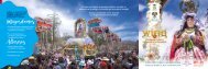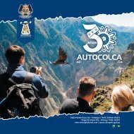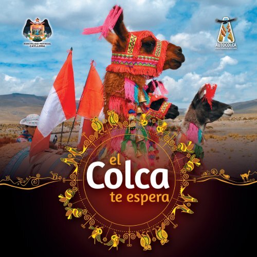
Pueblos del Colca - El Colca Te Espera
La Autoridad Autónoma del Colca y Anexos (AUTOCOLCA) creada el 06 de junio de 1986 tiene como funciones principales: cuidar y promocionar turísticamente el patrimonio natural, cultural e histórico del “Circuito Turístico Cañón del Colca, Salinas y Aguada Blanca y Valle de los Volcanes” que abarca territorialmente los departamentos de Arequipa y parte de Moquegua. Con este texto “Visita el Colca” queremos invitar a turistas nacionales y extranjeros a recorrer y disfrutar de sus maravillas naturales, arquitectónicas y la cultura viva de cada una sus rutas.
La Autoridad Autónoma del Colca y Anexos (AUTOCOLCA) creada el
06 de junio de 1986 tiene como funciones principales: cuidar y promocionar
turísticamente el patrimonio natural, cultural e histórico del
“Circuito Turístico Cañón del Colca, Salinas y Aguada Blanca y Valle
de los Volcanes” que abarca territorialmente los departamentos de
Arequipa y parte de Moquegua.
Con este texto “Visita el Colca” queremos invitar a turistas nacionales
y extranjeros a recorrer y disfrutar de sus maravillas naturales, arquitectónicas
y la cultura viva de cada una sus rutas.

You also want an ePaper? Increase the reach of your titles
YUMPU automatically turns print PDFs into web optimized ePapers that Google loves.
portada
MIEMBROS DEL DIRECTORIO DE AUTOCOLCA 2016<br />
Presidente <strong>del</strong> Directorio de AUTOCOLCA<br />
Dr. Rómulo Tinta Cáceres<br />
Alcalde de la Municipalidad Provincial de Caylloma<br />
MIEMBROS DEL DIRECTORIO<br />
Valeriano Rufino Rojas Rosas<br />
Alcalde de la Municipalidad Distrital de Coporaque<br />
Emilio Fredi Flores<br />
Alcalde de la Municipalidad Distrital de Achoma<br />
Alfonso Mamani Quispe<br />
Alcalde de la Municipalidad Distrital de Tuti<br />
<strong>El</strong>ard Adrián Hurtado Retamozo<br />
Alcalde de la Municipalidad Distrital de Majes<br />
Víctor Oligario Huayhuacure Alcasihuincha<br />
Alcalde de la Municipalidad Distrital de Chachas-Castilla<br />
Lic. Miguel Apaza Peña<br />
Gerente Regional de Comercio Exterior y Turismo<br />
Eduardo José Azabache Alvarado<br />
Representante <strong>del</strong> MINCETUR<br />
Franz Grupp Castelo<br />
Director de la Oficina Descentralizada de Cultura de Arequipa<br />
Rafael Cornejo Cuadros<br />
Representante de la Cámara de Comercio e Industria de Arequipa<br />
Gerente de AUTOCOLCA<br />
Eco. Wilder Edgar Mamani Llica
CRÉDITOS<br />
<strong>El</strong> <strong>Colca</strong> te <strong>Espera</strong><br />
<strong>Te</strong>xtos:<br />
Lic. Jenny Carmen Peña Araníbar<br />
Colaboración:<br />
Lic. Nelis Jaderluz Torres Gutiérrez<br />
Lic. Claudia Isabel Barrios Cacya<br />
Srta. Zaritza Valdez Allasi<br />
Traducción<br />
Bach. Edison Braulio Falcón Vera<br />
Diseño y Diagramación:<br />
Adrián Adolfo Sisa Condori<br />
Nestor Mamani Cayllahua<br />
Fotografías:<br />
Adrián Adolfo Sisa Condori<br />
John Vizcarra Huarachi<br />
Archivo de AUTOCOLCA<br />
Arequipa Perú 2016
PRESENTACIÓN<br />
La Autoridad Autónoma <strong>del</strong> <strong>Colca</strong> y Anexos (AUTOCOLCA) creada el<br />
06 de junio de 1986 tiene como funciones principales: cuidar y promocionar<br />
turísticamente el patrimonio natural, cultural e histórico <strong>del</strong><br />
“Circuito Turístico Cañón <strong>del</strong> <strong>Colca</strong>, Salinas y Aguada Blanca y Valle<br />
de los Volcanes” que abarca territorialmente los departamentos de<br />
Arequipa y parte de Moquegua.<br />
Con este texto “Visita el <strong>Colca</strong>” queremos invitar a turistas nacionales<br />
y extranjeros a recorrer y disfrutar de sus maravillas naturales, arquitectónicas<br />
y la cultura viva de cada una sus rutas.<br />
<strong>Espera</strong>mos contribuir con su visita.<br />
Atentamente,<br />
Dr. Rómulo Tinta Cáceres<br />
Presidente <strong>del</strong> Directorio de AUTOCOLCA<br />
Alcalde Provincial de Caylloma
INTRODUCTION<br />
The Autonomous Authority of <strong>Colca</strong> and Annexes (Autocolca)<br />
created on June 6, 1986 has as main functions: look after and<br />
promote touristically the natural, cultural and historical heritage<br />
of the “tourist circuit <strong>Colca</strong> Canyon, Salinas and Aguada<br />
Blanca and Valley of the Volcanoes “that geographically covers<br />
the departments of Arequipa and portion of Moquegua.<br />
With this book “Visit the <strong>Colca</strong>” we invite national and foreign<br />
tourists to visit and enjoy its natural wonders, architectural and<br />
living culture of each one of its routes.<br />
We hope to contribute with your visit.<br />
Sincerily,<br />
Dr. Rómulo Tinta Cáceres<br />
Directorate’s Chairman of AUTOCOLCA<br />
Provincial Mayor of Caylloma
Cómo Llegar Al <strong>Colca</strong><br />
La ciudad de Arequipa es el punto de partida hacia el <strong>Colca</strong><br />
con un recorrido de 151 km. que lleva hasta el inicio <strong>del</strong><br />
valle <strong>del</strong> <strong>Colca</strong>. <strong>El</strong> viaje al <strong>Colca</strong> se puede hacer de forma<br />
independiente u organizada a través de una agencia de<br />
viajes.<br />
Para los viajeros que se animen a ir por su cuenta pueden<br />
tomar los autobuses hacia Chivay y/o Cabanaconde; las<br />
dos principales localidades una <strong>del</strong> valle y la otra <strong>del</strong> cañón.<br />
Estos parten desde el <strong>Te</strong>rminal <strong>Te</strong>rrestre de Arequipa<br />
en diferentes horarios, desde las 01:00 horas. <strong>El</strong> trayecto a<br />
Chivay toma aproximadamente 3 horas y media.<br />
En Chivay, se ofrecen todos los servicios que el visitante<br />
pueda requerir, mientras que en los otros distritos la oferta<br />
es más limitada. Existen buses locales que interconectan<br />
los pueblos <strong>del</strong> valle, <strong>del</strong> cañón y de la parte alta <strong>del</strong><br />
<strong>Colca</strong>, pero su horario es irregular.<br />
8
Who To Reach To The <strong>Colca</strong><br />
The <strong>Colca</strong> Valley can be arrived from Arequipa city, crossed by<br />
160 kilometers that leading to the start of the <strong>Colca</strong> Valley. The<br />
trip to the <strong>Colca</strong> can be done independently or organized through<br />
a travel agency.<br />
For travelers who dare to go it alone can take the bus to Chivay<br />
and / or Cabanaconde; the two main towns, the first one of the<br />
<strong>Colca</strong> valley and the second of the <strong>Colca</strong> canyon. These leave<br />
from the Arequipa’s bus station at different times, from 01:00<br />
hours. The journey by bus to Chivay takes about 3 hours.<br />
In Chivay, they offer all services that you may require, while in<br />
other districts that is more limited. There are local buses that<br />
connect the villages of the valley, of the canyon and the high<br />
part of the <strong>Colca</strong>, but the timetables are irregular.<br />
9
ACTIVIDADES Y RUTAS<br />
<strong>El</strong> viaje al valle <strong>del</strong> colca ofrece una gran variedad de<br />
atractivos turístico, paisajes y monumentos históricos –<br />
culturales así como la magnífica convivencia con la población<br />
<strong>del</strong> lugar. Todos ellos pueden ser visitados dependiendo<br />
de la cantidad de tiempo que le destinen al <strong>Colca</strong>.<br />
<strong>El</strong> <strong>Colca</strong> es el lugar perfecto donde podrá realizar satisfactorias<br />
excursiones por todos los rincones <strong>del</strong> valle y el<br />
cañón que no sólo le mostrarán sorprendes especies de<br />
flora, fauna y paisajes hermosos junto a restos arqueológicos<br />
y pueblos tradicionales.<br />
Nuestra recomendación es que el tiempo mínimo de estancia<br />
en el <strong>Colca</strong> fluctúe entre los dos y seis días; lo que<br />
te permitirá llevar una experiencia más completa de la<br />
riqueza cultural y natural que te pueda ofrecer el <strong>Colca</strong>.<br />
12
ACTIVITIES AND ROUTES<br />
The trip to the <strong>Colca</strong> Valley offers a variety of tourist<br />
attractions, landscapes and historical and cultural monuments,<br />
thus too the magnificent coexistence with the<br />
local population. All can be visited depending of the time<br />
it allocated to the <strong>Colca</strong>.<br />
The <strong>Colca</strong> is the perfect place where you can make satisfying<br />
tours all over the valley and canyon that not<br />
only show to you surprising species of flora and fauna,<br />
but also beautiful landscapes, archaeological sites and<br />
traditional villages.<br />
Our recommendation is that the minimum time of stay<br />
in the <strong>Colca</strong> fluctuates between two to six days; that<br />
allowing you to live a fuller experience of the cultural<br />
and natural richness that can provide you the <strong>Colca</strong>.<br />
13
ACHOMA<br />
<strong>El</strong> <strong>Colca</strong> y sus Productos<br />
½ DIA<br />
<strong>El</strong> recorrido se da por el pueblo de Achoma (a una distancia de 40<br />
minutos de Chivay), poblado que posee un enorme potencial agrícola desde tiempos milenarios. Cuenta con<br />
andenes donde se cultiva la papa, quinua, habas y otros<br />
Son conocidos desde hace años como los reyes de la papa.<br />
Pueblo antiguo (Achomani)<br />
Son ruinas pertenecientes a la cultura Collagua, ubicado a 3 horas de caminata.<br />
Tiene una iglesia colonial; cuenta con artesanía, y fiestas costumbristas, como sus carnavales uno de los<br />
más resaltantes de todo el <strong>Colca</strong>.<br />
14
ACHOMA<br />
The <strong>Colca</strong> and its Products<br />
A half day<br />
The visit is given around of Achoma town (40 minutes from Chivay), a town than has enormous agricultural<br />
potential since ancient times. It has terraces where are grown potatoes, quinoa, beans and others.<br />
They are known for years like the kings of the potatoes.<br />
Ancient Town (Achomani)<br />
They are ruins belonging to the Collagua culture; this ruin is located to 3 hours walk from Achoma village.<br />
Has a colonial church; It features crafts and traditional celebrations, such as carnivals one of the most<br />
outstanding of all the <strong>Colca</strong>.<br />
15
CABANACONDE<br />
Mirador de la Cruz <strong>del</strong> Cóndor<br />
Está ubicado a una hora y media de Chivay y a 15 minutos de Cabanaconde en movilidad. Es el punto<br />
donde inicia la profundidad <strong>del</strong> cañón <strong>del</strong> <strong>Colca</strong> y se puede apreciar el vuelo de los cóndores. Desde este<br />
mirador se puede apreciar los nevados, los pueblos de Tapay y Madrigal.<br />
<strong>El</strong> Oasis <strong>del</strong> <strong>Colca</strong>- Sangalle<br />
2 DÍAS / 1 NOCHE<br />
Está ubicado a tres horas de caminata desde el pueblo de Cabanaconde (aprox. a 2,000 m.s.n.m.), donde<br />
dicho poblado posee un ecosistema de monte ribereño, que por encontrarse enclavado en el cañón goza de<br />
condiciones climáticas subtropicales dando al viajero un lugar especial para el descanso después de una<br />
caminata por el cañón.<br />
16
CABANACONDE<br />
The Condor cross viewpoint<br />
It is located at one hour and a half from Chivay and 15 minutes from Cabanaconde by bus. It is the point<br />
where starts the <strong>Colca</strong> Canyon, and you can enjoy with the flight of the condors. From this viewpoint you<br />
can see some scapes, snowy mountains and Tapay village.<br />
Sangalle, the <strong>Colca</strong>’s oasis<br />
Two Days / One Night<br />
It is located at three hours walk from Cabanaconde village (2150 m.a.s.l.) where this oasis has an ecosystem<br />
of riverside wood, that for be nestled into the canyon has subtropical weather conditions, giving to the<br />
traveler a special place to the rest, after a hike through of the canyon.<br />
17
CALLALLI<br />
Pinturas rupestres de Mollepunku<br />
De Chivay -Callalli (1 hora en carro) De Callalli – Mollepunku (15 min. En carro) y desde este punto<br />
10 minutos de caminata a las cuevas donde se encuentran las pinturas rupestres de Molllepunku donde el<br />
habitante primitivo grafica el proceso de cambio de economía extractiva a una economía productiva y así<br />
se convirtieron de cazadores a ganaderos y de recolectores a agricultores.<br />
Castillos Encantados<br />
Está a una hora y media de caminata desde el pueblo Callalli, podemos ver formaciones rocosas que tienen<br />
la apariencia de castillos encantados, como salidas de un cuento de hadas. Para visitarlo es recomendable<br />
contactarse con guías locales.<br />
18
CALLALLI<br />
Mollepunku’s cave paintings<br />
From Chivay to Callalli we need just one hour by car then fifteen moor minutes to Mollepunku’s cave paintings.<br />
Finally, we have to walk ten minutes to the cave. Here the primitive inhabitant graphed the change<br />
process from extractive economy to a productive economy and thus became from hunter to animals farmer;<br />
and from gatherers to farmer.<br />
Charmed castles<br />
This is by one hour and a half walking from Callalli village, we can see rock formations that have the<br />
appearance of charmed castles, like out of a fairy tale. To visit it is advisable to contact with local guides.<br />
19
CAYLLOMA<br />
Laguna artificial de Huarachuarco<br />
Esta laguna tiene una extensión de 1200 metros de largo por 800 metros de ancho en sus extremos más alejados, sus<br />
orillas son arenosas, sus aguas se alimentan de los deshielos de la cordillera de Chila, toman un color azulado transparente<br />
y son de temperatura muy fría. Esta hermosa laguna se encuentra inmersa dentro de un paisaje típico de los<br />
andes.<br />
Cueva natural de Hatunhuayco<br />
Ubicada a 4550 m.s.n.m. localizada en el sector de Hatunhuayco, centro poblado de Jachaña (4498 m.s.n.m. aprox.),<br />
distrito y provincia de Caylloma, Región Arequipa. Aquí se encuentran diversas pinturas rupestres dibujadas en diferentes<br />
tiempos y con diferentes técnicas de arte rupestre. Se observa auquénidos, oriundos de la zona, retratados en<br />
forma natural en un primer periodo y como un medio de carga y transporte en un segundo periodo. Esto guarda lógica,<br />
debido a que por esta zona se encuentra el camino de herradura que unía la zona <strong>del</strong> Cusco con Caylloma.<br />
20
CAYLLOMA<br />
Artificial lagoon Huarachuarco<br />
This lagoon has an area 1,200 meters long by 800 meters wide at its farthest end, its shores are sandy, the water is<br />
fed from the melting of the Cordillera de Chila, it take a transparent bluish color and this has a very cold water. This<br />
beautiful lake is immersed in a typical landscape of the Andes.<br />
Hatunhuayco’s natural cave<br />
Located at 4550 m.a.s.l. in Hatunhuayco sector, Jachaña small town (4498 m.a.s.l.), district and province of Caylloma,<br />
Arequipa’s Region. Here are several rock paintings drawn in different times and with different techniques of rock art. It<br />
is observed llamas, natives of this area, portrayed naturally in a first period and with cargos, like transport medium, in<br />
a second time. It is logic, because for this area there is the bridle path linking the Caylloma area with Cusco.<br />
21
COPORAQUE<br />
Conjunto Arqueológico de San Antonio<br />
Se halla localizado en las faldas irregulares y accidentadas <strong>del</strong> cerro <strong>del</strong> mismo nombre, los antiguos<br />
Pre-incas escogieron este lugar por su ubicación elevada de esta manera vigilar la entrada y llegada de los<br />
visitantes. <strong>El</strong> Conjunto Arqueológico de San Antonio, es de estilo Collagua e Inca, con presencia de habitaciones<br />
y recintos que se comunican por medio de pasajes y calles.<br />
<strong>Te</strong>rrazas pre-incas y turismo vivencial<br />
De Chivay a Coporaque se recorre 10 minutos en movilidad, apreciándose las andenerías pre-incas, con<br />
formaciones escalonadas, ovaladas y cerradas, dando la impresión de un anfiteatro.<br />
La ubicación de este distrito permite ofrecer múltiples posibilidades de turismo rural comunitario, turismo<br />
ecológico y de aventura, donde se pueden realizar actividades de caminatas, canotaje, bicicleta de montaña,<br />
paseos a caballo y otras.<br />
Además de aguas termales.<br />
22
COPORAQUE<br />
San Antonio’s archaeological place<br />
It place is located in the irregular and rugged slopes of the hill of the same name, the ancients Pre-Inca<br />
chose this place for its elevated location in this way guard the entrance and arrival of visitors. The archaeological<br />
site of San Antonio, is Collagua and Inca style, with the presence of rooms and enclosures that communicate<br />
through passages and streets.<br />
Pre-Inca terraces and experiential tourism<br />
From Chivay to Coporaque needs just 10 minutes by car, here can appreciating the pre-Inca terraces, with<br />
staggered formations, oval and closed, that giving the impression of an amphitheater.<br />
The strategic location of this district can provide many opportunities for experiential tourism, ecotourism<br />
and adventure, where you can engage in hiking, boating, mountain biking, horseback riding and others. In<br />
addition to hot springs.<br />
23
CHIVAY<br />
Baños <strong>Te</strong>rmales La Calera<br />
Otra de las principales características <strong>del</strong> valle <strong>del</strong> <strong>Colca</strong> es la presencia de aguas termales con una composición<br />
química de Ca, Zn, Fe, C, sales y otros, con una temperatura máxima de 85 C° en la salida <strong>del</strong> manantial.<br />
Se recomienda visitarlo muy temprano por la mañana (Chivay será el punto de referencia para esta caminata).<br />
La opción de movilidad la tienes con el servicio urbano que sale desde la plaza de Chivay; está a solo<br />
7 minutos.<br />
Por Los Cañoncitos de Huaynalima y Lunta – Canocota<br />
½ DIA<br />
La partida para esta caminata es el pueblo de Canocota (a 20 minutos en transporte de Chivay) y tiene una<br />
duración de 3 horas aproximadamente; la mejor época para visitar dicho lugar es entre abril y noviembre<br />
cuando el paisaje se presenta generoso y abundante en verdor.<br />
24
CHIVAY<br />
The Calera’s thermal bath<br />
Another major feature of the <strong>Colca</strong> is the presence of thermal waters with a chemical composition of Ca, Zn,<br />
Fe, C, salts and others, with a maximum temperature of 85 ° C at the outlet of spring.<br />
It is recommended to visit early in the morning (Chivay will be the reference point for this hike). With transport<br />
option, you have the urban service that leaves from the square of Chivay; it is just 7 minutes.<br />
By the small canyons of Huayna Lima and Lunta - Canocota<br />
½ Day<br />
The departure for this hike is the Canocota village (to 20-minute by transport journey from Chivay) and<br />
lasts approximately 3 hours; the best time to visit this place is between April and November when the landscape<br />
is generous and abundant greenery.<br />
25
HUAMBO<br />
Por las Profundidades <strong>del</strong> Cañón<br />
2 DIAS 1 NOCHE<br />
<strong>El</strong> Cañón <strong>del</strong> <strong>Colca</strong> alcanza una profundidad máxima de 4,160 metros aproximadamente en el punto llamado<br />
Canco. Esta oquedad no es visitada en ninguno de los tours habituales. Su acceso es río abajo, vía el<br />
pueblo de Huambo, y se sugiere realizarla junto a un guía especializado y conocedor de la zona.<br />
De Cabanaconde a Huambo es aproximadamente 1 hora con 45 minutos de viaje.<br />
La Semana Santa<br />
Varía entre los meses de marzo y abril. Apreciamos y podemos formar parte de las procesiones de su peculiar<br />
Semana Santa y de sus costumbres y tradiciones.<br />
Además se puede visitar la Fortaleza Inca de Jayaquima, las Chullpas Ancall, Pucara, San Miguel, Santa<br />
María, Hutk’os (forados y cavernas) y el <strong>Te</strong>mplo de San Lorenzo.<br />
La Semana Santa y la fiesta de San Lorenzo son consideradas Patrimonio Cultural de la Nación.<br />
26
HUAMBO<br />
By the depths of the canyon<br />
2 Days 1 Night<br />
The <strong>Colca</strong> Canyon reaches a maximum depth of 4.160 meters near the valley of Canco. This cavity is not<br />
accessed in any of the classic tours. Access is through the Huambo village; for performing it, we suggest by<br />
a specialized guide and knowledgeable about the area.<br />
From Cabanaconde to Huambo is about 1 hour and 45 minutes by transport.<br />
The Holy Week<br />
It varies between the months of March and April (according to the liturgical calendar). We can join the peculiar<br />
processions of Holy Week, customs and traditions.<br />
You can also visit the Inca fortress of Jayaquima, Ancall Chullpas, Pucara, San Miguel, Santa Maria, Hutk’os<br />
(holes and caves) and the <strong>Te</strong>mple of San Lorenzo.<br />
The Holy Week as the feast of San Lorenzo are Cultural Heritage of the Nation.<br />
27
HUANCA<br />
“<strong>El</strong> Lagarto Rojo”<br />
Partiendo de Yura, se recorre 3 horas de viaje aproximadamente en trocha carrozable hasta llegar a Huanca<br />
y desde su plaza se puede apreciar el “Lagarto Rojo” que es una formación rocosa con esta apariencia.<br />
También se puede visitar el<br />
Cañón <strong>del</strong> Pichirigma.<br />
Otros atractivos<br />
<strong>El</strong> Complejo Arqueológico de Sonqoykilla<br />
Pinturas Rupestres de Huanca y sus Torres Encantadas<br />
28
HUANCA<br />
“The red lizard”<br />
It is 3 hours by dirt road from Yura town until to arrive to Huanca village from its square you can see the<br />
“Red Lizard”, a rock formation with this appearance.<br />
You can also visit the Pichirigma canyon; Sonqollay Archaeological Complex, cave paintings and charm<br />
towers.<br />
29
ICHUPAMPA<br />
<strong>Te</strong>mplo San Juan Bautista de Ichupampa<br />
Es el templo más tardío <strong>del</strong> <strong>Colca</strong> (1809)<br />
Anfiteatro de Chachahuani<br />
En Ichupampa encontramos terrazas construidas por los collaguas en la modalidad de pircas de piedras sin<br />
labrar en forma de coliseo<br />
30
ICHUPAMPA<br />
Church’s Saint John Baptist of Ichupampa<br />
It is the later temple of the <strong>Colca</strong> (1809).<br />
Chachahuani’s amphitheater<br />
In Ichupampa district we find terraces built by the Collaguas with stone walls, uncut stones, like Coliseum.<br />
31
LARI<br />
Los Orígenes <strong>del</strong> Río Amazonas<br />
3 días / 2 noches<br />
Iniciamos nuestra visita adentrándonos por la margen derecha <strong>del</strong> Valle <strong>del</strong> <strong>Colca</strong>. Lari está a 20 Kms de Chivay; desde su<br />
plaza principal se continúa 24 kilómetros más por trocha carrozable (12 horas de caminata) hasta llegar al punto de origen<br />
<strong>del</strong> río Amazonas, “Nevado Quehuisha”, reconocido en 1996 por la expedición Científica Polaco Italiana- Ruso-Peruana<br />
“Amazon Source 96” dirigida por Jacek Palkiewicz y con placa <strong>del</strong> 11 de setiembre <strong>del</strong> 2011, dejando al nevado <strong>del</strong> Mismi<br />
como un segundo punto de origen <strong>del</strong> río más caudaloso <strong>del</strong> mundo, ubicado a una hora y media <strong>del</strong> Quehuisha, también<br />
cuenta con una placa de 1971.<br />
La Catedral <strong>del</strong> <strong>Colca</strong><br />
La iglesia de Lari, conocida como la Catedral <strong>del</strong> <strong>Colca</strong>, está ubicada en unos de los lados de la Plaza Mayor de Lari. Su<br />
fachada es diferente al resto de las iglesias <strong>del</strong> valle, luce muy bien conservada. Presenta estructura en cruz latina con contrafuertes<br />
románicos y es la única que presenta cúpula de media naranja.<br />
En el interior se conservan muy bellos altares, cuadros, pinturas coloniales e imágenes en muy buen estado. Cuenta con<br />
museo donde se exhiben materiales eclesiásticas de la época de la colonia como túnicas, piano, cofres, libros en latín entre<br />
otros.<br />
32
LARI<br />
Amazon river’s source<br />
3 days / 2 nights<br />
We started our visit, entering by the right bank of the <strong>Colca</strong> Valley. Lari is 20 km from Chivay; from its main square we continue<br />
for 24 kilometers on dirt road (12 hour hike) until the point of origin of the Amazon River, “Nevado Quehuisha”, recognized<br />
in 1996 by the Scientific Expedition Polish-Italian-Rusian-peruvian “Amazon Source 96 “directed by Jacek Palkiewicz and<br />
with plate since September 11, 2011, relegating to the Mismi mountain as a second point of origin of the largest river of the<br />
world, located an hour and a half from Quehuisha, also has a plate 1971.<br />
<strong>Colca</strong>’s Cathedral<br />
3 days / 2 nights<br />
Lari’s church known like “the <strong>Colca</strong>’s Cathedral” is located in one of the sides of the main square of Lari village. Its facade is<br />
different from other churches of the valley looks very well preserved. It presents a Latin cross structure with Romanesque<br />
buttresses and is the only one with semicircular dome.<br />
Inside are kept some altars, paintings, colonial paintings and images in very good condition. Has a museum where exhibited<br />
ecclesiastical materials of colonial times as robes, piano, boxes, books in Latin and others.<br />
33
LLUTA<br />
Huellas de Dinosaurio –Viscayacu<br />
Está ubicado a una altitud de 3 354 m.s.n.m. La existencia de estas huellas de dinosaurio datan de hace<br />
150 millones de años y su hallazgo se remonta a las obras de construcción de la carretera afirmada desde<br />
Pedregal, Lluta hasta Huambo y Querque. En este lugar existen más de 20 huellas petrificadas muy bien<br />
conservadas, dentro de un área aproximada de 250 m2, expuestas sobre una pared de roca en el borde de<br />
la carretera.<br />
<strong>El</strong> Cañón de Pichirigma<br />
Se encuentra localizado en el noroeste de la provincia de Arequipa, a una altitud de 3711m.s.n.m. siendo un<br />
cañón de regular profundidad. Su naciente está en el nevado Ampato.<br />
<strong>El</strong> Mirador de Saranquima<br />
Desde Arequipa en la estación de buses de Plaza Norte, existen empresas de transporte que van al centro<br />
poblado de Taya, a 4 horas de Arequipa. Desde este mirador los visitantes pueden apreciar el cañón de Pichirigma,<br />
el nevado Ampato y las Pampas de Majes <strong>del</strong> Pedregal.<br />
34
LLUTA<br />
Dinosaur Footprints –Viscayacu<br />
It is located at an altitude of 3354 m.a.s.l. The existence of these dinosaur footprints date back 150 million<br />
years ago and their discovery dates back to the construction of unpaved road from Pedregal, Lluta to<br />
Huambo and Querque. In this place there are over 20 well-preserved petrified footprints, within an area of<br />
250 m2, set on a rock wall at the edge of the road.<br />
Pichirigma Canyon<br />
It is located northwest of the province of Arequipa, at an altitude of 3711m.a.s.l. It is a canyon with moderate<br />
depth. Its source is on Ampato volcano.<br />
Saranquima viewpoint<br />
From Arequipa, in the bus station in North Plaza, there are transport companies that go to the small village<br />
Taya, 4 hours from Arequipa. From this viewpoint visitors can appreciate the canyon Pichirigma, Ampato<br />
volcano and irrigations of the Majes pampas and Pedregal city.<br />
35
MACA<br />
Iglesia de Santa Ana de Maca<br />
<strong>El</strong> <strong>Te</strong>mplo Colonial de Santa Ana de Maca fue construido en 1760. De estilo románico, con fuerte influencia<br />
mestiza. Está situado longitudinalmente a la plaza principal de Maca.<br />
<strong>El</strong> Complejo Arqueológico de Choquetico o Peña Blanca<br />
Ubicado a una hora de Chivay en movilidad, en dirección a la Cruz <strong>del</strong> Cóndor. Es un complejo arqueológico<br />
con una antigüedad de más de 800 años.<br />
En este lugar encontramos litomaquetas, tumbas colgantes y colcas.<br />
36
MACA<br />
Saint Ana, Maca church<br />
The Colonial Church of Saint Ana of Maca was built in 1760. Romanesque style, with strong mestizo influence.<br />
It is located longitudinally adjacent to the main square of Maca village.<br />
Archaeological Complex’s Choquetico<br />
Located one hour from Chivay in mobility towards the Condor Cross viewpoint. It is an archaeological complex<br />
with a history of more than 800 years.<br />
Here there are lithic mock-up, hanging tombs and colcas.<br />
37
MADRIGAL<br />
Fortaleza de Chimpa<br />
Está a 2 horas de caminata, partiendo desde el pueblo de Madrigal; es una fortaleza de piedra, asentada<br />
como imponente observatorio natural, desde donde se puede divisar la majestuosidad y la inmensidad <strong>del</strong><br />
Valle <strong>del</strong> <strong>Colca</strong>. Desde allí se puede apreciar las zonas cultivadas <strong>del</strong> Valle, el nevado Hualca Hualca y la<br />
geografía accidentada <strong>del</strong> cañón <strong>del</strong> <strong>Colca</strong>.<br />
Trekking a la Puerta <strong>del</strong> Cañón <strong>del</strong> <strong>Colca</strong> y al Bomboya.”Tras las huellas de Ciro”<br />
Es una caminata de 3 horas aproximadamente, iniciando desde el pueblo de Madrigal. En este lugar podemos<br />
apreciar el final <strong>del</strong> valle <strong>del</strong> <strong>Colca</strong> dando su paso al Cañón.<br />
<strong>El</strong> trekking “Tras las huellas de Ciro” dura 4 días y 3 noches; es de dificultad media. En el trayecto podemos<br />
apreciar el cañón en su real dimensión.<br />
38
MADRIGAL<br />
Chimpa’s Fortress<br />
This is a 2-hour walk, starting from Madrigal village; It is a stone fortress, seated like stunning natural<br />
observatory, from where you can see the majestic and vastness of the <strong>Colca</strong> Valley. From there you can<br />
appreciate the cultivated areas of the valley, the Hualca Hualca snowy and the rugged geography of the<br />
<strong>Colca</strong> Canyon.<br />
Trekking to the <strong>Colca</strong> Canyon Gate and Bomboya. “In the footsteps of Ciro”<br />
It is a walk of about three hours, starting from the village of Madrigal. Here we see the end of the <strong>Colca</strong><br />
Valley Canyon giving his step.<br />
This trekk “In the footsteps of Ciro” lasts 4 days and 3 nights; it is of medium difficulty. On the way we can<br />
see the canyon in its real dimension.<br />
39
MAJES<br />
Un Desierto hecho Oasis<br />
Es una irrigación con sembríos de pan llevar como uvas, paltas, alcachofas, y otros que sirven para consumo<br />
interno y para su exportación. Aquí se puede desarrollar el turismo vivencial en las haciendas.<br />
Fuente lechera <strong>del</strong> Sur<br />
Este distrito se ha convertido en la cuenca lechera <strong>del</strong> sur, por la cantidad de ejemplares, que superan las<br />
100 mil vacas.<br />
La Ruta <strong>del</strong> Pisco y Sus Camarones<br />
Ubicado a 2 horas y 15 minutos de la ciudad de Arequipa. Se puede visitar viñedos, donde se destila la uva<br />
en sus diferentes variedades y podemos conocer de su proceso de producción, acompañándolo con un plato<br />
de camarones.<br />
40
MAJES<br />
A desert made Oasis<br />
There are irrigations with crops of grapes, avocados, artichokes, and others who serve for domestic, regional<br />
consumption and for export. Here you can develop experiential tourism on ranches.<br />
Dairy basin of south<br />
This district has become the dairy basin south, for the number of specimens, in excess of 100 thousand cows.<br />
The Pisco Route and their Shrimps<br />
Located 2 hours and 15 minutes from the Arequipa city. You can visit vineyards and wineries where the different<br />
kind of grapes are distilled and can know their production process, accompanied with a dish of shrimp.<br />
41
SAN ANTONIO DE CHUCA<br />
Tierra de Vizcachas, Vicuñas, Huallatas y piscigranjas<br />
Está ubicado dentro de la Reserva Nacional de Salinas y Aguada BLanca a 4700 m.s.n.m. Podemos desarrollar<br />
un tour especializado en flora y fauna y observar vizcachas, vicuñas, huallatas; además de las<br />
piscigranjas en la laguna <strong>del</strong> Dique Los Españoles.<br />
<strong>El</strong> Bosque de Piedras<br />
Ubicado a 2 horas y 15 minutos de Arequipa. Es uno de los principales atractivos <strong>del</strong> alejado distrito arequipeño<br />
de San Antonio de Chuca provincia de Caylloma, donde se observan figuras humanas, de animales y<br />
otras formaciones rocosas hechas por el viento.<br />
42
SAN ANTONIO DE CHUCA<br />
Land of vizcachas, vicunas, geese and fish farms.<br />
It is located within the National Reserve of Salinas and Aguada Blanca 4700 m.a.s.l. We can develop a<br />
specialized wildlife tour and observe vizcachas, vicuñas, geese; besides fish farms in the lagoon of “Dique<br />
de los Españoles”.<br />
Stone Forest<br />
Located 2 hours and 15 minutes from Arequipa. It is one of the main attractions of remote district of San<br />
Antonio de Chuca, Caylloma province, where we can observed human figures, animals and other rock formations<br />
made by wind.<br />
43
SIBAYO<br />
<strong>El</strong> Pueblo de Piedra<br />
Sibayo; denominado Rumillacta o Pueblo de Piedra, es un conjunto de viviendas que datan de épocas prehispánicas<br />
enteramente construidas a base de piedra, lugar predilecto para desarrollar el turismo vivencial;<br />
es decir, se convive con las personas <strong>del</strong> pueblo participando en sus costumbres y tradiciones.<br />
A 3 cuadras de la plaza podemos visitar el Ecomuseo de la cultura Collagua, centro de interpretación <strong>del</strong><br />
proceso de elaboración de la artesanía a base de fibra de alpaca (cría, esquilado, selección, hilado, tejido y<br />
producto final).<br />
Chullpas de Huañaccascca<br />
½ DIA<br />
Se podrá visitar la zona de Paraq’ra donde se observará una momia collagua, luego se seguirá el recorrido<br />
hacia las chullpas de Huañaccascca. Es necesario considerar un tiempo de 6 horas. Son una muestra hegemónica<br />
de los incas en el territorio Collagua.<br />
44
SIBAYO<br />
Stone Town<br />
Sibayo; called too “Rumillakta” (Quechua name) or Stone town, is a set of houses dating back to pre-Hispanic<br />
times entirely built of stone. Place preferred to develop experiential tourism; that is, you live with the<br />
local people participating in their customs and traditions.<br />
Three blocks from the square we can visit the Ecomuseum of Collagua culture interpretation center of the<br />
process of developing the handicrafts made from alpaca fiber (breeding, shearing, sorting, spinning, weaving<br />
and final product).<br />
Chullpas of Huañaccascca<br />
½ DAY<br />
We can visit the Paraqra place where be observed a Collagua mummy; then the tour will continue to Huañaccascca<br />
chullpas (Pre-incas tombs) for that is necessary to consider 6 hours for to walk. They are a sample<br />
of the Inca hegemony into the territory Collagua.<br />
45
TAPAY<br />
La Catarata de Huaruro<br />
3 DIAS 2 NOCHES<br />
Se trata de una caminata que inicia en el pueblo de Cabanaconde atravesando el cañón y una gran variedad<br />
de ecosistemas para finalizar en una espectacular catarata de ambiente seco y árido. Para dicha caminata<br />
se requiere de experiencia previa y adaptación a la altura.<br />
<strong>El</strong> Pueblo de las Frutas<br />
3 DIAS/2 NOCHES<br />
Salida de Arequipa con destino al pueblo de Cabanaconde; punto de partida para iniciar la caminata con<br />
destino al pueblo de San Juan de Chuccho; el descenso <strong>del</strong> cañón será por un camino en zigzag (3 horas<br />
aprox.) donde podrá tener una visita panorámica <strong>del</strong> Cañón y luego hacer un ascenso hacia el pintoresco<br />
pueblo de Tapay. Luego se hará un descenso hacia los pueblos de Cosñirhua y Malata terminando hasta<br />
llegar a un pequeño valle, Sangalle, para finalmente subir a Cabanaconde.<br />
46
TAPAY<br />
Huaruro waterfall<br />
3 Days 2 Nights<br />
It is a trek that starts at Cabanaconde village through the canyon and a variety of ecosystems to finish in<br />
a spectacular waterfall, dry and arid environment. For this hike is required prior experience and adaptation<br />
to the altitude.<br />
The village of the fruits<br />
3 Days/2 Nights<br />
Begins from Arequipa to Cabanaconde, starting point to begin the walk in direction to the San Juan de<br />
Chuccho small village; the descent into the canyon is by a zigzag path (3 hours approx.) where you can<br />
have a panoramic view of the canyon. Then makes a climb to the picturesque village of Tapay. Then there<br />
will be a descent for to visit Malata Cosñirhua villages ending at small valley, Sangalle, to finally climb to<br />
Cabanaconde.<br />
47
TISCO<br />
Las Torres de Choqolaqa<br />
Desde Arequipa hasta Choqolaqa son aproximadamente cinco horas de viaje (4800 m.s.n.m.) Cuenta la<br />
leyenda que esta fue una ciudad convertida en piedra por desobediencia a los Apus. Cuenta con un hermoso<br />
paisaje donde podemos jugar con la imaginación y descubrir majestuosos castillos, torres, figuras<br />
de animales como el cóndor, elefantes, focas, mujeres y ángeles congelados. Todo ello le dan un toque de<br />
misticismo al lugar.<br />
<strong>Te</strong>mplo San Pedro Apóstol<br />
Es uno de los templos mejor conservados de la provincia de Caylloma, construido por los franciscanos en<br />
la primera mitad <strong>del</strong> siglo XVIII. Presenta plataforma en cruz latina, tiene una hermosa sacristía y dos imponentes<br />
campanarios; la estructura de su techo es en bóveda de cañón. Tiene un gran muro que rodea el<br />
atrio de la iglesia adornados con robustos pináculos; adicionalmente se erigen cruces en los atrios laterales,<br />
hechas en roca volcánica rojiza.<br />
48
TISCO<br />
Choqolaqa’s towers<br />
From Arequipa to Choqolaqa are approximately five hour trip (4800 meters) Legend has it that this was a<br />
city turned to stone by disobedience to the Apus. It has a beautiful landscape where we can play with the<br />
imagination and discover majestic castles, towers, figures of animals like condors, elephant seals; women<br />
and angels frozen. All this gives a touch of mysticism to the place.<br />
St. Peter the Apostle’s Church<br />
It is one of the best preserved temples of the Caylloma province, built by the Franciscans in the first half of<br />
the eighteenth century. Presents a platform in latin cross, has a beautiful sacristy and two imposing towers;<br />
the structure of the roof is a barrel vault. It has a large wall, surrounding the atrium of the church, adorned<br />
with pinnacles robust; furthermore crosses were erected on the atriums, made with reddish volcanic rock.<br />
49
TUTI<br />
<strong>Colca</strong>s de Pumunuta<br />
½ DIA<br />
Para llegar hasta Pumunuta se realiza una caminata que parte <strong>del</strong> pueblo de Tuti (a 40 minutos de Chivay),<br />
usando un camino pre-inca que nos lleva a unos antiguos centros de almacenamiento de granos o “colcas”,<br />
las cuales albergan recipientes hechos con barro y paja; algunas de estas piezas se encuentran aún intactas<br />
en buen estado de conservación. La caminata dura aproximadamente 2 horas.<br />
Por los Cañoncitos de Huaynalima y Lunta – Canocota<br />
½ DIA<br />
La partida para esta caminata se da <strong>del</strong> pueblo de Canocota (a una distancia de 20 minutos) y tiene una<br />
duración total de 3 horas; la mejor época para visitar dicho lugar son los meses de abril y mayo cuando el<br />
paisaje se presenta generoso y abundante de verdor.<br />
50
TUTI<br />
<strong>Colca</strong>s of Pumunuta<br />
½ Day<br />
To get until Pumunuta we walk from Tuti village (40 minutes from Chivay) using a pre-Inca trail that leads<br />
to a former grain storage centers or “colcas” which harbor containers made is done mud and straw; some of<br />
these pieces are still intact in good condition. The hike takes about 2 hours.<br />
By the small canyons of Huayna Lima and Lunta – Canocota<br />
½ Day<br />
The departure for this hike is the Canocota village (to 20-minute by transport journey from Chivay) and<br />
lasts approximately 3 hours; the best time to visit this place is between April and November when the landscape<br />
is generous and abundant greenery.<br />
51
YANQUE<br />
Complejo Arqueológico de Uyo Uyo<br />
<strong>El</strong> conjunto arqueológico de Uyo Uyo se encuentra ubicado dentro de la comunidad campesina de Yanque<br />
Urinsaya, en una ladera casi plana de la margen derecha <strong>del</strong> valle <strong>del</strong> colca, entre los ríos Pampaqhawana<br />
y Quesea.<br />
Es el mejor lugar para explicar la organización de un poblado rural incaico. Es la aldea prehispánica más<br />
grande de esta zona de la margen derecha <strong>del</strong> valle <strong>del</strong> colca reconocido com patrimonio cultural de la<br />
Nación.<br />
Por los caminos de la Tradición y la Cultura<br />
La caminata parte de Yanque (a una distancia de 10 minutos de Chivay) a un antiguo recinto collagua, denominado<br />
Uyo Uyo. Seguidamente se visita los Baños <strong>Te</strong>rmales de Chacapi donde sus aguas poseen propiedades curativas para<br />
tratar enfermedades como traumatismo y artritis. <strong>El</strong> trayecto concluye con la visita al Museo de Yanque, donde se<br />
puede apreciar una pequeña réplica de las iglesias coloniales <strong>del</strong> <strong>Colca</strong>. Dicho circuito tiene una duración de 4 horas<br />
aproximadamente.<br />
52
YANQUE<br />
Uyo Uyo Archaeological Complex<br />
The archaeological site of Uyo Uyo is located within the rural community of Yanque Urinsaya, on a hillside<br />
in the right bank of the <strong>Colca</strong> Valley, between Quesea and Pampaqhawana rivers.<br />
It’s the best place to explain the organization of an Inca rural village. It is the largest pre-Hispanic village in<br />
the right bank of the <strong>Colca</strong> Valley; recognized as Cultural Patrimony of the Nation.<br />
On the paths of the Tradition and Culture<br />
The hike starts from Yanque (10 minutes from Chivay by car) to a former enclosure Collagua, called Uyo Uyo. Then<br />
visit to Chacapi’s thermal baths where its waters have healing properties to treat diseases such as arthritis. The trip<br />
concludes with a visit to the Museum of Yanque, where<br />
53
ANDAGUA<br />
“Valle de los Volcanes”<br />
<strong>El</strong> Valle de los Volcanes es un valle interandino situado en el distrito de Andagua, provincia de Castilla,<br />
Departamento y Región de Arequipa. Circuito turístico conformado por 85 conos volcánicos, espectáculo<br />
propio de las épocas prehistóricas, cuando el planeta estaba todavía en plena formación, da la apariencia<br />
de un paisaje lunar.<br />
Ciuda<strong>del</strong>a de Antaymarca<br />
Las ruinas de la ciuda<strong>del</strong>a de Antaymarca pertenecen a la cultura Collagua e Inca <strong>Te</strong>mprano, estos datos<br />
los corrobora tanto la cerámica encontrada en el lugar como algunos estudios realizados.<br />
Descripción <strong>del</strong> Área: Se distinguen 4 sectores: recintos (ciuda<strong>del</strong>a); plaza; área funeraria y la zona agrícola.<br />
Los recintos son de formas variadas: rectangulares, circulares y cuadradas; construidos con piedra volcánica<br />
<strong>del</strong> lugar.<br />
54
ANDAGUA<br />
“Volcanoes’ Valley”<br />
The Volcanoes Valley is an andean valley located at Andagua district, Castilla province, Arequipa’ Region.<br />
This tourist circuit is composed for 85 volcanic cones, singular spectacle of prehistoric times, when the planet<br />
was still in full training, that gives the appearance of a moonscape.<br />
Antaymarca’s cita<strong>del</strong><br />
The ruins of the cita<strong>del</strong> of Antaymarca belong to the Collagua and Inca early cultures; this data is corroborates<br />
by the pottery found at the site and some studies about that.<br />
Area Description: 4 sectors are distinguished: enclosures (cita<strong>del</strong>); main square; funeral area and agricultural<br />
area. The enclosures are of various shapes: rectangular, circular and square; built with volcanic stone<br />
of the place.<br />
55
AYO<br />
Laguna de Mamacocha<br />
Es una laguna de color azul, que se forma de aguas <strong>del</strong> subsuelo. Ubicada en el distrito de Ayo (Castilla).<br />
Se encuentra la nutria todas las lagunas es el hogar de la nutria marina, de mar, gato marino, chungungo<br />
o huallaque como es conocido por los pobladores de la zona.<br />
Bosque de Cactus<br />
Ubicado a 15 minutos <strong>del</strong> pueblo sobresaliendo entre las ruinas <strong>del</strong> lugar. <strong>Te</strong>nemos la presencia de cactus<br />
gigantes de las variedades: neoramondia arequipensis o “sapaywarmi”, corryococtus brevistylus o “shanki”,<br />
browningia can<strong>del</strong>aris o “can<strong>del</strong>abro”, entre otros como la opuntia o “tunas”. Es realmente un bosque<br />
de cactus gigantescos.<br />
56
AYO<br />
Mamacocha lagoon<br />
It is an lagoon emerald color by the purity of its waters, than is formed from a spring, which is considered<br />
the world’s biggest. Located in the district of Ayo (Castilla province). Here we can observe to the Pacific otter<br />
(sea cat), endangered species, in an uncommon habitat. This species is denominated “Huallaque”(quechua<br />
name) by locals.<br />
Cactus forest<br />
Located 15 minutes from Ayo village, standing out among the ruins of the place. Here have the presence<br />
of giant cactus varieties: neoramondia arequipensis or “sapaywarmi” corryocactus brevistylus or “Shanki”<br />
browningia can<strong>del</strong>aris or “candle”, among others as Opuntia or “tunas”. It’s really a forest of giant cacti.<br />
57
CHACHAS<br />
Laguna de Chachas<br />
Es un atractivo natural y singular <strong>del</strong> distrito de Chachas, ubicada al pie de su campiña. Está a una altitud<br />
de 2900 m.s.n.m. con una profundidad de 10 a 15 metros en secano y de 15 a 30 en temporada de lluvias.<br />
Catarata de Challahuiri<br />
Es una catarata ubicada en el río <strong>del</strong> mismo nombre a una hora y veinte minutos de caminata o 15 minutos<br />
en movilidad desde el pueblo de Chachas. Tiene una caída 12 metros formando un dique natural donde se<br />
pude pescar y darse un chapuzón. Este río es el afluente principal de la laguna de Chachas.<br />
58
CHACHAS<br />
Chachas lagoon<br />
It is a natural and unique attraction of Chachas district, located at the foot of the countryside. It is at an<br />
altitude of 2900 m.a.s.l. with a depth of 10-15 meters rainfed time and 15-30 during the rainy season.<br />
Challahuiri Waterfall<br />
It is a waterfall located on the river of the same name to an hour and twenty minutes of walking or 15 minutes<br />
by mobility from Chachas village. It has a 12 meters fall forming a natural dam where you could fish<br />
and take a dip. This river is the main affluent of the Chachas lagoon.<br />
59
RESERVA NACIONAL DE SALINAS Y AGUADA BLANCA<br />
La Laguna de Salinas<br />
Es una laguna endorreica de aguas someras (poca profundas) en la que se sedimenta borato y otros compuestos que<br />
le dan esa coloración blanquecina. Es lugar preferido por observadores d aves, ya que existe una infinidad de aves<br />
endémicas y migratorias en especial las tres variedades de flamencos de Sudamérica.<br />
Ubicada a 4300 m.s.n.m. Se lo visita por trocha carrozable, entre el Misti y el Pichu Pichu, (Ruta Chiguata). <strong>El</strong> paisaje<br />
es impresionante, se puede observar flora (como la queñua y la yareta), y fauna altoandina; además de los volcanes<br />
Misti y Ubinas, este último en estado eruptivo. Tiempo ponderado de visita 6 horas.<br />
Centro de Interpretación de la RNSAB<br />
En este recinto se puede observar la variada flora y fauna de la Reserva y su respectiva descripción.<br />
<strong>El</strong> Fundo Toccra.<br />
½ DíA<br />
Este recorrido se da por la Reserva Nacional de Salinas y Aguada Blanca, para observar el área de camélidos sudamericanos,<br />
mostrando así la crianza tradicional y tecnificada de llamas, alpacas y vicuñas, y a la vez teniendo un<br />
intercambio de vida con los pobladores <strong>del</strong> lugar.<br />
60
NATIONAL RESERVE OF SALINAS AND AGUADA BLANCA<br />
Salinas lagoon<br />
It is an endorheic lagoon in which be deposited borate and other compounds that gives a whitish colouration. It is a<br />
preferred place by bird watchers, because there are some different kinds of endemic and migratory birds, particularly<br />
the three varieties of South America’s flamingos.<br />
Located at 4300 m.a.s. For to visit you have to take dirt road between Misti and Pichu Pichu volcanoes, (Chiguata route).<br />
The scenery is breathtaking, you can see flora (as queñua and yareta) and altiplanic fauna; besides the Misti and<br />
Ubinas volcanoes, this latter active and in eruptive process.Time weighted for visit six hours.<br />
Interpretation Center of NRSAB<br />
In these enclosures you can appreciate the diverse flora and fauna of the Reserve and its respective description.<br />
Toccra farm.<br />
½ Day<br />
This tour is given in the National Reserve of Salinas and Aguada Blanca where we will observe in their natural habitat<br />
to the camelids, showing the traditional form raising llamas, alpacas and vicunas; at the same time introduce the<br />
lifestyle of the local shepherds.<br />
61