the geology and hydrogeology of the The relationships between ...
the geology and hydrogeology of the The relationships between ...
the geology and hydrogeology of the The relationships between ...
- No tags were found...
Create successful ePaper yourself
Turn your PDF publications into a flip-book with our unique Google optimized e-Paper software.
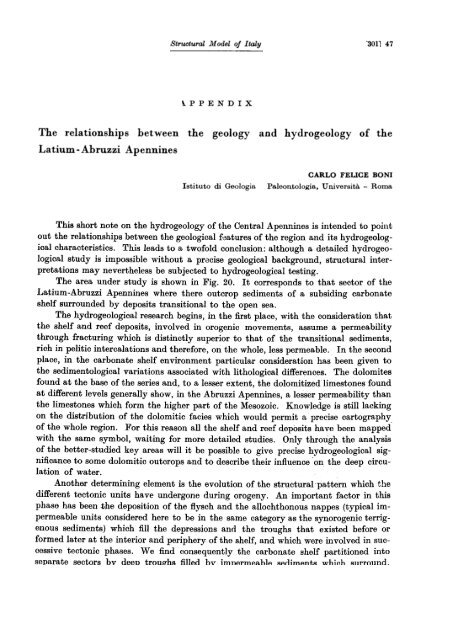
Structural Model oj ltaly"3011 47\.PPENDIX<strong>The</strong> <strong>relationships</strong> <strong>between</strong>Latium - Abruzzi Apennines<strong>the</strong> <strong>geology</strong> <strong>and</strong> hydro<strong>geology</strong> <strong>of</strong> <strong>the</strong>Istitutodi GeologiaCARLO FELICE BONIPaleon.tologia, U n.iversità - RomaThis short note on <strong>the</strong> hydro<strong>geology</strong> <strong>of</strong> <strong>the</strong> CentraI Apennines is intended to pointout <strong>the</strong> <strong>relationships</strong> <strong>between</strong> <strong>the</strong> geological f~atures <strong>of</strong> <strong>the</strong> region <strong>and</strong> its hydrogeologicalcharacteristics. This leads to a tw<strong>of</strong>old conclusion: although a detailed hydrogeologicalstudy is impossible without a pracise geological background, structural interpretationsmay never<strong>the</strong>less be subjected to hydrogeological testing.<strong>The</strong> area under study is shown in Fig. 20. It corresponds to that sector <strong>of</strong> <strong>the</strong>Laf,ium-Abruzzi Apennines where <strong>the</strong>re outcrop sedimenta <strong>of</strong> a subsiding carbonateshelf surrounded by deposita transitional to <strong>the</strong> open sea.<strong>The</strong> hydrogeological research begins, in <strong>the</strong> first pIace, with <strong>the</strong> consideration that<strong>the</strong> shelf <strong>and</strong> reef deposita, involved in orogenic movements, assume a permeabilitythrough fracturing which is distinctly superior to that <strong>of</strong> <strong>the</strong> transitional sedimenta,rich in pelitic intercalations <strong>and</strong> <strong>the</strong>refore, on <strong>the</strong> whole, lesa permeable. In <strong>the</strong> secondpIace, in <strong>the</strong> carbonate shelf environment particular consideration has been given to<strong>the</strong> sedimentological variations associated with lithological differences. <strong>The</strong> dolomitesfound at <strong>the</strong> base <strong>of</strong> <strong>the</strong> series <strong>and</strong>, to a legger extent, <strong>the</strong> dolomitized limestones foundat different levels generally show, in <strong>the</strong> Abruzzi Apennines, a legger permeability than<strong>the</strong> limestones which form <strong>the</strong> higher part <strong>of</strong> <strong>the</strong> Mesozoic. Knowledge is stilllackingon <strong>the</strong> distribution <strong>of</strong> <strong>the</strong> dolomitic facies which would permit a precise cartography.<strong>of</strong> <strong>the</strong> whole region. For this reason alI <strong>the</strong> shelf <strong>and</strong> reef deposita have been mappedwith <strong>the</strong> same symbol, waiting for more detailed studies. Only through <strong>the</strong> analysis<strong>of</strong> <strong>the</strong> better-studied key areas will it be possible to give precise hydrogeological significanceto some dolomitic outcrops <strong>and</strong> to describe <strong>the</strong>ir influence on <strong>the</strong> deep circulation<strong>of</strong> water.Ano<strong>the</strong>r determining element is <strong>the</strong> evolution <strong>of</strong> <strong>the</strong> structural pattern which <strong>the</strong>different tectonic unita have undergone during orogeny. An important factor in thisphase has been <strong>the</strong> deposition <strong>of</strong> <strong>the</strong> flysch <strong>and</strong> <strong>the</strong> allochthonous nappes (typical impermeableunita considered here to be in <strong>the</strong> same category as <strong>the</strong> synorogenic terrigenoussedimenta) which filI <strong>the</strong> depressions <strong>and</strong> <strong>the</strong> troughs that existed before orformed later at <strong>the</strong> interior <strong>and</strong> periphery <strong>of</strong> <strong>the</strong> shelf, <strong>and</strong> which ,,'ere involved in successivetectonic phases. We find consequently <strong>the</strong> carbonate shelf partitioned intoseparate sectors bv deen troufths filled hv imnArmAahlA RAr'limAnt,R whil1h Rllrround.
48 [302J Structural Model oJ Italy<strong>of</strong>ten with perfect continuity, <strong>the</strong> different structural units, hydraulically isolating onefrom <strong>the</strong> o<strong>the</strong>r.~,\;.:.~:.:;.!..i.::~.PESCARA-~,'r:'1~~",
Structural M odel oJ l taly '3031 49In stating <strong>the</strong> most generaI criteria used in <strong>the</strong> hydrogeological research it is necessaryto look at some characteristic hydrological data <strong>of</strong> <strong>the</strong> region before comparing<strong>the</strong> hydro<strong>geology</strong> with <strong>the</strong> <strong>geology</strong>.In <strong>the</strong> region <strong>the</strong> yearly average meteoric falls range frolli a little less than 1000mm <strong>of</strong> rain at sea level to a maximum <strong>of</strong> 2000 mm in <strong>the</strong> higher regions. <strong>The</strong> hydrographicnet shown in <strong>the</strong> structural model has only geographic meaning because inreality <strong>the</strong> perennial water courses are few <strong>and</strong> among <strong>the</strong>se many are subjectedeach year to marked low water phases. In addition, more than half <strong>of</strong> <strong>the</strong> meteoricwater which falls on <strong>the</strong> carbonate terrain is absorbed <strong>and</strong> goes to enrich <strong>the</strong> groundwater which feeds about 30 springs with minimum discharge greater than 1 ma !s.On <strong>the</strong> carbonate outcrops an effective infiltration <strong>between</strong> 700 <strong>and</strong> 1000 mm!yrhas been calculated; for <strong>the</strong> transitional facies <strong>the</strong> first available data seem to indicatea value less than 500 mm!yr. <strong>The</strong>se values have been calculated, very simply,dividing <strong>the</strong> average annual volume <strong>the</strong> springs discharge by <strong>the</strong> areas <strong>of</strong> <strong>the</strong>respective source basins.It is important to observe that <strong>the</strong> values calculated furnish infiltration data sufficientlyhomogeneous throughout <strong>the</strong> shelf, with local variations comparable with <strong>the</strong>variations <strong>of</strong> <strong>the</strong> meteoric influx. This pro<strong>of</strong> seems to guarantee a good approximationin <strong>the</strong> delimitation <strong>of</strong> <strong>the</strong> different recharge basins whic,h were drawn on <strong>the</strong> basis<strong>of</strong> geological, lithological, morphological, <strong>and</strong> hydrological considerations.A first comparison <strong>between</strong> <strong>the</strong> geological <strong>and</strong> hydrogeological characteristics suggestssome considerations <strong>of</strong> a generaI nature.- <strong>The</strong>re is a precise correspondence <strong>between</strong> <strong>the</strong> tectonic units discussed by P AROTTO<strong>and</strong> PRATURLON <strong>and</strong> <strong>the</strong> hydrogeological unita described here.- It seems evident, from <strong>the</strong> trend <strong>of</strong> <strong>the</strong> directions <strong>of</strong> flow <strong>and</strong> from <strong>the</strong> position<strong>of</strong> <strong>the</strong> springs, that each unit is hydraulically isolated from <strong>the</strong> o<strong>the</strong>rs by a b<strong>and</strong><strong>of</strong> flysch. This observation is streng<strong>the</strong>ned by <strong>the</strong> significant comparison <strong>between</strong><strong>the</strong> value <strong>of</strong> <strong>the</strong> average infiltration <strong>and</strong> <strong>the</strong> discharge <strong>of</strong> <strong>the</strong> springs.- Within each unit <strong>the</strong> principal springs are found at <strong>the</strong> periphery <strong>of</strong> <strong>the</strong> structure at<strong>the</strong> lowest altitudes, along <strong>the</strong> limit <strong>between</strong> <strong>the</strong> carbonates <strong>and</strong> <strong>the</strong> ftysch. Significantsprings are not found in <strong>the</strong> interior <strong>of</strong> <strong>the</strong> structures. An exception is <strong>the</strong> structure<strong>of</strong> <strong>the</strong> Simbruini where <strong>the</strong>re is a particular situation which will be considered later.- AlI <strong>of</strong> <strong>the</strong> principal springs (Peschiera, Agosta, <strong>the</strong> ones <strong>of</strong> Lepini-Ausoni, Gari,Fibreno, etc.), are found on <strong>the</strong> periphery <strong>of</strong> <strong>the</strong> carbonate shelf, in places very nearto <strong>the</strong> first outcrops with transitional cbaracteristics.After <strong>the</strong>se generaI considerations we can now briefly examine <strong>the</strong> particular cl:aracteristics<strong>of</strong> <strong>the</strong> different hydrogeological units.<strong>The</strong> Volsci.unit (Monti Lepini, Ausoni, Aurunci) is hydraulically isolated. It isbordered to <strong>the</strong> southwest by <strong>the</strong> shaly-s<strong>and</strong>y Plio-Pleistocene sediments which filI<strong>the</strong> Pontine Plain <strong>and</strong> to <strong>the</strong> nor<strong>the</strong>ast by <strong>the</strong> flysch which occupies <strong>the</strong> Latina Valley.<strong>The</strong> deep drainage is directed towards <strong>the</strong> southwest where <strong>the</strong> impermeable belt de:;creases in height to only a few metres above sea level. <strong>The</strong> hydrological balance (dischargingwater-infiltrations) is probably deficient because <strong>of</strong> <strong>the</strong> 10ss across <strong>the</strong> Tyrrhe-
50 r304:Structural Model oj ltalynian side <strong>of</strong> <strong>the</strong> structure buried by <strong>the</strong> Plio-Pleistocene cover (Monti Lepini) <strong>and</strong>where <strong>the</strong> shelf immerges directly into <strong>the</strong> sea (Monti Ausoni). <strong>The</strong> eastern sector <strong>of</strong><strong>the</strong> Aurunci, closed toward <strong>the</strong> sea by terrigenous deposits which reach high altitudes,drains to <strong>the</strong> north towards <strong>the</strong> Liri Valley where <strong>the</strong> carbonate-flysch contact is lower.Aiso <strong>the</strong> unit <strong>of</strong> <strong>the</strong> Simbruini, Ernici, Monte Cairo, <strong>and</strong> <strong>the</strong> monoclines <strong>of</strong> <strong>the</strong>Garigliano Valley are clearly isolated: to <strong>the</strong> southwest by <strong>the</strong> flysch <strong>of</strong> <strong>the</strong> LatinaValley; to <strong>the</strong> nor<strong>the</strong>ast by <strong>the</strong> flysch <strong>of</strong><strong>the</strong> Roveto Valley which continues to <strong>the</strong> south,with continuity, through <strong>the</strong> Atina gorge as far as Cassino Plain; to <strong>the</strong> northwestby <strong>the</strong> flysch which follows <strong>the</strong> Antrodoco-Olevano line; <strong>and</strong> to <strong>the</strong> sou<strong>the</strong>ast by <strong>the</strong>volcano <strong>of</strong> Rocca Monfina, whioh is not shown on <strong>the</strong> map. <strong>The</strong> directions <strong>of</strong> groundwater movement correspond with <strong>the</strong> Apennine trend which characterizes <strong>the</strong> structure.Almost at <strong>the</strong> centre <strong>of</strong> <strong>the</strong> unit <strong>the</strong>re is an inversion in <strong>the</strong> direction <strong>of</strong> water flow(to <strong>the</strong> north in <strong>the</strong> nor<strong>the</strong>rn sector, to <strong>the</strong> south in <strong>the</strong> sou<strong>the</strong>rn sector), with severalsprings in <strong>the</strong> interior <strong>of</strong> <strong>the</strong> structure. In <strong>the</strong> sou<strong>the</strong>rn sector <strong>of</strong> <strong>the</strong> Simbruini <strong>the</strong>reis, in fact, a considerable structural high with uplift <strong>of</strong> <strong>the</strong> dolomitic basement, withlow permeability, which aots as a subterranean watershed in <strong>the</strong> interior <strong>of</strong> <strong>the</strong> struoture.<strong>The</strong> thick sequences oi dolomites <strong>and</strong> dolomitized limestones are overlaid in continuityor in transgression, <strong>and</strong> locally overthrust tectonically, by more permeablecalcareous sediments; <strong>the</strong>se being closed at <strong>the</strong> base by <strong>the</strong> dolomites <strong>and</strong> broken laterallyby transversal tectonic features, constitute <strong>the</strong> reoharge area <strong>of</strong> several springsdistributed in <strong>the</strong> internaI part <strong>of</strong> <strong>the</strong> shelf, generally characterized by quite low yieldvalues (Mola, Pertuso, Cap<strong>of</strong>iume, Liri, Sohioppo, <strong>and</strong> o<strong>the</strong>r minor ones). <strong>The</strong> normalsituation, with drainage to <strong>the</strong> south, is observed in <strong>the</strong> sou<strong>the</strong>rn sector where <strong>the</strong>dolomiticbasement has been lowered by important collapse movements.<strong>The</strong> structural continuity <strong>between</strong> <strong>the</strong> group <strong>of</strong> <strong>the</strong> Ernici <strong>and</strong> Monte Cairo arid<strong>between</strong> <strong>the</strong> latter <strong>and</strong> <strong>the</strong> monoclines <strong>of</strong> <strong>the</strong> Garigliano Valley seems confirmed bythis simple hydrogeological consideration: to justify <strong>the</strong> large discharge <strong>of</strong> both Gari<strong>and</strong> Peocia springs (minimum discharge 13 m3/s; yearly average 22 m3/s, aver manyyears <strong>of</strong> observations) it is necessary to admit that <strong>the</strong>ir recharge area extends to <strong>the</strong>sou<strong>the</strong>rn sectors <strong>of</strong> Monti Ernici <strong>and</strong> Simbruini, if we assume an annual average recharge<strong>of</strong> about 800-900 mm out or an average annual preçipitation <strong>of</strong> about 1400-1500 mm. Besides <strong>the</strong> Gari <strong>and</strong> Peccia springs, no o<strong>the</strong>r signifioant spring drains thissector.Unlike <strong>the</strong> areas described so far, a precise subdivision <strong>of</strong><strong>the</strong> Abruzzi ranges (whichfrom <strong>the</strong> Roveto Valley extend as far as <strong>the</strong> Gran Sa~so <strong>and</strong><strong>the</strong> Morrone mountains)presents some difficulties. <strong>The</strong> possible subdivisions are indioated by <strong>the</strong> trend <strong>of</strong><strong>the</strong> directions <strong>of</strong> <strong>the</strong> water flow shown on <strong>the</strong> map.It is possible to isolate a large hydrogeological unit which extends from <strong>the</strong> Peschierasprings sou<strong>the</strong>astward to <strong>the</strong> Velino group <strong>and</strong> continues (including <strong>the</strong> Fucino<strong>and</strong> <strong>the</strong> seetor <strong>of</strong><strong>the</strong> Marsica to <strong>the</strong> southwest <strong>of</strong><strong>the</strong> Sangro) up to Capovolturno springssouthward at <strong>the</strong> Monti della Meta.This large unit is surrounded, like <strong>the</strong> o<strong>the</strong>rs, by a belt or flysch which, depositedin <strong>the</strong> depressions <strong>of</strong> th~ shelf, was involved in <strong>the</strong> successive orogenio movements.Following <strong>the</strong> trend <strong>of</strong> <strong>the</strong> flysch outcrops <strong>and</strong> if <strong>the</strong>ir possible continuity under <strong>the</strong>recent sediments <strong>and</strong> tectonic overthrusts is considered, it can be said that <strong>the</strong> carbo-
Structural Model Qf Ital1J [305] 5]nate unit is surrounded by an impermeable belt, probably continuous, which isolates<strong>the</strong> unit considered frolli <strong>the</strong> nearby structures. <strong>The</strong> flysh trend mentioned cali befollowed frolli <strong>the</strong> south along <strong>the</strong> Roveto Valley up to <strong>the</strong> nor<strong>the</strong>rn part <strong>of</strong> <strong>the</strong> MontiCarseolani; fur<strong>the</strong>r north along <strong>the</strong> Olevano-Antrodoco line; to <strong>the</strong> east along <strong>the</strong> upperAterno Valley up to <strong>the</strong> L'Aquila bagli; frolli here to <strong>the</strong> south, under <strong>the</strong> overthrustwhich goes frolli L'Aquila to <strong>the</strong> Fucino, along <strong>the</strong> high Altipiano delle Rocche <strong>between</strong><strong>the</strong> Velino <strong>and</strong> <strong>the</strong> Sirente; beyond <strong>the</strong> Fucino along <strong>the</strong> Sangro V alley, <strong>and</strong> <strong>the</strong>n to<strong>the</strong> SQuth as far as Capovolturno. <strong>The</strong> unit thus defined is subdivided into three sectorsby two important structural <strong>and</strong> paleogeographic features. <strong>The</strong> large depression <strong>of</strong> <strong>the</strong>Fucino, whose geological significance is not yet understood, is surrounded by transitionalsediments: in hydrogeological terms one cali consider that this internaI area <strong>of</strong><strong>the</strong> shelf (where terrigenous sediments are intercalated to calcareous deposits) is apartition area with <strong>the</strong> function <strong>of</strong> dividing hydraulically <strong>the</strong> Velino group frolli <strong>the</strong>western Marsica; to <strong>the</strong> latter is joined with continuity <strong>the</strong> ridge <strong>of</strong> <strong>the</strong> Monti Carseolani(eastern slope <strong>of</strong> <strong>the</strong> Roveto Valley) which is not under <strong>the</strong> influence <strong>of</strong> <strong>the</strong> Fucino.<strong>The</strong> nor<strong>the</strong>rn sector (Velino Group) , hydraulically closed to <strong>the</strong> south by <strong>the</strong>Fucino, supplies <strong>the</strong> large springs <strong>of</strong> <strong>the</strong> Peschiera <strong>and</strong> Canetra (20-25 ma/g); <strong>the</strong>sou<strong>the</strong>rn sector drains towards <strong>the</strong> springs <strong>of</strong> <strong>the</strong> Fibreno (7-14 ma/g). Fur<strong>the</strong>rto <strong>the</strong> south, in <strong>the</strong> Monti della Meta, a Mesozoic structural high uplifts <strong>the</strong> dolomiticbasement which closes to <strong>the</strong> south <strong>the</strong> Fibreno basino On <strong>the</strong> Jurassic-Liassic basement,<strong>the</strong>re rest in transgression discontinuous transitional series. <strong>The</strong> sector <strong>of</strong> <strong>the</strong>Meta unit is consequently isolated hydraulically frolli <strong>the</strong> western Marsica <strong>and</strong> drainsto <strong>the</strong> south towards <strong>the</strong> Capovolturno spring (6 m3js).A structural situation analogous to that <strong>of</strong> <strong>the</strong> Monti della Meta is seen a littlefur<strong>the</strong>r south in <strong>the</strong> Venafro mountains, where <strong>the</strong> interrupted sedimentation on <strong>the</strong>Jurassic-Liassic dolomitic basement shows typical transitional characteristics. Thisunit, with a triangular shape, is bordered on <strong>the</strong> east by <strong>the</strong> Volturno Valley, on <strong>the</strong>southwest by <strong>the</strong> large tectonic disturbance, which passes along <strong>the</strong> Atina gorges <strong>and</strong>puts <strong>the</strong> Liassic dolomites in contact with <strong>the</strong> Miocene flysch, <strong>and</strong> on <strong>the</strong> north by <strong>the</strong>overthrust <strong>of</strong> San Biagio Saracinesco. In agreement with <strong>the</strong> attitude <strong>of</strong> <strong>the</strong> dolomiticbasement <strong>the</strong> drainage here is sou<strong>the</strong>astward toward <strong>the</strong> Volturno Valley.<strong>The</strong> extreme nor<strong>the</strong>ast sector <strong>of</strong> <strong>the</strong> Abruzzi Apennines shows marked stratigraphicirregularity with important facies changes at different levels <strong>of</strong> <strong>the</strong> series. Herewe are at <strong>the</strong> margin <strong>of</strong> <strong>the</strong> carbonate shelf, where in a short distance we pass to reef<strong>and</strong> external transitional environments with marked lithological variations. Consequently,<strong>the</strong> homogeneity <strong>of</strong> hydrogeological behaviour is lost.At <strong>the</strong> present state <strong>of</strong> knowledge a precise distinction<strong>between</strong> <strong>the</strong> hydrogeologicalbehaviour <strong>of</strong> <strong>the</strong> different lithologic facies is not yet justified. <strong>The</strong> dominatingfactor seems to-" be <strong>the</strong> morphology. <strong>The</strong> large depressions <strong>of</strong> <strong>the</strong> L 'Aquila Plain <strong>and</strong><strong>of</strong> <strong>the</strong> Sulmona-Tirino Valley, rich in large springs, seem to function as centripetalsystems as to <strong>the</strong> large <strong>and</strong> complex structures <strong>of</strong> <strong>the</strong> Gran Sasso, Sirente, <strong>and</strong> MiddleAterno. <strong>The</strong> same can be said for <strong>the</strong> Morrone.<strong>The</strong> group <strong>of</strong> <strong>the</strong> Montagna Gr<strong>and</strong>e which drains into <strong>the</strong> springs <strong>of</strong> Cauto is clearlyisolated by a continuous belt <strong>of</strong> flysch. StilI more closed <strong>of</strong>f frolli <strong>the</strong> neiflhbourinfl
52 [306)Structural Moael oJ ltalystructures is <strong>the</strong> Maiella which feeds three large springs at its periphery along<strong>the</strong> contactwith <strong>the</strong> flysch.This short hydrogeological note has necessarily been syn<strong>the</strong>tic <strong>and</strong> superficial.We have considered only <strong>the</strong> springs which discharge calcic-bicarbonate waters at ordinarytemperatures <strong>and</strong>, <strong>the</strong>refore, related to <strong>the</strong> most superficial zone <strong>of</strong> <strong>the</strong> undergroundhydrological cycle an~ capable <strong>of</strong> supplying information only on <strong>the</strong> uppermostparts <strong>of</strong> <strong>the</strong> outcropping structures.It is hoped that in <strong>the</strong> future we shall be able to obtain more significant informationon <strong>the</strong> deep structure by <strong>the</strong> study, already under way, <strong>of</strong> sulphurous water, atvarious temperatures, distributed preferentially at <strong>the</strong> margins <strong>of</strong> <strong>the</strong> shelf <strong>and</strong> along<strong>the</strong> principal tectonic lines. For <strong>the</strong> moment, however, interpretations based on <strong>the</strong>results <strong>of</strong> <strong>the</strong> first research would be premature.BIBLIOGRAPHYAOOORDI, B.: . Lineamenti Btrutturali del Lazio e dell'Abruzzomeridionali -, Mem. Soc. Geol. Ital., 4, 595-633 (1964).AOOORDI, B.: . Il ritmo di Bedimentazione, in età aSBO-Iute, di alcun13 Berie dell'Appennino -, Gool. Rom.,4, 221-228 (1965).AOOORDI, B.: . La componente traslativa nella tettonicadell' Appennino laziale-abruzzeBe -, Gool. Rom.,O, 355.406 (1966).AOOORDI, B. & ANGELUOOI, A.: . Un neck nel calcarecretacico di Monte Autore (Subiaco, Roma) -, Geol.Rom., l, 289.293 (1962).AOOORDI, B. et al.: . Il Neogene nell'Appennino lazialeabruzzeBe-, Oommittee Mediterranean Neogene Stratigraphy,Proc. IV Session, Bologna 1967; G. Geol.,3ii, 235-268 (1969).AOOORDI, B. et al.: - Idrogeologia dell'Alto Bacinodel Liri, App9nnino Centrale -, Geol. Rom., 8, 177-559 (1969).AOOORDI, B. & MORETTI, A.: - Note illustrative dellaCarta Geologica d'Italia. Foglio 131 Foligno -, ServoGool. d'Italia (1967).AOOORDI, B. & P AROTTO, M.: "Report or an internationalmeeting OD <strong>the</strong> <strong>geology</strong> or <strong>the</strong> ApennineB -, Geol.Rom., lO, 199-216 (1972).ALBERTI, A.: ~O""ervazioni preliminari Bulla geologiadell'Appennino Centrale, Foglio 139 l'Aquila e Foglio140 Teramo, e della Sicilia meridionale, Foglio 272Gela e Foglio 275 Scoglitti -, Boll. Servo Geol. d'Italia,7ii, 638-645 (1954).ALBERTI, A. et al.: . Note IIIuBtrative della Carta Geologicad'Italia. Foglio 136 TuBcania e 142 Civitavecchia-, Servo Gool. d'Italia (1970).AMBROSETTI, P.; AZZAROLI, A.; BONADONNA, F. P. &FOLLIERI, M.: «A scheme <strong>of</strong> Pleistocene chronologyfor <strong>the</strong> Tyrrhenian side <strong>of</strong> Centrai Italyò, Boll. Soc.Goo1. Ita1., 91, 169-184 (1972).ANGELUCCI, A.: «La serie miooenioa nella media ValleLatina (Frosinone) -, Geol. Rom., O, 420-452 (1966).ANGELUCCI, A.: . Rapporti fra tettonica pleiBtocenicae vulcaniBmo minore intrappenninico nel LBzio cenotro-meridionale $, Atti Accad. Gioenia Sci. Nat. Catania,B. 6, 18, 73-84 (1967).ANGELUOOI, A.: «Geologia e sedimentologia delle formazionialto miooeniohe nell'Appennino lazioleabruzzese",sketoh map, 1st. Oeol. Paleontol. Uniti.Roma (1971).ANGELUCCI, A. & DEVOTO, G.: ,Geologia del MonteCaccume (Frosinone)&, arol. Rom., o, 177.196 (1966).ANGELUCCI, A.; DEVOTO, G. & FARINACCI, A.: «Le. Argille caotiche ' di Collè Cavallaro a Est di Castrodei Volsoi (Frosinone)., Geol. Rom., 2, 305-330 (1963).ANGELUCCI, A. & PRATURLON, A.: «Raddoppio tettonicodella Bcrie meBocenozo\ca nelle Gole di Celanoa Nord del Fucino (Appennino Centrale) -, Geol. Rom.,7, 431-446 (1968).ANGELUCCI, A. et al.: . Sedimentological charaoteristics<strong>of</strong> solJle Italian turbidites », Geol. Rom., 6, 345-420(1967).BALLY, A.: . Osserv~ioni geologiche fra la pianura diSulmona e il fiume Sangro », Suppl. Ric. Sci., 22,106-128 (1952).BALLY, A.: Geologische Unter8uchungen in den SEAbruzzen {Ziirich, Biihler Buchdruck, 1954).
Structural Model oJ ltaly 307BARBERI, F.; INNOCENTI, F. & RICCI, C. A.: t Il magornatismo nel!' Appennino centro-settentrionale " Rend.Soc. Ital. Minerai. Petrogr., 27 (1971).BEHRMANN;R. B.: t Die Faltenbogen dea Apennins undihre palaeogeographische Entwicklung., Abh. GeaWias. Gòuingen, math.-phys. Kl., 8, 1-125 (1936):BEHRMANN, R. B.: t Geologie und Erschliessung derErdolvorkommen: Iiailens., Oel Kohle, 86, 522-537(Berlin, 1940).BEHRMANN, R. B.: t Die geotektonische Entwicklungdea ApenninoSystems., Geotekton. Forsch., 15 (1958).BENEO, E.: t Sezione geologica della penisola italianadal Tirreno all'Adriatico attraverso !'Appennino lazialeed abruzzese., Boll. R. Utf. Geol. Ital., 64 (1939).BENE o, E.: C Sulla struttura del Monte Soratte (La.zio)., Boll. Soc. Geol. Ital., 65, 69-78 (1947).BENEO, E.: t Tentativo di sintesi tettonica dell'Italiapeninsulare ed insulare., Boll. Soc. Geol. Ital., 68,66-80 (1950).BENEO, E.: «Le argille scagliose di S. Felice Circeo(Lazio) t, Boll. Soc. Geol. Ital., 69, 60-64 (1950).BERGOMI, C. & MANGANELLI, V.: «Note illustrativedella Carta Geologica d'Italia. Vulcano di Roccamonfina.Fogli 160-161-171-172 (Appendice alle noteillustrative del Foglio 172 Ca.erta) t, Servo Geol. d'Italia,p. 67-123 (1971).BERNARDINI, F.: «Studio sedimentologico della seriealto-miocenica ascolana., Atti Accad. Gioenia Sci.Nat. Catania, s. 7, 1, 353-394 (1969).BERTINI, M- et al.: «Note illustrative della Carta Geologicad'Italia. Foglio 137 Viterbo., Servo Geol. d'Ita.lia (1971).BLANC, A. c.; CONFORTO, B.; DI RICCO, G. & SAPPA,M.: t Indagini sulle acque sotterranee dell'Agro Ro.mano e Pontino t, Cassa per il Mezzogiorno: AgroRomano, 1, p. 40; Agro Pontino, 2, p. 45 (1961.62).BONI, C. F.: t La Geologia dei Monti Tiburtini (Lazio) t,Grol. Rom., 6, 165.188 (1967).BONI, C. F.: t Prospezione geoelettrica sul Promonto.rio Circeo (Lazio) t, Atti Accad. Naz. Lincei, 46, 588-'596 (1969).,BONI, C. F. & BONO, P.: t Segnalazione di un gruppo digr<strong>and</strong>i sorgenti nel bacino del Fiume Feccia, affluentedel Garigliano t, Grol. Rom., 12, 227.242 (1973).del M. So-BONI, C. F. & PAROTTO, M.: t La strutturaratte t, Geol. Rom. (in press.).BOSI. C. & MANFREDINI, M.: t OsServazioni geologichenella zona di Campp Felice (L'Aquila) », Mem. Soc.Grol. ltal.. 6, 245.267 (1967).BUSI, C. & BERTINI, T.: t Geologia della media valledell'Atemo t, Mem. Soc. Grol. ltal., 9, 719-777 (1970).BURRI, C.: t Die petrographischen Provinzen Mittelitalienst,Schllleiz. Minerai. Petrol. Mitt., 28, 49.64(1948). 'BURRI, C.: «Le province petrografiche postmesozoichedell'Italia t, Rend. Soc. Min. 1tal., 17, 3-40 (1961).BURRI, C.: t Problemi petrochimici del vulcanismo italianot, Mem. Accad. Patavina SS.LL.AA., Cl. Sci.Mat. Nat., 78, 109-133 (1966).CALEMBERT, L.: t Observations dans le massif du GranS&8S0 t, C.R. Acad. Sci. Paria, 274, 2013-2015 (1972).CALEMBERT, L.: t Le sondage de Fontari dans le massifdu Gran Sasso t, C.R. Acad. Sci. Paria, 274, 3065-3068 (1972).CAPUTO, C. & PAROTTO, M.: . La zona d'incontro fraMonti Sabini, Ruffi e Simbruini; suoi rapporti con la'linea Ancona-Anzio Auctt. ' t, Geol. Rom. (in press.).CAPUTO, M.: «Seismicity <strong>and</strong> soil response <strong>of</strong> <strong>the</strong> Italianregion t, Moderne vedute sulla geologia dell'Appennino,Convegno Roma 1972; su: Q~. Accad. Naz. Lincei,183, 281-296 (1973).CARBONE, F.; PRATURLON, A. & SIRNA, G.: t <strong>The</strong> Cenomanianshelf-edge fooies <strong>of</strong> Rocca di Cave (PrenestiniMts, Latium) t, Geol. Rom., lO, 131-198 (1971).CARBONI, M. G.: «Studio microstratigr&fico di dueserie perforate nella Pianura Pontina t, Mem. Soc.Geol. 1tal., 8, 1071-1096 (1969).CARBONI, S. & LOMBARDI, L.: «Su alcuni affioramentiin facies di flysch della Valle Latina t, Boll. Soc. Geol.1tal., 75, 109-113 (1957).CARISSIMO, L.; D 'AGOSTINO, O.; LoDDo, C. & PIERI,M.: t Petroleum exploration by AGIP Mineraria <strong>and</strong>new geologio&i information in Centrai <strong>and</strong> Sou<strong>the</strong>rnItaly from <strong>the</strong> Abruzzi to <strong>the</strong> Taranto Gulf °, 6thPetrol. 1m. Congr., l, 267-292 (Frankfurt, 1963).CAm.ONI, G. C.; CATI, F. & BORSETTI, A. M.: «Stratigrafiadel Miocene marchigiano in facies di . Schlier ' t,O. 0001., s. 2, 30, 341-368 (1968).CATENACCI, E.: «Sulla presenza di masse calcaree mesozoicheincluse nei sedimenti miocenici della mediavalle del T. Ausente (Lazio meridionale) t, Boll. Soc.0001. ltal., 83, 247-254 (1964).CENTAMORE, E. et al.: «Contributo alla conoscenza delGiurassico dell' Appennino umbro-marchigiano " Stoo.OBOl. Camerti, 1, 7-89 (1971).CERETTI, E.: «L'attuale stato delle conoscenze sullageologia marchigiana », Mem. Soc. Grol. ltal., 4, 483-519 (1964).URMONTÉ, J.: «Une contribution à l'étude géologiquedes formations molisanes du bassin de Sangro (Itaolie centro.méridionale) t, Bull. Soc. Geol. Fr., Il, 830-840 (1970).COLACICCHI.cene delfJwl.[tal.R.: ,Osservazioni stratigrafiche sul Mio-,nfine marchigiano-abruzzese t, Boll. Soc.77. 59-69 119591.COLAOIOOHI, R.: , La facies di transizione della Marsicanord-orientale. I - Serie della Serra Sparvera e dellaRocca di Chiarano., Oeol. Rom., 3, 93-124 (1964).
54 [308]COLACICCHI, R.: "Le caratteristiche della facies abruzzesealla luce delle moderne indagini geologiche"Mem. Soc. Geol. ltal., 5, 1-18 (1966).D'ARGENIO, H.; PESCATORE, T. & SCANDONE, P.: «Schemageologico del!' Appennino meridionale (Campaniae Lucania) -, Moderne vedute sulla geologia dell'Appenmno,Convegno Roma 1972; su: Quad. Accad. Naz.Lincei, 183, 49-72 (1973).COLAOIOOHI, R.: «La facies di transizione a livello delLias nella Marsica orientale. Sezione della SerraRufigno ò, Riv. ltal. Paleontol., 73, 759.808 (1967). D'ARGENIO, B.; RADOICIC, R. & SGROSSO,COLACICCH[, R.: «Geologia della Marsica orientale.,Geol. Rom., 6, 189-316 (1967).JOLACICCHI, R.; PASSERI, L. & PIALLI, G.: «Nuovidati sul Giurese Umbro.Marohigiano ed ipotesi perun suo inquadramento regionale t, Mem. Soc. Geol.Ital., 9, 839.874 (1970).COLACICCHI. R. & PRATURLON. A.: «Stratigraphica!<strong>and</strong> pa!eogeographica! investigations on <strong>the</strong> Mesozoicshelf-edge facies in Eastern Marsica (Centra!Apennines, Ita!y)~. Oeo1. Rom., 4, 89-118 (1965).CONFORTO, B.: «Contributo "li" conoscenz" delle formazioni'flyschioidi' del L"zio -, Boll. Soc. Orol.Ital., 76, 96-108 (1967).CRESCENTI, U.: «Sulla biostratigrafia del Miocene affioranteal confine marchigiano-abruzzese -, Oeol. Rom.,O, 1-04 (1966).CRESCENTI, U.: «Biostratigrafia delle fooies mesozoichedell'Appennino centrale: correlazioni -, Oeol. Rom.,8, 10-40 (1969).CRESCENTI, u.: «Stratigrafia della serie calcarea dalLias al Miocene nella regione ffiarchigiano-abruzzese.Parte I - Descrizione delle serie stratigrafiche ", M em.Soc. Geol. ltal., 8, 155-204 (1969).CRESCENTI, U.: «Sul limite Miocene-Pliocene in Italia t,G001. Rom., lO, 1-22 (1971 a).I.: «A paleogeographioseotion through <strong>the</strong> Italo-Dinario externalzones during Jurassio <strong>and</strong> Cretaoeous times t,Sympoaium on Exploration far Oil <strong>and</strong> Ga8 Depo8it8 in<strong>the</strong> Adriatic Sea <strong>and</strong> Outer Dinaride8 Zonea, Zadar,1971.DEMANGEOT, J.: «L'arc abruzzais externe, étude tectonique», Ric. Sci., 21, 904-939 (1951).DEMANGEOT, J.: «Géomorphologie dee Abruzzes adri...tiques&, Mem. Doc. Oentre Rech. Sci., p. 403 (P..ris,1965).DEVOTO, G.:« Il passaggio Cretaceo-Paleocene nei MontiLepini e il problema relativo a Keramosphaera tergestina(Foraminifera)", Geol. Rom., 3, 49.64 (1964).DEVOTO, Q.: ~ Zone ad Alveolinidae nel Cretaceo e Paleocenedel Lazio ed Abruzzo centro-meridionali-.Geol. Rom., 3, 405-414 (1964).DEVOTO, G.: . Lsoustrine Pleistooene in <strong>the</strong> lowerLiri Vslley (Sou<strong>the</strong>rn Lstium)", OBol. Rom., 4, 291.368 (1965).DEVOTO, G.: «Le brecce c~lc~ree mioceniche nell'~lt~Valle Rove+,o, fr~ C~.tell~fiume e Canistro (Frosinone,Lazio meridionale) " Geol. Rom., 6, 75-86 (1967).DEVOTO, Q.: «Note geologiche sul settore centrale deiMonti Simbruini ed Ernici (Lazio nord-orient('le)",Boll. Soc. Nat. Napoli, 76, 1-112 (1967).DEVOTO, G.: «Sguardo geologico dei Monti SimbruiniCRESCENTI, U.: ,O33ervazloni sul Pliocene degli Abruzzi(Lazio nord-orientale) t, Oeol. Rom., 9,127-136 (1970).settentrionali: la tra3gre3sione del Pliocene medio esuperiore t, Boll. Soc. Geol. ltal., 90, 3-21 (1971 b).DEVOTO. G. & PAROT,O, M.: «Note geologiche Bui rilievitra Monte Crepacuore e Monte Ortara (MontiCRESCENTI, U.; CROSTELLA, A.; DONZELLI, G. & RAFFr,G.: «Stratigrafìa della serie calcarea dal Lia3 al Miocenenella regione Marchigiano-Abruzzese. Parte II (1967).Ernici.Lazio nord-orientale) '. OBol. Rom., 6, l45-l6(- Litostratigrafìa, Biostratigrafìa, Paleogeografìa *,Mem. Soc. Geul. ltal., 8, 343-420 (1969). DEVOTO, G. & PRATURLON, A.:« L'Appennino Centrale",Moderne vedute sulla geOlogia dell'Appennino, Con.vegno Roma 1972. su: Quad. Accad. Naz. Lincei, 183,83-90 (1973).CROSTELLA, A.: «Rapporti fra serie autoctona e seriealloctone nell'alto Aventino (Abruzzi sud-orientali) ;,Mem. Soc. Geol. ItGI., 6, 121-136 (1967).DALLAN NARDI, L.; EL~'ER, P. & NARDI, R.: «C<strong>of</strong>i9iderazionisull'arco dell' Appennino settentrionale e sulla, linea' Ancona-Anzio., Boll. Soc. Geol. Ital., 90,203-211 (1971).D'ARGENIO, B.: «Zone isopiche e faglie trascorrentinell'Appennino centro-meridionale., Mem. Soc. Geol.Ital., 5, 279-299 (1966).D'ARGENIO, B.: «Evoluzione geotettonica comparatatra alcune piattaforme carbonatiche dei MediterraneiEuropeo ed Americano " Atti Accad. Pontaniana, n.s.,11/\ n ~4. 11117/\\.DI NAPOLI ALLIATA, E.: . Il Miocene superiore nell!\Valle dell'arte presso Bolognano (Pescara)", Oeol.Rom., 3, 3.40 (1964).DISCENDENTI, A.; FRISON, G.; NICOLETTI, M. & TAD-DEUCCI, A.: «La trasgressione miocenica nella zonadi Rocca di Cave {M. Prenestini). Caratterizzazionegeochimica-sedimentologica e datazione K-Ar permezzo della glauconite", ReM. Soc. [tal. MineraI.Petrogr., 28, 423-446 (1972).DONDI, L.; PAPETTI, I. & TEDESCHI, D.: . Contributoalle conoscenze del Me30zoico del sottosuolo abruzzeset, GBOI. Rom., 5, 69.98 (1966 a).
Structural Model o] Italy[309] 55DONDI, L.; PAPE'l"rI, I. & TEDESCHI, D.: «Stratigrafìa GrANNETTI, B.: f Contributo alia conoscenza delle lavedel Pozzo Trevi 1 (Lazio) t, OBO1. Rom., 5, 249-262 leucitiche e delle piroclastiti della cinta calderica di(1966 b).Roccamonfina e petrochimica del complesso vulcanico",Mem. Soc. Oeol. ltal., 9, 497-556 (1970).E.N.I.: Acque dolci 80tterrane". Inventario dei dati raccoltidaU'AOIP durante la ricerca di idrocarburi in GIANNINI, E.; LAZZAROTTO, A. & ZAMPI, M.: «StudioItalia (Roma, 1972).stratigrafìco e micropaleontologico del Giurassico dellaMontagna dei Fiori (Ascoli Piceno-Teramo);, Mem.EvERNDEN, J. F. & CURTIS, G. H.: «<strong>The</strong> potassiumargondating <strong>of</strong> late Cenozoic rocks in East AfricaSoc. Geol. Ital., 9, 29.53 (1970).<strong>and</strong> Italy t, Gurr. Anthropol., 6, 343-385 (1965).GIROTTI, O.: . Considerazioni geologiche sul Plio-Pleistocenedel bacino inferiore della Nera" Atti Accad.F ABIANI, R. & SEGRE, A. G.: . Schema strutturale della Gioenia Sci. Nat. Catania, s. 6,18, 27-32 (1.967).Regione Italiana t, Suppl. Ric. Sci., 22, 7-23 (1952).GIROTTI, O.: « Note sulla stratigrafìa e sulla tettonicaFANCELLI, R.; GHELARDONI, R. & PAVAN, G.: . Considerazionisull'assetto tettonico dell' Appennino cal-Accad. Naz. Lincei, Rend., s. 8, 44, 827-832 (1968).delle formazioni mioceniche del!' Ascolano" Atticareo centro-meridionale t, Mem. Soc. OBO1. Ital., 5,67-90 (1966). GIROTTI, O.: * Note Illustrative della Carta Geologicad'Italia. Foglio 133-134, Ascoli Piceno-Giulianova.,FARmACCI, A.: . Le microbi<strong>of</strong>acies giurassiche dei Monti Servo Gro/. d'Italia (1969).Martani., Pubbl. 1st. Geol. Paleontoì. Univo Roma, 41,p. 61 (1959).GIROTTI, O.: * Correlabilità, mediante molluschi d'acquaFARINACCI, A.: . Breccias <strong>and</strong> laminated dolomites 01<strong>the</strong> Gavignano exposure., Geol. Rom., 4, 129-144dolce, del Calabriano di M. Mario (Roma) col Villafranchianosuperiore., Geol. Rom., 11, 229-235 (1972).(1965). GIROTTI, 00 & PAROTTO, Mo: «Mio.Pliocene di Asco1iPiceno", Atti Accado Gioenia Scio Nato Catania, So 7,FARINACCI, A.: «La serie giura,,"ico-neocomiana dil, 127.174 (1969)0Monte Lacerone (Sabina). Nuove vedute sull'interpretazionepaleogeografica delle aree di facies umbromarchigiana.,Geol. Rom., 6, 421-480 (1967).meridionale ", Boll. Soc. Oeol. ltal., 75, 139-167IpPOLITO, F. & LUOIM, P.: «Il flysoh nell'App~nnino(1957).FARINACCI. A.: ~ Età, batimetria. temperatura, sedi.mentazione e subsidenza nelle seriecarbonatiche dell'intrageoanticlinalemesozoica umbro-marchigiana.,BoU. Soc. Geol. Ital., 89, 317-332 (1970).FARINACCI, A. & EADOICIC, E.: . CorrelaziQne fra seriegiuresi e oretacee dell'AppenninQ centrale e d'elleDinaridi esterne., Rio. Bci., S4(1I. A), VQI. 7, 269-300(1964).FAZZINI, P.: f Le geQIQgia dei MQnti d'Amelia (TE).Stratigrafia e TettQnioa., Mem. SQc. Gwl. ltal., 7,441.469 (1968).FAZZINI, P.; GELMINI, R.; MANTOVANI, M. P. & PEL-LEGRINI, M.: «Geologia dei Monti della Tolfa (Laziosettentrionale; province di Viterbo e Roma) .; Mem.Soc. Grol. Ital., 11, 65.144 (1972).FOLLADOR, U.: «Il Pliocene e il Pleistocene dell'Italiacentro-meridionale, versante adriatico. Biostratigra.fia., Boll. Soc. Geol. Ital., 86, 565.584 (1967).FORNASERI, M.; SCHERILLO, A. & VENTRIGLIA, U.:La regione vulcanica dei Oolli Albani. Vulcano Laziale(Roma, Tip. Bardi, 1963).FUNICIELLO, R. & FULCHIGNONI, M.: «First remarkson <strong>the</strong> abundance <strong>and</strong> structure <strong>of</strong> cosmic spherulesin CentraI Italy sediments t, Geol. Rom., 8, 117.128(1969).FUNICIELLO, R. & PAROTTO, M.: «Studio idrogeologicodel versante meridionale del Monte Artemisio t, Geol.Rom., 7, 107-140 (1968).JENKINS, H. C.: * <strong>The</strong> genesis <strong>of</strong> condensed sequencesin <strong>the</strong> Tethyan Jurassic -, Lethaia, p. 327-352 (Oslo,1971).LA MONICA, G. B.: * Caratteristiche granulometriche esedimentologiche delle arenarie di Torrice (Frosinone,Lazio meridionale)", Atti Accad. Gioenia Sci. Nat.Catania, s. 6, 18, 285-312 (1966).LO)IBARDI, L.: * Il Pozzo Fogliano nei pressi di Latinae la paleogeografìa dell'area", Boll. Soc. Geol. ltal.,87, 13.18 (1968).LOTTI, B.: * Descrizione geologica del1'Umbria",descr. Carta Grol. d'lta./ia, 21, p. 320 (1926).Mem.MALARoDA, R. & RAI)IONDI, C.: * Linee di dislocazionee sismicità in Italia", Boll. Geod. Sci. Aff., 16,273-323(1957).MANFREDINI, A.: «Studio ge<strong>of</strong>isico 4e! Circeo t, Boll.Servo Orol. d'Italia, 76, 313.328 (1953).MANFREDINI, M.: «Osservazioni sul Promontorio Cir.oeo (Latina) -, Boll. Servo G001. a'Italia, 75, 271-278(1953).MANFREDINI, Mo: «Schema dell'evoluzione tettonicadella penisola italiana &, BoUo Servo Geolo d'Italia, 84,101-130 (1963)0MANFREDINI, M.: «Sui rapporti fra facies abruzzese efacies umbra nel!' Appennino centro.meridionale t,Boll. Servo aeol. d'Italia, 86, 87.112 (1966).
56 [310] Structural Model oi ltalyMANFREDINI, M. & MANGANELLI, V.: «Alcune considerazionisulla tettonica dell'~ea di facies umbra(Appennino Centrale)., Mem. Soc. Oeol. ltal., 8, 1015-1026 (1969).MANGANELLI, V. & TILIA ZUCCARI, A.: «Nuovi datistratigr&fici e struttur&li dei Monti di Spoleto (Um.bri..) " Boll. tS'oc. Oeol. [tal., 88, 391-417 (1969).MARCHESINI, E.: c Studio geologico del Monte Conero(Ancona) t, G. Geol., 18, 5.28 (1946).MARlNELLI, G.: «Genèse dee magmas du volcanismeplio-quaternaire dee Apennins., Gool. Rundach.,57, 127-141 (Stuttgart, 1967).MARINELLI, G. & MITTEMPERGHER, M.: «On <strong>the</strong> genesis<strong>of</strong> some magmas <strong>of</strong> typioal Mediterranean (potassio)suite t, Rull. Vulcanol., 29, 113-140 (1966).MARTINIS, B. & PIERI, M.: « Aloune notizie sulle formazionievaporitiohe del Triassioo superiore nell'Italiacentrale e meridionale t, Mem. Soc. Geol. ltal., 4. 649-678 (1964).MATTIAS, P. P. & VENTRIGLIA, U.: . La regione vulcanicadei Monti Sabatini e Cimini t, Mem. Soc. Geol.Ital., 9, 331-384 (1970).MAXIA, C.: «Lineamenti stratigrafici e tettonici deiMonti Prenestini (Lazio)., Ric. 8ci., 24, 1232-1236(1954).MAXIA, c.: Bibliografìa geologica d'Italia. Vol. I, La.io,p. 174 (Napoli, CNR, 1956).MERLA, G.: «Geologia dell'Appennino settentrionale.,Boll. Soc. 0001. Ita1., 70, 92-382 (1952).MORELLI, C.: . Gravità e tettonica nelle Marche e negliAbruzzi settentrionali t, Pubbl. Ist. Naz. Ge<strong>of</strong>is., 311,3-41 (1955).MORUZZI, G. & FOLLADOR, U.: . Il Miocene superioreed il Pliocene inferiore della zona dello Scoglio delTrave (tra Ancona ed il Monte Conero - Marche) eloro inquadramento geologico regionale &, Geol. Rom.,12, 129-149 (1973).MUTTI, E. & RICCI LUCCHI, F.:« Le torbiditi dell'Appenninosettentrionale: introduzione all'analisi di fa.cies t, Mem. Soc. Geol. Ital., lI, 161-199 (1972).NEGRETTI, G. C.: «Appunti sulla geologia della regionedi Cori-Artena.Colleferro (Lazio). I - La posizionestratigrafica del calcare' Nummulitico' dei dintornidi Colleferro t, Suppl. Ric. Sci., 3, 47-60 (1954).NEGRETTI, G. C.: «Appunti sulla evoluzione paleogeograficadel14 Valle Latina settentrionale dal Cretaceosuperiore al Miocene superiore con particolare riguardoalla trasgressione miocenica t, Pubbl. lat. Gool.Paloontol. Univo Roma, n. 27 (1957).NEGRETTI. G. C. & MORBIDELLI. L.: f Studio geopetrograficodel complesso vulcanico Tolfetano-Cerite (Lazio).III - Le manifestazioni vulcaniche acide del settoreCerite t, Atti 1st. Petrogr. Univo Roma (1963).NE GRETTI, G. c.; LoMBARDI, G. & MORBIDELLI, L.:. Studio geopetrografico del compleB8o vuloonico Tolfetano.Cerite(Lazio). IV - Le manifestazioni vulcanicheacide del settore Civitavecchia-Tolfetano t, Atti1st. Petrogr. Univo Roma (1966).NIOOLETTI, M.: «Datazioni argon-pota9sio di alcunevulcaniti delle regioni vulcaniche Cimina e Vicana -,Periodo Minerai., 38, 1-20 (1969).NIJMAN, W.: «Tectonics <strong>of</strong> <strong>the</strong> Velino-Sirente area,Abruzzi, CentraI ltaly., K. Ned. Akad. Wet., Proc.,B., 74, 156-184 (Amsterdam, 1971).NOVARESE, V.: «Trivellazione pr<strong>of</strong>onda nell'Agro Ponotino., Boll. Uff. Geol. d'Italia, DD (nota Il) (1930).OGNIBEN, L.: «Schema introduttivo alla geologia delconfine calabro-lucano., Mem. Soc. Geol. Ital., 8,453.763 (1969).PARADISI, A. & SIRNA, Q.: . Osservazioni geologiche epaleontologiche sulla struttur& compres& tr& 1& V&llelong&e 1& V&lle del S&ngro (M&rsic& Occident&le) &,0.01. Rom., 4, 145-160 (1965).P AROTTO, M.: . Str&tigr&phy =d tectonics <strong>of</strong> <strong>the</strong> E&sternSimbruini =d Western M&rsic& r&nges (Centr&1Apennines. It&ly) t, Atti Accad. Naz. Lincei, Rend.,s. 8, lO, 9-170 (1971).PASSERI, L.: «Stratigr&fì& e sedimentologi& dei c&ICMigiur&ssici del M. Cuoco (Appennino umbro) t, Geol.Rom., lO, 93-130 (1971).PASSERINI, P.: «Il Monte Ceton& (Provinci& di Siena) "Boll. Soc. Gool. ltal., 83, 219-338 (1965).PIALLI. G.:. Geologia delle formazioni giuresi dei montiad Est di Foligno (Appennino umbro) " 0001. Rom.,9. 1-30 (1970).PIERI, M.: .Tentativo di ricostruzione paleogeograficostrutturaledell'Italia centro-meridionale &, Geol. Rom.,o, 407-424 (1966).PIERI, M.: fExplor~tion for oi! ~nd gas in It~ly t, in:HEPPLE, P.: <strong>The</strong> exploration far petroleum in Europea1ld North Africa (London, Institute <strong>of</strong> Petroleum,1969).PRATURLON, A.: - Algal a'!semblages from Lias to Fa.leooene iil Sou<strong>the</strong>m Latium-Abruzzi: a review t,Boll. Soc. Geol. Ital., 85, 167-194 (1966).PRATURLON, A., . Note Illustrative della Carta Geologicad'Italia. Foglio 152 Sora ~, Servo Geol. d'Italia (1968).SACCO, F.: «Gli Abruzzi, schema geologico.,Geol. Ital., 26, 377-460 (1907).Boll. Soc.SACCO, F.: «Le direttrici tettoniche trasversali dell'Appennino.,Materie prime dell'Italia e dell'Impero, 9,433-437 (1937).SCARSELLA, F.: . Sulla zona d'incontro dell'Umbria edell'Abruzzo t, Boll. SeMI. Geol. d'Italia, 71, 155-165(1951).
Stru


