

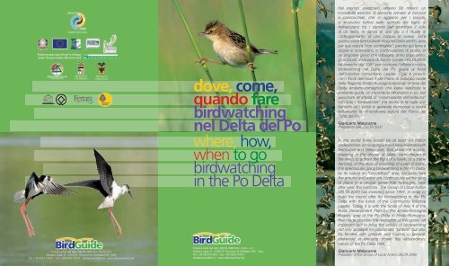
dove,come, quandofare birdwatching nel Delta del Po ... - Delta 2000
dove,come, quandofare birdwatching nel Delta del Po ... - Delta 2000
dove,come, quandofare birdwatching nel Delta del Po ... - Delta 2000

Create successful ePaper yourself
Turn your PDF publications into a flip-book with our unique Google optimized e-Paper software.
Fondo europeo agricolo per lo svilupporurale: l’Europa investe <strong>nel</strong>le zone ruraliPROVINCIADI RAVENNACollana edita dal GAL DELTA <strong>2000</strong> Soc. Cons. a r.l.Strada Luigia, 8 - 44020 S. Giovanni di Ostellato (FE) - ItalyTel + 39 0533 57693 - Fax +39 0533 57674 - <strong>del</strong>taduemila@tin.it - www.<strong>del</strong>taduemila.net<strong>dove</strong>, <strong>come</strong>,quando fare<strong>birdwatching</strong><strong>nel</strong> <strong>Delta</strong> <strong>del</strong> <strong>Po</strong>where, how,when to go<strong>birdwatching</strong>in the <strong>Po</strong> <strong>Delta</strong>Collana edita dal GAL DELTA <strong>2000</strong> Soc. Cons. a r.l.Strada Luigia, 8 - 44020 S. Giovanni di Ostellato (FE) - ItalyTel + 39 0533 57693 - Fax +39 0533 57674<strong>del</strong>taduemila@tin.it - www.<strong>del</strong>taduemila.netNel mondo sarebbero almeno 80 milioni: unincredibile esercito di persone armate di binocolie cannocchiali, che si aggirano per i boschi,si muovono furtive <strong>nel</strong>le sponde dei laghi, simimetizzano tra i canneti per ammirare il volodi un falco, la danza di una gru o il rituale dicorteggiamento di una coppia di svassi. Ed’èspettacolare fare <strong>birdwatching</strong> <strong>nel</strong> <strong>Delta</strong> <strong>del</strong> <strong>Po</strong>, areaper sua natura “non confinabile”, perché qui terra eacque si scambiano in continuazione di posto, inun singolare gioco che ridisegna, anno dopo anno,gli orizzonti. Il Gruppo di Azione Locale DELTA <strong>2000</strong>ha investito dal 1997 per costruire l’offerta turistica<strong>birdwatching</strong> <strong>nel</strong> <strong>Delta</strong> <strong>del</strong> <strong>Po</strong> grazie ai fondi<strong>del</strong>l’Iniziativa comunitaria Leader. Oggi è propriocon i fondi <strong>del</strong>l’Asse 4 <strong>del</strong> Piano di Sviluppo rurale<strong>del</strong>la Regione Emilia-Romagna destinati all’area <strong>del</strong><strong>Delta</strong> emiliano-romagnolo che viene realizzata lapresente guida, un importante strumento in più peravvicinare all’attività di “osservazione <strong>del</strong>l’avifauna”non solo i “birdwatcher” ma anche le famiglie conbambini ed i turisti in generale interessati a viverelentamente la straordinaria natura <strong>del</strong> Parco <strong>del</strong><strong>Delta</strong> <strong>del</strong> <strong>Po</strong>.Giancarlo MalacarnePresidente GAL DELTA <strong>2000</strong>In the world there would be at least 80 millionbirdwatchers: an amazing army of people armed withbinoculars and telescopes, that prowl the woods,sneaking in the shores of lakes, camouflaged inthe reeds to admire the flight of a hawk, or a cranedancing, or the ritual of courtship of a pair of loons.It is spectacular going <strong>birdwatching</strong> in the <strong>Po</strong> <strong>Delta</strong>,by its nature an “unconfined” area, because herethe ground and water are continuously exchangingof place in a unique game that redesigns, yearafter year, the horizons. The Group of Local ActionDELTA <strong>2000</strong> has invested, since 1997, in order tobuild the tourist offer for <strong>birdwatching</strong> in the <strong>Po</strong><strong>Delta</strong> with the funds of the Community InitiativeLeader. Today, it is with the funds of Axis 4 of theRural Development Plan for the Emilia-RomagnaRegion, area of the <strong>Po</strong> <strong>Delta</strong> in Emilia-Romagna,that made possible the realization of this guide, animportant tool to bring the activity of <strong>birdwatching</strong>not only possible for passionate “birders” but alsofor families with children and tourists in general,interested in enjoying slowly the extraordinarynature of the <strong>Po</strong> <strong>Delta</strong> Park.Giancarlo MalacarnePresident of the Group of Local Action DELTA <strong>2000</strong>
FERRARAFERRARAFERRARASS16ImolaCopparoSS610A13dir<strong>Po</strong>rtomaggiore1Valli diArgenta23OstellatoArgentaLugoSP68FusignanoLegenda / Legend4Centro Visita <strong>del</strong> ParcoPark Visitor CentreParco <strong>Delta</strong> <strong>del</strong> <strong>Po</strong>Emilia-RomagnaThe boundariesof the Emilia-Romagna<strong>Po</strong> <strong>Delta</strong> Nature ReserveStrade principalihighways16SS16AlfonsineBagnacavallo00A14dirAdriaSP685SP60SP54Codigoro15191112SS309ComacchioUfficio informazionie Accoglienza Turisticainformation OfficeSiti BirdwatchingBirdwatching sites17VeneziaMesola<strong>Po</strong>mposa13SS309ValleBertuzziE55V a l l i d iC o m a c c h i oS. Alberto20Ufficio informazioni TuristicheTourist Information OfficeSS309E55SS166RAVENNASS3bisE45RomaGoroSaccadi GoroLido di VolanoLido <strong>del</strong>le NazioniLido di <strong>Po</strong>mposaLido degli Scacchi<strong>Po</strong>rto GaribaldiLido degli EstensiLido di SpinaPialassa<strong>del</strong>laBaionaS. Apollinarein Classe221079Casal BorsettiMarina Romea<strong>Po</strong>rto Corsini238Marina di RavennaPunta MarinaOrtazzoe OrtazzinoSS16Gorino1418Lido AdrianoM a r e A d r i a t i c oLido di DanteSaline di CerviaLido di ClasseLido di SavioRimini21Milano MarittimaCerviaIl Parco <strong>del</strong> <strong>Delta</strong> <strong>del</strong> <strong>Po</strong> <strong>del</strong>l’Emilia-Romagna,riconosciuto <strong>come</strong> uno dei parchi più importantid’Europa, si estende per 54.000 ettari distribuitisu nove comuni <strong>nel</strong>le province di Ferrara eRavenna.È caratterizzato da una grande varietà di ambientiche vanno dai residui dunosi, lungo alcuni tratti<strong>del</strong> litorale, alla verde distesa <strong>del</strong> Bosco <strong>del</strong>laMesola; dai suggestivi percorsi naturalistici lungoi suoi fiumi alle antiche pinete <strong>del</strong> ravennate; dallesterminate distese di acqua salmastra <strong>del</strong>le vallidi Comacchio e <strong>del</strong>la Sacca di Goro alle valli diacqua dolce di Argenta e di Ostellato, zone <strong>dove</strong>trovano cibo e riparo numerose specie di uccelli.Per facilitare la conoscenza e stimolare la curiositàdi quanti vorranno provare nuove emozionientrando <strong>nel</strong>la dimensione <strong>del</strong>le tante specie diuccelli che stazionano <strong>nel</strong>le aree <strong>del</strong> parco o chevi transitano seguendo le loro rotte migratorie, èstata realizzata questa guida <strong>del</strong> <strong>birdwatching</strong>,uno strumento semplice, di facile comprensionee consultazione costruita con rigore scientifico egrande precisione.L’osservazione degli uccelli costituisce un modoefficace per entrare a diretto contatto con lanatura e il Parco <strong>del</strong> <strong>Delta</strong> <strong>del</strong> <strong>Po</strong> costituisceun’occasione da non perdere per assaporar<strong>nel</strong>entamente odori, colori, saperi e sapori, per starebene senza disturbare e senza essere disturbati.Massimo MedriPresidente Parco <strong>del</strong> <strong>Delta</strong> <strong>del</strong> <strong>Po</strong> Emilia-RomagnaThe <strong>Po</strong> <strong>Delta</strong> Regional Park of Emilia-Romagnais one of the most important nature parks ofEurope, covers an area of 54.000 hectares andnine municipalities in the provinces of Ferraraand Ravenna.This land is rich in different natural environments:sand dunes along the coast, the forest ofMesola, charming paths along the rivers, ancientpine woods close to Ravenna, the wide brackishwater expanses of the “valli di Comacchio” andof the “Sacca di Goro”, the fresh water wetlandsof Argenta and Ostellato. In these areas a lot ofbirds shelter and find nourishment.This guide has the purpose to enable our gueststo follow, with care and curiosity, the nesting,passing, and habits of all species of birds - bothmigratory and resident - which inhabit the area.The guidebook is very practical and easy to use,detailed and scientifically exact.Birdwatching in the <strong>Po</strong> <strong>Delta</strong> is an extraordinaryway to get into direct contact with nature,discover its secrets, appreciate colors, scents,ways of life, loose trace of every day hectic time.Massimo MedriPresident <strong>Po</strong> <strong>Delta</strong> Regional Park of Emilia-RomagnaInformazioni turisticheTourist Informationwww.parco<strong>del</strong>tapo.itwww.ferraraterraeacqua.itwww.ravennaintorno.provincia.ra.it
Info | InfoInformazioni / Information..................................................pag 2Geomorfologia / Geomorphology.................................pag 4Ambienti / Environments....................................................pag 6Dove | WhereOASI VAL CAMPOTTO.............................................................pag 14OASI VALLE SANTA...................................................................pag 16OASI DI BANDO..........................................................................pag 18VALLETTE DI OSTELLATO ....................................................pag 20RISERVA NATURALE ORIENTATADUNE FOSSILI DI MASSENZATICA....................................pag 22RISERVA NATURALE BOSCO DELLA MESOLA...........pag 24BOSCO DI SANTA GIUSTINA ..............................................pag 26SACCA DI GORO ......................................................................pag 28VALLE DINDONA.........................................................................pag 30FOCE PO DI VOLANO..............................................................pag 32OASI DI CANNEVIÈ – PORTICINO......................................pag 34VALLI BERTUZZI..........................................................................pag 36VALLI E SALINE DI COMACCHIO........................................pag 38VENE DI BELLOCCHIO E ANCONA...................................pag 40OASI VALLE ZAVELEA..............................................................pag 42BONIFICA DEL MEZZANO......................................................pag 44BOSCOFORTE.............................................................................pag 46VALLE MANDRIOLE...................................................................pag 48PUNTE ALBERETE.....................................................................pag 50PINETA SAN VITALE E PIALASSA DELLA BAIONA .......pag 52ORTAZZO, ORTAZZINO E FOCE DEL BEVANO...............pag 54PINETA DI CLASSE....................................................................pag 56SALINA DI CERVIA.....................................................................pag 58Come | HowITINERARIO [A] Nelle terre degli Estensiitinerary [A] In the land of the Estensi ..........................pag 6012345678910111213141516171819202122235+ 6 + 8 + 9Summary | SommarioITINERARIO [B] Antiche pietreitinerary [B] Ancient stones .................................................pag 6211 + 10 + 12ITINERARIO [C] Argini, ponti e canaliitinerary [C] Riverbanks, bridges and canals ..........pag 64ITINERARIO [D] Paesaggi di bonificaitinerary [D] Reclaimed Land ..............................................pag 6613 + 15 + 17 + 144+ 3 + 1 + 2 + 16ITINERARIO [E] Pinete e boschi allagatiitinerary [E] Pinewoods and flooded forests ...........pag 68ITINERARIO [F] Mosaici e laghi salatiitinerary [F] Mosaics and salt lakes ...............................pag 70Quando | WhenLe osservi <strong>nel</strong> <strong>Delta</strong>You spot them in the <strong>Delta</strong>...............................................pag 7220 + 19 + 1822 + 21 + 23Elenco <strong>del</strong>le specieList of the species...................................................................pag 731
Info00Memorizza il numero diriferimento <strong>del</strong> sito,consulta l’areacorrispondente;110011+ 10 + 12abbina i vari sitiper costruire il tuoitinerario ideale;-00--00- SB par. M Windividua le specieche si possono avvistaree il periodo in cui sonopresenti.SimboliSymbolsa piedi / walkingin barca / by boatin pulmino / by busRemember the referencenumber of the site, seethe corresponding area;+ 10 + 12combine the varioussites to build your idealitinerary;SB par. M Widentifie the species thatcan be seen and theperiod in when they are“Dove, <strong>come</strong>, quando”,utilizzo <strong>del</strong>la guida.Con questa guida vogliamo fornire uno strumento utileper dare una risposta concreta a quanti chiedono qualesia il periodo migliore per fare <strong>birdwatching</strong> <strong>nel</strong> <strong>Delta</strong> <strong>del</strong><strong>Po</strong>, <strong>dove</strong> farlo e <strong>come</strong>.Nella guida sono presenti 23 schede chedescrivono i siti idonei per praticare il <strong>birdwatching</strong>, eindicano se sono attrezzati o no, <strong>come</strong> ci si arriva, qualisono le ore migliori per visitarli e soprattutto le speciespot.In auto, in barca, a piedi, in comodi capannio in torrette praticando magari il biowatching, cioèl’osservazione di qualsiasi forma di vita animale e vegetalepresente <strong>nel</strong>l’area. Nella guida sono presenti 6 schedededicate ad “Itinerari consigliati”, ideati per agevolarela visita ed ottimizzare il tempo a disposizione, senzatrascurare i luoghi di interesse storico e culturale.Sfidare il freddo invernale per osservarele anatre, preferire i mesi caldi per i nidificanti oppurel’autunno, periodo dei transiti migratori.Per facilitare questa scelta <strong>nel</strong>la guida è presente unatabella che indica la stagionalità <strong>del</strong>le specie e il luogo<strong>dove</strong> osservarle.Parcheggio Centro Visita InformazioniParkingVisitor Centre InformationMuseo omonumentoMuseum ormonumentEscursioninauticheBoatexcursions“Where, how, when”,to use this guide.Escursioniin pulminoelettricoExcursionswith eletricbusArea pic-nicPicnic areaTorretta Area dio capanno avvistamentoToweror shedSighting areaWith this guide we aim to provide a useful tool forthose who want to know where, how and when to go<strong>birdwatching</strong> in the <strong>Po</strong> <strong>Delta</strong>.Where? The guide contains 23 descriptive sheetswhich describe suitable sites for <strong>birdwatching</strong>, whetherthere are facilities or not, how to get there, when is thebest time to visit them and, of course, the rare species.How? By car, by boat, on foot, hidden in sheds,or from the top of towers, maybe practicing also“biowatching”: observing every interesting animal andvegetable form of life in the area.In the guide you can find six recommended itineraries,expressly tailor made for visitors with the aim of showingthe best, but also leaving plenty of time for culture.When? You can challenge the winter cold and watchthe wild ducks, or enjoy the warm months when thebirds nest, or the autumn migration period. To facilitatethis choice you can find a table showing the seasonalityof the species and the places from which they can mostConsigli praticiPraticare il <strong>birdwatching</strong> è soprattutto avere rispetto, oltre cheper gli uccelli, per la natura e per tutte le sue forme di vita. Capitaa volte che, presi da entusiasmo, per voler portare a casa unoscatto fotografico particolare, inconsapevolmente si creino seriproblemi o danni all’avifauna. Ciò accade ad esempio quandogli uccelli sono <strong>nel</strong> periodo riproduttivo, il disturbo creato dallapresenza <strong>del</strong>l’uomo, peggio ancora se prolungata oppurela vicinanza al nido, può indurre gli uccelli ad abbandonaretemporaneamente il sito di riproduzione, sottoponendo uovao pulcini a rischio di predazione da parte di altri uccelli oanimali. Fatale può essere anche l’eccessivo riscaldamentosolare, causato dall’assenza dei genitori e, in certi casi, il nidopuò essere abbandonato definitivamente. Un altro momentoa rischio elevato è quando gli uccelli si alimentano, anchein questo caso la nostra presenza può provocare disturboimpedendo agli uccelli un regolare approvvigionamento <strong>del</strong>cibo, con conseguente indebolimento fisico. Le visite ad oasio ad aree protette, devono sempre avvenire in punta di piedi,rumori molesti o anche la semplice vista <strong>del</strong>le nostre sagomespaventano gli uccelli. Consigliamo unabbigliamento adeguato e mimetico, portatecon voi, <strong>nel</strong>le stagioni calde, repellente euna pomata per le punture di insetti, seguitesempre i sentieri segnalati, utilizzate gli appositispazi e attrezzature per il <strong>birdwatching</strong> <strong>come</strong>capanni e torrette. Se praticate l’attività dasoli fate sapere a qualcuno <strong>dove</strong> vi recate peressere sempre reperibili.Practical adviceBoth birds and nature must be respected atall times when doing <strong>birdwatching</strong>. Sometimesone can do serious damages to birdlife, evenif only just trying to photograph from a closedistance. During the breeding period, stayingtoo close to the nest for too long, can makethe birds temporarily leave the breeding site or,in some cases, the nest may be abandonedpermanently. The eggs or chicks are thus leftto the mercy of predators. Also the excessivesolar heating, caused by the absence of the parents, can befatal.During feeding times, our presence can disturb the regularsupply of food, resulting in a physical weakness of the chicks.The visits to oases or protected areas, should always be ontiptoe, as noise or the mere sight of our shapes may scare thebirds.Wear suitable clothing and camouflage. During the warmseason, carry with you insect repellent and and some medicinefor the insect bites. Always use the trails and facilities such ashides and <strong>birdwatching</strong> towers. If you go on your own, makesure to let someone know where you are going.present.2 easily be observed.3Info
Geomorphology | GeomorfologiaAvanzamento<strong>del</strong>la linea di costa:[A] Età <strong>del</strong> Bronzo[B] Età Romana[C] 1000 d.C.[D] 1600 d.C.Evoluzione <strong>del</strong> <strong>Delta</strong> <strong>del</strong> <strong>Po</strong>Dal punto di vista naturalistico il territorio <strong>del</strong> <strong>Delta</strong> rappresentail più vasto e importante complesso di zone umide esistenti inItalia e offre ospitalità a una straordinaria biodiversità. Altrettantointeressante è la geomorfologia di questo territorio: una misceladi eventi naturali e interventi umani.L’attore principale <strong>del</strong>la storia è il fiume <strong>Po</strong> con il suo continuoapporto di detriti naturali (sabbia, limo e argilla) che nei secolihanno dato origine a nuovi territori, paludi, lagune, spiagge,rubando pian piano spazio al mare. Al suo fianco l’uomo apartire dagli Etruschi <strong>nel</strong>l’antichità, poi i Romani, i Benedettini,gli Estensi, i Veneziani di volta in volta lo hanno sfruttato,domato e a volte subito con le sue alluvioni. Risale all’epocaEtrusca (VI e V sec. a.C.) il <strong>Po</strong> di Spina, ora scomparso, cheoriginò le paludi e le valli <strong>del</strong> comacchiese <strong>dove</strong> gli Etruschifondarono un porto (Spina) per scambiare merci con i Greciche qui giungevano via mare. Dal <strong>Po</strong> di Spina si staccavano poialtri due rami: l’Olana (<strong>Po</strong> di Volano) e il Gaurus (da cui deriva ilnome <strong>del</strong> <strong>Po</strong> di Goro).In epoca romana l’apparato <strong>del</strong>tizio si sviluppava a sud diComacchio ed è tra il VI – VII sec. d.C. che si ha la totaleestinzione <strong>del</strong> <strong>Po</strong> di Spina, aumentarono le zone paludoseintorno a Comacchio e si rafforzarono il <strong>Po</strong> di Volano a nord ed il<strong>Po</strong> di Primaro a sud. Saranno i monaci benedettini di <strong>Po</strong>mposaintorno al X sec.d.C. ad intraprendere le prime consistentiopere di bonifica e saranno poi gli Estensi nei secoli successivia completare l’opera di bonifica dei territori <strong>del</strong> Ducato diFerrara. In questi secoli due sono le date da ricordare, la primaè il 1152 quando con la rotta di Ficarolo, <strong>nel</strong> Veneto, il corso<strong>del</strong> fiume si diresse verso Nord <strong>dove</strong> lentamente cominciòad estendersi. La seconda è il 1600 quando la SerenissimaRepubblica di Venezia, temendo che i detriti interrassero la sualaguna iniziò i lavori per il taglio di <strong>Po</strong>rto Viro, un’imponenteopera di ingegneria idraulica. Dopo quattro anni di lavoro escontri e battaglie con lo Stato <strong>Po</strong>ntificio, il 16 settembre 1604il <strong>Po</strong> <strong>del</strong>le Fornaci, attraverso un canale, venne deviato versoSud <strong>nel</strong>la Sacca di Goro, determinando la attuale formazione<strong>del</strong> <strong>Delta</strong> moderno.Infine le grandi bonifiche attuate tra gli anni ‘30 e ‘70 <strong>del</strong>secolo scorso hanno contribuito a mo<strong>del</strong>lare ulteriormente ilpaesaggio.Geomorphology | GeomorfologiaA B C DAdvancementof the coastline:[A] Bronze Age[B] Roman Age[C] 1000 AD[D] 1600 ADEvolution of the <strong>Po</strong> <strong>Delta</strong>From the naturalistic point of view the territory of the <strong>Delta</strong>represents one of the largest and most important complex ofwetlands of Italy and it hosts an extraordinary biodiversity. Alsofrom the geological point of view the area is very interesting: it isa mixture of natural events and human intervention.The main actor of the story is the <strong>Po</strong> river, with its continuoussupply of natural debris (sand, silt and clay) which create, overthe centuries, new lands, marshes, lagoons and beaches,slowly stealing the sea space. Man has for many centuries beenworking at the side of this Giant Protagonist: first the ancientEtruscans, then the Romans, the Benedictines, the Este, andfinally Venetians: all suffering for the frequent floods and themany other dangers and difficulties involved. The <strong>Po</strong> di Spina,now extinct, dates back to Etruscan age (VI and V century BC);it originated the marshes and valleys of Comacchio where theEtruscans founded a port (Spina) to exchange goods with theGreeks who came here from the sea. <strong>Po</strong> di Spina branchedoff in two other rivers: the Olana (<strong>Po</strong> di Volano) and the Gaurus(<strong>Po</strong> di Goro). In Roman times the <strong>del</strong>taic system developpedAD <strong>Po</strong> di Spina totally disappeared. The wetlands aroundComacchio became more widespread thus increasing theimportance of <strong>Po</strong> di Volano to the north and <strong>Po</strong> di Primaro tothe south. The Benedictine monks were the first to undertakea substantial land reclamation in the area of <strong>Po</strong>mposa, aroundthe 10th century AD and then the Este, in later centuries,completed the reclamation of the territories of the Duchy ofFerrara. In these centuries there are two important dates toremember, the first one is the 1152 and is called “La rottadi Ficarolo”, in the Veneto region: the river headed northwardswhere it slowly began to spread. The second one is the 1600when the Venetian Republic, fearing that the debris would fill inthe famous lagoon, began working on the “Taglio di <strong>Po</strong>rto Viro”,an impressive work of hydraulic engineering. After four years ofwork and fights and battles with the Papal States, the 16th ofSeptember 1604 the <strong>Po</strong> <strong>del</strong>le Fornaci was diverted through achan<strong>nel</strong> to the south as far as the Sacca di Goro, determiningthe actual formation of the modern <strong>del</strong>ta. The landscape yousee today is the result of the further reclamation exploited from4 southern from Comacchio and between the VI - VII centurythe thirties to the seventies of the last century.5
Environments | AmbientiFoto in basso:Valli di Comacchio;a destra,dall’alto in basso:Martin pescatoreAlcedo atthis,BeccapesciSterna sandvicensis.Le pinete si sviluppano lungo la costa, <strong>dove</strong> troviamo quellepiù giovani risalenti alle piantumazioni degli anni ’50 <strong>del</strong> secoloscorso e le pinete storiche di epoca romana (Pineta di Cervia,di Classe e di San Vitale).Le pinete sono composte per lo più da Pino domestico dallacaratteristica forma ad ombrello e in alcuni casi anche da Pinomarittimo.Nelle più antiche è presente un’abbondante vegetazionemediterranea con una tendenza verso l’evoluzione a lecceta,l’ambiente tipico prima <strong>del</strong>l’intervento umano.In tutti i boschi e le pinete citati, in primavera, è possibile vederele splendide fioriture di varie specie di orchidee selvatiche e <strong>nel</strong>laforesta allagata di Punte Alberete anche il raro Campa<strong>nel</strong>lino.Sacche e pialassePer sacche e pialasse si intendono dei bacini costieri separatidal mare da cordoni litoranei (localmente chiamati “scanni”)caratterizzati da acque salmastre e soggetti a maree, che sipossono identificare più facilmente <strong>come</strong> lagune.Con il termine sacca, usato solo <strong>nel</strong> <strong>Delta</strong> <strong>del</strong> <strong>Po</strong>, si intende unalaguna abbracciata da due fiumi, (<strong>come</strong> ad esempio la Sacca diGoro con il <strong>Po</strong> di Goro a nord e il <strong>Po</strong> di Volano a sud).Il termine pialassa, invece, deriva dalla lingua parlata “pia” pigliae “lassa” lascia e indica sempre una laguna <strong>dove</strong> è un unicocanale a permettere l’entrata e l’uscita <strong>del</strong>l’acqua marina inbase alle maree. Anche le pialasse in genere sono situate neipressi <strong>del</strong>la foce di un fiume.Nelle sacche e <strong>nel</strong>le pialasse, così <strong>come</strong> <strong>nel</strong>le lagune laprofondità <strong>del</strong>l’acqua varia da pochi centimetri fino a circa duemetri, questo fa sì che in ogni periodo <strong>del</strong>l’anno possano esserepopolate da una ricca varietà di avifauna acquatica.Qui gli uccelli, in base alla propria specifica dieta, possonotrovare diverse specie di alghe, microorganismi, invertebrati,molluschi e pesci. Particolare anche la flora di queste zone: neidossi che emergono dalle acque salmastre, detti barene, cresceuna vegetazione particolare che ha sviluppato adattamenti agliambienti salati (piante alofile). Molto belle le fioriture estive chetingono di lilla le barene col Limonio e l’Astro marino, in autunnoinvece è la Salicornia a tingere di rosso i dossi e i bordi.Valli da pescaIl sistema vallivo costiero è molto diffuso in alto Adriatico esi estende in maniera praticamente continuativa a partire daGrado, in provincia di Gorizia <strong>nel</strong> Friuli Venezia Giulia, perestendersi poi <strong>nel</strong> Veneto <strong>nel</strong>le provincie di Venezia, Padova(una piccola porzione) e Rovigo e terminare appunto inEmilia Romagna tra le provincie di Ferrara e Ravenna.Le valli sono bacini chiusi e ben <strong>del</strong>imitati, il livello idricoè regolato dall’uomo con l’immissione di acqua dolce esalata al fine di ricreare l’ambiente ideale per l’allevamento<strong>del</strong> pesce, principalmente Spigole, Orate e Anguille.Già in epoca romana si costruivano argini per racchiudereEnvironments | Ambienti“take and give back” referring to the tide effect in a lagoon with a singlechan<strong>nel</strong> allowing the seawater to enter and exit according to the tides.The “pialasse” are usually located near the mouth of a river.In “sacche” and “pialasse” as well as in the lagoons the water depthvaries from a few centimeters to two meters ant thanks to this they arealways populated by a rich variety of avifauna.Here the birds can find different species of algae, microorganisms,invertebrates, molluscs and fishes. The flora is also particular in theseareas: on the sandbanks that emerge from the brackish water, grow aparticular vegetation that has developed specific adaptations to thesesalty environments (salt-tolerant plants). In summertime the blooming ofLimonium and the Sea aster paint the sandbanks lilac, while in autumnthe Salicornia dyes the bumps red.Picture above: San Vitale). The pine forests are composed mostly of Pine with aValli di Comacchio;right, from top to bottom: characteristic umbrella shape and in some cases of Maritime Pine.Kingfisher In the oldest ones there is a rich Mediterranean vegetation and theAlcedo atthis, trend is the evolution into a Holm oak forest, which was the typicalSandwich Tern environment before the human interventions.Sterna sandvicensisFish farmsIn all the mentioned forests and pinewoods it is possible to see inThe valley system is widespread along the northern Adriatic coastlinespringtime various species of wild Orchids. In the flooded forest ofand stretches from Grado, in the province of Gorizia in Friuli VeneziaPunte Alberete it is also possible to see the rare Spring Snowflake.Giulia, to Veneto, in the provinces of Venice, Padua (a small portion)Salt and brackish lagoonsand Rovigo, thus ending in Emilia Romagna in the provinces ofFerrara and Ravenna.With the local names “Sacche” and “Pialasse” we mean coastal basinsThe valleys are well defined and closed basins, the water level isthat are separated from the sea by sandbanks (locally called “scanni”)regulated by man with the input of fresh and salt water in order to createcharacterized by brackish water and submitted to the influence of thethe ideal environment for raising fish, mostly Bass, Breams and Eels.tides, which can be identified more easily as lagoons.Already in Roman times dikes were built to enclose portions ofThe word “Sacche”, only used in the <strong>Po</strong> <strong>Delta</strong>, means a lagoonlagoons in order to exploit the migrations made by someenclosed by two rivers (such as the “Sacca di Goro” with the <strong>Po</strong> dispecies of fish: in springtime they move from the sea toGoro river north and the <strong>Po</strong> di Volano river south).the lagoons while in autumn they reverse the trip because it is at that8The word “Pialassa”, however, <strong>come</strong>s from the local dialect and meansparticular period that fish, at this stage fully adult, leaves in order to9
Environments | AmbientiFoto in basso:Salina di Cervia;a destra,dall’alto in basso:SpatolaPlatalea leucorodia,Fenicottero rosaPhoenicopterus roseus.porzioni di laguna allo scopo di sfruttare le migrazioni compiuteda alcune specie ittiche: queste, in primavera, dal mare siaddentrano <strong>nel</strong>le lagune e, in autunno, fanno il viaggio inverso.È in questo momento infatti che il pesce, cresciuto ed ingrassato,esce dalla valle e torna in mare per riprodursi.Il pesce viene richiamato dall’acqua salata <strong>del</strong> mare che l’uomofa entrare attraverso specifici canali, questi conducono il pesceallo sbarramento chiamato “lavoriero” <strong>dove</strong> rimane intrappolatoe facilmente pescato.Le valli, di stagione in stagione, si popolano di specie diversedi uccelli acquatici che transitano, nidificano o vi trascorronoun periodo.Conosciute in tutto il mondo sono le Valli di Comacchio,principalmente per la qualità e la quantità di Anguille che quivenivano pescate.SalineTra le aree di maggior interesse naturalistico e ambientaleinserite <strong>nel</strong> Parco Regionale <strong>del</strong> <strong>Delta</strong> <strong>del</strong> <strong>Po</strong> troviamo dueimportanti realtà: la Salina di Comacchio e la Salina di Cervia.Il sale è strettamente legato alla storia di Comacchio, lo ricordail famoso Capitolare <strong>del</strong> Re longobardo Liutprando, risalenteal 715, che autorizzava i mercanti comacchiesi a risalire lapianura <strong>del</strong> <strong>Po</strong> per vendere il loro sale ed altre merci. Anche leorigini <strong>del</strong>le Salina di Cervia si perdono <strong>nel</strong>l’antichità: qualcunole fa risalire all’epoca etrusca, altri alla colonizzazione greca,ricordando soprattutto il vecchio nomedi Cervia, “Ficocle”, di origine greca.La Salina di Cervia, grazie alla tenaciadegli ultimi salinari, continua ad essereproduttiva e mantiene intatta la tradizionetramandata di padre in figlio da quasi 2.000 anni.Diverso invece il destino <strong>del</strong>la Salina di Comacchio,che <strong>nel</strong> 1985 viene chiusa definitivamente daiMonopoli di Stato perchè ritenuta poco produttivarispetto ad altre saline di maggiori dimensioni.Attualmente la Salina di Comacchio produce unapiccola quantità di sale a scopo didattico ed è unCentro Visite <strong>del</strong> Parco <strong>del</strong> <strong>Delta</strong> <strong>del</strong> <strong>Po</strong>, così <strong>come</strong>la Salina di Cervia.In questo contesto si inseriscono varie specie ornitiche, chesfruttando i differenti spessori dei bacini d’acqua, trovanol’habitat idoneo alle proprie esigenze.Un capitolo a parte merita lo splendido Fenicottero rosa, che<strong>nel</strong>la Salina di Comacchio ha fatto la sua comparsa alla finedegli anni ’90; negli anni successivi numerose coppie hannonidificato, aumentando progressivamente il numero degliindividui, tanto che <strong>nel</strong> 2011 sono state stimate circa 1000coppie nidificanti.Attualmente la salina di Comacchio rappresenta uno dei sitipiù importanti <strong>nel</strong>l’area mediterranea per la nidificazione <strong>del</strong>laspecie.Environments | Ambienti10Picture above:Salt-pans di Cervia;right, from top to bottom:SpoonbillPlatalea leucorodia,FlamingoPhoenicopterus roseus.reproduce in the sea.The fish is attracted by the fresh water that flows into the valley thanksto specific chan<strong>nel</strong>s, and swims in that direction in order to reach the“lavoriero”, a barrage where it has to linger and thus is easily caught.The valleys, from season to season, are populated by different speciesthat pass, nest or spend some time there.Well known throughout the world are the Valli di Comacchio, mainly forthe quality and quantity of Eels that are caught here.Salt-pansAmong the areas of the <strong>Po</strong> <strong>Delta</strong> Regional Park of greatest natural andenvironmental interest there are two important realities: the Salt-pans ofComacchio and Cervia.The salt is closely linked to the history of Comacchio as the famous“capitolare” of the Lombard King Liutprand said. This document datesback to 715 and has allowed merchants to sell their salt and othergoods from Comacchio up to the <strong>Po</strong> Valley. Also the origins of the Saltpansof Cervia are very old: maybe they go back to Etruscan times orto the Greek colonization, as is sujested by the old name of Cervia:“Ficocle” of Greek origin. Thanks to the tenacity of the last salt workers,the production of Cervia still continues and the traditions, handed downfrom father to son for two thousand years, remain intact.The fate of the Salt-pans of Comacchio was different: it waspermanently closed by the State Monopoly in 1985 because it was lessproductive compared to other larger salt-pans. Currently the Salt-pansof Comacchio produce a small amount of salt for educational purposesand it is, together with the Salt-pans of Cervia, one of the main VisitorCenetres in the <strong>Po</strong> <strong>Delta</strong> Nature Reserve.Several bird species find their ideal habitat in this environment alsodue to the different depth and salinity of water in the various areas ofthe Salt-pans. A special presence in this area is represented by thebeautiful flamingo, which appeared in the Salt-pans of Comacchio inthe late ‘90s, then in the following years many couples nestedand the number of individuals progressively increased, sothat in 2011 were estimated about 1000 breeding pairs.Currently, the Salt-pans of Comacchio is one of the mostimportant sites in the Mediterranean area as a breedingsite for this species.Rural environmentand reclamationAs mentioned above, (read chapter concerninggeomorphology), land reclamation has had avery important role in the <strong>Po</strong> <strong>Delta</strong> since ancienttimes. Nowadays waterpumps, besides oftenrepresenting an interesting architectural trate ofthe past, still carry out the important purpose ofkeeping “land above waters.”
Environments | AmbientiFoto in basso:Bonifica <strong>del</strong> Mezzano;a destra,dall’alto in basso:SaltimpaloSaxicola torquata,CodirossospazzacaminoPhoenicurus ochruros.Ambiente agrario e bonificaCome già accennato <strong>nel</strong> capitolo dedicato alla geomorfologia<strong>del</strong> territorio, la bonifica <strong>nel</strong> <strong>Delta</strong> <strong>del</strong> <strong>Po</strong> ha avuto fin dai tempipiù antichi un ruolo primario.Tutt’ora i consorzi di bonifica che vioperano svolgono un’azione fondamentale <strong>nel</strong> mantenimento<strong>del</strong>le opere svolte in passato.Grazie alla fitta rete di canali e fossati e all’azione <strong>del</strong>le pompemeccaniche (idrovore), si mantengono asciutti i terreni e sipossono irrigare al momento <strong>del</strong> bisogno. Azioni indispensabilise consideriamo che gran parte <strong>del</strong> territorio <strong>del</strong>tizio si trovasotto il livello <strong>del</strong> mare.Proprio la presenza di canali e fossati in certe zone e la notevoleestensione di aree agricole, unite alla scarsa presenza diinsediamenti umani, costituiscono ottimi siti per lo svernamento,la nidificazione o l’alimentazione di diverse specie ornitiche.Zone agricole particolarmente interessanti sono la bonifica<strong>del</strong>la Valle <strong>del</strong> Mezzano a Ovest <strong>del</strong>le Valli di Comacchio, conun’estensione di circa 18.000 ettari <strong>nel</strong>la quale dagli anni ‘70è bandita la caccia; qui tra l’inverno e la primavera si possonoosservare oche, gru, cicogne, rapaci diurni e notturni ed alcunespecie di limicoli <strong>come</strong> la Pavoncella o il Piviere dorato.Altre zone agricole interessanti sono le risaie tra Goro e GorinoFerrarese e in maniera più estesa tra Mezzogoro e Jolanda diSavoia.Queste aree sono utilizzate per l’alimentazione dagli uccelli<strong>nel</strong> periodo successivo alla semina <strong>del</strong> riso e <strong>nel</strong> momento<strong>del</strong>l’allagamento dei campi, per cui si possono osservareanatidi <strong>come</strong> il Germano reale e la Volpoca, vari tipi di aironi (dasegnalare l’Airone rosso) o altre specie <strong>come</strong> il raro Ibis sacro,tra i nidificanti infine la Folaga e il Cavaliere d’Italia.Zone umide interne e ripristiniPer zone umide si intendono le paludi e gli acquitrini, le torbeoppure i bacini, naturali o artificiali, permanenti o temporanei,con acqua stagnante o corrente, dolce, salmastra o salata, ivicomprese le distese di acqua marina la cui profondità, durantela bassa marea, non supera i sei metri.Oltre alle zone umide già citate precedentemente, un capitolo aparte meritano quelle che abbiamo definito zone umide interne,tutte di origine antropica.Si tratta di casse di espansione, bacini di raccolta d’acqua perscopi irrigui, civili o industriali, ex risaie, aree di svago per glisport acquatici o la pesca amatoriale, tutelate e divenute oasi.Per ripristini intendiamo, invece, zone umide appositamentecreate attraverso l’applicazione di misure agro-ambientali.L’acqua in queste aree è generalmente dolce, la flora èrappresentata da canneti e da alberi ed arbusti tipici <strong>del</strong>lapianura, interessanti le piante acquatiche, quasi sparite in altrezone, <strong>come</strong> la Castagna d’acqua, la Ninfea o il Ranuncolod’acqua; l’avifauna varia in base alle stagioni e spesso sipossono osservare anche uccelli tipicamente legati alle acquesalate o salmastre.Environments | Ambientieasily find their nourishment: it is possible to observe Mallardand Shelduck, various types of herons (including the remarkablePurple Heron) or other rare species such as the African Sacred,while among the breeding species note Coots and BlackwingedStilts.Inland wetlandsWetlands are a mixture of marsh, fen, peatland and water,natural or artificial, permanent or temporary, with water that canbe static or flowing, fresh, brackish or salt, including areas ofPicture above: Thanks to the impressive network of canals and ditches andBonifica <strong>del</strong> Mezzano;marine water the depth of which at low tide does not exceedright, from top to bottom: to the action of mechanical pumps, it is possible to drain orirrigate the land according to the different agricultural purposes.six metres.StonechatSaxicola torquata, One must not forget that a great part of the <strong>Delta</strong> lies below theArtificial wentlands are “casse di espansione” or water basinsBlack Redstart level of the sea.and can be used for irrigation, both for civil or industrialPhoenicurus ochruros.The presence of canals and ditches in some areas and thepurposes, for rice fields, or recreational areas for water sportsconsiderable extension of agricultural land, combined with theand fishing, that in some cases be<strong>come</strong> protected oasis.scarcity of human settlements, are excellent sites for wintering,The artificial wetlands were created thanks to the application ofnesting or feeding of various bird species.agri-environmental devices.A rural area of particular interest is Valle <strong>del</strong> Mezzano, west ofThese sweet water basins are characterized by the presence ofthe Valli di Comacchio, with an area of about 18.000 hectares inreeds, trees and shrubs which grow naturally in the plains andwhich hunting is banned since 1970. Here you can see geese,cranes, storks, birds of prey, and some species of wadershere one can also find other interesting aquatic plants, (almostsuch as Lapwing or Golden Plover in winter and spring. Thedisappeared in other areas) such as the Water Chestnuts,paddyfields between Goro and Gorino Ferrarese and morethe Water Lily and the Buttercup. The bird-species changewi<strong>del</strong>y among Mezzogoro and Jolanda di Savoia are alsoaccording to the season, often it is possible to see typicallyanother very interesting area.salt or brackish water birds.After sowing, and when the rice fields are flooded, birds can12 13
Where | Dove1NavigatorCampotto di Argenta (FE)Via CardinalaN44°34’56” E11°47’54”Museo <strong>del</strong>le ValliCasino di CampottoVia Cardinala,1/c Campotto (FE)Tel. +39 0532 808058info@vallidiargenta.orgAperto dal martedì alla domenica9.30-13.00 e 15.30-18.00OASI VAL CAMPOTTOSIC – ZPS IT4060001Il sito si trova <strong>nel</strong>l’immediata vicinanza <strong>del</strong>l’abitato diArgenta, a Sud <strong>del</strong> fiume Reno. Si raggiunge seguendole coordinate indicate.L’area ha un’estensione di 600 ettari con specchidi acqua dolce ed una superficie boschiva di 100ettari. Fanno parte <strong>del</strong>l’oasi due casse di espansione,Campotto e Bassarone, ed il Bosco <strong>del</strong> Traversante,con la tipica vegetazione igrofila.Val Campotto si caratterizza per la presenza di una<strong>del</strong>le più grandi colonie di Cormorano in Italia. Tra lespecie nidificanti ricordiamo il Mignattino piombato, laSgarza Ciuffetto, il Migliarino di palude, la Salciaiola, ilCannareccione e la Cannaiola.Tra i migratori si registra inoltre la presenza <strong>del</strong> FalcoImpianto idrovoroSaiarinoFerraraPieve diSan GiorgioArgentaMuseoCivicoComacchiopescatore, mentre l’area boschiva ospita diverse speciedi Silvidi, <strong>come</strong> il Canapino, il Rigogolo, il Cuculo, l’Averlacinerina e l’Ortolano.Il sito è inoltre conosciuto per aver ospitato tra gli anni2006 e 2010 esemplari svernanti di Aquila anatraiamaggiore e di Aquila di mare.Per iniziare la visita <strong>del</strong> sito si consiglia di recarsi pressoil Centro Visite Museo <strong>del</strong>le Valli, all’ingresso <strong>del</strong>l’oasi,<strong>dove</strong> è possibile prenotare una visita guidata in quantogli ingressi sono regolamentati.In alternativa è possibile percorrere un sentiero di liberoaccesso esterno all’oasi che parte dalla Pieve di SanGiorgio e arriva fino al Centro Visite.Caratteristiche• <strong>Po</strong>ssibilità di avvistare oltre 40 specie• Punti di osservazione e torrette• Buona agibilità, possibile presenza di fango nei periodi di pioggiaModalità di fruizione• Area accessibile tutto l’anno• Orario consigliato: tutto il giorno• Durata: minimo due ore• Ingresso regolamentato con visite guidate• Percorso con libero accesso dalla Pieve di San Giorgio al Centro visite• Percorso in gran parte accessibile ai disabiliServizi• Centro visite, museo, bookshop e bar• Parcheggio• Area pic-nic• Visite guidate• Noleggio biciclette• Noleggio binocoliDall’alto al basso:BasettinoPanurus biarmicus,Mignattino piombatoChlidonias hybriduse Sgarza ciuffettoArdeola ralloides.Where | DoveOpen from Tuesday to Sunday9.30-13.00 and 15.30-18.001CampottoOasi Val CampottoMuseo <strong>del</strong>le ValliOASI VAL CAMPOTTOSCI – SPA IT4060001RavennaThe site is located very close to the town of Argenta,south of the Reno river and can be reached followingthe coordinates.The site is composed by an area of 600 hectareswith fresh water ponds and of a wood 100 hectarslarge, characterized by two big ponds (“casse diespansione”), Bassarone and Campotto, and finally areforestation area called the Traversante Wood, withthe typical hydrophilous vegetation.Val Campotto is characterized by the presence of oneof the largest colonies of Cormorants in Italy. Amongthe breeding species there are the Whiskered Tern, theSquacco Heron, the Reed Bunting, the Savi’s Warbler,Among migratory birds we must note the Osprey,while the forested area is home to several species ofSilvidae such as the Melodious Warbler, the GoldenOriole, the Cuckoo, the Lesser Grey Shrike and theOrtolan Bunting.The site is also known for having hosted, between theyears 2006 and 2010, wintering specimens of GreaterSpotted Eagle and White-tailed Eagle.To start your visit you should go to the Museo <strong>del</strong>le ValliVisitors Centre, at the entrance of the Oasis, where youcan book a guided tour as the access is regulated.However you can have a walk along a free path outsidethe Oasis which begins at the Parish of St. Giorgio andarrives fast to the entrance of the Visitors Centre.Features• Chance to see over 40 species• Observation points and <strong>birdwatching</strong> towers• Good practicability, possible presence of mud in the rainy periodsFor your visit• Open all year round• Recommended hours: all day• Duration: minimum two hours• Regulated access with guided tours• Path with free access from the Parish of St. Giorgio to the Visitors centre• Path largely accessible to disabledServices• Visitors centre, museum, bookshop and bar• Parking• Picnic area• Guided toursFrom top to bottom:Bearded TitPanurus biarmicus,Whiskered TernChlidonias hybridusand Squacco HeronArdeola ralloides.• Bicycle rental14 the Great Reed Warbler and the Reed Warbler.• Binoculars rental15
Where | Dove2NavigatorCampotto di Argenta (FE)Via CardinalaN44° 34’27” E11°49’00”OASI VALLE SANTASIC – ZPS IT4060001Valle Santa si trova a poca distanza dal Museo <strong>del</strong>leValli <strong>nel</strong> Comune di Argenta.Si tratta di una cassa di espansione <strong>del</strong> torrente Idicedi 250 ettari, con vegetazione emersa a canneto enannuferi. All’esterno <strong>del</strong>la cassa di espansione èpresente un interessante prato umido, utilizzato danumerose specie per l’alimentazione quotidiana.Valle Santa è uno dei migliori siti per il <strong>birdwatching</strong><strong>del</strong>l’area <strong>del</strong> <strong>Delta</strong> <strong>del</strong> <strong>Po</strong> <strong>dove</strong> si possono avvistarevarie specie di uccelli: in primavera-estate Sternamaggiore, Sterna zampenere e Mignattino piombato,interessanti anche gli aironi, tra cui il Tarabusino e laSgarza ciuffetto; in inverno Airone bianco maggiore eTarabuso.Oasi VallesantaArgentaSan BiagioNelle campagne adiacenti è facile osservare stormi diOche selvatiche e Gru. Altre specie presenti in invernosono Alzavola, Volpoca, Mestolone e Beccaccino;specie particolari sono il Mignattaio e la Spatola.I canneti ospitano specie <strong>come</strong> Basettino, Pendolino,Usignolo di fiume, Cannaiola ed altri piccoli uccelli.Per visitare il sito, ci si inoltra lungo il percorso che vadal parcheggio (<strong>dove</strong> si trova una bacheca illustrativa<strong>del</strong>l’oasi) alla torretta di avvistamento dalla quale siosserva facilmente gran parte <strong>del</strong>la zona umida.Si consiglia di non camminare sulle sponde più elevate<strong>del</strong>l’argine per non disturbare l’avifauna.Le condizioni migliori di luce per le osservazionisi hanno alle prime ore <strong>del</strong> mattino o dal primopomeriggio fino a sera.Caratteristiche• <strong>Po</strong>ssibilità di avvistare oltre 40 specie• Punti di osservazione e torretta• Buona agibilità, possibile presenza di fango nei periodi di pioggiaModalità di Fruizione• Area accessibile tutto l’anno, tratto di 6 Km semprevisitabile, ulteriori 3 km sono vitabili il giovedì,sabato, domenica e festivi.• Accesso libero• Orario consigliato: tutto il giorno• Durata: 2-3 ore• Accessibile ai disabili solo se accompagnatiServizi• Centro visite e servizi<strong>nel</strong>la vicina Oasi di Campotto• ParcheggioDall’alto in basso:Mestolone Anas clypeata,BeccaccinoGallinago gallinago,Airone bianco maggioreEgretta alba e PendolinoRemiz pendolinus.Where | Dove2ConseliceOASI VALLE SANTASCI – SPA IT4060001LavezzolaValle Santa is located within walking distance from theMuseo <strong>del</strong>le Valli in the town of Argenta.It is a “cassa di espansione” (overflow) of the Sillaroriver 250 hectares large, characterized by reeds andYellow Water-lily.Outside the overflow is an interesting wet meadow,used by many species for their daily feeding.Valle Santa is one of the best sites for <strong>birdwatching</strong> in the<strong>Po</strong> <strong>Delta</strong>, where you can spot various species of birds:in spring - and summertime there are Caspian Tern,Whiskered Tern and Gull-billed Tern, herons, such asthe Little Bittern and the Squacco Heron; in wintertimethere are the Great White Egret and Bitterns.Greylag Goose and Crane. Other species found inwinter are Teal, Shelduck, the Northern Shoveler andthe Common Snipe; more particular species are theGlossy Ibis and the Spoonbill.The cane thickets houses many species such asBearded Reedling, Penduline Tit, Cetti’s Warbler,Eurasian Reed Warbler and other small birds.To visit the site, you can walk along the path starting fromthe parking (where there is a notice board illustratingthe oasis) as far as the <strong>birdwatching</strong> tower from whichyou can easily see a big part of the wetland.It would be better not to walk on the higher part of thebanks so as not to disturb the birds.The best conditions for observation, in order to befavoured by daylight, is in the early morning and in theafternoon until the early evening hours.Features• Chance to see over 40 species• Observation points and <strong>birdwatching</strong> tower• Good practicability, possible presence of mud in the rainyperiodsFor your visit• Open all year round (the stretch of 6 km is always open,while a 3 km further is open on Thursday, Saturday, Sundayand holidays).• free access• Recommended hours: all day• Duration: 2-3 hours• Accessible to disabled only if accompaniedServicesFrom top to bottom:Northern ShovelerAnas clypeata,SnipeGallinago gallinago,Great White EgretEgretta albaand Penduline TitRemiz pendolinus.• Visitor centre and services in the nearby oasis of Campotto16 In the nearby countryside it is easy to see flocks of• Parking17
Where | Dove3Navigator<strong>Po</strong>rtomaggiore (FE)Traversa Via Val d’AlberoN44° 31’30” E11°55’17”Anse Vallive di <strong>Po</strong>rto - Bacino di BandoTraversa di Via Val d’Albero,Bando di Argenta (FE)Tel. +39 0532 807512ansevallivediporto@atlantide.netApertura invernaleSabato, domenica e festivi10.00 – 16.00Apertura estivaSabato, domenica e festivi8.45 – 18.45Winter openingSaturday, Sunday and holidays10.00 – 16.00Summer openingSaturday, Sunday and holidays8.45 – 18.453OASI DI BANDOA ridosso <strong>del</strong>le antiche Valli <strong>del</strong> Mezzano, <strong>nel</strong> Comune di<strong>Po</strong>rtomaggiore, l’oasi <strong>del</strong>le Anse Vallive di <strong>Po</strong>rto - Bacino diBando è una zona umida di straordinario valore naturalisticoper la salvaguardia di numerose specie animali e vegetali.Una superficie di circa 52 ettari, composta da una vascacentrale e da tre laterali più piccole, visitabile grazie a sentieriche costeggiano i bacini.Nel sito nidificano regolarmente numerose coppie di Ocheselvatiche e di Cicogne bianche, frutto di due progetti direintroduzione curati dalla Provincia di Ferrara che hannodeterminato il ritorno di queste specie animali.Il variare <strong>del</strong>la vegetazione e <strong>del</strong>la profondità <strong>del</strong>le acque,da un metro a pochi centimetri, garantisce una notevolepresenza di specie ornitiche in qualsiasi periodo <strong>del</strong>l’anno.È possibile osservare tutte le specie di Ardeidi in compagniaFerraraBandoOASI DI BANDOOasi diBandoComacchioLocated next to the Valli <strong>del</strong> Mezzano in the Municipality of<strong>Po</strong>rtomaggiore, is the Oasis of Anse Vallive di <strong>Po</strong>rto – Bacinodi Bando, a wetland of great natural value both for theconservation of many plant and animal species. It is an areaof about 52 hectares, and it consists of a central pond andthree smaller ponds, accessible through paths unwindingnear the water.Numerous pairs of Greylag Goose and White Stork breednormally on the site, as a result of two reintroduction projectsmanaged by the Province of Ferrara, which achieved thereturn of these species. The diversity of vegetation and waterdepth, from one meter to a few centimeters, ensures a largepresence of bird species at any time of the year.You can see all species of Ardeidae, as wells as Marshdi Cannaiole e Cannareccioni.Nelle vasche, a seconda <strong>del</strong>la stagione, nuotano diversespecie di Anatidi <strong>come</strong> Germano reale, Mestolone, Alzavola,Marzaiola, Fischione. Abbondanti sono gli esemplari nidificantidi Falco di palude, di Svasso maggiore, Folaga e Galli<strong>nel</strong>lad’acqua. Nel prato umido si affollano invece i Limicoli:Cavaliere d’Italia, Pittima reale, Piova<strong>nel</strong>lo e Combattente.Sono presenti <strong>nel</strong>l’oasi diversi esemplari di Spatola e unacolonia di Gruccioni.Nel periodo invernale svernano centinaia di Oche selvatichemiste ad individui di Oca lombar<strong>del</strong>la e Oca granaiola.Negli inverni più “fortunati” (quando <strong>nel</strong> Nord Europa letemperature scendono più <strong>del</strong> solito) sono stati avvistatianche Anseriformi molto rari per le nostre latitudini, <strong>come</strong>l’Oca lombar<strong>del</strong>la minore e l’Oca collorosso, tipica speciea distribuzione artica. L’avvistamento di questi esemplari èfacilitata dalla presenza di capanni di osservazione lungo ilpercorso <strong>del</strong>l’oasi.Caratteristiche• <strong>Po</strong>ssibilità di avvistare oltre 40specie• Capanni e schermature• Buona agibilità anche in casodi pioggiaModalità di Fruizione• Aperto tutto l’anno il sabato,domenica e festivi dalle 08.45alle 18.45 (orario estivo) edalle 10.00 alle 16.00 (orarioinvernale)• Orario consigliato: primomattino e tardo pomeriggioIn the ponds, depending on the season, swim differentspecies of ducks such as Mallard, Northern Shoveler,Common Teal, Garganey, Wigeon. The breeding species areabundant and include Marsh Harrier, Great Crested Grebe,Coot and Moorhen. In the wet meadow can be observedflock of waders such as Black-winged Stilt, Black-tailedGodwit, Curlew Sandpiper and Ruff.There are also species such as the Spoonbill and a colonyof Bee-eaters. In wintertime there are hundreds of GreylagGoose wintering together with individuals of Greater WhitefrontedGoose and Bean Goose.In the more “lucky” winters (when in northern Europe thetemperature drops more than usual) we have also spottedAnseriformes which are extremely rare for our latitudes: theLesser White-fronted Goose and Red-breasted Goose, allspecies normally populating the Arctic areas. The sighting ofthese species is facilitated by the presence of <strong>birdwatching</strong>huts along the paths inside the oasis.Features• Chance to see over 40species• Birdwatching huts andshielding• Good practicability also incase of rainFor your visit• Open all year round onSaturdays, Sundays andholidays from 08.45 to 18.45(summer) and from 10.00 to• Durata: due ore• Ingresso a pagamento• Percorso parzialmenteaccessibileai disabiliServizi• Centro visite• Aula didattica• Area pic-nic• Parcheggio• Visite guidatesu prenotazione• Noleggio binocoli• Recommended hours: earlymorning and late afternoon• Duration: 2 hours• Admission fee• Route partly accessible fordisabledServices• Visitor Centre• Didactic room• Picnic area• Parking• Guided tours by appointmentDall’alto in basso:Cicogna biancaCiconia ciconia,Germano realeAnas platyrhynchos,Galli<strong>nel</strong>la d’acquaGallinula chloropus.From top to bottom:White StorkCiconia ciconia,MallardAnas platyrhynchos,MoorhenGallinula chloropus.18 Warbler and Great Reed Warbler.16.00 (winter)• Binoculars rental19Where | Dove
Where | Dove4NavigatorOstellato (FE)Via Argine Mezzano, 144°44’38”N 11°58’8”EVillaggio NaturaValli di OstellatoVia Argine Mezzano,1 Ostellato (FE)Tel. +39 0533 680757info@valliostellato.itAperto tutto l’anno:primavera/estate 8.30 - 20.00;autunno/inverno 9.00 - 17.00Open all year:Spring / Summer 8:30 to 20:00;Autumn / Winter, 9:00 to 17:004VALLETTE DI OSTELLATOA metà strada tra Ferrara e il mare si trovano le Valli diOstellato. Estese per circa 280 ettari, rappresentano ilresiduo <strong>del</strong>le antiche Valli <strong>del</strong> Mezzano che lambivanoil territorio di Ostellato prima <strong>del</strong>l’ultima bonifica.L’oasi è una zona umida di grande valore naturalistico,diventata zona di protezione <strong>del</strong>la fauna <strong>nel</strong> 1975.Al suo interno ci sono circa 10 Km di sentiericon percorsi naturalistici lungo i quali si trovanocapanni, torrette e schermature per l’osservazione<strong>del</strong>l’avifauna, adatte per il <strong>birdwatching</strong> e per lafotografia naturalistica.L’ambiente umido è caratterizzato da canneti, tifetie boschetti di Prugnolo, Sambuco, Salice bianco,Pioppo, Olmo e Farnia. A rendere l’oasi davveroeccezionale sono le numerose specie di uccelliFerraraOstellatoMuseo<strong>del</strong> TerritorioVallette di OstellatoCorte CentraleVALLETTE DI OSTELLATOComacchioThe Vallette di Ostellato are halfway between Ferraraand the Adriatic Sea. They extend for about 280hectares and represent the remains of the ancientwetlands of the old Valli <strong>del</strong> Mezzano before the lastreclamation intervention.The oasis is a wetland of great natural value and in1975 became an area of protection of wildlife.There are about 10 km of trails along which there are<strong>birdwatching</strong> huts, towers and shieldings, suitable for<strong>birdwatching</strong> and nature photography.The site is characterized by reeds, Bulrush, andBlackthorn groves, Elder, White Willow, <strong>Po</strong>plar, Elmand Oak. The several species of birds that can beobserved at the Vallette di Ostellato make the oasispresenti. Nell’arco <strong>del</strong>l’anno si possono avvistarenumerose specie diverse di uccelli, tipiche <strong>del</strong> territorio<strong>del</strong> Parco <strong>del</strong> <strong>Delta</strong> <strong>del</strong> <strong>Po</strong>, si tratta in gran parte diuccelli acquatici. I principali abitanti <strong>del</strong>l’oasi sono:Airone cenerino, Sgarza ciuffetto, Garzetta e Nitticorache popolano una grande garzaia. Si possonoavvistare anche lo Svasso maggiore, il Tuffetto, ilTarabusino e numerosi Passeriformi che trovanoriparo <strong>nel</strong> fitto canneto. Infine gli Anatidi, in particolareGermano reale, Moriglione e Oca selvatica che nidificasui dossi, tra i giunchi. Trovano rifugio <strong>nel</strong>l’oasi anchediverse specie di rapaci <strong>come</strong> il Gheppio, il Falco dipalude, il Gufo comune e la Civetta.Caratteristiche• <strong>Po</strong>ssibilità di avvistare oltre 40 specie• Punti di osservazione, mascheramenti, torrette, capanni• Buona agibilità, possibile presenza di fango nei periodi di pioggiaModalità di Fruizione• Aperto tutto l’anno con i seguenti orari:primavera/estate 8.30 - 20.00; autunno/inverno 9.00 - 17.00• Orario consigliato: primo mattino e tardo pomeriggio• Durata: minimo due ore e trenta• Accesso a pagamento• Percorso in parte accessibile ai disabiliServizi• Centro visite, museo e bookshop• Parcheggio• Punto ristoro, locanda• Noleggio biciclette e car elettriche• Visite guidate• Noleggio Binocolito spot many different species typical of the <strong>Po</strong> <strong>Delta</strong>(mostly water birds).The most frequent species of the oasis are: GreyHeron, Squacco Heron, Little Egret and Night Heronthat live in a large heronry. It is also possible to seethe Great Crested Grebe, Little Grebe, Little Bitternand many Passeriformes who find shelter in thedense reeds. Finally the Anatidae, especially Mallard,<strong>Po</strong>chard and Greylag Goose nest on islets amongthe reeds. Several species of birds of prey, like theKestrel, the Marsh Harrier, the Long-eared Owl andthe Little Owl also find refuge in this area.Features• Chance to see over 40 species• Birdwatching huts, towers and shieldings• Good practicability, possible presence of mud in rainy periodsFor your visit• Open all year round at the following times:Spring / Summer 8:30 to 20:00; Autumn / Winter 9:00 to 17:00• Recommended hours: early morning and late afternoon• Duration: minimum two hours and thirty• Access fee• Route partly accessible for disabledServices• Visitor centre, museum and bookshop• Parking• Refreshment• Rent bicycles and electric cars• Guided toursDall’alto in basso:NitticoraNycticorax nycticorax,Svasso maggiore<strong>Po</strong>diceps cristatus,BeccamoschinoCisticola juncidis.From top to bottom:Night HeronNycticorax nycticorax,Great Crested Grebe<strong>Po</strong>diceps cristatus,Fan-tailed WarblerCisticola juncidis.20 very remarkable. Throughout the year it is possible• Binoculars rental21Where | Dove
Where | Dove5NavigatorMesola (FE)Via Strada FronteN44°53’51’’ E12°09’39’’Centro Visite RiservaNaturale Orientata DuneFossili di MassenzaticaTel. +39 0533 790159massenzatica@wwf.itRISERVA NATURALEORIENTATA DUNE FOSSILIDI MASSENZATICASIC – ZPS IT4060010Le Dune Fossili di Massenzatica si trovano <strong>nel</strong> Comunedi Mesola, sono ben segnalate e si raggiungonofacilmente, sia da <strong>Po</strong>mposa, che da Mesola.Dal parcheggio esterno, subito dopo il Centro visite, cisi inoltra in un sentiero circolare con una variante checonduce ad un punto panoramico.L’area è costituita da relitti di dune <strong>del</strong>l’antica lineadi costa di epoca Etrusca, che da Ravenna arrivavafino a Chioggia. Le Dune di Massenzatica hannoun’estensione di circa 50 ettari e rappresentano oggiMonticellile dune più alte di tutto il <strong>Delta</strong> <strong>del</strong> <strong>Po</strong> (circa 7 metrisopra il livello <strong>del</strong> mare).La riserva, oltre al <strong>birdwatching</strong>, ben si prestaall’osservazione naturalistica e allo studio <strong>del</strong>labotanica. Durante la passeggiata all’interno <strong>del</strong>l’area sipossono osservare il Ramarro, la Lucertola campestre,la Testuggine di terra e altri Rettili <strong>come</strong> il Biacco e laNatrice dal collare.La natura sabbiosa <strong>del</strong> terreno attira particolarmente ilGruccione che sfrutta l’area per la nidificazione, mentrel’area boscata, con arbusti, favorisce l’insediamento<strong>del</strong>l’Upupa, <strong>del</strong> Canapino, <strong>del</strong> Rigogolo e <strong>del</strong>l’Assiolo.Caratteristiche• <strong>Po</strong>ssibilità di avvistare oltre 25 specie• Buona agibilità anche in caso di pioggiaModalità di Fruizione• Area accessibile tutto l’anno• Orario consigliato: tutto il giorno• Durata: due ore circa• Percorso per non vedentiServizi• Centro visite• Parcheggio• Area pic-nic• Visite guidate su prenotazioneA sinistra: PettirossoErithacus rubecola;a destra dall’alto al basso:GruccioneMerops apiaster,Assiolo Otus scopse Testuggine di HermannTestudo hermanni.Where | DovePrenotazione visite guidateReservations for guided toursTel. +39 339 5996650Dune fossili diMassenzatica22Aperto tutto l’anno dal martedìal sabato dalle 09.00 alle 14.00Open all year from Tuesday toSaturday from 09.00 to 14.005FerraraItalbaS.S. 309 RomeaRISERVA NATURALEORIENTATA DUNE FOSSILIDI MASSENZATICASCI – SPA IT4060010The fossil dunes of Massenzatica, within theMunicipality of Mesola, are easily accessible bothfrom <strong>Po</strong>mposa and from the town of Mesola.Just after the Visitors centre you go along a circularpath with a variant that leads to a lookout point.The area extends for about 50 hectars and consistsof remains of ancient sand dunes which date backto Etruscan age along the old coastline, whichstretched from Ravenna to Chioggia; they representthe highest sand dunes of the <strong>Po</strong> <strong>Delta</strong> (about 7meters above the sea level).The natural reserve, in addition to <strong>birdwatching</strong>, canoffer interesting wildlife and botanical observations.Walking along the paths it is possible to see theEuropean Green Lizard, the Italian Lizard, theHermann’s Tortoise and other reptiles such as GreenWhip Snake and Grass Snake.The sandy soil attracts especially the Bee-eaterswhich nest here, while the wooded area with shrubsis ideal for Hoopoe, Melodious Warbler, Golden Orioleand Scops Owl.Features• Chance to see over 25 species• Good practicability in case of rainFor your visit• Area open all year round• Recommended hours: all day• Duration: two hours• Path for the blindsServices• Visitor centre• Parking• Picnic area• Guided tours by appointmentLeft: RobinErithacus rubecola;right from top to bottom:Bee-eaterMerops apiaster,Scops Owl Otus scops,Hermann’s TortoiseTestudo hermanni.
Where | Dove6NavigatorBosco Mesola (FE)Via dei FrassiniN44°51’20” E12°14’39”Corpo Forestale <strong>del</strong>lo StatoComando di Bosco MesolaState ForestryCommand of Bosco MesolaVia Frassini, 24Tel. +39 0533 794285Info e prenotazionivisite guidateServizio informativo <strong>del</strong> ParcoInfo and reservationsguided toursPark Service InformationTel. +39 346 80150156RISERVA NATURALEBOSCO DELLA MESOLASIC – ZPS IT4060015Situato tra i comuni di Mesola, Goro e Codigoro, il Bosco <strong>del</strong>laMesola si estende su di un’area di 1058 ettari. Per via <strong>del</strong>lecaratteristiche fisiche <strong>del</strong> terreno (piccole dune e depressioniinfradunali) <strong>nel</strong> bosco sono presenti diverse tipologie di pianteche variano dalle termofile <strong>come</strong> il Leccio, alle igrofile, quali ilPioppo e il Frassino, mentre tra i due ambienti si posizionano lepiante cosiddette mesofile, rappresentate dalla Farnia.Si trovano tre percorsi di diverse lunghezze, che variano dall’unaalle tre ore di percorrenza lungo i quali si possono osservarei discendenti <strong>del</strong>l’antica popolazione di Cervo nobile (notoanche <strong>come</strong> Cervo <strong>del</strong>le dune), oggi affiancati da numerosiDaini, specie di recente introduzione. Interessante anche laS.S. 309RomeaBosco MesolaLido di VolanoBosco <strong>del</strong>laMesolaTorre PalùRISERVA NATURALEBOSCO DELLA MESOLASCI – SPA IT4060015The Mesola Wood is located between the towns of Mesola,Goro and Codigoro and covers an area of 1058 hectares.Because of the characteristics of the soil (small dunes anddepressions between them) different types of plants rangingfrom thermophilic like Holm Oak, to hygrophilous, such as<strong>Po</strong>plar and Ash can be observed in the wood, in additionto these species one can also find the so-called mesophileplants, represented by the English Oak.There are three routes of different lengths, ranging fromone to three hour journey during which you can see thedescendants of the ancient population of Red Deer (alsoknown as Stag of the dunes), now joined by a number of<strong>Po</strong> di GoroGoroSaccadi GoroTestuggine di palude che si può facilmente osservare lungoi canali che attraversano il bosco. Molto comune anche laTestuggine terrestre, oggetto di un programma di protezione.L’avifauna è rappresentata da vari tipi di Silvidi <strong>come</strong>la Cinciarella, la Cinciallegra, la Capinera, l’Usignolo, ilRampichino, il Rigogolo e il Frosone, solo per citarne alcuni.Sono presenti poi il Picchio rosso e il Picchio verde, l’Upupa euna numerosa colonia stanziale di Colombaccio.Cinque sono le specie di rapaci notturni che solitamentefrequentano il bosco: il Barbagianni, la Civetta, il Gufo comune,l’Allocco e l’Assiolo.Il periodo migliore per visitare il bosco è senza dubbio laprimavera, quando il canto degli uccelli raggiunge il massimo<strong>del</strong>la sonorità.Caratteristiche• <strong>Po</strong>ssibilità di avvistare più di 35 specie• Buona agibilità, possibile presenza di fango nei periodi di pioggiaModalità di Fruizione• Aperto da marzo a ottobre il martedì, venerdì, sabato edomenica dalle 08.00 alle 18.00 (ore 16.00 orario solare)• Orario consigliato: primo mattino e tardo pomeriggio• Durata: minimo due ore• Accesso a pagamento• Alcuni sentieri sono accessibili ai disabili• Percorso per non vedentiServizi• Parcheggio a pagamento• Area pic-nic• Escursioni guidate <strong>nel</strong>l’area preclusa al pubblico su prenotazione• Visite guidate su prenotazione• Noleggio bicicletteis the European <strong>Po</strong>nd Turtle that can easily be seen along thecanals that cross the forest. Very commonis the Hermann’sTortoise, (now subject of a protection program).The birds located here are specially various kinds of Silvidisuch as Blue Tit, Great Tit, Blackcap, Nightingale, ShorttoedTreecreeper, Golden Oriole and Hawfinch… just toname a few.There are then the Great Spotted Woodpecker and GreenWoodpecker, Hoopoe and a permanent colony of CommonWood Pigeon.There are also five species of owls living in the woods: theBarn Owl, the Little Owl, the Long-eared Owl, the TawnyOwl and the Scops Owl. The best time to visit the forestis undoubtedly the spring when birds are singing at theirmaximum.Features• Chance of seeing more than 35 species• Good practicability, possible presence of mud in the rainy periodsFor your visit• Open from March to October on Tuesdays, Fridays, Saturdaysand Sundays from 08.00 to 18.00 (16.00 solar time)• Recommended hours: early morning and late afternoon• Duration: minimum two hours• Access fee• Some trails are wheelchair accessible• Path for the blindsServices• Parking on payment• Picnic area• Guided tours in the area normally closed to the public by appointmentDall’alto al basso:Gufo comune Asio otus,Cervo <strong>del</strong>le duneCervus elaphuse Upupa Upupa epops.From top to bottom:Long-eared OwlAsio otus,Red DeerCervus elaphus,HoopoeUpupa epops.24 Fallow Deer, species of recent introduction. Also interesting• Guided tours by appointment25• Bicycle rentalWhere | Dove
Where | Dove7NavigatorS.Giustina di Mesola (FE)Piazza Bruno RossiN44°54’22” E12°16’10”Torre Abate oasi naturalePiazza Bruno Rossi, 21Santa Giustina Mesola (FE)•Osteria •Ostello •Centro didattico•Pesca sportiva •Noleggio biciAperto tutto l’anno• Tavern • Hostel • LearningCenter • Fishing • Rent a bikeOpen all yearTel. +39 0533 9931767BOSCO DI SANTA GIUSTINASIC – ZPS IT4060015Il Bosco di Santa Giustina, detto anche <strong>del</strong>la“Fasanara”, si trova a Nord <strong>del</strong> Bosco <strong>del</strong>la Mesola,nei pressi <strong>del</strong>l’abitato di Santa Giustina, ma un tempofaceva parte <strong>del</strong>la grande area boscata che ricoprivaquasi per intero la “Media Insula”.Si estende per circa 200 ettari dal piccolo centrorurale fino al <strong>Po</strong> di Goro.Il bosco è visitabile tutto l’anno e la visita si svolgeattraverso un sentiero principale che attraversa ilbosco da Sud a Nord, dal quale partono altri sentierisecondari che si diramano <strong>nel</strong> bosco.La fauna è molto simile a quella <strong>del</strong> Bosco <strong>del</strong>laVeneziaS.S. 309RavennaCastellodi MesolaMesola<strong>Po</strong> di GoroTorre AbateBoscodi SantaGiustinaSanta GiustinaBOSCO DI SANTA GIUSTINASCI – SPA IT4060015The Wood of Santa Giustina, also known as the“Fasanara Wood”, is located north of Mesola Wood,near the small town of Santa Giustina, but was oncepart of the large wooded area that covered almost thewhole “Media Insula”.It covers about 200 hectares from the small rural townto the <strong>Po</strong> di Goro river.The forest is open all year and the visit takes placeon a main path that crosses the wood from south tonorth, from which branch off other secondary trails.The fauna is very similar to the one of Mesola Wood,with the absence, however, of Red- and Fallow Deers.Mesola con l’assenza però di Cervi e Daini. Per questomotivo, il Bosco di Santa Giustina presenta un riccosottobosco a macchia mediterranea, con Asparagoselvatico, Pungitopo, cespugli di Ginepro e Fillirea.In primavera si possono osservare interessanti fiorituredi diversi tipi di orchidee selvatiche spontanee.Nel Bosco di Santa Giustina numerosi sono i Fagiani,è inoltre presente il Picchio rosso maggiore, laCinciallegra, la Capinera, la Ghiandaia, il Cuculo oltrea numerosi altri uccelli silvani.Caratteristiche• <strong>Po</strong>ssibilità di avvistare più di 35 specie• Buona agibilità anche in caso di pioggiaModalità di Fruizione• Area accessibile tutto l’anno• Orario consigliato: tutto il giorno• Durata: minimo due ore• Non accessibile ai disabiliServizi• Centro visite, bookshop, punto ristoro, ostello• Parcheggio a S. Giustina in Piazza Bruno Rossi• Area pic-nic• Visite guidate su prenotazione• Noleggio bicicletteAnd this is why the Bosco di Santa Giustina has arich undergrowth of Maquis shrubland, with WildAsparagus, Butcher’s broom, bushes of Juniper andPhyllirea. In springtime it is possible to see differentkinds of wild Orchids.In the wood of Santa Giustina, there are manyPheasants, there is also the Great SpottedWoodpecker, the Great Tit, the Blackcap, the Roller,the Cuckoo and many other woodland birds.Features• Chance of seeing more than 35 species• Good practicability in case of rainFor your visit• Open all year• Recommended hours: all day• Duration: minimum two hours• Not accessible for disabledServices• Visitor centre, bookstore, dining, hostel• Parking at St. Giustina Piazza Bruno Rossi• Picnic area• Guided tours by appointment• Bicycle rentala sinistra:fioritura di orchidee;a destra dall’alto al basso:Picchio rosso maggioreDendrocopos major,Cuculo Cuculus canorus,Cinciallegra Parus major,e Volpe Vulpes vulpes.left: orchids blooming;right from top to bottom:Great Spotted WoodpeckerDendrocopos major,Cuckoo Cuculus canorus,Great Tit Parus major,Fox Vulpes vulpes.26 27Where | Dove
Where | Dove8NavigatorGorino (FE)Piazzale Michele PassarellaN44°49’08” E12°21’01”Goro (FE)Piazzale Sandro PertiniN44°50’55” E12°17’34”Navi <strong>del</strong> <strong>Delta</strong>Escursioni in motonaveExcursions by boatTel. +39 346 5926555info@navi<strong>del</strong><strong>del</strong>ta.it8SACCA DI GOROSIC – ZPS IT4060005La Sacca di Goro è un’ampia laguna racchiusa tra il <strong>Po</strong> di Goroe il <strong>Po</strong> di Volano, raggiungibile dalle strade che conducono aGoro e Gorino Ferrarese.Si estende per circa 3.000 ettari ed è conosciuta per laproduzione di molluschi, in particolar modo vongole, chetrovano nei fondali <strong>del</strong>la sacca il luogo ideale per accrescersie svilupparsi.Una parte <strong>del</strong>la sacca, denominata Valli di Gorino, comprendezone di oasi ad alta naturalità, con canneti e barene.La zona confinante con il mare è <strong>del</strong>imitata da una lungastriscia di sabbia localmente chiamata “scanno” meglioconosciuta <strong>come</strong> “Isola <strong>del</strong>l’amore”, i birder invece amanodefinirla “l’isola dei limosi” per via <strong>del</strong>le migliaia di Limicoli che lìsi fermano per lo svernamento.BoscoMesola<strong>Po</strong> di VolanoGoroSacca di GoroGorinoScanno di GoroSACCA DI GOROSCI – SPA IT4060005GorinoSullam<strong>Po</strong> di GoroSantaGiuliaLanternavecchiaFaro di GoroThe Sacca di Goro is a large lagoon enclosed by the branchesof the river <strong>Po</strong>, <strong>Po</strong> di Goro and <strong>Po</strong> di Volano, reached by roadsthat lead to Goro and Gorino Ferrarese.It covers about 3000 hectares and is known for the productionof shellfish, especially clams, which find in the bottom of the“sacca” the perfect place to grow and develop.A portion of the lagoon, called “Valle di Gorino”, includessome areas of high natural value, such as reed beds and saltmarshes.Along the coast line there is a long strip of sand locally called“scanno” better known as “Island of Love;” the birdwatchersrather like to call it “the island of silters” because of thethousands of waders that stop here wintering.Despite the frequent presence of fishermen, many species28 • and Duration: late afternoonminimum three • operatorsGuided tours by appointment29are commonly seen throughout the year, in a continuousNonostante l’elevata frequentazione <strong>del</strong>l’uomo per le attivitàdi pesca, numerose sono le specie presenti avvistabili durantetutto l’anno, in un continuo avvicendarsi di partenze e arrivi.In inverno le acque <strong>del</strong>la sacca si popolano di vari stormidi anatre, numerosissimo lo Svasso piccolo, facile anchel’avvistamento di qualche Smergo minore.Nelle barene si possono osservare diversi Limicoli tra cuiChiurlo maggiore e Chiurlo piccolo, Voltapietre e poi ancoraPiova<strong>nel</strong>lo pancianera, Pivieressa e Pittima minore.Con il cambio di stagione variano anche le specie, arrivanoinfatti l’Airone rosso, la Sterna comune, il Fratino, il Fraticello,l’Avocetta, il Cavaliere d’Italia e la Beccaccia di mare.La Sacca di Goro si visita principalmente in barca, approfittando<strong>del</strong>le varie escursioni organizzate dagli operatori <strong>del</strong>la zona, cisi può in ogni caso divertire anche da terra. I porti di Goroe Gorino sono collegati da una strada che segue l’argine,sulla quale vige un divieto di accesso alle auto, ma ci si puòtranquillamente inoltrare a piedi.Caratteristiche• <strong>Po</strong>ssibilità di avvistare oltre50 specie• Punto di osservazione alla“Lanterna vecchia”• Buona agibilità, possibilepresenza di fango nei periodidi pioggiaModalità di Fruizione• Area accessibile tutto l’anno• Orario consigliato: in barcatutto il giorno, dall’argine,al primo mattino e al tardopomeriggiosuccession of departures and arrivals.In winter, the lagoon are filled with ducks, very common is alsothe Black-necked Grebe, and also relatively easy to spot is theRed-breasted Merganser.On sandbanks one can see several waders including Curlew,Whimbrel, Ruddy Turnstone, Dunlin, Grey Plover and BartailedGodwit only to mention some.With the change of season also the species coming andgoing vary: we have the Purple Heron, the Common Tern, theKentish Plover, the Little Tern, the Avocet, the Black-wingedStilt and the Oystercatcher.It is possible to visit the Sacca di Goro by boat, thanks tomany organized boat excursions; but it is also possible toenjoy it from the mainland. The ports of Goro and Gorino areconnected by a road that follows the bank, which bans thepresence of cars, thus becoming a great route to walk along.Features• Chance to see over 50species• Observation point at the“Old Lantern”• Good practicability,possible presence of mudin the rainy periodsFor your visit• Open all year round• Time recommended:by boat all day, from thebank, in the early morning• Durata: minimo tre ore• Percorso libero lungo l’argine<strong>del</strong>la Sacca da Goro a Gorino• Percorso libero da Gorinofino a “Lanterna vecchia”(non accessibile ai disabili)Servizi• Parcheggio a Goro e Gorino• Area pic-nic a Goro e Gorino• Noleggio biciclette a Goro eGorino (zona porto)• Escursioni con operatori <strong>del</strong>lazona in barca e motonave• Visite guidate su prenotazionehours• Free path along the bankof the lagoon from Goro toGorino• Free path from Gorino up to“Old Lantern”Services• Parking at Goro and Gorino• Picnic area at Goro andGorino• Bicycle rent at Goro andGorino (port area)• Boat excursions with touristDall’alto al basso:Beccacia di mareHaematopus ostralegus,Smergo minoreMergus serratore Svasso piccolo<strong>Po</strong>diceps nigricollis.From top to bottom:OystercatcherHaematopus ostralegus,Red-breasted MerganserMergus serrator,Black-necked Grebe<strong>Po</strong>diceps nigricollis.Where | Dove
Where | Dove9NavigatorGoro (FE)Via Corte <strong>Po</strong>N44°51’01” E12°19’54”VALLE DINDONASIC – ZPS IT4060005L’area conosciuta <strong>come</strong> Valle Dindona è un’ansagolenale di 10 ettari che si trova lungo il <strong>Po</strong> di Goro,tra l’abitato di Goro e quello di Gorino Ferrarese.Si raggiunge a piedi o in bicicletta lungo la ciclabilesull’argine destro <strong>del</strong> <strong>Po</strong> di Goro. In auto si può arrivarepercorrendo la strada provinciale che da Goro portaa Gorino Ferrarese, girando a sinistra dopo 3 km daGoro, in Via Vallazza. Una volta giunti alla fine <strong>del</strong>lavia si prosegue a piedi salendo sull’argine con vistasulla golena.La vegetazione che vi si trova è quella tipica riparialeformata da Salice e Pioppo, con ampi canneti. Sugli<strong>Po</strong> di GoroValle Dindonaalberi si insedia in primavera un’interessante garzaia,una piccola città degli aironi <strong>dove</strong> <strong>nel</strong> medesimoalbero nidificano abitualmente specie diverse diArdeidi. Questa garzaia è diventata particolarmenteinteressante in quanto da alcuni anni agli aironi si èunito anche il Cormorano. Gli aironi nidificanti sono:Airone cenerino, Airone guardabuoi, Airone rosso,Garzetta, Nitticora e Sgarza ciuffetto.Dall’alto <strong>del</strong>l’argine, dalla parte opposta <strong>del</strong>la golena,si possono osservare le campagne coltivate a risaia,<strong>dove</strong> non è difficile avvistare la Volpoca, la Folaga, ilCavaliere d’Italia; frequente anche l’Alba<strong>nel</strong>la minore.Caratteristiche• <strong>Po</strong>ssibilità di avvistare più di 30 specie• Buona agibilità anche in caso di pioggiaModalità di fruizione• Area accessibile tutto l’anno• Orario consigliato: tutto il giorno• Durata: minimo due ore• Percorso praticabile dai disabili partendo da Goro(Via Vincenzo Monti)Servizi• Parcheggio a Goro e Gorino• Area pic-nic a Goro e Gorino• Noleggio biciclette a Goro e Gorino (zona porto)• Escursioni con operatori <strong>del</strong>la zona in barca e motonave• Visite guidate su prenotazioneDall’alto al basso:Airone rossoArdea purpurea,Martin pescatoreAlcedo attise Airone guardabuoiBubulcus ibis.Where | Dove9BoscoMesolaGoroSacca di GoroVALLE DINDONASCI – SPA IT4060005GorinoThe area known as Valle Dindona is a flooded-plainof 10 hectares located along the river <strong>Po</strong> di Goro,between the towns of Goro and Gorino Ferrarese.You can walk or travel by bike along the cycle routeon the bank on the right hand side of the <strong>Po</strong> di Goro,or you can drive along the road that from Goro leadsto Gorino Ferrarese, turning left after 3 km from Goro,in Via Vallazza. At the end of the street you can walkon the embankment of the river and from here youcan have a beautiful view over the flooded plain.The vegetation consists of Willows, <strong>Po</strong>plars andReeds. In springtime an interesting heronry settleson the trees, it is like a “small town” where differentspecies of herons live and nest on the same trees.This heronry has be<strong>come</strong> particularly interesting in thelast few years as herons are joined by Cormorants.The nesting herons are: Grey Herons, Cattle Egrets,Purple Herons, Little Egrets, Night Herons andSquacco Herons.From the bank, on the other side of the plain you cansee the paddy fields, cultivated fields, where it is notdifficult to spot different species such as Shelduck,Coot, Black-winged Stilt and Montagu’s Harrier.Features• Chance of seeing more than 30 species• Good practicability in case of rainFor your visit• Open all year round• Recommended hours: all day• Duration: minimum two hours• Accesible for the disables starting fromGoro (Via Vincenzo Monti)Services• Parking at Goro and Gorino• Picnic area at Goro and Gorino• Bicycles rental at Goro and Gorino (port area)• Boat excursions with tourist operators• Guided tours by appointmentFrom top to bottom:Purple HeronArdea purpurea,KingfisherAlcedo attis,Cattle EgretBubulcus ibis.30 31
Where | Dove10NavigatorLido di Volano (FE)Via Lido di VolanoN44°48’11” E12°15’59”FOCE PO DI VOLANOSIC – ZPS IT4060005Il sito si trova nei pressi <strong>del</strong>l’abitato <strong>del</strong> Lido diVolano ai margini <strong>del</strong>la Sacca di Goro e si raggiungeparcheggiando l’auto al “capitello <strong>del</strong>la Madonnina”che si trova, arrivando dalla S.S. 309 Romea, appenagiunti a Volano. Il sentiero si snoda tra la pineta e laspiaggia ed è percorribile in due direzioni. Superatala sbarra dietro il capitello e proseguendo diritti siraggiunge la torretta con vista sul Bosco <strong>del</strong>la Mesolae sulla Foce <strong>del</strong> <strong>Po</strong> di Volano. Seguendo invece ilsentiero a destra, con un percorso ad a<strong>nel</strong>lo si arriveràfino alla spiaggia. Da qui proseguendo verso Sud siraggiunge il bagno “Il Cormorano”, e da lì, percorrendoBoscoMesolaSaccadi Gorola strada bianca di accesso allo stabilimento balneare,si ritorna al capitello.La varietà di ambienti che si incontrano (pineta,fiume, bosco, spiaggia, sacca, canneto e laguna)permette una vasta gamma di avvistamenti, che variadagli uccelli <strong>del</strong> bosco agli uccelli di ripa, e ancora,dagli uccelli marini <strong>del</strong>la sacca ai Passeriformi <strong>del</strong>canneto.Per diversi anni, fino al 2010, tra le foci <strong>del</strong> <strong>Po</strong> diVolano e l’adiacente Bosco <strong>del</strong>la Mesola ha svernatoun esemplare di Aquila minore, piuttosto rara <strong>nel</strong><strong>Delta</strong> <strong>del</strong> <strong>Po</strong>.Caratteristiche• <strong>Po</strong>ssibilità di avvistare più di 50 specie• Torretta di osservazione• Buona agibilità anche in caso di pioggiaModalità di fruizione• Area accessibile tutto l’anno• Orario consigliato: tutto il giorno• Durata: minimo tre ore• Percorso parzialmenteaccessibile ai disabiliServizi• ParcheggioA sinistra: Germano realeAnas platyrhynchos;a destra dall’alto al basso:Pittima minoreLimosa lapponica,TarabusinoIxobrychus minutuse <strong>Po</strong>rciglioneRallus aquaticus.Where | DoveValliCannevièFoce<strong>Po</strong> di Volano10S.S. 309RomeaTorre <strong>del</strong>laFinanzaValle BertuzziLido <strong>del</strong>le NazioniLido di VolanoFOCE PO DI VOLANOSCI – SPA IT4060005Mare AdriaticoThe site is located near the town of Lido di Volanoon the edge of the Sacca di Goro. You can park thecar near the small monument called “Madonnina”,coming from the S.S. 309 Romea, just at theentrance of Lido di Volano. The trail goes through thepine forest as far as the beach and then takes twodirections. You go over the barrier which lies behindMadonnina and then go straight on until you will reachthe <strong>birdwatching</strong> tower overlooking Mesola Woodand the mouth of the river <strong>Po</strong> di Volano. If you followthe path on the right you will reach the beach. Fromhere heading south it is possible to reach the beachbar “Il Cormorano”, and from there you can return toMadonnina following the lane which is normally theaccess for tourists to the the beach.The variety of environments encountered (pine forest,river, Mediterranean vegetation, beach, reeds andlagoon) allows a wide range of sightings: forest birds,shorebirds, and again, from sea birds in the lagoon topasseriformes among reeds.For several years, until 2010, between the mouthsof the <strong>Po</strong> di Volano and the adjoining Mesola Woodwintered a Booted Eagle, rather rare in the <strong>Po</strong> <strong>Delta</strong>.Features• Chance of seeing more than 50 species• Birdwatching tower• Good usability in case of rainFor your visit• Open all year round• Recommended hours: all day• Duration: minimum three hours• Path partially accessible to disabledServicesLeft: MallardAnas platyrhynchos;right from top to bottom:Bar-tailed GodwitLimosa lapponica,Little BitternIxobrychus minutusand Water RailRallus aquaticus.• Parking32 33
Where | Dove11NavigatorCodigoro (FE)Via Località per Volano, 45N 44°48’25’’ E12°14’14’’Oasi CannevièVia per Volano, 45Volano di Codigoro (FE)Tel. +39 0533 719014info@oasicannevie.comOASI DI CANNEVIÈ – PORTICINOSIC – ZPS IT4060004L’oasi di Canneviè e <strong>Po</strong>rticino si trova lungo la stradache dalla S.S. 309 Romea porta al Lido di Volano.L’oasi, che ha una superficie di 67 ettari, è un residuodi un’estensione valliva molto più ampia, bonificata apartire dagli anni ’50 <strong>del</strong> secolo scorso, è attrezzatacon Centro Visite, punto ristoro, ristorante ed uncentro congressi.Il percorso è dotato di capanni e mascheramenti,consente di avvistare durante tutto l’anno una buonavarietà di specie, tra cui Totano moro, Volpoca,Beccaccino, Martin pescatore, Fenicottero rosa,Alzavola, Marzaiola, Germano reale e Falco dipalude.Partendo dalla stazione di Canneviè, all’inizio <strong>del</strong>CannevièBosco Mesola<strong>Po</strong>rticinosentiero si trova un capanno di osservazione peruna prima panoramica sull’oasi; seguendo il sentierosi raggiunge un secondo capanno posizionato inun’area particolarmente nascosta e preferita dagliuccelli. Qui si possono fare le osservazioni migliori ela caccia fotografica in quanto gli animali spesso sitrovano molto vicini.Proseguendo in direzione di <strong>Po</strong>rticino si arrivaall’ultimo capanno <strong>dove</strong>, in primavera, si possonovedere facilmente l’Avocetta e il Cavaliere d’Italia.Interessante anche lo specchio d’acqua limitrofoall’oasi, davanti alla chiesa di Volano, <strong>nel</strong> quale sipossono vedere diversi Limicoli a pochi metri dallastrada.Caratteristiche• <strong>Po</strong>ssibilità di avvistare più di 45 specie• Punti di osservazione e capanni• Buona agibilità anche in caso di pioggiaModalità di Fruizione• Area accessibile tutto l’anno• Orario consigliato: primo mattino• Durata: minimo due ore• Percorso con libero accesso dalla stazione di Canneviè• Percorso accessibile ai disabiliServizi• Centro visite, bookshop, punto ristoro, hotel, centro congressi• Area pic-nic• Parcheggio• Visite guidate su prenotazione• Noleggio bicicletteDall’alto in basso:AvocettaRecurvirostra avosetta,Totano moroTringa erythropus,Cavaliere d’ItaliaHimantopus himantopuse Cutrettola Motacilla flava.Where | Dove11S.S. 309RomeaValle BertuzziValli Canneviè<strong>Po</strong>rticino<strong>Po</strong> di VolanoCANNEVIÈ – PORTICINOSCI – SPA IT4060004Torre <strong>del</strong>laFinanzaVolanoThe oasis of Canneviè-<strong>Po</strong>rticino is located along theroad that, from the S.S. 309 Romea leads to the Lidodi Volano. The oasis, which has an area of 67 hectares,is what remains today of a much larger wetland,drained in the 1950s, and now equipped with a Visitorcentre, dining, restaurant and conference center.The route has <strong>birdwatching</strong> huts and shieldings thatallow visitors to spot a good variety of species allyear round, including Spotted Redshank, Shelduck,Common Snipe, Kingfisher, Greater Flamingo,Common Teal, Garganey, Mallard and Marsh Harrier.Starting from Canneviè at the beginning of the paththere is a <strong>birdwatching</strong> hut for a first look at the oasis,and located in a special area loved by birds. Fromhere you can make the best observations and takegood photos as the animals are often very close.Continue in the direction of <strong>Po</strong>rticino to the last<strong>birdwatching</strong> hut, where, in spring, often you can seethe Avocet and the Black-winged Stilt.Also interesting is the stretch of water adjacent (east)to the oasis, in front of the church of Volano, where itis possible to see various waders a few meters fromthe road.Features• Chance of seeing more than 45 species• Birdwatching huts• Good usability in case of rainFor your visit• Area open all year round• Recommended hours: early morning• Duration: minimum two hours• Path with free access from the station Canneviè• Path accessible for disabledServices• Visitor centre, bookstore, dining, hotels, conference center• Picnic area• Parking• Guided tours by appointment• Bicycle rentalFrom top to bottom:AvocetRecurvirostra avosetta,Spotted RedshankTringa erythropus,Black-winged StiltHimantopus himantopus,Yellow WagtailMotacilla flava.34 following the path you’ll reach a second hut hidden35
Where | Dove12NavigatorLido di Volano (FE)Via Strada AcciaioliN 44°48’00” E 12°15’35”VALLI BERTUZZISIC – ZPS IT4060004Le Valli Bertuzzi che comprendono anche ValleCantone e Valle Nuova, hanno un’estensione dicirca 2.000 ettari e sono utilizzate per l’allevamento<strong>del</strong> pesce. Si raggiungono facilmente dalla S.S. 309Romea seguendo le indicazioni per il Lido di Volanoo per il Lido <strong>del</strong>le Nazioni. Si prosegue lungo la stradapanoramica Acciaioli che li unisce.Lungo questa strada, all’altezza <strong>del</strong> Villaggio turistico“Spiaggia Romea”, è presente una torretta checonsente una veduta panoramica sulla valle da pescae spesso da questa capita di osservare numerosiFenicotteri rosa, che dalle vicine Saline di Comacchiosi spostano per alimentarsi.S.S. 309RomeaP odCannevèiVol a n oBoscoMesolaValliCannevièTorre <strong>del</strong>laFinanza<strong>Po</strong>rticinoSaccadi GoroLido di VolanoLungo il canale circondariale <strong>del</strong>la valle è invece facileosservare Folaghe, Morette, Moriglioni, Cigni reali,Cormorani e Marangoni minori.Riveste un certo interesse anche il Lago <strong>del</strong>le Nazioni,che si trova a Sud-Est <strong>del</strong>l’Acciaioli <strong>dove</strong>, in primavera,si possono osservare lo Svasso maggiore e in invernolo Svasso minore; non è raro osservare anche laStrolaga mezzana o la Pesciaiola.Nel periodo invernale si consiglia una passeggiatache, partendo dal Lido <strong>del</strong>le Nazioni e arrivando finoal litorale prospiciente Spiaggia Romea, permette diosservare Limicoli e uccelli marini.Caratteristiche• <strong>Po</strong>ssibilità di avvistare oltre 50 specie• Torretta di avvistamentoModalità di Fruizione• Area accessibile tutto l’anno• Orario consigliato: mattino• Durata: circa un ora• Libero accesso alla torretta di osservazione• Non accessibile ai disabiliServizi• Parcheggio alLido di Volano o alLago <strong>del</strong>le NazioniA sinistra:Folaga Fulica atra;a destra dall’alto in basso:Moriglione Aythya ferina,Cigno Reale Cygnus olor e<strong>Po</strong>iana Buteo buteo.Where | DoveValle Bertuzzi12S.S. 309RavennaVALLI BERTUZZISCI – SPA IT4060004Lago <strong>del</strong>le NazioniLido <strong>del</strong>le NazioniMare AdriaticoValli Bertuzzi include “Valle Nuova” and “Val Cantone”,they have an extension of about 2.000 hectares andare used for fish farming. They can be easily reachedthrough S.S. Romea 309 following the signs to Lido diVolano or Lido <strong>del</strong>le Nazioni and from these continuingalong Acciaioli road that connects them.Along this road, in front of the holiday village “SpiaggiaRomea”, there is a birdwacthing tower that allows apanoramic view over the fishing lagoon and often fromhere it is possible to see many Greater Flamingos,which move here to feed from the nearby Saline diComacchio.Along the external canal of Valle Bertuzzi it is easy to seeCoot, Tufted Duck, <strong>Po</strong>chard, Mute Swan, Cormorantand Pygmy Cormorant.The Lake of Nazioni, which is located south-east of theAcciaioli road, hosts the Great Crested Grebe, RedneckedGrebe (specially in springtime), while in winter itis not uncommon to see even the Black-throated Loonor Smew.In winter we recommend a walk that starts from theLido <strong>del</strong>le Nazioni and reaches the beach in front ofSpiaggia Romea, allowing one to see waders andseabirds.Features• Chance to see over 50 species• Birdwatching towerFor your visit• Open all year round• Recommended hours: morning• Duration: about one hour• Free access to the <strong>birdwatching</strong> tower• Not accessible for disabledServices• Parking at the Lido di Volano and at Lago <strong>del</strong>le NazioniLeft: Coot Fulica atra;right from top to bottom:<strong>Po</strong>chard Aythya ferina,Mute Swan Cygnus olor,Common BuzzardButeo buteo.36 37
Where | Dove13NavigatorTorretta Valle Fattibello:Comacchio (FE)Piazzale caduti per la paceN 44°41’26” E 12°10’49”Stazione di pesca Foce:Comacchio (FE)Via Istria,N 44°41’15” E 12°10’12Valli e saline diComacchioVia Istria, Comacchio (FE)Tel. +39 340 2534267vallidicomacchio@parco<strong>del</strong>tapo.itAperto da marzo ad ottobreOpen from March to October13VALLI E SALINE DI COMACCHIOSIC – ZPS IT4060005Le Valli di Comacchio si estendono per circa 11.000 ettari esono <strong>del</strong>imitate a Est dalla S.S. 309 Romea, a Sud dal fiumeReno, a Ovest dall’argine Agosta ed a Nord dall’abitato diComacchio. In centro a Comacchio, in Piazzale Caduti per lapace, si trova una torretta di avvistamento che si affaccia sulgrande specchio d’acqua di Valle Fattibello.Dopo aver superato, <strong>nel</strong>le vicinanze <strong>del</strong>la torretta, il ponte diSan Pietro e seguendo prima via Istria e successivamente,tenendo la sinistra, Via Pega Est, si raggiunge Stazione Foce.In questo sito, che rappresenta una <strong>del</strong>le aree più importanti<strong>del</strong> Parco dal punto di vista ornitologico, è possibile praticareil <strong>birdwatching</strong> seguendo tre distinti percorsi: a piediseguendo l’argine che da Stazione Foce porta alle saline traValle Spavola e Valle Uccelliera; a piedi o in bicicletta, lungoMuseo <strong>del</strong>la Nave RomanaManifattura dei MarinatiValleZaveleaComacchioValli di ComacchioBoscoforteValleFattibelloRenoVeneziaSalina diComacchio<strong>Po</strong>rtoGaribaldiValle di BellocchioLido degliEstensiLido diSpinaCasalborsettiVALLI E SALINE DI COMACCHIOSCI – SPA IT4060005The Valli di Comacchio extend for about 11.000 hectaresand are bounded east by the S.S. Romea 309, south bythe river Reno, west by Agosta embankment and north bythe town of Comacchio. In the center of Comacchio, in theStreet called “Caduti per la Pace”, there is a <strong>birdwatching</strong>tower that overlooks the large stretch of water called ValleFattibello.After passing the St. Peter bridge, near the <strong>birdwatching</strong>tower, you jollow Via Istria end then, keeping to the left, ViaPega Est, until you reach Stazione Foce.In this site, which is one of the most important areas of thePark, you can go <strong>birdwatching</strong> along three distinct paths:you can walk on the embankment that leads to the Salt-pansS.S. 309RavennaMare AdriaticoFoce<strong>del</strong>Renoil sentiero che si trova sulla destra subito dopo il ponte inferro, fino a raggiungere il Casone Donnabona; in motonave,grazie ad un’escursione all’interno <strong>del</strong>le valli stesse con laquale si visitano i Casoni di Pegoraro e Serilla.È possibile inoltre praticare <strong>birdwatching</strong> <strong>nel</strong> sentiero natura<strong>del</strong>l’agriturismo Prato <strong>Po</strong>zzo e lungo l’argine Sud <strong>del</strong>le Valli apiedi, in bicicletta o con pulmino elettrico.L’avifauna <strong>del</strong>le Valli e <strong>del</strong>le Saline di Comacchio èestremamente varia ma la punta di diamante è rappresentatadal Fenicottero rosa che nidifica in primavera e vi stazionapoi durante tutto l’anno. In primavera arrivano per nidificareSpatola, Cavaliere d’Italia, Beccaccia di mare, Avocetta,Sterna comune, Sterna zampenere, Fratino, Fraticello ediverse specie di gabbiani tra cui il Gabbiano corallino.In inverno oltre alle numerose specie di Limicoli <strong>come</strong> Pittimareale, Pantana, Pettegola, Pivieressa, Piova<strong>nel</strong>lo pancianera,si possono osservare anche alcune specie nordiche <strong>come</strong> ilQuattrocchi, lo Smergo minore o il Gufo di palude.Caratteristiche• <strong>Po</strong>ssibilità di avvistare piùdi 60 specie• Punti di osservazione etorrette• Buona agibilità anche incaso di pioggiaModalità di Fruizione• Percorsi a piedi accessibilitutto l’anno• Percorsi in motonave attivida marzo ad ottobre.• Orario consigliato: tuttoil giornocycle along the path that is on the right just after the ironbridge, until you reach the “Casone Donnabona”; you cantake a boat and enjoy a guided tour in the lagoon duringwhich you can also visit the old fishing houses “CasoniPegoraro and Serilla”. You can also go <strong>birdwatching</strong> alongthe nature trail of the “Prato <strong>Po</strong>zzo” farm and on the southernbanks of the Valli di Comacchio on foot, by bicycle or by a<strong>nel</strong>ectrical bus. The birds of the Valli di Comacchio and Salineare extremely varied but our jewell are the Greater Flamingosthat nest in spring and remain resident throughout the year.The Spoonbill, Black-winged Stilt, Oystercatcher, Avocets,Common Tern, Gull-billed Tern, Kentish Plover, Little Ternand several species of gulls, including the Mediterranean Gullarrive in spring to nest.In winter, in addition to many species of waders such as BlacktailedGodwit, Greenshank, Redshank, Grey Plover, Dunlin, it ispossible to observe some northern species such as Goldeneye,Red-breasted Merganser or the Short-eared Owl.Features• Chance of seeing more than60 species• Birdwatching towers andshieldings• Good usability in case of rainFor your visit• Hiking trails accessible yearround• Boat trips from March toOctober.• Durata: intera giornata• Percorso in motonaveaccessibile ai disabiliServizi• Centro visite, bookshop,punto ristoro, hotel• Parcheggio• Area pic-nic• Visite guidate• Noleggio biciclette• Escursioni in motonave <strong>nel</strong>leValli di Comacchio• Escursioni in pulmino elettricoda Sant’Alberto e Comacchio• Boat trips accessible to disabledServices• Visitor centre, bookstore, dining,hotels• Parking• Picnic area• Guided tours• Bicycle rental• Excursions by boat in the Valli diComacchio• Excursions by electrical bus fromDall’alto in basso:FenicotteroPhoenicopterus roseus,BeccapesciSterna sandvicensis,SpatolaPlatalea leucorodia.From top to bottom:Greater FlamingoPhoenicopterus roseus,Sandwich TernSterna sandvicensis,SpoonbillPlatalea leucorodia.•38 between Valle Spavola and Valle Uccelliera; you can walk or• Recommended Duration: full dayhours: all day St. Alberto and Comacchio39Where | Dove
oWhere | Dove14NavigatorLido di Spina (FE)Via Giacomo Puccini,N 44°38’11” E 12°15’18”VENE DI BELLOCCHIOE ANCONASIC – ZPS IT4060003Il sito si trova a ridosso <strong>del</strong>l’abitato <strong>del</strong> Lido di Spina,è raggiungibile dalla S.S. 309 Romea svoltando suVia degli Etruschi e proseguendo poi a destra su ViaG. Puccini. Si può parcheggiare nei pressi <strong>del</strong> Lago diSpina e da lì si prosegue a piedi lungo il sentiero checosteggia il lago ed il campeggio adiacenti la pineta.Al termine <strong>del</strong> sentiero, superato il piazzale asfaltatosi raggiunge la torretta di avvistamento dalla quale,<strong>nel</strong>le ore pomeridiane, quando il sole è alle spalle,si ha un’ottima visuale sulla zona umida di Vene diBellocchio e Ancona.Tornati al piazzale fuori dal camping si può seguire lavia per il mare e lungo la battigia costeggiare le VeneSalina diComacchioVeneziaLido degliEstensiLido di Spinadi Bellocchio e Ancona fino alle foci <strong>del</strong> Reno.Valle Ancona è una laguna salmastra di 250 ettari,collegata direttamente con il mare e quindi soggettaall’influsso <strong>del</strong>le maree. L’area è popolata da anatre,aironi, gabbiani e sterne; con la bassa marea, quandoaffiorano le barene, la zona è affollata da varie speciedi Limicoli tra cui il Chiurlo maggiore, la Pettegola ela Pantana. Importante è inoltre la nidificazione <strong>del</strong>Fratino.Caratteristiche• <strong>Po</strong>ssibilità di avvistare oltre 30 specie• Torretta di osservazione• Buona agibilità anche in caso di pioggiaModalità di Fruizione• Area accessibile tutto l’anno• Orario consigliato:al mattino dalla spiaggia verso ValleAncona, <strong>nel</strong> pomeriggio dallatorretta• Durata: minimo tre ore• Percorso parzialmenteaccessibile ai disabiliServizi• ParcheggioA sinistra: GarzettaEgretta garzetta;a destra dall’alto in basso:Chiurlo maggioreNumenius arquata,Pettegola Tringa totanuse Coriere piccoloCharadrius dubius.Where | Dovet i cA d r i ar e14Valli diComacchioVene di Bellocchioe AnconaVENE DI BELLOCCHIOE ANCONASCI – SPA IT4060003S.S. 309RavennaFoce<strong>del</strong> RenoThe site is located near the town of Lido di Spina, andcan be reached from the S.S. 309 Romea turning intoVia degli Etruschi and then right into Via G. Puccini.You can park near the Lake of Spina and from thereyou can walk along the path next to the lake and thecampsite adjacent to the pine forest. At the end of thepath, past the small paved square until you reach the<strong>birdwatching</strong> tower from which, in the afternoon, whenthe sun is behind you, one can have an excellent viewover the wetlands “Vene di Bellocchio and Ancona”.Back at the small paved square just outside thecampsite you can follow the paved way as far asM athe sea and along the shoreline along the Vene diBellocchio and Ancona to the mouth of the Renoriver.Valle Ancona is a brackish lagoon of 250 hectares,directly connected with the sea and therefore subjectto the influence of the tides. The area is populated byducks, herons, gulls and terns; at low tide when thesandbanks emerge, the area is crowded with variousspecies of waders including Curlew, Redshank andGreenshank. It is also an important nesting site forthe Kentish Plover.Features• Chance to see over 30 species• Birdwatching tower• Good usability in case of rainFor your visit• Open all year round• Recommended hours:in the morning from the beach to Ancona,in the afternoon from the tower• Duration: minimum three hours• Path partially accessible for disabledServices• ParkingLeft: Little EgretEgretta garzetta;right from top to bottom:Eurasian CurlewNumenius arquata,RedshankTringa tetanus,Little Ringed PloverCharadrius dubius.40 41
Where | Dove15OASI VALLE ZAVELEASIC – ZPS IT4060002L’oasi si trova nei pressi <strong>del</strong>l’idrovora Fosse, è bensegnalata e da Comacchio si raggiunge facilmenteseguendo le indicazioni per Anita.Il parcheggio si trova sul lato opposto rispettoall’ingresso <strong>del</strong>l’oasi e da lì un sentiero conduce drittoalla torretta di avvistamento, dalla quale è possibilepraticare il <strong>birdwatching</strong>.Valle Zavelea è un bacino di acqua dolce di circa 70ettari adiacente alle Valli di Comacchio, <strong>nel</strong>la quale èpreclusa l’attività venatoria.Per gli amanti <strong>del</strong> <strong>birdwatching</strong> è un’area moltointeressante durante tutto l’anno per la costantepresenza di numerose specie di uccelli.È possibile anche fare osservazioni senza scenderedalla vettura, sostando al lato <strong>del</strong>la strada, soprattutto<strong>nel</strong>le tarde ore <strong>del</strong> pomeriggio quando si è in favoredi luce.Sopra il folto canneto è facile vedere il Falco di paludeintento a cacciare, numerose specie di Ardeidi, Anatidie molti Limicoli.Valle Zavelea è un sito molto interessante perquanto riguarda la nidificazione <strong>del</strong> Cavaliere d’Italia,<strong>del</strong>l’Avocetta e <strong>del</strong>la Pernice di mare.In inverno è molto interessante scrutare i campi edi ripristini ambientali limitrofi, nei quali si possonoavvistare stormi di oche ed occasionalmente anchedi Pavoncelle.A sinistra: Falco di PaludeCircus aeruginosus;a destra dall’alto in basso:PavoncellaVa<strong>nel</strong>lus va<strong>nel</strong>lus,Piro piro piccoloActitis hypoleucose Pernice di mareGlareola pratincola.Where | DoveNavigatorN 44°39’11” E 12°06’24”Argine Agosta: Viaper Anita Loc. FosseComacchio (FE))ComacchioCaratteristiche• <strong>Po</strong>ssibilità di avvistare oltre 50 specie• Torretta di osservazione• Buona agibilità anche in caso di pioggiaModalità di Fruizione• Area accessibile tutto l’anno• Orario consigliato: tutto il giorno• Durata: minimo due ore• Percorso non accessibile ai disabiliServizi• ParcheggioOasi Valle Zavelea15AnitaOASI VALLE ZAVELEASCI – SPA IT4060002Valle Zavelea is located near the water level regulatornamed Fosse. From Comacchio it is well signpostedand is easily reached by following the signs for Anita.Parking is located on the opposite side of the entranceof the oasis and from there a path leads straight tothe <strong>birdwatching</strong> tower, from which you can practice<strong>birdwatching</strong>.Valle Zavelea is a basin of fresh water of about 70hectares adjacent to the Valli di Comacchio, wherehunting is banned.For birdwatchers it is a very interesting area throughoutthe year round due to the constant presence ofnumerous species of birds.You can also spot interesting species without leavingthe car, stopping on the roadside, especially in lateafternoon when you are in favour of light.Above the thick reed beds it is easy to see the MarshHarrier out hunting, and many species of Ardeidae,Anatidae and many waders.Valle Zavelea is also a nesting site for Black-wingedStilt, Avocet and Collared Pratincole.In winter it is very interesting to watch over theenvironmental restoration and neighbouring fields,where you may spot flocks of geese and occasionallyeven Lapwings.Features• Chance to see over 50 species• Birdwatching tower• Good usability in case of rainFor your visit• Open all year round• Recommended hours: all day• Duration: minimum two hours• Not accessible for disabledServices• ParkingLeft: Marsh HarrierCircus aeruginosus;right from top to bottom:LapwingVa<strong>nel</strong>lus va<strong>nel</strong>lus,Common SanpiperActitis hypoleucos,Collared PratincoleGlareola pratincola.42 43
Where | Dove16BONIFICA DEL MEZZANOZPS IT4060008Immensa distesa di terre coltivate, quest’area agricolaera un tempo parte integrante <strong>del</strong>le Valli di Comacchiosottoposte, dalla seconda metà <strong>del</strong>l’800 fino ai primianni <strong>del</strong> ‘900, ad imponenti opere di bonifica.Non sono presenti centri abitati ed è vietata l’attivitàvenatoria per questo motivo si possono osservarespecie particolari e talvolta rare.Si segnalano ad esempio la Ghiandaia marina, il Gufodi palude, la Pernice di mare, la Gru, senza contare lecentinaia di coppie di Fagiani presenti.Notevole è la presenza di Cicogna, frutto di unprogetto di reintroduzione, di Pavoncella e di migliaiadi oche che si fermano in inverno.Il <strong>birdwatching</strong> si pratica essenzialmente in autoseguendo le poche strade asfaltate che attraversanola campagna da Est ad Ovest e da Nord a Sud,osservando nei fossati, nei campi intorno e sui cavi<strong>del</strong>la rete elettrica o <strong>del</strong>la linea telefonica <strong>dove</strong> spessosi posano Rapaci <strong>come</strong> il Lodolaio, il Gheppio e loSmeriglio.Caratteristiche• <strong>Po</strong>ssibilità di avvistare oltre 45 specie• Buona agibilità anche in caso di pioggiaModalità di Fruizione• Area accessibile tutto l’anno• Orario consigliato: tutto il giorno• Durata: minimo due ore• Percorso accessibile ai disabiliA sinistra: Gufo di PaludeAsio flammeus;a destra dall’alto in basso:Ghiandaia marinaCoracias garrulus,Oca selvatica Anser ansere GheppioFalco tinunculus;sotto: CivettaAthene noctua.Where | DoveNavigatorComacchio (FE)Via Strada MondonuovoN 44°39’11” E 12°06’24”<strong>Po</strong>rtomaggioreComacchioZona archeologicadi SpinaValle ZaveleaArgentaBonifica <strong>del</strong> MezzanoLongastrinoValli di Comacchioresult of a reintroduction project, of Lapwing andthousands of geese that stop in winter.The <strong>birdwatching</strong> is practiced mainly by car alongthe few paved roads that cross the country from eastto west and from north to south, looking at ditchesand fields or around the electrical and telephone linewhere one can spot the following raptors: Hobby,Kestrel and Merlin.16BONIFICA DEL MEZZANOSPA IT4060008Now a vast area of cultivated land, this farm was oncepart of the Valli di Comacchio and was reclaimedthanks to an impressive project between 1870 and1900.There are no towns nearby and hunting is notallowed, and thus, sometimes rare species can beobserved in this large location. Among the specieswe can mention Roller, Short-eared Owl, CollaredPratincole, Cranes, not counting the hundreds pairsof Pheasants present.We have the very important presence of Stork, inFeatures• Chance to see over 45 species• Good usability in case of rainFor your visit• Area open all year round• Recommended hours: all day• Duration: minimum two hours• Path accessible for disabledLeft: Short-eared OwlAsio flammeus;right from top to bottom:Roller Coracias garrulus,Greylag GooseAnser anser,Kestrel Falco tinnunculus;under: Little OwlAthene noctua.44 45
Where | Dove17NavigatorSant’Alberto (RA)Via Argine Sinistro RenoN 44°37‘10“ E 12°10‘41“Museo NatuRa di Sant’AlbertoVia Rivaletto, 25 Sant’Alberto (RA)Tel. +39 0544 529260pal-santalberto@atlantide.netAperto tutto l’anno, chiuso il lunedìOpen all year, closed on MondaysBOSCOFORTESIC – ZPS IT 4060002Boscoforte è una penisola che si spinge per circa 6km dall’argine sinistro <strong>del</strong> Reno all’interno <strong>del</strong>le Valli diComacchio. L’area è caratterizzata da una notevole varietàdi ambienti legati alla contemporanea presenza di acquadolce e di acqua salmastra: canneti, salicorneti, barene,dossi sabbiosi e canali.All’interno vivono alla stato brado numerosi esemplari diCavallo <strong>Delta</strong>/Camargue. Per la sua posizione privilegiatae le sue caratteristiche strutturali, Boscoforte richiamaun’avifauna particolarmente ricca ed è un luogo privilegiatoper la sosta e la nidificazione di numerose specie.L’accesso alla penisola è consentito solamente con visitecondotte da personale autorizzato.In primavera – estate si possono osservare tutte le specieComacchioValli di ComacchioBoscofortedi Ardeidi presenti <strong>nel</strong> <strong>Delta</strong>, numerose specie di Limicoli,Cormorano, Marangone minore e anatre in special modoVolpoca, Moriglione e Germano reale. Si incontrano confacilità anche Fenicottero rosa e Spatola, che dal 1989ha scelto Boscoforte <strong>come</strong> luogo di nidificazione, <strong>come</strong>pure il Falco di palude, che tra aprile e giugno nidificacon regolarità <strong>nel</strong> canneto. Sterna zampenere, Sternacomune e Beccapesci sfruttano i dossi <strong>del</strong>la penisola perla nidificazione.Più difficili da osservare, ma identificabili grazie al cantosono i Silvidi tipici <strong>del</strong>l’ambiente palustre, in particolare:Cannareccione, Cannaiola, Usignolo di fiume e altri uccellilegati ai fragmiteti <strong>come</strong> il sempre più raro Basettino, ilPendolino e il Migliarino di palude. All’interno di Boscoforte sisvolgono escursioni guidate a piedi e in pulmino elettrico.Caratteristiche• <strong>Po</strong>ssibilità di avvistare oltre60 specie• Punti di osservazione,capanno• Buona agibilità, presenzadi fango con pioggeabbondantiModalità di Fruizione• Durata: minimo due oree trenta• Ingresso regolamentatocon visite guidateal Sabato e alla Domenica,ore 10.00 e ore 16.00• Percorso accessibileai disabili in assenzadi fango e pioggiaServizi• Centro visite, museoe bookshop• Parcheggio• Area pic-nic• Visite guidatesu prenotazione• Noleggio biciclette e binocoliA sinistra: VolpocaTadorna tadorna;a destra dall’alto in basso:CannareccioneAcrocephalus arundinaceus,Sterna comuneSterna hirundoe Gabbiano comuneLarus ridibundus.Where | DoveInfo e prenotazioni visite guidateServizio informativo <strong>del</strong> ParcoInfo and booking toursPark Service InformationTel. +39 346 801501517AnitaRenoPalazzoneSant’AlbertoBOSCOFORTESCI – SPA IT 4060002Sant’AlbertoRavennaBoscoforte is a peninsula that stretches for about 6 km fromthe left bank of the Reno river in the Valli di Comacchio. Thearea is characterized by a remarkable variety of environmentsrelated to the simultaneous presence of fresh water andbrackish water: reeds, samphire, salt marshes, sandbanksand chan<strong>nel</strong>s.Wild horses <strong>Delta</strong>/Camargue are in the peninsula, andbecause of its location and its characteristics, it is particularlyfull of birds, and is a favourite place both for resting andnesting.Access to the peninsula is permitted only with visitsconducted by authorized guides.In spring - summer you can see all species of Ardeidae,and ducks especiallyShelduck, Mallard and<strong>Po</strong>chard. Also present arethe Greater Flamingos, Spoonbills, which since 1989 havechosen Boscoforte as a nesting site, as well as the MarshHarrier, that between April and June regularly nest amongthe reeds. Gull-billed Tern, Common Tern and Sandwich Ternuse the sandbanks of the peninsula for nesting.More difficult to spot, but sometimes identified are the Silvidispecies who love marsh lands: the Great Reed Warbler,Reed Warbler, Cetti’s Warbler and others who live amongreeds, like the increasingly rare Bearded Reedling, PendulineTit and Reed Bunting. Guided walks and trips with electricalbus take place in Boscoforte.Features• Chance to see over 60species• Birdwatching huts, shielding• Good usability, presence ofmud with abundant rainfallFor your visit• Duration: minimum twohours and thirty• Regulated access withguided tours on Saturdayand Sunday at 10.00 andat 16.00• Path accessible to disabledpeople in the absence ofmud and rainServices• Visitor centre, museum andbookshop• Parking• Picnic area• Guided tours byappointment• Rent bicycles and binocularsLeft: ShelduckTadorna tadorna;right from top to bottom:Great Reed WarblerAcrocephalusarundinaceus,Common TernSterna hirundo,Mediterranean GullLarus melanocephalus.46 many species of waders, Cormorant, Pygmy Cormorant47
Where | Dove18NavigatorMandriole (RA)SS 309 Romea,km 9 RA/FEN 44°3’3” E 12°13’8”18VALLE MANDRIOLESIC – ZPS IT 4070001Situata tra l’abitato di Mandriole e il Fiume Lamone, ValleMandriole (conosciuta con il nome Valle <strong>del</strong>la Canna) èuna palude di acqua dolce che si estende per circa 250ettari e rappresenta, insieme a Punte Alberete, il residuo<strong>del</strong>l’antica cassa di colmata all’interno <strong>del</strong>la quale fluivanole acque <strong>del</strong> Fiume Lamone. L’area è caratterizzata daacque di diversa altezza e si alternano zone di chiaro conacque profonde a zone di acque basse caratterizzate dallapresenza di Cannuccia di palude, Tifa e Giunco lacustre,che forniscono riparo a numerose specie di uccelli.L’accesso è consentito su due torrette d’avvistamento,dalle quali è possibile avere un’ampia visuale <strong>del</strong>la Valle:una situata a ridosso <strong>del</strong> Fiume Lamone è raggiungibiledirettamente dalla S.S. 309 Romea; l’altra si trova neiMandrioleValle MandrioleRavennaVALLE MANDRIOLESCI – SPA IT 4070001S.S. 309 RomeaVeneziaLocated between the town of Mandriole and the Lamoneriver, Valle Mandriole (known as the “Valle <strong>del</strong>la canna”) isa freshwater marsh, which covers about 250 hectares andrepresents, together with Punte Alberete, the residue of theancient bed filled by waters of the Lamone river. The areais characterized by waters at different hight levels and withalternating areas of clear deep water to shallow waters; thelatter areas are characterized by the presence of CommonReed, Bulrush and Rush lakes, which provide shelter formany species of birds.From two bridwatching towers, it is possible to have a clearview of the fresh water wetland: one is located near theLamone river and can be reached directly from the S.S. 309pressi di Ca’ <strong>del</strong> Chiavichino, raggiungibile a piedi edaccessibile dalla Romea sullo scolo Rivalone oppure dallaTenuta Augusta.In tutte le stagioni è possibile fare <strong>birdwatching</strong> e coglierel’occasione per effettuare preziose osservazioni. Durante ilperiodo riproduttivo dalla torre Sud si può osservare unabella garzaia con tutte le specie di aironi europei oltre aSpatole, Mignattai e Marangoni minori. Dalla torretta diCa’ <strong>del</strong> Chiavichino è possibile invece osservare le fasi dinidificazione di Folaga, Svasso maggiore e Oca selvatica.Numerosi sono gli Anatidi che è possibile avvistareall’interno <strong>del</strong>la valle: Mestolone e Alzavola, frequentidurante i passi o lo svernamento; Marzaiola, diffusa <strong>nel</strong>periodo marzo – aprile; Canapiglia, molto comune durantel’inverno; Moriglione e Moretta, osservabili tra gennaioe marzo e dalla seconda metà di ottobre. È possibilefare ottimi avvistamenti <strong>nel</strong>le prime ore <strong>del</strong> mattino, madurante il periodo primaverile ed estivo consigliamo unavisita alla torretta <strong>nel</strong> tardo pomeriggio, per non perdere icolori <strong>del</strong> tramonto sulla valle da una visuale sicuramenteprivilegiata.Caratteristiche• <strong>Po</strong>ssibilità di avvistare oltre 50 specie• Punti di osservazione e torretta• Buona agibilità, anche in caso di pioggiaModalità di Fruizione• Area accessibile tutto l’anno• Orario consigliato: primo mattino e tardo pomeriggio• Durata: minimo due ore• Non accessibile ai disabiliServizi• Parcheggiowithin walking distance and accessible from the Romeaalong the Rivalone canal not far from “Tenuta Augusta”.It is possible to go <strong>birdwatching</strong> in all seasons. During thebreeding season from the south <strong>birdwatching</strong> tower you cansee a beautiful heronry with all species of herons of Europeas well as Spoonbill, Glossy Ibis and Pygmy Cormorant.From the <strong>birdwatching</strong> tower of Ca’ <strong>del</strong> Chiavichino you canobserve the various nesting stages of Coot, Great CrestedGrebe and Greylag Goose.There are many Anatidae, which can be spotted in thewetland, Northern Shoveler and Teal, frequent in the stepsor wintering; Garganey, widespread in the period March-April; Gadwall, very common during the winter; <strong>Po</strong>chard andTufted Duck, observed between January and March and thesecond half of October. You can enjoy excellent sightings inthe early morning hours, but during the spring and summerwe suggest visiting the tower in the late afternoon, in order toenjoy a privileged view of the sun setting over the wetlands.Features• Chance to see over 50 species• Birdwathing towers• Good usability, even in case of rainFor your visit• Open all year round• Recommended hours: early morningand late afternoon• Duration: minimum two hours• Not accessible for disabledServicesDall’alto in basso:MignattaioPlegadis falci<strong>nel</strong>lus,Canapiglia Anas strepera,Airone cenerinoArdea cinereae Moriglione Aythya ferinaFrom top to bottom:Glossy IbisPlegadis falci<strong>nel</strong>lus,Gadwall Anas strepera,Grey HeronArdea cinerea,<strong>Po</strong>chard Aythya ferina.• Parking48 Romea, the other is located near the Ca ‘<strong>del</strong> Chiavichino,49Where | Dove
Where | Dove19NavigatorRavenna (RA)SS 309 Romea,km 6 RA/FEN 44°31’31” E12°13’ 8”Info e prenotazionivisite guidateServizio informativo <strong>del</strong> ParcoInfo and reservationsguided toursPark Service InformationTel. +39 346 8015015AssociazioneL’ARCA, RavennaTel. +39 0544 46501919PUNTE ALBERETESIC – ZPS IT 4070001Punte Alberete è un bosco igrofilo di acqua dolceesteso su 190 ettari e situato a Nord di Ravenna.L’area è attrezzata con un percorso ad a<strong>nel</strong>lo fruibilesolamente a piedi, che parte direttamente dalparcheggio sulla Romea e permette di osservaretutti gli ambienti che compongono il sito. Il sentiero siimmerge all’interno <strong>del</strong> bosco igrofilo, caratterizzatodalla presenza di Frassino ossifillo e Salice bianco,ma <strong>come</strong> in un mosaico di ambienti il sito presentaanche zone a prato umido, bassure allagate concariceti e canneti e specchi di acqua aperti <strong>dove</strong>domina la Ninfea bianca.Tutti questi ambienti rendonoPunte Alberete l’ecosistema di maggiore importanzaconservazionistica <strong>del</strong> Parco <strong>del</strong> <strong>Delta</strong> <strong>del</strong> <strong>Po</strong>. NellaPunte AlberetePUNTE ALBERETESCI – SPA IT 4070001RavennaVeneziaPunte Alberete is a fresh water flooded forest sprea<strong>dove</strong>r 190 hectares and located north of Ravenna.The area is equipped with a circular path accessibleonly on foot, starting from the parking place on the theS.S. 309 Romea and leading to the most interestingareas of the site. The trail dips into the flooded forest,characterized by the presence of White Willow andNarrow-leafed Ash, the site also has areas of wetmeadow, flooded lowlands with sedge and reed bedsand ponds with water dominated by Water Lily. Becauseof the presence of a big variety of environments PunteAlberete represents the most important ecosystem ofthe <strong>Po</strong> <strong>Delta</strong> Park. In the northern part of the path,S.S. 309 RomeaCa’ Vecchiaparte settentrionale <strong>del</strong> sentiero, attrezzata con unaschermatura e un capanno per il <strong>birdwatching</strong> èpossibile effettuare osservazioni anche ravvicinatedi specie altrove molto rare: Martin pescatore,Marangone minore, Fistione turco.Numerose e varie sono le specie di Ardeidi e Anatidiche si possono osservare, va segnalata la presenza dialcune coppie di Moretta tabaccata, bellissima specieminacciata di estinzione a livello globale, che si puòosservare in primavera-estate. Altro avvistamentodegno di nota è il Mignattaio, simbolo <strong>del</strong>l’oasi,visibile da aprile a settembre. Il percorso è fruibiletutto l’anno e in ogni stagione il sito offre paesaggiunici. Si consiglia, tuttavia, di visitare Punte Alberete<strong>nel</strong> periodo primaverile per godere <strong>del</strong>la fioritura <strong>del</strong>lemolte specie vegetali che colorano il bosco.Caratteristiche• <strong>Po</strong>ssibilità di avvistare oltre 50 specie• Punti di osservazione, capanno e schermature• Buona agibilità, presenza di fango con piogge abbondantiModalità di Fruizione• Area accessibile tutto l’anno• Orario consigliato: tutto il giorno• Durata: minimo due ore e trenta• Non accessibile ai disabili• Ingresso regolamentato per gruppi:per accedervi con gruppi di oltre 10 persone, è necessario richiedere ilpermesso all’Ufficio Ambiente <strong>del</strong> Comune di Ravenna, Tel. 0544 482111Servizi• Parcheggio• Visite guidate su prenotazioneit is possible to observe closely rare species such asKingfisher, Pygmy Cormorant, Red-crested <strong>Po</strong>chard.There are many species of Ardeidae and Anatidaethat can be spotted. We must also note the importantpresence of Ferruginous Duck, a beautiful speciesthreatened of extinction on a global level. This can beobserved in spring and summer. Also the Glossy Ibis,symbol of the oasis, is visible from April to September.The trail is accessible all year round and in each seasonoffers unique landscapes. Maybe spring, when manydifferent plants flower and light up the woods withbrilliant colours, is, of all times, the best to visit PunteAberete.Features• Chance to see over 50 species• Birdwatching hut and shielding• Good usability, presence of mud with abundant rainfallFor your visit• Open all year round• Recommended hours: all day• Duration: minimum two hours and thirty minutes• Not accessible for disabled• Regulated admission for groups: for groups with more than10 persons, you must send a request to the EnvironmentDepartment - Municapility of Ravenna, Tel +39 0544 482111Services• Parking• Guided tours by appointmentDall’alto in basso:Marangone minorePhalacrocorax pygmaeus,MarzaiolaAnas querquedulae Moretta tabaccataAythya nyroca.From top to bottom:Pygmy CormorantPhalacrocorax pygmaeus,GarganeyAnas querquedula,Ferruginous DuckAythya nyroca.50 well equipped with shielding and a <strong>birdwatching</strong> hide,51Where | Dove
Where | Dove20NavigatorMarina Romea (RA)Via dei PioppiN 44°30’41” E 12°15’55”Ca’ VecchiaN 44°30’32” E 12°13’46”Centro di documentazioneambientale Ca’ VecchiaVia <strong>del</strong> Fossatone, Ravenna20PINETA SAN VITALE EPIALASSA DELLA BAIONAZPS IT4070004Di origine romana la Pineta di San Vitale si sviluppa suun terreno in cui si alternano bassure umide ad antichedune costiere più elevate. Questa alternanza di terreniha permesso l’insediamento <strong>del</strong> Pino domestico e<strong>del</strong> Pino marittimo, soprattutto sui cordoni dunosi.È possibile percorrere la Pineta in ogni sua parteattraverso percorsi pedonali e ciclabili.Immediatamente a ridosso <strong>del</strong>la Pineta San Vitale siestende la Pialassa Baiona, una zona umida di acquasalmastra di 1.100 ettari in collegamento con il MareAdriatico attraverso il canale Candiano e con acquedolci attraverso i canali che percorrono la Pineta.La caratteristica <strong>del</strong>la Pialassa è quella di avere unS.S. 309 RomeaRavennaVeneziaCa’ VecchiaPineta San VitalePialassa <strong>del</strong>la BaionaCapannoGaribaldiMarinaRomeaPINETA SAN VITALE EPIALASSA DELLA BAIONASPA IT4070004Of Roman origins, the San Vitale Pinewood is spread overan area of alternating wet lowlands and ancient highercoastal dunes. This alternation of land has enabled theestablishment of Italian Stone Pine and Maritime Pine,especially on dunes. You can explore every part of thePinewood walking or cycling.Immediately behind the Pineta San Vitale lies the PialassaBaiona, a wetland area of 1.100 hectares: it consists ofa brackish water basin which is in connection with theAdriatic sea through the Candiano chan<strong>nel</strong> and withfresh water through other chan<strong>nel</strong>s that flow into the pineforest. The characteristic of Pialassa is to have a constantMare Adriatico<strong>Po</strong>rtoCorsiniMarinadi Ravennaricambio d’acqua costante con il mare, grazie al moto<strong>del</strong>le maree; da qui i termini pia (prendi) e lassa (lascia)riferito all’acqua <strong>del</strong> mare che entra ed esce.Abbondante la presenza di Ardeidi <strong>come</strong> l’Aironebianco maggiore e la Garzetta. Numerose anche lespecie nidificanti e facilmente osservabili, quali Volpoca,Sterna comune, Cavaliere d’Italia, Avocetta, Pettegolae Beccaccia di mare. Nel periodo primaverile ed estivoè diffusa la presenza <strong>del</strong> Fenicottero rosa.È consigliabile accedere alla Pineta San Vitale e allaPialassa Baiona attraverso l’entrata posta lungo lastatale Romea, Ca’ Vecchia, a Nord <strong>del</strong> ponte sul CanaleFossatone. È inoltre possibile raggiungere la PialassaBaiona dalla frazione di Marina Romea; particolarmenteadatta per le osservazioni è la torretta di avvistamentoche si trova a Sud <strong>del</strong> pontile d’imbarco al termine diVia dei Pioppi.Caratteristiche• <strong>Po</strong>ssibilità di avvistare oltre 50 specie• Buona agibilità anche in caso di pioggia• TorrettaModalità di Fruizione• Area accessibile tutto l’anno• Orario consigliato: tutto il giorno• Durata: minimo due ore• Percorso accessibile ai disabiliServizi• Centro di documentazioneambientale Ca’ Vecchia• Parcheggio• Area pic-nic presso “Parco 2 giugno”• Escursioni in barca• Visite guidatetides, hence the term “piglia” (take) and “lascia” (loose).There are many Ardeidae, Great White Egrets and LittleEgrets. Many species also nest and are easily observablesuch Shelduck, Common Tern, Black-winged Stilt,Avocet, Redshank and Oystercatcher, while in spring andsummer there is a widespread presence of the GreaterFlamingo.You should go to the Pineta San Vitale and the Pialassa<strong>del</strong>la Baiona through the entrance located along theRomea, Ca’ Vecchia, north of the bridge over theChan<strong>nel</strong> Fossatone. You can also reach the PialassaBaiona from the village Marina Romea. The <strong>birdwatching</strong>tower located south of the peer at the end of the Viale deiPioppi, is also an ideal place to make some observations.Features• Chance to see over 50 species• Good usability in case of rain• Birdwatching towerFor your visit• Area open all year round• Recommended hours: all day• Duration: minimum two hours• Path accessible for disabledServices• Centre for environmental documentation Ca’ Vecchia• Parking• Picnic area at the Park “2 Giugno”• Boat trips52 exchange of water with the sea, thanks to the motion of53• Guided toursA sinistra:Beccaccia di mareHaematopus ostralegus;a destra dall’alto in basso:Luì piccolo Philloscopuscollybita,Gabbiano realemediterraneo Larusmichahellis e GarzettaEgretta garzetta.Left: OystercatcherHaematopus ostralegus;right from top to bottom:ChiffchaffPhilloscopus collybita,Yellow-legged GullLarus michahellis,Little EgretEgretta garzetta.Where | Dove
Where | Dove21NavigatorFosso Ghiaia (RA)• Ortazzo e Ortazzino: Via Beva<strong>nel</strong>la• Bevano: Via <strong>del</strong>la SaccaN 44°20’42’’ E 12°19’16’Info e prenotazionivisite guidateServizio informativo <strong>del</strong> ParcoInfo and reservationsguided toursPark Service InformationTel. +39 346 801501521ORTAZZO, ORTAZZINOE FOCE DEL BEVANOSIC - ZPS IT4070009Il fiume Bevano è caratterizzato da una foce meandriforme aestuario, l’unica rimasta <strong>del</strong>l’alto Adriatico ancora in continuaevoluzione. L’area <strong>del</strong>la foce, racchiusa in una superficie di1256 ettari, con le sue dune costiere e le lagune interdunalirappresenta una fotografia <strong>del</strong>l’ambiente costiero prima<strong>del</strong>l’intervento <strong>del</strong>l’uomo. A Ovest <strong>del</strong>la foce <strong>del</strong> Bevano sisviluppa l’area <strong>del</strong>l’Ortazzino costituita da meandri fossili <strong>del</strong>fiume stesso, antiche dune costiere e prati umidi con faldaaffiorante. Adiacente ai prati umidi <strong>del</strong>l’Ortazzino si sviluppala zona umida <strong>del</strong>l’Ortazzo, antica valle d’acqua dolcericavata da vecchie risaie, che oggi vede però intrusionidi acqua salata. La varietà e la complessità degli ambientirende questo sito ricco di biodiversità per flora e fauna.Fosso GhiaiaOrtazzoOrtazzinoORTAZZO, ORTAZZINOE FOCE DEL BEVANOSCI – SPA IT4070009Foce<strong>del</strong>BevanoMare AdriaticoThe river mouth Bevano is characterized by an estuary.The mouth, enclosed in an area of 1256 hectares, with itsdunes and coastal lagoons is a photograph of the coastalenvironment before the intervention of man. On the westof the mouth is an area called Bevano <strong>del</strong>l’Ortazzinoconsiststing of fossil meanders of the river, wet meadowsand ancient coastal dunes with groundwater outcropping.Wet meadows adjacent to this area, wetlands deriving fromold rice fields, and fish farms today see the intrusion of saltwater. The variety and complexity of the environments makesthis site rich in biodiversity, flora and fauna.Ortazzo and Ortazzino area has a large community ofNelle aree <strong>del</strong>l’Ortazzo e <strong>del</strong>l’Ortazzino si è insediata unagrande comunità di Caradriformi nidificanti, <strong>come</strong> Gabbianoroseo e Gabbiano comune e si osserva una forte presenza diLimicoli <strong>come</strong> Cavaliere d’Italia, Avocetta, Fratino e Pettegola.Notevole la presenza di Anatidi, quali la Volpoca, attualmentein fase di espansione; occasionalmente nidificanti Marzaiolae Alzavola. Per quanto riguarda invece l’ambiente costiero,la fauna risente <strong>del</strong>la forte presenza antropica, l’unica speciepresente in numero abbastanza rilevante è il Fratino.Per quanto riguarda i Passeriformi è da segnalare la presenza<strong>del</strong> Calandro, una specie in forte regressione numericanidificante sulle dune <strong>del</strong>l’Ortazzino.La Foce <strong>del</strong> Bevano, l’Ortazzino e l’Ortazzo sono facilmenteraggiungibili anche in macchina attraverso due ingressi dallastatale Adriatica. Gli avvistamenti sono possibili anche graziealla presenza di due torrette di avvistamento, una in zonaOrtazzino ed una <strong>nel</strong>la parte occidentale <strong>del</strong>l’Ortazzo, <strong>dove</strong> èpresente anche un capanno.Caratteristiche• <strong>Po</strong>ssibilità di avvistare oltre 50 specie• Punti di osservazione, torrette e capanni• Buona agibilità, possibile presenza di fango nei periodi di pioggiaModalità di Fruizione• Area accessibile tutto l’anno• Orario consigliato: primo mattino e tardo pomeriggio• Durata: minimo due ore• Accesso libero• Percorsi parzialmente agibili ai disabiliServizi• Visite guidate su prenotazione• Centro visite e servizi <strong>nel</strong>la vicina Salina di CerviaSlender-billed Gull and a strong presence of waders asBlack-winged Stilt, Avocet, Redshank and Kentish Plover.There is a remarkable presence of Anatidae, such as theCommon Shelduck, currently being expanded; occasionallynesting are Garganey and Common Teal. As for the coastalenvironment, affected strongly by human presence, the onlyspecies visible in fairly large numbers is the Kentish Plover.As for the Passeriformes we must report the presence ofTawny Pipit, a species breeding in very low numbers on thedunes of Ortazzino.The Mouth of Bevano, the Ortazzino and Ortazzo are easy toreachd by car from the S.S. 16 Adriatica. The sightings arepossible thanks to the presence of two <strong>birdwatching</strong> towers,one in the Ortazzino and one in the western part of Ortazzo,where there is also a <strong>birdwatching</strong> hut.Features• Chance to see over 50 species• Birdwatching towers and huts• Good practicability, possible presence of mud in the rainyperiodsFor your visit• Open all year round• Recommended hours: early morning and late afternoon• Duration: minimum two hours• Free access• Partial path with easy access for disabledServices• Guided tours by appointment• Visitor centre and services in nearby Salina di CerviaDall’alto in basso:Cavaliere d’ItaliaHimantopus himantopus,MignattinoChlidonias niger,e Gabbiano comuneLarus ridibundusFrom top to bottom:Black-winged StiltHimantopus himantopus,Black TernChlidonias niger,Black-headed GullLarus ridibundus.54 nesting Charadriiformes, such as Black-headed Gull and55Where | Dove
Where | Dove22NavigatorFosso Ghiaia (RA)Parco pubblico I° Maggio ViaFosso GhiaiaN 44°21’10’’ E 12°16’43’’Info e prenotazionivisite guidateServizio informativo <strong>del</strong> ParcoInfo and reservationsguided toursPark Service InformationTel. +39 346 801501522PINETA DI CLASSESIC - ZPS IT4070010La Pineta di Classe si trova a Sud di Ravenna erappresenta la parte intermedia di un antico bosco chesi estendeva da Cervia fino alla foce <strong>del</strong> Reno. La Pinetadi Classe è di origine artificiale ed ha un’estensione di1.082 ettari in cui dominano il Pino marittimo e il Pinodomestico, introdotti in epoca romana per alimentarel’industria navale <strong>del</strong>l’antico porto imperiale di Classe. LaPineta attualmente vede un ritorno <strong>del</strong> bosco planizialecon piante autoctone <strong>come</strong> il Leccio, la Roverella e laFarnia, all’interno si sviluppano radure e bassure allagatecon acqua dolce o debolmente salmastra.Da segnalare la presenza all’interno <strong>del</strong>la Pineta diuna specie rara di Chirottero forestale, il Vespertilio diBechstein.RavennaFossoGhiaiaS.S. 16Pineta di ClasseCerviaPINETA DI CLASSESCI – SPA IT4070010OrtazzoOrtazzinoThe Pinewood of Classe is located south of Ravennaand represents the middle part of an ancient forest thatstretched from Cervia to the mouth of the Reno. ThePinewood of Classe is of artificial origin and extends for1.082 hectares; the Maritime Pine and the Stone Pine,introduced in Roman times to feed the shipbuildingindustry of the old port of Classe, still dominate theforest. The Pinewood currently sees a return of thelowland forest, with native trees such as Ilex, andthe English Oak that grows in clearings and lowlandsflooded with freshwater or slightly brackish water. Insidethe pinewood there is a rare species of bats called theMouse-eared Bat of Bechstein.Foce <strong>del</strong> BevanoI percorsi all’interno <strong>del</strong>la Pineta partono dal ParcoI° Maggio a Fosso Ghiaia. Facilmente percorribili sonoi sentieri che portano verso la zona umida <strong>del</strong>l’Ortazzo,sito di grande interesse naturalistico e meta di numerosespecie di uccelli nidificanti.Sono da segnalare, anche se con popolazioni nonparticolarmente numerose, alcune specie tendenzialmentepoco influenzabili dal disturbo antropico <strong>come</strong>il Colombaccio, la Tortora dal collare, il Picchio rossomaggiore e il Picchio verde, che però non nidificano inquesta zona.Per quanto riguarda i rapaci si può contare tra i diurni lapresenza di Lodolaio, Sparviere, <strong>Po</strong>iana e Gheppio, tra inotturni sono presenti in numero discreto Allocco, Assiolo,Barbagianni, Civetta e Gufo comune, accompagnati dauna buona popolazione di Passeriformi silvani.Caratteristiche• <strong>Po</strong>ssibilità di avvistare oltre 50 specie• Punti di osservazione e torrette• Buona agibilità, presenza di fango nei periodi di pioggiaModalità di Fruizione• Area accessibile tutto l’anno• Orario consigliato: primo mattino e tardo pomeriggio• Durata: minimo tre ore• Accesso libero• Percorsi parzialmente agibili ai disabiliServizi• Parcheggio con servizi igienici• Area pic-nic• Visite guidate su prenotazione• Centro visite e servizi <strong>nel</strong>la vicina Salina di Cervia“Parco I° Maggio” at Fosso Ghiaia ; it is easy to followthe paths that lead to wetland Ortazzo, a site of greatnatural beauty and a destination for many species ofnesting birds.There are also some species that tend to be littleinfluenced by human disturbance such as Pigeon, theCollared Dove, Great Spotted Woodpecker and theGreen Woodpecker; these, however, do not nest in thisarea.As for the birds of prey we can mention the Sparrowhawk,Buzzard and Kestrel and also a fair number of Owls:Scops Owl, Barn Owl, Little Owl and Owl, accompaniedby a good population of sylvan Passeriformes.Features• Chance to see over 50 species• Observation points and towers• Good usability, presence of mud in rainy periodsFor your visit• Open all year round• Recommended hours: early morning and late afternoon• Duration: minimum three hours• Free access• Partial path with easy access for disabledServices• Car park with toilets• Picnic area• Guided tours by appointment• Visitor center and services in nearby Salina di CerviaDall’alto in basso:CinciarellaParus caeruleus,Civetta Athene noctuae Tortora dal collareorientale StreptopeliadecaoctoFrom top to bottom:Blue Tit Parus caeruleus,Little Owl Athene noctua,Eurasian Collared DoveStreptopelia decaocto.56 The paths start from the inside of the Pinewood, from57Where | Dove
Where | Dove23NavigatorCervia (RA)Via Bova 61N 44°15’6’’ E 12°19’51’’Centro Visite salina di Cervia:Via Bova 61, Cervia (RA)Tel. +39 0544 973040salinadicervia@atlantide.netApertura:Primavera e Autunno:al Sabato, Domenica e festividalle 10.00 alle 12.30e dalle 14.30 al tramonto;Estate: tutti i giornidalle 15.30 al tramonto.Open:Spring and Autumn:on Saturday, Sunday and holidaysfrom 10.00 to 12.30and from 14.30 to dusk;Summer: every dayfrom 15.30 to dusk.23SALINA DI CERVIASIC - ZPS IT4070007La Salina di Cervia rappresenta la stazione più a Sud<strong>del</strong> Parco Regionale <strong>del</strong> <strong>Delta</strong> <strong>del</strong> <strong>Po</strong>.è un ambiente di elevato interesse naturalistico epaesaggistico, tanto da essere stato inserito <strong>come</strong>Zona Umida di Importanza Internazionale <strong>nel</strong>laConvenzione di Ramsar e dal 1979 è divenuto RiservaNaturale <strong>del</strong>lo Stato.La Salina si estende su una superficie di 827 ettari edè percorsa all’interno da una fitta rete di canali.Sotto il profilo avifaunistico l’ambiente <strong>del</strong>le salineè popolato da specie <strong>come</strong> il Fenicottero rosa, ilCavaliere d’Italia, l’Avocetta, gli aironi tipici <strong>del</strong> <strong>Delta</strong><strong>del</strong> <strong>Po</strong> e altre specie protette.Grazie alle sue caratteristiche è zona di sosta eCastiglioneRavennaS.S. 16Salinadi CerviasalINA DI CERVIASCI – SPA IT4070007MilanoMarittimaCerviaMuSaMuseo<strong>del</strong> SaleRiminiThe Salt-pans of Cervia are the entrance to the southof the <strong>Po</strong> <strong>Delta</strong> Regional Park.This environment of great natural interest and beautyhas enabled the area to be inserted as a Wetland ofInternational Importance in the Ramsar Conventionsince 1979 and has thus be<strong>come</strong> a State NaturalReserve.The Salt-pans cover an area of 827 hectares andhave a dense network of canals.In terms of salt avifauna the environment is populatedby species like the Grater Flamingo, the Black-wingedStilt, the Avocet, and herons.Due to its characteristics, it is a resting and nestingnidificazione per numerose specie di uccelli cheoccupano i piccoli argini e gli isolotti che si formanoall’interno <strong>del</strong>le vasche.Le specie regolarmente nidificanti in questo sito equindi visibili <strong>nel</strong> periodo primavera - estate, sonoVolpoca e Germano reale tra gli Anatidi, mentre trai Limicoli si osservano Cavaliere d’Italia, Avocetta,Fratino, Pavoncella e Pettegola. Tra i Caradriforminidificano Gabbiano corallino e Gabbiano reale,accompagnati da Sternidi <strong>come</strong> Fraticello e Sternacomune. In autunno e <strong>nel</strong>la stagione invernale invecela salina si riempie di Fischioni, Alzavole, Mestoloni,Codoni, Canapiglie e Germani reali. Per quantoriguarda i rapaci si possono vedere <strong>Po</strong>iana e Falcodi palude.Caratteristiche• <strong>Po</strong>ssibilità di avvistare 60 specie• Punti di osservazione, mascheramenti, torrette, capanni• Buona agibilità, anche in caso di pioggiaModalità di Fruizione• Aperto da marzo a novembre con orari diversiin base alla stagione• Orario consigliato: primo mattino e tardo pomeriggio• Durata: minimo due ore e trenta• Accesso a pagamento• Percorsi parzialmente accessibili ai disabiliServizi• Centro visite, museo e bookshop• Parcheggio• Punto ristoro• Per le visite guidate possibilità di noleggio binocoli e biciclettethe small banks and small islands within the area.Regular nesting species in this site, mostly visiblein spring and summer are Shelduck and Mallardamong the Anatidae, while among the wadersyou can observed: the Black-winged Stilt, Avocet,Plover, Lapwing and Redshank. Among the nestingCharadriiformes there are the Gull, the Little Tern andCommon Tern.In autumn and winter the area is filled with Wigeons,Teals, Shovelers, Pintails, Gadwalls and Mallards.You can see birds of prey suc as the Marsh Harrierand the Buzzard.Features• <strong>Po</strong>ssibility to spot 60 species• Observation points, disguises, towers, huts• Good usability, even in case of rainFor your visit• Open from March to November at different times depending onthe season• Recommended hours: early morning and late afternoon• Duration: minimum two hours and thirty• Access fee• Partially wheelchair accessible routesServices• Visitor centre, museum and bookshop• Parking• Refreshment• For guided tours can hire binoculars and bicyclesDall’alto in basso:Cavaliere d’ItaliaHimantopus himantopus,FraticelloSterna albifrons,Pittima realeLimosa limosae Piova<strong>nel</strong>lo Calidrisferruginea.From top to bottom:Black-winged StiltHimantopus himantopus,Little TernSterna albifrons,Black-tailed GodwitLimosa limosa,Curlew SandpiperCalidris ferruginea.58 location for numerous species of birds that occupy59Where | Dove
How | ComeMuseo <strong>del</strong> Bosco e <strong>del</strong> CervoMesola, Castello EstensePiazza Umberto I˚Tel. +39 339 1935943IAT MesolaP.zza S. Spirito, 3Tel. +39 0533 993358prolo<strong>come</strong>sola@libero.itUIT GoroVia Cavicchini, 13Tel. +39 0533 995030turismo@comune.goro.fe.itApertura stagionaleOpen seasonallyITINERARIO [A]Nelle terre degli EstensiL’itinerario inizia a Mesola, antica tenuta Estense,<strong>dove</strong> si trova il cinquecentesco castello <strong>nel</strong> quale èstato recentemente allestito il Museo <strong>del</strong> Bosco e <strong>del</strong>Cervo.A pochi chilometri da Mesola si trova la RiservaNaturale Orientata Dune Fossili di Massenzatica,la prima tappa per il <strong>birdwatching</strong>. Seguendo leindicazioni, dapprima per la S.S. 309 Romea e poiper Bosco Mesola, si raggiunge la Riserva NaturaleBosco <strong>del</strong>la Mesola, <strong>dove</strong> si può fare una sostaper il <strong>birdwatching</strong> o cercare di avvistare il Re <strong>del</strong>Bosco: il Cervo <strong>del</strong>le dune. Nelle vicinanze <strong>del</strong> BoscoITINERARY [A]In the land of the EstensiThe itinerary starts in Mesola, an ancient estatebelonging to the Estensi, where the sixteenth-centurycastle, which was recently opened as the Museum ofWood and Red Deer, still stands.A few kilometers from Mesola is the Riserva NaturaleOrientata Dune Fossili di Massenzatica: this is thefirst stop for <strong>birdwatching</strong>. From here, following thedirections first for the S.S. 309 Romea and then toBosco Mesola, we reach the Riserva Naturale Bosco<strong>del</strong>la Mesola, where you can stop for <strong>birdwatching</strong>or try to spot the King of the Wood: The Red Deer ofNella pagina a sinistra:Cervi <strong>nel</strong> Bosco <strong>del</strong>laMesola;dall’alto in basso:Faro di Goro,Castello Estense di Mesolae Torre Abate.On the left page:Red Deers in the Forestof Mesola;from top to bottom:the Goro Lighthouse,the Castle of Estensiin Mesola and Torre Abate.60 the dunes. The wood is located near Torre Abate, an615+ 6 + 8 + 9si trova Torre Abate, manufatto idraulico <strong>del</strong> 1569 etestimonianza <strong>del</strong>la grande bonifica estense.Nel pomeriggio, è possibile effetuare un’escursione inbarca <strong>nel</strong>la Sacca di Goro con partenza da Goro oda Gorino oppure seguire le altre indicazioni riportate<strong>nel</strong>le schede e fermarsi in Valle Dindona ottimo sitoper osservazioni ornitologiche situato lungo la stradache da Goro va verso Gorino.<strong>Po</strong>co più avanti si incontra un caratteristico ponte dibarche che unisce la sponda emiliana a quella veneta<strong>del</strong> <strong>Delta</strong>. Una sosta al porto di Gorino permette diconoscere l’economia principale di questa terra,l’allevamento di cozze e vongole. Nelle panetterie deipaesi si può acquistare la “coppia ferrarese”, un panetipico <strong>del</strong>la zona riconosciuto con l’IGP, oltre a dolcisecchi da assaporare con i vini <strong>del</strong>lesabbie prodotti <strong>nel</strong>le terre <strong>del</strong> <strong>Delta</strong>.Da acquistare anche gli asparagi verdi,che in primavera <strong>nel</strong>le campagne <strong>del</strong>basso ferrarese si possono trovareovunque.important example of hydraulic work dating back to1569.In the afternoon, it is possible to make a boat trip inthe Sacca di Goro departing from Goro or Gorinoor following the other instructions given previously. Astop in Valle Dindona is compulsorary as the locationis and excellent site for bird observations.A little further on is a quaint pontoon bridge that joinsthe Emilian shores of the <strong>Delta</strong> to the Venetian side. Astop at the port of Gorino will enable you to understandthe main economy of this area: the breeding of musselsand clams. In the local bakeries you can buy the“coppietta ferrarese” a typical local bread recognizedby the IGP mark, as well as biscuits to taste with winesproduced in the sandy <strong>Delta</strong> country side.In spring you can buy the local wild asparagus.How | Come
How | ComeAbbaziadi <strong>Po</strong>mposaCodigoro,S.S. 309 RomeaTel. +39 0533 719152IAT Abbaziadi <strong>Po</strong>mposaVia <strong>Po</strong>mposa Centro, 1Tel. +39 0533 719110iatpomposa@libero.itITINERARIO [B]Antiche pietreAnche questo itinerario parte da Mesola,grazioso centro ai margini <strong>del</strong>la S.S. 309Romea, impreziosito dal possente castello,ultima <strong>del</strong>izia estense che rappresenta un ottimopunto di riferimento. Da qui lungo la statale 309,seguendo le indicazioni per Ravenna, si arrivaalla millenaria Abbazia di <strong>Po</strong>mposa, un sito dinotevole bellezza e di grande importanza storicae artistica che senza dubbio merita una sosta.Superata l’abbazia si trovano sulla sinistra leindicazioni per il Lido di Volano, dopo qualchechilometro si arriva all’Oasi di Canneviè, prima11+ 10 + 12tappa <strong>del</strong> nostro itinerario che impegna tutta lamattinata.L’oasi offre diverse possibilità anche per il pranzo,due ristoranti ed un bar per qualsiasi esigenza.Per il pomeriggio si possono prevedere piùsoluzioni: adiacente all’oasi si trova la Torre<strong>del</strong>la Finanza, realizzata nei primi <strong>del</strong> ‘700per mantenere la difesa armata <strong>del</strong> porto edesercitare il controllo dei traffici commercialiche si svolgevano alla foce di questo ramo<strong>del</strong> <strong>Po</strong>, un ottimo punto per osservare dall’altole Valli Bertuzzi, la pineta ed il canneto checaratterizzano la foce <strong>del</strong> <strong>Po</strong> di Volano.Sull’altro lato <strong>del</strong> fiume si trova il Lido di Volano,la scheda dedicata a questo sito contiene tuttele indicazioni necessarie euna volta ripresa l’auto, siprosegue lungo la stradapanoramica Acciaioli checosteggia le Valli Bertuzzi eil Lago <strong>del</strong>le Nazioni.Nella pagina a sinistra:Foce <strong>del</strong> <strong>Po</strong> di Volano;dall’alto in basso:Abbazia di <strong>Po</strong>mposa,bilancioni sul <strong>Po</strong> di Volanoe Valli Bertuzzi.How | ComeUIT Lido di VolanoPiazza Volano CentroTel. +39 0533 355208iatlidovolano@comune.comacchio.fe.itApertura stagionaleOpen seasonallyITINERARY [B]Ancient stonesThis itinerary starts from Mesola, a pretty townon the edge of the S.S. 309 Romea, enrichedby the mighty castle, one of the last Este estatesand also a good land mark. Stay on S.S. 309,following signs to Ravenna, and arrive at theancient Abbey of <strong>Po</strong>mposa, a site of great beautyand great historical and artistic importance thatundoubtedly deserves a visit. After passing theAbbey on the left are the indications for Lido diVolano, a few kilometers later you arrive at theOasi di Canneviè, the first stop of our trip thatThe oasis also offers severaloptions for dining, tworestaurants and a bar forrefreshments.In the afternoon you can have multiple choice:the oasis is located adjacent to the Tower ofFinance, buit in 1700 in order to maintain thearmed defense of the port and to exercisecontrol over the trades that took place at themouth of this branch of the <strong>Po</strong>, a good placefrom which to watch over Valle Bertuzzi, the pineforest and the reeds of <strong>Po</strong> di Volano.On the other side of the river is the Lido diVolano, the board dedicated to this site containsall the necessary information and once in thecar, continue along the scenic Acciaioli routethat runs along the Valli Bertuzzi and the Lago<strong>del</strong>le Nazioni.On the left page:Mouth of the<strong>Po</strong> di Volano river;from top to bottom:Abbey of <strong>Po</strong>mposa,fishing nets on the<strong>Po</strong> di Volano riverand Valli Bertuzzi.62 will engage most of the morning.63
How | ComeMuseo Civico <strong>del</strong>la NaveRomana: il CaricoComacchioVia <strong>del</strong>la Pescheria, 2Tel. +39 0533 311316fortunamaris@comune.comacchio.fe.itCentro Visite Manifatturadei MarinatiComacchioVia Mazzini, 200Tel. +39 0533 81742manifatturadeimarinati@parco<strong>del</strong>tapo.itITINERARIO [C]Argini, ponti e canaliIl punto di partenza di questo itinerario è la cittàdi Comacchio. Vale la pena fermarsi per unapasseggiata <strong>nel</strong> centro storico ricco di ponti e dicolorate abitazioni che si riflettono nei canali. Danon perdere il Museo <strong>del</strong>la Nave Romana e laManifattura dei Marinati, l’antica fabbrica <strong>dove</strong>si marinava il pesce di Valle, oggi presidio SlowFood per la produzione <strong>del</strong>la tradizionale anguillamarinata <strong>del</strong>le Valli di Comacchio.Volendo fermarsi per il pranzo, non c’è chel’imbarazzo <strong>del</strong>la scelta.L’appassionato di <strong>birdwatching</strong> <strong>dove</strong> invece13 + 15 + 17 + 14alzarsi di buon’ora e recarsi a Stazione Foce<strong>nel</strong>le Valli di Comacchio, a pochi km dal centroabitato e seguire i percorsi consigliati <strong>nel</strong>lascheda di riferimento. In questo caso si tengapresente che per il pranzo c’è solo un puntoristoro con apertura stagionale.Il pomeriggio <strong>del</strong> birder prosegue poi tra l’Oasidi Valle Zavelea, l’Argine Agosta, la penisoladi Boscoforte e sull’argine <strong>del</strong> Reno lungo il latoSud <strong>del</strong>le Valli di Comacchio.Gli instancabili, una volta preso il traghetto perSant’Alberto, possono far rientro a Comacchioseguendo la S.S. 309 Romea fermandosiper le ultime osservazioni presso le Vene diBellocchio e Valle Ancona. Al rientro lungola strada Romea siincontra la stazione dipesca di Bellocchio colcaratteristico lavoriero,<strong>dove</strong> di frequentestazionano diversi tipidi aironi e gabbiani tracui il Gabbiano roseo.Nella pagina a sinistra:Valli di Comacchio;dall’alto in basso:Manifattura dei Marinati,Trepponti di Comacchioe Oasi di Boscoforte.How | ComeMuseo NatuRASant’Alberto, PalazzoneVia Rivaletto 25Tel. +39 0544 5287100544 529260pal-santalberto@atlantide.netinfonatura@comune.ra.itIAT ComacchioVia Mazzini,4Tel. +39 0533 314154comacchio.iat@comune.comacchio.fe.itITINERARY [C]Riverbanks, bridges and canalsThe starting point of this itinerary is the town ofComacchio. It’s worth stopping for a walk in theold town full of colourful houses and bridgesthat are reflected in the canals. Do not miss theRoman Ship Museum and the Visitor Centre ofManifattura dei Marinati, the old factory where thefish of the lagoon was marinated, today it’s SlowFood presidium for the production of traditionalmarinated eel of the Valli di Comacchio.If you want to stop for lunch, you will find lots ofplaces.Stazione Foce in the Valli di Comacchio, a fewmiles from town, and follow the recommendedroutes in the site description. In this area there isonly one facility for lunch and refreshments.The afternoon can continue between Oasi diValle Zavelea, the Agosta embankment, thepeninsula of Boscoforte and the Reno riverbank along the southern portion of the Valli diComacchio.The keenest birdwatcher, having taken theferry along the Reno river to St. Alberto,may return to Comacchio along the S.S. 309Romea, stopping for last sightings at Vene diBellocchio and Valle Ancona. Before that, onthe way back along the Romea road there is thefishing station Bellocchio with the characteristic“lavoriero” (triangular trap for fishing), wherefrequently there are several types of herons andgulls, including the Slender billed Gull.On the left page:Valli di Comacchio;from top to bottom:Manifattura dei Marinati,“Trepponti” bridge inComacchio, Oasis ofBoscoforte.64 Birdwatchers must get up early and go to65
How | ComeMuseo<strong>del</strong> TerritorioOstellato,Strada <strong>del</strong> Mezzano, 14Tel. +39 0533 681368museo<strong>del</strong>territorio@atlantide.netMuseo<strong>del</strong>la Bonificae Impiantodi SaiarinoCampotto di Argenta,Via SaiarinoTel. +39 0532 808058museiargenta@comune.argenta.fe.itITINERARIO [D]Paesaggi di bonificaPartendo da Comacchio si seguono le indicazioniper Ostellato per raggiungere le omonimeVallette.Una volta imboccata la strada Mondo Nuovo,dopo otto chilometri, si incontra un’area diripristino ambientale composta da una serie dilaghetti con canneto e prati umidi che possonoregalare piacevoli sorprese al birder.Le Vallette di Ostellato si trovano all’ingresso<strong>del</strong> centro abitato di Ostellato e sono attrezzatecon diverse strutture ricettive e ricreative.Dopo aver visitato le Vallette, l’itinerario proposto4+ 3 + 1 + 2 + 16prevede il trasferimento a Bando, per visitarel’Oasi <strong>del</strong>le Anse Vallive di <strong>Po</strong>rto - bacino diBando. L’oasi ha orari di apertura regolamentati(vedi scheda), ma anche dall’esterno è possibileosservare il volo di anatre e cicogne. Duranteil periodo invernale sono facilmente avvistabilistormi di Oche lombar<strong>del</strong>le e granaiole chepascolano <strong>nel</strong>la campagna circostante.Per il pranzo si consigliano agriturismi e trattorie<strong>del</strong>la zona che propongono ottimi menù locali.La tappa successiva è costituita dalle Oasi ValCampotto e Oasi di Valle Santa di Argenta.Si consiglia la visita <strong>del</strong>l’idrovora <strong>del</strong> Saiarino,splendido esempio di archeologia industriale,<strong>del</strong>la Pieve di San Giorgio e <strong>del</strong> Museo <strong>del</strong>le Vallidi Argenta Oasi di Val Campotto.Da Argenta si può tornare a Comacchioseguendo le indicazioni per San Biagio, Filod’Argenta e Longastrino, un percorso cheattraversa tutta la Bonifica <strong>del</strong> Mezzano eraggiunge l’argine Agosta che costeggia le Vallidi Comacchio.Nella pagina a sinistra:Vallette di Ostellato;dall’alto in basso:Oasi di Bando,Museo <strong>del</strong>le Valli di Argentae Idrovora Saiarinodi Argenta.How | ComeIAT ArgentaPiazza Marconi, 1Tel. +39 0532 330276iatargenta@comune.argenta.fe.itITINERARY [D]Reclaimed LandStarting from Comacchio, follow the signs toreach the Vallette di Ostellato.Once on the road “strada Nuovo Mondo”,after eight kilometres, you will find an area ofenvironmental restoration consisting in a seriesof ponds with reeds and wet meadows that willsurprise the birdwatcher.The Vallette di Ostellato is located at theentrance of the town of Ostellato and isequipped with various recreational facilities andaccommodation.involves the transfer to Bando, in order to visitthe Oasi <strong>del</strong>le Anse Vallive di <strong>Po</strong>rto - bacino diBando. The reserve has regular opening hours(see site description), but even from outside youcan see the flight of ducks and storks. Duringthe winter it’s easy to spot flocks of GreaterWhite-fronted Goose and Bean Goose grazingin the surrounding countryside.For lunch we recommend agritourisms andrestaurants in the area offering excellent localmenus.The next step consists of Oasi Val Campottoand Oasi di Valle Santa, located near the townof Argenta. We also recommend visiting theIdrovora Saiarino, a nice example of industrialarcheology, the Parish of St. Giorgio and theMuseum of Valli di Argenta - Val Campotto.From Argenta you can return to Comacchiofollowing the signs for San Biagio, Filo d’Argentaand Longastrino, a route that passes into theheart of Bonifica <strong>del</strong> Mezzano and reaches theAgosta bank along the western border of theValli di Comacchio.On the left page:Vallette di Ostellato;from top to bottom:Oasis of Bando,Museo <strong>del</strong>le Valli in Argentaand pump of “IdrovoraSaiarino” in Argenta.66 After visiting the Vallette, the route that we sujest67
How | ComeIAT RavennaVia Salara, 8Tel. +39 0544 35404+39 0544 35755iatravenna@comune.ra.itUIT Marina RomeaViale Ferrara, 7Tel. +39 0544 448323iatmarinaromea@ravennareservation.itITINERARIO [E]Pinete e boschi allagatiRavenna è il punto di partenza ideale perraggiungere le aree naturalistiche limitrofe e offreal tempo stesso la possibilità di visitare luoghi digrande importanza storica ed artistica <strong>come</strong> laBasilica di Sant’Apollinare Nuovo, la Tomba diDante, il Mausoleo di Galla Placidia e la Basilicadi San Vitale.In alcune chiese c’è la possibilità di fare uncurioso <strong>birdwatching</strong> nei mosaici.Questo itinerario si sviluppa a Nord <strong>del</strong>la città edè una vera e propria “full immersion” in natura,con lunghe camminate e facili avvistamenti.20+ 19 + 18Una volta parcheggiata l’auto, la prima tappa è laPineta di San Vitale, proseguendo si raggiungela Pialassa <strong>del</strong>la Baiona, la visita impegna l’interamattinata. In questi siti, oltre agli avvistamenti diavifauna presente, particolarmente interessantisono anche la flora e la fauna.Lo stesso dicasi <strong>del</strong>l’adiacente Punte Alberete,un’oasi straordinariamente bellae fiorita all’inizio <strong>del</strong>la primaveraquand’è colorata di giallo dall’Irise di bianco dal raro Campa<strong>nel</strong>lino.Non manca la possibilità diavvistare specie rare.Ripresa la macchina si conclu<strong>del</strong>a giornata con un ultimo sguardo,dalla torretta di avvistamento suValle Mandriole alla ricerca diSpatole e Mignattai.Nella pagina a sinistra:Oasi di Punte Alberete;dall’alto in basso:Mausoleo di TeodoricoSant’Apollinare in Classe,Galla Placidia e particolare<strong>del</strong> mosaico <strong>del</strong>la Basilicadi San Vitale.How | ComeBasilica diSant’Apollinarein ClasseRavenna,Via Romea SudTel. +39 0544 473569ITINERARY [E]Pinewoods and flooded forestsRavenna is the ideal starting point to reach thesurrounding natural areas and at the same timeoffers the opportunity to visit places of greathistorical and artistic importance such as theBasilica of St. Apollinare Nuovo, the Tomb ofDante and the Mausoleum of Galla Placidia.In some churches there is the possibility of<strong>birdwatching</strong> by admiring the mosaics!This trail takes you north of the city, immersed innature, long walks and easy sightings.Once parked, the first stop is the Pineta di SanBaiona, the visit will take the whole morning.Also the flora and fauna are stunning along thisroute.The same can be said about the adjacentflooded forest of Punte Alberete: extraordinaryand beautiful in early spring when it flowers inyellow and white thanks to the Iris and the SnowDrops. It is also possible to see rare specieshere.Back to the car we can end the day with a lastlook for Spoonbill and Glossy ibis, from the<strong>birdwatching</strong> tower of the Valle Mandriole.On the left page:oasis of Punte Alberete;from top to bottom:Mausoleum of TheodoricSt. Apollinare in ClasseGalla Placidia and detailof the mosaics of theBasilica of San Vitale.68 Vitale, soon after you reach the Pialassa <strong>del</strong>la69
How | ComeCentro Visite Saline diCerviaCervia, Via Bova, 61Tel. 0544 973040salinadicervia@atlantide.netIAT Cerviac/o Torre S. Michele,Via Evangelisti 4Tel. 0544 974400iatcervia@cerviaturismo.itIAT Milano MarittimaPiazzale Napoli, 30Tel. 0544 993435iatmilanomarittima@cerviaturismo.itUIT Lido di ClasseViale Vivaldi, 51Tel. 0544 939278iatlidodiclasse@ravennareservation.itITINERARIO [F]Mosaici e laghi salatiPartendo da Ravenna e imboccando la S.S. 16Adriatica in direzione Sud, si giunge a FossoGhiaia, abbandonando la statale si entra <strong>nel</strong>laPineta di Classe.Un incantevole sentiero vi conduce ai puntidi avvistamento (torretta e capanno) che siaffacciano sull’Ortazzo.L’Ortazzino, invece, si può raggiungere in autoseguendo le indicazioni <strong>del</strong>la scheda.Di grande interesse è anche la visita <strong>del</strong>lapineta, <strong>dove</strong> si possono osservare diversespecie botaniche e trovare interessanti spuntiITINERARY [F]Mosaics and salt lakesStarting from Ravenna and taking the S.S. 16Adriatica to the south, you arrive at Fosso Ghiaia,leaving the main road you enter the Pineta diClasse.A lovely trail takes you to a <strong>birdwatching</strong> towerand a hut that overlook Ortazzo.The Ortazzino, however, can be reached by carfollowing the sujested directions.A visit of the pine forest is worth a while: thearea is ideal for seing different botanical speciesand for biowatching. This route takes the wholeper il biowatching. Questo percorso occupal’intera mattinata, per il pranzo le soluzioni sonomolteplici, si va dalla tipica piadina romagnolaai piatti a base di pinoli o altre specialità <strong>del</strong>laRomagna.Nel pomeriggio l’itinerario prosegue con la visita<strong>del</strong>la Salina di Cervia, la porta di accesso Sud<strong>del</strong> Parco <strong>del</strong> <strong>Delta</strong> <strong>del</strong> <strong>Po</strong> con Centro Visitee diversi sentieri attrezzati che permettono dientrare in un ambiente di straordinaria bellezzae suggestione.Un altro punto di interesse è rappresentatodal Parco <strong>del</strong>la Salina, <strong>dove</strong> ancor oggi siproduce un sale marino integrale, raccolto econfezionato secondoil metodo tradizionale.L’antico ciclo <strong>del</strong> saleè testimoniato dallaSalina Camillone e daiseicenteschi Magazziniche ospitano il Museo<strong>del</strong> Sale.veraiety of local disheswill satisfy every one!In the afternoon the tour continues with a visit tothe Salina di Cervia, the gatewayto the south of the <strong>Po</strong><strong>Delta</strong> Park, with severaltrails that allow you toadmire an environmentof extraordinary beautyand charm.Another point ofinterest is the Parkof Salt-pans, whereeven today sea salt isproduced, harvested andpackaged in the traditionalmanner. The old salt cycleis demonstrated by theSalt-pans Camillone and bythe seventeenth-centurywarehouses that host theSalt Museum.Nella pagina a sinistra:Pineta di San Vitale;dall’alto in basso:Magazzini <strong>del</strong> sale di Cervia,Salina di Cervia e Torre diSan Michele.On the left page:San Vitale Pinewood;from top to bottom:Warehouses of thesalt in Cervia,Salt-pans of Cerviaand St. Michael’s Tower.70 morning: lunch solutions are many, and the7122+ 21 + 23How | Come
When | QuandoDoveWhereQuandoWhenLe osservi <strong>nel</strong> <strong>Delta</strong>La check-list degli uccelli <strong>del</strong>l’Emilia-Romagna dal 1900 algiugno 2003 vanta ben 394 specie, tra accidentali, migratrici,svernanti e sedentarie, oltre a una ventina di segnalazioni nonomologate o non ancora presentate (Picus, 29 (2): 85-107).Una seconda check-list redatta <strong>nel</strong> 2004 riporta le segnalazioniriguardanti il <strong>Delta</strong> <strong>del</strong> <strong>Po</strong> a partire dal 1950 con 317 specie(M. COSTA, …<strong>dove</strong> fare <strong>birdwatching</strong> <strong>nel</strong> <strong>Delta</strong> <strong>del</strong> <strong>Po</strong>).In questo elenco, che non vuole essere una chek-list,sono riportate 173 specie, quelle che più comunementesi possono osservare durante l’anno nei siti <strong>birdwatching</strong>descritti <strong>nel</strong>la guida.La lista è stata compilata avvalendosi <strong>del</strong>le ultime pubblicazioniriguardanti gli studi sull’avifauna <strong>del</strong> <strong>Delta</strong> <strong>del</strong> <strong>Po</strong> e <strong>del</strong>le zoneumide <strong>del</strong>l’Emilia-Romagna. I testi consultati sono i seguenti:M. COSTA, N. BACETTI, R. SPADONI, G. BENELLI,Monitoraggio degli uccelli acquatici nidificanti <strong>nel</strong> Parco <strong>del</strong><strong>Delta</strong> <strong>del</strong> <strong>Po</strong> Emilia-Romagna, Parco <strong>del</strong> <strong>Delta</strong> <strong>del</strong> <strong>Po</strong> Emilia-Romagna, 2009;M. COSTA, P.P. CECCARELLI, S. GELLINI, L. CASINI, S.VOLPONI, Atlante degli uccelli nidificanti <strong>nel</strong> Parco <strong>del</strong> <strong>Delta</strong><strong>del</strong> <strong>Po</strong> Emilia-Romagna 2004-2006, Parco <strong>del</strong> <strong>Delta</strong> <strong>del</strong> <strong>Po</strong>Emilia-Romagna, 2009;R. TINARELLI, C. GIANNELLA, L. MELEGA, Lo svernamentodegli uccelli acquatici in Emilia-Romagna 1994-2009, RegioneEmilia-Romagna, 2010.You spot them in the <strong>Delta</strong>The checklist of birds of Emilia-Romagna region from 1900to June 2003 boasts 394 species, including occasional,migratory, wintering and sedentary, as well as a score ofreports not submitted or not yet approved (Picus, 29 (2): 85-107). A second check-list drawn up in 2004 lists the reportsconcerning the <strong>Po</strong> <strong>Delta</strong> since 1950 with 317 species (M.COSTA, …<strong>dove</strong> fare <strong>birdwatching</strong> <strong>nel</strong> <strong>Delta</strong> <strong>del</strong> <strong>Po</strong>).In this list, that does not want to be a check-list, 173 speciesare reported, most commonly those that can be observedduring the years in the birding sites listed in the guide.The list was written using the latest publications on studies ofthe avifauna of the <strong>Po</strong> <strong>Delta</strong> wetlands and Emilia-Romagnaregion. The consulted texts are:M. COSTA, N. BACETTI, R. SPADONI, G. BENELLI,Monitoraggio degli uccelli acquatici nidificanti <strong>nel</strong> Parco <strong>del</strong><strong>Delta</strong> <strong>del</strong> <strong>Po</strong> Emilia-Romagna, Parco <strong>del</strong> <strong>Delta</strong> <strong>del</strong> <strong>Po</strong> Emilia-Romagna, 2009;M. COSTA, P.P. CECCARELLI, S. GELLINI, L. CASINI, S.VOLPONI, Atlante degli uccelli nidificanti <strong>nel</strong> Parco <strong>del</strong> <strong>Delta</strong><strong>del</strong> <strong>Po</strong> Emilia-Romagna 2004-2006, Parco <strong>del</strong> <strong>Delta</strong> <strong>del</strong> <strong>Po</strong>Emilia-Romagna, 2009;R. TINARELLI, C. GIANNELLA, L. MELEGA, Lo svernamentodegli uccelli acquatici in Emilia-Romagna 1994-2009, RegioneEmilia-Romagna, 2010.Gavia stellata Strolaga minore Red-throated Diver-14 (Lago di Spina)-8- M reg. W irr.Gavia arctica Strolaga mezzana Black-throated Diver-12 (Lago <strong>del</strong>le Nazioni)-8- M reg. W irr.Tachybaptus ruficollis Tuffetto Little Grebe-8-12-13-14-20-23- SB par. M reg. W<strong>Po</strong>diceps auritos Svasso cornuto Horned Grebe-12 (Lago <strong>del</strong>le Nazioni)-13-14 (Lago di Spina)-21- M reg. W irr.<strong>Po</strong>diceps cristatus Svasso maggiore Great Crested Grebe-1-12 (Lago <strong>del</strong>le Nazioni)-13-14 (Lago di Spina)-18-19-21- SB par. M reg. W<strong>Po</strong>diceps nigricollis Svasso piccolo Black-necked Grebe-8-13-12 (Lago <strong>del</strong>le Nazioni)-21- M reg. W B irr.Phalacrocorax carbo Cormorano Cormorant-1-4-8-9-12-18-13-23- SB par. M reg. WPhalacrocorax aristotelis Marangone dal ciuffo Shag-8-12- M reg. EPhalacrocorax pygmaeus Marangone minore Pygmy Cormorant-13-14-18-19- M reg. B W irr.Ardea cinerea Airone cenerino Grey HeronPresente in tutti i siti / Present at all sitesSB par. M reg. WArdea purpurea Airone rosso Purple Heron-1-2-3-4-8-9-10-12- M reg. B W irr.Ardea alba Airone bianco maggiore Great White EgretPresente in tutti i siti di zone umide <strong>come</strong> svernante / Present in all sitesof wetlands as wintering, nidifica nei siti / nesting sites:-1-2-18-Egretta garzetta Garzetta Little EgretPresente in tutti i siti di zone umide / Present in all sites of wetlandsSB par. M reg. WM reg. B W par.Ardeola ralloides Sgarza ciuffetto Squacco Heron-1-2-9-13-18-23- M reg. B W irr.Bubulcus ibis Airone guardabuoi Cattle Egret-1-9-13-18- SB par. M reg. W par.Nycticorax nycticorax Nitticora Night Heron-1-2-4-19- M reg. B W par.Ixobrychus minutus Tarabusino Little Bittern-1-2-9-12-13-18-19-23- M reg. B W irr.Botaurus stellaris Tarabuso Bittern-3-4-18-19-20-21- SB par. M reg. WCiconia ciconia Cicogna bianca White Stork-3-4-16- M reg. B W irr.Plegadis falci<strong>nel</strong>lus Mignattaio Glossy ibis-13-18- M reg. B W irr.Platalea leucorodia Spatola Spoonbill-1-2-13-18- M reg. B W irr.Phoenicopterus roseus Fenicottero Flamingo-12-13-14-21-23- SB par. M reg. WCygnus olor Cigno reale Mute Swan-1-4-12-13-14-16-18-20-21- M reg. W SB int.Anser fabalis Oca granaiola Bean Goose-12-15-16-21-23- M reg. W par.Anser albifrons Oca lombar<strong>del</strong>la White-fronted GooseBNidificante(primaveraestate)SBStazionarianidificante(tutto l’anno)MMigratrice(primaveraautunno)WSvernante(inverno)EEstivante(estate)reg.regolareirr.irregolarepar.parzialeint.introdottoBBreeding(spring,summer)SBResidentBreeding(all year round)MMigratory(spring,autumn)WWinter visitor(winter)ESummervisitor(summer)reg.regularirr.irregularpar.partialint.introduced72 -1-2-3-12-15-16-23- M reg. W par.73When | Quando
When | QuandoDoveWhereQuandoWhenAnser anser Oca selvatica Greylag Goose-1-2-3-12-15-16-18-21- M reg. W par. SB int.Tadorna tadorna Volpoca Shelduck-8-10-11-12-13-14-15-18-23- M reg. W SB parAnas pe<strong>nel</strong>ope Fischione Wigeon-1-12-13-14-21-23- M reg. W B irr.Anas strepera Canapiglia Gadwall-1-2-8-12-13-14-17-18-19-20-21- M reg. W SB par.Anas crecca Alzavola Teal-1-2-3-8-13-14-16-18-19-21-23- M reg. W SB par.Anas platyrhynchos Germano reale MallardPresente in tutti i siti di zone umide / Present in all sites of wetlandsSB M reg. WAnas acuta Codone Pintail-1-13-21-23- M reg. W B irr.Anas querquedula Marzaiola Garganey-1-2-12-13-14-18-19-20-21-23- M reg. B W irr.Anas clypeata Mestolone Northern Shoveler-1-2-3-4-8-12-13-15-16-18-20-21-23- M reg. W SB par.Netta rufina Fistione turco Red-crested <strong>Po</strong>chard-14-18-19-20- M reg. W B irr.Aythya ferina Moriglione <strong>Po</strong>chard-1-4-12-13-14-17-18-19-20-21- M reg. W SB par.Aythya nyroca Moretta tabaccata Ferruginous duck-1-18-19-20- M reg. W SB par.Aythya fuligula Moretta Tufted Duck-11-12-13-14-18- M reg. W B irr.Aythya marila Moretta grigia Scaup-12-13-14 (lago di Spina)-17- M reg. W regMelanitta nigra Orchetto marino Common Scoter-8 (litorale Lido <strong>del</strong>le Nazioni / Lido waterfront Nations)- M irr. W irr.Melanitta fusca Orco marino Velvet Scoter-8 (litorale Lido <strong>del</strong>le Nazioni / Lido waterfront Nations)- M irr. W irr.Bucephala clangula Quattrocchi Goldeneye-13- M reg. WMergellus albellus Pesciaiola Smew-1-4-8-12-13-15- M reg. WMergus serrator Smergo minore Red-breasted Merganser-8-12 (lago <strong>del</strong>le Nazioni)-13-14 (lago di Spina)- M reg. WPandion haliaetus Falco pescatore Osprey-2-13-14- M reg. W irr.Haliaeetus albicilla Aquila di mare White-tailed Eagle-1-18- M irr. W irr.Circus aeruginosus Falco di palude Marsh HarrierAbbastanza diffuso in tutti i siti di zone umide / Fairly common in all sitesof wetland. Nidifica nei siti / nesting sites -1-13-18-21-SB M reg. WCircus cyaneus Alba<strong>nel</strong>la reale Hen Harrier-2-8-12-14-16-20-21- M reg. W B irr.Circus pygargus Alba<strong>nel</strong>la minore Montagu’s Harrier-9-13-18-20-23- M reg. BAccipiter nisus Sparviere SparrowhawkButeo buteo <strong>Po</strong>iana BuzzardAbbastanza diffusa <strong>come</strong> svernante / Fairly common as wintering.Nidifica nei siti / nesting sites -1- 6-7-13-14-22-SB M reg. WAquila clanga Aquila anatraia maggiore Greater Spotted-1-2-19-21- M reg.Falco tinnunculus Gheppio KestrelPresente in tutta l’area <strong>del</strong> Parco / Present throughout the park areaSB M reg. WFalco subbuteo Lodolaio Hobby-1-2-6-13-18-19-20- M reg. BCoturnix coturnix Quaglia QuailAbbastanza diffusa nei coltivi <strong>del</strong>l’area <strong>del</strong> Parco /Fairly common in cultivated area of the parkPhasianus colchicus Fagiano PheasantAbbastanza diffuso in particolare nei siti / Fairly widespreadespecially in sites: -6-7-16-BNidificante(primaveraestate)SBStazionarianidificante(tutto l’anno)MMigratrice(primaveraautunno)WSvernante(inverno)EEstivante(estate)reg.regolareirr.irregolarepar.parzialeint.introdottoBBreeding(spring,summer)SBResidentBreeding(all year round)MMigratory(spring,autumn)WWinter visitor(winter)ESummervisitor(summer)reg.regularirr.irregularpar.partialint.introduced-10 (Pineta)-13- SB M reg. WLymnocryptes minimus Frullino Jack Snipe74 -8-15-19-21- M reg. W75M reg. BGrus grus Gru Crane-2-16- M reg. W irr.Rallus aquaticus <strong>Po</strong>rciglione Water Rail1-2-3-4-8-10-12-13-18-19-21- SB M reg. W<strong>Po</strong>rzana parva Schiribilla Little Crake-13-20- M reg. B<strong>Po</strong>rzana porzana Voltolino Spotted Crake-14-17-18-19- M reg. B W irr.Gallinula chloropus Galli<strong>nel</strong>la d’acqua MoorhenAbbastanza diffusa in tutti i siti di zone umide <strong>del</strong> Parco /Fairly common in all sites of wetlands of the ParkFulica atra Folaga CootAbbastanza diffusa in tutti i siti di zone umide <strong>del</strong> Parco /Fairly common in all sites of wetlands of the ParkSBSB M reg. WSB M reg.THaematopus ostralegus Beccaccia di mare Oystercatcher-8-12-13-14-20- M reg. B WHimantopus himantopus Cavaliere d’Italia Black-winged Stilt-2-11-12-13-14-15-18-21-23- M reg. B W irr.Recurvirostra avosetta Avocetta Avocet-8-11-12-13-14-15-21- 23- M reg. B WGlareola pratincola Pernice di mare Collared Pratincole-12-15-16- M reg. BVa<strong>nel</strong>lus va<strong>nel</strong>lus Pavoncella Lapwing-1-2-12-18-21-23- M reg. W BPluvialis apricaria Piviere dorato Golden Plover-16-19-21- M reg. WPluvialis squatarola Pivieressa Grey Plover-8-23- M reg. WCharadrius hiaticula Corriere grosso Ringed Plover-8-20- M reg. W par.Charadrius dubius Corriere piccolo Little ringed Plover-14-21- M reg. B W irr.Charadrius alexandrinus Fratino Kentish Plover-8-11-12-13-14-15-21-23- SB M reg. W par.Scolopax rusticola Beccaccia Woodcock-6- M reg. W BWhen | Quando
When | QuandoDoveWhereQuandoWhenGallinago gallinago Beccaccino Common Snipe-8-12-21- M reg. W B irr.Limosa limosa Pittima reale Black-tailed Godwit-2-11-12-14-23- M reg. W irr.Limosa lapponica Pittima minore Bar-tailed Godwit-8 (Scannone di Goro)- M reg. W irr.Numenius phaeopus Chiurlo piccolo Whimbrel-8 (Scannone di Goro)- M reg.Numenius arquata Chiurlo maggiore Curlew-8-13-14- M reg. WTringa erythropus Totano moro Spotted Redshank-8-11-12-13-14-15-23- M reg. W par.Tringa totanus Pettegola Redshank-8-12-13-14-20-21-23- SB par. M reg. WTringa nebularia Pantana Greenshank-8-11-12-13-14-23- M reg. W par.Tringa ochropus Piro piro culbianco Green Sandpiper-16- M reg. W par.Actitis hypoleucos Piro piro piccolo Common Sandpiper-8-12-13-14-16-20-23- M reg. B WArenaria interpres Voltapietre Ruddy Turnstone-8 (Scannone di Goro)- M reg. W par.Calidris canutus Piova<strong>nel</strong>lo maggiore Red Knot-8 (Scannone e litorale di Goro / Lido <strong>del</strong>le Nazioni)- M reg. W par.Calidris alba Piova<strong>nel</strong>lo tridattilo Sanderling-8 (Scannone e litorale di Goro / Lido <strong>del</strong>le Nazioni / <strong>Po</strong>rto Garibaldi / Foce Reno)- M reg. W par.Calidris minuta Gambecchio Comune Little Stint-2-8-13-23- M reg. WCalidris alpina Piova<strong>nel</strong>lo pancianera Dunlin-8-13-21-25- M reg. WPhilomachus pugnax Combattente Ruff-11-12-14-25- M reg. W par.Larus canus Gavina Common Gull-8 (Scannone e litorale di Goro / Lido <strong>del</strong>le Nazioni / Foce Reno)- M reg. WLarus argentatus Gabbiano reale nordico Herring Gull-8- M reg. WLarus michahellis Gabbiano reale mediterraneo Yellow-legged GullMolto diffuso in tutta l’area <strong>del</strong> Parco /SB M reg. WVery common throughout the Park areaLarus ridibundus Gabbiano comune Black-headed Gull-8-12-20-23- M reg. W BLarus genei Gabbiano roseo Slender-billed Gull-8-12-13-14-15-20-23- M reg. B W irr.Larus melanocephalus Gabbiano corallino Mediterranean Gull-12-13-14-20-23- M reg. B W irr.Gelochelidon nilotica Sterna zampenere Gull-billed Tern-12-13-15-21- M reg. BSterna sandvicensis Beccapesci Sandwich Tern-12-13- M reg. B W par.Sterna hirundo Sterna comune Common TernSterna albifrons Fraticello Little Tern-8-12-13-14-15-20-21-23- M reg. BChlidonias hybridus Mignattino piombato Whiskered Tern-1-20- M reg. B W irr.Columba palumbus Colombaccio Wood Pigeon-1-6-10 (Pineta di Volano)-14- SB M reg. WStreptopelia turtur Tortora Turtle DovePresente in tutta l’area <strong>del</strong> Parco specialmente <strong>nel</strong>le aree boscate e di pineta /Present throughout the area of the park especially in wooded areas and pine forestStreptopelia decaocto Tortora dal collare Collared DovePresente in tutta l’area <strong>del</strong> Parco / Present throughout the park areaCuculus canorus Cuculo CuckooPresente in tutta l’area <strong>del</strong> Parco / Present throughout the park areaBNidificante(primaveraestate)SBStazionarianidificante(tutto l’anno)MMigratrice(primaveraautunno)WSvernante(inverno)EEstivante(estate)reg.regolareirr.irregolarepar.parzialeint.introdottoBBreeding(spring,summer)SBResidentBreeding(all year round)MMigratory(spring,autumn)WWinter visitor(winter)ESummervisitor(summer)reg.regularirr.irregularpar.partialint.introduced-2-12-13-14-15-18-20-21-23- M reg. B W irr.Galerida cristata Cappellaccia Crested Lark76 -6-7-8-12-13-16- SB M reg. W77M reg. BSBM reg. BTyto alba Barbagianni Barn Owl-7-13-21-23- SB M reg. WOtus scops Assiolo Scops Owl-1-2 (aree boscate / wooded areas)-6-7- M reg. B W irr.-10 (Pineta di Volano)-13-14-22-Strix aluco Allocco Tawny Owl-6-20-22- SB M irr.Athene noctua Civetta Little OwlPresente in tutta l’area <strong>del</strong> Parco / Present throughout the park areaSB M reg. WAsio otus Gufo comune Long-eared Owl-1-6-7-9-16-19-20- SB M reg. WAsio flammeus Gufo di palude Short-eared Owl-4-15-16- M reg. W par. E irr.Caprimulgus europaeus Succiacapre Nightjar-6-7-11-14-20-22- M reg. BApus apus Rondone SwiftBuona presenza in tutta l’area <strong>del</strong> Parco /Good presence in the whole area of the parkAlcedo attis Martin pescatore KingfisherBuona presenza in tutta l’area <strong>del</strong> Parco / Good presence throughoutthe park area. In particolare nei siti / In particular sites: -1-2-10-14-Merops apiaster Gruccione Bee-eaterBuona presenza in tutta l’area <strong>del</strong> Parco /Good presence in the whole area of the parkM reg. BSB M reg. WM reg. BCoracias garrulus Ghiandaia marina Roller-16- M reg. B irr.Upupa epops Upupa HoopoePresente in tutta l’area <strong>del</strong> Parco / Present throughout the park areaM reg. BJynx torquilla Torcicollo Wryneck-6-7-14-20-22-23- M reg. B W irr.Dendrocopos major Picchio rosso maggiore Great Spotted Woodpecker-1-2-6-10-14-19-20- SB M reg. W par.Picus viridis Picchio verde Green Woodpecker-1-2-6-19-20-22- SB M irr.Dendrocopos minor Picchio rosso minore Lesser Spotted Woodpecker-6-7-10 (Pineta di Volano)-19-20- SB M irr.Calandrella brachydactyla Calandrella Short-toed Lark-13-21 (nei coltivi ai margini dei siti / in the countryside, around the sites) M reg. BWhen | Quando
When | QuandoDoveWhereQuandoWhenAlauda arvensis Allodola SkylarkPresente in tutta l’area <strong>del</strong> Parco / Present throughout the park areaHirundo rustica Rondine SwallowPresente in tutta l’area <strong>del</strong> Parco / Present throughout the park areaSB M reg. WM reg. B W irr.Delichon urbica Balestruccio House Martin-1-7-13- M reg. BMotacilla alba Ballerina bianca White Wagtail-13-21-22- SB M reg. WMotacilla flava Cutrettola Yellow WagtailPresente in tutta l’area <strong>del</strong> Parco / Present throughout the park areaM reg. B W irr.Troglodytes troglodytes Scricciolo Wren-14-20-22- SB M reg. WTurdus merula Merlo BlackbirdPresente in tutta l’area <strong>del</strong> Parco / Present throughout the park areaCisticola juncidis Beccamoschino Fan-tailed WarblerPresente in tutta l’area <strong>del</strong> Parco / Present throughout the park areaCettia cetti Usignolo di fiume Cetti’s WarblerPresente in tutta l’area <strong>del</strong> Parco / Present throughout the park areaSB M reg. WSB M reg. W par.SB M reg. W par.Locustella luscinioides Salciaiola Savi’s Warbler-1-2-20- M reg. BAcrocephalus melanopogon Forapaglie castagnolo Moustached Warbler-13- SB M reg. W par.Acrocephalus scirpaceus Cannaiola Reed Warbler-1-2-11-12-13-14-15-18-19-21- M reg. BAcrocephalus palustris Cannaiola verdognola Marsh Warbler-1-2-9-12-13-20- M reg. BAcrocephalus arundinaceus Cannareccione Great Reed WarblerPresente in tutta l’area <strong>del</strong> Parco / Present throughout the park area M reg. BHippolais polyglotta Canapino Melodious Warbler-1-6-8-12-13-14-18-19-20-21-22- M reg. BPhylloscopus collybita Luì piccolo Chiffchaff-1-14-18-19-20 (Marina Romea)-22- SB pa. M reg. WSylvia atricapilla Capinera BlackcapPresente in tutta l’area <strong>del</strong> Parco / Present throughout the park areaSB M reg. WSylvia communis Sterpazzola Whitethroat-1-2-6-15-20-21- M reg. BSylvia cantillans Sterpazzolina Subalpine Warbler-13-21-22- M reg. BSylvia melanocephala Occhiocotto Sardinian Warbler-8 (Goara / Pineta Lido <strong>del</strong>le Nazioni)-14-20-21-22- SB M reg. WMuscicapa striata Pigliamosche Spotted FlycatcherRaro, individuato in alcuni siti / Rare, seen in some sites, like:-8-13-19-22-Erithacus rubecula Pettirosso RobinPresente in tutta l’area <strong>del</strong> Parco / Present throughout the park areaHa nidificato nei siti / it nested in the sites: -6-22-Luscinia megarhynchos Usignolo NightingalePresente in tutta l’area <strong>del</strong> Parco / Present throughout the park areaSaxicola rubicola Saltimpalo StonechatPresente in tutta l’area <strong>del</strong> Parco / Present throughout the park areaM reg. BSB M reg. WM reg. BSB par. M reg. WAegithalos caudatus Codibugnolo Long-tailed Tit-6-7-19-14-20-21-22- SB M reg. W<strong>Po</strong>ecile palustris Cincia bigia Marsh Tit-7- SB M reg. WParus major Cinciallegra Great TitPresente in tutta l’area <strong>del</strong> Parco / Present throughout the park areaSB M reg. WCyanistes caeruleus Cinciarella Blue Tit-1 (bosco <strong>del</strong> Traversante)-6-7-13-14-19-22- SB M reg. WSitta europaea Picchio muratore NuthatchRaro, individuato in alcuni siti / Rare, seen in some sites, like: -22-BNidificante(primaveraestate)SBStazionarianidificante(tutto l’anno)MMigratrice(primaveraautunno)WSvernante(inverno)EEstivante(estate)reg.regolareirr.irregolarepar.parzialeint.introdottoBBreeding(spring,summer)SBResidentBreeding(all year round)MMigratory(spring,autumn)WWinter visitor(winter)ESummervisitor(summer)reg.regularirr.irregularpar.partialint.introducedPanurus biarmicus Basettino Bearded TitPresente in tutta l’area <strong>del</strong> Parco / Present throughout the park area SB M reg. W78 -1-2-13-17-19- SB M reg. W79SB M irr.Certhia brachydactyla Rampichino Short-toed TreecreeperRaro, individuato in alcuni siti / Rare, seen in some sites, like: SB M reg. W-20 (pineta)-22-Remiz pendulinus Pendolino Penduline Tit-16-17-18-21-22- SB M reg. WOriolus oriolus Rigogolo Golden OriolePresente in tutta l’area <strong>del</strong> Parco / Present throughout the park areaM reg. BLanius collurio Averla piccola Red-backed Shrike-6-14-20-22-23- M reg. BLanius minor Averla cenerina Lesser Grey Shrike-13 (bonifica di Valle Pega)- M reg. BGarrulus glandarius Ghiandaia JayPresente in tutta l’area <strong>del</strong> Parco / Present throughout the park areaPica pica Gazza MagpiePresente in tutta l’area <strong>del</strong> Parco / Present throughout the park areaCorvus cornix Cornacchia grigia Hooded CrowPresente in tutta l’area <strong>del</strong> Parco / Present throughout the park areaSturnus vulgaris Storno StarlingPresente in tutta l’area <strong>del</strong> Parco / Present throughout the park areaSB M reg. WSB M irr.SB M reg. WSB M reg. WEmberiza cirlus Zigolo nero Cirl Bunting-13-14-19-21-22- SB M reg. W par.Emberiza hortulana Ortolano Ortolan Bunting-1-18- M reg. BEmberiza schoeniclus Migliarino di palude Reed Bunting-1-2-13-15-18-19- SB M reg. WEmberiza calandra Strillozzo Corn Bunting-1-2-13-14-16-18-19-21-22- SB M reg. WFringilla coelebs Fringuello ChaffinchAbbastanza presente in tutta l’area <strong>del</strong> Parco / Fairly present in all areas of the ParkSB M reg. WCarduelis chloris Verdone Greenfinch-6-7-13-14-18-19-20-21-22-23- SB par. M reg. W par.Carduelis carduelis Car<strong>del</strong>lino GoldfinchPresente in tutta l’area <strong>del</strong> Parco / Present throughout the park areaSB M reg. WSerinus serinus Verzellino Serin-13-14-18-20-21-22-23- SB par. M reg. W par.Passer italiae Passera d’Italia House SparrowPresente in tutta l’area <strong>del</strong> Parco / Present throughout the park areaSB M reg. WPasser hispaniolensis Passera sarda Sparrow-8 (Gorino paese/village)-13 (Comacchio paese/village)-23- SB M reg. WPasser montanus Passera mattugia Tree SparrowWhen | Quando
La presente guida è stata finanziata con i fondi <strong>del</strong> Piano di azione Locale <strong>del</strong> <strong>Delta</strong> Emiliano-Romagnolo– Leader Asse 4 <strong>del</strong> Piano di Sviluppo Rurale Regione Emilia-Romagna 2007-2013 realizzato dal Gruppodi Azione Locale DELTA <strong>2000</strong>, con la finalità di promuovere forme di turismo eco-sostenibile <strong>nel</strong>l’area<strong>del</strong> <strong>Delta</strong> <strong>del</strong> <strong>Po</strong> ed in particolare per la costruzione e valorizzazione <strong>del</strong> prodotto “<strong>birdwatching</strong>”.Misura 413 “Miglioramento qualità <strong>del</strong>la vita e diversificazione attività economiche”, Azione 7“Attuazione di strategie integrate e multisettoriali”.This guide was financed with funds of the “Piano di azione Locale <strong>del</strong> <strong>Delta</strong> Emiliano-Romagnolo– Leader Asse 4 <strong>del</strong> Piano di Sviluppo Rurale Regione Emilia-Romagna 2007-2013” realized by the Groupof Local Action DELTA <strong>2000</strong>, with the aim to promote an eco-sustainable tourism in the <strong>Po</strong> <strong>Delta</strong> areaand in particular, to built and develop the product “<strong>birdwatching</strong>”.Measure 413 “Improving of the quality of life and diversification of economic activities”, Action 7“Implementation of integrated and multisectoral strategies”.Responsabile progetto / Project ManagerAngela Nazzaruolo - Direttore / Director GAL DELTA <strong>2000</strong>.Collaboratori / collaborators GAL DELTA <strong>2000</strong>:Lidia Conti, Chiara Longhi, Tatiana Picone.Si ringrazia per la collaborazione, i consigli ed i suggerimenti forniti dal Comitato di CoordinamentoInterprovinciale / Thanks for your support, advice and suggestions given by the CoordinationCommittee Inter-provincial:Provincia di Ferrara - Roberto Ricci Mingani, Emma Barboni;Provincia di Ravenna - Alberto Rebucci, Massimiliano Costa, Maura Memmi;Parco <strong>del</strong> <strong>Delta</strong> <strong>del</strong> <strong>Po</strong> Emilia-Romagna - Lucilla Previati, Raffaella Tommasi.Redazione / Editorial staff:Giacomo Be<strong>nel</strong>li, in collaborazione con / in collaboration with: AQUAedizioniCoordinamento / Coordination: Stefano Casellato.Stesura testi / Writing texts: Giacomo Be<strong>nel</strong>li, Nicola Donà, Sandro Vidali.Rilevamenti e contenuti scientifici / Surveys and scientific content: Giacomo Be<strong>nel</strong>li, Nicola Donà.Traduzioni / Translations: Maria A<strong>del</strong>aide Avanzo, Giacomo Be<strong>nel</strong>li, Sara Milani.Illustrazioni / Illustrations: IIaria Masoli.Grafica / Graphic: Daniele Grossato.Stampa / Print: Eurocrom4 S.r.l.Hanno collaborato / Collaborated: Bianca Argnani, Monia Cattabriga, Isabella Finotti,Francesca Gambetti, Monica Guerra, Melissa Leoni, Anto<strong>nel</strong>la Negrini, Letizia Nordi, Eleonora Ricci,Valentina Roma, Farnia Aurora Senni, Irene Tamburin, Cristiano Tarantino.Crediti fotografici / Photo creditsPer individuare le foto corrispondenti agli autori, sono stati indicati il numero di pagina abbinatoad una lettera progressiva (a,b,c,d,e) dall’alto verso il basso, quando <strong>nel</strong>la stessa pagina sonopresenti più foto. / In order to find the corresponding photo of the Photographer, has been addedthe number of page with alongside a progressive letter (a,b,c,d,e) from top to bottom.Marco Andreani: pg. 39b - Christian Angelici: pg. 31b - Roberto Arlotti: pg.10a, 71b -Christian Asirelli: pg. 9a - Florio Badocchi: pg. 41c - Valentina Bergamini: pg. 9b - Paolo Berto: pg. 31a -Flavio Bianchedi: pg. 27b, 47c - Paolo Bolognini: pg. 31c, 55a - Giuseppe Bonali: pg. 23b, 27d -Eddi Boschetti: 59b - Massimo Bottoni: pg. 25c, 33a - Fausto Branchi: pg. 25a, 57c -Maurizio Brunazzi: pg. 53d - Vittorio Busato: pg. 19c, 59a - Stefano Cappello: pg. 49c -Stefano Casellato: pg. 3a-b, 6, 8, 12, 23d, 25b, 41b, 43c, 60, 61a-b-c-d, 62, 63a-b-d, 64, 65a-b, 68, 68d, 71d -Lino Casini: seconda di copertina / inside front cover - Loris Costa: 57b - Alessandro Crepaldi: pg. 13b -Marco Dall’Aglio: pg. 17b, 27a, 45d - Bruno De Faveri: pg. 23c - Emanuela De Ros: pg. 19a -Valerio Desideri: pg. 7a - Giovanni Fae: terza di copertina / inside back cover - Renato Fano: pg. 35d -Angelo Formenton: pg. 37a, 45c - Carlo Fracasso: pg. 15c - Alessio Furlan: pg. 33b -Virginio Fuser: pg 53c - Davide Gaglio: pg. 51b - Marino Gasperoni: pg. 57a - Luciano Gelfi: pg. 35b -Luca Gengotti: pg. 7b - Vicario Glauco: pg. 49d - Maurizio Lanini: pg. 11b, 51a - Luca Longo: pg. 17d -Federico Marangoni: pg. 37c - Marco Marangoni: pg. 55b - Luciano Mazza: pg. 33c -Michele Mendi: pg. 15a, 45a - Anna Missiroli: pg. 69a, 69c - Giacomo Naldini: pg. 59d -Moreno Nalin: pg. 45b - Davide Pansecchi: pg.17a,19b, 21c, 29a, 37d, 41a, 43a, 43b, 47b, 49a, 49b,51c, 53b, 65c - Michele Pietrangelo: pg. 39a - Gastone Pivatelli: prima di copertina / front cover -Vittorio Ricci: pg. 47d - Pierluigi Rizzato: pg. 37b, 47a - Gianfranco Sala: pg. 21b, 23a -Biagio Alberto Scalia: pg. 39c, 59c - Massimo Scaramelli: pg. 35c - Riccardo Scar<strong>dove</strong>lli: pg. 55c -Luigi Sebastiani: pg. 53a - Achille Serrao: pg. 15b - Francesco Sestili: pg. 17c, 29c -Roberto Soprani: pg. 21a - Paolo Spigariol: pg. 45e - Sergio Stignani: pg. 67b-c -Enrico Tessari: pg 35a, 41d - Claudio Torresani: pg. 27c, 27e - Paolo Ugo: quarta di copertina / backcover, pg. 29b - Alejandro Ventura: pg. 66 - Mirko Zanetti: pg.11a - Marco Zauli: pg. 33d -Giuliano Zogno: pg. 13a, 27d - Archivio ATLANTIDE: pg. 43d, 63c, 67a, 69b, 70, 71a-cStampato <strong>nel</strong> mese di settembre 2011 / Printed in September 2011