

GEOmedia_6_2017

You also want an ePaper? Increase the reach of your titles
YUMPU automatically turns print PDFs into web optimized ePapers that Google loves.
REPORT<br />
titolo esemplificativo, ricordo<br />
qui avanti i suoi interventi alla<br />
23° Conferenza della FIG a<br />
Monaco di Baviera nel 2006,<br />
e nel 2002 a Washington,<br />
DC, allo “American Congress<br />
on Surveying and Mapping”,<br />
interventi dei quali riporto in<br />
ordine la prima pagina.<br />
Ma ciò è acqua passata voi<br />
direte e non a torto. Gli è che<br />
l’attività promozionale del geometra<br />
Lun nei confronti della<br />
topografia italiana (o meglio,<br />
altoatesina) è instancabile.<br />
Ha allacciato amicizia con le<br />
personalità più in vista del<br />
settore geomatico nell’universo<br />
mondo, dall’Occidente all’Oriente,<br />
dal Nord al Sud: sono<br />
decine le immagini che mi ha<br />
inviato in proposito, e lo si<br />
vede insieme a russi e americani,<br />
tedeschi e cinesi, africani e<br />
giapponesi; c’è di che farne un<br />
album bellissimo. Una sua più<br />
recente impresa, è stata quella<br />
di illustrare in una università<br />
cinese, nel 2011, ciò che fanno<br />
lui e i suoi colleghi di Trento e<br />
Bolzano: credo che nessuno sinora<br />
abbia mai visto le mappe<br />
e le carte di quelle nostre regioni,<br />
costellate di ideogrammi<br />
mandarini. Eccone qui avanti<br />
alcuni esempi.<br />
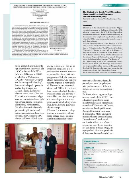
Ed ecco il nostro caro collega<br />
insieme a un amico e altrettanto<br />
collega cinese durante<br />
quella manifestazione inter-<br />
The Cadastre in South Tyrol/Alto Adige –<br />
History and Practical Examples<br />
Johann Martin LUN, Italy<br />
Keywords: Cadastre, History, Openkat, Examples, FIG,<br />
paper<br />
SUMMARY<br />
The history of the cadastre in South Tyrol/Alto Adige is<br />
very closely connected to the history of Europe. In 1852,<br />
when the cadastre started, South Tyrol/Alto Adige and the<br />
Trentino were part of the Austrian Danube monarchy. At<br />
the same time in the kingdom of Italy 25 different cadastres<br />
existed. In 1871 a commission was introduced in order to<br />
unify these cadastres.<br />
With the fundamental law n. 3682, dated 1st of March<br />
1886, a unified parcel-cadastre was officially introduced in<br />
Italy. In 1919, after the First World War, South Tyrol/Alto<br />
Adige and the Trentino were annexed to the kingdom of<br />
Italy, which decided to maintain the former Austrian cadastre<br />
in the new territories. Today, with the introduction of<br />
the software Pregeo and Docfa and the network of fiducial<br />
points the Cadastre in Italy is unique. The directory of<br />
the Cadastre today is task of the Autonomous Province<br />
Bolzano-Bozen, South Tyrol-Alto Adige. Plans of division<br />
can be presented in Italian, German or bilingual. South<br />
Tyrol with his three ethnical groups, at the connection-line<br />
between two cultures, the Italian and the German,<br />
has an autonomy, which can be seen as a model in Europe.<br />
nazionale, alla quale, ripeto, ha<br />
partecipato a sue proprie spese<br />
solo per far conoscere il lavoro<br />
italiano in ambito topocartografico.<br />
Per finire, oltre a segnalare il geometra<br />
e socio della SIFET Lun<br />
alla attuale presidenza, vorrei<br />
mandare un piccolo suggerimento<br />
anche all’Università di Trento,<br />
ove si trova il collega Giovanni<br />
Battista Benciolini, ordinario<br />
di topografia. Molte università<br />
nostrane hanno concesso lauree<br />
“honoris causa” a calciatori,<br />
corridori e stilisti; perché non<br />
pensare ad una ”lectio magistralis”<br />
con tanto di tocco e toga, del<br />
topografo di Naturno, provincia<br />
di Bolzano, Johann Martin Lun.<br />
PAROLE CHIAVE<br />
SIFET; geometra; honoris causa<br />
ABSTRACT<br />
SIFET, the Italian Society of Photogrammetry and Topography,<br />
has many honorary members. In this article a proposal<br />
for a new one.<br />
AUTORE<br />
Attilio Selvini<br />
attilio.selvini.POLIMI@gmail.com<br />
Già Presidente della Società Italiana di Fotogrammetria<br />
e Topografia<br />
<strong>GEOmedia</strong> n°6-<strong>2017</strong> 45


