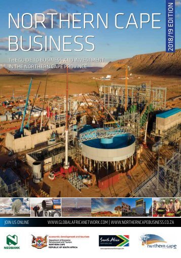
Frances Baard District Municipality Investment Prospectus
- Text
- Business
- Investment
- Wwwglobalafricanetworkcom
- Prospectus
- Province
- Economic
- Plaatje
- Tourism
- Baard
- Frances
- Cape
- Northern
- Municipality
- Kimberley
12 TOURISM BATTLEFIELDS
12 TOURISM BATTLEFIELDS ROUTE The Anglo-Boer War in the Northern Cape The major battles of the Western Campaign of the Anglo-Boer War all took place within 120km of Kimberley, in the northern part of the Cape Colony (today’s Northern Cape). Hours after they had declared war against England in an attempt to preempt an attack by the colonial power, the Boers from the two independent states of the South Africa Republic (Transvaal) and the Orange Free State moved into Natal and the Cape Colony on three fronts. Within three days they had besieged the town of Kimberley. The town’s military authorities under the command of Lieutenant-Colonel Kekewich proclaimed martial law and set about preparing for the Boer attack. This didn’t happen but shelling of the town began and the Boers set about trying to starve the town into submission. The details of the siege, including the victories and setbacks suffered by the relief column under Lieutenant-General Methuen, can be relieved at the Magersfontein and McGregor Museums. Included are the battles of Orange River Station, Modder River, Magersfontein, Belmont Graspan and the story of the eventual relief by General French and his calvary. The N12 effectively mirrors the plan of attack of the British as they moved northwards towards Kimberley across the Modder River towards the catastrophic battle, for the British, at Magersfontein. Before dawn on 11 December 1899, the Boers opened fire on the Highland Brigade from their concealed trench at the base of Magersfontein Hill. It was a legendary Boer victory, but the memorials and graves at the site speak of casualties on both sides. A must-see is the Magersfontein Museum and lookout point on the hill. The museum has an audiovisual presentation that offers visitors a first-hand experience of battle from a darkened Boer trench. The N8 towards Bloemfontein will take you to the site of the bad defeat subsequently suffered by the Boers at Paardeberg where General Cronje surrendered. The McGregor Museum in Kimberley is the former residence of Cecil John Rhodes, the mining magnate. He was trapped in Kimberley during the siege and was an influential voice among the British leadership. The museum houses a siege display, where the story of the siege and eventual relief of Kimberley is told. Worth a visit: McGregor Museum in Kimberley and the Magersfontein Museum and monuments. There is also the Paardeberg Battlefield Museum at Paardeberg. McGregor Museum Tel: +27 53 839 2700 Website: www.museumsnc.co.za
13 TOURISM GO! GHAAP ROUTE Barkly West, just 36km north-west of Kimberley, marks the eastern edge of this route that celebrates the earliest residents and explorers of a patch of high land that came to be known as Transorangia, the land across the Orange River, during the colonial era. North of the Orange River was a no-go area for officials of the Cape Colony and, as a result, indigenous people (who called the river the Gariep River) had some rest. At a later time, they even secured some protection from the British Crown from predatory settlers of various stripes but when diamonds were discovered in the area, all bets were off. The heart-shaped Ghaap Plateau is a main attraction in the region, situated in the central interior. The plateau is about 1 130m above sea level and extends about 150km from east to west between the Harts River Valley and the Kuruman Hills. Billions of years ago, the plateau was submerged under the sea. Boreholes have revealed the existence of rich underground water resources, which contributed to development in the region. The existing Griqua towns on the Ghaap plateau were incorporated into the then Cape Colony in the early 1900s, and new “white” towns started growing, along with better roads and railways. Around 1920, the West End diamond mine was established in Postmasburg and numerous fortune-seekers flocked to the area, prompting a minidiamond rush similar to the Kimberley one. This fascinating heritage route covers everything from a famous archaeological site and historic towns to amazing architecture and a vast nature reserve known for its unusual white sand dunes. The route includes some heritage sites dating back threebillion years, as well as the Witsand Nature Reserve, with its white sand dunes standing in stark contrast to the surrounding red Kalahari sand dunes. The Wonderwerk Cave is an archaeological wonder believed to be at least two-billion years old. The large cave is located 45km south of Kuruman and 43km north of Daniëlskuil. Research conducted by archaeologists at the cave, which extends 140m horizontally into the base of the Kuruman Hills, suggests the presence of early human activity. Visitors to this preserved heritage site will get to see fossils dating back hundreds of thousands of years, Stone Age axes and cleavers, painted ostrich-egg shells and San rock paintings. The Kuruman Hills are also worth visiting when touring this route. They are known for their large quantities of blue asbestos or crocidolite, which prompted mining in the Ghaap region from the 1930s until 1980. This was halted after the serious and often deadly health risks of asbestos mining were discovered. The original iron bridge over the Vaal River at Barkly West is of interest because it was transported in sections from the United Kingdom and a steel plate still gives details of its manufacture in 1884.
- Page 1 and 2: 1 FRANCES BAARD DISTRICT MUNICIPALI
- Page 3 and 4: 1 FOREWORD IMPROVING THE LIVES OF C
- Page 5 and 6: NORTHERN CAPE PROVINCE SOUTH AFRICA
- Page 7 and 8: STATISTICS FRANCES BAARD DISTRICT M
- Page 9 and 10: 7 DISTRICT ECONOMY MAIN SECTORS AND
- Page 11 and 12: 9 LOCAL MUNICIPALITIES The story of
- Page 13: 11 • Vaalharts Dam is a popular f
- Page 17 and 18: 15 INVESTMENT OPPORTUNITIES FRANCES
- Page 19 and 20: 17 DESCRIPTION OF THE PROJECT Furth
- Page 21 and 22: 19 INVESTMENT OPPORTUNITY HOUSING S
- Page 23 and 24: NATIONAL INCENTIVE SCHEMES The nati
Inappropriate
Loading...
Mail this publication
Loading...
Embed
Loading...


