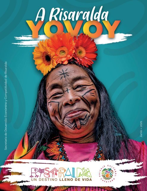
RISARALDA UN DESTINO LLENO DE VIDA
Catálago turístico del departamento de Risaralda
Catálago turístico del departamento de Risaralda

You also want an ePaper? Increase the reach of your titles
YUMPU automatically turns print PDFs into web optimized ePapers that Google loves.
1
Imágenes<br />
Suministradas por<br />
Secretaría de Desarrollo Económico y Competitividad de Risaralda.<br />
Dirección de Desarrollo Turístico de Risaralda.<br />
Proyecto Ruta Turística del Centro Occidente de Risaralda (Un Destino Lleno de Vida).<br />
PCCC, Ministerio de Comercio, Industria y Turismo (MinCIT) / FONTUR.<br />
Alcaldías municipales de Risaralda.<br />
Jose Hernando Morales Tique.<br />
M<strong>UN</strong>ICIPIO <strong>DE</strong><br />
DOSQUEBRADAS<br />
>Plataforma Digital by Editora del Café
3
Uno de los sectores más afectados por la pandemia<br />
del Covid en el mundo y en Risaralda,<br />
es el turismo, pero a pesar de esto el departamento<br />
sigue fortaleciendo este sector, que es<br />
una de las grandes apuestas para la reactivación<br />
económica de nuestra administración.<br />
Son varias las potencialidades del departamento<br />
en materia turística, enfocadas en el turismo<br />
de naturaleza, siendo un destino privilegiado<br />
para el aviturismo, biciturismo, aventura y cultura<br />
cafetera.<br />
Esto permite a los visitantes, apreciar una amplia<br />
gama de especies de aves, deleitarse con los<br />
hermosos paisajes y gastronomía de Risaralda y<br />
por su puesto enamorarse de la riqueza de flora<br />
y fauna que es abundante en todo el territorio.<br />
Desde la Gobernación de Risaralda buscamos<br />
no solo impulsar la promoción de los atractivos<br />
turísticos del departamento, también hemos<br />
liderado un fuerte componente de asistencia<br />
técnica y capacitación a toda la cadena de valor.<br />
De esta manera 148 prestadores avanzaron<br />
en procesos de capacitación y formalización en<br />
guianza de turismo, avistamiento de aves, agencias<br />
de viajes, gastronomía, hotelería y aventura,<br />
líneas que fueron certificadas.<br />
Para reactivar el sector turístico también le estamos<br />
apostando a 5 grandes proyectos de infraestructura<br />
turística, entre los que se destacan<br />
los denominados parques miradores, como es<br />
el caso del parque mirador de Las Cometas en<br />
La Virginia, el parque lineal en La Celia –ubicado<br />
en la margen del río Monos–, parque lineal río<br />
El Vergel en Apía. También está la experiencia<br />
gastronómica en Santa Rosa de Cabal en la escuela<br />
Simón Bolívar. Igualmente la ruta mirador<br />
Las Marcadas en Dosquebradas. La inversión en<br />
estos proyectos supera los $15.000 millones y<br />
cuentan con el apoyo del Fondo Nacional de<br />
Fomento al Turismo Fontur.<br />
Nuestro sector turístico en Risaralda ha hecho<br />
enormes esfuerzos para estar preparados para<br />
la reactivación económica, más de 1200 establecimientos<br />
renovaron el Registro Nacional<br />
de Turismo y cumplen con la aplicación de los<br />
protocolos de bioseguridad, por lo que ya están<br />
listos para prestarles el mejor servicio con toda<br />
la seguridad.<br />
Finalmente, quiero agradecer a cada uno de ustedes,<br />
apreciados integrantes del sector turístico,<br />
por esta labor de todas las horas, con tanto<br />
entusiasmo por Colombia, y después de un año<br />
marcado por la incertidumbre de la pandemia,<br />
son uno de los bastiones para nuestra reactivación<br />
económica y social.<br />
VICTOR MANUEL TAMAYO VARGAS<br />
Gobernador de Risaralda<br />
4
hecho de contar con el Aeropuerto Internacional<br />
Matecaña, por donde pasa el 75 por ciento<br />
de los viajeros que llegan al eje cafetero; estaremos<br />
orgullosos de mostrar la hotelería, las fincas<br />
campesinas, nuestro centro de convenciones y<br />
nuestro Bioparque Ukumarí.<br />
El Turismo También es<br />
Nuestro Compromiso<br />
Con un territorio cuyo 95% es rural, nuestro municipio<br />
de Pereira ofrece un panorama singular<br />
para potencializar el turismo como un elemento<br />
de reactivación económica.<br />
Pereira es atractiva por naturaleza, gracias a<br />
múltiples bondades como la cercanía con otras<br />
ciudades y regiones del país, las vías de acceso,<br />
las cortas distancias urbanas y rurales, el clima,<br />
la topografía y la calidez de sus habitantes, entre<br />
muchos factores. Pero también poseemos<br />
una infraestructura al servicio del turismo que<br />
en tiempos de normalidad nos ha generado un<br />
flujo importante de visitantes, con interesantes<br />
dividendos para la economía.<br />
La pandemia nos obligó, entre muchas otras<br />
circunstancias, a explorar alternativas turísticas<br />
para ofrecerles inicialmente a los propios ciudadanos<br />
y luego a los foráneos, cuando los tiempos<br />
así lo permitan. Y en ese proceso hemos<br />
descubierto, y más que ello, hemos fortalecido<br />
actividades y lugares que son un atractivo especial<br />
digno de que cualquier persona lo conozca.<br />
En esta vitrina de Anato, el evento más importante<br />
del turismo en Colombia y en América<br />
Latina, ratificaremos que Pereira posee unas<br />
condiciones especiales para el turismo, como el<br />
Pero sin duda, hemos descubierto nuevos atractivos<br />
en nuestros cinco corredores turísticos<br />
rurales y en los dos urbanos que fomentan la<br />
gastronomía y la cultura, ubicados en Corocito<br />
y en la comuna de Villasantana. En medio de<br />
la pandemia, el Gobierno de la Ciudad reactivó<br />
los corredores turísticos de Cerritos, Tribunas,<br />
Altagracia – Arabia, Combia y el corredor turístico<br />
Río Otún, encontrando en ellos unas características<br />
especiales que, sin duda, son atractivas<br />
para el turismo.<br />
Aparte de que todos estos corredores están enmarcados<br />
en el Paisaje Cultural Cafetero, y por<br />
lo tanto ofrecen una experiencia única alrededor<br />
de la cultura cafetera, nuestra zona rural es<br />
rica para el avistamiento de aves, la práctica de<br />
actividades como el ciclismo de montaña y el<br />
senderismo, y a ello le sumamos que los pintorescos<br />
paisajes de las áreas naturales son un<br />
atractivo por sí mismos.<br />
Otra inmensa ventaja es la complementariedad<br />
que Pereira le brinda al turismo de los departamentos<br />
cercanos como Quindío y Caldas, cada<br />
uno de ellos con sus propias potencialidades,<br />
que sumadas, atraen con mayor convicción a la<br />
región a turistas nacionales e internacionales.<br />
Nuestro compromiso con el sector turístico es<br />
total; de hecho, nuestra ciudad será sede del<br />
Congreso Nacional de Anato, los días 23 y 24<br />
de septiembre de este año, cuando reuniremos<br />
a todo el sector turístico del país, que conocerá<br />
de primera mano cómo el Gobierno de la Ciudad<br />
también proyecta el crecimiento económico<br />
de Pereira, a través de un turismo naturalmente<br />
atractivo, como es el nuestro.<br />
CARLOS ALBERTO MAYA LÓPEZ<br />
Alcalde Metropolitano de Pereira<br />
5
Paisaje<br />
Cultural<br />
Cafetero<br />
Colombiano<br />
PCCC<br />
El PCCC constituye un ejemplo sobresaliente de adaptación humana a condiciones<br />
geográficas difíciles sobre las que se desarrolló una caficultura de ladera y montaña.<br />
Se trata de un paisaje cultural en el que se conjugan elementos naturales, económicos<br />
y culturales con un alto grado de homogeneidad en la región, y que constituye<br />
un caso excepcional en el mundo.<br />
El Comité de Patrimonio Mundial de la Organización de las Naciones Unidas para la<br />
Educación, la Ciencia y la Cultura – Unesco, inscribió en la Lista de Patrimonio Mundial<br />
el Paisaje Cultural Cafetero el 25 de junio de 2011.<br />
Este reconocimiento compromete al Estado colombiano, a la comunidad internacional,<br />
nacional y local a su protección, pero es a la vez es una oportunidad para que sus<br />
habitantes y visitantes conozcan el paisaje y participen en su preservación. El PCCC<br />
reúne en su zona principal áreas específicas de 47 municipios y 411 veredas, y en su<br />
área de amortiguamiento, cuatro municipios y 447 veredas de los departamentos de<br />
Caldas, Quindío, Risaralda y Valle del Cauca, ubicadas en las ramificaciones central y<br />
occidental de la Cordillera de los Andes.<br />
6
Rutas<br />
del Paisaje Cultural Cafetero<br />
La riqueza histórica, natural y cultural, el amor por la tierra y la familia, los bellos paisajes<br />
y la arquitectura son algunos de los valores que hacen único a este territorio.<br />
Aquí nace la marca Rutas del Paisaje Cultural Cafetero, una estrategia de articulación<br />
territorial, ejemplo sobresaliente a nivel nacional e internacional del trabajo en equipo<br />
que lleva varios años fortaleciendo a los prestadores de servicios turísticos que<br />
le apuestan a la sostenibilidad de la declaratoria y que cumplen con estándares de<br />
calidad definidos en el Manual de Buenas Prácticas Turísticas.<br />
Esta marca representa el origen del Mejor Café Suave del Mundo, enfocada en 4 productos,<br />
27 experiencias y 6 rutas turísticas.<br />
7
Colombian<br />
Coffee<br />
Cultural<br />
Landscape<br />
PCC<br />
The Colombian Coffee Cultural Landscape represents a remarkable example of human<br />
adaptation to difficult geographical conditions where mountain and hillside<br />
coffee farming are developed. It is a cultural landscape in which natural, economic<br />
and cultural elements are combined with a high degree of homogeneity in the region,<br />
that represents a unique case in the world.<br />
The World Heritage Committee of the United Nations Educational, Scientific and Cultural<br />
Organization - Unesco, registered the Coffee Cultural Landscape in the World<br />
Heritage List on June 25, 2011.<br />
This recognition engages the Colombian State, the international, national and local<br />
community to its protection, but it is also an opportunity for its inhabitants and visitors<br />
to aknowledge the landscape and participate in its preservation. The Colombian<br />
Coffee Cultural Landscape gathers in its main zone specific areas of 47 towns and 411<br />
villages, and in its buffer area, four towns and 447 villages of the stateside of Caldas,<br />
Quindío, Risaralda and Valle del Cauca, located in the central and western mountain<br />
range of the Andes Mountains.<br />
8
Routes<br />
of the Coffee Cultural Landscape<br />
The historical, natural and cultural treasure, the love for the land and the family, the<br />
beautiful landscapes and the architecture are some of the values that make this<br />
region unique. This is where the brand "Rutas del Paisaje Cultural Cafetero" (Routes<br />
of the Coffee Cultural Landscape) was born, a strategy of territorial articulation, a<br />
perfect example at the national and international level of teamwork that has been<br />
strengthening tourism service providers for several years. They are committed to the<br />
sustainability of the declaration and have the highest quality standards defined in the<br />
Manual of Good Tourism Practices.<br />
This brand represents the origin of the Best Soft Coffee in the World, focused on 4<br />
products, 27 experiences and 6 tourist routes.<br />
9
10<br />
https://risaralda.travel/
Verde como su bandera, ese es el color del paisaje ondulado entre pueblos coloridos,<br />
propios de Risaralda, que al recorrerlos contagian de esperanza con la<br />
pujanza y amabilidad de su gente.<br />
Risaralda es un departamento que se caracteriza por la diversidad de sus paisajes,<br />
su riqueza natural, cultural y étnica; la magia de sus montañas características de los<br />
Andes Centrales y por ser el origen del Mejor Café Suave del Mundo. Los aromas de<br />
la tierra cafetera atraen al mundo entero para conocer sus tradiciones culturales. Para<br />
ello, se cuenta con diferentes rutas verdes y montañosas, entre haciendas y sembrados<br />
de café, donde se puede aprender más sobre el proceso de la recolección del<br />
grano y su transformación al sabor más suave.<br />
Está ubicada en el corazón del Paisaje Cultural Cafetero Colombiano. Cuenta con<br />
catorce (14) municipios privilegiados por la naturaleza. Risaralda es el destino predilecto<br />
para los que buscan llenarse de vida. Cerca de 900 especies de aves surcan el<br />
cielo risaraldense. Entre ellas se encuentran la Bangsia de Tatamá, Lorito de Fuertes,<br />
Tángara Multicolor, Gallito de Roca, Pava Caucana, entre otras.<br />
Ficha Técnica<br />
Experiencias Turísticas<br />
➢ Latitud 4° 41’ 36” y 5° 30’ 00” norte.<br />
➢ Longitud 75° 23’ 49” y 76° 18’ 27” oeste.<br />
➢ Altura: 890 hasta 4.965 m. s. n. m.<br />
➢ Temperatura: Entre -10 y 24 °C.<br />
➢ Municipios: 14.<br />
➢ Población: 968.626.<br />
➢ Idioma: Español.<br />
➢ Moneda: Peso $COL.<br />
➢ Aeropuerto Internacional Matecaña, ubicado<br />
en la ciudad capital: Pereira.<br />
➢ Turismo de naturaleza.<br />
➢ Turismo de salud y bienestar.<br />
➢ Turismo de reuniones: Congresos, eventos,<br />
convenciones, incentivos y bodas destino.<br />
➢ Turismo cultural: Historia, patrimonio, gastronomía,<br />
oficios auténticos y cafés especiales.<br />
➢ Turismo religioso.<br />
11
12<br />
https://risaralda.travel/
Green as its flag, which is the color of the contoured landscape among its colorful<br />
municipalities, Risaralda spreads hope with the strength and kindness of its<br />
people. Risaralda is a state that is characterized by the diversity of its landscapes, its<br />
natural, cultural and ethnical richness; the magic of its mountains is a characteristic<br />
of the Central Andes and stands for being the origin of the smoothest Coffee in the<br />
World. The aromas of the coffee land attract visitors wanting to know more about its<br />
cultural traditionshat is why, there are different green and mountainous routes, among<br />
farms and coffee fields, where you can learn more about the process of picking the<br />
coffee grains and its transformation to the finest flavor.<br />
It is located in the heart of the Colombian Coffee Cultural Landscape. It has fourteen<br />
(14) municipalities privileged by nature. Risaralda is the favorite destination for those<br />
who seek to fill themselves with life and wellness. Nearly 900 species of birds fly over<br />
the Risaralda’s sky. Among them are the “Bangsia de Tatama”, Indigo-winged Parrot.<br />
Multicolored tanager, cock-of-the-rock, cauca guan, among others.<br />
Data Sheet<br />
Tourist Categories<br />
➢ Latitude: 4° 41’ 36” y 5° 30’ 00” north.<br />
➢ Longitude: 75° 23’ 49” y 76° 18’ 27” west.<br />
➢ Altitude: 890 to 4,965 masl.<br />
➢ Temperature: Between 14 and 75,2 °F.<br />
➢ Municipalities: 14.<br />
➢ Population: 968,626.<br />
➢ Language: Spanish.<br />
➢ Currency: Peso $ COL.<br />
➢ Matecaña International Airport, located in the<br />
capital city: Pereira.<br />
➢ Nature tourism.<br />
➢ Health and wellness tourism.<br />
➢ MICE tourism: Congresses, events, conventions,<br />
incentives and destination for weddings.<br />
➢ Cultural tourism: History, heritage, gastronomy,<br />
authentic crafts and special coffees.<br />
➢ Religious tourism.<br />
13
Pereira<br />
La Perla del Otún<br />
Capital del Departamento de Risaralda<br />
14
Debido a su principal fuente hídrica proveniente del río Otún y por su gran riqueza<br />
cultural, Pereira es reconocida como la Perla del Otún.<br />
Su agradable clima templado, la pluriculturalidad de la población, sus fortalezas comerciales,<br />
sus áreas naturales y su patrimonio cultural, hacen de Pereira, uno de los<br />
mejores destinos del Paisaje Cultural Cafetero Colombiano.<br />
Ficha Técnica<br />
Experiencias Turísticas<br />
➢ Altura: 1.411 m. s. n. m.<br />
➢ Temperatura promedio: 22 °C.<br />
➢ Población: 480.803.<br />
➢ Aeropuerto Internacional Matecaña (a 20 min<br />
del centro de Pereira).<br />
➢ Cafés especiales.<br />
➢ Cultural cafetera.<br />
➢ Transportes cafeteros auténticos.<br />
➢ Haciendas cafeteras.<br />
➢ Avistamiento de aves.<br />
➢ Santuarios únicos de fauna y flora.<br />
➢ Senderismo.<br />
➢ Ciclomontañismo.<br />
Observación de Aves<br />
en su Paraíso<br />
Esta tierra tiene el privilegio de contar con<br />
más de 310 ESPECIES <strong>DE</strong> AVES, las cuales<br />
se encuentran desde los bosques secos<br />
tropicales entre Cerritos y las orillas del río<br />
Cauca, a los bosques de niebla del río Otún,<br />
Barbas y Consotá, o tan cerca de la ciudad<br />
como el Jardín Botánico de la Universidad<br />
Tecnológica de Pereira.<br />
15
La Revelación del Mejor<br />
Café del Mundo<br />
El desarrollo de Risaralda está ligado a la cultura<br />
cafetera. Fue esta la región que inició la<br />
producción del famoso CAFÉ EXCELSO CO-<br />
LOMBIANO, reconocido por su suavidad y<br />
calidad. Por ello, en Pereira su capital y todo<br />
el departamento, los apasionados del café podrán<br />
aprender de los profesionales que cultivan<br />
y preparan cafés especiales.
Recorre Paisajes Cafeteros<br />
en Bicicleta<br />
Pereira cuenta con un gran número de vías rurales donde se pueden realizar<br />
recorridos en bicicleta. Es la oportunidad de sentir la brisa, mientras se admiran<br />
los paisajes cafeteros donde las aves acompañan el recorrido.<br />
Corredor del<br />
Río Otún<br />
A 25 minutos de Pereira, es el punto donde se congregan los campesinos y los turistas de<br />
la Cuenca del Río del Otún. Se puede llegar en la tradicional chiva y es la ruta favorita de<br />
los ciclomontañistas. Predominan las diversas ofertas culturales, gastronómicas y culturales:<br />
las exposiciones en La Cuenca, el Cine Club La Florida, el Festival de la Montaña Mágica, el<br />
Festival del Gallo Ornamental y el encuentro Cantagallo de música parrandera popular, son<br />
algunas de las más representativas.<br />
Áreas de conservación de la<br />
Cuenca del Río Otún<br />
Parque Lineal<br />
del Río Otún<br />
Parque<br />
Regional<br />
Ucumarí<br />
Santuario<br />
de Fauna<br />
y Flora Otún<br />
Quimbaya<br />
Parque<br />
Nacional<br />
Natural<br />
Los Nevados<br />
San José<br />
La Bananera<br />
El Porvenir<br />
La Florida<br />
17
La Suiza<br />
Ruta a la Laguna del Otún y Nevados<br />
En el Santuario de Fauna y Flora Otún Quimbaya a 4 km de La Florida, rodeados por osos<br />
de anteojos, tigrillos y más de 300 especies de aves, aparece el centro de visitantes del Santuario,<br />
una de las 58 áreas protegidas de Parques Nacionales Naturales, el cual cuenta con<br />
una excelente dotación para el alojamiento de 90 personas e intérpretes ambientales que<br />
guían a través de los distintos senderos.<br />
Bioparque<br />
Ukumarí<br />
Interacción con más de 400 animales de 90<br />
especies diferentes, pasando por las regiones<br />
de Bosques Andinos, Sabana Africana y<br />
Albuerque Temporal.<br />
El Bioparque Ukumarí está ubicado en la ciudad<br />
de Pereira - corregimiento de Cerritos,<br />
a tan solo 8 km del Aeropuerto Internacional<br />
Matecaña. El Bioparque promueve experiencias<br />
memorables, integrando la educación<br />
ambiental, el desarrollo sostenible y<br />
dando a conocer los programas de conservación<br />
de la vida silvestre y de protección de<br />
los animales domésticos.<br />
18
Parque<br />
Consotá<br />
Parque recreacional de la Caja de Compensación,<br />
Comfamiliar Risaralda<br />
¡Aquí la diversión es para todos!<br />
Se ha consolidado como una de las mejores opciones deportivas y recreativas de la región,<br />
cuenta con numerosos servicios y atracciones, entre ellos piscinas, Granja de Noé, Sendero<br />
de la Memoria Indígena, Réplica de Pereira Antigua, Sendero de la Guadua, Mitos y Leyendas,<br />
Escenarios Deportivos, La Molienda del Café, entre otros.<br />
Cerritos<br />
Gastro<br />
En el sector de Galicia en Cerritos - Pereira, los visitantes encuentran una amplia oferta de<br />
restaurantes de comida típica, se destacan especialmente LAS AREPAS <strong>DE</strong> CHÓCOLO horneadas<br />
en barro, frutas tropicales justifican el primer alto en el camino con las famosas piñas<br />
de Cerritos.<br />
Corredor<br />
Tribunas<br />
El Corredor de Tribunas, además de comunicar directamente a las ciudades del Paisaje Cultural<br />
Cafetero a través de las Autopistas del Café, comprende una de las zonas más interesantes<br />
por el turismo religioso que allí se practica, se desataca la Iglesia del Niño Jesús de<br />
Praga en Guacarí y el Santuario de la Virgen del Jordán. El avistamiento de aves y la variada<br />
oferta gastronómica son otros atractivos turísticos que se pueden disfrutar en este corredor.<br />
Gracias a sus características naturales, pertenece a este corredor el Distrito de Manejo Integrado<br />
Barbas Bremen.<br />
19
Altagracia / Arabia<br />
En chiva, en jeep, en buseta, en vehículo particular o en bicicleta, usted podrá llegar al<br />
corredor comprendido por los corregimientos de Altagracia y Arabia, su ubicación permite<br />
disfrutar de un excepcional paisaje cafetero, a través de rutas ideales para el avistamiento<br />
de aves y tomar fotografías: ideal para caminatas y ciclopaseos.<br />
Corredor Combia<br />
El corredor turístico Combia cuenta con un exuberante paisaje, haciendas cafeteras y paneleras<br />
donde el turista puede conocer el proceso interactivo de estos importantes productos<br />
agrícolas, así mismo, puede disfrutar de actividades como el avistamiento de aves, ecoturismo<br />
y bicitururismo.<br />
20
Centro de Convenciones<br />
Expofuturo<br />
Expofuturo potencia y promueve el posicionamiento de Pereira y Risaralda como destino predilecto<br />
para el turismo de reuniones y negocios (segmento MICE) del Paisaje Cultural Cafetero Colombiano.<br />
Aquí también ocurren los eventos más importantes de la ciudad.<br />
21
Pereira<br />
The Pearl of the Otun<br />
Main Capital of Risaralda<br />
22
Due to its main water source from the Otun River and its great cultural wealth, Pereira<br />
is recognized as the Pearl of the Otun.<br />
Its pleasant warm climate, the multicultural population, its commercial strengths, its<br />
natural areas and its cultural heritage, makes Pereira one of the best destinations in<br />
the Colombian Coffee Cultural Landscape.<br />
Data Sheet<br />
Tourist Experiences<br />
➢ Altitude: 1,411 masl.<br />
➢ Average temperature: 71.6 °F.<br />
➢ Population: 480.803.<br />
➢ Matecaña International Airport (20 minutes<br />
from downtown Pereira).<br />
➢ Special coffees.<br />
➢ Cultural coffee maker.<br />
➢ Authentic coffee transport.<br />
➢ Coffee farms.<br />
➢ Bird watching.<br />
➢ Unique sanctuaries of fauna and flora.<br />
➢ Hiking.<br />
➢ Mountain biking.<br />
Bird<br />
Watching<br />
This land has the privilege of having more<br />
than 310 SPECIES OF BIRDS, which can be<br />
found from the tropical dry forests between<br />
“Cerritos” and the banks of the Cauca River,<br />
to the foggy forests of the Otún, Barbas and<br />
Consotá rivers, or close to the city at the Botanical<br />
Garden of the Tecnologica University<br />
of Pereira.<br />
23
The Smoothest<br />
Coffee in the World<br />
The development of Risaralda is linked to the<br />
coffee culture. This region began the production<br />
of the famous COLOMBIAN EXCELSO<br />
COFFEE, known for its smoothness and quality.<br />
For this reason, in Pereira, they have professional<br />
coffee lovers, who grow and prepare special<br />
coffee.
Cycling<br />
Landscapes<br />
Pereira has a large number of roads where you can enjoy bicycle tours. It is<br />
the opportunity to feel the breeze, where birds join the tour while admiring<br />
the coffee landscapes.<br />
Otun River<br />
Corridor<br />
25 minutes from Pereira, it is the place where farmers and tourists from the Otun River Basin<br />
get together. It can be reached in the traditional chiva (an open-sided wooden bus) and it is<br />
the favorite route for mountain bike riders. They have a diverse cultural and gastronomical<br />
offer: the exhibitions in La Cuenca, the La Florida Cinema Club, the Magic Mountain Festival,<br />
the Ornamental Rooster Festival and the Cantagallo meeting of popular party music, are<br />
some of the most representative places and festivities.<br />
Conservation Areas of the<br />
Otun River Basin<br />
Otun River<br />
Linear Park<br />
Ucumarí<br />
Regional<br />
Park<br />
Otún<br />
Quimbaya<br />
Fauna and<br />
Flora Sanctuary<br />
Los Nevados<br />
National<br />
Natural<br />
Park<br />
San José<br />
La Bananera<br />
El Porvenir<br />
La Florida<br />
25
La Suiza<br />
Route to the Otun Lagoon and Nevados<br />
In the Otun Quimbaya Fauna and Flora Sanctuary, 2.4 mi from La Florida, surrounded by<br />
spectacled bears, “tigrillos” (margays) and more than 300 species of birds, there is the visitor<br />
center of the Sanctuary, one of the 58 protected areas of Natural National Parks, which<br />
has an excellent endowment for the accommodation of 90 people and environmental interpreters<br />
who guide through the different trails.<br />
Ukumarí<br />
Biopark<br />
Interaction with more than 400 animals of 90<br />
different species, passing through the Andean<br />
Forests, African Savannah and seasonal<br />
shelter regions.<br />
The Ukumari Biopark is located in the city<br />
of Pereira – “Cerritos’s” district, just 4.9 mi<br />
from the Matecaña International Airport. The<br />
Biopark promotes memorable experiences,<br />
incorporating the environmental education,<br />
sustainable development and revealing programs<br />
for the conservation of wildlife and<br />
the protection of domestic animals.<br />
26
Consotá<br />
Park<br />
Recreational Park of, Comfamiliar Risaralda<br />
¡Here, fun is for everyone!<br />
It has established itself as one of the best sports and recreational options in the region, it has<br />
several services and attractions, including swimming pools, Noe’s Farm, Indigenous Memory<br />
Trail, Replica of Old Pereira, Guadua Trail, Myths and Legends , Sports Scenarios, La Molienda<br />
del Café (the grinding of coffee), among others.<br />
Cerritos<br />
Gastro<br />
In the “Galicia” area in “Cerritos” - Pereira, visitors find a wide range of restaurants serving<br />
typical food, especially “THE AREPAS OF CHOCOLO” (maize) baked in clay. You can also<br />
find tropical fruits at the next stop on the road with the famous Cerritos pineapples.<br />
Corredor<br />
Tribunas<br />
The Tribunas Corridor, wich connects the cities of the Coffee Cultural Landscape through<br />
the Coffee Highways, makes one of the most interesting areas for religious tourism that is<br />
practiced there, the Church of the Infant Jesus of Prague stands out in Guacarí and the Sanctuary<br />
of the Virgin of the Jordan. Bird watching and the varied gastronomical offer are other<br />
touristic attractions that can be enjoyed in this corridor. Thanks to its natural characteristics,<br />
the Barbas Bremen Integrated Management District belongs to this corridor.<br />
27
Altagracia / Arabia<br />
By chiva (an open-sided wooden bus), by jeep, by minivan, your own vehicle or by bicycle,<br />
you will be able to reach the corridor which is made up of the townships of Altagracia and<br />
Arabia, its location allows you to enjoy an exceptional coffee landscape, through ideal routes<br />
for bird watching and picture taking - great for walks and bike rides.<br />
Combia Corridor<br />
The Combia tourist corridor has an exuberant landscape, coffee farms and “panela” (sugar<br />
cane product) where tourists can learn about the interactive process of these important agricultural<br />
products, moreover, they can enjoy activities such as bird watching, ecotourism and<br />
bicycle tourism.<br />
28
Expofuturo<br />
Convenction Center<br />
Expofuturo strengthens and promotes the positioning of Pereira and Risaralda as a favorite destination<br />
for business and meeting tourism (MICE segment) at the Colombian Coffee Cultural Landscape.<br />
The most important events in the city also take place here.<br />
29
Dosquebradas<br />
Ventana turística del Paisaje Cultural Cafetero<br />
30
El Municipio de Dosquebradas, ubicado estratégicamente en el Paisaje Cultural<br />
Cafetero Colombiano, es una localidad pujante que acoge a todos los turistas y<br />
visitantes que llegan a su territorio con el fin de conocer su variada oferta turística,<br />
gastronómica, comercial e industrial.<br />
Poseedora de una gran riqueza natural, diversidad de fauna y flora que la hacen<br />
atractiva para disfrutar del turismo de naturaleza. La Serranía Alto del Nudo, con sus<br />
parques naturales y miradores turísticos, ofrece experiencias únicas de paisajismo,<br />
senderismo, avistamiento de aves y ciclomontañismo, además de una oferta gastronómica<br />
típica de la región y cafés especiales.<br />
Ficha Técnica<br />
Experiencias Turísticas<br />
➢ Altura: 1.460 m. s. n. m.<br />
➢ Temperatura promedio: 21 °C.<br />
➢ A 2 km de la ciudad de Pereira.<br />
➢ Población: 225.554.<br />
➢ Cafés especiales.<br />
➢ Cultura cafetera.<br />
➢ Transportes cafeteros auténticos.<br />
➢ Diversidad en fauna y flora.<br />
➢ Paisajismo.<br />
➢ Senderismo.<br />
➢ Ciclomontañismo.<br />
Atractivos Turísticos<br />
a Destacar<br />
➢ Bioparque Bonita Farm.<br />
➢ Parque Recreacional Lagos de La Pradera.<br />
➢ Parque Regional Natural Serranía Alto del Nudo.<br />
➢ Parque Regional Natural y Ecológico La Marcada.<br />
➢ Ruta arqueológica Piedras Marcadas.<br />
➢ Rutas mágicas de Dosquebradas (historia, cultura, naturaleza, gastronomía y diversión).<br />
➢ Santuario de la Virgen de la Pureza.<br />
31
32
33
Dosquebradas<br />
The Touristic Window of the Coffee Cultural Landscape<br />
34
The Municipality of Dosquebradas, strategically located in the Colombian Coffee<br />
Cultural Landscape, is a thriving town that welcomes all tourists. It has a wide range<br />
of gastronomical, commercial and industrial offer.<br />
Having a great natural wealth, diversity of fauna and flora that makes it a nature tourism<br />
destination. The “Alto del Nudo” mountain, with its natural parks and touristic<br />
viewpoints, offers unique landscaping, hiking, bird watching and mountain biking experiences,<br />
additionally a typical gastronomic offer of the region and special coffees.<br />
Data Sheet<br />
Tourist Experiences<br />
➢ Altitude: 1.460 m. s. n. m.<br />
➢ Average temperature: 69.8 °F.<br />
➢ 1.2 mi from the city of Pereira.<br />
➢ Population: 225,554.<br />
➢ Special coffees.<br />
➢ Coffee culture.<br />
➢ Authentic coffee transportation.<br />
➢ Diversity in fauna and flora.<br />
➢ Landscaping.<br />
➢ Hiking.<br />
➢ Mountain biking.<br />
Main Tourist<br />
Attractions<br />
➢ Biopark Bonita Farm.<br />
➢ Lakes of La Pradera Recreational Park.<br />
➢ Alto del Nudo mountain range Regional Natural Park.<br />
➢ La Marcada Regional Natural and Ecological Park.<br />
➢ Piedras Marcadas archaeological route.<br />
➢ Magical routes of Dosquebradas (history, culture, nature, gastronomy and recreation).<br />
➢ Sanctuary of the Virgin of Purity.<br />
35
36
37
Santa Rosa<br />
de Cabal<br />
38
Santa Rosa de Cabal es reconocida por<br />
ser la ciudad de las araucarias, preciosos<br />
árboles que se encuentran en el<br />
parque central, donde varias de las casas<br />
conservan la arquitectura de la colonización<br />
antioqueña. Más allá del casco urbano<br />
se encuentran las piscinas de agua<br />
termal, principal atractivo turístico de<br />
este municipio.<br />
Aquí estarás en el corazón del Paisaje<br />
Cultural Cafetero, hay gran cercanía con<br />
importantes capitales como Pereira, Armenia<br />
y Manizales, lo que garantiza conectividad<br />
al tener cerca a tres aeropuertos<br />
nacionales e internacionales.<br />
Santa Rosa de Cabal es la puerta de<br />
entrada al Parque Nacional Natural Los<br />
Nevados, referente que los aventureros<br />
toman como punto de partida para iniciar<br />
el ascenso a la Laguna del Otún y al<br />
Nevado de Santa Isabel. En esta ruta se<br />
pueden encontrar exuberantes ecosistemas<br />
con enorme diversidad de aves<br />
endémicas, fauna y flora. Quien llega a<br />
esta región querrá probar los famosos<br />
chorizos santarrosanos, íconos del municipio<br />
y reconocidos como un plato típico<br />
a nivel nacional e internacional. Además,<br />
posee diversas experiencias en el marco<br />
del Paisaje Cultural Cafetero, desde hermosas<br />
fincas cafeteras hasta tiendas de<br />
cafés especiales, una tradicional plaza de<br />
mercado con la flota de jeeps willys más<br />
grande de la región, iglesias, parques,<br />
miradores, ferias y fiestas que enriquecen<br />
la experiencia cultural en el destino.<br />
39
Ficha Técnica<br />
Atractivos Turísticos<br />
Destacados<br />
➢ Altura: 1.715 m. s. n. m.<br />
➢ Temperatura promedio: 19 °C.<br />
➢ A 13 km de la ciudad de Pereira, 25 km de<br />
Manizales y 36 km de Armenia.<br />
➢ Población: 80.000.<br />
Experiencias Turísticas<br />
➢ Aventura en ríos y cascadas.<br />
➢ Avistamiento de aves.<br />
➢ Cafés especiales.<br />
➢ Cultura cafetera.<br />
➢ Experiencias gastronómicas.<br />
➢ Fiestas y festivales tradicionales.<br />
➢ Haciendas cafeteras.<br />
➢ Miradores.<br />
➢ Paisajes y aventuras en bicicleta.<br />
➢ Relajación y descanso en plena naturaleza.<br />
➢ Senderismo.<br />
➢ Termalismo.<br />
➢ Transportes cafeteros auténticos.<br />
➢ Basílica Menor Nuestra Señora de Las Victorias<br />
(turismo religioso).<br />
➢ Cafés especiales y Café Incluyente.<br />
➢ Corredor Turístico: Gastronomía – Paisaje y<br />
Termales.<br />
➢ Cultura tradicional cafetera: Fincas, cultivos,<br />
recorridos.<br />
➢ Finca y Mirador del Café.<br />
➢ Fotografías en aviso “Yo amo a Santa Rosa<br />
de Cabal”.<br />
➢ Haciendas cafeteras.<br />
➢ Parque de Las Araucarias.<br />
➢ Laguna del Otún.<br />
➢ Mirador El Tambo.<br />
➢ Parque de Las Araucarias.<br />
➢ Parque El Machete.<br />
➢ Parque Los Fundadores.<br />
➢ Parque Nacional Natural de Los Nevados.<br />
➢ Parque Recreacional Lagos de Venecia.<br />
➢ Plaza de Mercado.<br />
➢ Restaurantes con gastronomía local y tradicional.<br />
➢ Seminario La Apostólica e Iglesia La Milagrosa.<br />
➢ Termales Santa Rosa de Cabal.<br />
➢ Termales San Vicente.<br />
40
Corredor Turístico<br />
Gastronomía<br />
Paisajes y Termales<br />
Este corredor comprende diversos sitios turísticos donde podrá disfrutar de restaurantes<br />
típicos, paisajes, senderismo, cafés especiales, así como también, conducen a dos de los<br />
atractivos más representativos del municipio: Termales Santa Rosa de Cabal y Termales San<br />
Vicente.<br />
Festival de<br />
Las Araucarias<br />
Este corredor comprende diversos sitios turísticos donde podrá disfrutar de restaurantes<br />
típicos, paisajes, senderismo, cafés especiales, así como también, conducen a dos de los<br />
atractivos más representativos del municipio: Termales Santa Rosa de Cabal y Termales San<br />
Vicente.<br />
Galería a<br />
Cielo Abierto<br />
Esta iniciativa, que comenzó a principios del año 2020, tiene como objetivo realizar diversas<br />
pinturas, murales y exposiciones fotográficas y de obras de artistas santarrosanos en diferentes<br />
sitios del municipio, casas, entre otros. Así mismo, se realizó, en diciembre del año 2020,<br />
el primer Festival de Muralismo “Leonel Ortiz”, bautizado así en honor a este gran muralista<br />
y artista santarrosano que posee obras reconocidas en diversos países del mundo.<br />
41
Monumentos<br />
Santa Rosa de Cabal posee diversos monumentos que hacen referencia a sus fundadores,<br />
sus soldados, y sus tradiciones. Gracias a la ubicación de estos, puedes encontrar diversos<br />
tipos de atractivos visuales, historia y relatos del municipio.<br />
Turismo<br />
Religioso<br />
Santa Rosa de Cabal posee diversos sitios religiosos (iglesias, seminarios, monasterio) los<br />
cuales son símbolos del municipio y brindan una experiencia de turismo religioso a sus visitantes.<br />
Desde La Basílica Menor Nuestra Señora de Las Victorias, La Iglesia Milagrosa (la cual<br />
posee el vitral más grande de Sudamérica), El seminario La Apostólica, hasta el Monasterio<br />
San José.<br />
42
Basílica Menor<br />
Nuestra Señora de las<br />
Victorias<br />
43
Santa Rosa<br />
de Cabal<br />
44
Santa Rosa de Cabal is recognized for<br />
being the city of “araucarias” - beautiful<br />
trees found in the central park, where<br />
several of the houses preserve the architecture<br />
of the Antioquia colonization.<br />
Beyond the urban area, there are the hot<br />
spring water pools, the main tourist attraction<br />
in this municipality.<br />
Here you will be in the heart of the Coffee<br />
Cultural Landscape, there is great<br />
proximity to important city capitals such<br />
as Pereira, Armenia and Manizales, which<br />
guarantees connectivity by having three<br />
national and international airports nearby.<br />
Santa Rosa de Cabal is the gateway to<br />
the Los Nevados National Natural Park<br />
(the snowed capped mountain National<br />
Natural Park), a reference point that adventurers<br />
take as a starting point to begin<br />
the ascent to the Laguna del Otún<br />
(Otun’s Lagoon) and the Nevado (snowed<br />
capped mountain) de Santa Isabel.<br />
On this route you can find exuberant<br />
ecosystems with huge diversity of endemic<br />
birds, fauna and flora. Those who<br />
come to this region will want to try the<br />
famous santarrosan chorizos (sausages),<br />
icons of the municipality and recognized<br />
as a typical dish nationally and internationally.<br />
In addition, it has various experiences<br />
within the framework of the Coffee<br />
Cultural Landscape, from beautiful coffee<br />
farms to special coffee shops, a traditional<br />
market square with the largest fleet of<br />
Willy jeeps in the region, churches, parks,<br />
viewpoints, fairs and festivals that enrich<br />
the cultural experience at the destination.<br />
45
Data Sheet<br />
Main Tourist<br />
Atrractions<br />
➢ Altitude: 1,715 masl.<br />
➢ Average temperature: 66.2 °F.<br />
➢ 8 mi from the city of Pereira, 15.5 mi from<br />
Manizales and 22.3 mi from Armenia.<br />
➢ Population: 80,000.<br />
Tourist Experiences<br />
➢ Adventure in rivers and waterfalls.<br />
➢ Bird watching.<br />
➢ Special coffees.<br />
➢ Coffee culture.<br />
➢ Gastronomic experiences.<br />
➢ Traditional festivals and parties.<br />
➢ Coffee farms.<br />
➢ Viewpoints.<br />
➢ Landscapes and bike adventures.<br />
➢ Relaxation and wellness among nature.<br />
➢ Hiking.<br />
➢ Spa.<br />
➢ Authentic coffee transportation.<br />
➢ Our Lady of Las Victorias Minor Basilica (religious<br />
tourism).<br />
➢ Special coffees and Inclusive Coffee.<br />
➢ Tourist Corridor: Gastronomy - Landscape<br />
and Hot Springs.<br />
➢ Traditional coffee culture: farms, crops, tours.<br />
➢ Coffee Farm and Viewpoint.<br />
➢ Photographs of advertisement “I love Santa<br />
Rosa de Cabal”.<br />
➢ Otun’s Lagoon.<br />
➢ El Tambo viewpoint.<br />
➢ Las Araucarias Park<br />
➢ Mirador El Tambo.<br />
➢ El Machete Park.<br />
➢ The Founders Park.<br />
➢ Parque Los Fundadores.<br />
➢ Los Nevados National Natural Park.<br />
➢ Lakes of Venice Recreational Park.<br />
➢ Market Square.<br />
➢ Restaurants with local and traditional cuisine.<br />
➢ La Apostólica Seminary and La Milagrosa.<br />
Church.<br />
➢ Hot Springs Santa Rosa de Cabal.<br />
➢ San Vicente Hot Springs.<br />
46
Gastronomy<br />
Landscape<br />
and Hot Springs<br />
This corridor includes various tourist sites where you can enjoy typical restaurants, landscapes,<br />
hiking, special coffees this corridor also leads to two of the most representative attractions<br />
of the municipality: Termales (Hot springs) Santa Rosa de Cabal and Termales (Hot<br />
springs) San Vicente.<br />
Festival of the<br />
Araucarias<br />
As a commemoration of the anniversary of Santa Rosa de Cabal (October 13), every year the<br />
FESTIVAL OR FESTIVALS OF THE ARAUCARIAS is held in the municipality, where different<br />
traditional and cultural activities are held such as: Parades, gastronomic festivals, the traditional<br />
“Yipao”, parade of vintage vehicles, sports activities, musical presentations, and others.<br />
This celebration, which lasts for a week, has become traditional and recognized nationally<br />
and internationally.<br />
Open Sky<br />
Gallery<br />
This initiative, which began at the beginning of 2020, aims to carry out various paintings, murals<br />
and photographic exhibitions and artworks by artists from Santarosa in different parts of<br />
the municipality, houses, among others. Moreover, the first “Leonel Ortiz” Muralism Festival<br />
was held in December 2020, named in honor of this great muralist and artist from Santa Rosa<br />
who has artworks recognized in various countries around the world.<br />
47
Monuments<br />
Santa Rosa de Cabal has various monuments that refer to its founders, its soldiers, and its<br />
traditions. Thanks to the location of these, you can find different types of visual attractions,<br />
history and stories of the municipality.<br />
Religious<br />
Tourism<br />
Santa Rosa de Cabal has various religious sites (churches, seminaries, monastery) which are<br />
symbols of the municipality and provide an experience of religious tourism to its visitors.<br />
From the Minor Basilica Nuestra Señora de Las Victorias, The Miraculous Church (which has<br />
the largest stained-glass window in South America), The Apostolic Seminary, to the San Jose<br />
Monastery.<br />
48
Basílica Menor<br />
Nuestra Señora de las<br />
Victorias<br />
49
La Virginia<br />
50
La Virginia, es un municipio<br />
equidistante a las capitales<br />
del Paisaje Cultural Cafetero,<br />
este municipio hace parte del<br />
Valle de Risaralda, de modo<br />
que en La Virginia el sol es permanente<br />
pues su temperatura<br />
oscila entre los 28 °C a 36 °C.<br />
Este lugar cuenta con el mayor<br />
número de bicicletas por habitante<br />
dentro de su territorio, así<br />
mismo, hay una gran diversidad<br />
de etnias y culturas. La Virginia<br />
se encuentra en medio de dos<br />
ríos, el río Cauca y el río Risaralda<br />
y su historia está anclada de<br />
manera directa a la vida y obra<br />
del escritor Bernardo Arias Trujillo,<br />
quien fue el que dio fundamento<br />
y creación a este municipio.<br />
En La Virginia podrás encontrar<br />
un lugar lleno de historia, cultura<br />
y experiencias turísticas.<br />
Ficha Técnica<br />
➢ Altura: 899 m. s. n. m.<br />
➢ Temperatura promedio: 28 °C.<br />
➢ A 35 km de la ciudad de Pereira.<br />
➢ Población: 28.197.<br />
Experiencias Turísticas<br />
➢ Aventura en ríos.<br />
➢ Avistamiento de aves.<br />
➢ Gastronomía.<br />
➢ Paisajes y aventuras en bicicleta.<br />
➢ Senderismo.<br />
➢ Transportes cafeteros auténticos<br />
Atractivos Turísticos<br />
Destacados<br />
➢ Balneario Los Farallones.<br />
➢ Calle del Caballero Gaucho.<br />
➢ Casa de la Cultura de La Virginia.<br />
➢ El tanque de la empresa de los Servicios<br />
Públicos.<br />
➢ Parroquia Nuestra Señora del Carmen.<br />
➢ Puente Bernardo Arango.<br />
➢ Río Express Tour.<br />
51
Zona Rural<br />
➢ Finca La Manuela (vereda La Palma)<br />
➢ Distrito de Manejo Integrado Guásimo.<br />
➢ Sendero Turístico Santa Elena.<br />
➢ Eco Parque El Humedal.<br />
Monumentos<br />
En La Virginia encontrarás diversos monumentos<br />
que hacen alusión a Francisco<br />
Ochoa Jaramillo, fundador del municipio,<br />
conmemoraciones al Caballero Gaucho y<br />
otros que son mitos, leyendas. Estos monumentos<br />
relatan historias, culturas y tradiciones<br />
que hacen de este municipio un lugar<br />
turístico donde conocerás en familia, pareja<br />
o amigos nuevas experiencias visuales.<br />
Graffiti<br />
Tour<br />
Creado en el año 2020 en la semana cultural<br />
del municipio en conmemoración a los<br />
132 años que cumplió La Virginia. El Graffiti<br />
Tour está compuesto por 11 murales, los<br />
cuales narran la historia del municipio desde<br />
sus inicios hasta su época contemporánea,<br />
vinculando diversos elementos que son icónicos<br />
de La Virginia.<br />
52
53
La Virginia<br />
54
Data Sheet<br />
La Virginia is a municipality equidistant<br />
from the main cities of<br />
the Coffee Cultural Landscape,<br />
this municipality is part of the Risaralda<br />
Valley, so in La Virginia<br />
the sun is permanent and its temperature<br />
it´s between 82.4 °F to<br />
96.8 °F. This place has the highest<br />
number of bicycles per inhabitant<br />
within its territory, in addition, there<br />
is a great diversity of ethnicities<br />
and cultures. La Virginia is located<br />
in the middle of two rivers, the<br />
Cauca River and the Risaralda River<br />
and its history is directly anchored<br />
to the life and work of the<br />
writer Bernardo Arias Trujillo, who<br />
was the one who gave basis and<br />
creation to this municipality.<br />
In La Virginia you can find a place<br />
full of history, culture and tourist<br />
experiences.<br />
➢ Altitude: 899 masl.<br />
➢ Average temperature: 82.4 °F.<br />
➢ 21.7 mi from the city of Pereira.<br />
➢ Population: 28,197.<br />
Tourist Experiences<br />
➢ Adventure in rivers.<br />
➢ Bird watching.<br />
➢ Gastronomy.<br />
➢ Landscapes and bike adventures.<br />
➢ Hiking.<br />
➢ Authentic coffee transport.<br />
Main Tourist<br />
Attractions<br />
➢ Los Farallones Spa.<br />
➢ Calle del Caballero Gaucho.<br />
➢ House of Culture of La Virginia.<br />
➢ The tank of the Public Services company.<br />
➢ Nuestra Señora del Carmen (Our Lady of<br />
Carmen) Parish.<br />
➢ Bernardo Arango Bridge.<br />
➢ Rio Express Tour.<br />
55
Rural Zone<br />
➢ Finca La Manuela (La Palma village)<br />
➢ Guasimo Integrated Management District.<br />
➢ Santa Elena Tourist Trail<br />
➢ El Humedal (The Wetland) Eco Park.<br />
Monuments<br />
In La Virginia you will find various monuments<br />
that refer to Francisco Ochoa Jaramillo,<br />
founder of the municipality, commemorations<br />
to the Caballero Gaucho and others<br />
that are myths, legends. These monuments<br />
tell stories, cultures and traditions that make<br />
this municipality a tourist place where you<br />
will encounter new visual experiences as a<br />
family, partners or friends.<br />
Graffiti<br />
Tour<br />
Created in 2020 in the cultural week of the<br />
municipality in commemoration of the 132<br />
years of La Virginia. The Graffiti Tour is made<br />
up of 11 murals, which narrate the history<br />
of the municipality from its beginnings to<br />
its contemporary times, linking various elements<br />
that are iconic of La Virginia.<br />
56
57
58<br />
Apía
Municipio conocido como el<br />
corazón del viento por las<br />
constantes brisas que durante<br />
todo el año moldean el clima<br />
templado de este territorio. Sus<br />
reservas naturales, imponentes<br />
cascadas, buenos vientos para<br />
la práctica del parapente, con<br />
unas vistas inolvidables y la mejor<br />
panorámica del Parque Nacional<br />
Natural Tatamá, hacen de<br />
este un destino ameno para el<br />
turismo de naturaleza y aventura.<br />
La Gallina enterrada, el fiambre<br />
apiano, los vinos de frutas y<br />
café, las fiestas y feria ganadera,<br />
los balcones y su gente, contribuyen<br />
a que la experiencia turística<br />
en Apía sea única.<br />
59
Ficha Técnica<br />
➢ Altura: 1.630 m. s. n. m.<br />
➢ Temperatura promedio: 19 °C.<br />
➢ A 67 km de la ciudad de Pereira.<br />
➢ Población: 12.315.<br />
Experiencias Turísticas<br />
➢ Aventura, vuelo en parapente.<br />
➢ Avistamiento de aves.<br />
➢ Cafés especiales.<br />
➢ Cultura cafetera.<br />
➢ Transportes cafeteros auténticos.<br />
Atractivos Turísticos<br />
Destacados<br />
➢ Jardín Botánico de Apía.<br />
➢ Parque Municipal Natural Agualinda.<br />
60
61
62<br />
Apía
Municipality known as the<br />
heart of the wind for the<br />
constant breezes that shape the<br />
warm weather in this territory<br />
throughout the year. Its natural<br />
reserves, imposing waterfalls,<br />
good winds for paragliding,<br />
with unforgettable views and<br />
the best panoramic views of the<br />
Tatama National Natural Park,<br />
make it an enjoyable destination<br />
for nature and adventure<br />
tourism.<br />
The buried chicken, the Apiano<br />
cold cuts, the fruit wines and coffee,<br />
the festivals and cattle fair,<br />
the balconies and its people, all<br />
contribute to make the tourist<br />
experience in Apía unique.<br />
63
Data Sheet<br />
➢ Height: 1,630 masl.<br />
➢ Average temperature: 66.2 °F.<br />
➢ 41.6 mi from the city of Pereira.<br />
➢ Population: 12,315.<br />
Tourist Experiences<br />
➢ Adventure, paragliding flight.<br />
➢ Bird watching.<br />
➢ Specialty coffees.<br />
➢ Coffee culture.<br />
➢ Authentic coffee transport.<br />
Main Tourist<br />
Attractions<br />
➢ Botanical Garden of Apía.<br />
➢ Agualinda Natural Municipal Park.<br />
64
65
Balboa<br />
66
Municipio que cuenta con<br />
la mejor panorámica del<br />
Paisaje Cultural Cafetero. Sus<br />
laderas descienden hacia los<br />
ríos Cauca, Risaralda, Cañaveral,<br />
Monos y Totui, dándoles un<br />
aire fresco y tranquilo, donde se<br />
aprecia un ecosistema rico en<br />
fauna y flora.<br />
En Balboa se divisan balcones<br />
floridos de arquitectura paisa<br />
logrando un gran interés urbanístico<br />
y paisajístico.<br />
Sus fiestas de aniversario se celebran<br />
en el mes de abril y las<br />
fiestas del campesino en el mes<br />
de julio, siendo dos festividades<br />
importantes para sus habitantes.<br />
67
Ficha Técnica<br />
Experiencias Turísticas<br />
➢ Altura: 1.550 m. s. n. m.<br />
➢ Temperatura promedio: 22 °C.<br />
➢ A 51 km de la ciudad de Pereira.<br />
➢ Población: 6.346.<br />
➢ Paisajes y miradores.<br />
Atractivos Turísticos<br />
Destacados<br />
➢ Jardín Botánico Anturio Negro.<br />
68
69
Balboa<br />
70
This municipality has the best<br />
panoramic view of the Coffee<br />
Cultural Landscape. Its slopes<br />
descend towards the Cauca, Risaralda,<br />
Cañaveral, Monos and<br />
Totui rivers, giving them a fresh<br />
and calm air. Here an ecosystem<br />
rich in fauna and flora can be<br />
contemplated.<br />
In Balboa you can see flowered<br />
balconies and a landscape rich<br />
in architecture and culture.<br />
Its local festivals are celebrated<br />
in April and the “peasant festivities”<br />
in July, being two important<br />
festivities for its inhabitants.<br />
71
Data Sheet<br />
Tourist Experiences<br />
➢ Altitude: 1,550 masl.<br />
➢ Average temperature: 71.6 °F.<br />
➢ 31.6 mi from the city of Pereira.<br />
➢ Population: 6,346.<br />
➢ Landscapes and viewpoints.<br />
Main Tourist<br />
Attraction<br />
➢ Botanical Garden Anturio Negro.<br />
72
73
Belén de Umbría<br />
74
Es un municipio de alta producción<br />
cafetera en Risaralda,<br />
situado entre valles y montañas,<br />
cautiva al visitante con su<br />
paisajismo y riqueza arquitectónica,<br />
productiva y cultural.<br />
Belén de Umbría es conocida<br />
también como la Villa de los<br />
Guayacanes, árboles que florecen<br />
en variados colores en algunas<br />
épocas del año y adornan<br />
parte de la vía por la que se llega<br />
desde Pereira. Este territorio<br />
los invita a conocer rasgos de la<br />
cultura prehispánica y a disfrutar<br />
del descanso y la recreación de<br />
carácter ambiental en la reserva<br />
natural del Valle de Umbría.<br />
El ecoturismo ha encontrado<br />
aquí un territorio apto para su<br />
desarrollo debido a la gran variedad<br />
de climas, fauna y flora,<br />
selvas y bosques maduros, observatorios<br />
de aves, cascadas<br />
perdidas en el bosque, historia<br />
y cultura.<br />
75
Ficha Técnica<br />
Experiencias Turísticas<br />
➢ Altura: 1.525 m. s. n. m.<br />
➢ Temperatura promedio: 20 °C.<br />
➢ A 70 km de la ciudad de Pereira.<br />
➢ Población: 24.899.<br />
➢ Cultura cafetera.<br />
➢ Cafés especiales.<br />
➢ Transportes cafeteros auténticos.<br />
Atractivos Turísticos<br />
Destacados<br />
➢ Cascada La Tímida.<br />
➢ Museo Eliseo Bolívar.<br />
➢ Parque Municipal Natural Santa Emilia.<br />
➢ Parque Regional Natural Cuchilla del San Juan.<br />
76
77
Belén de Umbría<br />
78
It is a municipality with important<br />
coffee production in Risaralda,<br />
located among valleys<br />
and mountains, it captivates the<br />
visitor with its landscapes and<br />
architectural, productive and<br />
cultural richness.<br />
Belén de Umbría is also known<br />
as the Villa of the Guayacanes,<br />
trees that bloom in various colors<br />
at different times of the year<br />
and decorates part of the road<br />
from Pereira. This territory invites<br />
you to discover traits of the<br />
pre-Hispanic culture and to enjoy<br />
a good rest and recreation in<br />
an environmental nature in the<br />
natural reserve of the Umbria<br />
Valley.<br />
Ecotourism has found here a<br />
territory suitable for its development<br />
due to the great variety<br />
of climates, fauna and flora,<br />
jungles and mature forests, bird<br />
observatories, waterfalls sunk in<br />
the forest, history and culture.<br />
79
Data Sheet<br />
Tourist Experiences<br />
➢ Altitude: 1,525 masl.<br />
➢ Average temperature: 68 °F.<br />
➢ 43.4 mi from the city of Pereira.<br />
➢ Population: 24,899.<br />
➢ Coffee culture.<br />
➢ Special coffees.<br />
➢ Authentic coffee transport.<br />
Main Tourist<br />
Attractions<br />
➢ La Tímida Waterfall.<br />
➢ Eliseo Bolivar Museum.<br />
➢ Santa Emilia Municipal Natural Park.<br />
➢ Cuchilla del San Juan Regional Natural Park.<br />
80
81
Guática<br />
82
El municipio de Guática se levanta<br />
sobre las laderas de la<br />
vertiente oriental de la Cordillera<br />
Occidental, logrando observar<br />
el Cerro de Gamonra. Su relieve<br />
es de colinas redondeadas, separadas<br />
por zonas planas. El río<br />
Guática es su principal fuente hidrográfica,<br />
nace en el sector del<br />
alto San Vicente (Departamento<br />
de Antioquia), desciende hasta<br />
encontrar su desembocadura<br />
en el río Risaralda.<br />
Sus íconos culturales más conocidos<br />
son: las fiestas patronales,<br />
las fiestas de la cebolla, las fiestas<br />
de la caña en Santa Ana y las<br />
fiestas del agua en San Clemente.<br />
La agricultura hace parte de su<br />
principal fuente económica, la<br />
cual está basada en los cultivos<br />
y el comercio. En estas labores<br />
participan la sociedad civil y la<br />
comunidad en general.<br />
83
84
Ficha Técnica<br />
Experiencias Turísticas<br />
➢ Altura: 1.820 m. s. n. m.<br />
➢ Temperatura promedio: 18 °C.<br />
➢ A 90 km de la ciudad de Pereira.<br />
➢ Población: 12.203.<br />
➢ Cultura cafetera.<br />
➢ Paisajes y miradores.<br />
Atractivos Turísticos<br />
Destacados<br />
➢ Jardín Botánico de Guática.<br />
➢ Parque Municipal Natural La Cristalina - La Mesa.<br />
85
Guática<br />
86
The municipality of Guática rises<br />
on the slopes of the eastern<br />
hill of the Western mountain<br />
range, from here you get<br />
to observe the hill of Gamonra.<br />
Its mountain top is of rounded<br />
hills, separated by flat areas.<br />
The Guática River is its main hydrographic<br />
source, it rises in the<br />
upper San Vicente area (stateside<br />
of Antioquia), it descends<br />
getting to the Risaralda River.<br />
Its best-known cultural icons<br />
are: the patron saint festivities,<br />
the onion festivals, the sugarcane<br />
festivals in Santa Ana and the<br />
water festivals in San Clemente.<br />
Agriculture is part of its main<br />
economic source, which is based<br />
on crops and trade. Civil society<br />
and the community in general<br />
participate in these tasks.<br />
87
88
Data Sheet<br />
Tourist Experiences<br />
➢ Altitude: 1,820 masl.<br />
➢ Average temperature: 64.4 °F.<br />
➢ 55.9 mi from the city of Pereira.<br />
➢ Population: 12,203.<br />
➢ Coffee culture.<br />
➢ Landscapes and viewpoints.<br />
Main Tourist<br />
Attractions<br />
➢ Guática Botanical Garden.<br />
➢ La Cristalina Municipal Natural Park - La Mesa.<br />
89
90<br />
La Celia
Municipio acogedor de gente<br />
amable, aire puro y contacto<br />
con la naturaleza. El casco urbano<br />
de La Celia está asentado<br />
en su mayor parte por un relieve<br />
bajo en el valle del Río Monos.<br />
Pequeñas cascadas y aguas cristalinas<br />
engalanan el paisaje que<br />
se podría definir como un ambiente<br />
natural, saludable, para<br />
conectarse con la naturaleza. La<br />
principal fuente de empleo en<br />
La Celia es la agricultura, especialmente<br />
el cultivo de café en<br />
la zona rural, el plátano Dominico<br />
Hartón y en menor proporción<br />
la caña panelera y frutales<br />
de clima frío.<br />
91
92
Ficha Técnica<br />
Experiencias Turísticas<br />
➢ Altura: 1.380 m. s. n. m.<br />
➢ Temperatura promedio: 18 °C.<br />
➢ A 66 km de la ciudad de Pereira.<br />
➢ Población: 7.483.<br />
➢ Cultura cafetera.<br />
➢ Paisajes y miradores.<br />
Atractivos Turísticos<br />
Destacados<br />
➢ Parque Municipal Natural Verdum.<br />
93
94<br />
La Celia
It´s a cozy Municipality with<br />
friendly people, that offers<br />
fresh air and contact with nature.<br />
The urban area of La Celia is<br />
settled by the most part at the<br />
low valley of the Monos River.<br />
Small waterfalls and crystal-clear<br />
waters decorate the landscape<br />
that could be defined as a natural,<br />
healthy environment which<br />
connects with nature. The main<br />
source of employment in La<br />
Celia is agriculture, especially<br />
the harvesting of coffee in the<br />
rural area, the Dominico Hartón<br />
plantain and, to a lesser extent,<br />
sugar cane and cold-climate<br />
fruit trees.<br />
95
96
Data Sheet<br />
Tourist Experiences<br />
➢ Altitude: 1,380 masl.<br />
➢ Average temperature: 64.4 °F.<br />
➢ 41 mi from the city of Pereira.<br />
➢ Population: 7,483.<br />
➢ Coffee culture.<br />
➢ Landscapes and viewpoints.<br />
Main Tourist<br />
Attractions<br />
➢ Verdum Natural Municipal Park.<br />
97
Marsella<br />
98
Es uno de los municipios más<br />
pintorescos y armoniosos<br />
del Paisaje Cultural Cafetero<br />
Colombiano. Sus casas y balcones<br />
adornan la Plaza de Bolívar,<br />
encontrando una gran oferta<br />
de restaurantes, alojamientos<br />
y tiendas para degustar el café<br />
suave que se cultiva en estas<br />
tierras de tradiciones y costumbres.<br />
En algunas de las haciendas cafeteras<br />
se ofrece el servicio de<br />
alojamiento y recorridos para<br />
conocer más sobre el cultivo y<br />
su proceso.<br />
99
100
Ficha Técnica<br />
Experiencias Turísticas<br />
➢ Altura: 1.575 m. s. n. m.<br />
➢ Temperatura promedio: 21 °C.<br />
➢ A 33 km del norte de la ciudad de Pereira.<br />
➢ Población: 16.845.<br />
➢ Cafés especiales.<br />
➢ Cultura cafetera.<br />
➢ Haciendas cafeteras.<br />
➢ Pueblos cafeteros con encanto.<br />
➢ Ruta del cacao, café y frutales.<br />
➢ Transportes cafeteros auténticos.<br />
Atractivos Turísticos<br />
Destacados<br />
➢ Casa de la Cultura de Marsella.<br />
➢ Jardín Botánico Alejandro Humboldt.<br />
101
Marsella<br />
102
It is one of the most colorful<br />
and harmonious municipalities<br />
of the Colombian Coffee Cultural<br />
Landscape. Its houses and<br />
balconies decorate the Bolívar<br />
square, finding a wide range of<br />
restaurants, lodging and shops<br />
to taste the finest coffee that is<br />
grown in these lands of traditions<br />
and customs.<br />
In some of the coffee farms, lodging<br />
and tours are offered to<br />
learn more about the crop and<br />
its process.<br />
103
104
Data Sheet<br />
Tourist Experiences<br />
➢ Altitude: 1,575 masl.<br />
➢ Average temperature: 69.8 °F.<br />
➢ 20.5 mi north of the city of Pereira.<br />
➢ Population: 16,845.<br />
➢ Special coffees.<br />
➢ Coffee culture.<br />
➢ Coffee farms.<br />
➢ Charming coffee villages.<br />
➢ Cocoa, coffee and fruit trees routes.<br />
➢ Authentic coffee transport.<br />
Main Tourist<br />
Attractions<br />
➢ Cultural House of Marsella.<br />
➢ Alejandro Humbold Botanical Garden.<br />
105
Mistrató<br />
106
Saliendo de Pereira, pasando<br />
por La Virginia y Belén de<br />
Umbría, se llega a Mistrató, municipio<br />
asentado sobre un valle<br />
en la Cordillera Occidental. Al<br />
territorio lo caracteriza una naturaleza<br />
exuberante que permite<br />
ver varias tonalidades de verde.<br />
Los alrededores de la cabecera<br />
municipal reúnen varios escenarios<br />
propicios para la práctica<br />
del ecoturismo y deportes de<br />
aventura. Por su parte, la cultura<br />
se vive durante el concurso departamental<br />
de Danzas Folclóricas,<br />
en el marco de las fiestas<br />
aniversarias del municipio en el<br />
mes de marzo y el Festival Regional<br />
de Teatro, en el mes de<br />
septiembre.<br />
107
Ficha Técnica<br />
Experiencias Turísticas<br />
➢ Altura: 1.518 m. s. n. m.<br />
➢ Temperatura promedio: 20 °C.<br />
➢ A 86 km de la ciudad de Pereira.<br />
➢ Población: 17.390.<br />
➢ Avistamiento de aves.<br />
➢ Paisajismo.<br />
➢ Senderismo.<br />
➢ Transportes cafeteros auténticos.<br />
Atractivos Turísticos<br />
Destacados<br />
➢ Cascada La Estrella.<br />
➢ Cascada Sutú.<br />
➢ Parque Municipal Natural Arrayanal.<br />
➢ Posada Campesina Mistrató.<br />
108
109
Mistrató<br />
110
From Pereira, passing through<br />
La Virginia and Belén de Umbría,<br />
you will arrive to Mistrató,<br />
a municipality located on a valley<br />
in the Western Cordillera.<br />
The territory is characterized by<br />
its exuberant nature that allows<br />
you to see all shades of green.<br />
The surroundings of the municipal<br />
gather several perfect scenarios<br />
for the practice of ecotourism<br />
and adventurous sports.<br />
Culture is experienced during<br />
the statesides Folk Dances contest,<br />
within the framework of the<br />
municipality's anniversary festivities<br />
in March and the Regional<br />
Theater Festival, in September.<br />
111
Data Sheet<br />
Tourist Experiences<br />
➢ Altitude: 1,518 masl.<br />
➢ Average temperature: 68 °F.<br />
➢ 53.4 mi from the city of Pereira.<br />
➢ Population: 17,390.<br />
➢ Bird watching.<br />
➢ Landscaping.<br />
➢ Hiking.<br />
➢ CAuthentic coffee transport.<br />
Main Tourist<br />
Attractions<br />
➢ La Estrella Waterfall.<br />
➢ Sutu Waterfall.<br />
➢ Arrayanal Natural Municipal Park.<br />
➢ Peasant Lodge Mistrató.<br />
112
113
Pueblo Rico<br />
114
Gracias a que la mayor parte<br />
de su territorio se encuentra<br />
en estado selvático le permite<br />
gozar de gran pureza y una<br />
sin igual biodiversidad. A Pueblo<br />
Rico se le conoce como el<br />
municipio triétnico de Colombia<br />
con población negra, indígena<br />
y mestiza, asentada en sus<br />
propios territorios para la preservación<br />
y conservación de su<br />
cultura.<br />
El ecoturismo se puede disfrutar<br />
en los parques naturales del<br />
territorio, así mismo, se pueden<br />
apreciar aves migratorias y endémicas<br />
del Paisaje Cultural Cafetero<br />
Colombiano.<br />
115
116
Ficha Técnica<br />
Experiencias Turísticas<br />
➢ Altura: 1.560 m. s. n. m.<br />
➢ Temperatura promedio: 68 °C.<br />
➢ A 93 km de la ciudad de Pereira.<br />
➢ Población: 16.577.<br />
➢ Avistamiento de aves.<br />
➢ Paisajismo.<br />
➢ Senderismo.<br />
Atractivos Turísticos<br />
Destacados<br />
➢ Corredor Turístico Río Negro.<br />
➢ Parque Nacional Natural Tatamá.<br />
➢ Parque Regional Natural La Cuchilla del San Juan.<br />
➢ Cerro Montezuma.<br />
117
Pueblo Rico<br />
118
Thanks to the fact that most of<br />
its territory is in a natural state,<br />
visitors can enjoy great pureness<br />
and an unequaled biodiversity.<br />
Pueblo Rico is known as<br />
the triethnic municipality of Colombia<br />
with a black, indigenous<br />
and mestizo population, settled<br />
in their own territories for the<br />
preservation and conservation<br />
of their culture.<br />
Ecotourism can be enjoyed in<br />
the natural parks of the territory,<br />
in addition, you can see<br />
migratory and endemic birds of<br />
the Colombian Coffee Cultural<br />
Landscape.<br />
119
120
Data Sheet<br />
Tourist Experiences<br />
➢ Altitude: 1,560 masl.<br />
➢ Average temperature: 20°F.<br />
➢ 57.7 mi from the city of Pereira.<br />
➢ Population: 16,577.<br />
➢ Bird watching.<br />
➢ Landscaping.<br />
➢ Hiking.<br />
Main Tourist<br />
Attractions<br />
➢ Río Negro Tourist Corridor.<br />
➢ Tatamá National Natural Park.<br />
➢ La Cuchilla del San Juan Regional Natural Park.<br />
➢ Hill Montezuma.<br />
121
Quinchía<br />
122
En Quinchía, se encuentra el<br />
cabildo indígena perteneciente<br />
a la comunidad Emberá-Chamí.<br />
Ha sido llamada “La<br />
Villa de los Cerros”; cuenta con<br />
más de 16 cerros que fueron<br />
centros sagrados para los indígenas,<br />
rebosantes de historia,<br />
mitos y leyendas.<br />
Allí, se puede visitar el Cerro<br />
Batero y el Cerro Gobia, reconocidos<br />
como áreas protegidas<br />
de importancia para el mundo.<br />
Su empinado sendero premia a<br />
los turistas con las mejores vistas<br />
del municipio y el cañón del<br />
río Cauca.<br />
123
124
125
Ficha Técnica<br />
Experiencias Turísticas<br />
➢ Altura: 1.825 m. s. n. m.<br />
➢ Temperatura promedio: 24 °C .<br />
➢ A 102 km de la ciudad de Pereira.<br />
➢ Población: 27.484.<br />
➢ Artes y oficios.<br />
➢ Avistamiento de aves.<br />
➢ Cafés especiales.<br />
➢ Cultural cafetera.<br />
➢ La dulce panela.<br />
➢ Transportes cafeteros auténticos.<br />
126
Atractivos Turísticos<br />
Destacados<br />
➢ Cerro Batero.<br />
➢ Cerro Gobia.<br />
➢ Museo Arqueológico Tierras de Xixaraca.<br />
127
Quinchía<br />
128
In Quinchía live the indigenous<br />
council which belongs to the<br />
Emberá-Chamí community. It<br />
has been called "La Villa hills";<br />
It has more than 16 hills that<br />
were sacred centers for the indigenous<br />
people, brimming with<br />
history, myths and legends.<br />
There, you can visit Batero Hill<br />
and Gobia Hill, recognized as<br />
protected areas of importance<br />
to the world. Its steep path<br />
rewards tourists with the best<br />
views of the municipality and<br />
the Cauca River canyon.<br />
129
130
131
Data Sheet<br />
Tourist Experiences<br />
➢ Altitude: 1,825 masl.<br />
➢ Average temperature: 75.2 °F.<br />
➢ 63.3 mi from the city of Pereira.<br />
➢ Population: 27,484.<br />
➢ Arts and crafts.<br />
➢ Bird watching.<br />
➢ Special coffees.<br />
➢ The sweet “panela”.<br />
➢ Authentical coffee transportation.<br />
132
Main Tourist<br />
Attractions<br />
➢ Batero Hill.<br />
➢ Gobia Hill.<br />
➢ Lands of Xixaraca Archaeological Museum.<br />
133
Santuario<br />
134
Desde su llegada el visitante<br />
quedará encantado con la<br />
belleza arquitectónica: desde el<br />
arco de Nuestra Señora del Carmen<br />
y los bellos paisajes, hasta<br />
el paso por la Calle Real, con<br />
hermosos balcones y fachadas<br />
típicas de la arquitectura antioqueña.<br />
Tradición y cultura cafetera, lindas<br />
panorámicas y gran biodiversidad<br />
son los atractivos que<br />
el turista encontrará en Santuario.<br />
Es conocido como la puerta<br />
del Tatamá ya que es el principal<br />
ingreso al Parque Nacional<br />
Natural Tatamá.<br />
135
Ficha Técnica<br />
Experiencias Turísticas<br />
➢ Altura: 1.565 m. s. n. m.<br />
➢ Temperatura promedio: 20 °C.<br />
➢ A 66 km de la ciudad de Pereira.<br />
➢ Población: 12.530.<br />
➢ Avistamiento de aves.<br />
➢ Cultura cafetera.<br />
➢ Haciendas cafeteras.<br />
➢ Pueblos cafeteros con encanto.<br />
➢ Transportes cafeteros auténticos.<br />
➢ Territorios inexplorados.<br />
Atractivos Turísticos<br />
Destacados<br />
➢ Parque Municipal Natural Planes de San Rafael.<br />
➢ Parque Nacional Natural Tatamá.<br />
136
137
Santuario<br />
138
Visitors will be enchanted by<br />
the architectural beauty of<br />
this municipality: from the arch<br />
of “Nuestra Señora del Carmen”<br />
and the beautiful landscapes,<br />
to the passage through<br />
“Calle Real”, with beautiful balconies<br />
and typical architecture<br />
from Antioqua.<br />
Tradition and coffee culture,<br />
beautiful views and great biodiversity<br />
are the attractions that<br />
tourists will find in Santuario. It<br />
is known as the “Puerta del Tatamá”<br />
(the Tatamás's door) since<br />
it is the main entrance to the<br />
Tatamá National Natural Park.<br />
139
Data Sheet<br />
Tourist Experiences<br />
➢ Altitude: 1,565 masl.<br />
➢ Average temperature: 68 °F.<br />
➢ 41 mi from the city of Pereira.<br />
➢ Population: 12,530.<br />
➢ Bird watching.<br />
➢ Coffee culture.<br />
➢ Coffee farms.<br />
➢ Charming coffee villages.<br />
➢ Authentical coffee transport.<br />
➢ Unexplored territories.<br />
Main Tourist<br />
Attractions<br />
➢ Planes de San Rafael Natural Municipal Park.<br />
➢ Tatamá National Natural Park.<br />
140
141
Directorio<br />
Expositores<br />
Agencias de Viajes y Operadores de Turismo, Risaralda<br />
EntreRíosyCafé Destinos Saludables<br />
RNT: 48115.<br />
William Ríos Moncayo / Gerente Comercial.<br />
Cel. (+57) 3157822449.<br />
Correo: comercial@entreriosycafe.com.co<br />
Página web: https://entreriosycafe.com.co/<br />
Facebook: Entreriosycafe Operador Turístico<br />
Instagram: @entreriosycafe<br />
Turismo Guía<br />
RNT: 33557.<br />
Andrés Mauricio Gutiérrez Arias / Gerente.<br />
Cel. (+57) 3145125454.<br />
Correo: gaiaturismoynaturaleza@gmail.com<br />
Página web: https://www.turismogaia.com/<br />
Facebook: Turismo Gaia<br />
Instagram: @turismogaia<br />
Cattleya S.E.R<br />
RNT: 40543.<br />
Adalberto Quiroga Villada / Gerente<br />
Cel. (+57) 3136954305.<br />
Correo: grupocattleya@gmail.com<br />
Página web: https://www.cattleyaser.com/<br />
Facebook: Cattleya S.E.R<br />
Instagram: @cattleyaeco<br />
142
BioAventours<br />
RNT: 78697.<br />
Leonardo Fabio Ramírez Gómez / CEO<br />
Cel. (+57) 3204983950.<br />
Correo: bioaventours@yahoo.com<br />
Página web: https://bioaventours.com<br />
Facebook: BioAventours<br />
Instagram: @bio.aventours<br />
La Divisa de Don Juan<br />
RNT: 57567.<br />
Liliana Ruth León Sanmiguel / Gerente General<br />
Cel. (+57) 3105923976.<br />
Correo: ladivisadedonjuan@gmail.com<br />
Página web: https://bioaventours.com<br />
Facebook: La Divisa De Don Juan<br />
Instagram: @ladivisadedonjuan<br />
D'Tour's por Colombia<br />
RNT: 24009.<br />
Sebastián Jiménez Agudelo / Asesor Comercial<br />
Cel. (+57) 3122982116.<br />
Correo: dtoursporcolombia@hotmail.com<br />
Página web: https://bioaventours.com<br />
Facebook: Dtours Porcolombia<br />
Instagram: @dtoursporcolombia<br />
ColombiaTours.Travel<br />
RNT: 35323.<br />
Daniela Bermúdez / Directora de Comunicaciones<br />
Cel. (+57) 3128844184.<br />
Correo: operaciones@colombiatours.travel<br />
Página web: https://colombiatours.travel/<br />
Facebook: Colombiatours.travel<br />
Instagram: @colombiatours.travel<br />
143
Retrociclas MTB Tours Colombia<br />
RNT: 28851.<br />
Arvey Alfonso Granada Calderón<br />
Cel. (+57) 3105407327.<br />
Correo: info@retrociclas.com<br />
Página web: https://www.retrociclastours.com/<br />
Facebook: Retro Ciclas Colombia<br />
Instagram: @retrociclas<br />
Pacóa Travel<br />
RNT: 42560.<br />
Natalia Montoya Aguirre / Gerente<br />
Cel. (+57) 3153861768.<br />
Correo: info@pacoatravel.co<br />
Página web: https://pacoatravel.co/<br />
Facebook: Pacóa<br />
Instagram: @pacoatravel<br />
Aguamarina Eventos y Excursiones<br />
RNT: 14664.<br />
Mauricio Muñoz Santos / Gerente General - Guía<br />
Cel. (+57) 3206168269.<br />
Correo: aguamarina.eventosyexcursiones@hotmail.com<br />
Página web: https://aguamarinapereira.wixsite.com/index<br />
Facebook: Aguamarina EventosyExcursiones<br />
Instagram: @mundoaguamarina<br />
Viajes Orbe<br />
RNT: 494.<br />
Teresa Ramírez Vargas / Gerente<br />
Cel. (+57) 3154773211.<br />
Correo: viajesorbe@hotmail.com<br />
Página web: https://viajesorbe.com/<br />
Facebook: Viajesorbe.com<br />
Instagram: @viajes.orbe<br />
144
Santa Rosa Bikes<br />
RNT: 50676.<br />
Fernando Augusto Clavijo Alzate / Gerente<br />
Cel. (+57) 3504520649.<br />
Correo: santarosabikescolombia@gmail.com<br />
Página web: http://www.srbtravel.co/<br />
Facebook: SANTA ROSA BIKES<br />
Instagram: @srb_travel<br />
Bicitours Rutas del Viento –<br />
Apícola del Viento<br />
RNT: 50201.<br />
Julián Mauricio Calle Aguirre / Gerente<br />
Cel. (+57) 3004272010.<br />
Correo: info@bicitoursrutasdelviento.com<br />
Página web: http://bicitoursrutasdelviento.com/<br />
Facebook: Bicitours Rutas del Viento Apía<br />
Instagram: @bicitoursrutasdelviento<br />
145
146
147
148