Poblacion no asegurada - Ministerio de EconomÃÂa y Finanzas
Poblacion no asegurada - Ministerio de EconomÃÂa y Finanzas
Poblacion no asegurada - Ministerio de EconomÃÂa y Finanzas

You also want an ePaper? Increase the reach of your titles
YUMPU automatically turns print PDFs into web optimized ePapers that Google loves.
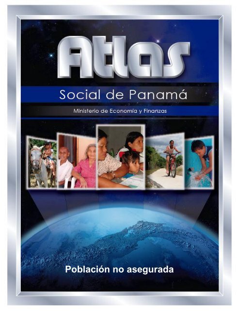
Población <strong>no</strong> <strong>asegurada</strong>
<strong>Ministerio</strong> <strong>de</strong> Eco<strong>no</strong>mía y <strong>Finanzas</strong><br />
Frank De Lima<br />
Ministro<br />
Omar Castillo<br />
Viceministro <strong>de</strong> Eco<strong>no</strong>mía<br />
Mahesh Khemlani<br />
Viceministro <strong>de</strong> <strong>Finanzas</strong>
Notas aclaratorias<br />
En caso <strong>de</strong> utilizar el material contenido en este informe, agra<strong>de</strong>ceremos citar la<br />
fuente o acreditar la autoría al <strong>Ministerio</strong> <strong>de</strong> Eco<strong>no</strong>mía y <strong>Finanzas</strong>.<br />
Sig<strong>no</strong>s convencionales que se emplean con mayor frecuencia en la publicación:<br />
. Para separar <strong>de</strong>cimales.<br />
, Para la separación <strong>de</strong> millares, millones, etc.<br />
.. Dato <strong>no</strong> aplicable al grupo o categoría.<br />
… Información <strong>no</strong> disponible.<br />
- Cantidad nula o cero.<br />
0<br />
0.0<br />
0.00<br />
(P)<br />
Cuando la cantidad es me<strong>no</strong>r a la mitad <strong>de</strong> la unidad o fracción <strong>de</strong>cimal adoptada<br />
para la expresión <strong>de</strong>l dato.<br />
Cifras preliminares o provisionales.<br />
(R) Cifras revisadas.<br />
(E) Cifras estimadas.<br />
n.c.p. No clasificable en otra parte.<br />
n.e. No especificado.<br />
n.e.p. No especificado en otra partida.<br />
n.e.o.c. No especificado en otra categoría.<br />
n.e.o.g. No especificado en otro grupo.<br />
n.i.o.p. No incluida en otra partida.<br />
msnm Metros sobre el nivel <strong>de</strong>l mar<br />
B/. Balboa, unidad monetaria <strong>de</strong>l país.<br />
Debido al redon<strong>de</strong>o <strong>de</strong>l computador, la suma o variación pue<strong>de</strong> <strong>no</strong> coincidir con la<br />
cifra impresa
Población <strong>no</strong> <strong>asegurada</strong><br />
Por: Esilda Atencio López<br />
El sistema <strong>de</strong> seguridad social contributivo<br />
está cargo <strong>de</strong> la Caja <strong>de</strong> Seguro Social,<br />
fundada mediante la Ley 23 <strong>de</strong> 21<br />
<strong>de</strong> marzo <strong>de</strong> 1941. Según lo dispuesto<br />
en la Ley, esta institución<br />
tiene la función <strong>de</strong><br />
garantizar los medios<br />
económicos <strong>de</strong> subsistencia<br />
en caso <strong>de</strong> retiro<br />
por vejez, enfermedad,<br />
maternidad, invali<strong>de</strong>z,<br />
viu<strong>de</strong>z, orfandad, <strong>de</strong>función,<br />
acci<strong>de</strong>ntes <strong>de</strong> trabajo<br />
y enfermeda<strong>de</strong>s<br />
profesionales a aquellas<br />
personas que cotizaron en su etapa laboral.<br />
El seguro también se amplía en cuidados<br />
<strong>de</strong> salud y otras ventajas para sus<br />
beneficiarios.<br />
El sistema <strong>de</strong> seguridad social contributivo<br />
aplicado en Panamá es un mo<strong>de</strong>lo<br />
bismarckia<strong>no</strong>, primer sistema <strong>de</strong> seguridad<br />
social implementado en Alemania,<br />
bajo la administración <strong>de</strong> Otto Von Bismarck,<br />
en 1883, <strong>de</strong> carácter obligatorio, y<br />
con cobertura por enfermedad, vejez,<br />
invali<strong>de</strong>z y acci<strong>de</strong>ntes <strong>de</strong>l trabajo. El financiamiento<br />
se daba por la cotización<br />
<strong>de</strong> los trabajadores.<br />
Con modificaciones, el<br />
aplicado a Panamá<br />
reposa sobre los principios<br />
<strong>de</strong> carácter público,<br />
solidario, universal,<br />
<strong>de</strong> unidad, <strong>de</strong> equidad,<br />
<strong>de</strong> obligatoriedad,<br />
transparencia, subsidiaridad<br />
y <strong>de</strong> participación,<br />
entre otros; y según la<br />
ley Orgánica <strong>de</strong> la Caja <strong>de</strong> Seguro Social<br />
No. 51 <strong>de</strong>l 27 <strong>de</strong> diciembre <strong>de</strong> 2005, en<br />
su Artículo 77, establece que: “están<br />
obligados a participar en el régimen <strong>de</strong> la<br />
Caja <strong>de</strong> Seguro Social todos los trabajadores<br />
nacionales y extranjeros que brin<strong>de</strong>n<br />
servicios <strong>de</strong>ntro <strong>de</strong> la República <strong>de</strong><br />
Panamá, incluyendo los trabajadores por<br />
cuenta ajena y trabajadores por cuenta<br />
propia”.<br />
¿Cuántos son y don<strong>de</strong> están los <strong>no</strong> asegurados?<br />
Del total <strong>de</strong> la población, el 52.3% respondió<br />
tener seguridad social, ya sea<br />
como asegurado directo, beneficiario,<br />
jubilado o pensionado; 47.4% <strong>no</strong> tenía<br />
seguro y 0.3% <strong>no</strong> <strong>de</strong>claró. Del total <strong>de</strong> la<br />
población sin seguro social, el 51.2% tenía<br />
15 o más años <strong>de</strong> edad y era económicamente<br />
activa.<br />
Gran parte <strong>de</strong> la población que respondió<br />
<strong>no</strong> tener seguro suele acaparar el interés<br />
<strong>de</strong> muchas políticas públicas, por estar<br />
vinculada a condiciones laborales informales,<br />
bajos ingresos, baja escolaridad y<br />
a otras condiciones relacionadas con la<br />
pobreza.<br />
Para muchos que <strong>no</strong> tienen seguro, se<br />
les hace difícil afrontar los costos <strong>de</strong> los<br />
cuidados <strong>de</strong> salud, aun cuando el Estado<br />
hace gran<strong>de</strong>s inversiones en el sector, y<br />
existan programas para afrontarlos,<br />
como es el caso <strong>de</strong> la Red <strong>de</strong><br />
Oportunida<strong>de</strong>s, que tiene un componente<br />
<strong>de</strong> servicios <strong>de</strong> salud, pero aun así, los<br />
recursos y personal son escasos, y solo<br />
pue<strong>de</strong>n <strong>de</strong>stinarse a satisfacer las necesida<strong>de</strong>s<br />
<strong>de</strong> la población más vulnerable.<br />
El 50.7% <strong>de</strong> las personas sin seguro social<br />
se localizaban en las áreas rurales<br />
<strong>de</strong>l país y el 49.3%, en las urbanas.
Dentro <strong>de</strong>l área rural, el 72.2% era <strong>no</strong><br />
indígena y 27.8% indígena. Estas proporciones<br />
estaban relacionadas con el<br />
tamaño <strong>de</strong> la población que vivía en estas<br />
áreas y vinculadas estrechamente al<br />
tipo <strong>de</strong> actividad económica que se <strong>de</strong>sarrolla<br />
y a las condiciones <strong>de</strong>l mercado<br />
laboral.<br />
Visto por tasas, 63 personas <strong>de</strong> cada<br />
cien que vivían en el área rural <strong>no</strong> indígena<br />
<strong>no</strong> tenían seguro, en contraste con<br />
las 92 en el área rural indígena y las 36<br />
en la urbana. La diferencia en las tasas<br />
se da porque existen dos realida<strong>de</strong>s totalmente<br />
distintas entre los que viven en<br />
el área rural o la urbana. En las áreas<br />
urbanas <strong>de</strong> las cabeceras <strong>de</strong> provincias<br />
se ha <strong>de</strong>sarrollado más el mercado laboral<br />
o hay más puestos <strong>de</strong> trabajos formales<br />
que en áreas rurales. La situación<br />
anterior ha llevado a segregar a gran<br />
parte <strong>de</strong> los <strong>no</strong> asegurados al área rural,<br />
transmitiéndose el efecto <strong>de</strong> generación<br />
en generación.<br />
Por ejemplo, una persona que viva en un<br />
corregimiento rural y sea peón agrícola,<br />
lo más probable es que su nivel <strong>de</strong> ingreso<br />
sea fluctuante y <strong>de</strong>pendiente <strong>de</strong> las<br />
oportunida<strong>de</strong>s <strong>de</strong> trabajo propias <strong>de</strong>l<br />
sector (periodos <strong>de</strong> cosechas y siembras),<br />
y <strong>no</strong> cotice en el Seguro Social. Si<br />
<strong>de</strong>seara tener seguro se tendría que pagar<br />
por su cuenta las cuotas <strong>de</strong>l seguro,<br />
o viajar todos los días hasta un distrito<br />
cabecera para laborar en un empleo que<br />
pague seguro social. La situación antes<br />
<strong>de</strong>scrita pue<strong>de</strong> ser la más probable que<br />
les haya sucedido a personas mayores<br />
<strong>de</strong> 50 años <strong>de</strong>l área rural que en el<br />
Censo respondieron <strong>no</strong> tener seguro.<br />
De 445 corregimientos con más <strong>de</strong>l 50%<br />
<strong>de</strong> <strong>no</strong> asegurados, en 421 el 90% o más<br />
<strong>de</strong> su población residían en el área rural.<br />
De 172 corregimientos cuyo porcentaje<br />
<strong>de</strong> <strong>no</strong> asegurados se ubicaba entre 31 y<br />
50 por ciento, en 74 el 90% o más <strong>de</strong> su<br />
población era rural.<br />
Cuadro No.1. Corregimientos por población <strong>no</strong> <strong>asegurada</strong>, según proporción <strong>de</strong><br />
población rural: Censo <strong>de</strong> 2010<br />
Proporción <strong>de</strong><br />
población<br />
rural (%)<br />
Número <strong>de</strong> corregimientos por<br />
proporción <strong>de</strong> la población <strong>no</strong><br />
protegida por la seguridad social<br />
30% o<br />
me<strong>no</strong>s<br />
31-50%<br />
Más <strong>de</strong><br />
50%<br />
TOTAL……… 14 172 445<br />
Me<strong>no</strong>s <strong>de</strong> 10… 13 48 2<br />
11 a 20……..… - 17 4<br />
21 a 30…..…… - 9 3<br />
31 a 40…..…… - 7 3<br />
41 a 50…..…… - 9 3<br />
51 a 60…..…… - 1 5<br />
61 a 70……..… - 4 1<br />
71 a 80…..…… - 2 3<br />
81 a 90……..… - 1 -<br />
Más <strong>de</strong> 90….… 1 74 421<br />
Fuente: Instituto Nacional <strong>de</strong> Estadística y Censo.
Exceptuando las comarcas, dado que<br />
toda su población es rural, en todas las<br />
provincias, entre mayor era la proporción<br />
<strong>de</strong> población rural en el corregimiento,<br />
mayor la tasa <strong>de</strong> <strong>no</strong> asegurados. Lo<br />
contrario sucedía cuando el porcentaje<br />
<strong>de</strong> población rural disminuía.<br />
En el área urbana hay más “vigilancia” <strong>de</strong><br />
la relación laboral, con in<strong>de</strong>pen<strong>de</strong>ncia <strong>de</strong><br />
la temporalidad <strong>de</strong>l empleo, el empleador<br />
está obligado a <strong>de</strong>scontar la cuota y<br />
aportar la suya. Lo más probable fue<br />
que los <strong>no</strong> asegurados <strong>de</strong> áreas urbanas<br />
tuvieron que ver con el tipo <strong>de</strong> empleo al<br />
que se optó. Mientras que en áreas<br />
rurales predomine más la informalidad,<br />
dado que muchos <strong>de</strong> los empleos están<br />
relacionados al sector primario <strong>de</strong> la<br />
eco<strong>no</strong>mía (agricultura, gana<strong>de</strong>ría, pesca,<br />
etc), <strong>de</strong>dicándose varios al cultivo <strong>de</strong><br />
subsistencia o siendo peones o<br />
jornaleros.<br />
Por provincia, en Panamá, don<strong>de</strong> 90.1%<br />
<strong>de</strong> la población vivía en el área urbana,<br />
se concentraba el mayor porcentaje <strong>de</strong><br />
población <strong>no</strong> <strong>asegurada</strong> (39.6%), <strong>de</strong>bido<br />
a que gran parte <strong>de</strong> la población resi<strong>de</strong><br />
en ella (50.3%), pero también se concentraba<br />
la mayor proporción <strong>de</strong> personas<br />
<strong>asegurada</strong>s.<br />
Cuadro No. 2. Distribución porcentual <strong>de</strong> la población <strong>no</strong> <strong>asegurada</strong> y proporción <strong>de</strong> <strong>no</strong><br />
asegurados, según provincias y comarcas indígenas: Censo <strong>de</strong> 2010<br />
Provincias y<br />
comarcas indígenas<br />
Distribución<br />
porcentual<br />
Porcentajes <strong>de</strong> <strong>no</strong><br />
asegurados por<br />
provincias y<br />
comarcas indígenas<br />
TOTAL ....................... 100.0 47.4<br />
PROVINCIAS ...................... 88.5 44.6<br />
Bocas <strong>de</strong>l Toro……………….. 4.2 53.9<br />
Coclé…………………………… 7.7 53.5<br />
Colón………………………….. 7.0 46.5<br />
Chiriquí………………………… 13.3 51.4<br />
Darién………………………….. 2.5 82.2<br />
Herrera…………………………. 3.2 46.6<br />
Los Santos……………………. 2.8 50.2<br />
Panamá………………………... 39.6 37.3<br />
Veraguas………………………. 8.3 59.0<br />
COMARCAS INDÍGENAS 11.5 92.9<br />
Kuna Yala……………………… 1.8 88.5<br />
Emberá………………………… 0.6 91.3<br />
Ngöbe Buglé………………….. 9.1 94.0<br />
Fuente: Instituto Nacional <strong>de</strong> Estadística y Censo.<br />
Chiriquí (13.3%) y Veraguas (8.3%) fueron<br />
la segunda y tercera provincia, respectivamente,<br />
con mayor número <strong>de</strong><br />
personas sin seguridad social, concordante<br />
con el hecho <strong>de</strong> que Chiriquí era la<br />
segunda provincia con más personas<br />
viviendo en el país.<br />
Con respecto al total <strong>de</strong> habitantes en<br />
cada provincia, Darién presentó la tasa<br />
<strong>de</strong> <strong>no</strong> asegurados más alta (82.2 por<br />
cada cien habitantes), siguieron Veraguas<br />
(59.0), Bocas <strong>de</strong>l Toro (53.9) y<br />
Coclé (53.5).
En las comarcas indígenas la mayoría <strong>de</strong><br />
la población <strong>no</strong> estaba afiliada a un sistema<br />
<strong>de</strong> previsión social. En la Ngöbe<br />
Buglé, 94 <strong>de</strong> cada cien personas <strong>no</strong> poseía<br />
seguro, en la Emberá 91 y en Kuna<br />
Yala 89. Entre los indígenas que viven<br />
fuera <strong>de</strong> las comarcas, la proporción <strong>de</strong><br />
<strong>no</strong> asegurados fue más baja: 51% los<br />
Ngöbe Buglé, 63% los Emberá y 48% los<br />
<strong>de</strong> Kuna Yala.<br />
Las tasas más altas <strong>de</strong> <strong>no</strong> asegurados<br />
De los 631 corregimientos, en 190 el<br />
80% o más <strong>de</strong> su población <strong>no</strong> contaban<br />
con seguridad social y entre estos algu<strong>no</strong>s<br />
alcanzaban porcentajes superiores al<br />
90%:<br />
Todos los <strong>de</strong> la comarca Ngöbe Buglé,<br />
dándose en los corregimientos <strong>de</strong> Krüa,<br />
Güibale y Noba, la mayor proporción;<br />
37 corregimientos <strong>de</strong> la provincia <strong>de</strong> Veraguas<br />
don<strong>de</strong> Calovébora (96.9%), Gatú<br />
o Gatúcito (96.2%) y San José <strong>de</strong>l distrito<br />
<strong>de</strong> Calobre (95.7%) fueron los tres con<br />
mayor proporción <strong>de</strong> <strong>no</strong> asegurados;<br />
18 <strong>de</strong> Darién, sobresaliendo la comarca<br />
Kuna <strong>de</strong> Wargandí, Yape y Río Congo<br />
Arriba, con 90%, en promedio, <strong>de</strong> población<br />
<strong>no</strong> <strong>asegurada</strong>;<br />
15 corregimientos en la provincia <strong>de</strong> Panamá,<br />
repitiéndose el hecho <strong>de</strong> que la<br />
mayoría <strong>de</strong> la población indígena <strong>de</strong> la<br />
comarca Kuna <strong>de</strong> Madungandí (95.9%)<br />
<strong>no</strong> tenía, seguida <strong>de</strong> Pasiga (95.4%);<br />
11 eran <strong>de</strong> Herrera: Las Llanas, Quebrada<br />
<strong>de</strong> Ciprián y Leones eran los que<br />
tenían mayor proporción <strong>de</strong> población <strong>no</strong><br />
<strong>asegurada</strong>;<br />
Cuadro No. 3. Número <strong>de</strong> corregimientos, por provincias y comarcas indígenas con el<br />
ochenta por ciento o más <strong>de</strong> su población sin seguridad social: Censo <strong>de</strong> 2010<br />
Provincias y<br />
comarcas indígenas<br />
Total <strong>de</strong><br />
corregimientos<br />
Corregimientos<br />
con el 80% o<br />
más <strong>de</strong> <strong>no</strong><br />
asegurados<br />
TOTAL ............................ 631 190<br />
PROVINCIAS ..................... 564 124<br />
Bocas <strong>de</strong>l Toro ........................ 23 10<br />
Coclé ....................................... 42 8<br />
Colón ....................................... 40 9<br />
Chiriquí .................................... 96 11<br />
Darién ...................................... 25 18<br />
Herrera .................................... 48 11<br />
Los Santos ............................... 80 5<br />
Panamá ................................... 113 15<br />
Veraguas ................................. 97 37<br />
COMARCAS INDÍGENAS .. 67 66<br />
Kuna Yala ................................ 4 3<br />
Emberá .................................... 5 5<br />
Ngöbe Buglé ............................ 58 58<br />
Fuente: Instituto Nacional <strong>de</strong> Estadística y Censo.
Mientras que <strong>de</strong> los 11 <strong>de</strong> Chiriquí: Justo<br />
Fi<strong>de</strong>l Palacios (92.8%), El Cristo (92.5%)<br />
y Potrero <strong>de</strong> Caña (88.7%), <strong>de</strong>stacaron;<br />
De Bocas <strong>de</strong>l Toro fueron 10 corregimientos,<br />
sobresaliendo: las Delicias<br />
(91.9%), Punta Laurel (90.8%) y Cauchero<br />
(89.6%) todos ellos en el distrito <strong>de</strong><br />
Changui<strong>no</strong>la;<br />
De Colón fueron 9 corregimientos: El<br />
Guásimo (97.1%), Coclé <strong>de</strong>l Norte<br />
(92.9%) y La Encantada (92.7%) fueron<br />
los tres con los porcentajes más altos sin<br />
seguridad.<br />
Ocho eran los corregimientos en Coclé:<br />
Río Indio (96.7%), Chiriguí Arriba<br />
(88.8%) y Las Huacas (88.6%), fueron<br />
los principales;<br />
En la comarca Emberá, al igual que en la<br />
provincia <strong>de</strong> Los Santos, en cinco corregimientos<br />
también fue alto el porcentaje<br />
<strong>de</strong> población <strong>no</strong> <strong>asegurada</strong>. Entre los<br />
cinco <strong>de</strong> la comarca, el corregimiento<br />
Jungurudó figuró en el primer lugar<br />
(96.7%). En Los Santos, Bahía Honda<br />
(88.2%), El Cortezo (86.7%) y Las Palmas<br />
(83.0%);<br />
En la comarca <strong>de</strong> Kuna Yala eran tres<br />
corregimientos (<strong>de</strong> los cuatro existentes):<br />
Tubualá (91.6%), Narganá (88.9%) y<br />
Aligandí (87.4%).<br />
Hombres y mujeres sin seguridad social<br />
La proporción <strong>de</strong> hombres y mujeres <strong>no</strong><br />
<strong>asegurada</strong>s era similar: el 47.7% <strong>de</strong>l total<br />
<strong>de</strong> hombres en el país y el 47.5% <strong>de</strong> las<br />
mujeres <strong>no</strong> tenía seguro. Aun cuando<br />
había más hombres asegurados directos<br />
que mujeres, (hubo más mujeres beneficiarias<br />
que hombres), las diferencias se<br />
compensaban, quedando casi la misma<br />
proporción <strong>de</strong> hombres y mujeres sin<br />
seguridad social.<br />
Y es que el sistema <strong>de</strong> seguridad social<br />
favorece más a las mujeres como beneficiarias<br />
que a los hombres, porque muchas<br />
se <strong>de</strong>claran “amas <strong>de</strong> casa”. En<br />
estos casos, el esposo que es cotizante<br />
directo (o pensionado) pue<strong>de</strong> cubrir a su<br />
esposa con cuidados médicos y, si él<br />
fallece, ella queda protegida con una<br />
pensión económica. En el caso contrario,<br />
si ella es la cotizante directa (o pensionada),<br />
sólo pue<strong>de</strong> beneficiar a su esposo<br />
si este es inválido, a<strong>de</strong>más <strong>de</strong><br />
cumplir con otros requisitos estipulados.<br />
Ambos pue<strong>de</strong>n cubrir a madre, padre e<br />
hijos siempre que los últimos estudien y<br />
tengan me<strong>no</strong>s <strong>de</strong> 25 años, pero solo con<br />
servicios médicos.<br />
En el total <strong>de</strong> <strong>no</strong> asegurados, 50.4% eran<br />
hombres y 49.6% mujeres. David<br />
(16,746), Pacora (14,600) y Juan Díaz<br />
(12,496) eran los corregimientos con<br />
mayor número <strong>de</strong> hombres sin seguro<br />
social, y David (15,168), Tocumen<br />
(13,630) y 24 <strong>de</strong> Diciembre (13,303), en<br />
el caso <strong>de</strong> mujeres.
Cuadro No. 4. Distribución porcentual <strong>de</strong> la población por sexo, según condición <strong>de</strong><br />
asegurado: Censo <strong>de</strong> 2010<br />
Condición <strong>de</strong> asegurado<br />
Distribución<br />
porcentual, por sexo<br />
Hombres<br />
Mujeres<br />
TOTAL 1 ……………………...…………. 100.0 100.0<br />
Asegurado directo…………………………...... 28.5 19.1<br />
Beneficiario…………………........................... 18.9 28.5<br />
Jubilado pensionado por vejez………………. 4.1 4.0<br />
Pensionado por acci<strong>de</strong>nte o enfermedad….. 0.8 0.8<br />
No tiene seguro……………………………..… 47.7 47.5<br />
1 Se restó los <strong>no</strong> <strong>de</strong>clarados y jubilados <strong>de</strong> otros países.<br />
Fuente: Instituto Nacional <strong>de</strong> Estadística y Censo.<br />
En 191 corregimientos, el 80% o más <strong>de</strong><br />
los hombres <strong>no</strong> tenían seguridad social,<br />
mientras que para las mujeres, en 188.<br />
Por jefes <strong>de</strong> hogar, el 38.8% <strong>de</strong> jefes<br />
hombres y el 34.9% <strong>de</strong> jefes mujeres <strong>no</strong><br />
tenían seguro social en el país.<br />
No asegurados por grupos <strong>de</strong> edad<br />
Más <strong>de</strong> la mitad <strong>de</strong> los niños me<strong>no</strong>res <strong>de</strong><br />
10 años <strong>de</strong>l país (59.3%) <strong>no</strong> era beneficiario<br />
<strong>de</strong> la seguridad social.<br />
En 250 corregimientos, el 80% o más <strong>de</strong><br />
los me<strong>no</strong>res <strong>de</strong> 10 años <strong>no</strong> estaban protegidos<br />
por la seguridad social. En las<br />
comarcas, casi todos los corregimientos<br />
tenían esta o mayor tasa, a excepción <strong>de</strong><br />
Puerto Obaldía en la comarca Kuna Yala.<br />
Entre las provincias, Veraguas fue la que<br />
mostró más corregimientos con tasas por<br />
arriba <strong>de</strong>l 80%; el 54.6% <strong>de</strong>l total <strong>de</strong> sus<br />
corregimientos estuvo en esta condición.<br />
El 52% <strong>de</strong> los individuos con entre 10 y<br />
17 años <strong>de</strong> edad en el país <strong>no</strong> poseían<br />
seguro, (16.8% <strong>de</strong>l total <strong>de</strong> <strong>no</strong> asegurados)<br />
y <strong>de</strong> estos la mayoría eran estudiantes<br />
(83.7%).<br />
246 eran los corregimientos don<strong>de</strong> el<br />
80% o más <strong>de</strong> su población, con estas<br />
eda<strong>de</strong>s, <strong>no</strong> tenía seguro, y en 10 (seis<br />
eran en la comarca Ngöbe Buglé, tres en<br />
Panamá y u<strong>no</strong> en Darién), el 100%.<br />
De 18 a 29 años, el 56% <strong>no</strong> tenía seguro<br />
(23.1% <strong>de</strong>l total <strong>de</strong> <strong>no</strong> asegurados). De<br />
ellos y hasta 25 años, que es la edad<br />
don<strong>de</strong> se permite ser beneficiario si se<br />
estudia, solo el 19.3% lo hacía, el resto<br />
(36.2%) estaba ocupado o era ama <strong>de</strong><br />
casa o trabajador <strong>de</strong>l hogar (27.2%).<br />
En 261 corregimientos el 80% o más <strong>de</strong><br />
su población en este grupo <strong>de</strong> edad <strong>no</strong><br />
tenían seguro. En el corregimiento Gonzalo<br />
Vázquez, en el distrito <strong>de</strong> Chimán,<br />
provincia <strong>de</strong> Panamá, y Jungurudó, distrito<br />
<strong>de</strong> Sambú, en la comarca Emberá, el<br />
100% <strong>no</strong> poseía seguro social.
Cuadro No. 5. Número <strong>de</strong> corregimientos con el ochenta por ciento o más <strong>de</strong> su población<br />
sin seguro social, por grupos <strong>de</strong> edad, según provincias y comarcas indígenas:<br />
Censo <strong>de</strong> 2010<br />
Provincias y<br />
comarcas indígenas<br />
Me<strong>no</strong>s<br />
<strong>de</strong> 10<br />
Grupos <strong>de</strong> edad en años<br />
10-17 18 -29 30 - 49<br />
50 ó<br />
más<br />
TOTAL ......................... 250 246 261 191 107<br />
PROVINCIAS....................... 184 179 194 128 50<br />
Bocas <strong>de</strong>l Toro…………..…………. 14 12 12 7 -<br />
Chiriquí………………………........… 21 19 26 9 3<br />
Coclé………………………..……….. 8 8 10 8 4<br />
Colón……………..……………..…… 16 16 15 8 4<br />
Darién………………..…………..….. 23 22 20 11 9<br />
Herrera………….…….…….….…… 13 13 14 14 6<br />
Los Santos……………………..…... 14 13 23 11 -<br />
Panamá…………………..…………. 22 22 19 16 12<br />
Veraguas……………………..……... 53 54 55 44 12<br />
COMARCAS INDÍGENAS .... 66 67 67 63 57<br />
Emberá…………………………....… 5 5 5 5 5<br />
Kuna Yala………………………..….. 3 4 4 3 2<br />
Ngöbe Buglé……………………..…. 58 58 58 55 50<br />
Fuente: Instituto Nacional <strong>de</strong> Estadística y Censo.<br />
Entre 30 y 49 años, el 44% en el país <strong>no</strong><br />
poseía seguro contributivo, ellos representaban<br />
el 25.0% <strong>de</strong> los <strong>no</strong> asegurados<br />
y la mayoría estaban ocupados (54.8%)<br />
o eran amas <strong>de</strong> casa o trabajadores <strong>de</strong>l<br />
hogar (33.1%). 191 fueron los corregimientos<br />
don<strong>de</strong> el 80% o más <strong>de</strong> esta<br />
población <strong>no</strong> tenía seguro, principalmente<br />
resi<strong>de</strong>ntes en la provincia <strong>de</strong> Veraguas<br />
(44 corregimientos) y la comarca<br />
Ngöbe Buglé (55).<br />
De 50 o más años, el 33.0% <strong>no</strong> tenía seguro<br />
(13.2% <strong>de</strong>l total <strong>de</strong> <strong>no</strong> asegurados).<br />
El 46.9% <strong>de</strong> ellos estaban ocupados, el<br />
27.3% <strong>de</strong>clararon ser amas <strong>de</strong> casa o<br />
trabajadores <strong>de</strong>l hogar y 13.8%, tener<br />
una edad muy avanzada (más <strong>de</strong> 70<br />
años). 107 fueron los corregimientos<br />
don<strong>de</strong> el porcentaje <strong>de</strong> <strong>no</strong> aseguramiento<br />
<strong>de</strong> esta población era mayor al 80%.
Cuadro No. 6. Los diez principales corregimientos con mayor número <strong>de</strong> personas <strong>no</strong><br />
<strong>asegurada</strong>s, por grupos <strong>de</strong> edad: Censo <strong>de</strong> 2010<br />
Corregimientos, provincias o<br />
comarcas indígenas<br />
Me<strong>no</strong>r<br />
<strong>de</strong> 10<br />
Grupos <strong>de</strong> edad en años<br />
10 - 17 18 - 29 30 y 49 50 o más<br />
David -cabecera (Chiriquí)….....… 5,471 4,487 8,536 9,041 4,379<br />
24 <strong>de</strong> Diciembre (Panamá)……..… 4,910 4,023 6,844 6,599 2,193<br />
Chilibre (Panamá)…………….…… 4,858 4,027 6,046 6,390 2,481<br />
Tocumen (Panamá)……..………… 4,770 3,650 7,261 7,140 2,624<br />
Pacora (Panamá)……………..…… 4,720 3,455 8,153 7,580 -<br />
Ernesto Córdoba C. (Panamá)..… 4,047 3,219 5,164 5,484 -<br />
Belisario Porras (Panamá)….....… 3,748 2,872 5,206 5,438 2,095<br />
Cristóbal (Colón)……………..…… 3,581 2,911 5,827 5,504 -<br />
Pedregal (Panamá)………..……... 3,535 2,917 5,357 5,608 2,339<br />
Juan Díaz (Panamá)………..….… 3,532 3,111 6,760 7,875 3,610<br />
Ancón (Panamá)…………………… - - - - 3,237<br />
Narganá- Cabecera (Kuna Yala) - - - - 2,104<br />
San Francisco (Panamá)………… - - - - 2,251<br />
Fuente: Instituto Nacional <strong>de</strong> Estadística y Censo.<br />
David (cabecera) en la provincia <strong>de</strong> Chiriquí<br />
era el corregimiento con mayor número<br />
<strong>de</strong> personas <strong>no</strong> <strong>asegurada</strong>s <strong>de</strong><br />
todos los grupos <strong>de</strong> edad. Pero en el<br />
grupo <strong>de</strong> 50 o más años, resaltaron Ancón<br />
y San Francisco en la provincia <strong>de</strong><br />
Panamá, corregimientos don<strong>de</strong> predomina<br />
un nivel <strong>de</strong> ingresos medio y alto,<br />
suficiente para costear los servicios médicos<br />
privados y manutención en el hogar.<br />
¿Qué porcentaje <strong>de</strong> los <strong>no</strong> asegurados era económicamente activas?<br />
Del total <strong>de</strong> personas <strong>no</strong> <strong>asegurada</strong>s, el<br />
51.2% eran económicamente activas (<strong>de</strong><br />
15 o más años <strong>de</strong> edad), <strong>de</strong> la cual<br />
13.0% estaba <strong>de</strong>socupada. El resto<br />
(48.8%) eran <strong>no</strong> económicamente activas.<br />
En las provincias <strong>de</strong> Bocas <strong>de</strong>l Toro, Coclé<br />
y las comarcas <strong>de</strong> Kuna Yala y<br />
Ngöbe Buglé el porcentaje <strong>de</strong> población<br />
<strong>no</strong> económicamente activa era mayor en<br />
estos cuatro casos. En cambio, en el<br />
resto <strong>de</strong> las provincias y la comarca<br />
Emberá, habían más personas<br />
económicamente activas, resaltando los<br />
casos <strong>de</strong> Los Santos, Herrera y Panamá.<br />
A pesar <strong>de</strong> que las comarcas tienen las<br />
tasas <strong>de</strong> <strong>no</strong> asegurados más altas en el<br />
país, el porcentaje <strong>de</strong> económicamente<br />
activos y ocupados que emigró a la provincia<br />
<strong>de</strong> Panamá era mucho me<strong>no</strong>r al<br />
registrado en las comarcas: <strong>de</strong> los <strong>de</strong><br />
Kuna Yala, 29.1%; Ngöbe Buglé, 37.8%,<br />
y Emberá, 45.6%.
Cuadro No. 7. Distribución porcentual <strong>de</strong> la población <strong>no</strong> <strong>asegurada</strong>, por condición<br />
económica y sexo: Censo <strong>de</strong> 2010<br />
Provincias y comarcas<br />
indígenas<br />
Población<br />
económicamente activa<br />
Población <strong>no</strong><br />
económicamente activa<br />
Total Hombre Mujer Total Hombre Mujer<br />
TOTAL 1 ................................. 51.2 37.1 14.1 48.8 12.7 36.1<br />
PROVINCIAS ......................... 52.8 38.1 14.7 47.2 12.0 35.1<br />
Bocas <strong>de</strong>l Toro ............................... 40.8 32.5 8.3 59.2 14.4 44.8<br />
Coclé.............................................. 49.0 37.9 11.1 51.0 13.8 37.2<br />
Colón ............................................. 51.5 35.4 16.1 48.5 11.8 36.7<br />
Chiriquí .......................................... 51.6 40.0 11.6 48.4 12.9 35.5<br />
Darién ............................................ 52.9 44.9 8.0 47.1 11.6 35.4<br />
Herrera ........................................... 55.1 42.5 12.6 44.9 11.8 33.1<br />
Los Santos ..................................... 56.9 44.7 12.2 43.1 11.4 31.7<br />
Panamá ......................................... 54.9 36.2 18.7 45.1 11.3 33.8<br />
Veraguas ....................................... 51.6 43.0 8.7 48.4 12.2 36.1<br />
COMARCAS INDÍGENAS ...... 34.0 26.1 7.8 66.0 20.0 46.0<br />
Kuna Yala ...................................... 44.9 31.7 13.1 55.1 11.8 43.3<br />
Emberá .......................................... 53.4 40.5 12.9 46.6 12.7 33.9<br />
Ngöbe Buglé .................................. 29.9 23.8 6.2 70.1 22.5 47.5<br />
1<br />
Se excluye a los que <strong>no</strong> <strong>de</strong>clararon.<br />
Fuente: Instituto Nacional <strong>de</strong> Estadística y Censo.<br />
Por sexo, en general la población<br />
económicamente activa <strong>no</strong> <strong>asegurada</strong><br />
estaba conformada principalmente por<br />
hombres (37.1%) que mujeres (14.1%).<br />
Este dato lo po<strong>de</strong>mos corroborar porque<br />
generalmente son los hombres los que<br />
se <strong>de</strong>dican más a la agricultura y a la<br />
construcción, dos <strong>de</strong> las ocupaciones en<br />
don<strong>de</strong> se encuentran mayor número <strong>de</strong><br />
personas <strong>no</strong> <strong>asegurada</strong>s (como veremos<br />
más a<strong>de</strong>lante).<br />
Gran parte <strong>de</strong> los casos en que los<br />
ingresos <strong>de</strong> los hogares <strong>de</strong>pen<strong>de</strong>n <strong>de</strong> la<br />
agricultura, el hombre es el que sale a<br />
trabajar la tierra, mientras que las<br />
mujeres se ocupan en los quehaceres<br />
<strong>de</strong>l hogar. Así se observaba que el<br />
36.1% <strong>de</strong> los <strong>no</strong> económicamente activos<br />
fueron mujeres y solo 12.7% hombres.<br />
Lo anterior <strong>de</strong>scrito explica en parte la<br />
distribución por género <strong>de</strong> los <strong>no</strong><br />
asegurados según su condición<br />
económica.<br />
¿En qué rama <strong>de</strong> actividad y ocupación estaban los <strong>no</strong> asegurados?<br />
El 26.8% <strong>de</strong> los <strong>no</strong> asegurados (<strong>de</strong> 15 o<br />
más años <strong>de</strong> edad) y ocupados se <strong>de</strong>dicaban<br />
a la agricultura, gana<strong>de</strong>ría, caza y<br />
silvicultura, 17.6% se <strong>de</strong>dicaba al comercio<br />
al por mayor y al por me<strong>no</strong>r, y 11.8%<br />
a la construcción.<br />
Por ocupación, se elaboró una lista <strong>de</strong><br />
las 10 ocupaciones principales por provincias<br />
y comarcas indígenas, en don<strong>de</strong><br />
había más personas económicamente<br />
activas y ocupadas que <strong>no</strong> poseían seguro<br />
(ver Anexo No.1). En todas las provincias<br />
y comarcas, a excepción <strong>de</strong> Pa-
namá, figuraba como primera ocupación<br />
agricultor <strong>de</strong> cultivo <strong>de</strong> subsistencia o<br />
peón agrícola.<br />
En Panamá era el empleado doméstico.<br />
Sobre esto último, en 2005 se introdujeron<br />
una serie <strong>de</strong> reformas en la Caja <strong>de</strong><br />
Seguro Social, entre ellas la afiliación <strong>de</strong><br />
personas <strong>de</strong>dicadas al servicio doméstico.<br />
En las provincias <strong>de</strong> Coclé, Colón, Panamá<br />
y las comarcas Kuna Yala y Ngöbe<br />
Buglé la segunda ocupación don<strong>de</strong> estaban<br />
concentrados los <strong>no</strong> asegurados<br />
eran: empleados domésticos, albañiles,<br />
conductores <strong>de</strong> taxis y artesa<strong>no</strong>s. En las<br />
<strong>de</strong>más provincias se mantenían ocupaciones<br />
relacionadas con la agricultura.<br />
Cuadro No. 8. Distribución porcentual <strong>de</strong> la población económicamente activa <strong>de</strong> 15 años<br />
o más <strong>de</strong> edad, ocupada y <strong>no</strong> <strong>asegurada</strong>, por rama <strong>de</strong> actividad: Censo <strong>de</strong> 2010<br />
Ramas <strong>de</strong> actividad<br />
Distribución<br />
porcentual<br />
TOTAL……………………………………………………….….… 100.0<br />
Agricultura, gana<strong>de</strong>ría, caza, silvicultura, pesca y activida<strong>de</strong>s<br />
<strong>de</strong> servicio……………………………………………………………. 26.8<br />
Comercio al por mayor y al por me<strong>no</strong>r (incluye Zonas<br />
Francas)…………………………………………………………….... 17.6<br />
Construcción…………………………………………………………. 11.8<br />
Activida<strong>de</strong>s <strong>de</strong> los hogares en calidad <strong>de</strong> empleadores….…….. 8.8<br />
Transporte, almacenamiento y correo……………………………. 7.9<br />
Industrias manufactureras…………………………………………. 6.6<br />
Hoteles y restaurantes……………………………………………... 4.9<br />
Otras activida<strong>de</strong>s <strong>de</strong> servicio………………………………………. 3.7<br />
Activida<strong>de</strong>s administrativas y servicios <strong>de</strong> apoyo……………….. 3.5<br />
Activida<strong>de</strong>s profesionales, científicas y técnicas………………… 1.9<br />
Activida<strong>de</strong>s <strong>de</strong> organizaciones y órga<strong>no</strong>s extraterritoriales……. 1.4<br />
Servicios sociales y relacionados con la salud humana…….….. 1.0<br />
Enseñanza…………………………………………………………… 0.9<br />
Artes, entretenimiento y creatividad………………………………. 0.7<br />
Información y comunicación……………………………………….. 0.5<br />
Activida<strong>de</strong>s financieras y <strong>de</strong> seguros……………………………... 0.5<br />
Activida<strong>de</strong>s inmobiliarias…………………………………………… 0.5<br />
Suministro <strong>de</strong> agua; alcantarillado, gestión <strong>de</strong> <strong>de</strong>sechos……… 0.3<br />
Explotación <strong>de</strong> minas y canteras………………………………….. 0.2<br />
Suministro <strong>de</strong> electricidad, gas, vapor y aire acondicionado…... 0.1<br />
Administración pública y <strong>de</strong>fensa; planes <strong>de</strong> seguridad social<br />
<strong>de</strong> afiliación…………………………………………………………... 0.1<br />
Fuente: Instituto Nacional <strong>de</strong> Estadística y Censo.
¿Cuál era el ingreso <strong>de</strong> los <strong>no</strong> asegurados?<br />
Del total <strong>de</strong> ocupados y sin seguro, el<br />
35.5% estaban <strong>de</strong>ntro <strong>de</strong>l rango <strong>de</strong> ingresos<br />
mínimos (me<strong>no</strong>s <strong>de</strong> B/.125.00 por<br />
mes), sobre todo los <strong>de</strong>dicados a la agricultura,<br />
gana<strong>de</strong>ría, caza y silvicultura.<br />
Por provincia, el porcentaje <strong>de</strong> personas<br />
en este rango <strong>de</strong> ingresos era el 32.6%,<br />
pero en las comarcas el 86.1%.<br />
El 21.4% tenían ingresos entre B/.125.00<br />
y B/.249.00; el 17.4% entre B/.250.00 y<br />
B/.399.00; y el 13.5% entre B/.400 y<br />
B/.599.00, en estos dos últimos rangos<br />
<strong>de</strong> ingresos se encontraban principalmente<br />
los <strong>de</strong>dicados al comercio al por<br />
mayor y al por me<strong>no</strong>r, y a la construcción.<br />
Solo el 12.3% tenían ingresos mensuales<br />
<strong>de</strong> B/.600.00 o más, registrándose<br />
el porcentaje más alto en la provincia <strong>de</strong><br />
Panamá (20.0%).<br />
El nivel <strong>de</strong> ingresos es sumamente importante<br />
en el acceso a un sistema <strong>de</strong><br />
aseguramiento contributivo porque <strong>de</strong>termina<br />
la afiliación a la seguridad social.<br />
Cuadro No. 9. Porcentaje <strong>de</strong> población <strong>de</strong> 15 años o más, ocupada y sin seguro por<br />
provincias y comarcas indígenas, según rangos <strong>de</strong> ingresos: Censo <strong>de</strong> 2010<br />
Rangos <strong>de</strong> ingresos totales (en balboas)<br />
Provincias y comarcas indígenas<br />
Total<br />
Me<strong>no</strong>s <strong>de</strong><br />
125<br />
125 a 249 250 a 399 400 a 599<br />
600 o<br />
más<br />
TOTAL ......................................... 100.0 35.5 21.4 17.4 13.5 12.3<br />
PROVINCIAS .................................. 100.0 32.6 22.1 18.2 14.2 12.9<br />
Bocas <strong>de</strong>l Toro ..................................... 100.0 43.8 23.3 16.3 9.6 7.0<br />
Coclé .................................................... 100.0 51.5 22.5 14.0 7.4 4.7<br />
Colón .................................................... 100.0 33.7 22.8 20.3 14.6 8.5<br />
Chiriquí ................................................. 100.0 31.4 30.1 18.6 11.0 8.9<br />
Darién .................................................. 100.0 54.0 22.9 12.0 5.5 5.7<br />
Herrera ................................................. 100.0 44.3 24.3 16.2 8.6 6.5<br />
Los Santos ........................................... 100.0 43.6 26.2 16.4 8.0 5.8<br />
Panamá ................................................ 100.0 19.7 19.3 21.0 20.0 20.0<br />
Veraguas .............................................. 100.0 61.7 19.1 10.3 5.0 3.8<br />
COMARCAS INDÍGENAS ............... 100.0 86.1 8.8 2.9 1.2 1.0<br />
Kuna Yala............................................. 100.0 85.3 8.5 3.0 1.7 1.5<br />
Emberá ................................................ 100.0 81.7 9.7 3.9 2.0 2.8<br />
Ngöbe Buglé ........................................ 100.0 87.1 8.8 2.7 0.9 0.6<br />
Fuente: Instituto Nacional <strong>de</strong> Estadística y Censo.<br />
De acuerdo al artículo 80 <strong>de</strong> la Ley No.<br />
51 <strong>de</strong>l 2005: “Las cuotas <strong>de</strong> seguro obligatorio<br />
<strong>no</strong> podrán pagarse, en ningún<br />
caso, por salarios mensuales inferiores al<br />
que corresponda a las pensiones mínimas<br />
vigentes para la Pensión <strong>de</strong> Retiro<br />
por Vejez <strong>de</strong> la Caja <strong>de</strong> Seguro Social...”.<br />
Pero se hace una excepción para los<br />
trabajadores in<strong>de</strong>pendientes <strong>no</strong> contribuyentes,<br />
trabajadores ocasionales, estacionales,<br />
domésticos. Siendo la base<br />
mínima <strong>de</strong> cotización <strong>de</strong> B/.100.00 al<br />
mes, y don<strong>de</strong> los aportes y las prestaciones<br />
a las que tendrán <strong>de</strong>recho, lo señalara<br />
la Junta Directiva <strong>de</strong> la Caja <strong>de</strong><br />
Seguro Social, tomando en cuenta los<br />
riesgos y modalida<strong>de</strong>s <strong>de</strong> aseguramiento<br />
y las características particulares.
Algunas diferencias<br />
Género<br />
El 61.1% <strong>de</strong> los asegurados directos<br />
eran hombres y 38.9% mujeres, mientras<br />
que los <strong>no</strong> asegurados económicamente<br />
activos y ocupados eran 74.3% hombres<br />
y 25.7% mujeres.<br />
Nivel <strong>de</strong> instrucción<br />
Gran parte <strong>de</strong> los cotizantes activos o<br />
asegurados directos (el resto son beneficiarios)<br />
contaron con mayor nivel <strong>de</strong> instrucción<br />
que los <strong>no</strong> asegurados. Las<br />
diferencias fueron <strong>no</strong>tables: 6.4% <strong>de</strong> los<br />
<strong>no</strong> asegurados <strong>no</strong> tenía ningún grado,<br />
cuando los asegurados directos solo el<br />
0.9%.<br />
La mayoría <strong>de</strong> los <strong>no</strong> asegurados contaban<br />
con primaria incompleta (11.9%) y<br />
secundaria incompleta (22.8%). Mientras<br />
que los asegurados contaban con secundaria<br />
completa (28.3%) y 4 o más<br />
años <strong>de</strong> educación universitaria (21.4%).<br />
Darién tenía el porcentaje más alto <strong>de</strong> <strong>no</strong><br />
asegurados sin ningún grado escolar<br />
(17.1%), seguido <strong>de</strong> Bocas <strong>de</strong>l Toro<br />
(11.6%) y Veraguas (11.1%).<br />
En todas las provincias, la mayoría <strong>de</strong> las<br />
personas ocupadas <strong>no</strong> <strong>asegurada</strong>s, solo<br />
habían completado sus estudios primarios,<br />
resaltando el caso <strong>de</strong> Coclé con el<br />
45.5%, seguido <strong>de</strong> Los Santos (38.0%) y<br />
Veraguas (32.1%). Los porcentajes más<br />
altos <strong>de</strong> personas <strong>no</strong> <strong>asegurada</strong>s y ocupadas<br />
que <strong>no</strong> completaron la primaria<br />
fueron <strong>de</strong> Darién (23.5%) y Veraguas<br />
(19.8%).<br />
Colón y Panamá figuraron con los porcentajes<br />
más altos (24.2% y 23.8%, respectivamente)<br />
<strong>de</strong> <strong>no</strong> asegurados con<br />
secundaria completa, pero también con<br />
los que <strong>no</strong> la completaron (Panamá:<br />
27.1%, y Colón: 26.1%). Con estudios<br />
superiores (completos o incompletos) lo<br />
fueron Panamá (12.5%) y Chiriquí<br />
(9.5%).<br />
Cuadro No. 10. Distribución porcentual<br />
<strong>de</strong> la población económicamente activa<br />
ocupada, según nivel <strong>de</strong> instrucción, por<br />
condición en la Caja <strong>de</strong>l Seguro Social y<br />
<strong>no</strong> asegurados: Censo <strong>de</strong> 2010<br />
Nivel <strong>de</strong> instrucción<br />
Población económicamente<br />
activa ocupada por<br />
condición en la Caja <strong>de</strong><br />
Seguro Social<br />
Asegurado<br />
directo<br />
No<br />
asegurado<br />
TOTAL ......................... 100.0 100.0<br />
Ningún grado .................. 0.9 6.4<br />
Enseñanza especial ........ - 0.1<br />
Vocacional ...................... 1.7 1.9<br />
Superior <strong>no</strong><br />
universitaria ..................... 2.2 1.1<br />
Pre-escolar ...................... - 0.1<br />
Primaria<br />
Incompleta .................. 2.7 11.9<br />
Completa .................... 11.6 26.7<br />
Secundaria<br />
Incompleta .................. 15.3 22.8<br />
Completa .................... 28.3 18.8<br />
Universitaria<br />
Hasta 3 años .............. 9.2 3.7<br />
4 y más años .............. 21.4 5.3<br />
Post grado<br />
Especialidad ............... 1.8 0.3<br />
Maestría ..................... 4.1 0.5<br />
Doctorado ................... 0.4 0.1<br />
No <strong>de</strong>clarado ................... 0.4 0.4<br />
Fuente: Instituto Nacional <strong>de</strong> Estadística y<br />
Censo.
Tipo <strong>de</strong> empleado<br />
Del total <strong>de</strong> asegurados directos, el<br />
64.2% eran empleados <strong>de</strong> empresa privada,<br />
27.8% <strong>de</strong>l Gobier<strong>no</strong> y solo 4.3%,<br />
in<strong>de</strong>pendiente o cuenta propia; diferente<br />
a los <strong>no</strong> asegurados don<strong>de</strong> la mayoría<br />
(51.3%) eran <strong>de</strong> este último tipo, seguido<br />
por empleados <strong>de</strong> empresa privada<br />
(34.3%) y en tercer lugar, empleados domésticos<br />
(8.6%), porcentaje que es mínimo<br />
en los asegurados directos (1.8%).<br />
Cuadro No.11. Distribución porcentual <strong>de</strong> la población económicamente activa ocupada,<br />
según tipo <strong>de</strong> empleador, por condición en la Caja <strong>de</strong>l Seguro Social y <strong>no</strong> asegurados:<br />
Censo <strong>de</strong> 2010<br />
Tipo <strong>de</strong><br />
empleador<br />
Población económicamente<br />
activa ocupada<br />
Asegurado<br />
directo<br />
No<br />
asegurado<br />
TOTAL ..................................... 100.0 100.0<br />
Empleado<br />
Gobier<strong>no</strong> ................................. 27.8 0.2<br />
ONG ....................................... 0.6 0.6<br />
Cooperativa ............................ 0.6 0.5<br />
Empresa privada .................... 64.2 34.3<br />
Servicio doméstico ...................... 1.8 8.6<br />
In<strong>de</strong>pendiente o cuenta propia ... 4.3 51.3<br />
Patro<strong>no</strong> o dueño ......................... 0.6 1.8<br />
Miembro <strong>de</strong> cooperativa 0.0 0.2<br />
Trabajador familiar ...................... 0.0 2.5<br />
Fuente: Instituto Nacional <strong>de</strong> Estadística y Censo.<br />
Conclusiones<br />
63 <strong>de</strong> cada 100 habitantes <strong>de</strong>l área rural<br />
<strong>no</strong> indígena, <strong>no</strong> tenían seguro contributivo,<br />
y en el área indígena, 92 <strong>de</strong> cada<br />
cien.<br />
El mercado laboral ha influido en la cobertura<br />
<strong>de</strong>l seguro, así como la actividad<br />
económica predominante en el área.<br />
Esto ha llevado a que muchas personas<br />
se empleen en ramas <strong>de</strong> actividad como<br />
la agricultura (con mayor número <strong>de</strong> personas<br />
<strong>no</strong> <strong>asegurada</strong>s) don<strong>de</strong> predominan<br />
ingresos por trabajos a <strong>de</strong>stajo y la<br />
<strong>de</strong>pen<strong>de</strong>ncia <strong>de</strong> los periodos <strong>de</strong> siembra<br />
y cosecha. Por algo, el 63.9% <strong>de</strong> los<br />
<strong>de</strong>dicados a esta actividad eran in<strong>de</strong>pendientes<br />
o cuenta propia y el 53.6% estaba<br />
en el rango <strong>de</strong> ingresos mínimos;<br />
aunque la ley permita una cotización mínima<br />
para estas personas, muchos <strong>de</strong><br />
ellos tienen que sopesar entre satisfacer<br />
las necesida<strong>de</strong>s más básicas o contar<br />
con me<strong>no</strong>s dinero en efectivo y pagar un<br />
seguro, <strong>no</strong> obstante a medida que se<br />
envejece, la previsión económica va tomando<br />
más importancia.<br />
Exceptuando las comarcas, Darién y<br />
Veraguas tenían las tasas <strong>de</strong> <strong>no</strong> asegurados<br />
más altas, pero Panamá, Chiriquí y
Veraguas, el mayor número <strong>de</strong> personas<br />
en esta condición.<br />
El 51.2% <strong>de</strong> los <strong>no</strong> asegurados eran<br />
económicamente activos y <strong>de</strong> ellos, el<br />
87% estaba ocupado y 13.0% <strong>de</strong>sempleado.<br />
Agricultura, comercio y construcción<br />
eran las activida<strong>de</strong>s económicas<br />
don<strong>de</strong> más se concentraban los <strong>no</strong> asegurados.<br />
Las diferencias en térmi<strong>no</strong> <strong>de</strong> educación<br />
fueron <strong>no</strong>tables entre los asegurados y<br />
los <strong>no</strong> asegurados económicamente<br />
activos y ocupados: hasta secundaria<br />
incompleta el porcentaje <strong>de</strong> los <strong>no</strong> asegurados<br />
con ese nivel educativo era mayor<br />
a la <strong>de</strong> los asegurados, y <strong>de</strong> secundaria<br />
incompleta hasta universitaria, el <strong>de</strong><br />
los asegurados directos era mayor.<br />
Por tipo <strong>de</strong> empleado, la mayoría <strong>de</strong> los<br />
asegurados estuvieron contratados en<br />
empresas privadas y los <strong>no</strong> asegurados,<br />
eran in<strong>de</strong>pendientes o por cuenta propia.<br />
Aunque se han diseñado programas en<br />
salud y previsión para reducir las diferencias<br />
entre los <strong>no</strong> asegurados y los que<br />
están, es necesario que se promueva la<br />
afiliación y se dé más a co<strong>no</strong>cer la importancia<br />
que tiene el seguro en el aumento<br />
en el nivel <strong>de</strong> bienestar <strong>de</strong> las<br />
personas, más aún en eda<strong>de</strong>s <strong>de</strong> vejez.
Anexos<br />
Principales ocupaciones don<strong>de</strong> hay más personas sin seguridad social, por<br />
provincias y comarcas indígenas: Censo <strong>de</strong> 2010<br />
Bocas<br />
<strong>de</strong>l Toro<br />
Ocupaciones sin seguridad social por provincias y comarcas indígenas<br />
Coclé Colón Chiriquí Darién Herrera<br />
Los<br />
Santos<br />
Panamá<br />
Posición<br />
Veraguas<br />
Kuna<br />
Yala<br />
Ngöbe<br />
Buglé<br />
Emberá<br />
1<br />
Peón<br />
agrícola<br />
Agricultor<br />
<strong>de</strong><br />
cultivo<br />
<strong>de</strong> subsistencia<br />
Agricultor<br />
<strong>de</strong><br />
cultivo<br />
<strong>de</strong> subsistencia<br />
Agricultor<br />
<strong>de</strong><br />
cultivo<br />
<strong>de</strong> subsistencia<br />
Agricultor<br />
<strong>de</strong><br />
cultivo<br />
<strong>de</strong> subsistencia<br />
Agricultor<br />
<strong>de</strong><br />
cultivo<br />
<strong>de</strong> subsistencia<br />
Agricultor<br />
<strong>de</strong><br />
cultivo<br />
<strong>de</strong><br />
subsistencia<br />
Empleado<br />
doméstico<br />
Agricultor<br />
<strong>de</strong><br />
cultivo<br />
<strong>de</strong><br />
subsistencia<br />
Agricultor<br />
<strong>de</strong><br />
cultivo<br />
<strong>de</strong><br />
subsistencia<br />
Agricultor<br />
<strong>de</strong><br />
cultivo<br />
<strong>de</strong><br />
subsistencia<br />
Agricultor<br />
<strong>de</strong><br />
cultivo<br />
<strong>de</strong><br />
subsistencia<br />
2<br />
Peón<br />
agrícola<br />
Albañil<br />
Empleado<br />
domestico<br />
Agricultor<br />
<strong>de</strong><br />
cultivo<br />
<strong>de</strong><br />
subsistencia<br />
Peón<br />
pecuario<br />
Peón<br />
agrícola<br />
Peón<br />
pecuario<br />
Conductor<br />
<strong>de</strong> taxi<br />
Tejedor<br />
<strong>de</strong><br />
molas<br />
Peón<br />
pecuario<br />
Artesa<strong>no</strong><br />
Peón<br />
agrícola<br />
3<br />
Peón<br />
agrícola<br />
Peón<br />
agrícola<br />
Albañil<br />
Peón<br />
agrícola<br />
Albañil Albañil Empleado<br />
doméstico<br />
Empleado<br />
doméstico<br />
Empleado<br />
doméstico<br />
Pescador<br />
<strong>de</strong><br />
subsistencia<br />
Agricultor<br />
<strong>de</strong><br />
cultivo<br />
<strong>de</strong><br />
pláta<strong>no</strong><br />
Peón<br />
pecuario<br />
4<br />
Trabajador<br />
en<br />
ocupación<br />
<strong>no</strong><br />
<strong>de</strong>clarada<br />
Limpiador<br />
<strong>de</strong><br />
lotes<br />
con machete<br />
o<br />
wiro<br />
Conductor<br />
<strong>de</strong> taxi<br />
Albañil<br />
Pescador<br />
<strong>de</strong><br />
subsistencia<br />
Peón<br />
agrícola<br />
Albañil Albañil Agricultor<br />
<strong>de</strong><br />
cultivo<br />
<strong>de</strong><br />
subsistencia<br />
Empleado<br />
doméstico<br />
Ven<strong>de</strong>dor<br />
propietario<br />
<strong>de</strong><br />
alimentos<br />
y<br />
bebidas<br />
(abarrotería,<br />
mini súper)<br />
Ven<strong>de</strong>dor<br />
propietario<br />
<strong>de</strong><br />
alimentos<br />
y<br />
bebidas<br />
(abarrotería,<br />
mini súper)<br />
5<br />
Peón<br />
agrícola<br />
Empleado<br />
domestico<br />
Ayudante<br />
<strong>de</strong><br />
albañil<br />
Peón<br />
pecuario<br />
Criador<br />
<strong>de</strong><br />
animales<br />
<strong>de</strong><br />
subsistencia<br />
Peón<br />
pecuario<br />
Empleado<br />
doméstico<br />
Ayudante<br />
<strong>de</strong><br />
albañil<br />
Albañil<br />
Limpiador<br />
<strong>de</strong><br />
lotes<br />
con machete<br />
o<br />
wiro<br />
Tejedor<br />
<strong>de</strong><br />
cestos,<br />
canastas<br />
y<br />
motetes<br />
Limpiador<br />
<strong>de</strong><br />
lotes<br />
con machete<br />
o<br />
wiro<br />
6<br />
Ayudante<br />
<strong>de</strong><br />
albañil<br />
Ayudante<br />
<strong>de</strong><br />
albañil<br />
Estibador<br />
Ayudante<br />
<strong>de</strong><br />
albañil<br />
Albañil<br />
Ayudante<br />
<strong>de</strong><br />
albañil<br />
Ayudante<br />
<strong>de</strong><br />
albañil<br />
Obrero<br />
en la<br />
construcción<br />
y mantenimiento<br />
<strong>de</strong><br />
edificios<br />
Ayudante<br />
<strong>de</strong><br />
albañil<br />
Secretaria<br />
Trabajador<br />
en<br />
ocupación<br />
<strong>no</strong><br />
<strong>de</strong>clarada<br />
Trabajador<br />
en<br />
ocupación<br />
<strong>no</strong><br />
<strong>de</strong>clarada
Principales ocupaciones don<strong>de</strong> hay más personas sin seguridad social, por<br />
provincias y comarcas indígenas: Censo <strong>de</strong> 2010 (Continuación)<br />
Posici<br />
ón<br />
Bocas<br />
<strong>de</strong>l Toro<br />
Ocupaciones sin seguridad social por provincias y comarcas indígenas<br />
Coclé Colón Chiriquí Darién Herrera<br />
Los<br />
Santos<br />
Panamá<br />
Veragu<br />
as<br />
Kuna<br />
Yala<br />
Ngöbe<br />
Buglé<br />
Emberá<br />
7<br />
Limpiador<br />
<strong>de</strong><br />
lotes<br />
con machete<br />
o<br />
wiro<br />
Tejedor<br />
<strong>de</strong><br />
sombreros<br />
<strong>de</strong><br />
paja<br />
Limpiador<br />
<strong>de</strong><br />
lotes<br />
con machete<br />
o<br />
wiro<br />
Conductor<br />
<strong>de</strong> taxi<br />
Limpiador<br />
<strong>de</strong><br />
lotes<br />
con machete<br />
o<br />
wiro<br />
Ven<strong>de</strong>dor<br />
<strong>de</strong><br />
legumbres<br />
y<br />
frutas<br />
en<br />
puesto<br />
callejero<br />
o mercado<br />
Criador<br />
<strong>de</strong><br />
animales<br />
<strong>de</strong><br />
subsistencia<br />
Aseador<br />
o trabajador<br />
manual<br />
Ven<strong>de</strong>dor<br />
propietario<br />
<strong>de</strong><br />
alimentos<br />
y bebidas<br />
(abarroteria,<br />
mini<br />
super)<br />
Pana<strong>de</strong>ro<br />
Chapeador<br />
<strong>de</strong><br />
monte<br />
Modista<br />
8<br />
Conductor<br />
<strong>de</strong> taxi<br />
Peón<br />
pecuario<br />
Peón<br />
pecuario<br />
Limpiador<br />
<strong>de</strong><br />
lotes<br />
con machete<br />
o<br />
wiro<br />
Ayudante<br />
<strong>de</strong><br />
albañil<br />
Ven<strong>de</strong>dor<br />
propietario<br />
<strong>de</strong><br />
alimentos<br />
y bebidas<br />
(abarrotería,<br />
mini<br />
súper)<br />
Or<strong>de</strong>ñador<br />
Conductor<br />
<strong>de</strong> automóvil<br />
Conductor<br />
<strong>de</strong> autobús<br />
<strong>de</strong><br />
pasajeros<br />
Ven<strong>de</strong>dor<br />
-<br />
<strong>de</strong>pendiente<br />
<strong>de</strong><br />
sustancias<br />
alimenti<br />
cias y<br />
bebidas<br />
Ven<strong>de</strong>dor<br />
propietario<br />
<strong>de</strong><br />
alimentos<br />
y bebidas<br />
(abarrotería,<br />
mini<br />
súper)<br />
Empleado<br />
doméstico<br />
9<br />
Peón <strong>de</strong><br />
finca<br />
bananera<br />
(excluye<br />
en<br />
empacadora)<br />
Jardinero<br />
en<br />
casa <strong>de</strong><br />
familia<br />
Peón<br />
agrícola<br />
Ven<strong>de</strong>dor<br />
<strong>de</strong><br />
legumbres<br />
y<br />
frutas<br />
en<br />
puesto<br />
callejero<br />
o mercado<br />
Trabajador<br />
en<br />
ocupación<br />
<strong>no</strong><br />
<strong>de</strong>clarada<br />
Pescador<br />
<strong>de</strong><br />
subsistencia<br />
Limpiador<br />
<strong>de</strong><br />
lotes<br />
con machete<br />
o<br />
wiro<br />
Mecánico<br />
automotriz<br />
Limpiador<br />
<strong>de</strong><br />
lotes<br />
con machete<br />
o<br />
wiro<br />
Costurero<br />
Limpiador<br />
<strong>de</strong><br />
lotes<br />
con machete<br />
o<br />
wiro<br />
Agricultor<br />
<strong>de</strong><br />
cultivo<br />
<strong>de</strong><br />
bana<strong>no</strong><br />
(guineo)<br />
10<br />
Peón<br />
pecuario<br />
Conductor<br />
<strong>de</strong> autobús<br />
<strong>de</strong><br />
pasajeros<br />
Ven<strong>de</strong>dor<br />
propietario<br />
<strong>de</strong><br />
alimentos<br />
y bebidas<br />
(abarrotería,<br />
mini<br />
súper)<br />
Conductor<br />
<strong>de</strong><br />
camión<br />
Ven<strong>de</strong>dor<br />
ambulante<br />
<strong>de</strong><br />
lotería y<br />
rifas<br />
Peón<br />
agrícola<br />
Criador<br />
<strong>de</strong><br />
animales<br />
<strong>de</strong><br />
subsistencia<br />
Pescador<br />
<strong>de</strong><br />
subsistencia<br />
Buhoneros<br />
Pescador<br />
<strong>de</strong><br />
subsistencia<br />
Agricultor<br />
<strong>de</strong><br />
cultivo<br />
<strong>de</strong><br />
aguacate<br />
Albañil<br />
Fuente: Instituto Nacional <strong>de</strong> Estadística y Censo.
Distribución <strong>de</strong> la población económicamente activa ocupada y <strong>no</strong> <strong>asegurada</strong>, por<br />
nivel <strong>de</strong> educación, según provincias y comarcas indígenas: Censo <strong>de</strong> 2010<br />
(En porcentaje)<br />
Distribución <strong>de</strong> la población ocupada sin seguro, por provincias y comarcas indígenas<br />
Nivel educativo<br />
Bocas<br />
<strong>de</strong>l<br />
Toro<br />
Coclé<br />
Colón<br />
Darién<br />
Herrera<br />
Los<br />
Santos<br />
Kuna<br />
Yala<br />
Chiriquí<br />
Panamá<br />
Veraguas<br />
Emberá<br />
Ngöbe<br />
Buglé<br />
TOTAL .................................. 100.0 100.0 100.0 100.0 100.0 100.0 100.0 100.0 100.0 100.0 100.0 100.0<br />
Ningún grado ........................ 11.6 3.0 3.2 6.3 17.1 5.9 5.9 2.4 11.1 29.7 25.1 32.2<br />
Pre-escolar ........................... 0.4 0.0 0.1 0.2 0.4 0.1 0.1 0.1 0.1 0.9 0.2 0.4<br />
Primaria incompleta .............. 15.3 13.7 9.5 13.1 23.5 15.3 14.8 6.8 19.8 15.4 25.8 26.0<br />
Primaria completa ................. 25.7 45.5 26.0 27.2 31.8 34.1 38.0 20.4 32.1 28.8 27.5 24.5<br />
Primaria <strong>no</strong> <strong>de</strong>clarado ........... 0.0 0.0 0.0 0.0 0.1 0.0 0.0 0.1 0.0 0.0 0.0 0.1<br />
Secundaria incompleta .......... 23.6 16.9 26.1 21.9 16.4 20.2 17.7 27.1 16.3 17.7 14.4 11.4<br />
Secundaria completa ............ 16.1 13.6 24.2 19.0 7.2 14.6 14.0 23.8 13.5 5.6 4.1 3.9<br />
Secundaria <strong>no</strong> <strong>de</strong>clarado ...... 0.0 0.0 0.1 0.0 0.0 0.0 0.0 0.2 0.0 0.1 0.0 0.0<br />
Universitaria hasta 3 año ...... 2.6 2.6 3.8 4.2 1.0 3.5 3.3 4.7 2.7 0.4 0.5 0.5<br />
Universitaria 4 y más años .... 2.5 2.9 3.4 5.3 0.9 3.8 4.0 7.8 3.0 0.2 0.3 0.2<br />
Universitario <strong>no</strong> <strong>de</strong>clarado .... 0.0 0.0 0.0 0.0 0.0 0.0 0.0 0.1 0.0 0.0 0.0 0.0<br />
Especialidad (Post grado) ..... 0.0 0.1 0.1 0.2 0.0 0.2 0.2 0.4 0.2 0.0 0.0 0.0<br />
Maestría ................................ 0.1 0.2 0.1 0.3 0.0 0.2 0.2 1.0 0.1 0.0 0.0 0.0<br />
Doctorado ............................. 0.0 0.0 0.0 0.0 0.0 0.0 0.0 0.1 0.0 0.0 0.0 0.0<br />
Superior <strong>no</strong> universitaria ....... 0.6 0.5 1.0 1.1 0.3 0.8 0.6 1.6 0.4 0.2 0.2 0.2<br />
Vocacional ............................ 0.8 0.9 2.0 1.1 0.8 1.1 0.9 3.0 0.6 0.6 0.8 0.3<br />
Enseñanza especial .............. 0.1 0.1 0.1 0.1 0.1 0.1 0.1 0.1 0.1 0.2 0.3 0.2<br />
No <strong>de</strong>clarado ........................ 0.4 0.0 0.1 0.0 0.3 0.1 0.1 0.3 0.1 0.2 0.7 0.1<br />
Fuente: Instituto Nacional <strong>de</strong> Estadística y Censo.
Porcentaje total <strong>de</strong> la población <strong>no</strong> <strong>asegurada</strong>, económicamente activa <strong>de</strong> 15 y más años<br />
<strong>de</strong> edad, ocupada en las principales ramas <strong>de</strong> actividad 1 , por provincias, comarcas<br />
indígenas, distritos y corregimientos: Censo <strong>de</strong> 2010<br />
Población <strong>no</strong> <strong>asegurada</strong><br />
Provincias, comarcas indígenas,<br />
distritos y corregimientos<br />
Total <strong>de</strong><br />
población<br />
Porcentaje<br />
total<br />
Número <strong>de</strong> personas económicamente activas<br />
<strong>de</strong> 15 y más años <strong>de</strong> edad<br />
Total <strong>de</strong><br />
ocupados<br />
Agricultura y<br />
gana<strong>de</strong>ría<br />
Comercio<br />
Construcción<br />
TOTAL ........................ 3,405,813 47.4 476,749 127,734 83,996 56,411<br />
PROVINCIAS ..................... 3,205,956 44.6 448,799 106,713 82,240 55,933<br />
BOCAS DEL TORO .................. 125,461 53.9 12,188 4,160 1,891 1,242<br />
Bocas <strong>de</strong>l Toro .............................. 16,135 69.7 2,427 888 267 286<br />
Bastimentos .................................... 1,954 69.8 239 45 27 35<br />
Bocas <strong>de</strong>l Toro (Cabecera) .............. 7,366 52.2 1,093 74 185 201<br />
Cauchero ........................................ 2,424 89.6 380 332 16 6<br />
Punta Laurel .................................... 1,730 90.8 312 187 15 8<br />
Tierra Oscura .................................. 2,661 86.2 403 250 24 36<br />
Changui<strong>no</strong>la................................... 98,310 49.2 8,439 2,771 1,440 836<br />
Almirante .......................................... 12,731 50.3 1,263 198 238 163<br />
Changui<strong>no</strong>la (Cabecera) ................. 31,223 34.4 2,331 310 603 256<br />
Cochigró .......................................... 1,812 79.9 229 180 9 13<br />
El Empalme ...................................... 18,653 39.5 1,666 338 304 235<br />
Guabito ............................................ 8,387 52.7 685 239 119 65<br />
La Gloria ......................................... 3,046 76.5 276 193 19 18<br />
Las Delicias ...................................... 1,484 91.9 252 212 15 5<br />
Las Tablas ....................................... 9,286 48.6 514 313 43 25<br />
Nance <strong>de</strong>l Risco .............................. 1,760 76.3 114 74 6 11<br />
Teribe .............................................. 2,578 84.1 376 242 28 16<br />
Valle <strong>de</strong> Agua Arriba ........................ 3,163 86.4 385 241 19 15<br />
Valle <strong>de</strong>l Risco ................................. 4,187 83.7 348 231 37 14<br />
Chiriquí Gran<strong>de</strong> ............................ 11,016 72.9 1,322 501 184 120<br />
Bajo Cedro ...................................... 1,404 88.9 174 114 6 3<br />
Chiriquí Gran<strong>de</strong> (Cabecera) ............. 3,014 70.2 355 54 82 37<br />
Miramar ........................................... 1,232 82.2 130 66 15 14<br />
Punta Peña ..................................... 2,520 65.4 278 71 38 38<br />
Punta Róbalo .................................. 1,164 82.5 202 136 20 10<br />
Rambala .......................................... 1,682 62.4 183 60 23 18<br />
COCLÉ .................................... 233,708 53.5 36,409 13,248 4,891 4,226<br />
Aguadulce ..................................... 43,360 32.2 4,236 487 1,027 582<br />
Aguadulce (Cabecera) ..................... 8,703 26.9 806 43 219 85<br />
Barrios Unidos ................................. 9,390 33.6 1,022 99 280 148<br />
El Cristo ........................................... 4,017 37.0 397 158 43 49<br />
El Roble .......................................... 8,369 30.6 692 120 144 96<br />
Pocrí ................................................ 12,881 34.4 1,319 67 341 204<br />
Antón ............................................. 54,632 54.8 8,511 1,945 1,250 1,525<br />
Antón (Cabecera) ............................ 9,790 44.5 1,327 222 262 232<br />
Caballero ......................................... 3,501 74.2 761 386 76 53<br />
Cabuya ............................................. 2,119 67.3 336 85 28 79<br />
El Chirú ........................................... 3,623 48.1 490 99 66 105<br />
El Retiro .......................................... 2,303 59.3 359 107 29 60<br />
El Valle ............................................ 7,602 58.2 1,578 136 226 431<br />
Juan Díaz ........................................ 2,634 59.3 387 116 47 73<br />
Río Hato ........................................... 15,701 46.4 2,092 307 399 384<br />
San Juan <strong>de</strong> Dios ............................ 4,797 75.6 763 356 77 55<br />
Santa Rita ....................................... 2,562 59.6 418 131 40 53<br />
La Pintada .................................... 25,639 70.5 5,377 2,734 437 402<br />
El Hari<strong>no</strong> ......................................... 5,455 71.3 1,134 542 128 106
Población <strong>no</strong> <strong>asegurada</strong><br />
Provincias, comarcas indígenas,<br />
distritos y corregimientos<br />
Total <strong>de</strong><br />
población<br />
Porcentaje<br />
total<br />
Número <strong>de</strong> personas económicamente activas<br />
<strong>de</strong> 15 y más años <strong>de</strong> edad<br />
Total <strong>de</strong><br />
ocupados<br />
Agricultura y<br />
gana<strong>de</strong>ría<br />
Comercio<br />
Construcción<br />
El Potrero ........................................ 3,165 53.9 494 202 52 55<br />
La Pintada (Cabecera) .................... 3,882 51.0 664 191 64 94<br />
Las Lomas ....................................... 2,072 81.7 526 324 52 33<br />
Lla<strong>no</strong> Gran<strong>de</strong> .................................. 6,901 83.9 1,697 1,005 98 72<br />
Piedras Gordas ............................... 4,164 72.3 862 470 43 42<br />
Natá .............................................. 18,465 40.3 2,042 869 274 203<br />
Capellania ....................................... 4,512 36.1 388 74 68 59<br />
El Caño ............................................ 3,351 40.3 343 123 47 43<br />
Guzmán .......................................... 943 62.1 135 96 11 2<br />
Las Huacas ..................................... 1,585 88.6 430 371 16 6<br />
Nata (Cabecera) .............................. 6,003 26.1 556 138 104 59<br />
Toza ................................................ 2,071 43.7 190 67 28 34<br />
Olá ............................................... 5,875 65.0 1,051 732 62 85<br />
El Cope ........................................... 1,425 73.1 275 203 11 17<br />
El Palmar ......................................... 1,256 87.7 368 311 11 12<br />
El Picacho ........................................ 331 51.4 69 42 8 7<br />
La Pava ........................................... 1,444 52.7 157 82 21 17<br />
Ola (Cabecera) ................................ 1,419 52.6 182 94 11 32<br />
Pe<strong>no</strong><strong>no</strong>mé .................................... 85,737 60.4 15,192 6,481 1,841 1,429<br />
Cañaveral ........................................ 7,517 49.6 1,238 155 241 189<br />
Chiguirí Arriba .................................. 10,018 88.8 2,277 1,584 99 80<br />
Coclé ............................................... 4,100 46.1 554 156 104 70<br />
El Coco ........................................... 5,605 48.5 806 119 140 135<br />
Pajonal ............................................ 13,565 62.6 2,395 757 333 328<br />
Pe<strong>no</strong><strong>no</strong>mé (Cabecera) ..................... 21,748 34.5 2,687 131 655 380<br />
Río Gran<strong>de</strong> ...................................... 3,117 39.4 418 106 80 53<br />
Rio Indio .......................................... 5,240 96.7 1,491 1,370 24 3<br />
Toabré ............................................. 10,203 80.1 2,115 1,393 114 137<br />
Tulú ................................................. 4,624 88.1 1,211 710 51 54<br />
COLÓN .................................... 241,928 46.5 30,469 5,297 7,109 4,184<br />
Chagres ........................................ 10,003 77.2 2,183 1,405 213 168<br />
Achiote ............................................ 771 71.9 171 98 20 11<br />
El Guabo ......................................... 1,330 80.2 300 197 34 16<br />
La Encantada .................................. 2,561 92.7 729 651 32 10<br />
Nuevo Chagres (Cabecera).............. 499 55.5 72 18 9 10<br />
Palmas Bellas ................................. 1,844 64.8 336 136 44 61<br />
Piña ................................................. 836 69.0 140 61 17 15<br />
Salud ............................................... 2,162 77.6 435 244 57 45<br />
Colón ............................................. 206,553 41.5 22,865 1,224 6,339 3,328<br />
Barrio Norte ...................................... 20,579 45.1 2,657 15 988 228<br />
Barrio Sur ........................................ 14,076 45.4 1,988 12 766 170<br />
Buena Vista ..................................... 14,285 43.3 1,637 133 349 323<br />
Cativa .............................................. 34,558 35.1 3,333 38 906 585<br />
Ciricito ............................................. 2,900 72.6 562 295 84 37<br />
Cristóbal .......................................... 49,422 40.2 4,527 97 1,364 582<br />
Escobal ........................................... 2,388 52.9 366 137 67 30<br />
Limón ............................................... 4,665 47.6 609 42 137 103<br />
Nueva Provi<strong>de</strong>ncia .......................... 5,813 47.5 744 21 186 157<br />
Puerto Pilón ..................................... 16,517 36.5 1,647 50 398 264<br />
Sabanitas ........................................ 19,052 36.0 1,933 13 515 301<br />
Salamanca ...................................... 3,881 57.5 604 223 71 78<br />
San Juan ......................................... 17,430 45.0 2,084 95 489 439<br />
Santa Rosa ...................................... 987 54.9 174 53 19 31<br />
Do<strong>no</strong>so .......................................... 12,810 87.1 2,852 2,035 172 144
Población <strong>no</strong> <strong>asegurada</strong><br />
Provincias, comarcas indígenas,<br />
distritos y corregimientos<br />
Total <strong>de</strong><br />
población<br />
Porcentaje<br />
total<br />
Número <strong>de</strong> personas económicamente activas<br />
<strong>de</strong> 15 y más años <strong>de</strong> edad<br />
Total <strong>de</strong><br />
ocupados<br />
Agricultura y<br />
gana<strong>de</strong>ría<br />
Comercio<br />
Construcción<br />
Coclé <strong>de</strong>l Norte ................................ 3,555 92.9 644 415 38 31<br />
El Guásimo....................................... 2,843 97.1 761 713 11 7<br />
Gobea .............................................. 794 86.0 198 108 33 20<br />
Miguel <strong>de</strong> La Borda (Cabecera)........ 2,326 90.2 637 482 42 42<br />
Río Indio ........................................... 1,044 80.7 256 148 28 22<br />
San José <strong>de</strong>l General ....................... 2,248 65.3 356 169 20 22<br />
Portobelo ...................................... 9,126 57.6 1,674 295 262 383<br />
Cacique ........................................... 246 67.5 61 17 10 16<br />
Garrote ............................................ 869 72.5 192 61 21 26<br />
Isla Gran<strong>de</strong> ...................................... 1,037 74.3 260 35 35 68<br />
Maria Chiquita ................................. 2,415 44.9 286 41 61 54<br />
Portobelo (Cabecera) ...................... 4,559 57.2 875 141 135 219<br />
Santa Isabel .................................. 3,436 74.1 895 338 123 161<br />
Cuango .......................................... 442 84.4 107 32 12 33<br />
Miramar .......................................... 201 66.2 52 13 12 8<br />
Nombre <strong>de</strong> Dios ............................. 1,130 70.5 290 109 35 38<br />
Palenque ........................................ 404 65.1 93 23 21 23<br />
Palmira ............................................ 319 89.7 95 57 10 13<br />
Playa Chiquita ................................ 169 74.0 42 22 3 2<br />
Santa Isabel ................................... 284 76.4 99 26 12 23<br />
Viento Frío ...................................... 487 72.5 117 56 18 21<br />
CHIRIQUÍ ................................ 416,873 51.4 65,620 20,413 12,721 7,420<br />
Alanje ........................................... 16,508 53.6 2,363 1,103 299 172<br />
Alanje (Cabecera) ........................... 2,406 47.5 320 85 55 26<br />
Canta Gallo ..................................... 577 62.6 67 44 5 3<br />
Divalá .............................................. 3,457 49.8 410 191 51 31<br />
El Tejar ............................................ 1,961 45.5 225 68 30 22<br />
Guarumal ........................................ 2,418 64.4 500 257 48 33<br />
Nuevo México .................................. 2,101 56.4 239 163 23 12<br />
Palo Gran<strong>de</strong> .................................... 578 63.5 108 77 11 3<br />
Querévalo ........................................ 1,751 51.3 309 118 51 27<br />
Santo Tomás ................................... 1,259 57.7 185 100 25 15<br />
Barú .............................................. 55,775 54.6 7,645 2,957 1,564 507<br />
Baco ............................................... 7,334 60.4 1,129 655 191 47<br />
Limones ......................................... 1,040 71.5 238 126 27 25<br />
Progreso ........................................ 11,402 58.1 1,843 447 537 148<br />
Puerto Armuelles (Cabecera) ......... 20,455 46.5 2,641 601 598 224<br />
Rodolfo Aguilar Delgado ................. 15,544 58.6 1,794 1,128 211 63<br />
Boquerón ..................................... 15,029 53.8 2,531 901 502 234<br />
Bágala ............................................. 2,330 55.3 391 143 75 33<br />
Boquerón (Cabecera) ...................... 3,881 52.2 647 242 140 76<br />
Cordillera ......................................... 590 70.3 160 103 33 5<br />
Guabal ............................................ 884 64.6 154 74 34 3<br />
Guayabal .......................................... 2,111 62.1 440 202 54 33<br />
Paraíso ............................................. 429 76.2 91 55 9 8<br />
Pedregal .......................................... 2,134 47.1 318 34 91 33<br />
Tijeras ............................................. 2,670 42.7 330 48 66 43<br />
Boquete ........................................ 21,370 48.5 3,589 1,296 406 533<br />
Alto Boquete ................................... 6,290 41.9 914 106 140 195<br />
Bajo Boquete (Cabecera) ............... 4,493 49.8 752 241 99 98<br />
Cal<strong>de</strong>ra .......................................... 1,560 45.4 222 67 23 25<br />
Jaramillo ......................................... 2,655 47.4 437 139 42 77<br />
Los Naranjos .................................. 4,596 55.9 942 547 81 99<br />
Palmira ........................................... 1,776 53.8 322 196 21 39
Población <strong>no</strong> <strong>asegurada</strong><br />
Provincias, comarcas indígenas,<br />
distritos y corregimientos<br />
Total <strong>de</strong><br />
población<br />
Porcentaje<br />
total<br />
Número <strong>de</strong> personas económicamente activas<br />
<strong>de</strong> 15 y más años <strong>de</strong> edad<br />
Total <strong>de</strong><br />
ocupados<br />
Agricultura y<br />
gana<strong>de</strong>ría<br />
Comercio<br />
Construcción<br />
Bugaba ............................................ 78,209 57.6 15,513 5,551 3,127 1,539<br />
Aserrío <strong>de</strong> Gariché ......................... 11,072 66.4 2,212 725 557 201<br />
Bugaba ........................................... 3,718 49.2 656 59 161 97<br />
Cerro Punta .................................... 7,754 70.6 2,282 1,521 404 83<br />
El Bongo ........................................ 1,448 65.6 321 191 39 25<br />
Gómez ........................................... 2,702 74.9 633 381 120 23<br />
La Concepción (Cabecera).............. 21,356 43.5 3,420 354 843 443<br />
La Estrella ...................................... 4,665 66.1 972 393 160 95<br />
San Andrés ..................................... 2,523 67.4 616 373 76 42<br />
Santa Marta .................................... 3,679 55.6 645 185 135 55<br />
Santa Rosa ..................................... 1,510 71.6 402 233 39 19<br />
Santo Domingo ............................... 2,625 61.8 455 200 81 32<br />
Sortová ........................................... 2,440 65.1 521 223 98 45<br />
Volcán ............................................. 12,717 54.9 2,378 713 414 379<br />
David ............................................ 144,858 41.0 19,752 1,636 4,990 3,033<br />
Bijagual .......................................... 732 61.2 139 81 15 19<br />
Chiriquí ........................................... 4,269 40.4 509 132 99 67<br />
Cochea ........................................... 2,447 49.2 328 123 49 42<br />
David (Cabecera) ........................... 82,907 38.5 11,056 371 2,985 1,635<br />
Guaca ............................................ 1,891 63.1 427 145 61 51<br />
Las Lomas ...................................... 18,769 43.4 2,595 194 625 493<br />
Pedregal ......................................... 17,516 46.8 2,595 210 730 387<br />
San Carlos ..................................... 4,487 44.6 701 132 117 117<br />
San Pablo Nuevo ........................... 1,752 43.0 231 67 44 37<br />
San Pablo Viejo .............................. 10,088 37.3 1,171 181 265 185<br />
Dolega ......................................... 25,102 42.1 3,529 702 577 555<br />
Dolega (Cabecera) .......................... 4,074 41.4 582 64 97 132<br />
Dos Ríos ......................................... 1,634 39.9 205 43 25 33<br />
Los Algarrobos ................................. 9,326 32.8 981 70 231 150<br />
Los Anastacios ................................ 3,236 45.1 485 43 87 106<br />
Potrerillos ........................................ 1,562 62.2 370 189 33 25<br />
Potrerillos Abajo .............................. 1,815 43.6 248 76 32 31<br />
Rovira............................................... 1,925 51.7 338 136 36 28<br />
Tinajas ............................................ 1,530 61.8 320 81 36 50<br />
Gualaca ......................................... 9,750 51.3 1,361 723 126 172<br />
Gualaca (Cabecera) ....................... 5,605 44.1 620 229 75 106<br />
Hornito ........................................... 1,230 63.1 229 153 10 21<br />
Los Ángeles .................................... 715 76.1 138 115 3 10<br />
Paja <strong>de</strong> Sombrero ........................... 653 69.2 178 133 9 8<br />
Rincón ............................................ 1,547 49.2 196 93 29 27<br />
Remedios ...................................... 4,052 62.7 616 242 146 52<br />
El Nancito ......................................... 607 72.0 83 59 9 4<br />
El Porvenir........................................ 1,325 59.8 186 42 53 20<br />
El Puerto .......................................... 720 78.3 160 82 46 7<br />
Remedios (Cabecera) ...................... 908 45.2 116 25 27 12<br />
Santa Lucía ..................................... 492 68.1 71 34 11 9<br />
Renacimiento ................................ 20,524 78.9 4,709 3,405 413 246<br />
Breñón ........................................... 755 64.4 128 88 7 10<br />
Cañas Gordas ................................ 3,090 80.7 745 597 35 31<br />
Dominical ........................................ 998 80.0 215 163 8 17<br />
Monte Lirio ..................................... 2,771 88.2 743 601 35 32<br />
Plaza Caisán ................................... 2,901 75.8 666 511 37 40<br />
Río Sere<strong>no</strong> (Cabecera) ................... 5,463 77.1 1,176 674 213 70<br />
Santa Clara .................................... 2,642 79.5 615 456 50 24<br />
Santa Cruz ..................................... 1,904 76.7 421 315 28 22<br />
San Félix ....................................... 6,304 60.1 957 245 176 152
Población <strong>no</strong> <strong>asegurada</strong><br />
Provincias, comarcas indígenas,<br />
distritos y corregimientos<br />
Total <strong>de</strong><br />
población<br />
Porcentaje<br />
total<br />
Número <strong>de</strong> personas económicamente activas<br />
<strong>de</strong> 15 y más años <strong>de</strong> edad<br />
Total <strong>de</strong><br />
ocupados<br />
Agricultura y<br />
gana<strong>de</strong>ría<br />
Comercio<br />
Construcción<br />
Juay ............................................... 654 80.6 107 67 12 8<br />
Lajas A<strong>de</strong>ntro ................................. 741 51.4 113 42 22 14<br />
Las Lajas (Cabecera) ..................... 1,521 54.2 238 53 41 39<br />
San Félix ........................................ 2,972 61.0 436 62 92 75<br />
Santa Cruz ..................................... 416 59.4 63 21 9 16<br />
San Lorenzo ................................ 7,507 69.4 1,416 714 189 114<br />
Boca Chica ..................................... 441 67.6 109 51 12 3<br />
Boca <strong>de</strong>l Monte .............................. 2,143 76.8 423 270 50 29<br />
Horconcitos (Cabecera) .................. 996 65.5 209 77 29 24<br />
San Juan ........................................ 1,637 72.4 326 138 54 24<br />
San Lorenzo .................................... 2,290 62.5 349 178 44 34<br />
Tolé ............................................. 11,885 75.5 1,639 938 206 111<br />
Bella Vista ...................................... 683 83.6 100 70 4 6<br />
Cerro Viejo ...................................... 1,768 86.8 223 166 14 13<br />
El Cristo .......................................... 1,500 92.5 151 121 12 2<br />
Justo Fi<strong>de</strong>l Palacios ........................ 656 92.8 117 99 6 3<br />
Lajas <strong>de</strong> Tolé ................................... 847 81.5 135 103 8 9<br />
Potrero <strong>de</strong> Caña ............................. 337 88.7 57 30 1 6<br />
Quebrada <strong>de</strong> Piedra ....................... 1,127 83.6 218 127 36 15<br />
Tolé (Cabecera) ............................. 3,240 54.8 443 138 95 38<br />
Vela<strong>de</strong>ro ......................................... 1,727 67.5 195 84 30 19<br />
DARIÉN .................................. 48,378 82.2 12,007 8,153 1,313 568<br />
Chepigana .................................... 30,110 82.2 7,439 5,184 817 313<br />
Agua Fría ....................................... 2,692 83.2 826 583 70 32<br />
Camoganti ...................................... 282 85.1 73 57 7 1<br />
Chepigana ....................................... 704 89.9 190 151 26 2<br />
Cucunatí ......................................... 1,346 88.3 358 300 23 7<br />
Garachiné ....................................... 1,878 80.0 512 317 118 11<br />
Jaqué ............................................. 2,386 84.7 477 260 93 20<br />
La Palma (Cabecera) ..................... 4,205 69.6 770 380 159 57<br />
Puerto Piña .................................... 1,113 70.1 127 72 10 4<br />
Río Congo ...................................... 1,540 89.3 484 447 17 6<br />
Río Congo Arriba ............................ 1,916 91.6 629 536 23 10<br />
Río Iglesias ..................................... 1,672 87.5 507 382 34 27<br />
Sambú ............................................ 931 75.6 187 132 13 14<br />
Santa Fe ........................................ 6,923 83.6 1,838 1,220 172 118<br />
Setegantí ........................................ 558 76.3 148 111 16 3<br />
Taimatí ............................................ 764 90.3 148 116 23 -<br />
Tucutí ............................................. 1,200 85.3 165 120 13 1<br />
Pi<strong>no</strong>gana ..................................... 18,268 82.2 4,568 2,969 496 255<br />
Boca <strong>de</strong> Cupe ................................ 1,167 85.9 283 227 29 7<br />
Comarca Kuna <strong>de</strong> Wargandí .......... 1,914 97.4 477 368 14 -<br />
El Real <strong>de</strong> Santa María (Cabecera)<br />
............................................... 1,183 73.3 210 141 27 14<br />
Metetí ............................................. 7,976 79.0 2,281 1,300 293 161<br />
Paya ............................................... 639 87.0 141 128 7 -<br />
Pi<strong>no</strong>gana ........................................ 405 74.6 98 83 7 4<br />
Pucuro ............................................. 356 87.9 55 51 1 -<br />
Yapé ............................................... 187 92.5 66 54 11 -<br />
Yaviza ............................................ 4,441 81.9 957 617 107 69<br />
HERRERA .............................. 109,955 46.6 18,941 7,259 3,462 1,943<br />
Chitré ........................................... 50,684 35.0 7,364 597 2,044 1,095<br />
Chitré (Cabecera) ........................... 9,092 31.0 1,076 55 336 126<br />
La Arena ........................................ 7,586 38.9 1,312 93 357 184
Población <strong>no</strong> <strong>asegurada</strong><br />
Provincias, comarcas indígenas,<br />
distritos y corregimientos<br />
Total <strong>de</strong><br />
población<br />
Porcentaje<br />
total<br />
Número <strong>de</strong> personas económicamente activas<br />
<strong>de</strong> 15 y más años <strong>de</strong> edad<br />
Total <strong>de</strong><br />
ocupados<br />
Agricultura y<br />
gana<strong>de</strong>ría<br />
Comercio<br />
Construcción<br />
Lla<strong>no</strong> Bonito ................................... 9,798 38.0 1,429 118 380 231<br />
Monagrillo ....................................... 12,385 38.2 2,035 269 511 356<br />
San Juan Bautista .......................... 11,823 29.7 1,512 62 460 198<br />
Las Minas .................................... 7,551 80.2 1,915 1,474 120 64<br />
Chepo ............................................ 1,415 89.4 372 323 14 10<br />
Chumical ........................................ 665 66.2 165 104 26 6<br />
El Toro ........................................... 931 91.0 251 222 7 1<br />
Las Minas (Cabecera) .................... 1,975 57.7 373 167 46 28<br />
Leones ........................................... 852 92.7 255 227 9 2<br />
Quebrada <strong>de</strong>l Rosario .................... 794 90.3 235 194 11 6<br />
Quebrada El Ciprián ....................... 919 93.6 264 237 7 11<br />
Los Pozos .................................... 7,478 70.1 1,709 1,144 119 124<br />
Capurí ............................................ 446 75.8 99 78 5 9<br />
El Calabacito .................................. 617 67.4 139 89 12 13<br />
El Cedro ......................................... 503 80.7 107 66 8 13<br />
La Arena ......................................... 559 72.1 155 104 6 12<br />
La Pitaloza ...................................... 674 87.8 195 164 5 8<br />
Las Llanas ...................................... 599 94.7 185 168 5 4<br />
Los Cerritos ..................................... 985 55.3 214 123 20 13<br />
Los Cerros <strong>de</strong> Paja .......................... 896 85.8 218 157 12 10<br />
Los Pozos (Cabecera) .................... 2,199 54.9 397 195 46 42<br />
Ocú ............................................. 15,539 62.4 3,593 2,146 417 260<br />
Cerro Largo .................................... 1,478 82.9 443 389 17 9<br />
El Tijera .......................................... 588 91.0 183 170 4 3<br />
Lla<strong>no</strong> Gran<strong>de</strong> ................................. 1,062 58.9 245 141 23 24<br />
Los Lla<strong>no</strong>s ...................................... 2,110 74.8 618 430 53 25<br />
Menchaca ....................................... 1,517 74.8 409 297 35 14<br />
Ocú (Cabecera) .............................. 7,006 51.5 1,321 510 224 158<br />
Peñas Chatas ................................. 1,778 56.1 374 209 61 27<br />
Parita ............................................ 8,885 43.3 1,405 633 220 155<br />
Cabuya ........................................... 1,092 50.6 171 92 25 14<br />
Lla<strong>no</strong> <strong>de</strong> La Cruz ............................ 318 47.8 69 25 10 7<br />
Los Castillos ................................... 745 58.4 143 70 20 12<br />
París ............................................... 1,070 38.1 165 77 32 10<br />
Parita (Cabecera) ........................... 3,723 38.3 536 196 92 82<br />
Portobelillo ..................................... 892 48.9 160 94 17 14<br />
Potuga ............................................ 1,045 42.3 161 79 24 16<br />
Pesé ............................................. 12,397 47.2 2,090 959 359 167<br />
El Barrero ....................................... 1,841 48.5 318 95 87 35<br />
El Ciruelo ....................................... 823 75.1 236 181 23 7<br />
El Pájaro ........................................ 861 62.0 194 122 22 17<br />
El Pedregoso .................................. 1,386 43.9 219 92 56 15<br />
Las Cabras ..................................... 1,914 51.5 337 176 41 15<br />
Pesé (Cabecera) ............................ 2,565 33.4 304 26 84 34<br />
Rincón Hondo ................................ 1,416 42.4 215 108 19 28<br />
Sabana Gran<strong>de</strong> .............................. 1,591 47.7 267 159 27 16<br />
Santa María .................................. 7,421 38.2 865 306 183 78<br />
Chupampa ...................................... 1,231 44.4 171 73 34 13<br />
El Limón ......................................... 1,221 48.7 220 104 41 22<br />
El Rincón ........................................ 1,712 39.3 191 84 34 13<br />
Los Canelos ................................... 1,575 34.9 155 25 44 15<br />
Santa María (Cabecera) .................. 1,682 27.9 128 20 30 15<br />
LOS SANTOS .......................... 89,592 50.2 17,760 7,145 2,464 2,087<br />
Guararé ....................................... 10,381 50.0 2,136 671 342 253
Población <strong>no</strong> <strong>asegurada</strong><br />
Provincias, comarcas indígenas,<br />
distritos y corregimientos<br />
Total <strong>de</strong><br />
población<br />
Porcentaje<br />
total<br />
Número <strong>de</strong> personas económicamente activas<br />
<strong>de</strong> 15 y más años <strong>de</strong> edad<br />
Total <strong>de</strong><br />
ocupados<br />
Agricultura y<br />
gana<strong>de</strong>ría<br />
Comercio<br />
Construcción<br />
El Espinal ....................................... 1,243 52.3 293 120 50 21<br />
El Hato ........................................... 374 69.8 96 64 6 7<br />
El Maca<strong>no</strong> ...................................... 281 62.6 71 48 10 3<br />
Guararé (Cabecera) ....................... 4,524 44.1 851 118 172 122<br />
Guararé Arriba ................................ 394 53.6 77 19 15 7<br />
La Enea .......................................... 1,186 49.5 261 44 47 38<br />
La Pasera ....................................... 897 48.0 168 47 21 37<br />
Las Trancas ................................... 511 61.8 104 70 6 8<br />
Lla<strong>no</strong> Abajo .................................... 550 67.1 129 100 8 4<br />
Perales ............................................ 421 44.9 86 41 7 6<br />
Las Tablas ..................................... 27,146 39.0 4,374 1,165 617 678<br />
Bajo Corral ...................................... 483 63.6 159 105 4 5<br />
Baya<strong>no</strong> ............................................ 660 75.2 203 121 16 30<br />
El Carate .......................................... 873 44.8 154 46 19 24<br />
El Cocal ........................................... 1,889 44.8 313 66 41 86<br />
El Manantial .................................... 909 41.8 175 53 24 25<br />
El Muñoz ......................................... 376 43.9 60 23 6 12<br />
El Pedregoso ................................... 279 34.8 33 14 2 8<br />
La Laja ............................................ 547 36.6 88 25 7 23<br />
La Miel ............................................ 290 67.6 84 56 5 9<br />
La Palma ......................................... 1,247 38.2 187 72 11 31<br />
La Tiza ............................................ 1,702 36.7 268 32 55 45<br />
Las Palmitas .................................... 2,057 34.7 302 58 51 55<br />
Las Tablas (Cabecera) .................... 8,945 33.4 1,194 97 248 158<br />
Las Tablas Abajo ............................. 1,030 37.9 171 34 32 24<br />
Nuario ............................................. 182 54.9 49 33 1 1<br />
Palmira ............................................ 93 64.5 16 11 - 1<br />
Peña Blanca .................................... 875 40.7 145 31 19 33<br />
Río Hondo ....................................... 206 51.9 55 33 6 6<br />
San José ......................................... 593 35.8 124 44 9 9<br />
San Miguel ...................................... 116 59.5 35 23 - 1<br />
Santo Domingo ................................ 2,050 32.6 255 60 31 53<br />
Sestea<strong>de</strong>ro ....................................... 1,067 35.2 150 29 16 30<br />
Valle Rico ........................................ 400 56.8 92 60 9 5<br />
Vallerriquito ..................................... 277 49.8 62 39 5 4<br />
Los Santos .................................... 25,723 47.5 4,764 1,594 766 570<br />
Agua Buena ................................... 1,117 48.4 221 47 43 15<br />
El Guásimo ..................................... 610 64.8 161 97 11 12<br />
La Colorada .................................... 1,030 68.0 264 133 28 18<br />
La Espigadilla ................................. 1,675 49.7 318 124 63 23<br />
La Villa <strong>de</strong> Los Santos<br />
(Cabecera) ................................... 7,991 33.3 1,048 119 245 164<br />
Las Cruces ..................................... 1,201 65.9 283 177 27 21<br />
Las Guabas .................................... 677 61.7 186 106 17 21<br />
Lla<strong>no</strong> Largo ..................................... 2,265 52.5 456 120 68 124<br />
Los Ángeles .................................... 868 52.1 184 90 27 13<br />
Los Olivos ...................................... 1,259 48.5 234 113 35 25<br />
Sabana Gran<strong>de</strong> .............................. 1,909 47.4 353 117 39 34<br />
Santa Ana ...................................... 3,329 52.0 700 189 118 61<br />
Tres Quebradas ............................. 717 47.8 114 46 19 9<br />
Villa Lour<strong>de</strong>s ................................... 1,075 60.5 242 116 26 30<br />
Macaracas ................................... 9,021 66.3 2,135 1,256 224 171<br />
Bahía Honda .................................. 646 88.2 171 148 5 4<br />
Bajos <strong>de</strong> Güera .............................. 619 80.8 165 134 11 5<br />
Chupa ............................................. 520 49.8 102 65 8 12<br />
Corozal ........................................... 625 73.9 146 107 6 6<br />
El Cedro .......................................... 450 71.6 132 101 6 4
Población <strong>no</strong> <strong>asegurada</strong><br />
Provincias, comarcas indígenas,<br />
distritos y corregimientos<br />
Total <strong>de</strong><br />
población<br />
Porcentaje<br />
total<br />
Número <strong>de</strong> personas económicamente activas<br />
<strong>de</strong> 15 y más años <strong>de</strong> edad<br />
Total <strong>de</strong><br />
ocupados<br />
Agricultura y<br />
gana<strong>de</strong>ría<br />
Comercio<br />
Construcción<br />
Espi<strong>no</strong> Amarillo .............................. 193 78.2 51 47 1 1<br />
La Mesa ......................................... 641 77.8 167 116 11 11<br />
Las Palmas .................................... 436 83.0 125 95 9 4<br />
Lla<strong>no</strong> <strong>de</strong> Piedra .............................. 1,737 64.5 428 217 46 44<br />
Macaracas (Cabecera) ................... 2,890 53.0 567 163 115 75<br />
Mogollón ........................................ 264 77.7 81 63 6 5<br />
Pedasí .......................................... 4,275 53.4 967 413 113 147<br />
Los Asientos ................................... 755 60.5 185 103 9 35<br />
Mariabé .......................................... 319 55.5 76 36 10 9<br />
Oria Arriba ....................................... 297 72.4 116 72 4 8<br />
Pedasí (Cabecera) ......................... 2,410 49.4 504 151 83 85<br />
Purio ............................................... 494 49.2 86 51 7 10<br />
Pocrí ......................................... 3,259 51.9 716 402 66 72<br />
El Cañafístulo ................................. 363 59.5 96 75 3 4<br />
Lajamina ........................................ 514 60.5 138 88 9 16<br />
Paraíso ........................................... 597 47.1 107 57 13 10<br />
Paritilla ........................................... 783 51.6 181 111 7 13<br />
Pocrí (Cabecera) ............................. 1,002 47.8 194 71 34 29<br />
To<strong>no</strong>sí .......................................... 9,787 72.0 2,668 1,644 336 196<br />
Altos <strong>de</strong> Güera ............................... 632 70.1 153 114 4 11<br />
Cambutal ........................................ 511 75.0 141 81 9 21<br />
Cañas ............................................. 650 68.3 217 91 25 41<br />
El Bebe<strong>de</strong>ro ................................... 1,332 70.5 367 240 39 16<br />
El Cacao ........................................ 1,049 73.7 274 194 31 16<br />
El Cortezo ...................................... 662 86.7 195 160 6 4<br />
Flores ............................................. 664 77.7 197 124 29 15<br />
Guánico .......................................... 996 76.7 282 210 20 13<br />
Isla <strong>de</strong> Cañas ................................. 397 80.9 107 51 18 6<br />
La Tro<strong>no</strong>sa ...................................... 2,257 76.8 552 231 143 48<br />
To<strong>no</strong>sí (Cabecera) ......................... 637 61.9 183 148 12 5<br />
PANAMÁ ................................. 1,713,070 37.3 212,000 16,159 43,805 30,638<br />
Arraiján ........................................ 220,779 33.8 23,446 530 5,201 3,988<br />
Arraiján (Cabecera) ........................ 41,041 38.2 4,829 59 1,106 822<br />
Burunga ......................................... 39,102 38.7 4,749 95 1,061 1,025<br />
Cerro Silvestre ................................ 23,592 32.5 2,361 75 488 397<br />
Juan Demóstenes Arosemena ........ 37,044 26.9 3,426 42 766 558<br />
Nuevo Emperador .......................... 3,903 44.5 542 82 87 110<br />
Santa Clara .................................... 2,139 45.3 265 28 38 46<br />
Veracruz ......................................... 18,589 42.8 2,121 74 489 339<br />
Vista Alegre .................................... 55,369 27.9 5,153 75 1,166 691<br />
Balboa ........................................... 2,721 71.4 619 192 130 102<br />
La Ensenada ................................... 94 77.7 21 18 2 1<br />
La Esmeralda ................................. 524 89.1 97 56 18 4<br />
La Guinea ....................................... 83 69.9 12 10 - 1<br />
Pedro González............................... 263 73.0 64 14 16 6<br />
Saboga ........................................... 713 56.0 186 12 21 76<br />
San Miguel (Cabecera) ................... 1,044 72.2 239 82 73 14<br />
Capira .......................................... 38,398 67.1 8,045 4,002 859 870<br />
Caimito ........................................... 1,635 68.0 302 101 31 55<br />
Campana ....................................... 2,067 58.4 391 75 86 62<br />
Capira (Cabecera) ........................... 5,181 41.6 714 76 154 135<br />
Cermeño ........................................ 1,946 65.3 386 156 50 47<br />
Cirí <strong>de</strong> Los Sotos ............................ 2,288 93.5 607 486 18 19<br />
Cirí Gran<strong>de</strong> ..................................... 3,635 93.0 1,025 814 30 40
Población <strong>no</strong> <strong>asegurada</strong><br />
Provincias, comarcas indígenas,<br />
distritos y corregimientos<br />
Total <strong>de</strong><br />
población<br />
Porcentaje<br />
total<br />
Número <strong>de</strong> personas económicamente activas<br />
<strong>de</strong> 15 y más años <strong>de</strong> edad<br />
Total <strong>de</strong><br />
ocupados<br />
Agricultura y<br />
gana<strong>de</strong>ría<br />
Comercio<br />
Construcción<br />
El Cacao ........................................ 4,951 89.1 1,409 1,063 76 59<br />
La Trinidad ..................................... 2,572 88.7 709 473 54 37<br />
Las Ollas Arriba .............................. 1,201 53.8 212 54 29 48<br />
Lídice ............................................. 5,307 55.8 1,000 214 177 196<br />
Santa Rosa .................................... 1,767 94.6 510 417 14 8<br />
Villa Carmen ................................... 1,352 37.6 161 12 28 19<br />
Villa Rosario ................................... 4,496 45.2 619 61 112 145<br />
Chame .......................................... 24,471 55.6 4,688 680 584 1,297<br />
Bejuco ............................................ 5,548 52.4 977 116 142 269<br />
Bue<strong>no</strong>s Aires .................................. 2,030 65.0 411 98 47 121<br />
Cabuya ........................................... 1,666 51.8 275 63 20 86<br />
Chame (Cabecera) .......................... 2,432 39.9 352 43 46 92<br />
Chicá .............................................. 713 67.5 195 64 16 46<br />
El Líba<strong>no</strong> ........................................ 200 52.5 23 2 1 9<br />
Las Lajas ........................................ 3,431 50.0 646 29 60 179<br />
Nueva Gorgona .............................. 4,075 57.6 834 72 113 259<br />
Punta Chame ................................. 443 57.6 112 26 19 28<br />
Sajalices ......................................... 2,280 67.4 487 80 96 107<br />
Sorá ............................................... 1,653 67.6 376 87 24 101<br />
Chepo .......................................... 46,139 64.5 9,455 4,491 1,479 689<br />
Cañita ............................................. 2,514 58.0 550 248 80 24<br />
Chepillo .......................................... 255 75.7 78 12 58 1<br />
Chepo (Cabecera) .......................... 20,420 50.2 3,245 655 663 393<br />
Comarca Kuna <strong>de</strong> Madungandí ...... 4,271 95.9 821 685 75 13<br />
El Lla<strong>no</strong> .......................................... 2,819 70.2 720 525 63 29<br />
Las Margaritas ................................ 4,991 51.4 942 345 171 98<br />
Santa Cruz <strong>de</strong> Chinina ................... 1,572 89.0 501 380 63 11<br />
Tortí ............................................... 9,297 84.2 2,598 1,641 306 120<br />
Chimán ......................................... 3,343 92.7 1,078 792 105 23<br />
Brujas ............................................. 688 92.9 184 133 18 2<br />
Chimán (Cabecera) ......................... 1,205 91.5 432 302 37 5<br />
Gonzalo Vásquez ........................... 91 94.5 25 18 5 1<br />
Pásiga ............................................ 439 95.4 134 88 35 1<br />
Unión Santeña ............................... 920 92.6 303 251 10 14<br />
La Chorrera .................................. 161,470 40.5 22,241 2,293 4,701 3,878<br />
Amador .......................................... 2,996 65.8 556 289 51 52<br />
Arosemena ..................................... 426 72.5 105 68 9 12<br />
Barrio Balboa ................................. 29,589 39.5 3,903 59 933 691<br />
Barrio Colón ................................... 33,214 29.3 3,620 87 839 618<br />
El Arado ......................................... 2,715 50.1 427 144 56 60<br />
El Coco .......................................... 19,603 43.7 2,796 84 609 575<br />
Feuillet ........................................... 2,669 45.7 479 36 89 67<br />
Guadalupe ...................................... 34,242 39.5 4,529 127 978 953<br />
Herrera ........................................... 2,552 40.7 391 191 62 30<br />
Hurtado ........................................... 1,206 60.0 309 166 27 24<br />
Iturral<strong>de</strong> .......................................... 1,354 61.2 240 120 24 30<br />
La Represa...................................... 681 61.5 144 53 13 16<br />
Los Díaz ......................................... 1,200 66.2 265 85 38 40<br />
Mendoza ........................................ 1,233 59.4 240 102 19 35<br />
Obaldía .......................................... 549 78.1 167 72 20 19<br />
Playa Leona ................................... 8,442 49.0 1,436 208 291 260<br />
Puerto Caimito ................................ 16,951 40.7 2,258 318 573 334<br />
Santa Rita ...................................... 1,848 58.3 376 84 70 62<br />
Panamá ....................................... 880,691 35.5 103,749 2,016 22,611 13,601<br />
24 <strong>de</strong> Diciembre ............................. 65,404 37.6 7,803 126 1,688 1,300<br />
Alcal<strong>de</strong> Díaz ................................... 41,292 35.3 5,117 50 1,086 860
Población <strong>no</strong> <strong>asegurada</strong><br />
Provincias, comarcas indígenas,<br />
distritos y corregimientos<br />
Total <strong>de</strong><br />
población<br />
Porcentaje<br />
total<br />
Número <strong>de</strong> personas económicamente activas<br />
<strong>de</strong> 15 y más años <strong>de</strong> edad<br />
Total <strong>de</strong><br />
ocupados<br />
Agricultura y<br />
gana<strong>de</strong>ría<br />
Comercio<br />
Construcción<br />
Ancón ............................................. 29,761 42.8 2,604 106 547 208<br />
Bella Vista ...................................... 30,136 30.0 3,557 42 682 150<br />
Betania ............................................ 46,116 23.4 4,414 41 1,062 284<br />
Chilibre ............................................ 53,955 44.1 6,816 326 1,326 1,238<br />
Curundú .......................................... 16,361 47.3 2,249 32 701 279<br />
El Chorrillo........................................ 18,302 42.2 2,347 52 599 275<br />
Ernesto Córdoba Campos ............... 55,784 35.1 6,331 87 1,228 1,157<br />
Juan Díaz ........................................ 100,636 24.7 9,663 69 2,020 1,029<br />
La Exposición o Calidonia ............... 19,108 39.2 2,608 48 676 206<br />
Las Cumbres ................................... 32,867 39.7 4,162 71 842 859<br />
Las Mañanitas .................................. 39,473 35.8 4,487 26 981 735<br />
Pacora ............................................. 52,494 49.4 6,128 365 1,181 1,084<br />
Parque Lefevre ................................ 36,997 31.5 5,209 30 1,050 566<br />
Pedregal .......................................... 51,641 38.3 6,858 102 1,571 969<br />
Pueblo Nuevo .................................. 18,984 27.4 2,249 11 542 155<br />
Río Abajo ........................................ 26,607 33.5 3,280 16 670 316<br />
San Felipe ....................................... 3,262 47.2 588 28 148 57<br />
San Francisco ................................. 43,939 31.9 5,341 82 1,042 327<br />
San Martín ....................................... 4,410 44.5 696 191 85 109<br />
Santa Ana ........................................ 18,210 42.6 2,900 48 1,052 213<br />
Tocumen ......................................... 74,952 33.9 8,342 67 1,832 1,225<br />
San Carlos .................................... 18,920 55.7 3,757 811 450 743<br />
El Espi<strong>no</strong> ........................................ 1,847 61.5 422 59 47 86<br />
El Higo ............................................ 2,710 50.8 441 63 60 87<br />
Guayabito ........................................ 502 63.9 88 24 6 23<br />
La Ermita ........................................ 1,571 49.3 287 53 29 46<br />
La Laguna ...................................... 1,132 74.6 337 162 37 43<br />
Las Uvas ......................................... 1,587 56.7 332 34 56 92<br />
Los Llanitos ..................................... 3,264 67.7 727 317 59 70<br />
San Carlos (Cabecera) ................... 3,578 46.5 642 66 115 140<br />
San José ......................................... 2,729 48.4 481 33 41 156<br />
San Miguelito ............................... 315,019 32.2 34,713 280 7,666 5,409<br />
Amelia Denis <strong>de</strong> Icaza .................... 38,397 31.8 4,547 29 946 706<br />
Arnulfo Arias ................................... 31,650 44.8 3,852 53 869 714<br />
Belisario Frías ................................ 44,571 37.3 5,394 42 1,210 917<br />
Belisario Porras .............................. 49,367 39.2 6,187 52 1,486 1,191<br />
José Domingo Espinar ................... 44,471 23.3 3,884 43 818 451<br />
Mateo Iturral<strong>de</strong> ............................... 11,496 30.6 1,449 4 331 224<br />
Omar Torrijos ................................. 36,452 31.5 4,079 21 890 634<br />
Rufina Alfaro .................................. 42,742 19.4 3,342 25 699 271<br />
Victoria<strong>no</strong> Lorenzo ......................... 15,873 33.7 1,979 11 417 301<br />
Taboga ......................................... 1,119 55.4 209 72 19 38<br />
Otoque Occi<strong>de</strong>nte .......................... 262 86.6 66 50 7 5<br />
Otoque Oriente ............................... 126 27.0 9 2 - 2<br />
Taboga ........................................... 731 49.1 134 20 12 31<br />
VERAGUAS ............................ 226,991 59.0 43,405 24,879 4,584 3,625<br />
Atalaya.......................................... 10,205 51.2 1,936 769 287 257<br />
Atalaya (Cabecera) ........................ 4,924 46.5 873 223 118 155<br />
El Barrito ......................................... 899 68.2 253 155 30 20<br />
La Carrillo ....................................... 630 79.8 212 184 7 11<br />
La Montañuela ............................... 786 71.2 202 147 22 12<br />
San Antonio .................................... 2,966 42.2 396 60 110 59<br />
Calobre ........................................ 11,493 71.2 2,735 2,222 120 102<br />
Barnizal .......................................... 435 82.8 123 114 1 1<br />
Calobre (Cabecera) ......................... 2,514 59.4 404 254 34 28
Población <strong>no</strong> <strong>asegurada</strong><br />
Provincias, comarcas indígenas,<br />
distritos y corregimientos<br />
Total <strong>de</strong><br />
población<br />
Porcentaje<br />
total<br />
Número <strong>de</strong> personas económicamente activas<br />
<strong>de</strong> 15 y más años <strong>de</strong> edad<br />
Total <strong>de</strong><br />
ocupados<br />
Agricultura y<br />
gana<strong>de</strong>ría<br />
Comercio<br />
Construcción<br />
Chitra ............................................. 1,301 81.9 418 388 11 5<br />
El Coclá .......................................... 608 76.5 182 161 3 4<br />
El Potrer ........................................... 635 78.1 140 112 8 9<br />
La Laguna ....................................... 774 74.8 225 194 6 8<br />
La Raya <strong>de</strong> Calobre ......................... 496 69.6 126 101 4 8<br />
La Tetilla ......................................... 400 69.5 101 78 3 2<br />
La Yeguada ..................................... 1,353 85.3 302 229 18 16<br />
Las Guías ........................................ 1,712 53.3 300 203 20 17<br />
Monjaras ......................................... 585 65.6 146 124 9 4<br />
San José ......................................... 680 95.7 268 264 3 -<br />
Cañazas ....................................... 16,830 82.4 4,118 3,523 125 109<br />
Cañazas (Cabecera) ...................... 4,836 66.5 863 498 76 73<br />
Cerro Plata ..................................... 1,594 88.4 409 344 9 4<br />
El Aromillo ...................................... 1,359 82.4 343 333 2 -<br />
El Picador ........................................ 3,065 95.1 842 823 7 4<br />
Las Cruces ...................................... 1,364 94.9 390 380 1 1<br />
Los Valles ....................................... 1,200 80.9 288 257 8 4<br />
San José ........................................ 1,936 93.9 610 575 6 6<br />
San Marcelo .................................... 1,476 76.8 373 313 16 17<br />
La Mesa ........................................ 11,631 68.7 2,513 1,850 134 170<br />
Bisvalles ......................................... 2,185 72.2 482 355 31 30<br />
Boro ............................................... 1,757 80.3 488 432 17 10<br />
La Mesa (Cabecera) ....................... 3,338 57.6 652 417 36 63<br />
Lla<strong>no</strong> Gran<strong>de</strong> ................................. 815 76.2 229 174 11 16<br />
Los Milagros ................................... 1,096 62.7 235 148 22 24<br />
San Bartolo .................................... 2,440 72.8 427 324 17 27<br />
Las Palmas ................................... 17,566 82.6 4,205 3,376 233 156<br />
Cerro <strong>de</strong> Casa ................................. 2,343 94.7 598 561 10 4<br />
Corozal ............................................ 920 75.3 223 195 9 7<br />
El María ........................................... 1,077 81.2 279 240 8 8<br />
El Prado .......................................... 1,074 81.8 308 208 31 17<br />
El Rincón ......................................... 2,574 80.4 575 447 26 35<br />
Las Palmas (Cabecera) ................... 3,106 77.5 719 520 56 29<br />
Lola ................................................. 946 75.8 205 163 10 11<br />
Pixvae ............................................. 820 81.3 196 137 17 16<br />
Puerto Vidal ..................................... 1,671 84.7 409 325 34 9<br />
San Martín <strong>de</strong> Porres ...................... 1,004 80.4 180 131 12 11<br />
Vigui ................................................ 964 89.0 243 200 16 6<br />
Zapotillo .......................................... 1,067 85.0 270 249 4 3<br />
Mariato ......................................... 5,296 81.1 1,569 1,078 126 140<br />
Arenas ............................................ 663 83.4 228 167 15 16<br />
El Cacao ........................................ 529 85.4 195 173 11 4<br />
Lla<strong>no</strong> <strong>de</strong> Catival o Mariato<br />
(Cabecera) ..................................... 2,376 76.9 584 351 67 49<br />
Quebro ........................................... 1,129 86.1 374 242 23 57<br />
Tebario ........................................... 599 81.5 188 145 10 14<br />
Montijo ......................................... 6,572 59.9 1,437 824 140 164<br />
Cébaco ........................................... 378 83.6 130 97 5 11<br />
Costa Hermosa .............................. 1,550 63.0 319 145 51 40<br />
Gobernadora ................................... 269 87.7 81 59 5 10<br />
La Garceana .................................. 276 66.7 80 73 3 1<br />
Leones ............................................ 224 90.6 88 61 10 4<br />
Montijo ........................................... 2,288 46.2 387 163 45 57<br />
Pilón ............................................... 890 62.8 203 121 17 15<br />
Unión <strong>de</strong>l Norte .............................. 697 58.1 149 105 4 26<br />
Río <strong>de</strong> Jesús ................................. 5,102 62.7 1,243 857 92 95
Población <strong>no</strong> <strong>asegurada</strong><br />
Provincias, comarcas indígenas,<br />
distritos y corregimientos<br />
Total <strong>de</strong><br />
población<br />
Porcentaje<br />
total<br />
Número <strong>de</strong> personas económicamente activas<br />
<strong>de</strong> 15 y más años <strong>de</strong> edad<br />
Total <strong>de</strong><br />
ocupados<br />
Agricultura y<br />
gana<strong>de</strong>ría<br />
Comercio<br />
Construcción<br />
Catorce <strong>de</strong> Noviembre .................... 787 76.9 244 201 9 16<br />
Las Huacas .................................... 965 76.8 272 194 29 22<br />
Los Castillos ................................... 552 41.1 101 65 9 7<br />
Río <strong>de</strong> Jesús (Cabecera)................. 2,484 57.6 558 344 42 46<br />
Utira ............................................... 314 62.1 68 53 3 4<br />
San Francisco .............................. 9,881 68.8 2,122 1,665 88 104<br />
Corral Falso .................................... 469 63.5 89 68 5 4<br />
Los Hatillos ..................................... 1,365 85.3 435 410 6 6<br />
Remance ........................................ 1,618 78.4 413 357 11 12<br />
San Francisco (Cabecera) .............. 2,283 42.2 334 137 28 50<br />
San José ........................................ 2,555 77.1 545 444 27 20<br />
San Juan ........................................ 1,591 71.4 306 249 11 12<br />
Santa Fe ...................................... 15,585 83.5 3,618 2,904 145 175<br />
Calovébora ..................................... 4,397 96.9 851 727 27 16<br />
El Alto ............................................. 1,318 76.9 299 236 9 31<br />
El Cuay .......................................... 1,486 74.1 341 302 9 5<br />
El Panta<strong>no</strong> ...................................... 658 64.6 142 97 4 14<br />
Gatú o Gatucito .............................. 1,315 96.2 384 368 2 7<br />
Río Luis .......................................... 2,204 91.0 565 450 30 22<br />
Rubén Cantú .................................. 1,160 87.9 381 356 8 8<br />
Santa Fe (Cabecera) ....................... 3,047 63.0 655 368 56 72<br />
Santiago ...................................... 88,997 38.3 12,044 2,073 2,494 1,747<br />
Canto <strong>de</strong>l Lla<strong>no</strong> .............................. 13,331 35.8 1,641 153 340 251<br />
Carlos Santana Âvila ...................... 4,059 40.9 526 99 99 68<br />
Edwin Fábrega ............................... 3,434 42.7 548 122 98 112<br />
La Colorada .................................... 2,128 43.8 426 192 44 35<br />
La Peña ........................................... 3,990 45.1 613 144 123 94<br />
La Raya <strong>de</strong> Santa Maria .................. 3,268 35.1 315 78 71 39<br />
Los Algarrobos ............................... 5,490 49.0 968 308 156 165<br />
Ponuga ........................................... 2,798 67.5 663 509 46 34<br />
San Martín <strong>de</strong> Porres ..................... 16,406 38.7 2,195 70 515 384<br />
San Pedro <strong>de</strong>l Espi<strong>no</strong> ...................... 1,629 43.0 225 91 41 29<br />
Santiago (Cabecera) ...................... 31,065 32.6 3,743 199 945 529<br />
Urracá ............................................ 1,399 41.3 181 108 16 7<br />
Soná ............................................. 27,833 67.8 5,865 3,738 600 406<br />
Bahía Honda .................................. 1,037 87.1 254 165 32 20<br />
Calidonia ........................................ 1,419 89.1 404 371 9 5<br />
Cativé ............................................. 822 91.1 229 218 5 2<br />
El Marañón ..................................... 2,322 78.9 604 431 38 29<br />
Guarumal ........................................ 3,239 72.9 705 532 71 31<br />
La Soledad ..................................... 1,517 66.2 300 241 12 12<br />
Quebrada <strong>de</strong> Oro ........................... 955 77.5 246 207 10 8<br />
Río Gran<strong>de</strong> ..................................... 3,674 81.8 979 601 115 70<br />
Ro<strong>de</strong>o Viejo .................................... 2,046 87.6 639 581 8 14<br />
Soná (Cabecera) ............................ 10,802 48.2 1,505 391 300 215<br />
COMARCAS .................... 199,857 92.9 27,950 21,021 1,756 478<br />
KUNA YALA ............................ 33,109 88.5 7,177 3,857 675 173<br />
Kuna Yala .................................... 33,109 88.5 7,177 3,857 675 173<br />
Ailigandí ......................................... 11,644 87.4 2,318 1,256 271 65<br />
Nargana (Cabecera) ....................... 14,060 88.9 3,424 1,553 305 75<br />
Puerto Obaldía ............................... 672 70.5 147 35 39 24<br />
Tubualá .......................................... 6,733 91.6 1,288 1,013 60 9<br />
EMBERÁ ................................. 10,001 91.3 2,562 2,089 123 15
Población <strong>no</strong> <strong>asegurada</strong><br />
Provincias, comarcas indígenas,<br />
distritos y corregimientos<br />
Total <strong>de</strong><br />
población<br />
Porcentaje<br />
total<br />
Número <strong>de</strong> personas económicamente activas<br />
<strong>de</strong> 15 y más años <strong>de</strong> edad<br />
Total <strong>de</strong><br />
ocupados<br />
Agricultura y<br />
gana<strong>de</strong>ría<br />
Comercio<br />
Construcción<br />
Cémaco ....................................... 7,715 90.7 2,058 1,705 80 12<br />
Cirilo Guai<strong>no</strong>ra (Cabecera) ............. 2,197 87.6 556 430 21 4<br />
Lajas Blancas ................................. 3,735 92.1 995 819 47 6<br />
Manuel Ortega ............................... 1,783 91.5 507 456 12 2<br />
Sambú ......................................... 2,286 93.7 504 384 43 3<br />
Jingurudó ....................................... 486 96.7 147 124 17 -<br />
Rio Sábalo ...................................... 1,800 92.8 357 260 26 3<br />
NGÖBE BUGLÉ ...................... 156,747 94.0 18,211 15,075 958 290<br />
Besikó .......................................... 23,532 96.3 2,238 1,872 112 26<br />
Boca <strong>de</strong> Balsa ................................ 3,053 96.5 309 275 14 3<br />
Camarón Arriba .............................. 2,977 97.3 204 170 5 1<br />
Cerro Banco ................................... 3,913 97.8 378 345 6 2<br />
Cerro <strong>de</strong> Patena ............................. 1,730 95.0 88 70 3 1<br />
Emplanada <strong>de</strong> Chorcha ................... 2,348 95.1 271 209 22 6<br />
Nam<strong>no</strong>ní ........................................ 1,867 96.3 239 197 14 3<br />
Niba ............................................... 3,491 98.3 479 428 21 2<br />
Soloy (Cabecera) ............................ 4,153 93.8 270 178 27 8<br />
Kankintú ........................................ 33,121 93.3 3,025 2,253 197 56<br />
Bisira (Cabecera) ........................... 3,200 90.3 214 126 26 4<br />
Burí ................................................ 4,129 89.6 377 247 30 18<br />
Guariviara ....................................... 5,096 94.1 480 334 15 7<br />
Guoroní .......................................... 2,647 95.2 342 285 19 2<br />
Kankintú ......................................... 5,009 88.4 350 227 28 11<br />
Man Creek ...................................... 4,248 97.0 438 359 26 5<br />
Mununí ........................................... 2,742 97.4 246 197 7 2<br />
Piedra Roja .................................... 3,035 98.2 180 149 19 1<br />
Tuwai ............................................. 3,015 92.9 398 329 27 6<br />
Kusapín ....................................... 20,909 92.8 1,213 785 172 28<br />
Bahía Azul ...................................... 3,621 94.4 180 115 33 -<br />
Calovébora o Santa Catalina .......... 2,963 96.1 255 221 2 5<br />
Kusapín (Cabecera) ....................... 3,080 83.8 165 65 39 7<br />
Loma Yuca ..................................... 544 96.1 31 28 1 -<br />
Río Chiriquí .................................... 3,658 91.6 147 99 10 9<br />
Tobobe ........................................... 5,056 93.4 277 135 84 3<br />
Valle Bonito .................................... 1,987 98.1 158 122 3 4<br />
Mina .............................................. 36,075 93.7 4,494 3,918 195 55<br />
Alto Caballero ................................. 3,854 88.7 382 280 31 19<br />
Bakama .......................................... 1,204 94.4 199 175 8 1<br />
Cerro Caña ..................................... 2,146 94.0 317 291 13 4<br />
Cerro Puerco .................................. 4,327 95.6 390 342 11 2<br />
Chichica (Cabecera) ....................... 5,368 90.4 426 337 26 11<br />
Krüa ............................................... 2,180 98.9 297 284 2 2<br />
Maraca ........................................... 3,224 96.5 470 417 16 3<br />
Nibra ............................................... 2,091 94.9 422 390 18 4<br />
Peña Blanca ................................... 3,358 96.9 278 240 10 1<br />
Roka ............................................... 2,697 93.6 480 422 26 4<br />
Sitio Prado ...................................... 3,478 91.7 554 497 23 3<br />
Umaní ............................................ 2,148 94.6 279 243 11 1<br />
Mironó .......................................... 15,010 95.0 1,985 1,651 94 46<br />
Cascabel ........................................ 1,225 97.7 131 108 10 3<br />
Hato Corotú .................................... 2,134 93.3 367 292 14 12<br />
Hato Culantro ................................. 2,110 96.4 222 197 7 1<br />
Hato Jobo ....................................... 1,393 97.7 303 275 14 1<br />
Hato Juli ......................................... 1,504 93.6 144 109 8 10
Población <strong>no</strong> <strong>asegurada</strong><br />
Provincias, comarcas indígenas,<br />
distritos y corregimientos<br />
Total <strong>de</strong><br />
población<br />
Porcentaje<br />
total<br />
Número <strong>de</strong> personas económicamente activas<br />
<strong>de</strong> 15 y más años <strong>de</strong> edad<br />
Total <strong>de</strong><br />
ocupados<br />
Agricultura y<br />
gana<strong>de</strong>ría<br />
Comercio<br />
Construcción<br />
Hato Pilón (Cabecera) .................... 2,356 96.6 337 284 21 7<br />
Quebrada <strong>de</strong> Loro .......................... 1,616 90.7 145 93 10 5<br />
Salto Dupí ...................................... 2,672 94.7 336 293 10 7<br />
Nole Duima .................................. 14,928 93.4 1,796 1,484 98 28<br />
Cerro Iglesias (Cabecera) ............... 4,123 92.6 505 396 28 9<br />
Hato Chamí .................................... 3,857 94.7 591 524 19 1<br />
Jadaberi ......................................... 1,476 95.9 210 190 8 -<br />
Lajero ............................................. 2,674 93.8 203 162 15 10<br />
Susama .......................................... 2,798 91.4 287 212 28 8<br />
Ñurum .......................................... 13,172 93.5 3,460 3,112 90 51<br />
Agua <strong>de</strong> Salud ................................ 3,049 96.9 952 876 20 12<br />
Alto <strong>de</strong> Jesús .................................. 686 84.0 139 122 7 1<br />
Bue<strong>no</strong>s Aires (Cabecera) ............... 1,856 91.1 397 323 16 9<br />
Cerro Pelado .................................. 2,361 92.4 476 416 17 9<br />
El Bale ............................................ 813 87.1 215 189 4 7<br />
El Paredón ..................................... 1,060 95.6 341 321 2 4<br />
El Piro ............................................ 586 83.6 122 89 13 9<br />
Guayabito ....................................... 1,663 97.4 407 375 6 -<br />
Güibale ........................................... 1,098 98.5 411 401 5 -<br />
1 Correspon<strong>de</strong> a las activida<strong>de</strong>s don<strong>de</strong> más se encontraron personas <strong>no</strong> <strong>asegurada</strong>s: agricultura, gana<strong>de</strong>ría, caza y<br />
silvicultura, pesca y activida<strong>de</strong>s <strong>de</strong> servicio; comercio al por mayor y me<strong>no</strong>r; y construcción.<br />
Fuente: Instituto Nacional <strong>de</strong> Estadística y Censo.
Mapas<br />
Porcentaje <strong>de</strong> población <strong>no</strong> <strong>asegurada</strong>: Censo <strong>de</strong> 2010
Porcentaje <strong>de</strong> la población <strong>no</strong> <strong>asegurada</strong> ocupada <strong>de</strong> 15 y más años <strong>de</strong> edad: Censo <strong>de</strong> 2010
Número <strong>de</strong> personas <strong>no</strong> <strong>asegurada</strong>s ocupadas en la rama <strong>de</strong> actividad <strong>de</strong> agricultura, gana<strong>de</strong>ría, caza, silvicultura,<br />
pesca, y activida<strong>de</strong>s <strong>de</strong> servicio: Censo <strong>de</strong> 2010
Número <strong>de</strong> personas <strong>no</strong> <strong>asegurada</strong>s ocupadas en la rama <strong>de</strong> actividad <strong>de</strong> construcción: Censo <strong>de</strong> 2010
Número <strong>de</strong> personas ocupadas y <strong>no</strong> <strong>asegurada</strong>s en la rama <strong>de</strong> actividad <strong>de</strong>l comercio al por mayor y me<strong>no</strong>r:<br />
Censo <strong>de</strong> 2010
Rogelio Alvarado<br />
Director<br />
Departamento <strong>de</strong> Análisis Económico<br />
Tel. (507) 507 7076<br />
Robinson Sucre<br />
Jefe<br />
Ana Sánchez<br />
Carlos Carrasco<br />
Esilda Atencio<br />
Janine Chandler<br />
Jorge Cabal<br />
Joslyn Guerra<br />
María González<br />
María Rojas<br />
Mariel Varela<br />
Omar Araúz<br />
Tanya Almario<br />
Departamento <strong>de</strong> Análisis Social<br />
Tel. (507) 507 7072<br />
Margarita Aqui<strong>no</strong><br />
Jefa<br />
Argelis Almanza<br />
Eu<strong>de</strong>mia Pérez<br />
Omar More<strong>no</strong><br />
Rosa Núñez<br />
Tatiana Lombardo<br />
Vielka <strong>de</strong> Díaz<br />
Yamileth Castillo<br />
Julio Diéguez H.<br />
Coordinador <strong>de</strong> Estadísticas e Informática<br />
Diseño <strong>de</strong> Relaciones Públicas<br />
Impresión en Sección <strong>de</strong> Reproducción