Pérdidas de suelo en cultivos hortÃcolas, RÃo Arriba, El Cobre
Pérdidas de suelo en cultivos hortÃcolas, RÃo Arriba, El Cobre
Pérdidas de suelo en cultivos hortÃcolas, RÃo Arriba, El Cobre

Create successful ePaper yourself
Turn your PDF publications into a flip-book with our unique Google optimized e-Paper software.
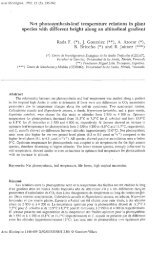
cultivated Arracacha (Arracacia xanthorhyza Banc.), it being lost 7.91 Mg ha -1 year -1 , the second<br />
year, wh<strong>en</strong> was cultivated carrot (Daucus carota L.) and potato (Solanum tuberosum L.), they<br />
were lost 22.48 Mg ha -1 year -1 and during the third year un<strong>de</strong>r corn cultivation (Zea Mays L.) in<br />
association with bean (Phaseolus vulgaris L.) were lost 11.22 Mg ha -1 year -1 . In the apple tree<br />
cultivation in terrazas of bank (Malus sylvestris Miller), were lost 1.96 Mg ha -1 year -1 , 0.98 Mg ha -1<br />
year -1 and 0.43 Mg ha -1 year -1 during the first, second and third year respectively. It was <strong>de</strong>termined<br />
as the variation of the <strong>en</strong>vironm<strong>en</strong>tal factors such as the runoff, the total and effective rainfall, the<br />
same as some characteristic the soil (texture, organic matter cont<strong>en</strong>t, pH, infiltration rates and<br />
stability of the aggregates to the water), are related in a way direct to the erosion, also was found that<br />
it is <strong>de</strong>terminant the type of managing that is giv<strong>en</strong> to each site, that without doubt explains to a<br />
large ext<strong>en</strong>t, soil <strong>de</strong>gradation processes.<br />
INTRODUCCIÓN<br />
<strong>El</strong> problema erosivo <strong>en</strong> V<strong>en</strong>ezuela ha estado asociado a las muy particulares y dinámicas<br />
condiciones <strong>de</strong> su <strong>de</strong>sarrollo socioeconómico, que <strong>en</strong> muchos casos han contribuido a agravar los<br />
problemas <strong>de</strong> <strong>de</strong>gradación <strong>de</strong>l <strong>suelo</strong> (Pla, 1990). En particular, la región andina, con el <strong>de</strong>sarrollo<br />
<strong>de</strong> activida<strong>de</strong>s agropecuarias sobre la<strong>de</strong>ras con p<strong>en</strong>di<strong>en</strong>tes <strong>de</strong> más <strong>de</strong> 50° y con frecu<strong>en</strong>cia sobre<br />
substratos geológicos inestables, se muestra como una zona <strong>de</strong> alta fragilidad pot<strong>en</strong>cial. Sin<br />
embargo, los estudios sobre erosión <strong>en</strong> esta región son escasos, <strong>en</strong> especial los que relacionan<br />
pérdidas <strong>de</strong>l <strong>suelo</strong> con uso <strong>de</strong> la tierra (Lizaso 1980, Cagua 1989, Montes<strong>de</strong>oca 1989, Solorzano<br />
et al. 1989, Altuve y Davila 1990, López 1991, Andress<strong>en</strong> et al. 1994, Villegas et al. 1994,<br />
Ataroff y Monasterio 1996).<br />
<strong>El</strong> objetivo <strong>de</strong> este estudio fue evaluar las pérdidas <strong>de</strong> <strong>suelo</strong> <strong>en</strong> la<strong>de</strong>ras con altas p<strong>en</strong>di<strong>en</strong>tes<br />
bajo los <strong>cultivos</strong> más frecu<strong>en</strong>tes <strong>en</strong> la zona andina v<strong>en</strong>ezolana. Así, estudiamos la erosión <strong>en</strong> un<br />
cultivo <strong>de</strong> hortalizas (apio, zanahoria, papa, maíz y caraota) y lo comparamos con un cultivo <strong>de</strong><br />
manzanas sobre terrazas <strong>de</strong> banco. Analizamos la variación anual <strong>de</strong> las pérdidas <strong>de</strong> <strong>suelo</strong><br />
t<strong>en</strong>i<strong>en</strong>do <strong>en</strong> cu<strong>en</strong>ta: a) el patrón <strong>de</strong> precipitaciones, b) el escurrimi<strong>en</strong>to c) la erosividad <strong>de</strong> las<br />
lluvias, d) la erosionabilidad <strong>de</strong>l <strong>suelo</strong>, e) el cal<strong>en</strong>dario <strong>de</strong> activida<strong>de</strong>s agrícolas y f) las prácticas<br />
antierosivas.<br />
ÁREA DE ESTUDIO<br />
<strong>El</strong> área <strong>de</strong> estudio se <strong>en</strong>cu<strong>en</strong>tra ubicada a 2250 m.s.n.m. <strong>en</strong> la cu<strong>en</strong>ca <strong>de</strong>l río <strong>El</strong> Valle, cuya<br />
población principal es <strong>El</strong> <strong>Cobre</strong>, Estado Táchira, <strong>en</strong> Los An<strong>de</strong>s <strong>de</strong> V<strong>en</strong>ezuela. Se trabajó <strong>en</strong> dos<br />
ambi<strong>en</strong>tes: una parcela <strong>de</strong> cultivo que, durante el lapso <strong>de</strong> estudio, ha t<strong>en</strong>ido sucesivam<strong>en</strong>te apio,<br />
zanahoria, papa y una asociación <strong>de</strong> maíz y caraota así como <strong>en</strong> un cultivo <strong>de</strong> manzanos sobre<br />
terrazas <strong>de</strong> banco, el primero ubicado <strong>en</strong> la finca <strong>El</strong> Paraíso y los manzanos <strong>en</strong> la finca Mesa <strong>de</strong>l<br />
Palmar.<br />
<strong>El</strong> patrón <strong>de</strong> precipitaciones es bimodal, con dos máximos uno <strong>de</strong> abril a mayo y otro <strong>de</strong><br />
octubre a noviembre. La precipitación anual es <strong>de</strong> 977 mm (1991-1995) y la temperatura media<br />
es <strong>de</strong> 16°C (mínima media <strong>de</strong> 12°C y máxima media <strong>de</strong> 18°C, Ortiz 1992). Los <strong>suelo</strong>s pert<strong>en</strong>ec<strong>en</strong><br />
a una consociación Typic Palehumults y Typic Humitropepts (MARNR datos no publicados).