

RIVENDITORE UFFICIALE Istituto Idrografico della ... - Il Frangente
RIVENDITORE UFFICIALE Istituto Idrografico della ... - Il Frangente
RIVENDITORE UFFICIALE Istituto Idrografico della ... - Il Frangente

You also want an ePaper? Increase the reach of your titles
YUMPU automatically turns print PDFs into web optimized ePapers that Google loves.
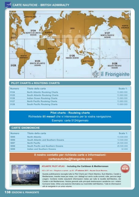
CARTE NAUTICHE - BRITISH ADMIRALTY<br />
CARTE NAUTICHE - National Imagery and Mapping Agency - NIMA<br />
PILOT CHARTS DEGLI OCEANI<br />
PILOT CHARTS o ROUTEING CHARTS<br />
Numero Titolo <strong>della</strong> carta Scala 1:<br />
5124 North Atlantic Routeing Charts 13.880.000<br />
5125 South Atlantic Routeing Charts 13.880.000<br />
5126 Indian Ocean Routeing Charts 13.880.000<br />
5127 North Pacific Routeing Charts 13.880.000<br />
5128 South Pacific Routeing Charts 13.880.000<br />
Numero<br />
Titolo <strong>della</strong> carta<br />
NVPUB105 Atlas of pilot charts - South Atlantic Ocean Raccolta di pilot charts da gennaio a dicembre (12 mesi)<br />
NVPUB106 Atlas of pilot charts - North Atlantic Ocean Raccolta di pilot charts da gennaio a dicembre (12 mesi)<br />
NVPUB107 Atlas of pilot charts - South Pacific Ocean Raccolta di pilot charts da gennaio a dicembre (12 mesi)<br />
NVPUB108 Atlas of pilot charts - North Pacific Ocean Raccolta di pilot charts da gennaio a dicembre (12 mesi)<br />
NVPUB109 Atlas of pilot charts - Indian Ocean Raccolta di pilot charts da gennaio a dicembre (12 mesi)<br />
CARTE NAUTICHE - National Geospatial Intelligence Agency - NGA<br />
Pilot charts - Routeing charts<br />
Richiedete il/i mese/i che vi interessano per la vostra navigazione.<br />
Esempio: carta 5124/gennaio<br />
CARTE GNOMONICHE<br />
Numero Titolo <strong>della</strong> carta Scala 1:<br />
5095 North Atlantic 13.500.000<br />
5096 South Atlantic and Southern Oceans 13.500.000<br />
5097 North Pacific 26.500.000<br />
5098 South Pacific and Southern Oceans 26.500.000<br />
5099 Indian and Southern Oceans 32.000<br />
<strong>Il</strong> nostro contatto per richiesta carte e informazioni:<br />
cartenautiche@frangente.com<br />
ATLANTIC PILOT ATLAS - Including the Caribbean & Mediterranean<br />
420 x 297 mm - Rilegatura a spirale - pp 80 - 5 a edizione 2011 - ADLARD COLES NAUTICAL<br />
Questa pubblicazione raccoglie tutte le Pilot Charts per il Nord Atlantico, Sud Atlantico, Caraibi e<br />
Mediterraneo, inserite mese per mese, con i dettagli sui venti e sulle correnti, rotte, percorsi degli<br />
uragani. Contiene inoltre esaurienti informazioni meteo per tutte le località dell’Atlantico, dei<br />
Caraibi e del Mediterraneo. Notizie generali sulle principali destionazioni caraibiche con i relativi<br />
hurricane holes. Infine una sezione informativa sui mammiferi dell’Atlantico. Tutte le informazioni<br />
utili al navigante in un unico volume.<br />
NEW<br />
ARCIPELAGO DI SAN BLAS - PANAMA<br />
Numero Titolo <strong>della</strong> carta Scala 1:<br />
US 26042 Bahia Concepcion to Punta Brava (North Coast of Panama) 50.000<br />
US 26065 Cayos Chichime to Punta Rincon and Approach to Golfo de San Blas 75.000<br />
US 26060 Puerto Cristobal to Cabo Tiburon (OMEGA) 300.000<br />
US 26063 Punta San Blas to Bahia Concepcion 48.640<br />
US 26066 Approaches to Cristobal 75.000<br />
138 EDIZIONI IL FRANGENTE<br />
EDIZIONI IL FRANGENTE 139
