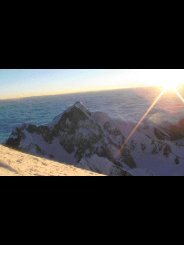
SENTIERI D'AUTORE l FERRATE A CORTINACIMA FANIS SUD l FERRATA TOMASELLISalita ambita, tra le più classiche <strong>del</strong>le Dolomiti.Considerata fino agli anni ’80 la più diffic<strong>il</strong>e <strong>del</strong>la<strong>con</strong>ca ampezzana è caratterizzata da una partenza“bruciante” per insinuarsi poi in una parete verticaleed esposta.Una fune di buon diametro e la vicinanza dei chiod<strong>il</strong>a rendono molto sicura anche se tuttora mancano icunei di plastica di protezione al chiodo.Raggiungere la Cima Fanis Sud, un “Trem<strong>il</strong>a mancato”,per questa ferrata regala un momento di grandesoddisfazione.La vista è ambiziosa <strong>con</strong> <strong>il</strong> gruppo di Fanes a nord ele imperiose Tofane a est. Nelle giornate di bel temposi possono vedere chiaramente gli escursionistiarrampicarsi sulla dirimpettaia Ferrata Lipella allaRozes. L’altezza <strong>del</strong>la cima poi regala uno splendidopanorama verso sud <strong>con</strong> <strong>il</strong> ghiacciaio <strong>del</strong>la Marmolada,le Pale di San Martino, l’imponente muraglia<strong>del</strong>la nord ovest <strong>del</strong>la Civetta, <strong>il</strong> Pelmo e le altre Dolomitid’Ampezzo.ACCESSODal centro di Cortina d’Ampezzo si sale al Passo Falzarego(2117 m).AVVICINAMENTOUn largo sentiero (segnavia n. 402) <strong>con</strong>duce versonord alla Forcella Lagazuoi (2573 m). Più fac<strong>il</strong>mentesi può arrivare fin qui salendo in cima al PiccoloLagazuoi <strong>con</strong> la funivia che parte dal Passo Falzaregoe <strong>con</strong> breve sentiero n. 401 in discesa.Dalla forcella, imboccando <strong>il</strong> sentiero n. 20, si scendeulteriormente nella <strong>con</strong>ca <strong>del</strong>l’Alpe di Lagazuoifino a quota 2480 m e, seguendo a destra <strong>il</strong> sentieron. 20b, si riprende a salire attraversando canalonirocciosi <strong>con</strong> evidenti resti <strong>del</strong>la Grande Guerra. Allafine <strong>il</strong> sentiero fa una decisa svolta a destra e raggiunge<strong>il</strong> pulpito dove è posizionato <strong>il</strong> Bivacco DellaChiesa.A nord <strong>del</strong> bivacco un breve sentiero <strong>con</strong>duce all’attacco<strong>del</strong>la ferrata (2690 m).Atmospheric climb, one of the classics of the Dolomites.Unt<strong>il</strong> the eighties it was <strong>con</strong>sidered the hardestferrata of the ampezzo valley. Characterised bya burningly strenous start, the route then snakes upvertical and exposed faces.A thick cable and short run-outs make it a very saferoute even in spite of the lack of plastic safety protectioncaps covering the bolts.Reaching the summit of Cima Fanis Sud, just below3000 m, is a greatly satisfying achievement.The view is impressive, with the Fanes massif to thenorth and the regal Tofanas to the east. On cleardays climbers on the opposite ferrata Lipella areclearly visible.The height of the summit also allows a spectacularpanorama towards the south, with the Marmoladaglacier, the Pale di San Martino, the imposing northwestface of Civetta, Pelmo and the surounding AmpezzoDolomites.ACCESSFrom the centre of Cortina d’Ampezzo drive up tothe Falzarego Pass (2117 m).APPROACHA wide path (no. 402) heading north leads to ForcellaLagazuoi (2573 m). Alternatively you canreach here by taking the Lagazuoi cablecar to thesummit of Piccolo Lagazuoi and then descendingthe good path no. 401.From the saddle, taking path no. 20, descend furtherinto the Alpe di Lagazuoi valley unt<strong>il</strong> at 2480m taking path no. 20b to climb crossing over rockygullys with evident remains from the Great War.Where the path ends take a sharp turn right toreach the pulpit where the Bivacco <strong>del</strong>la Chiesa issituated. To the north of the bivouac hut a shortpath leads to the start of the ferrata.Begehrter Steig, einer der Klassiker der Dolomiten.Bis Ende der 80er Jahre der Schwierigste des AmpezzoTals. Geprägt von einem rasanten Start führter in eine senkrechte und ausgesetzte Wand.Ein guter Se<strong>il</strong>durchmesser und Hakennähe machendiesen Steig sehr sicher, es fehlen aber doch nochPlastikschutzke<strong>il</strong>e an den Haken.Erreicht man die Fanis Südspitze, ein knapp verfehlter Dreitausender,erlebt man außerordentliche Glücksmomente.Die Aussicht ist beachtlich mit der Fanes Gruppe imNorden und den imposanten Tofane im Osten. Beigutem Wetter kann man deutlich Kletterer erkennen,die den gegenüberliegenden Lipella Klettersteigauf die Rozes erklimmen. Die Höhe des Gipfelsgarantiert ein herrliches Panorama nach Süden mitdem Marmolada Gletscher, zu den Pale di San Martino,der imposanten Nordwestwand des Civetta, demPelmo und den anderen Dolomiten von Ampezzo.ANFAHRTVom Zentrum von Cortina d’Ampezzo hinauf zumPasso Falzarego (2117 m).ZUSTIEGEin breiter Weg (Wegweiser Nr. 402) führt nach Nordenzur Lagazuoi Scharte (2573 m). Man kann biszum Gipfel des kleinen Lagazuoi bequem mit der Se<strong>il</strong>bahnvom Passo Falzarego fahren und kommt dannbergab auf dem einfachen Weg Nr. 401 zur Scharte.Von der Scharte steigt man weiter auf dem Weg Nr. 20auf das Plateau der Lagazuoi Almen bis auf eine Höhevon 2480 m und dann rechts auf dem Weg Nr. 20bdurch felsige Rinnen mit klaren Überresten des ErstenWeltkriegs. Schließlich macht der Weg eine scharfeBiegung nach rechts, und so erreicht man das Plateau,auf dem sich das Biwak Della Chiesa befindet.Nördlich des Lagers führt ein kurzer Weg zum Einstieg(2690 m).WEGVERLAUFDer Einstieg ist sehr selektiv. Man erhebt sich in einer7071
SENTIERI D'AUTORE l FERRATE A CORTINACIMA FANIS SUD l FERRATA TOMASELLIITINERARIOL’attacco fa la selezione. Ci si alza in una fessuraper traversare subito a sinistra su una liscia placca.Necessaria forza di braccia e buon movimento dipiedi. Alla fine <strong>del</strong>la traversata si prosegue in verticaleora più fac<strong>il</strong>mente fino a una cengia a sinistra equindi per un fac<strong>il</strong>e canalino e alcune roccette nonattrezzate ci si porta alla grande banca ghiaiosa adun terzo <strong>del</strong>la via.Una traccia prima a destra, poi a sinistra porta ariguadagnare la ferrata all’altezza di un’espostacengia che, percorsa a sinistra, aggira uno speroneroccioso e <strong>con</strong>duce ad un altro breve tratto verticale.Qualche metro in arrampicata senza fune portanosotto grandi strapiombi rossi dove riprende laferrata. Si sale così in verticale per 20 metri finoad una cengia sotto gli strapiombi. La si percorrea destra per 50 metri <strong>con</strong> bella esposizione senzal’uso <strong>del</strong>la corda metallica fino a raggiungere unpulpito (2850 m).Si riprende scalando uno spigolo arrotondato e poia sinistra <strong>del</strong>lo stesso (fac<strong>il</strong>e) e quindi <strong>con</strong> più difficoltà(uso <strong>del</strong>le braccia intenso in tre passaggi),seguendo un’es<strong>il</strong>e fessura ed un diffic<strong>il</strong>e ed aereospigolo si raggiunge la cima.ROUTEThe first moves sort the sheep from the lambs.Climb a crack to traverse immediately left on apolished slab. Good upper-body strength and intelligentfootwork is essential. At the end of thetraverse <strong>con</strong>tinue vertically on easier ground togain a ledge on the left and then by way of an easygully and a few unprotected sections reach the largescree bank a third of the way up the route.A path first heading right, then left allows youto rejoin the ferrata level with an exposed ledgewhich, followed left, circumvents a rocky spur andleads onto another short vertical section. A fewmetres of unprotected climbing lead underneathhuge red overhanging rock faces when the ferrata<strong>con</strong>tinues. Climb vertically for 20 metres unt<strong>il</strong>reaching a ledge under the overhangs. Follow thisright for 50 metres with breathtaking exposurewithout wire unt<strong>il</strong> reaching a terrace (2850 m).Continue by scaling a rounded arete, then moveonto the left of this (easy climbing) becomingprogressively harder (intense use of arms in threesections), then by following a thin crack and a difficultand airy arete you reach the summit.Felsspalte, um sofort auf einer glatten Felsplatte nachlinks zu queren. Notwendige Armkraft und gute Fußbewegungsind notwendig. Am Ende der Querung geht esjetzt einfacher senkrecht bis zu einem Felsvorsprunglinks und dann durch eine einfache Rinne. Auf ca. einemDrittel des Steiges und einigen ungesichertenFelsen gelangt man auf ein großes Schotterband.Eine Spur, zuerst rechts, dann links, führt dannwieder auf den Steig, auf Höhe einer ausgesetztenScharte, die links gequert wird, um einen Sporn zuumgehen und um dann wieder in ein senkrechtesStück zu münden.Ein paar Meter Kletterei ohne Se<strong>il</strong> bringen dann unterden überhängenden großen roten Felsen, wo derSteig weitergeht. Man klettert 20 Meter senkrechtbis zu einem Grat unterhalb von Felsvorsprüngenauf. Dem Grat folgt man rechts, schön ausgesetzt,für ca. 50 Meter ohne Benutzung des Drahtse<strong>il</strong>s biszum Erreichen eines Plateaus (2850 m).Dann klettert man wieder, zuerst einen bauchigenFelsvorsprung überwindend, dann links von diesem(einfach) und dann wieder schwieriger (großer Armkrafteinsatzbei 3 Passagen) einem dünnen Rissfolgend, und nach einem luftigen Felsvorsprungerreicht man endlich den Gipfel.La Tomaselli è una ferrata molto aerea,si può sicuramente affermare che è trale più diffic<strong>il</strong>i <strong>del</strong>la <strong>con</strong>ca ampezzana. Richiedeallenamento ed esperienza.Tomaselli is a very exposed ferrata, andcan without doubt be <strong>con</strong>firmed as oneof the hardest of the Ampezzo basin. Itrequires fitness and experience.Der Tomaselli ist ein sehr ausgesetzterKlettersteig, man kann mit Sicherheitbehaupten, dass er einer der schwierigstenim Conca Ampezzana ist. Erfahrungund Ausdauer ist gefordert.7273