Sony HDR-TG5VE - HDR-TG5VE Istruzioni per l'uso Spagnolo
Sony HDR-TG5VE - HDR-TG5VE Istruzioni per l'uso Spagnolo
Sony HDR-TG5VE - HDR-TG5VE Istruzioni per l'uso Spagnolo

Create successful ePaper yourself
Turn your PDF publications into a flip-book with our unique Google optimized e-Paper software.
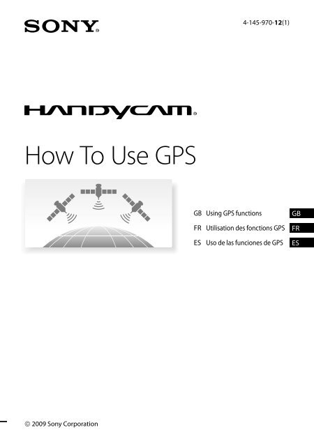
4-145-970-12(1)<br />
How To Use GPS<br />
GB Using GPS functions GB<br />
FR Utilisation des fonctions GPS FR<br />
ES Uso de las funciones de GPS ES<br />
2009 <strong>Sony</strong> Corporation
GB<br />
<br />
YOU SHOULD CAREFULLY READ<br />
THE FOLLOWING AGREEMENT<br />
BEFORE USING THIS SOFTWARE.<br />
USING THIS SOFTWARE<br />
INDICATES YOUR ACCEPTANCE OF<br />
THIS AGREEMENT.<br />
END-USER LICENSE AGREEMENT<br />
FOR MAP DATA FOR SONY<br />
HANDYCAM® PRODUCTS<br />
IMPORTANT-READ CAREFULLY: This End-<br />
User License Agreement (“LICENSE”) is a legal<br />
agreement between you and <strong>Sony</strong> Corporation<br />
(“SONY”), the licensor of the map data<br />
included in your <strong>Sony</strong> HANDYCAM product<br />
(“PRODUCT”). Such map data, including<br />
subsequent updates/upgrades, is referred to<br />
herein as the SOFTWARE. This LICENSE<br />
covers only the SOFTWARE. You may use the<br />
SOFTWARE only in connection with your use<br />
of the PRODUCT. By using the SOFTWARE,<br />
you agree to be bound by the terms of this<br />
LICENSE. If you do not agree to the terms of<br />
this LICENSE, SONY is unwilling to license the<br />
SOFTWARE to you. In such event, you may not<br />
use the SOFTWARE, and you should promptly<br />
contact SONY for instructions on returning the<br />
entire PRODUCT and included SOFTWARE for a<br />
refund of the PRODUCT purchase price.<br />
SOFTWARE LICENSE<br />
The SOFTWARE is protected by copyright laws<br />
and international copyright treaties, as well as<br />
other intellectual pro<strong>per</strong>ty laws and treaties. The<br />
SOFTWARE is licensed, not sold.<br />
GRANT OF LICENSE<br />
This LICENSE grants you the following rights on<br />
a non-exclusive basis:<br />
SOFTWARE. You may use the SOFTWARE on<br />
one unit of the PRODUCT.<br />
Personal Use. You may use the SOFTWARE for<br />
<strong>per</strong>sonal, non-commercial use only.<br />
DESCRIPTION OF OTHER RIGHTS AND<br />
LIMITATIONS<br />
Restrictions. You may not transfer or distribute<br />
any part of the SOFTWARE in any form for any<br />
purpose except as expressly <strong>per</strong>mitted in this<br />
LICENSE. You may not use the SOFTWARE<br />
with any products, systems or applications other<br />
than with the PRODUCT. Except as otherwise<br />
provided in this LICENSE, you may not use<br />
and may not <strong>per</strong>mit any third party to use the<br />
SOFTWARE separated from the PRODUCT (in<br />
whole or in part, including, but not limited to,<br />
reproductions, outputs or extractions or other<br />
works thereof in any form) for the purpose of<br />
rental or lease whether with any license fee or not.<br />
Some jurisdictions do not allow the restrictions<br />
of such rights, in such case the above restrictions<br />
may not apply to you.<br />
Limitation on Reverse Engineering,<br />
Decompilation and Disassembly. You may not (i)<br />
extract the SOFTWARE from the PRODUCT, (ii)<br />
reproduce, copy, modify, port, translate, or create<br />
derivative works of the SOFTWARE in whole<br />
or in part, or (iii) reverse engineer, decompile,<br />
disassemble the SOFTWARE by any means<br />
whatsoever in whole or in part for any purpose.<br />
Some jurisdictions do not allow the limitation of<br />
such rights, in such case the above limitation may<br />
not apply to you.<br />
Trademarks and Notices: You may not remove,<br />
alter, cover or deface any trademarks or copyright<br />
notices on the SOFTWARE.<br />
Data Files. The SOFTWARE may create data files<br />
automatically for use with the SOFTWARE. Any<br />
such data files will be deemed to be part of the<br />
SOFTWARE.<br />
SOFTWARE Transfer. You may <strong>per</strong>manently<br />
transfer all of your rights under this LICENSE<br />
only as part of a sale or transfer of the<br />
PRODUCT, provided you retain no copies of<br />
the SOFTWARE, transfer all of the SOFTWARE<br />
(including all copies (only if <strong>per</strong>mitted to copy<br />
under “Limitation on Reverse Engineering,<br />
Decompilation and Disassembly” Paragraph<br />
above), component parts, the media and printed<br />
materials, all versions and any upgrades of<br />
the SOFTWARE and this LICENSE), and the<br />
recipient agrees to the terms and conditions of<br />
this LICENSE.<br />
Termination. Without prejudice to any other<br />
rights, SONY may terminate this LICENSE if you<br />
fail to comply with the terms and conditions of<br />
this LICENSE. In such event, you must stop using<br />
the SOFTWARE and all of its component parts.<br />
The provisions of this LICENSE “COPYRIGHT,”<br />
“HIGH RISK ACTIVITIES,” “EXCLUSION OF<br />
WARRANTY ON SOFTWARE,” “LIMITATION<br />
OF LIABILITY,” “PROHIBITION ON EXPORT,”<br />
“SEVERABILITY,” and “GOVERNING<br />
LAW AND JURISDICTION” Sections,<br />
“Confidentiality” Paragraph of this Section and
this Paragraph shall survive any expiration or<br />
termination of this LICENSE.<br />
Confidentiality. You agree to keep information<br />
contained in the SOFTWARE which is not<br />
publicly known confidential to yourself, and not<br />
to disclose such information to others without<br />
SONY’s prior written approval.<br />
COPYRIGHT<br />
All title and copyright in and to the SOFTWARE<br />
(including but not limited to any map data,<br />
images, photographs, animation, video, audio,<br />
music, text and “applets”, incorporated into the<br />
SOFTWARE), and any copies of the SOFTWARE,<br />
are owned by SONY, licensors to SONY and<br />
its affiliates, its and their licensors or suppliers<br />
(such licensors, affiliates and suppliers are<br />
hereinafter collectively referred to as the “SONY’s<br />
Licensors”). All rights not specifically granted<br />
under this LICENSE are reserved by SONY or<br />
SONY’s Licensors.<br />
HIGH RISK ACTIVITIES<br />
The SOFTWARE is not fault-tolerant and is not<br />
designed, manufactured or intended for use<br />
in hazardous environments requiring fail-safe<br />
<strong>per</strong>formance, such as in the o<strong>per</strong>ation of nuclear<br />
facilities, aircraft navigation or communication<br />
systems, air traffic control, direct life support<br />
machines, or weapons systems, in which<br />
the failure of the SOFTWARE could lead to<br />
death, <strong>per</strong>sonal injury, or severe physical or<br />
environmental damage (“High Risk Activities”).<br />
SONY, its affiliates, their respective suppliers<br />
and SONY’s Licensors specifically disclaim any<br />
express or implied warranty of fitness for High<br />
Risk Activities.<br />
EXCLUSION OF WARRANTY ON SOFTWARE<br />
You expressly acknowledge and agree that use<br />
of the SOFTWARE is at your sole risk. The<br />
SOFTWARE is provided “AS IS” and without<br />
warranty of any kind and SONY, its affiliates,<br />
its and their respective suppliers and SONY’s<br />
Licensors (in this section, SONY, its affiliates,<br />
their respective suppliers and SONY’s Licensors<br />
shall be collectively referred to as “SONY”)<br />
EXPRESSLY DISCLAIMS ALL WARRANTIES<br />
AND CONDITIONS, EXPRESS OR IMPLIED,<br />
ARISING BY LAW OR OTHERWISE,<br />
INCLUDING, BUT NOT LIMITED TO, THE<br />
IMPLIED WARRANTIES AND CONDITIONS<br />
OF QUALITY, NON-INFRINGEMENT,<br />
MERCHANTABILITY AND FITNESS FOR<br />
A PARTICULAR PURPOSE. SONY DOES<br />
NOT WARRANT THAT THE FUNCTIONS<br />
CONTAINED IN THE SOFTWARE WILL<br />
MEET YOUR REQUIREMENTS, OR THAT<br />
THE OPERATION OF THE SOFTWARE WILL<br />
BE UNINTERRUPTED OR ERROR FREE.<br />
SONY DOES NOT WARRANT OR MAKE ANY<br />
REPRESENTATIONS REGARDING THE USE,<br />
INABILITY TO USE OR THE RESULTS OF THE<br />
USE OF THE SOFTWARE IN TERMS OF ITS<br />
CORRECTNESS, ACCURACY, RELIABILITY,<br />
OR OTHERWISE. SOME JURISDICTIONS DO<br />
NOT ALLOW THE EXCLUSION OF IMPLIED<br />
WARRANTIES, IN SUCH CASE THE ABOVE<br />
EXCLUSIONS MAY NOT APPLY TO YOU.<br />
You expressly understand that the data in<br />
the SOFTWARE may contain inaccurate or<br />
incomplete information due to the passage of<br />
time, changing circumstances, sources used and<br />
the nature of collecting comprehensive geographic<br />
data, any of which may lead to incorrect results.<br />
LIMITATION OF LIABILITY<br />
IN THIS SECTION SONY, ITS AFFILIATES,<br />
ITS AND THEIR RESPECTIVE SUPPLIERS<br />
AND SONY’S LICENSORS SHALL BE<br />
COLLECTIVELY REFERRED TO AS “SONY”<br />
TO THE MAXIMUM EXTENT PERMITTED<br />
UNDER APPLICABLE LAW. SONY SHALL<br />
NOT BE LIABLE FOR ANY CLAIM,<br />
DEMAND OR ACTION, IRRESPECTIVE OF<br />
THE NATURE OF THE CAUSE OF CLAIM,<br />
DEMAND OR ACTION, ALLEGING ANY<br />
LOSS OR DAMAGES, DIRECT OR INDIRECT,<br />
WHICH MAY RESULT FROM THE USE OR<br />
POSSESSION OF THE SOFTWARE; NOR<br />
FOR ANY LOSS OF PROFIT, REVENUE,<br />
CONTRACTS OR SAVINGS, NOR ANY OTHER<br />
DIRECT, INDIRECT, INCIDENTAL, SPECIAL<br />
OR CONSEQUENTIAL DAMAGES ARISING<br />
OUT OF YOUR USE OF OR INABILITY TO<br />
USE THE SOFTWARE, ANY DEFECT IN<br />
THE SOFTWARE, OR THE BREACH OF THE<br />
TERMS AND CONDITIONS, WHETHER IN<br />
AN ACTION IN CONTRACT OR TORT OR<br />
BASED ON A WARRANTY, EVEN IF SONY<br />
HAS BEEN ADVISED OF THE POSSIBILITY OF<br />
SUCH DAMAGES EXCEPT IN THE EVENT OF<br />
SONY’S GROSS NEGLIGENCE OR WILLFUL<br />
MISCONDUCT, OF DEATH OR PERSONAL<br />
INJURY, AND OF DAMAGES DUE TO THE<br />
DEFECTIVE NATURE OF THE PRODUCT.<br />
IN ANY CASE, SAVE FOR THE FOREGOING<br />
EXCEPTIONS, SONY'S ENTIRE LIABILITY<br />
GB<br />
GB
UNDER ANY PROVISION OF THIS LICENSE<br />
SHALL BE LIMITED TO THE AMOUNT<br />
ACTUALLY PAID ALLOCATABLE TO THE<br />
SOFTWARE. SOME JURISDICTIONS DO NOT<br />
ALLOW THE EXCLUSION OR LIMITATION<br />
OF CONSEQUENTIAL OR INCIDENTAL<br />
DAMAGES, SO THE ABOVE EXCLUSION OR<br />
LIMITATION MAY NOT APPLY TO YOU.<br />
PROHIBITION ON EXPORT<br />
YOU ACKNOWLEDGE THAT THE USE OF<br />
THE SOFTWARE IN SOME COUNTRIES,<br />
REGIONS, AREAS OR FACILITIES, OR THE<br />
EXPORT OF THE PRODUCTS FROM THE<br />
COUNTRY WHERE SUCH PRODUCTS<br />
ARE DESIGNED TO BE SOLD, MAY BE<br />
RESTRICTED OR PROHIBITED. YOU AGREE<br />
TO USE THE SOFTWARE OR EXPORT<br />
THE PRODUCTS IN ACCORDANCE WITH<br />
THE APPLICABLE LAWS, ORDINANCES,<br />
RULES AND REGULATIONS OF RELEVANT<br />
COUNTRIES, REGIONS, AREAS AND<br />
FACILITIES.<br />
SEVERABILITY<br />
If any part of this LICENSE is held invalid or<br />
unenforceable, the other parts will remain valid.<br />
GOVERNING LAW AND JURISDICTION<br />
This LICENSE shall be governed by the laws<br />
of Japan without giving effect to its conflict<br />
of laws provisions or the United Nations<br />
Convention for Contracts for the International<br />
Sale of Goods, which is expressly excluded.<br />
Any dispute arising out of this LICENSE shall<br />
be subject to the exclusive venue of the Tokyo<br />
District Court, and the parties hereby consent<br />
to the venue and jurisdiction of such court.<br />
THE PARTIES HEREBY WAIVE TRIAL BY<br />
JURY WITH RESPECT TO ANY MATTERS<br />
ARISING UNDER TO RELATING TO THIS<br />
LICENSE. SOME JURISDICTIONS DO NOT<br />
ALLOW THE EXCLUSION OF THE RIGHT OF<br />
TRIAL BY JURY, IN SUCH CASE THE ABOVE<br />
EXCLUSION MAY NOT APPLY TO YOU.<br />
GOVERNMENT END USERS<br />
If the SOFTWARE is being acquired by or on<br />
behalf of the United States government or any<br />
other entity seeking or applying rights similar to<br />
those customarily claimed by the United States<br />
government, such SOFTWARE is a “commercial<br />
item” as that term is defined at 48 C.F.R. (“FAR”)<br />
2.101, is licensed in accordance with this<br />
LICENSE, and such SOFTWARE delivered or<br />
otherwise furnished shall be provided with the<br />
following “Notice of Use” and shall be treated in<br />
accordance with such notice:<br />
NOTICE OF USE<br />
CONTRACTOR (MANUFACTURER/ SUPPLIER) NAME:<br />
SONY CORPORATION<br />
CONTRACTOR (MANUFACTURER/SUPPLIER)<br />
ADDRESS: 1-7-1 Konan, Minato-ku, Tokyo, Japan<br />
These SOWFTWARE are commercial items as<br />
defined in FAR 2.101 and are subject to END-USER<br />
LICENSE AGREEMENT FOR MAP DATA FOR<br />
SONY HANDYCAM® PRODUCTS under which this<br />
SOFTWARE was provided.<br />
If the Contracting Officer, federal government<br />
agency, or any federal official refuses to use the<br />
legend provided herein, the Contracting Officer,<br />
federal government agency, or any federal official<br />
must notify SONY prior to seeking additional or<br />
alternative rights in the Software.<br />
Copyright and trademark information<br />
©1993-2007 NAVTEQ<br />
©2009 ZENRIN CO., LTD.<br />
©Her Majesty the Queen in Right of Canada;<br />
©Queen’s Printer for Ontario; ©Canada Post<br />
Corporation; GeoBase®; ©Department of Natural<br />
Resources Canada; ©United States Postal Service<br />
®2007; USPS®; ZIP+4®<br />
ENTIRE AGREEMENT<br />
These terms and conditions constitute the entire<br />
agreement between SONY and you <strong>per</strong>taining to<br />
the subject matter hereof, and su<strong>per</strong>sedes in their<br />
entirety any and all previously existing written or<br />
oral agreements between us with respect to such<br />
subject matter.<br />
GB
Using GPS functions<br />
This section describes how to use the GPS functions equipped with your camcorder and also<br />
provides some important notes on using. Read the following instructions and also refer to the<br />
supplied “O<strong>per</strong>ating Guide” before using your camcorder.<br />
What is GPS?<br />
The GPS (Global Positioning System) is a<br />
system that calculates geographical location<br />
from highly accurate US space satellites. This<br />
system allows you to pinpoint your exact<br />
location on the earth.<br />
GPS functions you can use<br />
Map Index<br />
You can find a movie or photo on a map by its recording location.<br />
YOUR LOCATION<br />
You can display the current location on a map.<br />
AUTO CLOCK ADJ / AUTO AREA ADJ<br />
Your camcorder adjusts the clock and the time difference on each area automatically.<br />
GB
How to use the GPS function<br />
Set the GPS switch to ON ( appears on the LCD screen). Your camcorder starts trying<br />
to triangulate. When your camcorder triangulates successfully, it will record the location<br />
information at the time movies and photos were recorded. You can identify the GPS switch by<br />
the “O<strong>per</strong>ating Guide” supplied.<br />
Notes<br />
The indicator changes according to the strength of GPS signal reception.<br />
Triangulating status GPS indicators GPS reception status<br />
Function off No indicator The GPS switch is set to OFF, or the GPS receiver is not<br />
functioning normally.<br />
Difficult<br />
Your camcorder cannot find a GPS signal, therefore, it cannot<br />
triangulate. Use your camcorder in an open area.<br />
Processing<br />
Your camcorder is confirming the GPS signal, and will be able<br />
to acquire location information soon. Wait until your camcorder<br />
completes the triangulation.<br />
Triangulating<br />
Your camcorder is receiving a GPS signal, and can acquire location<br />
information.<br />
Triangulating<br />
Your camcorder is receiving a strong GPS signal, and can acquire<br />
location information.<br />
The GPS switch is set to ON in the default setting. Movies and photos recorded during triangulation by<br />
GPS will be recorded with location information. If you do not want to record location information, set<br />
the GPS switch to OFF.<br />
It may take from several seconds to several minutes to acquire the location information when you use the<br />
GPS for the first time or use it again after long intervals.<br />
Even if the camcorder is turned off, the GPS function is working as long as the GPS switch is set to ON.<br />
Make sure that the GPS switch is set to OFF during take off and landing of an airplane.<br />
You may not be able to acquire location information depending on the strength of GPS reception.<br />
Tips<br />
The 3 dots in the lower right of show GPS signal stability. When fewer than 3 dots are displayed, the<br />
GPS signal is not stable enough to triangulate in the current environment. To successfully triangulate,<br />
move to an open area first, and turn the GPS switch to OFF and ON again, or turn the power of your<br />
camcorder off and on.<br />
Your camcorder quits trying to triangulate after a few minutes of unsuccessful attempts. If your<br />
camcorder continues to display (triangulation process not started) even after moved to an open area,<br />
turn the GPS switch to OFF and ON again, or turn the power of your camcorder off and on.<br />
GB
Map Index<br />
Where movies and photos were recorded is<br />
marked on a map. You can select a movie<br />
or photo by recording location. Select the<br />
recording media which contains the movie<br />
or photo you want to play back before<br />
starting this o<strong>per</strong>ation.<br />
You can use the Map Index only with movies<br />
and photos having location information that<br />
was recorded with the GPS switch set to ON.<br />
You cannot use the Map Index with photos<br />
recorded on “Memory Stick PRO Duo” media.<br />
Touch (PLAYBACK).<br />
The VISUAL INDEX screen appears.<br />
Touch<br />
(Map Index).<br />
Returns to the VISUAL INDEX screen<br />
Touch the image marker where<br />
you recorded the movies and<br />
photos to be played back.<br />
The image marker turns red. The<br />
movies or photos recorded at that<br />
location are displayed on the left of the<br />
screen.<br />
Previous<br />
Next<br />
Scale<br />
Image<br />
marker<br />
Touch the desired movie or<br />
photo.<br />
Displays photos<br />
You can change the scale using the zoom<br />
lever (W: larger, T: smaller).<br />
The point you touch on the map scrolls<br />
to the center automatically. If you hold a<br />
certain point, the map keeps scrolling.<br />
will appear at the up<strong>per</strong> right corner<br />
of the thumbnail of the movie or photo<br />
without location information.<br />
Playback starts from the selected scene.<br />
Notes<br />
Make sure that you set the GPS switch to ON<br />
prior to recording, to be able to create movies<br />
and photos that you can search for on the Map<br />
Index.<br />
The map always displays the north at the top.<br />
GB
When you record several movies and photos at<br />
the same location, the movie or photo recorded<br />
most recently will be displayed on the LCD<br />
screen.<br />
Tips<br />
You can also display the Map Index by touching<br />
(MENU) [ MAP] (under<br />
[PLAYBACK] category).<br />
You can also search for the thumbnail of the<br />
movie or photo you want to play by touching<br />
/ in step 3. The recording location of<br />
the movie or photo will be displayed at the<br />
center of the map.<br />
YOUR LOCATION<br />
You can display the current location on a<br />
map. Set the GPS switch to ON so that your<br />
camcorder can acquire the current location<br />
information.<br />
Touch ( YOUR LOCATION) on<br />
the recording screen.<br />
Notes<br />
The map always displays the north at the top.<br />
Tips<br />
You can change the scale using the zoom lever<br />
(W: larger, T: smaller).<br />
Your camcorder acquires the current location<br />
information every 10 seconds. The displays<br />
of the center marker, etc., appear differently<br />
according to the status of the current inquiry.<br />
When your camcorder cannot acquire the<br />
current location information, the center marker<br />
turns gray and the map shows the last location<br />
acquired.<br />
If you hold a certain point, the map keeps<br />
scrolling.<br />
You can also display the current location<br />
by touching (MENU) [ YOUR<br />
LOCATION] (under [OTHERS] category).<br />
AUTO CLOCK ADJ/AUTO AREA ADJ<br />
Your camcorder can maintain accurate<br />
time and compensate for time difference<br />
automatically, by acquiring time and<br />
location information from GPS.<br />
The current location is displayed and<br />
marked at the center of the LCD screen. If<br />
you touch a certain point on the screen, the<br />
map shows the area with that point at the<br />
center.<br />
Touch (your location) at the bottom<br />
left of the LCD screen to move the current<br />
location back to the center.<br />
To close the map screen<br />
Touch .<br />
Touch (MENU) [AUTO<br />
CLOCK ADJ]/[AUTO AREA ADJ]<br />
(under [CLOCK/ LANG]<br />
category).<br />
Touch a desired setting <br />
.<br />
Notes<br />
You must set the date and time on your<br />
camcorder before using your camcorder.<br />
There may be discrepancies of a few seconds<br />
even if [AUTO CLOCK ADJ] is activated.<br />
GB
Trouble shooting<br />
<br />
<br />
<br />
The clock is adjusted automatically by<br />
[AUTO CLOCK ADJ] when you turn off your<br />
camcorder if the camcorder is receiving a GPS<br />
signal while it is being used. The clock is not<br />
adjusted until the camcorder is turned off. Also,<br />
the clock is not adjusted unless the camcorder<br />
is receiving a GPS signal, even if the GPS switch<br />
is set to ON.<br />
The [AUTO AREA ADJ] function automatically<br />
compensates for a time difference when it<br />
detects a time differences with the current area.<br />
The clock may not be adjusted to the correct<br />
time automatically, depending on the country/<br />
region selected for your camcorder. In this case,<br />
set [AUTO CLOCK ADJ] and [AUTO AREA<br />
ADJ] to [OFF].<br />
COORDINATES<br />
The camcorder is not receiving a GPS<br />
signal.<br />
Your camcorder may not be able to receive<br />
radio signals from GPS satellites because of<br />
obstructions. Bring your camcorder to an<br />
open area, and set the GPS switch to ON<br />
again.<br />
The current location on the map of the<br />
camcorder is different from the actual<br />
current location.<br />
The margin of error of the radio signal from<br />
GPS satellites is large. The margin of error can<br />
be as wide as several-hundred meters at the<br />
maximum.<br />
During playback, your camcorder can<br />
display the coordinates information<br />
recorded on movies and photos.<br />
Touch (MENU) [DATA CODE]<br />
(under [PLAYBACK SET] category)<br />
[COORDINATES] <br />
.<br />
Latitude<br />
Longitude<br />
GB
About GPS<br />
The GPS system consists of 24 or more GPS<br />
radio signals from 3 or more GPS satellites. The<br />
satellites. A GPS receiver receives radio signals<br />
triangulating error allowed by the GPS satellites<br />
from the satellites, and calculates the current<br />
is about 30 m (98 feet). Depending on the<br />
location of the receiver based on the orbital<br />
environment of the location, the triangulating<br />
information (almanac data) and travel time of the error can be greater. In this case, your actual<br />
signals, etc.<br />
location may not match the location on the map<br />
Determining a location is called “triangulating.” A based on the GPS information. Meanwhile,<br />
GPS receiver can determine the location’s latitude the GPS satellites are controlled by the Unites<br />
and longitude by receiving signals from 3 or more States Department of Defense, and the degree of<br />
satellites.<br />
accuracy may be changed intentionally.<br />
As the positions of GPS satellites vary<br />
Error during the triangulating process<br />
constantly, it may take longer to determine<br />
The camcorder acquires location information<br />
the location or the receiver may not be able to<br />
every 10 seconds during triangulating. There<br />
determine the location at all, depending on the is a slight time difference between when the<br />
location and time you use the camcorder.<br />
location information is acquired and when the<br />
“GPS” is a system for determining geographic<br />
location information is recorded on an image,<br />
location by triangulating radio signals from<br />
therefore, the actual recording location may not<br />
GPS satellites. Avoid using the camcorder<br />
match exactly the location on the map based on<br />
in places where radio signals are blocked or<br />
the GPS information.<br />
reflected, such as a shadowy place surrounded<br />
On the restriction of use of GPS on an airplane<br />
by buildings or trees, etc. Use the camcorder in<br />
During take off and landing of an airplane,<br />
open sky environments.<br />
set the GPS switch to OFF and turn off the<br />
You may not be able to record location<br />
camcorder, as you will be instructed to do by<br />
information at locations or in situations where<br />
the on-board announcement. In other cases, use<br />
radio signals from the GPS satellites do not<br />
GPS in accordance with the regulations of the<br />
reach the camcorder as follows.<br />
place or situation.<br />
In tunnels, indoors or under the shade of<br />
buildings.<br />
On the map data<br />
Between tall buildings or at narrow streets<br />
The camcorder contains map data for the<br />
surrounded by buildings.<br />
following countries/regions.<br />
In underground locations, locations<br />
Europe, Japan, North America, Oceania, etc.<br />
surrounded by dense trees, under an elevated Built-in map is powered by companies as<br />
bridge, or in locations where magnetic fields follows; Map of Japan by Zenrin Co., Ltd., other<br />
are generated, such as near high voltage<br />
areas by NAVTEQ.<br />
cables.<br />
The map data included is as of the date of<br />
Near devices that generate radio signals of the production of this manual.<br />
same frequency band as the camcorder: near GPS maps will appear in 2-dimensional<br />
1.5 GHz band mobile telephones, etc.<br />
graphics except for certain landmarks in Japan,<br />
On triangulating errors<br />
which will appear in 3D.<br />
The map always displays the north at the top.<br />
If you move to another location right after<br />
You cannot change the language on the map.<br />
setting the GPS switch to ON, it may take<br />
You cannot update the map data.<br />
a longer time for the camcorder to start<br />
The scale of the map is 25 m to 6,000 km (or<br />
trianguating, compared to when you stay in the<br />
100 feet to 6,000 miles).<br />
same place.<br />
Error caused by the position of GPS satellites<br />
The camcorder automatically triangulates your<br />
10 GB current location when the camcorder receives
On the geographic coordinate system<br />
The “WGS-84” geographic coordinate system<br />
is used.<br />
On copyright<br />
The map data of the camcorder is copyrighted.<br />
Unauthorized copying or other usage of the<br />
map data may be contrary to the copyright laws.<br />
On the navigation function<br />
The camcorder does not have a navigation<br />
function that uses GPS.<br />
Australia<br />
Copyright. Based on data provided under license<br />
from PSMA Australia Limited (www.psma.com.<br />
au).<br />
Austria<br />
© Bundesamt für Eich- und Vermessungswesen<br />
Croatia, Estonia, Latvia, Lithuania, Poland and<br />
Slovenia<br />
© EuroGeographics<br />
France<br />
source: Géoroute® IGN France & BD Carto® IGN<br />
France<br />
Germany<br />
Die Grundlagendaten wurden mit Genehmigung<br />
der zustaendigen Behoerden entnommen.<br />
Great Britain<br />
Based upon Crown Copyright material.<br />
Greece<br />
© EuroGeographics; Copyright Geomatics Ltd.<br />
Hungary<br />
Copyright © 2003; Top-Map Ltd.<br />
Italy<br />
La Banca Dati Italiana è stata prodotta usando<br />
quale riferimento anche cartografia numerica ed<br />
al tratto prodotta e fornita dalla Regione Toscana.<br />
Japan<br />
Norway<br />
Copyright © 2000; Norwegian Mapping Authority<br />
Portugal<br />
Source: IgeoE – Portugal<br />
Spain<br />
Información geográfica propiedad del CNIG<br />
Sweden<br />
Based upon electronic data © National Land<br />
Survey Sweden.<br />
Switzerland<br />
Topografische Grundlage: © Bundesamt für<br />
Landestopographie.<br />
11<br />
GB
FR<br />
VOUS DEVEZ LIRE<br />
ATTENTIVEMENT LE CONTRAT<br />
SUIVANT AVANT D’UTILISER<br />
LE PRÉSENT LOGICIEL.<br />
L’UTILISATION DU LOGICIEL<br />
INDIQUE QUE VOUS ACCEPTEZ CE<br />
CONTRAT.<br />
CONTRAT DE LICENCE<br />
UTILISATEUR FINAL POUR LES<br />
DONNÉES DE CARTE POUR LES<br />
PRODUITS SONY HANDYCAM®<br />
IMPORTANT - À LIRE ATTENTIVEMENT : Ce<br />
Contrat de licence utilisateur final (« LICENCE »)<br />
est un contrat légal entre vous et <strong>Sony</strong><br />
Corporation (« SONY »), le concédant de licence<br />
pour les données de carte contenues dans votre<br />
produit <strong>Sony</strong> HANDYCAM (« PRODUIT »).<br />
Lesdites données de carte, ainsi que les mises à<br />
jour/mises à niveau à venir, sont désignées ici<br />
par le terme LOGICIEL. La présente LICENCE<br />
couvre uniquement le LOGICIEL. Vous pouvez<br />
utiliser le LOGICIEL uniquement conjointement<br />
à votre utilisation du PRODUIT. En utilisant<br />
le LOGICIEL, vous acceptez d’être lié par les<br />
termes de cette LICENCE. Si vous n’acceptez pas<br />
les termes de cette LICENCE, SONY refuse de<br />
vous accorder une licence du LOGICIEL. Dans<br />
ce cas, vous ne devez pas utiliser le LOGICIEL<br />
et vous devez contacter rapidement SONY afin<br />
d’obtenir des instructions sur la restitution du<br />
PRODUIT complet et du LOGICIEL inclus pour<br />
un remboursement du prix d’achat du PRODUIT.<br />
LICENCE DE LOGICIEL<br />
Le LOGICIEL est protégé par les lois sur les droits<br />
d’auteur et les traités internationaux sur les droits<br />
d’auteur, ainsi que par d’autres lois et traités sur<br />
la propriété intellectuelle. Le LOGICIEL est<br />
concédé sous licence et non vendu.<br />
CONCESSION DE LICENCE<br />
La présente LICENCE vous accorde les droits<br />
suivants sur une base non exclusive :<br />
LOGICIEL. Vous pouvez utiliser le LOGICIEL<br />
sur une unité du PRODUIT.<br />
Usage <strong>per</strong>sonnel. Vous pouvez utiliser le<br />
LOGICIEL à des fins <strong>per</strong>sonnelles et non<br />
commerciales uniquement.<br />
DESCRIPTION DES AUTRES DROITS ET<br />
LIMITATIONS<br />
Restrictions. Vous ne devez pas transférer<br />
ou distribuer toute partie du LOGICIEL sous<br />
quelque forme que ce soit et quelles qu’en<br />
soient les raisons, sauf autorisation expresse<br />
dans la présente LICENCE. Vous ne devez pas<br />
utiliser le LOGICIEL avec tout produit, système<br />
ou application autre que le PRODUIT. Sauf<br />
disposition contraire dans la présente LICENCE,<br />
vous ne devez pas utiliser ou <strong>per</strong>mettre à un tiers<br />
d’utiliser le LOGICIEL séparément du PRODUIT<br />
(en totalité ou en partie, y compris, mais sans<br />
s’y limiter, les reproductions, émissions ou<br />
extractions ou tout autre travail de quelque forme<br />
que ce soit) à des fins de location ou bail, que des<br />
frais de licence soient <strong>per</strong>çus ou non. Certaines<br />
juridictions n’autorisent pas la restriction de<br />
tels droits, auquel cas les restrictions ci-dessus<br />
peuvent ne pas s’appliquer à votre cas.<br />
Limitation relative à l’ingénierie inverse, la<br />
décompilation et le désassemblage. Vous ne devez<br />
pas (i) extraire le LOGICIEL du PRODUIT, (ii)<br />
reproduire, copier, modifier, transférer, traduire<br />
ou créer des travaux dérivés du LOGICIEL<br />
en totalité ou en partie, ou (iii) effectuer de<br />
l’ingénierie inverse, décompiler, désassembler<br />
le LOGICIEL de quelque façon que ce soit en<br />
totalité ou en partie quelles qu’en soient les<br />
raisons. Certaines juridictions n’autorisent pas la<br />
limitation de tels droits, auquel cas la limitation<br />
ci-dessus peut ne pas s’appliquer à votre cas.<br />
Marques commerciales et avis : Vous ne devez<br />
pas retirer, modifier, couvrir ou dégrader toute<br />
marque commerciale ou avis de droits d’auteur<br />
sur le LOGICIEL.<br />
Fichiers de données. Le LOGICIEL peut créer<br />
automatiquement des fichiers de données pour<br />
l’utilisation avec le LOGICIEL. Lesdits fichiers<br />
de données sont considérés comme faisant partie<br />
intégrante du LOGICIEL.<br />
Transfert du LOGICIEL. Vous pouvez transférer<br />
de façon <strong>per</strong>manente l’ensemble de vos<br />
droits conformément à la présente LICENCE<br />
uniquement dans le cadre d’une vente ou d’un<br />
transfert du PRODUIT, à condition que vous<br />
ne conserviez aucune copie du LOGICIEL,<br />
que vous transfériez la totalité du LOGICIEL<br />
(y compris toutes les copies (uniquement si la<br />
copie est autorisée conformément au Paragraphe<br />
« Limitation relative à l’ingénierie inverse, la<br />
décompilation et le désassemblage » ci-dessus),<br />
les composantes, les documents imprimés et<br />
multimédia, toutes les versions et mises à niveau
du LOGICIEL et de la présente LICENCE) et que<br />
le bénéficiaire accepte les conditions générales de<br />
la présente LICENCE.<br />
Résiliation. Sans préjudice de tout autre droit,<br />
SONY peut résilier la présente LICENCE si<br />
vous ne respectez pas les conditions générales<br />
de cette LICENCE. Dans un tel cas, vous devez<br />
arrêter d’utiliser le LOGICIEL et l’ensemble de<br />
ses composantes. Les dispositions des sections<br />
« DROITS D’AUTEUR », « ACTIVITÉS<br />
À HAUT RISQUE », « EXCLUSION DE<br />
GARANTIE CONCERNANT LE LOGICIEL »,<br />
« LIMITATION DE RESPONSABILITÉ »,<br />
« INTERDICTION D’EXPORTATION »,<br />
« DIVISIBILITÉ » et « DROIT APPLICABLE<br />
ET JURIDICTION », le Paragraphe<br />
« Confidentialité » de la présente Section et le<br />
présent Paragraphe de la présente LICENCE<br />
restent valables après expiration ou résiliation de<br />
cette LICENCE.<br />
Confidentialité. Vous acceptez de garder<br />
confidentielles les informations contenues dans<br />
le LOGICIEL qui ne sont pas connues du public,<br />
et de ne pas divulguer de telles informations aux<br />
autres sans l’accord écrit préalable de SONY.<br />
DROITS D’AUTEUR<br />
Tous les titres et droits d’auteur contenus dans<br />
le LOGICIEL et relatifs à ce dernier (y compris,<br />
mais sans s’y limiter, les données de carte, images,<br />
photographies, animations, vidéos, données<br />
audio, musiques, textes et « applets » incorporés<br />
au LOGICIEL) et toutes les copies du LOGICIEL<br />
sont détenus par SONY, les concédants de<br />
licence de SONY et ses filiales, ses et leurs<br />
concédants de licence ou fournisseurs (lesdits<br />
concédants de licence, filiales et fournisseurs<br />
sont désignés collectivement ci-après par<br />
« Concédants de licence de SONY »). Tous<br />
les droits non spécifiquement accordés dans la<br />
présente LICENCE sont réservés par SONY ou les<br />
Concédants de licence de SONY.<br />
ACTIVITÉS À HAUT RISQUE<br />
Le LOGICIEL n’est pas insensible aux défaillances<br />
et n’a pas été conçu, fabriqué ou prévu pour<br />
être utilisé dans des environnements dangereux<br />
nécessitant une <strong>per</strong>formance de sécurité intégrée,<br />
tels que les systèmes de communication, de<br />
navigation aérienne ou d’installations nucléaires,<br />
le contrôle du trafic aérien, les appareils de<br />
soutien vital direct ou les systèmes d’armes, où<br />
une panne du LOGICIEL pourrait provoquer<br />
la mort, des blessures <strong>per</strong>sonnelles, ou des<br />
dommages physiques ou environnementaux<br />
graves (« Activités à haut risque »). SONY,<br />
ses filiales, leurs fournisseurs respectifs et les<br />
Concédants de licence de SONY déclinent<br />
spécifiquement toute garantie explicite ou<br />
implicite concernant l’adaptation aux Activités à<br />
haut risque.<br />
EXCLUSION DE GARANTIE CONCERNANT LE<br />
LOGICIEL<br />
Vous reconnaissez et acceptez expressément<br />
que l’utilisation du LOGICIEL est à vos propres<br />
risques. Le LOGICIEL est fourni « EN L’ÉTAT »<br />
et sans aucune garantie de quelque sorte que<br />
ce soit et SONY, ses filiales, leurs fournisseurs<br />
respectifs et les Concédants de licence de SONY<br />
(dans cette section, SONY, ses filiales, leurs<br />
fournisseurs respectifs et les Concédants de<br />
licence de SONY sont désignés collectivement<br />
par « SONY ») DÉCLINENT EXPRESSÉMENT<br />
TOUTE GARANTIE ET CONDITION,<br />
EXPLICITE OU IMPLICITE, ÉMANANT DE LA<br />
LOI OU AUTRE, Y COMPRIS, MAIS SANS S’Y<br />
LIMITER, LES GARANTIES ET CONDITIONS<br />
IMPLICITES DE QUALITÉ, NON VIOLATION,<br />
VALEUR MARCHANDE ET ADAPTATION<br />
À UN USAGE PARTICULIER. SONY NE<br />
GARANTIT PAS QUE LES FONCTIONS<br />
CONTENUES DANS LE LOGICIEL<br />
RÉPONDRONT À VOS BESOINS, OU QUE LE<br />
FONCTIONNEMENT DU LOGICIEL SERA<br />
SANS INTERRUPTION OU SANS ERREUR.<br />
SONY NE GARANTIT PAS ET NE FAIT<br />
AUCUNE DÉCLARATION CONCERNANT<br />
L’UTILISATION, L’INCAPACITÉ À UTILISER<br />
OU LES RÉSULTATS DE L’UTILISATION DU<br />
LOGICIEL EN TERMES D’EXACTITUDE,<br />
DE PRÉCISION, DE FIABILITÉ OU AUTRE.<br />
CERTAINES JURIDICTIONS N’AUTORISENT<br />
PAS L’EXCLUSION DE GARANTIES<br />
IMPLICITES, AUQUEL CAS LES EXCLUSIONS<br />
CI-DESSUS PEUVENT NE PAS S’APPLIQUER À<br />
VOTRE CAS.<br />
Vous comprenez expressément que les données<br />
dans le LOGICIEL peuvent contenir des<br />
informations imprécises ou incomplètes dues au<br />
temps passé, aux circonstances qui ont changé,<br />
aux sources utilisées et à la nature de la collecte de<br />
données géographiques complètes, chacune de ces<br />
causes pouvant mener à des résultats incorrects.<br />
LIMITATION DE RESPONSABILITÉ<br />
DANS CETTE SECTION, SONY, SES FILIALES,<br />
LEURS FOURNISSEURS RESPECTIFS ET<br />
LES CONCÉDANTS DE LICENCE DE SONY<br />
FR<br />
FR
FR<br />
SONT DÉSIGNÉS COLLECTIVEMENT PAR<br />
« SONY » DANS LA MESURE MAXIMUM<br />
PERMISE PAR LA LOI APPLICABLE. SONY<br />
N’EST PAS RESPONSABLE DE TOUTE<br />
RÉCLAMATION, DEMANDE OU ACTION,<br />
INDÉPENDAMMENT DE LA NATURE DE<br />
LA CAUSE DE LA RÉCLAMATION, LA<br />
DEMANDE OU L’ACTION, ALLÉGUANT<br />
UNE PERTE OU DES DOMMAGES,<br />
DIRECTS OU INDIRECTS, POUVANT<br />
RÉSULTER DE L’UTILISATION OU LA<br />
POSSESSION DU LOGICIEL, NI DE TOUTE<br />
PERTE DE PROFITS, DE REVENUS, DE<br />
CONTRATS OU D’ÉCONOMIES, NI DE<br />
TOUT AUTRE DOMMAGE DIRECT,<br />
INDIRECT, ACCIDENTEL, SPÉCIAL OU<br />
CONSÉQUENT ÉMANANT DE VOTRE<br />
UTILISATION OU INCAPACITÉ À UTILISER<br />
LE LOGICIEL, D’UN DÉFAUT DU LOGICIEL<br />
OU DE LA VIOLATION DES CONDITIONS<br />
GÉNÉRALES, QU’IL S’AGISSE D’UNE ACTION<br />
CONTRACTUELLE OU EN RESPONSABILITÉ<br />
CIVILE DÉLICTUELLE OU BASÉE SUR UNE<br />
GARANTIE, MÊME SI SONY A ÉTÉ INFORMÉ<br />
DE LA POSSIBILITÉ DE TELS DOMMAGES,<br />
SAUF EN CAS DE FAUTE LOURDE OU DE<br />
MAUVAISE CONDUITE VOLONTAIRE<br />
DE SONY, DE DÉCÈS OU BLESSURE<br />
PERSONNELLE, ET DE DOMMAGES DUS À<br />
LA NATURE DÉFECTUEUSE DU PRODUIT.<br />
DANS TOUS LES CAS, À L’EXCEPTION<br />
DES EXCEPTIONS SUSMENTIONNÉES,<br />
L’ENTIÈRE RESPONSABILITÉ DE SONY<br />
CONFORMÉMENT AUX PROVISIONS DE<br />
LA PRÉSENTE LICENCE SE LIMITE AU<br />
MONTANT RÉELLEMENT PAYÉ POUR LE<br />
LOGICIEL. CERTAINES JURIDICTIONS<br />
N’AUTORISENT PAS L’EXCLUSION<br />
OU LA LIMITATION DE DOMMAGES<br />
CONSÉQUENTS OU ACCIDENTELS,<br />
C’EST POURQUOI LA LIMITATION OU<br />
L’EXCLUSION CI-DESSUS PEUT NE PAS<br />
S’APPLIQUER À VOTRE CAS.<br />
INTERDICTION D’EXPORTATION<br />
VOUS RECONNAISSEZ QUE L’UTILISATION<br />
DU LOGICIEL DANS CERTAINS PAYS,<br />
RÉGIONS, ZONES OU INSTALLATIONS, OU<br />
L’EXPORTATION DES PRODUITS DEPUIS LE<br />
PAYS OÙ LESDITS PRODUITS SONT PRÉVUS<br />
À LA VENTE, PEUT ÊTRE RESTREINTE<br />
OU INTERDITE. VOUS ACCEPTEZ<br />
D’UTILISER LE LOGICIEL OU D’EXPORTER<br />
LES PRODUITS CONFORMÉMENT AUX<br />
LOIS, ORDONNANCES, RÈGLES ET<br />
RÉGLEMENTATIONS APPLICABLES DES<br />
PAYS, RÉGIONS, ZONES ET INSTALLATIONS<br />
EN QUESTION.<br />
DIVISIBILITÉ<br />
Si toute partie de la présente LICENCE venait à<br />
être déclarée invalide ou non exécutable, les autres<br />
parties resteraient valides.<br />
DROIT APPLICABLE ET JURIDICTION<br />
La présente LICENCE est régie par les lois du<br />
Japon sans donner effet à ses dispositions de<br />
conflit de lois ou à la Convention des Nations<br />
Unies sur les contrats de vente internationale<br />
de marchandises, qui est expressément exclue.<br />
Tout litige émanant de la présente licence est<br />
soumis à la compétence exclusive au tribunal<br />
de district de Tokyo, et les parties donnent ici<br />
leur consentement concernant le lieu du procès<br />
et la juridiction dudit tribunal. LES PARTIES<br />
RENONCENT À UN PROCÈS AVEC JURY<br />
CONCERNANT TOUTE AFFAIRE ÉMANANT<br />
DE LA PRÉSENTE LICENCE OU RELATIVE<br />
À CELLE-CI. CERTAINES JURIDICTIONS<br />
N’AUTORISENT PAS L’EXCLUSION DU<br />
DROIT À UN PROCÈS AVEC JURY, AUQUEL<br />
CAS L’EXCLUSION CI-DESSUS PEUT NE PAS<br />
S’APPLIQUER À VOTRE CAS.<br />
CONTRAT COMPLET<br />
Les présentes conditions générales constituent le<br />
contrat complet entre SONY et vous concernant<br />
l’objet du contrat, et supplantent entièrement tout<br />
contrat accord oral ou écrit précédent entre vous à<br />
propos dudit objet du contrat.<br />
UTILISATEUR FINAUX DU GOUVERNEMENT<br />
Si le LOGICIEL est acquis par le gouvernement<br />
américain ou en son nom ou par toute autre<br />
entité appliquant ou se conformant à des<br />
droits similaires à ceux revendiqués par le<br />
gouvernement américain, ledit LOGICIEL est<br />
un « article commercial » conformément à la<br />
définition de ce terme au 48 C.F.R. 2.101 des<br />
réglementations fédérales d’acquisition<br />
(« FAR »), il est concédé sous licence<br />
conformément à la présente LICENCE, et ledit<br />
LOGICIEL livré ou fourni de toute autre façon<br />
que ce soit doit être fourni avec la<br />
« Notice d’utilisation » suivante et doit être traité<br />
conformément à ladite notice :
NOTICE D’UTILISATION<br />
NOM DU CONTRACTANT (FABRICANT/FOURNISSEUR) :<br />
SONY CORPORATION<br />
ADRESSE DU CONTRACTANT (FABRICANT/<br />
FOURNISSEUR) : 1-7-1 Konan, Minato-ku, Tokyo,<br />
Japon<br />
Ce LOGICIEL est un article commercial ainsi qu’il est<br />
défini dans la section 2.101 des réglementations<br />
fédérales d’acquisition (« FAR ») et est soumis au<br />
CONTRAT DE LICENCE UTILISATEUR FINAL POUR<br />
LES DONNEES DE CARTE POUR LES PRODUITS<br />
SONY HANDYCAM® aux conditions desquelles ce<br />
LOGICIEL a été fourni.<br />
Si l’agent de négociation, l’agence fédérale du<br />
gouvernement ou le fonctionnaire fédéral<br />
refuse d’utiliser la légende fournie, il se doit d’en<br />
notifier SONY avant de revendiquer des droits<br />
supplémentaires ou de recours associés au logiciel.<br />
Informations sur les marques commerciales<br />
et les droits d’auteur<br />
©1993-2007 NAVTEQ<br />
©2009 ZENRIN CO., LTD.<br />
©Her Majesty the Queen in Right of Canada ;<br />
©Queen’s Printer for Ontario ; ©Canada Post<br />
Corporation ; GeoBase® ; ©Department of Natural<br />
Resources Canada ; ©United States Postal Service<br />
®2007 ; USPS® ; ZIP+4®<br />
FR
Utilisation des fonctions GPS<br />
Cette section décrit l’utilisation des fonctions GPS dont est équipé votre caméscope et<br />
vous fournit des remarques importantes concernant l’utilisation de ces fonctions. Lisez les<br />
instructions suivantes et reportez-vous au « Mode d’emploi du caméscope/Mode d’emploi »<br />
fourni avant d’utiliser votre caméscope.<br />
Qu’est-ce que le GPS ?<br />
GPS (Global Positioning System) est un<br />
système qui calcule la position géographique<br />
à partir de satellites spatiaux américains de<br />
haute précision. Ce système vous <strong>per</strong>met de<br />
localiser votre position exacte sur la terre.<br />
Fonctions GPS que vous pouvez utiliser<br />
Index des cartes<br />
Vous pouvez retrouver un film ou une photo sur une carte grâce à son lieu d’enregistrement.<br />
VOTRE POSITION<br />
Vous pouvez afficher la position actuelle sur une carte.<br />
[REGL.HORL.AUTO] ou [RÉGL.HORL.AUTO]/[REGL.ZONE AUTO] ou [RÉGL.<br />
ZONE AUTO].<br />
Votre caméscope règle automatiquement l’horloge et le fuseau horaire sur chaque zone.<br />
FR
Comment utiliser la fonction GPS<br />
Réglez le commutateur GPS sur ON ( s’affiche sur l’écran LCD). Votre caméscope essaye<br />
de trianguler. Lorsque votre caméscope réussira à trianguler, il enregistrera les informations<br />
de position au moment où les films et les photos ont été enregistrés. Vous pouvez identifier le<br />
commutateur GPS grâce au « Mode d’emploi du caméscope/Mode d’emploi » fourni.<br />
Remarques<br />
L’indicateur change selon la force du signal de réception GPS.<br />
Etat de la triangulation Indicateurs GPS Etat de réception GPS<br />
<br />
<br />
<br />
<br />
Fonction<br />
désactivée<br />
Difficile<br />
Traitement<br />
Triangulation<br />
Triangulation<br />
Aucun<br />
indicateur<br />
Le commutateur GPS est réglé sur OFF, ou le récepteur GPS ne<br />
fonctionne pas normalement.<br />
Votre caméscope ne parvient pas à détecter un signal GPS.<br />
Par conséquent, la triangulation est impossible. Utilisez votre<br />
caméscope dans un endroit dégagé.<br />
Votre caméscope vérifie le signal GPS et pourra prochainement<br />
acquérir les informations de localisation. Attendez que votre<br />
caméscope ait terminé la triangulation.<br />
Votre caméscope capte un signal GPS et peut acquérir les<br />
informations de localisation.<br />
Votre caméscope capte un signal GPS fort et peut acquérir les<br />
informations de localisation.<br />
Le commutateur GPS est réglé sur ON par défaut. Les films et les photos enregistrés pendant la<br />
triangulation par le système GPS seront enregistrés avec des informations de localisation. Si vous ne<br />
souhaitez pas enregistrer d’informations de localisation, réglez le commutateur GPS sur OFF.<br />
L’acquisition des informations de localisation peut durer un certain temps si vous utilisez le système GPS<br />
pour la première fois ou si vous l’utilisez à nouveau après une période prolongée.<br />
Même si le caméscope est hors tension, la fonction GPS reste active aussi longtemps que le commutateur<br />
GPS est réglé sur ON. Vérifiez que le commutateur GPS est réglé sur OFF pendant le décollage et<br />
l’atterrissage d’un avion.<br />
Selon la puissance de la réception GPS, il peut être impossible d’acquérir les informations de localisation.<br />
Conseils<br />
Les 3 points dans le coin inférieur droit de indiquent la stabilité du signal GPS. Si moins de 3 points<br />
sont affichés, le signal GPS n’est pas assez stable pour effectuer la triangulation de l’environnement actuel.<br />
Pour réussir la triangulation, déplacez-vous d’abord jusqu’à un endroit dégagé et réglez le commutateur<br />
GPS sur OFF et remettez-le sur ON, ou éteignez et rallumez votre caméscope.<br />
En cas de tentatives infructueuses, votre caméscope abandonne la tentative de triangulation après<br />
quelques minutes. Si votre caméscope affiche (le processus de triangulation n’a pas commencé) alors<br />
que vous avez rejoint un endroit dégagé, réglez le commutateur GPS sur OFF et remettez-le sur ON, ou<br />
éteignez et rallumez votre caméscope.<br />
FR
Index des cartes<br />
L’emplacement d’enregistrement des<br />
films et photos est indiqué sur une carte.<br />
Vous pouvez sélectionner un film ou une<br />
photo par emplacement d’enregistrement.<br />
Avant l’opération, sélectionnez le support<br />
d’enregistrement contenant le film ou la<br />
photo que vous souhaitez lire.<br />
Vous ne pouvez utiliser Index des cartes qu’avec<br />
les films et photos dont les informations<br />
de localisation ont été enregistrées avec le<br />
commutateur GPS réglé sur ON.<br />
Vous ne pouvez pas utiliser Index des cartes<br />
avec les photos enregistrées sur un « Memory<br />
Stick PRO Duo ».<br />
<br />
carte continue de défiler.<br />
s’affiche dans le coin supérieur droit de<br />
la vignette des films ou photos dépourvus<br />
d’informations de localisation.<br />
Appuyez sur le marqueur<br />
d’image correspondant à<br />
l’emplacement d’enregistrement<br />
des films et photos à lire.<br />
Appuyez sur (LECTURE).<br />
L’écran VISUAL INDEX apparaît.<br />
Appuyez sur (Index des<br />
cartes).<br />
Retour à l’écran VISUAL INDEX<br />
Le marqueur d’image devient rouge.<br />
Les films ou photos enregistrés à cet<br />
emplacement s’affichent dans la partie<br />
gauche de l’écran.<br />
Appuyez sur le film ou la photo<br />
de votre choix.<br />
FR<br />
Affiche les photos<br />
Précédent<br />
Suivant<br />
Echelle<br />
Marqueur d’image<br />
Vous pouvez modifier l’échelle à l’aide de<br />
la manette de zoom (W : plus grande, T :<br />
plus petite).<br />
Lorsque vous appuyez sur un point de<br />
la carte, l’écran défile pour le centrer<br />
automatiquement sur la carte. Si vous<br />
maintenez le doigt sur un certain point, la<br />
La lecture commence à partir de la<br />
scène sélectionnée.<br />
Remarques<br />
Veillez à régler le commutateur GPS sur ON<br />
avant l’enregistrement afin de pouvoir créer des<br />
films et photos que vous pourrez rechercher
dans l’Index des cartes.<br />
Le nord est toujours affiché en haut de la carte.<br />
Lorsque vous enregistrez plusieurs films et<br />
photos au même endroit, le dernier film ou la<br />
dernière photo enregistré (e) s’affiche sur l’écran<br />
LCD.<br />
Conseils<br />
Vous pouvez aussi afficher l’écran Index des<br />
cartes en appuyant sur (MENU) <br />
[ CARTE] (sous la catégorie [LECTURE]).<br />
Vous pouvez aussi rechercher la vignette du film<br />
ou de la photo à lire en appuyant sur<br />
/ à l’étape 3. L’emplacement<br />
d’enregistrement du film ou de la photo apparaît<br />
au centre de la carte.<br />
VOTRE POSITION<br />
Vous pouvez afficher l’emplacement actuel<br />
sur une carte. Réglez le commutateur GPS<br />
sur ON afin que votre caméscope puisse<br />
acquérir les informations de localisation<br />
actuelles.<br />
Appuyez sur<br />
( VOTRE POSITION) dans l’écran<br />
d’enregistrement.<br />
VOTRE POSITION<br />
Pour fermer l’écran de la carte<br />
Appuyez sur .<br />
Remarques<br />
Le nord est toujours affiché en haut de la carte.<br />
Conseils<br />
Vous pouvez modifier l’échelle à l’aide de la<br />
manette de zoom (W : plus grande, T : plus<br />
petite).<br />
Votre caméscope acquiert les informations de<br />
localisation actuelles toutes les 10 secondes.<br />
L’affichage du marqueur central, etc., varie selon<br />
l’état de la demande actuelle.<br />
Si votre caméscope ne peut pas acquérir les<br />
informations de localisation actuelles, le<br />
marqueur central devient gris et la carte affiche<br />
le dernier emplacement acquis.<br />
Si vous maintenez le doigt sur un certain point,<br />
la carte continue de défiler.<br />
Vous pouvez également afficher l’emplacement<br />
actuel en appuyant sur (MENU) <br />
[ VOTRE POSITION] (sous la catégorie<br />
[AUTRES]).<br />
REGL.HORL.AUTO ou RÉGL.HORL.<br />
AUTO/REGL.ZONEAUTO ou RÉGL.<br />
ZONE AUTO<br />
Votre caméscope peut maintenir une heure<br />
précise et compenser automatiquement les<br />
fuseaux horaires en obtenant l’heure et le<br />
lieu à partir du GPS.<br />
L’emplacement actuel s’affiche et est marqué<br />
au centre de l’écran LCD. Si vous appuyez<br />
sur un point à l’écran, la carte affiche la<br />
zone centrée sur ce point.<br />
Appuyez sur (votre emplacement)<br />
dans le coin inférieur gauche de l’écran LCD<br />
afin de recentrer la carte sur l’emplacement<br />
actuel.<br />
Appuyez sur (MENU) <br />
[REGL.HORL.AUTO] ou [RÉGL.<br />
HORL.AUTO]/[REGL.ZONE AUTO]<br />
ou [RÉGL.ZONE AUTO] (sous la<br />
catégorie [REG.HOR./ LAN.]<br />
ou [RÉG.HOR./ LAN.]).<br />
FR
Appuyez sur le réglage de votre Appuyez sur (MENU) [CODE<br />
choix .<br />
DONNEES] ou [CODE DONNÉES]<br />
(sous la catégorie [REGL.DE<br />
LECTURE] ou [RÉGL.DE LECTURE]) <br />
[COORDONNEES] ou [COORDONNÉES]<br />
Remarques<br />
Vous devez régler la date et l’heure sur votre .<br />
caméscope avant de l’utiliser.<br />
Il peut y avoir des différences de quelques<br />
secondes même si [REGL.HORL.AUTO] ou<br />
[RÉGL.HORL.AUTO] est activé.<br />
L’horloge est réglée automatiquement par<br />
[REGL.HORL.AUTO] ou [RÉGL.HORL.<br />
AUTO] quand vous mettez votre caméscope<br />
hors tension si ce dernier reçoit un signal GPS Latitude<br />
alors qu’il est utilisé. L’horloge n’est pas ajustée<br />
Longitude<br />
jusqu’à ce que le caméscope soit mis hors<br />
tension. De plus, l’horloge n’est pas ajustée sauf<br />
si le caméscope reçoit un signal GPS, même si le<br />
commutateur GPS est réglé sur ON.<br />
La fonction [REGL.ZONE AUTO] ou [RÉGL.<br />
ZONE AUTO] compense automatiquement<br />
le fuseau horaire lorsqu’elle détecte le fuseau<br />
horaire de la zone actuelle.<br />
L’heure peut ne pas être automatiquement<br />
réglée sur la bonne heure selon le pays/la région<br />
sélectionné(e) pour votre caméscope. Dans ce<br />
cas, réglez [REGL.HORL.AUTO] ou [RÉGL.<br />
HORL.AUTO] et [REGL.ZONE AUTO]<br />
ou [RÉGL.ZONE AUTO] sur [ARRET] ou<br />
[ARRÊT].<br />
COORDONNEES ou COORDONNÉES<br />
Pendant la lecture, votre caméscope peut<br />
afficher les coordonnées enregistrées dans<br />
les films et les photos.<br />
10 FR
Dépannage<br />
A propos de GPS<br />
Le caméscope ne reçoit pas de signal GPS.<br />
<br />
Il se peut que votre caméscope ne reçoive<br />
pas de signaux radio des satellites GPS à<br />
cause d’obstacles. Placez votre caméscope<br />
dans une zone ouverte et réglez à nouveau le<br />
commutateur GPS sur ON.<br />
La position actuelle sur la carte du<br />
caméscope est différente de la position<br />
actuelle réelle.<br />
La marge d’erreur du signal radio des satellites<br />
GPS est trop grande. La marge d’erreur peut<br />
être de plusieurs centaines de mètres au<br />
maximum.<br />
Le système GPS se compose de 24 satellites GPS<br />
ou plus. Un récepteur GPS reçoit des signaux<br />
radio des satellites et calcule la position actuelle<br />
du récepteur selon les informations orbitales<br />
(données des éphémérides) et le temps de<br />
propagation des signaux, etc.<br />
La détermination de la position s’appelle la<br />
« triangulation ». Un récepteur GPS peut<br />
déterminer la latitude et la longitude du lieu en<br />
recevant des signaux de 3 satellites ou plus.<br />
Puisque les positions des satellites GPS varient<br />
constamment, cela peut prendre plus de temps<br />
pour déterminer la position ou le récepteur<br />
peut ne pas pouvoir déterminer la position<br />
du tout, selon le lieu et l’heure d’utilisation du<br />
caméscope.<br />
« GPS » est un système de détermination de<br />
position géographique par triangulation de<br />
signaux radio à partir de satellites GPS. Evitez<br />
d’utiliser le caméscope dans des endroits où les<br />
signaux radio sont bloqués ou réfléchis, comme<br />
un endroit sombre entouré d’immeubles ou<br />
d’arbres, etc. Utilisez le caméscope dans des<br />
environnements à ciel ouvert.<br />
Il est possible que vous ne puissiez pas<br />
enregistrer les informations de position dans<br />
des lieux ou des situations où les signaux radio<br />
des satellites GPS n’atteignent pas le caméscope<br />
comme suit.<br />
Dans les tunnels, en intérieur ou à l’ombre des<br />
immeubles.<br />
Entre des immeubles hauts ou dans des rues<br />
étroites entourées d’immeubles.<br />
Dans les métros, des emplacements entourés<br />
d’arbres, sous un pont élevé ou des endroits<br />
où des champs magnétiques sont générés<br />
(près de câbles haute tension par exemple).<br />
Près d’appareils générant des signaux radio à<br />
la même fréquence que le caméscope : près<br />
des téléphones mobiles de 1,5 GHz, etc.<br />
Erreurs lors de la triangulation<br />
Si vous vous déplacez juste après avoir réglé le<br />
commutateur GPS sur ON, le caméscope peut<br />
mettre plus longtemps à lancer la triangulation<br />
que si vous restez au même endroit.<br />
11<br />
FR
Erreur causée par la position des satellites GPS Le nord est toujours affiché en haut de la carte.<br />
Le caméscope triangule automatiquement votre Vous ne pouvez pas modifier la langue de la<br />
position actuelle lorsqu’il reçoit des signaux<br />
carte.<br />
radio de 3 satellites GPS ou plus. L’erreur de<br />
Vous ne pouvez pas mettre à jour les données<br />
triangulation autorisée par les satellites GPS<br />
cartographiques.<br />
est d’environ 30 m. Selon l’environnement de<br />
L’échelle de la carte est de 25 m à 6 000 Km.<br />
la position, l’erreur de triangulation peut être<br />
A propos du système de coordonnées géographiques<br />
supérieure. Dans ce cas, votre position actuelle<br />
Le système de coordonnées géographiques<br />
peut ne pas correspondre à la position de<br />
« WGS-84 » est utilisé.<br />
la carte basée sur les informations GPS. Les<br />
satellites GPS sont contrôlés par le Ministère de A propos des droits d’auteur<br />
la Défense américain et le degré de précision<br />
Les données cartographiques du caméscope<br />
peut être modifié intentionnellement.<br />
sont protégées par des droits d’auteur. Toute<br />
Erreur lors de la procédure de triangulation<br />
copie ou autre utilisation non autorisée<br />
Le caméscope obtient des informations de<br />
des données cartographiques peuvent être<br />
position toutes les 10 secondes lors de la<br />
contraires aux lois sur le droit d’auteur.<br />
triangulation.<br />
A propos de la fonction de navigation<br />
Il existe un léger décalage entre le moment où<br />
Le caméscope ne possède pas de fonction de<br />
les informations de position sont acquises et<br />
navigation qui utilise GPS.<br />
celui où elles sont enregistrées sur une image,<br />
par conséquent, la position d’enregistrement<br />
réelle peut ne pas correspondre exactement à la<br />
position sur la carte basée sur les informations<br />
GPS.<br />
A propos de la restriction d’utilisation du GPS dans un<br />
avion<br />
Au décollage et à l’atterrissage d’un avion,<br />
désactivez le GPS et éteignez le caméscope,<br />
comme indiqué par l’annonce de bord. Dans<br />
d’autres cas, utilisez le GPS conformément aux<br />
réglementations en vigueur dans le lieu ou la<br />
situation.<br />
A propos des données de la carte<br />
Le caméscope contient des données de carte<br />
pour les pays/régions suivant(e)s.<br />
Europe, Japon, Amérique du Nord, Océanie,<br />
etc.<br />
Une carte intégrée est optimisée par des sociétés<br />
comme suit ; carte du Japon par Zenrin Co.,<br />
Ltd., autres zones par NAVTEQ.<br />
Les données cartographiques sont effectives à<br />
partir de la date de création de ce manuel.<br />
Les cartes GPS s’affichent dans des graphiques<br />
bidimensionnels excepté certains repères au<br />
Japon qui s’affichent en 3D.<br />
12 FR
Australie<br />
Copyright. Based on data provided under license<br />
from PSMA Australia Limited (www.psma.com.<br />
au).<br />
Autriche<br />
© Bundesamt für Eich- und Vermessungswesen<br />
Croatie, Estonie, Lettonie, Lituanie, Pologne et<br />
Slovénie<br />
© EuroGeographics<br />
France<br />
source: Géoroute® IGN France & BD Carto® IGN<br />
France<br />
Allemagne<br />
Die Grundlagendaten wurden mit Genehmigung<br />
der zustaendigen Behoerden entnommen.<br />
Grande-Bretagne<br />
Based upon Crown Copyright material.<br />
Grèce<br />
© EuroGeographics; Copyright Geomatics Ltd.<br />
Hongrie<br />
Copyright © 2003; Top-Map Ltd.<br />
Italie<br />
La Banca Dati Italiana è stata prodotta usando<br />
quale riferimento anche cartografia numerica ed<br />
al tratto prodotta e fornita dalla Regione Toscana.<br />
Japon<br />
Norvège<br />
Copyright © 2000; Norwegian Mapping Authority<br />
Portugal<br />
Source: IgeoE – Portugal<br />
Espagne<br />
Información geográfica propiedad del CNIG<br />
Suède<br />
Based upon electronic data © National Land<br />
Survey Sweden.<br />
Suisse<br />
Topografische Grundlage: © Bundesamt für<br />
Landestopographie.<br />
13<br />
FR
USTED DEBE LEER ATENTAMENTE<br />
EL SIGUIENTE ACUERDO ANTES<br />
DE UTILIZAR ESTE SOFTWARE.<br />
UTILIZAR ESTE SOFTWARE<br />
INDICA SU ACEPTACIÓN DE ESTE<br />
ACUERDO.<br />
CONTRATO DE LICENCIA DE<br />
USUARIO FINAL DE DATOS DE<br />
MAPA - PRODUCTOS HANDYCAM®<br />
DE SONY<br />
IMPORTANTE-LEA CUIDADOSAMENTE: Esta<br />
licencia para el usuario final (“LICENCIA”) es<br />
un acuerdo legal entre usted y <strong>Sony</strong> Corporation<br />
(“SONY”), el licenciante de los datos de mapas<br />
incluidos en su producto <strong>Sony</strong> Handycam<br />
(“PRODUCTO”) Los correspondientes datos del<br />
mapa, incluyendo subsecuentes actualizaciones,<br />
son referidas aquí como el SOFTWARE. Esta<br />
LICENCIA sólo cubre el SOFTWARE. Usted<br />
puede utilizar el SOFTWARE sólo en relación<br />
con su uso del PRODUCTO. Al utilizar el<br />
SOFTWARE, usted acepta que quedará vinculado<br />
por los términos de esta LICENCIA. Si no está<br />
de acuerdo con los términos de esta LICENCIA,<br />
SONY no está dispuesto a conceder la licencia<br />
del SOFTWARE. En tal caso, no podrá utilizar<br />
el SOFTWARE, y debe ponerse en contacto de<br />
inmediato con <strong>Sony</strong> para obtener instrucciones<br />
sobre cómo devolver el PRODUCTO y todo el<br />
SOFTWARE incluido para obtener la devolución<br />
del precio de compra del PRODUCTO.<br />
LICENCIA DE SOFTWARE<br />
El SOFTWARE se encuentra protegido por leyes<br />
de derechos de autor y tratados internacionales<br />
de derechos de autor, así como otras leyes de<br />
propiedad intelectual y tratados. El SOFTWARE<br />
se licencia, no se vende.<br />
CONCESIÓN DE LA LICENCIA<br />
Esta LICENCIA le otorga los siguientes derechos<br />
sobre una base no exclusiva:<br />
SOFTWARE. Usted puede utilizar el SOFTWARE<br />
sólo en una unidad de su uso del PRODUCTO.<br />
Uso <strong>per</strong>sonal. Usted puede utilizar el<br />
SOFTWARE sólo para uso <strong>per</strong>sonal, no<br />
comercial.<br />
DESCRIPCIÓN DE OTROS DERECHOS Y<br />
LIMITACIONES<br />
Restricciones. Usted no podrá transferir ni<br />
distribuir ninguna parte del SOFTWARE en<br />
forma alguna para cualquier propósito con<br />
excepción de lo expresamente <strong>per</strong>mitido en esta<br />
LICENCIA. Usted no puede usar el SOFTWARE<br />
con ningún tipo de productos, sistemas o<br />
aplicaciones distintas a las del PRODUCTO.<br />
Salvo que se disponga lo contrario en esta<br />
LICENCIA, no puede utilizar ni <strong>per</strong>mitir<br />
que ningún tercero utilice el SOFTWARE<br />
separado del PRODUCTO (en su totalidad o<br />
en parte, incluyendo <strong>per</strong>o sin limitarse a, las<br />
reproducciones, producciones o extracciones<br />
u otras obras del mismo en cualquier forma)<br />
con el fin de alquilar o de arrendamiento con<br />
o sin un tipo de tarifa de licencia. En algunas<br />
jurisdicciones no se <strong>per</strong>miten las restricciones de<br />
esos derechos, y en tal caso, las restricciones antes<br />
mencionadas pueden no aplicarse a usted.<br />
Limitación de la ingeniería inversa,<br />
descompilación y desmontaje. Usted no puede<br />
(i) extraer el SOFTWARE del PRODUCTO, (ii)<br />
reproducir, copiar, modificar, portar, traducir o<br />
crear trabajos derivados del SOFTWARE en su<br />
totalidad o en parte, o (iii) utilizar técnicas de<br />
ingeniería inversa, descompilar, desmontar el<br />
SOFTWARE por cualquier medio en su totalidad<br />
o en parte, para cualquier propósito. En algunas<br />
jurisdicciones no se <strong>per</strong>miten las limitaciones de<br />
esos derechos, y en tal caso, las limitaciones antes<br />
mencionadas pueden no aplicarse a usted.<br />
Marcas y avisos: Usted no puede suprimir, alterar,<br />
desfigurar o cubrir ninguna marca comercial o<br />
avisos de copyright del SOFTWARE.<br />
Archivos de datos. El SOFTWARE puede crear<br />
automáticamente archivos de datos para su uso<br />
con el SOFTWARE. Cualquiera de estos archivos<br />
de datos se considerará parte del SOFTWARE.<br />
Transferencia del SOFTWARE. Usted puede<br />
transferir de forma <strong>per</strong>manente todos sus<br />
derechos bajo esta LICENCIA sólo como parte<br />
de una venta o la transferencia de PRODUCTO,<br />
siempre y cuando no retenga copias del<br />
SOFTWARE (incluyendo todas las copias (sólo si<br />
<strong>per</strong>mite la copia en virtud de “Limitación sobre<br />
ingeniería inversa, descompilación y desmontaje”<br />
en el párrafo anterior), componentes, el soporte<br />
y materiales impresos, todas las versiones y<br />
las actualizaciones del SOFTWARE y de esta<br />
LICENCIA), y el destinatario está de acuerdo con<br />
los términos y condiciones de esta LICENCIA.<br />
ES
Terminación. Sin <strong>per</strong>juicio de cualesquiera otros<br />
derechos, SONY podrá rescindir esta LICENCIA<br />
si usted incumple los términos y condiciones de<br />
esta LICENCIA. En tal caso, usted debe dejar<br />
de utilizar el SOFTWARE y todas sus partes<br />
componentes. Las disposiciones de la presente<br />
LICENCIA “COPYRIGHT,” “ACTIVIDADES<br />
DE ALTO RIESGO”, “EXCLUSIÓN DE<br />
GARANTÍA DE SOFTWARE”, “LIMITACIÓN<br />
DE LA RESPONSABILIDAD”, “PROHIBICIÓN<br />
DE EXPORTAR,” “DIVISIBILIDAD,” y las<br />
secciones “LEY Y JURISDICCIÓN”, párrafo de<br />
“Confidencialidad” de esta sección y este párrafo<br />
estarán vigentes tras cualquier expiración o<br />
terminación de esta LICENCIA.<br />
Confidencialidad. Usted se compromete a<br />
mantener la información contenida en el<br />
SOFTWARE que no se conoce públicamente<br />
confidencial para usted, y no a revelar dicha<br />
información a otros sin la aprobación previa por<br />
escrito de SONY.<br />
COPYRIGHT<br />
Todos los títulos y derechos de autor en el y para<br />
el SOFTWARE (incluyendo <strong>per</strong>o no limitándose a<br />
cualesquiera datos de mapa, imágenes, fotografías,<br />
animación, vídeo, audio, música , texto y “applets”,<br />
incorporados en el SOFTWARE), y cualquier<br />
copia del SOFTWARE, son propiedad de SONY,<br />
licenciantes a SONY y sus filiales, y sus otorgantes<br />
de licencias o de sus proveedores (tales otorgantes<br />
de licencias, filiales y proveedores se conocen<br />
en lo sucesivo como la “Otorgantes de licencias<br />
SONY”) Todos los derechos no expresamente<br />
concedidos bajo esta LICENCIA son reservados<br />
por SONY o por los Otorgantes de licencias de<br />
SONY.<br />
ACTIVIDADES DE ALTO RIESGO<br />
El SOFTWARE no es tolerante a fallos y no está<br />
diseñado, fabricado o destinado a ser utilizado<br />
en entornos peligrosos que requieran pruebas de<br />
fallos de rendimiento, como el funcionamiento<br />
en instalaciones nucleares, navegación aérea o<br />
sistemas de comunicación, control del tráfico<br />
aéreo, de apoyo directo a la vida, máquinas,<br />
aparatos o sistemas armamentísticos, en los<br />
que el fallo del SOFTWARE podría ocasionar<br />
la muerte, lesiones <strong>per</strong>sonales, o graves daños<br />
físicos o al medio ambiente (“Actividades de alto<br />
riesgo”). SONY, sus afiliados, sus respectivos<br />
proveedores y los Otorgantes de licencias de<br />
SONY específicamente renuncian a toda garantía<br />
expresa o implícita de aptitud para Actividades<br />
de alto riesgo.<br />
EXCLUSIÓN DE LA GARANTÍA DEL SOFTWARE<br />
Usted expresamente reconoce y acepta que el<br />
uso del SOFTWARE se produce bajo su propio<br />
riesgo. El SOFTWARE se proporciona “COMO<br />
ES” y sin garantía de ningún tipo y SONY, sus<br />
afiliados, sus respectivos proveedores y de ellos,<br />
así como Otorgantes de licencias de SONY (en<br />
esta sección, SONY, sus filiales y respectivos<br />
proveedores y los Otorgantes de licencias de<br />
SONY se conocen colectivamente como “SONY”)<br />
EXPRESAMENTE RENUNCIAN A TODAS LAS<br />
GARANTÍAS Y CONDICIONES, EXPRESAS<br />
O IMPLÍCITAS, DERIVADAS POR LA LEY<br />
O DE OTRO TIPO, INCLUYENDO PERO<br />
NO LIMITÁNDOSE A, LAS GARANTÍAS<br />
IMPLÍCITAS Y LAS CONDICIONES<br />
DE CALIDAD, LA NO-INFRACCIÓN,<br />
COMERCIABILIDAD Y ADECUACIÓN<br />
A UN PROPÓSITO PARTICULAR. SONY<br />
NO GARANTIZA QUE LAS FUNCIONES<br />
CONTENIDAS EN EL SOFTWARE<br />
SATISFARÁN SUS REQUISITOS, O QUE<br />
LA OPERACIÓN DEL SOFTWARE SERÁ<br />
ININTERRUMPIDA O LIBRE DE ERRORES.<br />
SONY NO GARANTIZA NI HACE NINGUNA<br />
REPRESENTACIÓN CON RESPECTO A<br />
LA UTILIZACIÓN, LA IMPOSIBILIDAD<br />
DE USO O LOS RESULTADOS DE LA<br />
UTILIZACIÓN DEL SOFTWARE EN<br />
TÉRMINOS DE SU CORRECCIÓN,<br />
PRECISIÓN, FIABILIDAD, O DE OTRO<br />
TIPO. EN ALGUNAS JURISDICCIONES<br />
NO SE PERMITE LA EXCLUSIÓN DE LAS<br />
GARANTÍAS IMPLÍCITAS, EN TALES CASOS,<br />
LAS EXCLUSIONES ANTERIORES NO SERÁN<br />
APLICABLES A USTED.<br />
Usted expresamente comprende que los datos<br />
del SOFTWARE pueden contener información<br />
inexacta o incompleta debido al paso del tiempo,<br />
la evolución de las circunstancias, las fuentes<br />
utilizadas y la naturaleza de la recolección<br />
completa de datos geográficos, lo que puede llevar<br />
a resultados incorrectos.<br />
LIMITACIÓN DE LA RESPONSABILIDAD<br />
EN ESTA SECCIÓN, SONY SUS AFILIADOS,<br />
SUS RESPECTIVOS PROVEEDORES Y<br />
DE ELLOS Y LOS OTORGANTES DE<br />
LICENCIAS DE SONY SE CONOCERÁN<br />
COLECTIVAMENTE COMO “SONY” EN LA<br />
MÁXIMA EXTENSIÓN PERMITIDA POR LA<br />
LEY. SONY NO SE HACE RESPONSABLE DE<br />
CUALQUIER RECLAMACIÓN, DEMANDA<br />
O ACCIÓN, INDEPENDIENTEMENTE DE<br />
LA NATURALEZA DE LA CAUSA DE LA<br />
ES<br />
ES
RECLAMACIÓN, DEMANDA O ACCIÓN,<br />
ALEGANDO CUALQUIER PÉRDIDA O<br />
DAÑOS, DIRECTOS O INDIRECTOS, QUE<br />
PUEDA DERIVARSE DE LA UTILIZACIÓN<br />
O POSESIÓN DEL SOFTWARE, NI POR<br />
CUALQUIER PÉRDIDA DE BENEFICIOS,<br />
INGRESOS, CONTRATOS O AHORRO, NI<br />
NINGUNOS OTROS DAÑOS DIRECTOS,<br />
INDIRECTOS, INCIDENTALES, ESPECIALES<br />
O CONSECUENTES Y PERJUICIOS<br />
QUE SE DERIVEN DE SU USO O LA<br />
IMPOSIBILIDAD DE USAR EL SOFTWARE,<br />
CUALQUIER DEFECTO EN EL SOFTWARE,<br />
O LA VIOLACIÓN DE LOS TÉRMINOS Y<br />
CONDICIONES, YA SEA EN UNA ACCIÓN<br />
EN CONTRATO O AGRAVIO O SOBRE LA<br />
BASE DE UNA GARANTÍA, AUN CUANDO<br />
SONY HAYA SIDO ADVERTIDO DE LA<br />
POSIBILIDAD DE DICHOS DAÑOS, SALVO<br />
EN EL CASO DE NEGLIGENCIA GRAVE POR<br />
PARTE DE SONY O MALA CONDUCTA, DE<br />
LA MUERTE O LESIONES PERSONALES,<br />
Y DE LOS DAÑOS Y PERJUICIOS DEBIDO<br />
A LA NATURALEZA DEFECTUOSA<br />
DEL PRODUCTO. EN CUALQUIER<br />
CASO, SALVO LAS EXCEPCIONES<br />
ANTERIORMENTE MENCIONADAS, TODA<br />
LA RESPONSABILIDAD DE SONY EN<br />
VIRTUD DE CUALQUIER DISPOSICIÓN<br />
DE ESTA LICENCIA SE LIMITARÁ AL<br />
IMPORTE EFECTIVAMENTE PAGADO<br />
ASIGNADO PARA EL SOFTWARE. EN<br />
ALGUNAS JURISDICCIONES NO SE PERMITE<br />
LA EXCLUSIÓN O LIMITACIÓN DE LOS<br />
DAÑOS Y PERJUICIOS INCIDENTALES O<br />
CONSECUENCIALES, EN TALES CASOS,<br />
LAS EXCLUSIONES O LIMITACIONES<br />
ANTERIORES NO SERÁN APLICABLES A<br />
USTED.<br />
PROHIBICIÓN A LA EXPORTACIÓN<br />
USTED RECONOCE QUE PODRÁ<br />
RESTRINGIRSE O PROHIBIRSE EL USO<br />
DEL SOFTWARE EN ALGUNOS PAÍSES,<br />
REGIONES, ZONAS O INSTALACIONES, O<br />
LA EXPORTACIÓN DE LOS PRODUCTOS<br />
DESDE EL PAÍS DONDE ESTOS PRODUCTOS<br />
ESTÁN DISEÑADOS PARA SER VENDIDOS.<br />
USTED ACUERDA USAR EL SOFTWARE O<br />
EXPORTAR LOS PRODUCTOS DE ACUERDO<br />
CON LAS LEYES, ORDENANZAS, NORMAS Y<br />
REGLAMENTOS DE LOS PAÍSES, REGIONES,<br />
ÁREAS E INSTALACIONES DE APLICACIÓN.<br />
DIVISIBILIDAD<br />
Si cualquier parte de esta LICENCIA es<br />
considerada inválida o inejecutable, las otras<br />
partes seguirán siendo válidas.<br />
LEGISLACIÓN APLICABLE Y JURISDICCIÓN<br />
Esta LICENCIA se rige por las leyes de<br />
Japón, sin dar efecto a su conflicto de leyes o<br />
disposiciones de la Convención de las Naciones<br />
Unidas para los Contratos de Compraventa<br />
Internacional de Bienes, que está expresamente<br />
excluida. Cualquier disputa que surja de esta<br />
LICENCIA estará sujeta exclusivamente a los<br />
Juzgados de Distrito de Tokio, y las partes por<br />
la presente otorgan su consentimiento para el<br />
lugar y la jurisdicción de dicho tribunal. POR<br />
LA PRESENTE, LAS PARTES RENUNCIAN<br />
A SU DERECHO DE JUICIO POR JURADO<br />
CON RESPECTO A LAS CUESTIONES<br />
QUE PUEDAN SUSCITARSE EN VIRTUD<br />
A LO RELATIVO DE ESTA LICENCIA. EN<br />
ALGUNAS JURISDICCIONES NO SE PERMITE<br />
LA RENUNCIA A SU DERECHO DE JUICIO<br />
POR JURADO, EN TALES CASOS, LAS<br />
EXCLUSIONES ANTERIORES NO SERÁN<br />
APLICABLES A USTED.<br />
ACUERDO COMPLETO<br />
Estos términos y condiciones constituyen el<br />
acuerdo completo entre usted y SONY relativo al<br />
asunto concerniente, y sustituye en su totalidad<br />
todos y cada uno de los acuerdos verbales<br />
previamente existentes por escrito o entre<br />
nosotros con respecto a esa cuestión.<br />
USUARIOS FINALES DEL GOBIERNO<br />
(ADMINISTRACIÓN)<br />
En el caso de que el SOFTWARE se adquiera<br />
por o en nombre del Gobierno de los Estados<br />
Unidos o cualquier otra entidad que busque o<br />
aplique derechos similares a los habitualmente<br />
exigidos por el Gobierno de los Estados Unidos,<br />
el SOFTWARE se considerará un “artículo<br />
comercial” tal como se define dicho término en<br />
48 C.F.R. (“FAR”) 2.101, se otorga de conformidad<br />
con esta LICENCIA, y el SOFTWARE entregado<br />
o facilitado de otra manera deberá marcarse con<br />
las palabras incrustadas “Notice of Use” (Aviso de<br />
uso) y será tratado de conformidad con tal aviso:<br />
ES
AVISO DE USO<br />
NOMBRE DEL CONTRATISTA (FABRICANTE/<br />
PROVEEDOR) : SONY CORPORATION<br />
DIRECCIÓN DEL CONTRATISTA (FABRICANTE/<br />
PROVEEDOR) : 1-7-1 Konan, Minato-ku, Tokio, Japón<br />
Estos productos de SOFTWARE son artículos<br />
comerciales tal como se define dicho término en FAR<br />
2.101 y están sujetos al CONTRATO DE LICENCIA<br />
PARA EL USUARIO FINAL DE DATOS DE MAPA DE<br />
PRODUCTOS SONY HANDYCAM® bajo el que se ha<br />
suministrado este SOFTWARE.<br />
En caso de que el representante del contrato,<br />
agencia de gobierno federal o cualquier<br />
oficial federal rechace utilizar la leyenda que<br />
se proporciona en el presente documento, el<br />
representante del contrato, agencia del gobierno<br />
federal o cualquier oficial federal debe notificarlo<br />
a SONY antes de buscar derechos adicionales o<br />
alternativos en el Software.<br />
Información de derechos de autor (copyright)<br />
y marca registrada<br />
©1993-2007 NAVTEQ<br />
©2009 ZENRIN CO., LTD.<br />
©Her Majesty the Queen in Right of Canada;<br />
©Queen’s Printer for Ontario; ©Canada Post<br />
Corporation; GeoBase®; ©Department of Natural<br />
Resources Canada; ©United States Postal Service<br />
®2007; USPS®; ZIP+4®<br />
ES
Uso de las funciones de GPS<br />
En esta sección se explica cómo utilizar las funciones de GPS de las que está dotada la<br />
videocámara y también se proporcionan importantes notas referentes a su utilización. Antes<br />
de utilizar la videocámara, lea las instrucciones siguientes y consulte también el “Manual de<br />
instrucciones/Guía de o<strong>per</strong>aciones”.<br />
¿Qué es GPS?<br />
GPS (Global Positioning System) es un<br />
sistema que determina la localización<br />
geográfica por medio de un sistema de<br />
satélites estadounidenses de gran precisión.<br />
Este sistema <strong>per</strong>mite indicar con gran<br />
precisión la localización exacta del usuario en<br />
la tierra.<br />
Funciones de GPS que puede utilizar<br />
Índice de mapas<br />
Puede buscar una fotografía o película en un mapa por su lugar de grabación.<br />
SU UBICACIÓN<br />
Puede ver en un mapa su ubicación actual.<br />
AJUS.AUTO RELOJ / AJUS.AUTO ZONA<br />
La videocámara ajusta automáticamente el reloj y la diferencia de hora en cada región.<br />
ES
Cómo se utiliza la función GPS<br />
Ponga el interruptor GPS en la posición ON (aparece en la pantalla de cristal líquido). La<br />
videocámara intenta realizar la triangulación. Si la triangulación se realiza correctamente, se<br />
incluirá la información del lugar donde se encuentra en las fotografías que tome y las películas<br />
que grabe. Puede identificar el interruptor de GPS en el “Manual de instrucciones/Guía de<br />
o<strong>per</strong>aciones” suministrado.<br />
Notas<br />
El indicador cambia con la intensidad de la señal GPS recibida.<br />
Estado de la<br />
triangulación<br />
Indicadores<br />
de GPS<br />
Estado de recepción de GPS<br />
<br />
<br />
<br />
<br />
Función<br />
desactivada<br />
Difícil<br />
Procesando<br />
Triangulación<br />
Triangulación<br />
Sin indicador<br />
El selector de GPS está ajustado en OFF, o el receptor del GPS no<br />
funciona con normalidad.<br />
La videocámara no puede encontrar una señal de GPS, por lo<br />
que no puede realizar la triangulación. Utilice la videocámara en<br />
espacios abiertos.<br />
La videocámara está confirmando la señal de GPS y pronto podrá<br />
obtener imágenes de la ubicación. Es<strong>per</strong>e hasta que la videocámara<br />
complete la triangulación.<br />
La videocámara está recibiendo una señal de GPS, y puede obtener<br />
información de la ubicación.<br />
La videocámara está recibiendo una señal intensa de GPS, y puede<br />
obtener información de la ubicación.<br />
El selector de GPS está ajustado en ON de forma predeterminada. Las películas y las fotografías grabadas<br />
durante la triangulación con un GPS se grabarán con información de la ubicación. Si no desea grabar<br />
información de la ubicación, ajuste el selector de GPS en OFF.<br />
Es posible que tarde varios segundos en obtener información de la ubicación cuando utilice el GPS por<br />
primera vez o lo vuelva a utilizar tras largos <strong>per</strong>íodos de tiempo.<br />
Incluso si la videocámara está apagada, la función GPS seguirá activa mientras el selector de GPS esté<br />
ajustado en ON. Asegúrese de que el selector de GPS está ajustado en OFF en el momento del despegue o<br />
aterrizaje de un avión.<br />
Es posible que no pueda obtener información de la ubicación en función de la intensidad de la recepción<br />
del GPS.<br />
Sugerencias<br />
Los 3 puntos situados en la parte inferior derecha de muestran la estabilidad de la señal GPS.<br />
Si se muestran menos de 3 puntos, la señal GPS no tiene estabilidad suficiente como para realizar la<br />
triangulación en el entorno actual. Para realizar una triangulación correcta, desplácese primero a un área<br />
abierta, coloque el interruptor GPS en OFF y luego vuelva a colocarlo en ON, o bien, apague y encienda<br />
la videocámara.<br />
Tras varios minutos de intentos fallidos, la videocámara dejará de intentar realizar la triangulación.<br />
Si la videocámara sigue mostrando (no se inicia el proceso de triangulación), incluso después de<br />
desplazarse a un área abierta, coloque el interruptor GPS en OFF y luego vuelva a colocarlo en ON, o bien<br />
apague y encienda la videocámara.<br />
ES
Índice de mapas<br />
La ubicación en la que se grabaron las<br />
películas y las fotos se marca en un mapa.<br />
Puede seleccionar una película o fotografía<br />
mediante la ubicación de la grabación.<br />
Seleccione de antemano el soporte de<br />
grabación que contiene la película o<br />
fotografía que desea reproducir.<br />
Puede utilizar la pantalla Índice de mapas<br />
únicamente con películas y fotografías que<br />
contengan información de la ubicación que se<br />
registró con el selector de GPS ajustado en ON.<br />
No puede utilizar el Índice de mapas con<br />
fotografías grabadas en un “Memory Stick PRO<br />
Duo”.<br />
Aparecerá en la esquina su<strong>per</strong>ior<br />
derecha de la miniatura de la película o<br />
fotografía que no posea información de la<br />
ubicación.<br />
Toque el marcador de imagen<br />
del lugar en el que grabó las<br />
películas y las fotos que desea<br />
reproducir.<br />
Toque (REPRODUCCIÓN).<br />
Aparecerá la pantalla VISUAL<br />
INDEX.<br />
Toque (Índice de mapas).<br />
Permite volver a la pantalla VISUAL<br />
INDEX<br />
El marcador de imagen se vuelve rojo.<br />
Las películas y las fotos grabadas en<br />
esa ubicación se muestran en la parte<br />
izquierda de la pantalla.<br />
Toque la película o fotografía<br />
que desee.<br />
ES<br />
Muestra fotografías<br />
Anterior<br />
Siguiente<br />
Escala<br />
Marcador de imagen<br />
Es posible cambiar la escala mediante la<br />
palanca del zoom (W: ampliar, T: reducir).<br />
El punto que toque en el mapa se desplaza<br />
automáticamente hacia el centro. Si<br />
mantiene pulsado un punto determinado,<br />
el mapa continuará desplazándose.<br />
La reproducción se inicia a partir de la<br />
escena seleccionada.<br />
Notas<br />
Asegúrese de ajustar el selector de GPS en ON<br />
antes de iniciar la grabación para poder crear
películas y fotografías que pueda buscar en el<br />
Índice de mapas.<br />
El norte siempre se muestra en la parte su<strong>per</strong>ior<br />
del mapa.<br />
Si graba varias películas y fotografías en la<br />
misma ubicación, se mostrará en la pantalla de<br />
cristal líquido la película o fotografía grabada<br />
más recientemente.<br />
Sugerencias<br />
Asimismo, es posible visualizar el Índice de<br />
mapas si toca (MENU) [ MAPA]<br />
(en la categoría [REPRODUCCIÓN]).<br />
También es posible buscar mediante la<br />
miniatura de la película o fotografía que desea<br />
reproducir si toca / en el paso 3. La<br />
ubicación de grabación de la película o la foto se<br />
mostrará en el centro del mapa.<br />
SU UBICACIÓN<br />
Puede visualizar la ubicación actual en<br />
un mapa. Ajuste el selector de GPS en<br />
ON para que la cámara pueda obtener la<br />
información sobre la ubicación actual.<br />
Toque ( SU UBICACIÓN) en la<br />
pantalla de grabación.<br />
Para cerrar la pantalla de mapa<br />
Toque .<br />
Notas<br />
El norte siempre se muestra en la parte su<strong>per</strong>ior<br />
del mapa.<br />
Sugerencias<br />
Es posible cambiar la escala mediante la palanca<br />
del zoom (W: ampliar, T: reducir).<br />
La videocámara obtiene la información de<br />
la ubicación actual cada 10 segundos. Las<br />
visualizaciones del marcador central, etc., se<br />
muestran de manera diferente en función del<br />
estado de la solicitud actual.<br />
Cuando la videocámara no puede obtener la<br />
información de ubicación actual, el marcador<br />
central se vuelve gris y el mapa muestra la<br />
última ubicación obtenida.<br />
Si mantiene pulsado un punto determinado, el<br />
mapa continuará desplazándose.<br />
Asimismo, es posible visualizar la pantalla si<br />
toca (MENU) [ SU UBICACIÓN]<br />
(en la categoría [OTROS]).<br />
AJUS.AUTO RELOJ/AJUS.AUTO<br />
ZONA<br />
La videocámara puede mantener la hora<br />
exacta y compensar automáticamente<br />
la diferencia de hora, al adquirir la<br />
información de hora y ubicación desde el<br />
sistema GPS.<br />
Se muestra la ubicación actual y se marca<br />
en la parte central de la pantalla de cristal<br />
líquido. Si toca un punto determinado de la<br />
pantalla, el mapa muestra la zona con dicho<br />
punto en el centro.<br />
Toque (su ubicación) en la parte<br />
inferior izquierda de la pantalla de cristal<br />
líquido para volver a colocar la ubicación<br />
actual en el centro.<br />
Toque (MENU) [AJUS.<br />
AUTO RELOJ]/[AJUS.AUTO ZONA]<br />
(en la categoría [AJ.REL./IDIOM.<br />
]).<br />
Toque un ajuste deseado <br />
.<br />
ES
Solución de problemas<br />
Notes<br />
Antes de empezar a utilizar la videocámara,<br />
debe ajustar la fecha y hora.<br />
Puede haber una diferencia de algunos<br />
segundos, aunque esté activada la función<br />
[AJUS.AUTO RELOJ].<br />
[AJUS.AUTO RELOJ] ajusta el reloj<br />
automáticamente cuando se apaga la<br />
videocámara, si se recibe una señal de GPS<br />
mientras se utiliza la videocámara. El reloj se<br />
ajusta cuando se apaga la videocámara, no<br />
antes. Asimismo, el reloj no se ajustará si la<br />
videocámara no recibe una señal de GPS, aunque<br />
el interruptor GPS esté en la posición ON.<br />
La función [AJUS.AUTO ZONA] efectúa<br />
automáticamente una compensación del reloj<br />
cuando detecta una diferencia de hora con<br />
respecto a la región actual.<br />
Es posible que no se ajuste la hora correcta del<br />
reloj automáticamente, según el país o región<br />
que esté seleccionado en la videocámara. En<br />
ese caso, ajuste [AJUS.AUTO RELOJ] y [AJUS.<br />
AUTO ZONA] en [DESACTIV.].<br />
COORDENADAS<br />
Durante la reproducción, la videocámara<br />
puede mostrar la información de<br />
coordenadas registrada en las películas y<br />
fotografías.<br />
Toque (MENU) [CÓDIGO<br />
DATOS] (en la categoría [AJUSTES<br />
REPROD.]) [COORDENADAS] <br />
.<br />
Latitud<br />
Longitud<br />
10 ES<br />
La videocámara no recibe una señal de<br />
GPS.<br />
Puede que haya obstáculos que impiden a<br />
la videocámara recibir las señales de radio<br />
procedentes de los satélites GPS. Lleve la<br />
videocámara a un lugar abierto y vuelva a<br />
poner el interruptor GPS en la posición ON.<br />
La posición actual de la videocámara en el<br />
mapa no es correcta.<br />
Las señales de radio procedentes de los<br />
satélites GPS tienen un margen de error<br />
grande, que puede ser de varios centenares de<br />
metros como máximo.
Acerca de GPS<br />
El sistema GPS está formado por 24 o más<br />
satélites. Un receptor GPS recibe las señales<br />
de radio emitidas por los satélites y calcula la<br />
ubicación actual del receptor en función de la<br />
información orbital (datos de almanaque) y el<br />
tiempo de transmisión de las señales, etc.<br />
La determinación de una posición se denomina<br />
“triangulación”. Un receptor GPS necesita las<br />
señales de 3 o más satélites para establecer la<br />
latitud y longitud de una posición.<br />
Dado que la posición de los satélites GPS varía<br />
constantemente, el tiempo que se tarda en<br />
averiguar la posición también puede variar<br />
o el receptor podría no tener capacidad para<br />
determinarla, según la ubicación y el momento<br />
en que se utilice la videocámara.<br />
“GPS” es un sistema que determina la<br />
localización geográfica mediante una<br />
triangulación de las señales de radio<br />
procedentes de satélites GPS. Evite utilizar la<br />
videocámara en lugares donde las señales de<br />
radio pueden estar bloqueadas o se reflejen, por<br />
ejemplo, en lugares a la sombra rodeados de<br />
edificios o árboles, etc. Use la videocámara en<br />
entornos a cielo abierto.<br />
Puede tener dificultades para grabar la<br />
información de ubicación en aquellos lugares<br />
o situaciones donde la videocámara no pueda<br />
recibir las señales de radio procedentes de los<br />
satélites GPS, como los siguientes.<br />
En túneles, en interiores o a la sombra de<br />
edificios.<br />
Entre edificios de gran altura o en calles<br />
estrechas rodeadas por casas.<br />
En lugares subterráneos, lugares rodeados<br />
por arboledas densas, debajo de un puente<br />
elevado o en lugares donde se generen<br />
campos magnéticos, por ejemplo, debajo de<br />
cables de alta tensión.<br />
En las proximidades de dispositivos que<br />
generen señales de radio de la misma banda<br />
de frecuencia que la videocámara: cerca de<br />
teléfonos móviles de la banda de 1,5 GHz, etc.<br />
Errores de triangulación<br />
Si se desplaza a otro lugar inmediatamente<br />
después de poner el interruptor GPS en ON,<br />
la videocámara puede tardar más tiempo en<br />
realizar la triangulación que si se hubiera<br />
quedado en el mismo sitio.<br />
Error causado por la posición de los satélites<br />
GPS<br />
La videocámara triangula automáticamente<br />
la localización del usuario cuando recibe las<br />
señales de radio de 3 o más satélites GPS. El<br />
error de triangulación que admiten los satélites<br />
GPS es de aproximadamente 30 m. Este<br />
error puede ser más grande en determinados<br />
entornos. En ese caso, la posición actual puede<br />
que no coincida con la que se representa en el<br />
mapa en función de la información del sistema<br />
GPS. Los satélites GPS están controlados por<br />
el Departamento de Defensa de los Estados<br />
Unidos, que puede cambiar el grado de<br />
precisión deliberadamente.<br />
Error durante el proceso de triangulación<br />
La videocámara obtiene la información de<br />
ubicación actual cada 10 segundos durante la<br />
triangulación.<br />
Existe una pequeña diferencia de tiempo entre<br />
el momento en que se adquiere la información<br />
de ubicación y el instante en que la información<br />
se graba en forma de imagen y, por lo tanto,<br />
la ubicación exacta de la grabación puede no<br />
coincidir totalmente con la representada en el<br />
mapa en función de la información del sistema<br />
GPS.<br />
Acerca de las restricciones de uso del sistema GPS en los<br />
aviones<br />
Durante el despegue y aterrizaje de un<br />
aeroplano, coloque el interruptor GPS en la<br />
posición OFF y apague la videocámara, tal<br />
y como se lo indicarán las azafatas. En otros<br />
casos, use el GPS de acuerdo con las normas del<br />
lugar o la situación.<br />
11<br />
ES
Sobre los datos cartográficos<br />
La videocámara contiene datos de cartografía<br />
de los siguientes países y regiones.<br />
Europa, Japón, América del Norte, Oceanía, etc.<br />
El mapa incorporado es obra de las siguientes<br />
compañías: mapa de Japón por Zenrin Co., Ltd.,<br />
otras regiones por NAVTEQ.<br />
Los datos cartográficos incluidos son correctos<br />
a la fecha de producción de este manual.<br />
Los mapas GPS se representan como gráficos en<br />
dos dimensiones, excepto determinados puntos<br />
de Japón, que se muestran en tres dimensiones.<br />
El mapa siempre muestra el norte en la parte<br />
su<strong>per</strong>ior.<br />
No se puede cambiar el idioma del mapa.<br />
No se pueden actualizar los datos cartográficos.<br />
El mapa está a una escala de 25 m a 6.000 km.<br />
Sobre el sistema de coordenadas geográficas<br />
Se utiliza el sistema de coordenadas geográficas<br />
“WGS-84”.<br />
Acerca del copyright<br />
Los datos cartográficos de la videocámara están<br />
sujetos a derechos de propiedad intelectual.<br />
La copia sin autorización u otros usos de los<br />
datos cartográficos pueden vulnerar las leyes de<br />
propiedad intelectual.<br />
Función de navegación<br />
La videocámara no tiene una función de<br />
navegación que utilice GPS.<br />
12 ES<br />
Australia<br />
Copyright. Based on data provided under license<br />
from PSMA Australia Limited (www.psma.com.<br />
au).<br />
Austria<br />
© Bundesamt für Eich- und Vermessungswesen<br />
Croacia, Estonia, Letonia, Lituania, Polonia y<br />
Eslovenia<br />
© EuroGeographics<br />
Francia<br />
source: Géoroute® IGN France & BD Carto® IGN<br />
France<br />
Alemania<br />
Die Grundlagendaten wurden mit Genehmigung<br />
der zustaendigen Behoerden entnommen.<br />
Gran Bretaña<br />
Based upon Crown Copyright material.<br />
Grecia<br />
© EuroGeographics; Copyright Geomatics Ltd.<br />
Hungría<br />
Copyright © 2003; Top-Map Ltd.<br />
Italia<br />
La Banca Dati Italiana è stata prodotta usando<br />
quale riferimento anche cartografia numerica ed<br />
al tratto prodotta e fornita dalla Regione Toscana.<br />
Japón<br />
Noruega<br />
Copyright © 2000; Norwegian Mapping Authority<br />
Portugal<br />
Source: IgeoE – Portugal<br />
España<br />
Información geográfica propiedad del CNIG<br />
Suecia<br />
Based upon electronic data © National Land<br />
Survey Sweden.<br />
Suiza<br />
Topografische Grundlage: © Bundesamt für<br />
Landestopographie.
13<br />
ES
http://www.sony.net/<br />
Printed on 70% or more recycled<br />
pa<strong>per</strong> using VOC (Volatile Organic<br />
Compound)-free vegetable oil based ink.<br />
Imprimé sur papier recyclé à 70 % ou plus<br />
avec de l’encre à base d’huile végétale sans<br />
COV (composés organiques volatils).<br />
Impreso en papel reciclado en un 70%<br />
o más utilizando tinta hecha con aceite<br />
vegetal exento de compuesto orgánico<br />
volátil (COV).<br />
Printed in Japan