Geografické informaÄnà systémy CviÄenÃ
Geografické informaÄnà systémy CviÄenÃ
Geografické informaÄnà systémy CviÄenÃ
SHOW LESS

You also want an ePaper? Increase the reach of your titles
YUMPU automatically turns print PDFs into web optimized ePapers that Google loves.
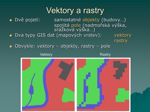
Vektory a rastry<br />
Dvě pojetí: samostatné objekty (budovy…)<br />
spojitá pole (nadmořská výška,<br />
srážková výška…)<br />
Dva typy GIS dat (mapových vrstev): vektory<br />
rastry<br />
Obvykle: vektory – objekty, rastry – pole<br />
Vektory<br />
Rastry