

Costa da Morte - Get a Free Blog Here
Costa da Morte - Get a Free Blog Here
Costa da Morte - Get a Free Blog Here

You also want an ePaper? Increase the reach of your titles
YUMPU automatically turns print PDFs into web optimized ePapers that Google loves.
<strong>Costa</strong> <strong>da</strong> <strong>Morte</strong>
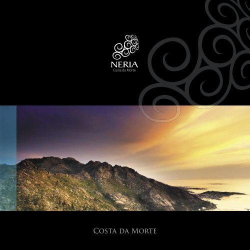
Vista del Monte Pindo desde el mirador de Ézaro<br />
View of Monte Pindo from Ézaro viewpoint<br />
Le llaman A <strong>Costa</strong> <strong>da</strong> <strong>Morte</strong>,<br />
pero debería llamarse A <strong>Costa</strong> <strong>da</strong> Vi<strong>da</strong>.<br />
It is called A <strong>Costa</strong> <strong>da</strong> <strong>Morte</strong>,<br />
but it should be called The Coast of Life.<br />
Guía Turística de la <strong>Costa</strong> <strong>da</strong> <strong>Morte</strong><br />
Sightseeing Guide of the <strong>Costa</strong> <strong>da</strong> <strong>Morte</strong><br />
3
Introducción<br />
Introduction<br />
Cabana de Bergantiños<br />
Camariñas<br />
Carnota<br />
Cee<br />
Corcubión<br />
Dumbría<br />
Fisterra<br />
Laxe<br />
Mazaricos<br />
Muxía<br />
Vimianzo<br />
Zas<br />
Galería de Fotos<br />
Gallery of Photos<br />
7<br />
9<br />
15<br />
21<br />
27<br />
33<br />
39<br />
45<br />
51<br />
57<br />
63<br />
69<br />
75<br />
81<br />
Guía Turística de la <strong>Costa</strong> <strong>da</strong> <strong>Morte</strong><br />
Sightseeing Guide of the <strong>Costa</strong> <strong>da</strong> <strong>Morte</strong><br />
<br />
<br />
5
COSTA DA MORTE<br />
El topónimo <strong>Costa</strong> <strong>da</strong> <strong>Morte</strong> es heredero de la creencia antigua<br />
de que Fisterra era el fin de la tierra y el punto a partir del<br />
cual ya no existía navegación hacia el Oeste.<br />
Era además, según la tradición de los antiguos griegos y de<br />
los celtas, la región donde el sol desaparece a diario, conduciendo<br />
la barca de Caronte, carga<strong>da</strong> con las almas que<br />
Hermes (S. Roque) recogía en pequeños templos (ermitas)<br />
al país de los muertos que el Dios-Sol es capaz de atravesar<br />
para aparecer en un nuevo día.<br />
La <strong>Costa</strong> <strong>da</strong> <strong>Morte</strong> se extiende en el noroeste peninsular,<br />
comprendiendo los municipios costeros de Cabana, Laxe,<br />
Camariñas, Muxía, Cee, Fisterra, Corcubión, Carnota; los municipios<br />
de Dumbría y Vimianzo, con sali<strong>da</strong> al mar; y los municipios<br />
interiores de Mazaricos y Zas. Es una tierra de leyen<strong>da</strong>s<br />
acerca de ciu<strong>da</strong>des sepulta<strong>da</strong>s, de curanderos que obran<br />
milagros, de supersticiones y grandes devociones.<br />
Es un país salpicado de iglesias románicas, pazos, castillos<br />
y monumentos megalíticos rodeados de una naturaleza<br />
generosa. Es el confín de Europa, donde el mar golpea un<br />
paisaje de acantilados abruptos, islotes y peñascos inmensos<br />
que sirven de protección natural a una tierra codicia<strong>da</strong><br />
por su riqueza y saquea<strong>da</strong>, a lo largo de los siglos, por vikingos,<br />
piratas, escuadras inglesa y francesa... escenario de<br />
naufragios y hundimientos, en una tierra que, sobre todo, es<br />
símbolo de vi<strong>da</strong>.<br />
Es, sobre todo, una tierra pobla<strong>da</strong> desde la antigüe<strong>da</strong>d por<br />
gente esforza<strong>da</strong> y generosa que ha sabido extraer lo mejor<br />
que una naturaleza exigente le <strong>da</strong>ba y ha desarrollado una<br />
cultura, en torno a ella, que le hace vivir con intensi<strong>da</strong>d un<br />
tiempo que se desgrana lentamente.<br />
COSTA DA MORTE<br />
Guía Turística de la <strong>Costa</strong> <strong>da</strong> <strong>Morte</strong><br />
Sightseeing Guide of the <strong>Costa</strong> <strong>da</strong> <strong>Morte</strong><br />
The name <strong>Costa</strong> <strong>da</strong> <strong>Morte</strong> comes from the ancient belief that Fisterra was<br />
the end of the world and the departure point from which it was not possible<br />
to sail toward the West.<br />
It was, furthermore, according to ancient Greek and Celtic traditions, the region<br />
where the Sun disappeared every <strong>da</strong>y, steering Kharon’s boat, loaded<br />
with the souls that Hermes (S. Roque) would collect at small temples (hermitages),<br />
to the country of the dead that the Sun God is able to pass through<br />
in order to appear ever <strong>da</strong>y.<br />
The <strong>Costa</strong> <strong>da</strong> <strong>Morte</strong> stretches out in the Northeast peninsula, comprising<br />
the coastal municipalities of Cabana, Laxe, Camariñas, Muxía, Cee, Fisterra,<br />
Corcubión, Carnota; the municipalities of Dumbría and Vimianzo, with an<br />
outlet to the sea, and the inland municipalities of Mazaricos and Zas. It is<br />
a land full of legends about buried cities, about miracle working healers,<br />
about superstitions and about great devotion.<br />
It is a country scattered with Romanesque churches, country manors and<br />
castles and megalithic monuments surrounded by plush nature. It is the<br />
limit of Europe where the sea pounds against a landscape of abrupt cliffs,<br />
small islands and rocky outcrops that serve as the natural protection of a<br />
land that has been coveted for its wealth and plundered throughout centuries<br />
by Vikings, pirates, English and French squadrons...the scene of shipwrecks<br />
and sinking boats in a land that is, above all, a symbol of life.<br />
It is, most importantly, a land inhabited since times past by hard-working<br />
and generous people that have known how to extract the best that a demanding<br />
nature has given them and have developed a culture, which revolves<br />
around that nature, that enables them to intensely live a time that<br />
slowly ticks away.<br />
7
INTRODUCTION / HISTORY<br />
Cabana de Bergantiños<br />
Cabana de Bergantiños spreads from the mouth of the river Anllóns,<br />
Ponteceso, to the beach of Laxe. From the coast, its 100 km2 of surface area<br />
work their way into the lands of Bergantiños to form a limit with Ponteceso,<br />
Coristanco, Zas and Laxe.<br />
Its population of 6,000 inhabitants (2006) are settled in ten parishes.<br />
Economic activity revolves around agriculture for their own consumption,<br />
cattle farming, the wood industry, fi shing, collecting shellfi sh and an<br />
emerging service sector for construction and the food-service industry.<br />
From A Coruña, it can be reached using the road to Fisterra in 56 km by taking<br />
the exit in Carballo toward Buño and Ponteceso, or it is possible to use the<br />
inland route in 72 km passing through Baio (C-552). From Santiago, the<br />
distance is 55 km, passing through Santa Comba, Zas and Baio. The Town<br />
Hall and other services are located on in A Carballa. The town has developed<br />
over the last fi ve years due to the increase in the off er for tourists and in the<br />
railroad network, which makes it easier to commute to A Coruña and its<br />
metropolitan area.<br />
><br />
Its climate is oceanic, humid and mild. Inland, there are numerous troutfi<br />
lled rivers and woods for small game hunting. On the coast, there is a sharp<br />
contrast between the abrupt barnacle rich cliff s and the softness of the A<br />
Insua cove surrounded by the Monte Branco mountains.<br />
Its fi rst settlements <strong>da</strong>te back to Megalithic times. The area abounds with<br />
archaeological remains from the Iron Age (VI-I BC). The Romans extracted<br />
gold quartz in Corcoesto. In the Middle Ages, the Benedictine monastery at<br />
Canduas played an important role. Its most recent past was marked by the<br />
presence of rural nobility in a large number of country houses adorned with<br />
coats of arms.<br />
< Castro A Cibdá Fortifi ed settlement of A Cibdá<br />
Cabana de Bergantiños<br />
INTRODUCCIÓN / HISTORIA<br />
Cabana de Bergantiños<br />
Cabana de Bergantiños se extiende desde la desembocadura del río<br />
Anllóns (Ponteceso) hasta la playa de Laxe. Desde la costa, sus 100<br />
km 2 de extensión se adentran en tierras de Bergantiños para formar<br />
límite con Ponteceso, Coristanco, Zas y Laxe.<br />
Su población de 6.000 habitantes (2006) se asienta en diez parroquias.<br />
La activi<strong>da</strong>d económica se centra en la agricultura de autoconsumo,<br />
ganadería vacuna, industria maderera, pesca, marisqueo y un<br />
emergente sector de servicios de construcción y hostelería.<br />
Desde A Coruña, se llega por la carretera a Fisterra en 56 km, desvío<br />
en Carballo hacia Buño y Ponteceso, o bien por el interior en 72 km<br />
por Baio (C-552). Desde Santiago, la distancia es de 55 km por Santa<br />
Comba, Zas y Baio. La Casa Consistorial y otros servicios se encuentran<br />
en A Carballa. En los últimos cinco años, se ha estabilizado la población,<br />
debido a la pujanza de la oferta turística y a la red viaria que facilita el<br />
desplazamiento laboral a A Coruña y a su área metropolitana.<br />
Su clima es oceánico, húmedo y suave. En el interior, discurren<br />
numerosos ríos trucheros y bosques con caza menor. En la costa,<br />
contrastan abruptos acantilados percebeiros con la suavi<strong>da</strong>d de la<br />
ensena<strong>da</strong> de A Insua fl anquea<strong>da</strong> por el Monte Branco.<br />
Guía Turística de la <strong>Costa</strong> <strong>da</strong> <strong>Morte</strong><br />
Sightseeing Guide of the <strong>Costa</strong> <strong>da</strong> <strong>Morte</strong><br />
><br />
Sus primeros asentamientos <strong>da</strong>tan del Megalítico. Abun<strong>da</strong>n restos<br />
castreños de la E<strong>da</strong>d de Hierro (VI-I a.C.) Los romanos extrajeron<br />
cuarzo aurífero en Corcoesto. En la E<strong>da</strong>d Media, tuvo protagonismo<br />
el monasterio benedictino de Canduas. De su pasado más próximo,<br />
se constata la presencia de nobleza rural en un elevado número de<br />
pazos adornados con escudos.<br />
Puente sobre el río Anllóns<br />
Bridge over the river Anllóns<br />
9
HERITAGE<br />
Cabana de Bergantiños<br />
The most important archaeological sites, which are in Borneiro, include the<br />
Dolmen of Dombate and the fortifi ed settlement of A Cibdá.<br />
Dolmen of Dombate<br />
It is a megalithic tomb made up of seven large vertical slabs covered by a<br />
large covering. The structure has a heptagonal chamber accessed through a<br />
corridor. Inside, there are preserved etchings and paintings. Its grave goods<br />
are comprised of protective idols and arrow heads. In the 19th century, the<br />
historian Manuel Murguía and the bard Eduardo Pon<strong>da</strong>l, creator of the<br />
anthem of Galicia, made this monument famous. It is the only dolmen that<br />
has been excavated in A <strong>Costa</strong> <strong>da</strong> <strong>Morte</strong> and it off ers guided tours.<br />
Fortifi ed Settlement of A Cibdá<br />
It was inhabited between the 6th and the 7th century BC. Its discovery (1924)<br />
is owed to Parga Pon<strong>da</strong>l and Pérez Bustamente. It is medium sized and its<br />
acropolis has an oval shape. Inside, there are many houses with a circular<br />
and semi-rectangular fl oor. The door to enter the houses is slightly raised<br />
from the earth in order to prevent animals and water from entering. It has the<br />
novelty of an outside neighbourhood where it is quite likely that metals were<br />
cast. Ceramic pieces and hand mills were also found. It is the only fortifi ed<br />
settlement excavated in A <strong>Costa</strong> <strong>da</strong> <strong>Morte</strong> and if off ers guided tours.<br />
Other Interesting Sites<br />
. A Insua cove, a natural space that off ers a viewpoint for watching birds.<br />
. San Esteban de Cesullas Church, Romanesque remains and baroque<br />
altarpieces.<br />
. San Martiño de Riobó Church, Romanesque remains and baroque<br />
altarpieces; it contains the tombs of Lorenzo Bermúdez de Castro and his<br />
wife.<br />
. A Penela Tower.<br />
. San Pedro de Nantón Church, nave from the 18th century, rectangular apse<br />
from the 16th century.<br />
A Penela Tower<br />
Torre <strong>da</strong> Penela<br />
San Fins Hermitage<br />
Hermita de San Fíns<br />
PATRIMONIO<br />
Cabana de Bergantiños<br />
Como yacimientos arqueológicos sobresalen, en Borneiro, el dolmen<br />
de Dombate y el castro A Cibdá.<br />
Dolmen de Dombate<br />
Es una tumba megalítica forma<strong>da</strong> por siete grandes losas verticales<br />
cubiertas por una gran tapa. El conjunto presenta cámara heptagonal<br />
con acceso mediante corredor. En el interior se conservan grabados y<br />
pinturas. Su ajuar se compone de ídolos protectores, restos cerámicos<br />
o puntas de fl echa. En el s. XIX, el historiador Manuel Murguía y el<br />
bardo Eduardo Pon<strong>da</strong>l, autor del himno gallego, dieron fama a este<br />
monumento. Es el único dolmen excavado en A <strong>Costa</strong> <strong>da</strong> <strong>Morte</strong> y<br />
ofrece visitas guia<strong>da</strong>s.<br />
Castro A Cibdá<br />
Estuvo habitado entre los s. VI y I a.C. Su descubrimiento (1924) se<br />
debe a Parga Pon<strong>da</strong>l y Pérez Bustamante. Tiene tamaño medio<br />
y su acrópolis presenta forma ovoi<strong>da</strong>l. En el interior, se agrupan<br />
numerosas casas de planta circular y semirrectangular. La puerta de<br />
acceso a éstas se encuentra a pequeña altura para evitar la entra<strong>da</strong><br />
de animales o agua. Presenta la nove<strong>da</strong>d de un barrio exterior en el<br />
que, con to<strong>da</strong> probabili<strong>da</strong>d, se fundían metales. También se hallaron<br />
piezas de cerámica y molinos de mano. Es el único castro excavado<br />
en A <strong>Costa</strong> <strong>da</strong> <strong>Morte</strong> y ofrece visitas guia<strong>da</strong>s.<br />
Otros lugares de interés<br />
. Ensena<strong>da</strong> de A Insua, espacio natural dotado con un mirador para<br />
observación de aves.<br />
. Iglesia de San Esteban de Cesullas, restos románicos y retablos<br />
barrocos.<br />
. Iglesia de San Martiño de Riobó, restos románicos y retablos barrocos;<br />
contiene sepulcros de Lorenzo Bermúdez de Castro y esposa.<br />
. Torre de A Penela.<br />
. Iglesia de San Pedro de Nantón, nave del s. XVIII, ábside rectangular<br />
del s. XVI.<br />
Dolmen de Dombate Dolmen of Dombate<br />
Guía Turística de la <strong>Costa</strong> <strong>da</strong> <strong>Morte</strong><br />
Sightseeing Guide of the <strong>Costa</strong> <strong>da</strong> <strong>Morte</strong><br />
San Esteban de Cesullas<br />
San Pedro de Nantón<br />
San Esteban de Cesullas San Pedro de Nantón<br />
11
Desembocadura del río Anllóns<br />
Anllóns Rives estuary<br />
LANDSCAPE / ROUTES Cabana de Bergantiños<br />
The great richness of its landscape and an enormous ethnographic, historical<br />
and artistic heritage are the ingredients that make Cabana de Bergantiños a<br />
very attractive area.<br />
“No Confín dos Verdes Castros” Itineraries<br />
A set of eight itineraries to get to know the entire town. It has the aid of a<br />
homonymous guidebook and CD from the folk group Milladoiro.<br />
O Anllóns Path<br />
A path marked by the edges of the river Anllóns. On the path you will fi nd the<br />
José Luís Rabuñal Patiño bird watching viewpoint. New perspective to enjoy<br />
the spectacular natural space.<br />
Archaeological Route around Borneiro<br />
A marked path to discover the archaeological, ethnographic and artistic<br />
treasures of Borneiro.<br />
Following the Footsteps of the Riobó<br />
A marked path through the inland areas dominated by the noble family with<br />
the surname Riobó.<br />
Rego dos Muíños Route<br />
A marked path that winds through an ethnographic environment inhabited<br />
by 24 water mills.<br />
CELEBRATIONS / GASTRONOMY<br />
San Fins do Castro Pilgrimage (Patron saint of Cabana de Begantiños)<br />
It is held on the 1st of August under the shade of a birch tree grove. On the 17th<br />
of October 2007, the Government of Galicia declared it as a “Galician Tourist<br />
Attraction”. Pilgrims must soak their handkerchiefs in the miraculous waters<br />
of its fountain and leave them to dry in the countryside in order to heal warts.<br />
At mid<strong>da</strong>y, events are held that give the pilgrimage its name: performance of<br />
the Hymn to San Fins, burning of the Santo de Pólvora and the emission of the<br />
Berro Seco, three loud cries shouted in unison by all of the pilgrims.<br />
Carme do Briño Pilgrimage<br />
It is held on the 18th of July under the shade of a hundred-year-old old oak<br />
grove. Its artistic and ethnographic surroundings include a primitive transept,<br />
a hermitage with elaborate stone façade and the fountain of miraculous<br />
waters.<br />
Santa Mariña do Remuíño Pilgrimage<br />
It is also held on the 18th of July next to the meander of the river Anllóns. The<br />
area has a unique transept and a simple hermitage. Legend has it that the<br />
waters from its fountain are benefi cial for the udders of animals.<br />
RECIPE: Fried trout from the river Anllóns.<br />
The trout from the Anllóns are famous around the world, especially those<br />
fi shed on the long <strong>da</strong>ys late in the season.<br />
Ingredients: 2 trout fi lets, 1 large potato, 1 large onion, 1 clove of garlic, salt,<br />
oil, tarragon, basil, 2 little scoops of butter and a splash of wine.<br />
Preparation: Sautee the onion with the garlic and the spices. Cut the potato in<br />
rounds and fry it lightly. Put half of the sautéed onion mixture in a mediumsize<br />
baking dish with a layer of potatoes over it and another layer of the trout<br />
fi lets. Cover it all with the rest of the onion mixture. Add the wine and the<br />
butter. Bake it at high heat for approximately 15 minutes.<br />
PAISAJES / RUTAS<br />
Cabana de Bergantiños<br />
La gran riqueza paisajística junto a un enorme legado etnográfi co,<br />
histórico y artístico son los ingredientes que hacen de Cabana de<br />
Bergantiños un territorio muy atractivo.<br />
Itinerarios “No confín dos verdes castros”<br />
Conjunto de ocho itinerarios para conocer la totali<strong>da</strong>d del<br />
ayuntamiento. Cuenta con la ayu<strong>da</strong> de un libro-guía homónimo y CD<br />
del grupo folk Milladoiro.<br />
Sen<strong>da</strong> de O Anllóns<br />
Sen<strong>da</strong> señaliza<strong>da</strong> por los márgenes del río Anllóns. En ella se encuentra<br />
el mirador de aves José Luís Rabuñal Patiño. Nueva perspectiva para<br />
gozar de un privilegiado espacio natural.<br />
Ruta arqueológica por Borneiro<br />
Sendero señalizado que descubre los valores arqueológicos,<br />
etnográfi cos y artísticos de Borneiro.<br />
Tras las huellas de los Riobó<br />
Sendero señalizado por tierras interiores domina<strong>da</strong>s por la nobleza<br />
del apellido Riobó.<br />
Ruta del “Rego dos Muíños”<br />
Sendero señalizado que transcurre por un entorno etnográfi co<br />
poblado de 24 molinos de auga.<br />
Playa Pendón Pendón Beach Bosque en San Fíns San Fíns Woods<br />
Guía Turística de la <strong>Costa</strong> <strong>da</strong> <strong>Morte</strong><br />
Sightseeing Guide of the <strong>Costa</strong> <strong>da</strong> <strong>Morte</strong><br />
FIESTAS / GASTRONOMÍA<br />
Romería de San Fins do Castro<br />
(Patrono de Cabana de Bergantiños)<br />
Se celebra el 1 agosto bajo la sombra de un bosque de abedules. El 17<br />
de octubre de 2007, la Xunta de Galicia la reconoció como “Festa de<br />
Interese Turístico Galego”. Los romeros deberán mojar los pañuelos<br />
en las aguas milagrosas de su fuente y dejarlos secar en la campiña<br />
para curar las verrugas. Al mediodía se realizan varios actos que le<br />
otorgan identi<strong>da</strong>d: interpretación del Himno a San Fins, quema del<br />
Santo de Pólvora y emisión del Berro Seco, tres fuertes gritos lanzados<br />
a coro por todos los romeros.<br />
Romería de Carme do Briño<br />
Se celebra ca<strong>da</strong> 18 de julio bajo la sombra de un roble<strong>da</strong>l centenario.<br />
En su entorno artístico-etnográfi co destaca un primitivo crucero, una<br />
ermita con historia<strong>da</strong> facha<strong>da</strong> de piedra y la fuente de aguas milagrosas.<br />
Romería de Santa Mariña do Remuíño<br />
También se celebra ca<strong>da</strong> 18 de julio al lado de un meandro del río<br />
Anllóns. Su entorno cuenta con un singular crucero y una sencilla ermita.<br />
La tradición narra que las aguas de su fuente son benefi ciosas<br />
para las ubres de animales.<br />
RECETA: Truchas fritas del río Anllóns<br />
Las truchas del Anllóns tienen fama mundial, sobre todo las pesca<strong>da</strong>s<br />
en días largos con la tempora<strong>da</strong> avanza<strong>da</strong>.<br />
Ingredientes: 2 fi letes de trucha, 1 patata grande, 1 cebolla grande, 1<br />
diente de ajo, sal, aceite, estragón, albahaca, 2 copitos de mantequilla<br />
y un chorrito de vino.<br />
Preparación: Se fríe la cebolla con el ajo y las especias. Se corta la<br />
patata en ro<strong>da</strong>jas y se fríe ligeramente. Se pone la mitad del refrito<br />
de cebolla en una fuente mediana de horno con una capa de patatas<br />
encima y otra de fi letes de trucha, todo cubierto con el resto del<br />
refrito. Se le añade el vino y la mantequilla. Se pone al horno fuerte<br />
unos 15 minutos.<br />
13
INTRODUCTION / HISTORY<br />
Camariñas<br />
Camariñas is located in the centre of the coastline of <strong>Costa</strong> <strong>da</strong> <strong>Morte</strong>. Its territory,<br />
which occupies 52 km2 of surface area, borders the Atlantic Ocean to<br />
the north and to the west; in the south, it is delimited by the towns of Muxía<br />
and Vimianzo; and in the east, also by latter.<br />
It is possible to reach Camariñas by the C-552 road (A Coruña-Fisterra) and it<br />
is 89 km from the capital of the province. To arrive at Camariñas from Santiago,<br />
we can use the road to Baio (61 Km), passing by Portomouro and Santa<br />
Comba. The other route is to head toward Berdoias, passing by Negreira, and<br />
from there pass by Ponte do Porto to Camariñas (80 km).<br />
Its 6,467 inhabitants (INE 2005) are distributed among the districts of Camariñas,<br />
Camelle, Ponte do Porto and Xaviña. The climate is humid and mild.<br />
The coastline that goes from Camelle to Camariñas is a paradigm of <strong>da</strong>nger.<br />
It is a region exposed to strong winds that move the blades of hundreds of<br />
modern windmills.<br />
The municipal population has been slowly recovering from the fl ood of emigration.<br />
The principal economic activity of Camariñas is the exploitation of<br />
marine resources - fi shing and shellfi sh collecting - and the related industrial<br />
tasks.<br />
><br />
Agriculture and livestock are important complementary sectors in the area.<br />
There is little construction activity. Service sectors, on the other hand, are gaining<br />
importance, given the large distance to urban areas of a certain size.<br />
In recent years, tourism and bobbin lace craftsmanship have been promoted.<br />
The “Mostra do Encaixe de Bolillos” (bobbin lace display) has become a draw<br />
for thousands of visitors.<br />
The name of this municipality comes from the regional bush called “caramiña”<br />
(herb of hunger). Its fi rst settlements <strong>da</strong>te back to the megalithic era.<br />
In 1809, the Camariñas estuary was the scene of a bloody invasion led by the<br />
French who plundered homes and killed all who put up resistance.<br />
The history of the municipality of Camariñas is connected to the sea. The sea<br />
brought waves of settlers in the past. And thousands of compatriots emigrated<br />
by the sea from the end of the 19th century, fi rst to America and, in recent<br />
times, to Europe using other means.<br />
< Faro Vilán Lighthouse of Vilán<br />
Camariñas<br />
INTRODUCCIÓN / HISTORIA<br />
Camariñas<br />
Camariñas se sitúa en el centro del litoral de la <strong>Costa</strong> <strong>da</strong> <strong>Morte</strong>. Su<br />
territorio de 52 kms 2 de superfi cie está bañado, al norte y al oeste por<br />
el Atlántico; al sur limita con los ayuntamientos de Muxía y Vimianzo,<br />
y al este, también con éste último.<br />
Se accede a Camariñas por la carretera C-552 (A Coruña-Fisterra) y<br />
dista 89 Km. de la capital de la provincia. Para llegar a Camariñas desde<br />
Santiago podemos seguir la carretera a Baio (61 Km), por Portomouro<br />
y Santa Comba. La otra ruta consiste en dirigirse a Berdoias por<br />
Negreira y desde allí por Ponte do Porto a Camariñas (80 Km.)<br />
Sus 6.467 habitantes (INE 2005) están distribuídos a lo largo y ancho<br />
de las parroquias de Camariñas, Camelle, Ponte do Porto y Xaviña. El<br />
clima es suave y húmedo. El litoral que va desde Camelle a Camariñas<br />
es paradigma de peligrosi<strong>da</strong>d. Es ésta una región someti<strong>da</strong> a fuertes<br />
vientos que mueven las aspas de cientos de modernos molinos de<br />
viento.<br />
La población municipal se ha ido recuperando paulatinamente del<br />
azote de la emigración. La base económica principal de Camariñas<br />
es la explotación de los recursos marinos (pesca y marisqueo) y las<br />
labores industriales deriva<strong>da</strong>s de ella. Agricultura y ganadería son<br />
sectores complementarios importantes en la zona. La activi<strong>da</strong>d<br />
constructiva es escasa. Sí gana en importancia el sector de servicios,<br />
<strong>da</strong><strong>da</strong> la distancia grande a centros urbanos de cierta envergadura.<br />
Guía Turística de la <strong>Costa</strong> <strong>da</strong> <strong>Morte</strong><br />
Sightseeing Guide of the <strong>Costa</strong> <strong>da</strong> <strong>Morte</strong><br />
><br />
En los últimos años se ha potenciado la activi<strong>da</strong>d turística y la<br />
artesanía del encaje de bolillos. La “Mostra do Encaixe de Bolillos” está<br />
convirtiéndose en reclamo para miles de visitantes.<br />
El topónimo de este municipio deriva de un arbusto autóctono<br />
llamado ‘caramiña’ (hierba del hambre). Sus primeros asentamientos<br />
de población <strong>da</strong>tan de la época megalítica.<br />
La ría de Camariñas fue escenario, en 1809, de una sangrienta<br />
invasión de los franceses que saquearon hacien<strong>da</strong>s y asesinaron a<br />
todos cuantos opusieron resistencia.<br />
La historia del municipio de Camariñas está vincula<strong>da</strong> al mar. A través<br />
de él llegaron olea<strong>da</strong>s de pobladores en el pasado. Y también por mar<br />
emigraron cientos de paisanos desde fi nales del siglo XIX, primero a<br />
América y, ya en los últimos tiempos, a Europa por otros medios.<br />
Dársena de Camariñas<br />
Pier of Camariñas<br />
15
HERITAGE<br />
Camariñas<br />
Camariñas was already inhabited in the megalithic era. This is demonstrated<br />
by the remains of the tumulus of Mámoa de Reira and the fortifi ed<br />
settlements of Mourín and Monte Croado. Around the Mámoa de Reira, there<br />
is a primitive construction used to hunt wolves called “Foxo dos Lobos”. In<br />
Ponte do Porto, there are three fortifi ed settlements around a town centre<br />
which give evidence of the pre-Roman origins of the villa. The footprint of<br />
Roman domination also left its mark on these homes. On the banks of the<br />
river Grande, there is a path that is a Roman road from the 1st century that<br />
later became part of the Royal Road used by Alfonso IX.<br />
In the past, the river Grande was used as a channel of communication and<br />
for freight transport from Ponte do Porto, in the middle of the estuary, to<br />
Camariñas. One of the major events that occurred in the region during the<br />
Middle Ages was the sea invasions by Norman and Muslim people against<br />
coastal towns, especially in the 9th, 10th and 11th centuries, which prompted<br />
people to leave the area and to withdraw to land further inland.<br />
During the Middle Ages, religion had a considerable infl uence on the entire<br />
region. The parish church Sta. María de Xaviña (12th century) <strong>da</strong>tes back<br />
to this time; however, the façade and the fl oor were later modifi ed. It has a<br />
single nave with a barrel vault. It has Romanesque capitals with vegetable<br />
and fi gure decoration. On the façade, there is a window over the door and a<br />
bell tower with openings at the base. The construction is made out of granite<br />
ashlars.<br />
The San Xurxo de Buría Church was built in the 18th century, the parish of<br />
Camariñas, which has sculptures by Xosé Ferreiro and the San Roque Church,<br />
in Ponte do Porto, of which only the bell tower has been preserved.<br />
During the reign of Ferdinand VI and Charles III, toward the middle of the<br />
18th century, when there was hardly any <strong>da</strong>nger of invasions, the El Soberano<br />
Castle was constructed over a rocky promontory in Camariñas using thick<br />
masonry walls. It had systems of loopholes and embrasures for pieces of<br />
artillery. Inside, there was a building to house troops.<br />
Later, the rural nobility took over and the predominance of the clergy ended.<br />
Gentlemen had stately homes built, which were called “pazos”. Pazo dos<br />
Mouzo and Pazo <strong>da</strong> Paxariña. In Camelle, there is a unique outdoor sculpture<br />
museum, the work of a German hermit and artist, Man, whose life came to an<br />
early end due to the pain that the Prestige disaster caused him.<br />
Church of San Xurxo<br />
Iglesia de San Xurxo<br />
The Museum of the German<br />
Museo del Alemán<br />
PATRIMONIO<br />
Camariñas<br />
Camariñas fue pobla<strong>da</strong> ya en la época megalítica. Así lo atestiguan los<br />
restos del túmulo Mámoa de Reira, así como los castros de Mourín<br />
y Monte Croado. En los ale<strong>da</strong>ños de la Mámoa de Reira se halla una<br />
construcción primitiva utiliza<strong>da</strong> para la caza de lobos llama<strong>da</strong> “Foxo<br />
dos Lobos”. En Ponte do Porto, tres castros dispuestos alrededor del<br />
casco urbano avalan el origen prerromano de la villa. La huella de<br />
la dominación romana también dejó su impronta en estos lares. A<br />
orillas del río Grande discurre un sendero que no es sino una calza<strong>da</strong><br />
romana del siglo I, que luego formó parte del Camino Real utilizado<br />
por Alfonso IX.<br />
El río Grande fue utilizado como vía de comunicación y para el<br />
transporte de mercancías en el pasado, desde Ponte do Porto, en el<br />
saco de la ría, hasta Camariñas.<br />
Uno de los principales acontecimientos que sucedieron en la comarca<br />
durante la E<strong>da</strong>d Media fueron las invasiones marítimas de los pueblos<br />
normandos y musulmanes contra los núcleos costeros, sobre todo en<br />
los siglos IX, X, XI, lo que motivó que la población se retirase a vivir<br />
hacia tierras situa<strong>da</strong>s más al interior.<br />
Durante la E<strong>da</strong>d Media la infl uencia religiosa fue muy grande en to<strong>da</strong><br />
la comarca. De esta época <strong>da</strong>ta la iglesia parroquial Sta. María de<br />
Xaviña (siglo XII), si bien fue modifi ca<strong>da</strong> con posteriori<strong>da</strong>d en facha<strong>da</strong><br />
y planta. Presenta una sola nave con bóve<strong>da</strong> de cañón; dispone de<br />
capiteles románicos con decoración vegetal y fi gura<strong>da</strong>. En la facha<strong>da</strong><br />
hay una ventana sobre la puerta y un campanario con dos vanos a los<br />
pies. La construcción es de sillares graníticos.<br />
Cementerio de los Ingleses<br />
English cemetery<br />
Santa Mª de Xaviña Santa Mª de Xaviña<br />
Ponte do Porto<br />
Ponte do Porto<br />
Guía Turística de la <strong>Costa</strong> <strong>da</strong> <strong>Morte</strong><br />
Sightseeing Guide of the <strong>Costa</strong> <strong>da</strong> <strong>Morte</strong><br />
Santa Mª de Tosto Santa Mª de Tosto<br />
En el siglo XVIII se edifi caron la iglesia de San Xurxo de Buría, parroquia<br />
de Camariñas, que guar<strong>da</strong> esculturas de Xosé Ferreiro y la iglesia de<br />
San Roque, en Ponte do Porto, de la que se conserva el campanario<br />
original.<br />
Durante el reinado de Fernando VI y Carlos III, hacia mediados de<br />
siglo XVIII, cuando ya no había prácticamente peligro de invasiones,<br />
se construye sobre un promontorio rocoso el castillo del Soberano,<br />
en Camariñas, dotado de gruesos muros de mampostería. Disponía<br />
de sistemas de troneras y aspilleras para situar las piezas de artillería.<br />
En su interior se levantaba una construcción para albergar las tropas.<br />
Luego la nobleza rural toma el relevo y acaba con la predominancia del<br />
clero. Los señores se hacen construir casas señoriales, denomina<strong>da</strong>s<br />
“pazos”: Pazo dos Mouzo y el Pazo <strong>da</strong> Paxariña. En Camelle se ubica<br />
el singular museo de escultura al aire libre, obra del artista anacoreta<br />
alemán Man, cuyo fi nal de vi<strong>da</strong> estuvo precipitado por el dolor que le<br />
causó el desastre del Prestige.<br />
17
Entre Cabo Vilán y Arou<br />
Between Cape Vilán and Arou<br />
LANDSCAPE / ROUTES Camariñas<br />
The northern coast of Camariñas is made up of enormous cliff s sculpted by<br />
the wind and the sea that have over time created capricious shapes such as<br />
the ‘Furna dos Infernos’ and the ‘Pedra do Oso’. The Reira, Santa Mariña, Arou,<br />
Camelle and Trece Beaches exude a wild beauty. The highest dune in Europe<br />
is near the Trece Beach, in the Monte Blanco mountains. The landscape<br />
between Cape Vilán and Arou, which has been declared a National Site of<br />
National Interest, off ers extremely valuable biodiversity, with protected<br />
species of fl ora and fauna, such as the Common Murre, the Shag and the<br />
Kittiwake. The peninsula of Camariñas protects the estuary from the ravages<br />
of the Atlantic, encouraging the quiet contribution of the river Grande to<br />
fi nish composing a scene of cosy beaches: Area <strong>da</strong> Vila and Ariño.<br />
Many stone crosses on the cliff s provide evidence of the harshness of a sea<br />
that has been the cause of hundreds of shipwrecked boats over the centuries.<br />
In the English Cemetery, among others lie the bodies of three hundred cadets<br />
from the British navy that died in the shipwreck of the training trip “The<br />
Serpent” on the night of the 10th of February 1890. The lighthouse of Cape<br />
Vilana, an indispensable guide, was built on the rocks 125 metres high. Its<br />
beam of light, the fi rst in Spain to use electricity, can reach a distance of 30<br />
nautical miles. At the lighthouse, it is possible to visit the Interpretation Centre<br />
of the Shipwrecks, Lighthouses and Sea Signals of A <strong>Costa</strong> <strong>da</strong> <strong>Morte</strong>.<br />
OS MUIÑOS Route<br />
Leaving from and arriving to Ponte do Porto, this easy fi ve-kilometre walk<br />
goes along a path dotted with mills that played a very important role in the<br />
popular culture and economy of rural and agricultural Galicia. All along<br />
the path, there is lush vegetation, where there is no scarcity of ferns or holly<br />
trees or animals such as the Gadwall, the Common Moorhen or the Heron. In<br />
addition, the area abounds with areas to fi sh for diff erent types of trout.<br />
CELEBRATIONS / GASTRONOMY<br />
Virxe do Carme in Camelle and Camariñas, on the 16th of July, with sea<br />
processions and the Danza de Arcos <strong>da</strong>nce.<br />
Apostle James Pilgrimage in which neighbours join together in the<br />
Recreational Area at the Ariño de Xaviña Beach, with a meal of sardines<br />
accompanied by traditional music.<br />
Other important celebrations are: A Virxe do Monte Pilgrimage, on Easter<br />
Mon<strong>da</strong>y; the O Espírito Santo Celebration, in Camelle, on the Sun<strong>da</strong>y of<br />
Pentecost; the Festivities in honour of San Pedro, in Ponte do Porto, on<br />
the 29th of June; the Celebration of the Mussel, on the second Satur<strong>da</strong>y in<br />
August, in Xaviña, and La Mostra do Encaixe de Bolillos (bobbin lace display),<br />
in Easter Week, when it is a good time to visit the Museo do Encaixe (bobbin<br />
lace museum).<br />
Shellfi sh is very important in the region’s cuisine: small crabs, spider crabs,<br />
spiny and common lobsters and, above all, large barnacles and octopus,<br />
which are a symbol of identity in these parts. And cockles, clams and razor<br />
clams from the estuary. Of the large variety of fi sh enjoyed in the region, the<br />
most popular fi sh include the horse mackerel and sardines, which are never<br />
missing, barbequed, at any summer festivity. Trout from the river Grande<br />
have renowned prestige. Inland livestock remains important due to the<br />
custom, fuelled by migrants to South America, to barbeque pork and beef.<br />
RECIPE: Barbequed Camariñas octopus<br />
The octopus is cooked until it is “al dente”, depending on the size. It is cooled<br />
and cut. Sear it on the barbeque and garnish it with garlic, oil, white pepper<br />
and lemon juice. Present it in a brazier with parsley and lemon.<br />
PAISAJES / RUTAS Camariñas<br />
La costa norte de Camariñas está confi gura<strong>da</strong> por enormes<br />
acantilados esculpidos por el viento y el mar, que han ido dibujando<br />
formas caprichosas como la ‘Furna dos Infernos’ o la ‘Pedra do Oso’.<br />
Las playas de Reira, Santa Mariña, Arou, Camelle o Trece son de una<br />
belleza salvaje. Cerca de esta última, en el Monte Blanco, se encuentra<br />
la duna de mayor altura de Europa.<br />
El paisaje entre Cabo Vilán y Arou, declarado “Sitio Natural de Interés<br />
Nacional”, ofrece una biodiversi<strong>da</strong>d de gran valor, con especies<br />
protegi<strong>da</strong>s de fl ora y fauna, como los Araos de Cons, el cormorán<br />
moñudo y la gaviota tridáctila. La península de Camariñas protege<br />
la Ría de los embates del Atlántico, propiciando el tranquilo aporte<br />
del Río Grande para acabar de componer un escenario de playas<br />
acogedoras: Area <strong>da</strong> Vila y Ariño.<br />
Numerosas cruces de piedra sobre los acantilados <strong>da</strong>n cuenta de la<br />
dureza de un mar que ha hecho naufragar a cientos de barcos a lo<br />
largo de los siglos. En el Cementerio de los ingleses reposan, entre<br />
otros, los cuerpos de los trescientos cadetes de la marina británica<br />
que naufragaron en el buque escuela “The Serpent”, la noche del 10<br />
de febrero de 1890. El faro del cabo Vilán, imprescindible guía, fue<br />
levantado sobre las rocas a 125 metros de altitud. Su cañón de luz,<br />
el primero de España en disponer de energía eléctrica, es capaz de<br />
alcanzar las 30 millas marinas. En él podemos visitar el Centro de<br />
Interpretación de los Naufragios, Faros y Señales Marítimas de A <strong>Costa</strong><br />
<strong>da</strong> <strong>Morte</strong>.<br />
Ruta de OS MUÍÑOS<br />
Con sali<strong>da</strong> y llega<strong>da</strong> en Ponte do Porto, esta fácil caminata de cinco<br />
kilómetros discurre por un sendero salpicado de molinos que jugaron<br />
un papel muy importante en la cultura y la economía populares de la<br />
Galicia rural y agrícola. A lo largo del camino se asienta una vegetación<br />
frondosa, en la que no faltan helechos o acebo, y animales como el<br />
ánade, la gallina de río o la garza real. Abun<strong>da</strong>n puntos de pesca para<br />
la captura de truchas y reos.<br />
Pinares en Ariño<br />
Pine forest in Ariño<br />
Playa de Ariño<br />
Ariño Beach<br />
Guía Turística de la <strong>Costa</strong> <strong>da</strong> <strong>Morte</strong><br />
Sightseeing Guide of the <strong>Costa</strong> <strong>da</strong> <strong>Morte</strong><br />
FIESTAS / GASTRONOMÍA<br />
Virxe do Carme en Camelle y Camariñas, el 16 de julio, con<br />
procesiones marítimas y Danza de Arcos.<br />
Romería de Santiago Apóstol en la que los vecinos se reúnen<br />
en el Área recreativa de la playa de Ariño de Xaviña, con una sardiña<strong>da</strong><br />
acompaña<strong>da</strong> de música tradicional.<br />
Otros festejos importantes son la Romería de A Virxe do<br />
Monte, el lunes de Pascua; la fi esta de O Espírito Santo, en Camelle,<br />
el domingo de Pentecostés; los festejos en honor de San Pedro, en<br />
Ponte do Porto, el 29 de junio; la Fiesta del Mejillón, el segundo sábado<br />
de agosto, en Xaviña, y La Mostra do Encaixe de Bolillos, en Semana<br />
Santa, donde aprovechamos para visitar el Museo do Encaixe.<br />
En la gastronomía destaca la presencia del marisco: nécoras, centollas,<br />
langostas, lubrigantes y, sobre todo, el percebe y el pulpo, que aquí<br />
alcanza señas de identi<strong>da</strong>d. Y los berberechos, almejas y navajas<br />
procedentes de la ría. De la enorme varie<strong>da</strong>d de pescado apreciado<br />
en la mesa, destacan por su populari<strong>da</strong>d el jurel y la sardina, que no<br />
falta asa<strong>da</strong>, en ninguna fi esta veraniega. Las truchas del río Grande<br />
tienen prestigio reconocido. De la ganadería de interior se nutre la<br />
costumbre, alimenta<strong>da</strong> por emigrantes a Su<strong>da</strong>mérica, de pasar por la<br />
parrilla carnes de cerdo y ternera.<br />
RECETA: Pulpo de Camariñas a la brasa<br />
Se cuece el pulpo hasta que esté al dente según el tamaño. Se enfría<br />
y se fi letea. Se marca en la parrilla y se aliña con ajo, aceite, pimienta<br />
blanca y zumo de limón. Se presenta en un brasero con perejil y<br />
limón.<br />
19
INTRODUCTION / HISTORY<br />
Carnota<br />
Carnota stretches out along 70 km2 that on the coast goes from the mouth of<br />
the Xallas at the foot of Mount Pindo – Olympus in Celtic tradition – to Punta<br />
Lens, bordering the town of Muros.<br />
Its name seems to come from the pre-Roman word “corn” (prefi x common in<br />
names throughout the Celtic world) that means stone. It may be considered<br />
a territory halfway between the rivers Altas and Bajas. Its climate is humid<br />
and mild. One of the most important rivers that cross the area is the river<br />
Xallas, which is a cultural symbol and a provider, with its waterfalls, of a large<br />
amount of electricity.<br />
Its main road is the C-550, which can reached from the C-552 if travelling<br />
from A Coruña or from the C-543 if travelling from Santiago. Carnota has the<br />
ports of Lira and O Pinto, which have mooring points for pleasure boats.<br />
Since the 1950s, the town of Carnota has had an intense migratory fl ow<br />
toward other areas. Nowa<strong>da</strong>ys, processes have put in action in order to<br />
recover demographically by giving incentives to births and helping returnees<br />
settle down. The main economic activities are fi shing, aquaculture and<br />
canning. Lira is home to the largest fi sh farm, specialising in the breeding<br />
and fattening of turbot.<br />
><br />
The agriculture, which is somewhat complemented by cattle farming, is for<br />
self-subsistence purposes. Forestry, on the other hand, is more important.<br />
Fast-growing species have been planted in order to fi ght against the setback<br />
caused by the waves of fi res that ravaged the mountains of Carnota in recent<br />
years and from which the town is recovering.<br />
Inhabited since megalithic times, in the Middle Ages, Carnota formed part of<br />
the County of Cornatum, which belonged to the dynasty of the Trastámara.<br />
Later, beginning in the 15th century, it came to pertain to the counts of<br />
Lemos.<br />
The Irmandiñas Wars brought with them the destruction of the fortifi cations<br />
of the Castles of San Jorge and of Peñafi el. During the Old Regime, ownership<br />
of Carnota successively passed from the hands of the Count of Altamira, to<br />
the Archbishopric of Santiago and to the Marquis of La Sierra. During the<br />
War of Independence, it was not spared from looting by the French. The town,<br />
in practically the same confi guration as it has to<strong>da</strong>y, was created as such in<br />
1835.<br />
< Hórreo de Carnota<br />
Granary of Carnota<br />
Carnota<br />
INTRODUCCIÓN / HISTORIA<br />
Carnota<br />
Carnota se extiende a lo largo de 70 km 2 , que por la costa abarcan<br />
desde la desembocadura del Xallas, al pie del Monte Pindo (Olimpo<br />
en la tradición celta) a Punta Lens, en el límite con el Ayuntamiento<br />
de Muros.<br />
Su nombre parece proceder del vocablo prerromano corn (prefi jo<br />
presente en topónimos de todo el mundo celta), que signifi ca piedra.<br />
Se puede considerar un territorio a caballo entre las Rías Altas y Bajas.<br />
Su clima es húmedo y suave. De todos los ríos que la surcan, destaca<br />
el Xallas, como elemento de cultura y por proporcionar, con sus saltos,<br />
abun<strong>da</strong>nte energía eléctrica.<br />
Su principal vía de comunicación es la C-550, con la que se enlaza<br />
desde la C-552 viajando desde A Coruña, o bien desde la C-543 si<br />
se procede de Santiago. Carnota dispone de los puertos de Lira y O<br />
Pindo, con puntos de amarre para embarcaciones de recreo.<br />
El ayuntamiento de Carnota registró desde los años 50 un intenso fl ujo<br />
migratorio hacia otras tierras, estando hoy en día abiertos procesos<br />
de intentos de recuperación demográfi co a través de incentivos a la<br />
natali<strong>da</strong>d e implantación de retornados.<br />
Las principales activi<strong>da</strong>des económicas son la pesca, la acuicultura y<br />
las conserveras. En Lira está ubica<strong>da</strong> la mayor piscifactoría del mundo,<br />
especializa<strong>da</strong> en la cría y engorde del ro<strong>da</strong>ballo.<br />
Guía Turística de la <strong>Costa</strong> <strong>da</strong> <strong>Morte</strong><br />
Sightseeing Guide of the <strong>Costa</strong> <strong>da</strong> <strong>Morte</strong><br />
><br />
La agricultura, un tanto complementa<strong>da</strong> por la ganadería, es del tipo<br />
de autosubsistencia. Es más relevante la silvicultura, con la plantación<br />
de especies de crecimiento rápido, si bien las olas de incendios que<br />
han asolado los montes de Carnota en los últimos años han supuesto<br />
un varapalo del que este pueblo se recupera.<br />
Pobla<strong>da</strong> desde la época megalítica, Carnota formó parte en la E<strong>da</strong>d<br />
Media del Con<strong>da</strong>do de Cornatum, propie<strong>da</strong>d de la dinastía de los<br />
Trastámara, para pasar a depender, a partir del s. XV, de los condes<br />
de Lemos.<br />
Las guerras irmandiñas trajeron consigo la destrucción de las<br />
fortifi caciones de los Castillos de San Jorge y de Peñafi el. Durante el<br />
Antiguo Régimen la propie<strong>da</strong>d de Carnota pasó sucesivamente de<br />
manos del Conde de Altamira a el Arzobispado de Santiago y a el<br />
Marqués de la Sierra. Durante la Guerra de la Independencia no se<br />
libró del saqueo de los franceses. El ayuntamiento, en la confi guración<br />
prácticamente actual, nació como tal en 1835.<br />
Casa do Concello<br />
Town Hall<br />
21
HERITAGE<br />
Carnota<br />
The most important heritage is of a religious nature and the transepts around<br />
the churches. Especially noteworthy:<br />
Santa Comba de Carnota Church, from the 18th century. It has an<br />
interesting Latin cross fl oor plan with a basilica fl oor.<br />
The walls are granite stonework. The façade, which is made of granite, has<br />
a front with baroque mouldings surrounded by four pillars with Ionic-style<br />
capitals, a triangular pediment and an oval window.<br />
The bell tower is the work of the master mason Carlos Aboy. Inside the church,<br />
there is an altarpiece created by the sculptor Ferreiro.<br />
San Mamede de Carnota Church (1755). Neoclassic style, it has<br />
an altarpiece created by the masters Ferreiro and Gambino. Its nave has a<br />
Latin cross fl oor plan, gabled and hip gabled roof. On the façade, there is a<br />
prominent image of the patron saint. The bell tower has four panels and it<br />
is decorated with a cornice and pinnacles and topped with a small dome.<br />
Paganism is mixed with the Christian tradition in the spirit of the congregation<br />
and thus, in the cemetery, the multitude of tombs is facing the altar from<br />
which the light of Salvation will emerge on Dooms<strong>da</strong>y.<br />
Santa María de Lira Church (1760). It is comprised of a single long and<br />
narrow nave divided internally into four parts; the fi rst three have a round<br />
arch and a barrel vault and the corresponding altar zone has a rib vault.<br />
Traditional Heritage. The most important traditional heritage includes the<br />
884 granaries that sow the terrain of Carnota; the threshing fl oors, popular<br />
architectural elements linked to the cycle of cereals; water mills, true economic<br />
engines of yesteryear; fountains; sea sheds, like those of Caldebarcos; as well<br />
as transepts, linked to religious beliefs and with a great symbolic value, with<br />
the transept located in the Campo de Noútigos, which <strong>da</strong>tes back to the 16th<br />
century, being an excellent example.<br />
Lariño Windmill (1914). Cylindrical structure with stone walls; it had<br />
wooden blades until attacks by the sea and the wind tore them off .<br />
Granary and Dovecote of Carnota. Declared a National Monument,<br />
it has a length of 35 metres. Built in 1768 by Gregory Quintela, it rests upon a<br />
base of 22 pairs of feet, rivalling in beauty with that of Lira, probably created<br />
by the same person. The dovecot is cylindrical and has a cone-shaped tiled<br />
roof.<br />
Granary and Dovecote of Lira (18th century). Built in granite, it<br />
belonged to the Church until the disentailment of the 19th century. It is<br />
elevated on a platform and reaches a longitude of 35 metres. The dovecot, in<br />
masonry, is cylindrical and has a cone-shaped roof.<br />
Ínsua Lighthouse, at the point with the same name.<br />
San Mamede<br />
San Mamede<br />
Dovecote of Carnota<br />
Palomar de Carnota<br />
PATRIMONIO<br />
Carnota<br />
Predomina el patrimonio de carácter religioso y los cruceros en los<br />
entornos de las iglesias. A destacar:<br />
Iglesia de Santa Comba de Carnota, del siglo XVIII. Presenta<br />
una curiosa conjunción de planta en cruz latina con planta basilical.<br />
Los muros son de cantería granítica. La facha<strong>da</strong>, de granito, contiene<br />
una porta<strong>da</strong> con molduras barrocas, fl anque<strong>da</strong> por cuatro pilares,<br />
con capiteles de estilo jónico, frontón triangular y ventana ovala<strong>da</strong>.<br />
La torre-campanario se debe al maestro cantero Carlos Aboy. En su<br />
interior hay un retablo obra del escultor Ferreiro.<br />
Iglesia de San Mamede de Carnota (1755). De estilo<br />
neoclásico, cuenta con un retablo obra de los maestros Ferreiro y<br />
Gambino. Su nave es de cruz latina, cubierta a dos y tres aguas. En<br />
la facha<strong>da</strong> destaca la imagen del patrón. La torre-campanario es de<br />
cuatro cuerpos, decora<strong>da</strong> con una cornisa y pináculos y remata<strong>da</strong> en<br />
pequeña cúpula. El paganismo se mezcla con la tradición cristiana<br />
en el espíritu de los fi eles y así, en el cementerio multitud de tumbas<br />
están orienta<strong>da</strong>s hacia el altar desde el que surgirá el día del Juicio<br />
Final la luz de la Salvación.<br />
Iglesia de Santa María de Lira (1760). Se compone de una única<br />
nave estrecha y alarga<strong>da</strong>, dividi<strong>da</strong> internamente en cuatro tramos,<br />
los tres primeros con arco de medio punto y bóve<strong>da</strong> de cañón, y su<br />
correspondiente zona de altar, con bóve<strong>da</strong> de crucería.”<br />
Patrimonio tradicional. Dentro del patrimonio tradicional<br />
destacan los hórreos que en número de 884, siembran la orografía de<br />
Carnota, las eras, elementos arquitectónicos populares ligados al ciclo<br />
de los cereales, los molinos de agua, auténticos motores económicos<br />
de antaño; fuentes, casetas marineras como las de Caldebarcos, así<br />
como los cruceros, ligados a creencias religiosas y con un gran valor<br />
simbólico, destacando el situado en el Campo de Noútigos, que está<br />
fechado en el siglo XVI.<br />
Molino de viento de Lariño (1914). De estructura cilíndrica y<br />
muros pétreos, dispuso de aspas de madera hasta que las acometi<strong>da</strong>s<br />
del mar y del viento se las arrancaron.<br />
Pindo pueblo<br />
><br />
Pindo town<br />
Cruz del Santo Cruz del Santo<br />
Guía Turística de la <strong>Costa</strong> <strong>da</strong> <strong>Morte</strong><br />
Sightseeing Guide of the <strong>Costa</strong> <strong>da</strong> <strong>Morte</strong><br />
Hórreo y palomar de Carnota. Declarado Monumento<br />
Nacional, su longitud es de 35 metros. Construído en 1768 por<br />
Gregorio Quintela, descansa sobre 22 pares de pies, rivalizando en<br />
belleza con el de Lira, probablemente del mismo autor. El palomar es<br />
de planta cilíndrica y cubierta cónica, en teja del país.<br />
Hórreo y palomar de Lira (s. XVIII). Construído en granito,<br />
perteneció a la Iglesia hasta la desamortización del s. XIX. Está<br />
sobreelevado sobre una plataforma y alcanza una longitud de 35<br />
metros. El palomar, en mampostería, es de planta cilíndrica y cubierta<br />
cónica.<br />
Faro de Ínsua, en la punta del mismo nombre.<br />
Santa Comba de Carnota<br />
Santa Comba de Carnota<br />
23
Playa de Carnota<br />
Carnota Beach<br />
LANDSCAPES / ROUTES Carnota<br />
One of the most striking landscapes of the <strong>Costa</strong> <strong>da</strong> <strong>Morte</strong> is that of Mount<br />
Pindo, where the river Xallas cascades over the mountain to meet the sea at<br />
the cove of Ézaro.<br />
Popular tradition believed this granite mass with capricious forms to be the<br />
Celtic Olympus in which the legen<strong>da</strong>ry Queen Lupa had hidden her fabulous<br />
treasures. Pagan worshipping took place in its stone altars into the Middle<br />
Ages. Its intricate inside served as a hideout for fi ghters during the Spanish<br />
Civil War.<br />
In the direction of Carnota is the natural port of Quilmas, where the Normans<br />
repaired and careened their vessels.<br />
Ships from the Spanish Arma<strong>da</strong> that were sailing to conquest England sank<br />
in the reefs at the tip of Caldebarcos.<br />
Boca do Río Beach<br />
El Pindo Beach<br />
Lira Beach<br />
Carnota Beach, seven kilometres long, characterised by its dune, an inland<br />
lagoon and marshes that are the nesting area for a large variety of migrating<br />
birds.<br />
Lariño Beach<br />
Route 1: Carnota Green Path<br />
Fourteen kilometre hiking path from Lariño to the Louredo viewpoint, with<br />
connections to the fortifi ed settlement of Mallou, the petroglyph sites of<br />
Portaventosa and Laxe Escrita, Bico do Santo and Fervenza <strong>da</strong>s Fontes.<br />
CELEBRATIONS / GASTRONOMY<br />
The most important celebrations in Carnota are the festivals of San Clemente<br />
in O Pindo from the 8th to the 10th of August; the celebration of San Mamed,<br />
from the 7th to the 9th of August; the Festival of Christ from the 8th to the<br />
10th of September; the Festival of the Milagrosa in Quilmas, the fi rst weekend<br />
August; the Carmen de Caldebarcos, the 17th and 18th of July; the Remedios<br />
Nuevos (1st Tues<strong>da</strong>y after Easter Week) and Viejos (seven weeks after the<br />
Nuevos) in Lira; as well as the Festival of the Sea, the 23rd and 24th of August;<br />
the Dolores de Carnota, the last Fri<strong>da</strong>y in August; and, lastly, the Festival of<br />
the “Cachela<strong>da</strong>” in Mallou on the 23rd and 24th of August.<br />
Carnota exports products from the sea and from the land to national and<br />
international markets. Traditional products and products from the land are<br />
off ered on Wednes<strong>da</strong>ys in Carnota and Thurs<strong>da</strong>ys in O Pindo - and on the<br />
menus at their restaurants and dining halls.<br />
RECIPE: Grilled turbot with potatoes from Carnota<br />
Boil 1 kilogram of unpeeled potatoes in salted water for 30 minutes. Peel and<br />
cut the potatoes. Put 8 pieces of turbot on a very hot grill slightly greased<br />
with oil. Grill them until golden on both sides, lightly sprinkled with oil and<br />
pressing fi rmly with the spatula. Put them in a baking dish (with the skin side<br />
up) and bake at 200º for 3 minutes.<br />
Lastly, serve 2 pieces of turbot per person with some potatoes sprinkled with<br />
paprika. Sprinkle the dish with olive oil and the sauce from the fi sh.<br />
PAISAJES / RUTAS Carnota<br />
Uno de los paisajes más impactantes de la <strong>Costa</strong> <strong>da</strong> <strong>Morte</strong> es el<br />
Monte Pindo, lugar donde se precipita en casca<strong>da</strong> el Río Xallas para<br />
encontrarse con el mar en la ensena<strong>da</strong> de Ézaro.<br />
La tradición popular consideró a esta mole granítica de formas<br />
caprichosas como el Olimpo Celta, en el que la legen<strong>da</strong>ria Reina<br />
Lupa había ocultado sus fabulosos tesoros. En sus altares pétreos<br />
se desarrollaron cultos paganos hasta entra<strong>da</strong> la E<strong>da</strong>d Media. Sus<br />
entrañas intrinca<strong>da</strong>s sirvieron de escondite a combatientes durante<br />
la Guerra Civil.<br />
En dirección a Carnota está el puerto natural de Quilmas, donde los<br />
normandos reparaban y carenaban sus naves.<br />
En los arrecifes de la punta de Caldebarcos se hundieron naves de la<br />
Arma<strong>da</strong> Invencible que viajaban a la conquista de Inglaterra.<br />
Playa de Boca do Río<br />
Playa del Pindo<br />
Playa de Lira<br />
Playa de Carnota, de siete km de largo, caracteriza<strong>da</strong> por sus dunas,<br />
una laguna interior y marismas en las que ani<strong>da</strong>n una gran varie<strong>da</strong>d<br />
de aves migratorias.<br />
Playa de Lariño<br />
_ 1 Ruta: Sen<strong>da</strong> Verde de Carnota<br />
Ruta de senderismo señaliza<strong>da</strong> de 14 km de longitud, desde Lariño<br />
hasta el mirador de Louredo, con conexiones al Castro de Mallou,<br />
estaciones de petroglifos de Portaventosa y Laxe Escrita, Bico do<br />
Santo y la Fervenza <strong>da</strong>s Fontes.<br />
Puerto Quilmas Port of Quilmas<br />
Faro de Lariño<br />
Lariño Lighthouse<br />
Guía Turística de la <strong>Costa</strong> <strong>da</strong> <strong>Morte</strong><br />
Sightseeing Guide of the <strong>Costa</strong> <strong>da</strong> <strong>Morte</strong><br />
FIESTAS / GASTRONOMÍA<br />
Las fi estas más importantes en Carnota son las fi estas de San Clemente<br />
de O Pindo del 8 al 10 de agosto, la fi esta de San Mamed del 7 al 9 de<br />
agosto y la fi esta del Cristo del 8 al 10 de septiembre, la fi esta de la<br />
Milagrosa en Quilmas el primer fi n de semana de agosto, el Carmen<br />
de Caldebarcos el 17 y 18 de julio, los Remedios nuevos (1 er martes<br />
después de Semana Santa) y viejos (siete semanas después de los<br />
nuevos) en Lira, así como la fi esta del Mar el 23 y 24 de agosto, las<br />
Dolores de Carnota el último viernes de agosto y por último la fi esta<br />
de la “cachela<strong>da</strong>” en Mallou el 23 y 24 de agosto.<br />
Carnota exporta productos del mar y del campo a mercados<br />
nacionales e internacionales. Los productos típicos y de la tierra los<br />
ofrece los miércoles en Carnota y los jueves en O Pindo - y en la carta<br />
de sus restaurantes y casas de comi<strong>da</strong>.<br />
RECETA:<br />
Ro<strong>da</strong>ballo a la plancha con patatas de Carnota<br />
Se cuece en agua sala<strong>da</strong> 1 kilo de patatas sin mon<strong>da</strong>r durante unos<br />
30 minutos. Se pelan y trocean. En una plancha muy caliente, moja<strong>da</strong><br />
ligeramente con aceite, ponemos 8 trozos de ro<strong>da</strong>ballo. Se doran<br />
vuelta y vuelta, ligeramente rociados de aceite y apretando bien<br />
con la espátula. Se sacan a una fuente (con la piel hacia arriba) y se<br />
hornean a 200º durante 3 minutos.<br />
Finalmente se sirven 2 trozos de ro<strong>da</strong>ballo por persona y unos cuantos<br />
trozos de patata espolvoreados con pimentón dulce. Se rocía el plato<br />
con aceite de oliva, aprovechando la salsa.<br />
25
INTRODUCTION / HISTORY<br />
Cee<br />
The municipality of Cee covers an area of 58 km2 and is located in the<br />
westernmost point of the province, neighbouring Fisterra. It is surrounded<br />
by the Atlantic Ocean on three sides and is bordered by the municipalities of<br />
Muxía, Dumbría and Corcubión. Its capital can be reached from A Coruña, a<br />
distance of 95 km, by the C-552. From Santiago, there is a fi nal stop on the<br />
Way of St. James in Cee before arriving at Fisterra.<br />
In addition to being situated on the coast, Cee is protected from the wind by<br />
the Sete Grises, Alto <strong>da</strong>s Penas and Quenlle mountains. It enjoys a very mild<br />
climate.<br />
Cee experienced positive demographic growth throughout the entire 20th<br />
century. The town has a population of close to 7,806 and its inhabitants work<br />
mainly in the service and industry sectors. The shipyards and iron alloy and<br />
metal carbide production are of particular importance.<br />
Forest exploitation and construction activity also contribute to the local<br />
economy. The primary sector is scarcely documented; however, the<br />
commerce, public health, hotel, administrative and transport industries are<br />
quite strong in Cee given its status as an administrative centre.<br />
><br />
The most commonly accepted etymology for the word “Cee” relates it to the<br />
term “cetárea” (from the Latin cetus = tuna or whale), referring to the former<br />
presence of cetacean factories in the region.<br />
This area was already widely populated in the megalithic era. In the Castro<br />
era, the region was inhabited by the Nerios, who installed themselves inland<br />
as protection from coastal invasions (Forts: Son, monte do Castro, Pereiriña,<br />
Toba). Nevertheless, the port of Cee is one of the oldest in Galicia to record<br />
activity.<br />
During the Ancien Régime, the region was under the rule of the Count of<br />
Altamira and the Archdeaconship of Trastámara, through Archbishop<br />
Xelmírez, in the 12th century.<br />
Cee was not spared from the plundering and fi res of the French during the<br />
War of Independence. However, the town was able to recover and now<br />
boasts a very admirable old quarter. The municipality was established<br />
in 1812, through the abolition of noble administration and the birth of<br />
municipalism.<br />
< Playa Caneliñas Caneliñas Beach<br />
Cee<br />
INTRODUCCIÓN / HISTORIA<br />
Cee<br />
El ayuntamiento de Cee ocupa 58 kms 2 en el extremo occidental de<br />
la provincia, lin<strong>da</strong>ndo con Fisterra. Su territorio tiene contacto con<br />
el Océano Atlántico en tres líneas de costa, y con los municipios de<br />
Muxía, Dumbría y Corcubión. A su capital se llega desde A Coruña,<br />
distante 95 km, por la C-552. Desde Santiago, el Camino Jacobeo<br />
hace en Cee una última para<strong>da</strong> antes de llegar a Fisterra.<br />
Junto a su condición costera, Cee está protegi<strong>da</strong> de los vientos por las<br />
montañas Sete Grises, Alto <strong>da</strong>s Penas y montes de Quenlle. Su clima<br />
es muy benigno.<br />
Cee ha registrado una evolución demográfi ca positiva durante todo<br />
el s. XX. Sus cerca de 7.806 habitantes viven principalmente de la<br />
explotación del sector servicios y de la industria, destacando los<br />
astilleros y la producción de aleación de hierro y carburos metálicos.<br />
La explotación forestal y la activi<strong>da</strong>d constructiva también contribuyen<br />
a la fi jación de la población. El sector primario está escasamente<br />
dimensionado. Sin embargo, los servicios de comercio, sanitarios,<br />
hosteleros, administrativos y de transporte están potenciados en Cee<br />
<strong>da</strong><strong>da</strong> su condición de cabecera comarcal.<br />
El origen etimológico del término Cee más admitido lo relaciona con<br />
la palabra cetárea (del latín cetus = atún o ballena), atendiendo a la<br />
existencia en el pasado de factorías de cetáceos en la locali<strong>da</strong>d.<br />
Guía Turística de la <strong>Costa</strong> <strong>da</strong> <strong>Morte</strong><br />
Sightseeing Guide of the <strong>Costa</strong> <strong>da</strong> <strong>Morte</strong><br />
><br />
Estas tierras fueron ya abun<strong>da</strong>ntemente pobla<strong>da</strong>s en el Megalítico.<br />
En la época castreña es habitado por los Nerios, que se asientan en<br />
zonas del interior para protegerse de invasiones costeras (Castros de<br />
Son, monte do Castro, Pereiriña, Toba). Aun así, el puerto de Cee es<br />
de los más antiguos de Galicia en registrar activi<strong>da</strong>d.<br />
Durante el Antiguo Régimen, estas tierras estuvieron bajo el señorío<br />
del Conde de Altamira y del Arcedianato de Trastámara, por mediación<br />
del Arzobispo Xelmírez, en el siglo XII.<br />
Cee tampoco se salvó del saqueo y los incendios por parte de los<br />
franceses durante la Guerra de la Independencia. No obstante, la<br />
villa se repuso y hoy conserva un casco antiguo muy meritorio. El<br />
municipio nació como tal en 1.812, a partir de la abolición de la<br />
administración señorial y el nacimiento del municipalismo.<br />
Zona de la dársena<br />
Docking area<br />
27
HERITAGE<br />
Cee<br />
The abun<strong>da</strong>nt architectural heritage of the municipality notably includes:<br />
Santa María de Xunqueira Parish Church. Built in late Gothic style (16th cent.),<br />
the church was burned down by the French and rebuilt in the 19th century.<br />
Only the main chapel remains from the old temple. The image of Our Lady of<br />
the Apparition was also burned during the invasion.<br />
Folk tradition relates that a foreign ship was unable to weigh anchor because<br />
of a mysterious force. The crew then decided to cast a wooden image from<br />
the ship into the sea. The sculpture was later found by a local among the<br />
“xunqueiros” (reed beds) of the ria. A chapel was erected near where the<br />
image was found to house the image of the Virgin Mary.<br />
Castillo del Príncipe (Prince’s Castle), declared a Site of Cultural<br />
Interest in 1994, its construction was ordered by Charles III to protect the ria<br />
from foreign attacks and in honour of his son, Charles IV.<br />
San Pedro Mártir Chapel, erected over a site of pagan worship, it is<br />
visited by hundreds of pilgrims once a year.<br />
Santiago de Ameixen<strong>da</strong> Church, where, as tradition has it, the<br />
Apostle’s little fi nger is housed.<br />
Regarding civil architecture, the collection of granaries of the Casa do<br />
Camiño do Vilar of Toba is worth mentioning. The pazos (country manors) of<br />
Cee, Bran<strong>da</strong>riz and, particularly, Cotón are worthy of a visit.<br />
The pazo of Cotón, <strong>da</strong>ting back to the 18th century, exhibits close harmony<br />
in its lines, a beautiful side stone staircase and an extraordinary nobiliary<br />
coat of arms with the fl eur-de-lis of the Inquisition affi xed; also featured<br />
are the pine and lances of the Leis family, the squares of the Bermúdez de<br />
Castro family, two castles belonging to the Pardiñas y Rioboo family and, in<br />
the inescutcheon, the six roundels of the Castro family and the squares of the<br />
Bermúdez de Castro family.<br />
The Fernando Blanco Foun<strong>da</strong>tion building, whose construction was<br />
completed in 1886, is notable for combining large forms and harmony.<br />
In keeping with the wishes of the eponymous benefactor who ordered its<br />
construction, it has served as an educational institution. It has a beautiful<br />
garden in which Blanco ordered American species to be planted. It houses<br />
di<strong>da</strong>ctic instruments from the 19th century and paintings by Urquiola, Díaz<br />
Carreño and Madrazo, which are on display in the foun<strong>da</strong>tion’s museum<br />
located in the old girls’ school erected above Fernando Blanco’s maternal<br />
house. The private homes near the Plaza de la Constitución are notable for<br />
the preservation of their original structure.<br />
Constitution Square<br />
Plaza de la Constitución<br />
Santa María of Xunqueira<br />
Santa Mª <strong>da</strong> Xunqueira<br />
PATRIMONIO<br />
Cee<br />
Del abun<strong>da</strong>nte patrimonio arquitectónico del municipio destacan:<br />
La iglesia parroquial de Santa María <strong>da</strong> Xunqueira, de<br />
estilo gótico tardío (s. XVI), que fue incendia<strong>da</strong> por los franceses y<br />
reedifi ca<strong>da</strong> en el siglo XIX. Del antiguo templo sólo se conserva la<br />
capilla mayor. La imagen de la Virgen, “La Apareci<strong>da</strong>”, también se<br />
quemó durante la invasión.<br />
Cuenta la tradición que un navío extranjero era incapaz de zarpar<br />
porque una fuerza misteriosa se lo impedía. La tripulación decidió<br />
entonces arrojar al mar una imagen de madera que llevaban en<br />
el barco. La talla fue encontra<strong>da</strong> luego por un lugareño entre los<br />
“xunqueiros” (juncales) de la ría. Cerca del lugar del hallazgo se levantó<br />
una ermita para alojar a la virgen.<br />
El Castillo del Príncipe, declarado “Bien de Interés Cultural” en<br />
1994, fue man<strong>da</strong>do construir por Carlos III para proteger la ría de<br />
ataques extranjeros y en honor de su hijo Carlos IV.<br />
La Capilla de San Pedro Mártir, fun<strong>da</strong><strong>da</strong> sobre un lugar en el<br />
que se celebraban cultos paganos, convoca a cientos de romeros<br />
una vez al año.<br />
Iglesia parroquial de San Adrián de Toba. Conserva restos<br />
románicos del s. XII. El santo aboga por la curación de verrugas y<br />
quistes.<br />
Iglesia de Santiago de Ameixen<strong>da</strong>, donde, dice la tradición,<br />
se conserva un dedo meñique del Apóstol.<br />
En arquitectura civil es reseñable el conjunto de hórreos de la Casa<br />
do Camiño do Vilar de Toba. También son dignos de recibir visita los<br />
pazos de Cee, Bran<strong>da</strong>riz y, sobre todo, el de Cotón.<br />
Este último, del siglo XVIII, presenta una armonía compacta en sus<br />
líneas, una hermosa escalera lateral pétrea y un escudo nobiliario<br />
singular con la fl or de lis de la Inquisición acola<strong>da</strong>. Se descubre el<br />
pino y las lanzas de los Leis, los escaques de los Bermúdez de Castro,<br />
dos castillos de Pardiñas y Rioboo y, en escusón, los seis roeles de los<br />
Castro y los escaques de los Bermúdez de Castro.<br />
Casa Fernando Blanco<br />
Fernando Blanco’s House<br />
Guía Turística de la <strong>Costa</strong> <strong>da</strong> <strong>Morte</strong><br />
Sightseeing Guide of the <strong>Costa</strong> <strong>da</strong> <strong>Morte</strong><br />
><br />
El edifi cio de la Fun<strong>da</strong>ción Fernando Blanco, acabado de construir en<br />
1886, destaca por aunar grandeza de formas y armonía. Por deseo del<br />
benefactor que ordenó su construcción y le <strong>da</strong> nombre ha funcionado<br />
como Centro de enseñanza. Cuenta con un hermoso jardín en el que<br />
Blanco mandó plantar especies americanas. Entre su dotación material,<br />
cuenta con instrumentos didácticos usados en el s. XIX y pinturas de<br />
Urquiola, Díaz Carreño y Madrazo, que se exponen en el museo de la<br />
fun<strong>da</strong>ción situa<strong>da</strong> en la antigua escuela de niñas levanta<strong>da</strong> sobre el<br />
suelo en el que se ubicaba la casa materna de Fernando Blanco. En el<br />
entorno de la capitalina Plaza de la Constitución el conjunto de casas<br />
particulares destaca por la conservación de su estructura original.<br />
San Adrián de Toba San Adrián de Toba<br />
Plaza de la Constitución<br />
Plaza de la Constitución<br />
29
Playa de Estorde<br />
Estorde Beach<br />
LANDSCAPE / ROUTES Cee<br />
The landscape of Cee refl ects remarkable geographic diversity: there is the<br />
peaceful landscape which in the valley features the Castro River, whose<br />
waters are still up to the fi nal stretch toward Lires.<br />
There is also the coastal area. It is here that we fi nd treasures ranging from<br />
steep cliff s to a small cove, Caneliñas, in which whalers unloaded their haul.<br />
Estorde off ers a safe, serene beach, which is sheltered from the northern<br />
wind.<br />
Route 1: Lires – Gures<br />
Starting from Lires, next to the river of the same name which gently fl ows into<br />
the beach. There are a number of granaries and stone houses – Rest stop in<br />
Tedín –The Toba Mills, which are scattered along the Laxes River.<br />
San Adrián de Toba Parish Church, surrounded by oak groves – Sta. María<br />
de Xunqueira Church– Pie<strong>da</strong>d del Campo do Sacramento- The Ameixen<strong>da</strong><br />
Mills –Prince’s Castle, a watchtower above the Corcubión River – St. James<br />
Church.<br />
Gures Viewpoint, with panoramic views extending from Cape C to Fisterra–<br />
Gures Beach, sheltered from the northern winds.<br />
CELEBRATIONS / GASTRONOMY<br />
Santa María de A Xunqueira, on the 12th-18th of August. Includes<br />
a large fi reworks display at the A Concha Beach, processions and concerts<br />
featuring traditional music and current acts.<br />
San Pedro Mártir Pilgrimage, in the chapel of the same name, to which<br />
the faithful fl ock seeking cures for conditions affl icting the head.<br />
San Adrián de Toba Rural Pilgrimage, on the 16th of June.<br />
Cockle Festival, in Cee the third weekend in August.<br />
RECIPE: Mazie and Cockle Pie<br />
Ingredients for 6 servings: 1 kg cornmeal - 250 g rye fl our - 250 g wheat fl our<br />
– 2-2.5 kg cockles - 1 kg onion - 1 cup olive oil – salt and water as needed for<br />
desired consistency.<br />
Preparation: Combine the cornmeal, rye fl our and wheat fl our, adding salt<br />
and water until a pliable dough is formed. Sauté the onion in olive oil and<br />
add the cockles. Make a base with the dough and add the fi lling, then cover<br />
again with the dough.<br />
Bake for 1 hour on low heat, checking occasionally.<br />
PAISAJES / RUTAS Cee<br />
El paisaje de Cee refl eja una varie<strong>da</strong>d geográfi ca notable: por un lado,<br />
el escenario tranquilo que en el valle dibuja el río Castro, sosegado<br />
hasta el último tramo hacia Lires.<br />
Por otro lado, está la zona costera. En ella encontramos desde<br />
acantilados escarpados hasta una pequeña ensena<strong>da</strong>, la de Caneliñas,<br />
en la que descargaban los balleneros sus botines.<br />
También hay lugar, en Estorde, para el encuentro con una playa<br />
tranquila y segura, al abrigo del viento del norte.<br />
_ 1 Ruta: Lires – Gures<br />
Se parte de Lires, al lado del río del mismo nombre que muere<br />
mansamente en la playa. Abun<strong>da</strong>n los hórreos y las casas de piedra<br />
– Área de descanso en Tedín – Los Molinos de Toba, que salpican el<br />
curso del río Laxes.<br />
Iglesia parroquial de San Adrián de Toba, rodea<strong>da</strong> de roble<strong>da</strong>les<br />
– Iglesia de Santa María <strong>da</strong> Xunqueira – Pie<strong>da</strong>d del Campo do<br />
Sacramento- Los Molinos de Ameixen<strong>da</strong> – Castillo del Príncipe, vigía<br />
sobre la ría de Corcubión – Iglesia de Santiago<br />
Mirador de Gures, con vistas panorámicas que abarcan desde el Cabo<br />
de C hasta el de Fisterra – Playa de Gures, abriga<strong>da</strong> de los vientos<br />
norteños.<br />
Molinos de Toba Toba Mills<br />
Playa de Gures<br />
Gures Beach<br />
Hórreo de Toba<br />
Granary of Toba<br />
Guía Turística de la <strong>Costa</strong> <strong>da</strong> <strong>Morte</strong><br />
Sightseeing Guide of the <strong>Costa</strong> <strong>da</strong> <strong>Morte</strong><br />
FIESTAS / GASTRONOMÍA<br />
Fiesta de Santa María de A Xunqueira, los días 12 al 18 de<br />
agosto. Incluyen una gran sesión de fuegos artifi ciales en la playa de<br />
A Concha, procesiones, conciertos de carácter popular y grupos de<br />
actuali<strong>da</strong>d.<br />
Romería de San Pedro Mártir, en la ermita del mismo nombre,<br />
a la que acuden fi eles buscando remedios para sus males de cabeza.<br />
Romería campestre de San Adrián de Toba, el 16 de junio.<br />
Fiesta del Berberecho, en Cee el tercer fi n de semana agosto.<br />
RECETA: Empana<strong>da</strong> de maíz con berberechos<br />
Ingredientes para 6 personas: 1 kg harina de maíz - 250 grs de harina<br />
de centeno - 250 grs de harina de trigo - 2 a 2,5 kg berberechos - 1 kg<br />
cebolla - 1 vaso aceite oliva - sal y agua según textura.<br />
Elaboración: Se amasa la harina de maíz con la harina de centeno y<br />
de trigo, añadiendo sal y agua hasta conseguir la masa con textura<br />
para manipularla. Se hace un sofrito de cebolla y aceite de oliva y se<br />
añaden los berberechos. Con la masa realizamos una base, añadimos<br />
el relleno y lo cubrimos nuevamente con la masa.<br />
Con el horno suave la cocemos 1 hora controlando el proceso<br />
31
INTRODUCTION / HISTORY<br />
Corcubión<br />
The 7.6 km2 that comprise the municipality of Corcubión support a<br />
population of 2,000, the result of steady growth that has hardly shown<br />
signs of the eff ects of the signifi cant emigration typical of the entire region.<br />
Its geographical location marks the transition from the Rías Baixas to the<br />
<strong>Costa</strong> <strong>da</strong> <strong>Morte</strong>. Its coastline is rocky and scalloped, with the exception of the<br />
Corcubión cove, where we fi nd sheltered beaches, such as Quenxe, which is<br />
identifi ed by a blue fl ag.<br />
The pre-Roman etymology of the place name or the remains of the Castro<br />
culture in the municipality bear witness to the impressive antiquity of the<br />
settlements in these areas, inhabited by the Nerios as indicated by Greco-<br />
Roman geographers.<br />
The etymology of Corcubión is widely interpreted as being rooted in Celtic<br />
or archaic Luso-Galician. The words “corcu” or “corco” meaning “circle”<br />
and–“bión”/-“beón” meaning “lake”, resulting in a “lake circle or bottom” or<br />
a “curviform cove”.<br />
During the Middle Ages, the town was under the rule of the Trabas,<br />
Trastámaras and Altamiras. Throughout the Ancien Régime, the region<br />
was part of the province of Santiago. Beginning in the 18th century and,<br />
particularly throughout the entire 19th century, the fi rst fi sh salting industries<br />
were installed in the municipality.<br />
><br />
El Cardinal’s Castle was constructed (18th cent.) to defend the ria. This is<br />
not to say that the town of Corcubión was safe from the invading forces<br />
of Napoleon’s armies. It re-emerged, already as a municipality, through<br />
the promulgation of the Constitution of 1812, and has since stood as an<br />
administrative area. The majority of the administrative and social services of<br />
the westernmost part of the province are currently concentrated in Corcubión.<br />
Commerce, the hotel industry and all tourism-related activities are generally<br />
well established in the town. Corcubión and the neighbouring town of Cee<br />
form a conurbation which represents the most signifi cant population and<br />
service centre of western A Coruña. Other industries which off er employment<br />
include fi shing, shellfi sh harvesting and construction. Agriculture and cattle<br />
rearing play a marginal role in the municipality, where 70% of workers are<br />
employed in the service sector.<br />
In the ‘70s, the town received several awards in recognition of its tidiness and<br />
beauty; of special note being the state prize issued by the Ministry of Public<br />
Works in 1964. In 1984 the town was declared a Site of Cultural Interest within<br />
the “Historical-Artistic Monuments” category and in 2000 it was declared<br />
“Galician Tourist Municipality” by the Xunta de Galicia. In recent years, the<br />
noble town of Corcubión has seen an increase in tourism, attracting visitors<br />
from around the world.<br />
< Castillo del Cardenal Cardinal’s Castle<br />
Corcubión<br />
INTRODUCCIÓN / HISTORIA<br />
Corcubión<br />
Los 7,6 km 2 que ocupa el ayuntamiento de Corcubión acogen una<br />
población de 2.000 habitantes, fruto de un crecimiento estable<br />
que apenas ha acusado los embates de una fuerte emigración<br />
característica de to<strong>da</strong> la comarca. Su situación geográfi ca marca la<br />
transición de las Rías Baixas a la <strong>Costa</strong> <strong>da</strong> <strong>Morte</strong>. Su perfi l litoral es<br />
rocoso y recortado, exceptuando la ensena<strong>da</strong> de Corcubión donde<br />
encontramos abriga<strong>da</strong>s playas como la de Quenxe distingui<strong>da</strong> con<br />
la bandera azul.<br />
La etimología prerromana del topónimo o los restos de la cultura<br />
castreña en el municipio evidencian la gran antigüe<strong>da</strong>d de los<br />
asentamientos en estas tierras, habita<strong>da</strong>s por los antiguos Nerios<br />
como señalan los geógrafos grecorromanos.<br />
Sobre la etimología del topónimo Corcubión, la interpretación más<br />
acerta<strong>da</strong> considera que las raíces de este nombre estarían en el celta<br />
o en el luso-galaico arcaico. Las voces corcu o corco que signifi carían<br />
círculo y –bión/-beón que signifi carían lago, <strong>da</strong>rían lugar a un “círculo<br />
o fondo de lago” o a una “ensena<strong>da</strong> curviforme”.<br />
Durante la E<strong>da</strong>d Media la villa perteneció a los señoríos de Traba,<br />
Trastámara y Altamira. A lo largo del Antiguo Régimen su territorio<br />
formó parte de la provincia de Santiago. A partir del siglo XVIII y sobre<br />
todo en el s. XIX se instalan en el municipio las primeras industrias de<br />
salazón de pescado.<br />
><br />
Corcubión Corcubión<br />
Guía Turística de la <strong>Costa</strong> <strong>da</strong> <strong>Morte</strong><br />
Sightseeing Guide of the <strong>Costa</strong> <strong>da</strong> <strong>Morte</strong><br />
Para defender la ría se construye (s. XVIII) el Castillo del Cardenal.<br />
No obstante, la villa de Corcubión no se libró de ser invadi<strong>da</strong> por<br />
los ejércitos de Napoleón. Resurge, ya como municipio, a partir de<br />
la promulgación de la Constitución de 1812, y se consoli<strong>da</strong> desde<br />
entonces como cabecera de partido judicial. Actualmente Corcubión<br />
concentra la mayor parte de los servicios administrativos y sociales<br />
del extremo occidental de la provincia. El comercio, la hostelería y<br />
to<strong>da</strong>s las activi<strong>da</strong>des deriva<strong>da</strong>s del turismo en general tienen gran<br />
implantación en la villa. Junto con la contigua población de Cee<br />
conforman una conurbación que representa el más importante<br />
núcleo poblacional y de servicios del occidente coruñés. El resto de<br />
los puestos de trabajo se fun<strong>da</strong>mentan en la pesca, el marisqueo y la<br />
construcción. La agricultura y ganadería tienen un carácter marginal<br />
en el municipio, donde el 70% de los trabajadores pertenecen al<br />
sector servicios.<br />
En la déca<strong>da</strong> de los sesenta, la villa recibe varios galardones que<br />
premian su pulcritud y belleza, destacando el premio estatal<br />
concedido por el Ministerio de Obras Públicas en 1964. En 1984 la villa<br />
fue declara<strong>da</strong> Bien de Interés Cultural en la categoría de “Conjunto<br />
Histórico-Artístico” y en el año 2000 “Municipio Turístico Galego” por<br />
la Xunta de Galicia. En los últimos años, un auge del turismo atrae a la<br />
villa señorial de Corcubión a visitantes de todo el mundo.<br />
33
HERITAGE<br />
Corcubión<br />
Of note is the old town centre, declared in 1984 a Site of Cultural Interest in<br />
the Historical-Artistic Monuments category.<br />
In the old quarter, we fi nd San Marcos Church. This “mariñeiro” Gothic<br />
temple (15th cent.) houses Roman remains from the old parish temple of San<br />
André <strong>da</strong> Canle situated further inland to prevent plundering by pirates.<br />
The parish church of Corcubión features a spectacular image of San Marcos<br />
of Cadeira, a Gothic sculpture of the Venetian school <strong>da</strong>ting back to the<br />
second half of the 15th century. In line with other oral traditions of the <strong>Costa</strong><br />
<strong>da</strong> <strong>Morte</strong>, legend has it that the sculpture came from a Venetian ship which<br />
was unable to leave the port due to a severe storm, which only died down<br />
once the sailors cast the image overboard.<br />
However, it appears as though the seated image was donated to the parish<br />
church by counts, which would explain the symbols of the house of Altamira<br />
carved on the saint’s chair –“cadeira” in Galician.<br />
San Pedro <strong>da</strong> Redon<strong>da</strong> Romanesque Church. Constructed at the<br />
end of the 12th century, its nave is rectangular and has a pitched roof. The<br />
façade has a round arch. The cornice is supported by modillions decorated<br />
in vegetable motifs. The single belfry has two stilted round arches which sit<br />
above pillars. The interior features interesting altarpieces and sculptures.<br />
Other Places of Interest:<br />
Palace of the Counts of Traba<br />
Palace of the Altamiras, on the Calle de S. Marcos.<br />
Cardinall’s Castle, a fortress <strong>da</strong>ting from the 18th century equipped with 12<br />
cannons for defending the ria. Constructed according to guidelines issued by<br />
the Marquis of la Ensena<strong>da</strong>, minister of Ferdinand VI. It was the site of fi erce<br />
confrontations with Napoleon’s troops.<br />
San Antonio Chapel (1700), ), which is prominently seen from the entire city<br />
centre.<br />
Chapel of the Pilar, constructed in the 20th century along with the annexed<br />
former nursing home.<br />
The old quarter of Corcubión which features several buildings bearing<br />
coats of arms, such as the remarkable Casa de Teixeira, testify to the town’s<br />
historical importance.<br />
The old Pósito Marítimo School.<br />
Several modernist buildings were constructed at the end of the 19th and<br />
beginning of the 20th centuries, coinciding with signifi cant economic<br />
development in the town: Casa Miñóns, the old courthouse building, the<br />
old prison and the collection of middle class houses situated along the<br />
promenade.<br />
Popular architecture: granaries, mills, stone crosses, pigeon lofts<br />
Quenxe Fort, with its impressive defence walls and moat, from which the<br />
entire Corcubión ria can be seen.<br />
San Marcos Church<br />
Iglesia de San Marcos<br />
PATRIMONIO<br />
Corcubión<br />
Destaca el núcleo antiguo de la villa, declarado en 1984 Bien de<br />
Interés Cultural en la categoría de “Conjunto Histórico-Artístico”.<br />
En él encontramos la Iglesia de San Marcos. Este templo de<br />
estilo gótico “mariñeiro” (s. XV) conserva restos de origen románico,<br />
procedentes del antiguo templo parroquial de S. André <strong>da</strong> Canle,<br />
situado más al interior para evitar el saqueo de los piratas.<br />
La iglesia parroquial de Corcubión está presidi<strong>da</strong> por la impresionante<br />
imagen de San Marcos <strong>da</strong> Cadeira. Se trata de una talla gótica de la<br />
escuela veneciana <strong>da</strong>table en la segun<strong>da</strong> mitad del siglo XV. Según la<br />
leyen<strong>da</strong> recogi<strong>da</strong> por la tradición oral, en la misma línea de otras de la<br />
<strong>Costa</strong> <strong>da</strong> <strong>Morte</strong>, procedería de un barco veneciano incapaz de salir del<br />
puerto por un fuerte temporal, que sólo amainó cuando los marinos<br />
arrojaron la imagen por la bor<strong>da</strong>.<br />
Todo parece indicar que en reali<strong>da</strong>d la imagen cedente fue dona<strong>da</strong> por<br />
los condes a la iglesia parroquial, lo que explicaría, que en la cátedra<br />
(cadeira en gallego) del santo, fi guren tallados los símbolos de la casa<br />
de Altamira.<br />
Iglesia románica de San Pedro <strong>da</strong> Redon<strong>da</strong>.<br />
Construí<strong>da</strong> a fi nales del siglo XII y principios del XIII, su nave es<br />
rectangular, cubierta a dos aguas. En la facha<strong>da</strong> presenta un arco<br />
de medio punto. La cornisa está sosteni<strong>da</strong> por canecillos decorados<br />
con motivos vegetales. La espa<strong>da</strong>ña es de un cuerpo con dos arcos<br />
de medio punto peraltados sobre pilares. Contiene retablos y tallas<br />
interesantes en el interior.<br />
Otros lugares de interés:<br />
. Palacio de los condes de Traba<br />
. Palacio de los Altamira, en la calle de S. Marcos.<br />
. Castillo Cardenal, fortaleza del siglo XVIII dota<strong>da</strong> de 12 cañones para<br />
la defensa de la ría. Construí<strong>da</strong> siguiendo directrices del Marqués de<br />
la Ensena<strong>da</strong>, ministro de Fernando VI. Fue escenario de encarnizados<br />
enfrentamientos con las tropas napoleónicas.<br />
. La Capilla de San Antonio (1.700), dominando la vista de todo el<br />
núcleo urbano.<br />
San Pedro <strong>da</strong> Redon<strong>da</strong><br />
San Pedro <strong>da</strong> Redon<strong>da</strong><br />
Guía Turística de la <strong>Costa</strong> <strong>da</strong> <strong>Morte</strong><br />
Sightseeing Guide of the <strong>Costa</strong> <strong>da</strong> <strong>Morte</strong><br />
Promenade<br />
. Capilla del Pilar, construi<strong>da</strong> en el siglo XX junto con el antiguo asilo<br />
de ancianos anexo.<br />
. Núcleo antiguo de Corcubión, donde destacan sus numerosas<br />
edifi caciones blasona<strong>da</strong>s, como la singular Casa de Teixeira, que<br />
testimonian la importancia histórica de la villa.<br />
. La Antigua escuela del Pósito Marítimo.<br />
Paseo Marítimo<br />
. Numerosos edifi cios modernistas son construidos a fi nales del S.XIX<br />
y principios de S.XX, coincidiendo con un importante desarrollo<br />
económico de la villa: Casa Miñóns, edifi cio del antiguo Juzgado, la<br />
cárcel vieja y el conjunto de edifi cios burgueses situados a lo largo<br />
del paseo marítimo.<br />
. Arquitectura popular: hórreos, molinos, cruceros, palomares...<br />
. Castro de Quenxe, en el que destacan sus muros de defensa y el foso.<br />
Desde él se divisa to<strong>da</strong> la ría de Corcubión.<br />
35
Faro C<br />
C Lighthouse<br />
LANDSCAPE / ROUTES Corcubión<br />
Sheer human activity transformed the landscape into one peppered with<br />
places for worship, defence, the guiding of seamen and the entrusting to<br />
good spirits. The municipality of Corcubión extends over a small peninsula<br />
that penetrates the Corcubión ria. The landscape encompasses a territory<br />
which refl ects human existence spanning millennia, characteristic of Galicia<br />
and the immense sea surrounding it. Of special note are the Lobeiras Islands<br />
located in the middle of the ria. Travelling along the concello coast allows<br />
one to discover the typical, small, picturesque, seaside establishments.<br />
The port of Corcubión, situated at the back of the ria, has, from its beginning,<br />
been inseparably connected to the town’s identity. The streets of Corcubión<br />
are proof of an important past evidenced in its rich patrimony, where the<br />
religious, civil and traditional live in perfect harmony<br />
ROUTE:<br />
Corcubión, Plaza del Pueblo – Promenade - Quenxe Beach. The inner part<br />
of the ria, with the stillness of its waters, and full service off erings, is perfect<br />
for people of any age and physical condition. During the summer, the local<br />
sailing club organises courses for beginners. – Cape C Lighthouse (1860),<br />
from which a magnifi cent view of the ria, the Fisterra lighthouse, the Lobeiras<br />
Islands and the Monte do Pindo can be seen – San Pedro Church (12th cent.),<br />
in Redon<strong>da</strong>. It houses a sculpture of St. Peter from the 15th century – O Vilar,<br />
from which a wonderful panoramic view of the Fisterra peninsula can be<br />
seen – Corcubión.<br />
CELEBRATIONS / GASTRONOMY<br />
><br />
San Marcos, on the 25th of April. The image of the town’s patron is put on<br />
display in a procession. All of Corcubión comes out to celebrate.<br />
San Juan, in Oliveira, on the 24th June. On the evening of the 23rd, locals<br />
gather to grill sardines and make bonfi res.<br />
San Pedro (Redon<strong>da</strong>), on the 29th June. Locals gather for a typical Galician<br />
procession in the neighbouring San Roque fi eld to eat, sing and celebrate the <strong>da</strong>y.<br />
Virgen del Carmen, on the 16th of July. The patroness of seamen is displayed<br />
in a seaside procession.<br />
Medieval festival, during the third weekend in July. The entire town is<br />
transformed into a medieval market, with the locals in period dress.<br />
Porco Celta Festival, the second Satur<strong>da</strong>y in August. Gastronomic festival<br />
centred around this typical product of Galicia.<br />
Las Mercedes, on the 24th of September. Celebration of the end of summer.<br />
Since an annual Bonito del Norte tuna festival is celebrated in Corcubión, we<br />
have included a local recipe:<br />
RECIPE: Grilled Bonito del norte tuna<br />
Ingredients for 6 servings:<br />
6600 g of sliced bonito, 2 tablespoons of olive oil, 1/2 lemon, 1 clove of garlic<br />
1 small sprig of parsley<br />
Preparation:<br />
Chop the garlic and parsley and combine in a bowl with the lemon juice,<br />
oil and salt. Soak the bonito in this mixture, taking care to cover both sides.<br />
Allow to rest for a few hours, so that the bonito absorbs the fl avours of the<br />
marinade. Remove the slices from the marinade, allowing them to drain, and<br />
brown for 5 minutes on each side on a very hot grill or non-stick pan sprinkled<br />
with a few drops of oil. Season both sides with salt. Serve soon after making.<br />
PAISAJES / RUTAS Corcubión<br />
La propia activi<strong>da</strong>d humana conformó un paisaje salpicado de lugares<br />
para el culto, la defensa, la guía de los marinos y la encomien<strong>da</strong> a los<br />
buenos espíritus. El municipio de Corcubión abarca una pequeña<br />
península que se adentra en la ría de su nombre. El paisaje está<br />
formado por un territorio humanizado a lo largo de milenios de historia,<br />
característico de la nación gallega y el inmenso mar que lo circun<strong>da</strong>.<br />
En él destacan en medio de la ría las islas Lobeiras. Un recorrido por<br />
la costa del concello nos permitirá descubrir lo pintoresco y más<br />
característico de las pequeñas poblaciones marineras. El puerto de<br />
Corcubión, abrigado en el fondo de la ría, está inseparablemente<br />
unido al devenir de la población desde sus orígenes.<br />
Actualmente, las calles de Corcubión son testimonio fi el de un<br />
importante pasado materializado en su rico patrimonio, donde lo<br />
religioso, lo civil y lo popular conviven en perfecta armonía.<br />
RUTA:<br />
Corcubión, plaza del pueblo, paseo marítimo y playa de Quenxe<br />
dota<strong>da</strong> de todos los servicios donde destaca la mansedumbre de sus<br />
aguas, en el interior de la ría, la hacen recomen<strong>da</strong>ble para personas<br />
de cualquier e<strong>da</strong>d y condición física. Durante el verano, el club de<br />
vela local organiza cursos para principiantes. – Faro de Cabo C (1860),<br />
desde el que se divisa una impresionante vista de la ría, el faro de<br />
Fisterra, las islas Lobeiras y el Monte do Pindo – Iglesia de S. Pedro (s.<br />
XII), en Redon<strong>da</strong>. En su interior alberga una talla de S. Pedro del s. XV<br />
– O Vilar, desde donde hay una buena panorámica de la península de<br />
Fisterra – Corcubión.<br />
FIESTAS / GASTRONOMÍA<br />
San Marcos, el 25 de abril. La imagen del patrón de la villa es saca<strong>da</strong><br />
en procesión. Todo Corcubión lo celebra.<br />
San Xoán, en Oliveira, el 24 de junio. El sábado anterior a esa<br />
noche, los vecinos se reúnen en torno a una gran sardiña<strong>da</strong> y saltan<br />
las hogueras.<br />
San Pedro, 29 junio. Los vecinos se reúnen en una típica romería<br />
gallega en el ale<strong>da</strong>ño campo de San Roque para comer, cantar y<br />
festejar el día.<br />
Virgen del Carme, el 16 de julio. Se saca en procesión marítima la<br />
imagen de la patrona de los marineros.<br />
Playa de Quenxe<br />
><br />
Quenxe Beach<br />
Guía Turística de la <strong>Costa</strong> <strong>da</strong> <strong>Morte</strong><br />
Sightseeing Guide of the <strong>Costa</strong> <strong>da</strong> <strong>Morte</strong><br />
Feria Medieval, durante el tercer fi n de semana de julio. To<strong>da</strong> la<br />
villa es un mercado medieval, con los vecinos vestidos de época.<br />
Fiesta del Porco Celta, el 2º sábado de agosto. Fiesta gastronómica<br />
de exaltación de este producto característico de Galicia.<br />
Las Mercedes, el 24 de septiembre. Despedi<strong>da</strong> de la tempora<strong>da</strong><br />
veraniega.<br />
Dado que en Corcubión se celebra una fi esta anual del bonito del<br />
norte, transcribimos una receta al uso en la locali<strong>da</strong>d:<br />
RECETA: Bonito del norte a la plancha<br />
Ingredientes para 6 personas:<br />
600 grs de bonito en ro<strong>da</strong>ja<br />
2 cuchara<strong>da</strong>s de aceite de oliva<br />
1/2 limón<br />
1 diente de ajo<br />
1 ramita de perejil<br />
Preparación<br />
Se pican el ajo y el perejil y se mezclan con el zumo de limón, el aceite<br />
y sal en un recipiente. Empapar bien la ro<strong>da</strong>ja de bonito por ambos<br />
lados, con esta mezcla. Dejar reposar así durante un par de horas,<br />
para que el bonito coja los sabores del adobo. Sacar la ro<strong>da</strong>ja de su<br />
adobo, dejando que escurra, y dorarla 5 minutos por ca<strong>da</strong> lado en<br />
una plancha o sartén antiadherente bien caliente, moja<strong>da</strong> con unas<br />
gotas de aceite, salar por ambas caras. Servir recién hecho.<br />
37
INTRODUCTION / HISTORY<br />
Dumbría<br />
Dumbría, part of the Fisterra region, is situated on the coast between Cee and<br />
Carnota. Its 124.65 km2 supports a population of 4,800 (2005), distributed<br />
throughout villages and seven parish centres. It enjoys a mild climate,<br />
although it is a bit cooler inland, due to the gradual elevation of the granite<br />
formations. A network of rivers drains the territory, with the Xallas standing<br />
out, as it crosses the territory until fl owing into the Ézaro Cove.<br />
Since the ‘50s, population growth has been in decline due to migration to the<br />
Americas, other parts of Europe and the provincial capital.<br />
The most important economic activities are agriculture and cattle rearing,<br />
which supports the industrial <strong>da</strong>iry industry. The production of ferrosilicon<br />
and construction also generate employment. In the beginning of the 20th<br />
century, hydroelectric power stations were installed on the Xallas River. The<br />
service sector is of minor importance.<br />
Dumbría has sustained human populations since the Megalithic era. Proof<br />
of this lies in the dolmens of Monte Lousa<strong>da</strong> and the Casa dos Mouros, in<br />
Olveira. The Pedra Ancha petroglyph is an interesting display of outdoor art<br />
from the Bronze Age. The tumuli located near the San Pedro Hermitage and<br />
the Bustelo tumuli indicate important activity in the prehistoric age which<br />
><br />
continued into the pre-Roman period: Teixoeiras, Regoelle, Berdeogas and<br />
Alvarellos forts.<br />
During the Middle Ages, the region was under the archbishopric of Santiago.<br />
Connected to the Way of St. James, a hostel for pilgrims was in place as of the<br />
13th century in the village of Hospital.<br />
During the war with the French, the inhabitants of Dumbría were defeated by<br />
an army that set off for Cee and Corcubión by way of Ponte Olveira, crossing<br />
the Xallas. The villages of Olveiroa and Hospital were destroyed and many of<br />
their inhabitants were executed.<br />
Only with the passing of the Constitution of 1812, in the midst of recovery<br />
from the war, did Dumbría establish the municipality’s defi nitive limits.<br />
< Río Xallas en Ponte Olveira Xallas River in Ponte Oliveira<br />
Dumbría<br />
INTRODUCCIÓN / HISTORIA<br />
Dumbría<br />
Dumbría, perteneciente a la comarca de Fisterra, se encuentra, en<br />
la línea costera, entre Cee y Carnota. Su superfi cie, de 124,65 Km 2 ,<br />
acoge una población de 4.800 habitantes (2005), dispersos en aldeas<br />
y núcleos de siete parroquias. Su clima es suave, aunque un tanto más<br />
fresco en el interior, accidentado e infl uido por la elevación progresiva<br />
de la placa granítica. Una red de ríos drena el territorio, destacando<br />
el Xallas, que lo cruza hasta su desembocadura en la ensena<strong>da</strong> de<br />
Ézaro.<br />
La evolución demográfi ca es descendente desde los años cincuenta,<br />
debido al fl ujo migratorio con destino a América, Europa y la capital<br />
de la provincia.<br />
La activi<strong>da</strong>des económicas más importantes son la agricultura y la<br />
ganadería, que alimenta la activi<strong>da</strong>d industrial láctea. La producción<br />
de ferrosilicio y la construcción generan otros tantos puestos de<br />
trabajo. A principios del s. XX se instalan centrales hidroeléctricas en<br />
el Xallas. El sector de servicios es menos relevante.<br />
Dumbría registra asentamientos humanos desde el Megalítico.<br />
Testimonio de ello son los dólmenes de Monte Lousa<strong>da</strong> y el de Casa<br />
dos Mouros, en Olveira. El petroglifo de Pedra Ancha es una interesante<br />
muestra del arte al aire libre de la E<strong>da</strong>d de Bronce. Las mámoas<br />
situa<strong>da</strong>s cerca de la ermita de San Pedro o las de Bustelo denotan<br />
una importante activi<strong>da</strong>d en la Prehistoria que alcanzó continui<strong>da</strong>d<br />
en la época prerromana: castros de las Teixoeiras, Regoelle, Berdeogas<br />
y Alvarellos.<br />
Guía Turística de la <strong>Costa</strong> <strong>da</strong> <strong>Morte</strong><br />
Sightseeing Guide of the <strong>Costa</strong> <strong>da</strong> <strong>Morte</strong><br />
><br />
Durante la E<strong>da</strong>d Media estuvo bajo la dependencia del Arzobispado<br />
de Santiago. Vincula<strong>da</strong> a la Ruta Jacobea, en la aldea de Hospital<br />
existía un albergue para peregrinos desde el siglo XIII.<br />
Durante la Guerra contra los franceses los vecinos de Dumbría fueron<br />
derrotados por un ejército que se encaminaba a Cee y Corcubión a<br />
través de Ponte Olveira, cruzando el Xallas. Las aldeas de Olveiroa y<br />
Hospital fueron arrasa<strong>da</strong>s y muchos de sus habitantes ejecutados.<br />
En plena recuperación de la guerra, será solo a partir de la aprobación<br />
de la Constitución de 1812 cuando Dumbría fi je los límites defi nitivos<br />
del municipio.<br />
Desembocadura del Río Xallas<br />
Xallas River estuary<br />
39
HERITAGE<br />
Dumbría<br />
RELIGIOUS: Temples<br />
Sta. Uxía de Ézaro, Baroque (18th century), basilical plan and image of the<br />
Virgin Mary on the façade. Interesting bell tower..<br />
San Pedro de Buxantes (18th century). Latin cross plan and image of St. Peter<br />
on the façade. The interior features a stone choir stall.<br />
Santiago de Berdeogas, hall church constructed between the 16th, 17th and<br />
18th centuries. Has a nave and pitched roof. The façade features a round-arch<br />
door which displays an image of the patron. The sacristy is placed against an<br />
aisle of the nave. The church tower is crowned by a small cupola. The interior<br />
has altarpieces of religious images.<br />
San Martiño de Olveira. Constructed in the late 12th century and remodelled<br />
in Baroque style, the church has a Latin cross nave, pitched roof, semicircular<br />
door and image of St. Martin on the façade. The double tower is crowned by<br />
a small cupola. Interesting altarpieces are featured in the interior.<br />
San Mamede de Salgueiros. Constructed in the 18th century, the nave is in<br />
Latin cross layout, with a pitched roof. On the façade, two round arches above<br />
a base, a tympanum decorated with a cross, a rectangular light opening and<br />
two shell-shaped cavities on either side of the front door. The singular belfry<br />
is double-bodied: the bottom houses the bells, with the top featuring a small<br />
pinnacled cupola.<br />
The Santiago de Olveiroa Church <strong>da</strong>tes back to the end of the 12th century,<br />
although it was extensively remodelled in the 18th and 19th centuries. The<br />
nave features a basilical plan, with a tiled pitched roof. The façade is simple,<br />
with a rectangular window. The sacristy is placed against the apse. The<br />
single-volume belfry has a round arch that sits above pillars. Located in the<br />
interior are altarpieces and sculptures.<br />
Santa Lucía Chapel. The façade is rectangular and displays above the door<br />
an image of the Virgin Mary holding a book in her left hand and a dove in<br />
her right. During the St. Lucía procession, the faithful soak a handkerchief<br />
in the adjoining fountain, then place it on the image’s eyes, allowing the<br />
handkerchief to dry and thereby obtaining healing eff ects.<br />
Santa Eulalia de Dumbría Church and As Neves de Buxantes Hermitage.<br />
CIVIL<br />
Casa <strong>da</strong> Vacariza, casa Curiña, Berdeogas rectory, Dumbría rectory, Olveiroa<br />
pilgrim hostel, Berdeogas cultural centre, Castrelo and Pindo electric power<br />
station and pazos of Pedriña. Ponte Olveira Bridge above the Xallas River.<br />
ARCHEOLOGICAL<br />
Pedra <strong>da</strong> Arca dolmen, Pedra Ancha petroglyph.<br />
Collection of tumuli in Olveira.<br />
ETHNOGRAPHIC<br />
Granaries in Berdeogas, Olveira, Olveiroa, Buxantes, Salgueiros, dovecotes of<br />
Berdeogas and de la Farrapa.<br />
Stone crosses in Berdeogas, Fonte Santa, Olveira, Olveiroa, Marco do Couto,<br />
Figueiroa and Salgueiros<br />
Cruceros de Berdeogas, Fonte Santa, Olveira, Olveiroa, Marco do Couto,<br />
Figueiroa y Salgueiros.<br />
San Pedro de Buxantes<br />
San Pedro de Buxantes<br />
Pedra <strong>da</strong> Arca dolmen<br />
Dolmen de Pedra <strong>da</strong> Arca<br />
PATRIMONIO<br />
Dumbría<br />
RELIGIOSO: Templos<br />
Sta. Uxía de Ézaro, barroca (s. XVIII), con planta basilical e imagen de la<br />
Virgen en la facha<strong>da</strong>. Interesante torre-campanario.<br />
S. Pedro de Buxantes (s. XVIII). Planta de cruz latina e imagen de San<br />
Pedro en la facha<strong>da</strong>. En su interior alberga un coro de piedra.<br />
Santiago de Berdeogas, construí<strong>da</strong> entre los s. XVI, s. XVII y s. XVIII.<br />
Presenta una nave de planta de salón, con cubierta a dos aguas. En<br />
la facha<strong>da</strong> hay una puerta con arco de medio punto que acoge la<br />
imagen del patrón. La sacristía está adosa<strong>da</strong> a un lateral de la nave. La<br />
torre de la iglesia está remata<strong>da</strong> en una pequeña cúpula. En su interior<br />
encontramos retablos con imaginería.<br />
S. Martiño de Olveira. Construí<strong>da</strong> a fi nales del siglo XII y reforma<strong>da</strong><br />
en el Barroco, presenta una nave de cruz latina, cubierta a dos aguas,<br />
puerta semicircular e imagen de San Martín en la facha<strong>da</strong>. La torre, de<br />
dos cuerpos, está remata<strong>da</strong> en una pequeña cúpula. En su interior, hay<br />
interesantes retablos.<br />
S. Mamede de Salgueiros. Construí<strong>da</strong> en el siglo XVIII, su nave es de<br />
cruz latina, con cubierta a dos aguas. En la facha<strong>da</strong>, dos arcos de medio<br />
punto sobre un zócalo, tímpano decorado con una cruz, vano de luz<br />
rectangular y dos oque<strong>da</strong>des remata<strong>da</strong>s en forma de concha a ambos<br />
lados del portón. El singular campanario es de dos cuerpos: en el<br />
inferior están las campanas, rematando el superior en una pequeña<br />
cúpula con pináculo.<br />
La iglesia de Santiago de Olveiroa <strong>da</strong>ta de fi nales del siglo XII, si bien<br />
es reforma<strong>da</strong> profun<strong>da</strong>mente en los siglos XVIII y XIX. La nave es de<br />
planta basilical, y la cubierta, en teja, a dos aguas. La facha<strong>da</strong> es sobria,<br />
con ventana rectangular. Presenta la sacristía adosa<strong>da</strong> al ábside. La<br />
espa<strong>da</strong>ña es de un sólo volumen, con un arco de medio punto sobre<br />
pilares. En su interior encontramos retablos con esculturas.<br />
Capela de Santa Lucía. La facha<strong>da</strong> es rectangular y contiene, sobre<br />
la puerta, una imagen de la Virgen portando un libro en la mano<br />
izquier<strong>da</strong> y una paloma en la derecha. En la romería de Sta. Lucía, los<br />
fi eles mojan un pañuelo en la fuente anexa, luego se lo pasan por los<br />
ojos, para dejarlo a secar y obtener así efectos sanadores.<br />
Iglesia de Sta. Eulalia de Dumbría y Ermita <strong>da</strong>s Neves de Buxantes<br />
Guía Turística de la <strong>Costa</strong> <strong>da</strong> <strong>Morte</strong><br />
Sightseeing Guide of the <strong>Costa</strong> <strong>da</strong> <strong>Morte</strong><br />
CIVIL<br />
Casa <strong>da</strong> Vacariza, casa Curiña, rectoral de Berdeogas, rectoral de<br />
Dumbría, albergue de peregrinos de Olveiroa, centro cultural de<br />
Berdeogas, central eléctrica de Castrelo y del Pindo y pazos de<br />
Pedriña, puente de Ponte Olveira sobre el río Xallas.<br />
ARQUEOLÓGICO<br />
El dolmen de Pedra <strong>da</strong> Arca, petroglifo de Pedra Ancha.<br />
Conjunto de mámoas de Olveira.<br />
ETNOGRÁFICO<br />
Hórreos de Berdeogas, Olveira, Olveiroa, Buxantes, Salgueiros. Pombais<br />
de Berdeogas y de la Farrapa.<br />
Cruceros de Berdeogas, Fonte Santa, Olveira, Olveiroa, Marco do<br />
Couto, Figueiroa y Salgueiros.<br />
Dolmen de Pedra <strong>da</strong> Arca<br />
Pedra <strong>da</strong> Aca dolmen<br />
San Martiño de Olveira Santa Lucía Santa Lucía<br />
San Martiño de Olveira<br />
41
LANDSCAPE / ROUTES Dumbría<br />
The Way of St. James goes through Dumbría, starting from Ponte<br />
Olveira, passing through Buxantes, where we can visit the San Pedro Baroque<br />
Church, featuring a beautiful bell tower, the work of the same author who<br />
designed the Clock Tower of the Cathedral of Santiago, then going on to S.<br />
Pedro Mártir Church, in Cee.<br />
XALLAS Route: From the capital, passing the Church of San Pedro de<br />
Buxantes, follow the road leading to the St. Uxía Reservoir. <strong>Here</strong> we fi nd a<br />
chapel of the same name, in the heart of a small village with stone houses.<br />
We continue on to a viewpoint with one of the most emblematic views of A<br />
<strong>Costa</strong> <strong>da</strong> <strong>Morte</strong>: The Xallas River, in a one hundred-metre free fall, rushes into<br />
the beach.<br />
The hydroelectric company that has canalised the river and built the St.<br />
Uxia Reservoir only opens the gates for an hour on Sun<strong>da</strong>ys to allow this<br />
phenomenon, unique in Europe, to be seen. At the end of the route, we can<br />
visit the Museum of Electricity.the St. Uxia Reservoir only opens the gates for<br />
an hour on Sun<strong>da</strong>ys to allow this phenomenon, unique in Europe, to be seen.<br />
At the end of the route, we can visit the Museum of Electricity.<br />
CELEBRATIONS / GASTRONOMY<br />
In Dumbría, each parish celebrates its patron saint’s <strong>da</strong>y:<br />
. San Pedro, in Buxantes, on the 29th of June.<br />
. Santiago, in Berdeogas and Olveira, on the 25th of July.<br />
. San Mamede, in Salgueiros, on the 7th of August.<br />
Ézaro<br />
Ézaro<br />
><br />
. San Martiño, in Olveira, on the 12th of November.<br />
. Santa Eulalia, in Dumbría, 10-11th December.<br />
Other celebrations mark the passing of time in the annual cycle:<br />
. San Juan, in Berdeogas and Olveira, on the 24th of June.<br />
. Celebrations of Virgen del Carmen, in Buxantes on the 7th of August, in<br />
Olveira during the third weekend in August and in Dumbría during the last<br />
weekend in August.<br />
. Nuestra Sra. del Mar. Ézaro, 12-13 September.<br />
. San Sadurniño. Ézaro, on the 29th of November.<br />
. Santa Lucía. Berdeogas, on the 13th of December.<br />
. Romerías de la Virgen de las Nieves, in Buxantes, and St. Lucia processions,<br />
in Olveira.<br />
On the last Sun<strong>da</strong>y in July, we can enjoy the Family Festival, featuring magnifi<br />
cent food and diff erent performances.<br />
The Beach Festival is celebrated in Ézaro, with competitions and musical<br />
performances.<br />
RECIPE: Caldeira<strong>da</strong> Marinera<br />
Ingredients: Diff erent types of fi sh (e.g., grouper, conger eel, wrasse, sea<br />
bass), 6 potatoes, 1 green pepper, olive oil and salt.<br />
Preparation: Place the potatoes in a pot. When they are almost fully cooked,<br />
add the chopped fi sh. Once this comes to a boil, remove the water and set<br />
aside to add later along with paprika and a previously prepared sauté of<br />
onion and green pepper, cooked in oil.<br />
Puente de Ponte Olveira<br />
Ponte Olveira Bridge<br />
PAISAJES / RUTAS Dumbría<br />
Dumbría está atravesa<strong>da</strong> por el Camino de Santiago, desde su<br />
entra<strong>da</strong>, por Ponte Olveira, pasando por Buxantes, donde podemos<br />
visitar la iglesia barroca de San Pedro, dota<strong>da</strong> de una hermosa torrecampanario<br />
obra del mismo autor que proyectó la Torre del Reloj de<br />
la Catedral de Santiago, encaminándonos luego hacia la Iglesia de S.<br />
Pedro Mártir, ya en Cee.<br />
Ruta del XALLAS:<br />
Partiendo de la capital y una vez pasa<strong>da</strong> la iglesia de S. Pedro de<br />
Buxantes, se sigue la carretera que lleva al embalse de Santa Uxía.<br />
Nos encontraremos la ermita del mismo nombre, en el seno de una<br />
pequeña aldea de casas de piedra.<br />
Seguiremos hasta un mirador con una de las vistas más emblemáticas<br />
de A <strong>Costa</strong> <strong>da</strong> <strong>Morte</strong>: el río Xallas, en una caí<strong>da</strong> libre de cien metros, se<br />
precipita al mar. La compañía hidroeléctrica que ha canalizado el río<br />
y construído el embalse de Santa Uxía sólo abre las compuertas una<br />
hora los domingos, permitiendo la contemplación de este fenómeno,<br />
único en Europa. Al fi nal de la ruta podremos visitar el Museo de la<br />
Electrici<strong>da</strong>d en Ézaro.<br />
Guía Turística de la <strong>Costa</strong> <strong>da</strong> <strong>Morte</strong><br />
Sightseeing Guide of the <strong>Costa</strong> <strong>da</strong> <strong>Morte</strong><br />
FIESTAS / GASTRONOMÍA<br />
En Dumbría to<strong>da</strong>s las parroquias celebran sus fi estas patronales, de<br />
carácter religioso:<br />
. San Pedro, en Buxantes el 29 de junio<br />
. Santiago, en Berdeogas y en Olveira el 25 de julio<br />
. San Mamede, en Salgueiros el 7 de agosto<br />
. San Martiño, en Olveira el 12 de noviembre<br />
. Santa Eulalia, en Dumbría el 10 y 11 de diciembre<br />
Otras fi estas marcan el paso del tiempo en el ciclo anual:<br />
. San Juan, en Berdeogas y Olveira, el 24 de junio<br />
. Fiestas de la Virgen del Carmen, en Buxantes el 7 de agosto, en<br />
Olveira durante el 3º fi n semana de agosto y en Dumbría durante el<br />
último fi n de semana de agosto.<br />
. Nuestra Sra. del Mar. Ézaro, 12 y 13 de septiembre<br />
. San Sadurniño. Ézaro, 29 de noviembre<br />
. Santa Lucía. Berdeogas, 13 de diciembre<br />
Romerías de la Virgen de las Nieves, en Buxantes, y la de Santa Lucía,<br />
en Olveira<br />
El último domingo de julio, podemos disfrutar de la Fiesta de la Familia<br />
con una magnífi ca comi<strong>da</strong> y actuaciones varia<strong>da</strong>s.<br />
La Fiesta de la Playa se celebra en Ézaro, entre competiciones lúdicas<br />
y actuaciones musicales.<br />
RECETA: Caldeira<strong>da</strong> marinera<br />
Ingredientes: varios tipos de pescado (por ej.: mero, congrio, pinto,<br />
abadejo, maragota, robaliza), 6 patatas, 1 pimiento verde, aceite de<br />
oliva y sal.<br />
Preparación: Se colocan las patatas en una olla. Cuando estén casi<br />
coci<strong>da</strong>s echamos el pescado troceado. Un vez que comience a hervir,<br />
retiramos el agua del pescado y la guar<strong>da</strong>mos para añadirla al fi nal<br />
junto al pimentón y el sofrito, que previamente haremos en una<br />
sartén con aceite, cebolla y pimiento verde.<br />
43
INTRODUCTION / HISTORY<br />
Fisterra<br />
Fisterra is situated in the extreme northwest part of Galicia on the Atlantic,<br />
and borders Cee further inland.<br />
It has an area of 29.4 km2 and a population of 5,042 (National Statistics<br />
Institute, 2005) in the parishes of San Vicente de Duio, Santa María de Fisterra,<br />
San Martiño de Duio and San Juan de Sardiñeiro. It enjoys an oceanic climate.<br />
The terrain is rugged and drained by a network of small rivers.<br />
The impact of emigration in Fisterra has traditionally been absorbed by<br />
economic self-suffi ciency aff orded by the sea. The fi shing sector accounts<br />
for half of total employment. The agricultural sector is geared solely toward<br />
local consumption: maize, potatoes and vegetables are staples of the region,<br />
along with pork and coastal fi sh.<br />
Fisterra was supposedly inhabited by the Nerios in antiquity. The Monte<br />
del Cabo de Fisterra (Cape of Fisterra Mountain) is the site of numerous<br />
archaeological remains, such as an altar for sun worship, located in the same<br />
place that, according to legend, was contemplated by Decimus Junius Brutus<br />
as he feared committing sacrilege. As was common practice, the Church<br />
><br />
Christianised the site by erecting a chapel, where pilgrims venerated the relics<br />
of St. William.<br />
During the Middle Ages, Fisterra was the last stop made by pilgrims before<br />
entering Compostela, to worship the image of the Christ.<br />
Throughout history, Fisterra suff ered numerous sea attacks by the Normans,<br />
English and French. Its strategic location was witness to many shipwrecks<br />
and maritime battles.<br />
Following the birth of municipalism in 1812, the Fisterra territory was<br />
consoli<strong>da</strong>ted. The town is developed around the port. The tourism-driven<br />
hotel industry is a source of increasing vitality.<br />
< Acantilados de Cabo Fisterra Fisterra Cape cliff s<br />
Fisterra<br />
INTRODUCCIÓN / HISTORIA<br />
Fisterra<br />
Fisterra está situado en el extremo noroccidental de Galicia, abierto al<br />
Atlántico, y lin<strong>da</strong>ndo con Cee hacia el interior.<br />
En su superfi cie de 29,4 km 2 acoge una población de 5.042 habitantes<br />
(INE 2005) en las parroquias de San Vicente de Duio, Santa María<br />
de Fisterra, San Martiño de Duio y San Juan de Sardiñeiro. El clima<br />
es oceánico y el relieve accidentado y drenado por una red de<br />
riachuelos.<br />
El impacto de la emigración en Fisterra ha sido tradicionalmente<br />
absorbido por la autosufi ciencia económica que le ha <strong>da</strong>do el mar. La<br />
activi<strong>da</strong>d pesquera emplea a la mitad de la fuerza laboral. La activi<strong>da</strong>d<br />
agrícola está orienta<strong>da</strong> tan solo al autoconsumo: maiz, patatas y<br />
hortalizas forman la base alimentaria de la zona, junto con el cerdo y<br />
los pescados de bajura.<br />
Supuestamente Fisterra fue habita<strong>da</strong> en la antigüe<strong>da</strong>d por los Nerios.<br />
En el Monte del Cabo de Fisterra, donde se encuentran numerosos<br />
restos arqueológicos, dispusieron un altar para adorar al sol, en el<br />
mismo lugar desde el que, según la leyen<strong>da</strong>, lo contempló Décimo<br />
Junio Bruto con miedo de cometer un sacrilegio. Como en tantas<br />
otras ocasiones, la Iglesia cristianizó el lugar construyendo una ermita,<br />
donde los peregrinos veneraban las reliquias de San Guillermo.<br />
Guía Turística de la <strong>Costa</strong> <strong>da</strong> <strong>Morte</strong><br />
Sightseeing Guide of the <strong>Costa</strong> <strong>da</strong> <strong>Morte</strong><br />
><br />
Durante la E<strong>da</strong>d Media Fisterra era la última etapa que los peregrinos<br />
cubrían, tras pasar por Compostela, para adorar la imagen del Santo<br />
Cristo.<br />
Fisterra sufrió numerosos ataques por mar de normandos, berberinos<br />
ingleses y franceses a lo largo de su historia. Su estratégica situación<br />
fue testigo de numerosos naufragios y batallas marítimas.<br />
Tras el nacimiento del municipalismo, en 1812, el territorio de Fisterra<br />
se consoli<strong>da</strong>. La villa se desarrolla en torno al puerto. La hostelería<br />
alimenta<strong>da</strong> por el turismo es una fuente de recursos en auge.<br />
Lonja turística Tourist Market<br />
45
HERITAGE<br />
Fisterra<br />
Monte San Guillermo Collection of Archaeological Remains,<br />
declared a Site of Cultural Interest in 1985. Limited remains from the San<br />
Guillermo Hermitage are preserved. This saint Christianised pagan fertility<br />
rituals.<br />
A Nosa Señora do Bo Suceso Hermitage (18th cent.), has a<br />
rectangular nave and a two- and four-pitched roof. The door of the façade<br />
is crowned by a pediment into which a coat of arms is set. The bell tower is<br />
triangular. The interior of the chapel houses altarpieces.<br />
Santa María <strong>da</strong>s Areas Church (12th cent.), is situated on the side of<br />
the Monte San Guillermo and is the product of several diff erent architectural<br />
remodelling projects; it features Romanesque, Gothic and Baroque styles.<br />
Of similar design is the Hermitage of Santo Cristo <strong>da</strong> Barba Doura<strong>da</strong>. This<br />
image of Christ is a Gothic carving from the 14th century staged during<br />
Easter. The Hermitages of Santa Lucía, Carmen and Purísima are notable, as<br />
are the image of the Virgen de Nosa Señora <strong>da</strong>s Areas and several images of<br />
the apostle James. A fi gure lying in a sepulchre appears to represent Inés de<br />
Castro. The north wall door is open every Holy Year. A Gothic stone cross (15th<br />
cent.) is featured on the outside and represents the Virgin Mary with Child<br />
and Christ on the Cross.<br />
San Carlos Castle: Walled fort erected during the reign of Charles III to<br />
defend Fisterra. It currently houses the Fishing Museum, with an extensive<br />
display of vessels and tackle used throughout history, as well as a complete<br />
description of the most signifi cant shipwrecks in the area.<br />
Fisterra Lighthouse. This is the second most visited site in Galicia, after<br />
the Cathedral of Santiago de Compostela. It <strong>da</strong>tes from 1853 and stands 145<br />
metres above sea level. With a visit to the lighthouse we can access the centre<br />
for cultural tourist information and promotion of <strong>Costa</strong> <strong>da</strong> <strong>Morte</strong> resources.<br />
Cemetery of the End of the World, work of César Portela. It is comprised<br />
of a collection of large cube-shaped tombs positioned on the mountainside<br />
as if they were natural granite formations.<br />
Tourist Market: Visitors can witness the fi sh auction and become<br />
acquainted with the species caught on coastal boats, and later enjoy the<br />
fi sh in the town’s restaurants. The interior features an exhibition dedicated<br />
to fi shing.<br />
Cape of Fisterra: The European Union, on the 50th anniversary of the<br />
Treaty of Rome, included this enclave on the European Heritage List for its<br />
role in the history and formation of the European identity, in recognition of<br />
its extraordinary landscape views and centuries-long historical importance,<br />
representing the end of the known world and the gateway to the Sea of<br />
Darkness.<br />
Santa María <strong>da</strong>s Areas<br />
Santa María <strong>da</strong>s Areas<br />
Cemetery of the End of the World<br />
Cementerio del Fin de la Tierra<br />
PATRIMONIO<br />
Fisterra<br />
Conjunto Arqueológico del Monte San Guillermo,<br />
declarado BIC en 1985. Se conservan restos escasos de la ermita de San<br />
Guillermo, que cristianizó rituales paganos en favor de la fertili<strong>da</strong>d.<br />
Capilla de A Nosa Señora do Bo Suceso (s. XVIII), es de nave<br />
rectangular y cubierta a dos y cuatro aguas. La puerta de la facha<strong>da</strong><br />
está corona<strong>da</strong> por un frontón quebrado por un escudo. La torrecampanario<br />
es de cuerpo triangular. En su interior guar<strong>da</strong> retablos.<br />
Iglesia de Santa María <strong>da</strong>s Areas (S. XII), situa<strong>da</strong> en la fal<strong>da</strong><br />
del Monte San Guillermo. Fruto de diversas reformas arquitectónicas,<br />
en ella se encuentran muestras de los estilos románico, gótico y<br />
barroco. Perteneciente a este estilo encontramos la capilla del Santo<br />
Cristo <strong>da</strong> Barba Doura<strong>da</strong>, una talla gótica del siglo XIV objeto de culto<br />
escenifi cado durante la Pascua. Las capillas de Santa Lucía, la del<br />
Carmen y la de la Purísima son destacables, como también la imagen<br />
de la Virgen de Nosa Señora <strong>da</strong>s Areas y varias del Apostol Santiago.<br />
Una fi gura yacente en sepulcro parece representar a Doña Inés de<br />
Castro. La puerta del muro norte es abierta todos los años santos. En<br />
el exterior es admirable un crucero gótico (S. XV) representando a la<br />
Virgen con el Niño y a Cristo en la Cruz.<br />
Castillo de San Carlos: fuerte amurallado construído durante el<br />
reinado de Carlos III para la defensa de Fisterra. Actualmente alberga<br />
el Museo de la pesca, con una amplia muestra de las embarcaciones<br />
y aparejos utilizados a lo largo de la historia, así como una reseña<br />
completa de los más importantes naufragios ocurridos en la zona.<br />
Faro de Fisterra. Es el lugar más visitado de Galicia después de la<br />
Catedral de Santiago de Compostela. Data de 1853 y se levanta 145<br />
metros sobre el nivel del mar. Además con la visita al faro podremos<br />
acceder al centro de información turístico cultural y de promoción de<br />
recursos <strong>da</strong> <strong>Costa</strong> <strong>da</strong> <strong>Morte</strong>.<br />
Cementerio del Fin de la Tierra, obra de César Portela. Está<br />
formado por un conjunto de grandes cajones cúbicos dispuestos en la<br />
ladera del monte cual si fuesen formas graníticas naturales.<br />
Lonja turística: los visitantes pueden presenciar la subasta del<br />
pescado y conocer las especies captura<strong>da</strong>s por los barcos de bajura<br />
que luego podrán degustar en los restaurantes de la villa. En el interior<br />
hay una exposición sobre la pesca.<br />
Faro de Fisterra Fisterra Lighthouse<br />
Restos de la Ermita de San Guillermo<br />
Remains of the San Guillermo Hermitage<br />
><br />
Guía Turística de la <strong>Costa</strong> <strong>da</strong> <strong>Morte</strong><br />
Sightseeing Guide of the <strong>Costa</strong> <strong>da</strong> <strong>Morte</strong><br />
Castillo de San Carlos San Carlos Castle<br />
Cabo de Fisterra: La Unión Europea, coincidiendo con el 50<br />
aniversario del Tratado de Roma, incluyó este enclave en la “Lista<br />
de Patrimonio Europeo” por el papel desempeñado en la historia<br />
y la construcción de la identi<strong>da</strong>d europea. Es el reconocimiento a<br />
sus valores paisajísticos extraordinarios y a su condición histórica,<br />
durante siglos, de representar el fi n del mundo conocido y la puerta<br />
de entra<strong>da</strong> al Mar de las Tinieblas.<br />
47
Vistas desde el Monte San Guillermo<br />
View from the San Guillermo Mount<br />
LANDSCAPE / ROUTES Fisterra<br />
The ubiquitous sea in Fisterra outlines the contour of the peninsula, cuts the<br />
coastline into sharp cliff s, sifts the sandy areas of O Sardiñeiro, Langosteira,<br />
and, with no resistance, the sandy areas of the Mar de Fora and O Rostro.<br />
Sunsets from the cape have attracted millions of pilgrims and tourists. The<br />
views are also spectacular from the inland hills: Monte Pión and, especially,<br />
Monte Buxán. Along the way we fi nd medieval-layout villages, stone crosses<br />
and remains of Castro culture.<br />
ROUTE: Fisterra – San Martiño de Abaixo – San Martiño de Arriba – Monte<br />
Pión (214 metres) – Ermedesuxo de Arriba Village – Castro de Duio, where<br />
legend places the ARA SOLIS and the city of the Nerios known as Dugium<br />
– San Vicenzo Church) – O Vilar Village – A Arnela Beach, with its fi ne, white<br />
sand, is tucked away between cliff s – Denle – Castromiñán – O Rostro Beach,<br />
with fi ne sand and large dunes where one can seek shelter on the windiest<br />
<strong>da</strong>ys. This virgin beach is reminiscent of the time when nature was not yet<br />
spoiled by man. The beach’s cold, rushing waters invigorate the body at the<br />
end of the journey.<br />
CELEBRATIONS / GASTRONOMY<br />
O Santo Cristo de Fisterra, declared an event of tourist interest. The Passion<br />
of Christ is dramatised on Holy Thurs<strong>da</strong>y and Good Fri<strong>da</strong>y around the Santa<br />
María <strong>da</strong>s Areas Church. The festivities culminate on Easter Sun<strong>da</strong>y.<br />
Santa María <strong>da</strong>s Areas y Virgen del Carmen, Fisterra, 8-10 September. Seamen<br />
display their patroness in a procession.<br />
><br />
The Razor Shell Festival, Fisterra, fi rst weekend in August.<br />
Fisterra Carnival. Features the celebrating of The Entierro de la Sardina (Burial<br />
of the Sardine) and Quema del Pulpo (Burning of the Octopus).<br />
“Na fi n do Camiño” Folk Festival, in Anchoa, the third Satur<strong>da</strong>y in August.<br />
A superb network of restaurants satisfi es the most demanding palates, with<br />
seafood off erings including goose barnacles, crabs, edible crabs, swimcrabs,<br />
razor shells, cape lobster, octopus, shrimp, crayfi sh, prawns, clams, cockles,<br />
mussels, winkles, lobster, spiny lobster, sea scallops and bay scallops.<br />
Some highly prized fi sh include hake, sea bass, monkfi sh, conger eel, turbot,<br />
sole, swordfi sh and dogfi sh.<br />
The Razor Shell Festival is held the fi rst weekend in August and allows for<br />
samplings of this bivalve in diff erent forms: grilled, in a maize pie, in an<br />
omelette or seafood cocktail, raw with a few drops of lemon, steamed, in<br />
marinara sauce, hot sauce or fl ambéed.<br />
RECIPE: Grilled Razor Shells<br />
While the razor shells are slowly cooking on the grill, prepare a sauce with oil,<br />
white wine, parsley, garlic and breadcrumbs or fl our, making sure the sauce<br />
binds well. Once the razor shells open, remove from the heat and pour the<br />
sauce on top.<br />
Mar de Fora Beach<br />
Playa Mar de Fora<br />
PAISAJES / RUTAS Fisterra<br />
El mar es omnipresente en Fisterra. Dibuja el contorno de la península,<br />
recorta en afi lados acantilados la línea de la costa, tamiza los arenales<br />
de O Sardiñeiro, Langosteira, y, ya sin oposición alguna, las de Mar de<br />
Fora y O Rostro.<br />
La puesta del sol desde el cabo ha atraído a millones de peregrinos<br />
y turistas. Las vistas son espectaculares también desde las colinas<br />
del interior: Monte Pión y, sobre todo, Monte Buxán. En el camino<br />
encontraremos aldeas de corte medieval, cruceros y vestigios de la<br />
cultura castreña.<br />
RUTA: Fisterra – San Martiño de Abaixo – San Martiño de arriba<br />
– Monte Pión (214 m) – Aldea de Ermedesuxo de arriba – Castro<br />
de Duio, en donde la leyen<strong>da</strong> sitúa el ARA SOLIS y la ciu<strong>da</strong>d neria<br />
de Dugium – Iglesia de San Vicenzo – Aldea de O Vilar – Playa de A<br />
Arnela, de arena fi na y blanca, escondi<strong>da</strong> entre acantilados – Denle<br />
– Castromiñán – Playa de O Rostro, de arena fi na y grandes dunas<br />
tras las que abrigarse en los días más ventosos. Su estado virginal<br />
nos trasla<strong>da</strong> a épocas en que el hombre no había actuado sobre la<br />
naturaleza. Sus aguas salvajes y frías tonifi can el cuerpo al fi nal del<br />
camino.<br />
FIESTAS / GASTRONOMÍA<br />
Fiesta de O Santo Cristo de Fisterra, declara<strong>da</strong> de interés<br />
turístico. El Jueves y Viernes de Pascua se escenifi ca la Pasión de<br />
Cristo en el entorno de la iglesia de Santa María <strong>da</strong>s Areas. Los actos<br />
culminan el Domingo de Resurrección.<br />
Fiesta de Santa María <strong>da</strong>s Areas y Virgen del Carmen,<br />
Fisterra, 8,9 y 10 de septiembre. Los marineros sacan a su patrona en<br />
procesión.<br />
Playa Langosteira<br />
><br />
Langosteira Beach<br />
Guía Turística de la <strong>Costa</strong> <strong>da</strong> <strong>Morte</strong><br />
Sightseeing Guide of the <strong>Costa</strong> <strong>da</strong> <strong>Morte</strong><br />
Fiesta del Longueirón, Fisterra, 1 er fi n de semana de agosto.<br />
Carnaval de Fisterra. Destaca la celebración de El Entierro de la<br />
Sardina y la Quema del Pulpo.<br />
Fiesta Folk “na fi n do Camiño”, en Anchoa, el tercer sábado de<br />
agosto.<br />
Una buena red de restaurantes satisfacen los pala<strong>da</strong>res más exigentes<br />
con oferta marisquera: percebe, centolla, buey, nécora, navaja,<br />
longueirón, santiaguiño, pulpo, camarón, cigala, langostino, almeja,<br />
berberecho, mejillón, bígaro, lubricante, langosta, vieira, zamburiña...<br />
Entre los pescados, son muy apreciados la merluza, lubina, rape,<br />
congrio, ro<strong>da</strong>ballo, lenguado, pez espa<strong>da</strong>, cazón...<br />
El primer fi n de semana de agosto se celebra la fi esta del Longueirón,<br />
en la que se degusta este bivalvo en las más diversas presentaciones:<br />
a la plancha, en empana<strong>da</strong> de maíz, en tortilla o en salpicón, al natural<br />
con unas gotas de limón, al vapor, en salsa marinera, en salsa picante,<br />
fl ambea<strong>da</strong>s...<br />
PLATO: Longueirón a la plancha<br />
Mientras el longueirón se va haciendo lentamente sobre la plancha,<br />
se prepara una salsa bien liga<strong>da</strong> con aceite, vino blanco, perejil, ajo y<br />
pan rallado o harina. Una vez abiertos los longueirones, se retiran del<br />
fuego y se les vierte por encima la mezcla.<br />
49
INTRODUCTION / HISTORY<br />
Laxe<br />
The Laxe area varies from granite hills, such as Os Penedos de Traba, to<br />
valleys formed by fault troughs, such as the basins of Serantes and Traba,<br />
which extend down into the sea, ending in a sandy area made up of a lagoon<br />
surrounded by marshland and a dune complex.<br />
The place name “Laxe” is an allusion to this type of rock or large rock,<br />
laminated into enormous, thin, fl at stones that abound on the tops of the<br />
hills in these latitudes.<br />
Numerous brooks drain a land supplying its 3,500 inhabitants, scattered<br />
over an area of 34.1 km.2, made up of six parishes bordering on the West<br />
and North sides with the Atlantic, on the East with the municipal districts of<br />
Cabana and Zas, and on the South with Vimianzo.<br />
With such a contact with the sea, it is logical for Laxe to have a considerable<br />
source of income from fi shing. While construction in the capital and along<br />
the coastline is important thanks to the tourist boom arising from the quality<br />
of its beaches, the area has some excellent cuisine.<br />
Numerous megalithic and prehistoric remains point to the fact that Laxe<br />
has records of human settlements harking back to the Neolithic Period<br />
and throughout History. Stretches of the per loca maritima road are<br />
><br />
preserved from the <strong>da</strong>ys of Roman domination. In the Middle Ages, Laxe<br />
was exceptionally strong. In Soesto, King Alfonso IX of León, who also wisely<br />
ruled over Galicia, would enjoy his <strong>da</strong>ys of rest, granting privileges to villages<br />
and defending the borders, with the support of freemen, without giving in to<br />
the excessive demands for privileges coming from the nobility. The Moscoso<br />
family wielded power and controlled the Administration of the village and<br />
surrounding area from the 15th century, spending long periods in the manor<br />
known as O Arco, perfectly preserved to this <strong>da</strong>y.<br />
In the Modern Era, Laxe enjoyed a period of progress due to the importance of<br />
its fi shing port. Local administration and defence continued to be exercised,<br />
under the Old System, in Vimianzo, by the Counts of Altamira until, with<br />
the appearance of the municipal district system, it became a Town Council<br />
(1835).<br />
During the fi rst half of the 20th century, the population grew, helped by china<br />
clay mining. But from 1960 onwards, emigration left a moderately negative<br />
scar which, in modern <strong>da</strong>y Laxe, has been curbed thanks to the tourist<br />
boom, to the improvement of communications and to reinforcing the basic<br />
services.<br />
< Playa de Traba Traba Beach<br />
Laxe<br />
INTRODUCCIÓN / HISTORIA<br />
Laxe<br />
El territorio de Laxe alterna montes graníticos, como Os Penedos de<br />
Traba, y valles que se corresponden con fosas tectónicas, tales como<br />
las depresiones de Serantes y la de Traba, que se prolonga hasta el<br />
mar, culminando en una arenal conformado por una laguna rodea<strong>da</strong><br />
de marisma y un conjunto dunar.<br />
El topónimo “Laxe” alude precisamente a ese tipo de penedos o<br />
grandes rocas que se laminan en enormes y delga<strong>da</strong>s piedras planas<br />
abun<strong>da</strong>ntes en lo alto de las colinas de estas latitudes.<br />
Numerosos riachuelos drenan una tierra que autoabastece a sus<br />
3.500 habitantes, distribuídos en una extensión de 34,1 km 2 formado<br />
por seis parroquias, que limitan al oeste y norte con el Atlántico, al<br />
este con los municipios de Cabana y Zas y al sur con Vimianzo.<br />
Con tamaño contacto con el mar, es lógico que Laxe tenga en la pesca<br />
una fuente de ingresos capital. La riqueza de los pastos alimenta una<br />
ganadería intensiva.<br />
Algún aserradero y pequeños talleres de corte y confección son<br />
expresión de un desarrollo industrial escaso. Sí es importante la<br />
activi<strong>da</strong>d constructiva en la capital y en el litoral, debido al tirón<br />
turístico que han propiciado la cali<strong>da</strong>d de las playas y la importante<br />
oferta gastronómica de la zona.<br />
Guía Turística de la <strong>Costa</strong> <strong>da</strong> <strong>Morte</strong><br />
Sightseeing Guide of the <strong>Costa</strong> <strong>da</strong> <strong>Morte</strong><br />
><br />
Numerosos restos megalíticos y castreños denotan que Laxe registra<br />
asentamientos humanos desde el Neolítico y a lo largo de la Historia.<br />
De la dominación romana se conservan tramos de la vía Per loca<br />
maritima. En la E<strong>da</strong>d Media la pujanza de Laxe era notable. En<br />
Soesto pasaba jorna<strong>da</strong>s de descanso el Rey Alfonso IX de León, que<br />
también gobernó sabiamente en Galicia, otorgando fueros a villas y<br />
defendiendo las fronteras con el apoyo de hombres libres y sin ceder<br />
al ansia excesiva de privilegios por parte de los nobles. Los Moscoso<br />
ejercieron el poder y la Administración de la villa y su entorno a<br />
partir del s. XV, pasando largas tempora<strong>da</strong>s en A casa do Arco, hoy<br />
perfectamente conserva<strong>da</strong>.<br />
En la E<strong>da</strong>d Moderna Laxe conoce una etapa de progreso debido a la<br />
pujanza de su puerto pesquero. Su administración y defensa sigue<br />
siendo ejerci<strong>da</strong> en el Antiguo Régimen desde Vimianzo, por los<br />
condes de Altamira, hasta que, con la entra<strong>da</strong> del municipalismo, se<br />
convierte en Ayuntamiento (1835).<br />
Durante la primera mitad del s. XX su población creció, apoya<strong>da</strong> en la<br />
explotación de minas de caolín. Pero a partir de 1960 la emigración<br />
arrastró un saldo negativo moderado que, en la actuali<strong>da</strong>d, se ha<br />
detenido gracias al auge del turismo, a la mejora de las comunicaciones<br />
y a la potenciación de los servicios básicos.<br />
Plaza de Ramón Juega<br />
Ramón Juega Square<br />
51
HERITAGE<br />
Laxe<br />
Dating back to the megalithic era, the Fornela dos Mouros dolmen (2,500<br />
– 2,000 B.C), located in Aprazadoiro in the parish of San Simón de Nande.<br />
From prehistoric times, there are a few testimonies such as the Lourido pre-<br />
Roman settlement in Serantes.<br />
Civil Architecture:<br />
O Arco Manor (15th cent.), in Laxe. This was the residence of the Moscoso<br />
family. In gothic style with a pointed arch, the ground fl oor is trapezoi<strong>da</strong>l, in<br />
three elevations with a gable roof. Built in granite, on the south front it has a<br />
balcony supported on four brackets. The entrance door on the main front has<br />
two chimneys on either side. Under the arch are two coats of arms: one, of<br />
Galicia, representing a chalice and a host. The other arch displays the coat of<br />
arms of the Moscoso and of the Castro families, which also appear in coats of<br />
arms in the Castle of Vimianzo.<br />
Leis country manor, in Soesto, built on the foun<strong>da</strong>tions of a palatial residence<br />
where, centuries earlier, King Alfonso IX had lodged with his second wife,<br />
Berenguela. With splendid gardens, a dovecot and the Siesto brook. Reform<br />
works in the 19th and 20th centuries stand out from the fi nal overall layout. A<br />
U-shaped ground fl oor with two elevations and tower and three on the south<br />
side. Built in granite, it has three chimneys. The coat of arms contains the<br />
emblem of the Posse and Leis families: a pine tree and fi ve spears. A granite<br />
construction. The roof is split-tiled, except in the tower on the south side,<br />
which is gabled.<br />
Aplazadoiro country manor, in Nande. The stonework walls that are part<br />
of the Casa de Fruitoso survive in this manor, besides a chapel with coats of<br />
arms of various families of the nobility.<br />
Noble houses of Carrabete and O Pombal, in Serantes; of O Pombal, Tras do<br />
Río and A Cabanela in the parish of Traba. In Mórdomo, a house with a coat<br />
of arms survives, remains of what were, in its <strong>da</strong>y, the Towers of Mórdomo.<br />
Religious Architecture:<br />
Church of Santa María de Serantes (12th cent.), with one nave and a<br />
rectangular apse. It preserves a Roman altar consecrated to the Celtic god,<br />
Cosus.<br />
Church of St. James, in Traba (13th cent.), with Romanesque walls, vaulting<br />
and apse. A Latin cross shaped ground fl oor, the main chapel is covered by a<br />
barrel vault and rococo-baroque wooden altarpiece with the image of the<br />
patron saint.<br />
Church of Santa María de la Atalaya, in Laxe (15th cent.). Used as a<br />
watchtower to guard against pirates entering the port. With a rectangular<br />
nave, a chancel (13th cent.) and belltower. Ascribed to the maritime Gothic<br />
style, it has a medieval frieze depicting fi ve scenes from the resurrection of<br />
Christ.<br />
O Arco Manor<br />
Casa do Arco<br />
Church of Santa María de la Atalaya<br />
Santa Mª de la Atalaya<br />
PATRIMONIO<br />
Laxe<br />
De la época megalítica sobresale el dolmen de “Fornela dos Mouros”<br />
(2.500 - 2.000 a.c), situado en el lugar de Aprazadoiro en la parroquia<br />
de San Simón de Nande. De la época castreña que<strong>da</strong>n escasos<br />
testimonios como el Castro de Lourido en Serantes.<br />
Arquitectura civil<br />
Casa do Arco (s. XV), en Laxe. Fue residencia de los Moscoso. De estilo<br />
gótico y arco ojival, su planta es trapezoi<strong>da</strong>l, con tres alturas y cubierta<br />
a cuatro aguas. Está construi<strong>da</strong> en granito y dispone en la facha<strong>da</strong> sur<br />
de un balcón apoyado en cuatro canzorros. En la facha<strong>da</strong> principal<br />
la puerta de entra<strong>da</strong> aparece fl anquea<strong>da</strong> por dos chimeneas. Bajo el<br />
arco, dos escudos: uno, el de Galicia, representa un cáliz y una hostia.<br />
El otro dibuja las armas de los Moscoso y de los Castro, que también<br />
fi guran en escudos del Castllo de Vimianzo.<br />
Pazo de Leis, en Soesto, levantado sobre la base de la residencia<br />
palaciega donde siglos antes se habían alojado el rey Alfonso IX y su<br />
segun<strong>da</strong> esposa, Berenguela. Dispone de jardines formi<strong>da</strong>bles, palomar<br />
y riachuelo de Soesto. Las reformas de los siglos XIX y XX sobresalen<br />
en el conjunto defi nitivo. Presenta planta en forma de U, de dos alturas<br />
y torre en el ala sur, de tres. Construido en granito, está dotado de tres<br />
chimeneas. El escudo contiene el emblema de los Posse y de los Leis:<br />
un pino y cinco lanzas. La construcción es de granito. La cubierta, a dos<br />
aguas, excepto en la torre del sur, a cuatro.<br />
Pazo de Aprazadoiro, en Nande. De este pazo sobreviven las paredes de<br />
cantería integra<strong>da</strong>s en la Casa de Fruitoso y una capilla con emblemas<br />
de varias familias hi<strong>da</strong>lgas.<br />
Pazo de Leis<br />
Leis country manor<br />
Ermita de Santa Rosa<br />
Hermitage of Santa Rosa<br />
Guía Turística de la <strong>Costa</strong> <strong>da</strong> <strong>Morte</strong><br />
Sightseeing Guide of the <strong>Costa</strong> <strong>da</strong> <strong>Morte</strong><br />
Iglesia de Santiago Church of St. James<br />
><br />
Casas hi<strong>da</strong>lgas de Carrabete y O Piñeiro, en Serantes; de O Pombal,<br />
Tras do Río y A Cabanela en la parroquia de Traba. En Mórdomo,<br />
sobrevive una casa blasona<strong>da</strong>, restos de lo que en su día fueron las<br />
Torres de Mórdomo.<br />
Arquitectura religiosa<br />
Iglesia de Santa María de Serantes (s. XII), de una nave y un ábside<br />
rectangular. Conserva un altar romano consagrado al dios celta<br />
Cosus.<br />
Iglesia de Santiago, en Traba (s. XIII), de muros, bóve<strong>da</strong> y ábside<br />
románicos. La planta es de cruz latina, con la capilla mayor cubierta<br />
por una bóve<strong>da</strong> de cañón y retablo de madera barroco-rococó con<br />
la imagen del patrón.<br />
Iglesia de Santa María de la Atalaya, en Laxe (s. XV). Cumplió funciones<br />
de vigilancia contra la entra<strong>da</strong> de piratas en el puerto. Consta de nave<br />
rectangular, capilla mayor (s. XIII) y torre campanario. Su estilo se<br />
adscribe al gótico marinero y posee un friso medieval que contempla<br />
cinco escenas de la resurrección de Cristo.<br />
53
Playa de Laxe<br />
Laxe Beach<br />
LANDSCAPE / ROUTES Laxe<br />
In 1953, the British traveller, Nina Epton, recorded her impressions of Galicia<br />
and its people:<br />
““ … Galicia is a country of exiles, like the other Celtic countries. In their own<br />
country, the Celts write poetry … away from their country, they build fortunes<br />
… but they always return … for them, the love of their homeland and of their<br />
language is such a deep, strong feeling that others can never understand it.<br />
For this reason, you have to be a little Celtic. For that very same reason, all the<br />
Celts are nationalistic. They will be till the end of the world, until their granite<br />
rocks, their mists and their heather, their bagpipes and their poetry all vanish<br />
…”.<br />
The landscape of Laxe, with its contrasts between granite rocks, the green,<br />
gently sloping valleys, the sheer coast and the beaches, is a tourist attraction<br />
second to none, that can be seen from countless viewpoints.<br />
ROUTE: Beaches and Hill<br />
Laxe beach, with its fi ne grained sand and relatively calm waters, has been<br />
awarded the Blue Flag and, lying in the centre of the town, has all the<br />
facilities. Soesto beach, open to the sea, is a surfer’s paradise. Traba beach,<br />
open to the sea, has a dune complex separating it from the lagoon, which is<br />
environmentally important as it gives shelter to many birds, such as the grey<br />
heron on its long migrations.<br />
Penedos de Traba lie close to the beach, characterized by immense rocks<br />
eroded by the wind whose imposing presence has inspired time-honoured<br />
legends. Some researchers set the Romans’ Aras Sextianas at this point. The<br />
Atlantic in all its infi nity can be viewed from the peak.<br />
CELEBRATIONS / GASTRONOMY<br />
><br />
Celebrations in Laxe are an echo of the tremendous devotion of the locals for<br />
Our Lady and for San Roque – Hermes in the pre-Christian tradition – which is<br />
logical when taking into account the local people’s dependence on the sea.<br />
. Virgen de la Milagrosa, 14th August, in Laxe.<br />
. Celebrations of Sta. María de la Atalaya, 15th August, in Laxe<br />
. Celebrations of San Roque, 16th August.<br />
. Celebrations of Virgen del Carmen, 17th August. During the maritime<br />
procession on 17th, a dozen fi shermen act out a shipwreck. One of them<br />
drowns and is carried on the shoulders of his companions to Our Lady. She<br />
works a miracle and brings him back to life, to the rejoicing of the thousands<br />
attending. In this way, they pay tribute to all the loved ones who have lost<br />
their lives fi shing on the sea.<br />
Celebrations of Santa Rosa, 30th August.<br />
. Celebrations of Virgen de los Milagros, in Traba, on the last Sun<strong>da</strong>y in<br />
August.<br />
. Celebration of The Peñón. Held in the Soesto marsh, on the Mon<strong>da</strong>y<br />
following Whit Sun<strong>da</strong>y.<br />
Out of the variety of seafood brought in, sardines are a vital element in Laxe<br />
cuisine, since time immemorial.<br />
RECIPE 1: Oven baked sardines with potatoes<br />
Ingredients for 4 servings: 2 dozen sardines, thick grained salt, 6 potatoes,<br />
bay leaf.<br />
Preparation: Salt the sardines freshly caught on the same <strong>da</strong>y, with abun<strong>da</strong>nt<br />
thick grained salt, for one or two hours, before roasting in the oven on a solid<br />
plate over hot cinders or a not very high fl ame. At the same time, boil the<br />
potatoes leaving the skin on, cut into two, with salt and a bay leaf. When<br />
almost ready, drain and fi nish cooking them over the hot cinders in a suitable<br />
container.<br />
PAISAJES / RUTAS Laxe<br />
En 1953, la viajera británica Nina Epton recogía impresiones sobre<br />
Galicia y sus gentes:<br />
“...Galicia es un país de exiliados, como los demás pueblos celtas. En<br />
su país, los celtas escriben poesía..., fuera de su país, hacen fortunas...;<br />
pero siempre vuelven...; para ellos el amor de su tierra y de su idioma<br />
es un sentimiento tan hondo, tan fuerte, que los demás nunca podrán<br />
comprenderlo. Para eso, hay que ser un poco celta. Por esto mismo,<br />
todos los celtas son nacionalistas. Lo serán hasta el fi n del mundo,<br />
hasta que desaparezcan sus rocas graníticas, sus nieblas y sus brezos,<br />
sus gaitas y sus poesías...”<br />
El paisaje de Laxe, con sus contrastes entre las montañas graníticas, los<br />
verdes y suaves valles, la costa escarpa<strong>da</strong> y las playas, es un atractivo<br />
turístico impagable, apreciable desde múltiples miradores.<br />
RUTA: Playas y montaña<br />
La playa de Laxe, de arena fi na y aguas relativamente tranquilas, está<br />
galardona<strong>da</strong> con la bandera azul y, situa<strong>da</strong> en el centro de la villa,<br />
cuenta con todos los servicios. La playa de Soesto, abierta al mar, es<br />
un paraíso para los surfi stas. La playa de Traba, abierta al mar, tiene<br />
un complejo dunar que la separa de la laguna de un gran valor<br />
ecológico, pues <strong>da</strong> abrigo a muchas aves, como la garza real, en sus<br />
largas migraciones.<br />
Cerca de la playa están los Penedos de Traba, que se caracterizan<br />
por inmensas rocas erosiona<strong>da</strong>s por el viento que con su imponente<br />
presencia han inspirado leyen<strong>da</strong>s ancestrales. Algunos estudiosos<br />
ubican en este punto las Aras Sextianas de los romanos. Desde la<br />
cumbre se divisa el Atlántico en su infi ni<strong>da</strong>d.<br />
FIESTAS / GASTRONOMÍA<br />
Las fi estas de Laxe refl ejan la enorme devoción de sus gentes por la<br />
Virgen y por San Roque (Hermes en la tradición precristiana), lo cual es<br />
lógico teniendo en cuenta la dependencia del mar de los lugareños.<br />
. Virgen de la Milagrosa, el 14 de agosto, en Laxe.<br />
. Fiestas de Sta. María de la Atalaya, el 15 de agosto, en Laxe<br />
. Fiestas de San Roque, el 16 de agosto.<br />
. Fiestas de la Virgen del Carmen, el 17 de agosto. Durante la<br />
Guía Turística de la <strong>Costa</strong> <strong>da</strong> <strong>Morte</strong><br />
Sightseeing Guide of the <strong>Costa</strong> <strong>da</strong> <strong>Morte</strong><br />
Faro de Laxe Laxe Lighthouse Laguna de Traba Traba Lagoon<br />
><br />
procesión marítima del día 17, una docena de marineros representan<br />
un naufragio. Uno de ellos muere ahogado y es llevado a hombros<br />
por sus compañeros a la Virgen, que obra el milagro y lo devuelve a<br />
la vi<strong>da</strong>, entre muestras alboroza<strong>da</strong>s de los miles de asistentes, que de<br />
esta manera homenajean a todos los seres queridos que perdieron la<br />
vi<strong>da</strong> faenando en el mar.<br />
. Fiestas de Santa Rosa, el 30 de agosto.<br />
. Fiestas de la Virgen de los Milagros, en Traba, el último domingo de<br />
agosto.<br />
. Fiesta del Peñón. Se celebra en la braña de Soesto el lunes posterior<br />
al domingo de Pascua de Pentecostés.<br />
De la gran varie<strong>da</strong>d de frutos obtenidos del mar, las sardinas son un<br />
elemento presente en la cocina de Laxe desde tiempos remotos.<br />
RECETA: Sardinas asa<strong>da</strong>s con cachelos<br />
Ingredientes para cuatro personas: 2 docenas de sardinas, sal gruesa,<br />
6 patatas, laurel<br />
Preparación: Se salan las sardinas, pesca<strong>da</strong>s en el día, con abun<strong>da</strong>nte<br />
sal gruesa una o dos horas antes de asarlas en una plancha maciza<br />
dispuesta sobre las brasas o un fuego no muy vivo. Al mismo tiempo,<br />
se cuecen las patatas sin pelar, corta<strong>da</strong>s en dos, con sal y una hoja de<br />
laurel. Cuando están casi coci<strong>da</strong>s, se escurre el agua y se terminan de<br />
hacer al calor de las brasas en un recipiente adecuado.<br />
55
INTRODUCTION / HISTORY<br />
Mazaricos<br />
The enormous area covered by the municipal district of Mazaricos of 192<br />
km2, has a population of 5,769 inhabitants spread out over twelve parishes.<br />
Bordering on the north side with Vimianzo and Zas, on the East with the<br />
districts of Santa Comba, Negreira and Outes, on the South with Outes,<br />
Carnota and Muros, and on the West side with Dumbría. The area comprises<br />
a peneplain scored with numerous rivers, closed on the West side by a high<br />
granite based high point extending to the South to Pindo Hill, in Dumbría,<br />
this supposedly being the fi nal stretch of the great Galician Chain before it<br />
meets the sea.<br />
Although it lies at less than 15 km. from the coast, as the crow fl ies, due to its<br />
height and for being partially sheltered from the ocean winds, the climate<br />
of Mazaricos is, despite being mild, colder than the climactic conditions in<br />
neighbouring districts, with more brusque thermal contrasts, in a very rainy<br />
weather system.<br />
Remains point to it having been inhabited since Prehistoric times, such as the<br />
dolmen mina de Parxubeira, in Corveira, in the parish of Eirón. Under the Old<br />
System it used to belong to the jurisdictions of Muros and Sierra de Outes, in<br />
the province of Santiago, until it became a municipal district in 1836. During<br />
the fi rst half of the 20th century, following the peasants’ recovery of lands by<br />
means of privileges, the number of inhabitants increased considerably.<br />
><br />
But war and smallholding farming forced many to emigrate, which led<br />
to a notable ageing of a population primarily working in the agricultural<br />
and livestock sector. The economy centred on large scale crop farming<br />
arising from the land consoli<strong>da</strong>tion scheme and, more especially, from<br />
highly productive and technically orientated <strong>da</strong>iry cow farming. Forestry<br />
exploitation complemented these activities, which accounted for almost half<br />
of the jobs.<br />
Construction and its auxiliary industries have been on the increase, taking<br />
up to a fourth of the work force. Services, on the other hand, are on a small<br />
scale, a shortage which the locals make up for by travelling to Santa Comba<br />
or Negreira.<br />
The municipal district of Mazaricos is committed to protecting its natural<br />
environment, a treasure to ensure the project for the future in which all the<br />
locals are involved on a <strong>da</strong>ily basis. The local institutions have secured the<br />
environmentalist authorities’ intermediation in applying practical measures<br />
so that progress and caring for thenatural resources are compatible, while<br />
respecting and encouraging the delicate balance of the ecosystems and<br />
biodiversity in this beautiful area.<br />
< Casca<strong>da</strong> de Noveira<br />
Noveira Waterfall<br />
Mazaricos<br />
INTRODUCCIÓN / HISTORIA<br />
Mazaricos<br />
El municipio de Mazaricos acoge, en su enorme superfi cie de 192<br />
km 2 , una población de 5.769 habitantes dispersa en doce parroquias.<br />
Limita al norte con Vimianzo y Zas, al este con los de Santa Comba,<br />
Negreira y Outes, al sur con Outes, Carnota y Muros y al oeste con<br />
Dumbría. Su superfi cie está constitui<strong>da</strong> por una penillanura surca<strong>da</strong><br />
por numerosos ríos y cerra<strong>da</strong> a occidente por una gran elevación<br />
granítica que se prolonga hacia el sur hasta el monte Pindo, en<br />
Dumbría, en lo que supone el tramo fi nal de la gran Dorsal Gallega<br />
antes de encontrarse con el mar.<br />
Aunque su distancia de la costa no sobrepasa los 15 km en línea recta<br />
debido a su situación eleva<strong>da</strong> y parcialmente protegi<strong>da</strong> de los vientos<br />
oceánicos, el clima de Mazaricos es, aunque de un carácter suave,<br />
más frío que el de los municipios vecinos y los contrastes térmicos<br />
más pronunciados, dentro de un régimen de lluvias muy alto.<br />
Existen vestigios de estar habitado desde la Prehistoria, como el<br />
dolmen de mina de Parxubeira, en la locali<strong>da</strong>d de Corveira, parroquia<br />
de Eirón. En el Antiguo Régimen perteneció a las jurisdicciones de<br />
Muros y Sierra de Outes, dentro de la provincia de Santiago, hasta<br />
su constitución como municipio a partir de 1836. Durante la primera<br />
mitad del siglo XX, tras la recuperación por parte del campesinado de<br />
sus tierras mediante foros, Mazaricos registró un fuerte incremento<br />
de habitantes.<br />
Guía Turística de la <strong>Costa</strong> <strong>da</strong> <strong>Morte</strong><br />
Sightseeing Guide of the <strong>Costa</strong> <strong>da</strong> <strong>Morte</strong><br />
><br />
Pero la guerra y el minifundismo arrastraron a muchos a la emigración,<br />
lo que acarreó el notable envejecimiento de una población ocupa<strong>da</strong><br />
primordialmente en el sector agropecuario. La economía gira<br />
alrededor del cultivo de grandes áreas, fruto de la concentración<br />
parcelaria y, sobre todo, de la ganadería vacuna lechera, muy<br />
productiva y tecnifi ca<strong>da</strong>. La explotación forestal complementa estas<br />
activi<strong>da</strong>des que absorben casi la mitad de los puestos de trabajo.<br />
La construcción y sus industrias auxiliares ha ido en aumento hasta<br />
acaparar una cuarta parte de la fuerza laboral. Los servicios, por el<br />
contrario, están poco dimensionados, carencia que los lugareños<br />
suplen desplazándose a Santa Comba o Negreira.<br />
El municipio de Mazaricos está comprometido con la defensa de su<br />
medio natural, un tesoro que asegura el proyecto de futuro que entre<br />
todos los vecinos construyen día a día. Las instituciones locales han<br />
recabado la intermediación de las autori<strong>da</strong>des medioambientales en<br />
la aplicación de medi<strong>da</strong>s prácticas para que progreso y cui<strong>da</strong>do de<br />
los recursos naturales sean compatibles, y el delicado equilibrio de<br />
los ecosistemas, la biodiversi<strong>da</strong>d, se respeten y fomenten en estas<br />
hermosas tierras.<br />
Embalse de Santa Uxía Santa Uxía Reservoir<br />
57
HERITAGE<br />
Mazaricos<br />
NEOLITHIC ERA<br />
Dolmen of Mina de Parxubeira, in Corveira, parish of Eirón. This megalithic<br />
monument (3rd millennium B.C.) is part of a necropolis with four burial<br />
mounds. Comprising a polygonal shaped chamber and a short corridor. In<br />
the subsoil, various pieces of bell-shaped ceramics, silex lamina, an arrow tip,<br />
an adze and a carving gouge.<br />
Barrows of Eirón.<br />
RELIGIOUS HERITAGE<br />
Parish Church of San Xulián de Beba. Built in the 12th cent., it has subsequently<br />
been refurbished, preserving a Latin cross ground fl oor, split-tiled roof, walls<br />
and masonry work front. The belfry is crowned by a pediment and capitals<br />
ornamented with plant motifs, supporting the half circle arch over the main<br />
window, are the most diff erentiating features of this church.<br />
Church of Santa María de Coiro. Dating from the baroque period. Granite<br />
walls, a gable roof and an image of Our Lady on the front. The bell tower<br />
is in three clearly diff erentiated bodies. Inside it house two processional<br />
crosses, one in silver and the other in gold, work of craftsmen from Santiago<br />
de Compostela.<br />
Chapel of A Virxe do Monte, in Coiro (1615). A rectangular shaped nave, with<br />
granite walls and a split-tiled and half-hip roof. It has a six column stone<br />
portico and door with a arch fi nish. The vestry is next to the presbytery. The<br />
belfry is ornamented with pinnacles. Inside and around it “The Pilgrimage” is<br />
held to honour Our Lady.<br />
Parish Church of Santa Mariña de Maroñas. Built towards the end of the 12th<br />
century, reformed in the 18th century, it has a rectangular shaped nave, with<br />
granite walls and a split-tiled roof. The image of Santa Marina, standing<br />
in relief on the tympanum, presides the front. The cornice is supported by<br />
cantilevers. The belfry with two stairways framed into half circle arches ends<br />
in a curved pediment. Altarpieces are found inside.<br />
From the 16th century, with reform works in the 17th and 18th century, is<br />
the Parish Church of San Cosme de Antes; the Parish Church of San Salvador<br />
de Colúns <strong>da</strong>tes back to the 18th century; the Church of Santiago de Arcos,<br />
standing on an old prehistoric Celtic settlement, <strong>da</strong>tes from the 19th<br />
century.<br />
The heritage is complete with a large number of stone crosses, raised both in<br />
the church atriums and along the byways. Of particular note are the stone<br />
crosse of Arcos, Colúns and O Cirolán.<br />
Santa Mª de Coiro<br />
Santa Mª de Coiro<br />
Chapel of A Virxen do Monte<br />
Capilla de A Virxen do Monte<br />
PATRIMONIO<br />
Mazaricos<br />
PERÍODO NEOLÍTICO<br />
Dolmen de Mina de Parxubeira, en la locali<strong>da</strong>d de Corveira, parroquia<br />
de Eirón. El monumento megalítico (III milenio a. C.) forma parte de<br />
una necrópolis de cuatro túmulos. Consta de una cámara poligonal<br />
y corredor corto. En el subsuelo fueron halla<strong>da</strong>s diversas piezas de<br />
cerámica campaniforme, láminas de sílex, una punta de fl echa, una<br />
azuela y una gubia.<br />
Mámoas de Eirón.<br />
PATRIMONIO RELIGIOSO<br />
Iglesia parroquial de San Xulián de Beba. Construi<strong>da</strong> en el s. XII es<br />
reforma<strong>da</strong> con posteriori<strong>da</strong>d. Conserva planta de cruz latina, cubierta<br />
a dos aguas, muros y facha<strong>da</strong> de cantería. La espa<strong>da</strong>ña corona<strong>da</strong><br />
por un frontón y los capiteles, decorados con motivos vegetales<br />
soportando el arco de medio punto de la ventana principal, son las<br />
características más diferenciales del templo.<br />
Iglesia de Santa María de Coiro. Data del barroco. Los muros son de<br />
granito, la cubierta a cuatro aguas, y en la facha<strong>da</strong>, la imagen de la<br />
Virgen. La torre-campanario es de tres cuerpos bien diferenciados. En<br />
el interior guar<strong>da</strong> dos cruces procesionales, una de plata y la otra de<br />
oro, obra de artesanos compostelanos.<br />
Capilla de A Virxe do Monte, en Coiro (1615). Su nave es de planta<br />
rectangular, con muros de granito y la cubierta a dos y tres aguas.<br />
Tiene un pórtico con seis columnas de piedra y puerta remata<strong>da</strong><br />
en arco. La sacristía está pega<strong>da</strong> al presbiterio. La espa<strong>da</strong>ña está<br />
decora<strong>da</strong> con pináculos. En ella y su entorno se celebra “A Romaxe”,<br />
para honra de la Virgen.<br />
Iglesia Parroquial de Santa Mariña de Maroñas. Construí<strong>da</strong> a fi nales<br />
del siglo XII y reforma<strong>da</strong> en el XVIII, su nave es de planta rectangular,<br />
los muros son de granito y la cubierta a dos aguas. La imagen de<br />
Sta. Marina, situa<strong>da</strong> en relieve sobre el tímpano, preside la facha<strong>da</strong>.<br />
La cornisa es sosteni<strong>da</strong> por canecillos. La espa<strong>da</strong>ña, de dos vanos<br />
enmarcados en arcos de medio punto, acaba en frontón curvo. En su<br />
interior contiene retablos.<br />
Santiago de Arcos Santiago de Arcos<br />
Guía Turística de la <strong>Costa</strong> <strong>da</strong> <strong>Morte</strong><br />
Sightseeing Guide of the <strong>Costa</strong> <strong>da</strong> <strong>Morte</strong><br />
><br />
Del siglo XVI con reformas en el XVII y XVIII es la Iglesia Parroquial de<br />
San Cosme de Antes; del siglo XVIII <strong>da</strong>ta Ia Iglesia Parroquial de San<br />
Salvador de Colúns; la Iglesia de Santiago de Arcos, situa<strong>da</strong> sobre un<br />
viejo castro celta, <strong>da</strong>ta del XIX.<br />
El patrimonio se completa con una gran canti<strong>da</strong>d de cruceros,<br />
levantados tanto en los atrios de las iglesias como en los caminos.<br />
Destacan los de Arcos, Colúns y O Cirolán.<br />
San Xulián de Beba<br />
San Xulián de Beba<br />
Crucero de Cicho Stone cross of Cicho<br />
59
Devesa de Chacín<br />
Chacín Meadow<br />
LANDSCAPE / ROUTES Mazaricos<br />
Immense green meadows, leafy woods, sheer mountains and babbling rivers<br />
make up the pastoral setting of Mazaricos. Along the enormous Mazaricos<br />
peneplain run the Xallas river and its tributaries.<br />
The Chacín Meadow, boxed in a ravine gouged out by the Santa Baia river,<br />
is an extraordinary example of a leafy wood with intense shades of green,<br />
full of hues of colour, fed by the babbling waterfalls of Santa Leocadia and<br />
Santa Baia. Special mention should be given to the Anllares Meadow, the<br />
most westerly autochthonous wood in Europe, bordering two kilometres of<br />
the Xallas river.<br />
From the As Paxareiras peak the entire Carnota valley can be seen, its 7 km<br />
long beach, the Caldebarcos Marshlands, Pindo Hill and, on a clear <strong>da</strong>y,<br />
Finisterre Head in silhouette. On the peak of its hills, over a hundred wind<br />
generators drive the largest wind park in Europe.<br />
ROUTE: A Picota – course of the Beba river – Colúns village – Colúns stone<br />
cross – Parish church of San Salvador de Colúns – Anllares Meadow.<br />
CELEBRATIONS / GASTRONOMY<br />
The most important patron saint celebrations are:<br />
. San Juan, in Mazaricos, on the 24th and 25th of June.<br />
. San Cristóbal, in Corzón, on the 10th and 11th of July.<br />
. Santa Mariña, in Maroñas, on the 18th and 19th of July.<br />
. Saint James, in Arcos, on the 25th and 26th of July.<br />
><br />
. San Fins, in Eirón, on the 1st and 2nd of August.<br />
. San Salvador, in Colúns, on the 7th and 8th of August.<br />
. San Cosme, in Antes, on the 26th of September.<br />
Traditional pilgrimage celebrations abound:<br />
-“A Virxe do monte”, in Coiro, La Virgen del Carmen, in Mazaricos, “O Anxo<br />
<strong>da</strong> Gar<strong>da</strong>” in Vilar de Coiro, la Romería del Socorro, in San Fins de Eirón, the<br />
Virxindón in Quintáns, Romería del Sacramento in Os Vaos and O Rubín de San<br />
Cosme in Antes. The “Feira <strong>da</strong> Picota”, which gave a boost to the village, takes<br />
place on the Satur<strong>da</strong>y before the second Sun<strong>da</strong>y in the month and the fourth<br />
Satur<strong>da</strong>y of each month.<br />
LOCAL GASTRONOMY<br />
The pot ball celebration. Held in A Picota, in March. The Pot Ball is made with<br />
corn fl our blended with barley fl our to give it consistency. It can be used for<br />
making a fi lling with spicy sausage or pork fat, and is put into the broth of meat<br />
stew to give fl avour. The <strong>da</strong>y is rounded off with a horse exhibition.<br />
The culture of horse trotting, horses living out in the wild for most of the year, is<br />
deeply rooted in Mazaricos.<br />
A FERVENZA CELEBRATION<br />
This is held on an enormous island in the Xallas river where, for the rest of the<br />
year, when the water <strong>da</strong>mmed up in the reservoir is high, is left underwater.<br />
For three <strong>da</strong>ys (early August), roast chicken and beef is eaten, with peppers and<br />
criollo spicy sausages as well as octopus. Alongside this, games and musical<br />
performances are organized at night.<br />
PAISAJES / RUTAS Mazaricos<br />
Inmensos y verdes praderíos, bosques frondosos, montañas repentinas<br />
y ríos rumorosos componen la estampa bucólica de Mazaricos.<br />
Sobre la enorme penillanura de Mazaricos discurren encajados los<br />
cauces del río Xallas y sus afl uentes.<br />
La Dehesa de Chacín, encajona<strong>da</strong> en un barranco hora<strong>da</strong>do por el<br />
río de Santa Baia, es un ejemplo extraordinario de bosque frondoso<br />
y verdes intensos, llenos de matices, alimentados por las rumorosas<br />
cataratas de Santa Leocadia y Santa Baia.<br />
Mención aparte merece la Devesa de Anllares, la fraga autóctona<br />
más occidental de Europa, que fl anquea el río Xallas durante dos<br />
quilómetros.<br />
Desde el Alto <strong>da</strong>s Paxareiras se aprecia todo el valle de Carnota, su<br />
playa de 7 km de longitud, las marismas de Caldebarcos, el Monte<br />
Pindo y, en días despejados, la silueta del Cabo Fisterra. En lo alto de<br />
sus montes más de un centenar de generadores conforman el mayor<br />
parque eólico de Europa.<br />
RUTA: A Picota – Curso del río Beba – Aldea de Colúns - Crucero de<br />
Colúns – Iglesia parroquial de San Salvador de Colúns – Devesa de<br />
Anllares.<br />
Alto <strong>da</strong>s Paxareiras<br />
As Paxareiras peak<br />
FIESTAS / GASTRONOMÍA<br />
Entre las fi estas patronales tienen renombre:<br />
. San Juan, en Mazaricos, 24 y 25 de junio<br />
. San Cristóbal, en Corzón, 10 y 11 de julio.<br />
. Santa Mariña, en Maroñas, 18 y 19 de julio.<br />
. Santiago, en Arcos, 25 y 26 de julio.<br />
. San Fins, en Eirón, 1 y 2 de agosto.<br />
. San Salvador, en Colúns, 7 y 8 de agosto.<br />
. San Cosme, en Antes, 26 de septiembre.<br />
Embalse <strong>da</strong> Fervenza<br />
><br />
A Fervenza Reservoir<br />
Guía Turística de la <strong>Costa</strong> <strong>da</strong> <strong>Morte</strong><br />
Sightseeing Guide of the <strong>Costa</strong> <strong>da</strong> <strong>Morte</strong><br />
Abun<strong>da</strong>n las romerías tradicionales:<br />
-“A Virxe do monte”, en Coiro, La Virgen del Carmen, en Mazaricos, “O<br />
Anxo <strong>da</strong> Gar<strong>da</strong>” en Vilar de Coiro, la Romería del Socorro, en San Fins<br />
de Eirón, a Virxindón en Quintáns, Romería del Sacramento dos Vaos<br />
y O Rubín de San Cosme de Antes.<br />
La “Feira <strong>da</strong> Picota”, que impulsó a la villa, tiene lugar el sábado anterior<br />
al segundo domingo del mes y el cuarto sábado de ca<strong>da</strong> mes.<br />
GASTRONOMÍA POPULAR<br />
A festa do bolo do pote. Se celebra en A Picota en el mes de marzo. O<br />
“Bolo do Pote” está elaborado con harina de maiz mezcla<strong>da</strong> con harina<br />
de centeno para proporcionarle consistencia. Se puede rellenar con<br />
chorizo o tocino y se introduce en el caldo del cocido para que coja<br />
su sabor. Se completa la jorna<strong>da</strong> festiva con una exhibición ecuestre.<br />
La cultura del caballo de an<strong>da</strong>dura, de vi<strong>da</strong> salvaje la mayor parte del<br />
año, está muy enraiza<strong>da</strong> en Mazaricos.<br />
A FESTA DA FERVENZA<br />
Se celebra en una enorme isla situa<strong>da</strong> en el río Xallas y que el resto del<br />
año, con el aumento del agua embalsa<strong>da</strong>, permanece bajo las aguas.<br />
Durante tres días (principios del mes de agosto) se degusta carne de<br />
pollo y ternera a la brasa, con pimientos y chorizos criollos, además de<br />
pulpo. Paralelamente se organizan activi<strong>da</strong>des lúdicas y actuaciones<br />
musicales nocturnas.<br />
61
INTRODUCTION / HISTORY<br />
Muxía<br />
Administration of the Muxía area is highly scattered, where fourteen parishes<br />
are spread out over 121 km. totalling 6,000 inhabitants, mostly at some<br />
distance from each other. The local capital has a population of 1,800. The<br />
municipal district borders on the north side with the Ria of Muxía-Camariñas,<br />
on the east with Vimianzo and Dumbría, on the south with Cee and on the<br />
west with the Atlantic Ocean. The area covers a large tectonic slip occurring<br />
in the Xallas tableland before it meets the sea. On this slip, a contrast can be<br />
observed between the coastal plain, facing the ria, the granite mountains,<br />
the cliff s and the wild open beaches with fi ne grained sand.<br />
During the period in the Middle Ages, the monastery of San Xiao de Moraime<br />
had a religious infl uence throughout the district, until the country nobility<br />
took over the properties of this Benedictine monastery, disregarding the<br />
orders against the Royalty. The family of the counts of Traba was linked to<br />
this property. Towards the close of the 15th century, Moraime was annexed<br />
to the Santiago monastery of San Martiño Piñeiro, based on an order from<br />
Carlos V inspired on the monastic reform dictated by the Catholic Monarchs.<br />
><br />
Thus the port was seen to be free of charges and gained in strength; although<br />
it was destroyed by the French during the War of Independence, it was taken<br />
back over the following decades, giving the village of Muxía the leadership<br />
in trade, in a large district known for exporting the wealth caught at sea by a<br />
large fl eet of small boats using traditional fi shing methods.<br />
The port has been the most important element for stabilizing the population.<br />
So, Muxía was able to contain the drain of migrate during the Franco period,<br />
but however, its <strong>da</strong>rkest period was 1980-2000, when the birth rate fell to an<br />
all time low.<br />
Besides fi shing, the agricultural and livestock sector, including <strong>da</strong>iry farming,<br />
makes up the core of Muxía’s economic driving force. Timber exploitation<br />
and, in more recent times, construction and hotel services driven by the<br />
municipal district’s tourist attractions, also have a certain relevance.<br />
< San Xiao de Moraime San Xiao Moraime<br />
Muxía<br />
INTRODUCCIÓN / HISTORIA<br />
Muxía<br />
La atomización en la administración del espacio alcanza cotas altas<br />
en Muxía, donde catorce parroquias se reparten 121 km 2 para acoger<br />
a una población de 6.000 habitantes mayoritariamente dispersa y que<br />
tiene como cabecera la capital, con 1.800 habitantes. El municipio<br />
limita al norte con la ría de Muxía-Camariñas, al este con Vimianzo<br />
y Dumbría, al sur con Cee y al oeste con el océano Atlántico. El<br />
territorio se corresponde con un gran escalón tectónico que sucede<br />
a la meseta del Xallas antes de encontrarse con el mar. En ese escalón<br />
el paisaje ofrece un contraste entre la llanura litoral, orienta<strong>da</strong> hacia<br />
la ría, las montañas graníticas, los acantilados y las playas salvajes y<br />
abiertas, de fi na arena.<br />
Durante este período de la E<strong>da</strong>d Media el monasterio de S. Xiao de<br />
Moraime ejercía su infl uencia religiosa en to<strong>da</strong> la comarca, hasta<br />
que la nobleza rural se fue apoderando de las propie<strong>da</strong>des de este<br />
cenobio benedictino desoyendo las órdenes en contra de la realeza.<br />
La familia de los condes de Traba estuvo vincula<strong>da</strong> a la propie<strong>da</strong>d.<br />
Hacia fi nales del siglo XV, Moraime es anexionado al monasterio<br />
santiagués de San Martiño Pinario, a partir de una orden de Carlos V<br />
inspira<strong>da</strong> en la reforma monacal dicta<strong>da</strong> por los Reyes Católicos.<br />
Guía Turística de la <strong>Costa</strong> <strong>da</strong> <strong>Morte</strong><br />
Sightseeing Guide of the <strong>Costa</strong> <strong>da</strong> <strong>Morte</strong><br />
><br />
El puerto se ve así libre de cargas y gana en pujanza; aunque es<br />
destruido por los franceses en la Guerra de la Independencia, se<br />
recupera en las déca<strong>da</strong>s siguientes, <strong>da</strong>ndo a la villa de Muxía el<br />
liderazgo comercial en una amplia comarca y carácter, también<br />
exportador de las riquezas, que extrae del mar una nutri<strong>da</strong> fl ota de<br />
pequeñas embarcaciones que faenan con artes tradicionales.<br />
El puerto ha sido el elemento más importante de fi jación de la<br />
población. Así, Muxía contuvo un tanto la sangría migratoria de<br />
la época franquista, produciéndose, sin embargo, la caí<strong>da</strong> más<br />
importante en el período 1980-2000, en que la natali<strong>da</strong>d ha caído a<br />
sus mínimos históricos.<br />
Junto con la pesca, el sector agropecuario, y dentro de él la ganadería<br />
vacuna lechera, concentra el núcleo del motor económico de Muxía.<br />
Tienen cierta relevancia la explotación maderera y, en los últimos<br />
tiempos, la construcción y los servicios de hostelería, impulsados por<br />
el atractivo turístico del municipio.<br />
Muxía Muxía<br />
63
HERITAGE<br />
Muxía<br />
One of the outstanding features of Muxía’s heritage is the Sanctuary of<br />
Nosa Señora <strong>da</strong> Barca, a place of Marian worship. Built in the baroque<br />
style (16th cent.), it has a Latin cross shaped ground fl oor. The front has two<br />
recently built towers, with two bodies of arches. Inside can be found the<br />
tombs of the counts of Mace<strong>da</strong> and an altarpiece by Miguel de Romay. The<br />
Pilgrimage of the Virxe <strong>da</strong> Barca, held around the church, draws in thousands<br />
of devotees and tourists. Tradition has it that the Saint James the Apostle<br />
appeared to the Virgin Mary as she was on board a stone built boat guided by<br />
angels, the saint appearing as a suff erer of a thousand and one tribulations<br />
as he went about his preaching around the Finisterre area. Bearing witness<br />
to this appearance is the boat known as the “Balancing Stone” and the sail<br />
“the Kidney Stone”, which have curing powers for rheumatic complaints to all<br />
who pass under it.<br />
Several Romanesque churches well worth a visit:<br />
Santa María, in Muxía (13th cent.). A single nave with a basilica ground fl oor,<br />
with a wooden split-tiled roof. Two marble capitals stand out on the front.<br />
Contains a gothic chapel and altarpieces with images.<br />
San Pedro de Leis de Nemancos (12th cent.). A basilica ground fl oor, with a<br />
split-tiled roof. The front has a door with archivolts supported by adhered<br />
columns fi nished off with capitals. A semi-circular tympanum with four<br />
arches of Muslim infl uence. Belfry with two stairways and a central body with<br />
one stairway and a supporting cross.<br />
San Xiao de Moraime (12th cent.). Built with donations from Alfonso VII.<br />
A basilica ground fl oor and split-tiled roof. The door on the front is protected<br />
by a portico characterized by its three semi-circular archivolts supported by<br />
columns. Depictions of numerous personages are to be seen on the archivolts<br />
and likewise on the tympanum. The fi gure of the Saviour is depicted on the<br />
Keystone. On both sides of this are two rose-windows, two windows and, on<br />
either side, two unequal sized towers. The Last Supper is portrayed on the<br />
tympanum on the South front. Inside the church are altarpieces, images and<br />
paintings illustrating the seven deadly sins. This was the place of worship for<br />
the Benedictine monastery of Moraime. It has been declared as a place of<br />
Historical and Artistic Interest.<br />
Other Romanesque churches include San Cristovo de Nemiña, Santa Leocadia<br />
de Frixe and San Martiño de Ozón, all having been restored at later <strong>da</strong>tes.<br />
Civil Architecture: Diverse houses belonging to the nobility, particularly<br />
the country manors of Serantes, Senande and the country manor of Quintáns,<br />
in Ozón, <strong>da</strong>ting back to 1606, with some unique gardens where we can fi nd<br />
an example of the Camellia japonica of almost one hundred years old.<br />
As far as popular architecture is concerned, the large size of the Galician<br />
granaries is outstanding. The Ozón granary is 27 metres long. Stone crosses<br />
abound along the byways. Also in Ozón we can fi nd a twin stone cross.<br />
San Martiño de Ozón<br />
San Martiño de Ozón<br />
San Pedro de Leis<br />
San Pedro de Leis<br />
PATRIMONIO<br />
Muxía<br />
Del patrimonio de Muxía destaca el Santuario de Nosa Señora<br />
<strong>da</strong> Barca, centro de culto mariano. Es de estilo barroco (s. XVI), con<br />
una nave de planta de cruz latina. La facha<strong>da</strong> presenta dos torres<br />
de reciente construcción, con dos cuerpos de arcos. En el interior<br />
se encuentran los sepulcros de los condes de Mace<strong>da</strong> y un retablo<br />
de Miguel de Romay. En torno a ella, la Romería <strong>da</strong> Virxe <strong>da</strong> Barca<br />
concentra a miles de devotos y turistas. La tradición cuenta como la<br />
Virgen María, a bordo de una barca de piedra conduci<strong>da</strong> por ángeles,<br />
se le apareció a un Santiago Apóstol, sufridor de mil y una penali<strong>da</strong>des,<br />
en su predicación por tierras de Fisterra. Como testimonio de la<br />
aparición sobrevive la barca, conoci<strong>da</strong> como “Pedra de Abalar”, y la<br />
vela, “Pedra de Os Cadrís”, que ejerce su poder de curar las dolencias<br />
reumáticas a todos cuantos pasen por debajo de ella.<br />
Son destacables varias iglesias románicas:<br />
Santa María, en Muxía (s. XIII). Consta de una sola nave de planta<br />
basilical cubierta a dos aguas en madera. En la facha<strong>da</strong> destacan<br />
dos capiteles de mármol. Contiene una capilla gótica y retablos con<br />
imágenes.<br />
San Pedro de Leis de Nemancos (s. XII). Es de planta basilical, cubierta<br />
a dos aguas. La facha<strong>da</strong> presenta una puerta con arquivoltas<br />
sosteni<strong>da</strong> por columnas pega<strong>da</strong>s con acabado en capiteles. Tímpano<br />
semicircular con cuatro arcos de infl uencia musulmana. Espa<strong>da</strong>ña de<br />
dos vanos, y un cuerpo central de un vano con cruz apoya<strong>da</strong>.<br />
San Xiao de Moraime (s. XII). Construí<strong>da</strong> con donaciones de<br />
Alfonso VII. Es de planta basilical y cubierta a dos aguas. La puerta<br />
de la facha<strong>da</strong> está protegi<strong>da</strong> por un pórtico característico por sus<br />
tres arquivoltas semicirculares apoya<strong>da</strong>s sobre columnas. En las<br />
arquivoltas hay representaciones de múltiples personajes, al igual que<br />
en el tímpano. En la clave está la fi gura del Salvador. A ambos lados<br />
del conjunto, dos rosetones, dos ventanas y, en los fl ancos, dos torres<br />
de altura desigual. En el tímpano de la porta<strong>da</strong> sur se representa la<br />
Última Cena. El templo guar<strong>da</strong> en su interior retablos, imágenes y<br />
pinturas que ilustran los siete pecados capitales. Fue el lugar de culto<br />
del monasterio benedictino de Moraime. Ha sido declarado conjunto<br />
histórico-artístico.<br />
Pazo de Quintáns Quintáns country manor<br />
Guía Turística de la <strong>Costa</strong> <strong>da</strong> <strong>Morte</strong><br />
Sightseeing Guide of the <strong>Costa</strong> <strong>da</strong> <strong>Morte</strong><br />
><br />
También románicas son las iglesias de San Cristovo de Nemiña,<br />
Santa Leocadia de Frixe y San Martiño de Ozón, to<strong>da</strong>s ellas sujetas a<br />
reformas posteriores.<br />
Arquitectura civil:<br />
Diversas casas pertenecientes a la hi<strong>da</strong>lguía, entre las que destacan los<br />
pazos de Serantes, Senande y el pazo de Quintáns, en Ozón, que <strong>da</strong>ta<br />
de 1606 y cuenta con unos jardines singulares, en los que podemos<br />
encontrar un ejemplar de Camellia Japónica de casi cien años.<br />
En cuanto a construcciones populares, en Muxía es signifi cativo el<br />
gran tamaño de los hórreos. El de Ozón mide 27 metros. Los cruceros<br />
abun<strong>da</strong>n en los caminos. También en Ozón, podemos encontrar un<br />
crucero doble.<br />
Santa Leocadia de Frixe<br />
Santa Leocadia de Frixe<br />
Piedra dos Cadrís Kidney Stone<br />
65
Faro Touriñan<br />
Lighthouse of Touriñán<br />
LANDSCAPE / ROUTES Muxía<br />
The enormous, varying contact with the coast marks the profi le of Muxía’s<br />
landscape. Viewed from the Southeast bordering on the Ria of Camariñas<br />
up to the mouth of the River Castro, in Lires, going through Cabo Touriñán,<br />
the most westerly point in Galicia, the coastline traces some delightful<br />
scenery, ranging from the cliff s to the open, fi ne grained sandy beaches,<br />
the dune complexes such as the one in Nemiña, the calmest of sandy areas<br />
where the hills, the river and the sea mingle (Lago beach, Muíños beach …).<br />
Inland, agricultural, farming and forestry activities mould a peaceful, gently<br />
contrasting landscape, among the low lands, riddled with numerous brooks,<br />
peppered with places and small pastoral villages, and the sides of moderately<br />
high granite hills.<br />
ROUTE:<br />
The eighth of the eight Roads to Santiago has one end, with two possible<br />
goals: Finisterre and Muxía. This condition has been shared and disputed<br />
since ancient times. What is for certain is that the French Road to Santiago<br />
forks off at Olveiroa, in the municipal district of Dumbría, heading either for<br />
Finisterre or for Muxía, both lying 82 kilometres from this point. La Muxiana<br />
is the name given to the certifi cate for those on a pilgrimage, and is on a par<br />
with the Finisterrana for those venturing to Galicia’s Land’s End (Fisterra).<br />
These are the last kilometres along this stretch: Church of Moraime – Monte<br />
Corpiño, chapel of San Roque – village of Chorente – Espiñeirido beach, with<br />
a panoramic view over the Ria of Camariñas and the village of Muxía – the<br />
Sanctuary of A Barca, in Muxía.<br />
CELEBRATIONS / GASTRONOMY<br />
. Virgen de Carmen, in Muxía, on the 4th Sun<strong>da</strong>y in July.<br />
. Virgen de Carmen, in Moraime, on the 3rd Sun<strong>da</strong>y in July.<br />
. San Isidro, in Quintáns, on the 1st Sun<strong>da</strong>y in August.<br />
. Santiña de Trasufre, on 21st September.<br />
><br />
. A Barca Pilgrimage, Muxía. Held on the 2nd Sun<strong>da</strong>y in September; if this<br />
coincides with the 8th of the month, the celebration is shifted to the 15th. The<br />
history of A Barca Pilgrimage runs parallel to the celebration of the old chapel,<br />
built in the 12th century, to honour Our Lady. Faithful to the tradition, the<br />
pilgrims go to see-saw the Balancing Stone and to duck under the Kidney Stone<br />
to be relieved of pains and to make better people of them. The celebrations<br />
really commence with the celebration of the Novena. On the last <strong>da</strong>y, A Barca<br />
Fri<strong>da</strong>y, walking from their villages and places of origin, hundreds of pilgrims<br />
fl ock in and spend the night, mostly camping out.<br />
Satur<strong>da</strong>y morning marks a continuous procession of pilgrims walking to carry<br />
out the rituals around the Sanctuary. Then it is time for lunch out in the open<br />
air, the celebrations and enjoyment to the sound of bagpipes and tambourines.<br />
Nowa<strong>da</strong>ys, the music and fun continue all night, especially for the young<br />
people who come from all over Galicia. Sun<strong>da</strong>y emphasizes the religious nature<br />
of the celebration, with the Full Mass, held outside the Sanctuary, followed<br />
by the procession and the blessing of the waters. Once over, there is no end<br />
of fi reworks. In the afternoon, the pagan festive tone is taken up once again.<br />
On Mon<strong>da</strong>y, the fi shermen sing the “Salve Regina” mass and the statue of Our<br />
Lady is returned in the procession from the village of the Sanctuary, bringing<br />
the celebrations to an end.<br />
Gastronomy: conger eel<br />
The Conger eel Festival is held in Muxía every Good Fri<strong>da</strong>y. Next to the wharf,<br />
two drying facilities still survive in the village, the only ones still to be found<br />
on the whole of Galicia’s Death Coast. Those attending the festivities, for an<br />
almost symbolic price of three euros, can taste conger eel prepared in various<br />
ways: as a fi sh stew, grilled, breaded … To dry conger eel, the fi sh is spread out<br />
on trunk structures – hoists – arranged horizontally and vertically. They are left<br />
here for several <strong>da</strong>ys under the sun and wind. Once dried, they are packed for<br />
sending to the markets, mainly in Catalonia.<br />
PAISAJES / RUTAS Muxía<br />
El enorme y variado contacto con la costa marca el perfi l paisajístico<br />
de Muxía. Desde la punta suroriental que fl anquea la ría de Camariñas<br />
hasta la desembocadura del río Castro, en Lires, pasando por el Cabo<br />
Touriñán, la punta más occidental de Galicia, el litoral dibuja un<br />
escenario rico que va desde los acantilados a las playas abiertas de<br />
arena fi na, los complejos dunares como el de Nemiña, los arenales<br />
más tranquilos donde el monte, el río y el mar se funden (playa Lago,<br />
playa de Muíños)...<br />
En el interior, las activi<strong>da</strong>des agrícola, ganadera y forestal modelan un<br />
paisaje sosegado, de contraste suave entre las tierras bajas, surca<strong>da</strong>s<br />
por innumerables arroyos y salpica<strong>da</strong>s de lugares y pequeñas aldeas<br />
bucólicas, y las fal<strong>da</strong>s de elevaciones graníticas modera<strong>da</strong>s.<br />
RUTA: El octavo de los ochos Caminos de Santiago tiene un fi nal con<br />
dos posibles metas: Fisterra y Muxía. Es una condición comparti<strong>da</strong><br />
y disputa<strong>da</strong> desde antiguo. Lo cierto es que el Camino Francés se<br />
bifurca en Olveiroa, en el municipio de Dumbría, con destino bien<br />
a Fisterra bien a Muxía, distantes ambos de ese punto 82 kilómetros.<br />
La Muxiana es el diploma que premia la peregrinación en un plano<br />
de igual<strong>da</strong>d con la Finisterrana. Estos son los últimos kms del tramo:<br />
Iglesia de Moraime – Monte Corpiño, capilla de San Roque (Aldea de<br />
Chorente) Playa de Espiñeirido, con panorámica de la ría de Camariñas<br />
y la villa de Muxía – Santuario <strong>da</strong> Barca, en Muxía.<br />
FIESTAS / GASTRONOMÍA<br />
. Virgen de Carmen, en Muxía, el 4º domingo de julio.<br />
. Virgen de Carmen, en Moraime, 3º domingo de julio.<br />
. San Isidro, en Quintáns, 1º domingo de agosto.<br />
. Santiña de Trasufre, el 21 de septiembre.<br />
. Romaría <strong>da</strong> Barca, Muxía, 2º domingo de septiembre; si éste<br />
coincide con el día 8 del mes, la fi esta se trasla<strong>da</strong> al día 15. La historia de<br />
la Romaría <strong>da</strong> Barca corre paralela a la de la antigua capilla levanta<strong>da</strong><br />
en el siglo XII para honrar a la Virgen. Fieles a la tradición, los romeros<br />
acuden a abala-la Pedra de Abalar y a pasar por debajo de la Pedra dos<br />
Cadrís, que les aliviará de sus dolencias y los hará mejores personas.<br />
Las fi estas comienzan en reali<strong>da</strong>d con la celebración de la Novena. En<br />
su 1 er día, el Venres <strong>da</strong> Barca, comienzan a llegar, caminando desde<br />
sus aldeas y lugares de procedencia, cientos de romeros que hacen<br />
noche primordialmente en campamentos.<br />
Playa de Muiños<br />
Muíños Beach<br />
Guía Turística de la <strong>Costa</strong> <strong>da</strong> <strong>Morte</strong><br />
Sightseeing Guide of the <strong>Costa</strong> <strong>da</strong> <strong>Morte</strong><br />
><br />
El sábado por la mañana es un continuo desfi le de romeros caminando<br />
a cumplir con los rituales en el entorno del Santuario. Luego llega la<br />
comi<strong>da</strong> campestre y las expresiones festivas y lúdicas al son de gaitas<br />
y panderetas. Actualmente la música y la animación festiva no para<br />
en to<strong>da</strong> la noche, manteni<strong>da</strong> sobre todo por jóvenes llegados de to<strong>da</strong><br />
Galicia.<br />
El domingo se refuerza el carácter religioso con la celebración de la<br />
Misa Grande, en el exterior del Santuario, la procesión y la bendición<br />
de las aguas. No faltan, al fi nal, los fuegos artifi ciales. Por la tarde, se<br />
retoma el tono festivo pagano.<br />
Ya el lunes, los marineros cantan en la misa el “Salve Regina” y la<br />
imagen de la Virgen vuelve en procesión desde la villa al Santuario,<br />
<strong>da</strong>ndo por conclui<strong>da</strong>s las celebraciones.<br />
Gastronomía: el congrio<br />
La fi esta del congrio se celebra en Muxía todos los Viernes Santos.<br />
To<strong>da</strong>vía sobreviven en la villa, al lado del dique de abrigo, dos<br />
secaderos de este pescado, los únicos ya en to<strong>da</strong> la <strong>Costa</strong> de la Muerte.<br />
Los asistentes a la fi esta, por un precio casi simbólico de tres euros,<br />
pueden probar el congrio preparado en múltiples formas: caldeira<strong>da</strong>,<br />
a la plancha, empana<strong>da</strong>... Para secar el congrio se distribuyen los<br />
pescados en unas estructuras de troncos (cabrías) dispuestos en<br />
horizontal y en vertical, donde que<strong>da</strong>n expuestos varios días a la<br />
acción del sol y del viento. Cuando ya están secos, se envasan para<br />
su envío a los mercados, principalmente catalanes.<br />
67
INTRODUCTION / HISTORY<br />
Vimianzo<br />
The municipality of Vimianzo occupies a surface area of 187 km2 where it<br />
is home to a population of 8,542 inhabitants. It is bordered by: Camariñas,<br />
Laxe and the Altantic Ocean to the north, Muxía to the west, Dumbría and<br />
Mazaricos to the south and Zas to the east.<br />
The truth is, its contact with the sea is limited to the mouth of the river Grande,<br />
which arrives after descending from mountainous areas of an altitude of 400<br />
metres dominating level valleys of a considerable size fi lled with rich lands.<br />
The fi rst traces of human presence in the Land of Soneira go back to megalithic<br />
times: dolmens of Pedra Cuberta and Freáns; petroglyphs of Boallo (Berdoias)<br />
... In pre-Roman times, settlements were abun<strong>da</strong>nt, as attested by the names:<br />
Castrobuxán, Castrelo, Castro and Castromil. A dozen fortifi ed settlements<br />
have been identifi ed, most of which have not been excavated.<br />
During the Middle Ages, marked by pirate raids, the monks of San Julián<br />
Moraime exercised a feu<strong>da</strong>l power linked to the lords of Traba, the Archdiocese<br />
of Compostela and the Moscoso de Altamira. The invasion of Napoleon’s<br />
troops also aff ected these lands. In the area of Cambe<strong>da</strong>, popular resistance<br />
had to take action from February until May 1809<br />
><br />
The nobility, related to the clergy, still controlled the land, which was the<br />
support of an impoverished household economy. Vimianzo became a<br />
municipality years after the promulgation of the Constitution of Cadiz.<br />
The population has experienced negative growth rates since the sixties.<br />
Despite recovering ownership of the land with the regional redemption,<br />
fi rst the smallholders and then the bloody Falangist repression forced<br />
many inhabitants to emigrate to the Americas and later, in the seventies, to<br />
Switzerland, from where they sent money that helped the municipality to<br />
progress.<br />
Currently, there has been considerable development in <strong>da</strong>iry cattle farming<br />
and timber forests. Agriculture barely exceeds the range of activity for<br />
subsistence. The industrial sector, construction and the food-service industry<br />
are where most new jobs are created. With the improvement in connections<br />
and boom in tourism, the population is tending to settle defi nitively.<br />
< Castillo de Vimianzo Castle of Vimianzo<br />
Vimianzo<br />
INTRODUCCIÓN / HISTORIA<br />
Vimianzo<br />
El municipio de Vimianzo ocupa una extensión de 187 km 2 en los que<br />
alberga una población de 8.542 habitantes. Lin<strong>da</strong>n con su territorio:<br />
Camariñas, Laxe y el Océano Atlántico al norte., Muxía al oeste,<br />
Dumbría y Mazaricos al sur. y Zas al este.<br />
Lo cierto es que su contacto con el mar se limita a la desembocadura<br />
del Río Grande, que llega descendiendo desde zonas montañosas<br />
de 400 metros de altitud, dominando valles aplanados, de extensión<br />
relevante y tierras ricas.<br />
Las primeras huellas de presencia humana en las Tierras de Soneira<br />
se remontan al Megalítico: dólmenes de Pedra Cuberta y de<br />
Freáns; petroglifos de Boallo (Berdoias)... En la época castreña, los<br />
asentamientos fueron abun<strong>da</strong>ntes, como <strong>da</strong>n fe los topónimos:<br />
Castrobuxán, Castrelo, Castro, Castromil. Se han identifi cado una<br />
decena de castros, la mayoría sin excavar.<br />
Durante la E<strong>da</strong>d Media, marca<strong>da</strong> por las incursiones de los piratas,<br />
ejercieron el poder señorial los monjes de San Julián de Moraime,<br />
vinculados a los señores de Traba, el Arzobispado de Compostela<br />
y los Moscoso de Altamira. La invasión de las tropas napoleónicas<br />
también afectó a estas tierras. En la zona de Cambe<strong>da</strong>, la resistencia<br />
popular tuvo que actuar desde febrero hasta mayo de 1809.<br />
Guía Turística de la <strong>Costa</strong> <strong>da</strong> <strong>Morte</strong><br />
Sightseeing Guide of the <strong>Costa</strong> <strong>da</strong> <strong>Morte</strong><br />
><br />
La hi<strong>da</strong>lguía, emparenta<strong>da</strong> con el clero, sigue controlando la propie<strong>da</strong>d<br />
de las tierras, sostén de una economía familiar empobreci<strong>da</strong>.<br />
Vimianzo nace como municipio años después de la promulgación de<br />
la Constitución de Cádiz.<br />
La población ha vivido tasas de crecimiento negativas desde los<br />
años sesenta. A pesar de recuperar la propie<strong>da</strong>d de las tierras con<br />
la redención foral, el minifundismo primero y la cruenta represión<br />
falangista después arrastraron a muchos vecinos a emigrar con<br />
destino a América y, ya en los setenta, a Suiza, desde donde enviaron<br />
remesas de dinero que ayu<strong>da</strong>ron al progreso del municipio.<br />
Actualmente se desarrollan con pujanza la ganadería vacuna lechera<br />
y los bosques madereros. La agricultura apenas sobrepasa el rango<br />
de activi<strong>da</strong>d para la subsistencia. El sector industrial, la construcción<br />
y la hostelería captan los puestos de trabajo de nueva creación. Con<br />
la mejora de las comunicaciones y el auge del turismo, la población<br />
tiende a fi jarse defi nitivamente.<br />
Pazo deTrasaríz<br />
Trasaríz country manor<br />
69
HERITAGE<br />
Vimianzo<br />
The most remarkable aspect of the heritage of Vimianzo is related to its rich<br />
Neolithic, medieval and pre-Roman past.<br />
Dolmen of Pedra Cuberta, Treos. Built between the 4th and 3rd millennia BC.<br />
Drawings were found on the walls of the megalith in black and red on a coat<br />
of white reminiscent of the prehistoric Levantino paintings.<br />
Dolmen of Freáns or Casota dos Mouros, Berdoias.<br />
Petroglyphs of Boallo, in Berdoias, <strong>da</strong>te back to the 2nd millenium BC.<br />
Fortifi ed Settlements in Cruado (Cereixo); Castrobuxán (Calo); Oróns (Bamiro);<br />
Sandrexo (Treos); Castro (Salto); Trasouteiro (Vimianzo); As Barreiras<br />
(Cambe<strong>da</strong>); Vilaseco (Castrelo); Furaca (Baíñas) and A Bouza (Baíñas).<br />
In the village of Tines, Suevos-Roman necropolis with burials <strong>da</strong>ting from the<br />
1st to the 8th century BC. It was here that the Funerary Stelae of Victorinus,<br />
one of the fi rst Christian epigraphic samples, was found; it is exhibited in the<br />
museum of the Castle of St. Anton in A Coruña.<br />
San Juan de Calo Church, Romanesque from the 16th century, refurbished<br />
in the 18th century. The primitive construction retains its main chapel, with<br />
a triumphal arch and barrel vault. The walls, façade and bell tower are<br />
clearly baroque. The sacristy has a rib vault that is reminiscent of Gothic<br />
architecture.<br />
Castrobuxán: baroque architectural structure which was later reformed, of<br />
Nuestra Señora de la Concepción, comprising a chapel, a transept and a<br />
sacred fountain at the foot of the walls of an old fortifi ed settlement.<br />
Fulling mills of Mosquetín, ethnographical elements made up of fulling mills<br />
and mills, located along the river Grande, which also has an interpretation<br />
centre of the objects.<br />
Towers of Cereixo, battlemented, fl ank a building that has crests and coat of<br />
arms of nobility.<br />
Santiago de Cereixo Romanesque Church (12th century), with a representation<br />
on the façade of the transfer by boat of Saint James the Apostle.<br />
Castle of Vimianzo, (13th century). Its ownership changed hands on<br />
numerous occasions. Confi scated by King Alfonso XI, it was sold to the<br />
archdiocese, to later fall into the hands of the Duke of Arjona and in the<br />
middle of the 15th century into the hands of the Moscoso. The Irmandiños<br />
took over the fortress, but after their defeat, the Archbishop Fonseca came<br />
to own the castle, and he ordered the defeated to reconstruct it. After years<br />
of struggling against the Church, the Moscoso, who were the self-proclaimed<br />
counts of Altamira, once again had the castle in their hands to defend their<br />
vast domain. It remained in the hands of their descen<strong>da</strong>nts until the year<br />
1936, at which time Vimianzo aimed to expropriate it for public use. After<br />
a simulated assault with tragic consequences and a devastating fi re, the<br />
Martelo bequeathed the property to the Archdiocese, which sold it to the<br />
county council for an amount of 600,000 pesetas (approximately 3,600<br />
euros) in 1973.<br />
From the Castle of Vimianzo, the Moscoso worked from the 15th century<br />
until the 19th century on defending against the frequent pirate attacks and<br />
on managing a vast territory which currently includes the municipalities of<br />
Vimianzo, Zas, Camariñas, Laxe, Cabana and part of Muxía, and much of the<br />
nobility of the area were concentrated around the church in country homes<br />
and emblazoned houses with defensive towers.<br />
Towers of Cereixo<br />
Torres do Cereixo<br />
Santiago de Cereixo<br />
Santiago de Cereixo<br />
PATRIMONIO<br />
Vimianzo<br />
La dimensión más destacable del patrimonio de Vimianzo no es ajena<br />
a su rico pasado neolítico, castreño y medieval.<br />
Dolmen de Pedra Cuberta, Treos. Construído entre los milenios IV y III<br />
a.C. Se hallaron dibujos sobre las paredes del megalito en color negro<br />
y rojo sobre una capa blanca que recuer<strong>da</strong>n a las pinturas prehistóricas<br />
levantinas.<br />
Dolmen de Freáns o Casota dos Mouros, Berdoias.<br />
Petroglifos de Boallo, en Berdoias, <strong>da</strong>tados en el segundo milenio a.C.<br />
Castros en Cruado (Cereixo); Castrobuxán (Calo); Oróns (Bamiro);<br />
Sandrexo (Treos); Castro (Salto); Trasouteiro (Vimianzo); As Barreiras<br />
(Cambe<strong>da</strong>); Vilaseco (Castrelo); Furaca (Baíñas) y A Bouza (Baíñas).<br />
En la aldea de Tines, necrópolis suevo-romana con enterramientos que<br />
<strong>da</strong>tan desde el siglo I al VIII a.C. Aquí fue encontra<strong>da</strong> la Estela Funeraria<br />
de Victorinus, una de las primeras muestras epigráfi cas cristianas, que<br />
se expone en el museo del castillo de San Antón de A Coruña.<br />
Iglesia de S. Juan de Calo, románica del s. XVI, aunque reforma<strong>da</strong> en el<br />
s. XVIII. De la primitiva construcción se conserva la capilla mayor, con<br />
arco triunfal, y la bóve<strong>da</strong> de cañón. Los muros, facha<strong>da</strong> y campanario<br />
son netamente barrocos. La sacristía presenta bóve<strong>da</strong> de crucería<br />
nerva<strong>da</strong>, reminiscencia del gótico.<br />
Castrobuxán: conjunto arquitectónico barroco, (aunque reformado<br />
posteriormente), de Nuestra Señora de la Concepción, formado por<br />
una ermita, un crucero y una fuente sagra<strong>da</strong>, al pie de las murallas de<br />
un antiguo castro.<br />
Batáns do Mosquetín, conjunto etnográfi co conformado por batanes<br />
y molinos, situados en el curso del río Grande, que además dispone de<br />
un centro de interpretación de los mismos.<br />
Batáns do Mosquetín<br />
Fulling mill of Mosquetín<br />
Dolmen Pedra <strong>da</strong> Moura<br />
Dolmen of Pedra <strong>da</strong> Moura<br />
Guía Turística de la <strong>Costa</strong> <strong>da</strong> <strong>Morte</strong><br />
Sightseeing Guide of the <strong>Costa</strong> <strong>da</strong> <strong>Morte</strong><br />
Necrópolis de Tines Necropolis of Tines<br />
><br />
Torres de Cereixo, almena<strong>da</strong>s fl anquean una edifi cación que presenta<br />
escudo y blasones nobiliarios.<br />
Iglesia románica de Santiago de Cereixo (s. XII), con representación en<br />
la facha<strong>da</strong> del traslado en barca del apóstol Santiago.<br />
Castillo de Vimianzo (s. XIII). Su propie<strong>da</strong>d cambió de manos en<br />
numerosas ocasiones. Confi scado por el rey Alfonso XI, fue vendi<strong>da</strong><br />
al arzobispado, para pasar más tarde a manos del duque de Arjona<br />
y a mediados del siglos XV a la de los Moscoso. Los Irmandiños se<br />
apropian de la fortaleza, pero tras su derrota, se adueña de ella el<br />
Arzobispo Fonseca, que ordena su reconstrucción a los vencidos. Tras<br />
años midiendo fuerzas con la Iglesia, los Moscoso, autoproclamados<br />
condes de Altamira, se hacen de nuevo con ella para la defensa de<br />
sus vastos dominios. De la mano de sus descendientes sobrevive<br />
hasta el año 1936, en que la corporación de Vimianzo pretende su<br />
expropiación para uso público. Tras un asalto simulado de trágicas<br />
consecuencias y un devastador incendio, los Martelo legan la<br />
propie<strong>da</strong>d al Arzobispado que la vende a la Diputación por un<br />
importe de 600.000 pesetas en 1973.<br />
Desde el Castillo de Vimianzo los Moscoso se ocuparon, desde el siglo<br />
XV hasta el XIX, de la defensa frente a los frecuentes ataques piratas<br />
y de la administración de un vasto territorio que, en la actuali<strong>da</strong>d,<br />
abarca los municipios de Vimianzo, Zas, Camariñas, Laxe, Cabana y<br />
parte de Muxía, concentrando en torno a él gran parte de la nobleza<br />
de la zona, aloja<strong>da</strong> en pazos y casas blasona<strong>da</strong>s, dota<strong>da</strong>s de torres<br />
defensivas.<br />
71
LANDSCAPE / ROUTES Vimianzo<br />
In the valley of Vimianzo, where the beauty of the landscape is combined with<br />
tranquillity, a natural haven, the sounds of the water from the streams and<br />
the history of <strong>Costa</strong> <strong>da</strong> <strong>Morte</strong>, the Castle of Vimianzo stands proud, settled<br />
into its new destiny as a crafts centre for woods, fabrics, lace and bobbin<br />
lace.<br />
In its surrounding area, the sheltered villages boast houses from yester<strong>da</strong>y<br />
and to<strong>da</strong>y, co-existing with fortifi ed settlements inhabited by ancestors. The<br />
people of Vimianzo represent the triumph of selfl essness over threats, over<br />
barbaric raids, over exploitation, over class struggles, over privileges, over<br />
fear of fear, over fratrici<strong>da</strong>l struggles .... Vimianzo has been stronger than the<br />
threats and has inherited a charming landscape, a motivated present and a<br />
hopeful future.<br />
ROUTE: Vimianzo – San Juan Church (16th century) in Calo, Romanesque<br />
foun<strong>da</strong>tion and baroque style - Casa do Prado, solitary place with a beautiful<br />
landscape - Castrobuxán: hermitage of Nuestra Sra., transept and holy<br />
fountain – Towers of Cereixo (16th century) -- Romanesque Santiago do<br />
Cereixo Church (12th century) – Carnés Church (18th century) - Hermitage of<br />
Santa Cristina and holy fountain, Berdoias.<br />
Village of Pedra do Frade. Legend has it that a friar climbed to the top of a<br />
stone to avoid, in vain, the attack of wolves. He was devoured and a cross<br />
was erected in the same place – Dolmen of Casota de Freáns in the village of<br />
Berdoias - Vimianzo.<br />
Río Grande<br />
River Grande<br />
CELEBRATIONS / GASTRONOMY<br />
Some of the most important celebrations of the dozens that are held in this vast<br />
territory with so many devotions are:<br />
.Celebration of the Patron Saint San Vicente, in January<br />
. Celebration of Santa Mariña (Cambe<strong>da</strong>), in July<br />
. Nuestra Señora del Carme, the 17th to the 18th of August (Bamiro)<br />
. Festa <strong>da</strong> Fagía on the 9th of July, the eve of San Cristóbal de Carnés<br />
. Celebration of Santiago do Cereixo, on the 15th of July<br />
. Monte Torán Pilgrimage (Ramiro), in May<br />
. Berdoias: San Pedro, on the 29th of July and Santa Cristina on the 24th of July<br />
. Calo: San Juan, on the 27th of December<br />
. Nuestra Señora de Castrobuxán, the Mon<strong>da</strong>y of Easter Week<br />
. Tines: Nuestra Señora de Hermi<strong>da</strong> Vella, the 8th of September<br />
The gastronomy of Vimianzo is one of the most varied of the <strong>Costa</strong> <strong>da</strong> <strong>Morte</strong>.<br />
It combines popular local tradition with the cultures acquired from emigration<br />
to Argentina, Switzerland ... and all of it is prepared primarily with regional<br />
products: barbequed meats, barbequed cod, stew, sea urchin omelette, squid,<br />
grilled octopus, cheese fondue, fi sh stew, pork loin, with pork shoulder with<br />
turnip greens and, of course, tripe.<br />
Tasting Tripe. Tripe is a traditional dish at all celebrations in Galicia. And in<br />
Vimianzo, in a very special way. In the Celebrations of San Cristobal de Carnés<br />
held in La Faguía, there is a free, popular tasting of this delicacy.<br />
PAISAJES / RUTAS Vimianzo<br />
En el valle de Vimianzo, donde se conjugan la belleza del paisaje,<br />
el sosiego, la naturaleza remansa<strong>da</strong>, los sonidos del agua de los<br />
riachuelos y la historia de <strong>Costa</strong> <strong>da</strong> <strong>Morte</strong>. El Castillo de Vimianzo se<br />
levanta altivo, convertido en centro de artesanía de maderas, telas,<br />
azabaches y encaje de bolillos.<br />
En su entorno, las abriga<strong>da</strong>s aldeas albergan casas de ayer y de hoy<br />
conviviendo con castros en los que habitaron los ancestros. Los<br />
vimianceses representan el triunfo de la abnegación frente a las<br />
amenazas, las incursiones bárbaras, la explotación, las luchas clasistas,<br />
los privilegios, el temor por el temor, las luchas fratrici<strong>da</strong>s... Vimianzo<br />
ha sido más fuerte que las amenazas y ha here<strong>da</strong>do un paisaje<br />
acogedor, un presente motivador y un futuro esperanzado.<br />
RUTA: Vimianzo – Iglesia de S. Juan (S. XVI), en Calo, de base románica<br />
y estilo barroco – Casa do Prado, lugar solitario y de gran belleza<br />
paisajística – Castrobuxán: ermita de Nuestra Sra., crucero y fuente<br />
sagra<strong>da</strong> - Torres de Cereixo (S. XVI) – Iglesia románica de Santiago do<br />
Cereixo (S. XII) - Iglesia de Carnés (S. XVIII) - Ermita de Santa Cristina y<br />
fuente sagra<strong>da</strong>, Berdoias.<br />
Aldea de Pedra do Frade. Cuenta la leyen<strong>da</strong> que un fraile se subió a<br />
lo alto de una piedra para evitar, en vano, el ataque de los lobos. Fue<br />
devorado y en el lugar se erigió un crucero – Dolmen de Casota de<br />
Freáns en la aldea de Berdoias – Vimianzo.<br />
Fuente de Monte Torán<br />
Monte Torán Fountain<br />
Los Penedos<br />
Los Penedos<br />
Guía Turística de la <strong>Costa</strong> <strong>da</strong> <strong>Morte</strong><br />
Sightseeing Guide of the <strong>Costa</strong> <strong>da</strong> <strong>Morte</strong><br />
Ermita de Santa Cristina<br />
Hermitage of Santa Cristina<br />
FIESTAS / GASTRONOMÍA<br />
Algunas de las fi estas más importantes de las decenas, que se celebran<br />
en este extenso territorio con tantas devociones, son:<br />
. Fiesta patronal de San Vicente, en enero.<br />
. Fiesta de Santa Mariña (Cambe<strong>da</strong>), en julio.<br />
. Fiesta del Carme, en agosto (Vimianzo).<br />
. Festa <strong>da</strong> Fagía, el 9 de julio, la víspera de San Cristóbal de Carnés.<br />
. Fiestas de Santiago do Cereixo, el 25 de julio.<br />
. Romería de Monte Torán (Bamiro), en mayo.<br />
. Berdoias: San Pedro, el 29 de junio y Santa Cristina el 24 de julio.<br />
. Calo: San Juan, el 27 de diciembre.<br />
. Nª Sª de Castrobuxán, el lunes de Semana Santa.<br />
. Tines: Nª Sª <strong>da</strong> Hermi<strong>da</strong> Vella, el 8 de septiembre.<br />
La gastronomía de Vimianzo es de las más varia<strong>da</strong>s de la <strong>Costa</strong> <strong>da</strong><br />
<strong>Morte</strong>. Se aúnan la tradición local popular con las culturas adquiri<strong>da</strong>s<br />
en la emigración, en Argentina, en Suiza... y todo ello sobre la base<br />
de productos en su mayoría autóctonos: carnes a la parrilla, bacalao<br />
a la brasa, cocido, tortilla de erizos, puntillas de calamar, pulpo a la<br />
plancha, fondue de queso, caldeira<strong>da</strong> de pescado, raxo, rinchóns, lacón<br />
con grelos y, ¡como no! los callos.<br />
Degustación de los callos.<br />
Los callos son un plato tradicional en to<strong>da</strong>s la fi estas de Galicia. Y en<br />
Vimianzo, de una manera muy especial. En las fi estas de San Cristóbal<br />
de Carnés se celebra la Faguía, una degustación popular, gratuíta, de<br />
ese manjar.<br />
73
INTRODUCTION / HISTORY<br />
Zas<br />
The municipality of Zas covers an area of 132 square kilometres with a<br />
population of 5549 people spread over 16 parishes. It is an inland area,<br />
bordering to the north the municipality of Cabana; to the east, Coristanco<br />
and Santa Comba; to the south, Mazaricos; and to the west, Vimianzo and<br />
Laxe. The capital is 57 km from A Coruña and 44 from Compostela. The area<br />
includes a series of tectonic valleys to the north, drained by tributaries of the<br />
River Xallas as well as the extensive plateau of Santa Comba to the south,<br />
with an average height of 300 metres. The climate is mild and very wet.<br />
Like all the municipalities on the <strong>Costa</strong> <strong>da</strong> <strong>Morte</strong>, Zas records human<br />
settlements <strong>da</strong>ting from the Neolithic era - as testifi ed by the large number of<br />
discovered funeral monuments, including “a Arca <strong>da</strong> Piosa”. The prehistoric<br />
period has left numerous traces. Outstanding among them are the area of<br />
Santo Adrián de Castro, strategically situated at the top of a hill.<br />
Romanisation, while late, was intense. Brandomil was a signifi cant town in<br />
Roman Gallaecia: Grandimirum. The Romans extracted tin and extended<br />
their communication routes up to these areas. The abun<strong>da</strong>nt Germanic<br />
settlements left their mark in the naming of places: Gomariz, Gontalde as<br />
well as “Zas” itself which came from the word “sal”, evolving into “salas”, “sas”<br />
and eventually through phonetic evolution into “zas”.<br />
><br />
During the Ancient Regime, Zas was governed by Royalty, the Archbishop of<br />
Santiago, the Count of Altamira, the monks of Sobrado and aristocrats such<br />
as Gómez de Rioboo Vilardefrancos (16th century), who had the country<br />
house of As Torres do Allo built. In 1836, it was established as a municipality<br />
with the size and shape that it has to<strong>da</strong>y.<br />
In the fi rst half of the 20th century, the size of its population recorded<br />
sustained and signifi cant growth. But from 1960, it gave way to the migration<br />
phenomena and the lack of industrial initiatives. The primary sector is<br />
extensive, spread across self-suffi cient agriculture, intensive milk farming<br />
and timber exploitation based on fast-growing forest species.<br />
Construction, hotels and above all commerce - in particular, the car industry<br />
- have undergone signifi cant growth in the area of Baio, contributing to a<br />
slight reduction in the rate of loss of a population that tends to move more<br />
easily to the large centres of infl uence.<br />
< Puente de Brandomil Brandomil Bridge<br />
Zas<br />
INTRODUCCIÓN / HISTORIA<br />
Zas<br />
El Ayuntamiento de Zas ocupa una extensión de 132 km 2 que acogen<br />
a una población de 5.549 habitantes dispersa en dieciséis parroquias.<br />
Es un territorio interior, lin<strong>da</strong>nte al norte con el municipio de Cabana,<br />
al este con Coristanco y Santa Comba, al sur con Mazaricos y al oeste<br />
con Vimianzo y Laxe. La capital dista 57 km de A Coruña y 44 de<br />
Compostela. Su mapa conjuga una sucesión de valles tectónicos,<br />
al norte, drenados por ríos tributarios del Xallas y sus afl uentes, y el<br />
amplio terreno mesetario de Santa Comba; al sur, con una altitud<br />
media de 300 metros. El clima es suave y muy húmedo.<br />
Zas, como todos los municipios de la <strong>Costa</strong> <strong>da</strong> <strong>Morte</strong>, registra<br />
asentamientos humanos desde el Neolítico, como atestiguan la gran<br />
canti<strong>da</strong>d de monumentos funerarios hallados, entre los que destaca<br />
“a Arca <strong>da</strong> Piosa”. La época castreña ha dejado también numerosas<br />
huellas. Destaca el recinto de Santo Adrián de Castro, situado<br />
estratégicamente en lo alto de una loma.<br />
La romanización, aunque tardía, fue intensa. Brandomil fue una villa<br />
relevante de la Gallaecia romana: Grandimirum. Los romanos extraían<br />
estaño y extendieron sus vías de comunicación hasta estos confi nes.<br />
Los abun<strong>da</strong>ntes asentamientos germánicos dejaron su impronta en<br />
la toponimia: Gomariz, Gontalde y el propio Zas derivado del vocablo<br />
“sal”, su evolución en “salas”, “sas” y, fi nalmente, por una evolución<br />
fonética, “zas”.<br />
Guía Turística de la <strong>Costa</strong> <strong>da</strong> <strong>Morte</strong><br />
Sightseeing Guide of the <strong>Costa</strong> <strong>da</strong> <strong>Morte</strong><br />
><br />
Durante el Antiguo Régimen, Zas fue administrado por la realeza, por<br />
el Arzobispado de Santiago, por el conde de Altamira, por los monjes<br />
de Sobrado y por hi<strong>da</strong>lgos como Gómez de Rioboo Vilardefrancos (s.<br />
XVI) que se hizo construir el pazo de As Torres do Allo. En 1836 nace<br />
como municipio con la extensión actual.<br />
Su población registra un crecimiento sostenido e importante<br />
en la primera mitad del siglo XX. Pero a partir de 1960 acusa el<br />
fenómeno migratorio y la falta de iniciativas industriales. El sector<br />
primario está sobredimensionado, repartido en una agricultura de<br />
autoabastecimiento, una ganadería vacuna lechera intensiva y un<br />
aprovechamiento maderero de especies forestales de crecimiento<br />
rápido.<br />
La construcción, la hostelería y sobre todo el comercio, en el que<br />
destaca el sector automovilístico, han experimentado un crecimiento<br />
importante en la parroquia de Baio, contribuyendo a una tími<strong>da</strong><br />
aminoración del ritmo de pérdi<strong>da</strong> de una población que se desplaza<br />
con mayor facili<strong>da</strong>d a los grandes centros de infl uencia.<br />
Casa Consistorial Town Hall<br />
75
HERITAGE<br />
Zas<br />
Neolithic period: A Piosa Dolmen (3rd Millennium BC). Large in size,<br />
four out of the fi ve fl agstones from its chamber are preserved to<strong>da</strong>y. At this<br />
settlement, a unique stone axe was found, similar to those from the American<br />
megalithic era. The poet Eduardo Con<strong>da</strong>l located at A Piosa the tomb of the<br />
mythical Celtic warrior Brandomil.<br />
Roman era: The primitive base of the Brandomil Bridge and the remains<br />
of the maritime road Per loca. Other traces of Roman domination are found<br />
at Agra <strong>da</strong> Cruz, in the parish of Gán<strong>da</strong>ra, where numerous remains of tiles,<br />
bricks and millstones from the third century have been discovered, indicating<br />
the existence of a large villa from the Late Empire. Near Brandomil, the<br />
Romans operated a tin mine.<br />
Modern Age: Torres do Allo (16th cent.). This is one of the oldest country<br />
houses in Galicia (now a tourist place of interest). Built by the nobleman<br />
Gómez de Rioboo Vilardefrancos, it has two towers, with gothic elements,<br />
coats of arms and balconies and a central core between the two. The coats of<br />
arms represent symbols of nobility - among them Rioboo (tower surrounded<br />
by brambles), Caamaño (pine and spears), Seixas (fi ve doves), Losa<strong>da</strong> (two<br />
lizards under a stone) and Figueroa (fi ve leaves from a fi g tree). In the top<br />
part of the building there is an outstanding cornice with gargoyles. Within<br />
the grounds, you can visit the Interpretation Centre of Tourist and Heritage<br />
Resources for the <strong>Costa</strong> <strong>da</strong> <strong>Morte</strong> area. Brandomil Bridge. Built on the base of<br />
a Roman bridge, this is one of the best examples of mediaeval architecture in<br />
Galicia. The bridge is made up of four stonework arches.<br />
Religious architecture:<br />
Parish Church of San Andrés de Zas (16th cent.), the construction of which was<br />
ordered by the nobleman Álvaro Núñez de Lamas who was then buried in the<br />
presbytery. Parish Church of San Pedro de O Allo (S. XVI). Has a rectangular<br />
nave with split-tiled roof, stone walls and vestry to one side. On the facade is<br />
a simulation of a triumphal arch. The door is fl anked by two pairs of columns<br />
between which sit statues of A<strong>da</strong>m and Eve, St Gabriel and the Virgin.<br />
The church was constructed under the nobleman Gómez de Rioboo<br />
Villardefrancos, lord of As Torres do Allo. With important subsequent<br />
renovation, the parish churches of San Tirso de Muíño and Santo André de<br />
Zas <strong>da</strong>te from the 16th century. The latter of these includes an original bell<br />
tower with three main parts under a dome that supports a pinnacle with a<br />
cross.<br />
The rest of the numerous churches in Zas were constructed in the 18th century<br />
from masonry and also subsequently renovated. Important exceptions are<br />
the parish churches of San Cremenzo de Pazos, with its neoclassic altarpiece<br />
and Santa María de Lamas, inside which is preserved a silver cross from the<br />
end of the 16th century. Both are Roman-based.<br />
Civil architecture:<br />
Romelle country manor (17th-century). Parish of Loroño. Notable here are<br />
the well cared-for baroque gardens that contain valued botanical species.<br />
Follente country manor (18th century). In the parish of Mira.<br />
Daneiro country manor. In the parish of San Clemente de Pazos.<br />
San Andrés de Zas<br />
San Andrés de Zas<br />
O Allo Towers<br />
Torres do Allo<br />
PATRIMONIO<br />
Zas<br />
Período neolítico:<br />
Dolmen A Piosa (milenio III a.C.). De grandes dimensiones, conserva<br />
cuatro de las cinco losas de su cámara. En este asentamiento se<br />
encontró un hacha de piedra singular, similar a las del megalítico<br />
americano. En A Piosa sitúa el poeta Eduardo Con<strong>da</strong>l la tumba del<br />
mítico guerrero celta Brandomil.<br />
Época romana:<br />
La primitiva base del puente de Brandomil, y los restos de la calza<strong>da</strong> Per<br />
loca marítima. Otras huellas de la dominación romana se encuentran<br />
en Agra <strong>da</strong> Cruz, en la parroquia de Gán<strong>da</strong>ra, donde se han descubierto<br />
numerosos restos de tégula, ladrillos y piedras de molinos del siglo III<br />
d.C. que indican la existencia de una gran villa del bajo imperio. Cerca<br />
de Brandomil los romanos explotaron una mina de estaño.<br />
E<strong>da</strong>d Moderna:<br />
Torres do Allo (s. XVI) . Es uno de los pazos (hoy punto de atención<br />
turística) más antiguos de Galicia. Construído por el hi<strong>da</strong>lgo Gómez<br />
de Rioboo Vilardefrancos, consta de dos torres, con elementos góticos,<br />
escudos y balcones, y un cuerpo central entre ambas. Los escudos<br />
representan símbolos de hi<strong>da</strong>lguías, entre ellas las de Rioboo (torre<br />
rodea<strong>da</strong> de zarzas), Caamaño (pino y lanzas), Seixas (cinco palomas),<br />
Losa<strong>da</strong> (dos lagartos bajo una piedra) y Figueroa (cinco hojas de<br />
higuera). En la parte alta del edifi cio destaca una cornisa con gárgolas.<br />
Dentro del recinto, podemos visitar el Centro de Interpretación de los<br />
Recursos Turísticos y Patrimoniales del Territorio de <strong>Costa</strong> <strong>da</strong> <strong>Morte</strong>.<br />
Puente de Brandomil. Construído sobre la base de un puente romano,<br />
es una de las mejores manifestaciones de la arquitectura medieval<br />
en Galicia. El puente está compuesto por cuatro arcos de piedra de<br />
cantería.<br />
Arquitectura religiosa:<br />
Iglesia parroquial de San Andrés de Zas (s. XVI), man<strong>da</strong><strong>da</strong> construir por<br />
el hi<strong>da</strong>lgo Álvaro Núñez de Lamas, que luego se hizo enterrar en el<br />
presbiterio.<br />
Iglesia Parroquial de San Pedro de O Allo (s. XVI). Consta de una nave<br />
rectangular cubierta a dos aguas, muros de mampostería y sacristía<br />
pega<strong>da</strong> a un lateral. En la facha<strong>da</strong> hay una porta<strong>da</strong> que simula un<br />
arco triunfal. La puerta está fl anquea<strong>da</strong> por dos pares de columnas,<br />
entre las cuales se sitúan las estatuas de Adán y Eva, San Gabriel y<br />
Dolmen A Piosa<br />
A Piosa dolmen<br />
Guía Turística de la <strong>Costa</strong> <strong>da</strong> <strong>Morte</strong><br />
Sightseeing Guide of the <strong>Costa</strong> <strong>da</strong> <strong>Morte</strong><br />
><br />
la Virgen. La Iglesia fue construí<strong>da</strong> por encargo del hi<strong>da</strong>lgo Gómez<br />
de Rioboo Villardefrancos, señor de As Torres do Allo. Del siglo XVI,<br />
aunque presentando importantes reformas posteriores, <strong>da</strong>tan las<br />
iglesias parroquiales de San Tirso de Muíño y Santo Andrés de Zas.<br />
Ésta última presenta un original campanario de tres cuerpos acabado<br />
en una cúpula que sustenta un pináculo con cruz.<br />
El resto de los numerosos templos de Zas fueron construídos en el<br />
siglo XVIII, en mampostería, y reformados con posteriori<strong>da</strong>d. Hay<br />
que exceptuar las iglesias parroquiales de San Cremenzo de Pazos,<br />
con retablo neoclásico y Santa María de Lamas, en cuyo interior se<br />
conserva una cruz de plata de fi nales del s. XVI. Ambas son de base<br />
romana.<br />
Arquitectura civil:<br />
Pazo de Romelle (s. XVII). Parroquia de Loroño. Destaca sus cui<strong>da</strong>dos<br />
jardínes barrocos, que contiene aprecia<strong>da</strong>s especies botánicas.<br />
Pazo de Follente (s. XVIII). En la parroquia de Mira.<br />
Pazo de Daneiro. En la parroquia de San Clemente de Pazos.<br />
77
Monte A Piosa<br />
A Piosa Mount<br />
LANDSCAPE / ROUTES Zas<br />
Zas’s scenery is characterised by the contrast between the mountains, the<br />
source of an important water network, and the valleys through which that<br />
water fl ows.<br />
Dominating the plain that occupies the southern half of the area, we fi nd<br />
signifi cant elevated areas such as A Piosa, Roma, A Braña. The 566-metre<br />
Pico de Me<strong>da</strong> off ers a panoramic view of the Soneira Valley and its adjoining<br />
areas. On a very clear <strong>da</strong>y, you can see the Atlantic, more than 20 km away.<br />
Two rivers, the Mira and Sixto, begin on this mountain. They join together<br />
with the Zas to form the Grande which, after crossing Ponte do Porto, adds<br />
its signifi cant fl ow to the Camariñas estuary. Along its banks are magnifi cent<br />
natural surroundings, where you can visit the Pedra Vixía. Another important<br />
river, the Xallas, runs through the south of Zas. Its water feeds the A Fervenza<br />
reservoir, shared with the municipalities of Mazaricos and Vimianzo.<br />
ROUTE, Zas – Rial: Zas municipality – Parish Church of St Andrés de Zas<br />
(16th century) – Mills on the banks of the River Zas – Bridge over the River<br />
Zas – Roble<strong>da</strong>l – Monte Castro where, according to legend, the Moors found<br />
great treasure – Hamlet of St Adrián de Castro – Hamlet of A Devesa – Banks<br />
of the river – Power station – Hamlet of Rial de Abaixo.<br />
CELEBRATIONS / GASTRONOMY<br />
On 15, 16 and 17 July, Zas celebrates the festivals of Carmen.<br />
On the fi rst Satur<strong>da</strong>y of August, the “Festa <strong>da</strong> Carballeira”, in Carballeira<br />
do Souto takes place. It off ers the chance to try octopus, barbecued meat,<br />
small pasties, padrón peppers, sardines with cornbread and red wine served<br />
in earthen jugs from Buño, accompanied by the sound of bagpipes and<br />
tambourines from the folk festival where many national and international<br />
groups perform. The hot grape punch is not to be missed at midnight.<br />
Zas also honours Saint Andrew on the 30th of November.<br />
The Baio parish celebrates St Christopher on 10 and 11 July, with a procession<br />
of festooned vehicles going through the parish. On 8-10 September, the Holy<br />
Virgin Mary is honoured.<br />
The A Santa pilgrimage is celebrated on 26 July at Muíño, while at Mira, the<br />
San Roque do Monte is celebrated on 24 August.<br />
As for traditional markets, on the fi rst Tues<strong>da</strong>y and third Sun<strong>da</strong>y of every<br />
month there is a fair at Baio.<br />
RECIPE: Galicia-style steak<br />
Ingredients for 1 serving: 600 g steak, Galicia-style potatoes, 2 asparagus, 1<br />
sweet pepper, onion and garlic.<br />
Preparation: Cover the meat with chopped garlic and place on a hot griddle.<br />
Brown the fi nely-chopped onion in a frying pan with oil and throw on top of<br />
the meat. Serve with the potatoes, asparagus and sweet pepper.<br />
PAISAJES / RUTAS Zas<br />
El paisaje de Zas está caracterizado por el contraste entre las montañas<br />
de las que nace una red hídrica importante y los valles por los que<br />
esta discurre.<br />
Dominando el plano mesetario que ocupa la mitad sur del municipio,<br />
encontramos elevaciones de cierta relevancia, como A Piosa, Roma,<br />
A Braña. Desde el Pico de Me<strong>da</strong>, con 566 metros, se divisa una<br />
panorámica del valle de Soneira y sus territorios limítrofes. En días muy<br />
despejados se llega a ver el Atlántico, a más de 20 km de distancia.<br />
De las laderas de este monte nacen los ríos Mira y Sixto, que se<br />
unen junto con el de Zas para formar el río Grande, que aportará<br />
su gran cau<strong>da</strong>l a la ría de Camariñas, tras cruzar Ponte do Porto;<br />
además destacamos en sus orillas un magnífi co entorno natural,<br />
donde podremos visitar la Pedra Vixía. Otro río importante, el Xallas,<br />
discurre por el sur de Zas. Sus aguas nutren el embalse de A Fervenza,<br />
compartido con los municipios de Mazaricos y Vimianzo.<br />
RUTA, Zas – Rial: Ayuntamiento de Zas – Iglesia parroquial de S.<br />
Andrés de Zas (s. XVI) – Molinos en la ribera del río Zas – Puente sobre<br />
el río Zas – Roble<strong>da</strong>l – Monte Castro, donde, según la leyen<strong>da</strong>, los<br />
moros encontraron un gran tesoro – Aldea de S. Adrián de Castro<br />
– Aldea de A Devesa – Ribera del río – Central eléctrica – Aldea de<br />
Rial de Abaixo.<br />
Guía Turística de la <strong>Costa</strong> <strong>da</strong> <strong>Morte</strong><br />
Sightseeing Guide of the <strong>Costa</strong> <strong>da</strong> <strong>Morte</strong><br />
FIESTAS / GASTRONOMÍA<br />
Zas celebra los días 15, 16 y 17 de julio las fi estas del Carmen.<br />
El primer sábado de agosto la “Festa <strong>da</strong> Carballeira”, en la<br />
Carballeira do Souto, donde se degustan pulpo, churrasco, empana<strong>da</strong>,<br />
pimientos de Padrón, sardinas con pan de maíz y vino tinto servido en<br />
jarras de barro hechas en Buño, todo acompañado por el sonido de<br />
gaitas y panderetas del festival folk donde actuan numerosos grupos<br />
nacionales e internacionales. No falta la queima<strong>da</strong> de aguardiente a<br />
medianoche.<br />
Zas honra además a San Andrés el 30 de noviembre<br />
La parroquia de Baio celebra los días 10 y 11 de julio el San Cristóbal,<br />
donde se realiza una procesión de vehículos engalanados que<br />
recorren la parroquia. Los días 8, 9 y 10 de septiembre honran a la<br />
Santa Virgen María.<br />
En Muíño celebran la romería de A Santa el 26 de julio, y en Mira el<br />
San Roque do Monte el 24 de agosto.<br />
En cuanto a mercados tradicionales, todos los primeros martes y<br />
terceros domingos de ca<strong>da</strong> mes hay feria en Baio.<br />
PLATO: Chuletón de ternera gallega<br />
Ingredientes para 1 persona:<br />
Chuletón de 600 gramos, patatas de Galicia, 2 espárragos, 1 pimiento<br />
morrón, cebolla y ajo.<br />
Preparación:<br />
Se adoba la carne con ajo picado y se coloca sobre una plancha bien<br />
caliente. Se dora la cebolla muy pica<strong>da</strong> en una sartén con aceite y se<br />
le echa por encima de la carne. Se sirve con las patatas, los espárragos<br />
y el pimiento morrón.<br />
79
Galería de Fotos<br />
Gallery of Photos<br />
Playa de Lariño (Carnota)<br />
Lariño Beach (Carnota)<br />
Iglesia de Santa María <strong>da</strong>s Areas (Fisterra)<br />
Church of Santa María <strong>da</strong>s Areas (Fisterra)<br />
Marismas del río Anllóns (Cabana de Bergantiños)<br />
River Anllóns swamps (Cabana de Bergantiños)<br />
Guía Turística de la <strong>Costa</strong> <strong>da</strong> <strong>Morte</strong><br />
Sightseeing Guide of the <strong>Costa</strong> <strong>da</strong> <strong>Morte</strong>
Faro Vilán (Camariñas)<br />
Lighthouse of Vilán (Camariñas)<br />
Iglesia de Santa María de la Atalaya (Laxe)<br />
Church of Santa María de la Atalaya (Laxe)<br />
Mirador de Gures (Cee)<br />
Gures Viewpoint (Cee)<br />
Pozas del río Xallas (Dumbría)<br />
River Xallas Pools (Dumbría)<br />
Iglesia de San Marcos (Corcubión)<br />
Church of San Marcos (Corcubión)<br />
Guía Turística de la <strong>Costa</strong> <strong>da</strong> <strong>Morte</strong><br />
Sightseeing Guide of the <strong>Costa</strong> <strong>da</strong> <strong>Morte</strong>
Embalse <strong>da</strong> Fervenza (Mazaricos)<br />
A Fervenza Reservoir (Mazaricos)<br />
Crucero de Cheis (Vimianzo)<br />
Cheis Transept (Vimianzo)<br />
Torres do Allo (Zas)<br />
O Allo Towers (Zas)<br />
Faro Touriñán (Muxía)<br />
Touriñán Lighthouse (Muxía)<br />
Guía Turística de la <strong>Costa</strong> <strong>da</strong> <strong>Morte</strong><br />
Sightseeing Guide of the <strong>Costa</strong> <strong>da</strong> <strong>Morte</strong>
Edita_ Asociación Neria<br />
Edited by: Asociación Neria<br />
Diseño & Maquetación_ www.galopublici<strong>da</strong>d.com<br />
Design & Layout: www.galopublici<strong>da</strong>d.com<br />
Textos_ Santiago Casal Quintáns<br />
Texts: Santiago Casal Quintáns<br />
Traduce_ www.traduci2.com<br />
English version: www.traduci2.com<br />
Fotografía_ Federico Armesto / David G. Rey<br />
Photography: Federico Armesto / David G. Rey<br />
Imprime_ Imprenta Valla<strong>da</strong>res<br />
Printed by: Imprenta Valla<strong>da</strong>res<br />
Deposito Legal_ C 2680-2008<br />
Legal Deposit: C 2680-2008