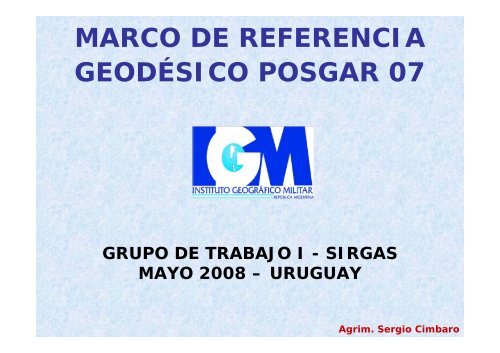
MARCO DE REFERENCIA GEODÉSICO POSGAR 07 - SIRGAS
MARCO DE REFERENCIA GEODÉSICO POSGAR 07 - SIRGAS
MARCO DE REFERENCIA GEODÉSICO POSGAR 07 - SIRGAS

Create successful ePaper yourself
Turn your PDF publications into a flip-book with our unique Google optimized e-Paper software.
<strong>MARCO</strong> <strong>DE</strong> <strong>REFERENCIA</strong><br />
<strong>GEODÉSICO</strong> <strong>POSGAR</strong> <strong>07</strong><br />
GRUPO <strong>DE</strong> TRABAJO I - <strong>SIRGAS</strong><br />
MAYO 2008 – URUGUAY<br />
Agrim. Sergio Cimbaro
<strong>POSGAR</strong> 94<br />
Posiciones Geodésicas<br />
Argentinas<br />
Medición, años 93 y 94<br />
127 Puntos<br />
Distancia aprox. 200 km<br />
Procesamiento<br />
software comercial<br />
Vinculado a WGS 84, época<br />
1993.8<br />
Oficializado por el IGM<br />
el 9 de mayo de 1997<br />
Agrim. Sergio Cimbaro
<strong>MARCO</strong>S <strong>DE</strong> <strong>REFERENCIA</strong><br />
Agrim. Sergio Cimbaro
RAMSAC<br />
RED ARGENTINA <strong>DE</strong><br />
MONITOREO SATELITAL<br />
CONTINUO<br />
21 Estaciones GPS Permanentes<br />
Procesadas en el Marco de<br />
<strong>SIRGAS</strong>-CON<br />
Constituida principalmente por<br />
el aporte de Instituciones<br />
Nacionales e Internacionales,<br />
Universidades, Catastros,<br />
Consejos Profesionales y<br />
Empresas Privadas.<br />
Agrim. Sergio Cimbaro
ACTUALIZACIÓN <strong>DE</strong>L <strong>MARCO</strong> <strong>DE</strong><br />
<strong>REFERENCIA</strong> <strong>POSGAR</strong><br />
Procesamiento de al menos 2 años de datos de<br />
las Redes RAMSAC y <strong>SIRGAS</strong> con software<br />
científico (GAMIT-GLOB K), ajuste en el mejor<br />
Marco de Referencia disponible ITRF2005 /<br />
(IGS05).<br />
Remedición de la Red <strong>POSGAR</strong> en el Marco de<br />
la Red RAMSAC<br />
Vinculación al Marco RAMSAC-<strong>POSGAR</strong> de los<br />
distintos Marcos de Referencia adoptados por<br />
las provincias (Posgar 94, Posgar 98, Campo<br />
Inchauspe y otros)<br />
Agrim. Sergio Cimbaro
MEDICIÓN <strong>MARCO</strong><br />
RAMSAC - <strong>POSGAR</strong><br />
36 horas de medición<br />
2 Sesiones independientes<br />
Puntos Provinciales y PASMA<br />
2 a 3 horas por punto<br />
Agrim. Sergio Cimbaro
ACTUALIZACIÓN <strong>DE</strong>L <strong>MARCO</strong> <strong>DE</strong><br />
<strong>REFERENCIA</strong> <strong>POSGAR</strong><br />
La medición se realizó desde junio del año<br />
2005 hasta octubre de 20<strong>07</strong>.<br />
180 puntos pasivos con coordenadas en un<br />
Marco de Referencia único y homogéneo.<br />
436 puntos adicionales vinculados al nuevo<br />
Marco, para poder determinar la integración de<br />
las redes provinciales.<br />
El continuo procesamiento de las estaciones<br />
GPS permanentes a través del Centro<br />
Experimental GMA, junto con los otros centros<br />
permitirá afianzar las coordenadas oficiales.<br />
Agrim. Sergio Cimbaro
ESTRATEGIA <strong>DE</strong> PROCESAMIENTO<br />
EN GLOB K<br />
Cálculo de la repetitividad de<br />
coordenadas por estación<br />
Estudio de errores no detectados en el<br />
procesamiento “outliers”<br />
Combinación de soluciones diarias en una<br />
sola solución combinada<br />
Incorporación del Marco de Referencia a<br />
la solución combinada<br />
Agrim. Sergio Cimbaro
ANÁLISIS <strong>DE</strong> REPETITIVIDAD<br />
Agrim. Sergio Cimbaro
<strong>MARCO</strong><br />
RAMSAC-<strong>POSGAR</strong> <strong>07</strong><br />
Estaciones GPS permanentes<br />
Puntos <strong>POSGAR</strong> (remedición<br />
y nuevos), 36 horas.<br />
Marco ITRF2005 (IGS05),<br />
época 20<strong>07</strong><br />
Velocidades IGS – <strong>SIRGAS</strong><br />
Red de orden cero<br />
Agrim. Sergio Cimbaro
<strong>POSGAR</strong> 94<br />
RAMSAC-<strong>POSGAR</strong> <strong>07</strong><br />
Agrim. Sergio Cimbaro
ENTRE RÍOS<br />
7 puntos <strong>POSGAR</strong> <strong>07</strong><br />
13 puntos PASMA<br />
12 puntos Red Provincial<br />
22 puntos en total<br />
PASMA<br />
Dif Lat.: -0.669 m<br />
Dif Long: -0.006 m<br />
Dif. Alt. Elip.: 0.422 m<br />
RED PROVINCIAL<br />
Dif Lat.: -0.620 m<br />
Dif Long: 0.051 m<br />
Dif. Alt. Elip.: 0.405 m<br />
Agrim. Sergio Cimbaro
Residuos (m)<br />
ENTRE RÍOS<br />
Ajuste de la red PAPCUS al Marco <strong>POSGAR</strong> <strong>07</strong><br />
0.20<br />
0.10<br />
0.00<br />
-0.10<br />
-0.20<br />
Residuos de la Transformación entre la<br />
Red Provincial PAPCUS y <strong>POSGAR</strong><br />
FELI PF68 0060 0050 0046 0039 PF74 GCHU PF02 KPLN VLNE P01A<br />
Puntos comunes<br />
Red Provincial PAPCUS - <strong>POSGAR</strong><br />
X<br />
Y<br />
Z<br />
Agrim. Sergio Cimbaro
Desvíos (m)<br />
ENTRE RÍOS<br />
Ajuste de la red PAPCUS al Marco <strong>POSGAR</strong> <strong>07</strong><br />
0.15<br />
0.10<br />
0.05<br />
0.00<br />
-0.05<br />
-0.10<br />
-0.15<br />
Residuos de la Transformación entre la<br />
Red Provincial PAPCUS y <strong>POSGAR</strong><br />
FELI PF68 0060 0050 0046 0039 PF74 GCHU PF02 KPLN VLNE P01A<br />
Puntos comunes<br />
Red Provincial PAPCUS - <strong>POSGAR</strong><br />
Latitud<br />
Longitud<br />
Alt. Elipsoidal<br />
Agrim. Sergio Cimbaro
Residuos (m)<br />
ENTRE RÍOS<br />
Ajuste de la red PASMA al Marco <strong>POSGAR</strong> <strong>07</strong><br />
0.20<br />
0.15<br />
0.10<br />
0.05<br />
0.00<br />
-0.05<br />
-0.10<br />
-0.15<br />
-0.20<br />
Residuos de la Transformación entre la<br />
Red PASMA y <strong>POSGAR</strong><br />
1029 1031 1016 1022 1006 1004 1002 1005 1009 1018 1026 1024<br />
Puntos comunes PASMA - <strong>POSGAR</strong><br />
X<br />
Y<br />
Z<br />
Agrim. Sergio Cimbaro
Desvíos (m)<br />
ENTRE RÍOS<br />
Ajuste de la red PASMA al Marco <strong>POSGAR</strong> <strong>07</strong><br />
0.15<br />
0.10<br />
0.05<br />
0.00<br />
-0.05<br />
-0.10<br />
-0.15<br />
Residuos de la Transformación entre la<br />
Red PASMA y <strong>POSGAR</strong><br />
1029 1031 1016 1022 1006 1004 1002 1005 1009 1018 1026 1024<br />
Puntos comunes PASMA - <strong>POSGAR</strong><br />
Latitud<br />
Longitud<br />
Alt. Elipsoidal<br />
Agrim. Sergio Cimbaro
Desvíos (m)<br />
Desvíos (m)<br />
0.15<br />
0.10<br />
0.05<br />
0.00<br />
-0.05<br />
-0.10<br />
-0.15<br />
0.15<br />
0.10<br />
0.05<br />
0.00<br />
-0.05<br />
-0.10<br />
-0.15<br />
Residuos de la Transformación entre la<br />
Red Provincial PAPCUS y <strong>POSGAR</strong><br />
FELI PF68 0060 0050 0046 0039 PF74 GCHU PF02 KPLN VLNE P01A<br />
Puntos comunes<br />
Red Provincial PAPCUS - <strong>POSGAR</strong><br />
Residuos de la Transformación entre la<br />
Red PASMA y <strong>POSGAR</strong><br />
1029 1031 1016 1022 1006 1004 1002 1005 1009 1018 1026 1024<br />
Puntos comunes PASMA - <strong>POSGAR</strong><br />
Latitud<br />
Longitud<br />
Alt. Elipsoidal<br />
Latitud<br />
Longitud<br />
Alt. Elipsoidal<br />
ENTRE RÍOS<br />
Ajustes de las redes<br />
PAPCUS y PASMA al<br />
Marco <strong>POSGAR</strong><br />
Ajuste<br />
PAPCUS-<strong>POSGAR</strong><br />
+/- 0.18 m<br />
Ajuste<br />
PASMA-<strong>POSGAR</strong><br />
+/- 0.05 m<br />
Agrim. Sergio Cimbaro
PUNTOS<br />
BUENOS AIRES<br />
Equipos de medición:<br />
IGM<br />
UBA<br />
CPA<br />
Dirección de<br />
Geodesia<br />
UNLP<br />
4 Red RAMSAC<br />
9 Red <strong>POSGAR</strong><br />
39-65 Red GEOBA<br />
5 Red PASMA<br />
Agrim. Sergio Cimbaro
Desvíos (m)<br />
BUENOS AIRES<br />
Ajuste de la red GEOBA al Marco <strong>POSGAR</strong> <strong>07</strong><br />
0.100<br />
0.050<br />
0.000<br />
-0.050<br />
-0.100<br />
JUNI<br />
<strong>DE</strong>SVÍOS TRANSFORMACIÓN 7 PARÁMETROS<br />
<strong>POSGAR</strong> <strong>07</strong> - RED GEOBA (BUENOS AIRES)<br />
PNIR<br />
CPAT<br />
GMA1<br />
INPE<br />
LPGS<br />
VBCA<br />
Puntos Comunes <strong>POSGAR</strong> <strong>07</strong> - GEOBA<br />
BELL<br />
ARR0<br />
Agrim. Sergio Cimbaro<br />
X<br />
Y<br />
Z
CONCLUSIONES<br />
A partir del año 2008 Argentina tendrá un Marco<br />
de Referencia Geodésico Nacional vinculado a<br />
ITRF2005/(IGS05) y en concordancia con las<br />
directivas de <strong>SIRGAS</strong>, basado en las estaciones<br />
GPS permanentes de la Red RAMSAC.<br />
El nuevo Marco integra a todos los puntos de las<br />
redes Geodésicas provinciales y PASMA.<br />
El nuevo Marco permitirá el uso de los puntos<br />
“pasivos” por parte de todos los usuarios, con la<br />
precisión suficiente para aplicaciones topográficas<br />
y geodésicas.<br />
Agrim. Sergio Cimbaro
MUCHAS GRACIAS !!!!<br />
REUNIÓN <strong>SIRGAS</strong> 2008<br />
MAYO 2008 – URUGUAY<br />
Agrim. Sergio Cimbaro