
You also want an ePaper? Increase the reach of your titles
YUMPU automatically turns print PDFs into web optimized ePapers that Google loves.
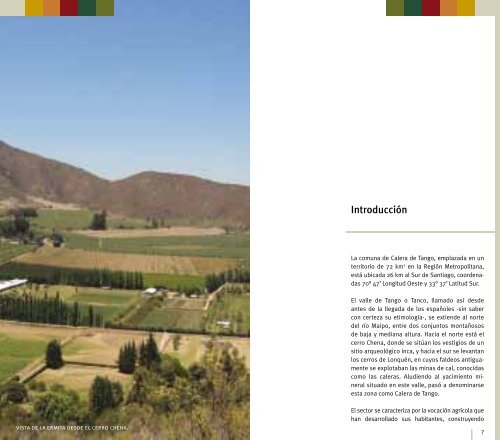
vista <strong>de</strong> la ermita <strong>de</strong>s<strong>de</strong> el cerro chena.<br />
Introducción<br />
La comuna <strong>de</strong> <strong>Calera</strong> <strong>de</strong> <strong>Tango</strong>, emplazada en un<br />
territorio <strong>de</strong> 72 km 2 en la Región Metropolitana,<br />
está ubicada 26 km al Sur <strong>de</strong> Santiago, coor<strong>de</strong>nadas<br />
70° 47’ Longitud Oeste y 33° 37’ Latitud Sur.<br />
El valle <strong>de</strong> <strong>Tango</strong> o Tanco, llamado así <strong>de</strong>s<strong>de</strong><br />
antes <strong>de</strong> la llegada <strong>de</strong> los españoles -sin saber<br />
con certeza su etimología-, se extien<strong>de</strong> al norte<br />
<strong>de</strong>l río Maipo, entre dos conjuntos montañosos<br />
<strong>de</strong> baja y mediana altura. Hacia el norte está el<br />
cerro Chena, don<strong>de</strong> se sitúan los vestigios <strong>de</strong> un<br />
sitio arqueológico inca, y hacia el sur se levantan<br />
los cerros <strong>de</strong> Lonquén, en cuyos fal<strong>de</strong>os antiguamente<br />
se explotaban las minas <strong>de</strong> cal, conocidas<br />
como las caleras. Aludiendo al yacimiento mineral<br />
situado en este valle, pasó a <strong>de</strong>nominarse<br />
esta zona como <strong>Calera</strong> <strong>de</strong> <strong>Tango</strong>.<br />
El sector se caracteriza por la vocación agrícola que<br />
han <strong>de</strong>sarrollado sus habitantes, construyendo<br />
7